

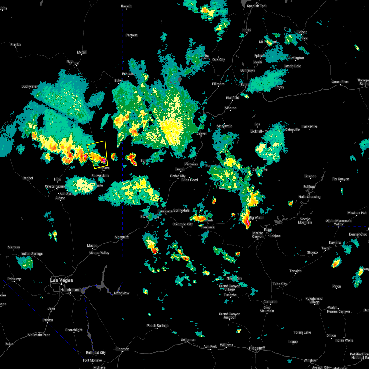
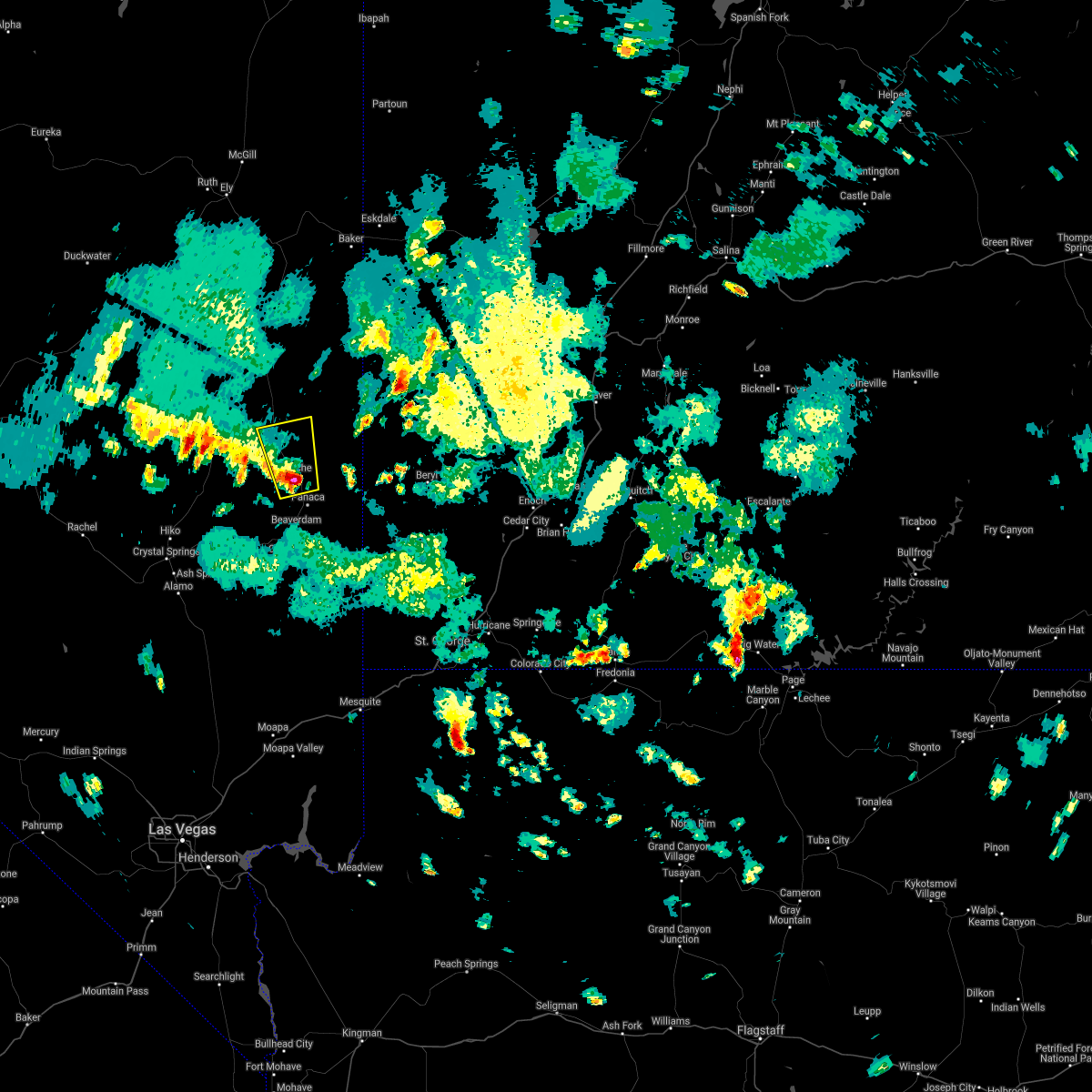
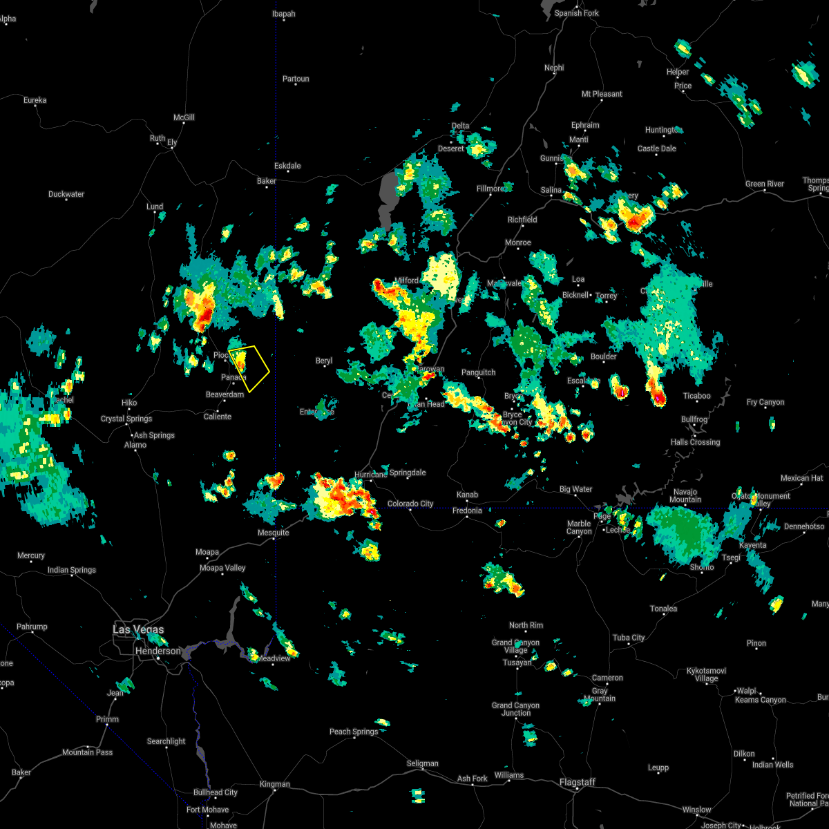
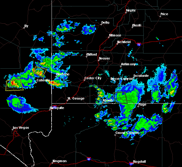
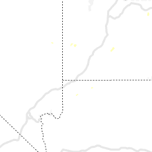
Hail Map for Dry Valley, NV
The Dry Valley, NV area has had 0 reports of on-the-ground hail by trained spotters, and has been under severe weather warnings 0 times during the past 12 months. Doppler radar has detected hail at or near Dry Valley, NV on 7 occasions, including 1 occasion during the past year.
| Name: | Dry Valley, NV |
| Where Located: | 66.6 miles NW of Saint George, UT |
| Map: | Google Map for Dry Valley, NV |
| Population: | 78 |
| Housing Units: | 33 |
| More Info: | Search Google for Dry Valley, NV |
5
The Top Recent Hail Date for Dry Valley, NV is Sunday, August 11, 2024 (1st out of 7)

Hail and Wind Damage Spotted near Dry Valley, NV
| Date / Time | Report Details |
|---|---|
| 8/9/2022 2:55 PM PDT |
 The severe thunderstorm warning for east central lincoln county will expire at 300 pm pdt, the storms which prompted the warning has weakened below severe limits, and no longer poses an immediate threat to life or property. therefore, the warning will be allowed to expire. however gusty winds to 40 mph and heavy rain are still possible with this thunderstorm. seek shelter if you are outside and wait until the storms passes. The severe thunderstorm warning for east central lincoln county will expire at 300 pm pdt, the storms which prompted the warning has weakened below severe limits, and no longer poses an immediate threat to life or property. therefore, the warning will be allowed to expire. however gusty winds to 40 mph and heavy rain are still possible with this thunderstorm. seek shelter if you are outside and wait until the storms passes.
|
| 8/9/2022 2:34 PM PDT |
 At 233 pm pdt, a severe thunderstorm was located over pioche, moving northwest at 15 mph (radar indicated). Hazards include 60 mph wind gusts and pea size hail. Expect damage to roofs and trees. locations impacted include, ursine, pioche, ranch campground, horsethief gulch campground, eagle valley, meadow valley campground, panaca, echo canyon state park and cathedral gorge state park. hail threat, radar indicated max hail size, <. 75 in wind threat, radar indicated max wind gust, 60 mph. At 233 pm pdt, a severe thunderstorm was located over pioche, moving northwest at 15 mph (radar indicated). Hazards include 60 mph wind gusts and pea size hail. Expect damage to roofs and trees. locations impacted include, ursine, pioche, ranch campground, horsethief gulch campground, eagle valley, meadow valley campground, panaca, echo canyon state park and cathedral gorge state park. hail threat, radar indicated max hail size, <. 75 in wind threat, radar indicated max wind gust, 60 mph.
|
| 8/9/2022 2:12 PM PDT |
 At 211 pm pdt, a line of severe thunderstorm was located near pioche through ursine, moving northwest at 15 mph (radar indicated). Hazards include 60 mph wind gusts and pea size hail. expect damage to roofs and trees At 211 pm pdt, a line of severe thunderstorm was located near pioche through ursine, moving northwest at 15 mph (radar indicated). Hazards include 60 mph wind gusts and pea size hail. expect damage to roofs and trees
|
| 8/4/2022 6:09 PM PDT |
 The severe thunderstorm warning for east central lincoln county will expire at 615 pm pdt, the storm which prompted the warning has weakened below severe limits, and no longer poses an immediate threat to life or property. therefore, the warning will be allowed to expire. however gusty winds are still possible with this thunderstorm. The severe thunderstorm warning for east central lincoln county will expire at 615 pm pdt, the storm which prompted the warning has weakened below severe limits, and no longer poses an immediate threat to life or property. therefore, the warning will be allowed to expire. however gusty winds are still possible with this thunderstorm.
|
| 8/4/2022 5:36 PM PDT |
 At 535 pm pdt, a severe thunderstorm was located near panaca, or 9 miles southeast of pioche, moving northwest at 30 mph. trained spotters reported a downed tree in panaca from the strong winds around 530 pm (trained weather spotters). Hazards include 60 mph wind gusts and quarter size hail. Hail damage to vehicles is expected. Expect wind damage to roofs and trees. At 535 pm pdt, a severe thunderstorm was located near panaca, or 9 miles southeast of pioche, moving northwest at 30 mph. trained spotters reported a downed tree in panaca from the strong winds around 530 pm (trained weather spotters). Hazards include 60 mph wind gusts and quarter size hail. Hail damage to vehicles is expected. Expect wind damage to roofs and trees.
|
| 8/4/2022 5:28 PM PDT |
 At 528 pm pdt, a severe thunderstorm was located near panaca, or 12 miles southeast of pioche, moving northwest at 25 mph (radar indicated). Hazards include 60 mph wind gusts and quarter size hail. Hail damage to vehicles is expected. Expect wind damage to roofs and trees. At 528 pm pdt, a severe thunderstorm was located near panaca, or 12 miles southeast of pioche, moving northwest at 25 mph (radar indicated). Hazards include 60 mph wind gusts and quarter size hail. Hail damage to vehicles is expected. Expect wind damage to roofs and trees.
|
| 7/28/2022 4:00 PM PDT |
 At 400 pm pdt, a severe thunderstorm was located near panaca, or 10 miles northeast of caliente, moving southwest at 30 mph (radar indicated). Hazards include 60 mph wind gusts and quarter size hail. Hail damage to vehicles is expected. Expect wind damage to roofs and trees. At 400 pm pdt, a severe thunderstorm was located near panaca, or 10 miles northeast of caliente, moving southwest at 30 mph (radar indicated). Hazards include 60 mph wind gusts and quarter size hail. Hail damage to vehicles is expected. Expect wind damage to roofs and trees.
|
| 7/26/2021 5:07 PM PDT |
 The severe thunderstorm warning for east central lincoln county will expire at 515 pm pdt, the storm which prompted the warning has weakened below severe limits, and has exited the warned area. therefore, the warning will be allowed to expire. The severe thunderstorm warning for east central lincoln county will expire at 515 pm pdt, the storm which prompted the warning has weakened below severe limits, and has exited the warned area. therefore, the warning will be allowed to expire.
|
| 7/26/2021 4:56 PM PDT |
 At 456 pm pdt, a severe thunderstorm was located near pioche, moving north at 10 mph (radar indicated). Hazards include 60 mph wind gusts and quarter size hail. Hail damage to vehicles is expected. expect wind damage to roofs and trees. Locations impacted include, pioche. At 456 pm pdt, a severe thunderstorm was located near pioche, moving north at 10 mph (radar indicated). Hazards include 60 mph wind gusts and quarter size hail. Hail damage to vehicles is expected. expect wind damage to roofs and trees. Locations impacted include, pioche.
|
| 7/26/2021 4:34 PM PDT |
 At 434 pm pdt, a severe thunderstorm was located over pioche, moving north at 15 mph (radar indicated). Hazards include 60 mph wind gusts and quarter size hail. Hail damage to vehicles is expected. Expect wind damage to roofs and trees. At 434 pm pdt, a severe thunderstorm was located over pioche, moving north at 15 mph (radar indicated). Hazards include 60 mph wind gusts and quarter size hail. Hail damage to vehicles is expected. Expect wind damage to roofs and trees.
|
| 7/26/2021 2:42 PM PDT |
 The severe thunderstorm warning for northeastern lincoln county will expire at 245 pm pdt, the storm which prompted the warning has weakened below severe limits, and no longer poses an immediate threat to life or property. therefore, the warning will be allowed to expire. The severe thunderstorm warning for northeastern lincoln county will expire at 245 pm pdt, the storm which prompted the warning has weakened below severe limits, and no longer poses an immediate threat to life or property. therefore, the warning will be allowed to expire.
|
| 7/26/2021 2:20 PM PDT |
 At 219 pm pdt, a severe thunderstorm was located over echo canyon state park, or 7 miles east of pioche, moving west at 10 mph (radar indicated). Hazards include 60 mph wind gusts and quarter size hail. Hail damage to vehicles is expected. expect wind damage to roofs and trees. Locations impacted include, ursine and echo canyon state park. At 219 pm pdt, a severe thunderstorm was located over echo canyon state park, or 7 miles east of pioche, moving west at 10 mph (radar indicated). Hazards include 60 mph wind gusts and quarter size hail. Hail damage to vehicles is expected. expect wind damage to roofs and trees. Locations impacted include, ursine and echo canyon state park.
|
| 7/26/2021 2:05 PM PDT |
 At 204 pm pdt, a severe thunderstorm was located over echo canyon state park, or near ursine, moving southwest at 5 mph (radar indicated). Hazards include 60 mph wind gusts and quarter size hail. Hail damage to vehicles is expected. Expect wind damage to roofs and trees. At 204 pm pdt, a severe thunderstorm was located over echo canyon state park, or near ursine, moving southwest at 5 mph (radar indicated). Hazards include 60 mph wind gusts and quarter size hail. Hail damage to vehicles is expected. Expect wind damage to roofs and trees.
|
| 7/13/2021 5:08 PM PDT |
 The severe thunderstorm warning for central lincoln and nye counties will expire at 515 pm pdt, the storm which prompted the warning has weakened below severe limits, and no longer poses an immediate threat to life or property. therefore, the warning will be allowed to expire. however gusty winds up to 50 mph are still possible with this thunderstorm. The severe thunderstorm warning for central lincoln and nye counties will expire at 515 pm pdt, the storm which prompted the warning has weakened below severe limits, and no longer poses an immediate threat to life or property. therefore, the warning will be allowed to expire. however gusty winds up to 50 mph are still possible with this thunderstorm.
|
| 7/13/2021 4:19 PM PDT |
 At 418 pm pdt, a severe thunderstorm was located 20 miles west of pioche, moving east at 40 mph (radar indicated). Hazards include 60 mph wind gusts. expect damage to roofs and trees At 418 pm pdt, a severe thunderstorm was located 20 miles west of pioche, moving east at 40 mph (radar indicated). Hazards include 60 mph wind gusts. expect damage to roofs and trees
|
| 7/19/2018 6:06 PM PDT |
 The severe thunderstorm warning for east central lincoln county will expire at 615 pm pdt, the storms which prompted the warning have moved out of the area. therefore, the warning will be allowed to expire. however gusty winds and heavy rain are still possible with these thunderstorms. The severe thunderstorm warning for east central lincoln county will expire at 615 pm pdt, the storms which prompted the warning have moved out of the area. therefore, the warning will be allowed to expire. however gusty winds and heavy rain are still possible with these thunderstorms.
|
| 7/19/2018 5:50 PM PDT |
 At 549 pm pdt, severe thunderstorms were located along a line extending from 16 miles east of ursine to 7 miles south of panaca, moving south at 25 mph (radar indicated). Hazards include 60 mph wind gusts and quarter size hail. Hail damage to vehicles is expected. expect wind damage to roofs and trees. Locations impacted include, ursine, pioche, ranch campground, horsethief gulch campground, eagle valley, meadow valley campground, panaca, echo canyon state park and cathedral gorge state park. At 549 pm pdt, severe thunderstorms were located along a line extending from 16 miles east of ursine to 7 miles south of panaca, moving south at 25 mph (radar indicated). Hazards include 60 mph wind gusts and quarter size hail. Hail damage to vehicles is expected. expect wind damage to roofs and trees. Locations impacted include, ursine, pioche, ranch campground, horsethief gulch campground, eagle valley, meadow valley campground, panaca, echo canyon state park and cathedral gorge state park.
|
| 7/19/2018 5:22 PM PDT |
 At 521 pm pdt, severe thunderstorms were located along a line extending from 12 miles east of ranch campground to cathedral gorge state park, moving south at 20 mph (radar indicated). Hazards include 60 mph wind gusts and quarter to half dollar size hail. Hail damage to vehicles is expected. Expect wind damage to roofs and trees. At 521 pm pdt, severe thunderstorms were located along a line extending from 12 miles east of ranch campground to cathedral gorge state park, moving south at 20 mph (radar indicated). Hazards include 60 mph wind gusts and quarter to half dollar size hail. Hail damage to vehicles is expected. Expect wind damage to roofs and trees.
|
| 8/23/2016 5:08 PM PDT |
 The severe thunderstorm warning for east central lincoln county will expire at 515 pm pdt, the severe thunderstorm which prompted the warning has weakened. therefore the warning will be allowed to expire. however gusty winds and heavy rain are still possible with this thunderstorm. The severe thunderstorm warning for east central lincoln county will expire at 515 pm pdt, the severe thunderstorm which prompted the warning has weakened. therefore the warning will be allowed to expire. however gusty winds and heavy rain are still possible with this thunderstorm.
|
| 8/23/2016 4:57 PM PDT |
 At 457 pm pdt, doppler radar indicated a severe thunderstorm capable of producing quarter size hail and damaging winds in excess of 60 mph. this storm was located near pioche, moving southeast at 20 mph. locations impacted include, pioche, meadow valley campground, echo canyon state park and horsethief gulch campground. At 457 pm pdt, doppler radar indicated a severe thunderstorm capable of producing quarter size hail and damaging winds in excess of 60 mph. this storm was located near pioche, moving southeast at 20 mph. locations impacted include, pioche, meadow valley campground, echo canyon state park and horsethief gulch campground.
|
| 8/23/2016 4:40 PM PDT |
 At 440 pm pdt, doppler radar indicated a severe thunderstorm capable of producing quarter size hail and damaging winds in excess of 60 mph. this storm was located near pioche, and moving southeast at 20 mph. At 440 pm pdt, doppler radar indicated a severe thunderstorm capable of producing quarter size hail and damaging winds in excess of 60 mph. this storm was located near pioche, and moving southeast at 20 mph.
|
| 10/18/2015 1:57 PM PDT | The severe thunderstorm warning for east central lincoln county will expire at 200 pm pdt, the storm which prompted the warning has weakened below severe limits and exited the panaca area. therefore the warning will be allowed to expire. however gusty winds and heavy rain are still possible with this thunderstorm east of ursine. |
| 10/18/2015 1:48 PM PDT |
 At 148 pm pdt, doppler radar continued to indicate a severe thunderstorm capable of producing quarter size hail and damaging winds in excess of 60 mph. this storm was located near panaca, or 13 miles southeast of pioche, moving northeast at 30 mph. locations impacted include, ursine, panaca, meadow valley campground, cathedral gorge state park and echo canyon state park. At 148 pm pdt, doppler radar continued to indicate a severe thunderstorm capable of producing quarter size hail and damaging winds in excess of 60 mph. this storm was located near panaca, or 13 miles southeast of pioche, moving northeast at 30 mph. locations impacted include, ursine, panaca, meadow valley campground, cathedral gorge state park and echo canyon state park.
|
| 10/18/2015 1:27 PM PDT |
 At 127 pm pdt, doppler radar indicated a severe thunderstorm capable of producing quarter size hail and damaging winds in excess of 60 mph. this storm was located 7 miles northeast of caliente, and moving northeast at 30 mph. At 127 pm pdt, doppler radar indicated a severe thunderstorm capable of producing quarter size hail and damaging winds in excess of 60 mph. this storm was located 7 miles northeast of caliente, and moving northeast at 30 mph.
|
| 10/18/2015 11:24 AM PDT |
 The severe thunderstorm warning for east central lincoln county will expire at 1130 am pdt, the storm which prompted the warning has weakened below severe limits, and no longer poses an immediate threat to life or property. therefore the warning will be allowed to expire. however gusty winds and heavy rain are still possible with this thunderstorm as it continues to move northeastward along us-93 toward panaca. The severe thunderstorm warning for east central lincoln county will expire at 1130 am pdt, the storm which prompted the warning has weakened below severe limits, and no longer poses an immediate threat to life or property. therefore the warning will be allowed to expire. however gusty winds and heavy rain are still possible with this thunderstorm as it continues to move northeastward along us-93 toward panaca.
|
| 10/18/2015 11:05 AM PDT |
 At 1105 am pdt, doppler radar continued to indicate a severe thunderstorm capable of producing quarter size hail and destructive winds in excess of 70 mph. this storm was located near caliente, moving northeast at 35 mph. locations impacted include, caliente, panaca, kershaw-ryan campground, cathedral gorge state park and cabin pines campground. At 1105 am pdt, doppler radar continued to indicate a severe thunderstorm capable of producing quarter size hail and destructive winds in excess of 70 mph. this storm was located near caliente, moving northeast at 35 mph. locations impacted include, caliente, panaca, kershaw-ryan campground, cathedral gorge state park and cabin pines campground.
|
| 10/18/2015 10:42 AM PDT |
 At 1042 am pdt, doppler radar indicated a severe thunderstorm capable of producing quarter size hail and destructive winds in excess of 70 mph. this storm was located 9 miles west of cabin pines campground, or 11 miles southwest of caliente, and moving northeast at 35 mph. At 1042 am pdt, doppler radar indicated a severe thunderstorm capable of producing quarter size hail and destructive winds in excess of 70 mph. this storm was located 9 miles west of cabin pines campground, or 11 miles southwest of caliente, and moving northeast at 35 mph.
|
| 8/7/2015 7:48 PM PDT |
 At 747 pm pdt, doppler radar indicated a severe thunderstorm capable of producing quarter size hail and damaging winds in excess of 60 mph. this storm was located near cathedral gorge state park, or near pioche, moving east at 25 mph. a storm spotter in pioche did report dime sized hail around 715 pm. locations impacted include, ursine, pioche, meadow valley campground, eagle valley, ranch campground, cathedral gorge state park, horsethief gulch campground and echo canyon state park. At 747 pm pdt, doppler radar indicated a severe thunderstorm capable of producing quarter size hail and damaging winds in excess of 60 mph. this storm was located near cathedral gorge state park, or near pioche, moving east at 25 mph. a storm spotter in pioche did report dime sized hail around 715 pm. locations impacted include, ursine, pioche, meadow valley campground, eagle valley, ranch campground, cathedral gorge state park, horsethief gulch campground and echo canyon state park.
|
| 8/7/2015 7:19 PM PDT |
 At 719 pm pdt, doppler radar indicated a severe thunderstorm capable of producing quarter size hail and damaging winds in excess of 60 mph. this storm was located over pioche, and moving east at 25 mph. At 719 pm pdt, doppler radar indicated a severe thunderstorm capable of producing quarter size hail and damaging winds in excess of 60 mph. this storm was located over pioche, and moving east at 25 mph.
|
| 6/5/2015 5:08 PM PDT | At 508 pm pdt, doppler radar indicated a severe thunderstorm capable of producing quarter size hail and damaging winds in excess of 60 mph. this storm was located over panaca, or 11 miles southeast of pioche, and moving north at 25 mph. |
Hail Maps for Dry Valley, NV


Connect with Interactive Hail Maps