

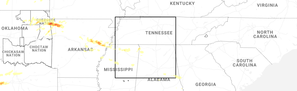
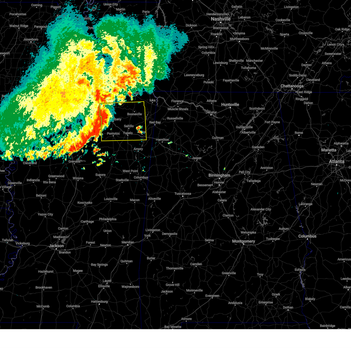
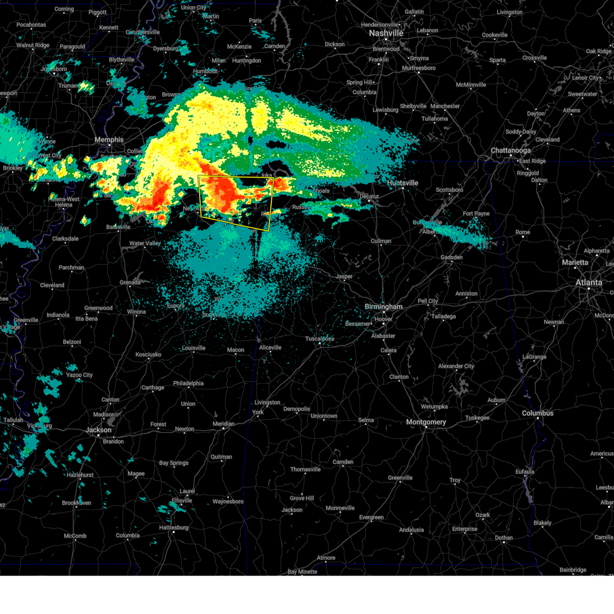
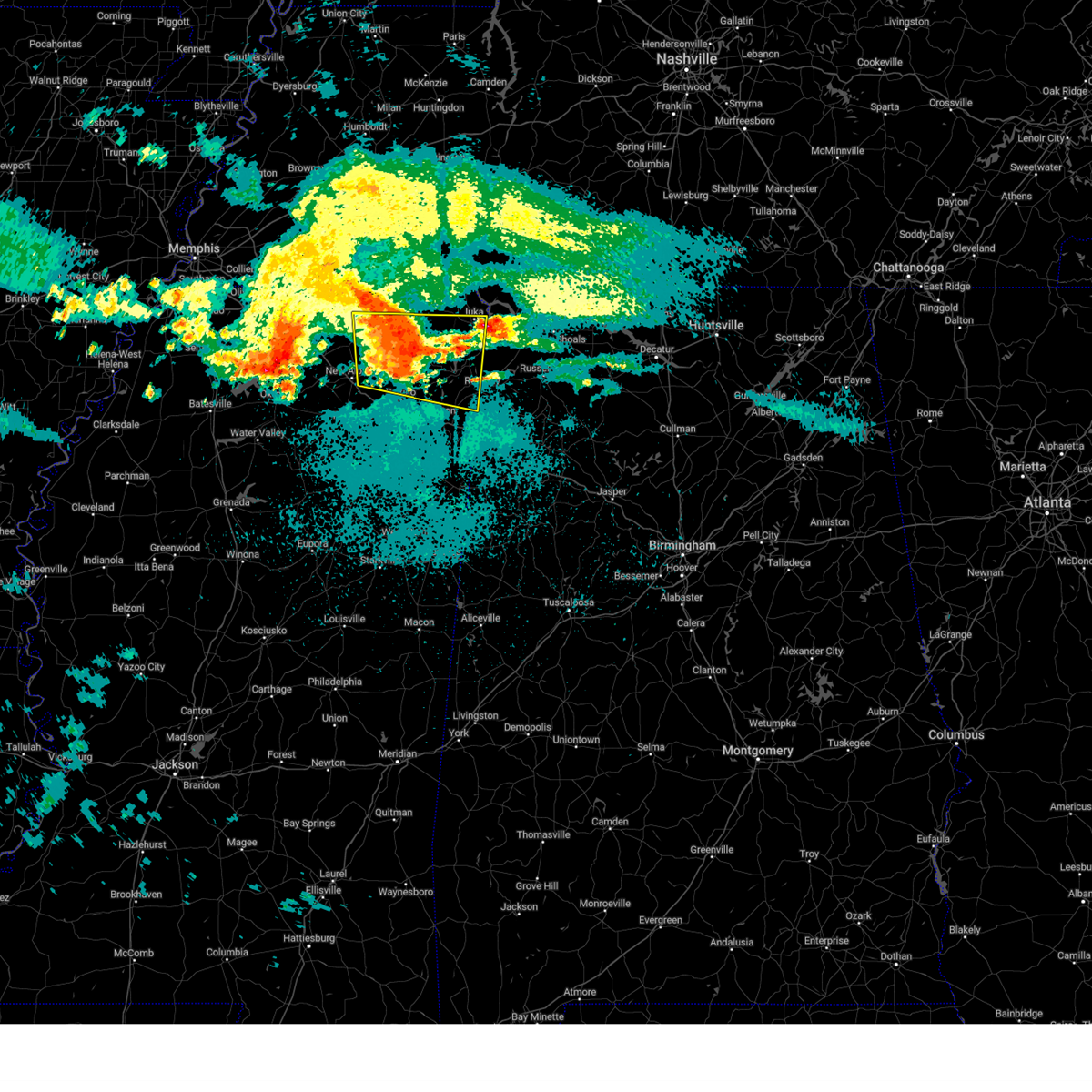
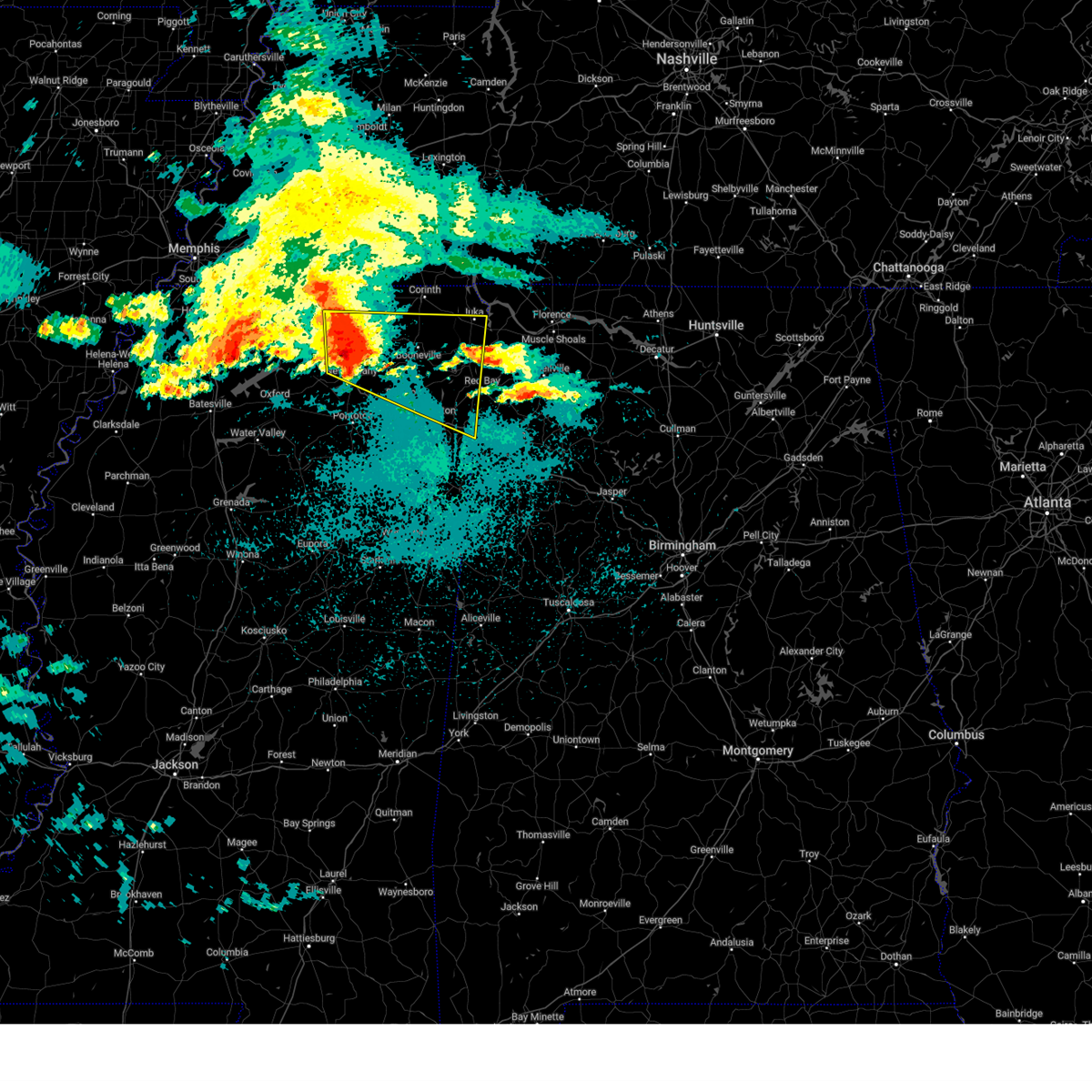
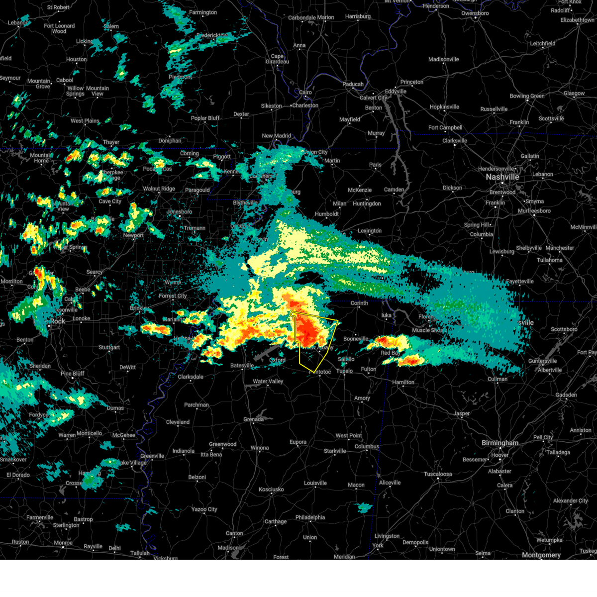
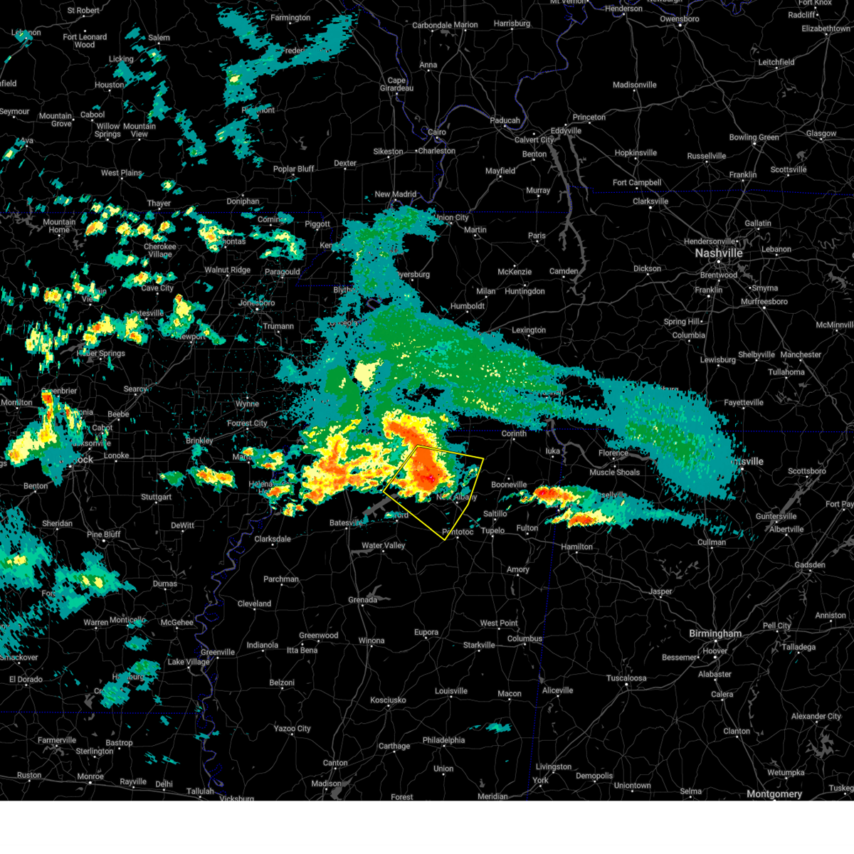
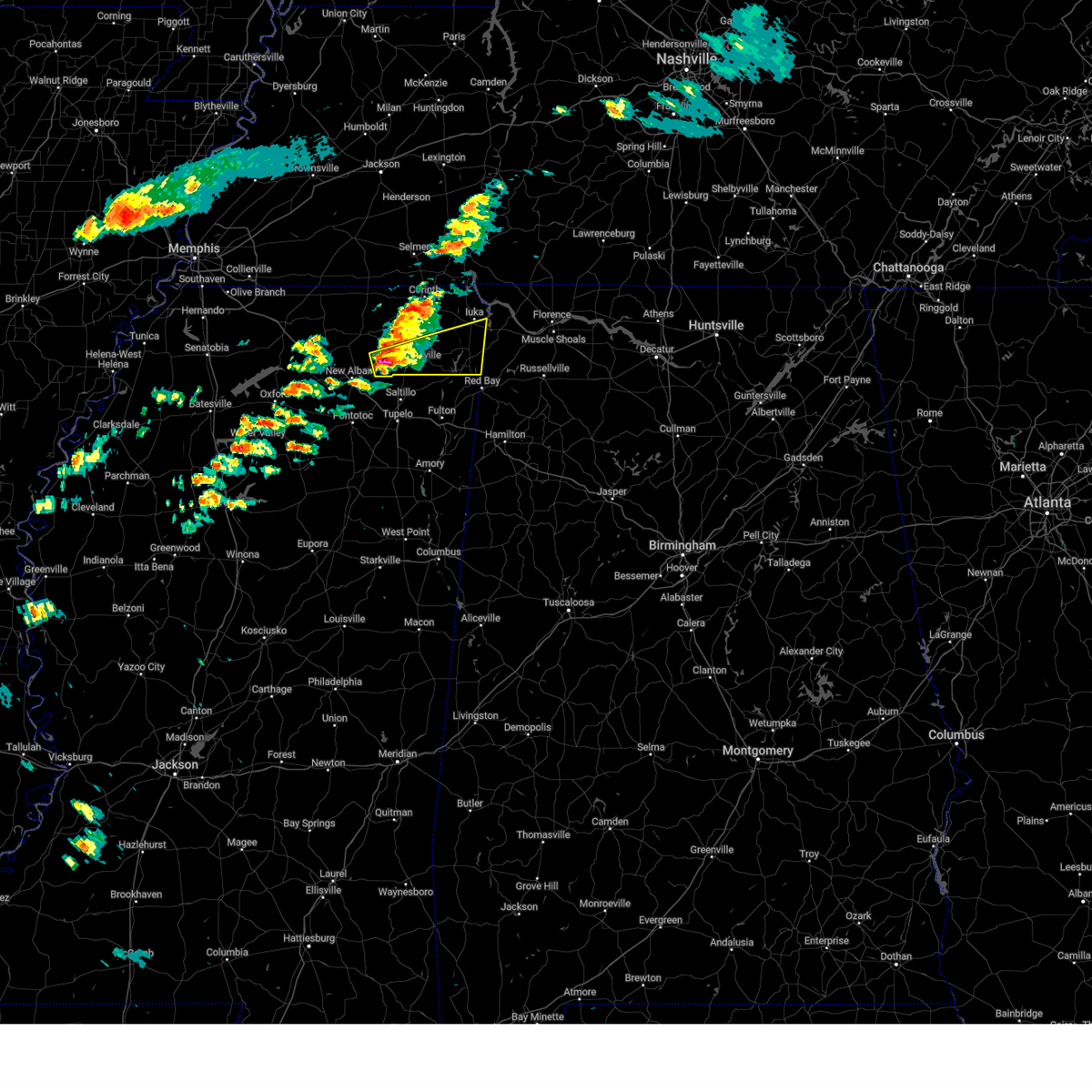
Hail Map for Dumas, MS
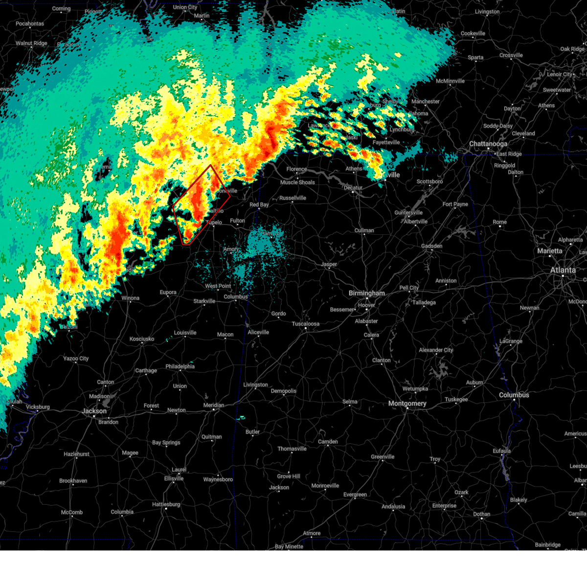
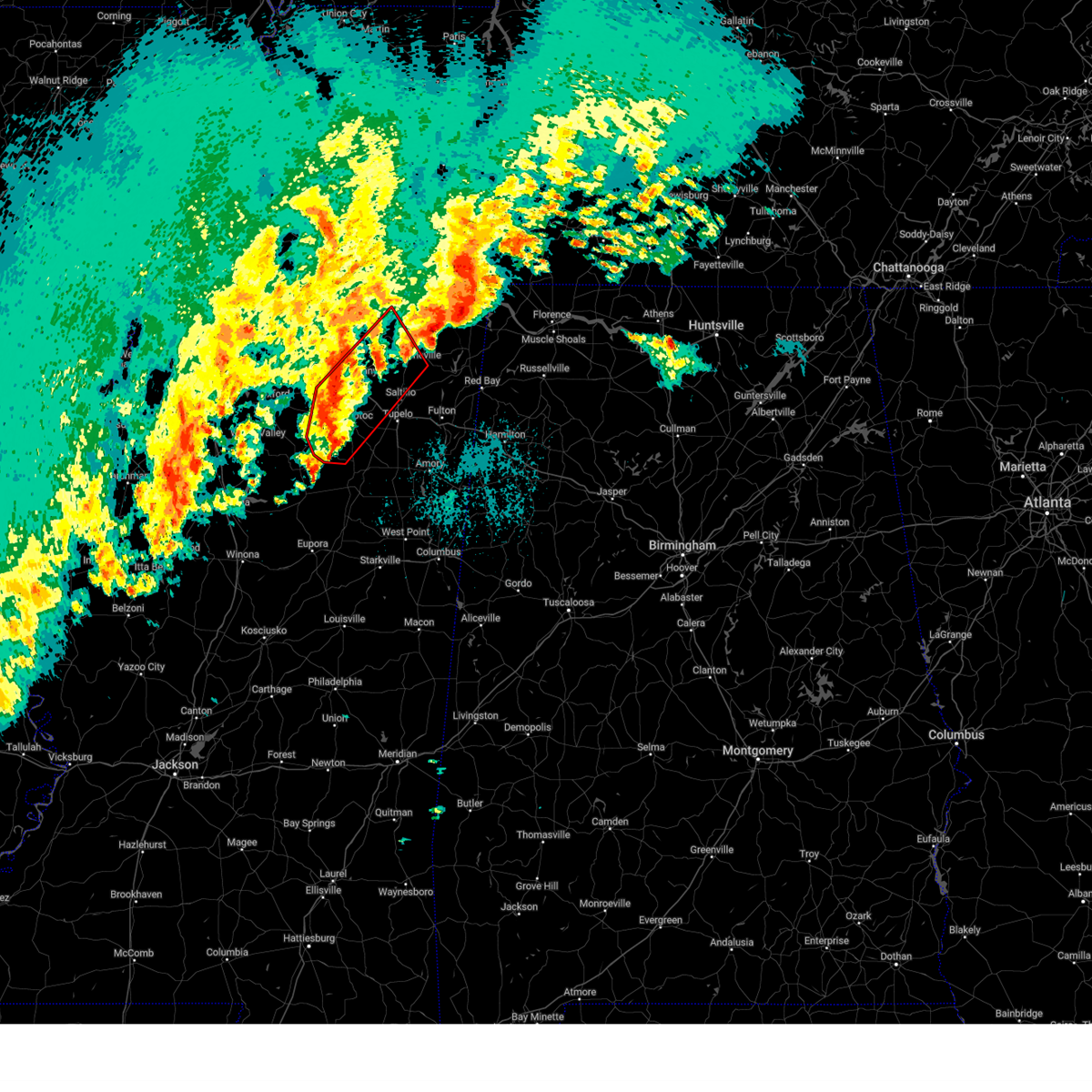
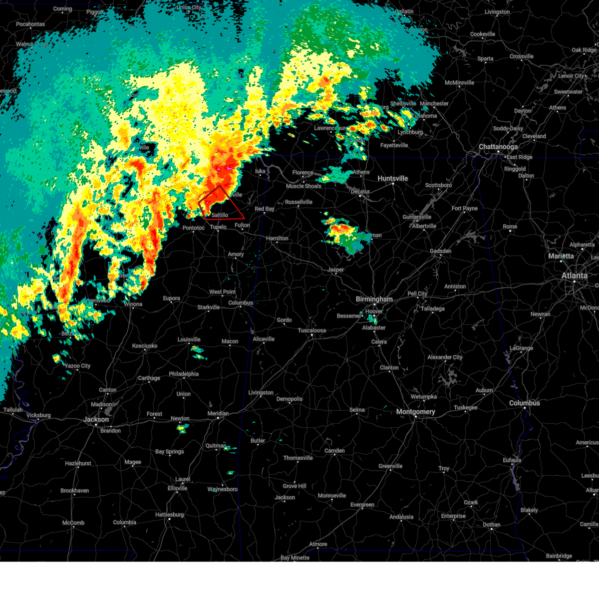
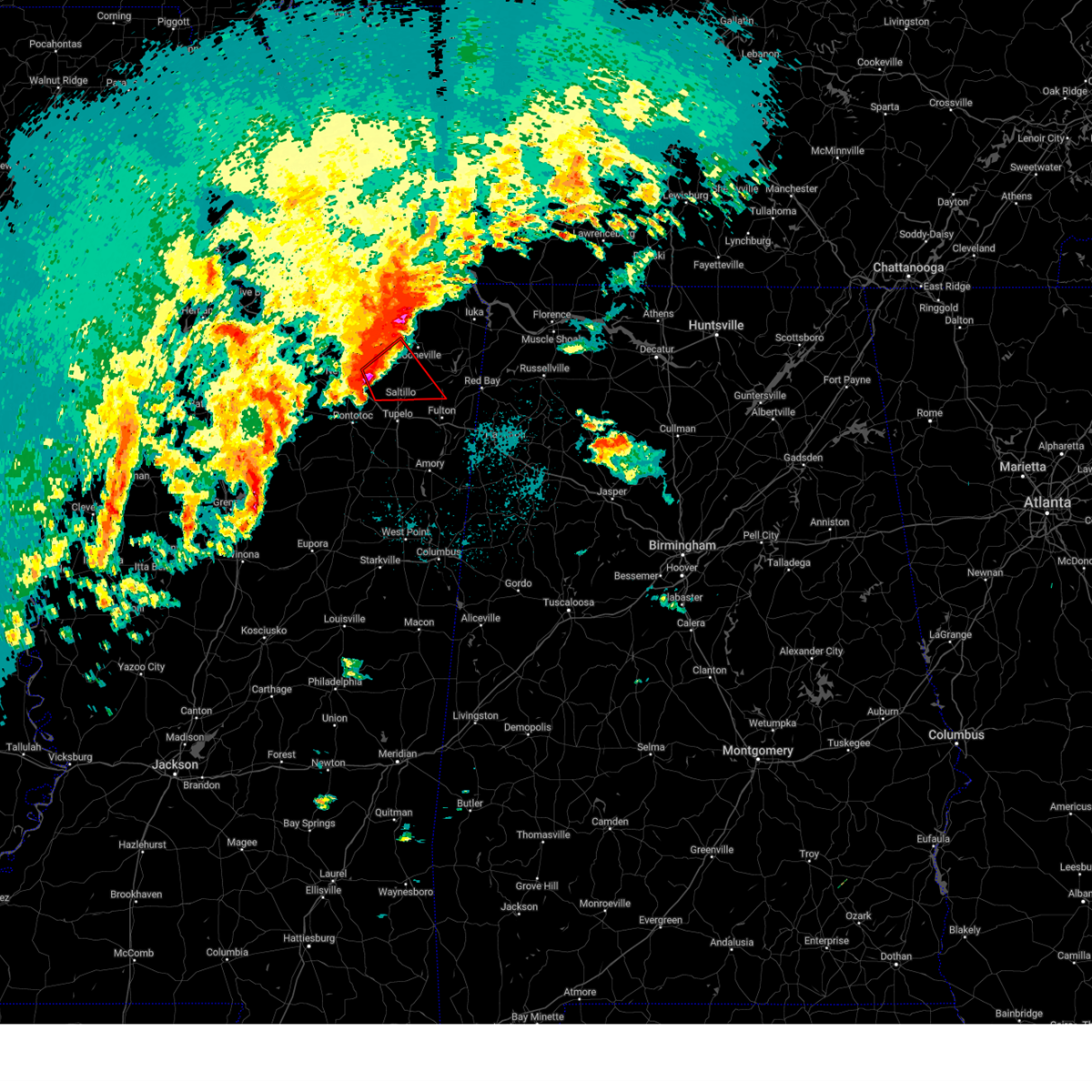
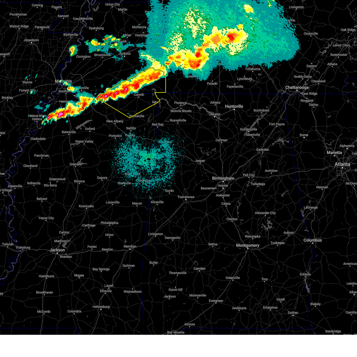
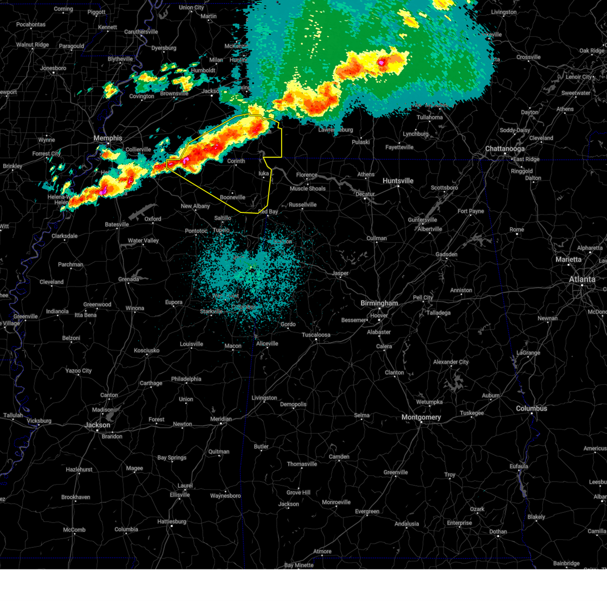
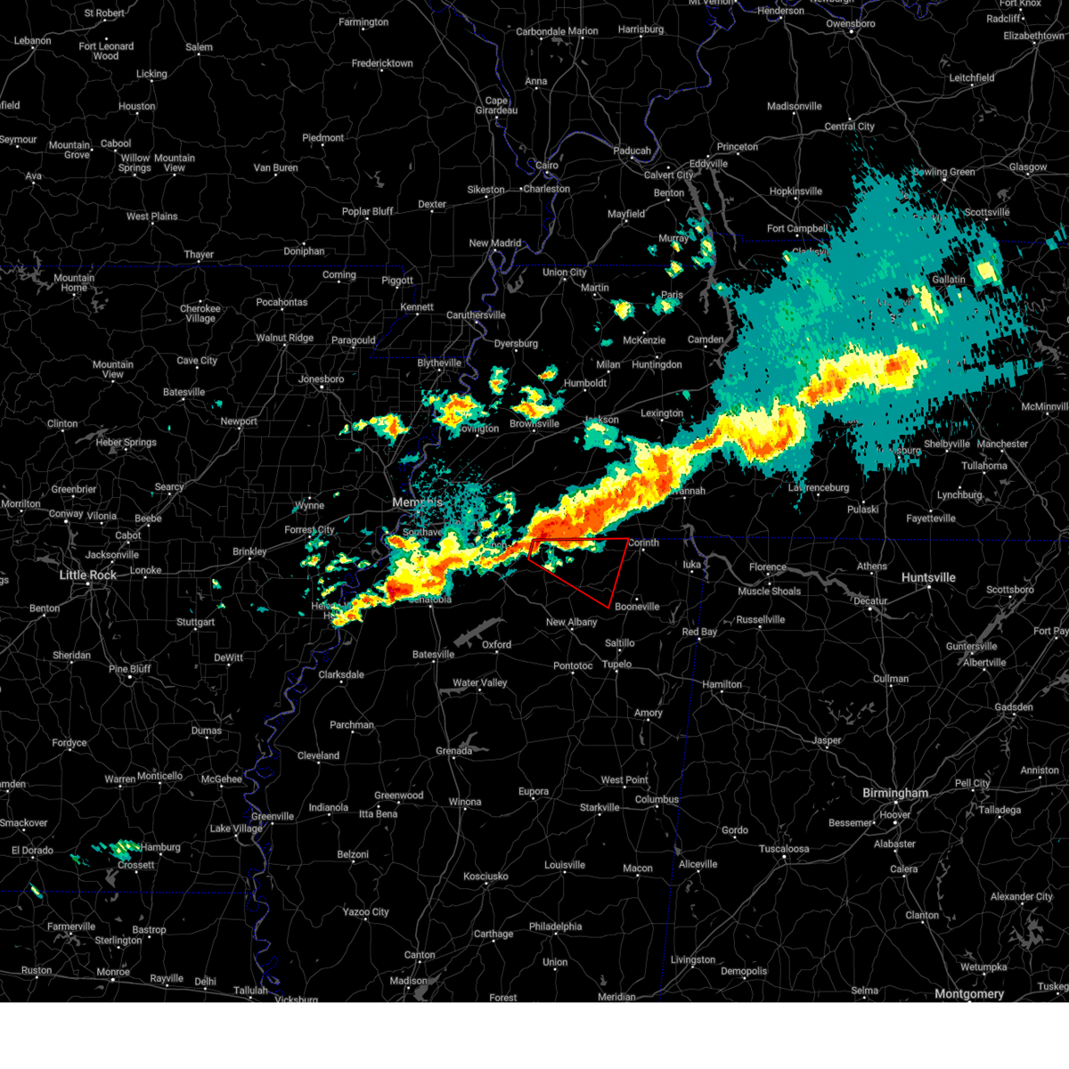
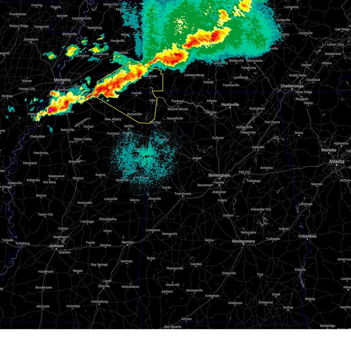
The Dumas, MS area has had 4 reports of on-the-ground hail by trained spotters, and has been under severe weather warnings 51 times during the past 12 months. Doppler radar has detected hail at or near Dumas, MS on 67 occasions, including 7 occasions during the past year.
| Name: | Dumas, MS |
| Where Located: | 67.5 miles W of Florence, AL |
| Map: | Google Map for Dumas, MS |
| Population: | 470 |
| Housing Units: | 192 |
| More Info: | Search Google for Dumas, MS |
4
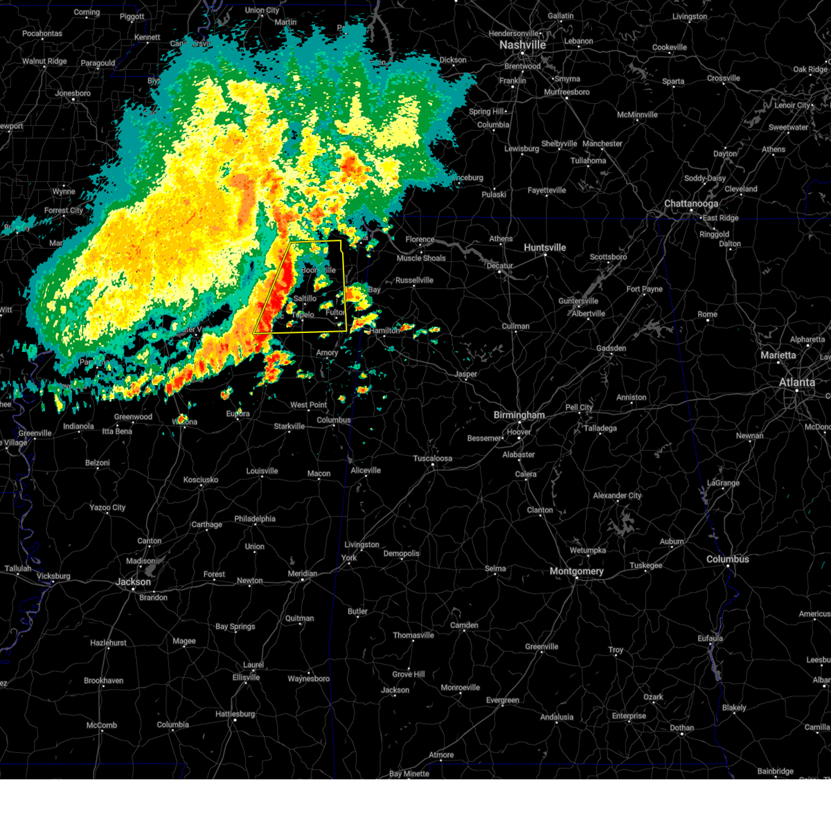
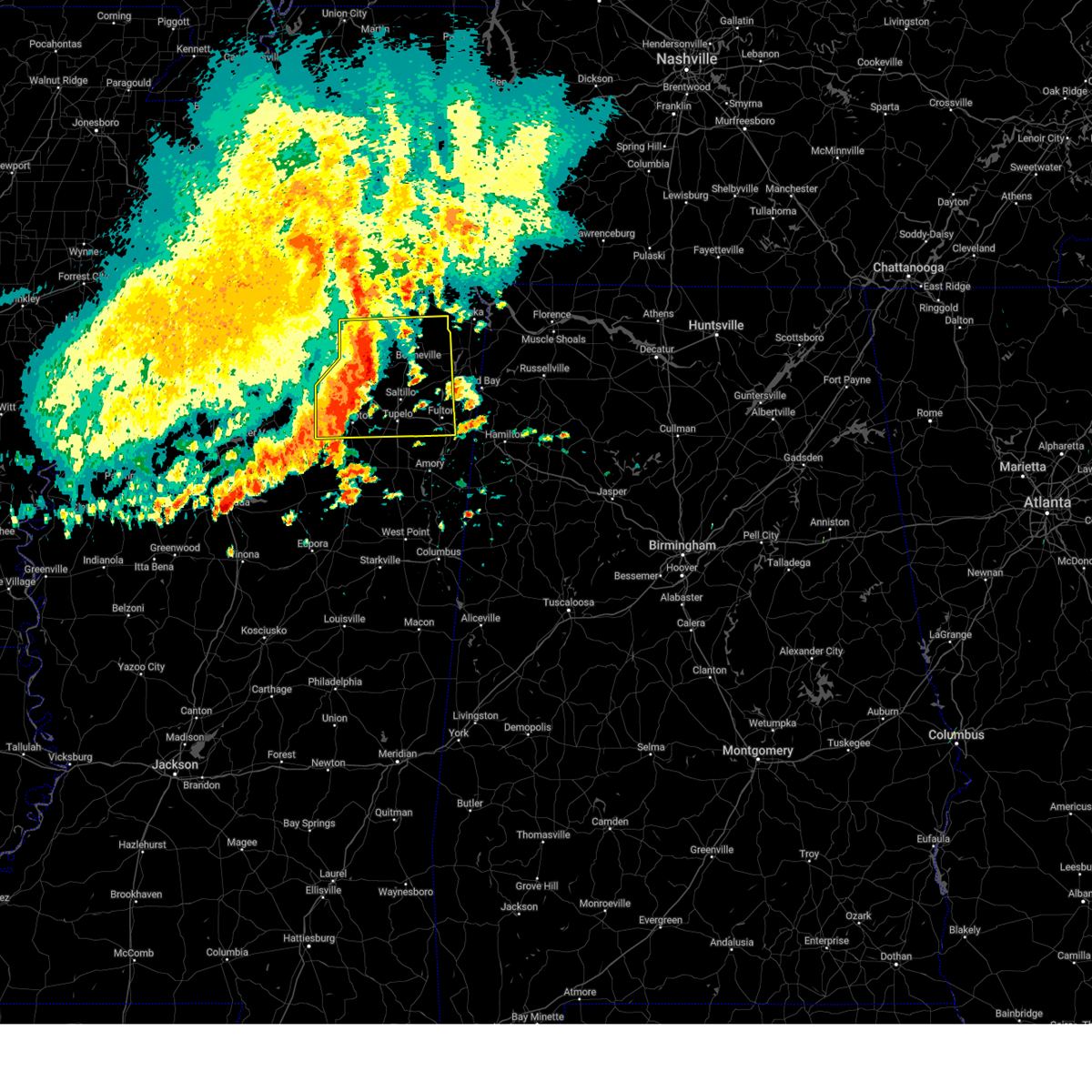
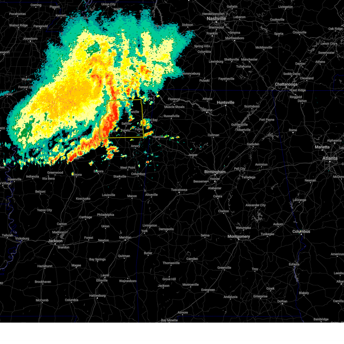
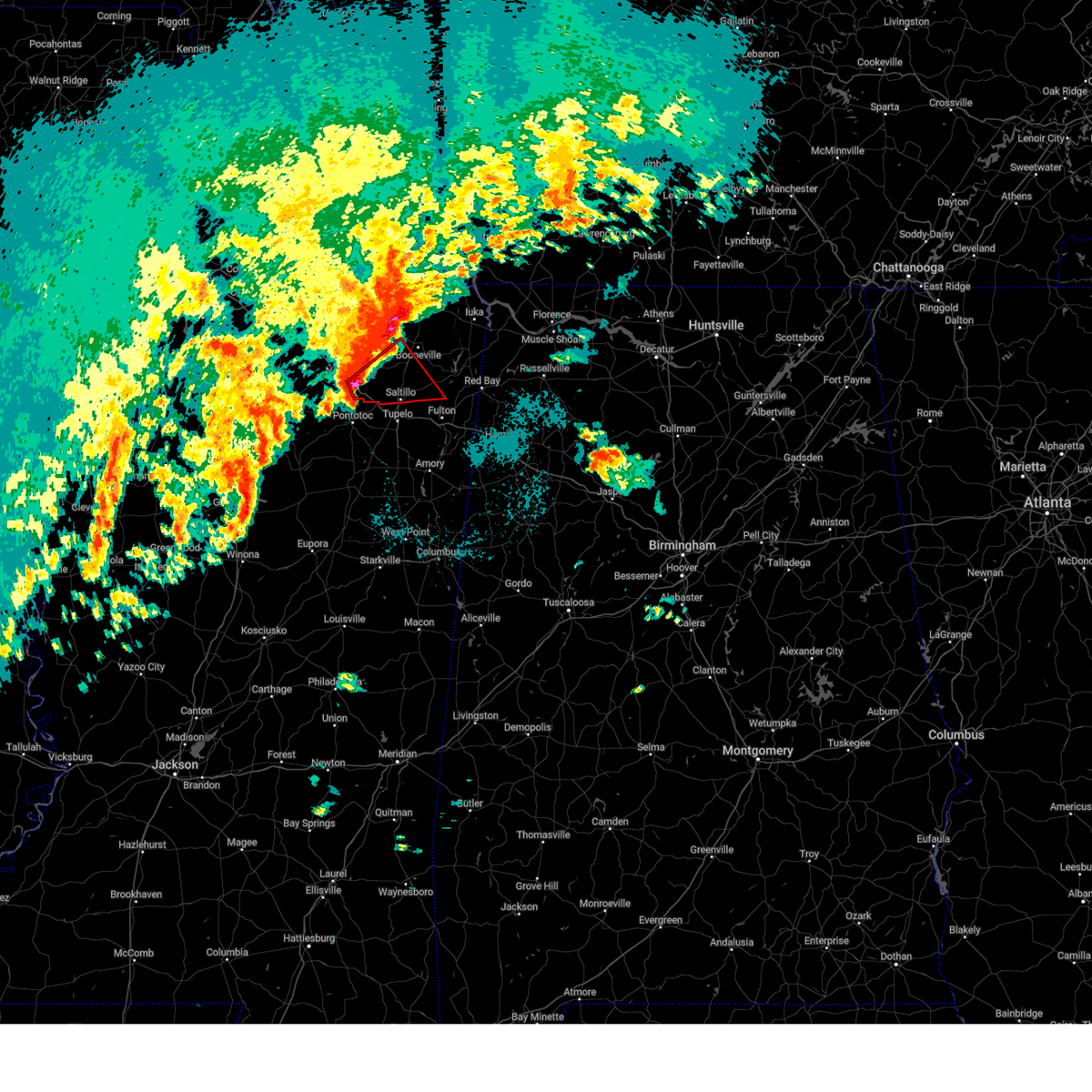
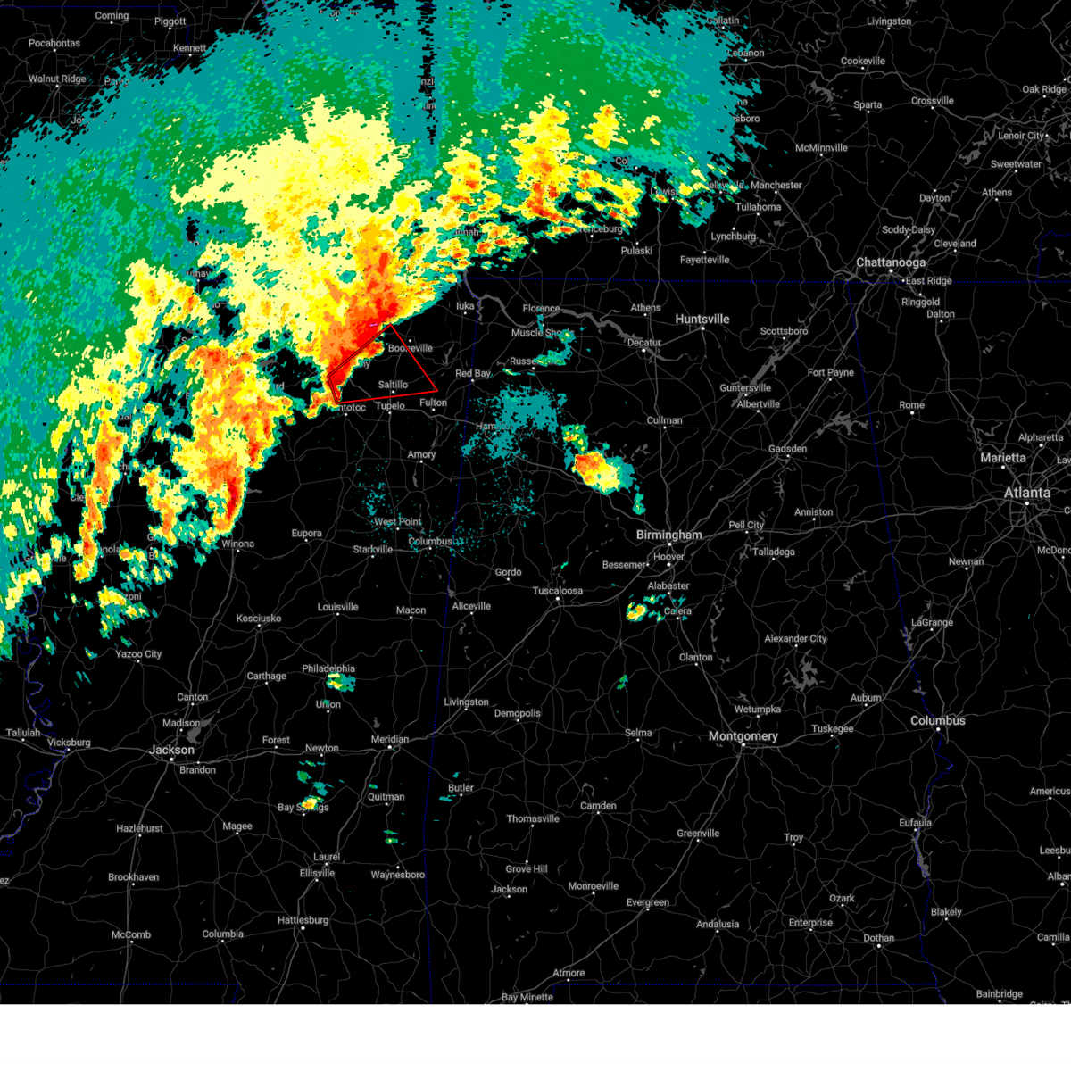
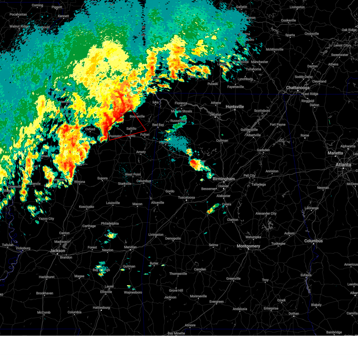
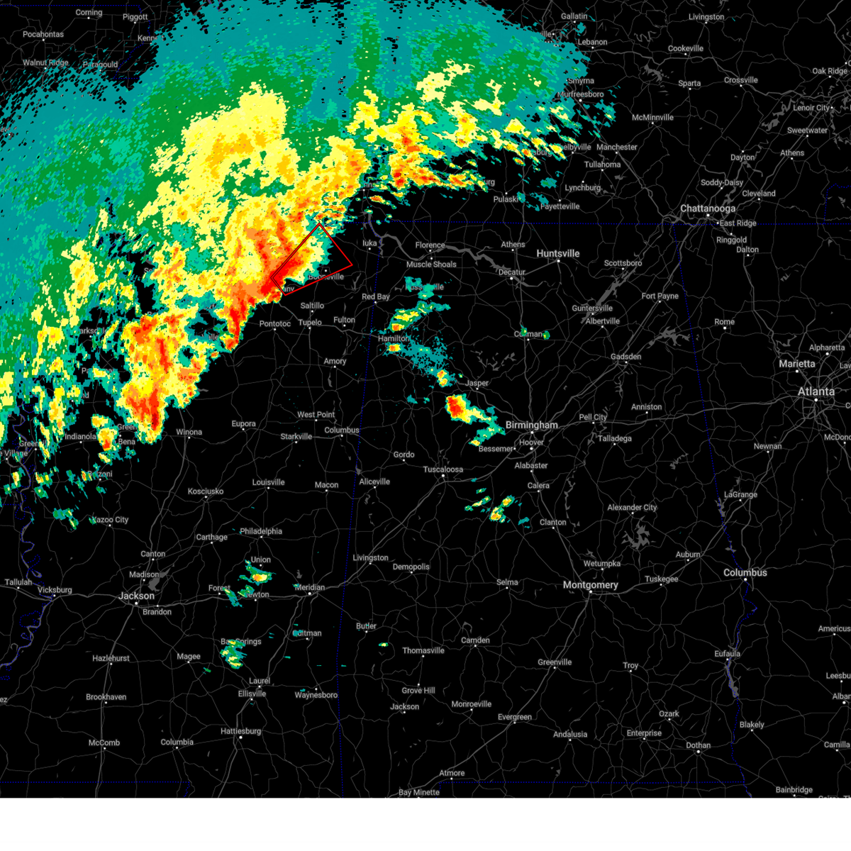
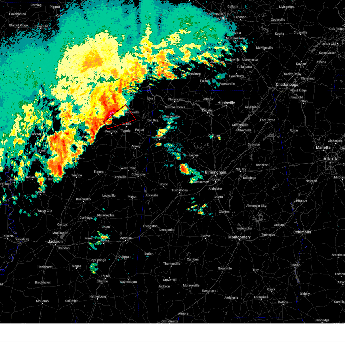
The Top Recent Hail Date for Dumas, MS is Sunday, May 18, 2025 (7th out of 67)
Hail and Wind Damage Spotted near Dumas, MS
| Date / Time | Report Details |
|---|---|
| 6/7/2025 12:04 PM CDT |
 At 1204 pm cdt, a severe thunderstorm was located near baldwyn, moving east at 45 mph (radar indicated). Hazards include 70 mph wind gusts and nickel size hail. Expect considerable tree damage. damage is likely to mobile homes, roofs, and outbuildings. Locations impacted include, tupelo, booneville, new albany, pontotoc, fulton, baldwyn, verona, trace state park, tombigbee state park, saltillo, guntown, plantersville, mantachie, ecru, jumpertown, thrashers, keownville, new harmony, pratts friendship, and troy. At 1204 pm cdt, a severe thunderstorm was located near baldwyn, moving east at 45 mph (radar indicated). Hazards include 70 mph wind gusts and nickel size hail. Expect considerable tree damage. damage is likely to mobile homes, roofs, and outbuildings. Locations impacted include, tupelo, booneville, new albany, pontotoc, fulton, baldwyn, verona, trace state park, tombigbee state park, saltillo, guntown, plantersville, mantachie, ecru, jumpertown, thrashers, keownville, new harmony, pratts friendship, and troy.
|
| 6/7/2025 11:52 AM CDT |
 the severe thunderstorm warning has been cancelled and is no longer in effect the severe thunderstorm warning has been cancelled and is no longer in effect
|
| 6/7/2025 11:52 AM CDT |
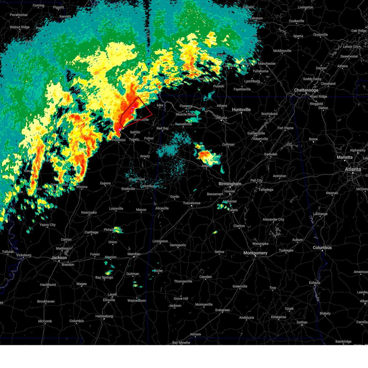
 At 1151 am cdt, a severe thunderstorm was located over keownville, or 8 miles northeast of new albany, moving east at 45 mph (radar indicated). Hazards include 60 mph wind gusts and nickel size hail. Expect damage to roofs, siding, and trees. Locations impacted include, tupelo, booneville, new albany, pontotoc, ripley, fulton, baldwyn, verona, trace state park, tombigbee state park, saltillo, guntown, plantersville, mantachie, blue mountain, ecru, jumpertown, new harmony, pratts friendship, and hinkle. At 1151 am cdt, a severe thunderstorm was located over keownville, or 8 miles northeast of new albany, moving east at 45 mph (radar indicated). Hazards include 60 mph wind gusts and nickel size hail. Expect damage to roofs, siding, and trees. Locations impacted include, tupelo, booneville, new albany, pontotoc, ripley, fulton, baldwyn, verona, trace state park, tombigbee state park, saltillo, guntown, plantersville, mantachie, blue mountain, ecru, jumpertown, new harmony, pratts friendship, and hinkle.
|
| 6/7/2025 11:34 AM CDT |
 Svrmeg the national weather service in memphis has issued a * severe thunderstorm warning for, union county in northeastern mississippi, pontotoc county in northeastern mississippi, northwestern itawamba county in northeastern mississippi, lee county in northeastern mississippi, tippah county in northeastern mississippi, southern benton county in northeastern mississippi, prentiss county in northeastern mississippi, southern alcorn county in northeastern mississippi, * until 1215 pm cdt. * at 1134 am cdt, a severe thunderstorm was located near new albany, moving east at 45 mph (radar indicated). Hazards include 60 mph wind gusts and nickel size hail. expect damage to roofs, siding, and trees Svrmeg the national weather service in memphis has issued a * severe thunderstorm warning for, union county in northeastern mississippi, pontotoc county in northeastern mississippi, northwestern itawamba county in northeastern mississippi, lee county in northeastern mississippi, tippah county in northeastern mississippi, southern benton county in northeastern mississippi, prentiss county in northeastern mississippi, southern alcorn county in northeastern mississippi, * until 1215 pm cdt. * at 1134 am cdt, a severe thunderstorm was located near new albany, moving east at 45 mph (radar indicated). Hazards include 60 mph wind gusts and nickel size hail. expect damage to roofs, siding, and trees
|
| 5/25/2025 7:34 PM CDT | At 734 pm cdt, severe thunderstorms were located along a line extending from near collinwood to near j p coleman state park to wheeler, moving east at 60 mph (radar indicated). Hazards include 60 mph wind gusts and quarter size hail. Hail damage to vehicles is expected. expect wind damage to roofs, siding, and trees. Locations impacted include, iuka, pickwick dam, blythe crossing, rienzi, bruton branch, thrashers, pickwick landing state park, carter branch, hazard switch, midway, petertown, neil, tishomingo, bacon springs, damon, blackland, booneville, childers hill, center star, and kendrick. |
| 5/25/2025 7:34 PM CDT | the severe thunderstorm warning has been cancelled and is no longer in effect |
| 5/25/2025 7:26 PM CDT | the severe thunderstorm warning has been cancelled and is no longer in effect |
| 5/25/2025 7:26 PM CDT | At 726 pm cdt, severe thunderstorms were located along a line extending from 6 miles southwest of collinwood to near j p coleman state park to 6 miles west of wheeler, moving east at 60 mph (radar indicated). Hazards include 60 mph wind gusts and quarter size hail. Hail damage to vehicles is expected. expect wind damage to roofs, siding, and trees. Locations impacted include, iuka, pickwick dam, blythe crossing, rienzi, bruton branch, thrashers, pickwick landing state park, carter branch, acton, hazard switch, hurley, walkertown, midway, petertown, corinth, neil, chambers, tishomingo, bacon springs, and kossuth. |
| 5/25/2025 7:22 PM CDT |
 At 722 pm cdt, severe thunderstorms were located along a line extending from 9 miles west of collinwood to near burnsville to 9 miles northeast of keownville, moving east at 60 mph (radar indicated). Hazards include 60 mph wind gusts and quarter size hail. Hail damage to vehicles is expected. expect wind damage to roofs, siding, and trees. Locations impacted include, iuka, murry, pickwick dam, blythe crossing, rienzi, bruton branch, thrashers, pickwick landing state park, carter branch, acton, hazard switch, hurley, walkertown, midway, petertown, corinth, neil, chambers, tishomingo, and bacon springs. At 722 pm cdt, severe thunderstorms were located along a line extending from 9 miles west of collinwood to near burnsville to 9 miles northeast of keownville, moving east at 60 mph (radar indicated). Hazards include 60 mph wind gusts and quarter size hail. Hail damage to vehicles is expected. expect wind damage to roofs, siding, and trees. Locations impacted include, iuka, murry, pickwick dam, blythe crossing, rienzi, bruton branch, thrashers, pickwick landing state park, carter branch, acton, hazard switch, hurley, walkertown, midway, petertown, corinth, neil, chambers, tishomingo, and bacon springs.
|
| 5/25/2025 7:11 PM CDT |
 At 710 pm cdt, severe thunderstorms were located along a line extending from 6 miles north of walnut grove to near glen to near keownville, moving east at 45 mph (radar indicated). Hazards include 60 mph wind gusts and quarter size hail. Hail damage to vehicles is expected. expect wind damage to roofs, siding, and trees. Locations impacted include, murry, pickwick dam, blythe crossing, bruton branch, pickwick landing state park, acton, theo, walkertown, petertown, neil, kossuth, hightown, new lawton, martin camp, savannah, caffey, crumtown, booneville, peoples, and burnsville. At 710 pm cdt, severe thunderstorms were located along a line extending from 6 miles north of walnut grove to near glen to near keownville, moving east at 45 mph (radar indicated). Hazards include 60 mph wind gusts and quarter size hail. Hail damage to vehicles is expected. expect wind damage to roofs, siding, and trees. Locations impacted include, murry, pickwick dam, blythe crossing, bruton branch, pickwick landing state park, acton, theo, walkertown, petertown, neil, kossuth, hightown, new lawton, martin camp, savannah, caffey, crumtown, booneville, peoples, and burnsville.
|
| 5/25/2025 6:49 PM CDT |
 Svrmeg the national weather service in memphis has issued a * severe thunderstorm warning for, tippah county in northeastern mississippi, tishomingo county in northeastern mississippi, southern benton county in northeastern mississippi, northern prentiss county in northeastern mississippi, alcorn county in northeastern mississippi, mcnairy county in west tennessee, southern hardin county in west tennessee, * until 745 pm cdt. * at 648 pm cdt, severe thunderstorms were located along a line extending from near shiloh to theo to 8 miles northeast of bethlehem, moving east at 55 mph (radar indicated). Hazards include 60 mph wind gusts and quarter size hail. Hail damage to vehicles is expected. Expect wind damage to roofs, siding, and trees. Svrmeg the national weather service in memphis has issued a * severe thunderstorm warning for, tippah county in northeastern mississippi, tishomingo county in northeastern mississippi, southern benton county in northeastern mississippi, northern prentiss county in northeastern mississippi, alcorn county in northeastern mississippi, mcnairy county in west tennessee, southern hardin county in west tennessee, * until 745 pm cdt. * at 648 pm cdt, severe thunderstorms were located along a line extending from near shiloh to theo to 8 miles northeast of bethlehem, moving east at 55 mph (radar indicated). Hazards include 60 mph wind gusts and quarter size hail. Hail damage to vehicles is expected. Expect wind damage to roofs, siding, and trees.
|
| 5/20/2025 3:12 PM CDT | the severe thunderstorm warning has been cancelled and is no longer in effect |
| 5/20/2025 2:54 PM CDT | Svrmeg the national weather service in memphis has issued a * severe thunderstorm warning for, union county in northeastern mississippi, southern tippah county in northeastern mississippi, southeastern benton county in northeastern mississippi, * until 345 pm cdt. * at 254 pm cdt, a severe thunderstorm was located near etta, or 10 miles west of new albany, moving northeast at 40 mph (radar indicated). Hazards include 60 mph wind gusts and quarter size hail. Hail damage to vehicles is expected. Expect wind damage to roofs, siding, and trees. |
| 5/19/2025 12:28 AM CDT |
 the severe thunderstorm warning has been cancelled and is no longer in effect the severe thunderstorm warning has been cancelled and is no longer in effect
|
| 5/19/2025 12:28 AM CDT |
 At 1227 am cdt, a severe thunderstorm was located near wheeler, or 7 miles southeast of booneville, moving east at 45 mph (radar indicated). Hazards include 60 mph wind gusts and quarter size hail. Hail damage to vehicles is expected. expect wind damage to roofs, siding, and trees. Locations impacted include, iuka, murry, graham, eastman, thrasher, belmont, blythe crossing, rienzi, thrashers, carter branch, fairview, hazard switch, keownville, midway, hobo station, petertown, pratts friendship, neil, tishomingo, and union hill. At 1227 am cdt, a severe thunderstorm was located near wheeler, or 7 miles southeast of booneville, moving east at 45 mph (radar indicated). Hazards include 60 mph wind gusts and quarter size hail. Hail damage to vehicles is expected. expect wind damage to roofs, siding, and trees. Locations impacted include, iuka, murry, graham, eastman, thrasher, belmont, blythe crossing, rienzi, thrashers, carter branch, fairview, hazard switch, keownville, midway, hobo station, petertown, pratts friendship, neil, tishomingo, and union hill.
|
| 5/18/2025 11:58 PM CDT |
 Svrmeg the national weather service in memphis has issued a * severe thunderstorm warning for, northeastern union county in northeastern mississippi, itawamba county in northeastern mississippi, northern lee county in northeastern mississippi, tippah county in northeastern mississippi, tishomingo county in northeastern mississippi, southeastern benton county in northeastern mississippi, prentiss county in northeastern mississippi, southern alcorn county in northeastern mississippi, * until 115 am cdt. * at 1158 pm cdt, a severe thunderstorm was located near keownville, or 9 miles south of ripley, moving east at 40 mph (radar indicated). Hazards include 70 mph wind gusts and quarter size hail. Hail damage to vehicles is expected. expect considerable tree damage. Wind damage is also likely to mobile homes, roofs, and outbuildings. Svrmeg the national weather service in memphis has issued a * severe thunderstorm warning for, northeastern union county in northeastern mississippi, itawamba county in northeastern mississippi, northern lee county in northeastern mississippi, tippah county in northeastern mississippi, tishomingo county in northeastern mississippi, southeastern benton county in northeastern mississippi, prentiss county in northeastern mississippi, southern alcorn county in northeastern mississippi, * until 115 am cdt. * at 1158 pm cdt, a severe thunderstorm was located near keownville, or 9 miles south of ripley, moving east at 40 mph (radar indicated). Hazards include 70 mph wind gusts and quarter size hail. Hail damage to vehicles is expected. expect considerable tree damage. Wind damage is also likely to mobile homes, roofs, and outbuildings.
|
| 5/18/2025 11:48 PM CDT |
 the severe thunderstorm warning has been cancelled and is no longer in effect the severe thunderstorm warning has been cancelled and is no longer in effect
|
| 5/18/2025 11:48 PM CDT |
 At 1148 pm cdt, a severe thunderstorm was located near new albany, moving east at 40 mph (radar indicated). Hazards include 70 mph wind gusts and nickel size hail. Expect considerable tree damage. damage is likely to mobile homes, roofs, and outbuildings. Locations impacted include, hickory flat, shari, snow lake shores, hortontown, murry, poolville, esperanza, myrtle, spring hill, old myrtle, pumpkin center, blue mountain, whitten town, baker, keownville, bethel, etta, smalco, glenfield, and ashland. At 1148 pm cdt, a severe thunderstorm was located near new albany, moving east at 40 mph (radar indicated). Hazards include 70 mph wind gusts and nickel size hail. Expect considerable tree damage. damage is likely to mobile homes, roofs, and outbuildings. Locations impacted include, hickory flat, shari, snow lake shores, hortontown, murry, poolville, esperanza, myrtle, spring hill, old myrtle, pumpkin center, blue mountain, whitten town, baker, keownville, bethel, etta, smalco, glenfield, and ashland.
|
| 5/18/2025 11:37 PM CDT |
 At 1137 pm cdt, a severe thunderstorm was located 7 miles north of etta, or 10 miles northwest of new albany, moving southeast at 30 mph (radar indicated). Hazards include 70 mph wind gusts and nickel size hail. Expect considerable tree damage. damage is likely to mobile homes, roofs, and outbuildings. Locations impacted include, hickory flat, shari, snow lake shores, keel, murry, esperanza, waterford, pumpkin center, cambridge, lake center, keownville, bethel, smalco, glenfield, union hill, ecru, winborn, martintown, bethlehem, and buchannan. At 1137 pm cdt, a severe thunderstorm was located 7 miles north of etta, or 10 miles northwest of new albany, moving southeast at 30 mph (radar indicated). Hazards include 70 mph wind gusts and nickel size hail. Expect considerable tree damage. damage is likely to mobile homes, roofs, and outbuildings. Locations impacted include, hickory flat, shari, snow lake shores, keel, murry, esperanza, waterford, pumpkin center, cambridge, lake center, keownville, bethel, smalco, glenfield, union hill, ecru, winborn, martintown, bethlehem, and buchannan.
|
| 5/18/2025 11:24 PM CDT |
 At 1124 pm cdt, a severe thunderstorm was located near bethlehem, or 12 miles east of wall doxey state park, moving east at 35 mph (radar indicated). Hazards include 70 mph wind gusts and nickel size hail. Expect considerable tree damage. damage is likely to mobile homes, roofs, and outbuildings. Locations impacted include, hickory flat, shari, snow lake shores, keel, murry, esperanza, waterford, pumpkin center, cambridge, lake center, keownville, bethel, smalco, glenfield, union hill, ecru, winborn, martintown, bethlehem, and holly springs. At 1124 pm cdt, a severe thunderstorm was located near bethlehem, or 12 miles east of wall doxey state park, moving east at 35 mph (radar indicated). Hazards include 70 mph wind gusts and nickel size hail. Expect considerable tree damage. damage is likely to mobile homes, roofs, and outbuildings. Locations impacted include, hickory flat, shari, snow lake shores, keel, murry, esperanza, waterford, pumpkin center, cambridge, lake center, keownville, bethel, smalco, glenfield, union hill, ecru, winborn, martintown, bethlehem, and holly springs.
|
| 5/18/2025 11:08 PM CDT |
 Svrmeg the national weather service in memphis has issued a * severe thunderstorm warning for, northeastern lafayette county in northwestern mississippi, union county in northeastern mississippi, northwestern pontotoc county in northeastern mississippi, southeastern marshall county in northwestern mississippi, southern tippah county in northeastern mississippi, southern benton county in northeastern mississippi, * until midnight cdt. * at 1107 pm cdt, a severe thunderstorm was located over wall doxey state park, moving east at 40 mph (radar indicated). Hazards include 70 mph wind gusts and nickel size hail. Expect considerable tree damage. Damage is likely to mobile homes, roofs, and outbuildings. Svrmeg the national weather service in memphis has issued a * severe thunderstorm warning for, northeastern lafayette county in northwestern mississippi, union county in northeastern mississippi, northwestern pontotoc county in northeastern mississippi, southeastern marshall county in northwestern mississippi, southern tippah county in northeastern mississippi, southern benton county in northeastern mississippi, * until midnight cdt. * at 1107 pm cdt, a severe thunderstorm was located over wall doxey state park, moving east at 40 mph (radar indicated). Hazards include 70 mph wind gusts and nickel size hail. Expect considerable tree damage. Damage is likely to mobile homes, roofs, and outbuildings.
|
| 4/5/2025 8:53 PM CDT |
 Tormeg the national weather service in memphis has issued a * tornado warning for, eastern pontotoc county in northeastern mississippi, eastern union county in northeastern mississippi, northwestern itawamba county in northeastern mississippi, lee county in northeastern mississippi, southeastern tippah county in northeastern mississippi, southern tishomingo county in northeastern mississippi, prentiss county in northeastern mississippi, southeastern alcorn county in northeastern mississippi, * until 945 pm cdt. * at 853 pm cdt, a severe thunderstorm capable of producing a tornado was located over blair, or 8 miles southwest of baldwyn, moving northeast at 45 mph (radar indicated rotation). Hazards include tornado and quarter size hail. Flying debris will be dangerous to those caught without shelter. mobile homes will be damaged or destroyed. damage to roofs, windows, and vehicles will occur. Tree damage is likely. Tormeg the national weather service in memphis has issued a * tornado warning for, eastern pontotoc county in northeastern mississippi, eastern union county in northeastern mississippi, northwestern itawamba county in northeastern mississippi, lee county in northeastern mississippi, southeastern tippah county in northeastern mississippi, southern tishomingo county in northeastern mississippi, prentiss county in northeastern mississippi, southeastern alcorn county in northeastern mississippi, * until 945 pm cdt. * at 853 pm cdt, a severe thunderstorm capable of producing a tornado was located over blair, or 8 miles southwest of baldwyn, moving northeast at 45 mph (radar indicated rotation). Hazards include tornado and quarter size hail. Flying debris will be dangerous to those caught without shelter. mobile homes will be damaged or destroyed. damage to roofs, windows, and vehicles will occur. Tree damage is likely.
|
| 4/5/2025 8:43 PM CDT |
 the tornado warning has been cancelled and is no longer in effect the tornado warning has been cancelled and is no longer in effect
|
| 4/5/2025 8:43 PM CDT |
 At 842 pm cdt, a severe thunderstorm capable of producing a tornado was located near keownville, or 11 miles northeast of new albany, moving northeast at 50 mph (radar indicated rotation). Hazards include tornado and quarter size hail. Flying debris will be dangerous to those caught without shelter. mobile homes will be damaged or destroyed. damage to roofs, windows, and vehicles will occur. tree damage is likely. Locations impacted include, shari, graham, esperanza, endville, chiwapa, pumpkin center, keownville, trace state park, new harmony, rough edge, smalco, glenfield, wallfield, union hill, ecru, martintown, alpine, crumtown, blackland, and buchannan. At 842 pm cdt, a severe thunderstorm capable of producing a tornado was located near keownville, or 11 miles northeast of new albany, moving northeast at 50 mph (radar indicated rotation). Hazards include tornado and quarter size hail. Flying debris will be dangerous to those caught without shelter. mobile homes will be damaged or destroyed. damage to roofs, windows, and vehicles will occur. tree damage is likely. Locations impacted include, shari, graham, esperanza, endville, chiwapa, pumpkin center, keownville, trace state park, new harmony, rough edge, smalco, glenfield, wallfield, union hill, ecru, martintown, alpine, crumtown, blackland, and buchannan.
|
| 4/5/2025 8:19 PM CDT |
 Tormeg the national weather service in memphis has issued a * tornado warning for, southeastern lafayette county in northwestern mississippi, northwestern chickasaw county in northeastern mississippi, northeastern calhoun county in northeastern mississippi, pontotoc county in northeastern mississippi, union county in northeastern mississippi, northwestern lee county in northeastern mississippi, southeastern tippah county in northeastern mississippi, western prentiss county in northeastern mississippi, southwestern alcorn county in northeastern mississippi, * until 900 pm cdt. * at 819 pm cdt, a severe thunderstorm capable of producing a tornado was located over ecru, or 7 miles northwest of pontotoc, moving northeast at 50 mph (radar indicated rotation). Hazards include tornado and quarter size hail. Flying debris will be dangerous to those caught without shelter. mobile homes will be damaged or destroyed. damage to roofs, windows, and vehicles will occur. Tree damage is likely. Tormeg the national weather service in memphis has issued a * tornado warning for, southeastern lafayette county in northwestern mississippi, northwestern chickasaw county in northeastern mississippi, northeastern calhoun county in northeastern mississippi, pontotoc county in northeastern mississippi, union county in northeastern mississippi, northwestern lee county in northeastern mississippi, southeastern tippah county in northeastern mississippi, western prentiss county in northeastern mississippi, southwestern alcorn county in northeastern mississippi, * until 900 pm cdt. * at 819 pm cdt, a severe thunderstorm capable of producing a tornado was located over ecru, or 7 miles northwest of pontotoc, moving northeast at 50 mph (radar indicated rotation). Hazards include tornado and quarter size hail. Flying debris will be dangerous to those caught without shelter. mobile homes will be damaged or destroyed. damage to roofs, windows, and vehicles will occur. Tree damage is likely.
|
| 4/5/2025 7:53 PM CDT |
 At 753 pm cdt, a severe thunderstorm capable of producing a tornado was located near pratts friendship, or near baldwyn, moving east at 50 mph (radar indicated rotation). Hazards include tornado and quarter size hail. Flying debris will be dangerous to those caught without shelter. mobile homes will be damaged or destroyed. damage to roofs, windows, and vehicles will occur. tree damage is likely. Locations impacted include, saltillo, graham, jericho, branyan, ellistown, kirkville, jug fork, keownville, baldwyn, geeville, locum, wheeler, pratts friendship, chapelville, alpine, blackland, birmingham, corrona, graves, and unity. At 753 pm cdt, a severe thunderstorm capable of producing a tornado was located near pratts friendship, or near baldwyn, moving east at 50 mph (radar indicated rotation). Hazards include tornado and quarter size hail. Flying debris will be dangerous to those caught without shelter. mobile homes will be damaged or destroyed. damage to roofs, windows, and vehicles will occur. tree damage is likely. Locations impacted include, saltillo, graham, jericho, branyan, ellistown, kirkville, jug fork, keownville, baldwyn, geeville, locum, wheeler, pratts friendship, chapelville, alpine, blackland, birmingham, corrona, graves, and unity.
|
| 4/5/2025 7:39 PM CDT |
 At 739 pm cdt, a confirmed large and extremely dangerous tornado was located over blair, or 7 miles southwest of baldwyn, moving east at 50 mph. this is a particularly dangerous situation. take cover now! (weather spotters confirmed tornado). Hazards include damaging tornado. You are in a life-threatening situation. flying debris may be deadly to those caught without shelter. mobile homes will be destroyed. considerable damage to homes, businesses, and vehicles is likely and complete destruction is possible. Locations impacted include, saltillo, graham, jericho, branyan, ellistown, kirkville, jug fork, keownville, baldwyn, geeville, locum, wheeler, pratts friendship, chapelville, alpine, blackland, birmingham, corrona, graves, and unity. At 739 pm cdt, a confirmed large and extremely dangerous tornado was located over blair, or 7 miles southwest of baldwyn, moving east at 50 mph. this is a particularly dangerous situation. take cover now! (weather spotters confirmed tornado). Hazards include damaging tornado. You are in a life-threatening situation. flying debris may be deadly to those caught without shelter. mobile homes will be destroyed. considerable damage to homes, businesses, and vehicles is likely and complete destruction is possible. Locations impacted include, saltillo, graham, jericho, branyan, ellistown, kirkville, jug fork, keownville, baldwyn, geeville, locum, wheeler, pratts friendship, chapelville, alpine, blackland, birmingham, corrona, graves, and unity.
|
| 4/5/2025 7:34 PM CDT |
 At 734 pm cdt, a severe thunderstorm capable of producing a tornado was located near new harmony, or 11 miles east of new albany, moving east at 50 mph (radar indicated rotation). Hazards include tornado and golf ball size hail. Flying debris will be dangerous to those caught without shelter. mobile homes will be damaged or destroyed. damage to roofs, windows, and vehicles will occur. tree damage is likely. Locations impacted include, saltillo, graham, jericho, branyan, ellistown, kirkville, jug fork, baker, keownville, baldwyn, geeville, locum, new harmony, wheeler, pratts friendship, union hill, wallerville, chapelville, alpine, and blackland. At 734 pm cdt, a severe thunderstorm capable of producing a tornado was located near new harmony, or 11 miles east of new albany, moving east at 50 mph (radar indicated rotation). Hazards include tornado and golf ball size hail. Flying debris will be dangerous to those caught without shelter. mobile homes will be damaged or destroyed. damage to roofs, windows, and vehicles will occur. tree damage is likely. Locations impacted include, saltillo, graham, jericho, branyan, ellistown, kirkville, jug fork, baker, keownville, baldwyn, geeville, locum, new harmony, wheeler, pratts friendship, union hill, wallerville, chapelville, alpine, and blackland.
|
| 4/5/2025 7:34 PM CDT |
 the tornado warning has been cancelled and is no longer in effect the tornado warning has been cancelled and is no longer in effect
|
| 4/5/2025 7:31 PM CDT |
 At 731 pm cdt, a confirmed large and extremely dangerous tornado was located near jumpertown, or 8 miles northwest of booneville, moving northeast at 45 mph. this is a particularly dangerous situation. take cover now! (radar confirmed tornado). Hazards include damaging tornado. You are in a life-threatening situation. flying debris may be deadly to those caught without shelter. mobile homes will be destroyed. considerable damage to homes, businesses, and vehicles is likely and complete destruction is possible. Locations impacted include, graham, collinstown, biggersville, rienzi, thrashers, gaston, hinkle, keownville, geeville, locum, kossuth, allentown, hightown, crumtown, blackland, booneville, gift, molino, clarysville, and dumas. At 731 pm cdt, a confirmed large and extremely dangerous tornado was located near jumpertown, or 8 miles northwest of booneville, moving northeast at 45 mph. this is a particularly dangerous situation. take cover now! (radar confirmed tornado). Hazards include damaging tornado. You are in a life-threatening situation. flying debris may be deadly to those caught without shelter. mobile homes will be destroyed. considerable damage to homes, businesses, and vehicles is likely and complete destruction is possible. Locations impacted include, graham, collinstown, biggersville, rienzi, thrashers, gaston, hinkle, keownville, geeville, locum, kossuth, allentown, hightown, crumtown, blackland, booneville, gift, molino, clarysville, and dumas.
|
| 4/5/2025 7:23 PM CDT |
 At 723 pm cdt, a severe thunderstorm capable of producing a tornado was located over new harmony, or 7 miles southeast of new albany, moving northeast at 45 mph (radar indicated rotation). Hazards include tornado and ping pong ball size hail. Flying debris will be dangerous to those caught without shelter. mobile homes will be damaged or destroyed. damage to roofs, windows, and vehicles will occur. tree damage is likely. Locations impacted include, graham, keownville, new harmony, pratts friendship, glenfield, union hill, ecru, martintown, alpine, blackland, corrona, graves, unity, parks, frankstown, bethany, saltillo, jericho, cherry creek, and branyan. At 723 pm cdt, a severe thunderstorm capable of producing a tornado was located over new harmony, or 7 miles southeast of new albany, moving northeast at 45 mph (radar indicated rotation). Hazards include tornado and ping pong ball size hail. Flying debris will be dangerous to those caught without shelter. mobile homes will be damaged or destroyed. damage to roofs, windows, and vehicles will occur. tree damage is likely. Locations impacted include, graham, keownville, new harmony, pratts friendship, glenfield, union hill, ecru, martintown, alpine, blackland, corrona, graves, unity, parks, frankstown, bethany, saltillo, jericho, cherry creek, and branyan.
|
| 4/5/2025 7:14 PM CDT |
 Tormeg the national weather service in memphis has issued a * tornado warning for, northeastern pontotoc county in northeastern mississippi, union county in northeastern mississippi, northwestern itawamba county in northeastern mississippi, northern lee county in northeastern mississippi, southeastern tippah county in northeastern mississippi, western prentiss county in northeastern mississippi, * until 800 pm cdt. * at 714 pm cdt, a severe thunderstorm capable of producing a tornado was located over ecru, or near pontotoc, moving east at 50 mph (radar indicated rotation). Hazards include tornado and quarter size hail. Flying debris will be dangerous to those caught without shelter. mobile homes will be damaged or destroyed. damage to roofs, windows, and vehicles will occur. Tree damage is likely. Tormeg the national weather service in memphis has issued a * tornado warning for, northeastern pontotoc county in northeastern mississippi, union county in northeastern mississippi, northwestern itawamba county in northeastern mississippi, northern lee county in northeastern mississippi, southeastern tippah county in northeastern mississippi, western prentiss county in northeastern mississippi, * until 800 pm cdt. * at 714 pm cdt, a severe thunderstorm capable of producing a tornado was located over ecru, or near pontotoc, moving east at 50 mph (radar indicated rotation). Hazards include tornado and quarter size hail. Flying debris will be dangerous to those caught without shelter. mobile homes will be damaged or destroyed. damage to roofs, windows, and vehicles will occur. Tree damage is likely.
|
| 4/5/2025 7:09 PM CDT |
 Tormeg the national weather service in memphis has issued a * tornado warning for, northeastern union county in northeastern mississippi, southeastern tippah county in northeastern mississippi, northern prentiss county in northeastern mississippi, alcorn county in northeastern mississippi, * until 800 pm cdt. * at 709 pm cdt, a confirmed large and extremely dangerous tornado was located near keownville, or 10 miles southeast of ripley, moving northeast at 40 mph. this is a particularly dangerous situation. take cover now! (radar confirmed tornado). Hazards include damaging tornado. You are in a life-threatening situation. flying debris may be deadly to those caught without shelter. mobile homes will be destroyed. Considerable damage to homes, businesses, and vehicles is likely and complete destruction is possible. Tormeg the national weather service in memphis has issued a * tornado warning for, northeastern union county in northeastern mississippi, southeastern tippah county in northeastern mississippi, northern prentiss county in northeastern mississippi, alcorn county in northeastern mississippi, * until 800 pm cdt. * at 709 pm cdt, a confirmed large and extremely dangerous tornado was located near keownville, or 10 miles southeast of ripley, moving northeast at 40 mph. this is a particularly dangerous situation. take cover now! (radar confirmed tornado). Hazards include damaging tornado. You are in a life-threatening situation. flying debris may be deadly to those caught without shelter. mobile homes will be destroyed. Considerable damage to homes, businesses, and vehicles is likely and complete destruction is possible.
|
| 4/5/2025 7:02 PM CDT |
 At 701 pm cdt, a confirmed large and extremely dangerous tornado was located over keownville, or near new albany, moving northeast at 40 mph. this is a particularly dangerous situation. take cover now! (radar confirmed tornado). Hazards include damaging tornado. You are in a life-threatening situation. flying debris may be deadly to those caught without shelter. mobile homes will be destroyed. considerable damage to homes, businesses, and vehicles is likely and complete destruction is possible. Locations impacted include, shari, graham, jericho, branyan, ellistown, pumpkin center, baker, keownville, baldwyn, geeville, locum, wheeler, glenfield, union hill, martintown, wallerville, concord, alpine, ingomar, and new albany. At 701 pm cdt, a confirmed large and extremely dangerous tornado was located over keownville, or near new albany, moving northeast at 40 mph. this is a particularly dangerous situation. take cover now! (radar confirmed tornado). Hazards include damaging tornado. You are in a life-threatening situation. flying debris may be deadly to those caught without shelter. mobile homes will be destroyed. considerable damage to homes, businesses, and vehicles is likely and complete destruction is possible. Locations impacted include, shari, graham, jericho, branyan, ellistown, pumpkin center, baker, keownville, baldwyn, geeville, locum, wheeler, glenfield, union hill, martintown, wallerville, concord, alpine, ingomar, and new albany.
|
| 4/5/2025 7:02 PM CDT |
 the tornado warning has been cancelled and is no longer in effect the tornado warning has been cancelled and is no longer in effect
|
| 4/5/2025 7:00 PM CDT |
 At 700 pm cdt, a severe thunderstorm was located near keownville, or 7 miles south of ripley, moving northeast at 50 mph (radar indicated). Hazards include 60 mph wind gusts and quarter size hail. Hail damage to vehicles is expected. expect wind damage to roofs, siding, and trees. Locations impacted include, shari, murry, poolville, graham, myrtle, old myrtle, pumpkin center, blue mountain, baker, keownville, geeville, locum, smalco, glenfield, cotton plant, union hill, martintown, concord, bald hill, and new albany. At 700 pm cdt, a severe thunderstorm was located near keownville, or 7 miles south of ripley, moving northeast at 50 mph (radar indicated). Hazards include 60 mph wind gusts and quarter size hail. Hail damage to vehicles is expected. expect wind damage to roofs, siding, and trees. Locations impacted include, shari, murry, poolville, graham, myrtle, old myrtle, pumpkin center, blue mountain, baker, keownville, geeville, locum, smalco, glenfield, cotton plant, union hill, martintown, concord, bald hill, and new albany.
|
| 4/5/2025 6:50 PM CDT |
 Tormeg the national weather service in memphis has issued a * tornado warning for, north central pontotoc county in northeastern mississippi, union county in northeastern mississippi, northern lee county in northeastern mississippi, southeastern tippah county in northeastern mississippi, western prentiss county in northeastern mississippi, * until 730 pm cdt. * at 649 pm cdt, a confirmed large and extremely dangerous tornado was located near new albany, moving northeast at 35 mph. this is a particularly dangerous situation. take cover now! (radar confirmed tornado). Hazards include damaging tornado. You are in a life-threatening situation. flying debris may be deadly to those caught without shelter. mobile homes will be destroyed. Considerable damage to homes, businesses, and vehicles is likely and complete destruction is possible. Tormeg the national weather service in memphis has issued a * tornado warning for, north central pontotoc county in northeastern mississippi, union county in northeastern mississippi, northern lee county in northeastern mississippi, southeastern tippah county in northeastern mississippi, western prentiss county in northeastern mississippi, * until 730 pm cdt. * at 649 pm cdt, a confirmed large and extremely dangerous tornado was located near new albany, moving northeast at 35 mph. this is a particularly dangerous situation. take cover now! (radar confirmed tornado). Hazards include damaging tornado. You are in a life-threatening situation. flying debris may be deadly to those caught without shelter. mobile homes will be destroyed. Considerable damage to homes, businesses, and vehicles is likely and complete destruction is possible.
|
| 4/5/2025 6:49 PM CDT |
 Svrmeg the national weather service in memphis has issued a * severe thunderstorm warning for, northwestern union county in northeastern mississippi, southern tippah county in northeastern mississippi, northwestern prentiss county in northeastern mississippi, * until 730 pm cdt. * at 648 pm cdt, a severe thunderstorm was located over new albany, moving northeast at 50 mph (radar indicated). Hazards include two inch hail and 60 mph wind gusts. People and animals outdoors will be injured. expect hail damage to roofs, siding, windows, and vehicles. Expect wind damage to roofs, siding, and trees. Svrmeg the national weather service in memphis has issued a * severe thunderstorm warning for, northwestern union county in northeastern mississippi, southern tippah county in northeastern mississippi, northwestern prentiss county in northeastern mississippi, * until 730 pm cdt. * at 648 pm cdt, a severe thunderstorm was located over new albany, moving northeast at 50 mph (radar indicated). Hazards include two inch hail and 60 mph wind gusts. People and animals outdoors will be injured. expect hail damage to roofs, siding, windows, and vehicles. Expect wind damage to roofs, siding, and trees.
|
| 4/2/2025 3:40 PM CDT |
 At 340 pm cdt, a severe thunderstorm was located over wheeler, or near booneville, moving northeast at 50 mph (radar indicated). Hazards include 60 mph wind gusts and half dollar size hail. Hail damage to vehicles is expected. expect wind damage to roofs, siding, and trees. Locations impacted include, iuka, graham, jericho, strickland, blythe crossing, wenasoga, biggersville, rienzi, jobes, thrashers, gaston, hinkle, glen, hazard switch, walker siding, holcut, baldwyn, geeville, locum, and midway. At 340 pm cdt, a severe thunderstorm was located over wheeler, or near booneville, moving northeast at 50 mph (radar indicated). Hazards include 60 mph wind gusts and half dollar size hail. Hail damage to vehicles is expected. expect wind damage to roofs, siding, and trees. Locations impacted include, iuka, graham, jericho, strickland, blythe crossing, wenasoga, biggersville, rienzi, jobes, thrashers, gaston, hinkle, glen, hazard switch, walker siding, holcut, baldwyn, geeville, locum, and midway.
|
| 4/2/2025 3:32 PM CDT | At 332 pm cdt, a severe thunderstorm was located near baldwyn, moving northeast at 45 mph (radar indicated). Hazards include 60 mph wind gusts and half dollar size hail. Hail damage to vehicles is expected. expect wind damage to roofs, siding, and trees. Locations impacted include, iuka, graham, jericho, strickland, blythe crossing, wenasoga, biggersville, rienzi, jobes, thrashers, gaston, hinkle, glen, hazard switch, walker siding, holcut, baldwyn, geeville, locum, and midway. |
| 4/2/2025 3:18 PM CDT |
 Svrmeg the national weather service in memphis has issued a * severe thunderstorm warning for, eastern union county in northeastern mississippi, northern lee county in northeastern mississippi, southeastern tippah county in northeastern mississippi, northern tishomingo county in northeastern mississippi, prentiss county in northeastern mississippi, alcorn county in northeastern mississippi, * until 415 pm cdt. * at 318 pm cdt, a severe thunderstorm was located near blair, or 9 miles southwest of baldwyn, moving northeast at 55 mph (radar indicated). Hazards include 60 mph wind gusts and half dollar size hail. Hail damage to vehicles is expected. Expect wind damage to roofs, siding, and trees. Svrmeg the national weather service in memphis has issued a * severe thunderstorm warning for, eastern union county in northeastern mississippi, northern lee county in northeastern mississippi, southeastern tippah county in northeastern mississippi, northern tishomingo county in northeastern mississippi, prentiss county in northeastern mississippi, alcorn county in northeastern mississippi, * until 415 pm cdt. * at 318 pm cdt, a severe thunderstorm was located near blair, or 9 miles southwest of baldwyn, moving northeast at 55 mph (radar indicated). Hazards include 60 mph wind gusts and half dollar size hail. Hail damage to vehicles is expected. Expect wind damage to roofs, siding, and trees.
|
| 3/31/2025 1:30 AM CDT | At 130 am cdt, a severe thunderstorm was located 7 miles northeast of keownville, or 10 miles southeast of ripley, moving east at 40 mph (radar indicated). Hazards include ping pong ball size hail and 60 mph wind gusts. People and animals outdoors will be injured. expect hail damage to roofs, siding, windows, and vehicles. expect wind damage to roofs, siding, and trees. Locations impacted include, graham, thrasher, rienzi, blackland, booneville, thrashers, gaston, molino, geeville, locum, hobo station, dumas, jumpertown, wheeler, frankstown, altitude, marietta, and baldwyn. |
| 3/31/2025 1:15 AM CDT | Svrmeg the national weather service in memphis has issued a * severe thunderstorm warning for, northeastern union county in northeastern mississippi, southern tippah county in northeastern mississippi, prentiss county in northeastern mississippi, southeastern alcorn county in northeastern mississippi, * until 200 am cdt. * at 115 am cdt, a severe thunderstorm was located near blue mountain, or 8 miles southwest of ripley, moving east at 40 mph (radar indicated). Hazards include 60 mph wind gusts and quarter size hail. Hail damage to vehicles is expected. Expect wind damage to roofs, siding, and trees. |
| 3/31/2025 12:15 AM CDT | At 1215 am cdt, severe thunderstorms were located along a line extending from 6 miles southeast of olive hill to near pineflat to 6 miles north of ripley, moving southeast at 45 mph (public). Hazards include 60 mph wind gusts and quarter size hail. Hail damage to vehicles is expected. expect wind damage to roofs, siding, and trees. Locations impacted include, murry, brody, selmer, pickwick dam, crump, bruton branch, pickwick landing state park, acton, theo, walkertown, cerro gordo, rogers springs, kossuth, hightown, new lawton, martin camp, savannah, lisbon, caffey, and crumtown. |
| 3/30/2025 11:58 PM CDT |
 At 1157 pm cdt, severe thunderstorms were located along a line extending from 6 miles northeast of savannah to 7 miles south of selmer to near canaan, moving east at 30 mph (radar indicated). Hazards include 60 mph wind gusts and half dollar size hail. Hail damage to vehicles is expected. expect wind damage to roofs, siding, and trees. Locations impacted include, murry, brody, selmer, pickwick dam, crump, bruton branch, pickwick landing state park, acton, theo, walkertown, cerro gordo, rogers springs, kossuth, hightown, new lawton, martin camp, savannah, lisbon, caffey, and crumtown. At 1157 pm cdt, severe thunderstorms were located along a line extending from 6 miles northeast of savannah to 7 miles south of selmer to near canaan, moving east at 30 mph (radar indicated). Hazards include 60 mph wind gusts and half dollar size hail. Hail damage to vehicles is expected. expect wind damage to roofs, siding, and trees. Locations impacted include, murry, brody, selmer, pickwick dam, crump, bruton branch, pickwick landing state park, acton, theo, walkertown, cerro gordo, rogers springs, kossuth, hightown, new lawton, martin camp, savannah, lisbon, caffey, and crumtown.
|
| 3/30/2025 11:58 PM CDT |
 the severe thunderstorm warning has been cancelled and is no longer in effect the severe thunderstorm warning has been cancelled and is no longer in effect
|
| 3/30/2025 11:46 PM CDT |
 the severe thunderstorm warning has been cancelled and is no longer in effect the severe thunderstorm warning has been cancelled and is no longer in effect
|
| 3/30/2025 11:46 PM CDT |
 At 1146 pm cdt, severe thunderstorms were located along a line extending from near olive hill to near corinth to near ripley, moving southeast at 45 mph (radar indicated). Hazards include 60 mph wind gusts and half dollar size hail. Hail damage to vehicles is expected. expect wind damage to roofs, siding, and trees. Locations impacted include, murry, brody, selmer, pickwick dam, belmont, masseyville, blythe crossing, crump, bruton branch, pickwick landing state park, acton, theo, walkertown, petertown, cerro gordo, neil, rogers springs, kossuth, hightown, and hornsby. At 1146 pm cdt, severe thunderstorms were located along a line extending from near olive hill to near corinth to near ripley, moving southeast at 45 mph (radar indicated). Hazards include 60 mph wind gusts and half dollar size hail. Hail damage to vehicles is expected. expect wind damage to roofs, siding, and trees. Locations impacted include, murry, brody, selmer, pickwick dam, belmont, masseyville, blythe crossing, crump, bruton branch, pickwick landing state park, acton, theo, walkertown, petertown, cerro gordo, neil, rogers springs, kossuth, hightown, and hornsby.
|
| 3/30/2025 11:39 PM CDT |
 Tormeg the national weather service in memphis has issued a * tornado warning for, tippah county in northeastern mississippi, northern benton county in northeastern mississippi, western alcorn county in northeastern mississippi, * until 1230 am cdt. * at 1139 pm cdt, a severe thunderstorm capable of producing a tornado was located near canaan, or 17 miles northeast of holly springs, moving east at 35 mph (radar indicated rotation). Hazards include tornado and half dollar size hail. Flying debris will be dangerous to those caught without shelter. mobile homes will be damaged or destroyed. damage to roofs, windows, and vehicles will occur. Tree damage is likely. Tormeg the national weather service in memphis has issued a * tornado warning for, tippah county in northeastern mississippi, northern benton county in northeastern mississippi, western alcorn county in northeastern mississippi, * until 1230 am cdt. * at 1139 pm cdt, a severe thunderstorm capable of producing a tornado was located near canaan, or 17 miles northeast of holly springs, moving east at 35 mph (radar indicated rotation). Hazards include tornado and half dollar size hail. Flying debris will be dangerous to those caught without shelter. mobile homes will be damaged or destroyed. damage to roofs, windows, and vehicles will occur. Tree damage is likely.
|
| 3/30/2025 11:30 PM CDT |
 Svrmeg the national weather service in memphis has issued a * severe thunderstorm warning for, north central marshall county in northwestern mississippi, tippah county in northeastern mississippi, northern benton county in northeastern mississippi, tishomingo county in northeastern mississippi, prentiss county in northeastern mississippi, alcorn county in northeastern mississippi, southeastern fayette county in west tennessee, hardeman county in west tennessee, mcnairy county in west tennessee, hardin county in west tennessee, chester county in west tennessee, * until 1230 am cdt. * at 1130 pm cdt, severe thunderstorms were located along a line extending from near morris chapel to big hill pond state park to near gravestown, moving southeast at 45 mph (radar indicated). Hazards include 60 mph wind gusts and half dollar size hail. Hail damage to vehicles is expected. Expect wind damage to roofs, siding, and trees. Svrmeg the national weather service in memphis has issued a * severe thunderstorm warning for, north central marshall county in northwestern mississippi, tippah county in northeastern mississippi, northern benton county in northeastern mississippi, tishomingo county in northeastern mississippi, prentiss county in northeastern mississippi, alcorn county in northeastern mississippi, southeastern fayette county in west tennessee, hardeman county in west tennessee, mcnairy county in west tennessee, hardin county in west tennessee, chester county in west tennessee, * until 1230 am cdt. * at 1130 pm cdt, severe thunderstorms were located along a line extending from near morris chapel to big hill pond state park to near gravestown, moving southeast at 45 mph (radar indicated). Hazards include 60 mph wind gusts and half dollar size hail. Hail damage to vehicles is expected. Expect wind damage to roofs, siding, and trees.
|
| 3/23/2025 4:53 PM CDT |
 Svrmeg the national weather service in memphis has issued a * severe thunderstorm warning for, northeastern union county in northeastern mississippi, southeastern tippah county in northeastern mississippi, southern tishomingo county in northeastern mississippi, prentiss county in northeastern mississippi, * until 530 pm cdt. * at 451 pm cdt, a severe thunderstorm was located 7 miles east of keownville, or 8 miles northwest of baldwyn, moving east at 40 mph (radar indicated). Hazards include 60 mph wind gusts and quarter size hail. Hail damage to vehicles is expected. Expect wind damage to roofs, siding, and trees. Svrmeg the national weather service in memphis has issued a * severe thunderstorm warning for, northeastern union county in northeastern mississippi, southeastern tippah county in northeastern mississippi, southern tishomingo county in northeastern mississippi, prentiss county in northeastern mississippi, * until 530 pm cdt. * at 451 pm cdt, a severe thunderstorm was located 7 miles east of keownville, or 8 miles northwest of baldwyn, moving east at 40 mph (radar indicated). Hazards include 60 mph wind gusts and quarter size hail. Hail damage to vehicles is expected. Expect wind damage to roofs, siding, and trees.
|
| 5/27/2024 3:22 AM CDT |
 At 321 am cdt, a severe thunderstorm was located over jumpertown, or 7 miles west of booneville, moving east at 45 mph (radar indicated). Hazards include 60 mph wind gusts and quarter size hail. Hail damage to vehicles is expected. expect wind damage to roofs, siding, and trees. Locations impacted include, tupelo, booneville, new albany, ripley, baldwyn, iuka, tishomingo state park, saltillo, guntown, belmont, mantachie, burnsville, jumpertown, tishomingo, new harmony, pratts friendship, hinkle, wheeler, sandy springs, and blair. At 321 am cdt, a severe thunderstorm was located over jumpertown, or 7 miles west of booneville, moving east at 45 mph (radar indicated). Hazards include 60 mph wind gusts and quarter size hail. Hail damage to vehicles is expected. expect wind damage to roofs, siding, and trees. Locations impacted include, tupelo, booneville, new albany, ripley, baldwyn, iuka, tishomingo state park, saltillo, guntown, belmont, mantachie, burnsville, jumpertown, tishomingo, new harmony, pratts friendship, hinkle, wheeler, sandy springs, and blair.
|
| 5/27/2024 3:16 AM CDT |
 the severe thunderstorm warning has been cancelled and is no longer in effect the severe thunderstorm warning has been cancelled and is no longer in effect
|
| 5/27/2024 3:16 AM CDT |
 At 315 am cdt, a severe thunderstorm was located near jumpertown, or 9 miles east of ripley, moving east at 45 mph (radar indicated). Hazards include ping pong ball size hail and 60 mph wind gusts. People and animals outdoors will be injured. expect hail damage to roofs, siding, windows, and vehicles. expect wind damage to roofs, siding, and trees. Locations impacted include, tupelo, booneville, new albany, ripley, baldwyn, iuka, tishomingo state park, saltillo, guntown, belmont, mantachie, burnsville, blue mountain, jumpertown, tishomingo, new harmony, pratts friendship, hinkle, wheeler, and etta. At 315 am cdt, a severe thunderstorm was located near jumpertown, or 9 miles east of ripley, moving east at 45 mph (radar indicated). Hazards include ping pong ball size hail and 60 mph wind gusts. People and animals outdoors will be injured. expect hail damage to roofs, siding, windows, and vehicles. expect wind damage to roofs, siding, and trees. Locations impacted include, tupelo, booneville, new albany, ripley, baldwyn, iuka, tishomingo state park, saltillo, guntown, belmont, mantachie, burnsville, blue mountain, jumpertown, tishomingo, new harmony, pratts friendship, hinkle, wheeler, and etta.
|
| 5/27/2024 3:10 AM CDT |
 At 310 am cdt, a severe thunderstorm was located near ripley, moving east at 45 mph (radar indicated). Hazards include golf ball size hail and 60 mph wind gusts. People and animals outdoors will be injured. expect hail damage to roofs, siding, windows, and vehicles. expect wind damage to roofs, siding, and trees. Locations impacted include, tupelo, booneville, new albany, ripley, baldwyn, iuka, tishomingo state park, saltillo, guntown, belmont, mantachie, burnsville, blue mountain, jumpertown, tishomingo, snow lake shores, new harmony, pratts friendship, hinkle, and wheeler. At 310 am cdt, a severe thunderstorm was located near ripley, moving east at 45 mph (radar indicated). Hazards include golf ball size hail and 60 mph wind gusts. People and animals outdoors will be injured. expect hail damage to roofs, siding, windows, and vehicles. expect wind damage to roofs, siding, and trees. Locations impacted include, tupelo, booneville, new albany, ripley, baldwyn, iuka, tishomingo state park, saltillo, guntown, belmont, mantachie, burnsville, blue mountain, jumpertown, tishomingo, snow lake shores, new harmony, pratts friendship, hinkle, and wheeler.
|
| 5/27/2024 3:10 AM CDT |
 the severe thunderstorm warning has been cancelled and is no longer in effect the severe thunderstorm warning has been cancelled and is no longer in effect
|
| 5/27/2024 2:52 AM CDT |
 Svrmeg the national weather service in memphis has issued a * severe thunderstorm warning for, union county in northeastern mississippi, northern itawamba county in northeastern mississippi, southeastern marshall county in northwestern mississippi, northern lee county in northeastern mississippi, tippah county in northeastern mississippi, southern benton county in northeastern mississippi, tishomingo county in northeastern mississippi, prentiss county in northeastern mississippi, southern alcorn county in northeastern mississippi, * until 400 am cdt. * at 252 am cdt, a severe thunderstorm was located near blue mountain, or 10 miles southwest of ripley, moving east at 45 mph (radar indicated). Hazards include ping pong ball size hail and 60 mph wind gusts. People and animals outdoors will be injured. expect hail damage to roofs, siding, windows, and vehicles. Expect wind damage to roofs, siding, and trees. Svrmeg the national weather service in memphis has issued a * severe thunderstorm warning for, union county in northeastern mississippi, northern itawamba county in northeastern mississippi, southeastern marshall county in northwestern mississippi, northern lee county in northeastern mississippi, tippah county in northeastern mississippi, southern benton county in northeastern mississippi, tishomingo county in northeastern mississippi, prentiss county in northeastern mississippi, southern alcorn county in northeastern mississippi, * until 400 am cdt. * at 252 am cdt, a severe thunderstorm was located near blue mountain, or 10 miles southwest of ripley, moving east at 45 mph (radar indicated). Hazards include ping pong ball size hail and 60 mph wind gusts. People and animals outdoors will be injured. expect hail damage to roofs, siding, windows, and vehicles. Expect wind damage to roofs, siding, and trees.
|
| 5/27/2024 2:40 AM CDT |
 At 240 am cdt, a severe thunderstorm was located 8 miles southeast of ripley, moving east at 60 mph (radar indicated). Hazards include ping pong ball size hail and 60 mph wind gusts. People and animals outdoors will be injured. expect hail damage to roofs, siding, windows, and vehicles. expect wind damage to roofs, siding, and trees. Locations impacted include, booneville, new albany, ripley, baldwyn, saltillo, guntown, blue mountain, jumpertown, snow lake shores, keownville, bethlehem, hinkle, wheeler, gravestown, blair, hickory flat, ashland, potts camp, falkner, and myrtle. At 240 am cdt, a severe thunderstorm was located 8 miles southeast of ripley, moving east at 60 mph (radar indicated). Hazards include ping pong ball size hail and 60 mph wind gusts. People and animals outdoors will be injured. expect hail damage to roofs, siding, windows, and vehicles. expect wind damage to roofs, siding, and trees. Locations impacted include, booneville, new albany, ripley, baldwyn, saltillo, guntown, blue mountain, jumpertown, snow lake shores, keownville, bethlehem, hinkle, wheeler, gravestown, blair, hickory flat, ashland, potts camp, falkner, and myrtle.
|
| 5/27/2024 2:28 AM CDT |
 At 228 am cdt, a severe thunderstorm was located near blue mountain, or near ripley, moving east at 60 mph (radar indicated). Hazards include ping pong ball size hail and 60 mph wind gusts. People and animals outdoors will be injured. expect hail damage to roofs, siding, windows, and vehicles. expect wind damage to roofs, siding, and trees. Locations impacted include, booneville, new albany, holly springs, ripley, baldwyn, wall doxey state park, saltillo, guntown, blue mountain, jumpertown, snow lake shores, keownville, bethlehem, hinkle, wheeler, gravestown, blair, canaan, hickory flat, and ashland. At 228 am cdt, a severe thunderstorm was located near blue mountain, or near ripley, moving east at 60 mph (radar indicated). Hazards include ping pong ball size hail and 60 mph wind gusts. People and animals outdoors will be injured. expect hail damage to roofs, siding, windows, and vehicles. expect wind damage to roofs, siding, and trees. Locations impacted include, booneville, new albany, holly springs, ripley, baldwyn, wall doxey state park, saltillo, guntown, blue mountain, jumpertown, snow lake shores, keownville, bethlehem, hinkle, wheeler, gravestown, blair, canaan, hickory flat, and ashland.
|
| 5/27/2024 2:21 AM CDT |
 At 221 am cdt, a severe thunderstorm was located near gravestown, or 11 miles west of ripley, moving east at 60 mph (radar indicated). Hazards include 60 mph wind gusts and quarter size hail. Hail damage to vehicles is expected. expect wind damage to roofs, siding, and trees. Locations impacted include, booneville, new albany, holly springs, ripley, baldwyn, wall doxey state park, lamar, saltillo, guntown, blue mountain, jumpertown, snow lake shores, keownville, bethlehem, laws hill, hinkle, wheeler, gravestown, blair, and hickory flat. At 221 am cdt, a severe thunderstorm was located near gravestown, or 11 miles west of ripley, moving east at 60 mph (radar indicated). Hazards include 60 mph wind gusts and quarter size hail. Hail damage to vehicles is expected. expect wind damage to roofs, siding, and trees. Locations impacted include, booneville, new albany, holly springs, ripley, baldwyn, wall doxey state park, lamar, saltillo, guntown, blue mountain, jumpertown, snow lake shores, keownville, bethlehem, laws hill, hinkle, wheeler, gravestown, blair, and hickory flat.
|
| 5/27/2024 2:08 AM CDT |
 Svrmeg the national weather service in memphis has issued a * severe thunderstorm warning for, union county in northeastern mississippi, marshall county in northwestern mississippi, northwestern lee county in northeastern mississippi, tippah county in northeastern mississippi, benton county in northeastern mississippi, western prentiss county in northeastern mississippi, southwestern alcorn county in northeastern mississippi, * until 300 am cdt. * at 208 am cdt, a severe thunderstorm was located near holly springs, moving east at 60 mph (radar indicated). Hazards include 60 mph wind gusts and nickel size hail. expect damage to roofs, siding, and trees Svrmeg the national weather service in memphis has issued a * severe thunderstorm warning for, union county in northeastern mississippi, marshall county in northwestern mississippi, northwestern lee county in northeastern mississippi, tippah county in northeastern mississippi, benton county in northeastern mississippi, western prentiss county in northeastern mississippi, southwestern alcorn county in northeastern mississippi, * until 300 am cdt. * at 208 am cdt, a severe thunderstorm was located near holly springs, moving east at 60 mph (radar indicated). Hazards include 60 mph wind gusts and nickel size hail. expect damage to roofs, siding, and trees
|
| 5/6/2024 2:22 AM CDT |
 The storm which prompted the warning has weakened below severe limits, and no longer poses an immediate threat to life or property. therefore, the warning will be allowed to expire. to report severe weather, contact your nearest law enforcement agency. they will relay your report to the national weather service memphis. The storm which prompted the warning has weakened below severe limits, and no longer poses an immediate threat to life or property. therefore, the warning will be allowed to expire. to report severe weather, contact your nearest law enforcement agency. they will relay your report to the national weather service memphis.
|
| 5/6/2024 2:17 AM CDT |
 At 216 am cdt, a severe thunderstorm was located near ripley, moving east at 45 mph (radar indicated). Hazards include 60 mph wind gusts and nickel size hail. Expect damage to roofs, siding, and trees. Locations impacted include, ripley, blue mountain, dumas, murry, clarysville, peoples, and cotton plant. At 216 am cdt, a severe thunderstorm was located near ripley, moving east at 45 mph (radar indicated). Hazards include 60 mph wind gusts and nickel size hail. Expect damage to roofs, siding, and trees. Locations impacted include, ripley, blue mountain, dumas, murry, clarysville, peoples, and cotton plant.
|
| 5/6/2024 2:17 AM CDT |
 the severe thunderstorm warning has been cancelled and is no longer in effect the severe thunderstorm warning has been cancelled and is no longer in effect
|
| 5/6/2024 1:56 AM CDT |
 the severe thunderstorm warning has been cancelled and is no longer in effect the severe thunderstorm warning has been cancelled and is no longer in effect
|
| 5/6/2024 1:56 AM CDT |
 At 155 am cdt, a severe thunderstorm was located 8 miles east of bethlehem, or 12 miles northwest of new albany, moving east at 45 mph (radar indicated). Hazards include 60 mph wind gusts and nickel size hail. Expect damage to roofs, siding, and trees. Locations impacted include, new albany, ripley, blue mountain, keownville, hickory flat, potts camp, myrtle, dumas, cotton plant, murry, winborn, concord, old myrtle, pumpkin center, molino, clarysville, pine grove, peoples, locum, and bethel. At 155 am cdt, a severe thunderstorm was located 8 miles east of bethlehem, or 12 miles northwest of new albany, moving east at 45 mph (radar indicated). Hazards include 60 mph wind gusts and nickel size hail. Expect damage to roofs, siding, and trees. Locations impacted include, new albany, ripley, blue mountain, keownville, hickory flat, potts camp, myrtle, dumas, cotton plant, murry, winborn, concord, old myrtle, pumpkin center, molino, clarysville, pine grove, peoples, locum, and bethel.
|
| 5/6/2024 1:45 AM CDT |
 Svrmeg the national weather service in memphis has issued a * severe thunderstorm warning for, northeastern lafayette county in northwestern mississippi, northern union county in northeastern mississippi, southeastern marshall county in northwestern mississippi, southern tippah county in northeastern mississippi, southern benton county in northeastern mississippi, * until 230 am cdt. * at 145 am cdt, a severe thunderstorm was located over bethlehem, or 10 miles southeast of wall doxey state park, moving east at 45 mph (radar indicated). Hazards include 60 mph wind gusts and penny size hail. expect damage to roofs, siding, and trees Svrmeg the national weather service in memphis has issued a * severe thunderstorm warning for, northeastern lafayette county in northwestern mississippi, northern union county in northeastern mississippi, southeastern marshall county in northwestern mississippi, southern tippah county in northeastern mississippi, southern benton county in northeastern mississippi, * until 230 am cdt. * at 145 am cdt, a severe thunderstorm was located over bethlehem, or 10 miles southeast of wall doxey state park, moving east at 45 mph (radar indicated). Hazards include 60 mph wind gusts and penny size hail. expect damage to roofs, siding, and trees
|
| 12/9/2023 4:51 PM CST |
 The severe thunderstorm warning for northeastern lafayette, northwestern pontotoc, union, southeastern marshall, northwestern lee, southern tippah and southern benton counties will expire at 500 pm cst, the storm which prompted the warning has weakened below severe limits, and no longer poses an immediate threat to life or property. therefore, the warning will be allowed to expire. a tornado watch remains in effect until 700 pm cst for northeastern and northwestern mississippi. a tornado watch also remains in effect until midnight cst for northeastern mississippi. The severe thunderstorm warning for northeastern lafayette, northwestern pontotoc, union, southeastern marshall, northwestern lee, southern tippah and southern benton counties will expire at 500 pm cst, the storm which prompted the warning has weakened below severe limits, and no longer poses an immediate threat to life or property. therefore, the warning will be allowed to expire. a tornado watch remains in effect until 700 pm cst for northeastern and northwestern mississippi. a tornado watch also remains in effect until midnight cst for northeastern mississippi.
|
| 12/9/2023 4:38 PM CST |
 At 438 pm cst, a severe thunderstorm was located near keownville, or near new albany, moving east at 55 mph (radar indicated). Hazards include half dollar size hail. Damage to vehicles is expected. locations impacted include, new albany, ripley, blue mountain, ecru, cambridge, keownville, new harmony, bethlehem, etta, blair, pinedale, hickory flat, potts camp, myrtle, dumas, abbeville, blue springs, shari, keel, and murry. hail threat, observed max hail size, 1. 25 in wind threat, radar indicated max wind gust, <50 mph. At 438 pm cst, a severe thunderstorm was located near keownville, or near new albany, moving east at 55 mph (radar indicated). Hazards include half dollar size hail. Damage to vehicles is expected. locations impacted include, new albany, ripley, blue mountain, ecru, cambridge, keownville, new harmony, bethlehem, etta, blair, pinedale, hickory flat, potts camp, myrtle, dumas, abbeville, blue springs, shari, keel, and murry. hail threat, observed max hail size, 1. 25 in wind threat, radar indicated max wind gust, <50 mph.
|
| 12/9/2023 4:08 PM CST |
 At 408 pm cst, a severe thunderstorm was located near cambridge, or 10 miles northeast of oxford, moving east at 55 mph (radar indicated). Hazards include two inch hail. People and animals outdoors will be injured. Expect damage to roofs, siding, windows, and vehicles. At 408 pm cst, a severe thunderstorm was located near cambridge, or 10 miles northeast of oxford, moving east at 55 mph (radar indicated). Hazards include two inch hail. People and animals outdoors will be injured. Expect damage to roofs, siding, windows, and vehicles.
|
| 9/6/2023 7:06 PM CDT |
 At 705 pm cdt, severe thunderstorms were located along a line extending from near jumpertown to near blair to houlka, moving southeast at 45 mph (radar indicated). Hazards include 60 mph wind gusts and quarter size hail. Hail damage to vehicles is expected. expect wind damage to roofs, siding, and trees. locations impacted include, tupelo, booneville, new albany, amory, pontotoc, aberdeen, fulton, houston, baldwyn, verona, okolona, trace state park, tombigbee state park, saltillo, guntown, shannon, plantersville, mantachie, ecru and jumpertown. hail threat, radar indicated max hail size, 1. 00 in wind threat, radar indicated max wind gust, 60 mph. At 705 pm cdt, severe thunderstorms were located along a line extending from near jumpertown to near blair to houlka, moving southeast at 45 mph (radar indicated). Hazards include 60 mph wind gusts and quarter size hail. Hail damage to vehicles is expected. expect wind damage to roofs, siding, and trees. locations impacted include, tupelo, booneville, new albany, amory, pontotoc, aberdeen, fulton, houston, baldwyn, verona, okolona, trace state park, tombigbee state park, saltillo, guntown, shannon, plantersville, mantachie, ecru and jumpertown. hail threat, radar indicated max hail size, 1. 00 in wind threat, radar indicated max wind gust, 60 mph.
|
| 9/6/2023 6:42 PM CDT |
 At 642 pm cdt, severe thunderstorms were located along a line extending from 9 miles north of ripley to near blue mountain to near randolph, moving southeast at 45 mph (radar indicated). Hazards include 60 mph wind gusts and quarter size hail. Hail damage to vehicles is expected. Expect wind damage to roofs, siding, and trees. At 642 pm cdt, severe thunderstorms were located along a line extending from 9 miles north of ripley to near blue mountain to near randolph, moving southeast at 45 mph (radar indicated). Hazards include 60 mph wind gusts and quarter size hail. Hail damage to vehicles is expected. Expect wind damage to roofs, siding, and trees.
|
| 9/6/2023 4:36 PM CDT |
 The severe thunderstorm warning for northern union, northwestern lee, southern tippah, southeastern benton and west central prentiss counties will expire at 445 pm cdt, the severe thunderstorm warning will be allowed to expire. remember, a severe thunderstorm warning still remains in effect for union and lee counties. The severe thunderstorm warning for northern union, northwestern lee, southern tippah, southeastern benton and west central prentiss counties will expire at 445 pm cdt, the severe thunderstorm warning will be allowed to expire. remember, a severe thunderstorm warning still remains in effect for union and lee counties.
|
| 9/6/2023 4:17 PM CDT |
 At 417 pm cdt, a severe thunderstorm was located near blue mountain, or 7 miles north of new albany, moving east at 45 mph (radar indicated). Hazards include 70 mph wind gusts. Expect considerable tree damage. damage is likely to mobile homes, roofs, and outbuildings. locations impacted include, new albany, blue mountain, keownville, blair, myrtle, dumas, shari, graham, jericho, branyan, old myrtle, pumpkin center, baker, geeville, locum, smalco, glenfield, cotton plant, union hill and concord. thunderstorm damage threat, considerable hail threat, radar indicated max hail size, <. 75 in wind threat, radar indicated max wind gust, 70 mph. At 417 pm cdt, a severe thunderstorm was located near blue mountain, or 7 miles north of new albany, moving east at 45 mph (radar indicated). Hazards include 70 mph wind gusts. Expect considerable tree damage. damage is likely to mobile homes, roofs, and outbuildings. locations impacted include, new albany, blue mountain, keownville, blair, myrtle, dumas, shari, graham, jericho, branyan, old myrtle, pumpkin center, baker, geeville, locum, smalco, glenfield, cotton plant, union hill and concord. thunderstorm damage threat, considerable hail threat, radar indicated max hail size, <. 75 in wind threat, radar indicated max wind gust, 70 mph.
|
| 9/6/2023 4:02 PM CDT |
 At 401 pm cdt, a severe thunderstorm was located near bethlehem, or 13 miles east of wall doxey state park, moving east at 45 mph (radar indicated). Hazards include 60 mph wind gusts and nickel size hail. expect damage to roofs, siding, and trees At 401 pm cdt, a severe thunderstorm was located near bethlehem, or 13 miles east of wall doxey state park, moving east at 45 mph (radar indicated). Hazards include 60 mph wind gusts and nickel size hail. expect damage to roofs, siding, and trees
|
| 7/21/2023 3:28 PM CDT |
 At 327 pm cdt, a severe thunderstorm was located near keownville, or 10 miles west of baldwyn, moving east at 35 mph (radar indicated). Hazards include 60 mph wind gusts. Expect damage to roofs, siding, and trees. locations impacted include, booneville, new albany, baldwyn, saltillo, guntown, mantachie, ecru, jumpertown, thrashers, keownville, new harmony, pratts friendship, burton, wheeler, blair, pinedale, sherman, dumas, marietta and blue springs. hail threat, radar indicated max hail size, <. 75 in wind threat, radar indicated max wind gust, 60 mph. At 327 pm cdt, a severe thunderstorm was located near keownville, or 10 miles west of baldwyn, moving east at 35 mph (radar indicated). Hazards include 60 mph wind gusts. Expect damage to roofs, siding, and trees. locations impacted include, booneville, new albany, baldwyn, saltillo, guntown, mantachie, ecru, jumpertown, thrashers, keownville, new harmony, pratts friendship, burton, wheeler, blair, pinedale, sherman, dumas, marietta and blue springs. hail threat, radar indicated max hail size, <. 75 in wind threat, radar indicated max wind gust, 60 mph.
|
| 7/21/2023 3:10 PM CDT |
 At 310 pm cdt, a severe thunderstorm was located near blue mountain, or 7 miles north of new albany, moving east at 35 mph (radar indicated). Hazards include 60 mph wind gusts. Expect damage to roofs, siding, and trees. locations impacted include, booneville, new albany, ripley, baldwyn, saltillo, guntown, mantachie, blue mountain, ecru, jumpertown, thrashers, keownville, new harmony, pratts friendship, burton, wheeler, etta, gravestown, blair and pinedale. hail threat, radar indicated max hail size, <. 75 in wind threat, radar indicated max wind gust, 60 mph. At 310 pm cdt, a severe thunderstorm was located near blue mountain, or 7 miles north of new albany, moving east at 35 mph (radar indicated). Hazards include 60 mph wind gusts. Expect damage to roofs, siding, and trees. locations impacted include, booneville, new albany, ripley, baldwyn, saltillo, guntown, mantachie, blue mountain, ecru, jumpertown, thrashers, keownville, new harmony, pratts friendship, burton, wheeler, etta, gravestown, blair and pinedale. hail threat, radar indicated max hail size, <. 75 in wind threat, radar indicated max wind gust, 60 mph.
|
| 7/21/2023 2:57 PM CDT |
 At 257 pm cdt, a severe thunderstorm was located near blue mountain, or 12 miles northwest of new albany, moving east at 35 mph (radar indicated). Hazards include 60 mph wind gusts. expect damage to roofs, siding, and trees At 257 pm cdt, a severe thunderstorm was located near blue mountain, or 12 miles northwest of new albany, moving east at 35 mph (radar indicated). Hazards include 60 mph wind gusts. expect damage to roofs, siding, and trees
|
| 7/18/2023 7:37 PM CDT |
 The severe thunderstorm warning for northeastern pontotoc, union, itawamba, lee, tippah, northeastern monroe, southeastern benton, southern tishomingo, prentiss and alcorn counties will expire at 745 pm cdt, the storms which prompted the warning have moved out of the area. therefore, the warning will be allowed to expire. a severe thunderstorm watch remains in effect until midnight cdt for northeastern and northwestern mississippi, and west tennessee. The severe thunderstorm warning for northeastern pontotoc, union, itawamba, lee, tippah, northeastern monroe, southeastern benton, southern tishomingo, prentiss and alcorn counties will expire at 745 pm cdt, the storms which prompted the warning have moved out of the area. therefore, the warning will be allowed to expire. a severe thunderstorm watch remains in effect until midnight cdt for northeastern and northwestern mississippi, and west tennessee.
|
| 7/18/2023 7:06 PM CDT |
 At 706 pm cdt, severe thunderstorms were located along a line extending from near big hill pond state park to pinedale, moving southeast at 90 mph (radar indicated). Hazards include 60 mph wind gusts and penny size hail. expect damage to roofs, siding, and trees At 706 pm cdt, severe thunderstorms were located along a line extending from near big hill pond state park to pinedale, moving southeast at 90 mph (radar indicated). Hazards include 60 mph wind gusts and penny size hail. expect damage to roofs, siding, and trees
|
| 6/25/2023 7:53 PM CDT |
 At 753 pm cdt, a severe thunderstorm was located near ripley, moving southeast at 65 mph (radar indicated). Hazards include 70 mph wind gusts. Expect considerable tree damage. Damage is likely to mobile homes, roofs, and outbuildings. At 753 pm cdt, a severe thunderstorm was located near ripley, moving southeast at 65 mph (radar indicated). Hazards include 70 mph wind gusts. Expect considerable tree damage. Damage is likely to mobile homes, roofs, and outbuildings.
|
| 6/25/2023 7:20 PM CDT |
 At 719 pm cdt, a severe thunderstorm was located near lagrange, or 21 miles east of collierville, moving southeast at 75 mph (radar indicated). Hazards include 70 mph wind gusts. Expect considerable tree damage. Damage is likely to mobile homes, roofs, and outbuildings. At 719 pm cdt, a severe thunderstorm was located near lagrange, or 21 miles east of collierville, moving southeast at 75 mph (radar indicated). Hazards include 70 mph wind gusts. Expect considerable tree damage. Damage is likely to mobile homes, roofs, and outbuildings.
|
| 6/18/2023 6:55 AM CDT |
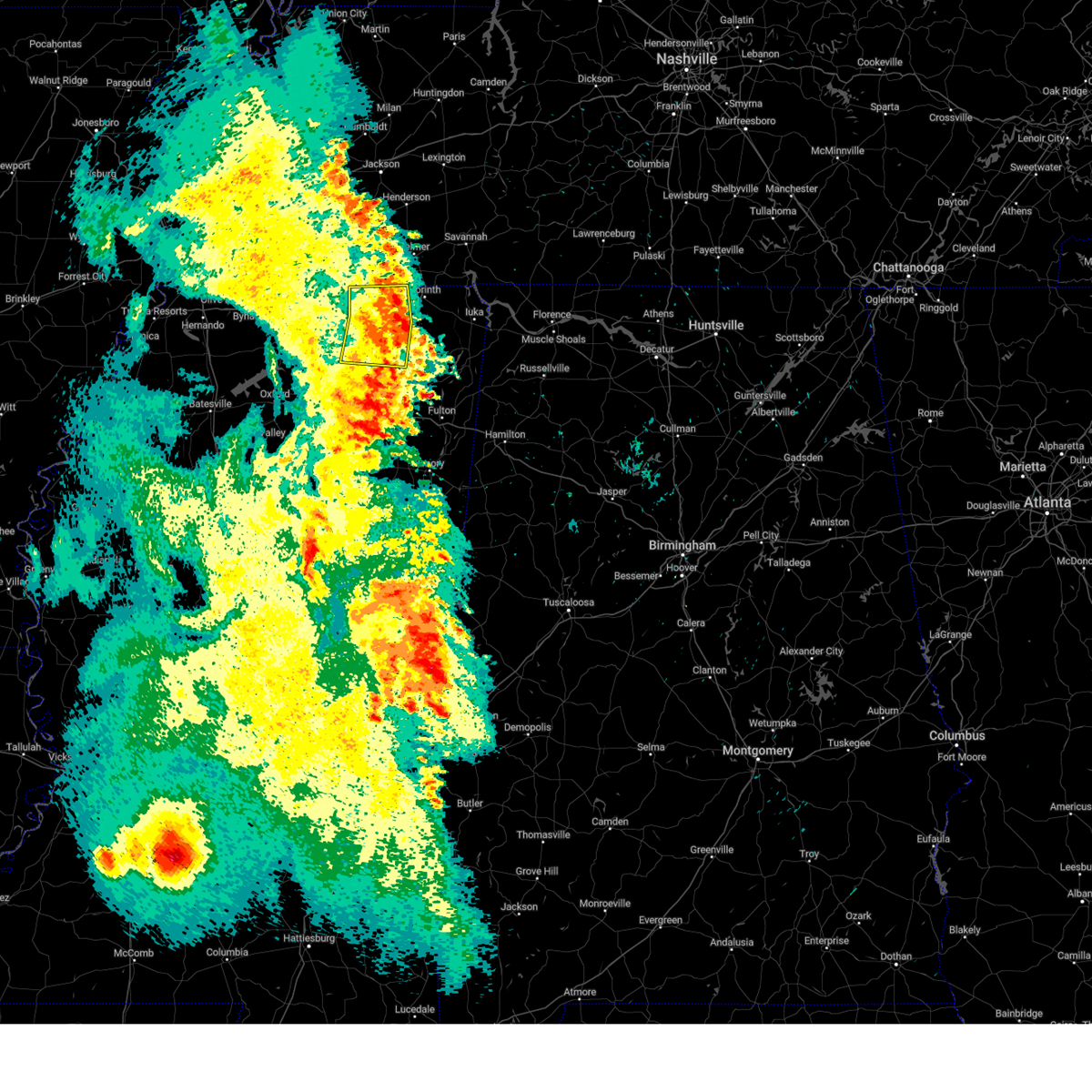 The severe thunderstorm warning for northeastern union, tippah, northwestern prentiss and western alcorn counties will expire at 700 am cdt, the storm which prompted the warning has weakened below severe limits, and has exited the warned area. therefore, the warning will be allowed to expire. a severe thunderstorm watch remains in effect until 1000 am cdt for northeastern mississippi, and west tennessee. The severe thunderstorm warning for northeastern union, tippah, northwestern prentiss and western alcorn counties will expire at 700 am cdt, the storm which prompted the warning has weakened below severe limits, and has exited the warned area. therefore, the warning will be allowed to expire. a severe thunderstorm watch remains in effect until 1000 am cdt for northeastern mississippi, and west tennessee.
|
| 6/18/2023 6:45 AM CDT |
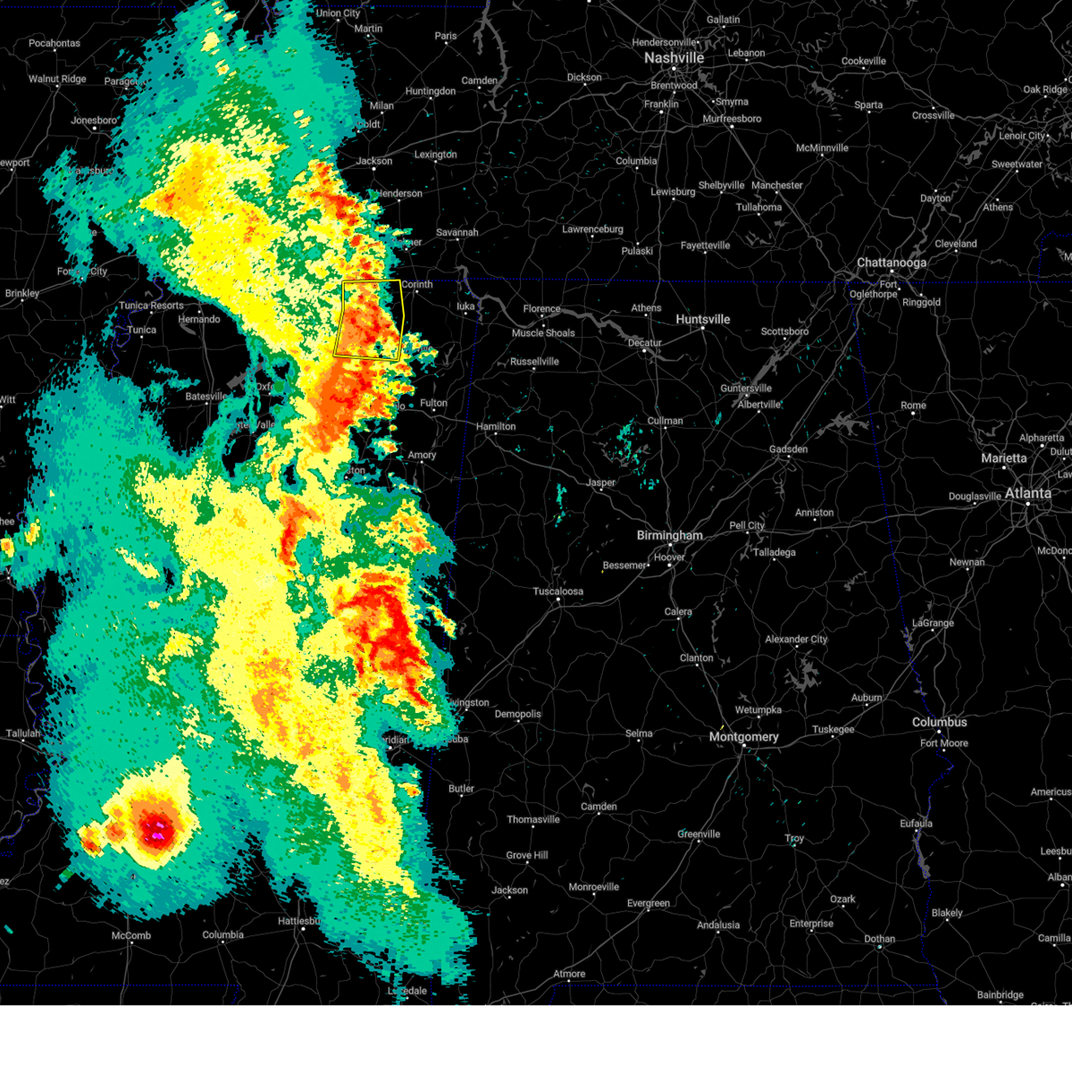 At 645 am cdt, a severe thunderstorm was located 7 miles north of jumpertown, or 12 miles northwest of booneville, moving east at 45 mph (radar indicated). Hazards include 60 mph wind gusts. Expect damage to roofs, siding, and trees. locations impacted include, ripley, blue mountain, jumpertown, theo, walnut, falkner, dumas, kossuth, cotton plant, chalybeate, murry, hightown, collinstown, crumtown, blackland, brownfield, gift, molino, clarysville and lone pine. hail threat, radar indicated max hail size, <. 75 in wind threat, radar indicated max wind gust, 60 mph. At 645 am cdt, a severe thunderstorm was located 7 miles north of jumpertown, or 12 miles northwest of booneville, moving east at 45 mph (radar indicated). Hazards include 60 mph wind gusts. Expect damage to roofs, siding, and trees. locations impacted include, ripley, blue mountain, jumpertown, theo, walnut, falkner, dumas, kossuth, cotton plant, chalybeate, murry, hightown, collinstown, crumtown, blackland, brownfield, gift, molino, clarysville and lone pine. hail threat, radar indicated max hail size, <. 75 in wind threat, radar indicated max wind gust, 60 mph.
|
| 6/18/2023 6:08 AM CDT |
 At 607 am cdt, a severe thunderstorm was located over snow lake shores, or 14 miles east of holly springs, moving east at 45 mph (radar indicated). Hazards include 60 mph wind gusts and penny size hail. expect damage to roofs, siding, and trees At 607 am cdt, a severe thunderstorm was located over snow lake shores, or 14 miles east of holly springs, moving east at 45 mph (radar indicated). Hazards include 60 mph wind gusts and penny size hail. expect damage to roofs, siding, and trees
|
| 6/16/2023 4:24 PM CDT |
 At 424 pm cdt, a severe thunderstorm was located near new albany, moving east at 20 mph (radar indicated). Hazards include 60 mph wind gusts and quarter size hail. Hail damage to vehicles is expected. expect wind damage to roofs, siding, and trees. locations impacted include, new albany, saltillo, keownville, new harmony, blair, myrtle, dumas, blue springs, shari, poolville, graham, jericho, branyan, ellistown, old myrtle, pumpkin center, jug fork, baker, locum and smalco. hail threat, radar indicated max hail size, 1. 00 in wind threat, radar indicated max wind gust, 60 mph. At 424 pm cdt, a severe thunderstorm was located near new albany, moving east at 20 mph (radar indicated). Hazards include 60 mph wind gusts and quarter size hail. Hail damage to vehicles is expected. expect wind damage to roofs, siding, and trees. locations impacted include, new albany, saltillo, keownville, new harmony, blair, myrtle, dumas, blue springs, shari, poolville, graham, jericho, branyan, ellistown, old myrtle, pumpkin center, jug fork, baker, locum and smalco. hail threat, radar indicated max hail size, 1. 00 in wind threat, radar indicated max wind gust, 60 mph.
|
| 6/16/2023 4:11 PM CDT |
 At 411 pm cdt, a severe thunderstorm was located over new albany, moving east at 20 mph (radar indicated). Hazards include 60 mph wind gusts and quarter size hail. Hail damage to vehicles is expected. Expect wind damage to roofs, siding, and trees. At 411 pm cdt, a severe thunderstorm was located over new albany, moving east at 20 mph (radar indicated). Hazards include 60 mph wind gusts and quarter size hail. Hail damage to vehicles is expected. Expect wind damage to roofs, siding, and trees.
|
| 3/24/2023 9:21 PM CDT |
 At 920 pm cdt, a severe thunderstorm was located near etta, or near new albany, moving northeast at 60 mph (radar indicated). Hazards include 60 mph wind gusts and penny size hail. expect damage to roofs, siding, and trees At 920 pm cdt, a severe thunderstorm was located near etta, or near new albany, moving northeast at 60 mph (radar indicated). Hazards include 60 mph wind gusts and penny size hail. expect damage to roofs, siding, and trees
|
| 1/3/2023 9:39 AM CST |
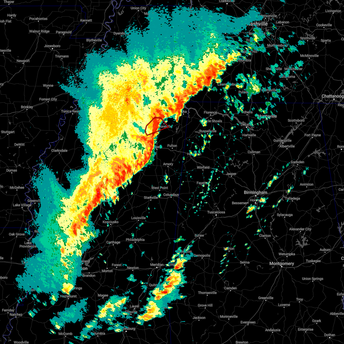 The tornado warning for northeastern union, southeastern tippah and northwestern prentiss counties will expire at 945 am cst, the tornado threat has diminished and the tornado warning has been cancelled. however, large hail and damaging winds remain likely and a severe thunderstorm warning remains in effect for the area. a tornado watch remains in effect until 1100 am cst for northeastern mississippi. to report severe weather, contact your nearest law enforcement agency. they will relay your report to the national weather service memphis. remember, a severe thunderstorm warning still remains in effect for portions of prentiss, tippah, and union counties until 1015 am cst. The tornado warning for northeastern union, southeastern tippah and northwestern prentiss counties will expire at 945 am cst, the tornado threat has diminished and the tornado warning has been cancelled. however, large hail and damaging winds remain likely and a severe thunderstorm warning remains in effect for the area. a tornado watch remains in effect until 1100 am cst for northeastern mississippi. to report severe weather, contact your nearest law enforcement agency. they will relay your report to the national weather service memphis. remember, a severe thunderstorm warning still remains in effect for portions of prentiss, tippah, and union counties until 1015 am cst.
|
| 1/3/2023 9:37 AM CST |
 At 937 am cst, severe thunderstorms were located along a line extending from 6 miles northwest of hinkle to near jumpertown to near new harmony, moving east at 45 mph (radar indicated). Hazards include 60 mph wind gusts. expect damage to roofs, siding, and trees At 937 am cst, severe thunderstorms were located along a line extending from 6 miles northwest of hinkle to near jumpertown to near new harmony, moving east at 45 mph (radar indicated). Hazards include 60 mph wind gusts. expect damage to roofs, siding, and trees
|
| 1/3/2023 9:30 AM CST |
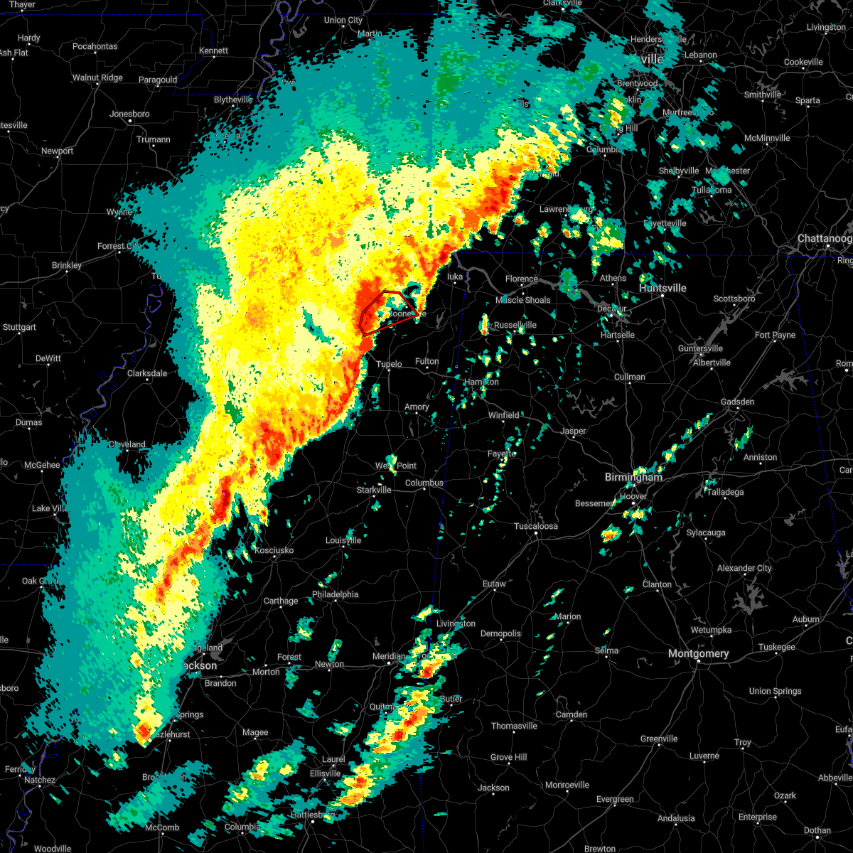 At 929 am cst, a severe thunderstorm capable of producing a tornado was located 9 miles northeast of keownville, or 9 miles southeast of ripley, moving northeast at 45 mph (radar indicated rotation). Hazards include tornado. Flying debris will be dangerous to those caught without shelter. mobile homes will be damaged or destroyed. damage to roofs, windows, and vehicles will occur. tree damage is likely. Locations impacted include, booneville, jumpertown, keownville, wheeler, dumas, graham, blackland, gaston, molino, geeville, locum, parks and frankstown. At 929 am cst, a severe thunderstorm capable of producing a tornado was located 9 miles northeast of keownville, or 9 miles southeast of ripley, moving northeast at 45 mph (radar indicated rotation). Hazards include tornado. Flying debris will be dangerous to those caught without shelter. mobile homes will be damaged or destroyed. damage to roofs, windows, and vehicles will occur. tree damage is likely. Locations impacted include, booneville, jumpertown, keownville, wheeler, dumas, graham, blackland, gaston, molino, geeville, locum, parks and frankstown.
|
| 1/3/2023 9:20 AM CST |
 At 919 am cst, severe thunderstorms were located along a line extending from ripley to near keownville to near ecru, moving northeast at 45 mph (radar indicated). Hazards include 60 mph wind gusts. Expect damage to roofs, siding, and trees. locations impacted include, new albany, ripley, blue mountain, jumpertown, keownville, theo, gravestown, falkner, myrtle, dumas, shari, murry, poolville, graham, jericho, old myrtle, collinstown, pumpkin center, whitten town and baker. hail threat, radar indicated max hail size, <. 75 in wind threat, radar indicated max wind gust, 60 mph. At 919 am cst, severe thunderstorms were located along a line extending from ripley to near keownville to near ecru, moving northeast at 45 mph (radar indicated). Hazards include 60 mph wind gusts. Expect damage to roofs, siding, and trees. locations impacted include, new albany, ripley, blue mountain, jumpertown, keownville, theo, gravestown, falkner, myrtle, dumas, shari, murry, poolville, graham, jericho, old myrtle, collinstown, pumpkin center, whitten town and baker. hail threat, radar indicated max hail size, <. 75 in wind threat, radar indicated max wind gust, 60 mph.
|
| 1/3/2023 9:18 AM CST |
 At 918 am cst, a severe thunderstorm capable of producing a tornado was located near keownville, or 7 miles northeast of new albany, moving northeast at 45 mph (radar indicated rotation). Hazards include tornado. Flying debris will be dangerous to those caught without shelter. mobile homes will be damaged or destroyed. damage to roofs, windows, and vehicles will occur. tree damage is likely. Locations impacted include, booneville, new albany, jumpertown, keownville, wheeler, dumas, shari, graham, pumpkin center, gaston, baker, geeville, locum, smalco, glenfield, cotton plant, union hill, martintown, concord and blackland. At 918 am cst, a severe thunderstorm capable of producing a tornado was located near keownville, or 7 miles northeast of new albany, moving northeast at 45 mph (radar indicated rotation). Hazards include tornado. Flying debris will be dangerous to those caught without shelter. mobile homes will be damaged or destroyed. damage to roofs, windows, and vehicles will occur. tree damage is likely. Locations impacted include, booneville, new albany, jumpertown, keownville, wheeler, dumas, shari, graham, pumpkin center, gaston, baker, geeville, locum, smalco, glenfield, cotton plant, union hill, martintown, concord and blackland.
|
| 1/3/2023 9:10 AM CST |
 At 909 am cst, a severe thunderstorm capable of producing a tornado was located near new albany, moving northeast at 45 mph (radar indicated rotation). Hazards include tornado. Flying debris will be dangerous to those caught without shelter. mobile homes will be damaged or destroyed. damage to roofs, windows, and vehicles will occur. tree damage is likely. Locations impacted include, booneville, new albany, jumpertown, keownville, wheeler, etta, myrtle, dumas, shari, poolville, graham, old myrtle, pumpkin center, gaston, baker, geeville, locum, smalco, glenfield and cotton plant. At 909 am cst, a severe thunderstorm capable of producing a tornado was located near new albany, moving northeast at 45 mph (radar indicated rotation). Hazards include tornado. Flying debris will be dangerous to those caught without shelter. mobile homes will be damaged or destroyed. damage to roofs, windows, and vehicles will occur. tree damage is likely. Locations impacted include, booneville, new albany, jumpertown, keownville, wheeler, etta, myrtle, dumas, shari, poolville, graham, old myrtle, pumpkin center, gaston, baker, geeville, locum, smalco, glenfield and cotton plant.
|
| 1/3/2023 9:01 AM CST |
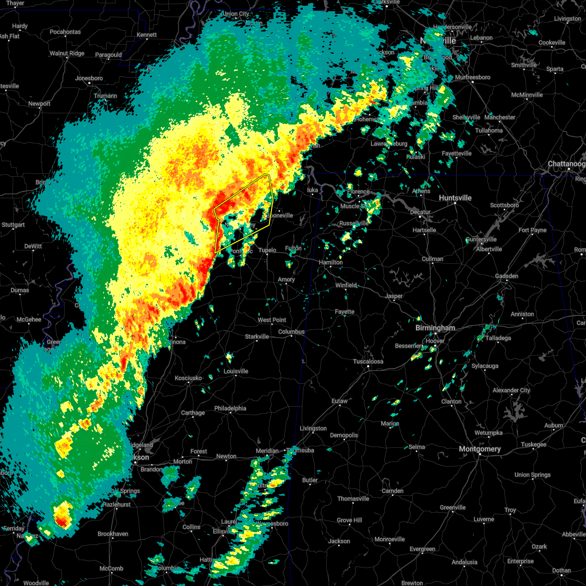 At 901 am cst, severe thunderstorms were located along a line extending from 8 miles west of blue mountain to near etta to 6 miles east of denmark, moving northeast at 45 mph (radar indicated). Hazards include 60 mph wind gusts. expect damage to roofs, siding, and trees At 901 am cst, severe thunderstorms were located along a line extending from 8 miles west of blue mountain to near etta to 6 miles east of denmark, moving northeast at 45 mph (radar indicated). Hazards include 60 mph wind gusts. expect damage to roofs, siding, and trees
|
| 1/3/2023 9:00 AM CST |
 At 900 am cst, a severe thunderstorm capable of producing a tornado was located over etta, or 10 miles west of new albany, moving northeast at 45 mph (radar indicated rotation). Hazards include tornado. Flying debris will be dangerous to those caught without shelter. mobile homes will be damaged or destroyed. damage to roofs, windows, and vehicles will occur. Tree damage is likely. At 900 am cst, a severe thunderstorm capable of producing a tornado was located over etta, or 10 miles west of new albany, moving northeast at 45 mph (radar indicated rotation). Hazards include tornado. Flying debris will be dangerous to those caught without shelter. mobile homes will be damaged or destroyed. damage to roofs, windows, and vehicles will occur. Tree damage is likely.
|
| 1/3/2023 8:50 AM CST |
 At 850 am cst, a severe thunderstorm was located near etta, or 8 miles northwest of new albany, moving northeast at 55 mph (radar indicated). Hazards include 60 mph wind gusts. Expect damage to roofs, siding, and trees. Locations impacted include, new albany, ripley, blue mountain, cambridge, keownville, etta, bethlehem, denmark, pinedale, hickory flat, myrtle, dumas, abbeville, shari, keel, murry, poolville, graham, esperanza and old myrtle. At 850 am cst, a severe thunderstorm was located near etta, or 8 miles northwest of new albany, moving northeast at 55 mph (radar indicated). Hazards include 60 mph wind gusts. Expect damage to roofs, siding, and trees. Locations impacted include, new albany, ripley, blue mountain, cambridge, keownville, etta, bethlehem, denmark, pinedale, hickory flat, myrtle, dumas, abbeville, shari, keel, murry, poolville, graham, esperanza and old myrtle.
|
| 1/3/2023 8:22 AM CST |
 At 822 am cst, a severe thunderstorm was located over holly springs national forest, moving northeast at 55 mph (radar indicated). Hazards include 60 mph wind gusts. expect damage to roofs, siding, and trees At 822 am cst, a severe thunderstorm was located over holly springs national forest, moving northeast at 55 mph (radar indicated). Hazards include 60 mph wind gusts. expect damage to roofs, siding, and trees
|
| 11/29/2022 11:30 AM CST |
 At 1130 am cst, a severe thunderstorm was located over new albany, moving northeast at 40 mph (radar indicated). Hazards include 60 mph wind gusts and quarter size hail. Hail damage to vehicles is expected. Expect wind damage to roofs, siding, and trees. At 1130 am cst, a severe thunderstorm was located over new albany, moving northeast at 40 mph (radar indicated). Hazards include 60 mph wind gusts and quarter size hail. Hail damage to vehicles is expected. Expect wind damage to roofs, siding, and trees.
|
| 6/8/2022 11:50 AM CDT |
 At 1149 am cdt, a severe thunderstorm was located near keownville, or 9 miles southeast of ripley, moving east at 30 mph (radar indicated). Hazards include 60 mph wind gusts and quarter size hail. Hail damage to vehicles is expected. Expect wind damage to roofs, siding, and trees. At 1149 am cdt, a severe thunderstorm was located near keownville, or 9 miles southeast of ripley, moving east at 30 mph (radar indicated). Hazards include 60 mph wind gusts and quarter size hail. Hail damage to vehicles is expected. Expect wind damage to roofs, siding, and trees.
|
| 6/7/2022 1:58 AM CDT |
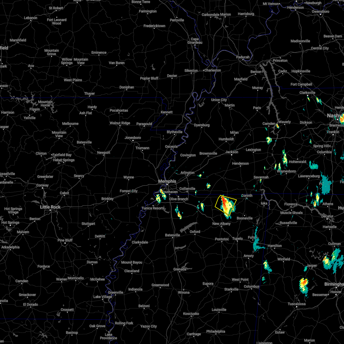 The severe thunderstorm warning for central tippah, east central benton and west central alcorn counties will expire at 200 am cdt, the storm which prompted the warning has weakened below severe limits, and no longer poses an immediate threat to life or property. therefore, the warning will be allowed to expire. The severe thunderstorm warning for central tippah, east central benton and west central alcorn counties will expire at 200 am cdt, the storm which prompted the warning has weakened below severe limits, and no longer poses an immediate threat to life or property. therefore, the warning will be allowed to expire.
|
| 6/7/2022 1:47 AM CDT |
 At 147 am cdt, a severe thunderstorm was located 8 miles southeast of canaan, or 10 miles north of ripley, moving southeast at 15 mph (radar indicated). Hazards include 60 mph wind gusts and quarter size hail. Hail damage to vehicles is expected. expect wind damage to roofs, siding, and trees. locations impacted include, ripley, walnut, falkner, dumas, chalybeate, murry, whitten town, hamilton, peoples and tiplersville. hail threat, radar indicated max hail size, 1. 00 in wind threat, radar indicated max wind gust, 60 mph. At 147 am cdt, a severe thunderstorm was located 8 miles southeast of canaan, or 10 miles north of ripley, moving southeast at 15 mph (radar indicated). Hazards include 60 mph wind gusts and quarter size hail. Hail damage to vehicles is expected. expect wind damage to roofs, siding, and trees. locations impacted include, ripley, walnut, falkner, dumas, chalybeate, murry, whitten town, hamilton, peoples and tiplersville. hail threat, radar indicated max hail size, 1. 00 in wind threat, radar indicated max wind gust, 60 mph.
|
| 6/7/2022 1:16 AM CDT |
 At 116 am cdt, a severe thunderstorm was located over canaan, or 16 miles northwest of ripley, moving southeast at 20 mph (radar indicated). Hazards include 60 mph wind gusts and quarter size hail. Hail damage to vehicles is expected. Expect wind damage to roofs, siding, and trees. At 116 am cdt, a severe thunderstorm was located over canaan, or 16 miles northwest of ripley, moving southeast at 20 mph (radar indicated). Hazards include 60 mph wind gusts and quarter size hail. Hail damage to vehicles is expected. Expect wind damage to roofs, siding, and trees.
|
| 5/2/2022 3:54 PM CDT |
 At 353 pm cdt, a severe thunderstorm was located near ripley, moving northeast at 25 mph (radar indicated). Hazards include quarter size hail. Damage to vehicles is expected. locations impacted include, ripley, blue mountain, falkner, dumas, murry, clarysville, peoples and cotton plant. hail threat, radar indicated max hail size, 1. 00 in wind threat, radar indicated max wind gust, <50 mph. At 353 pm cdt, a severe thunderstorm was located near ripley, moving northeast at 25 mph (radar indicated). Hazards include quarter size hail. Damage to vehicles is expected. locations impacted include, ripley, blue mountain, falkner, dumas, murry, clarysville, peoples and cotton plant. hail threat, radar indicated max hail size, 1. 00 in wind threat, radar indicated max wind gust, <50 mph.
|
| 5/2/2022 3:38 PM CDT |
 At 338 pm cdt, a severe thunderstorm was located over jumpertown, or near booneville, moving north at 20 mph (radar indicated). Hazards include ping pong ball size hail. People and animals outdoors will be injured. expect damage to roofs, siding, windows, and vehicles. locations impacted include, booneville, jumpertown, hinkle, dumas, rienzi, hightown, collinstown, crumtown, blackland and gaston. hail threat, radar indicated max hail size, 1. 50 in wind threat, radar indicated max wind gust, <50 mph. At 338 pm cdt, a severe thunderstorm was located over jumpertown, or near booneville, moving north at 20 mph (radar indicated). Hazards include ping pong ball size hail. People and animals outdoors will be injured. expect damage to roofs, siding, windows, and vehicles. locations impacted include, booneville, jumpertown, hinkle, dumas, rienzi, hightown, collinstown, crumtown, blackland and gaston. hail threat, radar indicated max hail size, 1. 50 in wind threat, radar indicated max wind gust, <50 mph.
|
| 5/2/2022 3:32 PM CDT |
 At 331 pm cdt, a severe thunderstorm was located near keownville, or near new albany, moving north at 30 mph (trained weather spotters). Hazards include ping pong ball size hail. People and animals outdoors will be injured. expect damage to roofs, siding, windows, and vehicles. locations impacted include, new albany, ripley, blue mountain, keownville, falkner, dumas, cotton plant, shari, union hill, murry, martintown, wallerville, concord, pumpkin center, molino, clarysville, baker, peoples, beacon hill and smalco. hail threat, radar indicated max hail size, 1. 50 in wind threat, radar indicated max wind gust, <50 mph. At 331 pm cdt, a severe thunderstorm was located near keownville, or near new albany, moving north at 30 mph (trained weather spotters). Hazards include ping pong ball size hail. People and animals outdoors will be injured. expect damage to roofs, siding, windows, and vehicles. locations impacted include, new albany, ripley, blue mountain, keownville, falkner, dumas, cotton plant, shari, union hill, murry, martintown, wallerville, concord, pumpkin center, molino, clarysville, baker, peoples, beacon hill and smalco. hail threat, radar indicated max hail size, 1. 50 in wind threat, radar indicated max wind gust, <50 mph.
|
| 5/2/2022 3:25 PM CDT |
 At 325 pm cdt, a severe thunderstorm was located over new albany, moving north at 30 mph (radar indicated). Hazards include quarter size hail. damage to vehicles is expected At 325 pm cdt, a severe thunderstorm was located over new albany, moving north at 30 mph (radar indicated). Hazards include quarter size hail. damage to vehicles is expected
|
| 5/2/2022 3:21 PM CDT |
 At 321 pm cdt, a severe thunderstorm was located near jumpertown, or near booneville, moving northeast at 20 mph (radar indicated). Hazards include quarter size hail. Damage to vehicles is expected. locations impacted include, booneville, jumpertown, hinkle, dumas, rienzi, hightown, collinstown, crumtown, blackland and gaston. hail threat, radar indicated max hail size, 1. 00 in wind threat, radar indicated max wind gust, <50 mph. At 321 pm cdt, a severe thunderstorm was located near jumpertown, or near booneville, moving northeast at 20 mph (radar indicated). Hazards include quarter size hail. Damage to vehicles is expected. locations impacted include, booneville, jumpertown, hinkle, dumas, rienzi, hightown, collinstown, crumtown, blackland and gaston. hail threat, radar indicated max hail size, 1. 00 in wind threat, radar indicated max wind gust, <50 mph.
|
| 5/2/2022 3:18 PM CDT | Quarter sized hail reported 6.8 miles WNW of Dumas, MS |
| 5/2/2022 3:12 PM CDT |
 At 312 pm cdt, a severe thunderstorm was located near baldwyn, moving north at 20 mph (radar indicated). Hazards include quarter size hail. damage to vehicles is expected At 312 pm cdt, a severe thunderstorm was located near baldwyn, moving north at 20 mph (radar indicated). Hazards include quarter size hail. damage to vehicles is expected
|
| 4/13/2022 7:26 PM CDT |
 At 725 pm cdt, severe thunderstorms were located along a line extending from near jumpertown to near tupelo, moving east at 65 mph (radar indicated). Hazards include 70 mph wind gusts. Expect considerable tree damage. damage is likely to mobile homes, roofs, and outbuildings. locations impacted include, tupelo, booneville, pontotoc, fulton, baldwyn, red bay, trace state park, tombigbee state park, tishomingo state park, saltillo, guntown, belmont, mantachie, ecru, jumpertown, tremont, tishomingo, thrashers, fairview and new harmony. thunderstorm damage threat, considerable hail threat, radar indicated max hail size, <. 75 in wind threat, radar indicated max wind gust, 70 mph. At 725 pm cdt, severe thunderstorms were located along a line extending from near jumpertown to near tupelo, moving east at 65 mph (radar indicated). Hazards include 70 mph wind gusts. Expect considerable tree damage. damage is likely to mobile homes, roofs, and outbuildings. locations impacted include, tupelo, booneville, pontotoc, fulton, baldwyn, red bay, trace state park, tombigbee state park, tishomingo state park, saltillo, guntown, belmont, mantachie, ecru, jumpertown, tremont, tishomingo, thrashers, fairview and new harmony. thunderstorm damage threat, considerable hail threat, radar indicated max hail size, <. 75 in wind threat, radar indicated max wind gust, 70 mph.
|
| 4/13/2022 7:13 PM CDT |
 At 713 pm cdt, severe thunderstorms were located along a line extending from near blue mountain to near ecru, moving east at 55 mph (radar indicated). Hazards include 70 mph wind gusts. Expect considerable tree damage. Damage is likely to mobile homes, roofs, and outbuildings. At 713 pm cdt, severe thunderstorms were located along a line extending from near blue mountain to near ecru, moving east at 55 mph (radar indicated). Hazards include 70 mph wind gusts. Expect considerable tree damage. Damage is likely to mobile homes, roofs, and outbuildings.
|
| 3/30/2022 6:33 PM CDT |
 At 633 pm cdt, severe thunderstorms were located along a line extending from selmer to pratts friendship, moving northeast at 55 mph (radar indicated). Hazards include 60 mph wind gusts. Expect damage to roofs, siding, and trees. Locations impacted include, corinth, booneville, selmer, baldwyn, big hill pond state park, adamsville, jumpertown, glen, thrashers, theo, hinkle, wheeler, leedy, farmington, bethel springs, eastview, michie, dumas, guys and ramer. At 633 pm cdt, severe thunderstorms were located along a line extending from selmer to pratts friendship, moving northeast at 55 mph (radar indicated). Hazards include 60 mph wind gusts. Expect damage to roofs, siding, and trees. Locations impacted include, corinth, booneville, selmer, baldwyn, big hill pond state park, adamsville, jumpertown, glen, thrashers, theo, hinkle, wheeler, leedy, farmington, bethel springs, eastview, michie, dumas, guys and ramer.
|
| 3/30/2022 6:16 PM CDT |
 At 615 pm cdt, severe thunderstorms were located along a line extending from near silerton to near keownville, moving northeast at 55 mph (radar indicated). Hazards include 60 mph wind gusts. Expect damage to roofs, siding, and trees. Locations impacted include, corinth, booneville, new albany, henderson, bolivar, ripley, selmer, baldwyn, big hill pond state park, adamsville, blue mountain, jumpertown, glen, silerton, masseyville, theo, pocahontas, hinkle, wheeler and thrashers. At 615 pm cdt, severe thunderstorms were located along a line extending from near silerton to near keownville, moving northeast at 55 mph (radar indicated). Hazards include 60 mph wind gusts. Expect damage to roofs, siding, and trees. Locations impacted include, corinth, booneville, new albany, henderson, bolivar, ripley, selmer, baldwyn, big hill pond state park, adamsville, blue mountain, jumpertown, glen, silerton, masseyville, theo, pocahontas, hinkle, wheeler and thrashers.
|
| 3/30/2022 6:09 PM CDT |
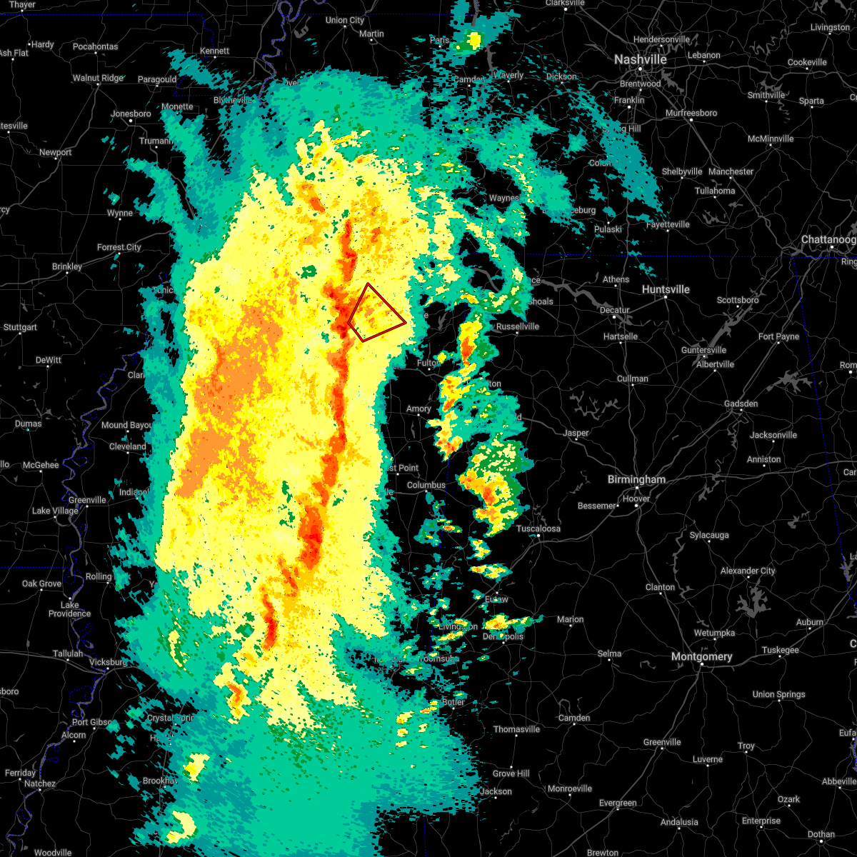 At 608 pm cdt, a severe thunderstorm producing a tornado was located near keownville, or 11 miles southeast of ripley, moving northeast at 60 mph (radar indicated rotation). Hazards include tornado and 60 mph wind gusts. Flying debris will be dangerous to those caught without shelter. mobile homes will be damaged or destroyed. damage to roofs, windows, and vehicles will occur. tree damage is likely. Locations impacted include, ripley, keownville, dumas, cotton plant, union hill, graham, concord, alpine, molino, clarysville, baker, geeville, locum, parks, frankstown, jericho and peoples. At 608 pm cdt, a severe thunderstorm producing a tornado was located near keownville, or 11 miles southeast of ripley, moving northeast at 60 mph (radar indicated rotation). Hazards include tornado and 60 mph wind gusts. Flying debris will be dangerous to those caught without shelter. mobile homes will be damaged or destroyed. damage to roofs, windows, and vehicles will occur. tree damage is likely. Locations impacted include, ripley, keownville, dumas, cotton plant, union hill, graham, concord, alpine, molino, clarysville, baker, geeville, locum, parks, frankstown, jericho and peoples.
|
| 3/30/2022 5:59 PM CDT |
 At 559 pm cdt, severe thunderstorms were located along a line extending from 8 miles south of bolivar to new albany, moving northeast at 55 mph (radar indicated). Hazards include 60 mph wind gusts. expect damage to roofs, siding, and trees At 559 pm cdt, severe thunderstorms were located along a line extending from 8 miles south of bolivar to new albany, moving northeast at 55 mph (radar indicated). Hazards include 60 mph wind gusts. expect damage to roofs, siding, and trees
|
| 3/30/2022 5:54 PM CDT |
 At 553 pm cdt, a severe thunderstorm producing a tornado was located near new albany, moving northeast at 60 mph (radar indicated rotation). Hazards include tornado. Flying debris will be dangerous to those caught without shelter. mobile homes will be damaged or destroyed. damage to roofs, windows, and vehicles will occur. Tree damage is likely. At 553 pm cdt, a severe thunderstorm producing a tornado was located near new albany, moving northeast at 60 mph (radar indicated rotation). Hazards include tornado. Flying debris will be dangerous to those caught without shelter. mobile homes will be damaged or destroyed. damage to roofs, windows, and vehicles will occur. Tree damage is likely.
|
| 3/30/2022 5:40 PM CDT |
 At 539 pm cdt, severe thunderstorms were located along a line extending from near dancyville to lagrange to gravestown, moving east at 55 mph (radar indicated). Hazards include 70 mph wind gusts. Expect considerable tree damage. damage is likely to mobile homes, roofs, and outbuildings. Locations impacted include, brownsville, holly springs, bolivar, ripley, lamar, lakeland, arlington, whiteville, somerville, blue mountain, jumpertown, snow lake shores, hillville, bethlehem, canaan, lagrange, eads, dancyville, slayden and michigan city. At 539 pm cdt, severe thunderstorms were located along a line extending from near dancyville to lagrange to gravestown, moving east at 55 mph (radar indicated). Hazards include 70 mph wind gusts. Expect considerable tree damage. damage is likely to mobile homes, roofs, and outbuildings. Locations impacted include, brownsville, holly springs, bolivar, ripley, lamar, lakeland, arlington, whiteville, somerville, blue mountain, jumpertown, snow lake shores, hillville, bethlehem, canaan, lagrange, eads, dancyville, slayden and michigan city.
|
| 3/30/2022 5:12 PM CDT |
 At 512 pm cdt, severe thunderstorms were located along a line extending from 7 miles south of munford to near byhalia to wall doxey state park, moving east at 55 mph (radar indicated). Hazards include 70 mph wind gusts. Expect considerable tree damage. Damage is likely to mobile homes, roofs, and outbuildings. At 512 pm cdt, severe thunderstorms were located along a line extending from 7 miles south of munford to near byhalia to wall doxey state park, moving east at 55 mph (radar indicated). Hazards include 70 mph wind gusts. Expect considerable tree damage. Damage is likely to mobile homes, roofs, and outbuildings.
|
| 12/6/2021 5:35 AM CST |
 At 535 am cst, severe thunderstorms were located along a line extending from near jumpertown to near blair to near ecru, moving east at 70 mph (radar indicated). Hazards include 60 mph wind gusts. expect damage to roofs, siding, and trees At 535 am cst, severe thunderstorms were located along a line extending from near jumpertown to near blair to near ecru, moving east at 70 mph (radar indicated). Hazards include 60 mph wind gusts. expect damage to roofs, siding, and trees
|
| 4/9/2021 7:07 PM CDT |
 At 707 pm cdt, a severe thunderstorm was located near keownville, or near new albany, moving northeast at 15 mph (radar indicated). Hazards include golf ball size hail and 60 mph wind gusts. People and animals outdoors will be injured. expect hail damage to roofs, siding, windows, and vehicles. expect wind damage to roofs, siding, and trees. Locations impacted include, new albany, keownville, dumas, union hill, graham, wallerville, jericho, branyan, ellistown, alpine, ingomar, corrona, graves, molino, baker, locum, parks, bethany and beacon hill. At 707 pm cdt, a severe thunderstorm was located near keownville, or near new albany, moving northeast at 15 mph (radar indicated). Hazards include golf ball size hail and 60 mph wind gusts. People and animals outdoors will be injured. expect hail damage to roofs, siding, windows, and vehicles. expect wind damage to roofs, siding, and trees. Locations impacted include, new albany, keownville, dumas, union hill, graham, wallerville, jericho, branyan, ellistown, alpine, ingomar, corrona, graves, molino, baker, locum, parks, bethany and beacon hill.
|
| 4/9/2021 6:45 PM CDT |
 At 645 pm cdt, doppler radar indicated a severe thunderstorm producing a tornado was located near new albany, moving east at 15 mph (radar indicated rotation). Hazards include tornado and golf ball size hail. Flying debris will be dangerous to those caught without shelter. mobile homes will be damaged or destroyed. damage to roofs, windows, and vehicles will occur. Tree damage is likely. At 645 pm cdt, doppler radar indicated a severe thunderstorm producing a tornado was located near new albany, moving east at 15 mph (radar indicated rotation). Hazards include tornado and golf ball size hail. Flying debris will be dangerous to those caught without shelter. mobile homes will be damaged or destroyed. damage to roofs, windows, and vehicles will occur. Tree damage is likely.
|
| 4/9/2021 6:43 PM CDT |
 At 643 pm cdt, a severe thunderstorm was located near new albany, moving east at 15 mph (radar indicated). Hazards include golf ball size hail and 60 mph wind gusts. People and animals outdoors will be injured. expect hail damage to roofs, siding, windows, and vehicles. expect wind damage to roofs, siding, and trees. Locations impacted include, new albany, keownville, dumas, union hill, graham, martintown, wallerville, jericho, branyan, ellistown, concord, alpine, ingomar, corrona, graves, molino, baker, locum, parks and bethany. At 643 pm cdt, a severe thunderstorm was located near new albany, moving east at 15 mph (radar indicated). Hazards include golf ball size hail and 60 mph wind gusts. People and animals outdoors will be injured. expect hail damage to roofs, siding, windows, and vehicles. expect wind damage to roofs, siding, and trees. Locations impacted include, new albany, keownville, dumas, union hill, graham, martintown, wallerville, jericho, branyan, ellistown, concord, alpine, ingomar, corrona, graves, molino, baker, locum, parks and bethany.
|
| 4/9/2021 6:37 PM CDT |
 At 636 pm cdt, a severe thunderstorm was located near new albany, moving northeast at 15 mph (radar indicated). Hazards include 60 mph wind gusts and half dollar size hail. Hail damage to vehicles is expected. Expect wind damage to roofs, siding, and trees. At 636 pm cdt, a severe thunderstorm was located near new albany, moving northeast at 15 mph (radar indicated). Hazards include 60 mph wind gusts and half dollar size hail. Hail damage to vehicles is expected. Expect wind damage to roofs, siding, and trees.
|
| 3/28/2021 1:03 AM CDT |
 At 103 am cdt, doppler radar indicated a severe thunderstorm producing a tornado was located near keownville, or 10 miles southeast of ripley, moving east at 45 mph (radar indicated rotation). Hazards include tornado. Flying debris will be dangerous to those caught without shelter. mobile homes will be damaged or destroyed. damage to roofs, windows, and vehicles will occur. Tree damage is likely. At 103 am cdt, doppler radar indicated a severe thunderstorm producing a tornado was located near keownville, or 10 miles southeast of ripley, moving east at 45 mph (radar indicated rotation). Hazards include tornado. Flying debris will be dangerous to those caught without shelter. mobile homes will be damaged or destroyed. damage to roofs, windows, and vehicles will occur. Tree damage is likely.
|
| 3/28/2021 12:56 AM CDT |
 At 1256 am cdt, a severe thunderstorm was located near sandy springs, or 7 miles north of fulton, moving southeast at 45 mph (radar indicated). Hazards include 60 mph wind gusts. expect damage to roofs, siding, and trees At 1256 am cdt, a severe thunderstorm was located near sandy springs, or 7 miles north of fulton, moving southeast at 45 mph (radar indicated). Hazards include 60 mph wind gusts. expect damage to roofs, siding, and trees
|
| 3/28/2021 12:17 AM CDT |
 At 1216 am cdt, a severe thunderstorm was located over keownville, or 9 miles northeast of new albany, moving southeast at 45 mph (radar indicated). Hazards include 60 mph wind gusts. expect damage to roofs, siding, and trees At 1216 am cdt, a severe thunderstorm was located over keownville, or 9 miles northeast of new albany, moving southeast at 45 mph (radar indicated). Hazards include 60 mph wind gusts. expect damage to roofs, siding, and trees
|
| 3/27/2021 11:33 PM CDT |
 At 1133 pm cdt, severe thunderstorms were located along a line extending from 6 miles east of canaan to near blue mountain to near cambridge, moving east at 60 mph (radar indicated). Hazards include 60 mph wind gusts. expect damage to roofs, siding, and trees At 1133 pm cdt, severe thunderstorms were located along a line extending from 6 miles east of canaan to near blue mountain to near cambridge, moving east at 60 mph (radar indicated). Hazards include 60 mph wind gusts. expect damage to roofs, siding, and trees
|
| 2/28/2021 8:42 PM CST |
 At 840 pm cst, severe thunderstorms were located along a line extending from near gravestown to near blue mountain to near etta, moving east at 60 mph (radar indicated). Hazards include 60 mph wind gusts and quarter size hail. Hail damage to vehicles is expected. Expect wind damage to roofs, siding, and trees. At 840 pm cst, severe thunderstorms were located along a line extending from near gravestown to near blue mountain to near etta, moving east at 60 mph (radar indicated). Hazards include 60 mph wind gusts and quarter size hail. Hail damage to vehicles is expected. Expect wind damage to roofs, siding, and trees.
|
| 8/28/2020 7:52 PM CDT |
 The severe thunderstorm warning for eastern union, northwestern lee, southeastern tippah and southwestern prentiss counties will expire at 800 pm cdt, the storm which prompted the warning has weakened below severe limits, and no longer poses an immediate threat to life or property. therefore, the warning will be allowed to expire. however, heavy rain is still possible with this thunderstorm. The severe thunderstorm warning for eastern union, northwestern lee, southeastern tippah and southwestern prentiss counties will expire at 800 pm cdt, the storm which prompted the warning has weakened below severe limits, and no longer poses an immediate threat to life or property. therefore, the warning will be allowed to expire. however, heavy rain is still possible with this thunderstorm.
|
| 8/28/2020 7:36 PM CDT |
 At 736 pm cdt, a severe thunderstorm was located near keownville, or 9 miles west of baldwyn, moving east at 40 mph (radar indicated). Hazards include 60 mph wind gusts. Expect damage to roofs, siding, and trees. Locations impacted include, new albany, keownville, blair, dumas, graham, jericho, branyan, ellistown, pumpkin center, jug fork, baker, geeville, locum, cotton plant, union hill, concord, alpine, blackland, birmingham and corrona. At 736 pm cdt, a severe thunderstorm was located near keownville, or 9 miles west of baldwyn, moving east at 40 mph (radar indicated). Hazards include 60 mph wind gusts. Expect damage to roofs, siding, and trees. Locations impacted include, new albany, keownville, blair, dumas, graham, jericho, branyan, ellistown, pumpkin center, jug fork, baker, geeville, locum, cotton plant, union hill, concord, alpine, blackland, birmingham and corrona.
|
| 8/28/2020 7:25 PM CDT |
 At 725 pm cdt, a severe thunderstorm was located over keownville, or 7 miles northeast of new albany, moving east at 40 mph (radar indicated). Hazards include 60 mph wind gusts. Expect damage to roofs, siding, and trees. Locations impacted include, new albany, blue mountain, keownville, blair, myrtle, dumas, blue springs, shari, graham, jericho, branyan, ellistown, old myrtle, pumpkin center, jug fork, baker, geeville, locum, smalco and glenfield. At 725 pm cdt, a severe thunderstorm was located over keownville, or 7 miles northeast of new albany, moving east at 40 mph (radar indicated). Hazards include 60 mph wind gusts. Expect damage to roofs, siding, and trees. Locations impacted include, new albany, blue mountain, keownville, blair, myrtle, dumas, blue springs, shari, graham, jericho, branyan, ellistown, old myrtle, pumpkin center, jug fork, baker, geeville, locum, smalco and glenfield.
|
| 8/28/2020 7:13 PM CDT |
 At 713 pm cdt, a severe thunderstorm was located near blue mountain, or 7 miles northwest of new albany, moving east at 40 mph (radar indicated). Hazards include 60 mph wind gusts. expect damage to roofs, siding, and trees At 713 pm cdt, a severe thunderstorm was located near blue mountain, or 7 miles northwest of new albany, moving east at 40 mph (radar indicated). Hazards include 60 mph wind gusts. expect damage to roofs, siding, and trees
|
| 8/28/2020 10:14 AM CDT |
 At 1014 am cdt, doppler radar indicated a severe thunderstorm producing a tornado was located over keownville, or 8 miles northeast of new albany, moving northeast at 35 mph (radar indicated rotation). Hazards include tornado. Flying debris will be dangerous to those caught without shelter. mobile homes will be damaged or destroyed. damage to roofs, windows, and vehicles will occur. Tree damage is likely. At 1014 am cdt, doppler radar indicated a severe thunderstorm producing a tornado was located over keownville, or 8 miles northeast of new albany, moving northeast at 35 mph (radar indicated rotation). Hazards include tornado. Flying debris will be dangerous to those caught without shelter. mobile homes will be damaged or destroyed. damage to roofs, windows, and vehicles will occur. Tree damage is likely.
|
| 8/28/2020 9:55 AM CDT |
 At 955 am cdt, doppler radar indicated a severe thunderstorm producing a tornado was located over new albany, moving northeast at 35 mph (radar indicated rotation). Hazards include tornado. Flying debris will be dangerous to those caught without shelter. mobile homes will be damaged or destroyed. damage to roofs, windows, and vehicles will occur. tree damage is likely. Locations impacted include, new albany, keownville, dumas, shari, union hill, poolville, graham, martintown, concord, alpine, pumpkin center, molino, baker, locum, parks, beacon hill, smalco and glenfield. At 955 am cdt, doppler radar indicated a severe thunderstorm producing a tornado was located over new albany, moving northeast at 35 mph (radar indicated rotation). Hazards include tornado. Flying debris will be dangerous to those caught without shelter. mobile homes will be damaged or destroyed. damage to roofs, windows, and vehicles will occur. tree damage is likely. Locations impacted include, new albany, keownville, dumas, shari, union hill, poolville, graham, martintown, concord, alpine, pumpkin center, molino, baker, locum, parks, beacon hill, smalco and glenfield.
|
| 8/28/2020 9:51 AM CDT |
 At 951 am cdt, doppler radar indicated a severe thunderstorm producing a tornado was located near new albany, moving northeast at 35 mph (radar indicated rotation). Hazards include tornado. Flying debris will be dangerous to those caught without shelter. mobile homes will be damaged or destroyed. damage to roofs, windows, and vehicles will occur. Tree damage is likely. At 951 am cdt, doppler radar indicated a severe thunderstorm producing a tornado was located near new albany, moving northeast at 35 mph (radar indicated rotation). Hazards include tornado. Flying debris will be dangerous to those caught without shelter. mobile homes will be damaged or destroyed. damage to roofs, windows, and vehicles will occur. Tree damage is likely.
|
| 6/5/2020 2:52 PM CDT |
 At 252 pm cdt, severe thunderstorms were located along a line extending from near jumpertown to etta, moving southeast at 40 mph (radar indicated). Hazards include 60 mph wind gusts. expect damage to roofs, siding, and trees At 252 pm cdt, severe thunderstorms were located along a line extending from near jumpertown to etta, moving southeast at 40 mph (radar indicated). Hazards include 60 mph wind gusts. expect damage to roofs, siding, and trees
|
| 6/4/2020 9:13 PM CDT |
 At 912 pm cdt, a severe thunderstorm was located over keownville, or near new albany, moving southeast at 35 mph (radar indicated). Hazards include 60 mph wind gusts. Expect damage to roofs, siding, and trees. Locations impacted include, tupelo, new albany, baldwyn, verona, trace state park, saltillo, guntown, plantersville, blue mountain, ecru, keownville, new harmony, pratts friendship, blair, furrs, wheeler, sherman, myrtle, dumas and marietta. At 912 pm cdt, a severe thunderstorm was located over keownville, or near new albany, moving southeast at 35 mph (radar indicated). Hazards include 60 mph wind gusts. Expect damage to roofs, siding, and trees. Locations impacted include, tupelo, new albany, baldwyn, verona, trace state park, saltillo, guntown, plantersville, blue mountain, ecru, keownville, new harmony, pratts friendship, blair, furrs, wheeler, sherman, myrtle, dumas and marietta.
|
| 6/4/2020 9:02 PM CDT |
 At 901 pm cdt, a severe thunderstorm was located near blue mountain, or near new albany, moving southeast at 35 mph (radar indicated). Hazards include 60 mph wind gusts. expect damage to roofs, siding, and trees At 901 pm cdt, a severe thunderstorm was located near blue mountain, or near new albany, moving southeast at 35 mph (radar indicated). Hazards include 60 mph wind gusts. expect damage to roofs, siding, and trees
|
| 4/12/2020 11:03 PM CDT |
 At 1103 pm cdt, severe thunderstorms were located along a line extending from 11 miles northeast of arlington to 10 miles east of canaan to 6 miles southwest of new wren, moving northeast at 65 mph (radar indicated). Hazards include 60 mph wind gusts. Expect damage to roofs, siding, and trees. Locations impacted include, tupelo, booneville, new albany, amory, aberdeen, ripley, baldwyn, verona, okolona, trace state park, tombigbee state park, saltillo, guntown, shannon, plantersville, mantachie, jumpertown, prairie, new harmony and pratts friendship. At 1103 pm cdt, severe thunderstorms were located along a line extending from 11 miles northeast of arlington to 10 miles east of canaan to 6 miles southwest of new wren, moving northeast at 65 mph (radar indicated). Hazards include 60 mph wind gusts. Expect damage to roofs, siding, and trees. Locations impacted include, tupelo, booneville, new albany, amory, aberdeen, ripley, baldwyn, verona, okolona, trace state park, tombigbee state park, saltillo, guntown, shannon, plantersville, mantachie, jumpertown, prairie, new harmony and pratts friendship.
|
| 4/12/2020 10:49 PM CDT |
 At 1048 pm cdt, severe thunderstorms were located along a line extending from eads to near lamar to houston, moving northeast at 65 mph (radar indicated). Hazards include 60 mph wind gusts. Expect damage to roofs, siding, and trees. Locations impacted include, tupelo, booneville, new albany, amory, pontotoc, aberdeen, ripley, houston, baldwyn, verona, okolona, trace state park, tombigbee state park, lamar, saltillo, guntown, shannon, plantersville, mantachie and blue mountain. At 1048 pm cdt, severe thunderstorms were located along a line extending from eads to near lamar to houston, moving northeast at 65 mph (radar indicated). Hazards include 60 mph wind gusts. Expect damage to roofs, siding, and trees. Locations impacted include, tupelo, booneville, new albany, amory, pontotoc, aberdeen, ripley, houston, baldwyn, verona, okolona, trace state park, tombigbee state park, lamar, saltillo, guntown, shannon, plantersville, mantachie and blue mountain.
|
| 4/12/2020 10:39 PM CDT |
 At 1038 pm cdt, severe thunderstorms were located along a line extending from germantown to near holly springs to near derma, moving northeast at 65 mph (radar indicated). Hazards include 60 mph wind gusts. expect damage to roofs, siding, and trees At 1038 pm cdt, severe thunderstorms were located along a line extending from germantown to near holly springs to near derma, moving northeast at 65 mph (radar indicated). Hazards include 60 mph wind gusts. expect damage to roofs, siding, and trees
|
| 4/8/2020 11:54 PM CDT |
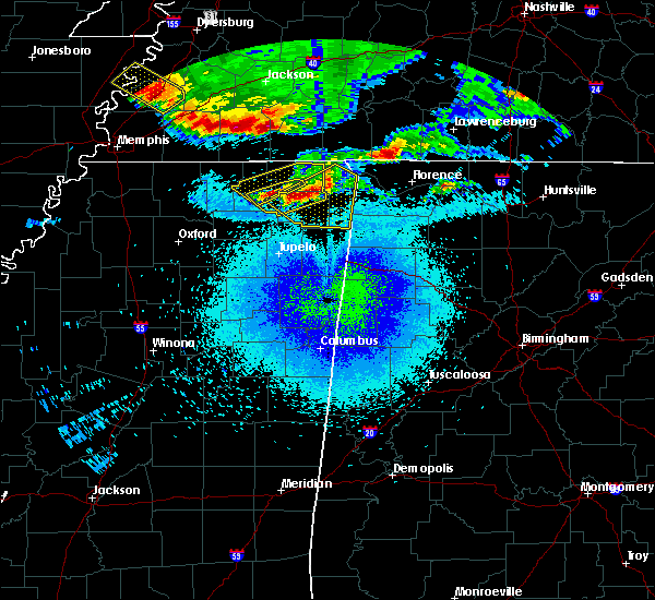 At 1133 pm cdt, severe thunderstorms were located along a line extending from near glen to near ripley, moving southeast at 35 mph (radar indicated). Hazards include 60 mph wind gusts. expect damage to roofs, siding, and trees At 1133 pm cdt, severe thunderstorms were located along a line extending from near glen to near ripley, moving southeast at 35 mph (radar indicated). Hazards include 60 mph wind gusts. expect damage to roofs, siding, and trees
|
| 4/8/2020 11:53 PM CDT |
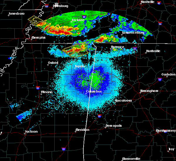 At 1153 pm cdt, severe thunderstorms were located along a line extending from near booneville to near baldwyn, moving southeast at 50 mph (radar indicated). Hazards include 60 mph wind gusts. Expect damage to roofs, siding, and trees. Locations impacted include, ripley, dumas, murry, hightown, peoples, collinstown and biggersville. At 1153 pm cdt, severe thunderstorms were located along a line extending from near booneville to near baldwyn, moving southeast at 50 mph (radar indicated). Hazards include 60 mph wind gusts. Expect damage to roofs, siding, and trees. Locations impacted include, ripley, dumas, murry, hightown, peoples, collinstown and biggersville.
|
| 4/8/2020 11:35 PM CDT |
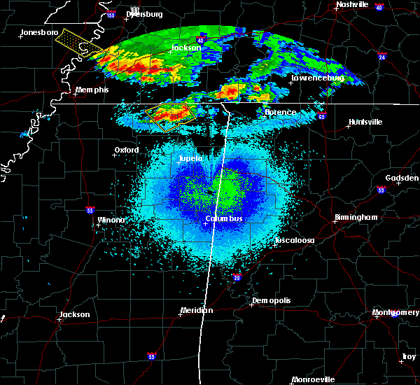 At 1135 pm cdt, severe thunderstorms were located along a line extending from near jumpertown to near ripley, moving southeast at 50 mph (radar indicated). Hazards include 60 mph wind gusts and penny size hail. Expect damage to roofs, siding, and trees. Locations impacted include, ripley, theo, falkner, dumas, kossuth, murry, allentown, hightown, collinstown, biggersville, crumtown, gift and peoples. At 1135 pm cdt, severe thunderstorms were located along a line extending from near jumpertown to near ripley, moving southeast at 50 mph (radar indicated). Hazards include 60 mph wind gusts and penny size hail. Expect damage to roofs, siding, and trees. Locations impacted include, ripley, theo, falkner, dumas, kossuth, murry, allentown, hightown, collinstown, biggersville, crumtown, gift and peoples.
|
| 4/8/2020 11:34 PM CDT |
 At 1133 pm cdt, severe thunderstorms were located along a line extending from near glen to near ripley, moving southeast at 35 mph (radar indicated). Hazards include 60 mph wind gusts. expect damage to roofs, siding, and trees At 1133 pm cdt, severe thunderstorms were located along a line extending from near glen to near ripley, moving southeast at 35 mph (radar indicated). Hazards include 60 mph wind gusts. expect damage to roofs, siding, and trees
|
| 4/8/2020 11:25 PM CDT |
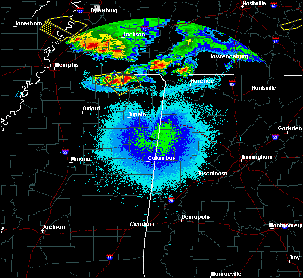 At 1125 pm cdt, severe thunderstorms were located along a line extending from 6 miles southwest of theo to near ripley, moving southeast at 50 mph (radar indicated). Hazards include 60 mph wind gusts and penny size hail. Expect damage to roofs, siding, and trees. Locations impacted include, ripley, theo, walnut, falkner, dumas, kossuth, chalybeate, murry, allentown, hightown, brody, collinstown, biggersville, crumtown, brownfield, gift, lone pine, hamilton, peoples and tiplersville. At 1125 pm cdt, severe thunderstorms were located along a line extending from 6 miles southwest of theo to near ripley, moving southeast at 50 mph (radar indicated). Hazards include 60 mph wind gusts and penny size hail. Expect damage to roofs, siding, and trees. Locations impacted include, ripley, theo, walnut, falkner, dumas, kossuth, chalybeate, murry, allentown, hightown, brody, collinstown, biggersville, crumtown, brownfield, gift, lone pine, hamilton, peoples and tiplersville.
|
| 4/8/2020 11:17 PM CDT |
 At 1117 pm cdt, severe thunderstorms were located along a line extending from 8 miles south of pocahontas to 6 miles southeast of canaan, moving southeast at 50 mph (radar indicated). Hazards include 60 mph wind gusts. expect damage to roofs, siding, and trees At 1117 pm cdt, severe thunderstorms were located along a line extending from 8 miles south of pocahontas to 6 miles southeast of canaan, moving southeast at 50 mph (radar indicated). Hazards include 60 mph wind gusts. expect damage to roofs, siding, and trees
|
| 3/28/2020 11:51 PM CDT |
 The severe thunderstorm warning for northern pontotoc, union, northwestern itawamba, lee, southern tippah, prentiss and south central alcorn counties will expire at midnight cdt, the storm which prompted the warning has weakened below severe limits, and no longer poses an immediate threat to life or property. therefore, the warning will be allowed to expire. however gusty winds and heavy rain are still possible with this thunderstorm. a tornado watch remains in effect until 200 am cdt for northeastern mississippi. a tornado watch also remains in effect until 400 am cdt for northeastern mississippi. The severe thunderstorm warning for northern pontotoc, union, northwestern itawamba, lee, southern tippah, prentiss and south central alcorn counties will expire at midnight cdt, the storm which prompted the warning has weakened below severe limits, and no longer poses an immediate threat to life or property. therefore, the warning will be allowed to expire. however gusty winds and heavy rain are still possible with this thunderstorm. a tornado watch remains in effect until 200 am cdt for northeastern mississippi. a tornado watch also remains in effect until 400 am cdt for northeastern mississippi.
|
| 3/28/2020 11:33 PM CDT |
 At 1132 pm cdt, a severe thunderstorm was located near new albany, moving east at 65 mph (radar indicated). Hazards include 60 mph wind gusts. Expect damage to roofs, siding, and trees. Locations impacted include, tupelo, booneville, new albany, pontotoc, fulton, baldwyn, trace state park, saltillo, guntown, mantachie, blue mountain, ecru, jumpertown, fairview, keownville, new harmony, pratts friendship, hinkle, wheeler and etta. At 1132 pm cdt, a severe thunderstorm was located near new albany, moving east at 65 mph (radar indicated). Hazards include 60 mph wind gusts. Expect damage to roofs, siding, and trees. Locations impacted include, tupelo, booneville, new albany, pontotoc, fulton, baldwyn, trace state park, saltillo, guntown, mantachie, blue mountain, ecru, jumpertown, fairview, keownville, new harmony, pratts friendship, hinkle, wheeler and etta.
|
| 3/28/2020 11:22 PM CDT |
 At 1121 pm cdt, a severe thunderstorm was located over pinedale, or 13 miles southwest of new albany, moving east at 65 mph (radar indicated). Hazards include 60 mph wind gusts. expect damage to roofs, siding, and trees At 1121 pm cdt, a severe thunderstorm was located over pinedale, or 13 miles southwest of new albany, moving east at 65 mph (radar indicated). Hazards include 60 mph wind gusts. expect damage to roofs, siding, and trees
|
| 3/28/2020 10:40 PM CDT |
 At 1039 pm cdt, a severe thunderstorm was located near keownville, or 11 miles west of baldwyn, moving northeast at 60 mph (radar indicated). Hazards include 60 mph wind gusts and quarter size hail. Hail damage to vehicles is expected. Expect wind damage to roofs, siding, and trees. At 1039 pm cdt, a severe thunderstorm was located near keownville, or 11 miles west of baldwyn, moving northeast at 60 mph (radar indicated). Hazards include 60 mph wind gusts and quarter size hail. Hail damage to vehicles is expected. Expect wind damage to roofs, siding, and trees.
|
| 3/23/2020 1:43 AM CDT |
 At 143 am cdt, a severe thunderstorm was located 8 miles southwest of blue mountain, or 11 miles northwest of new albany, moving northeast at 65 mph (radar indicated). Hazards include quarter size hail. Damage to vehicles is expected. Locations impacted include, new albany, ripley, blue mountain, keownville, etta, hickory flat, myrtle, dumas, cotton plant, shari, murry, winborn, concord, old myrtle, pumpkin center, molino, clarysville, pine grove, peoples and locum. At 143 am cdt, a severe thunderstorm was located 8 miles southwest of blue mountain, or 11 miles northwest of new albany, moving northeast at 65 mph (radar indicated). Hazards include quarter size hail. Damage to vehicles is expected. Locations impacted include, new albany, ripley, blue mountain, keownville, etta, hickory flat, myrtle, dumas, cotton plant, shari, murry, winborn, concord, old myrtle, pumpkin center, molino, clarysville, pine grove, peoples and locum.
|
| 3/23/2020 1:35 AM CDT |
 At 134 am cdt, a severe thunderstorm was located over bethlehem, or 12 miles southeast of wall doxey state park, moving northeast at 65 mph (radar indicated). Hazards include half dollar size hail. damage to vehicles is expected At 134 am cdt, a severe thunderstorm was located over bethlehem, or 12 miles southeast of wall doxey state park, moving northeast at 65 mph (radar indicated). Hazards include half dollar size hail. damage to vehicles is expected
|
| 2/5/2020 4:22 PM CST |
 At 422 pm cst, a severe thunderstorm was located near keownville, or near new albany, moving northeast at 60 mph (radar indicated). Hazards include 60 mph wind gusts and quarter size hail. Hail damage to vehicles is expected. expect wind damage to roofs, siding, and trees. Locations impacted include, booneville, new albany, baldwyn, jumpertown, hinkle, keownville, wheeler, myrtle, dumas, rienzi, shari, graham, thrasher, jericho, pumpkin center, gaston, baker, geeville, locum and hobo station. At 422 pm cst, a severe thunderstorm was located near keownville, or near new albany, moving northeast at 60 mph (radar indicated). Hazards include 60 mph wind gusts and quarter size hail. Hail damage to vehicles is expected. expect wind damage to roofs, siding, and trees. Locations impacted include, booneville, new albany, baldwyn, jumpertown, hinkle, keownville, wheeler, myrtle, dumas, rienzi, shari, graham, thrasher, jericho, pumpkin center, gaston, baker, geeville, locum and hobo station.
|
| 2/5/2020 4:07 PM CST |
 At 407 pm cst, a severe thunderstorm was located over etta, or 8 miles west of new albany, moving northeast at 60 mph (radar indicated). Hazards include 60 mph wind gusts. expect damage to roofs, siding, and trees At 407 pm cst, a severe thunderstorm was located over etta, or 8 miles west of new albany, moving northeast at 60 mph (radar indicated). Hazards include 60 mph wind gusts. expect damage to roofs, siding, and trees
|
| 1/11/2020 6:39 AM CST |
 At 638 am cst, a severe thunderstorm was located near corinth, moving east at 45 mph (radar indicated). Hazards include 60 mph wind gusts. Expect damage to roofs, siding, and trees. Locations impacted include, corinth, booneville, jumpertown, glen, thrashers, hinkle, burton, theo, farmington, dumas, rienzi, kossuth, strickland, collinstown, wenasoga, biggersville, jobes, gaston, allentown and hightown. At 638 am cst, a severe thunderstorm was located near corinth, moving east at 45 mph (radar indicated). Hazards include 60 mph wind gusts. Expect damage to roofs, siding, and trees. Locations impacted include, corinth, booneville, jumpertown, glen, thrashers, hinkle, burton, theo, farmington, dumas, rienzi, kossuth, strickland, collinstown, wenasoga, biggersville, jobes, gaston, allentown and hightown.
|
| 1/11/2020 6:37 AM CST |
 At 636 am cst, severe thunderstorms were located along a line extending from near keownville to 7 miles north of clarkson, moving east at 50 mph (radar indicated). Hazards include 60 mph wind gusts. expect damage to roofs, siding, and trees At 636 am cst, severe thunderstorms were located along a line extending from near keownville to 7 miles north of clarkson, moving east at 50 mph (radar indicated). Hazards include 60 mph wind gusts. expect damage to roofs, siding, and trees
|
| 1/11/2020 6:33 AM CST |
 At 633 am cst, severe thunderstorms were located along a line extending from blair to pheba, moving southeast at 55 mph (radar indicated). Hazards include 60 mph wind gusts. Expect damage to roofs, siding, and trees. Locations impacted include, tupelo, new albany, pontotoc, houston, baldwyn, verona, okolona, trace state park, saltillo, guntown, calhoun city, shannon, vardaman, derma, ecru, slate springs, keownville, new harmony, troy and pyland. At 633 am cst, severe thunderstorms were located along a line extending from blair to pheba, moving southeast at 55 mph (radar indicated). Hazards include 60 mph wind gusts. Expect damage to roofs, siding, and trees. Locations impacted include, tupelo, new albany, pontotoc, houston, baldwyn, verona, okolona, trace state park, saltillo, guntown, calhoun city, shannon, vardaman, derma, ecru, slate springs, keownville, new harmony, troy and pyland.
|
| 1/11/2020 6:30 AM CST |
 At 630 am cst, a severe thunderstorm was located near theo, or near big hill pond state park, moving northeast at 45 mph (radar indicated). Hazards include 60 mph wind gusts. Expect damage to roofs, siding, and trees. Locations impacted include, corinth, booneville, ripley, jumpertown, glen, thrashers, hinkle, burton, theo, farmington, walnut, falkner, dumas, guys, rienzi, kossuth, chalybeate, murry, strickland and collinstown. At 630 am cst, a severe thunderstorm was located near theo, or near big hill pond state park, moving northeast at 45 mph (radar indicated). Hazards include 60 mph wind gusts. Expect damage to roofs, siding, and trees. Locations impacted include, corinth, booneville, ripley, jumpertown, glen, thrashers, hinkle, burton, theo, farmington, walnut, falkner, dumas, guys, rienzi, kossuth, chalybeate, murry, strickland and collinstown.
|
| 1/11/2020 6:16 AM CST |
 At 616 am cst, severe thunderstorms were located along a line extending from near keownville to near clarkson, moving southeast at 55 mph (radar indicated). Hazards include 60 mph wind gusts. Expect damage to roofs, siding, and trees. Locations impacted include, tupelo, new albany, pontotoc, houston, baldwyn, verona, okolona, trace state park, saltillo, guntown, bruce, calhoun city, shannon, vardaman, derma, ecru, pittsboro, slate springs, new harmony and troy. At 616 am cst, severe thunderstorms were located along a line extending from near keownville to near clarkson, moving southeast at 55 mph (radar indicated). Hazards include 60 mph wind gusts. Expect damage to roofs, siding, and trees. Locations impacted include, tupelo, new albany, pontotoc, houston, baldwyn, verona, okolona, trace state park, saltillo, guntown, bruce, calhoun city, shannon, vardaman, derma, ecru, pittsboro, slate springs, new harmony and troy.
|
| 1/11/2020 6:09 AM CST |
 At 609 am cst, a severe thunderstorm was located 9 miles north of ripley, moving northeast at 40 mph (radar indicated). Hazards include 70 mph wind gusts. Expect considerable tree damage. Damage is likely to mobile homes, roofs, and outbuildings. At 609 am cst, a severe thunderstorm was located 9 miles north of ripley, moving northeast at 40 mph (radar indicated). Hazards include 70 mph wind gusts. Expect considerable tree damage. Damage is likely to mobile homes, roofs, and outbuildings.
|
| 1/11/2020 6:01 AM CST |
 At 600 am cst, severe thunderstorms were located along a line extending from 9 miles south of bolivar to near blue mountain, moving east at 50 mph (radar indicated). Hazards include 60 mph wind gusts. Expect damage to roofs, siding, and trees. Locations impacted include, ripley, blue mountain, snow lake shores, canaan, gravestown, michigan city, walnut, hickory flat, ashland, falkner, dumas, chalybeate, murry, brody, spring hill, new canaan, whitten town, hamilton, bethel and tiplersville. At 600 am cst, severe thunderstorms were located along a line extending from 9 miles south of bolivar to near blue mountain, moving east at 50 mph (radar indicated). Hazards include 60 mph wind gusts. Expect damage to roofs, siding, and trees. Locations impacted include, ripley, blue mountain, snow lake shores, canaan, gravestown, michigan city, walnut, hickory flat, ashland, falkner, dumas, chalybeate, murry, brody, spring hill, new canaan, whitten town, hamilton, bethel and tiplersville.
|
| 1/11/2020 6:01 AM CST |
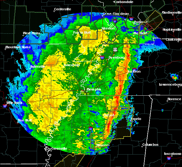 At 600 am cst, severe thunderstorms were located along a line extending from 9 miles south of bolivar to near blue mountain, moving east at 50 mph (radar indicated). Hazards include 60 mph wind gusts. Expect damage to roofs, siding, and trees. Locations impacted include, ripley, blue mountain, snow lake shores, canaan, gravestown, michigan city, walnut, hickory flat, ashland, falkner, dumas, chalybeate, murry, brody, spring hill, new canaan, whitten town, hamilton, bethel and tiplersville. At 600 am cst, severe thunderstorms were located along a line extending from 9 miles south of bolivar to near blue mountain, moving east at 50 mph (radar indicated). Hazards include 60 mph wind gusts. Expect damage to roofs, siding, and trees. Locations impacted include, ripley, blue mountain, snow lake shores, canaan, gravestown, michigan city, walnut, hickory flat, ashland, falkner, dumas, chalybeate, murry, brody, spring hill, new canaan, whitten town, hamilton, bethel and tiplersville.
|
| 1/11/2020 5:57 AM CST |
 At 557 am cst, severe thunderstorms were located along a line extending from 8 miles northeast of bethlehem to near sabougla, moving southeast at 55 mph (radar indicated). Hazards include 60 mph wind gusts. expect damage to roofs, siding, and trees At 557 am cst, severe thunderstorms were located along a line extending from 8 miles northeast of bethlehem to near sabougla, moving southeast at 55 mph (radar indicated). Hazards include 60 mph wind gusts. expect damage to roofs, siding, and trees
|
| 1/11/2020 5:37 AM CST |
 At 536 am cst, severe thunderstorms were located along a line extending from near slayden to near bethlehem, moving east at 60 mph (radar indicated). Hazards include 60 mph wind gusts. expect damage to roofs, siding, and trees At 536 am cst, severe thunderstorms were located along a line extending from near slayden to near bethlehem, moving east at 60 mph (radar indicated). Hazards include 60 mph wind gusts. expect damage to roofs, siding, and trees
|
| 10/26/2019 11:45 AM CDT |
 At 1145 am cdt, a severe thunderstorm was located near keownville, or 9 miles southeast of ripley, moving north at 50 mph (radar indicated). Hazards include 60 mph wind gusts. expect damage to roofs, siding, and trees At 1145 am cdt, a severe thunderstorm was located near keownville, or 9 miles southeast of ripley, moving north at 50 mph (radar indicated). Hazards include 60 mph wind gusts. expect damage to roofs, siding, and trees
|
| 10/26/2019 11:04 AM CDT |
 At 1104 am cdt, a severe thunderstorm was located over ecru, or 8 miles northwest of pontotoc, moving north at 45 mph (radar indicated). Hazards include 60 mph wind gusts. expect damage to roofs, siding, and trees At 1104 am cdt, a severe thunderstorm was located over ecru, or 8 miles northwest of pontotoc, moving north at 45 mph (radar indicated). Hazards include 60 mph wind gusts. expect damage to roofs, siding, and trees
|
| 6/27/2019 12:01 PM CDT |
 At 1201 pm cdt, severe thunderstorms were located along a line extending from jumpertown to blair to randolph, moving southeast at 40 mph (radar indicated). Hazards include 60 mph wind gusts. Expect damage to roofs, siding, and trees. Locations impacted include, tupelo, booneville, pontotoc, baldwyn, trace state park, saltillo, guntown, ecru, jumpertown, thrashers, new harmony, pratts friendship, randolph, hinkle, wheeler, blair, furrs, sherman, thaxton and algoma. At 1201 pm cdt, severe thunderstorms were located along a line extending from jumpertown to blair to randolph, moving southeast at 40 mph (radar indicated). Hazards include 60 mph wind gusts. Expect damage to roofs, siding, and trees. Locations impacted include, tupelo, booneville, pontotoc, baldwyn, trace state park, saltillo, guntown, ecru, jumpertown, thrashers, new harmony, pratts friendship, randolph, hinkle, wheeler, blair, furrs, sherman, thaxton and algoma.
|
| 6/27/2019 11:43 AM CDT |
 At 1143 am cdt, severe thunderstorms were located along a line extending from 7 miles northeast of ripley to near keownville to near tula, moving southeast at 40 mph (radar indicated). Hazards include 60 mph wind gusts. expect damage to roofs, siding, and trees At 1143 am cdt, severe thunderstorms were located along a line extending from 7 miles northeast of ripley to near keownville to near tula, moving southeast at 40 mph (radar indicated). Hazards include 60 mph wind gusts. expect damage to roofs, siding, and trees
|
| 2/23/2019 4:11 PM CST |
 At 411 pm cst, doppler radar indicated a severe thunderstorm producing a tornado was located near jumpertown, or 7 miles west of booneville, moving northeast at 45 mph (radar indicated rotation). Hazards include tornado. Flying debris will be dangerous to those caught without shelter. mobile homes will be damaged or destroyed. damage to roofs, windows, and vehicles will occur. tree damage is likely. Locations impacted include, booneville, jumpertown, dumas, rienzi, blackland and gaston. At 411 pm cst, doppler radar indicated a severe thunderstorm producing a tornado was located near jumpertown, or 7 miles west of booneville, moving northeast at 45 mph (radar indicated rotation). Hazards include tornado. Flying debris will be dangerous to those caught without shelter. mobile homes will be damaged or destroyed. damage to roofs, windows, and vehicles will occur. tree damage is likely. Locations impacted include, booneville, jumpertown, dumas, rienzi, blackland and gaston.
|
| 2/23/2019 4:10 PM CST |
 At 410 pm cst, a severe thunderstorm was located over jumpertown, or 8 miles northwest of booneville, moving northeast at 60 mph (radar indicated). Hazards include 60 mph wind gusts. Expect damage to roofs, siding, and trees. locations impacted include, booneville, jumpertown, hinkle, wheeler, dumas, rienzi, geeville, blackland, frankstown and gaston. A tornado watch remains in effect until 800 pm cst for northeastern mississippi. At 410 pm cst, a severe thunderstorm was located over jumpertown, or 8 miles northwest of booneville, moving northeast at 60 mph (radar indicated). Hazards include 60 mph wind gusts. Expect damage to roofs, siding, and trees. locations impacted include, booneville, jumpertown, hinkle, wheeler, dumas, rienzi, geeville, blackland, frankstown and gaston. A tornado watch remains in effect until 800 pm cst for northeastern mississippi.
|
| 2/23/2019 4:04 PM CST |
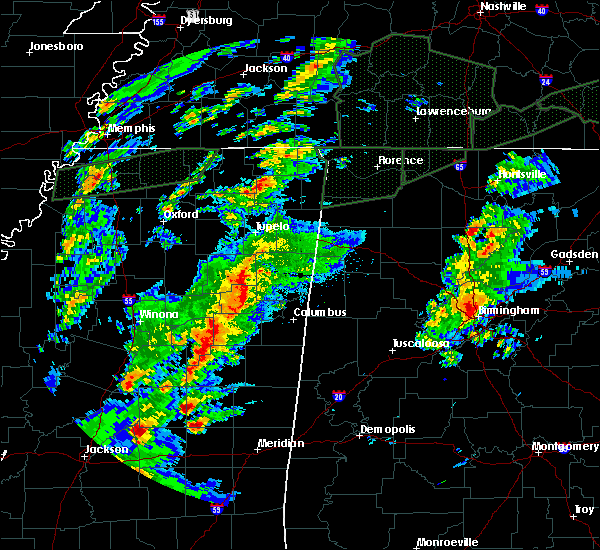 At 404 pm cst, doppler radar indicated a severe thunderstorm producing a tornado was located 8 miles southwest of jumpertown, or 10 miles northwest of baldwyn, moving northeast at 40 mph (radar indicated rotation). Hazards include tornado. Flying debris will be dangerous to those caught without shelter. mobile homes will be damaged or destroyed. damage to roofs, windows, and vehicles will occur. Tree damage is likely. At 404 pm cst, doppler radar indicated a severe thunderstorm producing a tornado was located 8 miles southwest of jumpertown, or 10 miles northwest of baldwyn, moving northeast at 40 mph (radar indicated rotation). Hazards include tornado. Flying debris will be dangerous to those caught without shelter. mobile homes will be damaged or destroyed. damage to roofs, windows, and vehicles will occur. Tree damage is likely.
|
| 2/23/2019 3:54 PM CST |
 At 354 pm cst, a severe thunderstorm was located near keownville, or 10 miles northeast of new albany, moving northeast at 60 mph. a tornado is possible with this storm (radar indicated). Hazards include 60 mph wind gusts. expect damage to roofs, siding, and trees At 354 pm cst, a severe thunderstorm was located near keownville, or 10 miles northeast of new albany, moving northeast at 60 mph. a tornado is possible with this storm (radar indicated). Hazards include 60 mph wind gusts. expect damage to roofs, siding, and trees
|
| 11/5/2018 9:57 PM CST |
 At 956 pm cst, doppler radar indicated a severe thunderstorm producing a tornado was located near ripley, moving east at 50 mph (radar indicated rotation). Hazards include tornado. Flying debris will be dangerous to those caught without shelter. mobile homes will be damaged or destroyed. damage to roofs, windows, and vehicles will occur. tree damage is likely. Locations impacted include, corinth, booneville, new albany, ripley, blue mountain, jumpertown, thrashers, hinkle, keownville, wheeler, myrtle, dumas, rienzi, kossuth, shari, murry, poolville, graham, old myrtle and collinstown. At 956 pm cst, doppler radar indicated a severe thunderstorm producing a tornado was located near ripley, moving east at 50 mph (radar indicated rotation). Hazards include tornado. Flying debris will be dangerous to those caught without shelter. mobile homes will be damaged or destroyed. damage to roofs, windows, and vehicles will occur. tree damage is likely. Locations impacted include, corinth, booneville, new albany, ripley, blue mountain, jumpertown, thrashers, hinkle, keownville, wheeler, myrtle, dumas, rienzi, kossuth, shari, murry, poolville, graham, old myrtle and collinstown.
|
| 11/5/2018 9:40 PM CST |
 At 940 pm cst, doppler radar indicated a severe thunderstorm producing a tornado was located near blue mountain, or 10 miles northwest of new albany, moving east at 50 mph (radar indicated rotation). Hazards include tornado. Flying debris will be dangerous to those caught without shelter. mobile homes will be damaged or destroyed. damage to roofs, windows, and vehicles will occur. Tree damage is likely. At 940 pm cst, doppler radar indicated a severe thunderstorm producing a tornado was located near blue mountain, or 10 miles northwest of new albany, moving east at 50 mph (radar indicated rotation). Hazards include tornado. Flying debris will be dangerous to those caught without shelter. mobile homes will be damaged or destroyed. damage to roofs, windows, and vehicles will occur. Tree damage is likely.
|
| 6/21/2018 8:37 PM CDT |
 At 837 pm cdt, a severe thunderstorm was located over blue mountain, or 8 miles southwest of ripley, moving southeast at 45 mph (radar indicated). Hazards include 60 mph wind gusts. expect damage to roofs, siding, and trees At 837 pm cdt, a severe thunderstorm was located over blue mountain, or 8 miles southwest of ripley, moving southeast at 45 mph (radar indicated). Hazards include 60 mph wind gusts. expect damage to roofs, siding, and trees
|
| 4/14/2018 5:44 AM CDT |
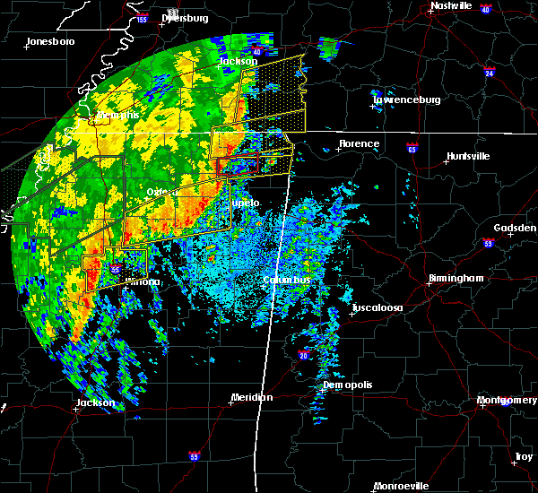 At 544 am cdt, a severe thunderstorm producing a tornado was located 8 miles northeast of keownville, or 10 miles southeast of ripley, moving northeast at 55 mph (radar indicated rotation). Hazards include tornado. Flying debris will be dangerous to those caught without shelter. mobile homes will be damaged or destroyed. damage to roofs, windows, and vehicles will occur. Tree damage is likely. At 544 am cdt, a severe thunderstorm producing a tornado was located 8 miles northeast of keownville, or 10 miles southeast of ripley, moving northeast at 55 mph (radar indicated rotation). Hazards include tornado. Flying debris will be dangerous to those caught without shelter. mobile homes will be damaged or destroyed. damage to roofs, windows, and vehicles will occur. Tree damage is likely.
|
| 4/14/2018 5:42 AM CDT |
 The tornado warning for northwestern union, southwestern tippah and southeastern benton counties will expire at 545 am cdt, the storm which prompted the warning has moved out of the area. therefore the warning will be allowed to expire. however heavy rain is still possible with this thunderstorm. a tornado watch remains in effect until 800 am cdt for northeastern mississippi. The tornado warning for northwestern union, southwestern tippah and southeastern benton counties will expire at 545 am cdt, the storm which prompted the warning has moved out of the area. therefore the warning will be allowed to expire. however heavy rain is still possible with this thunderstorm. a tornado watch remains in effect until 800 am cdt for northeastern mississippi.
|
| 4/14/2018 5:39 AM CDT |
 At 538 am cdt, a severe thunderstorm was located near ripley, moving northeast at 50 mph (radar indicated). Hazards include 60 mph wind gusts. expect damage to roofs, siding, and trees At 538 am cdt, a severe thunderstorm was located near ripley, moving northeast at 50 mph (radar indicated). Hazards include 60 mph wind gusts. expect damage to roofs, siding, and trees
|
| 4/14/2018 5:08 AM CDT |
 At 508 am cdt, a severe thunderstorm producing a tornado was located near bethlehem, or 12 miles northwest of new albany, moving northeast at 55 mph (radar indicated rotation). Hazards include tornado. Flying debris will be dangerous to those caught without shelter. mobile homes will be damaged or destroyed. damage to roofs, windows, and vehicles will occur. Tree damage is likely. At 508 am cdt, a severe thunderstorm producing a tornado was located near bethlehem, or 12 miles northwest of new albany, moving northeast at 55 mph (radar indicated rotation). Hazards include tornado. Flying debris will be dangerous to those caught without shelter. mobile homes will be damaged or destroyed. damage to roofs, windows, and vehicles will occur. Tree damage is likely.
|
| 4/3/2018 8:26 PM CDT |
 At 826 pm cdt, severe thunderstorms were located along a line extending from near keownville to near new harmony to near ecru, moving east at 65 mph (radar indicated). Hazards include 60 mph wind gusts. expect damage to roofs, siding, and trees At 826 pm cdt, severe thunderstorms were located along a line extending from near keownville to near new harmony to near ecru, moving east at 65 mph (radar indicated). Hazards include 60 mph wind gusts. expect damage to roofs, siding, and trees
|
| 3/28/2018 8:36 PM CDT |
 At 836 pm cdt, a severe thunderstorm was located near ripley, moving northeast at 45 mph (radar indicated). Hazards include 60 mph wind gusts. expect damage to roofs, siding, and trees At 836 pm cdt, a severe thunderstorm was located near ripley, moving northeast at 45 mph (radar indicated). Hazards include 60 mph wind gusts. expect damage to roofs, siding, and trees
|
| 3/19/2018 4:00 PM CDT |
 At 400 pm cdt, a severe thunderstorm was located near keownville, or 9 miles east of new albany, moving northeast at 55 mph (radar indicated). Hazards include 60 mph wind gusts and half dollar size hail. Hail damage to vehicles is expected. expect wind damage to roofs, siding, and trees. locations impacted include, booneville, new albany, baldwyn, saltillo, guntown, jumpertown, thrashers, keownville, new harmony, wheeler, pratts friendship, blair, dumas, blue springs, shari, graham, jericho, branyan, ellistown and pumpkin center. A tornado watch remains in effect until 1100 pm cdt for northeastern mississippi. At 400 pm cdt, a severe thunderstorm was located near keownville, or 9 miles east of new albany, moving northeast at 55 mph (radar indicated). Hazards include 60 mph wind gusts and half dollar size hail. Hail damage to vehicles is expected. expect wind damage to roofs, siding, and trees. locations impacted include, booneville, new albany, baldwyn, saltillo, guntown, jumpertown, thrashers, keownville, new harmony, wheeler, pratts friendship, blair, dumas, blue springs, shari, graham, jericho, branyan, ellistown and pumpkin center. A tornado watch remains in effect until 1100 pm cdt for northeastern mississippi.
|
| 3/19/2018 3:52 PM CDT |
 At 352 pm cdt, a severe thunderstorm was located over new albany, moving northeast at 50 mph (radar indicated). Hazards include 60 mph wind gusts and half dollar size hail. Hail damage to vehicles is expected. Expect wind damage to roofs, siding, and trees. At 352 pm cdt, a severe thunderstorm was located over new albany, moving northeast at 50 mph (radar indicated). Hazards include 60 mph wind gusts and half dollar size hail. Hail damage to vehicles is expected. Expect wind damage to roofs, siding, and trees.
|
| 3/19/2018 11:18 AM CDT |
 At 1118 am cdt, a severe thunderstorm was located near ripley, moving east at 45 mph (trained weather spotters). Hazards include half dollar size hail. Damage to vehicles is expected. Locations impacted include, corinth, booneville, ripley, blue mountain, jumpertown, glen, thrashers, hinkle, theo, farmington, falkner, rienzi, kossuth, murry, strickland, collinstown, biggersville, jobes, gaston and tiplersville. At 1118 am cdt, a severe thunderstorm was located near ripley, moving east at 45 mph (trained weather spotters). Hazards include half dollar size hail. Damage to vehicles is expected. Locations impacted include, corinth, booneville, ripley, blue mountain, jumpertown, glen, thrashers, hinkle, theo, farmington, falkner, rienzi, kossuth, murry, strickland, collinstown, biggersville, jobes, gaston and tiplersville.
|
| 3/19/2018 11:16 AM CDT |
 At 1115 am cdt, a severe thunderstorm was located near ripley, moving east at 45 mph (radar indicated). Hazards include quarter size hail. Damage to vehicles is expected. Locations impacted include, corinth, booneville, ripley, blue mountain, jumpertown, glen, thrashers, hinkle, theo, farmington, falkner, rienzi, kossuth, murry, strickland, collinstown, biggersville, jobes, gaston and tiplersville. At 1115 am cdt, a severe thunderstorm was located near ripley, moving east at 45 mph (radar indicated). Hazards include quarter size hail. Damage to vehicles is expected. Locations impacted include, corinth, booneville, ripley, blue mountain, jumpertown, glen, thrashers, hinkle, theo, farmington, falkner, rienzi, kossuth, murry, strickland, collinstown, biggersville, jobes, gaston and tiplersville.
|
| 3/19/2018 11:09 AM CDT |
 At 1108 am cdt, a severe thunderstorm was located near gravestown, or near ripley, moving east at 45 mph (radar indicated). Hazards include quarter size hail. damage to vehicles is expected At 1108 am cdt, a severe thunderstorm was located near gravestown, or near ripley, moving east at 45 mph (radar indicated). Hazards include quarter size hail. damage to vehicles is expected
|
| 2/24/2018 10:14 PM CST |
 At 1014 pm cst, a severe thunderstorm producing a tornado was located 9 miles east of keownville, or 9 miles northwest of baldwyn, moving northeast at 70 mph (radar indicated rotation). Hazards include tornado. Flying debris will be dangerous to those caught without shelter. mobile homes will be damaged or destroyed. damage to roofs, windows, and vehicles will occur. tree damage is likely. this dangerous storm will be near, wheeler around 1020 pm cst. booneville and jumpertown around 1025 pm cst. thrashers around 1030 pm cst. Other locations impacted by this tornadic thunderstorm include graham, jericho, alpine, blackland, gaston, marietta, geeville, locum, hobo station and parks. At 1014 pm cst, a severe thunderstorm producing a tornado was located 9 miles east of keownville, or 9 miles northwest of baldwyn, moving northeast at 70 mph (radar indicated rotation). Hazards include tornado. Flying debris will be dangerous to those caught without shelter. mobile homes will be damaged or destroyed. damage to roofs, windows, and vehicles will occur. tree damage is likely. this dangerous storm will be near, wheeler around 1020 pm cst. booneville and jumpertown around 1025 pm cst. thrashers around 1030 pm cst. Other locations impacted by this tornadic thunderstorm include graham, jericho, alpine, blackland, gaston, marietta, geeville, locum, hobo station and parks.
|
| 2/24/2018 10:05 PM CST |
 At 1005 pm cst, a severe thunderstorm producing a tornado was located near keownville, or near new albany, moving northeast at 45 mph (radar indicated rotation). Hazards include tornado. Flying debris will be dangerous to those caught without shelter. mobile homes will be damaged or destroyed. damage to roofs, windows, and vehicles will occur. tree damage is likely. this dangerous storm will be near, baldwyn around 1025 pm cst. jumpertown and wheeler around 1030 pm cst. booneville around 1040 pm cst. thrashers around 1045 pm cst. Other locations impacted by this tornadic thunderstorm include union hill, graham, jericho, alpine, blackland, gaston, marietta, baker, geeville and locum. At 1005 pm cst, a severe thunderstorm producing a tornado was located near keownville, or near new albany, moving northeast at 45 mph (radar indicated rotation). Hazards include tornado. Flying debris will be dangerous to those caught without shelter. mobile homes will be damaged or destroyed. damage to roofs, windows, and vehicles will occur. tree damage is likely. this dangerous storm will be near, baldwyn around 1025 pm cst. jumpertown and wheeler around 1030 pm cst. booneville around 1040 pm cst. thrashers around 1045 pm cst. Other locations impacted by this tornadic thunderstorm include union hill, graham, jericho, alpine, blackland, gaston, marietta, baker, geeville and locum.
|
| 2/24/2018 9:55 PM CST |
 At 954 pm cst, a severe thunderstorm producing a tornado was located near glen, or near corinth, moving northeast at 40 mph (radar indicated rotation). Hazards include tornado. Flying debris will be dangerous to those caught without shelter. mobile homes will be damaged or destroyed. damage to roofs, windows, and vehicles will occur. tree damage is likely. Locations impacted include, corinth, glen, hinkle, theo, farmington, eastview, michie, dumas, guys, kossuth, pebble hill, strickland, collinstown, wenasoga, biggersville, tulu, jobes, acton, chewalla and chambers. At 954 pm cst, a severe thunderstorm producing a tornado was located near glen, or near corinth, moving northeast at 40 mph (radar indicated rotation). Hazards include tornado. Flying debris will be dangerous to those caught without shelter. mobile homes will be damaged or destroyed. damage to roofs, windows, and vehicles will occur. tree damage is likely. Locations impacted include, corinth, glen, hinkle, theo, farmington, eastview, michie, dumas, guys, kossuth, pebble hill, strickland, collinstown, wenasoga, biggersville, tulu, jobes, acton, chewalla and chambers.
|
| 2/24/2018 9:36 PM CST |
 At 935 pm cst, a severe thunderstorm producing a tornado was located near theo, or 13 miles south of big hill pond state park, moving northeast at 60 mph (radar indicated rotation). Hazards include tornado. Flying debris will be dangerous to those caught without shelter. mobile homes will be damaged or destroyed. damage to roofs, windows, and vehicles will occur. Tree damage is likely. At 935 pm cst, a severe thunderstorm producing a tornado was located near theo, or 13 miles south of big hill pond state park, moving northeast at 60 mph (radar indicated rotation). Hazards include tornado. Flying debris will be dangerous to those caught without shelter. mobile homes will be damaged or destroyed. damage to roofs, windows, and vehicles will occur. Tree damage is likely.
|
| 12/23/2017 4:09 AM CST |
 The severe thunderstorm warning for southeastern tippah, northwestern prentiss and western alcorn counties will expire at 415 am cst, the storm which prompted the warning has weakened below severe limits, and no longer pose an immediate threat to life or property. therefore, the warning will be allowed to expire. however heavy rain is still possible with this thunderstorm. The severe thunderstorm warning for southeastern tippah, northwestern prentiss and western alcorn counties will expire at 415 am cst, the storm which prompted the warning has weakened below severe limits, and no longer pose an immediate threat to life or property. therefore, the warning will be allowed to expire. however heavy rain is still possible with this thunderstorm.
|
| 12/23/2017 3:52 AM CST |
 At 352 am cst, a severe thunderstorm was located near jumpertown, or 10 miles northwest of booneville, moving northeast at 55 mph (radar indicated). Hazards include 60 mph wind gusts. Expect damage to roofs, siding, and trees. Locations impacted include, corinth, booneville, ripley, jumpertown, hinkle, falkner, dumas, rienzi, kossuth, murry, allentown, hightown, collinstown, biggersville, crumtown, blackland, jobes, gaston, clarysville and peoples. At 352 am cst, a severe thunderstorm was located near jumpertown, or 10 miles northwest of booneville, moving northeast at 55 mph (radar indicated). Hazards include 60 mph wind gusts. Expect damage to roofs, siding, and trees. Locations impacted include, corinth, booneville, ripley, jumpertown, hinkle, falkner, dumas, rienzi, kossuth, murry, allentown, hightown, collinstown, biggersville, crumtown, blackland, jobes, gaston, clarysville and peoples.
|
| 12/23/2017 3:38 AM CST |
 At 338 am cst, a severe thunderstorm was located near ripley, moving northeast at 55 mph (radar indicated). Hazards include 60 mph wind gusts. expect damage to roofs, siding, and trees At 338 am cst, a severe thunderstorm was located near ripley, moving northeast at 55 mph (radar indicated). Hazards include 60 mph wind gusts. expect damage to roofs, siding, and trees
|
| 12/23/2017 3:22 AM CST |
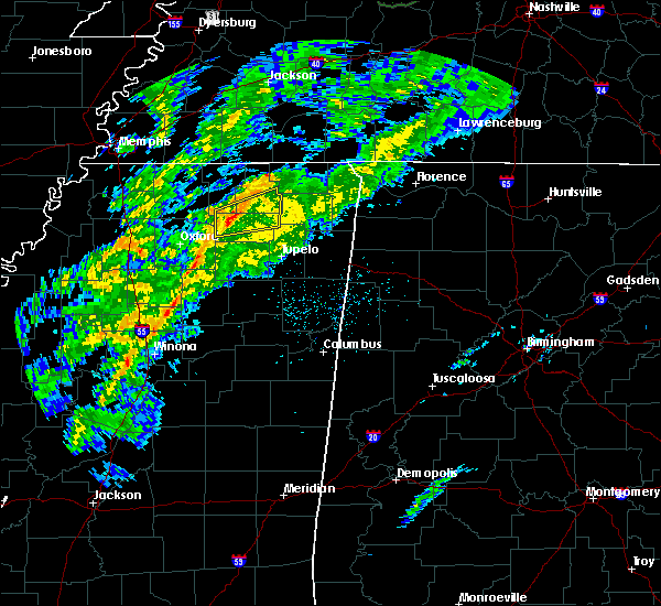 At 322 am cst, a severe thunderstorm producing a tornado was located near blue mountain, or 7 miles northwest of new albany, moving northeast at 55 mph (radar indicated rotation). Hazards include tornado. Flying debris will be dangerous to those caught without shelter. mobile homes will be damaged or destroyed. damage to roofs, windows, and vehicles will occur. tree damage is likely. this dangerous storm will be near, blue mountain and keownville around 330 am cst. Other locations impacted by this tornadic thunderstorm include cotton plant, molino, clarysville, myrtle, concord, old myrtle, smalco, pumpkin center and dumas. At 322 am cst, a severe thunderstorm producing a tornado was located near blue mountain, or 7 miles northwest of new albany, moving northeast at 55 mph (radar indicated rotation). Hazards include tornado. Flying debris will be dangerous to those caught without shelter. mobile homes will be damaged or destroyed. damage to roofs, windows, and vehicles will occur. tree damage is likely. this dangerous storm will be near, blue mountain and keownville around 330 am cst. Other locations impacted by this tornadic thunderstorm include cotton plant, molino, clarysville, myrtle, concord, old myrtle, smalco, pumpkin center and dumas.
|
| 12/23/2017 3:18 AM CST |
 At 318 am cst, a severe thunderstorm was located 7 miles northwest of new albany, moving northeast at 55 mph (radar indicated). Hazards include 60 mph wind gusts. Expect damage to roofs, siding, and trees. Locations impacted include, new albany, ripley, blue mountain, keownville, etta, hickory flat, myrtle, dumas, shari, poolville, graham, jericho, old myrtle, pumpkin center, baker, locum, smalco, glenfield, cotton plant and union hill. At 318 am cst, a severe thunderstorm was located 7 miles northwest of new albany, moving northeast at 55 mph (radar indicated). Hazards include 60 mph wind gusts. Expect damage to roofs, siding, and trees. Locations impacted include, new albany, ripley, blue mountain, keownville, etta, hickory flat, myrtle, dumas, shari, poolville, graham, jericho, old myrtle, pumpkin center, baker, locum, smalco, glenfield, cotton plant and union hill.
|
| 12/23/2017 3:14 AM CST |
 At 314 am cst, a severe thunderstorm was located near etta, or 9 miles west of new albany, moving northeast at 55 mph (radar indicated). Hazards include 60 mph wind gusts. expect damage to roofs, siding, and trees At 314 am cst, a severe thunderstorm was located near etta, or 9 miles west of new albany, moving northeast at 55 mph (radar indicated). Hazards include 60 mph wind gusts. expect damage to roofs, siding, and trees
|
| 8/31/2017 2:04 PM CDT |
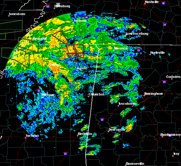 At 204 pm cdt, a severe thunderstorm producing a tornado was located near ripley, moving north at 30 mph. this storm has a history of producing tornado damage (radar indicated rotation). Hazards include tornado. Flying debris will be dangerous to those caught without shelter. mobile homes will be damaged or destroyed. damage to roofs, windows, and vehicles will occur. tree damage is likely. this dangerous storm will be near, ripley around 215 pm cdt. Other locations impacted by this tornadic thunderstorm include dumas. At 204 pm cdt, a severe thunderstorm producing a tornado was located near ripley, moving north at 30 mph. this storm has a history of producing tornado damage (radar indicated rotation). Hazards include tornado. Flying debris will be dangerous to those caught without shelter. mobile homes will be damaged or destroyed. damage to roofs, windows, and vehicles will occur. tree damage is likely. this dangerous storm will be near, ripley around 215 pm cdt. Other locations impacted by this tornadic thunderstorm include dumas.
|
| 8/31/2017 1:50 PM CDT |
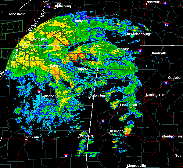 At 149 pm cdt, a severe thunderstorm producing a tornado was located 7 miles east of keownville, or 11 miles northwest of baldwyn, moving north at 30 mph (radar indicated rotation). Hazards include tornado. Flying debris will be dangerous to those caught without shelter. mobile homes will be damaged or destroyed. damage to roofs, windows, and vehicles will occur. tree damage is likely. this dangerous storm will be near, ripley around 215 pm cdt. Other locations impacted by this tornadic thunderstorm include locum, graham, dumas and clarysville. At 149 pm cdt, a severe thunderstorm producing a tornado was located 7 miles east of keownville, or 11 miles northwest of baldwyn, moving north at 30 mph (radar indicated rotation). Hazards include tornado. Flying debris will be dangerous to those caught without shelter. mobile homes will be damaged or destroyed. damage to roofs, windows, and vehicles will occur. tree damage is likely. this dangerous storm will be near, ripley around 215 pm cdt. Other locations impacted by this tornadic thunderstorm include locum, graham, dumas and clarysville.
|
| 8/31/2017 1:37 PM CDT |
 At 136 pm cdt, a severe thunderstorm producing a tornado was located over blair, or 7 miles west of baldwyn, moving north at 25 mph (radar indicated rotation). Hazards include tornado. Flying debris will be dangerous to those caught without shelter. mobile homes will be damaged or destroyed. damage to roofs, windows, and vehicles will occur. tree damage is likely. this dangerous storm will be near, ripley around 215 pm cdt. Other locations impacted by this tornadic thunderstorm include graham, jericho, branyan, alpine, jug fork, corrona, graves, molino, clarysville and geeville. At 136 pm cdt, a severe thunderstorm producing a tornado was located over blair, or 7 miles west of baldwyn, moving north at 25 mph (radar indicated rotation). Hazards include tornado. Flying debris will be dangerous to those caught without shelter. mobile homes will be damaged or destroyed. damage to roofs, windows, and vehicles will occur. tree damage is likely. this dangerous storm will be near, ripley around 215 pm cdt. Other locations impacted by this tornadic thunderstorm include graham, jericho, branyan, alpine, jug fork, corrona, graves, molino, clarysville and geeville.
|
| 8/31/2017 11:21 AM CDT |
 At 1119 am cdt, a severe thunderstorm producing a tornado was located near keownville, or 10 miles southeast of ripley, moving north at 25 mph (radar indicated rotation). Hazards include tornado. Flying debris will be dangerous to those caught without shelter. mobile homes will be damaged or destroyed. damage to roofs, windows, and vehicles will occur. tree damage is likely. this dangerous storm will be near, ripley around 1145 am cdt. Other locations impacted by this tornadic thunderstorm include chalybeate, murry, graham, brownfield, walnut, molino, clarysville, hamilton, peoples and locum. At 1119 am cdt, a severe thunderstorm producing a tornado was located near keownville, or 10 miles southeast of ripley, moving north at 25 mph (radar indicated rotation). Hazards include tornado. Flying debris will be dangerous to those caught without shelter. mobile homes will be damaged or destroyed. damage to roofs, windows, and vehicles will occur. tree damage is likely. this dangerous storm will be near, ripley around 1145 am cdt. Other locations impacted by this tornadic thunderstorm include chalybeate, murry, graham, brownfield, walnut, molino, clarysville, hamilton, peoples and locum.
|
| 6/18/2017 4:37 PM CDT |
 At 437 pm cdt, a severe thunderstorm was located near jumpertown, or 9 miles west of booneville, moving east at 30 mph (radar indicated). Hazards include 60 mph wind gusts. Expect damage to roofs, siding, and trees. Locations impacted include, booneville, ripley, baldwyn, jumpertown, thrashers, hinkle, wheeler, dumas, rienzi, marietta, murry, hightown, collinstown, biggersville, blackland, gaston, clarysville, peoples, geeville and locum. At 437 pm cdt, a severe thunderstorm was located near jumpertown, or 9 miles west of booneville, moving east at 30 mph (radar indicated). Hazards include 60 mph wind gusts. Expect damage to roofs, siding, and trees. Locations impacted include, booneville, ripley, baldwyn, jumpertown, thrashers, hinkle, wheeler, dumas, rienzi, marietta, murry, hightown, collinstown, biggersville, blackland, gaston, clarysville, peoples, geeville and locum.
|
| 6/18/2017 4:20 PM CDT |
 At 419 pm cdt, a severe thunderstorm was located near keownville, or near ripley, moving east at 30 mph (radar indicated). Hazards include 60 mph wind gusts. expect damage to roofs, siding, and trees At 419 pm cdt, a severe thunderstorm was located near keownville, or near ripley, moving east at 30 mph (radar indicated). Hazards include 60 mph wind gusts. expect damage to roofs, siding, and trees
|
| 5/28/2017 12:10 AM CDT |
 At 1210 am cdt, a severe thunderstorm was located 7 miles northeast of ripley, moving southeast at 40 mph (radar indicated). Hazards include 70 mph wind gusts and quarter size hail. Hail damage to vehicles is expected. expect considerable tree damage. wind damage is also likely to mobile homes, roofs, and outbuildings. locations impacted include, corinth, booneville, new albany, ripley, baldwyn, red bay, iuka, tishomingo state park, j p coleman state park, saltillo, guntown, belmont, mantachie, burnsville, blue mountain, jumpertown, glen, tishomingo, theo and new harmony. A tornado watch remains in effect until 500 am cdt for northeastern and northwestern mississippi. At 1210 am cdt, a severe thunderstorm was located 7 miles northeast of ripley, moving southeast at 40 mph (radar indicated). Hazards include 70 mph wind gusts and quarter size hail. Hail damage to vehicles is expected. expect considerable tree damage. wind damage is also likely to mobile homes, roofs, and outbuildings. locations impacted include, corinth, booneville, new albany, ripley, baldwyn, red bay, iuka, tishomingo state park, j p coleman state park, saltillo, guntown, belmont, mantachie, burnsville, blue mountain, jumpertown, glen, tishomingo, theo and new harmony. A tornado watch remains in effect until 500 am cdt for northeastern and northwestern mississippi.
|
| 5/27/2017 11:43 PM CDT |
 At 1143 pm cdt, a severe thunderstorm was located 8 miles northeast of canaan, or 15 miles west of big hill pond state park, moving southeast at 65 mph (radar indicated). Hazards include 70 mph wind gusts and quarter size hail. Hail damage to vehicles is expected. expect considerable tree damage. Wind damage is also likely to mobile homes, roofs, and outbuildings. At 1143 pm cdt, a severe thunderstorm was located 8 miles northeast of canaan, or 15 miles west of big hill pond state park, moving southeast at 65 mph (radar indicated). Hazards include 70 mph wind gusts and quarter size hail. Hail damage to vehicles is expected. expect considerable tree damage. Wind damage is also likely to mobile homes, roofs, and outbuildings.
|
| 4/30/2017 12:09 PM CDT |
 The severe thunderstorm warning for tippah, benton and western alcorn counties will expire at 1215 pm cdt, the storms which prompted the warning have weakened below severe limits, and no longer pose an immediate threat to life or property. therefore, the warning will be allowed to expire. a tornado watch remains in effect until 700 pm cdt for northeastern and northwestern mississippi. The severe thunderstorm warning for tippah, benton and western alcorn counties will expire at 1215 pm cdt, the storms which prompted the warning have weakened below severe limits, and no longer pose an immediate threat to life or property. therefore, the warning will be allowed to expire. a tornado watch remains in effect until 700 pm cdt for northeastern and northwestern mississippi.
|
| 4/30/2017 11:36 AM CDT |
 At 1135 am cdt, severe thunderstorms were located along a line extending from 7 miles south of snow lake shores to keownville, moving northeast at 60 mph (emergency management in union county reported numerous trees down with this storm as it moved through new albany. ). Hazards include 60 mph wind gusts. expect damage to roofs, siding, and trees At 1135 am cdt, severe thunderstorms were located along a line extending from 7 miles south of snow lake shores to keownville, moving northeast at 60 mph (emergency management in union county reported numerous trees down with this storm as it moved through new albany. ). Hazards include 60 mph wind gusts. expect damage to roofs, siding, and trees
|
| 3/27/2017 2:12 PM CDT |
 At 211 pm cdt, a severe thunderstorm was located over keownville, or 7 miles northeast of new albany, moving northeast at 35 mph (radar indicated). Hazards include quarter size hail. Damage to vehicles is expected. Locations impacted include, booneville, new albany, baldwyn, jumpertown, keownville, wheeler, dumas, shari, graham, jericho, pumpkin center, baker, geeville, locum, glenfield, cotton plant, union hill, martintown, wallerville and concord. At 211 pm cdt, a severe thunderstorm was located over keownville, or 7 miles northeast of new albany, moving northeast at 35 mph (radar indicated). Hazards include quarter size hail. Damage to vehicles is expected. Locations impacted include, booneville, new albany, baldwyn, jumpertown, keownville, wheeler, dumas, shari, graham, jericho, pumpkin center, baker, geeville, locum, glenfield, cotton plant, union hill, martintown, wallerville and concord.
|
| 3/27/2017 1:51 PM CDT |
 At 151 pm cdt, a severe thunderstorm was located near etta, or near new albany, moving northeast at 35 mph (radar indicated). Hazards include quarter size hail. damage to vehicles is expected At 151 pm cdt, a severe thunderstorm was located near etta, or near new albany, moving northeast at 35 mph (radar indicated). Hazards include quarter size hail. damage to vehicles is expected
|
| 3/10/2017 12:48 AM CST |
 At 1248 am cst, a severe thunderstorm was located near etta, or 8 miles west of new albany, moving southeast at 45 mph (radar indicated). Hazards include 70 mph wind gusts. Expect considerable tree damage. damage is likely to mobile homes, roofs, and outbuildings. Locations impacted include, oxford, new albany, ripley, holly springs national forest, blue mountain, cambridge, keownville, etta, burgess, bethlehem, gravestown, pinedale, hickory flat, potts camp, myrtle, dumas, abbeville, taylor, malone and shari. At 1248 am cst, a severe thunderstorm was located near etta, or 8 miles west of new albany, moving southeast at 45 mph (radar indicated). Hazards include 70 mph wind gusts. Expect considerable tree damage. damage is likely to mobile homes, roofs, and outbuildings. Locations impacted include, oxford, new albany, ripley, holly springs national forest, blue mountain, cambridge, keownville, etta, burgess, bethlehem, gravestown, pinedale, hickory flat, potts camp, myrtle, dumas, abbeville, taylor, malone and shari.
|
| 3/10/2017 12:44 AM CST |
 At 1244 am cst, a severe thunderstorm was located over oxford, moving south at 60 mph (radar indicated). Hazards include 70 mph wind gusts. Expect considerable tree damage. Damage is likely to mobile homes, roofs, and outbuildings. At 1244 am cst, a severe thunderstorm was located over oxford, moving south at 60 mph (radar indicated). Hazards include 70 mph wind gusts. Expect considerable tree damage. Damage is likely to mobile homes, roofs, and outbuildings.
|
| 3/10/2017 12:39 AM CST |
 At 1238 am cst, a severe thunderstorm was located near bethlehem, or 12 miles east of wall doxey state park, moving southeast at 45 mph (radar indicated). Hazards include 70 mph wind gusts. Expect considerable tree damage. damage is likely to mobile homes, roofs, and outbuildings. Locations impacted include, oxford, new albany, holly springs, ripley, holly springs national forest, wall doxey state park, blue mountain, snow lake shores, cambridge, harmontown, keownville, bethlehem, laws hill, barr, etta, burgess, gravestown, pinedale, marianna and hickory flat. At 1238 am cst, a severe thunderstorm was located near bethlehem, or 12 miles east of wall doxey state park, moving southeast at 45 mph (radar indicated). Hazards include 70 mph wind gusts. Expect considerable tree damage. damage is likely to mobile homes, roofs, and outbuildings. Locations impacted include, oxford, new albany, holly springs, ripley, holly springs national forest, wall doxey state park, blue mountain, snow lake shores, cambridge, harmontown, keownville, bethlehem, laws hill, barr, etta, burgess, gravestown, pinedale, marianna and hickory flat.
|
| 3/10/2017 12:25 AM CST |
 At 1225 am cst, a severe thunderstorm was located near wall doxey state park, moving southeast at 45 mph (radar indicated). Hazards include 70 mph wind gusts. Expect considerable tree damage. damage is likely to mobile homes, roofs, and outbuildings. Locations impacted include, oxford, new albany, holly springs, ripley, holly springs national forest, wall doxey state park, blue mountain, snow lake shores, cambridge, harmontown, keownville, bethlehem, laws hill, barr, etta, burgess, gravestown, pinedale, marianna and hickory flat. At 1225 am cst, a severe thunderstorm was located near wall doxey state park, moving southeast at 45 mph (radar indicated). Hazards include 70 mph wind gusts. Expect considerable tree damage. damage is likely to mobile homes, roofs, and outbuildings. Locations impacted include, oxford, new albany, holly springs, ripley, holly springs national forest, wall doxey state park, blue mountain, snow lake shores, cambridge, harmontown, keownville, bethlehem, laws hill, barr, etta, burgess, gravestown, pinedale, marianna and hickory flat.
|
| 3/10/2017 12:21 AM CST |
 At 1220 am cst, a severe thunderstorm was located over holly springs, moving southeast at 45 mph (radar indicated). Hazards include 70 mph wind gusts. Expect considerable tree damage. Damage is likely to mobile homes, roofs, and outbuildings. At 1220 am cst, a severe thunderstorm was located over holly springs, moving southeast at 45 mph (radar indicated). Hazards include 70 mph wind gusts. Expect considerable tree damage. Damage is likely to mobile homes, roofs, and outbuildings.
|
| 12/17/2016 10:51 PM CST |
 At 1051 pm cst, a severe thunderstorm likely producing a tornado was located near keownville, or near new albany, moving northeast at 70 mph (radar indicated rotation). Hazards include tornado. Flying debris will be dangerous to those caught without shelter. mobile homes will be damaged or destroyed. damage to roofs, windows, and vehicles will occur. tree damage is likely. this dangerous storm will be near, keownville around 1055 pm cst. jumpertown around 1115 pm cst. Other locations impacted by this tornadic thunderstorm include concord, clarysville, blackland, frankstown, locum, graham, cotton plant, molino, geeville and dumas. At 1051 pm cst, a severe thunderstorm likely producing a tornado was located near keownville, or near new albany, moving northeast at 70 mph (radar indicated rotation). Hazards include tornado. Flying debris will be dangerous to those caught without shelter. mobile homes will be damaged or destroyed. damage to roofs, windows, and vehicles will occur. tree damage is likely. this dangerous storm will be near, keownville around 1055 pm cst. jumpertown around 1115 pm cst. Other locations impacted by this tornadic thunderstorm include concord, clarysville, blackland, frankstown, locum, graham, cotton plant, molino, geeville and dumas.
|
| 12/17/2016 10:36 PM CST |
 At 1034 pm cst, a severe thunderstorm was located near etta, or 9 miles west of new albany, moving east at 70 mph. this storm is producing broad rotation and tornadoes will be possible (radar indicated). Hazards include 70 mph wind gusts. expect damage to roofs, siding, and trees At 1034 pm cst, a severe thunderstorm was located near etta, or 9 miles west of new albany, moving east at 70 mph. this storm is producing broad rotation and tornadoes will be possible (radar indicated). Hazards include 70 mph wind gusts. expect damage to roofs, siding, and trees
|
| 8/26/2016 4:08 PM CDT |
 At 408 pm cdt, a severe thunderstorm was located near cherokee, or 8 miles southeast of iuka, moving northwest at 35 mph (radar indicated). Hazards include 60 mph wind gusts and quarter size hail. Hail damage to vehicles is expected. Expect wind damage to roofs, siding, and trees. At 408 pm cdt, a severe thunderstorm was located near cherokee, or 8 miles southeast of iuka, moving northwest at 35 mph (radar indicated). Hazards include 60 mph wind gusts and quarter size hail. Hail damage to vehicles is expected. Expect wind damage to roofs, siding, and trees.
|
| 5/28/2016 3:09 PM CDT |
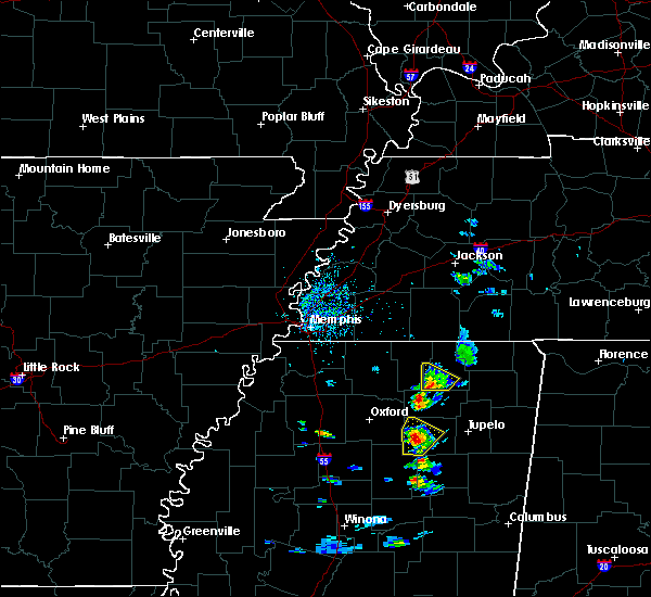 At 308 pm cdt, a severe thunderstorm was located over blue mountain, or 7 miles southwest of ripley, moving northeast at 15 mph (radar indicated). Hazards include 60 mph wind gusts and quarter size hail. Hail damage to vehicles is expected. expect wind damage to roofs, siding, and trees. Locations impacted include, ripley, blue mountain, gravestown, dumas, clarysville, murry, whitten town and cotton plant. At 308 pm cdt, a severe thunderstorm was located over blue mountain, or 7 miles southwest of ripley, moving northeast at 15 mph (radar indicated). Hazards include 60 mph wind gusts and quarter size hail. Hail damage to vehicles is expected. expect wind damage to roofs, siding, and trees. Locations impacted include, ripley, blue mountain, gravestown, dumas, clarysville, murry, whitten town and cotton plant.
|
| 5/28/2016 2:42 PM CDT |
 At 241 pm cdt, a severe thunderstorm was located near new albany, moving northeast at 15 mph (radar indicated). Hazards include 60 mph wind gusts and quarter size hail. Hail damage to vehicles is expected. Expect wind damage to roofs, siding, and trees. At 241 pm cdt, a severe thunderstorm was located near new albany, moving northeast at 15 mph (radar indicated). Hazards include 60 mph wind gusts and quarter size hail. Hail damage to vehicles is expected. Expect wind damage to roofs, siding, and trees.
|
| 3/31/2016 7:35 PM CDT |
 At 735 pm cdt, a severe thunderstorm was located over new albany, moving northeast at 35 mph (radar indicated). Hazards include 60 mph wind gusts and half dollar size hail. Hail damage to vehicles is expected. Expect wind damage to roofs, siding, and trees. At 735 pm cdt, a severe thunderstorm was located over new albany, moving northeast at 35 mph (radar indicated). Hazards include 60 mph wind gusts and half dollar size hail. Hail damage to vehicles is expected. Expect wind damage to roofs, siding, and trees.
|
| 12/23/2015 6:09 PM CST | At 609 pm cst, a severe thunderstorm producing a tornado was located 7 miles northeast of keownville, or 10 miles southeast of ripley, moving east at 55 mph (radar indicated rotation). Hazards include tornado and quarter size hail. Flying debris will be dangerous to those caught without shelter. mobile homes will be damaged or destroyed. damage to roofs, windows and vehicles will occur. Tree damage is likely. |
| 12/23/2015 6:03 PM CST | At 602 pm cst, a severe thunderstorm producing a tornado was located near keownville, or 9 miles southeast of ripley, moving east at 50 mph (radar indicated intense rotation. a tornado is likely with this storm). Hazards include tornado and quarter size hail. Flying debris will be dangerous to those caught without shelter. mobile homes will be damaged or destroyed. damage to roofs, windows and vehicles will occur. tree damage is likely. This tornadic thunderstorm will remain over mainly rural areas of southeastern tippah county, including the following locations, dumas. |
| 12/23/2015 5:45 PM CST | At 544 pm cst, a severe thunderstorm producing a tornado was located near ripley, moving northeast at 50 mph (radar indicated rotation). Hazards include tornado and half dollar size hail. Flying debris will be dangerous to those caught without shelter. mobile homes will be damaged or destroyed. damage to roofs, windows and vehicles will occur. tree damage is likely. This tornadic thunderstorm will remain over mainly rural areas of southern tippah county, including the following locations, clarysville, peoples, dumas and cotton plant. |
| 12/23/2015 5:34 PM CST | The national weather service in memphis has issued a * tornado warning for. southeastern tippah county in northeastern mississippi. northern union county in northeastern mississippi. until 615 pm cst * at 533 pm cst. A severe thunderstorm producing a tornado was. |
| 12/23/2015 5:24 PM CST | The national weather service in memphis has issued a * tornado warning for. southeastern benton county in northeastern mississippi. southern tippah county in northeastern mississippi. northwestern union county in northeastern mississippi. Until 615 pm cst. |
| 12/23/2015 5:19 PM CST | At 519 pm cst, a severe thunderstorm was located near bethlehem, or 12 miles northwest of new albany, moving northeast at 60 mph (radar indicated). Hazards include 60 mph wind gusts and quarter size hail. Hail damage to vehicles is expected. Expect wind damage to roofs, siding and trees. |
| 8/22/2015 7:08 PM CDT |
 At 708 pm cdt, a severe thunderstorm was located near keownville, or near new albany, moving east at 20 mph (radar indicated). Hazards include 60 mph wind gusts and quarter size hail. Hail damage to vehicles is expected. expect wind damage to roofs, siding and trees. Locations impacted include, baldwyn, guntown, blair, keownville, dumas, bethany, jericho, locum, union hill, alpine, corrona, frankstown, graham, parks, molino, geeville, baker and boggan bend. At 708 pm cdt, a severe thunderstorm was located near keownville, or near new albany, moving east at 20 mph (radar indicated). Hazards include 60 mph wind gusts and quarter size hail. Hail damage to vehicles is expected. expect wind damage to roofs, siding and trees. Locations impacted include, baldwyn, guntown, blair, keownville, dumas, bethany, jericho, locum, union hill, alpine, corrona, frankstown, graham, parks, molino, geeville, baker and boggan bend.
|
| 8/22/2015 7:00 PM CDT |
 At 700 pm cdt, a severe thunderstorm was located over new albany, moving east at 20 mph (radar indicated). Hazards include 60 mph wind gusts and quarter size hail. Hail damage to vehicles is expected. Expect wind damage to roofs, siding and trees. At 700 pm cdt, a severe thunderstorm was located over new albany, moving east at 20 mph (radar indicated). Hazards include 60 mph wind gusts and quarter size hail. Hail damage to vehicles is expected. Expect wind damage to roofs, siding and trees.
|
| 8/22/2015 6:38 PM CDT |
 At 638 pm cdt, a severe thunderstorm was located near new albany, moving east at 20 mph (radar indicated). Hazards include 60 mph wind gusts and quarter size hail. Hail damage to vehicles is expected. expect wind damage to roofs, siding and trees. Locations impacted include, new albany, keownville, myrtle, dumas, clarysville, locum, old myrtle, branyan, union hill, poolville, martintown, alpine, beacon hill, concord, glenfield, graham, shari, cotton plant, parks and molino. At 638 pm cdt, a severe thunderstorm was located near new albany, moving east at 20 mph (radar indicated). Hazards include 60 mph wind gusts and quarter size hail. Hail damage to vehicles is expected. expect wind damage to roofs, siding and trees. Locations impacted include, new albany, keownville, myrtle, dumas, clarysville, locum, old myrtle, branyan, union hill, poolville, martintown, alpine, beacon hill, concord, glenfield, graham, shari, cotton plant, parks and molino.
|
| 8/22/2015 6:22 PM CDT |
 At 621 pm cdt, a severe thunderstorm was located near etta, or 7 miles west of new albany, moving east at 20 mph (radar indicated). Hazards include 60 mph wind gusts and quarter size hail. Hail damage to vehicles is expected. Expect wind damage to roofs, siding and trees. At 621 pm cdt, a severe thunderstorm was located near etta, or 7 miles west of new albany, moving east at 20 mph (radar indicated). Hazards include 60 mph wind gusts and quarter size hail. Hail damage to vehicles is expected. Expect wind damage to roofs, siding and trees.
|
| 7/14/2015 5:55 PM CDT |
 At 551 pm cdt, severe thunderstorms were located along a line extending from 8 miles east of red bay to near smithville to 7 miles northeast of houston, moving southeast at 60 mph (radar indicated). Hazards include 60 mph wind gusts. Expect damage to roofs. siding and trees. Locations impacted include, tupelo, corinth, booneville, new albany, ripley, fulton, baldwyn, verona, tishomingo state park, tombigbee state park, saltillo, guntown, belmont, shannon, plantersville, mantachie, blue mountain, jumpertown, tremont and glen. At 551 pm cdt, severe thunderstorms were located along a line extending from 8 miles east of red bay to near smithville to 7 miles northeast of houston, moving southeast at 60 mph (radar indicated). Hazards include 60 mph wind gusts. Expect damage to roofs. siding and trees. Locations impacted include, tupelo, corinth, booneville, new albany, ripley, fulton, baldwyn, verona, tishomingo state park, tombigbee state park, saltillo, guntown, belmont, shannon, plantersville, mantachie, blue mountain, jumpertown, tremont and glen.
|
| 7/14/2015 5:53 PM CDT |
 At 551 pm cdt, severe thunderstorms were located along a line extending from 8 miles east of red bay to near smithville to 7 miles northeast of houston, moving southeast at 60 mph (radar indicated). Hazards include 60 mph wind gusts. Expect damage to roofs. siding and trees. Locations impacted include, tupelo, corinth, booneville, new albany, ripley, fulton, baldwyn, verona, tishomingo state park, tombigbee state park, saltillo, guntown, belmont, shannon, plantersville, mantachie, blue mountain, jumpertown, tremont and glen. At 551 pm cdt, severe thunderstorms were located along a line extending from 8 miles east of red bay to near smithville to 7 miles northeast of houston, moving southeast at 60 mph (radar indicated). Hazards include 60 mph wind gusts. Expect damage to roofs. siding and trees. Locations impacted include, tupelo, corinth, booneville, new albany, ripley, fulton, baldwyn, verona, tishomingo state park, tombigbee state park, saltillo, guntown, belmont, shannon, plantersville, mantachie, blue mountain, jumpertown, tremont and glen.
|
| 7/14/2015 5:30 PM CDT |
 At 529 pm cdt, severe thunderstorms were located along a line extending from near corinth to 7 miles southeast of ripley to near holly springs national forest, moving southeast at 50 mph (radar indicated). Hazards include 60 mph wind gusts. Expect damage to roofs. siding and trees. Locations impacted include, ripley, wall doxey state park, john w kyle state park, sardis, blue mountain, snow lake shores, pocahontas, harmontown, theo, bethlehem, laws hill, gravestown, walnut, middleton, hickory flat, ashland, potts camp, falkner, myrtle and dumas. At 529 pm cdt, severe thunderstorms were located along a line extending from near corinth to 7 miles southeast of ripley to near holly springs national forest, moving southeast at 50 mph (radar indicated). Hazards include 60 mph wind gusts. Expect damage to roofs. siding and trees. Locations impacted include, ripley, wall doxey state park, john w kyle state park, sardis, blue mountain, snow lake shores, pocahontas, harmontown, theo, bethlehem, laws hill, gravestown, walnut, middleton, hickory flat, ashland, potts camp, falkner, myrtle and dumas.
|
| 7/14/2015 5:26 PM CDT |
 At 526 pm cdt, severe thunderstorms were located along a line extending from near theo to near new albany to near oxford, moving southeast at 60 mph (radar indicated). Hazards include 60 mph wind gusts. Expect damage to roofs. Siding and trees. At 526 pm cdt, severe thunderstorms were located along a line extending from near theo to near new albany to near oxford, moving southeast at 60 mph (radar indicated). Hazards include 60 mph wind gusts. Expect damage to roofs. Siding and trees.
|
| 7/14/2015 5:01 PM CDT |
 At 501 pm cdt, severe thunderstorms were located along a line extending from 7 miles northwest of pocahontas to near snow lake shores to near senatobia, moving southeast at 50 mph (radar indicated). Hazards include 60 mph wind gusts. Expect damage to roofs. Siding and trees. At 501 pm cdt, severe thunderstorms were located along a line extending from 7 miles northwest of pocahontas to near snow lake shores to near senatobia, moving southeast at 50 mph (radar indicated). Hazards include 60 mph wind gusts. Expect damage to roofs. Siding and trees.
|
| 6/9/2015 12:26 AM CDT | The severe thunderstorm warning for southern benton, northeastern lafayette, southwestern prentiss, southeastern marshall, northern pontotoc, southern tippah, western lee and union counties will expire at 1230 am cdt, the storm which prompted the warning has weakened below severe limits and exited the warned area. therefore the warning will be allowed to expire. |
| 6/8/2015 11:30 PM CDT | At 1129 pm cdt, a severe thunderstorm was located near blue mountain, or 8 miles north of new albany, moving southeast at 30 mph (radar indicated). Hazards include 60 mph wind gusts and penny size hail. Expect damage to roofs. Siding and trees. |
| 6/8/2015 11:17 PM CDT | At 1117 pm cdt, severe thunderstorms were located along a line extending from 6 miles east of snow lake shores to near gravestown to 6 miles northeast of bethlehem, moving southeast at 50 mph (radar indicated). Hazards include 60 mph wind gusts. Expect damage to roofs. siding and trees. Locations impacted include, tupelo, new albany, saltillo, plantersville, ecru, etta, blair, new harmony, keownville, pinedale, sherman, myrtle, dumas, blue springs, jericho, beech springs, union hill, cherry creek, ingomar and glenfield. |
| 6/8/2015 10:55 PM CDT | At 1054 pm cdt, severe thunderstorms were located along a line extending from lamar to near snow lake shores to near holly springs, moving southeast at 35 mph (radar indicated). Hazards include 60 mph wind gusts. Expect damage to roofs. Siding and trees. |
| 6/8/2015 10:40 PM CDT | At 1040 pm cdt, a severe thunderstorm was located near keownville, or near new albany, moving southeast at 35 mph (radar indicated). Hazards include 60 mph wind gusts and quarter size hail. Hail damage to vehicles is expected. Expect wind damage to roofs, siding and trees. |
| 6/8/2015 10:15 PM CDT | At 1015 pm cdt, a severe thunderstorm was located over ripley, moving southeast at 25 mph (radar indicated). Hazards include 60 mph wind gusts and half dollar size hail. Hail damage to vehicles is expected. Expect wind damage to roofs, siding and trees. |
| 6/8/2015 3:25 PM CDT |
 The severe thunderstorm warning for southern tippah and northeastern union counties will expire at 330 pm cdt, the storm which prompted the warning has weakened below severe limits, and no longer pose an immediate threat to life or property. therefore the warning will be allowed to expire. The severe thunderstorm warning for southern tippah and northeastern union counties will expire at 330 pm cdt, the storm which prompted the warning has weakened below severe limits, and no longer pose an immediate threat to life or property. therefore the warning will be allowed to expire.
|
| 6/8/2015 3:07 PM CDT |
 At 306 pm cdt, a severe thunderstorm was located near tishomingo, or near tishomingo state park, moving east at 30 mph (radar indicated). Hazards include 60 mph wind gusts and quarter size hail. Hail damage to vehicles is expected. expect wind damage to roofs, siding and trees. Locations impacted include, new albany, ripley, blue mountain, keownville, dumas, clarysville, peoples, locum, concord, murry, graham, cotton plant, molino and pumpkin center. At 306 pm cdt, a severe thunderstorm was located near tishomingo, or near tishomingo state park, moving east at 30 mph (radar indicated). Hazards include 60 mph wind gusts and quarter size hail. Hail damage to vehicles is expected. expect wind damage to roofs, siding and trees. Locations impacted include, new albany, ripley, blue mountain, keownville, dumas, clarysville, peoples, locum, concord, murry, graham, cotton plant, molino and pumpkin center.
|
| 6/8/2015 2:48 PM CDT |
 At 247 pm cdt, a severe thunderstorm was located near keownville, or 7 miles south of ripley, moving east at 30 mph (radar indicated). Hazards include 60 mph wind gusts and half dollar size hail. Hail damage to vehicles is expected. Expect wind damage to roofs, siding and trees. At 247 pm cdt, a severe thunderstorm was located near keownville, or 7 miles south of ripley, moving east at 30 mph (radar indicated). Hazards include 60 mph wind gusts and half dollar size hail. Hail damage to vehicles is expected. Expect wind damage to roofs, siding and trees.
|
| 5/27/2015 3:09 PM CDT | At 308 pm cdt, a severe thunderstorm was located near keownville, or 9 miles east of new albany, moving northeast at 25 mph (radar indicated). Hazards include 60 mph wind gusts and quarter size hail. Hail damage to vehicles is expected. Expect wind damage to roofs, siding and trees. |
| 4/1/2015 12:24 AM CDT | The severe thunderstorm warning for central benton and tippah counties will expire at 1230 am cdt. the storm which prompted the warning has weakened below severe limits and exited the warned area. Therefore the warning will be allowed to expire. |
| 3/31/2015 11:51 PM CDT | The national weather service in memphis has issued a * severe thunderstorm warning for. central benton county in northeastern mississippi. tippah county in northeastern mississippi. until 1230 am cdt * at 1151 pm cdt. Doppler radar indicated a severe thunderstorm. |
| 3/31/2015 11:35 PM CDT | The national weather service in memphis has issued a * severe thunderstorm warning for. western prentiss county in northeastern mississippi. southwestern alcorn county in northeastern mississippi. tippah county in northeastern mississippi. Northeastern lee county in northeastern mississippi. |
| 3/31/2015 10:41 PM CDT | The national weather service in memphis has issued a * severe thunderstorm warning for. southwestern prentiss county in northeastern mississippi. northeastern pontotoc county in northeastern mississippi. southern tippah county in northeastern mississippi. Lee county in northeastern mississippi. |
| 3/31/2015 6:06 PM CDT | A severe thunderstorm warning remains in effect until 645 pm cdt for central prentiss. southeastern tippah. northern lee and northeastern union counties. at 605 pm cdt. doppler radar indicated a severe thunderstorm producing large damaging hail up to two inches in diameter and damaging winds in excess of 60 mph. This storm was located near. |
| 3/31/2015 5:05 PM CST | Hen Egg sized hail reported 2.5 miles NE of Dumas, MS, hen egg size hail northeast of new albany |
| 3/31/2015 5:55 PM CDT | The national weather service in memphis has issued a * severe thunderstorm warning for. central prentiss county in northeastern mississippi. southeastern tippah county in northeastern mississippi. northern lee county in northeastern mississippi. Northeastern union county in northeastern mississippi. |
| 10/6/2014 4:54 PM CDT | Golf Ball sized hail reported 0.3 miles WSW of Dumas, MS, local media received several pictures of golf ball sized hail in dumas |
| 10/6/2014 4:50 PM CDT | Hen Egg sized hail reported 4.1 miles N of Dumas, MS, local media shared a picture of hen egg sized hail from a viewer in pleasant ridge mississippi |
| 9/2/2012 8:14 PM CDT | Some trees down between ripley and duma in tippah county MS, 0.3 miles WSW of Dumas, MS |
| 1/1/0001 12:00 AM | Several trees down...power lines down all along tippah and prentiss county border. also dime sized hail fel in tippah county MS, 0.3 miles WSW of Dumas, MS |
Hail Maps for Dumas, MS

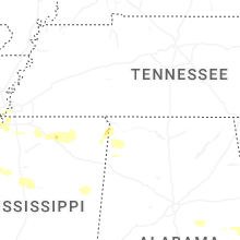
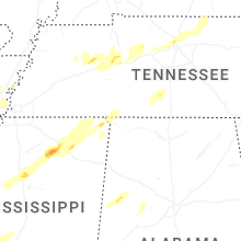


Connect with Interactive Hail Maps