

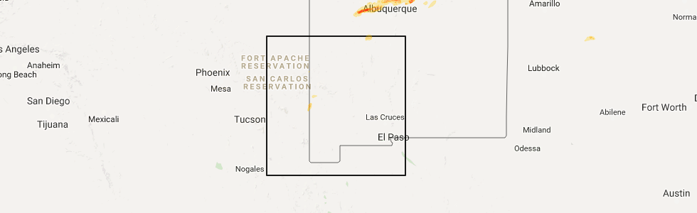
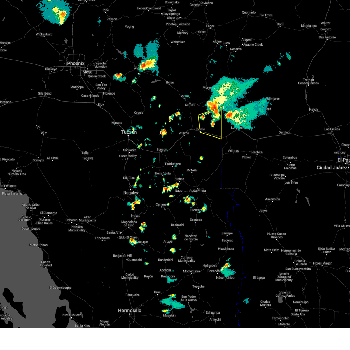
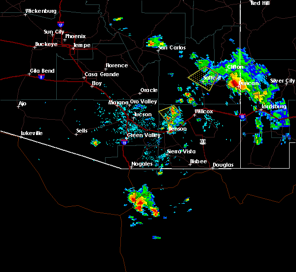
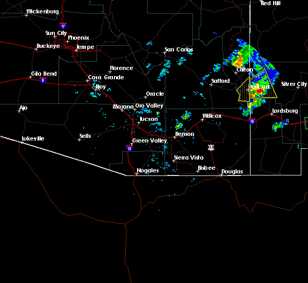
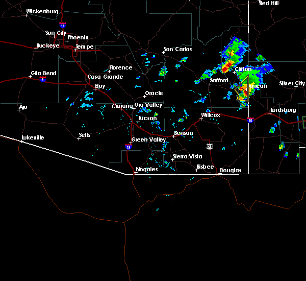
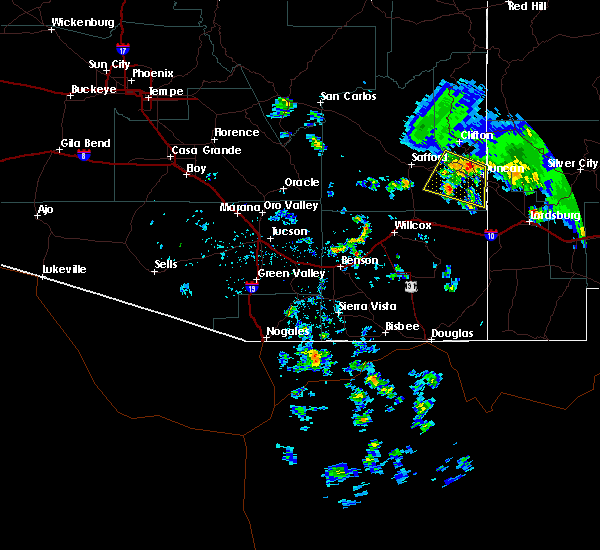
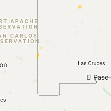
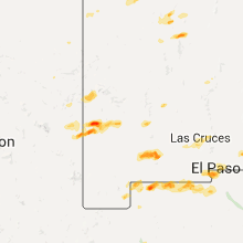
Hail Map for Duncan, AZ
The Duncan, AZ area has had 0 reports of on-the-ground hail by trained spotters, and has been under severe weather warnings 6 times during the past 12 months. Doppler radar has detected hail at or near Duncan, AZ on 5 occasions.
| Name: | Duncan, AZ |
| Where Located: | 48 miles W of Silver City, NM |
| Map: | Google Map for Duncan, AZ |
| Population: | 696 |
| Housing Units: | 398 |
| More Info: | Search Google for Duncan, AZ |
5
The Top Recent Hail Date for Duncan, AZ is Wednesday, October 4, 2017 (1st out of 5)
Hail and Wind Damage Spotted near Duncan, AZ
| Date / Time | Report Details |
|---|---|
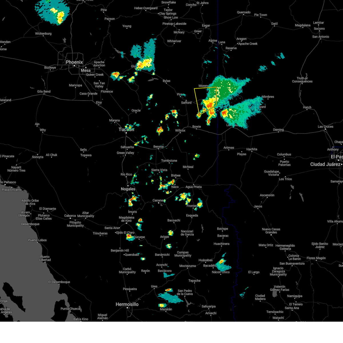
| 7/11/2024 4:07 PM MST |
 The storm which prompted the warning has weakened below severe limits, and no longer poses an immediate threat to life or property. therefore, the warning will be allowed to expire. remember, a severe thunderstorm warning still remains in effect for greenlee, graham, and cochise counties until 4:40 pm mst. The storm which prompted the warning has weakened below severe limits, and no longer poses an immediate threat to life or property. therefore, the warning will be allowed to expire. remember, a severe thunderstorm warning still remains in effect for greenlee, graham, and cochise counties until 4:40 pm mst.
|
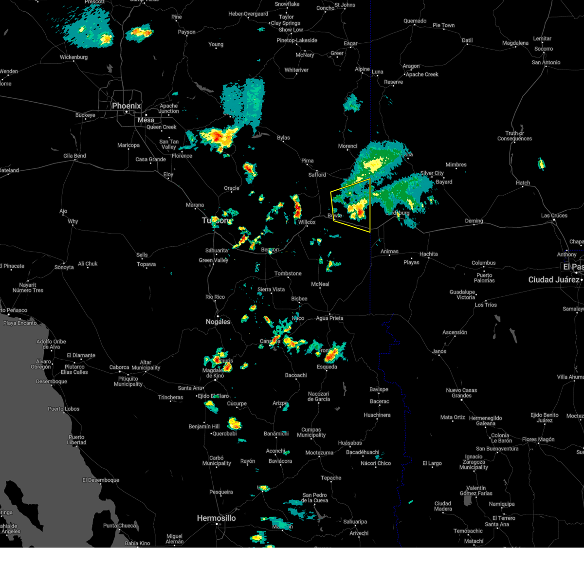
| 7/11/2024 3:45 PM MST |
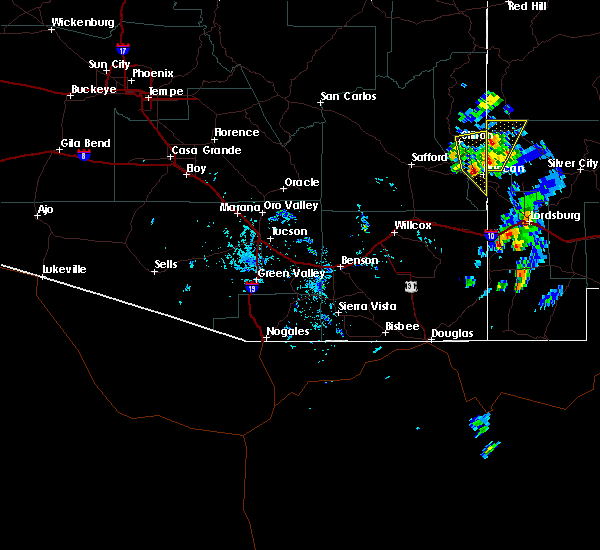
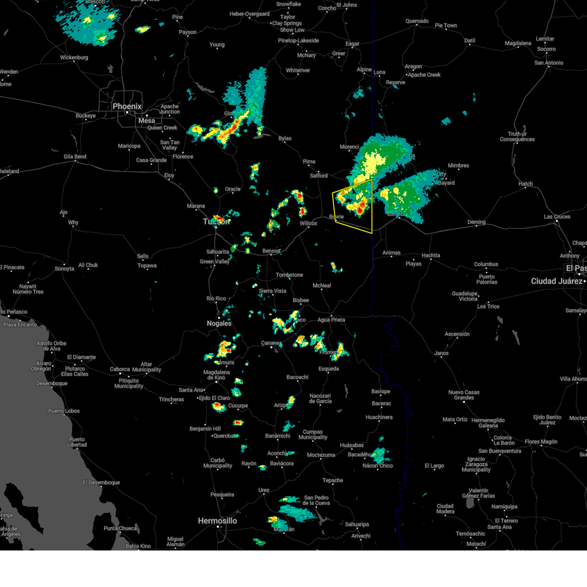 At 344 pm mst, a severe thunderstorm was located 17 miles northeast of bowie, or 20 miles northwest of steins, and is nearly stationary (radar indicated). Hazards include 60 mph wind gusts and quarter size hail. Hail damage to vehicles is expected. expect wind damage to roofs, siding, and trees. locations impacted include, bowie, duncan, franklin, and san simon. this includes the following highways, interstate 10 between mile markers 364 and 391. route 70 between mile markers 378 and 385. Route 75 between mile markers 379 and 380. At 344 pm mst, a severe thunderstorm was located 17 miles northeast of bowie, or 20 miles northwest of steins, and is nearly stationary (radar indicated). Hazards include 60 mph wind gusts and quarter size hail. Hail damage to vehicles is expected. expect wind damage to roofs, siding, and trees. locations impacted include, bowie, duncan, franklin, and san simon. this includes the following highways, interstate 10 between mile markers 364 and 391. route 70 between mile markers 378 and 385. Route 75 between mile markers 379 and 380.
|
| 7/11/2024 3:31 PM MST |
 the severe thunderstorm warning has been cancelled and is no longer in effect the severe thunderstorm warning has been cancelled and is no longer in effect
|
| 7/11/2024 3:26 PM MST |
 Svrtwc the national weather service in tucson has issued a * severe thunderstorm warning for, southeastern graham county in southeastern arizona, northeastern cochise county in southeastern arizona, southeastern greenlee county in southeastern arizona, * until 415 pm mst. * at 326 pm mst, a severe thunderstorm was located 18 miles northeast of bowie, or 19 miles southwest of virden, and is nearly stationary (radar indicated). Hazards include 60 mph wind gusts and quarter size hail. Hail damage to vehicles is expected. Expect wind damage to roofs, siding, and trees. Svrtwc the national weather service in tucson has issued a * severe thunderstorm warning for, southeastern graham county in southeastern arizona, northeastern cochise county in southeastern arizona, southeastern greenlee county in southeastern arizona, * until 415 pm mst. * at 326 pm mst, a severe thunderstorm was located 18 miles northeast of bowie, or 19 miles southwest of virden, and is nearly stationary (radar indicated). Hazards include 60 mph wind gusts and quarter size hail. Hail damage to vehicles is expected. Expect wind damage to roofs, siding, and trees.
|
| 7/11/2024 3:12 PM MST |
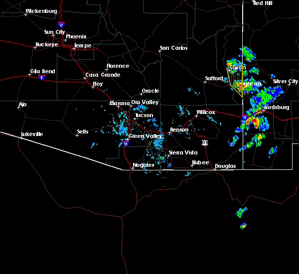
 At 311 pm mst, a severe thunderstorm was located near duncan, or about 15 miles south of clifton, moving southwest at 10 mph (radar indicated). Hazards include 60 mph wind gusts and penny size hail. Expect damage to roofs, siding, and trees. locations impacted include, clifton, morenci, duncan, and guthrie. this includes the following highways, route 70 between mile markers 355 and 378. route 75 between mile markers 380 and 398. route 78 between mile markers 155 and 170. Route 191 between mile markers 135 and 163. At 311 pm mst, a severe thunderstorm was located near duncan, or about 15 miles south of clifton, moving southwest at 10 mph (radar indicated). Hazards include 60 mph wind gusts and penny size hail. Expect damage to roofs, siding, and trees. locations impacted include, clifton, morenci, duncan, and guthrie. this includes the following highways, route 70 between mile markers 355 and 378. route 75 between mile markers 380 and 398. route 78 between mile markers 155 and 170. Route 191 between mile markers 135 and 163.
|
| 7/11/2024 3:00 PM MST |
 Svrtwc the national weather service in tucson has issued a * severe thunderstorm warning for, southeastern graham county in southeastern arizona, southern greenlee county in southeastern arizona, * until 345 pm mst. * at 259 pm mst, a severe thunderstorm was located near duncan, or 15 miles south of clifton, moving southwest at 10 mph (radar indicated). Hazards include 60 mph wind gusts and penny size hail. expect damage to roofs, siding, and trees Svrtwc the national weather service in tucson has issued a * severe thunderstorm warning for, southeastern graham county in southeastern arizona, southern greenlee county in southeastern arizona, * until 345 pm mst. * at 259 pm mst, a severe thunderstorm was located near duncan, or 15 miles south of clifton, moving southwest at 10 mph (radar indicated). Hazards include 60 mph wind gusts and penny size hail. expect damage to roofs, siding, and trees
|
| 10/5/2021 6:50 PM MST |
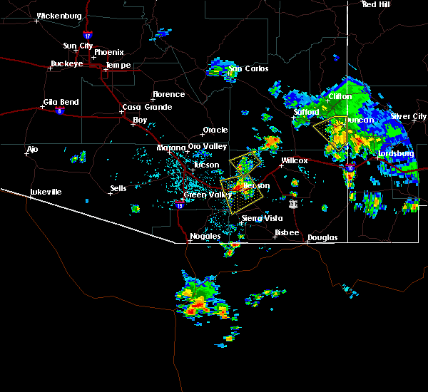
 At 649 pm mst, a severe thunderstorm was located 14 miles southeast of solomon, or 18 miles southeast of safford, moving north at 30 mph (radar indicated). Hazards include 60 mph wind gusts and penny size hail. Expect damage to roofs, siding, and trees. locations impacted include, duncan, york and franklin. hail threat, radar indicated max hail size, 0. 75 in wind threat, radar indicated max wind gust, 60 mph. At 649 pm mst, a severe thunderstorm was located 14 miles southeast of solomon, or 18 miles southeast of safford, moving north at 30 mph (radar indicated). Hazards include 60 mph wind gusts and penny size hail. Expect damage to roofs, siding, and trees. locations impacted include, duncan, york and franklin. hail threat, radar indicated max hail size, 0. 75 in wind threat, radar indicated max wind gust, 60 mph.
|
| 10/5/2021 6:11 PM MST |
 At 611 pm mst, a severe thunderstorm was located 17 miles north of bowie, or 24 miles southeast of safford, moving northeast at 25 mph (radar indicated). Hazards include 60 mph wind gusts and quarter size hail. Hail damage to vehicles is expected. Expect wind damage to roofs, siding, and trees. At 611 pm mst, a severe thunderstorm was located 17 miles north of bowie, or 24 miles southeast of safford, moving northeast at 25 mph (radar indicated). Hazards include 60 mph wind gusts and quarter size hail. Hail damage to vehicles is expected. Expect wind damage to roofs, siding, and trees.
|
| 8/6/2018 5:14 PM MST |
 At 512 pm mst, a severe thunderstorm was located just west of duncan and franklin, moving south at 5 mph (radar indicated). Hazards include 60 mph wind gusts and nickel size hail. Expect damage to roofs, siding, and trees. locations impacted include, duncan and franklin. this includes the following highways, route 70 between mile markers 369 and 385. Route 75 between mile markers 379 and 389. At 512 pm mst, a severe thunderstorm was located just west of duncan and franklin, moving south at 5 mph (radar indicated). Hazards include 60 mph wind gusts and nickel size hail. Expect damage to roofs, siding, and trees. locations impacted include, duncan and franklin. this includes the following highways, route 70 between mile markers 369 and 385. Route 75 between mile markers 379 and 389.
|
| 8/6/2018 4:42 PM MST |
 At 440 pm mst, a severe thunderstorm was located near franklin and duncan, moving south at 5 mph (radar indicated). Hazards include 70 mph wind gusts and quarter size hail. Hail damage to vehicles is expected. expect considerable tree damage. Wind damage is also likely to mobile homes, roofs, and outbuildings. At 440 pm mst, a severe thunderstorm was located near franklin and duncan, moving south at 5 mph (radar indicated). Hazards include 70 mph wind gusts and quarter size hail. Hail damage to vehicles is expected. expect considerable tree damage. Wind damage is also likely to mobile homes, roofs, and outbuildings.
|
| 10/4/2017 4:04 PM MST |
 A severe thunderstorm warning remains in effect until 415 pm mst for southeastern greenlee county, severe thunderstorm moved through duncan, arizona producing dime sized hail as reported by the fire department. at 4 pm mst, the storm had moved north duncan and was now over open-country. movement of the storm was north-northeast at 20 mph. A severe thunderstorm warning remains in effect until 415 pm mst for southeastern greenlee county, severe thunderstorm moved through duncan, arizona producing dime sized hail as reported by the fire department. at 4 pm mst, the storm had moved north duncan and was now over open-country. movement of the storm was north-northeast at 20 mph.
|
| 10/4/2017 3:46 PM MST |
 At 344 pm mst, a severe thunderstorm moving through duncan, arizona. moving north at 20 mph (radar indicated). Hazards include 60 mph wind gusts and quarter size hail. Hail damage to vehicles is expected. expect wind damage to roofs, siding, and trees. Locations impacted include, duncan, franklin and guthrie. At 344 pm mst, a severe thunderstorm moving through duncan, arizona. moving north at 20 mph (radar indicated). Hazards include 60 mph wind gusts and quarter size hail. Hail damage to vehicles is expected. expect wind damage to roofs, siding, and trees. Locations impacted include, duncan, franklin and guthrie.
|
| 10/4/2017 3:42 PM MST |
 At 342 pm mst, a severe thunderstorm was located 10 miles northwest of virden, or 22 miles northwest of redrock, moving north at 45 mph (radar indicated). Hazards include 60 mph wind gusts and quarter size hail. Hail damage to vehicles is expected. Expect wind damage to roofs, siding, and trees. At 342 pm mst, a severe thunderstorm was located 10 miles northwest of virden, or 22 miles northwest of redrock, moving north at 45 mph (radar indicated). Hazards include 60 mph wind gusts and quarter size hail. Hail damage to vehicles is expected. Expect wind damage to roofs, siding, and trees.
|
| 7/27/2016 3:25 PM MST |
 At 323 pm mst, doppler radar continued to indicate a severe thunderstorm capable of producing quarter size hail and damaging winds in excess of 60 mph. this storm was located 10 miles west of virden, moving southwest at 20 mph. locations impacted include, duncan and franklin. At 323 pm mst, doppler radar continued to indicate a severe thunderstorm capable of producing quarter size hail and damaging winds in excess of 60 mph. this storm was located 10 miles west of virden, moving southwest at 20 mph. locations impacted include, duncan and franklin.
|
| 7/27/2016 2:59 PM MST |
 At 257 pm mst, national weather service meteorologists were tracking severe thunderstorms capable of producing quarter size hail and damaging winds in excess of 60 mph. these storms were located near virden, or 21 miles west of redrock, and moving southwest at 20 mph. At 257 pm mst, national weather service meteorologists were tracking severe thunderstorms capable of producing quarter size hail and damaging winds in excess of 60 mph. these storms were located near virden, or 21 miles west of redrock, and moving southwest at 20 mph.
|
| 7/10/2015 3:21 PM MST |
 The severe thunderstorm warning for eastern graham and southeastern greenlee counties will expire at 330 pm mst, the storm which prompted the warning has moved out of the area. therefore the warning will be allowed to expire. to report severe weather, contact your nearest law enforcement agency. they will relay your report to the national weather service tucson. The severe thunderstorm warning for eastern graham and southeastern greenlee counties will expire at 330 pm mst, the storm which prompted the warning has moved out of the area. therefore the warning will be allowed to expire. to report severe weather, contact your nearest law enforcement agency. they will relay your report to the national weather service tucson.
|
| 7/10/2015 2:53 PM MST |
 At 253 pm mst, doppler radar indicated a severe thunderstorm capable of producing quarter size hail and damaging winds in excess of 60 mph. this storm was located near duncan, moving east at 35 mph. locations impacted include, duncan and franklin. At 253 pm mst, doppler radar indicated a severe thunderstorm capable of producing quarter size hail and damaging winds in excess of 60 mph. this storm was located near duncan, moving east at 35 mph. locations impacted include, duncan and franklin.
|
| 7/10/2015 2:38 PM MST |
 At 238 pm mst, doppler radar indicated a severe thunderstorm capable of producing quarter size hail and damaging winds in excess of 60 mph. this storm was located 5 miles west of duncan, and moving east at 35 mph. At 238 pm mst, doppler radar indicated a severe thunderstorm capable of producing quarter size hail and damaging winds in excess of 60 mph. this storm was located 5 miles west of duncan, and moving east at 35 mph.
|
| 6/16/2015 4:16 PM MST |
 At 414 pm mst, doppler radar indicated a severe thunderstorm capable of producing damaging winds in excess of 60 mph. this storm was 25 miles east of safford, moving south at 25 mph. locations impacted include, duncan and franklin. At 414 pm mst, doppler radar indicated a severe thunderstorm capable of producing damaging winds in excess of 60 mph. this storm was 25 miles east of safford, moving south at 25 mph. locations impacted include, duncan and franklin.
|
| 6/16/2015 4:07 PM MST |
 At 405 pm mst, doppler radar indicated a severe thunderstorm capable of producing damaging winds in excess of 60 mph. this storm was located 7 miles northwest of duncan , and moving south at 15 mph. At 405 pm mst, doppler radar indicated a severe thunderstorm capable of producing damaging winds in excess of 60 mph. this storm was located 7 miles northwest of duncan , and moving south at 15 mph.
|
Hail Maps for Duncan, AZ


Connect with Interactive Hail Maps