

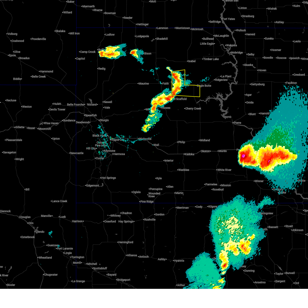
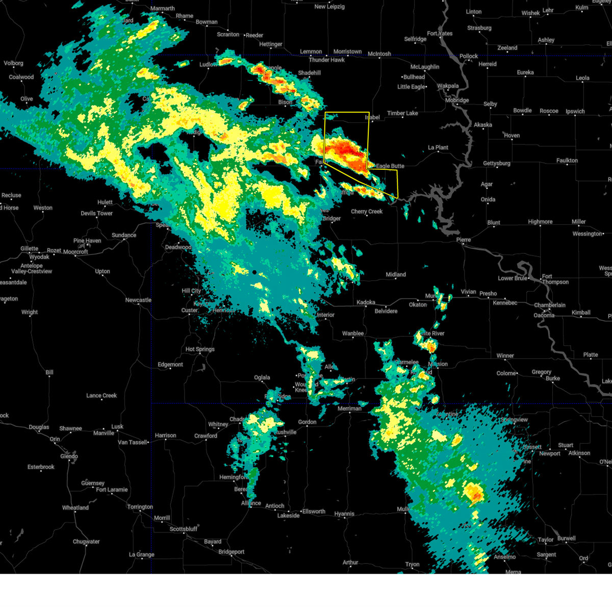
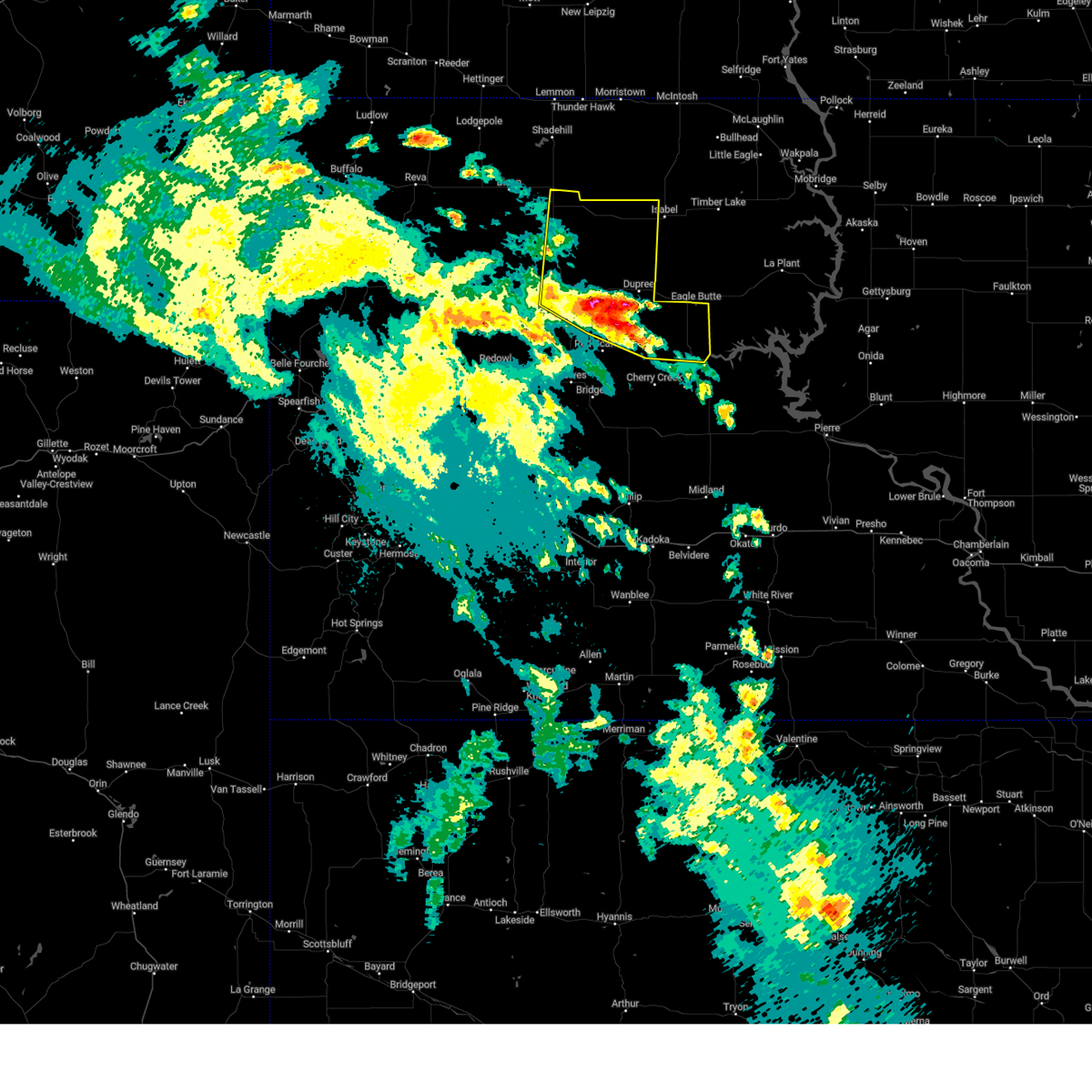
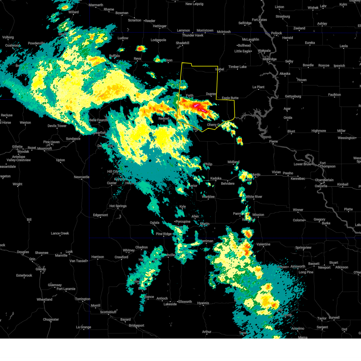
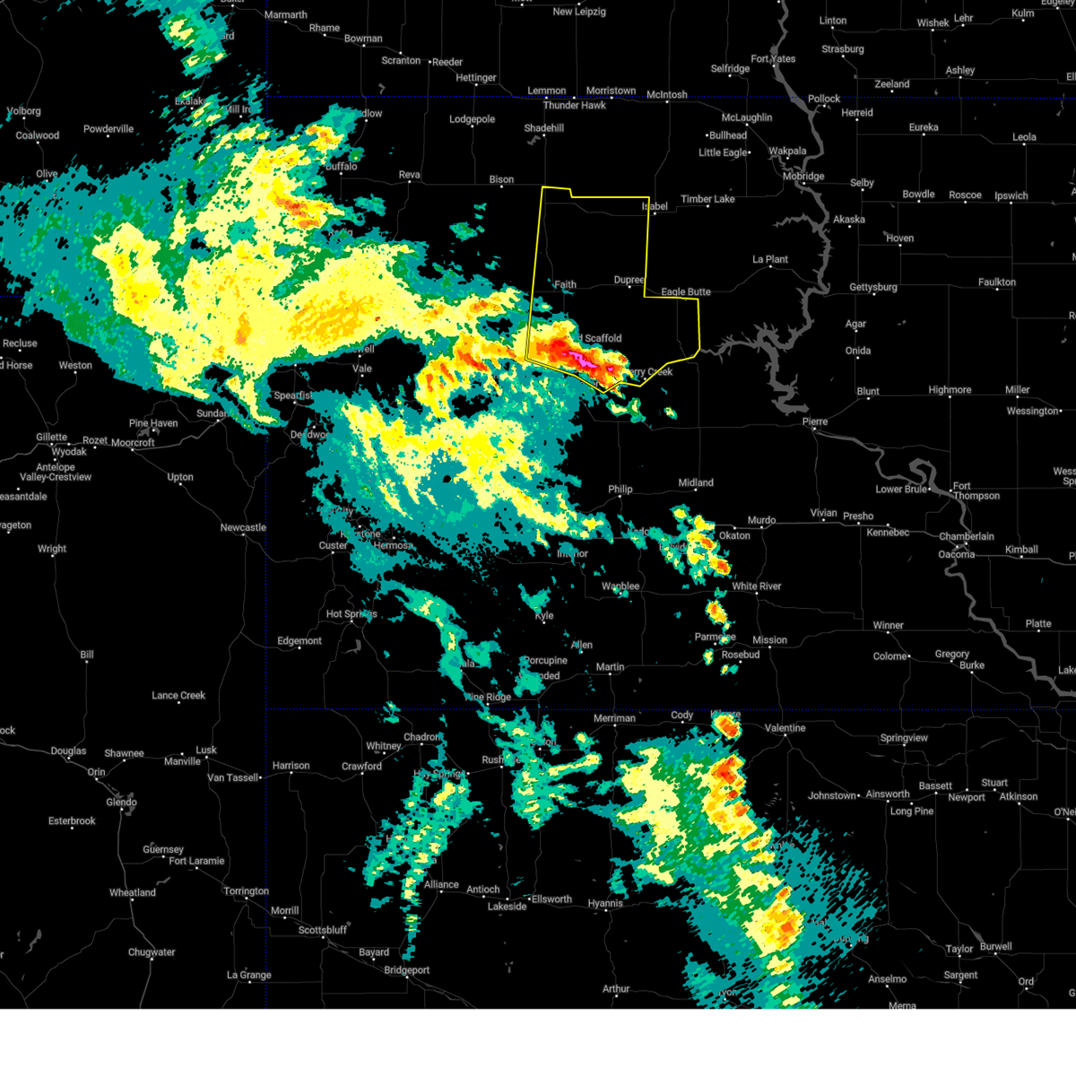
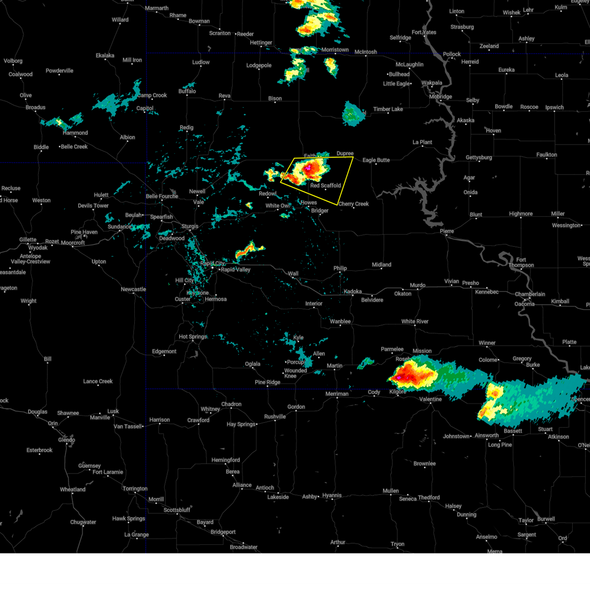
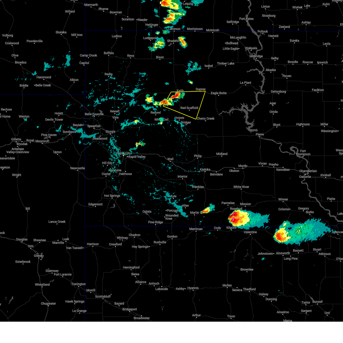
Hail Map for Dupree, SD
The Dupree, SD area has had 28 reports of on-the-ground hail by trained spotters, and has been under severe weather warnings 12 times during the past 12 months. Doppler radar has detected hail at or near Dupree, SD on 54 occasions, including 5 occasions during the past year.
| Name: | Dupree, SD |
| Where Located: | 77.6 miles NW of Pierre, SD |
| Map: | Google Map for Dupree, SD |
| Population: | 525 |
| Housing Units: | 203 |
| More Info: | Search Google for Dupree, SD |
1
The Top Recent Hail Date for Dupree, SD is Sunday, July 7, 2024 (4th out of 54)

Hail and Wind Damage Spotted near Dupree, SD
| Date / Time | Report Details |
|---|---|
| 6/27/2025 7:08 PM MDT |
 Svrunr the national weather service in rapid city has issued a * severe thunderstorm warning for, central ziebach county in west central south dakota, * until 745 pm mdt. * at 708 pm mdt, a severe thunderstorm was located over dupree, moving east at 35 mph (radar indicated). Hazards include 60 mph wind gusts. expect damage to roofs, siding, and trees Svrunr the national weather service in rapid city has issued a * severe thunderstorm warning for, central ziebach county in west central south dakota, * until 745 pm mdt. * at 708 pm mdt, a severe thunderstorm was located over dupree, moving east at 35 mph (radar indicated). Hazards include 60 mph wind gusts. expect damage to roofs, siding, and trees
|
| 9/17/2024 10:08 PM MDT |
 the severe thunderstorm warning has been cancelled and is no longer in effect the severe thunderstorm warning has been cancelled and is no longer in effect
|
| 9/17/2024 10:08 PM MDT |
 At 1008 pm mdt, severe thunderstorms were located along a line extending from 6 miles northeast of arrow head buttes to 3 miles northeast of thunder butte to near bear creek, moving north at 50 mph (radar indicated). Hazards include 60 mph wind gusts and penny size hail. Expect damage to roofs, siding, and trees. Locations impacted include, dupree, south eagle butte, glad valley, thunder butte, red elm, iron lightning, intersection of highway 63 and bia road 8, and northwestern cheyenne river reservation. At 1008 pm mdt, severe thunderstorms were located along a line extending from 6 miles northeast of arrow head buttes to 3 miles northeast of thunder butte to near bear creek, moving north at 50 mph (radar indicated). Hazards include 60 mph wind gusts and penny size hail. Expect damage to roofs, siding, and trees. Locations impacted include, dupree, south eagle butte, glad valley, thunder butte, red elm, iron lightning, intersection of highway 63 and bia road 8, and northwestern cheyenne river reservation.
|
| 9/17/2024 9:49 PM MDT |
 At 948 pm mdt, severe thunderstorms were located along a line extending from 5 miles northwest of durkee lake to 4 miles southwest of dupree to 4 miles east of intersection of cherry creek and sunnybrook roads, moving northeast at 55 mph. downed power poles and structural damage were recently reported near faith (law enforcement). Hazards include 70 mph wind gusts and penny size hail. Expect considerable tree damage. damage is likely to mobile homes, roofs, and outbuildings. Locations impacted include, dupree, faith, usta, glad valley, south eagle butte, thunder butte, red elm, iron lightning, intersection of cherry creek and sunnybrook roads, intersection of highway 63 and bia road 8, durkee lake, arrow head buttes, and northwestern cheyenne river reservation. At 948 pm mdt, severe thunderstorms were located along a line extending from 5 miles northwest of durkee lake to 4 miles southwest of dupree to 4 miles east of intersection of cherry creek and sunnybrook roads, moving northeast at 55 mph. downed power poles and structural damage were recently reported near faith (law enforcement). Hazards include 70 mph wind gusts and penny size hail. Expect considerable tree damage. damage is likely to mobile homes, roofs, and outbuildings. Locations impacted include, dupree, faith, usta, glad valley, south eagle butte, thunder butte, red elm, iron lightning, intersection of cherry creek and sunnybrook roads, intersection of highway 63 and bia road 8, durkee lake, arrow head buttes, and northwestern cheyenne river reservation.
|
| 9/17/2024 9:45 PM MDT |
 At 943 pm mdt, severe thunderstorms were located along a line extending from 3 miles northwest of durkee lake to 6 miles south of red elm to 4 miles southeast of intersection of cherry creek and sunnybrook roads, moving north at 65 mph. power poles were recently reported down near faith (trained weather spotters and automated observations). Hazards include 70 mph wind gusts and quarter size hail. Hail damage to vehicles is expected. expect considerable tree damage. wind damage is also likely to mobile homes, roofs, and outbuildings. Locations impacted include, dupree, faith, cherry creek, usta, glad valley, south eagle butte, red scaffold, thunder butte, red elm, iron lightning, takini, intersection of cherry creek and sunnybrook roads, intersection of highway 63 and bia road 8, durkee lake, arrow head buttes, and western cheyenne river reservation. At 943 pm mdt, severe thunderstorms were located along a line extending from 3 miles northwest of durkee lake to 6 miles south of red elm to 4 miles southeast of intersection of cherry creek and sunnybrook roads, moving north at 65 mph. power poles were recently reported down near faith (trained weather spotters and automated observations). Hazards include 70 mph wind gusts and quarter size hail. Hail damage to vehicles is expected. expect considerable tree damage. wind damage is also likely to mobile homes, roofs, and outbuildings. Locations impacted include, dupree, faith, cherry creek, usta, glad valley, south eagle butte, red scaffold, thunder butte, red elm, iron lightning, takini, intersection of cherry creek and sunnybrook roads, intersection of highway 63 and bia road 8, durkee lake, arrow head buttes, and western cheyenne river reservation.
|
| 9/17/2024 9:25 PM MDT |
 Svrunr the national weather service in rapid city has issued a * severe thunderstorm warning for, ziebach county in west central south dakota, northeastern meade county in west central south dakota, southeastern perkins county in northwestern south dakota, * until 1045 pm mdt. * at 925 pm mdt, severe thunderstorms were located along a line extending from 9 miles south of durkee lake to 2 miles south of red scaffold to 7 miles northwest of cherry creek, moving north at 45 mph (radar indicated). Hazards include 60 mph wind gusts and quarter size hail. Hail damage to vehicles is expected. expect wind damage to roofs, siding, and trees. severe thunderstorms will be near, faith, red scaffold, durkee lake, and intersection of cherry creek and sunnybrook roads around 930 pm mdt. red elm around 935 pm mdt. dupree and arrow head buttes around 940 pm mdt. iron lightning and intersection of highway 63 and bia road 8 around 945 pm mdt. Other locations in the path of these severe thunderstorms include usta, thunder butte, south eagle butte and glad valley. Svrunr the national weather service in rapid city has issued a * severe thunderstorm warning for, ziebach county in west central south dakota, northeastern meade county in west central south dakota, southeastern perkins county in northwestern south dakota, * until 1045 pm mdt. * at 925 pm mdt, severe thunderstorms were located along a line extending from 9 miles south of durkee lake to 2 miles south of red scaffold to 7 miles northwest of cherry creek, moving north at 45 mph (radar indicated). Hazards include 60 mph wind gusts and quarter size hail. Hail damage to vehicles is expected. expect wind damage to roofs, siding, and trees. severe thunderstorms will be near, faith, red scaffold, durkee lake, and intersection of cherry creek and sunnybrook roads around 930 pm mdt. red elm around 935 pm mdt. dupree and arrow head buttes around 940 pm mdt. iron lightning and intersection of highway 63 and bia road 8 around 945 pm mdt. Other locations in the path of these severe thunderstorms include usta, thunder butte, south eagle butte and glad valley.
|
| 7/30/2024 4:31 PM MDT |
 At 431 pm mdt, a severe thunderstorm was located 3 miles south of durkee lake, or 5 miles south of faith, moving east at 20 mph (radar indicated). Hazards include 60 mph wind gusts and quarter size hail. Hail damage to vehicles is expected. expect wind damage to roofs, siding, and trees. Locations impacted include, red scaffold, intersection of cherry creek and sunnybrook roads and dupree. At 431 pm mdt, a severe thunderstorm was located 3 miles south of durkee lake, or 5 miles south of faith, moving east at 20 mph (radar indicated). Hazards include 60 mph wind gusts and quarter size hail. Hail damage to vehicles is expected. expect wind damage to roofs, siding, and trees. Locations impacted include, red scaffold, intersection of cherry creek and sunnybrook roads and dupree.
|
| 7/30/2024 4:14 PM MDT |
 Svrunr the national weather service in rapid city has issued a * severe thunderstorm warning for, southwestern ziebach county in west central south dakota, northeastern meade county in west central south dakota, * until 515 pm mdt. * at 414 pm mdt, a severe thunderstorm was located near durkee lake, or 4 miles southwest of faith, moving east at 25 mph (radar indicated). Hazards include 60 mph wind gusts and half dollar size hail. Hail damage to vehicles is expected. expect wind damage to roofs, siding, and trees. this severe thunderstorm will be near, faith around 420 pm mdt. red scaffold and intersection of cherry creek and sunnybrook roads around 440 pm mdt. Dupree around 445 pm mdt. Svrunr the national weather service in rapid city has issued a * severe thunderstorm warning for, southwestern ziebach county in west central south dakota, northeastern meade county in west central south dakota, * until 515 pm mdt. * at 414 pm mdt, a severe thunderstorm was located near durkee lake, or 4 miles southwest of faith, moving east at 25 mph (radar indicated). Hazards include 60 mph wind gusts and half dollar size hail. Hail damage to vehicles is expected. expect wind damage to roofs, siding, and trees. this severe thunderstorm will be near, faith around 420 pm mdt. red scaffold and intersection of cherry creek and sunnybrook roads around 440 pm mdt. Dupree around 445 pm mdt.
|
| 7/13/2024 11:52 PM MDT | Mesonet station lans2 bear cree in dewey county SD, 6.6 miles W of Dupree, SD |
| 7/13/2024 11:39 PM MDT |
 the severe thunderstorm warning has been cancelled and is no longer in effect the severe thunderstorm warning has been cancelled and is no longer in effect
|
| 7/13/2024 11:39 PM MDT |
 At 1138 pm mdt, severe thunderstorms were located along a line extending from 9 miles east of thunder butte to 5 miles north of kirley to 6 miles northeast of quinn, moving east at 50 mph. these are destructive storms for cherry creek, billsburg, and phillip (radar indicated). Hazards include 80 mph wind gusts and penny size hail. Flying debris will be dangerous to those caught without shelter. mobile homes will be heavily damaged. expect considerable damage to roofs, windows, and vehicles. extensive tree damage and power outages are likely. these severe storms will be near, philip, south eagle butte, ottumwa, kirley, and intersection of highway 63 and bia road 8 around 1145 pm mdt. nowlin around 1155 pm mdt. midland around 1205 am mdt. Other locations impacted by these severe thunderstorms include western cheyenne river reservation. At 1138 pm mdt, severe thunderstorms were located along a line extending from 9 miles east of thunder butte to 5 miles north of kirley to 6 miles northeast of quinn, moving east at 50 mph. these are destructive storms for cherry creek, billsburg, and phillip (radar indicated). Hazards include 80 mph wind gusts and penny size hail. Flying debris will be dangerous to those caught without shelter. mobile homes will be heavily damaged. expect considerable damage to roofs, windows, and vehicles. extensive tree damage and power outages are likely. these severe storms will be near, philip, south eagle butte, ottumwa, kirley, and intersection of highway 63 and bia road 8 around 1145 pm mdt. nowlin around 1155 pm mdt. midland around 1205 am mdt. Other locations impacted by these severe thunderstorms include western cheyenne river reservation.
|
| 7/13/2024 11:23 PM MDT |
 At 1122 pm mdt, severe thunderstorms were located along a line extending from 7 miles west of isabel to 8 miles east of takini to 6 miles north of wall, moving southeast at 50 mph. these are destructive storms for dupree, cherry creek and billsburg (radar indicated). Hazards include 80 mph wind gusts and penny size hail. Flying debris will be dangerous to those caught without shelter. mobile homes will be heavily damaged. expect considerable damage to roofs, windows, and vehicles. extensive tree damage and power outages are likely. these severe storms will be near, dupree, wall, cherry creek, milesville, billsburg, grindstone, intersection of cherry creek and sunnybrook roads, and grindstone butte around 1125 pm mdt. south eagle butte, kirley, and intersection of highway 63 and bia road 8 around 1130 pm mdt. philip around 1140 pm mdt. ottumwa around 1145 pm mdt. nowlin around 1155 pm mdt. midland around 1205 am mdt. other locations impacted by these severe thunderstorms include western cheyenne river reservation. This includes interstate 90 in south dakota between mile markers 87 and 110. At 1122 pm mdt, severe thunderstorms were located along a line extending from 7 miles west of isabel to 8 miles east of takini to 6 miles north of wall, moving southeast at 50 mph. these are destructive storms for dupree, cherry creek and billsburg (radar indicated). Hazards include 80 mph wind gusts and penny size hail. Flying debris will be dangerous to those caught without shelter. mobile homes will be heavily damaged. expect considerable damage to roofs, windows, and vehicles. extensive tree damage and power outages are likely. these severe storms will be near, dupree, wall, cherry creek, milesville, billsburg, grindstone, intersection of cherry creek and sunnybrook roads, and grindstone butte around 1125 pm mdt. south eagle butte, kirley, and intersection of highway 63 and bia road 8 around 1130 pm mdt. philip around 1140 pm mdt. ottumwa around 1145 pm mdt. nowlin around 1155 pm mdt. midland around 1205 am mdt. other locations impacted by these severe thunderstorms include western cheyenne river reservation. This includes interstate 90 in south dakota between mile markers 87 and 110.
|
| 7/13/2024 11:04 PM MDT |
 Svrunr the national weather service in rapid city has issued a * severe thunderstorm warning for, haakon county in west central south dakota, ziebach county in west central south dakota, eastern meade county in west central south dakota, southeastern perkins county in northwestern south dakota, northeastern pennington county in west central south dakota, * until 1215 am mdt. * at 1102 pm mdt, severe thunderstorms were located along a line extending from near glad valley to 9 miles northeast of marcus to 6 miles northwest of wicksville, moving east at 40 mph. these are destructive storms for faith, milesville, creighton, and red elm (radar indicated). Hazards include 80 mph wind gusts and penny size hail. Flying debris will be dangerous to those caught without shelter. mobile homes will be heavily damaged. expect considerable damage to roofs, windows, and vehicles. extensive tree damage and power outages are likely. severe thunderstorms will be near, wasta, plainview, wicksville, howes, creighton, red scaffold, iron lightning, thunder butte, red elm, and takini around 1105 pm mdt. dupree and bridger around 1110 pm mdt. intersection of cherry creek and sunnybrook roads around 1115 pm mdt. wall around 1120 pm mdt. milesville and grindstone around 1130 pm mdt. cherry creek, south eagle butte, and billsburg around 1135 pm mdt. intersection of highway 63 and bia road 8 and grindstone butte around 1140 pm mdt. kirley around 1150 pm mdt. other locations impacted by these severe thunderstorms include western cheyenne river reservation. This includes interstate 90 in south dakota between mile markers 86 and 110. Svrunr the national weather service in rapid city has issued a * severe thunderstorm warning for, haakon county in west central south dakota, ziebach county in west central south dakota, eastern meade county in west central south dakota, southeastern perkins county in northwestern south dakota, northeastern pennington county in west central south dakota, * until 1215 am mdt. * at 1102 pm mdt, severe thunderstorms were located along a line extending from near glad valley to 9 miles northeast of marcus to 6 miles northwest of wicksville, moving east at 40 mph. these are destructive storms for faith, milesville, creighton, and red elm (radar indicated). Hazards include 80 mph wind gusts and penny size hail. Flying debris will be dangerous to those caught without shelter. mobile homes will be heavily damaged. expect considerable damage to roofs, windows, and vehicles. extensive tree damage and power outages are likely. severe thunderstorms will be near, wasta, plainview, wicksville, howes, creighton, red scaffold, iron lightning, thunder butte, red elm, and takini around 1105 pm mdt. dupree and bridger around 1110 pm mdt. intersection of cherry creek and sunnybrook roads around 1115 pm mdt. wall around 1120 pm mdt. milesville and grindstone around 1130 pm mdt. cherry creek, south eagle butte, and billsburg around 1135 pm mdt. intersection of highway 63 and bia road 8 and grindstone butte around 1140 pm mdt. kirley around 1150 pm mdt. other locations impacted by these severe thunderstorms include western cheyenne river reservation. This includes interstate 90 in south dakota between mile markers 86 and 110.
|
| 6/27/2024 8:38 PM MDT | Storm damage reported in dewey county SD, 6.6 miles W of Dupree, SD |
| 6/27/2024 8:13 PM MDT |
 The storms which prompted the warning have weakened below severe limits, and no longer pose an immediate threat to life or property. therefore, the warning will be allowed to expire. however, gusty winds are still possible with these thunderstorms. a severe thunderstorm watch remains in effect until 900 pm mdt for northwestern and west central south dakota. The storms which prompted the warning have weakened below severe limits, and no longer pose an immediate threat to life or property. therefore, the warning will be allowed to expire. however, gusty winds are still possible with these thunderstorms. a severe thunderstorm watch remains in effect until 900 pm mdt for northwestern and west central south dakota.
|
| 6/27/2024 7:50 PM MDT |
 At 750 pm mdt, severe thunderstorms were located along a line extending from 3 miles west of keldron to 8 miles southwest of shambo ranch to 11 miles east of maurine, moving east at 55 mph (radar indicated). Hazards include 70 mph wind gusts and half dollar size hail. Hail damage to vehicles is expected. expect considerable tree damage. wind damage is also likely to mobile homes, roofs, and outbuildings. these severe storms will be near, faith, glad valley, usta, iron lightning, and arrow head buttes around 755 pm mdt. thunder butte and red elm around 805 pm mdt. Dupree around 815 pm mdt. At 750 pm mdt, severe thunderstorms were located along a line extending from 3 miles west of keldron to 8 miles southwest of shambo ranch to 11 miles east of maurine, moving east at 55 mph (radar indicated). Hazards include 70 mph wind gusts and half dollar size hail. Hail damage to vehicles is expected. expect considerable tree damage. wind damage is also likely to mobile homes, roofs, and outbuildings. these severe storms will be near, faith, glad valley, usta, iron lightning, and arrow head buttes around 755 pm mdt. thunder butte and red elm around 805 pm mdt. Dupree around 815 pm mdt.
|
| 6/27/2024 7:50 PM MDT |
 the severe thunderstorm warning has been cancelled and is no longer in effect the severe thunderstorm warning has been cancelled and is no longer in effect
|
| 6/27/2024 7:03 PM MDT |
 Svrunr the national weather service in rapid city has issued a * severe thunderstorm warning for, southeastern harding county in northwestern south dakota, northeastern butte county in northwestern south dakota, northwestern ziebach county in west central south dakota, northeastern meade county in west central south dakota, perkins county in northwestern south dakota, * until 815 pm mdt. * at 702 pm mdt, severe thunderstorms were located along a line extending from 4 miles southeast of hettinger to 6 miles north of date to 6 miles northeast of dears ears butte, moving east at 55 mph (radar indicated). Hazards include 70 mph wind gusts and ping pong ball size hail. People and animals outdoors will be injured. expect hail damage to roofs, siding, windows, and vehicles. expect considerable tree damage. Wind damage is also likely to mobile homes, roofs, and outbuildings. Svrunr the national weather service in rapid city has issued a * severe thunderstorm warning for, southeastern harding county in northwestern south dakota, northeastern butte county in northwestern south dakota, northwestern ziebach county in west central south dakota, northeastern meade county in west central south dakota, perkins county in northwestern south dakota, * until 815 pm mdt. * at 702 pm mdt, severe thunderstorms were located along a line extending from 4 miles southeast of hettinger to 6 miles north of date to 6 miles northeast of dears ears butte, moving east at 55 mph (radar indicated). Hazards include 70 mph wind gusts and ping pong ball size hail. People and animals outdoors will be injured. expect hail damage to roofs, siding, windows, and vehicles. expect considerable tree damage. Wind damage is also likely to mobile homes, roofs, and outbuildings.
|
| 6/17/2024 11:15 PM MDT |
 The storms which prompted the warning have weakened below severe limits, and no longer pose an immediate threat to life or property. therefore, the warning will be allowed to expire. however, small hail, gusty winds and heavy rain are still possible with these thunderstorms. a severe thunderstorm watch remains in effect until 500 am mdt for southwestern and west central south dakota. remember, a severe thunderstorm warning still remains in effect for pennington and custer counties until midnight mdt. The storms which prompted the warning have weakened below severe limits, and no longer pose an immediate threat to life or property. therefore, the warning will be allowed to expire. however, small hail, gusty winds and heavy rain are still possible with these thunderstorms. a severe thunderstorm watch remains in effect until 500 am mdt for southwestern and west central south dakota. remember, a severe thunderstorm warning still remains in effect for pennington and custer counties until midnight mdt.
|
| 6/17/2024 10:25 PM MDT |
 At 1024 pm mdt, severe thunderstorms were located along a line extending from 4 miles southeast of bridger to 7 miles west of grindstone to 5 miles south of hermosa, moving northeast at 40 mph (radar indicated). Hazards include ping pong ball size hail and 60 mph wind gusts. People and animals outdoors will be injured. expect hail damage to roofs, siding, windows, and vehicles. expect wind damage to roofs, siding, and trees. locations impacted include, southeastern rapid valley, wall, new underwood, hermosa, cherry creek, milesville, fairburn, wasta, scenic, quinn, owanka, elm springs, folsom, caputa, kirley, red scaffold, wicksville, hayward, billsburg, and grindstone. This includes interstate 90 in south dakota between mile markers 70 and 120. At 1024 pm mdt, severe thunderstorms were located along a line extending from 4 miles southeast of bridger to 7 miles west of grindstone to 5 miles south of hermosa, moving northeast at 40 mph (radar indicated). Hazards include ping pong ball size hail and 60 mph wind gusts. People and animals outdoors will be injured. expect hail damage to roofs, siding, windows, and vehicles. expect wind damage to roofs, siding, and trees. locations impacted include, southeastern rapid valley, wall, new underwood, hermosa, cherry creek, milesville, fairburn, wasta, scenic, quinn, owanka, elm springs, folsom, caputa, kirley, red scaffold, wicksville, hayward, billsburg, and grindstone. This includes interstate 90 in south dakota between mile markers 70 and 120.
|
| 6/17/2024 10:09 PM MDT |
 Svrunr the national weather service in rapid city has issued a * severe thunderstorm warning for, haakon county in west central south dakota, southern ziebach county in west central south dakota, southeastern meade county in west central south dakota, eastern custer county in southwestern south dakota, northwestern oglala lakota county in southwestern south dakota, eastern pennington county in west central south dakota, * until 1115 pm mdt. * at 1009 pm mdt, severe thunderstorms were located along a line extending from 11 miles south of bridger to 4 miles north of wall to 4 miles east of buffalo corrals, moving northeast at 40 mph (radar indicated). Hazards include ping pong ball size hail. People and animals outdoors will be injured. Expect damage to roofs, siding, windows, and vehicles. Svrunr the national weather service in rapid city has issued a * severe thunderstorm warning for, haakon county in west central south dakota, southern ziebach county in west central south dakota, southeastern meade county in west central south dakota, eastern custer county in southwestern south dakota, northwestern oglala lakota county in southwestern south dakota, eastern pennington county in west central south dakota, * until 1115 pm mdt. * at 1009 pm mdt, severe thunderstorms were located along a line extending from 11 miles south of bridger to 4 miles north of wall to 4 miles east of buffalo corrals, moving northeast at 40 mph (radar indicated). Hazards include ping pong ball size hail. People and animals outdoors will be injured. Expect damage to roofs, siding, windows, and vehicles.
|
| 6/10/2024 4:32 PM MDT |
 At 431 pm mdt, severe thunderstorms were located along a line extending from 6 miles east of green grass to 5 miles northeast of grindstone butte, moving east at 40 mph (radar indicated). Hazards include 70 mph wind gusts. Expect considerable tree damage. damage is likely to mobile homes, roofs, and outbuildings. these severe storms will be near, cherry creek, south eagle butte, kirley, and intersection of highway 63 and bia road 8 around 435 pm mdt. ottumwa around 440 pm mdt. midland around 505 pm mdt. Other locations impacted by these severe thunderstorms include southwestern cheyenne river reservation. At 431 pm mdt, severe thunderstorms were located along a line extending from 6 miles east of green grass to 5 miles northeast of grindstone butte, moving east at 40 mph (radar indicated). Hazards include 70 mph wind gusts. Expect considerable tree damage. damage is likely to mobile homes, roofs, and outbuildings. these severe storms will be near, cherry creek, south eagle butte, kirley, and intersection of highway 63 and bia road 8 around 435 pm mdt. ottumwa around 440 pm mdt. midland around 505 pm mdt. Other locations impacted by these severe thunderstorms include southwestern cheyenne river reservation.
|
| 6/10/2024 4:32 PM MDT |
 the severe thunderstorm warning has been cancelled and is no longer in effect the severe thunderstorm warning has been cancelled and is no longer in effect
|
| 6/10/2024 4:15 PM MDT | Estimated 60-70 mph winds in ziebach county SD, 7.5 miles N of Dupree, SD |
| 6/10/2024 4:04 PM MDT |
 Svrunr the national weather service in rapid city has issued a * severe thunderstorm warning for, haakon county in west central south dakota, ziebach county in west central south dakota, eastern pennington county in west central south dakota, * until 515 pm mdt. * at 404 pm mdt, severe thunderstorms were located along a line extending from 9 miles east of thunder butte to 6 miles northeast of creighton, moving east at 40 mph (radar indicated). Hazards include 70 mph wind gusts. Expect considerable tree damage. damage is likely to mobile homes, roofs, and outbuildings. severe thunderstorms will be near, milesville, bridger, billsburg, takini, and intersection of cherry creek and sunnybrook roads around 410 pm mdt. cherry creek, south eagle butte, and intersection of highway 63 and bia road 8 around 415 pm mdt. kirley around 430 pm mdt. ottumwa around 440 pm mdt. Other locations impacted by these severe thunderstorms include southwestern cheyenne river reservation. Svrunr the national weather service in rapid city has issued a * severe thunderstorm warning for, haakon county in west central south dakota, ziebach county in west central south dakota, eastern pennington county in west central south dakota, * until 515 pm mdt. * at 404 pm mdt, severe thunderstorms were located along a line extending from 9 miles east of thunder butte to 6 miles northeast of creighton, moving east at 40 mph (radar indicated). Hazards include 70 mph wind gusts. Expect considerable tree damage. damage is likely to mobile homes, roofs, and outbuildings. severe thunderstorms will be near, milesville, bridger, billsburg, takini, and intersection of cherry creek and sunnybrook roads around 410 pm mdt. cherry creek, south eagle butte, and intersection of highway 63 and bia road 8 around 415 pm mdt. kirley around 430 pm mdt. ottumwa around 440 pm mdt. Other locations impacted by these severe thunderstorms include southwestern cheyenne river reservation.
|
| 6/10/2024 3:48 PM MDT |
 At 347 pm mdt, severe thunderstorms were located along a line extending from 5 miles southeast of morristown to 2 miles southwest of isabel to 9 miles west of red scaffold, moving east at 45 mph (radar indicated). Hazards include 70 mph wind gusts. Expect considerable tree damage. damage is likely to mobile homes, roofs, and outbuildings. Locations impacted include, dupree, faith, red scaffold, glad valley, thunder butte, red elm, iron lightning, takini, durkee lake, intersection of cherry creek and sunnybrook roads, and arrow head buttes. At 347 pm mdt, severe thunderstorms were located along a line extending from 5 miles southeast of morristown to 2 miles southwest of isabel to 9 miles west of red scaffold, moving east at 45 mph (radar indicated). Hazards include 70 mph wind gusts. Expect considerable tree damage. damage is likely to mobile homes, roofs, and outbuildings. Locations impacted include, dupree, faith, red scaffold, glad valley, thunder butte, red elm, iron lightning, takini, durkee lake, intersection of cherry creek and sunnybrook roads, and arrow head buttes.
|
| 6/10/2024 3:29 PM MDT |
 At 328 pm mdt, severe thunderstorms were located along a line extending from 4 miles southeast of thunder hawk to 3 miles southeast of glad valley to 7 miles north of marcus, moving east at 45 mph (radar indicated. at 315 mph, a 74 mph wind gust was reported 6 miles wnw of opal). Hazards include 70 mph wind gusts and penny size hail. Expect considerable tree damage. damage is likely to mobile homes, roofs, and outbuildings. Locations impacted include, dupree, faith, iron lightning, thunder butte, red elm, durkee lake, red scaffold, takini and intersection of cherry creek and sunnybrook roads. At 328 pm mdt, severe thunderstorms were located along a line extending from 4 miles southeast of thunder hawk to 3 miles southeast of glad valley to 7 miles north of marcus, moving east at 45 mph (radar indicated. at 315 mph, a 74 mph wind gust was reported 6 miles wnw of opal). Hazards include 70 mph wind gusts and penny size hail. Expect considerable tree damage. damage is likely to mobile homes, roofs, and outbuildings. Locations impacted include, dupree, faith, iron lightning, thunder butte, red elm, durkee lake, red scaffold, takini and intersection of cherry creek and sunnybrook roads.
|
| 6/10/2024 3:08 PM MDT |
 Svrunr the national weather service in rapid city has issued a * severe thunderstorm warning for, ziebach county in west central south dakota, northeastern meade county in west central south dakota, eastern perkins county in northwestern south dakota, * until 415 pm mdt. * at 307 pm mdt, severe thunderstorms were located along a line extending from 4 miles southwest of lemmon to 11 miles west of glad valley to 4 miles northeast of stoneville, moving east at 40 mph (radar indicated). Hazards include 60 mph wind gusts and penny size hail. Expect damage to roofs, siding, and trees. severe thunderstorms will be near, faith, glad valley, opal, iron lightning, durkee lake, and arrow head buttes around 315 pm mdt. thunder butte around 320 pm mdt. red elm around 325 pm mdt. dupree around 335 pm mdt. red scaffold around 340 pm mdt. Takini and intersection of cherry creek and sunnybrook roads around 350 pm mdt. Svrunr the national weather service in rapid city has issued a * severe thunderstorm warning for, ziebach county in west central south dakota, northeastern meade county in west central south dakota, eastern perkins county in northwestern south dakota, * until 415 pm mdt. * at 307 pm mdt, severe thunderstorms were located along a line extending from 4 miles southwest of lemmon to 11 miles west of glad valley to 4 miles northeast of stoneville, moving east at 40 mph (radar indicated). Hazards include 60 mph wind gusts and penny size hail. Expect damage to roofs, siding, and trees. severe thunderstorms will be near, faith, glad valley, opal, iron lightning, durkee lake, and arrow head buttes around 315 pm mdt. thunder butte around 320 pm mdt. red elm around 325 pm mdt. dupree around 335 pm mdt. red scaffold around 340 pm mdt. Takini and intersection of cherry creek and sunnybrook roads around 350 pm mdt.
|
| 7/18/2022 3:33 PM MDT | Storm damage reported in ziebach county SD, 9.6 miles E of Dupree, SD |
| 7/5/2022 10:47 AM MDT |
 At 1047 am mdt, severe thunderstorms were located along a line extending from 9 miles southwest of white horse to 6 miles southeast of creighton, moving east at 45 mph (trained weather spotters reported 60 mph winds 5 ne opal sd). Hazards include 60 mph wind gusts and penny size hail. Expect damage to roofs, siding, and trees. locations impacted include, dupree, cherry creek, milesville, plainview, elm springs, grindstone, creighton, south eagle butte, marcus, bridger, howes, red scaffold, billsburg, red elm, takini, intersection of cherry creek and sunnybrook roads, grindstone butte, intersection of highway 63 and bia road 8 and southwestern cheyenne river reservation. hail threat, radar indicated max hail size, 0. 75 in wind threat, radar indicated max wind gust, 60 mph. At 1047 am mdt, severe thunderstorms were located along a line extending from 9 miles southwest of white horse to 6 miles southeast of creighton, moving east at 45 mph (trained weather spotters reported 60 mph winds 5 ne opal sd). Hazards include 60 mph wind gusts and penny size hail. Expect damage to roofs, siding, and trees. locations impacted include, dupree, cherry creek, milesville, plainview, elm springs, grindstone, creighton, south eagle butte, marcus, bridger, howes, red scaffold, billsburg, red elm, takini, intersection of cherry creek and sunnybrook roads, grindstone butte, intersection of highway 63 and bia road 8 and southwestern cheyenne river reservation. hail threat, radar indicated max hail size, 0. 75 in wind threat, radar indicated max wind gust, 60 mph.
|
| 7/5/2022 10:29 AM MDT |
 At 1029 am mdt, severe thunderstorms were located along a line extending from 4 miles northwest of green grass to 6 miles west of creighton, moving southeast at 30 mph (radar indicated). Hazards include 60 mph wind gusts and quarter size hail. Hail damage to vehicles is expected. expect wind damage to roofs, siding, and trees. locations impacted include, dupree, faith, cherry creek, milesville, plainview, enning, elm springs, red scaffold, billsburg, iron lightning, grindstone, creighton, south eagle butte, marcus, bridger, howes, white owl, thunder butte, red elm and takini. hail threat, radar indicated max hail size, 1. 00 in wind threat, radar indicated max wind gust, 60 mph. At 1029 am mdt, severe thunderstorms were located along a line extending from 4 miles northwest of green grass to 6 miles west of creighton, moving southeast at 30 mph (radar indicated). Hazards include 60 mph wind gusts and quarter size hail. Hail damage to vehicles is expected. expect wind damage to roofs, siding, and trees. locations impacted include, dupree, faith, cherry creek, milesville, plainview, enning, elm springs, red scaffold, billsburg, iron lightning, grindstone, creighton, south eagle butte, marcus, bridger, howes, white owl, thunder butte, red elm and takini. hail threat, radar indicated max hail size, 1. 00 in wind threat, radar indicated max wind gust, 60 mph.
|
| 7/5/2022 10:12 AM MDT |
 At 1011 am mdt, severe thunderstorms were located along a line extending from 5 miles southwest of isabel to near elm springs, moving east at 45 mph (radar indicated). Hazards include 60 mph wind gusts and quarter size hail. Hail damage to vehicles is expected. Expect wind damage to roofs, siding, and trees. At 1011 am mdt, severe thunderstorms were located along a line extending from 5 miles southwest of isabel to near elm springs, moving east at 45 mph (radar indicated). Hazards include 60 mph wind gusts and quarter size hail. Hail damage to vehicles is expected. Expect wind damage to roofs, siding, and trees.
|
| 7/5/2022 9:16 AM MDT |
 At 916 am mdt, severe thunderstorms were located along a line extending from 3 miles west of intersection of highway 63 and bia road 8 to 2 miles southeast of howes, moving southeast at 45 mph (radar indicated). Hazards include 70 mph wind gusts and quarter size hail. Hail damage to vehicles is expected. expect considerable tree damage. wind damage is also likely to mobile homes, roofs, and outbuildings. locations impacted include, dupree, cherry creek, milesville, plainview, south eagle butte, bridger, howes, kirley, red scaffold, billsburg, thunder butte, red elm, iron lightning, takini, intersection of cherry creek and sunnybrook roads, grindstone butte, intersection of highway 63 and bia road 8 and southwestern cheyenne river reservation. thunderstorm damage threat, considerable hail threat, radar indicated max hail size, 1. 00 in wind threat, radar indicated max wind gust, 70 mph. At 916 am mdt, severe thunderstorms were located along a line extending from 3 miles west of intersection of highway 63 and bia road 8 to 2 miles southeast of howes, moving southeast at 45 mph (radar indicated). Hazards include 70 mph wind gusts and quarter size hail. Hail damage to vehicles is expected. expect considerable tree damage. wind damage is also likely to mobile homes, roofs, and outbuildings. locations impacted include, dupree, cherry creek, milesville, plainview, south eagle butte, bridger, howes, kirley, red scaffold, billsburg, thunder butte, red elm, iron lightning, takini, intersection of cherry creek and sunnybrook roads, grindstone butte, intersection of highway 63 and bia road 8 and southwestern cheyenne river reservation. thunderstorm damage threat, considerable hail threat, radar indicated max hail size, 1. 00 in wind threat, radar indicated max wind gust, 70 mph.
|
| 7/5/2022 8:56 AM MDT |
 At 855 am mdt, severe thunderstorms were located along a line extending from bear creek to 11 miles northeast of marcus, moving south at 45 mph (radar indicated). Hazards include 70 mph wind gusts and quarter size hail. Hail damage to vehicles is expected. expect considerable tree damage. wind damage is also likely to mobile homes, roofs, and outbuildings. severe thunderstorms will be near, plainview and howes around 910 am mdt. intersection of highway 63 and bia road 8 around 915 am mdt. other locations in the path of these severe thunderstorms include bridger, kirley and grindstone butte. thunderstorm damage threat, considerable hail threat, radar indicated max hail size, 1. 00 in wind threat, radar indicated max wind gust, 70 mph. At 855 am mdt, severe thunderstorms were located along a line extending from bear creek to 11 miles northeast of marcus, moving south at 45 mph (radar indicated). Hazards include 70 mph wind gusts and quarter size hail. Hail damage to vehicles is expected. expect considerable tree damage. wind damage is also likely to mobile homes, roofs, and outbuildings. severe thunderstorms will be near, plainview and howes around 910 am mdt. intersection of highway 63 and bia road 8 around 915 am mdt. other locations in the path of these severe thunderstorms include bridger, kirley and grindstone butte. thunderstorm damage threat, considerable hail threat, radar indicated max hail size, 1. 00 in wind threat, radar indicated max wind gust, 70 mph.
|
| 6/29/2022 7:01 PM MDT |
 At 700 pm mdt, severe thunderstorms were located along a line extending from 10 miles southeast of shadehill to 4 miles northeast of glad valley to 3 miles southeast of red elm, moving east at 45 mph (radar indicated). Hazards include 60 mph wind gusts. Expect damage to roofs, siding, and trees. locations impacted include, dupree. hail threat, radar indicated max hail size, <. 75 in wind threat, radar indicated max wind gust, 60 mph. At 700 pm mdt, severe thunderstorms were located along a line extending from 10 miles southeast of shadehill to 4 miles northeast of glad valley to 3 miles southeast of red elm, moving east at 45 mph (radar indicated). Hazards include 60 mph wind gusts. Expect damage to roofs, siding, and trees. locations impacted include, dupree. hail threat, radar indicated max hail size, <. 75 in wind threat, radar indicated max wind gust, 60 mph.
|
| 6/29/2022 6:16 PM MDT |
 At 615 pm mdt, severe thunderstorms were located along a line extending from 5 miles northwest of bison to 8 miles southeast of date to 7 miles southeast of mud butte, moving east at 40 mph (radar indicated). Hazards include 70 mph wind gusts. Expect considerable tree damage. damage is likely to mobile homes, roofs, and outbuildings. severe thunderstorms will be near, bison around 620 pm mdt. chance around 635 pm mdt. other locations in the path of these severe thunderstorms include meadow, glad valley, durkee lake, faith, red elm and dupree. thunderstorm damage threat, considerable hail threat, radar indicated max hail size, <. 75 in wind threat, radar indicated max wind gust, 70 mph. At 615 pm mdt, severe thunderstorms were located along a line extending from 5 miles northwest of bison to 8 miles southeast of date to 7 miles southeast of mud butte, moving east at 40 mph (radar indicated). Hazards include 70 mph wind gusts. Expect considerable tree damage. damage is likely to mobile homes, roofs, and outbuildings. severe thunderstorms will be near, bison around 620 pm mdt. chance around 635 pm mdt. other locations in the path of these severe thunderstorms include meadow, glad valley, durkee lake, faith, red elm and dupree. thunderstorm damage threat, considerable hail threat, radar indicated max hail size, <. 75 in wind threat, radar indicated max wind gust, 70 mph.
|
| 6/18/2022 6:36 PM MDT | Power line down in town...time estimated from radar in ziebach county SD, 0.2 miles WSW of Dupree, SD |
| 6/18/2022 6:26 PM MDT |
 At 626 pm mdt, severe thunderstorms were located along a line extending from 2 miles southeast of red elm to 4 miles southwest of lantry to 9 miles southwest of intersection of highway 63 and bia road 8, moving northeast at 30 mph (radar indicated). Hazards include 60 mph wind gusts. Expect damage to roofs, siding, and trees. locations impacted include, dupree, intersection of highway 63 and bia road 8, thunder butte and south eagle butte. hail threat, radar indicated max hail size, <. 75 in wind threat, radar indicated max wind gust, 60 mph. At 626 pm mdt, severe thunderstorms were located along a line extending from 2 miles southeast of red elm to 4 miles southwest of lantry to 9 miles southwest of intersection of highway 63 and bia road 8, moving northeast at 30 mph (radar indicated). Hazards include 60 mph wind gusts. Expect damage to roofs, siding, and trees. locations impacted include, dupree, intersection of highway 63 and bia road 8, thunder butte and south eagle butte. hail threat, radar indicated max hail size, <. 75 in wind threat, radar indicated max wind gust, 60 mph.
|
| 6/18/2022 6:24 PM MDT | Storm damage reported in ziebach county SD, 7.5 miles N of Dupree, SD |
| 6/18/2022 6:01 PM MDT |
 At 600 pm mdt, severe thunderstorms were located along a line extending from 3 miles north of red scaffold to 7 miles south of intersection of cherry creek and sunnybrook roads to 5 miles south of cherry creek, moving northeast at 35 mph (radar indicated). Hazards include 60 mph wind gusts. Expect damage to roofs, siding, and trees. severe thunderstorms will be near, intersection of cherry creek and sunnybrook roads around 615 pm mdt. other locations in the path of these severe thunderstorms include red elm, dupree, intersection of highway 63 and bia road 8, thunder butte and south eagle butte. hail threat, radar indicated max hail size, <. 75 in wind threat, radar indicated max wind gust, 60 mph. At 600 pm mdt, severe thunderstorms were located along a line extending from 3 miles north of red scaffold to 7 miles south of intersection of cherry creek and sunnybrook roads to 5 miles south of cherry creek, moving northeast at 35 mph (radar indicated). Hazards include 60 mph wind gusts. Expect damage to roofs, siding, and trees. severe thunderstorms will be near, intersection of cherry creek and sunnybrook roads around 615 pm mdt. other locations in the path of these severe thunderstorms include red elm, dupree, intersection of highway 63 and bia road 8, thunder butte and south eagle butte. hail threat, radar indicated max hail size, <. 75 in wind threat, radar indicated max wind gust, 60 mph.
|
| 5/28/2022 8:16 PM MDT |
 At 815 pm mdt, severe thunderstorms were located along a line extending from 4 miles southeast of shambo ranch to 3 miles southeast of thunder butte to 2 miles north of intersection of cherry creek and sunnybrook roads, moving east at 35 mph (radar indicated). Hazards include 60 mph wind gusts. Expect damage to roofs, siding, and trees. locations impacted include, dupree, south eagle butte, glad valley, thunder butte, red elm, iron lightning and northwestern cheyenne river reservation. hail threat, radar indicated max hail size, <. 75 in wind threat, radar indicated max wind gust, 60 mph. At 815 pm mdt, severe thunderstorms were located along a line extending from 4 miles southeast of shambo ranch to 3 miles southeast of thunder butte to 2 miles north of intersection of cherry creek and sunnybrook roads, moving east at 35 mph (radar indicated). Hazards include 60 mph wind gusts. Expect damage to roofs, siding, and trees. locations impacted include, dupree, south eagle butte, glad valley, thunder butte, red elm, iron lightning and northwestern cheyenne river reservation. hail threat, radar indicated max hail size, <. 75 in wind threat, radar indicated max wind gust, 60 mph.
|
| 5/28/2022 8:07 PM MDT |
 At 806 pm mdt, severe thunderstorms were located along a line extending from 4 miles west of shambo ranch to near iron lightning to 3 miles north of red scaffold, moving east at 35 mph (radar indicated). Hazards include 60 mph wind gusts and nickel size hail. Expect damage to roofs, siding, and trees. locations impacted include, thunder butte, intersection of cherry creek and sunnybrook roads, intersection of highway 63 and bia road 8 and south eagle butte. hail threat, radar indicated max hail size, 0. 88 in wind threat, radar indicated max wind gust, 60 mph. At 806 pm mdt, severe thunderstorms were located along a line extending from 4 miles west of shambo ranch to near iron lightning to 3 miles north of red scaffold, moving east at 35 mph (radar indicated). Hazards include 60 mph wind gusts and nickel size hail. Expect damage to roofs, siding, and trees. locations impacted include, thunder butte, intersection of cherry creek and sunnybrook roads, intersection of highway 63 and bia road 8 and south eagle butte. hail threat, radar indicated max hail size, 0. 88 in wind threat, radar indicated max wind gust, 60 mph.
|
| 5/28/2022 7:51 PM MDT |
 At 751 pm mdt, severe thunderstorms were located along a line extending from 7 miles east of meadow to 2 miles east of arrow head buttes to 6 miles west of red scaffold, moving east at 35 mph (radar indicated). Hazards include 60 mph wind gusts and quarter size hail. Hail damage to vehicles is expected. expect wind damage to roofs, siding, and trees. severe thunderstorms will be near, red scaffold around 800 pm mdt. iron lightning around 805 pm mdt. other locations in the path of these severe thunderstorms include thunder butte, intersection of cherry creek and sunnybrook roads, intersection of highway 63 and bia road 8 and south eagle butte. hail threat, radar indicated max hail size, 1. 00 in wind threat, radar indicated max wind gust, 60 mph. At 751 pm mdt, severe thunderstorms were located along a line extending from 7 miles east of meadow to 2 miles east of arrow head buttes to 6 miles west of red scaffold, moving east at 35 mph (radar indicated). Hazards include 60 mph wind gusts and quarter size hail. Hail damage to vehicles is expected. expect wind damage to roofs, siding, and trees. severe thunderstorms will be near, red scaffold around 800 pm mdt. iron lightning around 805 pm mdt. other locations in the path of these severe thunderstorms include thunder butte, intersection of cherry creek and sunnybrook roads, intersection of highway 63 and bia road 8 and south eagle butte. hail threat, radar indicated max hail size, 1. 00 in wind threat, radar indicated max wind gust, 60 mph.
|
| 5/27/2022 7:28 PM MDT |
 At 728 pm mdt, a severe thunderstorm was located 3 miles west of intersection of highway 63 and bia road 8, or 10 miles southwest of eagle butte, moving east at 40 mph (radar indicated). Hazards include 60 mph wind gusts. Expect damage to roofs, siding, and trees. locations impacted include, dupree, south eagle butte, intersection of highway 63 and bia road 8 and southern cheyenne river reservation. hail threat, radar indicated max hail size, <. 75 in wind threat, radar indicated max wind gust, 60 mph. At 728 pm mdt, a severe thunderstorm was located 3 miles west of intersection of highway 63 and bia road 8, or 10 miles southwest of eagle butte, moving east at 40 mph (radar indicated). Hazards include 60 mph wind gusts. Expect damage to roofs, siding, and trees. locations impacted include, dupree, south eagle butte, intersection of highway 63 and bia road 8 and southern cheyenne river reservation. hail threat, radar indicated max hail size, <. 75 in wind threat, radar indicated max wind gust, 60 mph.
|
| 5/27/2022 7:10 PM MDT |
 At 709 pm mdt, a severe thunderstorm was located over intersection of cherry creek and sunnybrook roads, or 11 miles south of dupree, moving northeast at 35 mph (radar indicated). Hazards include 60 mph wind gusts and penny size hail. Expect damage to roofs, siding, and trees. locations impacted include, dupree, south eagle butte, intersection of highway 63 and bia road 8, intersection of cherry creek and sunnybrook roads and southwestern cheyenne river reservation. hail threat, radar indicated max hail size, 0. 75 in wind threat, radar indicated max wind gust, 60 mph. At 709 pm mdt, a severe thunderstorm was located over intersection of cherry creek and sunnybrook roads, or 11 miles south of dupree, moving northeast at 35 mph (radar indicated). Hazards include 60 mph wind gusts and penny size hail. Expect damage to roofs, siding, and trees. locations impacted include, dupree, south eagle butte, intersection of highway 63 and bia road 8, intersection of cherry creek and sunnybrook roads and southwestern cheyenne river reservation. hail threat, radar indicated max hail size, 0. 75 in wind threat, radar indicated max wind gust, 60 mph.
|
| 5/27/2022 6:57 PM MDT |
 At 657 pm mdt, a severe thunderstorm was located 3 miles east of red scaffold, or 20 miles south of dupree, moving east at 40 mph (radar indicated). Hazards include 60 mph wind gusts and quarter size hail. Hail damage to vehicles is expected. expect wind damage to roofs, siding, and trees. locations impacted include, intersection of cherry creek and sunnybrook roads and intersection of highway 63 and bia road 8. hail threat, radar indicated max hail size, 1. 00 in wind threat, radar indicated max wind gust, 60 mph. At 657 pm mdt, a severe thunderstorm was located 3 miles east of red scaffold, or 20 miles south of dupree, moving east at 40 mph (radar indicated). Hazards include 60 mph wind gusts and quarter size hail. Hail damage to vehicles is expected. expect wind damage to roofs, siding, and trees. locations impacted include, intersection of cherry creek and sunnybrook roads and intersection of highway 63 and bia road 8. hail threat, radar indicated max hail size, 1. 00 in wind threat, radar indicated max wind gust, 60 mph.
|
| 5/27/2022 6:30 PM MDT |
 At 630 pm mdt, a severe thunderstorm was located 6 miles northeast of marcus, or 22 miles south of faith, moving east at 40 mph (radar indicated). Hazards include 60 mph wind gusts and quarter size hail. Hail damage to vehicles is expected. expect wind damage to roofs, siding, and trees. this severe thunderstorm will be near, howes around 635 pm mdt. takini around 650 pm mdt. other locations in the path of this severe thunderstorm include red scaffold, intersection of cherry creek and sunnybrook roads and intersection of highway 63 and bia road 8. hail threat, radar indicated max hail size, 1. 00 in wind threat, radar indicated max wind gust, 60 mph. At 630 pm mdt, a severe thunderstorm was located 6 miles northeast of marcus, or 22 miles south of faith, moving east at 40 mph (radar indicated). Hazards include 60 mph wind gusts and quarter size hail. Hail damage to vehicles is expected. expect wind damage to roofs, siding, and trees. this severe thunderstorm will be near, howes around 635 pm mdt. takini around 650 pm mdt. other locations in the path of this severe thunderstorm include red scaffold, intersection of cherry creek and sunnybrook roads and intersection of highway 63 and bia road 8. hail threat, radar indicated max hail size, 1. 00 in wind threat, radar indicated max wind gust, 60 mph.
|
| 5/12/2022 3:05 AM MDT |
 At 305 am mdt, severe thunderstorms were located along a line extending from 5 miles southwest of thunder butte to near dupree to 6 miles south of lantry, moving northeast at 50 mph (radar indicated). Hazards include two inch hail and 60 mph wind gusts. People and animals outdoors will be injured. expect hail damage to roofs, siding, windows, and vehicles. expect wind damage to roofs, siding, and trees. locations impacted include, dupree, south eagle butte, thunder butte, red elm, iron lightning and northwestern cheyenne river reservation. thunderstorm damage threat, considerable hail threat, radar indicated max hail size, 2. 00 in wind threat, radar indicated max wind gust, 60 mph. At 305 am mdt, severe thunderstorms were located along a line extending from 5 miles southwest of thunder butte to near dupree to 6 miles south of lantry, moving northeast at 50 mph (radar indicated). Hazards include two inch hail and 60 mph wind gusts. People and animals outdoors will be injured. expect hail damage to roofs, siding, windows, and vehicles. expect wind damage to roofs, siding, and trees. locations impacted include, dupree, south eagle butte, thunder butte, red elm, iron lightning and northwestern cheyenne river reservation. thunderstorm damage threat, considerable hail threat, radar indicated max hail size, 2. 00 in wind threat, radar indicated max wind gust, 60 mph.
|
| 5/12/2022 2:45 AM MDT |
 At 245 am mdt, severe thunderstorms were located along a line extending from near durkee lake to 10 miles southeast of faith to 6 miles east of red scaffold, moving northeast at 50 mph (radar indicated). Hazards include two inch hail and 60 mph wind gusts. People and animals outdoors will be injured. expect hail damage to roofs, siding, windows, and vehicles. expect wind damage to roofs, siding, and trees. severe thunderstorms will be near, intersection of cherry creek and sunnybrook roads around 255 am mdt. red elm around 300 am mdt. dupree and iron lightning around 305 am mdt. other locations in the path of these severe thunderstorms include south eagle butte and thunder butte. thunderstorm damage threat, considerable hail threat, radar indicated max hail size, 2. 00 in wind threat, radar indicated max wind gust, 60 mph. At 245 am mdt, severe thunderstorms were located along a line extending from near durkee lake to 10 miles southeast of faith to 6 miles east of red scaffold, moving northeast at 50 mph (radar indicated). Hazards include two inch hail and 60 mph wind gusts. People and animals outdoors will be injured. expect hail damage to roofs, siding, windows, and vehicles. expect wind damage to roofs, siding, and trees. severe thunderstorms will be near, intersection of cherry creek and sunnybrook roads around 255 am mdt. red elm around 300 am mdt. dupree and iron lightning around 305 am mdt. other locations in the path of these severe thunderstorms include south eagle butte and thunder butte. thunderstorm damage threat, considerable hail threat, radar indicated max hail size, 2. 00 in wind threat, radar indicated max wind gust, 60 mph.
|
| 5/12/2022 2:07 AM MDT |
 At 206 am mdt, severe thunderstorms were located along a line extending from near glad valley to 6 miles northeast of thunder butte to 5 miles northwest of bear creek, moving northeast at 45 mph (radar indicated). Hazards include tennis ball size hail and 60 mph wind gusts. People and animals outdoors will be injured. expect hail damage to roofs, siding, windows, and vehicles. expect wind damage to roofs, siding, and trees. locations impacted include, dupree, glad valley, thunder butte, red elm and iron lightning. thunderstorm damage threat, considerable hail threat, radar indicated max hail size, 2. 50 in wind threat, radar indicated max wind gust, 60 mph. At 206 am mdt, severe thunderstorms were located along a line extending from near glad valley to 6 miles northeast of thunder butte to 5 miles northwest of bear creek, moving northeast at 45 mph (radar indicated). Hazards include tennis ball size hail and 60 mph wind gusts. People and animals outdoors will be injured. expect hail damage to roofs, siding, windows, and vehicles. expect wind damage to roofs, siding, and trees. locations impacted include, dupree, glad valley, thunder butte, red elm and iron lightning. thunderstorm damage threat, considerable hail threat, radar indicated max hail size, 2. 50 in wind threat, radar indicated max wind gust, 60 mph.
|
| 5/12/2022 1:51 AM MDT |
 At 150 am mdt, severe thunderstorms were located along a line extending from 8 miles northeast of usta to 3 miles southwest of dupree, moving northeast at 50 mph (radar indicated). Hazards include golf ball size hail and 60 mph wind gusts. People and animals outdoors will be injured. expect hail damage to roofs, siding, windows, and vehicles. expect wind damage to roofs, siding, and trees. locations impacted include, dupree, glad valley, thunder butte, red elm and iron lightning. thunderstorm damage threat, considerable hail threat, radar indicated max hail size, 1. 75 in wind threat, radar indicated max wind gust, 60 mph. At 150 am mdt, severe thunderstorms were located along a line extending from 8 miles northeast of usta to 3 miles southwest of dupree, moving northeast at 50 mph (radar indicated). Hazards include golf ball size hail and 60 mph wind gusts. People and animals outdoors will be injured. expect hail damage to roofs, siding, windows, and vehicles. expect wind damage to roofs, siding, and trees. locations impacted include, dupree, glad valley, thunder butte, red elm and iron lightning. thunderstorm damage threat, considerable hail threat, radar indicated max hail size, 1. 75 in wind threat, radar indicated max wind gust, 60 mph.
|
| 5/12/2022 1:26 AM MDT |
 At 125 am mdt, a severe thunderstorm was located 4 miles southeast of iron lightning, or 10 miles northwest of dupree, moving north at 45 mph (radar indicated). Hazards include 60 mph wind gusts and half dollar size hail. Hail damage to vehicles is expected. Expect wind damage to roofs, siding, and trees. At 125 am mdt, a severe thunderstorm was located 4 miles southeast of iron lightning, or 10 miles northwest of dupree, moving north at 45 mph (radar indicated). Hazards include 60 mph wind gusts and half dollar size hail. Hail damage to vehicles is expected. Expect wind damage to roofs, siding, and trees.
|
| 8/30/2021 8:50 PM MDT | Quarter sized hail reported 5.8 miles ESE of Dupree, SD, marble with a few quarter size hail. |
| 8/27/2021 7:57 PM MDT |
 At 751 pm mdt, a severe thunderstorm was located over thunder butte, or 11 miles northwest of dupree, moving east at 35 mph (radar indicated). Hazards include 60 mph wind gusts. Expect damage to roofs, siding, and trees. Locations impacted include, dupree, glad valley, thunder butte and iron lightning. At 751 pm mdt, a severe thunderstorm was located over thunder butte, or 11 miles northwest of dupree, moving east at 35 mph (radar indicated). Hazards include 60 mph wind gusts. Expect damage to roofs, siding, and trees. Locations impacted include, dupree, glad valley, thunder butte and iron lightning.
|
| 8/27/2021 7:51 PM MDT |
 At 751 pm mdt, a severe thunderstorm was located over thunder butte, or 11 miles northwest of dupree, moving east at 35 mph (radar indicated). Hazards include 60 mph wind gusts. Expect damage to roofs, siding, and trees. Locations impacted include, dupree, glad valley, thunder butte and iron lightning. At 751 pm mdt, a severe thunderstorm was located over thunder butte, or 11 miles northwest of dupree, moving east at 35 mph (radar indicated). Hazards include 60 mph wind gusts. Expect damage to roofs, siding, and trees. Locations impacted include, dupree, glad valley, thunder butte and iron lightning.
|
| 8/27/2021 7:32 PM MDT |
 At 731 pm mdt, a severe thunderstorm was located near iron lightning, or 9 miles northeast of faith, moving east at 30 mph (radar indicated). Hazards include 60 mph wind gusts and quarter size hail. Hail damage to vehicles is expected. expect wind damage to roofs, siding, and trees. Locations impacted include, dupree, usta, glad valley, thunder butte, red elm, iron lightning and arrow head buttes. At 731 pm mdt, a severe thunderstorm was located near iron lightning, or 9 miles northeast of faith, moving east at 30 mph (radar indicated). Hazards include 60 mph wind gusts and quarter size hail. Hail damage to vehicles is expected. expect wind damage to roofs, siding, and trees. Locations impacted include, dupree, usta, glad valley, thunder butte, red elm, iron lightning and arrow head buttes.
|
| 8/27/2021 7:14 PM MDT |
 At 712 pm mdt, a severe thunderstorm was located near arrow head buttes, or near faith, moving east at 45 mph (radar indicated). Hazards include 60 mph wind gusts and quarter size hail. Hail damage to vehicles is expected. Expect wind damage to roofs, siding, and trees. At 712 pm mdt, a severe thunderstorm was located near arrow head buttes, or near faith, moving east at 45 mph (radar indicated). Hazards include 60 mph wind gusts and quarter size hail. Hail damage to vehicles is expected. Expect wind damage to roofs, siding, and trees.
|
| 8/23/2021 5:55 PM MDT | Storm damage reported in ziebach county SD, 11.4 miles NW of Dupree, SD |
| 8/23/2021 5:55 PM MDT | Storm damage reported in ziebach county SD, 14 miles NNW of Dupree, SD |
| 8/19/2021 6:08 PM MDT |
 At 608 pm mdt, severe thunderstorms were located along a line extending from 5 miles west of iron lightning to 4 miles south of thunder butte to 5 miles southwest of lantry, moving north at 40 mph (radar indicated). Hazards include 60 mph wind gusts. Expect damage to roofs, siding, and trees. locations impacted include, dupree, glad valley, thunder butte, red elm and iron lightning. hail threat, radar indicated max hail size, <. 75 in wind threat, radar indicated max wind gust, 60 mph. At 608 pm mdt, severe thunderstorms were located along a line extending from 5 miles west of iron lightning to 4 miles south of thunder butte to 5 miles southwest of lantry, moving north at 40 mph (radar indicated). Hazards include 60 mph wind gusts. Expect damage to roofs, siding, and trees. locations impacted include, dupree, glad valley, thunder butte, red elm and iron lightning. hail threat, radar indicated max hail size, <. 75 in wind threat, radar indicated max wind gust, 60 mph.
|
| 8/19/2021 6:02 PM MDT | Twelve power poles blown down in ziebach county SD, 0.8 miles E of Dupree, SD |
| 8/19/2021 5:51 PM MDT |
 At 550 pm mdt, severe thunderstorms were located along a line extending from 3 miles north of faith to 4 miles south of red elm to near intersection of cherry creek and sunnybrook roads, moving north at 40 mph (satellite and lightning indicated). Hazards include 60 mph wind gusts. Expect damage to roofs, siding, and trees. locations impacted include, red elm, arrow head buttes, dupree, iron lightning, thunder butte and glad valley. hail threat, radar indicated max hail size, <. 75 in wind threat, radar indicated max wind gust, 60 mph. At 550 pm mdt, severe thunderstorms were located along a line extending from 3 miles north of faith to 4 miles south of red elm to near intersection of cherry creek and sunnybrook roads, moving north at 40 mph (satellite and lightning indicated). Hazards include 60 mph wind gusts. Expect damage to roofs, siding, and trees. locations impacted include, red elm, arrow head buttes, dupree, iron lightning, thunder butte and glad valley. hail threat, radar indicated max hail size, <. 75 in wind threat, radar indicated max wind gust, 60 mph.
|
| 8/19/2021 5:26 PM MDT |
 At 526 pm mdt, severe thunderstorms were located along a line extending from 10 miles south of durkee lake to 2 miles northeast of red scaffold to 7 miles north of milesville, moving north at 40 mph (satellite and lightning indicated). Hazards include 60 mph wind gusts. Expect damage to roofs, siding, and trees. severe thunderstorms will be near, durkee lake around 540 pm mdt. faith around 545 pm mdt. other locations in the path of these severe thunderstorms include red elm, intersection of cherry creek and sunnybrook roads, arrow head buttes, iron lightning, thunder butte, dupree and glad valley. hail threat, radar indicated max hail size, <. 75 in wind threat, radar indicated max wind gust, 60 mph. At 526 pm mdt, severe thunderstorms were located along a line extending from 10 miles south of durkee lake to 2 miles northeast of red scaffold to 7 miles north of milesville, moving north at 40 mph (satellite and lightning indicated). Hazards include 60 mph wind gusts. Expect damage to roofs, siding, and trees. severe thunderstorms will be near, durkee lake around 540 pm mdt. faith around 545 pm mdt. other locations in the path of these severe thunderstorms include red elm, intersection of cherry creek and sunnybrook roads, arrow head buttes, iron lightning, thunder butte, dupree and glad valley. hail threat, radar indicated max hail size, <. 75 in wind threat, radar indicated max wind gust, 60 mph.
|
| 7/22/2021 6:35 PM MDT |
 At 634 pm mdt, severe thunderstorms were located along a line extending from 6 miles south of selfridge to 5 miles west of takini, moving east at 50 mph. these are very dangerous storms (radar indicated. at 625 pm mdt, the mesonet site 1 mile west southwest of red elm reported a 90 mph wind gust). Hazards include 80 mph wind gusts. Flying debris will be dangerous to those caught without shelter. mobile homes will be heavily damaged. expect considerable damage to roofs, windows, and vehicles. extensive tree damage and power outages are likely. Locations impacted include, dupree, red scaffold, glad valley, thunder butte, red elm, iron lightning, intersection of highway 63 and bia road 8, intersection of cherry creek and sunnybrook roads and northwestern cheyenne river reservation. At 634 pm mdt, severe thunderstorms were located along a line extending from 6 miles south of selfridge to 5 miles west of takini, moving east at 50 mph. these are very dangerous storms (radar indicated. at 625 pm mdt, the mesonet site 1 mile west southwest of red elm reported a 90 mph wind gust). Hazards include 80 mph wind gusts. Flying debris will be dangerous to those caught without shelter. mobile homes will be heavily damaged. expect considerable damage to roofs, windows, and vehicles. extensive tree damage and power outages are likely. Locations impacted include, dupree, red scaffold, glad valley, thunder butte, red elm, iron lightning, intersection of highway 63 and bia road 8, intersection of cherry creek and sunnybrook roads and northwestern cheyenne river reservation.
|
| 7/22/2021 6:25 PM MDT | Storm damage reported in ziebach county SD, 9.6 miles E of Dupree, SD |
| 7/22/2021 6:23 PM MDT |
 At 622 pm mdt, severe thunderstorms were located along a line extending from 3 miles northwest of walker to 3 miles northwest of howes, moving east at 45 mph (radar indicated). Hazards include 60 mph wind gusts. Expect damage to roofs, siding, and trees. Locations impacted include, dupree, red scaffold, glad valley, thunder butte, red elm, iron lightning, intersection of highway 63 and bia road 8, intersection of cherry creek and sunnybrook roads and northwestern cheyenne river reservation. At 622 pm mdt, severe thunderstorms were located along a line extending from 3 miles northwest of walker to 3 miles northwest of howes, moving east at 45 mph (radar indicated). Hazards include 60 mph wind gusts. Expect damage to roofs, siding, and trees. Locations impacted include, dupree, red scaffold, glad valley, thunder butte, red elm, iron lightning, intersection of highway 63 and bia road 8, intersection of cherry creek and sunnybrook roads and northwestern cheyenne river reservation.
|
| 7/22/2021 6:09 PM MDT |
 At 609 pm mdt, severe thunderstorms were located along a line extending from 2 miles north of mcintosh to 2 miles northeast of marcus, moving east at 35 mph (radar indicated). Hazards include 60 mph wind gusts. Expect damage to roofs, siding, and trees. Locations impacted include, dupree, faith, usta, glad valley, red scaffold, thunder butte, red elm, iron lightning, intersection of cherry creek and sunnybrook roads, intersection of highway 63 and bia road 8, durkee lake, arrow head buttes and northwestern cheyenne river reservation. At 609 pm mdt, severe thunderstorms were located along a line extending from 2 miles north of mcintosh to 2 miles northeast of marcus, moving east at 35 mph (radar indicated). Hazards include 60 mph wind gusts. Expect damage to roofs, siding, and trees. Locations impacted include, dupree, faith, usta, glad valley, red scaffold, thunder butte, red elm, iron lightning, intersection of cherry creek and sunnybrook roads, intersection of highway 63 and bia road 8, durkee lake, arrow head buttes and northwestern cheyenne river reservation.
|
| 7/22/2021 5:41 PM MDT |
 At 540 pm mdt, severe thunderstorms were located along a line extending from 4 miles north of morristown to 3 miles south of opal, moving east at 50 mph (radar indicated). Hazards include 60 mph wind gusts. expect damage to roofs, siding, and trees At 540 pm mdt, severe thunderstorms were located along a line extending from 4 miles north of morristown to 3 miles south of opal, moving east at 50 mph (radar indicated). Hazards include 60 mph wind gusts. expect damage to roofs, siding, and trees
|
| 7/8/2021 8:54 PM MDT |
 At 854 pm mdt, a severe thunderstorm was located 4 miles south of dupree, moving southeast at 35 mph (radar indicated). Hazards include ping pong ball size hail and 60 mph wind gusts. People and animals outdoors will be injured. expect hail damage to roofs, siding, windows, and vehicles. expect wind damage to roofs, siding, and trees. Locations impacted include, dupree, south eagle butte, intersection of highway 63 and bia road 8 and cheyenne river reservation. At 854 pm mdt, a severe thunderstorm was located 4 miles south of dupree, moving southeast at 35 mph (radar indicated). Hazards include ping pong ball size hail and 60 mph wind gusts. People and animals outdoors will be injured. expect hail damage to roofs, siding, windows, and vehicles. expect wind damage to roofs, siding, and trees. Locations impacted include, dupree, south eagle butte, intersection of highway 63 and bia road 8 and cheyenne river reservation.
|
| 7/8/2021 8:40 PM MDT | Quarter sized hail reported 0.2 miles WSW of Dupree, SD |
| 7/8/2021 8:32 PM MDT |
 At 831 pm mdt, a severe thunderstorm was located over dupree, moving southeast at 40 mph (radar indicated). Hazards include ping pong ball size hail and 60 mph wind gusts. People and animals outdoors will be injured. expect hail damage to roofs, siding, windows, and vehicles. Expect wind damage to roofs, siding, and trees. At 831 pm mdt, a severe thunderstorm was located over dupree, moving southeast at 40 mph (radar indicated). Hazards include ping pong ball size hail and 60 mph wind gusts. People and animals outdoors will be injured. expect hail damage to roofs, siding, windows, and vehicles. Expect wind damage to roofs, siding, and trees.
|
| 7/8/2021 8:26 PM MDT |
 At 826 pm mdt, a severe thunderstorm was located 4 miles southwest of thunder butte, or 10 miles northwest of dupree, moving southeast at 35 mph (radar indicated). Hazards include 60 mph wind gusts and half dollar size hail. Hail damage to vehicles is expected. expect wind damage to roofs, siding, and trees. Locations impacted include, dupree, thunder butte, red elm and iron lightning. At 826 pm mdt, a severe thunderstorm was located 4 miles southwest of thunder butte, or 10 miles northwest of dupree, moving southeast at 35 mph (radar indicated). Hazards include 60 mph wind gusts and half dollar size hail. Hail damage to vehicles is expected. expect wind damage to roofs, siding, and trees. Locations impacted include, dupree, thunder butte, red elm and iron lightning.
|
| 7/8/2021 8:13 PM MDT |
 At 812 pm mdt, a severe thunderstorm was located 4 miles southwest of thunder butte, or 10 miles northwest of dupree, moving southeast at 35 mph (radar indicated). Hazards include ping pong ball size hail and 60 mph wind gusts. People and animals outdoors will be injured. expect hail damage to roofs, siding, windows, and vehicles. expect wind damage to roofs, siding, and trees. Locations impacted include, dupree, thunder butte, red elm and iron lightning. At 812 pm mdt, a severe thunderstorm was located 4 miles southwest of thunder butte, or 10 miles northwest of dupree, moving southeast at 35 mph (radar indicated). Hazards include ping pong ball size hail and 60 mph wind gusts. People and animals outdoors will be injured. expect hail damage to roofs, siding, windows, and vehicles. expect wind damage to roofs, siding, and trees. Locations impacted include, dupree, thunder butte, red elm and iron lightning.
|
| 7/8/2021 7:54 PM MDT |
 At 754 pm mdt, a severe thunderstorm was located 8 miles northwest of iron lightning, or 19 miles north of faith, moving southeast at 40 mph (radar indicated). Hazards include golf ball size hail and 60 mph wind gusts. People and animals outdoors will be injured. expect hail damage to roofs, siding, windows, and vehicles. expect wind damage to roofs, siding, and trees. Locations impacted include, dupree, thunder butte, red elm and iron lightning. At 754 pm mdt, a severe thunderstorm was located 8 miles northwest of iron lightning, or 19 miles north of faith, moving southeast at 40 mph (radar indicated). Hazards include golf ball size hail and 60 mph wind gusts. People and animals outdoors will be injured. expect hail damage to roofs, siding, windows, and vehicles. expect wind damage to roofs, siding, and trees. Locations impacted include, dupree, thunder butte, red elm and iron lightning.
|
| 7/8/2021 7:42 PM MDT |
 At 742 pm mdt, a severe thunderstorm was located 9 miles north of usta, or 23 miles north of faith, moving southeast at 35 mph (radar indicated). Hazards include golf ball size hail and 60 mph wind gusts. People and animals outdoors will be injured. expect hail damage to roofs, siding, windows, and vehicles. Expect wind damage to roofs, siding, and trees. At 742 pm mdt, a severe thunderstorm was located 9 miles north of usta, or 23 miles north of faith, moving southeast at 35 mph (radar indicated). Hazards include golf ball size hail and 60 mph wind gusts. People and animals outdoors will be injured. expect hail damage to roofs, siding, windows, and vehicles. Expect wind damage to roofs, siding, and trees.
|
| 6/11/2021 12:26 AM MDT |
 The severe thunderstorm warning for northwestern ziebach county will expire at 1230 am mdt, the storm which prompted the warning has moved out of the area. therefore, the warning will be allowed to expire. however gusty winds are still possible with this thunderstorm. a severe thunderstorm watch remains in effect until 200 am mdt for west central south dakota. The severe thunderstorm warning for northwestern ziebach county will expire at 1230 am mdt, the storm which prompted the warning has moved out of the area. therefore, the warning will be allowed to expire. however gusty winds are still possible with this thunderstorm. a severe thunderstorm watch remains in effect until 200 am mdt for west central south dakota.
|
| 6/10/2021 11:57 PM MDT |
 At 1157 pm mdt, a severe thunderstorm was located 5 miles west of lantry, moving northeast at 65 mph (radar indicated). Hazards include 70 mph wind gusts. Expect considerable tree damage. damage is likely to mobile homes, roofs, and outbuildings. This severe thunderstorm will remain over mainly rural areas of northwestern ziebach county, east of red elm. At 1157 pm mdt, a severe thunderstorm was located 5 miles west of lantry, moving northeast at 65 mph (radar indicated). Hazards include 70 mph wind gusts. Expect considerable tree damage. damage is likely to mobile homes, roofs, and outbuildings. This severe thunderstorm will remain over mainly rural areas of northwestern ziebach county, east of red elm.
|
| 6/10/2021 11:19 PM MDT |
 At 1118 pm mdt, severe thunderstorms were located along a line extending from 5 miles northeast of glad valley to near red elm to near howes, moving east at 30 mph (radar indicated). Hazards include 70 mph wind gusts and nickel size hail. Expect considerable tree damage. damage is likely to mobile homes, roofs, and outbuildings. Locations impacted include, red elm, dupree, takini and red scaffold. At 1118 pm mdt, severe thunderstorms were located along a line extending from 5 miles northeast of glad valley to near red elm to near howes, moving east at 30 mph (radar indicated). Hazards include 70 mph wind gusts and nickel size hail. Expect considerable tree damage. damage is likely to mobile homes, roofs, and outbuildings. Locations impacted include, red elm, dupree, takini and red scaffold.
|
| 6/10/2021 10:44 PM MDT |
 At 1044 pm mdt, severe thunderstorms were located along a line extending from 8 miles southwest of shambo ranch to 3 miles west of durkee lake to 3 miles southeast of white owl, moving east at 30 mph (radar indicated). Hazards include 70 mph wind gusts and nickel size hail. Expect considerable tree damage. damage is likely to mobile homes, roofs, and outbuildings. severe thunderstorms will be near, durkee lake around 1050 pm mdt. faith around 1055 pm mdt. Other locations in the path of these severe thunderstorms include glad valley, howes, red elm, dupree, takini and red scaffold. At 1044 pm mdt, severe thunderstorms were located along a line extending from 8 miles southwest of shambo ranch to 3 miles west of durkee lake to 3 miles southeast of white owl, moving east at 30 mph (radar indicated). Hazards include 70 mph wind gusts and nickel size hail. Expect considerable tree damage. damage is likely to mobile homes, roofs, and outbuildings. severe thunderstorms will be near, durkee lake around 1050 pm mdt. faith around 1055 pm mdt. Other locations in the path of these severe thunderstorms include glad valley, howes, red elm, dupree, takini and red scaffold.
|
| 6/8/2021 11:38 PM MDT |
 At 1138 pm mdt, severe thunderstorms were located along a line extending from 9 miles northwest of isabel to 4 miles west of eagle butte to cherry creek, moving east at 30 mph (radar indicated). Hazards include 60 mph wind gusts and penny size hail. Expect damage to roofs, siding, and trees. Locations impacted include, south eagle butte and kirley. At 1138 pm mdt, severe thunderstorms were located along a line extending from 9 miles northwest of isabel to 4 miles west of eagle butte to cherry creek, moving east at 30 mph (radar indicated). Hazards include 60 mph wind gusts and penny size hail. Expect damage to roofs, siding, and trees. Locations impacted include, south eagle butte and kirley.
|
| 6/8/2021 11:07 PM MDT |
 At 1106 pm mdt, severe thunderstorms were located along a line extending from 3 miles south of shambo ranch to 4 miles south of dupree to 6 miles east of bridger, moving east at 30 mph (radar indicated. at 1054 pm mdt 64 mph wind gusts were reported at coal springs and red elm). Hazards include 60 mph wind gusts and penny size hail. Expect damage to roofs, siding, and trees. these severe storms will be near, dupree around 1110 pm mdt. Other locations in the path of these severe thunderstorms include cherry creek, south eagle butte and kirley. At 1106 pm mdt, severe thunderstorms were located along a line extending from 3 miles south of shambo ranch to 4 miles south of dupree to 6 miles east of bridger, moving east at 30 mph (radar indicated. at 1054 pm mdt 64 mph wind gusts were reported at coal springs and red elm). Hazards include 60 mph wind gusts and penny size hail. Expect damage to roofs, siding, and trees. these severe storms will be near, dupree around 1110 pm mdt. Other locations in the path of these severe thunderstorms include cherry creek, south eagle butte and kirley.
|
| 6/8/2021 10:54 PM MDT | Storm damage reported in ziebach county SD, 9.6 miles E of Dupree, SD |
| 6/8/2021 10:50 PM MDT |
 At 1049 pm mdt, severe thunderstorms were located along a line extending from 8 miles southwest of shambo ranch to 5 miles south of red elm to near bridger, moving east at 30 mph (radar indicated). Hazards include 60 mph wind gusts and penny size hail. Expect damage to roofs, siding, and trees. severe thunderstorms will be near, red elm around 1055 pm mdt. Other locations in the path of these severe thunderstorms include dupree, glad valley, cherry creek, south eagle butte and kirley. At 1049 pm mdt, severe thunderstorms were located along a line extending from 8 miles southwest of shambo ranch to 5 miles south of red elm to near bridger, moving east at 30 mph (radar indicated). Hazards include 60 mph wind gusts and penny size hail. Expect damage to roofs, siding, and trees. severe thunderstorms will be near, red elm around 1055 pm mdt. Other locations in the path of these severe thunderstorms include dupree, glad valley, cherry creek, south eagle butte and kirley.
|
| 6/8/2021 8:39 PM MDT | Mesonet station lans2 lantry 3 nw. time estimated by radar. gust occurred between 852 pm and 952 pm cd in dewey county SD, 6.6 miles W of Dupree, SD |
| 6/8/2021 8:35 PM MDT |
 At 834 pm mdt, a severe thunderstorm was located over lantry, moving east at 30 mph (radar indicated). Hazards include 70 mph wind gusts and quarter size hail. Hail damage to vehicles is expected. expect considerable tree damage. wind damage is also likely to mobile homes, roofs, and outbuildings. Locations impacted include, dupree and cheyenne river reservation. At 834 pm mdt, a severe thunderstorm was located over lantry, moving east at 30 mph (radar indicated). Hazards include 70 mph wind gusts and quarter size hail. Hail damage to vehicles is expected. expect considerable tree damage. wind damage is also likely to mobile homes, roofs, and outbuildings. Locations impacted include, dupree and cheyenne river reservation.
|
| 6/8/2021 8:30 PM MDT | Storm damage reported in ziebach county SD, 9.6 miles E of Dupree, SD |
| 6/8/2021 8:19 PM MDT |
 At 817 pm mdt, a severe thunderstorm was located over dupree, moving east at 30 mph. this is a very dangerous storm (trained weather spotters. at 730 pm mdt, 80 mph winds were reported 10 miles west-southwest of red elm. another report of 86 mph was reported in red elm at 806 pm). Hazards include 80 mph wind gusts and quarter size hail. Flying debris will be dangerous to those caught without shelter. mobile homes will be heavily damaged. expect considerable damage to roofs, windows, and vehicles. extensive tree damage and power outages are likely. Locations impacted include, dupree, thunder butte, red elm and western cheyenne river reservation. At 817 pm mdt, a severe thunderstorm was located over dupree, moving east at 30 mph. this is a very dangerous storm (trained weather spotters. at 730 pm mdt, 80 mph winds were reported 10 miles west-southwest of red elm. another report of 86 mph was reported in red elm at 806 pm). Hazards include 80 mph wind gusts and quarter size hail. Flying debris will be dangerous to those caught without shelter. mobile homes will be heavily damaged. expect considerable damage to roofs, windows, and vehicles. extensive tree damage and power outages are likely. Locations impacted include, dupree, thunder butte, red elm and western cheyenne river reservation.
|
| 6/8/2021 8:06 PM MDT | Storm damage reported in ziebach county SD, 9.6 miles E of Dupree, SD |
| 6/8/2021 8:05 PM MDT |
 At 805 pm mdt, a severe thunderstorm was located 4 miles northeast of red elm, or 5 miles northwest of dupree, moving east at 30 mph (radar indicated). Hazards include 70 mph wind gusts and quarter size hail. Hail damage to vehicles is expected. expect considerable tree damage. wind damage is also likely to mobile homes, roofs, and outbuildings. Locations impacted include, dupree, thunder butte, red elm, iron lightning and western cheyenne river reservation. At 805 pm mdt, a severe thunderstorm was located 4 miles northeast of red elm, or 5 miles northwest of dupree, moving east at 30 mph (radar indicated). Hazards include 70 mph wind gusts and quarter size hail. Hail damage to vehicles is expected. expect considerable tree damage. wind damage is also likely to mobile homes, roofs, and outbuildings. Locations impacted include, dupree, thunder butte, red elm, iron lightning and western cheyenne river reservation.
|
| 6/8/2021 8:00 PM MDT | Some door and roof damage to a barn. a semi trailer was blown ove in ziebach county SD, 13.2 miles E of Dupree, SD |
| 6/8/2021 7:59 PM MDT |
 At 759 pm mdt, a severe thunderstorm was located near red elm, or 9 miles west of dupree, moving east at 25 mph (radar indicated). Hazards include 60 mph wind gusts and quarter size hail. Hail damage to vehicles is expected. Expect wind damage to roofs, siding, and trees. At 759 pm mdt, a severe thunderstorm was located near red elm, or 9 miles west of dupree, moving east at 25 mph (radar indicated). Hazards include 60 mph wind gusts and quarter size hail. Hail damage to vehicles is expected. Expect wind damage to roofs, siding, and trees.
|
| 6/8/2021 7:44 PM MDT | Storm damage reported in ziebach county SD, 9.6 miles E of Dupree, SD |
| 5/23/2021 7:15 PM MDT | Bear creek raws. time estimate in dewey county SD, 6.6 miles W of Dupree, SD |
| 5/23/2021 7:09 PM MDT |
 At 709 pm mdt, severe thunderstorms were located along a line extending from 3 miles southwest of thunder butte to 5 miles south of lantry to 9 miles northeast of cherry creek, moving northeast at 55 mph (radar indicated). Hazards include 60 mph wind gusts. Expect damage to roofs, siding, and trees. Locations impacted include, south eagle butte and intersection of highway 63 and bia road 8. At 709 pm mdt, severe thunderstorms were located along a line extending from 3 miles southwest of thunder butte to 5 miles south of lantry to 9 miles northeast of cherry creek, moving northeast at 55 mph (radar indicated). Hazards include 60 mph wind gusts. Expect damage to roofs, siding, and trees. Locations impacted include, south eagle butte and intersection of highway 63 and bia road 8.
|
| 5/23/2021 6:45 PM MDT |
 At 645 pm mdt, severe thunderstorms were located along a line extending from 5 miles south of durkee lake to 9 miles east of takini to 6 miles east of milesville, moving northeast at 50 mph (radar indicated). Hazards include 60 mph wind gusts. Expect damage to roofs, siding, and trees. severe thunderstorms will be near, red elm around 700 pm mdt. Other locations in the path of these severe thunderstorms include dupree and intersection of highway 63 and bia road 8. At 645 pm mdt, severe thunderstorms were located along a line extending from 5 miles south of durkee lake to 9 miles east of takini to 6 miles east of milesville, moving northeast at 50 mph (radar indicated). Hazards include 60 mph wind gusts. Expect damage to roofs, siding, and trees. severe thunderstorms will be near, red elm around 700 pm mdt. Other locations in the path of these severe thunderstorms include dupree and intersection of highway 63 and bia road 8.
|
| 6/28/2020 7:44 PM MDT | Storm damage reported in ziebach county SD, 9.6 miles E of Dupree, SD |
| 6/28/2020 7:44 PM MDT |
 At 744 pm mdt, severe thunderstorms were located along a line extending from 7 miles north of usta to 2 miles west of iron lightning to 4 miles south of red elm, moving northeast at 40 mph. these are very dangerous storms (radar indicated). Hazards include 80 mph wind gusts and quarter size hail. Flying debris will be dangerous to those caught without shelter. mobile homes will be heavily damaged. expect considerable damage to roofs, windows, and vehicles. extensive tree damage and power outages are likely. these severe storms will be near, iron lightning and red elm around 750 pm mdt. dupree and thunder butte around 800 pm mdt. Glad valley around 815 pm mdt. At 744 pm mdt, severe thunderstorms were located along a line extending from 7 miles north of usta to 2 miles west of iron lightning to 4 miles south of red elm, moving northeast at 40 mph. these are very dangerous storms (radar indicated). Hazards include 80 mph wind gusts and quarter size hail. Flying debris will be dangerous to those caught without shelter. mobile homes will be heavily damaged. expect considerable damage to roofs, windows, and vehicles. extensive tree damage and power outages are likely. these severe storms will be near, iron lightning and red elm around 750 pm mdt. dupree and thunder butte around 800 pm mdt. Glad valley around 815 pm mdt.
|
| 6/28/2020 7:36 PM MDT |
 At 736 pm mdt, a severe thunderstorm was located 6 miles southeast of arrow head buttes, or 7 miles northeast of faith, moving northeast at 40 mph. this is a very dangerous storm (radar indicated). Hazards include 80 mph wind gusts and ping pong ball size hail. this storm has a history of producing winds in excess of 80 mph. Flying debris will be dangerous to those caught without shelter. mobile homes will be heavily damaged. expect considerable damage to roofs, windows, and vehicles. extensive tree damage and power outages are likely. this severe storm will be near, iron lightning and red elm around 745 pm mdt. Thunder butte around 800 pm mdt. At 736 pm mdt, a severe thunderstorm was located 6 miles southeast of arrow head buttes, or 7 miles northeast of faith, moving northeast at 40 mph. this is a very dangerous storm (radar indicated). Hazards include 80 mph wind gusts and ping pong ball size hail. this storm has a history of producing winds in excess of 80 mph. Flying debris will be dangerous to those caught without shelter. mobile homes will be heavily damaged. expect considerable damage to roofs, windows, and vehicles. extensive tree damage and power outages are likely. this severe storm will be near, iron lightning and red elm around 745 pm mdt. Thunder butte around 800 pm mdt.
|
| 6/28/2020 7:34 PM MDT | Storm damage reported in ziebach county SD, 9.6 miles E of Dupree, SD |
| 6/28/2020 7:28 PM MDT |
 At 727 pm mdt, a severe thunderstorm was located 4 miles north of faith, moving northeast at 40 mph (radar indicated). Hazards include ping pong ball size hail and 60 mph wind gusts. People and animals outdoors will be injured. expect hail damage to roofs, siding, windows, and vehicles. expect wind damage to roofs, siding, and trees. this severe thunderstorm will be near, red elm around 745 pm mdt. iron lightning around 750 pm mdt. Thunder butte around 800 pm mdt. At 727 pm mdt, a severe thunderstorm was located 4 miles north of faith, moving northeast at 40 mph (radar indicated). Hazards include ping pong ball size hail and 60 mph wind gusts. People and animals outdoors will be injured. expect hail damage to roofs, siding, windows, and vehicles. expect wind damage to roofs, siding, and trees. this severe thunderstorm will be near, red elm around 745 pm mdt. iron lightning around 750 pm mdt. Thunder butte around 800 pm mdt.
|
| 6/16/2020 9:05 PM MDT |
 At 903 pm mdt, a severe thunderstorm was located 3 miles northeast of iron lightning, or 14 miles northwest of dupree, moving northeast at 45 mph (radar indicated. wind gusts around 70 mph were recorded at the faith airport). Hazards include 70 mph wind gusts and penny size hail. Expect considerable tree damage. damage is likely to mobile homes, roofs, and outbuildings. This severe thunderstorm will remain over mainly rural areas of northwestern ziebach county north of dupree. At 903 pm mdt, a severe thunderstorm was located 3 miles northeast of iron lightning, or 14 miles northwest of dupree, moving northeast at 45 mph (radar indicated. wind gusts around 70 mph were recorded at the faith airport). Hazards include 70 mph wind gusts and penny size hail. Expect considerable tree damage. damage is likely to mobile homes, roofs, and outbuildings. This severe thunderstorm will remain over mainly rural areas of northwestern ziebach county north of dupree.
|
| 6/16/2020 9:00 PM MDT |
 At 859 pm mdt, a severe thunderstorm was located over iron lightning, or 13 miles northeast of faith, moving northeast at 45 mph (radar indicated. at 856 pm, a 73 mph wind gust was measured at the faith airport). Hazards include 70 mph wind gusts and penny size hail. Expect considerable tree damage. damage is likely to mobile homes, roofs, and outbuildings. This severe storm will be near, thunder butte around 910 pm mdt. At 859 pm mdt, a severe thunderstorm was located over iron lightning, or 13 miles northeast of faith, moving northeast at 45 mph (radar indicated. at 856 pm, a 73 mph wind gust was measured at the faith airport). Hazards include 70 mph wind gusts and penny size hail. Expect considerable tree damage. damage is likely to mobile homes, roofs, and outbuildings. This severe storm will be near, thunder butte around 910 pm mdt.
|
| 6/16/2020 8:55 PM MDT | Storm damage reported in ziebach county SD, 9.6 miles E of Dupree, SD |
| 6/16/2020 8:40 PM MDT |
 At 840 pm mdt, a severe thunderstorm was located over faith, moving northeast at 45 mph (radar indicated). Hazards include 60 mph wind gusts and quarter size hail. Hail damage to vehicles is expected. expect wind damage to roofs, siding, and trees. this severe storm will be near, red elm around 855 pm mdt. iron lightning around 900 pm mdt. Thunder butte around 910 pm mdt. At 840 pm mdt, a severe thunderstorm was located over faith, moving northeast at 45 mph (radar indicated). Hazards include 60 mph wind gusts and quarter size hail. Hail damage to vehicles is expected. expect wind damage to roofs, siding, and trees. this severe storm will be near, red elm around 855 pm mdt. iron lightning around 900 pm mdt. Thunder butte around 910 pm mdt.
|
| 6/16/2020 8:15 PM MDT |
 At 815 pm mdt, a severe thunderstorm was located 7 miles southeast of opal, or 18 miles southwest of faith, moving northeast at 45 mph (radar indicated). Hazards include 60 mph wind gusts and half dollar size hail. Hail damage to vehicles is expected. expect wind damage to roofs, siding, and trees. this severe thunderstorm will be near, durkee lake around 835 pm mdt. faith around 840 pm mdt. arrow head buttes around 850 pm mdt. Iron lightning around 900 pm mdt. At 815 pm mdt, a severe thunderstorm was located 7 miles southeast of opal, or 18 miles southwest of faith, moving northeast at 45 mph (radar indicated). Hazards include 60 mph wind gusts and half dollar size hail. Hail damage to vehicles is expected. expect wind damage to roofs, siding, and trees. this severe thunderstorm will be near, durkee lake around 835 pm mdt. faith around 840 pm mdt. arrow head buttes around 850 pm mdt. Iron lightning around 900 pm mdt.
|
| 6/6/2020 9:08 PM MDT |
 At 907 pm mdt, severe thunderstorms were located along a line extending from 3 miles southeast of hayes to 2 miles southeast of intersection of highway 63 and bia road 8 to 7 miles northeast of thunder butte, moving northeast at 45 mph (radar indicated). Hazards include 70 mph wind gusts. Expect considerable tree damage. damage is likely to mobile homes, roofs, and outbuildings. These severe thunderstorms will affect areas northeast of dupree. At 907 pm mdt, severe thunderstorms were located along a line extending from 3 miles southeast of hayes to 2 miles southeast of intersection of highway 63 and bia road 8 to 7 miles northeast of thunder butte, moving northeast at 45 mph (radar indicated). Hazards include 70 mph wind gusts. Expect considerable tree damage. damage is likely to mobile homes, roofs, and outbuildings. These severe thunderstorms will affect areas northeast of dupree.
|
| 6/6/2020 9:00 PM MDT |
 At 859 pm mdt, severe thunderstorms were located along a line extending from 5 miles southeast of capa to 11 miles north of kirley to 5 miles north of dupree, moving east at 45 mph (radar indicated). Hazards include 70 mph wind gusts. Expect considerable tree damage. damage is likely to mobile homes, roofs, and outbuildings. These severe thunderstorms will affect red elm, dupree, and eagle butte. At 859 pm mdt, severe thunderstorms were located along a line extending from 5 miles southeast of capa to 11 miles north of kirley to 5 miles north of dupree, moving east at 45 mph (radar indicated). Hazards include 70 mph wind gusts. Expect considerable tree damage. damage is likely to mobile homes, roofs, and outbuildings. These severe thunderstorms will affect red elm, dupree, and eagle butte.
|
| 6/6/2020 8:40 PM MDT |
 At 840 pm mdt, severe thunderstorms were located along a line extending from 2 miles southwest of midland to 4 miles north of cherry creek to 3 miles southwest of iron lightning, moving east at 45 mph (radar indicated). Hazards include 70 mph wind gusts. Expect considerable tree damage. damage is likely to mobile homes, roofs, and outbuildings. severe thunderstorms will be near, midland around 845 pm mdt. thunder butte around 855 pm mdt. Dupree around 900 pm mdt. At 840 pm mdt, severe thunderstorms were located along a line extending from 2 miles southwest of midland to 4 miles north of cherry creek to 3 miles southwest of iron lightning, moving east at 45 mph (radar indicated). Hazards include 70 mph wind gusts. Expect considerable tree damage. damage is likely to mobile homes, roofs, and outbuildings. severe thunderstorms will be near, midland around 845 pm mdt. thunder butte around 855 pm mdt. Dupree around 900 pm mdt.
|
| 6/6/2020 8:32 PM MDT |
 At 831 pm mdt, severe thunderstorms were located along a line extending from 3 miles east of faith to 7 miles southwest of cherry creek to nowlin, moving east at 55 mph (radar indicated. at 825 pm mdt a 75 mph gust was reported 1 mile north-northeast of faith). Hazards include 70 mph wind gusts. Expect considerable tree damage. damage is likely to mobile homes, roofs, and outbuildings. these severe storms will be near, nowlin around 835 pm mdt. cherry creek and midland around 840 pm mdt. Dupree and kirley around 850 pm mdt. At 831 pm mdt, severe thunderstorms were located along a line extending from 3 miles east of faith to 7 miles southwest of cherry creek to nowlin, moving east at 55 mph (radar indicated. at 825 pm mdt a 75 mph gust was reported 1 mile north-northeast of faith). Hazards include 70 mph wind gusts. Expect considerable tree damage. damage is likely to mobile homes, roofs, and outbuildings. these severe storms will be near, nowlin around 835 pm mdt. cherry creek and midland around 840 pm mdt. Dupree and kirley around 850 pm mdt.
|
| 6/6/2020 8:24 PM MDT |
 At 823 pm mdt, severe thunderstorms were located along a line extending from 5 miles east of faith to 2 miles southeast of takini school to 4 miles north of philip, moving northeast at 45 mph (radar indicated). Hazards include 70 mph wind gusts. Expect considerable tree damage. damage is likely to mobile homes, roofs, and outbuildings. these severe storms will be near, red elm around 830 pm mdt. iron lightning around 835 pm mdt. ottumwa and thunder butte around 845 pm mdt. intersection of highway 63 and bia road 8 around 905 pm mdt. South eagle butte around 915 pm mdt. At 823 pm mdt, severe thunderstorms were located along a line extending from 5 miles east of faith to 2 miles southeast of takini school to 4 miles north of philip, moving northeast at 45 mph (radar indicated). Hazards include 70 mph wind gusts. Expect considerable tree damage. damage is likely to mobile homes, roofs, and outbuildings. these severe storms will be near, red elm around 830 pm mdt. iron lightning around 835 pm mdt. ottumwa and thunder butte around 845 pm mdt. intersection of highway 63 and bia road 8 around 905 pm mdt. South eagle butte around 915 pm mdt.
|
| 6/6/2020 8:09 PM MDT |
 At 809 pm mdt, severe thunderstorms were located along a line extending from 3 miles southwest of durkee lake to 3 miles west of bridger to 5 miles northeast of cottonwood, moving east at 45 mph (radar indicated). Hazards include 70 mph wind gusts. Expect considerable tree damage. damage is likely to mobile homes, roofs, and outbuildings. these severe storms will be near, philip and takini school around 820 pm mdt. milesville and red elm around 830 pm mdt. cherry creek and intersection of cherry creek and sunnybrook roads around 840 pm mdt. dupree and nowlin around 845 pm mdt. midland and kirley around 855 pm mdt. South eagle butte and intersection of highway 63 and bia road 8 around 905 pm mdt. At 809 pm mdt, severe thunderstorms were located along a line extending from 3 miles southwest of durkee lake to 3 miles west of bridger to 5 miles northeast of cottonwood, moving east at 45 mph (radar indicated). Hazards include 70 mph wind gusts. Expect considerable tree damage. damage is likely to mobile homes, roofs, and outbuildings. these severe storms will be near, philip and takini school around 820 pm mdt. milesville and red elm around 830 pm mdt. cherry creek and intersection of cherry creek and sunnybrook roads around 840 pm mdt. dupree and nowlin around 845 pm mdt. midland and kirley around 855 pm mdt. South eagle butte and intersection of highway 63 and bia road 8 around 905 pm mdt.
|
| 6/6/2020 7:46 PM MDT |
 At 746 pm mdt, severe thunderstorms were located along a line extending from 5 miles southeast of opal to 11 miles north of creighton to 2 miles west of quinn, moving northeast at 45 mph (radar indicated). Hazards include 60 mph wind gusts. Expect damage to roofs, siding, and trees. severe thunderstorms will be near, grindstone around 805 pm mdt. howes around 810 pm mdt. faith, bridger and durkee lake around 815 pm mdt. grindstone butte and takini school around 820 pm mdt. red elm around 830 pm mdt. iron lightning around 835 pm mdt. thunder butte around 845 pm mdt. This includes interstate 90 in south dakota between mile markers 107 and 113. At 746 pm mdt, severe thunderstorms were located along a line extending from 5 miles southeast of opal to 11 miles north of creighton to 2 miles west of quinn, moving northeast at 45 mph (radar indicated). Hazards include 60 mph wind gusts. Expect damage to roofs, siding, and trees. severe thunderstorms will be near, grindstone around 805 pm mdt. howes around 810 pm mdt. faith, bridger and durkee lake around 815 pm mdt. grindstone butte and takini school around 820 pm mdt. red elm around 830 pm mdt. iron lightning around 835 pm mdt. thunder butte around 845 pm mdt. This includes interstate 90 in south dakota between mile markers 107 and 113.
|
| 6/4/2020 4:16 PM MDT |
 At 415 pm mdt, a severe thunderstorm was located 11 miles southwest of usta, or 13 miles west of faith, moving southeast at 45 mph (radar indicated). Hazards include golf ball size hail and 70 mph wind gusts. People and animals outdoors will be injured. expect hail damage to roofs, siding, windows, and vehicles. expect considerable tree damage. wind damage is also likely to mobile homes, roofs, and outbuildings. this severe thunderstorm will be near, faith and durkee lake around 435 pm mdt. Intersection of cherry creek and sunnybrook roads around 505 pm mdt. At 415 pm mdt, a severe thunderstorm was located 11 miles southwest of usta, or 13 miles west of faith, moving southeast at 45 mph (radar indicated). Hazards include golf ball size hail and 70 mph wind gusts. People and animals outdoors will be injured. expect hail damage to roofs, siding, windows, and vehicles. expect considerable tree damage. wind damage is also likely to mobile homes, roofs, and outbuildings. this severe thunderstorm will be near, faith and durkee lake around 435 pm mdt. Intersection of cherry creek and sunnybrook roads around 505 pm mdt.
|
| 5/23/2020 6:56 PM MDT |
 At 656 pm mdt, severe thunderstorms were located along a line extending from 5 miles east of thunder butte to 4 miles southeast of intersection of highway 63 and bia road 8 to 9 miles north of ottumwa, moving northeast at 40 mph (radar indicated). Hazards include 60 mph wind gusts and half dollar size hail. Hail damage to vehicles is expected. expect wind damage to roofs, siding, and trees. these severe storms will be near, intersection of highway 63 and bia road 8 around 700 pm mdt. South eagle butte and kirley around 710 pm mdt. At 656 pm mdt, severe thunderstorms were located along a line extending from 5 miles east of thunder butte to 4 miles southeast of intersection of highway 63 and bia road 8 to 9 miles north of ottumwa, moving northeast at 40 mph (radar indicated). Hazards include 60 mph wind gusts and half dollar size hail. Hail damage to vehicles is expected. expect wind damage to roofs, siding, and trees. these severe storms will be near, intersection of highway 63 and bia road 8 around 700 pm mdt. South eagle butte and kirley around 710 pm mdt.
|
| 5/23/2020 6:14 PM MDT |
 At 613 pm mdt, severe thunderstorms were located along a line extending from 8 miles northwest of red scaffold to 5 miles northeast of milesville to near philip, moving northeast at 40 mph (radar indicated). Hazards include golf ball size hail and 60 mph wind gusts. People and animals outdoors will be injured. expect hail damage to roofs, siding, windows, and vehicles. expect wind damage to roofs, siding, and trees. severe thunderstorms will be near, cherry creek around 625 pm mdt. red elm around 635 pm mdt. dupree and ottumwa around 640 pm mdt. thunder butte around 650 pm mdt. intersection of highway 63 and bia road 8 around 655 pm mdt. South eagle butte around 710 pm mdt. At 613 pm mdt, severe thunderstorms were located along a line extending from 8 miles northwest of red scaffold to 5 miles northeast of milesville to near philip, moving northeast at 40 mph (radar indicated). Hazards include golf ball size hail and 60 mph wind gusts. People and animals outdoors will be injured. expect hail damage to roofs, siding, windows, and vehicles. expect wind damage to roofs, siding, and trees. severe thunderstorms will be near, cherry creek around 625 pm mdt. red elm around 635 pm mdt. dupree and ottumwa around 640 pm mdt. thunder butte around 650 pm mdt. intersection of highway 63 and bia road 8 around 655 pm mdt. South eagle butte around 710 pm mdt.
|
| 9/20/2019 10:38 PM MDT |
 At 1038 pm mdt, severe thunderstorms were located along a line extending from 10 miles west of glad valley to near thunder butte to 4 miles southeast of lantry, moving northeast at 40 mph (radar indicated). Hazards include 60 mph wind gusts and nickel size hail. Expect damage to roofs, siding, and trees. Locations impacted include, dupree, glad valley, south eagle butte, thunder butte, red elm and iron lightning. At 1038 pm mdt, severe thunderstorms were located along a line extending from 10 miles west of glad valley to near thunder butte to 4 miles southeast of lantry, moving northeast at 40 mph (radar indicated). Hazards include 60 mph wind gusts and nickel size hail. Expect damage to roofs, siding, and trees. Locations impacted include, dupree, glad valley, south eagle butte, thunder butte, red elm and iron lightning.
|
| 9/20/2019 10:12 PM MDT |
 At 1011 pm mdt, severe thunderstorms were located along a line extending from 6 miles southwest of usta to 6 miles southeast of faith to 9 miles east of takini school, moving northeast at 50 mph (radar indicated). Hazards include 60 mph wind gusts and nickel size hail. expect damage to roofs, siding, and trees At 1011 pm mdt, severe thunderstorms were located along a line extending from 6 miles southwest of usta to 6 miles southeast of faith to 9 miles east of takini school, moving northeast at 50 mph (radar indicated). Hazards include 60 mph wind gusts and nickel size hail. expect damage to roofs, siding, and trees
|
| 7/20/2019 2:07 AM MDT |
 At 206 am mdt, a severe thunderstorm was located 5 miles west of intersection of highway 63 and bia road 8, or 11 miles south of lantry, moving east at 40 mph (radar indicated). Hazards include 60 mph wind gusts and quarter size hail. Hail damage to vehicles is expected. expect wind damage to roofs, siding, and trees. Locations impacted include, dupree, cherry creek, milesville, south eagle butte, bridger, kirley, red scaffold, billsburg, red elm, intersection of highway 63 and bia road 8, intersection of cherry creek and sunnybrook roads and takini school. At 206 am mdt, a severe thunderstorm was located 5 miles west of intersection of highway 63 and bia road 8, or 11 miles south of lantry, moving east at 40 mph (radar indicated). Hazards include 60 mph wind gusts and quarter size hail. Hail damage to vehicles is expected. expect wind damage to roofs, siding, and trees. Locations impacted include, dupree, cherry creek, milesville, south eagle butte, bridger, kirley, red scaffold, billsburg, red elm, intersection of highway 63 and bia road 8, intersection of cherry creek and sunnybrook roads and takini school.
|
| 7/20/2019 1:48 AM MDT |
 At 148 am mdt, a severe thunderstorm was located over intersection of cherry creek and sunnybrook roads, or 12 miles south of dupree, moving east at 40 mph (radar indicated). Hazards include 60 mph wind gusts and quarter size hail. Hail damage to vehicles is expected. expect wind damage to roofs, siding, and trees. Locations impacted include, dupree, faith, cherry creek, milesville, plainview, marcus, south eagle butte, bridger, kirley, howes, red scaffold, billsburg, red elm, intersection of cherry creek and sunnybrook roads, intersection of highway 63 and bia road 8, durkee lake and takini school. At 148 am mdt, a severe thunderstorm was located over intersection of cherry creek and sunnybrook roads, or 12 miles south of dupree, moving east at 40 mph (radar indicated). Hazards include 60 mph wind gusts and quarter size hail. Hail damage to vehicles is expected. expect wind damage to roofs, siding, and trees. Locations impacted include, dupree, faith, cherry creek, milesville, plainview, marcus, south eagle butte, bridger, kirley, howes, red scaffold, billsburg, red elm, intersection of cherry creek and sunnybrook roads, intersection of highway 63 and bia road 8, durkee lake and takini school.
|
| 7/20/2019 1:28 AM MDT |
 At 127 am mdt, a severe thunderstorm was located 8 miles southeast of durkee lake, or 10 miles southeast of faith, moving east at 40 mph (radar indicated). Hazards include 60 mph wind gusts and quarter size hail. Hail damage to vehicles is expected. Expect wind damage to roofs, siding, and trees. At 127 am mdt, a severe thunderstorm was located 8 miles southeast of durkee lake, or 10 miles southeast of faith, moving east at 40 mph (radar indicated). Hazards include 60 mph wind gusts and quarter size hail. Hail damage to vehicles is expected. Expect wind damage to roofs, siding, and trees.
|
| 7/20/2019 1:09 AM MDT |
 At 109 am mdt, a severe thunderstorm was located 3 miles south of iron lightning, or 11 miles northeast of faith, moving east at 45 mph (radar indicated). Hazards include 60 mph wind gusts and quarter size hail. Hail damage to vehicles is expected. Expect wind damage to roofs, siding, and trees. At 109 am mdt, a severe thunderstorm was located 3 miles south of iron lightning, or 11 miles northeast of faith, moving east at 45 mph (radar indicated). Hazards include 60 mph wind gusts and quarter size hail. Hail damage to vehicles is expected. Expect wind damage to roofs, siding, and trees.
|
| 7/20/2019 12:56 AM MDT | Storm damage reported in ziebach county SD, 9.6 miles E of Dupree, SD |
| 7/19/2019 4:22 AM MDT | Mesonet station lans2 lantry 3 nw. time estimated by rada in dewey county SD, 6.6 miles W of Dupree, SD |
| 7/19/2019 4:00 AM MDT |
 At 359 am mdt, a severe thunderstorm was located 3 miles southeast of red elm, or 6 miles west of dupree, moving east at 45 mph (radar indicated). Hazards include 60 mph wind gusts and half dollar size hail. Hail damage to vehicles is expected. expect wind damage to roofs, siding, and trees. Locations impacted include, dupree, thunder butte, red elm, iron lightning and intersection of cherry creek and sunnybrook roads. At 359 am mdt, a severe thunderstorm was located 3 miles southeast of red elm, or 6 miles west of dupree, moving east at 45 mph (radar indicated). Hazards include 60 mph wind gusts and half dollar size hail. Hail damage to vehicles is expected. expect wind damage to roofs, siding, and trees. Locations impacted include, dupree, thunder butte, red elm, iron lightning and intersection of cherry creek and sunnybrook roads.
|
| 7/19/2019 3:31 AM MDT |
 At 331 am mdt, a severe thunderstorm was located 5 miles west of faith, moving east at 40 mph (radar indicated). Hazards include two inch hail and 60 mph wind gusts. People and animals outdoors will be injured. expect hail damage to roofs, siding, windows, and vehicles. expect wind damage to roofs, siding, and trees. Locations impacted include, dupree, faith, usta, thunder butte, red elm, iron lightning, durkee lake, arrow head buttes and intersection of cherry creek and sunnybrook roads. At 331 am mdt, a severe thunderstorm was located 5 miles west of faith, moving east at 40 mph (radar indicated). Hazards include two inch hail and 60 mph wind gusts. People and animals outdoors will be injured. expect hail damage to roofs, siding, windows, and vehicles. expect wind damage to roofs, siding, and trees. Locations impacted include, dupree, faith, usta, thunder butte, red elm, iron lightning, durkee lake, arrow head buttes and intersection of cherry creek and sunnybrook roads.
|
| 7/19/2019 3:23 AM MDT |
 At 322 am mdt, a severe thunderstorm was located 10 miles west of faith, moving east at 45 mph (radar indicated). Hazards include 60 mph wind gusts and half dollar size hail. Hail damage to vehicles is expected. Expect wind damage to roofs, siding, and trees. At 322 am mdt, a severe thunderstorm was located 10 miles west of faith, moving east at 45 mph (radar indicated). Hazards include 60 mph wind gusts and half dollar size hail. Hail damage to vehicles is expected. Expect wind damage to roofs, siding, and trees.
|
| 7/8/2019 6:10 PM MDT |
 At 559 pm mdt, a severe thunderstorm was located 6 miles northeast of red scaffold, or 16 miles southeast of faith, moving north at 25 mph (radar indicated). Hazards include 60 mph wind gusts and half dollar size hail. Hail damage to vehicles is expected. Expect wind damage to roofs, siding, and trees. At 559 pm mdt, a severe thunderstorm was located 6 miles northeast of red scaffold, or 16 miles southeast of faith, moving north at 25 mph (radar indicated). Hazards include 60 mph wind gusts and half dollar size hail. Hail damage to vehicles is expected. Expect wind damage to roofs, siding, and trees.
|
| 7/8/2019 5:59 PM MDT |
 At 559 pm mdt, a severe thunderstorm was located 6 miles northeast of red scaffold, or 16 miles southeast of faith, moving north at 25 mph (radar indicated). Hazards include 60 mph wind gusts and half dollar size hail. Hail damage to vehicles is expected. Expect wind damage to roofs, siding, and trees. At 559 pm mdt, a severe thunderstorm was located 6 miles northeast of red scaffold, or 16 miles southeast of faith, moving north at 25 mph (radar indicated). Hazards include 60 mph wind gusts and half dollar size hail. Hail damage to vehicles is expected. Expect wind damage to roofs, siding, and trees.
|
| 6/27/2019 1:18 AM MDT | Occurred with decaying thunderstorms in ziebach county SD, 9.6 miles E of Dupree, SD |
| 6/27/2019 12:19 AM MDT | Storm damage reported in ziebach county SD, 9.6 miles E of Dupree, SD |
| 6/27/2019 12:07 AM MDT |
 At 1207 am mdt, severe thunderstorms were located along a line extending from 7 miles southwest of shadehill reservoir to 10 miles southeast of meadow to 6 miles west of red elm, moving east at 45 mph (radar indicated). Hazards include 60 mph wind gusts. expect damage to roofs, siding, and trees At 1207 am mdt, severe thunderstorms were located along a line extending from 7 miles southwest of shadehill reservoir to 10 miles southeast of meadow to 6 miles west of red elm, moving east at 45 mph (radar indicated). Hazards include 60 mph wind gusts. expect damage to roofs, siding, and trees
|
| 6/7/2019 9:12 PM MDT | Storm damage reported in ziebach county SD, 10.1 miles E of Dupree, SD |
| 8/3/2018 11:14 PM MDT |
 At 1111 pm mdt, severe thunderstorms were located along a line extending from 4 miles northwest of thunder butte to near dupree to 4 miles west of intersection of cherry creek and sunnybrook roads, moving east at 35 mph (radar indicated. winds of 66 mph were measured in faith and 63 mph in red elm). Hazards include 60 mph wind gusts. Expect damage to roofs, siding, and trees. Locations impacted include, dupree, south eagle butte, thunder butte, red elm, iron lightning and intersection of cherry creek and sunnybrook roads. At 1111 pm mdt, severe thunderstorms were located along a line extending from 4 miles northwest of thunder butte to near dupree to 4 miles west of intersection of cherry creek and sunnybrook roads, moving east at 35 mph (radar indicated. winds of 66 mph were measured in faith and 63 mph in red elm). Hazards include 60 mph wind gusts. Expect damage to roofs, siding, and trees. Locations impacted include, dupree, south eagle butte, thunder butte, red elm, iron lightning and intersection of cherry creek and sunnybrook roads.
|
| 8/3/2018 10:58 PM MDT | Storm damage reported in ziebach county SD, 9.6 miles E of Dupree, SD |
| 8/3/2018 10:56 PM MDT |
 At 1055 pm mdt, severe thunderstorms were located along a line extending from 5 miles northwest of iron lightning to 2 miles southwest of red elm to 5 miles north of red scaffold, moving east at 35 mph (radar indicated). Hazards include 60 mph wind gusts. expect damage to roofs, siding, and trees At 1055 pm mdt, severe thunderstorms were located along a line extending from 5 miles northwest of iron lightning to 2 miles southwest of red elm to 5 miles north of red scaffold, moving east at 35 mph (radar indicated). Hazards include 60 mph wind gusts. expect damage to roofs, siding, and trees
|
| 8/3/2018 10:53 PM MDT | Storm damage reported in ziebach county SD, 9.6 miles E of Dupree, SD |
| 7/3/2018 11:55 PM MDT |
 At 1155 pm mdt, a severe thunderstorm was located 6 miles southeast of thunder butte, or 6 miles north of dupree, moving northeast at 45 mph (radar indicated). Hazards include 70 mph wind gusts and ping pong ball size hail. People and animals outdoors will be injured. expect hail damage to roofs, siding, windows, and vehicles. expect considerable tree damage. Wind damage is also likely to mobile homes, roofs, and outbuildings. At 1155 pm mdt, a severe thunderstorm was located 6 miles southeast of thunder butte, or 6 miles north of dupree, moving northeast at 45 mph (radar indicated). Hazards include 70 mph wind gusts and ping pong ball size hail. People and animals outdoors will be injured. expect hail damage to roofs, siding, windows, and vehicles. expect considerable tree damage. Wind damage is also likely to mobile homes, roofs, and outbuildings.
|
| 7/3/2018 11:52 PM MDT | Siding blown off hous in ziebach county SD, 15.9 miles NW of Dupree, SD |
| 7/3/2018 11:50 PM MDT | Storm damage reported in ziebach county SD, 14 miles NNW of Dupree, SD |
| 6/29/2018 7:10 PM MDT | Heavy rain in ziebach county SD, 14.6 miles NNW of Dupree, SD |
| 6/29/2018 6:39 PM MDT |
 At 638 pm mdt, severe thunderstorms were located along a line extending from 3 miles south of red elm to 3 miles southeast of takini school, moving east at 50 mph (radar indicated). Hazards include two inch hail and 70 mph wind gusts. People and animals outdoors will be injured. expect hail damage to roofs, siding, windows, and vehicles. expect considerable tree damage. wind damage is also likely to mobile homes, roofs, and outbuildings. Locations impacted include, dupree, cherry creek, red scaffold, red elm, takini school and intersection of cherry creek and sunnybrook roads. At 638 pm mdt, severe thunderstorms were located along a line extending from 3 miles south of red elm to 3 miles southeast of takini school, moving east at 50 mph (radar indicated). Hazards include two inch hail and 70 mph wind gusts. People and animals outdoors will be injured. expect hail damage to roofs, siding, windows, and vehicles. expect considerable tree damage. wind damage is also likely to mobile homes, roofs, and outbuildings. Locations impacted include, dupree, cherry creek, red scaffold, red elm, takini school and intersection of cherry creek and sunnybrook roads.
|
| 6/29/2018 6:21 PM MDT |
 At 621 pm mdt, severe thunderstorms were located along a line extending from 2 miles northwest of durkee lake to near howes, moving east at 30 mph (radar indicated). Hazards include two inch hail and 60 mph wind gusts. People and animals outdoors will be injured. expect hail damage to roofs, siding, windows, and vehicles. Expect wind damage to roofs, siding, and trees. At 621 pm mdt, severe thunderstorms were located along a line extending from 2 miles northwest of durkee lake to near howes, moving east at 30 mph (radar indicated). Hazards include two inch hail and 60 mph wind gusts. People and animals outdoors will be injured. expect hail damage to roofs, siding, windows, and vehicles. Expect wind damage to roofs, siding, and trees.
|
| 6/27/2018 1:07 AM MDT |
 At 106 am mdt, severe thunderstorms were located along a line extending from 11 miles north of south eagle butte to 3 miles southeast of red elm, moving southeast at 40 mph (radar indicated). Hazards include golf ball size hail and 60 mph wind gusts. People and animals outdoors will be injured. expect hail damage to roofs, siding, windows, and vehicles. expect wind damage to roofs, siding, and trees. Locations impacted include, dupree, south eagle butte, thunder butte, red elm, iron lightning and intersection of cherry creek and sunnybrook roads. At 106 am mdt, severe thunderstorms were located along a line extending from 11 miles north of south eagle butte to 3 miles southeast of red elm, moving southeast at 40 mph (radar indicated). Hazards include golf ball size hail and 60 mph wind gusts. People and animals outdoors will be injured. expect hail damage to roofs, siding, windows, and vehicles. expect wind damage to roofs, siding, and trees. Locations impacted include, dupree, south eagle butte, thunder butte, red elm, iron lightning and intersection of cherry creek and sunnybrook roads.
|
| 6/27/2018 12:52 AM MDT |
 At 1251 am mdt, severe thunderstorms were located along a line extending from 14 miles northeast of thunder butte to 3 miles north of faith, moving southeast at 30 mph (radar indicated). Hazards include golf ball size hail and 60 mph wind gusts. People and animals outdoors will be injured. expect hail damage to roofs, siding, windows, and vehicles. expect wind damage to roofs, siding, and trees. Locations impacted include, dupree, faith, south eagle butte, glad valley, thunder butte, red elm, iron lightning, durkee lake, arrow head buttes and intersection of cherry creek and sunnybrook roads. At 1251 am mdt, severe thunderstorms were located along a line extending from 14 miles northeast of thunder butte to 3 miles north of faith, moving southeast at 30 mph (radar indicated). Hazards include golf ball size hail and 60 mph wind gusts. People and animals outdoors will be injured. expect hail damage to roofs, siding, windows, and vehicles. expect wind damage to roofs, siding, and trees. Locations impacted include, dupree, faith, south eagle butte, glad valley, thunder butte, red elm, iron lightning, durkee lake, arrow head buttes and intersection of cherry creek and sunnybrook roads.
|
| 6/27/2018 12:26 AM MDT |
 At 1226 am mdt, severe thunderstorms were located along a line extending from 11 miles northeast of glad valley to near usta, moving southeast at 30 mph (radar indicated). Hazards include 60 mph wind gusts and half dollar size hail. Hail damage to vehicles is expected. Expect wind damage to roofs, siding, and trees. At 1226 am mdt, severe thunderstorms were located along a line extending from 11 miles northeast of glad valley to near usta, moving southeast at 30 mph (radar indicated). Hazards include 60 mph wind gusts and half dollar size hail. Hail damage to vehicles is expected. Expect wind damage to roofs, siding, and trees.
|
| 6/10/2018 8:55 PM MDT |
 At 855 pm mdt, a severe thunderstorm was located over intersection of cherry creek and sunnybrook roads, or 15 miles south of dupree, moving northeast at 15 mph (radar indicated). Hazards include 60 mph wind gusts and quarter size hail. Hail damage to vehicles is expected. expect wind damage to roofs, siding, and trees. locations impacted include, dupree and intersection of cherry creek and sunnybrook roads. A tornado watch remains in effect until 1000 pm mdt for west central south dakota. At 855 pm mdt, a severe thunderstorm was located over intersection of cherry creek and sunnybrook roads, or 15 miles south of dupree, moving northeast at 15 mph (radar indicated). Hazards include 60 mph wind gusts and quarter size hail. Hail damage to vehicles is expected. expect wind damage to roofs, siding, and trees. locations impacted include, dupree and intersection of cherry creek and sunnybrook roads. A tornado watch remains in effect until 1000 pm mdt for west central south dakota.
|
| 6/10/2018 8:26 PM MDT |
 At 826 pm mdt, a severe thunderstorm was located 7 miles northwest of intersection of cherry creek and sunnybrook roads, or 12 miles southwest of dupree, moving east at 20 mph (radar indicated). Hazards include 60 mph wind gusts and quarter size hail. Hail damage to vehicles is expected. Expect wind damage to roofs, siding, and trees. At 826 pm mdt, a severe thunderstorm was located 7 miles northwest of intersection of cherry creek and sunnybrook roads, or 12 miles southwest of dupree, moving east at 20 mph (radar indicated). Hazards include 60 mph wind gusts and quarter size hail. Hail damage to vehicles is expected. Expect wind damage to roofs, siding, and trees.
|
| 6/5/2018 9:21 PM MDT | Storm damage reported in ziebach county SD, 9.6 miles E of Dupree, SD |
| 6/5/2018 9:21 PM MDT |
 At 921 pm mdt, a severe thunderstorm was located near bear creek, or 9 miles north of lantry, moving northeast at 45 mph (radar indicated). Hazards include 60 mph wind gusts and quarter size hail. Hail damage to vehicles is expected. expect wind damage to roofs, siding, and trees. Locations impacted include, eagle butte, plainview, south eagle butte, marcus, howes, red scaffold, red elm, intersection of highway 63 and bia road 8, takini school and intersection of cherry creek and sunnybrook roads. At 921 pm mdt, a severe thunderstorm was located near bear creek, or 9 miles north of lantry, moving northeast at 45 mph (radar indicated). Hazards include 60 mph wind gusts and quarter size hail. Hail damage to vehicles is expected. expect wind damage to roofs, siding, and trees. Locations impacted include, eagle butte, plainview, south eagle butte, marcus, howes, red scaffold, red elm, intersection of highway 63 and bia road 8, takini school and intersection of cherry creek and sunnybrook roads.
|
| 6/5/2018 9:16 PM MDT |
 At 916 pm mdt, a severe thunderstorm was located near bear creek, or near lantry, moving east at 40 mph (radar indicated). Hazards include 60 mph wind gusts and quarter size hail. Hail damage to vehicles is expected. expect wind damage to roofs, siding, and trees. Locations impacted include, dupree, thunder butte and red elm. At 916 pm mdt, a severe thunderstorm was located near bear creek, or near lantry, moving east at 40 mph (radar indicated). Hazards include 60 mph wind gusts and quarter size hail. Hail damage to vehicles is expected. expect wind damage to roofs, siding, and trees. Locations impacted include, dupree, thunder butte and red elm.
|
| 6/5/2018 9:07 PM MDT |
 At 907 pm mdt, a severe thunderstorm was located over dupree, moving northeast at 45 mph (radar indicated). Hazards include 60 mph wind gusts and quarter size hail. Hail damage to vehicles is expected. expect wind damage to roofs, siding, and trees. Locations impacted include, eagle butte, faith, plainview, south eagle butte, marcus, howes, red scaffold, red elm, intersection of highway 63 and bia road 8, durkee lake, takini school and intersection of cherry creek and sunnybrook roads. At 907 pm mdt, a severe thunderstorm was located over dupree, moving northeast at 45 mph (radar indicated). Hazards include 60 mph wind gusts and quarter size hail. Hail damage to vehicles is expected. expect wind damage to roofs, siding, and trees. Locations impacted include, eagle butte, faith, plainview, south eagle butte, marcus, howes, red scaffold, red elm, intersection of highway 63 and bia road 8, durkee lake, takini school and intersection of cherry creek and sunnybrook roads.
|
| 6/5/2018 8:52 PM MDT |
 At 851 pm mdt, a severe thunderstorm was located 8 miles south of red elm, or 12 miles southwest of dupree, moving northeast at 45 mph (radar indicated). Hazards include 60 mph wind gusts and quarter size hail. Hail damage to vehicles is expected. Expect wind damage to roofs, siding, and trees. At 851 pm mdt, a severe thunderstorm was located 8 miles south of red elm, or 12 miles southwest of dupree, moving northeast at 45 mph (radar indicated). Hazards include 60 mph wind gusts and quarter size hail. Hail damage to vehicles is expected. Expect wind damage to roofs, siding, and trees.
|
| 6/5/2018 8:48 PM MDT |
 At 848 pm mdt, a severe thunderstorm was located over iron lightning, or 14 miles northeast of faith, moving east at 40 mph. this is a very dangerous storm (radar indicated). Hazards include 80 mph wind gusts and half dollar size hail. Flying debris will be dangerous to those caught without shelter. mobile homes will be heavily damaged. expect considerable damage to roofs, windows, and vehicles. extensive tree damage and power outages are likely. Locations impacted include, dupree, thunder butte, red elm, iron lightning and arrow head buttes. At 848 pm mdt, a severe thunderstorm was located over iron lightning, or 14 miles northeast of faith, moving east at 40 mph. this is a very dangerous storm (radar indicated). Hazards include 80 mph wind gusts and half dollar size hail. Flying debris will be dangerous to those caught without shelter. mobile homes will be heavily damaged. expect considerable damage to roofs, windows, and vehicles. extensive tree damage and power outages are likely. Locations impacted include, dupree, thunder butte, red elm, iron lightning and arrow head buttes.
|
| 6/5/2018 8:31 PM MDT |
 At 831 pm mdt, a severe thunderstorm was located near usta, or 15 miles north of faith, moving east at 40 mph. this is a very dangerous storm (radar indicated). Hazards include 80 mph wind gusts and ping pong ball size hail. Flying debris will be dangerous to those caught without shelter. mobile homes will be heavily damaged. expect considerable damage to roofs, windows, and vehicles. Extensive tree damage and power outages are likely. At 831 pm mdt, a severe thunderstorm was located near usta, or 15 miles north of faith, moving east at 40 mph. this is a very dangerous storm (radar indicated). Hazards include 80 mph wind gusts and ping pong ball size hail. Flying debris will be dangerous to those caught without shelter. mobile homes will be heavily damaged. expect considerable damage to roofs, windows, and vehicles. Extensive tree damage and power outages are likely.
|
| 5/17/2018 5:29 PM MDT |
 At 529 pm mdt, a severe thunderstorm was located near thunder butte, or 15 miles north of dupree, moving east at 35 mph (radar indicated). Hazards include 60 mph wind gusts and quarter size hail. Hail damage to vehicles is expected. expect wind damage to roofs, siding, and trees. Locations impacted include, dupree, usta, glad valley, thunder butte, red elm, iron lightning and arrow head buttes. At 529 pm mdt, a severe thunderstorm was located near thunder butte, or 15 miles north of dupree, moving east at 35 mph (radar indicated). Hazards include 60 mph wind gusts and quarter size hail. Hail damage to vehicles is expected. expect wind damage to roofs, siding, and trees. Locations impacted include, dupree, usta, glad valley, thunder butte, red elm, iron lightning and arrow head buttes.
|
| 5/17/2018 5:13 PM MDT |
 At 513 pm mdt, a severe thunderstorm was located over glad valley, or 27 miles northwest of dupree, moving northeast at 55 mph (radar indicated). Hazards include 60 mph wind gusts and quarter size hail. Hail damage to vehicles is expected. expect wind damage to roofs, siding, and trees. Locations impacted include, dupree, usta, glad valley, thunder butte, red elm, iron lightning and arrow head buttes. At 513 pm mdt, a severe thunderstorm was located over glad valley, or 27 miles northwest of dupree, moving northeast at 55 mph (radar indicated). Hazards include 60 mph wind gusts and quarter size hail. Hail damage to vehicles is expected. expect wind damage to roofs, siding, and trees. Locations impacted include, dupree, usta, glad valley, thunder butte, red elm, iron lightning and arrow head buttes.
|
| 5/17/2018 5:04 PM MDT | Storm damage reported in ziebach county SD, 9.6 miles E of Dupree, SD |
| 5/17/2018 4:52 PM MDT |
 At 452 pm mdt, a severe thunderstorm was located over arrow head buttes, or 11 miles north of faith, moving northeast at 55 mph (radar indicated). Hazards include 60 mph wind gusts. expect damage to roofs, siding, and trees At 452 pm mdt, a severe thunderstorm was located over arrow head buttes, or 11 miles north of faith, moving northeast at 55 mph (radar indicated). Hazards include 60 mph wind gusts. expect damage to roofs, siding, and trees
|
| 8/21/2017 4:08 AM MDT |
 At 407 am mdt, a severe thunderstorm was located near intersection of cherry creek and sunnybrook roads, or near dupree, moving east at 30 mph. this is a very dangerous storm (radar indicated). Hazards include baseball size hail and 60 mph wind gusts. People and animals outdoors will be severely injured. expect shattered windows, extensive damage to roofs, siding, and vehicles. Locations impacted include, eagle butte, dupree, south eagle butte and intersection of highway 63 and bia road 8. At 407 am mdt, a severe thunderstorm was located near intersection of cherry creek and sunnybrook roads, or near dupree, moving east at 30 mph. this is a very dangerous storm (radar indicated). Hazards include baseball size hail and 60 mph wind gusts. People and animals outdoors will be severely injured. expect shattered windows, extensive damage to roofs, siding, and vehicles. Locations impacted include, eagle butte, dupree, south eagle butte and intersection of highway 63 and bia road 8.
|
| 8/21/2017 3:52 AM MDT |
 At 352 am mdt, a severe thunderstorm was located near dupree, moving east at 30 mph (radar indicated). Hazards include tennis ball size hail and 60 mph wind gusts. People and animals outdoors will be injured. expect hail damage to roofs, siding, windows, and vehicles. expect wind damage to roofs, siding, and trees. Locations impacted include, eagle butte, dupree, south eagle butte, red elm and intersection of highway 63 and bia road 8. At 352 am mdt, a severe thunderstorm was located near dupree, moving east at 30 mph (radar indicated). Hazards include tennis ball size hail and 60 mph wind gusts. People and animals outdoors will be injured. expect hail damage to roofs, siding, windows, and vehicles. expect wind damage to roofs, siding, and trees. Locations impacted include, eagle butte, dupree, south eagle butte, red elm and intersection of highway 63 and bia road 8.
|
| 8/21/2017 3:45 AM MDT |
 At 345 am mdt, a severe thunderstorm was located near red elm, or 9 miles southwest of dupree, moving east at 30 mph (radar indicated). Hazards include two inch hail and 60 mph wind gusts. People and animals outdoors will be injured. expect hail damage to roofs, siding, windows, and vehicles. expect wind damage to roofs, siding, and trees. Locations impacted include, eagle butte, dupree, south eagle butte, red elm and intersection of highway 63 and bia road 8. At 345 am mdt, a severe thunderstorm was located near red elm, or 9 miles southwest of dupree, moving east at 30 mph (radar indicated). Hazards include two inch hail and 60 mph wind gusts. People and animals outdoors will be injured. expect hail damage to roofs, siding, windows, and vehicles. expect wind damage to roofs, siding, and trees. Locations impacted include, eagle butte, dupree, south eagle butte, red elm and intersection of highway 63 and bia road 8.
|
| 8/21/2017 3:34 AM MDT |
 At 334 am mdt, a severe thunderstorm was located near red elm, or 7 miles east of faith, moving east at 30 mph (radar indicated). Hazards include ping pong ball size hail and 60 mph wind gusts. People and animals outdoors will be injured. expect hail damage to roofs, siding, windows, and vehicles. Expect wind damage to roofs, siding, and trees. At 334 am mdt, a severe thunderstorm was located near red elm, or 7 miles east of faith, moving east at 30 mph (radar indicated). Hazards include ping pong ball size hail and 60 mph wind gusts. People and animals outdoors will be injured. expect hail damage to roofs, siding, windows, and vehicles. Expect wind damage to roofs, siding, and trees.
|
| 10/3/2016 6:03 PM MDT |
 At 603 pm mdt, a severe thunderstorm was located near lantry, moving north at 20 mph (radar indicated). Hazards include 60 mph wind gusts and quarter size hail. Hail damage to vehicles is expected. expect wind damage to roofs, siding, and trees. Locations impacted include, eagle butte, dupree, cherry creek, south eagle butte, intersection of cherry creek and sunnybrook roads and intersection of highway 63 and county road 8. At 603 pm mdt, a severe thunderstorm was located near lantry, moving north at 20 mph (radar indicated). Hazards include 60 mph wind gusts and quarter size hail. Hail damage to vehicles is expected. expect wind damage to roofs, siding, and trees. Locations impacted include, eagle butte, dupree, cherry creek, south eagle butte, intersection of cherry creek and sunnybrook roads and intersection of highway 63 and county road 8.
|
| 10/3/2016 5:41 PM MDT | Storm damage reported in ziebach county SD, 14.6 miles NNW of Dupree, SD |
| 10/3/2016 5:33 PM MDT |
 At 533 pm mdt, severe thunderstorms were located along a line extending from near lantry to 9 miles southeast of intersection of cherry creek and sunnybrook roads to near cherry creek, moving north at 45 mph (radar indicated). Hazards include 60 mph wind gusts and quarter size hail. Hail damage to vehicles is expected. Expect wind damage to roofs, siding, and trees. At 533 pm mdt, severe thunderstorms were located along a line extending from near lantry to 9 miles southeast of intersection of cherry creek and sunnybrook roads to near cherry creek, moving north at 45 mph (radar indicated). Hazards include 60 mph wind gusts and quarter size hail. Hail damage to vehicles is expected. Expect wind damage to roofs, siding, and trees.
|
| 8/14/2016 6:12 PM MDT | . in dewey county SD, 6.6 miles W of Dupree, SD |
| 8/8/2016 8:24 PM MDT |
 At 823 pm mdt, severe thunderstorms were located along a line extending from near faith to 8 miles west of cherry creek, moving northeast at 45 mph (radar indicated). Hazards include 60 mph wind gusts and quarter size hail. Hail damage to vehicles is expected. expect wind damage to roofs, siding, and trees. Locations impacted include, eagle butte, dupree, faith, cherry creek, milesville, bridger, red elm, south eagle butte, glad valley, howes, red scaffold, thunder butte, iron lightning, kirley, billsburg and usta. At 823 pm mdt, severe thunderstorms were located along a line extending from near faith to 8 miles west of cherry creek, moving northeast at 45 mph (radar indicated). Hazards include 60 mph wind gusts and quarter size hail. Hail damage to vehicles is expected. expect wind damage to roofs, siding, and trees. Locations impacted include, eagle butte, dupree, faith, cherry creek, milesville, bridger, red elm, south eagle butte, glad valley, howes, red scaffold, thunder butte, iron lightning, kirley, billsburg and usta.
|
| 8/8/2016 7:57 PM MDT |
 At 757 pm mdt, severe thunderstorms were located along a line extending from near opal to 6 miles southwest of bridger, moving northeast at 45 mph (radar indicated). Hazards include 60 mph wind gusts and quarter size hail. Hail damage to vehicles is expected. expect wind damage to roofs, siding, and trees. Locations impacted include, eagle butte, dupree, faith, cherry creek, milesville, plainview, bridger, marcus, white owl, red owl, red elm, south eagle butte, glad valley, maurine, howes, red scaffold, thunder butte, iron lightning, creighton and kirley. At 757 pm mdt, severe thunderstorms were located along a line extending from near opal to 6 miles southwest of bridger, moving northeast at 45 mph (radar indicated). Hazards include 60 mph wind gusts and quarter size hail. Hail damage to vehicles is expected. expect wind damage to roofs, siding, and trees. Locations impacted include, eagle butte, dupree, faith, cherry creek, milesville, plainview, bridger, marcus, white owl, red owl, red elm, south eagle butte, glad valley, maurine, howes, red scaffold, thunder butte, iron lightning, creighton and kirley.
|
| 8/8/2016 7:40 PM MDT |
 At 740 pm mdt, severe thunderstorms were located along a line extending from 6 miles southwest of opal to 8 miles north of creighton, moving northeast at 45 mph (radar indicated). Hazards include 60 mph wind gusts and quarter size hail. Hail damage to vehicles is expected. Expect wind damage to roofs, siding, and trees. At 740 pm mdt, severe thunderstorms were located along a line extending from 6 miles southwest of opal to 8 miles north of creighton, moving northeast at 45 mph (radar indicated). Hazards include 60 mph wind gusts and quarter size hail. Hail damage to vehicles is expected. Expect wind damage to roofs, siding, and trees.
|
| 7/31/2016 9:41 PM MDT |
 The severe thunderstorm warning for southeastern meade, ziebach, northeastern pennington and northwestern haakon counties will expire at 945 pm mdt, the storms which prompted the warning have weakened below severe limits, and no longer pose an immediate threat to life or property. therefore the warning will be allowed to expire. a severe thunderstorm watch remains in effect until 1000 pm mdt for west central south dakota. The severe thunderstorm warning for southeastern meade, ziebach, northeastern pennington and northwestern haakon counties will expire at 945 pm mdt, the storms which prompted the warning have weakened below severe limits, and no longer pose an immediate threat to life or property. therefore the warning will be allowed to expire. a severe thunderstorm watch remains in effect until 1000 pm mdt for west central south dakota.
|
| 7/31/2016 9:22 PM MDT |
 At 921 pm mdt, severe thunderstorms were located along a line extending from 6 miles southwest of white horse to near red scaffold to 7 miles south of white owl to near hereford, moving east at 25 mph (radar indicated). Hazards include 60 mph wind gusts. Expect damage to roofs. siding. and trees. Locations impacted include, eagle butte, dupree, cherry creek, milesville, plainview, elm springs, bridger, red elm, south eagle butte, howes, red scaffold, thunder butte, hereford and billsburg. At 921 pm mdt, severe thunderstorms were located along a line extending from 6 miles southwest of white horse to near red scaffold to 7 miles south of white owl to near hereford, moving east at 25 mph (radar indicated). Hazards include 60 mph wind gusts. Expect damage to roofs. siding. and trees. Locations impacted include, eagle butte, dupree, cherry creek, milesville, plainview, elm springs, bridger, red elm, south eagle butte, howes, red scaffold, thunder butte, hereford and billsburg.
|
| 7/31/2016 9:08 PM MDT |
 At 908 pm mdt, severe thunderstorms were located along a line extending from near little moreau rec area to near red scaffold to near enning to 9 miles northwest of hereford, moving southeast at 40 mph (radar indicated). Hazards include 60 mph wind gusts. Expect damage to roofs. siding. and trees. Locations impacted include, eagle butte, dupree, union center, cherry creek, milesville, plainview, enning, elm springs, bridger, marcus, white owl, red elm, south eagle butte, howes, red scaffold, thunder butte, hereford and billsburg. At 908 pm mdt, severe thunderstorms were located along a line extending from near little moreau rec area to near red scaffold to near enning to 9 miles northwest of hereford, moving southeast at 40 mph (radar indicated). Hazards include 60 mph wind gusts. Expect damage to roofs. siding. and trees. Locations impacted include, eagle butte, dupree, union center, cherry creek, milesville, plainview, enning, elm springs, bridger, marcus, white owl, red elm, south eagle butte, howes, red scaffold, thunder butte, hereford and billsburg.
|
| 7/31/2016 8:41 PM MDT |
 At 841 pm mdt, severe thunderstorms were located along a line extending from near firesteel to 9 miles south of faith to near fairpoint to near vale, moving southeast at 40 mph (automated weather stations). Hazards include 60 mph wind gusts. Expect damage to roofs. siding. And trees. At 841 pm mdt, severe thunderstorms were located along a line extending from near firesteel to 9 miles south of faith to near fairpoint to near vale, moving southeast at 40 mph (automated weather stations). Hazards include 60 mph wind gusts. Expect damage to roofs. siding. And trees.
|
| 7/16/2016 7:46 PM MDT |
 At 745 pm mdt, severe thunderstorms were located along a line extending from near shambo ranch to near red scaffold, moving east at 30 mph. these are very dangerous storms (radar indicated. at 740 pm mdt an 85 mph wind gust was reported 1 mile west soutwest of red elm). Hazards include 80 mph wind gusts. Flying debris will be dangerous to those caught without shelter. mobile homes will be heavily damaged. expect considerable damage to roofs, windows, and vehicles. extensive tree damage and power outages are likely. Locations impacted include, eagle butte, dupree, cherry creek, red scaffold, thunder butte, iron lightning, red elm, south eagle butte and glad valley. At 745 pm mdt, severe thunderstorms were located along a line extending from near shambo ranch to near red scaffold, moving east at 30 mph. these are very dangerous storms (radar indicated. at 740 pm mdt an 85 mph wind gust was reported 1 mile west soutwest of red elm). Hazards include 80 mph wind gusts. Flying debris will be dangerous to those caught without shelter. mobile homes will be heavily damaged. expect considerable damage to roofs, windows, and vehicles. extensive tree damage and power outages are likely. Locations impacted include, eagle butte, dupree, cherry creek, red scaffold, thunder butte, iron lightning, red elm, south eagle butte and glad valley.
|
| 7/16/2016 7:40 PM MDT | Storm damage reported in ziebach county SD, 9.6 miles E of Dupree, SD |
| 7/16/2016 7:29 PM MDT |
 At 728 pm mdt, severe thunderstorms were located along a line extending from 9 miles northwest of shambo ranch to near howes, moving east at 30 mph (radar indicated. at 722 pm mdt...a 64 mph wind gust was reported at the faith airport). Hazards include 60 mph wind gusts. Expect damage to roofs. siding. And trees. At 728 pm mdt, severe thunderstorms were located along a line extending from 9 miles northwest of shambo ranch to near howes, moving east at 30 mph (radar indicated. at 722 pm mdt...a 64 mph wind gust was reported at the faith airport). Hazards include 60 mph wind gusts. Expect damage to roofs. siding. And trees.
|
| 7/16/2016 9:45 AM MDT |
 At 944 am mdt, a severe thunderstorm was located near red elm, or 9 miles east of faith, moving east at 15 mph (radar indicated). Hazards include 60 mph wind gusts and half dollar size hail. Hail damage to vehicles is expected. Expect wind damage to roofs, siding, and trees. At 944 am mdt, a severe thunderstorm was located near red elm, or 9 miles east of faith, moving east at 15 mph (radar indicated). Hazards include 60 mph wind gusts and half dollar size hail. Hail damage to vehicles is expected. Expect wind damage to roofs, siding, and trees.
|
| 7/9/2016 7:47 PM MDT |
 At 746 pm mdt, severe thunderstorms were located along a line extending from 8 miles northwest of isabel to dupree, moving east at 40 mph (trained weather spotters). Hazards include 60 mph wind gusts. Expect damage to roofs. siding. and trees. Locations impacted include, dupree and thunder butte. At 746 pm mdt, severe thunderstorms were located along a line extending from 8 miles northwest of isabel to dupree, moving east at 40 mph (trained weather spotters). Hazards include 60 mph wind gusts. Expect damage to roofs. siding. and trees. Locations impacted include, dupree and thunder butte.
|
| 7/9/2016 7:30 PM MDT |
 At 730 pm mdt, severe thunderstorms were located along a line extending from near glad valley to near red elm, moving east at 40 mph (radar indicated). Hazards include 60 mph wind gusts. Expect damage to roofs. siding. And trees. At 730 pm mdt, severe thunderstorms were located along a line extending from near glad valley to near red elm, moving east at 40 mph (radar indicated). Hazards include 60 mph wind gusts. Expect damage to roofs. siding. And trees.
|
| 7/6/2016 3:34 PM MDT |
 At 333 pm mdt, severe thunderstorms were located along a line extending from near maurine to near union center, moving east at 65 mph (radar indicated). Hazards include 70 mph wind gusts and quarter size hail. Hail damage to vehicles is expected. expect considerable tree damage. Wind damage is also likely to mobile homes, roofs, and outbuildings. At 333 pm mdt, severe thunderstorms were located along a line extending from near maurine to near union center, moving east at 65 mph (radar indicated). Hazards include 70 mph wind gusts and quarter size hail. Hail damage to vehicles is expected. expect considerable tree damage. Wind damage is also likely to mobile homes, roofs, and outbuildings.
|
| 5/30/2016 3:57 PM MDT | The severe thunderstorm warning for ziebach county will expire at 400 pm mdt, the storms which prompted the warning have moved out of the area. therefore the warning will be allowed to expire. a severe thunderstorm watch remains in effect until 900 pm mdt for west central south dakota. to report severe weather, contact your nearest law enforcement agency. they will relay your report to the national weather service rapid city. |
| 5/30/2016 3:29 PM MDT |
 At 328 pm mdt, severe thunderstorms were located along a line extending from 6 miles east of shambo ranch to near red scaffold, moving east at 25 mph (radar indicated). Hazards include ping pong ball size hail and 60 mph wind gusts. People and animals outdoors will be injured. expect hail damage to roofs, siding, windows, and vehicles. expect wind damage to roofs, siding, and trees. Locations impacted include, dupree, red scaffold, red elm, thunder butte, glad valley and iron lightning. At 328 pm mdt, severe thunderstorms were located along a line extending from 6 miles east of shambo ranch to near red scaffold, moving east at 25 mph (radar indicated). Hazards include ping pong ball size hail and 60 mph wind gusts. People and animals outdoors will be injured. expect hail damage to roofs, siding, windows, and vehicles. expect wind damage to roofs, siding, and trees. Locations impacted include, dupree, red scaffold, red elm, thunder butte, glad valley and iron lightning.
|
| 5/30/2016 3:14 PM MDT |
 At 314 pm mdt, severe thunderstorms were located along a line extending from near shambo ranch to 11 miles north of howes, moving east at 25 mph (radar indicated. at 310 pm quarter sized hail was reported near faith). Hazards include ping pong ball size hail and 60 mph wind gusts. People and animals outdoors will be injured. expect hail damage to roofs, siding, windows, and vehicles. expect wind damage to roofs, siding, and trees. Locations impacted include, dupree, faith, red scaffold, thunder butte, iron lightning, red elm and glad valley. At 314 pm mdt, severe thunderstorms were located along a line extending from near shambo ranch to 11 miles north of howes, moving east at 25 mph (radar indicated. at 310 pm quarter sized hail was reported near faith). Hazards include ping pong ball size hail and 60 mph wind gusts. People and animals outdoors will be injured. expect hail damage to roofs, siding, windows, and vehicles. expect wind damage to roofs, siding, and trees. Locations impacted include, dupree, faith, red scaffold, thunder butte, iron lightning, red elm and glad valley.
|
| 5/30/2016 3:03 PM MDT |
 At 303 pm mdt, severe thunderstorms were located along a line extending from 6 miles west of shambo ranch to 9 miles northeast of marcus, moving east at 25 mph (radar indicated). Hazards include ping pong ball size hail and 60 mph wind gusts. People and animals outdoors will be injured. expect hail damage to roofs, siding, windows, and vehicles. Expect wind damage to roofs, siding, and trees. At 303 pm mdt, severe thunderstorms were located along a line extending from 6 miles west of shambo ranch to 9 miles northeast of marcus, moving east at 25 mph (radar indicated). Hazards include ping pong ball size hail and 60 mph wind gusts. People and animals outdoors will be injured. expect hail damage to roofs, siding, windows, and vehicles. Expect wind damage to roofs, siding, and trees.
|
| 7/27/2015 9:22 PM MDT |
 The severe thunderstorm warning for northeastern haakon and central ziebach counties will expire at 930 pm mdt, the storms which prompted the warning have moved out of the area. therefore the warning will be allowed to expire. however gusty winds and showers are still possible. a severe thunderstorm watch remains in effect until 1000 pm mdt for west central south dakota. The severe thunderstorm warning for northeastern haakon and central ziebach counties will expire at 930 pm mdt, the storms which prompted the warning have moved out of the area. therefore the warning will be allowed to expire. however gusty winds and showers are still possible. a severe thunderstorm watch remains in effect until 1000 pm mdt for west central south dakota.
|
| 7/27/2015 9:09 PM MDT |
 At 909 pm mdt, severe thunderstorms were located along a line extending from 6 miles west of green grass to near south eagle butte, moving northeast at 50 mph (radar indicated). Hazards include 60 mph wind gusts and nickel size hail. Expect damage to roofs. siding and trees. Locations impacted include, eagle butte, dupree, cherry creek, red elm and south eagle butte. At 909 pm mdt, severe thunderstorms were located along a line extending from 6 miles west of green grass to near south eagle butte, moving northeast at 50 mph (radar indicated). Hazards include 60 mph wind gusts and nickel size hail. Expect damage to roofs. siding and trees. Locations impacted include, eagle butte, dupree, cherry creek, red elm and south eagle butte.
|
| 7/27/2015 8:36 PM MDT |
 At 835 pm mdt, severe thunderstorms were located along a line extending from 8 miles south of red elm to 6 miles northwest of cherry creek, moving east-northeast at 55 mph (radar indicated). Hazards include 60 mph wind gusts and nickel size hail. Expect damage to roofs. siding and trees. Locations impacted include, eagle butte, dupree, cherry creek, red elm, red scaffold and south eagle butte. At 835 pm mdt, severe thunderstorms were located along a line extending from 8 miles south of red elm to 6 miles northwest of cherry creek, moving east-northeast at 55 mph (radar indicated). Hazards include 60 mph wind gusts and nickel size hail. Expect damage to roofs. siding and trees. Locations impacted include, eagle butte, dupree, cherry creek, red elm, red scaffold and south eagle butte.
|
| 7/27/2015 8:20 PM MDT | Storm damage reported in ziebach county SD, 0.7 miles W of Dupree, SD |
| 7/27/2015 8:14 PM MDT |
 At 814 pm mdt, severe thunderstorms were located along a line extending from 6 miles north of howes to 8 miles west of billsburg, moving northeast at 50 mph (radar indicated). Hazards include 60 mph wind gusts and nickel size hail. Expect damage to roofs. Siding and trees. At 814 pm mdt, severe thunderstorms were located along a line extending from 6 miles north of howes to 8 miles west of billsburg, moving northeast at 50 mph (radar indicated). Hazards include 60 mph wind gusts and nickel size hail. Expect damage to roofs. Siding and trees.
|
| 7/27/2015 8:03 PM MDT |
 At 801 pm mdt, severe thunderstorms were located along a line extending from 8 miles east of glad valley to 12 miles south of lantry, moving northeast at 45 mph. additional thunderstorms have formed southwest of plainview, moving northeast at 45 mph (radar indicated). Hazards include 70 mph wind gusts and nickel size hail. Expect considerable tree damage. damage is likely to mobile homes, roofs and outbuildings. Locations impacted include, eagle butte, dupree, faith, cherry creek, plainview, thunder butte, red scaffold, bridger, marcus, red elm, south eagle butte and howes. At 801 pm mdt, severe thunderstorms were located along a line extending from 8 miles east of glad valley to 12 miles south of lantry, moving northeast at 45 mph. additional thunderstorms have formed southwest of plainview, moving northeast at 45 mph (radar indicated). Hazards include 70 mph wind gusts and nickel size hail. Expect considerable tree damage. damage is likely to mobile homes, roofs and outbuildings. Locations impacted include, eagle butte, dupree, faith, cherry creek, plainview, thunder butte, red scaffold, bridger, marcus, red elm, south eagle butte and howes.
|
| 7/27/2015 7:57 PM MDT |
 At 755 pm mdt, severe thunderstorms were located along a line extending from 6 miles southeast of glad valley to 14 miles south of lantry, moving northeast at 50 mph. additional thunderstorms have formed southwest of plainview, moving northeast at 50 mph (radar indicated). Hazards include 60 mph wind gusts and nickel size hail. Expect damage to roofs. siding and trees. Locations impacted include, eagle butte, dupree, faith, cherry creek, plainview, thunder butte, red scaffold, bridger, marcus, red elm, south eagle butte and howes. At 755 pm mdt, severe thunderstorms were located along a line extending from 6 miles southeast of glad valley to 14 miles south of lantry, moving northeast at 50 mph. additional thunderstorms have formed southwest of plainview, moving northeast at 50 mph (radar indicated). Hazards include 60 mph wind gusts and nickel size hail. Expect damage to roofs. siding and trees. Locations impacted include, eagle butte, dupree, faith, cherry creek, plainview, thunder butte, red scaffold, bridger, marcus, red elm, south eagle butte and howes.
|
| 7/27/2015 7:48 PM MDT | Storm damage reported in ziebach county SD, 9.6 miles E of Dupree, SD |
| 7/27/2015 7:16 PM MDT |
 At 714 pm mdt, severe thunderstorms were located along a line extending from near faith to 8 miles south of bridger, moving northeast at 45 mph (radar indicated). Hazards include 60 mph wind gusts and quarter size hail. Hail damage to vehicles is expected. expect wind damage to roofs, siding and trees. Locations impacted include, eagle butte, dupree, faith, cherry creek, plainview, thunder butte, red scaffold, bridger, marcus, red elm, south eagle butte and howes. At 714 pm mdt, severe thunderstorms were located along a line extending from near faith to 8 miles south of bridger, moving northeast at 45 mph (radar indicated). Hazards include 60 mph wind gusts and quarter size hail. Hail damage to vehicles is expected. expect wind damage to roofs, siding and trees. Locations impacted include, eagle butte, dupree, faith, cherry creek, plainview, thunder butte, red scaffold, bridger, marcus, red elm, south eagle butte and howes.
|
| 7/27/2015 6:50 PM MDT |
 At 650 pm mdt, severe thunderstorms were located along a line extending from 6 miles southeast of opal to near creighton, moving northeast at 45 mph (radar indicated). Hazards include 60 mph wind gusts and quarter size hail. Hail damage to vehicles is expected. Expect wind damage to roofs, siding and trees. At 650 pm mdt, severe thunderstorms were located along a line extending from 6 miles southeast of opal to near creighton, moving northeast at 45 mph (radar indicated). Hazards include 60 mph wind gusts and quarter size hail. Hail damage to vehicles is expected. Expect wind damage to roofs, siding and trees.
|
| 7/25/2015 4:42 AM MDT |
 At 441 am mdt, severe thunderstorms were located along a line extending from near red elm to 6 miles north of creighton, moving east at 50 mph (radar indicated. at 432 am mdt...a 60 mph wind gust was reported at the faith airport). Hazards include 60 mph wind gusts and penny size hail. Expect damage to roofs. Siding and trees. At 441 am mdt, severe thunderstorms were located along a line extending from near red elm to 6 miles north of creighton, moving east at 50 mph (radar indicated. at 432 am mdt...a 60 mph wind gust was reported at the faith airport). Hazards include 60 mph wind gusts and penny size hail. Expect damage to roofs. Siding and trees.
|
| 7/24/2015 10:57 PM MDT |
 At 1056 pm mdt, a severe thunderstorm was located over lantry, moving east at 40 mph (radar indicated). Hazards include 60 mph wind gusts and quarter size hail. Hail damage to vehicles is expected. expect wind damage to roofs, siding and trees. Locations impacted include, south eagle butte. At 1056 pm mdt, a severe thunderstorm was located over lantry, moving east at 40 mph (radar indicated). Hazards include 60 mph wind gusts and quarter size hail. Hail damage to vehicles is expected. expect wind damage to roofs, siding and trees. Locations impacted include, south eagle butte.
|
| 7/24/2015 10:40 PM MDT |
 At 1040 pm mdt, a severe thunderstorm was located near dupree, moving east at 45 mph (radar indicated). Hazards include 60 mph wind gusts and quarter size hail. Hail damage to vehicles is expected. Expect wind damage to roofs, siding and trees. At 1040 pm mdt, a severe thunderstorm was located near dupree, moving east at 45 mph (radar indicated). Hazards include 60 mph wind gusts and quarter size hail. Hail damage to vehicles is expected. Expect wind damage to roofs, siding and trees.
|
| 6/30/2015 9:49 PM MDT |
 At 949 pm mdt, a severe thunderstorm was located 12 miles northeast of marcus, or 14 miles south of faith, moving southeast at 40 mph (radar indicated). Hazards include two inch hail and 70 mph wind gusts. People and animals outdoors will be injured. expect hail damage to roofs, siding, windows and vehicles. expect considerable tree damage. wind damage is also likely to mobile homes, roofs and outbuildings. locations impacted include, eagle butte, philip, dupree, faith, cherry creek, milesville, midland, plainview, bridger, marcus, grindstone, red elm, south eagle butte, howes, red scaffold, iron lightning, kirley, billsburg, usta and opal. A tornado watch remains in effect until 100 am mdt for western south dakota. At 949 pm mdt, a severe thunderstorm was located 12 miles northeast of marcus, or 14 miles south of faith, moving southeast at 40 mph (radar indicated). Hazards include two inch hail and 70 mph wind gusts. People and animals outdoors will be injured. expect hail damage to roofs, siding, windows and vehicles. expect considerable tree damage. wind damage is also likely to mobile homes, roofs and outbuildings. locations impacted include, eagle butte, philip, dupree, faith, cherry creek, milesville, midland, plainview, bridger, marcus, grindstone, red elm, south eagle butte, howes, red scaffold, iron lightning, kirley, billsburg, usta and opal. A tornado watch remains in effect until 100 am mdt for western south dakota.
|
| 6/30/2015 9:35 PM MDT |
 At 934 pm mdt, a severe thunderstorm was located near faith, moving southeast at 50 mph (radar indicated). Hazards include tennis ball size hail and 70 mph wind gusts. People and animals outdoors will be injured. expect hail damage to roofs, siding, windows and vehicles. expect considerable tree damage. Wind damage is also likely to mobile homes, roofs and outbuildings. At 934 pm mdt, a severe thunderstorm was located near faith, moving southeast at 50 mph (radar indicated). Hazards include tennis ball size hail and 70 mph wind gusts. People and animals outdoors will be injured. expect hail damage to roofs, siding, windows and vehicles. expect considerable tree damage. Wind damage is also likely to mobile homes, roofs and outbuildings.
|
| 6/20/2015 7:56 PM MDT | Quarter sized hail reported 14.2 miles SSE of Dupree, SD |
| 6/20/2015 6:34 PM MDT | Storm damage reported in ziebach county SD, 6.8 miles N of Dupree, SD |
| 6/20/2015 6:23 PM MDT |
 At 622 pm mdt, severe thunderstorms were located along a line extending from 7 miles south of red elm to 9 miles south of lantry, moving east at 25 mph (radar indicated). Hazards include golf ball size hail and 60 mph wind gusts. People and animals outdoors will be injured. expect hail damage to roofs, siding, windows and vehicles. expect wind damage to roofs, siding and trees. Locations impacted include, dupree, red elm, red scaffold and south eagle butte. At 622 pm mdt, severe thunderstorms were located along a line extending from 7 miles south of red elm to 9 miles south of lantry, moving east at 25 mph (radar indicated). Hazards include golf ball size hail and 60 mph wind gusts. People and animals outdoors will be injured. expect hail damage to roofs, siding, windows and vehicles. expect wind damage to roofs, siding and trees. Locations impacted include, dupree, red elm, red scaffold and south eagle butte.
|
| 6/20/2015 5:38 PM MDT |
 At 537 pm mdt, a severe thunderstorm was located near red scaffold, or 15 miles southeast of faith, moving northeast at 25 mph (radar indicated). Hazards include golf ball size hail and 60 mph wind gusts. People and animals outdoors will be injured. expect hail damage to roofs, siding, windows and vehicles. Expect wind damage to roofs, siding and trees. At 537 pm mdt, a severe thunderstorm was located near red scaffold, or 15 miles southeast of faith, moving northeast at 25 mph (radar indicated). Hazards include golf ball size hail and 60 mph wind gusts. People and animals outdoors will be injured. expect hail damage to roofs, siding, windows and vehicles. Expect wind damage to roofs, siding and trees.
|
| 6/14/2015 5:09 AM MDT |
 The severe thunderstorm warning for central ziebach county will expire at 515 am mdt, the storm which prompted the warning has weakened below severe limits and exited the warned area. therefore the warning will be allowed to expire. The severe thunderstorm warning for central ziebach county will expire at 515 am mdt, the storm which prompted the warning has weakened below severe limits and exited the warned area. therefore the warning will be allowed to expire.
|
| 6/14/2015 4:50 AM MDT |
 At 450 am mdt, a severe thunderstorm was located near bear creek, or near dupree, moving northeast at 35 mph (radar indicated). Hazards include 60 mph wind gusts and penny size hail. Expect damage to roofs. siding and trees. Locations impacted include, dupree, red elm and thunder butte. At 450 am mdt, a severe thunderstorm was located near bear creek, or near dupree, moving northeast at 35 mph (radar indicated). Hazards include 60 mph wind gusts and penny size hail. Expect damage to roofs. siding and trees. Locations impacted include, dupree, red elm and thunder butte.
|
| 6/14/2015 4:28 AM MDT |
 At 428 am mdt, a severe thunderstorm was located near red elm, or near dupree, moving northeast at 50 mph (radar indicated). Hazards include 60 mph wind gusts and penny size hail. Expect damage to roofs. Siding and trees. At 428 am mdt, a severe thunderstorm was located near red elm, or near dupree, moving northeast at 50 mph (radar indicated). Hazards include 60 mph wind gusts and penny size hail. Expect damage to roofs. Siding and trees.
|
| 6/13/2014 8:00 PM MDT | Storm damage reported in ziebach county SD, 9.6 miles E of Dupree, SD |
| 8/28/2013 12:50 AM MDT | 24hr rainfall 2.00 inches in ziebach county SD, 18.1 miles SSE of Dupree, SD |
| 8/27/2013 7:20 PM MDT | Golf Ball sized hail reported 8.5 miles SSW of Dupree, SD |
| 8/27/2013 6:27 PM MDT | Quarter sized hail reported 17.9 miles ESE of Dupree, SD |
| 7/23/2013 8:30 PM MDT | Quarter sized hail reported 1.3 miles E of Dupree, SD, mostly pea to marble size hail with a few quarter size. |
| 7/23/2013 8:30 PM MDT | Windows broken on north side of house... siding damaged and missing in ziebach county SD, 8.2 miles N of Dupree, SD |
| 7/8/2013 11:30 PM MDT | Bear creek mesonet measured a 60 mph wind gust as storms pushed throug in dewey county SD, 6.7 miles WSW of Dupree, SD |
| 6/22/2013 6:40 PM MDT | Storm damage reported in ziebach county SD, 10.1 miles E of Dupree, SD |
| 5/18/2013 4:58 PM MDT | Quarter sized hail reported 9.1 miles E of Dupree, SD |
| 7/25/2012 12:40 AM MDT | Time estimated in dewey county SD, 6.7 miles WSW of Dupree, SD |
| 7/25/2012 12:30 AM MDT | Storm damage reported in ziebach county SD, 0.7 miles W of Dupree, SD |
| 7/25/2012 12:25 AM MDT | Storm damage reported in ziebach county SD, 0.7 miles W of Dupree, SD |
| 7/16/2012 8:12 PM MDT | Ping Pong Ball sized hail reported 1.4 miles WSW of Dupree, SD |
| 7/16/2012 7:50 PM MDT | Nickel size hail in ziebach county SD, 6.3 miles ESE of Dupree, SD |
| 7/16/2012 7:10 PM MDT | Quarter sized hail reported 17.9 miles ENE of Dupree, SD |
| 7/16/2012 5:35 PM MDT | Half Dollar sized hail reported 27.5 miles SSE of Dupree, SD |
| 6/30/2012 5:10 PM MDT | Ping Pong Ball sized hail reported 17.9 miles ENE of Dupree, SD |
| 6/30/2012 5:05 PM MDT | Storm damage reported in ziebach county SD, 10.1 miles E of Dupree, SD |
| 6/30/2012 5:05 PM MDT | Golf Ball sized hail reported 10.1 miles E of Dupree, SD |
| 6/30/2012 5:05 PM MDT | Hen Egg sized hail reported 9.1 miles E of Dupree, SD |
| 6/30/2012 4:48 PM MDT | Hen Egg sized hail reported 14.5 miles E of Dupree, SD |
| 6/30/2012 4:40 PM MDT | Baseball sized hail reported 13.5 miles SE of Dupree, SD |
| 6/30/2012 4:23 PM MDT | Quarter sized hail reported 13.5 miles SSE of Dupree, SD |
| 6/30/2012 3:50 PM MDT | Hen Egg sized hail reported 25.7 miles SSE of Dupree, SD |
| 6/30/2012 3:50 PM MDT | Golf Ball sized hail reported 26.1 miles SSE of Dupree, SD |
| 6/7/2012 5:00 PM MDT | Peak wind reported at the bear creek raws between 452pm and 552pm md in dewey county SD, 6.7 miles WSW of Dupree, SD |
| 1/1/0001 12:00 AM | Tennis Ball sized hail reported 0.7 miles W of Dupree, SD, also had 40 to 50 mph winds. |
| 1/1/0001 12:00 AM | Baseball sized hail reported 5 miles S of Dupree, SD |
| 1/1/0001 12:00 AM | Storm damage reported in ziebach county SD, 5 miles S of Dupree, SD |
| 1/1/0001 12:00 AM | Worst wind hes seen in years in ziebach county SD, 6.3 miles ESE of Dupree, SD |
| 1/1/0001 12:00 AM | Quarter sized hail reported 6.3 miles ESE of Dupree, SD |
| 1/1/0001 12:00 AM | Bear creek raws. time estimated from rada in dewey county SD, 6.7 miles WSW of Dupree, SD |
| 1/1/0001 12:00 AM | Knocked power out in dupree in ziebach county SD, 0.7 miles W of Dupree, SD |
| 1/1/0001 12:00 AM | Golf Ball sized hail reported 4.6 miles SSW of Dupree, SD |
| 1/1/0001 12:00 AM | Ping Pong Ball sized hail reported 26.4 miles SSE of Dupree, SD |
| 1/1/0001 12:00 AM | Half Dollar sized hail reported 26.4 miles SSE of Dupree, SD, much of the hail was flat in shape |
| 1/1/0001 12:00 AM | Quarter sized hail reported 20.9 miles SSW of Dupree, SD, pea to marble size hail for the last half hour. larger hail began at the event time. |
| 1/1/0001 12:00 AM | Quarter sized hail reported 14.3 miles SSW of Dupree, SD |
| 1/1/0001 12:00 AM | Quarter sized hail reported 9.6 miles N of Dupree, SD, 4.6 inches of rain in 1 hour |
| 1/1/0001 12:00 AM | Quarter sized hail reported 0.7 miles W of Dupree, SD |
Hail Maps for Dupree, SD


Connect with Interactive Hail Maps