

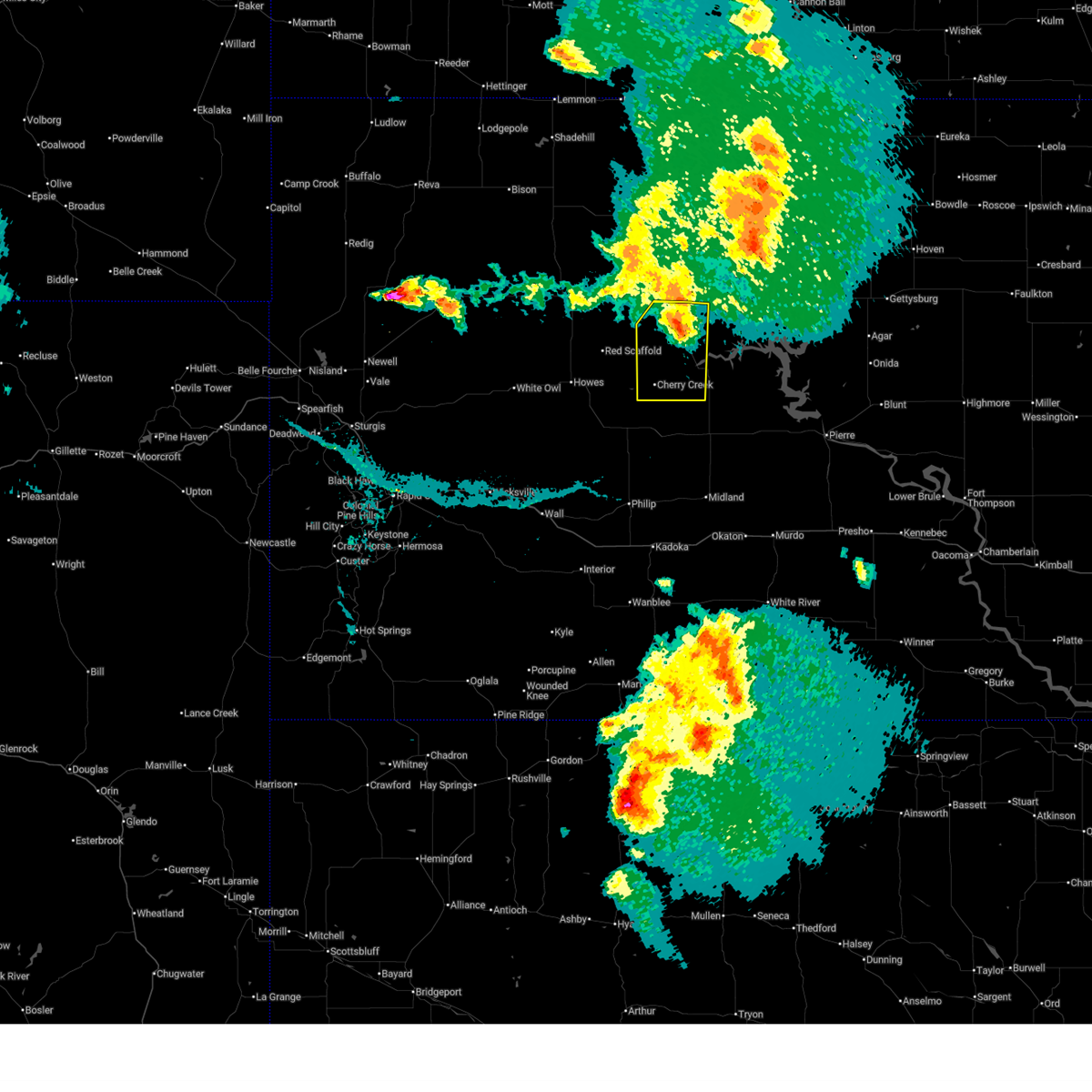
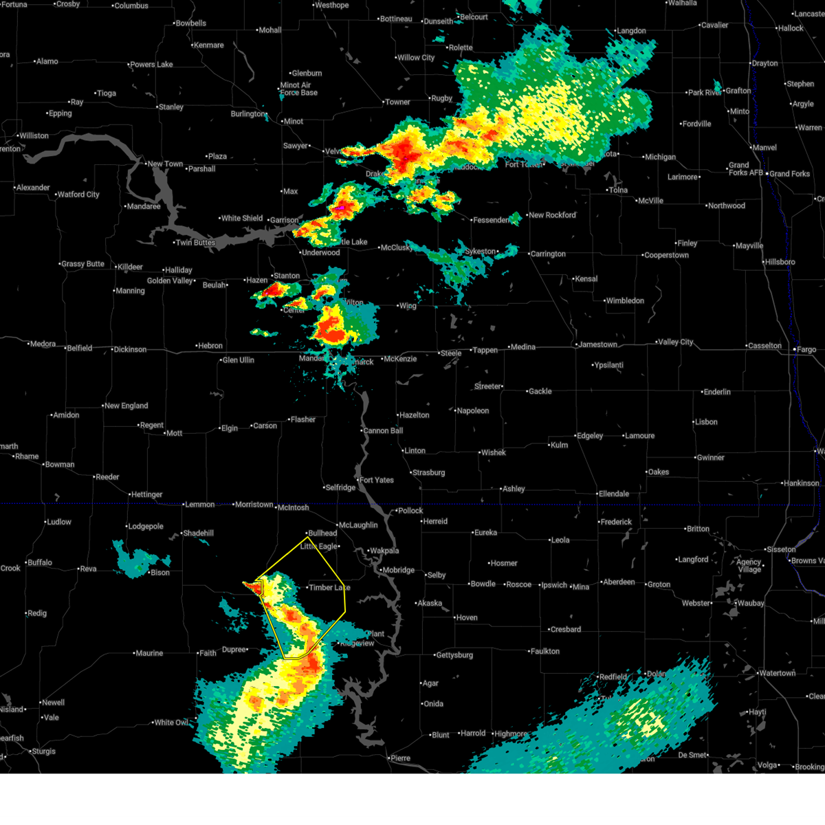
Hail Map for Eagle Butte, SD
The Eagle Butte, SD area has had 30 reports of on-the-ground hail by trained spotters, and has been under severe weather warnings 25 times during the past 12 months. Doppler radar has detected hail at or near Eagle Butte, SD on 50 occasions, including 2 occasions during the past year.
| Name: | Eagle Butte, SD |
| Where Located: | 61.7 miles NW of Pierre, SD |
| Map: | Google Map for Eagle Butte, SD |
| Population: | 1318 |
| Housing Units: | 414 |
| More Info: | Search Google for Eagle Butte, SD |
0
The Top Recent Hail Date for Eagle Butte, SD is Wednesday, August 14, 2024 (23rd out of 50)

Hail and Wind Damage Spotted near Eagle Butte, SD
| Date / Time | Report Details |
|---|---|
| 7/9/2025 5:44 PM MDT |
 The storms which prompted the warning have weakened below severe limits and are exiting the warned area. therefore, the warning will be allowed to expire. however, gusty winds are still possible with these thunderstorms. a severe thunderstorm watch remains in effect until 900 pm mdt for west central south dakota. The storms which prompted the warning have weakened below severe limits and are exiting the warned area. therefore, the warning will be allowed to expire. however, gusty winds are still possible with these thunderstorms. a severe thunderstorm watch remains in effect until 900 pm mdt for west central south dakota.
|
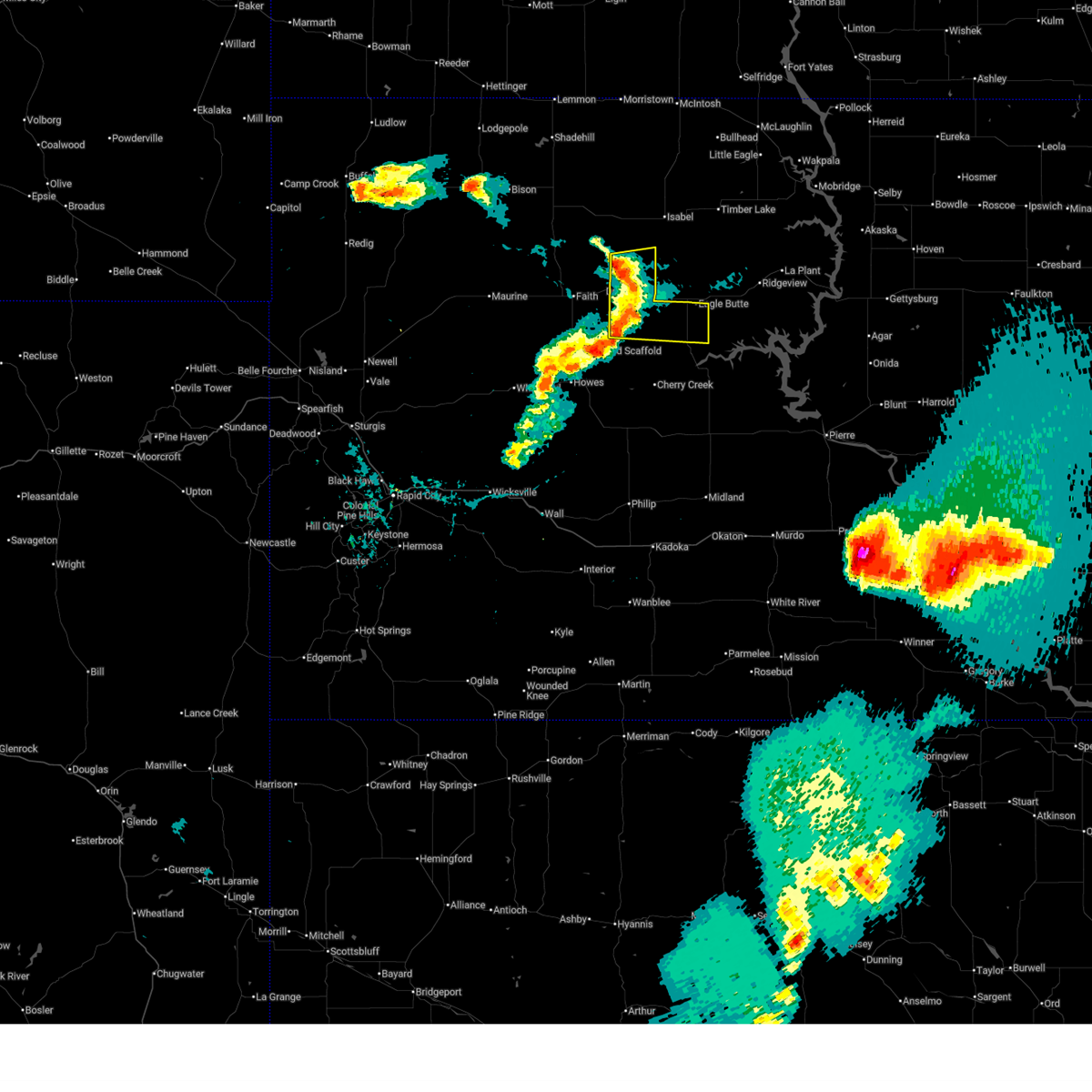
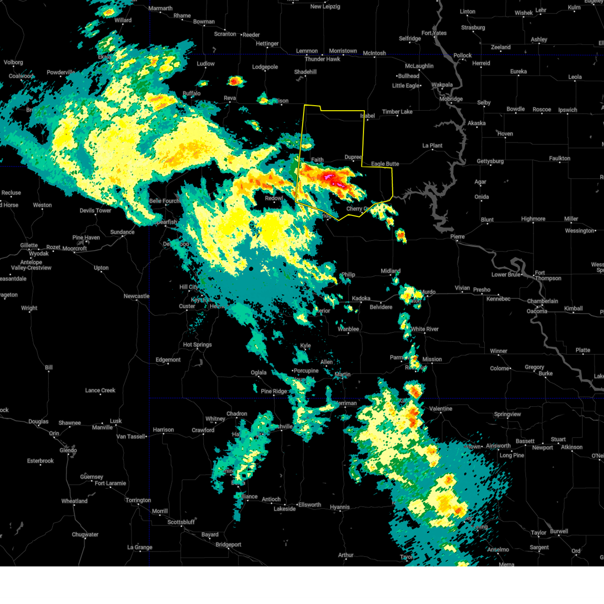
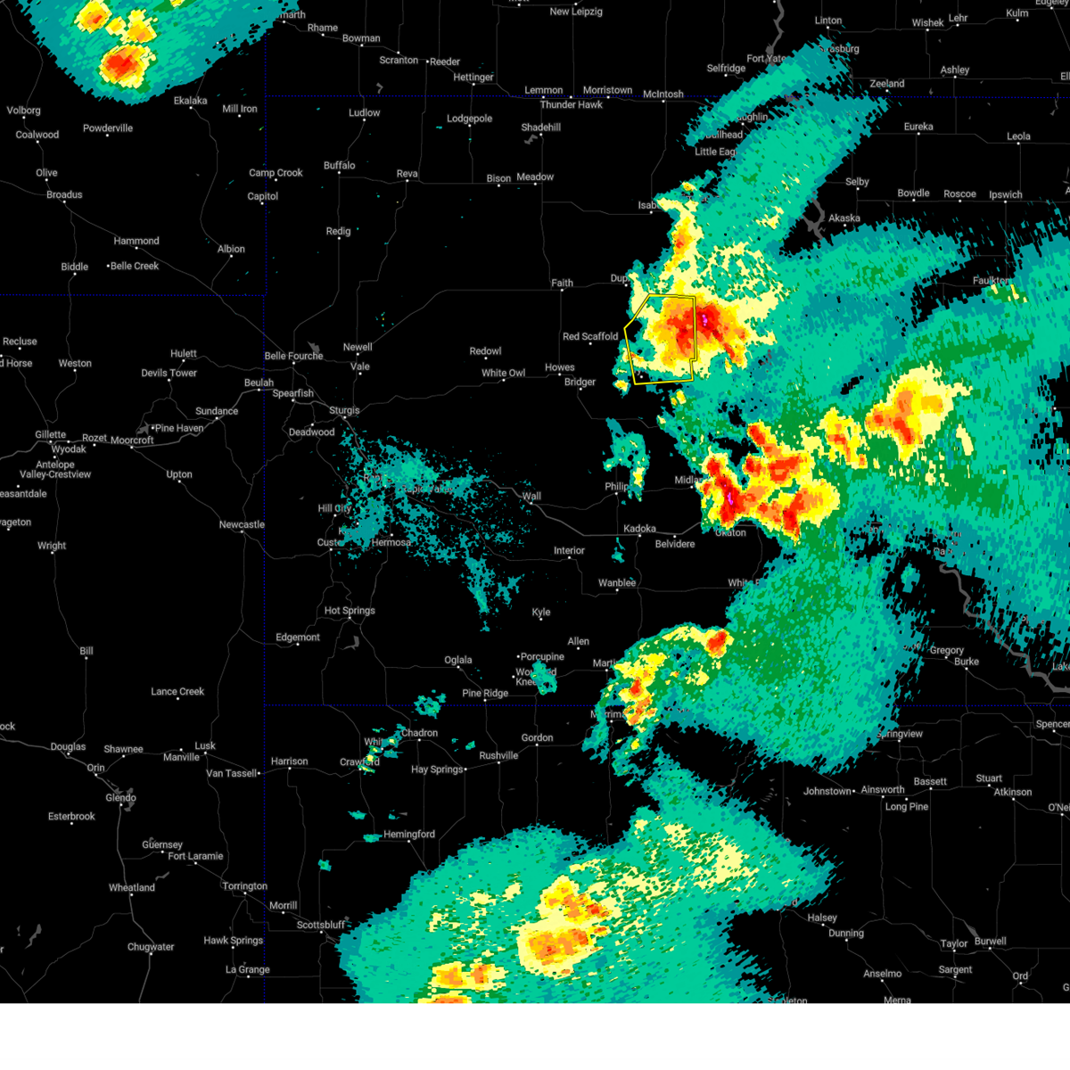
| 7/9/2025 5:25 PM MDT | At 525 pm mdt, severe thunderstorms were located along a line extending from 4 miles west of green grass to 6 miles southwest of intersection of highway 63 and bia road 8 to 6 miles south of cherry creek, moving east at 40 mph (radar indicated). Hazards include 60 mph wind gusts. Expect damage to roofs, siding, and trees. Locations impacted include, cherry creek, south eagle butte, intersection of highway 63 and bia road 8, and southern cheyenne river reservation. |
| 7/9/2025 5:13 PM MDT | Personal weather statio in dewey county SD, 4.6 miles SSW of Eagle Butte, SD |
| 7/9/2025 5:00 PM MDT |
 the severe thunderstorm warning has been cancelled and is no longer in effect the severe thunderstorm warning has been cancelled and is no longer in effect
|
| 7/9/2025 5:00 PM MDT |
 At 500 pm mdt, severe thunderstorms were located along a line extending from 6 miles northeast of thunder butte to near intersection of cherry creek and sunnybrook roads to 8 miles east of takini, moving southeast at 35 mph. automated observations recently recorded wind gusts around 60 mph between dupree and lantry (automated observations indicated). Hazards include 60 mph wind gusts. Expect damage to roofs, siding, and trees. Locations impacted include, dupree, cherry creek, south eagle butte, red scaffold, thunder butte, red elm, intersection of highway 63 and bia road 8, takini, intersection of cherry creek and sunnybrook roads, and southwestern cheyenne river reservation. At 500 pm mdt, severe thunderstorms were located along a line extending from 6 miles northeast of thunder butte to near intersection of cherry creek and sunnybrook roads to 8 miles east of takini, moving southeast at 35 mph. automated observations recently recorded wind gusts around 60 mph between dupree and lantry (automated observations indicated). Hazards include 60 mph wind gusts. Expect damage to roofs, siding, and trees. Locations impacted include, dupree, cherry creek, south eagle butte, red scaffold, thunder butte, red elm, intersection of highway 63 and bia road 8, takini, intersection of cherry creek and sunnybrook roads, and southwestern cheyenne river reservation.
|
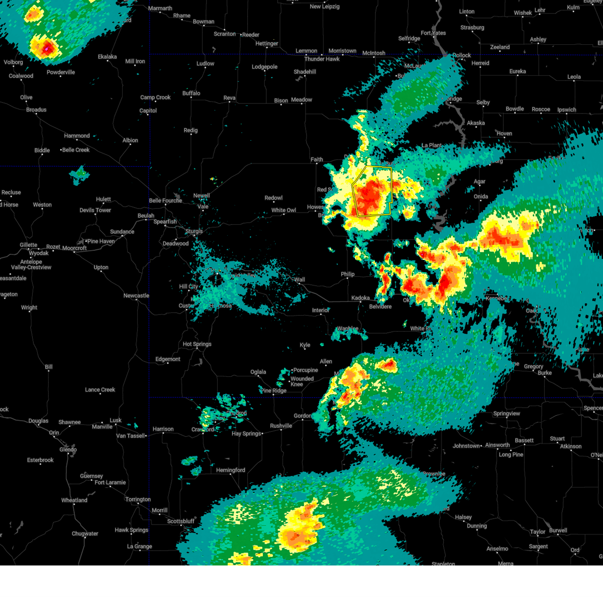
| 7/9/2025 4:44 PM MDT | Svrunr the national weather service in rapid city has issued a * severe thunderstorm warning for, northeastern haakon county in west central south dakota, ziebach county in west central south dakota, northeastern meade county in west central south dakota, * until 545 pm mdt. * at 443 pm mdt, severe thunderstorms were located along a line extending from 4 miles southeast of glad valley to 5 miles northeast of intersection of cherry creek and sunnybrook roads to near takini, moving east at 50 mph. trained spotters and automated observations recently reported wind gusts around 60 mph in faith (trained weather spotters). Hazards include 60 mph wind gusts. expect damage to roofs, siding, and trees |
| 7/9/2025 4:16 PM MDT |
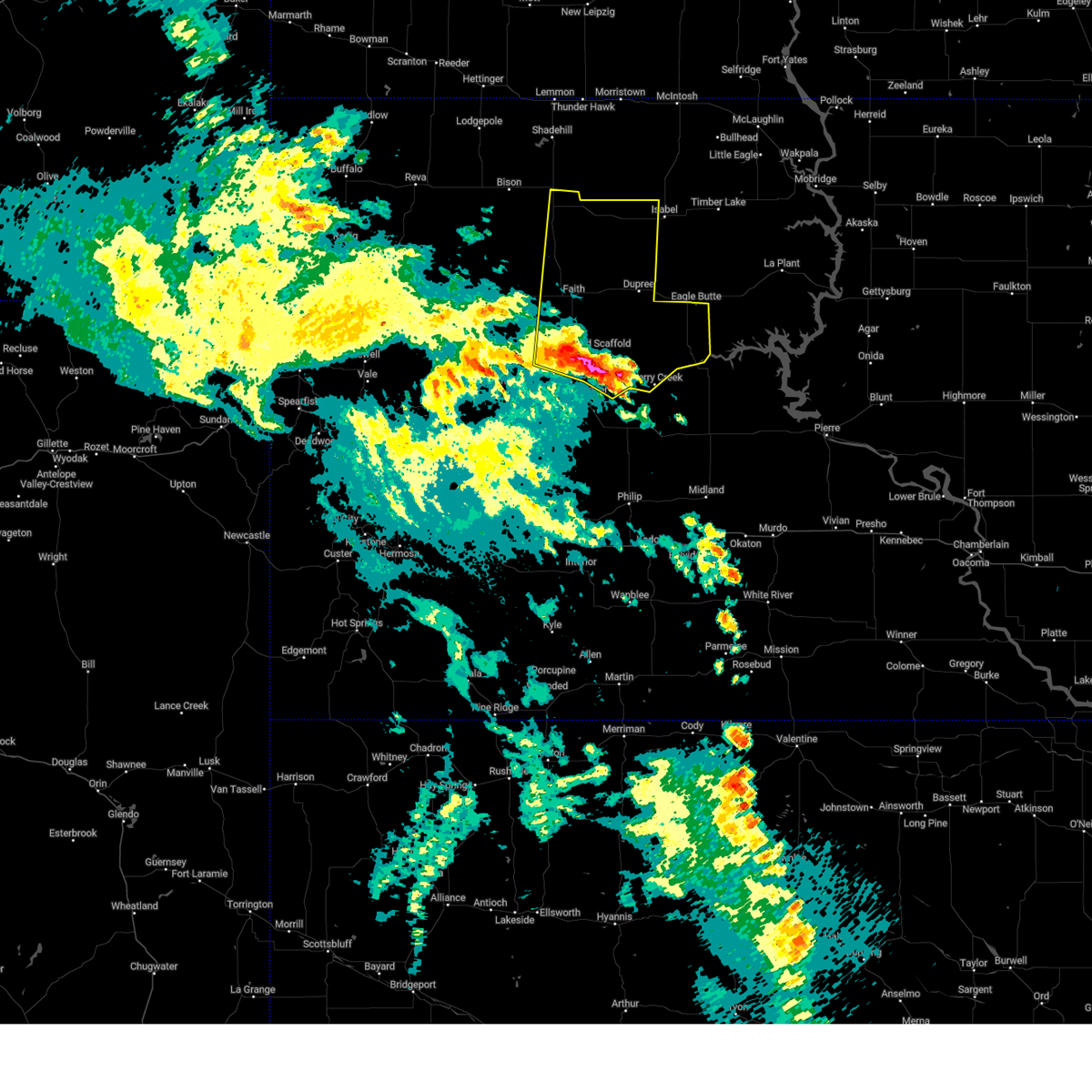
 At 416 pm mdt, severe thunderstorms were located along a line extending from 6 miles southwest of shambo ranch to 6 miles west of red elm to 11 miles west of red scaffold, moving east at 40 mph. a 64 mph wind gust was recently recorded in usta (automated observations indicated). Hazards include 60 mph wind gusts. Expect damage to roofs, siding, and trees. Locations impacted include, dupree, faith, usta, glad valley, south eagle butte, red scaffold, thunder butte, red elm, iron lightning, takini, intersection of cherry creek and sunnybrook roads, intersection of highway 63 and bia road 8, durkee lake, arrow head buttes, and western cheyenne river reservation. At 416 pm mdt, severe thunderstorms were located along a line extending from 6 miles southwest of shambo ranch to 6 miles west of red elm to 11 miles west of red scaffold, moving east at 40 mph. a 64 mph wind gust was recently recorded in usta (automated observations indicated). Hazards include 60 mph wind gusts. Expect damage to roofs, siding, and trees. Locations impacted include, dupree, faith, usta, glad valley, south eagle butte, red scaffold, thunder butte, red elm, iron lightning, takini, intersection of cherry creek and sunnybrook roads, intersection of highway 63 and bia road 8, durkee lake, arrow head buttes, and western cheyenne river reservation.
|
| 7/9/2025 3:58 PM MDT | At 357 pm mdt, severe thunderstorms were located along a line extending from 8 miles west of shambo ranch to 5 miles southwest of iron lightning to 7 miles north of marcus, moving southeast at 50 mph (radar indicated). Hazards include 60 mph wind gusts and penny size hail. Expect damage to roofs, siding, and trees. Locations impacted include, dupree, faith, meadow, chance, usta, maurine, opal, glad valley, south eagle butte, red scaffold, thunder butte, red elm, iron lightning, owen lake, takini, intersection of cherry creek and sunnybrook roads, intersection of highway 63 and bia road 8, durkee lake, arrow head buttes, and western cheyenne river reservation. |
| 7/9/2025 3:49 PM MDT | At 348 pm mdt, severe thunderstorms were located along a line extending from 4 miles north of shadehill to 9 miles east of meadow to 4 miles south of opal, moving east at 50 mph (radar indicated). Hazards include 60 mph wind gusts and penny size hail. Expect damage to roofs, siding, and trees. Locations impacted include, lemmon, dupree, faith, bison, plainview, meadow, chance, usta, maurine, shadehill, stoneville, opal, red scaffold, red owl, iron lightning, glad valley, date, south eagle butte, marcus, and howes. |
| 7/9/2025 3:40 PM MDT |
 Svrunr the national weather service in rapid city has issued a * severe thunderstorm warning for, ziebach county in west central south dakota, northeastern meade county in west central south dakota, perkins county in northwestern south dakota, * until 445 pm mdt. * at 340 pm mdt, severe thunderstorms were located along a line extending from 6 miles south of white butte to 10 miles southeast of meadow to 7 miles north of stoneville, moving east at 60 mph (radar indicated). Hazards include 60 mph wind gusts and quarter size hail. Hail damage to vehicles is expected. Expect wind damage to roofs, siding, and trees. Svrunr the national weather service in rapid city has issued a * severe thunderstorm warning for, ziebach county in west central south dakota, northeastern meade county in west central south dakota, perkins county in northwestern south dakota, * until 445 pm mdt. * at 340 pm mdt, severe thunderstorms were located along a line extending from 6 miles south of white butte to 10 miles southeast of meadow to 7 miles north of stoneville, moving east at 60 mph (radar indicated). Hazards include 60 mph wind gusts and quarter size hail. Hail damage to vehicles is expected. Expect wind damage to roofs, siding, and trees.
|
| 6/27/2025 7:58 PM MDT |
 At 758 pm mdt, severe thunderstorms were located along a line extending from 6 miles northwest of timber lake to near white horse to 9 miles northwest of ridgeview to near parade, moving east at 50 mph (radar indicated). Hazards include 60 mph wind gusts and quarter size hail. Hail damage to vehicles is expected. expect wind damage to roofs, siding, and trees. Locations impacted include, white horse, spring lake and glencross. At 758 pm mdt, severe thunderstorms were located along a line extending from 6 miles northwest of timber lake to near white horse to 9 miles northwest of ridgeview to near parade, moving east at 50 mph (radar indicated). Hazards include 60 mph wind gusts and quarter size hail. Hail damage to vehicles is expected. expect wind damage to roofs, siding, and trees. Locations impacted include, white horse, spring lake and glencross.
|
| 6/27/2025 7:32 PM MDT |
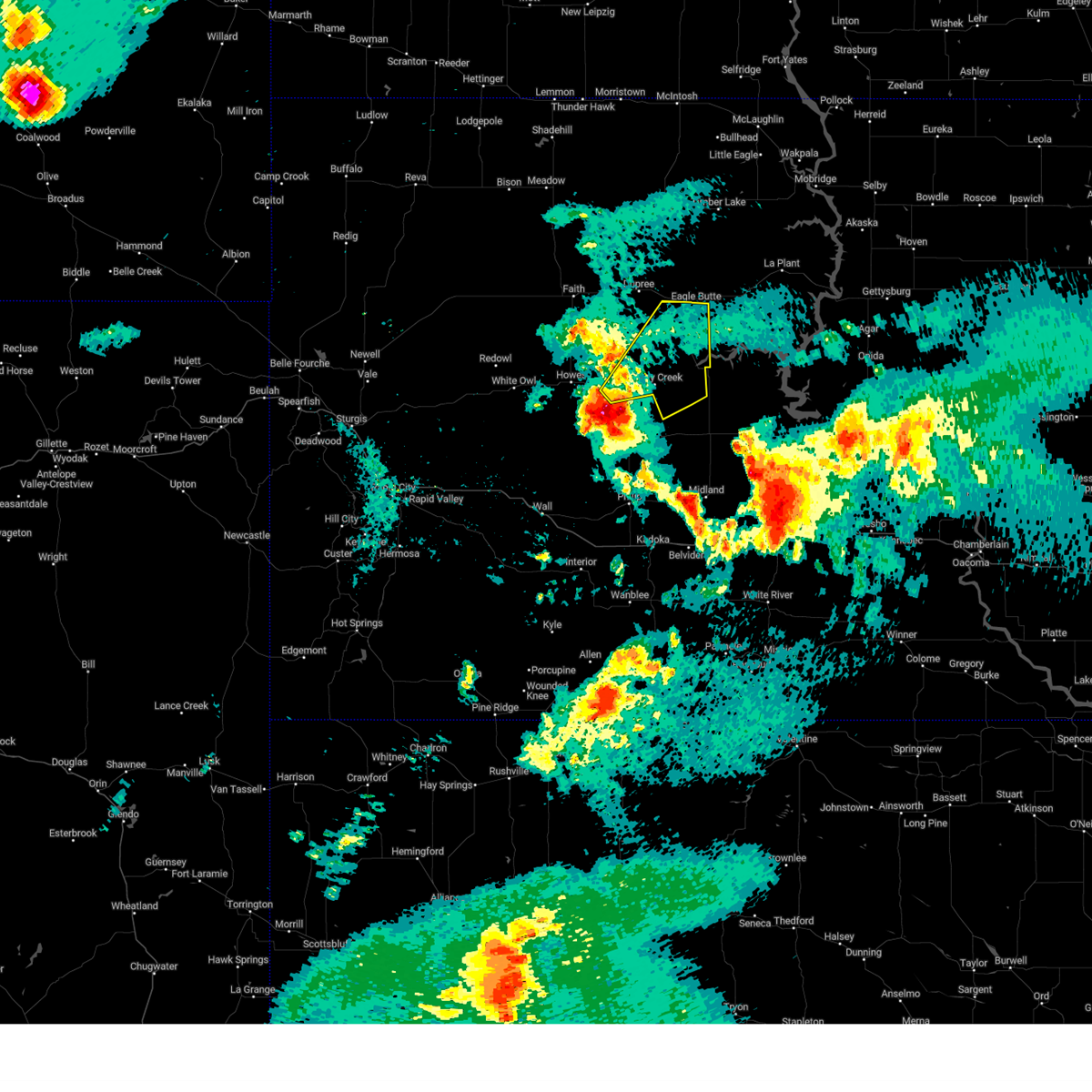
 At 731 pm mdt, severe thunderstorms were located along a line extending from near isabel to near green grass to near eagle butte to 7 miles east of intersection of cherry creek and sunnybrook roads, moving northeast at 45 mph (radar indicated). Hazards include 60 mph wind gusts and quarter size hail. Hail damage to vehicles is expected. expect wind damage to roofs, siding, and trees. these severe storms will be near, eagle butte, lantry, isabel, green grass, and south eagle butte around 735 pm mdt. Other locations in the path of these severe thunderstorms include firesteel, parade, little moreau rec area, timber lake, white horse, spring lake and glencross. At 731 pm mdt, severe thunderstorms were located along a line extending from near isabel to near green grass to near eagle butte to 7 miles east of intersection of cherry creek and sunnybrook roads, moving northeast at 45 mph (radar indicated). Hazards include 60 mph wind gusts and quarter size hail. Hail damage to vehicles is expected. expect wind damage to roofs, siding, and trees. these severe storms will be near, eagle butte, lantry, isabel, green grass, and south eagle butte around 735 pm mdt. Other locations in the path of these severe thunderstorms include firesteel, parade, little moreau rec area, timber lake, white horse, spring lake and glencross.
|
| 6/27/2025 7:31 PM MDT |
 At 731 pm mdt, a severe thunderstorm was located near south eagle butte, or 3 miles southwest of eagle butte, moving east at 35 mph (radar indicated). Hazards include 60 mph wind gusts. Expect damage to roofs, siding, and trees. Locations impacted include, south eagle butte, intersection of highway 63 and bia road 8, and cheyenne river reservation. At 731 pm mdt, a severe thunderstorm was located near south eagle butte, or 3 miles southwest of eagle butte, moving east at 35 mph (radar indicated). Hazards include 60 mph wind gusts. Expect damage to roofs, siding, and trees. Locations impacted include, south eagle butte, intersection of highway 63 and bia road 8, and cheyenne river reservation.
|
| 6/27/2025 7:15 PM MDT |
 Svrabr the national weather service in aberdeen has issued a * severe thunderstorm warning for, south central corson county in north central south dakota, northwestern dewey county in north central south dakota, * until 815 pm mdt. * at 714 pm mdt, severe thunderstorms were located along a line extending from near thunder butte to near bear creek to 7 miles southwest of lantry to near intersection of cherry creek and sunnybrook roads, moving northeast at 45 mph (radar indicated). Hazards include 60 mph wind gusts and quarter size hail. Hail damage to vehicles is expected. expect wind damage to roofs, siding, and trees. severe thunderstorms will be near, lantry and bear creek around 720 pm mdt. eagle butte, isabel, green grass, and south eagle butte around 725 pm mdt. Other locations in the path of these severe thunderstorms include firesteel, parade, timber lake, little moreau rec area, white horse, glencross and spring lake. Svrabr the national weather service in aberdeen has issued a * severe thunderstorm warning for, south central corson county in north central south dakota, northwestern dewey county in north central south dakota, * until 815 pm mdt. * at 714 pm mdt, severe thunderstorms were located along a line extending from near thunder butte to near bear creek to 7 miles southwest of lantry to near intersection of cherry creek and sunnybrook roads, moving northeast at 45 mph (radar indicated). Hazards include 60 mph wind gusts and quarter size hail. Hail damage to vehicles is expected. expect wind damage to roofs, siding, and trees. severe thunderstorms will be near, lantry and bear creek around 720 pm mdt. eagle butte, isabel, green grass, and south eagle butte around 725 pm mdt. Other locations in the path of these severe thunderstorms include firesteel, parade, timber lake, little moreau rec area, white horse, glencross and spring lake.
|
| 6/27/2025 7:08 PM MDT |
 Svrunr the national weather service in rapid city has issued a * severe thunderstorm warning for, central ziebach county in west central south dakota, * until 745 pm mdt. * at 708 pm mdt, a severe thunderstorm was located over dupree, moving east at 35 mph (radar indicated). Hazards include 60 mph wind gusts. expect damage to roofs, siding, and trees Svrunr the national weather service in rapid city has issued a * severe thunderstorm warning for, central ziebach county in west central south dakota, * until 745 pm mdt. * at 708 pm mdt, a severe thunderstorm was located over dupree, moving east at 35 mph (radar indicated). Hazards include 60 mph wind gusts. expect damage to roofs, siding, and trees
|
| 9/17/2024 10:08 PM MDT |
 the severe thunderstorm warning has been cancelled and is no longer in effect the severe thunderstorm warning has been cancelled and is no longer in effect
|
| 9/17/2024 10:08 PM MDT |
 At 1008 pm mdt, severe thunderstorms were located along a line extending from 6 miles northeast of arrow head buttes to 3 miles northeast of thunder butte to near bear creek, moving north at 50 mph (radar indicated). Hazards include 60 mph wind gusts and penny size hail. Expect damage to roofs, siding, and trees. Locations impacted include, dupree, south eagle butte, glad valley, thunder butte, red elm, iron lightning, intersection of highway 63 and bia road 8, and northwestern cheyenne river reservation. At 1008 pm mdt, severe thunderstorms were located along a line extending from 6 miles northeast of arrow head buttes to 3 miles northeast of thunder butte to near bear creek, moving north at 50 mph (radar indicated). Hazards include 60 mph wind gusts and penny size hail. Expect damage to roofs, siding, and trees. Locations impacted include, dupree, south eagle butte, glad valley, thunder butte, red elm, iron lightning, intersection of highway 63 and bia road 8, and northwestern cheyenne river reservation.
|
| 9/17/2024 10:04 PM MDT |
 Svrabr the national weather service in aberdeen has issued a * severe thunderstorm warning for, western corson county in north central south dakota, western dewey county in north central south dakota, * until 1100 pm mdt. * at 1003 pm mdt, severe thunderstorms were located along a line extending from 9 miles southeast of shadehill to near bear creek to 13 miles southeast of intersection of highway 63 and bia road 8, moving northeast at 40 mph (radar indicated). Hazards include 60 mph wind gusts and penny size hail. Expect damage to roofs, siding, and trees. severe thunderstorms will be near, eagle butte, isabel, green grass, shambo ranch, and parade around 1010 pm mdt. firesteel around 1020 pm mdt. Other locations in the path of these severe thunderstorms include thunder hawk, little moreau rec area, keldron, timber lake, morristown, klein ranch, white horse, black horse and watauga. Svrabr the national weather service in aberdeen has issued a * severe thunderstorm warning for, western corson county in north central south dakota, western dewey county in north central south dakota, * until 1100 pm mdt. * at 1003 pm mdt, severe thunderstorms were located along a line extending from 9 miles southeast of shadehill to near bear creek to 13 miles southeast of intersection of highway 63 and bia road 8, moving northeast at 40 mph (radar indicated). Hazards include 60 mph wind gusts and penny size hail. Expect damage to roofs, siding, and trees. severe thunderstorms will be near, eagle butte, isabel, green grass, shambo ranch, and parade around 1010 pm mdt. firesteel around 1020 pm mdt. Other locations in the path of these severe thunderstorms include thunder hawk, little moreau rec area, keldron, timber lake, morristown, klein ranch, white horse, black horse and watauga.
|
| 9/17/2024 9:49 PM MDT |
 At 948 pm mdt, severe thunderstorms were located along a line extending from 5 miles northwest of durkee lake to 4 miles southwest of dupree to 4 miles east of intersection of cherry creek and sunnybrook roads, moving northeast at 55 mph. downed power poles and structural damage were recently reported near faith (law enforcement). Hazards include 70 mph wind gusts and penny size hail. Expect considerable tree damage. damage is likely to mobile homes, roofs, and outbuildings. Locations impacted include, dupree, faith, usta, glad valley, south eagle butte, thunder butte, red elm, iron lightning, intersection of cherry creek and sunnybrook roads, intersection of highway 63 and bia road 8, durkee lake, arrow head buttes, and northwestern cheyenne river reservation. At 948 pm mdt, severe thunderstorms were located along a line extending from 5 miles northwest of durkee lake to 4 miles southwest of dupree to 4 miles east of intersection of cherry creek and sunnybrook roads, moving northeast at 55 mph. downed power poles and structural damage were recently reported near faith (law enforcement). Hazards include 70 mph wind gusts and penny size hail. Expect considerable tree damage. damage is likely to mobile homes, roofs, and outbuildings. Locations impacted include, dupree, faith, usta, glad valley, south eagle butte, thunder butte, red elm, iron lightning, intersection of cherry creek and sunnybrook roads, intersection of highway 63 and bia road 8, durkee lake, arrow head buttes, and northwestern cheyenne river reservation.
|
| 9/17/2024 9:45 PM MDT |
 At 943 pm mdt, severe thunderstorms were located along a line extending from 3 miles northwest of durkee lake to 6 miles south of red elm to 4 miles southeast of intersection of cherry creek and sunnybrook roads, moving north at 65 mph. power poles were recently reported down near faith (trained weather spotters and automated observations). Hazards include 70 mph wind gusts and quarter size hail. Hail damage to vehicles is expected. expect considerable tree damage. wind damage is also likely to mobile homes, roofs, and outbuildings. Locations impacted include, dupree, faith, cherry creek, usta, glad valley, south eagle butte, red scaffold, thunder butte, red elm, iron lightning, takini, intersection of cherry creek and sunnybrook roads, intersection of highway 63 and bia road 8, durkee lake, arrow head buttes, and western cheyenne river reservation. At 943 pm mdt, severe thunderstorms were located along a line extending from 3 miles northwest of durkee lake to 6 miles south of red elm to 4 miles southeast of intersection of cherry creek and sunnybrook roads, moving north at 65 mph. power poles were recently reported down near faith (trained weather spotters and automated observations). Hazards include 70 mph wind gusts and quarter size hail. Hail damage to vehicles is expected. expect considerable tree damage. wind damage is also likely to mobile homes, roofs, and outbuildings. Locations impacted include, dupree, faith, cherry creek, usta, glad valley, south eagle butte, red scaffold, thunder butte, red elm, iron lightning, takini, intersection of cherry creek and sunnybrook roads, intersection of highway 63 and bia road 8, durkee lake, arrow head buttes, and western cheyenne river reservation.
|
| 9/17/2024 9:25 PM MDT |
 Svrunr the national weather service in rapid city has issued a * severe thunderstorm warning for, ziebach county in west central south dakota, northeastern meade county in west central south dakota, southeastern perkins county in northwestern south dakota, * until 1045 pm mdt. * at 925 pm mdt, severe thunderstorms were located along a line extending from 9 miles south of durkee lake to 2 miles south of red scaffold to 7 miles northwest of cherry creek, moving north at 45 mph (radar indicated). Hazards include 60 mph wind gusts and quarter size hail. Hail damage to vehicles is expected. expect wind damage to roofs, siding, and trees. severe thunderstorms will be near, faith, red scaffold, durkee lake, and intersection of cherry creek and sunnybrook roads around 930 pm mdt. red elm around 935 pm mdt. dupree and arrow head buttes around 940 pm mdt. iron lightning and intersection of highway 63 and bia road 8 around 945 pm mdt. Other locations in the path of these severe thunderstorms include usta, thunder butte, south eagle butte and glad valley. Svrunr the national weather service in rapid city has issued a * severe thunderstorm warning for, ziebach county in west central south dakota, northeastern meade county in west central south dakota, southeastern perkins county in northwestern south dakota, * until 1045 pm mdt. * at 925 pm mdt, severe thunderstorms were located along a line extending from 9 miles south of durkee lake to 2 miles south of red scaffold to 7 miles northwest of cherry creek, moving north at 45 mph (radar indicated). Hazards include 60 mph wind gusts and quarter size hail. Hail damage to vehicles is expected. expect wind damage to roofs, siding, and trees. severe thunderstorms will be near, faith, red scaffold, durkee lake, and intersection of cherry creek and sunnybrook roads around 930 pm mdt. red elm around 935 pm mdt. dupree and arrow head buttes around 940 pm mdt. iron lightning and intersection of highway 63 and bia road 8 around 945 pm mdt. Other locations in the path of these severe thunderstorms include usta, thunder butte, south eagle butte and glad valley.
|
| 9/16/2024 3:35 AM MDT | Storm damage reported in ziebach county SD, 21 miles NNE of Eagle Butte, SD |
| 8/21/2024 9:36 PM MDT |
 the severe thunderstorm warning has been cancelled and is no longer in effect the severe thunderstorm warning has been cancelled and is no longer in effect
|
| 8/21/2024 9:13 PM MDT |
 Svrabr the national weather service in aberdeen has issued a * severe thunderstorm warning for, northwestern stanley county in central south dakota, central dewey county in north central south dakota, * until 1000 pm mdt. * at 913 pm mdt, a severe thunderstorm was located 8 miles east of parade, or 14 miles east of eagle butte, moving northeast at 45 mph (radar indicated). Hazards include 60 mph wind gusts and quarter size hail. Hail damage to vehicles is expected. expect wind damage to roofs, siding, and trees. this severe thunderstorm will be near, ridgeview around 920 pm mdt. Laplant and tiospaye topa school around 930 pm mdt. Svrabr the national weather service in aberdeen has issued a * severe thunderstorm warning for, northwestern stanley county in central south dakota, central dewey county in north central south dakota, * until 1000 pm mdt. * at 913 pm mdt, a severe thunderstorm was located 8 miles east of parade, or 14 miles east of eagle butte, moving northeast at 45 mph (radar indicated). Hazards include 60 mph wind gusts and quarter size hail. Hail damage to vehicles is expected. expect wind damage to roofs, siding, and trees. this severe thunderstorm will be near, ridgeview around 920 pm mdt. Laplant and tiospaye topa school around 930 pm mdt.
|
| 8/21/2024 9:10 PM MDT |
 the severe thunderstorm warning has been cancelled and is no longer in effect the severe thunderstorm warning has been cancelled and is no longer in effect
|
| 8/21/2024 8:46 PM MDT |
 At 846 pm mdt, a severe thunderstorm was located 7 miles south of intersection of highway 63 and bia road 8, or 17 miles south of eagle butte, moving northeast at 50 mph (radar indicated). Hazards include 70 mph wind gusts and penny size hail. Expect considerable tree damage. damage is likely to mobile homes, roofs, and outbuildings. Locations impacted include, intersection of highway 63 and bia road 8 and south eagle butte. At 846 pm mdt, a severe thunderstorm was located 7 miles south of intersection of highway 63 and bia road 8, or 17 miles south of eagle butte, moving northeast at 50 mph (radar indicated). Hazards include 70 mph wind gusts and penny size hail. Expect considerable tree damage. damage is likely to mobile homes, roofs, and outbuildings. Locations impacted include, intersection of highway 63 and bia road 8 and south eagle butte.
|
| 8/21/2024 8:22 PM MDT |
 Svrunr the national weather service in rapid city has issued a * severe thunderstorm warning for, northern haakon county in west central south dakota, southeastern ziebach county in west central south dakota, * until 930 pm mdt. * at 822 pm mdt, a severe thunderstorm was located 5 miles north of milesville, or 34 miles north of philip, moving northeast at 50 mph (radar indicated). Hazards include 70 mph wind gusts and quarter size hail. Hail damage to vehicles is expected. expect considerable tree damage. wind damage is also likely to mobile homes, roofs, and outbuildings. this severe thunderstorm will be near, cherry creek around 825 pm mdt. kirley around 830 pm mdt. Other locations in the path of this severe thunderstorm include intersection of highway 63 and bia road 8 and south eagle butte. Svrunr the national weather service in rapid city has issued a * severe thunderstorm warning for, northern haakon county in west central south dakota, southeastern ziebach county in west central south dakota, * until 930 pm mdt. * at 822 pm mdt, a severe thunderstorm was located 5 miles north of milesville, or 34 miles north of philip, moving northeast at 50 mph (radar indicated). Hazards include 70 mph wind gusts and quarter size hail. Hail damage to vehicles is expected. expect considerable tree damage. wind damage is also likely to mobile homes, roofs, and outbuildings. this severe thunderstorm will be near, cherry creek around 825 pm mdt. kirley around 830 pm mdt. Other locations in the path of this severe thunderstorm include intersection of highway 63 and bia road 8 and south eagle butte.
|
| 7/14/2024 12:05 AM MDT | Storm damage reported in ziebach county SD, 0.8 miles NE of Eagle Butte, SD |
| 7/14/2024 12:01 AM MDT |
 At 1200 am mdt, severe thunderstorms were located along a line extending from 5 miles northwest of eagle butte to 6 miles west of sansarc to 6 miles southwest of philip, moving southeast at 35 mph. these are destructive storms for philip, ottumwa, and midland (radar indicated). Hazards include 80 mph wind gusts and penny size hail. Flying debris will be dangerous to those caught without shelter. mobile homes will be heavily damaged. expect considerable damage to roofs, windows, and vehicles. extensive tree damage and power outages are likely. these severe storms will be near, philip, south eagle butte, ottumwa, and nowlin around 1205 am mdt. midland around 1210 am mdt. Other locations impacted by these severe thunderstorms include southern cheyenne river reservation. At 1200 am mdt, severe thunderstorms were located along a line extending from 5 miles northwest of eagle butte to 6 miles west of sansarc to 6 miles southwest of philip, moving southeast at 35 mph. these are destructive storms for philip, ottumwa, and midland (radar indicated). Hazards include 80 mph wind gusts and penny size hail. Flying debris will be dangerous to those caught without shelter. mobile homes will be heavily damaged. expect considerable damage to roofs, windows, and vehicles. extensive tree damage and power outages are likely. these severe storms will be near, philip, south eagle butte, ottumwa, and nowlin around 1205 am mdt. midland around 1210 am mdt. Other locations impacted by these severe thunderstorms include southern cheyenne river reservation.
|
| 7/14/2024 12:01 AM MDT |
 the severe thunderstorm warning has been cancelled and is no longer in effect the severe thunderstorm warning has been cancelled and is no longer in effect
|
| 7/13/2024 11:57 PM MDT |
 At 1257 am cdt/1157 pm mdt/, severe thunderstorms were located along a line extending from white horse to 10 miles northwest of little bend rec area to 7 miles south of mission ridge, moving east at 70 mph. these are destructive storms (radar indicated). Hazards include 80 mph wind gusts. Flying debris will be dangerous to those caught without shelter. mobile homes will be heavily damaged. expect considerable damage to roofs, windows, and vehicles. extensive tree damage and power outages are likely. Locations impacted include, little bend rec area, mission ridge, laplant, ridgeview, tiospaye topa school, cow creek rec area, okobojo point rec area, bush's landing, chantier creek recreation area, spring creek rec area, oahe mission rec area, sutton bay rec area, swiftbird, swiftbird day school, grey goose, whitlocks bay rec area, overlook rec area, agar, sully lake, onida, gorman and blunt. At 1257 am cdt/1157 pm mdt/, severe thunderstorms were located along a line extending from white horse to 10 miles northwest of little bend rec area to 7 miles south of mission ridge, moving east at 70 mph. these are destructive storms (radar indicated). Hazards include 80 mph wind gusts. Flying debris will be dangerous to those caught without shelter. mobile homes will be heavily damaged. expect considerable damage to roofs, windows, and vehicles. extensive tree damage and power outages are likely. Locations impacted include, little bend rec area, mission ridge, laplant, ridgeview, tiospaye topa school, cow creek rec area, okobojo point rec area, bush's landing, chantier creek recreation area, spring creek rec area, oahe mission rec area, sutton bay rec area, swiftbird, swiftbird day school, grey goose, whitlocks bay rec area, overlook rec area, agar, sully lake, onida, gorman and blunt.
|
| 7/13/2024 11:50 PM MDT | Storm damage reported in ziebach county SD, 0.8 miles NE of Eagle Butte, SD |
| 7/13/2024 11:46 PM MDT | 3 inch tree limbs broken and power poles broke in dewey county SD, 7.3 miles ESE of Eagle Butte, SD |
| 7/13/2024 11:40 PM MDT | Storm damage reported in ziebach county SD, 0.8 miles NE of Eagle Butte, SD |
| 7/13/2024 11:39 PM MDT |
 At 1138 pm mdt, severe thunderstorms were located along a line extending from 9 miles east of thunder butte to 5 miles north of kirley to 6 miles northeast of quinn, moving east at 50 mph. these are destructive storms for cherry creek, billsburg, and phillip (radar indicated). Hazards include 80 mph wind gusts and penny size hail. Flying debris will be dangerous to those caught without shelter. mobile homes will be heavily damaged. expect considerable damage to roofs, windows, and vehicles. extensive tree damage and power outages are likely. these severe storms will be near, philip, south eagle butte, ottumwa, kirley, and intersection of highway 63 and bia road 8 around 1145 pm mdt. nowlin around 1155 pm mdt. midland around 1205 am mdt. Other locations impacted by these severe thunderstorms include western cheyenne river reservation. At 1138 pm mdt, severe thunderstorms were located along a line extending from 9 miles east of thunder butte to 5 miles north of kirley to 6 miles northeast of quinn, moving east at 50 mph. these are destructive storms for cherry creek, billsburg, and phillip (radar indicated). Hazards include 80 mph wind gusts and penny size hail. Flying debris will be dangerous to those caught without shelter. mobile homes will be heavily damaged. expect considerable damage to roofs, windows, and vehicles. extensive tree damage and power outages are likely. these severe storms will be near, philip, south eagle butte, ottumwa, kirley, and intersection of highway 63 and bia road 8 around 1145 pm mdt. nowlin around 1155 pm mdt. midland around 1205 am mdt. Other locations impacted by these severe thunderstorms include western cheyenne river reservation.
|
| 7/13/2024 11:39 PM MDT |
 the severe thunderstorm warning has been cancelled and is no longer in effect the severe thunderstorm warning has been cancelled and is no longer in effect
|
| 7/13/2024 11:35 PM MDT | Storm damage reported in ziebach county SD, 0.8 miles NE of Eagle Butte, SD |
| 7/13/2024 11:32 PM MDT |
 Svrabr the national weather service in aberdeen has issued a * severe thunderstorm warning for, sully county in central south dakota, western potter county in north central south dakota, northwestern stanley county in central south dakota, dewey county in north central south dakota, northwestern hughes county in central south dakota, * until 130 am cdt/1230 am mdt/. * at 1231 am cdt/1131 pm mdt/, severe thunderstorms were located along a line extending from near isabel to near south eagle butte to 6 miles east of cherry creek, moving east at 70 mph (radar indicated). Hazards include 70 mph wind gusts. Expect considerable tree damage. damage is likely to mobile homes, roofs, and outbuildings. severe thunderstorms will be near, eagle butte, green grass, and parade around 1135 pm mdt. white horse around 1145 pm mdt. mission ridge and ridgeview around 1150 pm mdt. Other locations in the path of these severe thunderstorms include little bend rec area, laplant, tiospaye topa school, bush's landing, chantier creek recreation area, spring creek rec area, cow creek rec area, oahe mission rec area, okobojo point rec area, sutton bay rec area, swiftbird day school, grey goose, whitlocks bay rec area, overlook rec area, swiftbird, west shore rec area and sully lake. Svrabr the national weather service in aberdeen has issued a * severe thunderstorm warning for, sully county in central south dakota, western potter county in north central south dakota, northwestern stanley county in central south dakota, dewey county in north central south dakota, northwestern hughes county in central south dakota, * until 130 am cdt/1230 am mdt/. * at 1231 am cdt/1131 pm mdt/, severe thunderstorms were located along a line extending from near isabel to near south eagle butte to 6 miles east of cherry creek, moving east at 70 mph (radar indicated). Hazards include 70 mph wind gusts. Expect considerable tree damage. damage is likely to mobile homes, roofs, and outbuildings. severe thunderstorms will be near, eagle butte, green grass, and parade around 1135 pm mdt. white horse around 1145 pm mdt. mission ridge and ridgeview around 1150 pm mdt. Other locations in the path of these severe thunderstorms include little bend rec area, laplant, tiospaye topa school, bush's landing, chantier creek recreation area, spring creek rec area, cow creek rec area, oahe mission rec area, okobojo point rec area, sutton bay rec area, swiftbird day school, grey goose, whitlocks bay rec area, overlook rec area, swiftbird, west shore rec area and sully lake.
|
| 7/13/2024 11:23 PM MDT |
 At 1122 pm mdt, severe thunderstorms were located along a line extending from 7 miles west of isabel to 8 miles east of takini to 6 miles north of wall, moving southeast at 50 mph. these are destructive storms for dupree, cherry creek and billsburg (radar indicated). Hazards include 80 mph wind gusts and penny size hail. Flying debris will be dangerous to those caught without shelter. mobile homes will be heavily damaged. expect considerable damage to roofs, windows, and vehicles. extensive tree damage and power outages are likely. these severe storms will be near, dupree, wall, cherry creek, milesville, billsburg, grindstone, intersection of cherry creek and sunnybrook roads, and grindstone butte around 1125 pm mdt. south eagle butte, kirley, and intersection of highway 63 and bia road 8 around 1130 pm mdt. philip around 1140 pm mdt. ottumwa around 1145 pm mdt. nowlin around 1155 pm mdt. midland around 1205 am mdt. other locations impacted by these severe thunderstorms include western cheyenne river reservation. This includes interstate 90 in south dakota between mile markers 87 and 110. At 1122 pm mdt, severe thunderstorms were located along a line extending from 7 miles west of isabel to 8 miles east of takini to 6 miles north of wall, moving southeast at 50 mph. these are destructive storms for dupree, cherry creek and billsburg (radar indicated). Hazards include 80 mph wind gusts and penny size hail. Flying debris will be dangerous to those caught without shelter. mobile homes will be heavily damaged. expect considerable damage to roofs, windows, and vehicles. extensive tree damage and power outages are likely. these severe storms will be near, dupree, wall, cherry creek, milesville, billsburg, grindstone, intersection of cherry creek and sunnybrook roads, and grindstone butte around 1125 pm mdt. south eagle butte, kirley, and intersection of highway 63 and bia road 8 around 1130 pm mdt. philip around 1140 pm mdt. ottumwa around 1145 pm mdt. nowlin around 1155 pm mdt. midland around 1205 am mdt. other locations impacted by these severe thunderstorms include western cheyenne river reservation. This includes interstate 90 in south dakota between mile markers 87 and 110.
|
| 7/13/2024 11:04 PM MDT |
 Svrunr the national weather service in rapid city has issued a * severe thunderstorm warning for, haakon county in west central south dakota, ziebach county in west central south dakota, eastern meade county in west central south dakota, southeastern perkins county in northwestern south dakota, northeastern pennington county in west central south dakota, * until 1215 am mdt. * at 1102 pm mdt, severe thunderstorms were located along a line extending from near glad valley to 9 miles northeast of marcus to 6 miles northwest of wicksville, moving east at 40 mph. these are destructive storms for faith, milesville, creighton, and red elm (radar indicated). Hazards include 80 mph wind gusts and penny size hail. Flying debris will be dangerous to those caught without shelter. mobile homes will be heavily damaged. expect considerable damage to roofs, windows, and vehicles. extensive tree damage and power outages are likely. severe thunderstorms will be near, wasta, plainview, wicksville, howes, creighton, red scaffold, iron lightning, thunder butte, red elm, and takini around 1105 pm mdt. dupree and bridger around 1110 pm mdt. intersection of cherry creek and sunnybrook roads around 1115 pm mdt. wall around 1120 pm mdt. milesville and grindstone around 1130 pm mdt. cherry creek, south eagle butte, and billsburg around 1135 pm mdt. intersection of highway 63 and bia road 8 and grindstone butte around 1140 pm mdt. kirley around 1150 pm mdt. other locations impacted by these severe thunderstorms include western cheyenne river reservation. This includes interstate 90 in south dakota between mile markers 86 and 110. Svrunr the national weather service in rapid city has issued a * severe thunderstorm warning for, haakon county in west central south dakota, ziebach county in west central south dakota, eastern meade county in west central south dakota, southeastern perkins county in northwestern south dakota, northeastern pennington county in west central south dakota, * until 1215 am mdt. * at 1102 pm mdt, severe thunderstorms were located along a line extending from near glad valley to 9 miles northeast of marcus to 6 miles northwest of wicksville, moving east at 40 mph. these are destructive storms for faith, milesville, creighton, and red elm (radar indicated). Hazards include 80 mph wind gusts and penny size hail. Flying debris will be dangerous to those caught without shelter. mobile homes will be heavily damaged. expect considerable damage to roofs, windows, and vehicles. extensive tree damage and power outages are likely. severe thunderstorms will be near, wasta, plainview, wicksville, howes, creighton, red scaffold, iron lightning, thunder butte, red elm, and takini around 1105 pm mdt. dupree and bridger around 1110 pm mdt. intersection of cherry creek and sunnybrook roads around 1115 pm mdt. wall around 1120 pm mdt. milesville and grindstone around 1130 pm mdt. cherry creek, south eagle butte, and billsburg around 1135 pm mdt. intersection of highway 63 and bia road 8 and grindstone butte around 1140 pm mdt. kirley around 1150 pm mdt. other locations impacted by these severe thunderstorms include western cheyenne river reservation. This includes interstate 90 in south dakota between mile markers 86 and 110.
|
| 7/13/2024 10:30 PM MDT |
 Svrabr the national weather service in aberdeen has issued a * severe thunderstorm warning for, corson county in north central south dakota, northwestern dewey county in north central south dakota, * until 1130 pm mdt. * at 1029 pm mdt, severe thunderstorms were located along a line extending from thunder hawk to near maurine, moving east at 70 mph (radar indicated). Hazards include 60 mph wind gusts. Expect damage to roofs, siding, and trees. severe thunderstorms will be near, morristown and keldron around 1035 pm mdt. watauga and shambo ranch around 1040 pm mdt. Other locations in the path of these severe thunderstorms include mcintosh, klein ranch, black horse, isabel, walker, bullhead, firesteel, bear creek, lantry, green grass, eagle butte, mclaughlin, timber lake, little eagle, spring lake and little moreau rec area. Svrabr the national weather service in aberdeen has issued a * severe thunderstorm warning for, corson county in north central south dakota, northwestern dewey county in north central south dakota, * until 1130 pm mdt. * at 1029 pm mdt, severe thunderstorms were located along a line extending from thunder hawk to near maurine, moving east at 70 mph (radar indicated). Hazards include 60 mph wind gusts. Expect damage to roofs, siding, and trees. severe thunderstorms will be near, morristown and keldron around 1035 pm mdt. watauga and shambo ranch around 1040 pm mdt. Other locations in the path of these severe thunderstorms include mcintosh, klein ranch, black horse, isabel, walker, bullhead, firesteel, bear creek, lantry, green grass, eagle butte, mclaughlin, timber lake, little eagle, spring lake and little moreau rec area.
|
| 6/22/2024 8:54 PM MDT |
 the severe thunderstorm warning has been cancelled and is no longer in effect the severe thunderstorm warning has been cancelled and is no longer in effect
|
| 6/22/2024 8:48 PM MDT |
 At 848 pm mdt, a severe thunderstorm was located near green grass, or 15 miles north of lantry, moving southeast at 35 mph (radar indicated). Hazards include 60 mph wind gusts and nickel size hail. Expect damage to roofs, siding, and trees. this severe storm will be near, green grass around 855 pm mdt. Other locations in the path of this severe thunderstorm include parade. At 848 pm mdt, a severe thunderstorm was located near green grass, or 15 miles north of lantry, moving southeast at 35 mph (radar indicated). Hazards include 60 mph wind gusts and nickel size hail. Expect damage to roofs, siding, and trees. this severe storm will be near, green grass around 855 pm mdt. Other locations in the path of this severe thunderstorm include parade.
|
| 6/22/2024 8:37 PM MDT |
 At 837 pm mdt, a severe thunderstorm was located 7 miles south of isabel, or 18 miles north of dupree, moving southeast at 35 mph (radar indicated). Hazards include ping pong ball size hail and 60 mph wind gusts. People and animals outdoors will be injured. expect hail damage to roofs, siding, windows, and vehicles. expect wind damage to roofs, siding, and trees. Locations impacted include, green grass, eagle butte and parade. At 837 pm mdt, a severe thunderstorm was located 7 miles south of isabel, or 18 miles north of dupree, moving southeast at 35 mph (radar indicated). Hazards include ping pong ball size hail and 60 mph wind gusts. People and animals outdoors will be injured. expect hail damage to roofs, siding, windows, and vehicles. expect wind damage to roofs, siding, and trees. Locations impacted include, green grass, eagle butte and parade.
|
| 6/22/2024 8:24 PM MDT |
 Svrabr the national weather service in aberdeen has issued a * severe thunderstorm warning for, western dewey county in north central south dakota, * until 930 pm mdt. * at 824 pm mdt, a severe thunderstorm was located near isabel, or 22 miles north of dupree, moving southeast at 45 mph (radar indicated). Hazards include ping pong ball size hail and 60 mph wind gusts. People and animals outdoors will be injured. expect hail damage to roofs, siding, windows, and vehicles. expect wind damage to roofs, siding, and trees. this severe thunderstorm will be near, isabel around 830 pm mdt. Other locations in the path of this severe thunderstorm include green grass, parade and eagle butte. Svrabr the national weather service in aberdeen has issued a * severe thunderstorm warning for, western dewey county in north central south dakota, * until 930 pm mdt. * at 824 pm mdt, a severe thunderstorm was located near isabel, or 22 miles north of dupree, moving southeast at 45 mph (radar indicated). Hazards include ping pong ball size hail and 60 mph wind gusts. People and animals outdoors will be injured. expect hail damage to roofs, siding, windows, and vehicles. expect wind damage to roofs, siding, and trees. this severe thunderstorm will be near, isabel around 830 pm mdt. Other locations in the path of this severe thunderstorm include green grass, parade and eagle butte.
|
| 6/10/2024 4:52 PM MDT |
 At 451 pm mdt, severe thunderstorms were located along a line extending from 6 miles north of ridgeview to 5 miles west of ottumwa, moving east at 40 mph (radar indicated). Hazards include 70 mph wind gusts. Expect considerable tree damage. damage is likely to mobile homes, roofs, and outbuildings. these severe storms will be near, ottumwa around 455 pm mdt. midland around 505 pm mdt. Other locations impacted by these severe thunderstorms include southern cheyenne river reservation. At 451 pm mdt, severe thunderstorms were located along a line extending from 6 miles north of ridgeview to 5 miles west of ottumwa, moving east at 40 mph (radar indicated). Hazards include 70 mph wind gusts. Expect considerable tree damage. damage is likely to mobile homes, roofs, and outbuildings. these severe storms will be near, ottumwa around 455 pm mdt. midland around 505 pm mdt. Other locations impacted by these severe thunderstorms include southern cheyenne river reservation.
|
| 6/10/2024 4:44 PM MDT |
 At 444 pm mdt, severe thunderstorms were located along a line extending from 7 miles north of parade to near kirley, moving east at 40 mph (radar indicated). Hazards include 60 mph wind gusts. Expect damage to roofs, siding, and trees. Locations impacted include, parade. At 444 pm mdt, severe thunderstorms were located along a line extending from 7 miles north of parade to near kirley, moving east at 40 mph (radar indicated). Hazards include 60 mph wind gusts. Expect damage to roofs, siding, and trees. Locations impacted include, parade.
|
| 6/10/2024 4:32 PM MDT |
 the severe thunderstorm warning has been cancelled and is no longer in effect the severe thunderstorm warning has been cancelled and is no longer in effect
|
| 6/10/2024 4:32 PM MDT |
 At 431 pm mdt, severe thunderstorms were located along a line extending from 6 miles east of green grass to 5 miles northeast of grindstone butte, moving east at 40 mph (radar indicated). Hazards include 70 mph wind gusts. Expect considerable tree damage. damage is likely to mobile homes, roofs, and outbuildings. these severe storms will be near, cherry creek, south eagle butte, kirley, and intersection of highway 63 and bia road 8 around 435 pm mdt. ottumwa around 440 pm mdt. midland around 505 pm mdt. Other locations impacted by these severe thunderstorms include southwestern cheyenne river reservation. At 431 pm mdt, severe thunderstorms were located along a line extending from 6 miles east of green grass to 5 miles northeast of grindstone butte, moving east at 40 mph (radar indicated). Hazards include 70 mph wind gusts. Expect considerable tree damage. damage is likely to mobile homes, roofs, and outbuildings. these severe storms will be near, cherry creek, south eagle butte, kirley, and intersection of highway 63 and bia road 8 around 435 pm mdt. ottumwa around 440 pm mdt. midland around 505 pm mdt. Other locations impacted by these severe thunderstorms include southwestern cheyenne river reservation.
|
| 6/10/2024 4:15 PM MDT |
 Svrabr the national weather service in aberdeen has issued a * severe thunderstorm warning for, southwestern dewey county in north central south dakota, * until 500 pm mdt. * at 414 pm mdt, severe thunderstorms were located along a line extending from near bear creek to 6 miles southeast of takini, moving east at 40 mph (radar indicated). Hazards include 60 mph wind gusts. Expect damage to roofs, siding, and trees. severe thunderstorms will be near, lantry and bear creek around 420 pm mdt. eagle butte around 425 pm mdt. Other locations in the path of these severe thunderstorms include parade. Svrabr the national weather service in aberdeen has issued a * severe thunderstorm warning for, southwestern dewey county in north central south dakota, * until 500 pm mdt. * at 414 pm mdt, severe thunderstorms were located along a line extending from near bear creek to 6 miles southeast of takini, moving east at 40 mph (radar indicated). Hazards include 60 mph wind gusts. Expect damage to roofs, siding, and trees. severe thunderstorms will be near, lantry and bear creek around 420 pm mdt. eagle butte around 425 pm mdt. Other locations in the path of these severe thunderstorms include parade.
|
| 6/10/2024 4:04 PM MDT |
 Svrunr the national weather service in rapid city has issued a * severe thunderstorm warning for, haakon county in west central south dakota, ziebach county in west central south dakota, eastern pennington county in west central south dakota, * until 515 pm mdt. * at 404 pm mdt, severe thunderstorms were located along a line extending from 9 miles east of thunder butte to 6 miles northeast of creighton, moving east at 40 mph (radar indicated). Hazards include 70 mph wind gusts. Expect considerable tree damage. damage is likely to mobile homes, roofs, and outbuildings. severe thunderstorms will be near, milesville, bridger, billsburg, takini, and intersection of cherry creek and sunnybrook roads around 410 pm mdt. cherry creek, south eagle butte, and intersection of highway 63 and bia road 8 around 415 pm mdt. kirley around 430 pm mdt. ottumwa around 440 pm mdt. Other locations impacted by these severe thunderstorms include southwestern cheyenne river reservation. Svrunr the national weather service in rapid city has issued a * severe thunderstorm warning for, haakon county in west central south dakota, ziebach county in west central south dakota, eastern pennington county in west central south dakota, * until 515 pm mdt. * at 404 pm mdt, severe thunderstorms were located along a line extending from 9 miles east of thunder butte to 6 miles northeast of creighton, moving east at 40 mph (radar indicated). Hazards include 70 mph wind gusts. Expect considerable tree damage. damage is likely to mobile homes, roofs, and outbuildings. severe thunderstorms will be near, milesville, bridger, billsburg, takini, and intersection of cherry creek and sunnybrook roads around 410 pm mdt. cherry creek, south eagle butte, and intersection of highway 63 and bia road 8 around 415 pm mdt. kirley around 430 pm mdt. ottumwa around 440 pm mdt. Other locations impacted by these severe thunderstorms include southwestern cheyenne river reservation.
|
| 5/19/2024 6:24 PM MDT | Quarter sized hail reported 25.5 miles SW of Eagle Butte, SD, nickel to quarter. |
| 5/19/2024 5:48 PM MDT | Quarter sized hail reported 25.5 miles SW of Eagle Butte, SD, nickel to quarter. |
| 7/5/2022 10:47 AM MDT |
 At 1047 am mdt, severe thunderstorms were located along a line extending from 9 miles southwest of white horse to 6 miles southeast of creighton, moving east at 45 mph (trained weather spotters reported 60 mph winds 5 ne opal sd). Hazards include 60 mph wind gusts and penny size hail. Expect damage to roofs, siding, and trees. locations impacted include, dupree, cherry creek, milesville, plainview, elm springs, grindstone, creighton, south eagle butte, marcus, bridger, howes, red scaffold, billsburg, red elm, takini, intersection of cherry creek and sunnybrook roads, grindstone butte, intersection of highway 63 and bia road 8 and southwestern cheyenne river reservation. hail threat, radar indicated max hail size, 0. 75 in wind threat, radar indicated max wind gust, 60 mph. At 1047 am mdt, severe thunderstorms were located along a line extending from 9 miles southwest of white horse to 6 miles southeast of creighton, moving east at 45 mph (trained weather spotters reported 60 mph winds 5 ne opal sd). Hazards include 60 mph wind gusts and penny size hail. Expect damage to roofs, siding, and trees. locations impacted include, dupree, cherry creek, milesville, plainview, elm springs, grindstone, creighton, south eagle butte, marcus, bridger, howes, red scaffold, billsburg, red elm, takini, intersection of cherry creek and sunnybrook roads, grindstone butte, intersection of highway 63 and bia road 8 and southwestern cheyenne river reservation. hail threat, radar indicated max hail size, 0. 75 in wind threat, radar indicated max wind gust, 60 mph.
|
| 7/5/2022 10:29 AM MDT |
 At 1029 am mdt, severe thunderstorms were located along a line extending from 4 miles northwest of green grass to 6 miles west of creighton, moving southeast at 30 mph (radar indicated). Hazards include 60 mph wind gusts and quarter size hail. Hail damage to vehicles is expected. expect wind damage to roofs, siding, and trees. locations impacted include, dupree, faith, cherry creek, milesville, plainview, enning, elm springs, red scaffold, billsburg, iron lightning, grindstone, creighton, south eagle butte, marcus, bridger, howes, white owl, thunder butte, red elm and takini. hail threat, radar indicated max hail size, 1. 00 in wind threat, radar indicated max wind gust, 60 mph. At 1029 am mdt, severe thunderstorms were located along a line extending from 4 miles northwest of green grass to 6 miles west of creighton, moving southeast at 30 mph (radar indicated). Hazards include 60 mph wind gusts and quarter size hail. Hail damage to vehicles is expected. expect wind damage to roofs, siding, and trees. locations impacted include, dupree, faith, cherry creek, milesville, plainview, enning, elm springs, red scaffold, billsburg, iron lightning, grindstone, creighton, south eagle butte, marcus, bridger, howes, white owl, thunder butte, red elm and takini. hail threat, radar indicated max hail size, 1. 00 in wind threat, radar indicated max wind gust, 60 mph.
|
| 7/5/2022 10:12 AM MDT |
 At 1011 am mdt, severe thunderstorms were located along a line extending from 5 miles southwest of isabel to near elm springs, moving east at 45 mph (radar indicated). Hazards include 60 mph wind gusts and quarter size hail. Hail damage to vehicles is expected. Expect wind damage to roofs, siding, and trees. At 1011 am mdt, severe thunderstorms were located along a line extending from 5 miles southwest of isabel to near elm springs, moving east at 45 mph (radar indicated). Hazards include 60 mph wind gusts and quarter size hail. Hail damage to vehicles is expected. Expect wind damage to roofs, siding, and trees.
|
| 7/5/2022 9:48 AM MDT |
 At 948 am mdt, severe thunderstorms were located along a line extending from 12 miles northeast of kirley to 7 miles west of billsburg, moving southeast at 45 mph (radar indicated). Hazards include 60 mph wind gusts and quarter size hail. Hail damage to vehicles is expected. expect wind damage to roofs, siding, and trees. locations impacted include, cherry creek, milesville, south eagle butte, bridger, howes, kirley, red scaffold, billsburg, takini, intersection of cherry creek and sunnybrook roads, grindstone butte, intersection of highway 63 and bia road 8 and southwestern cheyenne river reservation. hail threat, radar indicated max hail size, 1. 00 in wind threat, radar indicated max wind gust, 60 mph. At 948 am mdt, severe thunderstorms were located along a line extending from 12 miles northeast of kirley to 7 miles west of billsburg, moving southeast at 45 mph (radar indicated). Hazards include 60 mph wind gusts and quarter size hail. Hail damage to vehicles is expected. expect wind damage to roofs, siding, and trees. locations impacted include, cherry creek, milesville, south eagle butte, bridger, howes, kirley, red scaffold, billsburg, takini, intersection of cherry creek and sunnybrook roads, grindstone butte, intersection of highway 63 and bia road 8 and southwestern cheyenne river reservation. hail threat, radar indicated max hail size, 1. 00 in wind threat, radar indicated max wind gust, 60 mph.
|
| 7/5/2022 9:31 AM MDT |
 At 930 am mdt, severe thunderstorms were located along a line extending from near intersection of highway 63 and bia road 8 to 2 miles north of bridger, moving southeast at 35 mph (radar indicated). Hazards include 70 mph wind gusts and quarter size hail. Hail damage to vehicles is expected. expect considerable tree damage. wind damage is also likely to mobile homes, roofs, and outbuildings. locations impacted include, cherry creek, milesville, south eagle butte, bridger, howes, kirley, red scaffold, billsburg, takini, intersection of cherry creek and sunnybrook roads, grindstone butte, intersection of highway 63 and bia road 8 and southwestern cheyenne river reservation. thunderstorm damage threat, considerable hail threat, radar indicated max hail size, 1. 00 in wind threat, radar indicated max wind gust, 70 mph. At 930 am mdt, severe thunderstorms were located along a line extending from near intersection of highway 63 and bia road 8 to 2 miles north of bridger, moving southeast at 35 mph (radar indicated). Hazards include 70 mph wind gusts and quarter size hail. Hail damage to vehicles is expected. expect considerable tree damage. wind damage is also likely to mobile homes, roofs, and outbuildings. locations impacted include, cherry creek, milesville, south eagle butte, bridger, howes, kirley, red scaffold, billsburg, takini, intersection of cherry creek and sunnybrook roads, grindstone butte, intersection of highway 63 and bia road 8 and southwestern cheyenne river reservation. thunderstorm damage threat, considerable hail threat, radar indicated max hail size, 1. 00 in wind threat, radar indicated max wind gust, 70 mph.
|
| 7/5/2022 9:18 AM MDT |
 At 1017 am cdt/917 am mdt/, a severe thunderstorm was located 8 miles southwest of swan creek rec area, or 23 miles northwest of gettysburg, moving east at 40 mph (radar indicated). Hazards include 80 mph wind gusts and golf ball size hail. Flying debris will be dangerous to those caught without shelter. mobile homes will be heavily damaged. expect considerable damage to roofs, windows, and vehicles. extensive tree damage and power outages are likely. this severe thunderstorm will remain over mainly rural areas of northwestern potter, dewey and southern walworth counties, including the following locations, cheyenne river reservation. thunderstorm damage threat, destructive hail threat, radar indicated max hail size, 1. 75 in wind threat, radar indicated max wind gust, 80 mph. At 1017 am cdt/917 am mdt/, a severe thunderstorm was located 8 miles southwest of swan creek rec area, or 23 miles northwest of gettysburg, moving east at 40 mph (radar indicated). Hazards include 80 mph wind gusts and golf ball size hail. Flying debris will be dangerous to those caught without shelter. mobile homes will be heavily damaged. expect considerable damage to roofs, windows, and vehicles. extensive tree damage and power outages are likely. this severe thunderstorm will remain over mainly rural areas of northwestern potter, dewey and southern walworth counties, including the following locations, cheyenne river reservation. thunderstorm damage threat, destructive hail threat, radar indicated max hail size, 1. 75 in wind threat, radar indicated max wind gust, 80 mph.
|
| 7/5/2022 9:16 AM MDT |
 At 916 am mdt, severe thunderstorms were located along a line extending from 3 miles west of intersection of highway 63 and bia road 8 to 2 miles southeast of howes, moving southeast at 45 mph (radar indicated). Hazards include 70 mph wind gusts and quarter size hail. Hail damage to vehicles is expected. expect considerable tree damage. wind damage is also likely to mobile homes, roofs, and outbuildings. locations impacted include, dupree, cherry creek, milesville, plainview, south eagle butte, bridger, howes, kirley, red scaffold, billsburg, thunder butte, red elm, iron lightning, takini, intersection of cherry creek and sunnybrook roads, grindstone butte, intersection of highway 63 and bia road 8 and southwestern cheyenne river reservation. thunderstorm damage threat, considerable hail threat, radar indicated max hail size, 1. 00 in wind threat, radar indicated max wind gust, 70 mph. At 916 am mdt, severe thunderstorms were located along a line extending from 3 miles west of intersection of highway 63 and bia road 8 to 2 miles southeast of howes, moving southeast at 45 mph (radar indicated). Hazards include 70 mph wind gusts and quarter size hail. Hail damage to vehicles is expected. expect considerable tree damage. wind damage is also likely to mobile homes, roofs, and outbuildings. locations impacted include, dupree, cherry creek, milesville, plainview, south eagle butte, bridger, howes, kirley, red scaffold, billsburg, thunder butte, red elm, iron lightning, takini, intersection of cherry creek and sunnybrook roads, grindstone butte, intersection of highway 63 and bia road 8 and southwestern cheyenne river reservation. thunderstorm damage threat, considerable hail threat, radar indicated max hail size, 1. 00 in wind threat, radar indicated max wind gust, 70 mph.
|
| 7/5/2022 8:56 AM MDT |
 At 855 am mdt, severe thunderstorms were located along a line extending from bear creek to 11 miles northeast of marcus, moving south at 45 mph (radar indicated). Hazards include 70 mph wind gusts and quarter size hail. Hail damage to vehicles is expected. expect considerable tree damage. wind damage is also likely to mobile homes, roofs, and outbuildings. severe thunderstorms will be near, plainview and howes around 910 am mdt. intersection of highway 63 and bia road 8 around 915 am mdt. other locations in the path of these severe thunderstorms include bridger, kirley and grindstone butte. thunderstorm damage threat, considerable hail threat, radar indicated max hail size, 1. 00 in wind threat, radar indicated max wind gust, 70 mph. At 855 am mdt, severe thunderstorms were located along a line extending from bear creek to 11 miles northeast of marcus, moving south at 45 mph (radar indicated). Hazards include 70 mph wind gusts and quarter size hail. Hail damage to vehicles is expected. expect considerable tree damage. wind damage is also likely to mobile homes, roofs, and outbuildings. severe thunderstorms will be near, plainview and howes around 910 am mdt. intersection of highway 63 and bia road 8 around 915 am mdt. other locations in the path of these severe thunderstorms include bridger, kirley and grindstone butte. thunderstorm damage threat, considerable hail threat, radar indicated max hail size, 1. 00 in wind threat, radar indicated max wind gust, 70 mph.
|
| 7/5/2022 8:41 AM MDT |
 At 940 am cdt/840 am mdt/, a severe thunderstorm was located near white horse, or 24 miles southwest of mobridge, moving east at 40 mph (radar indicated). Hazards include 80 mph wind gusts and tennis ball size hail. Flying debris will be dangerous to those caught without shelter. mobile homes will be heavily damaged. expect considerable damage to roofs, windows, and vehicles. extensive tree damage and power outages are likely. this severe thunderstorm will be near, promise around 855 am mdt. thunderstorm damage threat, destructive hail threat, radar indicated max hail size, 2. 50 in wind threat, radar indicated max wind gust, 80 mph. At 940 am cdt/840 am mdt/, a severe thunderstorm was located near white horse, or 24 miles southwest of mobridge, moving east at 40 mph (radar indicated). Hazards include 80 mph wind gusts and tennis ball size hail. Flying debris will be dangerous to those caught without shelter. mobile homes will be heavily damaged. expect considerable damage to roofs, windows, and vehicles. extensive tree damage and power outages are likely. this severe thunderstorm will be near, promise around 855 am mdt. thunderstorm damage threat, destructive hail threat, radar indicated max hail size, 2. 50 in wind threat, radar indicated max wind gust, 80 mph.
|
| 6/24/2022 3:17 PM MDT | Half Dollar sized hail reported 16.7 miles W of Eagle Butte, SD |
| 6/24/2022 3:03 PM MDT | Quarter sized hail reported 12.4 miles W of Eagle Butte, SD |
| 6/23/2022 8:00 PM MDT | Golf Ball sized hail reported 13.1 miles WNW of Eagle Butte, SD, 50 to 60 mph winds reported as well. |
| 6/20/2022 11:34 AM MDT | Mping report of 1-inch tree limbs broken with shingles blown of in dewey county SD, 7.1 miles ESE of Eagle Butte, SD |
| 6/20/2022 11:30 AM MDT | In addition to nickle hai in dewey county SD, 7.9 miles ESE of Eagle Butte, SD |
| 6/20/2022 11:28 AM MDT |
 At 1128 am mdt, a severe thunderstorm was located over lantry, moving northeast at 30 mph (radar indicated). Hazards include 60 mph wind gusts and quarter size hail. Hail damage to vehicles is expected. expect wind damage to roofs, siding, and trees. this severe thunderstorm will be near, eagle butte and south eagle butte around 1135 am mdt. other locations in the path of this severe thunderstorm include green grass. hail threat, radar indicated max hail size, 1. 00 in wind threat, radar indicated max wind gust, 60 mph. At 1128 am mdt, a severe thunderstorm was located over lantry, moving northeast at 30 mph (radar indicated). Hazards include 60 mph wind gusts and quarter size hail. Hail damage to vehicles is expected. expect wind damage to roofs, siding, and trees. this severe thunderstorm will be near, eagle butte and south eagle butte around 1135 am mdt. other locations in the path of this severe thunderstorm include green grass. hail threat, radar indicated max hail size, 1. 00 in wind threat, radar indicated max wind gust, 60 mph.
|
| 6/18/2022 6:26 PM MDT |
 At 626 pm mdt, severe thunderstorms were located along a line extending from 2 miles southeast of red elm to 4 miles southwest of lantry to 9 miles southwest of intersection of highway 63 and bia road 8, moving northeast at 30 mph (radar indicated). Hazards include 60 mph wind gusts. Expect damage to roofs, siding, and trees. locations impacted include, dupree, intersection of highway 63 and bia road 8, thunder butte and south eagle butte. hail threat, radar indicated max hail size, <. 75 in wind threat, radar indicated max wind gust, 60 mph. At 626 pm mdt, severe thunderstorms were located along a line extending from 2 miles southeast of red elm to 4 miles southwest of lantry to 9 miles southwest of intersection of highway 63 and bia road 8, moving northeast at 30 mph (radar indicated). Hazards include 60 mph wind gusts. Expect damage to roofs, siding, and trees. locations impacted include, dupree, intersection of highway 63 and bia road 8, thunder butte and south eagle butte. hail threat, radar indicated max hail size, <. 75 in wind threat, radar indicated max wind gust, 60 mph.
|
| 6/18/2022 6:01 PM MDT |
 At 600 pm mdt, severe thunderstorms were located along a line extending from 3 miles north of red scaffold to 7 miles south of intersection of cherry creek and sunnybrook roads to 5 miles south of cherry creek, moving northeast at 35 mph (radar indicated). Hazards include 60 mph wind gusts. Expect damage to roofs, siding, and trees. severe thunderstorms will be near, intersection of cherry creek and sunnybrook roads around 615 pm mdt. other locations in the path of these severe thunderstorms include red elm, dupree, intersection of highway 63 and bia road 8, thunder butte and south eagle butte. hail threat, radar indicated max hail size, <. 75 in wind threat, radar indicated max wind gust, 60 mph. At 600 pm mdt, severe thunderstorms were located along a line extending from 3 miles north of red scaffold to 7 miles south of intersection of cherry creek and sunnybrook roads to 5 miles south of cherry creek, moving northeast at 35 mph (radar indicated). Hazards include 60 mph wind gusts. Expect damage to roofs, siding, and trees. severe thunderstorms will be near, intersection of cherry creek and sunnybrook roads around 615 pm mdt. other locations in the path of these severe thunderstorms include red elm, dupree, intersection of highway 63 and bia road 8, thunder butte and south eagle butte. hail threat, radar indicated max hail size, <. 75 in wind threat, radar indicated max wind gust, 60 mph.
|
| 6/13/2022 12:30 AM MDT |
 At 1229 am mdt, a severe thunderstorm was located near bear creek, or 9 miles north of lantry, moving east at 55 mph (radar indicated). Hazards include 60 mph wind gusts and penny size hail. Expect damage to roofs, siding, and trees. this severe thunderstorm will be near, green grass around 1240 am mdt. other locations in the path of this severe thunderstorm include white horse. hail threat, radar indicated max hail size, 0. 75 in wind threat, radar indicated max wind gust, 60 mph. At 1229 am mdt, a severe thunderstorm was located near bear creek, or 9 miles north of lantry, moving east at 55 mph (radar indicated). Hazards include 60 mph wind gusts and penny size hail. Expect damage to roofs, siding, and trees. this severe thunderstorm will be near, green grass around 1240 am mdt. other locations in the path of this severe thunderstorm include white horse. hail threat, radar indicated max hail size, 0. 75 in wind threat, radar indicated max wind gust, 60 mph.
|
| 5/28/2022 8:16 PM MDT |
 At 815 pm mdt, severe thunderstorms were located along a line extending from 4 miles southeast of shambo ranch to 3 miles southeast of thunder butte to 2 miles north of intersection of cherry creek and sunnybrook roads, moving east at 35 mph (radar indicated). Hazards include 60 mph wind gusts. Expect damage to roofs, siding, and trees. locations impacted include, dupree, south eagle butte, glad valley, thunder butte, red elm, iron lightning and northwestern cheyenne river reservation. hail threat, radar indicated max hail size, <. 75 in wind threat, radar indicated max wind gust, 60 mph. At 815 pm mdt, severe thunderstorms were located along a line extending from 4 miles southeast of shambo ranch to 3 miles southeast of thunder butte to 2 miles north of intersection of cherry creek and sunnybrook roads, moving east at 35 mph (radar indicated). Hazards include 60 mph wind gusts. Expect damage to roofs, siding, and trees. locations impacted include, dupree, south eagle butte, glad valley, thunder butte, red elm, iron lightning and northwestern cheyenne river reservation. hail threat, radar indicated max hail size, <. 75 in wind threat, radar indicated max wind gust, 60 mph.
|
| 5/28/2022 8:07 PM MDT |
 At 806 pm mdt, severe thunderstorms were located along a line extending from 4 miles west of shambo ranch to near iron lightning to 3 miles north of red scaffold, moving east at 35 mph (radar indicated). Hazards include 60 mph wind gusts and nickel size hail. Expect damage to roofs, siding, and trees. locations impacted include, thunder butte, intersection of cherry creek and sunnybrook roads, intersection of highway 63 and bia road 8 and south eagle butte. hail threat, radar indicated max hail size, 0. 88 in wind threat, radar indicated max wind gust, 60 mph. At 806 pm mdt, severe thunderstorms were located along a line extending from 4 miles west of shambo ranch to near iron lightning to 3 miles north of red scaffold, moving east at 35 mph (radar indicated). Hazards include 60 mph wind gusts and nickel size hail. Expect damage to roofs, siding, and trees. locations impacted include, thunder butte, intersection of cherry creek and sunnybrook roads, intersection of highway 63 and bia road 8 and south eagle butte. hail threat, radar indicated max hail size, 0. 88 in wind threat, radar indicated max wind gust, 60 mph.
|
| 5/28/2022 7:51 PM MDT |
 At 751 pm mdt, severe thunderstorms were located along a line extending from 7 miles east of meadow to 2 miles east of arrow head buttes to 6 miles west of red scaffold, moving east at 35 mph (radar indicated). Hazards include 60 mph wind gusts and quarter size hail. Hail damage to vehicles is expected. expect wind damage to roofs, siding, and trees. severe thunderstorms will be near, red scaffold around 800 pm mdt. iron lightning around 805 pm mdt. other locations in the path of these severe thunderstorms include thunder butte, intersection of cherry creek and sunnybrook roads, intersection of highway 63 and bia road 8 and south eagle butte. hail threat, radar indicated max hail size, 1. 00 in wind threat, radar indicated max wind gust, 60 mph. At 751 pm mdt, severe thunderstorms were located along a line extending from 7 miles east of meadow to 2 miles east of arrow head buttes to 6 miles west of red scaffold, moving east at 35 mph (radar indicated). Hazards include 60 mph wind gusts and quarter size hail. Hail damage to vehicles is expected. expect wind damage to roofs, siding, and trees. severe thunderstorms will be near, red scaffold around 800 pm mdt. iron lightning around 805 pm mdt. other locations in the path of these severe thunderstorms include thunder butte, intersection of cherry creek and sunnybrook roads, intersection of highway 63 and bia road 8 and south eagle butte. hail threat, radar indicated max hail size, 1. 00 in wind threat, radar indicated max wind gust, 60 mph.
|
| 5/27/2022 7:28 PM MDT |
 At 728 pm mdt, a severe thunderstorm was located 3 miles west of intersection of highway 63 and bia road 8, or 10 miles southwest of eagle butte, moving east at 40 mph (radar indicated). Hazards include 60 mph wind gusts. Expect damage to roofs, siding, and trees. locations impacted include, dupree, south eagle butte, intersection of highway 63 and bia road 8 and southern cheyenne river reservation. hail threat, radar indicated max hail size, <. 75 in wind threat, radar indicated max wind gust, 60 mph. At 728 pm mdt, a severe thunderstorm was located 3 miles west of intersection of highway 63 and bia road 8, or 10 miles southwest of eagle butte, moving east at 40 mph (radar indicated). Hazards include 60 mph wind gusts. Expect damage to roofs, siding, and trees. locations impacted include, dupree, south eagle butte, intersection of highway 63 and bia road 8 and southern cheyenne river reservation. hail threat, radar indicated max hail size, <. 75 in wind threat, radar indicated max wind gust, 60 mph.
|
| 5/27/2022 7:10 PM MDT |
 At 709 pm mdt, a severe thunderstorm was located over intersection of cherry creek and sunnybrook roads, or 11 miles south of dupree, moving northeast at 35 mph (radar indicated). Hazards include 60 mph wind gusts and penny size hail. Expect damage to roofs, siding, and trees. locations impacted include, dupree, south eagle butte, intersection of highway 63 and bia road 8, intersection of cherry creek and sunnybrook roads and southwestern cheyenne river reservation. hail threat, radar indicated max hail size, 0. 75 in wind threat, radar indicated max wind gust, 60 mph. At 709 pm mdt, a severe thunderstorm was located over intersection of cherry creek and sunnybrook roads, or 11 miles south of dupree, moving northeast at 35 mph (radar indicated). Hazards include 60 mph wind gusts and penny size hail. Expect damage to roofs, siding, and trees. locations impacted include, dupree, south eagle butte, intersection of highway 63 and bia road 8, intersection of cherry creek and sunnybrook roads and southwestern cheyenne river reservation. hail threat, radar indicated max hail size, 0. 75 in wind threat, radar indicated max wind gust, 60 mph.
|
| 5/27/2022 6:57 PM MDT |
 At 657 pm mdt, a severe thunderstorm was located 3 miles east of red scaffold, or 20 miles south of dupree, moving east at 40 mph (radar indicated). Hazards include 60 mph wind gusts and quarter size hail. Hail damage to vehicles is expected. expect wind damage to roofs, siding, and trees. locations impacted include, intersection of cherry creek and sunnybrook roads and intersection of highway 63 and bia road 8. hail threat, radar indicated max hail size, 1. 00 in wind threat, radar indicated max wind gust, 60 mph. At 657 pm mdt, a severe thunderstorm was located 3 miles east of red scaffold, or 20 miles south of dupree, moving east at 40 mph (radar indicated). Hazards include 60 mph wind gusts and quarter size hail. Hail damage to vehicles is expected. expect wind damage to roofs, siding, and trees. locations impacted include, intersection of cherry creek and sunnybrook roads and intersection of highway 63 and bia road 8. hail threat, radar indicated max hail size, 1. 00 in wind threat, radar indicated max wind gust, 60 mph.
|
| 5/27/2022 6:30 PM MDT |
 At 630 pm mdt, a severe thunderstorm was located 6 miles northeast of marcus, or 22 miles south of faith, moving east at 40 mph (radar indicated). Hazards include 60 mph wind gusts and quarter size hail. Hail damage to vehicles is expected. expect wind damage to roofs, siding, and trees. this severe thunderstorm will be near, howes around 635 pm mdt. takini around 650 pm mdt. other locations in the path of this severe thunderstorm include red scaffold, intersection of cherry creek and sunnybrook roads and intersection of highway 63 and bia road 8. hail threat, radar indicated max hail size, 1. 00 in wind threat, radar indicated max wind gust, 60 mph. At 630 pm mdt, a severe thunderstorm was located 6 miles northeast of marcus, or 22 miles south of faith, moving east at 40 mph (radar indicated). Hazards include 60 mph wind gusts and quarter size hail. Hail damage to vehicles is expected. expect wind damage to roofs, siding, and trees. this severe thunderstorm will be near, howes around 635 pm mdt. takini around 650 pm mdt. other locations in the path of this severe thunderstorm include red scaffold, intersection of cherry creek and sunnybrook roads and intersection of highway 63 and bia road 8. hail threat, radar indicated max hail size, 1. 00 in wind threat, radar indicated max wind gust, 60 mph.
|
| 5/12/2022 3:39 AM MDT | Quarter sized hail reported 7.3 miles ESE of Eagle Butte, SD |
| 5/12/2022 3:06 AM MDT |
 At 306 am mdt, a severe thunderstorm was located near bear creek, or near lantry, moving northeast at 65 mph (radar indicated). Hazards include 70 mph wind gusts and half dollar size hail. Hail damage to vehicles is expected. expect considerable tree damage. wind damage is also likely to mobile homes, roofs, and outbuildings. this severe thunderstorm will be near, green grass around 315 am mdt. little moreau rec area around 325 am mdt. other locations in the path of this severe thunderstorm include white horse, glencross and spring lake. thunderstorm damage threat, considerable hail threat, radar indicated max hail size, 1. 25 in wind threat, radar indicated max wind gust, 70 mph. At 306 am mdt, a severe thunderstorm was located near bear creek, or near lantry, moving northeast at 65 mph (radar indicated). Hazards include 70 mph wind gusts and half dollar size hail. Hail damage to vehicles is expected. expect considerable tree damage. wind damage is also likely to mobile homes, roofs, and outbuildings. this severe thunderstorm will be near, green grass around 315 am mdt. little moreau rec area around 325 am mdt. other locations in the path of this severe thunderstorm include white horse, glencross and spring lake. thunderstorm damage threat, considerable hail threat, radar indicated max hail size, 1. 25 in wind threat, radar indicated max wind gust, 70 mph.
|
| 5/12/2022 3:05 AM MDT |
 At 305 am mdt, severe thunderstorms were located along a line extending from 5 miles southwest of thunder butte to near dupree to 6 miles south of lantry, moving northeast at 50 mph (radar indicated). Hazards include two inch hail and 60 mph wind gusts. People and animals outdoors will be injured. expect hail damage to roofs, siding, windows, and vehicles. expect wind damage to roofs, siding, and trees. locations impacted include, dupree, south eagle butte, thunder butte, red elm, iron lightning and northwestern cheyenne river reservation. thunderstorm damage threat, considerable hail threat, radar indicated max hail size, 2. 00 in wind threat, radar indicated max wind gust, 60 mph. At 305 am mdt, severe thunderstorms were located along a line extending from 5 miles southwest of thunder butte to near dupree to 6 miles south of lantry, moving northeast at 50 mph (radar indicated). Hazards include two inch hail and 60 mph wind gusts. People and animals outdoors will be injured. expect hail damage to roofs, siding, windows, and vehicles. expect wind damage to roofs, siding, and trees. locations impacted include, dupree, south eagle butte, thunder butte, red elm, iron lightning and northwestern cheyenne river reservation. thunderstorm damage threat, considerable hail threat, radar indicated max hail size, 2. 00 in wind threat, radar indicated max wind gust, 60 mph.
|
| 5/12/2022 2:45 AM MDT |
 At 245 am mdt, severe thunderstorms were located along a line extending from near durkee lake to 10 miles southeast of faith to 6 miles east of red scaffold, moving northeast at 50 mph (radar indicated). Hazards include two inch hail and 60 mph wind gusts. People and animals outdoors will be injured. expect hail damage to roofs, siding, windows, and vehicles. expect wind damage to roofs, siding, and trees. severe thunderstorms will be near, intersection of cherry creek and sunnybrook roads around 255 am mdt. red elm around 300 am mdt. dupree and iron lightning around 305 am mdt. other locations in the path of these severe thunderstorms include south eagle butte and thunder butte. thunderstorm damage threat, considerable hail threat, radar indicated max hail size, 2. 00 in wind threat, radar indicated max wind gust, 60 mph. At 245 am mdt, severe thunderstorms were located along a line extending from near durkee lake to 10 miles southeast of faith to 6 miles east of red scaffold, moving northeast at 50 mph (radar indicated). Hazards include two inch hail and 60 mph wind gusts. People and animals outdoors will be injured. expect hail damage to roofs, siding, windows, and vehicles. expect wind damage to roofs, siding, and trees. severe thunderstorms will be near, intersection of cherry creek and sunnybrook roads around 255 am mdt. red elm around 300 am mdt. dupree and iron lightning around 305 am mdt. other locations in the path of these severe thunderstorms include south eagle butte and thunder butte. thunderstorm damage threat, considerable hail threat, radar indicated max hail size, 2. 00 in wind threat, radar indicated max wind gust, 60 mph.
|
| 5/12/2022 2:35 AM MDT |
 At 235 am mdt, a severe thunderstorm was located near little moreau rec area, or 21 miles northeast of eagle butte, moving northeast at 55 mph (radar indicated). Hazards include 70 mph wind gusts and half dollar size hail. Hail damage to vehicles is expected. expect considerable tree damage. wind damage is also likely to mobile homes, roofs, and outbuildings. locations impacted include, eagle butte, timber lake, firesteel, south eagle butte, little moreau rec area, white horse, green grass, laplant, parade, ridgeview, tiospaye topa school, spring lake, glencross and cheyenne river reservation. thunderstorm damage threat, considerable hail threat, radar indicated max hail size, 1. 25 in wind threat, radar indicated max wind gust, 70 mph. At 235 am mdt, a severe thunderstorm was located near little moreau rec area, or 21 miles northeast of eagle butte, moving northeast at 55 mph (radar indicated). Hazards include 70 mph wind gusts and half dollar size hail. Hail damage to vehicles is expected. expect considerable tree damage. wind damage is also likely to mobile homes, roofs, and outbuildings. locations impacted include, eagle butte, timber lake, firesteel, south eagle butte, little moreau rec area, white horse, green grass, laplant, parade, ridgeview, tiospaye topa school, spring lake, glencross and cheyenne river reservation. thunderstorm damage threat, considerable hail threat, radar indicated max hail size, 1. 25 in wind threat, radar indicated max wind gust, 70 mph.
|
| 5/12/2022 2:04 AM MDT |
 At 204 am mdt, a severe thunderstorm was located near bear creek, or near lantry, moving northeast at 35 mph (radar indicated). Hazards include two inch hail and 70 mph wind gusts. People and animals outdoors will be injured. expect hail damage to roofs, siding, windows, and vehicles. expect considerable tree damage. Wind damage is also likely to mobile homes, roofs, and outbuildings. At 204 am mdt, a severe thunderstorm was located near bear creek, or near lantry, moving northeast at 35 mph (radar indicated). Hazards include two inch hail and 70 mph wind gusts. People and animals outdoors will be injured. expect hail damage to roofs, siding, windows, and vehicles. expect considerable tree damage. Wind damage is also likely to mobile homes, roofs, and outbuildings.
|
| 4/23/2022 9:45 AM MDT | Ping Pong Ball sized hail reported 16.7 miles W of Eagle Butte, SD, contacted at 10:45am. |
| 4/22/2022 7:30 PM MDT | Golf Ball sized hail reported 20.6 miles N of Eagle Butte, SD, time estimated with radar. hail left on the ground after the storm moved through |
| 4/22/2022 7:30 PM MDT |
 At 729 pm mdt, a severe thunderstorm was located 6 miles south of intersection of highway 63 and bia road 8, or 15 miles south of eagle butte, moving northeast at 35 mph (radar indicated). Hazards include ping pong ball size hail and 60 mph wind gusts. People and animals outdoors will be injured. expect hail damage to roofs, siding, windows, and vehicles. expect wind damage to roofs, siding, and trees. locations impacted include, south eagle butte, intersection of highway 63 and bia road 8 and cheyenne river reservation. hail threat, radar indicated max hail size, 1. 50 in wind threat, radar indicated max wind gust, 60 mph. At 729 pm mdt, a severe thunderstorm was located 6 miles south of intersection of highway 63 and bia road 8, or 15 miles south of eagle butte, moving northeast at 35 mph (radar indicated). Hazards include ping pong ball size hail and 60 mph wind gusts. People and animals outdoors will be injured. expect hail damage to roofs, siding, windows, and vehicles. expect wind damage to roofs, siding, and trees. locations impacted include, south eagle butte, intersection of highway 63 and bia road 8 and cheyenne river reservation. hail threat, radar indicated max hail size, 1. 50 in wind threat, radar indicated max wind gust, 60 mph.
|
| 4/22/2022 7:28 PM MDT |
 At 728 pm mdt, a severe thunderstorm was located near intersection of highway 63 and bia road 8, or 13 miles south of eagle butte, moving north at 35 mph (radar indicated). Hazards include 60 mph wind gusts and quarter size hail. Hail damage to vehicles is expected. expect wind damage to roofs, siding, and trees. this severe thunderstorm will be near, eagle butte and south eagle butte around 745 pm mdt. other locations in the path of this severe thunderstorm include parade. hail threat, radar indicated max hail size, 1. 00 in wind threat, radar indicated max wind gust, 60 mph. At 728 pm mdt, a severe thunderstorm was located near intersection of highway 63 and bia road 8, or 13 miles south of eagle butte, moving north at 35 mph (radar indicated). Hazards include 60 mph wind gusts and quarter size hail. Hail damage to vehicles is expected. expect wind damage to roofs, siding, and trees. this severe thunderstorm will be near, eagle butte and south eagle butte around 745 pm mdt. other locations in the path of this severe thunderstorm include parade. hail threat, radar indicated max hail size, 1. 00 in wind threat, radar indicated max wind gust, 60 mph.
|
| 4/22/2022 7:13 PM MDT |
 At 713 pm mdt, a severe thunderstorm was located 6 miles northeast of cherry creek, or 25 miles south of eagle butte, moving northeast at 35 mph. at 710 pm mdt, ping pong ball size hail was reported 4 miles northwest of kirley (public). Hazards include ping pong ball size hail and 60 mph wind gusts. People and animals outdoors will be injured. expect hail damage to roofs, siding, windows, and vehicles. expect wind damage to roofs, siding, and trees. locations impacted include, cherry creek, south eagle butte, kirley, intersection of highway 63 and bia road 8 and southern cheyenne river reservation. hail threat, radar indicated max hail size, 1. 50 in wind threat, radar indicated max wind gust, 60 mph. At 713 pm mdt, a severe thunderstorm was located 6 miles northeast of cherry creek, or 25 miles south of eagle butte, moving northeast at 35 mph. at 710 pm mdt, ping pong ball size hail was reported 4 miles northwest of kirley (public). Hazards include ping pong ball size hail and 60 mph wind gusts. People and animals outdoors will be injured. expect hail damage to roofs, siding, windows, and vehicles. expect wind damage to roofs, siding, and trees. locations impacted include, cherry creek, south eagle butte, kirley, intersection of highway 63 and bia road 8 and southern cheyenne river reservation. hail threat, radar indicated max hail size, 1. 50 in wind threat, radar indicated max wind gust, 60 mph.
|
| 4/22/2022 7:06 PM MDT |
 At 705 pm mdt, a severe thunderstorm was located 4 miles southeast of cherry creek, or 30 miles south of lantry, moving northeast at 35 mph (radar indicated). Hazards include 60 mph wind gusts and quarter size hail. Hail damage to vehicles is expected. Expect wind damage to roofs, siding, and trees. At 705 pm mdt, a severe thunderstorm was located 4 miles southeast of cherry creek, or 30 miles south of lantry, moving northeast at 35 mph (radar indicated). Hazards include 60 mph wind gusts and quarter size hail. Hail damage to vehicles is expected. Expect wind damage to roofs, siding, and trees.
|
| 8/23/2021 6:19 PM MDT | Half Dollar sized hail reported 7.1 miles ESE of Eagle Butte, SD, report from mping: half dollar (1.25 in.). |
| 8/23/2021 6:13 PM MDT | Quarter sized hail reported 7.1 miles ESE of Eagle Butte, SD, report from mping: quarter (1.00 in.). |
| 8/23/2021 6:12 PM MDT |
 At 611 pm mdt, a severe thunderstorm was located near lantry, moving northeast at 40 mph (radar indicated). Hazards include 60 mph wind gusts and quarter size hail. Hail damage to vehicles is expected. expect wind damage to roofs, siding, and trees. this severe thunderstorm will be near, eagle butte around 615 pm mdt. green grass around 630 pm mdt. hail threat, radar indicated max hail size, 1. 00 in wind threat, radar indicated max wind gust, 60 mph. At 611 pm mdt, a severe thunderstorm was located near lantry, moving northeast at 40 mph (radar indicated). Hazards include 60 mph wind gusts and quarter size hail. Hail damage to vehicles is expected. expect wind damage to roofs, siding, and trees. this severe thunderstorm will be near, eagle butte around 615 pm mdt. green grass around 630 pm mdt. hail threat, radar indicated max hail size, 1. 00 in wind threat, radar indicated max wind gust, 60 mph.
|
| 8/23/2021 6:06 PM MDT |
 At 606 pm mdt, a severe thunderstorm was located 4 miles west of eagle butte, moving northeast at 35 mph (radar indicated). Hazards include ping pong ball size hail and 60 mph wind gusts. People and animals outdoors will be injured. expect hail damage to roofs, siding, windows, and vehicles. expect wind damage to roofs, siding, and trees. locations impacted include, south eagle butte and cheyenne river reservation. hail threat, radar indicated max hail size, 1. 50 in wind threat, radar indicated max wind gust, 60 mph. At 606 pm mdt, a severe thunderstorm was located 4 miles west of eagle butte, moving northeast at 35 mph (radar indicated). Hazards include ping pong ball size hail and 60 mph wind gusts. People and animals outdoors will be injured. expect hail damage to roofs, siding, windows, and vehicles. expect wind damage to roofs, siding, and trees. locations impacted include, south eagle butte and cheyenne river reservation. hail threat, radar indicated max hail size, 1. 50 in wind threat, radar indicated max wind gust, 60 mph.
|
| 8/23/2021 5:55 PM MDT | Quarter sized hail reported 12.5 miles NNE of Eagle Butte, SD |
| 8/23/2021 5:54 PM MDT |
 At 553 pm mdt, a severe thunderstorm was located 6 miles southeast of lantry, moving northeast at 40 mph (radar indicated). Hazards include 60 mph wind gusts and quarter size hail. Hail damage to vehicles is expected. expect wind damage to roofs, siding, and trees. locations impacted include, south eagle butte. hail threat, radar indicated max hail size, 1. 00 in wind threat, radar indicated max wind gust, 60 mph. At 553 pm mdt, a severe thunderstorm was located 6 miles southeast of lantry, moving northeast at 40 mph (radar indicated). Hazards include 60 mph wind gusts and quarter size hail. Hail damage to vehicles is expected. expect wind damage to roofs, siding, and trees. locations impacted include, south eagle butte. hail threat, radar indicated max hail size, 1. 00 in wind threat, radar indicated max wind gust, 60 mph.
|
| 8/23/2021 5:42 PM MDT |
 At 541 pm mdt, a severe thunderstorm was located 7 miles east of intersection of cherry creek and sunnybrook roads, or 11 miles south of lantry, moving northeast at 40 mph (radar indicated). Hazards include 60 mph wind gusts and quarter size hail. Hail damage to vehicles is expected. expect wind damage to roofs, siding, and trees. this severe thunderstorm will be near, intersection of highway 63 and bia road 8 around 550 pm mdt. south eagle butte around 600 pm mdt. hail threat, radar indicated max hail size, 1. 00 in wind threat, radar indicated max wind gust, 60 mph. At 541 pm mdt, a severe thunderstorm was located 7 miles east of intersection of cherry creek and sunnybrook roads, or 11 miles south of lantry, moving northeast at 40 mph (radar indicated). Hazards include 60 mph wind gusts and quarter size hail. Hail damage to vehicles is expected. expect wind damage to roofs, siding, and trees. this severe thunderstorm will be near, intersection of highway 63 and bia road 8 around 550 pm mdt. south eagle butte around 600 pm mdt. hail threat, radar indicated max hail size, 1. 00 in wind threat, radar indicated max wind gust, 60 mph.
|
| 7/22/2021 7:35 PM MDT |
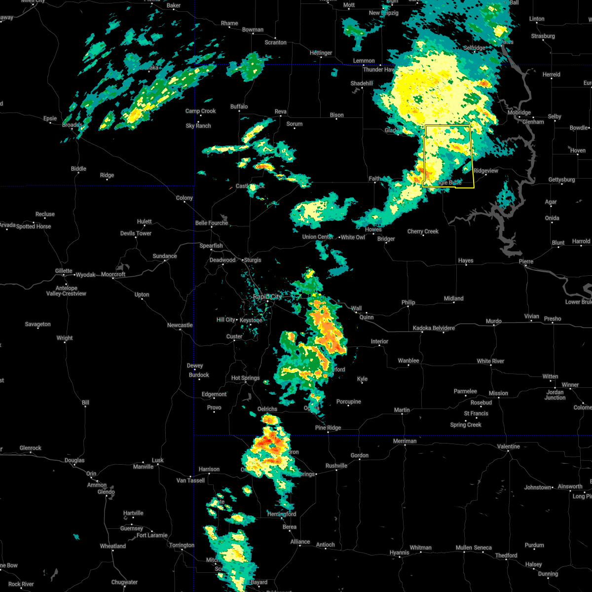 The severe thunderstorm warning for northwestern dewey county will expire at 745 pm mdt, the storm which prompted the warning has weakened below severe limits, and no longer poses an immediate threat to life or property. therefore, the warning will be allowed to expire. however gusty winds are still possible with this thunderstorm. to report severe weather, contact your nearest law enforcement agency. they will relay your report to the national weather service aberdeen. The severe thunderstorm warning for northwestern dewey county will expire at 745 pm mdt, the storm which prompted the warning has weakened below severe limits, and no longer poses an immediate threat to life or property. therefore, the warning will be allowed to expire. however gusty winds are still possible with this thunderstorm. to report severe weather, contact your nearest law enforcement agency. they will relay your report to the national weather service aberdeen.
|
| 7/22/2021 6:45 PM MDT |
 At 644 pm mdt, a severe thunderstorm was located 8 miles east of thunder butte, or 13 miles north of dupree, moving east at 30 mph (radar indicated). Hazards include 70 mph wind gusts. Expect considerable tree damage. Damage is likely to mobile homes, roofs, and outbuildings. At 644 pm mdt, a severe thunderstorm was located 8 miles east of thunder butte, or 13 miles north of dupree, moving east at 30 mph (radar indicated). Hazards include 70 mph wind gusts. Expect considerable tree damage. Damage is likely to mobile homes, roofs, and outbuildings.
|
| 7/22/2021 6:35 PM MDT |
 At 634 pm mdt, severe thunderstorms were located along a line extending from 6 miles south of selfridge to 5 miles west of takini, moving east at 50 mph. these are very dangerous storms (radar indicated. at 625 pm mdt, the mesonet site 1 mile west southwest of red elm reported a 90 mph wind gust). Hazards include 80 mph wind gusts. Flying debris will be dangerous to those caught without shelter. mobile homes will be heavily damaged. expect considerable damage to roofs, windows, and vehicles. extensive tree damage and power outages are likely. Locations impacted include, dupree, red scaffold, glad valley, thunder butte, red elm, iron lightning, intersection of highway 63 and bia road 8, intersection of cherry creek and sunnybrook roads and northwestern cheyenne river reservation. At 634 pm mdt, severe thunderstorms were located along a line extending from 6 miles south of selfridge to 5 miles west of takini, moving east at 50 mph. these are very dangerous storms (radar indicated. at 625 pm mdt, the mesonet site 1 mile west southwest of red elm reported a 90 mph wind gust). Hazards include 80 mph wind gusts. Flying debris will be dangerous to those caught without shelter. mobile homes will be heavily damaged. expect considerable damage to roofs, windows, and vehicles. extensive tree damage and power outages are likely. Locations impacted include, dupree, red scaffold, glad valley, thunder butte, red elm, iron lightning, intersection of highway 63 and bia road 8, intersection of cherry creek and sunnybrook roads and northwestern cheyenne river reservation.
|
| 7/22/2021 6:23 PM MDT |
 At 622 pm mdt, severe thunderstorms were located along a line extending from 3 miles northwest of walker to 3 miles northwest of howes, moving east at 45 mph (radar indicated). Hazards include 60 mph wind gusts. Expect damage to roofs, siding, and trees. Locations impacted include, dupree, red scaffold, glad valley, thunder butte, red elm, iron lightning, intersection of highway 63 and bia road 8, intersection of cherry creek and sunnybrook roads and northwestern cheyenne river reservation. At 622 pm mdt, severe thunderstorms were located along a line extending from 3 miles northwest of walker to 3 miles northwest of howes, moving east at 45 mph (radar indicated). Hazards include 60 mph wind gusts. Expect damage to roofs, siding, and trees. Locations impacted include, dupree, red scaffold, glad valley, thunder butte, red elm, iron lightning, intersection of highway 63 and bia road 8, intersection of cherry creek and sunnybrook roads and northwestern cheyenne river reservation.
|
| 7/22/2021 6:09 PM MDT |
 At 609 pm mdt, severe thunderstorms were located along a line extending from 2 miles north of mcintosh to 2 miles northeast of marcus, moving east at 35 mph (radar indicated). Hazards include 60 mph wind gusts. Expect damage to roofs, siding, and trees. Locations impacted include, dupree, faith, usta, glad valley, red scaffold, thunder butte, red elm, iron lightning, intersection of cherry creek and sunnybrook roads, intersection of highway 63 and bia road 8, durkee lake, arrow head buttes and northwestern cheyenne river reservation. At 609 pm mdt, severe thunderstorms were located along a line extending from 2 miles north of mcintosh to 2 miles northeast of marcus, moving east at 35 mph (radar indicated). Hazards include 60 mph wind gusts. Expect damage to roofs, siding, and trees. Locations impacted include, dupree, faith, usta, glad valley, red scaffold, thunder butte, red elm, iron lightning, intersection of cherry creek and sunnybrook roads, intersection of highway 63 and bia road 8, durkee lake, arrow head buttes and northwestern cheyenne river reservation.
|
| 7/22/2021 5:44 PM MDT |
 At 543 pm mdt, severe thunderstorms were located along a line extending from near thunder hawk to faith, moving east at 30 mph (radar indicated). Hazards include 60 mph wind gusts and penny size hail. Expect damage to roofs, siding, and trees. severe thunderstorms will be near, thunder hawk around 550 pm mdt. Other locations in the path of these severe thunderstorms include keldron, morristown, watauga, bear creek, lantry, eagle butte and mcintosh. At 543 pm mdt, severe thunderstorms were located along a line extending from near thunder hawk to faith, moving east at 30 mph (radar indicated). Hazards include 60 mph wind gusts and penny size hail. Expect damage to roofs, siding, and trees. severe thunderstorms will be near, thunder hawk around 550 pm mdt. Other locations in the path of these severe thunderstorms include keldron, morristown, watauga, bear creek, lantry, eagle butte and mcintosh.
|
| 7/22/2021 5:41 PM MDT |
 At 540 pm mdt, severe thunderstorms were located along a line extending from 4 miles north of morristown to 3 miles south of opal, moving east at 50 mph (radar indicated). Hazards include 60 mph wind gusts. expect damage to roofs, siding, and trees At 540 pm mdt, severe thunderstorms were located along a line extending from 4 miles north of morristown to 3 miles south of opal, moving east at 50 mph (radar indicated). Hazards include 60 mph wind gusts. expect damage to roofs, siding, and trees
|
| 7/8/2021 8:54 PM MDT |
 At 854 pm mdt, a severe thunderstorm was located 4 miles south of dupree, moving southeast at 35 mph (radar indicated). Hazards include ping pong ball size hail and 60 mph wind gusts. People and animals outdoors will be injured. expect hail damage to roofs, siding, windows, and vehicles. expect wind damage to roofs, siding, and trees. Locations impacted include, dupree, south eagle butte, intersection of highway 63 and bia road 8 and cheyenne river reservation. At 854 pm mdt, a severe thunderstorm was located 4 miles south of dupree, moving southeast at 35 mph (radar indicated). Hazards include ping pong ball size hail and 60 mph wind gusts. People and animals outdoors will be injured. expect hail damage to roofs, siding, windows, and vehicles. expect wind damage to roofs, siding, and trees. Locations impacted include, dupree, south eagle butte, intersection of highway 63 and bia road 8 and cheyenne river reservation.
|
| 7/8/2021 8:35 PM MDT |
 At 834 pm mdt, a severe thunderstorm was located near lantry, moving southeast at 40 mph (radar indicated). Hazards include ping pong ball size hail and 60 mph wind gusts. People and animals outdoors will be injured. expect hail damage to roofs, siding, windows, and vehicles. expect wind damage to roofs, siding, and trees. This severe thunderstorm will be near, lantry around 840 pm mdt. At 834 pm mdt, a severe thunderstorm was located near lantry, moving southeast at 40 mph (radar indicated). Hazards include ping pong ball size hail and 60 mph wind gusts. People and animals outdoors will be injured. expect hail damage to roofs, siding, windows, and vehicles. expect wind damage to roofs, siding, and trees. This severe thunderstorm will be near, lantry around 840 pm mdt.
|
| 7/8/2021 8:32 PM MDT |
 At 831 pm mdt, a severe thunderstorm was located over dupree, moving southeast at 40 mph (radar indicated). Hazards include ping pong ball size hail and 60 mph wind gusts. People and animals outdoors will be injured. expect hail damage to roofs, siding, windows, and vehicles. Expect wind damage to roofs, siding, and trees. At 831 pm mdt, a severe thunderstorm was located over dupree, moving southeast at 40 mph (radar indicated). Hazards include ping pong ball size hail and 60 mph wind gusts. People and animals outdoors will be injured. expect hail damage to roofs, siding, windows, and vehicles. Expect wind damage to roofs, siding, and trees.
|
| 6/11/2021 12:57 AM MDT |
 At 114 am cdt/1214 am mdt/, severe thunderstorms were located along a line extending from near south eagle butte to near nowlin, moving east at 50 mph (radar indicated). Hazards include 70 mph wind gusts and penny size hail. Expect considerable tree damage. Damage is likely to mobile homes, roofs, and outbuildings. At 114 am cdt/1214 am mdt/, severe thunderstorms were located along a line extending from near south eagle butte to near nowlin, moving east at 50 mph (radar indicated). Hazards include 70 mph wind gusts and penny size hail. Expect considerable tree damage. Damage is likely to mobile homes, roofs, and outbuildings.
|
| 6/11/2021 12:31 AM MDT |
 At 1231 am mdt, severe thunderstorms were located along a line extending from 8 miles north of mclaughlin to near parade, moving east at 30 mph (radar indicated). Hazards include 60 mph wind gusts and penny size hail. Expect damage to roofs, siding, and trees. Locations impacted include, ridgeview. At 1231 am mdt, severe thunderstorms were located along a line extending from 8 miles north of mclaughlin to near parade, moving east at 30 mph (radar indicated). Hazards include 60 mph wind gusts and penny size hail. Expect damage to roofs, siding, and trees. Locations impacted include, ridgeview.
|
| 6/11/2021 12:18 AM MDT |
 At 1218 am mdt, severe thunderstorms were located along a line extending from 4 miles southeast of lantry to 3 miles west of nowlin, moving east at 25 mph (radar indicated). Hazards include 70 mph wind gusts. Expect considerable tree damage. damage is likely to mobile homes, roofs, and outbuildings. severe thunderstorms will be near, nowlin around 1225 am mdt. intersection of highway 63 and bia road 8 around 1230 am mdt. south eagle butte around 1235 am mdt. Other locations in the path of these severe thunderstorms include midland. At 1218 am mdt, severe thunderstorms were located along a line extending from 4 miles southeast of lantry to 3 miles west of nowlin, moving east at 25 mph (radar indicated). Hazards include 70 mph wind gusts. Expect considerable tree damage. damage is likely to mobile homes, roofs, and outbuildings. severe thunderstorms will be near, nowlin around 1225 am mdt. intersection of highway 63 and bia road 8 around 1230 am mdt. south eagle butte around 1235 am mdt. Other locations in the path of these severe thunderstorms include midland.
|
| 6/11/2021 12:15 AM MDT |
 At 114 am cdt/1214 am mdt/, severe thunderstorms were located along a line extending from near south eagle butte to near nowlin, moving east at 50 mph (radar indicated). Hazards include 70 mph wind gusts and penny size hail. Expect considerable tree damage. Damage is likely to mobile homes, roofs, and outbuildings. At 114 am cdt/1214 am mdt/, severe thunderstorms were located along a line extending from near south eagle butte to near nowlin, moving east at 50 mph (radar indicated). Hazards include 70 mph wind gusts and penny size hail. Expect considerable tree damage. Damage is likely to mobile homes, roofs, and outbuildings.
|
| 6/11/2021 12:02 AM MDT |
 At 1201 am mdt, severe thunderstorms were located along a line extending from walker to bear creek, moving east at 30 mph (radar indicated). Hazards include 60 mph wind gusts and penny size hail. Expect damage to roofs, siding, and trees. severe thunderstorms will be near, walker around 1205 am mdt. eagle butte and south eagle butte around 1220 am mdt. Other locations in the path of these severe thunderstorms include mclaughlin and parade. At 1201 am mdt, severe thunderstorms were located along a line extending from walker to bear creek, moving east at 30 mph (radar indicated). Hazards include 60 mph wind gusts and penny size hail. Expect damage to roofs, siding, and trees. severe thunderstorms will be near, walker around 1205 am mdt. eagle butte and south eagle butte around 1220 am mdt. Other locations in the path of these severe thunderstorms include mclaughlin and parade.
|
| 6/10/2021 11:59 PM MDT |
 At 1158 pm mdt, severe thunderstorms were located along a line extending from 6 miles east of intersection of cherry creek and sunnybrook roads to 5 miles northwest of kirley to 9 miles northeast of philip, moving northeast at 60 mph (radar indicated). Hazards include 70 mph wind gusts. Expect considerable tree damage. damage is likely to mobile homes, roofs, and outbuildings. Locations impacted include, cherry creek, milesville, grindstone, ottumwa, south eagle butte, bridger, kirley, red scaffold, billsburg, takini, intersection of cherry creek and sunnybrook roads, grindstone butte, intersection of highway 63 and bia road 8 and southwestern cheyenne river reservation. At 1158 pm mdt, severe thunderstorms were located along a line extending from 6 miles east of intersection of cherry creek and sunnybrook roads to 5 miles northwest of kirley to 9 miles northeast of philip, moving northeast at 60 mph (radar indicated). Hazards include 70 mph wind gusts. Expect considerable tree damage. damage is likely to mobile homes, roofs, and outbuildings. Locations impacted include, cherry creek, milesville, grindstone, ottumwa, south eagle butte, bridger, kirley, red scaffold, billsburg, takini, intersection of cherry creek and sunnybrook roads, grindstone butte, intersection of highway 63 and bia road 8 and southwestern cheyenne river reservation.
|
| 6/10/2021 11:24 PM MDT |
 At 1124 pm mdt, severe thunderstorms were located along a line extending from 2 miles southwest of howes to 11 miles south of bridger to 4 miles east of quinn, moving northeast at 55 mph. these are very dangerous storms (radar indicated). Hazards include 80 mph wind gusts. Flying debris will be dangerous to those caught without shelter. mobile homes will be heavily damaged. expect considerable damage to roofs, windows, and vehicles. extensive tree damage and power outages are likely. locations impacted include, howes, billsburg, bridger, takini, milesville, red scaffold, grindstone butte, cherry creek, intersection of cherry creek and sunnybrook roads, south eagle butte, intersection of highway 63 and bia road 8 and kirley. This includes interstate 90 in south dakota between mile markers 111 and 116. At 1124 pm mdt, severe thunderstorms were located along a line extending from 2 miles southwest of howes to 11 miles south of bridger to 4 miles east of quinn, moving northeast at 55 mph. these are very dangerous storms (radar indicated). Hazards include 80 mph wind gusts. Flying debris will be dangerous to those caught without shelter. mobile homes will be heavily damaged. expect considerable damage to roofs, windows, and vehicles. extensive tree damage and power outages are likely. locations impacted include, howes, billsburg, bridger, takini, milesville, red scaffold, grindstone butte, cherry creek, intersection of cherry creek and sunnybrook roads, south eagle butte, intersection of highway 63 and bia road 8 and kirley. This includes interstate 90 in south dakota between mile markers 111 and 116.
|
| 6/10/2021 11:05 PM MDT |
 At 1105 pm mdt, severe thunderstorms were located along a line extending from 4 miles southwest of plainview to 3 miles southeast of creighton to 3 miles west of delta 9 missile silo, moving northeast at 60 mph (radar indicated). Hazards include 70 mph wind gusts and nickel size hail. Expect considerable tree damage. damage is likely to mobile homes, roofs, and outbuildings. severe thunderstorms will be near, plainview around 1110 pm mdt. howes around 1115 pm mdt. takini around 1125 pm mdt. other locations in the path of these severe thunderstorms include billsburg, red scaffold, milesville, intersection of cherry creek and sunnybrook roads, kirley, ottumwa and intersection of highway 63 and bia road 8. This includes interstate 90 in south dakota between mile markers 111 and 116. At 1105 pm mdt, severe thunderstorms were located along a line extending from 4 miles southwest of plainview to 3 miles southeast of creighton to 3 miles west of delta 9 missile silo, moving northeast at 60 mph (radar indicated). Hazards include 70 mph wind gusts and nickel size hail. Expect considerable tree damage. damage is likely to mobile homes, roofs, and outbuildings. severe thunderstorms will be near, plainview around 1110 pm mdt. howes around 1115 pm mdt. takini around 1125 pm mdt. other locations in the path of these severe thunderstorms include billsburg, red scaffold, milesville, intersection of cherry creek and sunnybrook roads, kirley, ottumwa and intersection of highway 63 and bia road 8. This includes interstate 90 in south dakota between mile markers 111 and 116.
|
| 6/8/2021 11:58 PM MDT |
 At 1258 am cdt/1158 pm mdt/, severe thunderstorms were located along a line extending from near green grass to 8 miles east of intersection of highway 63 and bia road 8 to 8 miles north of corn creek, moving east at 35 mph (radar indicated). Hazards include 60 mph wind gusts and penny size hail. expect damage to roofs, siding, and trees At 1258 am cdt/1158 pm mdt/, severe thunderstorms were located along a line extending from near green grass to 8 miles east of intersection of highway 63 and bia road 8 to 8 miles north of corn creek, moving east at 35 mph (radar indicated). Hazards include 60 mph wind gusts and penny size hail. expect damage to roofs, siding, and trees
|
| 6/8/2021 11:38 PM MDT |
 At 1138 pm mdt, severe thunderstorms were located along a line extending from 9 miles northwest of isabel to 4 miles west of eagle butte to cherry creek, moving east at 30 mph (radar indicated). Hazards include 60 mph wind gusts and penny size hail. Expect damage to roofs, siding, and trees. Locations impacted include, south eagle butte and kirley. At 1138 pm mdt, severe thunderstorms were located along a line extending from 9 miles northwest of isabel to 4 miles west of eagle butte to cherry creek, moving east at 30 mph (radar indicated). Hazards include 60 mph wind gusts and penny size hail. Expect damage to roofs, siding, and trees. Locations impacted include, south eagle butte and kirley.
|
| 6/8/2021 11:34 PM MDT |
 At 1134 pm mdt, severe thunderstorms were located along a line extending from 9 miles north of keldron to 9 miles southwest of klein ranch to near green grass to 9 miles southeast of intersection of cherry creek and sunnybrook roads, moving northeast at 40 mph (radar indicated). Hazards include 60 mph wind gusts and penny size hail. Expect damage to roofs, siding, and trees. Locations impacted include, klein ranch, black horse, little moreau rec area, eagle butte, timber lake and parade. At 1134 pm mdt, severe thunderstorms were located along a line extending from 9 miles north of keldron to 9 miles southwest of klein ranch to near green grass to 9 miles southeast of intersection of cherry creek and sunnybrook roads, moving northeast at 40 mph (radar indicated). Hazards include 60 mph wind gusts and penny size hail. Expect damage to roofs, siding, and trees. Locations impacted include, klein ranch, black horse, little moreau rec area, eagle butte, timber lake and parade.
|
| 6/8/2021 11:07 PM MDT |
 At 1106 pm mdt, severe thunderstorms were located along a line extending from 3 miles south of shambo ranch to 4 miles south of dupree to 6 miles east of bridger, moving east at 30 mph (radar indicated. at 1054 pm mdt 64 mph wind gusts were reported at coal springs and red elm). Hazards include 60 mph wind gusts and penny size hail. Expect damage to roofs, siding, and trees. these severe storms will be near, dupree around 1110 pm mdt. Other locations in the path of these severe thunderstorms include cherry creek, south eagle butte and kirley. At 1106 pm mdt, severe thunderstorms were located along a line extending from 3 miles south of shambo ranch to 4 miles south of dupree to 6 miles east of bridger, moving east at 30 mph (radar indicated. at 1054 pm mdt 64 mph wind gusts were reported at coal springs and red elm). Hazards include 60 mph wind gusts and penny size hail. Expect damage to roofs, siding, and trees. these severe storms will be near, dupree around 1110 pm mdt. Other locations in the path of these severe thunderstorms include cherry creek, south eagle butte and kirley.
|
| 6/8/2021 10:54 PM MDT |
 At 1054 pm mdt, severe thunderstorms were located along a line extending from near shadehill to 7 miles north of iron lightning to near intersection of cherry creek and sunnybrook roads to near bridger, moving northeast at 40 mph (radar indicated). Hazards include 60 mph wind gusts and penny size hail. Expect damage to roofs, siding, and trees. severe thunderstorms will be near, thunder hawk around 1110 pm mdt. Other locations in the path of these severe thunderstorms include lantry, bear creek, keldron, green grass, klein ranch, black horse, eagle butte, timber lake, little moreau rec area and parade. At 1054 pm mdt, severe thunderstorms were located along a line extending from near shadehill to 7 miles north of iron lightning to near intersection of cherry creek and sunnybrook roads to near bridger, moving northeast at 40 mph (radar indicated). Hazards include 60 mph wind gusts and penny size hail. Expect damage to roofs, siding, and trees. severe thunderstorms will be near, thunder hawk around 1110 pm mdt. Other locations in the path of these severe thunderstorms include lantry, bear creek, keldron, green grass, klein ranch, black horse, eagle butte, timber lake, little moreau rec area and parade.
|
| 6/8/2021 10:50 PM MDT |
 At 1049 pm mdt, severe thunderstorms were located along a line extending from 8 miles southwest of shambo ranch to 5 miles south of red elm to near bridger, moving east at 30 mph (radar indicated). Hazards include 60 mph wind gusts and penny size hail. Expect damage to roofs, siding, and trees. severe thunderstorms will be near, red elm around 1055 pm mdt. Other locations in the path of these severe thunderstorms include dupree, glad valley, cherry creek, south eagle butte and kirley. At 1049 pm mdt, severe thunderstorms were located along a line extending from 8 miles southwest of shambo ranch to 5 miles south of red elm to near bridger, moving east at 30 mph (radar indicated). Hazards include 60 mph wind gusts and penny size hail. Expect damage to roofs, siding, and trees. severe thunderstorms will be near, red elm around 1055 pm mdt. Other locations in the path of these severe thunderstorms include dupree, glad valley, cherry creek, south eagle butte and kirley.
|
| 6/8/2021 9:03 PM MDT |
 At 903 pm mdt, a severe thunderstorm was located near green grass, or 8 miles north of eagle butte, moving east at 15 mph. this is a very dangerous storm (radar indicated). Hazards include 80 mph wind gusts and two inch hail. Flying debris will be dangerous to those caught without shelter. mobile homes will be heavily damaged. expect considerable damage to roofs, windows, and vehicles. extensive tree damage and power outages are likely. Locations impacted include, eagle butte, south eagle butte, green grass and cheyenne river reservation. At 903 pm mdt, a severe thunderstorm was located near green grass, or 8 miles north of eagle butte, moving east at 15 mph. this is a very dangerous storm (radar indicated). Hazards include 80 mph wind gusts and two inch hail. Flying debris will be dangerous to those caught without shelter. mobile homes will be heavily damaged. expect considerable damage to roofs, windows, and vehicles. extensive tree damage and power outages are likely. Locations impacted include, eagle butte, south eagle butte, green grass and cheyenne river reservation.
|
| 6/8/2021 8:53 PM MDT |
 At 853 pm mdt, a severe thunderstorm was located near green grass, or 8 miles northeast of lantry, moving east at 15 mph. this is a very dangerous storm (radar indicated). Hazards include 80 mph wind gusts and tennis ball size hail. Flying debris will be dangerous to those caught without shelter. mobile homes will be heavily damaged. expect considerable damage to roofs, windows, and vehicles. extensive tree damage and power outages are likely. Locations impacted include, eagle butte, lantry, south eagle butte, green grass, bear creek and cheyenne river reservation. At 853 pm mdt, a severe thunderstorm was located near green grass, or 8 miles northeast of lantry, moving east at 15 mph. this is a very dangerous storm (radar indicated). Hazards include 80 mph wind gusts and tennis ball size hail. Flying debris will be dangerous to those caught without shelter. mobile homes will be heavily damaged. expect considerable damage to roofs, windows, and vehicles. extensive tree damage and power outages are likely. Locations impacted include, eagle butte, lantry, south eagle butte, green grass, bear creek and cheyenne river reservation.
|
| 6/8/2021 8:40 PM MDT |
 At 840 pm mdt, a severe thunderstorm was located near bear creek, or 8 miles north of lantry, moving east at 15 mph. this is a very dangerous storm (radar indicated). Hazards include 80 mph wind gusts and ping pong ball size hail. Flying debris will be dangerous to those caught without shelter. mobile homes will be heavily damaged. expect considerable damage to roofs, windows, and vehicles. extensive tree damage and power outages are likely. Locations impacted include, green grass. At 840 pm mdt, a severe thunderstorm was located near bear creek, or 8 miles north of lantry, moving east at 15 mph. this is a very dangerous storm (radar indicated). Hazards include 80 mph wind gusts and ping pong ball size hail. Flying debris will be dangerous to those caught without shelter. mobile homes will be heavily damaged. expect considerable damage to roofs, windows, and vehicles. extensive tree damage and power outages are likely. Locations impacted include, green grass.
|
| 6/8/2021 8:28 PM MDT |
 At 827 pm mdt, a severe thunderstorm was located near bear creek, or near dupree, moving east at 15 mph (radar indicated). Hazards include 70 mph wind gusts and quarter size hail. Hail damage to vehicles is expected. expect considerable tree damage. wind damage is also likely to mobile homes, roofs, and outbuildings. this severe thunderstorm will be near, bear creek around 840 pm mdt. Other locations in the path of this severe thunderstorm include green grass. At 827 pm mdt, a severe thunderstorm was located near bear creek, or near dupree, moving east at 15 mph (radar indicated). Hazards include 70 mph wind gusts and quarter size hail. Hail damage to vehicles is expected. expect considerable tree damage. wind damage is also likely to mobile homes, roofs, and outbuildings. this severe thunderstorm will be near, bear creek around 840 pm mdt. Other locations in the path of this severe thunderstorm include green grass.
|
| 5/23/2021 7:40 PM MDT |
 The severe thunderstorm warning for northwestern dewey county will expire at 745 pm mdt, the storms which prompted the warning have weakened below severe limits, and no longer pose an immediate threat to life or property. therefore, the warning will be allowed to expire. however gusty winds are still possible with these thunderstorms. a tornado watch remains in effect until 900 pm mdt for north central south dakota. The severe thunderstorm warning for northwestern dewey county will expire at 745 pm mdt, the storms which prompted the warning have weakened below severe limits, and no longer pose an immediate threat to life or property. therefore, the warning will be allowed to expire. however gusty winds are still possible with these thunderstorms. a tornado watch remains in effect until 900 pm mdt for north central south dakota.
|
| 5/23/2021 7:32 PM MDT |
 At 731 pm mdt, severe thunderstorms were located along a line extending from 8 miles east of shambo ranch to 7 miles southeast of isabel to 13 miles northwest of mission ridge, moving north at 45 mph (radar indicated). Hazards include 60 mph wind gusts. Expect damage to roofs, siding, and trees. Locations impacted include, eagle butte, lantry, isabel, firesteel, green grass, bear creek and cheyenne river reservation. At 731 pm mdt, severe thunderstorms were located along a line extending from 8 miles east of shambo ranch to 7 miles southeast of isabel to 13 miles northwest of mission ridge, moving north at 45 mph (radar indicated). Hazards include 60 mph wind gusts. Expect damage to roofs, siding, and trees. Locations impacted include, eagle butte, lantry, isabel, firesteel, green grass, bear creek and cheyenne river reservation.
|
| 5/23/2021 7:09 PM MDT |
 At 709 pm mdt, severe thunderstorms were located along a line extending from 3 miles southwest of thunder butte to 5 miles south of lantry to 9 miles northeast of cherry creek, moving northeast at 55 mph (radar indicated). Hazards include 60 mph wind gusts. Expect damage to roofs, siding, and trees. Locations impacted include, south eagle butte and intersection of highway 63 and bia road 8. At 709 pm mdt, severe thunderstorms were located along a line extending from 3 miles southwest of thunder butte to 5 miles south of lantry to 9 miles northeast of cherry creek, moving northeast at 55 mph (radar indicated). Hazards include 60 mph wind gusts. Expect damage to roofs, siding, and trees. Locations impacted include, south eagle butte and intersection of highway 63 and bia road 8.
|
| 5/23/2021 6:59 PM MDT |
 The national weather service in aberdeen has issued a * severe thunderstorm warning for. northwestern dewey county in north central south dakota. until 745 pm mdt. At 658 pm mdt, severe thunderstorms were located along a line extending from 8 miles northwest of iron lightning to near red elm. The national weather service in aberdeen has issued a * severe thunderstorm warning for. northwestern dewey county in north central south dakota. until 745 pm mdt. At 658 pm mdt, severe thunderstorms were located along a line extending from 8 miles northwest of iron lightning to near red elm.
|
| 5/23/2021 6:45 PM MDT |
 At 645 pm mdt, severe thunderstorms were located along a line extending from 5 miles south of durkee lake to 9 miles east of takini to 6 miles east of milesville, moving northeast at 50 mph (radar indicated). Hazards include 60 mph wind gusts. Expect damage to roofs, siding, and trees. severe thunderstorms will be near, red elm around 700 pm mdt. Other locations in the path of these severe thunderstorms include dupree and intersection of highway 63 and bia road 8. At 645 pm mdt, severe thunderstorms were located along a line extending from 5 miles south of durkee lake to 9 miles east of takini to 6 miles east of milesville, moving northeast at 50 mph (radar indicated). Hazards include 60 mph wind gusts. Expect damage to roofs, siding, and trees. severe thunderstorms will be near, red elm around 700 pm mdt. Other locations in the path of these severe thunderstorms include dupree and intersection of highway 63 and bia road 8.
|
| 5/21/2021 12:50 AM MDT |
 At 1249 am mdt, severe thunderstorms were located along a line extending from 2 miles northeast of cherry creek to 6 miles west of sansarc, moving northeast at 40 mph (radar indicated). Hazards include 60 mph wind gusts and penny size hail. Expect damage to roofs, siding, and trees. Locations impacted include, intersection of highway 63 and bia road 8 and south eagle butte. At 1249 am mdt, severe thunderstorms were located along a line extending from 2 miles northeast of cherry creek to 6 miles west of sansarc, moving northeast at 40 mph (radar indicated). Hazards include 60 mph wind gusts and penny size hail. Expect damage to roofs, siding, and trees. Locations impacted include, intersection of highway 63 and bia road 8 and south eagle butte.
|
| 5/21/2021 12:27 AM MDT |
 At 1227 am mdt, a severe thunderstorm was located 9 miles southwest of kirley, or 27 miles northeast of philip, moving northeast at 50 mph (radar indicated). Hazards include 60 mph wind gusts and half dollar size hail. Hail damage to vehicles is expected. expect wind damage to roofs, siding, and trees. this severe thunderstorm will be near, kirley around 1240 am mdt. Other locations in the path of this severe thunderstorm include intersection of highway 63 and bia road 8 and south eagle butte. At 1227 am mdt, a severe thunderstorm was located 9 miles southwest of kirley, or 27 miles northeast of philip, moving northeast at 50 mph (radar indicated). Hazards include 60 mph wind gusts and half dollar size hail. Hail damage to vehicles is expected. expect wind damage to roofs, siding, and trees. this severe thunderstorm will be near, kirley around 1240 am mdt. Other locations in the path of this severe thunderstorm include intersection of highway 63 and bia road 8 and south eagle butte.
|
| 8/26/2020 3:45 PM MDT | Storm damage reported in ziebach county SD, 20.6 miles N of Eagle Butte, SD |
| 8/26/2020 3:30 PM MDT | Golf Ball sized hail reported 6.8 miles SW of Eagle Butte, SD, time estimated. multiple sizes but largest was golf ball. covered ground. |
| 8/26/2020 3:17 PM MDT |
 At 316 pm mdt, a severe thunderstorm was located over parade, or near eagle butte, moving northeast at 20 mph (radar indicated). Hazards include 60 mph wind gusts and half dollar size hail. Hail damage to vehicles is expected. expect wind damage to roofs, siding, and trees. Locations impacted include, eagle butte, south eagle butte and parade. At 316 pm mdt, a severe thunderstorm was located over parade, or near eagle butte, moving northeast at 20 mph (radar indicated). Hazards include 60 mph wind gusts and half dollar size hail. Hail damage to vehicles is expected. expect wind damage to roofs, siding, and trees. Locations impacted include, eagle butte, south eagle butte and parade.
|
| 8/26/2020 3:06 PM MDT | Golf Ball sized hail reported 0.1 miles SE of Eagle Butte, SD, update to previous report. |
| 8/26/2020 3:02 PM MDT | Half Dollar sized hail reported 0.6 miles E of Eagle Butte, SD, slightly larger then quarters. |
| 8/26/2020 3:00 PM MDT | Quarter sized hail reported 0.6 miles N of Eagle Butte, SD, most hail was nickel size |
| 8/26/2020 3:00 PM MDT |
 At 258 pm mdt, severe thunderstorms were located along a line extending from near south eagle butte to 10 miles southeast of intersection of highway 63 and bia road 8, moving east at 15 mph. these are very dangerous storms (radar indicated). Hazards include baseball size hail and 60 mph wind gusts. People and animals outdoors will be severely injured. expect shattered windows, extensive damage to roofs, siding, and vehicles. locations impacted include, south eagle butte and intersection of highway 63 and bia road 8. The largest hail will likely occur along highway 63 near the ziebach and haakon county line. At 258 pm mdt, severe thunderstorms were located along a line extending from near south eagle butte to 10 miles southeast of intersection of highway 63 and bia road 8, moving east at 15 mph. these are very dangerous storms (radar indicated). Hazards include baseball size hail and 60 mph wind gusts. People and animals outdoors will be severely injured. expect shattered windows, extensive damage to roofs, siding, and vehicles. locations impacted include, south eagle butte and intersection of highway 63 and bia road 8. The largest hail will likely occur along highway 63 near the ziebach and haakon county line.
|
| 8/26/2020 2:56 PM MDT |
 At 255 pm mdt, a severe thunderstorm was located over south eagle butte, or over eagle butte, moving northeast at 20 mph (radar indicated). Hazards include golf ball size hail and 60 mph wind gusts. People and animals outdoors will be injured. expect hail damage to roofs, siding, windows, and vehicles. expect wind damage to roofs, siding, and trees. Locations impacted include, eagle butte, parade and green grass. At 255 pm mdt, a severe thunderstorm was located over south eagle butte, or over eagle butte, moving northeast at 20 mph (radar indicated). Hazards include golf ball size hail and 60 mph wind gusts. People and animals outdoors will be injured. expect hail damage to roofs, siding, windows, and vehicles. expect wind damage to roofs, siding, and trees. Locations impacted include, eagle butte, parade and green grass.
|
| 8/26/2020 2:49 PM MDT |
 At 248 pm mdt, severe thunderstorms were located along a line extending from 5 miles west of south eagle butte to 6 miles southeast of intersection of highway 63 and bia road 8, moving east at 25 mph (radar indicated). Hazards include two inch hail and 60 mph wind gusts. People and animals outdoors will be injured. expect hail damage to roofs, siding, windows, and vehicles. expect wind damage to roofs, siding, and trees. Locations impacted include, south eagle butte and intersection of highway 63 and bia road 8. At 248 pm mdt, severe thunderstorms were located along a line extending from 5 miles west of south eagle butte to 6 miles southeast of intersection of highway 63 and bia road 8, moving east at 25 mph (radar indicated). Hazards include two inch hail and 60 mph wind gusts. People and animals outdoors will be injured. expect hail damage to roofs, siding, windows, and vehicles. expect wind damage to roofs, siding, and trees. Locations impacted include, south eagle butte and intersection of highway 63 and bia road 8.
|
| 8/26/2020 2:48 PM MDT |
 At 247 pm mdt, a severe thunderstorm was located near lantry, moving northeast at 20 mph (radar indicated). Hazards include 60 mph wind gusts and quarter size hail. Hail damage to vehicles is expected. Expect wind damage to roofs, siding, and trees. At 247 pm mdt, a severe thunderstorm was located near lantry, moving northeast at 20 mph (radar indicated). Hazards include 60 mph wind gusts and quarter size hail. Hail damage to vehicles is expected. Expect wind damage to roofs, siding, and trees.
|
| 8/26/2020 2:37 PM MDT |
 At 237 pm mdt, severe thunderstorms were located along a line extending from 6 miles south of lantry to 5 miles south of intersection of highway 63 and bia road 8, moving east at 15 mph (radar indicated). Hazards include golf ball size hail and 60 mph wind gusts. People and animals outdoors will be injured. expect hail damage to roofs, siding, windows, and vehicles. expect wind damage to roofs, siding, and trees. Locations impacted include, south eagle butte and intersection of highway 63 and bia road 8. At 237 pm mdt, severe thunderstorms were located along a line extending from 6 miles south of lantry to 5 miles south of intersection of highway 63 and bia road 8, moving east at 15 mph (radar indicated). Hazards include golf ball size hail and 60 mph wind gusts. People and animals outdoors will be injured. expect hail damage to roofs, siding, windows, and vehicles. expect wind damage to roofs, siding, and trees. Locations impacted include, south eagle butte and intersection of highway 63 and bia road 8.
|
| 8/26/2020 2:28 PM MDT |
 At 228 pm mdt, a severe thunderstorm was located 6 miles south of lantry, moving east at 15 mph (radar indicated). Hazards include ping pong ball size hail and 60 mph wind gusts. People and animals outdoors will be injured. expect hail damage to roofs, siding, windows, and vehicles. Expect wind damage to roofs, siding, and trees. At 228 pm mdt, a severe thunderstorm was located 6 miles south of lantry, moving east at 15 mph (radar indicated). Hazards include ping pong ball size hail and 60 mph wind gusts. People and animals outdoors will be injured. expect hail damage to roofs, siding, windows, and vehicles. Expect wind damage to roofs, siding, and trees.
|
| 7/20/2020 12:34 PM MDT |
 At 1234 pm mdt, severe thunderstorms were located along a line extending from 4 miles south of parade to 10 miles southeast of intersection of highway 63 and bia road 8 to 6 miles northeast of kirley, moving east at 35 mph (radar indicated). Hazards include 70 mph wind gusts and quarter size hail. Hail damage to vehicles is expected. expect considerable tree damage. wind damage is also likely to mobile homes, roofs, and outbuildings. These severe thunderstorms will remain over mainly rural areas of northeastern haakon and southeastern ziebach counties. At 1234 pm mdt, severe thunderstorms were located along a line extending from 4 miles south of parade to 10 miles southeast of intersection of highway 63 and bia road 8 to 6 miles northeast of kirley, moving east at 35 mph (radar indicated). Hazards include 70 mph wind gusts and quarter size hail. Hail damage to vehicles is expected. expect considerable tree damage. wind damage is also likely to mobile homes, roofs, and outbuildings. These severe thunderstorms will remain over mainly rural areas of northeastern haakon and southeastern ziebach counties.
|
| 7/20/2020 12:33 PM MDT | Quarter sized hail reported 20.7 miles N of Eagle Butte, SD, time estimated from radar. |
| 7/20/2020 12:28 PM MDT |
 At 127 pm cdt/1227 pm mdt/, severe thunderstorms were located along a line extending from near parade to 9 miles north of sansarc to 8 miles southwest of kirley, moving southeast at 40 mph (radar indicated). Hazards include 70 mph wind gusts and half dollar size hail. Hail damage to vehicles is expected. expect considerable tree damage. Wind damage is also likely to mobile homes, roofs, and outbuildings. At 127 pm cdt/1227 pm mdt/, severe thunderstorms were located along a line extending from near parade to 9 miles north of sansarc to 8 miles southwest of kirley, moving southeast at 40 mph (radar indicated). Hazards include 70 mph wind gusts and half dollar size hail. Hail damage to vehicles is expected. expect considerable tree damage. Wind damage is also likely to mobile homes, roofs, and outbuildings.
|
| 7/20/2020 12:19 PM MDT |
 At 1219 pm mdt, severe thunderstorms were located along a line extending from 4 miles north of intersection of highway 63 and bia road 8 to 16 miles south of south eagle butte to 5 miles west of cherry creek, moving east at 40 mph. these are very dangerous storms (radar indicated). Hazards include 80 mph wind gusts and ping pong ball size hail. Flying debris will be dangerous to those caught without shelter. mobile homes will be heavily damaged. expect considerable damage to roofs, windows, and vehicles. extensive tree damage and power outages are likely. these severe storms will be near, south eagle butte and intersection of highway 63 and bia road 8 around 1225 pm mdt. Kirley around 1240 pm mdt. At 1219 pm mdt, severe thunderstorms were located along a line extending from 4 miles north of intersection of highway 63 and bia road 8 to 16 miles south of south eagle butte to 5 miles west of cherry creek, moving east at 40 mph. these are very dangerous storms (radar indicated). Hazards include 80 mph wind gusts and ping pong ball size hail. Flying debris will be dangerous to those caught without shelter. mobile homes will be heavily damaged. expect considerable damage to roofs, windows, and vehicles. extensive tree damage and power outages are likely. these severe storms will be near, south eagle butte and intersection of highway 63 and bia road 8 around 1225 pm mdt. Kirley around 1240 pm mdt.
|
| 7/20/2020 12:04 PM MDT |
 At 1204 pm mdt, severe thunderstorms were located along a line extending from 3 miles southeast of lantry to 10 miles southwest of intersection of highway 63 and bia road 8 to 3 miles east of takini school, moving east at 35 mph. these are very dangerous storms (radar indicated). Hazards include 80 mph wind gusts and quarter size hail. Flying debris will be dangerous to those caught without shelter. mobile homes will be heavily damaged. expect considerable damage to roofs, windows, and vehicles. extensive tree damage and power outages are likely. these severe storms will be near, intersection of highway 63 and bia road 8 around 1215 pm mdt. south eagle butte around 1220 pm mdt. cherry creek around 1230 pm mdt. Kirley around 1250 pm mdt. At 1204 pm mdt, severe thunderstorms were located along a line extending from 3 miles southeast of lantry to 10 miles southwest of intersection of highway 63 and bia road 8 to 3 miles east of takini school, moving east at 35 mph. these are very dangerous storms (radar indicated). Hazards include 80 mph wind gusts and quarter size hail. Flying debris will be dangerous to those caught without shelter. mobile homes will be heavily damaged. expect considerable damage to roofs, windows, and vehicles. extensive tree damage and power outages are likely. these severe storms will be near, intersection of highway 63 and bia road 8 around 1215 pm mdt. south eagle butte around 1220 pm mdt. cherry creek around 1230 pm mdt. Kirley around 1250 pm mdt.
|
| 7/20/2020 11:44 AM MDT |
 At 1144 am mdt, severe thunderstorms were located along a line extending from near bear creek to near plainview, moving east at 50 mph. these are very dangerous storms (radar indicated). Hazards include 90 mph wind gusts and penny size hail. You are in a life-threatening situation. flying debris may be deadly to those caught without shelter. mobile homes will be heavily damaged or destroyed. homes and businesses will have substantial roof and window damage. expect extensive tree damage and power outages. severe thunderstorms will be near, south eagle butte around 1155 am mdt. bridger and takini school around 1200 pm mdt. cherry creek around 1220 pm mdt. Kirley around 1235 pm mdt. At 1144 am mdt, severe thunderstorms were located along a line extending from near bear creek to near plainview, moving east at 50 mph. these are very dangerous storms (radar indicated). Hazards include 90 mph wind gusts and penny size hail. You are in a life-threatening situation. flying debris may be deadly to those caught without shelter. mobile homes will be heavily damaged or destroyed. homes and businesses will have substantial roof and window damage. expect extensive tree damage and power outages. severe thunderstorms will be near, south eagle butte around 1155 am mdt. bridger and takini school around 1200 pm mdt. cherry creek around 1220 pm mdt. Kirley around 1235 pm mdt.
|
| 7/2/2020 6:20 PM MDT |
 The severe thunderstorm warning for southern ziebach county will expire at 630 pm mdt, the storm which prompted the warning has moved out of the area. therefore, the warning will be allowed to expire. however gusty winds and heavy rain are still possible with this thunderstorm. a severe thunderstorm watch remains in effect until 800 pm mdt for west central south dakota. The severe thunderstorm warning for southern ziebach county will expire at 630 pm mdt, the storm which prompted the warning has moved out of the area. therefore, the warning will be allowed to expire. however gusty winds and heavy rain are still possible with this thunderstorm. a severe thunderstorm watch remains in effect until 800 pm mdt for west central south dakota.
|
| 7/2/2020 6:16 PM MDT | 50-60 mph with pea sized hail and very heavy rai in dewey county SD, 6.9 miles WSW of Eagle Butte, SD |
| 7/2/2020 5:59 PM MDT |
 At 559 pm mdt, a severe thunderstorm was located over south eagle butte, or over eagle butte, moving east at 45 mph (radar indicated). Hazards include 60 mph wind gusts and penny size hail. Expect damage to roofs, siding, and trees. this severe thunderstorm will be near, parade around 610 pm mdt. Ridgeview around 630 pm mdt. At 559 pm mdt, a severe thunderstorm was located over south eagle butte, or over eagle butte, moving east at 45 mph (radar indicated). Hazards include 60 mph wind gusts and penny size hail. Expect damage to roofs, siding, and trees. this severe thunderstorm will be near, parade around 610 pm mdt. Ridgeview around 630 pm mdt.
|
| 7/2/2020 5:54 PM MDT |
 A severe thunderstorm warning remains in effect until 630 pm mdt for southern ziebach county. at 553 pm mdt, a severe thunderstorm was located 3 miles west of intersection of highway 63 and bia road 8, or 9 miles southwest of eagle butte, moving northeast at 40 mph. hazard. 70 mph wind gusts. A severe thunderstorm warning remains in effect until 630 pm mdt for southern ziebach county. at 553 pm mdt, a severe thunderstorm was located 3 miles west of intersection of highway 63 and bia road 8, or 9 miles southwest of eagle butte, moving northeast at 40 mph. hazard. 70 mph wind gusts.
|
| 7/2/2020 5:36 PM MDT |
 At 536 pm mdt, a severe thunderstorm was located 8 miles north of cherry creek, or 20 miles south of lantry, moving east at 40 mph (radar indicated). Hazards include 70 mph wind gusts. Expect considerable tree damage. damage is likely to mobile homes, roofs, and outbuildings. Locations impacted include, cherry creek, red scaffold, south eagle butte, intersection of highway 63 and bia road 8, takini school and intersection of cherry creek and sunnybrook roads. At 536 pm mdt, a severe thunderstorm was located 8 miles north of cherry creek, or 20 miles south of lantry, moving east at 40 mph (radar indicated). Hazards include 70 mph wind gusts. Expect considerable tree damage. damage is likely to mobile homes, roofs, and outbuildings. Locations impacted include, cherry creek, red scaffold, south eagle butte, intersection of highway 63 and bia road 8, takini school and intersection of cherry creek and sunnybrook roads.
|
| 7/2/2020 5:20 PM MDT |
 At 519 pm mdt, a severe thunderstorm was located near takini school, or 24 miles southeast of faith, moving east at 30 mph (radar indicated). Hazards include 60 mph wind gusts. Expect damage to roofs, siding, and trees. This severe thunderstorm will remain over mainly rural areas of northern haakon, southern ziebach and east central meade counties. At 519 pm mdt, a severe thunderstorm was located near takini school, or 24 miles southeast of faith, moving east at 30 mph (radar indicated). Hazards include 60 mph wind gusts. Expect damage to roofs, siding, and trees. This severe thunderstorm will remain over mainly rural areas of northern haakon, southern ziebach and east central meade counties.
|
| 6/6/2020 9:37 PM MDT | Gravel being lifted off the road by the win in dewey county SD, 46 miles W of Eagle Butte, SD |
| 6/6/2020 9:00 PM MDT |
 At 859 pm mdt, severe thunderstorms were located along a line extending from 5 miles southeast of capa to 11 miles north of kirley to 5 miles north of dupree, moving east at 45 mph (radar indicated). Hazards include 70 mph wind gusts. Expect considerable tree damage. damage is likely to mobile homes, roofs, and outbuildings. These severe thunderstorms will affect red elm, dupree, and eagle butte. At 859 pm mdt, severe thunderstorms were located along a line extending from 5 miles southeast of capa to 11 miles north of kirley to 5 miles north of dupree, moving east at 45 mph (radar indicated). Hazards include 70 mph wind gusts. Expect considerable tree damage. damage is likely to mobile homes, roofs, and outbuildings. These severe thunderstorms will affect red elm, dupree, and eagle butte.
|
| 6/6/2020 8:56 PM MDT | Report from mping: 1-inch tree limbs broken; shingles blown off. time estimated from rada in dewey county SD, 7.1 miles ESE of Eagle Butte, SD |
| 6/6/2020 8:40 PM MDT |
 At 840 pm mdt, severe thunderstorms were located along a line extending from 2 miles southwest of midland to 4 miles north of cherry creek to 3 miles southwest of iron lightning, moving east at 45 mph (radar indicated). Hazards include 70 mph wind gusts. Expect considerable tree damage. damage is likely to mobile homes, roofs, and outbuildings. severe thunderstorms will be near, midland around 845 pm mdt. thunder butte around 855 pm mdt. Dupree around 900 pm mdt. At 840 pm mdt, severe thunderstorms were located along a line extending from 2 miles southwest of midland to 4 miles north of cherry creek to 3 miles southwest of iron lightning, moving east at 45 mph (radar indicated). Hazards include 70 mph wind gusts. Expect considerable tree damage. damage is likely to mobile homes, roofs, and outbuildings. severe thunderstorms will be near, midland around 845 pm mdt. thunder butte around 855 pm mdt. Dupree around 900 pm mdt.
|
| 6/6/2020 8:36 PM MDT |
 At 936 pm cdt/836 pm mdt/, severe thunderstorms were located along a line extending from near red scaffold to near brown church, moving northeast at 80 mph. these are very dangerous storms (radar indicated). Hazards include 80 mph wind gusts and nickel size hail. Flying debris will be dangerous to those caught without shelter. mobile homes will be heavily damaged. expect considerable damage to roofs, windows, and vehicles. Extensive tree damage and power outages are likely. At 936 pm cdt/836 pm mdt/, severe thunderstorms were located along a line extending from near red scaffold to near brown church, moving northeast at 80 mph. these are very dangerous storms (radar indicated). Hazards include 80 mph wind gusts and nickel size hail. Flying debris will be dangerous to those caught without shelter. mobile homes will be heavily damaged. expect considerable damage to roofs, windows, and vehicles. Extensive tree damage and power outages are likely.
|
| 6/6/2020 8:32 PM MDT |
 At 831 pm mdt, severe thunderstorms were located along a line extending from 3 miles east of faith to 7 miles southwest of cherry creek to nowlin, moving east at 55 mph (radar indicated. at 825 pm mdt a 75 mph gust was reported 1 mile north-northeast of faith). Hazards include 70 mph wind gusts. Expect considerable tree damage. damage is likely to mobile homes, roofs, and outbuildings. these severe storms will be near, nowlin around 835 pm mdt. cherry creek and midland around 840 pm mdt. Dupree and kirley around 850 pm mdt. At 831 pm mdt, severe thunderstorms were located along a line extending from 3 miles east of faith to 7 miles southwest of cherry creek to nowlin, moving east at 55 mph (radar indicated. at 825 pm mdt a 75 mph gust was reported 1 mile north-northeast of faith). Hazards include 70 mph wind gusts. Expect considerable tree damage. damage is likely to mobile homes, roofs, and outbuildings. these severe storms will be near, nowlin around 835 pm mdt. cherry creek and midland around 840 pm mdt. Dupree and kirley around 850 pm mdt.
|
| 6/6/2020 8:24 PM MDT |
 At 823 pm mdt, severe thunderstorms were located along a line extending from 5 miles east of faith to 2 miles southeast of takini school to 4 miles north of philip, moving northeast at 45 mph (radar indicated). Hazards include 70 mph wind gusts. Expect considerable tree damage. damage is likely to mobile homes, roofs, and outbuildings. these severe storms will be near, red elm around 830 pm mdt. iron lightning around 835 pm mdt. ottumwa and thunder butte around 845 pm mdt. intersection of highway 63 and bia road 8 around 905 pm mdt. South eagle butte around 915 pm mdt. At 823 pm mdt, severe thunderstorms were located along a line extending from 5 miles east of faith to 2 miles southeast of takini school to 4 miles north of philip, moving northeast at 45 mph (radar indicated). Hazards include 70 mph wind gusts. Expect considerable tree damage. damage is likely to mobile homes, roofs, and outbuildings. these severe storms will be near, red elm around 830 pm mdt. iron lightning around 835 pm mdt. ottumwa and thunder butte around 845 pm mdt. intersection of highway 63 and bia road 8 around 905 pm mdt. South eagle butte around 915 pm mdt.
|
| 6/6/2020 8:09 PM MDT |
 At 809 pm mdt, severe thunderstorms were located along a line extending from 3 miles southwest of durkee lake to 3 miles west of bridger to 5 miles northeast of cottonwood, moving east at 45 mph (radar indicated). Hazards include 70 mph wind gusts. Expect considerable tree damage. damage is likely to mobile homes, roofs, and outbuildings. these severe storms will be near, philip and takini school around 820 pm mdt. milesville and red elm around 830 pm mdt. cherry creek and intersection of cherry creek and sunnybrook roads around 840 pm mdt. dupree and nowlin around 845 pm mdt. midland and kirley around 855 pm mdt. South eagle butte and intersection of highway 63 and bia road 8 around 905 pm mdt. At 809 pm mdt, severe thunderstorms were located along a line extending from 3 miles southwest of durkee lake to 3 miles west of bridger to 5 miles northeast of cottonwood, moving east at 45 mph (radar indicated). Hazards include 70 mph wind gusts. Expect considerable tree damage. damage is likely to mobile homes, roofs, and outbuildings. these severe storms will be near, philip and takini school around 820 pm mdt. milesville and red elm around 830 pm mdt. cherry creek and intersection of cherry creek and sunnybrook roads around 840 pm mdt. dupree and nowlin around 845 pm mdt. midland and kirley around 855 pm mdt. South eagle butte and intersection of highway 63 and bia road 8 around 905 pm mdt.
|
| 6/6/2020 7:46 PM MDT |
 At 746 pm mdt, severe thunderstorms were located along a line extending from 5 miles southeast of opal to 11 miles north of creighton to 2 miles west of quinn, moving northeast at 45 mph (radar indicated). Hazards include 60 mph wind gusts. Expect damage to roofs, siding, and trees. severe thunderstorms will be near, grindstone around 805 pm mdt. howes around 810 pm mdt. faith, bridger and durkee lake around 815 pm mdt. grindstone butte and takini school around 820 pm mdt. red elm around 830 pm mdt. iron lightning around 835 pm mdt. thunder butte around 845 pm mdt. This includes interstate 90 in south dakota between mile markers 107 and 113. At 746 pm mdt, severe thunderstorms were located along a line extending from 5 miles southeast of opal to 11 miles north of creighton to 2 miles west of quinn, moving northeast at 45 mph (radar indicated). Hazards include 60 mph wind gusts. Expect damage to roofs, siding, and trees. severe thunderstorms will be near, grindstone around 805 pm mdt. howes around 810 pm mdt. faith, bridger and durkee lake around 815 pm mdt. grindstone butte and takini school around 820 pm mdt. red elm around 830 pm mdt. iron lightning around 835 pm mdt. thunder butte around 845 pm mdt. This includes interstate 90 in south dakota between mile markers 107 and 113.
|
| 5/23/2020 6:56 PM MDT |
 At 656 pm mdt, severe thunderstorms were located along a line extending from 5 miles east of thunder butte to 4 miles southeast of intersection of highway 63 and bia road 8 to 9 miles north of ottumwa, moving northeast at 40 mph (radar indicated). Hazards include 60 mph wind gusts and half dollar size hail. Hail damage to vehicles is expected. expect wind damage to roofs, siding, and trees. these severe storms will be near, intersection of highway 63 and bia road 8 around 700 pm mdt. South eagle butte and kirley around 710 pm mdt. At 656 pm mdt, severe thunderstorms were located along a line extending from 5 miles east of thunder butte to 4 miles southeast of intersection of highway 63 and bia road 8 to 9 miles north of ottumwa, moving northeast at 40 mph (radar indicated). Hazards include 60 mph wind gusts and half dollar size hail. Hail damage to vehicles is expected. expect wind damage to roofs, siding, and trees. these severe storms will be near, intersection of highway 63 and bia road 8 around 700 pm mdt. South eagle butte and kirley around 710 pm mdt.
|
| 5/23/2020 6:14 PM MDT |
 At 613 pm mdt, severe thunderstorms were located along a line extending from 8 miles northwest of red scaffold to 5 miles northeast of milesville to near philip, moving northeast at 40 mph (radar indicated). Hazards include golf ball size hail and 60 mph wind gusts. People and animals outdoors will be injured. expect hail damage to roofs, siding, windows, and vehicles. expect wind damage to roofs, siding, and trees. severe thunderstorms will be near, cherry creek around 625 pm mdt. red elm around 635 pm mdt. dupree and ottumwa around 640 pm mdt. thunder butte around 650 pm mdt. intersection of highway 63 and bia road 8 around 655 pm mdt. South eagle butte around 710 pm mdt. At 613 pm mdt, severe thunderstorms were located along a line extending from 8 miles northwest of red scaffold to 5 miles northeast of milesville to near philip, moving northeast at 40 mph (radar indicated). Hazards include golf ball size hail and 60 mph wind gusts. People and animals outdoors will be injured. expect hail damage to roofs, siding, windows, and vehicles. expect wind damage to roofs, siding, and trees. severe thunderstorms will be near, cherry creek around 625 pm mdt. red elm around 635 pm mdt. dupree and ottumwa around 640 pm mdt. thunder butte around 650 pm mdt. intersection of highway 63 and bia road 8 around 655 pm mdt. South eagle butte around 710 pm mdt.
|
| 9/20/2019 11:13 PM MDT |
 At 1040 pm mdt, severe thunderstorms were located along a line extending from near usta to bear creek to 6 miles southwest of intersection of highway 63 and bia road 8, moving northeast at 30 mph (trained weather spotters). Hazards include 60 mph wind gusts and penny size hail. expect damage to roofs, siding, and trees At 1040 pm mdt, severe thunderstorms were located along a line extending from near usta to bear creek to 6 miles southwest of intersection of highway 63 and bia road 8, moving northeast at 30 mph (trained weather spotters). Hazards include 60 mph wind gusts and penny size hail. expect damage to roofs, siding, and trees
|
| 9/20/2019 10:40 PM MDT |
 At 1040 pm mdt, severe thunderstorms were located along a line extending from near usta to bear creek to 6 miles southwest of intersection of highway 63 and bia road 8, moving northeast at 30 mph (trained weather spotters). Hazards include 60 mph wind gusts and penny size hail. expect damage to roofs, siding, and trees At 1040 pm mdt, severe thunderstorms were located along a line extending from near usta to bear creek to 6 miles southwest of intersection of highway 63 and bia road 8, moving northeast at 30 mph (trained weather spotters). Hazards include 60 mph wind gusts and penny size hail. expect damage to roofs, siding, and trees
|
| 9/20/2019 10:38 PM MDT |
 At 1038 pm mdt, severe thunderstorms were located along a line extending from 10 miles west of glad valley to near thunder butte to 4 miles southeast of lantry, moving northeast at 40 mph (radar indicated). Hazards include 60 mph wind gusts and nickel size hail. Expect damage to roofs, siding, and trees. Locations impacted include, dupree, glad valley, south eagle butte, thunder butte, red elm and iron lightning. At 1038 pm mdt, severe thunderstorms were located along a line extending from 10 miles west of glad valley to near thunder butte to 4 miles southeast of lantry, moving northeast at 40 mph (radar indicated). Hazards include 60 mph wind gusts and nickel size hail. Expect damage to roofs, siding, and trees. Locations impacted include, dupree, glad valley, south eagle butte, thunder butte, red elm and iron lightning.
|
| 9/20/2019 10:12 PM MDT |
 At 1011 pm mdt, severe thunderstorms were located along a line extending from 6 miles southwest of usta to 6 miles southeast of faith to 9 miles east of takini school, moving northeast at 50 mph (radar indicated). Hazards include 60 mph wind gusts and nickel size hail. expect damage to roofs, siding, and trees At 1011 pm mdt, severe thunderstorms were located along a line extending from 6 miles southwest of usta to 6 miles southeast of faith to 9 miles east of takini school, moving northeast at 50 mph (radar indicated). Hazards include 60 mph wind gusts and nickel size hail. expect damage to roofs, siding, and trees
|
| 8/9/2019 1:36 PM MDT | Quarter sized hail reported 36 miles WNW of Eagle Butte, SD, few quarter size hail stones. radar estimated time. |
| 7/20/2019 2:52 AM MDT |
 The severe thunderstorm warning for northeastern haakon and southeastern ziebach counties will expire at 300 am mdt, the storm which prompted the warning has moved out of the area. therefore, the warning will be allowed to expire. however gusty winds and heavy rain are still possible with this thunderstorm. a severe thunderstorm watch remains in effect until 400 am mdt for west central south dakota. The severe thunderstorm warning for northeastern haakon and southeastern ziebach counties will expire at 300 am mdt, the storm which prompted the warning has moved out of the area. therefore, the warning will be allowed to expire. however gusty winds and heavy rain are still possible with this thunderstorm. a severe thunderstorm watch remains in effect until 400 am mdt for west central south dakota.
|
| 7/20/2019 2:27 AM MDT |
 At 227 am mdt, a severe thunderstorm was located 9 miles east of intersection of highway 63 and bia road 8, or 12 miles southeast of eagle butte, moving east at 40 mph (radar indicated). Hazards include 60 mph wind gusts and quarter size hail. Hail damage to vehicles is expected. expect wind damage to roofs, siding, and trees. Locations impacted include, cherry creek, milesville, south eagle butte, billsburg, kirley and intersection of highway 63 and bia road 8. At 227 am mdt, a severe thunderstorm was located 9 miles east of intersection of highway 63 and bia road 8, or 12 miles southeast of eagle butte, moving east at 40 mph (radar indicated). Hazards include 60 mph wind gusts and quarter size hail. Hail damage to vehicles is expected. expect wind damage to roofs, siding, and trees. Locations impacted include, cherry creek, milesville, south eagle butte, billsburg, kirley and intersection of highway 63 and bia road 8.
|
| 7/20/2019 2:07 AM MDT |
 At 206 am mdt, a severe thunderstorm was located 5 miles west of intersection of highway 63 and bia road 8, or 11 miles south of lantry, moving east at 40 mph (radar indicated). Hazards include 60 mph wind gusts and quarter size hail. Hail damage to vehicles is expected. expect wind damage to roofs, siding, and trees. Locations impacted include, dupree, cherry creek, milesville, south eagle butte, bridger, kirley, red scaffold, billsburg, red elm, intersection of highway 63 and bia road 8, intersection of cherry creek and sunnybrook roads and takini school. At 206 am mdt, a severe thunderstorm was located 5 miles west of intersection of highway 63 and bia road 8, or 11 miles south of lantry, moving east at 40 mph (radar indicated). Hazards include 60 mph wind gusts and quarter size hail. Hail damage to vehicles is expected. expect wind damage to roofs, siding, and trees. Locations impacted include, dupree, cherry creek, milesville, south eagle butte, bridger, kirley, red scaffold, billsburg, red elm, intersection of highway 63 and bia road 8, intersection of cherry creek and sunnybrook roads and takini school.
|
| 7/20/2019 1:48 AM MDT |
 At 148 am mdt, a severe thunderstorm was located over intersection of cherry creek and sunnybrook roads, or 12 miles south of dupree, moving east at 40 mph (radar indicated). Hazards include 60 mph wind gusts and quarter size hail. Hail damage to vehicles is expected. expect wind damage to roofs, siding, and trees. Locations impacted include, dupree, faith, cherry creek, milesville, plainview, marcus, south eagle butte, bridger, kirley, howes, red scaffold, billsburg, red elm, intersection of cherry creek and sunnybrook roads, intersection of highway 63 and bia road 8, durkee lake and takini school. At 148 am mdt, a severe thunderstorm was located over intersection of cherry creek and sunnybrook roads, or 12 miles south of dupree, moving east at 40 mph (radar indicated). Hazards include 60 mph wind gusts and quarter size hail. Hail damage to vehicles is expected. expect wind damage to roofs, siding, and trees. Locations impacted include, dupree, faith, cherry creek, milesville, plainview, marcus, south eagle butte, bridger, kirley, howes, red scaffold, billsburg, red elm, intersection of cherry creek and sunnybrook roads, intersection of highway 63 and bia road 8, durkee lake and takini school.
|
| 7/20/2019 1:28 AM MDT |
 At 127 am mdt, a severe thunderstorm was located 8 miles southeast of durkee lake, or 10 miles southeast of faith, moving east at 40 mph (radar indicated). Hazards include 60 mph wind gusts and quarter size hail. Hail damage to vehicles is expected. Expect wind damage to roofs, siding, and trees. At 127 am mdt, a severe thunderstorm was located 8 miles southeast of durkee lake, or 10 miles southeast of faith, moving east at 40 mph (radar indicated). Hazards include 60 mph wind gusts and quarter size hail. Hail damage to vehicles is expected. Expect wind damage to roofs, siding, and trees.
|
| 7/19/2019 4:38 AM MDT | Time estimated by rada in dewey county SD, 4 miles SW of Eagle Butte, SD |
| 7/19/2019 4:36 AM MDT |
 At 435 am mdt, a severe thunderstorm was located over eagle butte, moving east at 40 mph (radar indicated). Hazards include 60 mph wind gusts and quarter size hail. Hail damage to vehicles is expected. Expect wind damage to roofs, siding, and trees. At 435 am mdt, a severe thunderstorm was located over eagle butte, moving east at 40 mph (radar indicated). Hazards include 60 mph wind gusts and quarter size hail. Hail damage to vehicles is expected. Expect wind damage to roofs, siding, and trees.
|
| 7/17/2019 8:57 PM MDT |
 At 857 pm mdt, a severe thunderstorm was located 7 miles west of intersection of highway 63 and bia road 8, or 11 miles south of lantry, moving east at 80 mph (radar indicated). Hazards include 60 mph wind gusts. Expect damage to roofs, siding, and trees. Locations impacted include, red scaffold, south eagle butte, intersection of highway 63 and bia road 8, intersection of cherry creek and sunnybrook roads and takini school. At 857 pm mdt, a severe thunderstorm was located 7 miles west of intersection of highway 63 and bia road 8, or 11 miles south of lantry, moving east at 80 mph (radar indicated). Hazards include 60 mph wind gusts. Expect damage to roofs, siding, and trees. Locations impacted include, red scaffold, south eagle butte, intersection of highway 63 and bia road 8, intersection of cherry creek and sunnybrook roads and takini school.
|
| 7/17/2019 8:27 PM MDT |
 The national weather service in rapid city has issued a * severe thunderstorm warning for. northern haakon county in west central south dakota. southern ziebach county in west central south dakota. east central meade county in west central south dakota. Until 945 pm mdt. The national weather service in rapid city has issued a * severe thunderstorm warning for. northern haakon county in west central south dakota. southern ziebach county in west central south dakota. east central meade county in west central south dakota. Until 945 pm mdt.
|
| 8/3/2018 11:14 PM MDT |
 At 1111 pm mdt, severe thunderstorms were located along a line extending from 4 miles northwest of thunder butte to near dupree to 4 miles west of intersection of cherry creek and sunnybrook roads, moving east at 35 mph (radar indicated. winds of 66 mph were measured in faith and 63 mph in red elm). Hazards include 60 mph wind gusts. Expect damage to roofs, siding, and trees. Locations impacted include, dupree, south eagle butte, thunder butte, red elm, iron lightning and intersection of cherry creek and sunnybrook roads. At 1111 pm mdt, severe thunderstorms were located along a line extending from 4 miles northwest of thunder butte to near dupree to 4 miles west of intersection of cherry creek and sunnybrook roads, moving east at 35 mph (radar indicated. winds of 66 mph were measured in faith and 63 mph in red elm). Hazards include 60 mph wind gusts. Expect damage to roofs, siding, and trees. Locations impacted include, dupree, south eagle butte, thunder butte, red elm, iron lightning and intersection of cherry creek and sunnybrook roads.
|
| 8/3/2018 11:06 PM MDT |
 At 1105 pm mdt, a severe thunderstorm was located near red elm, or near dupree, moving northeast at 45 mph (radar indicated). Hazards include 60 mph wind gusts. expect damage to roofs, siding, and trees At 1105 pm mdt, a severe thunderstorm was located near red elm, or near dupree, moving northeast at 45 mph (radar indicated). Hazards include 60 mph wind gusts. expect damage to roofs, siding, and trees
|
| 8/3/2018 10:56 PM MDT |
 At 1055 pm mdt, severe thunderstorms were located along a line extending from 5 miles northwest of iron lightning to 2 miles southwest of red elm to 5 miles north of red scaffold, moving east at 35 mph (radar indicated). Hazards include 60 mph wind gusts. expect damage to roofs, siding, and trees At 1055 pm mdt, severe thunderstorms were located along a line extending from 5 miles northwest of iron lightning to 2 miles southwest of red elm to 5 miles north of red scaffold, moving east at 35 mph (radar indicated). Hazards include 60 mph wind gusts. expect damage to roofs, siding, and trees
|
| 7/4/2018 12:09 AM MDT | Storm damage reported in dewey county SD, 3.8 miles SSW of Eagle Butte, SD |
| 7/4/2018 12:02 AM MDT | Trees and powerlines down... and roof damag in ziebach county SD, 0.7 miles NW of Eagle Butte, SD |
| 7/4/2018 12:00 AM MDT |
 At 1159 pm mdt, a severe thunderstorm was located 5 miles west of south eagle butte, or 13 miles southeast of dupree, moving northeast at 50 mph. this is a very dangerous storm (radar indicated). Hazards include 80 mph wind gusts and half dollar size hail. Flying debris will be dangerous to those caught without shelter. mobile homes will be heavily damaged. expect considerable damage to roofs, windows, and vehicles. extensive tree damage and power outages are likely. Locations impacted include, south eagle butte, intersection of highway 63 and bia road 8 and intersection of cherry creek and sunnybrook roads. At 1159 pm mdt, a severe thunderstorm was located 5 miles west of south eagle butte, or 13 miles southeast of dupree, moving northeast at 50 mph. this is a very dangerous storm (radar indicated). Hazards include 80 mph wind gusts and half dollar size hail. Flying debris will be dangerous to those caught without shelter. mobile homes will be heavily damaged. expect considerable damage to roofs, windows, and vehicles. extensive tree damage and power outages are likely. Locations impacted include, south eagle butte, intersection of highway 63 and bia road 8 and intersection of cherry creek and sunnybrook roads.
|
| 7/3/2018 11:58 PM MDT |
 At 1158 pm mdt, a severe thunderstorm capable of producing a tornado was located near lantry, moving northeast at 40 mph (radar indicated rotation). Hazards include tornado and quarter size hail. Flying debris will be dangerous to those caught without shelter. mobile homes will be damaged or destroyed. damage to roofs, windows, and vehicles will occur. tree damage is likely. this dangerous storm will be near, eagle butte around 1215 am mdt. Parade around 1225 am mdt. At 1158 pm mdt, a severe thunderstorm capable of producing a tornado was located near lantry, moving northeast at 40 mph (radar indicated rotation). Hazards include tornado and quarter size hail. Flying debris will be dangerous to those caught without shelter. mobile homes will be damaged or destroyed. damage to roofs, windows, and vehicles will occur. tree damage is likely. this dangerous storm will be near, eagle butte around 1215 am mdt. Parade around 1225 am mdt.
|
| 7/3/2018 11:48 PM MDT |
 At 1247 am cdt/1147 pm mdt/, severe thunderstorms were located along a line extending from iron lightning to near kirley, moving northeast at 55 mph (trained weather spotters). Hazards include 70 mph wind gusts and quarter size hail. Hail damage to vehicles is expected. expect considerable tree damage. Wind damage is also likely to mobile homes, roofs, and outbuildings. At 1247 am cdt/1147 pm mdt/, severe thunderstorms were located along a line extending from iron lightning to near kirley, moving northeast at 55 mph (trained weather spotters). Hazards include 70 mph wind gusts and quarter size hail. Hail damage to vehicles is expected. expect considerable tree damage. Wind damage is also likely to mobile homes, roofs, and outbuildings.
|
| 7/3/2018 11:23 PM MDT |
 At 1123 pm mdt, a severe thunderstorm was located 4 miles northeast of takini school, or 24 miles southeast of faith, moving northeast at 55 mph. this is a very dangerous storm (radar indicated). Hazards include 80 mph wind gusts and half dollar size hail. Flying debris will be dangerous to those caught without shelter. mobile homes will be heavily damaged. expect considerable damage to roofs, windows, and vehicles. Extensive tree damage and power outages are likely. At 1123 pm mdt, a severe thunderstorm was located 4 miles northeast of takini school, or 24 miles southeast of faith, moving northeast at 55 mph. this is a very dangerous storm (radar indicated). Hazards include 80 mph wind gusts and half dollar size hail. Flying debris will be dangerous to those caught without shelter. mobile homes will be heavily damaged. expect considerable damage to roofs, windows, and vehicles. Extensive tree damage and power outages are likely.
|
| 6/29/2018 6:58 PM MDT |
 At 658 pm mdt, severe thunderstorms were located along a line extending from 7 miles southeast of dupree to near cherry creek, moving east at 35 mph (radar indicated). Hazards include golf ball size hail and 70 mph wind gusts. People and animals outdoors will be injured. expect hail damage to roofs, siding, windows, and vehicles. expect considerable tree damage. Wind damage is also likely to mobile homes, roofs, and outbuildings. At 658 pm mdt, severe thunderstorms were located along a line extending from 7 miles southeast of dupree to near cherry creek, moving east at 35 mph (radar indicated). Hazards include golf ball size hail and 70 mph wind gusts. People and animals outdoors will be injured. expect hail damage to roofs, siding, windows, and vehicles. expect considerable tree damage. Wind damage is also likely to mobile homes, roofs, and outbuildings.
|
| 6/27/2018 1:51 AM MDT |
 The severe thunderstorm warning for east central ziebach county will expire at 200 am mdt, the storm which prompted the warning has weakened below severe limits, and has exited the warned area. therefore, the warning will be allowed to expire. a severe thunderstorm watch remains in effect until 600 am mdt for west central south dakota. The severe thunderstorm warning for east central ziebach county will expire at 200 am mdt, the storm which prompted the warning has weakened below severe limits, and has exited the warned area. therefore, the warning will be allowed to expire. a severe thunderstorm watch remains in effect until 600 am mdt for west central south dakota.
|
| 6/27/2018 1:35 AM MDT |
 At 135 am mdt, a severe thunderstorm was located 4 miles southeast of south eagle butte, or 22 miles east of dupree, moving southeast at 35 mph (radar indicated). Hazards include 60 mph wind gusts and quarter size hail. Hail damage to vehicles is expected. expect wind damage to roofs, siding, and trees. Locations impacted include, south eagle butte and intersection of highway 63 and bia road 8. At 135 am mdt, a severe thunderstorm was located 4 miles southeast of south eagle butte, or 22 miles east of dupree, moving southeast at 35 mph (radar indicated). Hazards include 60 mph wind gusts and quarter size hail. Hail damage to vehicles is expected. expect wind damage to roofs, siding, and trees. Locations impacted include, south eagle butte and intersection of highway 63 and bia road 8.
|
| 6/27/2018 1:23 AM MDT |
 At 123 am mdt, a severe thunderstorm was located near south eagle butte, or 16 miles east of dupree, moving southeast at 35 mph (radar indicated). Hazards include 60 mph wind gusts and quarter size hail. Hail damage to vehicles is expected. Expect wind damage to roofs, siding, and trees. At 123 am mdt, a severe thunderstorm was located near south eagle butte, or 16 miles east of dupree, moving southeast at 35 mph (radar indicated). Hazards include 60 mph wind gusts and quarter size hail. Hail damage to vehicles is expected. Expect wind damage to roofs, siding, and trees.
|
| 6/27/2018 1:07 AM MDT |
 At 106 am mdt, severe thunderstorms were located along a line extending from 11 miles north of south eagle butte to 3 miles southeast of red elm, moving southeast at 40 mph (radar indicated). Hazards include golf ball size hail and 60 mph wind gusts. People and animals outdoors will be injured. expect hail damage to roofs, siding, windows, and vehicles. expect wind damage to roofs, siding, and trees. Locations impacted include, dupree, south eagle butte, thunder butte, red elm, iron lightning and intersection of cherry creek and sunnybrook roads. At 106 am mdt, severe thunderstorms were located along a line extending from 11 miles north of south eagle butte to 3 miles southeast of red elm, moving southeast at 40 mph (radar indicated). Hazards include golf ball size hail and 60 mph wind gusts. People and animals outdoors will be injured. expect hail damage to roofs, siding, windows, and vehicles. expect wind damage to roofs, siding, and trees. Locations impacted include, dupree, south eagle butte, thunder butte, red elm, iron lightning and intersection of cherry creek and sunnybrook roads.
|
| 6/27/2018 12:52 AM MDT |
 At 1251 am mdt, severe thunderstorms were located along a line extending from 14 miles northeast of thunder butte to 3 miles north of faith, moving southeast at 30 mph (radar indicated). Hazards include golf ball size hail and 60 mph wind gusts. People and animals outdoors will be injured. expect hail damage to roofs, siding, windows, and vehicles. expect wind damage to roofs, siding, and trees. Locations impacted include, dupree, faith, south eagle butte, glad valley, thunder butte, red elm, iron lightning, durkee lake, arrow head buttes and intersection of cherry creek and sunnybrook roads. At 1251 am mdt, severe thunderstorms were located along a line extending from 14 miles northeast of thunder butte to 3 miles north of faith, moving southeast at 30 mph (radar indicated). Hazards include golf ball size hail and 60 mph wind gusts. People and animals outdoors will be injured. expect hail damage to roofs, siding, windows, and vehicles. expect wind damage to roofs, siding, and trees. Locations impacted include, dupree, faith, south eagle butte, glad valley, thunder butte, red elm, iron lightning, durkee lake, arrow head buttes and intersection of cherry creek and sunnybrook roads.
|
| 6/27/2018 12:26 AM MDT |
 At 1226 am mdt, severe thunderstorms were located along a line extending from 11 miles northeast of glad valley to near usta, moving southeast at 30 mph (radar indicated). Hazards include 60 mph wind gusts and half dollar size hail. Hail damage to vehicles is expected. Expect wind damage to roofs, siding, and trees. At 1226 am mdt, severe thunderstorms were located along a line extending from 11 miles northeast of glad valley to near usta, moving southeast at 30 mph (radar indicated). Hazards include 60 mph wind gusts and half dollar size hail. Hail damage to vehicles is expected. Expect wind damage to roofs, siding, and trees.
|
| 6/10/2018 10:40 PM MDT |
 The severe thunderstorm warning for northeastern haakon and southeastern ziebach counties will expire at 1045 pm mdt, the storms which prompted the warning have moved out of the area. therefore, the warning will be allowed to expire. however gusty winds are still possible behind these thunderstorms. The severe thunderstorm warning for northeastern haakon and southeastern ziebach counties will expire at 1045 pm mdt, the storms which prompted the warning have moved out of the area. therefore, the warning will be allowed to expire. however gusty winds are still possible behind these thunderstorms.
|
| 6/10/2018 10:25 PM MDT |
 At 1025 pm mdt, severe thunderstorms were located along a line extending from near lantry to 10 miles south of intersection of highway 63 and bia road 8 to 7 miles southeast of kirley, moving northeast at 40 mph (radar indicated). Hazards include 60 mph wind gusts and quarter size hail. Hail damage to vehicles is expected. Expect wind damage to roofs, siding, and trees. At 1025 pm mdt, severe thunderstorms were located along a line extending from near lantry to 10 miles south of intersection of highway 63 and bia road 8 to 7 miles southeast of kirley, moving northeast at 40 mph (radar indicated). Hazards include 60 mph wind gusts and quarter size hail. Hail damage to vehicles is expected. Expect wind damage to roofs, siding, and trees.
|
| 6/5/2018 9:37 PM MDT |
 At 937 pm mdt, a severe thunderstorm was located near parade, or 12 miles east of eagle butte, moving east at 50 mph (radar indicated). Hazards include golf ball size hail and 70 mph wind gusts. People and animals outdoors will be injured. expect hail damage to roofs, siding, windows, and vehicles. expect considerable tree damage. wind damage is also likely to mobile homes, roofs, and outbuildings. Locations impacted include, eagle butte, lantry, little moreau rec area, white horse, bear creek, green grass, parade, ridgeview and lake oahe. At 937 pm mdt, a severe thunderstorm was located near parade, or 12 miles east of eagle butte, moving east at 50 mph (radar indicated). Hazards include golf ball size hail and 70 mph wind gusts. People and animals outdoors will be injured. expect hail damage to roofs, siding, windows, and vehicles. expect considerable tree damage. wind damage is also likely to mobile homes, roofs, and outbuildings. Locations impacted include, eagle butte, lantry, little moreau rec area, white horse, bear creek, green grass, parade, ridgeview and lake oahe.
|
| 6/5/2018 9:35 PM MDT | Half Dollar sized hail reported 0.1 miles SE of Eagle Butte, SD |
| 6/5/2018 9:29 PM MDT |
 At 910 pm mdt, a severe thunderstorm was located near lantry, moving east at 50 mph (radar indicated). Hazards include 60 mph wind gusts and half dollar size hail. Hail damage to vehicles is expected. Expect wind damage to roofs, siding, and trees. At 910 pm mdt, a severe thunderstorm was located near lantry, moving east at 50 mph (radar indicated). Hazards include 60 mph wind gusts and half dollar size hail. Hail damage to vehicles is expected. Expect wind damage to roofs, siding, and trees.
|
| 6/5/2018 9:26 PM MDT | Quarter sized hail reported 0.1 miles SE of Eagle Butte, SD |
| 6/5/2018 9:26 PM MDT | Storm damage reported in dewey county SD, 0.1 miles SE of Eagle Butte, SD |
| 6/5/2018 9:21 PM MDT |
 At 921 pm mdt, a severe thunderstorm was located near bear creek, or 9 miles north of lantry, moving northeast at 45 mph (radar indicated). Hazards include 60 mph wind gusts and quarter size hail. Hail damage to vehicles is expected. expect wind damage to roofs, siding, and trees. Locations impacted include, eagle butte, plainview, south eagle butte, marcus, howes, red scaffold, red elm, intersection of highway 63 and bia road 8, takini school and intersection of cherry creek and sunnybrook roads. At 921 pm mdt, a severe thunderstorm was located near bear creek, or 9 miles north of lantry, moving northeast at 45 mph (radar indicated). Hazards include 60 mph wind gusts and quarter size hail. Hail damage to vehicles is expected. expect wind damage to roofs, siding, and trees. Locations impacted include, eagle butte, plainview, south eagle butte, marcus, howes, red scaffold, red elm, intersection of highway 63 and bia road 8, takini school and intersection of cherry creek and sunnybrook roads.
|
| 6/5/2018 9:13 PM MDT | Storm damage reported in dewey county SD, 10.7 miles ESE of Eagle Butte, SD |
| 6/5/2018 9:11 PM MDT |
 At 910 pm mdt, a severe thunderstorm was located near lantry, moving east at 50 mph (radar indicated). Hazards include 60 mph wind gusts and half dollar size hail. Hail damage to vehicles is expected. Expect wind damage to roofs, siding, and trees. At 910 pm mdt, a severe thunderstorm was located near lantry, moving east at 50 mph (radar indicated). Hazards include 60 mph wind gusts and half dollar size hail. Hail damage to vehicles is expected. Expect wind damage to roofs, siding, and trees.
|
| 6/5/2018 9:07 PM MDT |
 At 907 pm mdt, a severe thunderstorm was located over dupree, moving northeast at 45 mph (radar indicated). Hazards include 60 mph wind gusts and quarter size hail. Hail damage to vehicles is expected. expect wind damage to roofs, siding, and trees. Locations impacted include, eagle butte, faith, plainview, south eagle butte, marcus, howes, red scaffold, red elm, intersection of highway 63 and bia road 8, durkee lake, takini school and intersection of cherry creek and sunnybrook roads. At 907 pm mdt, a severe thunderstorm was located over dupree, moving northeast at 45 mph (radar indicated). Hazards include 60 mph wind gusts and quarter size hail. Hail damage to vehicles is expected. expect wind damage to roofs, siding, and trees. Locations impacted include, eagle butte, faith, plainview, south eagle butte, marcus, howes, red scaffold, red elm, intersection of highway 63 and bia road 8, durkee lake, takini school and intersection of cherry creek and sunnybrook roads.
|
| 6/5/2018 8:52 PM MDT |
 At 851 pm mdt, a severe thunderstorm was located 8 miles south of red elm, or 12 miles southwest of dupree, moving northeast at 45 mph (radar indicated). Hazards include 60 mph wind gusts and quarter size hail. Hail damage to vehicles is expected. Expect wind damage to roofs, siding, and trees. At 851 pm mdt, a severe thunderstorm was located 8 miles south of red elm, or 12 miles southwest of dupree, moving northeast at 45 mph (radar indicated). Hazards include 60 mph wind gusts and quarter size hail. Hail damage to vehicles is expected. Expect wind damage to roofs, siding, and trees.
|
| 5/17/2018 5:24 PM MDT |
 At 524 pm mdt, severe thunderstorms were located along a line extending from near shambo ranch to near thunder butte to 6 miles south of dupree, moving northeast at 30 mph (radar indicated). Hazards include 60 mph wind gusts and nickel size hail. expect damage to roofs, siding, and trees At 524 pm mdt, severe thunderstorms were located along a line extending from near shambo ranch to near thunder butte to 6 miles south of dupree, moving northeast at 30 mph (radar indicated). Hazards include 60 mph wind gusts and nickel size hail. expect damage to roofs, siding, and trees
|
| 5/17/2018 4:52 PM MDT |
 At 452 pm mdt, a severe thunderstorm was located over arrow head buttes, or 11 miles north of faith, moving northeast at 55 mph (radar indicated). Hazards include 60 mph wind gusts. expect damage to roofs, siding, and trees At 452 pm mdt, a severe thunderstorm was located over arrow head buttes, or 11 miles north of faith, moving northeast at 55 mph (radar indicated). Hazards include 60 mph wind gusts. expect damage to roofs, siding, and trees
|
| 8/25/2017 10:14 AM MDT |
 At 1013 am mdt, a severe thunderstorm was located 7 miles southeast of intersection of cherry creek and sunnybrook roads, or 18 miles south of lantry, moving east at 10 mph (public. at 1010 am golf ball sized hail was reported 22 miles south of dupree). Hazards include golf ball size hail. People and animals outdoors will be injured. expect damage to roofs, siding, windows, and vehicles. Locations impacted include, eagle butte, south eagle butte, intersection of highway 63 and bia road 8 and intersection of cherry creek and sunnybrook roads. At 1013 am mdt, a severe thunderstorm was located 7 miles southeast of intersection of cherry creek and sunnybrook roads, or 18 miles south of lantry, moving east at 10 mph (public. at 1010 am golf ball sized hail was reported 22 miles south of dupree). Hazards include golf ball size hail. People and animals outdoors will be injured. expect damage to roofs, siding, windows, and vehicles. Locations impacted include, eagle butte, south eagle butte, intersection of highway 63 and bia road 8 and intersection of cherry creek and sunnybrook roads.
|
| 8/25/2017 10:04 AM MDT |
 At 1003 am mdt, a severe thunderstorm was located 8 miles south of intersection of cherry creek and sunnybrook roads, or 20 miles southwest of lantry, moving northeast at 15 mph (radar indicated). Hazards include half dollar size hail. Damage to vehicles is expected. Locations impacted include, eagle butte, south eagle butte, intersection of highway 63 and bia road 8 and intersection of cherry creek and sunnybrook roads. At 1003 am mdt, a severe thunderstorm was located 8 miles south of intersection of cherry creek and sunnybrook roads, or 20 miles southwest of lantry, moving northeast at 15 mph (radar indicated). Hazards include half dollar size hail. Damage to vehicles is expected. Locations impacted include, eagle butte, south eagle butte, intersection of highway 63 and bia road 8 and intersection of cherry creek and sunnybrook roads.
|
| 8/25/2017 9:33 AM MDT |
 At 932 am mdt, a severe thunderstorm was located 7 miles south of intersection of cherry creek and sunnybrook roads, or 19 miles southwest of lantry, moving east at 10 mph (radar indicated). Hazards include half dollar size hail. damage to vehicles is expected At 932 am mdt, a severe thunderstorm was located 7 miles south of intersection of cherry creek and sunnybrook roads, or 19 miles southwest of lantry, moving east at 10 mph (radar indicated). Hazards include half dollar size hail. damage to vehicles is expected
|
| 8/21/2017 4:54 AM MDT |
 The severe thunderstorm warning for east central ziebach county will expire at 500 am mdt, the storm which prompted the warning has moved out of the area. therefore the warning will be allowed to expire. however gusty winds are still possible with this thunderstorm. The severe thunderstorm warning for east central ziebach county will expire at 500 am mdt, the storm which prompted the warning has moved out of the area. therefore the warning will be allowed to expire. however gusty winds are still possible with this thunderstorm.
|
| 8/21/2017 4:46 AM MDT |
 At 446 am mdt, a severe thunderstorm was located near intersection of highway 63 and bia road 8, or 8 miles southeast of eagle butte, moving east at 30 mph (radar indicated). Hazards include tennis ball size hail and 60 mph wind gusts. People and animals outdoors will be injured. expect hail damage to roofs, siding, windows, and vehicles. expect wind damage to roofs, siding, and trees. Locations impacted include, intersection of highway 63 and bia road 8. At 446 am mdt, a severe thunderstorm was located near intersection of highway 63 and bia road 8, or 8 miles southeast of eagle butte, moving east at 30 mph (radar indicated). Hazards include tennis ball size hail and 60 mph wind gusts. People and animals outdoors will be injured. expect hail damage to roofs, siding, windows, and vehicles. expect wind damage to roofs, siding, and trees. Locations impacted include, intersection of highway 63 and bia road 8.
|
| 8/21/2017 4:35 AM MDT |
 At 435 am mdt, a severe thunderstorm was located over intersection of highway 63 and bia road 8, or 8 miles south of eagle butte, moving east at 40 mph. this is a very dangerous storm (radar indicated). Hazards include baseball size hail and 60 mph wind gusts. People and animals outdoors will be severely injured. expect shattered windows, extensive damage to roofs, siding, and vehicles. Locations impacted include, south eagle butte and intersection of highway 63 and bia road 8. At 435 am mdt, a severe thunderstorm was located over intersection of highway 63 and bia road 8, or 8 miles south of eagle butte, moving east at 40 mph. this is a very dangerous storm (radar indicated). Hazards include baseball size hail and 60 mph wind gusts. People and animals outdoors will be severely injured. expect shattered windows, extensive damage to roofs, siding, and vehicles. Locations impacted include, south eagle butte and intersection of highway 63 and bia road 8.
|
| 8/21/2017 4:16 AM MDT |
 At 415 am mdt, a severe thunderstorm was located south of lantry, moving east at 35 mph. this is a very dangerous storm (radar indicated). Hazards include baseball size hail and 60 mph wind gusts. People and animals outdoors will be severely injured. Expect shattered windows, extensive damage to roofs, siding, and vehicles. At 415 am mdt, a severe thunderstorm was located south of lantry, moving east at 35 mph. this is a very dangerous storm (radar indicated). Hazards include baseball size hail and 60 mph wind gusts. People and animals outdoors will be severely injured. Expect shattered windows, extensive damage to roofs, siding, and vehicles.
|
| 8/21/2017 4:14 AM MDT |
 At 414 am mdt, a severe thunderstorm was located south of lantry, moving east at 30 mph. this is a very dangerous storm (radar indicated). Hazards include baseball size hail and 60 mph wind gusts. People and animals outdoors will be severely injured. expect shattered windows, extensive damage to roofs, siding, and vehicles. Locations impacted include, eagle butte, south eagle butte and intersection of highway 63 and bia road 8. At 414 am mdt, a severe thunderstorm was located south of lantry, moving east at 30 mph. this is a very dangerous storm (radar indicated). Hazards include baseball size hail and 60 mph wind gusts. People and animals outdoors will be severely injured. expect shattered windows, extensive damage to roofs, siding, and vehicles. Locations impacted include, eagle butte, south eagle butte and intersection of highway 63 and bia road 8.
|
| 8/21/2017 4:08 AM MDT |
 At 407 am mdt, a severe thunderstorm was located near intersection of cherry creek and sunnybrook roads, or near dupree, moving east at 30 mph. this is a very dangerous storm (radar indicated). Hazards include baseball size hail and 60 mph wind gusts. People and animals outdoors will be severely injured. expect shattered windows, extensive damage to roofs, siding, and vehicles. Locations impacted include, eagle butte, dupree, south eagle butte and intersection of highway 63 and bia road 8. At 407 am mdt, a severe thunderstorm was located near intersection of cherry creek and sunnybrook roads, or near dupree, moving east at 30 mph. this is a very dangerous storm (radar indicated). Hazards include baseball size hail and 60 mph wind gusts. People and animals outdoors will be severely injured. expect shattered windows, extensive damage to roofs, siding, and vehicles. Locations impacted include, eagle butte, dupree, south eagle butte and intersection of highway 63 and bia road 8.
|
| 8/21/2017 3:52 AM MDT |
 At 352 am mdt, a severe thunderstorm was located near dupree, moving east at 30 mph (radar indicated). Hazards include tennis ball size hail and 60 mph wind gusts. People and animals outdoors will be injured. expect hail damage to roofs, siding, windows, and vehicles. expect wind damage to roofs, siding, and trees. Locations impacted include, eagle butte, dupree, south eagle butte, red elm and intersection of highway 63 and bia road 8. At 352 am mdt, a severe thunderstorm was located near dupree, moving east at 30 mph (radar indicated). Hazards include tennis ball size hail and 60 mph wind gusts. People and animals outdoors will be injured. expect hail damage to roofs, siding, windows, and vehicles. expect wind damage to roofs, siding, and trees. Locations impacted include, eagle butte, dupree, south eagle butte, red elm and intersection of highway 63 and bia road 8.
|
| 8/21/2017 3:45 AM MDT |
 At 345 am mdt, a severe thunderstorm was located near red elm, or 9 miles southwest of dupree, moving east at 30 mph (radar indicated). Hazards include two inch hail and 60 mph wind gusts. People and animals outdoors will be injured. expect hail damage to roofs, siding, windows, and vehicles. expect wind damage to roofs, siding, and trees. Locations impacted include, eagle butte, dupree, south eagle butte, red elm and intersection of highway 63 and bia road 8. At 345 am mdt, a severe thunderstorm was located near red elm, or 9 miles southwest of dupree, moving east at 30 mph (radar indicated). Hazards include two inch hail and 60 mph wind gusts. People and animals outdoors will be injured. expect hail damage to roofs, siding, windows, and vehicles. expect wind damage to roofs, siding, and trees. Locations impacted include, eagle butte, dupree, south eagle butte, red elm and intersection of highway 63 and bia road 8.
|
| 8/21/2017 3:34 AM MDT |
 At 334 am mdt, a severe thunderstorm was located near red elm, or 7 miles east of faith, moving east at 30 mph (radar indicated). Hazards include ping pong ball size hail and 60 mph wind gusts. People and animals outdoors will be injured. expect hail damage to roofs, siding, windows, and vehicles. Expect wind damage to roofs, siding, and trees. At 334 am mdt, a severe thunderstorm was located near red elm, or 7 miles east of faith, moving east at 30 mph (radar indicated). Hazards include ping pong ball size hail and 60 mph wind gusts. People and animals outdoors will be injured. expect hail damage to roofs, siding, windows, and vehicles. Expect wind damage to roofs, siding, and trees.
|
| 7/29/2017 5:35 PM MDT | Reeves ranch. heavy rai in dewey county SD, 25.8 miles WNW of Eagle Butte, SD |
| 7/5/2017 6:22 PM MDT | Storm damage reported in dewey county SD, 4.5 miles SSW of Eagle Butte, SD |
| 10/3/2016 6:05 PM MDT |
 At 605 pm mdt, a severe thunderstorm was located over bear creek, or near lantry, moving north at 25 mph (radar indicated). Hazards include 60 mph wind gusts and penny size hail. Expect damage to roofs. siding. and trees. this severe storm will be near, green grass around 630 pm mdt. Isabel and firesteel around 700 pm mdt. At 605 pm mdt, a severe thunderstorm was located over bear creek, or near lantry, moving north at 25 mph (radar indicated). Hazards include 60 mph wind gusts and penny size hail. Expect damage to roofs. siding. and trees. this severe storm will be near, green grass around 630 pm mdt. Isabel and firesteel around 700 pm mdt.
|
| 10/3/2016 6:03 PM MDT |
 At 603 pm mdt, a severe thunderstorm was located near lantry, moving north at 20 mph (radar indicated). Hazards include 60 mph wind gusts and quarter size hail. Hail damage to vehicles is expected. expect wind damage to roofs, siding, and trees. Locations impacted include, eagle butte, dupree, cherry creek, south eagle butte, intersection of cherry creek and sunnybrook roads and intersection of highway 63 and county road 8. At 603 pm mdt, a severe thunderstorm was located near lantry, moving north at 20 mph (radar indicated). Hazards include 60 mph wind gusts and quarter size hail. Hail damage to vehicles is expected. expect wind damage to roofs, siding, and trees. Locations impacted include, eagle butte, dupree, cherry creek, south eagle butte, intersection of cherry creek and sunnybrook roads and intersection of highway 63 and county road 8.
|
| 10/3/2016 5:37 PM MDT |
 At 537 pm mdt, a severe thunderstorm was located 8 miles south of lantry, moving north at 30 mph (radar indicated). Hazards include 60 mph wind gusts and quarter size hail. Hail damage to vehicles is expected. expect wind damage to roofs, siding, and trees. this severe thunderstorm will be near, eagle butte and lantry around 555 pm mdt. bear creek around 600 pm mdt. green grass around 620 pm mdt. isabel around 650 pm mdt. Firesteel around 655 pm mdt. At 537 pm mdt, a severe thunderstorm was located 8 miles south of lantry, moving north at 30 mph (radar indicated). Hazards include 60 mph wind gusts and quarter size hail. Hail damage to vehicles is expected. expect wind damage to roofs, siding, and trees. this severe thunderstorm will be near, eagle butte and lantry around 555 pm mdt. bear creek around 600 pm mdt. green grass around 620 pm mdt. isabel around 650 pm mdt. Firesteel around 655 pm mdt.
|
| 10/3/2016 5:33 PM MDT |
 At 533 pm mdt, severe thunderstorms were located along a line extending from near lantry to 9 miles southeast of intersection of cherry creek and sunnybrook roads to near cherry creek, moving north at 45 mph (radar indicated). Hazards include 60 mph wind gusts and quarter size hail. Hail damage to vehicles is expected. Expect wind damage to roofs, siding, and trees. At 533 pm mdt, severe thunderstorms were located along a line extending from near lantry to 9 miles southeast of intersection of cherry creek and sunnybrook roads to near cherry creek, moving north at 45 mph (radar indicated). Hazards include 60 mph wind gusts and quarter size hail. Hail damage to vehicles is expected. Expect wind damage to roofs, siding, and trees.
|
| 8/14/2016 6:38 PM MDT |
 The severe thunderstorm warning for northwestern dewey county will expire at 645 pm mdt, the storm which prompted the warning has weakened below severe limits, and has exited the warned area. therefore, the warning will be allowed to expire. however small hail and gusty winds are still possible with this thunderstorm. a severe thunderstorm watch remains in effect until midnight mdt for north central south dakota. The severe thunderstorm warning for northwestern dewey county will expire at 645 pm mdt, the storm which prompted the warning has weakened below severe limits, and has exited the warned area. therefore, the warning will be allowed to expire. however small hail and gusty winds are still possible with this thunderstorm. a severe thunderstorm watch remains in effect until midnight mdt for north central south dakota.
|
| 8/14/2016 6:15 PM MDT |
 At 614 pm mdt, a severe thunderstorm was located near green grass, or 11 miles northeast of lantry, moving east at 30 mph (radar indicated). Hazards include 60 mph wind gusts and nickel size hail. Expect damage to roofs. siding. and trees. This severe storm will be near, green grass around 620 pm mdt. At 614 pm mdt, a severe thunderstorm was located near green grass, or 11 miles northeast of lantry, moving east at 30 mph (radar indicated). Hazards include 60 mph wind gusts and nickel size hail. Expect damage to roofs. siding. and trees. This severe storm will be near, green grass around 620 pm mdt.
|
| 8/14/2016 5:51 PM MDT |
 At 551 pm mdt, a severe thunderstorm was located near thunder butte, or 13 miles north of dupree, moving southeast at 20 mph (radar indicated). Hazards include 60 mph wind gusts and quarter size hail. Hail damage to vehicles is expected. expect wind damage to roofs, siding, and trees. This severe thunderstorm will be near, green grass around 640 pm mdt. At 551 pm mdt, a severe thunderstorm was located near thunder butte, or 13 miles north of dupree, moving southeast at 20 mph (radar indicated). Hazards include 60 mph wind gusts and quarter size hail. Hail damage to vehicles is expected. expect wind damage to roofs, siding, and trees. This severe thunderstorm will be near, green grass around 640 pm mdt.
|
| 8/11/2016 4:38 PM MDT | Storm damage reported in ziebach county SD, 18.6 miles NNE of Eagle Butte, SD |
| 8/8/2016 8:24 PM MDT |
 At 823 pm mdt, severe thunderstorms were located along a line extending from near faith to 8 miles west of cherry creek, moving northeast at 45 mph (radar indicated). Hazards include 60 mph wind gusts and quarter size hail. Hail damage to vehicles is expected. expect wind damage to roofs, siding, and trees. Locations impacted include, eagle butte, dupree, faith, cherry creek, milesville, bridger, red elm, south eagle butte, glad valley, howes, red scaffold, thunder butte, iron lightning, kirley, billsburg and usta. At 823 pm mdt, severe thunderstorms were located along a line extending from near faith to 8 miles west of cherry creek, moving northeast at 45 mph (radar indicated). Hazards include 60 mph wind gusts and quarter size hail. Hail damage to vehicles is expected. expect wind damage to roofs, siding, and trees. Locations impacted include, eagle butte, dupree, faith, cherry creek, milesville, bridger, red elm, south eagle butte, glad valley, howes, red scaffold, thunder butte, iron lightning, kirley, billsburg and usta.
|
| 8/8/2016 7:57 PM MDT |
 At 757 pm mdt, severe thunderstorms were located along a line extending from near opal to 6 miles southwest of bridger, moving northeast at 45 mph (radar indicated). Hazards include 60 mph wind gusts and quarter size hail. Hail damage to vehicles is expected. expect wind damage to roofs, siding, and trees. Locations impacted include, eagle butte, dupree, faith, cherry creek, milesville, plainview, bridger, marcus, white owl, red owl, red elm, south eagle butte, glad valley, maurine, howes, red scaffold, thunder butte, iron lightning, creighton and kirley. At 757 pm mdt, severe thunderstorms were located along a line extending from near opal to 6 miles southwest of bridger, moving northeast at 45 mph (radar indicated). Hazards include 60 mph wind gusts and quarter size hail. Hail damage to vehicles is expected. expect wind damage to roofs, siding, and trees. Locations impacted include, eagle butte, dupree, faith, cherry creek, milesville, plainview, bridger, marcus, white owl, red owl, red elm, south eagle butte, glad valley, maurine, howes, red scaffold, thunder butte, iron lightning, creighton and kirley.
|
| 8/8/2016 7:40 PM MDT |
 At 740 pm mdt, severe thunderstorms were located along a line extending from 6 miles southwest of opal to 8 miles north of creighton, moving northeast at 45 mph (radar indicated). Hazards include 60 mph wind gusts and quarter size hail. Hail damage to vehicles is expected. Expect wind damage to roofs, siding, and trees. At 740 pm mdt, severe thunderstorms were located along a line extending from 6 miles southwest of opal to 8 miles north of creighton, moving northeast at 45 mph (radar indicated). Hazards include 60 mph wind gusts and quarter size hail. Hail damage to vehicles is expected. Expect wind damage to roofs, siding, and trees.
|
| 7/31/2016 9:41 PM MDT |
 The severe thunderstorm warning for southeastern meade, ziebach, northeastern pennington and northwestern haakon counties will expire at 945 pm mdt, the storms which prompted the warning have weakened below severe limits, and no longer pose an immediate threat to life or property. therefore the warning will be allowed to expire. a severe thunderstorm watch remains in effect until 1000 pm mdt for west central south dakota. The severe thunderstorm warning for southeastern meade, ziebach, northeastern pennington and northwestern haakon counties will expire at 945 pm mdt, the storms which prompted the warning have weakened below severe limits, and no longer pose an immediate threat to life or property. therefore the warning will be allowed to expire. a severe thunderstorm watch remains in effect until 1000 pm mdt for west central south dakota.
|
| 7/31/2016 9:22 PM MDT |
 At 921 pm mdt, severe thunderstorms were located along a line extending from 6 miles southwest of white horse to near red scaffold to 7 miles south of white owl to near hereford, moving east at 25 mph (radar indicated). Hazards include 60 mph wind gusts. Expect damage to roofs. siding. and trees. Locations impacted include, eagle butte, dupree, cherry creek, milesville, plainview, elm springs, bridger, red elm, south eagle butte, howes, red scaffold, thunder butte, hereford and billsburg. At 921 pm mdt, severe thunderstorms were located along a line extending from 6 miles southwest of white horse to near red scaffold to 7 miles south of white owl to near hereford, moving east at 25 mph (radar indicated). Hazards include 60 mph wind gusts. Expect damage to roofs. siding. and trees. Locations impacted include, eagle butte, dupree, cherry creek, milesville, plainview, elm springs, bridger, red elm, south eagle butte, howes, red scaffold, thunder butte, hereford and billsburg.
|
| 7/31/2016 9:08 PM MDT |
 At 908 pm mdt, severe thunderstorms were located along a line extending from near little moreau rec area to near red scaffold to near enning to 9 miles northwest of hereford, moving southeast at 40 mph (radar indicated). Hazards include 60 mph wind gusts. Expect damage to roofs. siding. and trees. Locations impacted include, eagle butte, dupree, union center, cherry creek, milesville, plainview, enning, elm springs, bridger, marcus, white owl, red elm, south eagle butte, howes, red scaffold, thunder butte, hereford and billsburg. At 908 pm mdt, severe thunderstorms were located along a line extending from near little moreau rec area to near red scaffold to near enning to 9 miles northwest of hereford, moving southeast at 40 mph (radar indicated). Hazards include 60 mph wind gusts. Expect damage to roofs. siding. and trees. Locations impacted include, eagle butte, dupree, union center, cherry creek, milesville, plainview, enning, elm springs, bridger, marcus, white owl, red elm, south eagle butte, howes, red scaffold, thunder butte, hereford and billsburg.
|
| 7/31/2016 8:41 PM MDT |
 At 841 pm mdt, severe thunderstorms were located along a line extending from near firesteel to 9 miles south of faith to near fairpoint to near vale, moving southeast at 40 mph (automated weather stations). Hazards include 60 mph wind gusts. Expect damage to roofs. siding. And trees. At 841 pm mdt, severe thunderstorms were located along a line extending from near firesteel to 9 miles south of faith to near fairpoint to near vale, moving southeast at 40 mph (automated weather stations). Hazards include 60 mph wind gusts. Expect damage to roofs. siding. And trees.
|
| 7/23/2016 6:00 AM MDT | . in dewey county SD, 35.2 miles W of Eagle Butte, SD |
| 7/23/2016 4:26 AM MDT |
 At 425 am mdt, a severe thunderstorm was located near south eagle butte, or near eagle butte, moving northeast at 25 mph (radar indicated). Hazards include 60 mph wind gusts and quarter size hail. Hail damage to vehicles is expected. expect wind damage to roofs, siding, and trees. Locations impacted include, south eagle butte. At 425 am mdt, a severe thunderstorm was located near south eagle butte, or near eagle butte, moving northeast at 25 mph (radar indicated). Hazards include 60 mph wind gusts and quarter size hail. Hail damage to vehicles is expected. expect wind damage to roofs, siding, and trees. Locations impacted include, south eagle butte.
|
| 7/23/2016 4:03 AM MDT |
 At 403 am mdt, a severe thunderstorm was located near south eagle butte, or near eagle butte, moving northeast at 25 mph (radar indicated). Hazards include 60 mph wind gusts and quarter size hail. Hail damage to vehicles is expected. Expect wind damage to roofs, siding, and trees. At 403 am mdt, a severe thunderstorm was located near south eagle butte, or near eagle butte, moving northeast at 25 mph (radar indicated). Hazards include 60 mph wind gusts and quarter size hail. Hail damage to vehicles is expected. Expect wind damage to roofs, siding, and trees.
|
| 7/23/2016 4:00 AM MDT |
 At 400 am mdt, a severe thunderstorm was located 7 miles east of green grass, or 14 miles northeast of eagle butte, moving north at 40 mph (radar indicated). Hazards include 60 mph wind gusts and quarter size hail. Hail damage to vehicles is expected. expect wind damage to roofs, siding, and trees. this severe thunderstorm will be near, little moreau rec area around 415 am mdt. timber lake around 425 am mdt. glencross around 430 am mdt. Spring lake around 435 am mdt. At 400 am mdt, a severe thunderstorm was located 7 miles east of green grass, or 14 miles northeast of eagle butte, moving north at 40 mph (radar indicated). Hazards include 60 mph wind gusts and quarter size hail. Hail damage to vehicles is expected. expect wind damage to roofs, siding, and trees. this severe thunderstorm will be near, little moreau rec area around 415 am mdt. timber lake around 425 am mdt. glencross around 430 am mdt. Spring lake around 435 am mdt.
|
| 7/16/2016 8:02 PM MDT |
 At 802 pm mdt, severe thunderstorms were located along a line extending from 6 miles northwest of isabel to 14 miles northeast of cherry creek, moving east at 35 mph (radar indicated). Hazards include 70 mph wind gusts. Expect considerable tree damage. damage is likely to mobile homes, roofs, and outbuildings. Locations impacted include, eagle butte and south eagle butte. At 802 pm mdt, severe thunderstorms were located along a line extending from 6 miles northwest of isabel to 14 miles northeast of cherry creek, moving east at 35 mph (radar indicated). Hazards include 70 mph wind gusts. Expect considerable tree damage. damage is likely to mobile homes, roofs, and outbuildings. Locations impacted include, eagle butte and south eagle butte.
|
| 7/16/2016 7:50 PM MDT |
 At 750 pm mdt, a severe thunderstorm was located 7 miles northwest of isabel, or 29 miles north of dupree, moving east at 50 mph (radar indicated). Hazards include 70 mph wind gusts. Expect considerable tree damage. damage is likely to mobile homes, roofs, and outbuildings. this severe thunderstorm will be near, firesteel around 800 pm mdt. timber lake around 805 pm mdt. spring lake and glencross around 815 pm mdt. Trail city around 820 pm mdt. At 750 pm mdt, a severe thunderstorm was located 7 miles northwest of isabel, or 29 miles north of dupree, moving east at 50 mph (radar indicated). Hazards include 70 mph wind gusts. Expect considerable tree damage. damage is likely to mobile homes, roofs, and outbuildings. this severe thunderstorm will be near, firesteel around 800 pm mdt. timber lake around 805 pm mdt. spring lake and glencross around 815 pm mdt. Trail city around 820 pm mdt.
|
| 7/16/2016 7:46 PM MDT |
 At 745 pm mdt, severe thunderstorms were located along a line extending from near shambo ranch to near red scaffold, moving east at 30 mph. these are very dangerous storms (radar indicated. at 740 pm mdt an 85 mph wind gust was reported 1 mile west soutwest of red elm). Hazards include 80 mph wind gusts. Flying debris will be dangerous to those caught without shelter. mobile homes will be heavily damaged. expect considerable damage to roofs, windows, and vehicles. extensive tree damage and power outages are likely. Locations impacted include, eagle butte, dupree, cherry creek, red scaffold, thunder butte, iron lightning, red elm, south eagle butte and glad valley. At 745 pm mdt, severe thunderstorms were located along a line extending from near shambo ranch to near red scaffold, moving east at 30 mph. these are very dangerous storms (radar indicated. at 740 pm mdt an 85 mph wind gust was reported 1 mile west soutwest of red elm). Hazards include 80 mph wind gusts. Flying debris will be dangerous to those caught without shelter. mobile homes will be heavily damaged. expect considerable damage to roofs, windows, and vehicles. extensive tree damage and power outages are likely. Locations impacted include, eagle butte, dupree, cherry creek, red scaffold, thunder butte, iron lightning, red elm, south eagle butte and glad valley.
|
| 7/16/2016 7:29 PM MDT |
 At 728 pm mdt, severe thunderstorms were located along a line extending from 9 miles northwest of shambo ranch to near howes, moving east at 30 mph (radar indicated. at 722 pm mdt...a 64 mph wind gust was reported at the faith airport). Hazards include 60 mph wind gusts. Expect damage to roofs. siding. And trees. At 728 pm mdt, severe thunderstorms were located along a line extending from 9 miles northwest of shambo ranch to near howes, moving east at 30 mph (radar indicated. at 722 pm mdt...a 64 mph wind gust was reported at the faith airport). Hazards include 60 mph wind gusts. Expect damage to roofs. siding. And trees.
|
| 7/16/2016 10:50 AM MDT | Quarter sized hail reported 3.7 miles WSW of Eagle Butte, SD, a few stones like quarters. |
| 7/16/2016 10:38 AM MDT |
 At 1037 am mdt, a severe thunderstorm was located over eagle butte, moving east at 25 mph (radar indicated). Hazards include ping pong ball size hail and 60 mph wind gusts. People and animals outdoors will be injured. expect hail damage to roofs, siding, windows, and vehicles. expect wind damage to roofs, siding, and trees. This severe thunderstorm will be near, parade around 1055 am mdt. At 1037 am mdt, a severe thunderstorm was located over eagle butte, moving east at 25 mph (radar indicated). Hazards include ping pong ball size hail and 60 mph wind gusts. People and animals outdoors will be injured. expect hail damage to roofs, siding, windows, and vehicles. expect wind damage to roofs, siding, and trees. This severe thunderstorm will be near, parade around 1055 am mdt.
|
| 7/9/2016 7:30 PM MDT |
 At 730 pm mdt, severe thunderstorms were located along a line extending from near glad valley to near red elm, moving east at 40 mph (radar indicated). Hazards include 60 mph wind gusts. Expect damage to roofs. siding. And trees. At 730 pm mdt, severe thunderstorms were located along a line extending from near glad valley to near red elm, moving east at 40 mph (radar indicated). Hazards include 60 mph wind gusts. Expect damage to roofs. siding. And trees.
|
| 7/6/2016 5:39 PM MDT |
 At 539 pm mdt, severe thunderstorms were located along a line extending from 11 miles north of sansarc to 8 miles north of philip, moving southeast at 70 mph (radar indicated). Hazards include 70 mph wind gusts and ping pong ball size hail. People and animals outdoors will be injured. expect hail damage to roofs, siding, windows, and vehicles. expect considerable tree damage. wind damage is also likely to mobile homes, roofs, and outbuildings. locations impacted include, eagle butte, philip, cherry creek, milesville, midland, grindstone, south eagle butte, billsburg, kirley and ottumwa. A tornado watch remains in effect until 900 pm mdt for west central south dakota. At 539 pm mdt, severe thunderstorms were located along a line extending from 11 miles north of sansarc to 8 miles north of philip, moving southeast at 70 mph (radar indicated). Hazards include 70 mph wind gusts and ping pong ball size hail. People and animals outdoors will be injured. expect hail damage to roofs, siding, windows, and vehicles. expect considerable tree damage. wind damage is also likely to mobile homes, roofs, and outbuildings. locations impacted include, eagle butte, philip, cherry creek, milesville, midland, grindstone, south eagle butte, billsburg, kirley and ottumwa. A tornado watch remains in effect until 900 pm mdt for west central south dakota.
|
| 7/6/2016 5:05 PM MDT |
 At 504 pm mdt, severe thunderstorms were located along a line extending from 7 miles south of red elm to 8 miles northeast of grindstone, moving east at 50 mph (radar indicated). Hazards include 70 mph wind gusts and ping pong ball size hail. People and animals outdoors will be injured. expect hail damage to roofs, siding, windows, and vehicles. expect considerable tree damage. Wind damage is also likely to mobile homes, roofs, and outbuildings. At 504 pm mdt, severe thunderstorms were located along a line extending from 7 miles south of red elm to 8 miles northeast of grindstone, moving east at 50 mph (radar indicated). Hazards include 70 mph wind gusts and ping pong ball size hail. People and animals outdoors will be injured. expect hail damage to roofs, siding, windows, and vehicles. expect considerable tree damage. Wind damage is also likely to mobile homes, roofs, and outbuildings.
|
| 6/29/2016 4:32 PM MDT |
 At 431 pm mdt, severe thunderstorms were located along a line extending from 7 miles southwest of lantry to 6 miles northeast of vale, moving south-southeast at 35 mph (radar indicated. at 4 pm mdt...a 71 mph wind gust was reported at mud butte). Hazards include 60 mph wind gusts and nickel size hail. Expect damage to roofs. siding. And trees. At 431 pm mdt, severe thunderstorms were located along a line extending from 7 miles southwest of lantry to 6 miles northeast of vale, moving south-southeast at 35 mph (radar indicated. at 4 pm mdt...a 71 mph wind gust was reported at mud butte). Hazards include 60 mph wind gusts and nickel size hail. Expect damage to roofs. siding. And trees.
|
| 6/2/2016 6:26 PM MDT |
 At 625 pm mdt, severe thunderstorms were located along a line extending from 12 miles south of lantry to 7 miles east of milesville to 10 miles north of philip, moving east at 30 mph (radar indicated). Hazards include 60 mph wind gusts and nickel size hail. Expect damage to roofs. siding. and trees. Locations impacted include, cherry creek, milesville, kirley, billsburg and ottumwa. At 625 pm mdt, severe thunderstorms were located along a line extending from 12 miles south of lantry to 7 miles east of milesville to 10 miles north of philip, moving east at 30 mph (radar indicated). Hazards include 60 mph wind gusts and nickel size hail. Expect damage to roofs. siding. and trees. Locations impacted include, cherry creek, milesville, kirley, billsburg and ottumwa.
|
| 6/2/2016 5:57 PM MDT |
 At 556 pm mdt, severe thunderstorms were located along a line extending from near red scaffold to near bridger to near grindstone, moving east at 30 mph (radar indicated). Hazards include 60 mph wind gusts and nickel size hail. Expect damage to roofs. siding. And trees. At 556 pm mdt, severe thunderstorms were located along a line extending from near red scaffold to near bridger to near grindstone, moving east at 30 mph (radar indicated). Hazards include 60 mph wind gusts and nickel size hail. Expect damage to roofs. siding. And trees.
|
| 5/30/2016 4:09 PM MDT |
 At 409 pm mdt, a severe thunderstorm was located near lantry, moving east at 20 mph (radar indicated). Hazards include ping pong ball size hail and 60 mph wind gusts. People and animals outdoors will be injured. expect hail damage to roofs, siding, windows, and vehicles. expect wind damage to roofs, siding, and trees. this severe thunderstorm will be near, eagle butte and south eagle butte around 420 pm mdt. green grass around 440 pm mdt. Parade around 445 pm mdt. At 409 pm mdt, a severe thunderstorm was located near lantry, moving east at 20 mph (radar indicated). Hazards include ping pong ball size hail and 60 mph wind gusts. People and animals outdoors will be injured. expect hail damage to roofs, siding, windows, and vehicles. expect wind damage to roofs, siding, and trees. this severe thunderstorm will be near, eagle butte and south eagle butte around 420 pm mdt. green grass around 440 pm mdt. Parade around 445 pm mdt.
|
| 7/27/2015 9:22 PM MDT |
 The severe thunderstorm warning for northeastern haakon and central ziebach counties will expire at 930 pm mdt, the storms which prompted the warning have moved out of the area. therefore the warning will be allowed to expire. however gusty winds and showers are still possible. a severe thunderstorm watch remains in effect until 1000 pm mdt for west central south dakota. The severe thunderstorm warning for northeastern haakon and central ziebach counties will expire at 930 pm mdt, the storms which prompted the warning have moved out of the area. therefore the warning will be allowed to expire. however gusty winds and showers are still possible. a severe thunderstorm watch remains in effect until 1000 pm mdt for west central south dakota.
|
| 7/27/2015 9:09 PM MDT |
 At 909 pm mdt, severe thunderstorms were located along a line extending from 6 miles west of green grass to near south eagle butte, moving northeast at 50 mph (radar indicated). Hazards include 60 mph wind gusts and nickel size hail. Expect damage to roofs. siding and trees. Locations impacted include, eagle butte, dupree, cherry creek, red elm and south eagle butte. At 909 pm mdt, severe thunderstorms were located along a line extending from 6 miles west of green grass to near south eagle butte, moving northeast at 50 mph (radar indicated). Hazards include 60 mph wind gusts and nickel size hail. Expect damage to roofs. siding and trees. Locations impacted include, eagle butte, dupree, cherry creek, red elm and south eagle butte.
|
| 7/27/2015 8:36 PM MDT |
 At 835 pm mdt, severe thunderstorms were located along a line extending from 8 miles south of red elm to 6 miles northwest of cherry creek, moving east-northeast at 55 mph (radar indicated). Hazards include 60 mph wind gusts and nickel size hail. Expect damage to roofs. siding and trees. Locations impacted include, eagle butte, dupree, cherry creek, red elm, red scaffold and south eagle butte. At 835 pm mdt, severe thunderstorms were located along a line extending from 8 miles south of red elm to 6 miles northwest of cherry creek, moving east-northeast at 55 mph (radar indicated). Hazards include 60 mph wind gusts and nickel size hail. Expect damage to roofs. siding and trees. Locations impacted include, eagle butte, dupree, cherry creek, red elm, red scaffold and south eagle butte.
|
| 7/27/2015 8:14 PM MDT |
 At 814 pm mdt, severe thunderstorms were located along a line extending from 6 miles north of howes to 8 miles west of billsburg, moving northeast at 50 mph (radar indicated). Hazards include 60 mph wind gusts and nickel size hail. Expect damage to roofs. Siding and trees. At 814 pm mdt, severe thunderstorms were located along a line extending from 6 miles north of howes to 8 miles west of billsburg, moving northeast at 50 mph (radar indicated). Hazards include 60 mph wind gusts and nickel size hail. Expect damage to roofs. Siding and trees.
|
| 7/27/2015 8:03 PM MDT |
 At 801 pm mdt, severe thunderstorms were located along a line extending from 8 miles east of glad valley to 12 miles south of lantry, moving northeast at 45 mph. additional thunderstorms have formed southwest of plainview, moving northeast at 45 mph (radar indicated). Hazards include 70 mph wind gusts and nickel size hail. Expect considerable tree damage. damage is likely to mobile homes, roofs and outbuildings. Locations impacted include, eagle butte, dupree, faith, cherry creek, plainview, thunder butte, red scaffold, bridger, marcus, red elm, south eagle butte and howes. At 801 pm mdt, severe thunderstorms were located along a line extending from 8 miles east of glad valley to 12 miles south of lantry, moving northeast at 45 mph. additional thunderstorms have formed southwest of plainview, moving northeast at 45 mph (radar indicated). Hazards include 70 mph wind gusts and nickel size hail. Expect considerable tree damage. damage is likely to mobile homes, roofs and outbuildings. Locations impacted include, eagle butte, dupree, faith, cherry creek, plainview, thunder butte, red scaffold, bridger, marcus, red elm, south eagle butte and howes.
|
| 7/27/2015 7:57 PM MDT |
 At 755 pm mdt, severe thunderstorms were located along a line extending from 6 miles southeast of glad valley to 14 miles south of lantry, moving northeast at 50 mph. additional thunderstorms have formed southwest of plainview, moving northeast at 50 mph (radar indicated). Hazards include 60 mph wind gusts and nickel size hail. Expect damage to roofs. siding and trees. Locations impacted include, eagle butte, dupree, faith, cherry creek, plainview, thunder butte, red scaffold, bridger, marcus, red elm, south eagle butte and howes. At 755 pm mdt, severe thunderstorms were located along a line extending from 6 miles southeast of glad valley to 14 miles south of lantry, moving northeast at 50 mph. additional thunderstorms have formed southwest of plainview, moving northeast at 50 mph (radar indicated). Hazards include 60 mph wind gusts and nickel size hail. Expect damage to roofs. siding and trees. Locations impacted include, eagle butte, dupree, faith, cherry creek, plainview, thunder butte, red scaffold, bridger, marcus, red elm, south eagle butte and howes.
|
| 7/27/2015 7:45 PM MDT |
 At 745 pm mdt, severe thunderstorms were located along a line extending from lemmon to 9 miles southwest of shambo ranch to near thunder butte to 8 miles northwest of cherry creek, moving northeast at 55 mph (radar indicated). Hazards include 60 mph wind gusts and nickel size hail. Expect damage to roofs. siding and trees. severe thunderstorms will be near, shambo ranch and thunder hawk around 755 pm mdt. keldron around 800 pm mdt. morristown around 805 pm mdt. firesteel around 810 pm mdt. little moreau rec area around 815 pm mdt. timber lake, klein ranch and black horse around 820 pm mdt. glencross around 825 pm mdt. Spring lake around 830 pm mdt. At 745 pm mdt, severe thunderstorms were located along a line extending from lemmon to 9 miles southwest of shambo ranch to near thunder butte to 8 miles northwest of cherry creek, moving northeast at 55 mph (radar indicated). Hazards include 60 mph wind gusts and nickel size hail. Expect damage to roofs. siding and trees. severe thunderstorms will be near, shambo ranch and thunder hawk around 755 pm mdt. keldron around 800 pm mdt. morristown around 805 pm mdt. firesteel around 810 pm mdt. little moreau rec area around 815 pm mdt. timber lake, klein ranch and black horse around 820 pm mdt. glencross around 825 pm mdt. Spring lake around 830 pm mdt.
|
| 7/27/2015 7:16 PM MDT |
 At 714 pm mdt, severe thunderstorms were located along a line extending from near faith to 8 miles south of bridger, moving northeast at 45 mph (radar indicated). Hazards include 60 mph wind gusts and quarter size hail. Hail damage to vehicles is expected. expect wind damage to roofs, siding and trees. Locations impacted include, eagle butte, dupree, faith, cherry creek, plainview, thunder butte, red scaffold, bridger, marcus, red elm, south eagle butte and howes. At 714 pm mdt, severe thunderstorms were located along a line extending from near faith to 8 miles south of bridger, moving northeast at 45 mph (radar indicated). Hazards include 60 mph wind gusts and quarter size hail. Hail damage to vehicles is expected. expect wind damage to roofs, siding and trees. Locations impacted include, eagle butte, dupree, faith, cherry creek, plainview, thunder butte, red scaffold, bridger, marcus, red elm, south eagle butte and howes.
|
| 7/27/2015 6:50 PM MDT |
 At 650 pm mdt, severe thunderstorms were located along a line extending from 6 miles southeast of opal to near creighton, moving northeast at 45 mph (radar indicated). Hazards include 60 mph wind gusts and quarter size hail. Hail damage to vehicles is expected. Expect wind damage to roofs, siding and trees. At 650 pm mdt, severe thunderstorms were located along a line extending from 6 miles southeast of opal to near creighton, moving northeast at 45 mph (radar indicated). Hazards include 60 mph wind gusts and quarter size hail. Hail damage to vehicles is expected. Expect wind damage to roofs, siding and trees.
|
| 7/25/2015 4:42 AM MDT |
 At 441 am mdt, severe thunderstorms were located along a line extending from near red elm to 6 miles north of creighton, moving east at 50 mph (radar indicated. at 432 am mdt...a 60 mph wind gust was reported at the faith airport). Hazards include 60 mph wind gusts and penny size hail. Expect damage to roofs. Siding and trees. At 441 am mdt, severe thunderstorms were located along a line extending from near red elm to 6 miles north of creighton, moving east at 50 mph (radar indicated. at 432 am mdt...a 60 mph wind gust was reported at the faith airport). Hazards include 60 mph wind gusts and penny size hail. Expect damage to roofs. Siding and trees.
|
| 7/24/2015 10:57 PM MDT |
 At 1056 pm mdt, a severe thunderstorm was located over lantry, moving east at 40 mph (radar indicated). Hazards include 60 mph wind gusts and quarter size hail. Hail damage to vehicles is expected. expect wind damage to roofs, siding and trees. Locations impacted include, south eagle butte. At 1056 pm mdt, a severe thunderstorm was located over lantry, moving east at 40 mph (radar indicated). Hazards include 60 mph wind gusts and quarter size hail. Hail damage to vehicles is expected. expect wind damage to roofs, siding and trees. Locations impacted include, south eagle butte.
|
| 7/24/2015 10:43 PM MDT |
 At 1043 pm mdt, a severe thunderstorm was located near dupree, moving northeast at 40 mph (radar indicated). Hazards include 60 mph wind gusts and quarter size hail. Hail damage to vehicles is expected. expect wind damage to roofs, siding and trees. this severe thunderstorm will be near, lantry and bear creek around 1055 pm mdt. eagle butte around 1105 pm mdt. Green grass and parade around 1115 pm mdt. At 1043 pm mdt, a severe thunderstorm was located near dupree, moving northeast at 40 mph (radar indicated). Hazards include 60 mph wind gusts and quarter size hail. Hail damage to vehicles is expected. expect wind damage to roofs, siding and trees. this severe thunderstorm will be near, lantry and bear creek around 1055 pm mdt. eagle butte around 1105 pm mdt. Green grass and parade around 1115 pm mdt.
|
| 7/24/2015 10:40 PM MDT |
 At 1040 pm mdt, a severe thunderstorm was located near dupree, moving east at 45 mph (radar indicated). Hazards include 60 mph wind gusts and quarter size hail. Hail damage to vehicles is expected. Expect wind damage to roofs, siding and trees. At 1040 pm mdt, a severe thunderstorm was located near dupree, moving east at 45 mph (radar indicated). Hazards include 60 mph wind gusts and quarter size hail. Hail damage to vehicles is expected. Expect wind damage to roofs, siding and trees.
|
| 7/4/2015 8:23 PM MDT | Golf Ball sized hail reported 16.6 miles NW of Eagle Butte, SD, hail damaged car windshield |
| 7/4/2015 7:30 PM MDT | Golf Ball sized hail reported 10.4 miles SW of Eagle Butte, SD, no apparent damage at time of report |
| 7/4/2015 7:03 PM MDT | Half Dollar sized hail reported 13.6 miles SSW of Eagle Butte, SD, no apparent damage at time of report |
| 6/30/2015 9:49 PM MDT |
 At 949 pm mdt, a severe thunderstorm was located 12 miles northeast of marcus, or 14 miles south of faith, moving southeast at 40 mph (radar indicated). Hazards include two inch hail and 70 mph wind gusts. People and animals outdoors will be injured. expect hail damage to roofs, siding, windows and vehicles. expect considerable tree damage. wind damage is also likely to mobile homes, roofs and outbuildings. locations impacted include, eagle butte, philip, dupree, faith, cherry creek, milesville, midland, plainview, bridger, marcus, grindstone, red elm, south eagle butte, howes, red scaffold, iron lightning, kirley, billsburg, usta and opal. A tornado watch remains in effect until 100 am mdt for western south dakota. At 949 pm mdt, a severe thunderstorm was located 12 miles northeast of marcus, or 14 miles south of faith, moving southeast at 40 mph (radar indicated). Hazards include two inch hail and 70 mph wind gusts. People and animals outdoors will be injured. expect hail damage to roofs, siding, windows and vehicles. expect considerable tree damage. wind damage is also likely to mobile homes, roofs and outbuildings. locations impacted include, eagle butte, philip, dupree, faith, cherry creek, milesville, midland, plainview, bridger, marcus, grindstone, red elm, south eagle butte, howes, red scaffold, iron lightning, kirley, billsburg, usta and opal. A tornado watch remains in effect until 100 am mdt for western south dakota.
|
| 6/30/2015 9:35 PM MDT |
 At 934 pm mdt, a severe thunderstorm was located near faith, moving southeast at 50 mph (radar indicated). Hazards include tennis ball size hail and 70 mph wind gusts. People and animals outdoors will be injured. expect hail damage to roofs, siding, windows and vehicles. expect considerable tree damage. Wind damage is also likely to mobile homes, roofs and outbuildings. At 934 pm mdt, a severe thunderstorm was located near faith, moving southeast at 50 mph (radar indicated). Hazards include tennis ball size hail and 70 mph wind gusts. People and animals outdoors will be injured. expect hail damage to roofs, siding, windows and vehicles. expect considerable tree damage. Wind damage is also likely to mobile homes, roofs and outbuildings.
|
| 6/20/2015 6:23 PM MDT |
 At 622 pm mdt, severe thunderstorms were located along a line extending from 7 miles south of red elm to 9 miles south of lantry, moving east at 25 mph (radar indicated). Hazards include golf ball size hail and 60 mph wind gusts. People and animals outdoors will be injured. expect hail damage to roofs, siding, windows and vehicles. expect wind damage to roofs, siding and trees. Locations impacted include, dupree, red elm, red scaffold and south eagle butte. At 622 pm mdt, severe thunderstorms were located along a line extending from 7 miles south of red elm to 9 miles south of lantry, moving east at 25 mph (radar indicated). Hazards include golf ball size hail and 60 mph wind gusts. People and animals outdoors will be injured. expect hail damage to roofs, siding, windows and vehicles. expect wind damage to roofs, siding and trees. Locations impacted include, dupree, red elm, red scaffold and south eagle butte.
|
| 6/20/2015 5:38 PM MDT |
 At 537 pm mdt, a severe thunderstorm was located near red scaffold, or 15 miles southeast of faith, moving northeast at 25 mph (radar indicated). Hazards include golf ball size hail and 60 mph wind gusts. People and animals outdoors will be injured. expect hail damage to roofs, siding, windows and vehicles. Expect wind damage to roofs, siding and trees. At 537 pm mdt, a severe thunderstorm was located near red scaffold, or 15 miles southeast of faith, moving northeast at 25 mph (radar indicated). Hazards include golf ball size hail and 60 mph wind gusts. People and animals outdoors will be injured. expect hail damage to roofs, siding, windows and vehicles. Expect wind damage to roofs, siding and trees.
|
| 6/20/2015 4:53 PM MDT | Ping Pong Ball sized hail reported 20.6 miles N of Eagle Butte, SD |
| 6/20/2015 4:25 PM MDT |
 At 425 pm mdt, a severe thunderstorm was located 14 miles south of lantry, moving southeast at 25 mph (radar indicated). Hazards include two inch hail and 60 mph wind gusts. People and animals outdoors will be injured. expect hail damage to roofs, siding, windows and vehicles. expect wind damage to roofs, siding and trees. Locations impacted include, south eagle butte. At 425 pm mdt, a severe thunderstorm was located 14 miles south of lantry, moving southeast at 25 mph (radar indicated). Hazards include two inch hail and 60 mph wind gusts. People and animals outdoors will be injured. expect hail damage to roofs, siding, windows and vehicles. expect wind damage to roofs, siding and trees. Locations impacted include, south eagle butte.
|
| 6/14/2015 5:36 AM MDT |
 The severe thunderstorm warning for northeastern haakon and southeastern ziebach counties will expire at 545 am mdt, the storm which prompted the warning has weakened below severe limits, and no longer pose an immediate threat to life or property. therefore the warning will be allowed to expire. however gusty winds and heavy rain are still possible with this thunderstorm. The severe thunderstorm warning for northeastern haakon and southeastern ziebach counties will expire at 545 am mdt, the storm which prompted the warning has weakened below severe limits, and no longer pose an immediate threat to life or property. therefore the warning will be allowed to expire. however gusty winds and heavy rain are still possible with this thunderstorm.
|
| 6/14/2015 5:10 AM MDT |
 At 510 am mdt, a severe thunderstorm was located 14 miles north of kirley, or 19 miles south of eagle butte, moving northeast at 45 mph (radar indicated). Hazards include 60 mph wind gusts. Expect damage to roofs. siding and trees. Locations impacted include, eagle butte, cherry creek, south eagle butte and kirley. At 510 am mdt, a severe thunderstorm was located 14 miles north of kirley, or 19 miles south of eagle butte, moving northeast at 45 mph (radar indicated). Hazards include 60 mph wind gusts. Expect damage to roofs. siding and trees. Locations impacted include, eagle butte, cherry creek, south eagle butte and kirley.
|
| 6/14/2015 4:48 AM MDT |
 At 448 am mdt, a severe thunderstorm was located over cherry creek, or 26 miles south of lantry, moving east at 45 mph (radar indicated). Hazards include 70 mph wind gusts and quarter size hail. Hail damage to vehicles is expected. expect considerable tree damage. Wind damage is also likely to mobile homes, roofs and outbuildings. At 448 am mdt, a severe thunderstorm was located over cherry creek, or 26 miles south of lantry, moving east at 45 mph (radar indicated). Hazards include 70 mph wind gusts and quarter size hail. Hail damage to vehicles is expected. expect considerable tree damage. Wind damage is also likely to mobile homes, roofs and outbuildings.
|
| 6/14/2015 4:41 AM MDT |
 At 441 am mdt, a severe thunderstorm was located over lantry, moving east at 40 mph (radar indicated). Hazards include 60 mph wind gusts. Expect damage to roofs. siding and trees. this severe thunderstorm will be near, eagle butte and south eagle butte around 455 am mdt. parade around 505 am mdt. Ridgeview around 525 am mdt. At 441 am mdt, a severe thunderstorm was located over lantry, moving east at 40 mph (radar indicated). Hazards include 60 mph wind gusts. Expect damage to roofs. siding and trees. this severe thunderstorm will be near, eagle butte and south eagle butte around 455 am mdt. parade around 505 am mdt. Ridgeview around 525 am mdt.
|
| 6/18/2014 8:15 AM MDT | Quarter sized hail reported 19.5 miles WNW of Eagle Butte, SD |
| 6/18/2014 7:44 AM MDT | Quarter sized hail reported 23 miles WNW of Eagle Butte, SD |
| 6/18/2014 7:30 AM MDT | Quarter sized hail reported 21.6 miles NNW of Eagle Butte, SD, hail covering ground ranging in size from peas to quarters. |
| 6/18/2014 7:00 AM MDT | Storm damage reported in ziebach county SD, 20.6 miles N of Eagle Butte, SD |
| 9/18/2013 6:41 PM MDT | Quarter sized hail reported 23.6 miles WNW of Eagle Butte, SD, lots of quarter sized hail and smaller |
| 8/5/2013 10:30 PM MDT | Cocorahs report of 60 mph winds at residenc in stanley county SD, 20.4 miles NNW of Eagle Butte, SD |
| 7/8/2013 10:15 PM MDT | Time approximate... estimated from rada in ziebach county SD, 6.4 miles NW of Eagle Butte, SD |
| 5/18/2013 4:40 PM MDT | Quarter sized hail reported 8.4 miles S of Eagle Butte, SD, hail between nickel and quarter sized |
| 1/1/0001 12:00 AM | Storm damage reported in dewey county SD, 0.1 miles SE of Eagle Butte, SD |
| 1/1/0001 12:00 AM | Quarter sized hail reported 9.4 miles WSW of Eagle Butte, SD, no wind with the hail...1 or 2 inches of rain |
| 1/1/0001 12:00 AM | Dime sized hail also in dewey county SD, 0.1 miles SE of Eagle Butte, SD |
Hail Maps for Eagle Butte, SD


Connect with Interactive Hail Maps