

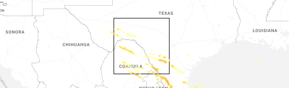
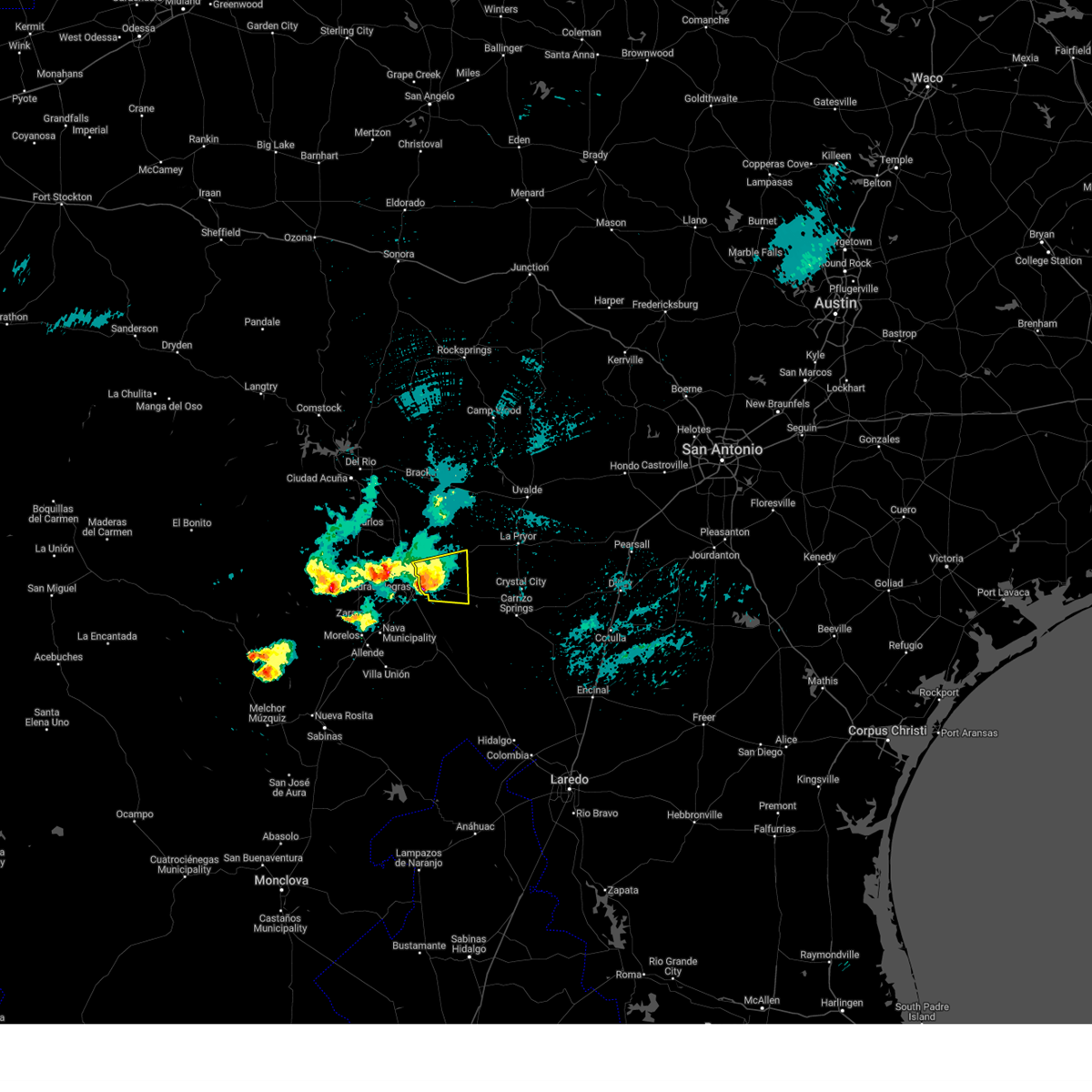
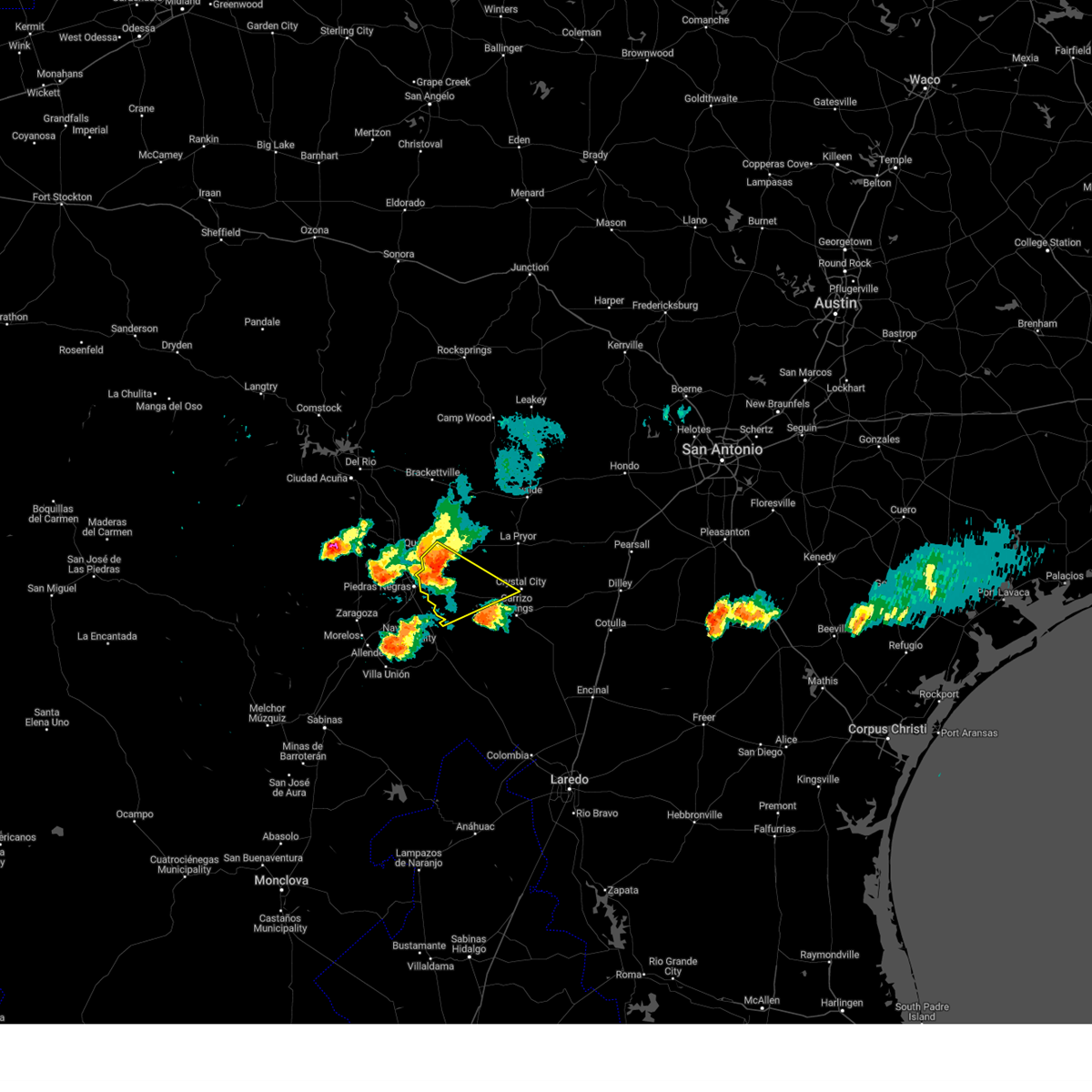
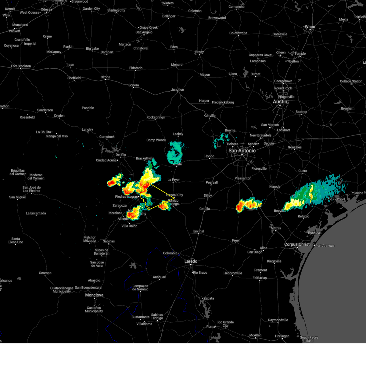
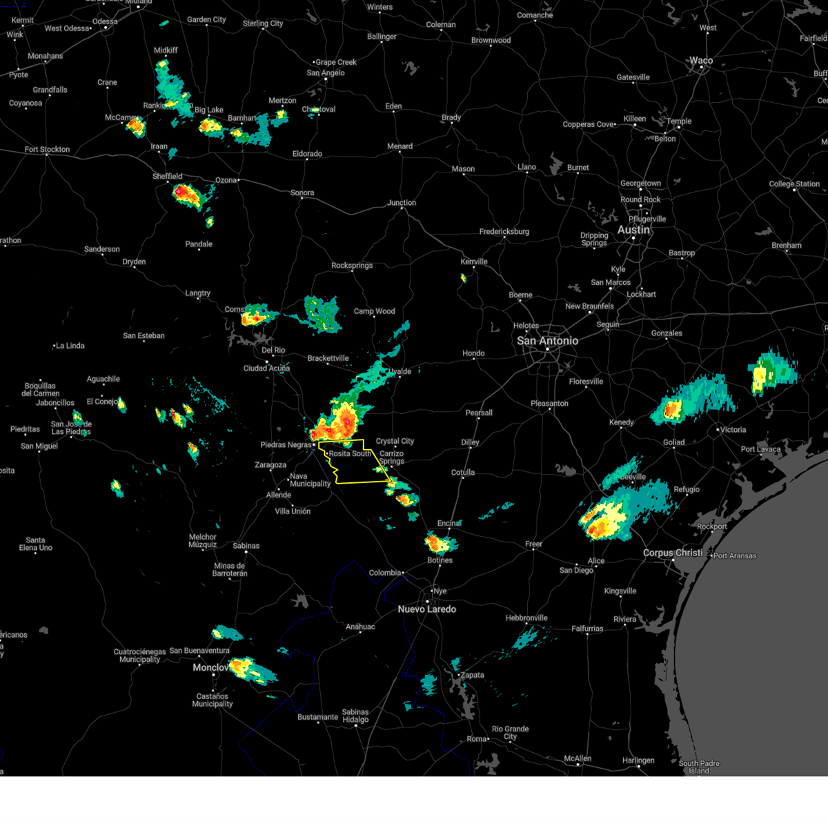
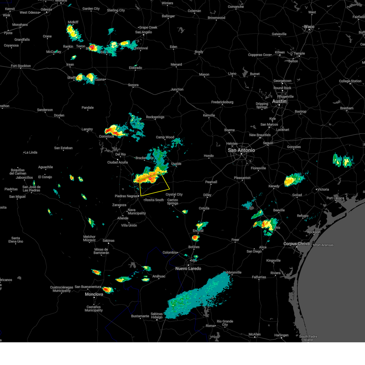
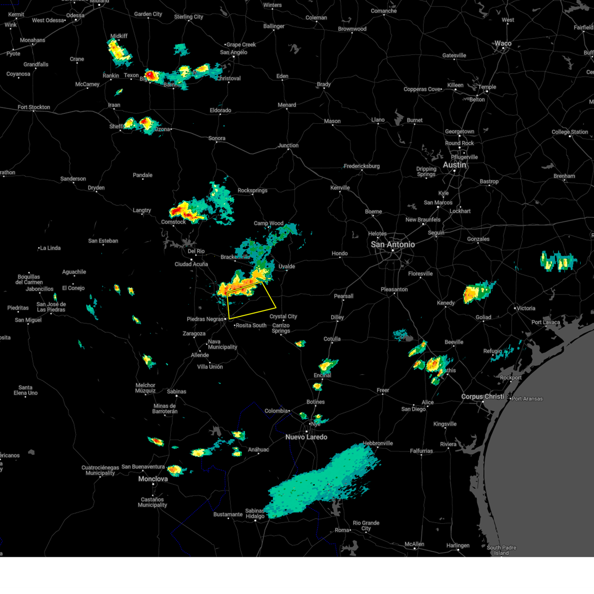
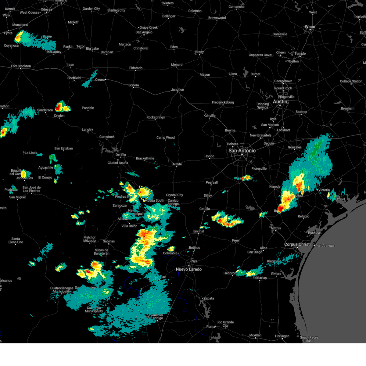
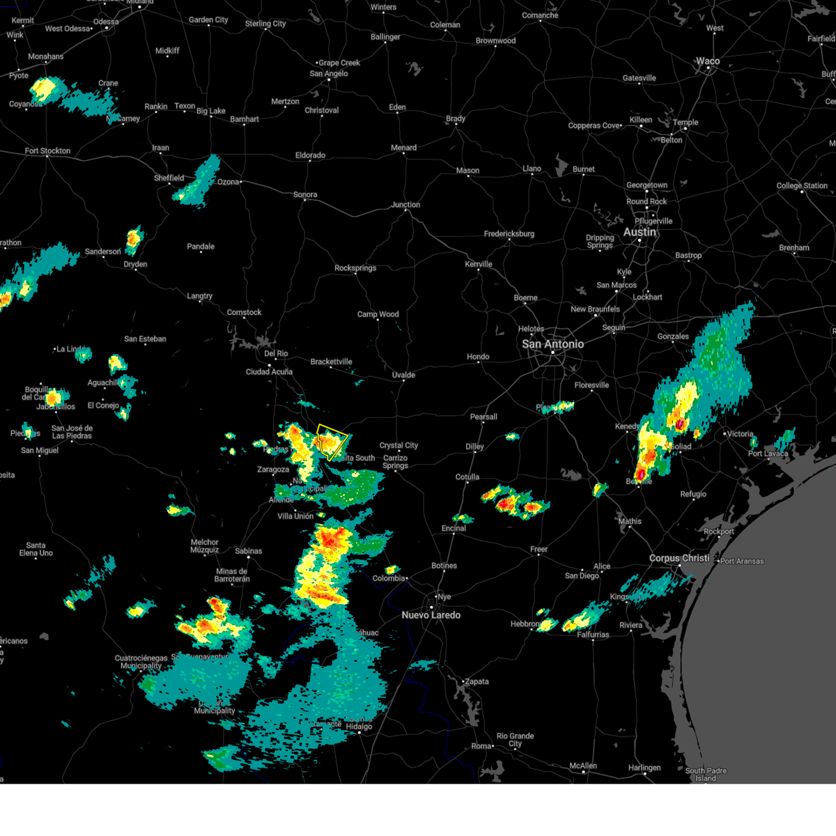
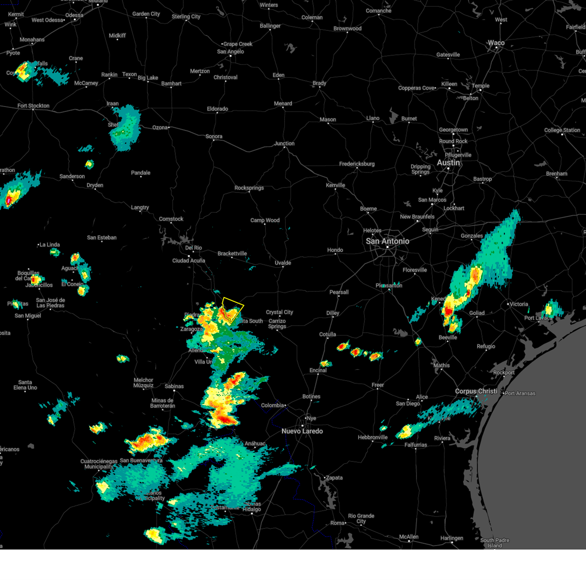
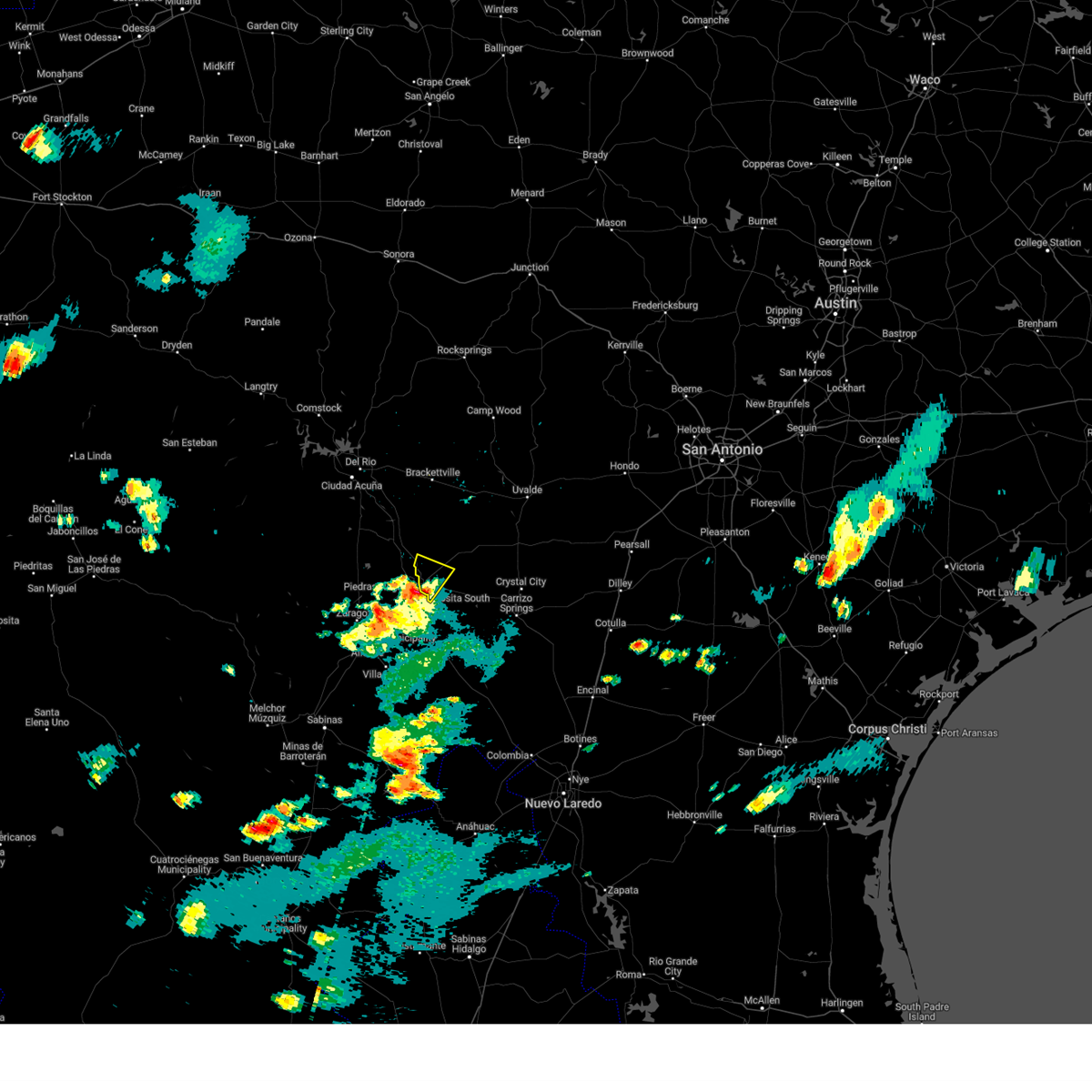
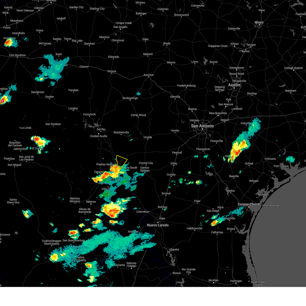
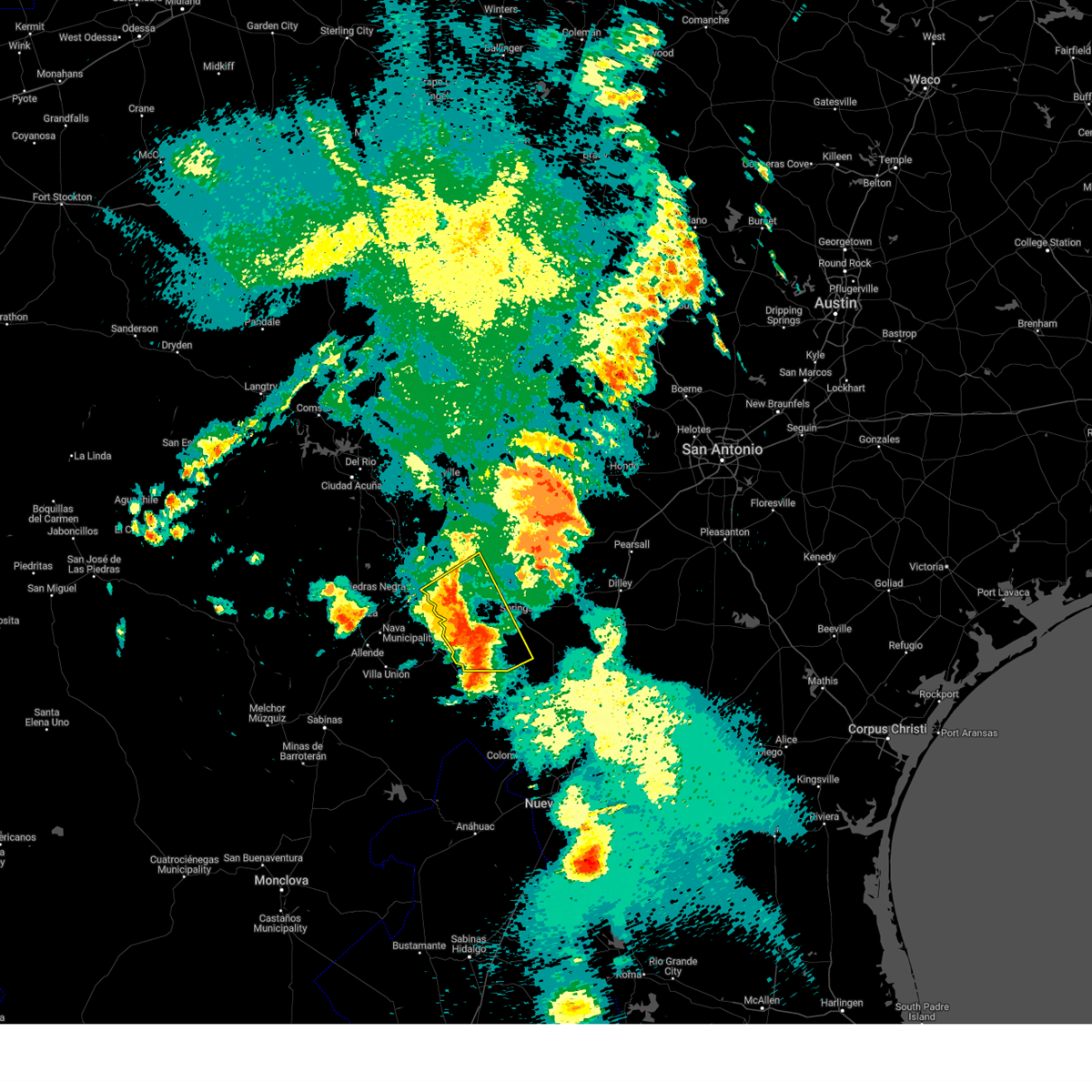
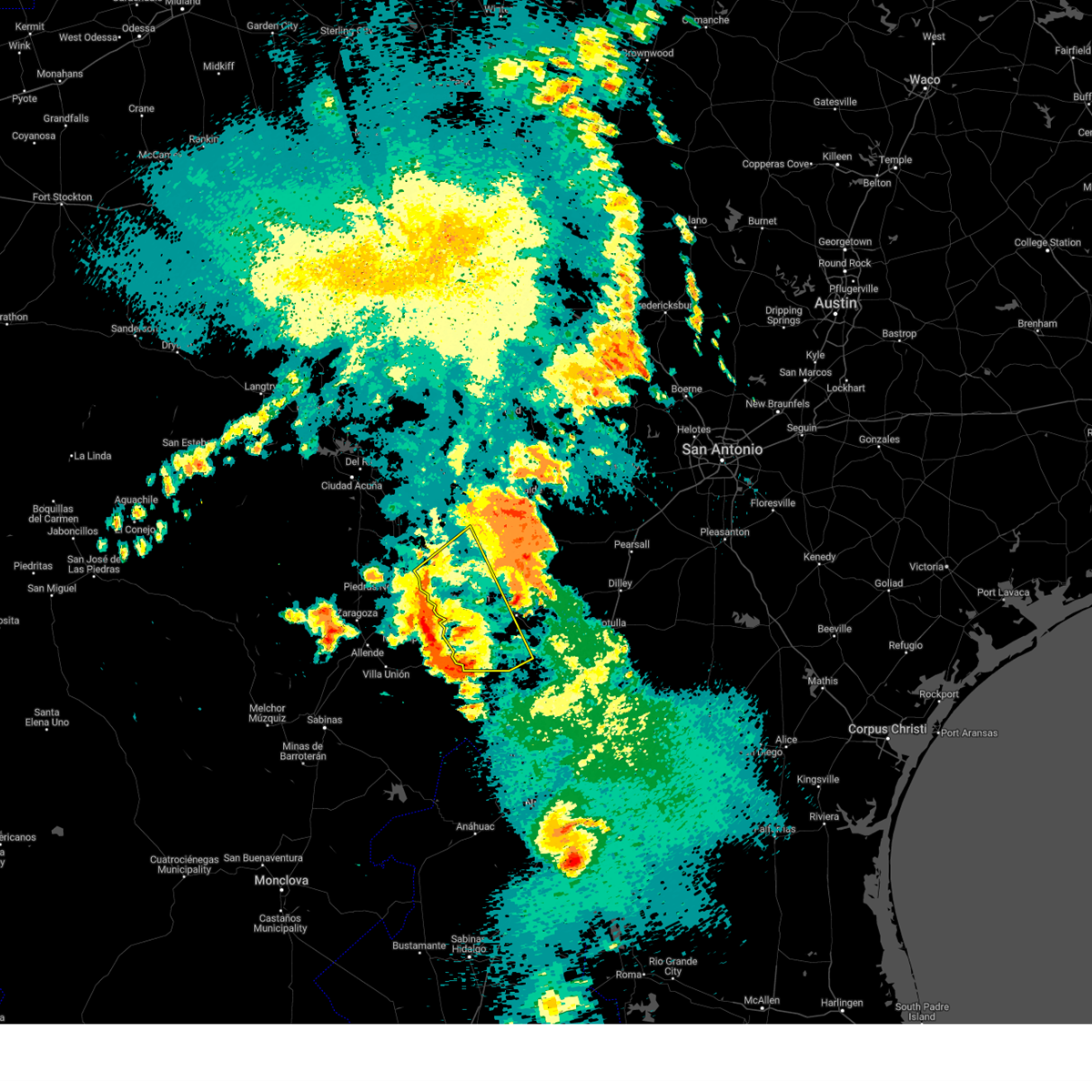
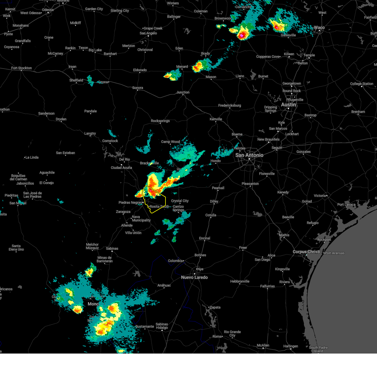
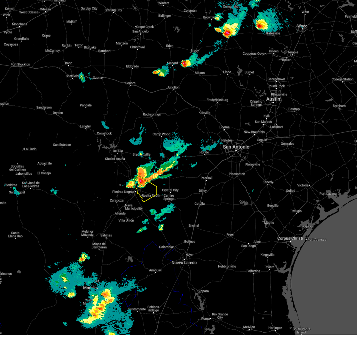
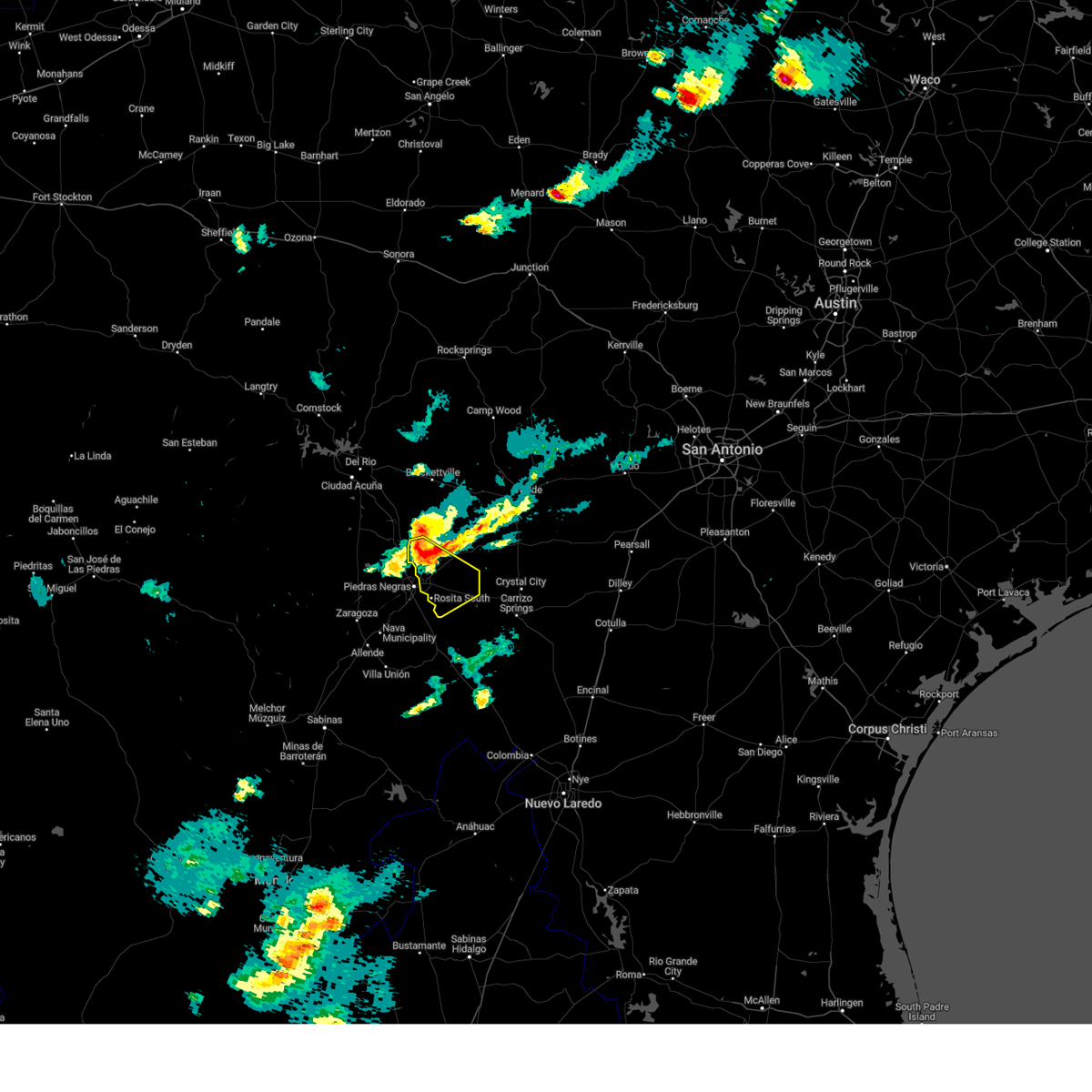
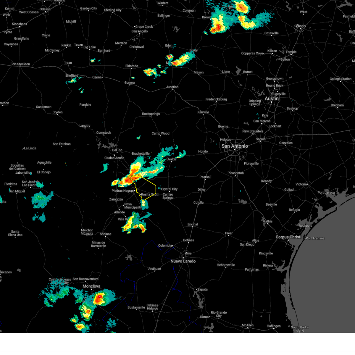
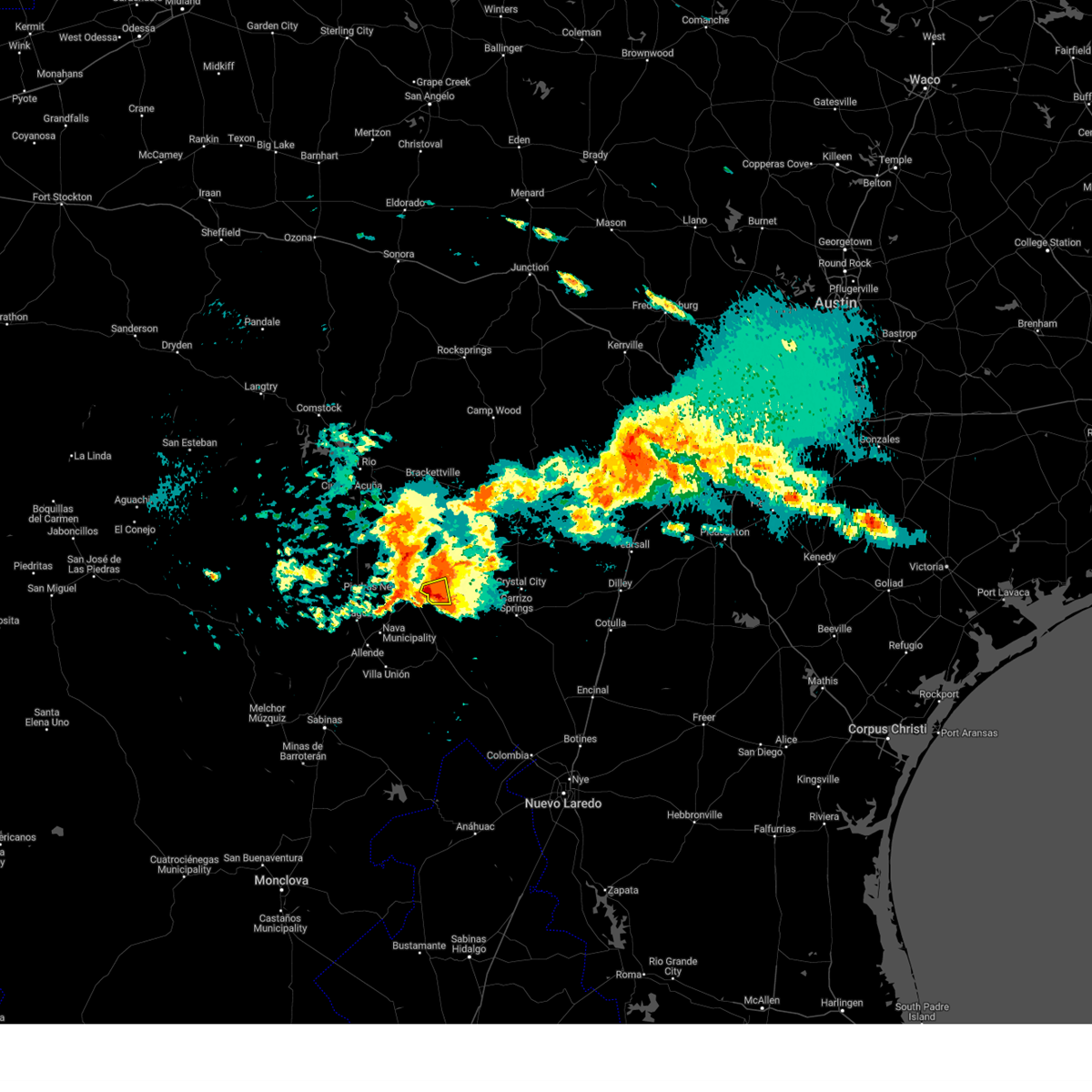
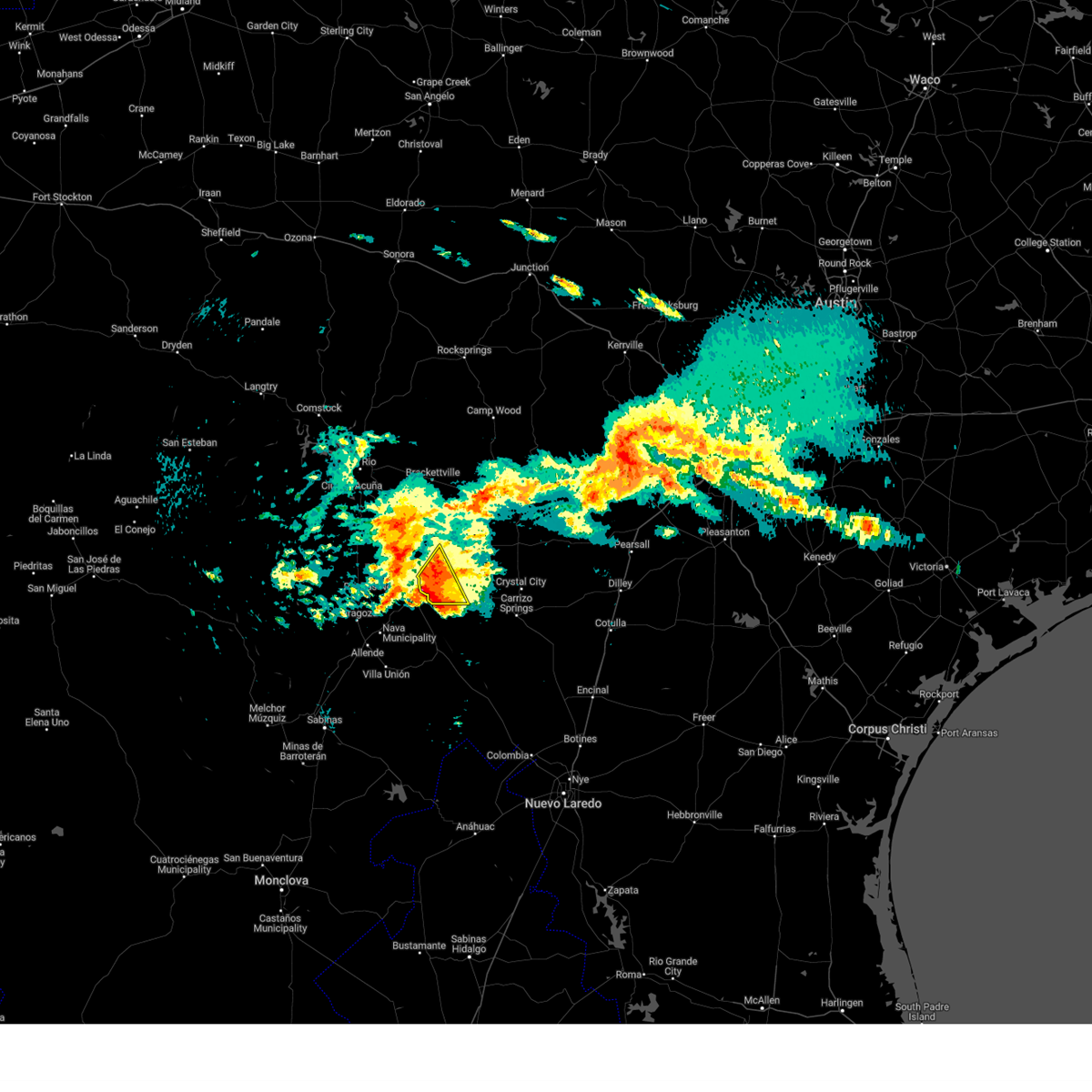
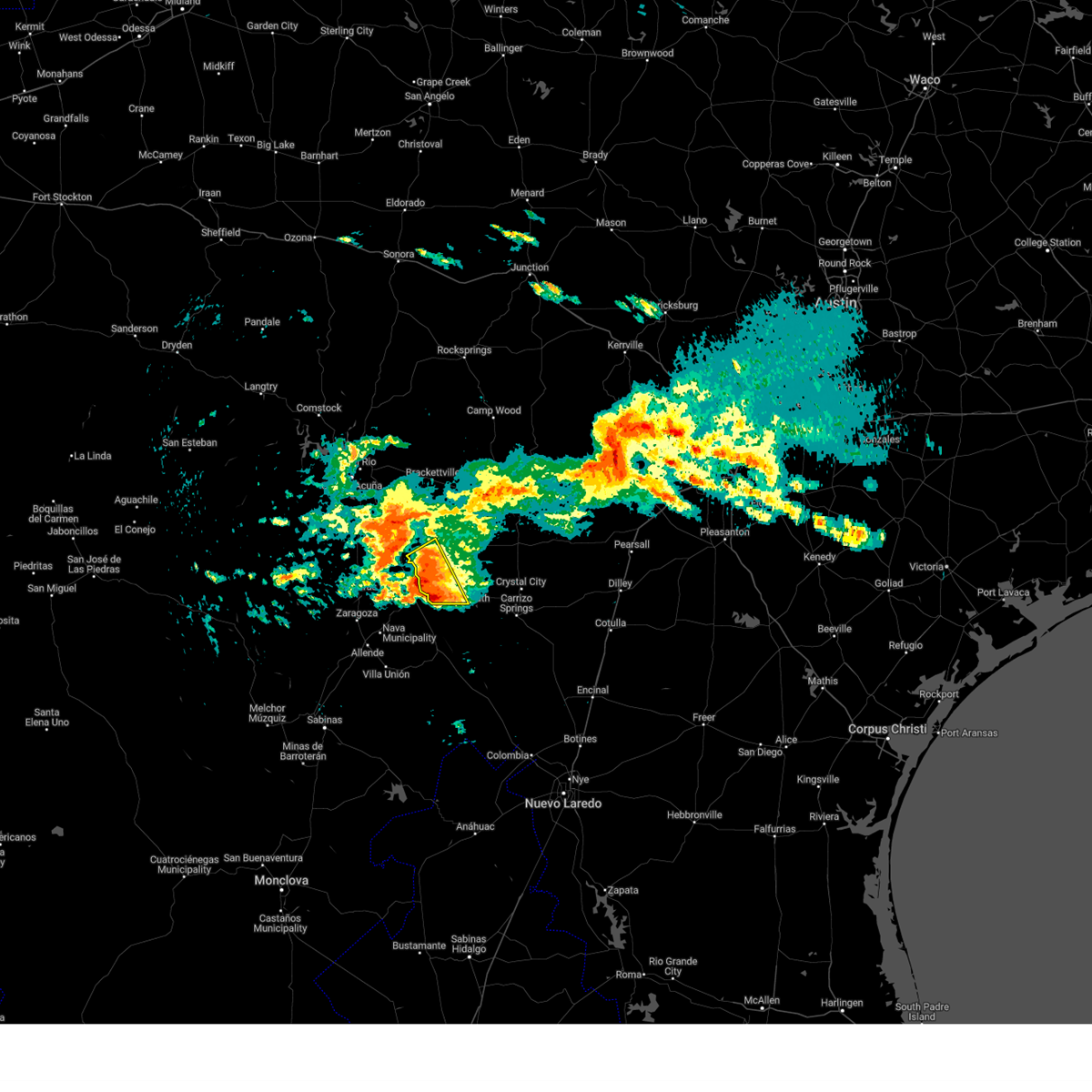
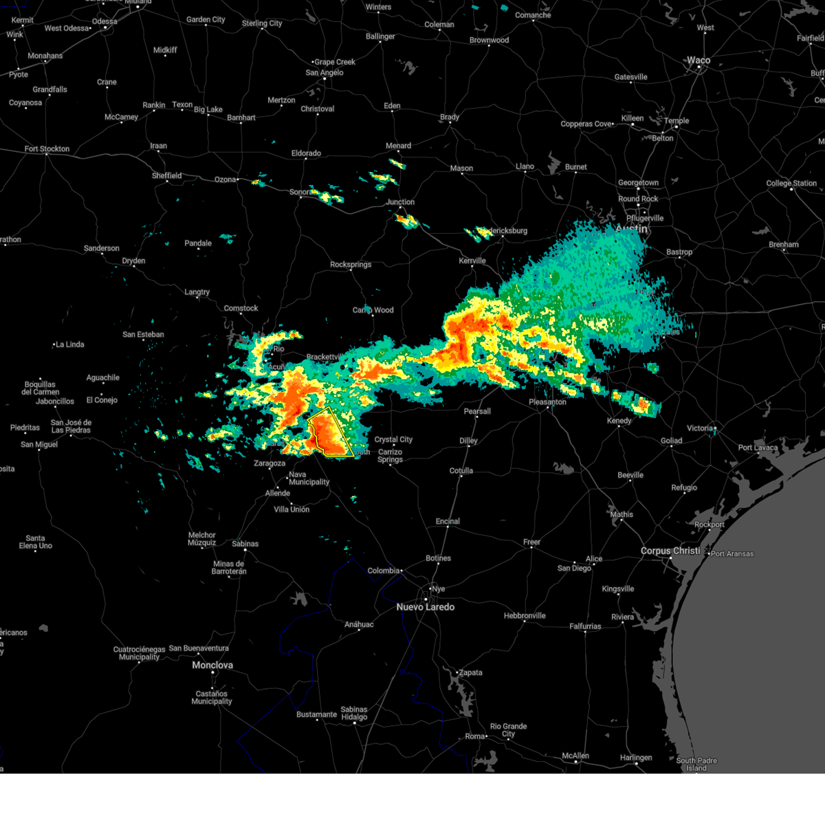
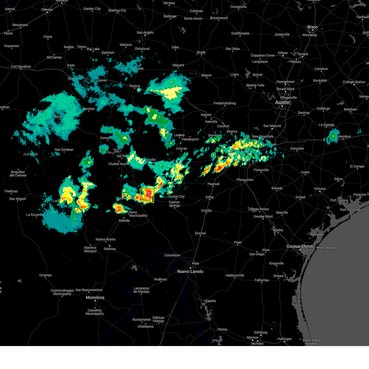
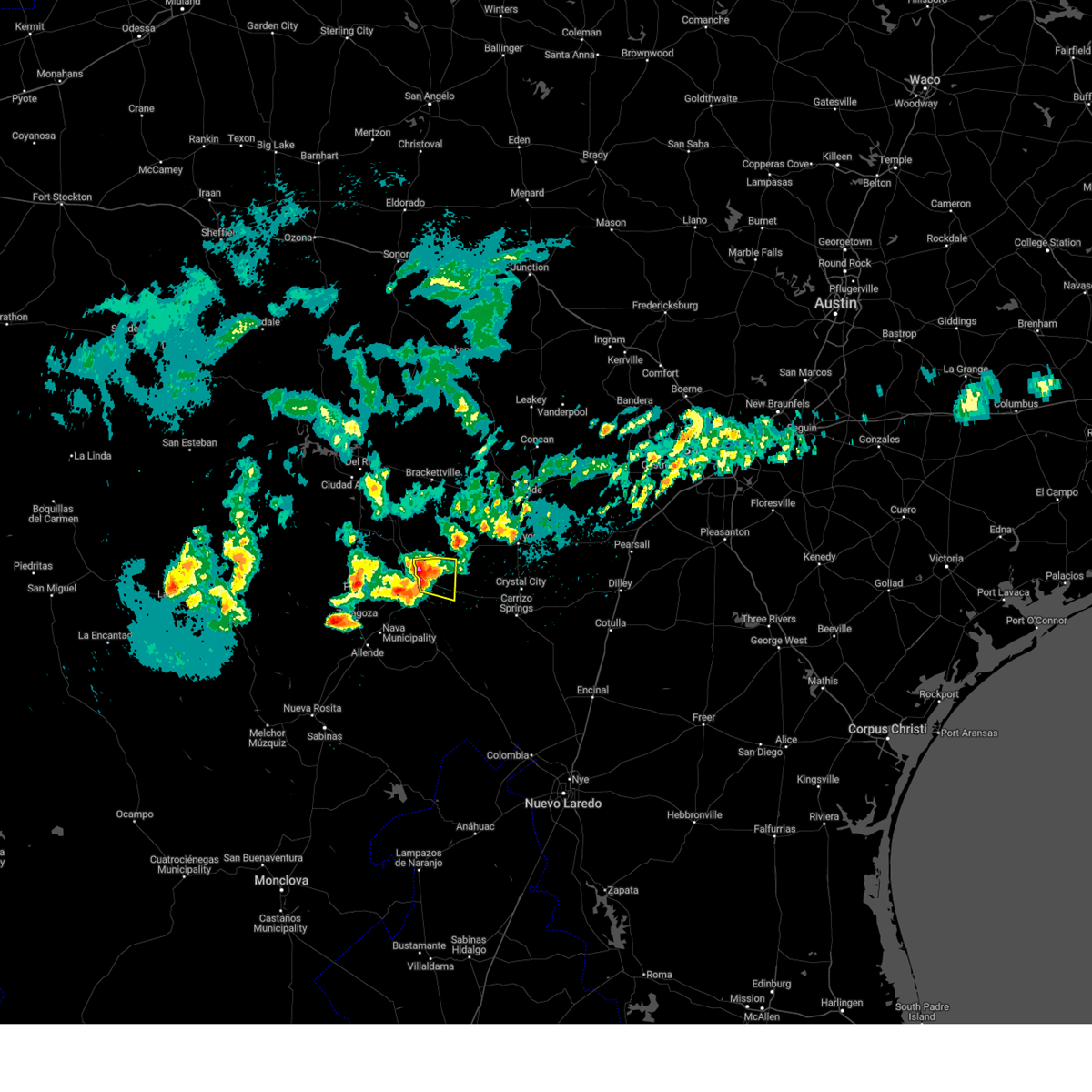
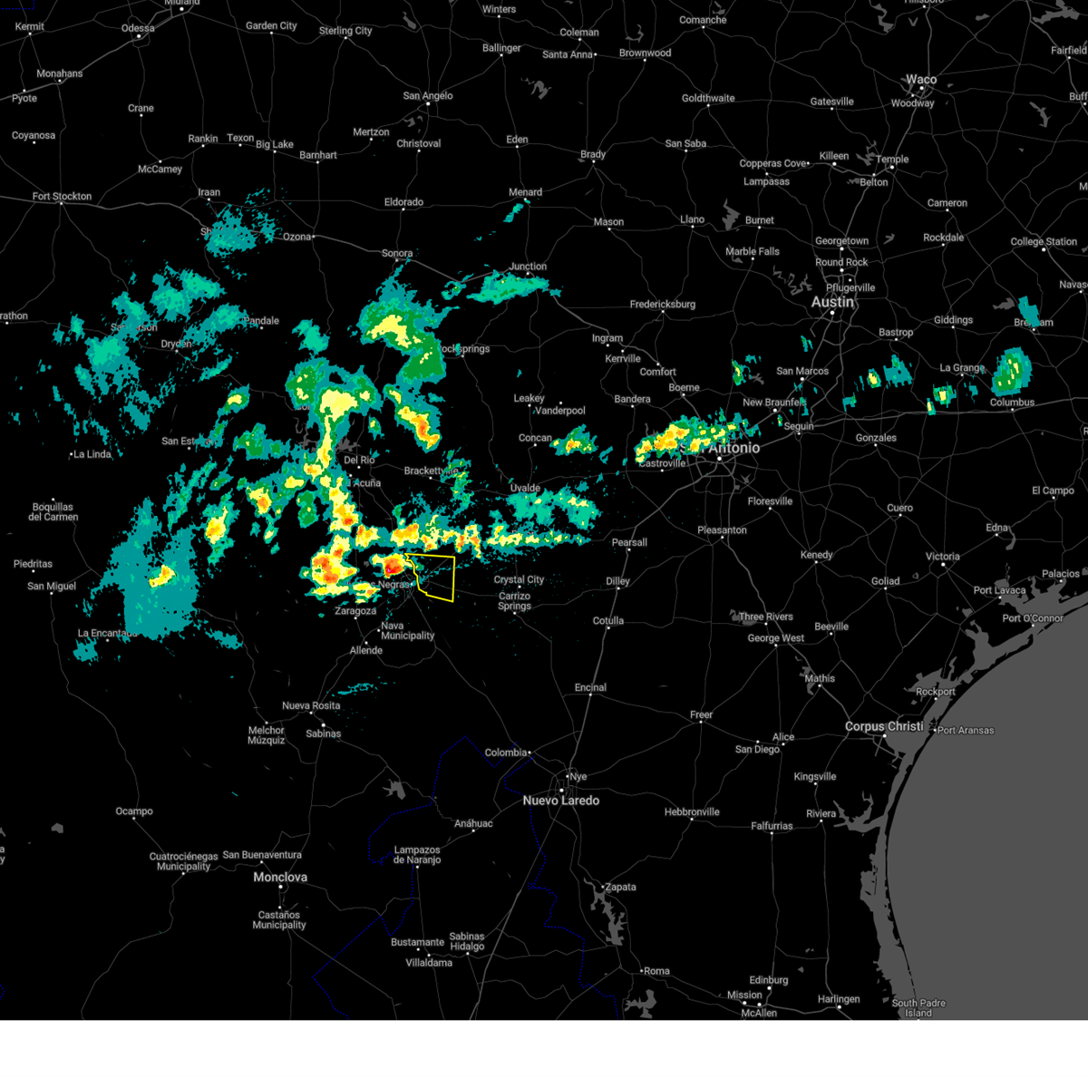
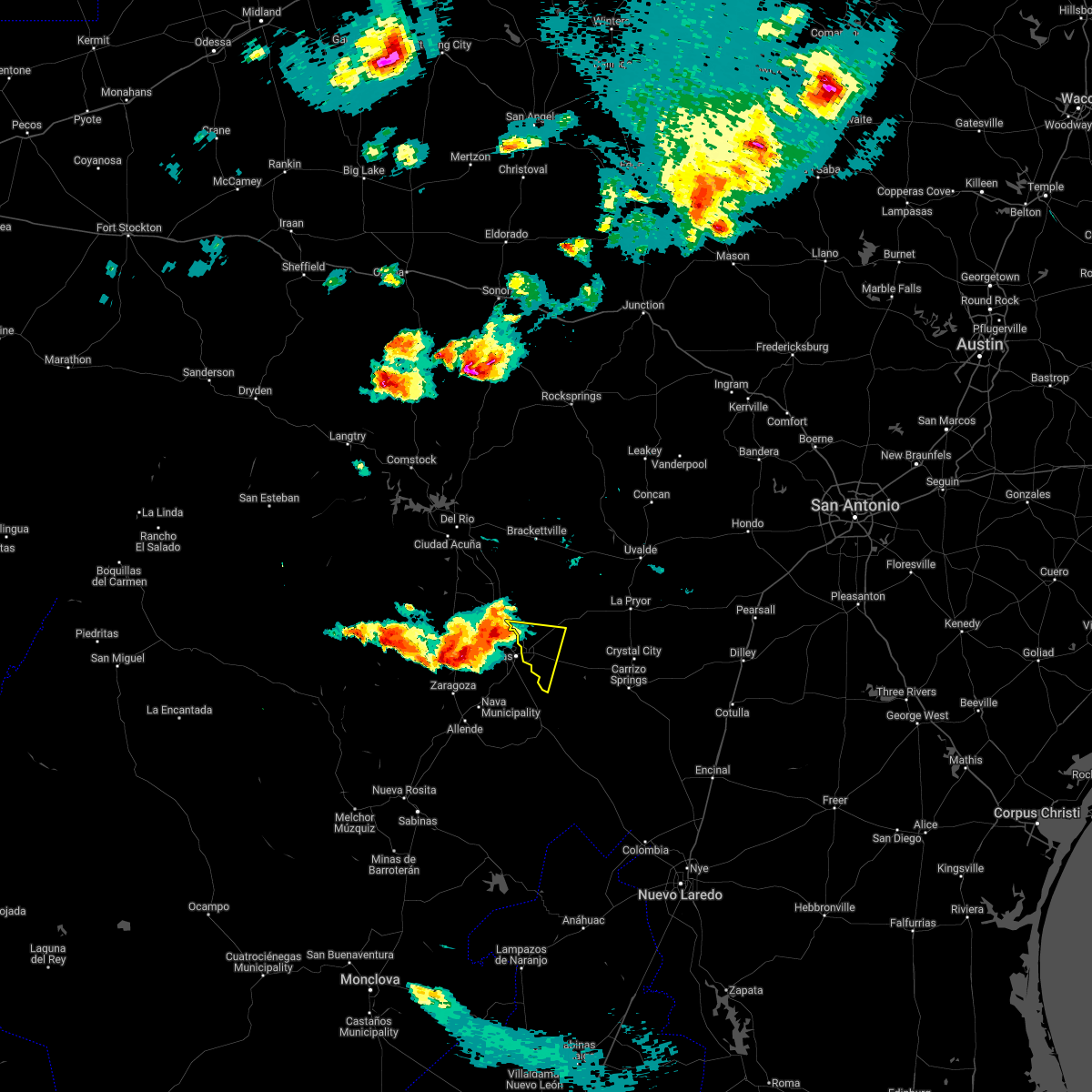
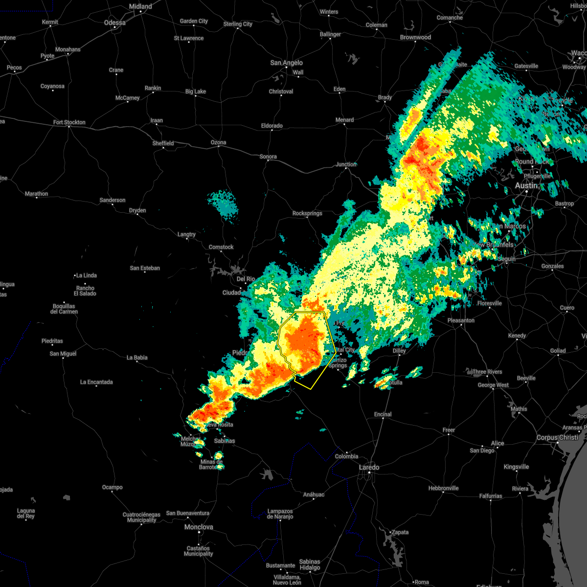
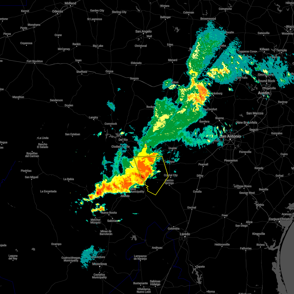
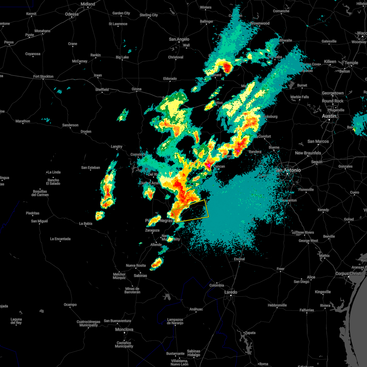
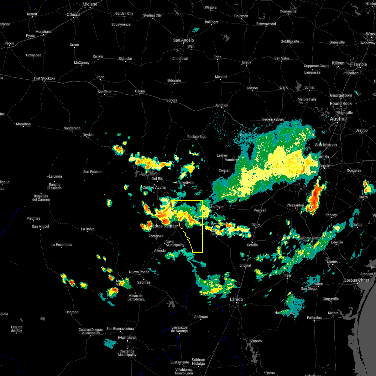
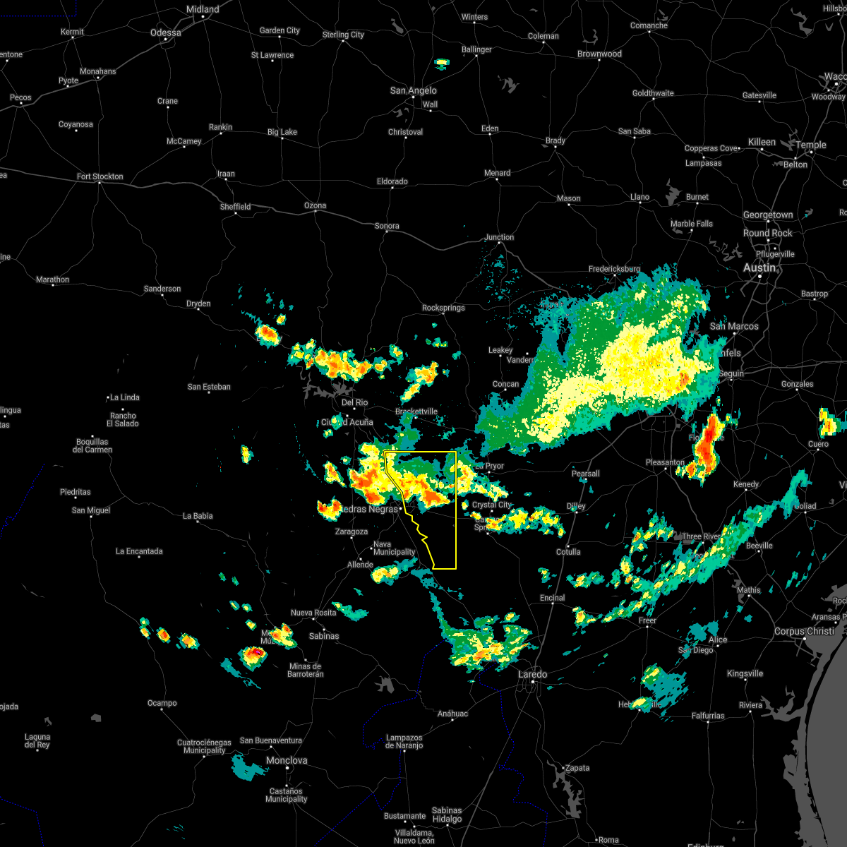
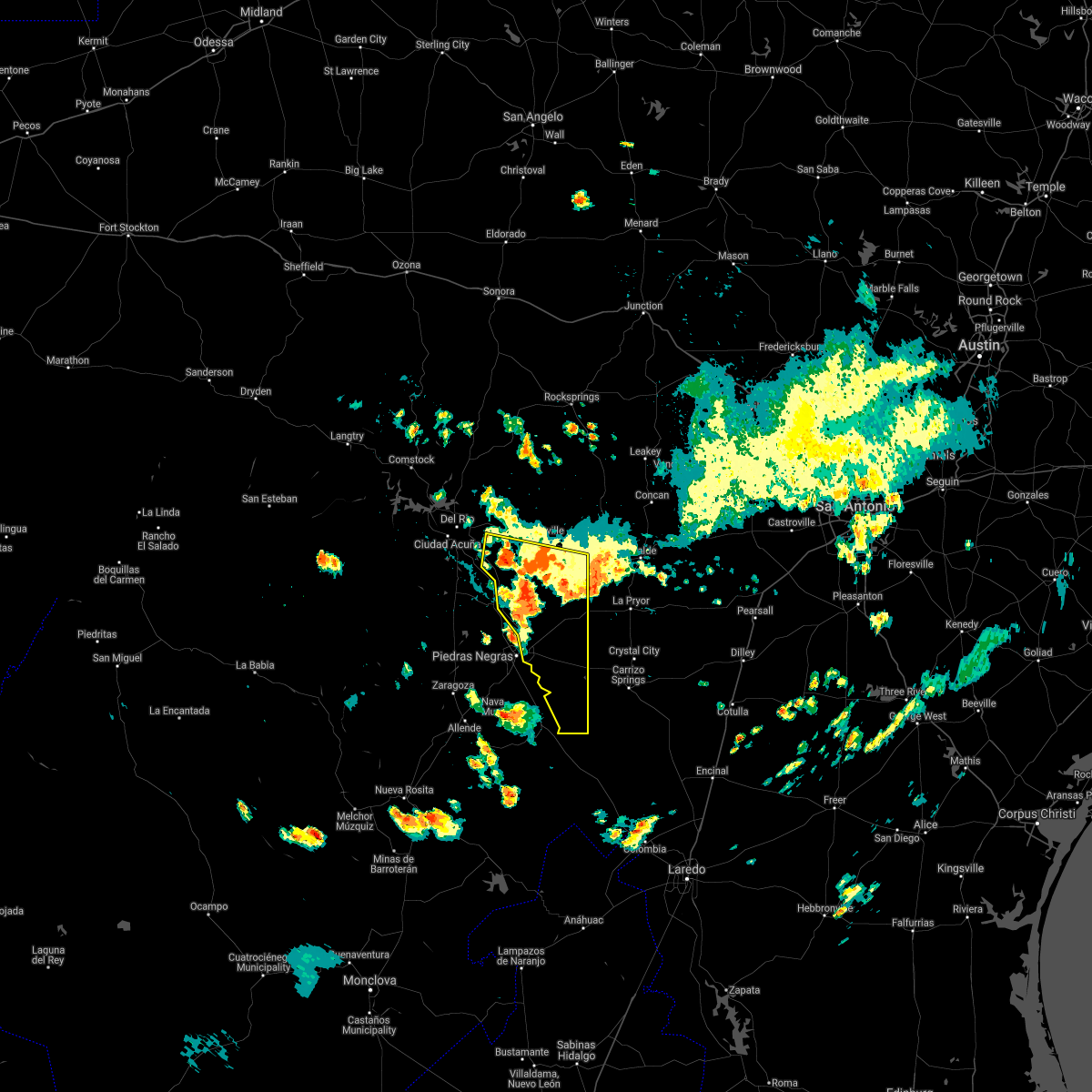
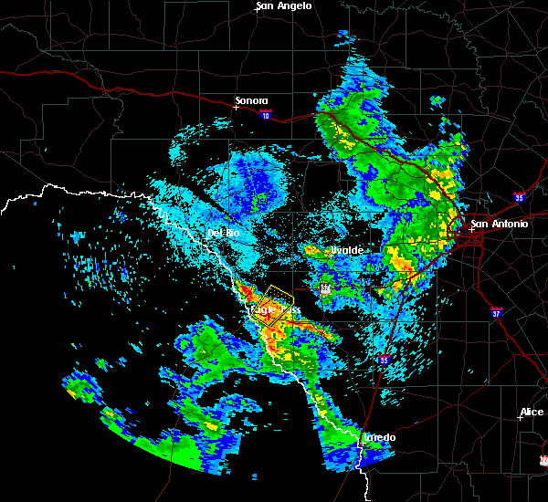
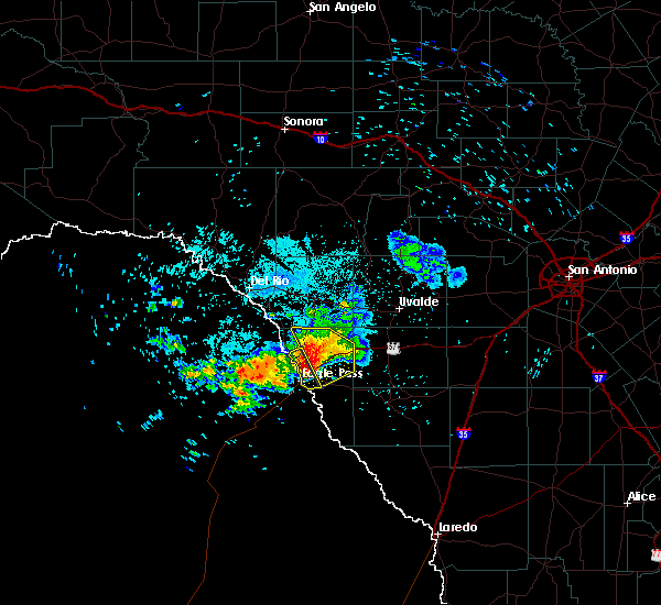
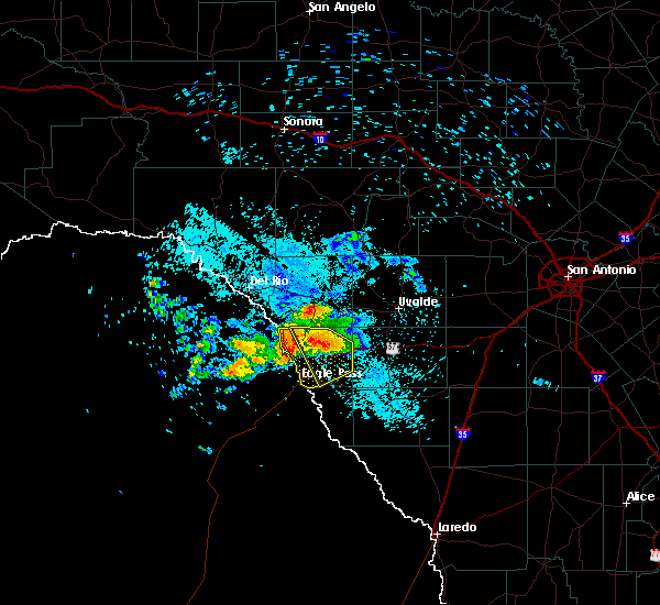
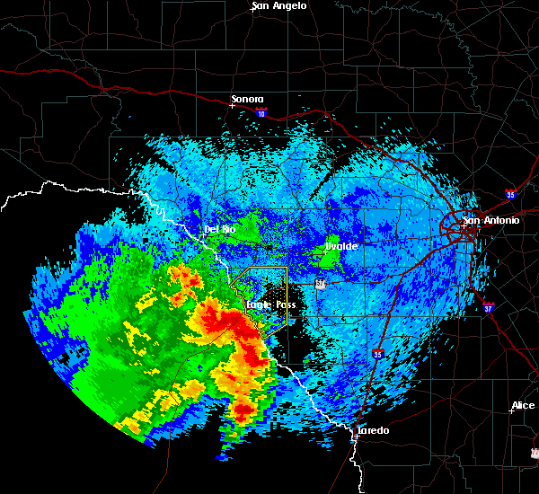
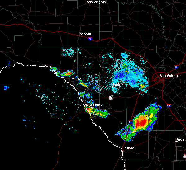
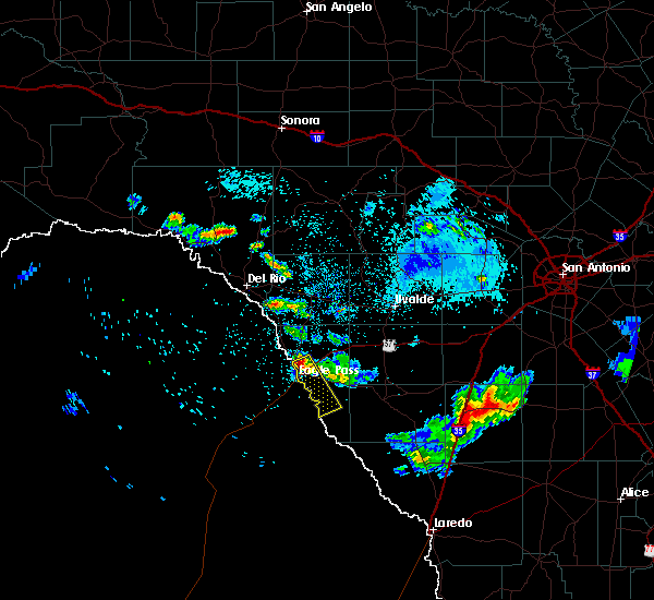
Hail Map for Eagle Pass, TX
The Eagle Pass, TX area has had 16 reports of on-the-ground hail by trained spotters, and has been under severe weather warnings 6 times during the past 12 months. Doppler radar has detected hail at or near Eagle Pass, TX on 45 occasions, including 4 occasions during the past year.
| Name: | Eagle Pass, TX |
| Where Located: | 51.9 miles SSE of Del Rio, TX |
| Map: | Google Map for Eagle Pass, TX |
| Population: | 26248 |
| Housing Units: | 9019 |
| More Info: | Search Google for Eagle Pass, TX |
1
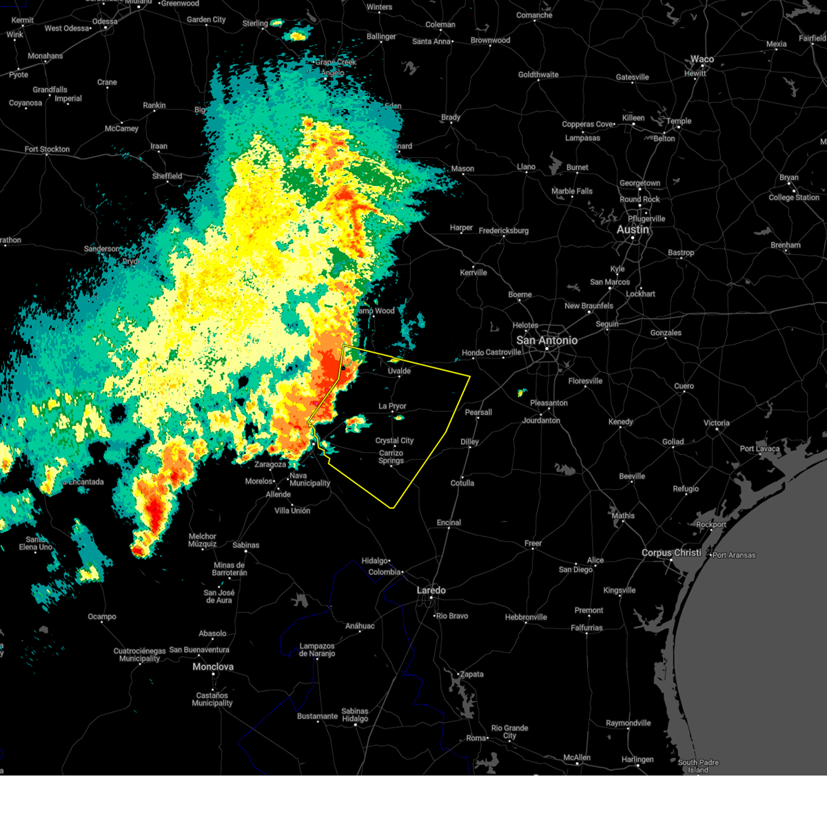
The Top Recent Hail Date for Eagle Pass, TX is Thursday, May 8, 2025 (7th out of 45)
Hail and Wind Damage Spotted near Eagle Pass, TX
| Date / Time | Report Details |
|---|---|
| 6/10/2025 9:52 PM CDT |
 Svrewx the national weather service in austin san antonio has issued a * severe thunderstorm warning for, southwestern medina county in south central texas, southeastern kinney county in south central texas, maverick county in south central texas, western dimmit county in south central texas, southern uvalde county in south central texas, zavala county in south central texas, northwestern frio county in south central texas, * until 1045 pm cdt. * at 951 pm cdt, severe thunderstorms were located along a line extending from 8 miles southeast of laguna to near blewett to 14 miles northwest of cometa, moving southeast at 35 mph (radar indicated). Hazards include ping pong ball size hail and 60 mph wind gusts. People and animals outdoors will be injured. expect hail damage to roofs, siding, windows, and vehicles. Expect wind damage to roofs, siding, and trees. Svrewx the national weather service in austin san antonio has issued a * severe thunderstorm warning for, southwestern medina county in south central texas, southeastern kinney county in south central texas, maverick county in south central texas, western dimmit county in south central texas, southern uvalde county in south central texas, zavala county in south central texas, northwestern frio county in south central texas, * until 1045 pm cdt. * at 951 pm cdt, severe thunderstorms were located along a line extending from 8 miles southeast of laguna to near blewett to 14 miles northwest of cometa, moving southeast at 35 mph (radar indicated). Hazards include ping pong ball size hail and 60 mph wind gusts. People and animals outdoors will be injured. expect hail damage to roofs, siding, windows, and vehicles. Expect wind damage to roofs, siding, and trees.
|
| 6/10/2025 9:20 PM CDT | Emergency manager reports tree limbs down and power outage in maverick county TX, 1 miles ESE of Eagle Pass, TX |
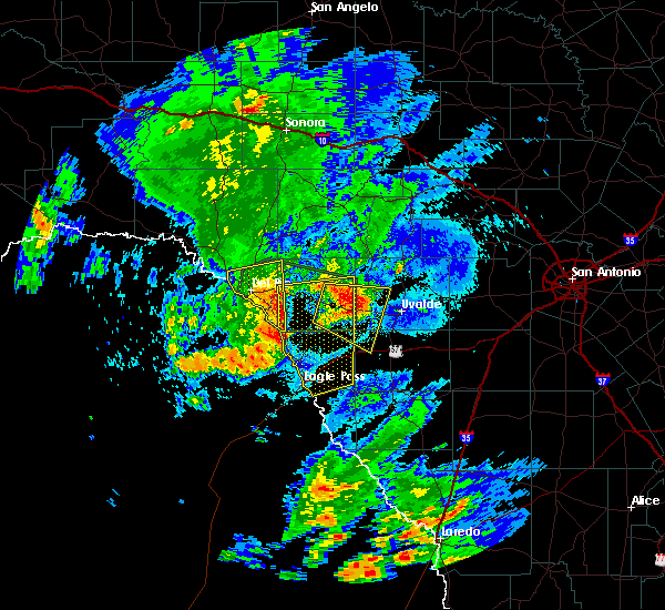
| 5/17/2025 10:05 PM CDT |
 the severe thunderstorm warning has been cancelled and is no longer in effect the severe thunderstorm warning has been cancelled and is no longer in effect
|
| 5/17/2025 9:59 PM CDT |
 At 959 pm cdt, a severe thunderstorm was located near rosita, or 7 miles northwest of el indio, moving east at 25 mph (radar indicated). Hazards include 60 mph wind gusts and quarter size hail. Hail damage to vehicles is expected. expect wind damage to roofs, siding, and trees. Locations impacted include, eagle pass, quemado, el indio, chula vista, paloma, darling, radar base, normandy, rosita, fabrica, las quintas fronterizas, siesta acres, eidson road, farias lake, elm creek, and seco mines. At 959 pm cdt, a severe thunderstorm was located near rosita, or 7 miles northwest of el indio, moving east at 25 mph (radar indicated). Hazards include 60 mph wind gusts and quarter size hail. Hail damage to vehicles is expected. expect wind damage to roofs, siding, and trees. Locations impacted include, eagle pass, quemado, el indio, chula vista, paloma, darling, radar base, normandy, rosita, fabrica, las quintas fronterizas, siesta acres, eidson road, farias lake, elm creek, and seco mines.
|
| 5/17/2025 9:44 PM CDT |
 Svrewx the national weather service in austin san antonio has issued a * severe thunderstorm warning for, maverick county in south central texas, * until 1045 pm cdt. * at 944 pm cdt, a severe thunderstorm was located 8 miles south of rosita, or 8 miles west of el indio, moving east at 25 mph (radar indicated). Hazards include ping pong ball size hail and 60 mph wind gusts. People and animals outdoors will be injured. expect hail damage to roofs, siding, windows, and vehicles. Expect wind damage to roofs, siding, and trees. Svrewx the national weather service in austin san antonio has issued a * severe thunderstorm warning for, maverick county in south central texas, * until 1045 pm cdt. * at 944 pm cdt, a severe thunderstorm was located 8 miles south of rosita, or 8 miles west of el indio, moving east at 25 mph (radar indicated). Hazards include ping pong ball size hail and 60 mph wind gusts. People and animals outdoors will be injured. expect hail damage to roofs, siding, windows, and vehicles. Expect wind damage to roofs, siding, and trees.
|
| 5/17/2025 12:17 AM CDT |
 the severe thunderstorm warning has been cancelled and is no longer in effect the severe thunderstorm warning has been cancelled and is no longer in effect
|
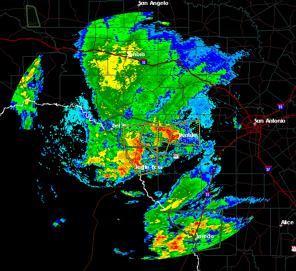
| 5/16/2025 11:46 PM CDT | Svrewx the national weather service in austin san antonio has issued a * severe thunderstorm warning for, central maverick county in south central texas, * until 1230 am cdt. * at 1146 pm cdt, a severe thunderstorm was located near eagle pass, moving east at 25 mph (radar indicated). Hazards include 60 mph wind gusts and half dollar size hail. Hail damage to vehicles is expected. Expect wind damage to roofs, siding, and trees. |
| 6/11/2024 8:47 PM CDT |
 the severe thunderstorm warning has been cancelled and is no longer in effect the severe thunderstorm warning has been cancelled and is no longer in effect
|
| 6/11/2024 8:38 PM CDT |
 At 838 pm cdt, a severe thunderstorm was located 7 miles southeast of paloma, or 8 miles northeast of eagle pass, moving southeast at 30 mph (radar indicated). Hazards include 60 mph wind gusts and penny size hail. Expect damage to roofs, siding, and trees. Locations impacted include, eagle pass, el indio, chula vista, paloma, cometa, rosita, fabrica, las quintas fronterizas, siesta acres, eidson road, farias lake, elm creek, and seco mines. At 838 pm cdt, a severe thunderstorm was located 7 miles southeast of paloma, or 8 miles northeast of eagle pass, moving southeast at 30 mph (radar indicated). Hazards include 60 mph wind gusts and penny size hail. Expect damage to roofs, siding, and trees. Locations impacted include, eagle pass, el indio, chula vista, paloma, cometa, rosita, fabrica, las quintas fronterizas, siesta acres, eidson road, farias lake, elm creek, and seco mines.
|
| 6/11/2024 8:29 PM CDT |
 At 829 pm cdt, a severe thunderstorm was located over paloma, or 11 miles north of eagle pass, moving southeast at 25 mph (radar indicated). Hazards include 60 mph wind gusts and quarter size hail. Hail damage to vehicles is expected. expect wind damage to roofs, siding, and trees. Locations impacted include, eagle pass, crystal city, el indio, chula vista, paloma, darling, cometa, radar base, rosita, fabrica, las quintas fronterizas, siesta acres, eidson road, farias lake, elm creek, and seco mines. At 829 pm cdt, a severe thunderstorm was located over paloma, or 11 miles north of eagle pass, moving southeast at 25 mph (radar indicated). Hazards include 60 mph wind gusts and quarter size hail. Hail damage to vehicles is expected. expect wind damage to roofs, siding, and trees. Locations impacted include, eagle pass, crystal city, el indio, chula vista, paloma, darling, cometa, radar base, rosita, fabrica, las quintas fronterizas, siesta acres, eidson road, farias lake, elm creek, and seco mines.
|
| 6/11/2024 8:11 PM CDT |
 Svrewx the national weather service in austin san antonio has issued a * severe thunderstorm warning for, maverick county in south central texas, northwestern dimmit county in south central texas, southwestern zavala county in south central texas, * until 915 pm cdt. * at 811 pm cdt, a severe thunderstorm was located near darling, or 7 miles east of quemado, moving southeast at 25 mph (radar indicated). Hazards include golf ball size hail and 60 mph wind gusts. People and animals outdoors will be injured. expect hail damage to roofs, siding, windows, and vehicles. Expect wind damage to roofs, siding, and trees. Svrewx the national weather service in austin san antonio has issued a * severe thunderstorm warning for, maverick county in south central texas, northwestern dimmit county in south central texas, southwestern zavala county in south central texas, * until 915 pm cdt. * at 811 pm cdt, a severe thunderstorm was located near darling, or 7 miles east of quemado, moving southeast at 25 mph (radar indicated). Hazards include golf ball size hail and 60 mph wind gusts. People and animals outdoors will be injured. expect hail damage to roofs, siding, windows, and vehicles. Expect wind damage to roofs, siding, and trees.
|
| 5/28/2024 8:30 PM CDT |
 At 830 pm cdt, severe thunderstorms were located along a line extending from 9 miles southwest of la pryor to winter haven to 8 miles southwest of gilson groves, moving east at 25 mph (radar indicated). Hazards include 60 mph wind gusts and quarter size hail. Hail damage to vehicles is expected. expect wind damage to roofs, siding, and trees. Locations impacted include, eagle pass, crystal city, carrizo springs, el indio, asherton, chula vista, chula vista-river spur, las colonias, winter haven, cometa, carrizo hill, rosita, eidson road, farias lake, and las quintas fronterizas. At 830 pm cdt, severe thunderstorms were located along a line extending from 9 miles southwest of la pryor to winter haven to 8 miles southwest of gilson groves, moving east at 25 mph (radar indicated). Hazards include 60 mph wind gusts and quarter size hail. Hail damage to vehicles is expected. expect wind damage to roofs, siding, and trees. Locations impacted include, eagle pass, crystal city, carrizo springs, el indio, asherton, chula vista, chula vista-river spur, las colonias, winter haven, cometa, carrizo hill, rosita, eidson road, farias lake, and las quintas fronterizas.
|
| 5/28/2024 8:18 PM CDT |
 At 817 pm cdt, severe thunderstorms were located along a line extending from 13 miles south of dabney to near winter haven to 7 miles east of chupadera ranch airport, moving east at 45 mph (radar indicated). Hazards include 60 mph wind gusts and quarter size hail. Hail damage to vehicles is expected. expect wind damage to roofs, siding, and trees. Locations impacted include, eagle pass, crystal city, carrizo springs, la pryor, el indio, asherton, chula vista, chula vista-river spur, paloma, las colonias, winter haven, cometa, carrizo hill, radar base, rosita, fabrica, las quintas fronterizas, siesta acres, eidson road, and farias lake. At 817 pm cdt, severe thunderstorms were located along a line extending from 13 miles south of dabney to near winter haven to 7 miles east of chupadera ranch airport, moving east at 45 mph (radar indicated). Hazards include 60 mph wind gusts and quarter size hail. Hail damage to vehicles is expected. expect wind damage to roofs, siding, and trees. Locations impacted include, eagle pass, crystal city, carrizo springs, la pryor, el indio, asherton, chula vista, chula vista-river spur, paloma, las colonias, winter haven, cometa, carrizo hill, radar base, rosita, fabrica, las quintas fronterizas, siesta acres, eidson road, and farias lake.
|
| 5/28/2024 7:52 PM CDT |
 Svrewx the national weather service in austin san antonio has issued a * severe thunderstorm warning for, maverick county in south central texas, western dimmit county in south central texas, western zavala county in south central texas, * until 845 pm cdt. * at 752 pm cdt, severe thunderstorms were located along a line extending from 6 miles northeast of darling to 7 miles west of cometa to 8 miles northwest of chupadera ranch airport, moving east at 25 mph (radar indicated). Hazards include 60 mph wind gusts and quarter size hail. Hail damage to vehicles is expected. Expect wind damage to roofs, siding, and trees. Svrewx the national weather service in austin san antonio has issued a * severe thunderstorm warning for, maverick county in south central texas, western dimmit county in south central texas, western zavala county in south central texas, * until 845 pm cdt. * at 752 pm cdt, severe thunderstorms were located along a line extending from 6 miles northeast of darling to 7 miles west of cometa to 8 miles northwest of chupadera ranch airport, moving east at 25 mph (radar indicated). Hazards include 60 mph wind gusts and quarter size hail. Hail damage to vehicles is expected. Expect wind damage to roofs, siding, and trees.
|
| 9/27/2023 7:05 PM CDT |
 At 705 pm cdt, a severe thunderstorm was located 9 miles southwest of cometa, or 11 miles northeast of el indio, moving south at 30 mph (radar indicated). Hazards include 60 mph wind gusts and nickel size hail. Expect damage to roofs, siding, and trees. locations impacted include, eagle pass, el indio, chula vista, rosita, eidson road, farias lake, and las quintas fronterizas. hail threat, radar indicated max hail size, 0. 88 in wind threat, radar indicated max wind gust, 60 mph. At 705 pm cdt, a severe thunderstorm was located 9 miles southwest of cometa, or 11 miles northeast of el indio, moving south at 30 mph (radar indicated). Hazards include 60 mph wind gusts and nickel size hail. Expect damage to roofs, siding, and trees. locations impacted include, eagle pass, el indio, chula vista, rosita, eidson road, farias lake, and las quintas fronterizas. hail threat, radar indicated max hail size, 0. 88 in wind threat, radar indicated max wind gust, 60 mph.
|
| 9/27/2023 6:38 PM CDT |
 At 637 pm cdt, a severe thunderstorm was located 13 miles southeast of paloma, or 16 miles east of eagle pass, moving south at 30 mph (radar indicated). Hazards include 70 mph wind gusts and quarter size hail. Hail damage to vehicles is expected. expect considerable tree damage. Wind damage is also likely to mobile homes, roofs, and outbuildings. At 637 pm cdt, a severe thunderstorm was located 13 miles southeast of paloma, or 16 miles east of eagle pass, moving south at 30 mph (radar indicated). Hazards include 70 mph wind gusts and quarter size hail. Hail damage to vehicles is expected. expect considerable tree damage. Wind damage is also likely to mobile homes, roofs, and outbuildings.
|
| 9/27/2023 6:26 PM CDT |
 At 626 pm cdt, a severe thunderstorm was located 7 miles east of paloma, or 17 miles northeast of eagle pass, moving southeast at 20 mph (radar indicated). Hazards include 70 mph wind gusts and quarter size hail. Hail damage to vehicles is expected. expect considerable tree damage. wind damage is also likely to mobile homes, roofs, and outbuildings. locations impacted include, eagle pass, paloma, darling, radar base, siesta acres, fabrica, elm creek, and las quintas fronterizas. thunderstorm damage threat, considerable hail threat, radar indicated max hail size, 1. 00 in wind threat, radar indicated max wind gust, 70 mph. At 626 pm cdt, a severe thunderstorm was located 7 miles east of paloma, or 17 miles northeast of eagle pass, moving southeast at 20 mph (radar indicated). Hazards include 70 mph wind gusts and quarter size hail. Hail damage to vehicles is expected. expect considerable tree damage. wind damage is also likely to mobile homes, roofs, and outbuildings. locations impacted include, eagle pass, paloma, darling, radar base, siesta acres, fabrica, elm creek, and las quintas fronterizas. thunderstorm damage threat, considerable hail threat, radar indicated max hail size, 1. 00 in wind threat, radar indicated max wind gust, 70 mph.
|
| 9/27/2023 6:18 PM CDT |
 At 618 pm cdt, a severe thunderstorm was located near darling, or 16 miles south of spofford, moving southeast at 20 mph (radar indicated). Hazards include 60 mph wind gusts and penny size hail. expect damage to roofs, siding, and trees At 618 pm cdt, a severe thunderstorm was located near darling, or 16 miles south of spofford, moving southeast at 20 mph (radar indicated). Hazards include 60 mph wind gusts and penny size hail. expect damage to roofs, siding, and trees
|
| 9/15/2023 6:53 PM CDT |
 The severe thunderstorm warning for central maverick county will expire at 700 pm cdt, the severe thunderstorm which prompted the warning has weakened. therefore, the warning will be allowed to expire. however gusty winds are still possible with this thunderstorm. The severe thunderstorm warning for central maverick county will expire at 700 pm cdt, the severe thunderstorm which prompted the warning has weakened. therefore, the warning will be allowed to expire. however gusty winds are still possible with this thunderstorm.
|
| 9/15/2023 6:42 PM CDT |
 At 642 pm cdt, a severe thunderstorm was located near eagle pass, moving northeast at 10 mph (radar indicated). Hazards include 60 mph wind gusts. Expect damage to roofs, siding, and trees. locations impacted include, eagle pass, chula vista, radar base, rosita, siesta acres, eidson road, fabrica, elm creek, las quintas fronterizas, and seco mines. hail threat, radar indicated max hail size, <. 75 in wind threat, radar indicated max wind gust, 60 mph. At 642 pm cdt, a severe thunderstorm was located near eagle pass, moving northeast at 10 mph (radar indicated). Hazards include 60 mph wind gusts. Expect damage to roofs, siding, and trees. locations impacted include, eagle pass, chula vista, radar base, rosita, siesta acres, eidson road, fabrica, elm creek, las quintas fronterizas, and seco mines. hail threat, radar indicated max hail size, <. 75 in wind threat, radar indicated max wind gust, 60 mph.
|
| 9/15/2023 6:26 PM CDT |
 At 626 pm cdt, a severe thunderstorm was located over eagle pass, moving northeast at 10 mph (radar indicated). Hazards include 60 mph wind gusts and penny size hail. Expect damage to roofs, siding, and trees. locations impacted include, eagle pass, chula vista, radar base, rosita, siesta acres, eidson road, fabrica, elm creek, las quintas fronterizas, and seco mines. hail threat, radar indicated max hail size, 0. 75 in wind threat, radar indicated max wind gust, 60 mph. At 626 pm cdt, a severe thunderstorm was located over eagle pass, moving northeast at 10 mph (radar indicated). Hazards include 60 mph wind gusts and penny size hail. Expect damage to roofs, siding, and trees. locations impacted include, eagle pass, chula vista, radar base, rosita, siesta acres, eidson road, fabrica, elm creek, las quintas fronterizas, and seco mines. hail threat, radar indicated max hail size, 0. 75 in wind threat, radar indicated max wind gust, 60 mph.
|
| 9/15/2023 6:12 PM CDT |
 At 612 pm cdt, a severe thunderstorm was located over eagle pass, moving northeast at 10 mph (radar indicated). Hazards include 60 mph wind gusts and quarter size hail. Hail damage to vehicles is expected. expect wind damage to roofs, siding, and trees. locations impacted include, eagle pass, chula vista, radar base, rosita, siesta acres, eidson road, fabrica, elm creek, las quintas fronterizas, and seco mines. hail threat, radar indicated max hail size, 1. 00 in wind threat, radar indicated max wind gust, 60 mph. At 612 pm cdt, a severe thunderstorm was located over eagle pass, moving northeast at 10 mph (radar indicated). Hazards include 60 mph wind gusts and quarter size hail. Hail damage to vehicles is expected. expect wind damage to roofs, siding, and trees. locations impacted include, eagle pass, chula vista, radar base, rosita, siesta acres, eidson road, fabrica, elm creek, las quintas fronterizas, and seco mines. hail threat, radar indicated max hail size, 1. 00 in wind threat, radar indicated max wind gust, 60 mph.
|
| 9/15/2023 5:58 PM CDT |
 At 558 pm cdt, a severe thunderstorm was located over eagle pass, moving northeast at 10 mph (radar indicated). Hazards include 60 mph wind gusts and quarter size hail. Hail damage to vehicles is expected. Expect wind damage to roofs, siding, and trees. At 558 pm cdt, a severe thunderstorm was located over eagle pass, moving northeast at 10 mph (radar indicated). Hazards include 60 mph wind gusts and quarter size hail. Hail damage to vehicles is expected. Expect wind damage to roofs, siding, and trees.
|
| 6/8/2023 12:52 AM CDT |
 At 1252 am cdt, severe thunderstorms were located along a line extending from 13 miles northwest of quemado to 9 miles southwest of normandy to 29 miles southwest of rosita, moving east at 45 mph (radar indicated). Hazards include 60 mph wind gusts. expect damage to roofs, siding, and trees At 1252 am cdt, severe thunderstorms were located along a line extending from 13 miles northwest of quemado to 9 miles southwest of normandy to 29 miles southwest of rosita, moving east at 45 mph (radar indicated). Hazards include 60 mph wind gusts. expect damage to roofs, siding, and trees
|
| 5/28/2023 12:34 AM CDT |
 At 1234 am cdt, severe thunderstorms were located along a line extending from 16 miles north of alamo village to 8 miles south of dabney to 12 miles southwest of el indio, moving east at 45 mph (radar indicated). Hazards include 60 mph wind gusts. Expect damage to roofs, siding, and trees. Locations impacted include, eagle pass, uvalde, crystal city, carrizo springs, brackettville, spofford, la pryor, batesville, el indio, chula vista, laguna, chula vista-river spur, concan, darling, las colonias, uvalde estates, brundage, dabney, cline and carrizo hill. At 1234 am cdt, severe thunderstorms were located along a line extending from 16 miles north of alamo village to 8 miles south of dabney to 12 miles southwest of el indio, moving east at 45 mph (radar indicated). Hazards include 60 mph wind gusts. Expect damage to roofs, siding, and trees. Locations impacted include, eagle pass, uvalde, crystal city, carrizo springs, brackettville, spofford, la pryor, batesville, el indio, chula vista, laguna, chula vista-river spur, concan, darling, las colonias, uvalde estates, brundage, dabney, cline and carrizo hill.
|
| 5/28/2023 12:08 AM CDT |
 At 1208 am cdt, severe thunderstorms were located along a line extending from 9 miles northwest of alamo village to darling to 22 miles southwest of el indio, moving east at 45 mph (radar indicated). Hazards include 60 mph wind gusts. expect damage to roofs, siding, and trees At 1208 am cdt, severe thunderstorms were located along a line extending from 9 miles northwest of alamo village to darling to 22 miles southwest of el indio, moving east at 45 mph (radar indicated). Hazards include 60 mph wind gusts. expect damage to roofs, siding, and trees
|
| 5/12/2023 10:55 PM CDT |
 At 1055 pm cdt, severe thunderstorms were located along a line extending from 6 miles northeast of chula vista to near chupadera ranch airport, moving northeast at 25 mph (radar indicated). Hazards include 60 mph wind gusts and quarter size hail. Hail damage to vehicles is expected. expect wind damage to roofs, siding, and trees. locations impacted include, eagle pass, el indio, chula vista, cometa, gilson groves, rosita, eidson road, farias lake and las quintas fronterizas. hail threat, radar indicated max hail size, 1. 00 in wind threat, radar indicated max wind gust, 60 mph. At 1055 pm cdt, severe thunderstorms were located along a line extending from 6 miles northeast of chula vista to near chupadera ranch airport, moving northeast at 25 mph (radar indicated). Hazards include 60 mph wind gusts and quarter size hail. Hail damage to vehicles is expected. expect wind damage to roofs, siding, and trees. locations impacted include, eagle pass, el indio, chula vista, cometa, gilson groves, rosita, eidson road, farias lake and las quintas fronterizas. hail threat, radar indicated max hail size, 1. 00 in wind threat, radar indicated max wind gust, 60 mph.
|
| 5/12/2023 10:29 PM CDT |
 At 1029 pm cdt, severe thunderstorms were located along a line extending from eagle pass to 9 miles southwest of chupadera ranch airport, moving northeast at 20 mph (radar indicated). Hazards include 60 mph wind gusts and quarter size hail. Hail damage to vehicles is expected. Expect wind damage to roofs, siding, and trees. At 1029 pm cdt, severe thunderstorms were located along a line extending from eagle pass to 9 miles southwest of chupadera ranch airport, moving northeast at 20 mph (radar indicated). Hazards include 60 mph wind gusts and quarter size hail. Hail damage to vehicles is expected. Expect wind damage to roofs, siding, and trees.
|
| 5/12/2023 8:04 PM CDT |
 At 804 pm cdt, severe thunderstorms were located along a line extending from near barksdale to near montell to 9 miles west of washer, moving northeast at 70 mph (radar indicated). Hazards include 70 mph wind gusts and half dollar size hail. Hail damage to vehicles is expected. expect considerable tree damage. wind damage is also likely to mobile homes, roofs, and outbuildings. locations impacted include, eagle pass, crystal city, carrizo springs, spofford, quemado, la pryor, el indio, chula vista, darling, dabney, cline, anacacho, rosita, blewett, paloma, washer, winter haven, cometa, radar base and normandy. thunderstorm damage threat, considerable hail threat, radar indicated max hail size, 1. 25 in wind threat, radar indicated max wind gust, 70 mph. At 804 pm cdt, severe thunderstorms were located along a line extending from near barksdale to near montell to 9 miles west of washer, moving northeast at 70 mph (radar indicated). Hazards include 70 mph wind gusts and half dollar size hail. Hail damage to vehicles is expected. expect considerable tree damage. wind damage is also likely to mobile homes, roofs, and outbuildings. locations impacted include, eagle pass, crystal city, carrizo springs, spofford, quemado, la pryor, el indio, chula vista, darling, dabney, cline, anacacho, rosita, blewett, paloma, washer, winter haven, cometa, radar base and normandy. thunderstorm damage threat, considerable hail threat, radar indicated max hail size, 1. 25 in wind threat, radar indicated max wind gust, 70 mph.
|
| 5/12/2023 7:59 PM CDT |
 At 759 pm cdt, severe thunderstorms were located along a line extending from near barksdale to laguna to 12 miles south of dabney, moving northeast at 70 mph (radar indicated). Hazards include 70 mph wind gusts and quarter size hail. Hail damage to vehicles is expected. expect considerable tree damage. wind damage is also likely to mobile homes, roofs, and outbuildings. locations impacted include, eagle pass, crystal city, carrizo springs, spofford, quemado, la pryor, el indio, chula vista, darling, dabney, cline, anacacho, rosita, blewett, paloma, washer, winter haven, cometa, radar base and normandy. thunderstorm damage threat, considerable hail threat, radar indicated max hail size, 1. 00 in wind threat, radar indicated max wind gust, 70 mph. At 759 pm cdt, severe thunderstorms were located along a line extending from near barksdale to laguna to 12 miles south of dabney, moving northeast at 70 mph (radar indicated). Hazards include 70 mph wind gusts and quarter size hail. Hail damage to vehicles is expected. expect considerable tree damage. wind damage is also likely to mobile homes, roofs, and outbuildings. locations impacted include, eagle pass, crystal city, carrizo springs, spofford, quemado, la pryor, el indio, chula vista, darling, dabney, cline, anacacho, rosita, blewett, paloma, washer, winter haven, cometa, radar base and normandy. thunderstorm damage threat, considerable hail threat, radar indicated max hail size, 1. 00 in wind threat, radar indicated max wind gust, 70 mph.
|
| 5/12/2023 7:44 PM CDT |
 At 743 pm cdt, severe thunderstorms were located along a line extending from 8 miles northeast of alamo village to 6 miles southwest of cline to 13 miles southeast of paloma, moving northeast at 70 mph (radar indicated). Hazards include 70 mph wind gusts and quarter size hail. Hail damage to vehicles is expected. expect considerable tree damage. wind damage is also likely to mobile homes, roofs, and outbuildings. locations impacted include, eagle pass, crystal city, carrizo springs, spofford, quemado, la pryor, el indio, chula vista, darling, dabney, cline, anacacho, rosita, blewett, paloma, washer, winter haven, cometa, radar base and normandy. thunderstorm damage threat, considerable hail threat, radar indicated max hail size, 1. 00 in wind threat, radar indicated max wind gust, 70 mph. At 743 pm cdt, severe thunderstorms were located along a line extending from 8 miles northeast of alamo village to 6 miles southwest of cline to 13 miles southeast of paloma, moving northeast at 70 mph (radar indicated). Hazards include 70 mph wind gusts and quarter size hail. Hail damage to vehicles is expected. expect considerable tree damage. wind damage is also likely to mobile homes, roofs, and outbuildings. locations impacted include, eagle pass, crystal city, carrizo springs, spofford, quemado, la pryor, el indio, chula vista, darling, dabney, cline, anacacho, rosita, blewett, paloma, washer, winter haven, cometa, radar base and normandy. thunderstorm damage threat, considerable hail threat, radar indicated max hail size, 1. 00 in wind threat, radar indicated max wind gust, 70 mph.
|
| 5/12/2023 7:28 PM CDT |
 At 727 pm cdt, severe thunderstorms were located along a line extending from near brackettville to near darling to near rosita, moving northeast at 70 mph (radar indicated). Hazards include 70 mph wind gusts and nickel size hail. Expect considerable tree damage. damage is likely to mobile homes, roofs, and outbuildings. locations impacted include, eagle pass, crystal city, carrizo springs, spofford, quemado, la pryor, el indio, chula vista, darling, dabney, cline, anacacho, rosita, blewett, paloma, washer, winter haven, cometa, radar base and normandy. thunderstorm damage threat, considerable hail threat, radar indicated max hail size, 0. 88 in wind threat, radar indicated max wind gust, 70 mph. At 727 pm cdt, severe thunderstorms were located along a line extending from near brackettville to near darling to near rosita, moving northeast at 70 mph (radar indicated). Hazards include 70 mph wind gusts and nickel size hail. Expect considerable tree damage. damage is likely to mobile homes, roofs, and outbuildings. locations impacted include, eagle pass, crystal city, carrizo springs, spofford, quemado, la pryor, el indio, chula vista, darling, dabney, cline, anacacho, rosita, blewett, paloma, washer, winter haven, cometa, radar base and normandy. thunderstorm damage threat, considerable hail threat, radar indicated max hail size, 0. 88 in wind threat, radar indicated max wind gust, 70 mph.
|
| 5/12/2023 7:11 PM CDT |
 At 711 pm cdt, severe thunderstorms were located along a line extending from 10 miles north of quemado to radar base to 18 miles southwest of rosita, moving northeast at 70 mph (radar indicated). Hazards include 70 mph wind gusts and quarter size hail. Hail damage to vehicles is expected. expect considerable tree damage. Wind damage is also likely to mobile homes, roofs, and outbuildings. At 711 pm cdt, severe thunderstorms were located along a line extending from 10 miles north of quemado to radar base to 18 miles southwest of rosita, moving northeast at 70 mph (radar indicated). Hazards include 70 mph wind gusts and quarter size hail. Hail damage to vehicles is expected. expect considerable tree damage. Wind damage is also likely to mobile homes, roofs, and outbuildings.
|
| 5/4/2023 8:48 PM CDT |
 At 847 pm cdt, a severe thunderstorm was located over chula vista, or near eagle pass, moving southeast at 25 mph (radar indicated). Hazards include ping pong ball size hail and 60 mph wind gusts. People and animals outdoors will be injured. expect hail damage to roofs, siding, windows, and vehicles. expect wind damage to roofs, siding, and trees. Locations impacted include, eagle pass, chula vista, paloma, radar base, rosita, siesta acres, eidson road, fabrica, elm creek, las quintas fronterizas and seco mines. At 847 pm cdt, a severe thunderstorm was located over chula vista, or near eagle pass, moving southeast at 25 mph (radar indicated). Hazards include ping pong ball size hail and 60 mph wind gusts. People and animals outdoors will be injured. expect hail damage to roofs, siding, windows, and vehicles. expect wind damage to roofs, siding, and trees. Locations impacted include, eagle pass, chula vista, paloma, radar base, rosita, siesta acres, eidson road, fabrica, elm creek, las quintas fronterizas and seco mines.
|
| 5/4/2023 8:44 PM CDT |
 At 844 pm cdt, a severe thunderstorm was located over chula vista, or near eagle pass, moving southeast at 25 mph (radar indicated). Hazards include ping pong ball size hail and 60 mph wind gusts. People and animals outdoors will be injured. expect hail damage to roofs, siding, windows, and vehicles. expect wind damage to roofs, siding, and trees. this severe thunderstorm will remain over mainly rural areas of central maverick county, including the following locations, fabrica, siesta acres, elm creek, las quintas fronterizas, eidson road and seco mines. hail threat, radar indicated max hail size, 1. 50 in wind threat, radar indicated max wind gust, 60 mph. At 844 pm cdt, a severe thunderstorm was located over chula vista, or near eagle pass, moving southeast at 25 mph (radar indicated). Hazards include ping pong ball size hail and 60 mph wind gusts. People and animals outdoors will be injured. expect hail damage to roofs, siding, windows, and vehicles. expect wind damage to roofs, siding, and trees. this severe thunderstorm will remain over mainly rural areas of central maverick county, including the following locations, fabrica, siesta acres, elm creek, las quintas fronterizas, eidson road and seco mines. hail threat, radar indicated max hail size, 1. 50 in wind threat, radar indicated max wind gust, 60 mph.
|
| 5/4/2023 8:34 PM CDT |
 At 834 pm cdt, a severe thunderstorm was located over eagle pass, moving southeast at 25 mph (radar indicated). Hazards include 60 mph wind gusts and quarter size hail. Hail damage to vehicles is expected. expect wind damage to roofs, siding, and trees. this severe storm will be near, rosita around 845 pm cdt. chula vista around 850 pm cdt. other locations impacted by this severe thunderstorm include fabrica, siesta acres, elm creek, las quintas fronterizas, eidson road and seco mines. hail threat, radar indicated max hail size, 1. 00 in wind threat, radar indicated max wind gust, 60 mph. At 834 pm cdt, a severe thunderstorm was located over eagle pass, moving southeast at 25 mph (radar indicated). Hazards include 60 mph wind gusts and quarter size hail. Hail damage to vehicles is expected. expect wind damage to roofs, siding, and trees. this severe storm will be near, rosita around 845 pm cdt. chula vista around 850 pm cdt. other locations impacted by this severe thunderstorm include fabrica, siesta acres, elm creek, las quintas fronterizas, eidson road and seco mines. hail threat, radar indicated max hail size, 1. 00 in wind threat, radar indicated max wind gust, 60 mph.
|
| 5/4/2023 8:15 PM CDT |
 At 815 pm cdt, a severe thunderstorm was located near radar base, or 8 miles northwest of eagle pass, moving southeast at 25 mph (radar indicated). Hazards include 60 mph wind gusts and quarter size hail. Hail damage to vehicles is expected. expect wind damage to roofs, siding, and trees. this severe thunderstorm will be near, eagle pass around 835 pm cdt. chula vista and rosita around 850 pm cdt. other locations impacted by this severe thunderstorm include fabrica, siesta acres, elm creek, las quintas fronterizas, eidson road and seco mines. hail threat, radar indicated max hail size, 1. 00 in wind threat, radar indicated max wind gust, 60 mph. At 815 pm cdt, a severe thunderstorm was located near radar base, or 8 miles northwest of eagle pass, moving southeast at 25 mph (radar indicated). Hazards include 60 mph wind gusts and quarter size hail. Hail damage to vehicles is expected. expect wind damage to roofs, siding, and trees. this severe thunderstorm will be near, eagle pass around 835 pm cdt. chula vista and rosita around 850 pm cdt. other locations impacted by this severe thunderstorm include fabrica, siesta acres, elm creek, las quintas fronterizas, eidson road and seco mines. hail threat, radar indicated max hail size, 1. 00 in wind threat, radar indicated max wind gust, 60 mph.
|
| 4/28/2023 5:03 PM CDT |
 At 503 pm cdt, a severe thunderstorm was located near cometa, or 16 miles northeast of el indio, moving east at 25 mph (radar indicated). Hazards include 60 mph wind gusts and half dollar size hail. Hail damage to vehicles is expected. expect wind damage to roofs, siding, and trees. this severe thunderstorm will remain over mainly rural areas of east central maverick county, including the following locations, siesta acres, eidson road, fabrica, farias lake, las quintas fronterizas, seco mines and elm creek. hail threat, radar indicated max hail size, 1. 25 in wind threat, radar indicated max wind gust, 60 mph. At 503 pm cdt, a severe thunderstorm was located near cometa, or 16 miles northeast of el indio, moving east at 25 mph (radar indicated). Hazards include 60 mph wind gusts and half dollar size hail. Hail damage to vehicles is expected. expect wind damage to roofs, siding, and trees. this severe thunderstorm will remain over mainly rural areas of east central maverick county, including the following locations, siesta acres, eidson road, fabrica, farias lake, las quintas fronterizas, seco mines and elm creek. hail threat, radar indicated max hail size, 1. 25 in wind threat, radar indicated max wind gust, 60 mph.
|
| 4/28/2023 4:37 PM CDT | Golf Ball sized hail reported 2.6 miles SSE of Eagle Pass, TX, estimate of golf ball size hail via kabb viewer report. |
| 4/28/2023 4:26 PM CDT | Quarter sized hail reported 1.4 miles SE of Eagle Pass, TX, report from mping quarter (1.00 in.). |
| 4/28/2023 4:14 PM CDT |
 At 414 pm cdt, a severe thunderstorm was located over eagle pass, moving east at 25 mph (radar indicated). Hazards include 60 mph wind gusts and quarter size hail. Hail damage to vehicles is expected. Expect wind damage to roofs, siding, and trees. At 414 pm cdt, a severe thunderstorm was located over eagle pass, moving east at 25 mph (radar indicated). Hazards include 60 mph wind gusts and quarter size hail. Hail damage to vehicles is expected. Expect wind damage to roofs, siding, and trees.
|
| 4/23/2023 6:12 AM CDT |
 At 611 am cdt, a severe thunderstorm was located over chula vista, or 7 miles southeast of eagle pass, moving southeast at 15 mph (radar indicated). Hazards include 60 mph wind gusts and quarter size hail. Hail damage to vehicles is expected. expect wind damage to roofs, siding, and trees. this severe thunderstorm will be near, el indio around 650 am cdt. other locations impacted by this severe thunderstorm include eidson road and las quintas fronterizas. hail threat, radar indicated max hail size, 1. 00 in wind threat, radar indicated max wind gust, 60 mph. At 611 am cdt, a severe thunderstorm was located over chula vista, or 7 miles southeast of eagle pass, moving southeast at 15 mph (radar indicated). Hazards include 60 mph wind gusts and quarter size hail. Hail damage to vehicles is expected. expect wind damage to roofs, siding, and trees. this severe thunderstorm will be near, el indio around 650 am cdt. other locations impacted by this severe thunderstorm include eidson road and las quintas fronterizas. hail threat, radar indicated max hail size, 1. 00 in wind threat, radar indicated max wind gust, 60 mph.
|
| 4/23/2023 6:03 AM CDT |
 At 603 am cdt, a severe thunderstorm was located 8 miles northeast of chula vista, or 9 miles east of eagle pass, moving east at 20 mph (radar indicated). Hazards include 60 mph wind gusts and quarter size hail. Hail damage to vehicles is expected. expect wind damage to roofs, siding, and trees. locations impacted include, eagle pass, chula vista, rosita, las quintas fronterizas and eidson road. hail threat, radar indicated max hail size, 1. 00 in wind threat, radar indicated max wind gust, 60 mph. At 603 am cdt, a severe thunderstorm was located 8 miles northeast of chula vista, or 9 miles east of eagle pass, moving east at 20 mph (radar indicated). Hazards include 60 mph wind gusts and quarter size hail. Hail damage to vehicles is expected. expect wind damage to roofs, siding, and trees. locations impacted include, eagle pass, chula vista, rosita, las quintas fronterizas and eidson road. hail threat, radar indicated max hail size, 1. 00 in wind threat, radar indicated max wind gust, 60 mph.
|
| 4/23/2023 5:53 AM CDT |
 At 552 am cdt, a severe thunderstorm was located near eagle pass, moving east at 20 mph (radar indicated). Hazards include 60 mph wind gusts and quarter size hail. Hail damage to vehicles is expected. expect wind damage to roofs, siding, and trees. locations impacted include, eagle pass, chula vista, rosita, siesta acres, eidson road, fabrica, elm creek, las quintas fronterizas and seco mines. hail threat, radar indicated max hail size, 1. 00 in wind threat, radar indicated max wind gust, 60 mph. At 552 am cdt, a severe thunderstorm was located near eagle pass, moving east at 20 mph (radar indicated). Hazards include 60 mph wind gusts and quarter size hail. Hail damage to vehicles is expected. expect wind damage to roofs, siding, and trees. locations impacted include, eagle pass, chula vista, rosita, siesta acres, eidson road, fabrica, elm creek, las quintas fronterizas and seco mines. hail threat, radar indicated max hail size, 1. 00 in wind threat, radar indicated max wind gust, 60 mph.
|
| 4/23/2023 5:40 AM CDT |
 At 539 am cdt, a severe thunderstorm was located over eagle pass, moving east at 20 mph (trained weather spotters reported numerous nickel size hail stones 1/2 mile north of eagle pass at 5:33 am). Hazards include 60 mph wind gusts and quarter size hail. Hail damage to vehicles is expected. expect wind damage to roofs, siding, and trees. this severe storm will be near, chula vista around 550 am cdt. other locations impacted by this severe thunderstorm include fabrica, siesta acres, elm creek, las quintas fronterizas, eidson road and seco mines. hail threat, observed max hail size, 1. 00 in wind threat, radar indicated max wind gust, 60 mph. At 539 am cdt, a severe thunderstorm was located over eagle pass, moving east at 20 mph (trained weather spotters reported numerous nickel size hail stones 1/2 mile north of eagle pass at 5:33 am). Hazards include 60 mph wind gusts and quarter size hail. Hail damage to vehicles is expected. expect wind damage to roofs, siding, and trees. this severe storm will be near, chula vista around 550 am cdt. other locations impacted by this severe thunderstorm include fabrica, siesta acres, elm creek, las quintas fronterizas, eidson road and seco mines. hail threat, observed max hail size, 1. 00 in wind threat, radar indicated max wind gust, 60 mph.
|
| 4/23/2023 5:30 AM CDT |
 At 529 am cdt, a severe thunderstorm was located over eagle pass, moving east at 20 mph (radar indicated). Hazards include 60 mph wind gusts and half dollar size hail. Hail damage to vehicles is expected. expect wind damage to roofs, siding, and trees. this severe thunderstorm will be near, eagle pass around 540 am cdt. rosita around 545 am cdt. chula vista around 550 am cdt. other locations impacted by this severe thunderstorm include fabrica, siesta acres, elm creek, las quintas fronterizas, eidson road and seco mines. hail threat, radar indicated max hail size, 1. 25 in wind threat, radar indicated max wind gust, 60 mph. At 529 am cdt, a severe thunderstorm was located over eagle pass, moving east at 20 mph (radar indicated). Hazards include 60 mph wind gusts and half dollar size hail. Hail damage to vehicles is expected. expect wind damage to roofs, siding, and trees. this severe thunderstorm will be near, eagle pass around 540 am cdt. rosita around 545 am cdt. chula vista around 550 am cdt. other locations impacted by this severe thunderstorm include fabrica, siesta acres, elm creek, las quintas fronterizas, eidson road and seco mines. hail threat, radar indicated max hail size, 1. 25 in wind threat, radar indicated max wind gust, 60 mph.
|
| 3/17/2023 12:41 AM CDT |
 The severe thunderstorm warning for central maverick county will expire at 1245 am cdt, the storm which prompted the warning has moved out of the area. therefore, the warning will be allowed to expire. remember, a severe thunderstorm warning still remains in effect for portions of maverick, dimmit, and zavala counties until 115 am cst. The severe thunderstorm warning for central maverick county will expire at 1245 am cdt, the storm which prompted the warning has moved out of the area. therefore, the warning will be allowed to expire. remember, a severe thunderstorm warning still remains in effect for portions of maverick, dimmit, and zavala counties until 115 am cst.
|
| 3/17/2023 12:25 AM CDT |
 At 1225 am cdt, a severe thunderstorm was located near eagle pass, moving east at 25 mph (radar indicated). Hazards include 60 mph wind gusts and quarter size hail. Hail damage to vehicles is expected. expect wind damage to roofs, siding, and trees. locations impacted include, eagle pass, chula vista, radar base, rosita, siesta acres, eidson road, fabrica, elm creek, las quintas fronterizas and seco mines. hail threat, radar indicated max hail size, 1. 00 in wind threat, radar indicated max wind gust, 60 mph. At 1225 am cdt, a severe thunderstorm was located near eagle pass, moving east at 25 mph (radar indicated). Hazards include 60 mph wind gusts and quarter size hail. Hail damage to vehicles is expected. expect wind damage to roofs, siding, and trees. locations impacted include, eagle pass, chula vista, radar base, rosita, siesta acres, eidson road, fabrica, elm creek, las quintas fronterizas and seco mines. hail threat, radar indicated max hail size, 1. 00 in wind threat, radar indicated max wind gust, 60 mph.
|
| 3/17/2023 12:07 AM CDT |
 At 1206 am cdt, a severe thunderstorm was located 7 miles southwest of radar base, or 8 miles northwest of eagle pass, moving east at 25 mph (radar indicated). Hazards include 60 mph wind gusts and half dollar size hail. Hail damage to vehicles is expected. Expect wind damage to roofs, siding, and trees. At 1206 am cdt, a severe thunderstorm was located 7 miles southwest of radar base, or 8 miles northwest of eagle pass, moving east at 25 mph (radar indicated). Hazards include 60 mph wind gusts and half dollar size hail. Hail damage to vehicles is expected. Expect wind damage to roofs, siding, and trees.
|
| 6/28/2022 7:35 PM CDT | The awos at maverick county memorial international airport reported a wind gust of 50 kt in maverick county TX, 10.8 miles S of Eagle Pass, TX |
| 5/25/2022 2:13 AM CDT |
 At 212 am cdt, severe thunderstorms were located along a line extending from 6 miles east of chula vista to woodward, moving southeast at 35 mph (radar indicated). Hazards include 60 mph wind gusts and quarter size hail. Hail damage to vehicles is expected. expect wind damage to roofs, siding, and trees. locations impacted include, crystal city, carrizo springs, dilley, big wells, el indio, asherton, chula vista, chula vista-river spur, las colonias, winter haven, cometa, brundage, carrizo hill, las vegas, rosita and farias lake. hail threat, radar indicated max hail size, 1. 00 in wind threat, radar indicated max wind gust, 60 mph. At 212 am cdt, severe thunderstorms were located along a line extending from 6 miles east of chula vista to woodward, moving southeast at 35 mph (radar indicated). Hazards include 60 mph wind gusts and quarter size hail. Hail damage to vehicles is expected. expect wind damage to roofs, siding, and trees. locations impacted include, crystal city, carrizo springs, dilley, big wells, el indio, asherton, chula vista, chula vista-river spur, las colonias, winter haven, cometa, brundage, carrizo hill, las vegas, rosita and farias lake. hail threat, radar indicated max hail size, 1. 00 in wind threat, radar indicated max wind gust, 60 mph.
|
| 5/25/2022 1:31 AM CDT |
 At 131 am cdt, severe thunderstorms were located along a line extending from near normandy to near loma vista, moving southeast at 35 mph (radar indicated). Hazards include 60 mph wind gusts and half dollar size hail. Hail damage to vehicles is expected. Expect wind damage to roofs, siding, and trees. At 131 am cdt, severe thunderstorms were located along a line extending from near normandy to near loma vista, moving southeast at 35 mph (radar indicated). Hazards include 60 mph wind gusts and half dollar size hail. Hail damage to vehicles is expected. Expect wind damage to roofs, siding, and trees.
|
| 5/24/2022 6:37 PM CDT |
 At 636 pm cdt, a severe thunderstorm was located 9 miles southwest of normandy, or 10 miles south of quemado, moving east at 25 mph (radar indicated). Hazards include 60 mph wind gusts and quarter size hail. Hail damage to vehicles is expected. Expect wind damage to roofs, siding, and trees. At 636 pm cdt, a severe thunderstorm was located 9 miles southwest of normandy, or 10 miles south of quemado, moving east at 25 mph (radar indicated). Hazards include 60 mph wind gusts and quarter size hail. Hail damage to vehicles is expected. Expect wind damage to roofs, siding, and trees.
|
| 4/5/2022 3:20 PM CDT | Corrects previous tstm wnd gst report from 9 s el indio. 62mph wind gust and nickel sized hai in maverick county TX, 24.7 miles NNW of Eagle Pass, TX |
| 6/1/2021 12:38 AM CDT |
 At 1238 am cdt, severe thunderstorms were located along a line extending from 12 miles south of dabney to near cometa to near el indio, moving southeast at 35 mph (radar indicated). Hazards include 60 mph wind gusts and penny size hail. Expect damage to roofs, siding, and trees. Locations impacted include, eagle pass, el indio, chula vista, paloma, darling, cometa, radar base, rosita, fabrica, las quintas fronterizas, siesta acres, eidson road, farias lake, elm creek and seco mines. At 1238 am cdt, severe thunderstorms were located along a line extending from 12 miles south of dabney to near cometa to near el indio, moving southeast at 35 mph (radar indicated). Hazards include 60 mph wind gusts and penny size hail. Expect damage to roofs, siding, and trees. Locations impacted include, eagle pass, el indio, chula vista, paloma, darling, cometa, radar base, rosita, fabrica, las quintas fronterizas, siesta acres, eidson road, farias lake, elm creek and seco mines.
|
| 6/1/2021 12:08 AM CDT |
 At 1208 am cdt, severe thunderstorms were located along a line extending from 7 miles southeast of spofford to 8 miles southeast of paloma to 6 miles southwest of rosita, moving east at 20 mph (radar indicated). Hazards include 60 mph wind gusts and quarter size hail. Hail damage to vehicles is expected. Expect wind damage to roofs, siding, and trees. At 1208 am cdt, severe thunderstorms were located along a line extending from 7 miles southeast of spofford to 8 miles southeast of paloma to 6 miles southwest of rosita, moving east at 20 mph (radar indicated). Hazards include 60 mph wind gusts and quarter size hail. Hail damage to vehicles is expected. Expect wind damage to roofs, siding, and trees.
|
| 5/10/2021 7:38 PM CDT |
 At 737 pm cdt, severe thunderstorms were located along a line extending from 11 miles west of cometa to near asherton, moving northeast at 35 mph (radar indicated). Hazards include 60 mph wind gusts and quarter size hail. Hail damage to vehicles is expected. expect wind damage to roofs, siding, and trees. Locations impacted include, eagle pass, crystal city, carrizo springs, big wells, el indio, asherton, chula vista, chula vista-river spur, darling, las colonias, brundage, carrizo hill, gilson groves, las vegas, rosita, paloma, winter haven, cometa, catarina and farias lake. At 737 pm cdt, severe thunderstorms were located along a line extending from 11 miles west of cometa to near asherton, moving northeast at 35 mph (radar indicated). Hazards include 60 mph wind gusts and quarter size hail. Hail damage to vehicles is expected. expect wind damage to roofs, siding, and trees. Locations impacted include, eagle pass, crystal city, carrizo springs, big wells, el indio, asherton, chula vista, chula vista-river spur, darling, las colonias, brundage, carrizo hill, gilson groves, las vegas, rosita, paloma, winter haven, cometa, catarina and farias lake.
|
| 5/10/2021 7:16 PM CDT |
 At 716 pm cdt, severe thunderstorms were located along a line extending from near el indio to 7 miles west of gilson groves, moving northeast at 35 mph (radar indicated). Hazards include 60 mph wind gusts and quarter size hail. Hail damage to vehicles is expected. expect wind damage to roofs, siding, and trees. Locations impacted include, eagle pass, crystal city, carrizo springs, big wells, el indio, asherton, chula vista, chula vista-river spur, darling, las colonias, brundage, carrizo hill, gilson groves, las vegas, rosita, paloma, winter haven, cometa, catarina and farias lake. At 716 pm cdt, severe thunderstorms were located along a line extending from near el indio to 7 miles west of gilson groves, moving northeast at 35 mph (radar indicated). Hazards include 60 mph wind gusts and quarter size hail. Hail damage to vehicles is expected. expect wind damage to roofs, siding, and trees. Locations impacted include, eagle pass, crystal city, carrizo springs, big wells, el indio, asherton, chula vista, chula vista-river spur, darling, las colonias, brundage, carrizo hill, gilson groves, las vegas, rosita, paloma, winter haven, cometa, catarina and farias lake.
|
| 5/10/2021 6:59 PM CDT |
 The national weather service in austin san antonio has issued a * severe thunderstorm warning for. maverick county in south central texas. dimmit county in south central texas. southwestern zavala county in south central texas. Until 800 pm cdt. The national weather service in austin san antonio has issued a * severe thunderstorm warning for. maverick county in south central texas. dimmit county in south central texas. southwestern zavala county in south central texas. Until 800 pm cdt.
|
| 5/1/2021 8:16 AM CDT | Downed power poles near the intersection of cleveland st. and jefferson st. in eagle pass. time estimated via rada in maverick county TX, 1.9 miles ESE of Eagle Pass, TX |
| 4/28/2021 11:43 PM CDT |
 At 1143 pm cdt, a severe thunderstorm was located near eagle pass, moving east at 35 mph (radar indicated). Hazards include golf ball size hail. People and animals outdoors will be injured. Expect damage to roofs, siding, windows, and vehicles. At 1143 pm cdt, a severe thunderstorm was located near eagle pass, moving east at 35 mph (radar indicated). Hazards include golf ball size hail. People and animals outdoors will be injured. Expect damage to roofs, siding, windows, and vehicles.
|
| 9/3/2020 7:13 PM CDT |
 The severe thunderstorm warning for maverick county will expire at 715 pm cdt, the storms which prompted the warning have weakened below severe limits, and no longer pose an immediate threat to life or property. therefore, the warning will be allowed to expire. however gusty winds are still possible with these thunderstorms. The severe thunderstorm warning for maverick county will expire at 715 pm cdt, the storms which prompted the warning have weakened below severe limits, and no longer pose an immediate threat to life or property. therefore, the warning will be allowed to expire. however gusty winds are still possible with these thunderstorms.
|
| 9/3/2020 7:08 PM CDT |
 At 707 pm cdt, severe thunderstorms were located near elm creek and eagle pass , moving south at 20 mph. damaging winds may proceed the rain (radar indicated). Hazards include 60 mph wind gusts and nickel size hail. Expect damage to roofs, siding, and trees. Locations impacted include, eagle pass, quemado, el indio, chula vista, paloma, darling, radar base, normandy, rosita, fabrica, las quintas fronterizas, siesta acres, eidson road, farias lake, elm creek and seco mines. At 707 pm cdt, severe thunderstorms were located near elm creek and eagle pass , moving south at 20 mph. damaging winds may proceed the rain (radar indicated). Hazards include 60 mph wind gusts and nickel size hail. Expect damage to roofs, siding, and trees. Locations impacted include, eagle pass, quemado, el indio, chula vista, paloma, darling, radar base, normandy, rosita, fabrica, las quintas fronterizas, siesta acres, eidson road, farias lake, elm creek and seco mines.
|
| 9/3/2020 6:22 PM CDT |
 At 621 pm cdt, severe thunderstorms were located along a line extending from 14 miles southwest of standart to quemado to near paloma to 11 miles northwest of cometa, moving south at 35 mph. damaging winds may occur out ahead of where it is raining (radar indicated). Hazards include 60 mph wind gusts and nickel size hail. expect damage to roofs, siding, and trees At 621 pm cdt, severe thunderstorms were located along a line extending from 14 miles southwest of standart to quemado to near paloma to 11 miles northwest of cometa, moving south at 35 mph. damaging winds may occur out ahead of where it is raining (radar indicated). Hazards include 60 mph wind gusts and nickel size hail. expect damage to roofs, siding, and trees
|
| 5/24/2020 7:14 PM CDT |
 At 714 pm cdt, a severe thunderstorm was located 7 miles northeast of chula vista, or 9 miles east of eagle pass, moving east at 40 mph (radar indicated). Hazards include 60 mph wind gusts and quarter size hail. Hail damage to vehicles is expected. expect wind damage to roofs, siding, and trees. Locations impacted include, eagle pass, chula vista, paloma, radar base, rosita, siesta acres, eidson road, fabrica, farias lake, elm creek, las quintas fronterizas and seco mines. At 714 pm cdt, a severe thunderstorm was located 7 miles northeast of chula vista, or 9 miles east of eagle pass, moving east at 40 mph (radar indicated). Hazards include 60 mph wind gusts and quarter size hail. Hail damage to vehicles is expected. expect wind damage to roofs, siding, and trees. Locations impacted include, eagle pass, chula vista, paloma, radar base, rosita, siesta acres, eidson road, fabrica, farias lake, elm creek, las quintas fronterizas and seco mines.
|
| 5/24/2020 7:06 PM CDT | Trained spotter reported part of an awning blown off near downtown eagle pas in maverick county TX, 0.5 miles NE of Eagle Pass, TX |
| 5/24/2020 6:41 PM CDT |
 At 640 pm cdt, a severe thunderstorm was located 14 miles west of eagle pass, moving east at 40 mph (radar indicated). Hazards include ping pong ball size hail and 60 mph wind gusts. People and animals outdoors will be injured. expect hail damage to roofs, siding, windows, and vehicles. Expect wind damage to roofs, siding, and trees. At 640 pm cdt, a severe thunderstorm was located 14 miles west of eagle pass, moving east at 40 mph (radar indicated). Hazards include ping pong ball size hail and 60 mph wind gusts. People and animals outdoors will be injured. expect hail damage to roofs, siding, windows, and vehicles. Expect wind damage to roofs, siding, and trees.
|
| 5/23/2020 10:25 PM CDT |
 At 1024 pm cdt, a severe thunderstorm was located near chula vista, or 7 miles east of eagle pass, moving northeast at 25 mph (radar indicated). Hazards include 60 mph wind gusts and quarter size hail. Hail damage to vehicles is expected. Expect wind damage to roofs, siding, and trees. At 1024 pm cdt, a severe thunderstorm was located near chula vista, or 7 miles east of eagle pass, moving northeast at 25 mph (radar indicated). Hazards include 60 mph wind gusts and quarter size hail. Hail damage to vehicles is expected. Expect wind damage to roofs, siding, and trees.
|
| 5/15/2020 7:56 PM CDT |
 At 756 pm cdt, a severe thunderstorm was located 9 miles southwest of spofford, moving southeast at 35 mph (radar indicated). Hazards include 60 mph wind gusts and nickel size hail. expect damage to roofs, siding, and trees At 756 pm cdt, a severe thunderstorm was located 9 miles southwest of spofford, moving southeast at 35 mph (radar indicated). Hazards include 60 mph wind gusts and nickel size hail. expect damage to roofs, siding, and trees
|
| 3/19/2020 8:06 PM CDT | Golf Ball sized hail reported 7.3 miles S of Eagle Pass, TX, golf ball size hail north of eagle pass. picture on twitter. |
| 3/19/2020 8:05 PM CDT | Ping Pong Ball sized hail reported 7.7 miles SSE of Eagle Pass, TX, ping pong ball size hail in elm creek. |
| 3/19/2020 8:03 PM CDT | Picture on facebook of a tree knocked onto a house at 2nd st and ave b in eagle pass. time estimated from rada in maverick county TX, 1.4 miles SE of Eagle Pass, TX |
| 10/24/2019 7:29 PM CDT |
 At 715 pm cdt, a wind gust of 58 mph was reported at the maverick county airport. at 726 pm cdt, a severe thunderstorm was located over paloma, or 12 miles northeast of eagle pass, moving east at 25 mph (radar indicated). Hazards include 60 mph wind gusts and quarter size hail. Hail damage to vehicles is expected. expect wind damage to roofs, siding, and trees. Locations impacted include, eagle pass, paloma, radar base, siesta acres, fabrica, elm creek and seco mines. At 715 pm cdt, a wind gust of 58 mph was reported at the maverick county airport. at 726 pm cdt, a severe thunderstorm was located over paloma, or 12 miles northeast of eagle pass, moving east at 25 mph (radar indicated). Hazards include 60 mph wind gusts and quarter size hail. Hail damage to vehicles is expected. expect wind damage to roofs, siding, and trees. Locations impacted include, eagle pass, paloma, radar base, siesta acres, fabrica, elm creek and seco mines.
|
| 10/24/2019 7:15 PM CDT | Maverick county memorial international airport awos (k5t9) reported wind gusts 50 kt in maverick county TX, 10.8 miles S of Eagle Pass, TX |
| 10/24/2019 7:15 PM CDT |
 At 714 pm cdt, a severe thunderstorm was located near radar base, or 8 miles east of quemado, moving east at 25 mph (radar indicated). Hazards include 60 mph wind gusts and quarter size hail. Hail damage to vehicles is expected. expect wind damage to roofs, siding, and trees. Locations impacted include, eagle pass, quemado, paloma, radar base, normandy, siesta acres, fabrica, elm creek and seco mines and state highway 131. At 714 pm cdt, a severe thunderstorm was located near radar base, or 8 miles east of quemado, moving east at 25 mph (radar indicated). Hazards include 60 mph wind gusts and quarter size hail. Hail damage to vehicles is expected. expect wind damage to roofs, siding, and trees. Locations impacted include, eagle pass, quemado, paloma, radar base, normandy, siesta acres, fabrica, elm creek and seco mines and state highway 131.
|
| 10/24/2019 7:02 PM CDT |
 At 702 pm cdt, a severe thunderstorm was located over normandy, or near quemado, moving east at 15 mph (radar indicated). Hazards include 60 mph wind gusts and quarter size hail. Hail damage to vehicles is expected. expect wind damage to roofs, siding, and trees. Locations impacted include, eagle pass, quemado, paloma, radar base, normandy, siesta acres, fabrica, elm creek and seco mines. At 702 pm cdt, a severe thunderstorm was located over normandy, or near quemado, moving east at 15 mph (radar indicated). Hazards include 60 mph wind gusts and quarter size hail. Hail damage to vehicles is expected. expect wind damage to roofs, siding, and trees. Locations impacted include, eagle pass, quemado, paloma, radar base, normandy, siesta acres, fabrica, elm creek and seco mines.
|
| 10/24/2019 6:56 PM CDT |
 At 655 pm cdt, a severe thunderstorm was located over normandy, or near quemado, moving east at 25 mph (radar indicated). Hazards include 60 mph wind gusts and quarter size hail. Hail damage to vehicles is expected. Expect wind damage to roofs, siding, and trees. At 655 pm cdt, a severe thunderstorm was located over normandy, or near quemado, moving east at 25 mph (radar indicated). Hazards include 60 mph wind gusts and quarter size hail. Hail damage to vehicles is expected. Expect wind damage to roofs, siding, and trees.
|
| 6/20/2019 8:41 PM CDT |
 At 841 pm cdt, a severe thunderstorm was located near paloma, or 9 miles north of eagle pass, moving south at 15 mph (radar indicated). Hazards include 60 mph wind gusts and quarter size hail. Hail damage to vehicles is expected. Expect wind damage to roofs, siding, and trees. At 841 pm cdt, a severe thunderstorm was located near paloma, or 9 miles north of eagle pass, moving south at 15 mph (radar indicated). Hazards include 60 mph wind gusts and quarter size hail. Hail damage to vehicles is expected. Expect wind damage to roofs, siding, and trees.
|
| 5/19/2019 8:18 AM CDT |
 At 818 am cdt, a severe thunderstorm was located 7 miles northeast of el indio, moving south at 20 mph (radar indicated). Hazards include 60 mph wind gusts and quarter size hail. Hail damage to vehicles is expected. expect wind damage to roofs, siding, and trees. Locations impacted include, el indio, chula vista, rosita and farias lake. At 818 am cdt, a severe thunderstorm was located 7 miles northeast of el indio, moving south at 20 mph (radar indicated). Hazards include 60 mph wind gusts and quarter size hail. Hail damage to vehicles is expected. expect wind damage to roofs, siding, and trees. Locations impacted include, el indio, chula vista, rosita and farias lake.
|
| 5/19/2019 7:52 AM CDT |
 At 752 am cdt, a severe thunderstorm was located 9 miles east of chula vista, or 12 miles north of el indio, moving southeast at 20 mph (radar indicated). Hazards include golf ball size hail and 60 mph wind gusts. People and animals outdoors will be injured. expect hail damage to roofs, siding, windows, and vehicles. expect wind damage to roofs, siding, and trees. Locations impacted include, eagle pass, el indio, chula vista, rosita, siesta acres, eidson road, fabrica, farias lake, elm creek, las quintas fronterizas and seco mines. At 752 am cdt, a severe thunderstorm was located 9 miles east of chula vista, or 12 miles north of el indio, moving southeast at 20 mph (radar indicated). Hazards include golf ball size hail and 60 mph wind gusts. People and animals outdoors will be injured. expect hail damage to roofs, siding, windows, and vehicles. expect wind damage to roofs, siding, and trees. Locations impacted include, eagle pass, el indio, chula vista, rosita, siesta acres, eidson road, fabrica, farias lake, elm creek, las quintas fronterizas and seco mines.
|
| 5/19/2019 7:30 AM CDT |
 At 730 am cdt, a severe thunderstorm was located near chula vista, or 7 miles east of eagle pass, moving southeast at 25 mph (radar indicated). Hazards include 60 mph wind gusts and quarter size hail. Hail damage to vehicles is expected. Expect wind damage to roofs, siding, and trees. At 730 am cdt, a severe thunderstorm was located near chula vista, or 7 miles east of eagle pass, moving southeast at 25 mph (radar indicated). Hazards include 60 mph wind gusts and quarter size hail. Hail damage to vehicles is expected. Expect wind damage to roofs, siding, and trees.
|
| 5/19/2019 7:18 AM CDT |
 At 718 am cdt, a severe thunderstorm was located near radar base, or near eagle pass, moving southeast at 20 mph (radar indicated). Hazards include 60 mph wind gusts and quarter size hail. Hail damage to vehicles is expected. expect wind damage to roofs, siding, and trees. Locations impacted include, eagle pass, chula vista, radar base, rosita, siesta acres, eidson road, fabrica, elm creek, las quintas fronterizas and seco mines. At 718 am cdt, a severe thunderstorm was located near radar base, or near eagle pass, moving southeast at 20 mph (radar indicated). Hazards include 60 mph wind gusts and quarter size hail. Hail damage to vehicles is expected. expect wind damage to roofs, siding, and trees. Locations impacted include, eagle pass, chula vista, radar base, rosita, siesta acres, eidson road, fabrica, elm creek, las quintas fronterizas and seco mines.
|
| 5/19/2019 6:50 AM CDT |
 At 649 am cdt, a severe thunderstorm was located over normandy, or near quemado, moving southeast at 20 mph (radar indicated). Hazards include 60 mph wind gusts and quarter size hail. Hail damage to vehicles is expected. Expect wind damage to roofs, siding, and trees. At 649 am cdt, a severe thunderstorm was located over normandy, or near quemado, moving southeast at 20 mph (radar indicated). Hazards include 60 mph wind gusts and quarter size hail. Hail damage to vehicles is expected. Expect wind damage to roofs, siding, and trees.
|
| 4/7/2019 3:14 AM CDT |
 At 313 am cdt, severe thunderstorms were located along a line extending from near paloma to 11 miles southeast of darling to 9 miles west of cometa, moving north at 45 mph (radar indicated). Hazards include 70 mph wind gusts and quarter size hail. Hail damage to vehicles is expected. expect considerable tree damage. wind damage is also likely to mobile homes, roofs, and outbuildings. Locations impacted include, eagle pass, el indio, quemado, chula vista, paloma, darling, radar base, normandy, rosita, fabrica, las quintas fronterizas, siesta acres, eidson road, farias lake, elm creek and seco mines. At 313 am cdt, severe thunderstorms were located along a line extending from near paloma to 11 miles southeast of darling to 9 miles west of cometa, moving north at 45 mph (radar indicated). Hazards include 70 mph wind gusts and quarter size hail. Hail damage to vehicles is expected. expect considerable tree damage. wind damage is also likely to mobile homes, roofs, and outbuildings. Locations impacted include, eagle pass, el indio, quemado, chula vista, paloma, darling, radar base, normandy, rosita, fabrica, las quintas fronterizas, siesta acres, eidson road, farias lake, elm creek and seco mines.
|
| 4/7/2019 2:55 AM CDT | First report of downed power lines in eagle pass via scanner traffic. they are starting to check town for damage and/or flooding issue in maverick county TX, 1 miles ESE of Eagle Pass, TX |
| 4/7/2019 2:43 AM CDT |
 At 242 am cdt, severe thunderstorms were located along a line extending from 11 miles southwest of normandy to near eagle pass to 9 miles southwest of el indio, moving northeast at 50 mph (radar indicated). Hazards include 70 mph wind gusts and quarter size hail. Hail damage to vehicles is expected. expect considerable tree damage. Wind damage is also likely to mobile homes, roofs, and outbuildings. At 242 am cdt, severe thunderstorms were located along a line extending from 11 miles southwest of normandy to near eagle pass to 9 miles southwest of el indio, moving northeast at 50 mph (radar indicated). Hazards include 70 mph wind gusts and quarter size hail. Hail damage to vehicles is expected. expect considerable tree damage. Wind damage is also likely to mobile homes, roofs, and outbuildings.
|
| 6/5/2017 4:52 AM CDT |
 At 452 am cdt, a severe thunderstorm was located over rosita south, or near eagle pass, moving southeast at 25 mph (radar indicated). Hazards include 60 mph wind gusts and quarter size hail. Hail damage to vehicles is expected. expect wind damage to roofs, siding, and trees. Locations impacted include, eagle pass, el indio, rosita south, rosita north, eidson road and las quintas fronterizas. At 452 am cdt, a severe thunderstorm was located over rosita south, or near eagle pass, moving southeast at 25 mph (radar indicated). Hazards include 60 mph wind gusts and quarter size hail. Hail damage to vehicles is expected. expect wind damage to roofs, siding, and trees. Locations impacted include, eagle pass, el indio, rosita south, rosita north, eidson road and las quintas fronterizas.
|
| 6/5/2017 4:39 AM CDT |
 At 439 am cdt, a severe thunderstorm was located over rosita north, or near eagle pass, moving southeast at 30 mph (radar indicated). Hazards include 60 mph wind gusts and nickel size hail. Expect damage to roofs, siding, and trees. Locations impacted include, eagle pass, el indio, rosita south, rosita north, eidson road, elm creek, las quintas fronterizas and seco mines. At 439 am cdt, a severe thunderstorm was located over rosita north, or near eagle pass, moving southeast at 30 mph (radar indicated). Hazards include 60 mph wind gusts and nickel size hail. Expect damage to roofs, siding, and trees. Locations impacted include, eagle pass, el indio, rosita south, rosita north, eidson road, elm creek, las quintas fronterizas and seco mines.
|
| 6/5/2017 4:28 AM CDT |
 At 427 am cdt, a severe thunderstorm was located near eagle pass, moving southeast at 30 mph (radar indicated). Hazards include 60 mph wind gusts and quarter size hail. Hail damage to vehicles is expected. Expect wind damage to roofs, siding, and trees. At 427 am cdt, a severe thunderstorm was located near eagle pass, moving southeast at 30 mph (radar indicated). Hazards include 60 mph wind gusts and quarter size hail. Hail damage to vehicles is expected. Expect wind damage to roofs, siding, and trees.
|
| 2/19/2017 5:45 PM CST | Power lines downs approx 2 miles south of fm 1665 and us 277 in maverick county TX, 11.6 miles SSE of Eagle Pass, TX |
| 6/2/2016 12:08 AM CDT |
 At 1207 am cdt, severe thunderstorms were located along a line extending from near brackettville to darling to 6 miles northeast of eagle pass to 14 miles southwest of eagle pass, moving southeast at 30 mph (radar indicated). Hazards include 60 mph wind gusts and quarter size hail. Hail damage to vehicles is expected. expect wind damage to roofs, siding, and trees. Locations impacted include, eagle pass, brackettville, spofford, quemado, radar base, darling, paloma, alamo village, standart, rosita north, amanda, rosita south, anacacho, normandy, laughlin afb aux field, eidson road, elm creek, turkey mountain, seco mines and las quintas fronterizas. At 1207 am cdt, severe thunderstorms were located along a line extending from near brackettville to darling to 6 miles northeast of eagle pass to 14 miles southwest of eagle pass, moving southeast at 30 mph (radar indicated). Hazards include 60 mph wind gusts and quarter size hail. Hail damage to vehicles is expected. expect wind damage to roofs, siding, and trees. Locations impacted include, eagle pass, brackettville, spofford, quemado, radar base, darling, paloma, alamo village, standart, rosita north, amanda, rosita south, anacacho, normandy, laughlin afb aux field, eidson road, elm creek, turkey mountain, seco mines and las quintas fronterizas.
|
| 6/1/2016 11:36 PM CDT |
 At 1135 pm cdt, severe thunderstorms were located along a line extending from standart to near normandy to 22 miles southwest of quemado, moving east at 25 mph (radar indicated). Hazards include 60 mph wind gusts and quarter size hail. Hail damage to vehicles is expected. Expect wind damage to roofs, siding, and trees. At 1135 pm cdt, severe thunderstorms were located along a line extending from standart to near normandy to 22 miles southwest of quemado, moving east at 25 mph (radar indicated). Hazards include 60 mph wind gusts and quarter size hail. Hail damage to vehicles is expected. Expect wind damage to roofs, siding, and trees.
|
| 5/18/2016 1:01 AM CDT |
 At 100 am cdt, a severe thunderstorm was located 12 miles northwest of cometa, or 18 miles northeast of el indio, moving east at 35 mph (radar indicated). Hazards include golf ball size hail and 60 mph wind gusts. People and animals outdoors will be injured. expect hail damage to roofs, siding, windows, and vehicles. expect wind damage to roofs, siding, and trees. Locations impacted include, la pryor, cometa, rosita north, las colonias and farias lake. At 100 am cdt, a severe thunderstorm was located 12 miles northwest of cometa, or 18 miles northeast of el indio, moving east at 35 mph (radar indicated). Hazards include golf ball size hail and 60 mph wind gusts. People and animals outdoors will be injured. expect hail damage to roofs, siding, windows, and vehicles. expect wind damage to roofs, siding, and trees. Locations impacted include, la pryor, cometa, rosita north, las colonias and farias lake.
|
| 5/18/2016 12:41 AM CDT |
 At 1241 am cdt, a severe thunderstorm was located near paloma, or 10 miles northeast of eagle pass, moving east at 35 mph (radar indicated). Hazards include 60 mph wind gusts and quarter size hail. Hail damage to vehicles is expected. Expect wind damage to roofs, siding, and trees. At 1241 am cdt, a severe thunderstorm was located near paloma, or 10 miles northeast of eagle pass, moving east at 35 mph (radar indicated). Hazards include 60 mph wind gusts and quarter size hail. Hail damage to vehicles is expected. Expect wind damage to roofs, siding, and trees.
|
| 4/12/2016 10:53 PM CDT |
 The severe thunderstorm warning for maverick county will expire at 1100 pm cdt, the storm which prompted the warning has weakened below severe limits, and no longer pose an immediate threat to life or property. therefore the warning will be allowed to expire. however small. The severe thunderstorm warning for maverick county will expire at 1100 pm cdt, the storm which prompted the warning has weakened below severe limits, and no longer pose an immediate threat to life or property. therefore the warning will be allowed to expire. however small.
|
| 4/12/2016 10:25 PM CDT | Quarter sized hail reported 7.1 miles NNW of Eagle Pass, TX, golf ball sized hail reported at the lucky eagle casino in eagle pass. |
| 4/12/2016 10:12 PM CDT |
 At 1011 pm cdt, a severe thunderstorm was located near eagle pass, moving east at 35 mph. this storm will move east along highway 277 and across highway 57 (radar indicated). Hazards include 60 mph wind gusts and quarter size hail. Hail damage to vehicles is expected. Expect wind damage to roofs, siding, and trees. At 1011 pm cdt, a severe thunderstorm was located near eagle pass, moving east at 35 mph. this storm will move east along highway 277 and across highway 57 (radar indicated). Hazards include 60 mph wind gusts and quarter size hail. Hail damage to vehicles is expected. Expect wind damage to roofs, siding, and trees.
|
| 4/12/2016 8:32 PM CDT |
 At 831 pm cdt, a severe thunderstorm was located near eagle pass, moving east at 25 mph. this storm will move across highway 277 between eagle pass and elm creek (radar indicated). Hazards include two inch hail and 60 mph wind gusts. People and animals outdoors will be injured. expect hail damage to roofs, siding, windows, and vehicles. expect wind damage to roofs, siding, and trees. Locations impacted include, eagle pass, radar base, rosita north, rosita south, paloma, farias lake, elm creek, eidson road, seco mines and las quintas fronterizas. At 831 pm cdt, a severe thunderstorm was located near eagle pass, moving east at 25 mph. this storm will move across highway 277 between eagle pass and elm creek (radar indicated). Hazards include two inch hail and 60 mph wind gusts. People and animals outdoors will be injured. expect hail damage to roofs, siding, windows, and vehicles. expect wind damage to roofs, siding, and trees. Locations impacted include, eagle pass, radar base, rosita north, rosita south, paloma, farias lake, elm creek, eidson road, seco mines and las quintas fronterizas.
|
| 4/12/2016 8:11 PM CDT |
 At 809 pm cdt, a severe thunderstorm was located 11 miles west of eagle pass, moving east at 30 mph. this storm will move across highway 277 over to just north of eagle pass (radar indicated). Hazards include two inch hail and 60 mph wind gusts. People and animals outdoors will be injured. expect hail damage to roofs, siding, windows, and vehicles. Expect wind damage to roofs, siding, and trees. At 809 pm cdt, a severe thunderstorm was located 11 miles west of eagle pass, moving east at 30 mph. this storm will move across highway 277 over to just north of eagle pass (radar indicated). Hazards include two inch hail and 60 mph wind gusts. People and animals outdoors will be injured. expect hail damage to roofs, siding, windows, and vehicles. Expect wind damage to roofs, siding, and trees.
|
| 5/11/2015 7:59 PM CDT | At 759 pm cdt, severe thunderstorms were located along a line extending from 9 miles east of paloma to near rosita north, moving east at 30 mph (radar indicated). Hazards include 60 mph wind gusts and quarter size hail. Hail damage to vehicles is expected. Expect wind damage to roofs, siding and trees. |
| 5/11/2015 7:27 PM CDT | At 727 pm cdt, severe thunderstorms were located along a line extending from near paloma to 14 miles southwest of eagle pass, moving southeast at 20 mph (radar indicated). Hazards include 60 mph wind gusts and quarter size hail. Hail damage to vehicles is expected. Expect wind damage to roofs, siding and trees. |
| 5/9/2015 7:57 PM CDT | At 756 pm cdt, a severe thunderstorm was located near rosita north, or 9 miles east of eagle pass, moving north at 35 mph. at 753 pm, a spotter reported quarter-size hail near el indio (trained weather spotters). Hazards include half dollar size hail. damage to vehicles is expected |
| 5/9/2015 7:45 PM CDT | At 745 pm cdt, a severe thunderstorm was located over el indio, moving northeast at 20 mph (radar indicated). Hazards include 60 mph wind gusts and quarter size hail. Hail damage to vehicles is expected. Expect wind damage to roofs, siding and trees. |
| 4/24/2015 6:37 PM CDT | At 637 pm cdt, a severe thunderstorm was located near radar base, or 7 miles northwest of eagle pass, moving east at 30 mph (radar indicated). Hazards include 60 mph wind gusts and quarter size hail. Hail damage to vehicles is expected. Expect wind damage to roofs, siding and trees. |
| 4/12/2015 7:37 PM CDT | A severe thunderstorm warning remains in effect until 800 pm cdt for maverick. western zavala. southeastern kinney and western dimmit counties. at 736 pm cdt. severe thunderstorms were located along a line extending from 7 miles northeast of quemado to 8 miles west of cometa to 7 miles east of chupadera ranch airport. Moving east at 45 mph. |
| 4/12/2015 7:12 PM CDT | A severe thunderstorm warning remains in effect until 800 pm cdt for maverick. western zavala. southeastern kinney and western dimmit counties. at 711 pm cdt. severe thunderstorms were located along a line extending from 7 miles west of quemado to near rosita south to 13 miles southwest of chupadera ranch airport. Moving east at 45 mph. |
| 4/12/2015 6:56 PM CDT | The national weather service in austin san antonio has issued a * severe thunderstorm warning for. maverick county in south central texas. western zavala county in south central texas. southeastern kinney county in south central texas. Western dimmit county in south central texas. |
| 11/22/2014 5:55 PM CST | Half Dollar sized hail reported 3.6 miles NW of Eagle Pass, TX, half dollar size hail reported on fm 1021 se of eagle pass. |
| 4/23/2014 8:19 PM CDT | Half Dollar sized hail reported 0.5 miles SE of Eagle Pass, TX |
| 4/23/2014 8:14 PM CDT | Quarter sized hail reported 3.2 miles SSE of Eagle Pass, TX |
| 4/23/2014 8:08 PM CDT | Hen Egg sized hail reported 5.1 miles S of Eagle Pass, TX |
| 7/18/2012 7:00 PM CDT | 3-4 inch diameter tree branches broken from high winds in maverick county TX, 0.5 miles SE of Eagle Pass, TX |
| 5/4/2012 12:50 AM CDT | Numerous trees... power lines... light poles... street signs blown down in eagle pass in maverick county TX, 0.5 miles SE of Eagle Pass, TX |
| 4/1/2012 9:15 PM CDT | Quarter sized hail reported 0.5 miles SE of Eagle Pass, TX |
| 4/1/2012 9:10 PM CDT | Quarter sized hail reported 0.5 miles SE of Eagle Pass, TX, reported in the elm creek area just north of eagle pass |
| 1/1/0001 12:00 AM | Quarter sized hail reported 6.5 miles NW of Eagle Pass, TX |
| 1/1/0001 12:00 AM | Quarter sized hail reported 3.1 miles S of Eagle Pass, TX |
| 1/1/0001 12:00 AM | Quarter sized hail reported 0.5 miles SE of Eagle Pass, TX |
| 1/1/0001 12:00 AM | Golf Ball sized hail reported 0.5 miles SE of Eagle Pass, TX |
| 1/1/0001 12:00 AM | Half Dollar sized hail reported 1 miles ENE of Eagle Pass, TX |
Hail Maps for Eagle Pass, TX
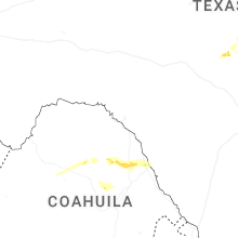
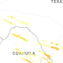
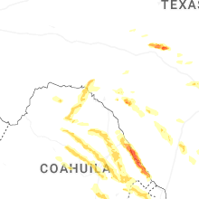
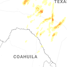

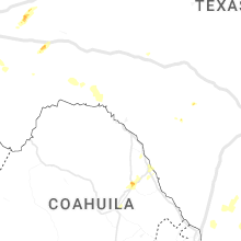
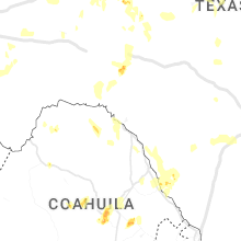


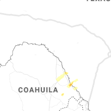

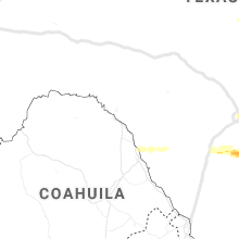


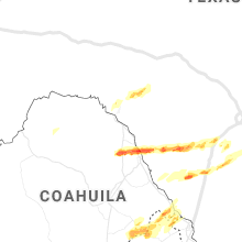
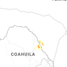
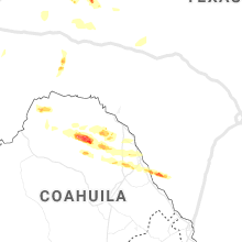


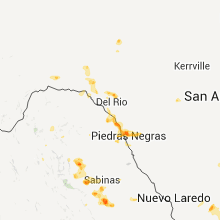


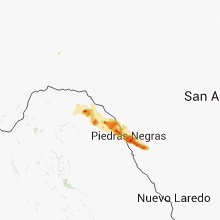


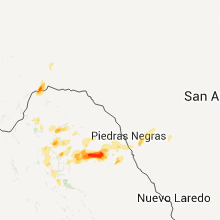


Connect with Interactive Hail Maps