

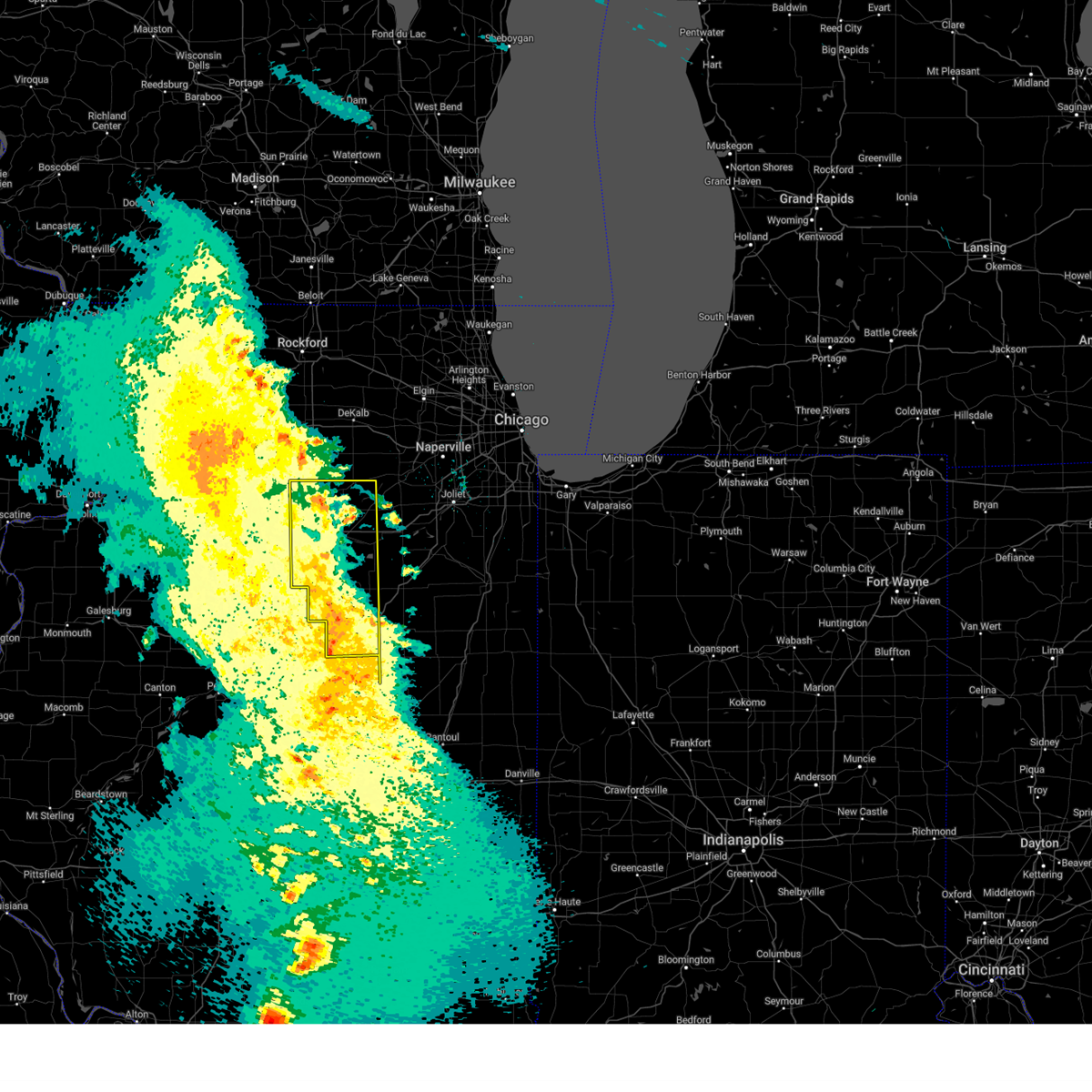
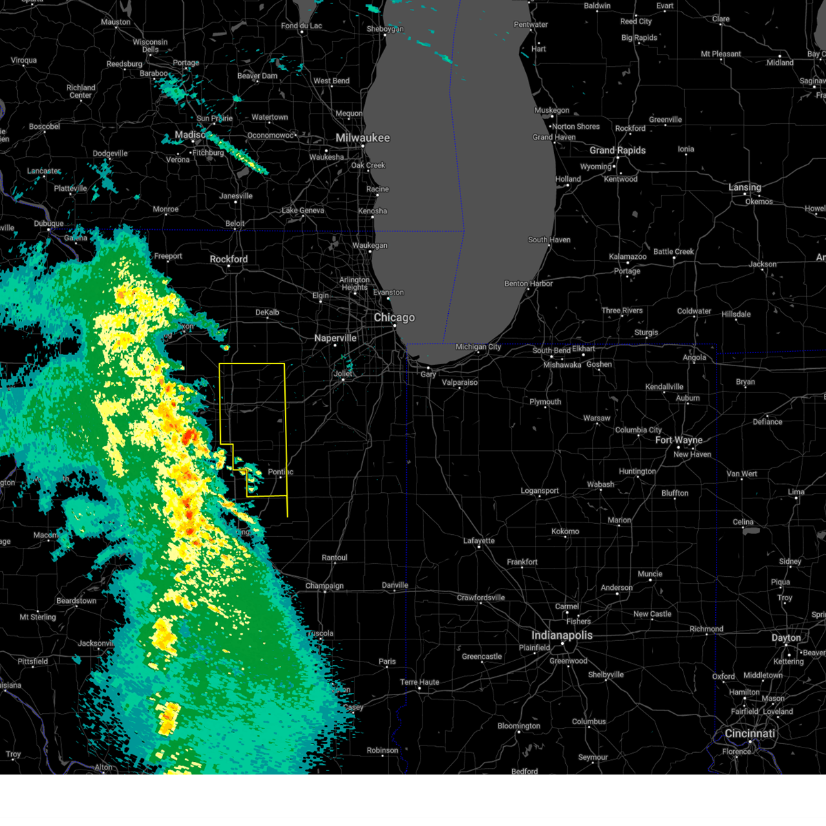
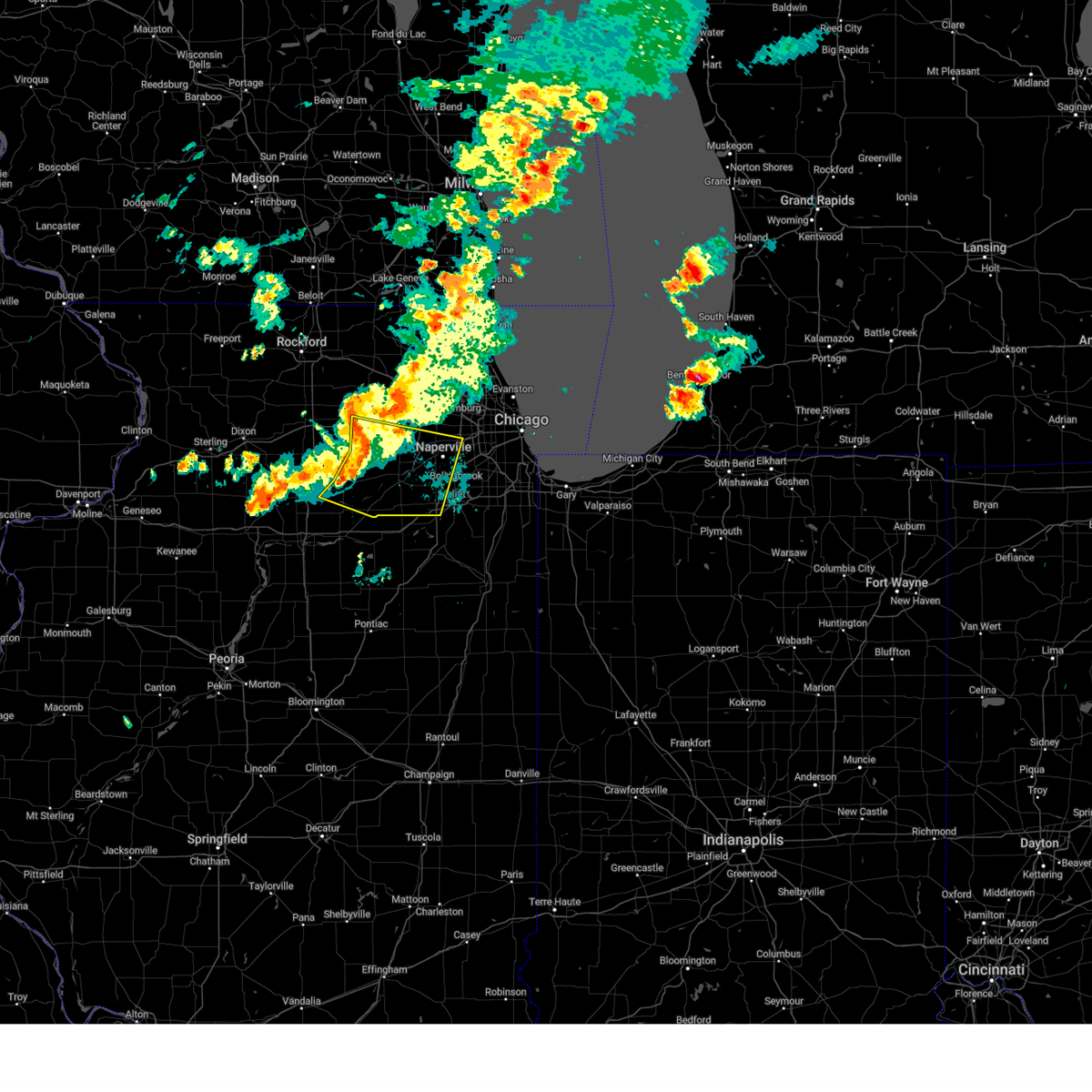
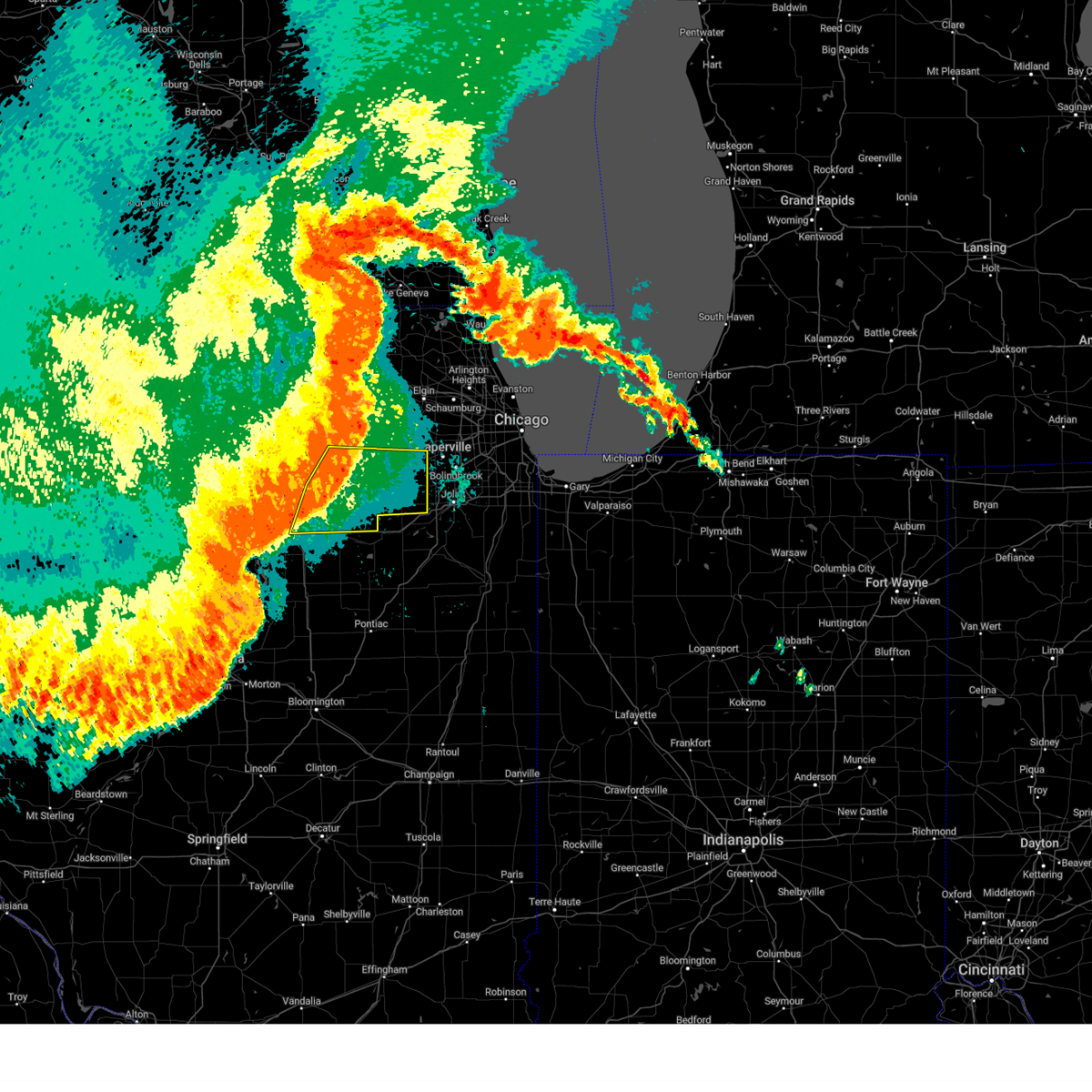
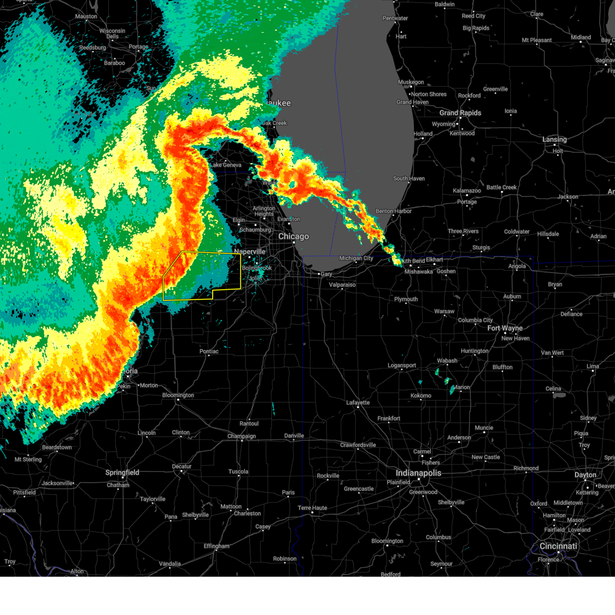
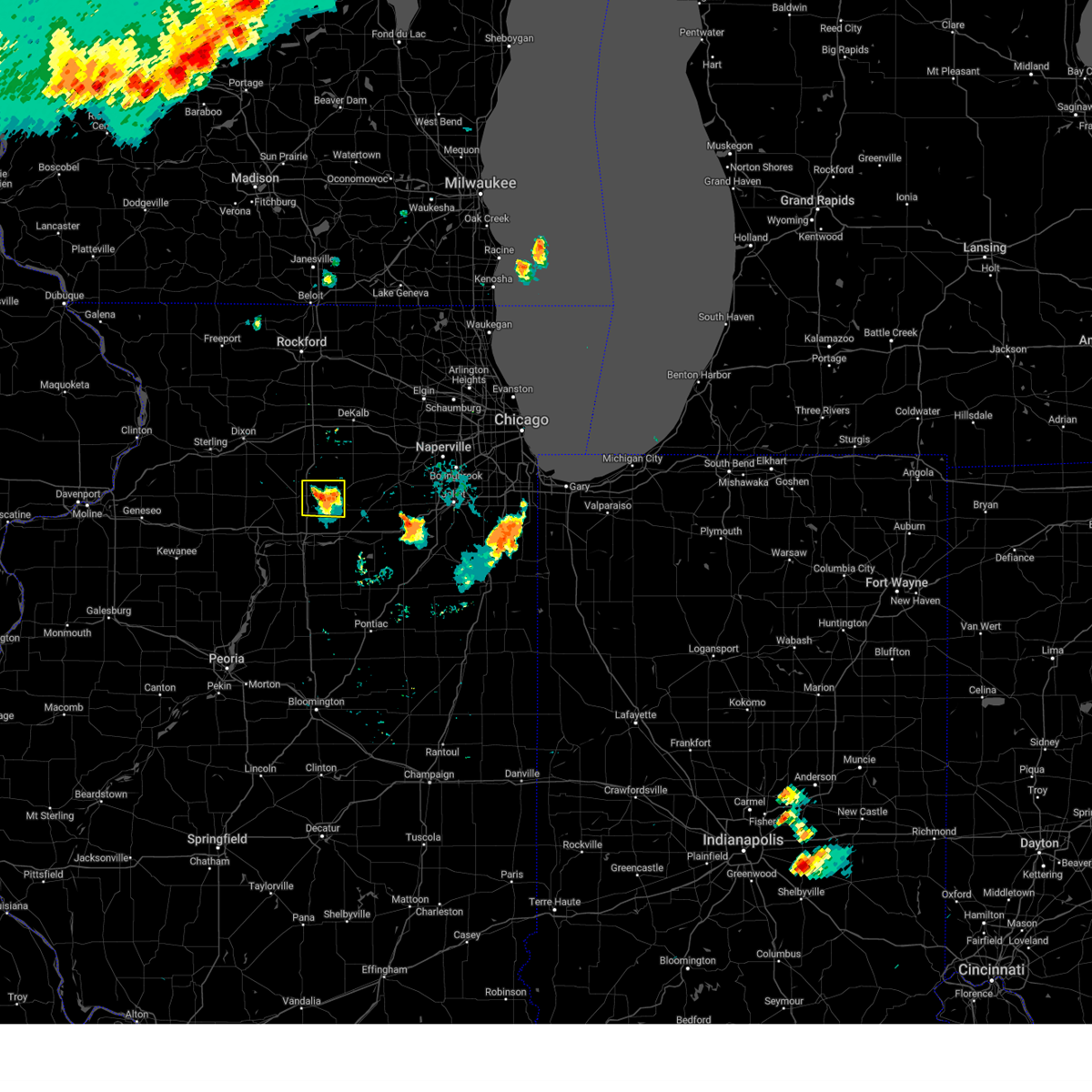
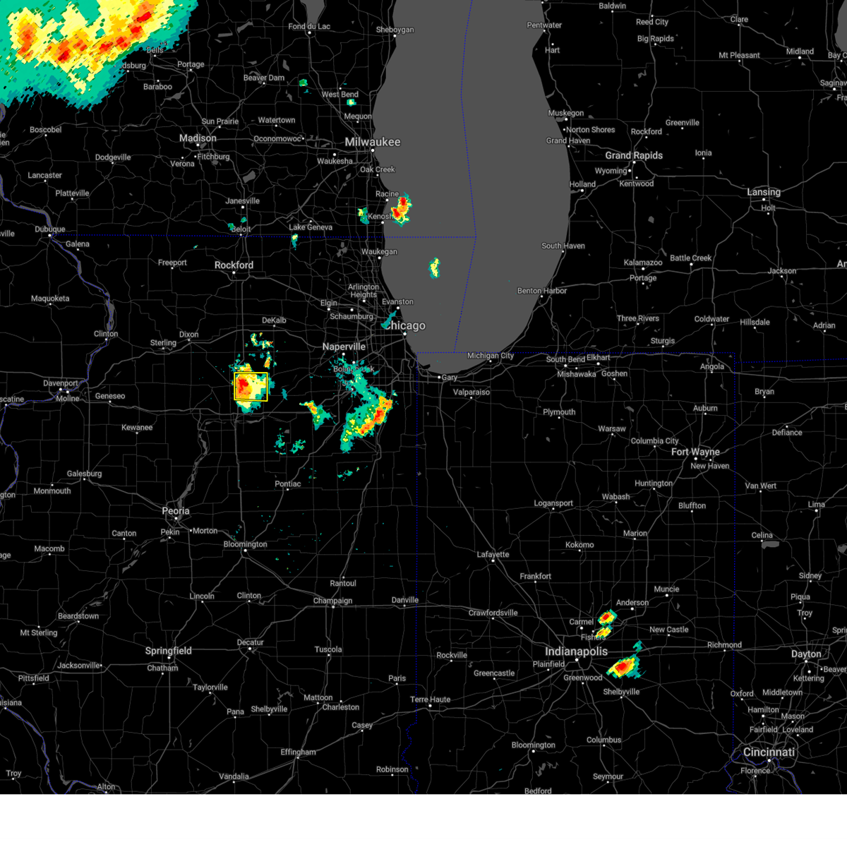
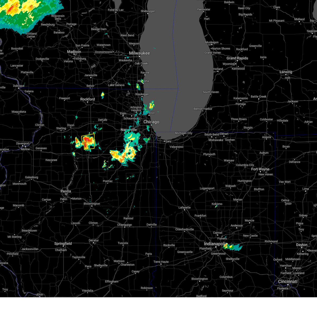
Hail Map for Earlville, IL
The Earlville, IL area has had 8 reports of on-the-ground hail by trained spotters, and has been under severe weather warnings 16 times during the past 12 months. Doppler radar has detected hail at or near Earlville, IL on 41 occasions, including 1 occasion during the past year.
| Name: | Earlville, IL |
| Where Located: | 69.6 miles WSW of Chicago, IL |
| Map: | Google Map for Earlville, IL |
| Population: | 1701 |
| Housing Units: | 763 |
| More Info: | Search Google for Earlville, IL |
0
The Top Recent Hail Date for Earlville, IL is Saturday, July 13, 2024 (41st out of 41)

Hail and Wind Damage Spotted near Earlville, IL
| Date / Time | Report Details |
|---|---|
| 3/14/2025 11:39 PM CDT | The storms which prompted the warning have weakened below severe limits, and have exited the warned area. therefore, the warning will be allowed to expire. however, gusty winds are still possible with these thunderstorms. a tornado watch remains in effect until 300 am cdt for central illinois. a severe thunderstorm watch remains in effect until 200 am cdt for north central and northeastern illinois. |
| 3/14/2025 11:04 PM CDT |
 At 1103 pm cdt, severe thunderstorms were located along a line extending from near paw paw to naplate to near lexington, moving northeast at 60 mph. the la salle/peru airport recorded a wind gust of 67 mph with these storms (observations). Hazards include 70 mph wind gusts. Expect considerable tree damage. damage is likely to mobile homes, roofs, and outbuildings. Locations impacted include, grand ridge, oglesby, triumph, ransom, harding, marseilles, lake holiday, dayton, prairie center, tonica, flanagan, streator, earlville, millington, south streator, troy grove, ottawa, la salle, north utica, seneca, kangley, pontiac, rutland, leonore, and naplate. At 1103 pm cdt, severe thunderstorms were located along a line extending from near paw paw to naplate to near lexington, moving northeast at 60 mph. the la salle/peru airport recorded a wind gust of 67 mph with these storms (observations). Hazards include 70 mph wind gusts. Expect considerable tree damage. damage is likely to mobile homes, roofs, and outbuildings. Locations impacted include, grand ridge, oglesby, triumph, ransom, harding, marseilles, lake holiday, dayton, prairie center, tonica, flanagan, streator, earlville, millington, south streator, troy grove, ottawa, la salle, north utica, seneca, kangley, pontiac, rutland, leonore, and naplate.
|
| 3/14/2025 10:48 PM CDT | At 1047 pm cdt, severe thunderstorms were located along a line extending from near la moille to near tonica to near normal, moving northeast at 60 mph (radar indicated). Hazards include 70 mph wind gusts. Expect considerable tree damage. damage is likely to mobile homes, roofs, and outbuildings. Locations impacted include, north utica, oglesby, mendota, la salle, wenona, south streator, grand ridge, naplate, flanagan, streator, ottawa, cornell, earlville, pontiac, marseilles, serena, leland, lake holiday, seneca, sheridan and somonauk. |
| 3/14/2025 10:26 PM CDT |
 Svrlot the national weather service in chicago has issued a * severe thunderstorm warning for, western livingston county in central illinois, la salle county in north central illinois, * until 1145 pm cdt. * at 1025 pm cdt, severe thunderstorms were located along a line extending from walnut to lacon to near armington, moving northeast at 60 mph (radar indicated). Hazards include 70 mph wind gusts. Expect considerable tree damage. damage is likely to mobile homes, roofs, and outbuildings. severe thunderstorms will be near, oglesby, peru, tonica, mendota, la salle, and wenona around 1045 pm cdt. other locations in the path of these severe thunderstorms include north utica, south streator, grand ridge, naplate, flanagan, streator, earlville, ottawa, pontiac, marseilles, serena, cornell, leland, lake holiday, seneca, somonauk and sheridan. including the following interstates, i-39 between mile markers 41 and 77. i-55 between mile markers 188 and 204. I-80 between mile markers 74 and 103. Svrlot the national weather service in chicago has issued a * severe thunderstorm warning for, western livingston county in central illinois, la salle county in north central illinois, * until 1145 pm cdt. * at 1025 pm cdt, severe thunderstorms were located along a line extending from walnut to lacon to near armington, moving northeast at 60 mph (radar indicated). Hazards include 70 mph wind gusts. Expect considerable tree damage. damage is likely to mobile homes, roofs, and outbuildings. severe thunderstorms will be near, oglesby, peru, tonica, mendota, la salle, and wenona around 1045 pm cdt. other locations in the path of these severe thunderstorms include north utica, south streator, grand ridge, naplate, flanagan, streator, earlville, ottawa, pontiac, marseilles, serena, cornell, leland, lake holiday, seneca, somonauk and sheridan. including the following interstates, i-39 between mile markers 41 and 77. i-55 between mile markers 188 and 204. I-80 between mile markers 74 and 103.
|
| 8/16/2024 7:09 PM CDT |
 The storms which prompted the warning have moved out of the area. therefore, the warning will be allowed to expire. however, gusty winds are still possible with these thunderstorms. remember, a severe thunderstorm warning still remains in effect for la salle and de kalb counties. The storms which prompted the warning have moved out of the area. therefore, the warning will be allowed to expire. however, gusty winds are still possible with these thunderstorms. remember, a severe thunderstorm warning still remains in effect for la salle and de kalb counties.
|
| 8/16/2024 7:08 PM CDT |
 Svrlot the national weather service in chicago has issued a * severe thunderstorm warning for, kendall county in northeastern illinois, northeastern la salle county in north central illinois, northwestern will county in northeastern illinois, southeastern de kalb county in north central illinois, southern kane county in northeastern illinois, southwestern dupage county in northeastern illinois, * until 745 pm cdt. * at 706 pm cdt, severe thunderstorms were located along a line extending from cortland to near hinckley to leland to near mendota, moving east at 50 mph (radar indicated). Hazards include 60 mph wind gusts. expect damage to roofs, siding, and trees Svrlot the national weather service in chicago has issued a * severe thunderstorm warning for, kendall county in northeastern illinois, northeastern la salle county in north central illinois, northwestern will county in northeastern illinois, southeastern de kalb county in north central illinois, southern kane county in northeastern illinois, southwestern dupage county in northeastern illinois, * until 745 pm cdt. * at 706 pm cdt, severe thunderstorms were located along a line extending from cortland to near hinckley to leland to near mendota, moving east at 50 mph (radar indicated). Hazards include 60 mph wind gusts. expect damage to roofs, siding, and trees
|
| 8/16/2024 6:55 PM CDT |
 At 655 pm cdt, severe thunderstorms were located along a line extending from near shabbona to near paw paw to near mendota, moving southeast at 45 mph (radar indicated). Hazards include 60 mph wind gusts. Expect damage to roofs, siding, and trees. Locations impacted include, dekalb, sandwich, mendota, shabbona, lake holiday, hinckley, somonauk, earlville, waterman, maple park, leland, paw paw, sublette, woodhaven lakes, creston, lee, compton, steward, west brooklyn, and triumph. At 655 pm cdt, severe thunderstorms were located along a line extending from near shabbona to near paw paw to near mendota, moving southeast at 45 mph (radar indicated). Hazards include 60 mph wind gusts. Expect damage to roofs, siding, and trees. Locations impacted include, dekalb, sandwich, mendota, shabbona, lake holiday, hinckley, somonauk, earlville, waterman, maple park, leland, paw paw, sublette, woodhaven lakes, creston, lee, compton, steward, west brooklyn, and triumph.
|
| 8/16/2024 6:40 PM CDT |
 Svrlot the national weather service in chicago has issued a * severe thunderstorm warning for, northwestern la salle county in north central illinois, southeastern ogle county in north central illinois, eastern lee county in north central illinois, southern de kalb county in north central illinois, * until 715 pm cdt. * at 639 pm cdt, severe thunderstorms were located along a line extending from near rochelle to 6 miles northeast of sublette to near woodhaven lakes, moving southeast at 50 mph (radar indicated). Hazards include 60 mph wind gusts. expect damage to roofs, siding, and trees Svrlot the national weather service in chicago has issued a * severe thunderstorm warning for, northwestern la salle county in north central illinois, southeastern ogle county in north central illinois, eastern lee county in north central illinois, southern de kalb county in north central illinois, * until 715 pm cdt. * at 639 pm cdt, severe thunderstorms were located along a line extending from near rochelle to 6 miles northeast of sublette to near woodhaven lakes, moving southeast at 50 mph (radar indicated). Hazards include 60 mph wind gusts. expect damage to roofs, siding, and trees
|
| 7/15/2024 8:41 PM CDT |
 At 841 pm cdt, severe thunderstorms were located along a line extending from near hinckley to 6 miles southeast of earlville to near dalzell, moving east at 45 mph (radar indicated). Hazards include 70 mph wind gusts. Expect considerable tree damage. damage is likely to mobile homes, roofs, and outbuildings. Locations impacted include, aurora, joliet, plainfield, oswego, ottawa, yorkville, minooka, plano, la salle, sandwich, mendota, sheridan, shabbona, montgomery, sugar grove, boulder hill, lake holiday, hinckley, somonauk, earlville, waterman, serena, newark, leland, and paw paw. At 841 pm cdt, severe thunderstorms were located along a line extending from near hinckley to 6 miles southeast of earlville to near dalzell, moving east at 45 mph (radar indicated). Hazards include 70 mph wind gusts. Expect considerable tree damage. damage is likely to mobile homes, roofs, and outbuildings. Locations impacted include, aurora, joliet, plainfield, oswego, ottawa, yorkville, minooka, plano, la salle, sandwich, mendota, sheridan, shabbona, montgomery, sugar grove, boulder hill, lake holiday, hinckley, somonauk, earlville, waterman, serena, newark, leland, and paw paw.
|
| 7/15/2024 8:35 PM CDT | Public report of possible tree damage near earlville. relayed via mping. time estimated by rada in la salle county IL, 0.6 miles NW of Earlville, IL |
| 7/15/2024 8:31 PM CDT |
 At 831 pm cdt, severe thunderstorms were located along a line extending from waterman to near earlville to near la moille, moving east at 40 mph (radar indicated). Hazards include 70 mph wind gusts. Expect considerable tree damage. damage is likely to mobile homes, roofs, and outbuildings. Locations impacted include, aurora, joliet, plainfield, oswego, ottawa, yorkville, minooka, plano, la salle, sandwich, mendota, sheridan, shabbona, montgomery, sugar grove, boulder hill, lake holiday, hinckley, somonauk, earlville, waterman, serena, newark, leland, and paw paw. At 831 pm cdt, severe thunderstorms were located along a line extending from waterman to near earlville to near la moille, moving east at 40 mph (radar indicated). Hazards include 70 mph wind gusts. Expect considerable tree damage. damage is likely to mobile homes, roofs, and outbuildings. Locations impacted include, aurora, joliet, plainfield, oswego, ottawa, yorkville, minooka, plano, la salle, sandwich, mendota, sheridan, shabbona, montgomery, sugar grove, boulder hill, lake holiday, hinckley, somonauk, earlville, waterman, serena, newark, leland, and paw paw.
|
| 7/15/2024 8:21 PM CDT | Svrlot the national weather service in chicago has issued a * severe thunderstorm warning for, kendall county in northeastern illinois, northern la salle county in north central illinois, southeastern lee county in north central illinois, southern de kalb county in north central illinois, southern kane county in northeastern illinois, * until 915 pm cdt. * at 821 pm cdt, severe thunderstorms were located along a line extending from near shabbona to near mendota to 6 miles southwest of la moille, moving southeast at 40 mph (radar indicated). Hazards include 70 mph wind gusts. Expect considerable tree damage. Damage is likely to mobile homes, roofs, and outbuildings. |
| 7/14/2024 11:33 PM CDT |
 At 1132 pm cdt, severe thunderstorms were located along a line extending from peotone to near channahon to near ottawa, moving southeast at 25 mph (radar indicated). Hazards include 60 mph wind gusts. Expect damage to roofs, siding, and trees. Locations impacted include, joliet, new lenox, park forest, ottawa, frankfort, morris, channahon, minooka, peru, la salle, steger, mendota, braidwood, wilmington, coal city, marseilles, dwight, peotone, sheridan, shorewood, crete, university park, manhattan, monee, and lake holiday. At 1132 pm cdt, severe thunderstorms were located along a line extending from peotone to near channahon to near ottawa, moving southeast at 25 mph (radar indicated). Hazards include 60 mph wind gusts. Expect damage to roofs, siding, and trees. Locations impacted include, joliet, new lenox, park forest, ottawa, frankfort, morris, channahon, minooka, peru, la salle, steger, mendota, braidwood, wilmington, coal city, marseilles, dwight, peotone, sheridan, shorewood, crete, university park, manhattan, monee, and lake holiday.
|
| 7/14/2024 11:10 PM CDT |
 Svrlot the national weather service in chicago has issued a * severe thunderstorm warning for, southern kendall county in northeastern illinois, la salle county in north central illinois, will county in northeastern illinois, grundy county in northeastern illinois, * until 1230 am cdt. * at 1110 pm cdt, severe thunderstorms were located along a line extending from 7 miles east of newark to near naplate, moving southeast at 35 mph (radar indicated). Hazards include 60 mph wind gusts. expect damage to roofs, siding, and trees Svrlot the national weather service in chicago has issued a * severe thunderstorm warning for, southern kendall county in northeastern illinois, la salle county in north central illinois, will county in northeastern illinois, grundy county in northeastern illinois, * until 1230 am cdt. * at 1110 pm cdt, severe thunderstorms were located along a line extending from 7 miles east of newark to near naplate, moving southeast at 35 mph (radar indicated). Hazards include 60 mph wind gusts. expect damage to roofs, siding, and trees
|
| 7/14/2024 10:50 PM CDT | Trees and power lines down throughout tow in la salle county IL, 0.3 miles SSE of Earlville, IL |
| 7/13/2024 6:44 PM CDT |
 the severe thunderstorm warning has been cancelled and is no longer in effect the severe thunderstorm warning has been cancelled and is no longer in effect
|
| 7/13/2024 6:28 PM CDT |
 Svrlot the national weather service in chicago has issued a * severe thunderstorm warning for, northwestern la salle county in north central illinois, * until 700 pm cdt. * at 628 pm cdt, a severe thunderstorm was located near earlville, or near mendota, moving east at 15 mph (radar indicated). Hazards include 60 mph wind gusts and quarter size hail. Hail damage to vehicles is expected. Expect wind damage to roofs, siding, and trees. Svrlot the national weather service in chicago has issued a * severe thunderstorm warning for, northwestern la salle county in north central illinois, * until 700 pm cdt. * at 628 pm cdt, a severe thunderstorm was located near earlville, or near mendota, moving east at 15 mph (radar indicated). Hazards include 60 mph wind gusts and quarter size hail. Hail damage to vehicles is expected. Expect wind damage to roofs, siding, and trees.
|
| 7/13/2024 5:56 PM CDT |
 Svrlot the national weather service in chicago has issued a * severe thunderstorm warning for, northwestern la salle county in north central illinois, southeastern lee county in north central illinois, * until 630 pm cdt. * at 556 pm cdt, a severe thunderstorm was located over mendota, moving east at 10 mph (radar indicated). Hazards include 60 mph wind gusts and quarter size hail. Hail damage to vehicles is expected. Expect wind damage to roofs, siding, and trees. Svrlot the national weather service in chicago has issued a * severe thunderstorm warning for, northwestern la salle county in north central illinois, southeastern lee county in north central illinois, * until 630 pm cdt. * at 556 pm cdt, a severe thunderstorm was located over mendota, moving east at 10 mph (radar indicated). Hazards include 60 mph wind gusts and quarter size hail. Hail damage to vehicles is expected. Expect wind damage to roofs, siding, and trees.
|
| 6/16/2024 4:40 PM CDT |
 The storms which prompted the warning have weakened below severe limits, and no longer pose an immediate threat to life or property. therefore, the warning will be allowed to expire. however, gusty winds and heavy rain are still possible with these thunderstorms. a severe thunderstorm watch remains in effect until 800 pm cdt for north central illinois. The storms which prompted the warning have weakened below severe limits, and no longer pose an immediate threat to life or property. therefore, the warning will be allowed to expire. however, gusty winds and heavy rain are still possible with these thunderstorms. a severe thunderstorm watch remains in effect until 800 pm cdt for north central illinois.
|
| 6/16/2024 4:26 PM CDT |
 At 425 pm cdt, severe thunderstorms were located along a line extending from paw paw to earlville to la salle, moving east at 40 mph (radar indicated). Hazards include 60 mph wind gusts. Expect damage to roofs, siding, and trees. these severe storms will be near, la salle, north utica, and leland around 430 pm cdt. Other locations impacted by these severe thunderstorms include prairie center, triumph, harding, and troy grove. At 425 pm cdt, severe thunderstorms were located along a line extending from paw paw to earlville to la salle, moving east at 40 mph (radar indicated). Hazards include 60 mph wind gusts. Expect damage to roofs, siding, and trees. these severe storms will be near, la salle, north utica, and leland around 430 pm cdt. Other locations impacted by these severe thunderstorms include prairie center, triumph, harding, and troy grove.
|
| 6/16/2024 4:13 PM CDT |
 At 412 pm cdt, severe thunderstorms were located along a line extending from near paw paw to near mendota to dalzell, moving east at 35 mph (radar indicated). Hazards include 60 mph wind gusts. Expect damage to roofs, siding, and trees. these severe storms will be near, peru, la salle, oglesby, earlville, north utica, and paw paw around 420 pm cdt. leland around 425 pm cdt. Other locations impacted by these severe thunderstorms include prairie center, triumph, harding, troy grove, west brooklyn, and compton. At 412 pm cdt, severe thunderstorms were located along a line extending from near paw paw to near mendota to dalzell, moving east at 35 mph (radar indicated). Hazards include 60 mph wind gusts. Expect damage to roofs, siding, and trees. these severe storms will be near, peru, la salle, oglesby, earlville, north utica, and paw paw around 420 pm cdt. leland around 425 pm cdt. Other locations impacted by these severe thunderstorms include prairie center, triumph, harding, troy grove, west brooklyn, and compton.
|
| 6/16/2024 3:58 PM CDT |
 Svrlot the national weather service in chicago has issued a * severe thunderstorm warning for, northwestern la salle county in north central illinois, southeastern lee county in north central illinois, southwestern de kalb county in north central illinois, * until 445 pm cdt. * at 358 pm cdt, severe thunderstorms were located along a line extending from near sublette to mendota to depue, moving east at 40 mph (radar indicated). Hazards include 60 mph wind gusts. Expect damage to roofs, siding, and trees. severe thunderstorms will be near, peru, la salle, and mendota around 405 pm cdt. oglesby, earlville, and paw paw around 410 pm cdt. north utica around 415 pm cdt. leland around 420 pm cdt. other locations impacted by these severe thunderstorms include prairie center, triumph, harding, troy grove, west brooklyn, and compton. including the following interstates, i-39 between mile markers 55 and 86. I-80 between mile markers 74 and 86. Svrlot the national weather service in chicago has issued a * severe thunderstorm warning for, northwestern la salle county in north central illinois, southeastern lee county in north central illinois, southwestern de kalb county in north central illinois, * until 445 pm cdt. * at 358 pm cdt, severe thunderstorms were located along a line extending from near sublette to mendota to depue, moving east at 40 mph (radar indicated). Hazards include 60 mph wind gusts. Expect damage to roofs, siding, and trees. severe thunderstorms will be near, peru, la salle, and mendota around 405 pm cdt. oglesby, earlville, and paw paw around 410 pm cdt. north utica around 415 pm cdt. leland around 420 pm cdt. other locations impacted by these severe thunderstorms include prairie center, triumph, harding, troy grove, west brooklyn, and compton. including the following interstates, i-39 between mile markers 55 and 86. I-80 between mile markers 74 and 86.
|
| 2/27/2024 6:45 PM CST |
 Svrlot the national weather service in chicago has issued a * severe thunderstorm warning for, kendall county in northeastern illinois, northeastern la salle county in north central illinois, * until 730 pm cst. * at 645 pm cst, severe thunderstorms were located along a line extending from near waterman to near leland, moving east at 45 mph (radar indicated). Hazards include 60 mph wind gusts and quarter size hail. Hail damage to vehicles is expected. Expect wind damage to roofs, siding, and trees. Svrlot the national weather service in chicago has issued a * severe thunderstorm warning for, kendall county in northeastern illinois, northeastern la salle county in north central illinois, * until 730 pm cst. * at 645 pm cst, severe thunderstorms were located along a line extending from near waterman to near leland, moving east at 45 mph (radar indicated). Hazards include 60 mph wind gusts and quarter size hail. Hail damage to vehicles is expected. Expect wind damage to roofs, siding, and trees.
|
| 7/28/2023 10:10 PM CDT |
 At 1009 pm cdt, severe thunderstorms were located along a line extending from near rochelle to 7 miles north of sublette to 6 miles east of walnut, moving east-southeast at 70 mph (radar indicated). Hazards include 70 mph wind gusts. Expect considerable tree damage. Damage is likely to mobile homes, roofs, and outbuildings. At 1009 pm cdt, severe thunderstorms were located along a line extending from near rochelle to 7 miles north of sublette to 6 miles east of walnut, moving east-southeast at 70 mph (radar indicated). Hazards include 70 mph wind gusts. Expect considerable tree damage. Damage is likely to mobile homes, roofs, and outbuildings.
|
| 7/28/2023 3:03 AM CDT |
 At 302 am cdt, a severe thunderstorm was located over waterman, or near shabbona, moving east at 40 mph (radar indicated). Hazards include 60 mph wind gusts. Expect damage to roofs, siding, and trees. locations impacted include, dekalb, sycamore, sandwich, sheridan, shabbona, lake holiday, cortland, hinckley, somonauk, earlville, waterman, maple park, malta, serena, leland, millington, lee, triumph, harding and norway. this includes, northern illinois university and sandwich fairgrounds. including the following interstate, i-88 between mile markers 83 and 101. hail threat, radar indicated max hail size, <. 75 in wind threat, radar indicated max wind gust, 60 mph. At 302 am cdt, a severe thunderstorm was located over waterman, or near shabbona, moving east at 40 mph (radar indicated). Hazards include 60 mph wind gusts. Expect damage to roofs, siding, and trees. locations impacted include, dekalb, sycamore, sandwich, sheridan, shabbona, lake holiday, cortland, hinckley, somonauk, earlville, waterman, maple park, malta, serena, leland, millington, lee, triumph, harding and norway. this includes, northern illinois university and sandwich fairgrounds. including the following interstate, i-88 between mile markers 83 and 101. hail threat, radar indicated max hail size, <. 75 in wind threat, radar indicated max wind gust, 60 mph.
|
| 7/28/2023 2:48 AM CDT |
 At 248 am cdt, a line of severe thunderstorms was located from chana to mendota, moving east at 40 mph (radar indicated). Hazards include 60 mph wind gusts. Expect damage to roofs, siding, and trees. locations impacted include, dekalb, sycamore, rochelle, sandwich, mendota, sheridan, shabbona, lake holiday, cortland, hinckley, somonauk, earlville, waterman, hillcrest, maple park, malta, serena, leland, paw paw and millington. this includes, northern illinois university, sandwich fairgrounds, and tri-county fairgrounds. including the following interstates, i-39 between mile markers 68 and 105. i-88 between mile markers 70 and 101. hail threat, radar indicated max hail size, <. 75 in wind threat, radar indicated max wind gust, 60 mph. At 248 am cdt, a line of severe thunderstorms was located from chana to mendota, moving east at 40 mph (radar indicated). Hazards include 60 mph wind gusts. Expect damage to roofs, siding, and trees. locations impacted include, dekalb, sycamore, rochelle, sandwich, mendota, sheridan, shabbona, lake holiday, cortland, hinckley, somonauk, earlville, waterman, hillcrest, maple park, malta, serena, leland, paw paw and millington. this includes, northern illinois university, sandwich fairgrounds, and tri-county fairgrounds. including the following interstates, i-39 between mile markers 68 and 105. i-88 between mile markers 70 and 101. hail threat, radar indicated max hail size, <. 75 in wind threat, radar indicated max wind gust, 60 mph.
|
| 7/28/2023 2:28 AM CDT |
 At 227 am cdt, a linen of severe thunderstorms was located from dixon to la moille, moving east at 40 mph (radar indicated). Hazards include 60 mph wind gusts. the strongest winds are moving through lee county. expect damage to roofs, siding, and trees At 227 am cdt, a linen of severe thunderstorms was located from dixon to la moille, moving east at 40 mph (radar indicated). Hazards include 60 mph wind gusts. the strongest winds are moving through lee county. expect damage to roofs, siding, and trees
|
| 7/14/2023 8:19 PM CDT |
 At 818 pm cdt, a severe thunderstorm was located over sheridan, moving east at 45 mph (radar indicated). Hazards include 70 mph wind gusts. the strongest winds are moving toward somonauk, sandwich, and hinkley. Expect considerable tree damage. damage is likely to mobile homes, roofs, and outbuildings. locations impacted include, sandwich, sheridan, shabbona, lake holiday, hinckley, somonauk, earlville, waterman, serena, leland, paw paw, millington, lee, harding, prairie center and norway. This includes, sandwich fairgrounds. At 818 pm cdt, a severe thunderstorm was located over sheridan, moving east at 45 mph (radar indicated). Hazards include 70 mph wind gusts. the strongest winds are moving toward somonauk, sandwich, and hinkley. Expect considerable tree damage. damage is likely to mobile homes, roofs, and outbuildings. locations impacted include, sandwich, sheridan, shabbona, lake holiday, hinckley, somonauk, earlville, waterman, serena, leland, paw paw, millington, lee, harding, prairie center and norway. This includes, sandwich fairgrounds.
|
| 7/14/2023 8:04 PM CDT |
 At 804 pm cdt, a severe thunderstorm was located near earlville, or 10 miles west of sheridan, moving east at 45 mph (radar indicated). Hazards include 70 mph wind gusts. Expect considerable tree damage. damage is likely to mobile homes, roofs, and outbuildings. locations impacted include, sandwich, mendota, sheridan, shabbona, lake holiday, hinckley, somonauk, earlville, waterman, serena, leland, paw paw, millington, lee, compton, troy grove, west brooklyn, triumph, harding and prairie center. this includes, sandwich fairgrounds and tri-county fairgrounds. Including the following interstate, i-39 between mile markers 65 and 89. At 804 pm cdt, a severe thunderstorm was located near earlville, or 10 miles west of sheridan, moving east at 45 mph (radar indicated). Hazards include 70 mph wind gusts. Expect considerable tree damage. damage is likely to mobile homes, roofs, and outbuildings. locations impacted include, sandwich, mendota, sheridan, shabbona, lake holiday, hinckley, somonauk, earlville, waterman, serena, leland, paw paw, millington, lee, compton, troy grove, west brooklyn, triumph, harding and prairie center. this includes, sandwich fairgrounds and tri-county fairgrounds. Including the following interstate, i-39 between mile markers 65 and 89.
|
| 7/14/2023 7:54 PM CDT |
 At 754 pm cdt, a severe thunderstorm was located near mendota, moving east at 45 mph (radar indicated). Hazards include 70 mph wind gusts. Expect considerable tree damage. damage is likely to mobile homes, roofs, and outbuildings. locations impacted include, sandwich, mendota, sheridan, shabbona, lake holiday, hinckley, somonauk, earlville, waterman, serena, leland, paw paw, millington, lee, compton, troy grove, west brooklyn, triumph, harding and prairie center. this includes, sandwich fairgrounds and tri-county fairgrounds. including the following interstate, i-39 between mile markers 65 and 89. thunderstorm damage threat, considerable hail threat, radar indicated max hail size, <. 75 in wind threat, radar indicated max wind gust, 70 mph. At 754 pm cdt, a severe thunderstorm was located near mendota, moving east at 45 mph (radar indicated). Hazards include 70 mph wind gusts. Expect considerable tree damage. damage is likely to mobile homes, roofs, and outbuildings. locations impacted include, sandwich, mendota, sheridan, shabbona, lake holiday, hinckley, somonauk, earlville, waterman, serena, leland, paw paw, millington, lee, compton, troy grove, west brooklyn, triumph, harding and prairie center. this includes, sandwich fairgrounds and tri-county fairgrounds. including the following interstate, i-39 between mile markers 65 and 89. thunderstorm damage threat, considerable hail threat, radar indicated max hail size, <. 75 in wind threat, radar indicated max wind gust, 70 mph.
|
| 7/14/2023 7:40 PM CDT |
 At 740 pm cdt, a severe thunderstorm was located near sublette, or near mendota, moving east at 45 mph (trained weather spotters. at 730 pm cdt, trained weather spotters reported tree damage in southwestern lee county with this storm!). Hazards include 70 mph wind gusts. Expect considerable tree damage. Damage is likely to mobile homes, roofs, and outbuildings. At 740 pm cdt, a severe thunderstorm was located near sublette, or near mendota, moving east at 45 mph (trained weather spotters. at 730 pm cdt, trained weather spotters reported tree damage in southwestern lee county with this storm!). Hazards include 70 mph wind gusts. Expect considerable tree damage. Damage is likely to mobile homes, roofs, and outbuildings.
|
| 6/29/2023 3:09 PM CDT |
 The severe thunderstorm warning for northwestern la salle county will expire at 315 pm cdt, the storms which prompted the warning have weakened below severe limits, and the stronger winds have exited the warned area. therefore, the warning will be allowed to expire. however heavy rain and lightning are still occurring with thunderstorms over parts of the area. to report severe weather, contact your nearest law enforcement agency. they will relay your report to the national weather service chicago. The severe thunderstorm warning for northwestern la salle county will expire at 315 pm cdt, the storms which prompted the warning have weakened below severe limits, and the stronger winds have exited the warned area. therefore, the warning will be allowed to expire. however heavy rain and lightning are still occurring with thunderstorms over parts of the area. to report severe weather, contact your nearest law enforcement agency. they will relay your report to the national weather service chicago.
|
| 6/29/2023 2:53 PM CDT |
 At 253 pm cdt, severe thunderstorms were located along a line extending from near paw paw to near earlville to 6 miles north of ottawa, moving east at 30 mph (radar indicated). Hazards include 60 mph wind gusts. Expect damage to roofs, siding, and trees. locations impacted include, mendota, earlville, troy grove, prairie center, triumph and harding. this includes, tri-county fairgrounds. including the following interstate, i-39 between mile markers 63 and 77. hail threat, radar indicated max hail size, <. 75 in wind threat, radar indicated max wind gust, 60 mph. At 253 pm cdt, severe thunderstorms were located along a line extending from near paw paw to near earlville to 6 miles north of ottawa, moving east at 30 mph (radar indicated). Hazards include 60 mph wind gusts. Expect damage to roofs, siding, and trees. locations impacted include, mendota, earlville, troy grove, prairie center, triumph and harding. this includes, tri-county fairgrounds. including the following interstate, i-39 between mile markers 63 and 77. hail threat, radar indicated max hail size, <. 75 in wind threat, radar indicated max wind gust, 60 mph.
|
| 6/29/2023 2:36 PM CDT |
 At 236 pm cdt, severe thunderstorms were located along a line extending from 6 miles east of sublette to near mendota to 9 miles southwest of earlville to near north utica, moving east at 35 mph (radar indicated). Hazards include 60 mph wind gusts. Expect damage to roofs, siding, and trees. locations impacted include, mendota, earlville, paw paw, sublette, woodhaven lakes, troy grove, prairie center, triumph and harding. this includes, tri-county fairgrounds. Including the following interstate, i-39 between mile markers 63 and 80. At 236 pm cdt, severe thunderstorms were located along a line extending from 6 miles east of sublette to near mendota to 9 miles southwest of earlville to near north utica, moving east at 35 mph (radar indicated). Hazards include 60 mph wind gusts. Expect damage to roofs, siding, and trees. locations impacted include, mendota, earlville, paw paw, sublette, woodhaven lakes, troy grove, prairie center, triumph and harding. this includes, tri-county fairgrounds. Including the following interstate, i-39 between mile markers 63 and 80.
|
| 6/29/2023 2:19 PM CDT |
 At 219 pm cdt, a severe thunderstorm was located over la moille, or near mendota, moving east at 30 mph (radar indicated). Hazards include 60 mph wind gusts. expect damage to roofs, siding, and trees At 219 pm cdt, a severe thunderstorm was located over la moille, or near mendota, moving east at 30 mph (radar indicated). Hazards include 60 mph wind gusts. expect damage to roofs, siding, and trees
|
| 5/7/2023 7:58 PM CDT |
 The severe thunderstorm warning for southern kendall, northern la salle, southern will, northern grundy and northeastern kankakee counties will expire at 800 pm cdt, the storms which prompted the warning have weakened below severe limits. therefore, the warning will be allowed to expire. however small hail, gusty winds and heavy rain are still possible with these thunderstorms. a severe thunderstorm watch remains in effect until midnight cdt for north central and northeastern illinois. in addition, flash flood warnings are also in effect for much of this area. The severe thunderstorm warning for southern kendall, northern la salle, southern will, northern grundy and northeastern kankakee counties will expire at 800 pm cdt, the storms which prompted the warning have weakened below severe limits. therefore, the warning will be allowed to expire. however small hail, gusty winds and heavy rain are still possible with these thunderstorms. a severe thunderstorm watch remains in effect until midnight cdt for north central and northeastern illinois. in addition, flash flood warnings are also in effect for much of this area.
|
| 5/7/2023 7:40 PM CDT |
 At 739 pm cdt, severe thunderstorms were located along a line extending from mendota to near minooka to near grant park, and are nearly stationary (radar indicated). Hazards include 60 mph wind gusts and quarter size hail. Hail damage to vehicles is expected. expect wind damage to roofs, siding, and trees. locations impacted include, joliet, ottawa, bourbonnais, bradley, morris, channahon, minooka, manteno, mendota, braidwood, wilmington, coal city, marseilles, peotone, momence, sheridan, shorewood, manhattan, monee and beecher. including the following interstates, i-39 between mile markers 62 and 76. i-55 between mile markers 232 and 252. i-57 between mile markers 315 and 332. I-80 between mile markers 87 and 129. At 739 pm cdt, severe thunderstorms were located along a line extending from mendota to near minooka to near grant park, and are nearly stationary (radar indicated). Hazards include 60 mph wind gusts and quarter size hail. Hail damage to vehicles is expected. expect wind damage to roofs, siding, and trees. locations impacted include, joliet, ottawa, bourbonnais, bradley, morris, channahon, minooka, manteno, mendota, braidwood, wilmington, coal city, marseilles, peotone, momence, sheridan, shorewood, manhattan, monee and beecher. including the following interstates, i-39 between mile markers 62 and 76. i-55 between mile markers 232 and 252. i-57 between mile markers 315 and 332. I-80 between mile markers 87 and 129.
|
| 5/7/2023 7:24 PM CDT |
 At 723 pm cdt, severe thunderstorms were located along a line extending from near mendota to near grant park, and are nearly stationary (radar indicated). Hazards include 60 mph wind gusts and quarter size hail. Hail damage to vehicles is expected. expect wind damage to roofs, siding, and trees. locations impacted include, joliet, ottawa, bourbonnais, bradley, morris, channahon, minooka, manteno, mendota, braidwood, wilmington, coal city, marseilles, peotone, momence, sheridan, shorewood, manhattan, monee and beecher. including the following interstates, i-39 between mile markers 62 and 76. i-55 between mile markers 232 and 252. i-57 between mile markers 315 and 332. I-80 between mile markers 87 and 129. At 723 pm cdt, severe thunderstorms were located along a line extending from near mendota to near grant park, and are nearly stationary (radar indicated). Hazards include 60 mph wind gusts and quarter size hail. Hail damage to vehicles is expected. expect wind damage to roofs, siding, and trees. locations impacted include, joliet, ottawa, bourbonnais, bradley, morris, channahon, minooka, manteno, mendota, braidwood, wilmington, coal city, marseilles, peotone, momence, sheridan, shorewood, manhattan, monee and beecher. including the following interstates, i-39 between mile markers 62 and 76. i-55 between mile markers 232 and 252. i-57 between mile markers 315 and 332. I-80 between mile markers 87 and 129.
|
| 5/7/2023 7:10 PM CDT |
 At 710 pm cdt, severe thunderstorms were located along a line extending from near mendota to near grant park, and are nearly stationary (radar indicated). Hazards include 60 mph wind gusts and quarter size hail. Hail damage to vehicles is expected. expect wind damage to roofs, siding, and trees. locations impacted include, joliet, ottawa, bourbonnais, bradley, morris, channahon, minooka, manteno, mendota, braidwood, wilmington, coal city, marseilles, peotone, momence, sheridan, shorewood, manhattan, monee and beecher. including the following interstates, i-39 between mile markers 62 and 76. i-55 between mile markers 232 and 252. i-57 between mile markers 315 and 332. i-80 between mile markers 87 and 129. hail threat, radar indicated max hail size, 1. 00 in wind threat, radar indicated max wind gust, 60 mph. At 710 pm cdt, severe thunderstorms were located along a line extending from near mendota to near grant park, and are nearly stationary (radar indicated). Hazards include 60 mph wind gusts and quarter size hail. Hail damage to vehicles is expected. expect wind damage to roofs, siding, and trees. locations impacted include, joliet, ottawa, bourbonnais, bradley, morris, channahon, minooka, manteno, mendota, braidwood, wilmington, coal city, marseilles, peotone, momence, sheridan, shorewood, manhattan, monee and beecher. including the following interstates, i-39 between mile markers 62 and 76. i-55 between mile markers 232 and 252. i-57 between mile markers 315 and 332. i-80 between mile markers 87 and 129. hail threat, radar indicated max hail size, 1. 00 in wind threat, radar indicated max wind gust, 60 mph.
|
| 5/7/2023 6:54 PM CDT |
 At 654 pm cdt, severe thunderstorms were located along a line extending from near mendota to near grant park, and are nearly stationary (radar indicated). Hazards include quarter size hail. damage to vehicles is expected At 654 pm cdt, severe thunderstorms were located along a line extending from near mendota to near grant park, and are nearly stationary (radar indicated). Hazards include quarter size hail. damage to vehicles is expected
|
| 4/20/2023 5:24 PM CDT |
 At 523 pm cdt, a severe thunderstorm was located over earlville, or 10 miles east of mendota, moving northeast at 50 mph (radar indicated). Hazards include 60 mph wind gusts and quarter size hail. Hail damage to vehicles is expected. expect wind damage to roofs, siding, and trees. locations impacted include, sandwich, shabbona, lake holiday, hinckley, somonauk, earlville, waterman, leland and lee. this includes, sandwich fairgrounds. including the following interstate, i-39 between mile markers 73 and 77. hail threat, radar indicated max hail size, 1. 00 in wind threat, radar indicated max wind gust, 60 mph. At 523 pm cdt, a severe thunderstorm was located over earlville, or 10 miles east of mendota, moving northeast at 50 mph (radar indicated). Hazards include 60 mph wind gusts and quarter size hail. Hail damage to vehicles is expected. expect wind damage to roofs, siding, and trees. locations impacted include, sandwich, shabbona, lake holiday, hinckley, somonauk, earlville, waterman, leland and lee. this includes, sandwich fairgrounds. including the following interstate, i-39 between mile markers 73 and 77. hail threat, radar indicated max hail size, 1. 00 in wind threat, radar indicated max wind gust, 60 mph.
|
| 4/20/2023 4:55 PM CDT |
 At 454 pm cdt, a severe thunderstorm was located near la moille, or 10 miles southwest of mendota, moving northeast at 50 mph. another severe thunderstorm was located near earlville and also tracking northeast (radar indicated). Hazards include 60 mph wind gusts and half dollar size hail. Hail damage to vehicles is expected. Expect wind damage to roofs, siding, and trees. At 454 pm cdt, a severe thunderstorm was located near la moille, or 10 miles southwest of mendota, moving northeast at 50 mph. another severe thunderstorm was located near earlville and also tracking northeast (radar indicated). Hazards include 60 mph wind gusts and half dollar size hail. Hail damage to vehicles is expected. Expect wind damage to roofs, siding, and trees.
|
| 4/19/2023 4:40 PM CDT |
 At 440 pm cdt, a severe thunderstorm was located over leland, or 8 miles northwest of sheridan, moving east at 30 mph (radar indicated). Hazards include two inch hail. People and animals outdoors will be injured. expect damage to roofs, siding, windows, and vehicles. locations impacted include, sheridan, lake holiday, somonauk, earlville, serena, leland, millington, harding and norway. thunderstorm damage threat, considerable hail threat, radar indicated max hail size, 2. 00 in wind threat, radar indicated max wind gust, <50 mph. At 440 pm cdt, a severe thunderstorm was located over leland, or 8 miles northwest of sheridan, moving east at 30 mph (radar indicated). Hazards include two inch hail. People and animals outdoors will be injured. expect damage to roofs, siding, windows, and vehicles. locations impacted include, sheridan, lake holiday, somonauk, earlville, serena, leland, millington, harding and norway. thunderstorm damage threat, considerable hail threat, radar indicated max hail size, 2. 00 in wind threat, radar indicated max wind gust, <50 mph.
|
| 4/19/2023 4:35 PM CDT | Half Dollar sized hail reported 1.8 miles SW of Earlville, IL, photo shared via social media shows half dollar sized hail northeast of earlville. time estimated by radar. |
| 4/19/2023 4:26 PM CDT |
 At 426 pm cdt, a severe thunderstorm was located over earlville, or 9 miles northeast of mendota, moving east at 30 mph (radar indicated). Hazards include two inch hail. People and animals outdoors will be injured. Expect damage to roofs, siding, windows, and vehicles. At 426 pm cdt, a severe thunderstorm was located over earlville, or 9 miles northeast of mendota, moving east at 30 mph (radar indicated). Hazards include two inch hail. People and animals outdoors will be injured. Expect damage to roofs, siding, windows, and vehicles.
|
| 4/19/2023 3:58 PM CDT | Golf Ball sized hail reported 3 miles S of Earlville, IL, photo shared via social media shows hail of at least golf ball size north of earlville. time estimated by radar... location approximate. |
| 4/19/2023 3:54 PM CDT |
 At 354 pm cdt, severe thunderstorms were located from rochelle to west brooklyn, and near paw paw, all moving east northeast at 40 mph (trained weather spotters). Hazards include quarter size hail. Damage to vehicles is expected. locations impacted include, dekalb, sycamore, rochelle, sandwich, shabbona, lake holiday, cortland, hinckley, somonauk, earlville, waterman, hillcrest, maple park, malta, leland, paw paw, creston, lee, compton and steward. this includes, northern illinois university and sandwich fairgrounds. including the following interstates, i-39 between mile markers 78 and 105. i-88 between mile markers 71 and 101. hail threat, observed max hail size, 1. 00 in wind threat, radar indicated max wind gust, <50 mph. At 354 pm cdt, severe thunderstorms were located from rochelle to west brooklyn, and near paw paw, all moving east northeast at 40 mph (trained weather spotters). Hazards include quarter size hail. Damage to vehicles is expected. locations impacted include, dekalb, sycamore, rochelle, sandwich, shabbona, lake holiday, cortland, hinckley, somonauk, earlville, waterman, hillcrest, maple park, malta, leland, paw paw, creston, lee, compton and steward. this includes, northern illinois university and sandwich fairgrounds. including the following interstates, i-39 between mile markers 78 and 105. i-88 between mile markers 71 and 101. hail threat, observed max hail size, 1. 00 in wind threat, radar indicated max wind gust, <50 mph.
|
| 4/19/2023 3:41 PM CDT |
 At 340 pm cdt, severe thunderstorms extended from dixon to amboy to mendota, all moving northeast at 35 mph (trained weather spotters. at 340 pm, quarter size hail was reported in mendota with these storms). Hazards include quarter size hail. damage to vehicles is expected At 340 pm cdt, severe thunderstorms extended from dixon to amboy to mendota, all moving northeast at 35 mph (trained weather spotters. at 340 pm, quarter size hail was reported in mendota with these storms). Hazards include quarter size hail. damage to vehicles is expected
|
| 4/19/2023 3:24 PM CDT |
 At 324 pm cdt, a severe thunderstorm was located near mendota, moving northeast at 35 mph (trained weather spotters. at 320 pm, ping pong size hail was reported in la moille). Hazards include ping pong ball size hail. People and animals outdoors will be injured. expect damage to roofs, siding, windows, and vehicles. locations impacted include, mendota, troy grove, prairie center and triumph. this includes, tri-county fairgrounds. including the following interstate, i-39 between mile markers 63 and 77. hail threat, observed max hail size, 1. 50 in wind threat, radar indicated max wind gust, <50 mph. At 324 pm cdt, a severe thunderstorm was located near mendota, moving northeast at 35 mph (trained weather spotters. at 320 pm, ping pong size hail was reported in la moille). Hazards include ping pong ball size hail. People and animals outdoors will be injured. expect damage to roofs, siding, windows, and vehicles. locations impacted include, mendota, troy grove, prairie center and triumph. this includes, tri-county fairgrounds. including the following interstate, i-39 between mile markers 63 and 77. hail threat, observed max hail size, 1. 50 in wind threat, radar indicated max wind gust, <50 mph.
|
| 4/19/2023 3:16 PM CDT |
 At 316 pm cdt, a severe thunderstorm was located over la moille, or 8 miles southwest of mendota, moving northeast at 35 mph (radar indicated). Hazards include quarter size hail. damage to vehicles is expected At 316 pm cdt, a severe thunderstorm was located over la moille, or 8 miles southwest of mendota, moving northeast at 35 mph (radar indicated). Hazards include quarter size hail. damage to vehicles is expected
|
| 4/5/2023 6:27 AM CDT |
 At 627 am cdt, severe thunderstorms were located along a line extending from dekalb to near waterman to near leland, moving northeast at 60 mph (radar indicated). Hazards include 60 mph wind gusts and quarter size hail. Hail damage to vehicles is expected. expect wind damage to roofs, siding, and trees. locations impacted include, dekalb, ottawa, sycamore, la salle, sandwich, sheridan, shabbona, lake holiday, cortland, hinckley, somonauk, earlville, waterman, north utica, maple park, malta, serena, leland, millington and dayton. this includes, northern illinois university and sandwich fairgrounds. including the following interstates, i-39 between mile markers 57 and 61. i-80 between mile markers 78 and 103. I-88 between mile markers 85 and 101. At 627 am cdt, severe thunderstorms were located along a line extending from dekalb to near waterman to near leland, moving northeast at 60 mph (radar indicated). Hazards include 60 mph wind gusts and quarter size hail. Hail damage to vehicles is expected. expect wind damage to roofs, siding, and trees. locations impacted include, dekalb, ottawa, sycamore, la salle, sandwich, sheridan, shabbona, lake holiday, cortland, hinckley, somonauk, earlville, waterman, north utica, maple park, malta, serena, leland, millington and dayton. this includes, northern illinois university and sandwich fairgrounds. including the following interstates, i-39 between mile markers 57 and 61. i-80 between mile markers 78 and 103. I-88 between mile markers 85 and 101.
|
| 4/5/2023 6:21 AM CDT |
 At 620 am cdt, severe thunderstorms were located along a line extending from near malta to near shabbona to near earlville, moving northeast at 60 mph (radar indicated). Hazards include 60 mph wind gusts. Expect damage to roofs, siding, and trees. locations impacted include, dekalb, ottawa, sycamore, peru, la salle, sandwich, sheridan, shabbona, lake holiday, cortland, hinckley, somonauk, earlville, waterman, north utica, maple park, malta, serena, leland and paw paw. this includes, northern illinois university and sandwich fairgrounds. including the following interstates, i-39 between mile markers 57 and 71. i-80 between mile markers 75 and 103. I-88 between mile markers 80 and 101. At 620 am cdt, severe thunderstorms were located along a line extending from near malta to near shabbona to near earlville, moving northeast at 60 mph (radar indicated). Hazards include 60 mph wind gusts. Expect damage to roofs, siding, and trees. locations impacted include, dekalb, ottawa, sycamore, peru, la salle, sandwich, sheridan, shabbona, lake holiday, cortland, hinckley, somonauk, earlville, waterman, north utica, maple park, malta, serena, leland and paw paw. this includes, northern illinois university and sandwich fairgrounds. including the following interstates, i-39 between mile markers 57 and 71. i-80 between mile markers 75 and 103. I-88 between mile markers 80 and 101.
|
| 4/5/2023 6:08 AM CDT |
 At 607 am cdt, severe thunderstorms were located along a line extending from 8 miles southeast of ashton to near mendota to 6 miles northeast of dalzell, moving northeast at 65 mph (radar indicated). Hazards include 60 mph wind gusts. Expect damage to roofs, siding, and trees. locations impacted include, dekalb, ottawa, sycamore, peru, la salle, rochelle, sandwich, mendota, sheridan, shabbona, lake holiday, cortland, hinckley, somonauk, earlville, waterman, north utica, hillcrest, maple park and malta. this includes, northern illinois university, sandwich fairgrounds, and tri-county fairgrounds. including the following interstates, i-39 between mile markers 57 and 102. i-80 between mile markers 74 and 103. I-88 between mile markers 71 and 101. At 607 am cdt, severe thunderstorms were located along a line extending from 8 miles southeast of ashton to near mendota to 6 miles northeast of dalzell, moving northeast at 65 mph (radar indicated). Hazards include 60 mph wind gusts. Expect damage to roofs, siding, and trees. locations impacted include, dekalb, ottawa, sycamore, peru, la salle, rochelle, sandwich, mendota, sheridan, shabbona, lake holiday, cortland, hinckley, somonauk, earlville, waterman, north utica, hillcrest, maple park and malta. this includes, northern illinois university, sandwich fairgrounds, and tri-county fairgrounds. including the following interstates, i-39 between mile markers 57 and 102. i-80 between mile markers 74 and 103. I-88 between mile markers 71 and 101.
|
| 4/5/2023 5:55 AM CDT |
 At 555 am cdt, severe thunderstorms were located along a line extending from amboy to la moille to near depue, moving northeast at 65 mph (radar indicated). Hazards include 60 mph wind gusts. expect damage to roofs, siding, and trees At 555 am cdt, severe thunderstorms were located along a line extending from amboy to la moille to near depue, moving northeast at 65 mph (radar indicated). Hazards include 60 mph wind gusts. expect damage to roofs, siding, and trees
|
| 4/4/2023 9:21 PM CDT |
 The severe thunderstorm warning for northeastern la salle county will expire at 930 pm cdt, the storm which prompted the warning has moved out of the area. therefore, the warning will be allowed to expire. The severe thunderstorm warning for northeastern la salle county will expire at 930 pm cdt, the storm which prompted the warning has moved out of the area. therefore, the warning will be allowed to expire.
|
| 4/4/2023 8:54 PM CDT |
 At 853 pm cdt, a severe thunderstorm was located near ottawa, moving northeast at 45 mph (radar indicated). Hazards include 60 mph wind gusts and quarter size hail. Hail damage to vehicles is expected. expect wind damage to roofs, siding, and trees. locations impacted include, ottawa, sheridan, lake holiday, somonauk, earlville, serena, leland, millington, dayton, harding, wedron, prairie center and norway. including the following interstate, i-80 between mile markers 86 and 95. hail threat, radar indicated max hail size, 1. 00 in wind threat, radar indicated max wind gust, 60 mph. At 853 pm cdt, a severe thunderstorm was located near ottawa, moving northeast at 45 mph (radar indicated). Hazards include 60 mph wind gusts and quarter size hail. Hail damage to vehicles is expected. expect wind damage to roofs, siding, and trees. locations impacted include, ottawa, sheridan, lake holiday, somonauk, earlville, serena, leland, millington, dayton, harding, wedron, prairie center and norway. including the following interstate, i-80 between mile markers 86 and 95. hail threat, radar indicated max hail size, 1. 00 in wind threat, radar indicated max wind gust, 60 mph.
|
| 4/4/2023 8:34 PM CDT |
 At 834 pm cdt, a severe thunderstorm was located over oglesby, or near la salle, moving northeast at 45 mph (radar indicated). Hazards include 60 mph wind gusts and quarter size hail. Hail damage to vehicles is expected. Expect wind damage to roofs, siding, and trees. At 834 pm cdt, a severe thunderstorm was located over oglesby, or near la salle, moving northeast at 45 mph (radar indicated). Hazards include 60 mph wind gusts and quarter size hail. Hail damage to vehicles is expected. Expect wind damage to roofs, siding, and trees.
|
| 4/4/2023 12:27 PM CDT |
 At 1227 pm cdt, a severe thunderstorm was located near leland, or near sheridan, moving northeast at 30 mph (radar indicated). Hazards include ping pong ball size hail and 60 mph wind gusts. People and animals outdoors will be injured. expect hail damage to roofs, siding, windows, and vehicles. expect wind damage to roofs, siding, and trees. locations impacted include, sandwich, sheridan, lake holiday, hinckley, somonauk, earlville, newark, leland and millington. this includes, sandwich fairgrounds. hail threat, radar indicated max hail size, 1. 50 in wind threat, radar indicated max wind gust, 60 mph. At 1227 pm cdt, a severe thunderstorm was located near leland, or near sheridan, moving northeast at 30 mph (radar indicated). Hazards include ping pong ball size hail and 60 mph wind gusts. People and animals outdoors will be injured. expect hail damage to roofs, siding, windows, and vehicles. expect wind damage to roofs, siding, and trees. locations impacted include, sandwich, sheridan, lake holiday, hinckley, somonauk, earlville, newark, leland and millington. this includes, sandwich fairgrounds. hail threat, radar indicated max hail size, 1. 50 in wind threat, radar indicated max wind gust, 60 mph.
|
| 4/4/2023 12:20 PM CDT | Tennis Ball sized hail reported 2.5 miles N of Earlville, IL |
| 4/4/2023 12:20 PM CDT | Ping Pong Ball sized hail reported 4.5 miles N of Earlville, IL, time estimated by radar. |
| 4/4/2023 12:13 PM CDT |
 At 1212 pm cdt, a severe thunderstorm was located near earlville, or 10 miles west of sheridan, moving east at 30 mph (radar indicated). Hazards include ping pong ball size hail and 60 mph wind gusts. People and animals outdoors will be injured. expect hail damage to roofs, siding, windows, and vehicles. Expect wind damage to roofs, siding, and trees. At 1212 pm cdt, a severe thunderstorm was located near earlville, or 10 miles west of sheridan, moving east at 30 mph (radar indicated). Hazards include ping pong ball size hail and 60 mph wind gusts. People and animals outdoors will be injured. expect hail damage to roofs, siding, windows, and vehicles. Expect wind damage to roofs, siding, and trees.
|
| 4/4/2023 12:05 PM CDT | Quarter sized hail reported 0.3 miles SSE of Earlville, IL |
| 4/4/2023 12:02 PM CDT |
 At 1202 pm cdt, severe thunderstorms were located along a line extending from near leland to 6 miles southeast of grand ridge, moving east at 45 mph (radar indicated). Hazards include 70 mph wind gusts and ping pong ball size hail. People and animals outdoors will be injured. expect hail damage to roofs, siding, windows, and vehicles. expect considerable tree damage. wind damage is also likely to mobile homes, roofs, and outbuildings. locations impacted include, mendota, sheridan, lake holiday, somonauk, earlville, serena, leland, millington, troy grove, triumph, harding, wedron, prairie center and norway. this includes, tri-county fairgrounds. including the following interstate, i-39 between mile markers 61 and 77. thunderstorm damage threat, considerable hail threat, radar indicated max hail size, 1. 50 in wind threat, radar indicated max wind gust, 70 mph. At 1202 pm cdt, severe thunderstorms were located along a line extending from near leland to 6 miles southeast of grand ridge, moving east at 45 mph (radar indicated). Hazards include 70 mph wind gusts and ping pong ball size hail. People and animals outdoors will be injured. expect hail damage to roofs, siding, windows, and vehicles. expect considerable tree damage. wind damage is also likely to mobile homes, roofs, and outbuildings. locations impacted include, mendota, sheridan, lake holiday, somonauk, earlville, serena, leland, millington, troy grove, triumph, harding, wedron, prairie center and norway. this includes, tri-county fairgrounds. including the following interstate, i-39 between mile markers 61 and 77. thunderstorm damage threat, considerable hail threat, radar indicated max hail size, 1. 50 in wind threat, radar indicated max wind gust, 70 mph.
|
| 4/4/2023 11:45 AM CDT |
 At 1145 am cdt, severe thunderstorms were located along a line extending from near paw paw to near streator, moving east at 45 mph (radar indicated). Hazards include 70 mph wind gusts and ping pong ball size hail. People and animals outdoors will be injured. expect hail damage to roofs, siding, windows, and vehicles. expect considerable tree damage. wind damage is also likely to mobile homes, roofs, and outbuildings. locations impacted include, ottawa, peru, la salle, mendota, marseilles, sheridan, lake holiday, oglesby, seneca, somonauk, earlville, north utica, serena, leland, naplate, millington, dayton, troy grove, triumph and harding. this includes, buffalo rock state park, illini state park, illinois valley community college, matthiessen state park, starved rock state park, and tri-county fairgrounds. including the following interstates, i-39 between mile markers 54 and 77. i-80 between mile markers 74 and 102. thunderstorm damage threat, considerable hail threat, radar indicated max hail size, 1. 50 in wind threat, radar indicated max wind gust, 70 mph. At 1145 am cdt, severe thunderstorms were located along a line extending from near paw paw to near streator, moving east at 45 mph (radar indicated). Hazards include 70 mph wind gusts and ping pong ball size hail. People and animals outdoors will be injured. expect hail damage to roofs, siding, windows, and vehicles. expect considerable tree damage. wind damage is also likely to mobile homes, roofs, and outbuildings. locations impacted include, ottawa, peru, la salle, mendota, marseilles, sheridan, lake holiday, oglesby, seneca, somonauk, earlville, north utica, serena, leland, naplate, millington, dayton, troy grove, triumph and harding. this includes, buffalo rock state park, illini state park, illinois valley community college, matthiessen state park, starved rock state park, and tri-county fairgrounds. including the following interstates, i-39 between mile markers 54 and 77. i-80 between mile markers 74 and 102. thunderstorm damage threat, considerable hail threat, radar indicated max hail size, 1. 50 in wind threat, radar indicated max wind gust, 70 mph.
|
| 4/4/2023 11:28 AM CDT |
 At 1127 am cdt, severe thunderstorms were located along a line extending from near sublette to near mcnabb, moving east at 45 mph. these are destructive storms for lasalle county (radar indicated). Hazards include 80 mph wind gusts and two inch hail. Flying debris will be dangerous to those caught without shelter. mobile homes will be heavily damaged. expect considerable damage to roofs, windows, and vehicles. Extensive tree damage and power outages are likely. At 1127 am cdt, severe thunderstorms were located along a line extending from near sublette to near mcnabb, moving east at 45 mph. these are destructive storms for lasalle county (radar indicated). Hazards include 80 mph wind gusts and two inch hail. Flying debris will be dangerous to those caught without shelter. mobile homes will be heavily damaged. expect considerable damage to roofs, windows, and vehicles. Extensive tree damage and power outages are likely.
|
| 3/31/2023 7:39 PM CDT | Nw earlville private weather station measured north of meridia in lee county IL, 6.1 miles ESE of Earlville, IL |
| 3/31/2023 7:35 PM CDT | Several trees dow in la salle county IL, 0.3 miles SSE of Earlville, IL |
| 3/26/2023 3:14 PM CDT |
 At 312 pm cdt, a severe thunderstorm was located near troy grove, moving northeast at 30 mph (trained spotters. at 254 pm, quarter size hail was reported in ladd, il). Hazards include quarter size hail. Damage to vehicles is expected. locations impacted include, peru, la salle, earlville, troy grove, prairie center and triumph. including the following interstates, i-39 between mile markers 59 and 70. i-80 between mile markers 75 and 81. hail threat, observed max hail size, 1. 00 in wind threat, radar indicated max wind gust, <50 mph. At 312 pm cdt, a severe thunderstorm was located near troy grove, moving northeast at 30 mph (trained spotters. at 254 pm, quarter size hail was reported in ladd, il). Hazards include quarter size hail. Damage to vehicles is expected. locations impacted include, peru, la salle, earlville, troy grove, prairie center and triumph. including the following interstates, i-39 between mile markers 59 and 70. i-80 between mile markers 75 and 81. hail threat, observed max hail size, 1. 00 in wind threat, radar indicated max wind gust, <50 mph.
|
| 3/26/2023 2:56 PM CDT |
 At 254 pm cdt, a severe thunderstorm was located over ladd, or near peru, moving northeast at 30 mph (radar indicated. at 232 pm, quarter size hail was reported in bureau, il). Hazards include quarter size hail. damage to vehicles is expected At 254 pm cdt, a severe thunderstorm was located over ladd, or near peru, moving northeast at 30 mph (radar indicated. at 232 pm, quarter size hail was reported in bureau, il). Hazards include quarter size hail. damage to vehicles is expected
|
| 11/5/2022 10:24 AM CDT |
 At 1023 am cdt, severe squalls with little to no lightning were located along a line extending from ridott to near stillman valley to 6 miles west of paw paw to near grand ridge, moving northeast at 40 mph (radar indicated). Hazards include 60 mph wind gusts. Expect damage to roofs, siding, and trees. locations impacted include, la salle, rochelle, mendota, byron, oregon, oglesby, davis junction, earlville, north utica, hillcrest, stillman valley, ashton, paw paw, naplate, creston, lindenwood, monroe center, lee, compton and steward. this includes, buffalo rock state park, lowden state park, matthiessen state park, starved rock state park, and tri-county fairgrounds. including the following interstates, i-39 between mile markers 57 and 114. i-80 between mile markers 78 and 87. I-88 between mile markers 66 and 82. At 1023 am cdt, severe squalls with little to no lightning were located along a line extending from ridott to near stillman valley to 6 miles west of paw paw to near grand ridge, moving northeast at 40 mph (radar indicated). Hazards include 60 mph wind gusts. Expect damage to roofs, siding, and trees. locations impacted include, la salle, rochelle, mendota, byron, oregon, oglesby, davis junction, earlville, north utica, hillcrest, stillman valley, ashton, paw paw, naplate, creston, lindenwood, monroe center, lee, compton and steward. this includes, buffalo rock state park, lowden state park, matthiessen state park, starved rock state park, and tri-county fairgrounds. including the following interstates, i-39 between mile markers 57 and 114. i-80 between mile markers 78 and 87. I-88 between mile markers 66 and 82.
|
| 11/5/2022 10:07 AM CDT |
 At 1006 am cdt, severe squalls producing little to no lightning were located along a line extending from near lena to near lost nation to woodhaven lakes to near mcnabb, moving northeast at 50 mph. tree damage and downed powerlines have been reported across whiteside county and relayed via nws quad cities (radar indicated). Hazards include 60 mph wind gusts. Expect damage to roofs, siding, and trees. locations impacted include, dixon, peru, la salle, rochelle, mendota, byron, oregon, mount morris, amboy, polo, oglesby, davis junction, earlville, forreston, north utica, hillcrest, stillman valley, franklin grove, ashton and paw paw. this includes, buffalo rock state park, castle rock state park, illinois valley community college, lee county fairgrounds, lowden state park, matthiessen state park, ogle county fairgrounds, starved rock state park, tri-county fairgrounds, and white pines state park. including the following interstates, i-39 between mile markers 42 and 114. i-80 between mile markers 73 and 87. I-88 between mile markers 55 and 82. At 1006 am cdt, severe squalls producing little to no lightning were located along a line extending from near lena to near lost nation to woodhaven lakes to near mcnabb, moving northeast at 50 mph. tree damage and downed powerlines have been reported across whiteside county and relayed via nws quad cities (radar indicated). Hazards include 60 mph wind gusts. Expect damage to roofs, siding, and trees. locations impacted include, dixon, peru, la salle, rochelle, mendota, byron, oregon, mount morris, amboy, polo, oglesby, davis junction, earlville, forreston, north utica, hillcrest, stillman valley, franklin grove, ashton and paw paw. this includes, buffalo rock state park, castle rock state park, illinois valley community college, lee county fairgrounds, lowden state park, matthiessen state park, ogle county fairgrounds, starved rock state park, tri-county fairgrounds, and white pines state park. including the following interstates, i-39 between mile markers 42 and 114. i-80 between mile markers 73 and 87. I-88 between mile markers 55 and 82.
|
| 11/5/2022 9:28 AM CDT |
 At 925 am cdt, severe squalls producing little to no lightning were located along a line extending from near andover to prophetstown to 8 miles southwest of walnut to near buda, moving northeast at 45 mph (radar indicated). Hazards include 70 mph wind gusts. Expect considerable tree damage. Damage is likely to mobile homes, roofs, and outbuildings. At 925 am cdt, severe squalls producing little to no lightning were located along a line extending from near andover to prophetstown to 8 miles southwest of walnut to near buda, moving northeast at 45 mph (radar indicated). Hazards include 70 mph wind gusts. Expect considerable tree damage. Damage is likely to mobile homes, roofs, and outbuildings.
|
| 8/29/2022 12:38 PM CDT | At 1238 pm cdt, severe thunderstorms were located along a line extending from near newark to marseilles, moving east at 50 mph (radar indicated). Hazards include 60 mph wind gusts and nickel size hail. Expect damage to roofs, siding, and trees. locations impacted include, ottawa, yorkville, morris, peru, la salle, marseilles, sheridan, lake holiday, seneca, somonauk, earlville, north utica, serena, newark, leland, naplate, millington, dayton, millbrook and lisbon. this includes, buffalo rock state park, gebhard woods state park, grundy county speedway and fairgrounds, illini state park, and william g stratton state park. including the following interstates, i-39 between mile markers 57 and 61. I-80 between mile markers 78 and 114. |
| 8/29/2022 12:24 PM CDT | At 1223 pm cdt, severe thunderstorms were located along a line extending from near leland to naplate, moving east at 50 mph. strong winds will persist behind the leading edge of the storms for a period (radar indicated). Hazards include 60 mph wind gusts and nickel size hail. Expect damage to roofs, siding, and trees. locations impacted include, ottawa, yorkville, morris, peru, la salle, mendota, marseilles, sheridan, lake holiday, seneca, somonauk, earlville, north utica, serena, newark, leland, naplate, millington, dayton and millbrook. this includes, buffalo rock state park, gebhard woods state park, grundy county speedway and fairgrounds, illini state park, tri-county fairgrounds, and william g stratton state park. including the following interstates, i-39 between mile markers 57 and 77. I-80 between mile markers 74 and 114. |
| 8/29/2022 12:19 PM CDT | At 1218 pm cdt, severe thunderstorms were located along a line extending from near earlville to near north utica, moving east at 45 mph (radar indicated). Hazards include 60 mph wind gusts and nickel size hail. expect damage to roofs, siding, and trees |
| 8/28/2022 4:02 PM CDT | At 401 pm cdt, severe thunderstorms were located along a line extending from near kingston to near serena, moving northeast at 40 mph (radar indicated). Hazards include 60 mph wind gusts and quarter size hail. Hail damage to vehicles is expected. expect wind damage to roofs, siding, and trees. locations impacted include, dekalb, sycamore, la salle, sandwich, mendota, shabbona, lake holiday, cortland, hinckley, somonauk, earlville, waterman, maple park, malta, leland, paw paw, lee, compton, steward and troy grove. this includes, northern illinois university, sandwich fairgrounds, and tri-county fairgrounds. including the following interstates, i-39 between mile markers 56 and 93. i-80 between mile markers 77 and 81. I-88 between mile markers 83 and 101. |
| 8/28/2022 3:38 PM CDT | At 337 pm cdt, severe thunderstorms were located along a line extending from near malta to north utica, moving northeast at 50 mph (radar indicated). Hazards include 60 mph wind gusts and penny size hail. Expect damage to roofs, siding, and trees. locations impacted include, dekalb, sycamore, peru, la salle, sandwich, mendota, shabbona, lake holiday, cortland, oglesby, hinckley, somonauk, earlville, waterman, north utica, maple park, malta, leland, paw paw and lee. this includes, northern illinois university, sandwich fairgrounds, illinois valley community college, and tri-county fairgrounds. including the following interstates, i-39 between mile markers 53 and 94. i-80 between mile markers 74 and 83. I-88 between mile markers 83 and 101. |
| 8/28/2022 3:17 PM CDT | At 317 pm cdt, severe thunderstorms were located along a line extending from 7 miles southeast of ashton to near granville, moving northeast at 40 mph (radar indicated). Hazards include 60 mph wind gusts and penny size hail. expect damage to roofs, siding, and trees |
| 6/6/2022 6:04 PM CDT |
 At 603 pm cdt, a severe thunderstorm was located near earlville, or near mendota, moving southeast at 25 mph (radar indicated). Hazards include 60 mph wind gusts. Expect damage to roofs, siding, and trees. locations impacted include, mendota, earlville, leland, and paw paw. this includes, tri-county fairgrounds. including the following interstate, i-39 between mile markers 71 and 84. hail threat, radar indicated max hail size, <. 75 in wind threat, radar indicated max wind gust, 60 mph. At 603 pm cdt, a severe thunderstorm was located near earlville, or near mendota, moving southeast at 25 mph (radar indicated). Hazards include 60 mph wind gusts. Expect damage to roofs, siding, and trees. locations impacted include, mendota, earlville, leland, and paw paw. this includes, tri-county fairgrounds. including the following interstate, i-39 between mile markers 71 and 84. hail threat, radar indicated max hail size, <. 75 in wind threat, radar indicated max wind gust, 60 mph.
|
| 6/6/2022 5:39 PM CDT |
 At 539 pm cdt, a severe thunderstorm was located near paw paw, or 9 miles north of mendota, moving southeast at 25 mph (radar indicated). Hazards include 60 mph wind gusts and penny size hail. expect damage to roofs, siding, and trees At 539 pm cdt, a severe thunderstorm was located near paw paw, or 9 miles north of mendota, moving southeast at 25 mph (radar indicated). Hazards include 60 mph wind gusts and penny size hail. expect damage to roofs, siding, and trees
|
| 3/5/2022 10:34 PM CST |
 At 1033 pm cst, severe thunderstorms were located along a line extending from near somonauk to varna, moving east at 65 mph (radar indicated. at 1031 pm cst the illinois valley regional airport measured a 64 mph wind gust). Hazards include 70 mph wind gusts. Expect considerable tree damage. damage is likely to mobile homes, roofs, and outbuildings. these severe storms will be near, sandwich and somonauk around 1040 pm cst. yorkville and plano around 1045 pm cst. oswego, streator and sugar grove around 1050 pm cst. aurora, montgomery, north aurora and boulder hill around 1055 pm cst. plainfield and batavia around 1100 pm cst. dwight around 1110 pm cst. mazon around 1115 pm cst. gardner and braceville around 1120 pm cst. including the following interstates, i-39 between mile markers 41 and 77. i-55 between mile markers 220 and 233. i-80 between mile markers 74 and 122. i-88 between mile markers 111 and 119. thunderstorm damage threat, considerable hail threat, radar indicated max hail size, <. 75 in wind threat, radar indicated max wind gust, 70 mph. At 1033 pm cst, severe thunderstorms were located along a line extending from near somonauk to varna, moving east at 65 mph (radar indicated. at 1031 pm cst the illinois valley regional airport measured a 64 mph wind gust). Hazards include 70 mph wind gusts. Expect considerable tree damage. damage is likely to mobile homes, roofs, and outbuildings. these severe storms will be near, sandwich and somonauk around 1040 pm cst. yorkville and plano around 1045 pm cst. oswego, streator and sugar grove around 1050 pm cst. aurora, montgomery, north aurora and boulder hill around 1055 pm cst. plainfield and batavia around 1100 pm cst. dwight around 1110 pm cst. mazon around 1115 pm cst. gardner and braceville around 1120 pm cst. including the following interstates, i-39 between mile markers 41 and 77. i-55 between mile markers 220 and 233. i-80 between mile markers 74 and 122. i-88 between mile markers 111 and 119. thunderstorm damage threat, considerable hail threat, radar indicated max hail size, <. 75 in wind threat, radar indicated max wind gust, 70 mph.
|
| 3/5/2022 10:14 PM CST |
 At 1014 pm cst, severe thunderstorms were located along a line extending from near mendota to near camp grove, moving east at 55 mph (radar indicated). Hazards include 70 mph wind gusts. Expect considerable tree damage. damage is likely to mobile homes, roofs, and outbuildings. severe thunderstorms will be near, mendota around 1020 pm cst. earlville around 1025 pm cst. leland around 1030 pm cst. sandwich, lake holiday and somonauk around 1040 pm cst. plano and tonica around 1045 pm cst. yorkville around 1050 pm cst. oswego and sugar grove around 1055 pm cst. aurora, streator, montgomery, boulder hill and grand ridge around 1100 pm cst. other locations impacted by these severe thunderstorms include millbrook, triumph, ransom, harding, dayton, prairie center, kinsman, south wilmington, bristol and east brooklyn. including the following interstates, i-39 between mile markers 41 and 77. i-55 between mile markers 220 and 233. i-80 between mile markers 74 and 122. i-88 between mile markers 111 and 119. thunderstorm damage threat, considerable hail threat, radar indicated max hail size, <. 75 in wind threat, radar indicated max wind gust, 70 mph. At 1014 pm cst, severe thunderstorms were located along a line extending from near mendota to near camp grove, moving east at 55 mph (radar indicated). Hazards include 70 mph wind gusts. Expect considerable tree damage. damage is likely to mobile homes, roofs, and outbuildings. severe thunderstorms will be near, mendota around 1020 pm cst. earlville around 1025 pm cst. leland around 1030 pm cst. sandwich, lake holiday and somonauk around 1040 pm cst. plano and tonica around 1045 pm cst. yorkville around 1050 pm cst. oswego and sugar grove around 1055 pm cst. aurora, streator, montgomery, boulder hill and grand ridge around 1100 pm cst. other locations impacted by these severe thunderstorms include millbrook, triumph, ransom, harding, dayton, prairie center, kinsman, south wilmington, bristol and east brooklyn. including the following interstates, i-39 between mile markers 41 and 77. i-55 between mile markers 220 and 233. i-80 between mile markers 74 and 122. i-88 between mile markers 111 and 119. thunderstorm damage threat, considerable hail threat, radar indicated max hail size, <. 75 in wind threat, radar indicated max wind gust, 70 mph.
|
| 10/11/2021 7:16 PM CDT |
 At 715 pm cdt, severe thunderstorms were located along a line extending from near lost nation to near earlville to near serena, moving north at 25 mph (radar indicated). Hazards include 60 mph wind gusts. Expect damage to roofs, siding, and trees. these severe storms will be near, franklin grove and ashton around 720 pm cdt. oregon and shabbona around 735 pm cdt. waterman around 740 pm cdt. lake holiday around 745 pm cdt. sandwich, somonauk and stillman valley around 750 pm cdt. byron around 755 pm cdt. davis junction around 800 pm cdt. malta around 805 pm cdt. including the following interstates, i-39 between mile markers 78 and 111. i-80 between mile markers 93 and 94. I-88 between mile markers 61 and 95. At 715 pm cdt, severe thunderstorms were located along a line extending from near lost nation to near earlville to near serena, moving north at 25 mph (radar indicated). Hazards include 60 mph wind gusts. Expect damage to roofs, siding, and trees. these severe storms will be near, franklin grove and ashton around 720 pm cdt. oregon and shabbona around 735 pm cdt. waterman around 740 pm cdt. lake holiday around 745 pm cdt. sandwich, somonauk and stillman valley around 750 pm cdt. byron around 755 pm cdt. davis junction around 800 pm cdt. malta around 805 pm cdt. including the following interstates, i-39 between mile markers 78 and 111. i-80 between mile markers 93 and 94. I-88 between mile markers 61 and 95.
|
| 10/11/2021 7:00 PM CDT |
 At 700 pm cdt, severe thunderstorms were located along a line extending from franklin grove to near earlville to near ottawa, moving northeast at 30 mph (radar indicated). Hazards include 60 mph wind gusts. Expect damage to roofs, siding, and trees. these severe storms will be near, franklin grove around 705 pm cdt. ashton around 710 pm cdt. leland and paw paw around 715 pm cdt. sheridan around 725 pm cdt. rochelle, shabbona and hillcrest around 730 pm cdt. lake holiday around 735 pm cdt. somonauk and waterman around 740 pm cdt. sandwich and stillman valley around 745 pm cdt. including the following interstates, i-39 between mile markers 68 and 111. i-80 between mile markers 85 and 94. I-88 between mile markers 61 and 95. At 700 pm cdt, severe thunderstorms were located along a line extending from franklin grove to near earlville to near ottawa, moving northeast at 30 mph (radar indicated). Hazards include 60 mph wind gusts. Expect damage to roofs, siding, and trees. these severe storms will be near, franklin grove around 705 pm cdt. ashton around 710 pm cdt. leland and paw paw around 715 pm cdt. sheridan around 725 pm cdt. rochelle, shabbona and hillcrest around 730 pm cdt. lake holiday around 735 pm cdt. somonauk and waterman around 740 pm cdt. sandwich and stillman valley around 745 pm cdt. including the following interstates, i-39 between mile markers 68 and 111. i-80 between mile markers 85 and 94. I-88 between mile markers 61 and 95.
|
| 10/11/2021 6:44 PM CDT |
 At 643 pm cdt, severe thunderstorms were located along a line extending from near sublette to near mendota to near ottawa, moving north at 35 mph (radar indicated). Hazards include 60 mph wind gusts. expect damage to roofs, siding, and trees At 643 pm cdt, severe thunderstorms were located along a line extending from near sublette to near mendota to near ottawa, moving north at 35 mph (radar indicated). Hazards include 60 mph wind gusts. expect damage to roofs, siding, and trees
|
| 9/7/2021 2:38 PM CDT |
 At 236 pm cdt, severe thunderstorms were located along a line extending from near sandwich to near mendota, moving southeast at 35 mph. the most intense part of this storm is located southeast of earlville (trained weather spotters reported golf ball sized hail near compton). Hazards include tennis ball size hail and 70 mph wind gusts. People and animals outdoors will be injured. expect hail damage to roofs, siding, windows, and vehicles. expect considerable tree damage. wind damage is also likely to mobile homes, roofs, and outbuildings. locations impacted include, aurora, joliet, plainfield, oswego, ottawa, yorkville, morris, channahon, minooka, plano, sandwich, mendota, sheridan, montgomery, boulder hill, lake holiday, somonauk, earlville, serena and newark. thunderstorm damage threat, considerable hail threat, observed max hail size, 2. 50 in wind threat, radar indicated max wind gust, 70 mph. At 236 pm cdt, severe thunderstorms were located along a line extending from near sandwich to near mendota, moving southeast at 35 mph. the most intense part of this storm is located southeast of earlville (trained weather spotters reported golf ball sized hail near compton). Hazards include tennis ball size hail and 70 mph wind gusts. People and animals outdoors will be injured. expect hail damage to roofs, siding, windows, and vehicles. expect considerable tree damage. wind damage is also likely to mobile homes, roofs, and outbuildings. locations impacted include, aurora, joliet, plainfield, oswego, ottawa, yorkville, morris, channahon, minooka, plano, sandwich, mendota, sheridan, montgomery, boulder hill, lake holiday, somonauk, earlville, serena and newark. thunderstorm damage threat, considerable hail threat, observed max hail size, 2. 50 in wind threat, radar indicated max wind gust, 70 mph.
|
| 9/7/2021 2:29 PM CDT |
 At 228 pm cdt, severe thunderstorms were located along a line extending from leland to earlville, moving southeast at 35 mph. these are destructive storms for earlville, leland, serena, newark, and sheridan (radar indicated). Hazards include baseball size hail and 70 mph wind gusts. People and animals outdoors will be severely injured. Expect shattered windows, extensive damage to roofs, siding, and vehicles. At 228 pm cdt, severe thunderstorms were located along a line extending from leland to earlville, moving southeast at 35 mph. these are destructive storms for earlville, leland, serena, newark, and sheridan (radar indicated). Hazards include baseball size hail and 70 mph wind gusts. People and animals outdoors will be severely injured. Expect shattered windows, extensive damage to roofs, siding, and vehicles.
|
| 9/7/2021 2:25 PM CDT | Hen Egg sized hail reported 0.3 miles SSE of Earlville, IL, multiple reports of hail up to 2 inches in diameter in and near earlville. time estimated from radar. |
| 9/7/2021 2:20 PM CDT |
 At 218 pm cdt, severe thunderstorms were located along a line extending from near leland to near mendota, moving southeast at 35 mph (trained weather spotters reported golf ball sized hail near compton). Hazards include two inch hail and 70 mph wind gusts. People and animals outdoors will be injured. expect hail damage to roofs, siding, windows, and vehicles. expect considerable tree damage. wind damage is also likely to mobile homes, roofs, and outbuildings. locations impacted include, aurora, joliet, plainfield, oswego, ottawa, yorkville, morris, channahon, minooka, plano, sandwich, mendota, sheridan, montgomery, boulder hill, lake holiday, somonauk, earlville, serena and newark. thunderstorm damage threat, considerable hail threat, observed max hail size, 2. 00 in wind threat, radar indicated max wind gust, 70 mph. At 218 pm cdt, severe thunderstorms were located along a line extending from near leland to near mendota, moving southeast at 35 mph (trained weather spotters reported golf ball sized hail near compton). Hazards include two inch hail and 70 mph wind gusts. People and animals outdoors will be injured. expect hail damage to roofs, siding, windows, and vehicles. expect considerable tree damage. wind damage is also likely to mobile homes, roofs, and outbuildings. locations impacted include, aurora, joliet, plainfield, oswego, ottawa, yorkville, morris, channahon, minooka, plano, sandwich, mendota, sheridan, montgomery, boulder hill, lake holiday, somonauk, earlville, serena and newark. thunderstorm damage threat, considerable hail threat, observed max hail size, 2. 00 in wind threat, radar indicated max wind gust, 70 mph.
|
| 9/7/2021 2:18 PM CDT | Golf Ball sized hail reported 4.6 miles ESE of Earlville, IL, time estimated from radar. |
| 9/7/2021 2:03 PM CDT |
 At 203 pm cdt, severe thunderstorms were located along a line extending from near shabbona to near sublette, moving southeast at 35 mph (trained weather spotters). Hazards include golf ball size hail and 60 mph wind gusts. People and animals outdoors will be injured. expect hail damage to roofs, siding, windows, and vehicles. Expect wind damage to roofs, siding, and trees. At 203 pm cdt, severe thunderstorms were located along a line extending from near shabbona to near sublette, moving southeast at 35 mph (trained weather spotters). Hazards include golf ball size hail and 60 mph wind gusts. People and animals outdoors will be injured. expect hail damage to roofs, siding, windows, and vehicles. Expect wind damage to roofs, siding, and trees.
|
| 8/12/2021 3:23 AM CDT |
 At 322 am cdt, severe thunderstorms were located along a line extending from near la salle to near ottawa to near seneca, moving northeast at 25 mph (radar indicated). Hazards include 60 mph wind gusts. Expect damage to roofs, siding, and trees. locations impacted include, ottawa, peru, la salle, mendota, marseilles, sheridan, lake holiday, oglesby, seneca, somonauk, earlville, north utica, serena, leland, grand ridge, naplate, millington, dayton, ransom and cedar point. hail threat, radar indicated max hail size, <. 75 in wind threat, radar indicated max wind gust, 60 mph. At 322 am cdt, severe thunderstorms were located along a line extending from near la salle to near ottawa to near seneca, moving northeast at 25 mph (radar indicated). Hazards include 60 mph wind gusts. Expect damage to roofs, siding, and trees. locations impacted include, ottawa, peru, la salle, mendota, marseilles, sheridan, lake holiday, oglesby, seneca, somonauk, earlville, north utica, serena, leland, grand ridge, naplate, millington, dayton, ransom and cedar point. hail threat, radar indicated max hail size, <. 75 in wind threat, radar indicated max wind gust, 60 mph.
|
| 8/12/2021 3:02 AM CDT |
 At 302 am cdt, severe thunderstorms were located along a line extending from peru to naplate to seneca, moving north at 30 mph (radar indicated). Hazards include 60 mph wind gusts. expect damage to roofs, siding, and trees At 302 am cdt, severe thunderstorms were located along a line extending from peru to naplate to seneca, moving north at 30 mph (radar indicated). Hazards include 60 mph wind gusts. expect damage to roofs, siding, and trees
|
| 8/11/2021 9:09 AM CDT |
 At 909 am cdt, a severe thunderstorm was located over leland, or 7 miles northwest of sheridan, moving east at 65 mph (radar indicated). Hazards include 70 mph wind gusts. Expect considerable tree damage. damage is likely to mobile homes, roofs, and outbuildings. locations impacted include, ottawa, peru, la salle, sandwich, mendota, marseilles, sheridan, shabbona, lake holiday, oglesby, seneca, hinckley, somonauk, earlville, waterman, north utica, serena, leland, paw paw and naplate. thunderstorm damage threat, considerable hail threat, radar indicated max hail size, <. 75 in wind threat, radar indicated max wind gust, 70 mph. At 909 am cdt, a severe thunderstorm was located over leland, or 7 miles northwest of sheridan, moving east at 65 mph (radar indicated). Hazards include 70 mph wind gusts. Expect considerable tree damage. damage is likely to mobile homes, roofs, and outbuildings. locations impacted include, ottawa, peru, la salle, sandwich, mendota, marseilles, sheridan, shabbona, lake holiday, oglesby, seneca, hinckley, somonauk, earlville, waterman, north utica, serena, leland, paw paw and naplate. thunderstorm damage threat, considerable hail threat, radar indicated max hail size, <. 75 in wind threat, radar indicated max wind gust, 70 mph.
|
| 8/11/2021 8:52 AM CDT |
 At 852 am cdt, a severe thunderstorm was located over mendota, moving east at 65 mph (radar indicated). Hazards include 70 mph wind gusts and quarter size hail. the strongest winds are moving into mendota, troy grove, meriden, and triumph!. Hail damage to vehicles is expected. expect considerable tree damage. wind damage is also likely to mobile homes, roofs, and outbuildings. locations impacted include, ottawa, peru, la salle, sandwich, mendota, marseilles, sheridan, shabbona, lake holiday, oglesby, seneca, hinckley, somonauk, earlville, waterman, north utica, serena, leland, paw paw and naplate. thunderstorm damage threat, considerable hail threat, radar indicated max hail size, 1. 00 in wind threat, radar indicated max wind gust, 70 mph. At 852 am cdt, a severe thunderstorm was located over mendota, moving east at 65 mph (radar indicated). Hazards include 70 mph wind gusts and quarter size hail. the strongest winds are moving into mendota, troy grove, meriden, and triumph!. Hail damage to vehicles is expected. expect considerable tree damage. wind damage is also likely to mobile homes, roofs, and outbuildings. locations impacted include, ottawa, peru, la salle, sandwich, mendota, marseilles, sheridan, shabbona, lake holiday, oglesby, seneca, hinckley, somonauk, earlville, waterman, north utica, serena, leland, paw paw and naplate. thunderstorm damage threat, considerable hail threat, radar indicated max hail size, 1. 00 in wind threat, radar indicated max wind gust, 70 mph.
|
| 8/11/2021 8:41 AM CDT |
 At 841 am cdt, a severe thunderstorm was located near la moille, or 10 miles northeast of princeton, moving east at 65 mph (radar indicated). Hazards include 70 mph wind gusts and quarter size hail. Hail damage to vehicles is expected. expect considerable tree damage. Wind damage is also likely to mobile homes, roofs, and outbuildings. At 841 am cdt, a severe thunderstorm was located near la moille, or 10 miles northeast of princeton, moving east at 65 mph (radar indicated). Hazards include 70 mph wind gusts and quarter size hail. Hail damage to vehicles is expected. expect considerable tree damage. Wind damage is also likely to mobile homes, roofs, and outbuildings.
|
| 8/10/2021 7:31 PM CDT |
 At 731 pm cdt, severe thunderstorms were located along a line extending from near sugar grove to 7 miles south of earlville, moving east at 45 mph (radar indicated). Hazards include 60 mph wind gusts and quarter size hail. Hail damage to vehicles is expected. expect wind damage to roofs, siding, and trees. locations impacted include, ottawa, la salle, sandwich, sheridan, lake holiday, hinckley, somonauk, earlville, waterman, north utica, serena, leland, millington, dayton, harding, wedron, prairie center and norway. hail threat, radar indicated max hail size, 1. 00 in wind threat, radar indicated max wind gust, 60 mph. At 731 pm cdt, severe thunderstorms were located along a line extending from near sugar grove to 7 miles south of earlville, moving east at 45 mph (radar indicated). Hazards include 60 mph wind gusts and quarter size hail. Hail damage to vehicles is expected. expect wind damage to roofs, siding, and trees. locations impacted include, ottawa, la salle, sandwich, sheridan, lake holiday, hinckley, somonauk, earlville, waterman, north utica, serena, leland, millington, dayton, harding, wedron, prairie center and norway. hail threat, radar indicated max hail size, 1. 00 in wind threat, radar indicated max wind gust, 60 mph.
|
| 8/10/2021 7:13 PM CDT |
 At 713 pm cdt, severe thunderstorms were located along a line extending from near cortland to near mendota, moving east at 45 mph (radar indicated). Hazards include 60 mph wind gusts and quarter size hail. Hail damage to vehicles is expected. Expect wind damage to roofs, siding, and trees. At 713 pm cdt, severe thunderstorms were located along a line extending from near cortland to near mendota, moving east at 45 mph (radar indicated). Hazards include 60 mph wind gusts and quarter size hail. Hail damage to vehicles is expected. Expect wind damage to roofs, siding, and trees.
|
| 8/10/2021 6:47 PM CDT |
 At 646 pm cdt, severe thunderstorms were located along a line extending from sandwich to near seneca, moving east at 55 mph. additional scattered thunderstorms were behind this main line (radar indicated). Hazards include 60 mph wind gusts and quarter size hail. Hail damage to vehicles is expected. expect wind damage to roofs, siding, and trees. locations impacted include, ottawa, peru, la salle, sandwich, mendota, sheridan, shabbona, lake holiday, hinckley, somonauk, earlville, waterman, north utica, serena, leland, paw paw, sublette, millington, dayton and lee. hail threat, radar indicated max hail size, 1. 00 in wind threat, radar indicated max wind gust, 60 mph. At 646 pm cdt, severe thunderstorms were located along a line extending from sandwich to near seneca, moving east at 55 mph. additional scattered thunderstorms were behind this main line (radar indicated). Hazards include 60 mph wind gusts and quarter size hail. Hail damage to vehicles is expected. expect wind damage to roofs, siding, and trees. locations impacted include, ottawa, peru, la salle, sandwich, mendota, sheridan, shabbona, lake holiday, hinckley, somonauk, earlville, waterman, north utica, serena, leland, paw paw, sublette, millington, dayton and lee. hail threat, radar indicated max hail size, 1. 00 in wind threat, radar indicated max wind gust, 60 mph.
|
| 8/10/2021 6:28 PM CDT |
 At 627 pm cdt, severe thunderstorms were located along a line extending from earlville to near naplate, moving east at 30 mph. peru airport gusted to 50 mph with these storms. additional thunderstorms were developing in eastern bureau county (radar indicated). Hazards include 60 mph wind gusts and quarter size hail. Hail damage to vehicles is expected. expect wind damage to roofs, siding, and trees. locations impacted include, ottawa, peru, la salle, sandwich, mendota, marseilles, sheridan, shabbona, lake holiday, oglesby, seneca, hinckley, somonauk, earlville, waterman, north utica, serena, leland, paw paw and naplate. hail threat, radar indicated max hail size, 1. 00 in wind threat, radar indicated max wind gust, 60 mph. At 627 pm cdt, severe thunderstorms were located along a line extending from earlville to near naplate, moving east at 30 mph. peru airport gusted to 50 mph with these storms. additional thunderstorms were developing in eastern bureau county (radar indicated). Hazards include 60 mph wind gusts and quarter size hail. Hail damage to vehicles is expected. expect wind damage to roofs, siding, and trees. locations impacted include, ottawa, peru, la salle, sandwich, mendota, marseilles, sheridan, shabbona, lake holiday, oglesby, seneca, hinckley, somonauk, earlville, waterman, north utica, serena, leland, paw paw and naplate. hail threat, radar indicated max hail size, 1. 00 in wind threat, radar indicated max wind gust, 60 mph.
|
| 8/10/2021 6:10 PM CDT |
 At 610 pm cdt, severe thunderstorms were located along a line extending from near mendota to near tonica, moving east at 55 mph (radar indicated). Hazards include 60 mph wind gusts and quarter size hail. Hail damage to vehicles is expected. Expect wind damage to roofs, siding, and trees. At 610 pm cdt, severe thunderstorms were located along a line extending from near mendota to near tonica, moving east at 55 mph (radar indicated). Hazards include 60 mph wind gusts and quarter size hail. Hail damage to vehicles is expected. Expect wind damage to roofs, siding, and trees.
|
| 6/20/2021 11:11 PM CDT |
 At 1111 pm cdt, a severe thunderstorm was located over leland, or near sheridan, moving east at 40 mph (radar indicated). Hazards include 70 mph wind gusts and quarter size hail. Hail damage to vehicles is expected. expect considerable tree damage. wind damage is also likely to mobile homes, roofs, and outbuildings. Locations impacted include, aurora, joliet, plainfield, oswego, ottawa, yorkville, morris, channahon, minooka, plano, sandwich, sheridan, montgomery, boulder hill, lake holiday, somonauk, earlville, serena, newark and leland. At 1111 pm cdt, a severe thunderstorm was located over leland, or near sheridan, moving east at 40 mph (radar indicated). Hazards include 70 mph wind gusts and quarter size hail. Hail damage to vehicles is expected. expect considerable tree damage. wind damage is also likely to mobile homes, roofs, and outbuildings. Locations impacted include, aurora, joliet, plainfield, oswego, ottawa, yorkville, morris, channahon, minooka, plano, sandwich, sheridan, montgomery, boulder hill, lake holiday, somonauk, earlville, serena, newark and leland.
|
| 6/20/2021 10:50 PM CDT |
 At 1050 pm cdt, a severe thunderstorm was located near mendota, moving east at 40 mph. more severe storms were moving across southern dekalb county into kendall county (radar indicated). Hazards include 70 mph wind gusts and quarter size hail. Hail damage to vehicles is expected. expect considerable tree damage. Wind damage is also likely to mobile homes, roofs, and outbuildings. At 1050 pm cdt, a severe thunderstorm was located near mendota, moving east at 40 mph. more severe storms were moving across southern dekalb county into kendall county (radar indicated). Hazards include 70 mph wind gusts and quarter size hail. Hail damage to vehicles is expected. expect considerable tree damage. Wind damage is also likely to mobile homes, roofs, and outbuildings.
|
| 11/10/2020 4:13 PM CST |
 At 413 pm cst, severe thunderstorms were located along a line extending from near shabbona to 8 miles south of earlville to near tonica, moving east at 45 mph. these storms have a history of producing wind damage and measure severe wind gusts (radar indicated). Hazards include 70 mph wind gusts and nickel size hail. Expect considerable tree damage. damage is likely to mobile homes, roofs, and outbuildings. Locations impacted include, ottawa, streator, peru, la salle, mendota, marseilles, sheridan, lake holiday, oglesby, seneca, somonauk, earlville, north utica, serena, wenona, leland, tonica, grand ridge, naplate and millington. At 413 pm cst, severe thunderstorms were located along a line extending from near shabbona to 8 miles south of earlville to near tonica, moving east at 45 mph. these storms have a history of producing wind damage and measure severe wind gusts (radar indicated). Hazards include 70 mph wind gusts and nickel size hail. Expect considerable tree damage. damage is likely to mobile homes, roofs, and outbuildings. Locations impacted include, ottawa, streator, peru, la salle, mendota, marseilles, sheridan, lake holiday, oglesby, seneca, somonauk, earlville, north utica, serena, wenona, leland, tonica, grand ridge, naplate and millington.
|
| 11/10/2020 3:48 PM CST |
 At 347 pm cst, severe thunderstorms were located along a line extending from near amboy to near depue to henry, moving east at 45 mph (radar indicated). Hazards include 70 mph wind gusts and nickel size hail. Expect considerable tree damage. Damage is likely to mobile homes, roofs, and outbuildings. At 347 pm cst, severe thunderstorms were located along a line extending from near amboy to near depue to henry, moving east at 45 mph (radar indicated). Hazards include 70 mph wind gusts and nickel size hail. Expect considerable tree damage. Damage is likely to mobile homes, roofs, and outbuildings.
|
| 8/10/2020 2:43 PM CDT |
 At 242 pm cdt, severe thunderstorms were located along a line extending from near durand to near davis junction to near north utica to rome, moving east at 70 mph. these are very dangerous storms! (emergency management. this storm has a history of producing high-end wind damage across ogle county. the winds may last longer than 30 minutes!). Hazards include 80 mph wind gusts and quarter size hail. Flying debris will be dangerous to those caught without shelter. mobile homes will be heavily damaged. expect considerable damage to roofs, windows, and vehicles. extensive tree damage and power outages are likely. Locations impacted include, dekalb, belvidere, loves park, ottawa, sycamore, streator, peru, la salle, sandwich, mendota, poplar grove, genoa, marseilles, sheridan, shabbona, candlewick lake, lake holiday, cortland, oglesby and cherry valley. At 242 pm cdt, severe thunderstorms were located along a line extending from near durand to near davis junction to near north utica to rome, moving east at 70 mph. these are very dangerous storms! (emergency management. this storm has a history of producing high-end wind damage across ogle county. the winds may last longer than 30 minutes!). Hazards include 80 mph wind gusts and quarter size hail. Flying debris will be dangerous to those caught without shelter. mobile homes will be heavily damaged. expect considerable damage to roofs, windows, and vehicles. extensive tree damage and power outages are likely. Locations impacted include, dekalb, belvidere, loves park, ottawa, sycamore, streator, peru, la salle, sandwich, mendota, poplar grove, genoa, marseilles, sheridan, shabbona, candlewick lake, lake holiday, cortland, oglesby and cherry valley.
|
| 8/10/2020 2:22 PM CDT |
 At 222 pm cdt, severe thunderstorms were located along a line extending from near warren to near polo to princeton to near laura, moving east at 70 mph. these are very dangerous storms (automated wind measurements. multiple wind gusts in excess of 80 mph have been measured with this storm! the winds may last longer than 30 minutes!). Hazards include 80 mph wind gusts and quarter size hail. Flying debris will be dangerous to those caught without shelter. mobile homes will be heavily damaged. expect considerable damage to roofs, windows, and vehicles. extensive tree damage and power outages are likely. Locations impacted include, dekalb, belvidere, loves park, ottawa, sycamore, streator, peru, la salle, sandwich, mendota, poplar grove, genoa, marseilles, sheridan, shabbona, candlewick lake, lake holiday, cortland, oglesby and cherry valley. At 222 pm cdt, severe thunderstorms were located along a line extending from near warren to near polo to princeton to near laura, moving east at 70 mph. these are very dangerous storms (automated wind measurements. multiple wind gusts in excess of 80 mph have been measured with this storm! the winds may last longer than 30 minutes!). Hazards include 80 mph wind gusts and quarter size hail. Flying debris will be dangerous to those caught without shelter. mobile homes will be heavily damaged. expect considerable damage to roofs, windows, and vehicles. extensive tree damage and power outages are likely. Locations impacted include, dekalb, belvidere, loves park, ottawa, sycamore, streator, peru, la salle, sandwich, mendota, poplar grove, genoa, marseilles, sheridan, shabbona, candlewick lake, lake holiday, cortland, oglesby and cherry valley.
|
| 8/10/2020 2:03 PM CDT |
 At 202 pm cdt, severe thunderstorms were located along a line extending from near council hill to near mount carroll to near annawan to near galesburg, moving east at 70 mph. these are very dangerous storms (automated wind measurements. there have been multiple measured wind gusts of 80 mph across the quad cities with this line of storms!). Hazards include 80 mph wind gusts and quarter size hail. the strong winds may last for more than 30 minutes!. Flying debris will be dangerous to those caught without shelter. mobile homes will be heavily damaged. expect considerable damage to roofs, windows, and vehicles. Extensive tree damage and power outages are likely. At 202 pm cdt, severe thunderstorms were located along a line extending from near council hill to near mount carroll to near annawan to near galesburg, moving east at 70 mph. these are very dangerous storms (automated wind measurements. there have been multiple measured wind gusts of 80 mph across the quad cities with this line of storms!). Hazards include 80 mph wind gusts and quarter size hail. the strong winds may last for more than 30 minutes!. Flying debris will be dangerous to those caught without shelter. mobile homes will be heavily damaged. expect considerable damage to roofs, windows, and vehicles. Extensive tree damage and power outages are likely.
|
| 7/19/2020 10:53 AM CDT |
 The severe thunderstorm warning for la salle county will expire at 1100 am cdt, the storm which prompted the warning is moving east of the warned area. therefore, the warning will be allowed to expire. a severe thunderstorm watch remains in effect until 600 pm cdt for northeastern illinois. The severe thunderstorm warning for la salle county will expire at 1100 am cdt, the storm which prompted the warning is moving east of the warned area. therefore, the warning will be allowed to expire. a severe thunderstorm watch remains in effect until 600 pm cdt for northeastern illinois.
|
| 7/19/2020 10:42 AM CDT |
 At 1041 am cdt, a severe thunderstorm was located over marseilles to near ransom, with storms extending back west to mendota, moving east at 55 mph (trained weather spotters). Hazards include 70 mph wind gusts. Expect considerable tree damage. damage is likely to mobile homes, roofs, and outbuildings. Locations impacted include, ottawa, streator, peru, la salle, mendota, marseilles, sheridan, lake holiday, oglesby, seneca, somonauk, earlville, north utica, serena, leland, tonica, grand ridge, naplate, millington and dayton. At 1041 am cdt, a severe thunderstorm was located over marseilles to near ransom, with storms extending back west to mendota, moving east at 55 mph (trained weather spotters). Hazards include 70 mph wind gusts. Expect considerable tree damage. damage is likely to mobile homes, roofs, and outbuildings. Locations impacted include, ottawa, streator, peru, la salle, mendota, marseilles, sheridan, lake holiday, oglesby, seneca, somonauk, earlville, north utica, serena, leland, tonica, grand ridge, naplate, millington and dayton.
|
| 7/19/2020 10:15 AM CDT |
 At 1013 am cdt, a severe thunderstorm was located over granville, or near hennepin, moving east at 55 mph. trees were reported down in henry (trained weather spotters). Hazards include 70 mph wind gusts. Expect considerable tree damage. damage is likely to mobile homes, roofs, and outbuildings. Locations impacted include, ottawa, streator, peru, la salle, mendota, marseilles, sheridan, lake holiday, oglesby, seneca, somonauk, earlville, north utica, serena, leland, tonica, grand ridge, naplate, millington and dayton. At 1013 am cdt, a severe thunderstorm was located over granville, or near hennepin, moving east at 55 mph. trees were reported down in henry (trained weather spotters). Hazards include 70 mph wind gusts. Expect considerable tree damage. damage is likely to mobile homes, roofs, and outbuildings. Locations impacted include, ottawa, streator, peru, la salle, mendota, marseilles, sheridan, lake holiday, oglesby, seneca, somonauk, earlville, north utica, serena, leland, tonica, grand ridge, naplate, millington and dayton.
|
| 7/19/2020 10:03 AM CDT |
 At 1001 am cdt, a severe thunderstorm was located near tiskilwa, or 7 miles west of hennepin, moving east at 55 mph (trained weather spotters). Hazards include 60 mph wind gusts. expect damage to roofs, siding, and trees At 1001 am cdt, a severe thunderstorm was located near tiskilwa, or 7 miles west of hennepin, moving east at 55 mph (trained weather spotters). Hazards include 60 mph wind gusts. expect damage to roofs, siding, and trees
|
| 7/11/2020 9:39 PM CDT |
 At 928 pm cdt, severe thunderstorms were located along a line extending from near shabbona to sheridan to near seneca to 8 miles southeast of marseilles, moving east at 45 mph (radar indicated). Hazards include 60 mph wind gusts. Expect damage to roofs, siding, and trees. Locations impacted include, ottawa, streator, pontiac, sandwich, marseilles, sheridan, shabbona, lake holiday, seneca, hinckley, somonauk, earlville, waterman, serena, flanagan, south streator, leland, paw paw, grand ridge and naplate. At 928 pm cdt, severe thunderstorms were located along a line extending from near shabbona to sheridan to near seneca to 8 miles southeast of marseilles, moving east at 45 mph (radar indicated). Hazards include 60 mph wind gusts. Expect damage to roofs, siding, and trees. Locations impacted include, ottawa, streator, pontiac, sandwich, marseilles, sheridan, shabbona, lake holiday, seneca, hinckley, somonauk, earlville, waterman, serena, flanagan, south streator, leland, paw paw, grand ridge and naplate.
|
| 7/11/2020 9:28 PM CDT |
 At 928 pm cdt, severe thunderstorms were located along a line extending from near shabbona to sheridan to near seneca to 8 miles southeast of marseilles, moving east at 45 mph (radar indicated). Hazards include 60 mph wind gusts. Expect damage to roofs, siding, and trees. Locations impacted include, ottawa, streator, pontiac, sandwich, marseilles, sheridan, shabbona, lake holiday, seneca, hinckley, somonauk, earlville, waterman, serena, flanagan, south streator, leland, paw paw, grand ridge and naplate. At 928 pm cdt, severe thunderstorms were located along a line extending from near shabbona to sheridan to near seneca to 8 miles southeast of marseilles, moving east at 45 mph (radar indicated). Hazards include 60 mph wind gusts. Expect damage to roofs, siding, and trees. Locations impacted include, ottawa, streator, pontiac, sandwich, marseilles, sheridan, shabbona, lake holiday, seneca, hinckley, somonauk, earlville, waterman, serena, flanagan, south streator, leland, paw paw, grand ridge and naplate.
|
| 7/11/2020 9:09 PM CDT |
 At 909 pm cdt, severe thunderstorms were located along a line extending from 8 miles south of ashton to near earlville to near marseilles to near grand ridge to near minonk, moving east at 50 mph (radar and spotter indicated). Hazards include 60 mph wind gusts. Expect damage to roofs, siding, and trees. Locations impacted include, ottawa, streator, pontiac, peru, la salle, sandwich, mendota, marseilles, sheridan, shabbona, lake holiday, oglesby, seneca, hinckley, somonauk, earlville, waterman, north utica, serena and flanagan. At 909 pm cdt, severe thunderstorms were located along a line extending from 8 miles south of ashton to near earlville to near marseilles to near grand ridge to near minonk, moving east at 50 mph (radar and spotter indicated). Hazards include 60 mph wind gusts. Expect damage to roofs, siding, and trees. Locations impacted include, ottawa, streator, pontiac, peru, la salle, sandwich, mendota, marseilles, sheridan, shabbona, lake holiday, oglesby, seneca, hinckley, somonauk, earlville, waterman, north utica, serena and flanagan.
|
| 7/11/2020 8:43 PM CDT |
 At 841 pm cdt, severe thunderstorms were located along a line extending from near oregon to near mendota to near mcnabb to near rome, moving east at 50 mph. winds in mendota have been estimated at 60 to 70 mph with this line of storms (spotter reported and radar indicated). Hazards include 70 mph wind gusts and quarter size hail. Expect considerable tree damage. wind damage is also likely to mobile homes, roofs, and outbuildings. Locations impacted include, ottawa, streator, pontiac, peru, la salle, sandwich, mendota, marseilles, sheridan, shabbona, lake holiday, oglesby, seneca, hinckley, somonauk, earlville, waterman, north utica, serena and flanagan. At 841 pm cdt, severe thunderstorms were located along a line extending from near oregon to near mendota to near mcnabb to near rome, moving east at 50 mph. winds in mendota have been estimated at 60 to 70 mph with this line of storms (spotter reported and radar indicated). Hazards include 70 mph wind gusts and quarter size hail. Expect considerable tree damage. wind damage is also likely to mobile homes, roofs, and outbuildings. Locations impacted include, ottawa, streator, pontiac, peru, la salle, sandwich, mendota, marseilles, sheridan, shabbona, lake holiday, oglesby, seneca, hinckley, somonauk, earlville, waterman, north utica, serena and flanagan.
|
| 7/11/2020 8:25 PM CDT |
 At 824 pm cdt, severe thunderstorms were located along a line extending from near polo to la moille to near henry to near dunlap, moving east at 50 mph (radar indicated). Hazards include 70 mph wind gusts and quarter size hail. Hail damage to vehicles is expected. expect considerable tree damage. Wind damage is also likely to mobile homes, roofs, and outbuildings. At 824 pm cdt, severe thunderstorms were located along a line extending from near polo to la moille to near henry to near dunlap, moving east at 50 mph (radar indicated). Hazards include 70 mph wind gusts and quarter size hail. Hail damage to vehicles is expected. expect considerable tree damage. Wind damage is also likely to mobile homes, roofs, and outbuildings.
|
| 5/14/2020 11:40 PM CDT |
 At 1139 pm cdt, severe thunderstorms were located along a line extending from shabbona to near leland to near earlville, moving east at 45 mph (radar indicated). Hazards include 70 mph wind gusts. Expect considerable tree damage. Damage is likely to mobile homes, roofs, and outbuildings. At 1139 pm cdt, severe thunderstorms were located along a line extending from shabbona to near leland to near earlville, moving east at 45 mph (radar indicated). Hazards include 70 mph wind gusts. Expect considerable tree damage. Damage is likely to mobile homes, roofs, and outbuildings.
|
| 5/14/2020 11:31 PM CDT |
 At 1131 pm cdt, severe thunderstorms were located along a line extending from 10 miles west of shabbona to near paw paw to near earlville, moving east at 45 mph (radar indicated). Hazards include 70 mph wind gusts. Expect considerable tree damage. damage is likely to mobile homes, roofs, and outbuildings. Locations impacted include, mendota, shabbona, earlville, waterman, leland, paw paw, compton, troy grove and west brooklyn. At 1131 pm cdt, severe thunderstorms were located along a line extending from 10 miles west of shabbona to near paw paw to near earlville, moving east at 45 mph (radar indicated). Hazards include 70 mph wind gusts. Expect considerable tree damage. damage is likely to mobile homes, roofs, and outbuildings. Locations impacted include, mendota, shabbona, earlville, waterman, leland, paw paw, compton, troy grove and west brooklyn.
|
| 5/14/2020 11:16 PM CDT |
 At 1115 pm cdt, severe thunderstorms were located along a line extending from near amboy to 8 miles northeast of la moille to near mendota, moving east at 40 mph (radar indicated). Hazards include 70 mph wind gusts. Expect considerable tree damage. damage is likely to mobile homes, roofs, and outbuildings. Locations impacted include, mendota, shabbona, amboy, earlville, waterman, leland, paw paw, sublette, compton, troy grove and west brooklyn. At 1115 pm cdt, severe thunderstorms were located along a line extending from near amboy to 8 miles northeast of la moille to near mendota, moving east at 40 mph (radar indicated). Hazards include 70 mph wind gusts. Expect considerable tree damage. damage is likely to mobile homes, roofs, and outbuildings. Locations impacted include, mendota, shabbona, amboy, earlville, waterman, leland, paw paw, sublette, compton, troy grove and west brooklyn.
|
| 5/14/2020 10:57 PM CDT |
 The national weather service in chicago has issued a * severe thunderstorm warning for. northwestern la salle county in north central illinois. southeastern lee county in north central illinois. southwestern de kalb county in north central illinois. Until 1145 pm cdt. The national weather service in chicago has issued a * severe thunderstorm warning for. northwestern la salle county in north central illinois. southeastern lee county in north central illinois. southwestern de kalb county in north central illinois. Until 1145 pm cdt.
|
| 4/28/2020 4:55 PM CDT |
 At 455 pm cdt, a severe thunderstorm was located near serena, moving east at 30 mph (radar indicated). Hazards include 60 mph wind gusts and quarter size hail. Hail damage to vehicles is expected. expect wind damage to roofs, siding, and trees. this severe storm will be near, serena around 505 pm cdt. sheridan around 510 pm cdt. Other locations impacted by this severe thunderstorm include millington. At 455 pm cdt, a severe thunderstorm was located near serena, moving east at 30 mph (radar indicated). Hazards include 60 mph wind gusts and quarter size hail. Hail damage to vehicles is expected. expect wind damage to roofs, siding, and trees. this severe storm will be near, serena around 505 pm cdt. sheridan around 510 pm cdt. Other locations impacted by this severe thunderstorm include millington.
|
| 4/28/2020 4:45 PM CDT |
 At 445 pm cdt, a severe thunderstorm was located near earlville, or 9 miles east of mendota, moving east at 30 mph (radar indicated). Hazards include 60 mph wind gusts and quarter size hail. Hail damage to vehicles is expected. expect wind damage to roofs, siding, and trees. this severe thunderstorm will be near, leland around 500 pm cdt. serena around 505 pm cdt. sheridan around 510 pm cdt. other locations impacted by this severe thunderstorm include millington. Including the following interstate, i-80 between mile markers 96 and 102. At 445 pm cdt, a severe thunderstorm was located near earlville, or 9 miles east of mendota, moving east at 30 mph (radar indicated). Hazards include 60 mph wind gusts and quarter size hail. Hail damage to vehicles is expected. expect wind damage to roofs, siding, and trees. this severe thunderstorm will be near, leland around 500 pm cdt. serena around 505 pm cdt. sheridan around 510 pm cdt. other locations impacted by this severe thunderstorm include millington. Including the following interstate, i-80 between mile markers 96 and 102.
|
| 11/27/2019 1:03 AM CST |
 At 102 am cst, severe thunderstorms were located along a line extending from near earlville to near naplate, moving northeast at 55 mph (radar indicated). Hazards include 60 mph wind gusts. expect damage to roofs, siding, and trees At 102 am cst, severe thunderstorms were located along a line extending from near earlville to near naplate, moving northeast at 55 mph (radar indicated). Hazards include 60 mph wind gusts. expect damage to roofs, siding, and trees
|
| 6/30/2019 2:30 PM CDT |
 At 228 pm cdt, severe thunderstorms were located along a line extending from near rockdale to near la moille, moving southeast at 25 mph (radar indicated). Hazards include 60 mph wind gusts. Expect damage to roofs, siding, and trees. Locations impacted include, joliet, plainfield, oswego, ottawa, yorkville, streator, channahon, minooka, plano, peru, sandwich, mendota, marseilles, oglesby, seneca, serena, la salle, shorewood, sheridan and utica. At 228 pm cdt, severe thunderstorms were located along a line extending from near rockdale to near la moille, moving southeast at 25 mph (radar indicated). Hazards include 60 mph wind gusts. Expect damage to roofs, siding, and trees. Locations impacted include, joliet, plainfield, oswego, ottawa, yorkville, streator, channahon, minooka, plano, peru, sandwich, mendota, marseilles, oglesby, seneca, serena, la salle, shorewood, sheridan and utica.
|
| 6/30/2019 2:02 PM CDT |
 At 201 pm cdt, severe thunderstorms were located along a line extending from near plainfield to 7 miles northeast of walnut, moving southeast at 25 mph (radar indicated). Hazards include 60 mph wind gusts. expect damage to roofs, siding, and trees At 201 pm cdt, severe thunderstorms were located along a line extending from near plainfield to 7 miles northeast of walnut, moving southeast at 25 mph (radar indicated). Hazards include 60 mph wind gusts. expect damage to roofs, siding, and trees
|
| 9/25/2018 4:39 PM CDT |
 At 438 pm cdt, severe thunderstorms were located along a line extending from near huntley to near earlville, moving east at 60 mph (radar indicated). Hazards include 70 mph wind gusts. Expect considerable tree damage. damage is likely to mobile homes, roofs, and outbuildings. locations impacted include, aurora, elgin, carpentersville, st. Charles, oswego, algonquin, west chicago, mchenry, batavia, woodstock, geneva, sycamore, yorkville, little rock, plano, island lake, marengo, sandwich, mendota and genoa. At 438 pm cdt, severe thunderstorms were located along a line extending from near huntley to near earlville, moving east at 60 mph (radar indicated). Hazards include 70 mph wind gusts. Expect considerable tree damage. damage is likely to mobile homes, roofs, and outbuildings. locations impacted include, aurora, elgin, carpentersville, st. Charles, oswego, algonquin, west chicago, mchenry, batavia, woodstock, geneva, sycamore, yorkville, little rock, plano, island lake, marengo, sandwich, mendota and genoa.
|
| 9/25/2018 4:22 PM CDT |
 At 421 pm cdt, severe thunderstorms were located along a line extending from near kingston to near la moille, moving east at 60 mph. these are very dangerous storms (radar indicated). Hazards include 80 mph wind gusts. Flying debris will be dangerous to those caught without shelter. mobile homes will be heavily damaged. expect considerable damage to roofs, windows, and vehicles. extensive tree damage and power outages are likely. locations impacted include, aurora, elgin, carpentersville, st. Charles, oswego, algonquin, west chicago, mchenry, batavia, woodstock, geneva, sycamore, yorkville, little rock, plano, rochelle, island lake, marengo, sandwich and mendota. At 421 pm cdt, severe thunderstorms were located along a line extending from near kingston to near la moille, moving east at 60 mph. these are very dangerous storms (radar indicated). Hazards include 80 mph wind gusts. Flying debris will be dangerous to those caught without shelter. mobile homes will be heavily damaged. expect considerable damage to roofs, windows, and vehicles. extensive tree damage and power outages are likely. locations impacted include, aurora, elgin, carpentersville, st. Charles, oswego, algonquin, west chicago, mchenry, batavia, woodstock, geneva, sycamore, yorkville, little rock, plano, rochelle, island lake, marengo, sandwich and mendota.
|
| 9/25/2018 4:01 PM CDT |
 At 400 pm cdt, severe thunderstorms were located along a line extending from near stillman valley to near wyanet, moving east at 55 mph. these are very dangerous storms (radar indicated). Hazards include 80 mph wind gusts. Flying debris will be dangerous to those caught without shelter. mobile homes will be heavily damaged. expect considerable damage to roofs, windows, and vehicles. Extensive tree damage and power outages are likely. At 400 pm cdt, severe thunderstorms were located along a line extending from near stillman valley to near wyanet, moving east at 55 mph. these are very dangerous storms (radar indicated). Hazards include 80 mph wind gusts. Flying debris will be dangerous to those caught without shelter. mobile homes will be heavily damaged. expect considerable damage to roofs, windows, and vehicles. Extensive tree damage and power outages are likely.
|
| 8/28/2018 8:13 PM CDT |
 At 812 pm cdt, severe thunderstorms were located along a line extending from near polo to near amboy to 6 miles northeast of princeton, moving east at 60 mph (radar indicated). Hazards include 70 mph wind gusts and penny size hail. Expect considerable tree damage. damage is likely to mobile homes, roofs, and outbuildings. Locations impacted include, ottawa, dixon, rochelle, mendota, oregon, mount morris, walton, la salle, byron, amboy, polo, earlville, forreston, north utica, hillcrest, stillman valley, franklin grove, ashton, paw paw and naplate. At 812 pm cdt, severe thunderstorms were located along a line extending from near polo to near amboy to 6 miles northeast of princeton, moving east at 60 mph (radar indicated). Hazards include 70 mph wind gusts and penny size hail. Expect considerable tree damage. damage is likely to mobile homes, roofs, and outbuildings. Locations impacted include, ottawa, dixon, rochelle, mendota, oregon, mount morris, walton, la salle, byron, amboy, polo, earlville, forreston, north utica, hillcrest, stillman valley, franklin grove, ashton, paw paw and naplate.
|
| 8/28/2018 7:45 PM CDT |
 At 745 pm cdt, severe thunderstorms were located along a line extending from 6 miles north of fulton to near tampico to near annawan, moving east at 60 mph (radar indicated). Hazards include 70 mph wind gusts and penny size hail. Expect considerable tree damage. Damage is likely to mobile homes, roofs, and outbuildings. At 745 pm cdt, severe thunderstorms were located along a line extending from 6 miles north of fulton to near tampico to near annawan, moving east at 60 mph (radar indicated). Hazards include 70 mph wind gusts and penny size hail. Expect considerable tree damage. Damage is likely to mobile homes, roofs, and outbuildings.
|
| 7/21/2017 1:10 AM CDT |
 The severe thunderstorm warning for northern la salle, southeastern lee and southwestern de kalb counties will expire at 115 am cdt, the storms which prompted the warning have weakened below severe limits, and have exited the warned area. therefore the warning will be allowed to expire. however gusty winds and heavy rain are still possible with these thunderstorms. The severe thunderstorm warning for northern la salle, southeastern lee and southwestern de kalb counties will expire at 115 am cdt, the storms which prompted the warning have weakened below severe limits, and have exited the warned area. therefore the warning will be allowed to expire. however gusty winds and heavy rain are still possible with these thunderstorms.
|
| 7/21/2017 12:57 AM CDT |
 At 1257 am cdt, severe thunderstorms were located along a line extending from 6 miles east of paw paw to near leland to near ottawa, moving east at 35 mph (radar indicated). Hazards include 60 mph wind gusts. expect damage to roofs, siding, and trees At 1257 am cdt, severe thunderstorms were located along a line extending from 6 miles east of paw paw to near leland to near ottawa, moving east at 35 mph (radar indicated). Hazards include 60 mph wind gusts. expect damage to roofs, siding, and trees
|
| 7/21/2017 12:44 AM CDT |
 At 1244 am cdt, severe thunderstorms were located along a line extending from near paw paw to near earlville to near north utica, moving east at 40 mph (radar indicated). Hazards include 60 mph wind gusts. Expect damage to roofs, siding, and trees. Locations impacted include, ottawa, mendota, serena, la salle, sheridan, earlville, leland, paw paw and troy grove. At 1244 am cdt, severe thunderstorms were located along a line extending from near paw paw to near earlville to near north utica, moving east at 40 mph (radar indicated). Hazards include 60 mph wind gusts. Expect damage to roofs, siding, and trees. Locations impacted include, ottawa, mendota, serena, la salle, sheridan, earlville, leland, paw paw and troy grove.
|
| 7/21/2017 12:32 AM CDT |
 At 1232 am cdt, severe thunderstorms were located along a line extending from near amboy to near mendota to spring valley, moving east at 35 mph (radar indicated). Hazards include 60 mph wind gusts. expect damage to roofs, siding, and trees At 1232 am cdt, severe thunderstorms were located along a line extending from near amboy to near mendota to spring valley, moving east at 35 mph (radar indicated). Hazards include 60 mph wind gusts. expect damage to roofs, siding, and trees
|
| 7/19/2017 9:22 PM CDT |
 At 921 pm cdt, severe thunderstorms were located along a line extending from lake zurich to naperville to 7 miles southeast of newark, moving southeast at 50 mph (radar indicated). Hazards include 60 mph wind gusts. Expect damage to roofs, siding, and trees. locations impacted include, aurora, naperville, elgin, schaumburg, hoffman estates, carol stream, carpentersville, st. Charles, oswego, algonquin, west chicago, mchenry, batavia, geneva, grayslake, lake zurich, round lake, yorkville, antioch and wauconda. At 921 pm cdt, severe thunderstorms were located along a line extending from lake zurich to naperville to 7 miles southeast of newark, moving southeast at 50 mph (radar indicated). Hazards include 60 mph wind gusts. Expect damage to roofs, siding, and trees. locations impacted include, aurora, naperville, elgin, schaumburg, hoffman estates, carol stream, carpentersville, st. Charles, oswego, algonquin, west chicago, mchenry, batavia, geneva, grayslake, lake zurich, round lake, yorkville, antioch and wauconda.
|
| 7/19/2017 9:10 PM CDT |
 At 910 pm cdt, severe thunderstorms were located along a line extending from oakwood hills to north aurora to sheridan, moving southeast at 50 mph (radar indicated). Hazards include 60 mph wind gusts. Expect damage to roofs, siding, and trees. locations impacted include, aurora, naperville, elgin, schaumburg, hoffman estates, carol stream, carpentersville, st. Charles, oswego, algonquin, west chicago, mchenry, batavia, woodstock, geneva, grayslake, lake zurich, round lake, sycamore and yorkville. At 910 pm cdt, severe thunderstorms were located along a line extending from oakwood hills to north aurora to sheridan, moving southeast at 50 mph (radar indicated). Hazards include 60 mph wind gusts. Expect damage to roofs, siding, and trees. locations impacted include, aurora, naperville, elgin, schaumburg, hoffman estates, carol stream, carpentersville, st. Charles, oswego, algonquin, west chicago, mchenry, batavia, woodstock, geneva, grayslake, lake zurich, round lake, sycamore and yorkville.
|
| 7/19/2017 8:54 PM CDT |
 At 853 pm cdt, severe thunderstorms were located along a line extending from near woodstock to maple park to earlville, moving southeast at 50 mph (radar indicated). Hazards include 60 mph wind gusts. Expect damage to roofs, siding, and trees. locations impacted include, aurora, naperville, elgin, schaumburg, hoffman estates, carol stream, carpentersville, st. Charles, oswego, algonquin, west chicago, mchenry, batavia, woodstock, geneva, grayslake, lake zurich, round lake, sycamore and yorkville. At 853 pm cdt, severe thunderstorms were located along a line extending from near woodstock to maple park to earlville, moving southeast at 50 mph (radar indicated). Hazards include 60 mph wind gusts. Expect damage to roofs, siding, and trees. locations impacted include, aurora, naperville, elgin, schaumburg, hoffman estates, carol stream, carpentersville, st. Charles, oswego, algonquin, west chicago, mchenry, batavia, woodstock, geneva, grayslake, lake zurich, round lake, sycamore and yorkville.
|
| 7/19/2017 8:34 PM CDT |
 At 834 pm cdt, severe thunderstorms were located along a line extending from near capron to near kirkland to 8 miles east of amboy, moving southeast at 50 mph (radar indicated). Hazards include 70 mph wind gusts. Expect considerable tree damage. Damage is likely to mobile homes, roofs, and outbuildings. At 834 pm cdt, severe thunderstorms were located along a line extending from near capron to near kirkland to 8 miles east of amboy, moving southeast at 50 mph (radar indicated). Hazards include 70 mph wind gusts. Expect considerable tree damage. Damage is likely to mobile homes, roofs, and outbuildings.
|
| 6/14/2017 4:36 PM CDT |
 At 436 pm cdt, severe thunderstorms were located along a line extending from near waterman to leland, moving east at 35 mph (radar indicated). Hazards include 60 mph wind gusts and quarter size hail. Hail damage to vehicles is expected. Expect wind damage to roofs, siding, and trees. At 436 pm cdt, severe thunderstorms were located along a line extending from near waterman to leland, moving east at 35 mph (radar indicated). Hazards include 60 mph wind gusts and quarter size hail. Hail damage to vehicles is expected. Expect wind damage to roofs, siding, and trees.
|
| 6/14/2017 4:22 PM CDT |
 At 420 pm cdt, severe thunderstorms were located along a line extending from near north utica to near grand ridge to 6 miles southeast of wenona, moving east at 45 mph (trained weather spotters). Hazards include 70 mph wind gusts and quarter size hail. Hail damage to vehicles is expected. expect considerable tree damage. wind damage is also likely to mobile homes, roofs, and outbuildings. Locations impacted include, ottawa, streator, pontiac, peru, mendota, marseilles, oglesby, seneca, serena, la salle, spring valley, sheridan, utica, earlville, north utica, flanagan, wenona, tonica, grand ridge and naplate. At 420 pm cdt, severe thunderstorms were located along a line extending from near north utica to near grand ridge to 6 miles southeast of wenona, moving east at 45 mph (trained weather spotters). Hazards include 70 mph wind gusts and quarter size hail. Hail damage to vehicles is expected. expect considerable tree damage. wind damage is also likely to mobile homes, roofs, and outbuildings. Locations impacted include, ottawa, streator, pontiac, peru, mendota, marseilles, oglesby, seneca, serena, la salle, spring valley, sheridan, utica, earlville, north utica, flanagan, wenona, tonica, grand ridge and naplate.
|
| 6/14/2017 4:07 PM CDT |
 At 407 pm cdt, severe thunderstorms were located along a line extending from near ladd to mcnabb to near roanoke, moving northeast at 35 mph (radar indicated). Hazards include 70 mph wind gusts and quarter size hail. Hail damage to vehicles is expected. expect considerable tree damage. Wind damage is also likely to mobile homes, roofs, and outbuildings. At 407 pm cdt, severe thunderstorms were located along a line extending from near ladd to mcnabb to near roanoke, moving northeast at 35 mph (radar indicated). Hazards include 70 mph wind gusts and quarter size hail. Hail damage to vehicles is expected. expect considerable tree damage. Wind damage is also likely to mobile homes, roofs, and outbuildings.
|
| 5/17/2017 11:00 PM CDT |
 At 1059 pm cdt, severe thunderstorms were located along a line extending from near hampshire to near lily lake to little rock, moving northeast at 65 mph (radar indicated). Hazards include 70 mph wind gusts and penny size hail. Expect considerable tree damage. damage is likely to mobile homes, roofs, and outbuildings. locations impacted include, aurora, elgin, carpentersville, st. charles, oswego, algonquin, west chicago, mchenry, batavia, geneva, sycamore, yorkville, little rock, plano, peru, island lake, sandwich, mendota, genoa and oglesby. A tornado watch remains in effect until 100 am cdt for north central and northeastern illinois. At 1059 pm cdt, severe thunderstorms were located along a line extending from near hampshire to near lily lake to little rock, moving northeast at 65 mph (radar indicated). Hazards include 70 mph wind gusts and penny size hail. Expect considerable tree damage. damage is likely to mobile homes, roofs, and outbuildings. locations impacted include, aurora, elgin, carpentersville, st. charles, oswego, algonquin, west chicago, mchenry, batavia, geneva, sycamore, yorkville, little rock, plano, peru, island lake, sandwich, mendota, genoa and oglesby. A tornado watch remains in effect until 100 am cdt for north central and northeastern illinois.
|
| 5/17/2017 10:46 PM CDT |
 A severe thunderstorm warning remains in effect until 1100 pm cdt for northwestern la salle. southeastern lee. de kalb. western mchenry and boone counties. At 1046 pm cdt, severe thunderstorms were located along a line extending from near malta to near waterman to leland, moving northeast at 65 mph. A severe thunderstorm warning remains in effect until 1100 pm cdt for northwestern la salle. southeastern lee. de kalb. western mchenry and boone counties. At 1046 pm cdt, severe thunderstorms were located along a line extending from near malta to near waterman to leland, moving northeast at 65 mph.
|
| 5/17/2017 10:43 PM CDT |
 At 1042 pm cdt, severe thunderstorms were located along a line extending from near malta to waterman to near leland, moving northeast at 65 mph (radar indicated). Hazards include 70 mph wind gusts and nickel size hail. Expect considerable tree damage. Damage is likely to mobile homes, roofs, and outbuildings. At 1042 pm cdt, severe thunderstorms were located along a line extending from near malta to waterman to near leland, moving northeast at 65 mph (radar indicated). Hazards include 70 mph wind gusts and nickel size hail. Expect considerable tree damage. Damage is likely to mobile homes, roofs, and outbuildings.
|
| 5/17/2017 10:29 PM CDT |
 At 1029 pm cdt, severe thunderstorms were located along a line extending from sharon to 7 miles northwest of paw paw to near mendota, moving northeast at 60 mph (radar indicated). Hazards include 70 mph wind gusts and quarter size hail. Hail damage to vehicles is expected. expect considerable tree damage. wind damage is also likely to mobile homes, roofs, and outbuildings. locations impacted include, rockford, belvidere, loves park, machesney park, sycamore, rochelle, south beloit, rockton, mendota, genoa, shabbona, rockford airport, dekalb, roscoe, poplar grove, cortland, cherry valley, amboy, kirkland and earlville. A tornado watch remains in effect until 1100 pm cdt for north central illinois, and until 100 am cdt for north central and northeastern illinois. At 1029 pm cdt, severe thunderstorms were located along a line extending from sharon to 7 miles northwest of paw paw to near mendota, moving northeast at 60 mph (radar indicated). Hazards include 70 mph wind gusts and quarter size hail. Hail damage to vehicles is expected. expect considerable tree damage. wind damage is also likely to mobile homes, roofs, and outbuildings. locations impacted include, rockford, belvidere, loves park, machesney park, sycamore, rochelle, south beloit, rockton, mendota, genoa, shabbona, rockford airport, dekalb, roscoe, poplar grove, cortland, cherry valley, amboy, kirkland and earlville. A tornado watch remains in effect until 1100 pm cdt for north central illinois, and until 100 am cdt for north central and northeastern illinois.
|
| 5/17/2017 10:13 PM CDT |
 At 1013 pm cdt, severe thunderstorms were located along a line extending from loves park to near stillman valley to near la moille, moving northeast at 50 mph (radar indicated). Hazards include 70 mph wind gusts and quarter size hail. Hail damage to vehicles is expected. expect considerable tree damage. wind damage is also likely to mobile homes, roofs, and outbuildings. locations impacted include, rockford, belvidere, loves park, machesney park, sycamore, dixon, rochelle, south beloit, rockton, mendota, genoa, oregon, mount morris, shabbona, walton, rockford airport, dekalb, roscoe, poplar grove and cortland. A tornado watch remains in effect until 1100 pm cdt for north central illinois. At 1013 pm cdt, severe thunderstorms were located along a line extending from loves park to near stillman valley to near la moille, moving northeast at 50 mph (radar indicated). Hazards include 70 mph wind gusts and quarter size hail. Hail damage to vehicles is expected. expect considerable tree damage. wind damage is also likely to mobile homes, roofs, and outbuildings. locations impacted include, rockford, belvidere, loves park, machesney park, sycamore, dixon, rochelle, south beloit, rockton, mendota, genoa, oregon, mount morris, shabbona, walton, rockford airport, dekalb, roscoe, poplar grove and cortland. A tornado watch remains in effect until 1100 pm cdt for north central illinois.
|
| 5/17/2017 9:59 PM CDT |
 At 958 pm cdt, severe thunderstorms were located along a line extending from near durand to near oregon to near princeton, moving northeast at 65 mph (radar indicated). Hazards include 60 mph wind gusts and nickel size hail. expect damage to roofs, siding, and trees At 958 pm cdt, severe thunderstorms were located along a line extending from near durand to near oregon to near princeton, moving northeast at 65 mph (radar indicated). Hazards include 60 mph wind gusts and nickel size hail. expect damage to roofs, siding, and trees
|
| 3/7/2017 12:42 AM CST |
 At 1237 am cst, severe thunderstorms were located along a line extending from near cortland to near serena to near el paso, moving northeast at 70 mph (radar indicated). Hazards include 70 mph wind gusts. Expect considerable tree damage. damage is likely to mobile homes, roofs, and outbuildings. these severe storms will be near, marseilles, serena and hinckley around 1240 am cst. Sheridan and flanagan around 1245 am cst. At 1237 am cst, severe thunderstorms were located along a line extending from near cortland to near serena to near el paso, moving northeast at 70 mph (radar indicated). Hazards include 70 mph wind gusts. Expect considerable tree damage. damage is likely to mobile homes, roofs, and outbuildings. these severe storms will be near, marseilles, serena and hinckley around 1240 am cst. Sheridan and flanagan around 1245 am cst.
|
| 3/7/2017 12:22 AM CST |
 At 1221 am cst, severe thunderstorms were located along a line extending from near paw paw to oglesby to goodfield, moving northeast at 70 mph (radar indicated). Hazards include 70 mph wind gusts. Expect considerable tree damage. damage is likely to mobile homes, roofs, and outbuildings. these severe storms will be near, oglesby, shabbona, la salle, utica, north utica and paw paw around 1225 am cst. waterman and naplate around 1230 am cst. ottawa, marseilles and hinckley around 1235 am cst. serena and gridley around 1240 am cst. Sheridan and flanagan around 1245 am cst. At 1221 am cst, severe thunderstorms were located along a line extending from near paw paw to oglesby to goodfield, moving northeast at 70 mph (radar indicated). Hazards include 70 mph wind gusts. Expect considerable tree damage. damage is likely to mobile homes, roofs, and outbuildings. these severe storms will be near, oglesby, shabbona, la salle, utica, north utica and paw paw around 1225 am cst. waterman and naplate around 1230 am cst. ottawa, marseilles and hinckley around 1235 am cst. serena and gridley around 1240 am cst. Sheridan and flanagan around 1245 am cst.
|
| 3/7/2017 12:06 AM CST |
 At 1206 am cst, severe thunderstorms were located along a line extending from near amboy to near hennepin to near tremont, moving northeast at 70 mph (radar indicated). Hazards include 70 mph wind gusts. Expect considerable tree damage. damage is likely to mobile homes, roofs, and outbuildings. severe thunderstorms will be near, peru, oglesby, la salle, paw paw and tonica around 1220 am cst. shabbona, utica and north utica around 1225 am cst. waterman and naplate around 1230 am cst. ottawa, marseilles and hinckley around 1235 am cst. serena and gridley around 1240 am cst. sheridan and flanagan around 1245 am cst. including the following interstates, i-39 between mile markers 41 and 89. i-80 between mile markers 73 and 102. I-88 between mile markers 99 and 100. At 1206 am cst, severe thunderstorms were located along a line extending from near amboy to near hennepin to near tremont, moving northeast at 70 mph (radar indicated). Hazards include 70 mph wind gusts. Expect considerable tree damage. damage is likely to mobile homes, roofs, and outbuildings. severe thunderstorms will be near, peru, oglesby, la salle, paw paw and tonica around 1220 am cst. shabbona, utica and north utica around 1225 am cst. waterman and naplate around 1230 am cst. ottawa, marseilles and hinckley around 1235 am cst. serena and gridley around 1240 am cst. sheridan and flanagan around 1245 am cst. including the following interstates, i-39 between mile markers 41 and 89. i-80 between mile markers 73 and 102. I-88 between mile markers 99 and 100.
|
| 2/28/2017 10:06 PM CST |
 At 1005 pm cst, severe thunderstorms were located along a line extending from near earlville to 6 miles southwest of serena to near utica, moving east at 75 mph. these are very dangerous storms with a history of blowing a semi off of interstate at the i80 and i39 intersection (radar indicated). Hazards include 80 mph wind gusts and ping pong ball size hail. Flying debris will be dangerous to those caught without shelter. mobile homes will be heavily damaged. expect considerable damage to roofs, windows, and vehicles. extensive tree damage and power outages are likely. locations impacted include, ottawa, peru, mendota, marseilles, oglesby, seneca, serena, la salle, sheridan, utica, earlville, north utica, leland, tonica, grand ridge, naplate, millington, cedar point, troy grove and leonore. A tornado watch remains in effect until 400 am cst for north central and northeastern illinois. At 1005 pm cst, severe thunderstorms were located along a line extending from near earlville to 6 miles southwest of serena to near utica, moving east at 75 mph. these are very dangerous storms with a history of blowing a semi off of interstate at the i80 and i39 intersection (radar indicated). Hazards include 80 mph wind gusts and ping pong ball size hail. Flying debris will be dangerous to those caught without shelter. mobile homes will be heavily damaged. expect considerable damage to roofs, windows, and vehicles. extensive tree damage and power outages are likely. locations impacted include, ottawa, peru, mendota, marseilles, oglesby, seneca, serena, la salle, sheridan, utica, earlville, north utica, leland, tonica, grand ridge, naplate, millington, cedar point, troy grove and leonore. A tornado watch remains in effect until 400 am cst for north central and northeastern illinois.
|
| 2/28/2017 9:51 PM CST |
 At 951 pm cst, severe thunderstorms were located along a line extending from near mendota to near ladd to spring valley, moving east at 55 mph. these are very dangerous storms (radar indicated). Hazards include 80 mph wind gusts and ping pong ball size hail. Flying debris will be dangerous to those caught without shelter. mobile homes will be heavily damaged. expect considerable damage to roofs, windows, and vehicles. extensive tree damage and power outages are likely. locations impacted include, ottawa, peru, mendota, marseilles, oglesby, seneca, serena, la salle, sheridan, utica, earlville, north utica, leland, tonica, grand ridge, naplate, millington, cedar point, troy grove and leonore. a tornado watch remains in effect until 1000 pm cst for north central and northeastern illinois. A tornado watch also remains in effect until 400 am cst for north central and northeastern illinois. At 951 pm cst, severe thunderstorms were located along a line extending from near mendota to near ladd to spring valley, moving east at 55 mph. these are very dangerous storms (radar indicated). Hazards include 80 mph wind gusts and ping pong ball size hail. Flying debris will be dangerous to those caught without shelter. mobile homes will be heavily damaged. expect considerable damage to roofs, windows, and vehicles. extensive tree damage and power outages are likely. locations impacted include, ottawa, peru, mendota, marseilles, oglesby, seneca, serena, la salle, sheridan, utica, earlville, north utica, leland, tonica, grand ridge, naplate, millington, cedar point, troy grove and leonore. a tornado watch remains in effect until 1000 pm cst for north central and northeastern illinois. A tornado watch also remains in effect until 400 am cst for north central and northeastern illinois.
|
| 2/28/2017 9:34 PM CST |
 At 934 pm cst, severe thunderstorms were located along a line extending from 6 miles east of walnut to near princeton to near bradford, moving east at 55 mph. these are very dangerous storms (radar indicated). Hazards include 80 mph wind gusts and ping pong ball size hail. Flying debris will be dangerous to those caught without shelter. mobile homes will be heavily damaged. expect considerable damage to roofs, windows, and vehicles. extensive tree damage and power outages are likely. severe thunderstorms will be near, peru, oglesby and la salle around 950 pm cst. mendota, utica and north utica around 955 pm cst. tonica around 1000 pm cst. ottawa, earlville and naplate around 1005 pm cst. marseilles, serena and leland around 1010 pm cst. sheridan and grand ridge around 1015 pm cst. seneca around 1025 pm cst. other locations impacted by these severe thunderstorms include naplate, troy grove, cedar point, leonore and millington. including the following interstates, i-39 between mile markers 47 and 74. i-80 between mile markers 74 and 103. A tornado watch remains in effect until 1000 pm cst for north central and northeastern illinois. At 934 pm cst, severe thunderstorms were located along a line extending from 6 miles east of walnut to near princeton to near bradford, moving east at 55 mph. these are very dangerous storms (radar indicated). Hazards include 80 mph wind gusts and ping pong ball size hail. Flying debris will be dangerous to those caught without shelter. mobile homes will be heavily damaged. expect considerable damage to roofs, windows, and vehicles. extensive tree damage and power outages are likely. severe thunderstorms will be near, peru, oglesby and la salle around 950 pm cst. mendota, utica and north utica around 955 pm cst. tonica around 1000 pm cst. ottawa, earlville and naplate around 1005 pm cst. marseilles, serena and leland around 1010 pm cst. sheridan and grand ridge around 1015 pm cst. seneca around 1025 pm cst. other locations impacted by these severe thunderstorms include naplate, troy grove, cedar point, leonore and millington. including the following interstates, i-39 between mile markers 47 and 74. i-80 between mile markers 74 and 103. A tornado watch remains in effect until 1000 pm cst for north central and northeastern illinois.
|
| 2/28/2017 9:10 PM CST |
 The severe thunderstorm warning for southwestern kendall, northeastern la salle and southwestern de kalb counties will expire at 915 pm cst, the storm which prompted the warning has weakened below severe limits, and no longer pose an immediate threat to life or property. therefore the warning will be allowed to expire. however gusty winds and small hail are still possible with this thunderstorm. a tornado watch remains in effect until 1000 pm cst for north central and northeastern illinois. The severe thunderstorm warning for southwestern kendall, northeastern la salle and southwestern de kalb counties will expire at 915 pm cst, the storm which prompted the warning has weakened below severe limits, and no longer pose an immediate threat to life or property. therefore the warning will be allowed to expire. however gusty winds and small hail are still possible with this thunderstorm. a tornado watch remains in effect until 1000 pm cst for north central and northeastern illinois.
|
| 2/28/2017 8:59 PM CST |
 At 858 pm cst, a severe thunderstorm was located over leland, or 10 miles northwest of serena, moving northeast at 55 mph (radar indicated). Hazards include 60 mph wind gusts and quarter size hail. Hail damage to vehicles is expected. expect wind damage to roofs, siding, and trees. locations impacted include, sandwich, sheridan, somonauk, earlville, waterman, newark, leland and millington. A tornado watch remains in effect until 1000 pm cst for north central and northeastern illinois. At 858 pm cst, a severe thunderstorm was located over leland, or 10 miles northwest of serena, moving northeast at 55 mph (radar indicated). Hazards include 60 mph wind gusts and quarter size hail. Hail damage to vehicles is expected. expect wind damage to roofs, siding, and trees. locations impacted include, sandwich, sheridan, somonauk, earlville, waterman, newark, leland and millington. A tornado watch remains in effect until 1000 pm cst for north central and northeastern illinois.
|
| 2/28/2017 8:50 PM CST |
 At 849 pm cst, a severe thunderstorm was located between earlville and mendota, moving east at 45 mph (radar indicated). Hazards include 60 mph wind gusts and quarter size hail. Hail damage to vehicles is expected. expect wind damage to roofs, siding, and trees. locations impacted include, sandwich, mendota, serena, shabbona, sheridan, somonauk, earlville, waterman, newark, leland, paw paw, millington and troy grove. A tornado watch remains in effect until 1000 pm cst for north central and northeastern illinois. At 849 pm cst, a severe thunderstorm was located between earlville and mendota, moving east at 45 mph (radar indicated). Hazards include 60 mph wind gusts and quarter size hail. Hail damage to vehicles is expected. expect wind damage to roofs, siding, and trees. locations impacted include, sandwich, mendota, serena, shabbona, sheridan, somonauk, earlville, waterman, newark, leland, paw paw, millington and troy grove. A tornado watch remains in effect until 1000 pm cst for north central and northeastern illinois.
|
| 2/28/2017 8:35 PM CST |
 At 835 pm cst, a severe thunderstorm was located near mendota, moving northeast at 55 mph (radar indicated). Hazards include 60 mph wind gusts and quarter size hail. Hail damage to vehicles is expected. Expect wind damage to roofs, siding, and trees. At 835 pm cst, a severe thunderstorm was located near mendota, moving northeast at 55 mph (radar indicated). Hazards include 60 mph wind gusts and quarter size hail. Hail damage to vehicles is expected. Expect wind damage to roofs, siding, and trees.
|
| 6/22/2016 8:04 PM CDT |
 At 804 pm cdt, a confirmed tornado was located over earlville, or 10 miles south of shabbona, moving east at 20 mph (weather spotters confirmed tornado). Hazards include damaging tornado and quarter size hail. Flying debris will be dangerous to those caught without shelter. mobile homes will be damaged or destroyed. damage to roofs, windows, and vehicles will occur. tree damage is likely. the tornado will be near, leland around 815 pm cdt. somonauk around 830 pm cdt. sandwich and sheridan around 835 pm cdt. other locations impacted by this tornadic thunderstorm include millington. This includes, sandwich fairgrounds. At 804 pm cdt, a confirmed tornado was located over earlville, or 10 miles south of shabbona, moving east at 20 mph (weather spotters confirmed tornado). Hazards include damaging tornado and quarter size hail. Flying debris will be dangerous to those caught without shelter. mobile homes will be damaged or destroyed. damage to roofs, windows, and vehicles will occur. tree damage is likely. the tornado will be near, leland around 815 pm cdt. somonauk around 830 pm cdt. sandwich and sheridan around 835 pm cdt. other locations impacted by this tornadic thunderstorm include millington. This includes, sandwich fairgrounds.
|
| 6/22/2016 7:58 PM CDT |
 At 757 pm cdt, a confirmed tornado was located over earlville, or 9 miles south of shabbona, moving east at 20 mph (weather spotters confirmed tornado). Hazards include damaging tornado. Flying debris will be dangerous to those caught without shelter. mobile homes will be damaged or destroyed. damage to roofs, windows, and vehicles will occur. tree damage is likely. This tornadic thunderstorm will remain over mainly rural areas of north central la salle, southwestern de kalb and eastern lee counties. At 757 pm cdt, a confirmed tornado was located over earlville, or 9 miles south of shabbona, moving east at 20 mph (weather spotters confirmed tornado). Hazards include damaging tornado. Flying debris will be dangerous to those caught without shelter. mobile homes will be damaged or destroyed. damage to roofs, windows, and vehicles will occur. tree damage is likely. This tornadic thunderstorm will remain over mainly rural areas of north central la salle, southwestern de kalb and eastern lee counties.
|
| 6/22/2016 7:48 PM CDT |
 At 747 pm cdt, a confirmed tornado was located south of paw paw, or 9 miles southwest of shabbona, moving east at 30 mph (weather spotters confirmed tornado). Hazards include damaging tornado. Flying debris will be dangerous to those caught without shelter. mobile homes will be damaged or destroyed. damage to roofs, windows, and vehicles will occur. tree damage is likely. this tornado will be near, earlville around 755 pm cdt. Including the following interstate, i-39 between mile markers 78 and 84. At 747 pm cdt, a confirmed tornado was located south of paw paw, or 9 miles southwest of shabbona, moving east at 30 mph (weather spotters confirmed tornado). Hazards include damaging tornado. Flying debris will be dangerous to those caught without shelter. mobile homes will be damaged or destroyed. damage to roofs, windows, and vehicles will occur. tree damage is likely. this tornado will be near, earlville around 755 pm cdt. Including the following interstate, i-39 between mile markers 78 and 84.
|
| 6/22/2016 7:40 PM CDT |
 At 739 pm cdt, a confirmed tornado was located near compton, or 10 miles north of mendota, moving east at 15 mph (weather spotters confirmed tornado). Hazards include damaging tornado. Flying debris will be dangerous to those caught without shelter. mobile homes will be damaged or destroyed. damage to roofs, windows, and vehicles will occur. tree damage is likely. this tornado will be near, paw paw around 800 pm cdt. shabbona and earlville around 815 pm cdt. other locations impacted by this tornadic thunderstorm include compton. Including the following interstate, i-39 between mile markers 78 and 86. At 739 pm cdt, a confirmed tornado was located near compton, or 10 miles north of mendota, moving east at 15 mph (weather spotters confirmed tornado). Hazards include damaging tornado. Flying debris will be dangerous to those caught without shelter. mobile homes will be damaged or destroyed. damage to roofs, windows, and vehicles will occur. tree damage is likely. this tornado will be near, paw paw around 800 pm cdt. shabbona and earlville around 815 pm cdt. other locations impacted by this tornadic thunderstorm include compton. Including the following interstate, i-39 between mile markers 78 and 86.
|
| 6/22/2016 7:29 PM CDT |
 At 729 pm cdt, a confirmed tornado was located 7 miles west of paw paw, or 10 miles north of mendota, moving east at 20 mph (weather spotters confirmed tornado). Hazards include damaging tornado. Flying debris will be dangerous to those caught without shelter. mobile homes will be damaged or destroyed. damage to roofs, windows, and vehicles will occur. tree damage is likely. the tornado will be near, paw paw around 750 pm cdt. earlville around 800 pm cdt. shabbona around 805 pm cdt. other locations impacted by this tornadic thunderstorm include compton and west brooklyn. Including the following interstate, i-39 between mile markers 78 and 86. At 729 pm cdt, a confirmed tornado was located 7 miles west of paw paw, or 10 miles north of mendota, moving east at 20 mph (weather spotters confirmed tornado). Hazards include damaging tornado. Flying debris will be dangerous to those caught without shelter. mobile homes will be damaged or destroyed. damage to roofs, windows, and vehicles will occur. tree damage is likely. the tornado will be near, paw paw around 750 pm cdt. earlville around 800 pm cdt. shabbona around 805 pm cdt. other locations impacted by this tornadic thunderstorm include compton and west brooklyn. Including the following interstate, i-39 between mile markers 78 and 86.
|
| 5/11/2016 9:09 PM CDT |
 The severe thunderstorm warning for northwestern la salle county will expire at 915 pm cdt, the storm which prompted the warning has weakened below severe limits, and no longer poses an immediate threat to life or property. therefore the warning will be allowed to expire. however small hail and heavy rain are still likely with this thunderstorm and others across western lasalle county through 1000 pm. The severe thunderstorm warning for northwestern la salle county will expire at 915 pm cdt, the storm which prompted the warning has weakened below severe limits, and no longer poses an immediate threat to life or property. therefore the warning will be allowed to expire. however small hail and heavy rain are still likely with this thunderstorm and others across western lasalle county through 1000 pm.
|
| 5/11/2016 8:58 PM CDT |
 At 856 pm cdt, a severe thunderstorm was located 3 miles southeast of earlville, or 7 miles east of mendota, moving northeast at 40 mph. other strong to near severe storms were also developing into western la salle county (radar indicated). Hazards include quarter size hail. Damage to vehicles is expected. Locations impacted include, earlville, troy grove, triumph, including the following interstate, i-39 between mile markers 66 and 74. At 856 pm cdt, a severe thunderstorm was located 3 miles southeast of earlville, or 7 miles east of mendota, moving northeast at 40 mph. other strong to near severe storms were also developing into western la salle county (radar indicated). Hazards include quarter size hail. Damage to vehicles is expected. Locations impacted include, earlville, troy grove, triumph, including the following interstate, i-39 between mile markers 66 and 74.
|
| 5/11/2016 8:44 PM CDT |
 At 843 pm cdt, a severe thunderstorm was located near mendota, moving northeast at 40 mph (radar indicated). Hazards include half dollar size hail. damage to vehicles is expected At 843 pm cdt, a severe thunderstorm was located near mendota, moving northeast at 40 mph (radar indicated). Hazards include half dollar size hail. damage to vehicles is expected
|
| 3/15/2016 9:41 PM CDT |
 At 940 pm cdt, a severe thunderstorm was located near north utica, or 8 miles northeast of la salle, moving northeast at 40 mph (radar indicated). Hazards include quarter size hail. Hail damage to vehicles is expected. expect wind damage to roofs, siding, and trees. locations impacted include, la salle, utica, earlville, north utica and troy grove. including the following interstates, i-39 between mile markers 59 and 68. i-80 between mile markers 79 and 85. A tornado watch remains in effect until 1100 pm cdt for north central illinois. At 940 pm cdt, a severe thunderstorm was located near north utica, or 8 miles northeast of la salle, moving northeast at 40 mph (radar indicated). Hazards include quarter size hail. Hail damage to vehicles is expected. expect wind damage to roofs, siding, and trees. locations impacted include, la salle, utica, earlville, north utica and troy grove. including the following interstates, i-39 between mile markers 59 and 68. i-80 between mile markers 79 and 85. A tornado watch remains in effect until 1100 pm cdt for north central illinois.
|
| 3/15/2016 9:24 PM CDT |
 At 924 pm cdt, a severe thunderstorm was located over peru, moving northeast at 40 mph (radar indicated). Hazards include 60 mph wind gusts and quarter size hail. Hail damage to vehicles is expected. Expect wind damage to roofs, siding, and trees. At 924 pm cdt, a severe thunderstorm was located over peru, moving northeast at 40 mph (radar indicated). Hazards include 60 mph wind gusts and quarter size hail. Hail damage to vehicles is expected. Expect wind damage to roofs, siding, and trees.
|
| 11/11/2015 8:18 PM CST |
 At 814 pm cst, doppler radar was tracking a line of strong thunderstorms along a line extending from near de kalb to minonk, and moving northeast at 50 mph. isolated severe wind gusts remain possible, though the storms have shown a gradual weakening trend (radar indicated). Hazards include 60 mph wind gusts. Expect damage to roofs. siding and trees. Locations impacted include, ottawa, streator, marseilles, oglesby, serena, shabbona, de kalb, la salle, dekalb, utica, kirkland, earlville, waterman, north utica, malta, kingston, leland, tonica, grand ridge and naplate. At 814 pm cst, doppler radar was tracking a line of strong thunderstorms along a line extending from near de kalb to minonk, and moving northeast at 50 mph. isolated severe wind gusts remain possible, though the storms have shown a gradual weakening trend (radar indicated). Hazards include 60 mph wind gusts. Expect damage to roofs. siding and trees. Locations impacted include, ottawa, streator, marseilles, oglesby, serena, shabbona, de kalb, la salle, dekalb, utica, kirkland, earlville, waterman, north utica, malta, kingston, leland, tonica, grand ridge and naplate.
|
| 11/11/2015 8:06 PM CST |
 At 805 pm cst, severe thunderstorms were located along a line extending from near kirkland to near earlville to near tonica, moving east at 65 mph (radar indicated). Hazards include 60 mph wind gusts. Expect damage to roofs. siding and trees. Locations impacted include, ottawa, streator, peru, rochelle, mendota, marseilles, oglesby, serena, shabbona, de kalb, la salle, dekalb, utica, kirkland, earlville, waterman, north utica, hillcrest, malta and kingston. At 805 pm cst, severe thunderstorms were located along a line extending from near kirkland to near earlville to near tonica, moving east at 65 mph (radar indicated). Hazards include 60 mph wind gusts. Expect damage to roofs. siding and trees. Locations impacted include, ottawa, streator, peru, rochelle, mendota, marseilles, oglesby, serena, shabbona, de kalb, la salle, dekalb, utica, kirkland, earlville, waterman, north utica, hillcrest, malta and kingston.
|
| 11/11/2015 7:44 PM CST |
 At 742 pm cst, severe thunderstorms were located along a line extending from near oregon to near henry, moving east at 45 mph. the storms produced a 48 mph gust in dixon. the two areas of particular higher winds look to be centered near the interstates 88 and 80 corridors (radar indicated). Hazards include 60 mph wind gusts. Expect damage to roofs. siding and trees. Locations impacted include, ottawa, streator, peru, rochelle, mendota, marseilles, oglesby, serena, shabbona, de kalb, la salle, dekalb, utica, kirkland, earlville, waterman, north utica, hillcrest, malta, kingston, and much of the interstate 39 corridor south of rockford. At 742 pm cst, severe thunderstorms were located along a line extending from near oregon to near henry, moving east at 45 mph. the storms produced a 48 mph gust in dixon. the two areas of particular higher winds look to be centered near the interstates 88 and 80 corridors (radar indicated). Hazards include 60 mph wind gusts. Expect damage to roofs. siding and trees. Locations impacted include, ottawa, streator, peru, rochelle, mendota, marseilles, oglesby, serena, shabbona, de kalb, la salle, dekalb, utica, kirkland, earlville, waterman, north utica, hillcrest, malta, kingston, and much of the interstate 39 corridor south of rockford.
|
| 11/11/2015 7:31 PM CST |
 At 729 pm cst, severe thunderstorms were located along a line extending from near oregon to near sparland, moving east at 45 mph. these storms have a history of producing sporadic gusts in excess of 60 mph and wind damage in northwest illinois (radar indicated). Hazards include 60 mph wind gusts. Expect damage to roofs. Siding and trees. At 729 pm cst, severe thunderstorms were located along a line extending from near oregon to near sparland, moving east at 45 mph. these storms have a history of producing sporadic gusts in excess of 60 mph and wind damage in northwest illinois (radar indicated). Hazards include 60 mph wind gusts. Expect damage to roofs. Siding and trees.
|
| 8/18/2015 6:55 PM CDT |
 At 655 pm cdt, severe thunderstorms were located along a line extending from near earlville to near serena to near streator, moving northeast at 45 mph (radar indicated). Hazards include 60 mph wind gusts. Expect damage to roofs. siding and trees. locations impacted include, ottawa, streator, sandwich, marseilles, seneca, serena, sheridan, somonauk, earlville, newark, leland, grand ridge, naplate, millington, ransom, rutland, kangley, long point, dana and leonore. this includes, buffalo rock state park and illini state park. including the following interstate, i-80 between mile markers 84 and 106. A tornado watch remains in effect until 1000 pm cdt for northeastern illinois. At 655 pm cdt, severe thunderstorms were located along a line extending from near earlville to near serena to near streator, moving northeast at 45 mph (radar indicated). Hazards include 60 mph wind gusts. Expect damage to roofs. siding and trees. locations impacted include, ottawa, streator, sandwich, marseilles, seneca, serena, sheridan, somonauk, earlville, newark, leland, grand ridge, naplate, millington, ransom, rutland, kangley, long point, dana and leonore. this includes, buffalo rock state park and illini state park. including the following interstate, i-80 between mile markers 84 and 106. A tornado watch remains in effect until 1000 pm cdt for northeastern illinois.
|
| 8/18/2015 6:34 PM CDT |
 At 634 pm cdt, severe thunderstorms were located along a line extending from near ladd to near naplate to 6 miles northeast of minonk, moving northeast at 50 mph (radar indicated). Hazards include 60 mph wind gusts. Expect damage to roofs. siding and trees. locations impacted include, ottawa, streator, peru, sandwich, mendota, marseilles, oglesby, seneca, serena, la salle, sheridan, utica, somonauk, earlville, north utica, newark, leland, tonica, grand ridge and naplate. this includes, buffalo rock state park, illini state park, illinois valley community college, matthiessen state park, starved rock state park, and tri-county fairgrounds. including the following interstates, i-39 between mile markers 41 and 77. i-80 between mile markers 73 and 106. A tornado watch remains in effect until 1000 pm cdt for northeastern illinois. At 634 pm cdt, severe thunderstorms were located along a line extending from near ladd to near naplate to 6 miles northeast of minonk, moving northeast at 50 mph (radar indicated). Hazards include 60 mph wind gusts. Expect damage to roofs. siding and trees. locations impacted include, ottawa, streator, peru, sandwich, mendota, marseilles, oglesby, seneca, serena, la salle, sheridan, utica, somonauk, earlville, north utica, newark, leland, tonica, grand ridge and naplate. this includes, buffalo rock state park, illini state park, illinois valley community college, matthiessen state park, starved rock state park, and tri-county fairgrounds. including the following interstates, i-39 between mile markers 41 and 77. i-80 between mile markers 73 and 106. A tornado watch remains in effect until 1000 pm cdt for northeastern illinois.
|
| 8/18/2015 6:19 PM CDT |
 At 619 pm cdt, severe thunderstorms were located along a line extending from near bureau junction to near tonica to minonk, moving northeast at 50 mph (radar indicated). Hazards include 60 mph wind gusts. Expect damage to roofs. Siding and trees. At 619 pm cdt, severe thunderstorms were located along a line extending from near bureau junction to near tonica to minonk, moving northeast at 50 mph (radar indicated). Hazards include 60 mph wind gusts. Expect damage to roofs. Siding and trees.
|
| 6/22/2015 8:38 PM CDT |
 At 835 pm cdt, a confirmed tornado was located near triumph, or 8 miles east of mendota, moving east at 30 mph (weather spotters confirmed tornado). Hazards include damaging tornado. Flying debris will be dangerous to those caught without shelter. mobile homes will be damaged or destroyed. damage to roofs, windows and vehicles will occur. tree damage is likely. the tornado will be near, ottawa around 900 pm cdt. serena around 905 pm cdt. sheridan around 910 pm cdt. including the following interstates, i-39 between mile markers 62 and 66. I-80 between mile markers 85 and 97. At 835 pm cdt, a confirmed tornado was located near triumph, or 8 miles east of mendota, moving east at 30 mph (weather spotters confirmed tornado). Hazards include damaging tornado. Flying debris will be dangerous to those caught without shelter. mobile homes will be damaged or destroyed. damage to roofs, windows and vehicles will occur. tree damage is likely. the tornado will be near, ottawa around 900 pm cdt. serena around 905 pm cdt. sheridan around 910 pm cdt. including the following interstates, i-39 between mile markers 62 and 66. I-80 between mile markers 85 and 97.
|
| 6/13/2015 4:57 PM CDT |
 At 455 pm cdt, a severe thunderstorm was located near north utica, or 8 miles northeast of la salle, moving east at 40 mph (radar and spotters. power lines were reported down in mineral with this storm). Hazards include 60 mph wind gusts and quarter size hail. Expect wind damage to roofs. siding and trees. minor hail damage is possible. locations impacted include, ottawa, peru, mendota, oglesby, la salle, utica, earlville, north utica, naplate and troy grove. this includes, buffalo rock state park, illinois valley community college, matthiessen state park, starved rock state park, and tri-county fairgrounds. including the following interstates, i-39 between mile markers 53 and 72. I-80 between mile markers 74 and 91. At 455 pm cdt, a severe thunderstorm was located near north utica, or 8 miles northeast of la salle, moving east at 40 mph (radar and spotters. power lines were reported down in mineral with this storm). Hazards include 60 mph wind gusts and quarter size hail. Expect wind damage to roofs. siding and trees. minor hail damage is possible. locations impacted include, ottawa, peru, mendota, oglesby, la salle, utica, earlville, north utica, naplate and troy grove. this includes, buffalo rock state park, illinois valley community college, matthiessen state park, starved rock state park, and tri-county fairgrounds. including the following interstates, i-39 between mile markers 53 and 72. I-80 between mile markers 74 and 91.
|
| 6/13/2015 4:32 PM CDT |
 At 430 pm cdt, a severe thunderstorm was located over depue, or 7 miles east of princeton, moving east at 40 mph (radar and spotters. power lines were reported down near mineral). Hazards include 60 mph wind gusts and quarter size hail. Hail damage to vehicles is expected. Expect wind damage to roofs, siding and trees. At 430 pm cdt, a severe thunderstorm was located over depue, or 7 miles east of princeton, moving east at 40 mph (radar and spotters. power lines were reported down near mineral). Hazards include 60 mph wind gusts and quarter size hail. Hail damage to vehicles is expected. Expect wind damage to roofs, siding and trees.
|
| 6/30/2014 9:17 PM CDT | Damage to at least one building and two mobile homes. numerous trees snapped or uprooted. time estimated per rada in la salle county IL, 0.3 miles SSE of Earlville, IL |
| 6/12/2013 5:03 PM CDT | Quarter sized hail reported 0.3 miles SSE of Earlville, IL |
| 1/1/0001 12:00 AM | Tree down around intersection of east 11th and north 4350th in southwest portion of tow in la salle county IL, 0.3 miles SSE of Earlville, IL |
Hail Maps for Earlville, IL


Connect with Interactive Hail Maps