

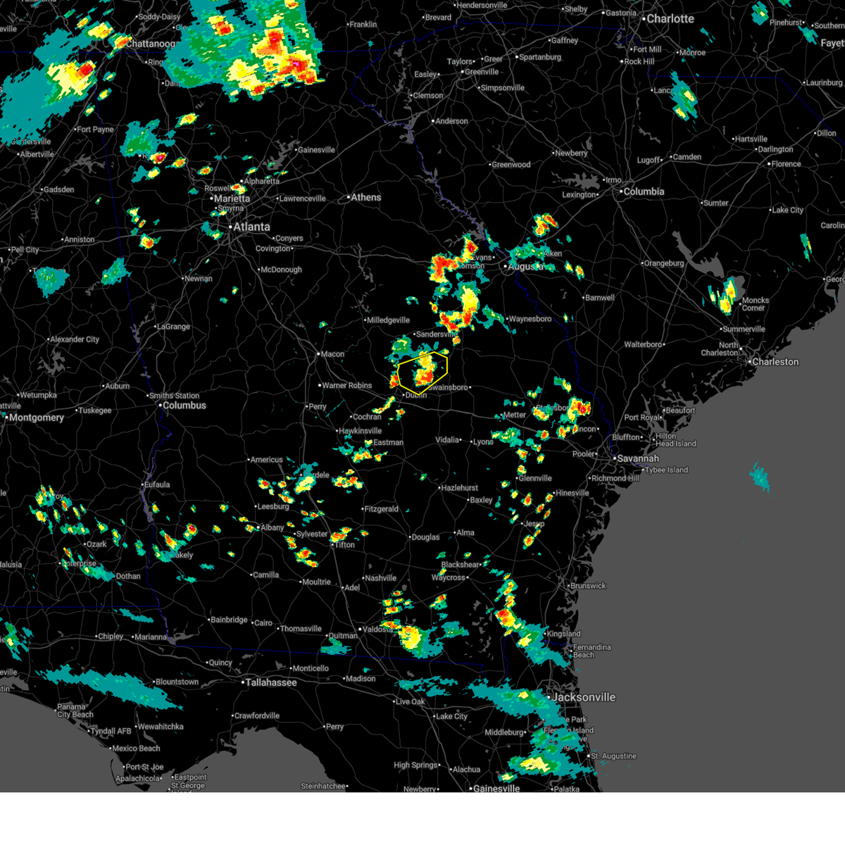
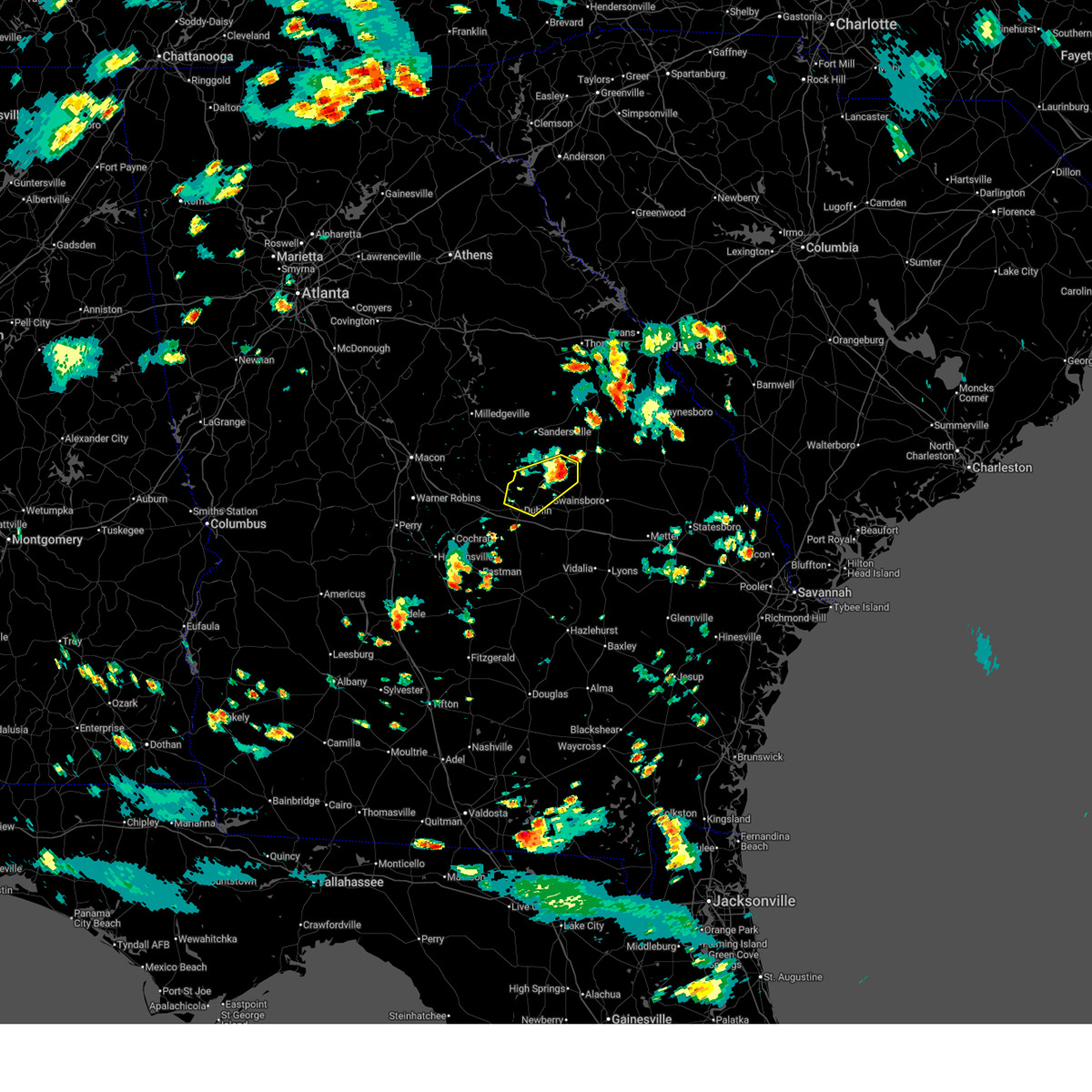
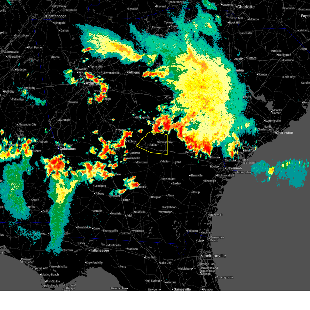
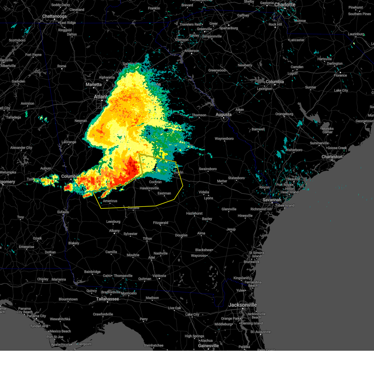
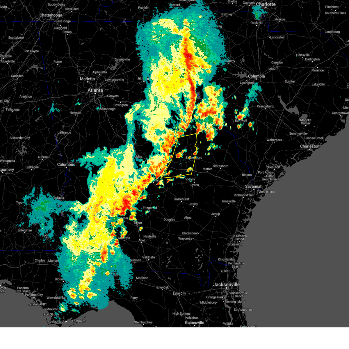
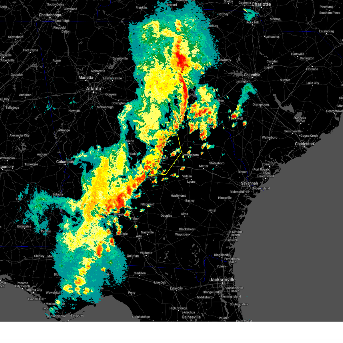
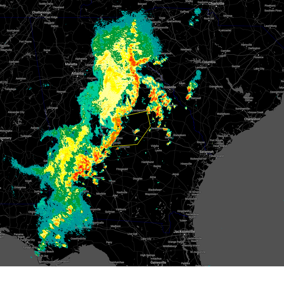
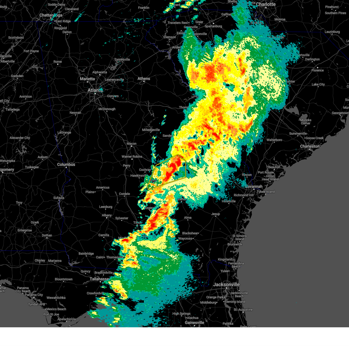
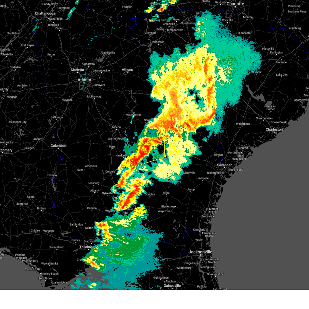
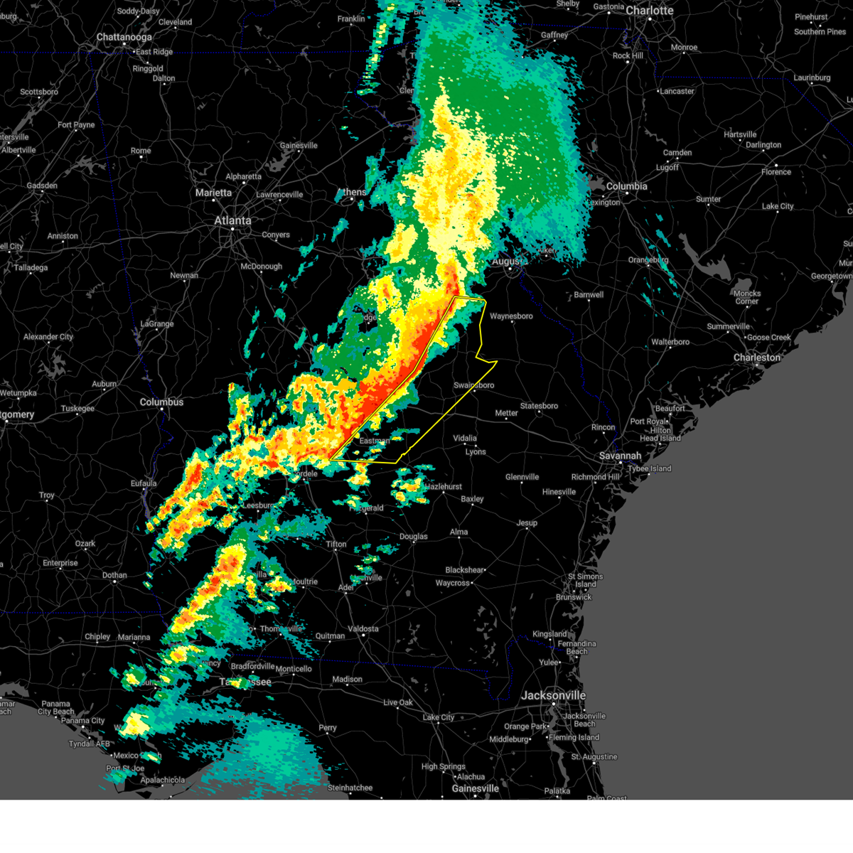
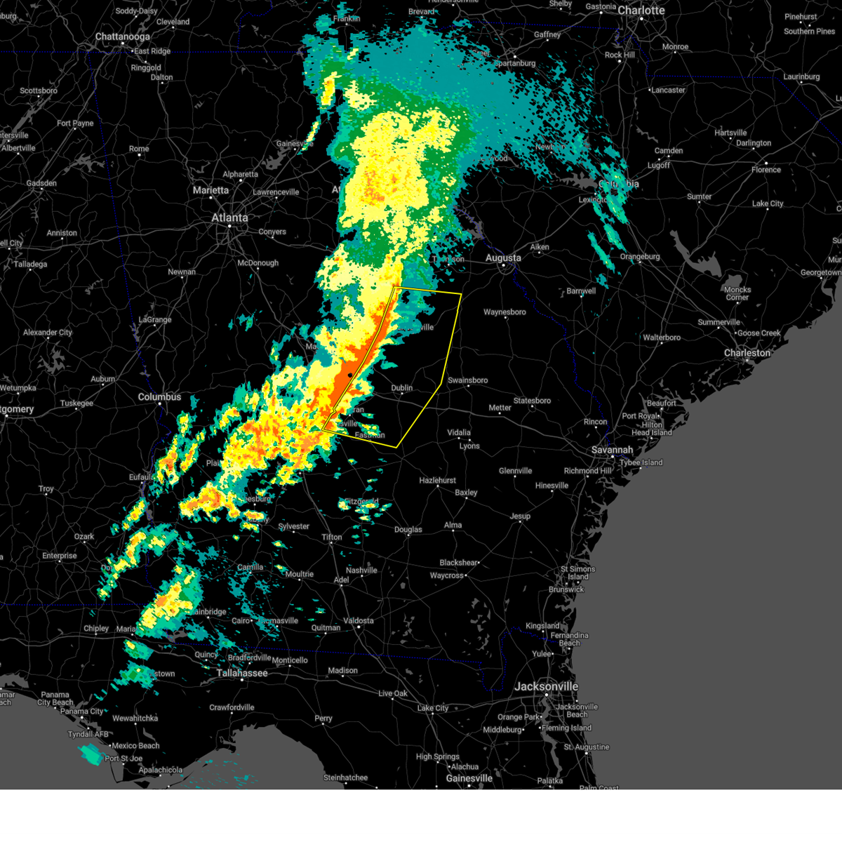
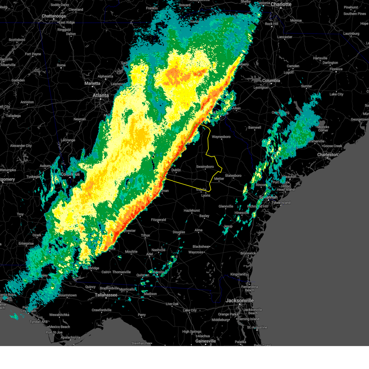
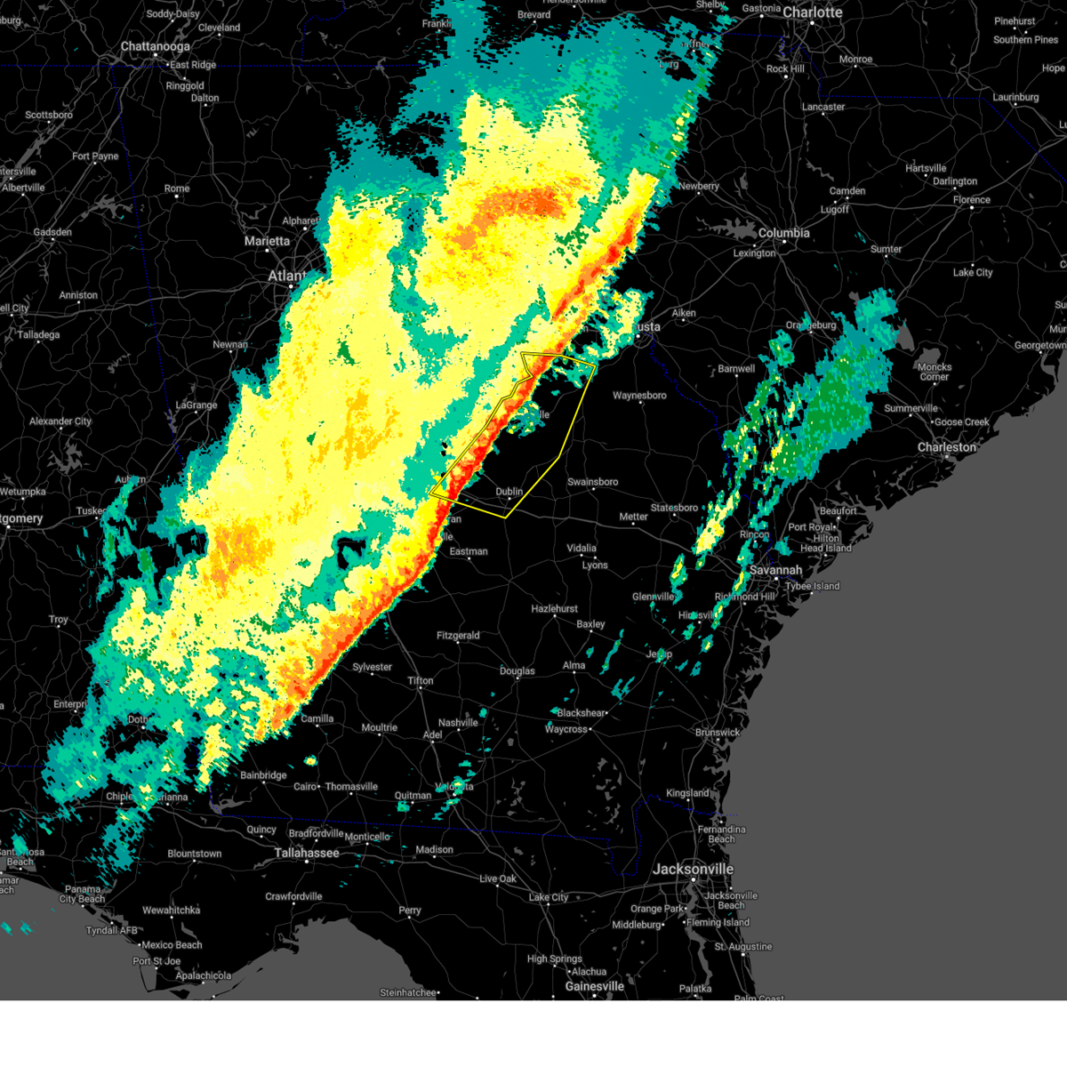
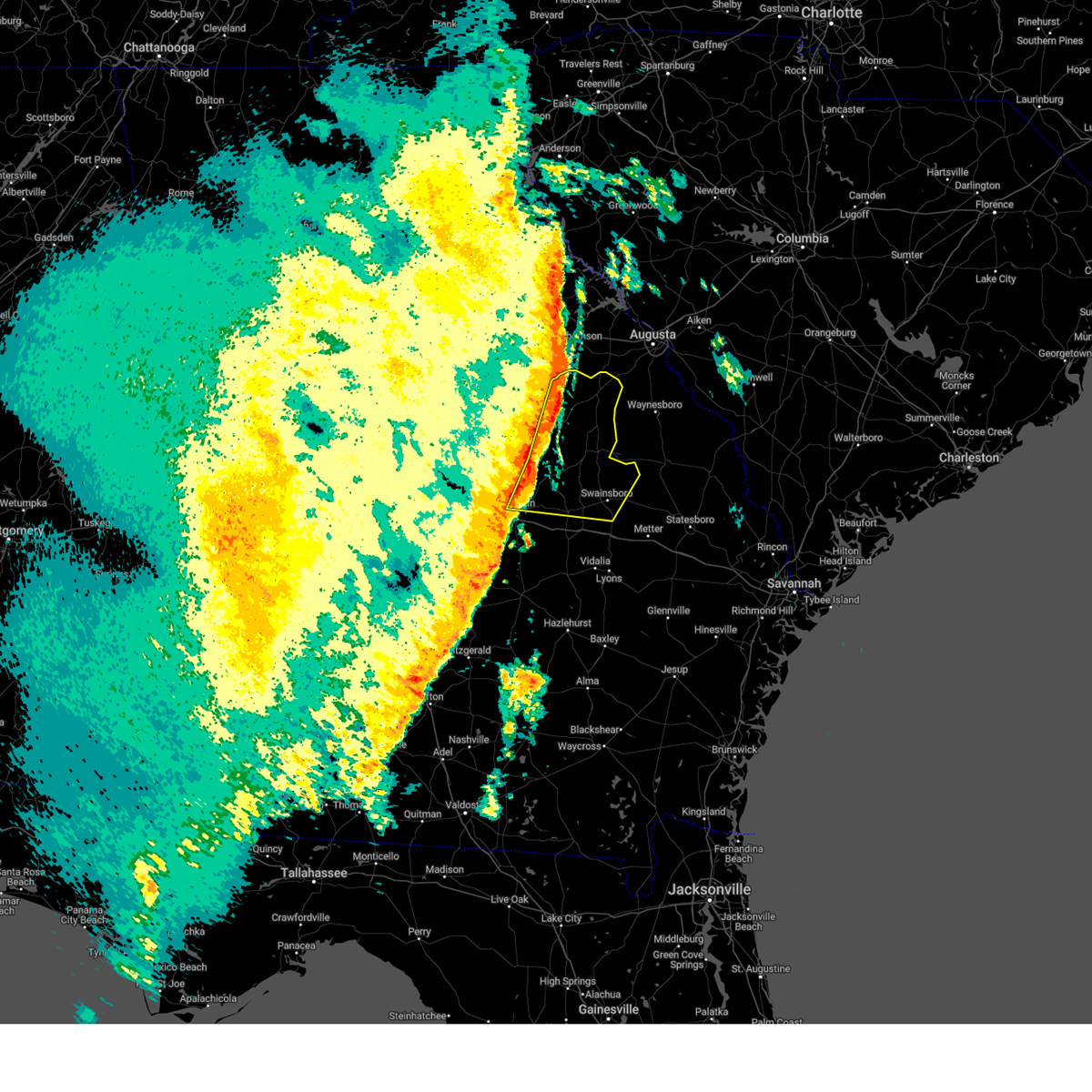
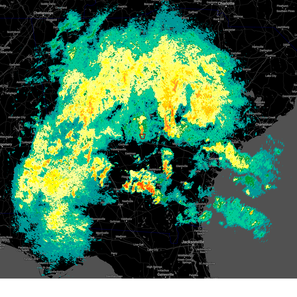
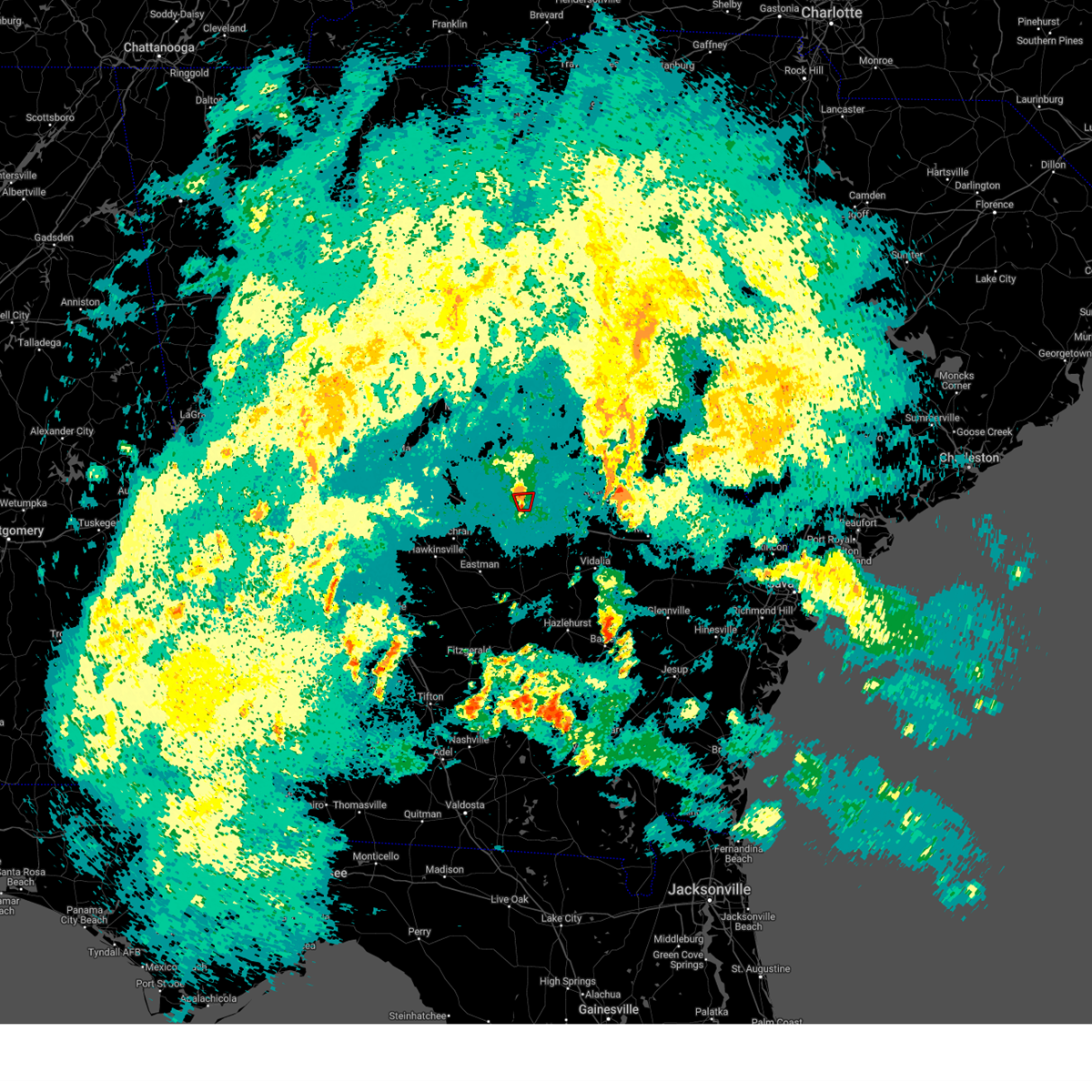
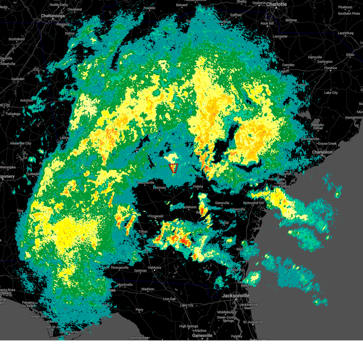
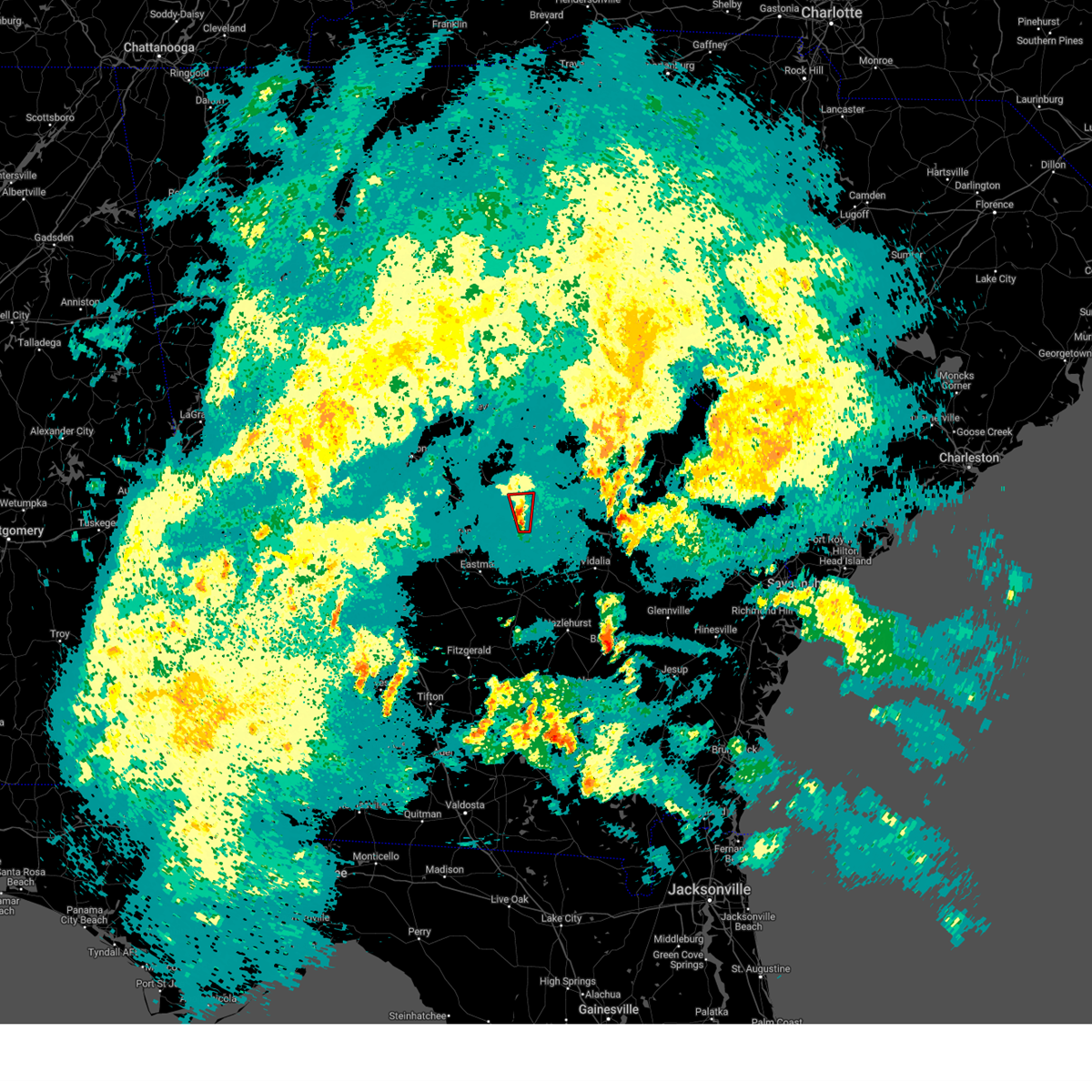
Hail Map for East Dublin, GA
The East Dublin, GA area has had 2 reports of on-the-ground hail by trained spotters, and has been under severe weather warnings 33 times during the past 12 months. Doppler radar has detected hail at or near East Dublin, GA on 63 occasions, including 4 occasions during the past year.
| Name: | East Dublin, GA |
| Where Located: | 72.2 miles N of Douglas, GA |
| Map: | Google Map for East Dublin, GA |
| Population: | 2441 |
| Housing Units: | 1100 |
| More Info: | Search Google for East Dublin, GA |
1
The Top Recent Hail Date for East Dublin, GA is Saturday, August 3, 2024 (12th out of 63)

Hail and Wind Damage Spotted near East Dublin, GA
| Date / Time | Report Details |
|---|---|
| 6/27/2025 4:58 PM EDT |
 the severe thunderstorm warning has been cancelled and is no longer in effect the severe thunderstorm warning has been cancelled and is no longer in effect
|
| 6/27/2025 4:50 PM EDT | At 450 pm edt, a severe thunderstorm was located over wrightsville, moving southwest at 15 mph (radar indicated). Hazards include 60 mph wind gusts and quarter size hail. Hail damage to vehicles is expected. expect wind damage to roofs, siding, and trees. Locations impacted include, dublin, wrightsville, harrison, lovett, spann, donovan, new home, brewton, tuckers crossroad, and pringle. |
| 6/27/2025 4:26 PM EDT |
 Svrffc the national weather service in peachtree city has issued a * severe thunderstorm warning for, northeastern laurens county in central georgia, southeastern washington county in east central georgia, johnson county in east central georgia, * until 515 pm edt. * at 425 pm edt, a severe thunderstorm was located near wrightsville, moving southwest at 15 mph (radar indicated). Hazards include 60 mph wind gusts and quarter size hail. Hail damage to vehicles is expected. Expect wind damage to roofs, siding, and trees. Svrffc the national weather service in peachtree city has issued a * severe thunderstorm warning for, northeastern laurens county in central georgia, southeastern washington county in east central georgia, johnson county in east central georgia, * until 515 pm edt. * at 425 pm edt, a severe thunderstorm was located near wrightsville, moving southwest at 15 mph (radar indicated). Hazards include 60 mph wind gusts and quarter size hail. Hail damage to vehicles is expected. Expect wind damage to roofs, siding, and trees.
|
| 6/25/2025 11:56 PM EDT |
 Svrffc the national weather service in peachtree city has issued a * severe thunderstorm warning for, northern laurens county in central georgia, northwestern emanuel county in east central georgia, treutlen county in east central georgia, johnson county in east central georgia, * until 1245 am edt. * at 1156 pm edt, severe thunderstorms were located along a line extending from near tuckers crossroad to near new home to near blundale, moving southwest at 20 mph (radar indicated). Hazards include 60 mph wind gusts and quarter size hail. Hail damage to vehicles is expected. Expect wind damage to roofs, siding, and trees. Svrffc the national weather service in peachtree city has issued a * severe thunderstorm warning for, northern laurens county in central georgia, northwestern emanuel county in east central georgia, treutlen county in east central georgia, johnson county in east central georgia, * until 1245 am edt. * at 1156 pm edt, severe thunderstorms were located along a line extending from near tuckers crossroad to near new home to near blundale, moving southwest at 20 mph (radar indicated). Hazards include 60 mph wind gusts and quarter size hail. Hail damage to vehicles is expected. Expect wind damage to roofs, siding, and trees.
|
| 5/18/2025 10:46 AM EDT |
 Svrffc the national weather service in peachtree city has issued a * severe thunderstorm warning for, central laurens county in central georgia, dodge county in central georgia, southeastern marion county in west central georgia, southeastern bibb county in central georgia, houston county in central georgia, sumter county in west central georgia, northern crisp county in central georgia, southern wilkinson county in central georgia, southern macon county in west central georgia, pulaski county in central georgia, twiggs county in central georgia, northwestern wilcox county in central georgia, dooly county in central georgia, bleckley county in central georgia, east central webster county in west central georgia, schley county in west central georgia, * until 1130 am edt. * at 1045 am edt, severe thunderstorms were located along a line extending from near skipperton to centerville to near meadowdale to near whitewater state park to near buena vista, moving east at 55 mph (radar indicated). Hazards include 60 mph wind gusts. expect damage to roofs, siding, and trees Svrffc the national weather service in peachtree city has issued a * severe thunderstorm warning for, central laurens county in central georgia, dodge county in central georgia, southeastern marion county in west central georgia, southeastern bibb county in central georgia, houston county in central georgia, sumter county in west central georgia, northern crisp county in central georgia, southern wilkinson county in central georgia, southern macon county in west central georgia, pulaski county in central georgia, twiggs county in central georgia, northwestern wilcox county in central georgia, dooly county in central georgia, bleckley county in central georgia, east central webster county in west central georgia, schley county in west central georgia, * until 1130 am edt. * at 1045 am edt, severe thunderstorms were located along a line extending from near skipperton to centerville to near meadowdale to near whitewater state park to near buena vista, moving east at 55 mph (radar indicated). Hazards include 60 mph wind gusts. expect damage to roofs, siding, and trees
|
| 3/31/2025 3:26 PM EDT |
 Svrffc the national weather service in peachtree city has issued a * severe thunderstorm warning for, northeastern laurens county in central georgia, western emanuel county in east central georgia, treutlen county in east central georgia, southeastern washington county in east central georgia, johnson county in east central georgia, southeastern jefferson county in east central georgia, * until 415 pm edt. * at 326 pm edt, severe thunderstorms were located along a line extending from near davisboro to lovett to near cadwell, moving east at 40 mph (radar indicated). Hazards include 60 mph wind gusts. expect damage to roofs, siding, and trees Svrffc the national weather service in peachtree city has issued a * severe thunderstorm warning for, northeastern laurens county in central georgia, western emanuel county in east central georgia, treutlen county in east central georgia, southeastern washington county in east central georgia, johnson county in east central georgia, southeastern jefferson county in east central georgia, * until 415 pm edt. * at 326 pm edt, severe thunderstorms were located along a line extending from near davisboro to lovett to near cadwell, moving east at 40 mph (radar indicated). Hazards include 60 mph wind gusts. expect damage to roofs, siding, and trees
|
| 3/31/2025 3:16 PM EDT |
 the severe thunderstorm warning has been cancelled and is no longer in effect the severe thunderstorm warning has been cancelled and is no longer in effect
|
| 3/31/2025 3:16 PM EDT |
 At 316 pm edt, severe thunderstorms were located along a line extending from 6 miles east of oconee to near brewton to plainfield, moving east at 45 mph (radar indicated). Hazards include 60 mph wind gusts and penny size hail. Expect damage to roofs, siding, and trees. Locations impacted include, tennille, spann, donovan, plainfield, dublin, tuckers crossroad, east dublin, minter, pringle, lovett, rentz, harlow, harrison, cadwell, new home, dexter, brewton, wrightsville, riddleville, and scott. At 316 pm edt, severe thunderstorms were located along a line extending from 6 miles east of oconee to near brewton to plainfield, moving east at 45 mph (radar indicated). Hazards include 60 mph wind gusts and penny size hail. Expect damage to roofs, siding, and trees. Locations impacted include, tennille, spann, donovan, plainfield, dublin, tuckers crossroad, east dublin, minter, pringle, lovett, rentz, harlow, harrison, cadwell, new home, dexter, brewton, wrightsville, riddleville, and scott.
|
| 3/31/2025 3:14 PM EDT |
 the severe thunderstorm warning has been cancelled and is no longer in effect the severe thunderstorm warning has been cancelled and is no longer in effect
|
| 3/31/2025 3:14 PM EDT |
 At 314 pm edt, severe thunderstorms were located along a line extending from near oconee to near tuckers crossroad to near plainfield, moving east at 50 mph (radar indicated). Hazards include 60 mph wind gusts and penny size hail. Expect damage to roofs, siding, and trees. Locations impacted include, dubois, tennille, cochran, spann, dudley, oconee, plainfield, empire, dublin, toomsboro, mobley crossing, roddy, nicklesville, montrose, baileys park, rowland, minter, pringle, lovett, and harlow. At 314 pm edt, severe thunderstorms were located along a line extending from near oconee to near tuckers crossroad to near plainfield, moving east at 50 mph (radar indicated). Hazards include 60 mph wind gusts and penny size hail. Expect damage to roofs, siding, and trees. Locations impacted include, dubois, tennille, cochran, spann, dudley, oconee, plainfield, empire, dublin, toomsboro, mobley crossing, roddy, nicklesville, montrose, baileys park, rowland, minter, pringle, lovett, and harlow.
|
| 3/31/2025 2:46 PM EDT |
 Svrffc the national weather service in peachtree city has issued a * severe thunderstorm warning for, wilkinson county in central georgia, laurens county in central georgia, northwestern dodge county in central georgia, northern pulaski county in central georgia, eastern twiggs county in central georgia, bleckley county in central georgia, southern washington county in east central georgia, johnson county in east central georgia, * until 330 pm edt. * at 246 pm edt, severe thunderstorms were located along a line extending from near gordon to danville to hawkinsville, moving east at 50 mph (radar indicated). Hazards include 60 mph wind gusts and penny size hail. expect damage to roofs, siding, and trees Svrffc the national weather service in peachtree city has issued a * severe thunderstorm warning for, wilkinson county in central georgia, laurens county in central georgia, northwestern dodge county in central georgia, northern pulaski county in central georgia, eastern twiggs county in central georgia, bleckley county in central georgia, southern washington county in east central georgia, johnson county in east central georgia, * until 330 pm edt. * at 246 pm edt, severe thunderstorms were located along a line extending from near gordon to danville to hawkinsville, moving east at 50 mph (radar indicated). Hazards include 60 mph wind gusts and penny size hail. expect damage to roofs, siding, and trees
|
| 3/16/2025 7:47 AM EDT |
 The storm which prompted the warning has moved out of the area. therefore, the warning has been allowed to expire. a tornado watch remains in effect until 1000 am edt for central and east central georgia. The storm which prompted the warning has moved out of the area. therefore, the warning has been allowed to expire. a tornado watch remains in effect until 1000 am edt for central and east central georgia.
|
| 3/16/2025 7:24 AM EDT |
 At 724 am edt, a severe thunderstorm was located near rentz, or 9 miles south of dublin, moving east at 60 mph (radar indicated). Hazards include 60 mph wind gusts. Expect damage to roofs, siding, and trees. Locations impacted include, eastman, lothair, plainfield, adrian, cedar grove, dublin, rockledge, barnhill, union, minter, lovett, harlow, dexter, godwinsville, brewton, zaidee, orland, tarrytown, soperton, and orianna. At 724 am edt, a severe thunderstorm was located near rentz, or 9 miles south of dublin, moving east at 60 mph (radar indicated). Hazards include 60 mph wind gusts. Expect damage to roofs, siding, and trees. Locations impacted include, eastman, lothair, plainfield, adrian, cedar grove, dublin, rockledge, barnhill, union, minter, lovett, harlow, dexter, godwinsville, brewton, zaidee, orland, tarrytown, soperton, and orianna.
|
| 3/16/2025 7:24 AM EDT |
 the severe thunderstorm warning has been cancelled and is no longer in effect the severe thunderstorm warning has been cancelled and is no longer in effect
|
| 3/16/2025 7:04 AM EDT |
 Svrffc the national weather service in peachtree city has issued a * severe thunderstorm warning for, laurens county in central georgia, dodge county in central georgia, west central emanuel county in east central georgia, treutlen county in east central georgia, southeastern bleckley county in central georgia, southeastern johnson county in east central georgia, northwestern wheeler county in central georgia, northwestern montgomery county in central georgia, * until 745 am edt. * at 704 am edt, a severe thunderstorm was located over gresston, or near eastman, moving northeast at 60 mph (radar indicated). Hazards include 60 mph wind gusts and penny size hail. expect damage to roofs, siding, and trees Svrffc the national weather service in peachtree city has issued a * severe thunderstorm warning for, laurens county in central georgia, dodge county in central georgia, west central emanuel county in east central georgia, treutlen county in east central georgia, southeastern bleckley county in central georgia, southeastern johnson county in east central georgia, northwestern wheeler county in central georgia, northwestern montgomery county in central georgia, * until 745 am edt. * at 704 am edt, a severe thunderstorm was located over gresston, or near eastman, moving northeast at 60 mph (radar indicated). Hazards include 60 mph wind gusts and penny size hail. expect damage to roofs, siding, and trees
|
| 3/16/2025 5:57 AM EDT |
 The storms which prompted the warning have moved out of the area. therefore, the warning will be allowed to expire. a tornado watch remains in effect until 1000 am edt for central and east central georgia. remember, a severe thunderstorm warning still remains in effect for laurens, emanuel, johnson, east washington, and south jefferson counties. The storms which prompted the warning have moved out of the area. therefore, the warning will be allowed to expire. a tornado watch remains in effect until 1000 am edt for central and east central georgia. remember, a severe thunderstorm warning still remains in effect for laurens, emanuel, johnson, east washington, and south jefferson counties.
|
| 3/16/2025 5:55 AM EDT |
 Svrffc the national weather service in peachtree city has issued a * severe thunderstorm warning for, northeastern laurens county in central georgia, northern emanuel county in east central georgia, northern treutlen county in east central georgia, southeastern washington county in east central georgia, johnson county in east central georgia, southeastern jefferson county in east central georgia, * until 645 am edt. * at 555 am edt, severe thunderstorms were located along a line extending from near moxley to near kite to near rentz, moving northeast at 60 mph (radar indicated). Hazards include 60 mph wind gusts. expect damage to roofs, siding, and trees Svrffc the national weather service in peachtree city has issued a * severe thunderstorm warning for, northeastern laurens county in central georgia, northern emanuel county in east central georgia, northern treutlen county in east central georgia, southeastern washington county in east central georgia, johnson county in east central georgia, southeastern jefferson county in east central georgia, * until 645 am edt. * at 555 am edt, severe thunderstorms were located along a line extending from near moxley to near kite to near rentz, moving northeast at 60 mph (radar indicated). Hazards include 60 mph wind gusts. expect damage to roofs, siding, and trees
|
| 3/16/2025 5:43 AM EDT |
 the severe thunderstorm warning has been cancelled and is no longer in effect the severe thunderstorm warning has been cancelled and is no longer in effect
|
| 3/16/2025 5:43 AM EDT |
 At 543 am edt, severe thunderstorms were located along a line extending from near mcbean to near blundale to near jay bird springs, moving east at 40 mph (radar indicated). Hazards include 60 mph wind gusts. Expect damage to roofs, siding, and trees. Locations impacted include, spann, dublin, rockledge, stapletons crossroads, pringle, lovett, avera, dellwood, dexter, donovan, bartow, yonkers, orland, tuckers crossroad, blundale, east dublin, chester, matthews, harrison, and three points. At 543 am edt, severe thunderstorms were located along a line extending from near mcbean to near blundale to near jay bird springs, moving east at 40 mph (radar indicated). Hazards include 60 mph wind gusts. Expect damage to roofs, siding, and trees. Locations impacted include, spann, dublin, rockledge, stapletons crossroads, pringle, lovett, avera, dellwood, dexter, donovan, bartow, yonkers, orland, tuckers crossroad, blundale, east dublin, chester, matthews, harrison, and three points.
|
| 3/16/2025 5:09 AM EDT |
 The storms which prompted the warning have moved out of the area. therefore, the warning will be allowed to expire. a tornado watch remains in effect until 1000 am edt for central and east central georgia. remember, a severe thunderstorm warning still remains in effect for jefferson, johnson, laurens, and dodge counties!. The storms which prompted the warning have moved out of the area. therefore, the warning will be allowed to expire. a tornado watch remains in effect until 1000 am edt for central and east central georgia. remember, a severe thunderstorm warning still remains in effect for jefferson, johnson, laurens, and dodge counties!.
|
| 3/16/2025 5:08 AM EDT |
 Svrffc the national weather service in peachtree city has issued a * severe thunderstorm warning for, laurens county in central georgia, dodge county in central georgia, northwestern emanuel county in east central georgia, southeastern pulaski county in central georgia, northwestern treutlen county in east central georgia, north central wilcox county in central georgia, southeastern bleckley county in central georgia, southeastern glascock county in east central georgia, southeastern washington county in east central georgia, johnson county in east central georgia, jefferson county in east central georgia, * until 600 am edt. * at 508 am edt, severe thunderstorms were located along a line extending from near stapleton to near wrightsville to near finleyson, moving east at 40 mph (radar indicated). Hazards include 60 mph wind gusts. expect damage to roofs, siding, and trees Svrffc the national weather service in peachtree city has issued a * severe thunderstorm warning for, laurens county in central georgia, dodge county in central georgia, northwestern emanuel county in east central georgia, southeastern pulaski county in central georgia, northwestern treutlen county in east central georgia, north central wilcox county in central georgia, southeastern bleckley county in central georgia, southeastern glascock county in east central georgia, southeastern washington county in east central georgia, johnson county in east central georgia, jefferson county in east central georgia, * until 600 am edt. * at 508 am edt, severe thunderstorms were located along a line extending from near stapleton to near wrightsville to near finleyson, moving east at 40 mph (radar indicated). Hazards include 60 mph wind gusts. expect damage to roofs, siding, and trees
|
| 3/16/2025 4:31 AM EDT |
 Svrffc the national weather service in peachtree city has issued a * severe thunderstorm warning for, laurens county in central georgia, northern dodge county in central georgia, southeastern hancock county in east central georgia, glascock county in east central georgia, western jefferson county in east central georgia, wilkinson county in central georgia, east central baldwin county in central georgia, south central warren county in east central georgia, northern pulaski county in central georgia, southeastern twiggs county in central georgia, bleckley county in central georgia, washington county in east central georgia, johnson county in east central georgia, * until 515 am edt. * at 430 am edt, severe thunderstorms were located along a line extending from 6 miles southeast of sparta to hebron to near nicklesville to near cary to near hawkinsville, moving southeast at 40 mph (radar indicated). Hazards include 60 mph wind gusts. expect damage to roofs, siding, and trees Svrffc the national weather service in peachtree city has issued a * severe thunderstorm warning for, laurens county in central georgia, northern dodge county in central georgia, southeastern hancock county in east central georgia, glascock county in east central georgia, western jefferson county in east central georgia, wilkinson county in central georgia, east central baldwin county in central georgia, south central warren county in east central georgia, northern pulaski county in central georgia, southeastern twiggs county in central georgia, bleckley county in central georgia, washington county in east central georgia, johnson county in east central georgia, * until 515 am edt. * at 430 am edt, severe thunderstorms were located along a line extending from 6 miles southeast of sparta to hebron to near nicklesville to near cary to near hawkinsville, moving southeast at 40 mph (radar indicated). Hazards include 60 mph wind gusts. expect damage to roofs, siding, and trees
|
| 2/16/2025 6:54 AM EST |
 Svrffc the national weather service in peachtree city has issued a * severe thunderstorm warning for, laurens county in central georgia, northern toombs county in southeastern georgia, emanuel county in east central georgia, southeastern warren county in east central georgia, treutlen county in east central georgia, central glascock county in east central georgia, southeastern washington county in east central georgia, johnson county in east central georgia, jefferson county in east central georgia, northeastern montgomery county in central georgia, * until 800 am est. * at 654 am est, severe thunderstorms were located along a line extending from near autney to near harrison to near rebie, moving east at 60 mph (radar indicated). Hazards include 60 mph wind gusts. expect damage to roofs, siding, and trees Svrffc the national weather service in peachtree city has issued a * severe thunderstorm warning for, laurens county in central georgia, northern toombs county in southeastern georgia, emanuel county in east central georgia, southeastern warren county in east central georgia, treutlen county in east central georgia, central glascock county in east central georgia, southeastern washington county in east central georgia, johnson county in east central georgia, jefferson county in east central georgia, northeastern montgomery county in central georgia, * until 800 am est. * at 654 am est, severe thunderstorms were located along a line extending from near autney to near harrison to near rebie, moving east at 60 mph (radar indicated). Hazards include 60 mph wind gusts. expect damage to roofs, siding, and trees
|
| 2/16/2025 6:39 AM EST |
 the severe thunderstorm warning has been cancelled and is no longer in effect the severe thunderstorm warning has been cancelled and is no longer in effect
|
| 2/16/2025 6:39 AM EST |
 At 639 am est, severe thunderstorms were located along a line extending from gibson to near tennille to montrose, moving east at 55 mph (radar indicated). Hazards include 60 mph wind gusts. Expect damage to roofs, siding, and trees. Locations impacted include, dublin, sandersville, wrightsville, jeffersonville, gibson, irwinton, east dublin, wrens, davisboro, tennille, mcintyre, dudley, harrison, toomsboro, stapleton, oconee, avera, danville, montrose, and mitchell. At 639 am est, severe thunderstorms were located along a line extending from gibson to near tennille to montrose, moving east at 55 mph (radar indicated). Hazards include 60 mph wind gusts. Expect damage to roofs, siding, and trees. Locations impacted include, dublin, sandersville, wrightsville, jeffersonville, gibson, irwinton, east dublin, wrens, davisboro, tennille, mcintyre, dudley, harrison, toomsboro, stapleton, oconee, avera, danville, montrose, and mitchell.
|
| 2/16/2025 5:59 AM EST |
 Svrffc the national weather service in peachtree city has issued a * severe thunderstorm warning for, northern laurens county in central georgia, central bibb county in central georgia, hancock county in east central georgia, glascock county in east central georgia, northeastern houston county in central georgia, eastern jones county in central georgia, northwestern jefferson county in east central georgia, wilkinson county in central georgia, baldwin county in central georgia, southern warren county in east central georgia, twiggs county in central georgia, southeastern putnam county in central georgia, northeastern bleckley county in central georgia, northeastern peach county in central georgia, washington county in east central georgia, northwestern johnson county in east central georgia, * until 700 am est. * at 558 am est, severe thunderstorms were located along a line extending from near rockville to near james to jack brown estates, moving east at 55 mph (radar indicated). Hazards include 60 mph wind gusts. expect damage to roofs, siding, and trees Svrffc the national weather service in peachtree city has issued a * severe thunderstorm warning for, northern laurens county in central georgia, central bibb county in central georgia, hancock county in east central georgia, glascock county in east central georgia, northeastern houston county in central georgia, eastern jones county in central georgia, northwestern jefferson county in east central georgia, wilkinson county in central georgia, baldwin county in central georgia, southern warren county in east central georgia, twiggs county in central georgia, southeastern putnam county in central georgia, northeastern bleckley county in central georgia, northeastern peach county in central georgia, washington county in east central georgia, northwestern johnson county in east central georgia, * until 700 am est. * at 558 am est, severe thunderstorms were located along a line extending from near rockville to near james to jack brown estates, moving east at 55 mph (radar indicated). Hazards include 60 mph wind gusts. expect damage to roofs, siding, and trees
|
| 12/29/2024 6:54 AM EST |
 Svrffc the national weather service in peachtree city has issued a * severe thunderstorm warning for, northeastern laurens county in central georgia, northern emanuel county in east central georgia, glascock county in east central georgia, eastern washington county in east central georgia, johnson county in east central georgia, jefferson county in east central georgia, * until 800 am est. * at 654 am est, severe thunderstorms were located along a line extending from near gibson to donovan to near dublin, moving east at 35 mph (radar indicated). Hazards include 60 mph wind gusts. expect damage to roofs, siding, and trees Svrffc the national weather service in peachtree city has issued a * severe thunderstorm warning for, northeastern laurens county in central georgia, northern emanuel county in east central georgia, glascock county in east central georgia, eastern washington county in east central georgia, johnson county in east central georgia, jefferson county in east central georgia, * until 800 am est. * at 654 am est, severe thunderstorms were located along a line extending from near gibson to donovan to near dublin, moving east at 35 mph (radar indicated). Hazards include 60 mph wind gusts. expect damage to roofs, siding, and trees
|
| 9/26/2024 2:11 PM EDT |
 the tornado warning has been cancelled and is no longer in effect the tornado warning has been cancelled and is no longer in effect
|
| 9/26/2024 2:10 PM EDT |
 The storm which prompted the warning has weakened and moved out of the area. therefore, the warning will be allowed to expire. The storm which prompted the warning has weakened and moved out of the area. therefore, the warning will be allowed to expire.
|
| 9/26/2024 1:58 PM EDT |
 At 157 pm edt, a severe thunderstorm capable of producing a tornado was located over dublin, moving north at 25 mph (radar indicated rotation). Hazards include tornado. Flying debris will be dangerous to those caught without shelter. mobile homes will be damaged or destroyed. damage to roofs, windows, and vehicles will occur. tree damage is likely. Locations impacted include, dublin and east dublin. At 157 pm edt, a severe thunderstorm capable of producing a tornado was located over dublin, moving north at 25 mph (radar indicated rotation). Hazards include tornado. Flying debris will be dangerous to those caught without shelter. mobile homes will be damaged or destroyed. damage to roofs, windows, and vehicles will occur. tree damage is likely. Locations impacted include, dublin and east dublin.
|
| 9/26/2024 1:56 PM EDT |
 Torffc the national weather service in peachtree city has issued a * tornado warning for, east central wilkinson county in central georgia, north central laurens county in central georgia, northwestern johnson county in east central georgia, * until 230 pm edt. * at 156 pm edt, a severe thunderstorm capable of producing a tornado was located over east dublin, or over dublin, moving north at 25 mph (radar indicated rotation). Hazards include tornado. Flying debris will be dangerous to those caught without shelter. mobile homes will be damaged or destroyed. damage to roofs, windows, and vehicles will occur. Tree damage is likely. Torffc the national weather service in peachtree city has issued a * tornado warning for, east central wilkinson county in central georgia, north central laurens county in central georgia, northwestern johnson county in east central georgia, * until 230 pm edt. * at 156 pm edt, a severe thunderstorm capable of producing a tornado was located over east dublin, or over dublin, moving north at 25 mph (radar indicated rotation). Hazards include tornado. Flying debris will be dangerous to those caught without shelter. mobile homes will be damaged or destroyed. damage to roofs, windows, and vehicles will occur. Tree damage is likely.
|
| 9/26/2024 1:49 PM EDT |
 At 149 pm edt, a severe thunderstorm capable of producing a tornado was located over dublin, moving north at 25 mph (radar indicated rotation). Hazards include tornado. Flying debris will be dangerous to those caught without shelter. mobile homes will be damaged or destroyed. damage to roofs, windows, and vehicles will occur. tree damage is likely. Locations impacted include, dublin and east dublin. At 149 pm edt, a severe thunderstorm capable of producing a tornado was located over dublin, moving north at 25 mph (radar indicated rotation). Hazards include tornado. Flying debris will be dangerous to those caught without shelter. mobile homes will be damaged or destroyed. damage to roofs, windows, and vehicles will occur. tree damage is likely. Locations impacted include, dublin and east dublin.
|
| 9/26/2024 1:40 PM EDT |
 Torffc the national weather service in peachtree city has issued a * tornado warning for, north central laurens county in central georgia, * until 215 pm edt. * at 140 pm edt, a severe thunderstorm capable of producing a tornado was located near dublin, moving north at 25 mph (radar indicated rotation). Hazards include tornado. Flying debris will be dangerous to those caught without shelter. mobile homes will be damaged or destroyed. damage to roofs, windows, and vehicles will occur. Tree damage is likely. Torffc the national weather service in peachtree city has issued a * tornado warning for, north central laurens county in central georgia, * until 215 pm edt. * at 140 pm edt, a severe thunderstorm capable of producing a tornado was located near dublin, moving north at 25 mph (radar indicated rotation). Hazards include tornado. Flying debris will be dangerous to those caught without shelter. mobile homes will be damaged or destroyed. damage to roofs, windows, and vehicles will occur. Tree damage is likely.
|
| 5/27/2024 4:21 PM EDT |
 The storm which prompted the warning has weakened below severe limits, and no longer poses an immediate threat to life or property. therefore, the warning will be allowed to expire. a severe thunderstorm watch remains in effect until 1000 pm edt for central georgia. The storm which prompted the warning has weakened below severe limits, and no longer poses an immediate threat to life or property. therefore, the warning will be allowed to expire. a severe thunderstorm watch remains in effect until 1000 pm edt for central georgia.
|
| 5/27/2024 3:40 PM EDT |
 Svrffc the national weather service in peachtree city has issued a * severe thunderstorm warning for, south central wilkinson county in central georgia, central laurens county in central georgia, southeastern twiggs county in central georgia, northeastern bleckley county in central georgia, * until 430 pm edt. * at 339 pm edt, a severe thunderstorm was located near cary, or 11 miles northeast of cochran, moving east at 25 mph (radar indicated). Hazards include 60 mph wind gusts and quarter size hail. Hail damage to vehicles is expected. Expect wind damage to roofs, siding, and trees. Svrffc the national weather service in peachtree city has issued a * severe thunderstorm warning for, south central wilkinson county in central georgia, central laurens county in central georgia, southeastern twiggs county in central georgia, northeastern bleckley county in central georgia, * until 430 pm edt. * at 339 pm edt, a severe thunderstorm was located near cary, or 11 miles northeast of cochran, moving east at 25 mph (radar indicated). Hazards include 60 mph wind gusts and quarter size hail. Hail damage to vehicles is expected. Expect wind damage to roofs, siding, and trees.
|
| 5/19/2024 1:02 PM EDT |
 the severe thunderstorm warning has been cancelled and is no longer in effect the severe thunderstorm warning has been cancelled and is no longer in effect
|
| 5/19/2024 12:39 PM EDT |
 Svrffc the national weather service in peachtree city has issued a * severe thunderstorm warning for, central laurens county in central georgia, * until 130 pm edt. * at 1238 pm edt, a severe thunderstorm was located near dublin, moving southeast at 20 mph (radar indicated). Hazards include 60 mph wind gusts and quarter size hail. Hail damage to vehicles is expected. Expect wind damage to roofs, siding, and trees. Svrffc the national weather service in peachtree city has issued a * severe thunderstorm warning for, central laurens county in central georgia, * until 130 pm edt. * at 1238 pm edt, a severe thunderstorm was located near dublin, moving southeast at 20 mph (radar indicated). Hazards include 60 mph wind gusts and quarter size hail. Hail damage to vehicles is expected. Expect wind damage to roofs, siding, and trees.
|
| 1/9/2024 12:19 PM EST |
 At 1219 pm est, severe thunderstorms were located along a line extending from near dublin to near cedar grove, moving east at 30 mph (radar indicated). Hazards include 60 mph wind gusts. Expect damage to roofs, siding, and trees. locations impacted include, dublin, east dublin, and cedar grove. hail threat, radar indicated max hail size, <. 75 in wind threat, radar indicated max wind gust, 60 mph. At 1219 pm est, severe thunderstorms were located along a line extending from near dublin to near cedar grove, moving east at 30 mph (radar indicated). Hazards include 60 mph wind gusts. Expect damage to roofs, siding, and trees. locations impacted include, dublin, east dublin, and cedar grove. hail threat, radar indicated max hail size, <. 75 in wind threat, radar indicated max wind gust, 60 mph.
|
| 1/9/2024 12:10 PM EST |
 At 1209 pm est, severe thunderstorms were located along a line extending from near east dublin to near cedar grove, moving east at 45 mph (radar indicated). Hazards include 60 mph wind gusts. expect damage to roofs, siding, and trees At 1209 pm est, severe thunderstorms were located along a line extending from near east dublin to near cedar grove, moving east at 45 mph (radar indicated). Hazards include 60 mph wind gusts. expect damage to roofs, siding, and trees
|
| 1/9/2024 11:53 AM EST |
 At 1153 am est, severe thunderstorms were located along a line extending from near montrose to near godwinsville, moving east at 30 mph (radar indicated). Hazards include 60 mph wind gusts. expect damage to roofs, siding, and trees At 1153 am est, severe thunderstorms were located along a line extending from near montrose to near godwinsville, moving east at 30 mph (radar indicated). Hazards include 60 mph wind gusts. expect damage to roofs, siding, and trees
|
| 9/13/2023 3:35 PM EDT |
 The severe thunderstorm warning for northwestern laurens county will expire at 345 pm edt, the storm which prompted the warning has weakened below severe limits, and no longer poses an immediate threat to life or property. therefore, the warning will be allowed to expire. however, gusty winds and heavy rain are still possible with this thunderstorm. The severe thunderstorm warning for northwestern laurens county will expire at 345 pm edt, the storm which prompted the warning has weakened below severe limits, and no longer poses an immediate threat to life or property. therefore, the warning will be allowed to expire. however, gusty winds and heavy rain are still possible with this thunderstorm.
|
| 9/13/2023 3:30 PM EDT |
 At 330 pm edt, a severe thunderstorm was located over harlow, or near dublin, moving southeast at 20 mph (radar indicated). Hazards include 60 mph wind gusts. Expect damage to roofs, siding, and trees. locations impacted include, dublin, east dublin, dudley, and harlow. hail threat, radar indicated max hail size, <. 75 in wind threat, radar indicated max wind gust, 60 mph. At 330 pm edt, a severe thunderstorm was located over harlow, or near dublin, moving southeast at 20 mph (radar indicated). Hazards include 60 mph wind gusts. Expect damage to roofs, siding, and trees. locations impacted include, dublin, east dublin, dudley, and harlow. hail threat, radar indicated max hail size, <. 75 in wind threat, radar indicated max wind gust, 60 mph.
|
| 9/13/2023 2:58 PM EDT |
 At 258 pm edt, a severe thunderstorm was located near chappells mill, or 7 miles northwest of dublin, moving southeast at 10 mph (radar indicated). Hazards include 60 mph wind gusts and penny size hail. expect damage to roofs, siding, and trees At 258 pm edt, a severe thunderstorm was located near chappells mill, or 7 miles northwest of dublin, moving southeast at 10 mph (radar indicated). Hazards include 60 mph wind gusts and penny size hail. expect damage to roofs, siding, and trees
|
| 9/7/2023 4:29 PM EDT |
 At 429 pm edt, a severe thunderstorm was located over scott, or 11 miles south of wrightsville, moving east at 25 mph (radar indicated). Hazards include 60 mph wind gusts and quarter size hail. Hail damage to vehicles is expected. Expect wind damage to roofs, siding, and trees. At 429 pm edt, a severe thunderstorm was located over scott, or 11 miles south of wrightsville, moving east at 25 mph (radar indicated). Hazards include 60 mph wind gusts and quarter size hail. Hail damage to vehicles is expected. Expect wind damage to roofs, siding, and trees.
|
| 9/7/2023 4:21 PM EDT |
 At 421 pm edt, severe thunderstorms were located along a line extending from tennille to near tuckers crossroad, moving northeast at 20 mph (radar indicated). Hazards include 60 mph wind gusts and quarter size hail. Hail damage to vehicles is expected. expect wind damage to roofs, siding, and trees. locations impacted include, dublin, wrightsville, east dublin, harrison, oconee, spann, donovan, orland, rockledge, tuckers crossroad, orianna, minter, pringle, lovett, new home, brewton, and scott. hail threat, radar indicated max hail size, 1. 00 in wind threat, radar indicated max wind gust, 60 mph. At 421 pm edt, severe thunderstorms were located along a line extending from tennille to near tuckers crossroad, moving northeast at 20 mph (radar indicated). Hazards include 60 mph wind gusts and quarter size hail. Hail damage to vehicles is expected. expect wind damage to roofs, siding, and trees. locations impacted include, dublin, wrightsville, east dublin, harrison, oconee, spann, donovan, orland, rockledge, tuckers crossroad, orianna, minter, pringle, lovett, new home, brewton, and scott. hail threat, radar indicated max hail size, 1. 00 in wind threat, radar indicated max wind gust, 60 mph.
|
| 9/7/2023 3:58 PM EDT |
 At 358 pm edt, severe thunderstorms were located along a line extending from near oconee to near chappells mill, moving northeast at 20 mph (radar indicated). Hazards include 60 mph wind gusts and quarter size hail. Hail damage to vehicles is expected. Expect wind damage to roofs, siding, and trees. At 358 pm edt, severe thunderstorms were located along a line extending from near oconee to near chappells mill, moving northeast at 20 mph (radar indicated). Hazards include 60 mph wind gusts and quarter size hail. Hail damage to vehicles is expected. Expect wind damage to roofs, siding, and trees.
|
| 8/12/2023 9:06 PM EDT |
 The severe thunderstorm warning for central laurens, northwestern dodge and eastern bleckley counties will expire at 915 pm edt, the storms which prompted the warning have weakened below severe limits, and no longer pose an immediate threat to life or property. therefore, the warning will be allowed to expire. however, gusty winds and heavy rain are still possible with these thunderstorms. The severe thunderstorm warning for central laurens, northwestern dodge and eastern bleckley counties will expire at 915 pm edt, the storms which prompted the warning have weakened below severe limits, and no longer pose an immediate threat to life or property. therefore, the warning will be allowed to expire. however, gusty winds and heavy rain are still possible with these thunderstorms.
|
| 8/12/2023 9:00 PM EDT |
 At 859 pm edt, severe thunderstorms were located along a line extending from near harlow to yonkers, moving southeast at 25 mph (radar indicated). Hazards include 60 mph wind gusts. Expect damage to roofs, siding, and trees. locations impacted include, dublin, east dublin, chester, dexter, dudley, cadwell, rentz, montrose, dubois, gresston, yonkers, roddy, rowland, harlow, goldsboro, and rebie. hail threat, radar indicated max hail size, <. 75 in wind threat, radar indicated max wind gust, 60 mph. At 859 pm edt, severe thunderstorms were located along a line extending from near harlow to yonkers, moving southeast at 25 mph (radar indicated). Hazards include 60 mph wind gusts. Expect damage to roofs, siding, and trees. locations impacted include, dublin, east dublin, chester, dexter, dudley, cadwell, rentz, montrose, dubois, gresston, yonkers, roddy, rowland, harlow, goldsboro, and rebie. hail threat, radar indicated max hail size, <. 75 in wind threat, radar indicated max wind gust, 60 mph.
|
| 8/12/2023 8:26 PM EDT |
 At 825 pm edt, severe thunderstorms were located along a line extending from near montrose to near royal, moving southeast at 25 mph (radar indicated). Hazards include 60 mph wind gusts. expect damage to roofs, siding, and trees At 825 pm edt, severe thunderstorms were located along a line extending from near montrose to near royal, moving southeast at 25 mph (radar indicated). Hazards include 60 mph wind gusts. expect damage to roofs, siding, and trees
|
| 8/8/2023 6:42 PM EDT |
 At 642 pm edt, severe thunderstorms were located along a line extending from near minter to near orland to near cedar grove, moving east at 50 mph (radar indicated). Hazards include 60 mph wind gusts and quarter size hail. Hail damage to vehicles is expected. expect wind damage to roofs, siding, and trees. locations impacted include, soperton, adrian, lothair, cedar grove, orland, rockledge, orianna, norristown, barnhill, minter, norristown junction, brewton, lowery, blackville, zaidee, gillis springs, and scott. hail threat, radar indicated max hail size, 1. 00 in wind threat, radar indicated max wind gust, 60 mph. At 642 pm edt, severe thunderstorms were located along a line extending from near minter to near orland to near cedar grove, moving east at 50 mph (radar indicated). Hazards include 60 mph wind gusts and quarter size hail. Hail damage to vehicles is expected. expect wind damage to roofs, siding, and trees. locations impacted include, soperton, adrian, lothair, cedar grove, orland, rockledge, orianna, norristown, barnhill, minter, norristown junction, brewton, lowery, blackville, zaidee, gillis springs, and scott. hail threat, radar indicated max hail size, 1. 00 in wind threat, radar indicated max wind gust, 60 mph.
|
| 8/8/2023 6:27 PM EDT |
 At 627 pm edt, severe thunderstorms were located along a line extending from near east dublin to near dublin to near cadwell, moving east at 55 mph (radar indicated). Hazards include 60 mph wind gusts and quarter size hail. Hail damage to vehicles is expected. expect wind damage to roofs, siding, and trees. locations impacted include, dublin, soperton, east dublin, adrian, cadwell, rentz, lothair, cedar grove, orland, rockledge, orianna, norristown, barnhill, minter, lovett, harlow, norristown junction, meeks, brewton, and lowery. hail threat, radar indicated max hail size, 1. 00 in wind threat, radar indicated max wind gust, 60 mph. At 627 pm edt, severe thunderstorms were located along a line extending from near east dublin to near dublin to near cadwell, moving east at 55 mph (radar indicated). Hazards include 60 mph wind gusts and quarter size hail. Hail damage to vehicles is expected. expect wind damage to roofs, siding, and trees. locations impacted include, dublin, soperton, east dublin, adrian, cadwell, rentz, lothair, cedar grove, orland, rockledge, orianna, norristown, barnhill, minter, lovett, harlow, norristown junction, meeks, brewton, and lowery. hail threat, radar indicated max hail size, 1. 00 in wind threat, radar indicated max wind gust, 60 mph.
|
| 8/8/2023 6:08 PM EDT |
 At 608 pm edt, severe thunderstorms were located along a line extending from near chappells mill to near montrose to near roddy, moving east at 50 mph (radar indicated). Hazards include ping pong ball size hail and 60 mph wind gusts. People and animals outdoors will be injured. expect hail damage to roofs, siding, windows, and vehicles. Expect wind damage to roofs, siding, and trees. At 608 pm edt, severe thunderstorms were located along a line extending from near chappells mill to near montrose to near roddy, moving east at 50 mph (radar indicated). Hazards include ping pong ball size hail and 60 mph wind gusts. People and animals outdoors will be injured. expect hail damage to roofs, siding, windows, and vehicles. Expect wind damage to roofs, siding, and trees.
|
| 8/7/2023 7:51 PM EDT |
 The severe thunderstorm warning for northern laurens and central johnson counties will expire at 800 pm edt, the storms which prompted the warning have moved out of the area. therefore, the warning will be allowed to expire. a severe thunderstorm watch remains in effect until midnight edt for central and east central georgia. The severe thunderstorm warning for northern laurens and central johnson counties will expire at 800 pm edt, the storms which prompted the warning have moved out of the area. therefore, the warning will be allowed to expire. a severe thunderstorm watch remains in effect until midnight edt for central and east central georgia.
|
| 8/7/2023 7:40 PM EDT |
 At 740 pm edt, severe thunderstorms were located along a line extending from brewton to 6 miles northwest of lowery, moving east at 30 mph (radar indicated). Hazards include 60 mph wind gusts. Expect damage to roofs, siding, and trees. locations impacted include, dublin, east dublin, dexter, lovett, spann, harlow, brewton, and minter. hail threat, radar indicated max hail size, <. 75 in wind threat, radar indicated max wind gust, 60 mph. At 740 pm edt, severe thunderstorms were located along a line extending from brewton to 6 miles northwest of lowery, moving east at 30 mph (radar indicated). Hazards include 60 mph wind gusts. Expect damage to roofs, siding, and trees. locations impacted include, dublin, east dublin, dexter, lovett, spann, harlow, brewton, and minter. hail threat, radar indicated max hail size, <. 75 in wind threat, radar indicated max wind gust, 60 mph.
|
| 8/7/2023 7:07 PM EDT |
 At 707 pm edt, severe thunderstorms were located along a line extending from near chappells mill to rebie, moving east at 30 mph (radar indicated). Hazards include 60 mph wind gusts. expect damage to roofs, siding, and trees At 707 pm edt, severe thunderstorms were located along a line extending from near chappells mill to rebie, moving east at 30 mph (radar indicated). Hazards include 60 mph wind gusts. expect damage to roofs, siding, and trees
|
| 8/3/2023 8:15 PM EDT |
 At 815 pm edt, severe thunderstorms were located along a line extending from lovett to near minter to gresston to near clearview, moving southeast at 40 mph (radar indicated). Hazards include 60 mph wind gusts. Expect damage to roofs, siding, and trees. locations impacted include, dublin, cochran, hawkinsville, oglethorpe, unadilla, montezuma, east dublin, chester, dexter, dudley, byromville, cadwell, pinehurst, rentz, montrose, lilly, dooling, hayneville, plainfield, and mobley crossing. hail threat, radar indicated max hail size, <. 75 in wind threat, radar indicated max wind gust, 60 mph. At 815 pm edt, severe thunderstorms were located along a line extending from lovett to near minter to gresston to near clearview, moving southeast at 40 mph (radar indicated). Hazards include 60 mph wind gusts. Expect damage to roofs, siding, and trees. locations impacted include, dublin, cochran, hawkinsville, oglethorpe, unadilla, montezuma, east dublin, chester, dexter, dudley, byromville, cadwell, pinehurst, rentz, montrose, lilly, dooling, hayneville, plainfield, and mobley crossing. hail threat, radar indicated max hail size, <. 75 in wind threat, radar indicated max wind gust, 60 mph.
|
| 8/3/2023 7:45 PM EDT |
 At 744 pm edt, severe thunderstorms were located along a line extending from 6 miles west of hebron to near potterville, moving southeast at 45 mph (radar indicated). Hazards include 60 mph wind gusts. expect damage to roofs, siding, and trees At 744 pm edt, severe thunderstorms were located along a line extending from 6 miles west of hebron to near potterville, moving southeast at 45 mph (radar indicated). Hazards include 60 mph wind gusts. expect damage to roofs, siding, and trees
|
| 7/30/2023 5:30 PM EDT |
 At 530 pm edt, a severe thunderstorm was located over minter, or 7 miles southeast of dublin, moving east at 20 mph (radar indicated). Hazards include 60 mph wind gusts and quarter size hail. Hail damage to vehicles is expected. Expect wind damage to roofs, siding, and trees. At 530 pm edt, a severe thunderstorm was located over minter, or 7 miles southeast of dublin, moving east at 20 mph (radar indicated). Hazards include 60 mph wind gusts and quarter size hail. Hail damage to vehicles is expected. Expect wind damage to roofs, siding, and trees.
|
| 7/21/2023 10:36 PM EDT |
 At 1036 pm edt, severe thunderstorms were located along a line extending from near tennille to donovan to near scott, moving east at 40 mph (radar indicated). Hazards include 60 mph wind gusts and quarter size hail. Hail damage to vehicles is expected. expect wind damage to roofs, siding, and trees. locations impacted include, dublin, wrightsville, east dublin, adrian, spann, donovan, tuckers crossroad, minter, lovett, new home, meeks, brewton and scott. hail threat, radar indicated max hail size, 1. 00 in wind threat, radar indicated max wind gust, 60 mph. At 1036 pm edt, severe thunderstorms were located along a line extending from near tennille to donovan to near scott, moving east at 40 mph (radar indicated). Hazards include 60 mph wind gusts and quarter size hail. Hail damage to vehicles is expected. expect wind damage to roofs, siding, and trees. locations impacted include, dublin, wrightsville, east dublin, adrian, spann, donovan, tuckers crossroad, minter, lovett, new home, meeks, brewton and scott. hail threat, radar indicated max hail size, 1. 00 in wind threat, radar indicated max wind gust, 60 mph.
|
| 7/21/2023 10:17 PM EDT |
 At 1017 pm edt, severe thunderstorms were located along a line extending from oconee to near tuckers crossroad to near dublin, moving east at 40 mph (radar indicated). Hazards include 60 mph wind gusts and quarter size hail. Hail damage to vehicles is expected. Expect wind damage to roofs, siding, and trees. At 1017 pm edt, severe thunderstorms were located along a line extending from oconee to near tuckers crossroad to near dublin, moving east at 40 mph (radar indicated). Hazards include 60 mph wind gusts and quarter size hail. Hail damage to vehicles is expected. Expect wind damage to roofs, siding, and trees.
|
| 7/21/2023 9:58 PM EDT |
 At 958 pm edt, severe thunderstorms were located along a line extending from near irwinton to near nicklesville to dudley, moving east at 20 mph (radar indicated). Hazards include 60 mph wind gusts and penny size hail. expect damage to roofs, siding, and trees At 958 pm edt, severe thunderstorms were located along a line extending from near irwinton to near nicklesville to dudley, moving east at 20 mph (radar indicated). Hazards include 60 mph wind gusts and penny size hail. expect damage to roofs, siding, and trees
|
| 3/27/2023 12:10 PM EDT |
 At 1210 pm edt, severe thunderstorms were located along a line extending from near toomsboro to near chappells mill to near montrose, moving east at 55 mph (radar indicated). Hazards include 60 mph wind gusts. expect damage to roofs, siding, and trees At 1210 pm edt, severe thunderstorms were located along a line extending from near toomsboro to near chappells mill to near montrose, moving east at 55 mph (radar indicated). Hazards include 60 mph wind gusts. expect damage to roofs, siding, and trees
|
| 7/8/2022 3:46 PM EDT |
 At 346 pm edt, a severe thunderstorm was located over east dublin, or over dublin, moving east at 20 mph (radar indicated). Hazards include 60 mph wind gusts and penny size hail. expect damage to roofs, siding, and trees At 346 pm edt, a severe thunderstorm was located over east dublin, or over dublin, moving east at 20 mph (radar indicated). Hazards include 60 mph wind gusts and penny size hail. expect damage to roofs, siding, and trees
|
| 5/6/2022 3:09 PM EDT |
 At 309 pm edt, a severe thunderstorm was located over cadwell, or 14 miles northeast of eastman, moving northeast at 60 mph (radar indicated). Hazards include 60 mph wind gusts and quarter size hail. Hail damage to vehicles is expected. Expect wind damage to roofs, siding, and trees. At 309 pm edt, a severe thunderstorm was located over cadwell, or 14 miles northeast of eastman, moving northeast at 60 mph (radar indicated). Hazards include 60 mph wind gusts and quarter size hail. Hail damage to vehicles is expected. Expect wind damage to roofs, siding, and trees.
|
| 4/6/2022 7:55 PM EDT |
 At 755 pm edt, areas of rotation capable of producing a tornado were located near dudley and near chester, moving east at 60 mph (radar indicated rotation). Hazards include tornado. Flying debris will be dangerous to those caught without shelter. mobile homes will be damaged or destroyed. damage to roofs, windows, and vehicles will occur. Tree damage is likely. At 755 pm edt, areas of rotation capable of producing a tornado were located near dudley and near chester, moving east at 60 mph (radar indicated rotation). Hazards include tornado. Flying debris will be dangerous to those caught without shelter. mobile homes will be damaged or destroyed. damage to roofs, windows, and vehicles will occur. Tree damage is likely.
|
| 4/5/2022 4:36 PM EDT |
 At 436 pm edt, severe thunderstorms were located along a line extending from 6 miles northeast of chappells mill to near milan, moving northeast at 55 mph (radar indicated). Hazards include 60 mph wind gusts and penny size hail. Expect damage to roofs, siding, and trees. locations impacted include, dublin, mcrae, eastman, abbeville, wrightsville, helena, east dublin, chester, milan, dexter, dudley, cadwell, rhine, scotland, chauncey, rentz, union, towns, spann and plainfield. hail threat, radar indicated max hail size, 0. 75 in wind threat, radar indicated max wind gust, 60 mph. At 436 pm edt, severe thunderstorms were located along a line extending from 6 miles northeast of chappells mill to near milan, moving northeast at 55 mph (radar indicated). Hazards include 60 mph wind gusts and penny size hail. Expect damage to roofs, siding, and trees. locations impacted include, dublin, mcrae, eastman, abbeville, wrightsville, helena, east dublin, chester, milan, dexter, dudley, cadwell, rhine, scotland, chauncey, rentz, union, towns, spann and plainfield. hail threat, radar indicated max hail size, 0. 75 in wind threat, radar indicated max wind gust, 60 mph.
|
| 4/5/2022 4:27 PM EDT |
 At 427 pm edt, severe thunderstorms were located along a line extending from nicklesville to near milan, moving northeast at 55 mph (radar indicated). Hazards include 60 mph wind gusts and penny size hail. Expect damage to roofs, siding, and trees. locations impacted include, dublin, mcrae, cochran, eastman, abbeville, wrightsville, helena, east dublin, chester, milan, dexter, dudley, cadwell, rhine, scotland, chauncey, rentz, danville, montrose and allentown. hail threat, radar indicated max hail size, 0. 75 in wind threat, radar indicated max wind gust, 60 mph. At 427 pm edt, severe thunderstorms were located along a line extending from nicklesville to near milan, moving northeast at 55 mph (radar indicated). Hazards include 60 mph wind gusts and penny size hail. Expect damage to roofs, siding, and trees. locations impacted include, dublin, mcrae, cochran, eastman, abbeville, wrightsville, helena, east dublin, chester, milan, dexter, dudley, cadwell, rhine, scotland, chauncey, rentz, danville, montrose and allentown. hail threat, radar indicated max hail size, 0. 75 in wind threat, radar indicated max wind gust, 60 mph.
|
| 4/5/2022 4:06 PM EDT |
 At 405 pm edt, severe thunderstorms were located along a line extending from district path to near antioch church, moving northeast at 55 mph (radar indicated). Hazards include 60 mph wind gusts and penny size hail. expect damage to roofs, siding, and trees At 405 pm edt, severe thunderstorms were located along a line extending from district path to near antioch church, moving northeast at 55 mph (radar indicated). Hazards include 60 mph wind gusts and penny size hail. expect damage to roofs, siding, and trees
|
| 12/30/2021 5:13 PM EST |
 At 512 pm est, a severe thunderstorm was located over meeks, or 10 miles southeast of wrightsville, moving east at 50 mph (radar indicated). Hazards include 60 mph wind gusts and nickel size hail. Expect damage to roofs, siding, and trees. Locations impacted include, wrightsville, kite, lovett, spann, donovan, new home, meeks, brewton and scott. At 512 pm est, a severe thunderstorm was located over meeks, or 10 miles southeast of wrightsville, moving east at 50 mph (radar indicated). Hazards include 60 mph wind gusts and nickel size hail. Expect damage to roofs, siding, and trees. Locations impacted include, wrightsville, kite, lovett, spann, donovan, new home, meeks, brewton and scott.
|
| 12/30/2021 4:47 PM EST |
 At 447 pm est, a severe thunderstorm was located near dublin, moving east at 50 mph (radar indicated). Hazards include 60 mph wind gusts and quarter size hail. Hail damage to vehicles is expected. Expect wind damage to roofs, siding, and trees. At 447 pm est, a severe thunderstorm was located near dublin, moving east at 50 mph (radar indicated). Hazards include 60 mph wind gusts and quarter size hail. Hail damage to vehicles is expected. Expect wind damage to roofs, siding, and trees.
|
| 3/31/2021 5:58 PM EDT | Tree reported down at the intersection of hwy 29 and minter tweed r in laurens county GA, 7.1 miles NW of East Dublin, GA |
| 3/31/2021 5:58 PM EDT | Tree reported down at the intersection of lloyd hester rd and minter tweed r in laurens county GA, 8.5 miles NW of East Dublin, GA |
| 3/31/2021 5:58 PM EDT | Tree reported down near the intersection of hwy 199 and l.c. pope r in laurens county GA, 8.7 miles NNW of East Dublin, GA |
| 3/31/2021 5:55 PM EDT | Two trees reported down at the intersection of old savannah rd and robert lewis r in laurens county GA, 3.5 miles NW of East Dublin, GA |
| 3/31/2021 5:48 PM EDT | Powerlines reported down on pearl st in east dubli in laurens county GA, 1.2 miles NE of East Dublin, GA |
| 3/31/2021 5:47 PM EDT | Large tree reported down and blocking the road at rex miller rd and bobbie s in laurens county GA, 2.1 miles NE of East Dublin, GA |
| 3/31/2021 5:44 PM EDT |
 At 544 pm edt, a severe thunderstorm was located near dudley moving east at 45 mph (radar indicated). Hazards include 60 mph wind gusts. expect damage to roofs, siding, and trees At 544 pm edt, a severe thunderstorm was located near dudley moving east at 45 mph (radar indicated). Hazards include 60 mph wind gusts. expect damage to roofs, siding, and trees
|
| 3/31/2021 5:38 PM EDT | Powerlines reported down at the 1100 block of north lake d in laurens county GA, 6.7 miles S of East Dublin, GA |
| 3/28/2021 4:11 PM EDT |
 The national weather service in peachtree city has issued a * severe thunderstorm warning for. northeastern laurens county in central georgia. emanuel county in east central georgia. treutlen county in east central georgia. Southeastern washington county in east central georgia. The national weather service in peachtree city has issued a * severe thunderstorm warning for. northeastern laurens county in central georgia. emanuel county in east central georgia. treutlen county in east central georgia. Southeastern washington county in east central georgia.
|
| 3/28/2021 3:47 PM EDT |
 At 346 pm edt, a severe thunderstorm was located near irwinton, moving east at 30 mph (radar indicated). Hazards include 60 mph wind gusts. expect damage to roofs, siding, and trees At 346 pm edt, a severe thunderstorm was located near irwinton, moving east at 30 mph (radar indicated). Hazards include 60 mph wind gusts. expect damage to roofs, siding, and trees
|
| 8/11/2020 6:26 PM EDT |
 At 626 pm edt, a severe thunderstorm was located over brewton, or 7 miles east of dublin, moving southeast at 20 mph (radar indicated). Hazards include 60 mph wind gusts. Expect damage to roofs, siding, and trees. Locations impacted include, dublin, east dublin, lovett, spann, brewton, scott and minter. At 626 pm edt, a severe thunderstorm was located over brewton, or 7 miles east of dublin, moving southeast at 20 mph (radar indicated). Hazards include 60 mph wind gusts. Expect damage to roofs, siding, and trees. Locations impacted include, dublin, east dublin, lovett, spann, brewton, scott and minter.
|
| 8/11/2020 6:03 PM EDT |
 At 603 pm edt, a severe thunderstorm was located over tuckers crossroad, or 8 miles southwest of wrightsville, moving southeast at 20 mph (radar indicated). Hazards include 60 mph wind gusts and quarter size hail. Hail damage to vehicles is expected. Expect wind damage to roofs, siding, and trees. At 603 pm edt, a severe thunderstorm was located over tuckers crossroad, or 8 miles southwest of wrightsville, moving southeast at 20 mph (radar indicated). Hazards include 60 mph wind gusts and quarter size hail. Hail damage to vehicles is expected. Expect wind damage to roofs, siding, and trees.
|
| 8/8/2020 3:02 PM EDT |
 At 301 pm edt, a severe thunderstorm was located over spann, moving north at 10 mph (radar indicated). Hazards include 60 mph wind gusts and nickel size hail. Expect damage to roofs, siding, and trees. Locations impacted include, dublin, wrightsville, east dublin, adrian, kite, lovett, spann, meeks, brewton, scott and minter. At 301 pm edt, a severe thunderstorm was located over spann, moving north at 10 mph (radar indicated). Hazards include 60 mph wind gusts and nickel size hail. Expect damage to roofs, siding, and trees. Locations impacted include, dublin, wrightsville, east dublin, adrian, kite, lovett, spann, meeks, brewton, scott and minter.
|
| 8/8/2020 2:50 PM EDT |
 At 250 pm edt, a severe thunderstorm was located near lovett, moving north at 10 mph (radar indicated). Hazards include 60 mph wind gusts and quarter size hail. Hail damage to vehicles is expected. expect wind damage to roofs, siding, and trees. Locations impacted include, dublin, soperton, wrightsville, east dublin, adrian, kite, spann, orland, rockledge, orianna, norristown, minter, lovett, norristown junction, meeks, brewton, blackville and scott. At 250 pm edt, a severe thunderstorm was located near lovett, moving north at 10 mph (radar indicated). Hazards include 60 mph wind gusts and quarter size hail. Hail damage to vehicles is expected. expect wind damage to roofs, siding, and trees. Locations impacted include, dublin, soperton, wrightsville, east dublin, adrian, kite, spann, orland, rockledge, orianna, norristown, minter, lovett, norristown junction, meeks, brewton, blackville and scott.
|
| 8/8/2020 2:28 PM EDT |
 At 228 pm edt, a severe thunderstorm was located near scott, moving north at 5 mph (radar indicated). Hazards include 60 mph wind gusts and quarter size hail. Hail damage to vehicles is expected. Expect wind damage to roofs, siding, and trees. At 228 pm edt, a severe thunderstorm was located near scott, moving north at 5 mph (radar indicated). Hazards include 60 mph wind gusts and quarter size hail. Hail damage to vehicles is expected. Expect wind damage to roofs, siding, and trees.
|
| 7/15/2020 7:13 PM EDT |
 The severe thunderstorm warning for northeastern laurens, west central emanuel, western treutlen and south central johnson counties will expire at 715 pm edt, the storm which prompted the warning has weakened below severe limits, and no longer poses an immediate threat to life or property. therefore, the warning will be allowed to expire. to report severe weather, contact your nearest law enforcement agency. they will relay your report to the national weather service peachtree city. The severe thunderstorm warning for northeastern laurens, west central emanuel, western treutlen and south central johnson counties will expire at 715 pm edt, the storm which prompted the warning has weakened below severe limits, and no longer poses an immediate threat to life or property. therefore, the warning will be allowed to expire. to report severe weather, contact your nearest law enforcement agency. they will relay your report to the national weather service peachtree city.
|
| 7/15/2020 6:47 PM EDT |
 At 646 pm edt, a severe thunderstorm was located over rockledge, or 8 miles northwest of soperton, moving northwest at 15 mph (radar indicated). Hazards include 60 mph wind gusts and quarter size hail. Hail damage to vehicles is expected. Expect wind damage to roofs, siding, and trees. At 646 pm edt, a severe thunderstorm was located over rockledge, or 8 miles northwest of soperton, moving northwest at 15 mph (radar indicated). Hazards include 60 mph wind gusts and quarter size hail. Hail damage to vehicles is expected. Expect wind damage to roofs, siding, and trees.
|
| 6/23/2020 7:20 PM EDT |
 The severe thunderstorm warning for northwestern laurens county will expire at 730 pm edt, the storm which prompted the warning has weakened below severe limits, and no longer poses an immediate threat to life or property. therefore, the warning will be allowed to expire. to report severe weather, contact your nearest law enforcement agency. they will relay your report to the national weather service peachtree city. The severe thunderstorm warning for northwestern laurens county will expire at 730 pm edt, the storm which prompted the warning has weakened below severe limits, and no longer poses an immediate threat to life or property. therefore, the warning will be allowed to expire. to report severe weather, contact your nearest law enforcement agency. they will relay your report to the national weather service peachtree city.
|
| 6/23/2020 7:09 PM EDT |
 At 709 pm edt, a severe thunderstorm was located over dublin, moving east at 30 mph (radar indicated). Hazards include 60 mph wind gusts. Expect damage to roofs, siding, and trees. Locations impacted include, dublin, east dublin, dudley, harlow and brewton. At 709 pm edt, a severe thunderstorm was located over dublin, moving east at 30 mph (radar indicated). Hazards include 60 mph wind gusts. Expect damage to roofs, siding, and trees. Locations impacted include, dublin, east dublin, dudley, harlow and brewton.
|
| 6/23/2020 6:57 PM EDT |
 At 657 pm edt, a severe thunderstorm was located near dudley, or 7 miles west of dublin, moving east at 30 mph (radar indicated). Hazards include 60 mph wind gusts. Expect damage to roofs, siding, and trees. Locations impacted include, dublin, east dublin, dexter, dudley, montrose, harlow, chappells mill and brewton. At 657 pm edt, a severe thunderstorm was located near dudley, or 7 miles west of dublin, moving east at 30 mph (radar indicated). Hazards include 60 mph wind gusts. Expect damage to roofs, siding, and trees. Locations impacted include, dublin, east dublin, dexter, dudley, montrose, harlow, chappells mill and brewton.
|
| 6/23/2020 6:40 PM EDT |
 At 640 pm edt, a severe thunderstorm was located over montrose, or 12 miles southeast of jeffersonville, moving east at 30 mph (radar indicated). Hazards include 60 mph wind gusts and penny size hail. expect damage to roofs, siding, and trees At 640 pm edt, a severe thunderstorm was located over montrose, or 12 miles southeast of jeffersonville, moving east at 30 mph (radar indicated). Hazards include 60 mph wind gusts and penny size hail. expect damage to roofs, siding, and trees
|
| 4/13/2020 4:32 AM EDT |
 At 432 am edt, severe thunderstorms were located along a line extending from wrens to near scott, moving east at 45 mph (radar indicated). Hazards include 60 mph wind gusts. Expect damage to roofs, siding, and trees. Locations impacted include, dublin, swainsboro, louisville, wrightsville, east dublin, wrens, wadley, davisboro, twin city, adrian, stillmore, harrison, oak park, stapleton, bartow, midville, avera, garfield, summertown and nunez. At 432 am edt, severe thunderstorms were located along a line extending from wrens to near scott, moving east at 45 mph (radar indicated). Hazards include 60 mph wind gusts. Expect damage to roofs, siding, and trees. Locations impacted include, dublin, swainsboro, louisville, wrightsville, east dublin, wrens, wadley, davisboro, twin city, adrian, stillmore, harrison, oak park, stapleton, bartow, midville, avera, garfield, summertown and nunez.
|
| 4/13/2020 4:10 AM EDT |
 At 410 am edt, severe thunderstorms were located along a line extending from mitchell to near harlow, moving east at 45 mph (radar indicated). Hazards include 60 mph wind gusts. expect damage to roofs, siding, and trees At 410 am edt, severe thunderstorms were located along a line extending from mitchell to near harlow, moving east at 45 mph (radar indicated). Hazards include 60 mph wind gusts. expect damage to roofs, siding, and trees
|
| 4/13/2020 3:59 AM EDT |
 At 358 am edt, severe thunderstorms were located along a line extending from near sparta to danville, moving east at 55 mph (radar indicated). Hazards include 70 mph wind gusts. Expect considerable tree damage. damage is likely to mobile homes, roofs, and outbuildings. Locations impacted include, dublin, sandersville, wrightsville, jeffersonville, irwinton, east dublin, davisboro, tennille, mcintyre, dudley, harrison, toomsboro, oconee, danville, montrose, allentown, deepstep, riddleville, hamburg state park and spann. At 358 am edt, severe thunderstorms were located along a line extending from near sparta to danville, moving east at 55 mph (radar indicated). Hazards include 70 mph wind gusts. Expect considerable tree damage. damage is likely to mobile homes, roofs, and outbuildings. Locations impacted include, dublin, sandersville, wrightsville, jeffersonville, irwinton, east dublin, davisboro, tennille, mcintyre, dudley, harrison, toomsboro, oconee, danville, montrose, allentown, deepstep, riddleville, hamburg state park and spann.
|
| 4/13/2020 3:44 AM EDT |
 At 344 am edt, severe thunderstorms were located along a line extending from near oconee springs park to near bullard, and are nearly stationary (radar indicated). Hazards include 70 mph wind gusts. Expect considerable tree damage. damage is likely to mobile homes, roofs, and outbuildings. Locations impacted include, milledgeville, dublin, sandersville, wrightsville, jeffersonville, irwinton, east dublin, gordon, davisboro, tennille, ivey, mcintyre, dudley, harrison, toomsboro, oconee, danville, montrose, allentown and deepstep. At 344 am edt, severe thunderstorms were located along a line extending from near oconee springs park to near bullard, and are nearly stationary (radar indicated). Hazards include 70 mph wind gusts. Expect considerable tree damage. damage is likely to mobile homes, roofs, and outbuildings. Locations impacted include, milledgeville, dublin, sandersville, wrightsville, jeffersonville, irwinton, east dublin, gordon, davisboro, tennille, ivey, mcintyre, dudley, harrison, toomsboro, oconee, danville, montrose, allentown and deepstep.
|
| 4/13/2020 3:35 AM EDT |
 At 335 am edt, severe thunderstorms were located along a line extending from near oconee springs park to near bullard, moving east at 55 mph (radar indicated). Hazards include 60 mph wind gusts. expect damage to roofs, siding, and trees At 335 am edt, severe thunderstorms were located along a line extending from near oconee springs park to near bullard, moving east at 55 mph (radar indicated). Hazards include 60 mph wind gusts. expect damage to roofs, siding, and trees
|
| 1/11/2020 7:54 PM EST |
 At 754 pm est, a severe thunderstorm was located over klondike, or 8 miles northwest of hawkinsville, moving east at 45 mph (radar indicated). Hazards include 60 mph wind gusts. expect damage to roofs, siding, and trees At 754 pm est, a severe thunderstorm was located over klondike, or 8 miles northwest of hawkinsville, moving east at 45 mph (radar indicated). Hazards include 60 mph wind gusts. expect damage to roofs, siding, and trees
|
| 8/1/2019 3:09 PM EDT |
 At 308 pm edt, a severe thunderstorm was located near dexter, or 13 miles southwest of dublin, moving east at 10 mph (radar indicated). Hazards include 60 mph wind gusts and quarter size hail. Hail damage to vehicles is expected. Expect wind damage to roofs, siding, and trees. At 308 pm edt, a severe thunderstorm was located near dexter, or 13 miles southwest of dublin, moving east at 10 mph (radar indicated). Hazards include 60 mph wind gusts and quarter size hail. Hail damage to vehicles is expected. Expect wind damage to roofs, siding, and trees.
|
| 6/22/2019 9:51 PM EDT |
 At 951 pm edt, severe thunderstorms were located along a line extending from near brewton to cedar grove, moving southeast at 25 mph (radar indicated). Hazards include 70 mph wind gusts and quarter size hail. Hail damage to vehicles is expected. expect considerable tree damage. wind damage is also likely to mobile homes, roofs, and outbuildings. Locations impacted include, soperton, alamo, mount vernon, east dublin, glenwood, adrian, ailey, tarrytown, lothair, cedar grove, rockledge, norristown, barnhill, minter, brewton, zaidee, gillis springs, landsburg, orland and orianna. At 951 pm edt, severe thunderstorms were located along a line extending from near brewton to cedar grove, moving southeast at 25 mph (radar indicated). Hazards include 70 mph wind gusts and quarter size hail. Hail damage to vehicles is expected. expect considerable tree damage. wind damage is also likely to mobile homes, roofs, and outbuildings. Locations impacted include, soperton, alamo, mount vernon, east dublin, glenwood, adrian, ailey, tarrytown, lothair, cedar grove, rockledge, norristown, barnhill, minter, brewton, zaidee, gillis springs, landsburg, orland and orianna.
|
| 6/22/2019 9:38 PM EDT |
 At 938 pm edt, severe thunderstorms were located along a line extending from near brewton to near cadwell, moving east at 25 mph (radar indicated). Hazards include 60 mph wind gusts. expect damage to roofs, siding, and trees At 938 pm edt, severe thunderstorms were located along a line extending from near brewton to near cadwell, moving east at 25 mph (radar indicated). Hazards include 60 mph wind gusts. expect damage to roofs, siding, and trees
|
| 4/19/2019 10:56 AM EDT |
 At 1056 am edt, a severe thunderstorm capable of producing a tornado was located near minter, or 8 miles southeast of dublin, moving northeast at 40 mph (radar indicated rotation). Hazards include tornado. Flying debris will be dangerous to those caught without shelter. mobile homes will be damaged or destroyed. damage to roofs, windows, and vehicles will occur. Tree damage is likely. At 1056 am edt, a severe thunderstorm capable of producing a tornado was located near minter, or 8 miles southeast of dublin, moving northeast at 40 mph (radar indicated rotation). Hazards include tornado. Flying debris will be dangerous to those caught without shelter. mobile homes will be damaged or destroyed. damage to roofs, windows, and vehicles will occur. Tree damage is likely.
|
| 4/19/2019 10:32 AM EDT |
 At 1032 am edt, a severe thunderstorm was located over chester, or 14 miles east of cochran, moving northeast at 45 mph (radar indicated). Hazards include 60 mph wind gusts and penny size hail. expect damage to roofs, siding, and trees At 1032 am edt, a severe thunderstorm was located over chester, or 14 miles east of cochran, moving northeast at 45 mph (radar indicated). Hazards include 60 mph wind gusts and penny size hail. expect damage to roofs, siding, and trees
|
| 4/14/2019 3:38 PM EDT |
 The severe thunderstorm warning for northeastern laurens county will expire at 345 pm edt, the storm which prompted the warning has weakened below severe limits, and has exited the warned area. therefore, the warning will be allowed to expire. however gusty winds are still possible with this thunderstorm. a tornado watch remains in effect until 700 pm edt for central and east central georgia. The severe thunderstorm warning for northeastern laurens county will expire at 345 pm edt, the storm which prompted the warning has weakened below severe limits, and has exited the warned area. therefore, the warning will be allowed to expire. however gusty winds are still possible with this thunderstorm. a tornado watch remains in effect until 700 pm edt for central and east central georgia.
|
| 4/14/2019 3:30 PM EDT |
 At 330 pm edt, a severe thunderstorm was located near dublin, moving northeast at 35 mph (radar indicated). Hazards include 60 mph wind gusts. Expect damage to roofs, siding, and trees. Locations impacted include, dublin, east dublin, lovett, tuckers crossroad and brewton. At 330 pm edt, a severe thunderstorm was located near dublin, moving northeast at 35 mph (radar indicated). Hazards include 60 mph wind gusts. Expect damage to roofs, siding, and trees. Locations impacted include, dublin, east dublin, lovett, tuckers crossroad and brewton.
|
| 4/14/2019 3:18 PM EDT |
 The national weather service in peachtree city has issued a * severe thunderstorm warning for. northern laurens county in central georgia. until 345 pm edt. At 317 pm edt, a severe thunderstorm was located near dexter, or 10 miles southwest of dublin, moving northeast at 35 mph. The national weather service in peachtree city has issued a * severe thunderstorm warning for. northern laurens county in central georgia. until 345 pm edt. At 317 pm edt, a severe thunderstorm was located near dexter, or 10 miles southwest of dublin, moving northeast at 35 mph.
|
| 11/7/2018 6:34 PM EST |
 At 634 pm est, severe thunderstorms were located along a line extending from near oconee to near chappells mill to near dudley, moving east at 45 mph (radar indicated). Hazards include 60 mph wind gusts. expect damage to roofs, siding, and trees At 634 pm est, severe thunderstorms were located along a line extending from near oconee to near chappells mill to near dudley, moving east at 45 mph (radar indicated). Hazards include 60 mph wind gusts. expect damage to roofs, siding, and trees
|
| 8/9/2018 4:56 PM EDT |
 The severe thunderstorm warning for northeastern laurens, west central emanuel, treutlen and southeastern johnson counties will expire at 500 pm edt, the storm which prompted the warning has weakened below severe limits, and no longer poses an immediate threat to life or property. therefore, the warning will be allowed to expire. however gusty winds and heavy rain are still possible with this thunderstorm. The severe thunderstorm warning for northeastern laurens, west central emanuel, treutlen and southeastern johnson counties will expire at 500 pm edt, the storm which prompted the warning has weakened below severe limits, and no longer poses an immediate threat to life or property. therefore, the warning will be allowed to expire. however gusty winds and heavy rain are still possible with this thunderstorm.
|
| 8/9/2018 4:33 PM EDT |
 At 433 pm edt, a severe thunderstorm was located over scott, or 11 miles south of wrightsville, moving southeast at 20 mph (radar indicated). Hazards include 60 mph wind gusts and quarter size hail. Hail damage to vehicles is expected. Expect wind damage to roofs, siding, and trees. At 433 pm edt, a severe thunderstorm was located over scott, or 11 miles south of wrightsville, moving southeast at 20 mph (radar indicated). Hazards include 60 mph wind gusts and quarter size hail. Hail damage to vehicles is expected. Expect wind damage to roofs, siding, and trees.
|
| 7/18/2018 6:55 PM EDT | Tree reported down at the intersection of nathaniel dr and oakwood d in laurens county GA, 1.8 miles NNE of East Dublin, GA |
| 6/25/2018 7:54 PM EDT | Several trees reported down at the intersection of hwy 86 and orianna r in laurens county GA, 9.3 miles W of East Dublin, GA |
| 6/25/2018 7:37 PM EDT | Irrigation system overturned on dewey warnock rd. several trees down on dewey warnock rd as wel in laurens county GA, 3.2 miles WNW of East Dublin, GA |
| 6/25/2018 7:35 PM EDT | Damage to the roof of a parsonage. about one-quarter of the roof was removed by strong wind in laurens county GA, 2.1 miles W of East Dublin, GA |
| 6/25/2018 7:35 PM EDT | Damage to the roof of a parsonage. about one-quarter of the roof was removed by strong wind in laurens county GA, 2.1 miles W of East Dublin, GA |
| 6/25/2018 7:22 PM EDT |
 At 721 pm edt, a severe thunderstorm was centered 2 miles north of dublin, moving east at 10 mph (radar indicated). Hazards include 60 mph wind gusts and quarter size hail. Hail damage to vehicles is expected. Expect wind damage to roofs, siding, and trees. At 721 pm edt, a severe thunderstorm was centered 2 miles north of dublin, moving east at 10 mph (radar indicated). Hazards include 60 mph wind gusts and quarter size hail. Hail damage to vehicles is expected. Expect wind damage to roofs, siding, and trees.
|
| 4/23/2018 4:45 PM EDT |
 At 445 pm edt, a severe thunderstorm was located near brewton, or 8 miles east of dublin, moving northeast at 30 mph (radar indicated). Hazards include 60 mph wind gusts and penny size hail. expect damage to roofs, siding, and trees At 445 pm edt, a severe thunderstorm was located near brewton, or 8 miles east of dublin, moving northeast at 30 mph (radar indicated). Hazards include 60 mph wind gusts and penny size hail. expect damage to roofs, siding, and trees
|
| 4/23/2018 4:34 PM EDT |
 At 434 pm edt, a severe thunderstorm was located near east dublin, or near dublin, moving east at 15 mph (radar indicated). Hazards include 60 mph wind gusts and quarter size hail. Hail damage to vehicles is expected. expect wind damage to roofs, siding, and trees. Locations impacted include, dublin, east dublin, rockledge, brewton, orianna and minter. At 434 pm edt, a severe thunderstorm was located near east dublin, or near dublin, moving east at 15 mph (radar indicated). Hazards include 60 mph wind gusts and quarter size hail. Hail damage to vehicles is expected. expect wind damage to roofs, siding, and trees. Locations impacted include, dublin, east dublin, rockledge, brewton, orianna and minter.
|
| 4/23/2018 4:17 PM EDT |
 At 417 pm edt, a severe thunderstorm was located near harlow, or near dublin, moving east at 15 mph (radar indicated). Hazards include 60 mph wind gusts and penny size hail. expect damage to roofs, siding, and trees At 417 pm edt, a severe thunderstorm was located near harlow, or near dublin, moving east at 15 mph (radar indicated). Hazards include 60 mph wind gusts and penny size hail. expect damage to roofs, siding, and trees
|
| 7/8/2017 6:05 PM EDT |
 The severe thunderstorm warning for east central laurens county will expire at 615 pm edt, the storm which prompted the warning has weakened below severe limits, and no longer poses an immediate threat to life or property. therefore the warning will be allowed to expire. however gusty winds and dangerous lightning are still possible with this thunderstorm. The severe thunderstorm warning for east central laurens county will expire at 615 pm edt, the storm which prompted the warning has weakened below severe limits, and no longer poses an immediate threat to life or property. therefore the warning will be allowed to expire. however gusty winds and dangerous lightning are still possible with this thunderstorm.
|
| 7/8/2017 5:47 PM EDT |
 At 547 pm edt, a severe thunderstorm was located 3 miles east of dublin, moving east at 20 mph (radar indicated). Hazards include 60 mph wind gusts and quarter size hail. Hail damage to vehicles is expected. Expect wind damage to roofs, siding, and trees. At 547 pm edt, a severe thunderstorm was located 3 miles east of dublin, moving east at 20 mph (radar indicated). Hazards include 60 mph wind gusts and quarter size hail. Hail damage to vehicles is expected. Expect wind damage to roofs, siding, and trees.
|
| 6/17/2017 4:40 PM EDT |
 The severe thunderstorm warning for central laurens county will expire at 445 pm edt, the storm which prompted the warning has weakened below severe limits, and no longer poses an immediate threat to life or property. therefore the warning will be allowed to expire. The severe thunderstorm warning for central laurens county will expire at 445 pm edt, the storm which prompted the warning has weakened below severe limits, and no longer poses an immediate threat to life or property. therefore the warning will be allowed to expire.
|
| 6/17/2017 4:31 PM EDT |
 At 431 pm edt, a severe thunderstorm was located over harlow, or near dublin, moving northeast at 15 mph (radar indicated). Hazards include 60 mph wind gusts and quarter size hail. Hail damage to vehicles is expected. expect wind damage to roofs, siding, and trees. Locations impacted include, dublin, east dublin, dexter, dudley, cadwell, rentz and harlow. At 431 pm edt, a severe thunderstorm was located over harlow, or near dublin, moving northeast at 15 mph (radar indicated). Hazards include 60 mph wind gusts and quarter size hail. Hail damage to vehicles is expected. expect wind damage to roofs, siding, and trees. Locations impacted include, dublin, east dublin, dexter, dudley, cadwell, rentz and harlow.
|
| 6/17/2017 4:07 PM EDT |
 At 407 pm edt, a severe thunderstorm was located over dexter, or 10 miles southwest of dublin, moving northeast at 15 mph (radar indicated). Hazards include 60 mph wind gusts and quarter size hail. Hail damage to vehicles is expected. expect wind damage to roofs, siding, and trees. Locations impacted include, dublin, east dublin, dexter, dudley, cadwell, rentz, montrose and harlow. At 407 pm edt, a severe thunderstorm was located over dexter, or 10 miles southwest of dublin, moving northeast at 15 mph (radar indicated). Hazards include 60 mph wind gusts and quarter size hail. Hail damage to vehicles is expected. expect wind damage to roofs, siding, and trees. Locations impacted include, dublin, east dublin, dexter, dudley, cadwell, rentz, montrose and harlow.
|
| 6/17/2017 4:00 PM EDT |
 At 359 pm edt, a severe thunderstorm was located over dexter, or 12 miles southwest of dublin, moving northeast at 10 mph (radar indicated). Hazards include 60 mph wind gusts and quarter size hail. Hail damage to vehicles is expected. Expect wind damage to roofs, siding, and trees. At 359 pm edt, a severe thunderstorm was located over dexter, or 12 miles southwest of dublin, moving northeast at 10 mph (radar indicated). Hazards include 60 mph wind gusts and quarter size hail. Hail damage to vehicles is expected. Expect wind damage to roofs, siding, and trees.
|
| 5/29/2017 6:14 PM EDT |
 At 613 pm edt, a severe thunderstorm was located near rentz, or 10 miles south of dublin, moving northeast at 35 mph (radar indicated). Hazards include 60 mph wind gusts and quarter size hail. Hail damage to vehicles is expected. Expect wind damage to roofs, siding, and trees. At 613 pm edt, a severe thunderstorm was located near rentz, or 10 miles south of dublin, moving northeast at 35 mph (radar indicated). Hazards include 60 mph wind gusts and quarter size hail. Hail damage to vehicles is expected. Expect wind damage to roofs, siding, and trees.
|
| 5/24/2017 3:09 PM EDT |
 At 309 pm edt, a severe thunderstorm was located over cadwell, or 13 miles southwest of dublin, moving northeast at 45 mph (radar indicated). Hazards include 60 mph wind gusts and nickel size hail. expect damage to roofs, siding, and trees At 309 pm edt, a severe thunderstorm was located over cadwell, or 13 miles southwest of dublin, moving northeast at 45 mph (radar indicated). Hazards include 60 mph wind gusts and nickel size hail. expect damage to roofs, siding, and trees
|
| 5/24/2017 2:14 PM EDT |
 At 213 pm edt, a severe thunderstorm capable of producing a tornado was located over dublin, moving northeast at 30 mph (radar indicated rotation). Hazards include tornado. Flying debris will be dangerous to those caught without shelter. mobile homes will be damaged or destroyed. damage to roofs, windows, and vehicles will occur. Tree damage is likely. At 213 pm edt, a severe thunderstorm capable of producing a tornado was located over dublin, moving northeast at 30 mph (radar indicated rotation). Hazards include tornado. Flying debris will be dangerous to those caught without shelter. mobile homes will be damaged or destroyed. damage to roofs, windows, and vehicles will occur. Tree damage is likely.
|
| 5/24/2017 1:59 PM EDT |
 At 159 pm edt, a severe thunderstorm was located near harlow, or near dublin, moving northeast at 40 mph (radar indicated). Hazards include 70 mph wind gusts and quarter size hail. Hail damage to vehicles is expected. expect considerable tree damage. Wind damage is also likely to mobile homes, roofs, and outbuildings. At 159 pm edt, a severe thunderstorm was located near harlow, or near dublin, moving northeast at 40 mph (radar indicated). Hazards include 70 mph wind gusts and quarter size hail. Hail damage to vehicles is expected. expect considerable tree damage. Wind damage is also likely to mobile homes, roofs, and outbuildings.
|
| 4/5/2017 3:25 PM EDT |
 At 325 pm edt, a severe thunderstorm was located near plainfield, or 9 miles north of eastman, moving northeast at 40 mph (radar indicated). Hazards include 60 mph wind gusts and quarter size hail. Hail damage to vehicles is expected. Expect wind damage to roofs, siding, and trees. At 325 pm edt, a severe thunderstorm was located near plainfield, or 9 miles north of eastman, moving northeast at 40 mph (radar indicated). Hazards include 60 mph wind gusts and quarter size hail. Hail damage to vehicles is expected. Expect wind damage to roofs, siding, and trees.
|
| 4/3/2017 3:00 PM EDT |
 At 300 pm edt, severe thunderstorms were located along a line extending from near agricola to near brewton, moving east at 45 mph (radar indicated). Hazards include 60 mph wind gusts and quarter size hail. Hail damage to vehicles is expected. Expect wind damage to roofs, siding, and trees. At 300 pm edt, severe thunderstorms were located along a line extending from near agricola to near brewton, moving east at 45 mph (radar indicated). Hazards include 60 mph wind gusts and quarter size hail. Hail damage to vehicles is expected. Expect wind damage to roofs, siding, and trees.
|
| 4/3/2017 2:32 PM EDT |
 At 231 pm edt, severe thunderstorms were located along a line extending from montrose to near gresston to amboy, moving east at 45 mph (radar indicated). Hazards include 60 mph wind gusts and penny size hail. expect damage to roofs, siding, and trees At 231 pm edt, severe thunderstorms were located along a line extending from montrose to near gresston to amboy, moving east at 45 mph (radar indicated). Hazards include 60 mph wind gusts and penny size hail. expect damage to roofs, siding, and trees
|
| 4/3/2017 2:31 PM EDT |
 At 230 pm edt, a severe squall line capable of producing both tornadoes and extensive straight line wind damage was located over chappells mill, or 12 miles northwest of dublin, moving east at 45 mph (radar indicated rotation). Hazards include tornado. Flying debris will be dangerous to those caught without shelter. mobile homes will be damaged or destroyed. damage to roofs, windows, and vehicles will occur. tree damage is likely. Locations impacted include, dublin, east dublin, dudley, montrose, chappells mill and nicklesville. At 230 pm edt, a severe squall line capable of producing both tornadoes and extensive straight line wind damage was located over chappells mill, or 12 miles northwest of dublin, moving east at 45 mph (radar indicated rotation). Hazards include tornado. Flying debris will be dangerous to those caught without shelter. mobile homes will be damaged or destroyed. damage to roofs, windows, and vehicles will occur. tree damage is likely. Locations impacted include, dublin, east dublin, dudley, montrose, chappells mill and nicklesville.
|
| 4/3/2017 2:00 PM EDT |
 At 200 pm edt, severe thunderstorms capable of producing both tornadoes and extensive straight line wind damage were located over marion, or near jeffersonville, moving east at 40 mph (radar indicated rotation). Hazards include tornado. Flying debris will be dangerous to those caught without shelter. mobile homes will be damaged or destroyed. damage to roofs, windows, and vehicles will occur. Tree damage is likely. At 200 pm edt, severe thunderstorms capable of producing both tornadoes and extensive straight line wind damage were located over marion, or near jeffersonville, moving east at 40 mph (radar indicated rotation). Hazards include tornado. Flying debris will be dangerous to those caught without shelter. mobile homes will be damaged or destroyed. damage to roofs, windows, and vehicles will occur. Tree damage is likely.
|
| 1/22/2017 5:14 PM EST |
 At 511 pm est, a severe thunderstorm was located near rentz, or 9 miles south of dublin, moving northeast at 50 mph (radar indicated). Hazards include 60 mph wind gusts and penny size hail. Expect damage to roofs, siding, and trees. locations impacted include, dublin, east dublin, rentz, rockledge, lowery and minter. A tornado watch remains in effect until 800 pm est for central and east central georgia. At 511 pm est, a severe thunderstorm was located near rentz, or 9 miles south of dublin, moving northeast at 50 mph (radar indicated). Hazards include 60 mph wind gusts and penny size hail. Expect damage to roofs, siding, and trees. locations impacted include, dublin, east dublin, rentz, rockledge, lowery and minter. A tornado watch remains in effect until 800 pm est for central and east central georgia.
|
| 1/22/2017 4:59 PM EST |
 At 458 pm est, a severe thunderstorm was located near plainfield, or 9 miles northeast of eastman, moving northeast at 50 mph (radar indicated). Hazards include 70 mph wind gusts and penny size hail. Expect considerable tree damage. Damage is likely to mobile homes, roofs, and outbuildings. At 458 pm est, a severe thunderstorm was located near plainfield, or 9 miles northeast of eastman, moving northeast at 50 mph (radar indicated). Hazards include 70 mph wind gusts and penny size hail. Expect considerable tree damage. Damage is likely to mobile homes, roofs, and outbuildings.
|
| 1/21/2017 1:26 PM EST |
 The tornado warning for central laurens county will expire at 130 pm est, the storm which prompted the warning has weakened below severe limits, and has exited the warned area. therefore, the warning will be allowed to expire. a tornado watch remains in effect until 300 pm est for central georgia. The tornado warning for central laurens county will expire at 130 pm est, the storm which prompted the warning has weakened below severe limits, and has exited the warned area. therefore, the warning will be allowed to expire. a tornado watch remains in effect until 300 pm est for central georgia.
|
| 1/21/2017 1:24 PM EST |
 At 124 pm est, severe thunderstorms were located extending from brewton to near minter to near rentz, moving east at 50 mph (radar indicated). Hazards include 60 mph wind gusts. expect damage to roofs, siding, and trees At 124 pm est, severe thunderstorms were located extending from brewton to near minter to near rentz, moving east at 50 mph (radar indicated). Hazards include 60 mph wind gusts. expect damage to roofs, siding, and trees
|
| 1/21/2017 1:13 PM EST |
 At 112 pm est, a severe thunderstorm capable of producing a tornado was located over dublin, moving east at 60 mph (radar indicated rotation). Hazards include tornado. Flying debris will be dangerous to those caught without shelter. mobile homes will be damaged or destroyed. damage to roofs, windows, and vehicles will occur. tree damage is likely. Locations impacted include, dublin, east dublin, dexter, dudley and harlow. At 112 pm est, a severe thunderstorm capable of producing a tornado was located over dublin, moving east at 60 mph (radar indicated rotation). Hazards include tornado. Flying debris will be dangerous to those caught without shelter. mobile homes will be damaged or destroyed. damage to roofs, windows, and vehicles will occur. tree damage is likely. Locations impacted include, dublin, east dublin, dexter, dudley and harlow.
|
| 1/21/2017 12:57 PM EST |
 At 1257 pm est, a severe thunderstorm capable of producing a tornado was located over rebie, or 11 miles northeast of cochran, moving east at 60 mph (radar indicated rotation). Hazards include tornado. Flying debris will be dangerous to those caught without shelter. mobile homes will be damaged or destroyed. damage to roofs, windows, and vehicles will occur. Tree damage is likely. At 1257 pm est, a severe thunderstorm capable of producing a tornado was located over rebie, or 11 miles northeast of cochran, moving east at 60 mph (radar indicated rotation). Hazards include tornado. Flying debris will be dangerous to those caught without shelter. mobile homes will be damaged or destroyed. damage to roofs, windows, and vehicles will occur. Tree damage is likely.
|
| 1/2/2017 2:29 PM EST |
 At 227 pm est, a severe thunderstorm capable of producing a tornado was located near minter, or near dublin, moving east at 20 mph (radar indicated rotation). Hazards include tornado. Flying debris will be dangerous to those caught without shelter. mobile homes will be damaged or destroyed. damage to roofs, windows, and vehicles will occur. Tree damage is likely. At 227 pm est, a severe thunderstorm capable of producing a tornado was located near minter, or near dublin, moving east at 20 mph (radar indicated rotation). Hazards include tornado. Flying debris will be dangerous to those caught without shelter. mobile homes will be damaged or destroyed. damage to roofs, windows, and vehicles will occur. Tree damage is likely.
|
| 1/2/2017 2:13 PM EST |
 At 213 pm est, a severe thunderstorm capable of producing a tornado was located over dublin, moving east at 20 mph (radar indicated rotation). Hazards include tornado. Flying debris will be dangerous to those caught without shelter. mobile homes will be damaged or destroyed. damage to roofs, windows, and vehicles will occur. tree damage is likely. Locations impacted include, dublin, east dublin and harlow. At 213 pm est, a severe thunderstorm capable of producing a tornado was located over dublin, moving east at 20 mph (radar indicated rotation). Hazards include tornado. Flying debris will be dangerous to those caught without shelter. mobile homes will be damaged or destroyed. damage to roofs, windows, and vehicles will occur. tree damage is likely. Locations impacted include, dublin, east dublin and harlow.
|
| 1/2/2017 1:51 PM EST |
 At 150 pm est, a severe thunderstorm capable of producing a tornado was located near harlow, or west of dublin, moving east at 15 mph (radar indicated rotation). Hazards include tornado. Flying debris will be dangerous to those caught without shelter. mobile homes will be damaged or destroyed. damage to roofs, windows, and vehicles will occur. Tree damage is likely. At 150 pm est, a severe thunderstorm capable of producing a tornado was located near harlow, or west of dublin, moving east at 15 mph (radar indicated rotation). Hazards include tornado. Flying debris will be dangerous to those caught without shelter. mobile homes will be damaged or destroyed. damage to roofs, windows, and vehicles will occur. Tree damage is likely.
|
| 7/18/2016 6:06 PM EDT |
 The severe thunderstorm warning for southeastern washington, northwestern johnson and northeastern laurens counties will expire at 615 pm edt, the storms which prompted the warning are weakening below severe limits, and no longer pose an immediate threat to life or property. therefore the warning will be allowed to expire. however gusty winds and heavy rain are still possible with these thunderstorms. The severe thunderstorm warning for southeastern washington, northwestern johnson and northeastern laurens counties will expire at 615 pm edt, the storms which prompted the warning are weakening below severe limits, and no longer pose an immediate threat to life or property. therefore the warning will be allowed to expire. however gusty winds and heavy rain are still possible with these thunderstorms.
|
| 7/18/2016 5:42 PM EDT | Several trees reported downed on lovett scott road. time estimated from radar in laurens county GA, 8.2 miles SW of East Dublin, GA |
| 7/18/2016 5:35 PM EDT |
 At 534 pm edt, severe thunderstorms were located along a line extending from southeast of riddleville to near wrightsville to northeast of east dublin, moving northwest at 5 mph (radar indicated). Hazards include 60 mph wind gusts and nickel size hail. Expect damage to roofs. siding. and trees. Other locations in the warning include but are not limited to dublin, wrightsville, east dublin, harrison, riddleville, lovett, tuckers crossroad, spann, donovan, brewton, new home and pringle. At 534 pm edt, severe thunderstorms were located along a line extending from southeast of riddleville to near wrightsville to northeast of east dublin, moving northwest at 5 mph (radar indicated). Hazards include 60 mph wind gusts and nickel size hail. Expect damage to roofs. siding. and trees. Other locations in the warning include but are not limited to dublin, wrightsville, east dublin, harrison, riddleville, lovett, tuckers crossroad, spann, donovan, brewton, new home and pringle.
|
| 6/17/2016 5:16 PM EDT |
 At 516 pm edt, a severe thunderstorm was located near rentz, or 8 miles south of dublin, moving east at 40 mph (radar indicated). Hazards include 60 mph wind gusts and quarter size hail. Hail damage to vehicles is expected. expect wind damage to roofs, siding, and trees. Other locations in the warning include but are not limited to dublin, east dublin, dexter, dudley, cadwell, rentz, rockledge, minter, cedar grove, harlow and lowery. At 516 pm edt, a severe thunderstorm was located near rentz, or 8 miles south of dublin, moving east at 40 mph (radar indicated). Hazards include 60 mph wind gusts and quarter size hail. Hail damage to vehicles is expected. expect wind damage to roofs, siding, and trees. Other locations in the warning include but are not limited to dublin, east dublin, dexter, dudley, cadwell, rentz, rockledge, minter, cedar grove, harlow and lowery.
|
| 6/17/2016 4:59 PM EDT |
 At 459 pm edt, a severe thunderstorm was located near chester, or 13 miles east of cochran, moving east at 35 mph (radar indicated). Hazards include 60 mph wind gusts and quarter size hail. Hail damage to vehicles is expected. expect wind damage to roofs, siding, and trees. Other locations in the warning include but are not limited to dublin, chester, dexter, dudley, cadwell, rentz, montrose, rockledge, rebie, harlow, rowland, yonkers, minter, cedar grove, goldsboro, plainfield and lowery. At 459 pm edt, a severe thunderstorm was located near chester, or 13 miles east of cochran, moving east at 35 mph (radar indicated). Hazards include 60 mph wind gusts and quarter size hail. Hail damage to vehicles is expected. expect wind damage to roofs, siding, and trees. Other locations in the warning include but are not limited to dublin, chester, dexter, dudley, cadwell, rentz, montrose, rockledge, rebie, harlow, rowland, yonkers, minter, cedar grove, goldsboro, plainfield and lowery.
|
| 4/1/2016 9:34 AM EDT |
 At 934 am edt, a severe thunderstorm was located over dublin, moving east at 30 mph (radar indicated). Hazards include 60 mph wind gusts. Expect damage to roofs. siding. and trees. other locations in the warning include but are not limited to dublin, east dublin, brewton and minter. A tornado watch remains in effect until 300 pm edt for east central georgia. At 934 am edt, a severe thunderstorm was located over dublin, moving east at 30 mph (radar indicated). Hazards include 60 mph wind gusts. Expect damage to roofs. siding. and trees. other locations in the warning include but are not limited to dublin, east dublin, brewton and minter. A tornado watch remains in effect until 300 pm edt for east central georgia.
|
| 8/6/2015 5:04 PM EDT | A tree was blown down on south peachtree rd in brewto in laurens county GA, 4.2 miles SW of East Dublin, GA |
| 8/6/2015 5:00 PM EDT | Trees were blown down on highway 199 near i-16 and on mayberry r in laurens county GA, 4 miles NNW of East Dublin, GA |
| 8/6/2015 4:52 PM EDT |
 At 452 pm edt, a severe thunderstorm was located 8 miles north of dublin, moving east at 25 mph (radar indicated). Hazards include 60 mph wind gusts and penny size hail. Expect damage to roofs. siding and trees. Other locations in the warning include but are not limited to dublin, wrightsville, east dublin, lovett, tuckers crossroad, spann, donovan, brewton and chappells mill. At 452 pm edt, a severe thunderstorm was located 8 miles north of dublin, moving east at 25 mph (radar indicated). Hazards include 60 mph wind gusts and penny size hail. Expect damage to roofs. siding and trees. Other locations in the warning include but are not limited to dublin, wrightsville, east dublin, lovett, tuckers crossroad, spann, donovan, brewton and chappells mill.
|
| 7/31/2015 2:42 PM EDT |
 At 242 pm edt, a severe thunderstorm was located near wrightsville, moving south at 10 mph (radar indicated). Hazards include 60 mph wind gusts. Expect damage to roofs. siding and trees. Other locations in the warning include but are not limited to dublin, wrightsville, east dublin, lovett, tuckers crossroad, spann and brewton. At 242 pm edt, a severe thunderstorm was located near wrightsville, moving south at 10 mph (radar indicated). Hazards include 60 mph wind gusts. Expect damage to roofs. siding and trees. Other locations in the warning include but are not limited to dublin, wrightsville, east dublin, lovett, tuckers crossroad, spann and brewton.
|
| 7/21/2015 1:52 PM EDT |
 The severe thunderstorm warning for central laurens county will expire at 200 pm edt, the storms which prompted the warning are weakening below severe limits, therefore the warning will be allowed to expire. however, small hail and gusty winds are still possible across eastern laurens county with these thunderstorms. The severe thunderstorm warning for central laurens county will expire at 200 pm edt, the storms which prompted the warning are weakening below severe limits, therefore the warning will be allowed to expire. however, small hail and gusty winds are still possible across eastern laurens county with these thunderstorms.
|
| 7/21/2015 1:40 PM EDT |
 At 139 pm edt, severe thunderstorms were located extending from near east dublin to dublin and dexter, moving east at 20 mph (radar indicated). Hazards include 60 mph wind gusts and penny size hail. Expect damage to roofs. siding and trees. Other locations in the warning include but are not limited to dublin, east dublin, dexter, rentz, lovett, minter, brewton and harlow. At 139 pm edt, severe thunderstorms were located extending from near east dublin to dublin and dexter, moving east at 20 mph (radar indicated). Hazards include 60 mph wind gusts and penny size hail. Expect damage to roofs. siding and trees. Other locations in the warning include but are not limited to dublin, east dublin, dexter, rentz, lovett, minter, brewton and harlow.
|
| 7/21/2015 1:09 PM EDT |
 The national weather service in peachtree city has issued a * severe thunderstorm warning for. northeastern bleckley county in central georgia. laurens county in central georgia. north central dodge county in central georgia. Until 200 pm edt. The national weather service in peachtree city has issued a * severe thunderstorm warning for. northeastern bleckley county in central georgia. laurens county in central georgia. north central dodge county in central georgia. Until 200 pm edt.
|
| 7/4/2015 2:33 PM EDT |
 At 233 pm edt, a severe thunderstorm was located over dudley, or 8 miles west of dublin, moving east at 25 mph (radar indicated). Hazards include 60 mph wind gusts and nickel size hail. Expect damage to roofs. siding and trees. Other locations in the warning include but are not limited to dublin, east dublin, dudley, brewton and harlow. At 233 pm edt, a severe thunderstorm was located over dudley, or 8 miles west of dublin, moving east at 25 mph (radar indicated). Hazards include 60 mph wind gusts and nickel size hail. Expect damage to roofs. siding and trees. Other locations in the warning include but are not limited to dublin, east dublin, dudley, brewton and harlow.
|
| 7/2/2015 5:41 PM EDT |
 At 541 pm edt, a severe thunderstorm was located near wrightsville, and is nearly stationary (radar indicated). Hazards include 60 mph wind gusts. Expect damage to roofs. siding and trees. Other locations in the warning include but are not limited to dublin, east dublin, harrison, lovett, tuckers crossroad and brewton. At 541 pm edt, a severe thunderstorm was located near wrightsville, and is nearly stationary (radar indicated). Hazards include 60 mph wind gusts. Expect damage to roofs. siding and trees. Other locations in the warning include but are not limited to dublin, east dublin, harrison, lovett, tuckers crossroad and brewton.
|
| 7/2/2015 5:08 PM EDT |
 At 507 pm edt, a severe thunderstorm was located near irwinton, moving east at 25 mph (radar indicated). Hazards include 60 mph wind gusts. Expect damage to roofs. siding and trees. Other locations in the warning include but are not limited to dublin, irwinton, east dublin, dudley, harrison, toomsboro, danville, montrose, allentown, tuckers crossroad, brewton, harlow, chappells mill, lovett and nicklesville. At 507 pm edt, a severe thunderstorm was located near irwinton, moving east at 25 mph (radar indicated). Hazards include 60 mph wind gusts. Expect damage to roofs. siding and trees. Other locations in the warning include but are not limited to dublin, irwinton, east dublin, dudley, harrison, toomsboro, danville, montrose, allentown, tuckers crossroad, brewton, harlow, chappells mill, lovett and nicklesville.
|
| 7/1/2015 8:34 PM EDT |
 At 834 pm edt, a severe thunderstorm was located near dublin, moving east at 35 mph (radar indicated). Hazards include 60 mph wind gusts and penny size hail. Expect damage to roofs. siding and trees. Other locations in the warning include but are not limited to dublin, east dublin, rentz, rockledge, minter, brewton and harlow. At 834 pm edt, a severe thunderstorm was located near dublin, moving east at 35 mph (radar indicated). Hazards include 60 mph wind gusts and penny size hail. Expect damage to roofs. siding and trees. Other locations in the warning include but are not limited to dublin, east dublin, rentz, rockledge, minter, brewton and harlow.
|
| 7/1/2015 8:23 PM EDT |
 At 823 pm edt, a severe thunderstorm was located near dexter, or 8 miles southwest of dublin, moving east at 35 mph (radar indicated). Hazards include 60 mph wind gusts and penny size hail. Expect damage to roofs. siding and trees. Other locations in the warning include but are not limited to dublin, east dublin, dexter, dudley, rentz, rockledge, minter, brewton and harlow. At 823 pm edt, a severe thunderstorm was located near dexter, or 8 miles southwest of dublin, moving east at 35 mph (radar indicated). Hazards include 60 mph wind gusts and penny size hail. Expect damage to roofs. siding and trees. Other locations in the warning include but are not limited to dublin, east dublin, dexter, dudley, rentz, rockledge, minter, brewton and harlow.
|
| 6/24/2015 9:30 PM EDT |
 At 930 pm edt, a severe thunderstorm was located 8 miles east of east dublin, or 10 miles east of dublin, moving west at 10 mph (radar indicated). Hazards include 60 mph wind gusts and quarter size hail. Hail damage to vehicles is expected. expect wind damage to roofs, siding and trees. Other locations in the warning include but are not limited to dublin, east dublin, lovett and brewton. At 930 pm edt, a severe thunderstorm was located 8 miles east of east dublin, or 10 miles east of dublin, moving west at 10 mph (radar indicated). Hazards include 60 mph wind gusts and quarter size hail. Hail damage to vehicles is expected. expect wind damage to roofs, siding and trees. Other locations in the warning include but are not limited to dublin, east dublin, lovett and brewton.
|
| 6/24/2015 9:19 PM EDT |
 At 919 pm edt, a severe thunderstorm was located near dublin, moving west at 20 mph (radar indicated). Hazards include 60 mph wind gusts and quarter size hail. Hail damage to vehicles is expected. expect wind damage to roofs, siding and trees. Other locations in the warning include but are not limited to dublin, soperton, east dublin, orland, rockledge, orianna, minter, blackville, lothair and lowery. At 919 pm edt, a severe thunderstorm was located near dublin, moving west at 20 mph (radar indicated). Hazards include 60 mph wind gusts and quarter size hail. Hail damage to vehicles is expected. expect wind damage to roofs, siding and trees. Other locations in the warning include but are not limited to dublin, soperton, east dublin, orland, rockledge, orianna, minter, blackville, lothair and lowery.
|
| 6/24/2015 8:57 PM EDT |
 At 857 pm edt, a severe thunderstorm was located 7 miles northwest of adrian, or 8 miles southeast of wrightsville, moving west at 15 mph (radar indicated). Hazards include 60 mph wind gusts and quarter size hail. Hail damage to vehicles is expected. expect wind damage to roofs, siding and trees. Other locations in the warning include but are not limited to dublin, wrightsville, east dublin, lovett, tuckers crossroad, spann, brewton and scott. At 857 pm edt, a severe thunderstorm was located 7 miles northwest of adrian, or 8 miles southeast of wrightsville, moving west at 15 mph (radar indicated). Hazards include 60 mph wind gusts and quarter size hail. Hail damage to vehicles is expected. expect wind damage to roofs, siding and trees. Other locations in the warning include but are not limited to dublin, wrightsville, east dublin, lovett, tuckers crossroad, spann, brewton and scott.
|
| 6/24/2015 8:46 PM EDT |
 At 845 pm edt, a severe thunderstorm was located 8 miles southwest of adrian, or 9 miles northwest of soperton, moving west at 20 mph (radar indicated). Hazards include 60 mph wind gusts and quarter size hail. Hail damage to vehicles is expected. expect wind damage to roofs, siding and trees. Other locations in the warning include but are not limited to dublin, soperton, east dublin, orland, rockledge, orianna, minter, blackville, lothair and lowery. At 845 pm edt, a severe thunderstorm was located 8 miles southwest of adrian, or 9 miles northwest of soperton, moving west at 20 mph (radar indicated). Hazards include 60 mph wind gusts and quarter size hail. Hail damage to vehicles is expected. expect wind damage to roofs, siding and trees. Other locations in the warning include but are not limited to dublin, soperton, east dublin, orland, rockledge, orianna, minter, blackville, lothair and lowery.
|
| 6/23/2015 2:48 PM EDT |
 At 248 pm edt, a severe thunderstorm was located near montrose, or 11 miles south of irwinton, moving southeast at 15 mph (radar indicated). Hazards include 60 mph wind gusts and quarter size hail. Hail damage to vehicles is expected. expect wind damage to roofs, siding and trees. Other locations in the warning include but are not limited to dublin, east dublin, dexter, dudley, rentz, montrose, allentown, harlow, nicklesville and chappells mill. At 248 pm edt, a severe thunderstorm was located near montrose, or 11 miles south of irwinton, moving southeast at 15 mph (radar indicated). Hazards include 60 mph wind gusts and quarter size hail. Hail damage to vehicles is expected. expect wind damage to roofs, siding and trees. Other locations in the warning include but are not limited to dublin, east dublin, dexter, dudley, rentz, montrose, allentown, harlow, nicklesville and chappells mill.
|
| 6/22/2015 7:10 PM EDT |
 At 710 pm edt, a severe thunderstorm was located near dublin, moving southeast at 10 mph (radar indicated). Hazards include 60 mph wind gusts and nickel size hail. Expect damage to roofs. siding and trees. Other locations in the warning include but are not limited to dublin, east dublin, dexter, rentz, rockledge, minter, harlow and lowery. At 710 pm edt, a severe thunderstorm was located near dublin, moving southeast at 10 mph (radar indicated). Hazards include 60 mph wind gusts and nickel size hail. Expect damage to roofs. siding and trees. Other locations in the warning include but are not limited to dublin, east dublin, dexter, rentz, rockledge, minter, harlow and lowery.
|
| 4/25/2015 7:10 PM EDT | At 709 pm edt, a severe thunderstorm was located over dexter, or 12 miles southwest of dublin, moving east at 50 mph (radar indicated). Hazards include 70 mph wind gusts and quarter size hail. Hail damage to vehicles is expected. expect considerable tree damage. wind damage is also likely to mobile homes, roofs and outbuildings. other locations in the warning include but are not limited to dublin, east dublin, chester, dexter, dudley, cadwell, rentz, montrose, rockledge, brewton, rebie, harlow, rowland, roddy, yonkers, minter, goldsboro and lowery. 1. 00in. |
| 4/25/2015 6:38 PM EDT | At 638 pm edt, a severe thunderstorm was located near dublin, moving east at 60 mph (trained weather spotters). Hazards include golf ball size hail and 75 mph wind gusts. People and animals outdoors will be injured. expect hail damage to roofs, siding, windows and vehicles. expect considerable tree damage. wind damage is also likely to mobile homes, roofs and outbuildings. other locations in the warning include but are not limited to dublin, soperton, wrightsville, east dublin, adrian, dexter, dudley, cadwell, rentz, montrose, tuckers crossroad, meeks, rockledge, barnhill, chappells mill, spann, orland, blackville, nicklesville and scott. 1. 75in. |
| 4/25/2015 6:33 PM EDT | At 632 pm edt, a severe thunderstorm was located near dublin, moving east at 60 mph (radar indicated). Hazards include 60 mph wind gusts and half dollar size hail. Hail damage to vehicles is expected. expect wind damage to roofs, siding and trees. other locations in the warning include but are not limited to dublin, soperton, wrightsville, east dublin, adrian, dexter, dudley, cadwell, rentz, montrose, tuckers crossroad, meeks, rockledge, barnhill, chappells mill, spann, orland, blackville, nicklesville and scott. 1. 25in. |
| 4/19/2015 1:32 PM EDT | At 131 pm edt, a severe thunderstorm with weak rotation was located between dudley and dexter, or 10 miles west of dublin, moving northeast at 40 mph (radar indicated). Hazards include 60 mph wind gusts. Expect damage to roofs. siding and trees. other locations in the warning include but are not limited to dublin, east dublin, dexter, dudley, lovett, tuckers crossroad and harlow. a tornado watch remains in effect until 300 pm edt for east central georgia. Possible. |
| 4/19/2015 1:23 PM EDT | At 122 pm edt, a severe thunderstorm with weak rotation was located near chester, or 13 miles east of cochran, moving northeast at 40 mph (radar indicated). Hazards include 60 mph wind gusts. Expect damage to roofs. siding and trees. other locations in the warning include but are not limited to dublin, east dublin, dexter, dudley, montrose, lovett, tuckers crossroad, brewton, harlow and chappells mill. a tornado watch remains in effect until 300 pm edt for east central georgia. Possible. |
| 6/6/2014 5:30 PM EDT | Quarter sized hail reported 1 miles WNW of East Dublin, GA, laurens 911 relayed a report of quarter sized hail. |
| 6/7/2013 7:30 PM EDT | Multiple trees down across southern laurens county. time is based on rada in laurens county GA, 7.1 miles NW of East Dublin, GA |
| 1/1/0001 12:00 AM | Laurens county 911 relayed a public report of a tree downed onto bush road in east dublin around 1343 es in laurens county GA, 6.9 miles NW of East Dublin, GA |
| 1/1/0001 12:00 AM | Laurens county 911 relayed a report of a downed tree on crestview dr and powell d in laurens county GA, 0.5 miles SSE of East Dublin, GA |
| 1/1/0001 12:00 AM | Emergency management reported a few powerlines down across central portions of the count in laurens county GA, 1.4 miles ESE of East Dublin, GA |
| 1/1/0001 12:00 AM | Several trees down on highway 31 in laurens county GA, 4.2 miles SW of East Dublin, GA |
| 1/1/0001 12:00 AM | Quarter sized hail reported 9.5 miles S of East Dublin, GA |
Hail Maps for East Dublin, GA
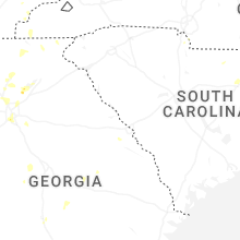

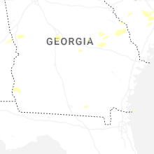


Connect with Interactive Hail Maps