

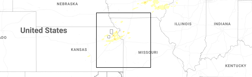
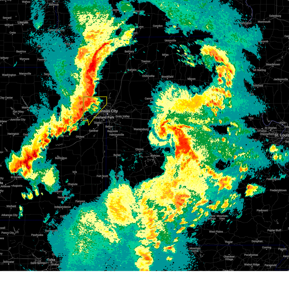
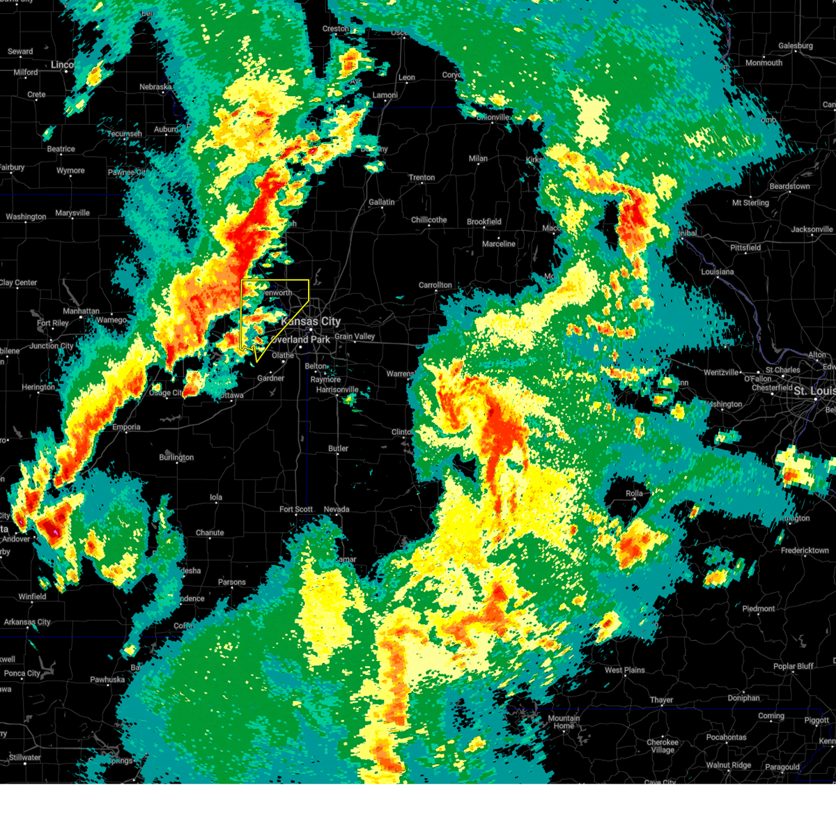
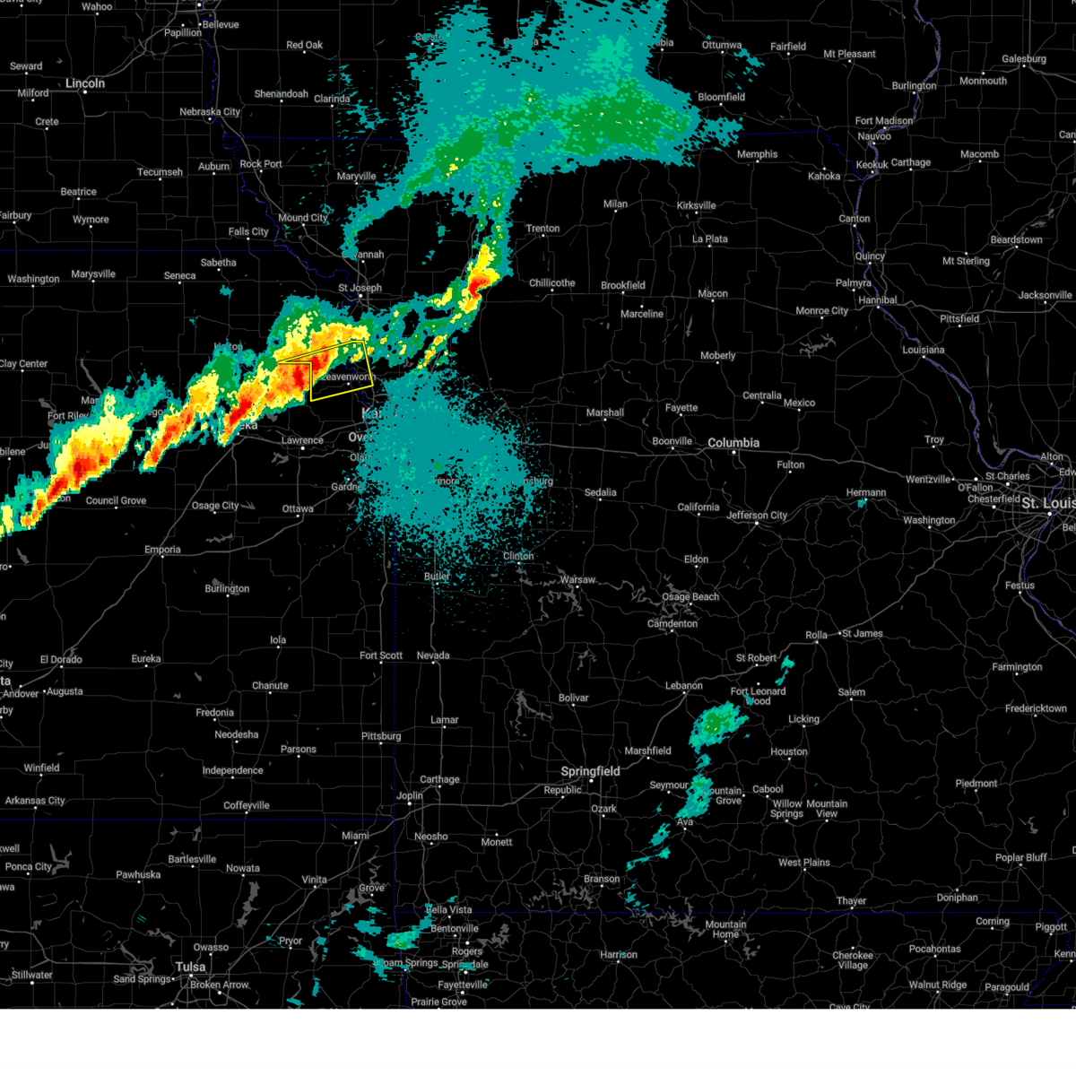
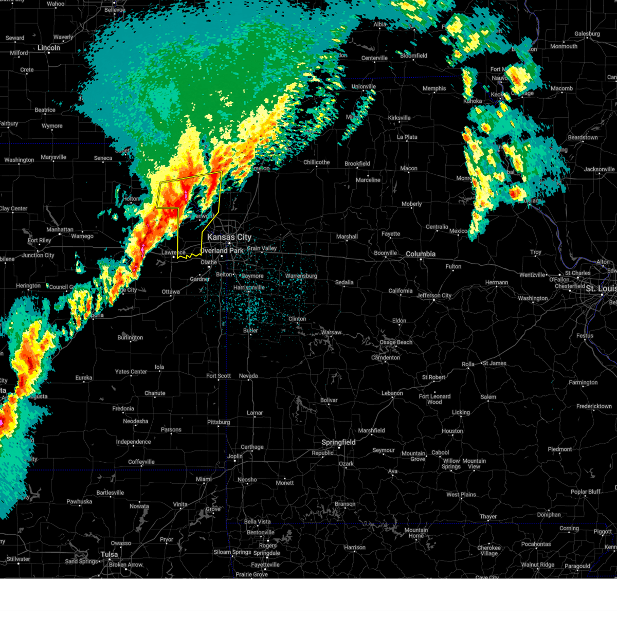
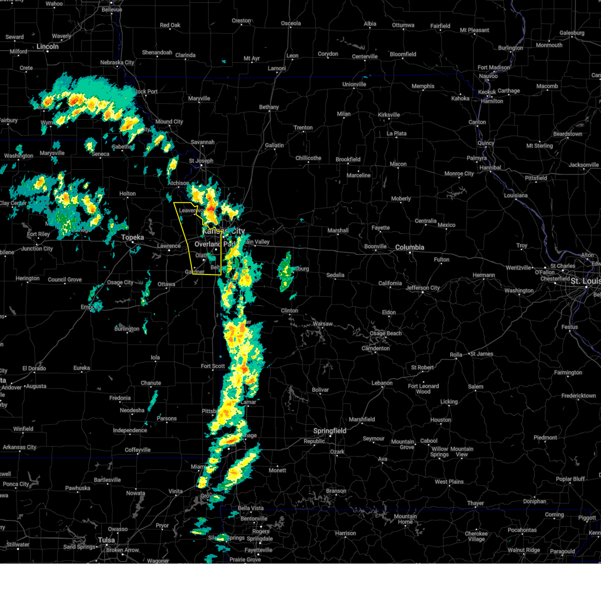
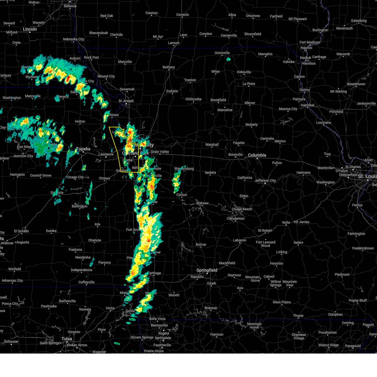
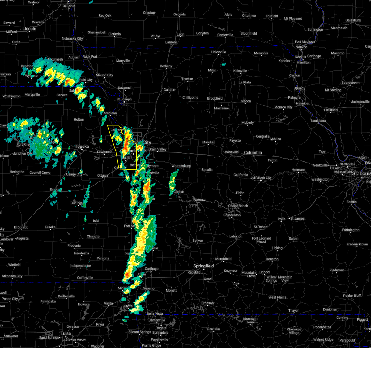
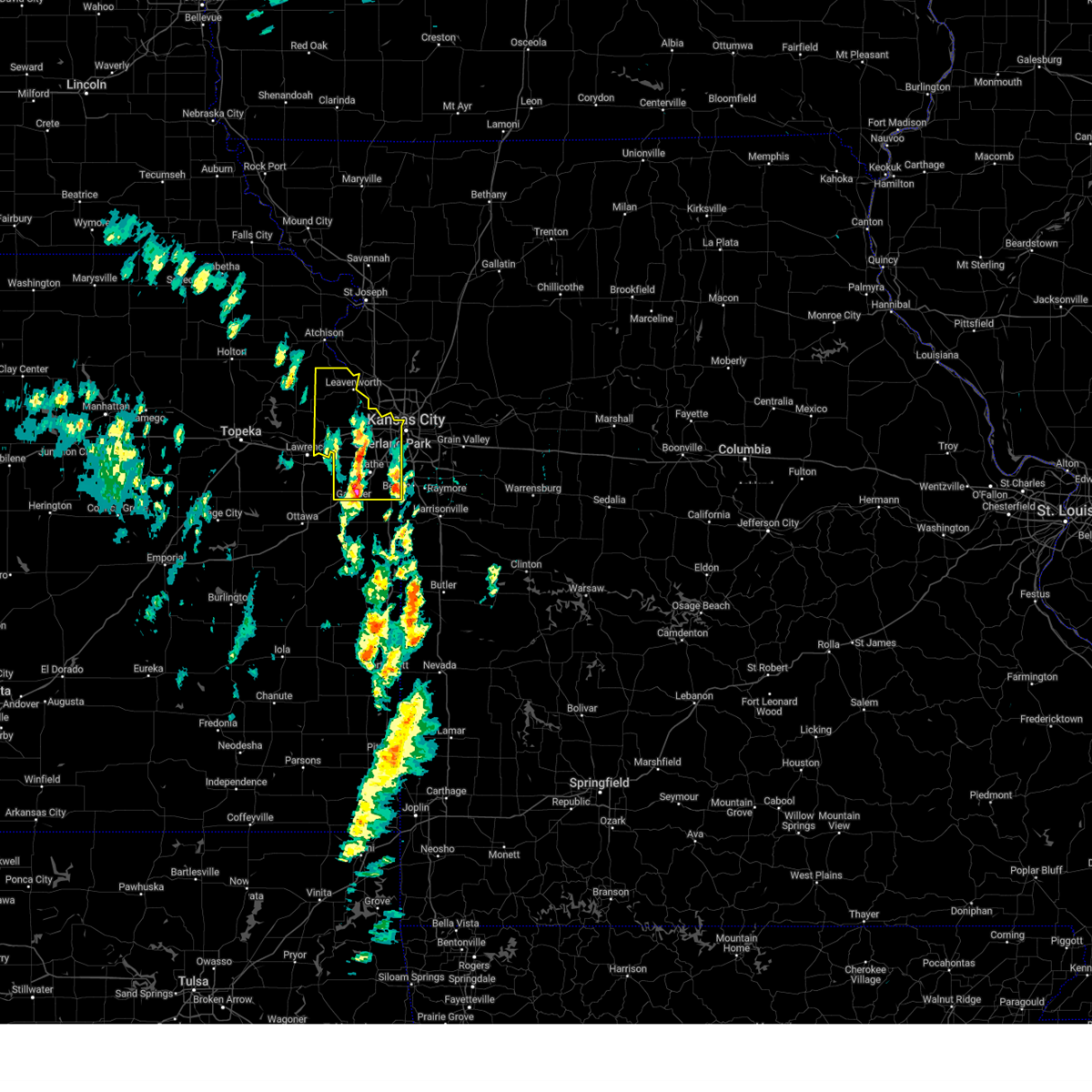
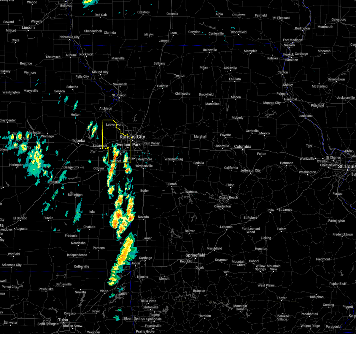
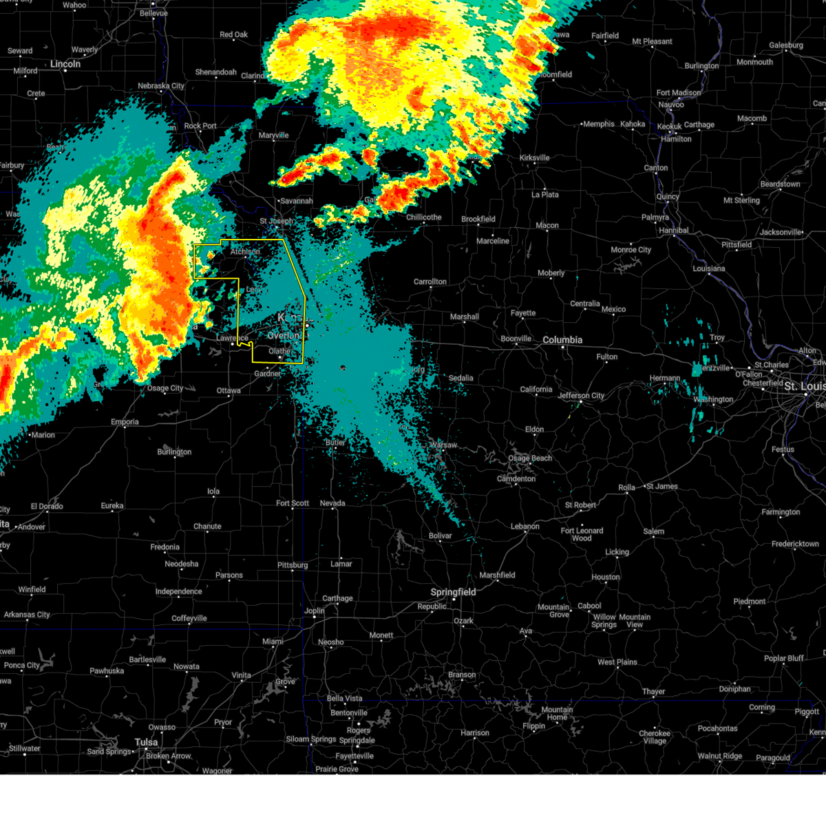
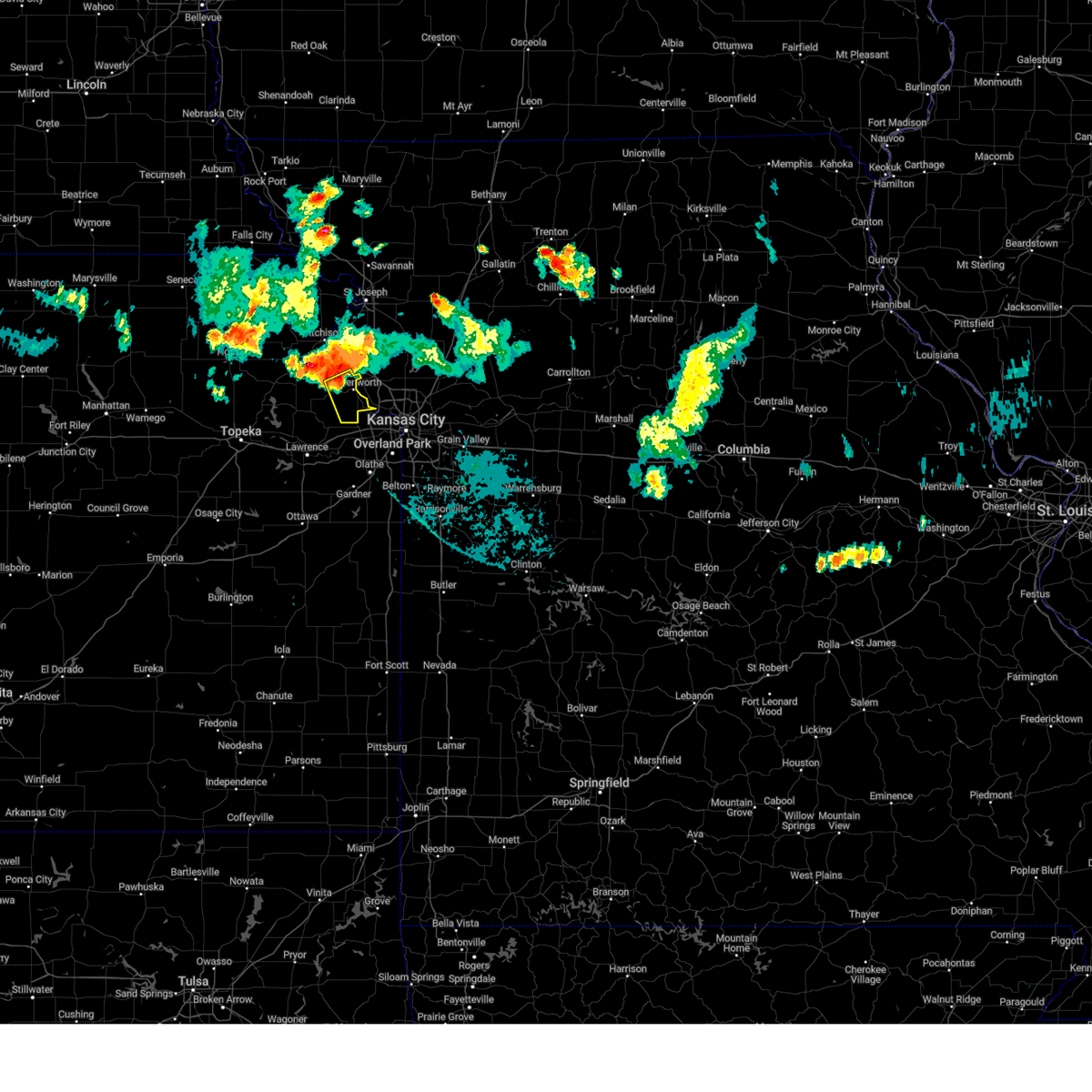
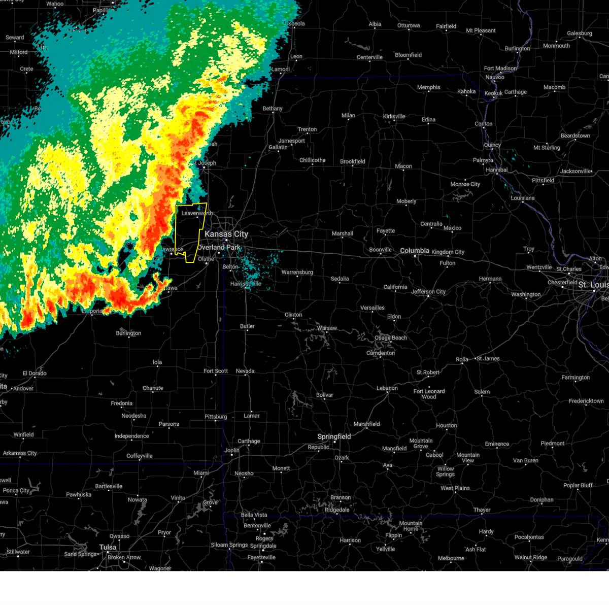
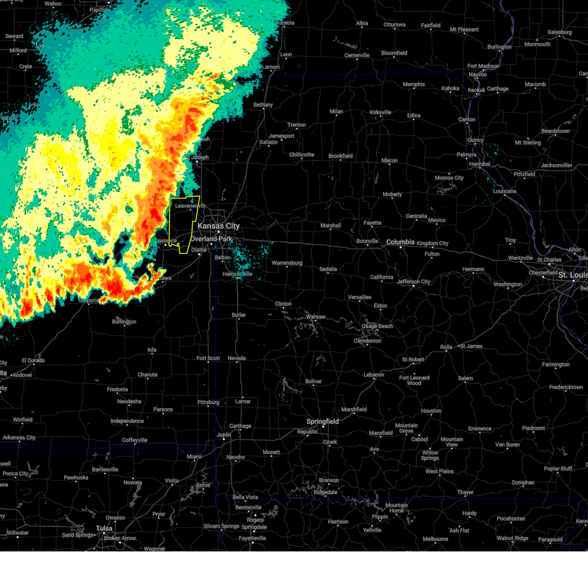
Hail Map for Easton, KS
The Easton, KS area has had 10 reports of on-the-ground hail by trained spotters, and has been under severe weather warnings 29 times during the past 12 months. Doppler radar has detected hail at or near Easton, KS on 62 occasions, including 3 occasions during the past year.
| Name: | Easton, KS |
| Where Located: | 33.2 miles WNW of Kansas City, MO |
| Map: | Google Map for Easton, KS |
| Population: | 253 |
| Housing Units: | 100 |
| More Info: | Search Google for Easton, KS |
1
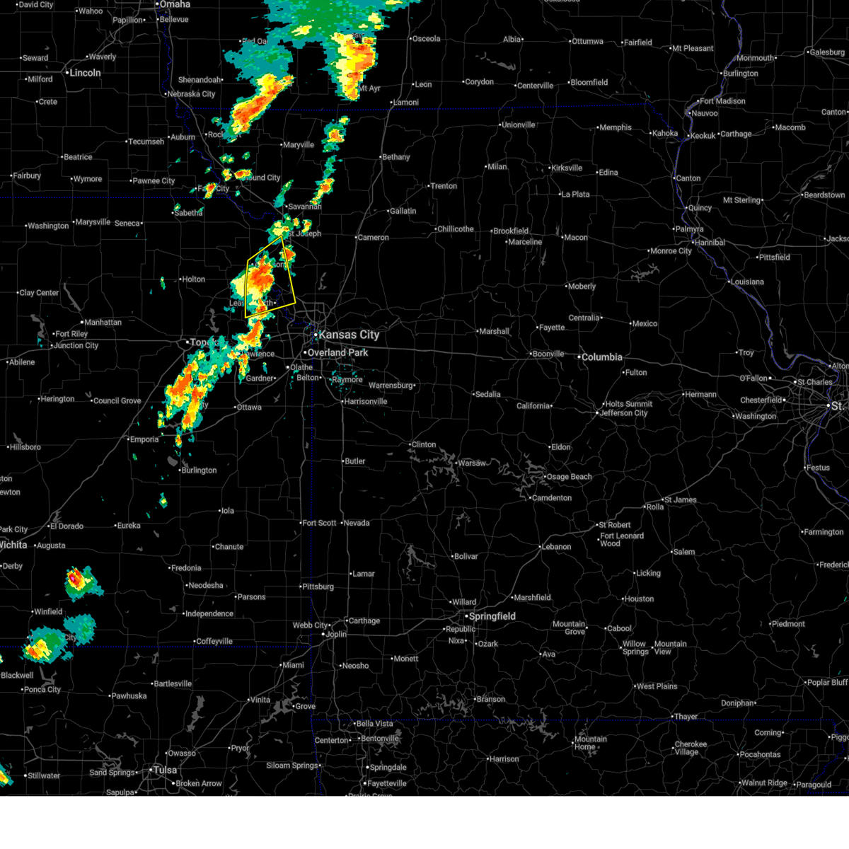
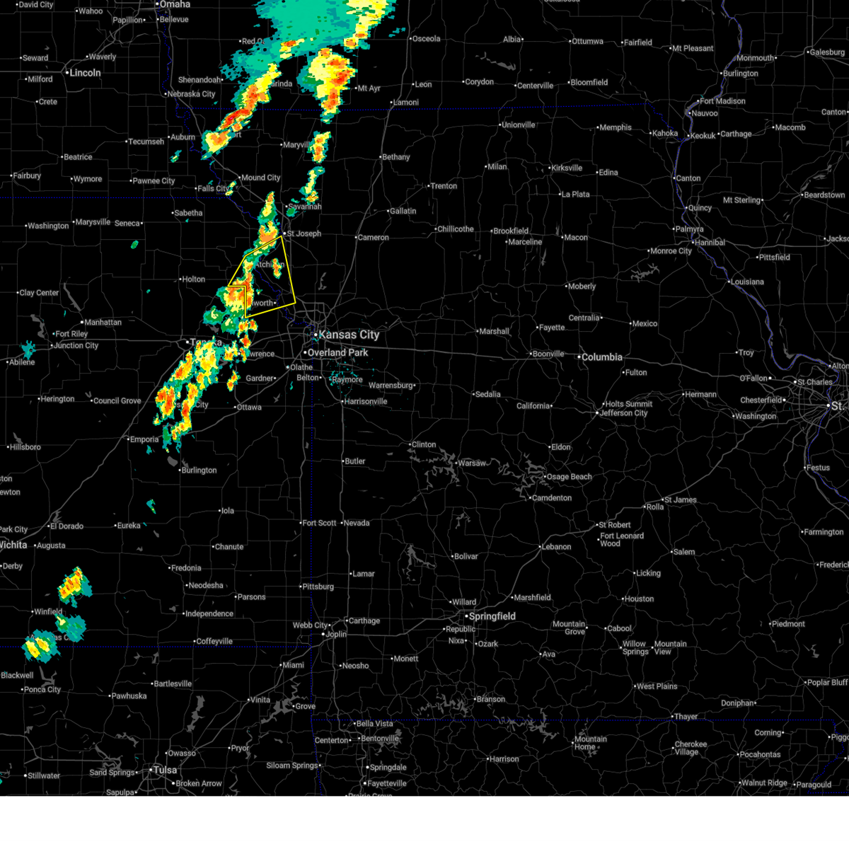
The Top Recent Hail Date for Easton, KS is Thursday, October 24, 2024 (14th out of 62)
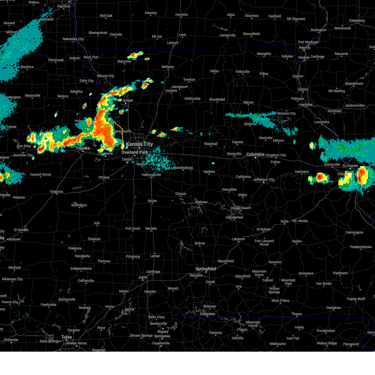
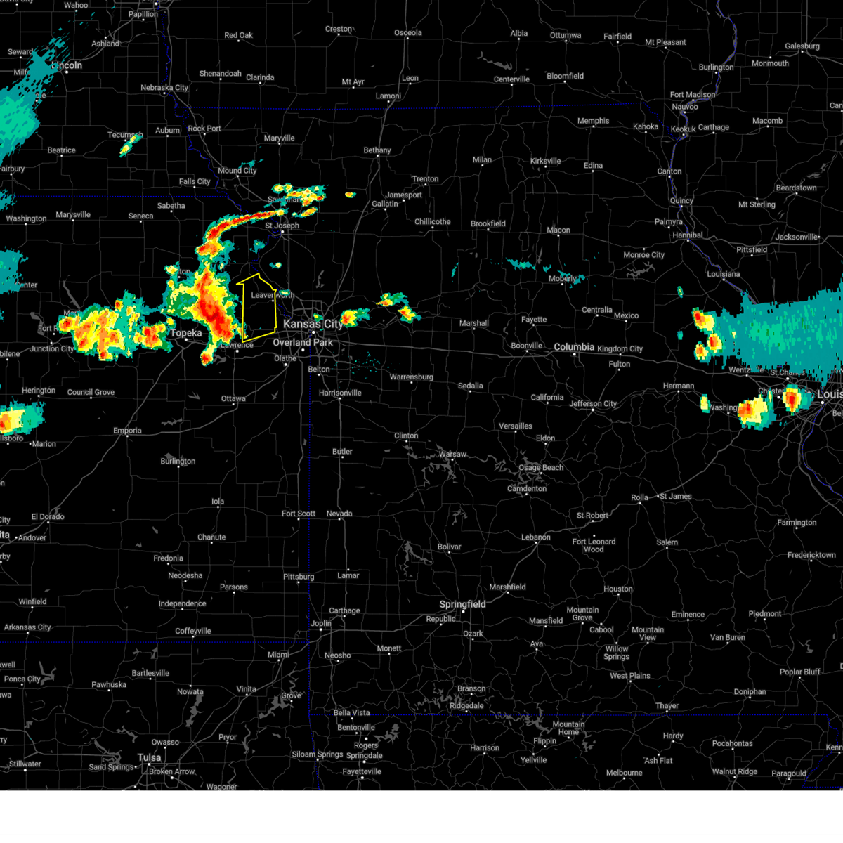
Hail and Wind Damage Spotted near Easton, KS
| Date / Time | Report Details |
|---|---|
| 6/26/2025 4:41 PM CDT | Large tree broke in half at k92 and lecompto in leavenworth county KS, 1.1 miles SSW of Easton, KS |
| 6/26/2025 4:35 PM CDT |
 At 435 pm cdt, severe thunderstorms were located along a line extending from 6 miles east of lewis and clark village to near leavenworth, moving northeast at 40 mph (public). Hazards include 60 mph wind gusts and quarter size hail. Hail damage to vehicles is expected. expect wind damage to roofs, siding, and trees. locations impacted include, st. joseph, leavenworth, atchison, platte city, weston, elwood, rushville, easton, tracy, lewis and clark village, farley, de kalb, iatan, fort leavenworth, bean lake, stillings, lewis and clark vi, beverly, east leavenworth, and lowemont. this includes the following highways, interstate 29 between mile markers 19 and 25. Interstate 435 near mile marker 29. At 435 pm cdt, severe thunderstorms were located along a line extending from 6 miles east of lewis and clark village to near leavenworth, moving northeast at 40 mph (public). Hazards include 60 mph wind gusts and quarter size hail. Hail damage to vehicles is expected. expect wind damage to roofs, siding, and trees. locations impacted include, st. joseph, leavenworth, atchison, platte city, weston, elwood, rushville, easton, tracy, lewis and clark village, farley, de kalb, iatan, fort leavenworth, bean lake, stillings, lewis and clark vi, beverly, east leavenworth, and lowemont. this includes the following highways, interstate 29 between mile markers 19 and 25. Interstate 435 near mile marker 29.
|
| 6/26/2025 4:26 PM CDT | At 426 pm cdt, a severe thunderstorm was located near lewis and clark village, or 9 miles southeast of atchison, moving northeast at 30 mph (public. 60 mph winds were reported between easton and lowemont as the storm passed). Hazards include 60 mph wind gusts and quarter size hail. Hail damage to vehicles is expected. expect wind damage to roofs, siding, and trees. locations impacted include, st. joseph, leavenworth, atchison, platte city, weston, elwood, rushville, easton, tracy, lewis and clark village, farley, de kalb, iatan, fort leavenworth, bean lake, stillings, lewis and clark vi, beverly, east leavenworth, and lowemont. this includes the following highways, interstate 29 between mile markers 19 and 25. Interstate 435 near mile marker 29. |
| 6/26/2025 4:18 PM CDT | Storm damage reported in leavenworth county KS, 2.8 miles WSW of Easton, KS |
| 6/26/2025 4:18 PM CDT |
 At 418 pm cdt, a severe thunderstorm was located near easton, or 9 miles south of atchison, moving northeast at 30 mph (radar indicated). Hazards include 60 mph wind gusts and quarter size hail. Hail damage to vehicles is expected. expect wind damage to roofs, siding, and trees. locations impacted include, st. joseph, leavenworth, atchison, platte city, weston, elwood, rushville, easton, tracy, lewis and clark village, doniphan, farley, de kalb, iatan, fort leavenworth, bean lake, stillings, lewis and clark vi, beverly, and east leavenworth. this includes the following highways, interstate 29 between mile markers 19 and 25. Interstate 435 near mile marker 29. At 418 pm cdt, a severe thunderstorm was located near easton, or 9 miles south of atchison, moving northeast at 30 mph (radar indicated). Hazards include 60 mph wind gusts and quarter size hail. Hail damage to vehicles is expected. expect wind damage to roofs, siding, and trees. locations impacted include, st. joseph, leavenworth, atchison, platte city, weston, elwood, rushville, easton, tracy, lewis and clark village, doniphan, farley, de kalb, iatan, fort leavenworth, bean lake, stillings, lewis and clark vi, beverly, and east leavenworth. this includes the following highways, interstate 29 between mile markers 19 and 25. Interstate 435 near mile marker 29.
|
| 6/26/2025 4:02 PM CDT |
 Svreax the national weather service in pleasant hill has issued a * severe thunderstorm warning for, southeastern doniphan county in northeastern kansas, northern leavenworth county in northeastern kansas, eastern atchison county in northeastern kansas, southwestern buchanan county in northwestern missouri, northwestern platte county in west central missouri, * until 445 pm cdt. * at 402 pm cdt, a severe thunderstorm was located near winchester, or 10 miles northeast of oskaloosa, moving northeast at 35 mph (radar indicated). Hazards include 60 mph wind gusts. expect damage to roofs, siding, and trees Svreax the national weather service in pleasant hill has issued a * severe thunderstorm warning for, southeastern doniphan county in northeastern kansas, northern leavenworth county in northeastern kansas, eastern atchison county in northeastern kansas, southwestern buchanan county in northwestern missouri, northwestern platte county in west central missouri, * until 445 pm cdt. * at 402 pm cdt, a severe thunderstorm was located near winchester, or 10 miles northeast of oskaloosa, moving northeast at 35 mph (radar indicated). Hazards include 60 mph wind gusts. expect damage to roofs, siding, and trees
|
| 5/19/2025 8:30 PM CDT |
 At 830 pm cdt, severe thunderstorms were located along a line extending from platte city to tonganoxie to near lawrence, moving east at 35 mph (public). Hazards include 60 mph wind gusts and quarter size hail. Hail damage to vehicles is expected. expect wind damage to roofs, siding, and trees. locations impacted include, leavenworth, lansing, bonner springs, de soto, parkville, tonganoxie, platte city, basehor, edwardsville, weatherby lake, weston, kansas city intl arpt, kansas city, ferrelview, linwood, easton, tracy, reno, fairmount, and farley. this includes the following highways, interstate 70 in kansas between mile markers 410 and 411. interstate 29 between mile markers 8 and 23. interstate 435 between mile markers 13 and 39. Kansas turnpike between mile markers 206 and 226. At 830 pm cdt, severe thunderstorms were located along a line extending from platte city to tonganoxie to near lawrence, moving east at 35 mph (public). Hazards include 60 mph wind gusts and quarter size hail. Hail damage to vehicles is expected. expect wind damage to roofs, siding, and trees. locations impacted include, leavenworth, lansing, bonner springs, de soto, parkville, tonganoxie, platte city, basehor, edwardsville, weatherby lake, weston, kansas city intl arpt, kansas city, ferrelview, linwood, easton, tracy, reno, fairmount, and farley. this includes the following highways, interstate 70 in kansas between mile markers 410 and 411. interstate 29 between mile markers 8 and 23. interstate 435 between mile markers 13 and 39. Kansas turnpike between mile markers 206 and 226.
|
| 5/19/2025 8:16 PM CDT |
 At 815 pm cdt, severe thunderstorms were located along a line extending from near leavenworth to 6 miles northeast of williamstown to near lawrence, moving east at 40 mph (radar indicated). Hazards include 60 mph wind gusts and quarter size hail. Hail damage to vehicles is expected. expect wind damage to roofs, siding, and trees. locations impacted include, leavenworth, lansing, bonner springs, de soto, parkville, tonganoxie, platte city, basehor, edwardsville, weatherby lake, weston, kansas city intl arpt, kansas city, ferrelview, linwood, easton, tracy, reno, fairmount, and farley. this includes the following highways, interstate 70 in kansas between mile markers 410 and 411. interstate 29 between mile markers 8 and 23. interstate 435 between mile markers 13 and 39. Kansas turnpike between mile markers 206 and 226. At 815 pm cdt, severe thunderstorms were located along a line extending from near leavenworth to 6 miles northeast of williamstown to near lawrence, moving east at 40 mph (radar indicated). Hazards include 60 mph wind gusts and quarter size hail. Hail damage to vehicles is expected. expect wind damage to roofs, siding, and trees. locations impacted include, leavenworth, lansing, bonner springs, de soto, parkville, tonganoxie, platte city, basehor, edwardsville, weatherby lake, weston, kansas city intl arpt, kansas city, ferrelview, linwood, easton, tracy, reno, fairmount, and farley. this includes the following highways, interstate 70 in kansas between mile markers 410 and 411. interstate 29 between mile markers 8 and 23. interstate 435 between mile markers 13 and 39. Kansas turnpike between mile markers 206 and 226.
|
| 5/19/2025 8:04 PM CDT |
 Svreax the national weather service in pleasant hill has issued a * severe thunderstorm warning for, northwestern wyandotte county in northeastern kansas, leavenworth county in northeastern kansas, west central johnson county in east central kansas, southeastern atchison county in northeastern kansas, southeastern platte county in west central missouri, * until 845 pm cdt. * at 803 pm cdt, severe thunderstorms were located along a line extending from near easton to near perry lake to near lecompton, moving east at 35 mph (radar indicated). Hazards include 60 mph wind gusts and quarter size hail. Hail damage to vehicles is expected. Expect wind damage to roofs, siding, and trees. Svreax the national weather service in pleasant hill has issued a * severe thunderstorm warning for, northwestern wyandotte county in northeastern kansas, leavenworth county in northeastern kansas, west central johnson county in east central kansas, southeastern atchison county in northeastern kansas, southeastern platte county in west central missouri, * until 845 pm cdt. * at 803 pm cdt, severe thunderstorms were located along a line extending from near easton to near perry lake to near lecompton, moving east at 35 mph (radar indicated). Hazards include 60 mph wind gusts and quarter size hail. Hail damage to vehicles is expected. Expect wind damage to roofs, siding, and trees.
|
| 4/28/2025 9:31 PM CDT |
 Svreax the national weather service in pleasant hill has issued a * severe thunderstorm warning for, northern leavenworth county in northeastern kansas, southeastern atchison county in northeastern kansas, northwestern platte county in west central missouri, * until 1000 pm cdt. * at 930 pm cdt, a severe thunderstorm was located over winchester, or 8 miles north of oskaloosa, moving east at 50 mph (radar indicated). Hazards include 60 mph wind gusts and quarter size hail. Hail damage to vehicles is expected. Expect wind damage to roofs, siding, and trees. Svreax the national weather service in pleasant hill has issued a * severe thunderstorm warning for, northern leavenworth county in northeastern kansas, southeastern atchison county in northeastern kansas, northwestern platte county in west central missouri, * until 1000 pm cdt. * at 930 pm cdt, a severe thunderstorm was located over winchester, or 8 miles north of oskaloosa, moving east at 50 mph (radar indicated). Hazards include 60 mph wind gusts and quarter size hail. Hail damage to vehicles is expected. Expect wind damage to roofs, siding, and trees.
|
| 4/28/2025 7:42 PM CDT | Svreax the national weather service in pleasant hill has issued a * severe thunderstorm warning for, doniphan county in northeastern kansas, northwestern leavenworth county in northeastern kansas, atchison county in northeastern kansas, buchanan county in northwestern missouri, northern platte county in west central missouri, * until 815 pm cdt. * at 742 pm cdt, a severe thunderstorm was located near atchison, moving east at 55 mph (radar indicated). Hazards include two inch hail and 70 mph wind gusts. People and animals outdoors will be injured. expect hail damage to roofs, siding, windows, and vehicles. expect considerable tree damage. Wind damage is also likely to mobile homes, roofs, and outbuildings. |
| 4/2/2025 3:18 AM CDT |
 Svreax the national weather service in pleasant hill has issued a * severe thunderstorm warning for, southwestern doniphan county in northeastern kansas, leavenworth county in northeastern kansas, atchison county in northeastern kansas, buchanan county in northwestern missouri, northern platte county in west central missouri, * until 345 am cdt. * at 317 am cdt, severe thunderstorms were located along a line extending from lewis and clark village to easton to carbondale, moving east at 60 mph (radar indicated). Hazards include 60 mph wind gusts. expect damage to roofs, siding, and trees Svreax the national weather service in pleasant hill has issued a * severe thunderstorm warning for, southwestern doniphan county in northeastern kansas, leavenworth county in northeastern kansas, atchison county in northeastern kansas, buchanan county in northwestern missouri, northern platte county in west central missouri, * until 345 am cdt. * at 317 am cdt, severe thunderstorms were located along a line extending from lewis and clark village to easton to carbondale, moving east at 60 mph (radar indicated). Hazards include 60 mph wind gusts. expect damage to roofs, siding, and trees
|
| 3/14/2025 3:24 PM CDT |
 The storms which prompted the warning have moved out of the area. therefore, the warning will be allowed to expire. however, very gusty winds are expected. a severe thunderstorm watch remains in effect until 700 pm cdt for northeastern and east central kansas, and west central missouri. The storms which prompted the warning have moved out of the area. therefore, the warning will be allowed to expire. however, very gusty winds are expected. a severe thunderstorm watch remains in effect until 700 pm cdt for northeastern and east central kansas, and west central missouri.
|
| 3/14/2025 3:19 PM CDT |
 At 319 pm cdt, severe thunderstorms were located along a line extending from weston to lake waukomis to near lee's summit, moving north at 55 mph (public reported a 70 mph gust in piper, kansas). Hazards include 70 mph wind gusts and nickel size hail. Expect considerable tree damage. damage is likely to mobile homes, roofs, and outbuildings. locations impacted include, overland park, roeland park, fort leavenworth, olathe, kansas city kansas, spring hill, merriam, clare, pomeroy, lenexa, lackmans, bonner springs, stillwell, westwood, muncie, edwardsville, stanley, leawood, maywood, and leavenworth. this includes the following highways, interstate 70 in missouri near mile marker 0. interstate 70 in kansas between mile markers 410 and 423. interstate 35 in kansas between mile markers 206 and 234. interstate 635 between mile markers 0 and 8. interstate 435 between mile markers 0 and 20, and between mile markers 76 and 83. Kansas turnpike between mile markers 216 and 226. At 319 pm cdt, severe thunderstorms were located along a line extending from weston to lake waukomis to near lee's summit, moving north at 55 mph (public reported a 70 mph gust in piper, kansas). Hazards include 70 mph wind gusts and nickel size hail. Expect considerable tree damage. damage is likely to mobile homes, roofs, and outbuildings. locations impacted include, overland park, roeland park, fort leavenworth, olathe, kansas city kansas, spring hill, merriam, clare, pomeroy, lenexa, lackmans, bonner springs, stillwell, westwood, muncie, edwardsville, stanley, leawood, maywood, and leavenworth. this includes the following highways, interstate 70 in missouri near mile marker 0. interstate 70 in kansas between mile markers 410 and 423. interstate 35 in kansas between mile markers 206 and 234. interstate 635 between mile markers 0 and 8. interstate 435 between mile markers 0 and 20, and between mile markers 76 and 83. Kansas turnpike between mile markers 216 and 226.
|
| 3/14/2025 3:12 PM CDT |
 At 312 pm cdt, severe thunderstorms were located along a line extending from near leavenworth to riverside to near grandview, moving north at 55 mph (public). Hazards include 70 mph wind gusts and nickel size hail. Expect considerable tree damage. damage is likely to mobile homes, roofs, and outbuildings. locations impacted include, overland park, roeland park, fort leavenworth, olathe, kansas city kansas, spring hill, merriam, clare, pomeroy, lenexa, lackmans, bonner springs, stillwell, westwood, muncie, edwardsville, stanley, leawood, maywood, and leavenworth. this includes the following highways, interstate 70 in missouri near mile marker 0. interstate 70 in kansas between mile markers 410 and 423. interstate 35 in kansas between mile markers 206 and 234. interstate 635 between mile markers 0 and 8. interstate 435 between mile markers 0 and 20, and between mile markers 76 and 83. Kansas turnpike between mile markers 216 and 226. At 312 pm cdt, severe thunderstorms were located along a line extending from near leavenworth to riverside to near grandview, moving north at 55 mph (public). Hazards include 70 mph wind gusts and nickel size hail. Expect considerable tree damage. damage is likely to mobile homes, roofs, and outbuildings. locations impacted include, overland park, roeland park, fort leavenworth, olathe, kansas city kansas, spring hill, merriam, clare, pomeroy, lenexa, lackmans, bonner springs, stillwell, westwood, muncie, edwardsville, stanley, leawood, maywood, and leavenworth. this includes the following highways, interstate 70 in missouri near mile marker 0. interstate 70 in kansas between mile markers 410 and 423. interstate 35 in kansas between mile markers 206 and 234. interstate 635 between mile markers 0 and 8. interstate 435 between mile markers 0 and 20, and between mile markers 76 and 83. Kansas turnpike between mile markers 216 and 226.
|
| 3/14/2025 2:55 PM CDT |
 At 253 pm cdt, severe thunderstorms were located along a line extending from near tonganoxie to near merriam to cleveland, moving north at 55 mph (public reported 60 mph wind gusts with these storms). Hazards include 70 mph wind gusts and nickel size hail. Expect considerable tree damage. damage is likely to mobile homes, roofs, and outbuildings. locations impacted include, overland park, roeland park, fort leavenworth, olathe, kansas city kansas, spring hill, merriam, clare, pomeroy, lenexa, lackmans, bonner springs, stillwell, westwood, muncie, edwardsville, linwood, stanley, leawood, and maywood. this includes the following highways, interstate 70 in missouri near mile marker 0. interstate 70 in kansas between mile markers 410 and 423. interstate 35 in kansas between mile markers 202 and 234. interstate 635 between mile markers 0 and 8. interstate 435 between mile markers 0 and 20, and between mile markers 76 and 83. Kansas turnpike between mile markers 206 and 226. At 253 pm cdt, severe thunderstorms were located along a line extending from near tonganoxie to near merriam to cleveland, moving north at 55 mph (public reported 60 mph wind gusts with these storms). Hazards include 70 mph wind gusts and nickel size hail. Expect considerable tree damage. damage is likely to mobile homes, roofs, and outbuildings. locations impacted include, overland park, roeland park, fort leavenworth, olathe, kansas city kansas, spring hill, merriam, clare, pomeroy, lenexa, lackmans, bonner springs, stillwell, westwood, muncie, edwardsville, linwood, stanley, leawood, and maywood. this includes the following highways, interstate 70 in missouri near mile marker 0. interstate 70 in kansas between mile markers 410 and 423. interstate 35 in kansas between mile markers 202 and 234. interstate 635 between mile markers 0 and 8. interstate 435 between mile markers 0 and 20, and between mile markers 76 and 83. Kansas turnpike between mile markers 206 and 226.
|
| 3/14/2025 2:44 PM CDT |
 Svreax the national weather service in pleasant hill has issued a * severe thunderstorm warning for, wyandotte county in northeastern kansas, leavenworth county in northeastern kansas, johnson county in east central kansas, * until 330 pm cdt. * at 244 pm cdt, severe thunderstorms were located along a line extending from tonganoxie to olathe to near louisburg, moving northeast at 55 mph (radar indicated). Hazards include 70 mph wind gusts and nickel size hail. Expect considerable tree damage. Damage is likely to mobile homes, roofs, and outbuildings. Svreax the national weather service in pleasant hill has issued a * severe thunderstorm warning for, wyandotte county in northeastern kansas, leavenworth county in northeastern kansas, johnson county in east central kansas, * until 330 pm cdt. * at 244 pm cdt, severe thunderstorms were located along a line extending from tonganoxie to olathe to near louisburg, moving northeast at 55 mph (radar indicated). Hazards include 70 mph wind gusts and nickel size hail. Expect considerable tree damage. Damage is likely to mobile homes, roofs, and outbuildings.
|
| 10/24/2024 8:28 PM CDT |
 At 827 pm cdt, severe thunderstorms were located along a line extending from near dearborn to near easton to williamstown, moving east at 40 mph (trained weather spotters). Hazards include 70 mph wind gusts and quarter size hail. Hail damage to vehicles is expected. expect considerable tree damage. wind damage is also likely to mobile homes, roofs, and outbuildings. locations impacted include, leavenworth, tonganoxie, weston, easton, fort leavenworth, lowemont, jarbalo, stillings, and beverly. This includes interstate 29 between mile markers 22 and 23. At 827 pm cdt, severe thunderstorms were located along a line extending from near dearborn to near easton to williamstown, moving east at 40 mph (trained weather spotters). Hazards include 70 mph wind gusts and quarter size hail. Hail damage to vehicles is expected. expect considerable tree damage. wind damage is also likely to mobile homes, roofs, and outbuildings. locations impacted include, leavenworth, tonganoxie, weston, easton, fort leavenworth, lowemont, jarbalo, stillings, and beverly. This includes interstate 29 between mile markers 22 and 23.
|
| 10/24/2024 8:19 PM CDT |
 At 819 pm cdt, severe thunderstorms were located along a line extending from near weston to easton to near lecompton, moving east at 30 mph (radar indicated). Hazards include 60 mph wind gusts and quarter size hail. Hail damage to vehicles is expected. expect wind damage to roofs, siding, and trees. locations impacted include, leavenworth, tonganoxie, weston, easton, fort leavenworth, lowemont, jarbalo, stillings, and beverly. This includes interstate 29 between mile markers 22 and 23. At 819 pm cdt, severe thunderstorms were located along a line extending from near weston to easton to near lecompton, moving east at 30 mph (radar indicated). Hazards include 60 mph wind gusts and quarter size hail. Hail damage to vehicles is expected. expect wind damage to roofs, siding, and trees. locations impacted include, leavenworth, tonganoxie, weston, easton, fort leavenworth, lowemont, jarbalo, stillings, and beverly. This includes interstate 29 between mile markers 22 and 23.
|
| 10/24/2024 8:14 PM CDT |
 Svreax the national weather service in pleasant hill has issued a * severe thunderstorm warning for, northwestern leavenworth county in northeastern kansas, central platte county in west central missouri, * until 845 pm cdt. * at 814 pm cdt, severe thunderstorms were located along a line extending from near weston to easton to near lecompton, moving east at 30 mph (radar indicated). Hazards include 60 mph wind gusts and nickel size hail. expect damage to roofs, siding, and trees Svreax the national weather service in pleasant hill has issued a * severe thunderstorm warning for, northwestern leavenworth county in northeastern kansas, central platte county in west central missouri, * until 845 pm cdt. * at 814 pm cdt, severe thunderstorms were located along a line extending from near weston to easton to near lecompton, moving east at 30 mph (radar indicated). Hazards include 60 mph wind gusts and nickel size hail. expect damage to roofs, siding, and trees
|
| 8/14/2024 11:22 PM CDT | At 1122 pm cdt, severe thunderstorms were located along a line extending from near tracy to near lansing to near tonganoxie to 5 miles northeast of lawrence, moving east at 40 mph (trained weather spotters). Hazards include 70 mph wind gusts. Expect considerable tree damage. damage is likely to mobile homes, roofs, and outbuildings. Locations impacted include, leavenworth, lansing, basehor, kansas city, and easton. |
| 8/14/2024 11:10 PM CDT | Large tree blocking k-92 highway near springdal in leavenworth county KS, 4.6 miles NNW of Easton, KS |
| 8/14/2024 11:06 PM CDT | At 1106 pm cdt, severe thunderstorms were located along a line extending from 6 miles northeast of easton to 8 miles north of tonganoxie to 5 miles south of mclouth to lecompton, moving east at 40 mph (radar indicated). Hazards include 70 mph wind gusts. Expect considerable tree damage. damage is likely to mobile homes, roofs, and outbuildings. locations impacted include, leavenworth, lansing, bonner springs, de soto, tonganoxie, basehor, edwardsville, kansas city, linwood, and easton. This includes kansas turnpike between mile markers 207 and 221. |
| 8/14/2024 10:55 PM CDT | Svreax the national weather service in pleasant hill has issued a * severe thunderstorm warning for, northwestern wyandotte county in northeastern kansas, leavenworth county in northeastern kansas, south central platte county in west central missouri, * until 1145 pm cdt. * at 1055 pm cdt, severe thunderstorms were located along a line extending from 4 miles north of easton to 3 miles north of mclouth to 4 miles north of williamstown to 4 miles southeast of grantville, moving east at 40 mph (radar indicated). Hazards include 60 mph wind gusts. expect damage to roofs, siding, and trees |
| 7/31/2024 10:22 PM CDT |
 Svreax the national weather service in pleasant hill has issued a * severe thunderstorm warning for, leavenworth county in northeastern kansas, central atchison county in northeastern kansas, wyandotte county in northeastern kansas, northeastern miami county in east central kansas, doniphan county in northeastern kansas, johnson county in east central kansas, buchanan county in northwestern missouri, southeastern holt county in northwestern missouri, southern andrew county in northwestern missouri, western jackson county in west central missouri, northwestern cass county in west central missouri, clinton county in northwestern missouri, clay county in west central missouri, west central ray county in west central missouri, platte county in west central missouri, western dekalb county in northwestern missouri, * until 1115 pm cdt. * at 1022 pm cdt, severe thunderstorms were located along a line extending from 7 miles northwest of rushville to near lansing to near lawrence, moving east at 55 mph (radar indicated). Hazards include 70 mph wind gusts. Expect considerable tree damage. Damage is likely to mobile homes, roofs, and outbuildings. Svreax the national weather service in pleasant hill has issued a * severe thunderstorm warning for, leavenworth county in northeastern kansas, central atchison county in northeastern kansas, wyandotte county in northeastern kansas, northeastern miami county in east central kansas, doniphan county in northeastern kansas, johnson county in east central kansas, buchanan county in northwestern missouri, southeastern holt county in northwestern missouri, southern andrew county in northwestern missouri, western jackson county in west central missouri, northwestern cass county in west central missouri, clinton county in northwestern missouri, clay county in west central missouri, west central ray county in west central missouri, platte county in west central missouri, western dekalb county in northwestern missouri, * until 1115 pm cdt. * at 1022 pm cdt, severe thunderstorms were located along a line extending from 7 miles northwest of rushville to near lansing to near lawrence, moving east at 55 mph (radar indicated). Hazards include 70 mph wind gusts. Expect considerable tree damage. Damage is likely to mobile homes, roofs, and outbuildings.
|
| 7/31/2024 10:10 PM CDT |
 At 1010 pm cdt, a severe thunderstorm was located near lewis and clark village, or 7 miles west of weston, moving east at 55 mph (radar indicated). Hazards include 70 mph wind gusts. Expect considerable tree damage. damage is likely to mobile homes, roofs, and outbuildings. locations impacted include, overland park, olathe, shawnee, lenexa, leavenworth, leawood, prairie village, lansing, atchison, merriam, mission, bonner springs, de soto, parkville, tonganoxie, platte city, basehor, edwardsville, fairway, and mission hills. this includes the following highways, interstate 70 in missouri near mile marker 0. interstate 70 in kansas between mile markers 410 and 423. interstate 35 in kansas between mile markers 215 and 234. interstate 29 between mile markers 4 and 40. interstate 635 between mile markers 0 and 12. interstate 435 between mile markers 0 and 38, and between mile markers 76 and 83. Kansas turnpike between mile markers 206 and 226. At 1010 pm cdt, a severe thunderstorm was located near lewis and clark village, or 7 miles west of weston, moving east at 55 mph (radar indicated). Hazards include 70 mph wind gusts. Expect considerable tree damage. damage is likely to mobile homes, roofs, and outbuildings. locations impacted include, overland park, olathe, shawnee, lenexa, leavenworth, leawood, prairie village, lansing, atchison, merriam, mission, bonner springs, de soto, parkville, tonganoxie, platte city, basehor, edwardsville, fairway, and mission hills. this includes the following highways, interstate 70 in missouri near mile marker 0. interstate 70 in kansas between mile markers 410 and 423. interstate 35 in kansas between mile markers 215 and 234. interstate 29 between mile markers 4 and 40. interstate 635 between mile markers 0 and 12. interstate 435 between mile markers 0 and 38, and between mile markers 76 and 83. Kansas turnpike between mile markers 206 and 226.
|
| 7/31/2024 9:41 PM CDT |
 Svreax the national weather service in pleasant hill has issued a * severe thunderstorm warning for, wyandotte county in northeastern kansas, southwestern doniphan county in northeastern kansas, leavenworth county in northeastern kansas, johnson county in east central kansas, atchison county in northeastern kansas, southwestern buchanan county in northwestern missouri, platte county in west central missouri, * until 1030 pm cdt. * at 941 pm cdt, a severe thunderstorm was located near denison, or 7 miles northwest of valley falls, moving east at 55 mph (radar indicated). Hazards include 60 mph wind gusts. expect damage to roofs, siding, and trees Svreax the national weather service in pleasant hill has issued a * severe thunderstorm warning for, wyandotte county in northeastern kansas, southwestern doniphan county in northeastern kansas, leavenworth county in northeastern kansas, johnson county in east central kansas, atchison county in northeastern kansas, southwestern buchanan county in northwestern missouri, platte county in west central missouri, * until 1030 pm cdt. * at 941 pm cdt, a severe thunderstorm was located near denison, or 7 miles northwest of valley falls, moving east at 55 mph (radar indicated). Hazards include 60 mph wind gusts. expect damage to roofs, siding, and trees
|
| 7/16/2024 8:13 AM CDT |
 Svreax the national weather service in pleasant hill has issued a * severe thunderstorm warning for, northern leavenworth county in northeastern kansas, southeastern atchison county in northeastern kansas, southeastern buchanan county in northwestern missouri, western clinton county in northwestern missouri, northern clay county in west central missouri, platte county in west central missouri, * until 900 am cdt. * at 813 am cdt, severe thunderstorms were located along a line extending from 6 miles north of easton to near weston to near leavenworth, moving east at 45 mph (radar indicated). Hazards include 70 mph wind gusts. Expect considerable tree damage. Damage is likely to mobile homes, roofs, and outbuildings. Svreax the national weather service in pleasant hill has issued a * severe thunderstorm warning for, northern leavenworth county in northeastern kansas, southeastern atchison county in northeastern kansas, southeastern buchanan county in northwestern missouri, western clinton county in northwestern missouri, northern clay county in west central missouri, platte county in west central missouri, * until 900 am cdt. * at 813 am cdt, severe thunderstorms were located along a line extending from 6 miles north of easton to near weston to near leavenworth, moving east at 45 mph (radar indicated). Hazards include 70 mph wind gusts. Expect considerable tree damage. Damage is likely to mobile homes, roofs, and outbuildings.
|
| 7/16/2024 8:05 AM CDT |
 At 805 am cdt, severe thunderstorms were located along a line extending from near platte city to near lansing to basehor to near linwood to near eudora, moving east at 30 mph (radar indicated). Hazards include 70 mph wind gusts and penny size hail. Expect considerable tree damage. damage is likely to mobile homes, roofs, and outbuildings. locations impacted include, overland park, olathe, shawnee, lenexa, leavenworth, leawood, prairie village, gardner, lansing, merriam, mission, bonner springs, de soto, parkville, tonganoxie, platte city, basehor, edwardsville, fairway, and mission hills. this includes the following highways, interstate 70 in missouri near mile marker 0. interstate 70 in kansas between mile markers 410 and 423. interstate 35 in kansas between mile markers 212 and 234. interstate 29 between mile markers 3 and 23. interstate 635 between mile markers 0 and 12. interstate 435 between mile markers 0 and 39, and between mile markers 76 and 83. Kansas turnpike between mile markers 206 and 226. At 805 am cdt, severe thunderstorms were located along a line extending from near platte city to near lansing to basehor to near linwood to near eudora, moving east at 30 mph (radar indicated). Hazards include 70 mph wind gusts and penny size hail. Expect considerable tree damage. damage is likely to mobile homes, roofs, and outbuildings. locations impacted include, overland park, olathe, shawnee, lenexa, leavenworth, leawood, prairie village, gardner, lansing, merriam, mission, bonner springs, de soto, parkville, tonganoxie, platte city, basehor, edwardsville, fairway, and mission hills. this includes the following highways, interstate 70 in missouri near mile marker 0. interstate 70 in kansas between mile markers 410 and 423. interstate 35 in kansas between mile markers 212 and 234. interstate 29 between mile markers 3 and 23. interstate 635 between mile markers 0 and 12. interstate 435 between mile markers 0 and 39, and between mile markers 76 and 83. Kansas turnpike between mile markers 206 and 226.
|
| 7/16/2024 7:37 AM CDT |
 Svreax the national weather service in pleasant hill has issued a * severe thunderstorm warning for, wyandotte county in northeastern kansas, leavenworth county in northeastern kansas, johnson county in east central kansas, southeastern platte county in west central missouri, * until 830 am cdt. * at 737 am cdt, severe thunderstorms were located along a line extending from near mclouth to near williamstown to lecompton to clinton lake, moving east at 45 mph (radar indicated). Hazards include 70 mph wind gusts and nickel size hail. Expect considerable tree damage. Damage is likely to mobile homes, roofs, and outbuildings. Svreax the national weather service in pleasant hill has issued a * severe thunderstorm warning for, wyandotte county in northeastern kansas, leavenworth county in northeastern kansas, johnson county in east central kansas, southeastern platte county in west central missouri, * until 830 am cdt. * at 737 am cdt, severe thunderstorms were located along a line extending from near mclouth to near williamstown to lecompton to clinton lake, moving east at 45 mph (radar indicated). Hazards include 70 mph wind gusts and nickel size hail. Expect considerable tree damage. Damage is likely to mobile homes, roofs, and outbuildings.
|
| 7/10/2024 9:00 PM CDT |
 Svreax the national weather service in pleasant hill has issued a * severe thunderstorm warning for, northeastern leavenworth county in northeastern kansas, * until 930 pm cdt. * at 900 pm cdt, a severe thunderstorm was located near leavenworth, moving southeast at 35 mph (radar indicated). Hazards include 60 mph wind gusts and quarter size hail. Hail damage to vehicles is expected. Expect wind damage to roofs, siding, and trees. Svreax the national weather service in pleasant hill has issued a * severe thunderstorm warning for, northeastern leavenworth county in northeastern kansas, * until 930 pm cdt. * at 900 pm cdt, a severe thunderstorm was located near leavenworth, moving southeast at 35 mph (radar indicated). Hazards include 60 mph wind gusts and quarter size hail. Hail damage to vehicles is expected. Expect wind damage to roofs, siding, and trees.
|
| 7/10/2024 8:17 PM CDT |
 Svreax the national weather service in pleasant hill has issued a * severe thunderstorm warning for, southern doniphan county in northeastern kansas, northwestern leavenworth county in northeastern kansas, eastern atchison county in northeastern kansas, southwestern buchanan county in northwestern missouri, northwestern platte county in west central missouri, * until 845 pm cdt. * at 817 pm cdt, a severe thunderstorm was located near rushville, or 7 miles southwest of wathena, moving southeast at 45 mph (radar indicated). Hazards include 60 mph wind gusts and quarter size hail. Hail damage to vehicles is expected. Expect wind damage to roofs, siding, and trees. Svreax the national weather service in pleasant hill has issued a * severe thunderstorm warning for, southern doniphan county in northeastern kansas, northwestern leavenworth county in northeastern kansas, eastern atchison county in northeastern kansas, southwestern buchanan county in northwestern missouri, northwestern platte county in west central missouri, * until 845 pm cdt. * at 817 pm cdt, a severe thunderstorm was located near rushville, or 7 miles southwest of wathena, moving southeast at 45 mph (radar indicated). Hazards include 60 mph wind gusts and quarter size hail. Hail damage to vehicles is expected. Expect wind damage to roofs, siding, and trees.
|
| 5/19/2024 11:01 PM CDT |
 At 1100 pm cdt, severe thunderstorms were located along a line extending from near effingham to near weston to riverside, moving north at 50 mph (trained weather spotters). Hazards include 60 mph wind gusts. Expect damage to roofs, siding, and trees. locations impacted include, kansas city, leavenworth, liberty, gladstone, lansing, excelsior springs, atchison, smithville, kearney, parkville, platte city, north kansas city, sugar creek, riverside, weatherby lake, weston, claycomo, pleasant valley, lake waukomis, and effingham. this includes the following highways, interstate 35 in missouri between mile markers 5 and 26. interstate 29 between mile markers 0 and 27. interstate 635 between mile markers 9 and 12. Interstate 435 between mile markers 20 and 56. At 1100 pm cdt, severe thunderstorms were located along a line extending from near effingham to near weston to riverside, moving north at 50 mph (trained weather spotters). Hazards include 60 mph wind gusts. Expect damage to roofs, siding, and trees. locations impacted include, kansas city, leavenworth, liberty, gladstone, lansing, excelsior springs, atchison, smithville, kearney, parkville, platte city, north kansas city, sugar creek, riverside, weatherby lake, weston, claycomo, pleasant valley, lake waukomis, and effingham. this includes the following highways, interstate 35 in missouri between mile markers 5 and 26. interstate 29 between mile markers 0 and 27. interstate 635 between mile markers 9 and 12. Interstate 435 between mile markers 20 and 56.
|
| 5/19/2024 10:44 PM CDT |
 Svreax the national weather service in pleasant hill has issued a * severe thunderstorm warning for, northern leavenworth county in northeastern kansas, central atchison county in northeastern kansas, clay county in west central missouri, platte county in west central missouri, * until 1130 pm cdt. * at 1044 pm cdt, severe thunderstorms were located along a line extending from near valley falls to near basehor to near merriam, moving north at 50 mph (radar indicated). Hazards include 60 mph wind gusts. expect damage to roofs, siding, and trees Svreax the national weather service in pleasant hill has issued a * severe thunderstorm warning for, northern leavenworth county in northeastern kansas, central atchison county in northeastern kansas, clay county in west central missouri, platte county in west central missouri, * until 1130 pm cdt. * at 1044 pm cdt, severe thunderstorms were located along a line extending from near valley falls to near basehor to near merriam, moving north at 50 mph (radar indicated). Hazards include 60 mph wind gusts. expect damage to roofs, siding, and trees
|
| 5/6/2024 11:15 PM CDT |
 The storms which prompted the warning have moved out of the area. therefore, the warning has been allowed to expire. however, heavy rain is still possible with these thunderstorms. a tornado watch remains in effect until 400 am cdt for northeastern and east central kansas, and northwestern and west central missouri. to report severe weather, contact your nearest law enforcement agency. they will relay your report to the national weather service pleasant hill. The storms which prompted the warning have moved out of the area. therefore, the warning has been allowed to expire. however, heavy rain is still possible with these thunderstorms. a tornado watch remains in effect until 400 am cdt for northeastern and east central kansas, and northwestern and west central missouri. to report severe weather, contact your nearest law enforcement agency. they will relay your report to the national weather service pleasant hill.
|
| 5/6/2024 10:33 PM CDT |
 At 1033 pm cdt, severe thunderstorms were located along a line extending from camden point to near edgerton, moving northeast at 40 mph (radar indicated). Hazards include 60 mph wind gusts and penny size hail. Expect damage to roofs, siding, and trees. locations impacted include, overland park, olathe, shawnee, lenexa, leavenworth, leawood, prairie village, gardner, lansing, merriam, mission, bonner springs, de soto, parkville, spring hill, tonganoxie, platte city, basehor, edwardsville, and fairway. this includes the following highways, interstate 70 in missouri near mile marker 0. interstate 70 in kansas between mile markers 410 and 423. interstate 35 in missouri near mile marker 0. interstate 35 in kansas between mile markers 202 and 235. interstate 29 between mile markers 4 and 24. interstate 635 between mile markers 0 and 12. interstate 435 between mile markers 0 and 39, and between mile markers 76 and 83. Kansas turnpike between mile markers 206 and 226. At 1033 pm cdt, severe thunderstorms were located along a line extending from camden point to near edgerton, moving northeast at 40 mph (radar indicated). Hazards include 60 mph wind gusts and penny size hail. Expect damage to roofs, siding, and trees. locations impacted include, overland park, olathe, shawnee, lenexa, leavenworth, leawood, prairie village, gardner, lansing, merriam, mission, bonner springs, de soto, parkville, spring hill, tonganoxie, platte city, basehor, edwardsville, and fairway. this includes the following highways, interstate 70 in missouri near mile marker 0. interstate 70 in kansas between mile markers 410 and 423. interstate 35 in missouri near mile marker 0. interstate 35 in kansas between mile markers 202 and 235. interstate 29 between mile markers 4 and 24. interstate 635 between mile markers 0 and 12. interstate 435 between mile markers 0 and 39, and between mile markers 76 and 83. Kansas turnpike between mile markers 206 and 226.
|
| 5/6/2024 10:13 PM CDT |
 Svreax the national weather service in pleasant hill has issued a * severe thunderstorm warning for, wyandotte county in northeastern kansas, leavenworth county in northeastern kansas, johnson county in east central kansas, platte county in west central missouri, * until 1115 pm cdt. * at 1013 pm cdt, severe thunderstorms were located along a line extending from platte city to near ottawa, moving northeast at 50 mph (radar indicated). Hazards include 60 mph wind gusts and penny size hail. expect damage to roofs, siding, and trees Svreax the national weather service in pleasant hill has issued a * severe thunderstorm warning for, wyandotte county in northeastern kansas, leavenworth county in northeastern kansas, johnson county in east central kansas, platte county in west central missouri, * until 1115 pm cdt. * at 1013 pm cdt, severe thunderstorms were located along a line extending from platte city to near ottawa, moving northeast at 50 mph (radar indicated). Hazards include 60 mph wind gusts and penny size hail. expect damage to roofs, siding, and trees
|
| 4/18/2024 3:03 AM CDT |
 At 303 am cdt, severe thunderstorms were located along a line extending from near rushville to 6 miles west of weston to near tonganoxie, moving east at 45 mph (radar indicated). Hazards include 70 mph wind gusts and quarter size hail. Hail damage to vehicles is expected. expect considerable tree damage. wind damage is also likely to mobile homes, roofs, and outbuildings. locations impacted include, leavenworth, lansing, tonganoxie, platte city, basehor, weston, agency, edgerton, dearborn, camden point, rushville, easton, tracy, lewis and clark village, reno, fairmount, farley, de kalb, ridgely, and iatan. this includes the following highways, interstate 29 between mile markers 13 and 39. interstate 435 between mile markers 25 and 35. Kansas turnpike between mile markers 206 and 217. At 303 am cdt, severe thunderstorms were located along a line extending from near rushville to 6 miles west of weston to near tonganoxie, moving east at 45 mph (radar indicated). Hazards include 70 mph wind gusts and quarter size hail. Hail damage to vehicles is expected. expect considerable tree damage. wind damage is also likely to mobile homes, roofs, and outbuildings. locations impacted include, leavenworth, lansing, tonganoxie, platte city, basehor, weston, agency, edgerton, dearborn, camden point, rushville, easton, tracy, lewis and clark village, reno, fairmount, farley, de kalb, ridgely, and iatan. this includes the following highways, interstate 29 between mile markers 13 and 39. interstate 435 between mile markers 25 and 35. Kansas turnpike between mile markers 206 and 217.
|
| 4/18/2024 3:00 AM CDT |
 At 300 am cdt, severe thunderstorms were located along a line extending from near rushville to 6 miles northeast of easton to 6 miles west of tonganoxie, moving east at 45 mph (radar indicated). Hazards include 60 mph wind gusts and quarter size hail. Hail damage to vehicles is expected. expect wind damage to roofs, siding, and trees. locations impacted include, leavenworth, lansing, tonganoxie, platte city, basehor, weston, agency, edgerton, dearborn, camden point, rushville, easton, tracy, lewis and clark village, reno, fairmount, farley, de kalb, ridgely, and iatan. this includes the following highways, interstate 29 between mile markers 13 and 39. interstate 435 between mile markers 25 and 35. Kansas turnpike between mile markers 206 and 217. At 300 am cdt, severe thunderstorms were located along a line extending from near rushville to 6 miles northeast of easton to 6 miles west of tonganoxie, moving east at 45 mph (radar indicated). Hazards include 60 mph wind gusts and quarter size hail. Hail damage to vehicles is expected. expect wind damage to roofs, siding, and trees. locations impacted include, leavenworth, lansing, tonganoxie, platte city, basehor, weston, agency, edgerton, dearborn, camden point, rushville, easton, tracy, lewis and clark village, reno, fairmount, farley, de kalb, ridgely, and iatan. this includes the following highways, interstate 29 between mile markers 13 and 39. interstate 435 between mile markers 25 and 35. Kansas turnpike between mile markers 206 and 217.
|
| 4/18/2024 2:45 AM CDT |
 Svreax the national weather service in pleasant hill has issued a * severe thunderstorm warning for, leavenworth county in northeastern kansas, eastern atchison county in northeastern kansas, southern buchanan county in northwestern missouri, platte county in west central missouri, * until 330 am cdt. * at 244 am cdt, severe thunderstorms were located along a line extending from near lancaster to near winchester to near lecompton, moving east at 45 mph (radar indicated). Hazards include 60 mph wind gusts and quarter size hail. Hail damage to vehicles is expected. Expect wind damage to roofs, siding, and trees. Svreax the national weather service in pleasant hill has issued a * severe thunderstorm warning for, leavenworth county in northeastern kansas, eastern atchison county in northeastern kansas, southern buchanan county in northwestern missouri, platte county in west central missouri, * until 330 am cdt. * at 244 am cdt, severe thunderstorms were located along a line extending from near lancaster to near winchester to near lecompton, moving east at 45 mph (radar indicated). Hazards include 60 mph wind gusts and quarter size hail. Hail damage to vehicles is expected. Expect wind damage to roofs, siding, and trees.
|
| 3/13/2024 10:57 PM CDT | Quarter sized hail reported 5.9 miles N of Easton, KS, quarter size hail reported in springdale. time estimated from radar. |
| 3/13/2024 10:48 PM CDT |
 At 1047 pm cdt, severe thunderstorms were located along a line extending from 6 miles east of rushville to near weston to near leavenworth, moving east at 35 mph (radar indicated). Hazards include 60 mph wind gusts and quarter size hail. Hail damage to vehicles is expected. expect wind damage to roofs, siding, and trees. locations impacted include, leavenworth, lansing, atchison, platte city, weston, kansas city, agency, dearborn, camden point, rushville, easton, tracy, lewis and clark village, fairmount, farley, de kalb, iatan, fort leavenworth, faucett, and waldron. this includes the following highways, interstate 29 between mile markers 17 and 39. Interstate 435 between mile markers 21 and 31. At 1047 pm cdt, severe thunderstorms were located along a line extending from 6 miles east of rushville to near weston to near leavenworth, moving east at 35 mph (radar indicated). Hazards include 60 mph wind gusts and quarter size hail. Hail damage to vehicles is expected. expect wind damage to roofs, siding, and trees. locations impacted include, leavenworth, lansing, atchison, platte city, weston, kansas city, agency, dearborn, camden point, rushville, easton, tracy, lewis and clark village, fairmount, farley, de kalb, iatan, fort leavenworth, faucett, and waldron. this includes the following highways, interstate 29 between mile markers 17 and 39. Interstate 435 between mile markers 21 and 31.
|
| 3/13/2024 10:21 PM CDT |
 Svreax the national weather service in pleasant hill has issued a * severe thunderstorm warning for, northern leavenworth county in northeastern kansas, eastern atchison county in northeastern kansas, southern buchanan county in northwestern missouri, western platte county in west central missouri, * until 1100 pm cdt. * at 1021 pm cdt, severe thunderstorms were located along a line extending from atchison to near easton to oskaloosa, moving east at 35 mph (radar indicated). Hazards include 60 mph wind gusts and quarter size hail. Hail damage to vehicles is expected. Expect wind damage to roofs, siding, and trees. Svreax the national weather service in pleasant hill has issued a * severe thunderstorm warning for, northern leavenworth county in northeastern kansas, eastern atchison county in northeastern kansas, southern buchanan county in northwestern missouri, western platte county in west central missouri, * until 1100 pm cdt. * at 1021 pm cdt, severe thunderstorms were located along a line extending from atchison to near easton to oskaloosa, moving east at 35 mph (radar indicated). Hazards include 60 mph wind gusts and quarter size hail. Hail damage to vehicles is expected. Expect wind damage to roofs, siding, and trees.
|
| 7/30/2023 7:56 PM CDT |
 At 756 pm cdt, severe thunderstorms were located along a line extending from near smithville to near easton, moving south at 45 mph (radar indicated). Hazards include 70 mph wind gusts. Expect considerable tree damage. Damage is likely to mobile homes, roofs, and outbuildings. At 756 pm cdt, severe thunderstorms were located along a line extending from near smithville to near easton, moving south at 45 mph (radar indicated). Hazards include 70 mph wind gusts. Expect considerable tree damage. Damage is likely to mobile homes, roofs, and outbuildings.
|
| 7/30/2023 7:24 PM CDT |
 At 723 pm cdt, severe thunderstorms were located along a line extending from near clarksdale to near rushville to near lancaster, moving southeast at 55 mph (radar indicated). Hazards include 70 mph wind gusts and penny size hail. Expect considerable tree damage. Damage is likely to mobile homes, roofs, and outbuildings. At 723 pm cdt, severe thunderstorms were located along a line extending from near clarksdale to near rushville to near lancaster, moving southeast at 55 mph (radar indicated). Hazards include 70 mph wind gusts and penny size hail. Expect considerable tree damage. Damage is likely to mobile homes, roofs, and outbuildings.
|
| 7/14/2023 2:53 PM CDT |
 At 251 pm cdt, severe thunderstorms were located along a line extending from near valley falls to williamstown to richland, moving southeast at 40 mph (radar indicated. 70 to 80 mph wind has been reported in jefferson county kansas). Hazards include 70 mph wind gusts and quarter size hail. Hail damage to vehicles is expected. expect considerable tree damage. wind damage is also likely to mobile homes, roofs, and outbuildings. locations impacted include, olathe, shawnee, lenexa, bonner springs, de soto, tonganoxie, basehor, edgerton, linwood, easton, reno, clearview city, lowemont and jarbalo. this includes kansas turnpike between mile markers 206 and 223. thunderstorm damage threat, considerable hail threat, radar indicated max hail size, 1. 00 in wind threat, observed max wind gust, 70 mph. At 251 pm cdt, severe thunderstorms were located along a line extending from near valley falls to williamstown to richland, moving southeast at 40 mph (radar indicated. 70 to 80 mph wind has been reported in jefferson county kansas). Hazards include 70 mph wind gusts and quarter size hail. Hail damage to vehicles is expected. expect considerable tree damage. wind damage is also likely to mobile homes, roofs, and outbuildings. locations impacted include, olathe, shawnee, lenexa, bonner springs, de soto, tonganoxie, basehor, edgerton, linwood, easton, reno, clearview city, lowemont and jarbalo. this includes kansas turnpike between mile markers 206 and 223. thunderstorm damage threat, considerable hail threat, radar indicated max hail size, 1. 00 in wind threat, observed max wind gust, 70 mph.
|
| 7/14/2023 2:34 PM CDT |
 At 233 pm cdt, severe thunderstorms were located along a line extending from near holton to near perry lake to near auburn, moving east at 40 mph (radar indicated). Hazards include 70 mph wind gusts and quarter size hail. Hail damage to vehicles is expected. expect considerable tree damage. Wind damage is also likely to mobile homes, roofs, and outbuildings. At 233 pm cdt, severe thunderstorms were located along a line extending from near holton to near perry lake to near auburn, moving east at 40 mph (radar indicated). Hazards include 70 mph wind gusts and quarter size hail. Hail damage to vehicles is expected. expect considerable tree damage. Wind damage is also likely to mobile homes, roofs, and outbuildings.
|
| 7/4/2023 11:42 PM CDT |
 At 1141 pm cdt, severe thunderstorms were located along a line extending from near atchison to mclouth to near clinton lake, moving east at 40 mph (radar indicated). Hazards include 60 mph wind gusts and quarter size hail. Hail damage to vehicles is expected. Expect wind damage to roofs, siding, and trees. At 1141 pm cdt, severe thunderstorms were located along a line extending from near atchison to mclouth to near clinton lake, moving east at 40 mph (radar indicated). Hazards include 60 mph wind gusts and quarter size hail. Hail damage to vehicles is expected. Expect wind damage to roofs, siding, and trees.
|
| 7/4/2023 11:20 PM CDT |
 At 1120 pm cdt, severe thunderstorms were located along a line extending from denton to near nortonville to near meriden, moving east at 25 mph (radar indicated). Hazards include 60 mph wind gusts. expect damage to roofs, siding, and trees At 1120 pm cdt, severe thunderstorms were located along a line extending from denton to near nortonville to near meriden, moving east at 25 mph (radar indicated). Hazards include 60 mph wind gusts. expect damage to roofs, siding, and trees
|
| 6/30/2023 9:29 PM CDT |
 At 929 pm cdt, a severe thunderstorm was located near leavenworth, moving northeast at 30 mph (emergency management). Hazards include 70 mph wind gusts. Expect considerable tree damage. damage is likely to mobile homes, roofs, and outbuildings. locations impacted include, leavenworth, lansing, easton, fort leavenworth, lowemont, potter and jarbalo. thunderstorm damage threat, considerable hail threat, radar indicated max hail size, <. 75 in wind threat, observed max wind gust, 70 mph. At 929 pm cdt, a severe thunderstorm was located near leavenworth, moving northeast at 30 mph (emergency management). Hazards include 70 mph wind gusts. Expect considerable tree damage. damage is likely to mobile homes, roofs, and outbuildings. locations impacted include, leavenworth, lansing, easton, fort leavenworth, lowemont, potter and jarbalo. thunderstorm damage threat, considerable hail threat, radar indicated max hail size, <. 75 in wind threat, observed max wind gust, 70 mph.
|
| 6/30/2023 9:20 PM CDT |
 At 920 pm cdt, a severe thunderstorm was located near easton, or 7 miles west of leavenworth, moving northeast at 35 mph. this is a destructive storm (emergency management). Hazards include 80 mph wind gusts and nickel size hail. Flying debris will be dangerous to those caught without shelter. mobile homes will be heavily damaged. expect considerable damage to roofs, windows, and vehicles. extensive tree damage and power outages are likely. locations impacted include, leavenworth, lansing, easton, fairmount, fort leavenworth, lowemont, potter and jarbalo. thunderstorm damage threat, destructive hail threat, radar indicated max hail size, 0. 88 in wind threat, observed max wind gust, 80 mph. At 920 pm cdt, a severe thunderstorm was located near easton, or 7 miles west of leavenworth, moving northeast at 35 mph. this is a destructive storm (emergency management). Hazards include 80 mph wind gusts and nickel size hail. Flying debris will be dangerous to those caught without shelter. mobile homes will be heavily damaged. expect considerable damage to roofs, windows, and vehicles. extensive tree damage and power outages are likely. locations impacted include, leavenworth, lansing, easton, fairmount, fort leavenworth, lowemont, potter and jarbalo. thunderstorm damage threat, destructive hail threat, radar indicated max hail size, 0. 88 in wind threat, observed max wind gust, 80 mph.
|
| 6/30/2023 8:57 PM CDT |
 At 857 pm cdt, a severe thunderstorm was located over oskaloosa, moving northeast at 30 mph. this is a destructive storm for leavenworth county (emergency management). Hazards include 80 mph wind gusts and quarter size hail. Flying debris will be dangerous to those caught without shelter. mobile homes will be heavily damaged. expect considerable damage to roofs, windows, and vehicles. Extensive tree damage and power outages are likely. At 857 pm cdt, a severe thunderstorm was located over oskaloosa, moving northeast at 30 mph. this is a destructive storm for leavenworth county (emergency management). Hazards include 80 mph wind gusts and quarter size hail. Flying debris will be dangerous to those caught without shelter. mobile homes will be heavily damaged. expect considerable damage to roofs, windows, and vehicles. Extensive tree damage and power outages are likely.
|
| 4/20/2023 5:23 AM CDT |
 At 523 am cdt, a severe thunderstorm was located near leavenworth, moving east at 35 mph (radar indicated). Hazards include 60 mph wind gusts. Expect damage to roofs, siding, and trees. locations impacted include, leavenworth, lansing, parkville, platte city, basehor, riverside, weatherby lake, weston, kansas city, lake waukomis, ferrelview, platte woods, northmoor, easton, houston lake, tracy, fairmount, farley, fort leavenworth and pomeroy. this includes the following highways, interstate 29 between mile markers 3 and 24. interstate 635 between mile markers 9 and 12. interstate 435 between mile markers 16 and 39. hail threat, radar indicated max hail size, <. 75 in wind threat, radar indicated max wind gust, 60 mph. At 523 am cdt, a severe thunderstorm was located near leavenworth, moving east at 35 mph (radar indicated). Hazards include 60 mph wind gusts. Expect damage to roofs, siding, and trees. locations impacted include, leavenworth, lansing, parkville, platte city, basehor, riverside, weatherby lake, weston, kansas city, lake waukomis, ferrelview, platte woods, northmoor, easton, houston lake, tracy, fairmount, farley, fort leavenworth and pomeroy. this includes the following highways, interstate 29 between mile markers 3 and 24. interstate 635 between mile markers 9 and 12. interstate 435 between mile markers 16 and 39. hail threat, radar indicated max hail size, <. 75 in wind threat, radar indicated max wind gust, 60 mph.
|
| 4/20/2023 5:11 AM CDT |
 At 511 am cdt, a severe thunderstorm was located near easton, or 10 miles west of leavenworth, moving east at 40 mph (radar indicated). Hazards include 60 mph wind gusts. expect damage to roofs, siding, and trees At 511 am cdt, a severe thunderstorm was located near easton, or 10 miles west of leavenworth, moving east at 40 mph (radar indicated). Hazards include 60 mph wind gusts. expect damage to roofs, siding, and trees
|
| 4/4/2023 9:15 PM CDT |
 At 914 pm cdt, severe thunderstorms were located along a line extending from country club villa to near oskaloosa, moving northeast at 55 mph (emergency management). Hazards include 60 mph wind gusts and quarter size hail. Hail damage to vehicles is expected. expect wind damage to roofs, siding, and trees. locations impacted include, st. joseph, atchison, savannah, wathena, elwood, country club villa, country club, agency, union star, amazonia, rushville, easton, lewis and clark village, doniphan, de kalb, cosby, iatan, faucett, helena and lowemont. this includes the following highways, interstate 29 between mile markers 35 and 59. interstate 229 between mile markers 0 and 14. hail threat, observed max hail size, 1. 00 in wind threat, radar indicated max wind gust, 60 mph. At 914 pm cdt, severe thunderstorms were located along a line extending from country club villa to near oskaloosa, moving northeast at 55 mph (emergency management). Hazards include 60 mph wind gusts and quarter size hail. Hail damage to vehicles is expected. expect wind damage to roofs, siding, and trees. locations impacted include, st. joseph, atchison, savannah, wathena, elwood, country club villa, country club, agency, union star, amazonia, rushville, easton, lewis and clark village, doniphan, de kalb, cosby, iatan, faucett, helena and lowemont. this includes the following highways, interstate 29 between mile markers 35 and 59. interstate 229 between mile markers 0 and 14. hail threat, observed max hail size, 1. 00 in wind threat, radar indicated max wind gust, 60 mph.
|
| 4/4/2023 9:01 PM CDT |
 At 901 pm cdt, severe thunderstorms were located along a line extending from near troy to grantville, moving northeast at 45 mph (radar indicated). Hazards include 60 mph wind gusts and quarter size hail. Hail damage to vehicles is expected. Expect wind damage to roofs, siding, and trees. At 901 pm cdt, severe thunderstorms were located along a line extending from near troy to grantville, moving northeast at 45 mph (radar indicated). Hazards include 60 mph wind gusts and quarter size hail. Hail damage to vehicles is expected. Expect wind damage to roofs, siding, and trees.
|
| 2/27/2023 12:58 AM CST |
 At 1258 am cst, severe thunderstorms were located along a line extending from denton to near atchison to near williamstown, moving northeast at 55 mph (radar indicated). Hazards include 60 mph wind gusts. expect damage to roofs, siding, and trees At 1258 am cst, severe thunderstorms were located along a line extending from denton to near atchison to near williamstown, moving northeast at 55 mph (radar indicated). Hazards include 60 mph wind gusts. expect damage to roofs, siding, and trees
|
| 2/27/2023 12:50 AM CST |
 At 1250 am cst, severe thunderstorms were located along a line extending from near lancaster to near nortonville to near oskaloosa, moving northeast at 60 mph (radar indicated). Hazards include 60 mph wind gusts. Expect damage to roofs, siding, and trees. locations impacted include, atchison, highland, effingham, rushville, lancaster, easton, muscotah, denton, lewis and clark village, doniphan, severance, farmington, huron, leona, iatan, arrington, bean lake, lewis and clark vi, bendena and lowemont. hail threat, radar indicated max hail size, <. 75 in wind threat, radar indicated max wind gust, 60 mph. At 1250 am cst, severe thunderstorms were located along a line extending from near lancaster to near nortonville to near oskaloosa, moving northeast at 60 mph (radar indicated). Hazards include 60 mph wind gusts. Expect damage to roofs, siding, and trees. locations impacted include, atchison, highland, effingham, rushville, lancaster, easton, muscotah, denton, lewis and clark village, doniphan, severance, farmington, huron, leona, iatan, arrington, bean lake, lewis and clark vi, bendena and lowemont. hail threat, radar indicated max hail size, <. 75 in wind threat, radar indicated max wind gust, 60 mph.
|
| 2/27/2023 12:26 AM CST |
 At 1226 am cst, severe thunderstorms were located along a line extending from near hoyt to meriden to near berryton, moving northeast at 60 mph (radar indicated). Hazards include 60 mph wind gusts. expect damage to roofs, siding, and trees At 1226 am cst, severe thunderstorms were located along a line extending from near hoyt to meriden to near berryton, moving northeast at 60 mph (radar indicated). Hazards include 60 mph wind gusts. expect damage to roofs, siding, and trees
|
| 6/21/2022 10:24 PM CDT |
 The severe thunderstorm warning for western leavenworth county will expire at 1030 pm cdt, the storm which prompted the warning has moved out western leavenworth county ks. however there is a warning still in effect for central and eastern leavenworth county ks. a severe thunderstorm watch remains in effect until midnight cdt for northeastern kansas. The severe thunderstorm warning for western leavenworth county will expire at 1030 pm cdt, the storm which prompted the warning has moved out western leavenworth county ks. however there is a warning still in effect for central and eastern leavenworth county ks. a severe thunderstorm watch remains in effect until midnight cdt for northeastern kansas.
|
| 6/21/2022 10:18 PM CDT |
 At 1017 pm cdt, a severe thunderstorm was located near easton, or 7 miles west of weston, moving northeast at 35 mph (radar indicated). Hazards include 60 mph wind gusts and penny size hail. Expect damage to roofs, siding, and trees. locations impacted include, leavenworth, tonganoxie, basehor, easton, lowemont and jarbalo. this includes kansas turnpike between mile markers 217 and 221. hail threat, radar indicated max hail size, 0. 75 in wind threat, radar indicated max wind gust, 60 mph. At 1017 pm cdt, a severe thunderstorm was located near easton, or 7 miles west of weston, moving northeast at 35 mph (radar indicated). Hazards include 60 mph wind gusts and penny size hail. Expect damage to roofs, siding, and trees. locations impacted include, leavenworth, tonganoxie, basehor, easton, lowemont and jarbalo. this includes kansas turnpike between mile markers 217 and 221. hail threat, radar indicated max hail size, 0. 75 in wind threat, radar indicated max wind gust, 60 mph.
|
| 6/21/2022 10:13 PM CDT |
 At 1012 pm cdt, a severe thunderstorm was located near lansing, moving northeast at 45 mph (radar indicated). Hazards include 70 mph wind gusts and penny size hail. Expect considerable tree damage. Damage is likely to mobile homes, roofs, and outbuildings. At 1012 pm cdt, a severe thunderstorm was located near lansing, moving northeast at 45 mph (radar indicated). Hazards include 70 mph wind gusts and penny size hail. Expect considerable tree damage. Damage is likely to mobile homes, roofs, and outbuildings.
|
| 6/21/2022 9:55 PM CDT |
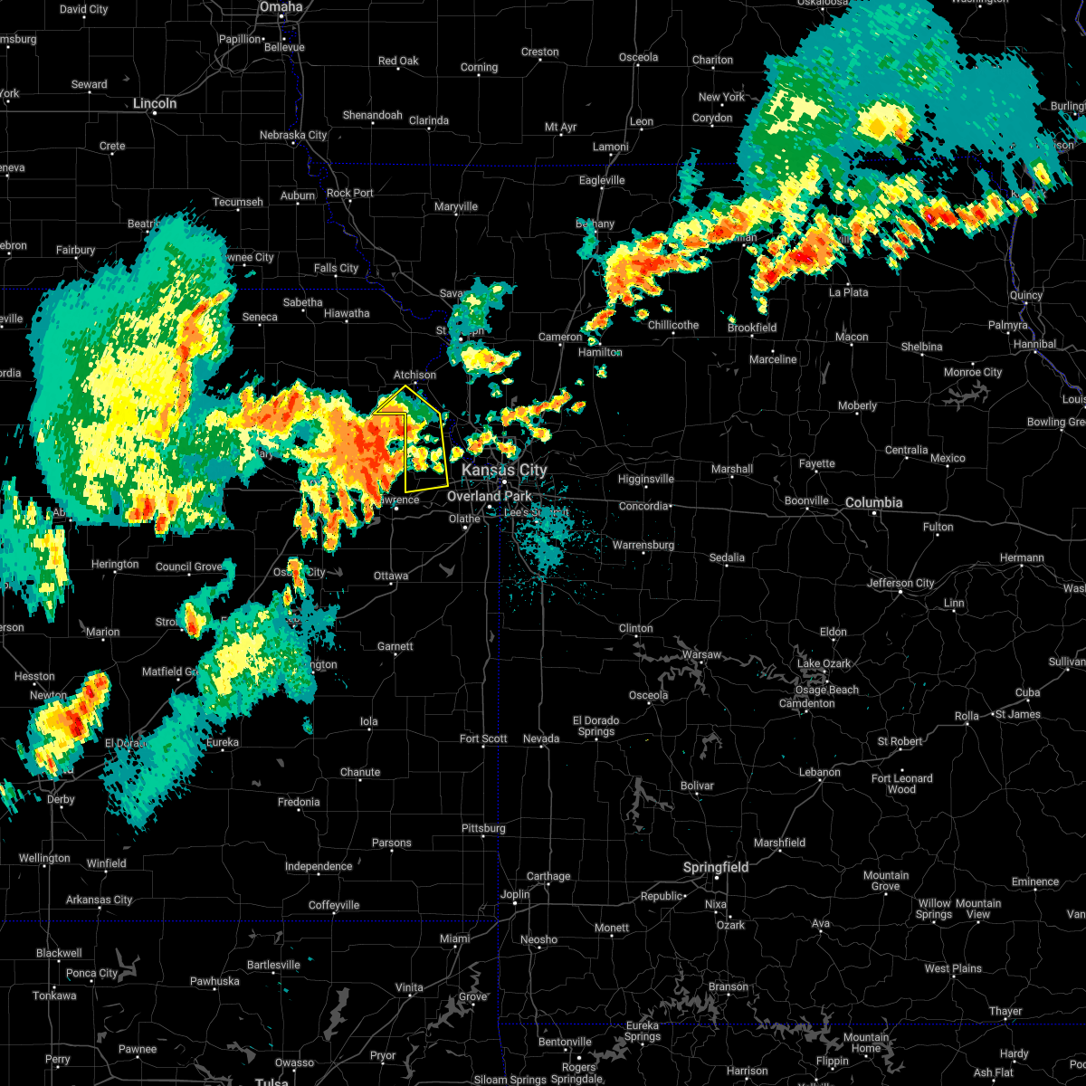 At 955 pm cdt, a severe thunderstorm was located over winchester, or 7 miles northeast of oskaloosa, moving northeast at 35 mph (radar indicated). Hazards include 60 mph wind gusts and penny size hail. expect damage to roofs, siding, and trees At 955 pm cdt, a severe thunderstorm was located over winchester, or 7 miles northeast of oskaloosa, moving northeast at 35 mph (radar indicated). Hazards include 60 mph wind gusts and penny size hail. expect damage to roofs, siding, and trees
|
| 6/8/2022 12:51 AM CDT |
 At 1251 am cdt, severe thunderstorms were located along a line extending from near atchison to near easton to tonganoxie, moving east at 45 mph (radar indicated). Hazards include 60 mph wind gusts and penny size hail. Expect damage to roofs, siding, and trees. locations impacted include, shawnee, lenexa, leavenworth, lansing, atchison, bonner springs, de soto, tonganoxie, platte city, basehor, edwardsville, weston, kansas city, agency, dearborn, camden point, linwood, rushville, easton and tracy. this includes the following highways, interstate 70 in kansas between mile markers 410 and 413. interstate 29 between mile markers 13 and 42. interstate 435 between mile markers 10 and 34. kansas turnpike between mile markers 210 and 226. hail threat, radar indicated max hail size, 0. 75 in wind threat, radar indicated max wind gust, 60 mph. At 1251 am cdt, severe thunderstorms were located along a line extending from near atchison to near easton to tonganoxie, moving east at 45 mph (radar indicated). Hazards include 60 mph wind gusts and penny size hail. Expect damage to roofs, siding, and trees. locations impacted include, shawnee, lenexa, leavenworth, lansing, atchison, bonner springs, de soto, tonganoxie, platte city, basehor, edwardsville, weston, kansas city, agency, dearborn, camden point, linwood, rushville, easton and tracy. this includes the following highways, interstate 70 in kansas between mile markers 410 and 413. interstate 29 between mile markers 13 and 42. interstate 435 between mile markers 10 and 34. kansas turnpike between mile markers 210 and 226. hail threat, radar indicated max hail size, 0. 75 in wind threat, radar indicated max wind gust, 60 mph.
|
| 6/8/2022 12:30 AM CDT |
 At 1230 am cdt, severe thunderstorms were located along a line extending from near lancaster to near winchester to near perry lake, moving east at 45 mph (radar indicated). Hazards include 60 mph wind gusts and penny size hail. expect damage to roofs, siding, and trees At 1230 am cdt, severe thunderstorms were located along a line extending from near lancaster to near winchester to near perry lake, moving east at 45 mph (radar indicated). Hazards include 60 mph wind gusts and penny size hail. expect damage to roofs, siding, and trees
|
| 5/15/2022 7:54 AM CDT |
 At 754 am cdt, severe thunderstorms were located along a line extending from near lansing to near edgerton to ottawa, moving southeast at 50 mph (radar indicated). Hazards include 60 mph wind gusts and quarter size hail. Hail damage to vehicles is expected. expect wind damage to roofs, siding, and trees. locations impacted include, overland park, olathe, shawnee, lenexa, leavenworth, leawood, prairie village, gardner, lansing, merriam, mission, bonner springs, de soto, parkville, spring hill, tonganoxie, basehor, edwardsville, fairway and mission hills. this includes the following highways, interstate 70 in missouri near mile marker 0. interstate 70 in kansas between mile markers 410 and 423. interstate 35 in missouri near mile marker 0. interstate 35 in kansas between mile markers 202 and 235. interstate 635 between mile markers 0 and 8. interstate 435 between mile markers 0 and 20, and between mile markers 75 and 83. kansas turnpike between mile markers 206 and 226. hail threat, radar indicated max hail size, 1. 00 in wind threat, radar indicated max wind gust, 60 mph. At 754 am cdt, severe thunderstorms were located along a line extending from near lansing to near edgerton to ottawa, moving southeast at 50 mph (radar indicated). Hazards include 60 mph wind gusts and quarter size hail. Hail damage to vehicles is expected. expect wind damage to roofs, siding, and trees. locations impacted include, overland park, olathe, shawnee, lenexa, leavenworth, leawood, prairie village, gardner, lansing, merriam, mission, bonner springs, de soto, parkville, spring hill, tonganoxie, basehor, edwardsville, fairway and mission hills. this includes the following highways, interstate 70 in missouri near mile marker 0. interstate 70 in kansas between mile markers 410 and 423. interstate 35 in missouri near mile marker 0. interstate 35 in kansas between mile markers 202 and 235. interstate 635 between mile markers 0 and 8. interstate 435 between mile markers 0 and 20, and between mile markers 75 and 83. kansas turnpike between mile markers 206 and 226. hail threat, radar indicated max hail size, 1. 00 in wind threat, radar indicated max wind gust, 60 mph.
|
| 5/15/2022 7:29 AM CDT |
 At 728 am cdt, severe thunderstorms were located along a line extending from easton to lawrence to near overbrook, moving southeast at 50 mph (radar indicated). Hazards include 60 mph wind gusts and quarter size hail. Hail damage to vehicles is expected. Expect wind damage to roofs, siding, and trees. At 728 am cdt, severe thunderstorms were located along a line extending from easton to lawrence to near overbrook, moving southeast at 50 mph (radar indicated). Hazards include 60 mph wind gusts and quarter size hail. Hail damage to vehicles is expected. Expect wind damage to roofs, siding, and trees.
|
| 4/29/2022 9:58 PM CDT |
 At 957 pm cdt, severe thunderstorms were located along a line extending from 6 miles northeast of mclouth to near lawrence to near pomona, moving east at 45 mph (radar indicated). Hazards include 60 mph wind gusts and quarter size hail. Hail damage to vehicles is expected. Expect wind damage to roofs, siding, and trees. At 957 pm cdt, severe thunderstorms were located along a line extending from 6 miles northeast of mclouth to near lawrence to near pomona, moving east at 45 mph (radar indicated). Hazards include 60 mph wind gusts and quarter size hail. Hail damage to vehicles is expected. Expect wind damage to roofs, siding, and trees.
|
| 4/23/2022 7:37 PM CDT |
 At 736 pm cdt, severe thunderstorms were located along a line extending from near rushville to near easton, moving east at 50 mph (radar indicated). Hazards include 70 mph wind gusts and penny size hail. Expect considerable tree damage. damage is likely to mobile homes, roofs, and outbuildings. locations impacted include, st. joseph, leavenworth, atchison, weston, wathena, elwood, rushville, easton, tracy, lewis and clark village, doniphan, de kalb, iatan, st. joseph airport, fort leavenworth, faucett, bean lake, lewis and clark vi, beverly and lowemont. This includes interstate 229 between mile markers 3 and 4. At 736 pm cdt, severe thunderstorms were located along a line extending from near rushville to near easton, moving east at 50 mph (radar indicated). Hazards include 70 mph wind gusts and penny size hail. Expect considerable tree damage. damage is likely to mobile homes, roofs, and outbuildings. locations impacted include, st. joseph, leavenworth, atchison, weston, wathena, elwood, rushville, easton, tracy, lewis and clark village, doniphan, de kalb, iatan, st. joseph airport, fort leavenworth, faucett, bean lake, lewis and clark vi, beverly and lowemont. This includes interstate 229 between mile markers 3 and 4.
|
| 4/23/2022 7:31 PM CDT |
 At 730 pm cdt, a severe thunderstorm was located over atchison, moving east at 50 mph. higher wind around 70 mph possible in the city of atchison, kansas in the next 5 to 10 minutes (radar indicated). Hazards include 60 mph wind gusts and penny size hail. Expect damage to roofs, siding, and trees. locations impacted include, st. joseph, leavenworth, atchison, weston, wathena, elwood, effingham, rushville, lancaster, easton, tracy, lewis and clark village, doniphan, de kalb, farmington, iatan, fort leavenworth, faucett, beverly and lowemont. This includes interstate 229 between mile markers 3 and 4. At 730 pm cdt, a severe thunderstorm was located over atchison, moving east at 50 mph. higher wind around 70 mph possible in the city of atchison, kansas in the next 5 to 10 minutes (radar indicated). Hazards include 60 mph wind gusts and penny size hail. Expect damage to roofs, siding, and trees. locations impacted include, st. joseph, leavenworth, atchison, weston, wathena, elwood, effingham, rushville, lancaster, easton, tracy, lewis and clark village, doniphan, de kalb, farmington, iatan, fort leavenworth, faucett, beverly and lowemont. This includes interstate 229 between mile markers 3 and 4.
|
| 4/23/2022 7:16 PM CDT |
 At 716 pm cdt, severe thunderstorms were located along a line extending from near effingham to near oskaloosa, moving northeast at 55 mph (radar indicated). Hazards include 60 mph wind gusts and penny size hail. expect damage to roofs, siding, and trees At 716 pm cdt, severe thunderstorms were located along a line extending from near effingham to near oskaloosa, moving northeast at 55 mph (radar indicated). Hazards include 60 mph wind gusts and penny size hail. expect damage to roofs, siding, and trees
|
| 3/29/2022 8:13 PM CDT |
 At 812 pm cdt, a severe thunderstorm capable of producing a tornado was located near mclouth, or 7 miles northeast of oskaloosa, moving northeast at 50 mph (radar indicated rotation). Hazards include tornado. Flying debris will be dangerous to those caught without shelter. mobile homes will be damaged or destroyed. damage to roofs, windows, and vehicles will occur. Tree damage is likely. At 812 pm cdt, a severe thunderstorm capable of producing a tornado was located near mclouth, or 7 miles northeast of oskaloosa, moving northeast at 50 mph (radar indicated rotation). Hazards include tornado. Flying debris will be dangerous to those caught without shelter. mobile homes will be damaged or destroyed. damage to roofs, windows, and vehicles will occur. Tree damage is likely.
|
| 3/29/2022 8:08 PM CDT |
 At 808 pm cdt, severe thunderstorms were located along a line extending from near lancaster to clinton, moving northeast at 45 mph (radar indicated). Hazards include 60 mph wind gusts and penny size hail. expect damage to roofs, siding, and trees At 808 pm cdt, severe thunderstorms were located along a line extending from near lancaster to clinton, moving northeast at 45 mph (radar indicated). Hazards include 60 mph wind gusts and penny size hail. expect damage to roofs, siding, and trees
|
| 12/15/2021 5:31 PM CST | Relayed by emergency management... several storm spotters reporting 70 mph wind in leavenworth county KS, 3.1 miles SW of Easton, KS |
| 7/10/2021 2:28 AM CDT |
 At 227 am cdt, severe thunderstorms were located along a line extending from near clarksdale to near leavenworth, moving east at 45 mph (radar indicated). Hazards include 60 mph wind gusts. expect damage to roofs, siding, and trees At 227 am cdt, severe thunderstorms were located along a line extending from near clarksdale to near leavenworth, moving east at 45 mph (radar indicated). Hazards include 60 mph wind gusts. expect damage to roofs, siding, and trees
|
| 7/10/2021 1:44 AM CDT |
 At 143 am cdt, severe thunderstorms were located along a line extending from near white cloud to near denison, moving east at 65 mph. automated weather station in falls city nebraska reported a 75 mph wind gust (trained weather spotters). Hazards include 70 mph wind gusts. Expect considerable tree damage. Damage is likely to mobile homes, roofs, and outbuildings. At 143 am cdt, severe thunderstorms were located along a line extending from near white cloud to near denison, moving east at 65 mph. automated weather station in falls city nebraska reported a 75 mph wind gust (trained weather spotters). Hazards include 70 mph wind gusts. Expect considerable tree damage. Damage is likely to mobile homes, roofs, and outbuildings.
|
| 6/25/2021 4:14 PM CDT |
 At 413 pm cdt, severe thunderstorms were located along a line extending from gladstone to near mclouth, moving north at 35 mph (radar indicated). Hazards include 60 mph wind gusts. expect damage to roofs, siding, and trees At 413 pm cdt, severe thunderstorms were located along a line extending from gladstone to near mclouth, moving north at 35 mph (radar indicated). Hazards include 60 mph wind gusts. expect damage to roofs, siding, and trees
|
| 6/25/2021 4:40 AM CDT |
 At 439 am cdt, a severe thunderstorm was located near easton, or 9 miles northeast of oskaloosa, moving northeast at 25 mph (radar indicated). Hazards include 60 mph wind gusts and quarter size hail. Hail damage to vehicles is expected. expect wind damage to roofs, siding, and trees. Locations impacted include, leavenworth, lansing, weston, kansas city, easton, fairmount, farley, iatan, fort leavenworth, bean lake, stillings, beverly, east leavenworth, lowemont, jarbalo, potter and wolcott. At 439 am cdt, a severe thunderstorm was located near easton, or 9 miles northeast of oskaloosa, moving northeast at 25 mph (radar indicated). Hazards include 60 mph wind gusts and quarter size hail. Hail damage to vehicles is expected. expect wind damage to roofs, siding, and trees. Locations impacted include, leavenworth, lansing, weston, kansas city, easton, fairmount, farley, iatan, fort leavenworth, bean lake, stillings, beverly, east leavenworth, lowemont, jarbalo, potter and wolcott.
|
| 6/25/2021 4:21 AM CDT |
 At 421 am cdt, a severe thunderstorm was located over oskaloosa, moving east at 40 mph (radar indicated). Hazards include 60 mph wind gusts and quarter size hail. Hail damage to vehicles is expected. Expect wind damage to roofs, siding, and trees. At 421 am cdt, a severe thunderstorm was located over oskaloosa, moving east at 40 mph (radar indicated). Hazards include 60 mph wind gusts and quarter size hail. Hail damage to vehicles is expected. Expect wind damage to roofs, siding, and trees.
|
| 6/24/2021 10:02 PM CDT |
 At 1002 pm cdt, severe thunderstorms were located along a line extending from near cowgill to near woods heights to near smithville to easton, moving southeast at 35 mph (radar indicated). Hazards include 60 mph wind gusts. Expect damage to roofs, siding, and trees. Locations impacted include, kansas city, independence, leavenworth, liberty, gladstone, lansing, excelsior springs, atchison, smithville, kearney, bonner springs, richmond, parkville, tonganoxie, lexington, platte city, basehor, edwardsville, north kansas city and sugar creek. At 1002 pm cdt, severe thunderstorms were located along a line extending from near cowgill to near woods heights to near smithville to easton, moving southeast at 35 mph (radar indicated). Hazards include 60 mph wind gusts. Expect damage to roofs, siding, and trees. Locations impacted include, kansas city, independence, leavenworth, liberty, gladstone, lansing, excelsior springs, atchison, smithville, kearney, bonner springs, richmond, parkville, tonganoxie, lexington, platte city, basehor, edwardsville, north kansas city and sugar creek.
|
| 6/24/2021 9:43 PM CDT |
 At 943 pm cdt, severe thunderstorms were located along a line extending from 6 miles southeast of cameron to near lathrop to trimble to near weston to 6 miles south of atchison, moving southeast at 30 mph (radar indicated). Hazards include 60 mph wind gusts and penny size hail. Expect damage to roofs, siding, and trees. Locations impacted include, leavenworth, atchison, cameron, smithville, kearney, platte city, lawson, plattsburg, lathrop, weston, gower, trimble, polo, edgerton, dearborn, camden point, holt, osborn, kingston and rushville. At 943 pm cdt, severe thunderstorms were located along a line extending from 6 miles southeast of cameron to near lathrop to trimble to near weston to 6 miles south of atchison, moving southeast at 30 mph (radar indicated). Hazards include 60 mph wind gusts and penny size hail. Expect damage to roofs, siding, and trees. Locations impacted include, leavenworth, atchison, cameron, smithville, kearney, platte city, lawson, plattsburg, lathrop, weston, gower, trimble, polo, edgerton, dearborn, camden point, holt, osborn, kingston and rushville.
|
| 6/24/2021 9:33 PM CDT |
 At 932 pm cdt, severe thunderstorms were located along a line extending from 6 miles west of kingston to near holt to near camden point to near effingham, moving southeast at 35 mph (radar indicated). Hazards include 60 mph wind gusts and penny size hail. expect damage to roofs, siding, and trees At 932 pm cdt, severe thunderstorms were located along a line extending from 6 miles west of kingston to near holt to near camden point to near effingham, moving southeast at 35 mph (radar indicated). Hazards include 60 mph wind gusts and penny size hail. expect damage to roofs, siding, and trees
|
| 6/24/2021 9:00 PM CDT |
 At 900 pm cdt, severe thunderstorms were located along a line extending from near stewartsville to near agency to 6 miles east of rushville to near atchison to near muscotah, moving southeast at 30 mph (radar indicated). Hazards include 60 mph wind gusts and penny size hail. expect damage to roofs, siding, and trees At 900 pm cdt, severe thunderstorms were located along a line extending from near stewartsville to near agency to 6 miles east of rushville to near atchison to near muscotah, moving southeast at 30 mph (radar indicated). Hazards include 60 mph wind gusts and penny size hail. expect damage to roofs, siding, and trees
|
| 6/11/2021 3:10 PM CDT |
 The severe thunderstorm warning for east central doniphan, leavenworth, southeastern atchison, buchanan, northwestern platte, southeastern andrew and northwestern dekalb counties will expire at 315 pm cdt, the storms which prompted the warning have weakened below severe limits, and have exited the warned area. therefore, the warning will be allowed to expire. however small hail and gusty winds are still possible with these thunderstorms. a severe thunderstorm watch remains in effect until 500 pm cdt for northeastern kansas, and northwestern missouri. a severe thunderstorm watch also remains in effect until 700 pm cdt for northeastern kansas, and northwestern and west central missouri. The severe thunderstorm warning for east central doniphan, leavenworth, southeastern atchison, buchanan, northwestern platte, southeastern andrew and northwestern dekalb counties will expire at 315 pm cdt, the storms which prompted the warning have weakened below severe limits, and have exited the warned area. therefore, the warning will be allowed to expire. however small hail and gusty winds are still possible with these thunderstorms. a severe thunderstorm watch remains in effect until 500 pm cdt for northeastern kansas, and northwestern missouri. a severe thunderstorm watch also remains in effect until 700 pm cdt for northeastern kansas, and northwestern and west central missouri.
|
| 6/11/2021 2:56 PM CDT |
 At 256 pm cdt, severe thunderstorms were located along a line extending from clarksdale to camden point to near tonganoxie, moving southeast at 25 mph (radar indicated). Hazards include 70 mph wind gusts and half dollar size hail. Hail damage to vehicles is expected. expect considerable tree damage. wind damage is also likely to mobile homes, roofs, and outbuildings. locations impacted include, st. Joseph, leavenworth, lansing, savannah, tonganoxie, weston, wathena, elwood, country club villa, country club, agency, dearborn, camden point, union star, amazonia, rushville, easton, tracy, lewis and clark village and reno. At 256 pm cdt, severe thunderstorms were located along a line extending from clarksdale to camden point to near tonganoxie, moving southeast at 25 mph (radar indicated). Hazards include 70 mph wind gusts and half dollar size hail. Hail damage to vehicles is expected. expect considerable tree damage. wind damage is also likely to mobile homes, roofs, and outbuildings. locations impacted include, st. Joseph, leavenworth, lansing, savannah, tonganoxie, weston, wathena, elwood, country club villa, country club, agency, dearborn, camden point, union star, amazonia, rushville, easton, tracy, lewis and clark village and reno.
|
| 6/11/2021 2:40 PM CDT |
 At 240 pm cdt, severe thunderstorms were located along a line extending from 7 miles northwest of clarksdale to near weston to mclouth, moving east at 25 mph (trained weather spotters). Hazards include two inch hail and 70 mph wind gusts. People and animals outdoors will be injured. expect hail damage to roofs, siding, windows, and vehicles. expect considerable tree damage. wind damage is also likely to mobile homes, roofs, and outbuildings. Locations impacted include, dearborn, tracy, camden point, leavenworth and lansing. At 240 pm cdt, severe thunderstorms were located along a line extending from 7 miles northwest of clarksdale to near weston to mclouth, moving east at 25 mph (trained weather spotters). Hazards include two inch hail and 70 mph wind gusts. People and animals outdoors will be injured. expect hail damage to roofs, siding, windows, and vehicles. expect considerable tree damage. wind damage is also likely to mobile homes, roofs, and outbuildings. Locations impacted include, dearborn, tracy, camden point, leavenworth and lansing.
|
| 6/11/2021 2:12 PM CDT |
 At 212 pm cdt, severe thunderstorms were located along a line extending from near savannah to lewis and clark village to near ozawkie, moving southeast at 25 mph (radar indicated). Hazards include 70 mph wind gusts and quarter size hail. Hail damage to vehicles is expected. expect considerable tree damage. wind damage is also likely to mobile homes, roofs, and outbuildings. severe thunderstorms will be near, amazonia and rushville around 215 pm cdt. savannah and lewis and clark village around 220 pm cdt. st. joseph, country club villa and country club around 225 pm cdt. other locations in the path of these severe thunderstorms include weston, dearborn, tonganoxie, camden point and tracy. this includes the following highways, interstate 29 between mile markers 21 and 69. interstate 229 between mile markers 0 and 14. Kansas turnpike between mile markers 206 and 209. At 212 pm cdt, severe thunderstorms were located along a line extending from near savannah to lewis and clark village to near ozawkie, moving southeast at 25 mph (radar indicated). Hazards include 70 mph wind gusts and quarter size hail. Hail damage to vehicles is expected. expect considerable tree damage. wind damage is also likely to mobile homes, roofs, and outbuildings. severe thunderstorms will be near, amazonia and rushville around 215 pm cdt. savannah and lewis and clark village around 220 pm cdt. st. joseph, country club villa and country club around 225 pm cdt. other locations in the path of these severe thunderstorms include weston, dearborn, tonganoxie, camden point and tracy. this includes the following highways, interstate 29 between mile markers 21 and 69. interstate 229 between mile markers 0 and 14. Kansas turnpike between mile markers 206 and 209.
|
| 5/8/2021 11:35 PM CDT |
 At 1135 pm cdt, a severe thunderstorm was located over leavenworth, moving east at 55 mph (radar indicated). Hazards include 70 mph wind gusts and nickel size hail. Expect considerable tree damage. damage is likely to mobile homes, roofs, and outbuildings. Locations impacted include, leavenworth, lansing, atchison, mission, bonner springs, parkville, tonganoxie, platte city, basehor, edwardsville, riverside, weatherby lake, weston, gower, westwood, lake quivira, kansas city kansas, kansas city, lake waukomis and edgerton. At 1135 pm cdt, a severe thunderstorm was located over leavenworth, moving east at 55 mph (radar indicated). Hazards include 70 mph wind gusts and nickel size hail. Expect considerable tree damage. damage is likely to mobile homes, roofs, and outbuildings. Locations impacted include, leavenworth, lansing, atchison, mission, bonner springs, parkville, tonganoxie, platte city, basehor, edwardsville, riverside, weatherby lake, weston, gower, westwood, lake quivira, kansas city kansas, kansas city, lake waukomis and edgerton.
|
| 5/8/2021 11:19 PM CDT |
 At 1118 pm cdt, a severe thunderstorm was located over winchester, or 7 miles northeast of oskaloosa, moving east at 55 mph (radar indicated). Hazards include 70 mph wind gusts and nickel size hail. Expect considerable tree damage. Damage is likely to mobile homes, roofs, and outbuildings. At 1118 pm cdt, a severe thunderstorm was located over winchester, or 7 miles northeast of oskaloosa, moving east at 55 mph (radar indicated). Hazards include 70 mph wind gusts and nickel size hail. Expect considerable tree damage. Damage is likely to mobile homes, roofs, and outbuildings.
|
| 7/9/2020 3:07 AM CDT |
 The severe thunderstorm warning for northwestern wyandotte, doniphan, leavenworth, northwestern johnson, atchison, buchanan and platte counties will expire at 315 am cdt, the storms which prompted the warning have weakened below severe limits, and no longer pose an immediate threat to life or property. therefore, the warning will be allowed to expire. however gusty winds are still possible with these thunderstorms. a severe thunderstorm watch remains in effect until 1000 am cdt for northeastern and east central kansas, and northwestern and west central missouri. The severe thunderstorm warning for northwestern wyandotte, doniphan, leavenworth, northwestern johnson, atchison, buchanan and platte counties will expire at 315 am cdt, the storms which prompted the warning have weakened below severe limits, and no longer pose an immediate threat to life or property. therefore, the warning will be allowed to expire. however gusty winds are still possible with these thunderstorms. a severe thunderstorm watch remains in effect until 1000 am cdt for northeastern and east central kansas, and northwestern and west central missouri.
|
| 7/9/2020 2:30 AM CDT |
 At 230 am cdt, severe thunderstorms were located along a line extending from near falls city to near maple hill, moving east at 50 mph (radar indicated). Hazards include 60 mph wind gusts. expect damage to roofs, siding, and trees At 230 am cdt, severe thunderstorms were located along a line extending from near falls city to near maple hill, moving east at 50 mph (radar indicated). Hazards include 60 mph wind gusts. expect damage to roofs, siding, and trees
|
| 7/1/2020 4:44 AM CDT |
 At 444 am cdt, severe thunderstorms were located along a line extending from near stewartsville to near plattsburg to near smithville to near ferrelview to near leavenworth, moving southeast at 35 mph (radar indicated). Hazards include 60 mph wind gusts and quarter size hail. Hail damage to vehicles is expected. expect wind damage to roofs, siding, and trees. locations impacted include, st. Joseph, leavenworth, liberty, gladstone, lansing, excelsior springs, smithville, kearney, bonner springs, parkville, platte city, basehor, edwardsville, north kansas city, riverside, lawson, plattsburg, lathrop, weatherby lake and weston. At 444 am cdt, severe thunderstorms were located along a line extending from near stewartsville to near plattsburg to near smithville to near ferrelview to near leavenworth, moving southeast at 35 mph (radar indicated). Hazards include 60 mph wind gusts and quarter size hail. Hail damage to vehicles is expected. expect wind damage to roofs, siding, and trees. locations impacted include, st. Joseph, leavenworth, liberty, gladstone, lansing, excelsior springs, smithville, kearney, bonner springs, parkville, platte city, basehor, edwardsville, north kansas city, riverside, lawson, plattsburg, lathrop, weatherby lake and weston.
|
| 7/1/2020 4:33 AM CDT |
 At 432 am cdt, severe thunderstorms were located along a line extending from near gower to camden point to near weston, moving southeast at 40 mph (radar indicated). Hazards include 60 mph wind gusts and quarter size hail. Hail damage to vehicles is expected. expect wind damage to roofs, siding, and trees. locations impacted include, st. Joseph, leavenworth, atchison, weston, elwood, country club villa, country club, agency, edgerton, dearborn, camden point, rushville, lewis and clark village, easton, de kalb, cosby, ridgely, iatan, faucett and bean lake. At 432 am cdt, severe thunderstorms were located along a line extending from near gower to camden point to near weston, moving southeast at 40 mph (radar indicated). Hazards include 60 mph wind gusts and quarter size hail. Hail damage to vehicles is expected. expect wind damage to roofs, siding, and trees. locations impacted include, st. Joseph, leavenworth, atchison, weston, elwood, country club villa, country club, agency, edgerton, dearborn, camden point, rushville, lewis and clark village, easton, de kalb, cosby, ridgely, iatan, faucett and bean lake.
|
| 7/1/2020 4:27 AM CDT |
 At 426 am cdt, severe thunderstorms were located along a line extending from near clarksdale to near agency to near dearborn to near camden point to near weston, moving southeast at 35 mph (radar indicated). Hazards include 60 mph wind gusts and quarter size hail. Hail damage to vehicles is expected. Expect wind damage to roofs, siding, and trees. At 426 am cdt, severe thunderstorms were located along a line extending from near clarksdale to near agency to near dearborn to near camden point to near weston, moving southeast at 35 mph (radar indicated). Hazards include 60 mph wind gusts and quarter size hail. Hail damage to vehicles is expected. Expect wind damage to roofs, siding, and trees.
|
| 7/1/2020 4:11 AM CDT |
 At 410 am cdt, severe thunderstorms were located along a line extending from near country club to 6 miles northeast of rushville to near atchison, moving southeast at 25 mph (radar indicated). Hazards include 60 mph wind gusts and quarter size hail. Hail damage to vehicles is expected. expect wind damage to roofs, siding, and trees. locations impacted include, st. Joseph, leavenworth, atchison, savannah, weston, wathena, elwood, troy, country club villa, country club, agency, edgerton, dearborn, camden point, amazonia, rushville, denton, lewis and clark village, doniphan and easton. At 410 am cdt, severe thunderstorms were located along a line extending from near country club to 6 miles northeast of rushville to near atchison, moving southeast at 25 mph (radar indicated). Hazards include 60 mph wind gusts and quarter size hail. Hail damage to vehicles is expected. expect wind damage to roofs, siding, and trees. locations impacted include, st. Joseph, leavenworth, atchison, savannah, weston, wathena, elwood, troy, country club villa, country club, agency, edgerton, dearborn, camden point, amazonia, rushville, denton, lewis and clark village, doniphan and easton.
|
| 7/1/2020 3:54 AM CDT |
 At 353 am cdt, severe thunderstorms were located along a line extending from 6 miles west of amazonia to near troy to near denton, moving southeast at 40 mph (radar indicated). Hazards include 60 mph wind gusts and quarter size hail. Hail damage to vehicles is expected. Expect wind damage to roofs, siding, and trees. At 353 am cdt, severe thunderstorms were located along a line extending from 6 miles west of amazonia to near troy to near denton, moving southeast at 40 mph (radar indicated). Hazards include 60 mph wind gusts and quarter size hail. Hail damage to vehicles is expected. Expect wind damage to roofs, siding, and trees.
|
| 6/27/2020 2:09 AM CDT |
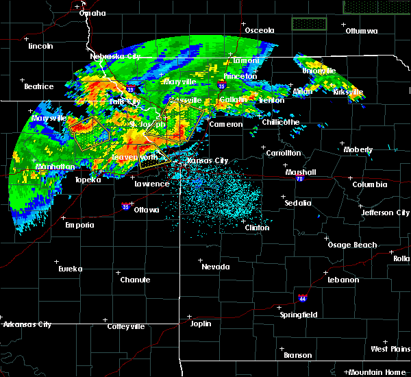 At 209 am cdt, a severe thunderstorm was located near easton, or 7 miles west of leavenworth, moving southeast at 25 mph (radar indicated). Hazards include 60 mph wind gusts and quarter size hail. Hail damage to vehicles is expected. Expect wind damage to roofs, siding, and trees. At 209 am cdt, a severe thunderstorm was located near easton, or 7 miles west of leavenworth, moving southeast at 25 mph (radar indicated). Hazards include 60 mph wind gusts and quarter size hail. Hail damage to vehicles is expected. Expect wind damage to roofs, siding, and trees.
|
| 6/5/2020 2:57 AM CDT |
 At 257 am cdt, severe thunderstorms were located along a line extending from elwood to near lewis and clark village to near mclouth, moving southeast at 60 mph (radar indicated). Hazards include 70 mph wind gusts and nickel size hail. Expect considerable tree damage. Damage is likely to mobile homes, roofs, and outbuildings. At 257 am cdt, severe thunderstorms were located along a line extending from elwood to near lewis and clark village to near mclouth, moving southeast at 60 mph (radar indicated). Hazards include 70 mph wind gusts and nickel size hail. Expect considerable tree damage. Damage is likely to mobile homes, roofs, and outbuildings.
|
| 6/4/2020 2:08 AM CDT |
 The severe thunderstorm warning for wyandotte, leavenworth, northern johnson, eastern buchanan, clay, clinton, northwestern ray, southwestern caldwell, platte and northwestern jackson counties will expire at 215 am cdt, the storms which prompted the warning have moved out of the area. therefore, the warning will be allowed to expire. however gusty winds are still possible with these thunderstorms. a severe thunderstorm watch remains in effect until 300 am cdt for northeastern and east central kansas, and northwestern and west central missouri. remember, a severe thunderstorm warning still remains in effect for johnson and wyandotte county kansas and jackson, clay, and clinton counties in missouri. The severe thunderstorm warning for wyandotte, leavenworth, northern johnson, eastern buchanan, clay, clinton, northwestern ray, southwestern caldwell, platte and northwestern jackson counties will expire at 215 am cdt, the storms which prompted the warning have moved out of the area. therefore, the warning will be allowed to expire. however gusty winds are still possible with these thunderstorms. a severe thunderstorm watch remains in effect until 300 am cdt for northeastern and east central kansas, and northwestern and west central missouri. remember, a severe thunderstorm warning still remains in effect for johnson and wyandotte county kansas and jackson, clay, and clinton counties in missouri.
|
| 6/4/2020 1:41 AM CDT |
 At 140 am cdt, severe thunderstorms were located along a line extending from near clarksdale to near camden point to near mclouth, moving southeast at 60 mph (radar indicated). Hazards include 60 mph wind gusts and nickel size hail. expect damage to roofs, siding, and trees At 140 am cdt, severe thunderstorms were located along a line extending from near clarksdale to near camden point to near mclouth, moving southeast at 60 mph (radar indicated). Hazards include 60 mph wind gusts and nickel size hail. expect damage to roofs, siding, and trees
|
| 8/18/2019 2:14 AM CDT |
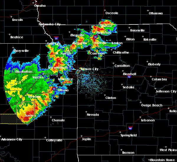 At 214 am cdt, a severe thunderstorm was located near easton, or 11 miles northeast of oskaloosa, moving northeast at 55 mph (radar indicated). Hazards include 60 mph wind gusts and quarter size hail. Hail damage to vehicles is expected. Expect wind damage to roofs, siding, and trees. At 214 am cdt, a severe thunderstorm was located near easton, or 11 miles northeast of oskaloosa, moving northeast at 55 mph (radar indicated). Hazards include 60 mph wind gusts and quarter size hail. Hail damage to vehicles is expected. Expect wind damage to roofs, siding, and trees.
|
| 8/17/2019 12:36 AM CDT |
 At 1236 am cdt, a severe thunderstorm was located near mclouth, or 8 miles north of tonganoxie, moving east at 40 mph (radar indicated). Hazards include ping pong ball size hail and 60 mph wind gusts. People and animals outdoors will be injured. expect hail damage to roofs, siding, windows, and vehicles. Expect wind damage to roofs, siding, and trees. At 1236 am cdt, a severe thunderstorm was located near mclouth, or 8 miles north of tonganoxie, moving east at 40 mph (radar indicated). Hazards include ping pong ball size hail and 60 mph wind gusts. People and animals outdoors will be injured. expect hail damage to roofs, siding, windows, and vehicles. Expect wind damage to roofs, siding, and trees.
|
| 8/17/2019 12:36 AM CDT |
 The national weather service in pleasant hill has issued a * severe thunderstorm warning for. wyandotte county in northeastern kansas. leavenworth county in northeastern kansas. southeastern atchison county in northeastern kansas. Central platte county in west central missouri. The national weather service in pleasant hill has issued a * severe thunderstorm warning for. wyandotte county in northeastern kansas. leavenworth county in northeastern kansas. southeastern atchison county in northeastern kansas. Central platte county in west central missouri.
|
| 8/16/2019 3:31 AM CDT |
 At 331 am cdt, a severe thunderstorm was located near easton, or 8 miles northeast of oskaloosa, moving east at 30 mph (radar indicated). Hazards include 60 mph wind gusts and quarter size hail. Hail damage to vehicles is expected. Expect wind damage to roofs, siding, and trees. At 331 am cdt, a severe thunderstorm was located near easton, or 8 miles northeast of oskaloosa, moving east at 30 mph (radar indicated). Hazards include 60 mph wind gusts and quarter size hail. Hail damage to vehicles is expected. Expect wind damage to roofs, siding, and trees.
|
| 7/10/2019 8:39 AM CDT |
 At 832 am cdt, severe thunderstorms were located along a line extending from near atchison to 7 miles southwest of leavenworth to near lawrence, moving east at 50 mph (radar indicated). Hazards include 60 mph wind gusts and quarter size hail. Hail damage to vehicles is expected. expect wind damage to roofs, siding, and trees. Locations impacted include, olathe, shawnee, lenexa, leavenworth, lansing, atchison, bonner springs, de soto, tonganoxie, platte city, basehor, edwardsville, weston, kansas city, effingham, linwood, rushville, lancaster, easton and tracy. At 832 am cdt, severe thunderstorms were located along a line extending from near atchison to 7 miles southwest of leavenworth to near lawrence, moving east at 50 mph (radar indicated). Hazards include 60 mph wind gusts and quarter size hail. Hail damage to vehicles is expected. expect wind damage to roofs, siding, and trees. Locations impacted include, olathe, shawnee, lenexa, leavenworth, lansing, atchison, bonner springs, de soto, tonganoxie, platte city, basehor, edwardsville, weston, kansas city, effingham, linwood, rushville, lancaster, easton and tracy.
|
| 7/10/2019 8:39 AM CDT |
 A severe thunderstorm warning remains in effect until 900 am cdt for northwestern wyandotte. leavenworth. northwestern johnson. southeastern atchison and central platte counties. At 837 am cdt, severe thunderstorms were located along a line extending from near lewis and clark village to lansing to near eudora, moving east at 45 mph. A severe thunderstorm warning remains in effect until 900 am cdt for northwestern wyandotte. leavenworth. northwestern johnson. southeastern atchison and central platte counties. At 837 am cdt, severe thunderstorms were located along a line extending from near lewis and clark village to lansing to near eudora, moving east at 45 mph.
|
| 7/10/2019 8:32 AM CDT |
 At 832 am cdt, severe thunderstorms were located along a line extending from near atchison to 7 miles southwest of leavenworth to near lawrence, moving east at 50 mph (radar indicated). Hazards include 60 mph wind gusts and quarter size hail. Hail damage to vehicles is expected. expect wind damage to roofs, siding, and trees. Locations impacted include, olathe, shawnee, lenexa, leavenworth, lansing, atchison, bonner springs, de soto, tonganoxie, platte city, basehor, edwardsville, weston, kansas city, effingham, linwood, rushville, lancaster, easton and tracy. At 832 am cdt, severe thunderstorms were located along a line extending from near atchison to 7 miles southwest of leavenworth to near lawrence, moving east at 50 mph (radar indicated). Hazards include 60 mph wind gusts and quarter size hail. Hail damage to vehicles is expected. expect wind damage to roofs, siding, and trees. Locations impacted include, olathe, shawnee, lenexa, leavenworth, lansing, atchison, bonner springs, de soto, tonganoxie, platte city, basehor, edwardsville, weston, kansas city, effingham, linwood, rushville, lancaster, easton and tracy.
|
| 7/10/2019 8:11 AM CDT |
 At 810 am cdt, severe thunderstorms were located along a line extending from near everest to near winchester to near perry, moving east at 40 mph (radar indicated). Hazards include 60 mph wind gusts and quarter size hail. Hail damage to vehicles is expected. Expect wind damage to roofs, siding, and trees. At 810 am cdt, severe thunderstorms were located along a line extending from near everest to near winchester to near perry, moving east at 40 mph (radar indicated). Hazards include 60 mph wind gusts and quarter size hail. Hail damage to vehicles is expected. Expect wind damage to roofs, siding, and trees.
|
| 6/22/2019 6:42 PM CDT |
 At 642 pm cdt, a severe thunderstorm was located over holton, moving east at 40 mph (radar indicated). Hazards include 70 mph wind gusts and quarter size hail. Hail damage to vehicles is expected. expect considerable tree damage. Wind damage is also likely to mobile homes, roofs, and outbuildings. At 642 pm cdt, a severe thunderstorm was located over holton, moving east at 40 mph (radar indicated). Hazards include 70 mph wind gusts and quarter size hail. Hail damage to vehicles is expected. expect considerable tree damage. Wind damage is also likely to mobile homes, roofs, and outbuildings.
|
| 6/22/2019 5:13 PM CDT |
 At 513 pm cdt, a severe thunderstorm was located near nortonville, or 8 miles east of valley falls, moving northeast at 35 mph (radar indicated). Hazards include 60 mph wind gusts and quarter size hail. Hail damage to vehicles is expected. Expect wind damage to roofs, siding, and trees. At 513 pm cdt, a severe thunderstorm was located near nortonville, or 8 miles east of valley falls, moving northeast at 35 mph (radar indicated). Hazards include 60 mph wind gusts and quarter size hail. Hail damage to vehicles is expected. Expect wind damage to roofs, siding, and trees.
|
| 6/21/2019 9:22 AM CDT |
 At 922 am cdt, a severe thunderstorm was located near winchester, or near oskaloosa, moving east at 50 mph (radar indicated). Hazards include 60 mph wind gusts. expect damage to roofs, siding, and trees At 922 am cdt, a severe thunderstorm was located near winchester, or near oskaloosa, moving east at 50 mph (radar indicated). Hazards include 60 mph wind gusts. expect damage to roofs, siding, and trees
|
| 6/21/2019 6:07 AM CDT |
 At 606 am cdt, a severe thunderstorm was located over easton, or 11 miles northwest of leavenworth, moving southeast at 45 mph (radar indicated). Hazards include 60 mph wind gusts and nickel size hail. expect damage to roofs, siding, and trees At 606 am cdt, a severe thunderstorm was located over easton, or 11 miles northwest of leavenworth, moving southeast at 45 mph (radar indicated). Hazards include 60 mph wind gusts and nickel size hail. expect damage to roofs, siding, and trees
|
| 5/24/2019 6:41 PM CDT |
 At 641 pm cdt, a severe thunderstorm was located over eudora, or near de soto, moving north at 70 mph (radar indicated). Hazards include 60 mph wind gusts. expect damage to roofs, siding, and trees At 641 pm cdt, a severe thunderstorm was located over eudora, or near de soto, moving north at 70 mph (radar indicated). Hazards include 60 mph wind gusts. expect damage to roofs, siding, and trees
|
| 7/19/2018 3:30 PM CDT |
 At 329 pm cdt, severe thunderstorms were located along a line extending from near valley falls to ozawkie to lecompton to near lyndon, moving east at 55 mph (radar indicated). Hazards include 70 mph wind gusts and quarter size hail. Hail damage to vehicles is expected. expect considerable tree damage. Wind damage is also likely to mobile homes, roofs, and outbuildings. At 329 pm cdt, severe thunderstorms were located along a line extending from near valley falls to ozawkie to lecompton to near lyndon, moving east at 55 mph (radar indicated). Hazards include 70 mph wind gusts and quarter size hail. Hail damage to vehicles is expected. expect considerable tree damage. Wind damage is also likely to mobile homes, roofs, and outbuildings.
|
| 6/30/2018 10:43 PM CDT |
 At 1031 pm cdt, a severe thunderstorm was located near lansing, moving northeast at 50 mph (radar indicated). Hazards include 60 mph wind gusts. Expect damage to roofs, siding, and trees. locations impacted include, shawnee, leavenworth, lansing, bonner springs, de soto, tonganoxie, basehor, edwardsville, kansas city, linwood, easton, fairmount, fort leavenworth, wolcott, maywood, lowemont, jarbalo and piper. this includes the following highways, interstate 70 in kansas between mile markers 410 and 412. interstate 435 between mile markers 9 and 18. Kansas turnpike between mile markers 212 and 226. At 1031 pm cdt, a severe thunderstorm was located near lansing, moving northeast at 50 mph (radar indicated). Hazards include 60 mph wind gusts. Expect damage to roofs, siding, and trees. locations impacted include, shawnee, leavenworth, lansing, bonner springs, de soto, tonganoxie, basehor, edwardsville, kansas city, linwood, easton, fairmount, fort leavenworth, wolcott, maywood, lowemont, jarbalo and piper. this includes the following highways, interstate 70 in kansas between mile markers 410 and 412. interstate 435 between mile markers 9 and 18. Kansas turnpike between mile markers 212 and 226.
|
| 6/30/2018 10:32 PM CDT |
 At 1031 pm cdt, a severe thunderstorm was located near lansing, moving northeast at 50 mph (radar indicated). Hazards include 60 mph wind gusts. Expect damage to roofs, siding, and trees. locations impacted include, shawnee, leavenworth, lansing, bonner springs, de soto, tonganoxie, basehor, edwardsville, kansas city, linwood, easton, fairmount, fort leavenworth, wolcott, maywood, lowemont, jarbalo and piper. this includes the following highways, interstate 70 in kansas between mile markers 410 and 412. interstate 435 between mile markers 9 and 18. Kansas turnpike between mile markers 212 and 226. At 1031 pm cdt, a severe thunderstorm was located near lansing, moving northeast at 50 mph (radar indicated). Hazards include 60 mph wind gusts. Expect damage to roofs, siding, and trees. locations impacted include, shawnee, leavenworth, lansing, bonner springs, de soto, tonganoxie, basehor, edwardsville, kansas city, linwood, easton, fairmount, fort leavenworth, wolcott, maywood, lowemont, jarbalo and piper. this includes the following highways, interstate 70 in kansas between mile markers 410 and 412. interstate 435 between mile markers 9 and 18. Kansas turnpike between mile markers 212 and 226.
|
| 6/30/2018 10:26 PM CDT |
 At 1025 pm cdt, a severe thunderstorm was located near basehor, moving northeast at 50 mph (radar indicated). Hazards include 60 mph wind gusts. Expect damage to roofs, siding, and trees. locations impacted include, olathe, shawnee, lenexa, leavenworth, lansing, bonner springs, de soto, tonganoxie, basehor, edwardsville, kansas city, linwood, easton, reno, fairmount, fort leavenworth, wolcott, holliday, clearview city and maywood. this includes the following highways, interstate 70 in kansas between mile markers 410 and 412. interstate 35 in kansas between mile markers 218 and 219. interstate 435 between mile markers 6 and 18. Kansas turnpike between mile markers 206 and 226. At 1025 pm cdt, a severe thunderstorm was located near basehor, moving northeast at 50 mph (radar indicated). Hazards include 60 mph wind gusts. Expect damage to roofs, siding, and trees. locations impacted include, olathe, shawnee, lenexa, leavenworth, lansing, bonner springs, de soto, tonganoxie, basehor, edwardsville, kansas city, linwood, easton, reno, fairmount, fort leavenworth, wolcott, holliday, clearview city and maywood. this includes the following highways, interstate 70 in kansas between mile markers 410 and 412. interstate 35 in kansas between mile markers 218 and 219. interstate 435 between mile markers 6 and 18. Kansas turnpike between mile markers 206 and 226.
|
| 6/30/2018 10:07 PM CDT |
 At 1007 pm cdt, a severe thunderstorm was located near williamstown, or 8 miles south of oskaloosa, moving northeast at 50 mph (radar indicated). Hazards include 60 mph wind gusts. expect damage to roofs, siding, and trees At 1007 pm cdt, a severe thunderstorm was located near williamstown, or 8 miles south of oskaloosa, moving northeast at 50 mph (radar indicated). Hazards include 60 mph wind gusts. expect damage to roofs, siding, and trees
|
| 6/30/2018 7:08 PM CDT |
 At 707 pm cdt, severe thunderstorms were located along a line extending from near lewis and clark village to baldwin city, moving northeast at 15 mph (radar indicated). Hazards include 60 mph wind gusts and quarter size hail. Hail damage to vehicles is expected. Expect wind damage to roofs, siding, and trees. At 707 pm cdt, severe thunderstorms were located along a line extending from near lewis and clark village to baldwin city, moving northeast at 15 mph (radar indicated). Hazards include 60 mph wind gusts and quarter size hail. Hail damage to vehicles is expected. Expect wind damage to roofs, siding, and trees.
|
| 6/11/2018 11:15 PM CDT |
 At 1114 pm cdt, severe thunderstorms were located along a line extending from near winchester to ferrelview, moving south at 30 mph (radar indicated). Hazards include 60 mph wind gusts and quarter size hail. Hail damage to vehicles is expected. Expect wind damage to roofs, siding, and trees. At 1114 pm cdt, severe thunderstorms were located along a line extending from near winchester to ferrelview, moving south at 30 mph (radar indicated). Hazards include 60 mph wind gusts and quarter size hail. Hail damage to vehicles is expected. Expect wind damage to roofs, siding, and trees.
|
| 6/11/2018 10:47 PM CDT |
 At 1047 pm cdt, severe thunderstorms were located along a line extending from near whiting to camden point, moving southeast at 35 mph (radar indicated). Hazards include 60 mph wind gusts and half dollar size hail. Hail damage to vehicles is expected. Expect wind damage to roofs, siding, and trees. At 1047 pm cdt, severe thunderstorms were located along a line extending from near whiting to camden point, moving southeast at 35 mph (radar indicated). Hazards include 60 mph wind gusts and half dollar size hail. Hail damage to vehicles is expected. Expect wind damage to roofs, siding, and trees.
|
| 6/11/2018 10:12 PM CDT |
 At 1012 pm cdt, severe thunderstorms were located along a line extending from near savannah to near fairview, moving southeast at 30 mph (radar indicated). Hazards include ping pong ball size hail and 60 mph wind gusts. People and animals outdoors will be injured. expect hail damage to roofs, siding, windows, and vehicles. Expect wind damage to roofs, siding, and trees. At 1012 pm cdt, severe thunderstorms were located along a line extending from near savannah to near fairview, moving southeast at 30 mph (radar indicated). Hazards include ping pong ball size hail and 60 mph wind gusts. People and animals outdoors will be injured. expect hail damage to roofs, siding, windows, and vehicles. Expect wind damage to roofs, siding, and trees.
|
| 6/2/2018 4:26 AM CDT |
 At 425 am cdt, a severe thunderstorm was located near winchester, or 11 miles northeast of oskaloosa, moving southeast at 50 mph (radar indicated). Hazards include 60 mph wind gusts and quarter size hail. Hail damage to vehicles is expected. Expect wind damage to roofs, siding, and trees. At 425 am cdt, a severe thunderstorm was located near winchester, or 11 miles northeast of oskaloosa, moving southeast at 50 mph (radar indicated). Hazards include 60 mph wind gusts and quarter size hail. Hail damage to vehicles is expected. Expect wind damage to roofs, siding, and trees.
|
| 4/13/2018 7:54 PM CDT |
 At 753 pm cdt, severe thunderstorms were located along a line extending from 6 miles south of easton to near linwood, moving northeast at 40 mph (radar indicated). Hazards include 60 mph wind gusts and half dollar size hail. Hail damage to vehicles is expected. Expect wind damage to roofs, siding, and trees. At 753 pm cdt, severe thunderstorms were located along a line extending from 6 miles south of easton to near linwood, moving northeast at 40 mph (radar indicated). Hazards include 60 mph wind gusts and half dollar size hail. Hail damage to vehicles is expected. Expect wind damage to roofs, siding, and trees.
|
| 8/21/2017 8:53 PM CDT |
 At 853 pm cdt, a severe thunderstorm was located near weston, moving east at 40 mph (radar indicated). Hazards include 60 mph wind gusts. Expect damage to roofs, siding, and trees. locations impacted include, kansas city, leavenworth, atchison, platte city, weston, gower, agency, edgerton, dearborn, camden point, ferrelview, rushville, easton, tracy, lewis and clark village, farley, de kalb, ridgely, iatan and fort leavenworth. this includes the following highways, interstate 29 between mile markers 9 and 39. Interstate 435 between mile markers 26 and 39. At 853 pm cdt, a severe thunderstorm was located near weston, moving east at 40 mph (radar indicated). Hazards include 60 mph wind gusts. Expect damage to roofs, siding, and trees. locations impacted include, kansas city, leavenworth, atchison, platte city, weston, gower, agency, edgerton, dearborn, camden point, ferrelview, rushville, easton, tracy, lewis and clark village, farley, de kalb, ridgely, iatan and fort leavenworth. this includes the following highways, interstate 29 between mile markers 9 and 39. Interstate 435 between mile markers 26 and 39.
|
| 8/21/2017 8:41 PM CDT |
 At 841 pm cdt, a severe thunderstorm was located over lewis and clark village, or near atchison, moving east at 40 mph (radar indicated). Hazards include 60 mph wind gusts and penny size hail. expect damage to roofs, siding, and trees At 841 pm cdt, a severe thunderstorm was located over lewis and clark village, or near atchison, moving east at 40 mph (radar indicated). Hazards include 60 mph wind gusts and penny size hail. expect damage to roofs, siding, and trees
|
| 6/17/2017 8:42 PM CDT |
 At 842 pm cdt, a severe thunderstorm was located over lansing, moving east at 50 mph (radar indicated). Hazards include 60 mph wind gusts and quarter size hail. Hail damage to vehicles is expected. expect wind damage to roofs, siding, and trees. Locations impacted include, leavenworth, lansing, parkville, platte city, basehor, riverside, weatherby lake, weston, kansas city kansas, kansas city, lake waukomis, edgerton, dearborn, camden point, ferrelview, platte woods, northmoor, easton, houston lake and tracy. At 842 pm cdt, a severe thunderstorm was located over lansing, moving east at 50 mph (radar indicated). Hazards include 60 mph wind gusts and quarter size hail. Hail damage to vehicles is expected. expect wind damage to roofs, siding, and trees. Locations impacted include, leavenworth, lansing, parkville, platte city, basehor, riverside, weatherby lake, weston, kansas city kansas, kansas city, lake waukomis, edgerton, dearborn, camden point, ferrelview, platte woods, northmoor, easton, houston lake and tracy.
|
| 6/17/2017 8:29 PM CDT |
 At 828 pm cdt, a severe thunderstorm was located near easton, or 9 miles west of leavenworth, moving east at 40 mph (radar indicated). Hazards include ping pong ball size hail and 60 mph wind gusts. People and animals outdoors will be injured. expect hail damage to roofs, siding, windows, and vehicles. Expect wind damage to roofs, siding, and trees. At 828 pm cdt, a severe thunderstorm was located near easton, or 9 miles west of leavenworth, moving east at 40 mph (radar indicated). Hazards include ping pong ball size hail and 60 mph wind gusts. People and animals outdoors will be injured. expect hail damage to roofs, siding, windows, and vehicles. Expect wind damage to roofs, siding, and trees.
|
| 6/17/2017 12:07 AM CDT |
 At 1207 am cdt, severe thunderstorms were located along a line extending from near tonganoxie to near leavenworth, moving southeast at 40 mph (radar indicated). Hazards include 70 mph wind gusts. Expect considerable tree damage. damage is likely to mobile homes, roofs, and outbuildings. Locations impacted include, kansas city, overland park, olathe, independence, lee`s summit, shawnee, blue springs, lenexa, leavenworth, leawood, raytown, gladstone, prairie village, gardner, grain valley, lansing, merriam, mission, bonner springs and de soto. At 1207 am cdt, severe thunderstorms were located along a line extending from near tonganoxie to near leavenworth, moving southeast at 40 mph (radar indicated). Hazards include 70 mph wind gusts. Expect considerable tree damage. damage is likely to mobile homes, roofs, and outbuildings. Locations impacted include, kansas city, overland park, olathe, independence, lee`s summit, shawnee, blue springs, lenexa, leavenworth, leawood, raytown, gladstone, prairie village, gardner, grain valley, lansing, merriam, mission, bonner springs and de soto.
|
| 6/16/2017 11:45 PM CDT |
 At 1144 pm cdt, severe thunderstorms were located along a line extending from near nortonville to near weston, moving southeast at 40 mph (radar indicated). Hazards include 70 mph wind gusts. Expect considerable tree damage. Damage is likely to mobile homes, roofs, and outbuildings. At 1144 pm cdt, severe thunderstorms were located along a line extending from near nortonville to near weston, moving southeast at 40 mph (radar indicated). Hazards include 70 mph wind gusts. Expect considerable tree damage. Damage is likely to mobile homes, roofs, and outbuildings.
|
| 6/16/2017 11:04 PM CDT |
 At 1104 pm cdt, severe thunderstorms were located along a line extending from horton to 7 miles southeast of denton, moving southeast at 45 mph (radar indicated). Hazards include 70 mph wind gusts. Expect considerable tree damage. Damage is likely to mobile homes, roofs, and outbuildings. At 1104 pm cdt, severe thunderstorms were located along a line extending from horton to 7 miles southeast of denton, moving southeast at 45 mph (radar indicated). Hazards include 70 mph wind gusts. Expect considerable tree damage. Damage is likely to mobile homes, roofs, and outbuildings.
|
| 6/15/2017 8:36 PM CDT |
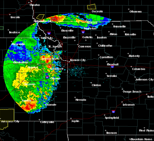 At 836 pm cdt, a severe thunderstorm was located near winchester, or 10 miles northeast of oskaloosa, moving northeast at 25 mph (radar indicated). Hazards include 60 mph wind gusts and quarter size hail. Hail damage to vehicles is expected. Expect wind damage to roofs, siding, and trees. At 836 pm cdt, a severe thunderstorm was located near winchester, or 10 miles northeast of oskaloosa, moving northeast at 25 mph (radar indicated). Hazards include 60 mph wind gusts and quarter size hail. Hail damage to vehicles is expected. Expect wind damage to roofs, siding, and trees.
|
| 5/18/2017 10:01 PM CDT |
 At 1001 pm cdt, severe thunderstorms were located along a line extending from lancaster to near easton to 6 miles west of lansing, moving northeast at 35 mph (radar indicated). Hazards include 60 mph wind gusts. expect damage to roofs, siding, and trees At 1001 pm cdt, severe thunderstorms were located along a line extending from lancaster to near easton to 6 miles west of lansing, moving northeast at 35 mph (radar indicated). Hazards include 60 mph wind gusts. expect damage to roofs, siding, and trees
|
| 5/18/2017 8:37 PM CDT |
 At 837 pm cdt, severe thunderstorms were located along a line extending from lancaster to 7 miles southwest of atchison to easton, moving northeast at 25 mph (radar indicated). Hazards include 60 mph wind gusts and half dollar size hail. Hail damage to vehicles is expected. expect wind damage to roofs, siding, and trees. locations impacted include, leavenworth, atchison, effingham, lancaster, easton, farmington, huron, lowemont, cummings and potter. A tornado watch remains in effect until 1000 pm cdt for northeastern kansas, and northwestern and west central missouri. At 837 pm cdt, severe thunderstorms were located along a line extending from lancaster to 7 miles southwest of atchison to easton, moving northeast at 25 mph (radar indicated). Hazards include 60 mph wind gusts and half dollar size hail. Hail damage to vehicles is expected. expect wind damage to roofs, siding, and trees. locations impacted include, leavenworth, atchison, effingham, lancaster, easton, farmington, huron, lowemont, cummings and potter. A tornado watch remains in effect until 1000 pm cdt for northeastern kansas, and northwestern and west central missouri.
|
| 5/18/2017 8:15 PM CDT |
 At 815 pm cdt, a severe thunderstorm was located near effingham, or 7 miles north of valley falls, moving northeast at 45 mph (radar indicated). Hazards include 70 mph wind gusts and ping pong ball size hail. People and animals outdoors will be injured. expect hail damage to roofs, siding, windows, and vehicles. expect considerable tree damage. wind damage is also likely to mobile homes, roofs, and outbuildings. locations impacted include, leavenworth, atchison, effingham, lancaster, easton, muscotah, farmington, huron, lowemont, cummings, arrington and potter. A tornado watch remains in effect until 1000 pm cdt for northeastern kansas, and northwestern and west central missouri. At 815 pm cdt, a severe thunderstorm was located near effingham, or 7 miles north of valley falls, moving northeast at 45 mph (radar indicated). Hazards include 70 mph wind gusts and ping pong ball size hail. People and animals outdoors will be injured. expect hail damage to roofs, siding, windows, and vehicles. expect considerable tree damage. wind damage is also likely to mobile homes, roofs, and outbuildings. locations impacted include, leavenworth, atchison, effingham, lancaster, easton, muscotah, farmington, huron, lowemont, cummings, arrington and potter. A tornado watch remains in effect until 1000 pm cdt for northeastern kansas, and northwestern and west central missouri.
|
| 5/18/2017 8:06 PM CDT |
 At 806 pm cdt, a severe thunderstorm was located near valley falls, moving northeast at 45 mph (radar indicated). Hazards include ping pong ball size hail and 60 mph wind gusts. People and animals outdoors will be injured. expect hail damage to roofs, siding, windows, and vehicles. Expect wind damage to roofs, siding, and trees. At 806 pm cdt, a severe thunderstorm was located near valley falls, moving northeast at 45 mph (radar indicated). Hazards include ping pong ball size hail and 60 mph wind gusts. People and animals outdoors will be injured. expect hail damage to roofs, siding, windows, and vehicles. Expect wind damage to roofs, siding, and trees.
|
| 3/6/2017 7:06 PM CST |
 At 706 pm cst, a severe thunderstorm was located near atchison, moving northeast at 40 mph (radar indicated). Hazards include 60 mph wind gusts and half dollar size hail. Hail damage to vehicles is expected. Expect wind damage to roofs, siding, and trees. At 706 pm cst, a severe thunderstorm was located near atchison, moving northeast at 40 mph (radar indicated). Hazards include 60 mph wind gusts and half dollar size hail. Hail damage to vehicles is expected. Expect wind damage to roofs, siding, and trees.
|
| 3/6/2017 7:01 PM CST | Golf Ball sized hail reported 3.5 miles NW of Easton, KS, em reports golf ball size hail at 207th and springdale road. |
| 3/6/2017 6:53 PM CST |
 At 653 pm cst, a severe thunderstorm was located near easton, or near leavenworth, moving northeast at 45 mph (trained weather spotters). Hazards include 60 mph wind gusts and quarter size hail. Hail damage to vehicles is expected. Expect wind damage to roofs, siding, and trees. At 653 pm cst, a severe thunderstorm was located near easton, or near leavenworth, moving northeast at 45 mph (trained weather spotters). Hazards include 60 mph wind gusts and quarter size hail. Hail damage to vehicles is expected. Expect wind damage to roofs, siding, and trees.
|
| 8/24/2016 8:06 PM CDT |
 The severe thunderstorm warning for northern leavenworth, southeastern atchison and central platte counties will expire at 815 pm cdt, the storm which prompted the warning has weakened below severe limits, and no longer pose an immediate threat to life or property. therefore the warning will be allowed to expire. however gusty winds and heavy rain are still possible with this thunderstorm. a severe thunderstorm watch remains in effect until 1100 pm cdt for northeastern kansas, and west central missouri. The severe thunderstorm warning for northern leavenworth, southeastern atchison and central platte counties will expire at 815 pm cdt, the storm which prompted the warning has weakened below severe limits, and no longer pose an immediate threat to life or property. therefore the warning will be allowed to expire. however gusty winds and heavy rain are still possible with this thunderstorm. a severe thunderstorm watch remains in effect until 1100 pm cdt for northeastern kansas, and west central missouri.
|
| 8/24/2016 7:26 PM CDT |
 At 724 pm cdt, a severe thunderstorm was located near easton, or 11 miles southwest of atchison, moving northeast at 45 mph (radar indicated). Hazards include 60 mph wind gusts and quarter size hail. Hail damage to vehicles is expected. Expect wind damage to roofs, siding, and trees. At 724 pm cdt, a severe thunderstorm was located near easton, or 11 miles southwest of atchison, moving northeast at 45 mph (radar indicated). Hazards include 60 mph wind gusts and quarter size hail. Hail damage to vehicles is expected. Expect wind damage to roofs, siding, and trees.
|
| 8/24/2016 7:26 PM CDT |
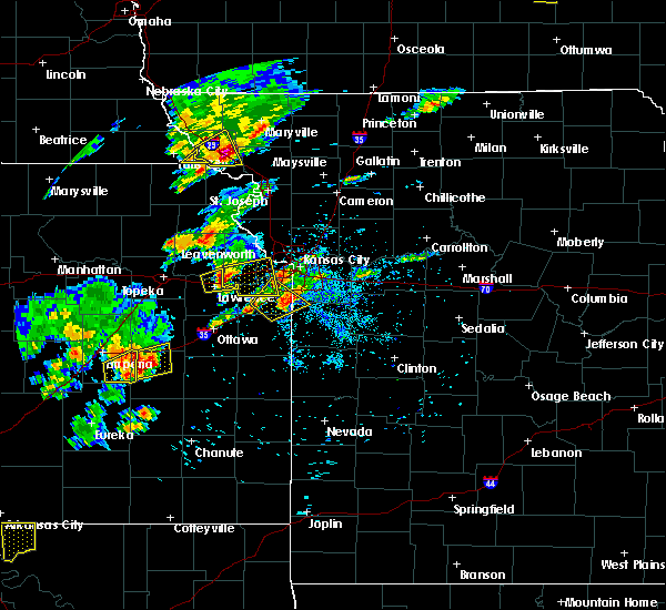 At 724 pm cdt, a severe thunderstorm was located near easton, or 11 miles southwest of atchison, moving northeast at 45 mph (radar indicated). Hazards include 60 mph wind gusts and quarter size hail. Hail damage to vehicles is expected. Expect wind damage to roofs, siding, and trees. At 724 pm cdt, a severe thunderstorm was located near easton, or 11 miles southwest of atchison, moving northeast at 45 mph (radar indicated). Hazards include 60 mph wind gusts and quarter size hail. Hail damage to vehicles is expected. Expect wind damage to roofs, siding, and trees.
|
| 7/12/2016 4:51 AM CDT |
 At 451 am cdt, severe thunderstorms were located along a line extending from near troy to easton, moving east at 50 mph (radar indicated). Hazards include 60 mph wind gusts. Expect damage to roofs. siding. And trees. At 451 am cdt, severe thunderstorms were located along a line extending from near troy to easton, moving east at 50 mph (radar indicated). Hazards include 60 mph wind gusts. Expect damage to roofs. siding. And trees.
|
| 5/26/2016 4:47 PM CDT |
 At 447 pm cdt, a severe thunderstorm was located over mclouth, or near oskaloosa, moving east at 55 mph (radar indicated). Hazards include 60 mph wind gusts and penny size hail. Expect damage to roofs. siding. And trees. At 447 pm cdt, a severe thunderstorm was located over mclouth, or near oskaloosa, moving east at 55 mph (radar indicated). Hazards include 60 mph wind gusts and penny size hail. Expect damage to roofs. siding. And trees.
|
| 5/26/2016 3:14 PM CDT |
 At 313 pm cdt, a severe thunderstorm was located near oskaloosa, moving northeast at 40 mph (radar indicated). Hazards include two inch hail and 70 mph wind gusts. People and animals outdoors will be injured. expect hail damage to roofs, siding, windows, and vehicles. expect considerable tree damage. Wind damage is also likely to mobile homes, roofs, and outbuildings. At 313 pm cdt, a severe thunderstorm was located near oskaloosa, moving northeast at 40 mph (radar indicated). Hazards include two inch hail and 70 mph wind gusts. People and animals outdoors will be injured. expect hail damage to roofs, siding, windows, and vehicles. expect considerable tree damage. Wind damage is also likely to mobile homes, roofs, and outbuildings.
|
| 5/26/2016 3:14 PM CDT |
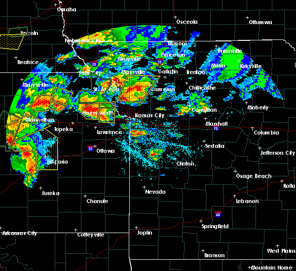 At 313 pm cdt, a severe thunderstorm was located near oskaloosa, moving northeast at 40 mph (radar indicated). Hazards include two inch hail and 70 mph wind gusts. People and animals outdoors will be injured. expect hail damage to roofs, siding, windows, and vehicles. expect considerable tree damage. Wind damage is also likely to mobile homes, roofs, and outbuildings. At 313 pm cdt, a severe thunderstorm was located near oskaloosa, moving northeast at 40 mph (radar indicated). Hazards include two inch hail and 70 mph wind gusts. People and animals outdoors will be injured. expect hail damage to roofs, siding, windows, and vehicles. expect considerable tree damage. Wind damage is also likely to mobile homes, roofs, and outbuildings.
|
| 5/26/2016 10:34 AM CDT |
 At 1034 am cdt, severe thunderstorms were located along a line extending from near troy to near easton, moving northeast at 25 mph (radar indicated). Hazards include 60 mph wind gusts and half dollar size hail. Hail damage to vehicles is expected. expect wind damage to roofs, siding, and trees. Locations impacted include, leavenworth, atchison, rushville, easton, lewis and clark village, doniphan, iatan, lewis and clark vi, potter, lowemont, cummings and bean lake. At 1034 am cdt, severe thunderstorms were located along a line extending from near troy to near easton, moving northeast at 25 mph (radar indicated). Hazards include 60 mph wind gusts and half dollar size hail. Hail damage to vehicles is expected. expect wind damage to roofs, siding, and trees. Locations impacted include, leavenworth, atchison, rushville, easton, lewis and clark village, doniphan, iatan, lewis and clark vi, potter, lowemont, cummings and bean lake.
|
| 5/26/2016 10:15 AM CDT |
 The national weather service in pleasant hill has issued a * severe thunderstorm warning for. northwestern leavenworth county in northeastern kansas. southwestern doniphan county in northeastern kansas. eastern atchison county in northeastern kansas. Northwestern platte county in west central missouri. The national weather service in pleasant hill has issued a * severe thunderstorm warning for. northwestern leavenworth county in northeastern kansas. southwestern doniphan county in northeastern kansas. eastern atchison county in northeastern kansas. Northwestern platte county in west central missouri.
|
| 5/26/2016 8:42 AM CDT |
 At 842 am cdt, a severe thunderstorm was located near tonganoxie, moving northeast at 40 mph (trained weather spotters). Hazards include golf ball size hail. People and animals outdoors will be injured. expect damage to roofs, siding, windows, and vehicles. locations impacted include, leavenworth, lansing, tonganoxie, easton, reno, fairmount, jarbalo and lowemont. This includes kansas turnpike between mile markers 211 and 212. At 842 am cdt, a severe thunderstorm was located near tonganoxie, moving northeast at 40 mph (trained weather spotters). Hazards include golf ball size hail. People and animals outdoors will be injured. expect damage to roofs, siding, windows, and vehicles. locations impacted include, leavenworth, lansing, tonganoxie, easton, reno, fairmount, jarbalo and lowemont. This includes kansas turnpike between mile markers 211 and 212.
|
| 5/26/2016 8:35 AM CDT |
 At 835 am cdt, a severe thunderstorm was located near tonganoxie, moving northeast at 40 mph (radar indicated). Hazards include 60 mph wind gusts and half dollar size hail. Hail damage to vehicles is expected. Expect wind damage to roofs, siding, and trees. At 835 am cdt, a severe thunderstorm was located near tonganoxie, moving northeast at 40 mph (radar indicated). Hazards include 60 mph wind gusts and half dollar size hail. Hail damage to vehicles is expected. Expect wind damage to roofs, siding, and trees.
|
| 5/11/2016 6:40 AM CDT |
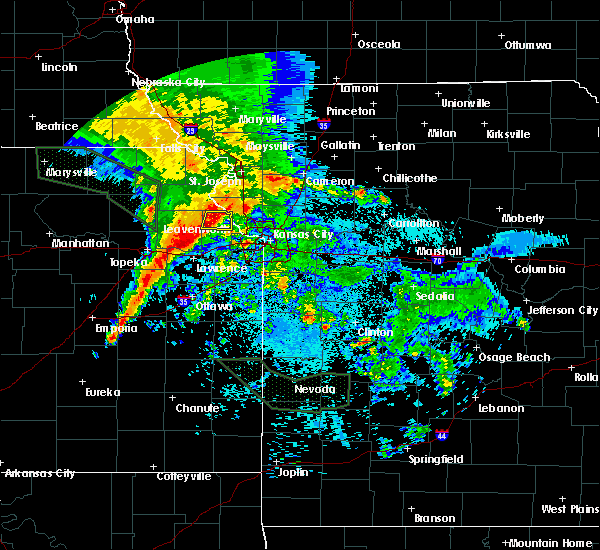 At 639 am cdt, a severe thunderstorm was located over easton, or 8 miles west of leavenworth, moving east at 20 mph (radar indicated). Hazards include 60 mph wind gusts and penny size hail. Expect damage to roofs. siding. and trees. Locations impacted include, leavenworth, lansing, easton, fort leavenworth and lowemont. At 639 am cdt, a severe thunderstorm was located over easton, or 8 miles west of leavenworth, moving east at 20 mph (radar indicated). Hazards include 60 mph wind gusts and penny size hail. Expect damage to roofs. siding. and trees. Locations impacted include, leavenworth, lansing, easton, fort leavenworth and lowemont.
|
| 5/11/2016 6:31 AM CDT |
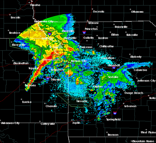 At 631 am cdt, a severe thunderstorm was located over easton, or 12 miles northeast of oskaloosa, moving east at 20 mph (radar indicated). Hazards include 60 mph wind gusts and penny size hail. Expect damage to roofs. siding. And trees. At 631 am cdt, a severe thunderstorm was located over easton, or 12 miles northeast of oskaloosa, moving east at 20 mph (radar indicated). Hazards include 60 mph wind gusts and penny size hail. Expect damage to roofs. siding. And trees.
|
| 4/26/2016 8:06 AM CDT |
 At 806 am cdt, severe thunderstorms were located along a line extending from near savannah to near leavenworth, moving east at 55 mph (trained weather spotters). Hazards include 70 mph wind gusts and ping pong ball size hail. People and animals outdoors will be injured. expect hail damage to roofs, siding, windows, and vehicles. expect considerable tree damage. wind damage is also likely to mobile homes, roofs, and outbuildings. locations impacted include, kansas city, independence, st. joseph, leavenworth, liberty, gladstone, lansing, atchison, cameron, smithville, kearney, parkville, savannah, platte city, north kansas city, sugar creek, riverside, plattsburg, lathrop and weatherby lake. this includes the following highways, interstate 35 in missouri between mile markers 6 and 67. interstate 29 between mile markers 0 and 67. interstate 635 between mile markers 10 and 12. interstate 435 between mile markers 20 and 57. Interstate 229 between mile markers 0 and 14. At 806 am cdt, severe thunderstorms were located along a line extending from near savannah to near leavenworth, moving east at 55 mph (trained weather spotters). Hazards include 70 mph wind gusts and ping pong ball size hail. People and animals outdoors will be injured. expect hail damage to roofs, siding, windows, and vehicles. expect considerable tree damage. wind damage is also likely to mobile homes, roofs, and outbuildings. locations impacted include, kansas city, independence, st. joseph, leavenworth, liberty, gladstone, lansing, atchison, cameron, smithville, kearney, parkville, savannah, platte city, north kansas city, sugar creek, riverside, plattsburg, lathrop and weatherby lake. this includes the following highways, interstate 35 in missouri between mile markers 6 and 67. interstate 29 between mile markers 0 and 67. interstate 635 between mile markers 10 and 12. interstate 435 between mile markers 20 and 57. Interstate 229 between mile markers 0 and 14.
|
| 4/26/2016 7:51 AM CDT |
 At 750 am cdt, severe thunderstorms were located along a line extending from near fillmore to near easton, moving east at 65 mph (radar indicated). Hazards include golf ball size hail and 70 mph wind gusts. People and animals outdoors will be injured. expect hail damage to roofs, siding, windows, and vehicles. expect considerable tree damage. Wind damage is also likely to mobile homes, roofs, and outbuildings. At 750 am cdt, severe thunderstorms were located along a line extending from near fillmore to near easton, moving east at 65 mph (radar indicated). Hazards include golf ball size hail and 70 mph wind gusts. People and animals outdoors will be injured. expect hail damage to roofs, siding, windows, and vehicles. expect considerable tree damage. Wind damage is also likely to mobile homes, roofs, and outbuildings.
|
| 7/6/2015 4:18 PM CDT |
 At 417 pm cdt, a severe thunderstorm was located near lansing, moving southeast at 20 mph (radar indicated). Hazards include 60 mph wind gusts and penny size hail. Expect damage to roofs. Siding and trees. At 417 pm cdt, a severe thunderstorm was located near lansing, moving southeast at 20 mph (radar indicated). Hazards include 60 mph wind gusts and penny size hail. Expect damage to roofs. Siding and trees.
|
| 6/23/2015 1:57 PM CDT | The severe thunderstorm warning for northwestern platte, southeastern atchison and northern leavenworth counties will expire at 200 pm cdt, the storm which prompted the warning has weakened below severe limits, and no longer poses an immediate threat to life or property. however, heavy rain is still possible with this thunderstorm. |
| 6/23/2015 1:57 PM CDT | The severe thunderstorm warning for northwestern platte, southeastern atchison and northern leavenworth counties will expire at 200 pm cdt, the storm which prompted the warning has weakened below severe limits, and no longer poses an immediate threat to life or property. however, heavy rain is still possible with this thunderstorm. |
| 6/23/2015 1:38 PM CDT |
 At 137 pm cdt, a severe thunderstorm was located 7 miles north of easton, and moving east at 30 mph (radar indicated). Hazards include quarter size hail. Damage to vehicles is expected. Locations impacted include, lowemont, bean lake, iatan and fort leavenworth. At 137 pm cdt, a severe thunderstorm was located 7 miles north of easton, and moving east at 30 mph (radar indicated). Hazards include quarter size hail. Damage to vehicles is expected. Locations impacted include, lowemont, bean lake, iatan and fort leavenworth.
|
| 6/23/2015 1:19 PM CDT |
 At 116 pm cdt, a severe thunderstorm was located near nortonville, and moving east at 30 mph (radar indicated). Hazards include half dollar size hail. damage to vehicles is expected At 116 pm cdt, a severe thunderstorm was located near nortonville, and moving east at 30 mph (radar indicated). Hazards include half dollar size hail. damage to vehicles is expected
|
| 5/16/2015 7:17 PM CDT | At 716 pm cdt, severe thunderstorms were located along a line extending from nortonville to mclouth to vinland, and moving northeast at 35 mph (radar indicated). Hazards include 60 mph wind gusts and penny size hail. Expect damage to roofs. siding and trees. locations impacted include, tonganoxie, gardner, de soto, olathe, atchison, leavenworth, basehor, weston, lansing, bonner springs, platte city, edwardsville, shawnee, lake quivira, easton, linwood, rushville, tracy, camden point and reno. this will impact the following interstates, i-70 in kansas between mile markers 410 and 416. i-35 in kansas between mile markers 208 and 221. i-435 loop from mile markers 1 to 34 to 83. i-29 between mile markers 14 and 30. 0. 75in. |
| 5/16/2015 7:17 PM CDT | At 716 pm cdt, severe thunderstorms were located along a line extending from nortonville to mclouth to vinland, and moving northeast at 35 mph (radar indicated). Hazards include 60 mph wind gusts and penny size hail. Expect damage to roofs. siding and trees. locations impacted include, tonganoxie, gardner, de soto, olathe, atchison, leavenworth, basehor, weston, lansing, bonner springs, platte city, edwardsville, shawnee, lake quivira, easton, linwood, rushville, tracy, camden point and reno. this will impact the following interstates, i-70 in kansas between mile markers 410 and 416. i-35 in kansas between mile markers 208 and 221. i-435 loop from mile markers 1 to 34 to 83. i-29 between mile markers 14 and 30. 0. 75in. |
| 5/16/2015 7:01 PM CDT | At 659 pm cdt, severe thunderstorms were located along a line extending from 5 miles southeast of valley falls to 6 miles west of tonganoxie to 5 miles southwest of baldwin city, and moving northeast at 50 mph (radar indicated). Hazards include 60 mph wind gusts and nickel size hail. Expect damage to roofs. Siding and trees. |
| 5/16/2015 7:01 PM CDT | At 659 pm cdt, severe thunderstorms were located along a line extending from 5 miles southeast of valley falls to 6 miles west of tonganoxie to 5 miles southwest of baldwin city, and moving northeast at 50 mph (radar indicated). Hazards include 60 mph wind gusts and nickel size hail. Expect damage to roofs. Siding and trees. |
| 10/1/2014 9:05 PM CDT | Golf Ball sized hail reported 4 miles WSW of Easton, KS, intersection of 207th and turner at pleasant ridge high school |
| 10/1/2014 8:53 PM CDT | Half Dollar sized hail reported 2.7 miles SSE of Easton, KS |
| 5/19/2013 7:12 PM CDT | Wind reported as 60 plus in leavenworth county KS, 1.1 miles S of Easton, KS |
| 8/20/2011 12:15 AM CDT | Grapefruit sized hail reported 0.4 miles SSE of Easton, KS, hail up to the size of softballs lasted for approximately 10 minutes then dropped down to around golfball size. windows broken out of a house. |
| 1/1/0001 12:00 AM | Quarter sized hail reported 5.2 miles N of Easton, KS |
| 1/1/0001 12:00 AM | Golf Ball sized hail reported 1.8 miles ESE of Easton, KS |
| 1/1/0001 12:00 AM | Quarter sized hail reported 1.8 miles ESE of Easton, KS |
| 1/1/0001 12:00 AM | Golf Ball sized hail reported 3.8 miles S of Easton, KS |
| 1/1/0001 12:00 AM | Golf Ball sized hail reported 1.8 miles ESE of Easton, KS |
Hail Maps for Easton, KS


Connect with Interactive Hail Maps