

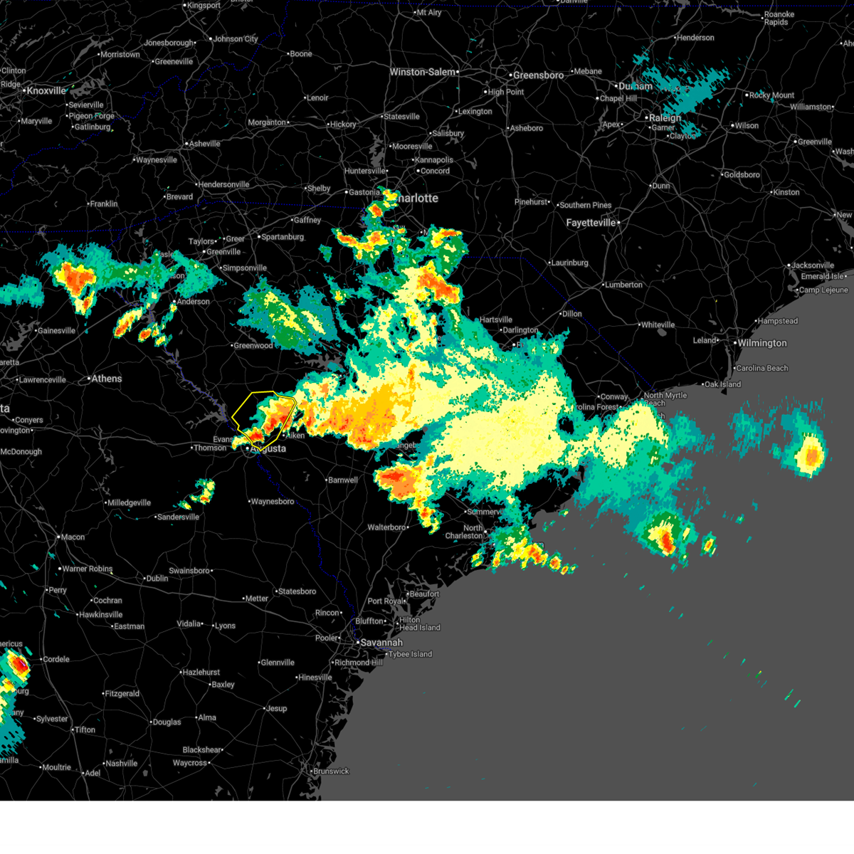
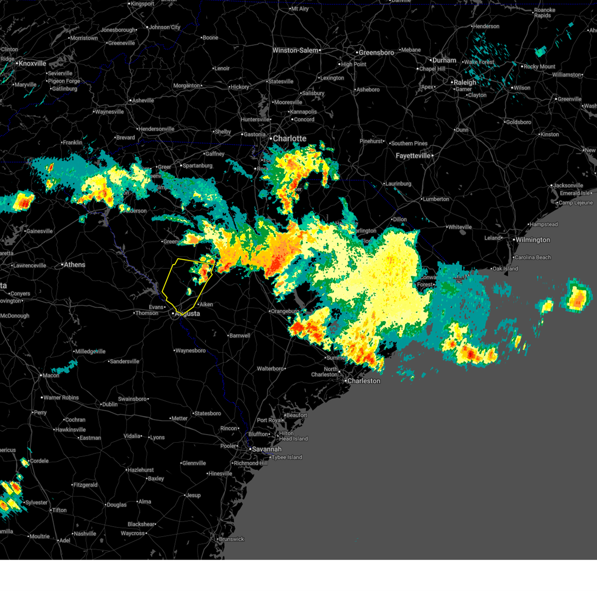
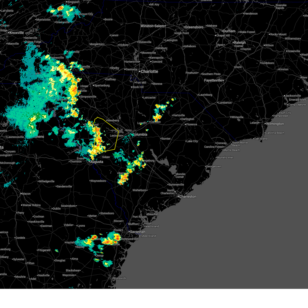
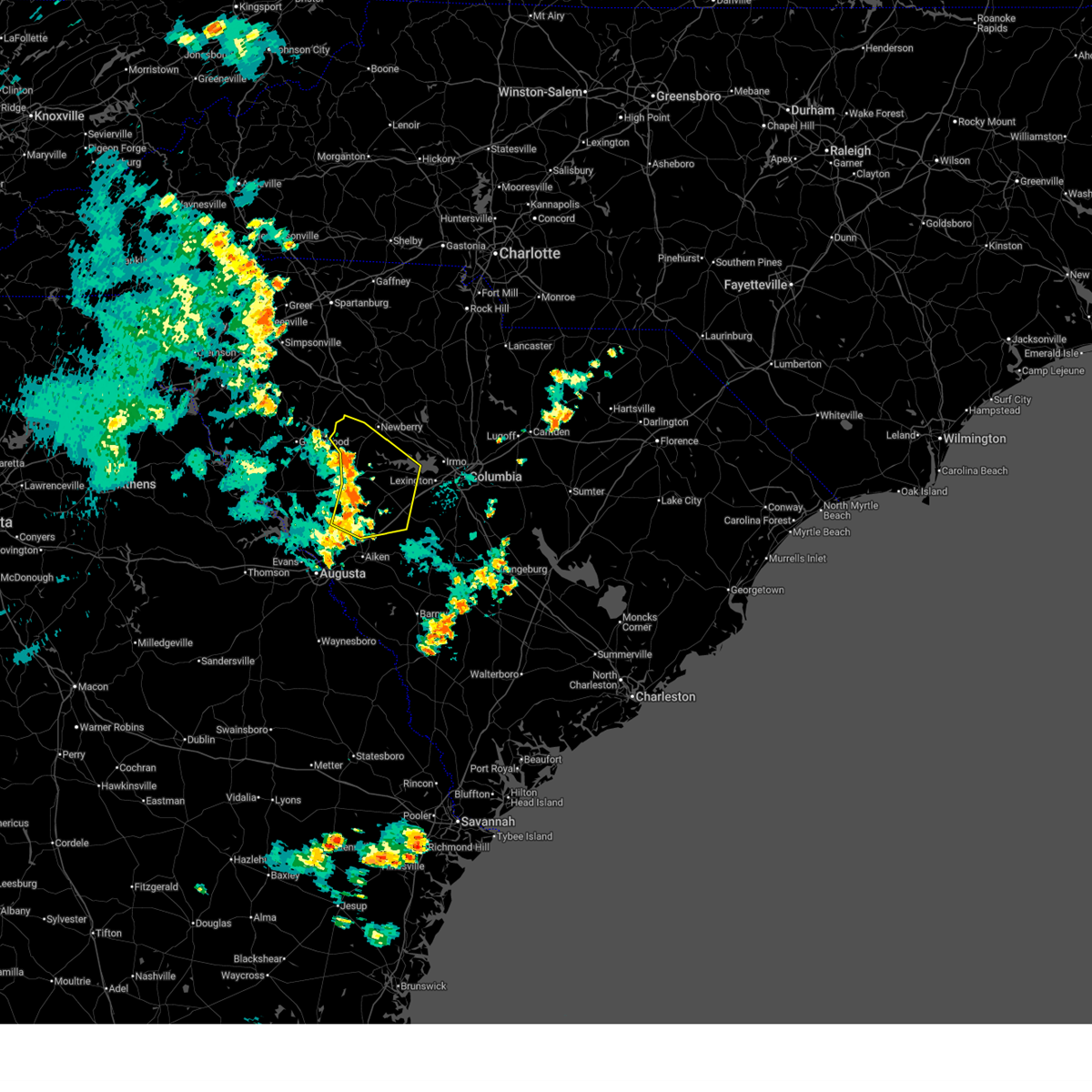
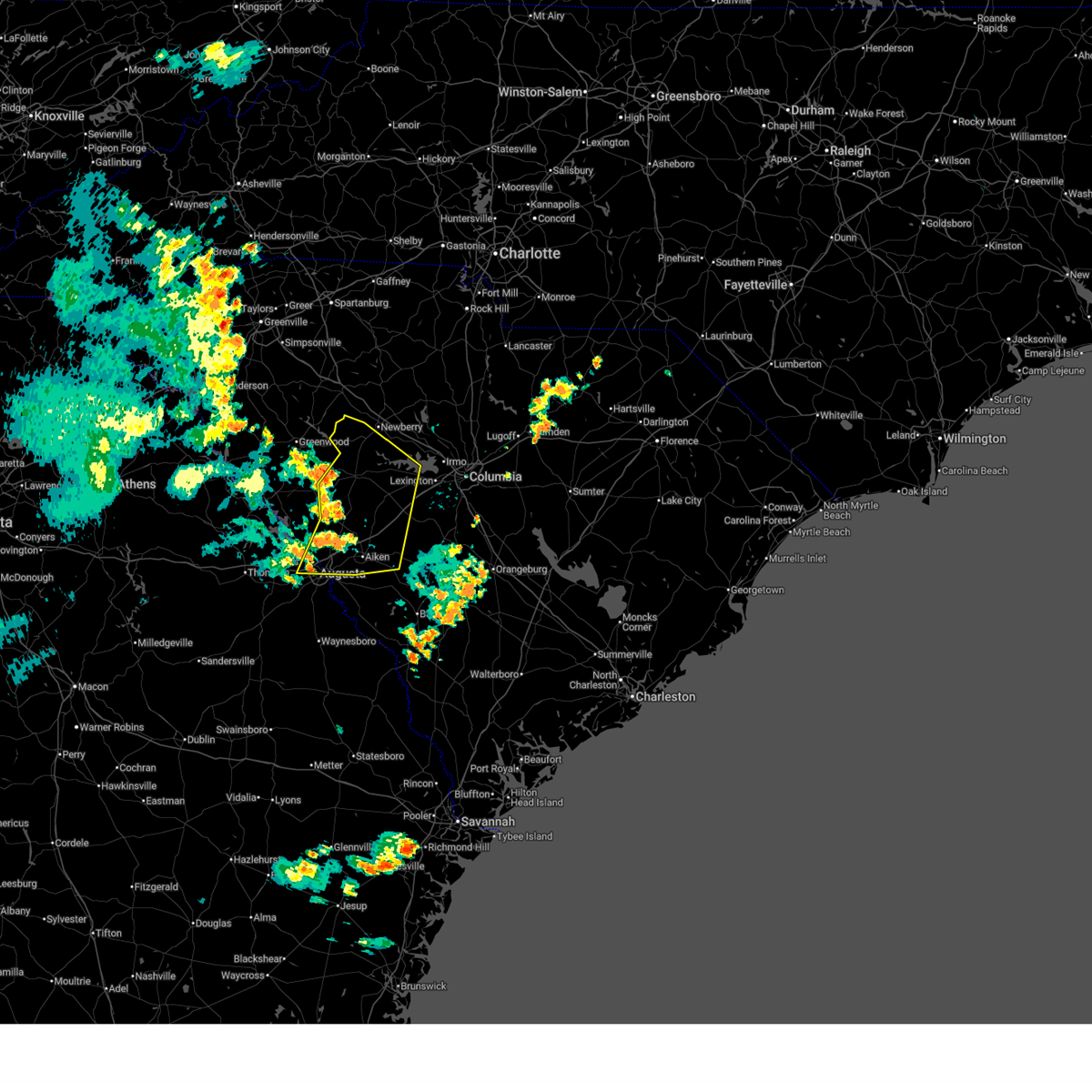
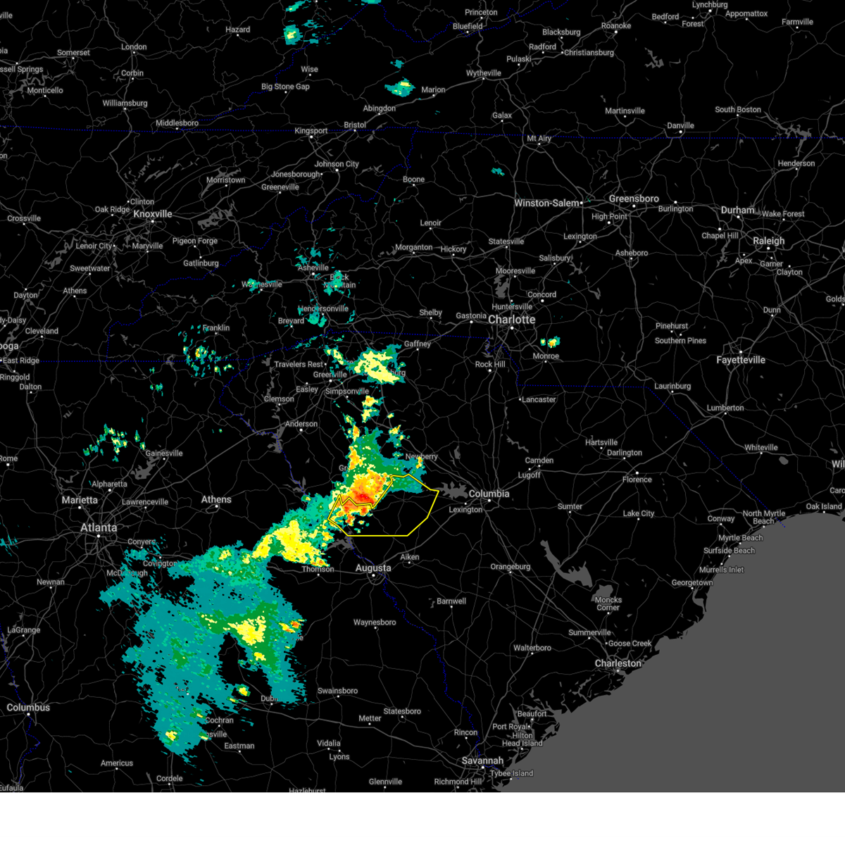
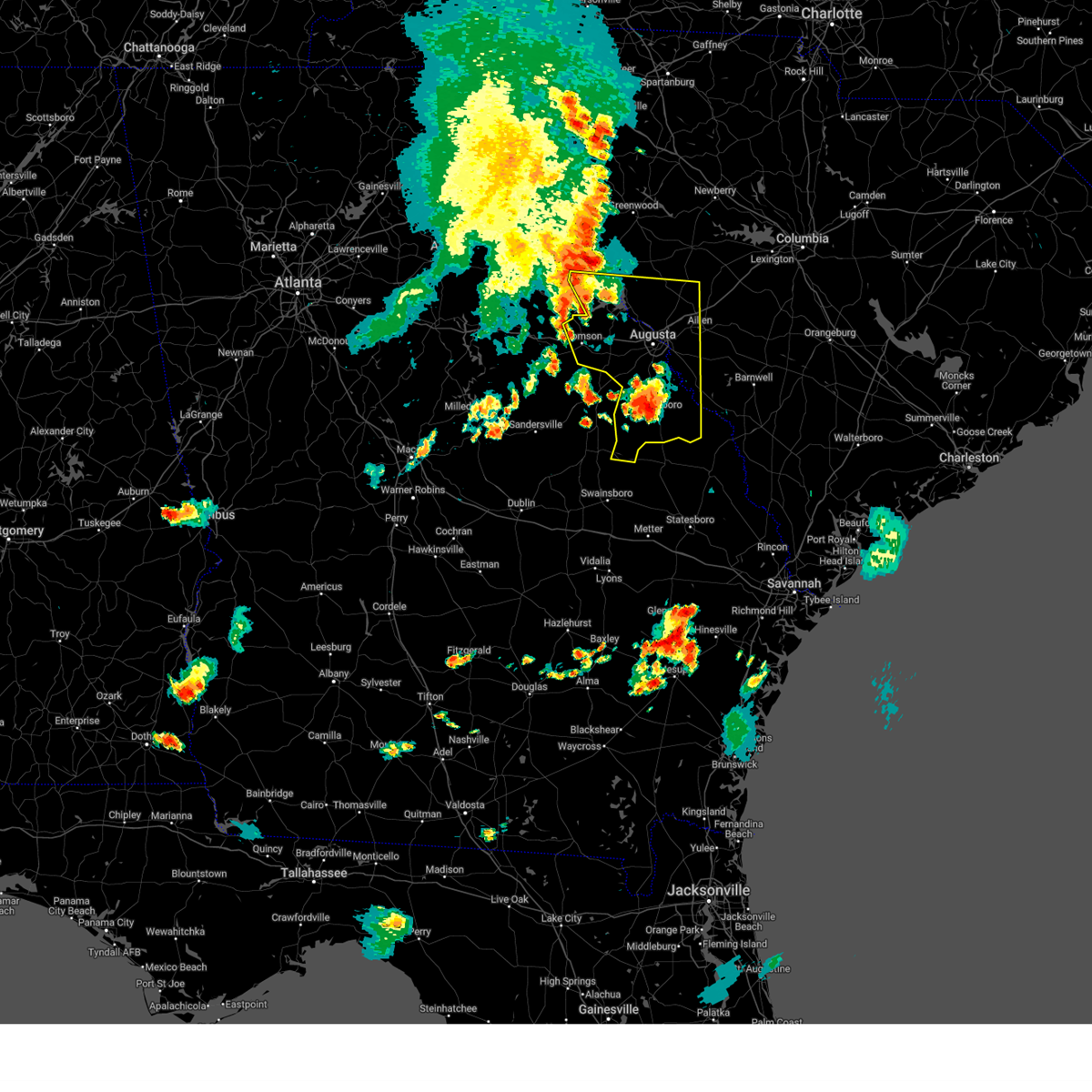
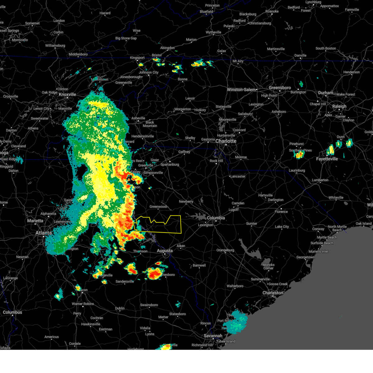
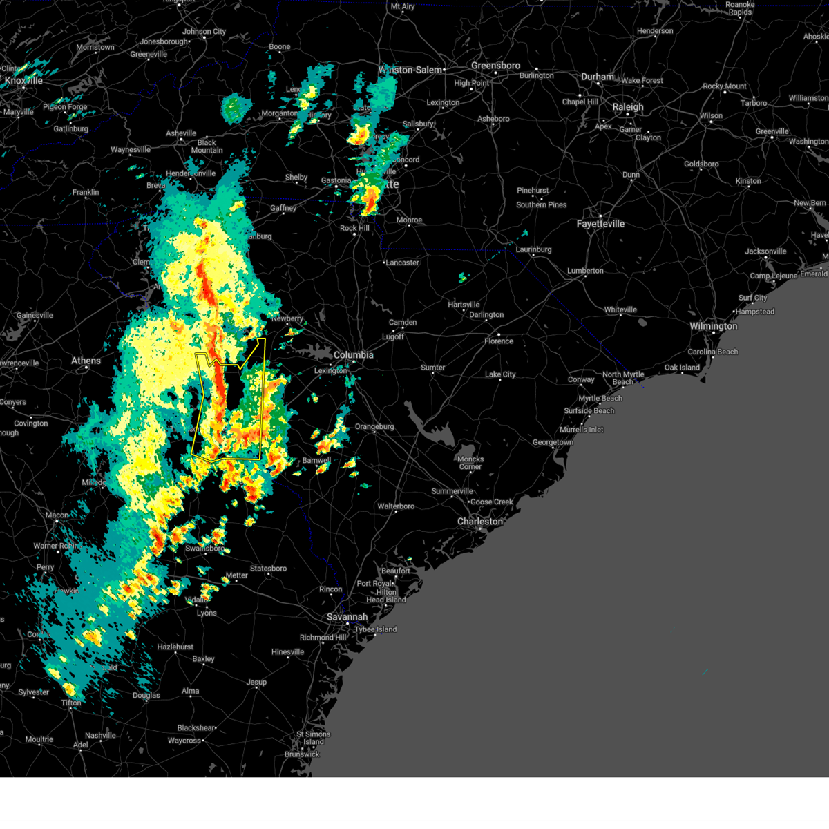
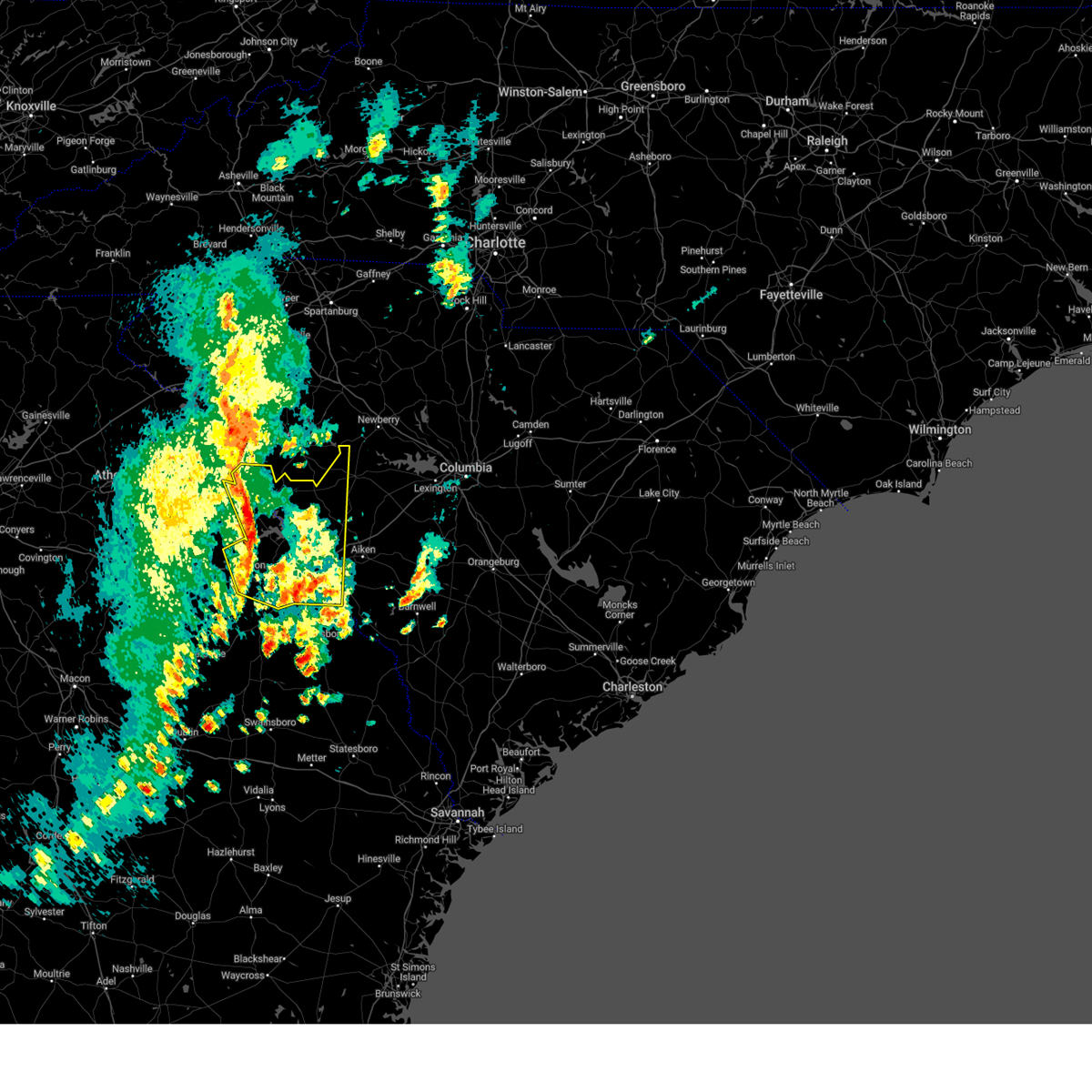
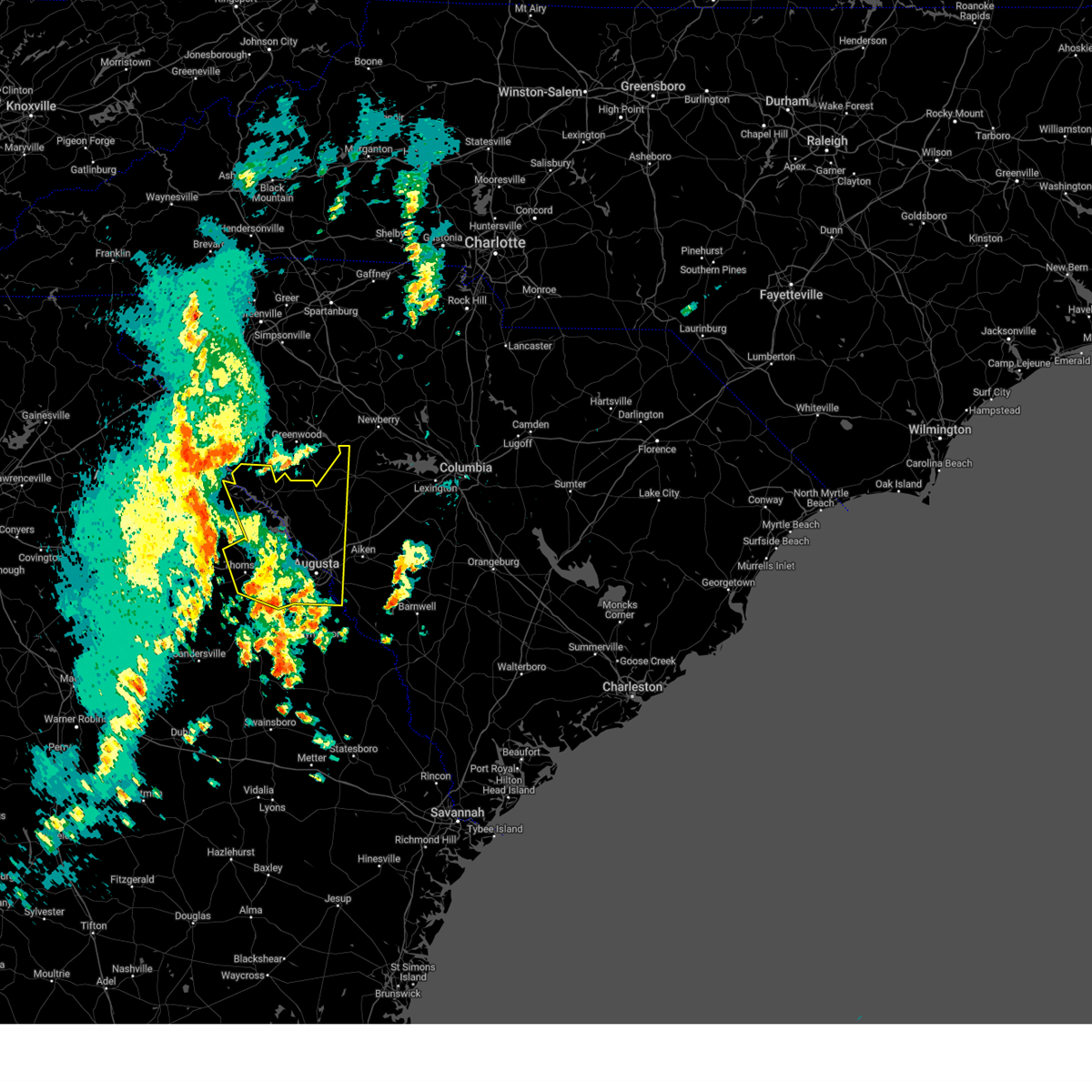
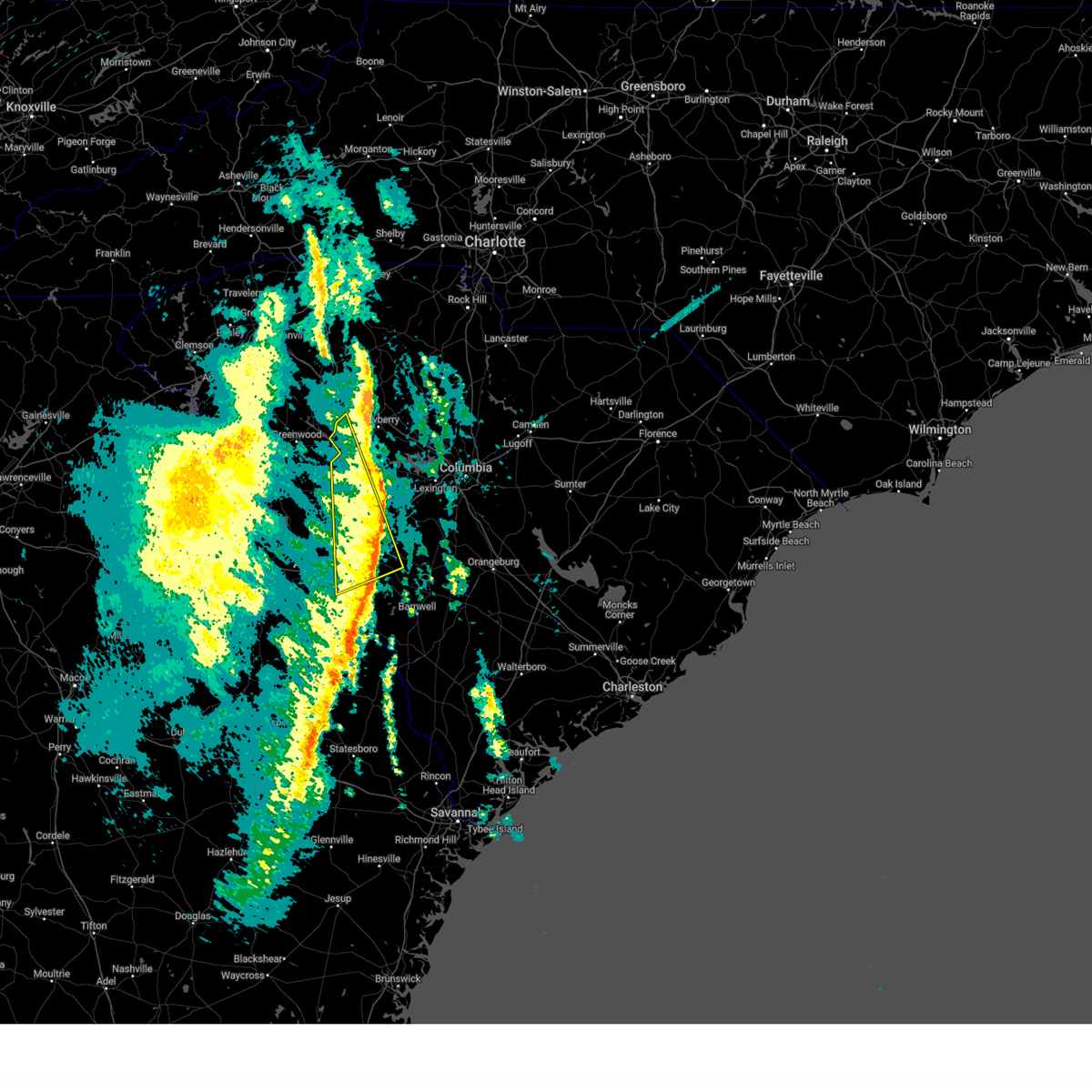
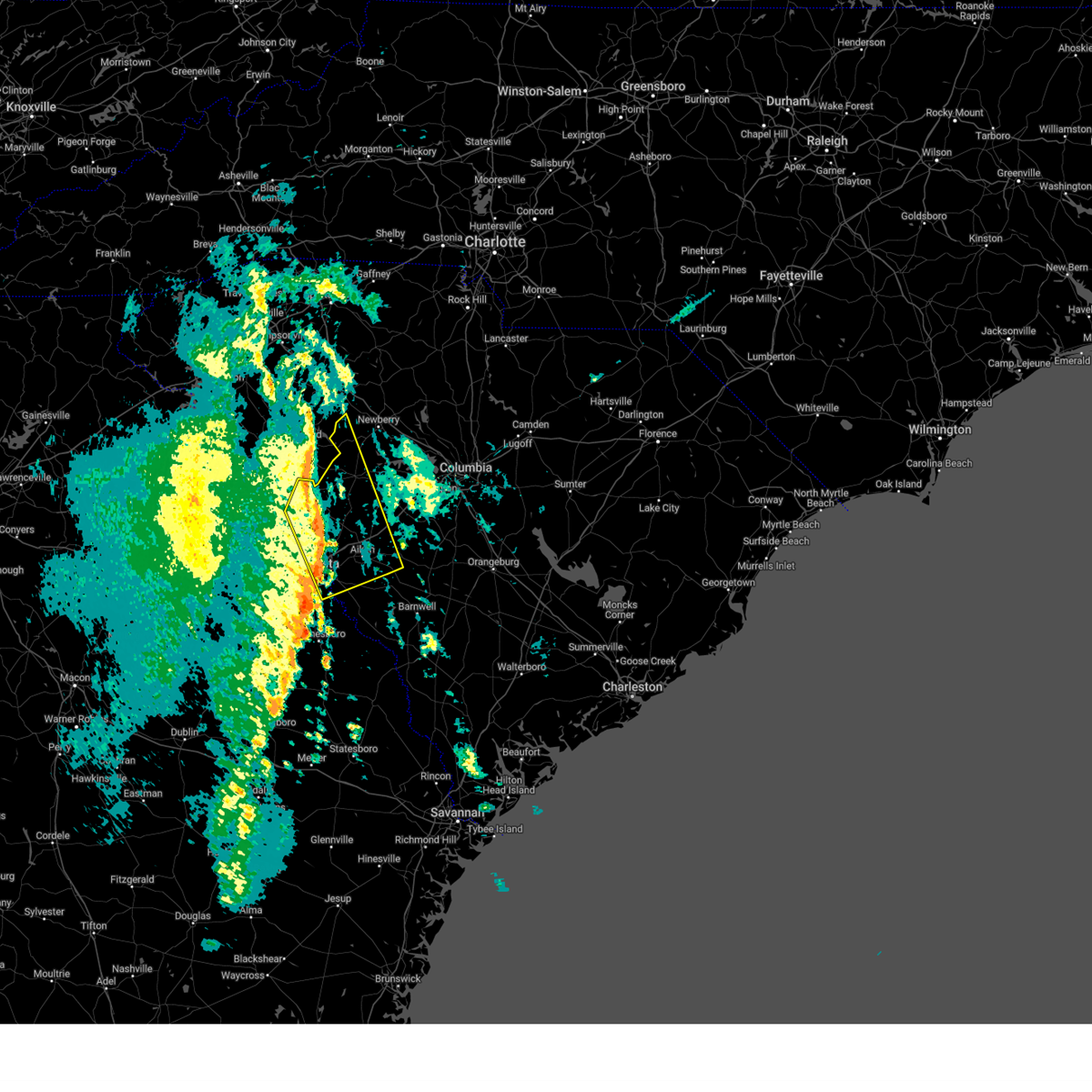
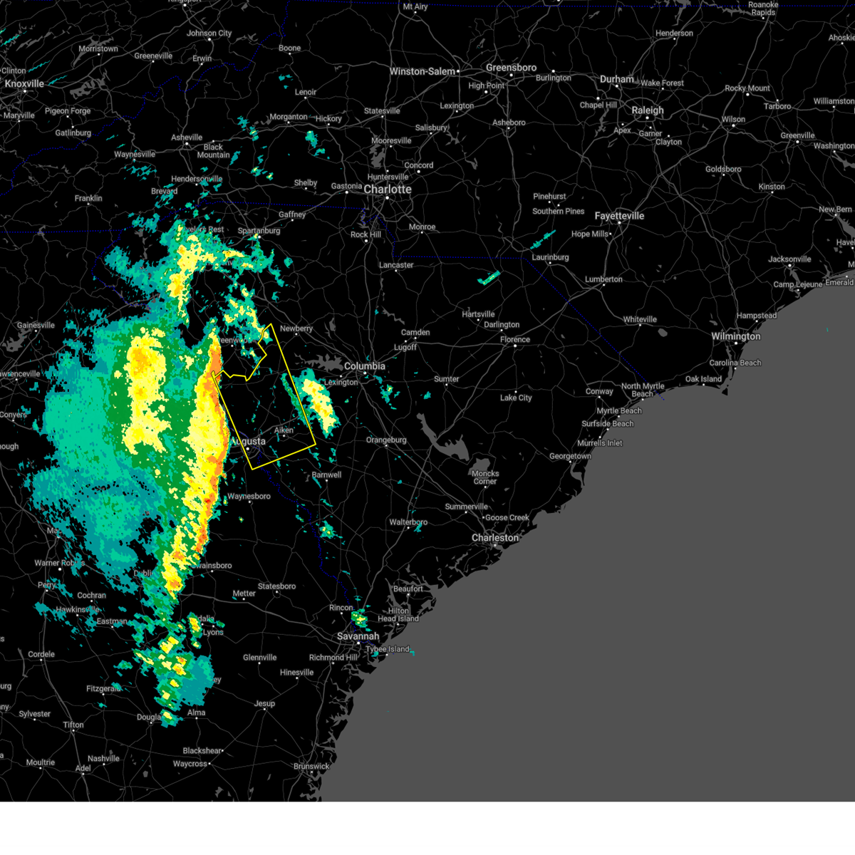
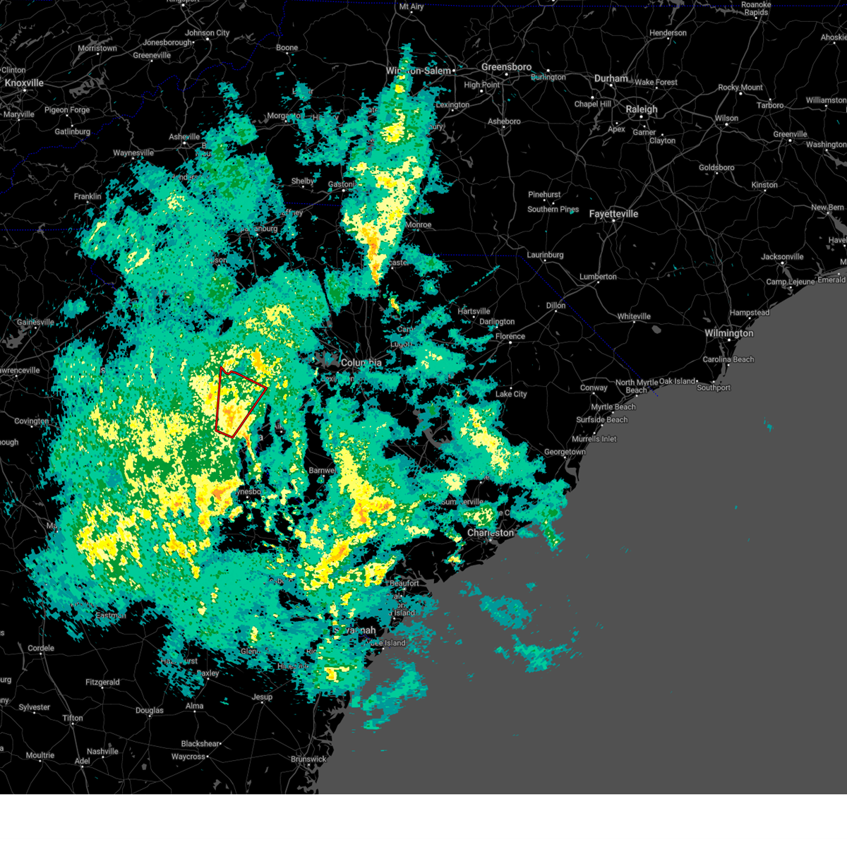
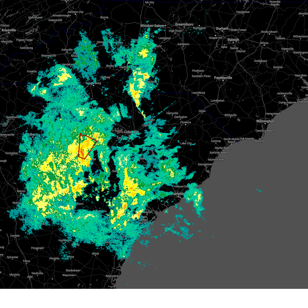
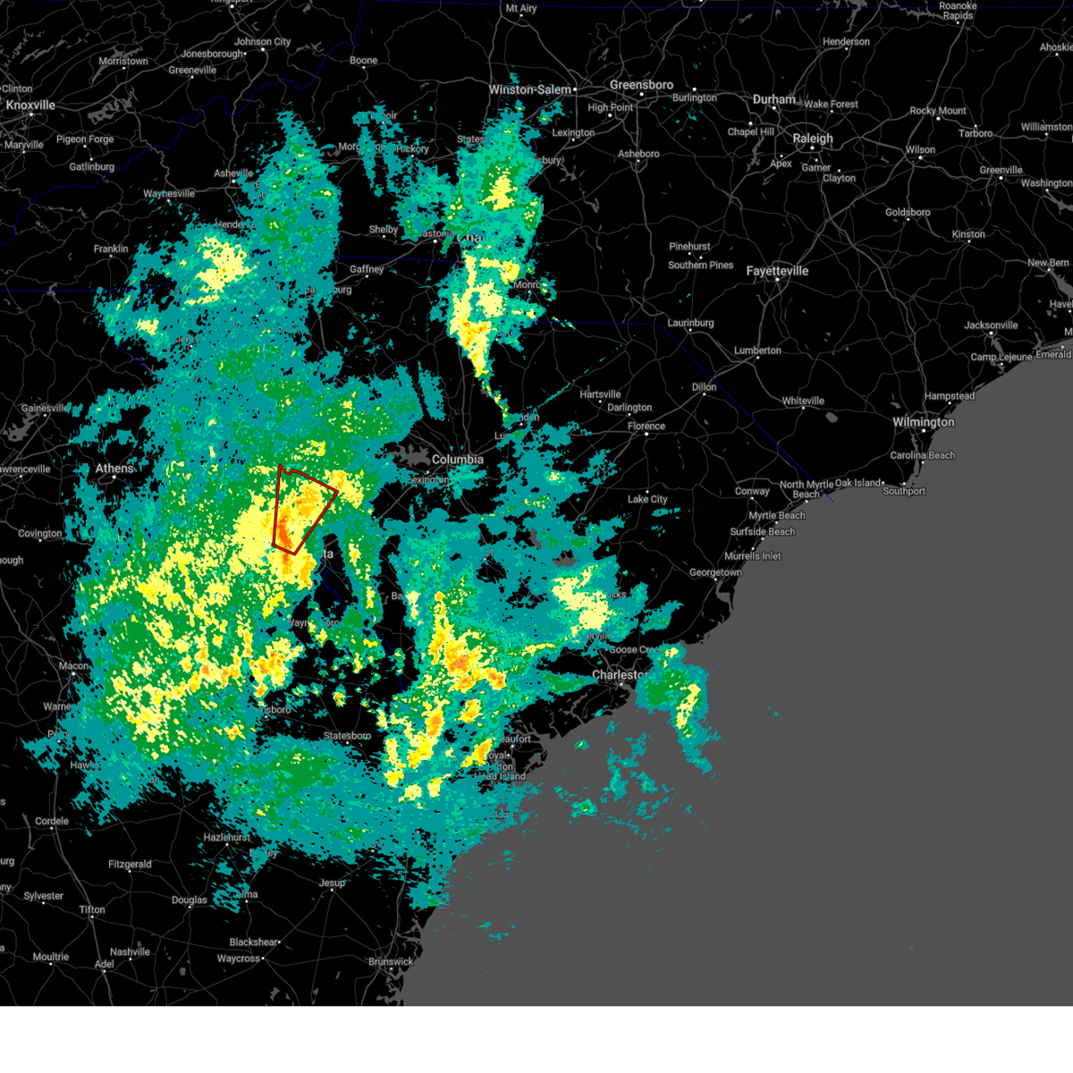
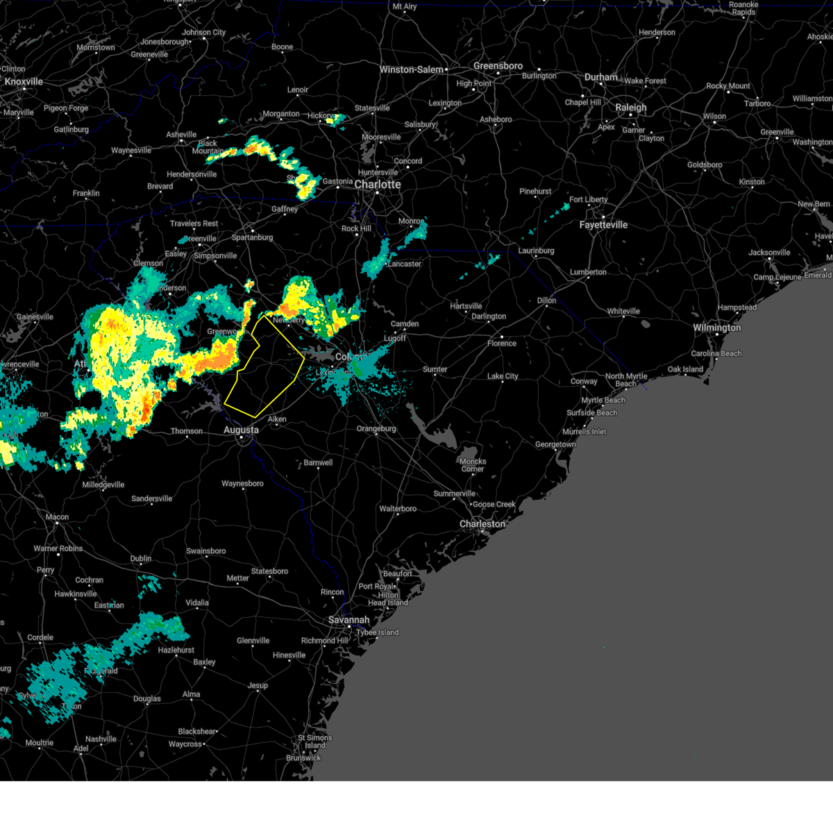
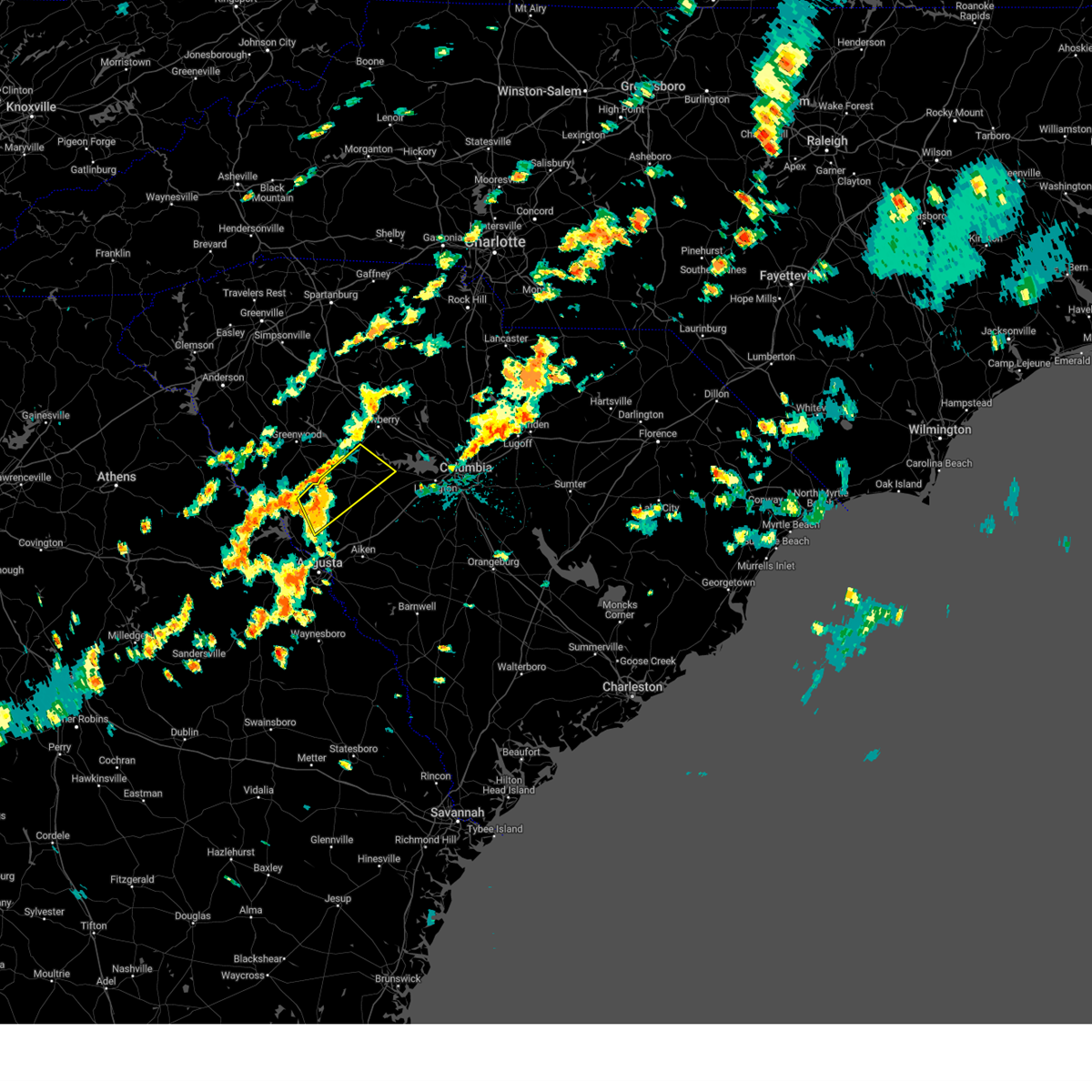
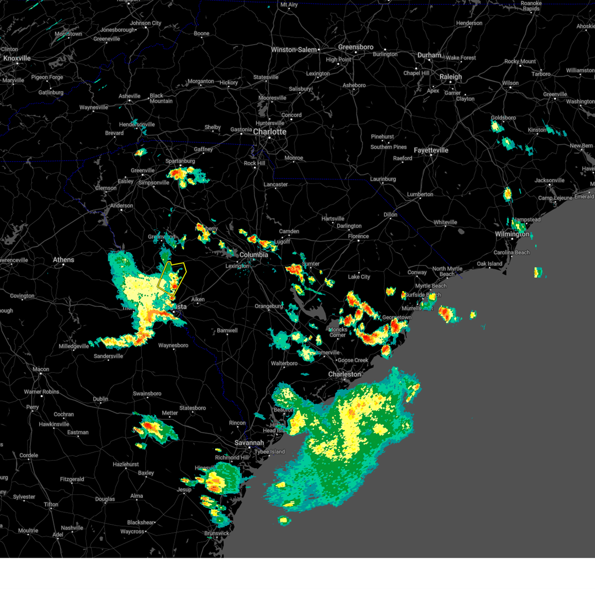
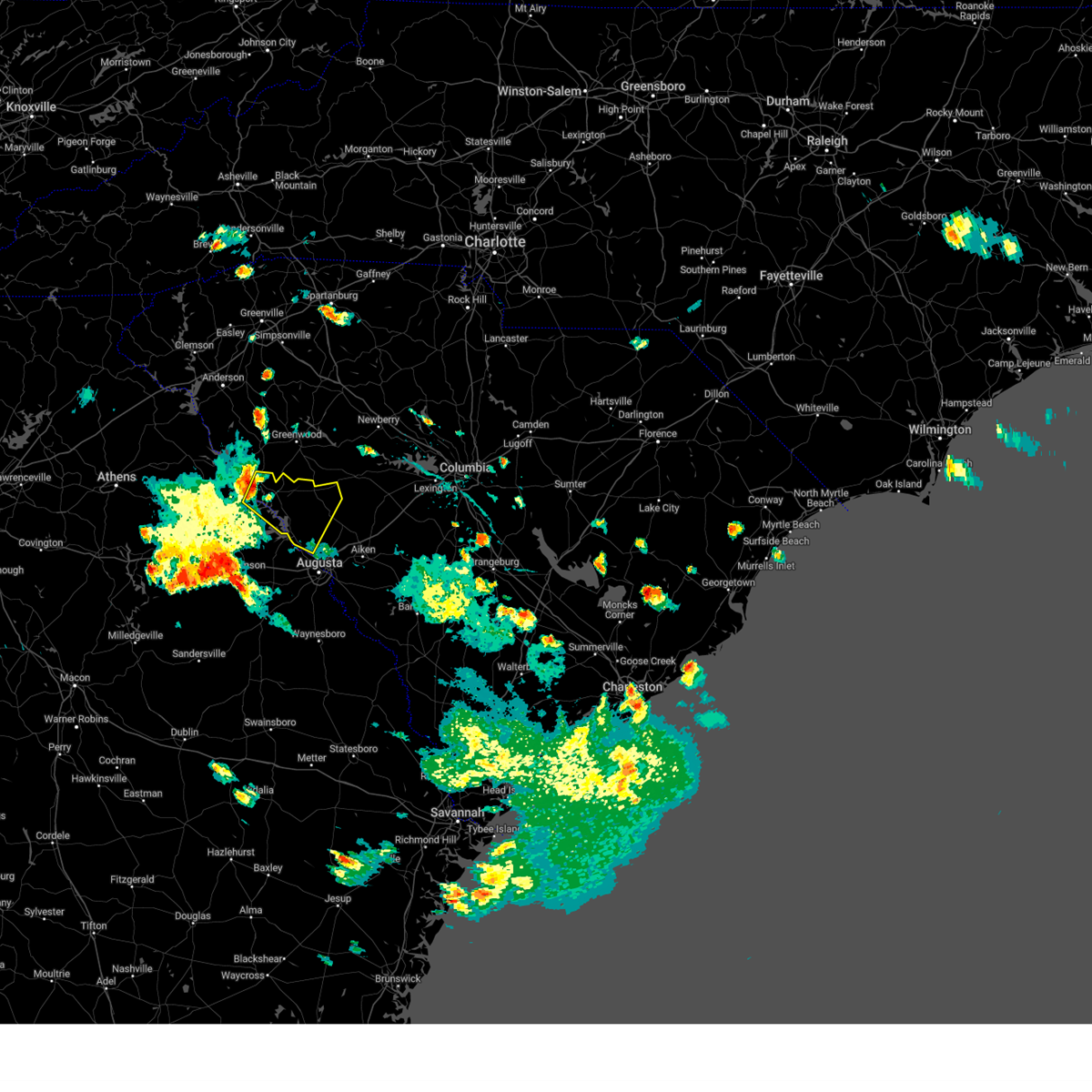
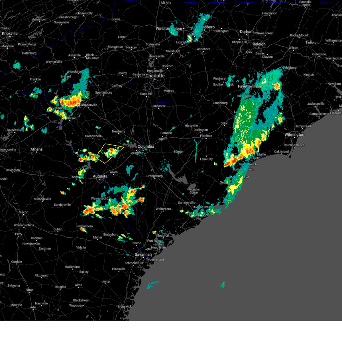
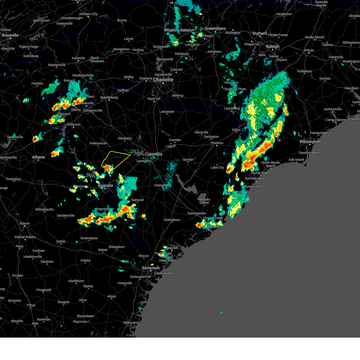
Hail Map for Edgefield, SC
The Edgefield, SC area has had 4 reports of on-the-ground hail by trained spotters, and has been under severe weather warnings 38 times during the past 12 months. Doppler radar has detected hail at or near Edgefield, SC on 44 occasions, including 2 occasions during the past year.
| Name: | Edgefield, SC |
| Where Located: | 21.2 miles N of Augusta, GA |
| Map: | Google Map for Edgefield, SC |
| Population: | 4750 |
| Housing Units: | 1227 |
| More Info: | Search Google for Edgefield, SC |
5
The Top Recent Hail Date for Edgefield, SC is Friday, May 2, 2025 (1st out of 44)

Hail and Wind Damage Spotted near Edgefield, SC
| Date / Time | Report Details |
|---|---|
| 6/25/2025 9:37 PM EDT |
 At 937 pm edt, a severe thunderstorm was located over belvedere, and is nearly stationary (radar indicated). Hazards include 60 mph wind gusts and penny size hail. Expect damage to trees and powerlines. locations impacted include, aiken, north augusta, clearwater, belvedere, edgefield, johnston, usc aiken, edgefield county airport, gloverville, graniteville, burnettown, trenton, strom thurmond high school, poverty hill, colliers, vaucluse, edgefield federal correction institution, lick fork campground, stevens creek public park, and harmony. this includes the following highways, interstate 20 in south carolina between mile markers 1 and 20. Interstate 520 in south carolina between mile markers 16 and 23. At 937 pm edt, a severe thunderstorm was located over belvedere, and is nearly stationary (radar indicated). Hazards include 60 mph wind gusts and penny size hail. Expect damage to trees and powerlines. locations impacted include, aiken, north augusta, clearwater, belvedere, edgefield, johnston, usc aiken, edgefield county airport, gloverville, graniteville, burnettown, trenton, strom thurmond high school, poverty hill, colliers, vaucluse, edgefield federal correction institution, lick fork campground, stevens creek public park, and harmony. this includes the following highways, interstate 20 in south carolina between mile markers 1 and 20. Interstate 520 in south carolina between mile markers 16 and 23.
|
| 6/25/2025 9:37 PM EDT |
 the severe thunderstorm warning has been cancelled and is no longer in effect the severe thunderstorm warning has been cancelled and is no longer in effect
|
| 6/25/2025 8:54 PM EDT |
 Svrcae the national weather service in columbia has issued a * severe thunderstorm warning for, edgefield county in central south carolina, southern saluda county in central south carolina, northwestern aiken county in central south carolina, * until 1000 pm edt. * at 853 pm edt, a severe thunderstorm was located over ridge spring, or 9 miles southwest of batesburg-leesville, moving southwest at 15 mph (radar indicated). Hazards include 60 mph wind gusts and quarter size hail. Hail damage to vehicles is expected. Expect wind damage to trees and powerlines. Svrcae the national weather service in columbia has issued a * severe thunderstorm warning for, edgefield county in central south carolina, southern saluda county in central south carolina, northwestern aiken county in central south carolina, * until 1000 pm edt. * at 853 pm edt, a severe thunderstorm was located over ridge spring, or 9 miles southwest of batesburg-leesville, moving southwest at 15 mph (radar indicated). Hazards include 60 mph wind gusts and quarter size hail. Hail damage to vehicles is expected. Expect wind damage to trees and powerlines.
|
| 6/17/2025 9:04 PM EDT |
 At 904 pm edt, severe thunderstorms were located along a line extending from 9 miles east of lake greenwood state park to 6 miles west of batesburg-leesville to near aiken municipal airport, moving northeast at 35 mph (radar indicated). Hazards include 60 mph wind gusts. Expect damage to trees and powerlines. locations impacted include, batesburg-leesville, edgefield, saluda, johnston, ridge spring, saluda county airport, edgefield county airport, dreher island state park, gilbert, summit, monetta, trenton, silverstreet, ward, cedar grove fire station, strom thurmond high school, south shore marina, oswald park, saluda co sheriff's office, and murray. This includes interstate 20 in south carolina between mile markers 24 and 43. At 904 pm edt, severe thunderstorms were located along a line extending from 9 miles east of lake greenwood state park to 6 miles west of batesburg-leesville to near aiken municipal airport, moving northeast at 35 mph (radar indicated). Hazards include 60 mph wind gusts. Expect damage to trees and powerlines. locations impacted include, batesburg-leesville, edgefield, saluda, johnston, ridge spring, saluda county airport, edgefield county airport, dreher island state park, gilbert, summit, monetta, trenton, silverstreet, ward, cedar grove fire station, strom thurmond high school, south shore marina, oswald park, saluda co sheriff's office, and murray. This includes interstate 20 in south carolina between mile markers 24 and 43.
|
| 6/17/2025 9:04 PM EDT |
 the severe thunderstorm warning has been cancelled and is no longer in effect the severe thunderstorm warning has been cancelled and is no longer in effect
|
| 6/17/2025 8:39 PM EDT |
 Svrcae the national weather service in columbia has issued a * severe thunderstorm warning for, east central columbia county in east central georgia, northeastern richmond county in east central georgia, southwestern newberry county in central south carolina, edgefield county in central south carolina, western lexington county in central south carolina, saluda county in central south carolina, central aiken county in central south carolina, * until 915 pm edt. * at 839 pm edt, multiple strong to severe thunderstorms were located along a line extending from near ninety six historic site to johnston to near graniteville, moving northeast at 35 mph (radar indicated). Hazards include 60 mph wind gusts. expect damage to trees and powerlines Svrcae the national weather service in columbia has issued a * severe thunderstorm warning for, east central columbia county in east central georgia, northeastern richmond county in east central georgia, southwestern newberry county in central south carolina, edgefield county in central south carolina, western lexington county in central south carolina, saluda county in central south carolina, central aiken county in central south carolina, * until 915 pm edt. * at 839 pm edt, multiple strong to severe thunderstorms were located along a line extending from near ninety six historic site to johnston to near graniteville, moving northeast at 35 mph (radar indicated). Hazards include 60 mph wind gusts. expect damage to trees and powerlines
|
| 6/9/2025 7:43 PM EDT |
 Svrcae the national weather service in columbia has issued a * severe thunderstorm warning for, southwestern newberry county in central south carolina, northern edgefield county in central south carolina, saluda county in central south carolina, northeastern mccormick county in central south carolina, * until 815 pm edt. * at 742 pm edt, severe thunderstorms were located along a line extending from greenwood to near mccormick county airport, moving east at 45 mph (radar indicated). Hazards include 60 mph wind gusts. expect damage to trees and powerlines Svrcae the national weather service in columbia has issued a * severe thunderstorm warning for, southwestern newberry county in central south carolina, northern edgefield county in central south carolina, saluda county in central south carolina, northeastern mccormick county in central south carolina, * until 815 pm edt. * at 742 pm edt, severe thunderstorms were located along a line extending from greenwood to near mccormick county airport, moving east at 45 mph (radar indicated). Hazards include 60 mph wind gusts. expect damage to trees and powerlines
|
| 6/8/2025 10:11 AM EDT |
 The storm which prompted the warning has weakened below severe limits, and no longer poses an immediate threat to life or property. therefore, the warning will be allowed to expire. however, gusty winds are still possible with this thunderstorm. The storm which prompted the warning has weakened below severe limits, and no longer poses an immediate threat to life or property. therefore, the warning will be allowed to expire. however, gusty winds are still possible with this thunderstorm.
|
| 6/8/2025 9:49 AM EDT |
 At 949 am edt, a severe thunderstorm was located near saluda, or 11 miles northwest of batesburg-leesville, moving east at 55 mph (radar indicated). Hazards include 60 mph wind gusts and quarter size hail. Hail damage to vehicles is expected. expect wind damage to trees and powerlines. Locations impacted include, batesburg-leesville, edgefield, saluda, johnston, ridge spring, saluda county airport, monetta, trenton, ward, strom thurmond high school, saluda co sheriff's office, good hope, northside fire station main, hollywood elementary school, emory, cleora, delmar, edgefield federal correction institution, harmony, and pleasant lane. At 949 am edt, a severe thunderstorm was located near saluda, or 11 miles northwest of batesburg-leesville, moving east at 55 mph (radar indicated). Hazards include 60 mph wind gusts and quarter size hail. Hail damage to vehicles is expected. expect wind damage to trees and powerlines. Locations impacted include, batesburg-leesville, edgefield, saluda, johnston, ridge spring, saluda county airport, monetta, trenton, ward, strom thurmond high school, saluda co sheriff's office, good hope, northside fire station main, hollywood elementary school, emory, cleora, delmar, edgefield federal correction institution, harmony, and pleasant lane.
|
| 6/8/2025 9:49 AM EDT |
 the severe thunderstorm warning has been cancelled and is no longer in effect the severe thunderstorm warning has been cancelled and is no longer in effect
|
| 6/8/2025 9:37 AM EDT | Edgefield county dispatch reports trees down on gilgal rd. time estimated from rada in edgefield county SC, 10.8 miles SE of Edgefield, SC |
| 6/8/2025 9:28 AM EDT |
 Svrcae the national weather service in columbia has issued a * severe thunderstorm warning for, northern edgefield county in central south carolina, saluda county in central south carolina, central mccormick county in central south carolina, * until 1015 am edt. * at 928 am edt, a severe thunderstorm was located 10 miles south of ninety six historic site, or 14 miles southeast of greenwood, moving east at 55 mph (radar indicated). Hazards include 60 mph wind gusts and quarter size hail. Hail damage to vehicles is expected. Expect wind damage to trees and powerlines. Svrcae the national weather service in columbia has issued a * severe thunderstorm warning for, northern edgefield county in central south carolina, saluda county in central south carolina, central mccormick county in central south carolina, * until 1015 am edt. * at 928 am edt, a severe thunderstorm was located 10 miles south of ninety six historic site, or 14 miles southeast of greenwood, moving east at 55 mph (radar indicated). Hazards include 60 mph wind gusts and quarter size hail. Hail damage to vehicles is expected. Expect wind damage to trees and powerlines.
|
| 6/7/2025 8:36 PM EDT |
 Svrcae the national weather service in columbia has issued a * severe thunderstorm warning for, central burke county in east central georgia, eastern richmond county in east central georgia, southeastern edgefield county in central south carolina, barnwell county in central south carolina, south central lexington county in central south carolina, aiken county in central south carolina, western orangeburg county in central south carolina, * until 915 pm edt. * at 836 pm edt, severe thunderstorms were located along a line extending from near edgefield to alexander, moving east at 45 mph (radar indicated). Hazards include 60 mph wind gusts and penny size hail. expect damage to trees and powerlines Svrcae the national weather service in columbia has issued a * severe thunderstorm warning for, central burke county in east central georgia, eastern richmond county in east central georgia, southeastern edgefield county in central south carolina, barnwell county in central south carolina, south central lexington county in central south carolina, aiken county in central south carolina, western orangeburg county in central south carolina, * until 915 pm edt. * at 836 pm edt, severe thunderstorms were located along a line extending from near edgefield to alexander, moving east at 45 mph (radar indicated). Hazards include 60 mph wind gusts and penny size hail. expect damage to trees and powerlines
|
| 6/7/2025 8:26 PM EDT |
 the severe thunderstorm warning has been cancelled and is no longer in effect the severe thunderstorm warning has been cancelled and is no longer in effect
|
| 6/7/2025 8:26 PM EDT |
 At 825 pm edt, severe thunderstorms were located along a line extending from near hamilton branch state park to near gough, moving east at 40 mph (radar indicated). Hazards include 60 mph wind gusts. Expect damage to trees and powerlines. locations impacted include, aiken, north augusta, grovetown, evans, waynesboro, fort eisenhower, augusta, clearwater, martinez, plant vogtle, belvedere, edgefield, hephzibah, jackson, sardis, glendale, gough, south augusta, clarks hill recreation area, and edgefield county airport. this includes the following highways, interstate 20 in georgia between mile markers 184 and 201. interstate 20 in south carolina between mile markers 0 and 19. interstate 520 in georgia between mile markers 1 and 15. Interstate 520 in south carolina between mile markers 16 and 23. At 825 pm edt, severe thunderstorms were located along a line extending from near hamilton branch state park to near gough, moving east at 40 mph (radar indicated). Hazards include 60 mph wind gusts. Expect damage to trees and powerlines. locations impacted include, aiken, north augusta, grovetown, evans, waynesboro, fort eisenhower, augusta, clearwater, martinez, plant vogtle, belvedere, edgefield, hephzibah, jackson, sardis, glendale, gough, south augusta, clarks hill recreation area, and edgefield county airport. this includes the following highways, interstate 20 in georgia between mile markers 184 and 201. interstate 20 in south carolina between mile markers 0 and 19. interstate 520 in georgia between mile markers 1 and 15. Interstate 520 in south carolina between mile markers 16 and 23.
|
| 6/7/2025 8:10 PM EDT | Edgefield county dispatch reports trees down along hwy 378 in edgefield county. time estimated by rada in edgefield county SC, 11.5 miles SSE of Edgefield, SC |
| 6/7/2025 8:09 PM EDT |
 Svrcae the national weather service in columbia has issued a * severe thunderstorm warning for, western fairfield county in central south carolina, newberry county in central south carolina, edgefield county in central south carolina, western lexington county in central south carolina, saluda county in central south carolina, north central aiken county in central south carolina, east central mccormick county in central south carolina, northwestern richland county in central south carolina, * until 900 pm edt. * at 808 pm edt, severe thunderstorms were located along a line extending from near laurens to 8 miles northeast of hamilton branch state park, moving east at 60 mph (radar indicated). Hazards include 60 mph wind gusts. expect damage to trees and powerlines Svrcae the national weather service in columbia has issued a * severe thunderstorm warning for, western fairfield county in central south carolina, newberry county in central south carolina, edgefield county in central south carolina, western lexington county in central south carolina, saluda county in central south carolina, north central aiken county in central south carolina, east central mccormick county in central south carolina, northwestern richland county in central south carolina, * until 900 pm edt. * at 808 pm edt, severe thunderstorms were located along a line extending from near laurens to 8 miles northeast of hamilton branch state park, moving east at 60 mph (radar indicated). Hazards include 60 mph wind gusts. expect damage to trees and powerlines
|
| 6/7/2025 8:07 PM EDT | Edgefield county dispatch reported trees down along red hill rd. time estimated by rada in edgefield county SC, 9.7 miles E of Edgefield, SC |
| 6/7/2025 7:53 PM EDT |
 Svrcae the national weather service in columbia has issued a * severe thunderstorm warning for, mcduffie county in east central georgia, columbia county in east central georgia, lincoln county in east central georgia, burke county in east central georgia, richmond county in east central georgia, edgefield county in central south carolina, southwestern barnwell county in central south carolina, western aiken county in central south carolina, southeastern mccormick county in central south carolina, * until 845 pm edt. * at 753 pm edt, severe thunderstorms were located along a line extending from lincolnton to near louisville, moving east at 40 mph (radar indicated). Hazards include 60 mph wind gusts. expect damage to trees and powerlines Svrcae the national weather service in columbia has issued a * severe thunderstorm warning for, mcduffie county in east central georgia, columbia county in east central georgia, lincoln county in east central georgia, burke county in east central georgia, richmond county in east central georgia, edgefield county in central south carolina, southwestern barnwell county in central south carolina, western aiken county in central south carolina, southeastern mccormick county in central south carolina, * until 845 pm edt. * at 753 pm edt, severe thunderstorms were located along a line extending from lincolnton to near louisville, moving east at 40 mph (radar indicated). Hazards include 60 mph wind gusts. expect damage to trees and powerlines
|
| 6/7/2025 7:38 PM EDT |
 Svrcae the national weather service in columbia has issued a * severe thunderstorm warning for, northwestern lincoln county in east central georgia, northern edgefield county in central south carolina, southwestern saluda county in central south carolina, mccormick county in central south carolina, * until 830 pm edt. * at 738 pm edt, a severe thunderstorm was located near bobby brown state park, or 17 miles northeast of washington, moving east at 60 mph (radar indicated). Hazards include 60 mph wind gusts. expect damage to trees and powerlines Svrcae the national weather service in columbia has issued a * severe thunderstorm warning for, northwestern lincoln county in east central georgia, northern edgefield county in central south carolina, southwestern saluda county in central south carolina, mccormick county in central south carolina, * until 830 pm edt. * at 738 pm edt, a severe thunderstorm was located near bobby brown state park, or 17 miles northeast of washington, moving east at 60 mph (radar indicated). Hazards include 60 mph wind gusts. expect damage to trees and powerlines
|
| 5/30/2025 3:34 PM EDT |
 Svrcae the national weather service in columbia has issued a * severe thunderstorm warning for, mcduffie county in east central georgia, columbia county in east central georgia, richmond county in east central georgia, southeastern newberry county in central south carolina, central edgefield county in central south carolina, lexington county in central south carolina, eastern saluda county in central south carolina, aiken county in central south carolina, southeastern mccormick county in central south carolina, central richland county in central south carolina, * until 415 pm edt. * at 333 pm edt, severe thunderstorms were located along a line extending from 7 miles north of batesburg-leesville to 9 miles northwest of belvedere to thomson-mcduffie county airport, moving east at 35 mph (radar indicated). Hazards include 60 mph wind gusts. expect damage to trees and powerlines Svrcae the national weather service in columbia has issued a * severe thunderstorm warning for, mcduffie county in east central georgia, columbia county in east central georgia, richmond county in east central georgia, southeastern newberry county in central south carolina, central edgefield county in central south carolina, lexington county in central south carolina, eastern saluda county in central south carolina, aiken county in central south carolina, southeastern mccormick county in central south carolina, central richland county in central south carolina, * until 415 pm edt. * at 333 pm edt, severe thunderstorms were located along a line extending from 7 miles north of batesburg-leesville to 9 miles northwest of belvedere to thomson-mcduffie county airport, moving east at 35 mph (radar indicated). Hazards include 60 mph wind gusts. expect damage to trees and powerlines
|
| 5/2/2025 6:20 PM EDT | At 620 pm edt, a severe thunderstorm was located over johnston, or 17 miles west of batesburg-leesville, moving northeast at 15 mph (radar indicated). Hazards include 70 mph wind gusts and quarter size hail. Hail damage to vehicles is expected. expect considerable tree damage. wind damage is also likely to mobile homes, roofs, and outbuildings. Locations impacted include, edgefield, saluda, johnston, ridge spring, saluda county airport, edgefield county airport, monetta, trenton, ward, strom thurmond high school, saluda co sheriff's office, harmony, emory, edgefield federal correction institution, and saluda high school. |
| 5/2/2025 5:59 PM EDT | Svrcae the national weather service in columbia has issued a * severe thunderstorm warning for, central edgefield county in central south carolina, southeastern saluda county in central south carolina, north central aiken county in central south carolina, * until 645 pm edt. * at 559 pm edt, a severe thunderstorm was located near edgefield, or 18 miles north of belvedere, moving northeast at 25 mph. at 5:26pm, penny size hail was observed in edgefield (radar indicated). Hazards include 70 mph wind gusts and ping pong ball size hail. People and animals outdoors will be injured. expect hail damage to roofs, siding, windows, and vehicles. expect considerable tree damage. Wind damage is also likely to mobile homes, roofs, and outbuildings. |
| 5/2/2025 5:55 PM EDT | Half Dollar sized hail reported 0.9 miles WSW of Edgefield, SC, broadcast meteorologist sent multiple pictures of hail from a viewer with the bigger stones ranging from quarter to half dollar size hail. |
| 5/2/2025 5:52 PM EDT | Spotter observed one large shed blown away and one tin shed flipped over at 420 mims st in edgefiel in edgefield county SC, 0.5 miles SSW of Edgefield, SC |
| 5/2/2025 5:45 PM EDT | Broadcast media relayed a report with a picture of a large tree down near the edgefield town squar in edgefield county SC, 0.6 miles SE of Edgefield, SC |
| 5/2/2025 5:37 PM EDT | Svrcae the national weather service in columbia has issued a * severe thunderstorm warning for, central edgefield county in central south carolina, south central saluda county in central south carolina, north central aiken county in central south carolina, * until 600 pm edt. * at 536 pm edt, a severe thunderstorm was located over edgefield, or 17 miles north of belvedere, moving northeast at 30 mph (radar indicated). Hazards include 60 mph wind gusts and quarter size hail. Hail damage to vehicles is expected. Expect wind damage to trees and powerlines. |
| 3/31/2025 3:45 PM EDT |
 Svrcae the national weather service in columbia has issued a * severe thunderstorm warning for, central richmond county in east central georgia, southern newberry county in central south carolina, edgefield county in central south carolina, northeastern barnwell county in central south carolina, lexington county in central south carolina, saluda county in central south carolina, aiken county in central south carolina, northwestern orangeburg county in central south carolina, * until 445 pm edt. * at 345 pm edt, severe thunderstorms were located along a line extending from 8 miles south of ninety six historic site to near edgefield to near south augusta, moving east at 45 mph (radar indicated). Hazards include 60 mph wind gusts. expect damage to trees and powerlines Svrcae the national weather service in columbia has issued a * severe thunderstorm warning for, central richmond county in east central georgia, southern newberry county in central south carolina, edgefield county in central south carolina, northeastern barnwell county in central south carolina, lexington county in central south carolina, saluda county in central south carolina, aiken county in central south carolina, northwestern orangeburg county in central south carolina, * until 445 pm edt. * at 345 pm edt, severe thunderstorms were located along a line extending from 8 miles south of ninety six historic site to near edgefield to near south augusta, moving east at 45 mph (radar indicated). Hazards include 60 mph wind gusts. expect damage to trees and powerlines
|
| 3/31/2025 3:31 PM EDT |
 At 331 pm edt, severe thunderstorms were located along a line extending from 7 miles southeast of abbeville to near hamilton branch state park to evans, moving east at 55 mph (radar indicated). Hazards include 60 mph wind gusts. Expect damage to trees and powerlines. locations impacted include, west end augusta, parksville, new savannah bluff lock & dam park, poverty hill, blythe, glenn hills, scott's landing, northside fire station main, edgefield, westover, knox scout reservation, glendale, savannah bluffs heritage preserve, cleora, south augusta, clarks hill recreation area, westmont, long cane creek picnic area, dearing, and forest hills. this includes the following highways, interstate 20 in georgia between mile markers 178 and 201. interstate 20 in south carolina between mile markers 0 and 11. interstate 520 in georgia between mile markers 1 and 15. Interstate 520 in south carolina between mile markers 16 and 23. At 331 pm edt, severe thunderstorms were located along a line extending from 7 miles southeast of abbeville to near hamilton branch state park to evans, moving east at 55 mph (radar indicated). Hazards include 60 mph wind gusts. Expect damage to trees and powerlines. locations impacted include, west end augusta, parksville, new savannah bluff lock & dam park, poverty hill, blythe, glenn hills, scott's landing, northside fire station main, edgefield, westover, knox scout reservation, glendale, savannah bluffs heritage preserve, cleora, south augusta, clarks hill recreation area, westmont, long cane creek picnic area, dearing, and forest hills. this includes the following highways, interstate 20 in georgia between mile markers 178 and 201. interstate 20 in south carolina between mile markers 0 and 11. interstate 520 in georgia between mile markers 1 and 15. Interstate 520 in south carolina between mile markers 16 and 23.
|
| 3/31/2025 3:12 PM EDT |
 At 310 pm edt, severe thunderstorms were located along a line extending from near lake strom thurmond to near lincolnton to near thomson, moving east at 60 mph (radar indicated). Hazards include 60 mph wind gusts. Expect damage to trees and powerlines. locations impacted include, west end augusta, bordeaux, parksville, new savannah bluff lock & dam park, poverty hill, blythe, glenn hills, thomson fire department, scott's landing, mcduffie regional medical center, northside fire station main, edgefield, westover, knox scout reservation, glendale, savannah bluffs heritage preserve, cleora, south augusta, clarks hill recreation area, and westmont. this includes the following highways, interstate 20 in georgia between mile markers 166 and 201. interstate 20 in south carolina between mile markers 0 and 11. interstate 520 in georgia between mile markers 1 and 15. Interstate 520 in south carolina between mile markers 16 and 23. At 310 pm edt, severe thunderstorms were located along a line extending from near lake strom thurmond to near lincolnton to near thomson, moving east at 60 mph (radar indicated). Hazards include 60 mph wind gusts. Expect damage to trees and powerlines. locations impacted include, west end augusta, bordeaux, parksville, new savannah bluff lock & dam park, poverty hill, blythe, glenn hills, thomson fire department, scott's landing, mcduffie regional medical center, northside fire station main, edgefield, westover, knox scout reservation, glendale, savannah bluffs heritage preserve, cleora, south augusta, clarks hill recreation area, and westmont. this includes the following highways, interstate 20 in georgia between mile markers 166 and 201. interstate 20 in south carolina between mile markers 0 and 11. interstate 520 in georgia between mile markers 1 and 15. Interstate 520 in south carolina between mile markers 16 and 23.
|
| 3/31/2025 2:50 PM EDT |
 Svrcae the national weather service in columbia has issued a * severe thunderstorm warning for, mcduffie county in east central georgia, columbia county in east central georgia, lincoln county in east central georgia, richmond county in east central georgia, edgefield county in central south carolina, western saluda county in central south carolina, southwestern aiken county in central south carolina, mccormick county in central south carolina, * until 345 pm edt. * at 250 pm edt, severe thunderstorms were located along a line extending from 7 miles west of nancy hart state park to near sparta, moving east at 50 mph (radar indicated). Hazards include 60 mph wind gusts. expect damage to trees and powerlines Svrcae the national weather service in columbia has issued a * severe thunderstorm warning for, mcduffie county in east central georgia, columbia county in east central georgia, lincoln county in east central georgia, richmond county in east central georgia, edgefield county in central south carolina, western saluda county in central south carolina, southwestern aiken county in central south carolina, mccormick county in central south carolina, * until 345 pm edt. * at 250 pm edt, severe thunderstorms were located along a line extending from 7 miles west of nancy hart state park to near sparta, moving east at 50 mph (radar indicated). Hazards include 60 mph wind gusts. expect damage to trees and powerlines
|
| 3/16/2025 6:54 AM EDT |
 The storm which prompted the warning has weakened below severe limits, and no longer appears capable of producing a tornado. therefore, the warning will be allowed to expire. a tornado watch remains in effect until 1000 am edt for central south carolina. remember, a severe thunderstorm warning still remains in effect for aiken and edgefield counties until 7:30am. The storm which prompted the warning has weakened below severe limits, and no longer appears capable of producing a tornado. therefore, the warning will be allowed to expire. a tornado watch remains in effect until 1000 am edt for central south carolina. remember, a severe thunderstorm warning still remains in effect for aiken and edgefield counties until 7:30am.
|
| 3/16/2025 6:42 AM EDT |
 Svrcae the national weather service in columbia has issued a * severe thunderstorm warning for, east central columbia county in east central georgia, north central burke county in east central georgia, eastern richmond county in east central georgia, south central newberry county in central south carolina, central edgefield county in central south carolina, southwestern lexington county in central south carolina, saluda county in central south carolina, aiken county in central south carolina, * until 730 am edt. * at 641 am edt, a severe thunderstorm was located over aiken, moving northeast at 55 mph (radar indicated). Hazards include 60 mph wind gusts. expect damage to trees and powerlines Svrcae the national weather service in columbia has issued a * severe thunderstorm warning for, east central columbia county in east central georgia, north central burke county in east central georgia, eastern richmond county in east central georgia, south central newberry county in central south carolina, central edgefield county in central south carolina, southwestern lexington county in central south carolina, saluda county in central south carolina, aiken county in central south carolina, * until 730 am edt. * at 641 am edt, a severe thunderstorm was located over aiken, moving northeast at 55 mph (radar indicated). Hazards include 60 mph wind gusts. expect damage to trees and powerlines
|
| 3/16/2025 6:31 AM EDT |
 Torcae the national weather service in columbia has issued a * tornado warning for, central edgefield county in central south carolina, northwestern aiken county in central south carolina, * until 700 am edt. * at 630 am edt, a severe thunderstorm capable of producing a tornado was located over belvedere, moving northeast at 45 mph (radar indicated rotation). Hazards include tornado. Flying debris will be dangerous to those caught without shelter. mobile homes will be damaged or destroyed. damage to roofs, windows, and vehicles will occur. tree damage is likely. this dangerous storm will be near, north augusta and belvedere around 635 am edt. edgefield county airport around 640 am edt. aiken municipal airport around 645 am edt. johnston around 650 am edt. other locations impacted by this tornadic thunderstorm include strom thurmond high school, stevens creek public park, harmony, poverty hill, murphys estates, trenton, mt vintage, vaucluse, edgefield federal correction institution, and murphy village. this includes the following highways, interstate 20 in south carolina between mile markers 1 and 24, and between mile markers 26 and 30. Interstate 520 in south carolina between mile markers 18 and 23. Torcae the national weather service in columbia has issued a * tornado warning for, central edgefield county in central south carolina, northwestern aiken county in central south carolina, * until 700 am edt. * at 630 am edt, a severe thunderstorm capable of producing a tornado was located over belvedere, moving northeast at 45 mph (radar indicated rotation). Hazards include tornado. Flying debris will be dangerous to those caught without shelter. mobile homes will be damaged or destroyed. damage to roofs, windows, and vehicles will occur. tree damage is likely. this dangerous storm will be near, north augusta and belvedere around 635 am edt. edgefield county airport around 640 am edt. aiken municipal airport around 645 am edt. johnston around 650 am edt. other locations impacted by this tornadic thunderstorm include strom thurmond high school, stevens creek public park, harmony, poverty hill, murphys estates, trenton, mt vintage, vaucluse, edgefield federal correction institution, and murphy village. this includes the following highways, interstate 20 in south carolina between mile markers 1 and 24, and between mile markers 26 and 30. Interstate 520 in south carolina between mile markers 18 and 23.
|
| 2/16/2025 6:36 AM EST |
 Svrcae the national weather service in columbia has issued a * severe thunderstorm warning for, columbia county in east central georgia, burke county in east central georgia, southeastern mcduffie county in east central georgia, southeastern lincoln county in east central georgia, richmond county in east central georgia, fairfield county in central south carolina, newberry county in central south carolina, western lexington county in central south carolina, saluda county in central south carolina, aiken county in central south carolina, southeastern mccormick county in central south carolina, edgefield county in central south carolina, northwestern richland county in central south carolina, * until 730 am est. * at 635 am est, severe thunderstorms were located along a line extending from near clinton to near thomson-mcduffie county airport, moving east at 65 mph (radar indicated). Hazards include 60 mph wind gusts. expect damage to trees and powerlines Svrcae the national weather service in columbia has issued a * severe thunderstorm warning for, columbia county in east central georgia, burke county in east central georgia, southeastern mcduffie county in east central georgia, southeastern lincoln county in east central georgia, richmond county in east central georgia, fairfield county in central south carolina, newberry county in central south carolina, western lexington county in central south carolina, saluda county in central south carolina, aiken county in central south carolina, southeastern mccormick county in central south carolina, edgefield county in central south carolina, northwestern richland county in central south carolina, * until 730 am est. * at 635 am est, severe thunderstorms were located along a line extending from near clinton to near thomson-mcduffie county airport, moving east at 65 mph (radar indicated). Hazards include 60 mph wind gusts. expect damage to trees and powerlines
|
| 12/29/2024 8:12 AM EST |
 At 811 am est, severe thunderstorms were located along a line extending from 6 miles northwest of saluda to near clearwater, moving east at 35 mph (radar indicated). Hazards include 60 mph wind gusts. Expect damage to trees and powerlines. locations impacted include, aiken, north augusta, aiken mall, clearwater, edgefield, saluda, johnston, new ellenton, ridge spring, usc aiken, saluda county airport, edgefield county airport, aiken municipal airport, citizens park, gloverville, aiken state park, graniteville, burnettown, monetta, and trenton. This includes interstate 20 in south carolina between mile markers 7 and 30. At 811 am est, severe thunderstorms were located along a line extending from 6 miles northwest of saluda to near clearwater, moving east at 35 mph (radar indicated). Hazards include 60 mph wind gusts. Expect damage to trees and powerlines. locations impacted include, aiken, north augusta, aiken mall, clearwater, edgefield, saluda, johnston, new ellenton, ridge spring, usc aiken, saluda county airport, edgefield county airport, aiken municipal airport, citizens park, gloverville, aiken state park, graniteville, burnettown, monetta, and trenton. This includes interstate 20 in south carolina between mile markers 7 and 30.
|
| 12/29/2024 8:12 AM EST |
 the severe thunderstorm warning has been cancelled and is no longer in effect the severe thunderstorm warning has been cancelled and is no longer in effect
|
| 12/29/2024 7:49 AM EST |
 At 748 am est, severe thunderstorms were located along a line extending from 10 miles south of ninety six historic site to south augusta, moving east at 35 mph (radar indicated). Hazards include 60 mph wind gusts. Expect damage to trees and powerlines. locations impacted include, aiken, north augusta, aiken mall, augusta, clearwater, belvedere, martinez, edgefield, saluda, johnston, new ellenton, ridge spring, glendale, edgefield county airport, midtown, summerville, daniel field, citizens park, augusta regional airport, and augusta national golf club. this includes the following highways, interstate 20 in georgia between mile markers 197 and 201. interstate 20 in south carolina between mile markers 0 and 30. interstate 520 in georgia between mile markers 8 and 15. Interstate 520 in south carolina between mile markers 16 and 23. At 748 am est, severe thunderstorms were located along a line extending from 10 miles south of ninety six historic site to south augusta, moving east at 35 mph (radar indicated). Hazards include 60 mph wind gusts. Expect damage to trees and powerlines. locations impacted include, aiken, north augusta, aiken mall, augusta, clearwater, belvedere, martinez, edgefield, saluda, johnston, new ellenton, ridge spring, glendale, edgefield county airport, midtown, summerville, daniel field, citizens park, augusta regional airport, and augusta national golf club. this includes the following highways, interstate 20 in georgia between mile markers 197 and 201. interstate 20 in south carolina between mile markers 0 and 30. interstate 520 in georgia between mile markers 8 and 15. Interstate 520 in south carolina between mile markers 16 and 23.
|
| 12/29/2024 7:47 AM EST | Edgefield dispatch received a call about a tree down on penn st. time estimated by rada in edgefield county SC, 0.5 miles ENE of Edgefield, SC |
| 12/29/2024 7:29 AM EST |
 Svrcae the national weather service in columbia has issued a * severe thunderstorm warning for, east central columbia county in east central georgia, northeastern richmond county in east central georgia, southwestern newberry county in central south carolina, edgefield county in central south carolina, saluda county in central south carolina, northwestern aiken county in central south carolina, eastern mccormick county in central south carolina, * until 830 am est. * at 729 am est, severe thunderstorms were located along a line extending from near mccormick county airport to 6 miles southeast of harlem, moving east at 35 mph (radar indicated). Hazards include 60 mph wind gusts. expect damage to trees and powerlines Svrcae the national weather service in columbia has issued a * severe thunderstorm warning for, east central columbia county in east central georgia, northeastern richmond county in east central georgia, southwestern newberry county in central south carolina, edgefield county in central south carolina, saluda county in central south carolina, northwestern aiken county in central south carolina, eastern mccormick county in central south carolina, * until 830 am est. * at 729 am est, severe thunderstorms were located along a line extending from near mccormick county airport to 6 miles southeast of harlem, moving east at 35 mph (radar indicated). Hazards include 60 mph wind gusts. expect damage to trees and powerlines
|
| 9/26/2024 8:12 AM EDT |
 the tornado warning has been cancelled and is no longer in effect the tornado warning has been cancelled and is no longer in effect
|
| 9/26/2024 7:54 AM EDT |
 At 753 am edt, a severe thunderstorm capable of producing a tornado was located over j. strom thurmond dam, or 9 miles north of evans, moving north at 25 mph (radar indicated rotation). Hazards include tornado. Flying debris will be dangerous to those caught without shelter. mobile homes will be damaged or destroyed. damage to roofs, windows, and vehicles will occur. tree damage is likely. this dangerous storm will be near, clarks hill recreation area and hamilton branch state park around 800 am edt. Other locations impacted by this tornadic thunderstorm include lick fork campground, riverside park, parksville, modoc, lost wilderness fire station, pleasant lane, scott's landing, blanchard woods park, modoc campground, and woodbridge. At 753 am edt, a severe thunderstorm capable of producing a tornado was located over j. strom thurmond dam, or 9 miles north of evans, moving north at 25 mph (radar indicated rotation). Hazards include tornado. Flying debris will be dangerous to those caught without shelter. mobile homes will be damaged or destroyed. damage to roofs, windows, and vehicles will occur. tree damage is likely. this dangerous storm will be near, clarks hill recreation area and hamilton branch state park around 800 am edt. Other locations impacted by this tornadic thunderstorm include lick fork campground, riverside park, parksville, modoc, lost wilderness fire station, pleasant lane, scott's landing, blanchard woods park, modoc campground, and woodbridge.
|
| 9/26/2024 7:46 AM EDT |
 Torcae the national weather service in columbia has issued a * tornado warning for, northeastern columbia county in east central georgia, eastern lincoln county in east central georgia, western edgefield county in central south carolina, eastern mccormick county in central south carolina, * until 830 am edt. * at 745 am edt, a severe thunderstorm capable of producing a tornado was located near riverwood, or 7 miles north of evans, moving northeast at 30 mph (radar indicated rotation). Hazards include tornado. Flying debris will be dangerous to those caught without shelter. mobile homes will be damaged or destroyed. damage to roofs, windows, and vehicles will occur. tree damage is likely. this dangerous storm will be near, clarks hill recreation area, hamilton branch state park, and j. strom thurmond dam around 750 am edt. edgefield around 810 am edt. Other locations impacted by this tornadic thunderstorm include lick fork campground, riverside park, parksville, modoc, lost wilderness fire station, pleasant lane, scott's landing, blanchard woods park, modoc campground, and woodbridge. Torcae the national weather service in columbia has issued a * tornado warning for, northeastern columbia county in east central georgia, eastern lincoln county in east central georgia, western edgefield county in central south carolina, eastern mccormick county in central south carolina, * until 830 am edt. * at 745 am edt, a severe thunderstorm capable of producing a tornado was located near riverwood, or 7 miles north of evans, moving northeast at 30 mph (radar indicated rotation). Hazards include tornado. Flying debris will be dangerous to those caught without shelter. mobile homes will be damaged or destroyed. damage to roofs, windows, and vehicles will occur. tree damage is likely. this dangerous storm will be near, clarks hill recreation area, hamilton branch state park, and j. strom thurmond dam around 750 am edt. edgefield around 810 am edt. Other locations impacted by this tornadic thunderstorm include lick fork campground, riverside park, parksville, modoc, lost wilderness fire station, pleasant lane, scott's landing, blanchard woods park, modoc campground, and woodbridge.
|
| 8/17/2024 9:40 PM EDT | Edgefield county dispatch reported trees down along addison street in edgefiel in edgefield county SC, 0.5 miles SSW of Edgefield, SC |
| 8/17/2024 9:01 PM EDT |
 Svrcae the national weather service in columbia has issued a * severe thunderstorm warning for, southwestern newberry county in central south carolina, edgefield county in central south carolina, saluda county in central south carolina, * until 1000 pm edt. * at 900 pm edt, a severe thunderstorm was located 11 miles south of ninety six historic site, or 14 miles south of greenwood, moving southeast at 35 mph (radar indicated). Hazards include 60 mph wind gusts. expect damage to trees and powerlines Svrcae the national weather service in columbia has issued a * severe thunderstorm warning for, southwestern newberry county in central south carolina, edgefield county in central south carolina, saluda county in central south carolina, * until 1000 pm edt. * at 900 pm edt, a severe thunderstorm was located 11 miles south of ninety six historic site, or 14 miles south of greenwood, moving southeast at 35 mph (radar indicated). Hazards include 60 mph wind gusts. expect damage to trees and powerlines
|
| 8/3/2024 3:11 PM EDT |
 Svrcae the national weather service in columbia has issued a * severe thunderstorm warning for, northwestern edgefield county in central south carolina, saluda county in central south carolina, * until 400 pm edt. * at 310 pm edt, a severe thunderstorm was located near edgefield, or 20 miles north of belvedere, moving northeast at 40 mph (radar indicated). Hazards include 60 mph wind gusts and penny size hail. expect damage to trees and powerlines Svrcae the national weather service in columbia has issued a * severe thunderstorm warning for, northwestern edgefield county in central south carolina, saluda county in central south carolina, * until 400 pm edt. * at 310 pm edt, a severe thunderstorm was located near edgefield, or 20 miles north of belvedere, moving northeast at 40 mph (radar indicated). Hazards include 60 mph wind gusts and penny size hail. expect damage to trees and powerlines
|
| 5/24/2024 7:27 PM EDT |
 The storm which prompted the warning has weakened below severe limits, and has exited the warned area. therefore, the warning will be allowed to expire. The storm which prompted the warning has weakened below severe limits, and has exited the warned area. therefore, the warning will be allowed to expire.
|
| 5/24/2024 7:13 PM EDT |
 At 713 pm edt, a severe thunderstorm was located 8 miles west of edgefield, or 20 miles north of martinez, moving east at 30 mph (radar indicated). Hazards include 60 mph wind gusts. Expect damage to trees and powerlines. Locations impacted include, edgefield, lick fork campground, cleora, colliers, pleasant lane, northside fire station main, and modoc. At 713 pm edt, a severe thunderstorm was located 8 miles west of edgefield, or 20 miles north of martinez, moving east at 30 mph (radar indicated). Hazards include 60 mph wind gusts. Expect damage to trees and powerlines. Locations impacted include, edgefield, lick fork campground, cleora, colliers, pleasant lane, northside fire station main, and modoc.
|
| 5/24/2024 7:13 PM EDT |
 the severe thunderstorm warning has been cancelled and is no longer in effect the severe thunderstorm warning has been cancelled and is no longer in effect
|
| 5/24/2024 6:57 PM EDT |
 At 657 pm edt, a severe thunderstorm was located near mccormick county airport, or 23 miles south of greenwood, moving east at 30 mph (radar indicated). Hazards include 60 mph wind gusts. Expect damage to trees and powerlines. locations impacted include, edgefield, mccormick, clarks hill recreation area, j. Strom thurmond dam, mccormick county airport, hamilton branch state park, parksville, plum branch, modoc, scott's landing, northside fire station main, knox scout reservation, double branches, cleora, modoc boat ramp, colliers, bussey point campground, lick fork campground, lost wilderness fire station, and pleasant lane. At 657 pm edt, a severe thunderstorm was located near mccormick county airport, or 23 miles south of greenwood, moving east at 30 mph (radar indicated). Hazards include 60 mph wind gusts. Expect damage to trees and powerlines. locations impacted include, edgefield, mccormick, clarks hill recreation area, j. Strom thurmond dam, mccormick county airport, hamilton branch state park, parksville, plum branch, modoc, scott's landing, northside fire station main, knox scout reservation, double branches, cleora, modoc boat ramp, colliers, bussey point campground, lick fork campground, lost wilderness fire station, and pleasant lane.
|
| 5/24/2024 6:35 PM EDT |
 Svrcae the national weather service in columbia has issued a * severe thunderstorm warning for, northeastern lincoln county in east central georgia, western edgefield county in central south carolina, mccormick county in central south carolina, * until 730 pm edt. * at 635 pm edt, a severe thunderstorm was located near elijah clark state park, or 17 miles south of abbeville, moving southeast at 30 mph (radar indicated). Hazards include 60 mph wind gusts and penny size hail. expect damage to trees and powerlines Svrcae the national weather service in columbia has issued a * severe thunderstorm warning for, northeastern lincoln county in east central georgia, western edgefield county in central south carolina, mccormick county in central south carolina, * until 730 pm edt. * at 635 pm edt, a severe thunderstorm was located near elijah clark state park, or 17 miles south of abbeville, moving southeast at 30 mph (radar indicated). Hazards include 60 mph wind gusts and penny size hail. expect damage to trees and powerlines
|
| 5/15/2024 4:20 PM EDT | Sc dept of public safety reports trees down across the road on sweetwater rd near the intersection of horn creek w. time estimated from rada in edgefield county SC, 4 miles NE of Edgefield, SC |
| 5/15/2024 4:19 PM EDT |
 Svrcae the national weather service in columbia has issued a * severe thunderstorm warning for, central edgefield county in central south carolina, western lexington county in central south carolina, southeastern saluda county in central south carolina, northwestern aiken county in central south carolina, * until 445 pm edt. * at 418 pm edt, a severe thunderstorm was located near edgefield, or 14 miles north of belvedere, moving east at 30 mph (radar indicated). Hazards include 60 mph wind gusts and quarter size hail. Hail damage to vehicles is expected. Expect wind damage to trees and powerlines. Svrcae the national weather service in columbia has issued a * severe thunderstorm warning for, central edgefield county in central south carolina, western lexington county in central south carolina, southeastern saluda county in central south carolina, northwestern aiken county in central south carolina, * until 445 pm edt. * at 418 pm edt, a severe thunderstorm was located near edgefield, or 14 miles north of belvedere, moving east at 30 mph (radar indicated). Hazards include 60 mph wind gusts and quarter size hail. Hail damage to vehicles is expected. Expect wind damage to trees and powerlines.
|
| 5/9/2024 10:37 AM EDT |
 The storms which prompted the warning have moved out of the area. therefore, the warning will be allowed to expire. a tornado watch remains in effect until 100 pm edt for east central georgia, and central south carolina. to report severe weather, contact your nearest law enforcement agency. they will relay your report to the national weather service columbia. The storms which prompted the warning have moved out of the area. therefore, the warning will be allowed to expire. a tornado watch remains in effect until 100 pm edt for east central georgia, and central south carolina. to report severe weather, contact your nearest law enforcement agency. they will relay your report to the national weather service columbia.
|
| 5/9/2024 10:36 AM EDT |
 The storms which prompted the warning have moved out of the area. therefore, the warning will be allowed to expire. a tornado watch remains in effect until 100 pm edt for east central georgia, and central south carolina. to report severe weather, contact your nearest law enforcement agency. they will relay your report to the national weather service columbia. The storms which prompted the warning have moved out of the area. therefore, the warning will be allowed to expire. a tornado watch remains in effect until 100 pm edt for east central georgia, and central south carolina. to report severe weather, contact your nearest law enforcement agency. they will relay your report to the national weather service columbia.
|
| 5/9/2024 10:21 AM EDT |
 At 1021 am edt, severe thunderstorms were located along a line extending from 7 miles northwest of batesburg-leesville to 8 miles south of edgefield, moving east at 50 mph (radar indicated). Hazards include 60 mph wind gusts and penny size hail. Expect damage to trees and powerlines. locations impacted include, batesburg-leesville, edgefield, saluda, johnston, ridge spring, clarks hill recreation area, saluda county airport, edgefield county airport, j. Strom thurmond dam, monetta, trenton, ward, strom thurmond high school, saluda co sheriff's office, poverty hill, scott's landing, hollywood elementary school, emory, colliers, and delmar. At 1021 am edt, severe thunderstorms were located along a line extending from 7 miles northwest of batesburg-leesville to 8 miles south of edgefield, moving east at 50 mph (radar indicated). Hazards include 60 mph wind gusts and penny size hail. Expect damage to trees and powerlines. locations impacted include, batesburg-leesville, edgefield, saluda, johnston, ridge spring, clarks hill recreation area, saluda county airport, edgefield county airport, j. Strom thurmond dam, monetta, trenton, ward, strom thurmond high school, saluda co sheriff's office, poverty hill, scott's landing, hollywood elementary school, emory, colliers, and delmar.
|
| 5/9/2024 10:12 AM EDT | Edgefield county dispatch reports a tree down along hwy 430 just outside the city limits. time estimated based on rada in edgefield county SC, 1.9 miles SSE of Edgefield, SC |
| 5/9/2024 10:02 AM EDT |
 At 1002 am edt, severe thunderstorms were located along a line extending from near saluda to near clarks hill recreation area, moving east at 45 mph (radar indicated). Hazards include 60 mph wind gusts and penny size hail. Expect damage to trees and powerlines. Locations impacted include, batesburg-leesville, edgefield, saluda, johnston, ridge spring, clarks hill recreation area, saluda county airport, edgefield county airport, hamilton branch state park, monetta, trenton, parksville, ward, strom thurmond high school, saluda co sheriff's office, good hope, modoc, poverty hill, scott's landing, and northside fire station main. At 1002 am edt, severe thunderstorms were located along a line extending from near saluda to near clarks hill recreation area, moving east at 45 mph (radar indicated). Hazards include 60 mph wind gusts and penny size hail. Expect damage to trees and powerlines. Locations impacted include, batesburg-leesville, edgefield, saluda, johnston, ridge spring, clarks hill recreation area, saluda county airport, edgefield county airport, hamilton branch state park, monetta, trenton, parksville, ward, strom thurmond high school, saluda co sheriff's office, good hope, modoc, poverty hill, scott's landing, and northside fire station main.
|
| 5/9/2024 9:45 AM EDT |
 Svrcae the national weather service in columbia has issued a * severe thunderstorm warning for, edgefield county in central south carolina, saluda county in central south carolina, eastern mccormick county in central south carolina, * until 1045 am edt. * at 945 am edt, severe thunderstorms were located along a line extending from near ninety six historic site to 6 miles south of elijah clark state park, moving east at 50 mph (radar indicated). Hazards include 60 mph wind gusts and penny size hail. expect damage to trees and powerlines Svrcae the national weather service in columbia has issued a * severe thunderstorm warning for, edgefield county in central south carolina, saluda county in central south carolina, eastern mccormick county in central south carolina, * until 1045 am edt. * at 945 am edt, severe thunderstorms were located along a line extending from near ninety six historic site to 6 miles south of elijah clark state park, moving east at 50 mph (radar indicated). Hazards include 60 mph wind gusts and penny size hail. expect damage to trees and powerlines
|
| 5/9/2024 6:39 AM EDT |
 The storm which prompted the warning has weakened below severe limits, and no longer poses an immediate threat to life or property. therefore, the warning will be allowed to expire. a tornado watch remains in effect until 100 pm edt for east central georgia. The storm which prompted the warning has weakened below severe limits, and no longer poses an immediate threat to life or property. therefore, the warning will be allowed to expire. a tornado watch remains in effect until 100 pm edt for east central georgia.
|
| 5/9/2024 6:25 AM EDT |
 the severe thunderstorm warning has been cancelled and is no longer in effect the severe thunderstorm warning has been cancelled and is no longer in effect
|
| 5/9/2024 6:25 AM EDT |
 At 625 am edt, a severe thunderstorm was located over j. strom thurmond dam, or 13 miles northwest of evans, moving east at 50 mph (radar indicated). Hazards include 60 mph wind gusts and nickel size hail. Expect damage to trees and powerlines. locations impacted include, evans, martinez, edgefield, appling, clarks hill recreation area, riverwood, mistletoe state park, hamilton branch state park, village plaza shopping center, j. strom thurmond dam, parksville, plum branch, scott's landing, knox scout reservation, double branches, wildwood park, westmont, riverside park, evans medical center, and leah. This includes interstate 20 in georgia between mile markers 192 and 195. At 625 am edt, a severe thunderstorm was located over j. strom thurmond dam, or 13 miles northwest of evans, moving east at 50 mph (radar indicated). Hazards include 60 mph wind gusts and nickel size hail. Expect damage to trees and powerlines. locations impacted include, evans, martinez, edgefield, appling, clarks hill recreation area, riverwood, mistletoe state park, hamilton branch state park, village plaza shopping center, j. strom thurmond dam, parksville, plum branch, scott's landing, knox scout reservation, double branches, wildwood park, westmont, riverside park, evans medical center, and leah. This includes interstate 20 in georgia between mile markers 192 and 195.
|
| 5/9/2024 6:14 AM EDT |
 At 614 am edt, a severe thunderstorm was located near mistletoe state park, or 17 miles north of thomson, moving east at 50 mph (radar indicated). Hazards include 60 mph wind gusts and nickel size hail. Expect damage to trees and powerlines. locations impacted include, evans, martinez, edgefield, lincolnton, appling, clarks hill recreation area, riverwood, mistletoe state park, hamilton branch state park, village plaza shopping center, j. strom thurmond dam, parksville, scott's landing, knox scout reservation, double branches, wildwood park, westmont, new hope, riverside park, and evans medical center. This includes interstate 20 in georgia between mile markers 192 and 195. At 614 am edt, a severe thunderstorm was located near mistletoe state park, or 17 miles north of thomson, moving east at 50 mph (radar indicated). Hazards include 60 mph wind gusts and nickel size hail. Expect damage to trees and powerlines. locations impacted include, evans, martinez, edgefield, lincolnton, appling, clarks hill recreation area, riverwood, mistletoe state park, hamilton branch state park, village plaza shopping center, j. strom thurmond dam, parksville, scott's landing, knox scout reservation, double branches, wildwood park, westmont, new hope, riverside park, and evans medical center. This includes interstate 20 in georgia between mile markers 192 and 195.
|
| 5/9/2024 5:53 AM EDT |
 Svrcae the national weather service in columbia has issued a * severe thunderstorm warning for, northwestern mcduffie county in east central georgia, columbia county in east central georgia, lincoln county in east central georgia, southwestern edgefield county in central south carolina, southeastern mccormick county in central south carolina, * until 645 am edt. * at 553 am edt, a severe thunderstorm was located near washington, moving east at 50 mph (radar indicated). Hazards include 60 mph wind gusts and nickel size hail. expect damage to trees and powerlines Svrcae the national weather service in columbia has issued a * severe thunderstorm warning for, northwestern mcduffie county in east central georgia, columbia county in east central georgia, lincoln county in east central georgia, southwestern edgefield county in central south carolina, southeastern mccormick county in central south carolina, * until 645 am edt. * at 553 am edt, a severe thunderstorm was located near washington, moving east at 50 mph (radar indicated). Hazards include 60 mph wind gusts and nickel size hail. expect damage to trees and powerlines
|
| 5/6/2024 5:07 PM EDT |
 The storm which prompted the warning has weakened below severe limits, and no longer poses an immediate threat to life or property. therefore, the warning will be allowed to expire. The storm which prompted the warning has weakened below severe limits, and no longer poses an immediate threat to life or property. therefore, the warning will be allowed to expire.
|
| 5/6/2024 4:31 PM EDT |
 Svrcae the national weather service in columbia has issued a * severe thunderstorm warning for, northern edgefield county in central south carolina, central saluda county in central south carolina, * until 515 pm edt. * at 431 pm edt, a severe thunderstorm was located near edgefield, or 22 miles north of belvedere, moving northeast at 35 mph (radar indicated). Hazards include 60 mph wind gusts and quarter size hail. Hail damage to vehicles is expected. Expect wind damage to trees and powerlines. Svrcae the national weather service in columbia has issued a * severe thunderstorm warning for, northern edgefield county in central south carolina, central saluda county in central south carolina, * until 515 pm edt. * at 431 pm edt, a severe thunderstorm was located near edgefield, or 22 miles north of belvedere, moving northeast at 35 mph (radar indicated). Hazards include 60 mph wind gusts and quarter size hail. Hail damage to vehicles is expected. Expect wind damage to trees and powerlines.
|
| 5/6/2024 4:05 PM EDT |
 The storm which prompted the warning has weakened below severe limits, and no longer poses an immediate threat to life or property. therefore, the warning will be allowed to expire. however, heavy rain is still possible with this thunderstorm. The storm which prompted the warning has weakened below severe limits, and no longer poses an immediate threat to life or property. therefore, the warning will be allowed to expire. however, heavy rain is still possible with this thunderstorm.
|
| 5/6/2024 3:50 PM EDT |
 the severe thunderstorm warning has been cancelled and is no longer in effect the severe thunderstorm warning has been cancelled and is no longer in effect
|
| 5/6/2024 3:50 PM EDT |
 At 350 pm edt, a severe thunderstorm was located over belvedere, moving northeast at 20 mph (radar indicated). Hazards include 60 mph wind gusts and quarter size hail. Hail damage to vehicles is expected. expect wind damage to trees and powerlines. locations impacted include, aiken, north augusta, clearwater, belvedere, edgefield, usc aiken, gloverville, graniteville, burnettown, trenton, riverside village at hammond's ferry, stevens creek public park, hopeland gardens, poverty hill, murphys estates, mt vintage, forks campground, vaucluse, edgefield federal correction institution, and murphy village. this includes the following highways, interstate 20 in south carolina between mile markers 1 and 18. Interstate 520 in south carolina between mile markers 16 and 23. At 350 pm edt, a severe thunderstorm was located over belvedere, moving northeast at 20 mph (radar indicated). Hazards include 60 mph wind gusts and quarter size hail. Hail damage to vehicles is expected. expect wind damage to trees and powerlines. locations impacted include, aiken, north augusta, clearwater, belvedere, edgefield, usc aiken, gloverville, graniteville, burnettown, trenton, riverside village at hammond's ferry, stevens creek public park, hopeland gardens, poverty hill, murphys estates, mt vintage, forks campground, vaucluse, edgefield federal correction institution, and murphy village. this includes the following highways, interstate 20 in south carolina between mile markers 1 and 18. Interstate 520 in south carolina between mile markers 16 and 23.
|
| 5/6/2024 3:32 PM EDT |
 Svrcae the national weather service in columbia has issued a * severe thunderstorm warning for, east central columbia county in east central georgia, northeastern richmond county in east central georgia, southwestern edgefield county in central south carolina, west central aiken county in central south carolina, * until 415 pm edt. * at 332 pm edt, a severe thunderstorm was located over augusta national golf club, or near north augusta, moving northeast at 20 mph (radar indicated). Hazards include 60 mph wind gusts and quarter size hail. Hail damage to vehicles is expected. Expect wind damage to trees and powerlines. Svrcae the national weather service in columbia has issued a * severe thunderstorm warning for, east central columbia county in east central georgia, northeastern richmond county in east central georgia, southwestern edgefield county in central south carolina, west central aiken county in central south carolina, * until 415 pm edt. * at 332 pm edt, a severe thunderstorm was located over augusta national golf club, or near north augusta, moving northeast at 20 mph (radar indicated). Hazards include 60 mph wind gusts and quarter size hail. Hail damage to vehicles is expected. Expect wind damage to trees and powerlines.
|
| 4/3/2024 5:06 AM EDT |
 The storm which prompted the warning has weakened below severe limits, and no longer poses an immediate threat to life or property. therefore, the warning will be allowed to expire. a tornado watch remains in effect until 800 am edt for central south carolina. The storm which prompted the warning has weakened below severe limits, and no longer poses an immediate threat to life or property. therefore, the warning will be allowed to expire. a tornado watch remains in effect until 800 am edt for central south carolina.
|
| 4/3/2024 4:34 AM EDT |
 the severe thunderstorm warning has been cancelled and is no longer in effect the severe thunderstorm warning has been cancelled and is no longer in effect
|
| 4/3/2024 4:34 AM EDT |
 At 434 am edt, a severe thunderstorm was located 9 miles north of edgefield, or 21 miles southeast of greenwood, moving east at 40 mph (radar indicated). Hazards include 60 mph wind gusts. Expect damage to trees and powerlines. Locations impacted include, batesburg-leesville, edgefield, saluda, johnston, ridge spring, saluda county airport, edgefield county airport, monetta, trenton, ward, strom thurmond high school, saluda co sheriff's office, good hope, northside fire station main, hollywood elementary school, emory, cleora, colliers, edgefield federal correction institution, and lick fork campground. At 434 am edt, a severe thunderstorm was located 9 miles north of edgefield, or 21 miles southeast of greenwood, moving east at 40 mph (radar indicated). Hazards include 60 mph wind gusts. Expect damage to trees and powerlines. Locations impacted include, batesburg-leesville, edgefield, saluda, johnston, ridge spring, saluda county airport, edgefield county airport, monetta, trenton, ward, strom thurmond high school, saluda co sheriff's office, good hope, northside fire station main, hollywood elementary school, emory, cleora, colliers, edgefield federal correction institution, and lick fork campground.
|
| 4/3/2024 4:25 AM EDT |
 Svrcae the national weather service in columbia has issued a * severe thunderstorm warning for, edgefield county in central south carolina, saluda county in central south carolina, eastern mccormick county in central south carolina, * until 515 am edt. * at 425 am edt, a severe thunderstorm was located 12 miles northwest of edgefield, or 18 miles southeast of greenwood, moving northeast at 55 mph (radar indicated). Hazards include 60 mph wind gusts. expect damage to trees and powerlines Svrcae the national weather service in columbia has issued a * severe thunderstorm warning for, edgefield county in central south carolina, saluda county in central south carolina, eastern mccormick county in central south carolina, * until 515 am edt. * at 425 am edt, a severe thunderstorm was located 12 miles northwest of edgefield, or 18 miles southeast of greenwood, moving northeast at 55 mph (radar indicated). Hazards include 60 mph wind gusts. expect damage to trees and powerlines
|
| 2/28/2024 6:18 PM EST | Svrcae the national weather service in columbia has issued a * severe thunderstorm warning for, southeastern mcduffie county in east central georgia, southern columbia county in east central georgia, northwestern burke county in east central georgia, richmond county in east central georgia, southern edgefield county in central south carolina, central barnwell county in central south carolina, southeastern saluda county in central south carolina, aiken county in central south carolina, northwestern orangeburg county in central south carolina, * until 715 pm est. * at 617 pm est, severe thunderstorms were located along a line extending from near batesburg-leesville to 6 miles north of stapleton, moving southeast at 30 mph (radar indicated). Hazards include 60 mph wind gusts. expect damage to trees and powerlines |
| 2/28/2024 5:48 PM EST | At 548 pm est, severe thunderstorms were located along a line extending from near prosperity to 6 miles northwest of wrightsboro, moving east at 35 mph (radar indicated). Hazards include 60 mph wind gusts. Expect damage to trees and powerlines. locations impacted include, north augusta, grovetown, evans, thomson, batesburg-leesville, martinez, edgefield, saluda, harlem, johnston, ridge spring, clarks hill recreation area, edgefield county airport, mistletoe state park, wrightsboro, village plaza shopping center, j. strom thurmond dam, thomson-mcduffie county airport, appling, and riverwood. this includes the following highways, interstate 20 in georgia between mile markers 166 and 201. Interstate 20 in south carolina near mile marker 0. |
| 2/28/2024 4:59 PM EST | At 459 pm est, severe thunderstorms were located along a line extending from near cokesbury to near maxeys, moving east at 35 mph (radar indicated). Hazards include 60 mph wind gusts. Expect damage to trees and powerlines. locations impacted include, north augusta, grovetown, evans, thomson, batesburg-leesville, martinez, edgefield, saluda, mccormick, harlem, johnston, lincolnton, ridge spring, clarks hill recreation area, edgefield county airport, elijah clark state park, mistletoe state park, wrightsboro, village plaza shopping center, and j. strom thurmond dam. this includes the following highways, interstate 20 in georgia between mile markers 166 and 201. Interstate 20 in south carolina near mile marker 0. |
| 2/28/2024 4:54 PM EST | Svrcae the national weather service in columbia has issued a * severe thunderstorm warning for, mcduffie county in east central georgia, columbia county in east central georgia, lincoln county in east central georgia, edgefield county in central south carolina, saluda county in central south carolina, mccormick county in central south carolina, * until 615 pm est. * at 452 pm est, severe thunderstorms were located along a line extending from near cokesbury to near maxeys, moving east at 35 mph (radar indicated). Hazards include 60 mph wind gusts. expect damage to trees and powerlines |
| 1/9/2024 1:13 PM EST |
 At 113 pm est, severe thunderstorms were located along a line extending from near johnston to augusta national golf club to 6 miles northeast of gough, moving east at 35 mph (radar indicated). Hazards include 70 mph wind gusts. Expect considerable tree damage. damage is likely to mobile homes, roofs, and outbuildings. locations impacted include, north augusta, evans, martinez, fort eisenhower, augusta, belvedere, clearwater, edgefield, hephzibah, johnston, glendale, gough, south augusta, edgefield county airport, midtown, summerville, augusta mall, daniel field, village plaza shopping center, and augusta national golf club. this includes the following highways, interstate 20 in georgia between mile markers 194 and 201. interstate 20 in south carolina between mile markers 0 and 9. interstate 520 in georgia between mile markers 1 and 13. Interstate 520 in south carolina between mile markers 17 and 23. At 113 pm est, severe thunderstorms were located along a line extending from near johnston to augusta national golf club to 6 miles northeast of gough, moving east at 35 mph (radar indicated). Hazards include 70 mph wind gusts. Expect considerable tree damage. damage is likely to mobile homes, roofs, and outbuildings. locations impacted include, north augusta, evans, martinez, fort eisenhower, augusta, belvedere, clearwater, edgefield, hephzibah, johnston, glendale, gough, south augusta, edgefield county airport, midtown, summerville, augusta mall, daniel field, village plaza shopping center, and augusta national golf club. this includes the following highways, interstate 20 in georgia between mile markers 194 and 201. interstate 20 in south carolina between mile markers 0 and 9. interstate 520 in georgia between mile markers 1 and 13. Interstate 520 in south carolina between mile markers 17 and 23.
|
| 1/9/2024 1:08 PM EST |
 At 107 pm est, severe thunderstorms were located along a line extending from near chester state park to johnston, moving northeast at 50 mph (emergency management). Hazards include 70 mph wind gusts. Expect considerable tree damage. Damage is likely to mobile homes, roofs, and outbuildings. At 107 pm est, severe thunderstorms were located along a line extending from near chester state park to johnston, moving northeast at 50 mph (emergency management). Hazards include 70 mph wind gusts. Expect considerable tree damage. Damage is likely to mobile homes, roofs, and outbuildings.
|
| 1/9/2024 12:26 PM EST |
 At 1224 pm est, severe thunderstorms were located along a line extending from near hamilton branch state park to 6 miles southwest of harlem to near davisboro, moving east at 35 mph (radar indicated). Hazards include 70 mph wind gusts. Expect considerable tree damage. Damage is likely to mobile homes, roofs, and outbuildings. At 1224 pm est, severe thunderstorms were located along a line extending from near hamilton branch state park to 6 miles southwest of harlem to near davisboro, moving east at 35 mph (radar indicated). Hazards include 70 mph wind gusts. Expect considerable tree damage. Damage is likely to mobile homes, roofs, and outbuildings.
|
| 9/7/2023 5:00 PM EDT | Numerous trees and power lines were downed across the count in edgefield county SC, 0.6 miles SE of Edgefield, SC |
| 9/7/2023 4:44 PM EDT |
 At 444 pm edt, severe thunderstorms were located along a line extending from 6 miles northeast of hamilton branch state park to usc aiken, moving northeast at 25 mph (radar indicated). Hazards include 60 mph wind gusts and half dollar size hail. Hail damage to vehicles is expected. expect wind damage to trees and powerlines. locations impacted include, batesburg-leesville, edgefield, saluda, johnston, ridge spring, saluda county airport, edgefield county airport, graniteville, gilbert, summit, monetta, trenton, ward, strom thurmond high school, saluda co sheriff`s office, good hope, northside fire station main, camp kinard, emory, and cleora. this includes interstate 20 in south carolina between mile markers 9 and 22. hail threat, radar indicated max hail size, 1. 25 in wind threat, radar indicated max wind gust, 60 mph. At 444 pm edt, severe thunderstorms were located along a line extending from 6 miles northeast of hamilton branch state park to usc aiken, moving northeast at 25 mph (radar indicated). Hazards include 60 mph wind gusts and half dollar size hail. Hail damage to vehicles is expected. expect wind damage to trees and powerlines. locations impacted include, batesburg-leesville, edgefield, saluda, johnston, ridge spring, saluda county airport, edgefield county airport, graniteville, gilbert, summit, monetta, trenton, ward, strom thurmond high school, saluda co sheriff`s office, good hope, northside fire station main, camp kinard, emory, and cleora. this includes interstate 20 in south carolina between mile markers 9 and 22. hail threat, radar indicated max hail size, 1. 25 in wind threat, radar indicated max wind gust, 60 mph.
|
| 9/7/2023 4:40 PM EDT |
 At 440 pm edt, severe thunderstorms were located along a line extending from near hamilton branch state park to graniteville, moving northeast at 25 mph (radar indicated). Hazards include 60 mph wind gusts and quarter size hail. Hail damage to vehicles is expected. Expect wind damage to trees and powerlines. At 440 pm edt, severe thunderstorms were located along a line extending from near hamilton branch state park to graniteville, moving northeast at 25 mph (radar indicated). Hazards include 60 mph wind gusts and quarter size hail. Hail damage to vehicles is expected. Expect wind damage to trees and powerlines.
|
| 8/7/2023 6:14 PM EDT |
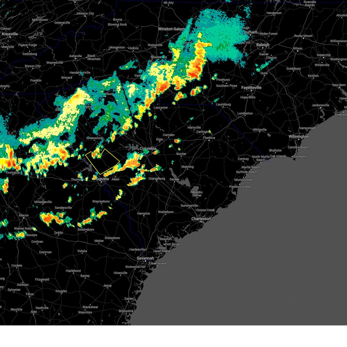 At 614 pm edt, a severe thunderstorm was located 7 miles east of mccormick county airport, or 17 miles south of greenwood, moving southeast at 35 mph (radar indicated). Hazards include 60 mph wind gusts and quarter size hail. Hail damage to vehicles is expected. Expect wind damage to trees and powerlines. At 614 pm edt, a severe thunderstorm was located 7 miles east of mccormick county airport, or 17 miles south of greenwood, moving southeast at 35 mph (radar indicated). Hazards include 60 mph wind gusts and quarter size hail. Hail damage to vehicles is expected. Expect wind damage to trees and powerlines.
|
| 8/7/2023 4:58 PM EDT |
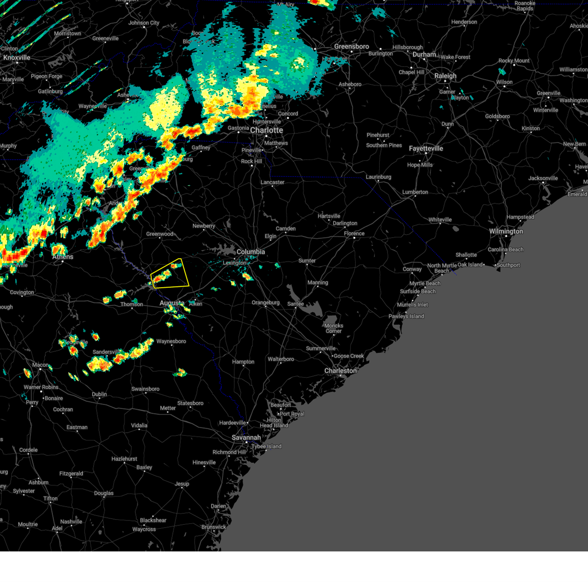 At 458 pm edt, a severe thunderstorm was located near hamilton branch state park, or 19 miles northwest of evans, moving east at 30 mph (radar indicated). Hazards include 60 mph wind gusts and quarter size hail. Hail damage to vehicles is expected. Expect wind damage to trees and powerlines. At 458 pm edt, a severe thunderstorm was located near hamilton branch state park, or 19 miles northwest of evans, moving east at 30 mph (radar indicated). Hazards include 60 mph wind gusts and quarter size hail. Hail damage to vehicles is expected. Expect wind damage to trees and powerlines.
|
| 7/30/2023 4:27 PM EDT |
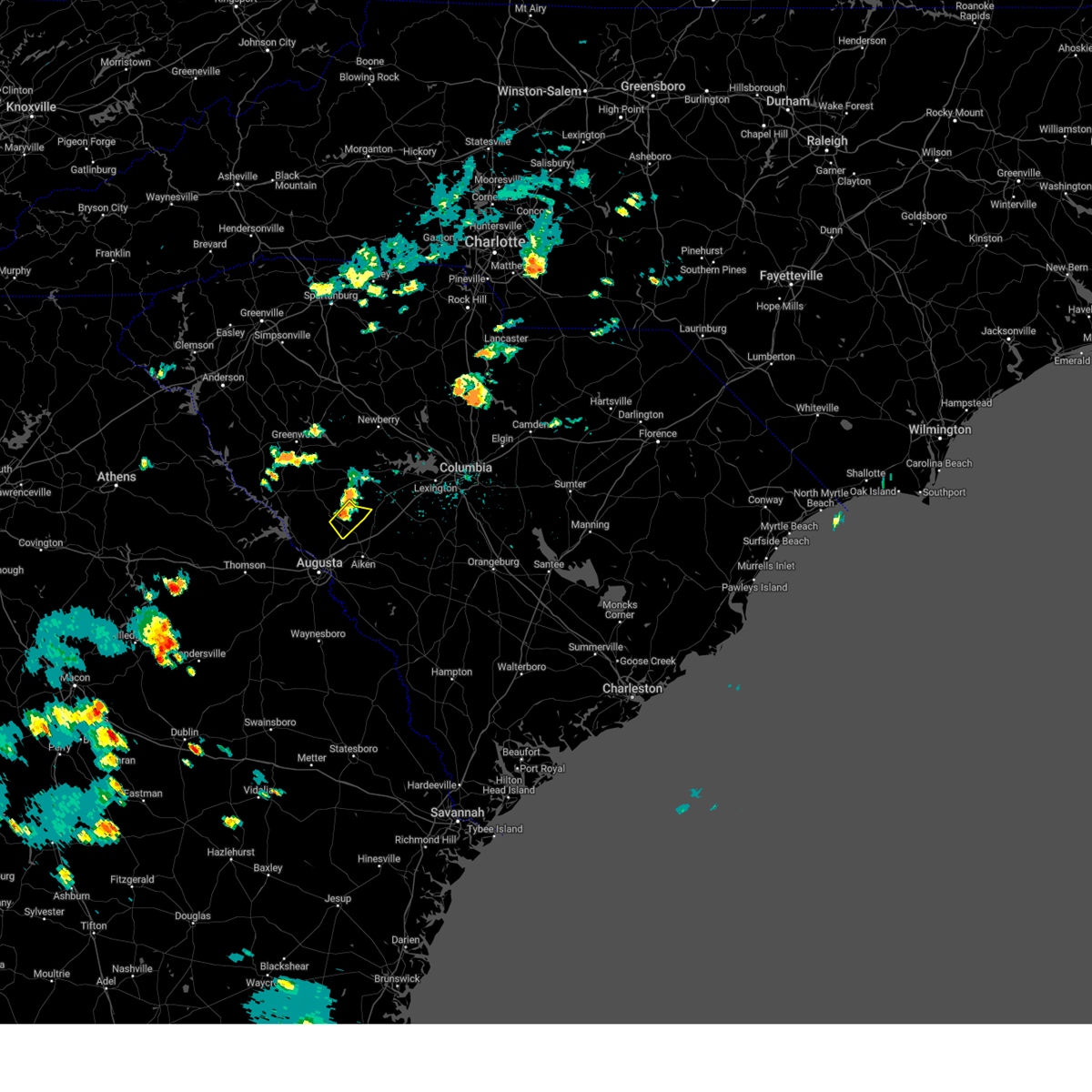 At 427 pm edt, a severe thunderstorm was located over edgefield county airport, or 16 miles north of belvedere, moving southeast at 15 mph (radar indicated). Hazards include 60 mph wind gusts. expect damage to trees and powerlines At 427 pm edt, a severe thunderstorm was located over edgefield county airport, or 16 miles north of belvedere, moving southeast at 15 mph (radar indicated). Hazards include 60 mph wind gusts. expect damage to trees and powerlines
|
| 7/20/2023 8:25 PM EDT | Edgefield dispatch reported widespread trees and powerlines downed across the county. time estimated by rada in edgefield county SC, 0.6 miles SE of Edgefield, SC |
| 7/20/2023 8:05 PM EDT |
 At 804 pm edt, severe thunderstorms were located along a line extending from 6 miles east of troy to near thomson-mcduffie county airport to 7 miles northeast of sparta, moving southeast at 40 mph (radar indicated). Hazards include 60 to 70 mph wind gusts and penny size hail. this storm has had a history of knocking down trees. Expect damage to trees and powerlines. locations impacted include, aiken, north augusta, grovetown, evans, thomson, fort gordon, augusta, clearwater, martinez, belvedere, edgefield, hephzibah, harlem, johnston, jackson, ridge spring, glendale, south augusta, clarks hill recreation area and edgefield county airport. this includes the following highways, interstate 20 in georgia between mile markers 173 and 201. interstate 20 in south carolina between mile markers 0 and 25. interstate 520 in georgia between mile markers 1 and 15. interstate 520 in south carolina between mile markers 16 and 23. hail threat, radar indicated max hail size, 0. 75 in wind threat, radar indicated max wind gust, 60 mph. At 804 pm edt, severe thunderstorms were located along a line extending from 6 miles east of troy to near thomson-mcduffie county airport to 7 miles northeast of sparta, moving southeast at 40 mph (radar indicated). Hazards include 60 to 70 mph wind gusts and penny size hail. this storm has had a history of knocking down trees. Expect damage to trees and powerlines. locations impacted include, aiken, north augusta, grovetown, evans, thomson, fort gordon, augusta, clearwater, martinez, belvedere, edgefield, hephzibah, harlem, johnston, jackson, ridge spring, glendale, south augusta, clarks hill recreation area and edgefield county airport. this includes the following highways, interstate 20 in georgia between mile markers 173 and 201. interstate 20 in south carolina between mile markers 0 and 25. interstate 520 in georgia between mile markers 1 and 15. interstate 520 in south carolina between mile markers 16 and 23. hail threat, radar indicated max hail size, 0. 75 in wind threat, radar indicated max wind gust, 60 mph.
|
| 7/20/2023 7:40 PM EDT |
 At 739 pm edt, severe thunderstorms were located along a line extending from near abbeville to 6 miles southeast of washington to near white plains, moving southeast at 50 mph (radar indicated). Hazards include 60 to 70 mph wind gusts and penny size hail. expect damage to trees and powerlines At 739 pm edt, severe thunderstorms were located along a line extending from near abbeville to 6 miles southeast of washington to near white plains, moving southeast at 50 mph (radar indicated). Hazards include 60 to 70 mph wind gusts and penny size hail. expect damage to trees and powerlines
|
| 6/27/2023 12:18 AM EDT |
 At 1217 am edt, a cluster of severe thunderstorms was located between parksville and gilbert, moving east at 30 mph (radar indicated). Hazards include 60 mph wind gusts and quarter size hail. Hail damage to vehicles is expected. expect wind damage to trees and powerlines. locations impacted include, lexington, cayce, batesburg-leesville, red bank, oak grove, edgefield, johnston, south congaree, ridge spring, saluda county airport, edgefield county airport, columbia metro airport, aiken municipal airport, swansea, wagener, pelion, gilbert, summit, monetta and perry. this includes interstate 20 in south carolina between mile markers 20 and 57. hail threat, radar indicated max hail size, 1. 00 in wind threat, radar indicated max wind gust, 60 mph. At 1217 am edt, a cluster of severe thunderstorms was located between parksville and gilbert, moving east at 30 mph (radar indicated). Hazards include 60 mph wind gusts and quarter size hail. Hail damage to vehicles is expected. expect wind damage to trees and powerlines. locations impacted include, lexington, cayce, batesburg-leesville, red bank, oak grove, edgefield, johnston, south congaree, ridge spring, saluda county airport, edgefield county airport, columbia metro airport, aiken municipal airport, swansea, wagener, pelion, gilbert, summit, monetta and perry. this includes interstate 20 in south carolina between mile markers 20 and 57. hail threat, radar indicated max hail size, 1. 00 in wind threat, radar indicated max wind gust, 60 mph.
|
| 6/26/2023 11:56 PM EDT |
 At 1154 pm edt, a cluster of severe thunderstorms was located between mccormick and batesburg-leesville, moving east at 30 mph (radar indicated). Hazards include 60 mph wind gusts and quarter size hail. Hail damage to vehicles is expected. Expect wind damage to trees and powerlines. At 1154 pm edt, a cluster of severe thunderstorms was located between mccormick and batesburg-leesville, moving east at 30 mph (radar indicated). Hazards include 60 mph wind gusts and quarter size hail. Hail damage to vehicles is expected. Expect wind damage to trees and powerlines.
|
| 3/26/2023 9:57 PM EDT |
 At 956 pm edt, a severe thunderstorm was located over edgefield county airport, or 13 miles north of aiken, moving east at 30 mph (radar indicated). Hazards include 60 mph wind gusts and nickel size hail. expect damage to trees and powerlines At 956 pm edt, a severe thunderstorm was located over edgefield county airport, or 13 miles north of aiken, moving east at 30 mph (radar indicated). Hazards include 60 mph wind gusts and nickel size hail. expect damage to trees and powerlines
|
| 3/26/2023 9:36 PM EDT |
 At 935 pm edt, a severe thunderstorm was located over edgefield, or 14 miles north of belvedere, moving east at 45 mph (radar indicated). Hazards include 60 mph wind gusts and quarter size hail. Hail damage to vehicles is expected. expect wind damage to trees and powerlines. locations impacted include, aiken, north augusta, edgefield, johnston, ridge spring, usc aiken, saluda county airport, edgefield county airport, aiken municipal airport, citizens park, graniteville, gloverville, trenton, ward, strom thurmond high school, vaucluse, edgefield federal correction institution, lick fork campground, harmony and hopeland gardens. this includes interstate 20 in south carolina between mile markers 6 and 24. hail threat, radar indicated max hail size, 1. 00 in wind threat, radar indicated max wind gust, 60 mph. At 935 pm edt, a severe thunderstorm was located over edgefield, or 14 miles north of belvedere, moving east at 45 mph (radar indicated). Hazards include 60 mph wind gusts and quarter size hail. Hail damage to vehicles is expected. expect wind damage to trees and powerlines. locations impacted include, aiken, north augusta, edgefield, johnston, ridge spring, usc aiken, saluda county airport, edgefield county airport, aiken municipal airport, citizens park, graniteville, gloverville, trenton, ward, strom thurmond high school, vaucluse, edgefield federal correction institution, lick fork campground, harmony and hopeland gardens. this includes interstate 20 in south carolina between mile markers 6 and 24. hail threat, radar indicated max hail size, 1. 00 in wind threat, radar indicated max wind gust, 60 mph.
|
| 3/26/2023 9:23 PM EDT |
 At 923 pm edt, a severe thunderstorm was located near clarks hill recreation area, or 14 miles north of martinez, moving east at 40 mph (radar indicated). Hazards include 60 mph wind gusts and quarter size hail. Hail damage to vehicles is expected. Expect wind damage to trees and powerlines. At 923 pm edt, a severe thunderstorm was located near clarks hill recreation area, or 14 miles north of martinez, moving east at 40 mph (radar indicated). Hazards include 60 mph wind gusts and quarter size hail. Hail damage to vehicles is expected. Expect wind damage to trees and powerlines.
|
| 1/12/2023 7:04 PM EST |
 At 703 pm est, a severe thunderstorm was located near edgefield, or 21 miles west of batesburg-leesville, moving east at 35 mph (radar indicated). Hazards include 60 mph wind gusts. Expect damage to trees and powerlines. locations impacted include, edgefield, johnston, ridge spring, monetta, ward, strom thurmond high school, cleora, harmony, pleasant lane, northside fire station main and edgefield federal correction institution. hail threat, radar indicated max hail size, <. 75 in wind threat, radar indicated max wind gust, 60 mph. At 703 pm est, a severe thunderstorm was located near edgefield, or 21 miles west of batesburg-leesville, moving east at 35 mph (radar indicated). Hazards include 60 mph wind gusts. Expect damage to trees and powerlines. locations impacted include, edgefield, johnston, ridge spring, monetta, ward, strom thurmond high school, cleora, harmony, pleasant lane, northside fire station main and edgefield federal correction institution. hail threat, radar indicated max hail size, <. 75 in wind threat, radar indicated max wind gust, 60 mph.
|
| 1/12/2023 6:56 PM EST |
 At 656 pm est, a severe thunderstorm was located near edgefield, or 23 miles north of belvedere, moving east at 35 mph (radar indicated). Hazards include 60 mph wind gusts. expect damage to trees and powerlines At 656 pm est, a severe thunderstorm was located near edgefield, or 23 miles north of belvedere, moving east at 35 mph (radar indicated). Hazards include 60 mph wind gusts. expect damage to trees and powerlines
|
| 1/12/2023 5:37 PM EST |
 At 536 pm est, a severe thunderstorm capable of producing a tornado was located near edgefield, or 20 miles north of belvedere, moving northeast at 40 mph (radar indicated rotation). Hazards include tornado. Flying debris will be dangerous to those caught without shelter. mobile homes will be damaged or destroyed. damage to roofs, windows, and vehicles will occur. tree damage is likely. this dangerous storm will be near, edgefield around 540 pm est. johnston around 550 pm est. saluda county airport around 600 pm est. saluda around 605 pm est. Other locations impacted by this tornadic thunderstorm include hollywood elementary school, emory, cleora, saluda co sheriff`s office, scurry airport, good hope, circle fire station, hickory grove, pleasant lane and northside fire station main. At 536 pm est, a severe thunderstorm capable of producing a tornado was located near edgefield, or 20 miles north of belvedere, moving northeast at 40 mph (radar indicated rotation). Hazards include tornado. Flying debris will be dangerous to those caught without shelter. mobile homes will be damaged or destroyed. damage to roofs, windows, and vehicles will occur. tree damage is likely. this dangerous storm will be near, edgefield around 540 pm est. johnston around 550 pm est. saluda county airport around 600 pm est. saluda around 605 pm est. Other locations impacted by this tornadic thunderstorm include hollywood elementary school, emory, cleora, saluda co sheriff`s office, scurry airport, good hope, circle fire station, hickory grove, pleasant lane and northside fire station main.
|
| 1/12/2023 5:33 PM EST |
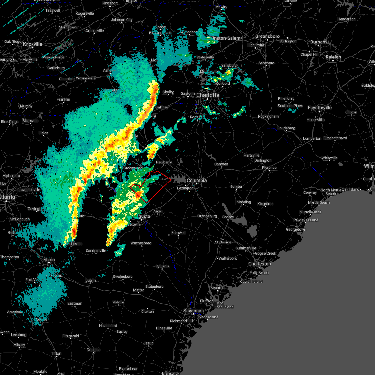 At 532 pm est, a severe thunderstorm capable of producing a tornado was located 7 miles west of edgefield, or 19 miles north of belvedere, moving northeast at 40 mph (radar indicated rotation). Hazards include tornado. Flying debris will be dangerous to those caught without shelter. mobile homes will be damaged or destroyed. damage to roofs, windows, and vehicles will occur. tree damage is likely. this dangerous storm will be near, edgefield around 540 pm est. johnston around 550 pm est. saluda county airport around 600 pm est. saluda around 605 pm est. Other locations impacted by this tornadic thunderstorm include strom thurmond high school, saluda co sheriff`s office, good hope, harmony, pleasant lane, northside fire station main, wyses ferry, hollywood elementary school, emory and cleora. At 532 pm est, a severe thunderstorm capable of producing a tornado was located 7 miles west of edgefield, or 19 miles north of belvedere, moving northeast at 40 mph (radar indicated rotation). Hazards include tornado. Flying debris will be dangerous to those caught without shelter. mobile homes will be damaged or destroyed. damage to roofs, windows, and vehicles will occur. tree damage is likely. this dangerous storm will be near, edgefield around 540 pm est. johnston around 550 pm est. saluda county airport around 600 pm est. saluda around 605 pm est. Other locations impacted by this tornadic thunderstorm include strom thurmond high school, saluda co sheriff`s office, good hope, harmony, pleasant lane, northside fire station main, wyses ferry, hollywood elementary school, emory and cleora.
|
| 1/12/2023 5:28 PM EST |
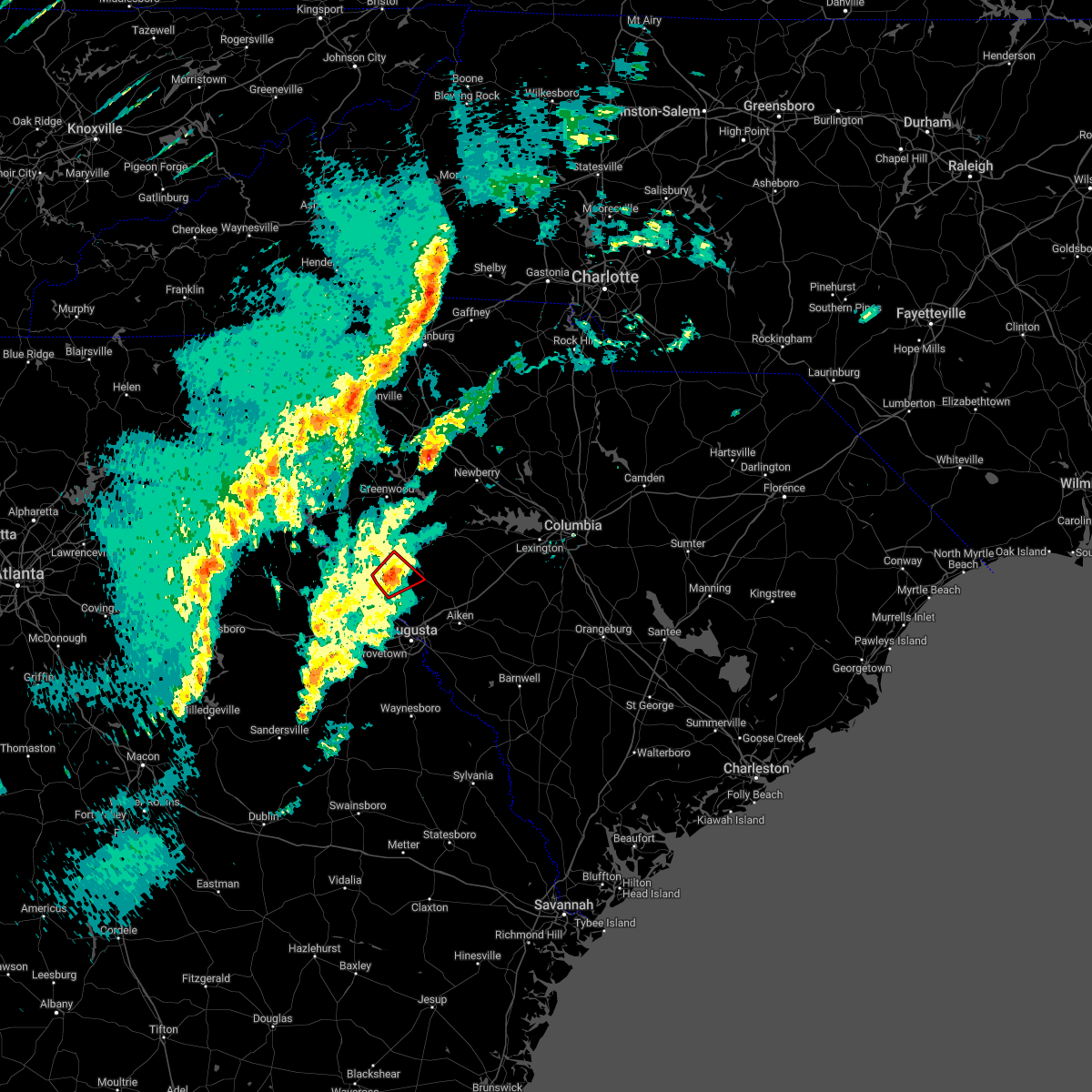 At 527 pm est, a severe thunderstorm capable of producing a tornado was located near hamilton branch state park, or 16 miles north of martinez, moving northeast at 30 mph (radar indicated rotation). Hazards include tornado. Flying debris will be dangerous to those caught without shelter. mobile homes will be damaged or destroyed. damage to roofs, windows, and vehicles will occur. tree damage is likely. this dangerous storm will be near, edgefield around 550 pm est. Other locations impacted by this tornadic thunderstorm include cleora, parksville and modoc. At 527 pm est, a severe thunderstorm capable of producing a tornado was located near hamilton branch state park, or 16 miles north of martinez, moving northeast at 30 mph (radar indicated rotation). Hazards include tornado. Flying debris will be dangerous to those caught without shelter. mobile homes will be damaged or destroyed. damage to roofs, windows, and vehicles will occur. tree damage is likely. this dangerous storm will be near, edgefield around 550 pm est. Other locations impacted by this tornadic thunderstorm include cleora, parksville and modoc.
|
| 1/12/2023 5:09 PM EST |
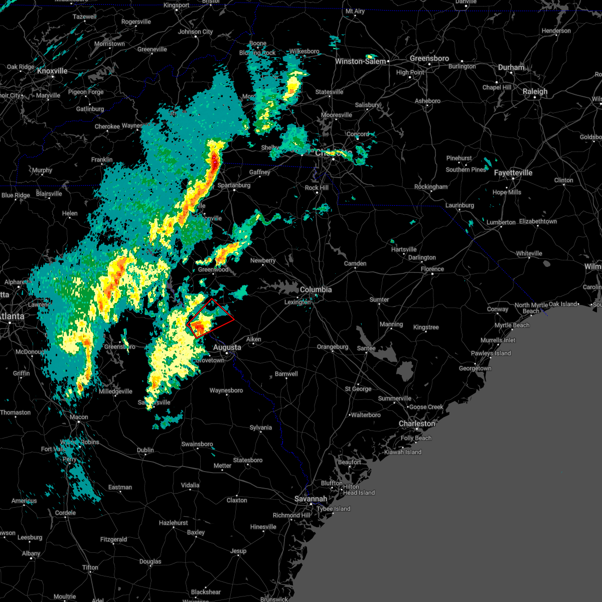 At 509 pm est, a severe thunderstorm capable of producing a tornado was located near j. strom thurmond dam, or 14 miles northwest of evans, moving northeast at 40 mph (radar indicated rotation). Hazards include tornado. Flying debris will be dangerous to those caught without shelter. mobile homes will be damaged or destroyed. damage to roofs, windows, and vehicles will occur. tree damage is likely. this dangerous storm will be near, hamilton branch state park around 515 pm est. edgefield around 540 pm est. Other locations impacted by this tornadic thunderstorm include leah, parksville, modoc, scott`s landing, knox scout reservation, modoc campground, double branches, wildwood park, cleora and modoc boat ramp. At 509 pm est, a severe thunderstorm capable of producing a tornado was located near j. strom thurmond dam, or 14 miles northwest of evans, moving northeast at 40 mph (radar indicated rotation). Hazards include tornado. Flying debris will be dangerous to those caught without shelter. mobile homes will be damaged or destroyed. damage to roofs, windows, and vehicles will occur. tree damage is likely. this dangerous storm will be near, hamilton branch state park around 515 pm est. edgefield around 540 pm est. Other locations impacted by this tornadic thunderstorm include leah, parksville, modoc, scott`s landing, knox scout reservation, modoc campground, double branches, wildwood park, cleora and modoc boat ramp.
|
| 1/12/2023 5:09 PM EST |
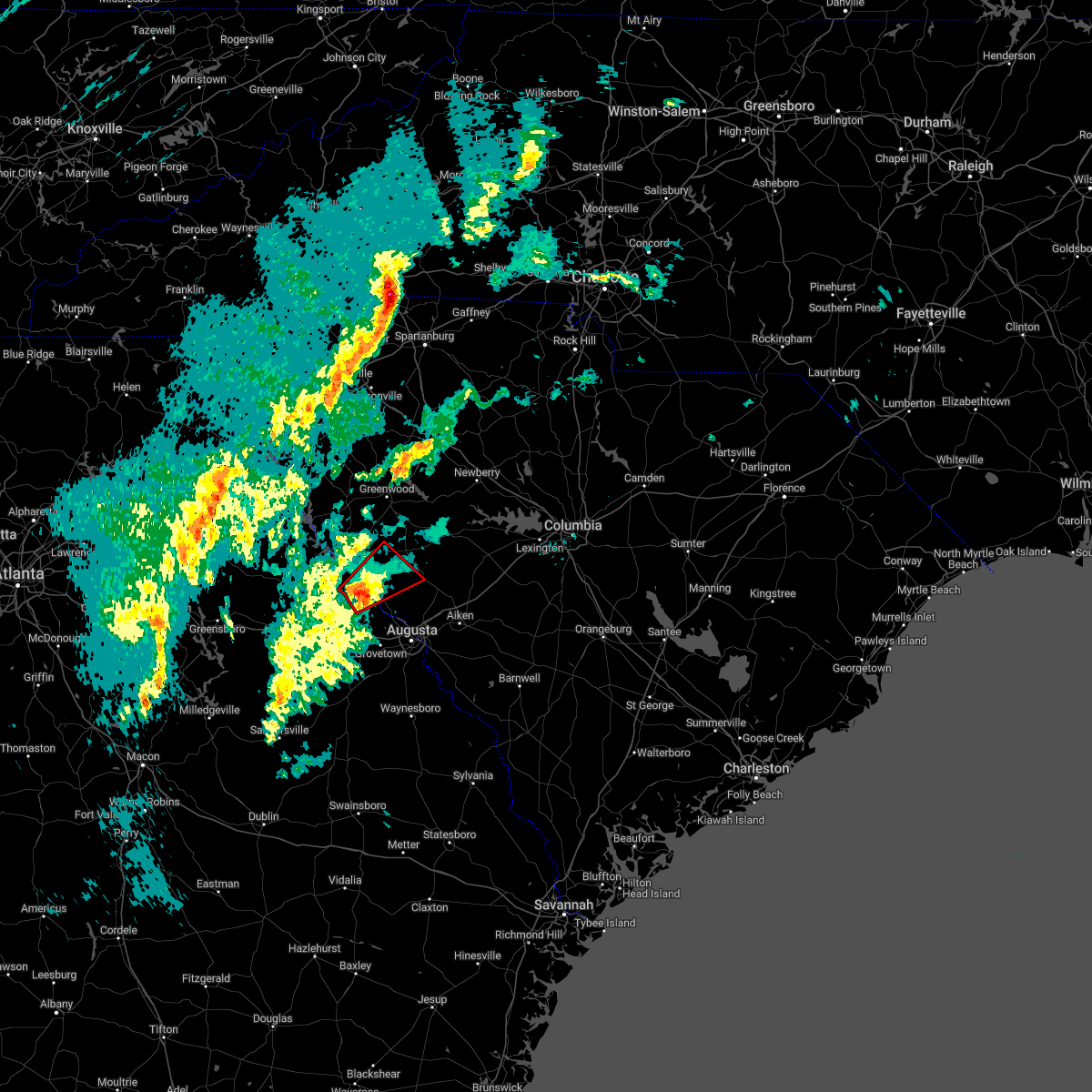 At 509 pm est, a severe thunderstorm capable of producing a tornado was located near j. strom thurmond dam, or 14 miles northwest of evans, moving northeast at 40 mph (radar indicated rotation). Hazards include tornado. Flying debris will be dangerous to those caught without shelter. mobile homes will be damaged or destroyed. damage to roofs, windows, and vehicles will occur. tree damage is likely. this dangerous storm will be near, hamilton branch state park around 515 pm est. edgefield around 540 pm est. Other locations impacted by this tornadic thunderstorm include leah, parksville, modoc, scott`s landing, knox scout reservation, modoc campground, double branches, wildwood park, cleora and modoc boat ramp. At 509 pm est, a severe thunderstorm capable of producing a tornado was located near j. strom thurmond dam, or 14 miles northwest of evans, moving northeast at 40 mph (radar indicated rotation). Hazards include tornado. Flying debris will be dangerous to those caught without shelter. mobile homes will be damaged or destroyed. damage to roofs, windows, and vehicles will occur. tree damage is likely. this dangerous storm will be near, hamilton branch state park around 515 pm est. edgefield around 540 pm est. Other locations impacted by this tornadic thunderstorm include leah, parksville, modoc, scott`s landing, knox scout reservation, modoc campground, double branches, wildwood park, cleora and modoc boat ramp.
|
| 1/12/2023 5:00 PM EST |
 At 459 pm est, a severe thunderstorm capable of producing a tornado was located over mistletoe state park, or 12 miles northeast of thomson, moving northeast at 40 mph (radar indicated rotation). Hazards include tornado. Flying debris will be dangerous to those caught without shelter. mobile homes will be damaged or destroyed. damage to roofs, windows, and vehicles will occur. tree damage is likely. this dangerous storm will be near, clarks hill recreation area and j. strom thurmond dam around 515 pm est. hamilton branch state park around 520 pm est. Other locations impacted by this tornadic thunderstorm include parksville, winfield, modoc, scott`s landing, knox scout reservation, double branches, wildwood park, cleora, modoc boat ramp and colliers. At 459 pm est, a severe thunderstorm capable of producing a tornado was located over mistletoe state park, or 12 miles northeast of thomson, moving northeast at 40 mph (radar indicated rotation). Hazards include tornado. Flying debris will be dangerous to those caught without shelter. mobile homes will be damaged or destroyed. damage to roofs, windows, and vehicles will occur. tree damage is likely. this dangerous storm will be near, clarks hill recreation area and j. strom thurmond dam around 515 pm est. hamilton branch state park around 520 pm est. Other locations impacted by this tornadic thunderstorm include parksville, winfield, modoc, scott`s landing, knox scout reservation, double branches, wildwood park, cleora, modoc boat ramp and colliers.
|
| 1/4/2023 9:41 AM EST |
 At 941 am est, a severe thunderstorm was located 7 miles north of edgefield, or 23 miles southeast of greenwood, moving east at 25 mph (radar indicated). Hazards include 60 mph wind gusts. expect damage to trees and powerlines At 941 am est, a severe thunderstorm was located 7 miles north of edgefield, or 23 miles southeast of greenwood, moving east at 25 mph (radar indicated). Hazards include 60 mph wind gusts. expect damage to trees and powerlines
|
| 7/19/2022 8:43 PM EDT |
 At 842 pm edt, severe thunderstorms were located along a line extending from near hamilton branch state park to south augusta, moving east at 45 mph (radar indicated). Hazards include 60 mph wind gusts and penny size hail. expect damage to trees and powerlines At 842 pm edt, severe thunderstorms were located along a line extending from near hamilton branch state park to south augusta, moving east at 45 mph (radar indicated). Hazards include 60 mph wind gusts and penny size hail. expect damage to trees and powerlines
|
| 7/7/2022 6:56 PM EDT |
 At 655 pm edt, severe thunderstorms were located along a line extending from near ridge spring to harlem, moving southeast at 20 mph (radar indicated). Hazards include 60 mph wind gusts. Expect damage to trees and powerlines. locations impacted include, aiken, north augusta, grovetown, evans, batesburg-leesville, fort gordon, augusta, clearwater, martinez, aiken mall, belvedere, edgefield, hephzibah, harlem, johnston, new ellenton, jackson, ridge spring, glendale and south augusta. this includes the following highways, interstate 20 in georgia between mile markers 178 and 201. interstate 20 in south carolina between mile markers 0 and 42. interstate 520 in georgia between mile markers 1 and 15. interstate 520 in south carolina between mile markers 16 and 23. hail threat, radar indicated max hail size, <. 75 in wind threat, radar indicated max wind gust, 60 mph. At 655 pm edt, severe thunderstorms were located along a line extending from near ridge spring to harlem, moving southeast at 20 mph (radar indicated). Hazards include 60 mph wind gusts. Expect damage to trees and powerlines. locations impacted include, aiken, north augusta, grovetown, evans, batesburg-leesville, fort gordon, augusta, clearwater, martinez, aiken mall, belvedere, edgefield, hephzibah, harlem, johnston, new ellenton, jackson, ridge spring, glendale and south augusta. this includes the following highways, interstate 20 in georgia between mile markers 178 and 201. interstate 20 in south carolina between mile markers 0 and 42. interstate 520 in georgia between mile markers 1 and 15. interstate 520 in south carolina between mile markers 16 and 23. hail threat, radar indicated max hail size, <. 75 in wind threat, radar indicated max wind gust, 60 mph.
|
| 7/7/2022 6:41 PM EDT |
 At 640 pm edt, severe thunderstorms were located along a line extending from near ridge spring to near thomson, moving southeast at 20 mph (radar indicated). Hazards include 60 mph wind gusts. Expect damage to trees and powerlines. locations impacted include, aiken, north augusta, grovetown, evans, thomson, batesburg-leesville, fort gordon, augusta, clearwater, martinez, aiken mall, belvedere, edgefield, hephzibah, harlem, johnston, new ellenton, jackson, ridge spring and glendale. this includes the following highways, interstate 20 in georgia between mile markers 170 and 201. interstate 20 in south carolina between mile markers 0 and 42. interstate 520 in georgia between mile markers 1 and 15. interstate 520 in south carolina between mile markers 16 and 23. hail threat, radar indicated max hail size, <. 75 in wind threat, radar indicated max wind gust, 60 mph. At 640 pm edt, severe thunderstorms were located along a line extending from near ridge spring to near thomson, moving southeast at 20 mph (radar indicated). Hazards include 60 mph wind gusts. Expect damage to trees and powerlines. locations impacted include, aiken, north augusta, grovetown, evans, thomson, batesburg-leesville, fort gordon, augusta, clearwater, martinez, aiken mall, belvedere, edgefield, hephzibah, harlem, johnston, new ellenton, jackson, ridge spring and glendale. this includes the following highways, interstate 20 in georgia between mile markers 170 and 201. interstate 20 in south carolina between mile markers 0 and 42. interstate 520 in georgia between mile markers 1 and 15. interstate 520 in south carolina between mile markers 16 and 23. hail threat, radar indicated max hail size, <. 75 in wind threat, radar indicated max wind gust, 60 mph.
|
| 7/7/2022 6:34 PM EDT | Sheriff dispatch reported trees down on evans street in the town of edgefiel in edgefield county SC, 0.5 miles SSW of Edgefield, SC |
| 7/7/2022 6:27 PM EDT |
 The severe thunderstorm warning for north central mcduffie, northwestern columbia, lincoln, northwestern edgefield, southwestern saluda and mccormick counties will expire at 630 pm edt, the storms which prompted the warning have moved out of the area. therefore, the warning will be allowed to expire. to report severe weather, contact your nearest law enforcement agency. they will relay your report to the national weather service columbia. remember, a severe thunderstorm warning still remains in effect for edgefield, saluda, and columbia counties until 730p!. The severe thunderstorm warning for north central mcduffie, northwestern columbia, lincoln, northwestern edgefield, southwestern saluda and mccormick counties will expire at 630 pm edt, the storms which prompted the warning have moved out of the area. therefore, the warning will be allowed to expire. to report severe weather, contact your nearest law enforcement agency. they will relay your report to the national weather service columbia. remember, a severe thunderstorm warning still remains in effect for edgefield, saluda, and columbia counties until 730p!.
|
| 7/7/2022 6:25 PM EDT |
 At 624 pm edt, severe thunderstorms were located along a line extending from near saluda county airport to near thomson, moving southeast at 20 mph. additional widespread strong to severe thunderstorms are developing ahead of the line of storms (mccormick county emergency management reported trees down). Hazards include 60 mph wind gusts. expect damage to trees and powerlines At 624 pm edt, severe thunderstorms were located along a line extending from near saluda county airport to near thomson, moving southeast at 20 mph. additional widespread strong to severe thunderstorms are developing ahead of the line of storms (mccormick county emergency management reported trees down). Hazards include 60 mph wind gusts. expect damage to trees and powerlines
|
| 7/7/2022 6:12 PM EDT |
 At 612 pm edt, severe thunderstorms were located along a line extending from 10 miles east of mccormick county airport to near mistletoe state park, moving east at 20 mph (law enforcement. at 610p, mccormick county dispatch reported a tree down southeast of the city of mccormick). Hazards include 60 mph wind gusts. Expect damage to trees and powerlines. locations impacted include, edgefield, mccormick, johnston, lincolnton, appling, clarks hill recreation area, j. strom thurmond dam, elijah clark state park, mistletoe state park, mccormick county airport, hamilton branch state park, parksville, plum branch, bordeaux, winfield, modoc, scott`s landing, northside fire station main, knox scout reservation and double branches. this includes interstate 20 in georgia between mile markers 180 and 183. hail threat, radar indicated max hail size, <. 75 in wind threat, radar indicated max wind gust, 60 mph. At 612 pm edt, severe thunderstorms were located along a line extending from 10 miles east of mccormick county airport to near mistletoe state park, moving east at 20 mph (law enforcement. at 610p, mccormick county dispatch reported a tree down southeast of the city of mccormick). Hazards include 60 mph wind gusts. Expect damage to trees and powerlines. locations impacted include, edgefield, mccormick, johnston, lincolnton, appling, clarks hill recreation area, j. strom thurmond dam, elijah clark state park, mistletoe state park, mccormick county airport, hamilton branch state park, parksville, plum branch, bordeaux, winfield, modoc, scott`s landing, northside fire station main, knox scout reservation and double branches. this includes interstate 20 in georgia between mile markers 180 and 183. hail threat, radar indicated max hail size, <. 75 in wind threat, radar indicated max wind gust, 60 mph.
|
| 7/7/2022 6:05 PM EDT |
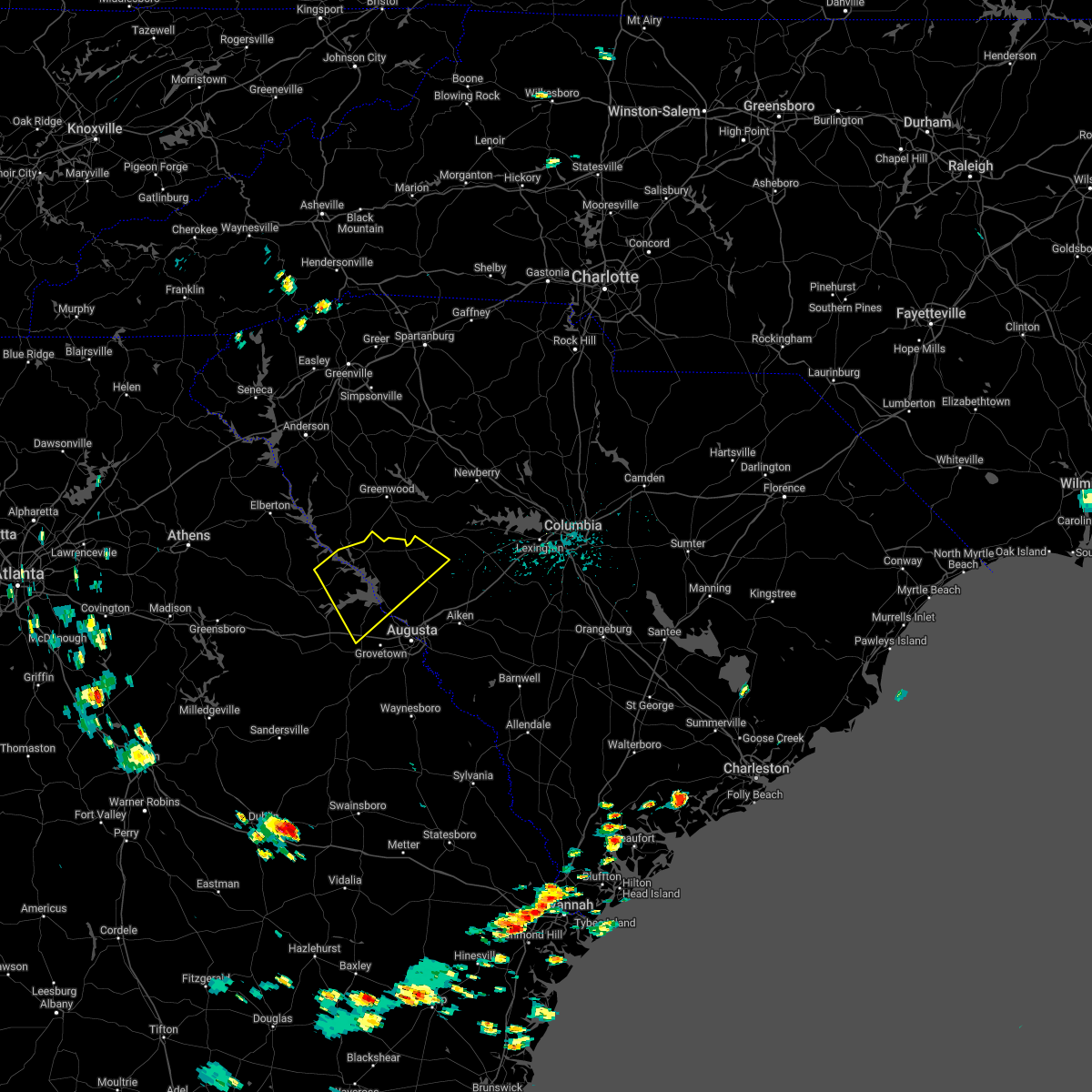 At 605 pm edt, severe thunderstorms were located along a line extending from 10 miles northeast of mccormick county airport to near mistletoe state park, moving southeast at 20 mph (radar indicated). Hazards include 60 mph wind gusts. Expect damage to trees and powerlines. locations impacted include, edgefield, mccormick, johnston, lincolnton, appling, clarks hill recreation area, j. strom thurmond dam, elijah clark state park, mistletoe state park, mccormick county airport, hamilton branch state park, parksville, plum branch, bordeaux, winfield, modoc, scott`s landing, northside fire station main, knox scout reservation and double branches. this includes interstate 20 in georgia between mile markers 180 and 183. hail threat, radar indicated max hail size, <. 75 in wind threat, radar indicated max wind gust, 60 mph. At 605 pm edt, severe thunderstorms were located along a line extending from 10 miles northeast of mccormick county airport to near mistletoe state park, moving southeast at 20 mph (radar indicated). Hazards include 60 mph wind gusts. Expect damage to trees and powerlines. locations impacted include, edgefield, mccormick, johnston, lincolnton, appling, clarks hill recreation area, j. strom thurmond dam, elijah clark state park, mistletoe state park, mccormick county airport, hamilton branch state park, parksville, plum branch, bordeaux, winfield, modoc, scott`s landing, northside fire station main, knox scout reservation and double branches. this includes interstate 20 in georgia between mile markers 180 and 183. hail threat, radar indicated max hail size, <. 75 in wind threat, radar indicated max wind gust, 60 mph.
|
| 7/7/2022 5:44 PM EDT |
 At 543 pm edt, severe thunderstorms were located along a line extending from 7 miles northeast of troy to lincolnton, moving southeast at 20 mph (radar indicated). Hazards include 60 mph wind gusts. expect damage to trees and powerlines At 543 pm edt, severe thunderstorms were located along a line extending from 7 miles northeast of troy to lincolnton, moving southeast at 20 mph (radar indicated). Hazards include 60 mph wind gusts. expect damage to trees and powerlines
|
| 7/7/2022 5:44 PM EDT |
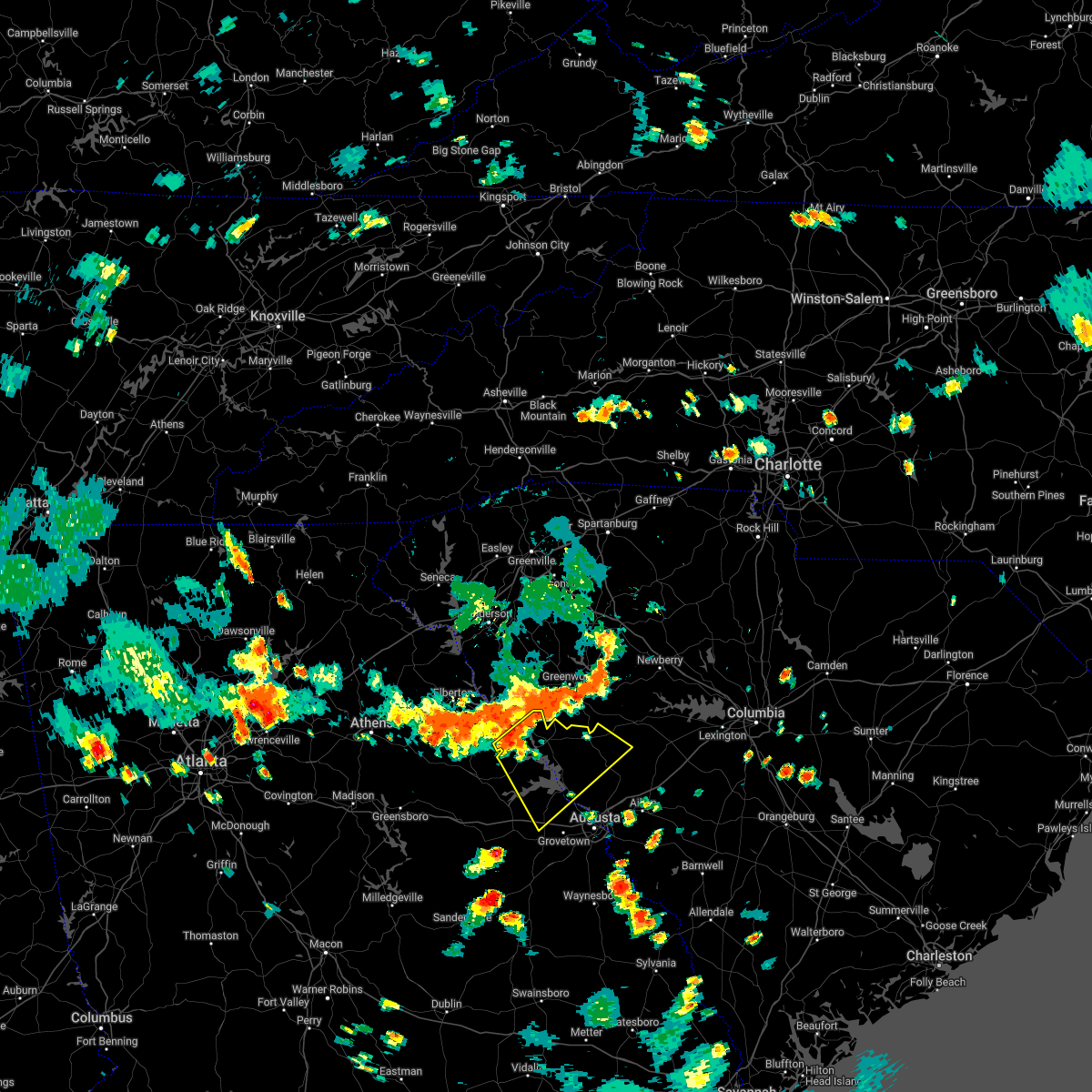 At 543 pm edt, severe thunderstorms were located along a line extending from 7 miles northeast of troy to lincolnton, moving southeast at 20 mph (radar indicated). Hazards include 60 mph wind gusts. expect damage to trees and powerlines At 543 pm edt, severe thunderstorms were located along a line extending from 7 miles northeast of troy to lincolnton, moving southeast at 20 mph (radar indicated). Hazards include 60 mph wind gusts. expect damage to trees and powerlines
|
| 6/16/2022 5:51 PM EDT | At 550 pm edt, a severe thunderstorm was located near edgefield county airport, or 12 miles north of aiken, moving west at 5 mph (radar indicated). Hazards include 60 mph wind gusts and quarter size hail. Hail damage to vehicles is expected. Expect wind damage to trees and powerlines. |
| 5/23/2022 11:04 AM EDT |
 At 1104 am edt, a severe thunderstorm was located over belvedere, moving northeast at 35 mph (radar indicated). Hazards include 60 mph wind gusts and penny size hail. Expect damage to trees and powerlines. locations impacted include, aiken, north augusta, martinez, augusta, clearwater, belvedere, edgefield, glendale, midtown, summerville, augusta mall, daniel field, village plaza shopping center, augusta national golf club, gloverville, graniteville, burnettown, west end augusta, poverty hill and glenn hills. this includes the following highways, interstate 20 in georgia between mile markers 197 and 201. interstate 20 in south carolina between mile markers 0 and 13. interstate 520 in georgia between mile markers 1 and 15. interstate 520 in south carolina between mile markers 16 and 23. hail threat, radar indicated max hail size, 0. 75 in wind threat, radar indicated max wind gust, 60 mph. At 1104 am edt, a severe thunderstorm was located over belvedere, moving northeast at 35 mph (radar indicated). Hazards include 60 mph wind gusts and penny size hail. Expect damage to trees and powerlines. locations impacted include, aiken, north augusta, martinez, augusta, clearwater, belvedere, edgefield, glendale, midtown, summerville, augusta mall, daniel field, village plaza shopping center, augusta national golf club, gloverville, graniteville, burnettown, west end augusta, poverty hill and glenn hills. this includes the following highways, interstate 20 in georgia between mile markers 197 and 201. interstate 20 in south carolina between mile markers 0 and 13. interstate 520 in georgia between mile markers 1 and 15. interstate 520 in south carolina between mile markers 16 and 23. hail threat, radar indicated max hail size, 0. 75 in wind threat, radar indicated max wind gust, 60 mph.
|
| 5/23/2022 11:03 AM EDT |
 At 1102 am edt, a severe thunderstorm was located near edgefield county airport, or 9 miles northeast of belvedere, moving northeast at 35 mph (radar indicated). Hazards include 60 mph wind gusts and penny size hail. expect damage to trees and powerlines At 1102 am edt, a severe thunderstorm was located near edgefield county airport, or 9 miles northeast of belvedere, moving northeast at 35 mph (radar indicated). Hazards include 60 mph wind gusts and penny size hail. expect damage to trees and powerlines
|
| 5/23/2022 10:40 AM EDT |
 At 1039 am edt, a severe thunderstorm was located over fort gordon, moving northeast at 35 mph (radar indicated). Hazards include 60 mph wind gusts and penny size hail. expect damage to trees and powerlines At 1039 am edt, a severe thunderstorm was located over fort gordon, moving northeast at 35 mph (radar indicated). Hazards include 60 mph wind gusts and penny size hail. expect damage to trees and powerlines
|
| 5/6/2022 5:43 PM EDT |
 The severe thunderstorm warning for northeastern edgefield, southwestern lexington, northeastern aiken and saluda counties will expire at 545 pm edt, the storms which prompted the warning have moved out of the area. therefore, the warning will be allowed to expire. a severe thunderstorm watch remains in effect until 1000 pm edt for central south carolina. The severe thunderstorm warning for northeastern edgefield, southwestern lexington, northeastern aiken and saluda counties will expire at 545 pm edt, the storms which prompted the warning have moved out of the area. therefore, the warning will be allowed to expire. a severe thunderstorm watch remains in effect until 1000 pm edt for central south carolina.
|
| 5/6/2022 5:33 PM EDT |
 At 533 pm edt, severe thunderstorms were located along a line extending from near batesburg-leesville to 6 miles southwest of gaston, moving northeast at 70 mph (radar indicated). Hazards include 70 mph wind gusts and half dollar size hail. Hail damage to vehicles is expected. expect considerable tree damage. wind damage is also likely to mobile homes, roofs, and outbuildings. locations impacted include, batesburg-leesville, edgefield, saluda, johnston, ridge spring, saluda county airport, aiken state park, wagener, pelion, monetta, ward, strom thurmond high school, saluda co sheriff`s office, good hope, northside fire station main, thor, emory, camp kinard, new holland and samaria fire station. this includes interstate 20 in south carolina between mile markers 22 and 44. thunderstorm damage threat, considerable hail threat, observed max hail size, 1. 25 in wind threat, observed max wind gust, 70 mph. At 533 pm edt, severe thunderstorms were located along a line extending from near batesburg-leesville to 6 miles southwest of gaston, moving northeast at 70 mph (radar indicated). Hazards include 70 mph wind gusts and half dollar size hail. Hail damage to vehicles is expected. expect considerable tree damage. wind damage is also likely to mobile homes, roofs, and outbuildings. locations impacted include, batesburg-leesville, edgefield, saluda, johnston, ridge spring, saluda county airport, aiken state park, wagener, pelion, monetta, ward, strom thurmond high school, saluda co sheriff`s office, good hope, northside fire station main, thor, emory, camp kinard, new holland and samaria fire station. this includes interstate 20 in south carolina between mile markers 22 and 44. thunderstorm damage threat, considerable hail threat, observed max hail size, 1. 25 in wind threat, observed max wind gust, 70 mph.
|
| 5/6/2022 5:11 PM EDT | Reported through social media of several large pines snapped off and one blocking the highway at the intersection of jones rd and hwy 283. lots of wind debri in edgefield county SC, 8 miles ESE of Edgefield, SC |
| 5/6/2022 5:11 PM EDT |
 The severe thunderstorm warning for southeastern columbia, central richmond, southern edgefield, northwestern aiken and southeastern mccormick counties will expire at 515 pm edt, the storm which prompted the warning has moved out of the area. therefore, the warning will be allowed to expire. a severe thunderstorm watch remains in effect until 1000 pm edt for east central georgia, and central south carolina. The severe thunderstorm warning for southeastern columbia, central richmond, southern edgefield, northwestern aiken and southeastern mccormick counties will expire at 515 pm edt, the storm which prompted the warning has moved out of the area. therefore, the warning will be allowed to expire. a severe thunderstorm watch remains in effect until 1000 pm edt for east central georgia, and central south carolina.
|
| 5/6/2022 5:10 PM EDT |
 At 509 pm edt, severe thunderstorms were located along a line extending from johnston to near aiken state park, moving northeast at 70 mph (radar indicated). Hazards include 70 mph wind gusts and half dollar size hail. Hail damage to vehicles is expected. expect considerable tree damage. Wind damage is also likely to mobile homes, roofs, and outbuildings. At 509 pm edt, severe thunderstorms were located along a line extending from johnston to near aiken state park, moving northeast at 70 mph (radar indicated). Hazards include 70 mph wind gusts and half dollar size hail. Hail damage to vehicles is expected. expect considerable tree damage. Wind damage is also likely to mobile homes, roofs, and outbuildings.
|
| 5/6/2022 4:40 PM EDT |
 At 440 pm edt, a severe thunderstorm was located over augusta mall, or near fort gordon, moving northeast at 65 mph (radar indicated). Hazards include ping pong ball size hail and 60 mph wind gusts. People and animals outdoors will be injured. expect hail damage to roofs, siding, windows, and vehicles. Expect wind damage to trees and powerlines. At 440 pm edt, a severe thunderstorm was located over augusta mall, or near fort gordon, moving northeast at 65 mph (radar indicated). Hazards include ping pong ball size hail and 60 mph wind gusts. People and animals outdoors will be injured. expect hail damage to roofs, siding, windows, and vehicles. Expect wind damage to trees and powerlines.
|
| 4/6/2022 7:22 PM EDT |
 At 722 pm edt, a severe thunderstorm was located near johnston, or 18 miles west of batesburg-leesville, moving east at 40 mph (radar indicated). Hazards include 60 mph wind gusts. Expect damage to trees and powerlines. locations impacted include, aiken, north augusta, evans, batesburg-leesville, belvedere, martinez, edgefield, johnston, ridge spring, usc aiken, edgefield county airport, aiken municipal airport, graniteville, gloverville, monetta, trenton, ward, strom thurmond high school, poverty hill and cleora. this includes the following highways, interstate 20 in south carolina between mile markers 1 and 37. interstate 520 in south carolina between mile markers 22 and 23. hail threat, radar indicated max hail size, <. 75 in wind threat, radar indicated max wind gust, 60 mph. At 722 pm edt, a severe thunderstorm was located near johnston, or 18 miles west of batesburg-leesville, moving east at 40 mph (radar indicated). Hazards include 60 mph wind gusts. Expect damage to trees and powerlines. locations impacted include, aiken, north augusta, evans, batesburg-leesville, belvedere, martinez, edgefield, johnston, ridge spring, usc aiken, edgefield county airport, aiken municipal airport, graniteville, gloverville, monetta, trenton, ward, strom thurmond high school, poverty hill and cleora. this includes the following highways, interstate 20 in south carolina between mile markers 1 and 37. interstate 520 in south carolina between mile markers 22 and 23. hail threat, radar indicated max hail size, <. 75 in wind threat, radar indicated max wind gust, 60 mph.
|
| 4/6/2022 7:03 PM EDT |
 At 703 pm edt, a severe thunderstorm was located 8 miles northwest of edgefield, or 21 miles north of evans, moving east at 40 mph (radar indicated). Hazards include 60 mph wind gusts. expect damage to trees and powerlines At 703 pm edt, a severe thunderstorm was located 8 miles northwest of edgefield, or 21 miles north of evans, moving east at 40 mph (radar indicated). Hazards include 60 mph wind gusts. expect damage to trees and powerlines
|
| 4/6/2022 7:03 PM EDT |
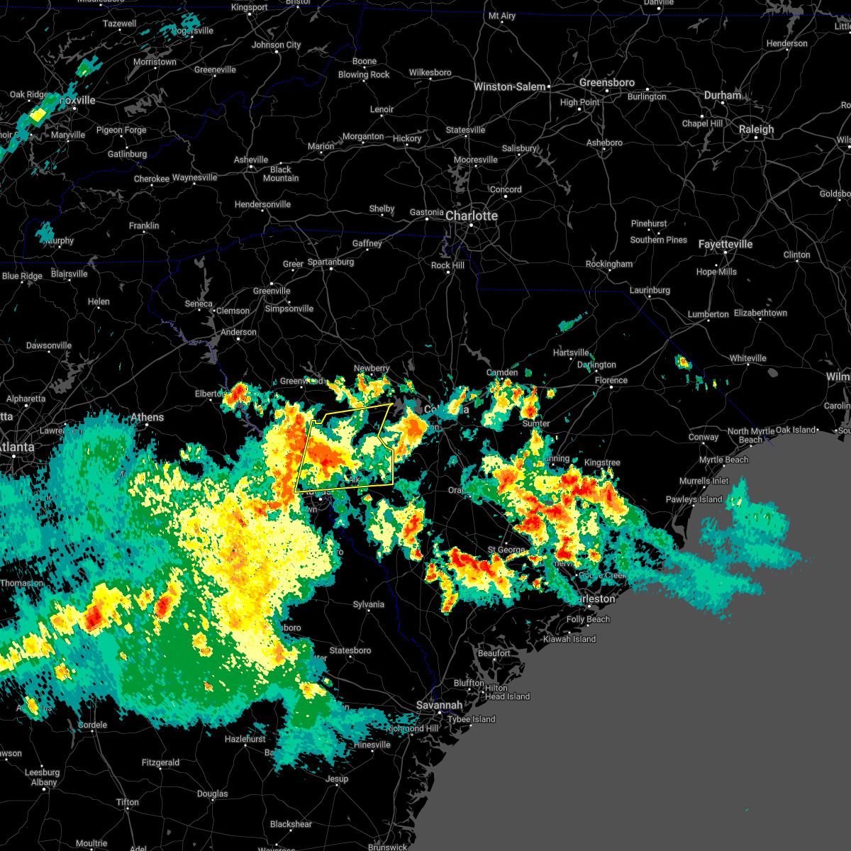 At 703 pm edt, a severe thunderstorm was located 8 miles northwest of edgefield, or 21 miles north of evans, moving east at 40 mph (radar indicated). Hazards include 60 mph wind gusts. expect damage to trees and powerlines At 703 pm edt, a severe thunderstorm was located 8 miles northwest of edgefield, or 21 miles north of evans, moving east at 40 mph (radar indicated). Hazards include 60 mph wind gusts. expect damage to trees and powerlines
|
| 4/5/2022 5:50 PM EDT |
 The severe thunderstorm warning for edgefield county will expire at 600 pm edt, the storms which prompted the warning have moved out of the area. therefore, the warning will be allowed to expire. a tornado watch remains in effect until 900 pm edt for east central georgia, and central south carolina. The severe thunderstorm warning for edgefield county will expire at 600 pm edt, the storms which prompted the warning have moved out of the area. therefore, the warning will be allowed to expire. a tornado watch remains in effect until 900 pm edt for east central georgia, and central south carolina.
|
| 4/5/2022 5:31 PM EDT |
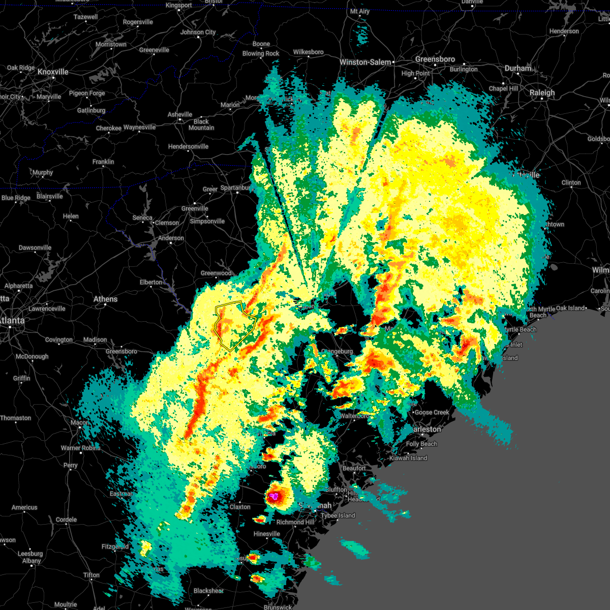 At 531 pm edt, severe thunderstorms were located along a line extending from 9 miles northwest of edgefield to near evans, moving east at 35 mph (radar indicated). Hazards include 60 mph wind gusts. Expect damage to trees and powerlines. locations impacted include, north augusta, edgefield, johnston, edgefield county airport, trenton, lick fork campground, strom thurmond high school, stevens creek public park, harmony, poverty hill, murphys estates, pleasant lane, ninety nine islands, mt vintage, northside fire station main, cleora, colliers, forks campground, edgefield federal correction institution and murphy village. This includes interstate 20 in south carolina near mile marker 0. At 531 pm edt, severe thunderstorms were located along a line extending from 9 miles northwest of edgefield to near evans, moving east at 35 mph (radar indicated). Hazards include 60 mph wind gusts. Expect damage to trees and powerlines. locations impacted include, north augusta, edgefield, johnston, edgefield county airport, trenton, lick fork campground, strom thurmond high school, stevens creek public park, harmony, poverty hill, murphys estates, pleasant lane, ninety nine islands, mt vintage, northside fire station main, cleora, colliers, forks campground, edgefield federal correction institution and murphy village. This includes interstate 20 in south carolina near mile marker 0.
|
| 4/5/2022 5:15 PM EDT |
 At 514 pm edt, severe thunderstorms were located along a line extending from 10 miles southwest of ninety six historic site to near appling, moving northeast at 50 mph (radar indicated). Hazards include 60 mph wind gusts. expect damage to trees and powerlines At 514 pm edt, severe thunderstorms were located along a line extending from 10 miles southwest of ninety six historic site to near appling, moving northeast at 50 mph (radar indicated). Hazards include 60 mph wind gusts. expect damage to trees and powerlines
|
| 3/16/2022 7:55 PM EDT |
 The severe thunderstorm warning for northeastern columbia, southwestern edgefield and southeastern mccormick counties will expire at 800 pm edt, the storm which prompted the warning has weakened below severe limits, and has exited the warned area. therefore, the warning will be allowed to expire. The severe thunderstorm warning for northeastern columbia, southwestern edgefield and southeastern mccormick counties will expire at 800 pm edt, the storm which prompted the warning has weakened below severe limits, and has exited the warned area. therefore, the warning will be allowed to expire.
|
| 3/16/2022 7:30 PM EDT |
 At 729 pm edt, a severe thunderstorm was located near martinez, moving north at 20 mph (trained weather spotters just north of augusta reported quarter sized hail). Hazards include quarter size hail. Damage to vehicles is expected. locations impacted include, north augusta, evans, martinez, edgefield, clarks hill recreation area, j. strom thurmond dam, poverty hill, scott`s landing, savannah rapids park, colliers, river island, edgefield federal correction institution, lick fork campground, westport, riverside park, stevens creek public park, murphys estates, lost wilderness fire station, ninety nine islands and mt vintage. hail threat, radar indicated max hail size, 1. 00 in wind threat, radar indicated max wind gust, <50 mph. At 729 pm edt, a severe thunderstorm was located near martinez, moving north at 20 mph (trained weather spotters just north of augusta reported quarter sized hail). Hazards include quarter size hail. Damage to vehicles is expected. locations impacted include, north augusta, evans, martinez, edgefield, clarks hill recreation area, j. strom thurmond dam, poverty hill, scott`s landing, savannah rapids park, colliers, river island, edgefield federal correction institution, lick fork campground, westport, riverside park, stevens creek public park, murphys estates, lost wilderness fire station, ninety nine islands and mt vintage. hail threat, radar indicated max hail size, 1. 00 in wind threat, radar indicated max wind gust, <50 mph.
|
| 3/16/2022 7:15 PM EDT |
 At 714 pm edt, a severe thunderstorm was located over augusta national golf club, or near martinez, moving north at 20 mph (radar indicated). Hazards include quarter size hail. damage to vehicles is expected At 714 pm edt, a severe thunderstorm was located over augusta national golf club, or near martinez, moving north at 20 mph (radar indicated). Hazards include quarter size hail. damage to vehicles is expected
|
| 12/30/2021 1:12 PM EST |
 At 110 pm est, a severe thunderstorm was located near wrightsboro, or near thomson, moving east at 45 mph (radar indicated). Hazards include 60 mph wind gusts and nickel size hail. expect damage to roofs, siding, and trees At 110 pm est, a severe thunderstorm was located near wrightsboro, or near thomson, moving east at 45 mph (radar indicated). Hazards include 60 mph wind gusts and nickel size hail. expect damage to roofs, siding, and trees
|
| 8/31/2021 3:15 PM EDT |
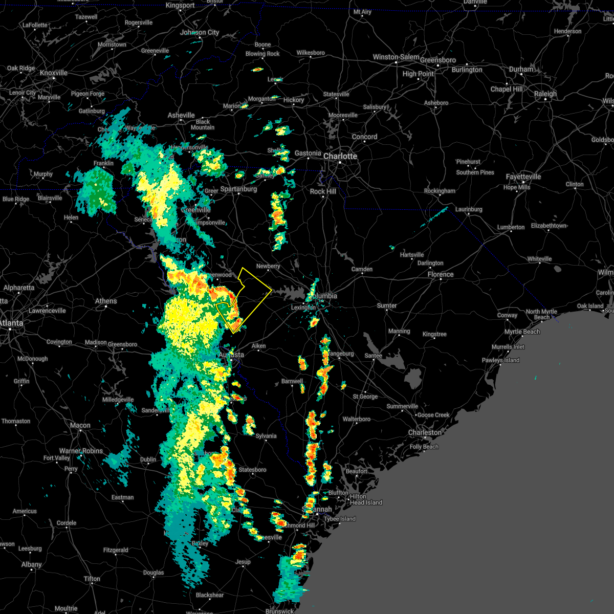 At 314 pm edt, severe thunderstorms were located along a line extending from near greenwood to 10 miles west of saluda county airport to edgefield, moving northeast at 45 mph (radar indicated). Hazards include 60 mph wind gusts. Expect damage to roofs, siding, and trees. locations impacted include, edgefield, saluda, saluda county airport, saluda co sheriff`s office, good hope, pleasant lane, northside fire station main, hollywood elementary school, emory, chappells, chappells fire station, cleora, scurry airport, hickory grove, vaughnville and saluda high school. hail threat, radar indicated max hail size, <. 75 in wind threat, radar indicated max wind gust, 60 mph. At 314 pm edt, severe thunderstorms were located along a line extending from near greenwood to 10 miles west of saluda county airport to edgefield, moving northeast at 45 mph (radar indicated). Hazards include 60 mph wind gusts. Expect damage to roofs, siding, and trees. locations impacted include, edgefield, saluda, saluda county airport, saluda co sheriff`s office, good hope, pleasant lane, northside fire station main, hollywood elementary school, emory, chappells, chappells fire station, cleora, scurry airport, hickory grove, vaughnville and saluda high school. hail threat, radar indicated max hail size, <. 75 in wind threat, radar indicated max wind gust, 60 mph.
|
| 8/31/2021 3:10 PM EDT | Tree down on buncombe st in edgefield. time estimate in edgefield county SC, 1.2 miles SSE of Edgefield, SC |
| 8/31/2021 2:59 PM EDT |
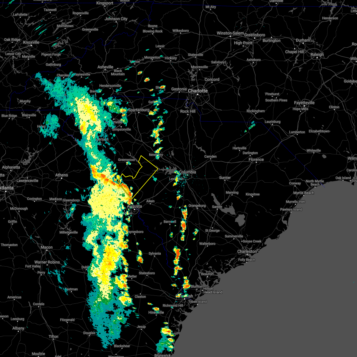 At 259 pm edt, a severe thunderstorm was located 10 miles northwest of edgefield, or 20 miles south of greenwood, moving northeast at 45 mph (radar indicated). Hazards include 60 mph wind gusts. expect damage to roofs, siding, and trees At 259 pm edt, a severe thunderstorm was located 10 miles northwest of edgefield, or 20 miles south of greenwood, moving northeast at 45 mph (radar indicated). Hazards include 60 mph wind gusts. expect damage to roofs, siding, and trees
|
| 8/17/2021 1:35 PM EDT |
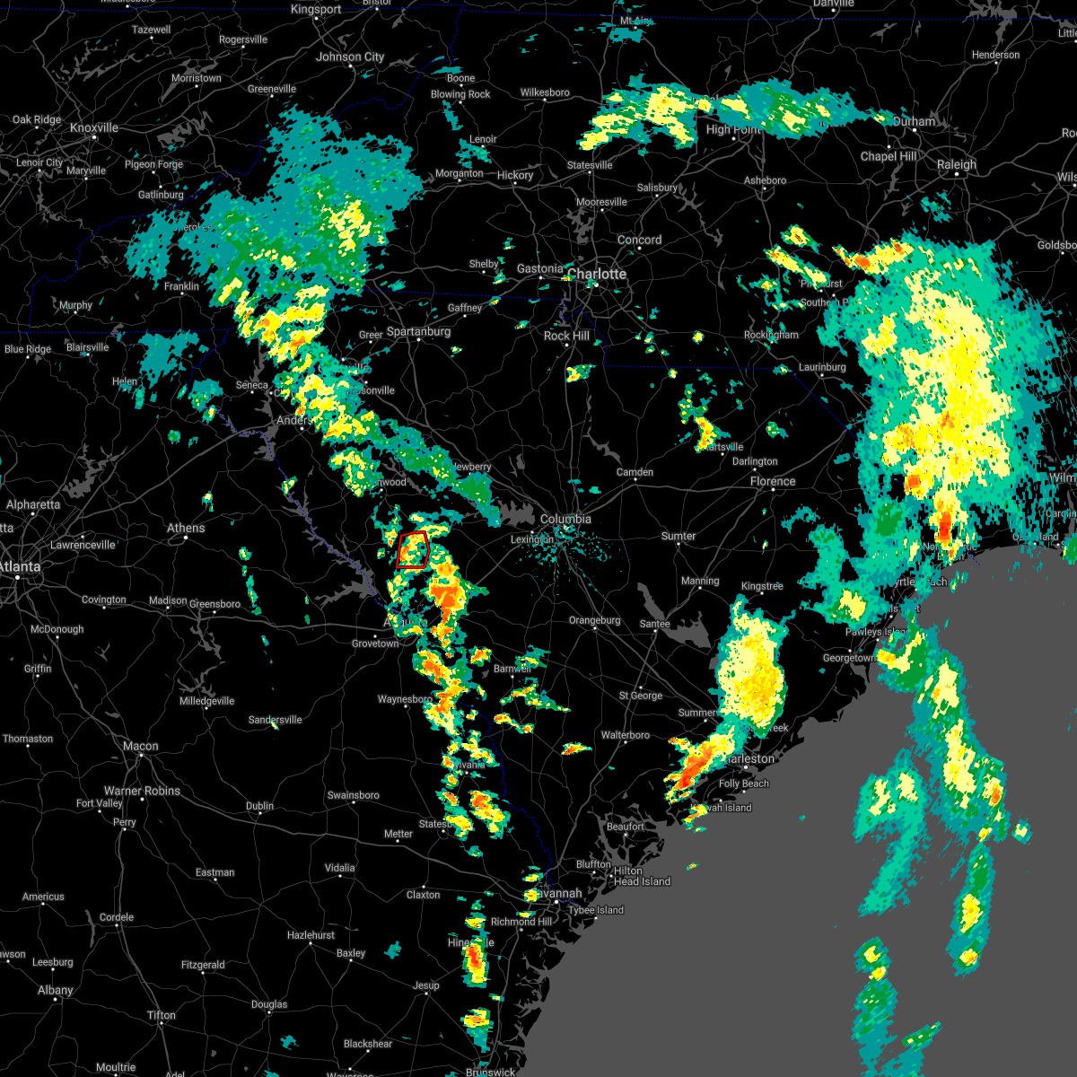 At 134 pm edt, a confirmed large and extremely dangerous tornado was located near cleora, or about 5 miles nw of edgefield, moving north at 30 mph. this is a particularly dangerous situation. take cover now! (radar confirmed tornado). Hazards include damaging tornado. You are in a life-threatening situation. flying debris may be deadly to those caught without shelter. mobile homes will be destroyed. considerable damage to homes, businesses, and vehicles is likely and complete destruction is possible. This tornadic thunderstorm will remain over mainly rural areas of north central edgefield county, including the following locations, cleora, pleasant lane and northside fire station main. At 134 pm edt, a confirmed large and extremely dangerous tornado was located near cleora, or about 5 miles nw of edgefield, moving north at 30 mph. this is a particularly dangerous situation. take cover now! (radar confirmed tornado). Hazards include damaging tornado. You are in a life-threatening situation. flying debris may be deadly to those caught without shelter. mobile homes will be destroyed. considerable damage to homes, businesses, and vehicles is likely and complete destruction is possible. This tornadic thunderstorm will remain over mainly rural areas of north central edgefield county, including the following locations, cleora, pleasant lane and northside fire station main.
|
| 8/17/2021 1:23 PM EDT |
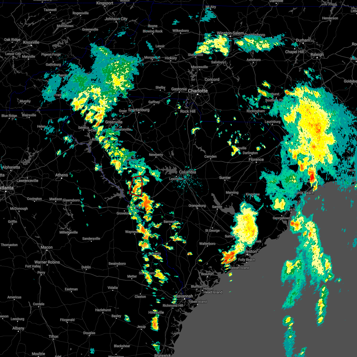 At 121 pm edt, a confirmed large and extremely dangerous tornado was located near lick fork campground, or southwest of edgefield, moving north at 25 mph. this is a particularly dangerous situation. take cover now! (radar confirmed tornado). Hazards include damaging tornado. You are in a life-threatening situation. flying debris may be deadly to those caught without shelter. mobile homes will be destroyed. considerable damage to homes, businesses, and vehicles is likely and complete destruction is possible. the tornado will be near, edgefield around 130 pm edt. Other locations impacted by this tornadic thunderstorm include lick fork campground, pleasant lane, northside fire station main, cleora and edgefield federal correction institution. At 121 pm edt, a confirmed large and extremely dangerous tornado was located near lick fork campground, or southwest of edgefield, moving north at 25 mph. this is a particularly dangerous situation. take cover now! (radar confirmed tornado). Hazards include damaging tornado. You are in a life-threatening situation. flying debris may be deadly to those caught without shelter. mobile homes will be destroyed. considerable damage to homes, businesses, and vehicles is likely and complete destruction is possible. the tornado will be near, edgefield around 130 pm edt. Other locations impacted by this tornadic thunderstorm include lick fork campground, pleasant lane, northside fire station main, cleora and edgefield federal correction institution.
|
| 8/17/2021 1:12 PM EDT |
 At 111 pm edt, a confirmed large and extremely dangerous tornado was located near mount vintage, or about 8 miles southwest of edgefield, moving north at 25 mph. this is a particularly dangerous situation. take cover now! (radar confirmed tornado). Hazards include damaging tornado. You are in a life-threatening situation. flying debris may be deadly to those caught without shelter. mobile homes will be destroyed. considerable damage to homes, businesses, and vehicles is likely and complete destruction is possible. the tornado will be near, edgefield around 135 pm edt. johnston around 145 pm edt. Other locations impacted by this tornadic thunderstorm include lick fork campground, strom thurmond high school, cleora, harmony, colliers, pleasant lane, trenton, mt vintage, northside fire station main and edgefield federal correction institution. At 111 pm edt, a confirmed large and extremely dangerous tornado was located near mount vintage, or about 8 miles southwest of edgefield, moving north at 25 mph. this is a particularly dangerous situation. take cover now! (radar confirmed tornado). Hazards include damaging tornado. You are in a life-threatening situation. flying debris may be deadly to those caught without shelter. mobile homes will be destroyed. considerable damage to homes, businesses, and vehicles is likely and complete destruction is possible. the tornado will be near, edgefield around 135 pm edt. johnston around 145 pm edt. Other locations impacted by this tornadic thunderstorm include lick fork campground, strom thurmond high school, cleora, harmony, colliers, pleasant lane, trenton, mt vintage, northside fire station main and edgefield federal correction institution.
|
| 8/17/2021 12:59 PM EDT |
 At 1258 pm edt, a severe thunderstorm capable of producing a tornado was located over southern edgefield county near stephens creek public park, moving north northeast at 30 mph (radar indicated rotation). Hazards include tornado. Flying debris will be dangerous to those caught without shelter. mobile homes will be damaged or destroyed. damage to roofs, windows, and vehicles will occur. tree damage is likely. this dangerous storm will be near, edgefield around 130 pm edt. johnston around 140 pm edt. Other locations impacted by this tornadic thunderstorm include lick fork campground, strom thurmond high school, stevens creek public park, harmony, poverty hill, murphys estates, pleasant lane, ninety nine islands, mt vintage and northside fire station main. At 1258 pm edt, a severe thunderstorm capable of producing a tornado was located over southern edgefield county near stephens creek public park, moving north northeast at 30 mph (radar indicated rotation). Hazards include tornado. Flying debris will be dangerous to those caught without shelter. mobile homes will be damaged or destroyed. damage to roofs, windows, and vehicles will occur. tree damage is likely. this dangerous storm will be near, edgefield around 130 pm edt. johnston around 140 pm edt. Other locations impacted by this tornadic thunderstorm include lick fork campground, strom thurmond high school, stevens creek public park, harmony, poverty hill, murphys estates, pleasant lane, ninety nine islands, mt vintage and northside fire station main.
|
| 8/10/2021 4:30 PM EDT |
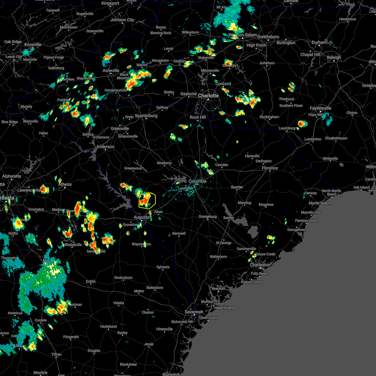 At 430 pm edt, a severe thunderstorm was located over edgefield, or 15 miles north of belvedere, moving east at 5 mph (radar indicated). Hazards include 60 mph wind gusts. expect damage to roofs, siding, and trees At 430 pm edt, a severe thunderstorm was located over edgefield, or 15 miles north of belvedere, moving east at 5 mph (radar indicated). Hazards include 60 mph wind gusts. expect damage to roofs, siding, and trees
|
| 7/18/2021 9:09 PM EDT |
 At 906 pm edt, severe thunderstorms were located along a line extending from ridge spring to 11 miles north of blackville, moving northeast at 30 mph (radar indicated). Hazards include 60 mph wind gusts. Expect damage to roofs, siding, and trees. locations impacted include, aiken, lexington, batesburg-leesville, red bank, edgefield, saluda, johnston, gaston, ridge spring, edgefield county airport, saluda county airport, aiken municipal airport, aiken state park, swansea, wagener, north, pelion, gilbert, summit and salley. This includes interstate 20 in south carolina between mile markers 14 and 54. At 906 pm edt, severe thunderstorms were located along a line extending from ridge spring to 11 miles north of blackville, moving northeast at 30 mph (radar indicated). Hazards include 60 mph wind gusts. Expect damage to roofs, siding, and trees. locations impacted include, aiken, lexington, batesburg-leesville, red bank, edgefield, saluda, johnston, gaston, ridge spring, edgefield county airport, saluda county airport, aiken municipal airport, aiken state park, swansea, wagener, north, pelion, gilbert, summit and salley. This includes interstate 20 in south carolina between mile markers 14 and 54.
|
| 7/18/2021 8:31 PM EDT |
 At 831 pm edt, severe thunderstorms were located along a line extending from near graniteville to near barnwell, moving northeast at 40 mph (radar indicated). Hazards include 60 mph wind gusts. expect damage to roofs, siding, and trees At 831 pm edt, severe thunderstorms were located along a line extending from near graniteville to near barnwell, moving northeast at 40 mph (radar indicated). Hazards include 60 mph wind gusts. expect damage to roofs, siding, and trees
|
| 5/4/2021 5:20 PM EDT |
 At 519 pm edt, severe thunderstorms were located along a line extending from near ridge spring to near appling, moving east at 25 mph (radar indicated). Hazards include 60 mph wind gusts. Expect damage to roofs, siding, and trees. locations impacted include, north augusta, grovetown, evans, thomson, batesburg-leesville, martinez, edgefield, harlem, johnston, ridge spring, appling, clarks hill recreation area, edgefield county airport, riverwood, village plaza shopping center, j. strom thurmond dam, thomson-mcduffie county airport, saluda county airport, dearing and monetta. This includes interstate 20 in georgia between mile markers 167 and 198. At 519 pm edt, severe thunderstorms were located along a line extending from near ridge spring to near appling, moving east at 25 mph (radar indicated). Hazards include 60 mph wind gusts. Expect damage to roofs, siding, and trees. locations impacted include, north augusta, grovetown, evans, thomson, batesburg-leesville, martinez, edgefield, harlem, johnston, ridge spring, appling, clarks hill recreation area, edgefield county airport, riverwood, village plaza shopping center, j. strom thurmond dam, thomson-mcduffie county airport, saluda county airport, dearing and monetta. This includes interstate 20 in georgia between mile markers 167 and 198.
|
| 5/4/2021 4:38 PM EDT |
 At 437 pm edt, severe thunderstorms were located along a line extending from near saluda county airport to near wrightsboro, moving east at 20 mph (radar indicated). Hazards include 60 mph wind gusts and penny size hail. expect damage to roofs, siding, and trees At 437 pm edt, severe thunderstorms were located along a line extending from near saluda county airport to near wrightsboro, moving east at 20 mph (radar indicated). Hazards include 60 mph wind gusts and penny size hail. expect damage to roofs, siding, and trees
|
| 3/31/2021 5:55 PM EDT |
 The severe thunderstorm warning for central edgefield, northwestern aiken and saluda counties will expire at 600 pm edt, the storms which prompted the warning have moved out of the area. therefore, the warning will be allowed to expire. to report severe weather, contact your nearest law enforcement agency. they will relay your report to the national weather service columbia. remember, a tornado warning still remains in effect for northeastern aiken county through 615 pm. The severe thunderstorm warning for central edgefield, northwestern aiken and saluda counties will expire at 600 pm edt, the storms which prompted the warning have moved out of the area. therefore, the warning will be allowed to expire. to report severe weather, contact your nearest law enforcement agency. they will relay your report to the national weather service columbia. remember, a tornado warning still remains in effect for northeastern aiken county through 615 pm.
|
| 3/31/2021 5:31 PM EDT |
 At 531 pm edt, severe thunderstorms were located along a line extending from near saluda to near johnston to near belvedere, moving northeast at 35 mph (radar indicated). Hazards include 60 mph wind gusts and half dollar size hail. Hail damage to vehicles is expected. expect wind damage to roofs, siding, and trees. locations impacted include, north augusta, batesburg-leesville, edgefield, saluda, johnston, ridge spring, saluda county airport, edgefield county airport, monetta, trenton, ward, strom thurmond high school, saluda co sheriff`s office, good hope, poverty hill, northside fire station main, hollywood elementary school, emory, vaucluse and edgefield federal correction institution. This includes interstate 20 in south carolina between mile markers 7 and 20. At 531 pm edt, severe thunderstorms were located along a line extending from near saluda to near johnston to near belvedere, moving northeast at 35 mph (radar indicated). Hazards include 60 mph wind gusts and half dollar size hail. Hail damage to vehicles is expected. expect wind damage to roofs, siding, and trees. locations impacted include, north augusta, batesburg-leesville, edgefield, saluda, johnston, ridge spring, saluda county airport, edgefield county airport, monetta, trenton, ward, strom thurmond high school, saluda co sheriff`s office, good hope, poverty hill, northside fire station main, hollywood elementary school, emory, vaucluse and edgefield federal correction institution. This includes interstate 20 in south carolina between mile markers 7 and 20.
|
| 3/31/2021 5:20 PM EDT | Edgefield dispatch reported a few trees down along sweetwater road in the southern half of the county. location and time are estimated based on rada in edgefield county SC, 6 miles NNE of Edgefield, SC |
| 3/31/2021 5:19 PM EDT |
 At 518 pm edt, severe thunderstorms were located along a line extending from 8 miles west of saluda county airport to near edgefield to near augusta national golf club, moving northeast at 35 mph (radar indicated). Hazards include 60 mph wind gusts and quarter size hail. Hail damage to vehicles is expected. Expect wind damage to roofs, siding, and trees. At 518 pm edt, severe thunderstorms were located along a line extending from 8 miles west of saluda county airport to near edgefield to near augusta national golf club, moving northeast at 35 mph (radar indicated). Hazards include 60 mph wind gusts and quarter size hail. Hail damage to vehicles is expected. Expect wind damage to roofs, siding, and trees.
|
| 1/1/2021 5:52 PM EST |
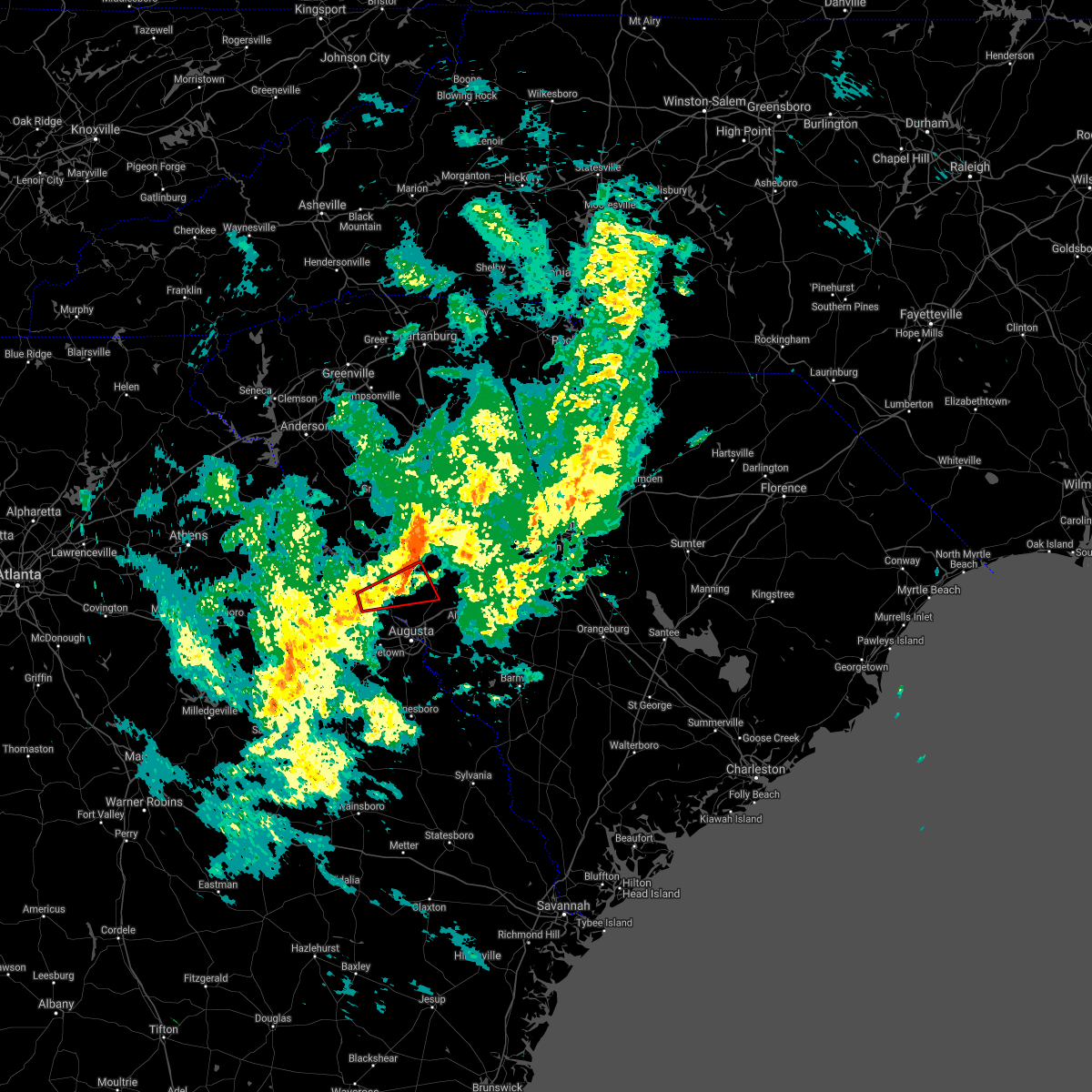 The tornado warning for north central columbia, southeastern lincoln, west central edgefield and southeastern mccormick counties will expire at 600 pm est, the storm which prompted the warning has weakened. therefore, the warning will be allowed to expire. however gusty winds are still possible. a tornado watch remains in effect until 800 pm est for east central georgia, and central south carolina. The tornado warning for north central columbia, southeastern lincoln, west central edgefield and southeastern mccormick counties will expire at 600 pm est, the storm which prompted the warning has weakened. therefore, the warning will be allowed to expire. however gusty winds are still possible. a tornado watch remains in effect until 800 pm est for east central georgia, and central south carolina.
|
| 1/1/2021 5:28 PM EST |
 At 527 pm est, a severe thunderstorm capable of producing a tornado was located near mistletoe state park, or 13 miles northwest of evans, moving east at 30 mph (radar indicated rotation). Hazards include tornado. Flying debris will be dangerous to those caught without shelter. mobile homes will be damaged or destroyed. damage to roofs, windows, and vehicles will occur. tree damage is likely. this dangerous storm will be near, clarks hill recreation area, j. strom thurmond dam and hamilton branch state park around 540 pm est. Other locations impacted by this tornadic thunderstorm include lick fork campground, modoc, lost wilderness fire station, mt vintage, scott`s landing, modoc campground, wildwood park, modoc boat ramp, clarks hill and colliers. At 527 pm est, a severe thunderstorm capable of producing a tornado was located near mistletoe state park, or 13 miles northwest of evans, moving east at 30 mph (radar indicated rotation). Hazards include tornado. Flying debris will be dangerous to those caught without shelter. mobile homes will be damaged or destroyed. damage to roofs, windows, and vehicles will occur. tree damage is likely. this dangerous storm will be near, clarks hill recreation area, j. strom thurmond dam and hamilton branch state park around 540 pm est. Other locations impacted by this tornadic thunderstorm include lick fork campground, modoc, lost wilderness fire station, mt vintage, scott`s landing, modoc campground, wildwood park, modoc boat ramp, clarks hill and colliers.
|
| 1/1/2021 5:28 PM EST |
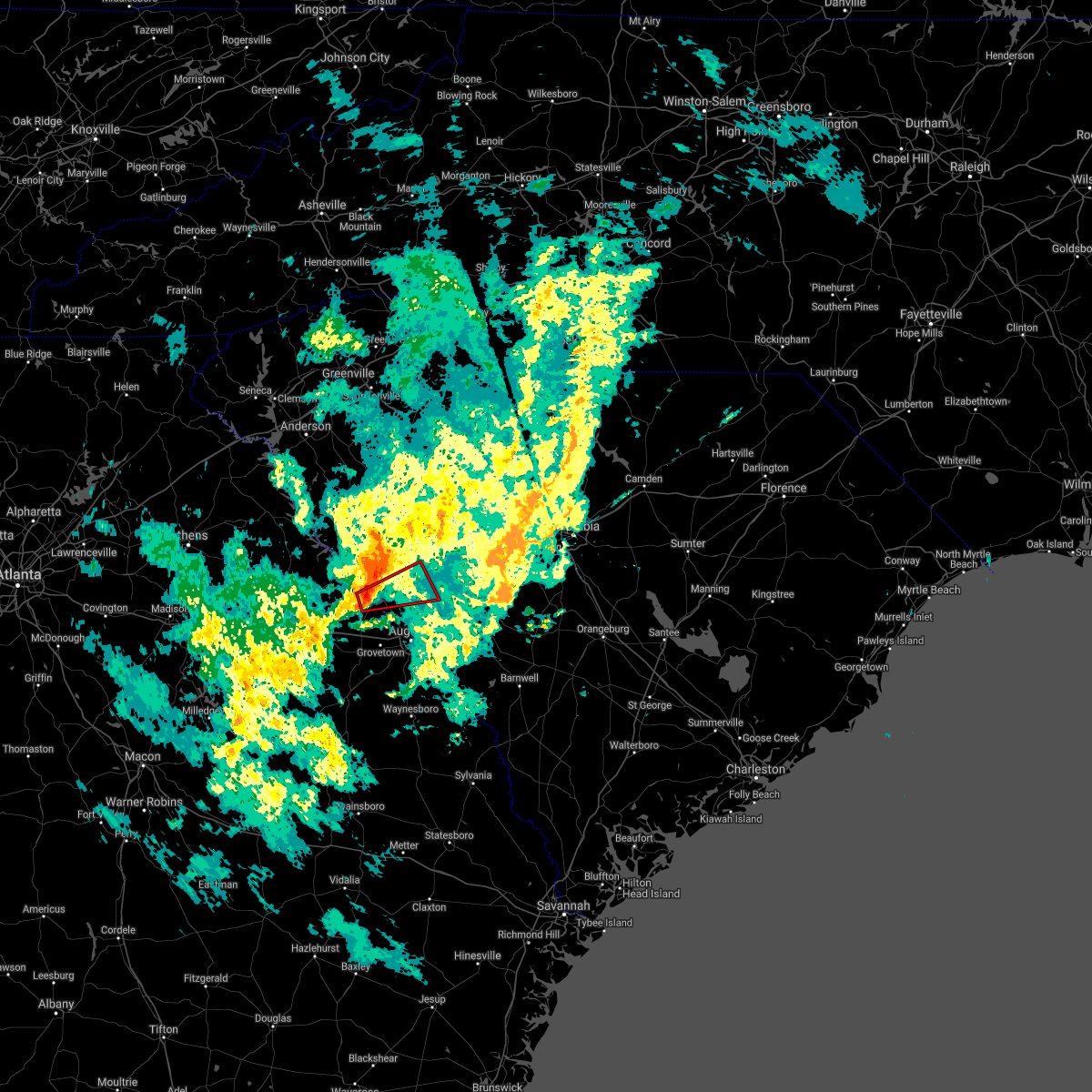 At 527 pm est, a severe thunderstorm capable of producing a tornado was located near mistletoe state park, or 13 miles northwest of evans, moving east at 30 mph (radar indicated rotation). Hazards include tornado. Flying debris will be dangerous to those caught without shelter. mobile homes will be damaged or destroyed. damage to roofs, windows, and vehicles will occur. tree damage is likely. this dangerous storm will be near, clarks hill recreation area, j. strom thurmond dam and hamilton branch state park around 540 pm est. Other locations impacted by this tornadic thunderstorm include lick fork campground, modoc, lost wilderness fire station, mt vintage, scott`s landing, modoc campground, wildwood park, modoc boat ramp, clarks hill and colliers. At 527 pm est, a severe thunderstorm capable of producing a tornado was located near mistletoe state park, or 13 miles northwest of evans, moving east at 30 mph (radar indicated rotation). Hazards include tornado. Flying debris will be dangerous to those caught without shelter. mobile homes will be damaged or destroyed. damage to roofs, windows, and vehicles will occur. tree damage is likely. this dangerous storm will be near, clarks hill recreation area, j. strom thurmond dam and hamilton branch state park around 540 pm est. Other locations impacted by this tornadic thunderstorm include lick fork campground, modoc, lost wilderness fire station, mt vintage, scott`s landing, modoc campground, wildwood park, modoc boat ramp, clarks hill and colliers.
|
| 6/28/2020 8:51 PM EDT |
 At 851 pm edt, a severe thunderstorm was located near aiken municipal airport, or 11 miles northeast of aiken, moving southeast at 25 mph (radar indicated). Hazards include 60 mph wind gusts. Expect damage to roofs, siding, and trees. locations impacted include, aiken, edgefield, johnston, ridge spring, usc aiken, edgefield county airport, citizens park, aiken municipal airport, aiken state park, wagener, salley, monetta, perry, trenton, windsor, strom thurmond high school, thor, vaucluse, new holland and edgefield federal correction institution. This includes interstate 20 in south carolina between mile markers 13 and 38. At 851 pm edt, a severe thunderstorm was located near aiken municipal airport, or 11 miles northeast of aiken, moving southeast at 25 mph (radar indicated). Hazards include 60 mph wind gusts. Expect damage to roofs, siding, and trees. locations impacted include, aiken, edgefield, johnston, ridge spring, usc aiken, edgefield county airport, citizens park, aiken municipal airport, aiken state park, wagener, salley, monetta, perry, trenton, windsor, strom thurmond high school, thor, vaucluse, new holland and edgefield federal correction institution. This includes interstate 20 in south carolina between mile markers 13 and 38.
|
| 6/28/2020 8:40 PM EDT | Powerlines down on country club road near edgefield. time estimated from rada in edgefield county SC, 2.6 miles SW of Edgefield, SC |
| 6/28/2020 8:38 PM EDT |
 At 838 pm edt, a severe thunderstorm was located near aiken municipal airport, or 12 miles north of aiken, moving southeast at 25 mph (radar indicated). Hazards include 60 mph wind gusts. expect damage to roofs, siding, and trees At 838 pm edt, a severe thunderstorm was located near aiken municipal airport, or 12 miles north of aiken, moving southeast at 25 mph (radar indicated). Hazards include 60 mph wind gusts. expect damage to roofs, siding, and trees
|
| 6/27/2020 7:23 PM EDT |
 At 721 pm edt, severe thunderstorms were located along a line extending from 7 miles west of edgefield to near grovetown to near thomson, moving east at 30 mph (radar indicated). Hazards include 60 mph wind gusts. Expect damage to roofs, siding, and trees. a wind gust to 54 mph was already reported with this line of thundertorms in thomson. locations impacted include, aiken, north augusta, grovetown, evans, thomson, fort gordon, augusta, clearwater, martinez, belvedere, edgefield, hephzibah, harlem, johnston, jackson, glendale, south augusta, clarks hill recreation area, edgefield county airport and summerville. this includes the following highways, interstate 20 in georgia between mile markers 172 and 201. interstate 20 in south carolina between mile markers 0 and 20. interstate 520 in georgia between mile markers 1 and 15. Interstate 520 in south carolina between mile markers 16 and 23. At 721 pm edt, severe thunderstorms were located along a line extending from 7 miles west of edgefield to near grovetown to near thomson, moving east at 30 mph (radar indicated). Hazards include 60 mph wind gusts. Expect damage to roofs, siding, and trees. a wind gust to 54 mph was already reported with this line of thundertorms in thomson. locations impacted include, aiken, north augusta, grovetown, evans, thomson, fort gordon, augusta, clearwater, martinez, belvedere, edgefield, hephzibah, harlem, johnston, jackson, glendale, south augusta, clarks hill recreation area, edgefield county airport and summerville. this includes the following highways, interstate 20 in georgia between mile markers 172 and 201. interstate 20 in south carolina between mile markers 0 and 20. interstate 520 in georgia between mile markers 1 and 15. Interstate 520 in south carolina between mile markers 16 and 23.
|
| 6/27/2020 6:57 PM EDT |
 At 656 pm edt, severe thunderstorms were located along a line extending from near hamilton branch state park to near appling to warrenton, moving east at 30 mph. a wind gust over 50 mph was recorded in thomson at the airport (radar indicated). Hazards include 60 mph wind gusts. expect damage to roofs, siding, and trees At 656 pm edt, severe thunderstorms were located along a line extending from near hamilton branch state park to near appling to warrenton, moving east at 30 mph. a wind gust over 50 mph was recorded in thomson at the airport (radar indicated). Hazards include 60 mph wind gusts. expect damage to roofs, siding, and trees
|
| 6/5/2020 3:16 PM EDT | Sheriff dispatch reported a tree blocking the roadway along country club roa in edgefield county SC, 3.5 miles SW of Edgefield, SC |
| 6/5/2020 3:15 PM EDT |
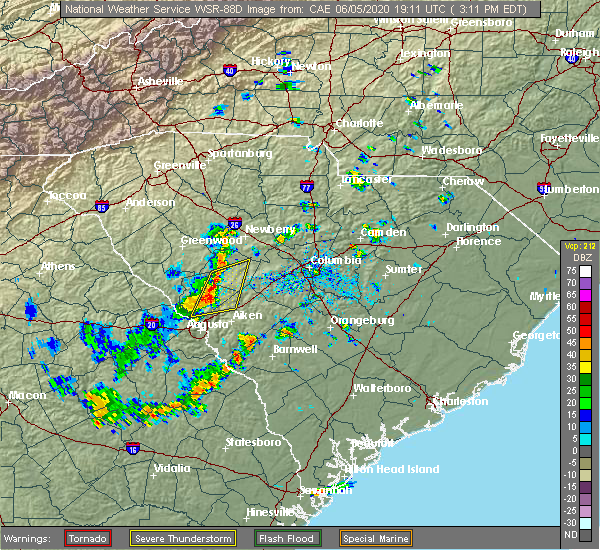 At 314 pm edt, severe thunderstorms were located along a line extending from near saluda county airport to 7 miles north of belvedere, moving northeast at 30 mph (radar indicated). Hazards include 60 mph wind gusts and quarter size hail. Hail damage to vehicles is expected. Expect wind damage to roofs, siding, and trees. At 314 pm edt, severe thunderstorms were located along a line extending from near saluda county airport to 7 miles north of belvedere, moving northeast at 30 mph (radar indicated). Hazards include 60 mph wind gusts and quarter size hail. Hail damage to vehicles is expected. Expect wind damage to roofs, siding, and trees.
|
| 6/5/2020 3:11 PM EDT | Sheriff dispatch reported a tree on a power line at the intersection of penn street and bauskett street in town of edgefiel in edgefield county SC, 0.5 miles ENE of Edgefield, SC |
| 5/22/2020 3:38 PM EDT |
 At 338 pm edt, a severe thunderstorm was located near edgefield, or 10 miles north of belvedere, moving east at 25 mph (radar indicated). Hazards include 60 mph wind gusts and quarter size hail. Hail damage to vehicles is expected. expect wind damage to roofs, siding, and trees. locations impacted include, edgefield, johnston, edgefield county airport, trenton, harmony, mt vintage, edgefield federal correction institution and lick fork campground. This includes interstate 20 in south carolina between mile markers 20 and 24. At 338 pm edt, a severe thunderstorm was located near edgefield, or 10 miles north of belvedere, moving east at 25 mph (radar indicated). Hazards include 60 mph wind gusts and quarter size hail. Hail damage to vehicles is expected. expect wind damage to roofs, siding, and trees. locations impacted include, edgefield, johnston, edgefield county airport, trenton, harmony, mt vintage, edgefield federal correction institution and lick fork campground. This includes interstate 20 in south carolina between mile markers 20 and 24.
|
| 5/22/2020 3:23 PM EDT |
 At 323 pm edt, a severe thunderstorm was located 9 miles east of clarks hill recreation area, or 9 miles northwest of belvedere, moving east at 25 mph (radar indicated). Hazards include 60 mph wind gusts and quarter size hail. Hail damage to vehicles is expected. Expect wind damage to roofs, siding, and trees. At 323 pm edt, a severe thunderstorm was located 9 miles east of clarks hill recreation area, or 9 miles northwest of belvedere, moving east at 25 mph (radar indicated). Hazards include 60 mph wind gusts and quarter size hail. Hail damage to vehicles is expected. Expect wind damage to roofs, siding, and trees.
|
| 4/13/2020 5:10 AM EDT |
 The severe thunderstorm warning for northeastern columbia, lincoln, southwestern newberry, edgefield, saluda and mccormick counties will expire at 515 am edt, the storms which prompted the warning have moved out of the warned area. therefore, the warning will be allowed to expire. a tornado watch remains in effect until 1100 am edt for east central georgia, and central south carolina. The severe thunderstorm warning for northeastern columbia, lincoln, southwestern newberry, edgefield, saluda and mccormick counties will expire at 515 am edt, the storms which prompted the warning have moved out of the warned area. therefore, the warning will be allowed to expire. a tornado watch remains in effect until 1100 am edt for east central georgia, and central south carolina.
|
| 4/13/2020 4:54 AM EDT | Schp reported trees down blocking roadway on scotts ferry road. time estimated by rada in edgefield county SC, 4.4 miles E of Edgefield, SC |
| 4/13/2020 4:29 AM EDT |
 At 429 am edt, severe thunderstorms were located along a line extending from 6 miles west of troy to near thomson, moving northeast at 75 mph (radar indicated). Hazards include 70 mph wind gusts and penny size hail. Expect considerable tree damage. Damage is likely to mobile homes, roofs, and outbuildings. At 429 am edt, severe thunderstorms were located along a line extending from 6 miles west of troy to near thomson, moving northeast at 75 mph (radar indicated). Hazards include 70 mph wind gusts and penny size hail. Expect considerable tree damage. Damage is likely to mobile homes, roofs, and outbuildings.
|
| 2/13/2020 10:41 AM EST |
 At 1040 am est, severe thunderstorms were located along a line extending from 7 miles west of saluda county airport to near appling, moving east at 50 mph (radar indicated). Hazards include 60 mph wind gusts. Expect damage to roofs, siding, and trees. locations impacted include, north augusta, grovetown, evans, martinez, edgefield, harlem, johnston, appling, clarks hill recreation area, edgefield county airport, riverwood, hamilton branch state park, j. strom thurmond dam, dearing, trenton, arties pond public fishing area, poverty hill, adamsville, scott`s landing and northside fire station main. This includes interstate 20 in georgia between mile markers 178 and 194. At 1040 am est, severe thunderstorms were located along a line extending from 7 miles west of saluda county airport to near appling, moving east at 50 mph (radar indicated). Hazards include 60 mph wind gusts. Expect damage to roofs, siding, and trees. locations impacted include, north augusta, grovetown, evans, martinez, edgefield, harlem, johnston, appling, clarks hill recreation area, edgefield county airport, riverwood, hamilton branch state park, j. strom thurmond dam, dearing, trenton, arties pond public fishing area, poverty hill, adamsville, scott`s landing and northside fire station main. This includes interstate 20 in georgia between mile markers 178 and 194.
|
| 2/13/2020 10:15 AM EST |
 At 1014 am est, severe thunderstorms were located along a line extending from near hamilton branch state park to camak, moving east at 50 mph (radar indicated). Hazards include 60 mph wind gusts. expect damage to roofs, siding, and trees At 1014 am est, severe thunderstorms were located along a line extending from near hamilton branch state park to camak, moving east at 50 mph (radar indicated). Hazards include 60 mph wind gusts. expect damage to roofs, siding, and trees
|
| 2/6/2020 3:23 PM EST |
 A severe thunderstorm warning remains in effect until 345 pm est for central edgefield. western lexington. northern aiken and southeastern saluda counties. At 323 pm est, severe thunderstorms were located along a line extending from near monticello to near lexington to 7 miles southeast of batesburg-leesville, moving northeast at 70 mph. A severe thunderstorm warning remains in effect until 345 pm est for central edgefield. western lexington. northern aiken and southeastern saluda counties. At 323 pm est, severe thunderstorms were located along a line extending from near monticello to near lexington to 7 miles southeast of batesburg-leesville, moving northeast at 70 mph.
|
| 2/6/2020 2:59 PM EST |
 At 259 pm est, severe thunderstorms were located along a line extending from 8 miles southwest of prosperity to near ridge spring to near usc aiken, moving northeast at 70 mph (radar indicated). Hazards include 60 mph wind gusts. expect damage to roofs, siding, and trees At 259 pm est, severe thunderstorms were located along a line extending from 8 miles southwest of prosperity to near ridge spring to near usc aiken, moving northeast at 70 mph (radar indicated). Hazards include 60 mph wind gusts. expect damage to roofs, siding, and trees
|
| 2/6/2020 2:50 PM EST |
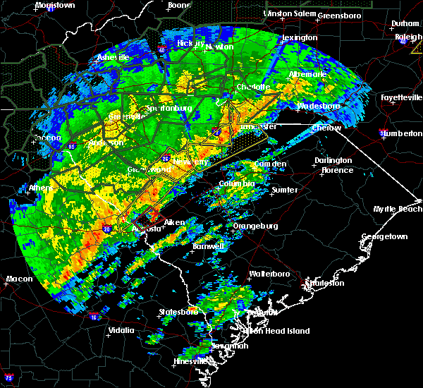 At 250 pm est, a severe thunderstorm capable of producing a tornado was located over edgefield county airport, or 12 miles north of aiken, moving northeast at 60 mph (radar indicated rotation). Hazards include tornado. Flying debris will be dangerous to those caught without shelter. mobile homes will be damaged or destroyed. damage to roofs, windows, and vehicles will occur. tree damage is likely. this tornadic thunderstorm will remain over mainly rural areas of south central edgefield and west central aiken counties, including the following locations, trenton, mt vintage, vaucluse and murphys estates. This includes interstate 20 in south carolina between mile markers 7 and 20. At 250 pm est, a severe thunderstorm capable of producing a tornado was located over edgefield county airport, or 12 miles north of aiken, moving northeast at 60 mph (radar indicated rotation). Hazards include tornado. Flying debris will be dangerous to those caught without shelter. mobile homes will be damaged or destroyed. damage to roofs, windows, and vehicles will occur. tree damage is likely. this tornadic thunderstorm will remain over mainly rural areas of south central edgefield and west central aiken counties, including the following locations, trenton, mt vintage, vaucluse and murphys estates. This includes interstate 20 in south carolina between mile markers 7 and 20.
|
| 2/6/2020 2:42 PM EST |
 At 242 pm est, a severe thunderstorm capable of producing a tornado was located 7 miles north of belvedere, moving northeast at 60 mph (radar indicated rotation). Hazards include tornado. Flying debris will be dangerous to those caught without shelter. mobile homes will be damaged or destroyed. damage to roofs, windows, and vehicles will occur. tree damage is likely. this dangerous storm will be near, edgefield county airport around 250 pm est. other locations impacted by this tornadic thunderstorm include stevens creek public park, poverty hill, murphys estates, trenton, mt vintage, vaucluse, murphy village, edgefield federal correction institution and savannah bluffs heritage preserve. this includes the following highways, interstate 20 in south carolina between mile markers 1 and 20. Interstate 520 in south carolina between mile markers 21 and 23. At 242 pm est, a severe thunderstorm capable of producing a tornado was located 7 miles north of belvedere, moving northeast at 60 mph (radar indicated rotation). Hazards include tornado. Flying debris will be dangerous to those caught without shelter. mobile homes will be damaged or destroyed. damage to roofs, windows, and vehicles will occur. tree damage is likely. this dangerous storm will be near, edgefield county airport around 250 pm est. other locations impacted by this tornadic thunderstorm include stevens creek public park, poverty hill, murphys estates, trenton, mt vintage, vaucluse, murphy village, edgefield federal correction institution and savannah bluffs heritage preserve. this includes the following highways, interstate 20 in south carolina between mile markers 1 and 20. Interstate 520 in south carolina between mile markers 21 and 23.
|
| 2/6/2020 2:32 PM EST |
 At 232 pm est, severe thunderstorms were located along a line extending from 8 miles southwest of newberry college to near hamilton branch state park, moving northeast at 45 mph (radar indicated). Hazards include 60 mph wind gusts. expect damage to roofs, siding, and trees At 232 pm est, severe thunderstorms were located along a line extending from 8 miles southwest of newberry college to near hamilton branch state park, moving northeast at 45 mph (radar indicated). Hazards include 60 mph wind gusts. expect damage to roofs, siding, and trees
|
| 2/6/2020 2:28 PM EST |
 At 227 pm est, a severe thunderstorm capable of producing a tornado was located over village plaza shopping center, or over martinez, moving northeast at 60 mph (radar indicated rotation). Hazards include tornado. Flying debris will be dangerous to those caught without shelter. mobile homes will be damaged or destroyed. damage to roofs, windows, and vehicles will occur. tree damage is likely. this dangerous storm will be near, clearwater around 235 pm est. north augusta and belvedere around 240 pm est. graniteville around 245 pm est. edgefield county airport around 250 pm est. other locations impacted by this tornadic thunderstorm include west end augusta, poverty hill, glenn hills, westover memorial park, kroc center, richmond county recreation center, blanchard park, savannah bluffs heritage preserve, savannah rapids park and medical district augusta. this includes the following highways, interstate 20 in georgia between mile markers 188 and 201. interstate 20 in south carolina between mile markers 0 and 20. interstate 520 in georgia between mile markers 1 and 7. Interstate 520 in south carolina between mile markers 17 and 23. At 227 pm est, a severe thunderstorm capable of producing a tornado was located over village plaza shopping center, or over martinez, moving northeast at 60 mph (radar indicated rotation). Hazards include tornado. Flying debris will be dangerous to those caught without shelter. mobile homes will be damaged or destroyed. damage to roofs, windows, and vehicles will occur. tree damage is likely. this dangerous storm will be near, clearwater around 235 pm est. north augusta and belvedere around 240 pm est. graniteville around 245 pm est. edgefield county airport around 250 pm est. other locations impacted by this tornadic thunderstorm include west end augusta, poverty hill, glenn hills, westover memorial park, kroc center, richmond county recreation center, blanchard park, savannah bluffs heritage preserve, savannah rapids park and medical district augusta. this includes the following highways, interstate 20 in georgia between mile markers 188 and 201. interstate 20 in south carolina between mile markers 0 and 20. interstate 520 in georgia between mile markers 1 and 7. Interstate 520 in south carolina between mile markers 17 and 23.
|
| 1/11/2020 9:17 PM EST |
 At 916 pm est, severe thunderstorms were located along a line extending from near newberry county airport to near saluda to 7 miles east of clarks hill recreation area, moving northeast at 65 mph (law enforcement reported numerous trees and power lines down in mccormick county). Hazards include 70 mph wind gusts. Expect considerable tree damage. damage is likely to mobile homes, roofs, and outbuildings. locations impacted include, edgefield, saluda, johnston, ridge spring, appling, clarks hill recreation area, saluda county airport, edgefield county airport, j. Strom thurmond dam, riverwood, monetta, trenton, silverstreet, ward, strom thurmond high school, saluda co sheriff`s office, modoc, scott`s landing, hollywood elementary school and emory. At 916 pm est, severe thunderstorms were located along a line extending from near newberry county airport to near saluda to 7 miles east of clarks hill recreation area, moving northeast at 65 mph (law enforcement reported numerous trees and power lines down in mccormick county). Hazards include 70 mph wind gusts. Expect considerable tree damage. damage is likely to mobile homes, roofs, and outbuildings. locations impacted include, edgefield, saluda, johnston, ridge spring, appling, clarks hill recreation area, saluda county airport, edgefield county airport, j. Strom thurmond dam, riverwood, monetta, trenton, silverstreet, ward, strom thurmond high school, saluda co sheriff`s office, modoc, scott`s landing, hollywood elementary school and emory.
|
| 1/11/2020 8:51 PM EST |
 At 850 pm est, severe thunderstorms were located along a line extending from 11 miles south of ninety six historic site to near hamilton branch state park to near appling, moving east at 45 mph (radar indicated). Hazards include 70 mph wind gusts. Expect considerable tree damage. Damage is likely to mobile homes, roofs, and outbuildings. At 850 pm est, severe thunderstorms were located along a line extending from 11 miles south of ninety six historic site to near hamilton branch state park to near appling, moving east at 45 mph (radar indicated). Hazards include 70 mph wind gusts. Expect considerable tree damage. Damage is likely to mobile homes, roofs, and outbuildings.
|
| 10/31/2019 5:25 PM EDT |
 At 525 pm edt, severe thunderstorms were located along a line extending from 6 miles southeast of saluda to burke county airport, moving southeast at 35 mph (radar indicated). Hazards include 60 mph wind gusts. expect damage to roofs, siding, and trees At 525 pm edt, severe thunderstorms were located along a line extending from 6 miles southeast of saluda to burke county airport, moving southeast at 35 mph (radar indicated). Hazards include 60 mph wind gusts. expect damage to roofs, siding, and trees
|
| 10/31/2019 5:12 PM EDT |
 At 510 pm edt, severe thunderstorms were located along a line extending from clarks hill recreation area to near gough, moving northeast at 30 mph (radar indicated). Hazards include 60 mph wind gusts and penny size hail. Expect damage to roofs, siding, and trees. locations impacted include, north augusta, grovetown, evans, waynesboro, fort gordon, augusta, clearwater, martinez, belvedere, edgefield, hephzibah, glendale, gough, south augusta, clarks hill recreation area, summerville, augusta mall, daniel field, village plaza shopping center and augusta national golf club. this includes the following highways, interstate 20 in georgia between mile markers 186 and 201. interstate 20 in south carolina between mile markers 0 and 12. interstate 520 in georgia between mile markers 1 and 15. Interstate 520 in south carolina between mile markers 16 and 23. At 510 pm edt, severe thunderstorms were located along a line extending from clarks hill recreation area to near gough, moving northeast at 30 mph (radar indicated). Hazards include 60 mph wind gusts and penny size hail. Expect damage to roofs, siding, and trees. locations impacted include, north augusta, grovetown, evans, waynesboro, fort gordon, augusta, clearwater, martinez, belvedere, edgefield, hephzibah, glendale, gough, south augusta, clarks hill recreation area, summerville, augusta mall, daniel field, village plaza shopping center and augusta national golf club. this includes the following highways, interstate 20 in georgia between mile markers 186 and 201. interstate 20 in south carolina between mile markers 0 and 12. interstate 520 in georgia between mile markers 1 and 15. Interstate 520 in south carolina between mile markers 16 and 23.
|
| 10/31/2019 5:08 PM EDT |
 At 508 pm edt, severe thunderstorms were located along a line extending from 9 miles northeast of saluda to near edgefield, moving east at 35 mph (radar indicated). Hazards include 60 mph wind gusts. Expect damage to roofs, siding, and trees. Locations impacted include, batesburg-leesville, edgefield, saluda, johnston, ridge spring, saluda county airport, monetta, ward, strom thurmond high school, saluda co sheriff`s office, good hope, northside fire station main, hollywood elementary school, emory, cleora, delmar, edgefield federal correction institution, harmony, pleasant lane and wyses ferry. At 508 pm edt, severe thunderstorms were located along a line extending from 9 miles northeast of saluda to near edgefield, moving east at 35 mph (radar indicated). Hazards include 60 mph wind gusts. Expect damage to roofs, siding, and trees. Locations impacted include, batesburg-leesville, edgefield, saluda, johnston, ridge spring, saluda county airport, monetta, ward, strom thurmond high school, saluda co sheriff`s office, good hope, northside fire station main, hollywood elementary school, emory, cleora, delmar, edgefield federal correction institution, harmony, pleasant lane and wyses ferry.
|
| 10/31/2019 5:00 PM EDT |
 At 500 pm edt, a severe thunderstorm capable of producing a tornado was located 7 miles northwest of belvedere, moving northeast at 40 mph (radar indicated rotation). Hazards include tornado. Flying debris will be dangerous to those caught without shelter. mobile homes will be damaged or destroyed. damage to roofs, windows, and vehicles will occur. tree damage is likely. this dangerous storm will be near, edgefield around 520 pm edt. other locations impacted by this tornadic thunderstorm include stevens creek public park, poverty hill, murphys estates, forks campground, mt vintage, vaucluse, murphy village and ninety nine islands. This includes interstate 20 in south carolina between mile markers 5 and 13. At 500 pm edt, a severe thunderstorm capable of producing a tornado was located 7 miles northwest of belvedere, moving northeast at 40 mph (radar indicated rotation). Hazards include tornado. Flying debris will be dangerous to those caught without shelter. mobile homes will be damaged or destroyed. damage to roofs, windows, and vehicles will occur. tree damage is likely. this dangerous storm will be near, edgefield around 520 pm edt. other locations impacted by this tornadic thunderstorm include stevens creek public park, poverty hill, murphys estates, forks campground, mt vintage, vaucluse, murphy village and ninety nine islands. This includes interstate 20 in south carolina between mile markers 5 and 13.
|
| 10/31/2019 4:52 PM EDT |
 At 452 pm edt, a severe thunderstorm capable of producing a tornado was located near evans, moving northeast at 40 mph (radar indicated rotation). Hazards include tornado. Flying debris will be dangerous to those caught without shelter. mobile homes will be damaged or destroyed. damage to roofs, windows, and vehicles will occur. tree damage is likely. this dangerous storm will be near, north augusta around 500 pm edt. edgefield around 515 pm edt. other locations impacted by this tornadic thunderstorm include westport, riverside park, evans medical center, stevens creek public park, poverty hill, murphys estates, ninety nine islands, mt vintage, savannah rapids park and german island. This includes interstate 20 in south carolina between mile markers 5 and 13. At 452 pm edt, a severe thunderstorm capable of producing a tornado was located near evans, moving northeast at 40 mph (radar indicated rotation). Hazards include tornado. Flying debris will be dangerous to those caught without shelter. mobile homes will be damaged or destroyed. damage to roofs, windows, and vehicles will occur. tree damage is likely. this dangerous storm will be near, north augusta around 500 pm edt. edgefield around 515 pm edt. other locations impacted by this tornadic thunderstorm include westport, riverside park, evans medical center, stevens creek public park, poverty hill, murphys estates, ninety nine islands, mt vintage, savannah rapids park and german island. This includes interstate 20 in south carolina between mile markers 5 and 13.
|
| 10/31/2019 4:43 PM EDT |
 At 442 pm edt, a severe thunderstorm capable of producing a tornado was located over evans, moving northeast at 35 mph (radar indicated rotation). Hazards include tornado. Flying debris will be dangerous to those caught without shelter. mobile homes will be damaged or destroyed. damage to roofs, windows, and vehicles will occur. tree damage is likely. this dangerous storm will be near, augusta national golf club around 455 pm edt. north augusta and belvedere around 505 pm edt. other locations impacted by this tornadic thunderstorm include poverty hill, blanchard park, savannah bluffs heritage preserve, savannah rapids park, westmont, vaucluse, river island, westport, eisenhower park and riverside park. this includes the following highways, interstate 20 in georgia between mile markers 189 and 192, and between mile markers 194 and 201. interstate 20 in south carolina between mile markers 0 and 13. Interstate 520 in south carolina between mile markers 20 and 23. At 442 pm edt, a severe thunderstorm capable of producing a tornado was located over evans, moving northeast at 35 mph (radar indicated rotation). Hazards include tornado. Flying debris will be dangerous to those caught without shelter. mobile homes will be damaged or destroyed. damage to roofs, windows, and vehicles will occur. tree damage is likely. this dangerous storm will be near, augusta national golf club around 455 pm edt. north augusta and belvedere around 505 pm edt. other locations impacted by this tornadic thunderstorm include poverty hill, blanchard park, savannah bluffs heritage preserve, savannah rapids park, westmont, vaucluse, river island, westport, eisenhower park and riverside park. this includes the following highways, interstate 20 in georgia between mile markers 189 and 192, and between mile markers 194 and 201. interstate 20 in south carolina between mile markers 0 and 13. Interstate 520 in south carolina between mile markers 20 and 23.
|
| 10/31/2019 4:43 PM EDT |
 At 442 pm edt, severe thunderstorms were located along a line extending from near appling to near louisville, moving northeast at 50 mph (radar indicated). Hazards include 60 mph wind gusts and penny size hail. expect damage to roofs, siding, and trees At 442 pm edt, severe thunderstorms were located along a line extending from near appling to near louisville, moving northeast at 50 mph (radar indicated). Hazards include 60 mph wind gusts and penny size hail. expect damage to roofs, siding, and trees
|
| 10/31/2019 4:43 PM EDT |
 At 442 pm edt, a severe thunderstorm capable of producing a tornado was located over evans, moving northeast at 35 mph (radar indicated rotation). Hazards include tornado. Flying debris will be dangerous to those caught without shelter. mobile homes will be damaged or destroyed. damage to roofs, windows, and vehicles will occur. tree damage is likely. this dangerous storm will be near, augusta national golf club around 455 pm edt. north augusta and belvedere around 505 pm edt. other locations impacted by this tornadic thunderstorm include poverty hill, blanchard park, savannah bluffs heritage preserve, savannah rapids park, westmont, vaucluse, river island, westport, eisenhower park and riverside park. this includes the following highways, interstate 20 in georgia between mile markers 189 and 192, and between mile markers 194 and 201. interstate 20 in south carolina between mile markers 0 and 13. Interstate 520 in south carolina between mile markers 20 and 23. At 442 pm edt, a severe thunderstorm capable of producing a tornado was located over evans, moving northeast at 35 mph (radar indicated rotation). Hazards include tornado. Flying debris will be dangerous to those caught without shelter. mobile homes will be damaged or destroyed. damage to roofs, windows, and vehicles will occur. tree damage is likely. this dangerous storm will be near, augusta national golf club around 455 pm edt. north augusta and belvedere around 505 pm edt. other locations impacted by this tornadic thunderstorm include poverty hill, blanchard park, savannah bluffs heritage preserve, savannah rapids park, westmont, vaucluse, river island, westport, eisenhower park and riverside park. this includes the following highways, interstate 20 in georgia between mile markers 189 and 192, and between mile markers 194 and 201. interstate 20 in south carolina between mile markers 0 and 13. Interstate 520 in south carolina between mile markers 20 and 23.
|
| 10/31/2019 4:38 PM EDT |
 At 438 pm edt, a severe thunderstorm was located near edgefield, or 21 miles north of belvedere, moving northeast at 50 mph (radar indicated). Hazards include 60 mph wind gusts. expect damage to roofs, siding, and trees At 438 pm edt, a severe thunderstorm was located near edgefield, or 21 miles north of belvedere, moving northeast at 50 mph (radar indicated). Hazards include 60 mph wind gusts. expect damage to roofs, siding, and trees
|
| 7/18/2019 4:26 PM EDT | Tree down on buncomde st in western edgefield county. time estimated by rada in edgefield county SC, 1.2 miles SSE of Edgefield, SC |
| 7/18/2019 4:02 PM EDT |
 The national weather service in columbia has issued a * severe thunderstorm warning for. northeastern columbia county in east central georgia. southeastern lincoln county in east central georgia. northeastern richmond county in east central georgia. Edgefield county in central south carolina. The national weather service in columbia has issued a * severe thunderstorm warning for. northeastern columbia county in east central georgia. southeastern lincoln county in east central georgia. northeastern richmond county in east central georgia. Edgefield county in central south carolina.
|
| 7/18/2019 4:02 PM EDT |
 At 402 pm edt, severe thunderstorms were located along a line extending from 9 miles southwest of ninety six historic site to near j. strom thurmond dam, moving east at 25 mph (radar indicated). Hazards include 70 mph wind gusts. Expect considerable tree damage. Damage is likely to mobile homes, roofs, and outbuildings. At 402 pm edt, severe thunderstorms were located along a line extending from 9 miles southwest of ninety six historic site to near j. strom thurmond dam, moving east at 25 mph (radar indicated). Hazards include 70 mph wind gusts. Expect considerable tree damage. Damage is likely to mobile homes, roofs, and outbuildings.
|
| 6/24/2019 9:24 PM EDT |
 At 923 pm edt, severe thunderstorms were located along a line extending from near mistletoe state park to near warrenton, moving east at 60 mph (radar indicated). Hazards include 60 mph wind gusts and penny size hail. expect damage to roofs, siding, and trees At 923 pm edt, severe thunderstorms were located along a line extending from near mistletoe state park to near warrenton, moving east at 60 mph (radar indicated). Hazards include 60 mph wind gusts and penny size hail. expect damage to roofs, siding, and trees
|
| 6/22/2019 4:08 AM EDT |
 The severe thunderstorm warning for newberry, northern edgefield and saluda counties will expire at 415 am edt, the storms which prompted the warning have moved out of the area. therefore, the warning will be allowed to expire. to report severe weather, contact your nearest law enforcement agency. they will relay your report to the national weather service columbia. The severe thunderstorm warning for newberry, northern edgefield and saluda counties will expire at 415 am edt, the storms which prompted the warning have moved out of the area. therefore, the warning will be allowed to expire. to report severe weather, contact your nearest law enforcement agency. they will relay your report to the national weather service columbia.
|
| 6/22/2019 3:35 AM EDT |
 At 334 am edt, severe thunderstorms were located along a line extending from near newberry county airport to near edgefield county airport, moving southeast at 60 mph (radar indicated). Hazards include 60 mph wind gusts and penny size hail. Expect damage to roofs, siding, and trees. Locations impacted include, newberry, batesburg-leesville, edgefield, saluda, johnston, whitmire, prosperity, ridge spring, edgefield county airport, dreher island state park, saluda county airport, newberry college, newberry county airport, blair, little mountain, monetta, trenton, pomaria, silverstreet and ward. At 334 am edt, severe thunderstorms were located along a line extending from near newberry county airport to near edgefield county airport, moving southeast at 60 mph (radar indicated). Hazards include 60 mph wind gusts and penny size hail. Expect damage to roofs, siding, and trees. Locations impacted include, newberry, batesburg-leesville, edgefield, saluda, johnston, whitmire, prosperity, ridge spring, edgefield county airport, dreher island state park, saluda county airport, newberry college, newberry county airport, blair, little mountain, monetta, trenton, pomaria, silverstreet and ward.
|
| 6/22/2019 3:30 AM EDT | Powerlines down on highway 23 w near key road. time estimated based on rada in edgefield county SC, 9.3 miles ENE of Edgefield, SC |
| 6/22/2019 3:14 AM EDT |
 At 313 am edt, severe thunderstorms were located along a line extending from near laurens to 8 miles east of mccormick county airport, moving east at 40 mph (radar indicated). Hazards include 60 mph wind gusts and penny size hail. expect damage to roofs, siding, and trees At 313 am edt, severe thunderstorms were located along a line extending from near laurens to 8 miles east of mccormick county airport, moving east at 40 mph (radar indicated). Hazards include 60 mph wind gusts and penny size hail. expect damage to roofs, siding, and trees
|
| 6/20/2019 4:09 PM EDT |
 At 409 pm edt, severe thunderstorms were located along a line extending from near edgefield to near appling, moving east at 55 mph (radar indicated). Hazards include 60 mph wind gusts and quarter size hail. Hail damage to vehicles is expected. Expect wind damage to roofs, siding, and trees. At 409 pm edt, severe thunderstorms were located along a line extending from near edgefield to near appling, moving east at 55 mph (radar indicated). Hazards include 60 mph wind gusts and quarter size hail. Hail damage to vehicles is expected. Expect wind damage to roofs, siding, and trees.
|
| 6/20/2019 3:40 PM EDT | Schp reported a tree in roadway at us25 and us378 in edgefield county. time estimated by rada in edgefield county SC, 12.4 miles SE of Edgefield, SC |
| 6/20/2019 3:36 PM EDT | Schp reported a tree in roadway at us378 and sc430 in edgefield county. time estimated by rada in saluda county SC, 13.5 miles S of Edgefield, SC |
| 4/19/2019 1:58 PM EDT | Tree reported down on hwy 25. time estimated by rada in edgefield county SC, 3.8 miles SSE of Edgefield, SC |
| 4/19/2019 1:29 PM EDT |
 At 129 pm edt, severe thunderstorms were located along a line extending from 9 miles southwest of newberry college to near edgefield, moving northeast at 55 mph (radar indicated). Hazards include 60 mph wind gusts. expect damage to roofs, siding, and trees At 129 pm edt, severe thunderstorms were located along a line extending from 9 miles southwest of newberry college to near edgefield, moving northeast at 55 mph (radar indicated). Hazards include 60 mph wind gusts. expect damage to roofs, siding, and trees
|
| 4/19/2019 1:18 PM EDT | Tree down on long cane road near aluda county line. time estimate in edgefield county SC, 7.9 miles SSW of Edgefield, SC |
| 4/19/2019 1:13 PM EDT |
 At 113 pm edt, severe thunderstorms were located along a line extending from near waterloo to near edgefield, moving north at 40 mph (radar indicated). Hazards include 60 mph wind gusts. Expect damage to roofs, siding, and trees. Locations impacted include, edgefield, saluda, johnston, saluda county airport, edgefield county airport, trenton, ward, lick fork campground, strom thurmond high school, saluda co sheriff`s office, good hope, harmony, murphys estates, pleasant lane, mt vintage, northside fire station main, hollywood elementary school, emory, scurry airport and hickory grove. At 113 pm edt, severe thunderstorms were located along a line extending from near waterloo to near edgefield, moving north at 40 mph (radar indicated). Hazards include 60 mph wind gusts. Expect damage to roofs, siding, and trees. Locations impacted include, edgefield, saluda, johnston, saluda county airport, edgefield county airport, trenton, ward, lick fork campground, strom thurmond high school, saluda co sheriff`s office, good hope, harmony, murphys estates, pleasant lane, mt vintage, northside fire station main, hollywood elementary school, emory, scurry airport and hickory grove.
|
| 4/19/2019 1:00 PM EDT |
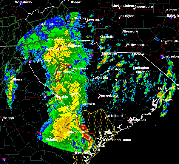 At 1259 pm edt, severe thunderstorms were located along a line extending from near lake greenwood to 8 miles east of clarks hill recreation area, moving north at 40 mph (radar indicated). Hazards include 60 mph wind gusts. Expect damage to roofs, siding, and trees. Locations impacted include, edgefield, saluda, johnston, saluda county airport, edgefield county airport, hamilton branch state park, trenton, parksville, ward, strom thurmond high school, saluda co sheriff`s office, good hope, northside fire station main, hollywood elementary school, emory, cleora, colliers, edgefield federal correction institution, lick fork campground and harmony. At 1259 pm edt, severe thunderstorms were located along a line extending from near lake greenwood to 8 miles east of clarks hill recreation area, moving north at 40 mph (radar indicated). Hazards include 60 mph wind gusts. Expect damage to roofs, siding, and trees. Locations impacted include, edgefield, saluda, johnston, saluda county airport, edgefield county airport, hamilton branch state park, trenton, parksville, ward, strom thurmond high school, saluda co sheriff`s office, good hope, northside fire station main, hollywood elementary school, emory, cleora, colliers, edgefield federal correction institution, lick fork campground and harmony.
|
| 4/19/2019 12:58 PM EDT | Corrects previous tstm wnd dmg report from 3 d. tree reported down on hwy 25. ted by radar. time correcte in edgefield county SC, 3.8 miles SSE of Edgefield, SC |
| 4/19/2019 12:48 PM EDT |
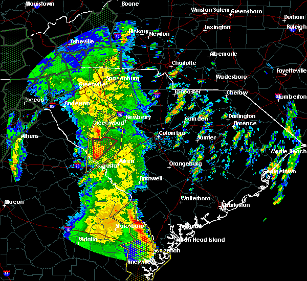 At 1247 pm edt, a severe thunderstorm capable of producing a tornado was located near clarks hill recreation area, or 9 miles north of evans, moving north at 55 mph (radar indicated rotation). Hazards include tornado. Flying debris will be dangerous to those caught without shelter. mobile homes will be damaged or destroyed. damage to roofs, windows, and vehicles will occur. tree damage is likely. this dangerous storm will be near, edgefield around 100 pm edt. Other locations impacted by this tornadic thunderstorm include colliers, lick fork campground, pleasant lane, northside fire station main and cleora. At 1247 pm edt, a severe thunderstorm capable of producing a tornado was located near clarks hill recreation area, or 9 miles north of evans, moving north at 55 mph (radar indicated rotation). Hazards include tornado. Flying debris will be dangerous to those caught without shelter. mobile homes will be damaged or destroyed. damage to roofs, windows, and vehicles will occur. tree damage is likely. this dangerous storm will be near, edgefield around 100 pm edt. Other locations impacted by this tornadic thunderstorm include colliers, lick fork campground, pleasant lane, northside fire station main and cleora.
|
| 4/19/2019 12:37 PM EDT |
 At 1237 pm edt, a severe thunderstorm capable of producing a tornado was located over evans, moving northeast at 65 mph (radar indicated rotation). Hazards include tornado. Flying debris will be dangerous to those caught without shelter. mobile homes will be damaged or destroyed. damage to roofs, windows, and vehicles will occur. tree damage is likely. this dangerous storm will be near, j. strom thurmond dam and clarks hill recreation area around 1240 pm edt. edgefield around 1255 pm edt. Other locations impacted by this tornadic thunderstorm include lick fork campground, westport, strom thurmond high school, riverside park, evans medical center, lost wilderness fire station, pleasant lane, mt vintage, northside fire station main and blanchard woods park. At 1237 pm edt, a severe thunderstorm capable of producing a tornado was located over evans, moving northeast at 65 mph (radar indicated rotation). Hazards include tornado. Flying debris will be dangerous to those caught without shelter. mobile homes will be damaged or destroyed. damage to roofs, windows, and vehicles will occur. tree damage is likely. this dangerous storm will be near, j. strom thurmond dam and clarks hill recreation area around 1240 pm edt. edgefield around 1255 pm edt. Other locations impacted by this tornadic thunderstorm include lick fork campground, westport, strom thurmond high school, riverside park, evans medical center, lost wilderness fire station, pleasant lane, mt vintage, northside fire station main and blanchard woods park.
|
| 4/19/2019 12:35 PM EDT |
 At 1235 pm edt, severe thunderstorms were located along a line extending from 9 miles southwest of ninety six historic site to augusta mall, moving north at 40 mph (radar indicated). Hazards include 60 mph wind gusts. expect damage to roofs, siding, and trees At 1235 pm edt, severe thunderstorms were located along a line extending from 9 miles southwest of ninety six historic site to augusta mall, moving north at 40 mph (radar indicated). Hazards include 60 mph wind gusts. expect damage to roofs, siding, and trees
|
| 4/8/2019 4:41 PM EDT |
 At 440 pm edt, a severe thunderstorm was located over north augusta, moving northeast at 30 mph (radar indicated). Hazards include 60 mph wind gusts. Expect damage to roofs, siding, and trees. Locations impacted include, aiken, north augusta, aiken mall, augusta, clearwater, belvedere, edgefield, hephzibah, new ellenton, jackson, glendale, south augusta, edgefield county airport, midtown, summerville, daniel field, citizens park, augusta regional airport, augusta national golf club and usc aiken. At 440 pm edt, a severe thunderstorm was located over north augusta, moving northeast at 30 mph (radar indicated). Hazards include 60 mph wind gusts. Expect damage to roofs, siding, and trees. Locations impacted include, aiken, north augusta, aiken mall, augusta, clearwater, belvedere, edgefield, hephzibah, new ellenton, jackson, glendale, south augusta, edgefield county airport, midtown, summerville, daniel field, citizens park, augusta regional airport, augusta national golf club and usc aiken.
|
| 4/8/2019 4:26 PM EDT |
 At 424 pm edt, a severe thunderstorm was located over augusta mall, or near fort gordon, moving northeast at 30 mph (radar indicated). Hazards include 60 mph wind gusts and penny size hail. Expect damage to roofs, siding, and trees. Locations impacted include, aiken, north augusta, grovetown, evans, martinez, aiken mall, fort gordon, augusta, clearwater, belvedere, edgefield, hephzibah, new ellenton, jackson, glendale, south augusta, edgefield county airport, midtown, summerville and augusta mall. At 424 pm edt, a severe thunderstorm was located over augusta mall, or near fort gordon, moving northeast at 30 mph (radar indicated). Hazards include 60 mph wind gusts and penny size hail. Expect damage to roofs, siding, and trees. Locations impacted include, aiken, north augusta, grovetown, evans, martinez, aiken mall, fort gordon, augusta, clearwater, belvedere, edgefield, hephzibah, new ellenton, jackson, glendale, south augusta, edgefield county airport, midtown, summerville and augusta mall.
|
| 4/8/2019 4:07 PM EDT |
 At 406 pm edt, a severe thunderstorm was located near fort gordon, moving northeast at 30 mph (radar indicated). Hazards include 60 mph wind gusts and penny size hail. expect damage to roofs, siding, and trees At 406 pm edt, a severe thunderstorm was located near fort gordon, moving northeast at 30 mph (radar indicated). Hazards include 60 mph wind gusts and penny size hail. expect damage to roofs, siding, and trees
|
| 9/27/2018 8:07 PM EDT |
 At 806 pm edt, a severe thunderstorm was located near edgefield, or 21 miles west of batesburg, moving northeast at 30 mph (radar indicated). Hazards include 60 mph wind gusts. expect damage to roofs, siding, and trees At 806 pm edt, a severe thunderstorm was located near edgefield, or 21 miles west of batesburg, moving northeast at 30 mph (radar indicated). Hazards include 60 mph wind gusts. expect damage to roofs, siding, and trees
|
| 9/26/2018 8:01 PM EDT |
 At 800 pm edt, a severe thunderstorm was located 9 miles northwest of edgefield, or 23 miles north of martinez, moving east at 20 mph (radar indicated). Hazards include 60 mph wind gusts. expect damage to roofs, siding, and trees At 800 pm edt, a severe thunderstorm was located 9 miles northwest of edgefield, or 23 miles north of martinez, moving east at 20 mph (radar indicated). Hazards include 60 mph wind gusts. expect damage to roofs, siding, and trees
|
| 9/10/2018 6:09 PM EDT |
 The severe thunderstorm warning for east central edgefield and northwestern aiken counties will expire at 615 pm edt, the storm which prompted the warning has weakened below severe limits, and no longer poses an immediate threat to life or property. therefore, the warning will be allowed to expire. The severe thunderstorm warning for east central edgefield and northwestern aiken counties will expire at 615 pm edt, the storm which prompted the warning has weakened below severe limits, and no longer poses an immediate threat to life or property. therefore, the warning will be allowed to expire.
|
| 9/10/2018 5:31 PM EDT |
 At 530 pm edt, a severe thunderstorm was located near johnston, or 16 miles north of aiken, moving east at 15 mph (radar indicated). Hazards include 60 mph wind gusts and penny size hail. expect damage to roofs, siding, and trees At 530 pm edt, a severe thunderstorm was located near johnston, or 16 miles north of aiken, moving east at 15 mph (radar indicated). Hazards include 60 mph wind gusts and penny size hail. expect damage to roofs, siding, and trees
|
| 7/22/2018 12:27 AM EDT |
 At 1226 am edt, a severe thunderstorm was located 11 miles west of edgefield, or 15 miles north of martinez, moving east at 35 mph (radar indicated). Hazards include 60 mph wind gusts and penny size hail. Expect damage to roofs, siding, and trees. Locations impacted include, edgefield, mccormick, johnston, trenton, parksville, plum branch and modoc. At 1226 am edt, a severe thunderstorm was located 11 miles west of edgefield, or 15 miles north of martinez, moving east at 35 mph (radar indicated). Hazards include 60 mph wind gusts and penny size hail. Expect damage to roofs, siding, and trees. Locations impacted include, edgefield, mccormick, johnston, trenton, parksville, plum branch and modoc.
|
| 7/22/2018 12:09 AM EDT |
 At 1208 am edt, a severe thunderstorm was located near mccormick, or 22 miles north of evans, moving east at 55 mph (radar indicated). Hazards include 60 mph wind gusts and penny size hail. expect damage to roofs, siding, and trees At 1208 am edt, a severe thunderstorm was located near mccormick, or 22 miles north of evans, moving east at 55 mph (radar indicated). Hazards include 60 mph wind gusts and penny size hail. expect damage to roofs, siding, and trees
|
| 7/22/2018 12:09 AM EDT |
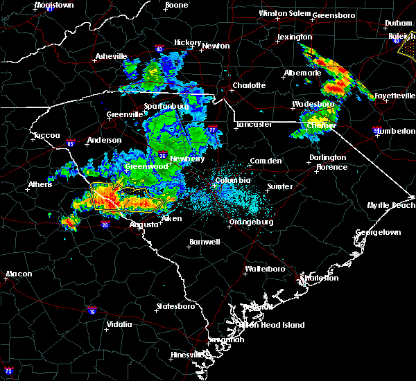 At 1208 am edt, a severe thunderstorm was located near mccormick, or 22 miles north of evans, moving east at 55 mph (radar indicated). Hazards include 60 mph wind gusts and penny size hail. expect damage to roofs, siding, and trees At 1208 am edt, a severe thunderstorm was located near mccormick, or 22 miles north of evans, moving east at 55 mph (radar indicated). Hazards include 60 mph wind gusts and penny size hail. expect damage to roofs, siding, and trees
|
| 7/21/2018 11:35 PM EDT |
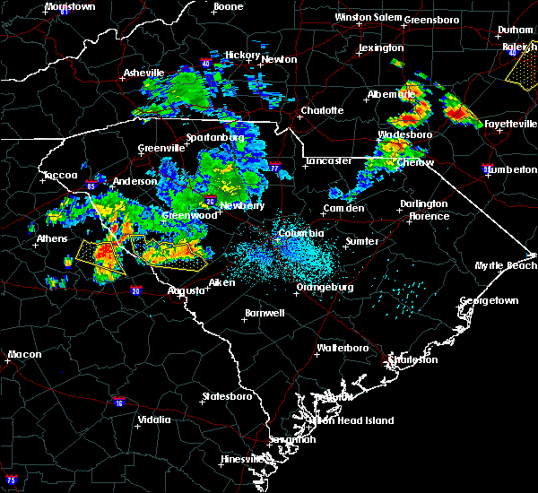 At 1134 pm edt, a severe thunderstorm was located near johnston, or 19 miles west of batesburg, moving east at 40 mph (radar indicated). Hazards include 60 mph wind gusts and quarter size hail. Hail damage to vehicles is expected. expect wind damage to roofs, siding, and trees. Locations impacted include, edgefield, mccormick, johnston, trenton, parksville, plum branch and willington. At 1134 pm edt, a severe thunderstorm was located near johnston, or 19 miles west of batesburg, moving east at 40 mph (radar indicated). Hazards include 60 mph wind gusts and quarter size hail. Hail damage to vehicles is expected. expect wind damage to roofs, siding, and trees. Locations impacted include, edgefield, mccormick, johnston, trenton, parksville, plum branch and willington.
|
| 7/21/2018 11:05 PM EDT |
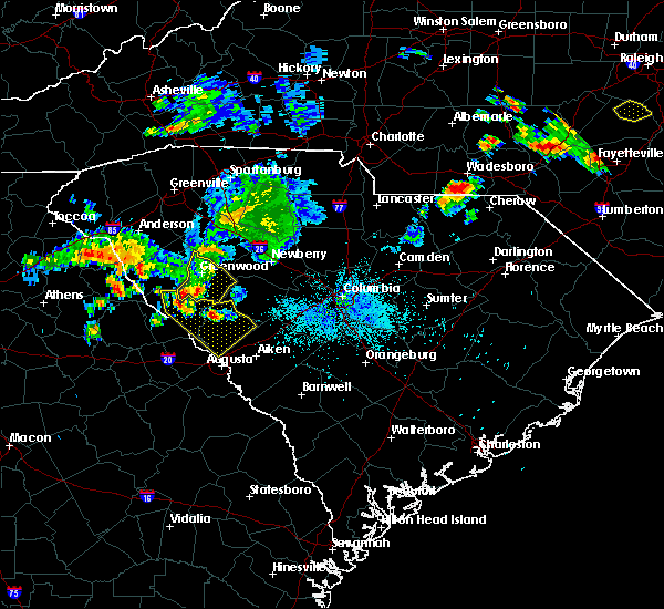 At 1104 pm edt, a severe thunderstorm was located 9 miles northwest of edgefield, or 23 miles north of martinez, moving southeast at 15 mph (radar indicated). Hazards include 60 mph wind gusts and quarter size hail. Hail damage to vehicles is expected. Expect wind damage to roofs, siding, and trees. At 1104 pm edt, a severe thunderstorm was located 9 miles northwest of edgefield, or 23 miles north of martinez, moving southeast at 15 mph (radar indicated). Hazards include 60 mph wind gusts and quarter size hail. Hail damage to vehicles is expected. Expect wind damage to roofs, siding, and trees.
|
| 6/26/2018 8:44 PM EDT |
 At 843 pm edt, a severe thunderstorm was located near edgefield, or 19 miles west of batesburg, moving southeast at 15 mph (radar indicated). Hazards include 60 mph wind gusts and quarter size hail. Hail damage to vehicles is expected. expect wind damage to roofs, siding, and trees. locations impacted include, belvedere, edgefield, johnston, gloverville, burnettown, trenton, murphys estates and clarks hill. this includes the following highways, interstate 20 in south carolina between mile markers 3 and 34. Interstate 520 in south carolina between mile markers 21 and 23. At 843 pm edt, a severe thunderstorm was located near edgefield, or 19 miles west of batesburg, moving southeast at 15 mph (radar indicated). Hazards include 60 mph wind gusts and quarter size hail. Hail damage to vehicles is expected. expect wind damage to roofs, siding, and trees. locations impacted include, belvedere, edgefield, johnston, gloverville, burnettown, trenton, murphys estates and clarks hill. this includes the following highways, interstate 20 in south carolina between mile markers 3 and 34. Interstate 520 in south carolina between mile markers 21 and 23.
|
| 6/26/2018 8:08 PM EDT |
 At 808 pm edt, a severe thunderstorm was located 8 miles northwest of edgefield, or 25 miles north of belvedere, moving southeast at 15 mph (radar indicated). Hazards include 60 mph wind gusts and quarter size hail. Hail damage to vehicles is expected. Expect wind damage to roofs, siding, and trees. At 808 pm edt, a severe thunderstorm was located 8 miles northwest of edgefield, or 25 miles north of belvedere, moving southeast at 15 mph (radar indicated). Hazards include 60 mph wind gusts and quarter size hail. Hail damage to vehicles is expected. Expect wind damage to roofs, siding, and trees.
|
| 6/25/2018 8:24 PM EDT |
 The severe thunderstorm warning for columbia, southeastern lincoln, central richmond, edgefield and southeastern mccormick counties will expire at 830 pm edt, the storm which prompted the warning has weakened below severe limits, and no longer poses an immediate threat to life or property. therefore, the warning will be allowed to expire. a severe thunderstorm watch remains in effect until 1000 pm edt for central south carolina. to report severe weather, contact your nearest law enforcement agency. they will relay your report to the national weather service columbia. remember, a severe thunderstorm warning still remains in effect for richmond county. The severe thunderstorm warning for columbia, southeastern lincoln, central richmond, edgefield and southeastern mccormick counties will expire at 830 pm edt, the storm which prompted the warning has weakened below severe limits, and no longer poses an immediate threat to life or property. therefore, the warning will be allowed to expire. a severe thunderstorm watch remains in effect until 1000 pm edt for central south carolina. to report severe weather, contact your nearest law enforcement agency. they will relay your report to the national weather service columbia. remember, a severe thunderstorm warning still remains in effect for richmond county.
|
| 6/25/2018 7:48 PM EDT | Sheriff dispatch reported multiple trees down across the count in edgefield county SC, 5.3 miles S of Edgefield, SC |
| 6/25/2018 7:37 PM EDT | Sc highway patrol reported trees down on walker road at sc 28 in edgefield county SC, 6.9 miles ESE of Edgefield, SC |
| 6/25/2018 7:24 PM EDT |
 The national weather service in columbia has issued a * severe thunderstorm warning for. columbia county in east central georgia. southeastern lincoln county in east central georgia. central richmond county in east central georgia. Edgefield county in central south carolina. The national weather service in columbia has issued a * severe thunderstorm warning for. columbia county in east central georgia. southeastern lincoln county in east central georgia. central richmond county in east central georgia. Edgefield county in central south carolina.
|
| 6/25/2018 7:24 PM EDT |
 At 724 pm edt, a severe thunderstorm was located near evans, moving east at 15 mph (radar indicated). Hazards include 60 mph wind gusts and quarter size hail. Hail damage to vehicles is expected. Expect wind damage to roofs, siding, and trees. At 724 pm edt, a severe thunderstorm was located near evans, moving east at 15 mph (radar indicated). Hazards include 60 mph wind gusts and quarter size hail. Hail damage to vehicles is expected. Expect wind damage to roofs, siding, and trees.
|
| 6/24/2018 9:11 PM EDT |
 At 911 pm edt, severe thunderstorms were located along a line extending from near edgefield to 7 miles north of martinez, moving southeast at 15 mph (radar indicated). Hazards include 60 mph wind gusts. expect damage to roofs, siding, and trees At 911 pm edt, severe thunderstorms were located along a line extending from near edgefield to 7 miles north of martinez, moving southeast at 15 mph (radar indicated). Hazards include 60 mph wind gusts. expect damage to roofs, siding, and trees
|
| 6/22/2018 11:22 PM EDT |
 At 1122 pm edt, severe thunderstorms were located along a line extending from martinez to 6 miles north of waynesboro, moving northeast at 30 mph (radar indicated). Hazards include 60 mph wind gusts. expect damage to roofs, siding, and trees At 1122 pm edt, severe thunderstorms were located along a line extending from martinez to 6 miles north of waynesboro, moving northeast at 30 mph (radar indicated). Hazards include 60 mph wind gusts. expect damage to roofs, siding, and trees
|
| 6/3/2018 11:07 PM EDT |
 At 1105 pm edt, radar indicated severe thunderstorms in the batesburg-leesville area and in the johnston area. movement was southeast near 30 mph. the area just south of gilbert and the area from trenton to eureka are most threatened by these storms (radar indicated). Hazards include 60 mph wind gusts and quarter size hail. Hail damage to vehicles is expected. expect wind damage to roofs, siding, and trees. locations impacted include, aiken, batesburg, red bank, belvedere, batesburg-leesville, edgefield, johnston, south congaree, pine ridge, new ellenton, gaston, ridge spring, leesville, gloverville, burnettown, wagener, pelion, gilbert, summit and monetta. this includes the following highways, interstate 20 in south carolina between mile markers 4 and 54. interstate 26 near mile marker 120. Interstate 520 in south carolina between mile markers 22 and 23. At 1105 pm edt, radar indicated severe thunderstorms in the batesburg-leesville area and in the johnston area. movement was southeast near 30 mph. the area just south of gilbert and the area from trenton to eureka are most threatened by these storms (radar indicated). Hazards include 60 mph wind gusts and quarter size hail. Hail damage to vehicles is expected. expect wind damage to roofs, siding, and trees. locations impacted include, aiken, batesburg, red bank, belvedere, batesburg-leesville, edgefield, johnston, south congaree, pine ridge, new ellenton, gaston, ridge spring, leesville, gloverville, burnettown, wagener, pelion, gilbert, summit and monetta. this includes the following highways, interstate 20 in south carolina between mile markers 4 and 54. interstate 26 near mile marker 120. Interstate 520 in south carolina between mile markers 22 and 23.
|
| 6/3/2018 11:01 PM EDT |
 At 1101 pm edt, a severe thunderstorm was located 9 miles southeast of leesville, or 10 miles southwest of red bank, moving southeast at 30 mph (radar indicated). Hazards include 60 mph wind gusts and quarter size hail. Hail damage to vehicles is expected. Expect wind damage to roofs, siding, and trees. At 1101 pm edt, a severe thunderstorm was located 9 miles southeast of leesville, or 10 miles southwest of red bank, moving southeast at 30 mph (radar indicated). Hazards include 60 mph wind gusts and quarter size hail. Hail damage to vehicles is expected. Expect wind damage to roofs, siding, and trees.
|
| 6/3/2018 10:14 PM EDT |
 At 1014 pm edt, severe thunderstorms were located along a line extending from near saluda to edgefield, moving southeast at 25 mph (radar indicated). Hazards include 60 mph wind gusts and penny size hail. expect damage to roofs, siding, and trees At 1014 pm edt, severe thunderstorms were located along a line extending from near saluda to edgefield, moving southeast at 25 mph (radar indicated). Hazards include 60 mph wind gusts and penny size hail. expect damage to roofs, siding, and trees
|
| 6/1/2018 6:10 PM EDT |
 At 609 pm edt, severe thunderstorms were located along a line extending from 8 miles west of edgefield to 10 miles north of martinez to evans to near grovetown, moving east at 40 mph (radar indicated). Hazards include 60 mph wind gusts and penny size hail. expect damage to roofs, siding, and trees At 609 pm edt, severe thunderstorms were located along a line extending from 8 miles west of edgefield to 10 miles north of martinez to evans to near grovetown, moving east at 40 mph (radar indicated). Hazards include 60 mph wind gusts and penny size hail. expect damage to roofs, siding, and trees
|
| 4/15/2018 1:14 PM EDT | Sc highway patrol reported trees down at crest road near downtown edgefiel in edgefield county SC, 2 miles SSW of Edgefield, SC |
| 4/15/2018 1:00 PM EDT |
 At 1258 pm edt, severe thunderstorms were located along a line extending from 6 miles west of edgefield to 7 miles north of belvedere to near augusta, moving northeast at 55 mph (radar indicated). Hazards include 60 mph wind gusts. Expect damage to roofs, siding, and trees. locations impacted include, aiken, north augusta, augusta, clearwater, fort gordon, belvedere, edgefield, johnston, new ellenton, gloverville, burnettown, trenton and murphys estates. this includes the following highways, interstate 20 in georgia between mile markers 196 and 201. interstate 20 in south carolina between mile markers 0 and 27. interstate 520 in georgia between mile markers 1 and 15. interstate 520 in south carolina between mile markers 16 and 23. A tornado watch remains in effect until 700 pm edt for east central georgia, and central south carolina. At 1258 pm edt, severe thunderstorms were located along a line extending from 6 miles west of edgefield to 7 miles north of belvedere to near augusta, moving northeast at 55 mph (radar indicated). Hazards include 60 mph wind gusts. Expect damage to roofs, siding, and trees. locations impacted include, aiken, north augusta, augusta, clearwater, fort gordon, belvedere, edgefield, johnston, new ellenton, gloverville, burnettown, trenton and murphys estates. this includes the following highways, interstate 20 in georgia between mile markers 196 and 201. interstate 20 in south carolina between mile markers 0 and 27. interstate 520 in georgia between mile markers 1 and 15. interstate 520 in south carolina between mile markers 16 and 23. A tornado watch remains in effect until 700 pm edt for east central georgia, and central south carolina.
|
| 4/15/2018 12:41 PM EDT |
 At 1240 pm edt, severe thunderstorms were located along a line extending from near evans to near fort gordon to near hephzibah, moving northeast at 50 mph (radar indicated). Hazards include 60 mph wind gusts. expect damage to roofs, siding, and trees At 1240 pm edt, severe thunderstorms were located along a line extending from near evans to near fort gordon to near hephzibah, moving northeast at 50 mph (radar indicated). Hazards include 60 mph wind gusts. expect damage to roofs, siding, and trees
|
| 11/7/2017 5:10 PM EST |
 At 508 pm est, a severe thunderstorm was located over northern mccormick county, between mccormick and troy, moving east at 30 mph (radar indicated). Hazards include 60 mph wind gusts and penny size hail. Expect damage to roofs, siding, and trees. Locations impacted include, mccormick, plum branch. At 508 pm est, a severe thunderstorm was located over northern mccormick county, between mccormick and troy, moving east at 30 mph (radar indicated). Hazards include 60 mph wind gusts and penny size hail. Expect damage to roofs, siding, and trees. Locations impacted include, mccormick, plum branch.
|
| 11/7/2017 4:42 PM EST |
 At 441 pm est, a severe thunderstorm was located just northwest of mount carmel, moving east at 40 mph (radar indicated). Hazards include 60 mph wind gusts and quarter size hail. Hail damage to vehicles is expected. Expect wind damage to roofs, siding, and trees. At 441 pm est, a severe thunderstorm was located just northwest of mount carmel, moving east at 40 mph (radar indicated). Hazards include 60 mph wind gusts and quarter size hail. Hail damage to vehicles is expected. Expect wind damage to roofs, siding, and trees.
|
| 7/23/2017 8:12 PM EDT |
 At 812 pm edt, a severe thunderstorm was located near martinez, moving south at 15 mph (radar indicated). Hazards include 60 mph wind gusts and quarter size hail. Hail damage to vehicles is expected. expect wind damage to roofs, siding, and trees. Locations impacted include, north augusta, grovetown, evans, thomson, augusta, martinez, fort gordon, belvedere, edgefield, hephzibah, harlem, blythe, dearing, keysville, trenton, modoc, murphys estates and clarks hill. At 812 pm edt, a severe thunderstorm was located near martinez, moving south at 15 mph (radar indicated). Hazards include 60 mph wind gusts and quarter size hail. Hail damage to vehicles is expected. expect wind damage to roofs, siding, and trees. Locations impacted include, north augusta, grovetown, evans, thomson, augusta, martinez, fort gordon, belvedere, edgefield, hephzibah, harlem, blythe, dearing, keysville, trenton, modoc, murphys estates and clarks hill.
|
| 7/23/2017 7:41 PM EDT |
 At 741 pm edt, a severe thunderstorm was located 9 miles north of martinez, moving south at 35 mph (radar indicated). Hazards include 60 mph wind gusts and quarter size hail. Hail damage to vehicles is expected. Expect wind damage to roofs, siding, and trees. At 741 pm edt, a severe thunderstorm was located 9 miles north of martinez, moving south at 35 mph (radar indicated). Hazards include 60 mph wind gusts and quarter size hail. Hail damage to vehicles is expected. Expect wind damage to roofs, siding, and trees.
|
| 7/23/2017 6:57 PM EDT |
 At 657 pm edt, a severe thunderstorm was located over saluda, or 16 miles northwest of batesburg, moving south at 5 mph (radar indicated). Hazards include 60 mph wind gusts and quarter size hail. Hail damage to vehicles is expected. expect wind damage to roofs, siding, and trees. Locations impacted include, edgefield, saluda, johnston, ridge spring, monetta, trenton and ward. At 657 pm edt, a severe thunderstorm was located over saluda, or 16 miles northwest of batesburg, moving south at 5 mph (radar indicated). Hazards include 60 mph wind gusts and quarter size hail. Hail damage to vehicles is expected. expect wind damage to roofs, siding, and trees. Locations impacted include, edgefield, saluda, johnston, ridge spring, monetta, trenton and ward.
|
| 7/23/2017 6:24 PM EDT |
 At 622 pm edt, a severe thunderstorm was located near saluda, or 17 miles northwest of batesburg, and moving south at 10 mph (radar indicated). Hazards include 60 mph wind gusts and quarter size hail. Minor hail damage to vehicles is expected. Expect wind damage to roofs, siding, and trees. At 622 pm edt, a severe thunderstorm was located near saluda, or 17 miles northwest of batesburg, and moving south at 10 mph (radar indicated). Hazards include 60 mph wind gusts and quarter size hail. Minor hail damage to vehicles is expected. Expect wind damage to roofs, siding, and trees.
|
| 7/15/2017 7:00 PM EDT | Edgefield county dispatch reported trees down along hwy 37 in edgefield county SC, 11 miles S of Edgefield, SC |
| 7/15/2017 6:41 PM EDT |
 At 638 pm edt, a likely severe thunderstorm was located 7 miles east of mccormick, moving east at 10 mph. this was the state road 67 area of mccormick county. further development may occur east of this area in northern edgefield county and along the saluda and edgefield county line (radar indicated). Hazards include 60 mph wind gusts. expect damage to roofs, siding, and trees At 638 pm edt, a likely severe thunderstorm was located 7 miles east of mccormick, moving east at 10 mph. this was the state road 67 area of mccormick county. further development may occur east of this area in northern edgefield county and along the saluda and edgefield county line (radar indicated). Hazards include 60 mph wind gusts. expect damage to roofs, siding, and trees
|
| 7/6/2017 6:51 PM EDT |
 The severe thunderstorm warning for northern edgefield and southern saluda counties will expire at 700 pm edt, the storms which prompted the warning have moved out of the area. therefore the warning will be allowed to expire. to report severe weather, contact your nearest law enforcement agency. they will relay your report to the national weather service columbia. The severe thunderstorm warning for northern edgefield and southern saluda counties will expire at 700 pm edt, the storms which prompted the warning have moved out of the area. therefore the warning will be allowed to expire. to report severe weather, contact your nearest law enforcement agency. they will relay your report to the national weather service columbia.
|
| 7/6/2017 6:26 PM EDT |
 At 626 pm edt, severe thunderstorms were located along a line extending from saluda to near edgefield, moving east at 35 mph (radar indicated). Hazards include 60 mph wind gusts. Expect damage to roofs, siding, and trees. Locations impacted include, edgefield, saluda, johnston, ridge spring, monetta, trenton and ward. At 626 pm edt, severe thunderstorms were located along a line extending from saluda to near edgefield, moving east at 35 mph (radar indicated). Hazards include 60 mph wind gusts. Expect damage to roofs, siding, and trees. Locations impacted include, edgefield, saluda, johnston, ridge spring, monetta, trenton and ward.
|
| 7/6/2017 6:25 PM EDT | Reported several trees down across the northern portion of the county. one area was near old chappells ferry road and long cane roa in edgefield county SC, 7.9 miles SSW of Edgefield, SC |
| 7/6/2017 5:53 PM EDT |
 At 552 pm edt, severe thunderstorms were located along a line extending from 12 miles south of ninety six historic site to 8 miles south of mccormick, moving east at 15 mph (radar indicated). Hazards include 60 mph wind gusts and quarter size hail. Hail damage to vehicles is expected. Expect wind damage to roofs, siding, and trees. At 552 pm edt, severe thunderstorms were located along a line extending from 12 miles south of ninety six historic site to 8 miles south of mccormick, moving east at 15 mph (radar indicated). Hazards include 60 mph wind gusts and quarter size hail. Hail damage to vehicles is expected. Expect wind damage to roofs, siding, and trees.
|
| 7/1/2017 9:35 PM EDT | Edgefield county sheriff reported trees and power lines down on highway 2 in edgefield county SC, 7.4 miles SE of Edgefield, SC |
| 5/29/2017 6:45 PM EDT |
 At 644 pm edt, a severe thunderstorm was located 7 miles southeast of edgefield, or 14 miles northwest of aiken, moving east at 40 mph (radar indicated). Hazards include 70 mph wind gusts and half dollar size hail. Hail damage to vehicles is expected. expect considerable tree damage. wind damage is also likely to mobile homes, roofs, and outbuildings. Locations impacted include, edgefield, johnston, ridge spring, monetta, trenton and ward. At 644 pm edt, a severe thunderstorm was located 7 miles southeast of edgefield, or 14 miles northwest of aiken, moving east at 40 mph (radar indicated). Hazards include 70 mph wind gusts and half dollar size hail. Hail damage to vehicles is expected. expect considerable tree damage. wind damage is also likely to mobile homes, roofs, and outbuildings. Locations impacted include, edgefield, johnston, ridge spring, monetta, trenton and ward.
|
| 5/29/2017 6:30 PM EDT | Golf Ball sized hail reported 9.4 miles S of Edgefield, SC, edgefield county em reports hail ranging from pea-size to a little larger than golf-ball size. several reports of damaged vehicles. major impact area long cane rd and h |
| 5/29/2017 6:20 PM EDT | Golf Ball sized hail reported 4.7 miles SE of Edgefield, SC, edgefield county dispatch reports golf-ball size hail observed hwy 25 and hwy 283 intersection area. |
| 5/29/2017 6:20 PM EDT | Edgefield county dispatch reports multiple trees down hwy 25 and hwy 283 intersection are in edgefield county SC, 4.7 miles SE of Edgefield, SC |
| 5/29/2017 6:18 PM EDT | Schp reports tree in roadway sc283 and walker roa in edgefield county SC, 6.9 miles ESE of Edgefield, SC |
| 5/29/2017 6:12 PM EDT |
 At 612 pm edt, a severe thunderstorm was located 9 miles north of evans, moving east at 45 mph (radar indicated). Hazards include 70 mph wind gusts and half dollar size hail. Hail damage to vehicles is expected. expect considerable tree damage. Wind damage is also likely to mobile homes, roofs, and outbuildings. At 612 pm edt, a severe thunderstorm was located 9 miles north of evans, moving east at 45 mph (radar indicated). Hazards include 70 mph wind gusts and half dollar size hail. Hail damage to vehicles is expected. expect considerable tree damage. Wind damage is also likely to mobile homes, roofs, and outbuildings.
|
| 5/29/2017 5:35 PM EDT |
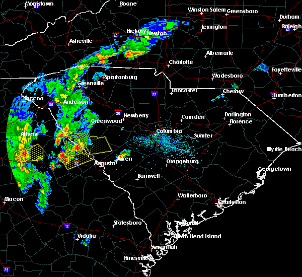 At 533 pm edt, a severe thunderstorm was located near lincolnton, or 22 miles north of thomson, moving east at 25 mph (radar indicated). Hazards include 70 mph wind gusts and quarter size hail. Hail damage to vehicles is expected. expect considerable tree damage. Wind damage is also likely to mobile homes, roofs, and outbuildings. At 533 pm edt, a severe thunderstorm was located near lincolnton, or 22 miles north of thomson, moving east at 25 mph (radar indicated). Hazards include 70 mph wind gusts and quarter size hail. Hail damage to vehicles is expected. expect considerable tree damage. Wind damage is also likely to mobile homes, roofs, and outbuildings.
|
| 5/24/2017 2:30 PM EDT |
 At 229 pm edt, a severe thunderstorm was located 9 miles northwest of johnston, or 21 miles west of batesburg, moving northeast at 50 mph (radar indicated). Hazards include 70 mph wind gusts. Expect considerable tree damage. Damage is likely to mobile homes, roofs, and outbuildings. At 229 pm edt, a severe thunderstorm was located 9 miles northwest of johnston, or 21 miles west of batesburg, moving northeast at 50 mph (radar indicated). Hazards include 70 mph wind gusts. Expect considerable tree damage. Damage is likely to mobile homes, roofs, and outbuildings.
|
| 5/24/2017 2:07 PM EDT |
 At 207 pm edt, a severe thunderstorm was located 7 miles northwest of evans, moving northeast at 55 mph (radar indicated). Hazards include 70 mph wind gusts. Expect considerable tree damage. damage is likely to mobile homes, roofs, and outbuildings. locations impacted include, evans, edgefield, parksville, modoc and clarks hill. a tornado watch remains in effect until 600 pm edt for east central georgia, and central south carolina. A tornado watch also remains in effect until 600 pm edt for east central georgia, and central south carolina. At 207 pm edt, a severe thunderstorm was located 7 miles northwest of evans, moving northeast at 55 mph (radar indicated). Hazards include 70 mph wind gusts. Expect considerable tree damage. damage is likely to mobile homes, roofs, and outbuildings. locations impacted include, evans, edgefield, parksville, modoc and clarks hill. a tornado watch remains in effect until 600 pm edt for east central georgia, and central south carolina. A tornado watch also remains in effect until 600 pm edt for east central georgia, and central south carolina.
|
| 5/24/2017 1:57 PM EDT |
 At 157 pm edt, a severe thunderstorm was located 7 miles north of harlem, or 9 miles northeast of thomson, moving northeast at 55 mph (radar indicated). Hazards include 60 mph wind gusts. expect damage to roofs, siding, and trees At 157 pm edt, a severe thunderstorm was located 7 miles north of harlem, or 9 miles northeast of thomson, moving northeast at 55 mph (radar indicated). Hazards include 60 mph wind gusts. expect damage to roofs, siding, and trees
|
| 5/1/2017 3:58 PM EDT |
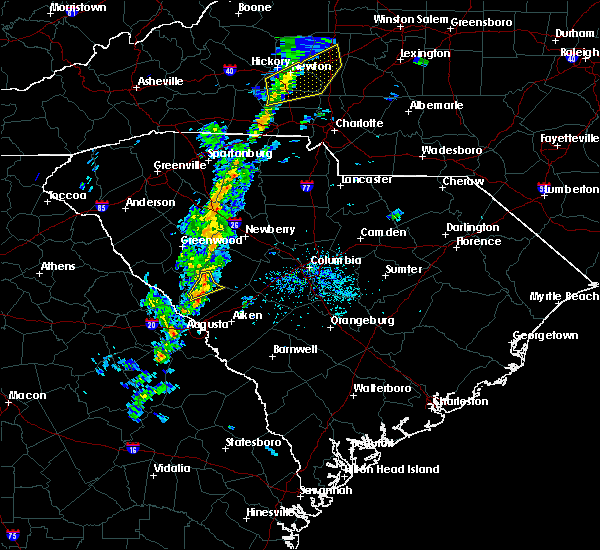 At 357 pm edt, a severe thunderstorm was located near saluda, or 18 miles west of batesburg, moving northeast at 45 mph (radar indicated). Hazards include 60 mph wind gusts. Expect damage to roofs, siding, and trees. Locations impacted include, edgefield and johnston. At 357 pm edt, a severe thunderstorm was located near saluda, or 18 miles west of batesburg, moving northeast at 45 mph (radar indicated). Hazards include 60 mph wind gusts. Expect damage to roofs, siding, and trees. Locations impacted include, edgefield and johnston.
|
| 5/1/2017 3:38 PM EDT |
 At 337 pm edt, a severe thunderstorm was located 10 miles northwest of edgefield, or 24 miles north of martinez, moving northeast at 45 mph (radar indicated). Hazards include 60 mph wind gusts. Expect damage to roofs, siding, and trees. Locations impacted include, edgefield, johnston and modoc. At 337 pm edt, a severe thunderstorm was located 10 miles northwest of edgefield, or 24 miles north of martinez, moving northeast at 45 mph (radar indicated). Hazards include 60 mph wind gusts. Expect damage to roofs, siding, and trees. Locations impacted include, edgefield, johnston and modoc.
|
| 5/1/2017 3:25 PM EDT |
 At 324 pm edt, a severe thunderstorm was located 8 miles south of mccormick, or 20 miles north of evans, moving northeast at 45 mph (radar indicated). Hazards include 60 mph wind gusts. expect damage to roofs, siding, and trees At 324 pm edt, a severe thunderstorm was located 8 miles south of mccormick, or 20 miles north of evans, moving northeast at 45 mph (radar indicated). Hazards include 60 mph wind gusts. expect damage to roofs, siding, and trees
|
| 5/1/2017 3:25 PM EDT |
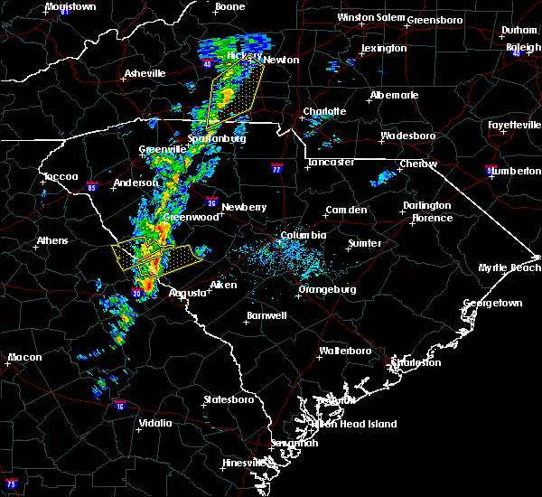 At 324 pm edt, a severe thunderstorm was located 8 miles south of mccormick, or 20 miles north of evans, moving northeast at 45 mph (radar indicated). Hazards include 60 mph wind gusts. expect damage to roofs, siding, and trees At 324 pm edt, a severe thunderstorm was located 8 miles south of mccormick, or 20 miles north of evans, moving northeast at 45 mph (radar indicated). Hazards include 60 mph wind gusts. expect damage to roofs, siding, and trees
|
| 4/5/2017 2:39 PM EDT |
 At 239 pm edt, severe thunderstorms were located along a line extending from 9 miles south of ninety six historic site to near martinez, moving east at 40 mph (radar indicated). Hazards include 70 mph wind gusts and quarter size hail. Hail damage to vehicles is expected. expect considerable tree damage. Wind damage is also likely to mobile homes, roofs, and outbuildings. At 239 pm edt, severe thunderstorms were located along a line extending from 9 miles south of ninety six historic site to near martinez, moving east at 40 mph (radar indicated). Hazards include 70 mph wind gusts and quarter size hail. Hail damage to vehicles is expected. expect considerable tree damage. Wind damage is also likely to mobile homes, roofs, and outbuildings.
|
| 4/5/2017 1:36 PM EDT |
 At 135 pm edt, a severe thunderstorm was located over ridge spring, or 10 miles southwest of batesburg, moving east at 55 mph (radar indicated). Hazards include golf ball size hail and 70 mph wind gusts. People and animals outdoors will be injured. expect hail damage to roofs, siding, windows, and vehicles. expect considerable tree damage. Wind damage is also likely to mobile homes, roofs, and outbuildings. At 135 pm edt, a severe thunderstorm was located over ridge spring, or 10 miles southwest of batesburg, moving east at 55 mph (radar indicated). Hazards include golf ball size hail and 70 mph wind gusts. People and animals outdoors will be injured. expect hail damage to roofs, siding, windows, and vehicles. expect considerable tree damage. Wind damage is also likely to mobile homes, roofs, and outbuildings.
|
| 4/5/2017 1:13 PM EDT |
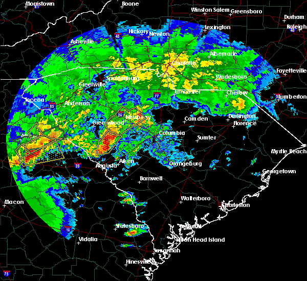 At 113 pm edt, a severe thunderstorm was located 7 miles northwest of johnston, or 20 miles west of batesburg, moving east at 55 mph (radar indicated). Hazards include two inch hail and 70 mph wind gusts. People and animals outdoors will be injured. expect hail damage to roofs, siding, windows, and vehicles. expect considerable tree damage. wind damage is also likely to mobile homes, roofs, and outbuildings. locations impacted include, edgefield, saluda and johnston. A tornado watch remains in effect until 800 pm edt for central south carolina. At 113 pm edt, a severe thunderstorm was located 7 miles northwest of johnston, or 20 miles west of batesburg, moving east at 55 mph (radar indicated). Hazards include two inch hail and 70 mph wind gusts. People and animals outdoors will be injured. expect hail damage to roofs, siding, windows, and vehicles. expect considerable tree damage. wind damage is also likely to mobile homes, roofs, and outbuildings. locations impacted include, edgefield, saluda and johnston. A tornado watch remains in effect until 800 pm edt for central south carolina.
|
| 4/5/2017 12:58 PM EDT |
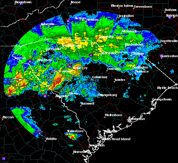 At 1258 pm edt, severe thunderstorms were located along a line extending from 7 miles southeast of ninety six historic site to 9 miles west of edgefield, moving east at 35 mph (radar indicated). Hazards include golf ball size hail and 70 mph wind gusts. People and animals outdoors will be injured. expect hail damage to roofs, siding, windows, and vehicles. expect considerable tree damage. Wind damage is also likely to mobile homes, roofs, and outbuildings. At 1258 pm edt, severe thunderstorms were located along a line extending from 7 miles southeast of ninety six historic site to 9 miles west of edgefield, moving east at 35 mph (radar indicated). Hazards include golf ball size hail and 70 mph wind gusts. People and animals outdoors will be injured. expect hail damage to roofs, siding, windows, and vehicles. expect considerable tree damage. Wind damage is also likely to mobile homes, roofs, and outbuildings.
|
| 4/3/2017 4:22 PM EDT |
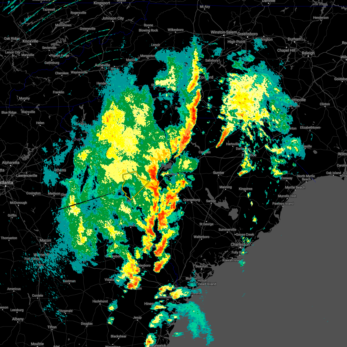 The severe thunderstorm warning for edgefield county will expire at 430 pm edt, the storms which prompted the warning have moved out of the area. therefore the warning will be allowed to expire. a tornado watch remains in effect until 900 pm edt for east central georgia, and central south carolina. report large hail, damaging winds or flooding to local law enforcement. send reports by facebook or twitter to nwscolumbia, e- mail us at [email protected] or call 803-234-4115. The severe thunderstorm warning for edgefield county will expire at 430 pm edt, the storms which prompted the warning have moved out of the area. therefore the warning will be allowed to expire. a tornado watch remains in effect until 900 pm edt for east central georgia, and central south carolina. report large hail, damaging winds or flooding to local law enforcement. send reports by facebook or twitter to nwscolumbia, e- mail us at [email protected] or call 803-234-4115.
|
| 4/3/2017 3:46 PM EDT |
 At 345 pm edt, a severe thunderstorm capable of producing a tornado was located near edgefield, or 22 miles north of belvedere, moving northeast at 55 mph (radar indicated rotation). Hazards include tornado and quarter size hail. Flying debris will be dangerous to those caught without shelter. mobile homes will be damaged or destroyed. damage to roofs, windows, and vehicles will occur. tree damage is likely. This dangerous storm will be near, johnston. At 345 pm edt, a severe thunderstorm capable of producing a tornado was located near edgefield, or 22 miles north of belvedere, moving northeast at 55 mph (radar indicated rotation). Hazards include tornado and quarter size hail. Flying debris will be dangerous to those caught without shelter. mobile homes will be damaged or destroyed. damage to roofs, windows, and vehicles will occur. tree damage is likely. This dangerous storm will be near, johnston.
|
| 4/3/2017 3:31 PM EDT |
 At 331 pm edt, a severe thunderstorm capable of producing a tornado was located 11 miles southeast of mccormick, or 17 miles north of evans, moving northeast at 55 mph (radar indicated rotation). Hazards include tornado and quarter size hail. Flying debris will be dangerous to those caught without shelter. mobile homes will be damaged or destroyed. damage to roofs, windows, and vehicles will occur. tree damage is likely. this dangerous storm will be near, edgefield around 350 pm edt. johnston around 355 pm edt. Other locations impacted by this tornadic thunderstorm include plum branch, parksville, modoc and clarks hill. At 331 pm edt, a severe thunderstorm capable of producing a tornado was located 11 miles southeast of mccormick, or 17 miles north of evans, moving northeast at 55 mph (radar indicated rotation). Hazards include tornado and quarter size hail. Flying debris will be dangerous to those caught without shelter. mobile homes will be damaged or destroyed. damage to roofs, windows, and vehicles will occur. tree damage is likely. this dangerous storm will be near, edgefield around 350 pm edt. johnston around 355 pm edt. Other locations impacted by this tornadic thunderstorm include plum branch, parksville, modoc and clarks hill.
|
| 4/3/2017 3:28 PM EDT |
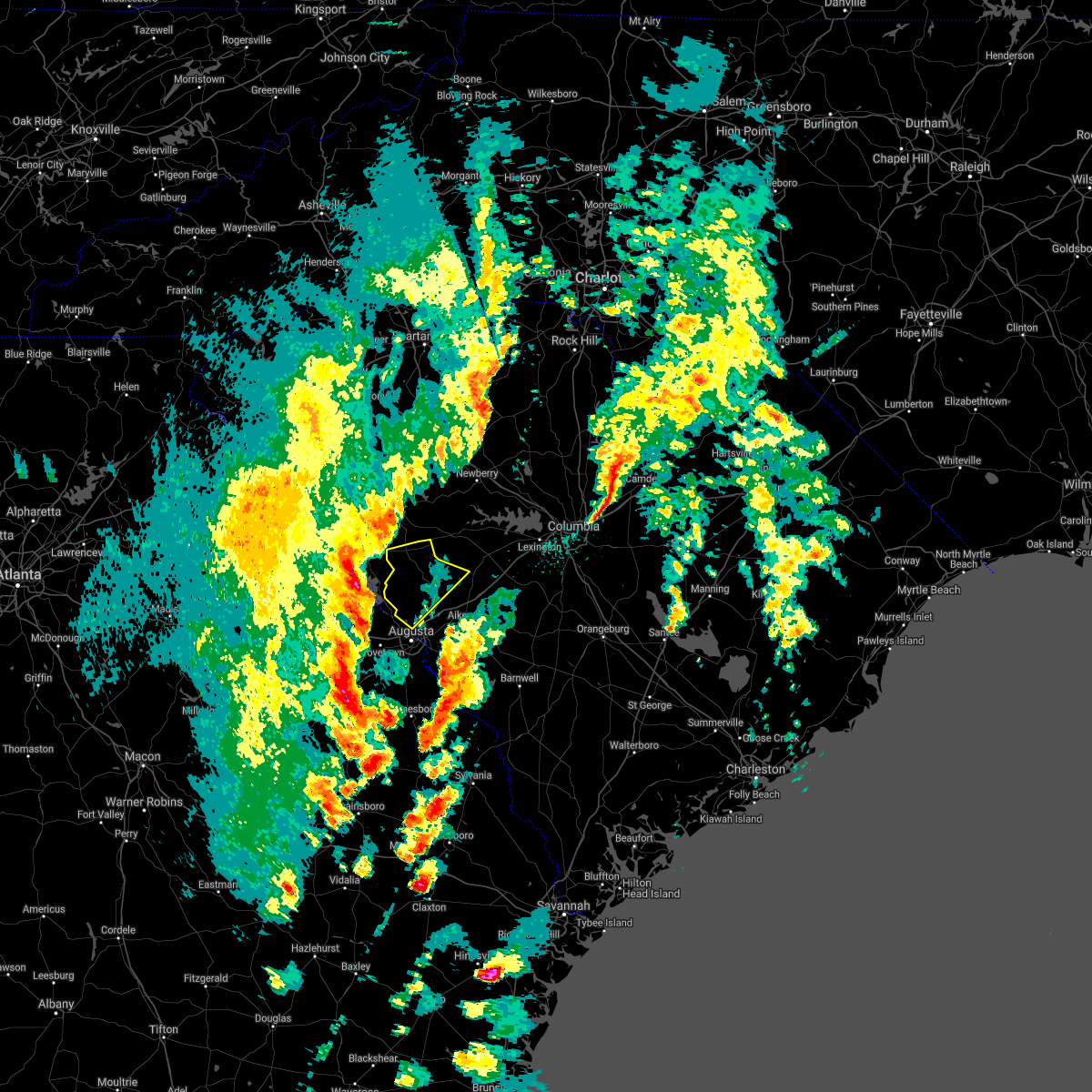 At 327 pm edt, severe thunderstorms were located along a line extending from 8 miles southwest of ninety six historic site to 6 miles northwest of grovetown, moving northeast at 50 mph (radar indicated). Hazards include 70 mph wind gusts and quarter size hail. Hail damage to vehicles is expected. expect considerable tree damage. Wind damage is also likely to mobile homes, roofs, and outbuildings. At 327 pm edt, severe thunderstorms were located along a line extending from 8 miles southwest of ninety six historic site to 6 miles northwest of grovetown, moving northeast at 50 mph (radar indicated). Hazards include 70 mph wind gusts and quarter size hail. Hail damage to vehicles is expected. expect considerable tree damage. Wind damage is also likely to mobile homes, roofs, and outbuildings.
|
| 4/3/2017 3:17 PM EDT |
 At 317 pm edt, severe thunderstorms were located along a line extending from near rose hill state park to near mccormick, moving east at 50 mph (radar indicated). Hazards include 60 mph wind gusts and quarter size hail. Hail damage to vehicles is expected. Expect wind damage to roofs, siding, and trees. At 317 pm edt, severe thunderstorms were located along a line extending from near rose hill state park to near mccormick, moving east at 50 mph (radar indicated). Hazards include 60 mph wind gusts and quarter size hail. Hail damage to vehicles is expected. Expect wind damage to roofs, siding, and trees.
|
| 3/21/2017 10:23 PM EDT |
 At 1022 pm edt, severe thunderstorms were located along a line extending from 7 miles east of lake strom thurmond to 10 miles southeast of lincolnton, moving east at 55 mph (radar indicated). Hazards include 60 mph wind gusts. Expect damage to roofs, siding, and trees. Locations impacted include, edgefield, mccormick, lincolnton, parksville, plum branch, willington, mount carmel and modoc. At 1022 pm edt, severe thunderstorms were located along a line extending from 7 miles east of lake strom thurmond to 10 miles southeast of lincolnton, moving east at 55 mph (radar indicated). Hazards include 60 mph wind gusts. Expect damage to roofs, siding, and trees. Locations impacted include, edgefield, mccormick, lincolnton, parksville, plum branch, willington, mount carmel and modoc.
|
| 3/21/2017 10:23 PM EDT |
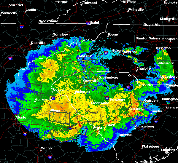 At 1022 pm edt, severe thunderstorms were located along a line extending from 7 miles east of lake strom thurmond to 10 miles southeast of lincolnton, moving east at 55 mph (radar indicated). Hazards include 60 mph wind gusts. Expect damage to roofs, siding, and trees. Locations impacted include, edgefield, mccormick, lincolnton, parksville, plum branch, willington, mount carmel and modoc. At 1022 pm edt, severe thunderstorms were located along a line extending from 7 miles east of lake strom thurmond to 10 miles southeast of lincolnton, moving east at 55 mph (radar indicated). Hazards include 60 mph wind gusts. Expect damage to roofs, siding, and trees. Locations impacted include, edgefield, mccormick, lincolnton, parksville, plum branch, willington, mount carmel and modoc.
|
| 3/21/2017 10:05 PM EDT |
 At 1005 pm edt, severe thunderstorms were located along a line extending from near lake strom thurmond to 7 miles southeast of washington, moving east at 60 mph (radar indicated). Hazards include 60 mph wind gusts. expect damage to roofs, siding, and trees At 1005 pm edt, severe thunderstorms were located along a line extending from near lake strom thurmond to 7 miles southeast of washington, moving east at 60 mph (radar indicated). Hazards include 60 mph wind gusts. expect damage to roofs, siding, and trees
|
| 11/30/2016 5:36 PM EST |
 At 535 pm est, a severe thunderstorm was located near mccormick, or 25 miles north of evans, moving east-northeast at 40 mph (radar indicated). Hazards include 60 mph wind gusts. Expect damage to roofs. siding. And trees. At 535 pm est, a severe thunderstorm was located near mccormick, or 25 miles north of evans, moving east-northeast at 40 mph (radar indicated). Hazards include 60 mph wind gusts. Expect damage to roofs. siding. And trees.
|
| 7/20/2016 10:10 PM EDT |
 At 1007 pm edt, a severe thunderstorm was located 10 miles west of edgefield, or 21 miles north of martinez, moving south at 15 mph (radar indicated). Hazards include 60 mph wind gusts and quarter size hail. Hail damage to vehicles is expected. expect wind damage to roofs, siding, and trees. locations impacted include, north augusta, edgefield, mccormick, trenton, parksville, plum branch, modoc, murphys estates and clarks hill. Hamilton branch state park. At 1007 pm edt, a severe thunderstorm was located 10 miles west of edgefield, or 21 miles north of martinez, moving south at 15 mph (radar indicated). Hazards include 60 mph wind gusts and quarter size hail. Hail damage to vehicles is expected. expect wind damage to roofs, siding, and trees. locations impacted include, north augusta, edgefield, mccormick, trenton, parksville, plum branch, modoc, murphys estates and clarks hill. Hamilton branch state park.
|
| 7/20/2016 9:54 PM EDT |
 At 953 pm edt, a severe thunderstorm was located 11 miles east of mccormick, or 21 miles south of greenwood, moving south at 15 mph (radar indicated). Hazards include 60 mph wind gusts and quarter size hail. Hail damage to vehicles is expected. Expect wind damage to roofs, siding, and trees. At 953 pm edt, a severe thunderstorm was located 11 miles east of mccormick, or 21 miles south of greenwood, moving south at 15 mph (radar indicated). Hazards include 60 mph wind gusts and quarter size hail. Hail damage to vehicles is expected. Expect wind damage to roofs, siding, and trees.
|
| 7/19/2016 4:59 PM EDT |
 At 457 pm edt, a severe thunderstorm was located 10 miles west of edgefield, or 21 miles north of martinez, moving south at 5 mph (radar indicated). Hazards include 60 mph wind gusts and nickel size hail. Expect damage to roofs. siding. And trees. At 457 pm edt, a severe thunderstorm was located 10 miles west of edgefield, or 21 miles north of martinez, moving south at 5 mph (radar indicated). Hazards include 60 mph wind gusts and nickel size hail. Expect damage to roofs. siding. And trees.
|
| 7/19/2016 4:59 PM EDT |
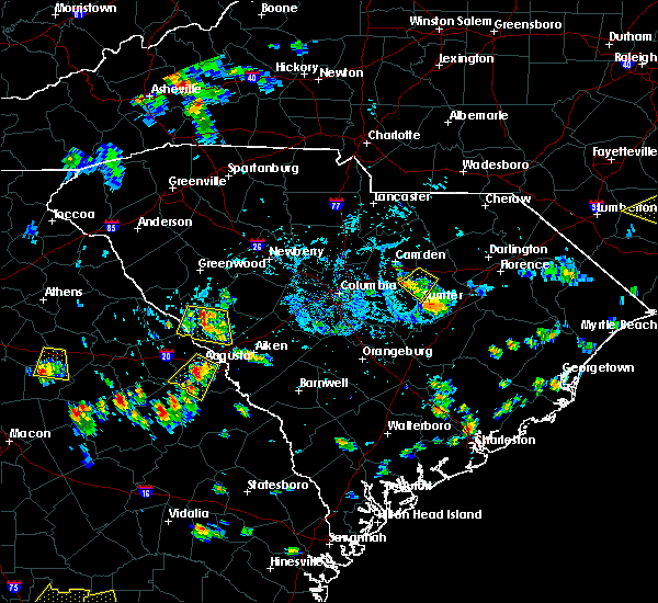 At 457 pm edt, a severe thunderstorm was located 10 miles west of edgefield, or 21 miles north of martinez, moving south at 5 mph (radar indicated). Hazards include 60 mph wind gusts and nickel size hail. Expect damage to roofs. siding. And trees. At 457 pm edt, a severe thunderstorm was located 10 miles west of edgefield, or 21 miles north of martinez, moving south at 5 mph (radar indicated). Hazards include 60 mph wind gusts and nickel size hail. Expect damage to roofs. siding. And trees.
|
| 7/18/2016 6:42 PM EDT |
 At 641 pm edt, a severe thunderstorm was located over edgefield, drifting west-southwest around 5 mph. this thunderstorm has been strengthening during the last few minutes. the strongest winds were located just north of downtown edgefield and west of johnston. large hail is now expected as well as damaging winds (radar indicated). Hazards include 60 mph wind gusts and quarter size hail. Hail damage to vehicles is expected. expect wind damage to roofs, siding, and trees. Locations impacted include, edgefield, johnston, trenton and murphys estates. At 641 pm edt, a severe thunderstorm was located over edgefield, drifting west-southwest around 5 mph. this thunderstorm has been strengthening during the last few minutes. the strongest winds were located just north of downtown edgefield and west of johnston. large hail is now expected as well as damaging winds (radar indicated). Hazards include 60 mph wind gusts and quarter size hail. Hail damage to vehicles is expected. expect wind damage to roofs, siding, and trees. Locations impacted include, edgefield, johnston, trenton and murphys estates.
|
| 7/18/2016 6:35 PM EDT |
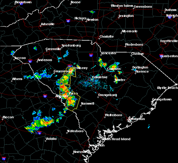 At 632 pm edt, a severe thunderstorm was located 8 miles southeast of edgefield, or 12 miles northwest of aiken, drifting west- southwest at 5mph. this thunderstorm has been strengthening during the last few minutes. the strongest winds were located just north of downtown edgefield and west of johnston. large hail is now expected as well as damaging winds (radar indicated). Hazards include 60 mph wind gusts and quarter size hail. Hail damage to vehicles is expected. expect wind damage to roofs, siding, and trees. Locations impacted include, edgefield, johnston, trenton, ward and murphys estates. At 632 pm edt, a severe thunderstorm was located 8 miles southeast of edgefield, or 12 miles northwest of aiken, drifting west- southwest at 5mph. this thunderstorm has been strengthening during the last few minutes. the strongest winds were located just north of downtown edgefield and west of johnston. large hail is now expected as well as damaging winds (radar indicated). Hazards include 60 mph wind gusts and quarter size hail. Hail damage to vehicles is expected. expect wind damage to roofs, siding, and trees. Locations impacted include, edgefield, johnston, trenton, ward and murphys estates.
|
| 7/18/2016 6:22 PM EDT |
 At 621 pm edt, a severe thunderstorm was located near johnston, or 17 miles north of aiken, moving south at 25 mph (radar indicated). Hazards include 60 mph wind gusts. Expect damage to roofs. siding. And trees. At 621 pm edt, a severe thunderstorm was located near johnston, or 17 miles north of aiken, moving south at 25 mph (radar indicated). Hazards include 60 mph wind gusts. Expect damage to roofs. siding. And trees.
|
| 7/8/2016 11:11 PM EDT |
 At 1110 pm edt, a severe thunderstorm was located 12 miles north of evans, moving southeast at 45 mph (radar indicated). Hazards include 60 mph wind gusts. Expect damage to roofs. siding. And trees. At 1110 pm edt, a severe thunderstorm was located 12 miles north of evans, moving southeast at 45 mph (radar indicated). Hazards include 60 mph wind gusts. Expect damage to roofs. siding. And trees.
|
| 7/6/2016 2:56 PM EDT |
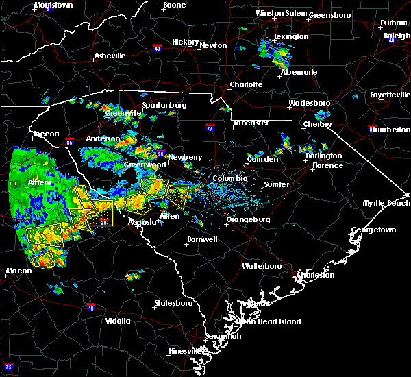 The severe thunderstorm warning for central edgefield county will expire at 300 pm edt, the storm which prompted the warning has weakened below severe limits, and no longer pose an immediate threat to life or property. therefore the warning will be allowed to expire. however gusty winds and occasional are still possible with this thunderstorm. a severe thunderstorm watch remains in effect until 900 pm edt for central south carolina. The severe thunderstorm warning for central edgefield county will expire at 300 pm edt, the storm which prompted the warning has weakened below severe limits, and no longer pose an immediate threat to life or property. therefore the warning will be allowed to expire. however gusty winds and occasional are still possible with this thunderstorm. a severe thunderstorm watch remains in effect until 900 pm edt for central south carolina.
|
| 7/6/2016 2:00 PM EDT |
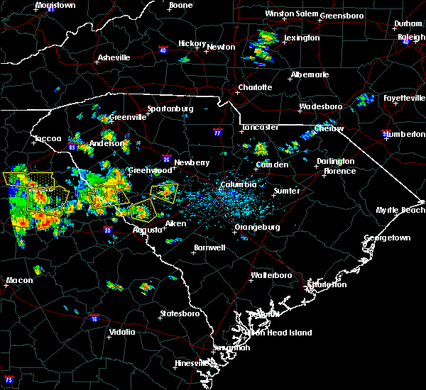 At 200 pm edt, a severe thunderstorm was located just west of edgefield, moving east at 30 mph (radar indicated). Hazards include 60 mph wind gusts. Expect damage to roofs. siding. And trees. At 200 pm edt, a severe thunderstorm was located just west of edgefield, moving east at 30 mph (radar indicated). Hazards include 60 mph wind gusts. Expect damage to roofs. siding. And trees.
|
| 7/5/2016 5:13 PM EDT |
 At 511 pm edt, an area of thunderstorms extended from around evans in columbia county southward through western burke county. movement was east-northeast near 35 mph. some of the storms likely contained wind gusts of 40 to 60 mph (radar indicated). Hazards include 60 mph wind gusts. Expect damage to roofs. siding. And trees. At 511 pm edt, an area of thunderstorms extended from around evans in columbia county southward through western burke county. movement was east-northeast near 35 mph. some of the storms likely contained wind gusts of 40 to 60 mph (radar indicated). Hazards include 60 mph wind gusts. Expect damage to roofs. siding. And trees.
|
| 5/2/2016 11:45 PM EDT |
 At 1144 pm edt, a line of severe thunderstorms were located near saluda, or 13 miles west of batesburg, moving northeast at 35 mph (radar indicated). Hazards include 60 mph wind gusts. Expect damage to roofs. siding. and trees. Locations impacted include, edgefield, johnston, ridge spring, trenton and ward. At 1144 pm edt, a line of severe thunderstorms were located near saluda, or 13 miles west of batesburg, moving northeast at 35 mph (radar indicated). Hazards include 60 mph wind gusts. Expect damage to roofs. siding. and trees. Locations impacted include, edgefield, johnston, ridge spring, trenton and ward.
|
| 5/2/2016 11:20 PM EDT |
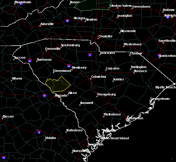 At 1119 pm edt, a line of severe thunderstorms were located near edgefield, or 16 miles north of belvedere, moving east at 35 mph (radar indicated). Hazards include 60 mph wind gusts. Expect damage to roofs. siding. And trees. At 1119 pm edt, a line of severe thunderstorms were located near edgefield, or 16 miles north of belvedere, moving east at 35 mph (radar indicated). Hazards include 60 mph wind gusts. Expect damage to roofs. siding. And trees.
|
| 2/24/2016 5:52 AM EST |
 At 549 am est, doppler radar indicated a likely severe thunderstorm near north augusta moving northeast near 40 mph. the strongest part of the storm will affect the area near the aiken and edgefield county line. a small interior room on the lowest floor usually offers the best protection from severe thunderstorms. locations impacted include, aiken, north augusta, clearwater, belvedere, edgefield, gloverville, burnettown, trenton and murphys estates. At 549 am est, doppler radar indicated a likely severe thunderstorm near north augusta moving northeast near 40 mph. the strongest part of the storm will affect the area near the aiken and edgefield county line. a small interior room on the lowest floor usually offers the best protection from severe thunderstorms. locations impacted include, aiken, north augusta, clearwater, belvedere, edgefield, gloverville, burnettown, trenton and murphys estates.
|
| 2/24/2016 5:37 AM EST |
 At 535 am est, doppler radar indicated a likely severe thunderstorm capable of producing damaging winds in excess of 60 mph. the storm was in the augusta area and moving northeast near 40 mph. At 535 am est, doppler radar indicated a likely severe thunderstorm capable of producing damaging winds in excess of 60 mph. the storm was in the augusta area and moving northeast near 40 mph.
|
| 2/3/2016 12:48 PM EST |
 At 1248 pm est, doppler radar indicated a severe thunderstorm capable of producing damaging winds in excess of 60 mph. this storm was located near martinez, and moving northeast at 50 mph. At 1248 pm est, doppler radar indicated a severe thunderstorm capable of producing damaging winds in excess of 60 mph. this storm was located near martinez, and moving northeast at 50 mph.
|
| 12/24/2015 4:48 PM EST |
 At 448 pm est, doppler radar indicated a severe thunderstorm capable of producing damaging winds in excess of 60 mph. this storm was located over the city of edgefield, moving east at 30 mph. penny size hail may also accompany the damaging winds. locations impacted include, north augusta, grovetown, evans, clearwater, belvedere, augusta, martinez, edgefield, gloverville, burnettown, trenton, murphys estates and clarks hill. At 448 pm est, doppler radar indicated a severe thunderstorm capable of producing damaging winds in excess of 60 mph. this storm was located over the city of edgefield, moving east at 30 mph. penny size hail may also accompany the damaging winds. locations impacted include, north augusta, grovetown, evans, clearwater, belvedere, augusta, martinez, edgefield, gloverville, burnettown, trenton, murphys estates and clarks hill.
|
| 12/24/2015 4:45 PM EST | Trees down on sweetwater road in edgefield county SC, 1.4 miles NE of Edgefield, SC |
| 12/24/2015 4:45 PM EST |
 At 445 pm est, doppler radar indicated a severe thunderstorm capable of producing destructive winds in excess of 70 mph. this storm was located near edgefield, or 13 miles north of belvedere, and moving east at 50 mph. At 445 pm est, doppler radar indicated a severe thunderstorm capable of producing destructive winds in excess of 70 mph. this storm was located near edgefield, or 13 miles north of belvedere, and moving east at 50 mph.
|
| 12/24/2015 4:09 PM EST |
 At 409 pm est, doppler radar indicated a severe thunderstorm capable of producing damaging winds in excess of 60 mph. this storm was located 13 miles northwest of evans, and moving east at 30 mph. At 409 pm est, doppler radar indicated a severe thunderstorm capable of producing damaging winds in excess of 60 mph. this storm was located 13 miles northwest of evans, and moving east at 30 mph.
|
| 9/4/2015 10:49 PM EDT |
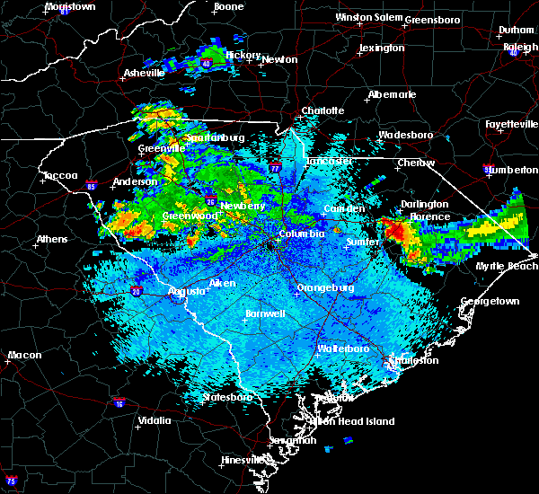 At 1049 pm edt, doppler radar indicated a severe thunderstorm capable of producing damaging winds in excess of 60 mph. this storm was located near saluda, or 18 miles west of batesburg, and moving south at 5 mph. At 1049 pm edt, doppler radar indicated a severe thunderstorm capable of producing damaging winds in excess of 60 mph. this storm was located near saluda, or 18 miles west of batesburg, and moving south at 5 mph.
|
| 8/6/2015 4:50 PM EDT |
 At 449 pm edt, doppler radar indicated an area of severe thunderstorms over the csra capable of producing damaging winds in excess of 60 mph. these storms were moving east at 30 mph. At 449 pm edt, doppler radar indicated an area of severe thunderstorms over the csra capable of producing damaging winds in excess of 60 mph. these storms were moving east at 30 mph.
|
| 7/17/2015 4:01 PM EDT |
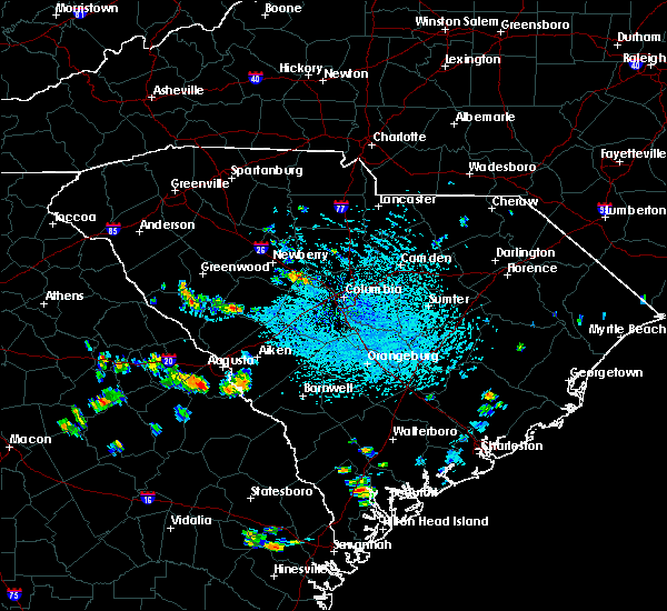 At 400 pm edt, doppler radar indicated a severe thunderstorm capable of producing quarter size hail and damaging winds in excess of 60 mph. this storm was located 7 miles southwest of saluda, or 19 miles west of batesburg. this storm was nearly stationary. At 400 pm edt, doppler radar indicated a severe thunderstorm capable of producing quarter size hail and damaging winds in excess of 60 mph. this storm was located 7 miles southwest of saluda, or 19 miles west of batesburg. this storm was nearly stationary.
|
| 7/2/2015 3:52 PM EDT |
 At 351 pm edt, doppler radar indicated a line of severe thunderstorms capable of producing damaging winds in excess of 60 mph. these storms were located along a line extending from near batesburg to 11 miles east of mccormick to 8 miles south of lincolnton, and moving east at 45 mph. At 351 pm edt, doppler radar indicated a line of severe thunderstorms capable of producing damaging winds in excess of 60 mph. these storms were located along a line extending from near batesburg to 11 miles east of mccormick to 8 miles south of lincolnton, and moving east at 45 mph.
|
| 4/19/2015 4:24 PM EDT | The national weather service in columbia has issued a * tornado warning for. Eastern edgefield county in central south carolina western lexington county in central south carolina saluda county in central south carolina * until 500 pm edt. |
| 4/19/2015 4:19 PM EDT | this alert has expired |
| 4/15/2015 12:09 PM EDT | A severe thunderstorm warning remains in effect until 1230 pm edt for mccormick. edgefield. columbia and lincoln counties. at 1204 pm edt. national weather service doppler radar continued to indicate a severe thunderstorm. this storm was located along the southern portion of lake thurmond. moving northeast at 25 mph. report large hail. Damaging winds or flooding to your county. |
| 4/15/2015 12:09 PM EDT | A severe thunderstorm warning remains in effect until 1230 pm edt for mccormick. edgefield. columbia and lincoln counties. at 1204 pm edt. national weather service doppler radar continued to indicate a severe thunderstorm. this storm was located along the southern portion of lake thurmond. moving northeast at 25 mph. report large hail. Damaging winds or flooding to your county. |
| 4/15/2015 11:51 AM EDT | The national weather service in columbia has issued a * severe thunderstorm warning for. Southeastern lincoln county in east central georgia northern columbia county in east central georgia edgefield county in central south carolina southeastern mccormick county in central south carolina. |
| 4/15/2015 11:51 AM EDT | The national weather service in columbia has issued a * severe thunderstorm warning for. Southeastern lincoln county in east central georgia northern columbia county in east central georgia edgefield county in central south carolina southeastern mccormick county in central south carolina. |
| 5/25/2014 7:12 PM EDT | Quarter sized hail reported 12.6 miles SSE of Edgefield, SC, quarter size hail reported |
| 1/30/2013 7:50 PM EST | Widespread trees down and power outages in edgefield county SC, 0.6 miles SE of Edgefield, SC |
| 1/30/2013 7:30 PM EST | Widespread trees down and power outages in edgefield county SC, 11.6 miles SE of Edgefield, SC |
| 7/5/2012 8:55 PM EDT | Trees and power lines dow in edgefield county SC, 4 miles NE of Edgefield, SC |
| 1/1/0001 12:00 AM | Dispatch reported a couple of trees down in the west end of the county on garret roa in edgefield county SC, 5.6 miles E of Edgefield, SC |
| 1/1/0001 12:00 AM | Trees down near pickens st in edgefield county SC, 0.6 miles SE of Edgefield, SC |
| 1/1/0001 12:00 AM | Trees down on n martintown rd near us hwy 378. time estimate in edgefield county SC, 11.9 miles SE of Edgefield, SC |
| 1/1/0001 12:00 AM | Trees down on old five notch r in edgefield county SC, 6.2 miles E of Edgefield, SC |
| 1/1/0001 12:00 AM | Trees and powerlines down on augusta highway. time estimated by rada in edgefield county SC, 0.3 miles NW of Edgefield, SC |
| 1/1/0001 12:00 AM | Trees down on country club rd in edgefield county SC, 3.1 miles SW of Edgefield, SC |
| 1/1/0001 12:00 AM | Trees and powerlines down in edge in edgefield county SC, 0.6 miles SE of Edgefield, SC |
Hail Maps for Edgefield, SC


Connect with Interactive Hail Maps