

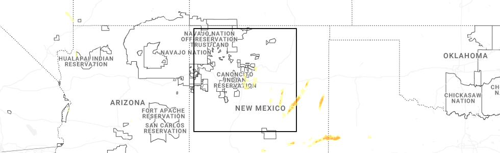
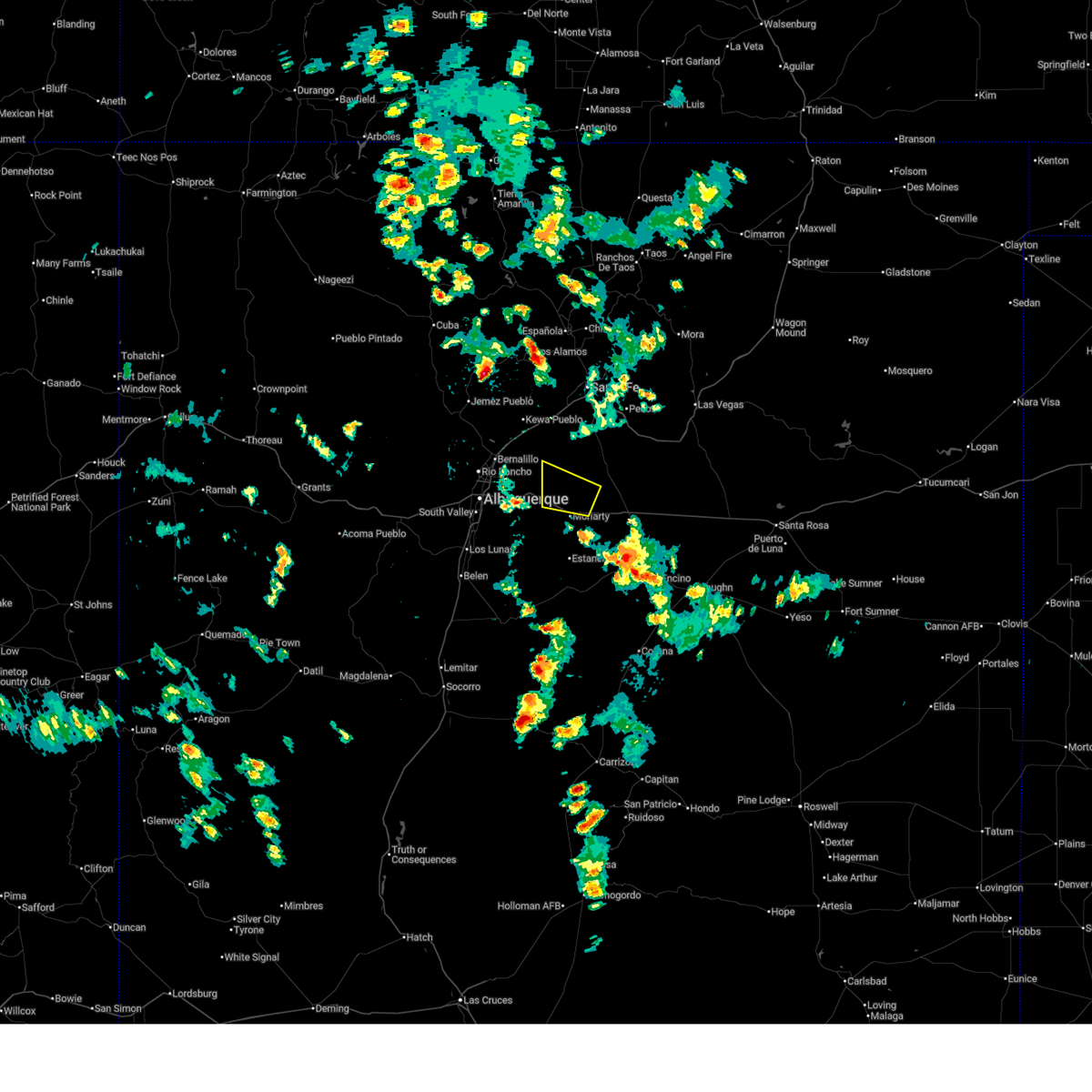
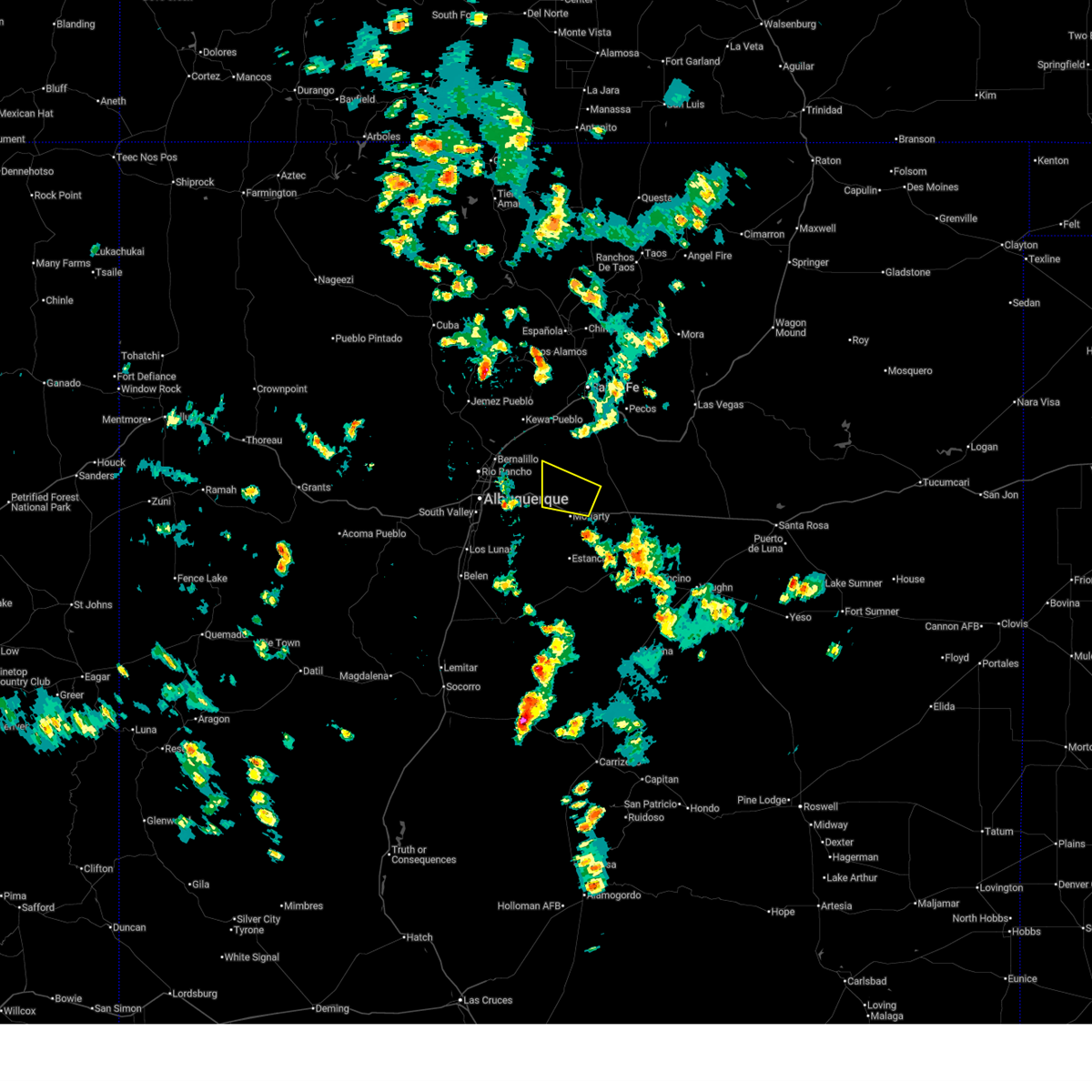
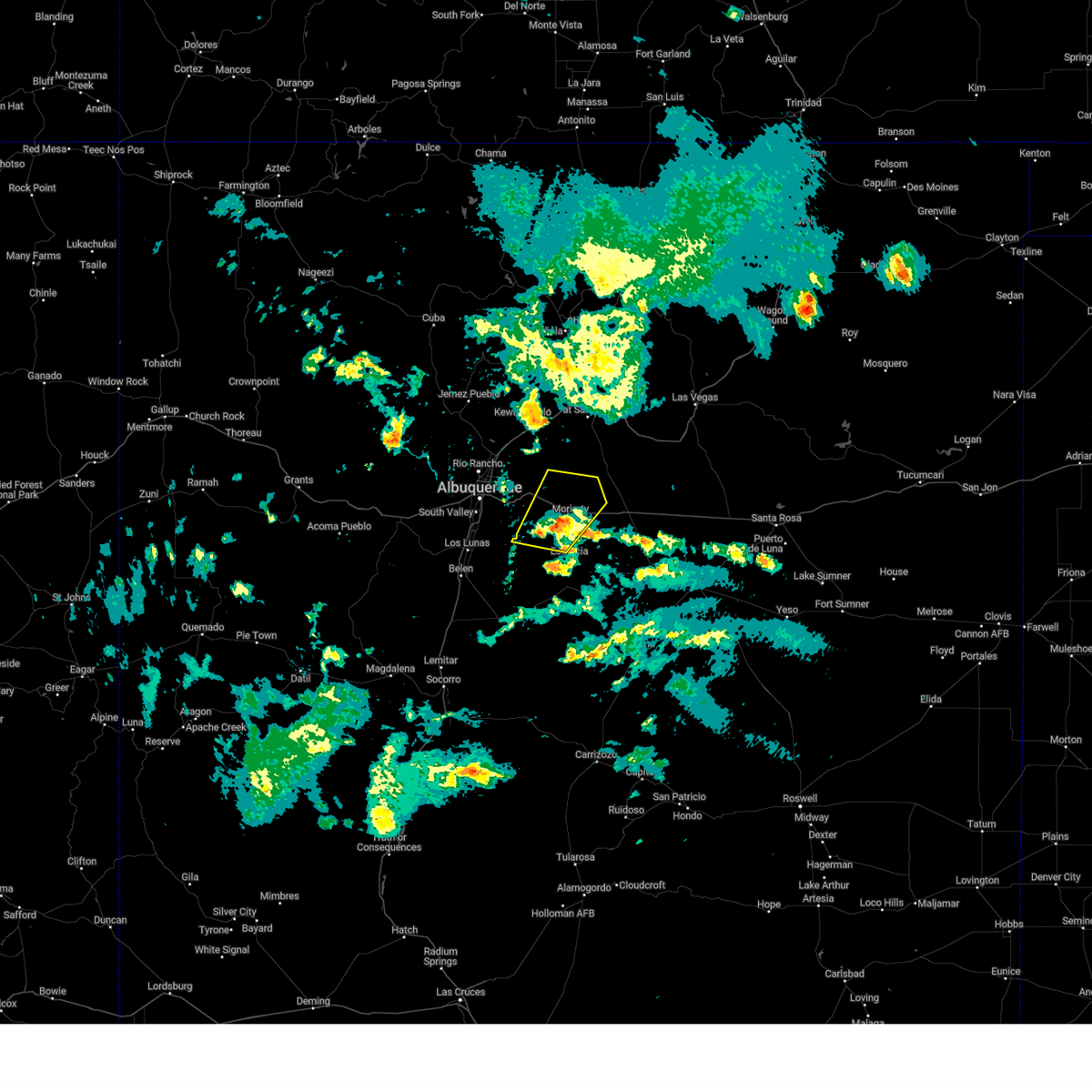
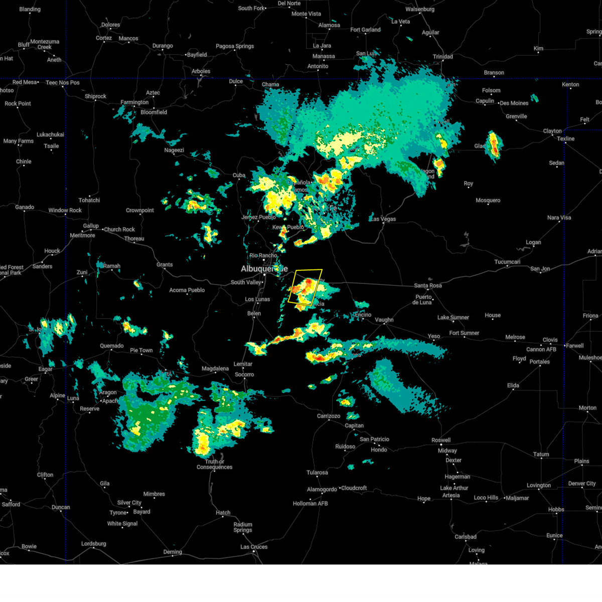
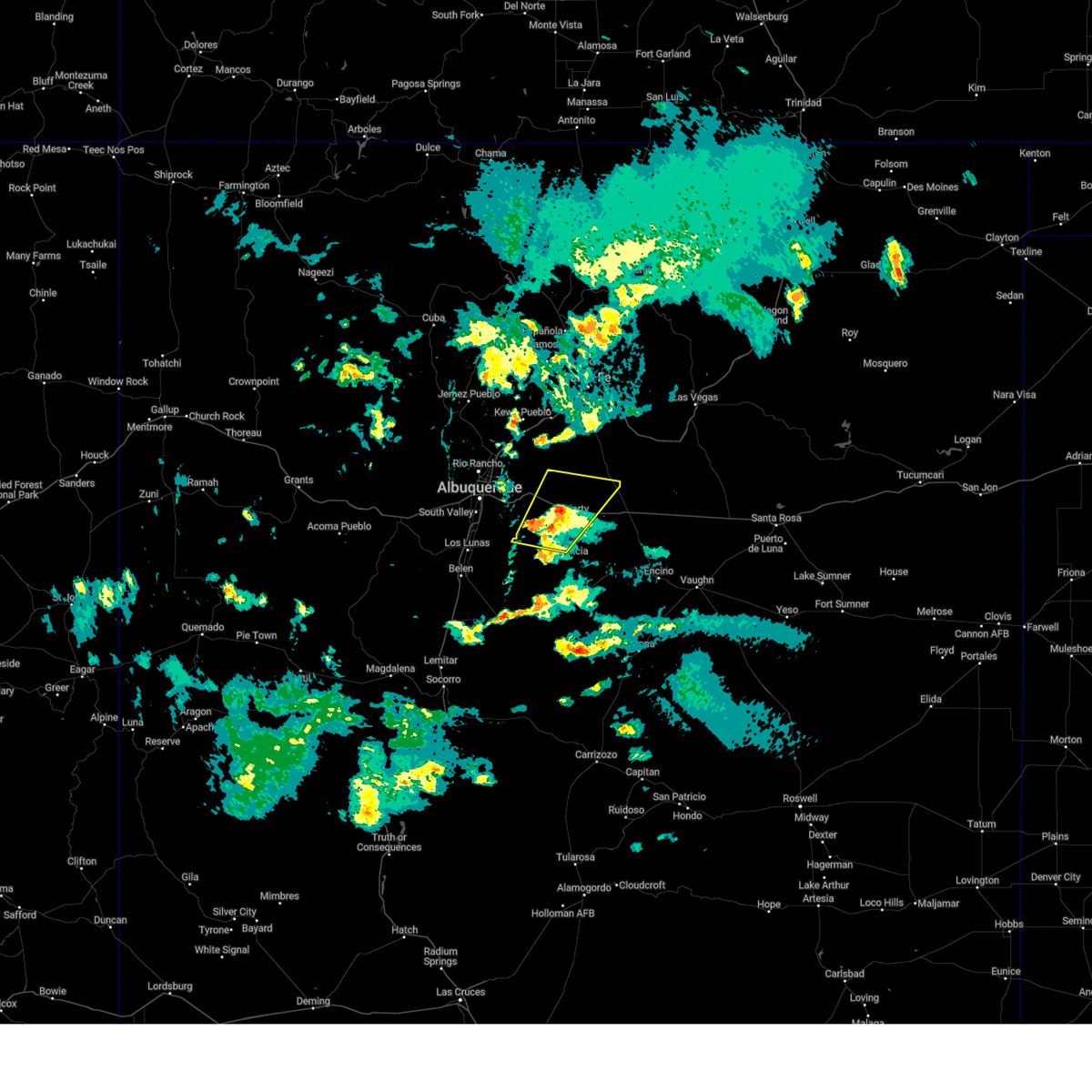
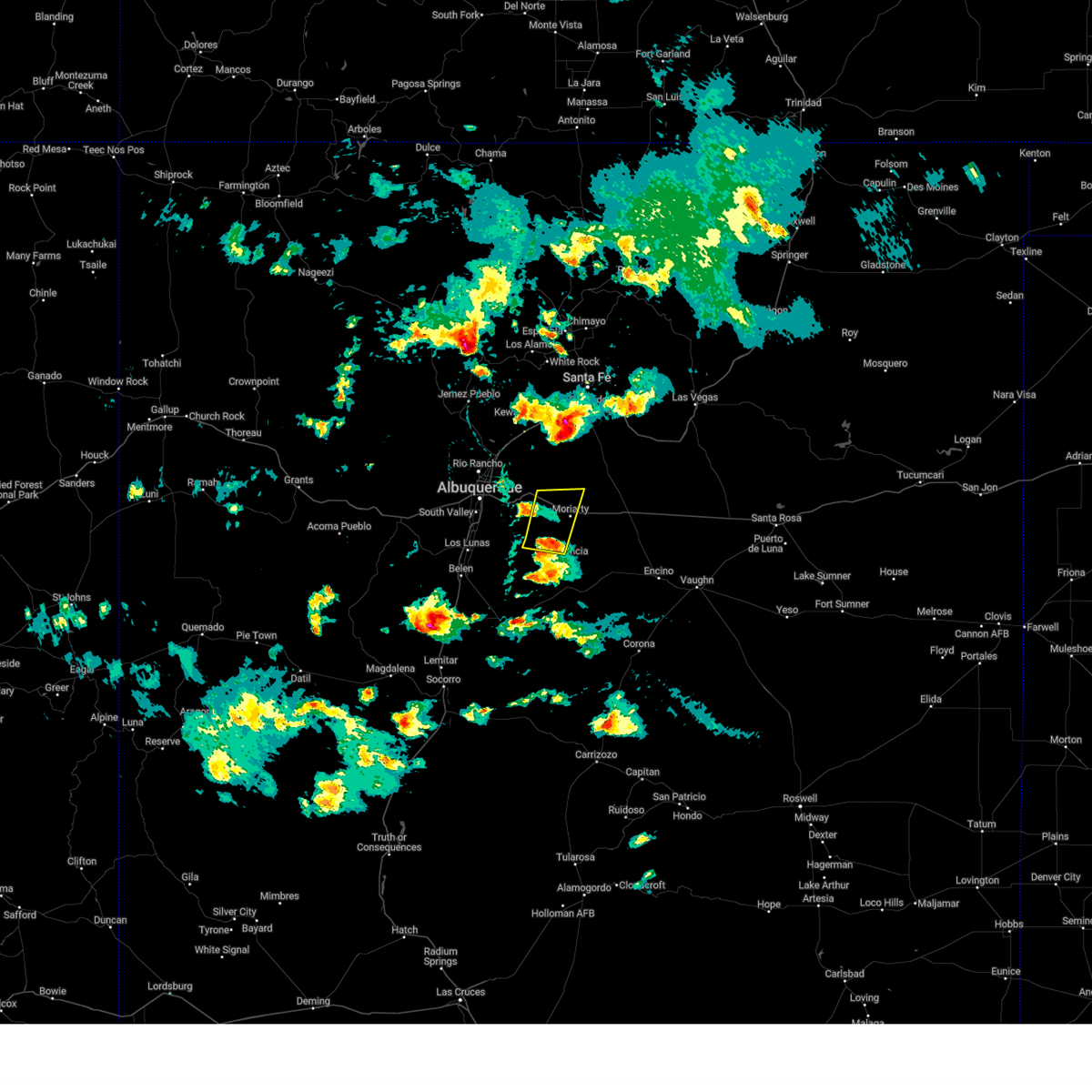
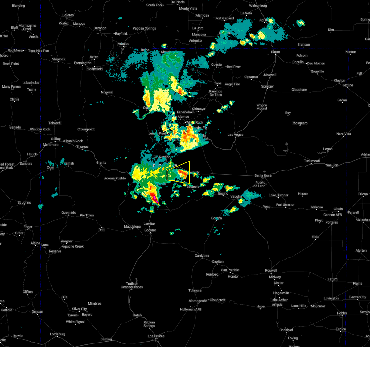
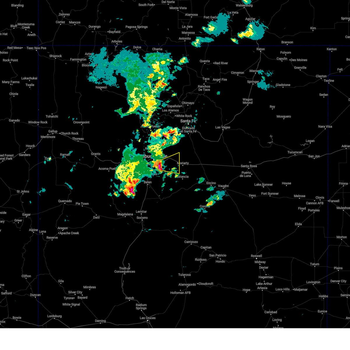
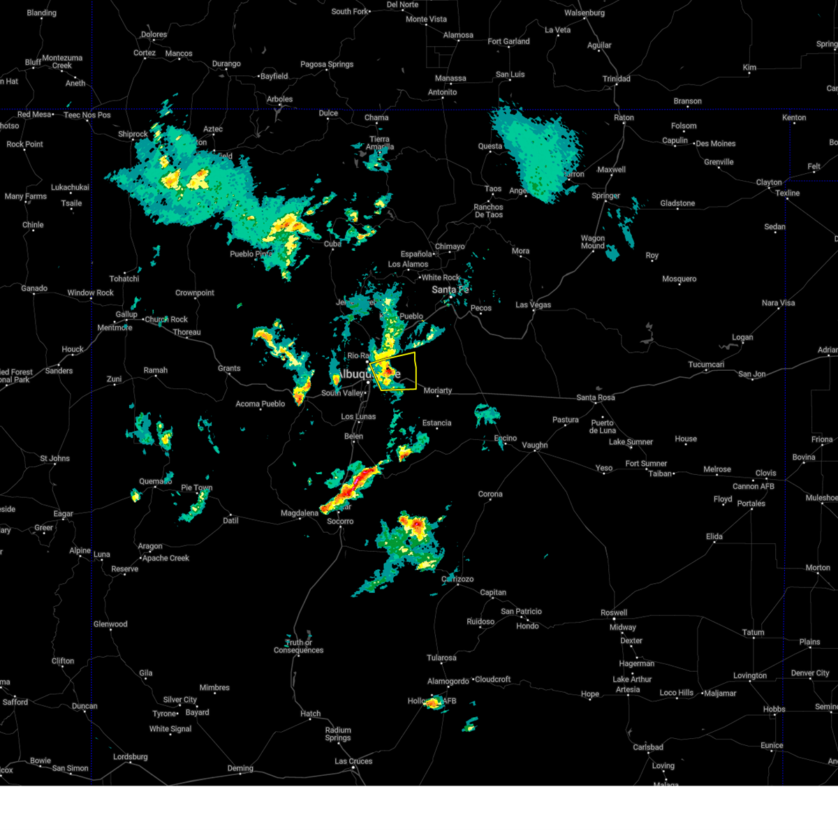
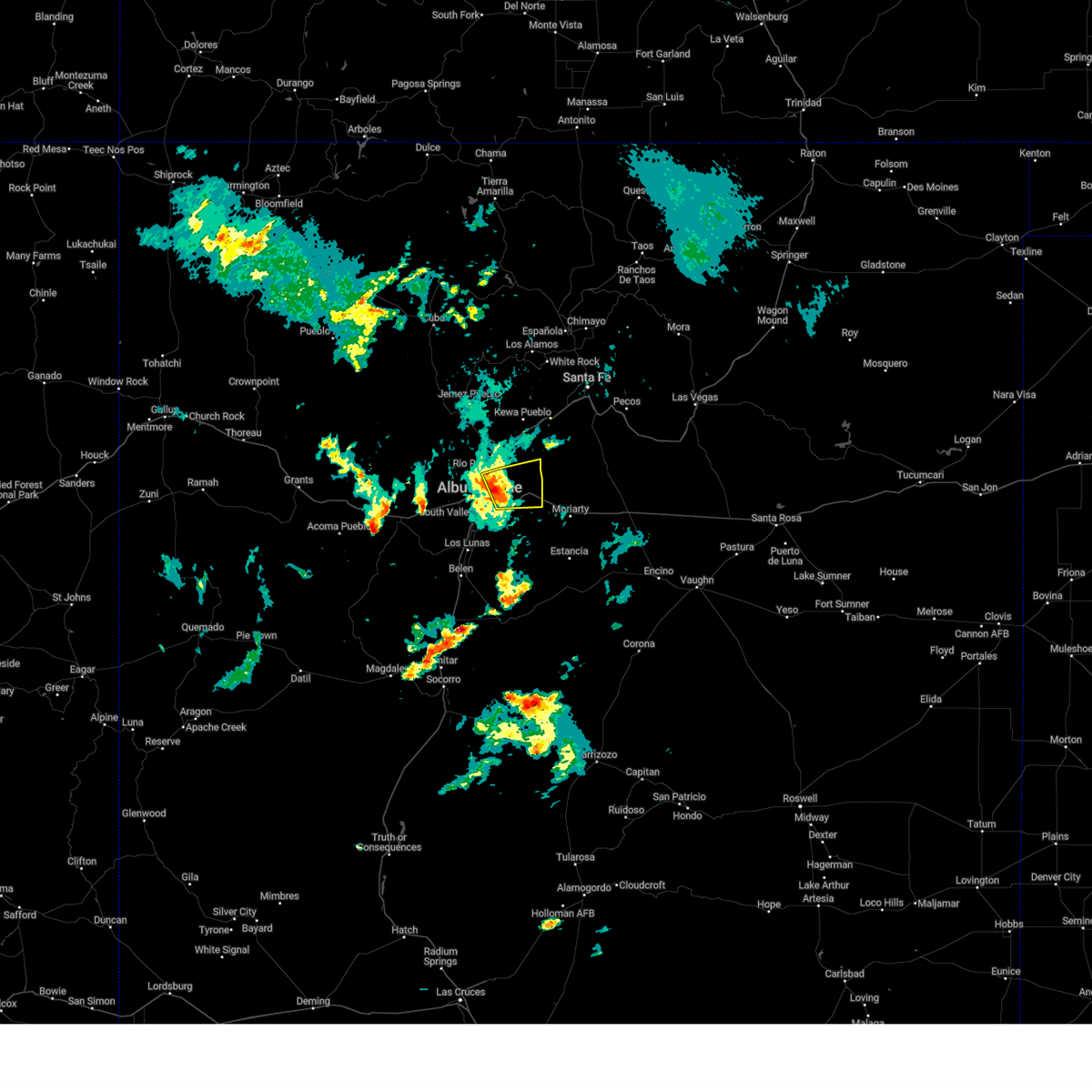
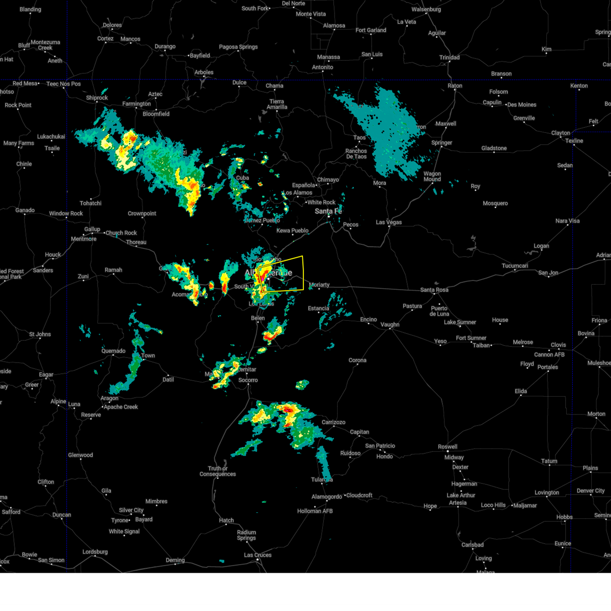
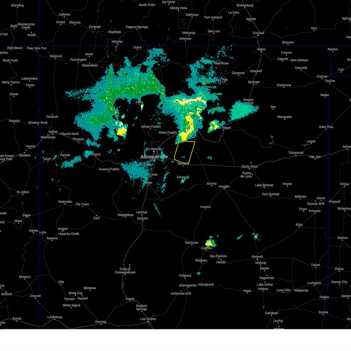
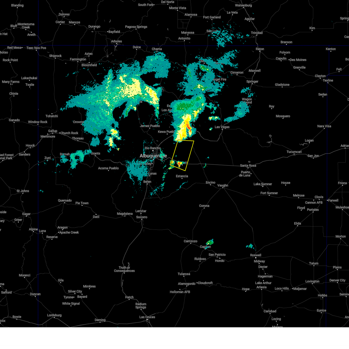
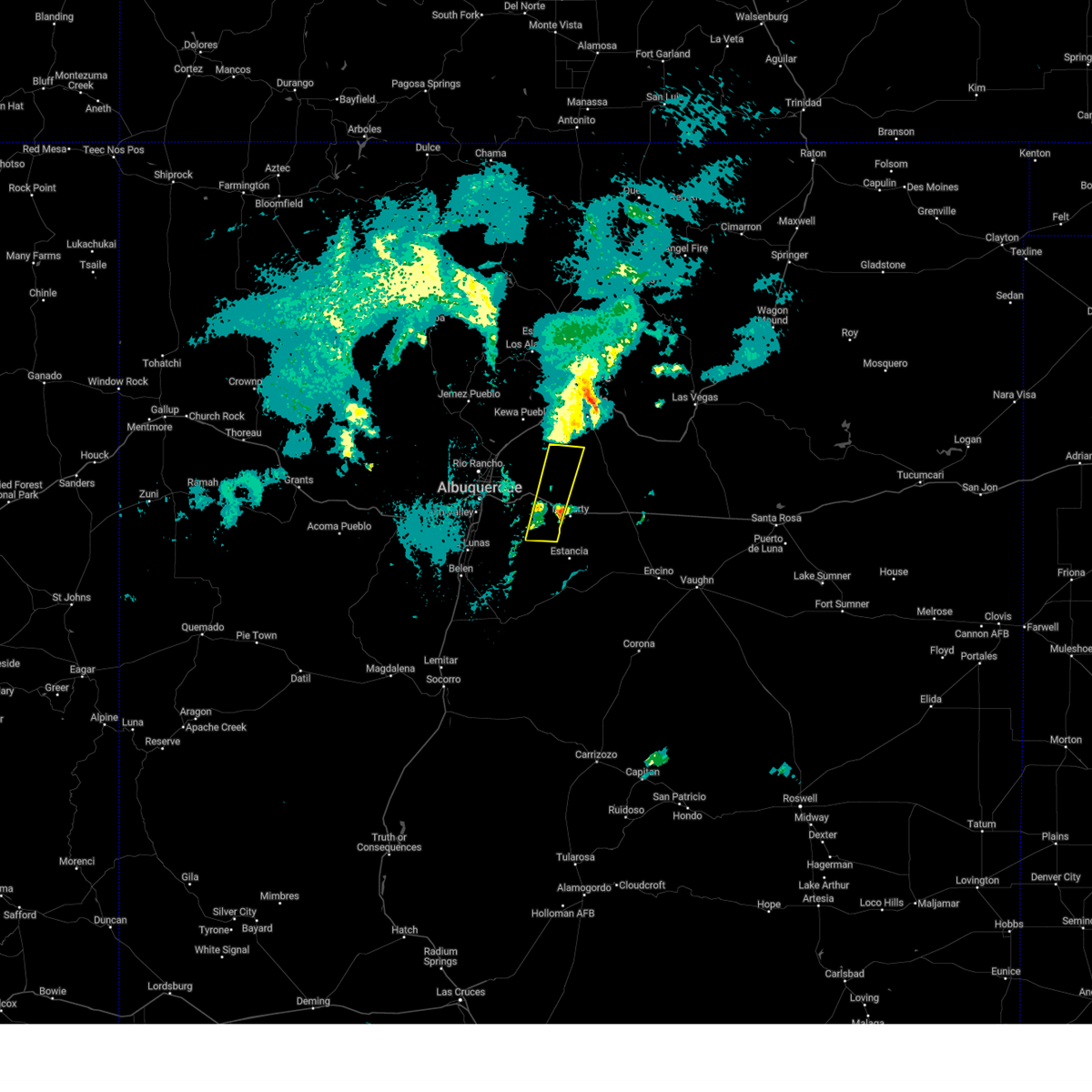
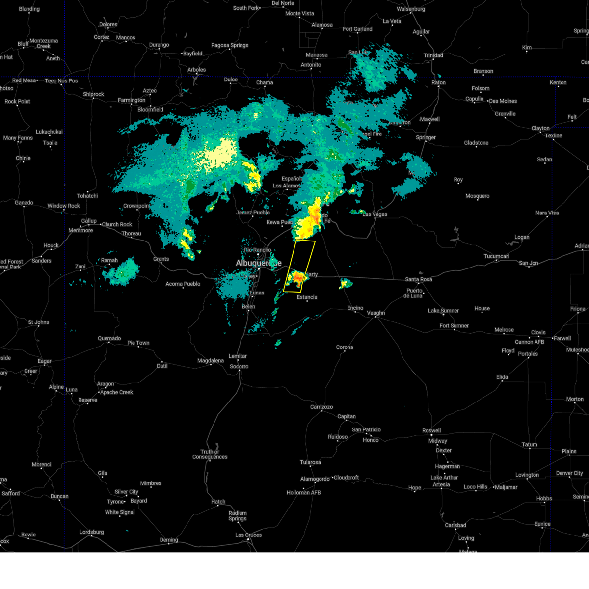
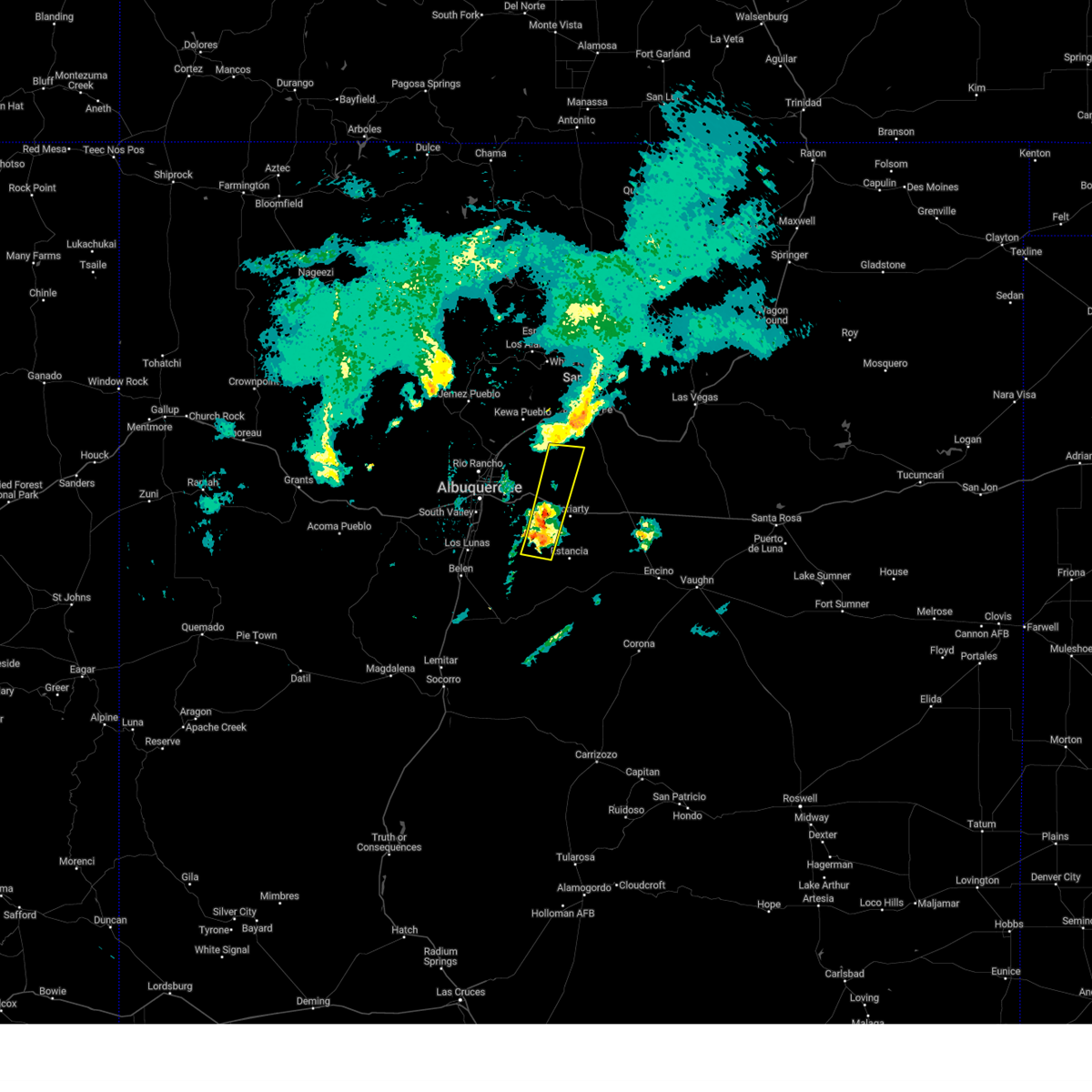
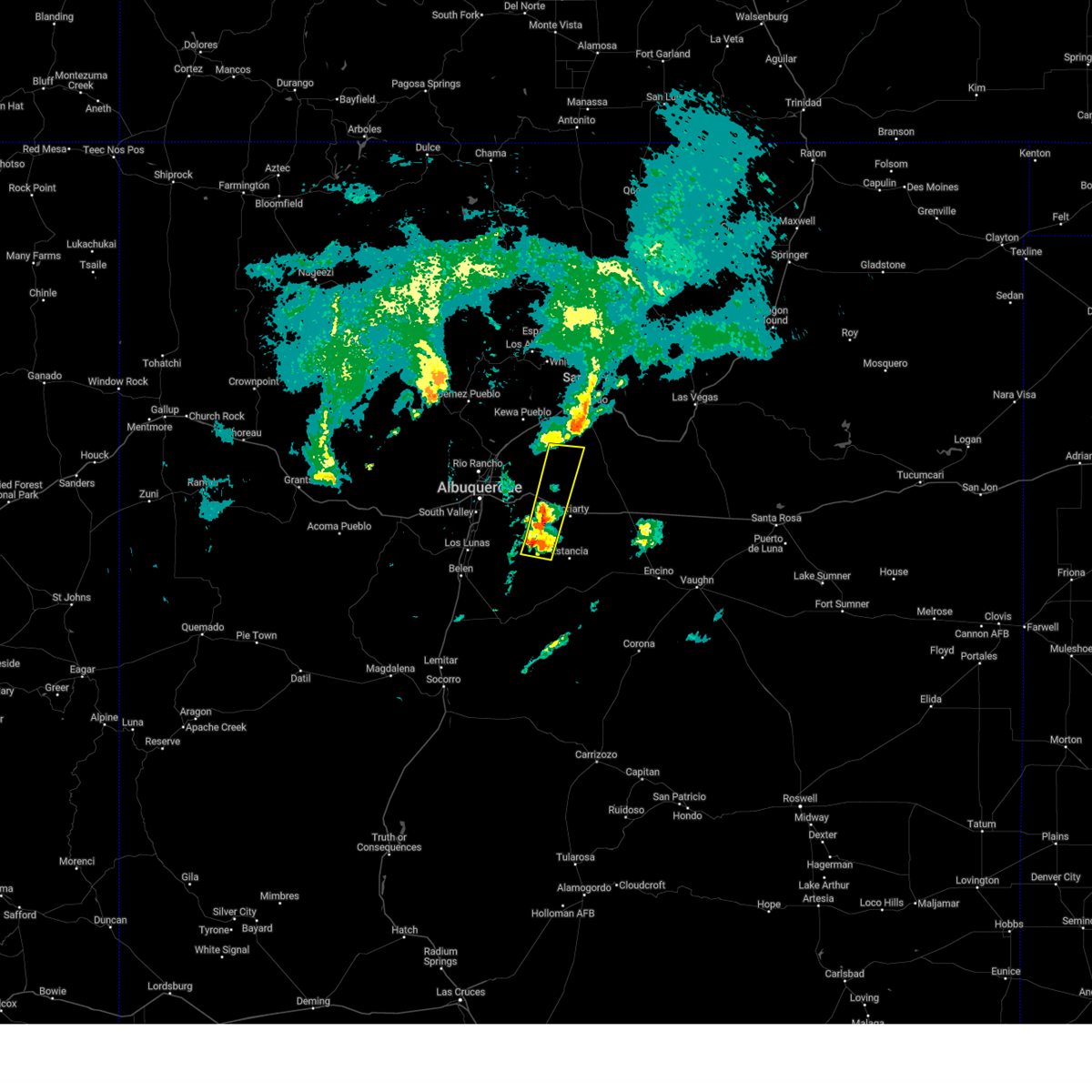
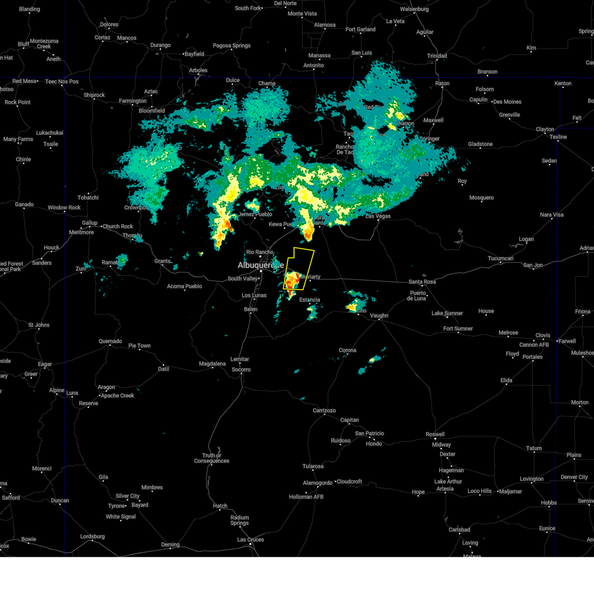
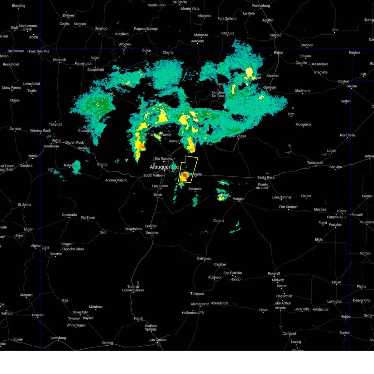
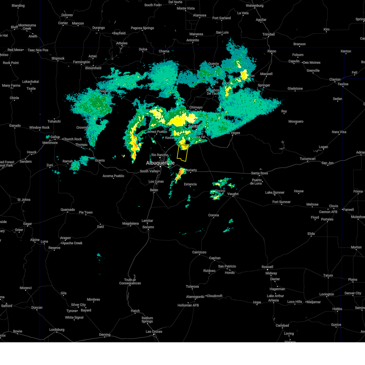
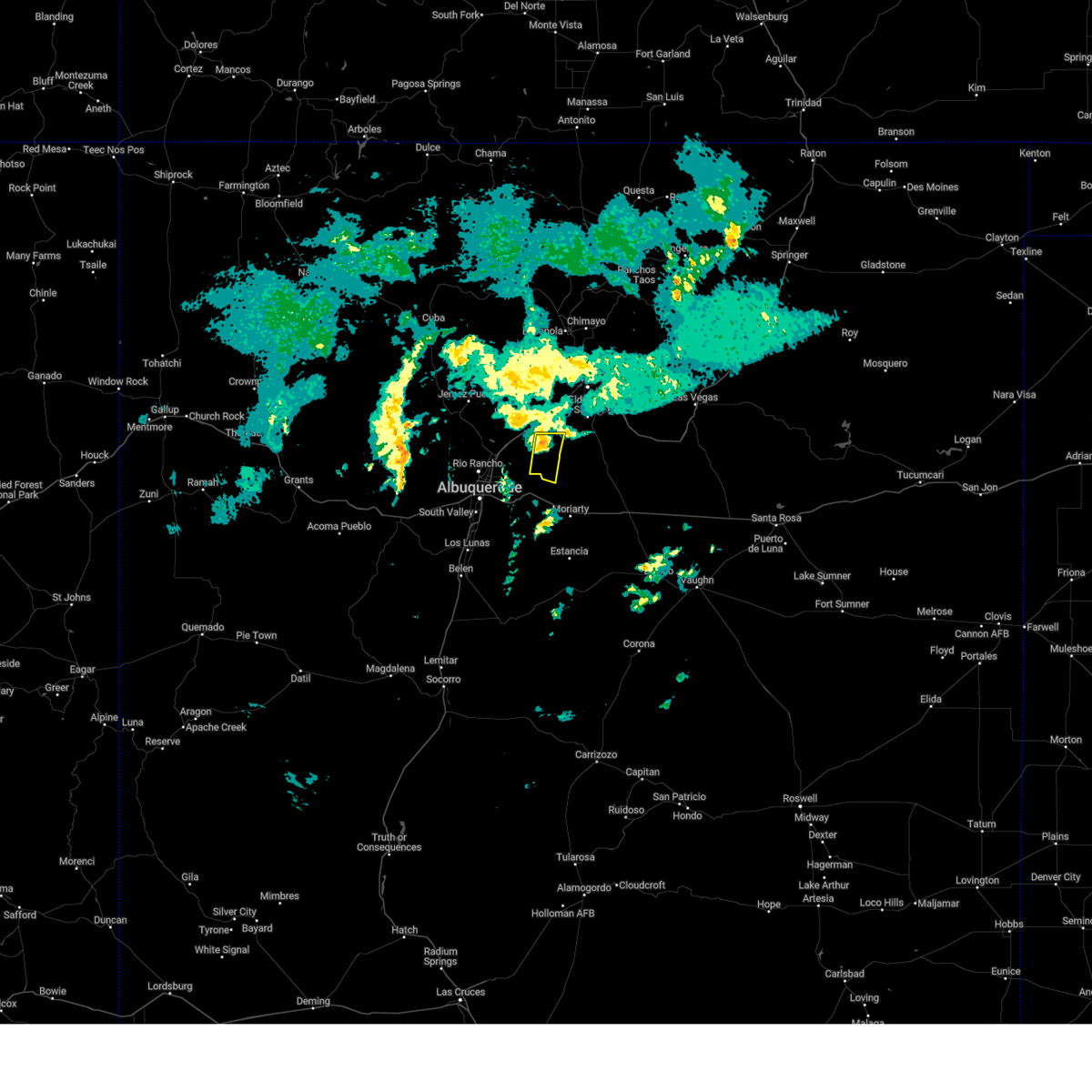
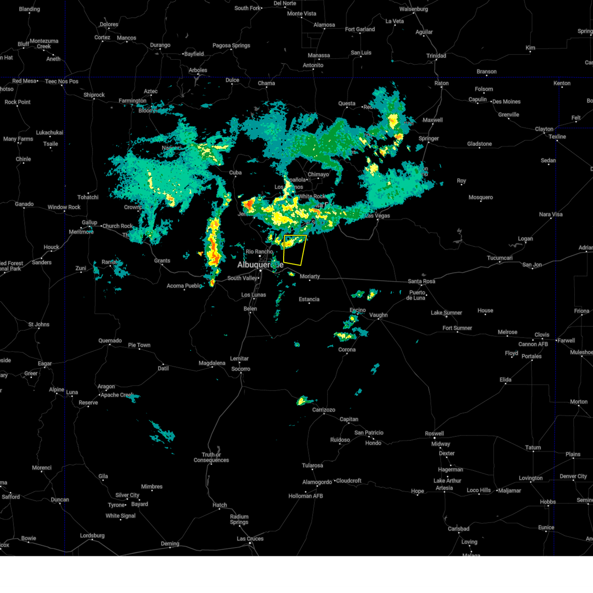
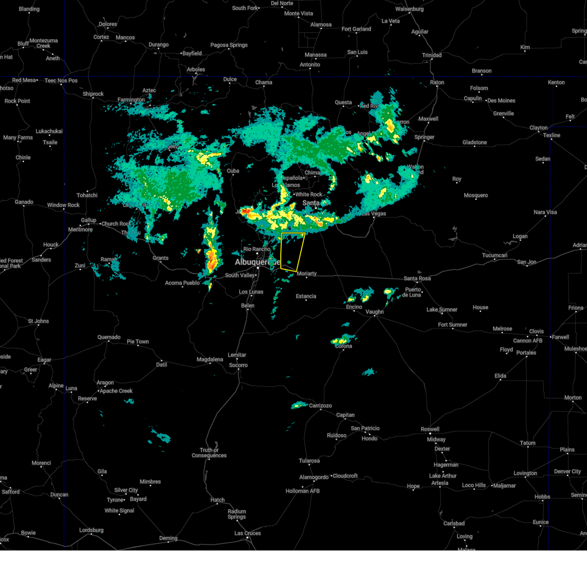
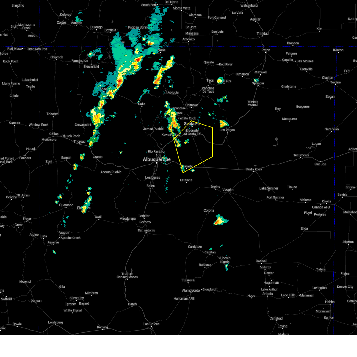
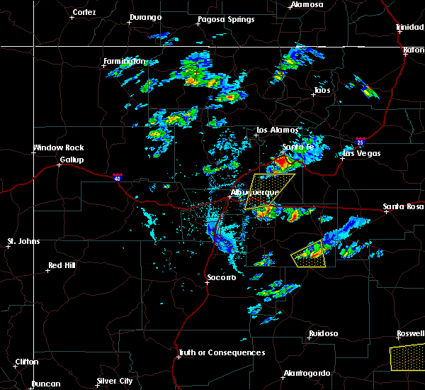
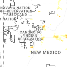
Hail Map for Edgewood, NM
The Edgewood, NM area has had 18 reports of on-the-ground hail by trained spotters, and has been under severe weather warnings 27 times during the past 12 months. Doppler radar has detected hail at or near Edgewood, NM on 33 occasions, including 3 occasions during the past year.
| Name: | Edgewood, NM |
| Where Located: | 25.2 miles E of Albuquerque, NM |
| Map: | Google Map for Edgewood, NM |
| Population: | 3735 |
| Housing Units: | 1563 |
| More Info: | Search Google for Edgewood, NM |
2
The Top Recent Hail Date for Edgewood, NM is Sunday, May 4, 2025 (3rd out of 33)
Hail and Wind Damage Spotted near Edgewood, NM
| Date / Time | Report Details |
|---|---|
| 6/30/2025 1:27 PM MDT |
 the severe thunderstorm warning has been cancelled and is no longer in effect the severe thunderstorm warning has been cancelled and is no longer in effect
|
| 6/30/2025 1:18 PM MDT |
 Svrabq the national weather service in albuquerque has issued a * severe thunderstorm warning for, northwestern torrance county in central new mexico, southwestern santa fe county in north central new mexico, * until 200 pm mdt. * at 118 pm mdt, a severe thunderstorm was located near stanley, or 7 miles northeast of moriarty, moving west at 20 mph (radar indicated). Hazards include 60 mph wind gusts and quarter size hail. Hail damage to vehicles is expected. Expect wind damage to roofs, siding, and trees. Svrabq the national weather service in albuquerque has issued a * severe thunderstorm warning for, northwestern torrance county in central new mexico, southwestern santa fe county in north central new mexico, * until 200 pm mdt. * at 118 pm mdt, a severe thunderstorm was located near stanley, or 7 miles northeast of moriarty, moving west at 20 mph (radar indicated). Hazards include 60 mph wind gusts and quarter size hail. Hail damage to vehicles is expected. Expect wind damage to roofs, siding, and trees.
|
| 6/9/2025 4:48 PM MDT |
 At 448 pm mdt, a severe thunderstorm was located near stanley, or 7 miles north of moriarty, moving northeast at 20 mph (broadcast media reported). Hazards include 60 mph wind gusts and half dollar size hail. Hail damage to vehicles is expected. expect wind damage to roofs, siding, and trees. locations impacted include, moriarty, edgewood, cedar grove, mcintosh, chilili, stanley, escabosa, miera and ponderosa pines. This includes interstate 40 between mile markers 182 and 206. At 448 pm mdt, a severe thunderstorm was located near stanley, or 7 miles north of moriarty, moving northeast at 20 mph (broadcast media reported). Hazards include 60 mph wind gusts and half dollar size hail. Hail damage to vehicles is expected. expect wind damage to roofs, siding, and trees. locations impacted include, moriarty, edgewood, cedar grove, mcintosh, chilili, stanley, escabosa, miera and ponderosa pines. This includes interstate 40 between mile markers 182 and 206.
|
| 6/9/2025 4:29 PM MDT |
 The severe thunderstorm warning that was previously in effect has been reissued for bernalillo, santa fe, and torrance counties and is in effect until 500 pm mdt. please refer to that bulletin for the latest severe weather information. a severe thunderstorm watch remains in effect until 1000 pm mdt monday for portions of central and north central new mexico. The severe thunderstorm warning that was previously in effect has been reissued for bernalillo, santa fe, and torrance counties and is in effect until 500 pm mdt. please refer to that bulletin for the latest severe weather information. a severe thunderstorm watch remains in effect until 1000 pm mdt monday for portions of central and north central new mexico.
|
| 6/9/2025 4:29 PM MDT |
 Svrabq the national weather service in albuquerque has issued a * severe thunderstorm warning for, bernalillo county in central new mexico, northwestern torrance county in central new mexico, southern santa fe county in north central new mexico, * until 500 pm mdt. * at 429 pm mdt, a severe thunderstorm was located near moriarty, moving northeast at 25 mph (radar indicated). Hazards include ping pong ball size hail and 60 mph wind gusts. People and animals outdoors will be injured. expect hail damage to roofs, siding, windows, and vehicles. Expect wind damage to roofs, siding, and trees. Svrabq the national weather service in albuquerque has issued a * severe thunderstorm warning for, bernalillo county in central new mexico, northwestern torrance county in central new mexico, southern santa fe county in north central new mexico, * until 500 pm mdt. * at 429 pm mdt, a severe thunderstorm was located near moriarty, moving northeast at 25 mph (radar indicated). Hazards include ping pong ball size hail and 60 mph wind gusts. People and animals outdoors will be injured. expect hail damage to roofs, siding, windows, and vehicles. Expect wind damage to roofs, siding, and trees.
|
| 6/9/2025 4:10 PM MDT | Half Dollar sized hail reported 8.3 miles NNW of Edgewood, NM, report from mping: half dollar (1.25 in.). |
| 6/9/2025 3:56 PM MDT |
 At 356 pm mdt, a severe thunderstorm was located 6 miles south of edgewood, or 7 miles west of moriarty, moving northeast at 20 mph (radar indicated). Hazards include golf ball size hail and 60 mph wind gusts. People and animals outdoors will be injured. expect hail damage to roofs, siding, windows, and vehicles. expect wind damage to roofs, siding, and trees. locations impacted include, moriarty, edgewood, chilili, escabosa, miera and ponderosa pines. This includes interstate 40 between mile markers 182 and 198. At 356 pm mdt, a severe thunderstorm was located 6 miles south of edgewood, or 7 miles west of moriarty, moving northeast at 20 mph (radar indicated). Hazards include golf ball size hail and 60 mph wind gusts. People and animals outdoors will be injured. expect hail damage to roofs, siding, windows, and vehicles. expect wind damage to roofs, siding, and trees. locations impacted include, moriarty, edgewood, chilili, escabosa, miera and ponderosa pines. This includes interstate 40 between mile markers 182 and 198.
|
| 6/9/2025 3:41 PM MDT |
 Svrabq the national weather service in albuquerque has issued a * severe thunderstorm warning for, bernalillo county in central new mexico, northwestern torrance county in central new mexico, southwestern santa fe county in north central new mexico, * until 430 pm mdt. * at 341 pm mdt, a severe thunderstorm was located over chilili, or 13 miles southwest of moriarty, moving northeast at 20 mph (radar indicated). Hazards include 60 mph wind gusts and half dollar size hail. Hail damage to vehicles is expected. Expect wind damage to roofs, siding, and trees. Svrabq the national weather service in albuquerque has issued a * severe thunderstorm warning for, bernalillo county in central new mexico, northwestern torrance county in central new mexico, southwestern santa fe county in north central new mexico, * until 430 pm mdt. * at 341 pm mdt, a severe thunderstorm was located over chilili, or 13 miles southwest of moriarty, moving northeast at 20 mph (radar indicated). Hazards include 60 mph wind gusts and half dollar size hail. Hail damage to vehicles is expected. Expect wind damage to roofs, siding, and trees.
|
| 6/4/2025 4:18 PM MDT |
 the severe thunderstorm warning has been cancelled and is no longer in effect the severe thunderstorm warning has been cancelled and is no longer in effect
|
| 6/4/2025 3:50 PM MDT |
 Svrabq the national weather service in albuquerque has issued a * severe thunderstorm warning for, bernalillo county in central new mexico, northwestern torrance county in central new mexico, southwestern santa fe county in north central new mexico, * until 430 pm mdt. * at 350 pm mdt, a severe thunderstorm was located 9 miles southwest of tijeras, or 14 miles southeast of albuquerque, moving east at 30 mph (radar indicated). Hazards include 60 mph wind gusts and quarter size hail. Hail damage to vehicles is expected. Expect wind damage to roofs, siding, and trees. Svrabq the national weather service in albuquerque has issued a * severe thunderstorm warning for, bernalillo county in central new mexico, northwestern torrance county in central new mexico, southwestern santa fe county in north central new mexico, * until 430 pm mdt. * at 350 pm mdt, a severe thunderstorm was located 9 miles southwest of tijeras, or 14 miles southeast of albuquerque, moving east at 30 mph (radar indicated). Hazards include 60 mph wind gusts and quarter size hail. Hail damage to vehicles is expected. Expect wind damage to roofs, siding, and trees.
|
| 6/2/2025 3:20 PM MDT |
 the severe thunderstorm warning has been cancelled and is no longer in effect the severe thunderstorm warning has been cancelled and is no longer in effect
|
| 6/2/2025 3:11 PM MDT |
 At 311 pm mdt, a severe thunderstorm was located near sandia heights, or 9 miles east of albuquerque, moving east at 30 mph (radar indicated). Hazards include 60 mph wind gusts and small hail. Expect damage to roofs, siding, and trees. locations impacted include, northeastern albuquerque, corrales, edgewood, tijeras, sandia park, cedar crest, sandia heights, sedillo, north valley and canoncito in bernalillo county. this includes the following highways, interstate 40 between mile markers 164 and 183. Interstate 25 between mile markers 230 and 236. At 311 pm mdt, a severe thunderstorm was located near sandia heights, or 9 miles east of albuquerque, moving east at 30 mph (radar indicated). Hazards include 60 mph wind gusts and small hail. Expect damage to roofs, siding, and trees. locations impacted include, northeastern albuquerque, corrales, edgewood, tijeras, sandia park, cedar crest, sandia heights, sedillo, north valley and canoncito in bernalillo county. this includes the following highways, interstate 40 between mile markers 164 and 183. Interstate 25 between mile markers 230 and 236.
|
| 6/2/2025 2:48 PM MDT |
 Svrabq the national weather service in albuquerque has issued a * severe thunderstorm warning for, bernalillo county in central new mexico, southeastern sandoval county in north central new mexico, * until 330 pm mdt. * at 248 pm mdt, a severe thunderstorm was located over albuquerque, moving east at 35 mph (radar indicated). Hazards include 60 mph wind gusts and quarter size hail. Hail damage to vehicles is expected. Expect wind damage to roofs, siding, and trees. Svrabq the national weather service in albuquerque has issued a * severe thunderstorm warning for, bernalillo county in central new mexico, southeastern sandoval county in north central new mexico, * until 330 pm mdt. * at 248 pm mdt, a severe thunderstorm was located over albuquerque, moving east at 35 mph (radar indicated). Hazards include 60 mph wind gusts and quarter size hail. Hail damage to vehicles is expected. Expect wind damage to roofs, siding, and trees.
|
| 5/26/2025 3:05 PM MDT | Quarter sized hail reported 5.1 miles NNW of Edgewood, NM |
| 5/4/2025 9:33 PM MDT |
 At 933 pm mdt, a severe thunderstorm was located near cedar grove, or 15 miles northwest of moriarty, moving north at 15 mph (radar indicated). Hazards include half dollar size hail. Damage to vehicles is expected. locations impacted include, edgewood, stanley, cedar grove, galisteo and madrid. This includes highway 285 between mile markers 274 and 278. At 933 pm mdt, a severe thunderstorm was located near cedar grove, or 15 miles northwest of moriarty, moving north at 15 mph (radar indicated). Hazards include half dollar size hail. Damage to vehicles is expected. locations impacted include, edgewood, stanley, cedar grove, galisteo and madrid. This includes highway 285 between mile markers 274 and 278.
|
| 5/4/2025 9:33 PM MDT |
 the severe thunderstorm warning has been cancelled and is no longer in effect the severe thunderstorm warning has been cancelled and is no longer in effect
|
| 5/4/2025 9:16 PM MDT | Quarter sized hail reported 3.1 miles N of Edgewood, NM |
| 5/4/2025 9:14 PM MDT |
 Svrabq the national weather service in albuquerque has issued a * severe thunderstorm warning for, bernalillo county in central new mexico, north central torrance county in central new mexico, southern santa fe county in north central new mexico, * until 1015 pm mdt. * at 914 pm mdt, a severe thunderstorm was located near cedar grove, or 12 miles northwest of moriarty, moving north at 15 mph (trained spotters reported quarter sized hail near edgewood). Hazards include half dollar size hail. damage to vehicles is expected Svrabq the national weather service in albuquerque has issued a * severe thunderstorm warning for, bernalillo county in central new mexico, north central torrance county in central new mexico, southern santa fe county in north central new mexico, * until 1015 pm mdt. * at 914 pm mdt, a severe thunderstorm was located near cedar grove, or 12 miles northwest of moriarty, moving north at 15 mph (trained spotters reported quarter sized hail near edgewood). Hazards include half dollar size hail. damage to vehicles is expected
|
| 5/4/2025 9:14 PM MDT |
 The severe thunderstorm warning that was previously in effect has been reissued for torrance, bernalillo, and santa fe counties and is in effect until 1015 pm mdt. please refer to that bulletin for the latest severe weather information. The severe thunderstorm warning that was previously in effect has been reissued for torrance, bernalillo, and santa fe counties and is in effect until 1015 pm mdt. please refer to that bulletin for the latest severe weather information.
|
| 5/4/2025 9:01 PM MDT |
 At 901 pm mdt, a severe thunderstorm was located near edgewood, or 11 miles northwest of moriarty, moving north at 10 mph (trained spotters reported quarter sized hail north of edgewood). Hazards include half dollar size hail. Damage to vehicles is expected. locations impacted include, edgewood, cedar grove, golden, escabosa, chilili, ponderosa pines and miera. This includes interstate 40 between mile markers 182 and 193. At 901 pm mdt, a severe thunderstorm was located near edgewood, or 11 miles northwest of moriarty, moving north at 10 mph (trained spotters reported quarter sized hail north of edgewood). Hazards include half dollar size hail. Damage to vehicles is expected. locations impacted include, edgewood, cedar grove, golden, escabosa, chilili, ponderosa pines and miera. This includes interstate 40 between mile markers 182 and 193.
|
| 5/4/2025 8:37 PM MDT |
 At 837 pm mdt, a severe thunderstorm was located over cedar grove, or 13 miles northwest of moriarty, moving north at 20 mph (trained spotters reported half dollar sized hail near chilili). Hazards include half dollar size hail. Damage to vehicles is expected. locations impacted include, edgewood, cedar grove, chilili, escabosa, golden, tajique, ponderosa pines and miera. This includes interstate 40 between mile markers 182 and 193. At 837 pm mdt, a severe thunderstorm was located over cedar grove, or 13 miles northwest of moriarty, moving north at 20 mph (trained spotters reported half dollar sized hail near chilili). Hazards include half dollar size hail. Damage to vehicles is expected. locations impacted include, edgewood, cedar grove, chilili, escabosa, golden, tajique, ponderosa pines and miera. This includes interstate 40 between mile markers 182 and 193.
|
| 5/4/2025 8:33 PM MDT | Half Dollar sized hail reported 12.1 miles N of Edgewood, NM |
| 5/4/2025 8:32 PM MDT | Quarter sized hail reported 4.1 miles SSW of Edgewood, NM, report from mping: quarter (1.00 in.). |
| 5/4/2025 8:29 PM MDT |
 Svrabq the national weather service in albuquerque has issued a * severe thunderstorm warning for, bernalillo county in central new mexico, northwestern torrance county in central new mexico, southwestern santa fe county in north central new mexico, * until 915 pm mdt. * at 829 pm mdt, a severe thunderstorm was located near cedar grove, or 12 miles northwest of moriarty, moving north at 20 mph (radar indicated). Hazards include quarter size hail. damage to vehicles is expected Svrabq the national weather service in albuquerque has issued a * severe thunderstorm warning for, bernalillo county in central new mexico, northwestern torrance county in central new mexico, southwestern santa fe county in north central new mexico, * until 915 pm mdt. * at 829 pm mdt, a severe thunderstorm was located near cedar grove, or 12 miles northwest of moriarty, moving north at 20 mph (radar indicated). Hazards include quarter size hail. damage to vehicles is expected
|
| 5/4/2025 8:06 PM MDT |
 At 806 pm mdt, a severe thunderstorm was located near sedillo, or 13 miles west of moriarty, moving north at 15 mph (trained spotters reported half dollar size hail near edgewood). Hazards include half dollar size hail. Damage to vehicles is expected. locations impacted include, edgewood, cedar grove, sedillo, golden, escabosa, chilili, ponderosa pines, miera and cedro. This includes interstate 40 between mile markers 178 and 193. At 806 pm mdt, a severe thunderstorm was located near sedillo, or 13 miles west of moriarty, moving north at 15 mph (trained spotters reported half dollar size hail near edgewood). Hazards include half dollar size hail. Damage to vehicles is expected. locations impacted include, edgewood, cedar grove, sedillo, golden, escabosa, chilili, ponderosa pines, miera and cedro. This includes interstate 40 between mile markers 178 and 193.
|
| 5/4/2025 8:02 PM MDT | Half Dollar sized hail reported 4.4 miles NE of Edgewood, NM |
| 5/4/2025 7:49 PM MDT |
 Svrabq the national weather service in albuquerque has issued a * severe thunderstorm warning for, bernalillo county in central new mexico, northwestern torrance county in central new mexico, southwestern santa fe county in north central new mexico, * until 830 pm mdt. * at 749 pm mdt, a severe thunderstorm was located 6 miles north of escabosa, or 12 miles west of moriarty, moving north at 15 mph (radar indicated). Hazards include quarter size hail. damage to vehicles is expected Svrabq the national weather service in albuquerque has issued a * severe thunderstorm warning for, bernalillo county in central new mexico, northwestern torrance county in central new mexico, southwestern santa fe county in north central new mexico, * until 830 pm mdt. * at 749 pm mdt, a severe thunderstorm was located 6 miles north of escabosa, or 12 miles west of moriarty, moving north at 15 mph (radar indicated). Hazards include quarter size hail. damage to vehicles is expected
|
| 5/4/2025 7:34 PM MDT |
 the severe thunderstorm warning has been cancelled and is no longer in effect the severe thunderstorm warning has been cancelled and is no longer in effect
|
| 5/4/2025 7:26 PM MDT |
 At 726 pm mdt, a severe thunderstorm was located over golden, or 20 miles northwest of moriarty, moving northeast at 20 mph (radar indicated). Hazards include quarter size hail. Damage to vehicles is expected. Locations impacted include, golden, madrid, los cerrillos, cerrillos hills state park and cedar grove. At 726 pm mdt, a severe thunderstorm was located over golden, or 20 miles northwest of moriarty, moving northeast at 20 mph (radar indicated). Hazards include quarter size hail. Damage to vehicles is expected. Locations impacted include, golden, madrid, los cerrillos, cerrillos hills state park and cedar grove.
|
| 5/4/2025 7:26 PM MDT |
 the severe thunderstorm warning has been cancelled and is no longer in effect the severe thunderstorm warning has been cancelled and is no longer in effect
|
| 5/4/2025 7:13 PM MDT |
 At 713 pm mdt, a severe thunderstorm was located near golden, or 18 miles east of bernalillo, moving north at 25 mph (radar indicated). Hazards include quarter size hail. Damage to vehicles is expected. Locations impacted include, golden, madrid, cedar grove, los cerrillos and cerrillos hills state park. At 713 pm mdt, a severe thunderstorm was located near golden, or 18 miles east of bernalillo, moving north at 25 mph (radar indicated). Hazards include quarter size hail. Damage to vehicles is expected. Locations impacted include, golden, madrid, cedar grove, los cerrillos and cerrillos hills state park.
|
| 5/4/2025 6:58 PM MDT |
 Svrabq the national weather service in albuquerque has issued a * severe thunderstorm warning for, bernalillo county in central new mexico, southeastern sandoval county in north central new mexico, southwestern santa fe county in north central new mexico, * until 745 pm mdt. * at 658 pm mdt, a severe thunderstorm was located near sedillo, or 16 miles northwest of moriarty, moving north at 25 mph (radar indicated). Hazards include quarter size hail. damage to vehicles is expected Svrabq the national weather service in albuquerque has issued a * severe thunderstorm warning for, bernalillo county in central new mexico, southeastern sandoval county in north central new mexico, southwestern santa fe county in north central new mexico, * until 745 pm mdt. * at 658 pm mdt, a severe thunderstorm was located near sedillo, or 16 miles northwest of moriarty, moving north at 25 mph (radar indicated). Hazards include quarter size hail. damage to vehicles is expected
|
| 9/17/2024 11:59 AM MDT |
 Svrabq the national weather service in albuquerque has issued a * severe thunderstorm warning for, west central san miguel county in northeastern new mexico, eastern sandoval county in north central new mexico, santa fe county in north central new mexico, north central torrance county in central new mexico, * until 100 pm mdt. * at 1158 am mdt, severe thunderstorms were located along a line extending from near madrid to 6 miles west of moriarty, moving northeast at 45 mph (radar indicated). Hazards include 60 mph wind gusts. expect damage to roofs, siding, and trees Svrabq the national weather service in albuquerque has issued a * severe thunderstorm warning for, west central san miguel county in northeastern new mexico, eastern sandoval county in north central new mexico, santa fe county in north central new mexico, north central torrance county in central new mexico, * until 100 pm mdt. * at 1158 am mdt, severe thunderstorms were located along a line extending from near madrid to 6 miles west of moriarty, moving northeast at 45 mph (radar indicated). Hazards include 60 mph wind gusts. expect damage to roofs, siding, and trees
|
| 6/29/2024 9:32 PM MDT |
 The warning has been allowed to expire. however, heavy rain and flash flooding is still possible with this thunderstorm. The warning has been allowed to expire. however, heavy rain and flash flooding is still possible with this thunderstorm.
|
| 6/29/2024 9:05 PM MDT |
 At 904 pm mdt, a severe thunderstorm was located over eastern albuquerque, moving northeast at 15 mph (radar indicated). Hazards include 60 mph wind gusts and penny size hail. Expect damage to roofs, siding, and trees. Locations impacted include, eastern albuquerque, bernalillo, tijeras, cedar crest, sandia heights, sandia pueblo, sandia park, carnuel, san antonito, and canoncito in bernalillo county. At 904 pm mdt, a severe thunderstorm was located over eastern albuquerque, moving northeast at 15 mph (radar indicated). Hazards include 60 mph wind gusts and penny size hail. Expect damage to roofs, siding, and trees. Locations impacted include, eastern albuquerque, bernalillo, tijeras, cedar crest, sandia heights, sandia pueblo, sandia park, carnuel, san antonito, and canoncito in bernalillo county.
|
| 6/29/2024 8:26 PM MDT |
 Svrabq the national weather service in albuquerque has issued a * severe thunderstorm warning for, southern sandoval county in north central new mexico, bernalillo county in central new mexico, * until 930 pm mdt. * at 826 pm mdt, a severe thunderstorm was located over southeastern albuquerque, moving northeast at 15 mph (radar indicated). Hazards include 60 mph wind gusts and penny size hail. expect damage to roofs, siding, and trees Svrabq the national weather service in albuquerque has issued a * severe thunderstorm warning for, southern sandoval county in north central new mexico, bernalillo county in central new mexico, * until 930 pm mdt. * at 826 pm mdt, a severe thunderstorm was located over southeastern albuquerque, moving northeast at 15 mph (radar indicated). Hazards include 60 mph wind gusts and penny size hail. expect damage to roofs, siding, and trees
|
| 6/19/2024 2:57 PM MDT | Corrects previous tstm wnd dmg report from 1 n edgewood. corrects previous tstm wnd dmg report from 1 n edgewood. power lines down in edgewood from severe storms as wel in santa fe county NM, 1.9 miles NNW of Edgewood, NM |
| 6/19/2024 2:57 PM MDT | Corrects previous tstm wnd dmg report from 1 n edgewood. corrects previous tstm wnd dmg report from 1 n edgewood. power lines down in edgewood from severe storms as wel in santa fe county NM, 1.9 miles NNW of Edgewood, NM |
| 6/19/2024 2:42 PM MDT |
 Svrabq the national weather service in albuquerque has issued a * severe thunderstorm warning for, southeastern sandoval county in north central new mexico, southwestern santa fe county in north central new mexico, bernalillo county in central new mexico, * until 330 pm mdt. * at 242 pm mdt, a severe thunderstorm was located over golden, or 18 miles northwest of moriarty, moving north at 45 mph (radar indicated). Hazards include golf ball size hail and 60 mph wind gusts. People and animals outdoors will be injured. expect hail damage to roofs, siding, windows, and vehicles. Expect wind damage to roofs, siding, and trees. Svrabq the national weather service in albuquerque has issued a * severe thunderstorm warning for, southeastern sandoval county in north central new mexico, southwestern santa fe county in north central new mexico, bernalillo county in central new mexico, * until 330 pm mdt. * at 242 pm mdt, a severe thunderstorm was located over golden, or 18 miles northwest of moriarty, moving north at 45 mph (radar indicated). Hazards include golf ball size hail and 60 mph wind gusts. People and animals outdoors will be injured. expect hail damage to roofs, siding, windows, and vehicles. Expect wind damage to roofs, siding, and trees.
|
| 6/19/2024 2:38 PM MDT | Ping Pong Ball sized hail reported 4.7 miles SSW of Edgewood, NM, mostly marble size but some larger. |
| 6/19/2024 2:30 PM MDT | Quarter sized hail reported 2.6 miles SSW of Edgewood, NM, accumulations of quarter size hail and minor flooding at frost road and nm-344. |
| 6/19/2024 2:30 PM MDT | Quarter sized hail reported 2 miles W of Edgewood, NM |
| 6/19/2024 2:28 PM MDT |
 At 227 pm mdt, a severe thunderstorm was located over edgewood, or 10 miles northwest of moriarty, moving north at 25 mph (radar indicated). Hazards include golf ball size hail and 60 mph wind gusts. People and animals outdoors will be injured. expect hail damage to roofs, siding, windows, and vehicles. expect wind damage to roofs, siding, and trees. Locations impacted include, moriarty, edgewood, cedar grove, and sedillo. At 227 pm mdt, a severe thunderstorm was located over edgewood, or 10 miles northwest of moriarty, moving north at 25 mph (radar indicated). Hazards include golf ball size hail and 60 mph wind gusts. People and animals outdoors will be injured. expect hail damage to roofs, siding, windows, and vehicles. expect wind damage to roofs, siding, and trees. Locations impacted include, moriarty, edgewood, cedar grove, and sedillo.
|
| 6/19/2024 2:22 PM MDT | Storm damage reported in torrance county NM, 4.5 miles N of Edgewood, NM |
| 6/19/2024 2:19 PM MDT |
 At 219 pm mdt, a severe thunderstorm was located over edgewood, or 8 miles west of moriarty, moving north at 30 mph (radar indicated). Hazards include 60 mph wind gusts and quarter size hail. Hail damage to vehicles is expected. expect wind damage to roofs, siding, and trees. Locations impacted include, moriarty, edgewood, sedillo, and cedar grove. At 219 pm mdt, a severe thunderstorm was located over edgewood, or 8 miles west of moriarty, moving north at 30 mph (radar indicated). Hazards include 60 mph wind gusts and quarter size hail. Hail damage to vehicles is expected. expect wind damage to roofs, siding, and trees. Locations impacted include, moriarty, edgewood, sedillo, and cedar grove.
|
| 6/19/2024 2:09 PM MDT |
 Svrabq the national weather service in albuquerque has issued a * severe thunderstorm warning for, southeastern sandoval county in north central new mexico, southwestern santa fe county in north central new mexico, bernalillo county in central new mexico, northwestern torrance county in central new mexico, * until 245 pm mdt. * at 208 pm mdt, a severe thunderstorm was located near chilili, or 9 miles southwest of moriarty, moving north at 25 mph (radar indicated). Hazards include 60 mph wind gusts and quarter size hail. Hail damage to vehicles is expected. Expect wind damage to roofs, siding, and trees. Svrabq the national weather service in albuquerque has issued a * severe thunderstorm warning for, southeastern sandoval county in north central new mexico, southwestern santa fe county in north central new mexico, bernalillo county in central new mexico, northwestern torrance county in central new mexico, * until 245 pm mdt. * at 208 pm mdt, a severe thunderstorm was located near chilili, or 9 miles southwest of moriarty, moving north at 25 mph (radar indicated). Hazards include 60 mph wind gusts and quarter size hail. Hail damage to vehicles is expected. Expect wind damage to roofs, siding, and trees.
|
| 6/14/2024 6:27 PM MDT |
 The storm which prompted the warning has weakened below severe limits, and no longer poses an immediate threat to life or property. therefore, the warning will be allowed to expire. however, gusty winds are still possible with this thunderstorm. The storm which prompted the warning has weakened below severe limits, and no longer poses an immediate threat to life or property. therefore, the warning will be allowed to expire. however, gusty winds are still possible with this thunderstorm.
|
| 6/14/2024 6:02 PM MDT |
 At 559 pm mdt, a severe thunderstorm was located over san felipe pueblo, or 10 miles northeast of bernalillo, moving northeast at 35 mph. additional thunderstorms are moving into the albuquerque metro area from the southwest with a risk of more severe wind gusts (radar indicated). Hazards include 60 mph wind gusts. Expect damage to roofs, siding, and trees. Locations impacted include, albuquerque, rio rancho, bernalillo, corrales, los ranchos de albuquerque, tijeras, mariposa, san felipe pueblo, coronado state monument, and vista hills. At 559 pm mdt, a severe thunderstorm was located over san felipe pueblo, or 10 miles northeast of bernalillo, moving northeast at 35 mph. additional thunderstorms are moving into the albuquerque metro area from the southwest with a risk of more severe wind gusts (radar indicated). Hazards include 60 mph wind gusts. Expect damage to roofs, siding, and trees. Locations impacted include, albuquerque, rio rancho, bernalillo, corrales, los ranchos de albuquerque, tijeras, mariposa, san felipe pueblo, coronado state monument, and vista hills.
|
| 6/14/2024 5:24 PM MDT |
 Svrabq the national weather service in albuquerque has issued a * severe thunderstorm warning for, southeastern sandoval county in north central new mexico, bernalillo county in central new mexico, * until 630 pm mdt. * at 524 pm mdt, a severe thunderstorm was located over northern albuquerque, moving east at 55 mph (radar indicated). Hazards include 60 mph wind gusts. expect damage to roofs, siding, and trees Svrabq the national weather service in albuquerque has issued a * severe thunderstorm warning for, southeastern sandoval county in north central new mexico, bernalillo county in central new mexico, * until 630 pm mdt. * at 524 pm mdt, a severe thunderstorm was located over northern albuquerque, moving east at 55 mph (radar indicated). Hazards include 60 mph wind gusts. expect damage to roofs, siding, and trees
|
| 5/11/2024 1:57 PM MDT |
 Svrabq the national weather service in albuquerque has issued a * severe thunderstorm warning for, southeastern sandoval county in north central new mexico, southern santa fe county in north central new mexico, bernalillo county in central new mexico, * until 300 pm mdt. * at 156 pm mdt, a severe thunderstorm was located over golden, or 17 miles east of bernalillo, moving northeast at 20 mph (radar indicated). Hazards include ping pong ball size hail and 60 mph wind gusts. People and animals outdoors will be injured. expect hail damage to roofs, siding, windows, and vehicles. Expect wind damage to roofs, siding, and trees. Svrabq the national weather service in albuquerque has issued a * severe thunderstorm warning for, southeastern sandoval county in north central new mexico, southern santa fe county in north central new mexico, bernalillo county in central new mexico, * until 300 pm mdt. * at 156 pm mdt, a severe thunderstorm was located over golden, or 17 miles east of bernalillo, moving northeast at 20 mph (radar indicated). Hazards include ping pong ball size hail and 60 mph wind gusts. People and animals outdoors will be injured. expect hail damage to roofs, siding, windows, and vehicles. Expect wind damage to roofs, siding, and trees.
|
| 9/18/2023 4:15 PM MDT |
 At 414 pm mdt, a severe thunderstorm was located over northeastern albuquerque, moving east at 25 mph (radar indicated). Hazards include 60 mph wind gusts and quarter size hail. Hail damage to vehicles is expected. expect wind damage to roofs, siding, and trees. locations impacted include, albuquerque, los ranchos de albuquerque, tijeras, cedar crest, sedillo, sandia heights, north valley, sandia park, alameda, and san antonito. this includes the following highways, interstate 40 between mile markers 157 and 167, and between mile markers 173 and 182. interstate 25 between mile markers 223 and 234. hail threat, radar indicated max hail size, 1. 00 in wind threat, radar indicated max wind gust, 60 mph. At 414 pm mdt, a severe thunderstorm was located over northeastern albuquerque, moving east at 25 mph (radar indicated). Hazards include 60 mph wind gusts and quarter size hail. Hail damage to vehicles is expected. expect wind damage to roofs, siding, and trees. locations impacted include, albuquerque, los ranchos de albuquerque, tijeras, cedar crest, sedillo, sandia heights, north valley, sandia park, alameda, and san antonito. this includes the following highways, interstate 40 between mile markers 157 and 167, and between mile markers 173 and 182. interstate 25 between mile markers 223 and 234. hail threat, radar indicated max hail size, 1. 00 in wind threat, radar indicated max wind gust, 60 mph.
|
| 9/18/2023 4:01 PM MDT |
 At 401 pm mdt, a severe thunderstorm was located over northwestern albuquerque, moving east at 25 mph (radar indicated). Hazards include 60 mph wind gusts and quarter size hail. Hail damage to vehicles is expected. Expect wind damage to roofs, siding, and trees. At 401 pm mdt, a severe thunderstorm was located over northwestern albuquerque, moving east at 25 mph (radar indicated). Hazards include 60 mph wind gusts and quarter size hail. Hail damage to vehicles is expected. Expect wind damage to roofs, siding, and trees.
|
| 5/31/2023 5:27 PM MDT |
 The severe thunderstorm warning for south central santa fe, bernalillo and northwestern torrance counties will expire at 530 pm mdt, the storm that prompted the warning has weakened below severe limits, and no longer poses an immediate threat to life or property. therefore, the warning will be allowed to expire. however small hail is still possible with this thunderstorm. a severe thunderstorm watch remains in effect until 900 pm mdt for central new mexico. The severe thunderstorm warning for south central santa fe, bernalillo and northwestern torrance counties will expire at 530 pm mdt, the storm that prompted the warning has weakened below severe limits, and no longer poses an immediate threat to life or property. therefore, the warning will be allowed to expire. however small hail is still possible with this thunderstorm. a severe thunderstorm watch remains in effect until 900 pm mdt for central new mexico.
|
| 5/31/2023 5:01 PM MDT |
 At 500 pm mdt, a severe thunderstorm was located near chilili, or 8 miles southwest of moriarty, moving northeast at 15 mph (radar indicated). Hazards include 60 mph wind gusts and quarter size hail. Hail damage to vehicles is expected. expect wind damage to roofs, siding, and trees. locations impacted include, edgewood, moriarty and chilili. this includes interstate 40 between mile markers 189 and 209. hail threat, radar indicated max hail size, 1. 00 in wind threat, radar indicated max wind gust, 60 mph. At 500 pm mdt, a severe thunderstorm was located near chilili, or 8 miles southwest of moriarty, moving northeast at 15 mph (radar indicated). Hazards include 60 mph wind gusts and quarter size hail. Hail damage to vehicles is expected. expect wind damage to roofs, siding, and trees. locations impacted include, edgewood, moriarty and chilili. this includes interstate 40 between mile markers 189 and 209. hail threat, radar indicated max hail size, 1. 00 in wind threat, radar indicated max wind gust, 60 mph.
|
| 5/31/2023 4:45 PM MDT |
 At 444 pm mdt, a severe thunderstorm was located near moriarty, moving northeast at 10 mph (radar indicated). Hazards include 60 mph wind gusts and quarter size hail. Hail damage to vehicles is expected. Expect wind damage to roofs, siding, and trees. At 444 pm mdt, a severe thunderstorm was located near moriarty, moving northeast at 10 mph (radar indicated). Hazards include 60 mph wind gusts and quarter size hail. Hail damage to vehicles is expected. Expect wind damage to roofs, siding, and trees.
|
| 5/31/2023 4:36 PM MDT |
 At 436 pm mdt, a severe thunderstorm was located near moriarty, moving northeast at 15 mph (trained weather spotters). Hazards include 60 mph wind gusts and quarter size hail. Hail damage to vehicles is expected. expect wind damage to roofs, siding, and trees. locations impacted include, edgewood, moriarty, mcintosh, escabosa, chilili, ponderosa pines, miera, stanley, tajique and cedar grove. this includes interstate 40 between mile markers 185 and 209. hail threat, radar indicated max hail size, 1. 00 in wind threat, radar indicated max wind gust, 60 mph. At 436 pm mdt, a severe thunderstorm was located near moriarty, moving northeast at 15 mph (trained weather spotters). Hazards include 60 mph wind gusts and quarter size hail. Hail damage to vehicles is expected. expect wind damage to roofs, siding, and trees. locations impacted include, edgewood, moriarty, mcintosh, escabosa, chilili, ponderosa pines, miera, stanley, tajique and cedar grove. this includes interstate 40 between mile markers 185 and 209. hail threat, radar indicated max hail size, 1. 00 in wind threat, radar indicated max wind gust, 60 mph.
|
| 5/31/2023 4:24 PM MDT | Quarter sized hail reported 12.1 miles N of Edgewood, NM |
| 5/31/2023 4:19 PM MDT | Quarter sized hail reported 12.1 miles N of Edgewood, NM |
| 5/26/2023 1:26 PM MDT |
 At 125 pm mdt, a severe thunderstorm was located over chilili, or 10 miles southwest of moriarty, moving northeast at 20 mph (radar indicated). Hazards include two inch hail and 60 mph wind gusts. People and animals outdoors will be injured. expect hail damage to roofs, siding, windows, and vehicles. expect wind damage to roofs, siding, and trees. locations impacted include, edgewood, moriarty, chilili, escabosa, ponderosa pines and miera. this includes interstate 40 between mile markers 184 and 197. thunderstorm damage threat, considerable hail threat, observed max hail size, 2. 00 in wind threat, radar indicated max wind gust, 60 mph. At 125 pm mdt, a severe thunderstorm was located over chilili, or 10 miles southwest of moriarty, moving northeast at 20 mph (radar indicated). Hazards include two inch hail and 60 mph wind gusts. People and animals outdoors will be injured. expect hail damage to roofs, siding, windows, and vehicles. expect wind damage to roofs, siding, and trees. locations impacted include, edgewood, moriarty, chilili, escabosa, ponderosa pines and miera. this includes interstate 40 between mile markers 184 and 197. thunderstorm damage threat, considerable hail threat, observed max hail size, 2. 00 in wind threat, radar indicated max wind gust, 60 mph.
|
| 5/26/2023 1:20 PM MDT | Quarter sized hail reported 12.1 miles N of Edgewood, NM, hail lasted around 30 minutes. |
| 5/26/2023 1:09 PM MDT |
 At 108 pm mdt, a severe thunderstorm was located over escabosa, or 15 miles southwest of moriarty, moving north at 15 mph (radar indicated). Hazards include 60 mph wind gusts and half dollar size hail. Hail damage to vehicles is expected. Expect wind damage to roofs, siding, and trees. At 108 pm mdt, a severe thunderstorm was located over escabosa, or 15 miles southwest of moriarty, moving north at 15 mph (radar indicated). Hazards include 60 mph wind gusts and half dollar size hail. Hail damage to vehicles is expected. Expect wind damage to roofs, siding, and trees.
|
| 9/4/2021 8:27 PM MDT |
 At 826 pm mdt, a severe thunderstorm was located over moriarty, moving southeast at 10 mph (radar indicated). Hazards include 60 mph wind gusts and quarter size hail. Hail damage to vehicles is expected. Expect wind damage to roofs, siding, and trees. At 826 pm mdt, a severe thunderstorm was located over moriarty, moving southeast at 10 mph (radar indicated). Hazards include 60 mph wind gusts and quarter size hail. Hail damage to vehicles is expected. Expect wind damage to roofs, siding, and trees.
|
| 8/15/2021 7:22 PM MDT |
 At 720 pm mdt, an outflow boundary racing southward from strong thunderstorms were located along a line extending from about 6 miles north of sandia park to near sandia pueblo to rio rancho to 10 miles west of northern meadows, moving south to souteast at 40 mph (radar indicated). Hazards include 60 mph wind gusts. expect damage to roofs, siding, and trees At 720 pm mdt, an outflow boundary racing southward from strong thunderstorms were located along a line extending from about 6 miles north of sandia park to near sandia pueblo to rio rancho to 10 miles west of northern meadows, moving south to souteast at 40 mph (radar indicated). Hazards include 60 mph wind gusts. expect damage to roofs, siding, and trees
|
| 7/12/2021 7:51 PM MDT |
 At 750 pm mdt, severe thunderstorms were located along a line extending from near cedar grove to 9 miles southeast of moriarty, moving southwest at 20 mph (radar indicated). Hazards include 60 mph wind gusts and quarter size hail. Hail damage to vehicles is expected. expect wind damage to roofs, siding, and trees. locations impacted include, edgewood, moriarty, tijeras, cedar crest, cedar grove, sedillo, chilili, mcintosh, escabosa and cedro. this includes interstate 40 between mile markers 172 and 205. Significant blowing dust has been observed with this storm. At 750 pm mdt, severe thunderstorms were located along a line extending from near cedar grove to 9 miles southeast of moriarty, moving southwest at 20 mph (radar indicated). Hazards include 60 mph wind gusts and quarter size hail. Hail damage to vehicles is expected. expect wind damage to roofs, siding, and trees. locations impacted include, edgewood, moriarty, tijeras, cedar crest, cedar grove, sedillo, chilili, mcintosh, escabosa and cedro. this includes interstate 40 between mile markers 172 and 205. Significant blowing dust has been observed with this storm.
|
| 7/12/2021 7:22 PM MDT |
 At 720 pm mdt, severe thunderstorms were located along a line extending from near stanley to 9 miles west of clines corners, moving southwest at 25 mph (radar and trained weather spotters). Hazards include 60 mph wind gusts and half dollar size hail. Hail damage to vehicles is expected. expect wind damage to roofs, siding, and trees. locations impacted include, edgewood, moriarty, estancia, tijeras, cedar crest, cedar grove, sedillo, chilili, mcintosh and stanley. a storm spotter in stanley observed quarter size hail with these storms at 717 pm mdt. This includes interstate 40 between mile markers 172 and 215. At 720 pm mdt, severe thunderstorms were located along a line extending from near stanley to 9 miles west of clines corners, moving southwest at 25 mph (radar and trained weather spotters). Hazards include 60 mph wind gusts and half dollar size hail. Hail damage to vehicles is expected. expect wind damage to roofs, siding, and trees. locations impacted include, edgewood, moriarty, estancia, tijeras, cedar crest, cedar grove, sedillo, chilili, mcintosh and stanley. a storm spotter in stanley observed quarter size hail with these storms at 717 pm mdt. This includes interstate 40 between mile markers 172 and 215.
|
| 7/12/2021 7:12 PM MDT |
 At 711 pm mdt, severe thunderstorms were located along a line extending from near stanley to 7 miles west of clines corners, moving southwest at 25 mph (radar indicated). Hazards include 60 mph wind gusts and quarter size hail. Hail damage to vehicles is expected. Expect wind damage to roofs, siding, and trees. At 711 pm mdt, severe thunderstorms were located along a line extending from near stanley to 7 miles west of clines corners, moving southwest at 25 mph (radar indicated). Hazards include 60 mph wind gusts and quarter size hail. Hail damage to vehicles is expected. Expect wind damage to roofs, siding, and trees.
|
| 2/13/2021 6:15 PM MST |
 At 614 pm mst, severe thunderstorms with snow and hail were located along a line extending from san felipe pueblo to albuquerque, moving east at 35 mph (public). Hazards include 60 mph wind gusts. Expect damage to roofs, siding, and trees. locations impacted include, albuquerque, rio rancho, corrales, bernalillo, los ranchos de albuquerque, santo domingo pueblo, tijeras, mariposa, san felipe pueblo and coronado state monument. this includes the following highways, interstate 40 between mile markers 151 and 168, and between mile markers 173 and 178. interstate 25 between mile markers 223 and 258. Highway 550 between mile markers 1 and 18. At 614 pm mst, severe thunderstorms with snow and hail were located along a line extending from san felipe pueblo to albuquerque, moving east at 35 mph (public). Hazards include 60 mph wind gusts. Expect damage to roofs, siding, and trees. locations impacted include, albuquerque, rio rancho, corrales, bernalillo, los ranchos de albuquerque, santo domingo pueblo, tijeras, mariposa, san felipe pueblo and coronado state monument. this includes the following highways, interstate 40 between mile markers 151 and 168, and between mile markers 173 and 178. interstate 25 between mile markers 223 and 258. Highway 550 between mile markers 1 and 18.
|
| 2/13/2021 6:00 PM MST |
 At 600 pm mst, severe thunderstorms were located along a line extending from 6 miles west of san felipe pueblo to albuquerque, moving northeast at 45 mph (radar indicated). Hazards include 60 mph wind gusts. expect damage to roofs, siding, and trees At 600 pm mst, severe thunderstorms were located along a line extending from 6 miles west of san felipe pueblo to albuquerque, moving northeast at 45 mph (radar indicated). Hazards include 60 mph wind gusts. expect damage to roofs, siding, and trees
|
| 8/3/2020 7:08 PM MDT |
 At 708 pm mdt, a severe thunderstorm was located near sedillo, or 14 miles west of moriarty, moving southeast at 10 mph (radar indicated). Hazards include 60 mph wind gusts and quarter size hail. Hail damage to vehicles is expected. Expect wind damage to roofs, siding, and trees. At 708 pm mdt, a severe thunderstorm was located near sedillo, or 14 miles west of moriarty, moving southeast at 10 mph (radar indicated). Hazards include 60 mph wind gusts and quarter size hail. Hail damage to vehicles is expected. Expect wind damage to roofs, siding, and trees.
|
| 7/31/2020 6:43 PM MDT |
 At 642 pm mdt, a severe thunderstorm was located over bosque farms, or near los lunas, moving south at 45 mph. a 64 mph wind gust has already been reported at the albuquerque sunport (radar indicated). Hazards include 70 mph wind gusts. Expect considerable tree damage. Damage is likely to mobile homes, roofs, and outbuildings. At 642 pm mdt, a severe thunderstorm was located over bosque farms, or near los lunas, moving south at 45 mph. a 64 mph wind gust has already been reported at the albuquerque sunport (radar indicated). Hazards include 70 mph wind gusts. Expect considerable tree damage. Damage is likely to mobile homes, roofs, and outbuildings.
|
| 7/31/2020 6:20 PM MDT |
 At 619 pm mdt, a severe thunderstorm was located over northeastern albuquerque, moving south at 35 mph (radar indicated). Hazards include 70 mph wind gusts. Expect considerable tree damage. damage is likely to mobile homes, roofs, and outbuildings. locations impacted include, albuquerque, rio rancho, valencia, los lunas, corrales, bernalillo, los ranchos de albuquerque, bosque farms, edgewood and peralta. this includes the following highways, interstate 40 between mile markers 143 and 193. interstate 25 between mile markers 201 and 253. Highway 550 between mile markers 1 and 10. At 619 pm mdt, a severe thunderstorm was located over northeastern albuquerque, moving south at 35 mph (radar indicated). Hazards include 70 mph wind gusts. Expect considerable tree damage. damage is likely to mobile homes, roofs, and outbuildings. locations impacted include, albuquerque, rio rancho, valencia, los lunas, corrales, bernalillo, los ranchos de albuquerque, bosque farms, edgewood and peralta. this includes the following highways, interstate 40 between mile markers 143 and 193. interstate 25 between mile markers 201 and 253. Highway 550 between mile markers 1 and 10.
|
| 7/31/2020 5:57 PM MDT |
 At 556 pm mdt, a severe thunderstorm was located over bernalillo, moving south at 40 mph (radar indicated). Hazards include 70 mph wind gusts. Expect considerable tree damage. Damage is likely to mobile homes, roofs, and outbuildings. At 556 pm mdt, a severe thunderstorm was located over bernalillo, moving south at 40 mph (radar indicated). Hazards include 70 mph wind gusts. Expect considerable tree damage. Damage is likely to mobile homes, roofs, and outbuildings.
|
| 6/23/2020 3:34 PM MDT |
 At 334 pm mdt, a severe thunderstorm was located over eastern rio rancho, moving southeast at 20 mph (radar indicated). Hazards include 60 mph wind gusts and quarter size hail. Hail damage to vehicles is expected. Expect wind damage to roofs, siding, and trees. At 334 pm mdt, a severe thunderstorm was located over eastern rio rancho, moving southeast at 20 mph (radar indicated). Hazards include 60 mph wind gusts and quarter size hail. Hail damage to vehicles is expected. Expect wind damage to roofs, siding, and trees.
|
| 6/23/2020 3:05 PM MDT |
 At 305 pm mdt, a severe thunderstorm was located near cerrillos hills state park, or 21 miles southwest of santa fe, moving southeast at 20 mph (radar indicated). Hazards include 60 mph wind gusts and quarter size hail. Hail damage to vehicles is expected. expect wind damage to roofs, siding, and trees. locations impacted include, santo domingo pueblo, cerrillos hills state park, madrid, kewa pueblo, galisteo, los cerrillos, la bajada, golden, domingo and la cienega. This includes interstate 25 between mile markers 257 and 271. At 305 pm mdt, a severe thunderstorm was located near cerrillos hills state park, or 21 miles southwest of santa fe, moving southeast at 20 mph (radar indicated). Hazards include 60 mph wind gusts and quarter size hail. Hail damage to vehicles is expected. expect wind damage to roofs, siding, and trees. locations impacted include, santo domingo pueblo, cerrillos hills state park, madrid, kewa pueblo, galisteo, los cerrillos, la bajada, golden, domingo and la cienega. This includes interstate 25 between mile markers 257 and 271.
|
| 6/23/2020 3:00 PM MDT | Half Dollar sized hail reported 7.9 miles N of Edgewood, NM |
| 6/23/2020 2:42 PM MDT |
 At 241 pm mdt, a severe thunderstorm was located near cochiti pueblo, or 21 miles west of santa fe, moving southeast at 20 mph (radar indicated). Hazards include 60 mph wind gusts and quarter size hail. Hail damage to vehicles is expected. Expect wind damage to roofs, siding, and trees. At 241 pm mdt, a severe thunderstorm was located near cochiti pueblo, or 21 miles west of santa fe, moving southeast at 20 mph (radar indicated). Hazards include 60 mph wind gusts and quarter size hail. Hail damage to vehicles is expected. Expect wind damage to roofs, siding, and trees.
|
| 6/2/2019 5:10 PM MDT |
 The severe thunderstorm warning for southeastern sandoval, southern santa fe, bernalillo and northwestern torrance counties will expire at 515 pm mdt, the storm which prompted the warning has weakened below severe limits, and has exited the warned area. therefore the warning will be allowed to expire. however gusty winds and heavy rain are still possible with this thunderstorm. a severe thunderstorm watch remains in effect until 800 pm mdt for central and north central new mexico. to report severe weather, contact your nearest law enforcement agency. they will relay your report to the national weather service albuquerque. The severe thunderstorm warning for southeastern sandoval, southern santa fe, bernalillo and northwestern torrance counties will expire at 515 pm mdt, the storm which prompted the warning has weakened below severe limits, and has exited the warned area. therefore the warning will be allowed to expire. however gusty winds and heavy rain are still possible with this thunderstorm. a severe thunderstorm watch remains in effect until 800 pm mdt for central and north central new mexico. to report severe weather, contact your nearest law enforcement agency. they will relay your report to the national weather service albuquerque.
|
| 6/2/2019 4:34 PM MDT |
 At 433 pm mdt, a severe thunderstorm was located over sedillo, or 15 miles northwest of moriarty, moving north at 30 mph (radar indicated). Hazards include ping pong ball size hail and 60 mph wind gusts. People and animals outdoors will be injured. expect hail damage to roofs, siding, windows, and vehicles. expect wind damage to roofs, siding, and trees. locations impacted include, edgewood, tijeras, cedar crest, madrid, cedar grove, sedillo, sandia park, galisteo, golden and cedro. this includes the following highways, interstate 40 between mile markers 175 and 192. Highway 285 between mile markers 276 and 279. At 433 pm mdt, a severe thunderstorm was located over sedillo, or 15 miles northwest of moriarty, moving north at 30 mph (radar indicated). Hazards include ping pong ball size hail and 60 mph wind gusts. People and animals outdoors will be injured. expect hail damage to roofs, siding, windows, and vehicles. expect wind damage to roofs, siding, and trees. locations impacted include, edgewood, tijeras, cedar crest, madrid, cedar grove, sedillo, sandia park, galisteo, golden and cedro. this includes the following highways, interstate 40 between mile markers 175 and 192. Highway 285 between mile markers 276 and 279.
|
| 6/2/2019 4:27 PM MDT | Quarter sized hail reported 1.3 miles NE of Edgewood, NM |
| 6/2/2019 4:20 PM MDT |
 At 420 pm mdt, a severe thunderstorm was located near escabosa, or 13 miles west of moriarty, moving north at 30 mph (radar indicated). Hazards include 60 mph wind gusts and quarter size hail. Hail damage to vehicles is expected. Expect wind damage to roofs, siding, and trees. At 420 pm mdt, a severe thunderstorm was located near escabosa, or 13 miles west of moriarty, moving north at 30 mph (radar indicated). Hazards include 60 mph wind gusts and quarter size hail. Hail damage to vehicles is expected. Expect wind damage to roofs, siding, and trees.
|
| 6/1/2019 11:55 AM MDT |
 At 1155 am mdt, a severe thunderstorm was located near golden, or 16 miles east of bernalillo, moving northeast at 10 mph (radar indicated). Hazards include 60 mph wind gusts and half dollar size hail. Hail damage to vehicles is expected. Expect wind damage to roofs, siding, and trees. At 1155 am mdt, a severe thunderstorm was located near golden, or 16 miles east of bernalillo, moving northeast at 10 mph (radar indicated). Hazards include 60 mph wind gusts and half dollar size hail. Hail damage to vehicles is expected. Expect wind damage to roofs, siding, and trees.
|
| 8/9/2018 6:02 PM MDT |
 At 602 pm mdt, a severe thunderstorm was located near edgewood, or 12 miles west of moriarty, moving south at 5 mph (radar indicated). Hazards include 60 mph wind gusts and quarter size hail. Hail damage to vehicles is expected. expect wind damage to roofs, siding, and trees. locations impacted include, edgewood and sedillo. This includes interstate 40 between mile markers 181 and 189. At 602 pm mdt, a severe thunderstorm was located near edgewood, or 12 miles west of moriarty, moving south at 5 mph (radar indicated). Hazards include 60 mph wind gusts and quarter size hail. Hail damage to vehicles is expected. expect wind damage to roofs, siding, and trees. locations impacted include, edgewood and sedillo. This includes interstate 40 between mile markers 181 and 189.
|
| 8/9/2018 5:39 PM MDT |
 At 539 pm mdt, a severe thunderstorm was located over sedillo, or 13 miles northwest of moriarty, moving southwest at 5 mph (radar indicated). Hazards include 60 mph wind gusts and quarter size hail. Hail damage to vehicles is expected. Expect wind damage to roofs, siding, and trees. At 539 pm mdt, a severe thunderstorm was located over sedillo, or 13 miles northwest of moriarty, moving southwest at 5 mph (radar indicated). Hazards include 60 mph wind gusts and quarter size hail. Hail damage to vehicles is expected. Expect wind damage to roofs, siding, and trees.
|
| 7/30/2018 6:46 PM MDT |
 At 645 pm mdt, a severe thunderstorm was located near sandia heights, or near bernalillo, moving southeast at 20 mph (radar indicated). Hazards include 60 mph wind gusts and quarter size hail. Hail damage to vehicles is expected. expect wind damage to roofs, siding, and trees. locations impacted include, eastern albuquerque, bernalillo, sandia heights, sandia park, san antonito, canoncito in bernalillo county, cedar crest and carnuel. This includes the following highways, interstate 25 between mile markers 239 and 241. At 645 pm mdt, a severe thunderstorm was located near sandia heights, or near bernalillo, moving southeast at 20 mph (radar indicated). Hazards include 60 mph wind gusts and quarter size hail. Hail damage to vehicles is expected. expect wind damage to roofs, siding, and trees. locations impacted include, eastern albuquerque, bernalillo, sandia heights, sandia park, san antonito, canoncito in bernalillo county, cedar crest and carnuel. This includes the following highways, interstate 25 between mile markers 239 and 241.
|
| 7/30/2018 6:25 PM MDT |
 At 625 pm mdt, a severe thunderstorm was located over santa ana pueblo, or over bernalillo, moving southeast at 15 mph (radar indicated). Hazards include 60 mph wind gusts and quarter size hail. Hail damage to vehicles is expected. Expect wind damage to roofs, siding, and trees. At 625 pm mdt, a severe thunderstorm was located over santa ana pueblo, or over bernalillo, moving southeast at 15 mph (radar indicated). Hazards include 60 mph wind gusts and quarter size hail. Hail damage to vehicles is expected. Expect wind damage to roofs, siding, and trees.
|
| 7/26/2018 6:49 PM MDT |
 At 649 pm mdt, a severe thunderstorm was located near san felipe pueblo, or 13 miles northeast of bernalillo, moving southeast at 20 mph (radar indicated). Hazards include ping pong ball size hail and 60 mph wind gusts. People and animals outdoors will be injured. expect hail damage to roofs, siding, windows, and vehicles. Expect wind damage to roofs, siding, and trees. At 649 pm mdt, a severe thunderstorm was located near san felipe pueblo, or 13 miles northeast of bernalillo, moving southeast at 20 mph (radar indicated). Hazards include ping pong ball size hail and 60 mph wind gusts. People and animals outdoors will be injured. expect hail damage to roofs, siding, windows, and vehicles. Expect wind damage to roofs, siding, and trees.
|
| 5/21/2018 3:29 PM MDT |
 At 329 pm mdt, severe thunderstorms were located along a line extending from near cedar grove to near mcintosh, moving north at 20 mph (radar indicated). Hazards include 60 mph wind gusts and half dollar size hail. Hail damage to vehicles is expected. Expect wind damage to roofs, siding, and trees. At 329 pm mdt, severe thunderstorms were located along a line extending from near cedar grove to near mcintosh, moving north at 20 mph (radar indicated). Hazards include 60 mph wind gusts and half dollar size hail. Hail damage to vehicles is expected. Expect wind damage to roofs, siding, and trees.
|
| 5/21/2018 3:05 PM MDT |
 At 304 pm mdt, severe thunderstorms were located along a line extending from 7 miles west of san ysidro to 7 miles northwest of golden, moving north at 40 mph (radar indicated). Hazards include 70 mph wind gusts and quarter size hail. Hail damage to vehicles is expected. expect considerable tree damage. wind damage is also likely to mobile homes, roofs, and outbuildings. locations impacted include, rio rancho, bernalillo, santo domingo pueblo, jemez springs, san ysidro, mariposa, san felipe pueblo, coronado state monument, jemez pueblo and santa ana pueblo. This includes interstate 25 between mile markers 239 and 273. At 304 pm mdt, severe thunderstorms were located along a line extending from 7 miles west of san ysidro to 7 miles northwest of golden, moving north at 40 mph (radar indicated). Hazards include 70 mph wind gusts and quarter size hail. Hail damage to vehicles is expected. expect considerable tree damage. wind damage is also likely to mobile homes, roofs, and outbuildings. locations impacted include, rio rancho, bernalillo, santo domingo pueblo, jemez springs, san ysidro, mariposa, san felipe pueblo, coronado state monument, jemez pueblo and santa ana pueblo. This includes interstate 25 between mile markers 239 and 273.
|
| 5/21/2018 2:44 PM MDT |
 At 243 pm mdt, severe thunderstorms were located along a line extending from 12 miles northeast of marquez to sandia park, moving north at 35 mph (radar indicated). Hazards include 60 mph wind gusts and quarter size hail. Hail damage to vehicles is expected. Expect wind damage to roofs, siding, and trees. At 243 pm mdt, severe thunderstorms were located along a line extending from 12 miles northeast of marquez to sandia park, moving north at 35 mph (radar indicated). Hazards include 60 mph wind gusts and quarter size hail. Hail damage to vehicles is expected. Expect wind damage to roofs, siding, and trees.
|
| 9/30/2017 6:30 PM MDT |
 At 630 pm mdt, a severe thunderstorm was located near cedar grove, or 17 miles north of moriarty, moving east at 20 mph (radar indicated). Hazards include 60 mph wind gusts and quarter size hail. Hail damage to vehicles is expected. expect wind damage to roofs, siding, and trees. Locations impacted include, edgewood, cedar grove, golden and san antonito. At 630 pm mdt, a severe thunderstorm was located near cedar grove, or 17 miles north of moriarty, moving east at 20 mph (radar indicated). Hazards include 60 mph wind gusts and quarter size hail. Hail damage to vehicles is expected. expect wind damage to roofs, siding, and trees. Locations impacted include, edgewood, cedar grove, golden and san antonito.
|
| 9/30/2017 6:10 PM MDT |
 At 609 pm mdt, a severe thunderstorm was located near sandia pueblo, or near bernalillo, moving southeast at 20 mph. another severe thunderstorm was located near golden also moving southeast at 20 mph (radar indicated). Hazards include 60 mph wind gusts and quarter size hail. Hail damage to vehicles is expected. Expect wind damage to roofs, siding, and trees. At 609 pm mdt, a severe thunderstorm was located near sandia pueblo, or near bernalillo, moving southeast at 20 mph. another severe thunderstorm was located near golden also moving southeast at 20 mph (radar indicated). Hazards include 60 mph wind gusts and quarter size hail. Hail damage to vehicles is expected. Expect wind damage to roofs, siding, and trees.
|
| 6/26/2017 4:33 PM MDT |
 At 432 pm mdt, a severe thunderstorm was located over cedar grove, or 13 miles northwest of moriarty, moving southwest at 5 mph (trained weather spotters). Hazards include ping pong ball size hail. People and animals outdoors will be injured. expect damage to roofs, siding, windows, and vehicles. locations impacted include, edgewood, stanley, cedar grove and golden. This includes interstate 40 between mile markers 181 and 194. At 432 pm mdt, a severe thunderstorm was located over cedar grove, or 13 miles northwest of moriarty, moving southwest at 5 mph (trained weather spotters). Hazards include ping pong ball size hail. People and animals outdoors will be injured. expect damage to roofs, siding, windows, and vehicles. locations impacted include, edgewood, stanley, cedar grove and golden. This includes interstate 40 between mile markers 181 and 194.
|
| 6/26/2017 4:32 PM MDT | Ping Pong Ball sized hail reported 4.6 miles S of Edgewood, NM, quarter to ping pong ball size hail |
| 6/26/2017 4:20 PM MDT |
 At 420 pm mdt, a severe thunderstorm was located over cedar grove, or 12 miles northwest of moriarty, and is nearly stationary (radar indicated). Hazards include 60 mph wind gusts and quarter size hail. Hail damage to vehicles is expected. Expect wind damage to roofs, siding, and trees. At 420 pm mdt, a severe thunderstorm was located over cedar grove, or 12 miles northwest of moriarty, and is nearly stationary (radar indicated). Hazards include 60 mph wind gusts and quarter size hail. Hail damage to vehicles is expected. Expect wind damage to roofs, siding, and trees.
|
| 6/24/2017 7:35 PM MDT |
 At 735 pm mdt, a severe thunderstorm was located near sedillo, or 16 miles northwest of moriarty, moving south at 10 mph (radar indicated). Hazards include 60 mph wind gusts and half dollar size hail. Hail damage to vehicles is expected. Expect wind damage to roofs, siding, and trees. At 735 pm mdt, a severe thunderstorm was located near sedillo, or 16 miles northwest of moriarty, moving south at 10 mph (radar indicated). Hazards include 60 mph wind gusts and half dollar size hail. Hail damage to vehicles is expected. Expect wind damage to roofs, siding, and trees.
|
| 6/6/2017 2:24 PM MDT |
 At 223 pm mdt, a severe thunderstorm was located near mariposa, or 8 miles northwest of bernalillo, moving southeast at 25 mph (radar indicated). Hazards include 60 mph wind gusts and quarter size hail. Hail damage to vehicles is expected. Expect wind damage to roofs, siding, and trees. At 223 pm mdt, a severe thunderstorm was located near mariposa, or 8 miles northwest of bernalillo, moving southeast at 25 mph (radar indicated). Hazards include 60 mph wind gusts and quarter size hail. Hail damage to vehicles is expected. Expect wind damage to roofs, siding, and trees.
|
| 5/9/2017 11:39 AM MDT |
 The severe thunderstorm warning for southwestern santa fe county will expire at 1145 am mdt, the storm which prompted the warning has moved out of the area. therefore the warning will be allowed to expire. a severe thunderstorm watch remains in effect until 600 pm mdt for central and north central new mexico. The severe thunderstorm warning for southwestern santa fe county will expire at 1145 am mdt, the storm which prompted the warning has moved out of the area. therefore the warning will be allowed to expire. a severe thunderstorm watch remains in effect until 600 pm mdt for central and north central new mexico.
|
| 5/9/2017 11:06 AM MDT |
 At 1105 am mdt, a severe thunderstorm was located near stanley, or 7 miles north of moriarty, moving north at 30 mph (radar indicated). Hazards include 60 mph wind gusts and penny size hail. Expect damage to roofs, siding, and trees. Locations impacted include, edgewood, cedar grove and stanley. At 1105 am mdt, a severe thunderstorm was located near stanley, or 7 miles north of moriarty, moving north at 30 mph (radar indicated). Hazards include 60 mph wind gusts and penny size hail. Expect damage to roofs, siding, and trees. Locations impacted include, edgewood, cedar grove and stanley.
|
| 5/9/2017 10:56 AM MDT |
 The national weather service in albuquerque has issued a * severe thunderstorm warning for. southwestern santa fe county in north central new mexico. northwestern torrance county in central new mexico. until 1145 am mdt. At 1056 am mdt, a severe thunderstorm was located near moriarty,. The national weather service in albuquerque has issued a * severe thunderstorm warning for. southwestern santa fe county in north central new mexico. northwestern torrance county in central new mexico. until 1145 am mdt. At 1056 am mdt, a severe thunderstorm was located near moriarty,.
|
| 6/1/2016 7:41 PM MDT | The severe thunderstorm warning for central bernalillo county will expire at 745 pm mdt, the storms which prompted the warning have weakened below severe limits, therefore the warning will be allowed to expire. however small hail, .gusty winds and heavy rain are still likely with these thunderstorms. |
| 6/1/2016 7:20 PM MDT |
 At 719 pm mdt, severe thunderstorms were located along a line extending from tijeras to albuquerque, moving south at 15 mph (radar indicated). Hazards include 60 mph wind gusts and dime to quarter size hail. Expect damage to roofs. siding. and trees. locations impacted include, albuquerque, southwestern rio rancho, corrales, los ranchos de albuquerque, tijeras, taylor ranch, paradise hills, ventana ranch, sandia heights and south valley. other locations affected include the following locations sandia peak ski area, cole spring picnic area, la cueva picnic area, rio grande nature center, and petroglyph national monument. this includes the following highways, interstate 40 between mile markers 150 and 177. Interstate 25 between mile markers 217 and 235. At 719 pm mdt, severe thunderstorms were located along a line extending from tijeras to albuquerque, moving south at 15 mph (radar indicated). Hazards include 60 mph wind gusts and dime to quarter size hail. Expect damage to roofs. siding. and trees. locations impacted include, albuquerque, southwestern rio rancho, corrales, los ranchos de albuquerque, tijeras, taylor ranch, paradise hills, ventana ranch, sandia heights and south valley. other locations affected include the following locations sandia peak ski area, cole spring picnic area, la cueva picnic area, rio grande nature center, and petroglyph national monument. this includes the following highways, interstate 40 between mile markers 150 and 177. Interstate 25 between mile markers 217 and 235.
|
| 6/1/2016 7:03 PM MDT |
 At 702 pm mdt, a severe thunderstorm was located over eastern albuquerque, moving south at 15 mph (radar indicated). Hazards include 60 mph wind gusts and dime to penny size hail. Expect damage to roofs. siding. And trees. At 702 pm mdt, a severe thunderstorm was located over eastern albuquerque, moving south at 15 mph (radar indicated). Hazards include 60 mph wind gusts and dime to penny size hail. Expect damage to roofs. siding. And trees.
|
| 9/9/2015 1:26 PM MDT |
 The severe thunderstorm warning for eastern bernalillo, north central torrance and southwestern santa fe counties will expire at 130 pm mdt, the storm which prompted the warning has weakened below severe limits, and no longer pose an immediate threat to life or property. therefore the warning will be allowed to expire. however heavy rain is still possible with this thunderstorm. The severe thunderstorm warning for eastern bernalillo, north central torrance and southwestern santa fe counties will expire at 130 pm mdt, the storm which prompted the warning has weakened below severe limits, and no longer pose an immediate threat to life or property. therefore the warning will be allowed to expire. however heavy rain is still possible with this thunderstorm.
|
| 9/9/2015 1:15 PM MDT |
 At 115 pm mdt, a severe thunderstorm was located over edgewood, or 11 miles northwest of moriarty, moving southeast at 5 mph (trained weather spotters). Hazards include 60 mph wind gusts and quarter size hail. Hail damage to vehicles is expected. expect wind damage to roofs, siding and trees. locations impacted include, moriarty, edgewood, sedillo and chilili. this includes interstate 40 between mile markers 181 and 196. heavy rainfall is also occurring with this storm. Minor flooding is possible. At 115 pm mdt, a severe thunderstorm was located over edgewood, or 11 miles northwest of moriarty, moving southeast at 5 mph (trained weather spotters). Hazards include 60 mph wind gusts and quarter size hail. Hail damage to vehicles is expected. expect wind damage to roofs, siding and trees. locations impacted include, moriarty, edgewood, sedillo and chilili. this includes interstate 40 between mile markers 181 and 196. heavy rainfall is also occurring with this storm. Minor flooding is possible.
|
| 9/9/2015 1:03 PM MDT |
 At 103 pm mdt, a severe thunderstorm was located over sedillo, or 12 miles northwest of moriarty, moving southeast at 5 mph (trained weather spotters). Hazards include quarter size hail and 60 mph wind gusts. Hail damage to vehicles is expected. Expect wind damage to roofs, siding and trees. At 103 pm mdt, a severe thunderstorm was located over sedillo, or 12 miles northwest of moriarty, moving southeast at 5 mph (trained weather spotters). Hazards include quarter size hail and 60 mph wind gusts. Hail damage to vehicles is expected. Expect wind damage to roofs, siding and trees.
|
| 9/9/2015 1:00 PM MDT |
 At 100 pm mdt, a severe thunderstorm was located over edgewood, or 12 miles northwest of moriarty, moving southeast at 5 mph (trained weather spotters). Hazards include quarter size hail and 60 mph wind gusts. Hail damage to vehicles is expected. Expect wind damage to roofs, siding and trees. At 100 pm mdt, a severe thunderstorm was located over edgewood, or 12 miles northwest of moriarty, moving southeast at 5 mph (trained weather spotters). Hazards include quarter size hail and 60 mph wind gusts. Hail damage to vehicles is expected. Expect wind damage to roofs, siding and trees.
|
| 9/9/2015 12:59 PM MDT | Quarter sized hail reported 2.4 miles N of Edgewood, NM |
| 7/7/2015 5:15 PM MDT | *** 1 inj *** barn completely destroyed by strong winds along quail trail. paramedics on scen in santa fe county NM, 2.8 miles NNW of Edgewood, NM |
| 6/13/2015 1:12 PM MDT |
 At 112 pm mdt, a severe thunderstorm was located near moriarty, and is nearly stationary (radar indicated). Hazards include quarter size hail and 60 mph wind gusts. Hail damage to vehicles is expected. Expect wind damage to roofs, siding and trees. At 112 pm mdt, a severe thunderstorm was located near moriarty, and is nearly stationary (radar indicated). Hazards include quarter size hail and 60 mph wind gusts. Hail damage to vehicles is expected. Expect wind damage to roofs, siding and trees.
|
| 10/25/2013 5:15 PM MDT | Quarter sized hail reported 4.8 miles NW of Edgewood, NM, interstate 25 mile post 189 |
| 8/16/2012 6:36 PM MDT | Softball sized hail reported 3.3 miles SSW of Edgewood, NM |
| 8/16/2012 6:36 PM MDT | 7 inch diameter tree knocked dow in santa fe county NM, 3.3 miles SSW of Edgewood, NM |
Hail Maps for Edgewood, NM


Connect with Interactive Hail Maps