

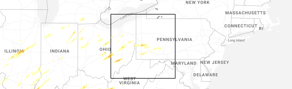
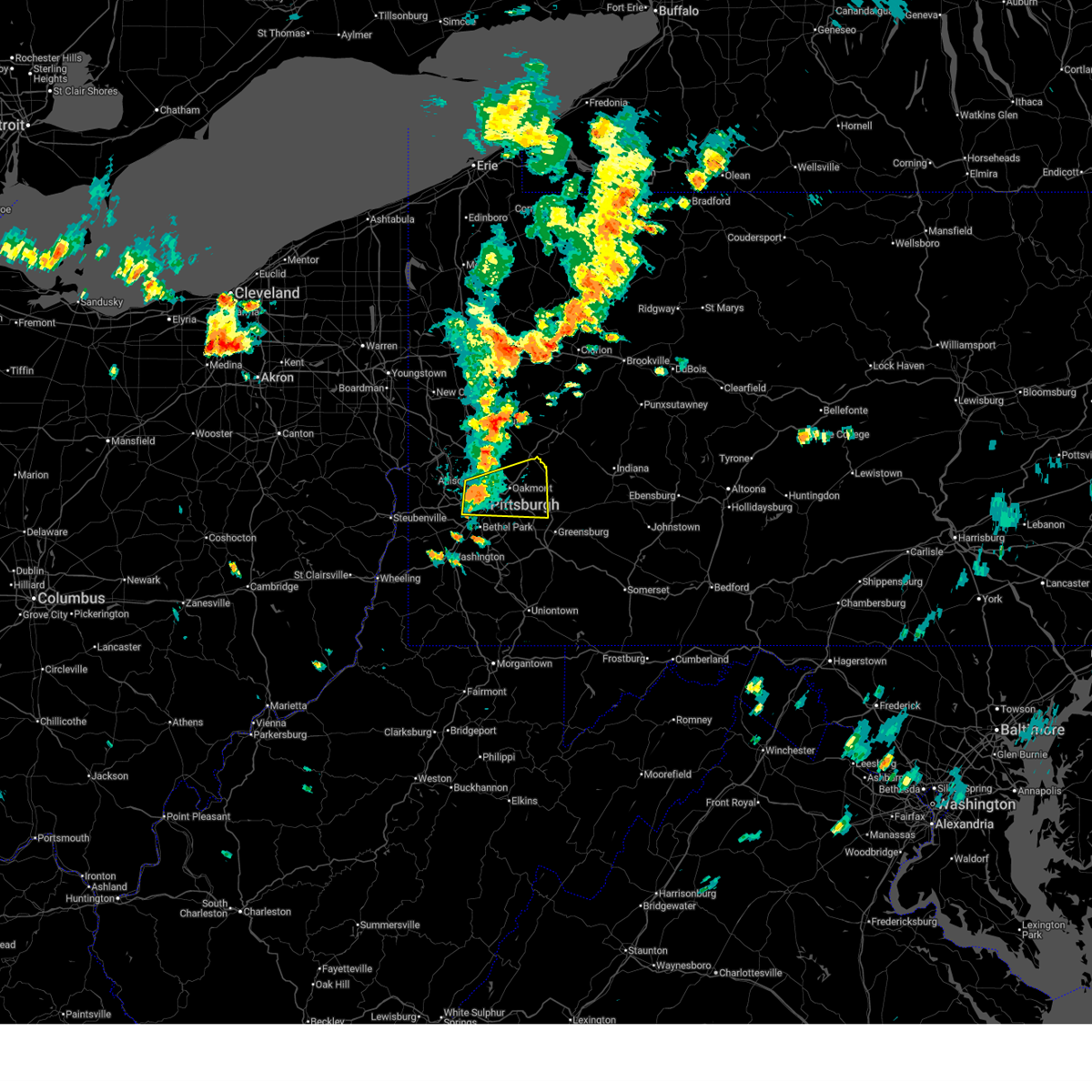
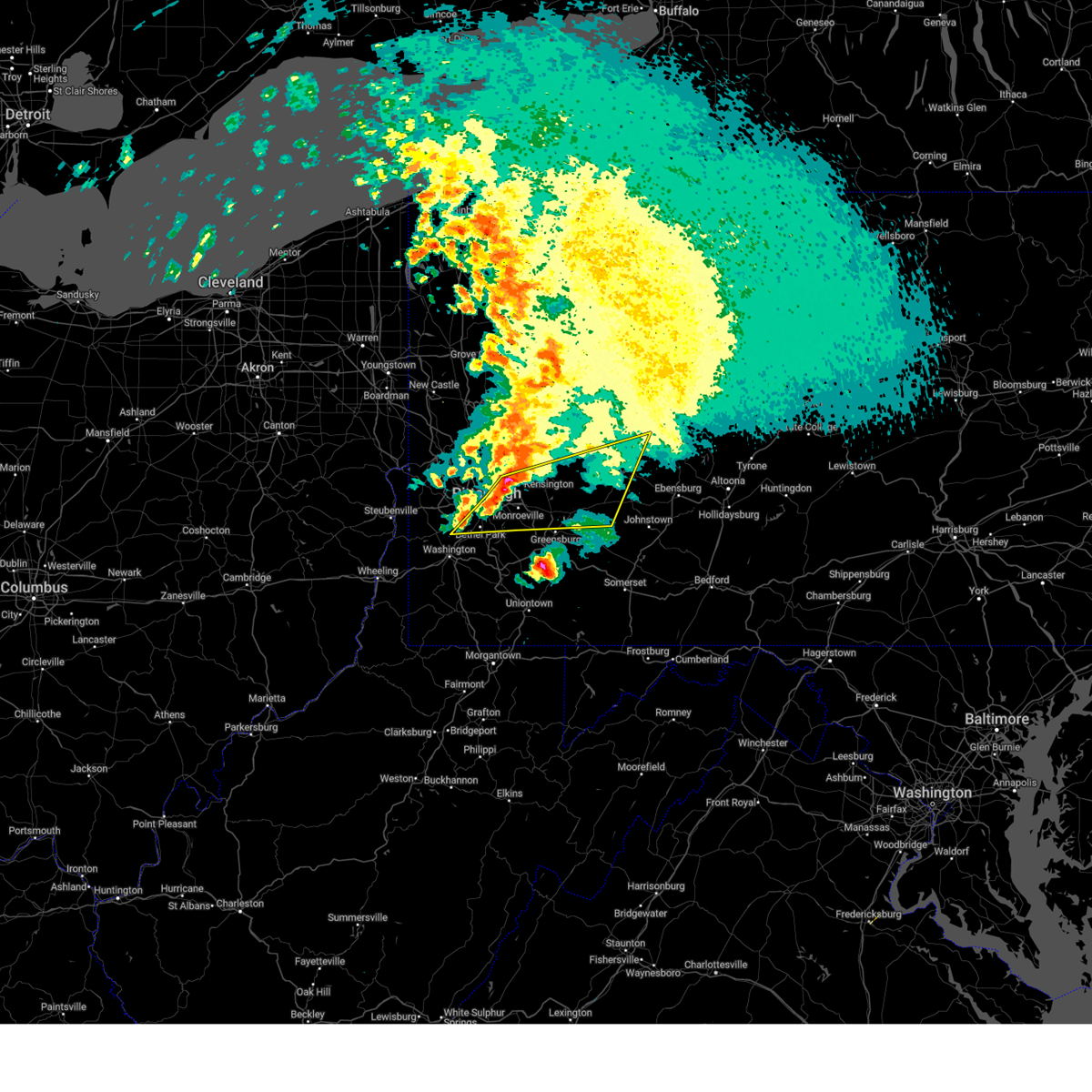
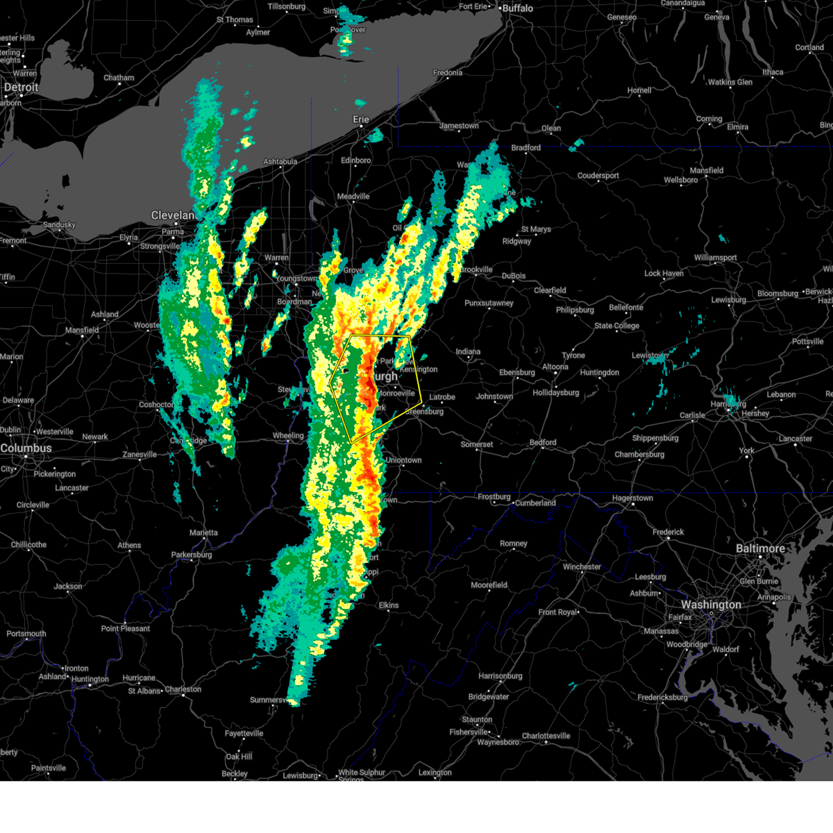
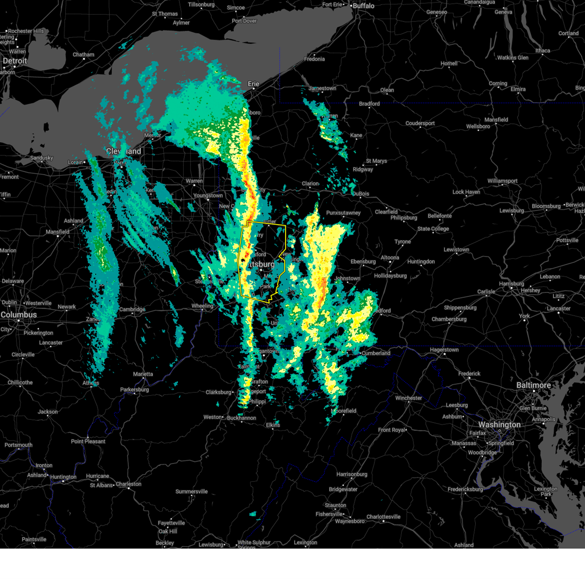
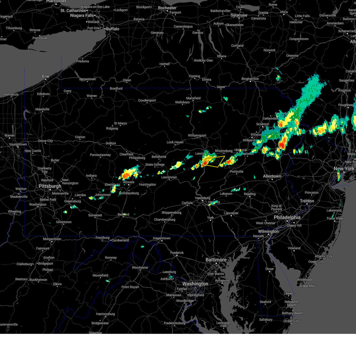
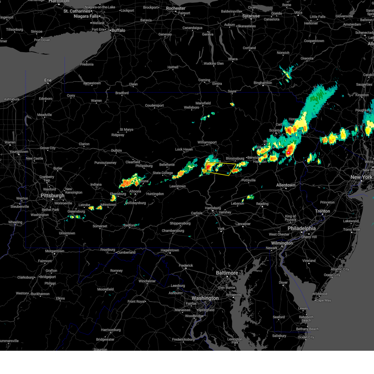
Hail Map for Edgewood, PA
The Edgewood, PA area has had 0 reports of on-the-ground hail by trained spotters, and has been under severe weather warnings 55 times during the past 12 months. Doppler radar has detected hail at or near Edgewood, PA on 78 occasions, including 4 occasions during the past year.
| Name: | Edgewood, PA |
| Where Located: | 6 miles E of Pittsburgh, PA |
| Map: | Google Map for Edgewood, PA |
| Population: | 3118 |
| Housing Units: | 1669 |
| More Info: | Search Google for Edgewood, PA |
3
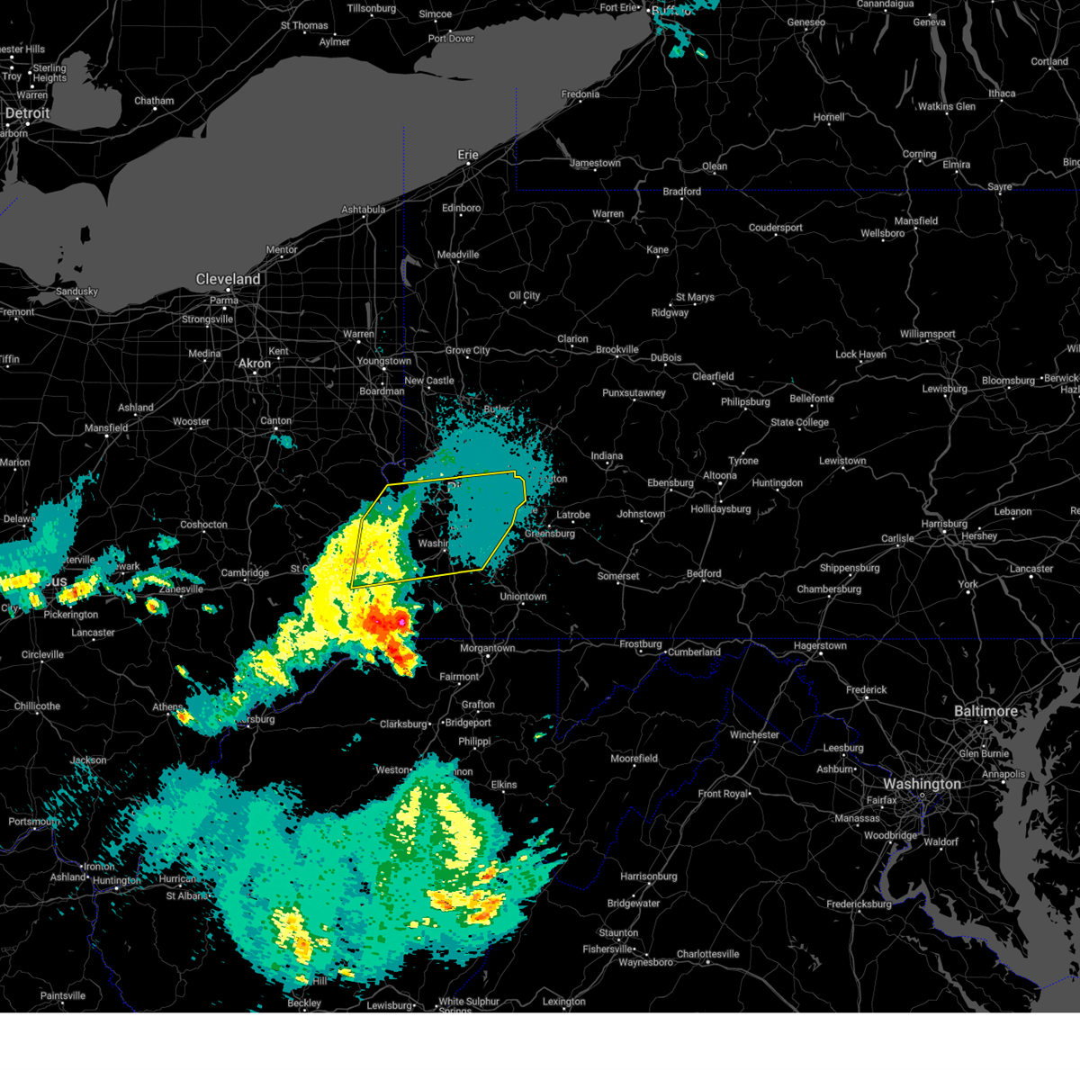
The Top Recent Hail Date for Edgewood, PA is Wednesday, April 2, 2025 (16th out of 78)
Hail and Wind Damage Spotted near Edgewood, PA
| Date / Time | Report Details |
|---|---|
| 6/26/2025 4:13 PM EDT | the severe thunderstorm warning has been cancelled and is no longer in effect |
| 6/26/2025 4:13 PM EDT | At 412 pm edt, severe thunderstorms were located along a line extending from elysburg to fairview-ferndale to urban, moving east at 30 mph (radar indicated). Hazards include 60 mph wind gusts and penny size hail. Expect damage to roofs, siding, and trees. Locations impacted include, sunbury, shamokin, mount carmel, northumberland, kulpmont, elysburg, fairview-ferndale, riverside, trevorton, shamokin dam, marshallton, and port trevorton. |
| 6/26/2025 3:26 PM EDT |
 Svrctp the national weather service in state college pa has issued a * severe thunderstorm warning for, northeastern juniata county in central pennsylvania, northumberland county in central pennsylvania, snyder county in central pennsylvania, southeastern union county in central pennsylvania, * until 430 pm edt. * at 326 pm edt, severe thunderstorms were located along a line extending from vicksburg to middleburg to richfield, moving east at 30 mph (radar indicated). Hazards include 60 mph wind gusts and penny size hail. expect damage to roofs, siding, and trees Svrctp the national weather service in state college pa has issued a * severe thunderstorm warning for, northeastern juniata county in central pennsylvania, northumberland county in central pennsylvania, snyder county in central pennsylvania, southeastern union county in central pennsylvania, * until 430 pm edt. * at 326 pm edt, severe thunderstorms were located along a line extending from vicksburg to middleburg to richfield, moving east at 30 mph (radar indicated). Hazards include 60 mph wind gusts and penny size hail. expect damage to roofs, siding, and trees
|
| 6/19/2025 12:14 AM EDT |
 the severe thunderstorm warning has been cancelled and is no longer in effect the severe thunderstorm warning has been cancelled and is no longer in effect
|
| 6/19/2025 12:14 AM EDT |
 At 1214 am edt, severe thunderstorms were located along a line from 9 miles west of marienville to over murrysville, or along a line from 9 miles west of marienville to 6 miles east of monroeville, moving east at 30 mph (law enforcement reported trees and wires down with this line of storms). Hazards include 60 mph wind gusts. Expect damage to roofs, siding, and trees. Locations impacted include, pittsburgh, penn hills, monroeville, indiana, punxsutawney, clarion, vandergrift, kittanning, brookville, marienville, homer city, apollo, knox, rimersburg, plum, murrysville, wilkinsburg, new kensington, lower burrell and harrison township. At 1214 am edt, severe thunderstorms were located along a line from 9 miles west of marienville to over murrysville, or along a line from 9 miles west of marienville to 6 miles east of monroeville, moving east at 30 mph (law enforcement reported trees and wires down with this line of storms). Hazards include 60 mph wind gusts. Expect damage to roofs, siding, and trees. Locations impacted include, pittsburgh, penn hills, monroeville, indiana, punxsutawney, clarion, vandergrift, kittanning, brookville, marienville, homer city, apollo, knox, rimersburg, plum, murrysville, wilkinsburg, new kensington, lower burrell and harrison township.
|
| 6/18/2025 11:59 PM EDT |
 The storms which prompted the warning have moved out of a portion of the area. a new severe thunderstorm warning has been issued for this line of storms to the east. The storms which prompted the warning have moved out of a portion of the area. a new severe thunderstorm warning has been issued for this line of storms to the east.
|
| 6/18/2025 11:57 PM EDT |
 Svrpbz the national weather service in pittsburgh has issued a * severe thunderstorm warning for, forest county in northwestern pennsylvania, eastern venango county in northwestern pennsylvania, northeastern allegheny county in southwestern pennsylvania, northern westmoreland county in southwestern pennsylvania, armstrong county in west central pennsylvania, eastern butler county in west central pennsylvania, clarion county in west central pennsylvania, indiana county in west central pennsylvania, jefferson pa county in west central pennsylvania, * until 115 am edt. * at 1157 pm edt, severe thunderstorms were located along a line from near tionesta to over penn hills, or along a line from 16 miles northeast of oil city to over penn hills, moving east at 30 mph (law enforcement reported trees and wires down with this line of storms). Hazards include 60 mph wind gusts. expect damage to roofs, siding, and trees Svrpbz the national weather service in pittsburgh has issued a * severe thunderstorm warning for, forest county in northwestern pennsylvania, eastern venango county in northwestern pennsylvania, northeastern allegheny county in southwestern pennsylvania, northern westmoreland county in southwestern pennsylvania, armstrong county in west central pennsylvania, eastern butler county in west central pennsylvania, clarion county in west central pennsylvania, indiana county in west central pennsylvania, jefferson pa county in west central pennsylvania, * until 115 am edt. * at 1157 pm edt, severe thunderstorms were located along a line from near tionesta to over penn hills, or along a line from 16 miles northeast of oil city to over penn hills, moving east at 30 mph (law enforcement reported trees and wires down with this line of storms). Hazards include 60 mph wind gusts. expect damage to roofs, siding, and trees
|
| 6/18/2025 11:42 PM EDT |
 At 1142 pm edt, severe thunderstorms were located along a line from over tionesta to over monongahela, or along a line from 11 miles east of oil city to 5 miles southeast of gastonville, moving east at 45 mph (law enforcement reported trees down with this line of storms). Hazards include 60 mph wind gusts. Expect damage to roofs, siding, and trees. Locations impacted include, pittsburgh, penn hills, mount lebanon, bethel park, ross township, mccandless township, monroeville, mcmurray, mckeesport, butler, franklin park, oil city, jeannette, canonsburg, franklin, clarion, vandergrift, kittanning, apollo and knox. At 1142 pm edt, severe thunderstorms were located along a line from over tionesta to over monongahela, or along a line from 11 miles east of oil city to 5 miles southeast of gastonville, moving east at 45 mph (law enforcement reported trees down with this line of storms). Hazards include 60 mph wind gusts. Expect damage to roofs, siding, and trees. Locations impacted include, pittsburgh, penn hills, mount lebanon, bethel park, ross township, mccandless township, monroeville, mcmurray, mckeesport, butler, franklin park, oil city, jeannette, canonsburg, franklin, clarion, vandergrift, kittanning, apollo and knox.
|
| 6/18/2025 11:42 PM EDT |
 the severe thunderstorm warning has been cancelled and is no longer in effect the severe thunderstorm warning has been cancelled and is no longer in effect
|
| 6/18/2025 11:29 PM EDT |
 the severe thunderstorm warning has been cancelled and is no longer in effect the severe thunderstorm warning has been cancelled and is no longer in effect
|
| 6/18/2025 11:29 PM EDT |
 At 1129 pm edt, severe thunderstorms were located along a line from near oil city to near canonsburg, moving east at 45 mph (law enforcement reported trees down with this line of storms). Hazards include 60 mph wind gusts. Expect damage to roofs, siding, and trees. Locations impacted include, pittsburgh, penn hills, mount lebanon, bethel park, ross township, mccandless township, monroeville, cranberry, moon township, new castle, mcmurray, mckeesport, butler, washington, franklin park, oil city, jeannette, aliquippa, canonsburg and grove city. At 1129 pm edt, severe thunderstorms were located along a line from near oil city to near canonsburg, moving east at 45 mph (law enforcement reported trees down with this line of storms). Hazards include 60 mph wind gusts. Expect damage to roofs, siding, and trees. Locations impacted include, pittsburgh, penn hills, mount lebanon, bethel park, ross township, mccandless township, monroeville, cranberry, moon township, new castle, mcmurray, mckeesport, butler, washington, franklin park, oil city, jeannette, aliquippa, canonsburg and grove city.
|
| 6/18/2025 11:16 PM EDT |
 the severe thunderstorm warning has been cancelled and is no longer in effect the severe thunderstorm warning has been cancelled and is no longer in effect
|
| 6/18/2025 11:16 PM EDT |
 At 1116 pm edt, severe thunderstorms were located along a line from near sugarcreek to over wolfdale, or along a line from 6 miles north of franklin to near washington, moving east at 45 mph (law enforcement reported trees down with this line of storms). Hazards include 60 mph wind gusts. Expect damage to roofs, siding, and trees. Locations impacted include, pittsburgh, penn hills, mount lebanon, bethel park, ross township, mccandless township, monroeville, cranberry, moon township, new castle, mcmurray, weirton, mckeesport, steubenville, butler, franklin park, oil city, jeannette, aliquippa and canonsburg. At 1116 pm edt, severe thunderstorms were located along a line from near sugarcreek to over wolfdale, or along a line from 6 miles north of franklin to near washington, moving east at 45 mph (law enforcement reported trees down with this line of storms). Hazards include 60 mph wind gusts. Expect damage to roofs, siding, and trees. Locations impacted include, pittsburgh, penn hills, mount lebanon, bethel park, ross township, mccandless township, monroeville, cranberry, moon township, new castle, mcmurray, weirton, mckeesport, steubenville, butler, franklin park, oil city, jeannette, aliquippa and canonsburg.
|
| 6/18/2025 10:54 PM EDT |
 Svrpbz the national weather service in pittsburgh has issued a * severe thunderstorm warning for, eastern columbiana county in east central ohio, eastern jefferson oh county in east central ohio, western forest county in northwestern pennsylvania, mercer county in northwestern pennsylvania, venango county in northwestern pennsylvania, allegheny county in southwestern pennsylvania, northern washington county in southwestern pennsylvania, northwestern westmoreland county in southwestern pennsylvania, western armstrong county in west central pennsylvania, butler county in west central pennsylvania, clarion county in west central pennsylvania, beaver county in western pennsylvania, lawrence county in western pennsylvania, brooke county in northern west virginia, hancock county in northern west virginia, * until midnight edt. * at 1054 pm edt, severe thunderstorms were located along a line from 11 miles northeast of greenville to near west liberty, or along a line from 18 miles west of franklin to near west liberty, moving east at 45 mph (law enforcement reported trees were reported down with this line of storms). Hazards include 60 mph wind gusts. expect damage to roofs, siding, and trees Svrpbz the national weather service in pittsburgh has issued a * severe thunderstorm warning for, eastern columbiana county in east central ohio, eastern jefferson oh county in east central ohio, western forest county in northwestern pennsylvania, mercer county in northwestern pennsylvania, venango county in northwestern pennsylvania, allegheny county in southwestern pennsylvania, northern washington county in southwestern pennsylvania, northwestern westmoreland county in southwestern pennsylvania, western armstrong county in west central pennsylvania, butler county in west central pennsylvania, clarion county in west central pennsylvania, beaver county in western pennsylvania, lawrence county in western pennsylvania, brooke county in northern west virginia, hancock county in northern west virginia, * until midnight edt. * at 1054 pm edt, severe thunderstorms were located along a line from 11 miles northeast of greenville to near west liberty, or along a line from 18 miles west of franklin to near west liberty, moving east at 45 mph (law enforcement reported trees were reported down with this line of storms). Hazards include 60 mph wind gusts. expect damage to roofs, siding, and trees
|
| 6/18/2025 6:00 PM EDT | The storm which prompted the warning has weakened below severe limits, and no longer poses an immediate threat to life or property. therefore, the warning has been allowed to expire. however, gusty winds and heavy rain are still possible with this thunderstorm. |
| 6/18/2025 5:49 PM EDT |
 At 549 pm edt, a severe thunderstorm was located over springdale, or near penn hills, moving east at 35 mph (law enforcement reported). Hazards include 60 mph wind gusts. Expect damage to roofs, siding, and trees. locations impacted include, pittsburgh, penn hills, monroeville, shaler township, plum, west mifflin, baldwin, murrysville, hampton township, wilkinsburg, new kensington, lower burrell, munhall, harrison township, north versailles, swissvale, o'hara township, forest hills, wilkins township and oakmont. Tree was reported down in the north hills of pittsburgh. At 549 pm edt, a severe thunderstorm was located over springdale, or near penn hills, moving east at 35 mph (law enforcement reported). Hazards include 60 mph wind gusts. Expect damage to roofs, siding, and trees. locations impacted include, pittsburgh, penn hills, monroeville, shaler township, plum, west mifflin, baldwin, murrysville, hampton township, wilkinsburg, new kensington, lower burrell, munhall, harrison township, north versailles, swissvale, o'hara township, forest hills, wilkins township and oakmont. Tree was reported down in the north hills of pittsburgh.
|
| 6/18/2025 5:38 PM EDT |
 At 538 pm edt, a severe thunderstorm was located over o'hara township, or 6 miles northwest of penn hills, moving east at 35 mph (radar indicated). Hazards include 60 mph wind gusts. Expect damage to roofs, siding, and trees. Locations impacted include, pittsburgh, penn hills, mount lebanon, ross township, mccandless township, monroeville, shaler township, plum, west mifflin, north side pittsburgh, baldwin, murrysville, hampton township, scott township, wilkinsburg, new kensington, lower burrell, munhall, harrison township and north versailles. At 538 pm edt, a severe thunderstorm was located over o'hara township, or 6 miles northwest of penn hills, moving east at 35 mph (radar indicated). Hazards include 60 mph wind gusts. Expect damage to roofs, siding, and trees. Locations impacted include, pittsburgh, penn hills, mount lebanon, ross township, mccandless township, monroeville, shaler township, plum, west mifflin, north side pittsburgh, baldwin, murrysville, hampton township, scott township, wilkinsburg, new kensington, lower burrell, munhall, harrison township and north versailles.
|
| 6/18/2025 5:29 PM EDT |
 At 529 pm edt, a severe thunderstorm was located over ross township, moving east at 35 mph (radar indicated). Hazards include 60 mph wind gusts. Expect damage to roofs, siding, and trees. Locations impacted include, pittsburgh, penn hills, mount lebanon, ross township, mccandless township, monroeville, franklin park, shaler township, plum, west mifflin, north side pittsburgh, baldwin, murrysville, hampton township, scott township, wilkinsburg, robinson township, new kensington, lower burrell and munhall. At 529 pm edt, a severe thunderstorm was located over ross township, moving east at 35 mph (radar indicated). Hazards include 60 mph wind gusts. Expect damage to roofs, siding, and trees. Locations impacted include, pittsburgh, penn hills, mount lebanon, ross township, mccandless township, monroeville, franklin park, shaler township, plum, west mifflin, north side pittsburgh, baldwin, murrysville, hampton township, scott township, wilkinsburg, robinson township, new kensington, lower burrell and munhall.
|
| 6/18/2025 5:20 PM EDT |
 Svrpbz the national weather service in pittsburgh has issued a * severe thunderstorm warning for, central allegheny county in southwestern pennsylvania, northwestern westmoreland county in southwestern pennsylvania, * until 600 pm edt. * at 520 pm edt, a severe thunderstorm was located over kennedy township, or 5 miles southwest of ross township, moving east at 35 mph (radar indicated). Hazards include 60 mph wind gusts. expect damage to roofs, siding, and trees Svrpbz the national weather service in pittsburgh has issued a * severe thunderstorm warning for, central allegheny county in southwestern pennsylvania, northwestern westmoreland county in southwestern pennsylvania, * until 600 pm edt. * at 520 pm edt, a severe thunderstorm was located over kennedy township, or 5 miles southwest of ross township, moving east at 35 mph (radar indicated). Hazards include 60 mph wind gusts. expect damage to roofs, siding, and trees
|
| 5/17/2025 1:26 AM EDT |
 The storms which prompted the warning have weakened below severe limits, and no longer pose an immediate threat to life or property. therefore, the warning will be allowed to expire. however, gusty winds are still possible with these thunderstorms. to report severe weather, contact your nearest law enforcement agency. they will send your report to the national weather service office. a severe thunderstorm watch remains in effect until 400 am edt saturday for a portion of southwest pennsylvania. The storms which prompted the warning have weakened below severe limits, and no longer pose an immediate threat to life or property. therefore, the warning will be allowed to expire. however, gusty winds are still possible with these thunderstorms. to report severe weather, contact your nearest law enforcement agency. they will send your report to the national weather service office. a severe thunderstorm watch remains in effect until 400 am edt saturday for a portion of southwest pennsylvania.
|
| 5/17/2025 1:12 AM EDT |
 the severe thunderstorm warning has been cancelled and is no longer in effect the severe thunderstorm warning has been cancelled and is no longer in effect
|
| 5/17/2025 1:12 AM EDT |
 At 112 am edt, severe thunderstorms were located along a line from over mccandless township to 7 miles south of washington, moving east at 50 mph (radar indicated). Hazards include 60 mph wind gusts. Expect damage to roofs, siding, and trees. Locations impacted include, pittsburgh, penn hills, mount lebanon, bethel park, ross township, mccandless township, monroeville, moon township, mcmurray, mckeesport, washington, franklin park, canonsburg, avella, gastonville, shaler township, plum, west mifflin, north side pittsburgh and baldwin. At 112 am edt, severe thunderstorms were located along a line from over mccandless township to 7 miles south of washington, moving east at 50 mph (radar indicated). Hazards include 60 mph wind gusts. Expect damage to roofs, siding, and trees. Locations impacted include, pittsburgh, penn hills, mount lebanon, bethel park, ross township, mccandless township, monroeville, moon township, mcmurray, mckeesport, washington, franklin park, canonsburg, avella, gastonville, shaler township, plum, west mifflin, north side pittsburgh and baldwin.
|
| 5/17/2025 1:03 AM EDT | the severe thunderstorm warning has been cancelled and is no longer in effect |
| 5/17/2025 1:03 AM EDT | At 103 am edt, severe thunderstorms were located along a line from over franklin park to 11 miles southwest of wolfdale, or along a line from over franklin park to 10 miles east of valley grove, moving east at 50 mph (radar indicated). Hazards include 60 mph wind gusts. Expect damage to roofs, siding, and trees. Locations impacted include, pittsburgh, penn hills, mount lebanon, bethel park, ross township, wheeling, mccandless township, monroeville, moon township, mcmurray, weirton, mckeesport, washington, franklin park, canonsburg, martins ferry, warwood, wellsburg, bethlehem and west liberty. |
| 5/17/2025 12:42 AM EDT |
 Svrpbz the national weather service in pittsburgh has issued a * severe thunderstorm warning for, northeastern belmont county in east central ohio, southeastern jefferson oh county in east central ohio, allegheny county in southwestern pennsylvania, washington county in southwestern pennsylvania, southwestern beaver county in western pennsylvania, brooke county in northern west virginia, hancock county in northern west virginia, marshall county in northern west virginia, ohio county in northern west virginia, * until 130 am edt. * at 1242 am edt, severe thunderstorms were located along a line from 7 miles south of shippingport to over bellaire, or along a line from 9 miles southeast of east liverpool to over bellaire, moving east at 50 mph (radar indicated). Hazards include 60 mph wind gusts. expect damage to roofs, siding, and trees Svrpbz the national weather service in pittsburgh has issued a * severe thunderstorm warning for, northeastern belmont county in east central ohio, southeastern jefferson oh county in east central ohio, allegheny county in southwestern pennsylvania, washington county in southwestern pennsylvania, southwestern beaver county in western pennsylvania, brooke county in northern west virginia, hancock county in northern west virginia, marshall county in northern west virginia, ohio county in northern west virginia, * until 130 am edt. * at 1242 am edt, severe thunderstorms were located along a line from 7 miles south of shippingport to over bellaire, or along a line from 9 miles southeast of east liverpool to over bellaire, moving east at 50 mph (radar indicated). Hazards include 60 mph wind gusts. expect damage to roofs, siding, and trees
|
| 4/29/2025 7:53 PM EDT | the severe thunderstorm warning has been cancelled and is no longer in effect |
| 4/29/2025 7:53 PM EDT | At 753 pm edt, severe thunderstorms were located along a line extending from ralston to barbours to watsontown to port trevorton, moving east at 60 mph (radar indicated). Hazards include 60 mph wind gusts. Expect damage to roofs, siding, and trees. locations impacted include, lairdsville, northumberland, sunbury, ralston, leck kill, urban, seven points, shamokin dam, hummels wharf, mooresburg, biggertown, and stonington. for those driving on interstate 80, this includes areas between the milton-williamsport and buckhorn exits, specifically from mile markers 213 to 227. This includes interstate 180 from mile markers 2 to 16. |
| 4/29/2025 7:16 PM EDT | Svrctp the national weather service in state college pa has issued a * severe thunderstorm warning for, juniata county in central pennsylvania, lycoming county in north central pennsylvania, northeastern mifflin county in central pennsylvania, montour county in central pennsylvania, northumberland county in central pennsylvania, northern perry county in south central pennsylvania, snyder county in central pennsylvania, union county in central pennsylvania, * until 815 pm edt. * at 716 pm edt, severe thunderstorms were located along a line extending from tamarack to dunnstown to rebersburg to walnut, moving east at 60 mph (radar indicated). Hazards include 60 mph wind gusts. expect damage to roofs, siding, and trees |
| 4/29/2025 5:26 PM EDT | The storms which prompted the warning have moved out of the area. therefore, the warning will be allowed to expire. however, gusty winds are still possible with these thunderstorms. a severe thunderstorm watch remains in effect until 1000 pm edt for western, southwestern and west central pennsylvania. remember, a severe thunderstorm warning still remains in effect for butler, armstrong, and westmoreland counties. |
| 4/29/2025 5:17 PM EDT | Torpbz the national weather service in pittsburgh has issued a * tornado warning for, east central allegheny county in southwestern pennsylvania, northwestern westmoreland county in southwestern pennsylvania, * until 530 pm edt. * at 517 pm edt, severe thunderstorms capable of producing both tornadoes and extensive straight line wind damage were located over churchill, or over penn hills, moving east at 65 mph (radar indicated rotation). Hazards include tornado. Flying debris will be dangerous to those caught without shelter. mobile homes will be damaged or destroyed. damage to roofs, windows and vehicles will occur. Tree damage is likely. |
| 4/29/2025 5:10 PM EDT | At 509 pm edt, severe thunderstorms were located along a line extending from near ellwood city to near gibsonia to brentwood to mcmurray, moving east at 65 mph. these are destructive storms for allegheny, butler, and armstrong counties (radar indicated). Hazards include 80 mph wind gusts. Extensive tree damage and widespread power outages. mobile homes will be heavily damaged. expect considerable damage to roofs, windows and vehicles. Locations impacted include, pittsburgh, penn hills, mount lebanon, bethel park, ross township, mccandless township, monroeville, cranberry, moon township, mcmurray, greensburg, mckeesport, butler, washington, franklin park, jeannette, aliquippa, canonsburg, beaver falls, and monaca. |
| 4/29/2025 5:10 PM EDT | the severe thunderstorm warning has been cancelled and is no longer in effect |
| 4/29/2025 4:46 PM EDT | Svrpbz the national weather service in pittsburgh has issued a * severe thunderstorm warning for, eastern columbiana county in east central ohio, beaver county in western pennsylvania, northern washington county in southwestern pennsylvania, southeastern lawrence county in western pennsylvania, butler county in west central pennsylvania, southwestern indiana county in west central pennsylvania, allegheny county in southwestern pennsylvania, northwestern westmoreland county in southwestern pennsylvania, armstrong county in west central pennsylvania, ohio county in northern west virginia, brooke county in northern west virginia, hancock county in northern west virginia, * until 530 pm edt. * at 445 pm edt, severe thunderstorms were located along a line extending from lisbon to near shippingport to near avella to west liberty, moving east at 75 mph. these are destructive storms for southern beaver, northern washington, and allegheny counties (radar indicated). Hazards include 80 mph wind gusts. Extensive tree damage and widespread power outages. mobile homes will be heavily damaged. Expect considerable damage to roofs, windows and vehicles. |
| 4/3/2025 4:57 AM EDT |
 At 457 am edt, severe thunderstorms were located along a line from over clarion to over churchill, or along a line from over clarion to over penn hills, moving northeast at 65 mph (radar indicated). Hazards include 60 mph wind gusts. Expect damage to roofs, siding, and trees. Locations impacted include, pittsburgh, penn hills, monroeville, mckeesport, clarion, vandergrift, kittanning, brookville, apollo, rimersburg, plum, west mifflin, murrysville, wilkinsburg, new kensington, lower burrell, munhall, harrison township, north versailles and swissvale. At 457 am edt, severe thunderstorms were located along a line from over clarion to over churchill, or along a line from over clarion to over penn hills, moving northeast at 65 mph (radar indicated). Hazards include 60 mph wind gusts. Expect damage to roofs, siding, and trees. Locations impacted include, pittsburgh, penn hills, monroeville, mckeesport, clarion, vandergrift, kittanning, brookville, apollo, rimersburg, plum, west mifflin, murrysville, wilkinsburg, new kensington, lower burrell, munhall, harrison township, north versailles and swissvale.
|
| 4/3/2025 4:57 AM EDT |
 the severe thunderstorm warning has been cancelled and is no longer in effect the severe thunderstorm warning has been cancelled and is no longer in effect
|
| 4/3/2025 4:47 AM EDT | At 447 am edt, severe thunderstorms were located along a line from 6 miles south of knox to over dormont, or along a line from 6 miles south of knox to over mount lebanon, moving northeast at 65 mph (radar indicated). Hazards include 60 mph wind gusts. Expect damage to roofs, siding, and trees. locations impacted include, pittsburgh, penn hills, mount lebanon, bethel park, monroeville, mckeesport, clarion, vandergrift, kittanning, brookville, apollo, rimersburg, shaler township, plum, west mifflin, north side pittsburgh, baldwin, upper st. Clair, murrysville and hampton township. |
| 4/3/2025 4:47 AM EDT | the severe thunderstorm warning has been cancelled and is no longer in effect |
| 4/3/2025 4:37 AM EDT | Svrpbz the national weather service in pittsburgh has issued a * severe thunderstorm warning for, allegheny county in southwestern pennsylvania, north central washington county in southwestern pennsylvania, northwestern westmoreland county in southwestern pennsylvania, armstrong county in west central pennsylvania, eastern butler county in west central pennsylvania, clarion county in west central pennsylvania, western indiana county in west central pennsylvania, western jefferson pa county in west central pennsylvania, * until 515 am edt. * at 437 am edt, severe thunderstorms were located along a line from 15 miles northeast of shanor-northvue to over cecil-bishop, or along a line from 13 miles west of rimersburg to 6 miles north of canonsburg, moving northeast at 65 mph (radar indicated). Hazards include 60 mph wind gusts. expect damage to roofs, siding, and trees |
| 4/2/2025 2:45 PM EDT |
 At 245 pm edt, severe thunderstorms were located along a line from over vandergrift to over wilkins township, or along a line from over vandergrift to near monroeville, moving east at 70 mph (radar indicated). Hazards include quarter size hail. Damage to vehicles is expected. locations impacted include, pittsburgh, penn hills, bethel park, monroeville, greensburg, mckeesport, indiana, jeannette, latrobe, vandergrift, homer city, apollo, plum, west mifflin, baldwin, upper st. Clair, murrysville, wilkinsburg, whitehall and south park township. At 245 pm edt, severe thunderstorms were located along a line from over vandergrift to over wilkins township, or along a line from over vandergrift to near monroeville, moving east at 70 mph (radar indicated). Hazards include quarter size hail. Damage to vehicles is expected. locations impacted include, pittsburgh, penn hills, bethel park, monroeville, greensburg, mckeesport, indiana, jeannette, latrobe, vandergrift, homer city, apollo, plum, west mifflin, baldwin, upper st. Clair, murrysville, wilkinsburg, whitehall and south park township.
|
| 4/2/2025 2:45 PM EDT |
 the severe thunderstorm warning has been cancelled and is no longer in effect the severe thunderstorm warning has been cancelled and is no longer in effect
|
| 4/2/2025 2:33 PM EDT |
 Svrpbz the national weather service in pittsburgh has issued a * severe thunderstorm warning for, eastern allegheny county in southwestern pennsylvania, central washington county in southwestern pennsylvania, central westmoreland county in southwestern pennsylvania, southern armstrong county in west central pennsylvania, central indiana county in west central pennsylvania, * until 315 pm edt. * at 233 pm edt, severe thunderstorms were located along a line from over arnold to over scott township, or along a line from 8 miles north of penn hills to over mount lebanon, moving east at 70 mph (radar indicated). Hazards include half dollar size hail. damage to vehicles is expected Svrpbz the national weather service in pittsburgh has issued a * severe thunderstorm warning for, eastern allegheny county in southwestern pennsylvania, central washington county in southwestern pennsylvania, central westmoreland county in southwestern pennsylvania, southern armstrong county in west central pennsylvania, central indiana county in west central pennsylvania, * until 315 pm edt. * at 233 pm edt, severe thunderstorms were located along a line from over arnold to over scott township, or along a line from 8 miles north of penn hills to over mount lebanon, moving east at 70 mph (radar indicated). Hazards include half dollar size hail. damage to vehicles is expected
|
| 3/16/2025 12:56 PM EDT |
 The severe thunderstorm warning that was previously in effect has been reissued for allegheny, butler, armstrong, and westmoreland counties. please refer to those bulletins for the latest severe weather information. to report severe weather, contact your nearest law enforcement agency. they will send your report to the national weather service office. The severe thunderstorm warning that was previously in effect has been reissued for allegheny, butler, armstrong, and westmoreland counties. please refer to those bulletins for the latest severe weather information. to report severe weather, contact your nearest law enforcement agency. they will send your report to the national weather service office.
|
| 3/16/2025 12:43 PM EDT |
 At 1243 pm edt, a severe thunderstorm was located over pittsburgh, moving northeast at 45 mph (radar indicated). Hazards include 70 mph wind gusts and small hail. Expect considerable tree damage. damage is likely to mobile homes, roofs, and outbuildings. Locations impacted include, pittsburgh, penn hills, mount lebanon, bethel park, ross township, mccandless township, monroeville, cranberry, moon township, mcmurray, mckeesport, franklin park, jeannette, aliquippa, gastonville, shaler township, plum, west mifflin, north side pittsburgh and baldwin. At 1243 pm edt, a severe thunderstorm was located over pittsburgh, moving northeast at 45 mph (radar indicated). Hazards include 70 mph wind gusts and small hail. Expect considerable tree damage. damage is likely to mobile homes, roofs, and outbuildings. Locations impacted include, pittsburgh, penn hills, mount lebanon, bethel park, ross township, mccandless township, monroeville, cranberry, moon township, mcmurray, mckeesport, franklin park, jeannette, aliquippa, gastonville, shaler township, plum, west mifflin, north side pittsburgh and baldwin.
|
| 3/16/2025 12:34 PM EDT |
 At 1234 pm edt, a severe thunderstorm was located over mount lebanon, moving northeast at 45 mph (radar indicated). Hazards include 70 mph wind gusts and small hail. Expect considerable tree damage. damage is likely to mobile homes, roofs, and outbuildings. Locations impacted include, pittsburgh, penn hills, mount lebanon, bethel park, ross township, mccandless township, monroeville, cranberry, moon township, mcmurray, mckeesport, washington, franklin park, jeannette, aliquippa, canonsburg, gastonville, shaler township, plum and west mifflin. At 1234 pm edt, a severe thunderstorm was located over mount lebanon, moving northeast at 45 mph (radar indicated). Hazards include 70 mph wind gusts and small hail. Expect considerable tree damage. damage is likely to mobile homes, roofs, and outbuildings. Locations impacted include, pittsburgh, penn hills, mount lebanon, bethel park, ross township, mccandless township, monroeville, cranberry, moon township, mcmurray, mckeesport, washington, franklin park, jeannette, aliquippa, canonsburg, gastonville, shaler township, plum and west mifflin.
|
| 3/16/2025 12:34 PM EDT |
 the severe thunderstorm warning has been cancelled and is no longer in effect the severe thunderstorm warning has been cancelled and is no longer in effect
|
| 3/16/2025 12:16 PM EDT |
 Svrpbz the national weather service in pittsburgh has issued a * severe thunderstorm warning for, allegheny county in southwestern pennsylvania, north central greene county in southwestern pennsylvania, central washington county in southwestern pennsylvania, northwestern westmoreland county in southwestern pennsylvania, southwestern armstrong county in west central pennsylvania, southern butler county in west central pennsylvania, southeastern beaver county in western pennsylvania, * until 100 pm edt. * at 1216 pm edt, a severe thunderstorm was located over mcgovern, or over canonsburg, moving northeast at 45 mph (radar indicated). Hazards include 60 mph wind gusts. expect damage to roofs, siding, and trees Svrpbz the national weather service in pittsburgh has issued a * severe thunderstorm warning for, allegheny county in southwestern pennsylvania, north central greene county in southwestern pennsylvania, central washington county in southwestern pennsylvania, northwestern westmoreland county in southwestern pennsylvania, southwestern armstrong county in west central pennsylvania, southern butler county in west central pennsylvania, southeastern beaver county in western pennsylvania, * until 100 pm edt. * at 1216 pm edt, a severe thunderstorm was located over mcgovern, or over canonsburg, moving northeast at 45 mph (radar indicated). Hazards include 60 mph wind gusts. expect damage to roofs, siding, and trees
|
| 11/20/2024 5:11 PM EST |
 Portions of the warning have been replaced with a new warning. gusty winds are still possible with these thunderstorms. Portions of the warning have been replaced with a new warning. gusty winds are still possible with these thunderstorms.
|
| 11/20/2024 5:10 PM EST |
 Svrpbz the national weather service in pittsburgh has issued a * severe thunderstorm warning for, eastern allegheny county in southwestern pennsylvania, northeastern fayette county in southwestern pennsylvania, westmoreland county in southwestern pennsylvania, southern armstrong county in west central pennsylvania, southeastern butler county in west central pennsylvania, indiana county in west central pennsylvania, * until 615 pm est. * at 510 pm est, severe thunderstorms were located along a line from 10 miles north of sarver to near perryopolis, or along a line from 8 miles east of butler to 10 miles northwest of connellsville, moving east at 40 mph (radar indicated). Hazards include 60 mph wind gusts. expect damage to roofs, siding, and trees Svrpbz the national weather service in pittsburgh has issued a * severe thunderstorm warning for, eastern allegheny county in southwestern pennsylvania, northeastern fayette county in southwestern pennsylvania, westmoreland county in southwestern pennsylvania, southern armstrong county in west central pennsylvania, southeastern butler county in west central pennsylvania, indiana county in west central pennsylvania, * until 615 pm est. * at 510 pm est, severe thunderstorms were located along a line from 10 miles north of sarver to near perryopolis, or along a line from 8 miles east of butler to 10 miles northwest of connellsville, moving east at 40 mph (radar indicated). Hazards include 60 mph wind gusts. expect damage to roofs, siding, and trees
|
| 11/20/2024 4:59 PM EST |
 At 459 pm est, severe thunderstorms were located along a line from 5 miles southeast of oak hills to over gastonville, or along a line from 7 miles south of butler to over gastonville, moving east at 35 mph (measured wind gust). Hazards include 60 mph wind gusts. Expect damage to roofs, siding, and trees. locations impacted include, pittsburgh, penn hills, mount lebanon, bethel park, ross township, mccandless township, monroeville, mcmurray, mckeesport, butler, franklin park, gastonville, shaler township, plum, west mifflin, north side pittsburgh, baldwin, upper st. Clair, murrysville and hampton township. At 459 pm est, severe thunderstorms were located along a line from 5 miles southeast of oak hills to over gastonville, or along a line from 7 miles south of butler to over gastonville, moving east at 35 mph (measured wind gust). Hazards include 60 mph wind gusts. Expect damage to roofs, siding, and trees. locations impacted include, pittsburgh, penn hills, mount lebanon, bethel park, ross township, mccandless township, monroeville, mcmurray, mckeesport, butler, franklin park, gastonville, shaler township, plum, west mifflin, north side pittsburgh, baldwin, upper st. Clair, murrysville and hampton township.
|
| 11/20/2024 4:59 PM EST |
 the severe thunderstorm warning has been cancelled and is no longer in effect the severe thunderstorm warning has been cancelled and is no longer in effect
|
| 11/20/2024 4:43 PM EST |
 At 443 pm est, severe thunderstorms were located along a line from over evans city to over canonsburg, or along a line from 7 miles northeast of cranberry to over mcmurray, moving east at 35 mph (radar indicated). Hazards include 60 mph wind gusts. Expect damage to roofs, siding, and trees. Locations impacted include, pittsburgh, penn hills, mount lebanon, bethel park, ross township, mccandless township, monroeville, cranberry, moon township, mcmurray, mckeesport, butler, franklin park, aliquippa, canonsburg, gastonville, shaler township, plum, west mifflin and north side pittsburgh. At 443 pm est, severe thunderstorms were located along a line from over evans city to over canonsburg, or along a line from 7 miles northeast of cranberry to over mcmurray, moving east at 35 mph (radar indicated). Hazards include 60 mph wind gusts. Expect damage to roofs, siding, and trees. Locations impacted include, pittsburgh, penn hills, mount lebanon, bethel park, ross township, mccandless township, monroeville, cranberry, moon township, mcmurray, mckeesport, butler, franklin park, aliquippa, canonsburg, gastonville, shaler township, plum, west mifflin and north side pittsburgh.
|
| 11/20/2024 4:24 PM EST |
 Svrpbz the national weather service in pittsburgh has issued a * severe thunderstorm warning for, allegheny county in southwestern pennsylvania, central washington county in southwestern pennsylvania, southern butler county in west central pennsylvania, beaver county in western pennsylvania, * until 515 pm est. * at 424 pm est, severe thunderstorms were located along a line from near ellwood city to 8 miles north of wolfdale, or along a line from 6 miles northeast of beaver falls to 7 miles east of avella, moving east at 35 mph (radar indicated). Hazards include 60 mph wind gusts. expect damage to roofs, siding, and trees Svrpbz the national weather service in pittsburgh has issued a * severe thunderstorm warning for, allegheny county in southwestern pennsylvania, central washington county in southwestern pennsylvania, southern butler county in west central pennsylvania, beaver county in western pennsylvania, * until 515 pm est. * at 424 pm est, severe thunderstorms were located along a line from near ellwood city to 8 miles north of wolfdale, or along a line from 6 miles northeast of beaver falls to 7 miles east of avella, moving east at 35 mph (radar indicated). Hazards include 60 mph wind gusts. expect damage to roofs, siding, and trees
|
| 10/6/2024 8:10 PM EDT |
 Svrpbz the national weather service in pittsburgh has issued a * severe thunderstorm warning for, northeastern allegheny county in southwestern pennsylvania, northwestern westmoreland county in southwestern pennsylvania, south central armstrong county in west central pennsylvania, south central butler county in west central pennsylvania, southwestern indiana county in west central pennsylvania, * until 900 pm edt. * at 810 pm edt, a severe thunderstorm was located over mccandless township, moving southeast at 45 mph (radar indicated). Hazards include 60 mph wind gusts and small hail. expect damage to roofs, siding, and trees Svrpbz the national weather service in pittsburgh has issued a * severe thunderstorm warning for, northeastern allegheny county in southwestern pennsylvania, northwestern westmoreland county in southwestern pennsylvania, south central armstrong county in west central pennsylvania, south central butler county in west central pennsylvania, southwestern indiana county in west central pennsylvania, * until 900 pm edt. * at 810 pm edt, a severe thunderstorm was located over mccandless township, moving southeast at 45 mph (radar indicated). Hazards include 60 mph wind gusts and small hail. expect damage to roofs, siding, and trees
|
| 8/17/2024 4:29 PM EDT |
 At 429 pm edt, a severe thunderstorm was located over murrysville, or near monroeville, moving east at 40 mph (radar indicated). Hazards include 60 mph wind gusts and quarter size hail. Hail damage to vehicles is expected. expect wind damage to roofs, siding, and trees. Locations impacted include, pittsburgh, penn hills, monroeville, greensburg, mckeesport, jeannette, latrobe, vandergrift, kittanning, apollo, plum, west mifflin, murrysville, wilkinsburg, new kensington, lower burrell, munhall, harrison township, north versailles and swissvale. At 429 pm edt, a severe thunderstorm was located over murrysville, or near monroeville, moving east at 40 mph (radar indicated). Hazards include 60 mph wind gusts and quarter size hail. Hail damage to vehicles is expected. expect wind damage to roofs, siding, and trees. Locations impacted include, pittsburgh, penn hills, monroeville, greensburg, mckeesport, jeannette, latrobe, vandergrift, kittanning, apollo, plum, west mifflin, murrysville, wilkinsburg, new kensington, lower burrell, munhall, harrison township, north versailles and swissvale.
|
| 8/17/2024 4:19 PM EDT |
 Svrpbz the national weather service in pittsburgh has issued a * severe thunderstorm warning for, eastern allegheny county in southwestern pennsylvania, central westmoreland county in southwestern pennsylvania, southern armstrong county in west central pennsylvania, southeastern butler county in west central pennsylvania, southwestern indiana county in west central pennsylvania, * until 500 pm edt. * at 419 pm edt, a severe thunderstorm was located over wilkins township, or over monroeville, moving east at 40 mph (radar indicated). Hazards include 60 mph wind gusts and quarter size hail. Hail damage to vehicles is expected. Expect wind damage to roofs, siding, and trees. Svrpbz the national weather service in pittsburgh has issued a * severe thunderstorm warning for, eastern allegheny county in southwestern pennsylvania, central westmoreland county in southwestern pennsylvania, southern armstrong county in west central pennsylvania, southeastern butler county in west central pennsylvania, southwestern indiana county in west central pennsylvania, * until 500 pm edt. * at 419 pm edt, a severe thunderstorm was located over wilkins township, or over monroeville, moving east at 40 mph (radar indicated). Hazards include 60 mph wind gusts and quarter size hail. Hail damage to vehicles is expected. Expect wind damage to roofs, siding, and trees.
|
| 6/30/2024 2:29 PM EDT |
 At 229 pm edt, a severe thunderstorm was located over locustdale, moving east at 45 mph (radar indicated). Hazards include 60 mph wind gusts and quarter size hail. Hail damage to vehicles is expected. expect wind damage to roofs, siding, and trees. locations impacted include, pottsville, shamokin, mount carmel, shenandoah, frackville, st. clair, kulpmont, ashland, elysburg, fairview-ferndale, girardville, and marshallton. This includes interstate 81 from mile markers 116 to 125. At 229 pm edt, a severe thunderstorm was located over locustdale, moving east at 45 mph (radar indicated). Hazards include 60 mph wind gusts and quarter size hail. Hail damage to vehicles is expected. expect wind damage to roofs, siding, and trees. locations impacted include, pottsville, shamokin, mount carmel, shenandoah, frackville, st. clair, kulpmont, ashland, elysburg, fairview-ferndale, girardville, and marshallton. This includes interstate 81 from mile markers 116 to 125.
|
| 6/30/2024 2:14 PM EDT |
 Svrctp the national weather service in state college pa has issued a * severe thunderstorm warning for, southeastern columbia county in central pennsylvania, east central northumberland county in central pennsylvania, central schuylkill county in central pennsylvania, * until 245 pm edt. * at 214 pm edt, a severe thunderstorm was located over fairview-ferndale, moving east at 45 mph (radar indicated). Hazards include 60 mph wind gusts and quarter size hail. Hail damage to vehicles is expected. Expect wind damage to roofs, siding, and trees. Svrctp the national weather service in state college pa has issued a * severe thunderstorm warning for, southeastern columbia county in central pennsylvania, east central northumberland county in central pennsylvania, central schuylkill county in central pennsylvania, * until 245 pm edt. * at 214 pm edt, a severe thunderstorm was located over fairview-ferndale, moving east at 45 mph (radar indicated). Hazards include 60 mph wind gusts and quarter size hail. Hail damage to vehicles is expected. Expect wind damage to roofs, siding, and trees.
|
| 6/30/2024 2:03 PM EDT |
 At 203 pm edt, a severe thunderstorm was located over stonington, moving east at 55 mph (radar indicated). Hazards include 60 mph wind gusts and quarter size hail. Hail damage to vehicles is expected. expect wind damage to roofs, siding, and trees. Locations impacted include, sunbury, northumberland, winfield, elysburg, riverside, shamokin dam, catawissa, hummels wharf, stonington, knoebels grove, snydertown, and seven points. At 203 pm edt, a severe thunderstorm was located over stonington, moving east at 55 mph (radar indicated). Hazards include 60 mph wind gusts and quarter size hail. Hail damage to vehicles is expected. expect wind damage to roofs, siding, and trees. Locations impacted include, sunbury, northumberland, winfield, elysburg, riverside, shamokin dam, catawissa, hummels wharf, stonington, knoebels grove, snydertown, and seven points.
|
| 6/30/2024 2:03 PM EDT |
 the severe thunderstorm warning has been cancelled and is no longer in effect the severe thunderstorm warning has been cancelled and is no longer in effect
|
| 6/30/2024 1:46 PM EDT |
 At 146 pm edt, a severe thunderstorm was located over vicksburg, moving east at 45 mph (radar indicated). Hazards include 60 mph wind gusts and quarter size hail. Hail damage to vehicles is expected. expect wind damage to roofs, siding, and trees. Locations impacted include, sunbury, milton, lewisburg, danville, northumberland, mifflinburg, winfield, elysburg, riverside, shamokin dam, catawissa, and linntown. At 146 pm edt, a severe thunderstorm was located over vicksburg, moving east at 45 mph (radar indicated). Hazards include 60 mph wind gusts and quarter size hail. Hail damage to vehicles is expected. expect wind damage to roofs, siding, and trees. Locations impacted include, sunbury, milton, lewisburg, danville, northumberland, mifflinburg, winfield, elysburg, riverside, shamokin dam, catawissa, and linntown.
|
| 6/30/2024 1:30 PM EDT |
 Svrctp the national weather service in state college pa has issued a * severe thunderstorm warning for, south central columbia county in central pennsylvania, southern montour county in central pennsylvania, northumberland county in central pennsylvania, northeastern snyder county in central pennsylvania, southern union county in central pennsylvania, * until 215 pm edt. * at 129 pm edt, a severe thunderstorm was located over laurelton center, moving east at 55 mph (radar indicated). Hazards include 60 mph wind gusts and quarter size hail. Hail damage to vehicles is expected. Expect wind damage to roofs, siding, and trees. Svrctp the national weather service in state college pa has issued a * severe thunderstorm warning for, south central columbia county in central pennsylvania, southern montour county in central pennsylvania, northumberland county in central pennsylvania, northeastern snyder county in central pennsylvania, southern union county in central pennsylvania, * until 215 pm edt. * at 129 pm edt, a severe thunderstorm was located over laurelton center, moving east at 55 mph (radar indicated). Hazards include 60 mph wind gusts and quarter size hail. Hail damage to vehicles is expected. Expect wind damage to roofs, siding, and trees.
|
| 6/29/2024 5:57 PM EDT |
 Svrctp the national weather service in state college pa has issued a * severe thunderstorm warning for, south central columbia county in central pennsylvania, northern dauphin county in south central pennsylvania, lebanon county in south central pennsylvania, southeastern northumberland county in central pennsylvania, east central perry county in south central pennsylvania, schuylkill county in central pennsylvania, * until 645 pm edt. * at 557 pm edt, severe thunderstorms were located along a line extending from knoebels grove to williamstown to new buffalo, moving east at 40 mph (trained weather spotters. at 555 pm a measured wind gust of 65 mph was reported in elizabethville). Hazards include 70 mph wind gusts. Expect considerable tree damage. Damage is likely to mobile homes, roofs, and outbuildings. Svrctp the national weather service in state college pa has issued a * severe thunderstorm warning for, south central columbia county in central pennsylvania, northern dauphin county in south central pennsylvania, lebanon county in south central pennsylvania, southeastern northumberland county in central pennsylvania, east central perry county in south central pennsylvania, schuylkill county in central pennsylvania, * until 645 pm edt. * at 557 pm edt, severe thunderstorms were located along a line extending from knoebels grove to williamstown to new buffalo, moving east at 40 mph (trained weather spotters. at 555 pm a measured wind gust of 65 mph was reported in elizabethville). Hazards include 70 mph wind gusts. Expect considerable tree damage. Damage is likely to mobile homes, roofs, and outbuildings.
|
| 6/29/2024 5:47 PM EDT |
 At 547 pm edt, severe thunderstorms were located along a line extending from rebuck to elizabethville to new bloomfield, moving east at 35 mph (radar indicated). Hazards include 60 mph wind gusts. Expect damage to roofs, siding, and trees. Locations impacted include, shamokin, selinsgrove, millersburg, fairview-ferndale, trevorton, lykens, newport, duncannon, elizabethville, new bloomfield, kreamer, and port trevorton. At 547 pm edt, severe thunderstorms were located along a line extending from rebuck to elizabethville to new bloomfield, moving east at 35 mph (radar indicated). Hazards include 60 mph wind gusts. Expect damage to roofs, siding, and trees. Locations impacted include, shamokin, selinsgrove, millersburg, fairview-ferndale, trevorton, lykens, newport, duncannon, elizabethville, new bloomfield, kreamer, and port trevorton.
|
| 6/29/2024 5:47 PM EDT |
 the severe thunderstorm warning has been cancelled and is no longer in effect the severe thunderstorm warning has been cancelled and is no longer in effect
|
| 6/29/2024 5:33 PM EDT |
 At 533 pm edt, severe thunderstorms were located along a line extending from selinsgrove to millersburg to loysville, moving east at 35 mph (radar indicated). Hazards include 60 mph wind gusts. Expect damage to roofs, siding, and trees. Locations impacted include, shamokin, selinsgrove, millersburg, fairview-ferndale, trevorton, lykens, newport, duncannon, elizabethville, middleburg, new bloomfield, and kreamer. At 533 pm edt, severe thunderstorms were located along a line extending from selinsgrove to millersburg to loysville, moving east at 35 mph (radar indicated). Hazards include 60 mph wind gusts. Expect damage to roofs, siding, and trees. Locations impacted include, shamokin, selinsgrove, millersburg, fairview-ferndale, trevorton, lykens, newport, duncannon, elizabethville, middleburg, new bloomfield, and kreamer.
|
| 6/29/2024 5:14 PM EDT |
 Svrctp the national weather service in state college pa has issued a * severe thunderstorm warning for, northwestern dauphin county in south central pennsylvania, juniata county in central pennsylvania, southwestern northumberland county in central pennsylvania, central perry county in south central pennsylvania, west central schuylkill county in central pennsylvania, snyder county in central pennsylvania, * until 600 pm edt. * at 514 pm edt, severe thunderstorms were located along a line extending from paxtonville to near mexico to east waterford, moving east at 35 mph (radar indicated). Hazards include 60 mph wind gusts. expect damage to roofs, siding, and trees Svrctp the national weather service in state college pa has issued a * severe thunderstorm warning for, northwestern dauphin county in south central pennsylvania, juniata county in central pennsylvania, southwestern northumberland county in central pennsylvania, central perry county in south central pennsylvania, west central schuylkill county in central pennsylvania, snyder county in central pennsylvania, * until 600 pm edt. * at 514 pm edt, severe thunderstorms were located along a line extending from paxtonville to near mexico to east waterford, moving east at 35 mph (radar indicated). Hazards include 60 mph wind gusts. expect damage to roofs, siding, and trees
|
| 6/26/2024 8:11 PM EDT |
 The storms which prompted the warning have moved out of the area. therefore, the warning will be allowed to expire. however, heavy rain is still possible with these thunderstorms and flash flooding remains possible. severe thunderstorm and tornado warnings remain in effect for central and eastern westmoreland counties until 830 pm. The storms which prompted the warning have moved out of the area. therefore, the warning will be allowed to expire. however, heavy rain is still possible with these thunderstorms and flash flooding remains possible. severe thunderstorm and tornado warnings remain in effect for central and eastern westmoreland counties until 830 pm.
|
| 6/26/2024 7:56 PM EDT |
 the severe thunderstorm warning has been cancelled and is no longer in effect the severe thunderstorm warning has been cancelled and is no longer in effect
|
| 6/26/2024 7:56 PM EDT |
 At 756 pm edt, severe thunderstorms were located along a line from over plum to over south park township, or along a line from 5 miles northeast of penn hills to over gastonville, moving east at 35 mph (radar indicated). Hazards include 70 mph wind gusts. Expect considerable tree damage. damage is likely to mobile homes, roofs, and outbuildings. Locations impacted include, pittsburgh, penn hills, bethel park, monroeville, mckeesport, gastonville, plum, west mifflin, baldwin, murrysville, wilkinsburg, whitehall, south park township, new kensington, lower burrell, munhall, jefferson hills, north versailles, swissvale and o'hara township. At 756 pm edt, severe thunderstorms were located along a line from over plum to over south park township, or along a line from 5 miles northeast of penn hills to over gastonville, moving east at 35 mph (radar indicated). Hazards include 70 mph wind gusts. Expect considerable tree damage. damage is likely to mobile homes, roofs, and outbuildings. Locations impacted include, pittsburgh, penn hills, bethel park, monroeville, mckeesport, gastonville, plum, west mifflin, baldwin, murrysville, wilkinsburg, whitehall, south park township, new kensington, lower burrell, munhall, jefferson hills, north versailles, swissvale and o'hara township.
|
| 6/26/2024 7:43 PM EDT |
 At 743 pm edt, severe thunderstorms were located along a line from over fox chapel to over cecil-bishop, or along a line from 6 miles northwest of penn hills to near canonsburg, moving east at 25 mph (radar indicated). Hazards include 60 mph wind gusts and possible tornado. Expect damage to roofs, siding, and trees. locations impacted include, pittsburgh, penn hills, mount lebanon, bethel park, ross township, monroeville, mcmurray, mckeesport, gastonville, shaler township, plum, west mifflin, north side pittsburgh, baldwin, upper st. Clair, murrysville, hampton township, scott township, wilkinsburg and whitehall. At 743 pm edt, severe thunderstorms were located along a line from over fox chapel to over cecil-bishop, or along a line from 6 miles northwest of penn hills to near canonsburg, moving east at 25 mph (radar indicated). Hazards include 60 mph wind gusts and possible tornado. Expect damage to roofs, siding, and trees. locations impacted include, pittsburgh, penn hills, mount lebanon, bethel park, ross township, monroeville, mcmurray, mckeesport, gastonville, shaler township, plum, west mifflin, north side pittsburgh, baldwin, upper st. Clair, murrysville, hampton township, scott township, wilkinsburg and whitehall.
|
| 6/26/2024 7:34 PM EDT |
 At 734 pm edt, severe thunderstorms were located along a line from over hampton township to 6 miles northwest of mcgovern, or along a line from over mccandless township to 7 miles west of canonsburg, moving east at 25 mph (radar indicated). Hazards include 70 mph wind gusts and possible tornado. Expect considerable tree damage. damage is likely to mobile homes, roofs, and outbuildings. locations impacted include, pittsburgh, penn hills, mount lebanon, bethel park, ross township, mccandless township, monroeville, mcmurray, mckeesport, franklin park, canonsburg, gastonville, shaler township, plum, west mifflin, north side pittsburgh, baldwin, upper st. Clair, murrysville and hampton township. At 734 pm edt, severe thunderstorms were located along a line from over hampton township to 6 miles northwest of mcgovern, or along a line from over mccandless township to 7 miles west of canonsburg, moving east at 25 mph (radar indicated). Hazards include 70 mph wind gusts and possible tornado. Expect considerable tree damage. damage is likely to mobile homes, roofs, and outbuildings. locations impacted include, pittsburgh, penn hills, mount lebanon, bethel park, ross township, mccandless township, monroeville, mcmurray, mckeesport, franklin park, canonsburg, gastonville, shaler township, plum, west mifflin, north side pittsburgh, baldwin, upper st. Clair, murrysville and hampton township.
|
| 6/26/2024 7:31 PM EDT |
 At 731 pm edt, severe thunderstorms capable of producing both tornadoes and extensive straight line wind damage were located over imperial, or 7 miles south of moon township, moving east at 40 mph (radar indicated rotation). Hazards include tornado. Flying debris will be dangerous to those caught without shelter. mobile homes will be damaged or destroyed. damage to roofs, windows and vehicles will occur. tree damage is likely. Locations impacted include, pittsburgh, penn hills, mount lebanon, west mifflin, north side pittsburgh, baldwin, scott township, wilkinsburg, robinson township, munhall, brentwood, swissvale, dormont, carnegie, crafton, green tree, mount oliver, ingram, homestead and edgewood. At 731 pm edt, severe thunderstorms capable of producing both tornadoes and extensive straight line wind damage were located over imperial, or 7 miles south of moon township, moving east at 40 mph (radar indicated rotation). Hazards include tornado. Flying debris will be dangerous to those caught without shelter. mobile homes will be damaged or destroyed. damage to roofs, windows and vehicles will occur. tree damage is likely. Locations impacted include, pittsburgh, penn hills, mount lebanon, west mifflin, north side pittsburgh, baldwin, scott township, wilkinsburg, robinson township, munhall, brentwood, swissvale, dormont, carnegie, crafton, green tree, mount oliver, ingram, homestead and edgewood.
|
| 6/26/2024 7:28 PM EDT |
 Torpbz the national weather service in pittsburgh has issued a * tornado warning for, central allegheny county in southwestern pennsylvania, * until 800 pm edt. * at 728 pm edt, severe thunderstorms capable of producing both tornadoes and extensive straight line wind damage were located over imperial, or 7 miles southwest of moon township, moving east at 40 mph (radar indicated rotation). Hazards include tornado. Flying debris will be dangerous to those caught without shelter. mobile homes will be damaged or destroyed. damage to roofs, windows and vehicles will occur. Tree damage is likely. Torpbz the national weather service in pittsburgh has issued a * tornado warning for, central allegheny county in southwestern pennsylvania, * until 800 pm edt. * at 728 pm edt, severe thunderstorms capable of producing both tornadoes and extensive straight line wind damage were located over imperial, or 7 miles southwest of moon township, moving east at 40 mph (radar indicated rotation). Hazards include tornado. Flying debris will be dangerous to those caught without shelter. mobile homes will be damaged or destroyed. damage to roofs, windows and vehicles will occur. Tree damage is likely.
|
| 6/26/2024 7:25 PM EDT |
 Svrpbz the national weather service in pittsburgh has issued a * severe thunderstorm warning for, allegheny county in southwestern pennsylvania, northern washington county in southwestern pennsylvania, northwestern westmoreland county in southwestern pennsylvania, * until 815 pm edt. * at 725 pm edt, severe thunderstorms were located along a line from near sewickley to near avella, or along a line from over franklin park to near avella, moving east at 25 mph (radar indicated). Hazards include 60 mph wind gusts. expect damage to roofs, siding, and trees Svrpbz the national weather service in pittsburgh has issued a * severe thunderstorm warning for, allegheny county in southwestern pennsylvania, northern washington county in southwestern pennsylvania, northwestern westmoreland county in southwestern pennsylvania, * until 815 pm edt. * at 725 pm edt, severe thunderstorms were located along a line from near sewickley to near avella, or along a line from over franklin park to near avella, moving east at 25 mph (radar indicated). Hazards include 60 mph wind gusts. expect damage to roofs, siding, and trees
|
| 6/26/2024 6:02 PM EDT |
 the severe thunderstorm warning has been cancelled and is no longer in effect the severe thunderstorm warning has been cancelled and is no longer in effect
|
| 6/26/2024 6:02 PM EDT |
 At 602 pm edt, severe thunderstorms were located along a line extending from exchange to mechanicsville to shamokin, moving northeast at 35 mph (radar indicated). Hazards include 60 mph wind gusts. Expect damage to roofs, siding, and trees. locations impacted include, bloomsburg, berwick, shamokin, mount carmel, shenandoah, danville, kulpmont, ashland, elysburg, fairview-ferndale, riverside, and trevorton. For those driving on interstate 80, this includes areas between the limestoneville and nescopek exits, specifically from mile markers 216 to 247. At 602 pm edt, severe thunderstorms were located along a line extending from exchange to mechanicsville to shamokin, moving northeast at 35 mph (radar indicated). Hazards include 60 mph wind gusts. Expect damage to roofs, siding, and trees. locations impacted include, bloomsburg, berwick, shamokin, mount carmel, shenandoah, danville, kulpmont, ashland, elysburg, fairview-ferndale, riverside, and trevorton. For those driving on interstate 80, this includes areas between the limestoneville and nescopek exits, specifically from mile markers 216 to 247.
|
| 6/26/2024 5:35 PM EDT |
 Svrctp the national weather service in state college pa has issued a * severe thunderstorm warning for, columbia county in central pennsylvania, montour county in central pennsylvania, northumberland county in central pennsylvania, northwestern schuylkill county in central pennsylvania, northeastern snyder county in central pennsylvania, east central union county in central pennsylvania, * until 615 pm edt. * at 535 pm edt, severe thunderstorms were located along a line extending from spruce run reservoir to hummels wharf to urban, moving northeast at 35 mph (radar indicated). Hazards include 60 mph wind gusts. expect damage to roofs, siding, and trees Svrctp the national weather service in state college pa has issued a * severe thunderstorm warning for, columbia county in central pennsylvania, montour county in central pennsylvania, northumberland county in central pennsylvania, northwestern schuylkill county in central pennsylvania, northeastern snyder county in central pennsylvania, east central union county in central pennsylvania, * until 615 pm edt. * at 535 pm edt, severe thunderstorms were located along a line extending from spruce run reservoir to hummels wharf to urban, moving northeast at 35 mph (radar indicated). Hazards include 60 mph wind gusts. expect damage to roofs, siding, and trees
|
| 6/17/2024 6:01 PM EDT |
 The storms which prompted the warning have weakened below severe limits, and have exited the warned area. therefore, the warning has been allowed to expire. however, gusty winds are still possible with these thunderstorms. to report severe weather, contact your nearest law enforcement agency. they will relay your report to the national weather service pittsburgh. The storms which prompted the warning have weakened below severe limits, and have exited the warned area. therefore, the warning has been allowed to expire. however, gusty winds are still possible with these thunderstorms. to report severe weather, contact your nearest law enforcement agency. they will relay your report to the national weather service pittsburgh.
|
| 6/17/2024 5:44 PM EDT |
 At 543 pm edt, severe thunderstorms were located along a line extending from 8 miles west of indiana to near greensburg to near avella, moving southeast at 20 mph (law enforcement and trained spotters). Hazards include 70 mph wind gusts and nickel size hail. Trees snapped and uprooted. power outages can be expected. Locations impacted include, pittsburgh, penn hills, mount lebanon, bethel park, ross township, monroeville, moon township, mcmurray, greensburg, weirton, mckeesport, jeannette, canonsburg, vandergrift, kittanning, apollo, gastonville, shaler township, plum, and west mifflin. At 543 pm edt, severe thunderstorms were located along a line extending from 8 miles west of indiana to near greensburg to near avella, moving southeast at 20 mph (law enforcement and trained spotters). Hazards include 70 mph wind gusts and nickel size hail. Trees snapped and uprooted. power outages can be expected. Locations impacted include, pittsburgh, penn hills, mount lebanon, bethel park, ross township, monroeville, moon township, mcmurray, greensburg, weirton, mckeesport, jeannette, canonsburg, vandergrift, kittanning, apollo, gastonville, shaler township, plum, and west mifflin.
|
| 6/17/2024 5:23 PM EDT |
 Svrpbz the national weather service in pittsburgh has issued a * severe thunderstorm warning for, southern beaver county in western pennsylvania, northern washington county in southwestern pennsylvania, southeastern butler county in west central pennsylvania, western indiana county in west central pennsylvania, allegheny county in southwestern pennsylvania, northwestern westmoreland county in southwestern pennsylvania, southern armstrong county in west central pennsylvania, brooke county in northern west virginia, hancock county in northern west virginia, * until 600 pm edt. * at 522 pm edt, severe thunderstorms were located along a line extending from 8 miles east of ford city to murrysville to near avella, moving southeast at 20 mph (law enforcement and trained spotters reported widespread wind damage across the warned area). Hazards include 70 mph wind gusts and nickel size hail. Trees snapped and uprooted. Power outages can be expected. Svrpbz the national weather service in pittsburgh has issued a * severe thunderstorm warning for, southern beaver county in western pennsylvania, northern washington county in southwestern pennsylvania, southeastern butler county in west central pennsylvania, western indiana county in west central pennsylvania, allegheny county in southwestern pennsylvania, northwestern westmoreland county in southwestern pennsylvania, southern armstrong county in west central pennsylvania, brooke county in northern west virginia, hancock county in northern west virginia, * until 600 pm edt. * at 522 pm edt, severe thunderstorms were located along a line extending from 8 miles east of ford city to murrysville to near avella, moving southeast at 20 mph (law enforcement and trained spotters reported widespread wind damage across the warned area). Hazards include 70 mph wind gusts and nickel size hail. Trees snapped and uprooted. Power outages can be expected.
|
| 6/17/2024 5:10 PM EDT |
 At 509 pm edt, severe thunderstorms were located along a line extending from 9 miles west of kittanning to near gibsonia to 6 miles east of weirton, moving east at 35 mph (law enforcement and the public reported widespread wind damage across the warned area). Hazards include 70 mph wind gusts and quarter size hail. Minor hail damage to vehicles is possible. trees snapped and uprooted. power outages can be expected. locations impacted include, pittsburgh, penn hills, mount lebanon, bethel park, ross township, mccandless township, cranberry, moon township, weirton, butler, franklin park, aliquippa, vandergrift, kittanning, shaler township, plum, north side pittsburgh, baldwin, upper st. Clair, and hampton township. At 509 pm edt, severe thunderstorms were located along a line extending from 9 miles west of kittanning to near gibsonia to 6 miles east of weirton, moving east at 35 mph (law enforcement and the public reported widespread wind damage across the warned area). Hazards include 70 mph wind gusts and quarter size hail. Minor hail damage to vehicles is possible. trees snapped and uprooted. power outages can be expected. locations impacted include, pittsburgh, penn hills, mount lebanon, bethel park, ross township, mccandless township, cranberry, moon township, weirton, butler, franklin park, aliquippa, vandergrift, kittanning, shaler township, plum, north side pittsburgh, baldwin, upper st. Clair, and hampton township.
|
| 6/17/2024 5:00 PM EDT |
 At 459 pm edt, severe thunderstorms were located along a line extending from near butler to gibsonia to weirton, moving east at 35 mph (law enforcement and the public are reporting widespread wind damage across the warned area). Hazards include 70 mph wind gusts and quarter size hail. Minor hail damage to vehicles is possible. trees snapped and uprooted. power outages can be expected. locations impacted include, pittsburgh, penn hills, mount lebanon, bethel park, ross township, mccandless township, cranberry, moon township, weirton, butler, franklin park, aliquippa, vandergrift, kittanning, shaler township, plum, north side pittsburgh, baldwin, upper st. Clair, and hampton township. At 459 pm edt, severe thunderstorms were located along a line extending from near butler to gibsonia to weirton, moving east at 35 mph (law enforcement and the public are reporting widespread wind damage across the warned area). Hazards include 70 mph wind gusts and quarter size hail. Minor hail damage to vehicles is possible. trees snapped and uprooted. power outages can be expected. locations impacted include, pittsburgh, penn hills, mount lebanon, bethel park, ross township, mccandless township, cranberry, moon township, weirton, butler, franklin park, aliquippa, vandergrift, kittanning, shaler township, plum, north side pittsburgh, baldwin, upper st. Clair, and hampton township.
|
| 6/17/2024 4:51 PM EDT |
 At 450 pm edt, severe thunderstorms were located along a line extending from shanor-northvue to seven fields to near toronto, moving east at 35 mph (law enforcement reported widespread trees and wires down across beaver county). Hazards include 60 mph wind gusts and quarter size hail. Minor hail damage to vehicles is possible. expect wind damage to trees and power lines, resulting in some power outages. locations impacted include, pittsburgh, penn hills, mount lebanon, bethel park, ross township, mccandless township, cranberry, moon township, weirton, butler, franklin park, aliquippa, vandergrift, kittanning, shaler township, plum, north side pittsburgh, baldwin, upper st. Clair, and hampton township. At 450 pm edt, severe thunderstorms were located along a line extending from shanor-northvue to seven fields to near toronto, moving east at 35 mph (law enforcement reported widespread trees and wires down across beaver county). Hazards include 60 mph wind gusts and quarter size hail. Minor hail damage to vehicles is possible. expect wind damage to trees and power lines, resulting in some power outages. locations impacted include, pittsburgh, penn hills, mount lebanon, bethel park, ross township, mccandless township, cranberry, moon township, weirton, butler, franklin park, aliquippa, vandergrift, kittanning, shaler township, plum, north side pittsburgh, baldwin, upper st. Clair, and hampton township.
|
| 6/17/2024 4:44 PM EDT |
 Svrpbz the national weather service in pittsburgh has issued a * severe thunderstorm warning for, east central jefferson county in east central ohio, southern beaver county in western pennsylvania, northwestern washington county in southwestern pennsylvania, southern butler county in west central pennsylvania, allegheny county in southwestern pennsylvania, northwestern westmoreland county in southwestern pennsylvania, southwestern armstrong county in west central pennsylvania, brooke county in northern west virginia, hancock county in northern west virginia, * until 530 pm edt. * at 444 pm edt, severe thunderstorms were located along a line extending from near shanor-northvue to cranberry to near wintersville, moving east at 35 mph (radar indicated). Hazards include 60 mph wind gusts and quarter size hail. Minor hail damage to vehicles is possible. Expect wind damage to trees and power lines, resulting in some power outages. Svrpbz the national weather service in pittsburgh has issued a * severe thunderstorm warning for, east central jefferson county in east central ohio, southern beaver county in western pennsylvania, northwestern washington county in southwestern pennsylvania, southern butler county in west central pennsylvania, allegheny county in southwestern pennsylvania, northwestern westmoreland county in southwestern pennsylvania, southwestern armstrong county in west central pennsylvania, brooke county in northern west virginia, hancock county in northern west virginia, * until 530 pm edt. * at 444 pm edt, severe thunderstorms were located along a line extending from near shanor-northvue to cranberry to near wintersville, moving east at 35 mph (radar indicated). Hazards include 60 mph wind gusts and quarter size hail. Minor hail damage to vehicles is possible. Expect wind damage to trees and power lines, resulting in some power outages.
|
| 5/26/2024 8:20 PM EDT |
 At 820 pm edt, severe thunderstorms were located along a line extending from 7 miles northeast of ellwood city to near irwin, moving east at 30 mph (public reported trees and wires down). Hazards include 60 mph wind gusts. Expect damage to trees and power lines, resulting in some power outages. Locations impacted include, pittsburgh, penn hills, mccandless township, monroeville, cranberry, butler, vandergrift, kittanning, apollo, shaler township, plum, murrysville, hampton township, wilkinsburg, new kensington, lower burrell, harrison township, north versailles, swissvale, and o'hara township. At 820 pm edt, severe thunderstorms were located along a line extending from 7 miles northeast of ellwood city to near irwin, moving east at 30 mph (public reported trees and wires down). Hazards include 60 mph wind gusts. Expect damage to trees and power lines, resulting in some power outages. Locations impacted include, pittsburgh, penn hills, mccandless township, monroeville, cranberry, butler, vandergrift, kittanning, apollo, shaler township, plum, murrysville, hampton township, wilkinsburg, new kensington, lower burrell, harrison township, north versailles, swissvale, and o'hara township.
|
| 5/26/2024 8:03 PM EDT |
 Svrpbz the national weather service in pittsburgh has issued a * severe thunderstorm warning for, northeastern beaver county in western pennsylvania, central lawrence county in western pennsylvania, butler county in west central pennsylvania, northeastern allegheny county in southwestern pennsylvania, northwestern westmoreland county in southwestern pennsylvania, western armstrong county in west central pennsylvania, * until 845 pm edt. * at 803 pm edt, severe thunderstorms were located along a line extending from near ellwood city to west mifflin, moving east at 30 mph (radar indicated). Hazards include 60 mph wind gusts. expect damage to trees and power lines, resulting in some power outages Svrpbz the national weather service in pittsburgh has issued a * severe thunderstorm warning for, northeastern beaver county in western pennsylvania, central lawrence county in western pennsylvania, butler county in west central pennsylvania, northeastern allegheny county in southwestern pennsylvania, northwestern westmoreland county in southwestern pennsylvania, western armstrong county in west central pennsylvania, * until 845 pm edt. * at 803 pm edt, severe thunderstorms were located along a line extending from near ellwood city to west mifflin, moving east at 30 mph (radar indicated). Hazards include 60 mph wind gusts. expect damage to trees and power lines, resulting in some power outages
|
| 5/25/2024 5:58 PM EDT |
 At 557 pm edt, a severe thunderstorm was located over mount lebanon, moving southeast at 25 mph (trained weather spotters reported hail up to golf ball size across allegheny county). Hazards include golf ball size hail and 60 mph wind gusts. People and animals outdoors will be injured. expect hail damage to roofs, siding, windows, and vehicles. expect wind damage to trees and power lines, resulting in some power outages. locations impacted include, pittsburgh, penn hills, mount lebanon, bethel park, monroeville, mcmurray, mckeesport, jeannette, canonsburg, gastonville, shaler township, west mifflin, north side pittsburgh, baldwin, upper st. Clair, murrysville, scott township, wilkinsburg, whitehall, and south park township. At 557 pm edt, a severe thunderstorm was located over mount lebanon, moving southeast at 25 mph (trained weather spotters reported hail up to golf ball size across allegheny county). Hazards include golf ball size hail and 60 mph wind gusts. People and animals outdoors will be injured. expect hail damage to roofs, siding, windows, and vehicles. expect wind damage to trees and power lines, resulting in some power outages. locations impacted include, pittsburgh, penn hills, mount lebanon, bethel park, monroeville, mcmurray, mckeesport, jeannette, canonsburg, gastonville, shaler township, west mifflin, north side pittsburgh, baldwin, upper st. Clair, murrysville, scott township, wilkinsburg, whitehall, and south park township.
|
| 5/25/2024 5:44 PM EDT |
 Svrpbz the national weather service in pittsburgh has issued a * severe thunderstorm warning for, northeastern washington county in southwestern pennsylvania, central allegheny county in southwestern pennsylvania, west central westmoreland county in southwestern pennsylvania, * until 645 pm edt. * at 543 pm edt, a severe thunderstorm was located over robinson township, or near mount lebanon, moving southeast at 25 mph (trained weather spotters reported quarter size hail across allegheny county). Hazards include golf ball size hail and 60 mph wind gusts. People and animals outdoors will be injured. expect hail damage to roofs, siding, windows, and vehicles. Expect wind damage to trees and power lines, resulting in some power outages. Svrpbz the national weather service in pittsburgh has issued a * severe thunderstorm warning for, northeastern washington county in southwestern pennsylvania, central allegheny county in southwestern pennsylvania, west central westmoreland county in southwestern pennsylvania, * until 645 pm edt. * at 543 pm edt, a severe thunderstorm was located over robinson township, or near mount lebanon, moving southeast at 25 mph (trained weather spotters reported quarter size hail across allegheny county). Hazards include golf ball size hail and 60 mph wind gusts. People and animals outdoors will be injured. expect hail damage to roofs, siding, windows, and vehicles. Expect wind damage to trees and power lines, resulting in some power outages.
|
| 5/25/2024 3:04 PM EDT |
 Svrpbz the national weather service in pittsburgh has issued a * severe thunderstorm warning for, east central allegheny county in southwestern pennsylvania, northwestern westmoreland county in southwestern pennsylvania, * until 345 pm edt. * at 304 pm edt, a severe thunderstorm was located over munhall, or near pittsburgh, moving northeast at 30 mph (radar indicated). Hazards include 60 mph wind gusts. expect damage to trees and power lines, resulting in some power outages Svrpbz the national weather service in pittsburgh has issued a * severe thunderstorm warning for, east central allegheny county in southwestern pennsylvania, northwestern westmoreland county in southwestern pennsylvania, * until 345 pm edt. * at 304 pm edt, a severe thunderstorm was located over munhall, or near pittsburgh, moving northeast at 30 mph (radar indicated). Hazards include 60 mph wind gusts. expect damage to trees and power lines, resulting in some power outages
|
| 4/17/2024 7:54 PM EDT |
 A new severe thunderstorm warning is in effect for a portion of the area. a tornado watch remains in effect until midnight edt for southwestern and west central pennsylvania. A new severe thunderstorm warning is in effect for a portion of the area. a tornado watch remains in effect until midnight edt for southwestern and west central pennsylvania.
|
| 4/17/2024 7:46 PM EDT |
 the severe thunderstorm warning has been cancelled and is no longer in effect the severe thunderstorm warning has been cancelled and is no longer in effect
|
| 4/17/2024 7:46 PM EDT |
 At 745 pm edt, severe thunderstorms were located along a line extending from near shanor-northvue to mccandless township to near mcdonald, moving east at 45 mph (law enforcement). Hazards include 70 mph wind gusts. Trees snapped and uprooted. power outages can be expected. Locations impacted include, pittsburgh, penn hills, ross township, mccandless township, monroeville, cranberry, butler, franklin park, shaler township, plum, north side pittsburgh, baldwin, hampton township, scott township, wilkinsburg, robinson township, new kensington, lower burrell, munhall, and harrison township. At 745 pm edt, severe thunderstorms were located along a line extending from near shanor-northvue to mccandless township to near mcdonald, moving east at 45 mph (law enforcement). Hazards include 70 mph wind gusts. Trees snapped and uprooted. power outages can be expected. Locations impacted include, pittsburgh, penn hills, ross township, mccandless township, monroeville, cranberry, butler, franklin park, shaler township, plum, north side pittsburgh, baldwin, hampton township, scott township, wilkinsburg, robinson township, new kensington, lower burrell, munhall, and harrison township.
|
| 4/17/2024 7:39 PM EDT |
 At 738 pm edt, severe thunderstorms were located along a line extending from 7 miles northwest of meridian to near franklin park to 6 miles northeast of avella, moving east at 45 mph (law enforcement). Hazards include 70 mph wind gusts. Trees snapped and uprooted. power outages can be expected. locations impacted include, pittsburgh, penn hills, ross township, mccandless township, monroeville, cranberry, moon township, butler, franklin park, aliquippa, shaler township, plum, north side pittsburgh, baldwin, hampton township, scott township, wilkinsburg, robinson township, new kensington, and lower burrell. These storms have a history of producing damaging wind. At 738 pm edt, severe thunderstorms were located along a line extending from 7 miles northwest of meridian to near franklin park to 6 miles northeast of avella, moving east at 45 mph (law enforcement). Hazards include 70 mph wind gusts. Trees snapped and uprooted. power outages can be expected. locations impacted include, pittsburgh, penn hills, ross township, mccandless township, monroeville, cranberry, moon township, butler, franklin park, aliquippa, shaler township, plum, north side pittsburgh, baldwin, hampton township, scott township, wilkinsburg, robinson township, new kensington, and lower burrell. These storms have a history of producing damaging wind.
|
| 4/17/2024 7:26 PM EDT |
 At 725 pm edt, severe thunderstorms were located along a line extending from near ellwood city to near aliquippa to hooverson heights, moving east at 45 mph. these are destructive storms for southern butler, beaver and northen allegheny counties (law enforcement). Hazards include 80 mph wind gusts. Extensive tree damage and widespread power outages. mobile homes will be heavily damaged. expect considerable damage to roofs, windows and vehicles. Locations impacted include, pittsburgh, penn hills, ross township, mccandless township, monroeville, cranberry, moon township, butler, franklin park, aliquippa, beaver falls, monaca, shaler township, plum, north side pittsburgh, baldwin, hampton township, scott township, wilkinsburg, and robinson township. At 725 pm edt, severe thunderstorms were located along a line extending from near ellwood city to near aliquippa to hooverson heights, moving east at 45 mph. these are destructive storms for southern butler, beaver and northen allegheny counties (law enforcement). Hazards include 80 mph wind gusts. Extensive tree damage and widespread power outages. mobile homes will be heavily damaged. expect considerable damage to roofs, windows and vehicles. Locations impacted include, pittsburgh, penn hills, ross township, mccandless township, monroeville, cranberry, moon township, butler, franklin park, aliquippa, beaver falls, monaca, shaler township, plum, north side pittsburgh, baldwin, hampton township, scott township, wilkinsburg, and robinson township.
|
| 4/17/2024 7:26 PM EDT |
 the severe thunderstorm warning has been cancelled and is no longer in effect the severe thunderstorm warning has been cancelled and is no longer in effect
|
| 4/17/2024 7:17 PM EDT |
 the severe thunderstorm warning has been cancelled and is no longer in effect the severe thunderstorm warning has been cancelled and is no longer in effect
|
| 4/17/2024 7:17 PM EDT |
 At 716 pm edt, severe thunderstorms were located along a line extending from near ellwood city to near shippingport to near mingo junction, moving east at 45 mph. these are destructive storms for southern butler, beaver and northen allegheny counties (law enforcement). Hazards include 80 mph wind gusts. Extensive tree damage and widespread power outages. mobile homes will be heavily damaged. expect considerable damage to roofs, windows and vehicles. Locations impacted include, pittsburgh, penn hills, ross township, mccandless township, monroeville, cranberry, moon township, weirton, butler, franklin park, aliquippa, beaver falls, monaca, shaler township, plum, north side pittsburgh, baldwin, hampton township, scott township, and wilkinsburg. At 716 pm edt, severe thunderstorms were located along a line extending from near ellwood city to near shippingport to near mingo junction, moving east at 45 mph. these are destructive storms for southern butler, beaver and northen allegheny counties (law enforcement). Hazards include 80 mph wind gusts. Extensive tree damage and widespread power outages. mobile homes will be heavily damaged. expect considerable damage to roofs, windows and vehicles. Locations impacted include, pittsburgh, penn hills, ross township, mccandless township, monroeville, cranberry, moon township, weirton, butler, franklin park, aliquippa, beaver falls, monaca, shaler township, plum, north side pittsburgh, baldwin, hampton township, scott township, and wilkinsburg.
|
| 4/17/2024 7:14 PM EDT |
 At 713 pm edt, severe thunderstorms were located along a line extending from 6 miles southwest of new castle to near chester to near wintersville, moving east at 45 mph (law enforcement). Hazards include 70 mph wind gusts. Trees snapped and uprooted. power outages can be expected. locations impacted include, pittsburgh, penn hills, mount lebanon, bethel park, ross township, mccandless township, monroeville, cranberry, moon township, new castle, mcmurray, weirton, mckeesport, steubenville, butler, franklin park, east liverpool, aliquippa, canonsburg, and beaver falls. These storms have a history of damaging wind with trees down. At 713 pm edt, severe thunderstorms were located along a line extending from 6 miles southwest of new castle to near chester to near wintersville, moving east at 45 mph (law enforcement). Hazards include 70 mph wind gusts. Trees snapped and uprooted. power outages can be expected. locations impacted include, pittsburgh, penn hills, mount lebanon, bethel park, ross township, mccandless township, monroeville, cranberry, moon township, new castle, mcmurray, weirton, mckeesport, steubenville, butler, franklin park, east liverpool, aliquippa, canonsburg, and beaver falls. These storms have a history of damaging wind with trees down.
|
| 4/17/2024 7:10 PM EDT |
 At 710 pm edt, severe thunderstorms were located along a line extending from 7 miles northeast of east palestine to near chester to near wintersville, moving east at 45 mph (radar indicated). Hazards include 70 mph wind gusts. Trees snapped and uprooted. power outages can be expected. Locations impacted include, pittsburgh, penn hills, mount lebanon, bethel park, ross township, mccandless township, monroeville, cranberry, moon township, new castle, mcmurray, weirton, mckeesport, steubenville, butler, franklin park, east liverpool, aliquippa, canonsburg, and beaver falls. At 710 pm edt, severe thunderstorms were located along a line extending from 7 miles northeast of east palestine to near chester to near wintersville, moving east at 45 mph (radar indicated). Hazards include 70 mph wind gusts. Trees snapped and uprooted. power outages can be expected. Locations impacted include, pittsburgh, penn hills, mount lebanon, bethel park, ross township, mccandless township, monroeville, cranberry, moon township, new castle, mcmurray, weirton, mckeesport, steubenville, butler, franklin park, east liverpool, aliquippa, canonsburg, and beaver falls.
|
| 4/17/2024 6:53 PM EDT |
 Svrpbz the national weather service in pittsburgh has issued a * severe thunderstorm warning for, northeastern harrison county in east central ohio, jefferson county in east central ohio, eastern columbiana county in east central ohio, beaver county in western pennsylvania, butler county in west central pennsylvania, allegheny county in southwestern pennsylvania, west central armstrong county in west central pennsylvania, southwestern clarion county in west central pennsylvania, northern washington county in southwestern pennsylvania, southern lawrence county in western pennsylvania, northwestern westmoreland county in southwestern pennsylvania, brooke county in northern west virginia, hancock county in northern west virginia, * until 800 pm edt. * at 653 pm edt, severe thunderstorms were located along a line extending from columbiana to near wellsville to near cadiz, moving east at 50 mph (radar indicated). Hazards include 70 mph wind gusts. Trees snapped and uprooted. Power outages can be expected. Svrpbz the national weather service in pittsburgh has issued a * severe thunderstorm warning for, northeastern harrison county in east central ohio, jefferson county in east central ohio, eastern columbiana county in east central ohio, beaver county in western pennsylvania, butler county in west central pennsylvania, allegheny county in southwestern pennsylvania, west central armstrong county in west central pennsylvania, southwestern clarion county in west central pennsylvania, northern washington county in southwestern pennsylvania, southern lawrence county in western pennsylvania, northwestern westmoreland county in southwestern pennsylvania, brooke county in northern west virginia, hancock county in northern west virginia, * until 800 pm edt. * at 653 pm edt, severe thunderstorms were located along a line extending from columbiana to near wellsville to near cadiz, moving east at 50 mph (radar indicated). Hazards include 70 mph wind gusts. Trees snapped and uprooted. Power outages can be expected.
|
| 4/15/2024 12:40 AM EDT |
 The storm which prompted the warning has weakened below severe limits, and no longer poses an immediate threat to life or property. therefore, the warning will be allowed to expire. however, small hail and gusty winds are still possible with this thunderstorm. The storm which prompted the warning has weakened below severe limits, and no longer poses an immediate threat to life or property. therefore, the warning will be allowed to expire. however, small hail and gusty winds are still possible with this thunderstorm.
|
| 4/15/2024 12:31 AM EDT |
 At 1230 am edt, a severe thunderstorm was located over pleasant hills, or near mckeesport, moving east at 55 mph (public reported quarter size hail). Hazards include 60 mph wind gusts and quarter size hail. Minor hail damage to vehicles is possible. expect wind damage to trees and power lines, resulting in some power outages. locations impacted include, pittsburgh, penn hills, mount lebanon, bethel park, ross township, monroeville, mcmurray, mckeesport, canonsburg, gastonville, shaler township, west mifflin, north side pittsburgh, baldwin, upper st. Clair, scott township, wilkinsburg, whitehall, south park township, and munhall. At 1230 am edt, a severe thunderstorm was located over pleasant hills, or near mckeesport, moving east at 55 mph (public reported quarter size hail). Hazards include 60 mph wind gusts and quarter size hail. Minor hail damage to vehicles is possible. expect wind damage to trees and power lines, resulting in some power outages. locations impacted include, pittsburgh, penn hills, mount lebanon, bethel park, ross township, monroeville, mcmurray, mckeesport, canonsburg, gastonville, shaler township, west mifflin, north side pittsburgh, baldwin, upper st. Clair, scott township, wilkinsburg, whitehall, south park township, and munhall.
|
| 4/15/2024 12:24 AM EDT |
 the severe thunderstorm warning has been cancelled and is no longer in effect the severe thunderstorm warning has been cancelled and is no longer in effect
|
| 4/15/2024 12:24 AM EDT |
 At 1223 am edt, a severe thunderstorm was located over mount lebanon, moving east at 55 mph (radar indicated). Hazards include 60 mph wind gusts and nickel size hail. Expect damage to trees and power lines, resulting in some power outages. locations impacted include, pittsburgh, penn hills, mount lebanon, bethel park, ross township, monroeville, mcmurray, mckeesport, canonsburg, gastonville, shaler township, west mifflin, north side pittsburgh, baldwin, upper st. Clair, scott township, wilkinsburg, whitehall, south park township, and robinson township. At 1223 am edt, a severe thunderstorm was located over mount lebanon, moving east at 55 mph (radar indicated). Hazards include 60 mph wind gusts and nickel size hail. Expect damage to trees and power lines, resulting in some power outages. locations impacted include, pittsburgh, penn hills, mount lebanon, bethel park, ross township, monroeville, mcmurray, mckeesport, canonsburg, gastonville, shaler township, west mifflin, north side pittsburgh, baldwin, upper st. Clair, scott township, wilkinsburg, whitehall, south park township, and robinson township.
|
| 4/15/2024 12:05 AM EDT |
 Svrpbz the national weather service in pittsburgh has issued a * severe thunderstorm warning for, south central beaver county in western pennsylvania, northern washington county in southwestern pennsylvania, central allegheny county in southwestern pennsylvania, * until 1245 am edt. * at 1205 am edt, a severe thunderstorm was located near imperial, or 10 miles southwest of moon township, moving east at 55 mph (radar indicated). Hazards include 60 mph wind gusts and quarter size hail. Minor hail damage to vehicles is possible. Expect wind damage to trees and power lines, resulting in some power outages. Svrpbz the national weather service in pittsburgh has issued a * severe thunderstorm warning for, south central beaver county in western pennsylvania, northern washington county in southwestern pennsylvania, central allegheny county in southwestern pennsylvania, * until 1245 am edt. * at 1205 am edt, a severe thunderstorm was located near imperial, or 10 miles southwest of moon township, moving east at 55 mph (radar indicated). Hazards include 60 mph wind gusts and quarter size hail. Minor hail damage to vehicles is possible. Expect wind damage to trees and power lines, resulting in some power outages.
|
| 4/14/2024 10:12 PM EDT |
 The storm which prompted the warning has weakened below severe limits, and no longer poses an immediate threat to life or property. therefore, the warning will be allowed to expire. however, small hail is still possible with this thunderstorm. a severe thunderstorm watch remains in effect until 1100 pm edt for western, southwestern and west central pennsylvania. The storm which prompted the warning has weakened below severe limits, and no longer poses an immediate threat to life or property. therefore, the warning will be allowed to expire. however, small hail is still possible with this thunderstorm. a severe thunderstorm watch remains in effect until 1100 pm edt for western, southwestern and west central pennsylvania.
|
| 4/14/2024 9:55 PM EDT |
 At 955 pm edt, a severe thunderstorm was located over wexford, or over mccandless township, moving southeast at 45 mph (radar indicated). Hazards include quarter size hail. Minor damage to vehicles is possible. Locations impacted include, pittsburgh, penn hills, ross township, mccandless township, monroeville, cranberry, franklin park, shaler township, plum, murrysville, hampton township, wilkinsburg, new kensington, lower burrell, harrison township, north versailles, economy, o'hara township, wexford, and west view. At 955 pm edt, a severe thunderstorm was located over wexford, or over mccandless township, moving southeast at 45 mph (radar indicated). Hazards include quarter size hail. Minor damage to vehicles is possible. Locations impacted include, pittsburgh, penn hills, ross township, mccandless township, monroeville, cranberry, franklin park, shaler township, plum, murrysville, hampton township, wilkinsburg, new kensington, lower burrell, harrison township, north versailles, economy, o'hara township, wexford, and west view.
|
| 4/14/2024 9:41 PM EDT |
 the severe thunderstorm warning has been cancelled and is no longer in effect the severe thunderstorm warning has been cancelled and is no longer in effect
|
| 4/14/2024 9:41 PM EDT |
 At 940 pm edt, a severe thunderstorm was located over monaca, moving southeast at 45 mph (radar indicated). Hazards include quarter size hail. Minor damage to vehicles is possible. Locations impacted include, pittsburgh, penn hills, ross township, mccandless township, monroeville, cranberry, franklin park, aliquippa, beaver falls, monaca, shaler township, plum, murrysville, hampton township, wilkinsburg, new kensington, lower burrell, harrison township, north versailles, and economy. At 940 pm edt, a severe thunderstorm was located over monaca, moving southeast at 45 mph (radar indicated). Hazards include quarter size hail. Minor damage to vehicles is possible. Locations impacted include, pittsburgh, penn hills, ross township, mccandless township, monroeville, cranberry, franklin park, aliquippa, beaver falls, monaca, shaler township, plum, murrysville, hampton township, wilkinsburg, new kensington, lower burrell, harrison township, north versailles, and economy.
|
| 4/14/2024 9:36 PM EDT |
 Svrpbz the national weather service in pittsburgh has issued a * severe thunderstorm warning for, northeastern beaver county in western pennsylvania, southwestern butler county in west central pennsylvania, northeastern allegheny county in southwestern pennsylvania, south central armstrong county in west central pennsylvania, * until 1015 pm edt. * at 936 pm edt, a severe thunderstorm was located over rochester, or over monaca, moving southeast at 45 mph (radar indicated). Hazards include quarter size hail. minor damage to vehicles is possible Svrpbz the national weather service in pittsburgh has issued a * severe thunderstorm warning for, northeastern beaver county in western pennsylvania, southwestern butler county in west central pennsylvania, northeastern allegheny county in southwestern pennsylvania, south central armstrong county in west central pennsylvania, * until 1015 pm edt. * at 936 pm edt, a severe thunderstorm was located over rochester, or over monaca, moving southeast at 45 mph (radar indicated). Hazards include quarter size hail. minor damage to vehicles is possible
|
| 4/14/2024 7:44 PM EDT |
 The storms which prompted the warning have moved out of the warned area. therefore, the warning will be allowed to expire. however, gusty winds are still possible with these thunderstorms. a severe thunderstorm watch remains in effect until 1100 pm edt for central and north central pennsylvania. The storms which prompted the warning have moved out of the warned area. therefore, the warning will be allowed to expire. however, gusty winds are still possible with these thunderstorms. a severe thunderstorm watch remains in effect until 1100 pm edt for central and north central pennsylvania.
|
| 4/14/2024 7:10 PM EDT |
 Svrctp the national weather service in state college pa has issued a * severe thunderstorm warning for, columbia county in central pennsylvania, montour county in central pennsylvania, northumberland county in central pennsylvania, northern schuylkill county in central pennsylvania, northeastern snyder county in central pennsylvania, east central union county in central pennsylvania, * until 745 pm edt. * at 709 pm edt, severe thunderstorms were located along a line extending from huntington mills to lightstreet to northumberland, moving southeast at 45 mph (radar indicated). Hazards include 60 mph wind gusts and penny size hail. expect damage to roofs, siding, and trees Svrctp the national weather service in state college pa has issued a * severe thunderstorm warning for, columbia county in central pennsylvania, montour county in central pennsylvania, northumberland county in central pennsylvania, northern schuylkill county in central pennsylvania, northeastern snyder county in central pennsylvania, east central union county in central pennsylvania, * until 745 pm edt. * at 709 pm edt, severe thunderstorms were located along a line extending from huntington mills to lightstreet to northumberland, moving southeast at 45 mph (radar indicated). Hazards include 60 mph wind gusts and penny size hail. expect damage to roofs, siding, and trees
|
| 9/7/2023 3:23 PM EDT |
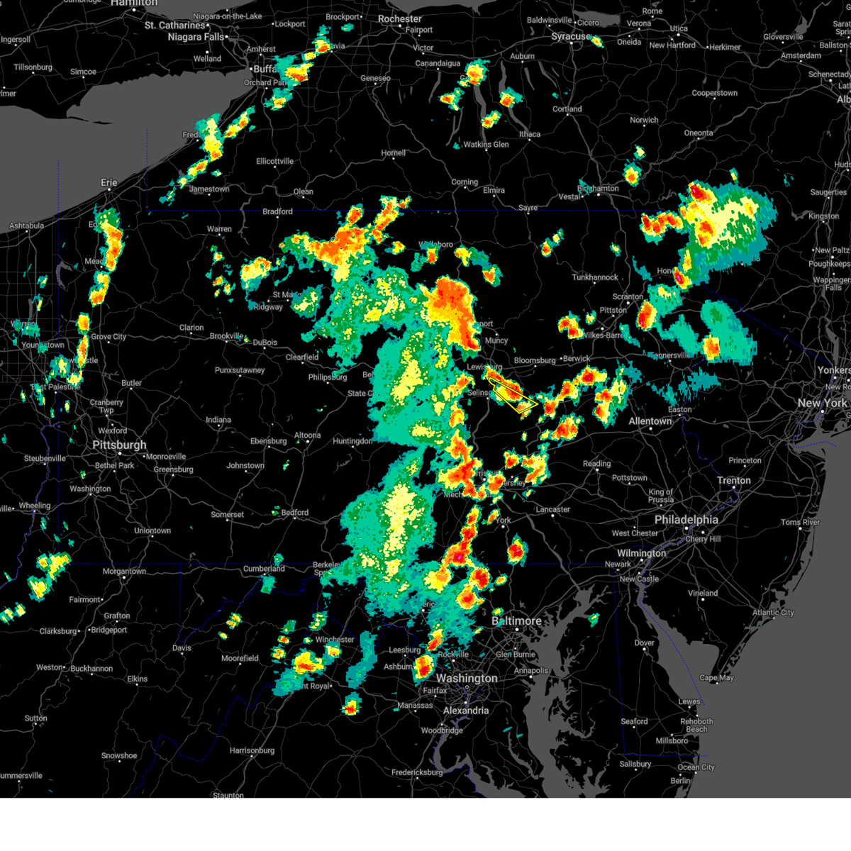 At 323 pm edt, a severe thunderstorm was located over elysburg, moving northeast at 30 mph (radar indicated). Hazards include 60 mph wind gusts and quarter size hail. Hail damage to vehicles is expected. expect wind damage to roofs, siding, and trees. locations impacted include, sunbury, shamokin, northumberland, fairview-ferndale, trevorton, marshallton, stonington, edgewood, snydertown and seven points. hail threat, radar indicated max hail size, 1. 00 in wind threat, radar indicated max wind gust, 60 mph. At 323 pm edt, a severe thunderstorm was located over elysburg, moving northeast at 30 mph (radar indicated). Hazards include 60 mph wind gusts and quarter size hail. Hail damage to vehicles is expected. expect wind damage to roofs, siding, and trees. locations impacted include, sunbury, shamokin, northumberland, fairview-ferndale, trevorton, marshallton, stonington, edgewood, snydertown and seven points. hail threat, radar indicated max hail size, 1. 00 in wind threat, radar indicated max wind gust, 60 mph.
|
| 9/7/2023 2:32 PM EDT |
 At 232 pm edt, a severe thunderstorm was located over port trevorton, moving northeast at 30 mph (radar indicated). Hazards include 60 mph wind gusts and quarter size hail. Hail damage to vehicles is expected. Expect wind damage to roofs, siding, and trees. At 232 pm edt, a severe thunderstorm was located over port trevorton, moving northeast at 30 mph (radar indicated). Hazards include 60 mph wind gusts and quarter size hail. Hail damage to vehicles is expected. Expect wind damage to roofs, siding, and trees.
|
| 8/25/2023 2:24 AM EDT |
 The severe thunderstorm warning for southeastern jefferson, washington, southern allegheny, northwestern westmoreland, northwestern greene, northwestern fayette, ohio and brooke counties will expire at 230 am edt, the storms which prompted the warning have moved out of the area. therefore, the warning will be allowed to expire. The severe thunderstorm warning for southeastern jefferson, washington, southern allegheny, northwestern westmoreland, northwestern greene, northwestern fayette, ohio and brooke counties will expire at 230 am edt, the storms which prompted the warning have moved out of the area. therefore, the warning will be allowed to expire.
|
| 8/25/2023 2:09 AM EDT |
 At 209 am edt, severe thunderstorms were located along a line extending from 7 miles east of delmont to near monessen to 9 miles northwest of waynesburg, moving southeast at 45 mph (radar indicated). Hazards include 60 mph wind gusts. Expect damage to trees and power lines, resulting in some power outages. locations impacted include, pittsburgh, penn hills, mount lebanon, bethel park, monroeville, mcmurray, greensburg, mckeesport, washington, jeannette, canonsburg, wellsburg, west liberty, avella, valley grove, gastonville, shaler township, plum, west mifflin, and north side pittsburgh. hail threat, radar indicated max hail size, <. 75 in wind threat, radar indicated max wind gust, 60 mph. At 209 am edt, severe thunderstorms were located along a line extending from 7 miles east of delmont to near monessen to 9 miles northwest of waynesburg, moving southeast at 45 mph (radar indicated). Hazards include 60 mph wind gusts. Expect damage to trees and power lines, resulting in some power outages. locations impacted include, pittsburgh, penn hills, mount lebanon, bethel park, monroeville, mcmurray, greensburg, mckeesport, washington, jeannette, canonsburg, wellsburg, west liberty, avella, valley grove, gastonville, shaler township, plum, west mifflin, and north side pittsburgh. hail threat, radar indicated max hail size, <. 75 in wind threat, radar indicated max wind gust, 60 mph.
|
| 8/25/2023 1:51 AM EDT |
 At 151 am edt, severe thunderstorms were located along a line extending from near harrison township to upper st. clair to near west liberty, moving southeast at 75 mph (radar indicated). Hazards include 60 mph wind gusts. Expect damage to trees and power lines, resulting in some power outages. locations impacted include, pittsburgh, penn hills, mount lebanon, bethel park, ross township, mccandless township, monroeville, mcmurray, greensburg, weirton, mckeesport, steubenville, washington, franklin park, jeannette, canonsburg, wellsburg, west liberty, avella, and valley grove. hail threat, radar indicated max hail size, <. 75 in wind threat, radar indicated max wind gust, 60 mph. At 151 am edt, severe thunderstorms were located along a line extending from near harrison township to upper st. clair to near west liberty, moving southeast at 75 mph (radar indicated). Hazards include 60 mph wind gusts. Expect damage to trees and power lines, resulting in some power outages. locations impacted include, pittsburgh, penn hills, mount lebanon, bethel park, ross township, mccandless township, monroeville, mcmurray, greensburg, weirton, mckeesport, steubenville, washington, franklin park, jeannette, canonsburg, wellsburg, west liberty, avella, and valley grove. hail threat, radar indicated max hail size, <. 75 in wind threat, radar indicated max wind gust, 60 mph.
|
| 8/25/2023 1:38 AM EDT |
 At 137 am edt, severe thunderstorms were located along a line extending from near oak hills to near imperial to 7 miles west of wintersville, moving southeast at 55 mph (radar indicated). Hazards include 60 mph wind gusts. expect damage to trees and power lines, resulting in some power outages At 137 am edt, severe thunderstorms were located along a line extending from near oak hills to near imperial to 7 miles west of wintersville, moving southeast at 55 mph (radar indicated). Hazards include 60 mph wind gusts. expect damage to trees and power lines, resulting in some power outages
|
| 7/20/2023 10:11 PM EDT |
 The severe thunderstorm warning for southern beaver, southern butler, allegheny, northwestern westmoreland and southern armstrong counties will expire at 1015 pm edt, the storms which prompted the warning have weakened below severe limits, and no longer pose an immediate threat to life or property. therefore, the warning will be allowed to expire. a severe thunderstorm watch remains in effect until 300 am edt for western, southwestern and west central pennsylvania. The severe thunderstorm warning for southern beaver, southern butler, allegheny, northwestern westmoreland and southern armstrong counties will expire at 1015 pm edt, the storms which prompted the warning have weakened below severe limits, and no longer pose an immediate threat to life or property. therefore, the warning will be allowed to expire. a severe thunderstorm watch remains in effect until 300 am edt for western, southwestern and west central pennsylvania.
|
| 7/20/2023 9:54 PM EDT |
 At 954 pm edt, severe thunderstorms were located along a line extending from 10 miles west of indiana to near hampton township to near shippingport, moving southeast at 30 mph (radar indicated). Hazards include 60 mph wind gusts. Expect damage to trees and power lines, resulting in some power outages. locations impacted include, pittsburgh, penn hills, mount lebanon, ross township, mccandless township, monroeville, cranberry, moon township, franklin park, aliquippa, monaca, vandergrift, kittanning, apollo, shaler township, plum, west mifflin, north side pittsburgh, baldwin, and murrysville. hail threat, radar indicated max hail size, <. 75 in wind threat, radar indicated max wind gust, 60 mph. At 954 pm edt, severe thunderstorms were located along a line extending from 10 miles west of indiana to near hampton township to near shippingport, moving southeast at 30 mph (radar indicated). Hazards include 60 mph wind gusts. Expect damage to trees and power lines, resulting in some power outages. locations impacted include, pittsburgh, penn hills, mount lebanon, ross township, mccandless township, monroeville, cranberry, moon township, franklin park, aliquippa, monaca, vandergrift, kittanning, apollo, shaler township, plum, west mifflin, north side pittsburgh, baldwin, and murrysville. hail threat, radar indicated max hail size, <. 75 in wind threat, radar indicated max wind gust, 60 mph.
|
| 7/20/2023 9:34 PM EDT |
 At 934 pm edt, severe thunderstorms were located along a line extending from near ford city to mars to ohioville, moving south at 35 mph (radar indicated). Hazards include 60 mph wind gusts. Expect damage to trees and power lines, resulting in some power outages. locations impacted include, pittsburgh, penn hills, mount lebanon, ross township, mccandless township, monroeville, cranberry, moon township, butler, franklin park, aliquippa, beaver falls, monaca, vandergrift, kittanning, apollo, shaler township, plum, west mifflin, and north side pittsburgh. hail threat, radar indicated max hail size, <. 75 in wind threat, radar indicated max wind gust, 60 mph. At 934 pm edt, severe thunderstorms were located along a line extending from near ford city to mars to ohioville, moving south at 35 mph (radar indicated). Hazards include 60 mph wind gusts. Expect damage to trees and power lines, resulting in some power outages. locations impacted include, pittsburgh, penn hills, mount lebanon, ross township, mccandless township, monroeville, cranberry, moon township, butler, franklin park, aliquippa, beaver falls, monaca, vandergrift, kittanning, apollo, shaler township, plum, west mifflin, and north side pittsburgh. hail threat, radar indicated max hail size, <. 75 in wind threat, radar indicated max wind gust, 60 mph.
|
| 7/20/2023 9:30 PM EDT |
 At 929 pm edt, severe thunderstorms were located along a line extending from kittanning to zelienople to beaver, moving southeast at 30 mph (radar indicated). Hazards include 60 mph wind gusts. Expect damage to trees and power lines, resulting in some power outages. locations impacted include, pittsburgh, penn hills, mount lebanon, ross township, mccandless township, monroeville, cranberry, moon township, new castle, butler, franklin park, aliquippa, beaver falls, monaca, vandergrift, east palestine, kittanning, apollo, shaler township, and plum. hail threat, radar indicated max hail size, <. 75 in wind threat, observed max wind gust, 60 mph. At 929 pm edt, severe thunderstorms were located along a line extending from kittanning to zelienople to beaver, moving southeast at 30 mph (radar indicated). Hazards include 60 mph wind gusts. Expect damage to trees and power lines, resulting in some power outages. locations impacted include, pittsburgh, penn hills, mount lebanon, ross township, mccandless township, monroeville, cranberry, moon township, new castle, butler, franklin park, aliquippa, beaver falls, monaca, vandergrift, east palestine, kittanning, apollo, shaler township, and plum. hail threat, radar indicated max hail size, <. 75 in wind threat, observed max wind gust, 60 mph.
|
| 7/20/2023 9:12 PM EDT |
 At 911 pm edt, severe thunderstorms were located along a line extending from 8 miles northwest of kittanning to near ellwood city to near beaver falls, moving southeast at 30 mph (radar indicated). Hazards include 60 mph wind gusts. expect damage to trees and power lines, resulting in some power outages At 911 pm edt, severe thunderstorms were located along a line extending from 8 miles northwest of kittanning to near ellwood city to near beaver falls, moving southeast at 30 mph (radar indicated). Hazards include 60 mph wind gusts. expect damage to trees and power lines, resulting in some power outages
|
| 7/13/2023 8:48 PM EDT |
 At 847 pm edt, a severe thunderstorm was located over penn hills, moving northeast at 40 mph (radar indicated). Hazards include 60 mph wind gusts and nickel size hail. Expect damage to trees and power lines, resulting in some power outages. locations impacted include, pittsburgh, penn hills, ross township, mccandless township, monroeville, greensburg, mckeesport, franklin park, jeannette, vandergrift, shaler township, plum, west mifflin, north side pittsburgh, baldwin, murrysville, hampton township, wilkinsburg, whitehall, and robinson township. hail threat, radar indicated max hail size, 0. 88 in wind threat, observed max wind gust, 60 mph. At 847 pm edt, a severe thunderstorm was located over penn hills, moving northeast at 40 mph (radar indicated). Hazards include 60 mph wind gusts and nickel size hail. Expect damage to trees and power lines, resulting in some power outages. locations impacted include, pittsburgh, penn hills, ross township, mccandless township, monroeville, greensburg, mckeesport, franklin park, jeannette, vandergrift, shaler township, plum, west mifflin, north side pittsburgh, baldwin, murrysville, hampton township, wilkinsburg, whitehall, and robinson township. hail threat, radar indicated max hail size, 0. 88 in wind threat, observed max wind gust, 60 mph.
|
| 7/13/2023 8:39 PM EDT |
 At 839 pm edt, a severe thunderstorm was located over swissvale, or near pittsburgh, moving northeast at 40 mph (radar indicated). Hazards include 60 mph wind gusts and nickel size hail. expect damage to trees and power lines, resulting in some power outages At 839 pm edt, a severe thunderstorm was located over swissvale, or near pittsburgh, moving northeast at 40 mph (radar indicated). Hazards include 60 mph wind gusts and nickel size hail. expect damage to trees and power lines, resulting in some power outages
|
| 7/13/2023 8:31 PM EDT |
 At 831 pm edt, a severe thunderstorm was located over mount oliver, or over pittsburgh, moving northeast at 45 mph (radar indicated). Hazards include 60 mph wind gusts and nickel size hail. Expect damage to trees and power lines, resulting in some power outages. locations impacted include, pittsburgh, penn hills, mount lebanon, bethel park, ross township, mccandless township, monroeville, mckeesport, franklin park, jeannette, gastonville, shaler township, plum, west mifflin, north side pittsburgh, baldwin, upper st. clair, murrysville, hampton township, and scott township. hail threat, radar indicated max hail size, 0. 88 in wind threat, radar indicated max wind gust, 60 mph. At 831 pm edt, a severe thunderstorm was located over mount oliver, or over pittsburgh, moving northeast at 45 mph (radar indicated). Hazards include 60 mph wind gusts and nickel size hail. Expect damage to trees and power lines, resulting in some power outages. locations impacted include, pittsburgh, penn hills, mount lebanon, bethel park, ross township, mccandless township, monroeville, mckeesport, franklin park, jeannette, gastonville, shaler township, plum, west mifflin, north side pittsburgh, baldwin, upper st. clair, murrysville, hampton township, and scott township. hail threat, radar indicated max hail size, 0. 88 in wind threat, radar indicated max wind gust, 60 mph.
|
| 7/13/2023 8:21 PM EDT |
 At 820 pm edt, a severe thunderstorm was located over bridgeville, or near mount lebanon, moving northeast at 45 mph (radar indicated). Hazards include 60 mph wind gusts and nickel size hail. expect damage to trees and power lines, resulting in some power outages At 820 pm edt, a severe thunderstorm was located over bridgeville, or near mount lebanon, moving northeast at 45 mph (radar indicated). Hazards include 60 mph wind gusts and nickel size hail. expect damage to trees and power lines, resulting in some power outages
|
| 7/9/2023 9:07 AM EDT |
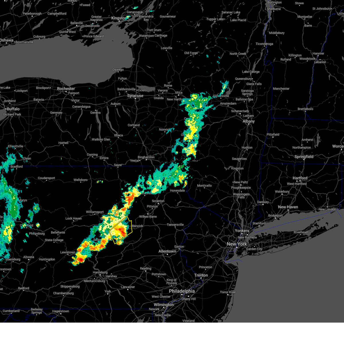 At 906 am edt, a severe thunderstorm was located over mifflinville, moving northeast at 25 mph (radar indicated). Hazards include 60 mph wind gusts and quarter size hail. Hail damage to vehicles is expected. expect wind damage to roofs, siding, and trees. locations impacted include, bloomsburg, berwick, shamokin, danville, elysburg, fairview-ferndale, riverside, catawissa, marshallton, mifflinville, lightstreet and almedia. for those driving on interstate 80, this includes areas between the limestoneville and nescopek exits, specifically from mile markers 223 to 247. hail threat, radar indicated max hail size, 1. 00 in wind threat, radar indicated max wind gust, 60 mph. At 906 am edt, a severe thunderstorm was located over mifflinville, moving northeast at 25 mph (radar indicated). Hazards include 60 mph wind gusts and quarter size hail. Hail damage to vehicles is expected. expect wind damage to roofs, siding, and trees. locations impacted include, bloomsburg, berwick, shamokin, danville, elysburg, fairview-ferndale, riverside, catawissa, marshallton, mifflinville, lightstreet and almedia. for those driving on interstate 80, this includes areas between the limestoneville and nescopek exits, specifically from mile markers 223 to 247. hail threat, radar indicated max hail size, 1. 00 in wind threat, radar indicated max wind gust, 60 mph.
|
| 7/9/2023 8:44 AM EDT |
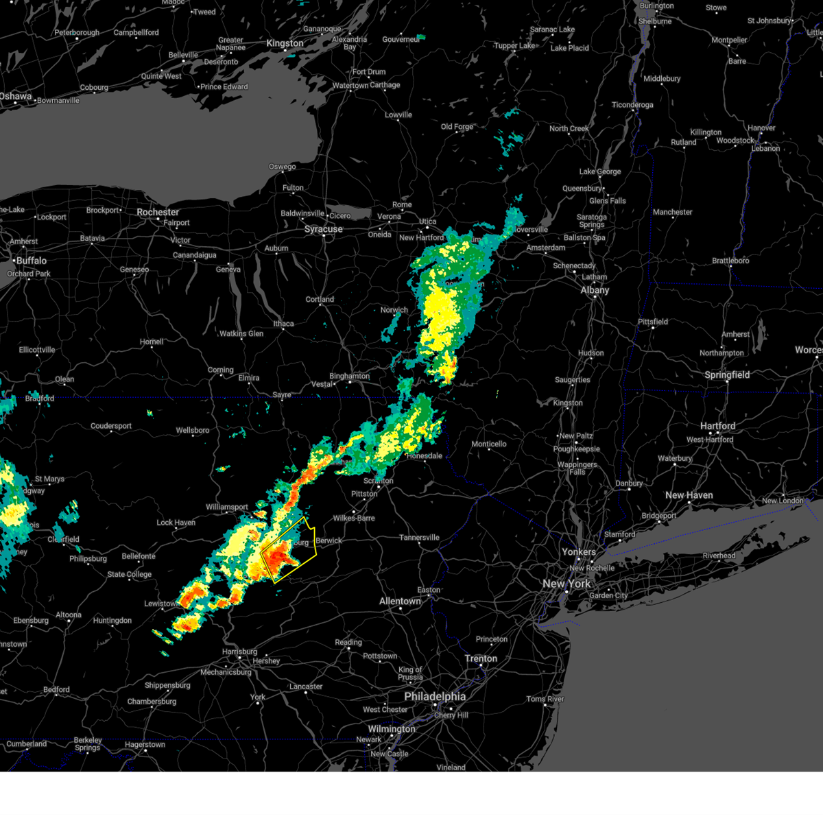 At 843 am edt, a severe thunderstorm was located over rupert, moving northeast at 25 mph (radar indicated). Hazards include 60 mph wind gusts and quarter size hail. Hail damage to vehicles is expected. Expect wind damage to roofs, siding, and trees. At 843 am edt, a severe thunderstorm was located over rupert, moving northeast at 25 mph (radar indicated). Hazards include 60 mph wind gusts and quarter size hail. Hail damage to vehicles is expected. Expect wind damage to roofs, siding, and trees.
|
| 4/22/2023 3:08 PM EDT |
 At 307 pm edt, a severe thunderstorm was located over fort indiantown gap, moving north at 45 mph (radar indicated). Hazards include 60 mph wind gusts and quarter size hail. Hail damage to vehicles is expected. expect wind damage to roofs, siding, and trees. this severe thunderstorm will be near, lykens around 310 pm edt. tower city, williamstown and klingerstown around 320 pm edt. shamokin, fairview-ferndale and marshallton around 330 pm edt. kulpmont, mount carmel and knoebels grove around 340 pm edt. other locations impacted by this severe thunderstorm include edgewood, gratz, muir, espy and orwin. for those driving on interstate 80, this includes areas between the danville and bloomsburg-light street exits, specifically from mile markers 225 to 233. this includes interstate 81 between mile markers 85 and 87, between mile markers 92 and 95, and from mile markers 108 to 109. hail threat, radar indicated max hail size, 1. 00 in wind threat, radar indicated max wind gust, 60 mph. At 307 pm edt, a severe thunderstorm was located over fort indiantown gap, moving north at 45 mph (radar indicated). Hazards include 60 mph wind gusts and quarter size hail. Hail damage to vehicles is expected. expect wind damage to roofs, siding, and trees. this severe thunderstorm will be near, lykens around 310 pm edt. tower city, williamstown and klingerstown around 320 pm edt. shamokin, fairview-ferndale and marshallton around 330 pm edt. kulpmont, mount carmel and knoebels grove around 340 pm edt. other locations impacted by this severe thunderstorm include edgewood, gratz, muir, espy and orwin. for those driving on interstate 80, this includes areas between the danville and bloomsburg-light street exits, specifically from mile markers 225 to 233. this includes interstate 81 between mile markers 85 and 87, between mile markers 92 and 95, and from mile markers 108 to 109. hail threat, radar indicated max hail size, 1. 00 in wind threat, radar indicated max wind gust, 60 mph.
|
| 4/5/2023 8:43 PM EDT |
 The severe thunderstorm warning for central washington and southeastern allegheny counties will expire at 845 pm edt, the storms which prompted the warning have weakened below severe limits, and no longer pose an immediate threat to life or property. therefore, the warning will be allowed to expire. a severe thunderstorm watch remains in effect until 1000 pm edt for southwestern pennsylvania. The severe thunderstorm warning for central washington and southeastern allegheny counties will expire at 845 pm edt, the storms which prompted the warning have weakened below severe limits, and no longer pose an immediate threat to life or property. therefore, the warning will be allowed to expire. a severe thunderstorm watch remains in effect until 1000 pm edt for southwestern pennsylvania.
|
| 4/5/2023 8:37 PM EDT |
 At 837 pm edt, severe thunderstorms were located along a line extending from sharpsburg to 9 miles southwest of waynesburg, moving east at 45 mph (radar indicated). Hazards include 60 mph wind gusts. Expect damage to trees and power lines, resulting in some power outages. locations impacted include, pittsburgh, penn hills, mount lebanon, bethel park, mcmurray, mckeesport, washington, canonsburg, gastonville, west mifflin, north side pittsburgh, and baldwin. hail threat, radar indicated max hail size, <. 75 in wind threat, radar indicated max wind gust, 60 mph. At 837 pm edt, severe thunderstorms were located along a line extending from sharpsburg to 9 miles southwest of waynesburg, moving east at 45 mph (radar indicated). Hazards include 60 mph wind gusts. Expect damage to trees and power lines, resulting in some power outages. locations impacted include, pittsburgh, penn hills, mount lebanon, bethel park, mcmurray, mckeesport, washington, canonsburg, gastonville, west mifflin, north side pittsburgh, and baldwin. hail threat, radar indicated max hail size, <. 75 in wind threat, radar indicated max wind gust, 60 mph.
|
| 4/5/2023 8:22 PM EDT |
 At 821 pm edt, severe thunderstorms were located along a line extending from robinson township to near cameron, moving east at 45 mph (radar indicated). Hazards include 60 mph wind gusts. Expect damage to trees and power lines, resulting in some power outages. locations impacted include, pittsburgh, penn hills, mount lebanon, bethel park, mcmurray, mckeesport, washington, canonsburg, gastonville, west mifflin, north side pittsburgh, and baldwin. hail threat, radar indicated max hail size, <. 75 in wind threat, radar indicated max wind gust, 60 mph. At 821 pm edt, severe thunderstorms were located along a line extending from robinson township to near cameron, moving east at 45 mph (radar indicated). Hazards include 60 mph wind gusts. Expect damage to trees and power lines, resulting in some power outages. locations impacted include, pittsburgh, penn hills, mount lebanon, bethel park, mcmurray, mckeesport, washington, canonsburg, gastonville, west mifflin, north side pittsburgh, and baldwin. hail threat, radar indicated max hail size, <. 75 in wind threat, radar indicated max wind gust, 60 mph.
|
| 4/5/2023 8:13 PM EDT |
 At 813 pm edt, severe thunderstorms were located along a line extending from near imperial to near cameron, moving east at 45 mph (radar indicated). Hazards include 60 mph wind gusts. Expect damage to trees and power lines, resulting in some power outages. locations impacted include, pittsburgh, penn hills, mount lebanon, bethel park, mcmurray, mckeesport, washington, canonsburg, waynesburg, gastonville, west mifflin, and north side pittsburgh. hail threat, radar indicated max hail size, <. 75 in wind threat, radar indicated max wind gust, 60 mph. At 813 pm edt, severe thunderstorms were located along a line extending from near imperial to near cameron, moving east at 45 mph (radar indicated). Hazards include 60 mph wind gusts. Expect damage to trees and power lines, resulting in some power outages. locations impacted include, pittsburgh, penn hills, mount lebanon, bethel park, mcmurray, mckeesport, washington, canonsburg, waynesburg, gastonville, west mifflin, and north side pittsburgh. hail threat, radar indicated max hail size, <. 75 in wind threat, radar indicated max wind gust, 60 mph.
|
| 4/5/2023 7:59 PM EDT |
 At 759 pm edt, severe thunderstorms were located along a line extending from 6 miles west of imperial to 7 miles southeast of powhatan point, moving east at 45 mph (radar indicated). Hazards include 60 mph wind gusts. expect damage to trees and power lines, resulting in some power outages At 759 pm edt, severe thunderstorms were located along a line extending from 6 miles west of imperial to 7 miles southeast of powhatan point, moving east at 45 mph (radar indicated). Hazards include 60 mph wind gusts. expect damage to trees and power lines, resulting in some power outages
|
| 7/23/2022 3:30 PM EDT |
 At 330 pm edt, a severe thunderstorm was located near delmont, or 8 miles north of greensburg, moving east at 40 mph (radar indicated). Hazards include 60 mph wind gusts and quarter size hail. Minor hail damage to vehicles is possible. expect wind damage to trees and power lines, resulting in some power outages. locations impacted include, pittsburgh, penn hills, monroeville, greensburg, mckeesport, uniontown, jeannette, connellsville, vandergrift, waynesburg, apollo, and plum. hail threat, radar indicated max hail size, 1. 00 in wind threat, radar indicated max wind gust, 60 mph. At 330 pm edt, a severe thunderstorm was located near delmont, or 8 miles north of greensburg, moving east at 40 mph (radar indicated). Hazards include 60 mph wind gusts and quarter size hail. Minor hail damage to vehicles is possible. expect wind damage to trees and power lines, resulting in some power outages. locations impacted include, pittsburgh, penn hills, monroeville, greensburg, mckeesport, uniontown, jeannette, connellsville, vandergrift, waynesburg, apollo, and plum. hail threat, radar indicated max hail size, 1. 00 in wind threat, radar indicated max wind gust, 60 mph.
|
| 7/23/2022 3:04 PM EDT |
 At 303 pm edt, a severe thunderstorm was located over forest hills, or near penn hills, moving east at 40 mph (radar indicated). Hazards include 60 mph wind gusts and quarter size hail. Minor hail damage to vehicles is possible. expect wind damage to trees and power lines, resulting in some power outages. locations impacted include, pittsburgh, penn hills, mount lebanon, bethel park, ross township, mccandless township, monroeville, moon township, mcmurray, mckeesport, washington, and franklin park. hail threat, radar indicated max hail size, 1. 00 in wind threat, observed max wind gust, 60 mph. At 303 pm edt, a severe thunderstorm was located over forest hills, or near penn hills, moving east at 40 mph (radar indicated). Hazards include 60 mph wind gusts and quarter size hail. Minor hail damage to vehicles is possible. expect wind damage to trees and power lines, resulting in some power outages. locations impacted include, pittsburgh, penn hills, mount lebanon, bethel park, ross township, mccandless township, monroeville, moon township, mcmurray, mckeesport, washington, and franklin park. hail threat, radar indicated max hail size, 1. 00 in wind threat, observed max wind gust, 60 mph.
|
| 7/23/2022 3:02 PM EDT |
 At 302 pm edt, a severe thunderstorm was located over north braddock, or near mckeesport, moving east at 40 mph (radar indicated). Hazards include 70 mph wind gusts and quarter size hail. Minor hail damage to vehicles is possible. trees snapped and uprooted. Power outages can be expected. At 302 pm edt, a severe thunderstorm was located over north braddock, or near mckeesport, moving east at 40 mph (radar indicated). Hazards include 70 mph wind gusts and quarter size hail. Minor hail damage to vehicles is possible. trees snapped and uprooted. Power outages can be expected.
|
| 7/23/2022 2:58 PM EDT |
 At 258 pm edt, a severe thunderstorm was located over homestead, or near pittsburgh, moving east at 40 mph (radar indicated). Hazards include 60 mph wind gusts and quarter size hail. Minor hail damage to vehicles is possible. expect wind damage to trees and power lines, resulting in some power outages. locations impacted include, pittsburgh, penn hills, mount lebanon, bethel park, ross township, mccandless township, monroeville, cranberry, moon township, mcmurray, mckeesport, and washington. hail threat, radar indicated max hail size, 1. 00 in wind threat, observed max wind gust, 60 mph. At 258 pm edt, a severe thunderstorm was located over homestead, or near pittsburgh, moving east at 40 mph (radar indicated). Hazards include 60 mph wind gusts and quarter size hail. Minor hail damage to vehicles is possible. expect wind damage to trees and power lines, resulting in some power outages. locations impacted include, pittsburgh, penn hills, mount lebanon, bethel park, ross township, mccandless township, monroeville, cranberry, moon township, mcmurray, mckeesport, and washington. hail threat, radar indicated max hail size, 1. 00 in wind threat, observed max wind gust, 60 mph.
|
| 7/23/2022 2:33 PM EDT |
 At 232 pm edt, a severe thunderstorm was located over mcdonald, or 8 miles northwest of canonsburg, moving east at 40 mph (radar indicated). Hazards include 70 mph wind gusts and quarter size hail. Minor hail damage to vehicles is possible. trees snapped and uprooted. power outages can be expected. locations impacted include, pittsburgh, penn hills, mount lebanon, bethel park, ross township, wheeling, mccandless township, monroeville, cranberry, moon township, mcmurray, and weirton. thunderstorm damage threat, considerable hail threat, radar indicated max hail size, 1. 00 in wind threat, observed max wind gust, 70 mph. At 232 pm edt, a severe thunderstorm was located over mcdonald, or 8 miles northwest of canonsburg, moving east at 40 mph (radar indicated). Hazards include 70 mph wind gusts and quarter size hail. Minor hail damage to vehicles is possible. trees snapped and uprooted. power outages can be expected. locations impacted include, pittsburgh, penn hills, mount lebanon, bethel park, ross township, wheeling, mccandless township, monroeville, cranberry, moon township, mcmurray, and weirton. thunderstorm damage threat, considerable hail threat, radar indicated max hail size, 1. 00 in wind threat, observed max wind gust, 70 mph.
|
| 7/23/2022 2:26 PM EDT |
 At 225 pm edt, a severe thunderstorm was located near mcdonald, or 8 miles northeast of avella, moving east at 40 mph (radar indicated). Hazards include 60 mph wind gusts and quarter size hail. Minor hail damage to vehicles is possible. Expect wind damage to trees and power lines, resulting in some power outages. At 225 pm edt, a severe thunderstorm was located near mcdonald, or 8 miles northeast of avella, moving east at 40 mph (radar indicated). Hazards include 60 mph wind gusts and quarter size hail. Minor hail damage to vehicles is possible. Expect wind damage to trees and power lines, resulting in some power outages.
|
| 6/22/2022 5:18 PM EDT |
 At 518 pm edt, severe thunderstorms centered over liberty, or over mckeesport, moving southeast at 30 mph (radar indicated). Hazards include 60 mph wind gusts. Expect damage to trees and power lines, resulting in some power outages. locations impacted include, pittsburgh, penn hills, mount lebanon, bethel park, monroeville, mcmurray, greensburg, mckeesport, jeannette, canonsburg, connellsville, and gastonville. hail threat, radar indicated max hail size, <. 75 in wind threat, radar indicated max wind gust, 60 mph. At 518 pm edt, severe thunderstorms centered over liberty, or over mckeesport, moving southeast at 30 mph (radar indicated). Hazards include 60 mph wind gusts. Expect damage to trees and power lines, resulting in some power outages. locations impacted include, pittsburgh, penn hills, mount lebanon, bethel park, monroeville, mcmurray, greensburg, mckeesport, jeannette, canonsburg, connellsville, and gastonville. hail threat, radar indicated max hail size, <. 75 in wind threat, radar indicated max wind gust, 60 mph.
|
| 6/22/2022 5:02 PM EDT |
 At 501 pm edt, severe thunderstorms were centered near mount oliver, or over pittsburgh, moving southeast at 30 mph (radar indicated). Hazards include 60 mph wind gusts. expect damage to trees and power lines, resulting in some power outages At 501 pm edt, severe thunderstorms were centered near mount oliver, or over pittsburgh, moving southeast at 30 mph (radar indicated). Hazards include 60 mph wind gusts. expect damage to trees and power lines, resulting in some power outages
|
| 6/22/2022 4:51 PM EDT |
 At 450 pm edt, severe thunderstorms centered over ingram, or near pittsburgh, continue moving southeast at 30 mph (radar indicated). Hazards include 60 mph wind gusts. Expect damage to trees and power lines, resulting in some power outages. locations impacted include, pittsburgh, penn hills, mount lebanon, bethel park, ross township, mccandless township, cranberry, moon township, mcmurray, mckeesport, franklin park, and aliquippa. hail threat, radar indicated max hail size, <. 75 in wind threat, radar indicated max wind gust, 60 mph. At 450 pm edt, severe thunderstorms centered over ingram, or near pittsburgh, continue moving southeast at 30 mph (radar indicated). Hazards include 60 mph wind gusts. Expect damage to trees and power lines, resulting in some power outages. locations impacted include, pittsburgh, penn hills, mount lebanon, bethel park, ross township, mccandless township, cranberry, moon township, mcmurray, mckeesport, franklin park, and aliquippa. hail threat, radar indicated max hail size, <. 75 in wind threat, radar indicated max wind gust, 60 mph.
|
| 6/22/2022 4:39 PM EDT |
 At 438 pm edt, severe thunderstorms centered over coraopolis, or near moon township, are moving southeast at 30 mph (radar indicated). Hazards include 60 mph wind gusts. Expect damage to trees and power lines, resulting in some power outages. locations impacted include, pittsburgh, penn hills, mount lebanon, bethel park, ross township, mccandless township, cranberry, moon township, mcmurray, mckeesport, franklin park, and aliquippa. hail threat, radar indicated max hail size, <. 75 in wind threat, radar indicated max wind gust, 60 mph. At 438 pm edt, severe thunderstorms centered over coraopolis, or near moon township, are moving southeast at 30 mph (radar indicated). Hazards include 60 mph wind gusts. Expect damage to trees and power lines, resulting in some power outages. locations impacted include, pittsburgh, penn hills, mount lebanon, bethel park, ross township, mccandless township, cranberry, moon township, mcmurray, mckeesport, franklin park, and aliquippa. hail threat, radar indicated max hail size, <. 75 in wind threat, radar indicated max wind gust, 60 mph.
|
| 6/22/2022 4:26 PM EDT |
 At 425 pm edt, a cluster of severes thunderstorm centered over ambridge, or near aliquippa, moving southeast at 30 mph (radar indicated). Hazards include 60 mph wind gusts. expect damage to trees and power lines, resulting in some power outages At 425 pm edt, a cluster of severes thunderstorm centered over ambridge, or near aliquippa, moving southeast at 30 mph (radar indicated). Hazards include 60 mph wind gusts. expect damage to trees and power lines, resulting in some power outages
|
| 5/21/2022 8:33 PM EDT |
 At 833 pm edt, severe thunderstorms were located along a line extending from near sarver to duquesne, moving east at 45 mph (radar indicated). Hazards include 60 mph wind gusts. Expect damage to trees and power lines, resulting in some power outages. locations impacted include, penn hills, monroeville, mckeesport, plum, west mifflin, murrysville, wilkinsburg, new kensington, lower burrell, jefferson hills, harrison township, and north versailles. hail threat, radar indicated max hail size, <. 75 in wind threat, radar indicated max wind gust, 60 mph. At 833 pm edt, severe thunderstorms were located along a line extending from near sarver to duquesne, moving east at 45 mph (radar indicated). Hazards include 60 mph wind gusts. Expect damage to trees and power lines, resulting in some power outages. locations impacted include, penn hills, monroeville, mckeesport, plum, west mifflin, murrysville, wilkinsburg, new kensington, lower burrell, jefferson hills, harrison township, and north versailles. hail threat, radar indicated max hail size, <. 75 in wind threat, radar indicated max wind gust, 60 mph.
|
| 5/21/2022 8:26 PM EDT |
 At 826 pm edt, severe thunderstorms were located along a line extending from near mars to west mifflin, moving east at 45 mph (radar indicated). Hazards include 60 mph wind gusts. Expect damage to trees and power lines, resulting in some power outages. locations impacted include, pittsburgh, penn hills, monroeville, mckeesport, shaler township, plum, west mifflin, baldwin, murrysville, hampton township, wilkinsburg, and whitehall. hail threat, radar indicated max hail size, <. 75 in wind threat, radar indicated max wind gust, 60 mph. At 826 pm edt, severe thunderstorms were located along a line extending from near mars to west mifflin, moving east at 45 mph (radar indicated). Hazards include 60 mph wind gusts. Expect damage to trees and power lines, resulting in some power outages. locations impacted include, pittsburgh, penn hills, monroeville, mckeesport, shaler township, plum, west mifflin, baldwin, murrysville, hampton township, wilkinsburg, and whitehall. hail threat, radar indicated max hail size, <. 75 in wind threat, radar indicated max wind gust, 60 mph.
|
| 5/21/2022 8:17 PM EDT |
 At 817 pm edt, severe thunderstorms were located along a line extending from mars to castle shannon, moving east at 45 mph (radar indicated). Hazards include 60 mph wind gusts. Expect damage to trees and power lines, resulting in some power outages. locations impacted include, pittsburgh, penn hills, mount lebanon, bethel park, ross township, mccandless township, monroeville, mckeesport, franklin park, shaler township, plum, and west mifflin. hail threat, radar indicated max hail size, <. 75 in wind threat, radar indicated max wind gust, 60 mph. At 817 pm edt, severe thunderstorms were located along a line extending from mars to castle shannon, moving east at 45 mph (radar indicated). Hazards include 60 mph wind gusts. Expect damage to trees and power lines, resulting in some power outages. locations impacted include, pittsburgh, penn hills, mount lebanon, bethel park, ross township, mccandless township, monroeville, mckeesport, franklin park, shaler township, plum, and west mifflin. hail threat, radar indicated max hail size, <. 75 in wind threat, radar indicated max wind gust, 60 mph.
|
| 5/21/2022 8:09 PM EDT |
 At 809 pm edt, severe thunderstorms were located along a line extending from near cranberry to bridgeville, moving east at 45 mph (radar indicated). Hazards include 60 mph wind gusts and penny size hail. expect damage to trees and power lines, resulting in some power outages At 809 pm edt, severe thunderstorms were located along a line extending from near cranberry to bridgeville, moving east at 45 mph (radar indicated). Hazards include 60 mph wind gusts and penny size hail. expect damage to trees and power lines, resulting in some power outages
|
| 5/3/2022 6:11 PM EDT |
 At 610 pm edt, severe thunderstorms were located along a line extending from scott township to 8 miles south of east washington, moving northeast at 40 mph (radar indicated). Hazards include 60 mph wind gusts. expect damage to trees and power lines, resulting in some power outages At 610 pm edt, severe thunderstorms were located along a line extending from scott township to 8 miles south of east washington, moving northeast at 40 mph (radar indicated). Hazards include 60 mph wind gusts. expect damage to trees and power lines, resulting in some power outages
|
| 3/31/2022 5:34 PM EDT |
 At 534 pm edt, severe thunderstorms were located along a line extending from port trevorton to near meiserville to millersburg to duncannon, moving northeast at 35 mph (radar indicated). Hazards include 60 mph wind gusts and nickel size hail. expect damage to roofs, siding, and trees At 534 pm edt, severe thunderstorms were located along a line extending from port trevorton to near meiserville to millersburg to duncannon, moving northeast at 35 mph (radar indicated). Hazards include 60 mph wind gusts and nickel size hail. expect damage to roofs, siding, and trees
|
| 3/31/2022 5:17 PM EDT |
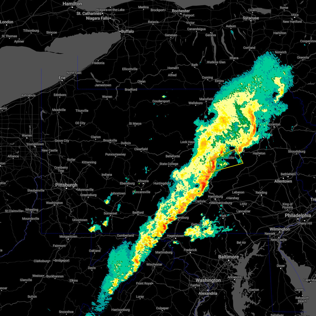 At 517 pm edt, a severe thunderstorm was located over selinsgrove, moving northeast at 50 mph (radar indicated). Hazards include 60 mph wind gusts. expect damage to roofs, siding, and trees At 517 pm edt, a severe thunderstorm was located over selinsgrove, moving northeast at 50 mph (radar indicated). Hazards include 60 mph wind gusts. expect damage to roofs, siding, and trees
|
| 3/31/2022 11:16 AM EDT |
 At 1116 am edt, severe thunderstorms were located along a line extending from near sarver to near jefferson hills, moving east at 40 mph (radar indicated). Hazards include 60 mph wind gusts. expect damage to trees and power lines, resulting in some power outages At 1116 am edt, severe thunderstorms were located along a line extending from near sarver to near jefferson hills, moving east at 40 mph (radar indicated). Hazards include 60 mph wind gusts. expect damage to trees and power lines, resulting in some power outages
|
| 3/19/2022 5:15 PM EDT |
 At 514 pm edt, severe thunderstorms were located along a line extending from slabtown to near marshallton to lykens, moving east at 30 mph (radar indicated). Hazards include 60 mph wind gusts and penny size hail. expect damage to roofs, siding, and trees At 514 pm edt, severe thunderstorms were located along a line extending from slabtown to near marshallton to lykens, moving east at 30 mph (radar indicated). Hazards include 60 mph wind gusts and penny size hail. expect damage to roofs, siding, and trees
|
| 3/7/2022 7:35 PM EST |
 The severe thunderstorm warning for southeastern northumberland and eastern columbia counties will expire at 745 pm est, the storms which prompted the warning have moved out of the area. therefore, the warning will be allowed to expire. however gusty winds are still possible overnight. The severe thunderstorm warning for southeastern northumberland and eastern columbia counties will expire at 745 pm est, the storms which prompted the warning have moved out of the area. therefore, the warning will be allowed to expire. however gusty winds are still possible overnight.
|
| 3/7/2022 7:16 PM EST |
 At 716 pm est, severe thunderstorms were located along a line extending from rush to huntington mills to dehart dam, moving east at 65 mph (radar indicated). Hazards include 60 mph wind gusts. Expect damage to roofs, siding, and trees. locations impacted include, bloomsburg, berwick, shamokin, mount carmel, kulpmont, elysburg, fairview-ferndale, trevorton, catawissa, marshallton, mifflinville, lightstreet, almedia, fernville, aristes, numidia, wilburton number one, rupert, slabtown and mainville. for those driving on interstate 80, this includes areas between the buckhorn and nescopek exits, specifically from mile markers 235 to 247. hail threat, radar indicated max hail size, <. 75 in wind threat, radar indicated max wind gust, 60 mph. At 716 pm est, severe thunderstorms were located along a line extending from rush to huntington mills to dehart dam, moving east at 65 mph (radar indicated). Hazards include 60 mph wind gusts. Expect damage to roofs, siding, and trees. locations impacted include, bloomsburg, berwick, shamokin, mount carmel, kulpmont, elysburg, fairview-ferndale, trevorton, catawissa, marshallton, mifflinville, lightstreet, almedia, fernville, aristes, numidia, wilburton number one, rupert, slabtown and mainville. for those driving on interstate 80, this includes areas between the buckhorn and nescopek exits, specifically from mile markers 235 to 247. hail threat, radar indicated max hail size, <. 75 in wind threat, radar indicated max wind gust, 60 mph.
|
| 3/7/2022 6:44 PM EST |
 At 643 pm est, severe thunderstorms were located along a line extending from le roy to mooresburg to perulack, moving east at 55 mph (radar indicated). Hazards include 60 mph wind gusts. expect damage to roofs, siding, and trees At 643 pm est, severe thunderstorms were located along a line extending from le roy to mooresburg to perulack, moving east at 55 mph (radar indicated). Hazards include 60 mph wind gusts. expect damage to roofs, siding, and trees
|
| 9/8/2021 5:57 PM EDT |
 At 557 pm edt, a severe thunderstorm was located over trevorton, moving east at 35 mph (radar indicated). Hazards include 60 mph wind gusts and quarter size hail. Hail damage to vehicles is expected. expect wind damage to roofs, siding, and trees. this severe thunderstorm will be near, leck kill around 600 pm edt. shamokin, marshallton, fairview-ferndale, knoebels grove and elysburg around 610 pm edt. mount carmel, kulpmont, wilburton number one, wilburton number two, locustdale, lavelle, numidia, slabtown and beurys lake around 620 pm edt. ashland, aristes, girardville and fountain springs around 630 pm edt. other locations impacted by this severe thunderstorm include gordon, edgewood, park place, ringtown, middleport, cumbola, marion heights, seven points, palo alto and shenandoah heights. this includes interstate 81 from mile markers 113 to 132. hail threat, radar indicated max hail size, 1. 00 in wind threat, radar indicated max wind gust, 60 mph. At 557 pm edt, a severe thunderstorm was located over trevorton, moving east at 35 mph (radar indicated). Hazards include 60 mph wind gusts and quarter size hail. Hail damage to vehicles is expected. expect wind damage to roofs, siding, and trees. this severe thunderstorm will be near, leck kill around 600 pm edt. shamokin, marshallton, fairview-ferndale, knoebels grove and elysburg around 610 pm edt. mount carmel, kulpmont, wilburton number one, wilburton number two, locustdale, lavelle, numidia, slabtown and beurys lake around 620 pm edt. ashland, aristes, girardville and fountain springs around 630 pm edt. other locations impacted by this severe thunderstorm include gordon, edgewood, park place, ringtown, middleport, cumbola, marion heights, seven points, palo alto and shenandoah heights. this includes interstate 81 from mile markers 113 to 132. hail threat, radar indicated max hail size, 1. 00 in wind threat, radar indicated max wind gust, 60 mph.
|
| 9/8/2021 5:33 PM EDT |
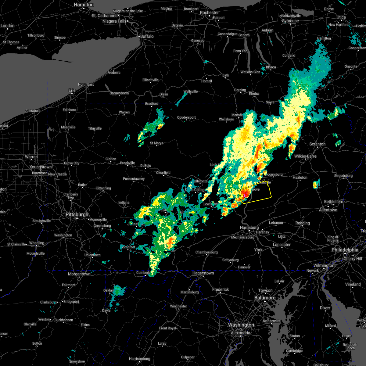 At 532 pm edt, a severe thunderstorm was located over fremont, moving east at 35 mph (radar indicated). Hazards include 60 mph wind gusts and half dollar size hail. Hail damage to vehicles is expected. expect wind damage to roofs, siding, and trees. this severe storm will be near, selinsgrove and kratzerville around 540 pm edt. sunbury, shamokin dam, rebuck, hummels wharf and urban around 550 pm edt. trevorton, stonington and leck kill around 600 pm edt. shamokin, fairview-ferndale, marshallton and elysburg around 610 pm edt. other locations impacted by this severe thunderstorm include edgewood, seven points, freeburg, snydertown, herndon, selinsgrove airport and dalmatia. hail threat, radar indicated max hail size, 1. 25 in wind threat, radar indicated max wind gust, 60 mph. At 532 pm edt, a severe thunderstorm was located over fremont, moving east at 35 mph (radar indicated). Hazards include 60 mph wind gusts and half dollar size hail. Hail damage to vehicles is expected. expect wind damage to roofs, siding, and trees. this severe storm will be near, selinsgrove and kratzerville around 540 pm edt. sunbury, shamokin dam, rebuck, hummels wharf and urban around 550 pm edt. trevorton, stonington and leck kill around 600 pm edt. shamokin, fairview-ferndale, marshallton and elysburg around 610 pm edt. other locations impacted by this severe thunderstorm include edgewood, seven points, freeburg, snydertown, herndon, selinsgrove airport and dalmatia. hail threat, radar indicated max hail size, 1. 25 in wind threat, radar indicated max wind gust, 60 mph.
|
| 9/8/2021 5:11 PM EDT |
 At 511 pm edt, a severe thunderstorm was located near richfield, moving east at 40 mph (radar indicated). Hazards include 60 mph wind gusts. Expect damage to roofs, siding, and trees. this severe thunderstorm will be near, mount pleasant mills, fremont, middleburg and meiserville around 520 pm edt. kreamer and port trevorton around 530 pm edt. selinsgrove, hummels wharf, shamokin dam, kratzerville, rebuck and winfield around 540 pm edt. sunbury, northumberland and stonington around 550 pm edt. other locations impacted by this severe thunderstorm include edgewood, beavertown, seven points, freeburg, snydertown, herndon, selinsgrove airport and dalmatia. hail threat, radar indicated max hail size, <. 75 in wind threat, radar indicated max wind gust, 60 mph. At 511 pm edt, a severe thunderstorm was located near richfield, moving east at 40 mph (radar indicated). Hazards include 60 mph wind gusts. Expect damage to roofs, siding, and trees. this severe thunderstorm will be near, mount pleasant mills, fremont, middleburg and meiserville around 520 pm edt. kreamer and port trevorton around 530 pm edt. selinsgrove, hummels wharf, shamokin dam, kratzerville, rebuck and winfield around 540 pm edt. sunbury, northumberland and stonington around 550 pm edt. other locations impacted by this severe thunderstorm include edgewood, beavertown, seven points, freeburg, snydertown, herndon, selinsgrove airport and dalmatia. hail threat, radar indicated max hail size, <. 75 in wind threat, radar indicated max wind gust, 60 mph.
|
| 8/13/2021 7:42 PM EDT |
 At 742 pm edt, a severe thunderstorm was located over verona, or over penn hills, moving east at 40 mph (radar indicated). Hazards include 60 mph wind gusts. expect damage to trees and power lines, resulting in some power outages At 742 pm edt, a severe thunderstorm was located over verona, or over penn hills, moving east at 40 mph (radar indicated). Hazards include 60 mph wind gusts. expect damage to trees and power lines, resulting in some power outages
|
| 8/13/2021 7:21 PM EDT |
 At 720 pm edt, a severe thunderstorm was located over stowe township, or near ross township, moving east at 30 mph (radar indicated). Hazards include 60 mph wind gusts. expect damage to trees and power lines, resulting in some power outages At 720 pm edt, a severe thunderstorm was located over stowe township, or near ross township, moving east at 30 mph (radar indicated). Hazards include 60 mph wind gusts. expect damage to trees and power lines, resulting in some power outages
|
| 8/12/2021 7:09 PM EDT |
 At 709 pm edt, severe thunderstorms were located along a line extending from new kensington to baldwin to near wolfdale, moving east at 35 mph (radar indicated). Hazards include 60 mph wind gusts. expect damage to trees and power lines, resulting in some power outages At 709 pm edt, severe thunderstorms were located along a line extending from new kensington to baldwin to near wolfdale, moving east at 35 mph (radar indicated). Hazards include 60 mph wind gusts. expect damage to trees and power lines, resulting in some power outages
|
| 8/12/2021 7:01 PM EDT |
 At 701 pm edt, severe thunderstorms were located along a line extending from new kensington to castle shannon to near west liberty, moving east at 30 mph (radar indicated). Hazards include 60 mph wind gusts. Expect damage to trees and power lines, resulting in some power outages. locations impacted include, pittsburgh, penn hills, mount lebanon, bethel park, ross township, mccandless township, monroeville, moon township, mcmurray, mckeesport, washington, and franklin park. hail threat, radar indicated max hail size, <. 75 in wind threat, radar indicated max wind gust, 60 mph. At 701 pm edt, severe thunderstorms were located along a line extending from new kensington to castle shannon to near west liberty, moving east at 30 mph (radar indicated). Hazards include 60 mph wind gusts. Expect damage to trees and power lines, resulting in some power outages. locations impacted include, pittsburgh, penn hills, mount lebanon, bethel park, ross township, mccandless township, monroeville, moon township, mcmurray, mckeesport, washington, and franklin park. hail threat, radar indicated max hail size, <. 75 in wind threat, radar indicated max wind gust, 60 mph.
|
| 8/12/2021 12:48 PM EDT |
 At 1248 pm edt, a severe thunderstorm was located over bellevue, or over ross township, moving southeast at 40 mph (radar indicated). Hazards include 60 mph wind gusts. Expect damage to trees and power lines, resulting in some power outages. locations impacted include, pittsburgh, penn hills, ross township, mccandless township, cranberry, franklin park, aliquippa, shaler township, plum, hampton township, wilkinsburg, and new kensington. hail threat, radar indicated max hail size, <. 75 in wind threat, radar indicated max wind gust, 60 mph. At 1248 pm edt, a severe thunderstorm was located over bellevue, or over ross township, moving southeast at 40 mph (radar indicated). Hazards include 60 mph wind gusts. Expect damage to trees and power lines, resulting in some power outages. locations impacted include, pittsburgh, penn hills, ross township, mccandless township, cranberry, franklin park, aliquippa, shaler township, plum, hampton township, wilkinsburg, and new kensington. hail threat, radar indicated max hail size, <. 75 in wind threat, radar indicated max wind gust, 60 mph.
|
| 8/12/2021 12:41 PM EDT |
 At 1241 pm edt, a severe thunderstorm was located over emsworth, or near franklin park, moving southeast at 40 mph (radar indicated). Hazards include 60 mph wind gusts. Expect damage to trees and power lines, resulting in some power outages. locations impacted include, pittsburgh, penn hills, mount lebanon, ross township, mccandless township, cranberry, moon township, franklin park, aliquippa, monaca, shaler township, and plum. hail threat, radar indicated max hail size, <. 75 in wind threat, radar indicated max wind gust, 60 mph. At 1241 pm edt, a severe thunderstorm was located over emsworth, or near franklin park, moving southeast at 40 mph (radar indicated). Hazards include 60 mph wind gusts. Expect damage to trees and power lines, resulting in some power outages. locations impacted include, pittsburgh, penn hills, mount lebanon, ross township, mccandless township, cranberry, moon township, franklin park, aliquippa, monaca, shaler township, and plum. hail threat, radar indicated max hail size, <. 75 in wind threat, radar indicated max wind gust, 60 mph.
|
| 8/12/2021 12:34 PM EDT |
 At 1234 pm edt, a severe thunderstorm was located over leetsdale, or over moon township, moving southeast at 40 mph (radar indicated). Hazards include 60 mph wind gusts. expect damage to trees and power lines, resulting in some power outages At 1234 pm edt, a severe thunderstorm was located over leetsdale, or over moon township, moving southeast at 40 mph (radar indicated). Hazards include 60 mph wind gusts. expect damage to trees and power lines, resulting in some power outages
|
| 8/11/2021 5:35 PM EDT |
 At 535 pm edt, severe thunderstorms were located along a line extending from near exchange to near buckhorn to near elysburg to trevorton, moving northeast at 25 mph (radar indicated). Hazards include 60 mph wind gusts. expect damage to roofs, siding, and trees At 535 pm edt, severe thunderstorms were located along a line extending from near exchange to near buckhorn to near elysburg to trevorton, moving northeast at 25 mph (radar indicated). Hazards include 60 mph wind gusts. expect damage to roofs, siding, and trees
|
| 8/11/2021 5:24 PM EDT |
 At 523 pm edt, severe thunderstorms were located along a line extending from leck kill to near penn national race course, moving east at 30 mph (radar indicated). Hazards include 60 mph wind gusts. Expect damage to roofs, siding, and trees. locations impacted include, linglestown, selinsgrove, fairview-ferndale, trevorton, lykens, elizabethville, williamstown, port trevorton, klingerstown, rebuck, leck kill, urban, penn national race course, dehart dam, edgewood, wiconisco, gratz, berrysburg, herndon and pillow. this includes interstate 81 from mile markers 78 to 81. hail threat, radar indicated max hail size, <. 75 in wind threat, radar indicated max wind gust, 60 mph. At 523 pm edt, severe thunderstorms were located along a line extending from leck kill to near penn national race course, moving east at 30 mph (radar indicated). Hazards include 60 mph wind gusts. Expect damage to roofs, siding, and trees. locations impacted include, linglestown, selinsgrove, fairview-ferndale, trevorton, lykens, elizabethville, williamstown, port trevorton, klingerstown, rebuck, leck kill, urban, penn national race course, dehart dam, edgewood, wiconisco, gratz, berrysburg, herndon and pillow. this includes interstate 81 from mile markers 78 to 81. hail threat, radar indicated max hail size, <. 75 in wind threat, radar indicated max wind gust, 60 mph.
|
| 8/11/2021 4:47 PM EDT |
 At 446 pm edt, severe thunderstorms were located along a line extending from fremont to duncannon, moving east at 25 mph (radar indicated). Hazards include 60 mph wind gusts. expect damage to roofs, siding, and trees At 446 pm edt, severe thunderstorms were located along a line extending from fremont to duncannon, moving east at 25 mph (radar indicated). Hazards include 60 mph wind gusts. expect damage to roofs, siding, and trees
|
| 8/11/2021 1:08 PM EDT |
 At 107 pm edt, a severe thunderstorm was located over churchill, or over penn hills, moving southeast at 30 mph (emergency management). Hazards include 60 mph wind gusts. Expect damage to trees and power lines, resulting in some power outages. locations impacted include, pittsburgh, penn hills, mount lebanon, bethel park, ross township, mccandless township, monroeville, mcmurray, mckeesport, gastonville, shaler township, and plum. hail threat, radar indicated max hail size, <. 75 in wind threat, radar indicated max wind gust, 60 mph. At 107 pm edt, a severe thunderstorm was located over churchill, or over penn hills, moving southeast at 30 mph (emergency management). Hazards include 60 mph wind gusts. Expect damage to trees and power lines, resulting in some power outages. locations impacted include, pittsburgh, penn hills, mount lebanon, bethel park, ross township, mccandless township, monroeville, mcmurray, mckeesport, gastonville, shaler township, and plum. hail threat, radar indicated max hail size, <. 75 in wind threat, radar indicated max wind gust, 60 mph.
|
| 8/11/2021 12:54 PM EDT |
 At 1253 pm edt, a severe thunderstorm was located over etna, or near ross township, moving southeast at 30 mph (emergency management). Hazards include 60 mph wind gusts. expect damage to trees and power lines, resulting in some power outages At 1253 pm edt, a severe thunderstorm was located over etna, or near ross township, moving southeast at 30 mph (emergency management). Hazards include 60 mph wind gusts. expect damage to trees and power lines, resulting in some power outages
|
| 7/17/2021 6:39 PM EDT |
 The severe thunderstorm warning for northumberland, northwestern dauphin, northeastern juniata, montour, southeastern lycoming, western columbia, north central cumberland, southeastern sullivan and eastern perry counties will expire at 645 pm edt, the storms which prompted the warning have weakened below severe limits, and have exited the warned area. therefore, the warning will be allowed to expire. however heavy rain is still possible with these thunderstorms. a severe thunderstorm warning remains in effect for eastern lycoming, northern columbia, and eastern sullivan counties until 715 pm. a severe thunderstorm watch remains in effect until 1100 pm edt for central, south central and north central pennsylvania. to report severe weather, contact your nearest law enforcement agency. they will relay your report to the national weather service state college pa. The severe thunderstorm warning for northumberland, northwestern dauphin, northeastern juniata, montour, southeastern lycoming, western columbia, north central cumberland, southeastern sullivan and eastern perry counties will expire at 645 pm edt, the storms which prompted the warning have weakened below severe limits, and have exited the warned area. therefore, the warning will be allowed to expire. however heavy rain is still possible with these thunderstorms. a severe thunderstorm warning remains in effect for eastern lycoming, northern columbia, and eastern sullivan counties until 715 pm. a severe thunderstorm watch remains in effect until 1100 pm edt for central, south central and north central pennsylvania. to report severe weather, contact your nearest law enforcement agency. they will relay your report to the national weather service state college pa.
|
| 7/17/2021 6:03 PM EDT |
 At 602 pm edt, severe thunderstorms were located along a line extending from exchange to near millersburg to near carlisle, moving northeast at 30 mph (radar indicated). Hazards include 60 mph wind gusts and quarter size hail. Hail damage to vehicles is expected. expect wind damage to roofs, siding, and trees. locations impacted include, bloomsburg, sunbury, shamokin, milton, lewisburg, danville, northumberland, plainfield, schlusser, millersburg, marysville, muncy, watsontown, elysburg, fairview-ferndale, hughesville, riverside, trevorton, lykens and shamokin dam. for those driving on interstate 80, this includes areas between the lewisburg-williamsport and bloomsburg-light street exits, specifically from mile markers 211 to 234. this includes the following interstates, the pennsylvania turnpike from mile markers 214 to 219. Interstate 180 from mile markers 1 to 13. At 602 pm edt, severe thunderstorms were located along a line extending from exchange to near millersburg to near carlisle, moving northeast at 30 mph (radar indicated). Hazards include 60 mph wind gusts and quarter size hail. Hail damage to vehicles is expected. expect wind damage to roofs, siding, and trees. locations impacted include, bloomsburg, sunbury, shamokin, milton, lewisburg, danville, northumberland, plainfield, schlusser, millersburg, marysville, muncy, watsontown, elysburg, fairview-ferndale, hughesville, riverside, trevorton, lykens and shamokin dam. for those driving on interstate 80, this includes areas between the lewisburg-williamsport and bloomsburg-light street exits, specifically from mile markers 211 to 234. this includes the following interstates, the pennsylvania turnpike from mile markers 214 to 219. Interstate 180 from mile markers 1 to 13.
|
| 7/17/2021 5:44 PM EDT |
 At 543 pm edt, severe thunderstorms were located along a line extending from near milton to near new buffalo to near newville, moving northeast at 30 mph (radar indicated). Hazards include 60 mph wind gusts and quarter size hail. Hail damage to vehicles is expected. Expect wind damage to roofs, siding, and trees. At 543 pm edt, severe thunderstorms were located along a line extending from near milton to near new buffalo to near newville, moving northeast at 30 mph (radar indicated). Hazards include 60 mph wind gusts and quarter size hail. Hail damage to vehicles is expected. Expect wind damage to roofs, siding, and trees.
|
| 7/16/2021 3:59 PM EDT |
 At 359 pm edt, a severe thunderstorm was located near murrysville, or near monroeville, moving east at 40 mph (radar). Hazards include wind gusts to 60 mph. Expect damage to trees and power lines, resulting in some power outages. locations impacted include, pittsburgh, penn hills, ross township, monroeville, shaler township, plum, west mifflin, north side pittsburgh, baldwin, murrysville, wilkinsburg, munhall, this includes the following highways, pennsylvania turnpike between mile markers 48 and 65. Interstate 376 in pennsylvania between mile markers 68 and 84. At 359 pm edt, a severe thunderstorm was located near murrysville, or near monroeville, moving east at 40 mph (radar). Hazards include wind gusts to 60 mph. Expect damage to trees and power lines, resulting in some power outages. locations impacted include, pittsburgh, penn hills, ross township, monroeville, shaler township, plum, west mifflin, north side pittsburgh, baldwin, murrysville, wilkinsburg, munhall, this includes the following highways, pennsylvania turnpike between mile markers 48 and 65. Interstate 376 in pennsylvania between mile markers 68 and 84.
|
| 7/16/2021 3:52 PM EDT |
 At 352 pm edt, a severe thunderstorm was located over wilkins township, or over penn hills, moving east at 40 mph (radar). Hazards include wind gusts to 60 mph. Expect damage to trees and power lines, resulting in some power outages. locations impacted include, pittsburgh, penn hills, mount lebanon, bethel park, ross township, monroeville, mckeesport, jeannette, shaler township, plum, west mifflin, north side pittsburgh, this includes the following highways, pennsylvania turnpike between mile markers 46 and 67. Interstate 376 in pennsylvania between mile markers 68 and 84. At 352 pm edt, a severe thunderstorm was located over wilkins township, or over penn hills, moving east at 40 mph (radar). Hazards include wind gusts to 60 mph. Expect damage to trees and power lines, resulting in some power outages. locations impacted include, pittsburgh, penn hills, mount lebanon, bethel park, ross township, monroeville, mckeesport, jeannette, shaler township, plum, west mifflin, north side pittsburgh, this includes the following highways, pennsylvania turnpike between mile markers 46 and 67. Interstate 376 in pennsylvania between mile markers 68 and 84.
|
| 7/16/2021 3:42 PM EDT |
 At 342 pm edt, a severe thunderstorm was located over pittsburgh, moving east at 40 mph (radar). Hazards include wind gusts to 60 mph. expect damage to trees and power lines, resulting in some power outages At 342 pm edt, a severe thunderstorm was located over pittsburgh, moving east at 40 mph (radar). Hazards include wind gusts to 60 mph. expect damage to trees and power lines, resulting in some power outages
|
| 7/16/2021 2:54 PM EDT |
 At 253 pm edt, severe thunderstorms were located along a line extending from near zelienople to 7 miles east of weirton, moving east at 35 mph (radar). Hazards include wind gusts to 60 mph. expect damage to trees and power lines, resulting in some power outages At 253 pm edt, severe thunderstorms were located along a line extending from near zelienople to 7 miles east of weirton, moving east at 35 mph (radar). Hazards include wind gusts to 60 mph. expect damage to trees and power lines, resulting in some power outages
|
| 7/13/2021 4:14 AM EDT |
 At 414 am edt, a severe thunderstorm was located over north versailles, or near mckeesport, moving east at 45 mph (radar). Hazards include wind gusts to 60 mph. Expect damage to trees and power lines, resulting in some power outages. locations impacted include, pittsburgh, penn hills, monroeville, greensburg, mckeesport, jeannette, plum, west mifflin, murrysville, wilkinsburg, munhall, north versailles, this includes the following highways, pennsylvania turnpike between mile markers 54 and 69. Interstate 376 in pennsylvania between mile markers 74 and 84. At 414 am edt, a severe thunderstorm was located over north versailles, or near mckeesport, moving east at 45 mph (radar). Hazards include wind gusts to 60 mph. Expect damage to trees and power lines, resulting in some power outages. locations impacted include, pittsburgh, penn hills, monroeville, greensburg, mckeesport, jeannette, plum, west mifflin, murrysville, wilkinsburg, munhall, north versailles, this includes the following highways, pennsylvania turnpike between mile markers 54 and 69. Interstate 376 in pennsylvania between mile markers 74 and 84.
|
| 7/13/2021 4:10 AM EDT |
 At 410 am edt, a severe thunderstorm was located over duquesne, or over mckeesport, moving east at 45 mph (radar). Hazards include wind gusts to 60 mph. expect damage to trees and power lines, resulting in some power outages At 410 am edt, a severe thunderstorm was located over duquesne, or over mckeesport, moving east at 45 mph (radar). Hazards include wind gusts to 60 mph. expect damage to trees and power lines, resulting in some power outages
|
| 7/11/2021 8:43 PM EDT |
 At 842 pm edt, severe thunderstorms were located along a line extending from montoursville to near delaware run to near jerseytown to danville to stonington to near trevorton to near urban, moving northeast at 35 mph (radar indicated). Hazards include 70 mph wind gusts. Expect considerable tree damage. damage is likely to mobile homes, roofs, and outbuildings. severe thunderstorms will be near, bloomsburg, danville, buckhorn, jerseytown, elysburg, eyers grove, fernville, iola, rupert and hughesville around 850 pm edt. lightstreet, lairdsville, catawissa, rohrsburg, almedia, knoebels grove and barbours around 900 pm edt. shamokin, biggertown, mainville, marshallton, slabtown, numidia, mifflinville, shumans, muncy valley and kettle creek gorge around 910 pm edt. mount carmel, kulpmont, berwick, central, wilburton number one, jamison city and waller around 920 pm edt. other locations impacted by these severe thunderstorms include lime ridge, dushore, marion heights, forksville, seven points, garden view, hillsgrove, stillwater, millville and edgewood. for those driving on interstate 80, this includes areas between the limestoneville and nescopek exits, specifically from mile markers 222 to 247. This includes interstate 180 from mile markers 3 to 28. At 842 pm edt, severe thunderstorms were located along a line extending from montoursville to near delaware run to near jerseytown to danville to stonington to near trevorton to near urban, moving northeast at 35 mph (radar indicated). Hazards include 70 mph wind gusts. Expect considerable tree damage. damage is likely to mobile homes, roofs, and outbuildings. severe thunderstorms will be near, bloomsburg, danville, buckhorn, jerseytown, elysburg, eyers grove, fernville, iola, rupert and hughesville around 850 pm edt. lightstreet, lairdsville, catawissa, rohrsburg, almedia, knoebels grove and barbours around 900 pm edt. shamokin, biggertown, mainville, marshallton, slabtown, numidia, mifflinville, shumans, muncy valley and kettle creek gorge around 910 pm edt. mount carmel, kulpmont, berwick, central, wilburton number one, jamison city and waller around 920 pm edt. other locations impacted by these severe thunderstorms include lime ridge, dushore, marion heights, forksville, seven points, garden view, hillsgrove, stillwater, millville and edgewood. for those driving on interstate 80, this includes areas between the limestoneville and nescopek exits, specifically from mile markers 222 to 247. This includes interstate 180 from mile markers 3 to 28.
|
| 7/11/2021 8:03 PM EDT |
 At 802 pm edt, severe thunderstorms were located along a line extending from near castanea to r.b. winter state park to near mifflinburg to paxtonville to near richfield, moving east at 40 mph. these are very dangerous storms (radar indicated). Hazards include 80 mph wind gusts. Flying debris will be dangerous to those caught without shelter. mobile homes will be heavily damaged. expect considerable damage to roofs, windows, and vehicles. Extensive tree damage and power outages are likely. At 802 pm edt, severe thunderstorms were located along a line extending from near castanea to r.b. winter state park to near mifflinburg to paxtonville to near richfield, moving east at 40 mph. these are very dangerous storms (radar indicated). Hazards include 80 mph wind gusts. Flying debris will be dangerous to those caught without shelter. mobile homes will be heavily damaged. expect considerable damage to roofs, windows, and vehicles. Extensive tree damage and power outages are likely.
|
| 7/7/2021 3:42 PM EDT |
 The severe thunderstorm warning for central washington, central allegheny and northwestern westmoreland counties will expire at 345 pm edt, the storm which prompted the warning has weakened below severe limits, and has exited the warned area. therefore, the warning will be allowed to expire. a severe thunderstorm watch remains in effect until 1100 pm edt for southwestern pennsylvania. remember, a severe thunderstorm warning still remains in effect for allegheny county until 4 pm. The severe thunderstorm warning for central washington, central allegheny and northwestern westmoreland counties will expire at 345 pm edt, the storm which prompted the warning has weakened below severe limits, and has exited the warned area. therefore, the warning will be allowed to expire. a severe thunderstorm watch remains in effect until 1100 pm edt for southwestern pennsylvania. remember, a severe thunderstorm warning still remains in effect for allegheny county until 4 pm.
|
| 7/7/2021 3:35 PM EDT |
 At 335 pm edt, a severe thunderstorm was located over swissvale, or near penn hills, moving northeast at 10 mph (radar). Hazards include wind gusts to 60 mph. Expect damage to trees and power lines, resulting in some power outages. locations impacted include, pittsburgh, penn hills, mount lebanon, bethel park, monroeville, mcmurray, canonsburg, shaler township, plum, west mifflin, north side pittsburgh, baldwin, this includes the following highways, pennsylvania turnpike between mile markers 49 and 56. interstate 79 in pennsylvania between mile markers 46 and 58. Interstate 376 in pennsylvania between mile markers 64 and 84. At 335 pm edt, a severe thunderstorm was located over swissvale, or near penn hills, moving northeast at 10 mph (radar). Hazards include wind gusts to 60 mph. Expect damage to trees and power lines, resulting in some power outages. locations impacted include, pittsburgh, penn hills, mount lebanon, bethel park, monroeville, mcmurray, canonsburg, shaler township, plum, west mifflin, north side pittsburgh, baldwin, this includes the following highways, pennsylvania turnpike between mile markers 49 and 56. interstate 79 in pennsylvania between mile markers 46 and 58. Interstate 376 in pennsylvania between mile markers 64 and 84.
|
| 7/7/2021 3:19 PM EDT |
 At 319 pm edt, an area of severe thunderstorms was located over munhall, or near pittsburgh, moving northeast at 10 mph (radar). Hazards include wind gusts to 60 mph and quarter-size hail. Minor hail damage to vehicles is possible. Expect wind damage to trees and power lines, resulting in some power outages. At 319 pm edt, an area of severe thunderstorms was located over munhall, or near pittsburgh, moving northeast at 10 mph (radar). Hazards include wind gusts to 60 mph and quarter-size hail. Minor hail damage to vehicles is possible. Expect wind damage to trees and power lines, resulting in some power outages.
|
| 7/7/2021 3:12 PM EDT |
 At 312 pm edt, a severe thunderstorm was located over blawnox, or over penn hills, moving northeast at 15 mph (radar). Hazards include wind gusts to 60 mph and quarter-size hail. Minor hail damage to vehicles is possible. expect wind damage to trees and power lines, resulting in some power outages. locations impacted include, pittsburgh, penn hills, monroeville, plum, west mifflin, baldwin, wilkinsburg, munhall, swissvale, o`hara township, forest hills, wilkins township, this includes the following highways, pennsylvania turnpike between mile markers 49 and 55. Interstate 376 in pennsylvania between mile markers 73 and 83. At 312 pm edt, a severe thunderstorm was located over blawnox, or over penn hills, moving northeast at 15 mph (radar). Hazards include wind gusts to 60 mph and quarter-size hail. Minor hail damage to vehicles is possible. expect wind damage to trees and power lines, resulting in some power outages. locations impacted include, pittsburgh, penn hills, monroeville, plum, west mifflin, baldwin, wilkinsburg, munhall, swissvale, o`hara township, forest hills, wilkins township, this includes the following highways, pennsylvania turnpike between mile markers 49 and 55. Interstate 376 in pennsylvania between mile markers 73 and 83.
|
| 7/7/2021 2:59 PM EDT |
 At 259 pm edt, a severe thunderstorm was located over edgewood, or near pittsburgh, moving northeast at 15 mph (radar). Hazards include wind gusts to 60 mph. expect damage to trees and power lines, resulting in some power outages At 259 pm edt, a severe thunderstorm was located over edgewood, or near pittsburgh, moving northeast at 15 mph (radar). Hazards include wind gusts to 60 mph. expect damage to trees and power lines, resulting in some power outages
|
| 6/30/2021 1:23 PM EDT |
 At 123 pm edt, a severe thunderstorm was located over munhall, or near mckeesport, moving east at 25 mph (radar). Hazards include wind gusts to 60 mph and quarter-size hail. Minor hail damage to vehicles is possible. Expect wind damage to trees and power lines, resulting in some power outages. At 123 pm edt, a severe thunderstorm was located over munhall, or near mckeesport, moving east at 25 mph (radar). Hazards include wind gusts to 60 mph and quarter-size hail. Minor hail damage to vehicles is possible. Expect wind damage to trees and power lines, resulting in some power outages.
|
| 6/30/2021 1:14 PM EDT |
 At 114 pm edt, a severe thunderstorm was located over castle shannon, or over mount lebanon, and is nearly stationary (radar). Hazards include wind gusts to 60 mph and quarter-size hail. Minor hail damage to vehicles is possible. expect wind damage to trees and power lines, resulting in some power outages. locations impacted include, pittsburgh, penn hills, mount lebanon, bethel park, monroeville, mcmurray, mckeesport, gastonville, plum, west mifflin, north side pittsburgh, baldwin, this includes the following highways, pennsylvania turnpike between mile markers 51 and 59. interstate 79 in pennsylvania near mile marker 47, and between mile markers 49 and 60. Interstate 376 in pennsylvania between mile markers 62 and 84. At 114 pm edt, a severe thunderstorm was located over castle shannon, or over mount lebanon, and is nearly stationary (radar). Hazards include wind gusts to 60 mph and quarter-size hail. Minor hail damage to vehicles is possible. expect wind damage to trees and power lines, resulting in some power outages. locations impacted include, pittsburgh, penn hills, mount lebanon, bethel park, monroeville, mcmurray, mckeesport, gastonville, plum, west mifflin, north side pittsburgh, baldwin, this includes the following highways, pennsylvania turnpike between mile markers 51 and 59. interstate 79 in pennsylvania near mile marker 47, and between mile markers 49 and 60. Interstate 376 in pennsylvania between mile markers 62 and 84.
|
| 6/30/2021 1:06 PM EDT |
 At 106 pm edt, a severe thunderstorm was located over upper st. clair, or over mount lebanon, moving east at 25 mph (radar). Hazards include wind gusts to 60 mph and quarter-size hail. Minor hail damage to vehicles is possible. Expect wind damage to trees and power lines, resulting in some power outages. At 106 pm edt, a severe thunderstorm was located over upper st. clair, or over mount lebanon, moving east at 25 mph (radar). Hazards include wind gusts to 60 mph and quarter-size hail. Minor hail damage to vehicles is possible. Expect wind damage to trees and power lines, resulting in some power outages.
|
| 6/21/2021 4:00 PM EDT |
 At 400 pm edt, a severe thunderstorm was located over murrysville, or 8 miles east of monroeville, moving east at 45 mph (radar). Hazards include wind gusts to 60 mph. Expect damage to trees and power lines, resulting in some power outages. locations impacted include, pittsburgh, penn hills, monroeville, greensburg, mckeesport, jeannette, apollo, plum, west mifflin, baldwin, murrysville, wilkinsburg, this includes the following highways, pennsylvania turnpike between mile markers 52 and 69. Interstate 376 in pennsylvania between mile markers 74 and 84. At 400 pm edt, a severe thunderstorm was located over murrysville, or 8 miles east of monroeville, moving east at 45 mph (radar). Hazards include wind gusts to 60 mph. Expect damage to trees and power lines, resulting in some power outages. locations impacted include, pittsburgh, penn hills, monroeville, greensburg, mckeesport, jeannette, apollo, plum, west mifflin, baldwin, murrysville, wilkinsburg, this includes the following highways, pennsylvania turnpike between mile markers 52 and 69. Interstate 376 in pennsylvania between mile markers 74 and 84.
|
| 6/21/2021 3:58 PM EDT |
 The severe thunderstorm warning for northeastern allegheny and northwestern westmoreland counties will expire at 400 pm edt, the storms which prompted the warning have moved out of the area. therefore, the warning will be allowed to expire. however gusty winds and heavy rain are still possible with these thunderstorms. a severe thunderstorm watch remains in effect until 800 pm edt for southwestern pennsylvania. remember, a severe thunderstorm warning still remains in effect for eastern allegheny, westmoreland counties until 430 pm. The severe thunderstorm warning for northeastern allegheny and northwestern westmoreland counties will expire at 400 pm edt, the storms which prompted the warning have moved out of the area. therefore, the warning will be allowed to expire. however gusty winds and heavy rain are still possible with these thunderstorms. a severe thunderstorm watch remains in effect until 800 pm edt for southwestern pennsylvania. remember, a severe thunderstorm warning still remains in effect for eastern allegheny, westmoreland counties until 430 pm.
|
| 6/21/2021 3:48 PM EDT |
 At 348 pm edt, severe thunderstorms were located along a line extending from new kensington to green tree, moving east at 40 mph (radar). Hazards include wind gusts to 60 mph. Expect damage to trees and power lines, resulting in some power outages. locations impacted include, pittsburgh, penn hills, ross township, monroeville, shaler township, plum, west mifflin, north side pittsburgh, baldwin, hampton township, scott township, wilkinsburg, this includes the following highways, pennsylvania turnpike between mile markers 42 and 57. interstate 79 in pennsylvania between mile markers 59 and 63. Interstate 376 in pennsylvania between mile markers 60 and 61, and between mile markers 64 and 84. At 348 pm edt, severe thunderstorms were located along a line extending from new kensington to green tree, moving east at 40 mph (radar). Hazards include wind gusts to 60 mph. Expect damage to trees and power lines, resulting in some power outages. locations impacted include, pittsburgh, penn hills, ross township, monroeville, shaler township, plum, west mifflin, north side pittsburgh, baldwin, hampton township, scott township, wilkinsburg, this includes the following highways, pennsylvania turnpike between mile markers 42 and 57. interstate 79 in pennsylvania between mile markers 59 and 63. Interstate 376 in pennsylvania between mile markers 60 and 61, and between mile markers 64 and 84.
|
| 6/21/2021 3:45 PM EDT |
 At 345 pm edt, a severe thunderstorm was located over penn hills, moving east at 45 mph (radar). Hazards include wind gusts to 60 mph. expect damage to trees and power lines, resulting in some power outages At 345 pm edt, a severe thunderstorm was located over penn hills, moving east at 45 mph (radar). Hazards include wind gusts to 60 mph. expect damage to trees and power lines, resulting in some power outages
|
| 6/21/2021 3:38 PM EDT |
 At 337 pm edt, severe thunderstorms were located along a line extending from near oakmont to near sturgeon-noblestown, moving east at 40 mph (radar). Hazards include wind gusts to 60 mph. Expect damage to trees and power lines, resulting in some power outages. locations impacted include, pittsburgh, penn hills, ross township, mccandless township, monroeville, franklin park, shaler township, plum, west mifflin, north side pittsburgh, baldwin, hampton township, this includes the following highways, pennsylvania turnpike between mile markers 40 and 57. interstate 79 in pennsylvania between mile markers 59 and 67. Interstate 376 in pennsylvania between mile markers 56 and 60, and between mile markers 64 and 84. At 337 pm edt, severe thunderstorms were located along a line extending from near oakmont to near sturgeon-noblestown, moving east at 40 mph (radar). Hazards include wind gusts to 60 mph. Expect damage to trees and power lines, resulting in some power outages. locations impacted include, pittsburgh, penn hills, ross township, mccandless township, monroeville, franklin park, shaler township, plum, west mifflin, north side pittsburgh, baldwin, hampton township, this includes the following highways, pennsylvania turnpike between mile markers 40 and 57. interstate 79 in pennsylvania between mile markers 59 and 67. Interstate 376 in pennsylvania between mile markers 56 and 60, and between mile markers 64 and 84.
|
| 6/21/2021 3:32 PM EDT |
 At 332 pm edt, severe thunderstorms were located along a line extending from 10 miles south of new bethlehem to murrysville, moving east at 60 mph (radar). Hazards include wind gusts to 60 mph. Expect damage to trees and power lines, resulting in some power outages. locations impacted include, pittsburgh, penn hills, monroeville, vandergrift, kittanning, apollo, plum, west mifflin, murrysville, wilkinsburg, new kensington, lower burrell, this includes the following highways, pennsylvania turnpike between mile markers 45 and 64. Interstate 376 in pennsylvania between mile markers 74 and 84. At 332 pm edt, severe thunderstorms were located along a line extending from 10 miles south of new bethlehem to murrysville, moving east at 60 mph (radar). Hazards include wind gusts to 60 mph. Expect damage to trees and power lines, resulting in some power outages. locations impacted include, pittsburgh, penn hills, monroeville, vandergrift, kittanning, apollo, plum, west mifflin, murrysville, wilkinsburg, new kensington, lower burrell, this includes the following highways, pennsylvania turnpike between mile markers 45 and 64. Interstate 376 in pennsylvania between mile markers 74 and 84.
|
| 6/21/2021 3:25 PM EDT |
 At 325 pm edt, severe thunderstorms were located along a line extending from mccandless township to near imperial, moving east at 40 mph (radar). Hazards include wind gusts to 60 mph. expect damage to trees and power lines, resulting in some power outages At 325 pm edt, severe thunderstorms were located along a line extending from mccandless township to near imperial, moving east at 40 mph (radar). Hazards include wind gusts to 60 mph. expect damage to trees and power lines, resulting in some power outages
|
| 6/21/2021 3:21 PM EDT |
 At 321 pm edt, severe thunderstorms were located along a line extending from near kittanning to penn hills, moving east at 60 mph (radar). Hazards include wind gusts to 60 mph. expect damage to trees and power lines, resulting in some power outages At 321 pm edt, severe thunderstorms were located along a line extending from near kittanning to penn hills, moving east at 60 mph (radar). Hazards include wind gusts to 60 mph. expect damage to trees and power lines, resulting in some power outages
|
| 6/20/2021 9:23 PM EDT |
 At 922 pm edt, severe thunderstorms were located along a line extending from elysburg to near tower city, moving northeast at 35 mph (radar indicated). Hazards include 60 mph wind gusts and quarter size hail. Hail damage to vehicles is expected. Expect wind damage to roofs, siding, and trees. At 922 pm edt, severe thunderstorms were located along a line extending from elysburg to near tower city, moving northeast at 35 mph (radar indicated). Hazards include 60 mph wind gusts and quarter size hail. Hail damage to vehicles is expected. Expect wind damage to roofs, siding, and trees.
|
| 6/13/2021 6:21 PM EDT |
 At 621 pm edt, a severe thunderstorm was located over braddock, or near mckeesport, moving southeast at 25 mph (radar). Hazards include wind gusts to 60 mph and quarter-size hail. Minor hail damage to vehicles is possible. expect wind damage to trees and power lines, resulting in some power outages. locations impacted include, pittsburgh, penn hills, mount lebanon, bethel park, monroeville, mckeesport, gastonville, shaler township, plum, west mifflin, north side pittsburgh, baldwin, this includes the following highways, pennsylvania turnpike between mile markers 48 and 66. Interstate 376 in pennsylvania between mile markers 65 and 84. At 621 pm edt, a severe thunderstorm was located over braddock, or near mckeesport, moving southeast at 25 mph (radar). Hazards include wind gusts to 60 mph and quarter-size hail. Minor hail damage to vehicles is possible. expect wind damage to trees and power lines, resulting in some power outages. locations impacted include, pittsburgh, penn hills, mount lebanon, bethel park, monroeville, mckeesport, gastonville, shaler township, plum, west mifflin, north side pittsburgh, baldwin, this includes the following highways, pennsylvania turnpike between mile markers 48 and 66. Interstate 376 in pennsylvania between mile markers 65 and 84.
|
| 6/13/2021 5:59 PM EDT |
 The national weather service in pittsburgh has issued a * severe thunderstorm warning for. east central washington county in southwestern pennsylvania. eastern allegheny county in southwestern pennsylvania. west central westmoreland county in southwestern pennsylvania. Until 645 pm edt. The national weather service in pittsburgh has issued a * severe thunderstorm warning for. east central washington county in southwestern pennsylvania. eastern allegheny county in southwestern pennsylvania. west central westmoreland county in southwestern pennsylvania. Until 645 pm edt.
|
| 5/26/2021 2:33 PM EDT |
 At 232 pm edt, a severe thunderstorm was located near meiserville, moving east at 30 mph (radar indicated). Hazards include 60 mph wind gusts. expect damage to trees, roofs, and siding At 232 pm edt, a severe thunderstorm was located near meiserville, moving east at 30 mph (radar indicated). Hazards include 60 mph wind gusts. expect damage to trees, roofs, and siding
|
| 11/15/2020 3:08 PM EST |
 At 308 pm est, severe thunderstorms were located along a line extending from near leechburg to near point marion, moving east at 50 mph (law enforcement). Hazards include wind gusts to 60 mph. Expect damage to trees and power lines, resulting in some power outages. locations impacted include, pittsburgh, penn hills, bethel park, monroeville, mckeesport, gastonville, shaler township, plum, west mifflin, baldwin, murrysville, hampton township, this includes the following highways, interstate 70 in pennsylvania between mile markers 29 and 48. pennsylvania turnpike between mile markers 40 and 60. interstate 79 in pennsylvania between mile markers 8 and 14. Interstate 376 in pennsylvania between mile markers 72 and 84. At 308 pm est, severe thunderstorms were located along a line extending from near leechburg to near point marion, moving east at 50 mph (law enforcement). Hazards include wind gusts to 60 mph. Expect damage to trees and power lines, resulting in some power outages. locations impacted include, pittsburgh, penn hills, bethel park, monroeville, mckeesport, gastonville, shaler township, plum, west mifflin, baldwin, murrysville, hampton township, this includes the following highways, interstate 70 in pennsylvania between mile markers 29 and 48. pennsylvania turnpike between mile markers 40 and 60. interstate 79 in pennsylvania between mile markers 8 and 14. Interstate 376 in pennsylvania between mile markers 72 and 84.
|
| 11/15/2020 2:51 PM EST |
 At 251 pm est, severe thunderstorms were located along a line extending from near sarver to 6 miles north of cassville, moving east at 50 mph (law enforcement). Hazards include wind gusts to 60 mph. Expect damage to trees and power lines, resulting in some power outages. locations impacted include, pittsburgh, penn hills, mount lebanon, bethel park, ross township, mccandless township, monroeville, cranberry, moon township, mcmurray, mckeesport, washington, this includes the following highways, interstate 70 in pennsylvania between mile markers 8 and 48. pennsylvania turnpike between mile markers 23 and 60. interstate 79 in pennsylvania between mile markers 8 and 86. Interstate 376 in pennsylvania between mile markers 54 and 84. At 251 pm est, severe thunderstorms were located along a line extending from near sarver to 6 miles north of cassville, moving east at 50 mph (law enforcement). Hazards include wind gusts to 60 mph. Expect damage to trees and power lines, resulting in some power outages. locations impacted include, pittsburgh, penn hills, mount lebanon, bethel park, ross township, mccandless township, monroeville, cranberry, moon township, mcmurray, mckeesport, washington, this includes the following highways, interstate 70 in pennsylvania between mile markers 8 and 48. pennsylvania turnpike between mile markers 23 and 60. interstate 79 in pennsylvania between mile markers 8 and 86. Interstate 376 in pennsylvania between mile markers 54 and 84.
|
| 11/15/2020 2:36 PM EST |
 At 236 pm est, severe thunderstorms were located along a line extending from mars to 9 miles southwest of waynesburg, moving east at 50 mph (law enforcement). Hazards include wind gusts to 60 mph. expect damage to trees and power lines, resulting in some power outages At 236 pm est, severe thunderstorms were located along a line extending from mars to 9 miles southwest of waynesburg, moving east at 50 mph (law enforcement). Hazards include wind gusts to 60 mph. expect damage to trees and power lines, resulting in some power outages
|
| 8/28/2020 1:48 PM EDT |
 At 148 pm edt, a severe thunderstorm was located near stonington, moving east at 25 mph (radar indicated). Hazards include 60 mph wind gusts and quarter size hail. Hail damage to vehicles is expected. Expect wind damage to trees, roofs, and siding. At 148 pm edt, a severe thunderstorm was located near stonington, moving east at 25 mph (radar indicated). Hazards include 60 mph wind gusts and quarter size hail. Hail damage to vehicles is expected. Expect wind damage to trees, roofs, and siding.
|
| 8/27/2020 7:12 PM EDT |
 At 712 pm edt, a severe thunderstorm was located over shamokin dam, moving east at 55 mph (radar indicated). Hazards include 60 mph wind gusts. expect damage to trees, roofs, and siding At 712 pm edt, a severe thunderstorm was located over shamokin dam, moving east at 55 mph (radar indicated). Hazards include 60 mph wind gusts. expect damage to trees, roofs, and siding
|
| 8/27/2020 6:41 PM EDT |
 At 641 pm edt, severe thunderstorms were located along a line extending from bellevue to near sturgeon-noblestown to 6 miles west of mcdonald, moving southeast at 45 mph (radar). Hazards include wind gusts to 60 mph. expect damage to trees and power lines, resulting in some power outages At 641 pm edt, severe thunderstorms were located along a line extending from bellevue to near sturgeon-noblestown to 6 miles west of mcdonald, moving southeast at 45 mph (radar). Hazards include wind gusts to 60 mph. expect damage to trees and power lines, resulting in some power outages
|
| 8/4/2020 3:54 PM EDT |
 The severe thunderstorm warning for east central allegheny and northwestern westmoreland counties will expire at 400 pm edt, the storm which prompted the warning has weakened below severe limits, and no longer poses an immediate threat to life or property. therefore, the warning will be allowed to expire. The severe thunderstorm warning for east central allegheny and northwestern westmoreland counties will expire at 400 pm edt, the storm which prompted the warning has weakened below severe limits, and no longer poses an immediate threat to life or property. therefore, the warning will be allowed to expire.
|
| 8/4/2020 3:40 PM EDT |
 At 340 pm edt, a severe thunderstorm was located over wilkinsburg, or near pittsburgh, moving east at 30 mph (radar). Hazards include wind gusts to 60 mph. Expect damage to trees and power lines, resulting in some power outages. locations impacted include, pittsburgh, penn hills, mount lebanon, ross township, monroeville, shaler township, plum, west mifflin, north side pittsburgh, baldwin, murrysville, wilkinsburg, this includes the following highways, pennsylvania turnpike between mile markers 46 and 62. Interstate 376 in pennsylvania between mile markers 67 and 84. At 340 pm edt, a severe thunderstorm was located over wilkinsburg, or near pittsburgh, moving east at 30 mph (radar). Hazards include wind gusts to 60 mph. Expect damage to trees and power lines, resulting in some power outages. locations impacted include, pittsburgh, penn hills, mount lebanon, ross township, monroeville, shaler township, plum, west mifflin, north side pittsburgh, baldwin, murrysville, wilkinsburg, this includes the following highways, pennsylvania turnpike between mile markers 46 and 62. Interstate 376 in pennsylvania between mile markers 67 and 84.
|
| 8/4/2020 3:26 PM EDT |
 At 326 pm edt, a severe thunderstorm was located over ingram, or near pittsburgh, moving east at 30 mph (radar). Hazards include wind gusts to 60 mph. expect damage to trees and power lines, resulting in some power outages At 326 pm edt, a severe thunderstorm was located over ingram, or near pittsburgh, moving east at 30 mph (radar). Hazards include wind gusts to 60 mph. expect damage to trees and power lines, resulting in some power outages
|
| 7/10/2020 6:41 PM EDT |
 At 640 pm edt, severe thunderstorms were located along a line extending from near ellwood city to etna to near white oak to near uniontown, moving east at 20 mph. several trees and power lines have been reported down with this line of thunderstorms (trained weather spotters). Hazards include wind gusts to 60 mph. Expect damage to trees and power lines, resulting in some power outages. locations impacted include, pittsburgh, penn hills, mount lebanon, bethel park, ross township, mccandless township, monroeville, cranberry, greensburg, mckeesport, butler, franklin park, this includes the following highways, interstate 70 in pennsylvania between mile markers 39 and 57. pennsylvania turnpike between mile markers 21 and 99. interstate 79 in pennsylvania between mile markers 70 and 104. Interstate 376 in pennsylvania between mile markers 67 and 84. At 640 pm edt, severe thunderstorms were located along a line extending from near ellwood city to etna to near white oak to near uniontown, moving east at 20 mph. several trees and power lines have been reported down with this line of thunderstorms (trained weather spotters). Hazards include wind gusts to 60 mph. Expect damage to trees and power lines, resulting in some power outages. locations impacted include, pittsburgh, penn hills, mount lebanon, bethel park, ross township, mccandless township, monroeville, cranberry, greensburg, mckeesport, butler, franklin park, this includes the following highways, interstate 70 in pennsylvania between mile markers 39 and 57. pennsylvania turnpike between mile markers 21 and 99. interstate 79 in pennsylvania between mile markers 70 and 104. Interstate 376 in pennsylvania between mile markers 67 and 84.
|
| 7/10/2020 6:32 PM EDT |
 At 631 pm edt, a severe thunderstorm was located over wilkins township, or near monroeville, moving northeast at 30 mph (radar). Hazards include wind gusts to 60 mph. Expect damage to trees and power lines, resulting in some power outages. locations impacted include, pittsburgh, penn hills, mount lebanon, bethel park, monroeville, mckeesport, shaler township, plum, west mifflin, north side pittsburgh, baldwin, murrysville, this includes the following highways, pennsylvania turnpike between mile markers 45 and 66. Interstate 376 in pennsylvania between mile markers 68 and 84. At 631 pm edt, a severe thunderstorm was located over wilkins township, or near monroeville, moving northeast at 30 mph (radar). Hazards include wind gusts to 60 mph. Expect damage to trees and power lines, resulting in some power outages. locations impacted include, pittsburgh, penn hills, mount lebanon, bethel park, monroeville, mckeesport, shaler township, plum, west mifflin, north side pittsburgh, baldwin, murrysville, this includes the following highways, pennsylvania turnpike between mile markers 45 and 66. Interstate 376 in pennsylvania between mile markers 68 and 84.
|
| 7/10/2020 6:30 PM EDT |
 At 629 pm edt, severe thunderstorms were located along a line extending from near ellwood city to millvale to near liberty to near uniontown, moving east at 20 mph (radar). Hazards include wind gusts to 60 mph. expect damage to trees and power lines, resulting in some power outages At 629 pm edt, severe thunderstorms were located along a line extending from near ellwood city to millvale to near liberty to near uniontown, moving east at 20 mph (radar). Hazards include wind gusts to 60 mph. expect damage to trees and power lines, resulting in some power outages
|
| 7/10/2020 5:54 PM EDT |
 At 554 pm edt, a severe thunderstorm was located over mcmurray, moving northeast at 30 mph (radar). Hazards include wind gusts to 60 mph. expect damage to trees and power lines, resulting in some power outages At 554 pm edt, a severe thunderstorm was located over mcmurray, moving northeast at 30 mph (radar). Hazards include wind gusts to 60 mph. expect damage to trees and power lines, resulting in some power outages
|
| 6/10/2020 9:52 PM EDT |
 At 951 pm edt, severe thunderstorms were located along a line extending from near maplewood park to near ellwood city to near robinson township to near cecil-bishop, moving northeast at 35 mph (radar). Hazards include wind gusts to 60 mph and quarter-size hail. Minor hail damage to vehicles is possible. Expect wind damage to trees and power lines, resulting in some power outages. At 951 pm edt, severe thunderstorms were located along a line extending from near maplewood park to near ellwood city to near robinson township to near cecil-bishop, moving northeast at 35 mph (radar). Hazards include wind gusts to 60 mph and quarter-size hail. Minor hail damage to vehicles is possible. Expect wind damage to trees and power lines, resulting in some power outages.
|
| 6/4/2020 5:14 PM EDT |
 At 514 pm edt, severe thunderstorms were located along a line extending from near mars to etna to near east washington, moving east at 30 mph (radar). Hazards include wind gusts to 60 mph. Expect damage to trees and power lines, resulting in some power outages. locations impacted include, pittsburgh, penn hills, mount lebanon, bethel park, monroeville, mcmurray, greensburg, mckeesport, indiana, jeannette, latrobe, connellsville, this includes the following highways, interstate 70 in pennsylvania between mile markers 20 and 57. pennsylvania turnpike between mile markers 41 and 99. interstate 79 in pennsylvania between mile markers 29 and 35. Interstate 376 in pennsylvania between mile markers 73 and 84. At 514 pm edt, severe thunderstorms were located along a line extending from near mars to etna to near east washington, moving east at 30 mph (radar). Hazards include wind gusts to 60 mph. Expect damage to trees and power lines, resulting in some power outages. locations impacted include, pittsburgh, penn hills, mount lebanon, bethel park, monroeville, mcmurray, greensburg, mckeesport, indiana, jeannette, latrobe, connellsville, this includes the following highways, interstate 70 in pennsylvania between mile markers 20 and 57. pennsylvania turnpike between mile markers 41 and 99. interstate 79 in pennsylvania between mile markers 29 and 35. Interstate 376 in pennsylvania between mile markers 73 and 84.
|
| 6/4/2020 4:43 PM EDT |
 At 442 pm edt, severe thunderstorms were located along a line extending from near rochester to moon township to 6 miles west of wolfdale, moving east at 30 mph (radar). Hazards include wind gusts to 60 mph. expect damage to trees and power lines, resulting in some power outages At 442 pm edt, severe thunderstorms were located along a line extending from near rochester to moon township to 6 miles west of wolfdale, moving east at 30 mph (radar). Hazards include wind gusts to 60 mph. expect damage to trees and power lines, resulting in some power outages
|
| 6/4/2020 4:19 PM EDT |
 At 417 pm edt, severe thunderstorms were located along a line extending from near campbell to near east palestine to near shippingport to near wellsburg, moving east at 25 mph (radar). Hazards include wind gusts to 60 mph. Expect damage to trees and power lines, resulting in some power outages. locations impacted include, pittsburgh, penn hills, mount lebanon, bethel park, ross township, mccandless township, monroeville, cranberry, moon township, new castle, mcmurray, weirton, this includes the following highways, interstate 70 in pennsylvania between mile markers 14 and 33. pennsylvania turnpike between mile markers 1 and 56. interstate 79 in pennsylvania between mile markers 32 and 103. Interstate 376 in pennsylvania between mile markers 31 and 84. At 417 pm edt, severe thunderstorms were located along a line extending from near campbell to near east palestine to near shippingport to near wellsburg, moving east at 25 mph (radar). Hazards include wind gusts to 60 mph. Expect damage to trees and power lines, resulting in some power outages. locations impacted include, pittsburgh, penn hills, mount lebanon, bethel park, ross township, mccandless township, monroeville, cranberry, moon township, new castle, mcmurray, weirton, this includes the following highways, interstate 70 in pennsylvania between mile markers 14 and 33. pennsylvania turnpike between mile markers 1 and 56. interstate 79 in pennsylvania between mile markers 32 and 103. Interstate 376 in pennsylvania between mile markers 31 and 84.
|
| 6/4/2020 4:03 PM EDT |
 At 402 pm edt, severe thunderstorms were located along a line extending from near boardman to near east palestine to near midland to 6 miles north of tiltonsville, moving east at 45 mph (radar). Hazards include wind gusts to 60 mph. expect damage to trees and power lines, resulting in some power outages At 402 pm edt, severe thunderstorms were located along a line extending from near boardman to near east palestine to near midland to 6 miles north of tiltonsville, moving east at 45 mph (radar). Hazards include wind gusts to 60 mph. expect damage to trees and power lines, resulting in some power outages
|
| 6/3/2020 5:10 PM EDT |
 At 509 pm edt, a severe thunderstorm was located over paxtonville, moving southeast at 45 mph (radar indicated). Hazards include 70 mph wind gusts and ping pong ball size hail. People and animals outdoors will be injured. expect hail damage to roofs, siding, windows, and vehicles. expect considerable tree damage. wind damage is also likely to mobile homes, roofs, and outbuildings. this severe storm will be near, mount pleasant mills, fremont and kreamer around 510 pm edt. meiserville and port trevorton around 520 pm edt. elizabethville and urban around 530 pm edt. lykens, williamstown, klingerstown and dehart dam around 540 pm edt. other locations impacted by this severe thunderstorm include gratz, ravine, wiconisco, dalmatia, newtown, seven points, cressona, muir, lake wynonah and orwin. This includes interstate 81 between mile markers 80 and 81, and from mile markers 98 to 114. At 509 pm edt, a severe thunderstorm was located over paxtonville, moving southeast at 45 mph (radar indicated). Hazards include 70 mph wind gusts and ping pong ball size hail. People and animals outdoors will be injured. expect hail damage to roofs, siding, windows, and vehicles. expect considerable tree damage. wind damage is also likely to mobile homes, roofs, and outbuildings. this severe storm will be near, mount pleasant mills, fremont and kreamer around 510 pm edt. meiserville and port trevorton around 520 pm edt. elizabethville and urban around 530 pm edt. lykens, williamstown, klingerstown and dehart dam around 540 pm edt. other locations impacted by this severe thunderstorm include gratz, ravine, wiconisco, dalmatia, newtown, seven points, cressona, muir, lake wynonah and orwin. This includes interstate 81 between mile markers 80 and 81, and from mile markers 98 to 114.
|
| 6/3/2020 4:43 PM EDT |
 At 442 pm edt, a cluster of severe thunderstorms were located near penns creek, moving southeast at 40 mph (radar indicated). Hazards include 60 mph wind gusts and quarter size hail. Hail damage to vehicles is expected. expect wind damage to trees, roofs, and siding. this severe thunderstorm will be near, selinsgrove, kratzerville and hummels wharf around 450 pm edt. port trevorton around 500 pm edt. klingerstown, urban, rebuck, leck kill and lykens around 510 pm edt. tower city and williamstown around 520 pm edt. other locations impacted by this severe thunderstorm include ravine, landingville, newtown, seven points, mount carbon, cressona, muir, hegins, new berlin and herndon. this includes interstate 81 between mile markers 80 and 81, and from mile markers 97 to 117. this includes the following covid-19 test sites, family practice selinsgrove, geisinger orwigsburg, geisinger st. Luke`s hospital, and lehigh valley health network. At 442 pm edt, a cluster of severe thunderstorms were located near penns creek, moving southeast at 40 mph (radar indicated). Hazards include 60 mph wind gusts and quarter size hail. Hail damage to vehicles is expected. expect wind damage to trees, roofs, and siding. this severe thunderstorm will be near, selinsgrove, kratzerville and hummels wharf around 450 pm edt. port trevorton around 500 pm edt. klingerstown, urban, rebuck, leck kill and lykens around 510 pm edt. tower city and williamstown around 520 pm edt. other locations impacted by this severe thunderstorm include ravine, landingville, newtown, seven points, mount carbon, cressona, muir, hegins, new berlin and herndon. this includes interstate 81 between mile markers 80 and 81, and from mile markers 97 to 117. this includes the following covid-19 test sites, family practice selinsgrove, geisinger orwigsburg, geisinger st. Luke`s hospital, and lehigh valley health network.
|
| 6/3/2020 10:50 AM EDT |
 At 1050 am edt, severe thunderstorms were located along a line extending from near catawissa to near shamokin to rebuck to port trevorton, moving east at 100 mph (radar indicated). Hazards include 60 mph wind gusts and penny size hail. Expect damage to trees, roofs, and siding. severe thunderstorms will be near, frackville, ashland, shenandoah, mahanoy city, nuremburg, girardville, oneida, sheppton, brandonville and aristes around 1100 am edt. tamaqua, pottsville, st. clair, minersville, schuylkill haven, port carbon, hometown, new philadelphia, orwigsburg and branchdale around 1110 am edt. mckeansburg and snyders around 1120 am edt. other locations impacted by these severe thunderstorms include ravine, mary-d, park place, ringtown, deer lake, cumbola, marion heights, landingville, newtown and mount carbon. this includes interstate 81 from mile markers 98 to 139. this includes the following covid-19 test sites, geisinger, geisinger kulpmont, geisinger orwigsburg, geisinger st. Luke`s hospital, lehigh valley health network, and west penn medical center. At 1050 am edt, severe thunderstorms were located along a line extending from near catawissa to near shamokin to rebuck to port trevorton, moving east at 100 mph (radar indicated). Hazards include 60 mph wind gusts and penny size hail. Expect damage to trees, roofs, and siding. severe thunderstorms will be near, frackville, ashland, shenandoah, mahanoy city, nuremburg, girardville, oneida, sheppton, brandonville and aristes around 1100 am edt. tamaqua, pottsville, st. clair, minersville, schuylkill haven, port carbon, hometown, new philadelphia, orwigsburg and branchdale around 1110 am edt. mckeansburg and snyders around 1120 am edt. other locations impacted by these severe thunderstorms include ravine, mary-d, park place, ringtown, deer lake, cumbola, marion heights, landingville, newtown and mount carbon. this includes interstate 81 from mile markers 98 to 139. this includes the following covid-19 test sites, geisinger, geisinger kulpmont, geisinger orwigsburg, geisinger st. Luke`s hospital, lehigh valley health network, and west penn medical center.
|
| 5/29/2020 8:37 PM EDT |
 At 837 pm edt, a severe thunderstorm was located over kreamer, moving east at 45 mph (radar indicated). Hazards include 60 mph wind gusts. expect damage to trees, roofs, and siding At 837 pm edt, a severe thunderstorm was located over kreamer, moving east at 45 mph (radar indicated). Hazards include 60 mph wind gusts. expect damage to trees, roofs, and siding
|
| 4/8/2020 1:22 AM EDT |
 At 122 am edt, severe thunderstorms were located along a line extending from 6 miles south of ford city to near cecil-bishop, moving southeast at 65 mph (radar). Hazards include wind gusts to 70 mph. Trees snapped and uprooted. Power outages can be expected. At 122 am edt, severe thunderstorms were located along a line extending from 6 miles south of ford city to near cecil-bishop, moving southeast at 65 mph (radar). Hazards include wind gusts to 70 mph. Trees snapped and uprooted. Power outages can be expected.
|
| 4/8/2020 1:11 AM EDT |
 At 111 am edt, severe thunderstorms were located along a line extending from near sarver to steubenville, moving southeast at 45 mph (radar). Hazards include wind gusts to 70 mph. Trees snapped and uprooted. Power outages can be expected. At 111 am edt, severe thunderstorms were located along a line extending from near sarver to steubenville, moving southeast at 45 mph (radar). Hazards include wind gusts to 70 mph. Trees snapped and uprooted. Power outages can be expected.
|
| 3/28/2020 4:31 PM EDT |
 At 431 pm edt, a severe thunderstorm was located over arnold, or 7 miles northeast of penn hills, moving east at 40 mph (radar). Hazards include wind gusts to 60 mph and quarter-size hail. Minor hail damage to vehicles is possible. expect wind damage to trees and power lines, resulting in some power outages. locations impacted include, pittsburgh, penn hills, ross township, mccandless township, monroeville, franklin park, vandergrift, apollo, shaler township, plum, north side pittsburgh, murrysville, this includes the following highways, pennsylvania turnpike between mile markers 32 and 62. Interstate 376 in pennsylvania between mile markers 77 and 84. At 431 pm edt, a severe thunderstorm was located over arnold, or 7 miles northeast of penn hills, moving east at 40 mph (radar). Hazards include wind gusts to 60 mph and quarter-size hail. Minor hail damage to vehicles is possible. expect wind damage to trees and power lines, resulting in some power outages. locations impacted include, pittsburgh, penn hills, ross township, mccandless township, monroeville, franklin park, vandergrift, apollo, shaler township, plum, north side pittsburgh, murrysville, this includes the following highways, pennsylvania turnpike between mile markers 32 and 62. Interstate 376 in pennsylvania between mile markers 77 and 84.
|
| 3/28/2020 3:56 PM EDT |
 At 356 pm edt, a severe thunderstorm was located over harmony township, or over aliquippa, moving east at 40 mph (radar). Hazards include wind gusts to 60 mph and quarter-size hail. Minor hail damage to vehicles is possible. Expect wind damage to trees and power lines, resulting in some power outages. At 356 pm edt, a severe thunderstorm was located over harmony township, or over aliquippa, moving east at 40 mph (radar). Hazards include wind gusts to 60 mph and quarter-size hail. Minor hail damage to vehicles is possible. Expect wind damage to trees and power lines, resulting in some power outages.
|
| 1/11/2020 5:43 PM EST |
 The severe thunderstorm warning for central washington and allegheny counties will expire at 545 pm est, the storm that prompted the warning has weakened below severe limits and no longer pose an immediate threat to life and property. therefore, the warning will be allowed to expire. however gusty winds are still possible with this thunderstorm. The severe thunderstorm warning for central washington and allegheny counties will expire at 545 pm est, the storm that prompted the warning has weakened below severe limits and no longer pose an immediate threat to life and property. therefore, the warning will be allowed to expire. however gusty winds are still possible with this thunderstorm.
|
| 1/11/2020 5:33 PM EST |
 At 532 pm est, a severe thunderstorm was located over robinson township, or near mount lebanon, moving east at 45 mph (radar). Hazards include wind gusts to 60 mph. Expect damage to trees and power lines, resulting in some power outages. locations impacted include, pittsburgh, penn hills, mount lebanon, bethel park, ross township, mccandless township, monroeville, moon township, mcmurray, mckeesport, franklin park, canonsburg, this includes the following highways, pennsylvania turnpike between mile markers 38 and 58. interstate 79 in pennsylvania between mile markers 42 and 70. Interstate 376 in pennsylvania between mile markers 56 and 84. At 532 pm est, a severe thunderstorm was located over robinson township, or near mount lebanon, moving east at 45 mph (radar). Hazards include wind gusts to 60 mph. Expect damage to trees and power lines, resulting in some power outages. locations impacted include, pittsburgh, penn hills, mount lebanon, bethel park, ross township, mccandless township, monroeville, moon township, mcmurray, mckeesport, franklin park, canonsburg, this includes the following highways, pennsylvania turnpike between mile markers 38 and 58. interstate 79 in pennsylvania between mile markers 42 and 70. Interstate 376 in pennsylvania between mile markers 56 and 84.
|
| 1/11/2020 5:20 PM EST |
 At 519 pm est, a severe thunderstorm was located near mcdonald, or 9 miles northeast of avella, moving east at 45 mph (radar). Hazards include wind gusts to 60 mph. expect damage to trees and power lines, resulting in some power outages At 519 pm est, a severe thunderstorm was located near mcdonald, or 9 miles northeast of avella, moving east at 45 mph (radar). Hazards include wind gusts to 60 mph. expect damage to trees and power lines, resulting in some power outages
|
| 12/1/2019 5:35 PM EST |
 The severe thunderstorm warning for southern butler and northeastern allegheny counties will expire at 545 pm est, the storms that prompted the warning have weakened below severe limits and no longer pose an immediate threat to life and property. therefore, the warning will be allowed to expire. The severe thunderstorm warning for southern butler and northeastern allegheny counties will expire at 545 pm est, the storms that prompted the warning have weakened below severe limits and no longer pose an immediate threat to life and property. therefore, the warning will be allowed to expire.
|
| 12/1/2019 4:59 PM EST |
 At 459 pm est, severe thunderstorms were located along a line extending from zelienople to robinson township, moving northeast at 30 mph (radar). Hazards include quarter-size hail. minor damage to vehicles is possible At 459 pm est, severe thunderstorms were located along a line extending from zelienople to robinson township, moving northeast at 30 mph (radar). Hazards include quarter-size hail. minor damage to vehicles is possible
|
| 10/31/2019 7:08 PM EDT |
 At 706 pm edt, severe thunderstorms were located along a line extending from 7 miles northwest of millersburg to newport to near duncannon to pine grove furnace to near mont alto, moving northeast at 65 mph (radar indicated). Hazards include 70 mph wind gusts. Expect considerable tree damage. Damage is likely to mobile homes, roofs, and outbuildings. At 706 pm edt, severe thunderstorms were located along a line extending from 7 miles northwest of millersburg to newport to near duncannon to pine grove furnace to near mont alto, moving northeast at 65 mph (radar indicated). Hazards include 70 mph wind gusts. Expect considerable tree damage. Damage is likely to mobile homes, roofs, and outbuildings.
|
| 8/17/2019 7:37 PM EDT |
 The severe thunderstorm warning for northeastern allegheny, northwestern westmoreland and southwestern armstrong counties will expire at 745 pm edt, the storm that prompted the warning has weakened and the warning will be allowed to expire. The severe thunderstorm warning for northeastern allegheny, northwestern westmoreland and southwestern armstrong counties will expire at 745 pm edt, the storm that prompted the warning has weakened and the warning will be allowed to expire.
|
| 8/17/2019 7:22 PM EDT |
 At 722 pm edt, a severe thunderstorm was located over penn hills, moving east at 25 mph (radar). Hazards include wind gusts to 60 mph. Expect damage to trees and power lines, resulting in some power outages. locations impacted include, pittsburgh, penn hills, monroeville, vandergrift, apollo, shaler township, plum, murrysville, hampton township, wilkinsburg, new kensington, lower burrell, this includes the following highways, pennsylvania turnpike between mile markers 43 and 55. Interstate 376 in pennsylvania between mile markers 75 and 83. At 722 pm edt, a severe thunderstorm was located over penn hills, moving east at 25 mph (radar). Hazards include wind gusts to 60 mph. Expect damage to trees and power lines, resulting in some power outages. locations impacted include, pittsburgh, penn hills, monroeville, vandergrift, apollo, shaler township, plum, murrysville, hampton township, wilkinsburg, new kensington, lower burrell, this includes the following highways, pennsylvania turnpike between mile markers 43 and 55. Interstate 376 in pennsylvania between mile markers 75 and 83.
|
| 8/17/2019 7:15 PM EDT |
 The national weather service in pittsburgh has issued a * severe thunderstorm warning for. northeastern allegheny county in southwestern pennsylvania. northwestern westmoreland county in southwestern pennsylvania. southwestern armstrong county in west central pennsylvania. Until 745 pm edt. The national weather service in pittsburgh has issued a * severe thunderstorm warning for. northeastern allegheny county in southwestern pennsylvania. northwestern westmoreland county in southwestern pennsylvania. southwestern armstrong county in west central pennsylvania. Until 745 pm edt.
|
| 8/2/2019 5:43 PM EDT |
 At 542 pm edt, severe thunderstorms were located along a line extending from mechanicsville to altamont, moving east at 10 mph (radar indicated). Hazards include 60 mph wind gusts and quarter size hail. Hail damage to vehicles is expected. expect wind damage to trees, roofs, and siding. Locations impacted include, shamokin, mount carmel, danville, kulpmont, elysburg, fairview-ferndale, riverside, trevorton, catawissa, marshallton, mechanicsville, numidia, wilburton number one, slabtown, wilburton number two, leck kill, stonington, knoebels grove, edgewood and marion heights. At 542 pm edt, severe thunderstorms were located along a line extending from mechanicsville to altamont, moving east at 10 mph (radar indicated). Hazards include 60 mph wind gusts and quarter size hail. Hail damage to vehicles is expected. expect wind damage to trees, roofs, and siding. Locations impacted include, shamokin, mount carmel, danville, kulpmont, elysburg, fairview-ferndale, riverside, trevorton, catawissa, marshallton, mechanicsville, numidia, wilburton number one, slabtown, wilburton number two, leck kill, stonington, knoebels grove, edgewood and marion heights.
|
| 8/2/2019 5:01 PM EDT |
 At 500 pm edt, severe thunderstorms were located along a line extending from near riverside to ashland, moving east at 10 mph (radar indicated). Hazards include 60 mph wind gusts and quarter size hail. Hail damage to vehicles is expected. Expect wind damage to trees, roofs, and siding. At 500 pm edt, severe thunderstorms were located along a line extending from near riverside to ashland, moving east at 10 mph (radar indicated). Hazards include 60 mph wind gusts and quarter size hail. Hail damage to vehicles is expected. Expect wind damage to trees, roofs, and siding.
|
| 7/30/2019 4:39 PM EDT |
 At 439 pm edt, a severe thunderstorm was located over fairview-ferndale, moving northeast at 15 mph (radar indicated). Hazards include 60 mph wind gusts and penny size hail. Expect damage to trees, roofs, and siding. Locations impacted include, shamokin, mount carmel, kulpmont, elysburg, fairview-ferndale, riverside, trevorton, marshallton, wilburton number one, stonington, edgewood, marion heights and snydertown. At 439 pm edt, a severe thunderstorm was located over fairview-ferndale, moving northeast at 15 mph (radar indicated). Hazards include 60 mph wind gusts and penny size hail. Expect damage to trees, roofs, and siding. Locations impacted include, shamokin, mount carmel, kulpmont, elysburg, fairview-ferndale, riverside, trevorton, marshallton, wilburton number one, stonington, edgewood, marion heights and snydertown.
|
| 7/30/2019 3:54 PM EDT |
 At 354 pm edt, a severe thunderstorm was located over kreamer, moving northeast at 25 mph (radar indicated). Hazards include 60 mph wind gusts and penny size hail. expect damage to trees, roofs, and siding At 354 pm edt, a severe thunderstorm was located over kreamer, moving northeast at 25 mph (radar indicated). Hazards include 60 mph wind gusts and penny size hail. expect damage to trees, roofs, and siding
|
| 7/21/2019 2:35 PM EDT |
 The severe thunderstorm warning for central allegheny county will expire at 245 pm edt, the storm that prompted the warning has weakened below severe limits and no longer pose an immediate threat to life and property. therefore, the warning will be allowed to expire. however heavy rain is still possible with this thunderstorm. The severe thunderstorm warning for central allegheny county will expire at 245 pm edt, the storm that prompted the warning has weakened below severe limits and no longer pose an immediate threat to life and property. therefore, the warning will be allowed to expire. however heavy rain is still possible with this thunderstorm.
|
| 7/21/2019 2:31 PM EDT |
 At 230 pm edt, a severe thunderstorm was located over mckees rocks, or near pittsburgh, moving east at 30 mph (radar). Hazards include wind gusts to 60 mph. Expect damage to trees and power lines, resulting in some power outages. locations impacted include, pittsburgh, penn hills, mount lebanon, bethel park, mckeesport, shaler township, west mifflin, north side pittsburgh, baldwin, upper st. clair, scott township, wilkinsburg, this includes the following highways, interstate 79 in pennsylvania between mile markers 53 and 62. Interstate 376 in pennsylvania between mile markers 62 and 77. At 230 pm edt, a severe thunderstorm was located over mckees rocks, or near pittsburgh, moving east at 30 mph (radar). Hazards include wind gusts to 60 mph. Expect damage to trees and power lines, resulting in some power outages. locations impacted include, pittsburgh, penn hills, mount lebanon, bethel park, mckeesport, shaler township, west mifflin, north side pittsburgh, baldwin, upper st. clair, scott township, wilkinsburg, this includes the following highways, interstate 79 in pennsylvania between mile markers 53 and 62. Interstate 376 in pennsylvania between mile markers 62 and 77.
|
| 7/21/2019 2:24 PM EDT |
 At 224 pm edt, a severe thunderstorm was located over robinson township, or near moon township, moving east at 30 mph (radar). Hazards include wind gusts to 60 mph. Expect damage to trees and power lines, resulting in some power outages. locations impacted include, pittsburgh, penn hills, mount lebanon, bethel park, ross township, moon township, mckeesport, shaler township, west mifflin, north side pittsburgh, baldwin, upper st. clair, this includes the following highways, interstate 79 in pennsylvania between mile markers 53 and 67. Interstate 376 in pennsylvania between mile markers 54 and 78. At 224 pm edt, a severe thunderstorm was located over robinson township, or near moon township, moving east at 30 mph (radar). Hazards include wind gusts to 60 mph. Expect damage to trees and power lines, resulting in some power outages. locations impacted include, pittsburgh, penn hills, mount lebanon, bethel park, ross township, moon township, mckeesport, shaler township, west mifflin, north side pittsburgh, baldwin, upper st. clair, this includes the following highways, interstate 79 in pennsylvania between mile markers 53 and 67. Interstate 376 in pennsylvania between mile markers 54 and 78.
|
| 7/21/2019 2:17 PM EDT |
 The national weather service in pittsburgh has issued a * severe thunderstorm warning for. central allegheny county in southwestern pennsylvania. until 245 pm edt. At 216 pm edt, a severe thunderstorm was located over imperial, or near moon township, moving east at 30 mph. The national weather service in pittsburgh has issued a * severe thunderstorm warning for. central allegheny county in southwestern pennsylvania. until 245 pm edt. At 216 pm edt, a severe thunderstorm was located over imperial, or near moon township, moving east at 30 mph.
|
| 7/6/2019 5:56 PM EDT |
 At 555 pm edt, severe thunderstorms were located along a line extending from near shickshinny to near aristes to near marshallton to klingerstown, moving southeast at 35 mph (radar indicated). Hazards include 60 mph wind gusts and quarter size hail. Hail damage to vehicles is expected. expect wind damage to trees, roofs, and siding. locations impacted include, bloomsburg, berwick, shamokin, mount carmel, kulpmont, elysburg, fairview-ferndale, catawissa, marshallton, mifflinville, lightstreet, almedia, fernville, aristes, numidia, wilburton number one, rupert, locustdale, slabtown and rohrsburg. For those driving on interstate 80, this includes areas between the buckhorn and nescopek exits, specifically from mile markers 233 to 247. At 555 pm edt, severe thunderstorms were located along a line extending from near shickshinny to near aristes to near marshallton to klingerstown, moving southeast at 35 mph (radar indicated). Hazards include 60 mph wind gusts and quarter size hail. Hail damage to vehicles is expected. expect wind damage to trees, roofs, and siding. locations impacted include, bloomsburg, berwick, shamokin, mount carmel, kulpmont, elysburg, fairview-ferndale, catawissa, marshallton, mifflinville, lightstreet, almedia, fernville, aristes, numidia, wilburton number one, rupert, locustdale, slabtown and rohrsburg. For those driving on interstate 80, this includes areas between the buckhorn and nescopek exits, specifically from mile markers 233 to 247.
|
| 7/6/2019 5:23 PM EDT |
 At 522 pm edt, severe thunderstorms were located along a line extending from central to jerseytown to trevorton to near elizabethville, moving east southeast at 40 mph (radar indicated). Hazards include 60 mph wind gusts and quarter size hail. Hail damage to vehicles is expected. expect wind damage to trees, roofs, and siding. locations impacted include, bloomsburg, berwick, sunbury, shamokin, milton, mount carmel, lewisburg, selinsgrove, danville, northumberland, kulpmont, winfield, watsontown, elysburg, fairview-ferndale, riverside, trevorton, shamokin dam, catawissa and linntown. for those driving on interstate 80, this includes areas between the lewisburg-williamsport and nescopek exits, specifically from mile markers 211 to 247. This includes interstate 180 from mile markers 1 to 7. At 522 pm edt, severe thunderstorms were located along a line extending from central to jerseytown to trevorton to near elizabethville, moving east southeast at 40 mph (radar indicated). Hazards include 60 mph wind gusts and quarter size hail. Hail damage to vehicles is expected. expect wind damage to trees, roofs, and siding. locations impacted include, bloomsburg, berwick, sunbury, shamokin, milton, mount carmel, lewisburg, selinsgrove, danville, northumberland, kulpmont, winfield, watsontown, elysburg, fairview-ferndale, riverside, trevorton, shamokin dam, catawissa and linntown. for those driving on interstate 80, this includes areas between the lewisburg-williamsport and nescopek exits, specifically from mile markers 211 to 247. This includes interstate 180 from mile markers 1 to 7.
|
| 7/6/2019 4:40 PM EDT |
 At 439 pm edt, severe thunderstorms were located along a line extending from near muncy valley to near montgomery to near forest hill to near mcalisterville, moving southeast at 30 mph (radar indicated). Hazards include 60 mph wind gusts and quarter size hail. Hail damage to vehicles is expected. Expect wind damage to trees, roofs, and siding. At 439 pm edt, severe thunderstorms were located along a line extending from near muncy valley to near montgomery to near forest hill to near mcalisterville, moving southeast at 30 mph (radar indicated). Hazards include 60 mph wind gusts and quarter size hail. Hail damage to vehicles is expected. Expect wind damage to trees, roofs, and siding.
|
| 7/2/2019 5:04 PM EDT |
 At 504 pm edt, a severe thunderstorm was located over elysburg, moving southeast at 25 mph (radar indicated). Hazards include 60 mph wind gusts and penny size hail. Expect damage to trees, roofs, and siding. Locations impacted include, shamokin, mount carmel, kulpmont, elysburg, fairview-ferndale, marshallton, aristes, numidia, wilburton number one, locustdale, wilburton number two, knoebels grove, edgewood, marion heights and centralia. At 504 pm edt, a severe thunderstorm was located over elysburg, moving southeast at 25 mph (radar indicated). Hazards include 60 mph wind gusts and penny size hail. Expect damage to trees, roofs, and siding. Locations impacted include, shamokin, mount carmel, kulpmont, elysburg, fairview-ferndale, marshallton, aristes, numidia, wilburton number one, locustdale, wilburton number two, knoebels grove, edgewood, marion heights and centralia.
|
| 7/2/2019 4:45 PM EDT |
 At 445 pm edt, a severe thunderstorm was located over mooresburg, moving southeast at 20 mph (radar indicated). Hazards include 60 mph wind gusts and penny size hail. expect damage to trees, roofs, and siding At 445 pm edt, a severe thunderstorm was located over mooresburg, moving southeast at 20 mph (radar indicated). Hazards include 60 mph wind gusts and penny size hail. expect damage to trees, roofs, and siding
|
| 6/29/2019 6:40 PM EDT |
 At 639 pm edt, a severe thunderstorm was located over rebuck, moving southeast at 25 mph (radar indicated). Hazards include 60 mph wind gusts and penny size hail. Expect damage to trees, roofs, and siding. Locations impacted include, shamokin, mount carmel, selinsgrove, kulpmont, elysburg, fairview-ferndale, trevorton, marshallton, aristes, wilburton number one, locustdale, wilburton number two, rebuck, leck kill, urban, edgewood, marion heights, herndon, centralia and seven points. At 639 pm edt, a severe thunderstorm was located over rebuck, moving southeast at 25 mph (radar indicated). Hazards include 60 mph wind gusts and penny size hail. Expect damage to trees, roofs, and siding. Locations impacted include, shamokin, mount carmel, selinsgrove, kulpmont, elysburg, fairview-ferndale, trevorton, marshallton, aristes, wilburton number one, locustdale, wilburton number two, rebuck, leck kill, urban, edgewood, marion heights, herndon, centralia and seven points.
|
| 6/29/2019 6:04 PM EDT |
 At 603 pm edt, a severe thunderstorm was located over winfield, moving southeast at 35 mph (radar indicated). Hazards include 60 mph wind gusts and penny size hail. expect damage to trees, roofs, and siding At 603 pm edt, a severe thunderstorm was located over winfield, moving southeast at 35 mph (radar indicated). Hazards include 60 mph wind gusts and penny size hail. expect damage to trees, roofs, and siding
|
| 6/29/2019 2:23 PM EDT |
 A severe thunderstorm warning remains in effect until 245 pm edt for western schuylkill. southeastern northumberland. southeastern montour and southeastern columbia counties. at 222 pm edt, severe thunderstorms were located along a line extending from mount carmel to pine grove, moving east at 35 mph. hazard. 60 mph wind gusts and quarter size hail. A severe thunderstorm warning remains in effect until 245 pm edt for western schuylkill. southeastern northumberland. southeastern montour and southeastern columbia counties. at 222 pm edt, severe thunderstorms were located along a line extending from mount carmel to pine grove, moving east at 35 mph. hazard. 60 mph wind gusts and quarter size hail.
|
| 6/29/2019 2:03 PM EDT |
 At 202 pm edt, severe thunderstorms were located along a line extending from near elysburg to near williamstown, moving east at 35 mph (radar indicated). Hazards include 60 mph wind gusts and quarter size hail. Hail damage to vehicles is expected. expect wind damage to trees, roofs, and siding. locations impacted include, pottsville, shamokin, mount carmel, schuylkill haven, shenandoah, minersville, frackville, st. clair, kulpmont, ashland, elysburg, pine grove, fairview-ferndale, port carbon, trevorton, tremont, catawissa, girardville, marshallton and williamstown. This includes interstate 81 from mile markers 97 to 128. At 202 pm edt, severe thunderstorms were located along a line extending from near elysburg to near williamstown, moving east at 35 mph (radar indicated). Hazards include 60 mph wind gusts and quarter size hail. Hail damage to vehicles is expected. expect wind damage to trees, roofs, and siding. locations impacted include, pottsville, shamokin, mount carmel, schuylkill haven, shenandoah, minersville, frackville, st. clair, kulpmont, ashland, elysburg, pine grove, fairview-ferndale, port carbon, trevorton, tremont, catawissa, girardville, marshallton and williamstown. This includes interstate 81 from mile markers 97 to 128.
|
| 6/29/2019 2:01 PM EDT |
 At 200 pm edt, a severe thunderstorm was located near klingerstown, moving east at 35 mph (radar indicated). Hazards include 60 mph wind gusts and quarter size hail. Hail damage to vehicles is expected. Expect wind damage to trees, roofs, and siding. At 200 pm edt, a severe thunderstorm was located near klingerstown, moving east at 35 mph (radar indicated). Hazards include 60 mph wind gusts and quarter size hail. Hail damage to vehicles is expected. Expect wind damage to trees, roofs, and siding.
|
| 6/28/2019 8:40 PM EDT |
 At 827 pm edt, a severe thunderstorm was located over pittsburgh, moving southeast at 15 mph (radar). Hazards include wind gusts to 60 mph. Expect damage to trees and power lines, resulting in some power outages. Locations impacted include, pittsburgh, penn hills, ross township, shaler township, west mifflin, north side pittsburgh, baldwin, wilkinsburg, whitehall, munhall, brentwood, swissvale,. At 827 pm edt, a severe thunderstorm was located over pittsburgh, moving southeast at 15 mph (radar). Hazards include wind gusts to 60 mph. Expect damage to trees and power lines, resulting in some power outages. Locations impacted include, pittsburgh, penn hills, ross township, shaler township, west mifflin, north side pittsburgh, baldwin, wilkinsburg, whitehall, munhall, brentwood, swissvale,.
|
| 6/28/2019 8:28 PM EDT |
 At 827 pm edt, a severe thunderstorm was located over pittsburgh, moving southeast at 15 mph (radar). Hazards include wind gusts to 60 mph. Expect damage to trees and power lines, resulting in some power outages. Locations impacted include, pittsburgh, penn hills, ross township, shaler township, west mifflin, north side pittsburgh, baldwin, wilkinsburg, whitehall, munhall, brentwood, swissvale,. At 827 pm edt, a severe thunderstorm was located over pittsburgh, moving southeast at 15 mph (radar). Hazards include wind gusts to 60 mph. Expect damage to trees and power lines, resulting in some power outages. Locations impacted include, pittsburgh, penn hills, ross township, shaler township, west mifflin, north side pittsburgh, baldwin, wilkinsburg, whitehall, munhall, brentwood, swissvale,.
|
| 6/28/2019 8:19 PM EDT |
 At 818 pm edt, a severe thunderstorm was located over north side pittsburgh, or over pittsburgh, moving southeast at 15 mph (radar). Hazards include wind gusts to 60 mph. expect damage to trees and power lines, resulting in some power outages At 818 pm edt, a severe thunderstorm was located over north side pittsburgh, or over pittsburgh, moving southeast at 15 mph (radar). Hazards include wind gusts to 60 mph. expect damage to trees and power lines, resulting in some power outages
|
| 6/27/2019 4:57 PM EDT |
 The severe thunderstorm warning for southeastern allegheny county will expire at 500 pm edt, the storm that prompted the warning has weakened and is exiting the warned area. therefore, the warning will be allowed to expire. however heavy rain is still occurring with this thunderstorm. The severe thunderstorm warning for southeastern allegheny county will expire at 500 pm edt, the storm that prompted the warning has weakened and is exiting the warned area. therefore, the warning will be allowed to expire. however heavy rain is still occurring with this thunderstorm.
|
| 6/27/2019 4:48 PM EDT |
 At 447 pm edt, a severe thunderstorm was located over west mifflin, or over mckeesport, moving east at 10 mph (radar). Hazards include wind gusts to 60 mph. Expect damage to trees and power lines, resulting in some power outages. Locations impacted include, pittsburgh, penn hills, monroeville, mckeesport, west mifflin, baldwin, wilkinsburg, whitehall, munhall, jefferson hills, north versailles, brentwood,. At 447 pm edt, a severe thunderstorm was located over west mifflin, or over mckeesport, moving east at 10 mph (radar). Hazards include wind gusts to 60 mph. Expect damage to trees and power lines, resulting in some power outages. Locations impacted include, pittsburgh, penn hills, monroeville, mckeesport, west mifflin, baldwin, wilkinsburg, whitehall, munhall, jefferson hills, north versailles, brentwood,.
|
| 6/27/2019 4:24 PM EDT |
 At 423 pm edt, a severe thunderstorm was located over brentwood, or near pittsburgh, moving east at 5 mph (radar). Hazards include wind gusts to 60 mph. Expect damage to trees and power lines, resulting in some power outages. Locations impacted include, pittsburgh, penn hills, mount lebanon, bethel park, monroeville, mckeesport, plum, west mifflin, north side pittsburgh, baldwin, wilkinsburg, whitehall,. At 423 pm edt, a severe thunderstorm was located over brentwood, or near pittsburgh, moving east at 5 mph (radar). Hazards include wind gusts to 60 mph. Expect damage to trees and power lines, resulting in some power outages. Locations impacted include, pittsburgh, penn hills, mount lebanon, bethel park, monroeville, mckeesport, plum, west mifflin, north side pittsburgh, baldwin, wilkinsburg, whitehall,.
|
| 6/27/2019 4:15 PM EDT |
 At 415 pm edt, a severe thunderstorm was located over brentwood, or near pittsburgh, moving northeast at 15 mph (radar). Hazards include wind gusts to 60 mph and quarter-size hail. Minor hail damage to vehicles is possible. Expect wind damage to trees and power lines, resulting in some power outages. At 415 pm edt, a severe thunderstorm was located over brentwood, or near pittsburgh, moving northeast at 15 mph (radar). Hazards include wind gusts to 60 mph and quarter-size hail. Minor hail damage to vehicles is possible. Expect wind damage to trees and power lines, resulting in some power outages.
|
| 6/24/2019 7:08 PM EDT |
 The severe thunderstorm warning for northern washington, southern beaver, southwestern butler and allegheny counties will expire at 715 pm edt, the storms that prompted the warning have weakened below severe limits and no longer pose an immediate threat to life and property. therefore, the warning will be allowed to expire. however gusty winds and heavy rain with areas of minor flooding are still possible with these thunderstorms. a severe thunderstorm watch remains in effect until 1000 pm edt for western, southwestern and west central pennsylvania. The severe thunderstorm warning for northern washington, southern beaver, southwestern butler and allegheny counties will expire at 715 pm edt, the storms that prompted the warning have weakened below severe limits and no longer pose an immediate threat to life and property. therefore, the warning will be allowed to expire. however gusty winds and heavy rain with areas of minor flooding are still possible with these thunderstorms. a severe thunderstorm watch remains in effect until 1000 pm edt for western, southwestern and west central pennsylvania.
|
| 6/24/2019 6:50 PM EDT |
 At 649 pm edt, severe thunderstorms were located along a line extending from near ambridge to near mcdonald, moving east at 40 mph (radar). Hazards include wind gusts to 60 mph. Expect damage to trees and power lines, resulting in some power outages. Locations impacted include, pittsburgh, penn hills, mount lebanon, bethel park, ross township, mccandless township, monroeville, moon township, mcmurray, mckeesport, franklin park, aliquippa,. At 649 pm edt, severe thunderstorms were located along a line extending from near ambridge to near mcdonald, moving east at 40 mph (radar). Hazards include wind gusts to 60 mph. Expect damage to trees and power lines, resulting in some power outages. Locations impacted include, pittsburgh, penn hills, mount lebanon, bethel park, ross township, mccandless township, monroeville, moon township, mcmurray, mckeesport, franklin park, aliquippa,.
|
| 6/24/2019 6:25 PM EDT |
 At 625 pm edt, severe thunderstorms were located along a line extending from near wellsville to avella, moving east at 50 mph (radar). Hazards include wind gusts to 60 mph. expect damage to trees and power lines, resulting in some power outages At 625 pm edt, severe thunderstorms were located along a line extending from near wellsville to avella, moving east at 50 mph (radar). Hazards include wind gusts to 60 mph. expect damage to trees and power lines, resulting in some power outages
|
| 5/29/2019 4:29 PM EDT |
 The national weather service in state college pa has issued a * severe thunderstorm warning for. schuylkill county in central pennsylvania. southeastern northumberland county in central pennsylvania. northern dauphin county in south central pennsylvania. South central columbia county in central pennsylvania. The national weather service in state college pa has issued a * severe thunderstorm warning for. schuylkill county in central pennsylvania. southeastern northumberland county in central pennsylvania. northern dauphin county in south central pennsylvania. South central columbia county in central pennsylvania.
|
| 5/29/2019 4:06 PM EDT |
 At 406 pm edt, severe thunderstorms were located along a line extending from fairmount spgs to catawissa to penns creek, moving east at 50 mph (radar indicated). Hazards include 60 mph wind gusts and penny size hail. expect damage to trees, roofs, and siding At 406 pm edt, severe thunderstorms were located along a line extending from fairmount spgs to catawissa to penns creek, moving east at 50 mph (radar indicated). Hazards include 60 mph wind gusts and penny size hail. expect damage to trees, roofs, and siding
|
| 5/29/2019 2:38 PM EDT |
 At 237 pm edt, a severe thunderstorm was located over kulpmont, moving east at 35 mph (radar indicated). Hazards include golf ball size hail and 60 mph wind gusts. People and animals outdoors will be injured. expect hail damage to roofs, siding, windows, and vehicles. expect wind damage to trees, roofs, and siding. this severe thunderstorm will be near, mount carmel and wilburton number one around 240 pm edt. ashland, frackville, minersville, fountain springs, girardville, locustdale, lavelle, englewood, buck run and heckscherville around 250 pm edt. mahanoy city, shenandoah, pottsville, st. clair, locust lake state park, new boston-morea, new philadelphia, altamont, port carbon and mechanicsville around 300 pm edt. tamaqua, tuscarora, hometown, mckeansburg, grier city-park crest and delano around 310 pm edt. other locations impacted by this severe thunderstorm include gordon, edgewood, mary-d, park place, ringtown, middleport, cumbola, marion heights, brockton and palo alto. This includes interstate 81 from mile markers 112 to 136. At 237 pm edt, a severe thunderstorm was located over kulpmont, moving east at 35 mph (radar indicated). Hazards include golf ball size hail and 60 mph wind gusts. People and animals outdoors will be injured. expect hail damage to roofs, siding, windows, and vehicles. expect wind damage to trees, roofs, and siding. this severe thunderstorm will be near, mount carmel and wilburton number one around 240 pm edt. ashland, frackville, minersville, fountain springs, girardville, locustdale, lavelle, englewood, buck run and heckscherville around 250 pm edt. mahanoy city, shenandoah, pottsville, st. clair, locust lake state park, new boston-morea, new philadelphia, altamont, port carbon and mechanicsville around 300 pm edt. tamaqua, tuscarora, hometown, mckeansburg, grier city-park crest and delano around 310 pm edt. other locations impacted by this severe thunderstorm include gordon, edgewood, mary-d, park place, ringtown, middleport, cumbola, marion heights, brockton and palo alto. This includes interstate 81 from mile markers 112 to 136.
|
| 5/29/2019 2:30 PM EDT |
 At 230 pm edt, severe thunderstorms were located along a line extending from ross township to near imperial, moving east at 40 mph (radar). Hazards include wind gusts to 60 mph. Expect damage to trees and power lines, resulting in some power outages. locations impacted include, pittsburgh, penn hills, mount lebanon, ross township, mccandless township, monroeville, moon township, franklin park, shaler township, plum, west mifflin, north side pittsburgh, this includes the following highways, pennsylvania turnpike between mile markers 48 and 58. interstate 79 in pennsylvania between mile markers 58 and 69. Interstate 376 in pennsylvania between mile markers 47 and 84. At 230 pm edt, severe thunderstorms were located along a line extending from ross township to near imperial, moving east at 40 mph (radar). Hazards include wind gusts to 60 mph. Expect damage to trees and power lines, resulting in some power outages. locations impacted include, pittsburgh, penn hills, mount lebanon, ross township, mccandless township, monroeville, moon township, franklin park, shaler township, plum, west mifflin, north side pittsburgh, this includes the following highways, pennsylvania turnpike between mile markers 48 and 58. interstate 79 in pennsylvania between mile markers 58 and 69. Interstate 376 in pennsylvania between mile markers 47 and 84.
|
| 5/29/2019 2:05 PM EDT |
 At 205 pm edt, severe thunderstorms were located along a line extending from near chester to near new cumberland to near toronto, moving east at 40 mph (radar). Hazards include wind gusts to 60 mph. expect damage to trees and power lines, resulting in some power outages At 205 pm edt, severe thunderstorms were located along a line extending from near chester to near new cumberland to near toronto, moving east at 40 mph (radar). Hazards include wind gusts to 60 mph. expect damage to trees and power lines, resulting in some power outages
|
| 5/28/2019 10:20 PM EDT |
 At 1019 pm edt, a severe thunderstorm was located over wilkinsburg, or near pittsburgh, moving east at 45 mph (radar). Hazards include ping pong ball-size hail and wind gusts to 60 mph. People and animals outdoors will be injured. expect hail damage to roofs, siding, windows, and vehicles. expect wind damage to trees and power lines, resulting in some power outages. locations impacted include, pittsburgh, penn hills, mount lebanon, ross township, mccandless township, monroeville, greensburg, mckeesport, jeannette, shaler township, plum, west mifflin, this includes the following highways, interstate 70 in pennsylvania near mile marker 57. pennsylvania turnpike between mile markers 49 and 77. Interstate 376 in pennsylvania between mile markers 67 and 84. At 1019 pm edt, a severe thunderstorm was located over wilkinsburg, or near pittsburgh, moving east at 45 mph (radar). Hazards include ping pong ball-size hail and wind gusts to 60 mph. People and animals outdoors will be injured. expect hail damage to roofs, siding, windows, and vehicles. expect wind damage to trees and power lines, resulting in some power outages. locations impacted include, pittsburgh, penn hills, mount lebanon, ross township, mccandless township, monroeville, greensburg, mckeesport, jeannette, shaler township, plum, west mifflin, this includes the following highways, interstate 70 in pennsylvania near mile marker 57. pennsylvania turnpike between mile markers 49 and 77. Interstate 376 in pennsylvania between mile markers 67 and 84.
|
| 5/28/2019 10:12 PM EDT |
 At 1011 pm edt, a severe thunderstorm was located over bellevue, or over ross township, moving east at 45 mph (radar). Hazards include wind gusts to 60 mph and quarter-size hail. Minor hail damage to vehicles is possible. Expect wind damage to trees and power lines, resulting in some power outages. At 1011 pm edt, a severe thunderstorm was located over bellevue, or over ross township, moving east at 45 mph (radar). Hazards include wind gusts to 60 mph and quarter-size hail. Minor hail damage to vehicles is possible. Expect wind damage to trees and power lines, resulting in some power outages.
|
| 5/28/2019 5:40 PM EDT |
 The severe thunderstorm warning for southwestern schuylkill and southeastern northumberland counties will expire at 545 pm edt, the storm which prompted the warning has moved out of the area. therefore, the warning will be allowed to expire. a tornado watch remains in effect until 1000 pm edt for south central and central pennsylvania. to report severe weather, contact your nearest law enforcement agency. they will relay your report to the national weather service state college pa. The severe thunderstorm warning for southwestern schuylkill and southeastern northumberland counties will expire at 545 pm edt, the storm which prompted the warning has moved out of the area. therefore, the warning will be allowed to expire. a tornado watch remains in effect until 1000 pm edt for south central and central pennsylvania. to report severe weather, contact your nearest law enforcement agency. they will relay your report to the national weather service state college pa.
|
| 5/28/2019 5:25 PM EDT |
 At 525 pm edt, a severe thunderstorm was located over montandon, moving east at 40 mph (radar indicated). Hazards include 60 mph wind gusts and half dollar size hail. Hail damage to vehicles is expected. Expect wind damage to trees, roofs, and siding. At 525 pm edt, a severe thunderstorm was located over montandon, moving east at 40 mph (radar indicated). Hazards include 60 mph wind gusts and half dollar size hail. Hail damage to vehicles is expected. Expect wind damage to trees, roofs, and siding.
|
| 5/28/2019 5:18 PM EDT |
 At 518 pm edt, a severe thunderstorm was located near leck kill, moving southeast at 40 mph (radar indicated). Hazards include ping pong ball size hail and 60 mph wind gusts. People and animals outdoors will be injured. expect hail damage to roofs, siding, windows, and vehicles. expect wind damage to trees, roofs, and siding. locations impacted include, shamokin, kulpmont, fairview-ferndale, trevorton, marshallton, tower city, lavelle, klingerstown, beurys lake, leck kill, edgewood, hegins, gordon, muir, orwin, pitman and schuykill county airport. This includes interstate 81 from mile markers 115 to 116. At 518 pm edt, a severe thunderstorm was located near leck kill, moving southeast at 40 mph (radar indicated). Hazards include ping pong ball size hail and 60 mph wind gusts. People and animals outdoors will be injured. expect hail damage to roofs, siding, windows, and vehicles. expect wind damage to trees, roofs, and siding. locations impacted include, shamokin, kulpmont, fairview-ferndale, trevorton, marshallton, tower city, lavelle, klingerstown, beurys lake, leck kill, edgewood, hegins, gordon, muir, orwin, pitman and schuykill county airport. This includes interstate 81 from mile markers 115 to 116.
|
| 5/28/2019 5:06 PM EDT |
 At 505 pm edt, a severe thunderstorm was located over trevorton, moving southeast at 40 mph (radar indicated). Hazards include ping pong ball size hail and 60 mph wind gusts. People and animals outdoors will be injured. expect hail damage to roofs, siding, windows, and vehicles. expect wind damage to trees, roofs, and siding. locations impacted include, shamokin, mount carmel, kulpmont, ashland, elysburg, fairview-ferndale, riverside, trevorton, girardville, marshallton, williamstown, tower city, lavelle, englewood, aristes, fountain springs, wilburton number one, locustdale, klingerstown and beurys lake. This includes interstate 81 from mile markers 115 to 117. At 505 pm edt, a severe thunderstorm was located over trevorton, moving southeast at 40 mph (radar indicated). Hazards include ping pong ball size hail and 60 mph wind gusts. People and animals outdoors will be injured. expect hail damage to roofs, siding, windows, and vehicles. expect wind damage to trees, roofs, and siding. locations impacted include, shamokin, mount carmel, kulpmont, ashland, elysburg, fairview-ferndale, riverside, trevorton, girardville, marshallton, williamstown, tower city, lavelle, englewood, aristes, fountain springs, wilburton number one, locustdale, klingerstown and beurys lake. This includes interstate 81 from mile markers 115 to 117.
|
| 5/28/2019 4:54 PM EDT |
 At 454 pm edt, a severe thunderstorm was located over hummels wharf, moving southeast at 40 mph (radar indicated). Hazards include ping pong ball size hail and 60 mph wind gusts. People and animals outdoors will be injured. expect hail damage to roofs, siding, windows, and vehicles. Expect wind damage to trees, roofs, and siding. At 454 pm edt, a severe thunderstorm was located over hummels wharf, moving southeast at 40 mph (radar indicated). Hazards include ping pong ball size hail and 60 mph wind gusts. People and animals outdoors will be injured. expect hail damage to roofs, siding, windows, and vehicles. Expect wind damage to trees, roofs, and siding.
|
| 5/28/2019 3:58 PM EDT |
 At 358 pm edt, a severe thunderstorm capable of producing a tornado was located near rebuck, moving southeast at 25 mph (radar indicated rotation). Hazards include tornado and golf ball size hail. Tree damage will occur. damage to roofs, windows, and vehicles is likely. flying debris will be dangerous to those caught without shelter. mobile homes will be damaged or destroyed. this dangerous storm will be near, rebuck, urban and trevorton around 410 pm edt. leck kill, klingerstown and fairview-ferndale around 420 pm edt. tower city around 430 pm edt. other locations impacted by this tornadic thunderstorm include edgewood, seven points, muir, orwin, hegins, herndon, pitman, schuykill county airport and pillow. This includes interstate 81 from mile markers 108 to 110. At 358 pm edt, a severe thunderstorm capable of producing a tornado was located near rebuck, moving southeast at 25 mph (radar indicated rotation). Hazards include tornado and golf ball size hail. Tree damage will occur. damage to roofs, windows, and vehicles is likely. flying debris will be dangerous to those caught without shelter. mobile homes will be damaged or destroyed. this dangerous storm will be near, rebuck, urban and trevorton around 410 pm edt. leck kill, klingerstown and fairview-ferndale around 420 pm edt. tower city around 430 pm edt. other locations impacted by this tornadic thunderstorm include edgewood, seven points, muir, orwin, hegins, herndon, pitman, schuykill county airport and pillow. This includes interstate 81 from mile markers 108 to 110.
|
| 5/28/2019 3:35 PM EDT |
 At 335 pm edt, a severe thunderstorm capable of producing a tornado was located over kratzerville, moving southeast at 25 mph (radar indicated rotation). Hazards include tornado and golf ball size hail. Tree damage will occur. damage to roofs, windows, and vehicles is likely. flying debris will be dangerous to those caught without shelter. mobile homes will be damaged or destroyed. this dangerous storm will be near, kratzerville and winfield around 340 pm edt. selinsgrove, sunbury, northumberland, hummels wharf and shamokin dam around 350 pm edt. rebuck, urban and stonington around 400 pm edt. Other locations impacted by this tornadic thunderstorm include edgewood, seven points, new berlin, freeburg, herndon, pillow, selinsgrove airport, bucknell and snydertown. At 335 pm edt, a severe thunderstorm capable of producing a tornado was located over kratzerville, moving southeast at 25 mph (radar indicated rotation). Hazards include tornado and golf ball size hail. Tree damage will occur. damage to roofs, windows, and vehicles is likely. flying debris will be dangerous to those caught without shelter. mobile homes will be damaged or destroyed. this dangerous storm will be near, kratzerville and winfield around 340 pm edt. selinsgrove, sunbury, northumberland, hummels wharf and shamokin dam around 350 pm edt. rebuck, urban and stonington around 400 pm edt. Other locations impacted by this tornadic thunderstorm include edgewood, seven points, new berlin, freeburg, herndon, pillow, selinsgrove airport, bucknell and snydertown.
|
| 5/28/2019 3:28 PM EDT |
 At 328 pm edt, a severe thunderstorm was located over vicksburg, moving southeast at 25 mph (radar indicated). Hazards include golf ball size hail and 60 mph wind gusts. People and animals outdoors will be injured. expect hail damage to roofs, siding, windows, and vehicles. expect wind damage to trees, roofs, and siding. this severe thunderstorm will be near, linntown around 330 pm edt. lewisburg, kratzerville, winfield, kreamer and montandon around 340 pm edt. selinsgrove, northumberland and hummels wharf around 350 pm edt. sunbury and shamokin dam around 400 pm edt. Other locations impacted by this severe thunderstorm include edgewood, seven points, new berlin, marion heights, snydertown, selinsgrove airport, bucknell, freeburg and herndon. At 328 pm edt, a severe thunderstorm was located over vicksburg, moving southeast at 25 mph (radar indicated). Hazards include golf ball size hail and 60 mph wind gusts. People and animals outdoors will be injured. expect hail damage to roofs, siding, windows, and vehicles. expect wind damage to trees, roofs, and siding. this severe thunderstorm will be near, linntown around 330 pm edt. lewisburg, kratzerville, winfield, kreamer and montandon around 340 pm edt. selinsgrove, northumberland and hummels wharf around 350 pm edt. sunbury and shamokin dam around 400 pm edt. Other locations impacted by this severe thunderstorm include edgewood, seven points, new berlin, marion heights, snydertown, selinsgrove airport, bucknell, freeburg and herndon.
|
| 5/25/2019 7:31 PM EDT |
 At 731 pm edt, a severe thunderstorm was located over gibsonia, or near mccandless township, moving southeast at 35 mph (radar). Hazards include wind gusts to 60 mph. expect damage to trees and power lines, resulting in some power outages At 731 pm edt, a severe thunderstorm was located over gibsonia, or near mccandless township, moving southeast at 35 mph (radar). Hazards include wind gusts to 60 mph. expect damage to trees and power lines, resulting in some power outages
|
| 4/26/2019 4:19 PM EDT |
 At 418 pm edt, severe thunderstorms were located along a line extending from trevorton to leck kill to near williamstown to fort indiantown gap, moving northeast at 110 mph (radar indicated). Hazards include 60 mph wind gusts. Expect damage to trees, roofs, and siding. locations impacted include, shamokin, mount carmel, kulpmont, ashland, valley view, elysburg, pine grove, fairview-ferndale, trevorton, lykens, tremont, elizabethville, marshallton, williamstown, fredericksburg, tower city, lavelle, forrestville, branchdale and donaldson. this includes the following interstates, interstate 78 from mile markers 0 to 8. interstate 81 from mile markers 77 to 119. A tornado watch remains in effect until 900 pm edt for central and south central pennsylvania. At 418 pm edt, severe thunderstorms were located along a line extending from trevorton to leck kill to near williamstown to fort indiantown gap, moving northeast at 110 mph (radar indicated). Hazards include 60 mph wind gusts. Expect damage to trees, roofs, and siding. locations impacted include, shamokin, mount carmel, kulpmont, ashland, valley view, elysburg, pine grove, fairview-ferndale, trevorton, lykens, tremont, elizabethville, marshallton, williamstown, fredericksburg, tower city, lavelle, forrestville, branchdale and donaldson. this includes the following interstates, interstate 78 from mile markers 0 to 8. interstate 81 from mile markers 77 to 119. A tornado watch remains in effect until 900 pm edt for central and south central pennsylvania.
|
| 4/26/2019 3:45 PM EDT |
 At 345 pm edt, severe thunderstorms were located along a line extending from near richfield to new buffalo to hogestown, moving northeast at 30 mph (radar indicated). Hazards include 60 mph wind gusts. expect damage to trees, roofs, and siding At 345 pm edt, severe thunderstorms were located along a line extending from near richfield to new buffalo to hogestown, moving northeast at 30 mph (radar indicated). Hazards include 60 mph wind gusts. expect damage to trees, roofs, and siding
|
| 4/19/2019 10:16 PM EDT |
 At 1016 pm edt, severe thunderstorms were located along a line extending from near waller to rupert to near marshallton, moving northeast at 40 mph (radar indicated). Hazards include 60 mph wind gusts. Expect damage to roofs, siding, and trees. locations impacted include, bloomsburg, berwick, shamokin, mount carmel, danville, kulpmont, elysburg, fairview-ferndale, riverside, trevorton, catawissa, marshallton, mifflinville, lightstreet, almedia, fernville, mechanicsville, buckhorn, aristes and numidia. For those driving on interstate 80, this includes areas between the danville and nescopek exits, specifically from mile markers 226 to 247. At 1016 pm edt, severe thunderstorms were located along a line extending from near waller to rupert to near marshallton, moving northeast at 40 mph (radar indicated). Hazards include 60 mph wind gusts. Expect damage to roofs, siding, and trees. locations impacted include, bloomsburg, berwick, shamokin, mount carmel, danville, kulpmont, elysburg, fairview-ferndale, riverside, trevorton, catawissa, marshallton, mifflinville, lightstreet, almedia, fernville, mechanicsville, buckhorn, aristes and numidia. For those driving on interstate 80, this includes areas between the danville and nescopek exits, specifically from mile markers 226 to 247.
|
| 4/19/2019 9:36 PM EDT |
 At 935 pm edt, severe thunderstorms were located along a line extending from near kreamer to near port trevorton to near elizabethville, moving northeast at 50 mph (radar indicated). Hazards include 60 mph wind gusts. expect damage to roofs, siding, and trees At 935 pm edt, severe thunderstorms were located along a line extending from near kreamer to near port trevorton to near elizabethville, moving northeast at 50 mph (radar indicated). Hazards include 60 mph wind gusts. expect damage to roofs, siding, and trees
|
| 4/15/2019 1:13 AM EDT |
 At 112 am edt, severe thunderstorms were located along a line extending from herrickville to near fairmount spgs to near numidia, moving northeast at 65 mph (radar indicated). Hazards include 60 mph wind gusts and nickel size hail. Expect damage to roofs, siding, and trees. locations impacted include, bloomsburg, berwick, shamokin, mount carmel, kulpmont, fairview-ferndale, marshallton, mifflinville, lightstreet, almedia, aristes, numidia, wilburton number one, slabtown, rohrsburg, jamison city, mainville, wilburton number two, waller and central. for those driving on interstate 80, this includes areas between the buckhorn and nescopek exits, specifically from mile markers 235 to 247. A tornado watch remains in effect until 300 am edt for central and north central pennsylvania. At 112 am edt, severe thunderstorms were located along a line extending from herrickville to near fairmount spgs to near numidia, moving northeast at 65 mph (radar indicated). Hazards include 60 mph wind gusts and nickel size hail. Expect damage to roofs, siding, and trees. locations impacted include, bloomsburg, berwick, shamokin, mount carmel, kulpmont, fairview-ferndale, marshallton, mifflinville, lightstreet, almedia, aristes, numidia, wilburton number one, slabtown, rohrsburg, jamison city, mainville, wilburton number two, waller and central. for those driving on interstate 80, this includes areas between the buckhorn and nescopek exits, specifically from mile markers 235 to 247. A tornado watch remains in effect until 300 am edt for central and north central pennsylvania.
|
| 4/15/2019 12:41 AM EDT |
 At 1240 am edt, severe thunderstorms were located along a line extending from near shunk to lewisburg to near millersburg, moving northeast at 65 mph (radar indicated). Hazards include 60 mph wind gusts and nickel size hail. expect damage to roofs, siding, and trees At 1240 am edt, severe thunderstorms were located along a line extending from near shunk to lewisburg to near millersburg, moving northeast at 65 mph (radar indicated). Hazards include 60 mph wind gusts and nickel size hail. expect damage to roofs, siding, and trees
|
| 8/7/2018 2:43 PM EDT |
 At 243 pm edt, severe thunderstorms were located along a line extending from near buckhorn to near milton, moving southeast at 10 mph (radar indicated). Hazards include 60 mph wind gusts. expect damage to roofs, siding, and trees At 243 pm edt, severe thunderstorms were located along a line extending from near buckhorn to near milton, moving southeast at 10 mph (radar indicated). Hazards include 60 mph wind gusts. expect damage to roofs, siding, and trees
|
| 7/4/2018 8:27 PM EDT |
 The severe thunderstorm warning for east central allegheny county will expire at 830 pm edt, the storm that prompted the warning has weakened below severe limits and no longer pose an immediate threat to life and property. therefore, the warning will be allowed to expire. however gusty winds and heavy rain are still possible with this thunderstorm. The severe thunderstorm warning for east central allegheny county will expire at 830 pm edt, the storm that prompted the warning has weakened below severe limits and no longer pose an immediate threat to life and property. therefore, the warning will be allowed to expire. however gusty winds and heavy rain are still possible with this thunderstorm.
|
| 7/4/2018 8:09 PM EDT |
 At 809 pm edt, a severe thunderstorm was located over sharpsburg, or near pittsburgh, and is nearly stationary (radar). Hazards include wind gusts to 60 mph. Expect damage to trees and power lines, resulting in some power outages. Locations impacted include, pittsburgh, penn hills, shaler township, plum, west mifflin, baldwin, wilkinsburg, munhall, swissvale, o`hara township, forest hills, oakmont, this includes pennsylvania turnpike near mile marker 49. At 809 pm edt, a severe thunderstorm was located over sharpsburg, or near pittsburgh, and is nearly stationary (radar). Hazards include wind gusts to 60 mph. Expect damage to trees and power lines, resulting in some power outages. Locations impacted include, pittsburgh, penn hills, shaler township, plum, west mifflin, baldwin, wilkinsburg, munhall, swissvale, o`hara township, forest hills, oakmont, this includes pennsylvania turnpike near mile marker 49.
|
| 7/4/2018 7:42 PM EDT |
 At 741 pm edt, a severe thunderstorm was located over pittsburgh, and is nearly stationary (radar). Hazards include wind gusts to 60 mph and quarter-size hail. Minor hail damage to vehicles is possible. Expect wind damage to trees and power lines, resulting in some power outages. At 741 pm edt, a severe thunderstorm was located over pittsburgh, and is nearly stationary (radar). Hazards include wind gusts to 60 mph and quarter-size hail. Minor hail damage to vehicles is possible. Expect wind damage to trees and power lines, resulting in some power outages.
|
| 5/15/2018 3:14 PM EDT |
 At 314 pm edt, severe thunderstorms were located along a line extending from near rock glen to kulpmont to near richfield to near honey grove, moving east at 50 mph (radar indicated). Hazards include two inch hail and 70 mph wind gusts. People and animals outdoors will be injured. expect hail damage to roofs, siding, windows, and vehicles. expect considerable tree damage. Wind damage is also likely to mobile homes, roofs, and outbuildings. At 314 pm edt, severe thunderstorms were located along a line extending from near rock glen to kulpmont to near richfield to near honey grove, moving east at 50 mph (radar indicated). Hazards include two inch hail and 70 mph wind gusts. People and animals outdoors will be injured. expect hail damage to roofs, siding, windows, and vehicles. expect considerable tree damage. Wind damage is also likely to mobile homes, roofs, and outbuildings.
|
| 5/15/2018 2:57 PM EDT |
 At 256 pm edt, severe thunderstorms were located along a line extending from waller to near milton to near kreamer to near richfield, moving east at 55 mph (radar indicated). Hazards include 70 mph wind gusts. Expect considerable tree damage. damage is likely to mobile homes, roofs, and outbuildings. these severe storms will be near, fairmount spgs, mooresburg, central, waller, jamison city, rohrsburg and ricketts glen state park around 300 pm edt. danville, meiserville, stonington, buckhorn, port trevorton, riverside, fremont, jerseytown and eyers grove around 310 pm edt. shamokin, bloomsburg, kulpmont, mainville, urban, almedia, marshallton, elysburg, fairview-ferndale and knoebels grove around 320 pm edt. mount carmel, berwick, wilburton number two, wilburton number one, aristes, locustdale, numidia, shumans, leck kill and mifflinville around 330 pm edt. Other locations impacted by these severe thunderstorms include wagner, lime ridge, marion heights, seven points, hartleton, new berlin, stillwater, millville, herndon and edgewood. At 256 pm edt, severe thunderstorms were located along a line extending from waller to near milton to near kreamer to near richfield, moving east at 55 mph (radar indicated). Hazards include 70 mph wind gusts. Expect considerable tree damage. damage is likely to mobile homes, roofs, and outbuildings. these severe storms will be near, fairmount spgs, mooresburg, central, waller, jamison city, rohrsburg and ricketts glen state park around 300 pm edt. danville, meiserville, stonington, buckhorn, port trevorton, riverside, fremont, jerseytown and eyers grove around 310 pm edt. shamokin, bloomsburg, kulpmont, mainville, urban, almedia, marshallton, elysburg, fairview-ferndale and knoebels grove around 320 pm edt. mount carmel, berwick, wilburton number two, wilburton number one, aristes, locustdale, numidia, shumans, leck kill and mifflinville around 330 pm edt. Other locations impacted by these severe thunderstorms include wagner, lime ridge, marion heights, seven points, hartleton, new berlin, stillwater, millville, herndon and edgewood.
|
| 5/15/2018 2:16 PM EDT |
 At 215 pm edt, severe thunderstorms were located along a line extending from near williamsport to near lamar to centre hall to whipple dam state park, moving east at 55 mph (radar indicated). Hazards include 70 mph wind gusts. Expect considerable tree damage. damage is likely to mobile homes, roofs, and outbuildings. severe thunderstorms will be near, williamsport, duboistown and cogan station around 220 pm edt. montoursville, reedsville, r. b. winter state park, yeagertown, carroll, montgomery, seven mountains, muncy, woodward and milroy around 230 pm edt. mifflinburg, sand bridge state park, alfarata, forest hill, hughesville, weikert, snyder-middleswart state park, troxelville, lairdsville and reeds gap state park around 240 pm edt. lewisburg, milton, biggertown, linntown, penns creek, mcalisterville, mcclure, montandon, new columbia and middleburg around 250 pm edt. other locations impacted by these severe thunderstorms include wagner, lime ridge, west milton, marion heights, siglerville, seven points, hartleton, garden view, oval and loganton. for those driving on interstate 80, this includes areas between the bellefonte and nescopek exits, specifically from mile markers 172 to 247. This includes interstate 180 from mile markers 1 to 29. At 215 pm edt, severe thunderstorms were located along a line extending from near williamsport to near lamar to centre hall to whipple dam state park, moving east at 55 mph (radar indicated). Hazards include 70 mph wind gusts. Expect considerable tree damage. damage is likely to mobile homes, roofs, and outbuildings. severe thunderstorms will be near, williamsport, duboistown and cogan station around 220 pm edt. montoursville, reedsville, r. b. winter state park, yeagertown, carroll, montgomery, seven mountains, muncy, woodward and milroy around 230 pm edt. mifflinburg, sand bridge state park, alfarata, forest hill, hughesville, weikert, snyder-middleswart state park, troxelville, lairdsville and reeds gap state park around 240 pm edt. lewisburg, milton, biggertown, linntown, penns creek, mcalisterville, mcclure, montandon, new columbia and middleburg around 250 pm edt. other locations impacted by these severe thunderstorms include wagner, lime ridge, west milton, marion heights, siglerville, seven points, hartleton, garden view, oval and loganton. for those driving on interstate 80, this includes areas between the bellefonte and nescopek exits, specifically from mile markers 172 to 247. This includes interstate 180 from mile markers 1 to 29.
|
| 5/12/2018 3:29 PM EDT |
 At 329 pm edt, a severe thunderstorm was located over penn hills, moving east at 45 mph (radar). Hazards include wind gusts to 60 mph and half dollar-size hail. Minor hail damage to vehicles is possible. Expect wind damage to trees and power lines, resulting in some power outages. At 329 pm edt, a severe thunderstorm was located over penn hills, moving east at 45 mph (radar). Hazards include wind gusts to 60 mph and half dollar-size hail. Minor hail damage to vehicles is possible. Expect wind damage to trees and power lines, resulting in some power outages.
|
| 5/10/2018 4:37 PM EDT |
 At 437 pm edt, severe thunderstorms were located along a line extending from kratzerville to near mount pleasant mills to near mexico to near honey grove, moving east at 45 mph (radar indicated). Hazards include 60 mph wind gusts and nickel size hail. expect damage to trees and power lines At 437 pm edt, severe thunderstorms were located along a line extending from kratzerville to near mount pleasant mills to near mexico to near honey grove, moving east at 45 mph (radar indicated). Hazards include 60 mph wind gusts and nickel size hail. expect damage to trees and power lines
|
| 5/4/2018 5:51 PM EDT |
 At 550 pm edt, severe thunderstorms were located along a line extending from near west kittanning to near moon township, moving east at 45 mph (radar). Hazards include wind gusts to 60 mph. expect damage to trees and power lines, resulting in some power outages At 550 pm edt, severe thunderstorms were located along a line extending from near west kittanning to near moon township, moving east at 45 mph (radar). Hazards include wind gusts to 60 mph. expect damage to trees and power lines, resulting in some power outages
|
| 5/3/2018 4:54 PM EDT |
 At 450 pm edt, a severe thunderstorm was located over elysburg, moving east at 50 mph (radar indicated). Hazards include 60 mph wind gusts. Expect damage to trees and power lines. this severe thunderstorm will remain over southern northumberland, montour and columbia counties. Locations which will be impacted include the following locations: elysburg, kulpmont, mount carmel, edgewood, numidia, seven points, marion heights, snydertown, espy and bloomsburg university. At 450 pm edt, a severe thunderstorm was located over elysburg, moving east at 50 mph (radar indicated). Hazards include 60 mph wind gusts. Expect damage to trees and power lines. this severe thunderstorm will remain over southern northumberland, montour and columbia counties. Locations which will be impacted include the following locations: elysburg, kulpmont, mount carmel, edgewood, numidia, seven points, marion heights, snydertown, espy and bloomsburg university.
|
| 5/3/2018 4:27 PM EDT |
 At 426 pm edt, a severe thunderstorm was located near kratzerville, moving east at 50 mph (radar indicated). Hazards include 60 mph wind gusts. Expect damage to trees and power lines. this severe thunderstorm will be near, selinsgrove, lewisburg, kratzerville, winfield, hummels wharf and montandon around 430 pm edt. sunbury, northumberland and shamokin dam around 440 pm edt. shamokin, stonington, trevorton, elysburg and fairview-ferndale around 450 pm edt. kulpmont, mount carmel, wilburton number one, marshallton, knoebels grove, numidia and slabtown around 500 pm edt. For those driving on interstate 80, this includes areas between the limestoneville and berwick-lime ridge exits, specifically from mile markers 217 to 236. At 426 pm edt, a severe thunderstorm was located near kratzerville, moving east at 50 mph (radar indicated). Hazards include 60 mph wind gusts. Expect damage to trees and power lines. this severe thunderstorm will be near, selinsgrove, lewisburg, kratzerville, winfield, hummels wharf and montandon around 430 pm edt. sunbury, northumberland and shamokin dam around 440 pm edt. shamokin, stonington, trevorton, elysburg and fairview-ferndale around 450 pm edt. kulpmont, mount carmel, wilburton number one, marshallton, knoebels grove, numidia and slabtown around 500 pm edt. For those driving on interstate 80, this includes areas between the limestoneville and berwick-lime ridge exits, specifically from mile markers 217 to 236.
|
| 4/3/2018 8:56 PM EDT |
 The severe thunderstorm warning for east central washington, northwestern indiana, southeastern allegheny, northwestern westmoreland and southeastern armstrong counties will expire at 900 pm edt, the storms that prompted the warning have weakened below severe limits and no longer pose an immediate threat to life and property. therefore, the warning will be allowed to expire. however gusty winds are still possible with these thunderstorms. a severe thunderstorm watch remains in effect until 100 am edt for southwestern pennsylvania. The severe thunderstorm warning for east central washington, northwestern indiana, southeastern allegheny, northwestern westmoreland and southeastern armstrong counties will expire at 900 pm edt, the storms that prompted the warning have weakened below severe limits and no longer pose an immediate threat to life and property. therefore, the warning will be allowed to expire. however gusty winds are still possible with these thunderstorms. a severe thunderstorm watch remains in effect until 100 am edt for southwestern pennsylvania.
|
| 4/3/2018 8:33 PM EDT |
 At 833 pm edt, severe thunderstorms were located along a line extending from penn hills to near mcmurray, moving northeast at 60 mph (radar). Hazards include 60 mph wind gusts. expect damage to trees and power lines, resulting in some power outages At 833 pm edt, severe thunderstorms were located along a line extending from penn hills to near mcmurray, moving northeast at 60 mph (radar). Hazards include 60 mph wind gusts. expect damage to trees and power lines, resulting in some power outages
|
| 8/22/2017 3:16 PM EDT |
 At 316 pm edt, severe thunderstorms were located along a line extending from plum to pitcairn to jefferson hills, moving east at 35 mph (radar). Hazards include 60 mph wind gusts. Expect damage to trees and power lines, resulting in some power outages. Locations impacted include, pittsburgh, penn hills, monroeville, mckeesport, plum, west mifflin, murrysville, wilkinsburg, south park township, new kensington, lower burrell, munhall, this includes pennsylvania turnpike between mile markers 49 and 60. At 316 pm edt, severe thunderstorms were located along a line extending from plum to pitcairn to jefferson hills, moving east at 35 mph (radar). Hazards include 60 mph wind gusts. Expect damage to trees and power lines, resulting in some power outages. Locations impacted include, pittsburgh, penn hills, monroeville, mckeesport, plum, west mifflin, murrysville, wilkinsburg, south park township, new kensington, lower burrell, munhall, this includes pennsylvania turnpike between mile markers 49 and 60.
|
| 8/22/2017 3:01 PM EDT |
 At 301 pm edt, severe thunderstorms were located along a line extending from sharpsburg to homestead to mcmurray, moving east at 35 mph (radar). Hazards include 60 mph wind gusts. Expect damage to trees and power lines, resulting in some power outages. locations impacted include, pittsburgh, penn hills, mount lebanon, bethel park, monroeville, mcmurray, mckeesport, gastonville, shaler township, plum, west mifflin, north side pittsburgh, this includes the following highways, pennsylvania turnpike between mile markers 44 and 60. interstate 79 in pennsylvania between mile markers 22 and 28. Parkway north between mile markers 1 and 2. At 301 pm edt, severe thunderstorms were located along a line extending from sharpsburg to homestead to mcmurray, moving east at 35 mph (radar). Hazards include 60 mph wind gusts. Expect damage to trees and power lines, resulting in some power outages. locations impacted include, pittsburgh, penn hills, mount lebanon, bethel park, monroeville, mcmurray, mckeesport, gastonville, shaler township, plum, west mifflin, north side pittsburgh, this includes the following highways, pennsylvania turnpike between mile markers 44 and 60. interstate 79 in pennsylvania between mile markers 22 and 28. Parkway north between mile markers 1 and 2.
|
| 8/22/2017 2:54 PM EDT |
 At 254 pm edt, severe thunderstorms were located along a line extending from west view to mount oliver to canonsburg, moving east at 30 mph (radar). Hazards include 60 mph wind gusts. damage to trees and power lines At 254 pm edt, severe thunderstorms were located along a line extending from west view to mount oliver to canonsburg, moving east at 30 mph (radar). Hazards include 60 mph wind gusts. damage to trees and power lines
|
| 8/22/2017 1:57 PM EDT |
 At 157 pm edt, a severe thunderstorm was located over mount lebanon, moving east at 35 mph (radar). Hazards include 60 mph wind gusts. damage to trees and power lines At 157 pm edt, a severe thunderstorm was located over mount lebanon, moving east at 35 mph (radar). Hazards include 60 mph wind gusts. damage to trees and power lines
|
| 8/22/2017 1:46 PM EDT |
 At 146 pm edt, a severe thunderstorm was located over bridgeville, or near mount lebanon, moving east at 35 mph (radar). Hazards include 60 mph wind gusts. Damage to trees and power lines. locations impacted include, pittsburgh, penn hills, mount lebanon, bethel park, ross township, mcmurray, mckeesport, shaler township, west mifflin, north side pittsburgh, baldwin, upper st. clair, this includes the following highways, interstate 79 in pennsylvania between mile markers 22 and 35. interstate 279 in pennsylvania between mile markers 1 and 7. Interstate 376 in pennsylvania between mile markers 57 and 77. At 146 pm edt, a severe thunderstorm was located over bridgeville, or near mount lebanon, moving east at 35 mph (radar). Hazards include 60 mph wind gusts. Damage to trees and power lines. locations impacted include, pittsburgh, penn hills, mount lebanon, bethel park, ross township, mcmurray, mckeesport, shaler township, west mifflin, north side pittsburgh, baldwin, upper st. clair, this includes the following highways, interstate 79 in pennsylvania between mile markers 22 and 35. interstate 279 in pennsylvania between mile markers 1 and 7. Interstate 376 in pennsylvania between mile markers 57 and 77.
|
| 8/22/2017 1:20 PM EDT |
 At 119 pm edt, a severe thunderstorm was located near avella, moving east at 40 mph (radar). Hazards include 60 mph wind gusts. damage to trees and power lines At 119 pm edt, a severe thunderstorm was located near avella, moving east at 40 mph (radar). Hazards include 60 mph wind gusts. damage to trees and power lines
|
| 8/19/2017 7:14 PM EDT |
 At 713 pm edt, severe thunderstorms were located along a line extending from forest hill to near newport to shermansdale to newville, moving east at 40 mph (radar indicated). Hazards include 60 mph wind gusts and penny size hail. Expect damage to trees and power lines. severe thunderstorms will be near, millersburg around 720 pm edt. lewisburg, harrisburg, milton, montandon, rockville, marysville and new columbia around 730 pm edt. steelton, linglestown, northumberland, progress, sunbury, colonial park, paxtang, bressler-enhaut-oberlin, penbrook and lawnton around 740 pm edt. middletown, hummelstown, hershey, royalton, penn national race course, highspire, skyline view, riverside, stonington and valley green around 750 pm edt. other locations impacted by these severe thunderstorms include three mile island, dauphin, marion heights, seven points, goldsboro, mcewensville, herndon, edgewood, gratz and turbotville. for those driving on interstate 80, this includes areas between the lewisburg-williamsport and danville exits, specifically from mile markers 211 to 216. this includes the following interstates, the pennsylvania turnpike from mile markers 246 to 258. interstate 81 from mile markers 66 to 81. interstate 83 from mile markers 43 to 50. interstate 180 from mile markers 1 to 8. Interstate 283 from mile markers 0 to 2. At 713 pm edt, severe thunderstorms were located along a line extending from forest hill to near newport to shermansdale to newville, moving east at 40 mph (radar indicated). Hazards include 60 mph wind gusts and penny size hail. Expect damage to trees and power lines. severe thunderstorms will be near, millersburg around 720 pm edt. lewisburg, harrisburg, milton, montandon, rockville, marysville and new columbia around 730 pm edt. steelton, linglestown, northumberland, progress, sunbury, colonial park, paxtang, bressler-enhaut-oberlin, penbrook and lawnton around 740 pm edt. middletown, hummelstown, hershey, royalton, penn national race course, highspire, skyline view, riverside, stonington and valley green around 750 pm edt. other locations impacted by these severe thunderstorms include three mile island, dauphin, marion heights, seven points, goldsboro, mcewensville, herndon, edgewood, gratz and turbotville. for those driving on interstate 80, this includes areas between the lewisburg-williamsport and danville exits, specifically from mile markers 211 to 216. this includes the following interstates, the pennsylvania turnpike from mile markers 246 to 258. interstate 81 from mile markers 66 to 81. interstate 83 from mile markers 43 to 50. interstate 180 from mile markers 1 to 8. Interstate 283 from mile markers 0 to 2.
|
| 8/19/2017 4:32 PM EDT |
 At 431 pm edt, a severe thunderstorm was located over robinson township, or near ross township, moving east at 30 mph (radar). Hazards include 60 mph wind gusts. expect damage to trees and power lines, resulting in some power outages At 431 pm edt, a severe thunderstorm was located over robinson township, or near ross township, moving east at 30 mph (radar). Hazards include 60 mph wind gusts. expect damage to trees and power lines, resulting in some power outages
|
| 8/4/2017 8:12 PM EDT |
 At 811 pm edt, severe thunderstorms were located along a line extending from paxtonville to near elizabethville to near new buffalo to near mount holly springs, moving northeast at 30 mph (radar indicated). Hazards include 60 mph wind gusts and quarter size hail. Hail damage to vehicles is possible. Expect wind damage to trees and power lines. At 811 pm edt, severe thunderstorms were located along a line extending from paxtonville to near elizabethville to near new buffalo to near mount holly springs, moving northeast at 30 mph (radar indicated). Hazards include 60 mph wind gusts and quarter size hail. Hail damage to vehicles is possible. Expect wind damage to trees and power lines.
|
| 7/11/2017 5:29 PM EDT |
 At 528 pm edt, a severe thunderstorm was located over robinson township, or near moon township, moving northeast at 25 mph (radar). Hazards include 60 mph wind gusts. Expect damage to trees and power lines, resulting in some power outages. locations impacted include, pittsburgh, penn hills, mount lebanon, ross township, mccandless township, monroeville, cranberry, moon township, franklin park, shaler township, north side pittsburgh, baldwin, this includes the following highways, pennsylvania turnpike between mile markers 30 and 41. interstate 79 in pennsylvania between mile markers 23 and 49. Parkway north between mile markers 1 and 13. At 528 pm edt, a severe thunderstorm was located over robinson township, or near moon township, moving northeast at 25 mph (radar). Hazards include 60 mph wind gusts. Expect damage to trees and power lines, resulting in some power outages. locations impacted include, pittsburgh, penn hills, mount lebanon, ross township, mccandless township, monroeville, cranberry, moon township, franklin park, shaler township, north side pittsburgh, baldwin, this includes the following highways, pennsylvania turnpike between mile markers 30 and 41. interstate 79 in pennsylvania between mile markers 23 and 49. Parkway north between mile markers 1 and 13.
|
| 7/11/2017 5:10 PM EDT |
 At 510 pm edt, a severe thunderstorm was located over mcdonald, or 9 miles south of moon township, moving northeast at 25 mph (radar). Hazards include 60 mph wind gusts. expect damage to trees and power lines, resulting in some power outages At 510 pm edt, a severe thunderstorm was located over mcdonald, or 9 miles south of moon township, moving northeast at 25 mph (radar). Hazards include 60 mph wind gusts. expect damage to trees and power lines, resulting in some power outages
|
| 6/19/2017 12:19 PM EDT |
 At 1218 pm edt, a severe thunderstorm was located near elizabethville, moving northeast at 45 mph (radar indicated). Hazards include 60 mph wind gusts. expect damage to trees and power lines At 1218 pm edt, a severe thunderstorm was located near elizabethville, moving northeast at 45 mph (radar indicated). Hazards include 60 mph wind gusts. expect damage to trees and power lines
|
| 6/15/2017 3:45 PM EDT |
 At 345 pm edt, a severe thunderstorm was located over carnegie, or near mount lebanon, moving northeast at 45 mph (radar). Hazards include 60 mph wind gusts. expect damage to trees and power lines, resulting in some power outages At 345 pm edt, a severe thunderstorm was located over carnegie, or near mount lebanon, moving northeast at 45 mph (radar). Hazards include 60 mph wind gusts. expect damage to trees and power lines, resulting in some power outages
|
| 6/13/2017 5:16 PM EDT |
 At 515 pm edt, a severe thunderstorm was located over mckeesport, moving southeast at 10 mph (trained weather spotters). Hazards include 60 mph wind gusts and quarter-size hail. Minor hail damage to vehicles is possible. expect wind damage to trees and power lines, resulting in some power outages. Locations impacted include, pittsburgh, penn hills, monroeville, greensburg, mckeesport, jeannette, plum, west mifflin, baldwin, murrysville, wilkinsburg, whitehall, this includes pennsylvania turnpike between mile markers 55 and 73. At 515 pm edt, a severe thunderstorm was located over mckeesport, moving southeast at 10 mph (trained weather spotters). Hazards include 60 mph wind gusts and quarter-size hail. Minor hail damage to vehicles is possible. expect wind damage to trees and power lines, resulting in some power outages. Locations impacted include, pittsburgh, penn hills, monroeville, greensburg, mckeesport, jeannette, plum, west mifflin, baldwin, murrysville, wilkinsburg, whitehall, this includes pennsylvania turnpike between mile markers 55 and 73.
|
| 6/13/2017 5:08 PM EDT |
 The severe thunderstorm warning for east central allegheny county will expire at 515 pm edt, the storms that prompted the warning have weakened below severe limits and no longer pose an immediate threat to life and property. therefore, the warning will be allowed to expire. The severe thunderstorm warning for east central allegheny county will expire at 515 pm edt, the storms that prompted the warning have weakened below severe limits and no longer pose an immediate threat to life and property. therefore, the warning will be allowed to expire.
|
| 6/13/2017 4:56 PM EDT |
 At 456 pm edt, severe thunderstorms were located along a line extending from near seven fields to ross township, moving east at 10 mph (radar). Hazards include 60 mph wind gusts and quarter-size hail. Minor hail damage to vehicles is possible. expect wind damage to trees and power lines, resulting in some power outages. locations impacted include, pittsburgh, penn hills, ross township, monroeville, franklin park, shaler township, plum, north side pittsburgh, wilkinsburg, swissvale, o`hara township, bellevue, this includes the following highways, pennsylvania turnpike between mile markers 48 and 55. Parkway north between mile markers 1 and 10. At 456 pm edt, severe thunderstorms were located along a line extending from near seven fields to ross township, moving east at 10 mph (radar). Hazards include 60 mph wind gusts and quarter-size hail. Minor hail damage to vehicles is possible. expect wind damage to trees and power lines, resulting in some power outages. locations impacted include, pittsburgh, penn hills, ross township, monroeville, franklin park, shaler township, plum, north side pittsburgh, wilkinsburg, swissvale, o`hara township, bellevue, this includes the following highways, pennsylvania turnpike between mile markers 48 and 55. Parkway north between mile markers 1 and 10.
|
| 6/13/2017 4:51 PM EDT |
 At 450 pm edt, a severe thunderstorm was located over mckeesport, moving east at 10 mph (radar). Hazards include ping pong ball-size hail and 60 mph wind gusts. People and animals outdoors will be injured. expect hail damage to roofs, siding, windows, and vehicles. expect wind damage to trees and power lines, resulting in some power outages. Locations impacted include, pittsburgh, penn hills, monroeville, greensburg, mckeesport, jeannette, plum, west mifflin, baldwin, murrysville, wilkinsburg, whitehall, this includes pennsylvania turnpike between mile markers 55 and 73. At 450 pm edt, a severe thunderstorm was located over mckeesport, moving east at 10 mph (radar). Hazards include ping pong ball-size hail and 60 mph wind gusts. People and animals outdoors will be injured. expect hail damage to roofs, siding, windows, and vehicles. expect wind damage to trees and power lines, resulting in some power outages. Locations impacted include, pittsburgh, penn hills, monroeville, greensburg, mckeesport, jeannette, plum, west mifflin, baldwin, murrysville, wilkinsburg, whitehall, this includes pennsylvania turnpike between mile markers 55 and 73.
|
| 6/13/2017 4:45 PM EDT |
 At 445 pm edt, a severe thunderstorm was located over glassport, or over mckeesport, moving east at 10 mph (radar). Hazards include 60 mph wind gusts and quarter-size hail. Minor hail damage to vehicles is possible. Expect wind damage to trees and power lines, resulting in some power outages. At 445 pm edt, a severe thunderstorm was located over glassport, or over mckeesport, moving east at 10 mph (radar). Hazards include 60 mph wind gusts and quarter-size hail. Minor hail damage to vehicles is possible. Expect wind damage to trees and power lines, resulting in some power outages.
|
| 6/13/2017 4:33 PM EDT |
 At 432 pm edt, severe thunderstorms were located along a line extending from near cranberry to ben avon, moving east at 10 mph (radar). Hazards include 60 mph wind gusts and quarter-size hail. Minor hail damage to vehicles is possible. Expect wind damage to trees and power lines, resulting in some power outages. At 432 pm edt, severe thunderstorms were located along a line extending from near cranberry to ben avon, moving east at 10 mph (radar). Hazards include 60 mph wind gusts and quarter-size hail. Minor hail damage to vehicles is possible. Expect wind damage to trees and power lines, resulting in some power outages.
|
| 5/31/2017 4:36 PM EDT |
 At 436 pm edt, severe thunderstorms were located along a line extending from near ford city to near murrysville to gastonville, moving east at 45 mph (radar). Hazards include 60 mph wind gusts. Expect damage to trees and power lines, resulting in some power outages. Locations impacted include, pittsburgh, penn hills, bethel park, monroeville, mcmurray, greensburg, mckeesport, jeannette, canonsburg, vandergrift, kittanning, apollo, this includes pennsylvania turnpike between mile markers 50 and 72. At 436 pm edt, severe thunderstorms were located along a line extending from near ford city to near murrysville to gastonville, moving east at 45 mph (radar). Hazards include 60 mph wind gusts. Expect damage to trees and power lines, resulting in some power outages. Locations impacted include, pittsburgh, penn hills, bethel park, monroeville, mcmurray, greensburg, mckeesport, jeannette, canonsburg, vandergrift, kittanning, apollo, this includes pennsylvania turnpike between mile markers 50 and 72.
|
| 5/31/2017 4:20 PM EDT |
 At 419 pm edt, severe thunderstorms were located along a line extending from near sarver to penn hills to near canonsburg, moving east at 45 mph (radar). Hazards include 60 mph wind gusts. Expect damage to trees and power lines, resulting in some power outages. locations impacted include, pittsburgh, penn hills, mount lebanon, bethel park, monroeville, mcmurray, greensburg, mckeesport, jeannette, canonsburg, vandergrift, kittanning, this includes the following highways, pennsylvania turnpike between mile markers 41 and 72. interstate 79 in pennsylvania between mile markers 22 and 30. Parkway north between mile markers 1 and 3. At 419 pm edt, severe thunderstorms were located along a line extending from near sarver to penn hills to near canonsburg, moving east at 45 mph (radar). Hazards include 60 mph wind gusts. Expect damage to trees and power lines, resulting in some power outages. locations impacted include, pittsburgh, penn hills, mount lebanon, bethel park, monroeville, mcmurray, greensburg, mckeesport, jeannette, canonsburg, vandergrift, kittanning, this includes the following highways, pennsylvania turnpike between mile markers 41 and 72. interstate 79 in pennsylvania between mile markers 22 and 30. Parkway north between mile markers 1 and 3.
|
| 5/31/2017 4:06 PM EDT |
 At 406 pm edt, severe thunderstorms were located along a line extending from near oak hills to millvale to near avella, moving east at 45 mph (radar). Hazards include 60 mph wind gusts. expect damage to trees and power lines, resulting in some power outages At 406 pm edt, severe thunderstorms were located along a line extending from near oak hills to millvale to near avella, moving east at 45 mph (radar). Hazards include 60 mph wind gusts. expect damage to trees and power lines, resulting in some power outages
|
| 5/1/2017 10:23 PM EDT |
 At 1022 pm edt, a severe thunderstorm was located over stonington, moving northeast at 55 mph (radar indicated). Hazards include 70 mph wind gusts. Expect considerable tree damage. damage is likely to mobile homes, roofs, and outbuildings. Locations impacted include, berwick, shamokin, mount carmel, kulpmont, danville, bloomsburg, sunbury, mifflinville, rupert and wilburton number two. At 1022 pm edt, a severe thunderstorm was located over stonington, moving northeast at 55 mph (radar indicated). Hazards include 70 mph wind gusts. Expect considerable tree damage. damage is likely to mobile homes, roofs, and outbuildings. Locations impacted include, berwick, shamokin, mount carmel, kulpmont, danville, bloomsburg, sunbury, mifflinville, rupert and wilburton number two.
|
| 5/1/2017 9:55 PM EDT |
 At 953 pm edt, a severe thunderstorm was located near meiserville, moving northeast at 55 mph (radar indicated). Hazards include 70 mph wind gusts. Expect considerable tree damage. Damage is likely to mobile homes, roofs, and outbuildings. At 953 pm edt, a severe thunderstorm was located near meiserville, moving northeast at 55 mph (radar indicated). Hazards include 70 mph wind gusts. Expect considerable tree damage. Damage is likely to mobile homes, roofs, and outbuildings.
|
| 5/1/2017 2:52 PM EDT |
 At 252 pm edt, severe thunderstorms were located along a line extending from near sugarcreek to near shanor-northvue to near gibsonia, moving northeast at 45 mph (radar). Hazards include 70 mph wind gusts. Trees snapped and uprooted. power outages can be expected. locations impacted include, pittsburgh, penn hills, mount lebanon, bethel park, ross township, mccandless township, monroeville, mckeesport, butler, shaler township, plum, west mifflin, this includes the following highways, pennsylvania turnpike between mile markers 38 and 58. interstate 80 in pennsylvania between mile markers 30 and 35. parkway north between mile markers 1 and 6. A tornado watch remains in effect until 700 pm edt for southwestern, northwestern and west central pennsylvania. At 252 pm edt, severe thunderstorms were located along a line extending from near sugarcreek to near shanor-northvue to near gibsonia, moving northeast at 45 mph (radar). Hazards include 70 mph wind gusts. Trees snapped and uprooted. power outages can be expected. locations impacted include, pittsburgh, penn hills, mount lebanon, bethel park, ross township, mccandless township, monroeville, mckeesport, butler, shaler township, plum, west mifflin, this includes the following highways, pennsylvania turnpike between mile markers 38 and 58. interstate 80 in pennsylvania between mile markers 30 and 35. parkway north between mile markers 1 and 6. A tornado watch remains in effect until 700 pm edt for southwestern, northwestern and west central pennsylvania.
|
| 5/1/2017 2:47 PM EDT |
 At 247 pm edt, severe thunderstorms were located along a line extending from 8 miles east of grove city to butler to near hampton township to upper st. clair, moving east at 35 mph (radar). Hazards include 70 mph wind gusts. Trees snapped and uprooted. Power outages can be expected. At 247 pm edt, severe thunderstorms were located along a line extending from 8 miles east of grove city to butler to near hampton township to upper st. clair, moving east at 35 mph (radar). Hazards include 70 mph wind gusts. Trees snapped and uprooted. Power outages can be expected.
|
| 5/1/2017 2:39 PM EDT |
 At 239 pm edt, severe thunderstorms were located along a line extending from 11 miles southwest of sugarcreek to near meridian to mccandless township, moving northeast at 45 mph (radar). Hazards include 70 mph wind gusts. Trees snapped and uprooted. power outages can be expected. locations impacted include, pittsburgh, penn hills, mount lebanon, bethel park, ross township, mccandless township, monroeville, cranberry, mckeesport, butler, franklin park, grove city, this includes the following highways, pennsylvania turnpike between mile markers 32 and 58. interstate 79 in pennsylvania between mile markers 22 and 36. interstate 80 in pennsylvania between mile markers 23 and 35. parkway north between mile markers 1 and 11. A tornado watch remains in effect until 700 pm edt for southwestern, northwestern and west central pennsylvania. At 239 pm edt, severe thunderstorms were located along a line extending from 11 miles southwest of sugarcreek to near meridian to mccandless township, moving northeast at 45 mph (radar). Hazards include 70 mph wind gusts. Trees snapped and uprooted. power outages can be expected. locations impacted include, pittsburgh, penn hills, mount lebanon, bethel park, ross township, mccandless township, monroeville, cranberry, mckeesport, butler, franklin park, grove city, this includes the following highways, pennsylvania turnpike between mile markers 32 and 58. interstate 79 in pennsylvania between mile markers 22 and 36. interstate 80 in pennsylvania between mile markers 23 and 35. parkway north between mile markers 1 and 11. A tornado watch remains in effect until 700 pm edt for southwestern, northwestern and west central pennsylvania.
|
| 5/1/2017 2:31 PM EDT |
 At 231 pm edt, severe thunderstorms were located along a line extending from 11 miles northwest of grove city to near zelienople to near emsworth, moving northeast at 45 mph (radar). Hazards include 70 mph wind gusts. Trees snapped and uprooted. power outages can be expected. locations impacted include, pittsburgh, penn hills, mount lebanon, bethel park, ross township, mccandless township, monroeville, cranberry, mckeesport, butler, franklin park, grove city, this includes the following highways, pennsylvania turnpike between mile markers 23 and 58. interstate 79 in pennsylvania between mile markers 22 and 92. interstate 80 in pennsylvania between mile markers 15 and 35. parkway north between mile markers 1 and 13. A tornado watch remains in effect until 700 pm edt for western, southwestern, northwestern and west central pennsylvania. At 231 pm edt, severe thunderstorms were located along a line extending from 11 miles northwest of grove city to near zelienople to near emsworth, moving northeast at 45 mph (radar). Hazards include 70 mph wind gusts. Trees snapped and uprooted. power outages can be expected. locations impacted include, pittsburgh, penn hills, mount lebanon, bethel park, ross township, mccandless township, monroeville, cranberry, mckeesport, butler, franklin park, grove city, this includes the following highways, pennsylvania turnpike between mile markers 23 and 58. interstate 79 in pennsylvania between mile markers 22 and 92. interstate 80 in pennsylvania between mile markers 15 and 35. parkway north between mile markers 1 and 13. A tornado watch remains in effect until 700 pm edt for western, southwestern, northwestern and west central pennsylvania.
|
| 5/1/2017 2:05 PM EDT |
 At 204 pm edt, severe thunderstorms were located along a line extending from near hubbard to industry to 7 miles east of weirton, moving northeast at 45 mph (radar). Hazards include 70 mph wind gusts. Trees snapped and uprooted. Power outages can be expected. At 204 pm edt, severe thunderstorms were located along a line extending from near hubbard to industry to 7 miles east of weirton, moving northeast at 45 mph (radar). Hazards include 70 mph wind gusts. Trees snapped and uprooted. Power outages can be expected.
|
| 4/16/2017 5:42 PM EDT |
 At 541 pm edt, a severe thunderstorm was located over monroeville, moving east at 40 mph (radar). Hazards include 60 mph wind gusts. expect damage to trees and power lines, resulting in some power outages At 541 pm edt, a severe thunderstorm was located over monroeville, moving east at 40 mph (radar). Hazards include 60 mph wind gusts. expect damage to trees and power lines, resulting in some power outages
|
| 2/12/2017 7:26 PM EST |
 At 725 pm est, severe thunderstorms were located along a line extending from 7 miles northwest of west kittanning to near imperial, moving east at 50 mph (radar). Hazards include 60 mph wind gusts. Expect damage to trees and power lines, resulting in some power outages. locations impacted include, pittsburgh, penn hills, mount lebanon, bethel park, ross township, mccandless township, monroeville, cranberry, moon township, greensburg, weirton, mckeesport, this includes the following highways, pennsylvania turnpike between mile markers 27 and 69. interstate 79 in pennsylvania between mile markers 25 and 51. Parkway north between mile markers 1 and 13. At 725 pm est, severe thunderstorms were located along a line extending from 7 miles northwest of west kittanning to near imperial, moving east at 50 mph (radar). Hazards include 60 mph wind gusts. Expect damage to trees and power lines, resulting in some power outages. locations impacted include, pittsburgh, penn hills, mount lebanon, bethel park, ross township, mccandless township, monroeville, cranberry, moon township, greensburg, weirton, mckeesport, this includes the following highways, pennsylvania turnpike between mile markers 27 and 69. interstate 79 in pennsylvania between mile markers 25 and 51. Parkway north between mile markers 1 and 13.
|
| 2/12/2017 7:02 PM EST |
 At 701 pm est, severe thunderstorms were located along a line extending from near meridian to near toronto, moving east at 50 mph (radar). Hazards include 60 mph wind gusts. expect damage to trees and power lines, resulting in some power outages At 701 pm est, severe thunderstorms were located along a line extending from near meridian to near toronto, moving east at 50 mph (radar). Hazards include 60 mph wind gusts. expect damage to trees and power lines, resulting in some power outages
|
| 10/1/2016 6:12 PM EDT |
 At 612 pm edt, a severe thunderstorm was located over aspinwall, or near penn hills, moving north at 15 mph (radar indicated). Hazards include 60 mph wind gusts and quarter size hail. Hail damage to vehicles is expected. Expect wind damage to trees and power lines, resulting in some power outages. At 612 pm edt, a severe thunderstorm was located over aspinwall, or near penn hills, moving north at 15 mph (radar indicated). Hazards include 60 mph wind gusts and quarter size hail. Hail damage to vehicles is expected. Expect wind damage to trees and power lines, resulting in some power outages.
|
| 9/7/2016 3:58 PM EDT |
 At 357 pm edt, a severe thunderstorm was located over homestead, or over pittsburgh, moving east at 20 mph (radar indicated). Hazards include 60 mph wind gusts and nickel size hail. Expect damage to trees and power lines. resulting in some power outages. locations impacted include, pittsburgh, penn hills, monroeville, mckeesport, plum, west mifflin, baldwin, wilkinsburg, munhall, north versailles, brentwood, swissvale, white oak, forest hills, wilkins township, duquesne, turtle creek, north braddock, mount oliver and pitcairn. this includes the following highways, pennsylvania turnpike between mile markers 55 and 56. interstate 376 in pennsylvania between mile markers 72 and 84. Please report severe weather by calling 4 1 2, 2 6 2, 1 9 8 8, posting to the nws pittsburgh facebook page, or using twitter @nwspittsburgh. At 357 pm edt, a severe thunderstorm was located over homestead, or over pittsburgh, moving east at 20 mph (radar indicated). Hazards include 60 mph wind gusts and nickel size hail. Expect damage to trees and power lines. resulting in some power outages. locations impacted include, pittsburgh, penn hills, monroeville, mckeesport, plum, west mifflin, baldwin, wilkinsburg, munhall, north versailles, brentwood, swissvale, white oak, forest hills, wilkins township, duquesne, turtle creek, north braddock, mount oliver and pitcairn. this includes the following highways, pennsylvania turnpike between mile markers 55 and 56. interstate 376 in pennsylvania between mile markers 72 and 84. Please report severe weather by calling 4 1 2, 2 6 2, 1 9 8 8, posting to the nws pittsburgh facebook page, or using twitter @nwspittsburgh.
|
| 9/7/2016 3:48 PM EDT |
 At 348 pm edt, a severe thunderstorm was located over pittsburgh, moving east at 20 mph (radar indicated). Hazards include 60 mph wind gusts and nickel size hail. Expect damage to trees and power lines. Resulting in some power outages. At 348 pm edt, a severe thunderstorm was located over pittsburgh, moving east at 20 mph (radar indicated). Hazards include 60 mph wind gusts and nickel size hail. Expect damage to trees and power lines. Resulting in some power outages.
|
| 8/28/2016 7:17 PM EDT |
 At 716 pm edt, a severe thunderstorm was located over wilkinsburg, or over pittsburgh, and is nearly stationary (radar indicated). Hazards include 60 mph wind gusts. Expect damage to trees and power lines. resulting in some power outages. locations impacted include, pittsburgh, penn hills, shaler township, baldwin, wilkinsburg, munhall, brentwood, swissvale, o`hara township, forest hills, millvale, etna, sharpsburg, mount oliver, homestead, edgewood, churchill, aspinwall, rankin and west homestead. this includes the following highways, interstate 279 in pennsylvania near mile marker 1. interstate 376 in pennsylvania between mile markers 70 and 79. Please report severe weather by calling 4 1 2, 2 6 2, 1 9 8 8, posting to the nws pittsburgh facebook page, or using twitter @nwspittsburgh. At 716 pm edt, a severe thunderstorm was located over wilkinsburg, or over pittsburgh, and is nearly stationary (radar indicated). Hazards include 60 mph wind gusts. Expect damage to trees and power lines. resulting in some power outages. locations impacted include, pittsburgh, penn hills, shaler township, baldwin, wilkinsburg, munhall, brentwood, swissvale, o`hara township, forest hills, millvale, etna, sharpsburg, mount oliver, homestead, edgewood, churchill, aspinwall, rankin and west homestead. this includes the following highways, interstate 279 in pennsylvania near mile marker 1. interstate 376 in pennsylvania between mile markers 70 and 79. Please report severe weather by calling 4 1 2, 2 6 2, 1 9 8 8, posting to the nws pittsburgh facebook page, or using twitter @nwspittsburgh.
|
| 8/28/2016 7:02 PM EDT |
 At 702 pm edt, a severe thunderstorm was located over pittsburgh, and is nearly stationary (radar indicated). Hazards include 60 mph wind gusts. Expect damage to trees and power lines. Resulting in some power outages. At 702 pm edt, a severe thunderstorm was located over pittsburgh, and is nearly stationary (radar indicated). Hazards include 60 mph wind gusts. Expect damage to trees and power lines. Resulting in some power outages.
|
| 8/28/2016 6:55 PM EDT |
 The severe thunderstorm warning for east central allegheny county will expire at 700 pm edt, the storm which prompted the warning has weakened below severe limits, and no longer pose an immediate threat to life or property. therefore, the warning will be allowed to expire. The severe thunderstorm warning for east central allegheny county will expire at 700 pm edt, the storm which prompted the warning has weakened below severe limits, and no longer pose an immediate threat to life or property. therefore, the warning will be allowed to expire.
|
| 8/28/2016 6:31 PM EDT |
 At 631 pm edt, a severe thunderstorm was located over wilkinsburg, or near pittsburgh, moving southeast at 10 mph (radar indicated). Hazards include 60 mph wind gusts and quarter size hail. Hail damage to vehicles is expected. expect wind damage to trees and power lines, resulting in some power outages. locations impacted include, pittsburgh, penn hills, monroeville, mckeesport, plum, west mifflin, baldwin, wilkinsburg, munhall, north versailles, swissvale, o`hara township, white oak, forest hills, wilkins township, oakmont, duquesne, fox chapel, turtle creek and north braddock. this includes the following highways, pennsylvania turnpike between mile markers 52 and 56. interstate 376 in pennsylvania between mile markers 72 and 84. Please report severe weather by calling 4 1 2, 2 6 2, 1 9 8 8, posting to the nws pittsburgh facebook page, or using twitter @nwspittsburgh. At 631 pm edt, a severe thunderstorm was located over wilkinsburg, or near pittsburgh, moving southeast at 10 mph (radar indicated). Hazards include 60 mph wind gusts and quarter size hail. Hail damage to vehicles is expected. expect wind damage to trees and power lines, resulting in some power outages. locations impacted include, pittsburgh, penn hills, monroeville, mckeesport, plum, west mifflin, baldwin, wilkinsburg, munhall, north versailles, swissvale, o`hara township, white oak, forest hills, wilkins township, oakmont, duquesne, fox chapel, turtle creek and north braddock. this includes the following highways, pennsylvania turnpike between mile markers 52 and 56. interstate 376 in pennsylvania between mile markers 72 and 84. Please report severe weather by calling 4 1 2, 2 6 2, 1 9 8 8, posting to the nws pittsburgh facebook page, or using twitter @nwspittsburgh.
|
| 8/28/2016 6:16 PM EDT |
 At 615 pm edt, a severe thunderstorm was located over wilkinsburg, or near pittsburgh, moving southeast at 10 mph (radar indicated). Hazards include 60 mph wind gusts. Expect damage to trees and power lines. Resulting in some power outages. At 615 pm edt, a severe thunderstorm was located over wilkinsburg, or near pittsburgh, moving southeast at 10 mph (radar indicated). Hazards include 60 mph wind gusts. Expect damage to trees and power lines. Resulting in some power outages.
|
| 8/16/2016 6:05 PM EDT |
 At 604 pm edt, severe thunderstorms were located along a line extending from plum to north versailles, moving east at 40 mph (emergency management reports trees and power lines are down in mt lebanon and south fayette). Hazards include 60 mph wind gusts. Expect damage to trees and power lines. resulting in some power outages. locations impacted include, pittsburgh, penn hills, monroeville, greensburg, mckeesport, jeannette, shaler township, plum, west mifflin, baldwin, murrysville, hampton township, wilkinsburg, whitehall, south park township, new kensington, lower burrell, munhall, jefferson hills and north versailles. this includes the following highways, pennsylvania turnpike between mile markers 46 and 74. interstate 376 in pennsylvania between mile markers 73 and 84. Please report severe weather by calling 4 1 2, 2 6 2, 1 9 8 8, posting to the nws pittsburgh facebook page, or using twitter @nwspittsburgh. At 604 pm edt, severe thunderstorms were located along a line extending from plum to north versailles, moving east at 40 mph (emergency management reports trees and power lines are down in mt lebanon and south fayette). Hazards include 60 mph wind gusts. Expect damage to trees and power lines. resulting in some power outages. locations impacted include, pittsburgh, penn hills, monroeville, greensburg, mckeesport, jeannette, shaler township, plum, west mifflin, baldwin, murrysville, hampton township, wilkinsburg, whitehall, south park township, new kensington, lower burrell, munhall, jefferson hills and north versailles. this includes the following highways, pennsylvania turnpike between mile markers 46 and 74. interstate 376 in pennsylvania between mile markers 73 and 84. Please report severe weather by calling 4 1 2, 2 6 2, 1 9 8 8, posting to the nws pittsburgh facebook page, or using twitter @nwspittsburgh.
|
| 8/16/2016 5:50 PM EDT |
 At 550 pm edt, severe thunderstorms were located along a line extending from sharpsburg to brentwood, moving east at 40 mph (radar indicated). Hazards include 60 mph wind gusts. Expect damage to trees and power lines. resulting in some power outages. locations impacted include, pittsburgh, penn hills, mount lebanon, bethel park, ross township, mccandless township, monroeville, greensburg, mckeesport, jeannette, shaler township, plum, west mifflin, north side pittsburgh, baldwin, upper st. clair, murrysville, hampton township, scott township and wilkinsburg. this includes the following highways, pennsylvania turnpike between mile markers 45 and 74. interstate 79 in pennsylvania between mile markers 55 and 62. interstate 279 in pennsylvania between mile markers 1 and 9. interstate 376 in pennsylvania between mile markers 62 and 84. Please report severe weather by calling 4 1 2, 2 6 2, 1 9 8 8, posting to the nws pittsburgh facebook page, or using twitter @nwspittsburgh. At 550 pm edt, severe thunderstorms were located along a line extending from sharpsburg to brentwood, moving east at 40 mph (radar indicated). Hazards include 60 mph wind gusts. Expect damage to trees and power lines. resulting in some power outages. locations impacted include, pittsburgh, penn hills, mount lebanon, bethel park, ross township, mccandless township, monroeville, greensburg, mckeesport, jeannette, shaler township, plum, west mifflin, north side pittsburgh, baldwin, upper st. clair, murrysville, hampton township, scott township and wilkinsburg. this includes the following highways, pennsylvania turnpike between mile markers 45 and 74. interstate 79 in pennsylvania between mile markers 55 and 62. interstate 279 in pennsylvania between mile markers 1 and 9. interstate 376 in pennsylvania between mile markers 62 and 84. Please report severe weather by calling 4 1 2, 2 6 2, 1 9 8 8, posting to the nws pittsburgh facebook page, or using twitter @nwspittsburgh.
|
| 8/16/2016 5:35 PM EDT |
 At 535 pm edt, severe thunderstorms were located along a line extending from kennedy township to near sturgeon- noblestown, moving east at 40 mph (radar indicated). Hazards include 60 mph wind gusts. Expect damage to trees and power lines. Resulting in some power outages. At 535 pm edt, severe thunderstorms were located along a line extending from kennedy township to near sturgeon- noblestown, moving east at 40 mph (radar indicated). Hazards include 60 mph wind gusts. Expect damage to trees and power lines. Resulting in some power outages.
|
| 8/16/2016 4:28 PM EDT |
 At 427 pm edt, severe thunderstorms were located along a line extending from near buckhorn to pine grove, moving northeast at 40 mph (radar indicated). Hazards include 60 mph wind gusts. Expect damage to roofs. siding. And trees. At 427 pm edt, severe thunderstorms were located along a line extending from near buckhorn to pine grove, moving northeast at 40 mph (radar indicated). Hazards include 60 mph wind gusts. Expect damage to roofs. siding. And trees.
|
| 7/31/2016 9:49 PM EDT |
 At 948 pm edt, a severe thunderstorm was located over kulpmont, moving southeast at 15 mph (radar indicated). Hazards include 50 to 60 mph wind gusts and penny size hail. Downed tree limbs and isolated power outages are possible. Locations impacted include, kulpmont, shamokin, mount carmel, ashland, fairview-ferndale, aristes, marshallton, locustdale, wilburton number two, wilburton number one, marion heights, centralia and edgewood. At 948 pm edt, a severe thunderstorm was located over kulpmont, moving southeast at 15 mph (radar indicated). Hazards include 50 to 60 mph wind gusts and penny size hail. Downed tree limbs and isolated power outages are possible. Locations impacted include, kulpmont, shamokin, mount carmel, ashland, fairview-ferndale, aristes, marshallton, locustdale, wilburton number two, wilburton number one, marion heights, centralia and edgewood.
|
| 7/31/2016 9:18 PM EDT |
 At 917 pm edt, a severe thunderstorm was located over elysburg, moving east at 25 mph (radar indicated). Hazards include 60 mph wind gusts and quarter size hail. Downed tree limbs and isolated power outages are possible. Locations impacted include, shamokin, danville, kulpmont, mount carmel, ashland, bloomsburg, rupert, aristes, marshallton, riverside, locustdale, numidia, elysburg, stonington, catawissa, fairview-ferndale, knoebels grove, wilburton number two, trevorton and slabtown. At 917 pm edt, a severe thunderstorm was located over elysburg, moving east at 25 mph (radar indicated). Hazards include 60 mph wind gusts and quarter size hail. Downed tree limbs and isolated power outages are possible. Locations impacted include, shamokin, danville, kulpmont, mount carmel, ashland, bloomsburg, rupert, aristes, marshallton, riverside, locustdale, numidia, elysburg, stonington, catawissa, fairview-ferndale, knoebels grove, wilburton number two, trevorton and slabtown.
|
| 7/31/2016 8:58 PM EDT |
 At 858 pm edt, a severe thunderstorm was located over riverside, moving east at 25 mph (radar indicated). Hazards include 60 mph wind gusts and quarter size hail. downed tree limbs and isolated power outages are possible At 858 pm edt, a severe thunderstorm was located over riverside, moving east at 25 mph (radar indicated). Hazards include 60 mph wind gusts and quarter size hail. downed tree limbs and isolated power outages are possible
|
| 7/25/2016 5:15 PM EDT |
 At 514 pm edt, a severe thunderstorm was located near beurys lake, moving east at 25 mph (radar indicated). Hazards include 60 mph wind gusts and quarter size hail. Hail damage to vehicles is expected. Expect wind damage to roofs, siding, and trees. At 514 pm edt, a severe thunderstorm was located near beurys lake, moving east at 25 mph (radar indicated). Hazards include 60 mph wind gusts and quarter size hail. Hail damage to vehicles is expected. Expect wind damage to roofs, siding, and trees.
|
| 7/25/2016 3:40 PM EDT |
 At 339 pm edt, severe thunderstorms were located along a line extending from near waller to near allenwood, moving southeast at 30 mph (radar indicated). Hazards include 60 mph wind gusts and quarter size hail. Hail damage to vehicles is expected. Expect wind damage to roofs, siding, and trees. At 339 pm edt, severe thunderstorms were located along a line extending from near waller to near allenwood, moving southeast at 30 mph (radar indicated). Hazards include 60 mph wind gusts and quarter size hail. Hail damage to vehicles is expected. Expect wind damage to roofs, siding, and trees.
|
| 7/25/2016 3:22 PM EDT |
 At 321 pm edt, severe thunderstorms were located along a line extending from slabtown to near rebuck, moving east at 45 mph (radar indicated). Hazards include 60 mph wind gusts and quarter size hail. Hail damage to vehicles is expected. expect wind damage to roofs, siding, and trees. Locations impacted include, kulpmont, shamokin, mount carmel, stonington, aristes, fairview-ferndale, marshallton, knoebels grove, wilburton number two, trevorton, slabtown, numidia, elysburg, shumans, locustdale, catawissa, edgewood, wilburton number one, seven points and marion heights. At 321 pm edt, severe thunderstorms were located along a line extending from slabtown to near rebuck, moving east at 45 mph (radar indicated). Hazards include 60 mph wind gusts and quarter size hail. Hail damage to vehicles is expected. expect wind damage to roofs, siding, and trees. Locations impacted include, kulpmont, shamokin, mount carmel, stonington, aristes, fairview-ferndale, marshallton, knoebels grove, wilburton number two, trevorton, slabtown, numidia, elysburg, shumans, locustdale, catawissa, edgewood, wilburton number one, seven points and marion heights.
|
| 7/25/2016 3:12 PM EDT |
 At 312 pm edt, a severe thunderstorm was located over wilkins township, or over monroeville, moving east at 25 mph (radar indicated). Hazards include 60 mph wind gusts and quarter size hail. Hail damage to vehicles is expected. Expect wind damage to trees and power lines, resulting in some power outages. At 312 pm edt, a severe thunderstorm was located over wilkins township, or over monroeville, moving east at 25 mph (radar indicated). Hazards include 60 mph wind gusts and quarter size hail. Hail damage to vehicles is expected. Expect wind damage to trees and power lines, resulting in some power outages.
|
| 7/25/2016 2:51 PM EDT |
 At 250 pm edt, a severe thunderstorm was located near vicksburg, moving east at 25 mph (radar indicated). Hazards include 60 mph wind gusts and quarter size hail. Hail damage to vehicles is expected. Expect wind damage to roofs, siding, and trees. At 250 pm edt, a severe thunderstorm was located near vicksburg, moving east at 25 mph (radar indicated). Hazards include 60 mph wind gusts and quarter size hail. Hail damage to vehicles is expected. Expect wind damage to roofs, siding, and trees.
|
| 7/24/2016 4:48 PM EDT |
 At 448 pm edt, severe thunderstorms were located along a line extending from near freeport to mount oliver, moving east at 30 mph (radar indicated). Hazards include 60 mph wind gusts. Expect damage to trees and power lines. resulting in some power outages. locations impacted include, pittsburgh, penn hills, mount lebanon, bethel park, monroeville, greensburg, mckeesport, indiana, jeannette, vandergrift, apollo, plum, west mifflin, baldwin, upper st. clair, murrysville, wilkinsburg, whitehall, south park township and new kensington. this includes the following highways, pennsylvania turnpike between mile markers 49 and 73. interstate 376 in pennsylvania between mile markers 73 and 84. Please report severe weather by calling 4 1 2, 2 6 2, 1 9 8 8, posting to the nws pittsburgh facebook page, or using twitter @nwspittsburgh. At 448 pm edt, severe thunderstorms were located along a line extending from near freeport to mount oliver, moving east at 30 mph (radar indicated). Hazards include 60 mph wind gusts. Expect damage to trees and power lines. resulting in some power outages. locations impacted include, pittsburgh, penn hills, mount lebanon, bethel park, monroeville, greensburg, mckeesport, indiana, jeannette, vandergrift, apollo, plum, west mifflin, baldwin, upper st. clair, murrysville, wilkinsburg, whitehall, south park township and new kensington. this includes the following highways, pennsylvania turnpike between mile markers 49 and 73. interstate 376 in pennsylvania between mile markers 73 and 84. Please report severe weather by calling 4 1 2, 2 6 2, 1 9 8 8, posting to the nws pittsburgh facebook page, or using twitter @nwspittsburgh.
|
| 7/24/2016 4:25 PM EDT |
 At 425 pm edt, severe thunderstorms were located along a line extending from near sarver to robinson township, moving east at 30 mph (radar indicated). Hazards include 60 mph wind gusts. Expect damage to trees and power lines. Resulting in some power outages. At 425 pm edt, severe thunderstorms were located along a line extending from near sarver to robinson township, moving east at 30 mph (radar indicated). Hazards include 60 mph wind gusts. Expect damage to trees and power lines. Resulting in some power outages.
|
| 6/16/2016 4:28 PM EDT |
 At 428 pm edt, severe thunderstorms were located along a line extending from swissvale to near gastonville, moving east at 30 mph (law enforcement). Hazards include 60 mph wind gusts and quarter size hail. Hail damage to vehicles is expected. expect wind damage to trees and power lines, resulting in some power outages. locations impacted include, pittsburgh, penn hills, mount lebanon, bethel park, monroeville, mcmurray, mckeesport, gastonville, plum, west mifflin, north side pittsburgh, baldwin, upper st. clair, scott township, wilkinsburg, whitehall, south park township, robinson township, munhall and jefferson hills. this includes the following highways, interstate 70 in pennsylvania between mile markers 24 and 40. pennsylvania turnpike between mile markers 55 and 57. interstate 79 in pennsylvania between mile markers 54 and 56. interstate 279 in pennsylvania between mile markers 1 and 2. interstate 376 in pennsylvania between mile markers 64 and 84. Please report severe weather by calling 4 1 2, 2 6 2, 1 9 8 8, posting to the nws pittsburgh facebook page, or using twitter @nwspittsburgh. At 428 pm edt, severe thunderstorms were located along a line extending from swissvale to near gastonville, moving east at 30 mph (law enforcement). Hazards include 60 mph wind gusts and quarter size hail. Hail damage to vehicles is expected. expect wind damage to trees and power lines, resulting in some power outages. locations impacted include, pittsburgh, penn hills, mount lebanon, bethel park, monroeville, mcmurray, mckeesport, gastonville, plum, west mifflin, north side pittsburgh, baldwin, upper st. clair, scott township, wilkinsburg, whitehall, south park township, robinson township, munhall and jefferson hills. this includes the following highways, interstate 70 in pennsylvania between mile markers 24 and 40. pennsylvania turnpike between mile markers 55 and 57. interstate 79 in pennsylvania between mile markers 54 and 56. interstate 279 in pennsylvania between mile markers 1 and 2. interstate 376 in pennsylvania between mile markers 64 and 84. Please report severe weather by calling 4 1 2, 2 6 2, 1 9 8 8, posting to the nws pittsburgh facebook page, or using twitter @nwspittsburgh.
|
| 6/16/2016 3:57 PM EDT |
 At 355 pm edt, severe thunderstorms were located along a line extending from near sturgeon-noblestown to near wolfdale, moving east at 30 mph (radar indicated). Hazards include 60 mph wind gusts and quarter size hail. Hail damage to vehicles is expected. expect wind damage to trees and power lines, resulting in some power outages. locations impacted include, pittsburgh, penn hills, mount lebanon, bethel park, monroeville, mcmurray, mckeesport, washington, canonsburg, gastonville, plum, west mifflin, north side pittsburgh, baldwin, upper st. clair, scott township, wilkinsburg, whitehall, south park township and robinson township. this includes the following highways, interstate 70 in pennsylvania between mile markers 10 and 40. pennsylvania turnpike between mile markers 55 and 57. interstate 79 in pennsylvania between mile markers 50 and 61, and between mile markers 29 and 49. interstate 279 in pennsylvania between mile markers 1 and 2. interstate 376 in pennsylvania between mile markers 55 and 84. Please report severe weather by calling 4 1 2, 2 6 2, 1 9 8 8, posting to the nws pittsburgh facebook page, or using twitter @nwspittsburgh. At 355 pm edt, severe thunderstorms were located along a line extending from near sturgeon-noblestown to near wolfdale, moving east at 30 mph (radar indicated). Hazards include 60 mph wind gusts and quarter size hail. Hail damage to vehicles is expected. expect wind damage to trees and power lines, resulting in some power outages. locations impacted include, pittsburgh, penn hills, mount lebanon, bethel park, monroeville, mcmurray, mckeesport, washington, canonsburg, gastonville, plum, west mifflin, north side pittsburgh, baldwin, upper st. clair, scott township, wilkinsburg, whitehall, south park township and robinson township. this includes the following highways, interstate 70 in pennsylvania between mile markers 10 and 40. pennsylvania turnpike between mile markers 55 and 57. interstate 79 in pennsylvania between mile markers 50 and 61, and between mile markers 29 and 49. interstate 279 in pennsylvania between mile markers 1 and 2. interstate 376 in pennsylvania between mile markers 55 and 84. Please report severe weather by calling 4 1 2, 2 6 2, 1 9 8 8, posting to the nws pittsburgh facebook page, or using twitter @nwspittsburgh.
|
| 6/16/2016 3:43 PM EDT |
 At 342 pm edt, severe thunderstorms were located along a line extending from near imperial to near west liberty, moving east at 30 mph (radar indicated). Hazards include 60 mph wind gusts and quarter size hail. Hail damage to vehicles is expected. Expect wind damage to trees and power lines, resulting in some power outages. At 342 pm edt, severe thunderstorms were located along a line extending from near imperial to near west liberty, moving east at 30 mph (radar indicated). Hazards include 60 mph wind gusts and quarter size hail. Hail damage to vehicles is expected. Expect wind damage to trees and power lines, resulting in some power outages.
|
| 5/2/2016 4:15 AM EDT |
 At 415 am edt, a severe thunderstorm was located over stowe township, or near ross township, moving east at 45 mph (radar indicated. quarter size hail was reported in imperial). Hazards include 60 mph wind gusts and quarter size hail. Hail damage to vehicles is expected. expect wind damage to trees and power lines, resulting in some power outages. locations impacted include, pittsburgh, penn hills, mount lebanon, bethel park, ross township, mccandless township, monroeville, moon township, mcmurray, mckeesport, franklin park, canonsburg, gastonville, shaler township, plum, west mifflin, north side pittsburgh, baldwin, upper st. clair and hampton township. this includes the following highways, pennsylvania turnpike between mile markers 35 and 50. interstate 79 in pennsylvania between mile markers 50 and 73, and between mile markers 46 and 49. interstate 279 in pennsylvania between mile markers 1 and 13. interstate 376 in pennsylvania between mile markers 58 and 81. Please report severe weather by calling 4 1 2, 2 6 2, 1 9 8 8, posting to the nws pittsburgh facebook page, or using twitter @nwspittsburgh. At 415 am edt, a severe thunderstorm was located over stowe township, or near ross township, moving east at 45 mph (radar indicated. quarter size hail was reported in imperial). Hazards include 60 mph wind gusts and quarter size hail. Hail damage to vehicles is expected. expect wind damage to trees and power lines, resulting in some power outages. locations impacted include, pittsburgh, penn hills, mount lebanon, bethel park, ross township, mccandless township, monroeville, moon township, mcmurray, mckeesport, franklin park, canonsburg, gastonville, shaler township, plum, west mifflin, north side pittsburgh, baldwin, upper st. clair and hampton township. this includes the following highways, pennsylvania turnpike between mile markers 35 and 50. interstate 79 in pennsylvania between mile markers 50 and 73, and between mile markers 46 and 49. interstate 279 in pennsylvania between mile markers 1 and 13. interstate 376 in pennsylvania between mile markers 58 and 81. Please report severe weather by calling 4 1 2, 2 6 2, 1 9 8 8, posting to the nws pittsburgh facebook page, or using twitter @nwspittsburgh.
|
| 5/2/2016 3:58 AM EDT |
 At 358 am edt, a severe thunderstorm was located near imperial, or near moon township, moving east at 40 mph (radar indicated). Hazards include 60 mph wind gusts and quarter size hail. Hail damage to vehicles is expected. Expect wind damage to trees and power lines, resulting in some power outages. At 358 am edt, a severe thunderstorm was located near imperial, or near moon township, moving east at 40 mph (radar indicated). Hazards include 60 mph wind gusts and quarter size hail. Hail damage to vehicles is expected. Expect wind damage to trees and power lines, resulting in some power outages.
|
| 10/9/2015 3:10 PM EDT |
 At 309 pm edt, doppler radar indicated a line of severe thunderstorms capable of producing damaging winds in excess of 60 mph. these storms were located along a line extending from near wilburton number one to linglestown, moving east at 50 mph. locations impacted include, palmyra, pottsville, myerstown, lebanon, cornwall, st. clair, frackville, schuylkill haven, annville, linglestown, mahanoy city, mount carmel, middletown, hummelstown, shenandoah, tamaqua, minersville, hershey, colonial park and shamokin. At 309 pm edt, doppler radar indicated a line of severe thunderstorms capable of producing damaging winds in excess of 60 mph. these storms were located along a line extending from near wilburton number one to linglestown, moving east at 50 mph. locations impacted include, palmyra, pottsville, myerstown, lebanon, cornwall, st. clair, frackville, schuylkill haven, annville, linglestown, mahanoy city, mount carmel, middletown, hummelstown, shenandoah, tamaqua, minersville, hershey, colonial park and shamokin.
|
| 10/9/2015 2:50 PM EDT |
 At 249 pm edt, doppler radar indicated a line of severe thunderstorms capable of producing damaging winds around 60 mph. these storms were located along a line extending from near trevorton to near duncannon, and moving east at 50 mph. At 249 pm edt, doppler radar indicated a line of severe thunderstorms capable of producing damaging winds around 60 mph. these storms were located along a line extending from near trevorton to near duncannon, and moving east at 50 mph.
|
| 8/3/2015 8:54 PM EDT |
 The severe thunderstorm warning for southeastern allegheny, southwestern westmoreland and northeastern washington counties will expire at 900 pm edt, the storm which prompted the warning has weakened below severe limits and exited the warned area. therefore the warning will be allowed to expire. The severe thunderstorm warning for southeastern allegheny, southwestern westmoreland and northeastern washington counties will expire at 900 pm edt, the storm which prompted the warning has weakened below severe limits and exited the warned area. therefore the warning will be allowed to expire.
|
| 8/3/2015 8:21 PM EDT |
 At 820 pm edt, a severe thunderstorm was located over castle shannon, or over mount lebanon, moving east at 25 mph (trained weather spotters). Hazards include 60 mph wind gusts and quarter size hail. Hail damage to vehicles is expected. Expect wind damage to trees and some power outages. At 820 pm edt, a severe thunderstorm was located over castle shannon, or over mount lebanon, moving east at 25 mph (trained weather spotters). Hazards include 60 mph wind gusts and quarter size hail. Hail damage to vehicles is expected. Expect wind damage to trees and some power outages.
|
| 8/3/2015 4:41 PM EDT |
 At 440 pm edt, a severe thunderstorm was located over castle shannon, or over mount lebanon, moving east at 30 mph (radar indicated). Hazards include 60 mph wind gusts and quarter size hail. Hail damage to vehicles is expected. expect wind damage to trees and some power outages. locations impacted include, pittsburgh, penn hills, mount lebanon, bethel park, monroeville, mckeesport, shaler township, plum, west mifflin, north side pittsburgh, baldwin, upper st. Clair, murrysville, scott township, wilkinsburg, whitehall, south park township, robinson township, munhall and jefferson hills. At 440 pm edt, a severe thunderstorm was located over castle shannon, or over mount lebanon, moving east at 30 mph (radar indicated). Hazards include 60 mph wind gusts and quarter size hail. Hail damage to vehicles is expected. expect wind damage to trees and some power outages. locations impacted include, pittsburgh, penn hills, mount lebanon, bethel park, monroeville, mckeesport, shaler township, plum, west mifflin, north side pittsburgh, baldwin, upper st. Clair, murrysville, scott township, wilkinsburg, whitehall, south park township, robinson township, munhall and jefferson hills.
|
| 8/3/2015 4:22 PM EDT |
 At 422 pm edt, a severe thunderstorm was located over mcdonald, or near canonsburg, moving east at 30 mph (radar indicated). Hazards include 60 mph wind gusts and quarter size hail. Hail damage to vehicles is expected. Expect wind damage to trees and some power outages. At 422 pm edt, a severe thunderstorm was located over mcdonald, or near canonsburg, moving east at 30 mph (radar indicated). Hazards include 60 mph wind gusts and quarter size hail. Hail damage to vehicles is expected. Expect wind damage to trees and some power outages.
|
| 7/18/2015 7:45 PM EDT |
 At 743 pm edt, doppler radar continued to indicate a severe thunderstorm over rebuck capable of producing damaging winds in excess of 60 mph. this storm was moving south at 15 mph. penny size hail may also accompany the damaging winds. this severe storm will be near, leck kill and urban around 800 pm edt. other locations impacted by this severe thunderstorm include edgewood and seven points. At 743 pm edt, doppler radar continued to indicate a severe thunderstorm over rebuck capable of producing damaging winds in excess of 60 mph. this storm was moving south at 15 mph. penny size hail may also accompany the damaging winds. this severe storm will be near, leck kill and urban around 800 pm edt. other locations impacted by this severe thunderstorm include edgewood and seven points.
|
| 7/18/2015 7:21 PM EDT |
 At 719 pm edt, doppler radar indicated a severe thunderstorm capable of producing damaging winds of 60 to 70 mph. this storm was located near sunbury, and moving south at 15 mph. penny size hail may also accompany the damaging winds. * this severe thunderstorm will be near, stonington around 720 pm edt. rebuck and trevorton around 750 pm edt. klingerstown, leck kill and urban around 800 pm edt. other locations impacted by this severe thunderstorm include edgewood, herndon, pillow, seven points, snydertown and selinsgrove airport. At 719 pm edt, doppler radar indicated a severe thunderstorm capable of producing damaging winds of 60 to 70 mph. this storm was located near sunbury, and moving south at 15 mph. penny size hail may also accompany the damaging winds. * this severe thunderstorm will be near, stonington around 720 pm edt. rebuck and trevorton around 750 pm edt. klingerstown, leck kill and urban around 800 pm edt. other locations impacted by this severe thunderstorm include edgewood, herndon, pillow, seven points, snydertown and selinsgrove airport.
|
| 6/30/2015 4:05 PM EDT |
 At 403 pm edt, doppler radar indicated a severe thunderstorm capable of producing damaging winds in excess of 60 mph. this storm was located over hummels wharf, and moving east at 30 mph. At 403 pm edt, doppler radar indicated a severe thunderstorm capable of producing damaging winds in excess of 60 mph. this storm was located over hummels wharf, and moving east at 30 mph.
|
| 6/23/2015 2:40 PM EDT |
 The severe thunderstorm warning for east central allegheny and west central westmoreland counties will expire at 245 pm edt, the storm which prompted the warning has weakened below severe limits, and no longer poses an immediate threat to life or property. therefore the warning will be allowed to expire. a severe thunderstorm watch remains in effect until 1000 pm edt for southwestern pennsylvania. The severe thunderstorm warning for east central allegheny and west central westmoreland counties will expire at 245 pm edt, the storm which prompted the warning has weakened below severe limits, and no longer poses an immediate threat to life or property. therefore the warning will be allowed to expire. a severe thunderstorm watch remains in effect until 1000 pm edt for southwestern pennsylvania.
|
| 6/23/2015 2:37 PM EDT |
 At 237 pm edt, a severe thunderstorm was located over penn hills, moving east at 25 mph (radar indicated). Hazards include 60 mph wind gusts. Expect damage to roofs. siding and trees. Locations impacted include, pittsburgh, penn hills, ross township, monroeville, shaler township, plum, murrysville, wilkinsburg, north versailles, swissvale, o`hara township, forest hills, wilkins township, oakmont, fox chapel, turtle creek, north braddock, millvale, etna and sharpsburg. At 237 pm edt, a severe thunderstorm was located over penn hills, moving east at 25 mph (radar indicated). Hazards include 60 mph wind gusts. Expect damage to roofs. siding and trees. Locations impacted include, pittsburgh, penn hills, ross township, monroeville, shaler township, plum, murrysville, wilkinsburg, north versailles, swissvale, o`hara township, forest hills, wilkins township, oakmont, fox chapel, turtle creek, north braddock, millvale, etna and sharpsburg.
|
| 6/23/2015 2:15 PM EDT |
 At 215 pm edt, a severe thunderstorm was located over shaler township, or over ross township, moving east at 25 mph (radar indicated). Hazards include 60 mph wind gusts and quarter size hail. Hail damage to vehicles is expected. Expect wind damage to roofs, siding and trees. At 215 pm edt, a severe thunderstorm was located over shaler township, or over ross township, moving east at 25 mph (radar indicated). Hazards include 60 mph wind gusts and quarter size hail. Hail damage to vehicles is expected. Expect wind damage to roofs, siding and trees.
|
| 6/23/2015 2:05 PM EDT |
 At 204 pm edt, doppler radar indicated a severe thunderstorm capable of producing quarter size hail and damaging winds in excess of 60 mph. this storm was located near port trevorton, moving east at 30 mph. locations impacted include, shamokin, elizabethville, fairview-ferndale, klingerstown, leck kill, lykens, meiserville, millersburg, port trevorton, rebuck, tower city, trevorton, urban, williamstown, berrysburg, dalmatia, edgewood, gratz, hegins and herndon. At 204 pm edt, doppler radar indicated a severe thunderstorm capable of producing quarter size hail and damaging winds in excess of 60 mph. this storm was located near port trevorton, moving east at 30 mph. locations impacted include, shamokin, elizabethville, fairview-ferndale, klingerstown, leck kill, lykens, meiserville, millersburg, port trevorton, rebuck, tower city, trevorton, urban, williamstown, berrysburg, dalmatia, edgewood, gratz, hegins and herndon.
|
| 6/23/2015 1:51 PM EDT |
 At 151 pm edt, severe thunderstorms were located along a line extending from near hampton township to sewickley to 6 miles west of moon township, moving southeast at 35 mph (radar indicated). Hazards include 60 mph wind gusts and quarter size hail. Hail damage to vehicles is expected. Expect wind damage to roofs, siding and trees. At 151 pm edt, severe thunderstorms were located along a line extending from near hampton township to sewickley to 6 miles west of moon township, moving southeast at 35 mph (radar indicated). Hazards include 60 mph wind gusts and quarter size hail. Hail damage to vehicles is expected. Expect wind damage to roofs, siding and trees.
|
| 6/23/2015 1:37 PM EDT |
 At 137 pm edt, doppler radar indicated a severe thunderstorm capable of producing quarter size hail and damaging winds around 60 mph. this storm was located over richfield, and moving east at 35 mph. At 137 pm edt, doppler radar indicated a severe thunderstorm capable of producing quarter size hail and damaging winds around 60 mph. this storm was located over richfield, and moving east at 35 mph.
|
| 6/23/2015 1:27 PM EDT |
 At 126 pm edt, doppler radar indicated a line of severe thunderstorms capable of producing destructive winds in excess of 70 mph. these storms were located along a line extending from near carroll to near troxelville to near reeds gap state park. these storms were nearly stationary. locations impacted include, berwick, bloomsburg, danville, kulpmont, mount carmel, northumberland, selinsgrove, shamokin, sunbury, almedia, aristes, buckhorn, catawissa, elysburg, eyers grove, fairview-ferndale, fernville, fremont, hummels wharf and jerseytown. At 126 pm edt, doppler radar indicated a line of severe thunderstorms capable of producing destructive winds in excess of 70 mph. these storms were located along a line extending from near carroll to near troxelville to near reeds gap state park. these storms were nearly stationary. locations impacted include, berwick, bloomsburg, danville, kulpmont, mount carmel, northumberland, selinsgrove, shamokin, sunbury, almedia, aristes, buckhorn, catawissa, elysburg, eyers grove, fairview-ferndale, fernville, fremont, hummels wharf and jerseytown.
|
| 6/23/2015 1:13 PM EDT |
 At 113 pm edt, doppler radar indicated a line of severe thunderstorms capable of producing destructive winds in excess of 70 mph. these storms were located along a line extending from near carroll to near troxelville to near reeds gap state park. these storms were nearly stationary. locations impacted include, berwick, bloomsburg, danville, kulpmont, lewisburg, milton, mount carmel, northumberland, selinsgrove, shamokin, sunbury, almedia, aristes, beaver springs, belltown, buckhorn, catawissa, elysburg, exchange and eyers grove. At 113 pm edt, doppler radar indicated a line of severe thunderstorms capable of producing destructive winds in excess of 70 mph. these storms were located along a line extending from near carroll to near troxelville to near reeds gap state park. these storms were nearly stationary. locations impacted include, berwick, bloomsburg, danville, kulpmont, lewisburg, milton, mount carmel, northumberland, selinsgrove, shamokin, sunbury, almedia, aristes, beaver springs, belltown, buckhorn, catawissa, elysburg, exchange and eyers grove.
|
| 6/23/2015 12:53 PM EDT |
 At 1253 pm edt, a severe thunderstorm was located over oakmont, or over penn hills, moving east at 30 mph (radar indicated). Hazards include 60 mph wind gusts and quarter size hail. Hail damage to vehicles is expected. expect tree damage. Locations impacted include, pittsburgh, penn hills, monroeville, vandergrift, plum, murrysville, wilkinsburg, new kensington, lower burrell, swissvale, o`hara township, forest hills, wilkins township, oakmont, fox chapel, turtle creek, arnold, tarentum, springdale and pitcairn. At 1253 pm edt, a severe thunderstorm was located over oakmont, or over penn hills, moving east at 30 mph (radar indicated). Hazards include 60 mph wind gusts and quarter size hail. Hail damage to vehicles is expected. expect tree damage. Locations impacted include, pittsburgh, penn hills, monroeville, vandergrift, plum, murrysville, wilkinsburg, new kensington, lower burrell, swissvale, o`hara township, forest hills, wilkins township, oakmont, fox chapel, turtle creek, arnold, tarentum, springdale and pitcairn.
|
| 6/23/2015 12:50 PM EDT |
 At 1250 pm edt, doppler radar indicated a line of severe thunderstorms capable of producing damaging winds of 60 to 70 mph. these storms were located along a line extending from near carroll to near troxelville to near reeds gap state park, and moving east at 60 mph. At 1250 pm edt, doppler radar indicated a line of severe thunderstorms capable of producing damaging winds of 60 to 70 mph. these storms were located along a line extending from near carroll to near troxelville to near reeds gap state park, and moving east at 60 mph.
|
| 6/23/2015 12:36 PM EDT |
 At 1236 pm edt, a severe thunderstorm was located over shaler township, or over ross township, moving east at 30 mph (radar indicated). Hazards include 60 mph wind gusts and quarter size hail. Hail damage to vehicles is expected. Expect wind damage to trees. At 1236 pm edt, a severe thunderstorm was located over shaler township, or over ross township, moving east at 30 mph (radar indicated). Hazards include 60 mph wind gusts and quarter size hail. Hail damage to vehicles is expected. Expect wind damage to trees.
|
| 6/23/2015 10:04 AM EDT |
 At 1004 am edt, doppler radar indicated a severe thunderstorm capable of producing destructive winds in excess of 70 mph. this storm was located over riverside. this storm was nearly stationary. locations impacted include, bloomsburg, danville, lewisburg, milton, northumberland, selinsgrove, shamokin, sunbury, allenwood, catawissa, elysburg, hummels wharf, iola, jerseytown and knoebels grove. At 1004 am edt, doppler radar indicated a severe thunderstorm capable of producing destructive winds in excess of 70 mph. this storm was located over riverside. this storm was nearly stationary. locations impacted include, bloomsburg, danville, lewisburg, milton, northumberland, selinsgrove, shamokin, sunbury, allenwood, catawissa, elysburg, hummels wharf, iola, jerseytown and knoebels grove.
|
| 6/23/2015 9:49 AM EDT |
 At 948 am edt, doppler radar indicated a severe thunderstorm capable of producing destructive winds in excess of 70 mph. this storm was located near linntown, moving east at 50 mph. locations impacted include, bloomsburg, danville, lewisburg, mifflinburg, milton, northumberland, selinsgrove, shamokin, sunbury, allenwood, almedia, buckhorn, catawissa, elysburg, exchange, eyers grove, fairview-ferndale, fernville, forest hill and hummels wharf. At 948 am edt, doppler radar indicated a severe thunderstorm capable of producing destructive winds in excess of 70 mph. this storm was located near linntown, moving east at 50 mph. locations impacted include, bloomsburg, danville, lewisburg, mifflinburg, milton, northumberland, selinsgrove, shamokin, sunbury, allenwood, almedia, buckhorn, catawissa, elysburg, exchange, eyers grove, fairview-ferndale, fernville, forest hill and hummels wharf.
|
| 6/23/2015 9:37 AM EDT |
 At 936 am edt, doppler radar indicated a severe thunderstorm capable of producing damaging winds of 60 to 70 mph. this storm was located over woodward, and moving east at 50 mph. At 936 am edt, doppler radar indicated a severe thunderstorm capable of producing damaging winds of 60 to 70 mph. this storm was located over woodward, and moving east at 50 mph.
|
| 6/18/2015 9:27 PM EDT | At 925 pm edt, a severe thunderstorm was located over forest hills, or near monroeville, moving east at 35 mph (radar indicated). Hazards include 60 mph wind gusts. Expect damage to roofs. siding and trees. locations impacted include, pittsburgh, penn hills, mount lebanon, bethel park, ross township, monroeville, mcmurray, mckeesport, vandergrift, gastonville, shaler township, plum, west mifflin, north side pittsburgh, baldwin, upper st. Clair, murrysville, hampton township, scott township and wilkinsburg. |
| 6/18/2015 9:14 PM EDT | At 910 pm edt, a severe thunderstorm was located over north side pittsburgh, or over pittsburgh, moving east at 35 mph, with the line of strongest winds extending from north of mccandles township and extending south to upper st clair (radar indicated). Hazards include 60 mph wind gusts. Expect damage to roofs. siding and trees. Locations impacted include, pittsburgh, penn hills, mount lebanon, bethel park, ross township, mccandless township, monroeville, cranberry, moon township, mcmurray, mckeesport, franklin park, canonsburg, vandergrift, gastonville, shaler township, plum, west mifflin, north side pittsburgh and baldwin. |
| 6/18/2015 8:49 PM EDT | At 846 pm edt, a severe thunderstorm was located over moon township, moving southeast at 35 mph (radar indicated). Hazards include 60 mph wind gusts. Expect damage to roofs. Siding and trees. |
| 6/14/2015 10:06 PM EDT |
 The severe thunderstorm warning for northeastern allegheny county will expire at 1015 pm edt, the storm which prompted the warning has moved out of the area. therefore the warning will be allowed to expire. The severe thunderstorm warning for northeastern allegheny county will expire at 1015 pm edt, the storm which prompted the warning has moved out of the area. therefore the warning will be allowed to expire.
|
| 6/14/2015 9:45 PM EDT |
 At 945 pm edt, a severe thunderstorm was located near arnold, or near penn hills, moving east at 40 mph (radar indicated). Hazards include 60 mph wind gusts. Expect damage to roofs. siding and trees. Locations impacted include, pittsburgh, penn hills, ross township, mccandless township, franklin park, shaler township, plum, hampton township, wilkinsburg, robinson township, o`hara township, bellevue, kennedy township, west view, forest hills, stowe township, wilkins township, oakmont, mckees rocks and fox chapel. At 945 pm edt, a severe thunderstorm was located near arnold, or near penn hills, moving east at 40 mph (radar indicated). Hazards include 60 mph wind gusts. Expect damage to roofs. siding and trees. Locations impacted include, pittsburgh, penn hills, ross township, mccandless township, franklin park, shaler township, plum, hampton township, wilkinsburg, robinson township, o`hara township, bellevue, kennedy township, west view, forest hills, stowe township, wilkins township, oakmont, mckees rocks and fox chapel.
|
| 6/14/2015 9:28 PM EDT |
 At 928 pm edt, a severe thunderstorm was located over wexford, or over franklin park, moving east at 40 mph (radar indicated). Hazards include 60 mph wind gusts. Expect damage to roofs. Siding and trees. At 928 pm edt, a severe thunderstorm was located over wexford, or over franklin park, moving east at 40 mph (radar indicated). Hazards include 60 mph wind gusts. Expect damage to roofs. Siding and trees.
|
| 6/14/2015 6:11 PM EDT |
 The national weather service in state college pa has issued a * severe thunderstorm warning for. southeastern montour county in central pennsylvania. southeastern columbia county in central pennsylvania. central schuylkill county in central pennsylvania. East central northumberland county in central pennsylvania. The national weather service in state college pa has issued a * severe thunderstorm warning for. southeastern montour county in central pennsylvania. southeastern columbia county in central pennsylvania. central schuylkill county in central pennsylvania. East central northumberland county in central pennsylvania.
|
| 6/12/2015 9:47 PM EDT |
 At 947 pm edt, doppler radar indicated a line of severe thunderstorms capable of producing destructive winds in excess of 70 mph. these storms were located along a line extending from near collomsville to near sand bridge state park to near weikert to near woodward to near reeds gap state park. these storms were nearly stationary. locations impacted include, berwick, bloomsburg, kulpmont, mount carmel, shamokin, almedia, aristes, buckhorn, catawissa, elysburg, fairview-ferndale, fernville, klingerstown, knoebels grove, leck kill, lightstreet, locustdale, mainville, marshallton and mifflinville. At 947 pm edt, doppler radar indicated a line of severe thunderstorms capable of producing destructive winds in excess of 70 mph. these storms were located along a line extending from near collomsville to near sand bridge state park to near weikert to near woodward to near reeds gap state park. these storms were nearly stationary. locations impacted include, berwick, bloomsburg, kulpmont, mount carmel, shamokin, almedia, aristes, buckhorn, catawissa, elysburg, fairview-ferndale, fernville, klingerstown, knoebels grove, leck kill, lightstreet, locustdale, mainville, marshallton and mifflinville.
|
| 6/12/2015 9:35 PM EDT |
 At 934 pm edt, doppler radar indicated a line of severe thunderstorms capable of producing destructive winds in excess of 70 mph. these storms were located along a line extending from near collomsville to near sand bridge state park to near weikert to near woodward to near reeds gap state park. these storms were nearly stationary. locations impacted include, berwick, bloomsburg, danville, kulpmont, mount carmel, shamokin, almedia, aristes, buckhorn, catawissa, elysburg, eyers grove, fairview-ferndale, fernville, iola, jerseytown, klingerstown, knoebels grove, leck kill and lightstreet. At 934 pm edt, doppler radar indicated a line of severe thunderstorms capable of producing destructive winds in excess of 70 mph. these storms were located along a line extending from near collomsville to near sand bridge state park to near weikert to near woodward to near reeds gap state park. these storms were nearly stationary. locations impacted include, berwick, bloomsburg, danville, kulpmont, mount carmel, shamokin, almedia, aristes, buckhorn, catawissa, elysburg, eyers grove, fairview-ferndale, fernville, iola, jerseytown, klingerstown, knoebels grove, leck kill and lightstreet.
|
| 6/12/2015 9:22 PM EDT |
 At 922 pm edt, doppler radar indicated a line of severe thunderstorms capable of producing destructive winds in excess of 70 mph. these storms were located along a line extending from near collomsville to near sand bridge state park to near weikert to near woodward to near reeds gap state park. these storms were nearly stationary. locations impacted include, berwick, bloomsburg, danville, kulpmont, milton, mount carmel, northumberland, selinsgrove, shamokin, sunbury, almedia, aristes, buckhorn, catawissa, delaware run, elysburg, exchange, eyers grove, fairview-ferndale and fernville. At 922 pm edt, doppler radar indicated a line of severe thunderstorms capable of producing destructive winds in excess of 70 mph. these storms were located along a line extending from near collomsville to near sand bridge state park to near weikert to near woodward to near reeds gap state park. these storms were nearly stationary. locations impacted include, berwick, bloomsburg, danville, kulpmont, milton, mount carmel, northumberland, selinsgrove, shamokin, sunbury, almedia, aristes, buckhorn, catawissa, delaware run, elysburg, exchange, eyers grove, fairview-ferndale and fernville.
|
| 6/12/2015 9:01 PM EDT |
 At 900 pm edt, doppler radar indicated a line of severe thunderstorms capable of producing destructive winds in excess of 70 mph. these storms were located along a line extending from near collomsville to near sand bridge state park to near weikert to near woodward to near reeds gap state park, moving east at 40 mph. locations impacted include, berwick, bloomsburg, danville, kulpmont, lewisburg, mifflinburg, milton, mount carmel, northumberland, selinsgrove, shamokin, sunbury, allenwood, almedia, aristes, beaver springs, buckhorn, catawissa, collomsville and delaware run. At 900 pm edt, doppler radar indicated a line of severe thunderstorms capable of producing destructive winds in excess of 70 mph. these storms were located along a line extending from near collomsville to near sand bridge state park to near weikert to near woodward to near reeds gap state park, moving east at 40 mph. locations impacted include, berwick, bloomsburg, danville, kulpmont, lewisburg, mifflinburg, milton, mount carmel, northumberland, selinsgrove, shamokin, sunbury, allenwood, almedia, aristes, beaver springs, buckhorn, catawissa, collomsville and delaware run.
|
| 6/12/2015 8:43 PM EDT |
 At 843 pm edt, doppler radar indicated a line of severe thunderstorms capable of producing damaging winds of 60 to 70 mph. these storms were located along a line extending from near avis to near r.b. winter state park to near weikert to near woodward to near alfarata, and moving east at 40 mph. At 843 pm edt, doppler radar indicated a line of severe thunderstorms capable of producing damaging winds of 60 to 70 mph. these storms were located along a line extending from near avis to near r.b. winter state park to near weikert to near woodward to near alfarata, and moving east at 40 mph.
|
| 6/12/2015 6:29 PM EDT |
 At 629 pm edt, severe thunderstorms were located along a line extending from 8 miles southeast of new bethlehem to north braddock, moving east at 55 mph (radar indicated). Hazards include 60 mph wind gusts. Expect damage to roofs. siding and trees. Locations impacted include, pittsburgh, penn hills, mount lebanon, ross township, mccandless township, monroeville, greensburg, mckeesport, indiana, jeannette, latrobe, punxsutawney, vandergrift, kittanning, homer city, apollo, shaler township, plum, west mifflin and north side pittsburgh. At 629 pm edt, severe thunderstorms were located along a line extending from 8 miles southeast of new bethlehem to north braddock, moving east at 55 mph (radar indicated). Hazards include 60 mph wind gusts. Expect damage to roofs. siding and trees. Locations impacted include, pittsburgh, penn hills, mount lebanon, ross township, mccandless township, monroeville, greensburg, mckeesport, indiana, jeannette, latrobe, punxsutawney, vandergrift, kittanning, homer city, apollo, shaler township, plum, west mifflin and north side pittsburgh.
|
| 6/12/2015 6:21 PM EDT |
 At 621 pm edt, severe thunderstorms were located along a line extending from near new bethlehem to mount oliver, moving east at 55 mph (radar indicated). Hazards include 60 mph wind gusts. Expect damage to roofs. siding and trees. Locations impacted include, pittsburgh, penn hills, mount lebanon, ross township, mccandless township, monroeville, moon township, greensburg, mckeesport, indiana, franklin park, jeannette, latrobe, punxsutawney, vandergrift, kittanning, homer city, apollo, shaler township and plum. At 621 pm edt, severe thunderstorms were located along a line extending from near new bethlehem to mount oliver, moving east at 55 mph (radar indicated). Hazards include 60 mph wind gusts. Expect damage to roofs. siding and trees. Locations impacted include, pittsburgh, penn hills, mount lebanon, ross township, mccandless township, monroeville, moon township, greensburg, mckeesport, indiana, franklin park, jeannette, latrobe, punxsutawney, vandergrift, kittanning, homer city, apollo, shaler township and plum.
|
| 6/12/2015 6:10 PM EDT |
 At 610 pm edt, severe thunderstorms were located along a line extending from near rimersburg to carnegie, moving east at 45 mph (radar indicated). Hazards include 60 mph wind gusts. Expect damage to roofs. siding and trees. Locations impacted include, pittsburgh, penn hills, mount lebanon, ross township, mccandless township, monroeville, cranberry, moon township, greensburg, mckeesport, indiana, butler, franklin park, jeannette, latrobe, punxsutawney, vandergrift, kittanning, homer city and apollo. At 610 pm edt, severe thunderstorms were located along a line extending from near rimersburg to carnegie, moving east at 45 mph (radar indicated). Hazards include 60 mph wind gusts. Expect damage to roofs. siding and trees. Locations impacted include, pittsburgh, penn hills, mount lebanon, ross township, mccandless township, monroeville, cranberry, moon township, greensburg, mckeesport, indiana, butler, franklin park, jeannette, latrobe, punxsutawney, vandergrift, kittanning, homer city and apollo.
|
| 6/12/2015 5:58 PM EDT |
 At 558 pm edt, severe thunderstorms were located along a line extending from 7 miles southwest of rimersburg to near imperial, moving east at 55 mph (radar indicated). Hazards include 60 mph wind gusts. Expect damage to roofs. Siding and trees. At 558 pm edt, severe thunderstorms were located along a line extending from 7 miles southwest of rimersburg to near imperial, moving east at 55 mph (radar indicated). Hazards include 60 mph wind gusts. Expect damage to roofs. Siding and trees.
|
| 6/11/2015 8:39 PM EDT |
 At 838 pm edt, doppler radar indicated a severe thunderstorm capable of producing quarter size hail and damaging winds in excess of 60 mph. this storm was located near leck kill, moving east at 20 mph. the storms look to be weakening and the warning will likely be allowed to expire. locations impacted include, ashland, kulpmont, minersville, mount carmel, pottsville, schuylkill haven, shamokin, st. clair, sunbury, beurys lake, branchdale, buck run, donaldson, fairview-ferndale, forrestville, fountain springs, friedensburg, heckscherville, klingerstown and lavelle. At 838 pm edt, doppler radar indicated a severe thunderstorm capable of producing quarter size hail and damaging winds in excess of 60 mph. this storm was located near leck kill, moving east at 20 mph. the storms look to be weakening and the warning will likely be allowed to expire. locations impacted include, ashland, kulpmont, minersville, mount carmel, pottsville, schuylkill haven, shamokin, st. clair, sunbury, beurys lake, branchdale, buck run, donaldson, fairview-ferndale, forrestville, fountain springs, friedensburg, heckscherville, klingerstown and lavelle.
|
| 6/11/2015 7:35 PM EDT |
 At 735 pm edt, doppler radar indicated a severe thunderstorm capable of producing quarter size hail and damaging winds around 60 mph. this storm was located over kreamer, and moving southeast at 30 mph. At 735 pm edt, doppler radar indicated a severe thunderstorm capable of producing quarter size hail and damaging winds around 60 mph. this storm was located over kreamer, and moving southeast at 30 mph.
|
| 6/11/2015 5:32 PM EDT |
 At 528 pm edt, doppler radar indicated a severe thunderstorm capable of producing half dollar size hail and damaging winds in excess of 60 mph. this storm was located over shamokin, moving east at 20 mph. locations impacted include, kulpmont, mount carmel, shamokin, elysburg, fairview-ferndale, lavelle, leck kill, marshallton, trevorton, edgewood and marion heights. At 528 pm edt, doppler radar indicated a severe thunderstorm capable of producing half dollar size hail and damaging winds in excess of 60 mph. this storm was located over shamokin, moving east at 20 mph. locations impacted include, kulpmont, mount carmel, shamokin, elysburg, fairview-ferndale, lavelle, leck kill, marshallton, trevorton, edgewood and marion heights.
|
| 6/11/2015 5:32 PM EDT |
 The national weather service in state college pa has issued a * severe thunderstorm warning for. southeastern columbia county in central pennsylvania. northern schuylkill county in central pennsylvania. southeastern northumberland county in central pennsylvania. Until 645 pm edt. The national weather service in state college pa has issued a * severe thunderstorm warning for. southeastern columbia county in central pennsylvania. northern schuylkill county in central pennsylvania. southeastern northumberland county in central pennsylvania. Until 645 pm edt.
|
| 6/11/2015 5:32 PM EDT |
 At 532 pm edt, doppler radar indicated a severe thunderstorm capable of producing half dollar size hail and damaging winds around 60 mph. this storm was located near kulpmont, and moving east at 30 mph. At 532 pm edt, doppler radar indicated a severe thunderstorm capable of producing half dollar size hail and damaging winds around 60 mph. this storm was located near kulpmont, and moving east at 30 mph.
|
| 6/11/2015 4:59 PM EDT |
 At 459 pm edt, doppler radar indicated a severe thunderstorm capable of producing half dollar size hail and damaging winds around 60 mph. this storm was located near selinsgrove, and moving east at 20 mph. At 459 pm edt, doppler radar indicated a severe thunderstorm capable of producing half dollar size hail and damaging winds around 60 mph. this storm was located near selinsgrove, and moving east at 20 mph.
|
| 6/8/2015 3:29 PM EDT |
 At 328 pm edt, doppler radar indicated a severe thunderstorm capable of producing a tornado. this dangerous storm was located near leck kill, and moving east at 40 mph. At 328 pm edt, doppler radar indicated a severe thunderstorm capable of producing a tornado. this dangerous storm was located near leck kill, and moving east at 40 mph.
|
| 6/8/2015 3:15 PM EDT |
 At 309 pm edt, doppler radar indicated severe thunderstorms capable of producing quarter size hail and destructive winds in excess of 70 mph. storms were located near rebuck and port royal. both storms were moving east at 45 mph. locations impacted include, leck hill, trevorton, shamokin, farnsworth, ickesburg, thompsontown, millerstown, and liverpool. At 309 pm edt, doppler radar indicated severe thunderstorms capable of producing quarter size hail and destructive winds in excess of 70 mph. storms were located near rebuck and port royal. both storms were moving east at 45 mph. locations impacted include, leck hill, trevorton, shamokin, farnsworth, ickesburg, thompsontown, millerstown, and liverpool.
|
| 6/8/2015 2:42 PM EDT |
 At 240 pm edt, doppler radar indicated a severe thunderstorm capable of producing quarter size hail and damaging winds of 60 to 70 mph. this storm was located near fremont, and moving east at 45 mph. a second storm, located northeast of reedsville is also moving east and will follow near the track of the first storm. At 240 pm edt, doppler radar indicated a severe thunderstorm capable of producing quarter size hail and damaging winds of 60 to 70 mph. this storm was located near fremont, and moving east at 45 mph. a second storm, located northeast of reedsville is also moving east and will follow near the track of the first storm.
|
| 5/16/2015 5:10 PM EDT | At 510 pm edt, doppler radar indicated a line of severe thunderstorms capable of producing damaging winds of 60 to 70 mph. these storms were located along a line extending from near northumberland to near trevorton to near klingerstown, and moving northeast at 25 mph. nickel size hail may also accompany the damaging winds. |
| 4/9/2015 6:17 PM EDT | The national weather service in pittsburgh has issued a * severe thunderstorm warning for. northwestern fayette county in southwestern pennsylvania. central greene county in southwestern pennsylvania. southwestern armstrong county in west central pennsylvania. Southern butler county in west central pennsylvania. |
| 4/9/2015 5:56 PM EDT | The national weather service in pittsburgh has issued a * severe thunderstorm warning for. northwestern greene county in southwestern pennsylvania. beaver county in western pennsylvania. southwestern butler county in west central pennsylvania. Washington county in southwestern pennsylvania. |
| 4/9/2015 5:56 PM EDT | The national weather service in pittsburgh has issued a * severe thunderstorm warning for. northwestern greene county in southwestern pennsylvania. beaver county in western pennsylvania. southwestern butler county in west central pennsylvania. Washington county in southwestern pennsylvania. |
| 8/12/2014 4:42 PM EDT | Large tree branches down in the roadway at 170 blk pennwood av in allegheny county PA, 0.2 miles WNW of Edgewood, PA |
Hail Maps for Edgewood, PA


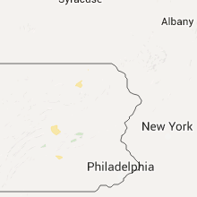


Connect with Interactive Hail Maps