

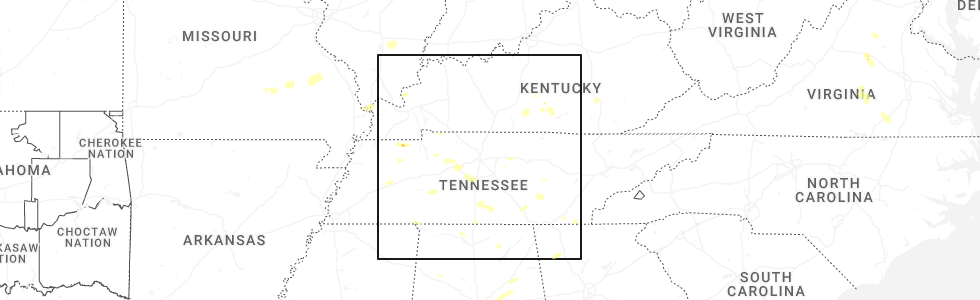
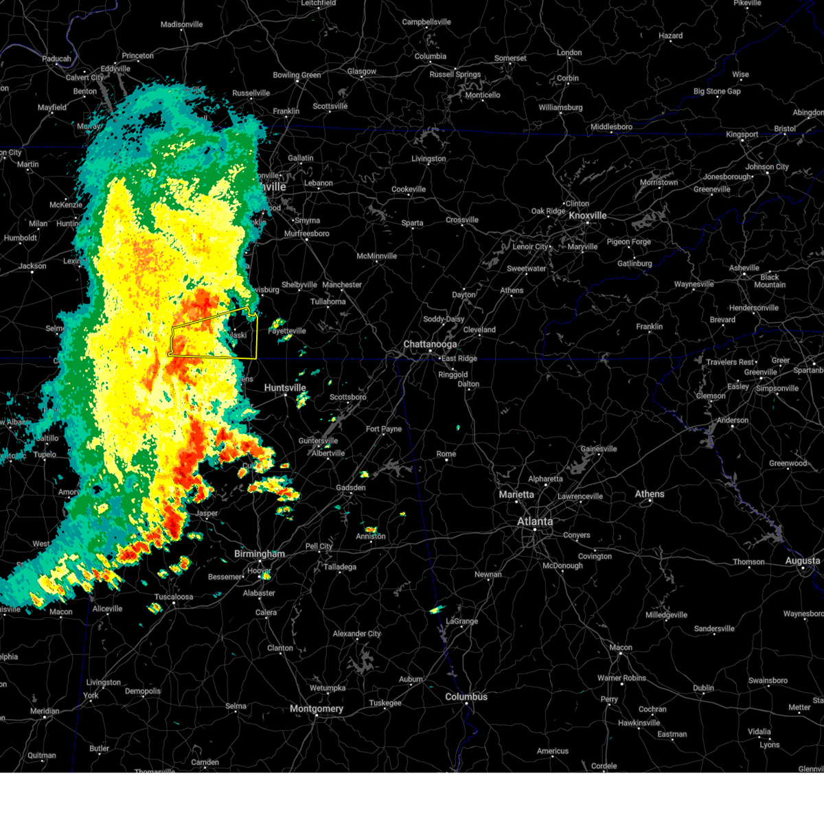
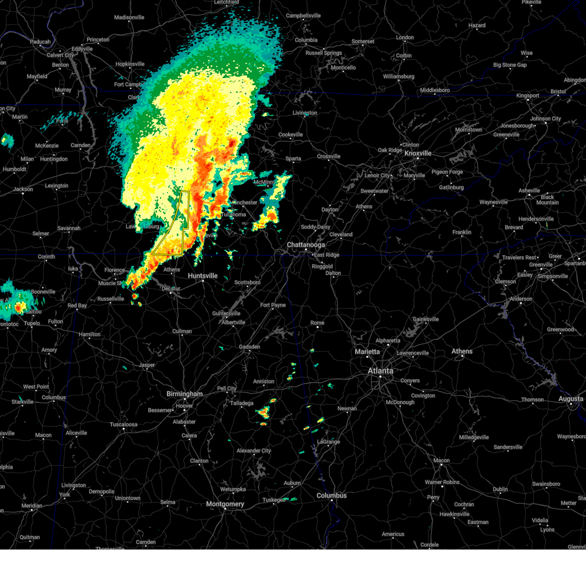
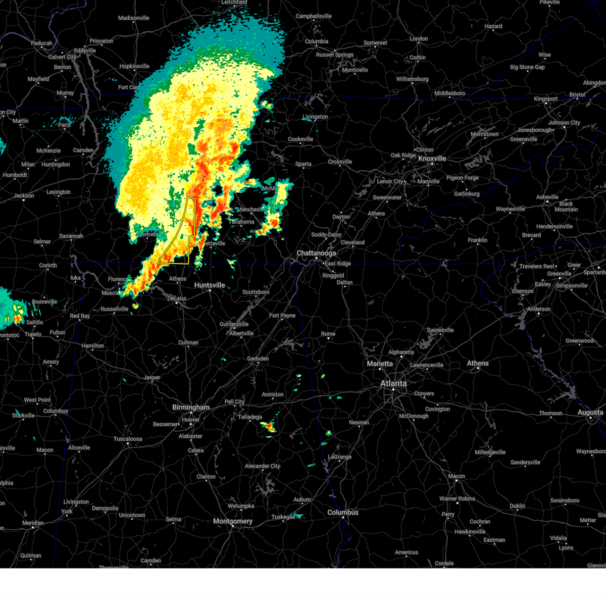
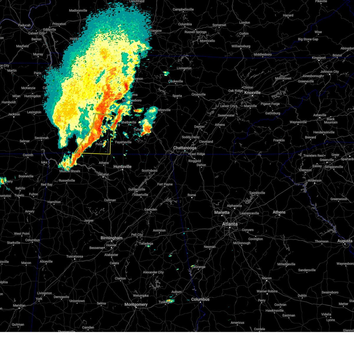
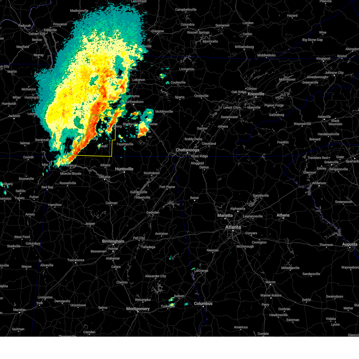
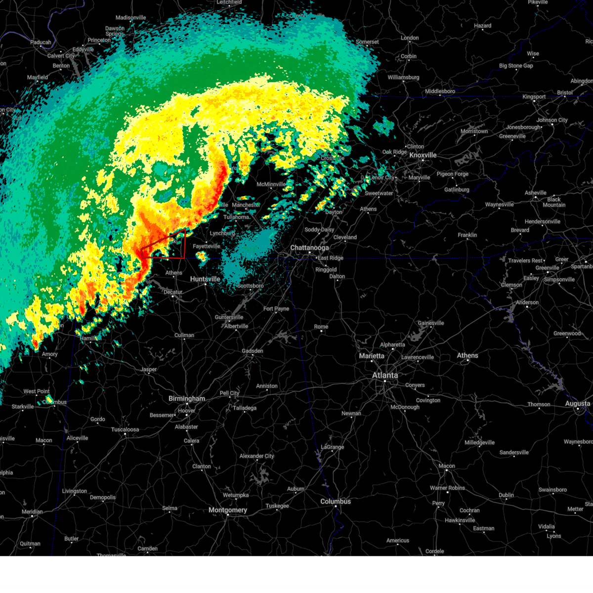
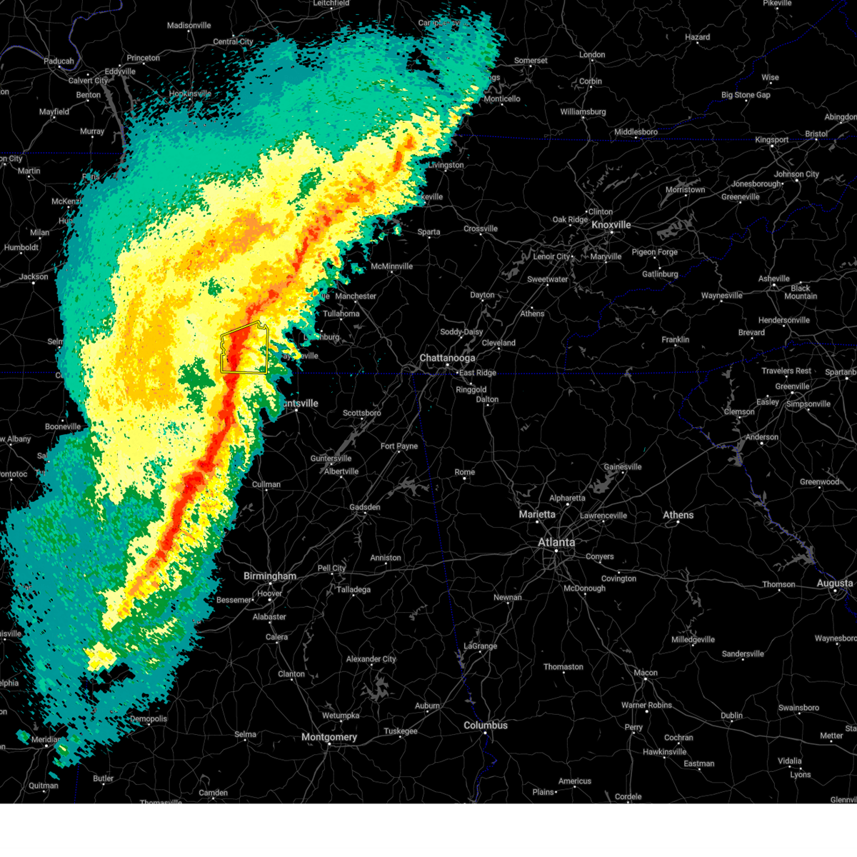
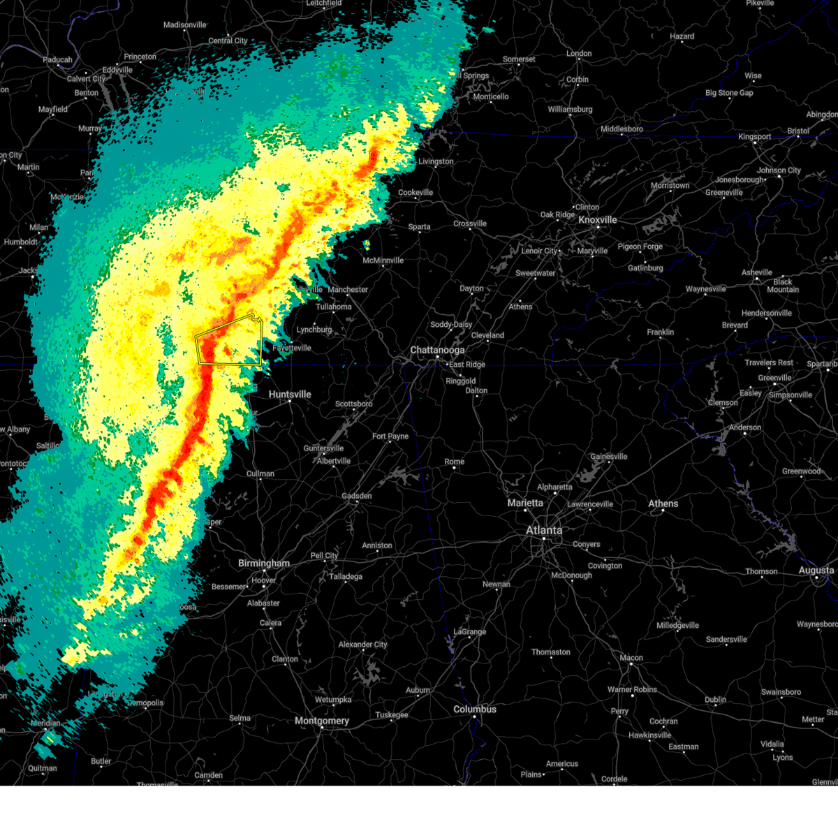
Hail Map for Elkton, TN
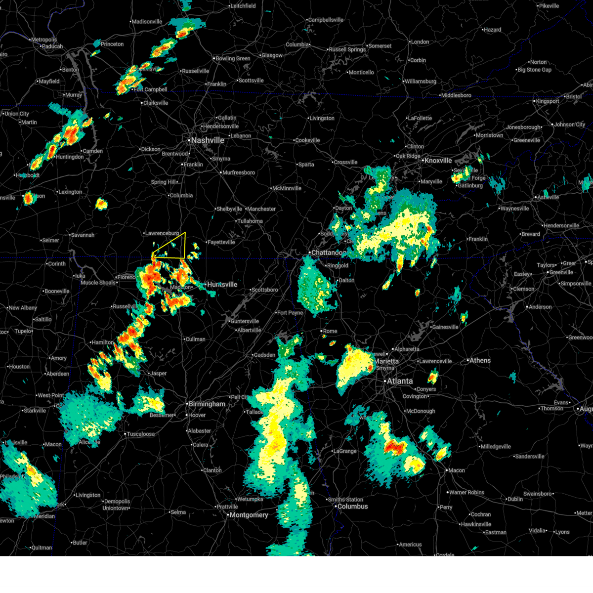
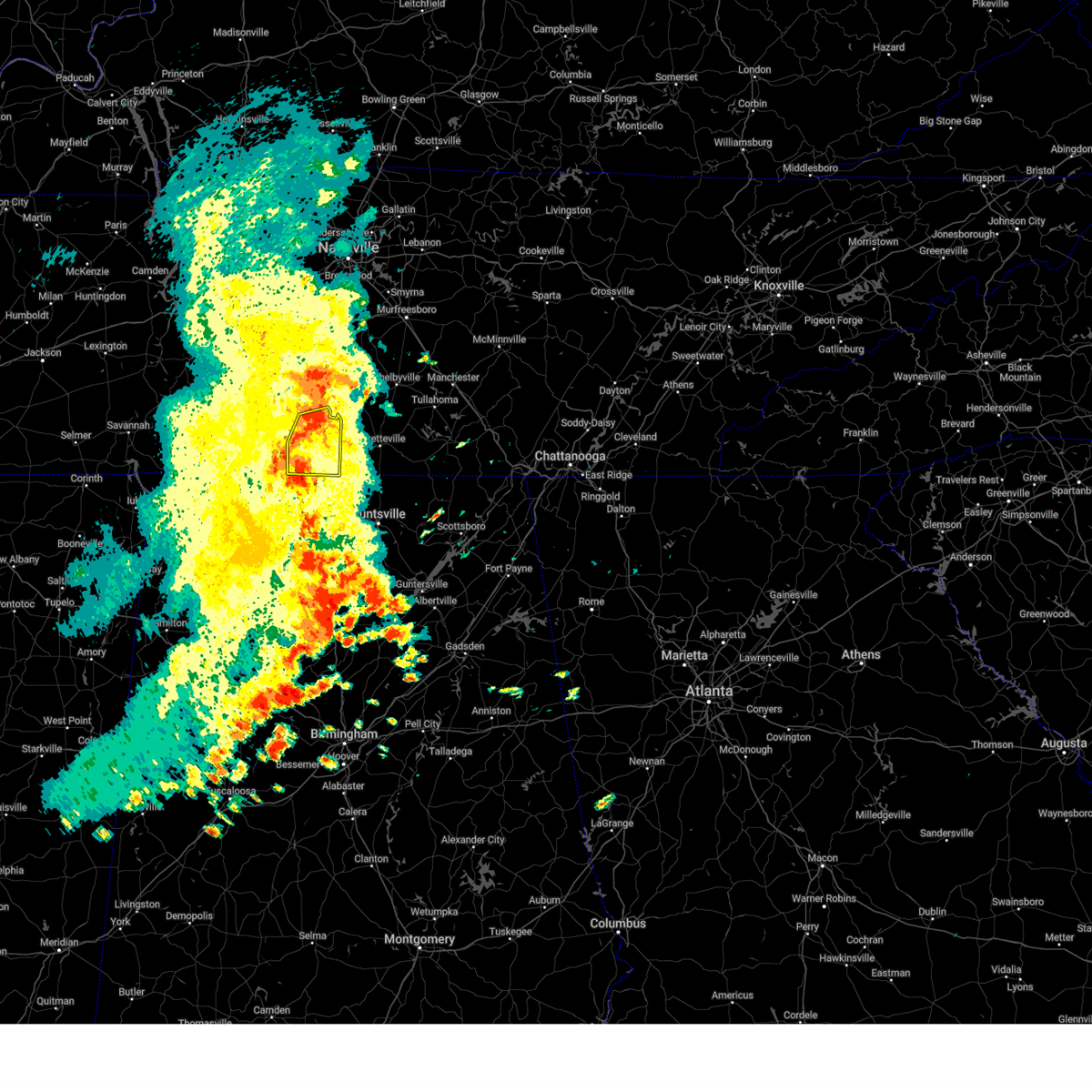
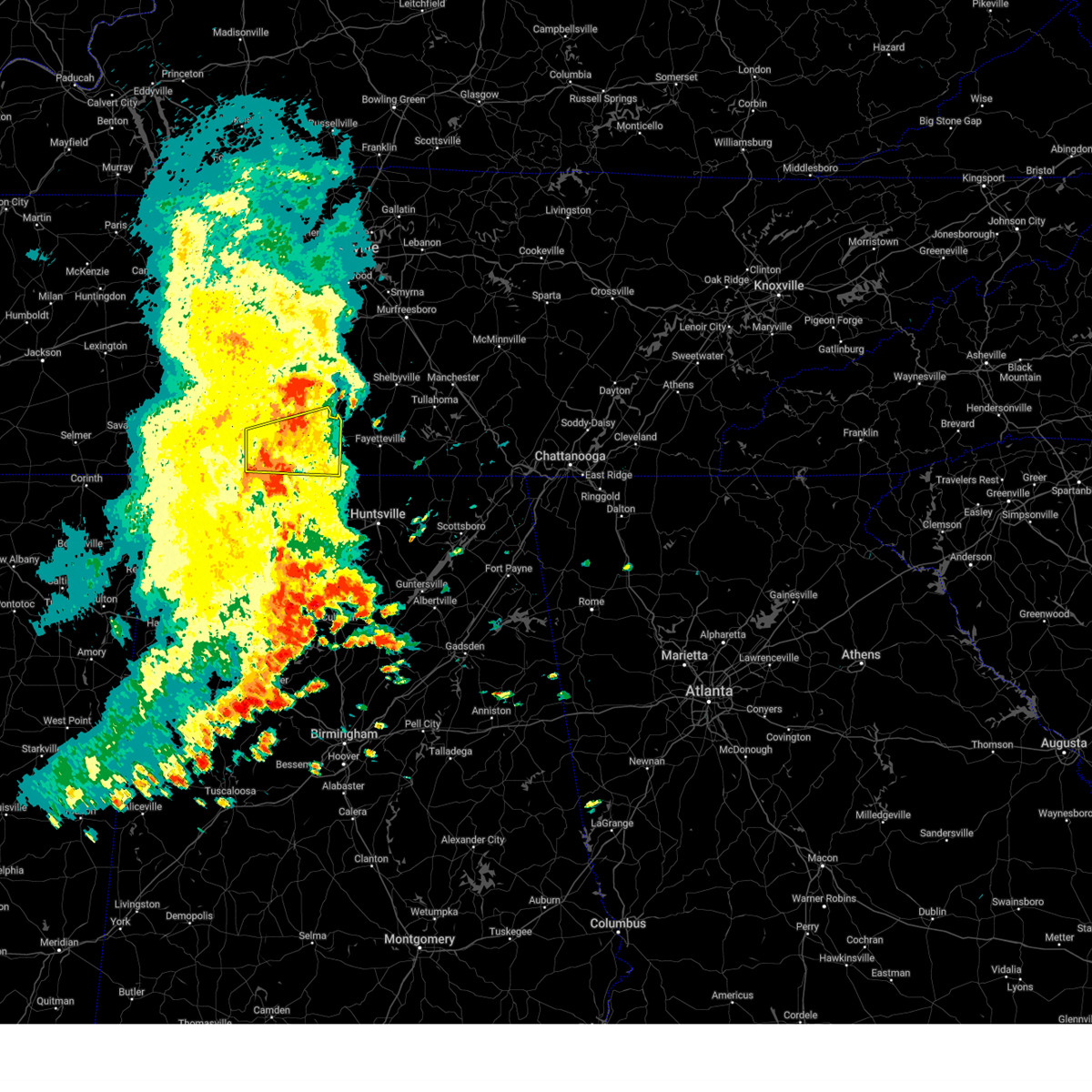
The Elkton, TN area has had 1 report of on-the-ground hail by trained spotters, and has been under severe weather warnings 28 times during the past 12 months. Doppler radar has detected hail at or near Elkton, TN on 57 occasions, including 4 occasions during the past year.
| Name: | Elkton, TN |
| Where Located: | 47.7 miles ENE of Florence, AL |
| Map: | Google Map for Elkton, TN |
| Population: | 578 |
| Housing Units: | 275 |
| More Info: | Search Google for Elkton, TN |
1
The Top Recent Hail Date for Elkton, TN is Friday, June 6, 2025 (20th out of 57)
Hail and Wind Damage Spotted near Elkton, TN
| Date / Time | Report Details |
|---|---|
| 6/18/2025 5:38 PM CDT |
 Svrohx the national weather service in nashville has issued a * severe thunderstorm warning for, southern giles county in middle tennessee, * until 615 pm cdt. * at 538 pm cdt, a severe thunderstorm was located 11 miles east of lexington, or 16 miles southwest of pulaski, moving northeast at 35 mph (radar indicated). Hazards include 60 mph wind gusts. expect damage to roofs, siding, and trees Svrohx the national weather service in nashville has issued a * severe thunderstorm warning for, southern giles county in middle tennessee, * until 615 pm cdt. * at 538 pm cdt, a severe thunderstorm was located 11 miles east of lexington, or 16 miles southwest of pulaski, moving northeast at 35 mph (radar indicated). Hazards include 60 mph wind gusts. expect damage to roofs, siding, and trees
|
| 6/7/2025 2:06 PM CDT |
 the severe thunderstorm warning has been cancelled and is no longer in effect the severe thunderstorm warning has been cancelled and is no longer in effect
|
| 6/7/2025 2:06 PM CDT |
 At 206 pm cdt, a severe thunderstorm was located near ardmore, or 12 miles southeast of pulaski, moving east at 55 mph (radar indicated). Hazards include 60 mph wind gusts and penny size hail. Expect damage to roofs, siding, and trees. locations impacted include, pulaski, ardmore, elkton, minor hill, goodspring, frankewing, and prospect. This includes interstate 65 between mile markers 1 and 22. At 206 pm cdt, a severe thunderstorm was located near ardmore, or 12 miles southeast of pulaski, moving east at 55 mph (radar indicated). Hazards include 60 mph wind gusts and penny size hail. Expect damage to roofs, siding, and trees. locations impacted include, pulaski, ardmore, elkton, minor hill, goodspring, frankewing, and prospect. This includes interstate 65 between mile markers 1 and 22.
|
| 6/7/2025 1:53 PM CDT |
 At 153 pm cdt, a severe thunderstorm was located 11 miles east of lexington, or 14 miles southwest of pulaski, moving east at 50 mph (radar indicated). Hazards include 60 mph wind gusts and penny size hail. Expect damage to roofs, siding, and trees. locations impacted include, lawrenceburg, pulaski, loretto, ardmore, elkton, minor hill, goodspring, leoma, frankewing, and prospect. This includes interstate 65 between mile markers 1 and 22. At 153 pm cdt, a severe thunderstorm was located 11 miles east of lexington, or 14 miles southwest of pulaski, moving east at 50 mph (radar indicated). Hazards include 60 mph wind gusts and penny size hail. Expect damage to roofs, siding, and trees. locations impacted include, lawrenceburg, pulaski, loretto, ardmore, elkton, minor hill, goodspring, leoma, frankewing, and prospect. This includes interstate 65 between mile markers 1 and 22.
|
| 6/7/2025 1:36 PM CDT |
 Svrohx the national weather service in nashville has issued a * severe thunderstorm warning for, southern lawrence county in middle tennessee, giles county in middle tennessee, * until 230 pm cdt. * at 136 pm cdt, a severe thunderstorm was located near lexington, or 15 miles northeast of florence, moving east at 45 mph (radar indicated). Hazards include 60 mph wind gusts and penny size hail. expect damage to roofs, siding, and trees Svrohx the national weather service in nashville has issued a * severe thunderstorm warning for, southern lawrence county in middle tennessee, giles county in middle tennessee, * until 230 pm cdt. * at 136 pm cdt, a severe thunderstorm was located near lexington, or 15 miles northeast of florence, moving east at 45 mph (radar indicated). Hazards include 60 mph wind gusts and penny size hail. expect damage to roofs, siding, and trees
|
| 5/25/2025 3:40 PM CDT |
 The storms which prompted the warning have moved out of the area. therefore, the warning will be allowed to expire. The storms which prompted the warning have moved out of the area. therefore, the warning will be allowed to expire.
|
| 5/25/2025 3:30 PM CDT |
 At 329 pm cdt, severe thunderstorms were located along a line extending from 13 miles southeast of spring hill to 9 miles south of lewisburg to 7 miles southeast of pulaski, moving east at 45 mph (radar indicated). Hazards include 60 mph wind gusts. Expect damage to roofs, siding, and trees. locations impacted include, lewisburg, pulaski, ardmore, cornersville, elkton, minor hill, frankewing, and prospect. This includes interstate 65 between mile markers 1 and 34. At 329 pm cdt, severe thunderstorms were located along a line extending from 13 miles southeast of spring hill to 9 miles south of lewisburg to 7 miles southeast of pulaski, moving east at 45 mph (radar indicated). Hazards include 60 mph wind gusts. Expect damage to roofs, siding, and trees. locations impacted include, lewisburg, pulaski, ardmore, cornersville, elkton, minor hill, frankewing, and prospect. This includes interstate 65 between mile markers 1 and 34.
|
| 5/25/2025 3:30 PM CDT |
 the severe thunderstorm warning has been cancelled and is no longer in effect the severe thunderstorm warning has been cancelled and is no longer in effect
|
| 5/25/2025 3:10 PM CDT |
 the severe thunderstorm warning has been cancelled and is no longer in effect the severe thunderstorm warning has been cancelled and is no longer in effect
|
| 5/25/2025 3:10 PM CDT |
 At 309 pm cdt, severe thunderstorms were located along a line extending from near columbia to 10 miles north of pulaski to near st. florian, moving east at 45 mph (radar indicated). Hazards include 60 mph wind gusts. Expect damage to roofs, siding, and trees. locations impacted include, columbia, lewisburg, lawrenceburg, pulaski, mount pleasant, loretto, ardmore, cornersville, st. joseph, elkton, minor hill, ethridge, lynnville, culleoka, i-65 east of columbia, goodspring, leoma, frankewing, and prospect. This includes interstate 65 between mile markers 1 and 46. At 309 pm cdt, severe thunderstorms were located along a line extending from near columbia to 10 miles north of pulaski to near st. florian, moving east at 45 mph (radar indicated). Hazards include 60 mph wind gusts. Expect damage to roofs, siding, and trees. locations impacted include, columbia, lewisburg, lawrenceburg, pulaski, mount pleasant, loretto, ardmore, cornersville, st. joseph, elkton, minor hill, ethridge, lynnville, culleoka, i-65 east of columbia, goodspring, leoma, frankewing, and prospect. This includes interstate 65 between mile markers 1 and 46.
|
| 5/25/2025 2:57 PM CDT |
 Svrohx the national weather service in nashville has issued a * severe thunderstorm warning for, southeastern wayne county in middle tennessee, western marshall county in middle tennessee, lawrence county in middle tennessee, southern maury county in middle tennessee, giles county in middle tennessee, * until 345 pm cdt. * at 256 pm cdt, severe thunderstorms were located along a line extending from 6 miles southeast of summertown to near underwood-petersville, moving east at 45 mph (radar indicated). Hazards include 60 mph wind gusts. expect damage to roofs, siding, and trees Svrohx the national weather service in nashville has issued a * severe thunderstorm warning for, southeastern wayne county in middle tennessee, western marshall county in middle tennessee, lawrence county in middle tennessee, southern maury county in middle tennessee, giles county in middle tennessee, * until 345 pm cdt. * at 256 pm cdt, severe thunderstorms were located along a line extending from 6 miles southeast of summertown to near underwood-petersville, moving east at 45 mph (radar indicated). Hazards include 60 mph wind gusts. expect damage to roofs, siding, and trees
|
| 5/20/2025 2:14 PM CDT | Torohx the national weather service in nashville has issued a * tornado warning for, southeastern giles county in middle tennessee, * until 245 pm cdt. * at 214 pm cdt, a severe thunderstorm capable of producing a tornado was located 8 miles southeast of pulaski, moving east at 35 mph (radar indicated rotation). Hazards include tornado and quarter size hail. Flying debris will be dangerous to those caught without shelter. mobile homes will be damaged or destroyed. damage to roofs, windows, and vehicles will occur. Tree damage is likely. |
| 4/10/2025 5:47 PM CDT | the severe thunderstorm warning has been cancelled and is no longer in effect |
| 4/10/2025 5:47 PM CDT | At 547 pm cdt, severe thunderstorms were located along a line extending from near columbia to near rogersville, moving southeast at 35 mph (emergency management). Hazards include 60 mph wind gusts. Expect damage to roofs, siding, and trees. locations impacted include, ethridge, mount pleasant, culleoka, minor hill, i-65 east of columbia, elkton, pulaski, goodspring, columbia, lynnville, frankewing, ardmore, cornersville, prospect, lewisburg, lawrenceburg, and spring hill. This includes interstate 65 between mile markers 1 and 50. |
| 4/10/2025 5:26 PM CDT |
 At 525 pm cdt, severe thunderstorms were located along a line extending from 8 miles northwest of mount pleasant to near lexington, moving southeast at 35 mph (radar indicated). Hazards include 60 mph wind gusts. Expect damage to roofs, siding, and trees. locations impacted include, gordonsburg, henryville, culleoka, st. joseph, pulaski, goodspring, leoma, lynnville, frankewing, hampshire, williamsport, loretto, ethridge, mount pleasant, minor hill, cypress inn, collinwood, i-65 east of columbia, elkton, and lawrenceburg. This includes interstate 65 between mile markers 1 and 52. At 525 pm cdt, severe thunderstorms were located along a line extending from 8 miles northwest of mount pleasant to near lexington, moving southeast at 35 mph (radar indicated). Hazards include 60 mph wind gusts. Expect damage to roofs, siding, and trees. locations impacted include, gordonsburg, henryville, culleoka, st. joseph, pulaski, goodspring, leoma, lynnville, frankewing, hampshire, williamsport, loretto, ethridge, mount pleasant, minor hill, cypress inn, collinwood, i-65 east of columbia, elkton, and lawrenceburg. This includes interstate 65 between mile markers 1 and 52.
|
| 4/10/2025 5:26 PM CDT |
 the severe thunderstorm warning has been cancelled and is no longer in effect the severe thunderstorm warning has been cancelled and is no longer in effect
|
| 4/10/2025 5:11 PM CDT |
 Svrohx the national weather service in nashville has issued a * severe thunderstorm warning for, lewis county in middle tennessee, eastern wayne county in middle tennessee, western marshall county in middle tennessee, lawrence county in middle tennessee, maury county in middle tennessee, giles county in middle tennessee, southern hickman county in middle tennessee, * until 600 pm cdt. * at 511 pm cdt, severe thunderstorms were located along a line extending from 6 miles southeast of centerville to 8 miles southwest of loretto, moving southeast at 35 mph (radar indicated). Hazards include 60 mph wind gusts. expect damage to roofs, siding, and trees Svrohx the national weather service in nashville has issued a * severe thunderstorm warning for, lewis county in middle tennessee, eastern wayne county in middle tennessee, western marshall county in middle tennessee, lawrence county in middle tennessee, maury county in middle tennessee, giles county in middle tennessee, southern hickman county in middle tennessee, * until 600 pm cdt. * at 511 pm cdt, severe thunderstorms were located along a line extending from 6 miles southeast of centerville to 8 miles southwest of loretto, moving southeast at 35 mph (radar indicated). Hazards include 60 mph wind gusts. expect damage to roofs, siding, and trees
|
| 4/5/2025 11:16 PM CDT |
 the tornado warning has been cancelled and is no longer in effect the tornado warning has been cancelled and is no longer in effect
|
| 4/5/2025 11:16 PM CDT |
 At 1116 pm cdt, a severe thunderstorm capable of producing a tornado was located 12 miles southwest of pulaski, moving east at 30 mph (radar indicated rotation). Hazards include tornado. Flying debris will be dangerous to those caught without shelter. mobile homes will be damaged or destroyed. damage to roofs, windows, and vehicles will occur. tree damage is likely. this dangerous storm will be near, pulaski around 1130 pm cdt. other locations impacted by this tornadic thunderstorm include ardmore, prospect, goodspring, elkton, frankewing, and minor hill. This includes interstate 65 between mile markers 1 and 18. At 1116 pm cdt, a severe thunderstorm capable of producing a tornado was located 12 miles southwest of pulaski, moving east at 30 mph (radar indicated rotation). Hazards include tornado. Flying debris will be dangerous to those caught without shelter. mobile homes will be damaged or destroyed. damage to roofs, windows, and vehicles will occur. tree damage is likely. this dangerous storm will be near, pulaski around 1130 pm cdt. other locations impacted by this tornadic thunderstorm include ardmore, prospect, goodspring, elkton, frankewing, and minor hill. This includes interstate 65 between mile markers 1 and 18.
|
| 4/5/2025 11:07 PM CDT |
 Torohx the national weather service in nashville has issued a * tornado warning for, southeastern lawrence county in middle tennessee, southern giles county in middle tennessee, * until 1145 pm cdt. * at 1107 pm cdt, a severe thunderstorm capable of producing a tornado was located 8 miles northeast of lexington, or 15 miles south of lawrenceburg, moving east at 30 mph (radar indicated rotation). Hazards include tornado. Flying debris will be dangerous to those caught without shelter. mobile homes will be damaged or destroyed. damage to roofs, windows, and vehicles will occur. tree damage is likely. this dangerous storm will be near, pulaski around 1130 pm cdt. other locations impacted by this tornadic thunderstorm include ardmore, prospect, goodspring, elkton, frankewing, and minor hill. This includes interstate 65 between mile markers 1 and 18. Torohx the national weather service in nashville has issued a * tornado warning for, southeastern lawrence county in middle tennessee, southern giles county in middle tennessee, * until 1145 pm cdt. * at 1107 pm cdt, a severe thunderstorm capable of producing a tornado was located 8 miles northeast of lexington, or 15 miles south of lawrenceburg, moving east at 30 mph (radar indicated rotation). Hazards include tornado. Flying debris will be dangerous to those caught without shelter. mobile homes will be damaged or destroyed. damage to roofs, windows, and vehicles will occur. tree damage is likely. this dangerous storm will be near, pulaski around 1130 pm cdt. other locations impacted by this tornadic thunderstorm include ardmore, prospect, goodspring, elkton, frankewing, and minor hill. This includes interstate 65 between mile markers 1 and 18.
|
| 3/31/2025 3:04 AM CDT |
 the severe thunderstorm warning has been cancelled and is no longer in effect the severe thunderstorm warning has been cancelled and is no longer in effect
|
| 3/31/2025 2:57 AM CDT |
 At 257 am cdt, a severe thunderstorm was located 8 miles north of ardmore, or 10 miles southeast of pulaski, moving east at 40 mph (radar indicated). Hazards include 60 mph wind gusts. Expect damage to roofs, siding, and trees. locations impacted include, ardmore, elkton, and frankewing. This includes interstate 65 between mile markers 1 and 19. At 257 am cdt, a severe thunderstorm was located 8 miles north of ardmore, or 10 miles southeast of pulaski, moving east at 40 mph (radar indicated). Hazards include 60 mph wind gusts. Expect damage to roofs, siding, and trees. locations impacted include, ardmore, elkton, and frankewing. This includes interstate 65 between mile markers 1 and 19.
|
| 3/31/2025 2:41 AM CDT |
 At 241 am cdt, a severe thunderstorm was located near pulaski, moving east at 40 mph (radar indicated). Hazards include 60 mph wind gusts. Expect damage to roofs, siding, and trees. locations impacted include, goodspring, frankewing, minor hill, ardmore, prospect, elkton, and pulaski. This includes interstate 65 between mile markers 1 and 20. At 241 am cdt, a severe thunderstorm was located near pulaski, moving east at 40 mph (radar indicated). Hazards include 60 mph wind gusts. Expect damage to roofs, siding, and trees. locations impacted include, goodspring, frankewing, minor hill, ardmore, prospect, elkton, and pulaski. This includes interstate 65 between mile markers 1 and 20.
|
| 3/31/2025 2:41 AM CDT |
 the severe thunderstorm warning has been cancelled and is no longer in effect the severe thunderstorm warning has been cancelled and is no longer in effect
|
| 3/31/2025 2:26 AM CDT | Svrohx the national weather service in nashville has issued a * severe thunderstorm warning for, southeastern lawrence county in middle tennessee, giles county in middle tennessee, * until 315 am cdt. * at 225 am cdt, a severe thunderstorm was located 10 miles east of loretto, or 11 miles south of lawrenceburg, moving east at 40 mph (radar indicated). Hazards include 60 mph wind gusts. expect damage to roofs, siding, and trees |
| 2/15/2025 11:52 PM CST |
 At 1151 pm cst, a severe thunderstorm was located near pulaski, moving east at 55 mph (radar indicated). Hazards include 60 mph wind gusts. Expect damage to roofs, siding, and trees. locations impacted include, pulaski, ardmore, elkton, minor hill, goodspring, frankewing, and prospect. This includes interstate 65 between mile markers 1 and 22. At 1151 pm cst, a severe thunderstorm was located near pulaski, moving east at 55 mph (radar indicated). Hazards include 60 mph wind gusts. Expect damage to roofs, siding, and trees. locations impacted include, pulaski, ardmore, elkton, minor hill, goodspring, frankewing, and prospect. This includes interstate 65 between mile markers 1 and 22.
|
| 2/15/2025 11:52 PM CST |
 the severe thunderstorm warning has been cancelled and is no longer in effect the severe thunderstorm warning has been cancelled and is no longer in effect
|
| 2/15/2025 11:43 PM CST |
 Svrohx the national weather service in nashville has issued a * severe thunderstorm warning for, southeastern lawrence county in middle tennessee, giles county in middle tennessee, * until 1215 am cst. * at 1142 pm cst, a severe thunderstorm was located 11 miles southeast of lawrenceburg, moving east at 50 mph (radar indicated). Hazards include 60 mph wind gusts. expect damage to roofs, siding, and trees Svrohx the national weather service in nashville has issued a * severe thunderstorm warning for, southeastern lawrence county in middle tennessee, giles county in middle tennessee, * until 1215 am cst. * at 1142 pm cst, a severe thunderstorm was located 11 miles southeast of lawrenceburg, moving east at 50 mph (radar indicated). Hazards include 60 mph wind gusts. expect damage to roofs, siding, and trees
|
| 5/14/2024 4:26 PM CDT |
 Svrohx the national weather service in nashville has issued a * severe thunderstorm warning for, east central lewis county in middle tennessee, southwestern marshall county in middle tennessee, eastern lawrence county in middle tennessee, southern maury county in middle tennessee, giles county in middle tennessee, * until 500 pm cdt. * at 426 pm cdt, severe thunderstorms were located along a line extending from near summertown to near pulaski to 10 miles east of lexington, moving east at 45 mph (radar indicated). Hazards include 60 mph wind gusts and penny size hail. expect damage to roofs, siding, and trees Svrohx the national weather service in nashville has issued a * severe thunderstorm warning for, east central lewis county in middle tennessee, southwestern marshall county in middle tennessee, eastern lawrence county in middle tennessee, southern maury county in middle tennessee, giles county in middle tennessee, * until 500 pm cdt. * at 426 pm cdt, severe thunderstorms were located along a line extending from near summertown to near pulaski to 10 miles east of lexington, moving east at 45 mph (radar indicated). Hazards include 60 mph wind gusts and penny size hail. expect damage to roofs, siding, and trees
|
| 5/9/2024 3:33 AM CDT |
 the severe thunderstorm warning has been cancelled and is no longer in effect the severe thunderstorm warning has been cancelled and is no longer in effect
|
| 5/9/2024 3:33 AM CDT |
 At 333 am cdt, severe thunderstorms were located along a line extending from 11 miles southwest of lewisburg to 6 miles south of pulaski, moving southeast at 50 mph (radar indicated). Hazards include 60 mph wind gusts. Expect damage to roofs, siding, and trees. locations impacted include, pulaski, petersburg, ardmore, cornersville, elkton, lynnville, goodspring, frankewing, and prospect. This includes interstate 65 between mile markers 1 and 28. At 333 am cdt, severe thunderstorms were located along a line extending from 11 miles southwest of lewisburg to 6 miles south of pulaski, moving southeast at 50 mph (radar indicated). Hazards include 60 mph wind gusts. Expect damage to roofs, siding, and trees. locations impacted include, pulaski, petersburg, ardmore, cornersville, elkton, lynnville, goodspring, frankewing, and prospect. This includes interstate 65 between mile markers 1 and 28.
|
| 5/9/2024 3:20 AM CDT |
 Svrohx the national weather service in nashville has issued a * severe thunderstorm warning for, southern marshall county in middle tennessee, east central lawrence county in middle tennessee, giles county in middle tennessee, * until 345 am cdt. * at 320 am cdt, severe thunderstorms were located along a line extending from 14 miles southwest of lewisburg to 8 miles southwest of pulaski, moving southeast at 60 mph (radar indicated). Hazards include 60 mph wind gusts. expect damage to roofs, siding, and trees Svrohx the national weather service in nashville has issued a * severe thunderstorm warning for, southern marshall county in middle tennessee, east central lawrence county in middle tennessee, giles county in middle tennessee, * until 345 am cdt. * at 320 am cdt, severe thunderstorms were located along a line extending from 14 miles southwest of lewisburg to 8 miles southwest of pulaski, moving southeast at 60 mph (radar indicated). Hazards include 60 mph wind gusts. expect damage to roofs, siding, and trees
|
| 5/8/2024 10:14 PM CDT |
 The storm which prompted the warning has moved out of the area. therefore, the warning will be allowed to expire. a tornado watch remains in effect until 300 am cdt for middle tennessee. The storm which prompted the warning has moved out of the area. therefore, the warning will be allowed to expire. a tornado watch remains in effect until 300 am cdt for middle tennessee.
|
| 5/8/2024 9:56 PM CDT |
 At 955 pm cdt, a severe thunderstorm was located 8 miles northwest of ardmore, or 10 miles south of pulaski, moving east at 30 mph (radar indicated). Hazards include 60 mph wind gusts and quarter size hail. Hail damage to vehicles is expected. expect wind damage to roofs, siding, and trees. locations impacted include, pulaski, ardmore, elkton, prospect, and frankewing. This includes interstate 65 between mile markers 1 and 13. At 955 pm cdt, a severe thunderstorm was located 8 miles northwest of ardmore, or 10 miles south of pulaski, moving east at 30 mph (radar indicated). Hazards include 60 mph wind gusts and quarter size hail. Hail damage to vehicles is expected. expect wind damage to roofs, siding, and trees. locations impacted include, pulaski, ardmore, elkton, prospect, and frankewing. This includes interstate 65 between mile markers 1 and 13.
|
| 5/8/2024 9:43 PM CDT |
 Svrohx the national weather service in nashville has issued a * severe thunderstorm warning for, southern giles county in middle tennessee, * until 1015 pm cdt. * at 943 pm cdt, a severe thunderstorm was located 10 miles south of pulaski, moving east at 35 mph (radar indicated). Hazards include 60 mph wind gusts and quarter size hail. Hail damage to vehicles is expected. Expect wind damage to roofs, siding, and trees. Svrohx the national weather service in nashville has issued a * severe thunderstorm warning for, southern giles county in middle tennessee, * until 1015 pm cdt. * at 943 pm cdt, a severe thunderstorm was located 10 miles south of pulaski, moving east at 35 mph (radar indicated). Hazards include 60 mph wind gusts and quarter size hail. Hail damage to vehicles is expected. Expect wind damage to roofs, siding, and trees.
|
| 5/8/2024 8:24 PM CDT |
 The storm which prompted the warning has moved out of the area. therefore, the warning will be allowed to expire. a tornado watch remains in effect until 300 am cdt for middle tennessee. The storm which prompted the warning has moved out of the area. therefore, the warning will be allowed to expire. a tornado watch remains in effect until 300 am cdt for middle tennessee.
|
| 5/8/2024 8:08 PM CDT |
 At 806 pm cdt, a confirmed tornado was located 7 miles north of ardmore, or 12 miles southeast of pulaski, moving east at 30 mph (weather spotters confirmed tornado). Hazards include damaging tornado and half dollar size hail. Flying debris will be dangerous to those caught without shelter. mobile homes will be damaged or destroyed. damage to roofs, windows, and vehicles will occur. tree damage is likely. locations impacted include, ardmore, elkton, and frankewing. This includes interstate 65 between mile markers 1 and 13. At 806 pm cdt, a confirmed tornado was located 7 miles north of ardmore, or 12 miles southeast of pulaski, moving east at 30 mph (weather spotters confirmed tornado). Hazards include damaging tornado and half dollar size hail. Flying debris will be dangerous to those caught without shelter. mobile homes will be damaged or destroyed. damage to roofs, windows, and vehicles will occur. tree damage is likely. locations impacted include, ardmore, elkton, and frankewing. This includes interstate 65 between mile markers 1 and 13.
|
| 5/8/2024 7:58 PM CDT |
 At 758 pm cdt, a confirmed tornado was located 8 miles northwest of ardmore, or 9 miles southeast of pulaski, moving east at 30 mph (weather spotters confirmed tornado). Hazards include damaging tornado and half dollar size hail. Flying debris will be dangerous to those caught without shelter. mobile homes will be damaged or destroyed. damage to roofs, windows, and vehicles will occur. tree damage is likely. locations impacted include, pulaski, ardmore, elkton, prospect, and frankewing. This includes interstate 65 between mile markers 1 and 13. At 758 pm cdt, a confirmed tornado was located 8 miles northwest of ardmore, or 9 miles southeast of pulaski, moving east at 30 mph (weather spotters confirmed tornado). Hazards include damaging tornado and half dollar size hail. Flying debris will be dangerous to those caught without shelter. mobile homes will be damaged or destroyed. damage to roofs, windows, and vehicles will occur. tree damage is likely. locations impacted include, pulaski, ardmore, elkton, prospect, and frankewing. This includes interstate 65 between mile markers 1 and 13.
|
| 5/8/2024 7:56 PM CDT |
 Torohx the national weather service in nashville has issued a * tornado warning for, southeastern giles county in middle tennessee, * until 830 pm cdt. * at 756 pm cdt, a severe thunderstorm capable of producing a tornado was located 8 miles northwest of ardmore, or 9 miles southeast of pulaski, moving east at 30 mph (radar indicated rotation). Hazards include tornado and half dollar size hail. Flying debris will be dangerous to those caught without shelter. mobile homes will be damaged or destroyed. damage to roofs, windows, and vehicles will occur. tree damage is likely. this tornadic thunderstorm will remain over mainly rural areas of southeastern giles county, including the following locations, ardmore, prospect, elkton, and frankewing. This includes interstate 65 between mile markers 1 and 13. Torohx the national weather service in nashville has issued a * tornado warning for, southeastern giles county in middle tennessee, * until 830 pm cdt. * at 756 pm cdt, a severe thunderstorm capable of producing a tornado was located 8 miles northwest of ardmore, or 9 miles southeast of pulaski, moving east at 30 mph (radar indicated rotation). Hazards include tornado and half dollar size hail. Flying debris will be dangerous to those caught without shelter. mobile homes will be damaged or destroyed. damage to roofs, windows, and vehicles will occur. tree damage is likely. this tornadic thunderstorm will remain over mainly rural areas of southeastern giles county, including the following locations, ardmore, prospect, elkton, and frankewing. This includes interstate 65 between mile markers 1 and 13.
|
| 5/8/2024 7:50 PM CDT | *** 1 inj *** tress down and mobile home demolished. tornado damage possibl in giles county TN, 3.2 miles E of Elkton, TN |
| 5/8/2024 7:46 PM CDT |
 the severe thunderstorm warning has been cancelled and is no longer in effect the severe thunderstorm warning has been cancelled and is no longer in effect
|
| 5/8/2024 7:46 PM CDT |
 At 744 pm cdt, a severe thunderstorm was located 7 miles southeast of pulaski, moving east at 40 mph (radar indicated). Hazards include 60 mph wind gusts and quarter size hail. Hail damage to vehicles is expected. expect wind damage to roofs, siding, and trees. locations impacted include, pulaski, ardmore, elkton, goodspring, frankewing, and prospect. This includes interstate 65 between mile markers 1 and 17. At 744 pm cdt, a severe thunderstorm was located 7 miles southeast of pulaski, moving east at 40 mph (radar indicated). Hazards include 60 mph wind gusts and quarter size hail. Hail damage to vehicles is expected. expect wind damage to roofs, siding, and trees. locations impacted include, pulaski, ardmore, elkton, goodspring, frankewing, and prospect. This includes interstate 65 between mile markers 1 and 17.
|
| 5/8/2024 7:29 PM CDT |
 Svrohx the national weather service in nashville has issued a * severe thunderstorm warning for, southeastern marshall county in middle tennessee, southeastern lawrence county in middle tennessee, southern giles county in middle tennessee, * until 815 pm cdt. * at 728 pm cdt, a severe thunderstorm was located 10 miles southwest of pulaski, moving east at 40 mph (radar indicated). Hazards include 60 mph wind gusts and quarter size hail. Hail damage to vehicles is expected. Expect wind damage to roofs, siding, and trees. Svrohx the national weather service in nashville has issued a * severe thunderstorm warning for, southeastern marshall county in middle tennessee, southeastern lawrence county in middle tennessee, southern giles county in middle tennessee, * until 815 pm cdt. * at 728 pm cdt, a severe thunderstorm was located 10 miles southwest of pulaski, moving east at 40 mph (radar indicated). Hazards include 60 mph wind gusts and quarter size hail. Hail damage to vehicles is expected. Expect wind damage to roofs, siding, and trees.
|
| 12/9/2023 7:28 PM CST |
 The severe thunderstorm warning for southeastern lawrence and southern giles counties will expire at 730 pm cst, the storm which prompted the warning has moved out of the area. therefore, the warning will be allowed to expire. however, gusty winds are still possible with this thunderstorm. a tornado watch remains in effect until 900 pm cst for middle tennessee. a tornado watch also remains in effect until 1100 pm cst for middle tennessee. The severe thunderstorm warning for southeastern lawrence and southern giles counties will expire at 730 pm cst, the storm which prompted the warning has moved out of the area. therefore, the warning will be allowed to expire. however, gusty winds are still possible with this thunderstorm. a tornado watch remains in effect until 900 pm cst for middle tennessee. a tornado watch also remains in effect until 1100 pm cst for middle tennessee.
|
| 12/9/2023 7:03 PM CST |
 At 702 pm cst, a severe thunderstorm was located 7 miles southeast of pulaski, moving east at 55 mph (radar indicated). Hazards include 60 mph wind gusts and penny size hail. Expect damage to roofs, siding, and trees. locations impacted include, pulaski, ardmore, elkton, minor hill, goodspring, frankewing, and prospect. This includes interstate 65 between mile markers 1 and 20. At 702 pm cst, a severe thunderstorm was located 7 miles southeast of pulaski, moving east at 55 mph (radar indicated). Hazards include 60 mph wind gusts and penny size hail. Expect damage to roofs, siding, and trees. locations impacted include, pulaski, ardmore, elkton, minor hill, goodspring, frankewing, and prospect. This includes interstate 65 between mile markers 1 and 20.
|
| 12/9/2023 6:43 PM CST |
 At 643 pm cst, a severe thunderstorm was located 8 miles northeast of lexington, or 14 miles south of lawrenceburg, moving east at 55 mph (radar indicated). Hazards include 60 mph wind gusts and penny size hail. expect damage to roofs, siding, and trees At 643 pm cst, a severe thunderstorm was located 8 miles northeast of lexington, or 14 miles south of lawrenceburg, moving east at 55 mph (radar indicated). Hazards include 60 mph wind gusts and penny size hail. expect damage to roofs, siding, and trees
|
| 8/9/2023 3:40 PM CDT |
 The severe thunderstorm warning for giles county will expire at 345 pm cdt, the storms which prompted the warning have moved out of the area. therefore, the warning will be allowed to expire. a severe thunderstorm watch remains in effect until 800 pm cdt for middle tennessee. The severe thunderstorm warning for giles county will expire at 345 pm cdt, the storms which prompted the warning have moved out of the area. therefore, the warning will be allowed to expire. a severe thunderstorm watch remains in effect until 800 pm cdt for middle tennessee.
|
| 8/9/2023 3:24 PM CDT |
 At 322 pm cdt, severe thunderstorms were located along a line extending from 7 miles north of pulaski to 14 miles west of ardmore, moving east at 60 mph (radar indicated. some wind damage and power outages have already occurred in lawrence county). Hazards include 70 mph wind gusts. Expect considerable tree damage. Damage is likely to mobile homes, roofs, and outbuildings. At 322 pm cdt, severe thunderstorms were located along a line extending from 7 miles north of pulaski to 14 miles west of ardmore, moving east at 60 mph (radar indicated. some wind damage and power outages have already occurred in lawrence county). Hazards include 70 mph wind gusts. Expect considerable tree damage. Damage is likely to mobile homes, roofs, and outbuildings.
|
| 8/7/2023 10:38 AM CDT |
 At 1037 am cdt, severe thunderstorms were located along a line extending from 8 miles east of centerville to 8 miles northwest of loretto, moving east at 50 mph (radar indicated). Hazards include 60 mph wind gusts and penny size hail. Expect damage to roofs, siding, and trees. locations impacted include, franklin, columbia, lawrenceburg, pulaski, hohenwald, centerville, spring hill, mount pleasant, thompson`s station, loretto, summertown, st. joseph, elkton, minor hill, ethridge, lynnville, gordonsburg, kimmins, henryville and culleoka. this includes the following highways, interstate 65 between mile markers 1 and 22, and between mile markers 36 and 66. interstate 840 between mile markers 10 and 37. hail threat, radar indicated max hail size, 0. 75 in wind threat, radar indicated max wind gust, 60 mph. At 1037 am cdt, severe thunderstorms were located along a line extending from 8 miles east of centerville to 8 miles northwest of loretto, moving east at 50 mph (radar indicated). Hazards include 60 mph wind gusts and penny size hail. Expect damage to roofs, siding, and trees. locations impacted include, franklin, columbia, lawrenceburg, pulaski, hohenwald, centerville, spring hill, mount pleasant, thompson`s station, loretto, summertown, st. joseph, elkton, minor hill, ethridge, lynnville, gordonsburg, kimmins, henryville and culleoka. this includes the following highways, interstate 65 between mile markers 1 and 22, and between mile markers 36 and 66. interstate 840 between mile markers 10 and 37. hail threat, radar indicated max hail size, 0. 75 in wind threat, radar indicated max wind gust, 60 mph.
|
| 8/7/2023 10:28 AM CDT |
 At 1027 am cdt, severe thunderstorms were located along a line extending from near centerville to 7 miles south of collinwood, moving east at 50 mph (radar indicated). Hazards include 60 mph wind gusts and penny size hail. expect damage to roofs, siding, and trees At 1027 am cdt, severe thunderstorms were located along a line extending from near centerville to 7 miles south of collinwood, moving east at 50 mph (radar indicated). Hazards include 60 mph wind gusts and penny size hail. expect damage to roofs, siding, and trees
|
| 8/5/2023 8:13 PM CDT |
 At 813 pm cdt, a severe thunderstorm was located 9 miles south of pulaski, moving east at 30 mph (radar indicated). Hazards include 60 mph wind gusts. Expect damage to roofs, siding, and trees. locations impacted include, ardmore, elkton, minor hill, goodspring and prospect. this includes interstate 65 between mile markers 1 and 10. hail threat, radar indicated max hail size, <. 75 in wind threat, radar indicated max wind gust, 60 mph. At 813 pm cdt, a severe thunderstorm was located 9 miles south of pulaski, moving east at 30 mph (radar indicated). Hazards include 60 mph wind gusts. Expect damage to roofs, siding, and trees. locations impacted include, ardmore, elkton, minor hill, goodspring and prospect. this includes interstate 65 between mile markers 1 and 10. hail threat, radar indicated max hail size, <. 75 in wind threat, radar indicated max wind gust, 60 mph.
|
| 8/5/2023 7:57 PM CDT |
 At 757 pm cdt, a severe thunderstorm was located 11 miles northeast of lexington, or 13 miles southeast of lawrenceburg, moving east at 30 mph (radar indicated). Hazards include 60 mph wind gusts. expect damage to roofs, siding, and trees At 757 pm cdt, a severe thunderstorm was located 11 miles northeast of lexington, or 13 miles southeast of lawrenceburg, moving east at 30 mph (radar indicated). Hazards include 60 mph wind gusts. expect damage to roofs, siding, and trees
|
| 7/20/2023 3:06 PM CDT |
 The severe thunderstorm warning for southern giles county will expire at 315 pm cdt, the storm which prompted the warning has weakened below severe limits, and no longer poses an immediate threat to life or property. therefore, the warning will be allowed to expire. however gusty winds and heavy rain are still possible with this thunderstorm. a severe thunderstorm watch remains in effect until 700 pm cdt for middle tennessee. The severe thunderstorm warning for southern giles county will expire at 315 pm cdt, the storm which prompted the warning has weakened below severe limits, and no longer poses an immediate threat to life or property. therefore, the warning will be allowed to expire. however gusty winds and heavy rain are still possible with this thunderstorm. a severe thunderstorm watch remains in effect until 700 pm cdt for middle tennessee.
|
| 7/20/2023 2:52 PM CDT |
 At 252 pm cdt, a severe thunderstorm was located near pulaski, moving southeast at 35 mph (radar indicated). Hazards include 60 mph wind gusts and nickel size hail. expect damage to roofs, siding, and trees At 252 pm cdt, a severe thunderstorm was located near pulaski, moving southeast at 35 mph (radar indicated). Hazards include 60 mph wind gusts and nickel size hail. expect damage to roofs, siding, and trees
|
| 7/18/2023 4:56 PM CDT |
 At 456 pm cdt, severe thunderstorms were located along a line extending from 7 miles south of murfreesboro to 13 miles west of ardmore, moving southeast at 50 mph (radar indicated). Hazards include 60 mph wind gusts and penny size hail. expect damage to roofs, siding, and trees At 456 pm cdt, severe thunderstorms were located along a line extending from 7 miles south of murfreesboro to 13 miles west of ardmore, moving southeast at 50 mph (radar indicated). Hazards include 60 mph wind gusts and penny size hail. expect damage to roofs, siding, and trees
|
| 7/18/2023 4:40 PM CDT |
 At 439 pm cdt, severe thunderstorms were located along a line extending from 8 miles northeast of pulaski to near loretto, moving southeast at 50 mph (radar indicated). Hazards include 60 mph wind gusts and penny size hail. Expect damage to roofs, siding, and trees. locations impacted include, lawrenceburg, pulaski, waynesboro, loretto, collinwood, clifton, ardmore, st. joseph, elkton, minor hill, ethridge, lynnville, cypress inn, lutts, goodspring, leoma, westpoint, frankewing, iron city and prospect. this includes interstate 65 between mile markers 1 and 22. hail threat, radar indicated max hail size, 0. 75 in wind threat, radar indicated max wind gust, 60 mph. At 439 pm cdt, severe thunderstorms were located along a line extending from 8 miles northeast of pulaski to near loretto, moving southeast at 50 mph (radar indicated). Hazards include 60 mph wind gusts and penny size hail. Expect damage to roofs, siding, and trees. locations impacted include, lawrenceburg, pulaski, waynesboro, loretto, collinwood, clifton, ardmore, st. joseph, elkton, minor hill, ethridge, lynnville, cypress inn, lutts, goodspring, leoma, westpoint, frankewing, iron city and prospect. this includes interstate 65 between mile markers 1 and 22. hail threat, radar indicated max hail size, 0. 75 in wind threat, radar indicated max wind gust, 60 mph.
|
| 7/18/2023 4:26 PM CDT |
 At 426 pm cdt, severe thunderstorms were located along a line extending from 11 miles southeast of mount pleasant to 7 miles east of collinwood, moving southeast at 60 mph (radar indicated). Hazards include 60 mph wind gusts and penny size hail. Expect damage to roofs, siding, and trees. locations impacted include, lawrenceburg, pulaski, waynesboro, mount pleasant, loretto, collinwood, summertown, clifton, ardmore, st. joseph, elkton, minor hill, ethridge, lynnville, henryville, cypress inn, lutts, goodspring, leoma and westpoint. this includes interstate 65 between mile markers 1 and 22. hail threat, radar indicated max hail size, 0. 75 in wind threat, radar indicated max wind gust, 60 mph. At 426 pm cdt, severe thunderstorms were located along a line extending from 11 miles southeast of mount pleasant to 7 miles east of collinwood, moving southeast at 60 mph (radar indicated). Hazards include 60 mph wind gusts and penny size hail. Expect damage to roofs, siding, and trees. locations impacted include, lawrenceburg, pulaski, waynesboro, mount pleasant, loretto, collinwood, summertown, clifton, ardmore, st. joseph, elkton, minor hill, ethridge, lynnville, henryville, cypress inn, lutts, goodspring, leoma and westpoint. this includes interstate 65 between mile markers 1 and 22. hail threat, radar indicated max hail size, 0. 75 in wind threat, radar indicated max wind gust, 60 mph.
|
| 7/18/2023 3:52 PM CDT |
 At 352 pm cdt, severe thunderstorms were located along a line extending from 6 miles east of centerville to 6 miles southwest of linden, moving southeast at 60 mph (radar indicated). Hazards include 60 mph wind gusts and penny size hail. expect damage to roofs, siding, and trees At 352 pm cdt, severe thunderstorms were located along a line extending from 6 miles east of centerville to 6 miles southwest of linden, moving southeast at 60 mph (radar indicated). Hazards include 60 mph wind gusts and penny size hail. expect damage to roofs, siding, and trees
|
| 6/25/2023 1:41 PM CDT |
 The severe thunderstorm warning for central giles county will expire at 145 pm cdt, the storm which prompted the warning has weakened below severe limits, and no longer poses an immediate threat to life or property. therefore, the warning will be allowed to expire. however small hail, gusty winds and heavy rain are still possible with this thunderstorm. a severe thunderstorm watch remains in effect until 600 pm cdt for middle tennessee. The severe thunderstorm warning for central giles county will expire at 145 pm cdt, the storm which prompted the warning has weakened below severe limits, and no longer poses an immediate threat to life or property. therefore, the warning will be allowed to expire. however small hail, gusty winds and heavy rain are still possible with this thunderstorm. a severe thunderstorm watch remains in effect until 600 pm cdt for middle tennessee.
|
| 6/25/2023 1:29 PM CDT |
 At 129 pm cdt, a severe thunderstorm was located near pulaski, moving east at 20 mph (radar indicated). Hazards include 60 mph wind gusts and quarter size hail. Hail damage to vehicles is expected. expect wind damage to roofs, siding, and trees. locations impacted include, pulaski and goodspring. this includes interstate 65 between mile markers 11 and 18. hail threat, radar indicated max hail size, 1. 00 in wind threat, radar indicated max wind gust, 60 mph. At 129 pm cdt, a severe thunderstorm was located near pulaski, moving east at 20 mph (radar indicated). Hazards include 60 mph wind gusts and quarter size hail. Hail damage to vehicles is expected. expect wind damage to roofs, siding, and trees. locations impacted include, pulaski and goodspring. this includes interstate 65 between mile markers 11 and 18. hail threat, radar indicated max hail size, 1. 00 in wind threat, radar indicated max wind gust, 60 mph.
|
| 6/25/2023 1:10 PM CDT |
 At 110 pm cdt, a severe thunderstorm was located near pulaski, moving east at 20 mph (emergency management). Hazards include golf ball size hail and 60 mph wind gusts. People and animals outdoors will be injured. expect hail damage to roofs, siding, windows, and vehicles. expect wind damage to roofs, siding, and trees. locations impacted include, pulaski and goodspring. this includes interstate 65 between mile markers 11 and 19. thunderstorm damage threat, considerable hail threat, observed max hail size, 1. 75 in wind threat, radar indicated max wind gust, 60 mph. At 110 pm cdt, a severe thunderstorm was located near pulaski, moving east at 20 mph (emergency management). Hazards include golf ball size hail and 60 mph wind gusts. People and animals outdoors will be injured. expect hail damage to roofs, siding, windows, and vehicles. expect wind damage to roofs, siding, and trees. locations impacted include, pulaski and goodspring. this includes interstate 65 between mile markers 11 and 19. thunderstorm damage threat, considerable hail threat, observed max hail size, 1. 75 in wind threat, radar indicated max wind gust, 60 mph.
|
| 6/25/2023 12:59 PM CDT |
 At 1258 pm cdt, a severe thunderstorm was located 7 miles west of pulaski, moving east at 20 mph (broadcast media). Hazards include 60 mph wind gusts and quarter size hail. Hail damage to vehicles is expected. Expect wind damage to roofs, siding, and trees. At 1258 pm cdt, a severe thunderstorm was located 7 miles west of pulaski, moving east at 20 mph (broadcast media). Hazards include 60 mph wind gusts and quarter size hail. Hail damage to vehicles is expected. Expect wind damage to roofs, siding, and trees.
|
| 6/11/2023 8:21 PM CDT |
 The severe thunderstorm warning for southeastern lawrence and southern giles counties will expire at 830 pm cdt, the storms which prompted the warning have moved out of the area. therefore, the warning will be allowed to expire. a severe thunderstorm watch remains in effect until 1000 pm cdt for middle tennessee. The severe thunderstorm warning for southeastern lawrence and southern giles counties will expire at 830 pm cdt, the storms which prompted the warning have moved out of the area. therefore, the warning will be allowed to expire. a severe thunderstorm watch remains in effect until 1000 pm cdt for middle tennessee.
|
| 6/11/2023 8:11 PM CDT |
 At 810 pm cdt, severe thunderstorms were located along a line extending from 7 miles west of lynchburg to 12 miles east of lexington, moving east at 40 mph (radar indicated). Hazards include 60 mph wind gusts and penny size hail. Expect damage to roofs, siding, and trees. locations impacted include, pulaski, ardmore, elkton, minor hill, goodspring, frankewing and prospect. this includes interstate 65 between mile markers 1 and 22. hail threat, radar indicated max hail size, 0. 75 in wind threat, radar indicated max wind gust, 60 mph. At 810 pm cdt, severe thunderstorms were located along a line extending from 7 miles west of lynchburg to 12 miles east of lexington, moving east at 40 mph (radar indicated). Hazards include 60 mph wind gusts and penny size hail. Expect damage to roofs, siding, and trees. locations impacted include, pulaski, ardmore, elkton, minor hill, goodspring, frankewing and prospect. this includes interstate 65 between mile markers 1 and 22. hail threat, radar indicated max hail size, 0. 75 in wind threat, radar indicated max wind gust, 60 mph.
|
| 6/11/2023 7:55 PM CDT |
 At 755 pm cdt, severe thunderstorms were located along a line extending from petersburg to 7 miles east of loretto, moving east at 40 mph (radar indicated). Hazards include 60 mph wind gusts and nickel size hail. expect damage to roofs, siding, and trees At 755 pm cdt, severe thunderstorms were located along a line extending from petersburg to 7 miles east of loretto, moving east at 40 mph (radar indicated). Hazards include 60 mph wind gusts and nickel size hail. expect damage to roofs, siding, and trees
|
| 6/11/2023 7:46 PM CDT |
 At 746 pm cdt, a severe thunderstorm was located near loretto, or 8 miles south of lawrenceburg, moving southeast at 50 mph (radar indicated). Hazards include 60 mph wind gusts and nickel size hail. Expect damage to roofs, siding, and trees. locations impacted include, lawrenceburg, loretto, ardmore, st. joseph, elkton, minor hill, goodspring, leoma, westpoint and prospect. This includes interstate 65 between mile markers 1 and 8. At 746 pm cdt, a severe thunderstorm was located near loretto, or 8 miles south of lawrenceburg, moving southeast at 50 mph (radar indicated). Hazards include 60 mph wind gusts and nickel size hail. Expect damage to roofs, siding, and trees. locations impacted include, lawrenceburg, loretto, ardmore, st. joseph, elkton, minor hill, goodspring, leoma, westpoint and prospect. This includes interstate 65 between mile markers 1 and 8.
|
| 6/11/2023 7:34 PM CDT |
 At 734 pm cdt, a severe thunderstorm was located near loretto, or 9 miles southwest of lawrenceburg, moving southeast at 50 mph (radar indicated). Hazards include 60 mph wind gusts and nickel size hail. expect damage to roofs, siding, and trees At 734 pm cdt, a severe thunderstorm was located near loretto, or 9 miles southwest of lawrenceburg, moving southeast at 50 mph (radar indicated). Hazards include 60 mph wind gusts and nickel size hail. expect damage to roofs, siding, and trees
|
| 3/24/2023 11:41 PM CDT |
 At 1141 pm cdt, a severe thunderstorm was located 12 miles north of ardmore, or 13 miles west of fayetteville, moving northeast at 65 mph (radar indicated). Hazards include 70 mph wind gusts. Expect considerable tree damage. damage is likely to mobile homes, roofs, and outbuildings. locations impacted include, lewisburg, pulaski, ardmore, cornersville, elkton, belfast, frankewing and prospect. this includes interstate 65 between mile markers 1 and 30. thunderstorm damage threat, considerable hail threat, radar indicated max hail size, <. 75 in wind threat, radar indicated max wind gust, 70 mph. At 1141 pm cdt, a severe thunderstorm was located 12 miles north of ardmore, or 13 miles west of fayetteville, moving northeast at 65 mph (radar indicated). Hazards include 70 mph wind gusts. Expect considerable tree damage. damage is likely to mobile homes, roofs, and outbuildings. locations impacted include, lewisburg, pulaski, ardmore, cornersville, elkton, belfast, frankewing and prospect. this includes interstate 65 between mile markers 1 and 30. thunderstorm damage threat, considerable hail threat, radar indicated max hail size, <. 75 in wind threat, radar indicated max wind gust, 70 mph.
|
| 3/24/2023 11:25 PM CDT |
 At 1124 pm cdt, a severe thunderstorm was located 11 miles south of pulaski, moving northeast at 65 mph (radar indicated). Hazards include 70 mph wind gusts. Expect considerable tree damage. Damage is likely to mobile homes, roofs, and outbuildings. At 1124 pm cdt, a severe thunderstorm was located 11 miles south of pulaski, moving northeast at 65 mph (radar indicated). Hazards include 70 mph wind gusts. Expect considerable tree damage. Damage is likely to mobile homes, roofs, and outbuildings.
|
| 3/3/2023 11:09 AM CST |
 At 1108 am cst, a severe thunderstorm was located 7 miles east of pulaski, moving northeast at 60 mph (radar indicated). Hazards include 70 mph wind gusts. Expect considerable tree damage. damage is likely to mobile homes, roofs, and outbuildings. locations impacted include, lewisburg, pulaski, ardmore, cornersville, elkton, lynnville, belfast, goodspring, frankewing, culleoka, prospect and farmington. this includes interstate 65 between mile markers 1 and 44. thunderstorm damage threat, considerable hail threat, radar indicated max hail size, <. 75 in wind threat, radar indicated max wind gust, 70 mph. At 1108 am cst, a severe thunderstorm was located 7 miles east of pulaski, moving northeast at 60 mph (radar indicated). Hazards include 70 mph wind gusts. Expect considerable tree damage. damage is likely to mobile homes, roofs, and outbuildings. locations impacted include, lewisburg, pulaski, ardmore, cornersville, elkton, lynnville, belfast, goodspring, frankewing, culleoka, prospect and farmington. this includes interstate 65 between mile markers 1 and 44. thunderstorm damage threat, considerable hail threat, radar indicated max hail size, <. 75 in wind threat, radar indicated max wind gust, 70 mph.
|
| 3/3/2023 10:55 AM CST |
 At 1055 am cst, a severe thunderstorm was located 10 miles southwest of pulaski, moving northeast at 60 mph (radar indicated). Hazards include 70 mph wind gusts. Expect considerable tree damage. Damage is likely to mobile homes, roofs, and outbuildings. At 1055 am cst, a severe thunderstorm was located 10 miles southwest of pulaski, moving northeast at 60 mph (radar indicated). Hazards include 70 mph wind gusts. Expect considerable tree damage. Damage is likely to mobile homes, roofs, and outbuildings.
|
| 2/16/2023 5:21 PM CST |
 At 520 pm cst, a severe thunderstorm was located 8 miles south of pulaski, moving east at 45 mph (radar indicated). Hazards include 60 mph wind gusts and quarter size hail. Hail damage to vehicles is expected. expect wind damage to roofs, siding, and trees. locations impacted include, pulaski, ardmore, elkton, minor hill, goodspring and prospect. this includes interstate 65 between mile markers 1 and 13. hail threat, radar indicated max hail size, 1. 00 in wind threat, radar indicated max wind gust, 60 mph. At 520 pm cst, a severe thunderstorm was located 8 miles south of pulaski, moving east at 45 mph (radar indicated). Hazards include 60 mph wind gusts and quarter size hail. Hail damage to vehicles is expected. expect wind damage to roofs, siding, and trees. locations impacted include, pulaski, ardmore, elkton, minor hill, goodspring and prospect. this includes interstate 65 between mile markers 1 and 13. hail threat, radar indicated max hail size, 1. 00 in wind threat, radar indicated max wind gust, 60 mph.
|
| 2/16/2023 5:01 PM CST |
 At 500 pm cst, a severe thunderstorm was located near lexington, or 15 miles south of lawrenceburg, moving east at 45 mph (radar indicated). Hazards include 60 mph wind gusts and quarter size hail. Hail damage to vehicles is expected. Expect wind damage to roofs, siding, and trees. At 500 pm cst, a severe thunderstorm was located near lexington, or 15 miles south of lawrenceburg, moving east at 45 mph (radar indicated). Hazards include 60 mph wind gusts and quarter size hail. Hail damage to vehicles is expected. Expect wind damage to roofs, siding, and trees.
|
| 7/12/2022 10:54 PM CDT |
 At 1053 pm cdt, severe thunderstorms were located along a line extending from collinwood to lynnville, moving southeast at 10 mph (radar indicated). Hazards include 60 mph wind gusts and quarter size hail. Hail damage to vehicles is expected. Expect wind damage to roofs, siding, and trees. At 1053 pm cdt, severe thunderstorms were located along a line extending from collinwood to lynnville, moving southeast at 10 mph (radar indicated). Hazards include 60 mph wind gusts and quarter size hail. Hail damage to vehicles is expected. Expect wind damage to roofs, siding, and trees.
|
| 5/25/2022 5:42 PM CDT |
 The severe thunderstorm warning for southwestern marshall, maury, giles and southeastern hickman counties will expire at 545 pm cdt, the storms which prompted the warning have weakened below severe limits, and no longer pose an immediate threat to life or property. therefore, the warning will be allowed to expire. however gusty winds are still possible with these thunderstorms. The severe thunderstorm warning for southwestern marshall, maury, giles and southeastern hickman counties will expire at 545 pm cdt, the storms which prompted the warning have weakened below severe limits, and no longer pose an immediate threat to life or property. therefore, the warning will be allowed to expire. however gusty winds are still possible with these thunderstorms.
|
| 5/25/2022 5:35 PM CDT |
 At 535 pm cdt, severe thunderstorms were located along a line extending from 8 miles north of mount pleasant to 12 miles west of lewisburg to near pulaski, moving northeast at 50 mph (radar indicated). Hazards include 60 mph wind gusts. Expect damage to roofs, siding, and trees. locations impacted include, columbia, lewisburg, pulaski, mount pleasant, cornersville, elkton, lynnville, culleoka, santa fe, goodspring, frankewing, hampshire, williamsport, prospect and i-65 east of columbia. this includes interstate 65 between mile markers 7 and 45. hail threat, radar indicated max hail size, <. 75 in wind threat, radar indicated max wind gust, 60 mph. At 535 pm cdt, severe thunderstorms were located along a line extending from 8 miles north of mount pleasant to 12 miles west of lewisburg to near pulaski, moving northeast at 50 mph (radar indicated). Hazards include 60 mph wind gusts. Expect damage to roofs, siding, and trees. locations impacted include, columbia, lewisburg, pulaski, mount pleasant, cornersville, elkton, lynnville, culleoka, santa fe, goodspring, frankewing, hampshire, williamsport, prospect and i-65 east of columbia. this includes interstate 65 between mile markers 7 and 45. hail threat, radar indicated max hail size, <. 75 in wind threat, radar indicated max wind gust, 60 mph.
|
| 5/25/2022 5:11 PM CDT |
 At 511 pm cdt, severe thunderstorms were located along a line extending from near hohenwald to near lawrenceburg to 9 miles northeast of lexington, moving northeast at 50 mph (radar indicated). Hazards include 60 mph wind gusts. expect damage to roofs, siding, and trees At 511 pm cdt, severe thunderstorms were located along a line extending from near hohenwald to near lawrenceburg to 9 miles northeast of lexington, moving northeast at 50 mph (radar indicated). Hazards include 60 mph wind gusts. expect damage to roofs, siding, and trees
|
| 4/13/2022 8:16 PM CDT |
 At 815 pm cdt, severe thunderstorms were located along a line extending from 9 miles south of murfreesboro to near ardmore, moving east at 60 mph (radar indicated). Hazards include 70 mph wind gusts. Expect considerable tree damage. damage is likely to mobile homes, roofs, and outbuildings. locations impacted include, shelbyville, lewisburg, manchester, pulaski, tullahoma, chapel hill, ardmore, cornersville, wartrace, eagleville, elkton, bell buckle, normandy, beechgrove, raus, fosterville, rover, belfast, frankewing and bradyville. this includes the following highways, interstate 65 between mile markers 1 and 25. interstate 24 between mile markers 87 and 111. thunderstorm damage threat, considerable hail threat, radar indicated max hail size, <. 75 in wind threat, radar indicated max wind gust, 70 mph. At 815 pm cdt, severe thunderstorms were located along a line extending from 9 miles south of murfreesboro to near ardmore, moving east at 60 mph (radar indicated). Hazards include 70 mph wind gusts. Expect considerable tree damage. damage is likely to mobile homes, roofs, and outbuildings. locations impacted include, shelbyville, lewisburg, manchester, pulaski, tullahoma, chapel hill, ardmore, cornersville, wartrace, eagleville, elkton, bell buckle, normandy, beechgrove, raus, fosterville, rover, belfast, frankewing and bradyville. this includes the following highways, interstate 65 between mile markers 1 and 25. interstate 24 between mile markers 87 and 111. thunderstorm damage threat, considerable hail threat, radar indicated max hail size, <. 75 in wind threat, radar indicated max wind gust, 70 mph.
|
| 4/13/2022 7:54 PM CDT |
 At 753 pm cdt, severe thunderstorms were located along a line extending from 7 miles east of spring hill to 13 miles east of lexington, moving east at 60 mph (radar indicated). Hazards include 70 mph wind gusts. Expect considerable tree damage. Damage is likely to mobile homes, roofs, and outbuildings. At 753 pm cdt, severe thunderstorms were located along a line extending from 7 miles east of spring hill to 13 miles east of lexington, moving east at 60 mph (radar indicated). Hazards include 70 mph wind gusts. Expect considerable tree damage. Damage is likely to mobile homes, roofs, and outbuildings.
|
| 4/13/2022 7:47 PM CDT |
 At 745 pm cdt, severe thunderstorms were located along a line extending from near spring hill to 8 miles southwest of pulaski, moving east at 65 mph (radar indicated). Hazards include 70 mph wind gusts. Expect considerable tree damage. damage is likely to mobile homes, roofs, and outbuildings. locations impacted include, columbia, lewisburg, lawrenceburg, pulaski, spring hill, mount pleasant, loretto, chapel hill, ardmore, cornersville, elkton, minor hill, ethridge, lynnville, culleoka, i-65 east of columbia, goodspring, leoma, frankewing and williamsport. this includes interstate 65 between mile markers 1 and 51. thunderstorm damage threat, considerable hail threat, radar indicated max hail size, <. 75 in wind threat, radar indicated max wind gust, 70 mph. At 745 pm cdt, severe thunderstorms were located along a line extending from near spring hill to 8 miles southwest of pulaski, moving east at 65 mph (radar indicated). Hazards include 70 mph wind gusts. Expect considerable tree damage. damage is likely to mobile homes, roofs, and outbuildings. locations impacted include, columbia, lewisburg, lawrenceburg, pulaski, spring hill, mount pleasant, loretto, chapel hill, ardmore, cornersville, elkton, minor hill, ethridge, lynnville, culleoka, i-65 east of columbia, goodspring, leoma, frankewing and williamsport. this includes interstate 65 between mile markers 1 and 51. thunderstorm damage threat, considerable hail threat, radar indicated max hail size, <. 75 in wind threat, radar indicated max wind gust, 70 mph.
|
| 4/13/2022 7:19 PM CDT |
 At 718 pm cdt, severe thunderstorms were located along a line extending from 9 miles southeast of centerville to 9 miles west of loretto, moving east at 65 mph (radar indicated). Hazards include 70 mph wind gusts. Expect considerable tree damage. Damage is likely to mobile homes, roofs, and outbuildings. At 718 pm cdt, severe thunderstorms were located along a line extending from 9 miles southeast of centerville to 9 miles west of loretto, moving east at 65 mph (radar indicated). Hazards include 70 mph wind gusts. Expect considerable tree damage. Damage is likely to mobile homes, roofs, and outbuildings.
|
| 3/30/2022 9:35 PM CDT |
 At 935 pm cdt, a severe thunderstorm was located 7 miles west of ardmore, or 12 miles south of pulaski, moving east at 50 mph (radar indicated). Hazards include 60 mph wind gusts. expect damage to roofs, siding, and trees At 935 pm cdt, a severe thunderstorm was located 7 miles west of ardmore, or 12 miles south of pulaski, moving east at 50 mph (radar indicated). Hazards include 60 mph wind gusts. expect damage to roofs, siding, and trees
|
| 3/22/2022 6:01 PM CDT |
 At 601 pm cdt, a severe thunderstorm was located near pulaski, moving north at 60 mph (radar indicated). Hazards include 60 mph wind gusts. Expect damage to roofs, siding, and trees. locations impacted include, lawrenceburg, pulaski, summertown, ardmore, elkton, ethridge, lynnville, goodspring, frankewing and prospect. this includes interstate 65 between mile markers 1 and 22. hail threat, radar indicated max hail size, <. 75 in wind threat, radar indicated max wind gust, 60 mph. At 601 pm cdt, a severe thunderstorm was located near pulaski, moving north at 60 mph (radar indicated). Hazards include 60 mph wind gusts. Expect damage to roofs, siding, and trees. locations impacted include, lawrenceburg, pulaski, summertown, ardmore, elkton, ethridge, lynnville, goodspring, frankewing and prospect. this includes interstate 65 between mile markers 1 and 22. hail threat, radar indicated max hail size, <. 75 in wind threat, radar indicated max wind gust, 60 mph.
|
| 3/22/2022 5:45 PM CDT |
 At 544 pm cdt, a severe thunderstorm was located 10 miles east of lexington, or 16 miles southwest of pulaski, moving north at 60 mph (radar indicated). Hazards include 60 mph wind gusts. expect damage to roofs, siding, and trees At 544 pm cdt, a severe thunderstorm was located 10 miles east of lexington, or 16 miles southwest of pulaski, moving north at 60 mph (radar indicated). Hazards include 60 mph wind gusts. expect damage to roofs, siding, and trees
|
| 1/1/2022 4:25 PM CST |
 At 424 pm cst, a confirmed tornado was located 7 miles northwest of ardmore, or 10 miles southeast of pulaski, moving northeast at 50 mph (radar confirmed tornado). Hazards include damaging tornado. Flying debris will be dangerous to those caught without shelter. mobile homes will be damaged or destroyed. damage to roofs, windows, and vehicles will occur. tree damage is likely. this tornadic thunderstorm will remain over mainly rural areas of southeastern giles county, including the following locations, ardmore, elkton and prospect. This includes interstate 65 between mile markers 1 and 12. At 424 pm cst, a confirmed tornado was located 7 miles northwest of ardmore, or 10 miles southeast of pulaski, moving northeast at 50 mph (radar confirmed tornado). Hazards include damaging tornado. Flying debris will be dangerous to those caught without shelter. mobile homes will be damaged or destroyed. damage to roofs, windows, and vehicles will occur. tree damage is likely. this tornadic thunderstorm will remain over mainly rural areas of southeastern giles county, including the following locations, ardmore, elkton and prospect. This includes interstate 65 between mile markers 1 and 12.
|
| 1/1/2022 4:22 PM CST | Trees down and damage reported in the area. possible tornad in giles county TN, 4.2 miles E of Elkton, TN |
| 1/1/2022 4:14 PM CST |
 At 414 pm cst, a severe thunderstorm capable of producing a tornado was located 11 miles south of pulaski, moving northeast at 50 mph (radar indicated rotation). Hazards include tornado. Flying debris will be dangerous to those caught without shelter. mobile homes will be damaged or destroyed. damage to roofs, windows, and vehicles will occur. tree damage is likely. this dangerous storm will be near, ardmore around 425 pm cst. other locations impacted by this tornadic thunderstorm include ardmore, elkton and prospect. This includes interstate 65 between mile markers 1 and 12. At 414 pm cst, a severe thunderstorm capable of producing a tornado was located 11 miles south of pulaski, moving northeast at 50 mph (radar indicated rotation). Hazards include tornado. Flying debris will be dangerous to those caught without shelter. mobile homes will be damaged or destroyed. damage to roofs, windows, and vehicles will occur. tree damage is likely. this dangerous storm will be near, ardmore around 425 pm cst. other locations impacted by this tornadic thunderstorm include ardmore, elkton and prospect. This includes interstate 65 between mile markers 1 and 12.
|
| 1/1/2022 4:11 PM CST |
 At 411 pm cst, a severe thunderstorm was located 14 miles south of pulaski, moving east at 40 mph (radar indicated). Hazards include 60 mph wind gusts. expect damage to roofs, siding, and trees At 411 pm cst, a severe thunderstorm was located 14 miles south of pulaski, moving east at 40 mph (radar indicated). Hazards include 60 mph wind gusts. expect damage to roofs, siding, and trees
|
| 12/6/2021 7:03 AM CST |
 At 702 am cst, severe thunderstorms were located along a line extending from 9 miles west of lewisburg to 7 miles northeast of lexington, moving east at 50 mph (radar indicated). Hazards include 60 mph wind gusts. Expect damage to roofs, siding, and trees. locations impacted include, pulaski, loretto, ardmore, st. joseph, elkton, minor hill, lynnville, goodspring, leoma, frankewing and prospect. This includes interstate 65 between mile markers 1 and 22. At 702 am cst, severe thunderstorms were located along a line extending from 9 miles west of lewisburg to 7 miles northeast of lexington, moving east at 50 mph (radar indicated). Hazards include 60 mph wind gusts. Expect damage to roofs, siding, and trees. locations impacted include, pulaski, loretto, ardmore, st. joseph, elkton, minor hill, lynnville, goodspring, leoma, frankewing and prospect. This includes interstate 65 between mile markers 1 and 22.
|
| 12/6/2021 6:32 AM CST |
 At 632 am cst, severe thunderstorms were located along a line extending from near summertown to collinwood, moving east at 50 mph (radar indicated). Hazards include 60 mph wind gusts. expect damage to roofs, siding, and trees At 632 am cst, severe thunderstorms were located along a line extending from near summertown to collinwood, moving east at 50 mph (radar indicated). Hazards include 60 mph wind gusts. expect damage to roofs, siding, and trees
|
| 6/12/2021 3:05 PM CDT |
 At 304 pm cdt, a severe thunderstorm was located 11 miles east of pulaski, moving south at 20 mph. storms continue to back build over the same areas (radar indicated). Hazards include 60 mph wind gusts and quarter size hail. Hail damage to vehicles is expected. expect wind damage to roofs, siding, and trees. locations impacted include, pulaski, ardmore, elkton, prospect and frankewing. This includes interstate 65 between mile markers 1 and 24. At 304 pm cdt, a severe thunderstorm was located 11 miles east of pulaski, moving south at 20 mph. storms continue to back build over the same areas (radar indicated). Hazards include 60 mph wind gusts and quarter size hail. Hail damage to vehicles is expected. expect wind damage to roofs, siding, and trees. locations impacted include, pulaski, ardmore, elkton, prospect and frankewing. This includes interstate 65 between mile markers 1 and 24.
|
| 6/12/2021 2:50 PM CDT |
 At 249 pm cdt, a severe thunderstorm was located 11 miles west of petersburg, or 12 miles east of pulaski, moving south at 20 mph. these storms are very pulsy and will continue to pulse up and down (radar indicated). Hazards include 60 mph wind gusts and quarter size hail. Hail damage to vehicles is expected. Expect wind damage to roofs, siding, and trees. At 249 pm cdt, a severe thunderstorm was located 11 miles west of petersburg, or 12 miles east of pulaski, moving south at 20 mph. these storms are very pulsy and will continue to pulse up and down (radar indicated). Hazards include 60 mph wind gusts and quarter size hail. Hail damage to vehicles is expected. Expect wind damage to roofs, siding, and trees.
|
| 5/6/2021 6:02 PM CDT |
 At 601 pm cdt, severe thunderstorms were located along a line extending from 14 miles south of nolensville to 13 miles northeast of rogersville, moving east at 50 mph (radar indicated). Hazards include 60 mph wind gusts. Expect damage to roofs, siding, and trees. locations impacted include, shelbyville, lewisburg, pulaski, chapel hill, ardmore, cornersville, eagleville, elkton, minor hill, bell buckle, lynnville, christiana, fosterville, rover, belfast, goodspring, deason, frankewing, rockvale and prospect. this includes the following highways, interstate 65 between mile markers 1 and 39. Interstate 24 between mile markers 86 and 91. At 601 pm cdt, severe thunderstorms were located along a line extending from 14 miles south of nolensville to 13 miles northeast of rogersville, moving east at 50 mph (radar indicated). Hazards include 60 mph wind gusts. Expect damage to roofs, siding, and trees. locations impacted include, shelbyville, lewisburg, pulaski, chapel hill, ardmore, cornersville, eagleville, elkton, minor hill, bell buckle, lynnville, christiana, fosterville, rover, belfast, goodspring, deason, frankewing, rockvale and prospect. this includes the following highways, interstate 65 between mile markers 1 and 39. Interstate 24 between mile markers 86 and 91.
|
| 5/6/2021 5:45 PM CDT |
 At 545 pm cdt, severe thunderstorms were located along a line extending from near thompson`s station to near lexington, moving east at 50 mph (radar indicated). Hazards include 60 mph wind gusts. expect damage to roofs, siding, and trees At 545 pm cdt, severe thunderstorms were located along a line extending from near thompson`s station to near lexington, moving east at 50 mph (radar indicated). Hazards include 60 mph wind gusts. expect damage to roofs, siding, and trees
|
| 3/28/2021 2:22 AM CDT |
 At 221 am cdt, severe thunderstorms were located along a line extending from 8 miles west of shelbyville to 8 miles west of ardmore, moving east at 35 mph (radar indicated). Hazards include 60 mph wind gusts. Expect damage to roofs, siding, and trees. locations impacted include, shelbyville, lewisburg, pulaski, ardmore, wartrace, elkton, minor hill, belfast, frankewing and prospect. This includes interstate 65 between mile markers 1 and 21. At 221 am cdt, severe thunderstorms were located along a line extending from 8 miles west of shelbyville to 8 miles west of ardmore, moving east at 35 mph (radar indicated). Hazards include 60 mph wind gusts. Expect damage to roofs, siding, and trees. locations impacted include, shelbyville, lewisburg, pulaski, ardmore, wartrace, elkton, minor hill, belfast, frankewing and prospect. This includes interstate 65 between mile markers 1 and 21.
|
| 3/28/2021 1:54 AM CDT |
 At 153 am cdt, severe thunderstorms were located along a line extending from near lewisburg to 6 miles northeast of lexington, moving east at 35 mph (radar indicated). Hazards include 60 mph wind gusts. expect damage to roofs, siding, and trees At 153 am cdt, severe thunderstorms were located along a line extending from near lewisburg to 6 miles northeast of lexington, moving east at 35 mph (radar indicated). Hazards include 60 mph wind gusts. expect damage to roofs, siding, and trees
|
| 7/5/2020 5:40 PM CDT |
 At 540 pm cdt, a severe thunderstorm was located 7 miles south of pulaski, moving northwest at 15 mph (radar indicated). Hazards include 60 mph wind gusts. expect damage to roofs, siding, and trees At 540 pm cdt, a severe thunderstorm was located 7 miles south of pulaski, moving northwest at 15 mph (radar indicated). Hazards include 60 mph wind gusts. expect damage to roofs, siding, and trees
|
| 6/30/2020 5:23 PM CDT |
 The severe thunderstorm warning for southeastern giles county will expire at 530 pm cdt, the severe thunderstorm which prompted the warning has moved out of the warned area. therefore, the warning will be allowed to expire. The severe thunderstorm warning for southeastern giles county will expire at 530 pm cdt, the severe thunderstorm which prompted the warning has moved out of the warned area. therefore, the warning will be allowed to expire.
|
| 6/30/2020 4:59 PM CDT |
 At 459 pm cdt, a severe thunderstorm was located near pulaski, moving southeast at 40 mph (radar indicated). Hazards include 60 mph wind gusts. Expect damage to roofs, siding, and trees. locations impacted include, pulaski, ardmore, elkton, goodspring, frankewing and prospect. This includes interstate 65 between mile markers 1 and 22. At 459 pm cdt, a severe thunderstorm was located near pulaski, moving southeast at 40 mph (radar indicated). Hazards include 60 mph wind gusts. Expect damage to roofs, siding, and trees. locations impacted include, pulaski, ardmore, elkton, goodspring, frankewing and prospect. This includes interstate 65 between mile markers 1 and 22.
|
| 6/30/2020 4:43 PM CDT |
 At 443 pm cdt, a severe thunderstorm was located near pulaski, moving southeast at 40 mph (radar indicated). Hazards include 70 mph wind gusts. Expect considerable tree damage. Damage is likely to mobile homes, roofs, and outbuildings. At 443 pm cdt, a severe thunderstorm was located near pulaski, moving southeast at 40 mph (radar indicated). Hazards include 70 mph wind gusts. Expect considerable tree damage. Damage is likely to mobile homes, roofs, and outbuildings.
|
| 5/22/2020 8:17 PM CDT |
 At 817 pm cdt, a severe thunderstorm was located near pulaski, moving east at 35 mph (radar indicated). Hazards include 60 mph wind gusts. expect damage to roofs, siding, and trees At 817 pm cdt, a severe thunderstorm was located near pulaski, moving east at 35 mph (radar indicated). Hazards include 60 mph wind gusts. expect damage to roofs, siding, and trees
|
| 5/4/2020 9:27 PM CDT |
 The severe thunderstorm warning for southern giles county will expire at 930 pm cdt, the storms which prompted the warning have moved out of the area. therefore, the warning will be allowed to expire. a severe thunderstorm watch remains in effect until midnight cdt for middle tennessee. The severe thunderstorm warning for southern giles county will expire at 930 pm cdt, the storms which prompted the warning have moved out of the area. therefore, the warning will be allowed to expire. a severe thunderstorm watch remains in effect until midnight cdt for middle tennessee.
|
| 5/4/2020 9:16 PM CDT |
 At 915 pm cdt, severe thunderstorms were located along a line extending from 12 miles west of fayetteville to 7 miles northwest of ardmore, moving southeast at 55 mph (radar indicated). Hazards include 60 mph wind gusts and penny size hail. Expect damage to roofs, siding, and trees. locations impacted include, pulaski, ardmore, elkton, goodspring, frankewing and prospect. This includes interstate 65 between mile markers 1 and 22. At 915 pm cdt, severe thunderstorms were located along a line extending from 12 miles west of fayetteville to 7 miles northwest of ardmore, moving southeast at 55 mph (radar indicated). Hazards include 60 mph wind gusts and penny size hail. Expect damage to roofs, siding, and trees. locations impacted include, pulaski, ardmore, elkton, goodspring, frankewing and prospect. This includes interstate 65 between mile markers 1 and 22.
|
| 5/4/2020 9:13 PM CDT |
 At 913 pm cdt, severe thunderstorms were located along a line extending from near petersburg to 7 miles northwest of ardmore, moving east at 50 mph (radar indicated). Hazards include 60 mph wind gusts and penny size hail. Expect damage to roofs, siding, and trees. locations impacted include, lewisburg, pulaski, ardmore, cornersville, elkton, lynnville, goodspring, frankewing and prospect. This includes interstate 65 between mile markers 1 and 33. At 913 pm cdt, severe thunderstorms were located along a line extending from near petersburg to 7 miles northwest of ardmore, moving east at 50 mph (radar indicated). Hazards include 60 mph wind gusts and penny size hail. Expect damage to roofs, siding, and trees. locations impacted include, lewisburg, pulaski, ardmore, cornersville, elkton, lynnville, goodspring, frankewing and prospect. This includes interstate 65 between mile markers 1 and 33.
|
| 5/4/2020 9:00 PM CDT |
 At 900 pm cdt, severe thunderstorms were located along a line extending from 11 miles west of lewisburg to 9 miles southwest of pulaski, moving east at 60 mph (radar indicated). Hazards include 70 mph wind gusts and quarter size hail. Hail damage to vehicles is expected. expect considerable tree damage. wind damage is also likely to mobile homes, roofs, and outbuildings. locations impacted include, lewisburg, lawrenceburg, pulaski, ardmore, cornersville, elkton, ethridge, lynnville, culleoka, goodspring, leoma, frankewing and prospect. This includes interstate 65 between mile markers 1 and 32. At 900 pm cdt, severe thunderstorms were located along a line extending from 11 miles west of lewisburg to 9 miles southwest of pulaski, moving east at 60 mph (radar indicated). Hazards include 70 mph wind gusts and quarter size hail. Hail damage to vehicles is expected. expect considerable tree damage. wind damage is also likely to mobile homes, roofs, and outbuildings. locations impacted include, lewisburg, lawrenceburg, pulaski, ardmore, cornersville, elkton, ethridge, lynnville, culleoka, goodspring, leoma, frankewing and prospect. This includes interstate 65 between mile markers 1 and 32.
|
| 5/4/2020 8:36 PM CDT |
 At 836 pm cdt, severe thunderstorms were located along a line extending from near summertown to 10 miles northwest of loretto, moving east at 60 mph (radar indicated). Hazards include 60 mph wind gusts and half dollar size hail. Hail damage to vehicles is expected. Expect wind damage to roofs, siding, and trees. At 836 pm cdt, severe thunderstorms were located along a line extending from near summertown to 10 miles northwest of loretto, moving east at 60 mph (radar indicated). Hazards include 60 mph wind gusts and half dollar size hail. Hail damage to vehicles is expected. Expect wind damage to roofs, siding, and trees.
|
| 5/3/2020 5:00 PM CDT |
 At 500 pm cdt, severe thunderstorms were located along a line extending from 6 miles northwest of pulaski to 6 miles northeast of lexington to near underwood-petersville, moving southeast at 35 mph (radar indicated). Hazards include 60 mph wind gusts and penny size hail. Expect damage to roofs, siding, and trees. locations impacted include, lawrenceburg, pulaski, loretto, elkton, minor hill, goodspring, leoma, frankewing and prospect. pulaski covid-19 mobile testing site will also be impacted. This includes interstate 65 between mile markers 1 and 16. At 500 pm cdt, severe thunderstorms were located along a line extending from 6 miles northwest of pulaski to 6 miles northeast of lexington to near underwood-petersville, moving southeast at 35 mph (radar indicated). Hazards include 60 mph wind gusts and penny size hail. Expect damage to roofs, siding, and trees. locations impacted include, lawrenceburg, pulaski, loretto, elkton, minor hill, goodspring, leoma, frankewing and prospect. pulaski covid-19 mobile testing site will also be impacted. This includes interstate 65 between mile markers 1 and 16.
|
| 5/3/2020 4:35 PM CDT |
 At 435 pm cdt, severe thunderstorms were located along a line extending from near summertown to 8 miles west of lawrenceburg to 7 miles southwest of collinwood, moving southeast at 35 mph (radar indicated). Hazards include 60 mph wind gusts and penny size hail. expect damage to roofs, siding, and trees At 435 pm cdt, severe thunderstorms were located along a line extending from near summertown to 8 miles west of lawrenceburg to 7 miles southwest of collinwood, moving southeast at 35 mph (radar indicated). Hazards include 60 mph wind gusts and penny size hail. expect damage to roofs, siding, and trees
|
| 4/8/2020 6:21 PM CDT |
 The severe thunderstorm warning for southeastern giles county will expire at 630 pm cdt, the storm which prompted the warning has moved out of the area. therefore, the warning will be allowed to expire. The severe thunderstorm warning for southeastern giles county will expire at 630 pm cdt, the storm which prompted the warning has moved out of the area. therefore, the warning will be allowed to expire.
|
| 4/8/2020 6:09 PM CDT |
 At 609 pm cdt, a severe thunderstorm was located near ardmore, or 13 miles north of athens, moving southeast at 30 mph (radar indicated). Hazards include 60 mph wind gusts and quarter size hail. Hail damage to vehicles is expected. expect wind damage to roofs, siding, and trees. locations impacted include, ardmore, elkton and prospect. This includes interstate 65 between mile markers 1 and 6. At 609 pm cdt, a severe thunderstorm was located near ardmore, or 13 miles north of athens, moving southeast at 30 mph (radar indicated). Hazards include 60 mph wind gusts and quarter size hail. Hail damage to vehicles is expected. expect wind damage to roofs, siding, and trees. locations impacted include, ardmore, elkton and prospect. This includes interstate 65 between mile markers 1 and 6.
|
| 4/8/2020 5:56 PM CDT |
 At 556 pm cdt, a severe thunderstorm was located 10 miles south of pulaski, moving southeast at 30 mph (radar indicated). Hazards include 60 mph wind gusts and quarter size hail. Hail damage to vehicles is expected. Expect wind damage to roofs, siding, and trees. At 556 pm cdt, a severe thunderstorm was located 10 miles south of pulaski, moving southeast at 30 mph (radar indicated). Hazards include 60 mph wind gusts and quarter size hail. Hail damage to vehicles is expected. Expect wind damage to roofs, siding, and trees.
|
| 4/8/2020 5:52 PM CDT |
 At 552 pm cdt, a severe thunderstorm was located 11 miles south of pulaski, moving east at 25 mph (radar indicated). Hazards include 60 mph wind gusts and quarter size hail. Hail damage to vehicles is expected. expect wind damage to roofs, siding, and trees. locations impacted include, elkton, minor hill, goodspring and prospect. This includes interstate 65 between mile markers 5 and 7. At 552 pm cdt, a severe thunderstorm was located 11 miles south of pulaski, moving east at 25 mph (radar indicated). Hazards include 60 mph wind gusts and quarter size hail. Hail damage to vehicles is expected. expect wind damage to roofs, siding, and trees. locations impacted include, elkton, minor hill, goodspring and prospect. This includes interstate 65 between mile markers 5 and 7.
|
| 4/8/2020 5:27 PM CDT |
 At 526 pm cdt, a severe thunderstorm was located 9 miles east of loretto, or 10 miles south of lawrenceburg, moving east at 25 mph (radar indicated). Hazards include 60 mph wind gusts and half dollar size hail. Hail damage to vehicles is expected. Expect wind damage to roofs, siding, and trees. At 526 pm cdt, a severe thunderstorm was located 9 miles east of loretto, or 10 miles south of lawrenceburg, moving east at 25 mph (radar indicated). Hazards include 60 mph wind gusts and half dollar size hail. Hail damage to vehicles is expected. Expect wind damage to roofs, siding, and trees.
|
| 3/29/2020 1:22 AM CDT |
 The severe thunderstorm warning for southeastern lawrence and southern giles counties will expire at 130 am cdt, the storm which prompted the warning has weakened below severe limits, and has exited the warned area. therefore, the warning will be allowed to expire. a tornado watch remains in effect until 400 am cdt for middle tennessee. The severe thunderstorm warning for southeastern lawrence and southern giles counties will expire at 130 am cdt, the storm which prompted the warning has weakened below severe limits, and has exited the warned area. therefore, the warning will be allowed to expire. a tornado watch remains in effect until 400 am cdt for middle tennessee.
|
| 3/29/2020 1:09 AM CDT |
 At 108 am cdt, a severe thunderstorm was located 7 miles southwest of pulaski, moving northeast at 75 mph (radar indicated). Hazards include 60 mph wind gusts and penny size hail. Expect damage to roofs, siding, and trees. locations impacted include, pulaski, elkton, minor hill and goodspring. This includes interstate 65 between mile markers 6 and 10. At 108 am cdt, a severe thunderstorm was located 7 miles southwest of pulaski, moving northeast at 75 mph (radar indicated). Hazards include 60 mph wind gusts and penny size hail. Expect damage to roofs, siding, and trees. locations impacted include, pulaski, elkton, minor hill and goodspring. This includes interstate 65 between mile markers 6 and 10.
|
| 3/29/2020 12:52 AM CDT |
 At 1252 am cdt, a severe thunderstorm was located near lexington, or 16 miles northeast of florence, moving northeast at 65 mph (radar indicated). Hazards include 60 mph wind gusts and nickel size hail. expect damage to roofs, siding, and trees At 1252 am cdt, a severe thunderstorm was located near lexington, or 16 miles northeast of florence, moving northeast at 65 mph (radar indicated). Hazards include 60 mph wind gusts and nickel size hail. expect damage to roofs, siding, and trees
|
| 2/5/2020 6:26 PM CST |
 At 625 pm cst, severe thunderstorms were located along a line extending from 8 miles west of lewisburg to 11 miles west of ardmore, moving east at 65 mph (radar indicated). Hazards include 60 mph wind gusts. expect damage to roofs, siding, and trees At 625 pm cst, severe thunderstorms were located along a line extending from 8 miles west of lewisburg to 11 miles west of ardmore, moving east at 65 mph (radar indicated). Hazards include 60 mph wind gusts. expect damage to roofs, siding, and trees
|
| 2/5/2020 6:10 PM CST |
 At 609 pm cst, a severe thunderstorm was located 10 miles southwest of pulaski, moving east at 60 mph (radar indicated). Hazards include 60 mph wind gusts. Expect damage to roofs, siding, and trees. locations impacted include, lawrenceburg, pulaski, loretto, ardmore, st. joseph, elkton, minor hill, goodspring, leoma, frankewing and prospect. This includes interstate 65 between mile markers 1 and 22. At 609 pm cst, a severe thunderstorm was located 10 miles southwest of pulaski, moving east at 60 mph (radar indicated). Hazards include 60 mph wind gusts. Expect damage to roofs, siding, and trees. locations impacted include, lawrenceburg, pulaski, loretto, ardmore, st. joseph, elkton, minor hill, goodspring, leoma, frankewing and prospect. This includes interstate 65 between mile markers 1 and 22.
|
| 2/5/2020 5:50 PM CST |
 At 549 pm cst, a severe thunderstorm was located 7 miles west of loretto, or 18 miles southwest of lawrenceburg, moving east at 60 mph (radar indicated). Hazards include 60 mph wind gusts. expect damage to roofs, siding, and trees At 549 pm cst, a severe thunderstorm was located 7 miles west of loretto, or 18 miles southwest of lawrenceburg, moving east at 60 mph (radar indicated). Hazards include 60 mph wind gusts. expect damage to roofs, siding, and trees
|
| 1/11/2020 9:28 AM CST |
 At 928 am cst, severe thunderstorms were located along a line extending from near thompson`s station to 12 miles east of lexington, moving northeast at 35 mph (radar indicated). Hazards include 70 mph wind gusts. Expect considerable tree damage. damage is likely to mobile homes, roofs, and outbuildings. locations impacted include, columbia, lewisburg, pulaski, spring hill, thompson`s station, chapel hill, cornersville, minor hill, lynnville, culleoka, i-65 east of columbia, goodspring and prospect. this includes the following highways, interstate 65 between mile markers 15 and 61. Interstate 840 between mile markers 27 and 37. At 928 am cst, severe thunderstorms were located along a line extending from near thompson`s station to 12 miles east of lexington, moving northeast at 35 mph (radar indicated). Hazards include 70 mph wind gusts. Expect considerable tree damage. damage is likely to mobile homes, roofs, and outbuildings. locations impacted include, columbia, lewisburg, pulaski, spring hill, thompson`s station, chapel hill, cornersville, minor hill, lynnville, culleoka, i-65 east of columbia, goodspring and prospect. this includes the following highways, interstate 65 between mile markers 15 and 61. Interstate 840 between mile markers 27 and 37.
|
| 1/11/2020 9:11 AM CST |
 At 910 am cst, severe thunderstorms were located along a line extending from near columbia to near lexington, moving northeast at 60 mph (radar indicated). Hazards include 70 mph wind gusts. Expect considerable tree damage. Damage is likely to mobile homes, roofs, and outbuildings. At 910 am cst, severe thunderstorms were located along a line extending from near columbia to near lexington, moving northeast at 60 mph (radar indicated). Hazards include 70 mph wind gusts. Expect considerable tree damage. Damage is likely to mobile homes, roofs, and outbuildings.
|
| 12/16/2019 5:55 PM CST |
 The severe thunderstorm warning for southeastern giles county will expire at 600 pm cst, the storms which prompted the warning have moved out of the area. therefore, the warning will be allowed to expire. a tornado watch remains in effect until 1100 pm cst for middle tennessee. The severe thunderstorm warning for southeastern giles county will expire at 600 pm cst, the storms which prompted the warning have moved out of the area. therefore, the warning will be allowed to expire. a tornado watch remains in effect until 1100 pm cst for middle tennessee.
|
| 12/16/2019 5:52 PM CST |
 At 551 pm cst, severe thunderstorms were located along a line extending from 10 miles east of columbia to near lewisburg to 11 miles west of petersburg to near pulaski, moving northeast at 40 mph (radar indicated). Hazards include 60 mph wind gusts and penny size hail. Expect damage to roofs, siding, and trees. locations impacted include, ardmore, elkton and frankewing. This includes interstate 65 between mile markers 1 and 21. At 551 pm cst, severe thunderstorms were located along a line extending from 10 miles east of columbia to near lewisburg to 11 miles west of petersburg to near pulaski, moving northeast at 40 mph (radar indicated). Hazards include 60 mph wind gusts and penny size hail. Expect damage to roofs, siding, and trees. locations impacted include, ardmore, elkton and frankewing. This includes interstate 65 between mile markers 1 and 21.
|
| 12/16/2019 5:34 PM CST |
 At 532 pm cst, severe thunderstorms were located along a line extending from 12 miles southeast of mount pleasant to 15 miles northwest of ardmore, moving east at 55 mph (radar indicated. tree damage has been reported in lawrenceburg with this line of storms). Hazards include 60 mph wind gusts and penny size hail. Expect damage to roofs, siding, and trees. locations impacted include, pulaski, ardmore, cornersville, elkton, minor hill, lynnville, goodspring, frankewing, culleoka and prospect. This includes interstate 65 between mile markers 1 and 36. At 532 pm cst, severe thunderstorms were located along a line extending from 12 miles southeast of mount pleasant to 15 miles northwest of ardmore, moving east at 55 mph (radar indicated. tree damage has been reported in lawrenceburg with this line of storms). Hazards include 60 mph wind gusts and penny size hail. Expect damage to roofs, siding, and trees. locations impacted include, pulaski, ardmore, cornersville, elkton, minor hill, lynnville, goodspring, frankewing, culleoka and prospect. This includes interstate 65 between mile markers 1 and 36.
|
| 12/16/2019 5:15 PM CST |
 At 514 pm cst, severe thunderstorms were located along a line extending from near summertown to 6 miles northeast of lawrenceburg to 11 miles northeast of loretto to near lexington, moving northeast at 40 mph (radar indicated). Hazards include 60 mph wind gusts and penny size hail. expect damage to roofs, siding, and trees At 514 pm cst, severe thunderstorms were located along a line extending from near summertown to 6 miles northeast of lawrenceburg to 11 miles northeast of loretto to near lexington, moving northeast at 40 mph (radar indicated). Hazards include 60 mph wind gusts and penny size hail. expect damage to roofs, siding, and trees
|
| 6/21/2019 9:02 PM CDT |
 At 902 pm cdt, severe thunderstorms were located along a line extending from near petersburg to 7 miles northeast of cherokee, moving south at 40 mph (radar indicated). Hazards include 70 mph wind gusts. Expect considerable tree damage. damage is likely to mobile homes, roofs, and outbuildings. locations impacted include, lewisburg, lawrenceburg, pulaski, loretto, collinwood, ardmore, cornersville, st. joseph, elkton, minor hill, lynnville, cypress inn, belfast, goodspring, leoma, westpoint, frankewing, iron city, prospect and farmington. This includes interstate 65 between mile markers 1 and 32. At 902 pm cdt, severe thunderstorms were located along a line extending from near petersburg to 7 miles northeast of cherokee, moving south at 40 mph (radar indicated). Hazards include 70 mph wind gusts. Expect considerable tree damage. damage is likely to mobile homes, roofs, and outbuildings. locations impacted include, lewisburg, lawrenceburg, pulaski, loretto, collinwood, ardmore, cornersville, st. joseph, elkton, minor hill, lynnville, cypress inn, belfast, goodspring, leoma, westpoint, frankewing, iron city, prospect and farmington. This includes interstate 65 between mile markers 1 and 32.
|
| 6/21/2019 8:39 PM CDT |
 At 838 pm cdt, severe thunderstorms were located along a line extending from chapel hill to walnut grove, moving south at 40 mph (radar indicated). Hazards include 70 mph wind gusts. Expect considerable tree damage. Damage is likely to mobile homes, roofs, and outbuildings. At 838 pm cdt, severe thunderstorms were located along a line extending from chapel hill to walnut grove, moving south at 40 mph (radar indicated). Hazards include 70 mph wind gusts. Expect considerable tree damage. Damage is likely to mobile homes, roofs, and outbuildings.
|
| 4/14/2019 2:47 AM CDT |
 At 246 am cdt, a severe thunderstorm capable of producing a tornado was located 10 miles west of ardmore, or near prospect, moving northeast at 40 mph (radar indicated rotation). Hazards include tornado. Flying debris will be dangerous to those caught without shelter. mobile homes will be damaged or destroyed. damage to roofs, windows, and vehicles will occur. tree damage is likely. this tornadic thunderstorm will remain over mainly rural areas of southeastern giles county, including the following locations, elkton, frankewing and prospect. This includes interstate 65 between mile markers 2 and 20. At 246 am cdt, a severe thunderstorm capable of producing a tornado was located 10 miles west of ardmore, or near prospect, moving northeast at 40 mph (radar indicated rotation). Hazards include tornado. Flying debris will be dangerous to those caught without shelter. mobile homes will be damaged or destroyed. damage to roofs, windows, and vehicles will occur. tree damage is likely. this tornadic thunderstorm will remain over mainly rural areas of southeastern giles county, including the following locations, elkton, frankewing and prospect. This includes interstate 65 between mile markers 2 and 20.
|
| 12/31/2018 3:06 PM CST |
 The severe thunderstorm warning for marshall, southwestern rutherford, southeastern maury, southeastern williamson, eastern giles and western bedford counties will expire at 315 pm cst, the storms which prompted the warning have weakened below severe limits, and no longer pose an immediate threat to life or property. therefore, the warning will be allowed to expire. however heavy rain is still possible with these thunderstorms. a tornado watch remains in effect until 700 pm cst for middle tennessee. The severe thunderstorm warning for marshall, southwestern rutherford, southeastern maury, southeastern williamson, eastern giles and western bedford counties will expire at 315 pm cst, the storms which prompted the warning have weakened below severe limits, and no longer pose an immediate threat to life or property. therefore, the warning will be allowed to expire. however heavy rain is still possible with these thunderstorms. a tornado watch remains in effect until 700 pm cst for middle tennessee.
|
| 12/31/2018 2:52 PM CST |
 At 251 pm cst, severe thunderstorms were located along a line extending from 6 miles southeast of nolensville to 9 miles north of ardmore, moving east at 55 mph (radar indicated). Hazards include 60 mph wind gusts. Expect damage to roofs, siding, and trees. Locations impacted include, murfreesboro, lewisburg, pulaski, chapel hill, ardmore, cornersville, eagleville, elkton, i-65 east of columbia, triune, rover, belfast, frankewing, rockvale, prospect, farmington and unionville. At 251 pm cst, severe thunderstorms were located along a line extending from 6 miles southeast of nolensville to 9 miles north of ardmore, moving east at 55 mph (radar indicated). Hazards include 60 mph wind gusts. Expect damage to roofs, siding, and trees. Locations impacted include, murfreesboro, lewisburg, pulaski, chapel hill, ardmore, cornersville, eagleville, elkton, i-65 east of columbia, triune, rover, belfast, frankewing, rockvale, prospect, farmington and unionville.
|
| 12/31/2018 2:32 PM CST |
 At 231 pm cst, severe thunderstorms were located along a line extending from thompson`s station to 9 miles southwest of pulaski, moving east at 55 mph (radar indicated). Hazards include 60 mph wind gusts. expect damage to roofs, siding, and trees At 231 pm cst, severe thunderstorms were located along a line extending from thompson`s station to 9 miles southwest of pulaski, moving east at 55 mph (radar indicated). Hazards include 60 mph wind gusts. expect damage to roofs, siding, and trees
|
| 11/6/2018 12:37 AM CST |
 The tornado warning for southeastern giles county will expire at 1245 am cst, the storm which prompted the warning has moved out of the area. therefore, the warning will be allowed to expire. a tornado watch remains in effect until 300 am cst for middle tennessee. The tornado warning for southeastern giles county will expire at 1245 am cst, the storm which prompted the warning has moved out of the area. therefore, the warning will be allowed to expire. a tornado watch remains in effect until 300 am cst for middle tennessee.
|
| 11/6/2018 12:27 AM CST |
 At 1226 am cst, a severe thunderstorm capable of producing a tornado was located 8 miles southeast of pulaski, moving east at 70 mph (radar indicated rotation). Hazards include tornado. Flying debris will be dangerous to those caught without shelter. mobile homes will be damaged or destroyed. damage to roofs, windows, and vehicles will occur. tree damage is likely. this tornadic thunderstorm will remain over mainly rural areas of southeastern giles county, including the following locations, elkton and frankewing. This includes interstate 65 between mile markers 3 and 16. At 1226 am cst, a severe thunderstorm capable of producing a tornado was located 8 miles southeast of pulaski, moving east at 70 mph (radar indicated rotation). Hazards include tornado. Flying debris will be dangerous to those caught without shelter. mobile homes will be damaged or destroyed. damage to roofs, windows, and vehicles will occur. tree damage is likely. this tornadic thunderstorm will remain over mainly rural areas of southeastern giles county, including the following locations, elkton and frankewing. This includes interstate 65 between mile markers 3 and 16.
|
| 11/6/2018 12:20 AM CST |
 At 1220 am cst, a severe thunderstorm capable of producing a tornado was located 7 miles southeast of pulaski, moving northeast at 55 mph (radar indicated rotation). Hazards include tornado. Flying debris will be dangerous to those caught without shelter. mobile homes will be damaged or destroyed. damage to roofs, windows, and vehicles will occur. tree damage is likely. locations impacted include, pulaski, ardmore, elkton, goodspring, prospect and frankewing. This includes interstate 65 between mile markers 1 and 22. At 1220 am cst, a severe thunderstorm capable of producing a tornado was located 7 miles southeast of pulaski, moving northeast at 55 mph (radar indicated rotation). Hazards include tornado. Flying debris will be dangerous to those caught without shelter. mobile homes will be damaged or destroyed. damage to roofs, windows, and vehicles will occur. tree damage is likely. locations impacted include, pulaski, ardmore, elkton, goodspring, prospect and frankewing. This includes interstate 65 between mile markers 1 and 22.
|
| 11/6/2018 12:10 AM CST |
 At 1209 am cst, a confirmed tornado was located 10 miles south of pulaski, moving east at 40 mph (radar confirmed tornado). Hazards include damaging tornado. Flying debris will be dangerous to those caught without shelter. mobile homes will be damaged or destroyed. damage to roofs, windows, and vehicles will occur. tree damage is likely. locations impacted include, pulaski, ardmore, elkton, minor hill, goodspring, frankewing and prospect. This includes interstate 65 between mile markers 1 and 22. At 1209 am cst, a confirmed tornado was located 10 miles south of pulaski, moving east at 40 mph (radar confirmed tornado). Hazards include damaging tornado. Flying debris will be dangerous to those caught without shelter. mobile homes will be damaged or destroyed. damage to roofs, windows, and vehicles will occur. tree damage is likely. locations impacted include, pulaski, ardmore, elkton, minor hill, goodspring, frankewing and prospect. This includes interstate 65 between mile markers 1 and 22.
|
| 11/6/2018 12:01 AM CST |
 At 1201 am cst, a severe thunderstorm capable of producing a tornado was located 12 miles southwest of pulaski, moving northeast at 55 mph (radar indicated rotation). Hazards include tornado. Flying debris will be dangerous to those caught without shelter. mobile homes will be damaged or destroyed. damage to roofs, windows, and vehicles will occur. tree damage is likely. this tornadic thunderstorm will remain over mainly rural areas of southeastern lawrence and giles counties, including the following locations, ardmore, goodspring, prospect, elkton, frankewing and minor hill. This includes interstate 65 between mile markers 1 and 22. At 1201 am cst, a severe thunderstorm capable of producing a tornado was located 12 miles southwest of pulaski, moving northeast at 55 mph (radar indicated rotation). Hazards include tornado. Flying debris will be dangerous to those caught without shelter. mobile homes will be damaged or destroyed. damage to roofs, windows, and vehicles will occur. tree damage is likely. this tornadic thunderstorm will remain over mainly rural areas of southeastern lawrence and giles counties, including the following locations, ardmore, goodspring, prospect, elkton, frankewing and minor hill. This includes interstate 65 between mile markers 1 and 22.
|
| 6/28/2018 2:00 PM CDT |
 At 159 pm cdt, severe thunderstorms were located along a line extending from near madison, alabama to near lawrenceburg, moving southeast at 40 mph (radar indicated). Hazards include 60 mph wind gusts and nickel size hail. Expect damage to roofs, siding, and trees. locations impacted include, lawrenceburg, pulaski, loretto, ardmore, st. joseph, elkton, minor hill, ethridge, goodspring, leoma, westpoint, frankewing and prospect. This includes interstate 65 between mile markers 1 and 21. At 159 pm cdt, severe thunderstorms were located along a line extending from near madison, alabama to near lawrenceburg, moving southeast at 40 mph (radar indicated). Hazards include 60 mph wind gusts and nickel size hail. Expect damage to roofs, siding, and trees. locations impacted include, lawrenceburg, pulaski, loretto, ardmore, st. joseph, elkton, minor hill, ethridge, goodspring, leoma, westpoint, frankewing and prospect. This includes interstate 65 between mile markers 1 and 21.
|
| 6/28/2018 1:40 PM CDT |
 At 139 pm cdt, severe thunderstorms were located along a line extending from fayetteville to ardmore to loretto, moving southeast at 55 mph (emergency management. at 140 pm cdt, numerous reports of trees and power lines down have been received across lawrence and giles counties with these storms). Hazards include 70 mph wind gusts and penny size hail. Expect considerable tree damage. damage is likely to mobile homes, roofs, and outbuildings. locations impacted include, lewisburg, lawrenceburg, pulaski, loretto, ardmore, cornersville, st. joseph, elkton, minor hill, ethridge, lynnville, belfast, goodspring, leoma, westpoint, frankewing and prospect. This includes interstate 65 between mile markers 1 and 33. At 139 pm cdt, severe thunderstorms were located along a line extending from fayetteville to ardmore to loretto, moving southeast at 55 mph (emergency management. at 140 pm cdt, numerous reports of trees and power lines down have been received across lawrence and giles counties with these storms). Hazards include 70 mph wind gusts and penny size hail. Expect considerable tree damage. damage is likely to mobile homes, roofs, and outbuildings. locations impacted include, lewisburg, lawrenceburg, pulaski, loretto, ardmore, cornersville, st. joseph, elkton, minor hill, ethridge, lynnville, belfast, goodspring, leoma, westpoint, frankewing and prospect. This includes interstate 65 between mile markers 1 and 33.
|
| 6/28/2018 1:33 PM CDT |
 At 132 pm cdt, severe thunderstorms were located along a line extending from near petersburg to ardmore to near loretto, moving southeast at 55 mph (emergency management. at 125 pm cdt, numerous trees and pwoer lines were reporteldy blown down across lawrence county with these storms). Hazards include 70 mph wind gusts and penny size hail. Expect considerable tree damage. damage is likely to mobile homes, roofs, and outbuildings. locations impacted include, lewisburg, lawrenceburg, pulaski, loretto, ardmore, cornersville, st. joseph, elkton, minor hill, ethridge, lynnville, belfast, goodspring, leoma, westpoint, frankewing and prospect. This includes interstate 65 between mile markers 1 and 33. At 132 pm cdt, severe thunderstorms were located along a line extending from near petersburg to ardmore to near loretto, moving southeast at 55 mph (emergency management. at 125 pm cdt, numerous trees and pwoer lines were reporteldy blown down across lawrence county with these storms). Hazards include 70 mph wind gusts and penny size hail. Expect considerable tree damage. damage is likely to mobile homes, roofs, and outbuildings. locations impacted include, lewisburg, lawrenceburg, pulaski, loretto, ardmore, cornersville, st. joseph, elkton, minor hill, ethridge, lynnville, belfast, goodspring, leoma, westpoint, frankewing and prospect. This includes interstate 65 between mile markers 1 and 33.
|
| 6/28/2018 1:24 PM CDT |
 At 123 pm cdt, severe thunderstorms were located along a line extending from near lewisburg to pulaski to lawrenceburg, moving southeast at 55 mph (emergency management. at 120 pm, numerous trees and power lines were blown down across lawrence county with these storms). Hazards include 70 mph wind gusts. Expect considerable tree damage. damage is likely to mobile homes, roofs, and outbuildings. locations impacted include, columbia, lewisburg, lawrenceburg, pulaski, hohenwald, spring hill, mount pleasant, loretto, summertown, ardmore, cornersville, st. joseph, elkton, minor hill, ethridge, lynnville, gordonsburg, henryville, culleoka and belfast. This includes interstate 65 between mile markers 1 and 48. At 123 pm cdt, severe thunderstorms were located along a line extending from near lewisburg to pulaski to lawrenceburg, moving southeast at 55 mph (emergency management. at 120 pm, numerous trees and power lines were blown down across lawrence county with these storms). Hazards include 70 mph wind gusts. Expect considerable tree damage. damage is likely to mobile homes, roofs, and outbuildings. locations impacted include, columbia, lewisburg, lawrenceburg, pulaski, hohenwald, spring hill, mount pleasant, loretto, summertown, ardmore, cornersville, st. joseph, elkton, minor hill, ethridge, lynnville, gordonsburg, henryville, culleoka and belfast. This includes interstate 65 between mile markers 1 and 48.
|
| 6/28/2018 1:09 PM CDT |
 At 107 pm cdt, severe thunderstorms were located along a line extending from culleoka to near ethridge, moving southeast at 50 mph (emergency management. at 105 pm cdt, numerous trees were blown down with these storms across hickman and maury counties). Hazards include 70 mph wind gusts. Expect considerable tree damage. Damage is likely to mobile homes, roofs, and outbuildings. At 107 pm cdt, severe thunderstorms were located along a line extending from culleoka to near ethridge, moving southeast at 50 mph (emergency management. at 105 pm cdt, numerous trees were blown down with these storms across hickman and maury counties). Hazards include 70 mph wind gusts. Expect considerable tree damage. Damage is likely to mobile homes, roofs, and outbuildings.
|
| 6/28/2018 12:40 PM CDT |
 At 1239 pm cdt, a severe thunderstorm was located near ardmore, or 11 miles northeast of athens, moving south at 50 mph (radar indicated). Hazards include 60 mph wind gusts and quarter size hail. Hail damage to vehicles is expected. expect wind damage to roofs, siding, and trees. locations impacted include, pulaski, ardmore, elkton, prospect and frankewing. This includes interstate 65 between mile markers 1 and 18. At 1239 pm cdt, a severe thunderstorm was located near ardmore, or 11 miles northeast of athens, moving south at 50 mph (radar indicated). Hazards include 60 mph wind gusts and quarter size hail. Hail damage to vehicles is expected. expect wind damage to roofs, siding, and trees. locations impacted include, pulaski, ardmore, elkton, prospect and frankewing. This includes interstate 65 between mile markers 1 and 18.
|
| 6/28/2018 12:23 PM CDT |
 The national weather service in nashville has issued a * severe thunderstorm warning for. southwestern marshall county in middle tennessee. southeastern giles county in middle tennessee. until 115 pm cdt. At 1223 pm cdt, a severe thunderstorm was located 10 miles north of. The national weather service in nashville has issued a * severe thunderstorm warning for. southwestern marshall county in middle tennessee. southeastern giles county in middle tennessee. until 115 pm cdt. At 1223 pm cdt, a severe thunderstorm was located 10 miles north of.
|
| 6/28/2018 11:39 AM CDT |
 At 1139 am cdt, severe thunderstorms were located along a line extending from near fayetteville to near culleoka, moving south at 35 mph (radar indicated). Hazards include 60 mph wind gusts and nickel size hail. Expect damage to roofs, siding, and trees. locations impacted include, shelbyville, lewisburg, ardmore, cornersville, elkton, belfast, frankewing and farmington. This includes interstate 65 between mile markers 1 and 45. At 1139 am cdt, severe thunderstorms were located along a line extending from near fayetteville to near culleoka, moving south at 35 mph (radar indicated). Hazards include 60 mph wind gusts and nickel size hail. Expect damage to roofs, siding, and trees. locations impacted include, shelbyville, lewisburg, ardmore, cornersville, elkton, belfast, frankewing and farmington. This includes interstate 65 between mile markers 1 and 45.
|
| 6/28/2018 11:14 AM CDT |
 At 1113 am cdt, a severe thunderstorm was located near lewisburg, moving south at 40 mph (radar indicated). Hazards include 70 mph wind gusts and quarter size hail. Hail damage to vehicles is expected. expect considerable tree damage. wind damage is also likely to mobile homes, roofs, and outbuildings. locations impacted include, lewisburg, chapel hill, ardmore, cornersville, elkton, belfast, frankewing and farmington. This includes interstate 65 between mile markers 1 and 45. At 1113 am cdt, a severe thunderstorm was located near lewisburg, moving south at 40 mph (radar indicated). Hazards include 70 mph wind gusts and quarter size hail. Hail damage to vehicles is expected. expect considerable tree damage. wind damage is also likely to mobile homes, roofs, and outbuildings. locations impacted include, lewisburg, chapel hill, ardmore, cornersville, elkton, belfast, frankewing and farmington. This includes interstate 65 between mile markers 1 and 45.
|
| 6/28/2018 10:55 AM CDT |
 At 1054 am cdt, a severe thunderstorm was located near lewisburg, moving southeast at 40 mph (radar indicated). Hazards include 70 mph wind gusts and quarter size hail. Hail damage to vehicles is expected. expect considerable tree damage. Wind damage is also likely to mobile homes, roofs, and outbuildings. At 1054 am cdt, a severe thunderstorm was located near lewisburg, moving southeast at 40 mph (radar indicated). Hazards include 70 mph wind gusts and quarter size hail. Hail damage to vehicles is expected. expect considerable tree damage. Wind damage is also likely to mobile homes, roofs, and outbuildings.
|
| 6/23/2018 11:30 AM CDT |
 At 1130 am cdt, a severe thunderstorm was located near pulaski, moving east at 50 mph (radar indicated). Hazards include 60 mph wind gusts and penny size hail. Expect damage to roofs, siding, and trees. locations impacted include, lewisburg, pulaski, ardmore, cornersville, elkton, minor hill, lynnville, belfast, goodspring, frankewing and prospect. This includes interstate 65 between mile markers 1 and 32. At 1130 am cdt, a severe thunderstorm was located near pulaski, moving east at 50 mph (radar indicated). Hazards include 60 mph wind gusts and penny size hail. Expect damage to roofs, siding, and trees. locations impacted include, lewisburg, pulaski, ardmore, cornersville, elkton, minor hill, lynnville, belfast, goodspring, frankewing and prospect. This includes interstate 65 between mile markers 1 and 32.
|
| 6/23/2018 11:10 AM CDT |
 At 1110 am cdt, a severe thunderstorm was located near lawrenceburg, moving east at 50 mph (radar indicated). Hazards include 60 mph wind gusts and penny size hail. expect damage to roofs, siding, and trees At 1110 am cdt, a severe thunderstorm was located near lawrenceburg, moving east at 50 mph (radar indicated). Hazards include 60 mph wind gusts and penny size hail. expect damage to roofs, siding, and trees
|
| 6/22/2018 12:58 PM CDT |
 The national weather service in nashville has issued a * severe thunderstorm warning for. southeastern marshall county in middle tennessee. central giles county in middle tennessee. until 130 pm cdt. At 1257 pm cdt, a severe thunderstorm was located over pulaski,. The national weather service in nashville has issued a * severe thunderstorm warning for. southeastern marshall county in middle tennessee. central giles county in middle tennessee. until 130 pm cdt. At 1257 pm cdt, a severe thunderstorm was located over pulaski,.
|
| 3/19/2018 6:29 PM CDT |
 At 628 pm cdt, a severe thunderstorm was located near ardmore, or 13 miles south of pulaski, moving east at 60 mph (radar indicated). Hazards include 60 mph wind gusts and quarter size hail. Hail damage to vehicles is expected. Expect wind damage to roofs, siding, and trees. At 628 pm cdt, a severe thunderstorm was located near ardmore, or 13 miles south of pulaski, moving east at 60 mph (radar indicated). Hazards include 60 mph wind gusts and quarter size hail. Hail damage to vehicles is expected. Expect wind damage to roofs, siding, and trees.
|
| 3/19/2018 6:18 PM CDT |
 At 617 pm cdt, a severe thunderstorm was located 10 miles west of ardmore, or 11 miles south of pulaski, moving east at 60 mph (radar indicated). Hazards include 60 mph wind gusts and quarter size hail. Hail damage to vehicles is expected. expect wind damage to roofs, siding, and trees. locations impacted include, ardmore, elkton, minor hill and prospect. this includes interstate 65 between mile markers 1 and 10. A tornado watch remains in effect until 1100 pm cdt for middle tennessee. At 617 pm cdt, a severe thunderstorm was located 10 miles west of ardmore, or 11 miles south of pulaski, moving east at 60 mph (radar indicated). Hazards include 60 mph wind gusts and quarter size hail. Hail damage to vehicles is expected. expect wind damage to roofs, siding, and trees. locations impacted include, ardmore, elkton, minor hill and prospect. this includes interstate 65 between mile markers 1 and 10. A tornado watch remains in effect until 1100 pm cdt for middle tennessee.
|
| 3/19/2018 6:06 PM CDT |
 At 605 pm cdt, a severe thunderstorm was located 8 miles east of lexington, or 17 miles southwest of pulaski, moving east at 60 mph (radar indicated). Hazards include 60 mph wind gusts and quarter size hail. Hail damage to vehicles is expected. Expect wind damage to roofs, siding, and trees. At 605 pm cdt, a severe thunderstorm was located 8 miles east of lexington, or 17 miles southwest of pulaski, moving east at 60 mph (radar indicated). Hazards include 60 mph wind gusts and quarter size hail. Hail damage to vehicles is expected. Expect wind damage to roofs, siding, and trees.
|
| 2/25/2018 12:37 AM CST |
 At 1235 am cst, a severe thunderstorm was located over pulaski, moving east at 35 mph (radar indicated). Hazards include 60 mph wind gusts. Expect damage to roofs, siding, and trees. Locations impacted include, pulaski, ardmore, elkton, minor hill, goodspring, frankewing and prospect. At 1235 am cst, a severe thunderstorm was located over pulaski, moving east at 35 mph (radar indicated). Hazards include 60 mph wind gusts. Expect damage to roofs, siding, and trees. Locations impacted include, pulaski, ardmore, elkton, minor hill, goodspring, frankewing and prospect.
|
| 2/25/2018 12:16 AM CST |
 At 1215 am cst, a severe thunderstorm was located 8 miles southeast of lawrenceburg, moving east at 40 mph (radar indicated). Hazards include 60 mph wind gusts. expect damage to roofs, siding, and trees At 1215 am cst, a severe thunderstorm was located 8 miles southeast of lawrenceburg, moving east at 40 mph (radar indicated). Hazards include 60 mph wind gusts. expect damage to roofs, siding, and trees
|
| 4/30/2017 2:42 PM CDT |
 At 242 pm cdt, severe thunderstorms were located along a line extending from near thompson`s station to near pulaski to near ardmore, moving northeast at 40 mph (radar indicated). Hazards include 60 mph wind gusts. expect damage to roofs, siding, and trees At 242 pm cdt, severe thunderstorms were located along a line extending from near thompson`s station to near pulaski to near ardmore, moving northeast at 40 mph (radar indicated). Hazards include 60 mph wind gusts. expect damage to roofs, siding, and trees
|
| 4/22/2017 4:32 PM CDT |
 At 432 pm cdt, a confirmed tornado was located 9 miles northeast of ardmore, or 11 miles west of fayetteville, moving east at 40 mph (radar confirmed tornado). Hazards include damaging tornado and quarter size hail. Flying debris will be dangerous to those caught without shelter. mobile homes will be damaged or destroyed. damage to roofs, windows, and vehicles will occur. tree damage is likely. Locations impacted include, ardmore, elkton, prospect and frankewing. At 432 pm cdt, a confirmed tornado was located 9 miles northeast of ardmore, or 11 miles west of fayetteville, moving east at 40 mph (radar confirmed tornado). Hazards include damaging tornado and quarter size hail. Flying debris will be dangerous to those caught without shelter. mobile homes will be damaged or destroyed. damage to roofs, windows, and vehicles will occur. tree damage is likely. Locations impacted include, ardmore, elkton, prospect and frankewing.
|
| 4/22/2017 4:25 PM CDT | Golf Ball sized hail reported 0.3 miles ESE of Elkton, TN, relayed via whnt in huntsville |
| 4/22/2017 4:11 PM CDT |
 At 411 pm cdt, a tornado producing storm was located near pulaski, moving east at 40 mph (radar confirmed tornado). Hazards include damaging tornado and quarter size hail. Flying debris will be dangerous to those caught without shelter. mobile homes will be damaged or destroyed. damage to roofs, windows, and vehicles will occur. tree damage is likely. This tornadic thunderstorm will remain over mainly rural areas of southern giles county, including the following locations: ardmore, goodspring, prospect, elkton, frankewing and minor hill. At 411 pm cdt, a tornado producing storm was located near pulaski, moving east at 40 mph (radar confirmed tornado). Hazards include damaging tornado and quarter size hail. Flying debris will be dangerous to those caught without shelter. mobile homes will be damaged or destroyed. damage to roofs, windows, and vehicles will occur. tree damage is likely. This tornadic thunderstorm will remain over mainly rural areas of southern giles county, including the following locations: ardmore, goodspring, prospect, elkton, frankewing and minor hill.
|
| 4/22/2017 4:02 PM CDT |
 At 402 pm cdt, a severe thunderstorm capable of producing a tornado was located 8 miles southwest of pulaski, moving east at 40 mph (radar indicated rotation). Hazards include tornado and quarter size hail. Flying debris will be dangerous to those caught without shelter. mobile homes will be damaged or destroyed. damage to roofs, windows, and vehicles will occur. tree damage is likely. Locations impacted include, pulaski, elkton, minor hill, goodspring and prospect. At 402 pm cdt, a severe thunderstorm capable of producing a tornado was located 8 miles southwest of pulaski, moving east at 40 mph (radar indicated rotation). Hazards include tornado and quarter size hail. Flying debris will be dangerous to those caught without shelter. mobile homes will be damaged or destroyed. damage to roofs, windows, and vehicles will occur. tree damage is likely. Locations impacted include, pulaski, elkton, minor hill, goodspring and prospect.
|
| 4/22/2017 3:52 PM CDT |
 At 352 pm cdt, a severe thunderstorm capable of producing a tornado was located 10 miles east of loretto, or 11 miles southeast of lawrenceburg, moving east at 40 mph (radar indicated rotation). Hazards include tornado and quarter size hail. Flying debris will be dangerous to those caught without shelter. mobile homes will be damaged or destroyed. damage to roofs, windows, and vehicles will occur. tree damage is likely. This tornadic thunderstorm will remain over mainly rural areas of southeastern lawrence and southern giles counties, including the following locations: goodspring, prospect, leoma, minor hill and elkton. At 352 pm cdt, a severe thunderstorm capable of producing a tornado was located 10 miles east of loretto, or 11 miles southeast of lawrenceburg, moving east at 40 mph (radar indicated rotation). Hazards include tornado and quarter size hail. Flying debris will be dangerous to those caught without shelter. mobile homes will be damaged or destroyed. damage to roofs, windows, and vehicles will occur. tree damage is likely. This tornadic thunderstorm will remain over mainly rural areas of southeastern lawrence and southern giles counties, including the following locations: goodspring, prospect, leoma, minor hill and elkton.
|
| 4/22/2017 3:40 PM CDT |
 At 339 pm cdt, a severe thunderstorm was located over lawrenceburg, moving east at 40 mph (radar indicated). Hazards include 60 mph wind gusts and quarter size hail. Hail damage to vehicles is expected. Expect wind damage to roofs, siding, and trees. At 339 pm cdt, a severe thunderstorm was located over lawrenceburg, moving east at 40 mph (radar indicated). Hazards include 60 mph wind gusts and quarter size hail. Hail damage to vehicles is expected. Expect wind damage to roofs, siding, and trees.
|
| 3/27/2017 8:31 PM CDT |
 At 831 pm cdt, a severe thunderstorm was located 8 miles southeast of pulaski, moving east at 45 mph (radar indicated). Hazards include 60 mph wind gusts and nickel size hail. Expect damage to roofs, siding, and trees. locations impacted include, lawrenceburg, pulaski, loretto, ardmore, st. Joseph, elkton, minor hill, goodspring, leoma, westpoint, frankewing, prospect and iron city. At 831 pm cdt, a severe thunderstorm was located 8 miles southeast of pulaski, moving east at 45 mph (radar indicated). Hazards include 60 mph wind gusts and nickel size hail. Expect damage to roofs, siding, and trees. locations impacted include, lawrenceburg, pulaski, loretto, ardmore, st. Joseph, elkton, minor hill, goodspring, leoma, westpoint, frankewing, prospect and iron city.
|
| 3/27/2017 7:58 PM CDT |
 At 756 pm cdt, a severe thunderstorm was located near loretto, or 7 miles south of lawrenceburg, moving east at 45 mph (radar indicated). Hazards include 60 mph wind gusts and quarter size hail. Hail damage to vehicles is expected. Expect wind damage to roofs, siding, and trees. At 756 pm cdt, a severe thunderstorm was located near loretto, or 7 miles south of lawrenceburg, moving east at 45 mph (radar indicated). Hazards include 60 mph wind gusts and quarter size hail. Hail damage to vehicles is expected. Expect wind damage to roofs, siding, and trees.
|
| 3/27/2017 3:58 PM CDT |
 At 358 pm cdt, a severe thunderstorm was located 7 miles east of pulaski, moving northeast at 45 mph (radar indicated). Hazards include 60 mph wind gusts and quarter size hail. Hail damage to vehicles is expected. expect wind damage to roofs, siding, and trees. Locations impacted include, pulaski, ardmore, cornersville, elkton, goodspring, frankewing and prospect. At 358 pm cdt, a severe thunderstorm was located 7 miles east of pulaski, moving northeast at 45 mph (radar indicated). Hazards include 60 mph wind gusts and quarter size hail. Hail damage to vehicles is expected. expect wind damage to roofs, siding, and trees. Locations impacted include, pulaski, ardmore, cornersville, elkton, goodspring, frankewing and prospect.
|
| 3/27/2017 3:39 PM CDT |
 At 339 pm cdt, a severe thunderstorm was located 9 miles southwest of pulaski, moving northeast at 45 mph (radar indicated). Hazards include 60 mph wind gusts and quarter size hail. Hail damage to vehicles is expected. Expect wind damage to roofs, siding, and trees. At 339 pm cdt, a severe thunderstorm was located 9 miles southwest of pulaski, moving northeast at 45 mph (radar indicated). Hazards include 60 mph wind gusts and quarter size hail. Hail damage to vehicles is expected. Expect wind damage to roofs, siding, and trees.
|
| 3/9/2017 11:35 PM CST |
 At 1135 pm cst, a severe thunderstorm was located near walnut grove, or 14 miles northeast of j p coleman state park, moving east at 50 mph (radar indicated). Hazards include 60 mph wind gusts. expect damage to roofs, siding, and trees At 1135 pm cst, a severe thunderstorm was located near walnut grove, or 14 miles northeast of j p coleman state park, moving east at 50 mph (radar indicated). Hazards include 60 mph wind gusts. expect damage to roofs, siding, and trees
|
| 3/1/2017 12:27 PM CST |
 At 1226 pm cst, a severe thunderstorm was located near ardmore, or 14 miles southeast of pulaski, moving east at 40 mph (radar indicated). Hazards include 60 mph wind gusts. Expect damage to roofs, siding, and trees. Locations impacted include, ardmore, elkton and prospect. At 1226 pm cst, a severe thunderstorm was located near ardmore, or 14 miles southeast of pulaski, moving east at 40 mph (radar indicated). Hazards include 60 mph wind gusts. Expect damage to roofs, siding, and trees. Locations impacted include, ardmore, elkton and prospect.
|
| 3/1/2017 12:13 PM CST |
 At 1212 pm cst, a severe thunderstorm was located 8 miles south of pulaski, moving east at 55 mph (radar indicated). Hazards include 60 mph wind gusts. expect damage to roofs, siding, and trees At 1212 pm cst, a severe thunderstorm was located 8 miles south of pulaski, moving east at 55 mph (radar indicated). Hazards include 60 mph wind gusts. expect damage to roofs, siding, and trees
|
| 3/1/2017 12:01 PM CST |
 At 1200 pm cst, severe thunderstorms were located along a line extending from 6 miles southwest of shelbyville to near petersburg to 7 miles northeast of lexington, moving east at 65 mph (radar indicated). Hazards include 60 mph wind gusts and quarter size hail. Hail damage to vehicles is expected. expect wind damage to roofs, siding, and trees. Locations impacted include, pulaski, ardmore, elkton, minor hill, goodspring, frankewing and prospect. At 1200 pm cst, severe thunderstorms were located along a line extending from 6 miles southwest of shelbyville to near petersburg to 7 miles northeast of lexington, moving east at 65 mph (radar indicated). Hazards include 60 mph wind gusts and quarter size hail. Hail damage to vehicles is expected. expect wind damage to roofs, siding, and trees. Locations impacted include, pulaski, ardmore, elkton, minor hill, goodspring, frankewing and prospect.
|
| 3/1/2017 11:48 AM CST |
 At 1148 am cst, severe thunderstorms were located along a line extending from near lewisburg to 9 miles northeast of pulaski to near loretto, moving northeast at 40 mph (radar indicated). Hazards include 60 mph wind gusts and quarter size hail. Hail damage to vehicles is expected. expect wind damage to roofs, siding, and trees. locations impacted include, lawrenceburg, pulaski, loretto, ardmore, cornersville, st. Joseph, elkton, minor hill, goodspring, leoma, frankewing and prospect. At 1148 am cst, severe thunderstorms were located along a line extending from near lewisburg to 9 miles northeast of pulaski to near loretto, moving northeast at 40 mph (radar indicated). Hazards include 60 mph wind gusts and quarter size hail. Hail damage to vehicles is expected. expect wind damage to roofs, siding, and trees. locations impacted include, lawrenceburg, pulaski, loretto, ardmore, cornersville, st. Joseph, elkton, minor hill, goodspring, leoma, frankewing and prospect.
|
| 3/1/2017 11:27 AM CST |
 At 1127 am cst, severe thunderstorms were located along a line extending from 13 miles west of lewisburg to 7 miles west of pulaski to 11 miles west of loretto, moving east at 65 mph (radar indicated). Hazards include 60 mph wind gusts and penny size hail. expect damage to roofs, siding, and trees At 1127 am cst, severe thunderstorms were located along a line extending from 13 miles west of lewisburg to 7 miles west of pulaski to 11 miles west of loretto, moving east at 65 mph (radar indicated). Hazards include 60 mph wind gusts and penny size hail. expect damage to roofs, siding, and trees
|
| 11/29/2016 8:54 PM CST |
 The tornado warning for southeastern giles county will expire at 900 pm cst, the storm which prompted the warning has moved out of the area. therefore the warning will be allowed to expire. a tornado watch remains in effect until midnight cst for middle tennessee. to report severe weather, contact your nearest law enforcement agency. they will relay your report to the national weather service nashville. The tornado warning for southeastern giles county will expire at 900 pm cst, the storm which prompted the warning has moved out of the area. therefore the warning will be allowed to expire. a tornado watch remains in effect until midnight cst for middle tennessee. to report severe weather, contact your nearest law enforcement agency. they will relay your report to the national weather service nashville.
|
| 11/29/2016 8:44 PM CST |
 At 844 pm cst, a severe thunderstorm capable of producing a tornado was located over ardmore, or 14 miles north of athens, moving northeast at 45 mph (radar indicated rotation). Hazards include tornado. Flying debris will be dangerous to those caught without shelter. mobile homes will be damaged or destroyed. damage to roofs, windows, and vehicles will occur. tree damage is likely. This tornadic thunderstorm will remain over mainly rural areas of southeastern giles county, including the following locations: ardmore and elkton. At 844 pm cst, a severe thunderstorm capable of producing a tornado was located over ardmore, or 14 miles north of athens, moving northeast at 45 mph (radar indicated rotation). Hazards include tornado. Flying debris will be dangerous to those caught without shelter. mobile homes will be damaged or destroyed. damage to roofs, windows, and vehicles will occur. tree damage is likely. This tornadic thunderstorm will remain over mainly rural areas of southeastern giles county, including the following locations: ardmore and elkton.
|
| 6/15/2016 5:36 PM CDT |
 At 535 pm cdt, severe thunderstorms were located along a line extending from 10 miles west of petersburg to 10 miles southeast of lawrenceburg, moving south at 40 mph (radar indicated). Hazards include 60 mph wind gusts. Expect damage to roofs. siding. And trees. At 535 pm cdt, severe thunderstorms were located along a line extending from 10 miles west of petersburg to 10 miles southeast of lawrenceburg, moving south at 40 mph (radar indicated). Hazards include 60 mph wind gusts. Expect damage to roofs. siding. And trees.
|
| 3/31/2016 8:12 PM CDT |
 At 812 pm cdt, a severe thunderstorm was located 11 miles southwest of pulaski, moving east at 35 mph (radar indicated). Hazards include 60 mph wind gusts. Expect damage to roofs. siding. And trees. At 812 pm cdt, a severe thunderstorm was located 11 miles southwest of pulaski, moving east at 35 mph (radar indicated). Hazards include 60 mph wind gusts. Expect damage to roofs. siding. And trees.
|
| 3/31/2016 7:53 PM CDT |
 At 753 pm cdt, a severe thunderstorm capable of producing a tornado was located over ardmore, or 16 miles southeast of pulaski, moving east at 40 mph (radar indicated rotation). Hazards include tornado. Flying debris will be dangerous to those caught without shelter. mobile homes will be damaged or destroyed. damage to roofs, windows, and vehicles will occur. tree damage is likely. This tornadic thunderstorm will remain over mainly rural areas of southeastern giles county, including the following locations: elkton and ardmore. At 753 pm cdt, a severe thunderstorm capable of producing a tornado was located over ardmore, or 16 miles southeast of pulaski, moving east at 40 mph (radar indicated rotation). Hazards include tornado. Flying debris will be dangerous to those caught without shelter. mobile homes will be damaged or destroyed. damage to roofs, windows, and vehicles will occur. tree damage is likely. This tornadic thunderstorm will remain over mainly rural areas of southeastern giles county, including the following locations: elkton and ardmore.
|
| 3/31/2016 7:25 PM CDT |
 At 724 pm cdt, a severe thunderstorm capable of producing a tornado was located 9 miles west of ardmore, or 13 miles south of pulaski, moving east at 30 mph (radar indicated rotation). Hazards include tornado. Flying debris will be dangerous to those caught without shelter. mobile homes will be damaged or destroyed. damage to roofs, windows, and vehicles will occur. tree damage is likely. this dangerous storm will be near, ardmore around 740 pm cdt. Other locations impacted by this tornadic thunderstorm include elkton, prospect and ardmore. At 724 pm cdt, a severe thunderstorm capable of producing a tornado was located 9 miles west of ardmore, or 13 miles south of pulaski, moving east at 30 mph (radar indicated rotation). Hazards include tornado. Flying debris will be dangerous to those caught without shelter. mobile homes will be damaged or destroyed. damage to roofs, windows, and vehicles will occur. tree damage is likely. this dangerous storm will be near, ardmore around 740 pm cdt. Other locations impacted by this tornadic thunderstorm include elkton, prospect and ardmore.
|
| 3/31/2016 7:08 PM CDT |
 At 707 pm cdt, severe thunderstorms capable of producing a tornado were located along a line extending from near fayetteville to 7 miles northwest of hazel green, moving east at 60 mph (radar indicated rotation). Hazards include tornado and quarter size hail. Flying debris will be dangerous to those caught without shelter. mobile homes will be damaged or destroyed. damage to roofs, windows, and vehicles will occur. tree damage is likely. These tornadic storms will impact southeastern giles county, including the following locations: elkton, prospect, frankewing and ardmore. At 707 pm cdt, severe thunderstorms capable of producing a tornado were located along a line extending from near fayetteville to 7 miles northwest of hazel green, moving east at 60 mph (radar indicated rotation). Hazards include tornado and quarter size hail. Flying debris will be dangerous to those caught without shelter. mobile homes will be damaged or destroyed. damage to roofs, windows, and vehicles will occur. tree damage is likely. These tornadic storms will impact southeastern giles county, including the following locations: elkton, prospect, frankewing and ardmore.
|
| 3/31/2016 6:52 PM CDT |
 At 651 pm cdt, severe thunderstorms capable of producing tornadoes were located along a line extending from 10 miles east of pulaski to near ardmore, moving east at 50 mph (radar indicated rotation). Hazards include tornado. Flying debris will be dangerous to those caught without shelter. mobile homes will be damaged or destroyed. damage to roofs, windows, and vehicles will occur. tree damage is likely. These tornadic storms will remain over mainly rural areas of southeastern giles county, including the following locations: elkton, prospect, frankewing and ardmore. At 651 pm cdt, severe thunderstorms capable of producing tornadoes were located along a line extending from 10 miles east of pulaski to near ardmore, moving east at 50 mph (radar indicated rotation). Hazards include tornado. Flying debris will be dangerous to those caught without shelter. mobile homes will be damaged or destroyed. damage to roofs, windows, and vehicles will occur. tree damage is likely. These tornadic storms will remain over mainly rural areas of southeastern giles county, including the following locations: elkton, prospect, frankewing and ardmore.
|
| 3/31/2016 6:47 PM CDT |
 At 647 pm cdt, severe thunderstorms capable of producing a tornado were located along a line extending from 6 miles west of petersburg to 7 miles west of ardmore, moving east at 50 mph (radar indicated rotation). Hazards include tornado. Flying debris will be dangerous to those caught without shelter. mobile homes will be damaged or destroyed. damage to roofs, windows, and vehicles will occur. tree damage is likely. these dangerous storms will be near, petersburg around 655 pm cdt. Other locations impacted by these tornadic storms include elkton, frankewing, prospect, minor hill and ardmore. At 647 pm cdt, severe thunderstorms capable of producing a tornado were located along a line extending from 6 miles west of petersburg to 7 miles west of ardmore, moving east at 50 mph (radar indicated rotation). Hazards include tornado. Flying debris will be dangerous to those caught without shelter. mobile homes will be damaged or destroyed. damage to roofs, windows, and vehicles will occur. tree damage is likely. these dangerous storms will be near, petersburg around 655 pm cdt. Other locations impacted by these tornadic storms include elkton, frankewing, prospect, minor hill and ardmore.
|
| 3/31/2016 6:28 PM CDT |
 At 626 pm cdt, a severe thunderstorm capable of producing a tornado was located near pulaski, moving east at 35 mph. a second severe thunderstorm with a possible tornado was near minor hill, also moving east at 35 mph (radar indicated rotation). Hazards include tornado. Flying debris will be dangerous to those caught without shelter. mobile homes will be damaged or destroyed. damage to roofs, windows, and vehicles will occur. tree damage is likely. Locations impacted include, pulaski, ardmore, elkton, minor hill, goodspring, prospect and frankewing. At 626 pm cdt, a severe thunderstorm capable of producing a tornado was located near pulaski, moving east at 35 mph. a second severe thunderstorm with a possible tornado was near minor hill, also moving east at 35 mph (radar indicated rotation). Hazards include tornado. Flying debris will be dangerous to those caught without shelter. mobile homes will be damaged or destroyed. damage to roofs, windows, and vehicles will occur. tree damage is likely. Locations impacted include, pulaski, ardmore, elkton, minor hill, goodspring, prospect and frankewing.
|
| 3/31/2016 6:14 PM CDT |
 At 614 pm cdt, a severe thunderstorm capable of producing a tornado was located 11 miles southwest of pulaski, moving east at 35 mph (radar indicated rotation). Hazards include tornado. Flying debris will be dangerous to those caught without shelter. mobile homes will be damaged or destroyed. damage to roofs, windows, and vehicles will occur. tree damage is likely. This tornadic thunderstorm will remain over mainly rural areas of southern giles and southeastern lawrence counties, including the following locations: elkton, prospect, frankewing, minor hill, ardmore and goodspring. At 614 pm cdt, a severe thunderstorm capable of producing a tornado was located 11 miles southwest of pulaski, moving east at 35 mph (radar indicated rotation). Hazards include tornado. Flying debris will be dangerous to those caught without shelter. mobile homes will be damaged or destroyed. damage to roofs, windows, and vehicles will occur. tree damage is likely. This tornadic thunderstorm will remain over mainly rural areas of southern giles and southeastern lawrence counties, including the following locations: elkton, prospect, frankewing, minor hill, ardmore and goodspring.
|
| 3/31/2016 6:01 PM CDT |
 At 600 pm cdt, a severe thunderstorm capable of producing a tornado was located near loretto, or 12 miles south of lawrenceburg, moving east at 40 mph (radar indicated rotation). Hazards include tornado and quarter size hail. Flying debris will be dangerous to those caught without shelter. mobile homes will be damaged or destroyed. damage to roofs, windows, and vehicles will occur. tree damage is likely. Locations impacted include, pulaski, elkton, minor hill, prospect, leoma and goodspring. At 600 pm cdt, a severe thunderstorm capable of producing a tornado was located near loretto, or 12 miles south of lawrenceburg, moving east at 40 mph (radar indicated rotation). Hazards include tornado and quarter size hail. Flying debris will be dangerous to those caught without shelter. mobile homes will be damaged or destroyed. damage to roofs, windows, and vehicles will occur. tree damage is likely. Locations impacted include, pulaski, elkton, minor hill, prospect, leoma and goodspring.
|
| 3/31/2016 5:44 PM CDT |
 At 544 pm cdt, a severe thunderstorm capable of producing a tornado was located near loretto, or 16 miles southwest of lawrenceburg, moving east at 45 mph (radar indicated rotation). Hazards include tornado and quarter size hail. Flying debris will be dangerous to those caught without shelter. mobile homes will be damaged or destroyed. damage to roofs, windows, and vehicles will occur. tree damage is likely. this tornadic thunderstorm will remain over mainly rural areas of southern giles and southern lawrence counties, including the following locations: minor hill, leoma, goodspring, westpoint, prospect, st. Joseph and elkton. At 544 pm cdt, a severe thunderstorm capable of producing a tornado was located near loretto, or 16 miles southwest of lawrenceburg, moving east at 45 mph (radar indicated rotation). Hazards include tornado and quarter size hail. Flying debris will be dangerous to those caught without shelter. mobile homes will be damaged or destroyed. damage to roofs, windows, and vehicles will occur. tree damage is likely. this tornadic thunderstorm will remain over mainly rural areas of southern giles and southern lawrence counties, including the following locations: minor hill, leoma, goodspring, westpoint, prospect, st. Joseph and elkton.
|
| 4/3/2015 6:20 PM CST | Large equipment shed destroyed and truck flipped over on vinta mill road in giles county TN, 1.6 miles ESE of Elkton, TN |
| 4/3/2015 7:19 PM CDT | The national weather service in nashville has issued a * severe thunderstorm warning for. southeastern giles county in middle tennessee. until 745 pm cdt * at 717 pm cdt. a severe thunderstorm was located 7 miles northwest of ardmore. And moving east at 45 mph. |
| 6/9/2014 9:20 PM CDT | Multiple power lines down and a tree fallen at the intersection of rose road and highway 31 in giles county TN, 4.2 miles SE of Elkton, TN |
| 7/10/2013 9:42 PM CDT | Trees down around the mcburg community. time estimated by rada in lincoln county TN, 7.4 miles SW of Elkton, TN |
| 8/2/2012 5:15 PM CDT | Fallen tree blocking baugh road just east of elkto in giles county TN, 0.9 miles W of Elkton, TN |
| 1/1/0001 12:00 AM | Numerous trees were blown dow in giles county TN, 0.3 miles ESE of Elkton, TN |
Hail Maps for Elkton, TN


Connect with Interactive Hail Maps