

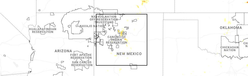
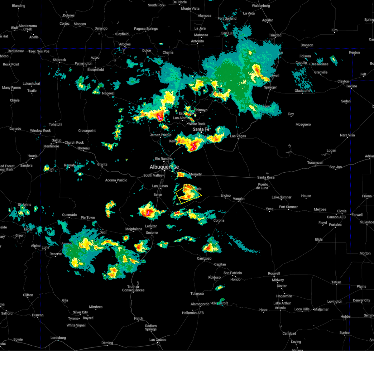
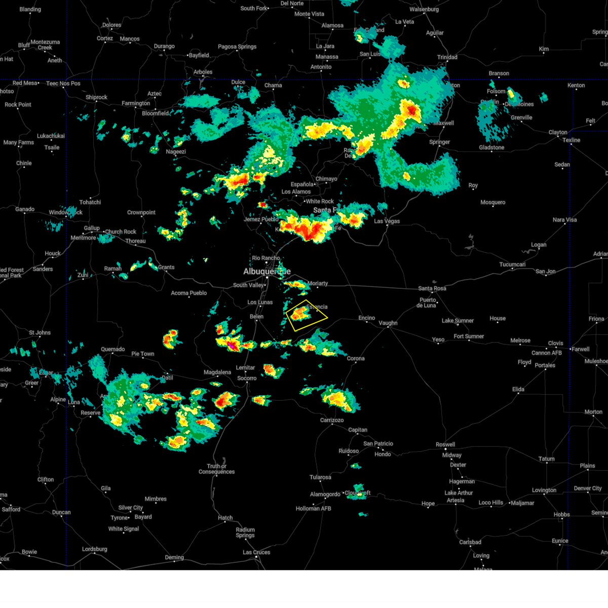
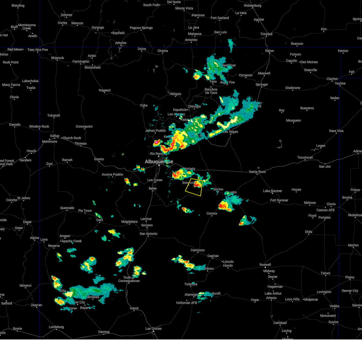
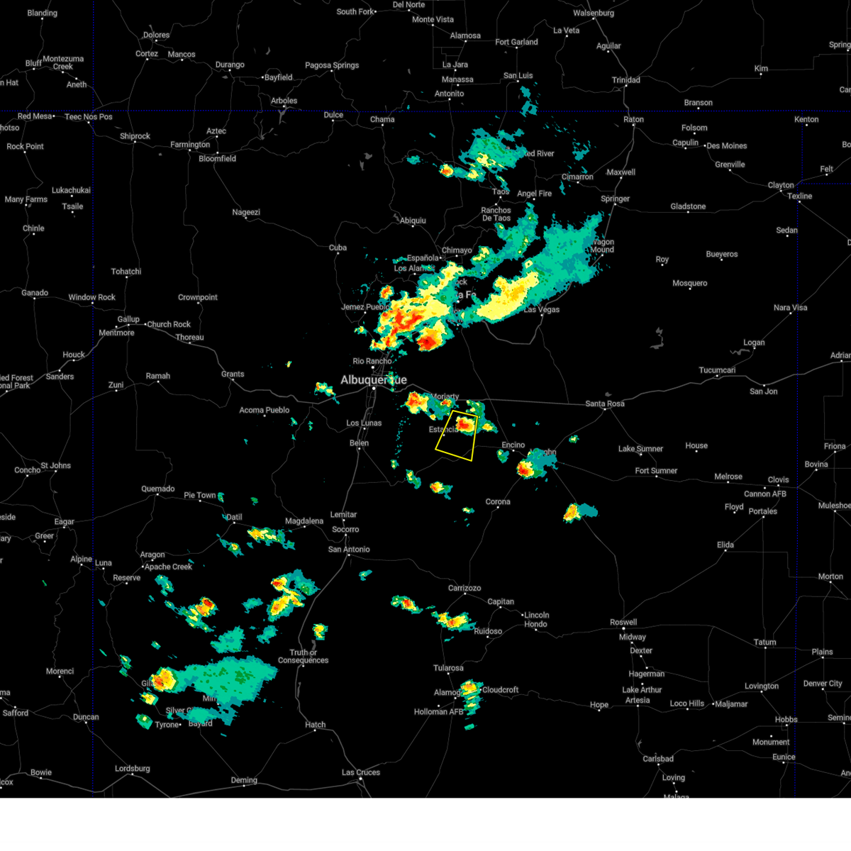
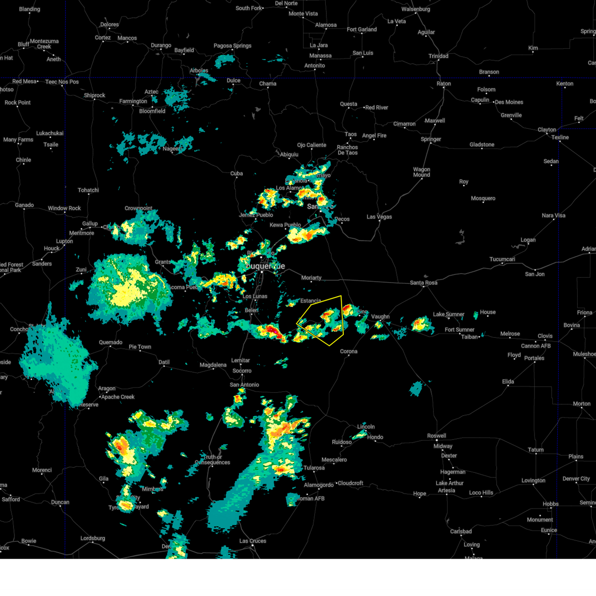
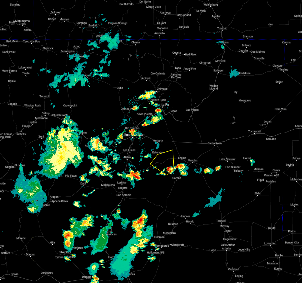
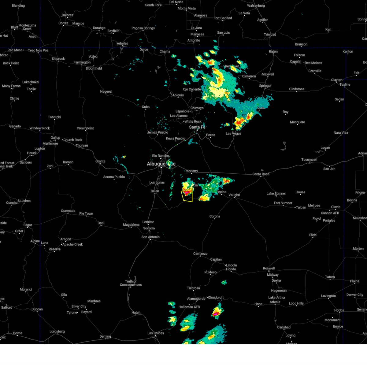
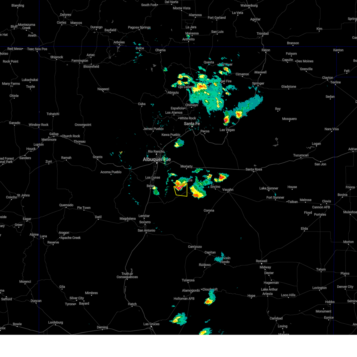
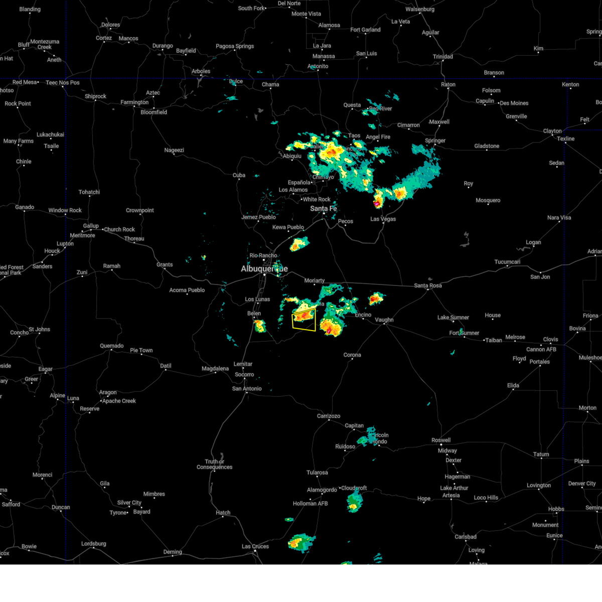
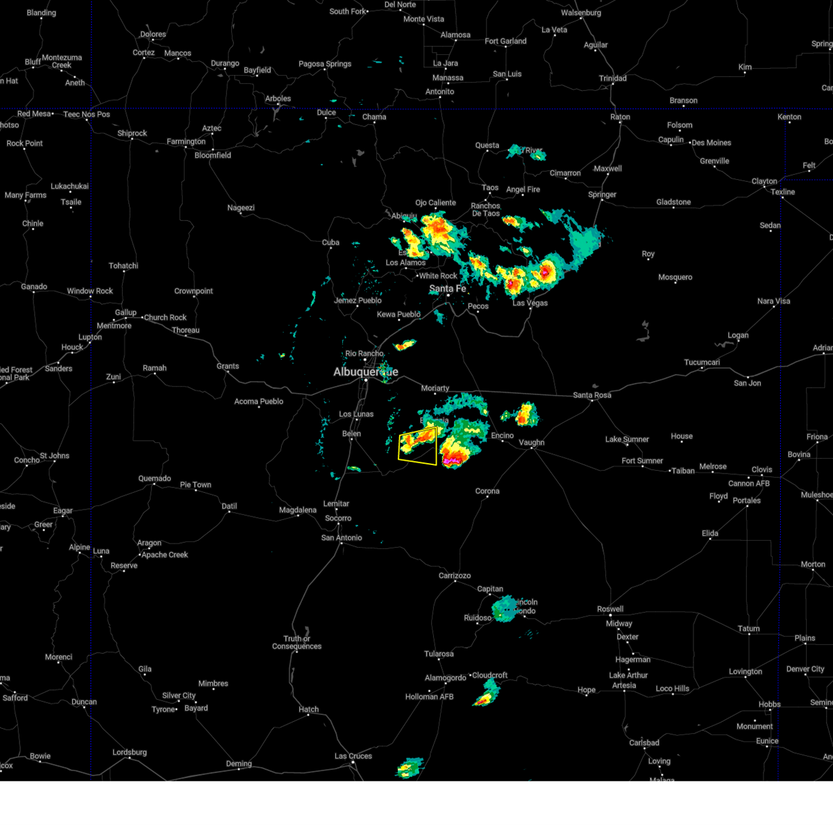
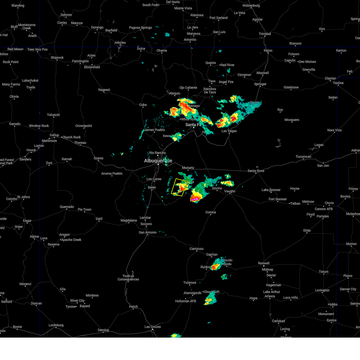
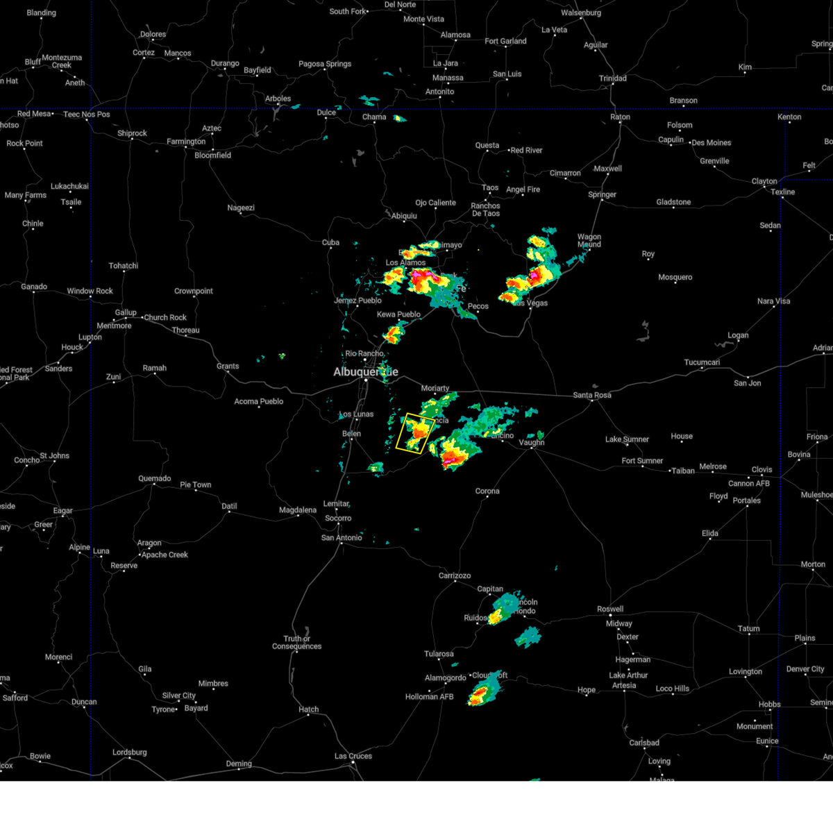
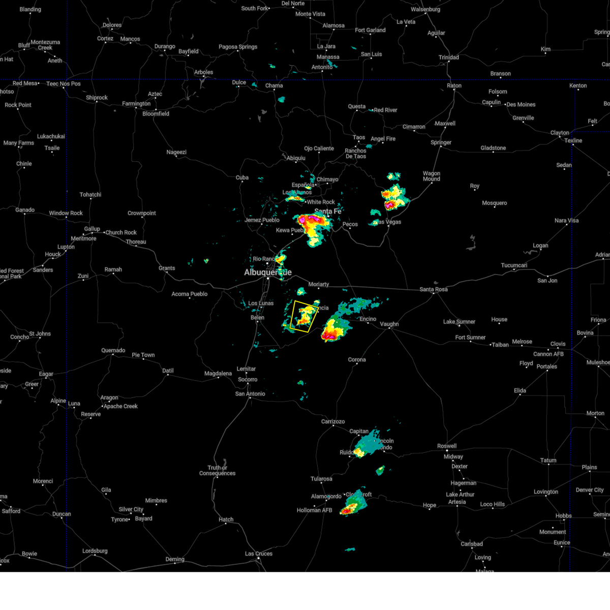
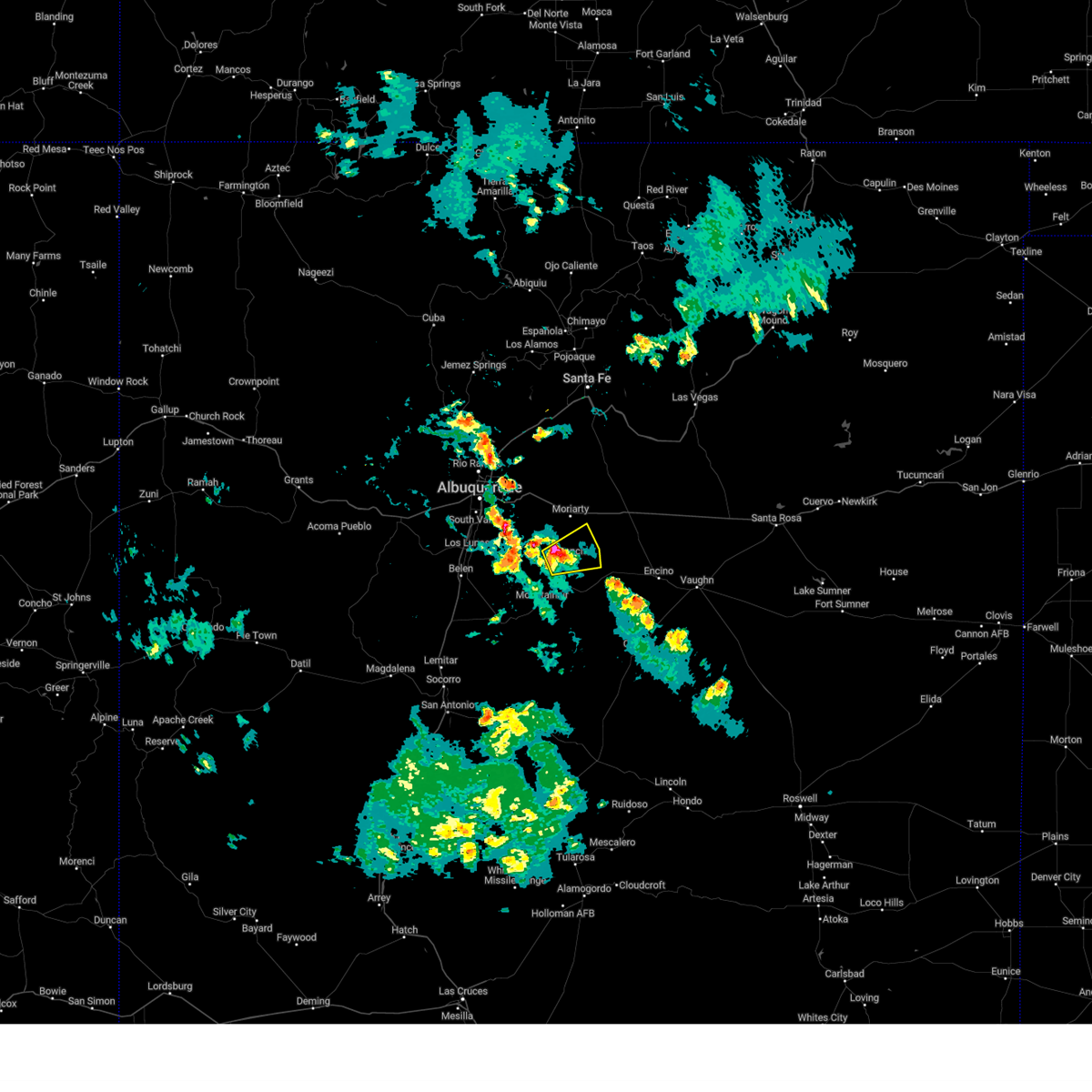
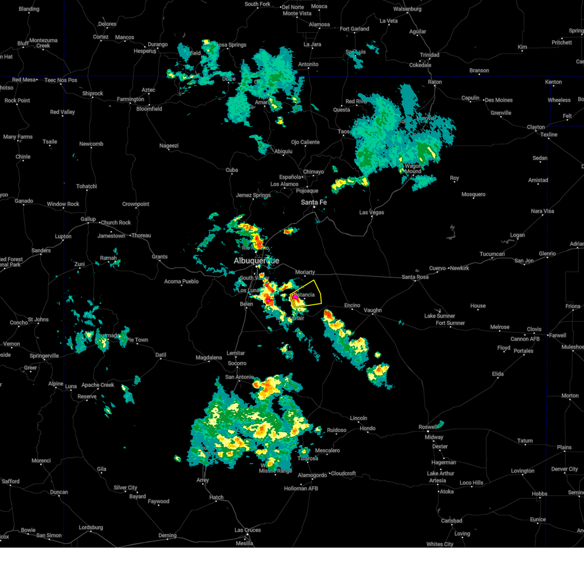
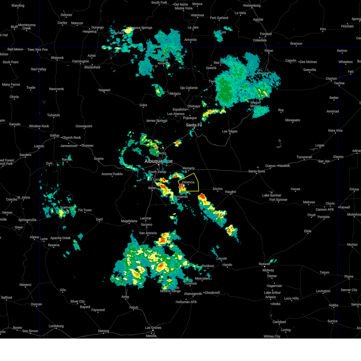
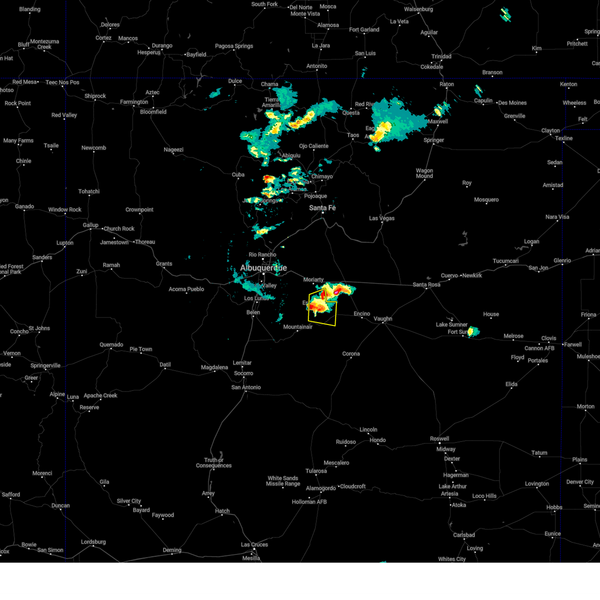
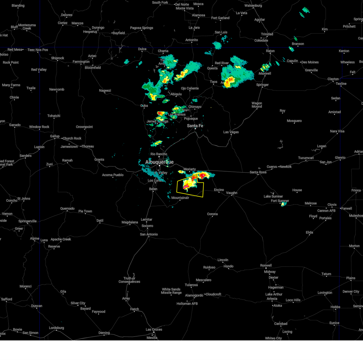
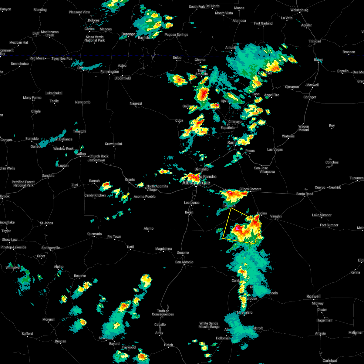
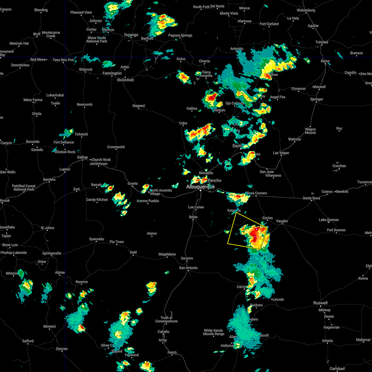
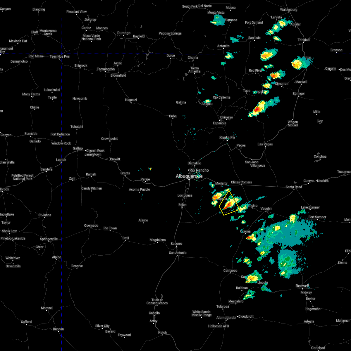
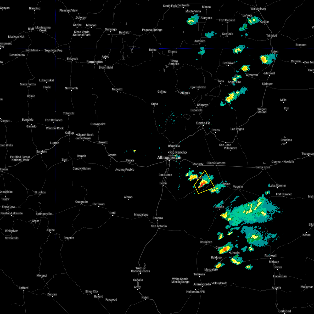
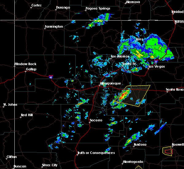
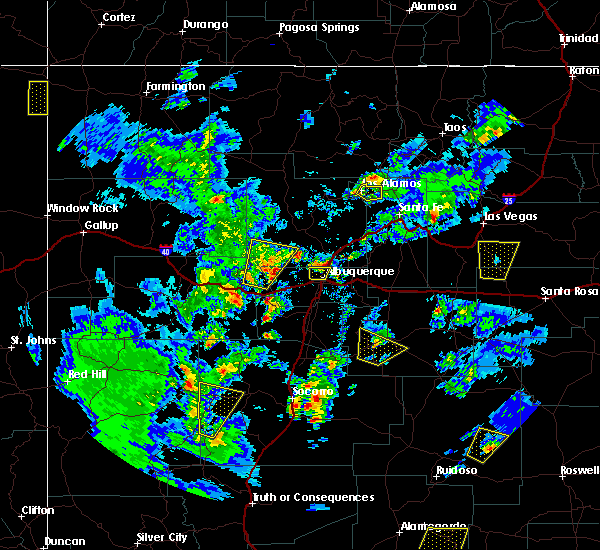
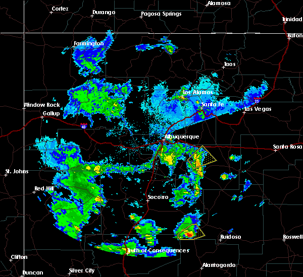
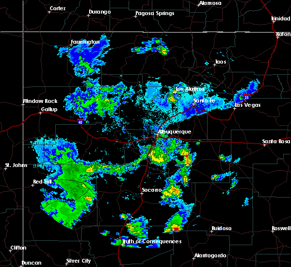
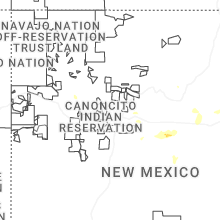
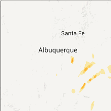
Hail Map for Estancia, NM
The Estancia, NM area has had 8 reports of on-the-ground hail by trained spotters, and has been under severe weather warnings 5 times during the past 12 months. Doppler radar has detected hail at or near Estancia, NM on 34 occasions, including 5 occasions during the past year.
| Name: | Estancia, NM |
| Where Located: | 40.6 miles ESE of Albuquerque, NM |
| Map: | Google Map for Estancia, NM |
| Population: | 1655 |
| Housing Units: | 492 |
| More Info: | Search Google for Estancia, NM |
0
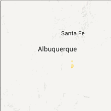
The Top Recent Hail Date for Estancia, NM is Saturday, July 12, 2025 (27th out of 34)
Hail and Wind Damage Spotted near Estancia, NM
| Date / Time | Report Details |
|---|---|
| 6/9/2025 3:44 PM MDT | the severe thunderstorm warning has been cancelled and is no longer in effect |
| 6/9/2025 3:39 PM MDT |
 At 339 pm mdt, a severe thunderstorm was located 5 miles east of manzano, or 16 miles southwest of estancia, moving southeast at 15 mph (radar indicated). Hazards include 60 mph wind gusts and quarter size hail. Hail damage to vehicles is expected. expect wind damage to roofs, siding, and trees. Locations impacted include, estancia, tajique, manzano and torreon. At 339 pm mdt, a severe thunderstorm was located 5 miles east of manzano, or 16 miles southwest of estancia, moving southeast at 15 mph (radar indicated). Hazards include 60 mph wind gusts and quarter size hail. Hail damage to vehicles is expected. expect wind damage to roofs, siding, and trees. Locations impacted include, estancia, tajique, manzano and torreon.
|
| 6/9/2025 3:23 PM MDT |
 Svrabq the national weather service in albuquerque has issued a * severe thunderstorm warning for, northwestern torrance county in central new mexico, * until 400 pm mdt. * at 323 pm mdt, a severe thunderstorm was located 6 miles southeast of tajique, or 14 miles southwest of estancia, moving southeast at 15 mph (radar indicated). Hazards include ping pong ball size hail and 60 mph wind gusts. People and animals outdoors will be injured. expect hail damage to roofs, siding, windows, and vehicles. Expect wind damage to roofs, siding, and trees. Svrabq the national weather service in albuquerque has issued a * severe thunderstorm warning for, northwestern torrance county in central new mexico, * until 400 pm mdt. * at 323 pm mdt, a severe thunderstorm was located 6 miles southeast of tajique, or 14 miles southwest of estancia, moving southeast at 15 mph (radar indicated). Hazards include ping pong ball size hail and 60 mph wind gusts. People and animals outdoors will be injured. expect hail damage to roofs, siding, windows, and vehicles. Expect wind damage to roofs, siding, and trees.
|
| 5/19/2025 2:36 PM MDT | Asos station kcqc clines corners 1 ss in torrance county NM, 27.1 miles SW of Estancia, NM |
| 5/19/2025 12:12 PM MDT | Asos station kcqc clines corners 1 ss in torrance county NM, 27.1 miles SW of Estancia, NM |
| 9/5/2024 5:14 PM MDT |
 At 514 pm mdt, a severe thunderstorm was located near estancia, moving south at 10 mph (radar indicated). Hazards include 60 mph wind gusts and quarter size hail. Hail damage to vehicles is expected. expect wind damage to roofs, siding, and trees. locations impacted include, estancia. This includes highway 60 between mile markers 227 and 233. At 514 pm mdt, a severe thunderstorm was located near estancia, moving south at 10 mph (radar indicated). Hazards include 60 mph wind gusts and quarter size hail. Hail damage to vehicles is expected. expect wind damage to roofs, siding, and trees. locations impacted include, estancia. This includes highway 60 between mile markers 227 and 233.
|
| 9/5/2024 5:04 PM MDT |
 Svrabq the national weather service in albuquerque has issued a * severe thunderstorm warning for, central torrance county in central new mexico, * until 600 pm mdt. * at 503 pm mdt, a severe thunderstorm was located near estancia, moving south at 10 mph (radar indicated). Hazards include 60 mph wind gusts and quarter size hail. Hail damage to vehicles is expected. Expect wind damage to roofs, siding, and trees. Svrabq the national weather service in albuquerque has issued a * severe thunderstorm warning for, central torrance county in central new mexico, * until 600 pm mdt. * at 503 pm mdt, a severe thunderstorm was located near estancia, moving south at 10 mph (radar indicated). Hazards include 60 mph wind gusts and quarter size hail. Hail damage to vehicles is expected. Expect wind damage to roofs, siding, and trees.
|
| 6/29/2024 7:25 PM MDT |
 The storm which prompted the warning has weakened below severe limits, and no longer poses an immediate threat to life or property. therefore, the warning will be allowed to expire. The storm which prompted the warning has weakened below severe limits, and no longer poses an immediate threat to life or property. therefore, the warning will be allowed to expire.
|
| 6/29/2024 6:48 PM MDT |
 Svrabq the national weather service in albuquerque has issued a * severe thunderstorm warning for, central torrance county in central new mexico, * until 730 pm mdt. * at 647 pm mdt, a severe thunderstorm was located 9 miles northwest of cedarvale, or 20 miles northwest of corona, moving northwest at 20 mph (radar indicated). Hazards include 60 mph wind gusts and quarter size hail. Hail damage to vehicles is expected. Expect wind damage to roofs, siding, and trees. Svrabq the national weather service in albuquerque has issued a * severe thunderstorm warning for, central torrance county in central new mexico, * until 730 pm mdt. * at 647 pm mdt, a severe thunderstorm was located 9 miles northwest of cedarvale, or 20 miles northwest of corona, moving northwest at 20 mph (radar indicated). Hazards include 60 mph wind gusts and quarter size hail. Hail damage to vehicles is expected. Expect wind damage to roofs, siding, and trees.
|
| 6/19/2024 5:22 PM MDT |
 At 522 pm mdt, a severe thunderstorm was located near willard, or 11 miles southwest of estancia, moving east at 5 mph (radar indicated). Hazards include golf ball size hail and 60 mph wind gusts. People and animals outdoors will be injured. expect hail damage to roofs, siding, windows, and vehicles. expect wind damage to roofs, siding, and trees. Locations impacted include, willard. At 522 pm mdt, a severe thunderstorm was located near willard, or 11 miles southwest of estancia, moving east at 5 mph (radar indicated). Hazards include golf ball size hail and 60 mph wind gusts. People and animals outdoors will be injured. expect hail damage to roofs, siding, windows, and vehicles. expect wind damage to roofs, siding, and trees. Locations impacted include, willard.
|
| 6/19/2024 5:01 PM MDT |
 Svrabq the national weather service in albuquerque has issued a * severe thunderstorm warning for, west central torrance county in central new mexico, * until 600 pm mdt. * at 501 pm mdt, a severe thunderstorm was located 8 miles north of mountainair, or 13 miles southwest of estancia, moving east at 5 mph (radar indicated). Hazards include two inch hail and 60 mph wind gusts. People and animals outdoors will be injured. expect hail damage to roofs, siding, windows, and vehicles. Expect wind damage to roofs, siding, and trees. Svrabq the national weather service in albuquerque has issued a * severe thunderstorm warning for, west central torrance county in central new mexico, * until 600 pm mdt. * at 501 pm mdt, a severe thunderstorm was located 8 miles north of mountainair, or 13 miles southwest of estancia, moving east at 5 mph (radar indicated). Hazards include two inch hail and 60 mph wind gusts. People and animals outdoors will be injured. expect hail damage to roofs, siding, windows, and vehicles. Expect wind damage to roofs, siding, and trees.
|
| 6/19/2024 4:54 PM MDT |
 At 453 pm mdt, a severe thunderstorm was located 7 miles north of mountainair, or 13 miles southwest of estancia, moving east at 5 mph (radar indicated). Hazards include 60 mph wind gusts and quarter size hail. Hail damage to vehicles is expected. expect wind damage to roofs, siding, and trees. Locations impacted include, willard. At 453 pm mdt, a severe thunderstorm was located 7 miles north of mountainair, or 13 miles southwest of estancia, moving east at 5 mph (radar indicated). Hazards include 60 mph wind gusts and quarter size hail. Hail damage to vehicles is expected. expect wind damage to roofs, siding, and trees. Locations impacted include, willard.
|
| 6/19/2024 4:29 PM MDT |
 Svrabq the national weather service in albuquerque has issued a * severe thunderstorm warning for, west central torrance county in central new mexico, * until 515 pm mdt. * at 429 pm mdt, a severe thunderstorm was located near manzano mountain state park, or 16 miles southwest of estancia, moving east at 5 mph (radar indicated). Hazards include 60 mph wind gusts and half dollar size hail. Hail damage to vehicles is expected. Expect wind damage to roofs, siding, and trees. Svrabq the national weather service in albuquerque has issued a * severe thunderstorm warning for, west central torrance county in central new mexico, * until 515 pm mdt. * at 429 pm mdt, a severe thunderstorm was located near manzano mountain state park, or 16 miles southwest of estancia, moving east at 5 mph (radar indicated). Hazards include 60 mph wind gusts and half dollar size hail. Hail damage to vehicles is expected. Expect wind damage to roofs, siding, and trees.
|
| 6/19/2024 4:09 PM MDT |
 The storm which prompted the warning has weakened below severe limits, and no longer poses an immediate threat to life or property. therefore, the warning will be allowed to expire. however, small hail, gusty winds and heavy rain are still possible with this thunderstorm. a severe thunderstorm watch remains in effect until 900 pm mdt for central new mexico. remember, a severe thunderstorm warning remains in effect for south central torrance county until 445 pm mdt. The storm which prompted the warning has weakened below severe limits, and no longer poses an immediate threat to life or property. therefore, the warning will be allowed to expire. however, small hail, gusty winds and heavy rain are still possible with this thunderstorm. a severe thunderstorm watch remains in effect until 900 pm mdt for central new mexico. remember, a severe thunderstorm warning remains in effect for south central torrance county until 445 pm mdt.
|
| 6/19/2024 3:51 PM MDT |
 At 351 pm mdt, a severe thunderstorm was located 7 miles east of manzano, or 14 miles southwest of estancia, moving northeast at 10 mph (radar indicated). Hazards include 60 mph wind gusts and quarter size hail. Hail damage to vehicles is expected. expect wind damage to roofs, siding, and trees. Locations impacted include, tajique, manzano mountain state park, and manzano. At 351 pm mdt, a severe thunderstorm was located 7 miles east of manzano, or 14 miles southwest of estancia, moving northeast at 10 mph (radar indicated). Hazards include 60 mph wind gusts and quarter size hail. Hail damage to vehicles is expected. expect wind damage to roofs, siding, and trees. Locations impacted include, tajique, manzano mountain state park, and manzano.
|
| 6/19/2024 3:31 PM MDT |
 Svrabq the national weather service in albuquerque has issued a * severe thunderstorm warning for, west central torrance county in central new mexico, * until 415 pm mdt. * at 330 pm mdt, a severe thunderstorm was located near manzano, or 15 miles southwest of estancia, moving north at 15 mph (radar indicated). Hazards include 60 mph wind gusts and quarter size hail. Hail damage to vehicles is expected. Expect wind damage to roofs, siding, and trees. Svrabq the national weather service in albuquerque has issued a * severe thunderstorm warning for, west central torrance county in central new mexico, * until 415 pm mdt. * at 330 pm mdt, a severe thunderstorm was located near manzano, or 15 miles southwest of estancia, moving north at 15 mph (radar indicated). Hazards include 60 mph wind gusts and quarter size hail. Hail damage to vehicles is expected. Expect wind damage to roofs, siding, and trees.
|
| 6/7/2024 4:55 PM MDT | Asos station kcqc clines corners 1 ss in torrance county NM, 27.1 miles SW of Estancia, NM |
| 5/11/2024 4:18 PM MDT | Asos station kcqc clines corners 1 ss in torrance county NM, 27.1 miles SW of Estancia, NM |
| 4/15/2024 5:53 PM MDT | Asos station kcqc clines corners 1 ss in torrance county NM, 27.1 miles SW of Estancia, NM |
| 6/5/2023 5:58 PM MDT |
 The severe thunderstorm warning for northwestern torrance county will expire at 600 pm mdt, the storm which prompted the warning has weakened below severe limits, and no longer poses an immediate threat to life or property. therefore, the warning will be allowed to expire. however small hail, gusty winds and heavy rain are still possible with this thunderstorm. The severe thunderstorm warning for northwestern torrance county will expire at 600 pm mdt, the storm which prompted the warning has weakened below severe limits, and no longer poses an immediate threat to life or property. therefore, the warning will be allowed to expire. however small hail, gusty winds and heavy rain are still possible with this thunderstorm.
|
| 6/5/2023 5:49 PM MDT |
 At 549 pm mdt, a severe thunderstorm was located near estancia, moving northeast at 15 mph (radar indicated). Hazards include 60 mph wind gusts and half dollar size hail. Hail damage to vehicles is expected. expect wind damage to roofs, siding, and trees. locations impacted include, estancia and mcintosh. hail threat, radar indicated max hail size, 1. 25 in wind threat, radar indicated max wind gust, 60 mph. At 549 pm mdt, a severe thunderstorm was located near estancia, moving northeast at 15 mph (radar indicated). Hazards include 60 mph wind gusts and half dollar size hail. Hail damage to vehicles is expected. expect wind damage to roofs, siding, and trees. locations impacted include, estancia and mcintosh. hail threat, radar indicated max hail size, 1. 25 in wind threat, radar indicated max wind gust, 60 mph.
|
| 6/5/2023 5:37 PM MDT |
 At 536 pm mdt, a severe thunderstorm was located near estancia, moving east at 15 mph (radar indicated). Hazards include 60 mph wind gusts and quarter size hail. Hail damage to vehicles is expected. Expect wind damage to roofs, siding, and trees. At 536 pm mdt, a severe thunderstorm was located near estancia, moving east at 15 mph (radar indicated). Hazards include 60 mph wind gusts and quarter size hail. Hail damage to vehicles is expected. Expect wind damage to roofs, siding, and trees.
|
| 5/26/2023 7:05 PM MDT | Tea Cup sized hail reported 28.1 miles WNW of Estancia, NM, some stones up to 3.5 inch diameter. broke car windshield. |
| 5/26/2023 5:04 PM MDT | Tennis Ball sized hail reported 28.5 miles WNW of Estancia, NM |
| 5/26/2023 4:45 PM MDT | Ping Pong Ball sized hail reported 26 miles W of Estancia, NM |
| 5/26/2023 3:41 PM MDT |
 At 340 pm mdt, a severe thunderstorm was located over estancia, moving east at 25 mph (radar indicated). Hazards include 60 mph wind gusts and quarter size hail. Hail damage to vehicles is expected. expect wind damage to roofs, siding, and trees. locations impacted include, estancia and mcintosh. this includes highway 60 between mile markers 226 and 234. hail threat, radar indicated max hail size, 1. 00 in wind threat, radar indicated max wind gust, 60 mph. At 340 pm mdt, a severe thunderstorm was located over estancia, moving east at 25 mph (radar indicated). Hazards include 60 mph wind gusts and quarter size hail. Hail damage to vehicles is expected. expect wind damage to roofs, siding, and trees. locations impacted include, estancia and mcintosh. this includes highway 60 between mile markers 226 and 234. hail threat, radar indicated max hail size, 1. 00 in wind threat, radar indicated max wind gust, 60 mph.
|
| 5/26/2023 3:25 PM MDT |
 At 324 pm mdt, a severe thunderstorm was located 7 miles southwest of estancia, moving east at 20 mph (radar indicated). Hazards include 70 mph wind gusts and ping pong ball size hail. People and animals outdoors will be injured. expect hail damage to roofs, siding, windows, and vehicles. expect considerable tree damage. Wind damage is also likely to mobile homes, roofs, and outbuildings. At 324 pm mdt, a severe thunderstorm was located 7 miles southwest of estancia, moving east at 20 mph (radar indicated). Hazards include 70 mph wind gusts and ping pong ball size hail. People and animals outdoors will be injured. expect hail damage to roofs, siding, windows, and vehicles. expect considerable tree damage. Wind damage is also likely to mobile homes, roofs, and outbuildings.
|
| 3/12/2023 7:23 PM MDT | Asos station kcqc clines corners 1 ss in torrance county NM, 27.1 miles SW of Estancia, NM |
| 3/21/2022 12:51 PM MDT | Mesonet station fw4218 estancia 2 ws in torrance county NM, 2.7 miles NE of Estancia, NM |
| 7/23/2021 2:52 PM MDT |
 At 251 pm mdt, a severe thunderstorm was located 10 miles northwest of cedarvale, or 20 miles northwest of corona, moving west at 25 mph (radar indicated). Hazards include 60 mph wind gusts and quarter size hail. Hail damage to vehicles is expected. expect wind damage to roofs, siding, and trees. locations impacted include, estancia, willard, corona and cedarvale. This includes highway 60 between mile markers 216 and 234. At 251 pm mdt, a severe thunderstorm was located 10 miles northwest of cedarvale, or 20 miles northwest of corona, moving west at 25 mph (radar indicated). Hazards include 60 mph wind gusts and quarter size hail. Hail damage to vehicles is expected. expect wind damage to roofs, siding, and trees. locations impacted include, estancia, willard, corona and cedarvale. This includes highway 60 between mile markers 216 and 234.
|
| 7/23/2021 2:27 PM MDT |
 At 227 pm mdt, a severe thunderstorm was located near cedarvale, or 13 miles northwest of corona, moving west at 25 mph (radar indicated). Hazards include 60 mph wind gusts and quarter size hail. Hail damage to vehicles is expected. Expect wind damage to roofs, siding, and trees. At 227 pm mdt, a severe thunderstorm was located near cedarvale, or 13 miles northwest of corona, moving west at 25 mph (radar indicated). Hazards include 60 mph wind gusts and quarter size hail. Hail damage to vehicles is expected. Expect wind damage to roofs, siding, and trees.
|
| 7/12/2021 7:51 PM MDT |
 At 750 pm mdt, severe thunderstorms were located along a line extending from near cedar grove to 9 miles southeast of moriarty, moving southwest at 20 mph (radar indicated). Hazards include 60 mph wind gusts and quarter size hail. Hail damage to vehicles is expected. expect wind damage to roofs, siding, and trees. locations impacted include, edgewood, moriarty, tijeras, cedar crest, cedar grove, sedillo, chilili, mcintosh, escabosa and cedro. this includes interstate 40 between mile markers 172 and 205. Significant blowing dust has been observed with this storm. At 750 pm mdt, severe thunderstorms were located along a line extending from near cedar grove to 9 miles southeast of moriarty, moving southwest at 20 mph (radar indicated). Hazards include 60 mph wind gusts and quarter size hail. Hail damage to vehicles is expected. expect wind damage to roofs, siding, and trees. locations impacted include, edgewood, moriarty, tijeras, cedar crest, cedar grove, sedillo, chilili, mcintosh, escabosa and cedro. this includes interstate 40 between mile markers 172 and 205. Significant blowing dust has been observed with this storm.
|
| 7/12/2021 7:22 PM MDT |
 At 720 pm mdt, severe thunderstorms were located along a line extending from near stanley to 9 miles west of clines corners, moving southwest at 25 mph (radar and trained weather spotters). Hazards include 60 mph wind gusts and half dollar size hail. Hail damage to vehicles is expected. expect wind damage to roofs, siding, and trees. locations impacted include, edgewood, moriarty, estancia, tijeras, cedar crest, cedar grove, sedillo, chilili, mcintosh and stanley. a storm spotter in stanley observed quarter size hail with these storms at 717 pm mdt. This includes interstate 40 between mile markers 172 and 215. At 720 pm mdt, severe thunderstorms were located along a line extending from near stanley to 9 miles west of clines corners, moving southwest at 25 mph (radar and trained weather spotters). Hazards include 60 mph wind gusts and half dollar size hail. Hail damage to vehicles is expected. expect wind damage to roofs, siding, and trees. locations impacted include, edgewood, moriarty, estancia, tijeras, cedar crest, cedar grove, sedillo, chilili, mcintosh and stanley. a storm spotter in stanley observed quarter size hail with these storms at 717 pm mdt. This includes interstate 40 between mile markers 172 and 215.
|
| 7/12/2021 7:12 PM MDT |
 At 711 pm mdt, severe thunderstorms were located along a line extending from near stanley to 7 miles west of clines corners, moving southwest at 25 mph (radar indicated). Hazards include 60 mph wind gusts and quarter size hail. Hail damage to vehicles is expected. Expect wind damage to roofs, siding, and trees. At 711 pm mdt, severe thunderstorms were located along a line extending from near stanley to 7 miles west of clines corners, moving southwest at 25 mph (radar indicated). Hazards include 60 mph wind gusts and quarter size hail. Hail damage to vehicles is expected. Expect wind damage to roofs, siding, and trees.
|
| 6/24/2021 3:47 PM MDT | Kcqc aso in torrance county NM, 27.6 miles SW of Estancia, NM |
| 5/30/2021 12:32 PM MDT |
 At 1231 pm mdt, a severe thunderstorm was located 7 miles northeast of willard, or 9 miles southeast of estancia, moving northeast at 10 mph (radar indicated). Hazards include 60 mph wind gusts and quarter size hail. Hail damage to vehicles is expected. expect wind damage to roofs, siding, and trees. locations impacted include, estancia and willard. This includes highway 60 between mile markers 218 and 237. At 1231 pm mdt, a severe thunderstorm was located 7 miles northeast of willard, or 9 miles southeast of estancia, moving northeast at 10 mph (radar indicated). Hazards include 60 mph wind gusts and quarter size hail. Hail damage to vehicles is expected. expect wind damage to roofs, siding, and trees. locations impacted include, estancia and willard. This includes highway 60 between mile markers 218 and 237.
|
| 5/30/2021 12:15 PM MDT |
 At 1214 pm mdt, a severe thunderstorm was located near willard, or 8 miles southeast of estancia, moving northeast at 10 mph (radar indicated). Hazards include 60 mph wind gusts and quarter size hail. Hail damage to vehicles is expected. Expect wind damage to roofs, siding, and trees. At 1214 pm mdt, a severe thunderstorm was located near willard, or 8 miles southeast of estancia, moving northeast at 10 mph (radar indicated). Hazards include 60 mph wind gusts and quarter size hail. Hail damage to vehicles is expected. Expect wind damage to roofs, siding, and trees.
|
| 9/1/2020 2:26 PM MDT | Kcqc aso in torrance county NM, 27.6 miles SW of Estancia, NM |
| 9/1/2020 11:53 AM MDT | Kcqc aso in torrance county NM, 27.6 miles SW of Estancia, NM |
| 8/1/2020 2:57 PM MDT | Kcqc aso in torrance county NM, 27.6 miles SW of Estancia, NM |
| 7/17/2020 5:53 PM MDT | Kcqc aso in torrance county NM, 27.6 miles SW of Estancia, NM |
| 7/17/2020 5:46 PM MDT | Kcqc aso in torrance county NM, 27.6 miles SW of Estancia, NM |
| 7/13/2020 5:31 PM MDT | Kcqc aso in torrance county NM, 27.6 miles SW of Estancia, NM |
| 6/3/2019 5:08 PM MDT |
 At 507 pm mdt, severe thunderstorms were located along a line extending from 10 miles northwest of clines corners to near estancia, moving northeast at 30 mph (radar indicated). Hazards include 60 mph wind gusts and quarter size hail. Hail damage to vehicles is expected. Expect wind damage to roofs, siding, and trees. At 507 pm mdt, severe thunderstorms were located along a line extending from 10 miles northwest of clines corners to near estancia, moving northeast at 30 mph (radar indicated). Hazards include 60 mph wind gusts and quarter size hail. Hail damage to vehicles is expected. Expect wind damage to roofs, siding, and trees.
|
| 4/26/2019 3:53 PM MDT | Kcqc aso in torrance county NM, 27.6 miles SW of Estancia, NM |
| 10/7/2018 4:21 PM MDT | Kcqc aso in torrance county NM, 27.6 miles SW of Estancia, NM |
| 6/3/2018 4:24 PM MDT |
 At 353 pm mdt, a severe thunderstorm was located near tajique, or 18 miles west of estancia, moving east at 30 mph (radar indicated). Hazards include ping pong ball size hail and 60 mph wind gusts. People and animals outdoors will be injured. expect hail damage to roofs, siding, windows, and vehicles. Expect wind damage to roofs, siding, and trees. At 353 pm mdt, a severe thunderstorm was located near tajique, or 18 miles west of estancia, moving east at 30 mph (radar indicated). Hazards include ping pong ball size hail and 60 mph wind gusts. People and animals outdoors will be injured. expect hail damage to roofs, siding, windows, and vehicles. Expect wind damage to roofs, siding, and trees.
|
| 6/3/2018 3:53 PM MDT |
 At 353 pm mdt, a severe thunderstorm was located near tajique, or 18 miles west of estancia, moving east at 30 mph (radar indicated). Hazards include ping pong ball size hail and 60 mph wind gusts. People and animals outdoors will be injured. expect hail damage to roofs, siding, windows, and vehicles. Expect wind damage to roofs, siding, and trees. At 353 pm mdt, a severe thunderstorm was located near tajique, or 18 miles west of estancia, moving east at 30 mph (radar indicated). Hazards include ping pong ball size hail and 60 mph wind gusts. People and animals outdoors will be injured. expect hail damage to roofs, siding, windows, and vehicles. Expect wind damage to roofs, siding, and trees.
|
| 9/14/2017 9:50 PM MDT | Kcqc aso in torrance county NM, 27.6 miles SW of Estancia, NM |
| 7/1/2017 5:33 PM MDT |
 The national weather service in albuquerque has issued a * severe thunderstorm warning for. north central torrance county in central new mexico. until 615 pm mdt. At 533 pm mdt, a severe thunderstorm was located near estancia, moving northeast at 15 mph. The national weather service in albuquerque has issued a * severe thunderstorm warning for. north central torrance county in central new mexico. until 615 pm mdt. At 533 pm mdt, a severe thunderstorm was located near estancia, moving northeast at 15 mph.
|
| 6/26/2017 5:58 PM MDT | Quarter sized hail reported 7.5 miles NNE of Estancia, NM, hail covering ground |
| 6/26/2017 5:41 PM MDT |
 At 541 pm mdt, a severe thunderstorm was located 7 miles northwest of willard, or 7 miles southwest of estancia, moving south at 20 mph (radar indicated). Hazards include golf ball size hail and 70 mph wind gusts. People and animals outdoors will be injured. expect hail damage to roofs, siding, windows, and vehicles. expect considerable tree damage. wind damage is also likely to mobile homes, roofs, and outbuildings. Locations impacted include, estancia, mountainair, willard and torreon. At 541 pm mdt, a severe thunderstorm was located 7 miles northwest of willard, or 7 miles southwest of estancia, moving south at 20 mph (radar indicated). Hazards include golf ball size hail and 70 mph wind gusts. People and animals outdoors will be injured. expect hail damage to roofs, siding, windows, and vehicles. expect considerable tree damage. wind damage is also likely to mobile homes, roofs, and outbuildings. Locations impacted include, estancia, mountainair, willard and torreon.
|
| 6/26/2017 5:31 PM MDT | Quarter sized hail reported 5.7 miles E of Estancia, NM |
| 6/26/2017 5:30 PM MDT |
 At 530 pm mdt, a severe thunderstorm was located near estancia, moving south at 15 mph (radar indicated). Hazards include 60 mph wind gusts and quarter size hail. Hail damage to vehicles is expected. Expect wind damage to roofs, siding, and trees. At 530 pm mdt, a severe thunderstorm was located near estancia, moving south at 15 mph (radar indicated). Hazards include 60 mph wind gusts and quarter size hail. Hail damage to vehicles is expected. Expect wind damage to roofs, siding, and trees.
|
| 5/9/2017 12:15 PM MDT | Quarter sized hail reported 26.2 miles SW of Estancia, NM, 1.00 inch hail lasted for 1 minute. |
| 5/9/2017 11:10 AM MDT | Quarter sized hail reported 8.6 miles ESE of Estancia, NM |
| 5/9/2017 11:03 AM MDT |
 At 1103 am mdt, a severe thunderstorm was located near chilili, or 7 miles northwest of estancia, moving north at 20 mph (radar indicated). Hazards include 60 mph wind gusts and quarter size hail. Hail damage to vehicles is expected. Expect wind damage to roofs, siding, and trees. At 1103 am mdt, a severe thunderstorm was located near chilili, or 7 miles northwest of estancia, moving north at 20 mph (radar indicated). Hazards include 60 mph wind gusts and quarter size hail. Hail damage to vehicles is expected. Expect wind damage to roofs, siding, and trees.
|
| 4/12/2017 1:38 PM MDT |
 At 138 pm mdt, a severe thunderstorm was located over mcintosh, or 7 miles north of estancia, moving east at 10 mph (radar indicated). Hazards include 60 mph wind gusts and quarter size hail. Hail damage to vehicles is expected. Expect wind damage to roofs, siding, and trees. At 138 pm mdt, a severe thunderstorm was located over mcintosh, or 7 miles north of estancia, moving east at 10 mph (radar indicated). Hazards include 60 mph wind gusts and quarter size hail. Hail damage to vehicles is expected. Expect wind damage to roofs, siding, and trees.
|
| 9/12/2016 5:03 PM MDT | Kcqc aso in torrance county NM, 27.6 miles SW of Estancia, NM |
| 8/20/2016 7:10 PM MDT |
 At 709 pm mdt, a severe thunderstorm was located near moriarty, moving southeast at 15 mph (radar indicated). Hazards include quarter size hail. Damage to vehicles is expected. locations impacted include, moriarty, estancia and mcintosh. This includes interstate 40 between mile markers 195 and 216. At 709 pm mdt, a severe thunderstorm was located near moriarty, moving southeast at 15 mph (radar indicated). Hazards include quarter size hail. Damage to vehicles is expected. locations impacted include, moriarty, estancia and mcintosh. This includes interstate 40 between mile markers 195 and 216.
|
| 8/20/2016 7:02 PM MDT |
 At 700 pm mdt, a line of strong to severe thunderstorms was located from near escabosa to moriarty. the line was moving southeast at 10 to 15 mph. in addition to dime to quarter sized (radar indicated). Hazards include quarter size hail. damage to vehicles is expected At 700 pm mdt, a line of strong to severe thunderstorms was located from near escabosa to moriarty. the line was moving southeast at 10 to 15 mph. in addition to dime to quarter sized (radar indicated). Hazards include quarter size hail. damage to vehicles is expected
|
| 10/20/2015 2:46 PM MDT |
 At 246 pm mdt, a severe thunderstorm was located near mountainair, or 15 miles south of estancia, moving northeast at 30 mph (radar indicated). Hazards include quarter size hail and 60 mph wind gusts. Hail damage to vehicles is expected. Expect wind damage to roofs, siding and trees. At 246 pm mdt, a severe thunderstorm was located near mountainair, or 15 miles south of estancia, moving northeast at 30 mph (radar indicated). Hazards include quarter size hail and 60 mph wind gusts. Hail damage to vehicles is expected. Expect wind damage to roofs, siding and trees.
|
| 10/6/2015 7:51 PM MDT |
 The severe thunderstorm warning for north central torrance county will expire at 800 pm mdt, the storm which prompted the warning has weakened below severe limits, and no longer pose an immediate threat to life or property. therefore the warning will be allowed to expire. however small. The severe thunderstorm warning for north central torrance county will expire at 800 pm mdt, the storm which prompted the warning has weakened below severe limits, and no longer pose an immediate threat to life or property. therefore the warning will be allowed to expire. however small.
|
| 10/6/2015 7:35 PM MDT |
 At 735 pm mdt, a severe thunderstorm was located over estancia, moving northeast at 25 mph (radar indicated). Hazards include quarter size hail and 60 mph wind gusts. Hail damage to vehicles is expected. Expect wind damage to roofs, siding and trees. At 735 pm mdt, a severe thunderstorm was located over estancia, moving northeast at 25 mph (radar indicated). Hazards include quarter size hail and 60 mph wind gusts. Hail damage to vehicles is expected. Expect wind damage to roofs, siding and trees.
|
| 7/2/2013 3:24 PM MDT | Quarter sized hail reported 27.1 miles SW of Estancia, NM |
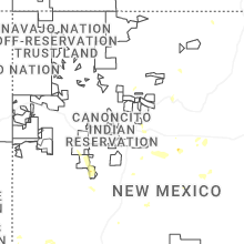
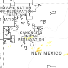
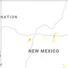
Hail Maps for Estancia, NM


Connect with Interactive Hail Maps