

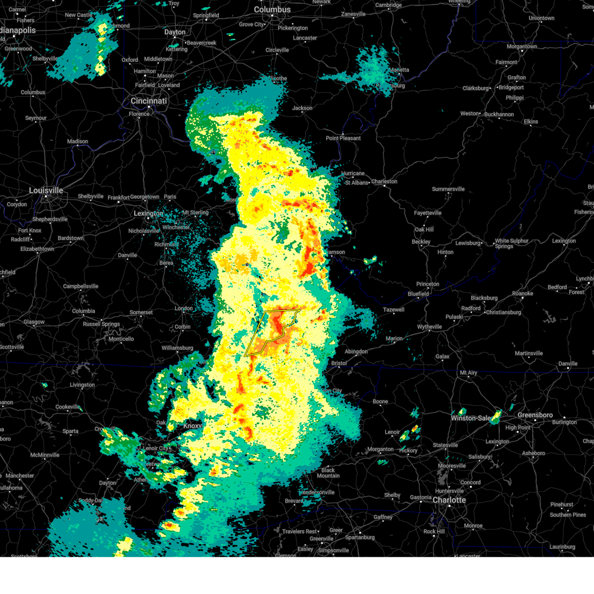
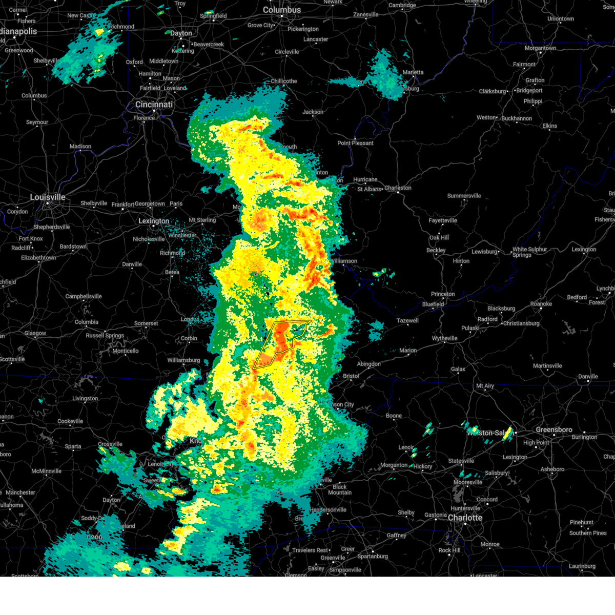
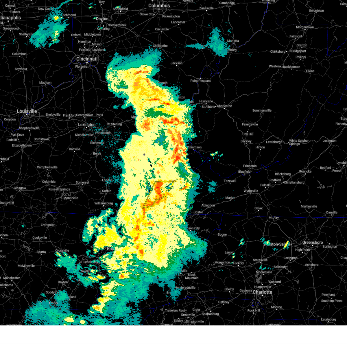
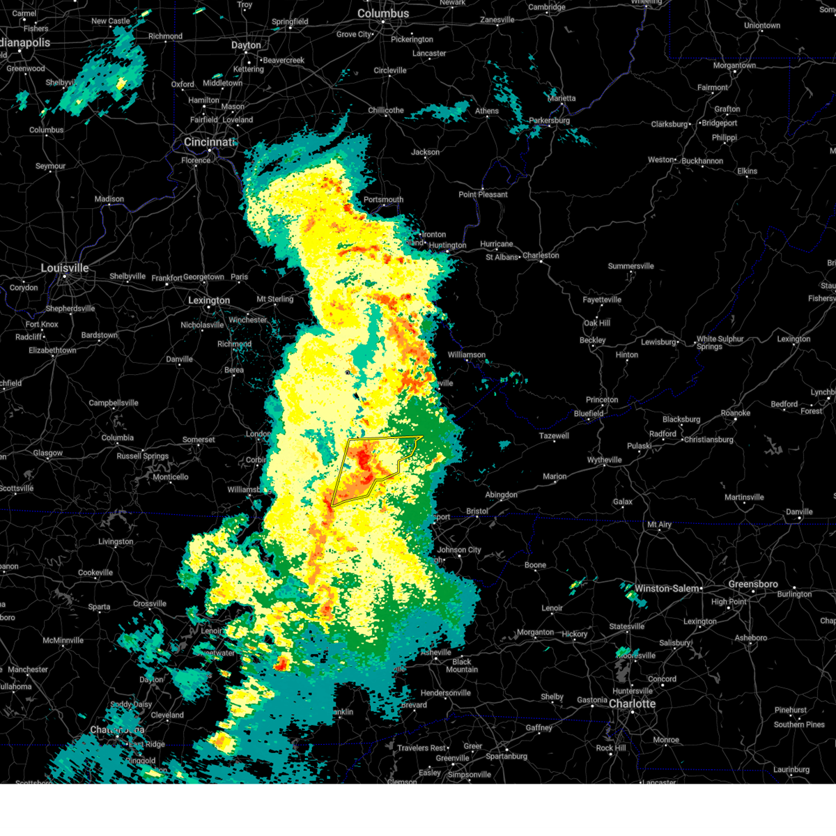
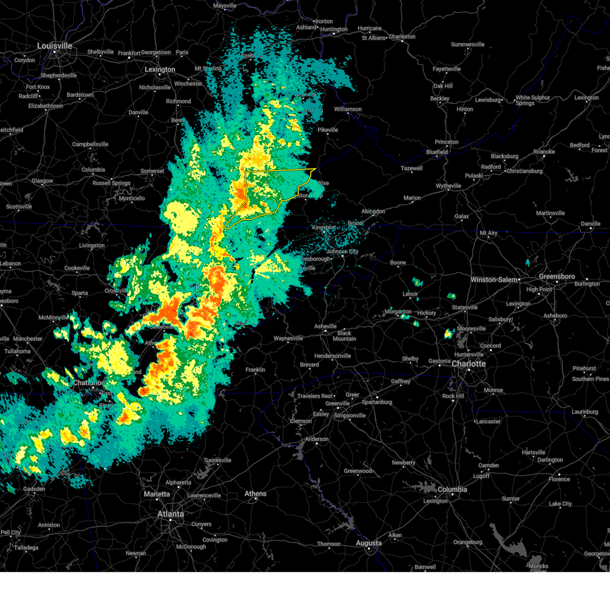
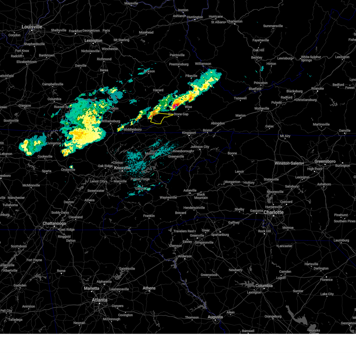
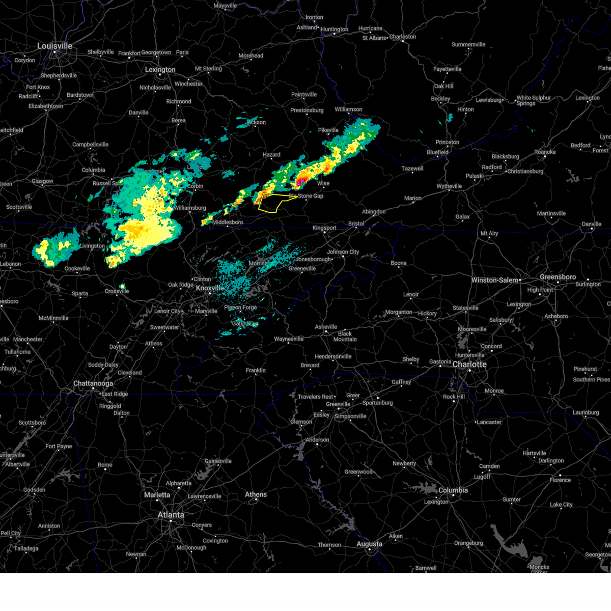
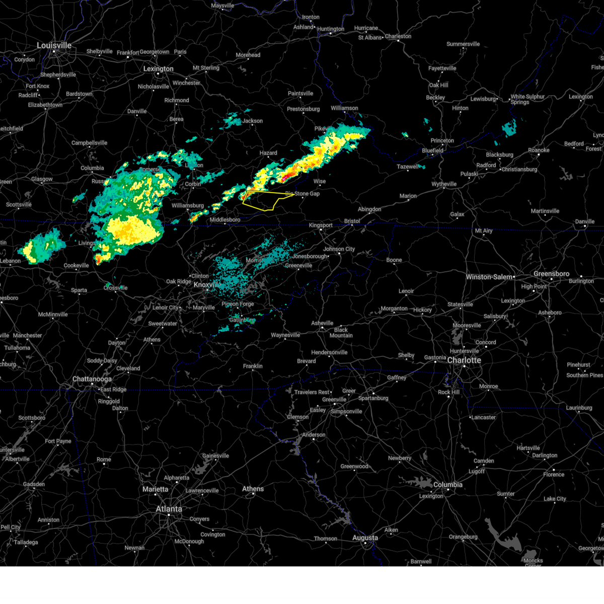
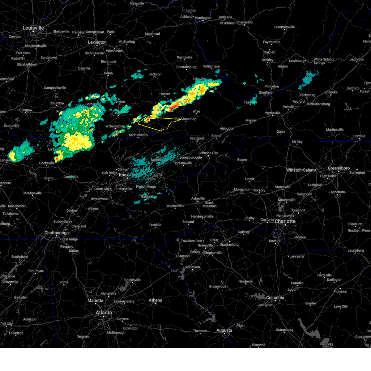
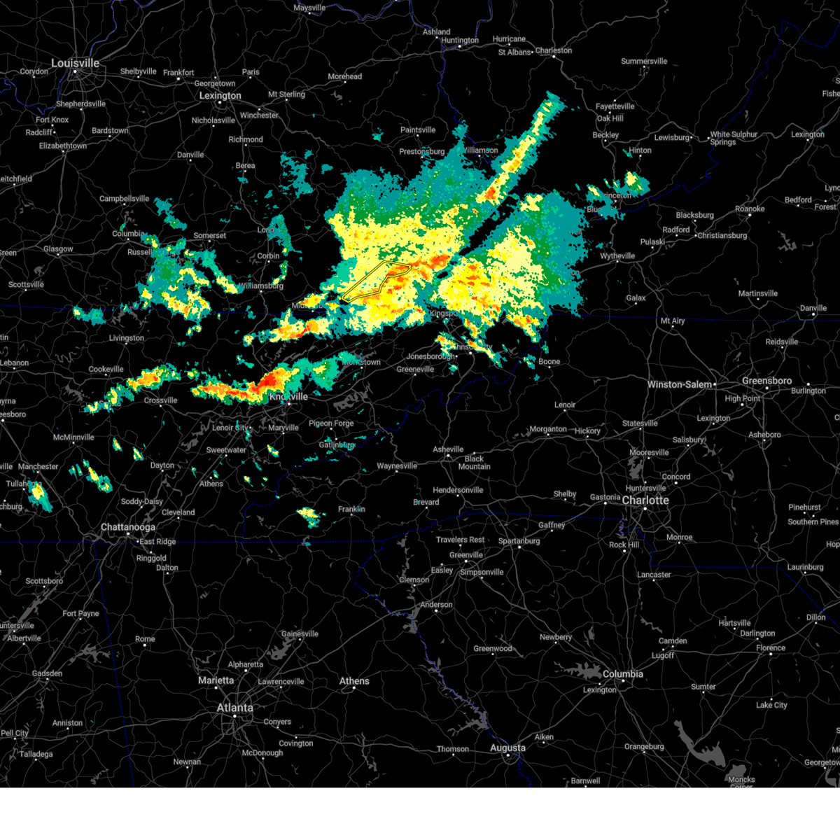
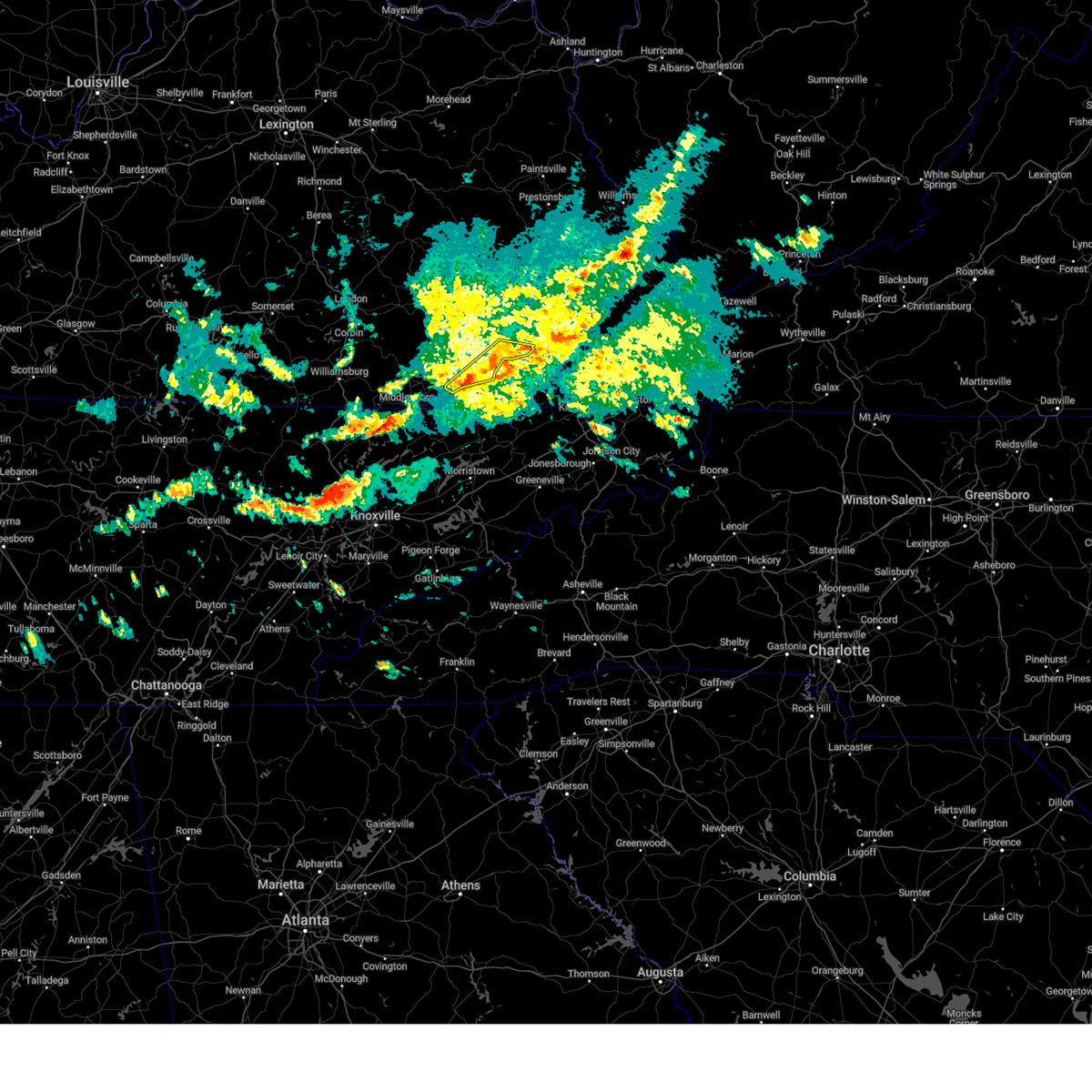
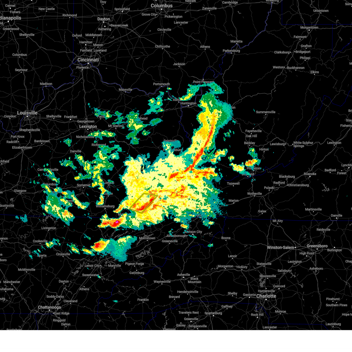
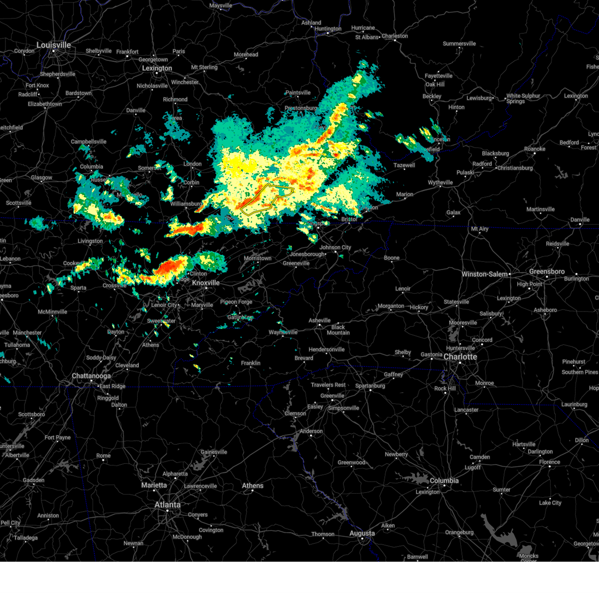
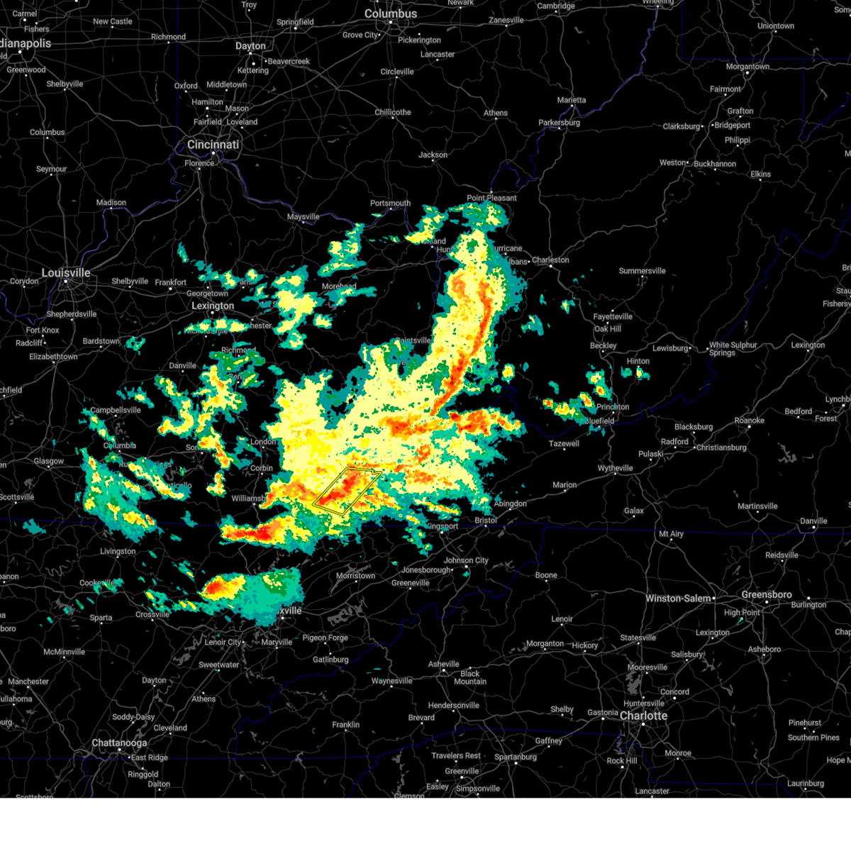
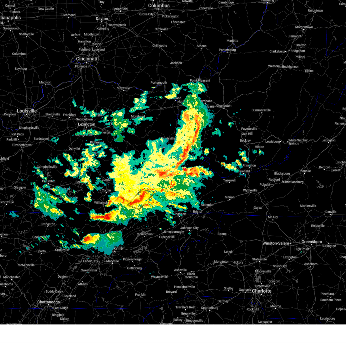
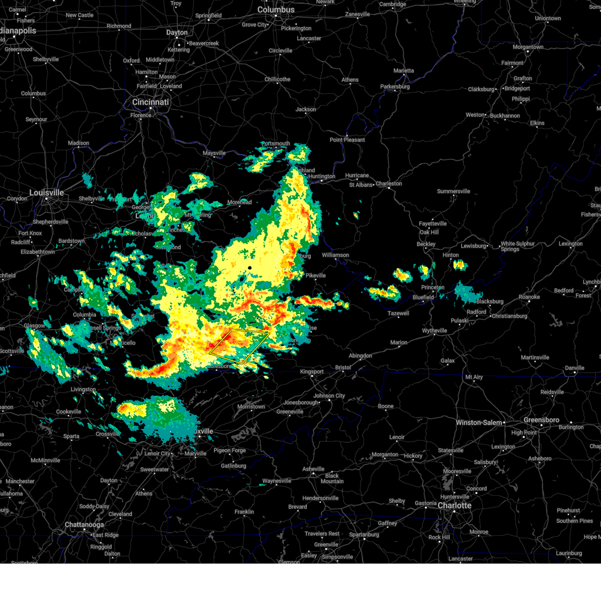
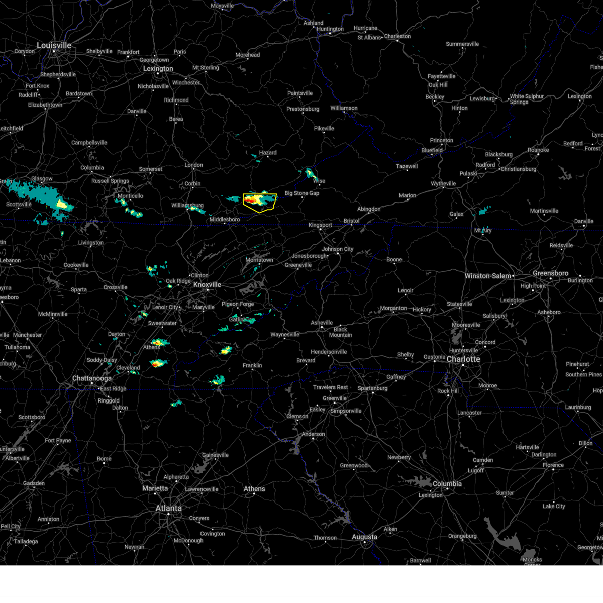
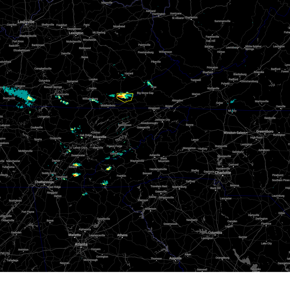
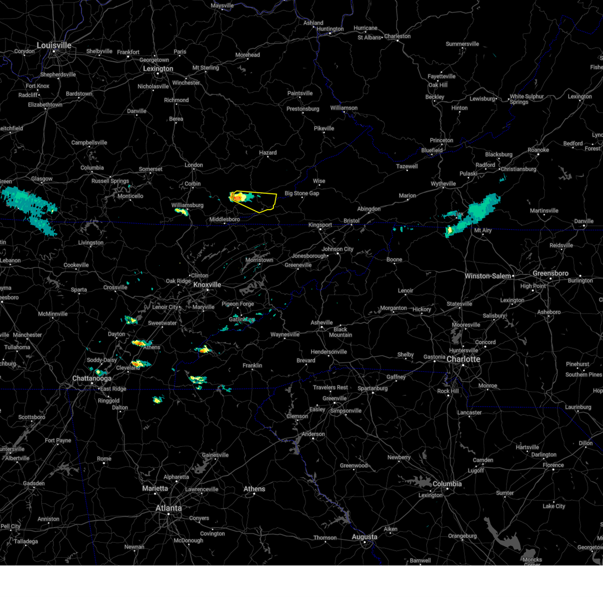
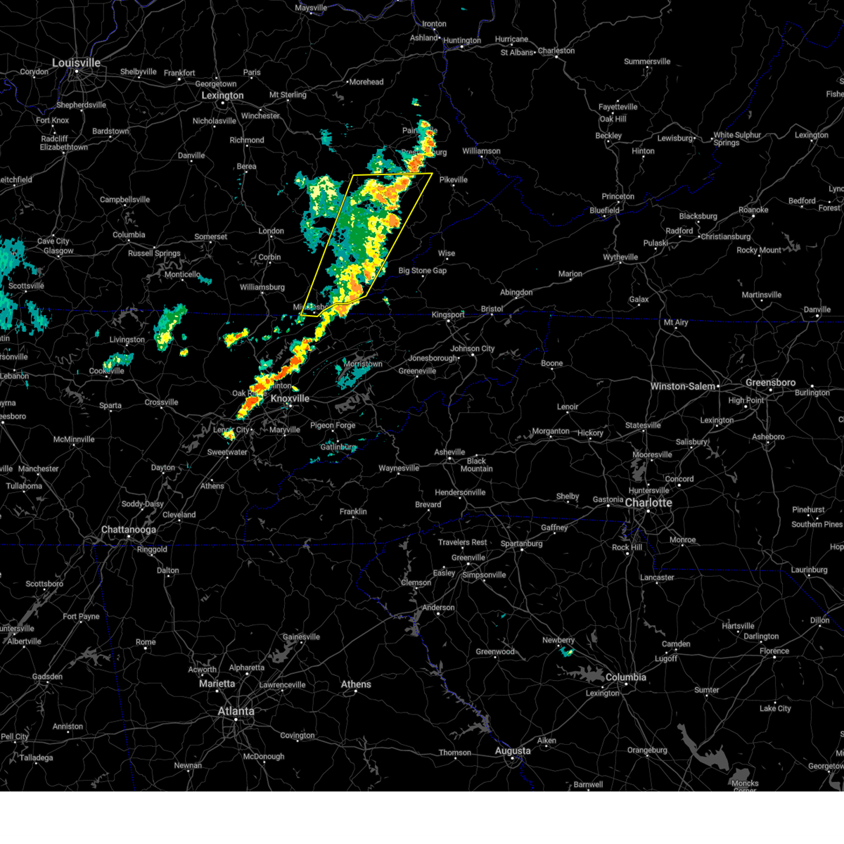
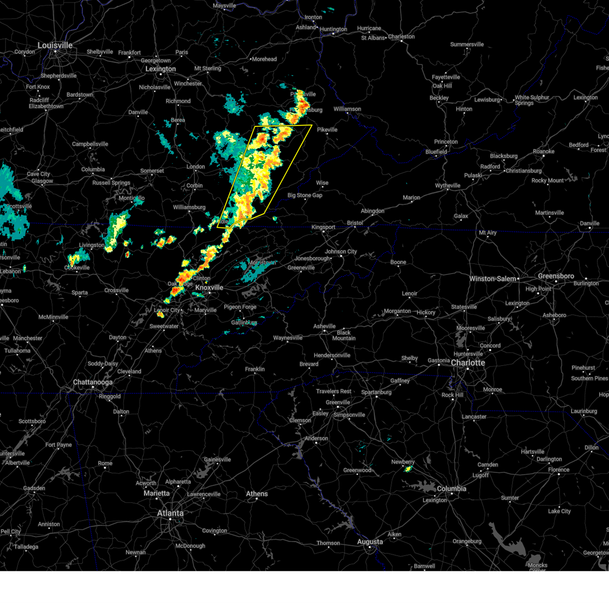
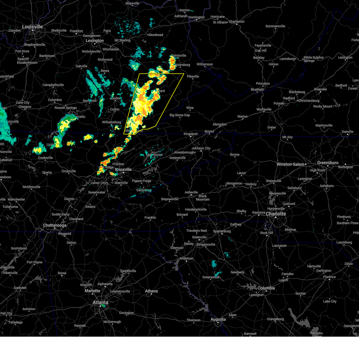
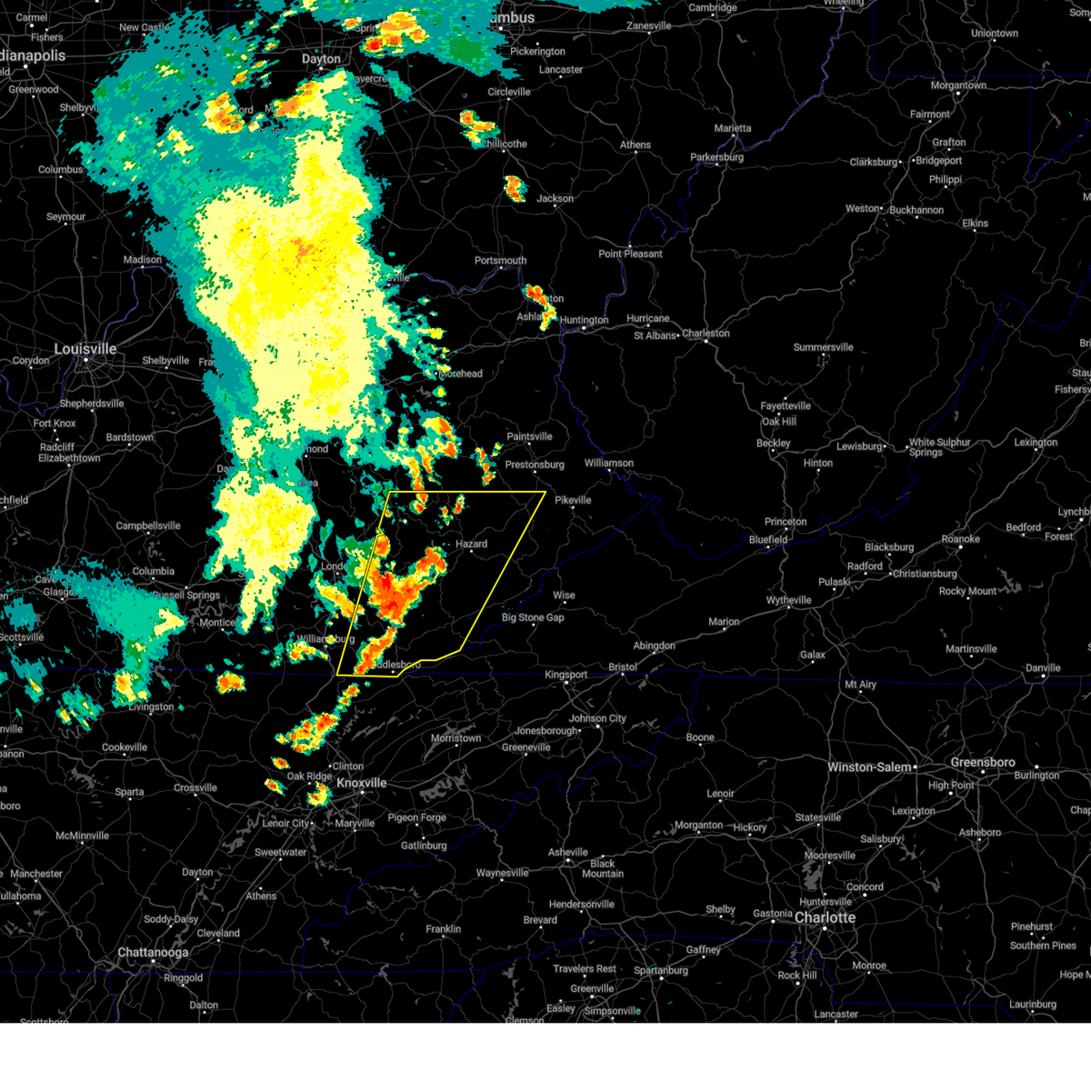
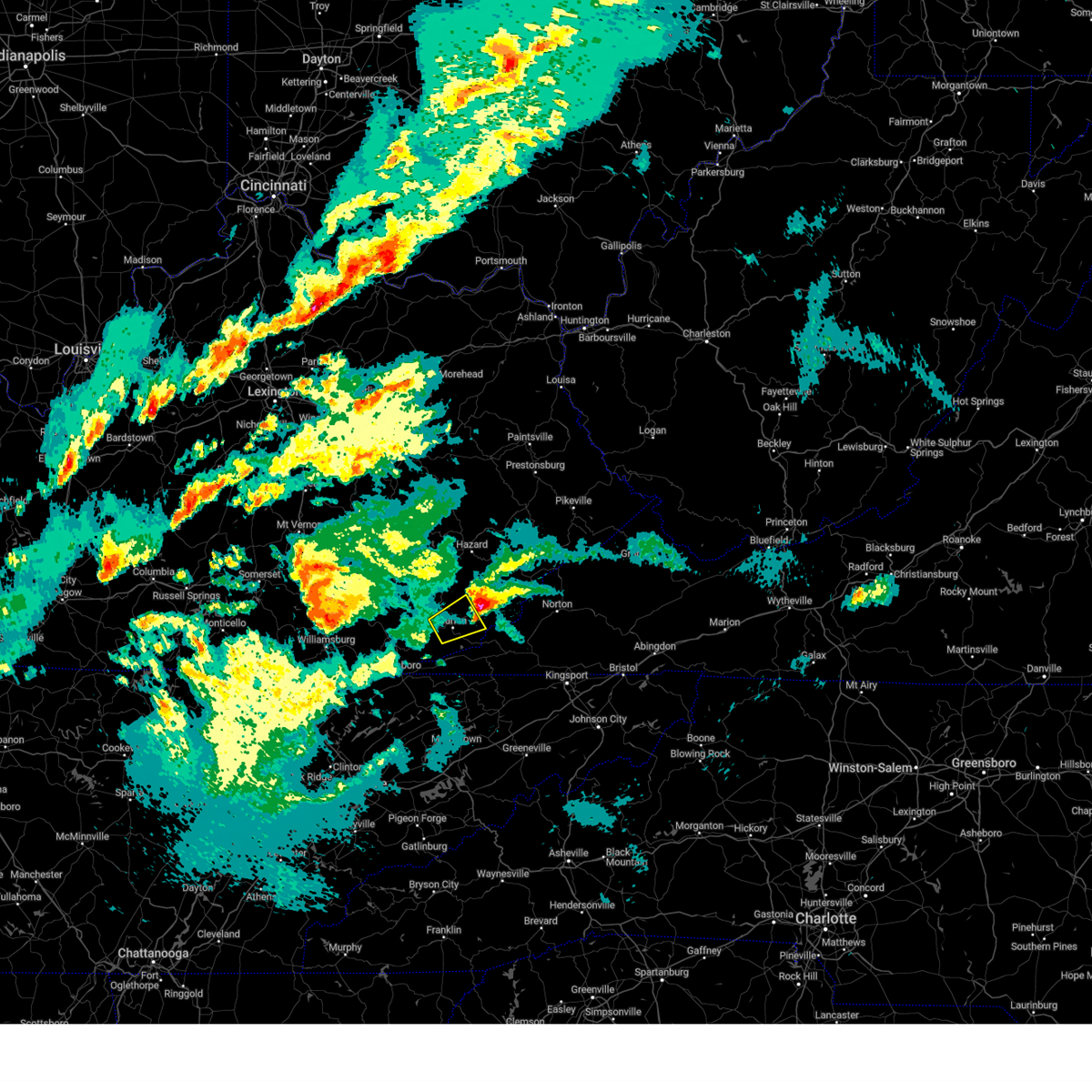
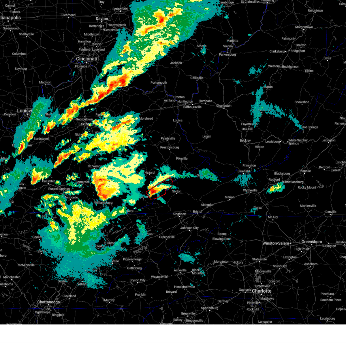
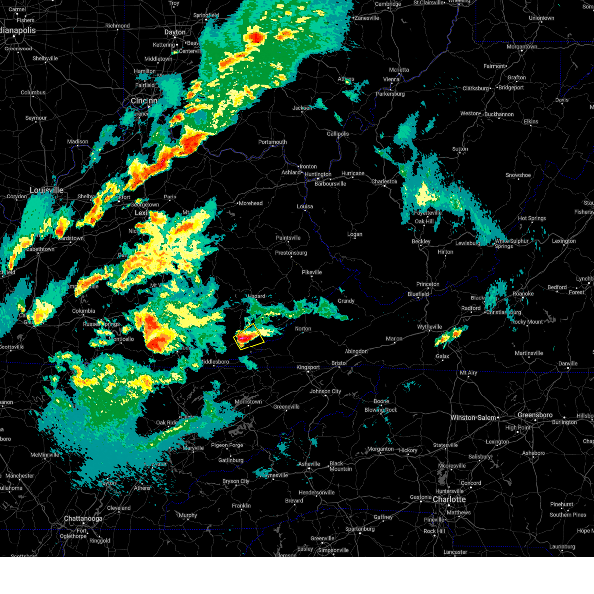
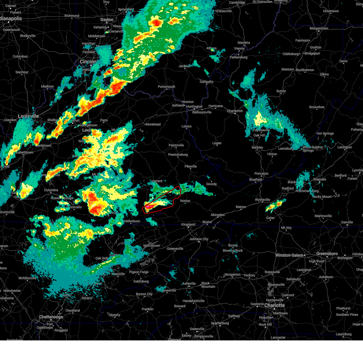
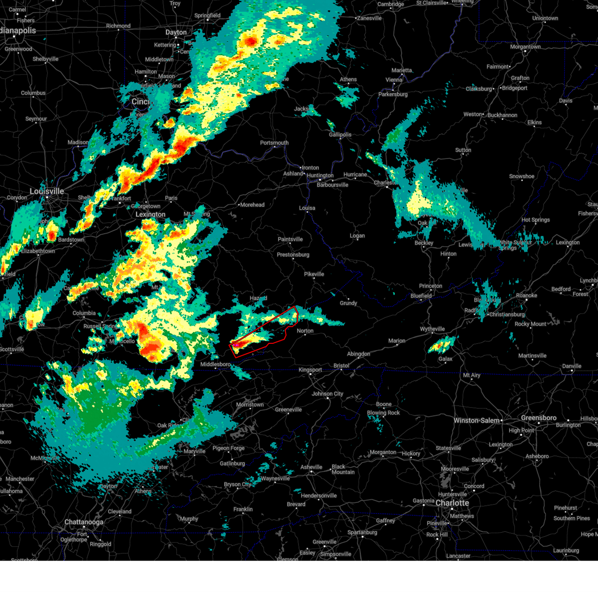
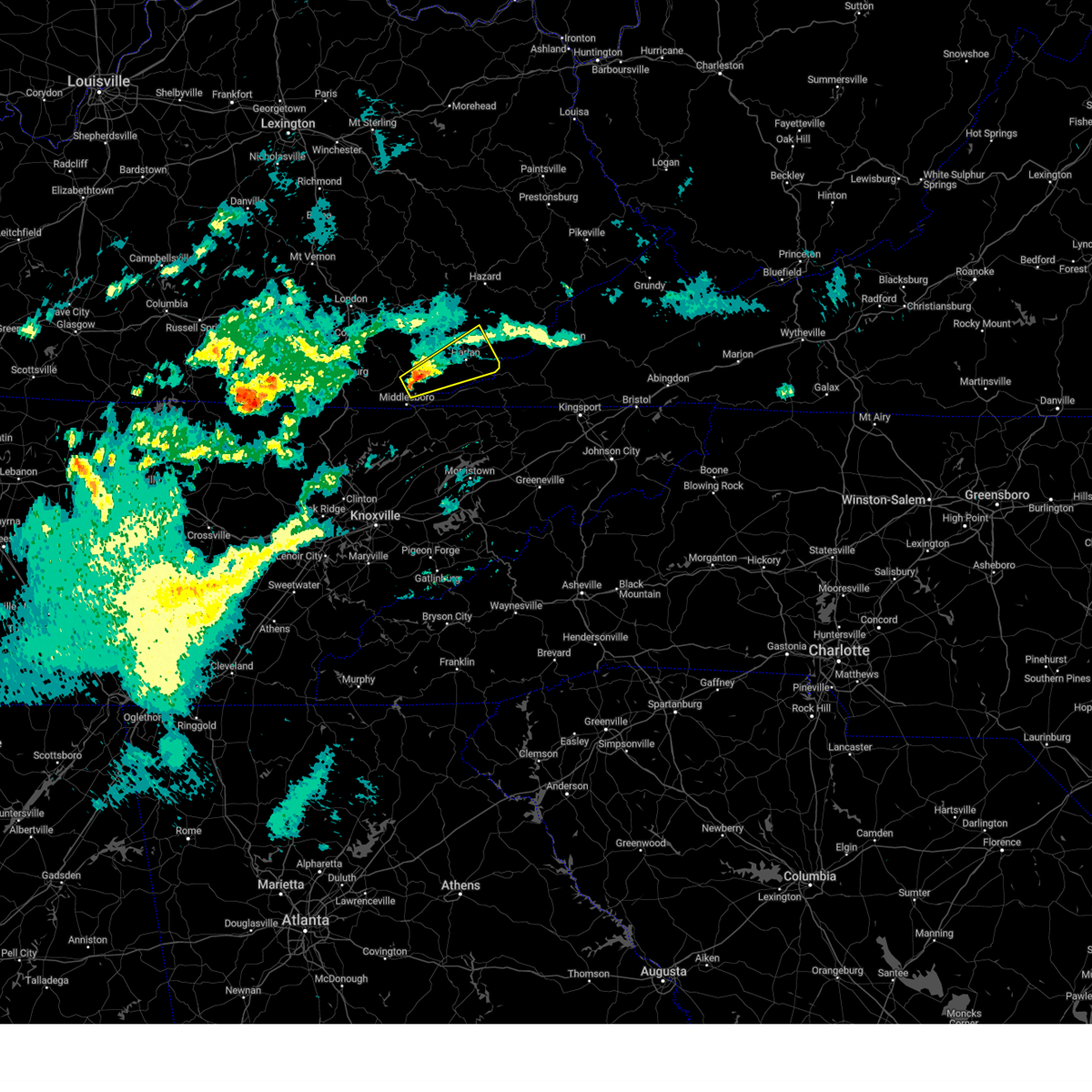
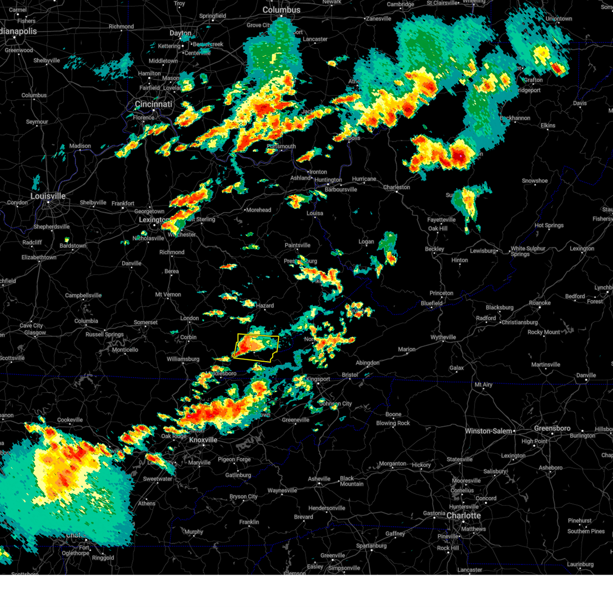
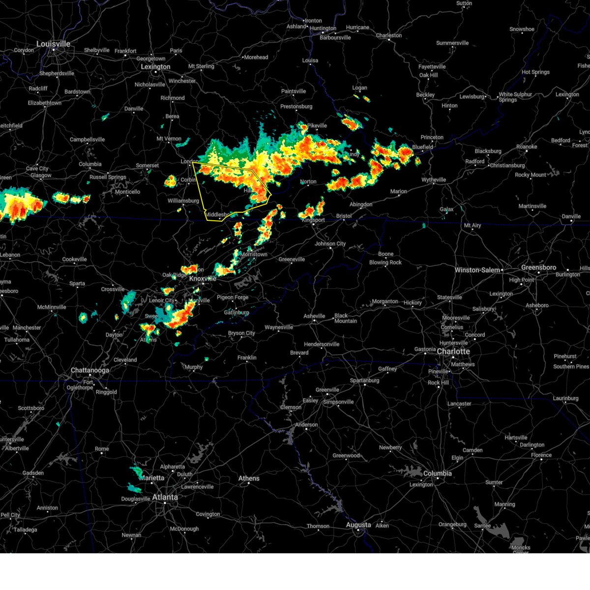
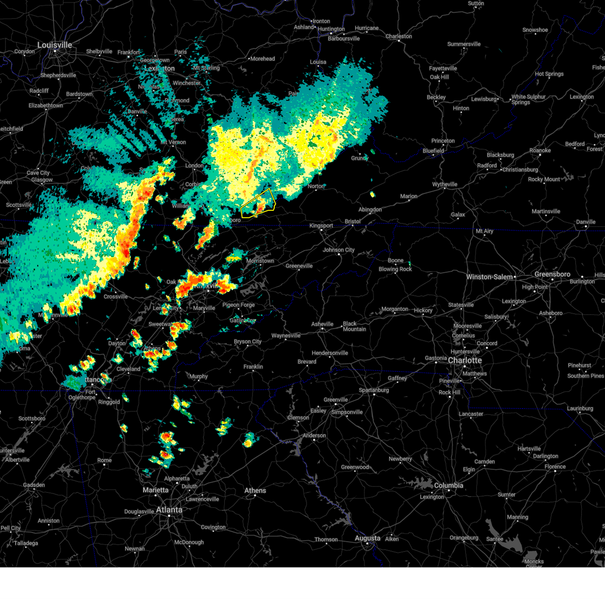
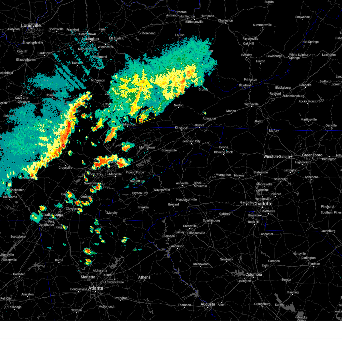
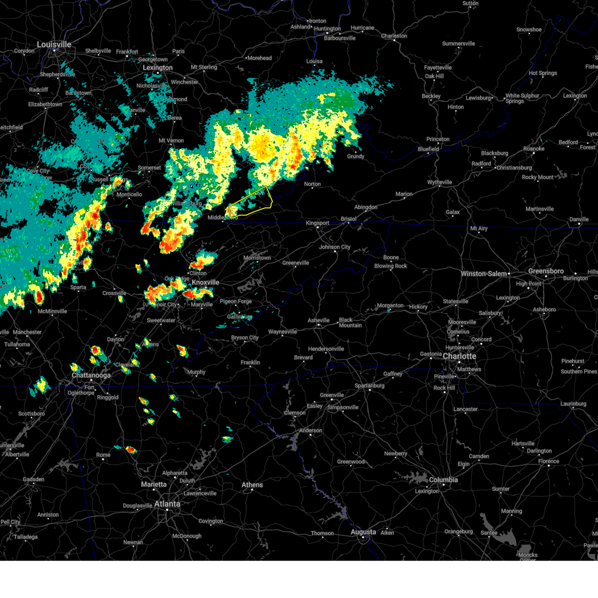
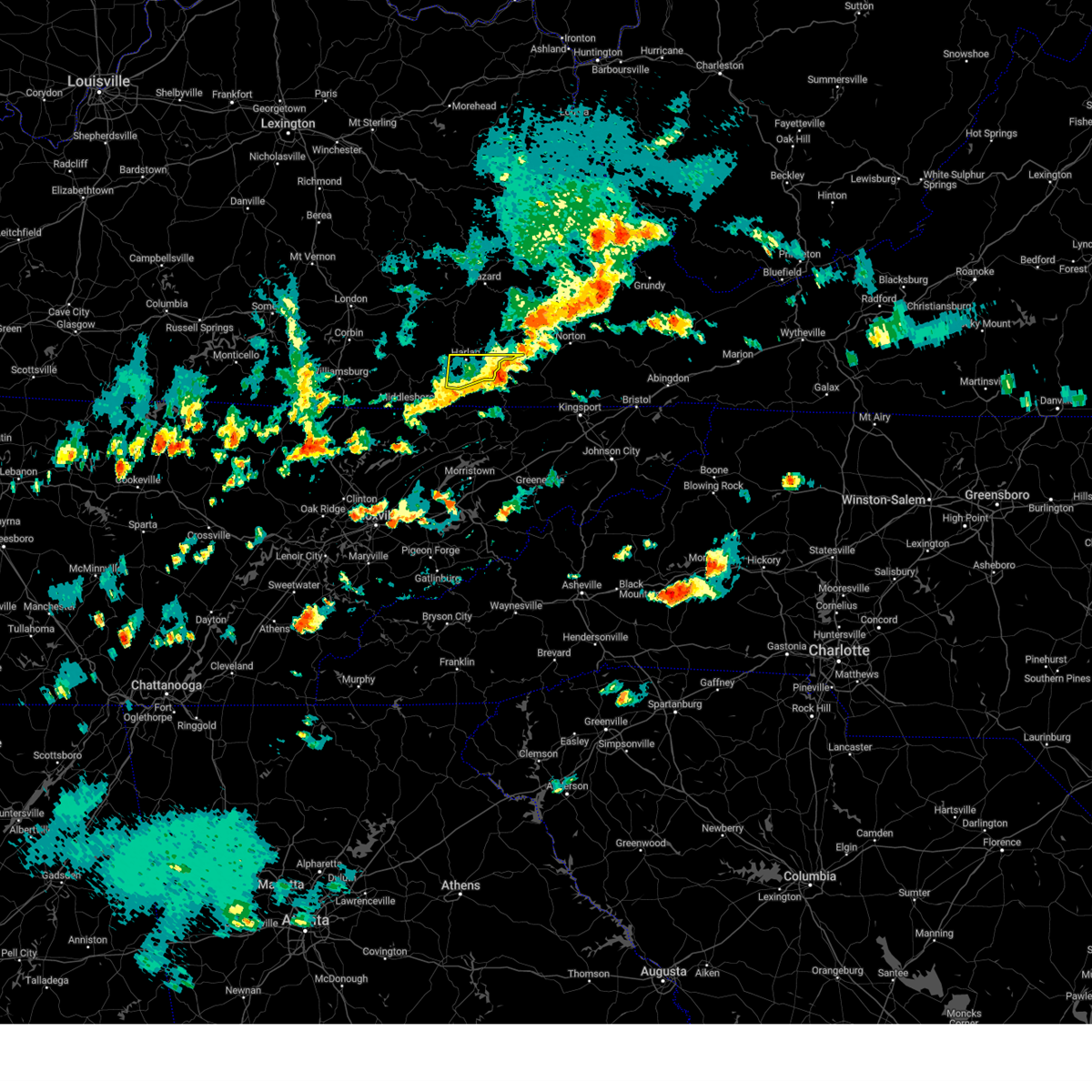
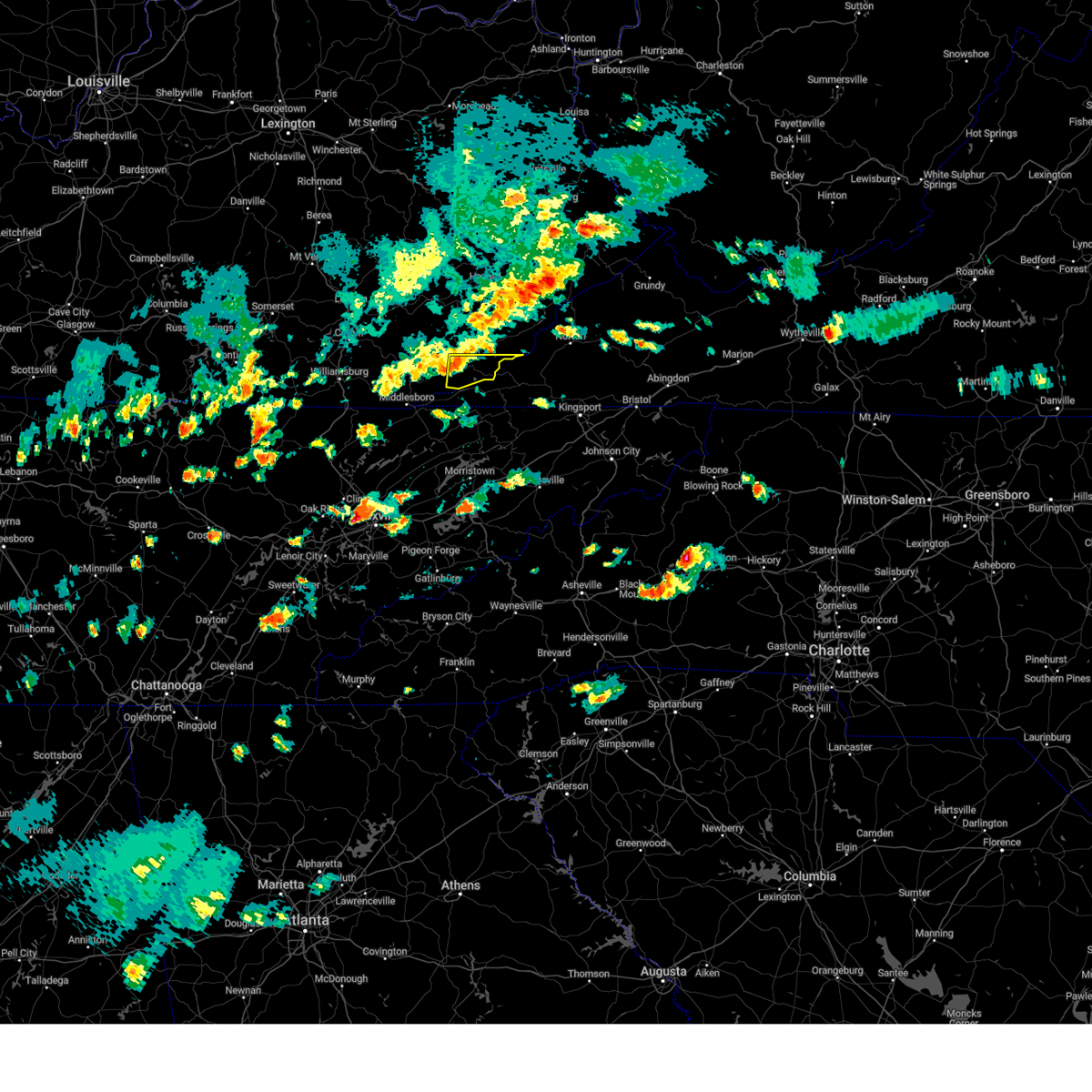
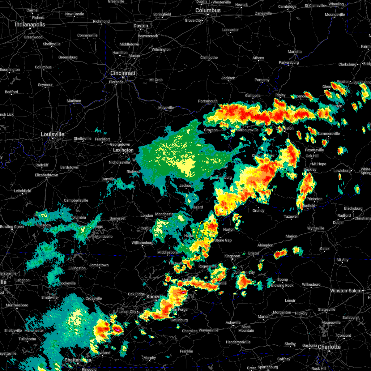
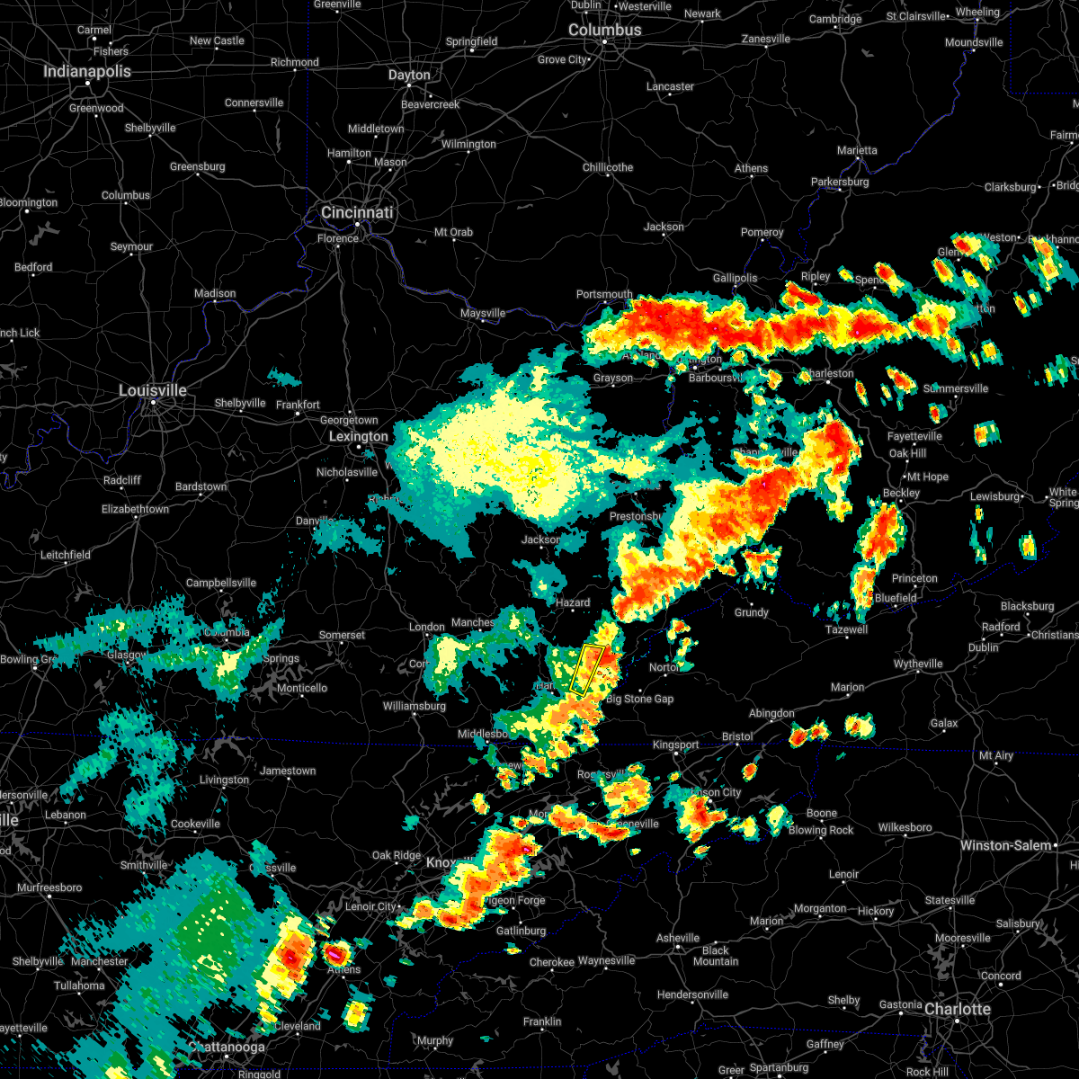
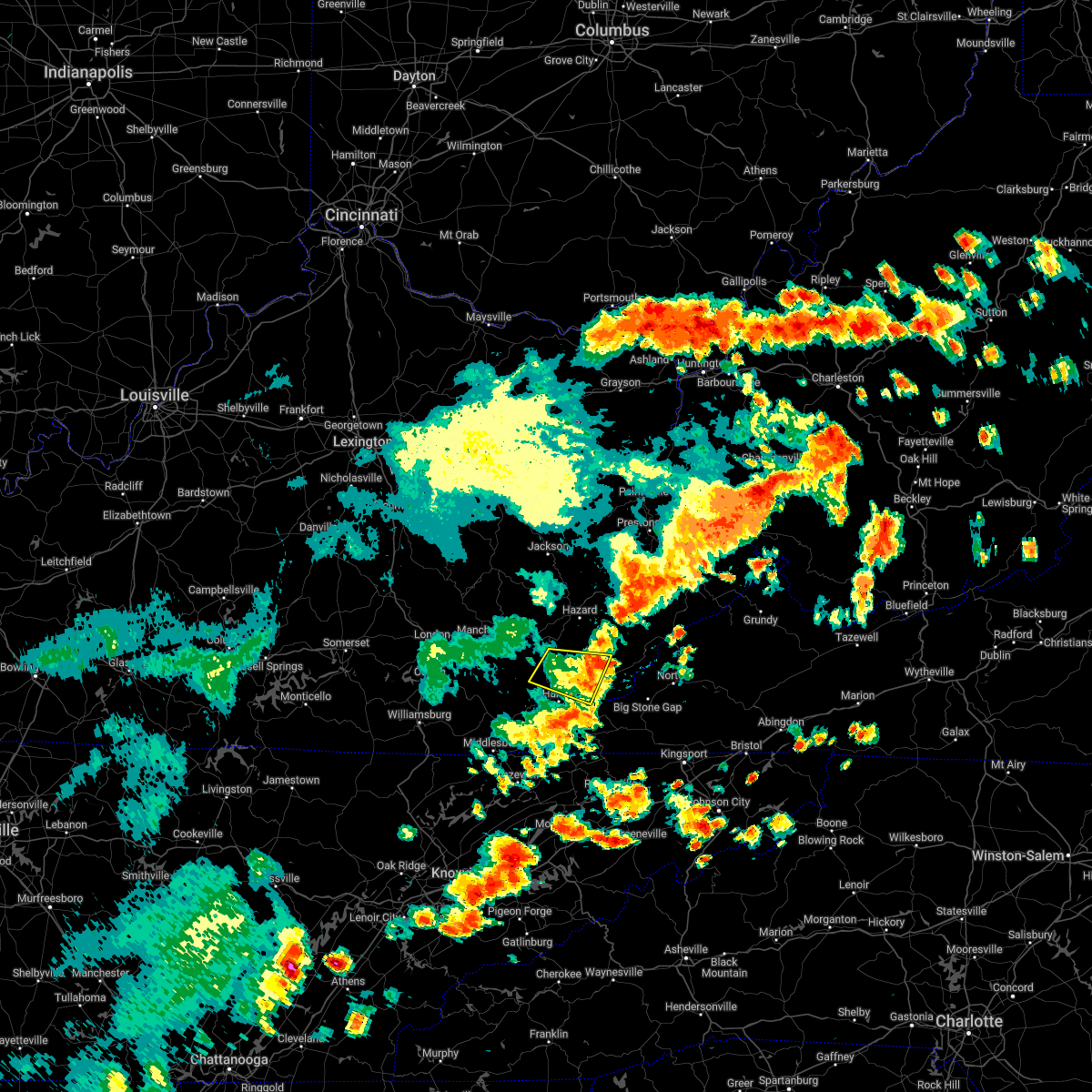
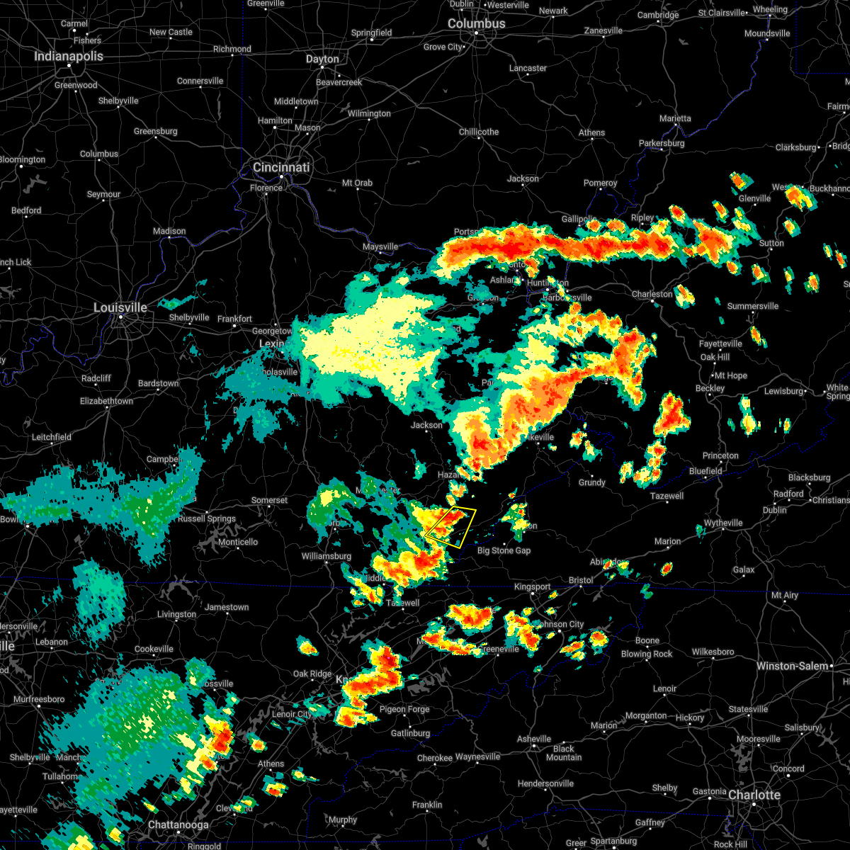
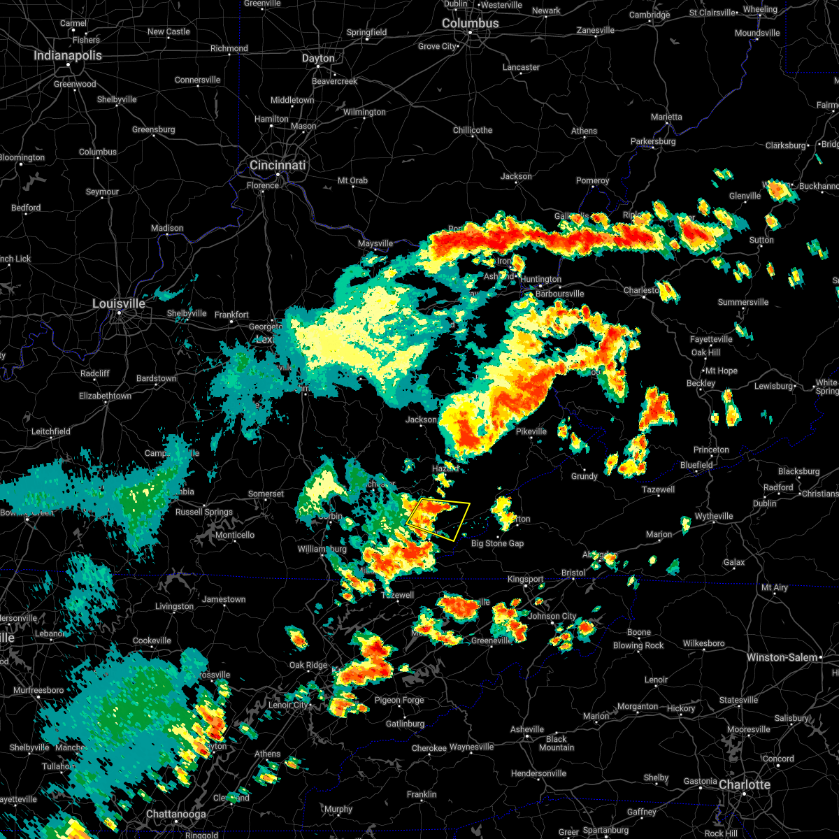
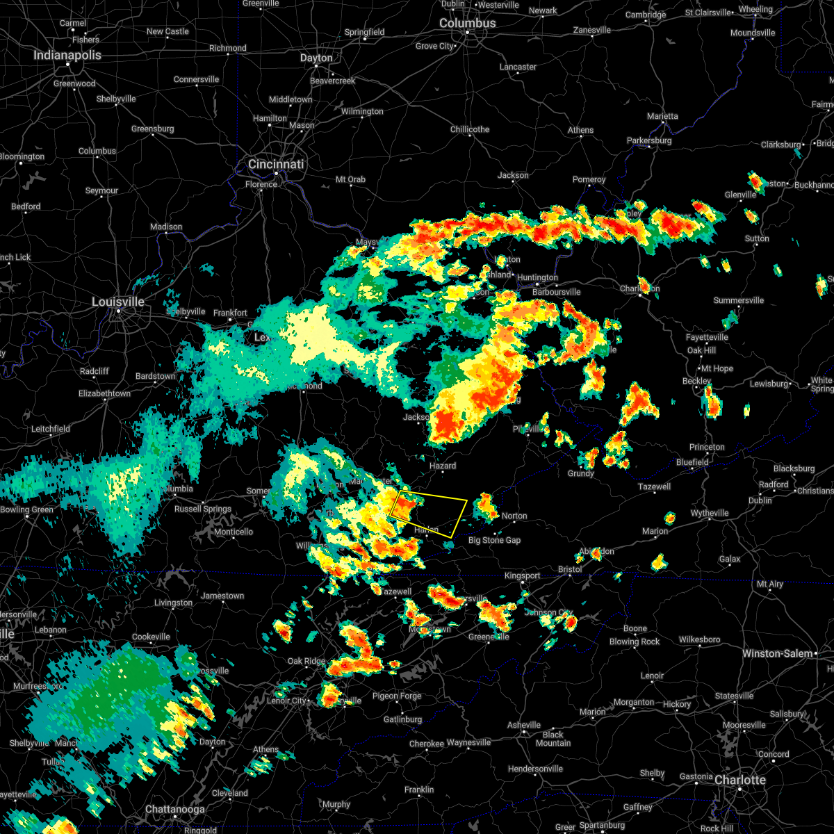
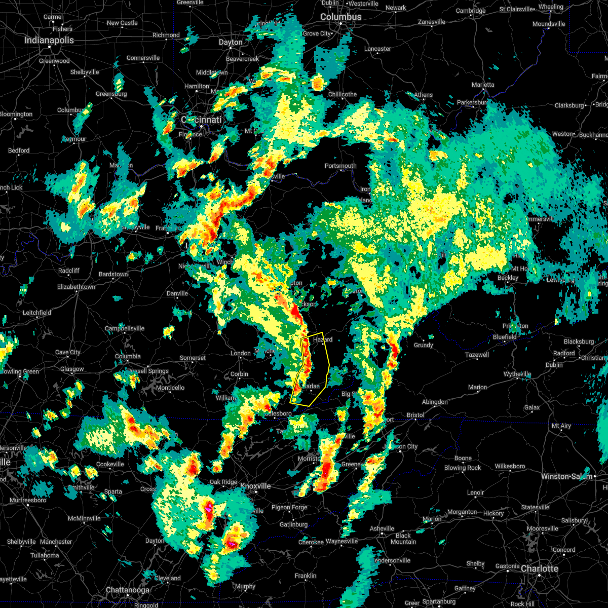
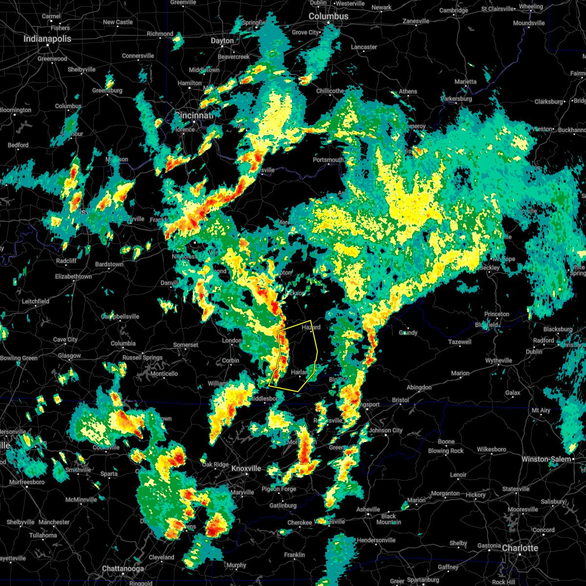
Hail Map for Evarts, KY
The Evarts, KY area has had 2 reports of on-the-ground hail by trained spotters, and has been under severe weather warnings 30 times during the past 12 months. Doppler radar has detected hail at or near Evarts, KY on 33 occasions, including 5 occasions during the past year.
| Name: | Evarts, KY |
| Where Located: | 57 miles WNW of Bristol, TN |
| Map: | Google Map for Evarts, KY |
| Population: | 962 |
| Housing Units: | 321 |
| More Info: | Search Google for Evarts, KY |
5
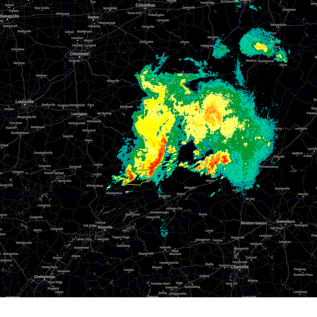
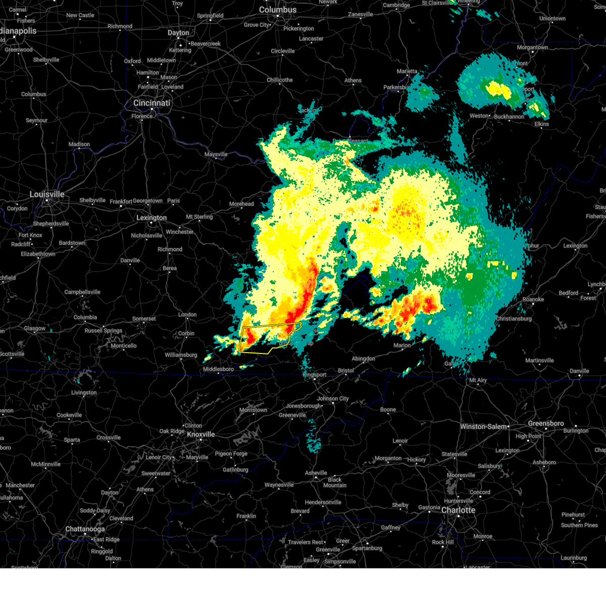
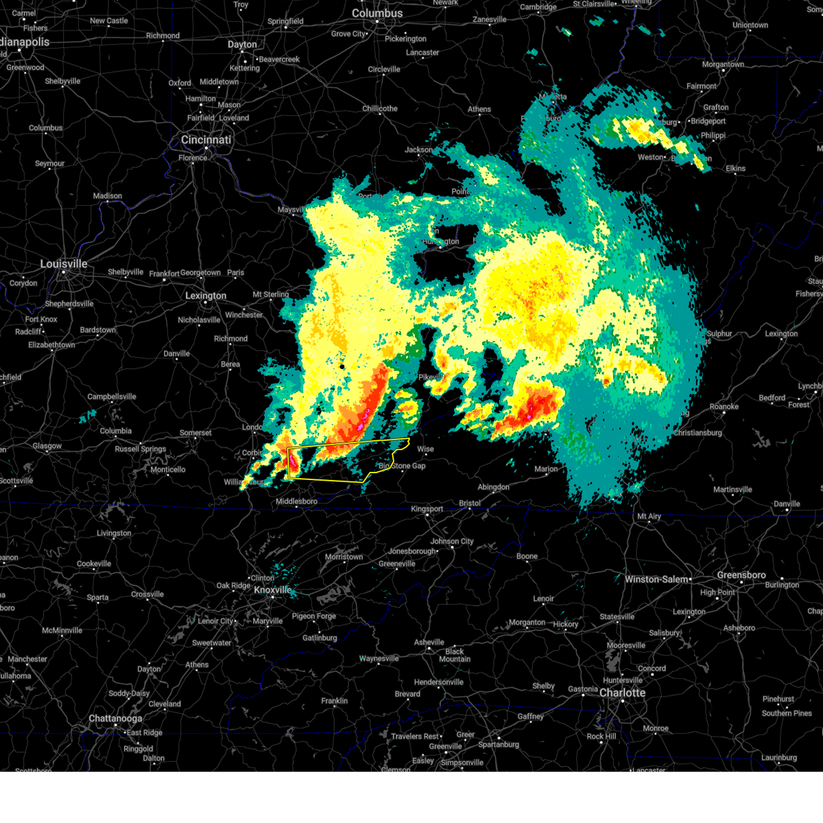
The Top Recent Hail Date for Evarts, KY is Monday, April 14, 2025 (1st out of 33)

Hail and Wind Damage Spotted near Evarts, KY
| Date / Time | Report Details |
|---|---|
| 5/20/2025 11:17 PM EDT |
 The severe thunderstorm warning has expired. a new downstream warning has been issued. refer to that bulletin for further details. a tornado watch remains in effect until 200 am edt for southeastern kentucky. remember, a severe thunderstorm warning still remains in effect for northeastern harlan county in southeastern kentucky, letcher county in southeastern kentucky, south central pike county in southeastern kentucky until midnight edt. The severe thunderstorm warning has expired. a new downstream warning has been issued. refer to that bulletin for further details. a tornado watch remains in effect until 200 am edt for southeastern kentucky. remember, a severe thunderstorm warning still remains in effect for northeastern harlan county in southeastern kentucky, letcher county in southeastern kentucky, south central pike county in southeastern kentucky until midnight edt.
|
| 5/20/2025 11:08 PM EDT |
 At 1108 pm edt, severe thunderstorms were located along a line extending from hallie to rock house to near cranks, moving northeast at 45 mph (radar indicated). Hazards include 60 mph wind gusts and penny size hail. Expect damage to roofs, siding, and trees. Locations impacted include, whitesburg, cumberland, evarts, lynch, benham, blackey, bobs creek, oscaloosa, dizney, colly, louellen, and premium. At 1108 pm edt, severe thunderstorms were located along a line extending from hallie to rock house to near cranks, moving northeast at 45 mph (radar indicated). Hazards include 60 mph wind gusts and penny size hail. Expect damage to roofs, siding, and trees. Locations impacted include, whitesburg, cumberland, evarts, lynch, benham, blackey, bobs creek, oscaloosa, dizney, colly, louellen, and premium.
|
| 5/20/2025 11:08 PM EDT |
 the severe thunderstorm warning has been cancelled and is no longer in effect the severe thunderstorm warning has been cancelled and is no longer in effect
|
| 5/20/2025 10:57 PM EDT |
 At 1054 pm edt, severe thunderstorms were located along a line extending from leatherwood to near dizney to near peepace store, moving east at 55 mph (radar indicated). Hazards include 60 mph wind gusts and penny size hail. Expect damage to roofs, siding, and trees. Locations impacted include, cumberland, flint, oscaloosa, whitesburg and colly. At 1054 pm edt, severe thunderstorms were located along a line extending from leatherwood to near dizney to near peepace store, moving east at 55 mph (radar indicated). Hazards include 60 mph wind gusts and penny size hail. Expect damage to roofs, siding, and trees. Locations impacted include, cumberland, flint, oscaloosa, whitesburg and colly.
|
| 5/20/2025 10:57 PM EDT |
 the severe thunderstorm warning has been cancelled and is no longer in effect the severe thunderstorm warning has been cancelled and is no longer in effect
|
| 5/20/2025 10:32 PM EDT |
 Svrjkl the national weather service in jackson ky has issued a * severe thunderstorm warning for, harlan county in southeastern kentucky, southeastern bell county in southeastern kentucky, southern leslie county in southeastern kentucky, southern letcher county in southeastern kentucky, southeastern perry county in southeastern kentucky, * until 1115 pm edt. * at 1031 pm edt, severe thunderstorms were located along a line extending from near roark to tacky town to near noetown, moving east at 40 mph (radar indicated). Hazards include 60 mph wind gusts and penny size hail. Expect damage to roofs, siding, and trees. severe thunderstorms will be near, harlan around 1035 pm edt. napier around 1040 pm edt. evarts around 1045 pm edt. colts around 1050 pm edt. Other locations in the path of these severe thunderstorms include totz and cumberland. Svrjkl the national weather service in jackson ky has issued a * severe thunderstorm warning for, harlan county in southeastern kentucky, southeastern bell county in southeastern kentucky, southern leslie county in southeastern kentucky, southern letcher county in southeastern kentucky, southeastern perry county in southeastern kentucky, * until 1115 pm edt. * at 1031 pm edt, severe thunderstorms were located along a line extending from near roark to tacky town to near noetown, moving east at 40 mph (radar indicated). Hazards include 60 mph wind gusts and penny size hail. Expect damage to roofs, siding, and trees. severe thunderstorms will be near, harlan around 1035 pm edt. napier around 1040 pm edt. evarts around 1045 pm edt. colts around 1050 pm edt. Other locations in the path of these severe thunderstorms include totz and cumberland.
|
| 5/16/2025 2:17 PM EDT |
 At 216 pm edt, a severe thunderstorm was located near napier, or 7 miles north of harlan, moving east at 70 mph (radar indicated). Hazards include 60 mph wind gusts and quarter size hail. Hail damage to vehicles is expected. expect wind damage to roofs, siding, and trees. Locations impacted include, big laurel, cumberland, lynch and partridge. At 216 pm edt, a severe thunderstorm was located near napier, or 7 miles north of harlan, moving east at 70 mph (radar indicated). Hazards include 60 mph wind gusts and quarter size hail. Hail damage to vehicles is expected. expect wind damage to roofs, siding, and trees. Locations impacted include, big laurel, cumberland, lynch and partridge.
|
| 5/16/2025 2:17 PM EDT |
 the severe thunderstorm warning has been cancelled and is no longer in effect the severe thunderstorm warning has been cancelled and is no longer in effect
|
| 5/16/2025 1:58 PM EDT |
 Svrjkl the national weather service in jackson ky has issued a * severe thunderstorm warning for, harlan county in southeastern kentucky, northeastern bell county in southeastern kentucky, northeastern knox county in southeastern kentucky, southern leslie county in southeastern kentucky, southwestern letcher county in southeastern kentucky, southeastern perry county in southeastern kentucky, southeastern clay county in southeastern kentucky, * until 245 pm edt. * at 157 pm edt, a severe thunderstorm was located over scalf, or 10 miles north of pineville, moving east at 75 mph (radar indicated). Hazards include 60 mph wind gusts and quarter size hail. Hail damage to vehicles is expected. expect wind damage to roofs, siding, and trees. this severe thunderstorm will be near, mills around 200 pm edt. spruce pine around 205 pm edt. bledsoe around 210 pm edt. napier around 215 pm edt. Other locations in the path of this severe thunderstorm include colts, harlan, and cumberland. Svrjkl the national weather service in jackson ky has issued a * severe thunderstorm warning for, harlan county in southeastern kentucky, northeastern bell county in southeastern kentucky, northeastern knox county in southeastern kentucky, southern leslie county in southeastern kentucky, southwestern letcher county in southeastern kentucky, southeastern perry county in southeastern kentucky, southeastern clay county in southeastern kentucky, * until 245 pm edt. * at 157 pm edt, a severe thunderstorm was located over scalf, or 10 miles north of pineville, moving east at 75 mph (radar indicated). Hazards include 60 mph wind gusts and quarter size hail. Hail damage to vehicles is expected. expect wind damage to roofs, siding, and trees. this severe thunderstorm will be near, mills around 200 pm edt. spruce pine around 205 pm edt. bledsoe around 210 pm edt. napier around 215 pm edt. Other locations in the path of this severe thunderstorm include colts, harlan, and cumberland.
|
| 5/2/2025 7:30 PM EDT | Tractor trailer reportedly blown over on ky-38 near the marathon gas statio in harlan county KY, 0.6 miles ENE of Evarts, KY |
| 5/2/2025 7:30 PM EDT | Lipfird street bridge blocked by large tre in harlan county KY, 0.2 miles NNW of Evarts, KY |
| 4/15/2025 12:50 AM EDT |
 the severe thunderstorm warning has been cancelled and is no longer in effect the severe thunderstorm warning has been cancelled and is no longer in effect
|
| 4/15/2025 12:50 AM EDT |
 At 1250 am edt, a severe thunderstorm was located over chevrolet, or near harlan, moving east at 40 mph (radar indicated). Hazards include 60 mph wind gusts and quarter size hail. Hail damage to vehicles is expected. expect wind damage to roofs, siding, and trees. This severe storm will be near, dizney around 1255 am edt. At 1250 am edt, a severe thunderstorm was located over chevrolet, or near harlan, moving east at 40 mph (radar indicated). Hazards include 60 mph wind gusts and quarter size hail. Hail damage to vehicles is expected. expect wind damage to roofs, siding, and trees. This severe storm will be near, dizney around 1255 am edt.
|
| 4/15/2025 12:38 AM EDT |
 the severe thunderstorm warning has been cancelled and is no longer in effect the severe thunderstorm warning has been cancelled and is no longer in effect
|
| 4/15/2025 12:38 AM EDT |
 At 1238 am edt, a severe thunderstorm was located over tremont, or near harlan, moving east at 40 mph (radar indicated). Hazards include 60 mph wind gusts and quarter size hail. Hail damage to vehicles is expected. expect wind damage to roofs, siding, and trees. this severe storm will be near, loyall around 1245 am edt. crummies around 1250 am edt. Other locations in the path of this severe thunderstorm include dizney. At 1238 am edt, a severe thunderstorm was located over tremont, or near harlan, moving east at 40 mph (radar indicated). Hazards include 60 mph wind gusts and quarter size hail. Hail damage to vehicles is expected. expect wind damage to roofs, siding, and trees. this severe storm will be near, loyall around 1245 am edt. crummies around 1250 am edt. Other locations in the path of this severe thunderstorm include dizney.
|
| 4/15/2025 12:32 AM EDT |
 Svrjkl the national weather service in jackson ky has issued a * severe thunderstorm warning for, southern harlan county in southeastern kentucky, northeastern bell county in southeastern kentucky, south central leslie county in southeastern kentucky, * until 115 am edt. * at 1232 am edt, a severe thunderstorm was located over tacky town, or 9 miles west of harlan, moving east at 40 mph (radar indicated). Hazards include 60 mph wind gusts and quarter size hail. Hail damage to vehicles is expected. expect wind damage to roofs, siding, and trees. this severe thunderstorm will be near, tremont around 1235 am edt. kitts around 1240 am edt. rosspoint around 1245 am edt. three point around 1250 am edt. Other locations in the path of this severe thunderstorm include cranks and dizney. Svrjkl the national weather service in jackson ky has issued a * severe thunderstorm warning for, southern harlan county in southeastern kentucky, northeastern bell county in southeastern kentucky, south central leslie county in southeastern kentucky, * until 115 am edt. * at 1232 am edt, a severe thunderstorm was located over tacky town, or 9 miles west of harlan, moving east at 40 mph (radar indicated). Hazards include 60 mph wind gusts and quarter size hail. Hail damage to vehicles is expected. expect wind damage to roofs, siding, and trees. this severe thunderstorm will be near, tremont around 1235 am edt. kitts around 1240 am edt. rosspoint around 1245 am edt. three point around 1250 am edt. Other locations in the path of this severe thunderstorm include cranks and dizney.
|
| 2/6/2025 8:59 PM EST |
 The storms which prompted the warning have moved out of the area. therefore, the warning will be allowed to expire. a severe thunderstorm watch remains in effect until midnight est for southeastern kentucky. to report severe weather, contact your nearest law enforcement agency. they will relay your report to the national weather service in jackson ky. The storms which prompted the warning have moved out of the area. therefore, the warning will be allowed to expire. a severe thunderstorm watch remains in effect until midnight est for southeastern kentucky. to report severe weather, contact your nearest law enforcement agency. they will relay your report to the national weather service in jackson ky.
|
| 2/6/2025 8:51 PM EST |
 At 851 pm est, severe thunderstorms were located along a line extending from near clover to near cranks to near hensley store, moving east at 45 mph (radar indicated). Hazards include 60 mph wind gusts and penny size hail. Expect damage to roofs, siding, and trees. These severe storms will be near, clover around 855 pm est. At 851 pm est, severe thunderstorms were located along a line extending from near clover to near cranks to near hensley store, moving east at 45 mph (radar indicated). Hazards include 60 mph wind gusts and penny size hail. Expect damage to roofs, siding, and trees. These severe storms will be near, clover around 855 pm est.
|
| 2/6/2025 8:46 PM EST |
 A new downstream warning has been issued for harlan county. a severe thunderstorm watch remains in effect until midnight est for southeastern kentucky. remember, a severe thunderstorm warning still remains in effect for harlan county until 900 pm est. A new downstream warning has been issued for harlan county. a severe thunderstorm watch remains in effect until midnight est for southeastern kentucky. remember, a severe thunderstorm warning still remains in effect for harlan county until 900 pm est.
|
| 2/6/2025 8:37 PM EST |
 Svrjkl the national weather service in jackson ky has issued a * severe thunderstorm warning for, harlan county in southeastern kentucky, * until 900 pm est. * at 836 pm est, severe thunderstorms were located along a line extending from pine mountain to grays knob to cubage, moving east at 45 mph (radar indicated). Hazards include 60 mph wind gusts and penny size hail. Expect damage to roofs, siding, and trees. severe thunderstorms will be near, harlan around 840 pm est. clover around 845 pm est. Big black mountain around 850 pm est. Svrjkl the national weather service in jackson ky has issued a * severe thunderstorm warning for, harlan county in southeastern kentucky, * until 900 pm est. * at 836 pm est, severe thunderstorms were located along a line extending from pine mountain to grays knob to cubage, moving east at 45 mph (radar indicated). Hazards include 60 mph wind gusts and penny size hail. Expect damage to roofs, siding, and trees. severe thunderstorms will be near, harlan around 840 pm est. clover around 845 pm est. Big black mountain around 850 pm est.
|
| 2/6/2025 8:32 PM EST |
 At 831 pm est, severe thunderstorms were located along a line extending from near napier to cubage, moving east at 30 mph (radar indicated). Hazards include 60 mph wind gusts and quarter size hail. Hail damage to vehicles is expected. expect wind damage to roofs, siding, and trees. Locations impacted include, harlan. At 831 pm est, severe thunderstorms were located along a line extending from near napier to cubage, moving east at 30 mph (radar indicated). Hazards include 60 mph wind gusts and quarter size hail. Hail damage to vehicles is expected. expect wind damage to roofs, siding, and trees. Locations impacted include, harlan.
|
| 2/6/2025 8:32 PM EST |
 the severe thunderstorm warning has been cancelled and is no longer in effect the severe thunderstorm warning has been cancelled and is no longer in effect
|
| 2/6/2025 8:10 PM EST |
 Svrjkl the national weather service in jackson ky has issued a * severe thunderstorm warning for, western harlan county in southeastern kentucky, northeastern bell county in southeastern kentucky, east central knox county in southeastern kentucky, southern leslie county in southeastern kentucky, southeastern clay county in southeastern kentucky, * until 845 pm est. * at 810 pm est, severe thunderstorms were located along a line extending from mozelle to straight creek, moving east at 40 mph (radar indicated). Hazards include 60 mph wind gusts and quarter size hail. Hail damage to vehicles is expected. expect wind damage to roofs, siding, and trees. severe thunderstorms will be near, wallins creek around 815 pm est. harlan around 820 pm est. kitts around 825 pm est. Evarts around 830 pm est. Svrjkl the national weather service in jackson ky has issued a * severe thunderstorm warning for, western harlan county in southeastern kentucky, northeastern bell county in southeastern kentucky, east central knox county in southeastern kentucky, southern leslie county in southeastern kentucky, southeastern clay county in southeastern kentucky, * until 845 pm est. * at 810 pm est, severe thunderstorms were located along a line extending from mozelle to straight creek, moving east at 40 mph (radar indicated). Hazards include 60 mph wind gusts and quarter size hail. Hail damage to vehicles is expected. expect wind damage to roofs, siding, and trees. severe thunderstorms will be near, wallins creek around 815 pm est. harlan around 820 pm est. kitts around 825 pm est. Evarts around 830 pm est.
|
| 2/6/2025 4:40 PM EST |
 the severe thunderstorm warning has been cancelled and is no longer in effect the severe thunderstorm warning has been cancelled and is no longer in effect
|
| 2/6/2025 4:40 PM EST |
 At 440 pm est, a severe thunderstorm was located over white star, or near harlan, moving east at 35 mph (radar indicated). Hazards include 60 mph wind gusts and quarter size hail. Hail damage to vehicles is expected. expect wind damage to roofs, siding, and trees. Locations impacted include, harlan, martins fork lake and cranks. At 440 pm est, a severe thunderstorm was located over white star, or near harlan, moving east at 35 mph (radar indicated). Hazards include 60 mph wind gusts and quarter size hail. Hail damage to vehicles is expected. expect wind damage to roofs, siding, and trees. Locations impacted include, harlan, martins fork lake and cranks.
|
| 2/6/2025 4:24 PM EST |
 Svrjkl the national weather service in jackson ky has issued a * severe thunderstorm warning for, southwestern harlan county in southeastern kentucky, northeastern bell county in southeastern kentucky, south central leslie county in southeastern kentucky, * until 500 pm est. * at 424 pm est, a severe thunderstorm was located over stony fork junction, or 10 miles northeast of pineville, moving east at 30 mph (radar indicated). Hazards include 60 mph wind gusts and quarter size hail. Hail damage to vehicles is expected. expect wind damage to roofs, siding, and trees. this severe thunderstorm will be near, wallins creek around 430 pm est. loyall around 435 pm est. harlan around 440 pm est. Other locations in the path of this severe thunderstorm include kitts, three point and martins fork lake. Svrjkl the national weather service in jackson ky has issued a * severe thunderstorm warning for, southwestern harlan county in southeastern kentucky, northeastern bell county in southeastern kentucky, south central leslie county in southeastern kentucky, * until 500 pm est. * at 424 pm est, a severe thunderstorm was located over stony fork junction, or 10 miles northeast of pineville, moving east at 30 mph (radar indicated). Hazards include 60 mph wind gusts and quarter size hail. Hail damage to vehicles is expected. expect wind damage to roofs, siding, and trees. this severe thunderstorm will be near, wallins creek around 430 pm est. loyall around 435 pm est. harlan around 440 pm est. Other locations in the path of this severe thunderstorm include kitts, three point and martins fork lake.
|
| 8/1/2024 9:05 PM EDT |
 The storms which prompted the warning have weakened below severe limits, and have exited the warned area. therefore, the warning will be allowed to expire. however, gusty winds are still possible with these thunderstorms. a severe thunderstorm watch remains in effect until midnight edt for southeastern kentucky. The storms which prompted the warning have weakened below severe limits, and have exited the warned area. therefore, the warning will be allowed to expire. however, gusty winds are still possible with these thunderstorms. a severe thunderstorm watch remains in effect until midnight edt for southeastern kentucky.
|
| 8/1/2024 8:54 PM EDT |
 the severe thunderstorm warning has been cancelled and is no longer in effect the severe thunderstorm warning has been cancelled and is no longer in effect
|
| 8/1/2024 8:54 PM EDT |
 At 854 pm edt, severe thunderstorms were located along a line extending from pyramid to harrogate, moving east at 25 mph (radar indicated). Hazards include 60 mph wind gusts. Expect damage to roofs, siding, and trees. Locations impacted include, hazard, jackson, harlan, pineville, hindman, hyden, middlesboro, estill, loyall, evarts, pippa passes, and wayland. At 854 pm edt, severe thunderstorms were located along a line extending from pyramid to harrogate, moving east at 25 mph (radar indicated). Hazards include 60 mph wind gusts. Expect damage to roofs, siding, and trees. Locations impacted include, hazard, jackson, harlan, pineville, hindman, hyden, middlesboro, estill, loyall, evarts, pippa passes, and wayland.
|
| 8/1/2024 8:42 PM EDT |
 At 841 pm edt, severe thunderstorms were located along a line extending from waldo to near middlesboro, moving east at 25 mph (radar indicated). Hazards include 60 mph wind gusts. Expect damage to roofs, siding, and trees. Locations impacted include, hazard, harlan, garret, estill, evarts and blackey. At 841 pm edt, severe thunderstorms were located along a line extending from waldo to near middlesboro, moving east at 25 mph (radar indicated). Hazards include 60 mph wind gusts. Expect damage to roofs, siding, and trees. Locations impacted include, hazard, harlan, garret, estill, evarts and blackey.
|
| 8/1/2024 8:42 PM EDT |
 the severe thunderstorm warning has been cancelled and is no longer in effect the severe thunderstorm warning has been cancelled and is no longer in effect
|
| 8/1/2024 8:22 PM EDT |
 Svrjkl the national weather service in jackson ky has issued a * severe thunderstorm warning for, harlan county in southeastern kentucky, knox county in southeastern kentucky, owsley county in southeastern kentucky, knott county in southeastern kentucky, west central floyd county in southeastern kentucky, southeastern whitley county in south central kentucky, southeastern lee county in southeastern kentucky, southeastern laurel county in south central kentucky, bell county in southeastern kentucky, leslie county in southeastern kentucky, southwestern letcher county in southeastern kentucky, perry county in southeastern kentucky, breathitt county in southeastern kentucky, southeastern magoffin county in southeastern kentucky, clay county in southeastern kentucky, * until 915 pm edt. * at 822 pm edt, severe thunderstorms were located along a line extending from daisydell to near fonde, moving east at 25 mph (radar indicated). Hazards include 60 mph wind gusts. Expect damage to roofs, siding, and trees. severe thunderstorms will be near, hazard around 830 pm edt. wallins creek around 835 pm edt. mid around 840 pm edt. Other locations in the path of these severe thunderstorms include harlan, garret and estill. Svrjkl the national weather service in jackson ky has issued a * severe thunderstorm warning for, harlan county in southeastern kentucky, knox county in southeastern kentucky, owsley county in southeastern kentucky, knott county in southeastern kentucky, west central floyd county in southeastern kentucky, southeastern whitley county in south central kentucky, southeastern lee county in southeastern kentucky, southeastern laurel county in south central kentucky, bell county in southeastern kentucky, leslie county in southeastern kentucky, southwestern letcher county in southeastern kentucky, perry county in southeastern kentucky, breathitt county in southeastern kentucky, southeastern magoffin county in southeastern kentucky, clay county in southeastern kentucky, * until 915 pm edt. * at 822 pm edt, severe thunderstorms were located along a line extending from daisydell to near fonde, moving east at 25 mph (radar indicated). Hazards include 60 mph wind gusts. Expect damage to roofs, siding, and trees. severe thunderstorms will be near, hazard around 830 pm edt. wallins creek around 835 pm edt. mid around 840 pm edt. Other locations in the path of these severe thunderstorms include harlan, garret and estill.
|
| 5/27/2024 3:30 AM EDT |
 The storms which prompted the warning have weakened below severe limits, and no longer pose an immediate threat to life or property. therefore, the warning has been allowed to expire. however, gusty winds are still possible with these thunderstorms. a tornado watch remains in effect until 600 am edt for southeastern kentucky. The storms which prompted the warning have weakened below severe limits, and no longer pose an immediate threat to life or property. therefore, the warning has been allowed to expire. however, gusty winds are still possible with these thunderstorms. a tornado watch remains in effect until 600 am edt for southeastern kentucky.
|
| 5/27/2024 3:20 AM EDT |
 the severe thunderstorm warning has been cancelled and is no longer in effect the severe thunderstorm warning has been cancelled and is no longer in effect
|
| 5/27/2024 3:20 AM EDT |
 At 320 am edt, severe thunderstorms were located along a line extending from drew to flint to highsplint to 7 miles west of sneedville, moving east at 45 mph (radar indicated). Hazards include 60 mph wind gusts. Expect damage to roofs, siding, and trees. Locations impacted include, whitesburg, harlan, letcher, bath, cumberland, loyall, evarts, fleming-neon, lynch, benham, vicco, and wallins creek. At 320 am edt, severe thunderstorms were located along a line extending from drew to flint to highsplint to 7 miles west of sneedville, moving east at 45 mph (radar indicated). Hazards include 60 mph wind gusts. Expect damage to roofs, siding, and trees. Locations impacted include, whitesburg, harlan, letcher, bath, cumberland, loyall, evarts, fleming-neon, lynch, benham, vicco, and wallins creek.
|
| 5/27/2024 3:04 AM EDT |
 the severe thunderstorm warning has been cancelled and is no longer in effect the severe thunderstorm warning has been cancelled and is no longer in effect
|
| 5/27/2024 3:04 AM EDT |
 At 303 am edt, severe thunderstorms were located along a line extending from elic to leatherwood to near rosspoint to near harrogate, moving east at 45 mph (radar indicated). Hazards include 60 mph wind gusts. Expect damage to roofs, siding, and trees. Locations impacted include, harlan, whitesburg, lynch and fleming-neon. At 303 am edt, severe thunderstorms were located along a line extending from elic to leatherwood to near rosspoint to near harrogate, moving east at 45 mph (radar indicated). Hazards include 60 mph wind gusts. Expect damage to roofs, siding, and trees. Locations impacted include, harlan, whitesburg, lynch and fleming-neon.
|
| 5/27/2024 2:43 AM EDT |
 Svrjkl the national weather service in jackson ky has issued a * severe thunderstorm warning for, harlan county in southeastern kentucky, bell county in southeastern kentucky, eastern knox county in southeastern kentucky, southeastern owsley county in southeastern kentucky, leslie county in southeastern kentucky, letcher county in southeastern kentucky, perry county in southeastern kentucky, southern knott county in southeastern kentucky, southeastern clay county in southeastern kentucky, * until 330 am edt. * at 242 am edt, severe thunderstorms were located along a line extending from mosley bend to asher to stony fork junction to near fonde, moving east at 45 mph (radar indicated). Hazards include 60 mph wind gusts and penny size hail. Expect damage to roofs, siding, and trees. severe thunderstorms will be near, hazard around 250 am edt. vicco around 255 am edt. evarts around 300 am edt. Other locations in the path of these severe thunderstorms include letcher, bath and whitesburg. Svrjkl the national weather service in jackson ky has issued a * severe thunderstorm warning for, harlan county in southeastern kentucky, bell county in southeastern kentucky, eastern knox county in southeastern kentucky, southeastern owsley county in southeastern kentucky, leslie county in southeastern kentucky, letcher county in southeastern kentucky, perry county in southeastern kentucky, southern knott county in southeastern kentucky, southeastern clay county in southeastern kentucky, * until 330 am edt. * at 242 am edt, severe thunderstorms were located along a line extending from mosley bend to asher to stony fork junction to near fonde, moving east at 45 mph (radar indicated). Hazards include 60 mph wind gusts and penny size hail. Expect damage to roofs, siding, and trees. severe thunderstorms will be near, hazard around 250 am edt. vicco around 255 am edt. evarts around 300 am edt. Other locations in the path of these severe thunderstorms include letcher, bath and whitesburg.
|
| 5/26/2024 3:20 PM EDT |
 the severe thunderstorm warning has been cancelled and is no longer in effect the severe thunderstorm warning has been cancelled and is no longer in effect
|
| 5/26/2024 3:03 PM EDT |
 At 303 pm edt, severe thunderstorms were located along a line extending from maggard to big black mountain to clover fork to near pennington gap, moving east at 50 mph (radar indicated). Hazards include 70 mph wind gusts and nickel size hail. Expect considerable tree damage. damage is likely to mobile homes, roofs, and outbuildings. These severe thunderstorms will remain over mainly rural areas of eastern harlan and south central letcher counties. At 303 pm edt, severe thunderstorms were located along a line extending from maggard to big black mountain to clover fork to near pennington gap, moving east at 50 mph (radar indicated). Hazards include 70 mph wind gusts and nickel size hail. Expect considerable tree damage. damage is likely to mobile homes, roofs, and outbuildings. These severe thunderstorms will remain over mainly rural areas of eastern harlan and south central letcher counties.
|
| 5/26/2024 2:59 PM EDT |
 A tornado watch remains in effect until 400 pm edt for southeastern kentucky. a severe thunderstorm watch remains in effect until 900 pm edt for southeastern kentucky. A tornado watch remains in effect until 400 pm edt for southeastern kentucky. a severe thunderstorm watch remains in effect until 900 pm edt for southeastern kentucky.
|
| 5/26/2024 2:39 PM EDT |
 Svrjkl the national weather service in jackson ky has issued a * severe thunderstorm warning for, harlan county in southeastern kentucky, south central letcher county in southeastern kentucky, * until 330 pm edt. * at 239 pm edt, a severe thunderstorm was located over mary alice, or near harlan, moving east at 45 mph (radar indicated). Hazards include 70 mph wind gusts and nickel size hail. Expect considerable tree damage. damage is likely to mobile homes, roofs, and outbuildings. this severe thunderstorm will be near, harlan around 245 pm edt. colts around 250 pm edt. highsplint around 255 pm edt. Other locations in the path of this severe thunderstorm include black bottom, clover and big black mountain. Svrjkl the national weather service in jackson ky has issued a * severe thunderstorm warning for, harlan county in southeastern kentucky, south central letcher county in southeastern kentucky, * until 330 pm edt. * at 239 pm edt, a severe thunderstorm was located over mary alice, or near harlan, moving east at 45 mph (radar indicated). Hazards include 70 mph wind gusts and nickel size hail. Expect considerable tree damage. damage is likely to mobile homes, roofs, and outbuildings. this severe thunderstorm will be near, harlan around 245 pm edt. colts around 250 pm edt. highsplint around 255 pm edt. Other locations in the path of this severe thunderstorm include black bottom, clover and big black mountain.
|
| 5/26/2024 2:38 PM EDT | Trees and power lines down at residence on james court. time estimated via rada in harlan county KY, 1.2 miles WNW of Evarts, KY |
| 5/26/2024 2:37 PM EDT |
 the severe thunderstorm warning has been cancelled and is no longer in effect the severe thunderstorm warning has been cancelled and is no longer in effect
|
| 5/26/2024 2:37 PM EDT |
 At 236 pm edt, severe thunderstorms were located along a line extending from avawam to pine mountain to near cubage, moving northeast at 55 mph (radar indicated). Hazards include 60 mph wind gusts and nickel size hail. Expect damage to roofs, siding, and trees. Locations impacted include, harlan, cumberland, letcher, whitesburg, farraday and fleming-neon. At 236 pm edt, severe thunderstorms were located along a line extending from avawam to pine mountain to near cubage, moving northeast at 55 mph (radar indicated). Hazards include 60 mph wind gusts and nickel size hail. Expect damage to roofs, siding, and trees. Locations impacted include, harlan, cumberland, letcher, whitesburg, farraday and fleming-neon.
|
| 5/26/2024 2:05 PM EDT |
 Svrjkl the national weather service in jackson ky has issued a * severe thunderstorm warning for, harlan county in southeastern kentucky, bell county in southeastern kentucky, eastern knox county in southeastern kentucky, leslie county in southeastern kentucky, letcher county in southeastern kentucky, southeastern perry county in southeastern kentucky, southeastern clay county in southeastern kentucky, * until 300 pm edt. * at 205 pm edt, severe thunderstorms were located along a line extending from lipps to near new tazewell, moving east at 60 mph (radar indicated). Hazards include 60 mph wind gusts and nickel size hail. Expect damage to roofs, siding, and trees. severe thunderstorms will be near, wallins creek around 210 pm edt. harlan around 215 pm edt. napier around 220 pm edt. evarts around 225 pm edt. Other locations in the path of these severe thunderstorms include totz and letcher. Svrjkl the national weather service in jackson ky has issued a * severe thunderstorm warning for, harlan county in southeastern kentucky, bell county in southeastern kentucky, eastern knox county in southeastern kentucky, leslie county in southeastern kentucky, letcher county in southeastern kentucky, southeastern perry county in southeastern kentucky, southeastern clay county in southeastern kentucky, * until 300 pm edt. * at 205 pm edt, severe thunderstorms were located along a line extending from lipps to near new tazewell, moving east at 60 mph (radar indicated). Hazards include 60 mph wind gusts and nickel size hail. Expect damage to roofs, siding, and trees. severe thunderstorms will be near, wallins creek around 210 pm edt. harlan around 215 pm edt. napier around 220 pm edt. evarts around 225 pm edt. Other locations in the path of these severe thunderstorms include totz and letcher.
|
| 4/2/2024 8:41 PM EDT |
 At 841 pm edt, a severe thunderstorm capable of producing a tornado was located over wallins creek, or near harlan, moving northeast at 55 mph (radar indicated rotation). Hazards include tornado. Flying debris will be dangerous to those caught without shelter. mobile homes will be damaged or destroyed. damage to roofs, windows, and vehicles will occur. tree damage is likely. this dangerous storm will be near, harlan around 845 pm edt. coxton around 850 pm edt. Napier around 855 pm edt. At 841 pm edt, a severe thunderstorm capable of producing a tornado was located over wallins creek, or near harlan, moving northeast at 55 mph (radar indicated rotation). Hazards include tornado. Flying debris will be dangerous to those caught without shelter. mobile homes will be damaged or destroyed. damage to roofs, windows, and vehicles will occur. tree damage is likely. this dangerous storm will be near, harlan around 845 pm edt. coxton around 850 pm edt. Napier around 855 pm edt.
|
| 4/2/2024 8:41 PM EDT |
 the tornado warning has been cancelled and is no longer in effect the tornado warning has been cancelled and is no longer in effect
|
| 4/2/2024 8:35 PM EDT |
 Torjkl the national weather service in jackson ky has issued a * tornado warning for, northwestern harlan county in southeastern kentucky, east central bell county in southeastern kentucky, southeastern leslie county in southeastern kentucky, * until 915 pm edt. * at 835 pm edt, a severe thunderstorm capable of producing a tornado was located over black snake, or 10 miles southwest of harlan, moving northeast at 55 mph (radar indicated rotation). Hazards include tornado. Flying debris will be dangerous to those caught without shelter. mobile homes will be damaged or destroyed. damage to roofs, windows, and vehicles will occur. tree damage is likely. this dangerous storm will be near, loyall around 840 pm edt. harlan around 845 pm edt. coxton around 850 pm edt. napier around 855 pm edt. Other locations in the path of this tornadic thunderstorm include arthur. Torjkl the national weather service in jackson ky has issued a * tornado warning for, northwestern harlan county in southeastern kentucky, east central bell county in southeastern kentucky, southeastern leslie county in southeastern kentucky, * until 915 pm edt. * at 835 pm edt, a severe thunderstorm capable of producing a tornado was located over black snake, or 10 miles southwest of harlan, moving northeast at 55 mph (radar indicated rotation). Hazards include tornado. Flying debris will be dangerous to those caught without shelter. mobile homes will be damaged or destroyed. damage to roofs, windows, and vehicles will occur. tree damage is likely. this dangerous storm will be near, loyall around 840 pm edt. harlan around 845 pm edt. coxton around 850 pm edt. napier around 855 pm edt. Other locations in the path of this tornadic thunderstorm include arthur.
|
| 4/2/2024 7:38 PM EDT |
 The storm which prompted the warning has moved out of the area. therefore, the warning will be allowed to expire. a tornado watch remains in effect until 800 pm edt for southeastern kentucky. The storm which prompted the warning has moved out of the area. therefore, the warning will be allowed to expire. a tornado watch remains in effect until 800 pm edt for southeastern kentucky.
|
| 4/2/2024 7:37 PM EDT |
 At 737 pm edt, a severe thunderstorm capable of producing a tornado was located over louellen, or 13 miles northeast of harlan, moving northeast at 50 mph (radar indicated rotation). Hazards include tornado and quarter size hail. Flying debris will be dangerous to those caught without shelter. mobile homes will be damaged or destroyed. damage to roofs, windows, and vehicles will occur. tree damage is likely. Locations impacted include, cumberland, lynch, flint, dongola, whitesburg and colly. At 737 pm edt, a severe thunderstorm capable of producing a tornado was located over louellen, or 13 miles northeast of harlan, moving northeast at 50 mph (radar indicated rotation). Hazards include tornado and quarter size hail. Flying debris will be dangerous to those caught without shelter. mobile homes will be damaged or destroyed. damage to roofs, windows, and vehicles will occur. tree damage is likely. Locations impacted include, cumberland, lynch, flint, dongola, whitesburg and colly.
|
| 4/2/2024 7:22 PM EDT |
 the severe thunderstorm warning has been cancelled and is no longer in effect the severe thunderstorm warning has been cancelled and is no longer in effect
|
| 4/2/2024 7:22 PM EDT |
 At 721 pm edt, a severe thunderstorm was located over sunshine, or over harlan, moving northeast at 50 mph (radar indicated). Hazards include ping pong ball size hail and 60 mph wind gusts. People and animals outdoors will be injured. expect hail damage to roofs, siding, windows, and vehicles. expect wind damage to roofs, siding, and trees. Locations impacted include, harlan and colts. At 721 pm edt, a severe thunderstorm was located over sunshine, or over harlan, moving northeast at 50 mph (radar indicated). Hazards include ping pong ball size hail and 60 mph wind gusts. People and animals outdoors will be injured. expect hail damage to roofs, siding, windows, and vehicles. expect wind damage to roofs, siding, and trees. Locations impacted include, harlan and colts.
|
| 4/2/2024 7:19 PM EDT |
 At 718 pm edt, a severe thunderstorm capable of producing a tornado was located over elcomb, or over harlan, moving northeast at 50 mph (radar indicated rotation). Hazards include tornado and ping pong ball size hail. Flying debris will be dangerous to those caught without shelter. mobile homes will be damaged or destroyed. damage to roofs, windows, and vehicles will occur. tree damage is likely. this dangerous storm will be near, evarts around 725 pm edt. colts around 730 pm edt. Other locations in the path of this tornadic thunderstorm include cumberland, benham, lynch and flint. At 718 pm edt, a severe thunderstorm capable of producing a tornado was located over elcomb, or over harlan, moving northeast at 50 mph (radar indicated rotation). Hazards include tornado and ping pong ball size hail. Flying debris will be dangerous to those caught without shelter. mobile homes will be damaged or destroyed. damage to roofs, windows, and vehicles will occur. tree damage is likely. this dangerous storm will be near, evarts around 725 pm edt. colts around 730 pm edt. Other locations in the path of this tornadic thunderstorm include cumberland, benham, lynch and flint.
|
| 4/2/2024 7:19 PM EDT |
 the tornado warning has been cancelled and is no longer in effect the tornado warning has been cancelled and is no longer in effect
|
| 4/2/2024 7:14 PM EDT |
 Torjkl the national weather service in jackson ky has issued a * tornado warning for, harlan county in southeastern kentucky, east central bell county in southeastern kentucky, western letcher county in southeastern kentucky, southeastern perry county in southeastern kentucky, * until 800 pm edt. * at 714 pm edt, a severe thunderstorm capable of producing a tornado was located over kentenia, or near harlan, moving northeast at 50 mph (radar indicated rotation). Hazards include tornado and ping pong ball size hail. Flying debris will be dangerous to those caught without shelter. mobile homes will be damaged or destroyed. damage to roofs, windows, and vehicles will occur. tree damage is likely. this dangerous storm will be near, harlan around 720 pm edt. evarts around 725 pm edt. colts around 730 pm edt. Other locations in the path of this tornadic thunderstorm include totz, cumberland and lynch. Torjkl the national weather service in jackson ky has issued a * tornado warning for, harlan county in southeastern kentucky, east central bell county in southeastern kentucky, western letcher county in southeastern kentucky, southeastern perry county in southeastern kentucky, * until 800 pm edt. * at 714 pm edt, a severe thunderstorm capable of producing a tornado was located over kentenia, or near harlan, moving northeast at 50 mph (radar indicated rotation). Hazards include tornado and ping pong ball size hail. Flying debris will be dangerous to those caught without shelter. mobile homes will be damaged or destroyed. damage to roofs, windows, and vehicles will occur. tree damage is likely. this dangerous storm will be near, harlan around 720 pm edt. evarts around 725 pm edt. colts around 730 pm edt. Other locations in the path of this tornadic thunderstorm include totz, cumberland and lynch.
|
| 4/2/2024 7:01 PM EDT |
 Svrjkl the national weather service in jackson ky has issued a * severe thunderstorm warning for, harlan county in southeastern kentucky, southeastern bell county in southeastern kentucky, southeastern leslie county in southeastern kentucky, * until 745 pm edt. * at 701 pm edt, a severe thunderstorm was located over calvin, or near pineville, moving northeast at 45 mph (radar indicated). Hazards include ping pong ball size hail and 60 mph wind gusts. People and animals outdoors will be injured. expect hail damage to roofs, siding, windows, and vehicles. expect wind damage to roofs, siding, and trees. this severe thunderstorm will be near, miracle around 705 pm edt. coldiron around 710 pm edt. wallins creek around 715 pm edt. Other locations in the path of this severe thunderstorm include harlan, rosspoint and evarts. Svrjkl the national weather service in jackson ky has issued a * severe thunderstorm warning for, harlan county in southeastern kentucky, southeastern bell county in southeastern kentucky, southeastern leslie county in southeastern kentucky, * until 745 pm edt. * at 701 pm edt, a severe thunderstorm was located over calvin, or near pineville, moving northeast at 45 mph (radar indicated). Hazards include ping pong ball size hail and 60 mph wind gusts. People and animals outdoors will be injured. expect hail damage to roofs, siding, windows, and vehicles. expect wind damage to roofs, siding, and trees. this severe thunderstorm will be near, miracle around 705 pm edt. coldiron around 710 pm edt. wallins creek around 715 pm edt. Other locations in the path of this severe thunderstorm include harlan, rosspoint and evarts.
|
| 4/2/2024 6:56 PM EDT |
 Svrjkl the national weather service in jackson ky has issued a * severe thunderstorm warning for, harlan county in southeastern kentucky, southeastern bell county in southeastern kentucky, southeastern leslie county in southeastern kentucky, * until 745 pm edt. * at 656 pm edt, a severe thunderstorm was located over ponza, or near pineville, moving northeast at 45 mph (radar indicated). Hazards include ping pong ball size hail and 60 mph wind gusts. People and animals outdoors will be injured. expect hail damage to roofs, siding, windows, and vehicles. expect wind damage to roofs, siding, and trees. this severe thunderstorm will be near, miracle around 700 pm edt. molus around 705 pm edt. wallins creek around 710 pm edt. harlan around 715 pm edt. Other locations in the path of this severe thunderstorm include kitts and evarts. Svrjkl the national weather service in jackson ky has issued a * severe thunderstorm warning for, harlan county in southeastern kentucky, southeastern bell county in southeastern kentucky, southeastern leslie county in southeastern kentucky, * until 745 pm edt. * at 656 pm edt, a severe thunderstorm was located over ponza, or near pineville, moving northeast at 45 mph (radar indicated). Hazards include ping pong ball size hail and 60 mph wind gusts. People and animals outdoors will be injured. expect hail damage to roofs, siding, windows, and vehicles. expect wind damage to roofs, siding, and trees. this severe thunderstorm will be near, miracle around 700 pm edt. molus around 705 pm edt. wallins creek around 710 pm edt. harlan around 715 pm edt. Other locations in the path of this severe thunderstorm include kitts and evarts.
|
| 3/6/2024 10:07 AM EST |
 Torjkl the national weather service in jackson ky has issued a * this is a test message. tornado warning for, montgomery county in east central kentucky, mccreary county in south central kentucky, rowan county in east central kentucky, morgan county in southeastern kentucky, bath county in east central kentucky, leslie county in southeastern kentucky, estill county in east central kentucky, pulaski county in south central kentucky, rockcastle county in south central kentucky, clay county in southeastern kentucky, elliott county in east central kentucky, wayne county in south central kentucky, harlan county in southeastern kentucky, knox county in southeastern kentucky, owsley county in southeastern kentucky, jackson county in southeastern kentucky, knott county in southeastern kentucky, floyd county in southeastern kentucky, whitley county in south central kentucky, menifee county in east central kentucky, lee county in southeastern kentucky, fleming county in east central kentucky, wolfe county in southeastern kentucky, powell county in east central kentucky, laurel county in south central kentucky, martin county in northeastern kentucky, bell county in southeastern kentucky, johnson county in northeastern kentucky, letcher county in southeastern kentucky, perry county in southeastern kentucky, breathitt county in southeastern kentucky, pike county in southeastern kentucky, magoffin county in southeastern kentucky, * this is a test message. until 1030 am est. * this is a test message. repeat, this is a test tornado warning message. there is no severe weather occuring at this time. this test warning message is part of the annual kentucky tornado drill. if this were an actual severe weather event, you would be given information about the hazard. the national weather service, kentucky emergency management angency, and the kentucky weather preparedness committee, encourges the use of this time to activate and review your severe weather safety plans. repeating, this has been a test tornado warning message for the 2024 kentucky tornado drill. this concludes the test. * this is a test message. Torjkl the national weather service in jackson ky has issued a * this is a test message. tornado warning for, montgomery county in east central kentucky, mccreary county in south central kentucky, rowan county in east central kentucky, morgan county in southeastern kentucky, bath county in east central kentucky, leslie county in southeastern kentucky, estill county in east central kentucky, pulaski county in south central kentucky, rockcastle county in south central kentucky, clay county in southeastern kentucky, elliott county in east central kentucky, wayne county in south central kentucky, harlan county in southeastern kentucky, knox county in southeastern kentucky, owsley county in southeastern kentucky, jackson county in southeastern kentucky, knott county in southeastern kentucky, floyd county in southeastern kentucky, whitley county in south central kentucky, menifee county in east central kentucky, lee county in southeastern kentucky, fleming county in east central kentucky, wolfe county in southeastern kentucky, powell county in east central kentucky, laurel county in south central kentucky, martin county in northeastern kentucky, bell county in southeastern kentucky, johnson county in northeastern kentucky, letcher county in southeastern kentucky, perry county in southeastern kentucky, breathitt county in southeastern kentucky, pike county in southeastern kentucky, magoffin county in southeastern kentucky, * this is a test message. until 1030 am est. * this is a test message. repeat, this is a test tornado warning message. there is no severe weather occuring at this time. this test warning message is part of the annual kentucky tornado drill. if this were an actual severe weather event, you would be given information about the hazard. the national weather service, kentucky emergency management angency, and the kentucky weather preparedness committee, encourges the use of this time to activate and review your severe weather safety plans. repeating, this has been a test tornado warning message for the 2024 kentucky tornado drill. this concludes the test. * this is a test message.
|
| 8/7/2023 1:13 PM EDT |
 At 112 pm edt, a severe thunderstorm was located over tacky town, or 7 miles west of harlan, moving east at 45 mph (radar indicated). Hazards include 70 mph wind gusts and half dollar size hail. Hail damage to vehicles is expected. expect considerable tree damage. wind damage is also likely to mobile homes, roofs, and outbuildings. this severe thunderstorm will be near, loyall around 120 pm edt. harlan around 125 pm edt. verda around 130 pm edt. Other locations in the path of this severe thunderstorm include evarts and dizney. At 112 pm edt, a severe thunderstorm was located over tacky town, or 7 miles west of harlan, moving east at 45 mph (radar indicated). Hazards include 70 mph wind gusts and half dollar size hail. Hail damage to vehicles is expected. expect considerable tree damage. wind damage is also likely to mobile homes, roofs, and outbuildings. this severe thunderstorm will be near, loyall around 120 pm edt. harlan around 125 pm edt. verda around 130 pm edt. Other locations in the path of this severe thunderstorm include evarts and dizney.
|
| 7/29/2023 4:15 PM EDT |
 At 414 pm edt, severe thunderstorms were located along a line extending from gibbs to scalf to bledsoe to clover-darby, moving southeast at 45 mph (radar indicated). Hazards include 60 mph wind gusts and penny size hail. Expect damage to roofs, siding, and trees. locations impacted include, harlan, chevrolet, barnyard, black snake, pathfork and kettle island. hail threat, radar indicated max hail size, 0. 75 in wind threat, radar indicated max wind gust, 60 mph. At 414 pm edt, severe thunderstorms were located along a line extending from gibbs to scalf to bledsoe to clover-darby, moving southeast at 45 mph (radar indicated). Hazards include 60 mph wind gusts and penny size hail. Expect damage to roofs, siding, and trees. locations impacted include, harlan, chevrolet, barnyard, black snake, pathfork and kettle island. hail threat, radar indicated max hail size, 0. 75 in wind threat, radar indicated max wind gust, 60 mph.
|
| 7/29/2023 3:44 PM EDT |
 At 344 pm edt, severe thunderstorms were located along a line extending from carmichael to botto to near wendover, moving southeast at 45 mph (radar indicated). Hazards include 60 mph wind gusts and penny size hail. Expect damage to roofs, siding, and trees. severe thunderstorms will be near, spring creek around 350 pm edt. levi jackson s. p. around 355 pm edt. big laurel around 400 pm edt. other locations in the path of these severe thunderstorms include tuttle, cranes nest and loyall. hail threat, radar indicated max hail size, 0. 75 in wind threat, radar indicated max wind gust, 60 mph. At 344 pm edt, severe thunderstorms were located along a line extending from carmichael to botto to near wendover, moving southeast at 45 mph (radar indicated). Hazards include 60 mph wind gusts and penny size hail. Expect damage to roofs, siding, and trees. severe thunderstorms will be near, spring creek around 350 pm edt. levi jackson s. p. around 355 pm edt. big laurel around 400 pm edt. other locations in the path of these severe thunderstorms include tuttle, cranes nest and loyall. hail threat, radar indicated max hail size, 0. 75 in wind threat, radar indicated max wind gust, 60 mph.
|
| 6/11/2023 8:43 PM EDT |
 The severe thunderstorm warning for western harlan and east central bell counties will expire at 845 pm edt, the storm which prompted the warning is expiring and has been replaced with a new severe thunderstorm warning. a severe thunderstorm watch remains in effect until 1100 pm edt for southeastern kentucky. remember, a severe thunderstorm warning still remains in effect for harlan county through 9:15 pm edt. remember, a tornado warning still remains in effect for southern harlan county. The severe thunderstorm warning for western harlan and east central bell counties will expire at 845 pm edt, the storm which prompted the warning is expiring and has been replaced with a new severe thunderstorm warning. a severe thunderstorm watch remains in effect until 1100 pm edt for southeastern kentucky. remember, a severe thunderstorm warning still remains in effect for harlan county through 9:15 pm edt. remember, a tornado warning still remains in effect for southern harlan county.
|
| 6/11/2023 8:40 PM EDT |
 At 840 pm edt, a severe thunderstorm was located over martins fork lake, or near harlan, moving east at 30 mph (radar indicated). Hazards include 60 mph wind gusts and quarter size hail. Hail damage to vehicles is expected. expect wind damage to roofs, siding, and trees. this severe thunderstorm will be near, bobs creek around 845 pm edt. Crummies around 850 pm edt. At 840 pm edt, a severe thunderstorm was located over martins fork lake, or near harlan, moving east at 30 mph (radar indicated). Hazards include 60 mph wind gusts and quarter size hail. Hail damage to vehicles is expected. expect wind damage to roofs, siding, and trees. this severe thunderstorm will be near, bobs creek around 845 pm edt. Crummies around 850 pm edt.
|
| 6/11/2023 8:28 PM EDT |
 At 828 pm edt, a severe thunderstorm was located over martins fork, or 7 miles south of harlan, moving east at 35 mph (radar indicated). Hazards include 60 mph wind gusts and quarter size hail. Hail damage to vehicles is expected. expect wind damage to roofs, siding, and trees. Locations impacted include, martins fork lake, crummies and cranks. At 828 pm edt, a severe thunderstorm was located over martins fork, or 7 miles south of harlan, moving east at 35 mph (radar indicated). Hazards include 60 mph wind gusts and quarter size hail. Hail damage to vehicles is expected. expect wind damage to roofs, siding, and trees. Locations impacted include, martins fork lake, crummies and cranks.
|
| 6/11/2023 8:11 PM EDT |
 At 811 pm edt, a severe thunderstorm was located over cubage, or 11 miles southeast of pineville, moving east at 35 mph (radar indicated). Hazards include 60 mph wind gusts and quarter size hail. Hail damage to vehicles is expected. expect wind damage to roofs, siding, and trees. this severe thunderstorm will be near, pathfork around 820 pm edt. hensley store around 825 pm edt. peepace store around 830 pm edt. Other locations in the path of this severe thunderstorm include martins fork lake, crummies and cranks. At 811 pm edt, a severe thunderstorm was located over cubage, or 11 miles southeast of pineville, moving east at 35 mph (radar indicated). Hazards include 60 mph wind gusts and quarter size hail. Hail damage to vehicles is expected. expect wind damage to roofs, siding, and trees. this severe thunderstorm will be near, pathfork around 820 pm edt. hensley store around 825 pm edt. peepace store around 830 pm edt. Other locations in the path of this severe thunderstorm include martins fork lake, crummies and cranks.
|
| 5/16/2023 5:21 PM EDT |
 The severe thunderstorm warning for southern harlan county will expire at 530 pm edt, the storm which prompted the warning has moved out of the area. therefore, the warning will be allowed to expire. a severe thunderstorm watch remains in effect until 800 pm edt for southeastern kentucky. The severe thunderstorm warning for southern harlan county will expire at 530 pm edt, the storm which prompted the warning has moved out of the area. therefore, the warning will be allowed to expire. a severe thunderstorm watch remains in effect until 800 pm edt for southeastern kentucky.
|
| 5/16/2023 4:54 PM EDT |
 At 454 pm edt, a severe thunderstorm was located over mary alice, or near harlan, moving east at 55 mph (radar indicated). Hazards include 60 mph wind gusts and quarter size hail. Hail damage to vehicles is expected. expect wind damage to roofs, siding, and trees. this severe thunderstorm will be near, bobs creek around 500 pm edt. Cranks around 505 pm edt. At 454 pm edt, a severe thunderstorm was located over mary alice, or near harlan, moving east at 55 mph (radar indicated). Hazards include 60 mph wind gusts and quarter size hail. Hail damage to vehicles is expected. expect wind damage to roofs, siding, and trees. this severe thunderstorm will be near, bobs creek around 500 pm edt. Cranks around 505 pm edt.
|
| 5/16/2023 4:52 PM EDT | A tree was reported to have been downed along ky 522 near russell road. the time of the event is radar estimate in harlan county KY, 4.6 miles ESE of Evarts, KY |
| 8/5/2022 4:52 PM EDT | A tree was downed onto ky-38 approximately 0.5 mile toward harlan from the harlan county detention center. the event time is radar estimate in harlan county KY, 2.7 miles E of Evarts, KY |
| 6/17/2022 2:24 PM EDT |
 The severe thunderstorm warning for north central harlan, southwestern letcher and southeastern perry counties will expire at 230 pm edt, the storm which prompted the warning has moved out of the area. therefore, the warning will be allowed to expire. a severe thunderstorm watch remains in effect until 300 pm edt for southeastern kentucky. The severe thunderstorm warning for north central harlan, southwestern letcher and southeastern perry counties will expire at 230 pm edt, the storm which prompted the warning has moved out of the area. therefore, the warning will be allowed to expire. a severe thunderstorm watch remains in effect until 300 pm edt for southeastern kentucky.
|
| 6/17/2022 2:18 PM EDT |
 At 218 pm edt, a severe thunderstorm was located over lewis creek, or 9 miles south of whitesburg, moving east at 40 mph (radar indicated). Hazards include 60 mph wind gusts and penny size hail. Expect damage to roofs, siding, and trees. locations impacted include, cumberland, evarts, lynch, benham, flint, totz, black bottom, dizney, louellen, clover fork, lewis creek and defeated creek. hail threat, radar indicated max hail size, 0. 75 in wind threat, radar indicated max wind gust, 60 mph. At 218 pm edt, a severe thunderstorm was located over lewis creek, or 9 miles south of whitesburg, moving east at 40 mph (radar indicated). Hazards include 60 mph wind gusts and penny size hail. Expect damage to roofs, siding, and trees. locations impacted include, cumberland, evarts, lynch, benham, flint, totz, black bottom, dizney, louellen, clover fork, lewis creek and defeated creek. hail threat, radar indicated max hail size, 0. 75 in wind threat, radar indicated max wind gust, 60 mph.
|
| 6/17/2022 2:16 PM EDT |
 At 216 pm edt, a severe thunderstorm was located over clover, or 14 miles southwest of whitesburg, moving east at 30 mph (radar indicated). Hazards include 60 mph wind gusts and penny size hail. Expect damage to roofs, siding, and trees. locations impacted include, evarts, black mountain, totz, bailey creek, slemp, short town, gilley, kenvir, darkmont, highsplint, colts and delphia. hail threat, radar indicated max hail size, 0. 75 in wind threat, radar indicated max wind gust, 60 mph. At 216 pm edt, a severe thunderstorm was located over clover, or 14 miles southwest of whitesburg, moving east at 30 mph (radar indicated). Hazards include 60 mph wind gusts and penny size hail. Expect damage to roofs, siding, and trees. locations impacted include, evarts, black mountain, totz, bailey creek, slemp, short town, gilley, kenvir, darkmont, highsplint, colts and delphia. hail threat, radar indicated max hail size, 0. 75 in wind threat, radar indicated max wind gust, 60 mph.
|
| 6/17/2022 2:13 PM EDT |
 The severe thunderstorm warning for northwestern harlan, southern leslie, southwestern letcher and southeastern perry counties will expire at 215 pm edt, the storm which prompted the warning has moved out of leslie counties and no longer poses an immediate threat to life or property. therefore, the warning will be allowed to expire there. a new downstream warning is in effect until 230 pm over southeastern perry, northeastern harlan, and southern letcher counties. refer to that bulletin for further details. a severe thunderstorm watch remains in effect until 300 pm edt for southeastern kentucky. to report severe weather, contact your nearest law enforcement agency. they will relay your report to the national weather service jackson ky. The severe thunderstorm warning for northwestern harlan, southern leslie, southwestern letcher and southeastern perry counties will expire at 215 pm edt, the storm which prompted the warning has moved out of leslie counties and no longer poses an immediate threat to life or property. therefore, the warning will be allowed to expire there. a new downstream warning is in effect until 230 pm over southeastern perry, northeastern harlan, and southern letcher counties. refer to that bulletin for further details. a severe thunderstorm watch remains in effect until 300 pm edt for southeastern kentucky. to report severe weather, contact your nearest law enforcement agency. they will relay your report to the national weather service jackson ky.
|
| 6/17/2022 2:06 PM EDT |
 At 205 pm edt, a severe thunderstorm was located over diane, or 16 miles northeast of harlan, moving east at 30 mph (radar indicated). Hazards include 60 mph wind gusts and penny size hail. Expect damage to roofs, siding, and trees. this severe thunderstorm will remain over mainly rural areas of northwestern harlan, southeastern leslie, southwestern letcher and southeastern perry counties. hail threat, radar indicated max hail size, 0. 75 in wind threat, radar indicated max wind gust, 60 mph. At 205 pm edt, a severe thunderstorm was located over diane, or 16 miles northeast of harlan, moving east at 30 mph (radar indicated). Hazards include 60 mph wind gusts and penny size hail. Expect damage to roofs, siding, and trees. this severe thunderstorm will remain over mainly rural areas of northwestern harlan, southeastern leslie, southwestern letcher and southeastern perry counties. hail threat, radar indicated max hail size, 0. 75 in wind threat, radar indicated max wind gust, 60 mph.
|
| 6/17/2022 2:03 PM EDT |
 At 203 pm edt, a severe thunderstorm was located over gordon, or 14 miles southwest of whitesburg, moving east at 45 mph (radar indicated). Hazards include 60 mph wind gusts and penny size hail. expect damage to roofs, siding, and trees At 203 pm edt, a severe thunderstorm was located over gordon, or 14 miles southwest of whitesburg, moving east at 45 mph (radar indicated). Hazards include 60 mph wind gusts and penny size hail. expect damage to roofs, siding, and trees
|
| 6/17/2022 2:02 PM EDT | Trees and limbs were reported down in the vicinity of evart in harlan county KY, 0.2 miles NNW of Evarts, KY |
| 6/17/2022 1:58 PM EDT | Trees were blown down and roofing material blew off a structure in the brookside communit in harlan county KY, 3.3 miles E of Evarts, KY |
| 6/17/2022 1:58 PM EDT |
 At 158 pm edt, a severe thunderstorm was located over arthur, or 14 miles northeast of harlan, moving east at 45 mph (radar indicated). Hazards include 60 mph wind gusts and penny size hail. Expect damage to roofs, siding, and trees. locations impacted include, evarts, big fork, leatherwood, hoskinston, bledsoe, arthur, big laurel, totz, mozelle, asher, short town and gilley. hail threat, radar indicated max hail size, 0. 75 in wind threat, radar indicated max wind gust, 60 mph. At 158 pm edt, a severe thunderstorm was located over arthur, or 14 miles northeast of harlan, moving east at 45 mph (radar indicated). Hazards include 60 mph wind gusts and penny size hail. Expect damage to roofs, siding, and trees. locations impacted include, evarts, big fork, leatherwood, hoskinston, bledsoe, arthur, big laurel, totz, mozelle, asher, short town and gilley. hail threat, radar indicated max hail size, 0. 75 in wind threat, radar indicated max wind gust, 60 mph.
|
| 6/17/2022 1:41 PM EDT |
 At 141 pm edt, a severe thunderstorm was located over asher, or 9 miles south of hyden, moving east at 30 mph (radar indicated). Hazards include 60 mph wind gusts and penny size hail. Expect damage to roofs, siding, and trees. this severe thunderstorm will be near, mozelle around 145 pm edt. chappell around 150 pm edt. napier around 200 pm edt. other locations in the path of this severe thunderstorm include big laurel, pine mountain and totz. hail threat, radar indicated max hail size, 0. 75 in wind threat, radar indicated max wind gust, 60 mph. At 141 pm edt, a severe thunderstorm was located over asher, or 9 miles south of hyden, moving east at 30 mph (radar indicated). Hazards include 60 mph wind gusts and penny size hail. Expect damage to roofs, siding, and trees. this severe thunderstorm will be near, mozelle around 145 pm edt. chappell around 150 pm edt. napier around 200 pm edt. other locations in the path of this severe thunderstorm include big laurel, pine mountain and totz. hail threat, radar indicated max hail size, 0. 75 in wind threat, radar indicated max wind gust, 60 mph.
|
| 5/19/2022 6:00 PM EDT |
 At 600 pm edt, a severe thunderstorm was located over dizney, or 10 miles north of jonesville, moving northeast at 40 mph (radar indicated). Hazards include 60 mph wind gusts and quarter size hail. Hail damage to vehicles is expected. expect wind damage to roofs, siding, and trees. Locations impacted include, holmes mill and rock house. At 600 pm edt, a severe thunderstorm was located over dizney, or 10 miles north of jonesville, moving northeast at 40 mph (radar indicated). Hazards include 60 mph wind gusts and quarter size hail. Hail damage to vehicles is expected. expect wind damage to roofs, siding, and trees. Locations impacted include, holmes mill and rock house.
|
| 5/19/2022 5:43 PM EDT |
 At 542 pm edt, a severe thunderstorm was located over three point, or near harlan, moving northeast at 35 mph (radar indicated). Hazards include 60 mph wind gusts and quarter size hail. Hail damage to vehicles is expected. expect wind damage to roofs, siding, and trees. this severe thunderstorm will be near, cranks around 550 pm edt. evarts around 555 pm edt. dizney around 600 pm edt. Other locations in the path of this severe thunderstorm include clover-darby, holmes mill and rock house. At 542 pm edt, a severe thunderstorm was located over three point, or near harlan, moving northeast at 35 mph (radar indicated). Hazards include 60 mph wind gusts and quarter size hail. Hail damage to vehicles is expected. expect wind damage to roofs, siding, and trees. this severe thunderstorm will be near, cranks around 550 pm edt. evarts around 555 pm edt. dizney around 600 pm edt. Other locations in the path of this severe thunderstorm include clover-darby, holmes mill and rock house.
|
| 5/19/2022 5:19 PM EDT |
 At 518 pm edt, a severe thunderstorm was located over liggett, or near harlan, moving northeast at 40 mph (radar indicated). Hazards include 60 mph wind gusts and quarter size hail. Hail damage to vehicles is expected. expect wind damage to roofs, siding, and trees. this severe thunderstorm will be near, grays knob around 525 pm edt. harlan around 530 pm edt. verda around 535 pm edt. Other locations in the path of this severe thunderstorm include evarts and shields. At 518 pm edt, a severe thunderstorm was located over liggett, or near harlan, moving northeast at 40 mph (radar indicated). Hazards include 60 mph wind gusts and quarter size hail. Hail damage to vehicles is expected. expect wind damage to roofs, siding, and trees. this severe thunderstorm will be near, grays knob around 525 pm edt. harlan around 530 pm edt. verda around 535 pm edt. Other locations in the path of this severe thunderstorm include evarts and shields.
|
| 5/6/2022 4:12 PM EDT |
 At 411 pm edt, severe thunderstorms were located along a line extending from hardshell to bulan to near daley to leatherwood to coxton to near liggett, moving northeast at 30 mph (radar indicated). Hazards include 60 mph wind gusts and quarter size hail. Hail damage to vehicles is expected. expect wind damage to roofs, siding, and trees. severe thunderstorms will be near, hazard around 415 pm edt. slemp around 420 pm edt. nolansburg around 425 pm edt. vicco around 430 pm edt. Other locations in the path of these severe thunderstorms include red star and letcher. At 411 pm edt, severe thunderstorms were located along a line extending from hardshell to bulan to near daley to leatherwood to coxton to near liggett, moving northeast at 30 mph (radar indicated). Hazards include 60 mph wind gusts and quarter size hail. Hail damage to vehicles is expected. expect wind damage to roofs, siding, and trees. severe thunderstorms will be near, hazard around 415 pm edt. slemp around 420 pm edt. nolansburg around 425 pm edt. vicco around 430 pm edt. Other locations in the path of these severe thunderstorms include red star and letcher.
|
| 5/6/2022 4:05 PM EDT |
 At 404 pm edt, severe thunderstorms were located along a line extending from near toulouse to cutshin to rosspoint to kentenia, moving east at 30 mph. !** (radar indicated). Hazards include 60 mph wind gusts and quarter size hail. Hail damage to vehicles is expected. expect wind damage to roofs, siding, and trees. Locations impacted include, yeaddiss, hazard, lenarve and verda. At 404 pm edt, severe thunderstorms were located along a line extending from near toulouse to cutshin to rosspoint to kentenia, moving east at 30 mph. !** (radar indicated). Hazards include 60 mph wind gusts and quarter size hail. Hail damage to vehicles is expected. expect wind damage to roofs, siding, and trees. Locations impacted include, yeaddiss, hazard, lenarve and verda.
|
| 5/6/2022 3:46 PM EDT |
 At 346 pm edt, severe thunderstorms were located along a line extending from saul to essie to saylor to callaway, moving east at 35 mph (radar indicated). Hazards include 60 mph wind gusts and quarter size hail. Hail damage to vehicles is expected. expect wind damage to roofs, siding, and trees. severe thunderstorms will be near, hoskinston around 350 pm edt. confluence around 355 pm edt. harlan around 400 pm edt. rosspoint around 405 pm edt. Other locations in the path of these severe thunderstorms include teetersville and hazard. At 346 pm edt, severe thunderstorms were located along a line extending from saul to essie to saylor to callaway, moving east at 35 mph (radar indicated). Hazards include 60 mph wind gusts and quarter size hail. Hail damage to vehicles is expected. expect wind damage to roofs, siding, and trees. severe thunderstorms will be near, hoskinston around 350 pm edt. confluence around 355 pm edt. harlan around 400 pm edt. rosspoint around 405 pm edt. Other locations in the path of these severe thunderstorms include teetersville and hazard.
|
| 3/23/2022 2:22 PM EDT |
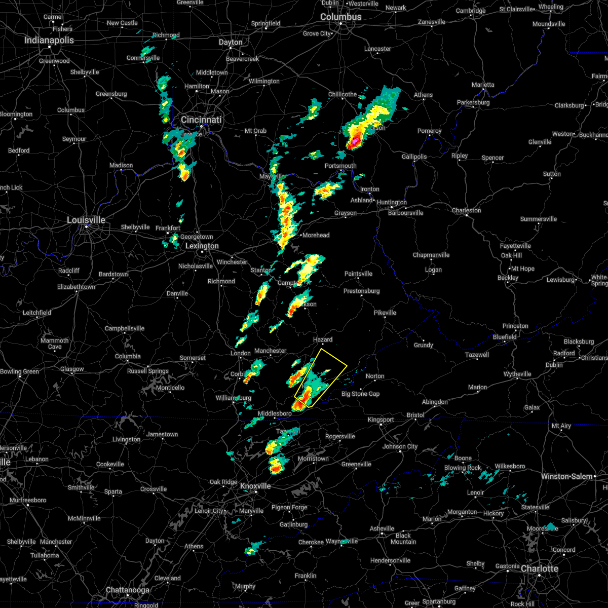 At 222 pm edt, a severe thunderstorm was located over white star, or near harlan, moving northeast at 45 mph (radar indicated). Hazards include 60 mph wind gusts and quarter size hail. Hail damage to vehicles is expected. expect wind damage to roofs, siding, and trees. this severe thunderstorm will be near, golden ash around 230 pm edt. putney around 235 pm edt. pine mountain around 240 pm edt. Other locations in the path of this severe thunderstorm include arthur, leatherwood and slemp. At 222 pm edt, a severe thunderstorm was located over white star, or near harlan, moving northeast at 45 mph (radar indicated). Hazards include 60 mph wind gusts and quarter size hail. Hail damage to vehicles is expected. expect wind damage to roofs, siding, and trees. this severe thunderstorm will be near, golden ash around 230 pm edt. putney around 235 pm edt. pine mountain around 240 pm edt. Other locations in the path of this severe thunderstorm include arthur, leatherwood and slemp.
|
| 8/14/2021 8:41 PM EDT |
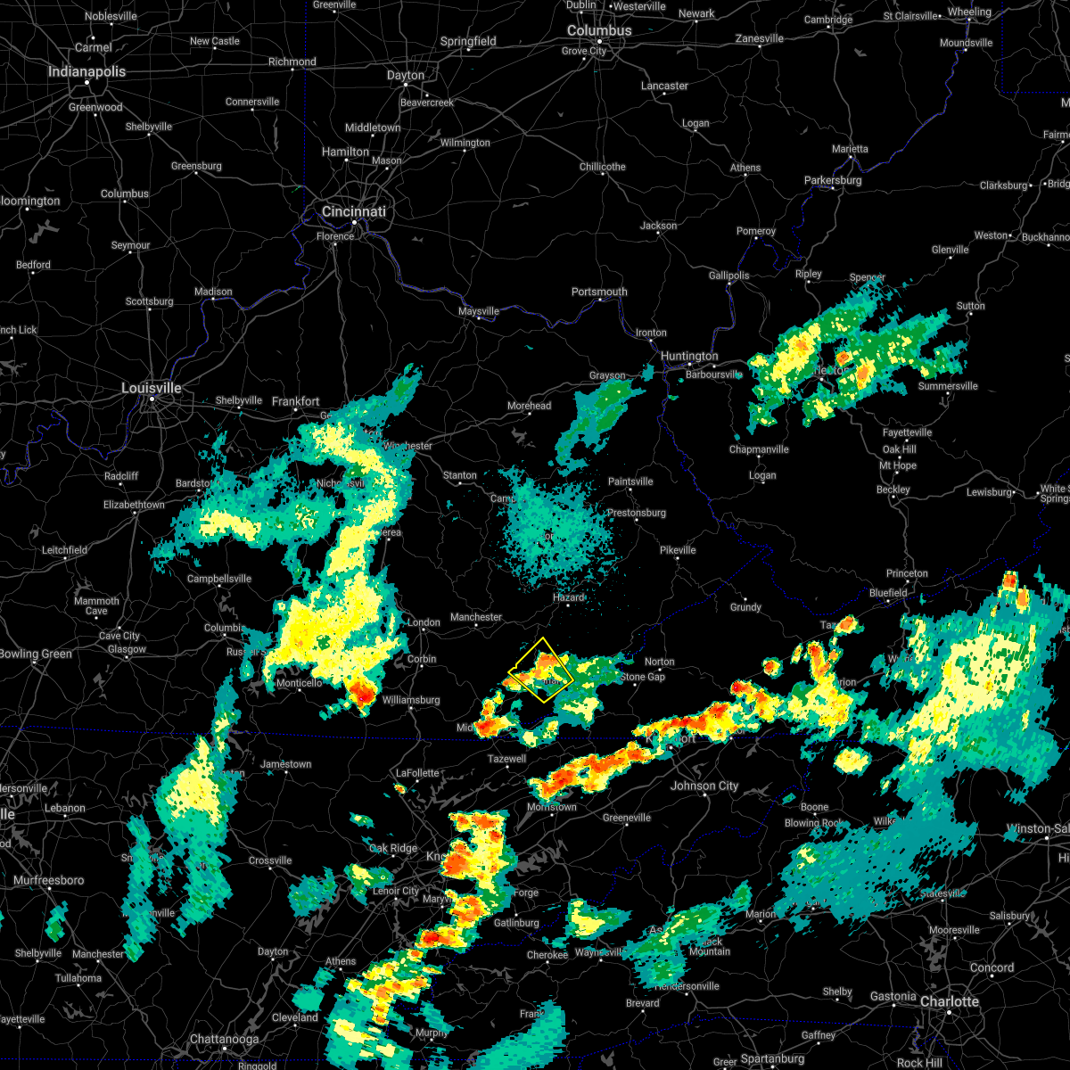 The severe thunderstorm warning for northwestern harlan, northeastern bell and southern leslie counties will expire at 845 pm edt, the storm which prompted the warning has weakened below severe limits, and no longer poses an immediate threat to life or property. therefore, the warning will be allowed to expire. however heavy rain is still possible with this thunderstorm. The severe thunderstorm warning for northwestern harlan, northeastern bell and southern leslie counties will expire at 845 pm edt, the storm which prompted the warning has weakened below severe limits, and no longer poses an immediate threat to life or property. therefore, the warning will be allowed to expire. however heavy rain is still possible with this thunderstorm.
|
| 8/14/2021 8:16 PM EDT |
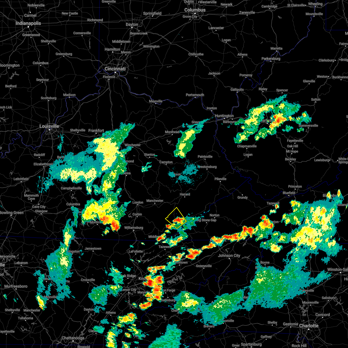 At 816 pm edt, a severe thunderstorm was located over bledsoe, or near harlan, moving northwest at 15 mph (radar indicated). Hazards include 60 mph wind gusts and quarter size hail. Hail damage to vehicles is expected. expect wind damage to roofs, siding, and trees. this severe storm will be near, bledsoe around 820 pm edt. other locations in the path of this severe thunderstorm include spruce pine and warbranch. hail threat, radar indicated max hail size, 1. 00 in wind threat, radar indicated max wind gust, 60 mph. At 816 pm edt, a severe thunderstorm was located over bledsoe, or near harlan, moving northwest at 15 mph (radar indicated). Hazards include 60 mph wind gusts and quarter size hail. Hail damage to vehicles is expected. expect wind damage to roofs, siding, and trees. this severe storm will be near, bledsoe around 820 pm edt. other locations in the path of this severe thunderstorm include spruce pine and warbranch. hail threat, radar indicated max hail size, 1. 00 in wind threat, radar indicated max wind gust, 60 mph.
|
| 8/14/2021 8:09 PM EDT |
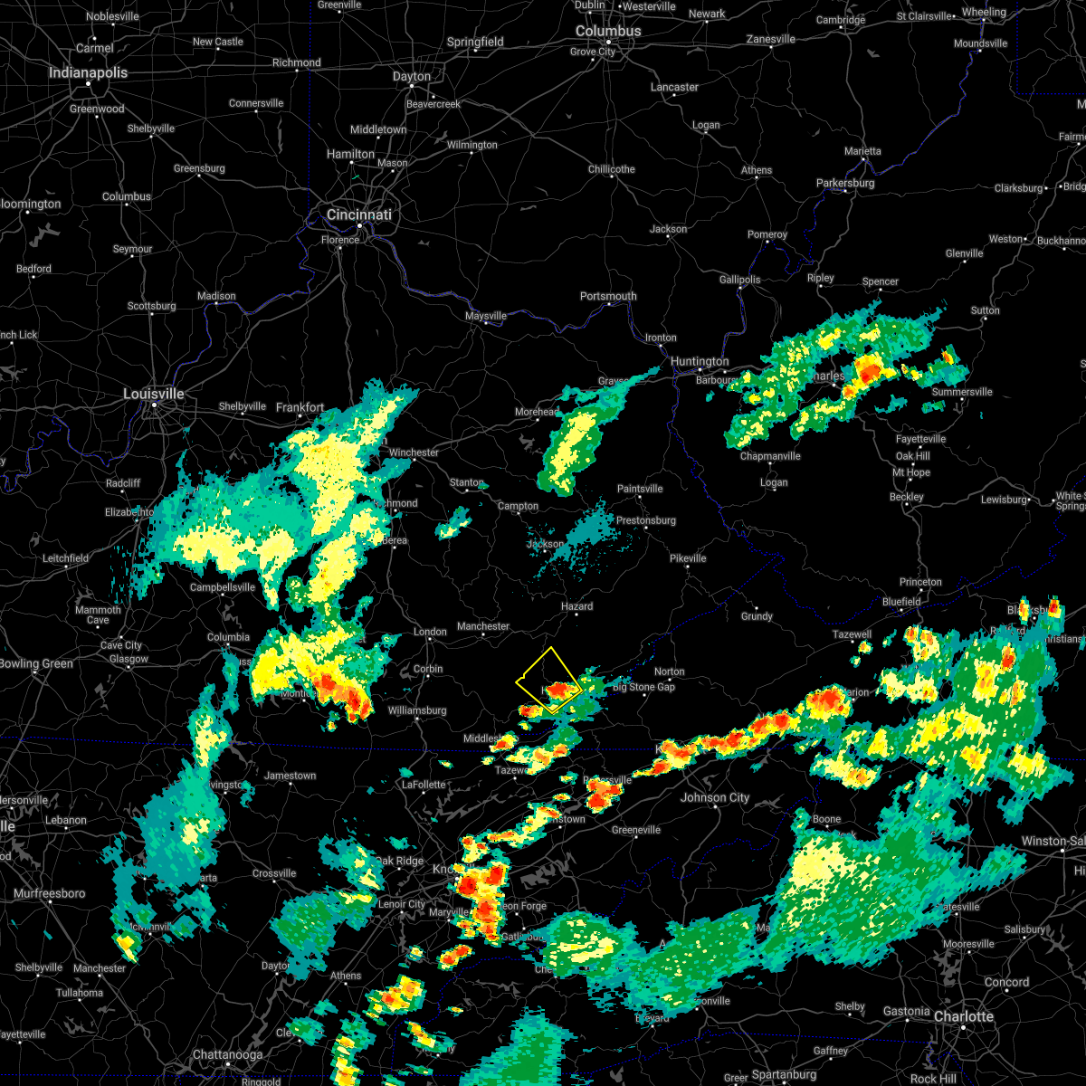 At 808 pm edt, a severe thunderstorm was located over baxter, or near harlan, moving northwest at 20 mph (radar indicated). Hazards include 60 mph wind gusts and quarter size hail. Hail damage to vehicles is expected. expect wind damage to roofs, siding, and trees. this severe thunderstorm will be near, bledsoe around 820 pm edt. spruce pine around 825 pm edt. other locations in the path of this severe thunderstorm include warbranch. hail threat, radar indicated max hail size, 1. 00 in wind threat, radar indicated max wind gust, 60 mph. At 808 pm edt, a severe thunderstorm was located over baxter, or near harlan, moving northwest at 20 mph (radar indicated). Hazards include 60 mph wind gusts and quarter size hail. Hail damage to vehicles is expected. expect wind damage to roofs, siding, and trees. this severe thunderstorm will be near, bledsoe around 820 pm edt. spruce pine around 825 pm edt. other locations in the path of this severe thunderstorm include warbranch. hail threat, radar indicated max hail size, 1. 00 in wind threat, radar indicated max wind gust, 60 mph.
|
| 8/7/2021 4:07 PM EDT |
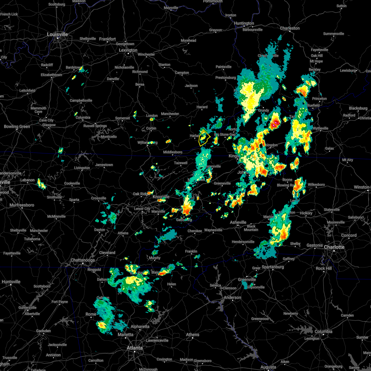 At 406 pm edt, a severe thunderstorm was located over putney, or 7 miles northeast of harlan, and is nearly stationary (radar indicated). Hazards include 60 mph wind gusts. Expect damage to roofs, siding, and trees. locations impacted include, evarts, bobs creek, black mountain, dizney, bailey creek, verda, cranks, short town, kenvir, darkmont, highsplint and colts. hail threat, radar indicated max hail size, <. 75 in wind threat, radar indicated max wind gust, 60 mph. At 406 pm edt, a severe thunderstorm was located over putney, or 7 miles northeast of harlan, and is nearly stationary (radar indicated). Hazards include 60 mph wind gusts. Expect damage to roofs, siding, and trees. locations impacted include, evarts, bobs creek, black mountain, dizney, bailey creek, verda, cranks, short town, kenvir, darkmont, highsplint and colts. hail threat, radar indicated max hail size, <. 75 in wind threat, radar indicated max wind gust, 60 mph.
|
| 8/7/2021 3:56 PM EDT |
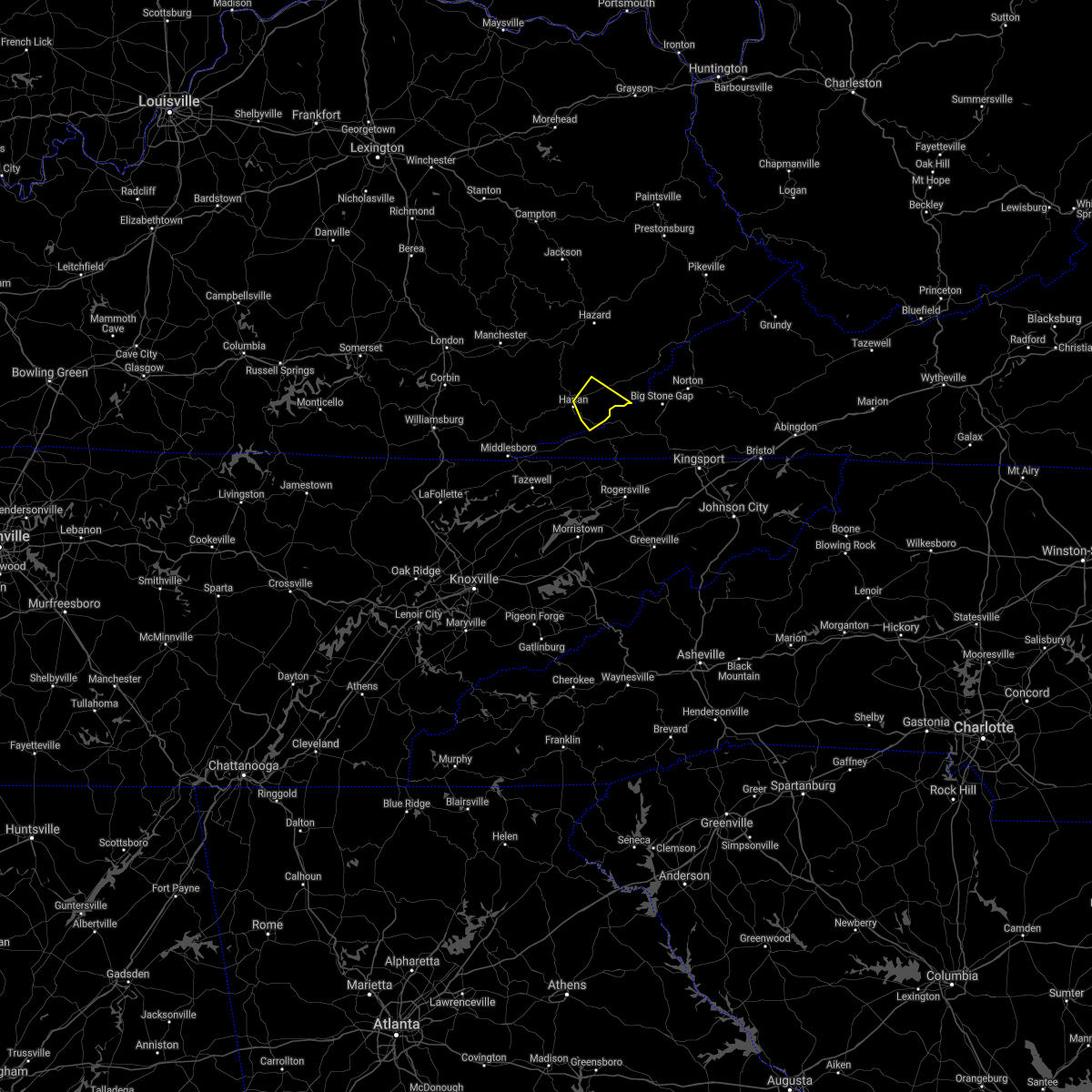 At 343 pm edt, a severe thunderstorm was located over putney, or near harlan, and is nearly stationary (radar indicated). Hazards include 60 mph wind gusts and quarter size hail. Hail damage to vehicles is expected. Expect wind damage to roofs, siding, and trees. At 343 pm edt, a severe thunderstorm was located over putney, or near harlan, and is nearly stationary (radar indicated). Hazards include 60 mph wind gusts and quarter size hail. Hail damage to vehicles is expected. Expect wind damage to roofs, siding, and trees.
|
| 8/7/2021 3:43 PM EDT |
 At 343 pm edt, a severe thunderstorm was located over putney, or near harlan, and is nearly stationary (radar indicated). Hazards include 60 mph wind gusts and quarter size hail. Hail damage to vehicles is expected. Expect wind damage to roofs, siding, and trees. At 343 pm edt, a severe thunderstorm was located over putney, or near harlan, and is nearly stationary (radar indicated). Hazards include 60 mph wind gusts and quarter size hail. Hail damage to vehicles is expected. Expect wind damage to roofs, siding, and trees.
|
| 6/21/2020 5:10 PM EDT |
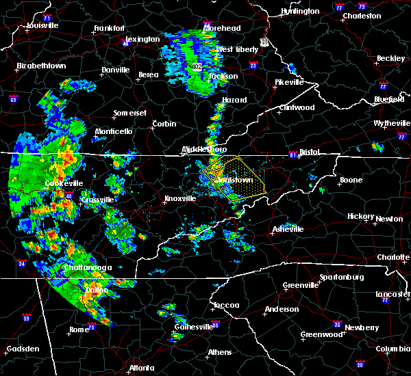 At 510 pm edt, a severe thunderstorm was located over hensley store, or 9 miles south of harlan, moving northeast at 30 mph (radar indicated). Hazards include 60 mph wind gusts and quarter size hail. Hail damage to vehicles is expected. Expect wind damage to roofs, siding, and trees. At 510 pm edt, a severe thunderstorm was located over hensley store, or 9 miles south of harlan, moving northeast at 30 mph (radar indicated). Hazards include 60 mph wind gusts and quarter size hail. Hail damage to vehicles is expected. Expect wind damage to roofs, siding, and trees.
|
| 4/25/2020 6:35 PM EDT |
 At 634 pm edt, a severe thunderstorm capable of producing a tornado was located over sandy fork, or 12 miles northwest of harlan, moving east at 35 mph (radar indicated rotation). Hazards include tornado and quarter size hail. Flying debris will be dangerous to those caught without shelter. mobile homes will be damaged or destroyed. damage to roofs, windows, and vehicles will occur. tree damage is likely. this dangerous storm will be near, warbranch around 640 pm edt. mozelle around 645 pm edt. chappell around 650 pm edt. Napier around 700 pm edt. At 634 pm edt, a severe thunderstorm capable of producing a tornado was located over sandy fork, or 12 miles northwest of harlan, moving east at 35 mph (radar indicated rotation). Hazards include tornado and quarter size hail. Flying debris will be dangerous to those caught without shelter. mobile homes will be damaged or destroyed. damage to roofs, windows, and vehicles will occur. tree damage is likely. this dangerous storm will be near, warbranch around 640 pm edt. mozelle around 645 pm edt. chappell around 650 pm edt. Napier around 700 pm edt.
|
| 4/25/2020 6:19 PM EDT |
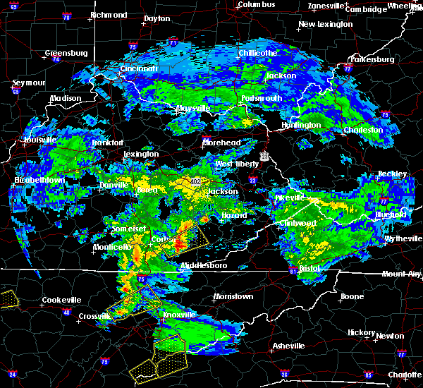 At 619 pm edt, a severe thunderstorm capable of producing a tornado was located over erose, or 11 miles north of pineville, moving east at 35 mph (radar indicated rotation). Hazards include tornado and quarter size hail. Flying debris will be dangerous to those caught without shelter. mobile homes will be damaged or destroyed. damage to roofs, windows, and vehicles will occur. tree damage is likely. this dangerous storm will be near, sandy fork around 630 pm edt. spruce pine around 635 pm edt. mozelle around 640 pm edt. Bledsoe around 645 pm edt. At 619 pm edt, a severe thunderstorm capable of producing a tornado was located over erose, or 11 miles north of pineville, moving east at 35 mph (radar indicated rotation). Hazards include tornado and quarter size hail. Flying debris will be dangerous to those caught without shelter. mobile homes will be damaged or destroyed. damage to roofs, windows, and vehicles will occur. tree damage is likely. this dangerous storm will be near, sandy fork around 630 pm edt. spruce pine around 635 pm edt. mozelle around 640 pm edt. Bledsoe around 645 pm edt.
|
| 4/9/2020 1:52 AM EDT |
 At 152 am edt, severe thunderstorms were located along a line extending from hinch to near garden village to democrat to hoskinston, moving southeast at 55 mph (radar indicated). Hazards include 60 mph wind gusts and penny size hail. expect damage to roofs, siding, and trees At 152 am edt, severe thunderstorms were located along a line extending from hinch to near garden village to democrat to hoskinston, moving southeast at 55 mph (radar indicated). Hazards include 60 mph wind gusts and penny size hail. expect damage to roofs, siding, and trees
|
| 7/31/2019 3:26 PM EDT |
 The severe thunderstorm warning for central harlan county will expire at 330 pm edt, the storm which prompted the warning has weakened below severe limits, and has been replaced by a special weather statement. therefore, the warning will be allowed to expire. however gusty winds and heavy rain are still possible with this thunderstorm. to report severe weather, contact your nearest law enforcement agency. they will relay your report to the national weather service jackson ky. The severe thunderstorm warning for central harlan county will expire at 330 pm edt, the storm which prompted the warning has weakened below severe limits, and has been replaced by a special weather statement. therefore, the warning will be allowed to expire. however gusty winds and heavy rain are still possible with this thunderstorm. to report severe weather, contact your nearest law enforcement agency. they will relay your report to the national weather service jackson ky.
|
| 7/31/2019 3:08 PM EDT |
 At 307 pm edt, a severe thunderstorm was located over ages, or near harlan, moving southeast at 15 mph (radar indicated). Hazards include 60 mph wind gusts and quarter size hail. Hail damage to vehicles is expected. expect wind damage to roofs, siding, and trees. Locations impacted include, harlan, loyall, evarts, clovertown, bobs creek, bledsoe, mary alice, dizney, chevrolet, sunshine, coxton and short town. At 307 pm edt, a severe thunderstorm was located over ages, or near harlan, moving southeast at 15 mph (radar indicated). Hazards include 60 mph wind gusts and quarter size hail. Hail damage to vehicles is expected. expect wind damage to roofs, siding, and trees. Locations impacted include, harlan, loyall, evarts, clovertown, bobs creek, bledsoe, mary alice, dizney, chevrolet, sunshine, coxton and short town.
|
| 7/31/2019 2:48 PM EDT |
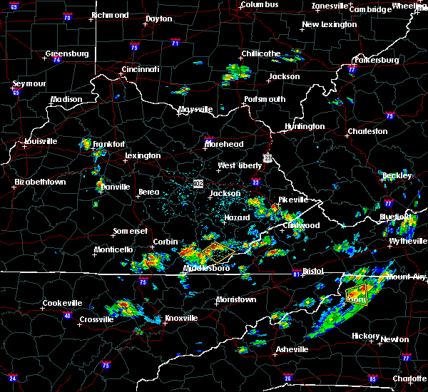 At 248 pm edt, a severe thunderstorm was located over rosspoint, or near harlan, moving southeast at 15 mph (radar indicated). Hazards include 60 mph wind gusts and quarter size hail. Hail damage to vehicles is expected. Expect wind damage to roofs, siding, and trees. At 248 pm edt, a severe thunderstorm was located over rosspoint, or near harlan, moving southeast at 15 mph (radar indicated). Hazards include 60 mph wind gusts and quarter size hail. Hail damage to vehicles is expected. Expect wind damage to roofs, siding, and trees.
|
| 6/28/2019 7:13 PM EDT |
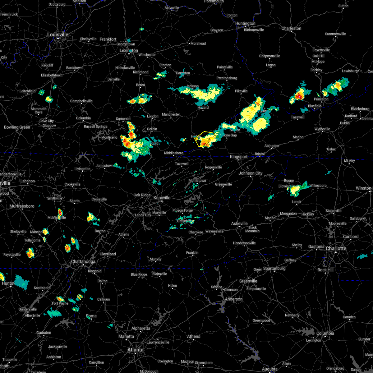 The severe thunderstorm warning for central harlan county will expire at 715 pm edt, the storms which prompted the warning have weakened below severe limits, and no longer pose an immediate threat to life or property. therefore, the warning will be allowed to expire. however gusty winds are still possible with these thunderstorms. The severe thunderstorm warning for central harlan county will expire at 715 pm edt, the storms which prompted the warning have weakened below severe limits, and no longer pose an immediate threat to life or property. therefore, the warning will be allowed to expire. however gusty winds are still possible with these thunderstorms.
|
| 6/28/2019 6:52 PM EDT |
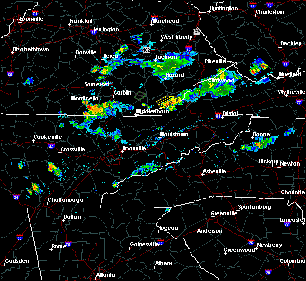 At 652 pm edt, severe thunderstorms were located along a line extending from highsplint to black mountain to crummies, moving west at 10 mph (radar indicated). Hazards include 60 mph wind gusts and quarter size hail. Hail damage to vehicles is expected. expect wind damage to roofs, siding, and trees. Locations impacted include, harlan, evarts, clovertown, bobs creek, black bottom, dizney, chevrolet, sunshine, louellen, coxton, short town and kenvir. At 652 pm edt, severe thunderstorms were located along a line extending from highsplint to black mountain to crummies, moving west at 10 mph (radar indicated). Hazards include 60 mph wind gusts and quarter size hail. Hail damage to vehicles is expected. expect wind damage to roofs, siding, and trees. Locations impacted include, harlan, evarts, clovertown, bobs creek, black bottom, dizney, chevrolet, sunshine, louellen, coxton, short town and kenvir.
|
| 6/28/2019 6:32 PM EDT |
 At 632 pm edt, severe thunderstorms were located along a line extending from clover-darby to dizney to near cranks, moving west at 10 mph (radar indicated). Hazards include 60 mph wind gusts and quarter size hail. Hail damage to vehicles is expected. Expect wind damage to roofs, siding, and trees. At 632 pm edt, severe thunderstorms were located along a line extending from clover-darby to dizney to near cranks, moving west at 10 mph (radar indicated). Hazards include 60 mph wind gusts and quarter size hail. Hail damage to vehicles is expected. Expect wind damage to roofs, siding, and trees.
|
| 6/22/2019 12:17 AM EDT |
 A severe thunderstorm warning remains in effect until 1230 am edt for harlan. letcher. southeastern leslie and southeastern perry counties. at 1215 am edt, severe thunderstorms were located along a line extending from chappell to near jonesville, moving east at 45 mph. hazard. 60 mph wind gusts and penny size hail. A severe thunderstorm warning remains in effect until 1230 am edt for harlan. letcher. southeastern leslie and southeastern perry counties. at 1215 am edt, severe thunderstorms were located along a line extending from chappell to near jonesville, moving east at 45 mph. hazard. 60 mph wind gusts and penny size hail.
|
| 6/22/2019 12:14 AM EDT |
 A severe thunderstorm warning remains in effect until 1230 am edt for harlan. letcher. southern leslie. southeastern perry and south central knott counties. at 1213 am edt, severe thunderstorms were located along a line extending from chappell to near sneedville, moving east at 45 mph. hazard. 60 mph wind gusts and penny size hail. A severe thunderstorm warning remains in effect until 1230 am edt for harlan. letcher. southern leslie. southeastern perry and south central knott counties. at 1213 am edt, severe thunderstorms were located along a line extending from chappell to near sneedville, moving east at 45 mph. hazard. 60 mph wind gusts and penny size hail.
|
| 6/21/2019 11:51 PM EDT |
 The national weather service in jackson ky has issued a * severe thunderstorm warning for. harlan county in southeastern kentucky. northeastern bell county in southeastern kentucky. letcher county in southeastern kentucky. Leslie county in southeastern kentucky. The national weather service in jackson ky has issued a * severe thunderstorm warning for. harlan county in southeastern kentucky. northeastern bell county in southeastern kentucky. letcher county in southeastern kentucky. Leslie county in southeastern kentucky.
|
| 6/21/2019 11:51 PM EDT |
 At 1150 pm edt, severe thunderstorms were located along a line extending from ice cliff to 7 miles south of cubage, moving east at 45 mph (radar indicated). Hazards include 60 mph wind gusts and penny size hail. expect damage to roofs, siding, and trees At 1150 pm edt, severe thunderstorms were located along a line extending from ice cliff to 7 miles south of cubage, moving east at 45 mph (radar indicated). Hazards include 60 mph wind gusts and penny size hail. expect damage to roofs, siding, and trees
|
| 6/5/2019 7:40 PM EDT |
 At 711 pm edt, a severe thunderstorm was located over spruce pine, or 9 miles northwest of harlan, moving east at 30 mph (radar indicated). Hazards include 60 mph wind gusts and quarter size hail. Hail damage to vehicles is expected. expect wind damage to roofs, siding, and trees. Locations impacted include, harlan, loyall, evarts, wallins creek, clovertown, bobs creek, bledsoe, mary alice, totz, chevrolet, sunshine and coldiron. At 711 pm edt, a severe thunderstorm was located over spruce pine, or 9 miles northwest of harlan, moving east at 30 mph (radar indicated). Hazards include 60 mph wind gusts and quarter size hail. Hail damage to vehicles is expected. expect wind damage to roofs, siding, and trees. Locations impacted include, harlan, loyall, evarts, wallins creek, clovertown, bobs creek, bledsoe, mary alice, totz, chevrolet, sunshine and coldiron.
|
| 6/5/2019 7:11 PM EDT |
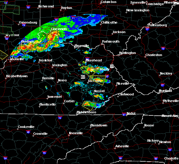 At 711 pm edt, a severe thunderstorm was located over spruce pine, or 9 miles northwest of harlan, moving east at 30 mph (radar indicated). Hazards include 60 mph wind gusts and quarter size hail. Hail damage to vehicles is expected. expect wind damage to roofs, siding, and trees. Locations impacted include, harlan, loyall, evarts, wallins creek, clovertown, bobs creek, bledsoe, mary alice, totz, chevrolet, sunshine and coldiron. At 711 pm edt, a severe thunderstorm was located over spruce pine, or 9 miles northwest of harlan, moving east at 30 mph (radar indicated). Hazards include 60 mph wind gusts and quarter size hail. Hail damage to vehicles is expected. expect wind damage to roofs, siding, and trees. Locations impacted include, harlan, loyall, evarts, wallins creek, clovertown, bobs creek, bledsoe, mary alice, totz, chevrolet, sunshine and coldiron.
|
| 6/5/2019 6:58 PM EDT |
 At 658 pm edt, a severe thunderstorm was located over sandy fork, or 12 miles northwest of harlan, moving southeast at 25 mph (radar indicated). Hazards include 60 mph wind gusts and quarter size hail. Hail damage to vehicles is expected. Expect wind damage to roofs, siding, and trees. At 658 pm edt, a severe thunderstorm was located over sandy fork, or 12 miles northwest of harlan, moving southeast at 25 mph (radar indicated). Hazards include 60 mph wind gusts and quarter size hail. Hail damage to vehicles is expected. Expect wind damage to roofs, siding, and trees.
|
| 8/8/2018 2:40 PM EDT |
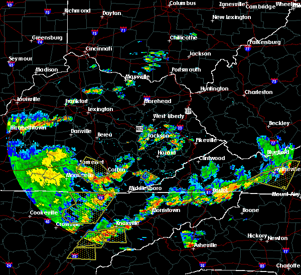 The severe thunderstorm warning for west central harlan and south central leslie counties will expire at 245 pm edt, the storm which prompted the warning has weakened below severe limits, and no longer poses an immediate threat to life or property. therefore, the warning will be allowed to expire. however gusty winds are still possible with this thunderstorm. The severe thunderstorm warning for west central harlan and south central leslie counties will expire at 245 pm edt, the storm which prompted the warning has weakened below severe limits, and no longer poses an immediate threat to life or property. therefore, the warning will be allowed to expire. however gusty winds are still possible with this thunderstorm.
|
| 8/8/2018 2:32 PM EDT |
 At 232 pm edt, a severe thunderstorm was located over bledsoe, or near harlan, moving northeast at 25 mph (radar indicated). Hazards include 60 mph wind gusts. Expect damage to roofs, siding, and trees. Locations impacted include, harlan, loyall, evarts, wallins creek, clovertown, rosspoint, bledsoe, kitts, baxter, sunshine, ages and coxton. At 232 pm edt, a severe thunderstorm was located over bledsoe, or near harlan, moving northeast at 25 mph (radar indicated). Hazards include 60 mph wind gusts. Expect damage to roofs, siding, and trees. Locations impacted include, harlan, loyall, evarts, wallins creek, clovertown, rosspoint, bledsoe, kitts, baxter, sunshine, ages and coxton.
|
| 8/8/2018 2:14 PM EDT |
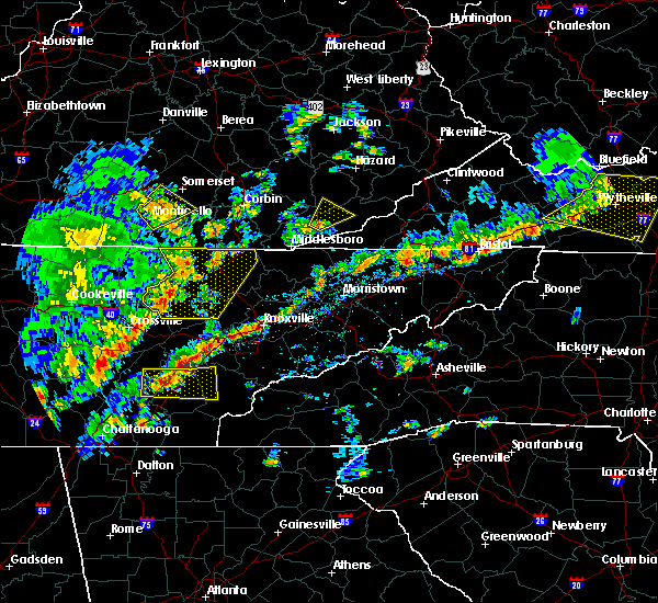 At 213 pm edt, a severe thunderstorm was located over molus, or 9 miles west of harlan, moving northeast at 25 mph (radar indicated). Hazards include 60 mph wind gusts. expect damage to roofs, siding, and trees At 213 pm edt, a severe thunderstorm was located over molus, or 9 miles west of harlan, moving northeast at 25 mph (radar indicated). Hazards include 60 mph wind gusts. expect damage to roofs, siding, and trees
|
| 7/20/2018 9:40 PM EDT |
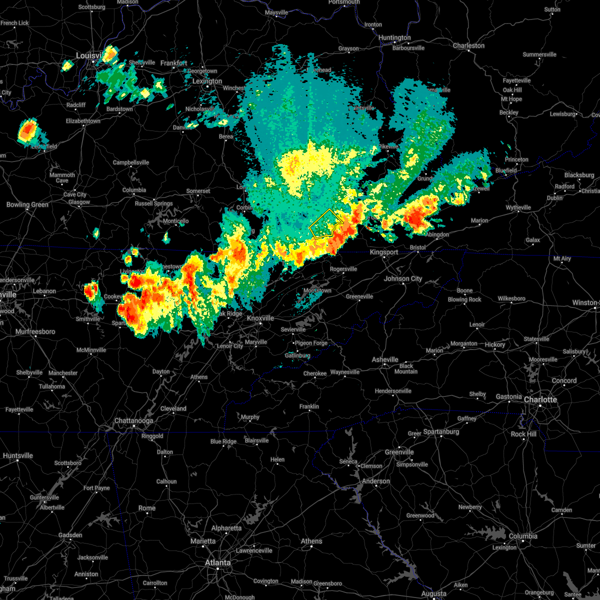 The severe thunderstorm warning for central harlan county will expire at 945 pm edt, the storm which prompted the warning has moved out of the area. therefore, the warning will be allowed to expire. however gusty winds are still possible with this thunderstorm. a severe thunderstorm watch remains in effect until 1000 pm edt for southeastern kentucky. to report severe weather, contact your nearest law enforcement agency. they will relay your report to the national weather service jackson ky. The severe thunderstorm warning for central harlan county will expire at 945 pm edt, the storm which prompted the warning has moved out of the area. therefore, the warning will be allowed to expire. however gusty winds are still possible with this thunderstorm. a severe thunderstorm watch remains in effect until 1000 pm edt for southeastern kentucky. to report severe weather, contact your nearest law enforcement agency. they will relay your report to the national weather service jackson ky.
|
| 7/20/2018 9:21 PM EDT |
 At 921 pm edt, a severe thunderstorm was located over coxton, or over harlan, moving southeast at 20 mph (radar indicated). Hazards include 60 mph wind gusts and penny size hail. Expect damage to roofs, siding, and trees. Locations impacted include, harlan, evarts, clovertown, bobs creek, mary alice, dizney, chevrolet, sunshine, coxton, short town, kenvir and darkmont. At 921 pm edt, a severe thunderstorm was located over coxton, or over harlan, moving southeast at 20 mph (radar indicated). Hazards include 60 mph wind gusts and penny size hail. Expect damage to roofs, siding, and trees. Locations impacted include, harlan, evarts, clovertown, bobs creek, mary alice, dizney, chevrolet, sunshine, coxton, short town, kenvir and darkmont.
|
| 7/20/2018 9:01 PM EDT |
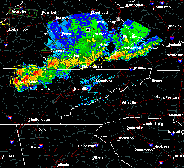 At 901 pm edt, a severe thunderstorm was located over bledsoe, or near harlan, moving southeast at 20 mph (radar indicated). Hazards include 70 mph wind gusts and quarter size hail. Hail damage to vehicles is expected. expect considerable tree damage. Wind damage is also likely to mobile homes, roofs, and outbuildings. At 901 pm edt, a severe thunderstorm was located over bledsoe, or near harlan, moving southeast at 20 mph (radar indicated). Hazards include 70 mph wind gusts and quarter size hail. Hail damage to vehicles is expected. expect considerable tree damage. Wind damage is also likely to mobile homes, roofs, and outbuildings.
|
| 6/25/2018 1:28 PM EDT |
 At 127 pm edt, a severe thunderstorm was located over white star, or near harlan, moving east at 35 mph (radar indicated). Hazards include 60 mph wind gusts. Expect damage to roofs, siding, and trees. Locations impacted include, harlan, loyall, evarts, wallins creek, bobs creek, bledsoe, mary alice, dizney, chevrolet, varilla, coldiron and black snake. At 127 pm edt, a severe thunderstorm was located over white star, or near harlan, moving east at 35 mph (radar indicated). Hazards include 60 mph wind gusts. Expect damage to roofs, siding, and trees. Locations impacted include, harlan, loyall, evarts, wallins creek, bobs creek, bledsoe, mary alice, dizney, chevrolet, varilla, coldiron and black snake.
|
| 6/25/2018 1:09 PM EDT |
 At 108 pm edt, a severe thunderstorm was located over kettle island, or near pineville, moving east at 35 mph (radar indicated). Hazards include 60 mph wind gusts. expect damage to roofs, siding, and trees At 108 pm edt, a severe thunderstorm was located over kettle island, or near pineville, moving east at 35 mph (radar indicated). Hazards include 60 mph wind gusts. expect damage to roofs, siding, and trees
|
| 6/24/2018 6:52 PM EDT |
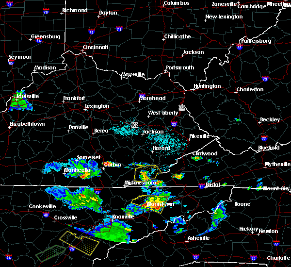 The severe thunderstorm warning for harlan, east central bell and southeastern leslie counties will expire at 700 pm edt, the storms which prompted the warning have weakened below severe limits, and no longer pose an immediate threat to life or property. therefore, the warning will be allowed to expire. however gusty winds are still possible with these thunderstorms. The severe thunderstorm warning for harlan, east central bell and southeastern leslie counties will expire at 700 pm edt, the storms which prompted the warning have weakened below severe limits, and no longer pose an immediate threat to life or property. therefore, the warning will be allowed to expire. however gusty winds are still possible with these thunderstorms.
|
| 6/24/2018 6:45 PM EDT |
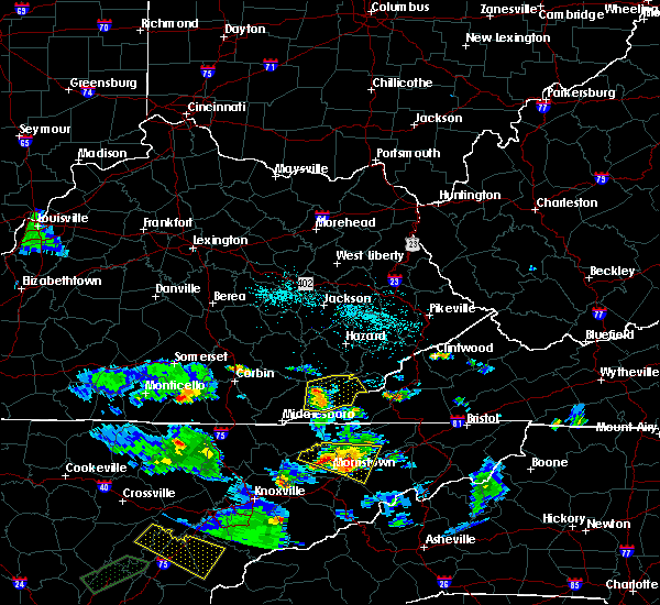 At 644 pm edt, severe thunderstorms were located along a line extending from bledsoe to grays knob to liggett, moving east at 35 mph (radar indicated). Hazards include 60 mph wind gusts. Expect damage to roofs, siding, and trees. Locations impacted include, harlan, loyall, evarts, wallins creek, bobs creek, bledsoe, mary alice, dizney, chevrolet, louellen, coldiron and black snake. At 644 pm edt, severe thunderstorms were located along a line extending from bledsoe to grays knob to liggett, moving east at 35 mph (radar indicated). Hazards include 60 mph wind gusts. Expect damage to roofs, siding, and trees. Locations impacted include, harlan, loyall, evarts, wallins creek, bobs creek, bledsoe, mary alice, dizney, chevrolet, louellen, coldiron and black snake.
|
| 6/24/2018 6:21 PM EDT |
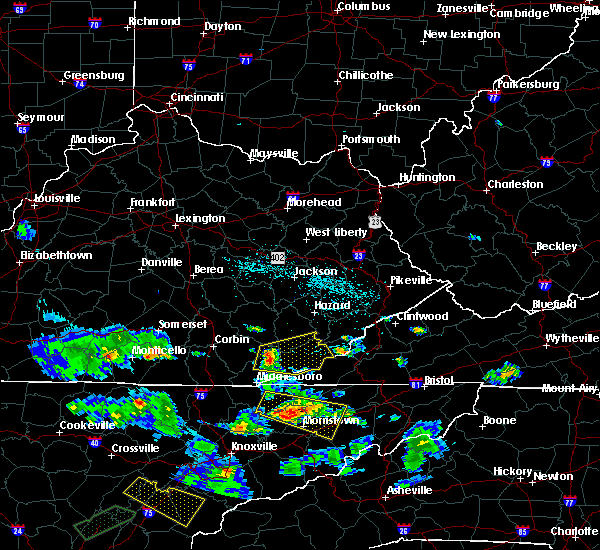 At 621 pm edt, severe thunderstorms were located along a line extending from near beverly to stony fork junction to near varilla, moving east at 30 mph (radar indicated). Hazards include 60 mph wind gusts and quarter size hail. Hail damage to vehicles is expected. Expect wind damage to roofs, siding, and trees. At 621 pm edt, severe thunderstorms were located along a line extending from near beverly to stony fork junction to near varilla, moving east at 30 mph (radar indicated). Hazards include 60 mph wind gusts and quarter size hail. Hail damage to vehicles is expected. Expect wind damage to roofs, siding, and trees.
|
| 4/4/2018 1:38 AM EDT |
 At 137 am edt, severe thunderstorms were located along a line extending from tillie to near pennington gap, moving east at 60 mph (radar indicated). Hazards include 60 mph wind gusts. Expect damage to roofs, siding, and trees. Locations impacted include, whitesburg, letcher, cumberland, jenkins, elkhorn city, evarts, fleming-neon, lynch, benham, blackey, bobs creek, van, dizney, colly, louellen, premium, sergent, gilley, clutts and shields. At 137 am edt, severe thunderstorms were located along a line extending from tillie to near pennington gap, moving east at 60 mph (radar indicated). Hazards include 60 mph wind gusts. Expect damage to roofs, siding, and trees. Locations impacted include, whitesburg, letcher, cumberland, jenkins, elkhorn city, evarts, fleming-neon, lynch, benham, blackey, bobs creek, van, dizney, colly, louellen, premium, sergent, gilley, clutts and shields.
|
| 4/4/2018 1:28 AM EDT |
 At 126 am edt, severe thunderstorms were located along a line extending from ulvah to martins fork lake, moving east at 60 mph (62 mph gust reported at harlan awos). Hazards include 60 mph wind gusts. Expect damage to roofs, siding, and trees. Locations impacted include, whitesburg, harlan, letcher, cumberland, jenkins, loyall, elkhorn city, evarts, fleming-neon, lynch, benham, blackey, big fork, bobs creek, leatherwood, van, dizney, colly, louellen and premium. At 126 am edt, severe thunderstorms were located along a line extending from ulvah to martins fork lake, moving east at 60 mph (62 mph gust reported at harlan awos). Hazards include 60 mph wind gusts. Expect damage to roofs, siding, and trees. Locations impacted include, whitesburg, harlan, letcher, cumberland, jenkins, loyall, elkhorn city, evarts, fleming-neon, lynch, benham, blackey, big fork, bobs creek, leatherwood, van, dizney, colly, louellen and premium.
|
| 4/4/2018 1:24 AM EDT |
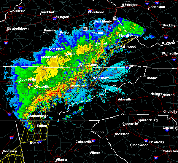 The severe thunderstorm warning for harlan, southeastern bell and southern leslie counties will expire at 130 am edt, a new warning has been issued for portions of the warning area. therefore, the warning will be allowed to expire. keep in mind that severe winds are still possible with these thunderstorms. a severe thunderstorm watch remains in effect until 300 am edt for southeastern kentucky. The severe thunderstorm warning for harlan, southeastern bell and southern leslie counties will expire at 130 am edt, a new warning has been issued for portions of the warning area. therefore, the warning will be allowed to expire. keep in mind that severe winds are still possible with these thunderstorms. a severe thunderstorm watch remains in effect until 300 am edt for southeastern kentucky.
|
| 4/4/2018 1:18 AM EDT |
 At 118 am edt, severe thunderstorms were located along a line extending from big rock to near peepace store, moving east at 60 mph (radar indicated). Hazards include 60 mph wind gusts and quarter size hail. Hail damage to vehicles is expected. expect wind damage to roofs, siding, and trees. Locations impacted include, harlan, loyall, evarts, wallins creek, big fork, bobs creek, bledsoe, mary alice, arthur, chevrolet, varilla, coldiron, black snake, saylor, elcomb, napier, cubage, white star, yeaddiss and hutch. At 118 am edt, severe thunderstorms were located along a line extending from big rock to near peepace store, moving east at 60 mph (radar indicated). Hazards include 60 mph wind gusts and quarter size hail. Hail damage to vehicles is expected. expect wind damage to roofs, siding, and trees. Locations impacted include, harlan, loyall, evarts, wallins creek, big fork, bobs creek, bledsoe, mary alice, arthur, chevrolet, varilla, coldiron, black snake, saylor, elcomb, napier, cubage, white star, yeaddiss and hutch.
|
| 4/4/2018 1:14 AM EDT |
 At 114 am edt, severe thunderstorms were located along a line extending from cutshin to near hensley store, moving east at 60 mph (radar indicated). Hazards include 60 mph wind gusts. expect damage to roofs, siding, and trees At 114 am edt, severe thunderstorms were located along a line extending from cutshin to near hensley store, moving east at 60 mph (radar indicated). Hazards include 60 mph wind gusts. expect damage to roofs, siding, and trees
|
| 4/4/2018 1:08 AM EDT |
 At 107 am edt, severe thunderstorms were located along a line extending from chappell to near cubage, moving east at 60 mph (radar indicated). Hazards include 60 mph wind gusts and quarter size hail. Hail damage to vehicles is expected. expect wind damage to roofs, siding, and trees. Locations impacted include, harlan, pineville, middlesboro, loyall, evarts, wallins creek, big fork, bobs creek, sandy fork, bledsoe, varilla, coldiron, ponza, black snake, erose, blanche, napier, cubage, rella and wasioto. At 107 am edt, severe thunderstorms were located along a line extending from chappell to near cubage, moving east at 60 mph (radar indicated). Hazards include 60 mph wind gusts and quarter size hail. Hail damage to vehicles is expected. expect wind damage to roofs, siding, and trees. Locations impacted include, harlan, pineville, middlesboro, loyall, evarts, wallins creek, big fork, bobs creek, sandy fork, bledsoe, varilla, coldiron, ponza, black snake, erose, blanche, napier, cubage, rella and wasioto.
|
| 4/4/2018 12:41 AM EDT |
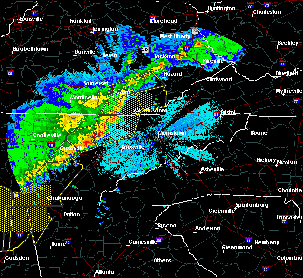 At 1240 am edt, severe thunderstorms were located along a line extending from green road to pearl, moving east at 60 mph (radar indicated). Hazards include 60 mph wind gusts and quarter size hail. Hail damage to vehicles is expected. Expect wind damage to roofs, siding, and trees. At 1240 am edt, severe thunderstorms were located along a line extending from green road to pearl, moving east at 60 mph (radar indicated). Hazards include 60 mph wind gusts and quarter size hail. Hail damage to vehicles is expected. Expect wind damage to roofs, siding, and trees.
|
| 7/6/2017 7:16 PM EDT |
 At 716 pm edt, severe thunderstorms were located along a line extending from redfox to lynch to near cranks, moving east at 55 mph (radar indicated). Hazards include 60 mph wind gusts. Expect damage to roofs, siding, and trees. Locations impacted include, whitesburg, harlan, letcher, cumberland, evarts, lynch, benham, blackey, bobs creek, van, dizney, colly, louellen, premium, clutts, shields, black mountain, smith, whitco and southdown. At 716 pm edt, severe thunderstorms were located along a line extending from redfox to lynch to near cranks, moving east at 55 mph (radar indicated). Hazards include 60 mph wind gusts. Expect damage to roofs, siding, and trees. Locations impacted include, whitesburg, harlan, letcher, cumberland, evarts, lynch, benham, blackey, bobs creek, van, dizney, colly, louellen, premium, clutts, shields, black mountain, smith, whitco and southdown.
|
| 7/6/2017 7:06 PM EDT | A tree was repoted to have been blown down onto powerlines. the time of the event is estimated from radar dat in harlan county KY, 0.6 miles ENE of Evarts, KY |
| 7/6/2017 7:01 PM EDT |
 At 701 pm edt, severe thunderstorms were located along a line extending from diablock to arthur to mary alice, moving east at 55 mph (radar indicated). Hazards include 60 mph wind gusts and quarter size hail. Hail damage to vehicles is expected. Expect wind damage to roofs, siding, and trees. At 701 pm edt, severe thunderstorms were located along a line extending from diablock to arthur to mary alice, moving east at 55 mph (radar indicated). Hazards include 60 mph wind gusts and quarter size hail. Hail damage to vehicles is expected. Expect wind damage to roofs, siding, and trees.
|
| 7/6/2017 6:47 PM EDT |
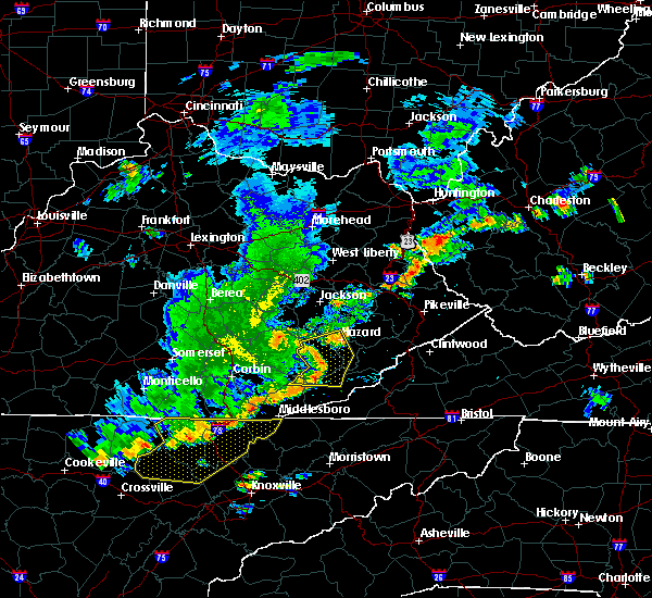 At 647 pm edt, severe thunderstorms were located along a line extending from dryhill to near cinda to near warbranch, moving east at 50 mph (radar indicated). Hazards include 60 mph wind gusts and quarter size hail. Hail damage to vehicles is expected. expect wind damage to roofs, siding, and trees. Locations impacted include, hazard, hyden, evarts, big fork, sandy fork, leatherwood, hoskinston, bledsoe, arthur, viper, daley, beverly, saylor, thousandsticks, napier, stinnett, avawam, yeaddiss, warbranch and rosspoint. At 647 pm edt, severe thunderstorms were located along a line extending from dryhill to near cinda to near warbranch, moving east at 50 mph (radar indicated). Hazards include 60 mph wind gusts and quarter size hail. Hail damage to vehicles is expected. expect wind damage to roofs, siding, and trees. Locations impacted include, hazard, hyden, evarts, big fork, sandy fork, leatherwood, hoskinston, bledsoe, arthur, viper, daley, beverly, saylor, thousandsticks, napier, stinnett, avawam, yeaddiss, warbranch and rosspoint.
|
| 7/6/2017 6:22 PM EDT |
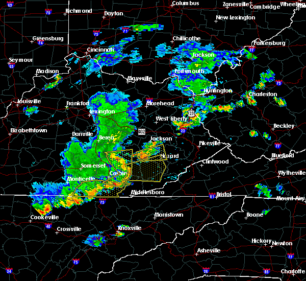 At 622 pm edt, severe thunderstorms were located along a line extending from near boho to lipps to barnyard, moving east at 50 mph (radar indicated). Hazards include 60 mph wind gusts and quarter size hail. Hail damage to vehicles is expected. Expect wind damage to roofs, siding, and trees. At 622 pm edt, severe thunderstorms were located along a line extending from near boho to lipps to barnyard, moving east at 50 mph (radar indicated). Hazards include 60 mph wind gusts and quarter size hail. Hail damage to vehicles is expected. Expect wind damage to roofs, siding, and trees.
|
| 6/13/2017 6:05 PM EDT | 2 trees were downe in harlan county KY, 8.5 miles SSE of Evarts, KY |
| 5/24/2017 12:39 PM EDT |
 At 1238 pm edt, a severe thunderstorm was located over lenarve, or near harlan, moving northeast at 30 mph (radar indicated). Hazards include 60 mph wind gusts and quarter size hail. Hail damage to vehicles is expected. Expect wind damage to roofs, siding, and trees. At 1238 pm edt, a severe thunderstorm was located over lenarve, or near harlan, moving northeast at 30 mph (radar indicated). Hazards include 60 mph wind gusts and quarter size hail. Hail damage to vehicles is expected. Expect wind damage to roofs, siding, and trees.
|
| 5/4/2017 11:55 PM EDT |
 At 1155 pm edt, severe thunderstorms were located along a line extending from tremont to three point to near jonesville to 6 miles north of rogersville, moving northeast at 45 mph (radar indicated). Hazards include 60 mph wind gusts and penny size hail. Expect damage to roofs, siding, and trees. Locations impacted include, harlan, cumberland, loyall, evarts, lynch, benham, wallins creek, big fork, bobs creek, leatherwood, bledsoe, dizney, louellen, coldiron, gilley, clutts, napier, shields, yeaddiss and black mountain. At 1155 pm edt, severe thunderstorms were located along a line extending from tremont to three point to near jonesville to 6 miles north of rogersville, moving northeast at 45 mph (radar indicated). Hazards include 60 mph wind gusts and penny size hail. Expect damage to roofs, siding, and trees. Locations impacted include, harlan, cumberland, loyall, evarts, lynch, benham, wallins creek, big fork, bobs creek, leatherwood, bledsoe, dizney, louellen, coldiron, gilley, clutts, napier, shields, yeaddiss and black mountain.
|
| 5/4/2017 11:36 PM EDT |
 At 1136 pm edt, severe thunderstorms were located along a line extending from cubage to 7 miles south of hensley store to near sneedville to near russellville, moving northeast at 45 mph (radar indicated). Hazards include 60 mph wind gusts and penny size hail. expect damage to roofs, siding, and trees At 1136 pm edt, severe thunderstorms were located along a line extending from cubage to 7 miles south of hensley store to near sneedville to near russellville, moving northeast at 45 mph (radar indicated). Hazards include 60 mph wind gusts and penny size hail. expect damage to roofs, siding, and trees
|
| 3/1/2017 10:40 AM EST |
 The severe thunderstorm warning for harlan, bell and southern leslie counties will expire at 1045 am est, the storms which prompted the warning have weakened below severe limits, and no longer pose an immediate threat to life or property. therefore the warning will be allowed to expire. a severe thunderstorm watch remains in effect until 100 pm est for south central and southeastern kentucky. The severe thunderstorm warning for harlan, bell and southern leslie counties will expire at 1045 am est, the storms which prompted the warning have weakened below severe limits, and no longer pose an immediate threat to life or property. therefore the warning will be allowed to expire. a severe thunderstorm watch remains in effect until 100 pm est for south central and southeastern kentucky.
|
| 3/1/2017 10:15 AM EST |
 At 1015 am est, severe thunderstorms were located along a line extending from dongola to near tremont to polly camp, moving southeast at 40 mph (radar indicated). Hazards include 60 mph wind gusts. Expect damage to roofs, siding, and trees. Locations impacted include, harlan, pineville, middlesboro, cumberland, loyall, evarts, wallins creek, bobs creek, sandy fork, bledsoe, dizney, varilla, louellen, coldiron, ponza, black snake, blanche, napier, cubage and rella. At 1015 am est, severe thunderstorms were located along a line extending from dongola to near tremont to polly camp, moving southeast at 40 mph (radar indicated). Hazards include 60 mph wind gusts. Expect damage to roofs, siding, and trees. Locations impacted include, harlan, pineville, middlesboro, cumberland, loyall, evarts, wallins creek, bobs creek, sandy fork, bledsoe, dizney, varilla, louellen, coldiron, ponza, black snake, blanche, napier, cubage and rella.
|
| 3/1/2017 9:52 AM EST |
 At 951 am est, severe thunderstorms were located along a line extending from wiscoal to ice cliff to krupp, moving southeast at 40 mph (radar indicated). Hazards include 60 mph wind gusts. expect damage to roofs, siding, and trees At 951 am est, severe thunderstorms were located along a line extending from wiscoal to ice cliff to krupp, moving southeast at 40 mph (radar indicated). Hazards include 60 mph wind gusts. expect damage to roofs, siding, and trees
|
| 8/15/2016 3:13 PM EDT |
 At 312 pm edt, severe thunderstorms were located along a line extending from 8 miles southwest of big stone gap to 6 miles south of clover fork to near pennington gap, moving north at 35 mph (radar indicated). Hazards include 60 mph wind gusts. Expect damage to roofs. siding. And trees. At 312 pm edt, severe thunderstorms were located along a line extending from 8 miles southwest of big stone gap to 6 miles south of clover fork to near pennington gap, moving north at 35 mph (radar indicated). Hazards include 60 mph wind gusts. Expect damage to roofs. siding. And trees.
|
| 7/8/2016 5:19 PM EDT |
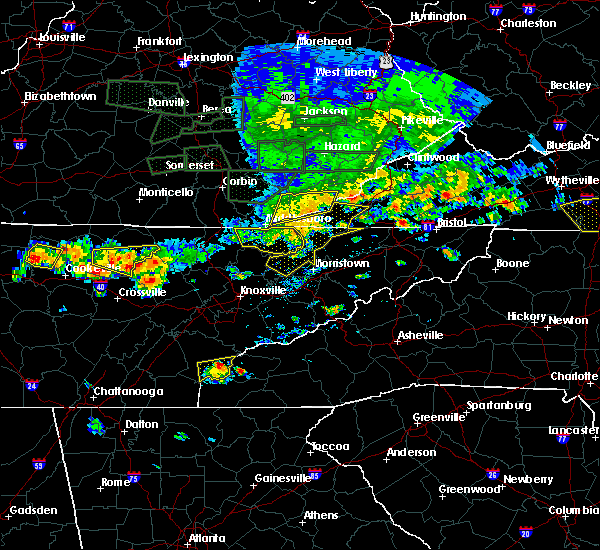 At 518 pm edt, a severe thunderstorm was located over cubage, or 11 miles east of pineville, moving east at 45 mph (radar indicated). Hazards include 60 mph wind gusts and penny size hail. Expect damage to roofs. siding. and trees. Locations impacted include, harlan, loyall, evarts, wallins creek, sunshine, rosspoint, smith, calvin, liggett, golden ash, stony fork junction, tway, shields, grays knob, hutch, peepace store, lenarve, kenvir, tacky town and ages. At 518 pm edt, a severe thunderstorm was located over cubage, or 11 miles east of pineville, moving east at 45 mph (radar indicated). Hazards include 60 mph wind gusts and penny size hail. Expect damage to roofs. siding. and trees. Locations impacted include, harlan, loyall, evarts, wallins creek, sunshine, rosspoint, smith, calvin, liggett, golden ash, stony fork junction, tway, shields, grays knob, hutch, peepace store, lenarve, kenvir, tacky town and ages.
|
| 7/8/2016 4:59 PM EDT |
 At 459 pm edt, a severe thunderstorm was located over ingram, or near pineville, moving east at 45 mph (radar indicated). Hazards include 60 mph wind gusts and penny size hail. Expect damage to roofs. siding. And trees. At 459 pm edt, a severe thunderstorm was located over ingram, or near pineville, moving east at 45 mph (radar indicated). Hazards include 60 mph wind gusts and penny size hail. Expect damage to roofs. siding. And trees.
|
| 5/7/2016 8:17 PM EDT |
 At 815 pm edt, severe thunderstorms were located along a line extending from crummies to 8 miles south of hensley store to near harrogate, moving southeast at 55 mph (law enforcement). Hazards include 60 mph wind gusts. Expect damage to roofs. siding. and trees. locations impacted include, harlan, pineville, middlesboro, cumberland, loyall, evarts, wallins creek, sunshine, rosspoint, smith, calvin, liggett, clover fork, golden ash, arthur, stony fork junction, big laurel, ponza, tway and shields. this includes u. s. Highway 25 east in bell county between mile markers 1 and 12. At 815 pm edt, severe thunderstorms were located along a line extending from crummies to 8 miles south of hensley store to near harrogate, moving southeast at 55 mph (law enforcement). Hazards include 60 mph wind gusts. Expect damage to roofs. siding. and trees. locations impacted include, harlan, pineville, middlesboro, cumberland, loyall, evarts, wallins creek, sunshine, rosspoint, smith, calvin, liggett, clover fork, golden ash, arthur, stony fork junction, big laurel, ponza, tway and shields. this includes u. s. Highway 25 east in bell county between mile markers 1 and 12.
|
| 5/7/2016 8:12 PM EDT | Trees... large limbs... and power lines were blown down at the junction of highways 221 and 51 in harlan county KY, 8.2 miles SSE of Evarts, KY |
| 5/7/2016 7:56 PM EDT |
 At 756 pm edt, severe thunderstorms were located along a line extending from spruce pine to miracle to near chenoa, moving southeast at 55 mph (law enforcement). Hazards include 60 mph wind gusts. Expect damage to roofs. siding. And trees. At 756 pm edt, severe thunderstorms were located along a line extending from spruce pine to miracle to near chenoa, moving southeast at 55 mph (law enforcement). Hazards include 60 mph wind gusts. Expect damage to roofs. siding. And trees.
|
| 7/14/2015 9:36 PM EDT |
 At 936 pm edt, severe thunderstorms were located along a line extending from 8 miles south of big stone gap to 8 miles southeast of cubage to meldrum to king, moving southeast at 35 mph (radar indicated). Hazards include 60 mph wind gusts and penny size hail. Expect damage to roofs. siding and trees. locations impacted include, barbourville, pineville, middlesboro, corbin, wallins creek, smith, calvin, clate, girdler, moore hill, south wallins, bertha station, stony fork junction, king, emmanuel, ponza, brush creek, artemus, cannon and erose. this includes the following highways, u. s. highway 25 east in bell county between mile markers 1 and 18. u. s. Highway 25 east in knox county between mile markers 1 and 19, and between mile markers 21 and 24. At 936 pm edt, severe thunderstorms were located along a line extending from 8 miles south of big stone gap to 8 miles southeast of cubage to meldrum to king, moving southeast at 35 mph (radar indicated). Hazards include 60 mph wind gusts and penny size hail. Expect damage to roofs. siding and trees. locations impacted include, barbourville, pineville, middlesboro, corbin, wallins creek, smith, calvin, clate, girdler, moore hill, south wallins, bertha station, stony fork junction, king, emmanuel, ponza, brush creek, artemus, cannon and erose. this includes the following highways, u. s. highway 25 east in bell county between mile markers 1 and 18. u. s. Highway 25 east in knox county between mile markers 1 and 19, and between mile markers 21 and 24.
|
| 7/14/2015 9:02 PM EDT |
 At 901 pm edt, severe thunderstorms were located along a line extending from day to delphia to near hosea, moving southeast at 35 mph (radar indicated). Hazards include 60 mph wind gusts and penny size hail. Expect damage to roofs. siding and trees. Locations impacted include, harlan, hyden, cumberland, evarts, lynch, benham, daley, wendover, shields, mozelle, kenvir, hoskinston, ages, rex, blackjoe, rhea, leonard, redbud, ten spot and clovertown. At 901 pm edt, severe thunderstorms were located along a line extending from day to delphia to near hosea, moving southeast at 35 mph (radar indicated). Hazards include 60 mph wind gusts and penny size hail. Expect damage to roofs. siding and trees. Locations impacted include, harlan, hyden, cumberland, evarts, lynch, benham, daley, wendover, shields, mozelle, kenvir, hoskinston, ages, rex, blackjoe, rhea, leonard, redbud, ten spot and clovertown.
|
| 7/14/2015 8:54 PM EDT |
 At 853 pm edt, severe thunderstorms were located along a line extending from near partridge to gatun to hinkle to near mchargue, moving southeast at 30 mph (radar indicated). Hazards include 60 mph wind gusts and penny size hail. Expect damage to roofs. Siding and trees. At 853 pm edt, severe thunderstorms were located along a line extending from near partridge to gatun to hinkle to near mchargue, moving southeast at 30 mph (radar indicated). Hazards include 60 mph wind gusts and penny size hail. Expect damage to roofs. Siding and trees.
|
| 7/14/2015 8:45 PM EDT |
 At 844 pm edt, severe thunderstorms were located along a line extending from elko to daley to enline, moving southeast at 35 mph (radar indicated). Hazards include 60 mph wind gusts and penny size hail. Expect damage to roofs. siding and trees. locations impacted include, harlan, hyden, cumberland, evarts, lynch, benham, daley, wendover, shields, mozelle, kenvir, hoskinston, ages, rex, blackjoe, rhea, panco, leonard, frew and enline. This includes hal rogers parkway between mile markers 32 and 51. At 844 pm edt, severe thunderstorms were located along a line extending from elko to daley to enline, moving southeast at 35 mph (radar indicated). Hazards include 60 mph wind gusts and penny size hail. Expect damage to roofs. siding and trees. locations impacted include, harlan, hyden, cumberland, evarts, lynch, benham, daley, wendover, shields, mozelle, kenvir, hoskinston, ages, rex, blackjoe, rhea, panco, leonard, frew and enline. This includes hal rogers parkway between mile markers 32 and 51.
|
| 7/14/2015 8:24 PM EDT |
 At 824 pm edt, severe thunderstorms were located along a line extending from diablock to kaliopi to thomas, moving southeast at 35 mph (radar indicated). Hazards include 60 mph wind gusts. Expect damage to roofs. Siding and trees. At 824 pm edt, severe thunderstorms were located along a line extending from diablock to kaliopi to thomas, moving southeast at 35 mph (radar indicated). Hazards include 60 mph wind gusts. Expect damage to roofs. Siding and trees.
|
| 7/13/2015 5:49 PM EDT |
 At 548 pm edt, severe thunderstorms were located along a line extending from near clintwood to near lynch to closplint to flagler to clear creek springs, moving southeast at 45 mph (radar indicated). Hazards include 60 mph wind gusts and nickel size hail. Expect damage to roofs. siding and trees. locations impacted include, harlan, pineville, cumberland, loyall, evarts, lynch, benham, wallins creek, creech, sunshine, smith, calvin, partridge, south wallins, stony fork junction, ponza, tway, shields, spruce pine and grays knob. this includes u. s. Highway 25 east in bell county between mile markers 10 and 15. At 548 pm edt, severe thunderstorms were located along a line extending from near clintwood to near lynch to closplint to flagler to clear creek springs, moving southeast at 45 mph (radar indicated). Hazards include 60 mph wind gusts and nickel size hail. Expect damage to roofs. siding and trees. locations impacted include, harlan, pineville, cumberland, loyall, evarts, lynch, benham, wallins creek, creech, sunshine, smith, calvin, partridge, south wallins, stony fork junction, ponza, tway, shields, spruce pine and grays knob. this includes u. s. Highway 25 east in bell county between mile markers 10 and 15.
|
| 7/13/2015 5:23 PM EDT |
 A severe thunderstorm warning remains in effect until 600 pm edt for letcher. eastern laurel. southeastern perry. southern clay. southern knott. southeastern floyd. northeastern knox. harlan. southwestern pike. leslie and eastern bell counties. at 521 pm edt. Severe thunderstorms were located along a line extending from near shelbiana to amburgey to jeff to near causey to. A severe thunderstorm warning remains in effect until 600 pm edt for letcher. eastern laurel. southeastern perry. southern clay. southern knott. southeastern floyd. northeastern knox. harlan. southwestern pike. leslie and eastern bell counties. at 521 pm edt. Severe thunderstorms were located along a line extending from near shelbiana to amburgey to jeff to near causey to.
|
| 7/13/2015 4:55 PM EDT |
 At 455 pm edt, severe thunderstorms were located along a line extending from near galveston to amburgey to diablock to near causey to cottongin, moving southeast at 45 mph (radar indicated). Hazards include 60 mph wind gusts and penny size hail. Expect damage to roofs. Siding and trees. At 455 pm edt, severe thunderstorms were located along a line extending from near galveston to amburgey to diablock to near causey to cottongin, moving southeast at 45 mph (radar indicated). Hazards include 60 mph wind gusts and penny size hail. Expect damage to roofs. Siding and trees.
|
| 6/21/2015 4:17 PM EDT |
 At 417 pm edt, severe thunderstorms were located along a line extending from near partridge to near callaway, moving southeast at 35 mph (radar indicated). Hazards include 60 mph wind gusts. Expect damage to roofs. siding and trees. locations impacted include, whitesburg, harlan, cumberland, jenkins, loyall, evarts, fleming-neon, lynch, benham, vicco, wallins creek, blackey, sunshine, smith, carbon glow, gander, south wallins, ehkhorn mine, wendover and tway. this includes the following highways, u. s. highway 23 in letcher county between mile markers 1 and 7. u. s. Highway 23 in pike county between mile markers 0 and 6. At 417 pm edt, severe thunderstorms were located along a line extending from near partridge to near callaway, moving southeast at 35 mph (radar indicated). Hazards include 60 mph wind gusts. Expect damage to roofs. siding and trees. locations impacted include, whitesburg, harlan, cumberland, jenkins, loyall, evarts, fleming-neon, lynch, benham, vicco, wallins creek, blackey, sunshine, smith, carbon glow, gander, south wallins, ehkhorn mine, wendover and tway. this includes the following highways, u. s. highway 23 in letcher county between mile markers 1 and 7. u. s. Highway 23 in pike county between mile markers 0 and 6.
|
| 6/21/2015 4:02 PM EDT |
 At 401 pm edt, severe thunderstorms were located along a line extending from premium to mills, moving southeast at 35 mph (radar indicated). Hazards include quarter size hail and 60 mph wind gusts. Hail damage to vehicles is expected. Expect wind damage to roofs, siding and trees. At 401 pm edt, severe thunderstorms were located along a line extending from premium to mills, moving southeast at 35 mph (radar indicated). Hazards include quarter size hail and 60 mph wind gusts. Hail damage to vehicles is expected. Expect wind damage to roofs, siding and trees.
|
| 6/8/2015 4:07 PM EDT |
 At 407 pm edt, a severe thunderstorm was located near bledsoe, or near harlan, moving east at 30 mph (radar indicated). Hazards include 60 mph wind gusts and nickel size hail. Expect damage to roofs. Siding and trees. At 407 pm edt, a severe thunderstorm was located near bledsoe, or near harlan, moving east at 30 mph (radar indicated). Hazards include 60 mph wind gusts and nickel size hail. Expect damage to roofs. Siding and trees.
|
| 4/25/2015 11:55 PM EDT | The severe thunderstorm warning for harlan county will expire at 1200 am edt, the line of storms which prompted the warning have weakened below severe limits, and no longer pose an immediate threat to life or property. therefore the warning will be allowed to expire. however gusty winds are still possible with these thunderstorms. a severe thunderstorm watch remains in effect until midnight edt for southeastern kentucky. |
| 4/25/2015 11:47 PM EDT | At 1146 pm edt, severe thunderstorms were located along a line extending from slemp to bailey creek to pathfork, moving east at 65 mph (radar indicated). Hazards include 60 mph wind gusts and penny size hail. Expect damage to roofs. siding and trees. locations impacted include, harlan, loyall, evarts, wallins creek, sunshine, smith, south wallins, tway, shields, grays knob, peepace store, kenvir, ages, rex, blackjoe, rhea, leonard, coldiron, redbud and ten spot. 0. 75in. |
| 4/25/2015 11:35 PM EDT | At 1134 pm edt, severe thunderstorms were located along a line extending from near causey to keith to near varilla, moving east at 65 mph (radar indicated). Hazards include 60 mph wind gusts and penny size hail. Expect damage to roofs. siding and trees. locations impacted include, harlan, middlesboro, loyall, evarts, wallins creek, sunshine, smith, calvin, south wallins, ponza, tway, shields, grays knob, hutch, peepace store, kenvir, ages, rex, blackjoe and rhea. this includes u. s. highway 25 east in bell county between mile markers 3 and 8. Possible. |
| 4/25/2015 11:24 PM EDT | At 1123 pm edt, severe thunderstorms were located along a line extending from spring creek to near field to kayjay, moving east at 65 mph (radar indicated). Hazards include 60 mph wind gusts and penny size hail. Expect damage to roofs. siding and trees. locations impacted include, harlan, pineville, middlesboro, loyall, evarts, wallins creek, sunshine, smith, calvin, south wallins, stony fork junction, ponza, tway, shields, spruce pine, grays knob, hutch, peepace store, kenvir and ages. this includes the following highways, u. s. highway 25 east in bell county between mile markers 3 and 18. u. s. highway 25 east in knox county near mile marker 1. Possible. |
| 4/25/2015 11:01 PM EDT | At 1100 pm edt, severe thunderstorms were located along a line extending from tuttle to near indian creek to bounty, moving east at 65 mph (radar indicated). Hazards include 60 mph wind gusts. Expect damage to roofs. siding and trees. locations impacted include, williamsburg, barbourville, harlan, pineville, middlesboro, liberty, loyall, evarts, wallins creek, sunshine, smith, clate, girdler, south wallins, bertha station, suttons mill, stony fork junction, king, brush creek and tway. this includes the following highways, interstate 75 in east central kentucky between mile markers 6 and 15. u. s. highway 25 east in bell county between mile markers 3 and 18. u. s. highway 25 east in knox county between mile markers 1 and 17. Possible. |
| 4/25/2015 10:42 PM EDT | At 1042 pm edt, severe thunderstorms were located along a line extending from hightop to near cumberland falls s.p. to near whitley city, moving east at 65 mph (radar indicated). Hazards include 60 mph wind gusts. Expect damage to roofs. Siding and trees. |
| 7/27/2014 4:35 PM EDT | Quarter sized hail reported 5.1 miles SSW of Evarts, KY |
| 6/10/2014 7:02 PM EDT | Numerous trees dow in harlan county KY, 0.6 miles ENE of Evarts, KY |
| 5/21/2013 6:12 PM EDT | Two trees down on ky 3 in harlan county KY, 0.6 miles ENE of Evarts, KY |
| 8/1/2012 5:25 PM EDT | Several trees and large limbs blown down around the big laurel communit in harlan county KY, 8.2 miles SSE of Evarts, KY |
| 7/5/2012 4:20 PM EDT | Trees and power lines dow in harlan county KY, 0.6 miles ENE of Evarts, KY |
| 3/2/2012 7:05 PM EST | Trees down on hwy 52 in harlan county KY, 3.9 miles SE of Evarts, KY |
| 1/1/0001 12:00 AM | Mudslide with trees blocking ky3 in harlan county KY, 0.6 miles ENE of Evarts, KY |
| 1/1/0001 12:00 AM | Quarter sized hail reported 0.6 miles ENE of Evarts, KY, quarter size hail was reported in evarts. |
| 1/1/0001 12:00 AM | A trained spotter reported that several 3-5 inch diameter limbs were blown from trees in evarts. some shingles were also blown off of his home while the storm passed. t in harlan county KY, 0.6 miles ENE of Evarts, KY |
| 1/1/0001 12:00 AM | Trees were reported down along ky 522 in harlan count in harlan county KY, 3.9 miles SE of Evarts, KY |
Hail Maps for Evarts, KY
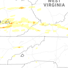


Connect with Interactive Hail Maps