

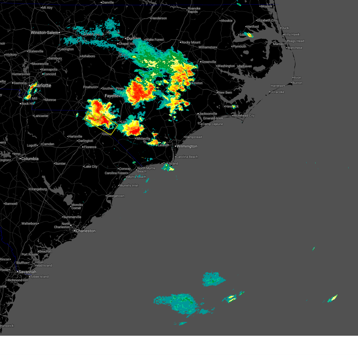
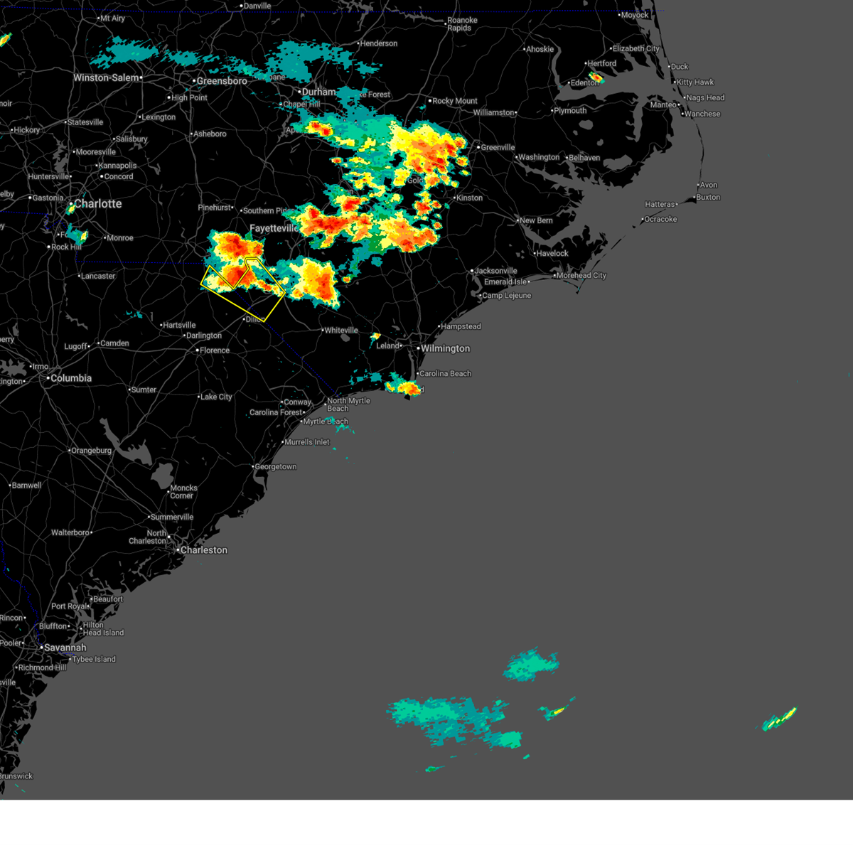
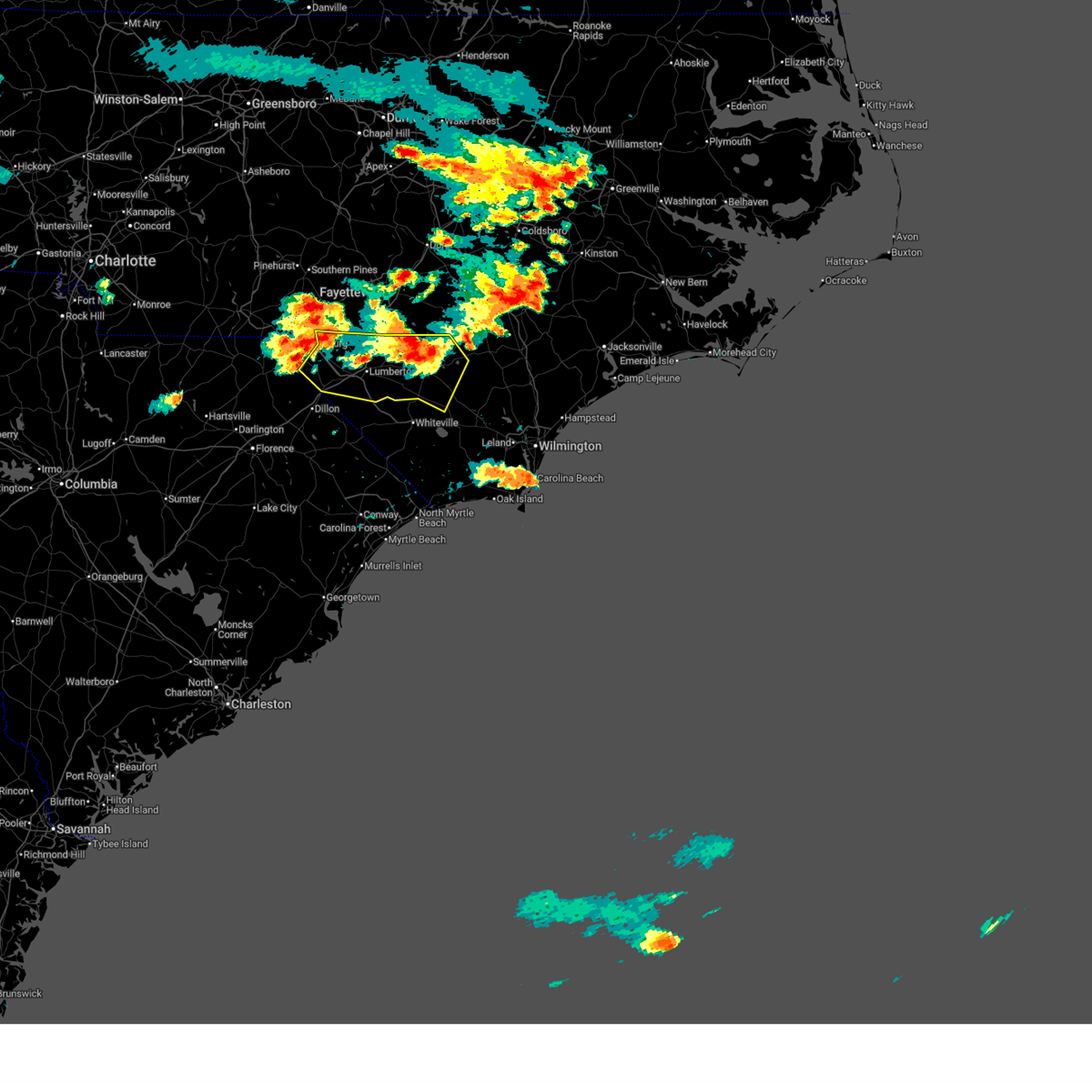
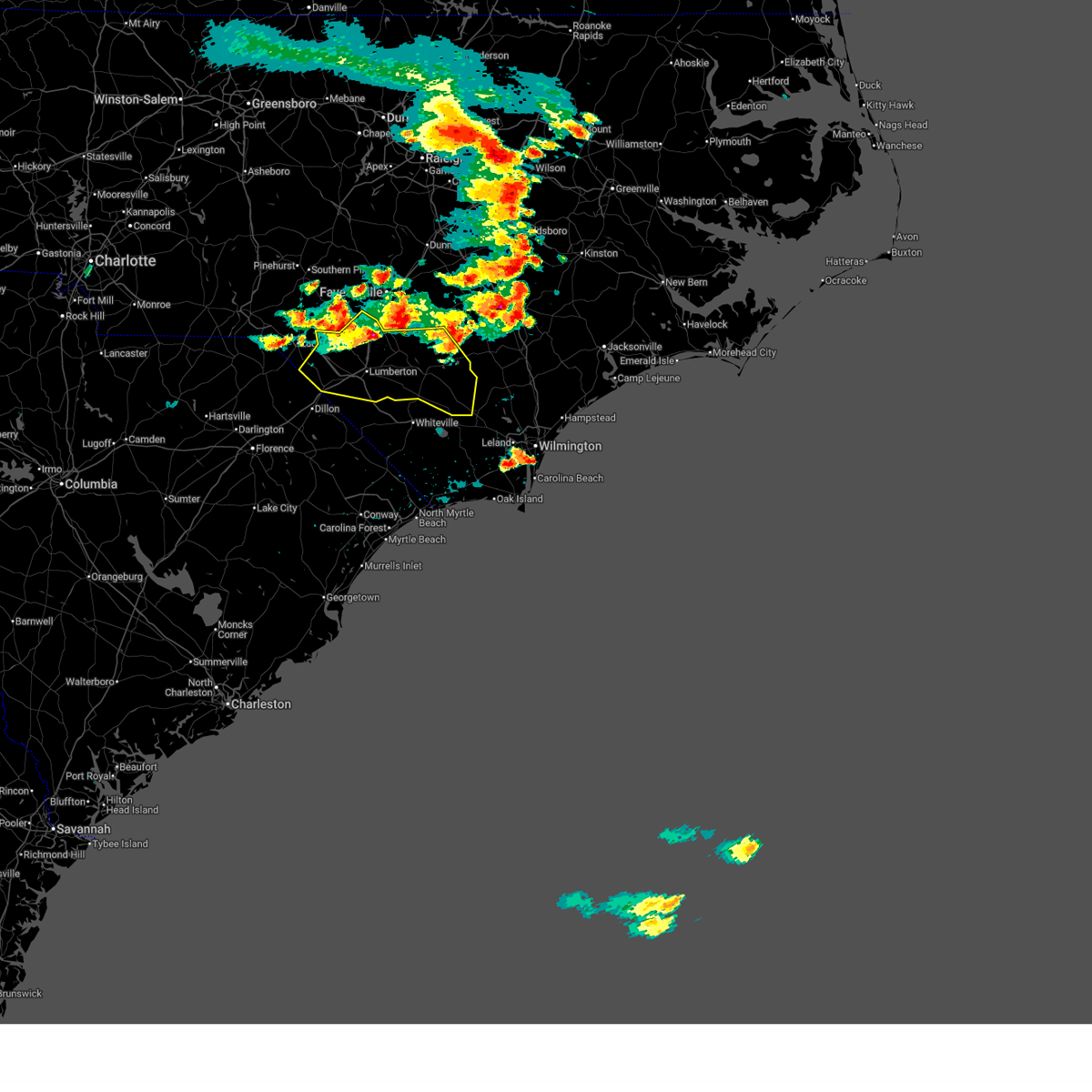
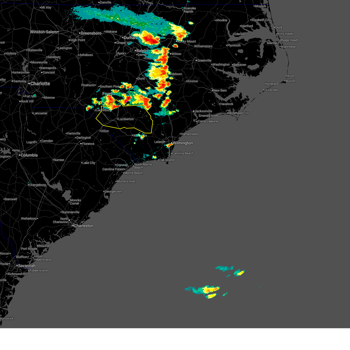
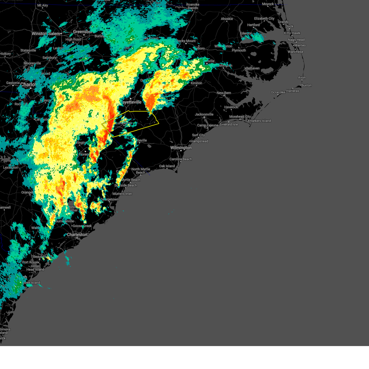
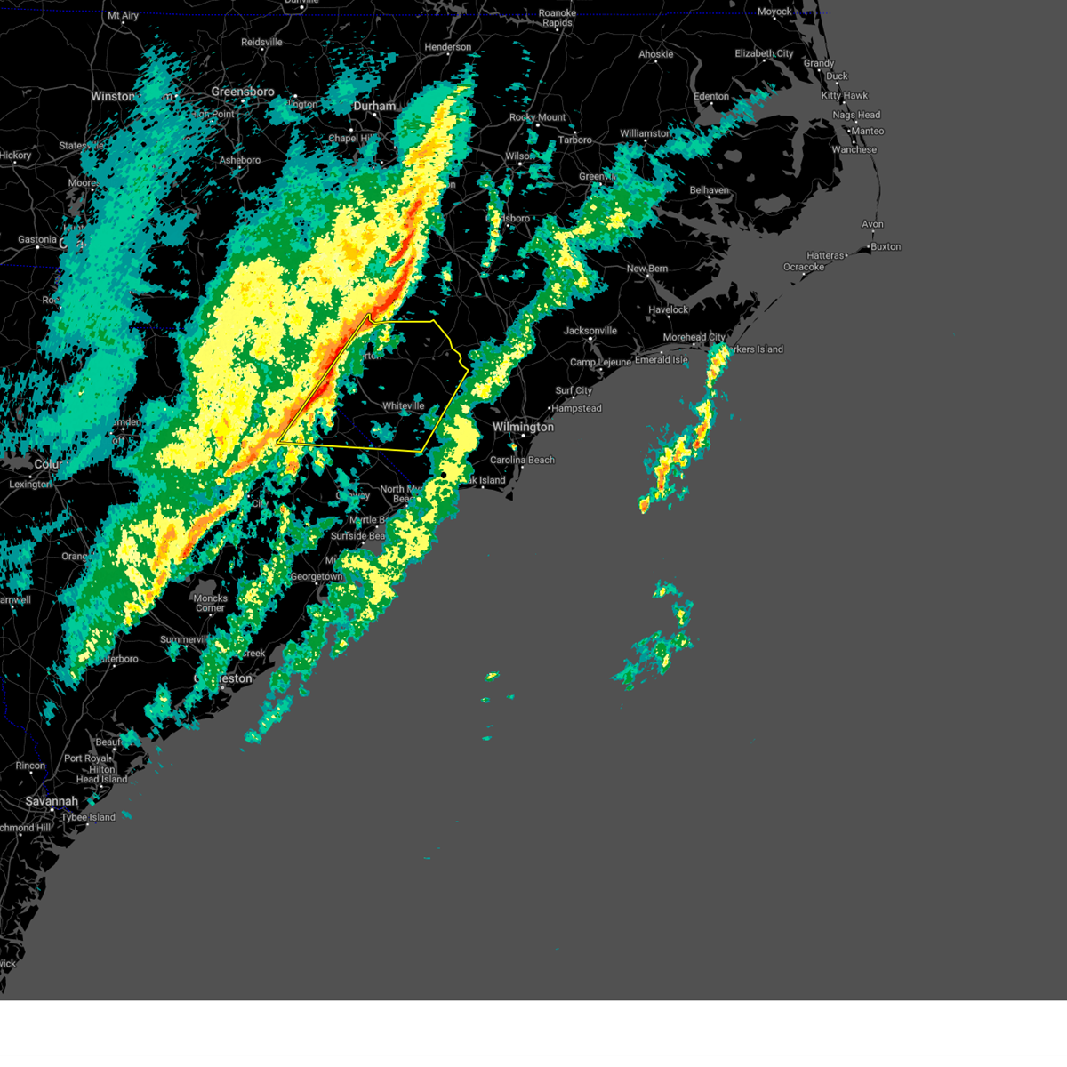
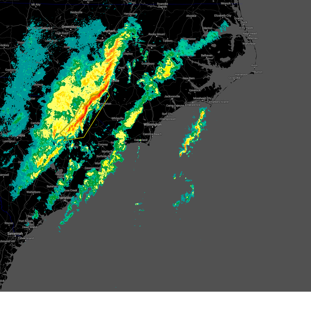
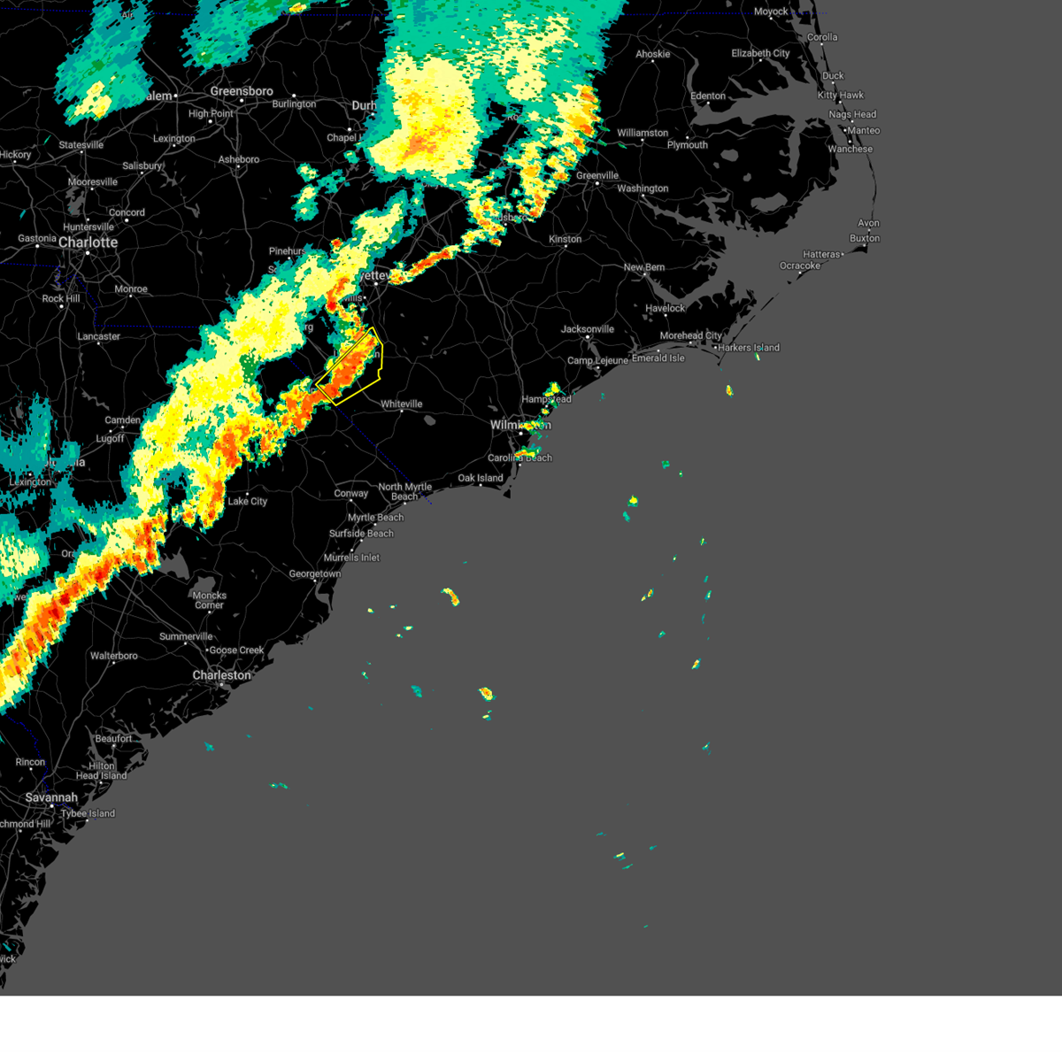
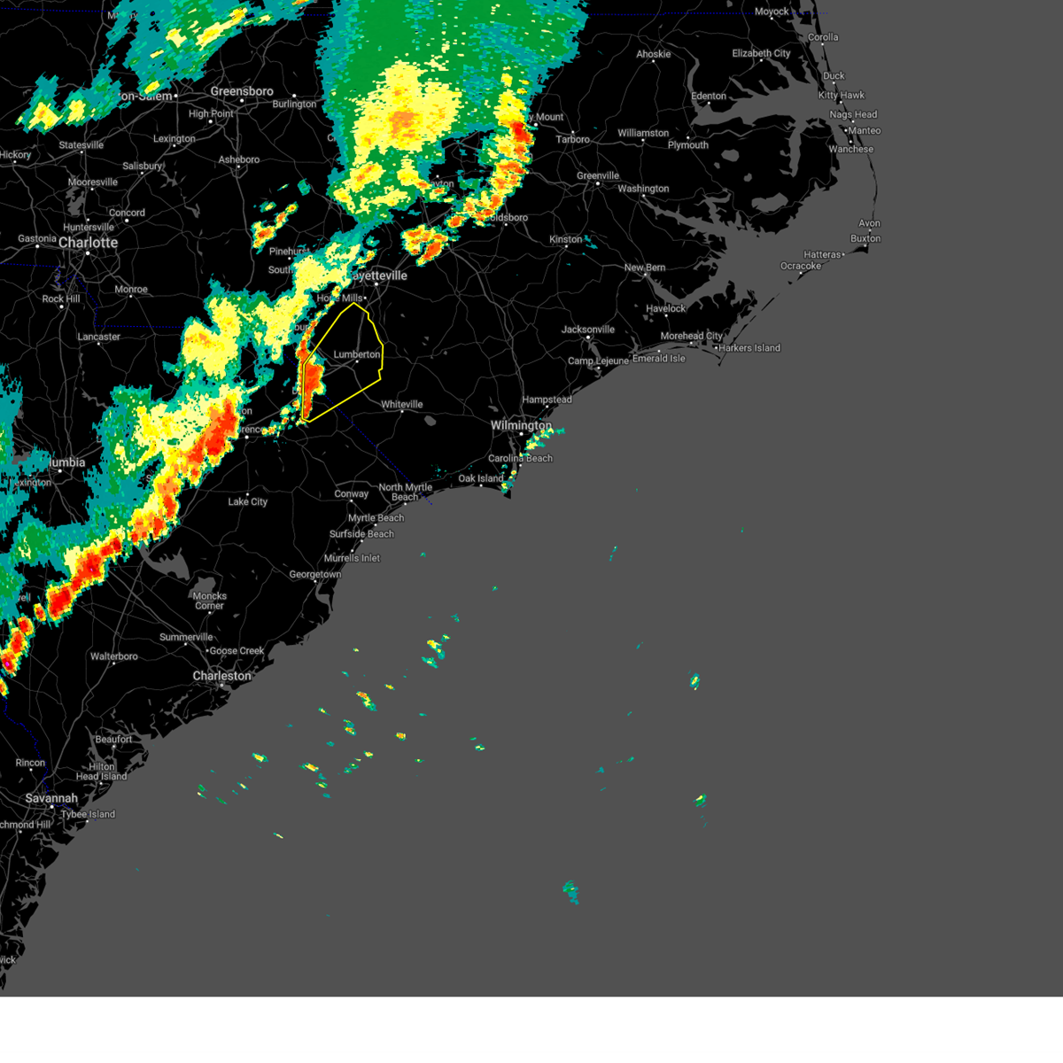
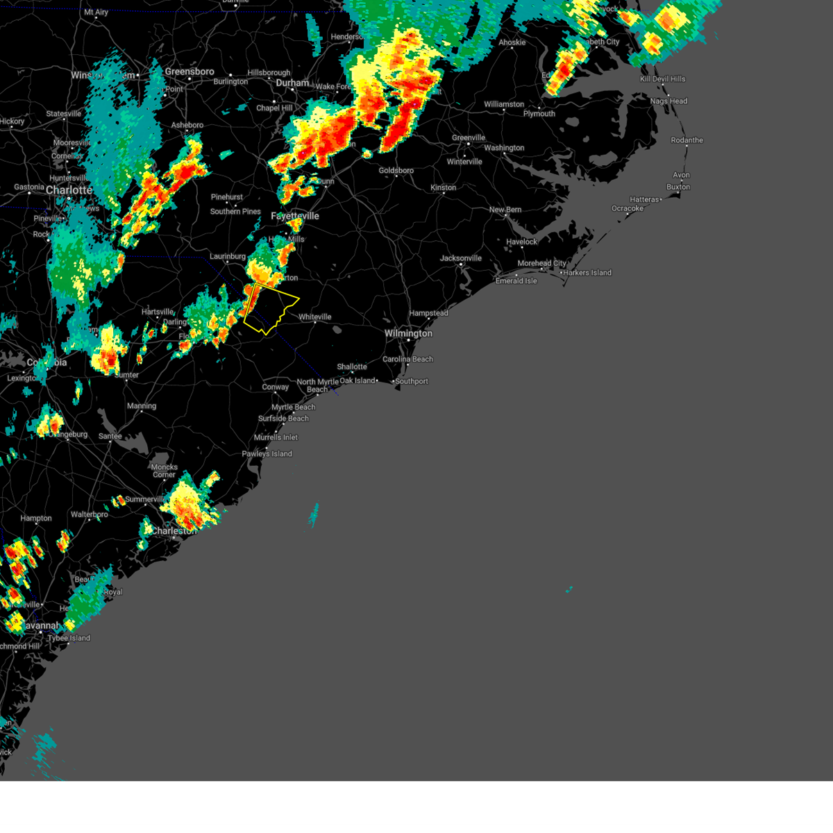
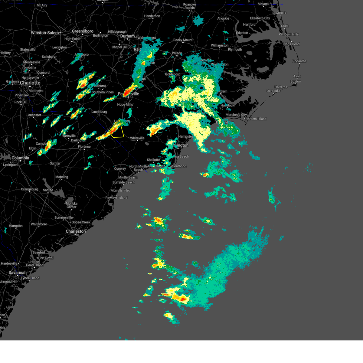
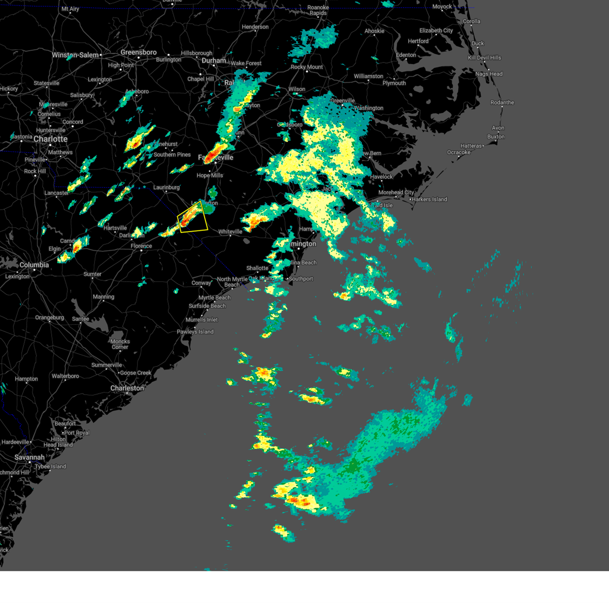
Hail Map for Fairmont, NC
The Fairmont, NC area has had 3 reports of on-the-ground hail by trained spotters, and has been under severe weather warnings 18 times during the past 12 months. Doppler radar has detected hail at or near Fairmont, NC on 48 occasions, including 4 occasions during the past year.
| Name: | Fairmont, NC |
| Where Located: | 69.1 miles WNW of Wilmington, NC |
| Map: | Google Map for Fairmont, NC |
| Population: | 2663 |
| Housing Units: | 1255 |
| More Info: | Search Google for Fairmont, NC |
1
The Top Recent Hail Date for Fairmont, NC is Sunday, June 1, 2025 (15th out of 48)

Hail and Wind Damage Spotted near Fairmont, NC
| Date / Time | Report Details |
|---|---|
| 6/25/2025 5:13 PM EDT |
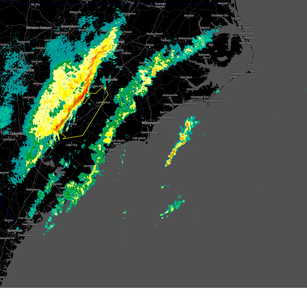
 At 512 pm edt, severe thunderstorms were located along a line extending from near mccoll to elrod, moving southwest at 15 mph (radar indicated). Hazards include 60 mph wind gusts and quarter size hail. Minor hail damage to vehicles is possible. expect wind damage to trees and power lines. Locations impacted include, bennettsville, fairmont, maxton, mccoll, rowland, clio, hamer, raemon, south of the border, purvis, elrod, mcdonald, tatum, and raynham. At 512 pm edt, severe thunderstorms were located along a line extending from near mccoll to elrod, moving southwest at 15 mph (radar indicated). Hazards include 60 mph wind gusts and quarter size hail. Minor hail damage to vehicles is possible. expect wind damage to trees and power lines. Locations impacted include, bennettsville, fairmont, maxton, mccoll, rowland, clio, hamer, raemon, south of the border, purvis, elrod, mcdonald, tatum, and raynham.
|
| 6/25/2025 4:52 PM EDT |
 Svrilm the national weather service in wilmington has issued a * severe thunderstorm warning for, western robeson county in southeastern north carolina, northern dillon county in northeastern south carolina, northeastern marlboro county in northeastern south carolina, * until 545 pm edt. * at 451 pm edt, severe thunderstorms were located along a line extending from 8 miles southeast of hoffman to near elrod, moving south at 15 mph (radar indicated). Hazards include 60 mph wind gusts and quarter size hail. Minor hail damage to vehicles is possible. Expect wind damage to trees and power lines. Svrilm the national weather service in wilmington has issued a * severe thunderstorm warning for, western robeson county in southeastern north carolina, northern dillon county in northeastern south carolina, northeastern marlboro county in northeastern south carolina, * until 545 pm edt. * at 451 pm edt, severe thunderstorms were located along a line extending from 8 miles southeast of hoffman to near elrod, moving south at 15 mph (radar indicated). Hazards include 60 mph wind gusts and quarter size hail. Minor hail damage to vehicles is possible. Expect wind damage to trees and power lines.
|
| 6/25/2025 4:32 PM EDT |
 At 432 pm edt, severe thunderstorms were located along a line extending from near elizabethtown to near laurinburg, moving southwest at 25 mph (radar indicated). Hazards include 60 mph wind gusts and quarter size hail. Minor hail damage to vehicles is possible. expect wind damage to trees and power lines. locations impacted include, lumberton, elizabethtown, red springs, pembroke, fairmont, maxton, st. Pauls, bladenboro, rowland, bladen community college, ammon, butters, hestertown, buie, robeson community college, wakulla, white oak, elrod, smiths, and howellsville. At 432 pm edt, severe thunderstorms were located along a line extending from near elizabethtown to near laurinburg, moving southwest at 25 mph (radar indicated). Hazards include 60 mph wind gusts and quarter size hail. Minor hail damage to vehicles is possible. expect wind damage to trees and power lines. locations impacted include, lumberton, elizabethtown, red springs, pembroke, fairmont, maxton, st. Pauls, bladenboro, rowland, bladen community college, ammon, butters, hestertown, buie, robeson community college, wakulla, white oak, elrod, smiths, and howellsville.
|
| 6/25/2025 4:16 PM EDT | At 416 pm edt, severe thunderstorms were located along a line extending from 8 miles southeast of ammon to near wakulla, moving southwest at 20 mph. a recent public report indicated quarter size hail was falling in red springs, nc (radar indicated). Hazards include 60 mph wind gusts and quarter size hail. Minor hail damage to vehicles is possible. expect wind damage to trees and power lines. locations impacted include, lumberton, elizabethtown, red springs, pembroke, fairmont, maxton, st. Pauls, bladenboro, rowland, rex, ammon, hestertown, shannon, white oak, carvers, smiths, howellsville, raemon, lisbon, and elkton. |
| 6/25/2025 4:01 PM EDT |
 At 400 pm edt, severe thunderstorms were located along a line extending from garland to near jerome to red springs, moving south at 20 mph (radar indicated). Hazards include 60 mph wind gusts. Expect wind damage to trees and power lines. locations impacted include, lumberton, elizabethtown, red springs, pembroke, fairmont, maxton, st. Pauls, bladenboro, rowland, rex, ammon, hestertown, shannon, white oak, carvers, smiths, howellsville, raemon, lisbon, and elkton. At 400 pm edt, severe thunderstorms were located along a line extending from garland to near jerome to red springs, moving south at 20 mph (radar indicated). Hazards include 60 mph wind gusts. Expect wind damage to trees and power lines. locations impacted include, lumberton, elizabethtown, red springs, pembroke, fairmont, maxton, st. Pauls, bladenboro, rowland, rex, ammon, hestertown, shannon, white oak, carvers, smiths, howellsville, raemon, lisbon, and elkton.
|
| 6/25/2025 3:41 PM EDT |
 Svrilm the national weather service in wilmington has issued a * severe thunderstorm warning for, robeson county in southeastern north carolina, bladen county in southeastern north carolina, * until 500 pm edt. * at 340 pm edt, severe thunderstorms were located along a line extending from 11 miles northwest of harrells to antioch, moving south at 25 mph (radar indicated). Hazards include 60 mph wind gusts. expect wind damage to trees and power lines Svrilm the national weather service in wilmington has issued a * severe thunderstorm warning for, robeson county in southeastern north carolina, bladen county in southeastern north carolina, * until 500 pm edt. * at 340 pm edt, severe thunderstorms were located along a line extending from 11 miles northwest of harrells to antioch, moving south at 25 mph (radar indicated). Hazards include 60 mph wind gusts. expect wind damage to trees and power lines
|
| 4/7/2025 7:55 PM EDT |
 Svrilm the national weather service in wilmington has issued a * severe thunderstorm warning for, robeson county in southeastern north carolina, northern bladen county in southeastern north carolina, * until 900 pm edt. * at 755 pm edt, a severe thunderstorm was located over purvis, or 13 miles west of lumberton, moving northeast at 50 mph (radar indicated). Hazards include 60 mph wind gusts. expect wind damage to trees and power lines Svrilm the national weather service in wilmington has issued a * severe thunderstorm warning for, robeson county in southeastern north carolina, northern bladen county in southeastern north carolina, * until 900 pm edt. * at 755 pm edt, a severe thunderstorm was located over purvis, or 13 miles west of lumberton, moving northeast at 50 mph (radar indicated). Hazards include 60 mph wind gusts. expect wind damage to trees and power lines
|
| 2/16/2025 9:35 AM EST |
 Svrilm the national weather service in wilmington has issued a * severe thunderstorm warning for, eastern robeson county in southeastern north carolina, bladen county in southeastern north carolina, columbus county in southeastern north carolina, southeastern dillon county in northeastern south carolina, northwestern horry county in northeastern south carolina, northern marion county in northeastern south carolina, * until 1030 am est. * at 935 am est, severe thunderstorms were located along a line extending from near tobermory to fairmont to near marion, moving east at 45 mph (radar indicated). Hazards include 60 mph wind gusts. expect wind damage to trees and power lines Svrilm the national weather service in wilmington has issued a * severe thunderstorm warning for, eastern robeson county in southeastern north carolina, bladen county in southeastern north carolina, columbus county in southeastern north carolina, southeastern dillon county in northeastern south carolina, northwestern horry county in northeastern south carolina, northern marion county in northeastern south carolina, * until 1030 am est. * at 935 am est, severe thunderstorms were located along a line extending from near tobermory to fairmont to near marion, moving east at 45 mph (radar indicated). Hazards include 60 mph wind gusts. expect wind damage to trees and power lines
|
| 2/16/2025 9:32 AM EST |
 At 931 am est, severe thunderstorms were located along a line extending from near tobermory to blue brick, moving east at 55 mph (radar indicated). Hazards include 60 mph wind gusts. Expect wind damage to trees and power lines. locations impacted include, florence, lumberton, marion, dillon, red springs, pembroke, st. Pauls, latta, pamplico, rowland, quinby, sellers, blue brick, rex, zion, hamer, mars bluff, south of the border, shannon, and buie. At 931 am est, severe thunderstorms were located along a line extending from near tobermory to blue brick, moving east at 55 mph (radar indicated). Hazards include 60 mph wind gusts. Expect wind damage to trees and power lines. locations impacted include, florence, lumberton, marion, dillon, red springs, pembroke, st. Pauls, latta, pamplico, rowland, quinby, sellers, blue brick, rex, zion, hamer, mars bluff, south of the border, shannon, and buie.
|
| 2/16/2025 9:32 AM EST |
 the severe thunderstorm warning has been cancelled and is no longer in effect the severe thunderstorm warning has been cancelled and is no longer in effect
|
| 2/16/2025 9:16 AM EST |
 At 915 am est, severe thunderstorms were located along a line extending from near shannon to florence, moving east at 55 mph (public reported trees down in the city of darlington, sc). Hazards include 60 mph wind gusts. Expect wind damage to trees and power lines. locations impacted include, florence, lumberton, marion, dillon, red springs, pembroke, maxton, timmonsville, st. Pauls, latta, pamplico, rowland, quinby, clio, sellers, blue brick, rex, hamer, brownsville, and shannon. At 915 am est, severe thunderstorms were located along a line extending from near shannon to florence, moving east at 55 mph (public reported trees down in the city of darlington, sc). Hazards include 60 mph wind gusts. Expect wind damage to trees and power lines. locations impacted include, florence, lumberton, marion, dillon, red springs, pembroke, maxton, timmonsville, st. Pauls, latta, pamplico, rowland, quinby, clio, sellers, blue brick, rex, hamer, brownsville, and shannon.
|
| 2/16/2025 8:58 AM EST |
 Svrilm the national weather service in wilmington has issued a * severe thunderstorm warning for, robeson county in southeastern north carolina, central florence county in northeastern south carolina, dillon county in northeastern south carolina, eastern darlington county in northeastern south carolina, northwestern marion county in northeastern south carolina, eastern marlboro county in northeastern south carolina, * until 1000 am est. * at 858 am est, severe thunderstorms were located along a line extending from near maxton to near lamar, moving east at 55 mph (radar indicated). Hazards include 60 mph wind gusts. expect wind damage to trees and power lines Svrilm the national weather service in wilmington has issued a * severe thunderstorm warning for, robeson county in southeastern north carolina, central florence county in northeastern south carolina, dillon county in northeastern south carolina, eastern darlington county in northeastern south carolina, northwestern marion county in northeastern south carolina, eastern marlboro county in northeastern south carolina, * until 1000 am est. * at 858 am est, severe thunderstorms were located along a line extending from near maxton to near lamar, moving east at 55 mph (radar indicated). Hazards include 60 mph wind gusts. expect wind damage to trees and power lines
|
| 9/27/2024 9:28 AM EDT |
 The storm which prompted the warning has weakened below severe limits, and no longer appears capable of producing a tornado. therefore, the warning will be allowed to expire. a tornado watch remains in effect until 600 pm edt for southeastern north carolina, and northeastern south carolina. please send your reports of hail and/or wind damage, including trees or large limbs downed, by calling the national weather service office in wilmington at 1-800-697-3901. The storm which prompted the warning has weakened below severe limits, and no longer appears capable of producing a tornado. therefore, the warning will be allowed to expire. a tornado watch remains in effect until 600 pm edt for southeastern north carolina, and northeastern south carolina. please send your reports of hail and/or wind damage, including trees or large limbs downed, by calling the national weather service office in wilmington at 1-800-697-3901.
|
| 9/27/2024 8:56 AM EDT |
 Torilm the national weather service in wilmington has issued a * tornado warning for, central robeson county in southeastern north carolina, east central dillon county in northeastern south carolina, * until 930 am edt. * at 856 am edt, a severe thunderstorm capable of producing a tornado was located near kemper, or 8 miles east of dillon, moving north at 55 mph (radar indicated rotation). Hazards include tornado. Flying debris will be dangerous to those caught without shelter. mobile homes will be damaged or destroyed. damage to roofs, windows, and vehicles will occur. tree damage is likely. this dangerous storm will be near, fairmont around 905 am edt. pembroke and elrod around 915 am edt. buie around 920 am edt. Other locations impacted by this tornadic thunderstorm include raynham, mcdonald, and southeastern regional medical center. Torilm the national weather service in wilmington has issued a * tornado warning for, central robeson county in southeastern north carolina, east central dillon county in northeastern south carolina, * until 930 am edt. * at 856 am edt, a severe thunderstorm capable of producing a tornado was located near kemper, or 8 miles east of dillon, moving north at 55 mph (radar indicated rotation). Hazards include tornado. Flying debris will be dangerous to those caught without shelter. mobile homes will be damaged or destroyed. damage to roofs, windows, and vehicles will occur. tree damage is likely. this dangerous storm will be near, fairmont around 905 am edt. pembroke and elrod around 915 am edt. buie around 920 am edt. Other locations impacted by this tornadic thunderstorm include raynham, mcdonald, and southeastern regional medical center.
|
| 8/3/2024 7:57 PM EDT |
 The storm which prompted the warning has weakened below severe limits, and no longer poses an immediate threat to life or property. therefore, the warning will be allowed to expire. please send your reports of hail and/or wind damage, including trees or large limbs downed, by calling the national weather service office in wilmington at 1-800-697-3901. The storm which prompted the warning has weakened below severe limits, and no longer poses an immediate threat to life or property. therefore, the warning will be allowed to expire. please send your reports of hail and/or wind damage, including trees or large limbs downed, by calling the national weather service office in wilmington at 1-800-697-3901.
|
| 8/3/2024 7:42 PM EDT |
 the severe thunderstorm warning has been cancelled and is no longer in effect the severe thunderstorm warning has been cancelled and is no longer in effect
|
| 8/3/2024 7:42 PM EDT |
 At 742 pm edt, a severe thunderstorm was located over fairmont, or 13 miles southwest of lumberton, moving northeast at 20 mph (radar indicated). Hazards include 60 mph wind gusts. Expect wind damage to trees and power lines. Locations impacted include, lumberton, fairmont, robeson community college, smiths, howellsville, tolarsville, barker ten mile, hestertown, proctorville, mcdonald, orrum, and southeastern regional medical center. At 742 pm edt, a severe thunderstorm was located over fairmont, or 13 miles southwest of lumberton, moving northeast at 20 mph (radar indicated). Hazards include 60 mph wind gusts. Expect wind damage to trees and power lines. Locations impacted include, lumberton, fairmont, robeson community college, smiths, howellsville, tolarsville, barker ten mile, hestertown, proctorville, mcdonald, orrum, and southeastern regional medical center.
|
| 8/3/2024 7:30 PM EDT | Report of two blown transformers near east white pond rd and baltimore church r in robeson county NC, 2.9 miles NE of Fairmont, NC |
| 8/3/2024 7:20 PM EDT | Reports of trees down near ward store rd... gerald rd... and north of nc-904. time estimate in robeson county NC, 5.4 miles ENE of Fairmont, NC |
| 8/3/2024 7:02 PM EDT |
 Svrilm the national weather service in wilmington has issued a * severe thunderstorm warning for, robeson county in southeastern north carolina, central dillon county in northeastern south carolina, * until 800 pm edt. * at 702 pm edt, severe thunderstorms were located along a line extending from near purvis to floydale, moving northeast at 45 mph (radar indicated). Hazards include 60 mph wind gusts. expect wind damage to trees and power lines Svrilm the national weather service in wilmington has issued a * severe thunderstorm warning for, robeson county in southeastern north carolina, central dillon county in northeastern south carolina, * until 800 pm edt. * at 702 pm edt, severe thunderstorms were located along a line extending from near purvis to floydale, moving northeast at 45 mph (radar indicated). Hazards include 60 mph wind gusts. expect wind damage to trees and power lines
|
| 5/10/2024 5:15 PM EDT |
 At 514 pm edt, severe thunderstorms were located along a line extending from near abbottsburg to near fairmont, moving east at 25 mph (radar indicated). Hazards include 60 mph wind gusts and quarter size hail. Minor hail damage to vehicles is possible. expect wind damage to trees and power lines. these severe storms will be near, boardman, elkton, and evergreen around 520 pm edt. emerson around 525 pm edt. council around 540 pm edt. carvers around 545 pm edt. whiteville around 555 pm edt. lake waccamaw around 610 pm edt. hallsboro around 615 pm edt. Other locations impacted by these severe thunderstorms include orrum, clarkton, proctorville, and columbus regional healthcare system. At 514 pm edt, severe thunderstorms were located along a line extending from near abbottsburg to near fairmont, moving east at 25 mph (radar indicated). Hazards include 60 mph wind gusts and quarter size hail. Minor hail damage to vehicles is possible. expect wind damage to trees and power lines. these severe storms will be near, boardman, elkton, and evergreen around 520 pm edt. emerson around 525 pm edt. council around 540 pm edt. carvers around 545 pm edt. whiteville around 555 pm edt. lake waccamaw around 610 pm edt. hallsboro around 615 pm edt. Other locations impacted by these severe thunderstorms include orrum, clarkton, proctorville, and columbus regional healthcare system.
|
| 5/10/2024 4:39 PM EDT |
 Svrilm the national weather service in wilmington has issued a * severe thunderstorm warning for, southeastern robeson county in southeastern north carolina, southwestern bladen county in southeastern north carolina, northwestern columbus county in southeastern north carolina, * until 600 pm edt. * at 439 pm edt, a severe thunderstorm was located over fairmont, or 9 miles southwest of lumberton, moving east at 35 mph (radar indicated). Hazards include 60 mph wind gusts and quarter size hail. Minor hail damage to vehicles is possible. expect wind damage to trees and power lines. this severe thunderstorm will be near, boardman around 445 pm edt. elkton around 520 pm edt. emerson around 525 pm edt. council around 535 pm edt. Other locations impacted by this severe thunderstorm include orrum, clarkton, and proctorville. Svrilm the national weather service in wilmington has issued a * severe thunderstorm warning for, southeastern robeson county in southeastern north carolina, southwestern bladen county in southeastern north carolina, northwestern columbus county in southeastern north carolina, * until 600 pm edt. * at 439 pm edt, a severe thunderstorm was located over fairmont, or 9 miles southwest of lumberton, moving east at 35 mph (radar indicated). Hazards include 60 mph wind gusts and quarter size hail. Minor hail damage to vehicles is possible. expect wind damage to trees and power lines. this severe thunderstorm will be near, boardman around 445 pm edt. elkton around 520 pm edt. emerson around 525 pm edt. council around 535 pm edt. Other locations impacted by this severe thunderstorm include orrum, clarkton, and proctorville.
|
| 5/8/2024 7:37 PM EDT |
 The storms which prompted the warning have weakened below severe limits. therefore, the warning will be allowed to expire. a severe thunderstorm watch remains in effect until 1000 pm edt for southeastern north carolina. please send your reports of hail and/or wind damage, including trees or large limbs downed, by calling the national weather service office in wilmington at 1-800-697-3901. The storms which prompted the warning have weakened below severe limits. therefore, the warning will be allowed to expire. a severe thunderstorm watch remains in effect until 1000 pm edt for southeastern north carolina. please send your reports of hail and/or wind damage, including trees or large limbs downed, by calling the national weather service office in wilmington at 1-800-697-3901.
|
| 5/8/2024 7:16 PM EDT |
 At 716 pm edt, severe thunderstorms were located along a line extending from 9 miles northeast of jerome to bladen community college to near fair bluff, moving southeast at 40 mph (radar indicated). Hazards include 60 mph wind gusts and quarter size hail. Minor hail damage to vehicles is possible. expect wind damage to trees and power lines. Locations impacted include, lumberton, whiteville, elizabethtown, fairmont, chadbourn, bladenboro, fair bluff, boardman, bladen community college, ammon, butters, hestertown, southeastern community college, robeson community college, white oak, carvers, smiths, howellsville, abbottsburg, and tolarsville. At 716 pm edt, severe thunderstorms were located along a line extending from 9 miles northeast of jerome to bladen community college to near fair bluff, moving southeast at 40 mph (radar indicated). Hazards include 60 mph wind gusts and quarter size hail. Minor hail damage to vehicles is possible. expect wind damage to trees and power lines. Locations impacted include, lumberton, whiteville, elizabethtown, fairmont, chadbourn, bladenboro, fair bluff, boardman, bladen community college, ammon, butters, hestertown, southeastern community college, robeson community college, white oak, carvers, smiths, howellsville, abbottsburg, and tolarsville.
|
| 5/8/2024 7:01 PM EDT |
 Svrilm the national weather service in wilmington has issued a * severe thunderstorm warning for, robeson county in southeastern north carolina, bladen county in southeastern north carolina, northwestern columbus county in southeastern north carolina, * until 745 pm edt. * at 701 pm edt, severe thunderstorms were located along a line extending from 6 miles southeast of fayetteville to howellsville to near lake view, moving southeast at 40 mph (radar indicated). Hazards include 60 mph wind gusts and quarter size hail. Minor hail damage to vehicles is possible. Expect wind damage to trees and power lines. Svrilm the national weather service in wilmington has issued a * severe thunderstorm warning for, robeson county in southeastern north carolina, bladen county in southeastern north carolina, northwestern columbus county in southeastern north carolina, * until 745 pm edt. * at 701 pm edt, severe thunderstorms were located along a line extending from 6 miles southeast of fayetteville to howellsville to near lake view, moving southeast at 40 mph (radar indicated). Hazards include 60 mph wind gusts and quarter size hail. Minor hail damage to vehicles is possible. Expect wind damage to trees and power lines.
|
| 5/8/2024 6:55 PM EDT |
 At 655 pm edt, severe thunderstorms were located along a line extending from near minturn to near mars bluff to near cartersville, moving east at 40 mph (radar indicated). Hazards include ping pong ball size hail and 60 mph wind gusts. People and animals outdoors will be injured. expect hail damage to roofs, siding, windows, and vehicles. expect wind damage to trees and power lines. Locations impacted include, florence, marion, dillon, lake city, darlington, mullins, timmonsville, latta, pamplico, lamar, quinby, lake view, sellers, blue brick, hamer, brownsville, darlington raceway, swift creek, rains, and floyd. At 655 pm edt, severe thunderstorms were located along a line extending from near minturn to near mars bluff to near cartersville, moving east at 40 mph (radar indicated). Hazards include ping pong ball size hail and 60 mph wind gusts. People and animals outdoors will be injured. expect hail damage to roofs, siding, windows, and vehicles. expect wind damage to trees and power lines. Locations impacted include, florence, marion, dillon, lake city, darlington, mullins, timmonsville, latta, pamplico, lamar, quinby, lake view, sellers, blue brick, hamer, brownsville, darlington raceway, swift creek, rains, and floyd.
|
| 5/8/2024 6:40 PM EDT |
 Svrilm the national weather service in wilmington has issued a * severe thunderstorm warning for, southwestern robeson county in southeastern north carolina, florence county in northeastern south carolina, dillon county in northeastern south carolina, darlington county in northeastern south carolina, marion county in northeastern south carolina, southern marlboro county in northeastern south carolina, * until 745 pm edt. * at 639 pm edt, severe thunderstorms were located along a line extending from near dunbar to near florence darlington technical college main campus to elliott, moving east at 40 mph (radar indicated). Hazards include 60 mph wind gusts and quarter size hail. Minor hail damage to vehicles is possible. Expect wind damage to trees and power lines. Svrilm the national weather service in wilmington has issued a * severe thunderstorm warning for, southwestern robeson county in southeastern north carolina, florence county in northeastern south carolina, dillon county in northeastern south carolina, darlington county in northeastern south carolina, marion county in northeastern south carolina, southern marlboro county in northeastern south carolina, * until 745 pm edt. * at 639 pm edt, severe thunderstorms were located along a line extending from near dunbar to near florence darlington technical college main campus to elliott, moving east at 40 mph (radar indicated). Hazards include 60 mph wind gusts and quarter size hail. Minor hail damage to vehicles is possible. Expect wind damage to trees and power lines.
|
| 5/8/2024 6:00 PM EDT |
 Svrilm the national weather service in wilmington has issued a * severe thunderstorm warning for, central robeson county in southeastern north carolina, * until 645 pm edt. * at 558 pm edt, a severe thunderstorm was located over buie, or 7 miles south of red springs, moving east at 30 mph. another severe storm was located near butters, moving east at 35 mph (radar indicated). Hazards include 60 mph wind gusts and quarter size hail. Minor hail damage to vehicles is possible. Expect wind damage to trees and power lines. Svrilm the national weather service in wilmington has issued a * severe thunderstorm warning for, central robeson county in southeastern north carolina, * until 645 pm edt. * at 558 pm edt, a severe thunderstorm was located over buie, or 7 miles south of red springs, moving east at 30 mph. another severe storm was located near butters, moving east at 35 mph (radar indicated). Hazards include 60 mph wind gusts and quarter size hail. Minor hail damage to vehicles is possible. Expect wind damage to trees and power lines.
|
| 4/20/2024 6:59 PM EDT |
 At 658 pm edt, a severe thunderstorm was located over hestertown, or over lumberton, moving southeast at 35 mph (radar indicated). Hazards include 60 mph wind gusts and quarter size hail. Minor hail damage to vehicles is possible. expect wind damage to trees and power lines. Locations impacted include, lumberton, fairmont, rowland, robeson community college, smiths, howellsville, tolarsville, barker ten mile, hestertown, mcdonald, raynham, and southeastern regional medical center. At 658 pm edt, a severe thunderstorm was located over hestertown, or over lumberton, moving southeast at 35 mph (radar indicated). Hazards include 60 mph wind gusts and quarter size hail. Minor hail damage to vehicles is possible. expect wind damage to trees and power lines. Locations impacted include, lumberton, fairmont, rowland, robeson community college, smiths, howellsville, tolarsville, barker ten mile, hestertown, mcdonald, raynham, and southeastern regional medical center.
|
| 4/20/2024 6:59 PM EDT |
 the severe thunderstorm warning has been cancelled and is no longer in effect the severe thunderstorm warning has been cancelled and is no longer in effect
|
| 4/20/2024 6:22 PM EDT |
 Svrilm the national weather service in wilmington has issued a * severe thunderstorm warning for, robeson county in southeastern north carolina, northwestern bladen county in southeastern north carolina, northern dillon county in northeastern south carolina, east central marlboro county in northeastern south carolina, * until 715 pm edt. * at 622 pm edt, a severe thunderstorm was located over prospect, or near red springs, moving east at 30 mph (radar indicated). Hazards include 60 mph wind gusts and quarter size hail. Minor hail damage to vehicles is possible. Expect wind damage to trees and power lines. Svrilm the national weather service in wilmington has issued a * severe thunderstorm warning for, robeson county in southeastern north carolina, northwestern bladen county in southeastern north carolina, northern dillon county in northeastern south carolina, east central marlboro county in northeastern south carolina, * until 715 pm edt. * at 622 pm edt, a severe thunderstorm was located over prospect, or near red springs, moving east at 30 mph (radar indicated). Hazards include 60 mph wind gusts and quarter size hail. Minor hail damage to vehicles is possible. Expect wind damage to trees and power lines.
|
| 4/20/2024 5:15 PM EDT |
 Svrilm the national weather service in wilmington has issued a * severe thunderstorm warning for, northwestern pender county in southeastern north carolina, southeastern robeson county in southeastern north carolina, bladen county in southeastern north carolina, northwestern columbus county in southeastern north carolina, * until 630 pm edt. * at 513 pm edt, severe thunderstorms were located along a line extending from ammon to lumberton, moving southeast at 30 mph (public. golf ball size hail was recently reported near pembroke). Hazards include ping pong ball size hail and 60 mph wind gusts. People and animals outdoors will be injured. expect hail damage to roofs, siding, windows, and vehicles. Expect wind damage to trees and power lines. Svrilm the national weather service in wilmington has issued a * severe thunderstorm warning for, northwestern pender county in southeastern north carolina, southeastern robeson county in southeastern north carolina, bladen county in southeastern north carolina, northwestern columbus county in southeastern north carolina, * until 630 pm edt. * at 513 pm edt, severe thunderstorms were located along a line extending from ammon to lumberton, moving southeast at 30 mph (public. golf ball size hail was recently reported near pembroke). Hazards include ping pong ball size hail and 60 mph wind gusts. People and animals outdoors will be injured. expect hail damage to roofs, siding, windows, and vehicles. Expect wind damage to trees and power lines.
|
| 4/20/2024 5:01 PM EDT |
 At 458 pm edt, severe thunderstorms were located along a line extending from near ammon to near buie, moving southeast at 30 mph (public recently reported golf ball size hail in prospect). Hazards include golf ball size hail and 60 mph wind gusts. People and animals outdoors will be injured. expect hail damage to roofs, siding, windows, and vehicles. expect wind damage to trees and power lines. locations impacted include, lumberton, elizabethtown, red springs, pembroke, fairmont, maxton, st. Pauls, bladenboro, rex, bladen community college, ammon, butters, hestertown, shannon, buie, robeson community college, wakulla, white oak, smiths, and howellsville. At 458 pm edt, severe thunderstorms were located along a line extending from near ammon to near buie, moving southeast at 30 mph (public recently reported golf ball size hail in prospect). Hazards include golf ball size hail and 60 mph wind gusts. People and animals outdoors will be injured. expect hail damage to roofs, siding, windows, and vehicles. expect wind damage to trees and power lines. locations impacted include, lumberton, elizabethtown, red springs, pembroke, fairmont, maxton, st. Pauls, bladenboro, rex, bladen community college, ammon, butters, hestertown, shannon, buie, robeson community college, wakulla, white oak, smiths, and howellsville.
|
| 4/20/2024 4:40 PM EDT |
 At 438 pm edt, severe thunderstorms were located along a line extending from near jerome to near wakulla, moving southeast at 30 mph (radar indicated). Hazards include ping pong ball size hail and 60 mph wind gusts. People and animals outdoors will be injured. expect hail damage to roofs, siding, windows, and vehicles. expect wind damage to trees and power lines. locations impacted include, lumberton, elizabethtown, red springs, pembroke, fairmont, maxton, st. Pauls, bladenboro, rowland, rex, bladen community college, ammon, butters, hestertown, shannon, buie, robeson community college, wakulla, white oak, and elrod. At 438 pm edt, severe thunderstorms were located along a line extending from near jerome to near wakulla, moving southeast at 30 mph (radar indicated). Hazards include ping pong ball size hail and 60 mph wind gusts. People and animals outdoors will be injured. expect hail damage to roofs, siding, windows, and vehicles. expect wind damage to trees and power lines. locations impacted include, lumberton, elizabethtown, red springs, pembroke, fairmont, maxton, st. Pauls, bladenboro, rowland, rex, bladen community college, ammon, butters, hestertown, shannon, buie, robeson community college, wakulla, white oak, and elrod.
|
| 4/20/2024 4:12 PM EDT |
 Svrilm the national weather service in wilmington has issued a * severe thunderstorm warning for, robeson county in southeastern north carolina, northwestern bladen county in southeastern north carolina, * until 515 pm edt. * at 411 pm edt, severe thunderstorms were located along a line extending from 7 miles south of fayetteville to 7 miles northwest of laurinburg, moving southeast at 40 mph (radar indicated). Hazards include 60 mph wind gusts and quarter size hail. Minor hail damage to vehicles is possible. Expect wind damage to trees and power lines. Svrilm the national weather service in wilmington has issued a * severe thunderstorm warning for, robeson county in southeastern north carolina, northwestern bladen county in southeastern north carolina, * until 515 pm edt. * at 411 pm edt, severe thunderstorms were located along a line extending from 7 miles south of fayetteville to 7 miles northwest of laurinburg, moving southeast at 40 mph (radar indicated). Hazards include 60 mph wind gusts and quarter size hail. Minor hail damage to vehicles is possible. Expect wind damage to trees and power lines.
|
| 1/9/2024 5:45 PM EST |
 At 544 pm est, severe thunderstorms were located along a line extending from 9 miles north of rex to near hampton plantation state park, moving east at 45 mph (radar indicated). Hazards include 60 mph wind gusts. expect wind damage to trees and power lines At 544 pm est, severe thunderstorms were located along a line extending from 9 miles north of rex to near hampton plantation state park, moving east at 45 mph (radar indicated). Hazards include 60 mph wind gusts. expect wind damage to trees and power lines
|
| 1/9/2024 3:41 PM EST |
 At 341 pm est, a severe thunderstorm was located near south of the border, or 8 miles northeast of dillon, moving northeast at 60 mph (radar indicated). Hazards include 60 mph wind gusts. expect wind damage to trees and power lines At 341 pm est, a severe thunderstorm was located near south of the border, or 8 miles northeast of dillon, moving northeast at 60 mph (radar indicated). Hazards include 60 mph wind gusts. expect wind damage to trees and power lines
|
| 8/15/2023 6:10 PM EDT |
 The severe thunderstorm warning for southeastern robeson and southeastern dillon counties will expire at 615 pm edt, the storm which prompted the warning has weakened below severe limits, and has exited the warned area. therefore, the warning will be allowed to expire. however, gusty winds are still possible with this thunderstorm. a severe thunderstorm watch remains in effect until 100 am edt for southeastern north carolina. The severe thunderstorm warning for southeastern robeson and southeastern dillon counties will expire at 615 pm edt, the storm which prompted the warning has weakened below severe limits, and has exited the warned area. therefore, the warning will be allowed to expire. however, gusty winds are still possible with this thunderstorm. a severe thunderstorm watch remains in effect until 100 am edt for southeastern north carolina.
|
| 8/15/2023 5:57 PM EDT |
 At 557 pm edt, a severe thunderstorm was located over barnesville, or 15 miles south of lumberton, moving east at 20 mph (radar indicated). Hazards include 60 mph wind gusts and quarter size hail. Minor hail damage to vehicles is possible. expect wind damage to trees and power lines. locations impacted include, fairmont, lake view, boardman, kemper, barnesville, marietta, proctorville, mcdonald, orrum, and raynham. hail threat, radar indicated max hail size, 1. 00 in wind threat, radar indicated max wind gust, 60 mph. At 557 pm edt, a severe thunderstorm was located over barnesville, or 15 miles south of lumberton, moving east at 20 mph (radar indicated). Hazards include 60 mph wind gusts and quarter size hail. Minor hail damage to vehicles is possible. expect wind damage to trees and power lines. locations impacted include, fairmont, lake view, boardman, kemper, barnesville, marietta, proctorville, mcdonald, orrum, and raynham. hail threat, radar indicated max hail size, 1. 00 in wind threat, radar indicated max wind gust, 60 mph.
|
| 8/15/2023 5:41 PM EDT |
 At 541 pm edt, a severe thunderstorm was located near fairmont, or 12 miles east of dillon, moving east at 20 mph (radar indicated). Hazards include 60 mph wind gusts and quarter size hail. Minor hail damage to vehicles is possible. Expect wind damage to trees and power lines. At 541 pm edt, a severe thunderstorm was located near fairmont, or 12 miles east of dillon, moving east at 20 mph (radar indicated). Hazards include 60 mph wind gusts and quarter size hail. Minor hail damage to vehicles is possible. Expect wind damage to trees and power lines.
|
| 8/15/2023 5:33 PM EDT | Tree down blocking roadway near intersection of east white pond road and east raynham road east of five forks... nc. time estimated based on rada in robeson county NC, 3.7 miles NE of Fairmont, NC |
| 8/7/2023 8:40 PM EDT |
 The severe thunderstorm warning for bladen, southeastern robeson, northwestern columbus, southern dillon, northwestern horry and northern marion counties will expire at 845 pm edt, the storm which prompted the warning has weakened below severe limits, and has exited the warned area. therefore, the warning will be allowed to expire. however, gusty winds are still possible with this thunderstorm. a severe thunderstorm watch remains in effect until midnight edt for southeastern north carolina, and northeastern south carolina. remember, a severe thunderstorm warning still remains in effect for northern and central horry county until 9:15 pm edt. The severe thunderstorm warning for bladen, southeastern robeson, northwestern columbus, southern dillon, northwestern horry and northern marion counties will expire at 845 pm edt, the storm which prompted the warning has weakened below severe limits, and has exited the warned area. therefore, the warning will be allowed to expire. however, gusty winds are still possible with this thunderstorm. a severe thunderstorm watch remains in effect until midnight edt for southeastern north carolina, and northeastern south carolina. remember, a severe thunderstorm warning still remains in effect for northern and central horry county until 9:15 pm edt.
|
| 8/7/2023 8:22 PM EDT |
 At 820 pm edt, a severe thunderstorm was located near evergreen, or 8 miles northwest of whiteville, moving southeast at 45 mph. a tornado warning remains in effect for central marion and central horry county until 8:45 pm edt (radar indicated). Hazards include 60 mph wind gusts and penny size hail. Expect wind damage to trees and power lines. locations impacted include, marion, dillon, whiteville, mullins, elizabethtown, fairmont, tabor city, chadbourn, bladenboro, latta, fair bluff, lake view, sellers, boardman, blue brick, hallsboro, ammon, hestertown, rains, and southeastern community college. hail threat, radar indicated max hail size, 0. 75 in wind threat, radar indicated max wind gust, 60 mph. At 820 pm edt, a severe thunderstorm was located near evergreen, or 8 miles northwest of whiteville, moving southeast at 45 mph. a tornado warning remains in effect for central marion and central horry county until 8:45 pm edt (radar indicated). Hazards include 60 mph wind gusts and penny size hail. Expect wind damage to trees and power lines. locations impacted include, marion, dillon, whiteville, mullins, elizabethtown, fairmont, tabor city, chadbourn, bladenboro, latta, fair bluff, lake view, sellers, boardman, blue brick, hallsboro, ammon, hestertown, rains, and southeastern community college. hail threat, radar indicated max hail size, 0. 75 in wind threat, radar indicated max wind gust, 60 mph.
|
| 8/7/2023 7:41 PM EDT |
 At 741 pm edt, a severe thunderstorm was located over elrod, or 13 miles southwest of red springs, moving southeast at 45 mph (radar indicated). Hazards include 60 mph wind gusts and penny size hail. expect wind damage to trees and power lines At 741 pm edt, a severe thunderstorm was located over elrod, or 13 miles southwest of red springs, moving southeast at 45 mph (radar indicated). Hazards include 60 mph wind gusts and penny size hail. expect wind damage to trees and power lines
|
| 7/23/2023 6:24 PM EDT |
 At 624 pm edt, a severe thunderstorm was located near mars bluff, or 8 miles northeast of florence, moving northeast at 25 mph (radar indicated). Hazards include 60 mph wind gusts and nickel size hail. expect wind damage to trees and power lines At 624 pm edt, a severe thunderstorm was located near mars bluff, or 8 miles northeast of florence, moving northeast at 25 mph (radar indicated). Hazards include 60 mph wind gusts and nickel size hail. expect wind damage to trees and power lines
|
| 7/1/2023 8:24 PM EDT |
 The tornado warning for robeson county will expire at 830 pm edt, the storm which prompted the warning has weakened below severe limits, and no longer appears capable of producing a tornado. therefore, the warning will be allowed to expire. The tornado warning for robeson county will expire at 830 pm edt, the storm which prompted the warning has weakened below severe limits, and no longer appears capable of producing a tornado. therefore, the warning will be allowed to expire.
|
| 7/1/2023 8:06 PM EDT |
 At 806 pm edt, a severe thunderstorm capable of producing a tornado was located over buie, or near red springs, moving southeast at 30 mph (radar indicated rotation). Hazards include tornado. Flying debris will be dangerous to those caught without shelter. mobile homes will be damaged or destroyed. damage to roofs, windows, and vehicles will occur. tree damage is likely. this dangerous storm will be near, robeson community college around 820 pm edt. lumberton, barker ten mile and howellsville around 825 pm edt. hestertown and smiths around 830 pm edt. Other locations impacted by this tornadic thunderstorm include raynham, orrum, rennert, proctorville, southeastern regional medical center and mcdonald. At 806 pm edt, a severe thunderstorm capable of producing a tornado was located over buie, or near red springs, moving southeast at 30 mph (radar indicated rotation). Hazards include tornado. Flying debris will be dangerous to those caught without shelter. mobile homes will be damaged or destroyed. damage to roofs, windows, and vehicles will occur. tree damage is likely. this dangerous storm will be near, robeson community college around 820 pm edt. lumberton, barker ten mile and howellsville around 825 pm edt. hestertown and smiths around 830 pm edt. Other locations impacted by this tornadic thunderstorm include raynham, orrum, rennert, proctorville, southeastern regional medical center and mcdonald.
|
| 4/22/2023 5:32 PM EDT |
 At 531 pm edt, severe thunderstorms were located along a line extending from near proctorville and marietta to kemper and marion, moving east at 30 mph (radar indicated). Hazards include 60 mph wind gusts and nickel size hail. Expect wind damage to trees and power lines. locations impacted include, marion, mullins, fairmont, chadbourn, fair bluff, lake view, boardman, fork, zion, cherry grove, gapway, barnesville, smithboro, kemper, evergreen, nichols, cerro gordo, marietta, proctorville and orrum. hail threat, radar indicated max hail size, 0. 88 in wind threat, radar indicated max wind gust, 60 mph. At 531 pm edt, severe thunderstorms were located along a line extending from near proctorville and marietta to kemper and marion, moving east at 30 mph (radar indicated). Hazards include 60 mph wind gusts and nickel size hail. Expect wind damage to trees and power lines. locations impacted include, marion, mullins, fairmont, chadbourn, fair bluff, lake view, boardman, fork, zion, cherry grove, gapway, barnesville, smithboro, kemper, evergreen, nichols, cerro gordo, marietta, proctorville and orrum. hail threat, radar indicated max hail size, 0. 88 in wind threat, radar indicated max wind gust, 60 mph.
|
| 4/22/2023 5:20 PM EDT | Tree down on mill branch rd outside of fairmont... n in robeson county NC, 3.6 miles NNE of Fairmont, NC |
| 4/22/2023 5:19 PM EDT |
 At 519 pm edt, a severe squall line capable of producing both tornadoes and extensive straight line wind damage was located over fairmont, or 12 miles southwest of lumberton, moving east at 30 mph (radar indicated rotation). Hazards include tornado and quarter size hail. Flying debris will be dangerous to those caught without shelter. mobile homes will be damaged or destroyed. damage to roofs, windows, and vehicles will occur. tree damage is likely. This tornadic thunderstorm will remain over mainly rural areas of south central robeson county, including the following locations, orrum and proctorville. At 519 pm edt, a severe squall line capable of producing both tornadoes and extensive straight line wind damage was located over fairmont, or 12 miles southwest of lumberton, moving east at 30 mph (radar indicated rotation). Hazards include tornado and quarter size hail. Flying debris will be dangerous to those caught without shelter. mobile homes will be damaged or destroyed. damage to roofs, windows, and vehicles will occur. tree damage is likely. This tornadic thunderstorm will remain over mainly rural areas of south central robeson county, including the following locations, orrum and proctorville.
|
| 4/22/2023 5:12 PM EDT |
 At 512 pm edt, severe thunderstorms capable of producing both tornadoes and extensive straight line wind damage were located near fairmont, or 10 miles east of dillon, moving east at 30 mph (radar indicated rotation). Hazards include tornado. Flying debris will be dangerous to those caught without shelter. mobile homes will be damaged or destroyed. damage to roofs, windows, and vehicles will occur. tree damage is likely. these dangerous storms will be near, fairmont around 525 pm edt. Other locations impacted by this tornadic thunderstorm include orrum and proctorville. At 512 pm edt, severe thunderstorms capable of producing both tornadoes and extensive straight line wind damage were located near fairmont, or 10 miles east of dillon, moving east at 30 mph (radar indicated rotation). Hazards include tornado. Flying debris will be dangerous to those caught without shelter. mobile homes will be damaged or destroyed. damage to roofs, windows, and vehicles will occur. tree damage is likely. these dangerous storms will be near, fairmont around 525 pm edt. Other locations impacted by this tornadic thunderstorm include orrum and proctorville.
|
| 4/22/2023 5:04 PM EDT |
 At 504 pm edt, severe thunderstorms were located along a line extending from near sellers to near south of the border, moving east at 30 mph (radar indicated). Hazards include 60 mph wind gusts and nickel size hail. expect wind damage to trees and power lines At 504 pm edt, severe thunderstorms were located along a line extending from near sellers to near south of the border, moving east at 30 mph (radar indicated). Hazards include 60 mph wind gusts and nickel size hail. expect wind damage to trees and power lines
|
| 4/22/2023 3:17 PM EDT |
 At 317 pm edt, a severe thunderstorm was located near fairmont, or 8 miles southwest of lumberton, moving east at 20 mph (radar indicated). Hazards include 60 mph wind gusts and penny size hail. Expect wind damage to trees and power lines. Locations impacted include, fairmont, barnesville, proctorville and orrum. At 317 pm edt, a severe thunderstorm was located near fairmont, or 8 miles southwest of lumberton, moving east at 20 mph (radar indicated). Hazards include 60 mph wind gusts and penny size hail. Expect wind damage to trees and power lines. Locations impacted include, fairmont, barnesville, proctorville and orrum.
|
| 4/22/2023 2:58 PM EDT |
 At 258 pm edt, a severe thunderstorm was located near fairmont, or 11 miles east of dillon, moving east at 20 mph (radar indicated). Hazards include 60 mph wind gusts and quarter size hail. Minor hail damage to vehicles is possible. expect wind damage to trees and power lines. locations impacted include, lumberton, fairmont, barnesville, proctorville, mcdonald and orrum. hail threat, radar indicated max hail size, 1. 00 in wind threat, radar indicated max wind gust, 60 mph. At 258 pm edt, a severe thunderstorm was located near fairmont, or 11 miles east of dillon, moving east at 20 mph (radar indicated). Hazards include 60 mph wind gusts and quarter size hail. Minor hail damage to vehicles is possible. expect wind damage to trees and power lines. locations impacted include, lumberton, fairmont, barnesville, proctorville, mcdonald and orrum. hail threat, radar indicated max hail size, 1. 00 in wind threat, radar indicated max wind gust, 60 mph.
|
| 4/22/2023 2:48 PM EDT |
 At 248 pm edt, a severe thunderstorm was located near south of the border, or 7 miles east of dillon, moving east at 20 mph (radar indicated). Hazards include 60 mph wind gusts and quarter size hail. Minor hail damage to vehicles is possible. Expect wind damage to trees and power lines. At 248 pm edt, a severe thunderstorm was located near south of the border, or 7 miles east of dillon, moving east at 20 mph (radar indicated). Hazards include 60 mph wind gusts and quarter size hail. Minor hail damage to vehicles is possible. Expect wind damage to trees and power lines.
|
| 7/22/2022 5:13 PM EDT |
 The severe thunderstorm warning for southern robeson, dillon, northeastern marion and southeastern marlboro counties will expire at 515 pm edt, the storm which prompted the warning has weakened below severe limits, and no longer poses an immediate threat to life or property. therefore, the warning will be allowed to expire. The severe thunderstorm warning for southern robeson, dillon, northeastern marion and southeastern marlboro counties will expire at 515 pm edt, the storm which prompted the warning has weakened below severe limits, and no longer poses an immediate threat to life or property. therefore, the warning will be allowed to expire.
|
| 7/22/2022 4:47 PM EDT |
 At 446 pm edt, a severe thunderstorm was located over minturn, or 7 miles northwest of dillon, moving east at 55 mph (radar indicated). Hazards include 60 mph wind gusts. expect wind damage to trees and power lines At 446 pm edt, a severe thunderstorm was located over minturn, or 7 miles northwest of dillon, moving east at 55 mph (radar indicated). Hazards include 60 mph wind gusts. expect wind damage to trees and power lines
|
| 6/17/2022 8:18 PM EDT |
 At 818 pm edt, severe thunderstorms were located along a line extending from 6 miles east of ammon to 6 miles southwest of fairmont, moving southeast at 40 mph (radar indicated). Hazards include 60 mph wind gusts. Expect wind damage to trees and power lines. locations impacted include, lumberton, dillon, elizabethtown, fairmont, bladenboro, rowland, lake view, hamer, bladen community college, ammon, butters, south of the border, hestertown, robeson community college, white oak, elrod, smiths, howellsville, tolarsville and duart. hail threat, radar indicated max hail size, <. 75 in wind threat, radar indicated max wind gust, 60 mph. At 818 pm edt, severe thunderstorms were located along a line extending from 6 miles east of ammon to 6 miles southwest of fairmont, moving southeast at 40 mph (radar indicated). Hazards include 60 mph wind gusts. Expect wind damage to trees and power lines. locations impacted include, lumberton, dillon, elizabethtown, fairmont, bladenboro, rowland, lake view, hamer, bladen community college, ammon, butters, south of the border, hestertown, robeson community college, white oak, elrod, smiths, howellsville, tolarsville and duart. hail threat, radar indicated max hail size, <. 75 in wind threat, radar indicated max wind gust, 60 mph.
|
| 6/17/2022 7:24 PM EDT |
 At 724 pm edt, severe thunderstorms were located along a line extending from near fayetteville to 8 miles northeast of chavistown, moving southeast at 40 mph (radar indicated). Hazards include 60 mph wind gusts. expect wind damage to trees and power lines At 724 pm edt, severe thunderstorms were located along a line extending from near fayetteville to 8 miles northeast of chavistown, moving southeast at 40 mph (radar indicated). Hazards include 60 mph wind gusts. expect wind damage to trees and power lines
|
| 6/16/2022 7:56 PM EDT |
 The severe thunderstorm warning for southwestern robeson, dillon and northwestern marion counties will expire at 800 pm edt, the storms which prompted the warning have weakened below severe limits, and no longer pose an immediate threat to life or property. therefore, the warning will be allowed to expire. however heavy rain is still possible with these thunderstorms. The severe thunderstorm warning for southwestern robeson, dillon and northwestern marion counties will expire at 800 pm edt, the storms which prompted the warning have weakened below severe limits, and no longer pose an immediate threat to life or property. therefore, the warning will be allowed to expire. however heavy rain is still possible with these thunderstorms.
|
| 6/16/2022 7:45 PM EDT |
 At 745 pm edt, severe thunderstorms were located along a line extending from near fairmont to near zion, moving southeast at 15 mph (radar indicated). Hazards include 60 mph wind gusts and quarter size hail. Minor hail damage to vehicles is possible. expect wind damage to trees and power lines. locations impacted include, dillon, fairmont, latta, rowland, lake view, sellers, fork, zion, hamer, south of the border, barnesville, floydale, smithboro, kemper, purvis, little rock, minturn, marietta, proctorville and mcdonald. hail threat, radar indicated max hail size, 1. 00 in wind threat, radar indicated max wind gust, 60 mph. At 745 pm edt, severe thunderstorms were located along a line extending from near fairmont to near zion, moving southeast at 15 mph (radar indicated). Hazards include 60 mph wind gusts and quarter size hail. Minor hail damage to vehicles is possible. expect wind damage to trees and power lines. locations impacted include, dillon, fairmont, latta, rowland, lake view, sellers, fork, zion, hamer, south of the border, barnesville, floydale, smithboro, kemper, purvis, little rock, minturn, marietta, proctorville and mcdonald. hail threat, radar indicated max hail size, 1. 00 in wind threat, radar indicated max wind gust, 60 mph.
|
| 6/16/2022 7:32 PM EDT |
 At 732 pm edt, severe thunderstorms were located along a line extending from fairmont to near floydale, moving southeast at 15 mph (radar indicated). Hazards include 60 mph wind gusts and quarter size hail. Minor hail damage to vehicles is possible. Expect wind damage to trees and power lines. At 732 pm edt, severe thunderstorms were located along a line extending from fairmont to near floydale, moving southeast at 15 mph (radar indicated). Hazards include 60 mph wind gusts and quarter size hail. Minor hail damage to vehicles is possible. Expect wind damage to trees and power lines.
|
| 5/6/2022 7:12 PM EDT |
 At 712 pm edt, a severe thunderstorm was located near clio, or 12 miles east of bennettsville, moving northeast at 50 mph (radar indicated). Hazards include 70 mph wind gusts and half dollar size hail. Minor hail damage to vehicles is possible. expect considerable tree damage. Wind damage is also likely to mobile homes, roofs, and outbuildings. At 712 pm edt, a severe thunderstorm was located near clio, or 12 miles east of bennettsville, moving northeast at 50 mph (radar indicated). Hazards include 70 mph wind gusts and half dollar size hail. Minor hail damage to vehicles is possible. expect considerable tree damage. Wind damage is also likely to mobile homes, roofs, and outbuildings.
|
| 5/6/2022 7:01 PM EDT |
 At 701 pm edt, a severe thunderstorm was located over dunbar, or 8 miles southeast of bennettsville, moving northeast at 45 mph (radar indicated). Hazards include 70 mph wind gusts and half dollar size hail. Minor hail damage to vehicles is possible. expect considerable tree damage. wind damage is also likely to mobile homes, roofs, and outbuildings. locations impacted include, bennettsville, fairmont, maxton, mccoll, rowland, clio, raemon, hamer, south of the border, bingham, purvis, dunbar, little rock, minturn, elrod, brownsville, blenheim, mcdonald, tatum and raynham. thunderstorm damage threat, considerable hail threat, radar indicated max hail size, 1. 25 in wind threat, radar indicated max wind gust, 70 mph. At 701 pm edt, a severe thunderstorm was located over dunbar, or 8 miles southeast of bennettsville, moving northeast at 45 mph (radar indicated). Hazards include 70 mph wind gusts and half dollar size hail. Minor hail damage to vehicles is possible. expect considerable tree damage. wind damage is also likely to mobile homes, roofs, and outbuildings. locations impacted include, bennettsville, fairmont, maxton, mccoll, rowland, clio, raemon, hamer, south of the border, bingham, purvis, dunbar, little rock, minturn, elrod, brownsville, blenheim, mcdonald, tatum and raynham. thunderstorm damage threat, considerable hail threat, radar indicated max hail size, 1. 25 in wind threat, radar indicated max wind gust, 70 mph.
|
| 5/6/2022 6:35 PM EDT |
 At 634 pm edt, a severe thunderstorm was located over dovesville, or 9 miles north of darlington, moving northeast at 45 mph (radar indicated). Hazards include 70 mph wind gusts and half dollar size hail. Minor hail damage to vehicles is possible. expect considerable tree damage. Wind damage is also likely to mobile homes, roofs, and outbuildings. At 634 pm edt, a severe thunderstorm was located over dovesville, or 9 miles north of darlington, moving northeast at 45 mph (radar indicated). Hazards include 70 mph wind gusts and half dollar size hail. Minor hail damage to vehicles is possible. expect considerable tree damage. Wind damage is also likely to mobile homes, roofs, and outbuildings.
|
| 4/5/2022 8:56 PM EDT |
 The severe thunderstorm warning for south central robeson, eastern florence, northeastern georgetown, dillon, horry, marion and northeastern williamsburg counties will expire at 900 pm edt, the storm which prompted the warning has moved out of the area. therefore, the warning will be allowed to expire. a tornado watch remains in effect until midnight edt for southeastern north carolina, and northeastern south carolina. The severe thunderstorm warning for south central robeson, eastern florence, northeastern georgetown, dillon, horry, marion and northeastern williamsburg counties will expire at 900 pm edt, the storm which prompted the warning has moved out of the area. therefore, the warning will be allowed to expire. a tornado watch remains in effect until midnight edt for southeastern north carolina, and northeastern south carolina.
|
| 4/5/2022 8:29 PM EDT |
 At 829 pm edt, a severe thunderstorm was located over outland, or 20 miles west of conway, moving east at 55 mph (radar indicated). Hazards include 60 mph wind gusts. expect wind damage to trees and power lines At 829 pm edt, a severe thunderstorm was located over outland, or 20 miles west of conway, moving east at 55 mph (radar indicated). Hazards include 60 mph wind gusts. expect wind damage to trees and power lines
|
| 1/3/2022 7:07 AM EST |
 The severe thunderstorm warning for robeson, western bladen, western columbus, eastern georgetown, southeastern dillon, horry and eastern marion counties will expire at 715 am est, the storms which prompted the warning have moved out of the area. therefore, the warning will be allowed to expire. however gusty winds are still possible with these thunderstorms. a tornado watch remains in effect until 1100 am est for southeastern north carolina, and northeastern south carolina. remember, a severe thunderstorm warning still remains in effect for portions of central and eastern bladen, eastern columbus, and extreme northeastern horry county. The severe thunderstorm warning for robeson, western bladen, western columbus, eastern georgetown, southeastern dillon, horry and eastern marion counties will expire at 715 am est, the storms which prompted the warning have moved out of the area. therefore, the warning will be allowed to expire. however gusty winds are still possible with these thunderstorms. a tornado watch remains in effect until 1100 am est for southeastern north carolina, and northeastern south carolina. remember, a severe thunderstorm warning still remains in effect for portions of central and eastern bladen, eastern columbus, and extreme northeastern horry county.
|
| 1/3/2022 6:41 AM EST |
 At 640 am est, severe thunderstorms were located along a line extending from near rowland to near plantersville, moving east at 40 mph (radar indicated). Hazards include 60 mph wind gusts. Expect wind damage to trees and power lines. locations impacted include, myrtle beach, lumberton, conway, georgetown, debordieu colony, mullins, surfside beach, red springs, pawleys island, murrells inlet, garden city, north myrtle beach airport, myrtle beach airport, yawkey south island, winyah bay entrance, socastee, red hill, horry, pembroke and fairmont. hail threat, radar indicated max hail size, <. 75 in wind threat, observed max wind gust, 60 mph. At 640 am est, severe thunderstorms were located along a line extending from near rowland to near plantersville, moving east at 40 mph (radar indicated). Hazards include 60 mph wind gusts. Expect wind damage to trees and power lines. locations impacted include, myrtle beach, lumberton, conway, georgetown, debordieu colony, mullins, surfside beach, red springs, pawleys island, murrells inlet, garden city, north myrtle beach airport, myrtle beach airport, yawkey south island, winyah bay entrance, socastee, red hill, horry, pembroke and fairmont. hail threat, radar indicated max hail size, <. 75 in wind threat, observed max wind gust, 60 mph.
|
| 1/3/2022 6:16 AM EST |
 At 615 am est, severe thunderstorms were located along a line extending from near minturn to near warsaw, moving east at 40 mph (radar indicated). Hazards include 60 mph wind gusts. Expect wind damage to trees and power lines. locations impacted include, myrtle beach, lumberton, conway, georgetown, marion, dillon, debordieu colony, mullins, surfside beach, red springs, pawleys island, murrells inlet, garden city, north myrtle beach airport, myrtle beach airport, yawkey south island, winyah bay entrance, socastee, red hill and horry. hail threat, radar indicated max hail size, <. 75 in wind threat, radar indicated max wind gust, 60 mph. At 615 am est, severe thunderstorms were located along a line extending from near minturn to near warsaw, moving east at 40 mph (radar indicated). Hazards include 60 mph wind gusts. Expect wind damage to trees and power lines. locations impacted include, myrtle beach, lumberton, conway, georgetown, marion, dillon, debordieu colony, mullins, surfside beach, red springs, pawleys island, murrells inlet, garden city, north myrtle beach airport, myrtle beach airport, yawkey south island, winyah bay entrance, socastee, red hill and horry. hail threat, radar indicated max hail size, <. 75 in wind threat, radar indicated max wind gust, 60 mph.
|
| 1/3/2022 5:48 AM EST |
 At 548 am est, severe thunderstorms were located along a line extending from near mont clare to near trio, moving east at 40 mph (radar indicated). Hazards include 60 mph wind gusts. expect wind damage to trees and power lines At 548 am est, severe thunderstorms were located along a line extending from near mont clare to near trio, moving east at 40 mph (radar indicated). Hazards include 60 mph wind gusts. expect wind damage to trees and power lines
|
| 8/1/2021 5:12 PM EDT |
 The severe thunderstorm warning for southeastern robeson, southeastern dillon and northern marion counties will expire at 515 pm edt, the storms which prompted the warning have moved out of the warned area. therefore, the warning will be allowed to expire. however gusty winds and heavy rain are still possible with these thunderstorms. a severe thunderstorm watch remains in effect until 800 pm edt for southeastern north carolina, and northeastern south carolina. The severe thunderstorm warning for southeastern robeson, southeastern dillon and northern marion counties will expire at 515 pm edt, the storms which prompted the warning have moved out of the warned area. therefore, the warning will be allowed to expire. however gusty winds and heavy rain are still possible with these thunderstorms. a severe thunderstorm watch remains in effect until 800 pm edt for southeastern north carolina, and northeastern south carolina.
|
| 8/1/2021 4:53 PM EDT |
 At 452 pm edt, severe thunderstorms were located along a line extending from near smiths to near kemper, moving east at 50 mph (radar indicated). Hazards include 60 mph wind gusts. Expect wind damage to trees and power lines. Locations impacted include, lumberton, marion, dillon, mullins, fairmont, latta, fair bluff, lake view, boardman, fork, zion, hestertown, gapway, smiths, barnesville, floydale, smithboro, kemper, nichols and marietta. At 452 pm edt, severe thunderstorms were located along a line extending from near smiths to near kemper, moving east at 50 mph (radar indicated). Hazards include 60 mph wind gusts. Expect wind damage to trees and power lines. Locations impacted include, lumberton, marion, dillon, mullins, fairmont, latta, fair bluff, lake view, boardman, fork, zion, hestertown, gapway, smiths, barnesville, floydale, smithboro, kemper, nichols and marietta.
|
| 8/1/2021 4:29 PM EDT |
 At 429 pm edt, severe thunderstorms were located along a line extending from near pembroke to near blue brick, moving east at 50 mph (radar indicated). Hazards include 60 mph wind gusts. expect wind damage to trees and power lines At 429 pm edt, severe thunderstorms were located along a line extending from near pembroke to near blue brick, moving east at 50 mph (radar indicated). Hazards include 60 mph wind gusts. expect wind damage to trees and power lines
|
| 8/1/2021 4:25 PM EDT | Multiple trees down in robeson county NC, 3.8 miles SSE of Fairmont, NC |
| 8/1/2021 4:18 PM EDT |
 At 418 pm edt, a severe thunderstorm was located over elrod, or 12 miles west of lumberton, moving east at 40 mph (radar indicated). Hazards include 60 mph wind gusts and penny size hail. Expect wind damage to trees and power lines. Locations impacted include, lumberton, fairmont, rowland, raemon, south of the border, purvis, elrod, mcdonald, raynham and southeastern regional medical center. At 418 pm edt, a severe thunderstorm was located over elrod, or 12 miles west of lumberton, moving east at 40 mph (radar indicated). Hazards include 60 mph wind gusts and penny size hail. Expect wind damage to trees and power lines. Locations impacted include, lumberton, fairmont, rowland, raemon, south of the border, purvis, elrod, mcdonald, raynham and southeastern regional medical center.
|
| 8/1/2021 4:18 PM EDT |
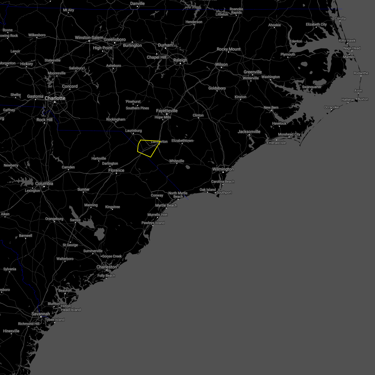 At 418 pm edt, a severe thunderstorm was located over elrod, or 12 miles west of lumberton, moving east at 40 mph (radar indicated). Hazards include 60 mph wind gusts and penny size hail. Expect wind damage to trees and power lines. Locations impacted include, lumberton, fairmont, rowland, raemon, south of the border, purvis, elrod, mcdonald, raynham and southeastern regional medical center. At 418 pm edt, a severe thunderstorm was located over elrod, or 12 miles west of lumberton, moving east at 40 mph (radar indicated). Hazards include 60 mph wind gusts and penny size hail. Expect wind damage to trees and power lines. Locations impacted include, lumberton, fairmont, rowland, raemon, south of the border, purvis, elrod, mcdonald, raynham and southeastern regional medical center.
|
| 8/1/2021 4:05 PM EDT |
 At 405 pm edt, a severe thunderstorm was located near raemon, or 12 miles north of dillon, moving east at 40 mph (radar indicated). Hazards include 60 mph wind gusts and penny size hail. expect wind damage to trees and power lines At 405 pm edt, a severe thunderstorm was located near raemon, or 12 miles north of dillon, moving east at 40 mph (radar indicated). Hazards include 60 mph wind gusts and penny size hail. expect wind damage to trees and power lines
|
| 9/25/2020 6:42 PM EDT |
 The tornado warning for south central robeson and southeastern dillon counties will expire at 645 pm edt, the storm which prompted the warning has moved out of the area. therefore, the warning will be allowed to expire. The tornado warning for south central robeson and southeastern dillon counties will expire at 645 pm edt, the storm which prompted the warning has moved out of the area. therefore, the warning will be allowed to expire.
|
| 9/25/2020 6:42 PM EDT |
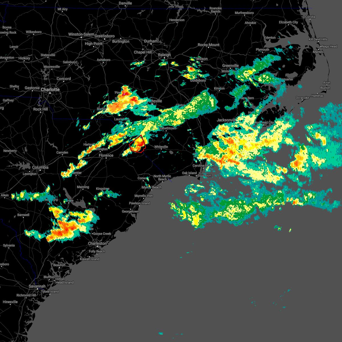 The tornado warning for south central robeson and southeastern dillon counties will expire at 645 pm edt, the storm which prompted the warning has moved out of the area. therefore, the warning will be allowed to expire. The tornado warning for south central robeson and southeastern dillon counties will expire at 645 pm edt, the storm which prompted the warning has moved out of the area. therefore, the warning will be allowed to expire.
|
| 9/25/2020 6:30 PM EDT |
 At 628 pm edt, a severe thunderstorm capable of producing a tornado was located near kemper, or 8 miles east of dillon, moving east at 20 mph (radar indicated rotation). Hazards include tornado. Expect damage to mobile homes, roofs, and vehicles. this dangerous storm will be near, lake view around 635 pm edt. fairmont around 655 pm edt. barnesville around 700 pm edt. Other locations impacted by this tornadic thunderstorm include marietta. At 628 pm edt, a severe thunderstorm capable of producing a tornado was located near kemper, or 8 miles east of dillon, moving east at 20 mph (radar indicated rotation). Hazards include tornado. Expect damage to mobile homes, roofs, and vehicles. this dangerous storm will be near, lake view around 635 pm edt. fairmont around 655 pm edt. barnesville around 700 pm edt. Other locations impacted by this tornadic thunderstorm include marietta.
|
| 9/25/2020 6:30 PM EDT |
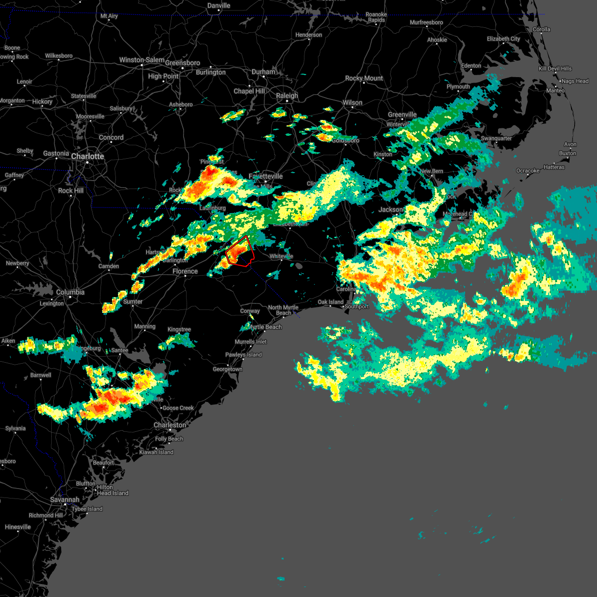 At 628 pm edt, a severe thunderstorm capable of producing a tornado was located near kemper, or 8 miles east of dillon, moving east at 20 mph (radar indicated rotation). Hazards include tornado. Expect damage to mobile homes, roofs, and vehicles. this dangerous storm will be near, lake view around 635 pm edt. fairmont around 655 pm edt. barnesville around 700 pm edt. Other locations impacted by this tornadic thunderstorm include marietta. At 628 pm edt, a severe thunderstorm capable of producing a tornado was located near kemper, or 8 miles east of dillon, moving east at 20 mph (radar indicated rotation). Hazards include tornado. Expect damage to mobile homes, roofs, and vehicles. this dangerous storm will be near, lake view around 635 pm edt. fairmont around 655 pm edt. barnesville around 700 pm edt. Other locations impacted by this tornadic thunderstorm include marietta.
|
| 9/25/2020 6:14 PM EDT |
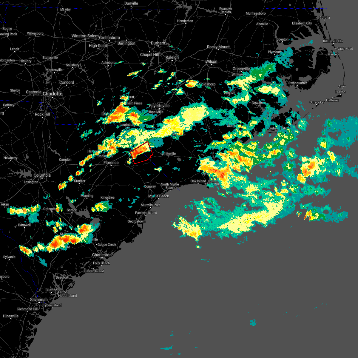 At 614 pm edt, a severe thunderstorm capable of producing a tornado was located near floydale, or near dillon, moving east at 25 mph (radar indicated rotation). Hazards include tornado. Expect damage to mobile homes, roofs, and vehicles. this dangerous storm will be near, kemper around 630 pm edt. lake view around 635 pm edt. fairmont and barnesville around 645 pm edt. Other locations impacted by this tornadic thunderstorm include marietta and mcleod medical center. At 614 pm edt, a severe thunderstorm capable of producing a tornado was located near floydale, or near dillon, moving east at 25 mph (radar indicated rotation). Hazards include tornado. Expect damage to mobile homes, roofs, and vehicles. this dangerous storm will be near, kemper around 630 pm edt. lake view around 635 pm edt. fairmont and barnesville around 645 pm edt. Other locations impacted by this tornadic thunderstorm include marietta and mcleod medical center.
|
| 8/7/2020 6:58 PM EDT |
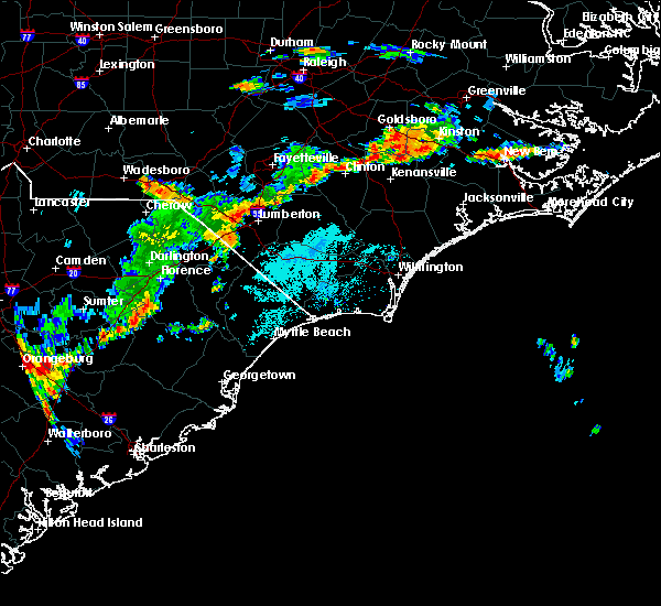 At 657 pm edt, a severe thunderstorm was located near fairmont, or 13 miles east of dillon, moving east at 25 mph (radar indicated). Hazards include 60 mph wind gusts. expect wind damage to trees and power lines At 657 pm edt, a severe thunderstorm was located near fairmont, or 13 miles east of dillon, moving east at 25 mph (radar indicated). Hazards include 60 mph wind gusts. expect wind damage to trees and power lines
|
| 5/22/2020 6:32 PM EDT |
 At 631 pm edt, severe thunderstorms were located along a line extending from near tobermory to fairmont, moving southeast at 25 mph (radar indicated). Hazards include 60 mph wind gusts and quarter size hail. Minor hail damage to vehicles is possible. Expect wind damage to trees and power lines. At 631 pm edt, severe thunderstorms were located along a line extending from near tobermory to fairmont, moving southeast at 25 mph (radar indicated). Hazards include 60 mph wind gusts and quarter size hail. Minor hail damage to vehicles is possible. Expect wind damage to trees and power lines.
|
| 5/22/2020 6:16 PM EDT |
 At 615 pm edt, severe thunderstorms were located along a line extending from rex to near pembroke to near south of the border, moving east at 55 mph (radar indicated). Hazards include 60 mph wind gusts and penny size hail. Expect wind damage to trees and power lines. locations impacted include, lumberton, dillon, red springs, pembroke, fairmont, maxton, st. Pauls, rowland, rex, hamer, south of the border, hestertown, shannon, buie, robeson community college, wakulla, minturn, elrod, smiths and howellsville. At 615 pm edt, severe thunderstorms were located along a line extending from rex to near pembroke to near south of the border, moving east at 55 mph (radar indicated). Hazards include 60 mph wind gusts and penny size hail. Expect wind damage to trees and power lines. locations impacted include, lumberton, dillon, red springs, pembroke, fairmont, maxton, st. Pauls, rowland, rex, hamer, south of the border, hestertown, shannon, buie, robeson community college, wakulla, minturn, elrod, smiths and howellsville.
|
| 5/22/2020 5:36 PM EDT |
 At 536 pm edt, severe thunderstorms were located along a line extending from 8 miles northwest of hoffman to near chavistown, moving east at 50 mph (radar indicated). Hazards include 60 mph wind gusts and nickel size hail. expect wind damage to trees and power lines At 536 pm edt, severe thunderstorms were located along a line extending from 8 miles northwest of hoffman to near chavistown, moving east at 50 mph (radar indicated). Hazards include 60 mph wind gusts and nickel size hail. expect wind damage to trees and power lines
|
| 5/5/2020 9:24 PM EDT |
 The severe thunderstorm warning for southeastern robeson, western bladen and northwestern columbus counties will expire at 930 pm edt, the storms which prompted the warning have weakened below severe limits, and no longer pose an immediate threat to life or property. therefore, the warning will be allowed to expire. however small hail and gusty winds are still possible with these thunderstorms. a severe thunderstorm watch remains in effect until 1100 pm edt for southeastern north carolina. a severe thunderstorm watch also remains in effect until 100 am edt for southeastern north carolina. The severe thunderstorm warning for southeastern robeson, western bladen and northwestern columbus counties will expire at 930 pm edt, the storms which prompted the warning have weakened below severe limits, and no longer pose an immediate threat to life or property. therefore, the warning will be allowed to expire. however small hail and gusty winds are still possible with these thunderstorms. a severe thunderstorm watch remains in effect until 1100 pm edt for southeastern north carolina. a severe thunderstorm watch also remains in effect until 100 am edt for southeastern north carolina.
|
| 5/5/2020 9:15 PM EDT |
 At 915 pm edt, severe thunderstorms were located along a line extending from near ruskin to near fair bluff, moving east at 40 mph (radar indicated). Hazards include 60 mph wind gusts and quarter size hail. Minor hail damage to vehicles is possible. expect wind damage to trees and power lines. locations impacted include, elizabethtown, fairmont, bladenboro, fair bluff, boardman, smiths, bladen community college, abbottsburg, butters, barnesville, ruskin, white oak, evergreen, clarkton, white lake, dublin, cerro gordo, marietta, proctorville and orrum. People attending bladen county hospital outdoor tent facilities may be affected by this storm and are urged to follow the precautionary measures of the onsite officials. At 915 pm edt, severe thunderstorms were located along a line extending from near ruskin to near fair bluff, moving east at 40 mph (radar indicated). Hazards include 60 mph wind gusts and quarter size hail. Minor hail damage to vehicles is possible. expect wind damage to trees and power lines. locations impacted include, elizabethtown, fairmont, bladenboro, fair bluff, boardman, smiths, bladen community college, abbottsburg, butters, barnesville, ruskin, white oak, evergreen, clarkton, white lake, dublin, cerro gordo, marietta, proctorville and orrum. People attending bladen county hospital outdoor tent facilities may be affected by this storm and are urged to follow the precautionary measures of the onsite officials.
|
| 5/5/2020 9:07 PM EDT |
 The severe thunderstorm warning for robeson, central dillon and east central marlboro counties will expire at 915 pm edt, the storm which prompted the warning has moved out of the area. therefore, the warning will be allowed to expire. however heavy rain is still possible with this thunderstorm. a severe thunderstorm watch remains in effect until 1100 pm edt for southeastern north carolina, and northeastern south carolina. remember, a severe thunderstorm warning still remains in effect for southeast robeson county through 9:30pm. The severe thunderstorm warning for robeson, central dillon and east central marlboro counties will expire at 915 pm edt, the storm which prompted the warning has moved out of the area. therefore, the warning will be allowed to expire. however heavy rain is still possible with this thunderstorm. a severe thunderstorm watch remains in effect until 1100 pm edt for southeastern north carolina, and northeastern south carolina. remember, a severe thunderstorm warning still remains in effect for southeast robeson county through 9:30pm.
|
| 5/5/2020 8:53 PM EDT |
 At 853 pm edt, severe thunderstorms were located along a line extending from duart to 6 miles northwest of kemper, moving east at 40 mph (radar indicated). Hazards include 60 mph wind gusts and quarter size hail. Minor hail damage to vehicles is possible. Expect wind damage to trees and power lines. At 853 pm edt, severe thunderstorms were located along a line extending from duart to 6 miles northwest of kemper, moving east at 40 mph (radar indicated). Hazards include 60 mph wind gusts and quarter size hail. Minor hail damage to vehicles is possible. Expect wind damage to trees and power lines.
|
| 5/5/2020 8:43 PM EDT |
 At 843 pm edt, a severe thunderstorm was located over raemon, or 13 miles southeast of laurinburg, moving east at 35 mph (radar indicated). Hazards include 60 mph wind gusts and quarter size hail. Minor hail damage to vehicles is possible. expect wind damage to trees and power lines. Locations impacted include, lumberton, dillon, red springs, pembroke, fairmont, maxton, rowland, clio, rex, hamer, south of the border, shannon, buie, wakulla, minturn, elrod, raemon, barnesville, purvis and prospect. At 843 pm edt, a severe thunderstorm was located over raemon, or 13 miles southeast of laurinburg, moving east at 35 mph (radar indicated). Hazards include 60 mph wind gusts and quarter size hail. Minor hail damage to vehicles is possible. expect wind damage to trees and power lines. Locations impacted include, lumberton, dillon, red springs, pembroke, fairmont, maxton, rowland, clio, rex, hamer, south of the border, shannon, buie, wakulla, minturn, elrod, raemon, barnesville, purvis and prospect.
|
| 5/5/2020 8:18 PM EDT |
 At 817 pm edt, a severe thunderstorm was located over mccoll, or near bennettsville, moving east at 40 mph (radar indicated). Hazards include 60 mph wind gusts and quarter size hail. Minor hail damage to vehicles is possible. Expect wind damage to trees and power lines. At 817 pm edt, a severe thunderstorm was located over mccoll, or near bennettsville, moving east at 40 mph (radar indicated). Hazards include 60 mph wind gusts and quarter size hail. Minor hail damage to vehicles is possible. Expect wind damage to trees and power lines.
|
| 4/13/2020 7:53 AM EDT |
 At 752 am edt, a severe thunderstorm was located near lumberton, moving northeast at 90 mph (radar indicated). Hazards include 70 mph wind gusts. Expect considerable tree damage. Damage is likely to mobile homes, roofs, and outbuildings. At 752 am edt, a severe thunderstorm was located near lumberton, moving northeast at 90 mph (radar indicated). Hazards include 70 mph wind gusts. Expect considerable tree damage. Damage is likely to mobile homes, roofs, and outbuildings.
|
| 4/13/2020 7:32 AM EDT |
 At 732 am edt, a severe thunderstorm was located near minturn, or 11 miles north of dillon, moving northeast at 90 mph (radar indicated). Hazards include 60 mph wind gusts. expect wind damage to trees and power lines At 732 am edt, a severe thunderstorm was located near minturn, or 11 miles north of dillon, moving northeast at 90 mph (radar indicated). Hazards include 60 mph wind gusts. expect wind damage to trees and power lines
|
| 1/12/2020 1:20 AM EST |
 At 120 am est, severe thunderstorms were located along a line extending from near jerome to near fairmont, moving northeast at 40 mph (radar indicated). Hazards include 60 mph wind gusts. Expect wind damage to trees and power lines. locations impacted include, lumberton, elizabethtown, fairmont, st. Pauls, bladenboro, rex, bladen community college, ammon, butters, hestertown, robeson community college, white oak, smiths, howellsville, tolarsville, duart, tobermory, ruskin, barker ten mile and jerome. At 120 am est, severe thunderstorms were located along a line extending from near jerome to near fairmont, moving northeast at 40 mph (radar indicated). Hazards include 60 mph wind gusts. Expect wind damage to trees and power lines. locations impacted include, lumberton, elizabethtown, fairmont, st. Pauls, bladenboro, rex, bladen community college, ammon, butters, hestertown, robeson community college, white oak, smiths, howellsville, tolarsville, duart, tobermory, ruskin, barker ten mile and jerome.
|
| 1/12/2020 1:13 AM EST |
 The severe thunderstorm warning for robeson. northwestern bladen. dillon and southeastern marlboro counties will expire at 115 am est. the storms which prompted the warning have moved out of the area. therefore, the warning will be allowed to expire. However gusty winds are still possible with these thunderstorms. The severe thunderstorm warning for robeson. northwestern bladen. dillon and southeastern marlboro counties will expire at 115 am est. the storms which prompted the warning have moved out of the area. therefore, the warning will be allowed to expire. However gusty winds are still possible with these thunderstorms.
|
| 1/12/2020 1:13 AM EST |
 The severe thunderstorm warning for robeson, northwestern bladen, dillon and southeastern marlboro counties will expire at 115 am est, the storms which prompted the warning have moved out of the area. therefore, the warning will be allowed to expire. however gusty winds are still possible with these thunderstorms. a severe thunderstorm watch remains in effect until 200 am est for southeastern north carolina, and northeastern south carolina. remember, a severe thunderstorm warning still remains in effect for robeson and northwest bladen counties until 2 am. remember, a tornado warning still remains in effect for central robeson county until 1:30 am. The severe thunderstorm warning for robeson, northwestern bladen, dillon and southeastern marlboro counties will expire at 115 am est, the storms which prompted the warning have moved out of the area. therefore, the warning will be allowed to expire. however gusty winds are still possible with these thunderstorms. a severe thunderstorm watch remains in effect until 200 am est for southeastern north carolina, and northeastern south carolina. remember, a severe thunderstorm warning still remains in effect for robeson and northwest bladen counties until 2 am. remember, a tornado warning still remains in effect for central robeson county until 1:30 am.
|
| 1/12/2020 1:10 AM EST |
 At 109 am est, severe thunderstorms were located along a line extending from near tobermory to near fairmont, moving northeast at 40 mph (radar indicated). Hazards include 60 mph wind gusts. expect wind damage to trees and power lines At 109 am est, severe thunderstorms were located along a line extending from near tobermory to near fairmont, moving northeast at 40 mph (radar indicated). Hazards include 60 mph wind gusts. expect wind damage to trees and power lines
|
| 1/12/2020 1:02 AM EST |
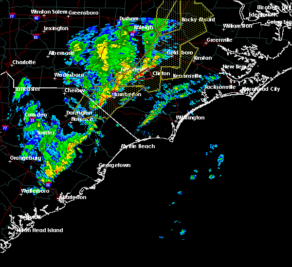 At 102 am est, a severe thunderstorm capable of producing a tornado was located near purvis, or 12 miles southwest of lumberton, moving northeast at 50 mph (radar indicated rotation). Hazards include tornado. Flying debris will be dangerous to those caught without shelter. mobile homes will be damaged or destroyed. damage to roofs, windows, and vehicles will occur. Tree damage is likely. At 102 am est, a severe thunderstorm capable of producing a tornado was located near purvis, or 12 miles southwest of lumberton, moving northeast at 50 mph (radar indicated rotation). Hazards include tornado. Flying debris will be dangerous to those caught without shelter. mobile homes will be damaged or destroyed. damage to roofs, windows, and vehicles will occur. Tree damage is likely.
|
| 1/12/2020 12:28 AM EST |
 At 1228 am est, severe thunderstorms were located along a line extending from 8 miles north of raeford to 7 miles northwest of brownsville, moving northeast at 75 mph (radar indicated). Hazards include 60 mph wind gusts. expect wind damage to trees and power lines At 1228 am est, severe thunderstorms were located along a line extending from 8 miles north of raeford to 7 miles northwest of brownsville, moving northeast at 75 mph (radar indicated). Hazards include 60 mph wind gusts. expect wind damage to trees and power lines
|
| 1/11/2020 11:39 PM EST |
 At 1138 pm est, severe thunderstorms were located along a line extending from fort bragg to 7 miles northeast of mulberry, moving east at 45 mph (radar indicated). Hazards include 60 mph wind gusts. expect wind damage to trees and power lines At 1138 pm est, severe thunderstorms were located along a line extending from fort bragg to 7 miles northeast of mulberry, moving east at 45 mph (radar indicated). Hazards include 60 mph wind gusts. expect wind damage to trees and power lines
|
| 7/4/2019 4:19 PM EDT |
 At 419 pm edt, a severe thunderstorm was located near south of the border, or 8 miles east of dillon, moving north at 30 mph (radar indicated). Hazards include 60 mph wind gusts and quarter size hail. Minor hail damage to vehicles is possible. Expect wind damage to trees and power lines. At 419 pm edt, a severe thunderstorm was located near south of the border, or 8 miles east of dillon, moving north at 30 mph (radar indicated). Hazards include 60 mph wind gusts and quarter size hail. Minor hail damage to vehicles is possible. Expect wind damage to trees and power lines.
|
| 6/22/2019 6:41 PM EDT | Public reported large trees down near the town of fairmont with damage to power lines. duke energy also shows widespread power outages in the area. time estimated via r in robeson county NC, 0.5 miles NNW of Fairmont, NC |
| 6/22/2019 6:14 PM EDT |
 At 614 pm edt, severe thunderstorms were located along a line extending from raemon to brownsville, moving southeast at 60 mph (public). Hazards include 60 mph wind gusts and quarter size hail. Minor hail damage to vehicles is possible. Expect wind damage to trees and power lines. At 614 pm edt, severe thunderstorms were located along a line extending from raemon to brownsville, moving southeast at 60 mph (public). Hazards include 60 mph wind gusts and quarter size hail. Minor hail damage to vehicles is possible. Expect wind damage to trees and power lines.
|
| 5/31/2019 8:02 PM EDT |
 At 801 pm edt, severe thunderstorms were located along a line extending from 6 miles east of dillon to 16 miles south of lumberton to near mullins, moving northeast at 60 mph (radar indicated). Hazards include 60 mph wind gusts and quarter size hail. Minor hail damage to vehicles is possible. Expect wind damage to trees and powerlines. At 801 pm edt, severe thunderstorms were located along a line extending from 6 miles east of dillon to 16 miles south of lumberton to near mullins, moving northeast at 60 mph (radar indicated). Hazards include 60 mph wind gusts and quarter size hail. Minor hail damage to vehicles is possible. Expect wind damage to trees and powerlines.
|
| 4/19/2019 3:39 PM EDT |
 At 339 pm edt, severe thunderstorms were located along a line extending from 7 miles west of laurinburg to rains, moving northeast at 65 mph (radar indicated). Hazards include 70 mph wind gusts. Expect considerable tree damage. Damage is likely to mobile homes, roofs, and outbuildings. At 339 pm edt, severe thunderstorms were located along a line extending from 7 miles west of laurinburg to rains, moving northeast at 65 mph (radar indicated). Hazards include 70 mph wind gusts. Expect considerable tree damage. Damage is likely to mobile homes, roofs, and outbuildings.
|
| 8/2/2018 1:36 PM EDT |
 The severe thunderstorm warning for northeastern robeson and northwestern bladen counties will expire at 145 pm edt, the storm which prompted the warning has weakened below severe limits, and no longer poses an immediate threat to life or property. therefore, the warning will be allowed to expire. The severe thunderstorm warning for northeastern robeson and northwestern bladen counties will expire at 145 pm edt, the storm which prompted the warning has weakened below severe limits, and no longer poses an immediate threat to life or property. therefore, the warning will be allowed to expire.
|
| 8/2/2018 1:11 PM EDT |
 At 111 pm edt, a severe thunderstorm was located over hestertown, or near lumberton, moving north at 35 mph (radar indicated). Hazards include 60 mph wind gusts. Minor hail damage to vehicles is possible. Expect wind damage to trees and power lines. At 111 pm edt, a severe thunderstorm was located over hestertown, or near lumberton, moving north at 35 mph (radar indicated). Hazards include 60 mph wind gusts. Minor hail damage to vehicles is possible. Expect wind damage to trees and power lines.
|
| 6/18/2018 5:57 PM EDT |
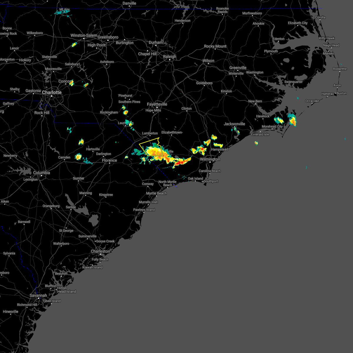 The severe thunderstorm warning for southeastern robeson and northwestern columbus counties will expire at 600 pm edt. the storm which prompted the warning has moved out of the area. therefore, the warning will be allowed to expire. however gusty winds are still possible with this thunderstorm. A special weather statement is valid for areas south of the expiring warning. The severe thunderstorm warning for southeastern robeson and northwestern columbus counties will expire at 600 pm edt. the storm which prompted the warning has moved out of the area. therefore, the warning will be allowed to expire. however gusty winds are still possible with this thunderstorm. A special weather statement is valid for areas south of the expiring warning.
|
| 6/18/2018 5:31 PM EDT |
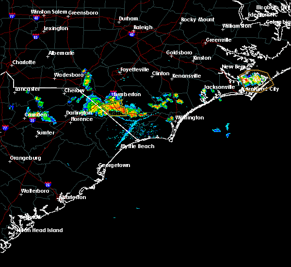 At 530 pm edt, a severe thunderstorm was located over barnesville, or 13 miles south of lumberton, moving south at 25 mph (law enforcement). Hazards include 60 mph wind gusts. Expect damage trees and power lines. locations impacted include, fairmont, chadbourn, fair bluff, boardman, barnesville, evergreen, southeastern community college, cerro gordo, proctorville and orrum. This includes us route 74 between mile markers 367 and 387. At 530 pm edt, a severe thunderstorm was located over barnesville, or 13 miles south of lumberton, moving south at 25 mph (law enforcement). Hazards include 60 mph wind gusts. Expect damage trees and power lines. locations impacted include, fairmont, chadbourn, fair bluff, boardman, barnesville, evergreen, southeastern community college, cerro gordo, proctorville and orrum. This includes us route 74 between mile markers 367 and 387.
|
| 6/18/2018 4:54 PM EDT |
 At 454 pm edt, severe thunderstorms were located along a line extending from hestertown to near minturn, moving southwest at 20 mph (radar indicated). Hazards include 60 mph wind gusts. expect damage trees and power lines At 454 pm edt, severe thunderstorms were located along a line extending from hestertown to near minturn, moving southwest at 20 mph (radar indicated). Hazards include 60 mph wind gusts. expect damage trees and power lines
|
| 3/1/2018 5:22 PM EST |
 At 521 pm est, severe thunderstorms were located along a line extending from near tolarsville to proctorville, nichols, and rains, moving east at 50 to 55 mph (radar indicated). Hazards include 60 mph wind gusts. Expect downed trees and power lines in the areas that receive the strongest winds. locations impacted include, lumberton, marion, whiteville, mullins, elizabethtown, fairmont, tabor city, loris, st. Pauls, chadbourn, bladenboro, fair bluff, lake view, boardman, ammon, hestertown, white oak, smiths and howellsville. At 521 pm est, severe thunderstorms were located along a line extending from near tolarsville to proctorville, nichols, and rains, moving east at 50 to 55 mph (radar indicated). Hazards include 60 mph wind gusts. Expect downed trees and power lines in the areas that receive the strongest winds. locations impacted include, lumberton, marion, whiteville, mullins, elizabethtown, fairmont, tabor city, loris, st. Pauls, chadbourn, bladenboro, fair bluff, lake view, boardman, ammon, hestertown, white oak, smiths and howellsville.
|
| 3/1/2018 5:05 PM EST | A few trees down in robeson county NC, 6.7 miles ESE of Fairmont, NC |
| 3/1/2018 5:04 PM EST |
 At 502 pm est, severe thunderstorms were located along a line extending from near parkton to rowland to near latta to just southwest of sellers, moving east at 40 to 50 mph (radar indicated). Hazards include 60 mph wind gusts. expect downed trees and power lines with the strongest winds At 502 pm est, severe thunderstorms were located along a line extending from near parkton to rowland to near latta to just southwest of sellers, moving east at 40 to 50 mph (radar indicated). Hazards include 60 mph wind gusts. expect downed trees and power lines with the strongest winds
|
| 8/23/2017 7:21 PM EDT |
 The severe thunderstorm warning for robeson and dillon counties will expire at 730 pm edt, the storms which prompted the warning have moved out of the warned area. therefore, the warning will be allowed to expire. another severe thunderstorm warning is in effect until 845 pm just downstream of this expiring warning. The severe thunderstorm warning for robeson and dillon counties will expire at 730 pm edt, the storms which prompted the warning have moved out of the warned area. therefore, the warning will be allowed to expire. another severe thunderstorm warning is in effect until 845 pm just downstream of this expiring warning.
|
| 8/23/2017 7:20 PM EDT | Trees down in fairmon in robeson county NC, 0.5 miles ESE of Fairmont, NC |
| 8/23/2017 7:10 PM EDT |
 At 710 pm edt, severe thunderstorms were located along a line extending from near barnesville to near zion, moving southeast at 20 mph (radar indicated). Hazards include 60 mph wind gusts and quarter size hail. Minor hail damage to vehicles is possible. Expect wind damage to trees and power lines. At 710 pm edt, severe thunderstorms were located along a line extending from near barnesville to near zion, moving southeast at 20 mph (radar indicated). Hazards include 60 mph wind gusts and quarter size hail. Minor hail damage to vehicles is possible. Expect wind damage to trees and power lines.
|
| 8/23/2017 6:57 PM EDT |
 At 656 pm edt, severe thunderstorms were located along a line extending from south of the border to near latta, moving east at 30 mph (radar indicated). Hazards include 60 mph wind gusts and quarter size hail. Minor hail damage to vehicles is possible. expect wind damage to trees and power lines. locations impacted include, lumberton, dillon, red springs, pembroke, fairmont, maxton, latta, rowland, lake view, fork, hamer, south of the border, hestertown, shannon, buie, robeson community college, wakulla, minturn, elrod and raemon. this includes the following highways, interstate 74 between mile markers 191 and 214. interstate 95 in south carolina between mile markers 176 and 198. interstate 95 in north carolina between mile markers 1 and 25. Us route 74 between mile markers 365 and 373. At 656 pm edt, severe thunderstorms were located along a line extending from south of the border to near latta, moving east at 30 mph (radar indicated). Hazards include 60 mph wind gusts and quarter size hail. Minor hail damage to vehicles is possible. expect wind damage to trees and power lines. locations impacted include, lumberton, dillon, red springs, pembroke, fairmont, maxton, latta, rowland, lake view, fork, hamer, south of the border, hestertown, shannon, buie, robeson community college, wakulla, minturn, elrod and raemon. this includes the following highways, interstate 74 between mile markers 191 and 214. interstate 95 in south carolina between mile markers 176 and 198. interstate 95 in north carolina between mile markers 1 and 25. Us route 74 between mile markers 365 and 373.
|
| 8/23/2017 6:34 PM EDT |
 At 633 pm edt, severe thunderstorms were located along a line extending from minturn to near brownsville, moving southeast at 30 mph (radar indicated). Hazards include 60 mph wind gusts and quarter size hail. Minor hail damage to vehicles is possible. Expect wind damage to trees and power lines. At 633 pm edt, severe thunderstorms were located along a line extending from minturn to near brownsville, moving southeast at 30 mph (radar indicated). Hazards include 60 mph wind gusts and quarter size hail. Minor hail damage to vehicles is possible. Expect wind damage to trees and power lines.
|
| 7/23/2017 6:41 PM EDT |
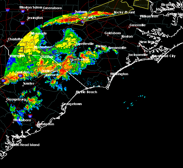 At 639 pm edt, a severe thunderstorm was located over barnesville, or 13 miles south of lumberton, moving north at 5 mph (radar indicated). Hazards include 60 mph wind gusts. Expect damage trees. locations impacted include, lumberton, fairmont, smiths, hestertown, robeson community college, barker ten mile, purvis, elrod, howellsville, proctorville, mcdonald, orrum, raynham and southeastern regional medical center. this includes the following highways, interstate 74 between mile markers 212 and 202, and between mile markers 203 and 210, and near mile marker 214. interstate 95 in north carolina between mile markers 3 and 23. Us route 74 between mile markers 365 and 374. At 639 pm edt, a severe thunderstorm was located over barnesville, or 13 miles south of lumberton, moving north at 5 mph (radar indicated). Hazards include 60 mph wind gusts. Expect damage trees. locations impacted include, lumberton, fairmont, smiths, hestertown, robeson community college, barker ten mile, purvis, elrod, howellsville, proctorville, mcdonald, orrum, raynham and southeastern regional medical center. this includes the following highways, interstate 74 between mile markers 212 and 202, and between mile markers 203 and 210, and near mile marker 214. interstate 95 in north carolina between mile markers 3 and 23. Us route 74 between mile markers 365 and 374.
|
| 7/23/2017 6:15 PM EDT | Trees dow in robeson county NC, 0.5 miles ESE of Fairmont, NC |
| 7/23/2017 6:05 PM EDT |
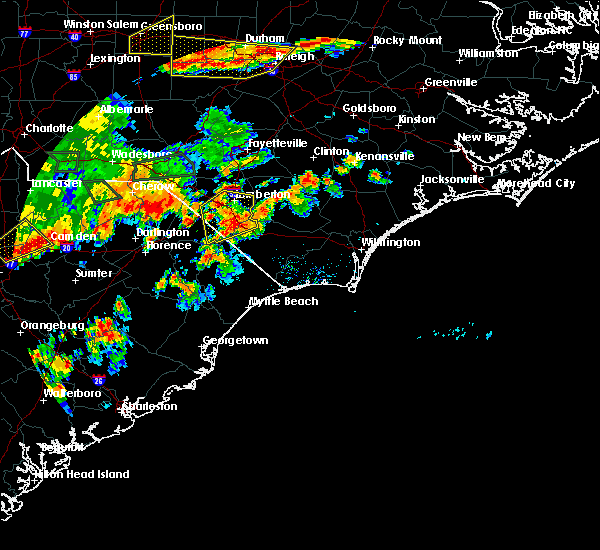 At 605 pm edt, a severe thunderstorm was located over barnesville, or 17 miles south of lumberton, moving north at 5 to 10 mph (radar indicated). Hazards include 60 mph wind gusts and nickel size hail. expect damage trees and power lines At 605 pm edt, a severe thunderstorm was located over barnesville, or 17 miles south of lumberton, moving north at 5 to 10 mph (radar indicated). Hazards include 60 mph wind gusts and nickel size hail. expect damage trees and power lines
|
| 7/7/2017 7:06 PM EDT |
 At 645 pm edt, a severe thunderstorm was located over rowland, or 9 miles north of dillon, moving east at 30 mph (radar indicated). Hazards include 60 mph wind gusts. expect wind damage to trees and power lines At 645 pm edt, a severe thunderstorm was located over rowland, or 9 miles north of dillon, moving east at 30 mph (radar indicated). Hazards include 60 mph wind gusts. expect wind damage to trees and power lines
|
| 7/7/2017 7:06 PM EDT |
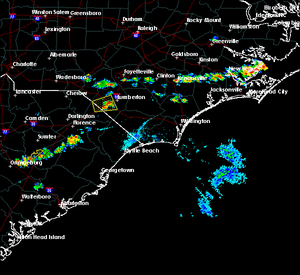 At 706 pm edt, a severe thunderstorm was located near fairmont, or near lumberton, moving east at 30 mph (radar indicated). Hazards include 60 mph wind gusts. Expect wind damage to trees and power lines. locations impacted include, pembroke, fairmont, rowland, raemon, hamer, south of the border, purvis, elrod, proctorville, mcdonald and raynham. this includes the following highways, interstate 74 between mile markers 212 and 210, and between mile markers 199 and 198, and near mile marker 200. interstate 95 in south carolina between mile markers 193 and 198. Interstate 95 in north carolina between mile markers 1 and 16. At 706 pm edt, a severe thunderstorm was located near fairmont, or near lumberton, moving east at 30 mph (radar indicated). Hazards include 60 mph wind gusts. Expect wind damage to trees and power lines. locations impacted include, pembroke, fairmont, rowland, raemon, hamer, south of the border, purvis, elrod, proctorville, mcdonald and raynham. this includes the following highways, interstate 74 between mile markers 212 and 210, and between mile markers 199 and 198, and near mile marker 200. interstate 95 in south carolina between mile markers 193 and 198. Interstate 95 in north carolina between mile markers 1 and 16.
|
| 7/7/2017 6:46 PM EDT |
 At 645 pm edt, a severe thunderstorm was located over rowland, or 9 miles north of dillon, moving east at 30 mph (radar indicated). Hazards include 60 mph wind gusts. expect wind damage to trees and power lines At 645 pm edt, a severe thunderstorm was located over rowland, or 9 miles north of dillon, moving east at 30 mph (radar indicated). Hazards include 60 mph wind gusts. expect wind damage to trees and power lines
|
| 5/5/2017 4:11 AM EDT |
 At 411 am edt, severe thunderstorms were located along a line extending from near fairmont to 7 miles northeast of galivants ferry, moving northeast at 50 mph (radar indicated). Hazards include 60 mph wind gusts. expect damage trees and power lines At 411 am edt, severe thunderstorms were located along a line extending from near fairmont to 7 miles northeast of galivants ferry, moving northeast at 50 mph (radar indicated). Hazards include 60 mph wind gusts. expect damage trees and power lines
|
| 4/5/2017 5:42 PM EDT |
 At 542 pm edt, a severe thunderstorm was located near boardman, or 11 miles southeast of lumberton, moving northeast at 35 mph (radar indicated). Hazards include 60 mph wind gusts and quarter size hail. Hail damage to vehicles is expected. expect wind damage to roofs, siding, and trees. locations impacted include, lumberton, whiteville, chadbourn, bladenboro, fair bluff, boardman, bladen community college, butters, hestertown, southeastern community college, smiths, howellsville, abbottsburg, elkton, barnesville, emerson, evergreen, barker ten mile, clarkton and dublin. this includes the following highways, interstate 74 between mile markers 212 and 208, and between mile markers 209 and 210, and near mile marker 214. interstate 95 in north carolina between mile markers 12 and 21. us route 74 between mile markers 365 and 396. A tornado watch remains in effect until 800 pm edt for southeastern north carolina, and northeastern south carolina. At 542 pm edt, a severe thunderstorm was located near boardman, or 11 miles southeast of lumberton, moving northeast at 35 mph (radar indicated). Hazards include 60 mph wind gusts and quarter size hail. Hail damage to vehicles is expected. expect wind damage to roofs, siding, and trees. locations impacted include, lumberton, whiteville, chadbourn, bladenboro, fair bluff, boardman, bladen community college, butters, hestertown, southeastern community college, smiths, howellsville, abbottsburg, elkton, barnesville, emerson, evergreen, barker ten mile, clarkton and dublin. this includes the following highways, interstate 74 between mile markers 212 and 208, and between mile markers 209 and 210, and near mile marker 214. interstate 95 in north carolina between mile markers 12 and 21. us route 74 between mile markers 365 and 396. A tornado watch remains in effect until 800 pm edt for southeastern north carolina, and northeastern south carolina.
|
| 4/5/2017 5:29 PM EDT |
 At 529 pm edt, a severe thunderstorm was located over barnesville, or 13 miles south of lumberton, moving northeast at 35 mph (radar indicated). Hazards include 60 mph wind gusts and quarter size hail. Hail damage to vehicles is expected. expect wind damage to roofs, siding, and trees. locations impacted include, lumberton, whiteville, fairmont, chadbourn, bladenboro, fair bluff, boardman, bladen community college, butters, hestertown, southeastern community college, smiths, howellsville, abbottsburg, elkton, barnesville, emerson, evergreen, barker ten mile and clarkton. this includes the following highways, interstate 74 between mile markers 212 and 208, and between mile markers 209 and 210, and near mile marker 214. interstate 95 in north carolina between mile markers 1 and 21. us route 74 between mile markers 365 and 396. A tornado watch remains in effect until 800 pm edt for southeastern north carolina, and northeastern south carolina. At 529 pm edt, a severe thunderstorm was located over barnesville, or 13 miles south of lumberton, moving northeast at 35 mph (radar indicated). Hazards include 60 mph wind gusts and quarter size hail. Hail damage to vehicles is expected. expect wind damage to roofs, siding, and trees. locations impacted include, lumberton, whiteville, fairmont, chadbourn, bladenboro, fair bluff, boardman, bladen community college, butters, hestertown, southeastern community college, smiths, howellsville, abbottsburg, elkton, barnesville, emerson, evergreen, barker ten mile and clarkton. this includes the following highways, interstate 74 between mile markers 212 and 208, and between mile markers 209 and 210, and near mile marker 214. interstate 95 in north carolina between mile markers 1 and 21. us route 74 between mile markers 365 and 396. A tornado watch remains in effect until 800 pm edt for southeastern north carolina, and northeastern south carolina.
|
| 4/5/2017 5:02 PM EDT |
 At 502 pm edt, a severe thunderstorm was located over floydale, or near dillon, moving northeast at 35 mph (radar indicated). Hazards include 60 mph wind gusts and quarter size hail. Hail damage to vehicles is expected. Expect wind damage to roofs, siding, and trees. At 502 pm edt, a severe thunderstorm was located over floydale, or near dillon, moving northeast at 35 mph (radar indicated). Hazards include 60 mph wind gusts and quarter size hail. Hail damage to vehicles is expected. Expect wind damage to roofs, siding, and trees.
|
| 3/21/2017 11:58 PM EDT |
 At 1158 pm edt, a severe thunderstorm was located over bingham, or 8 miles west of dillon, moving east at 25 mph (radar indicated). Hazards include 60 mph wind gusts and quarter size hail. Hail damage to vehicles is expected. Expect wind damage to roofs, siding, and trees. At 1158 pm edt, a severe thunderstorm was located over bingham, or 8 miles west of dillon, moving east at 25 mph (radar indicated). Hazards include 60 mph wind gusts and quarter size hail. Hail damage to vehicles is expected. Expect wind damage to roofs, siding, and trees.
|
| 3/18/2017 6:48 PM EDT |
 At 647 pm edt, a severe thunderstorm was located over robeson community college, or near lumberton, moving east at 40 mph (radar indicated). Hazards include 60 mph wind gusts and quarter size hail. Hail damage to vehicles is expected. expect wind damage to roofs, siding, and trees. locations impacted include, lumberton, fairmont, st. Pauls, smiths, howellsville, tolarsville, hestertown, robeson community college, barker ten mile, rennert, proctorville, mcdonald, orrum, raynham and southeastern regional medical center. At 647 pm edt, a severe thunderstorm was located over robeson community college, or near lumberton, moving east at 40 mph (radar indicated). Hazards include 60 mph wind gusts and quarter size hail. Hail damage to vehicles is expected. expect wind damage to roofs, siding, and trees. locations impacted include, lumberton, fairmont, st. Pauls, smiths, howellsville, tolarsville, hestertown, robeson community college, barker ten mile, rennert, proctorville, mcdonald, orrum, raynham and southeastern regional medical center.
|
| 3/18/2017 6:21 PM EDT |
 At 620 pm edt, a severe thunderstorm was located over maxton, or near laurinburg, moving east at 55 mph (radar indicated). Hazards include 60 mph wind gusts and quarter size hail. Hail damage to vehicles is expected. Expect wind damage to roofs, siding, and trees. At 620 pm edt, a severe thunderstorm was located over maxton, or near laurinburg, moving east at 55 mph (radar indicated). Hazards include 60 mph wind gusts and quarter size hail. Hail damage to vehicles is expected. Expect wind damage to roofs, siding, and trees.
|
| 7/19/2016 9:50 PM EDT |
 At 949 pm edt, a severe thunderstorm was located over hestertown, or near lumberton, moving south at 20 mph (trained weather spotters). Hazards include 60 mph wind gusts and penny size hail. Expect damage to roofs. siding. and trees. locations impacted include, lumberton, dillon, red springs, pembroke, fairmont, maxton, st. Pauls, chadbourn, latta, rowland, fair bluff, lake view, boardman, kemper, howellsville, tolarsville, little rock, hamer, wakulla and elrod. At 949 pm edt, a severe thunderstorm was located over hestertown, or near lumberton, moving south at 20 mph (trained weather spotters). Hazards include 60 mph wind gusts and penny size hail. Expect damage to roofs. siding. and trees. locations impacted include, lumberton, dillon, red springs, pembroke, fairmont, maxton, st. Pauls, chadbourn, latta, rowland, fair bluff, lake view, boardman, kemper, howellsville, tolarsville, little rock, hamer, wakulla and elrod.
|
| 7/19/2016 8:56 PM EDT |
 At 856 pm edt, a severe thunderstorm was located over howellsville, or near lumberton, moving south at 25 mph (radar indicated). Hazards include 60 mph wind gusts and quarter size hail. Hail damage to vehicles is expected. Expect wind damage to roofs, siding, and trees. At 856 pm edt, a severe thunderstorm was located over howellsville, or near lumberton, moving south at 25 mph (radar indicated). Hazards include 60 mph wind gusts and quarter size hail. Hail damage to vehicles is expected. Expect wind damage to roofs, siding, and trees.
|
| 7/19/2016 3:35 PM EDT |
 At 335 pm edt, a severe thunderstorm was located over prospect, or 7 miles south of red springs, moving southeast at 20 mph (radar indicated). Hazards include 60 mph wind gusts and quarter size hail. Hail damage to vehicles is expected. Expect wind damage to roofs, siding, and trees. At 335 pm edt, a severe thunderstorm was located over prospect, or 7 miles south of red springs, moving southeast at 20 mph (radar indicated). Hazards include 60 mph wind gusts and quarter size hail. Hail damage to vehicles is expected. Expect wind damage to roofs, siding, and trees.
|
| 7/16/2016 9:30 PM EDT |
 At 930 pm edt, a severe thunderstorm was located over prospect, or near red springs, moving east at 25 mph (radar indicated). Hazards include 60 mph wind gusts. Expect damage to roofs. siding. and trees. locations impacted include, lumberton, dillon, red springs, pembroke, fairmont, st. Pauls, rowland, lake view, hamer, rex, elrod, purvis, buie, robeson community college, shannon, south of the border, hestertown, prospect, barker ten mile and parkton. At 930 pm edt, a severe thunderstorm was located over prospect, or near red springs, moving east at 25 mph (radar indicated). Hazards include 60 mph wind gusts. Expect damage to roofs. siding. and trees. locations impacted include, lumberton, dillon, red springs, pembroke, fairmont, st. Pauls, rowland, lake view, hamer, rex, elrod, purvis, buie, robeson community college, shannon, south of the border, hestertown, prospect, barker ten mile and parkton.
|
| 7/16/2016 9:13 PM EDT |
 At 913 pm edt, a severe thunderstorm was located over maxton, or 7 miles southeast of laurinburg, moving east at 25 mph (radar indicated). Hazards include 60 mph wind gusts. Expect damage to roofs. siding. and trees. locations impacted include, lumberton, dillon, red springs, pembroke, fairmont, maxton, st. Pauls, rowland, lake view, bingham, little rock, minturn, hamer, wakulla, rex, elrod, raemon, purvis, buie and robeson community college. At 913 pm edt, a severe thunderstorm was located over maxton, or 7 miles southeast of laurinburg, moving east at 25 mph (radar indicated). Hazards include 60 mph wind gusts. Expect damage to roofs. siding. and trees. locations impacted include, lumberton, dillon, red springs, pembroke, fairmont, maxton, st. Pauls, rowland, lake view, bingham, little rock, minturn, hamer, wakulla, rex, elrod, raemon, purvis, buie and robeson community college.
|
| 7/16/2016 8:50 PM EDT |
 At 850 pm edt, a severe thunderstorm was located over mccoll, or near laurinburg, moving east at 25 mph (radar indicated). Hazards include 60 mph wind gusts. Expect damage to roofs. siding. And trees. At 850 pm edt, a severe thunderstorm was located over mccoll, or near laurinburg, moving east at 25 mph (radar indicated). Hazards include 60 mph wind gusts. Expect damage to roofs. siding. And trees.
|
| 7/11/2016 7:52 PM EDT |
 At 752 pm edt, a severe thunderstorm was located over kemper, or 9 miles southeast of dillon, moving east at 45 mph (radar indicated). Hazards include 60 mph wind gusts and penny size hail. Expect damage to roofs. siding. and trees. Locations impacted include, lumberton, marion, dillon, mullins, fairmont, latta, rowland, fair bluff, lake view, sellers, boardman, kemper, smithboro, blue brick, little rock, fork, hamer, oak grove, cherry grove and purvis. At 752 pm edt, a severe thunderstorm was located over kemper, or 9 miles southeast of dillon, moving east at 45 mph (radar indicated). Hazards include 60 mph wind gusts and penny size hail. Expect damage to roofs. siding. and trees. Locations impacted include, lumberton, marion, dillon, mullins, fairmont, latta, rowland, fair bluff, lake view, sellers, boardman, kemper, smithboro, blue brick, little rock, fork, hamer, oak grove, cherry grove and purvis.
|
| 7/11/2016 7:43 PM EDT |
 At 743 pm edt, a severe thunderstorm was located over latta, or near dillon, moving east at 65 mph (radar indicated). Hazards include 70 mph wind gusts and penny size hail. Expect considerable tree damage. damage is likely to mobile homes, roofs, and outbuildings. Locations impacted include, lumberton, marion, dillon, mullins, fairmont, latta, rowland, fair bluff, lake view, sellers, boardman, kemper, bingham, smithboro, blue brick, little rock, minturn, fork, hamer and oak grove. At 743 pm edt, a severe thunderstorm was located over latta, or near dillon, moving east at 65 mph (radar indicated). Hazards include 70 mph wind gusts and penny size hail. Expect considerable tree damage. damage is likely to mobile homes, roofs, and outbuildings. Locations impacted include, lumberton, marion, dillon, mullins, fairmont, latta, rowland, fair bluff, lake view, sellers, boardman, kemper, bingham, smithboro, blue brick, little rock, minturn, fork, hamer and oak grove.
|
| 7/11/2016 7:21 PM EDT |
 At 721 pm edt, a severe thunderstorm was located near oak grove, or 14 miles west of dillon, moving east at 40 mph (radar indicated). Hazards include 70 mph wind gusts and quarter size hail. Hail damage to vehicles is expected. expect considerable tree damage. Wind damage is also likely to mobile homes, roofs, and outbuildings. At 721 pm edt, a severe thunderstorm was located near oak grove, or 14 miles west of dillon, moving east at 40 mph (radar indicated). Hazards include 70 mph wind gusts and quarter size hail. Hail damage to vehicles is expected. expect considerable tree damage. Wind damage is also likely to mobile homes, roofs, and outbuildings.
|
| 7/11/2016 3:56 PM EDT | Multiple trees down in the town of fairmon in robeson county NC, 0.5 miles ESE of Fairmont, NC |
| 7/11/2016 3:55 PM EDT |
 At 355 pm edt, a severe thunderstorm was located over barnesville, or 15 miles south of lumberton, moving northeast at 15 mph (radar indicated). Hazards include 60 mph wind gusts and quarter size hail. Hail damage to vehicles is expected. Expect wind damage to roofs, siding, and trees. At 355 pm edt, a severe thunderstorm was located over barnesville, or 15 miles south of lumberton, moving northeast at 15 mph (radar indicated). Hazards include 60 mph wind gusts and quarter size hail. Hail damage to vehicles is expected. Expect wind damage to roofs, siding, and trees.
|
| 7/11/2016 3:42 PM EDT |
 At 342 pm edt, a severe thunderstorm was located near elrod, or 8 miles west of lumberton, moving east at 25 mph (radar indicated). Hazards include 60 mph wind gusts and quarter size hail. Hail damage to vehicles is expected. expect wind damage to roofs, siding, and trees. Locations impacted include, lumberton, red springs, pembroke, fairmont, rowland, purvis, buie, robeson community college, shannon, south of the border, hamer, hestertown, wakulla, prospect, elrod, rennert, mcdonald, raynham and southeastern regional medical center. At 342 pm edt, a severe thunderstorm was located near elrod, or 8 miles west of lumberton, moving east at 25 mph (radar indicated). Hazards include 60 mph wind gusts and quarter size hail. Hail damage to vehicles is expected. expect wind damage to roofs, siding, and trees. Locations impacted include, lumberton, red springs, pembroke, fairmont, rowland, purvis, buie, robeson community college, shannon, south of the border, hamer, hestertown, wakulla, prospect, elrod, rennert, mcdonald, raynham and southeastern regional medical center.
|
| 7/11/2016 3:31 PM EDT |
 At 331 pm edt, a severe thunderstorm was located over purvis, or 13 miles west of lumberton, moving east at 25 mph (radar indicated). Hazards include 60 mph wind gusts and quarter size hail. Hail damage to vehicles is expected. expect wind damage to roofs, siding, and trees. Locations impacted include, lumberton, red springs, pembroke, fairmont, rowland, raemon, purvis, bingham, buie, robeson community college, shannon, little rock, minturn, south of the border, hamer, hestertown, wakulla, prospect, elrod and rennert. At 331 pm edt, a severe thunderstorm was located over purvis, or 13 miles west of lumberton, moving east at 25 mph (radar indicated). Hazards include 60 mph wind gusts and quarter size hail. Hail damage to vehicles is expected. expect wind damage to roofs, siding, and trees. Locations impacted include, lumberton, red springs, pembroke, fairmont, rowland, raemon, purvis, bingham, buie, robeson community college, shannon, little rock, minturn, south of the border, hamer, hestertown, wakulla, prospect, elrod and rennert.
|
| 7/11/2016 3:20 PM EDT |
 At 319 pm edt, a severe thunderstorm was located near rowland, or 8 miles north of dillon, moving east at 25 mph (radar indicated). Hazards include 60 mph wind gusts and quarter size hail. Hail damage to vehicles is expected. expect wind damage to roofs, siding, and trees. Locations impacted include, lumberton, red springs, pembroke, fairmont, maxton, rowland, raemon, purvis, bingham, buie, robeson community college, shannon, little rock, minturn, south of the border, hamer, hestertown, wakulla, prospect and elrod. At 319 pm edt, a severe thunderstorm was located near rowland, or 8 miles north of dillon, moving east at 25 mph (radar indicated). Hazards include 60 mph wind gusts and quarter size hail. Hail damage to vehicles is expected. expect wind damage to roofs, siding, and trees. Locations impacted include, lumberton, red springs, pembroke, fairmont, maxton, rowland, raemon, purvis, bingham, buie, robeson community college, shannon, little rock, minturn, south of the border, hamer, hestertown, wakulla, prospect and elrod.
|
| 7/11/2016 3:07 PM EDT |
 At 307 pm edt, a severe thunderstorm was located over minturn, or 8 miles northwest of dillon, moving east at 25 mph (radar indicated). Hazards include 60 mph wind gusts and quarter size hail. Hail damage to vehicles is expected. Expect wind damage to roofs, siding, and trees. At 307 pm edt, a severe thunderstorm was located over minturn, or 8 miles northwest of dillon, moving east at 25 mph (radar indicated). Hazards include 60 mph wind gusts and quarter size hail. Hail damage to vehicles is expected. Expect wind damage to roofs, siding, and trees.
|
| 7/9/2016 12:24 AM EDT |
 At 1223 am edt, a severe thunderstorm was located over brooksville, or near little river, moving southeast at 60 mph (radar indicated). Hazards include 60 mph wind gusts and penny size hail. Expect damage to roofs. siding. and trees. Locations impacted include, whiteville, mullins, horry, tabor city, loris, chadbourn, fair bluff, lake view, boardman, allsbrook, williams, hallsboro, kemper, smithboro, mollie, galivants ferry, fork, rains, gapway and clarendon. At 1223 am edt, a severe thunderstorm was located over brooksville, or near little river, moving southeast at 60 mph (radar indicated). Hazards include 60 mph wind gusts and penny size hail. Expect damage to roofs. siding. and trees. Locations impacted include, whiteville, mullins, horry, tabor city, loris, chadbourn, fair bluff, lake view, boardman, allsbrook, williams, hallsboro, kemper, smithboro, mollie, galivants ferry, fork, rains, gapway and clarendon.
|
| 7/9/2016 12:19 AM EDT |
 At 1218 am edt, a severe thunderstorm was located over longs, or 9 miles northwest of little river, moving southeast at 40 mph (radar indicated). Hazards include 60 mph wind gusts and penny size hail. Expect damage to roofs. siding. and trees. Locations impacted include, whiteville, mullins, horry, tabor city, loris, chadbourn, fair bluff, lake view, boardman, allsbrook, williams, hallsboro, kemper, smithboro, mollie, galivants ferry, fork, rains, gapway and clarendon. At 1218 am edt, a severe thunderstorm was located over longs, or 9 miles northwest of little river, moving southeast at 40 mph (radar indicated). Hazards include 60 mph wind gusts and penny size hail. Expect damage to roofs. siding. and trees. Locations impacted include, whiteville, mullins, horry, tabor city, loris, chadbourn, fair bluff, lake view, boardman, allsbrook, williams, hallsboro, kemper, smithboro, mollie, galivants ferry, fork, rains, gapway and clarendon.
|
| 7/8/2016 11:57 PM EDT |
 At 1156 pm edt, a severe thunderstorm was located near cherry grove, or 12 miles east of mullins, moving southeast at 60 mph (radar indicated). Hazards include 60 mph wind gusts and penny size hail. Expect damage to roofs. siding. and trees. Locations impacted include, lumberton, marion, dillon, whiteville, mullins, horry, fairmont, tabor city, loris, chadbourn, latta, fair bluff, lake view, sellers, boardman, allsbrook, williams, hallsboro, smithboro and mollie. At 1156 pm edt, a severe thunderstorm was located near cherry grove, or 12 miles east of mullins, moving southeast at 60 mph (radar indicated). Hazards include 60 mph wind gusts and penny size hail. Expect damage to roofs. siding. and trees. Locations impacted include, lumberton, marion, dillon, whiteville, mullins, horry, fairmont, tabor city, loris, chadbourn, latta, fair bluff, lake view, sellers, boardman, allsbrook, williams, hallsboro, smithboro and mollie.
|
| 7/8/2016 11:29 PM EDT |
 At 1128 pm edt, a severe thunderstorm was located over little rock, or near dillon, moving southeast at 60 mph (radar indicated). Hazards include 60 mph wind gusts and penny size hail. Expect damage to roofs. siding. And trees. At 1128 pm edt, a severe thunderstorm was located over little rock, or near dillon, moving southeast at 60 mph (radar indicated). Hazards include 60 mph wind gusts and penny size hail. Expect damage to roofs. siding. And trees.
|
| 7/8/2016 11:19 PM EDT |
 At 1118 pm edt, a severe thunderstorm was located near hestertown, or near lumberton, moving east at 50 mph (emergency management has reported trees down with this activity). Hazards include 60 mph wind gusts and quarter size hail. Hail damage to vehicles is expected. expect wind damage to roofs, siding, and trees. locations impacted include, lumberton, bennettsville, dillon, red springs, pembroke, fairmont, maxton, mccoll, st. Pauls, latta, rowland, fair bluff, lake view, clio, boardman, howellsville, tolarsville, minturn, hamer and wakulla. At 1118 pm edt, a severe thunderstorm was located near hestertown, or near lumberton, moving east at 50 mph (emergency management has reported trees down with this activity). Hazards include 60 mph wind gusts and quarter size hail. Hail damage to vehicles is expected. expect wind damage to roofs, siding, and trees. locations impacted include, lumberton, bennettsville, dillon, red springs, pembroke, fairmont, maxton, mccoll, st. Pauls, latta, rowland, fair bluff, lake view, clio, boardman, howellsville, tolarsville, minturn, hamer and wakulla.
|
| 7/8/2016 10:35 PM EDT |
 At 1034 pm edt, a severe thunderstorm was located near clio, or near bennettsville, moving east, southeast at 40 mph (radar indicated). Hazards include 60 mph wind gusts and quarter size hail. Hail damage to vehicles is expected. Expect wind damage to roofs, siding, and trees. At 1034 pm edt, a severe thunderstorm was located near clio, or near bennettsville, moving east, southeast at 40 mph (radar indicated). Hazards include 60 mph wind gusts and quarter size hail. Hail damage to vehicles is expected. Expect wind damage to roofs, siding, and trees.
|
| 7/4/2016 9:19 PM EDT |
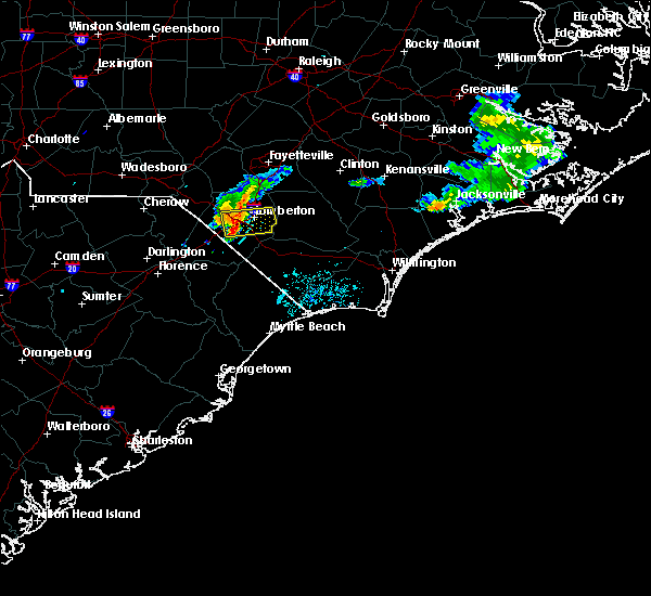 At 918 pm edt, a severe thunderstorm was located near fairmont, or 7 miles southwest of lumberton, moving east at 25 mph (radar indicated). Hazards include 60 mph wind gusts and quarter size hail. Hail damage to vehicles is expected. expect wind damage to roofs, siding, and trees. Locations impacted include, lumberton, pembroke, fairmont, smiths, hestertown, howellsville, elrod, robeson community college, barker ten mile, mcdonald, raynham and southeastern regional medical center. At 918 pm edt, a severe thunderstorm was located near fairmont, or 7 miles southwest of lumberton, moving east at 25 mph (radar indicated). Hazards include 60 mph wind gusts and quarter size hail. Hail damage to vehicles is expected. expect wind damage to roofs, siding, and trees. Locations impacted include, lumberton, pembroke, fairmont, smiths, hestertown, howellsville, elrod, robeson community college, barker ten mile, mcdonald, raynham and southeastern regional medical center.
|
| 7/4/2016 8:59 PM EDT |
 At 859 pm edt, a severe thunderstorm was located over purvis, or 11 miles north of dillon, moving east at 20 mph (radar indicated). Hazards include 60 mph wind gusts and quarter size hail. Hail damage to vehicles is expected. Expect wind damage to roofs, siding, and trees. At 859 pm edt, a severe thunderstorm was located over purvis, or 11 miles north of dillon, moving east at 20 mph (radar indicated). Hazards include 60 mph wind gusts and quarter size hail. Hail damage to vehicles is expected. Expect wind damage to roofs, siding, and trees.
|
| 6/24/2016 4:58 PM EDT |
 At 457 pm edt, a severe thunderstorm was located near tabor city, or 15 miles southwest of whiteville, moving east at 30 mph (radar indicated). Hazards include 60 mph wind gusts and quarter size hail. Hail damage to vehicles is expected. expect wind damage to roofs, siding, and trees. Locations impacted include, marion, whiteville, mullins, horry, fairmont, tabor city, loris, chadbourn, bethel, lake waccamaw, fair bluff, lake view, hickory grove, sellers, boardman, allsbrook, williams, hallsboro, smithboro and mollie. At 457 pm edt, a severe thunderstorm was located near tabor city, or 15 miles southwest of whiteville, moving east at 30 mph (radar indicated). Hazards include 60 mph wind gusts and quarter size hail. Hail damage to vehicles is expected. expect wind damage to roofs, siding, and trees. Locations impacted include, marion, whiteville, mullins, horry, fairmont, tabor city, loris, chadbourn, bethel, lake waccamaw, fair bluff, lake view, hickory grove, sellers, boardman, allsbrook, williams, hallsboro, smithboro and mollie.
|
| 6/24/2016 4:41 PM EDT |
 The severe thunderstorm warning for northwestern columbus, southeastern robeson, north central horry, northeastern marion and dillon counties will expire at 445 pm edt, a new severe thunderstorm warning has been issued for portions of the same area. that warning is in effect until 530 pm. The severe thunderstorm warning for northwestern columbus, southeastern robeson, north central horry, northeastern marion and dillon counties will expire at 445 pm edt, a new severe thunderstorm warning has been issued for portions of the same area. that warning is in effect until 530 pm.
|
| 6/24/2016 4:35 PM EDT |
 At 434 pm edt, severe thunderstorms were located across dillon, marion, and robeson counties, moving east at 30 mph (radar indicated). Hazards include 60 mph wind gusts and quarter size hail. Hail damage to vehicles is expected. Expect wind damage to roofs, siding, and trees. At 434 pm edt, severe thunderstorms were located across dillon, marion, and robeson counties, moving east at 30 mph (radar indicated). Hazards include 60 mph wind gusts and quarter size hail. Hail damage to vehicles is expected. Expect wind damage to roofs, siding, and trees.
|
| 6/24/2016 4:32 PM EDT |
 At 431 pm edt, a severe thunderstorm was located near floydale, or near dillon, moving east at 30 mph. other severe thunderstorms were located across dillon county (radar indicated). Hazards include 60 mph wind gusts and quarter size hail. Hail damage to vehicles is expected. expect wind damage to roofs, siding, and trees. Locations impacted include, dillon, mullins, latta, fair bluff, lake view, sellers, boardman, kemper, bingham, smithboro, little rock, fork, hamer, oak grove, cherry grove, barnesville, evergreen, floydale, zion and nichols. At 431 pm edt, a severe thunderstorm was located near floydale, or near dillon, moving east at 30 mph. other severe thunderstorms were located across dillon county (radar indicated). Hazards include 60 mph wind gusts and quarter size hail. Hail damage to vehicles is expected. expect wind damage to roofs, siding, and trees. Locations impacted include, dillon, mullins, latta, fair bluff, lake view, sellers, boardman, kemper, bingham, smithboro, little rock, fork, hamer, oak grove, cherry grove, barnesville, evergreen, floydale, zion and nichols.
|
| 6/24/2016 4:00 PM EDT |
 At 400 pm edt, a severe thunderstorm was located over brownsville, or 11 miles west of dillon, moving east at 30 mph. other severe thunderstorms were moving across dillon county (radar indicated). Hazards include 60 mph wind gusts and quarter size hail. Hail damage to vehicles is expected. expect wind damage to roofs, siding, and trees. Locations impacted include, dillon, mullins, latta, fair bluff, lake view, sellers, boardman, kemper, bingham, smithboro, little rock, fork, hamer, oak grove, cherry grove, barnesville, brownsville, evergreen, floydale and mechanicsville. At 400 pm edt, a severe thunderstorm was located over brownsville, or 11 miles west of dillon, moving east at 30 mph. other severe thunderstorms were moving across dillon county (radar indicated). Hazards include 60 mph wind gusts and quarter size hail. Hail damage to vehicles is expected. expect wind damage to roofs, siding, and trees. Locations impacted include, dillon, mullins, latta, fair bluff, lake view, sellers, boardman, kemper, bingham, smithboro, little rock, fork, hamer, oak grove, cherry grove, barnesville, brownsville, evergreen, floydale and mechanicsville.
|
| 6/24/2016 3:45 PM EDT |
 At 345 pm edt, a severe thunderstorm was located near brownsville, or 12 miles northeast of darlington, moving east at 30 mph. other severe thunderstorms were developing across dillon county (radar indicated). Hazards include 60 mph wind gusts and quarter size hail. Hail damage to vehicles is expected. Expect wind damage to roofs, siding, and trees. At 345 pm edt, a severe thunderstorm was located near brownsville, or 12 miles northeast of darlington, moving east at 30 mph. other severe thunderstorms were developing across dillon county (radar indicated). Hazards include 60 mph wind gusts and quarter size hail. Hail damage to vehicles is expected. Expect wind damage to roofs, siding, and trees.
|
| 5/3/2016 4:43 PM EDT |
 At 443 pm edt, a severe thunderstorm was located near barnesville, or 12 miles south of lumberton, moving east at 25 mph (radar indicated). Hazards include 60 mph wind gusts and quarter size hail. Hail damage to vehicles is expected. Expect wind damage to roofs, siding, and trees. At 443 pm edt, a severe thunderstorm was located near barnesville, or 12 miles south of lumberton, moving east at 25 mph (radar indicated). Hazards include 60 mph wind gusts and quarter size hail. Hail damage to vehicles is expected. Expect wind damage to roofs, siding, and trees.
|
| 2/24/2016 5:52 PM EST |
 At 552 pm est, doppler radar indicated a severe thunderstorm capable of producing a tornado. this dangerous storm was located over fairmont, or 9 miles southwest of lumberton, moving northeast at 60 mph. locations impacted include, lumberton, fairmont, st. pauls, smiths, ruskin, white oak, howellsville, tolarsville, robeson community college, tobermory, butters, ammon, hestertown, jerome, duart, barker ten mile, bladen community college, dublin, tar heel and proctorville. this includes the following highways, interstate 74 between mile markers 212 and 207, and between mile markers 209 and 210, and near mile marker 214. interstate 95 in north carolina between mile markers 8 and 35. us route 74 between mile markers 365 and 371. At 552 pm est, doppler radar indicated a severe thunderstorm capable of producing a tornado. this dangerous storm was located over fairmont, or 9 miles southwest of lumberton, moving northeast at 60 mph. locations impacted include, lumberton, fairmont, st. pauls, smiths, ruskin, white oak, howellsville, tolarsville, robeson community college, tobermory, butters, ammon, hestertown, jerome, duart, barker ten mile, bladen community college, dublin, tar heel and proctorville. this includes the following highways, interstate 74 between mile markers 212 and 207, and between mile markers 209 and 210, and near mile marker 214. interstate 95 in north carolina between mile markers 8 and 35. us route 74 between mile markers 365 and 371.
|
| 2/24/2016 5:44 PM EST |
 At 543 pm est, doppler radar indicated a severe thunderstorm capable of producing a tornado. this dangerous storm was located near lake view, or 10 miles east of dillon, and moving northeast at 60 mph. At 543 pm est, doppler radar indicated a severe thunderstorm capable of producing a tornado. this dangerous storm was located near lake view, or 10 miles east of dillon, and moving northeast at 60 mph.
|
| 2/24/2016 5:41 PM EST |
 The severe thunderstorm warning for central robeson, northwestern marion, dillon and central florence counties will expire at 545 pm est, the line of storms which prompted the warning have weakened below severe limits, and no longer poses an immediate threat to life or property. therefore the warning will be allowed to expire. The severe thunderstorm warning for central robeson, northwestern marion, dillon and central florence counties will expire at 545 pm est, the line of storms which prompted the warning have weakened below severe limits, and no longer poses an immediate threat to life or property. therefore the warning will be allowed to expire.
|
| 2/24/2016 5:26 PM EST |
 At 525 pm est, doppler radar indicated a line of severe thunderstorms capable of producing large hail up to ping pong ball size and damaging winds in excess of 60 mph. these storms were located along a line extending from near ammon to near galivants ferry, moving east at 60 mph. locations impacted include, marion, dillon, lake city, red springs, pembroke, st. pauls, latta, pamplico, rowland, sellers, new hope, smithboro, blue brick, little rock, fork, hamer, wakulla, rex, elrod and oak grove. this includes the following highways, interstate 74 between mile markers 211 and 209, near mile marker 210, and between mile markers 193 and 200. interstate 95 in south carolina between mile markers 179 and 198. interstate 95 in north carolina between mile markers 1 and 17, and between mile markers 24 and 38. At 525 pm est, doppler radar indicated a line of severe thunderstorms capable of producing large hail up to ping pong ball size and damaging winds in excess of 60 mph. these storms were located along a line extending from near ammon to near galivants ferry, moving east at 60 mph. locations impacted include, marion, dillon, lake city, red springs, pembroke, st. pauls, latta, pamplico, rowland, sellers, new hope, smithboro, blue brick, little rock, fork, hamer, wakulla, rex, elrod and oak grove. this includes the following highways, interstate 74 between mile markers 211 and 209, near mile marker 210, and between mile markers 193 and 200. interstate 95 in south carolina between mile markers 179 and 198. interstate 95 in north carolina between mile markers 1 and 17, and between mile markers 24 and 38.
|
| 2/24/2016 5:00 PM EST |
 At 459 pm est, doppler radar indicated a line of severe thunderstorms capable of producing large hail up to ping pong ball size and damaging winds in excess of 60 mph. these storms were located along a line extending from near barker ten mile to hannah, moving east at 65 mph. locations impacted include, florence, marion, dillon, lake city, red springs, pembroke, maxton, st. pauls, latta, pamplico, rowland, quinby, sellers, hebron, new hope, smithboro, blue brick, minturn, hamer and wakulla. this includes the following highways, interstate 74 near mile marker 191, between mile markers 211 and 209, and between mile markers 210 and 200. interstate 95 in south carolina between mile markers 172 and 198. interstate 95 in north carolina between mile markers 1 and 17, and between mile markers 24 and 38. At 459 pm est, doppler radar indicated a line of severe thunderstorms capable of producing large hail up to ping pong ball size and damaging winds in excess of 60 mph. these storms were located along a line extending from near barker ten mile to hannah, moving east at 65 mph. locations impacted include, florence, marion, dillon, lake city, red springs, pembroke, maxton, st. pauls, latta, pamplico, rowland, quinby, sellers, hebron, new hope, smithboro, blue brick, minturn, hamer and wakulla. this includes the following highways, interstate 74 near mile marker 191, between mile markers 211 and 209, and between mile markers 210 and 200. interstate 95 in south carolina between mile markers 172 and 198. interstate 95 in north carolina between mile markers 1 and 17, and between mile markers 24 and 38.
|
| 2/24/2016 4:40 PM EST |
 At 439 pm est, doppler radar indicated a line of severe thunderstorms capable of producing quarter size hail and damaging winds in excess of 60 mph. these storms were located along a line extending from raemon to hebron, and moving east at 55 mph. At 439 pm est, doppler radar indicated a line of severe thunderstorms capable of producing quarter size hail and damaging winds in excess of 60 mph. these storms were located along a line extending from raemon to hebron, and moving east at 55 mph.
|
| 2/24/2016 4:21 PM EST |
 At 420 pm est, doppler radar indicated a severe thunderstorm capable of producing damaging winds in excess of 60 mph. this storm was located over dunbar, or 10 miles southeast of bennettsville, moving northeast at 70 mph. locations impacted include, florence, dillon, darlington, pembroke, fairmont, maxton, timmonsville, mccoll, latta, rowland, quinby, clio, bingham, little rock, minturn, hamer, elrod, oak grove, raemon and florence darlington technical college main campus. this includes the following highways, interstate 20 between mile markers 135 and 141. interstate 74 near mile marker 191, between mile markers 208 and 209, and between mile markers 210 and 200. interstate 95 in south carolina between mile markers 150 and 198. interstate 95 in north carolina between mile markers 1 and 13. us route 74 between mile markers 367 and 370. At 420 pm est, doppler radar indicated a severe thunderstorm capable of producing damaging winds in excess of 60 mph. this storm was located over dunbar, or 10 miles southeast of bennettsville, moving northeast at 70 mph. locations impacted include, florence, dillon, darlington, pembroke, fairmont, maxton, timmonsville, mccoll, latta, rowland, quinby, clio, bingham, little rock, minturn, hamer, elrod, oak grove, raemon and florence darlington technical college main campus. this includes the following highways, interstate 20 between mile markers 135 and 141. interstate 74 near mile marker 191, between mile markers 208 and 209, and between mile markers 210 and 200. interstate 95 in south carolina between mile markers 150 and 198. interstate 95 in north carolina between mile markers 1 and 13. us route 74 between mile markers 367 and 370.
|
| 2/24/2016 4:05 PM EST |
 At 405 pm est, doppler radar indicated a severe thunderstorm capable of producing damaging winds in excess of 60 mph. this storm was located over florence darlington technical college main campus, or near darlington, and moving northeast at 70 mph. At 405 pm est, doppler radar indicated a severe thunderstorm capable of producing damaging winds in excess of 60 mph. this storm was located over florence darlington technical college main campus, or near darlington, and moving northeast at 70 mph.
|
| 7/2/2015 5:49 PM EDT |
 At 549 pm edt, doppler radar indicated a severe thunderstorm capable of producing quarter size hail and damaging winds in excess of 60 mph. this storm was located over barnesville, or 13 miles south of lumberton, and moving east at 15 mph. At 549 pm edt, doppler radar indicated a severe thunderstorm capable of producing quarter size hail and damaging winds in excess of 60 mph. this storm was located over barnesville, or 13 miles south of lumberton, and moving east at 15 mph.
|
| 6/30/2015 7:23 PM EDT |
 At 722 pm edt, doppler radar indicated a severe thunderstorm capable of producing penny size hail and damaging winds in excess of 60 mph. this storm was located over purvis, or 12 miles northeast of dillon, moving east at 40 mph. locations impacted include, lumberton, dillon, red springs, pembroke, fairmont, maxton, st. pauls, latta, rowland, lake view, kemper, bingham, howellsville, little rock, minturn, fork, hamer, wakulla, rex and elrod. this includes the following highways, interstate 74 between mile markers 191 and 214. interstate 95 in south carolina between mile markers 176 and 198. interstate 95 in north carolina between mile markers 1 and 38. us route 74 between mile markers 365 and 372. At 722 pm edt, doppler radar indicated a severe thunderstorm capable of producing penny size hail and damaging winds in excess of 60 mph. this storm was located over purvis, or 12 miles northeast of dillon, moving east at 40 mph. locations impacted include, lumberton, dillon, red springs, pembroke, fairmont, maxton, st. pauls, latta, rowland, lake view, kemper, bingham, howellsville, little rock, minturn, fork, hamer, wakulla, rex and elrod. this includes the following highways, interstate 74 between mile markers 191 and 214. interstate 95 in south carolina between mile markers 176 and 198. interstate 95 in north carolina between mile markers 1 and 38. us route 74 between mile markers 365 and 372.
|
| 6/30/2015 6:55 PM EDT |
 At 655 pm edt, doppler radar indicated a severe thunderstorm capable of producing quarter size hail and damaging winds in excess of 60 mph. this storm was located near raemon, or 7 miles south of laurinburg, and moving east at 35 mph. At 655 pm edt, doppler radar indicated a severe thunderstorm capable of producing quarter size hail and damaging winds in excess of 60 mph. this storm was located near raemon, or 7 miles south of laurinburg, and moving east at 35 mph.
|
| 6/27/2015 8:44 PM EDT |
 At 843 pm edt, doppler radar indicated a severe thunderstorm capable of producing quarter size hail and damaging winds in excess of 60 mph. this storm was located near lake view, or 8 miles northeast of mullins, and moving east at 50 mph. At 843 pm edt, doppler radar indicated a severe thunderstorm capable of producing quarter size hail and damaging winds in excess of 60 mph. this storm was located near lake view, or 8 miles northeast of mullins, and moving east at 50 mph.
|
| 6/27/2015 8:29 PM EDT |
 At 829 pm edt, doppler radar indicated a severe thunderstorm capable of producing a tornado. this dangerous storm was located near lumberton, and moving east at 30 mph. At 829 pm edt, doppler radar indicated a severe thunderstorm capable of producing a tornado. this dangerous storm was located near lumberton, and moving east at 30 mph.
|
| 6/27/2015 8:23 PM EDT |
 At 823 pm edt, doppler radar indicated a severe thunderstorm capable of producing quarter size hail and damaging winds in excess of 60 mph. this storm was located near elrod, or 9 miles west of lumberton, and moving east at 25 mph. At 823 pm edt, doppler radar indicated a severe thunderstorm capable of producing quarter size hail and damaging winds in excess of 60 mph. this storm was located near elrod, or 9 miles west of lumberton, and moving east at 25 mph.
|
| 6/19/2015 9:09 PM EDT |
 At 842 pm edt, doppler radar indicated a severe thunderstorm capable of producing quarter size hail and damaging winds in excess of 60 mph. this storm was located over raemon, or 9 miles southeast of laurinburg, and moving east at 20 mph. At 842 pm edt, doppler radar indicated a severe thunderstorm capable of producing quarter size hail and damaging winds in excess of 60 mph. this storm was located over raemon, or 9 miles southeast of laurinburg, and moving east at 20 mph.
|
| 6/19/2015 8:42 PM EDT |
 At 842 pm edt, doppler radar indicated a severe thunderstorm capable of producing quarter size hail and damaging winds in excess of 60 mph. this storm was located over raemon, or 9 miles southeast of laurinburg, and moving east at 20 mph. At 842 pm edt, doppler radar indicated a severe thunderstorm capable of producing quarter size hail and damaging winds in excess of 60 mph. this storm was located over raemon, or 9 miles southeast of laurinburg, and moving east at 20 mph.
|
| 6/19/2015 5:56 PM EDT |
 At 556 pm edt, doppler radar indicated a severe thunderstorm capable of producing quarter size hail and damaging winds in excess of 60 mph. this storm was located near lake view, or 9 miles east of dillon, moving east at 10 mph. locations impacted include, dillon, fairmont, latta, lake view, kemper, bingham, brownsville, little rock, south of the border, hamer, oak grove, floydale, marietta and mcleod medical center. this includes interstate 95 in south carolina between mile markers 179 and 198. At 556 pm edt, doppler radar indicated a severe thunderstorm capable of producing quarter size hail and damaging winds in excess of 60 mph. this storm was located near lake view, or 9 miles east of dillon, moving east at 10 mph. locations impacted include, dillon, fairmont, latta, lake view, kemper, bingham, brownsville, little rock, south of the border, hamer, oak grove, floydale, marietta and mcleod medical center. this includes interstate 95 in south carolina between mile markers 179 and 198.
|
| 6/19/2015 5:42 PM EDT |
 At 542 pm edt, doppler radar indicated a severe thunderstorm capable of producing quarter size hail and damaging winds in excess of 60 mph. this storm was located near kemper, or 7 miles east of dillon, moving east at 10 mph. locations impacted include, dillon, fairmont, latta, lake view, kemper, bingham, brownsville, little rock, south of the border, hamer, oak grove, floydale, marietta and mcleod medical center. this includes interstate 95 in south carolina between mile markers 179 and 198. At 542 pm edt, doppler radar indicated a severe thunderstorm capable of producing quarter size hail and damaging winds in excess of 60 mph. this storm was located near kemper, or 7 miles east of dillon, moving east at 10 mph. locations impacted include, dillon, fairmont, latta, lake view, kemper, bingham, brownsville, little rock, south of the border, hamer, oak grove, floydale, marietta and mcleod medical center. this includes interstate 95 in south carolina between mile markers 179 and 198.
|
| 6/19/2015 5:32 PM EDT |
 At 531 pm edt, doppler radar indicated a severe thunderstorm capable of producing quarter size hail and damaging winds in excess of 60 mph. this storm was located near kemper, or near dillon, moving east at 10 mph. locations impacted include, dillon, fairmont, latta, lake view, kemper, bingham, brownsville, little rock, south of the border, hamer, floydale, oak grove, marietta and mcleod medical center. this includes interstate 95 in south carolina between mile markers 177 and 198. At 531 pm edt, doppler radar indicated a severe thunderstorm capable of producing quarter size hail and damaging winds in excess of 60 mph. this storm was located near kemper, or near dillon, moving east at 10 mph. locations impacted include, dillon, fairmont, latta, lake view, kemper, bingham, brownsville, little rock, south of the border, hamer, floydale, oak grove, marietta and mcleod medical center. this includes interstate 95 in south carolina between mile markers 177 and 198.
|
| 6/19/2015 5:21 PM EDT |
 At 520 pm edt, doppler radar indicated a severe thunderstorm capable of producing quarter size hail and damaging winds in excess of 60 mph. this storm was located near dillon, and moving east at 10 mph. At 520 pm edt, doppler radar indicated a severe thunderstorm capable of producing quarter size hail and damaging winds in excess of 60 mph. this storm was located near dillon, and moving east at 10 mph.
|
| 6/18/2015 4:55 PM EDT | The severe thunderstorm warning for southwestern robeson and northeastern dillon counties will expire at 500 pm edt, the storm which prompted the warning has moved out of the area. therefore the warning will be allowed to expire. however gusty winds are still possible with this thunderstorm. remember, a severe thunderstorm warning still remains in effect for portions of robeson county. |
| 6/18/2015 4:55 PM EDT | The severe thunderstorm warning for southwestern robeson and northeastern dillon counties will expire at 500 pm edt, the storm which prompted the warning has moved out of the area. therefore the warning will be allowed to expire. however gusty winds are still possible with this thunderstorm. remember, a severe thunderstorm warning still remains in effect for portions of robeson county. |
| 6/18/2015 4:54 PM EDT | At 453 pm edt, doppler radar indicated a severe thunderstorm capable of producing quarter size hail and damaging winds in excess of 60 mph. this storm was located near boardman, or 9 miles south of lumberton, and moving east at 15 mph. |
| 6/18/2015 4:44 PM EDT | Several trees down..one across a house...on floyd and fisher drive in robeson county NC, 0.7 miles NE of Fairmont, NC |
| 6/18/2015 4:43 PM EDT | At 443 pm edt, doppler radar indicated a severe thunderstorm capable of producing quarter size hail and damaging winds in excess of 60 mph. this storm was located over fairmont, or 10 miles southwest of lumberton, moving east at 30 mph. locations impacted include, fairmont, rowland, purvis, barnesville, elrod, south of the border, mcdonald and raynham. this includes the following highways, interstate 74 between mile markers 208 and 202, and between mile markers 203 and 209, and near mile marker 210. interstate 95 in north carolina between mile markers 1 and 14. |
| 6/18/2015 4:43 PM EDT | At 443 pm edt, doppler radar indicated a severe thunderstorm capable of producing quarter size hail and damaging winds in excess of 60 mph. this storm was located over fairmont, or 10 miles southwest of lumberton, moving east at 30 mph. locations impacted include, fairmont, rowland, purvis, barnesville, elrod, south of the border, mcdonald and raynham. this includes the following highways, interstate 74 between mile markers 208 and 202, and between mile markers 203 and 209, and near mile marker 210. interstate 95 in north carolina between mile markers 1 and 14. |
| 6/18/2015 4:22 PM EDT | At 422 pm edt, doppler radar indicated a severe thunderstorm capable of producing quarter size hail and damaging winds in excess of 60 mph. this storm was located over south of the border, or 7 miles northeast of dillon, moving east at 30 mph. locations impacted include, dillon, fairmont, rowland, little rock, south of the border, hamer, purvis, barnesville, elrod, mcdonald, raynham and mcleod medical center. this includes the following highways, interstate 74 between mile markers 208 and 202, and between mile markers 203 and 209, and near mile marker 210. interstate 95 in south carolina between mile markers 192 and 198. interstate 95 in north carolina between mile markers 1 and 14. |
| 6/18/2015 4:22 PM EDT | At 422 pm edt, doppler radar indicated a severe thunderstorm capable of producing quarter size hail and damaging winds in excess of 60 mph. this storm was located over south of the border, or 7 miles northeast of dillon, moving east at 30 mph. locations impacted include, dillon, fairmont, rowland, little rock, south of the border, hamer, purvis, barnesville, elrod, mcdonald, raynham and mcleod medical center. this includes the following highways, interstate 74 between mile markers 208 and 202, and between mile markers 203 and 209, and near mile marker 210. interstate 95 in south carolina between mile markers 192 and 198. interstate 95 in north carolina between mile markers 1 and 14. |
| 6/18/2015 4:05 PM EDT | At 405 pm edt, doppler radar indicated a severe thunderstorm capable of producing quarter size hail and damaging winds in excess of 60 mph. this storm was located over minturn, or 7 miles northwest of dillon, and moving east at 20 mph. |
| 6/18/2015 4:05 PM EDT | At 405 pm edt, doppler radar indicated a severe thunderstorm capable of producing quarter size hail and damaging winds in excess of 60 mph. this storm was located over minturn, or 7 miles northwest of dillon, and moving east at 20 mph. |
| 6/1/2015 7:27 PM EDT | The severe thunderstorm warning for central robeson county will expire at 730 pm edt, the storm which prompted the warning has weakened below severe limits, and no longer poses an immediate threat to life or property. therefore the warning will be allowed to expire. |
| 6/1/2015 7:02 PM EDT | At 701 pm edt, doppler radar indicated a severe thunderstorm capable of producing quarter size hail and damaging winds in excess of 60 mph. this storm was located near fairmont, or 10 miles southwest of lumberton, and moving northeast at 25 mph. |
| 4/19/2015 8:25 PM EDT | At 757 pm edt, doppler radar indicated a line of severe thunderstorms capable of producing damaging winds in excess of 60 mph. these storms were located along a line extending from near wakulla to kemper to near brittons neck, moving northeast at 30 mph. locations impacted include, lumberton, whiteville, mullins, red springs, pembroke, fairmont, tabor city, st. pauls, chadbourn, johnsonville, lake waccamaw, rowland, fair bluff, lake view, boardman, williams, hallsboro, howellsville, tolarsville and galivants ferry. # this includes the following highways, interstate 74 between mile markers 212 and 214. interstate 95 in north carolina between mile markers 1 and 38. us route 74 between mile markers 365 and 404. |
| 4/19/2015 8:25 PM EDT | At 825 pm edt, doppler radar indicated a line of severe thunderstorms capable of producing damaging winds in excess of 60 mph. these storms were located along a line extending from 6 miles west of fayetteville to near boardman to near green sea, moving northeast at 50 mph. locations impacted include, lumberton, whiteville, red springs, fairmont, tabor city, st. pauls, chadbourn, lake waccamaw, fair bluff, boardman, williams, hallsboro, howellsville, tolarsville, rex, clarendon, cherry grove, smiths, redbug and southeastern community college. # this includes the following highways, interstate 74 between mile markers 212 and 207, and between mile markers 209 and 210, and near mile marker 214. interstate 95 in north carolina between mile markers 11 and 38. us route 74 between mile markers 365 and 404. |
| 4/19/2015 7:59 PM EDT | At 718 pm edt, doppler radar indicated a line of severe thunderstorms capable of producing damaging winds in excess of 60 mph. these storms were located along a line extending from near bennettsville to kingsburg, and moving northeast at 50 mph. |
| 4/19/2015 7:59 PM EDT | A severe thunderstorm warning remains in effect until 845 pm edt for robeson. northwestern columbus. northeastern marion. southeastern dillon. southeastern florence and northwestern horry counties. at 757 pm edt. Doppler radar indicated a line of severe thunderstorms capable of producing damaging winds in excess of 60. |
| 4/19/2015 7:19 PM EDT | The national weather service in wilmington nc has issued a * severe thunderstorm warning for. robeson county in southeastern north carolina. northwestern columbus county in southeastern north carolina. marion county in northeastern south carolina. Dillon county in northeastern south carolina. |
| 4/19/2015 7:19 PM EDT | At 718 pm edt, doppler radar indicated a line of severe thunderstorms capable of producing damaging winds in excess of 60 mph. these storms were located along a line extending from near bennettsville to kingsburg, and moving northeast at 50 mph. |
| 6/19/2014 10:20 PM EDT | Power line down and structural fire reported on south main street. time estimated based on rada in robeson county NC, 0.2 miles SSW of Fairmont, NC |
| 1/30/2013 11:52 PM EST | Trees down on iona church road near pleasant hope roa in robeson county NC, 2.3 miles ESE of Fairmont, NC |
| 4/26/2012 4:20 PM EDT | Quarter sized hail reported 4.1 miles ENE of Fairmont, NC, 1.0 inch hail fell at the intersection of highway 130 and yukon ln. |
| 1/1/0001 12:00 AM | A large tree was reported down on stackhouse road. the time was estimated based on radar dat in robeson county NC, 1.5 miles SW of Fairmont, NC |
| 1/1/0001 12:00 AM | Trees down in robeson county NC, 0.5 miles ESE of Fairmont, NC |
| 1/1/0001 12:00 AM | Half Dollar sized hail reported 0.5 miles ESE of Fairmont, NC |
| 1/1/0001 12:00 AM | Ping Pong Ball sized hail reported 4 miles SSE of Fairmont, NC |
Hail Maps for Fairmont, NC


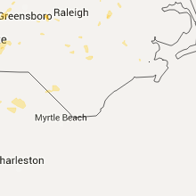


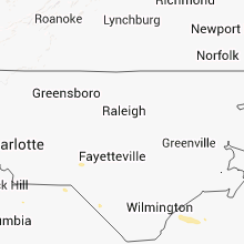

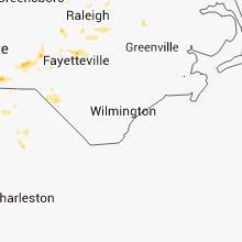


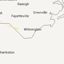
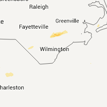


Connect with Interactive Hail Maps