

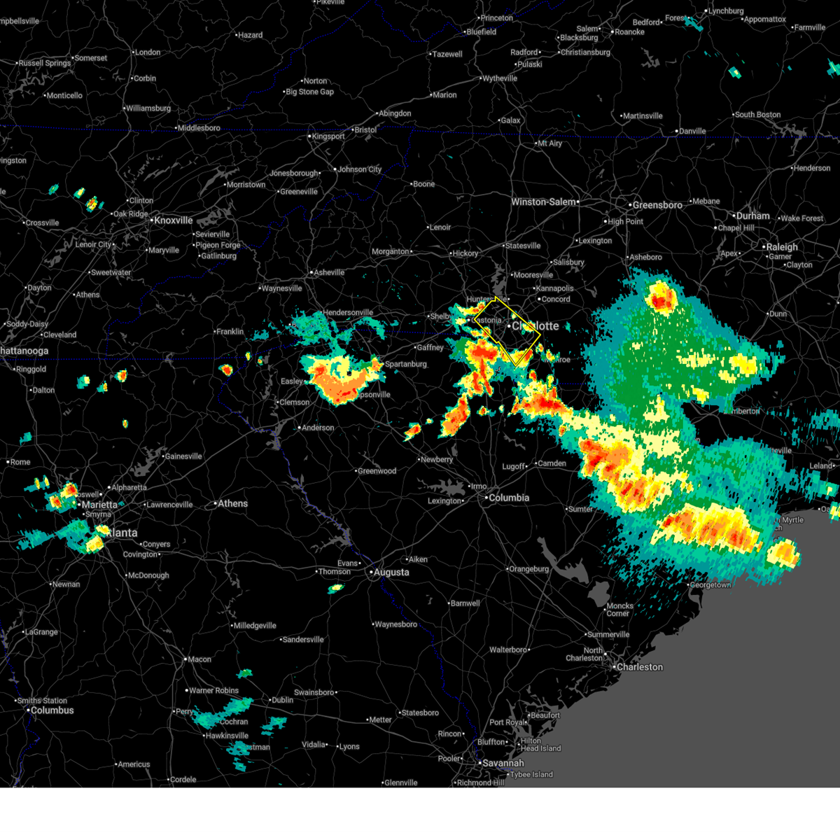
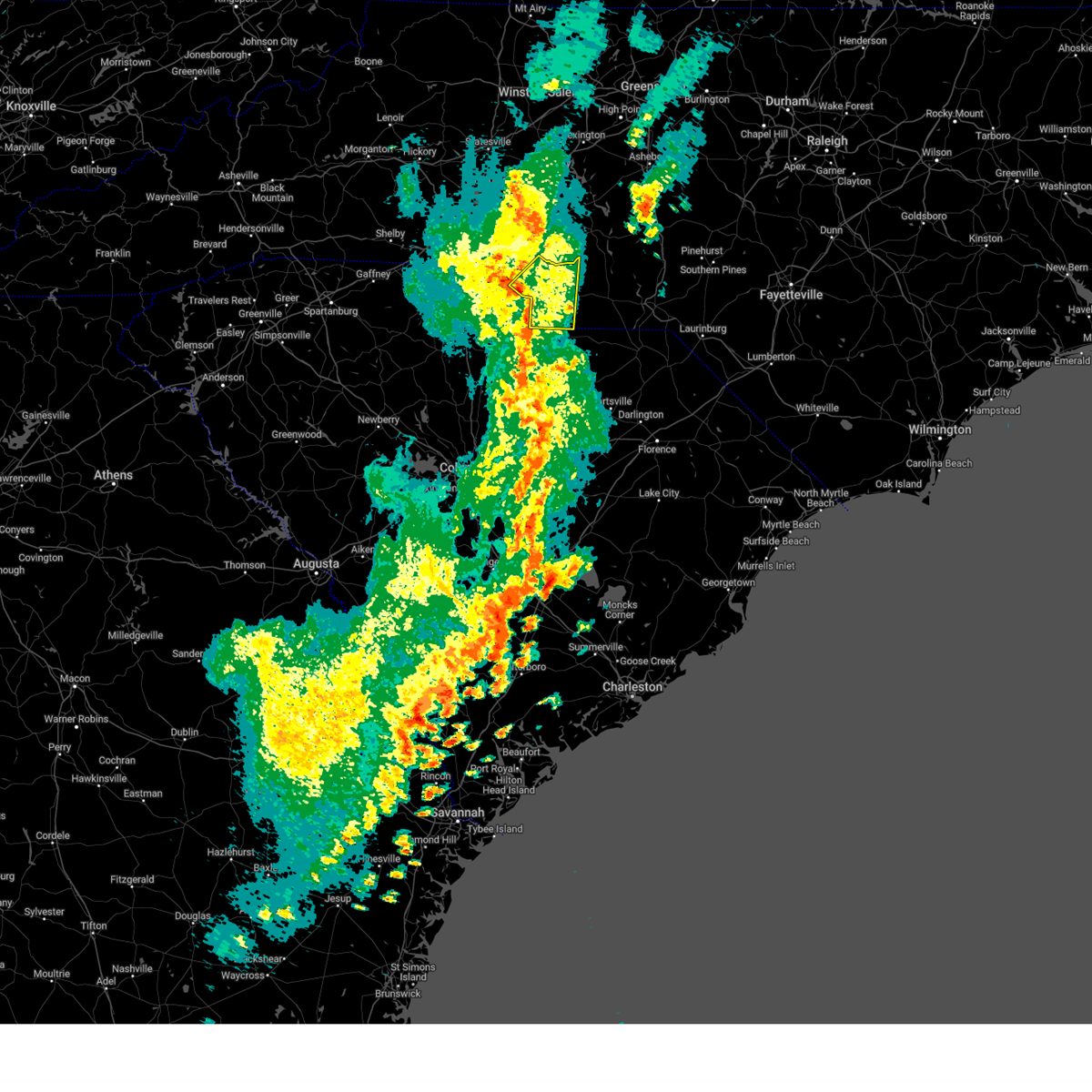
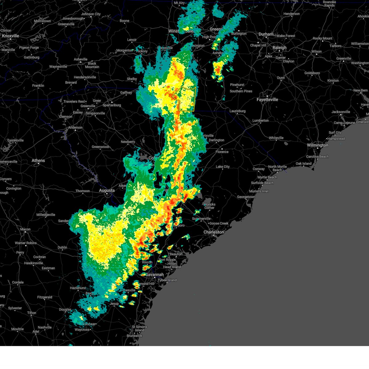
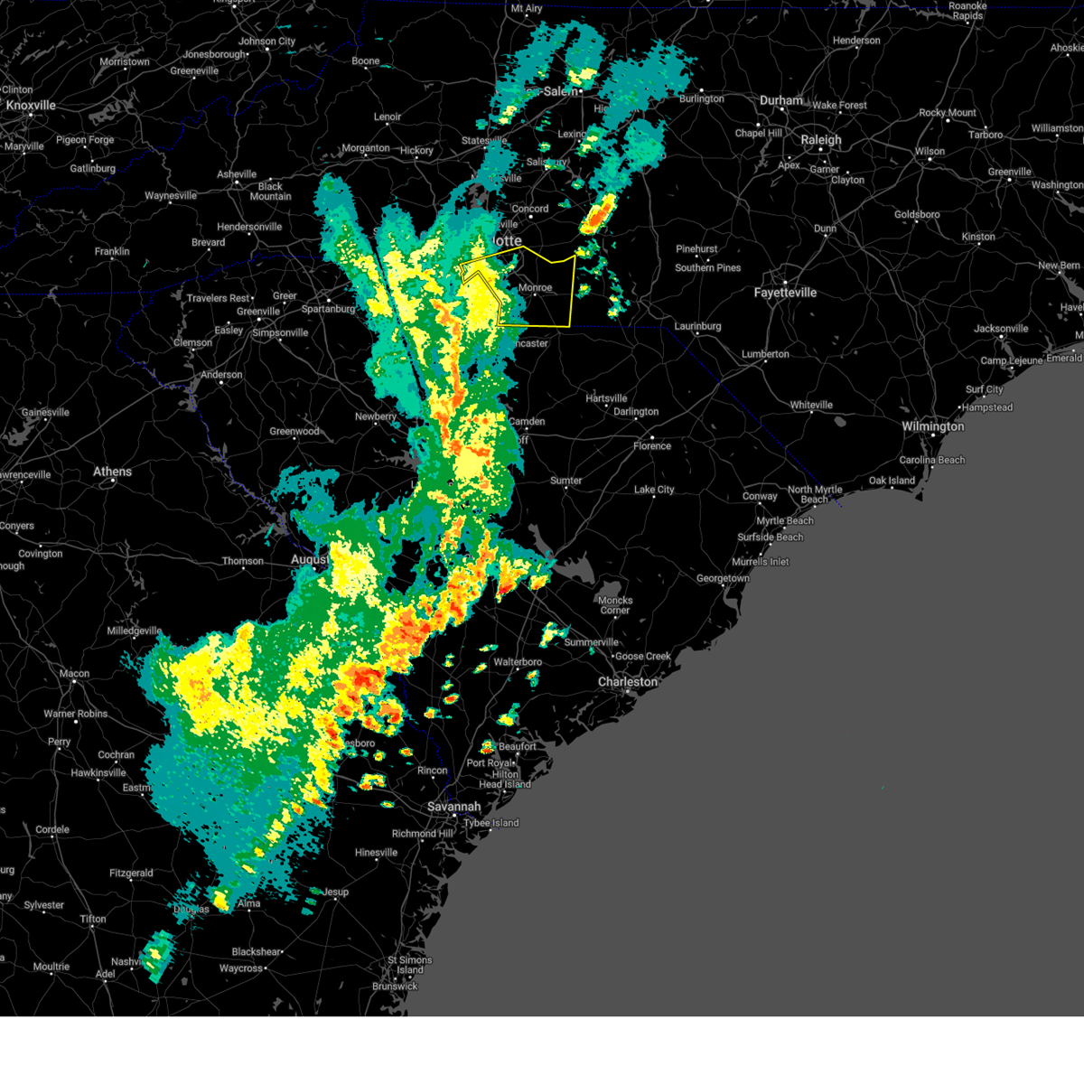
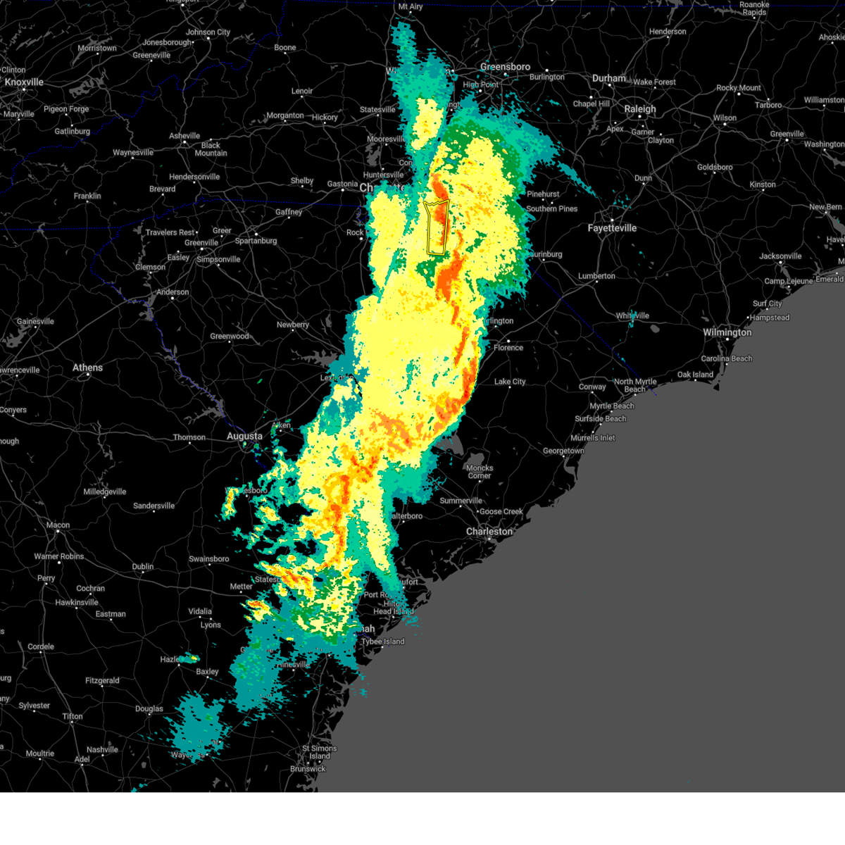
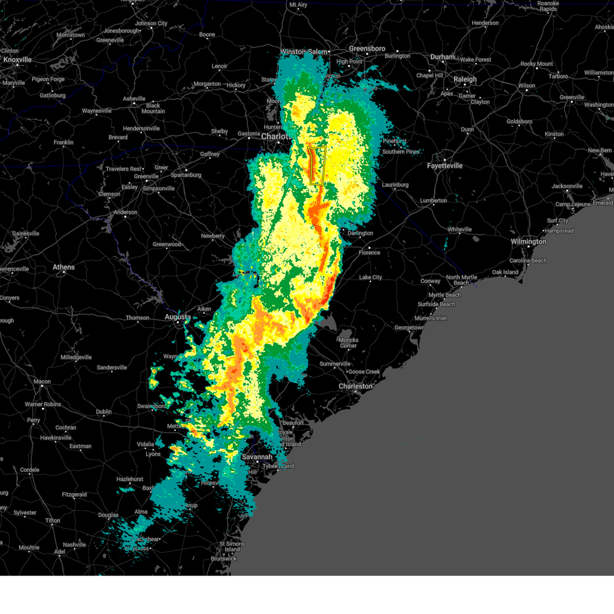
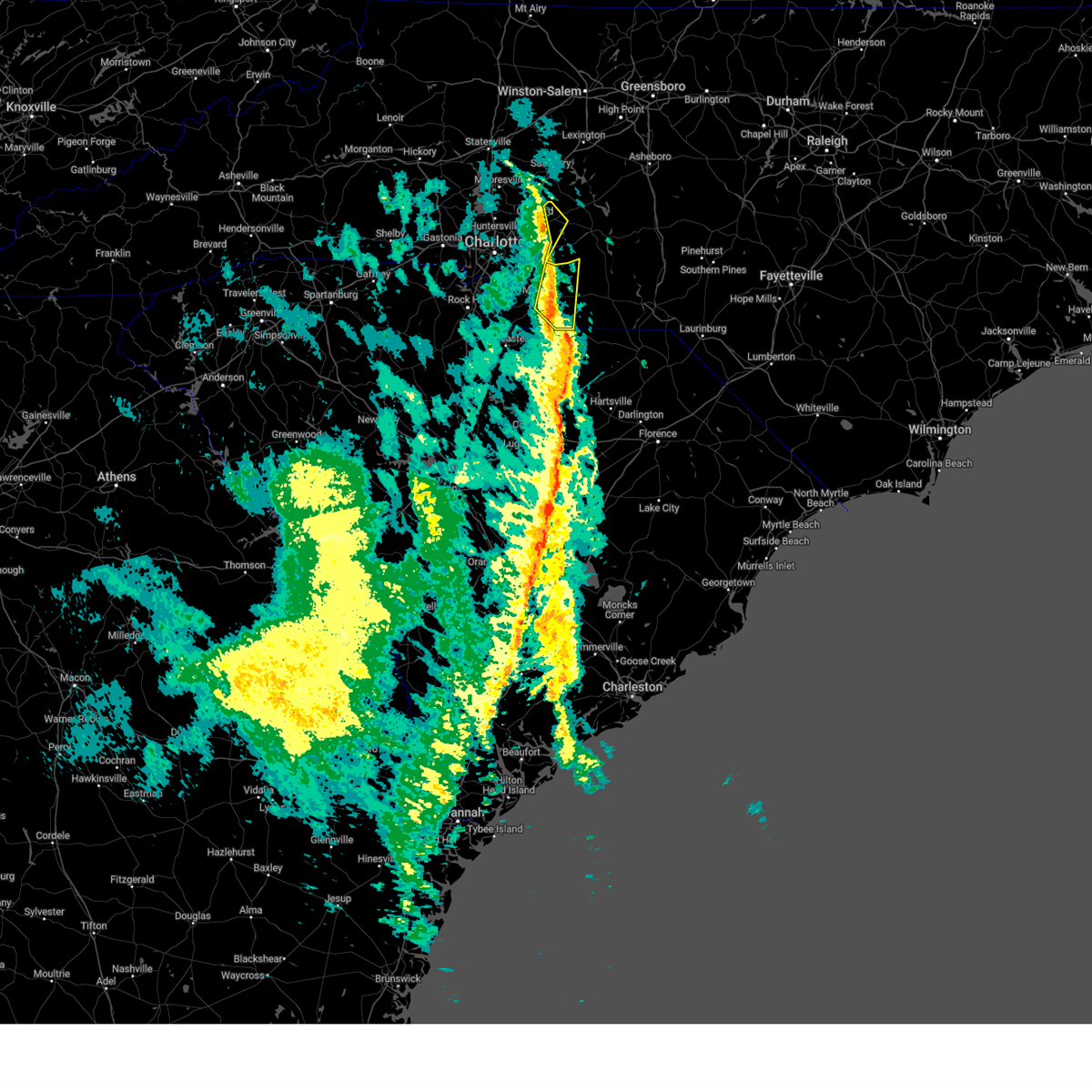
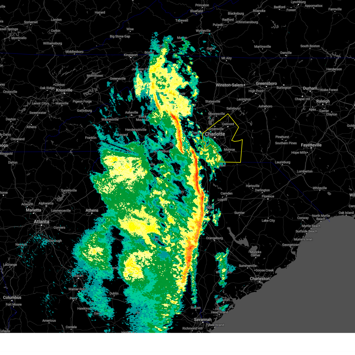
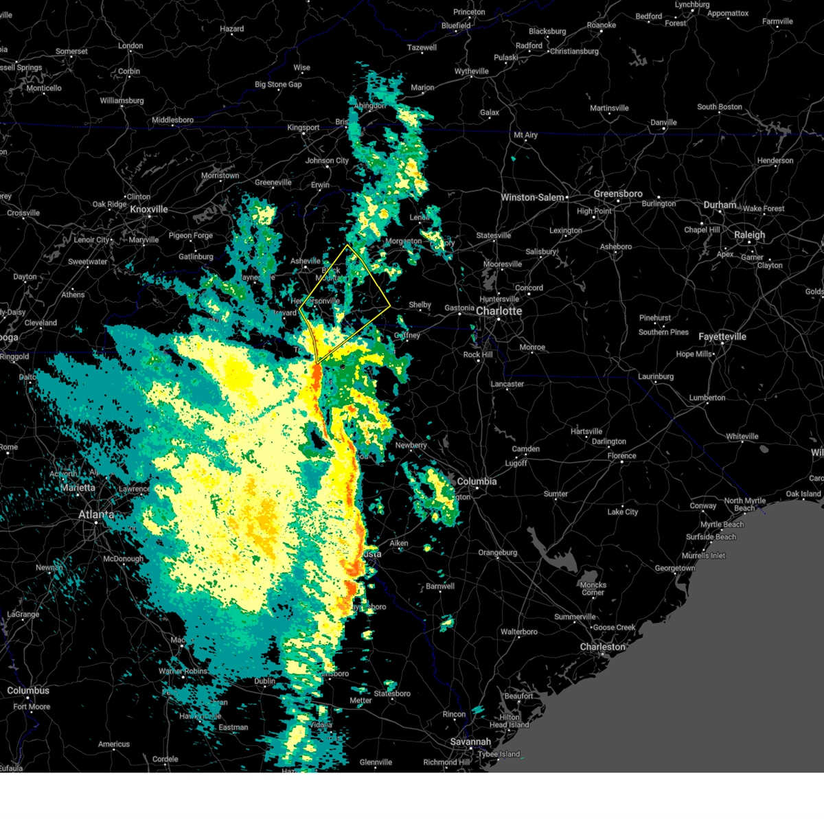
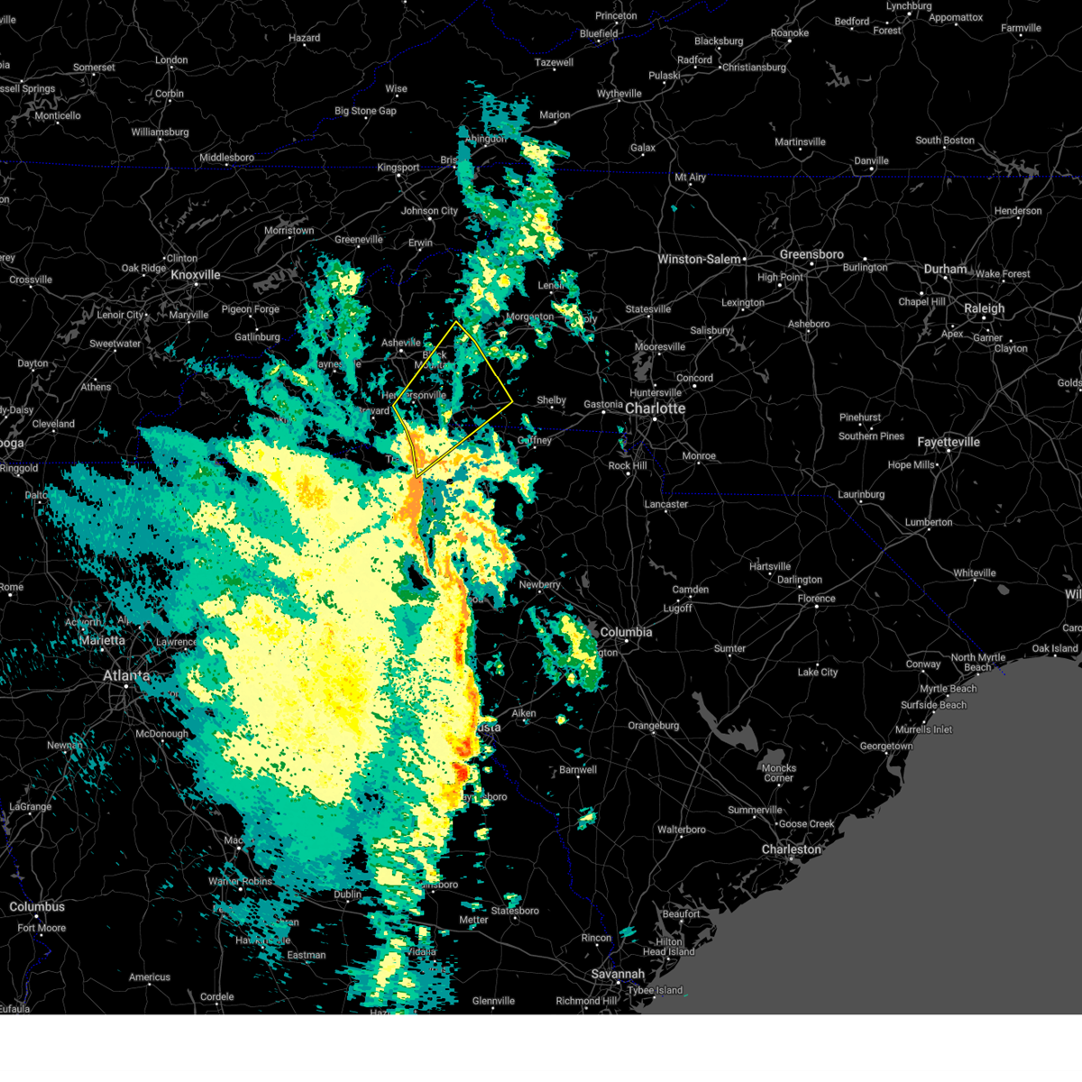
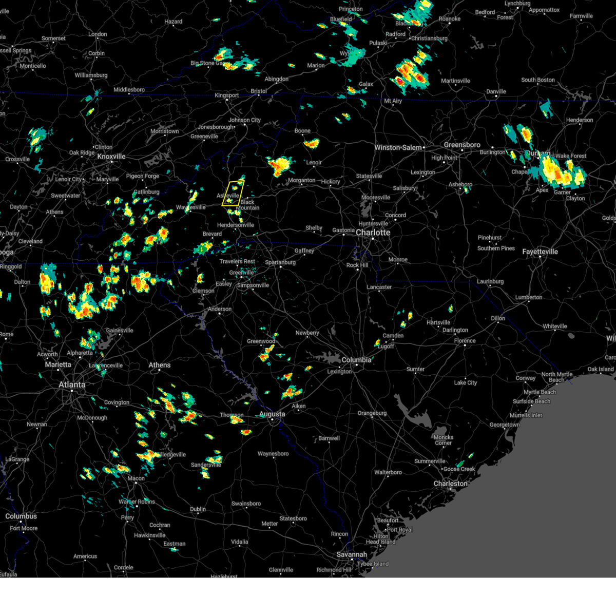
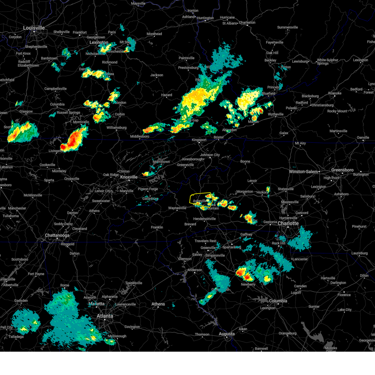
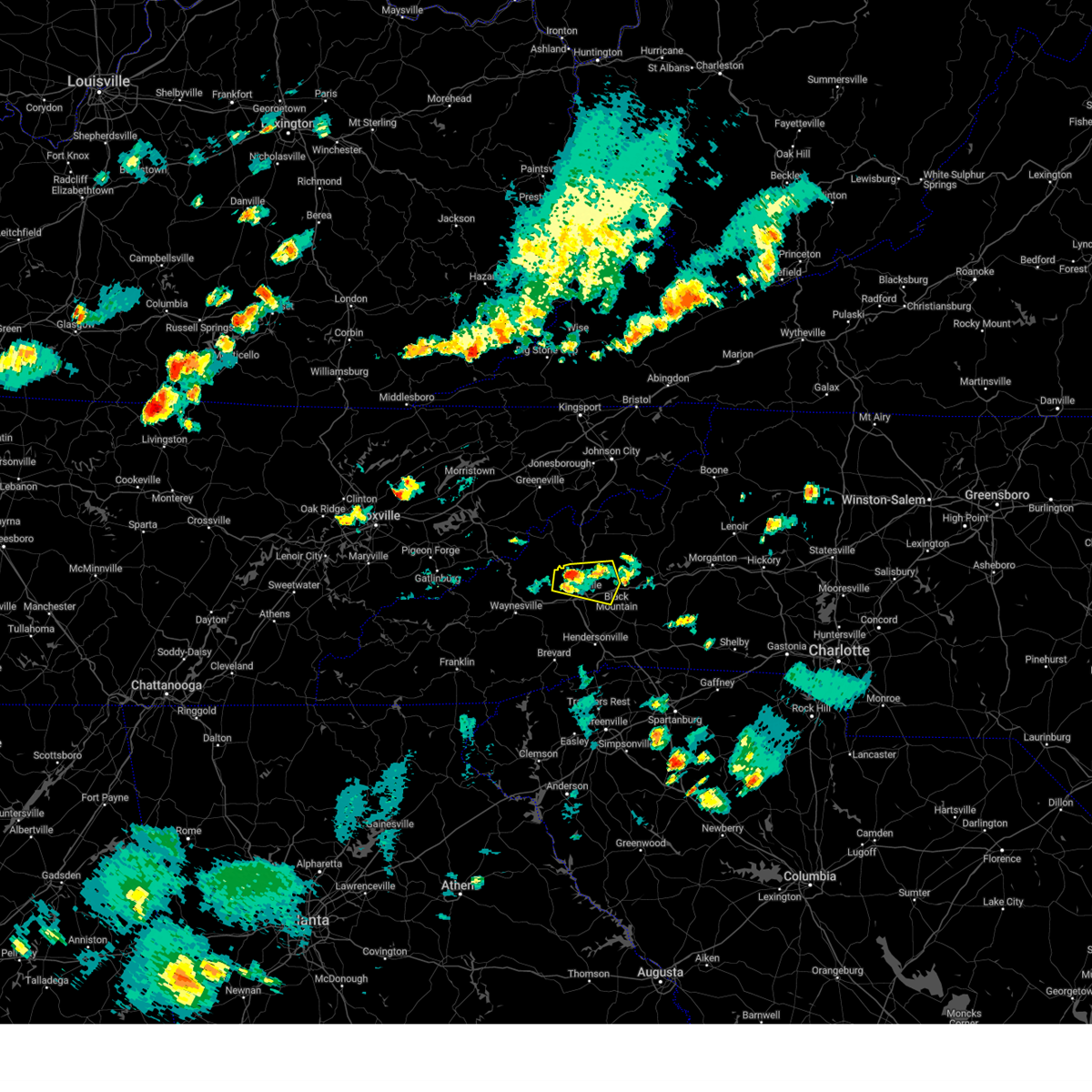
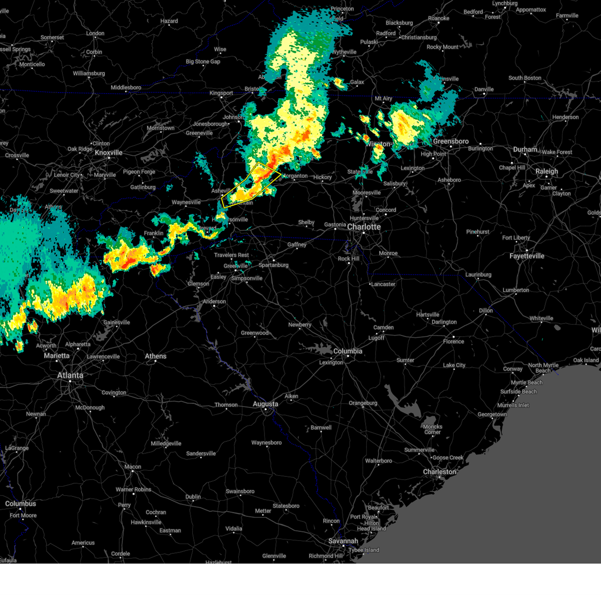
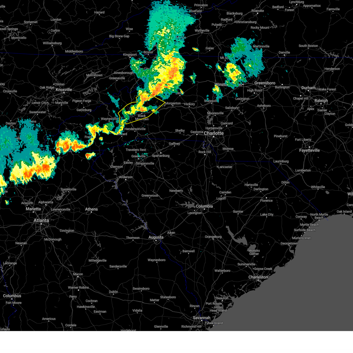
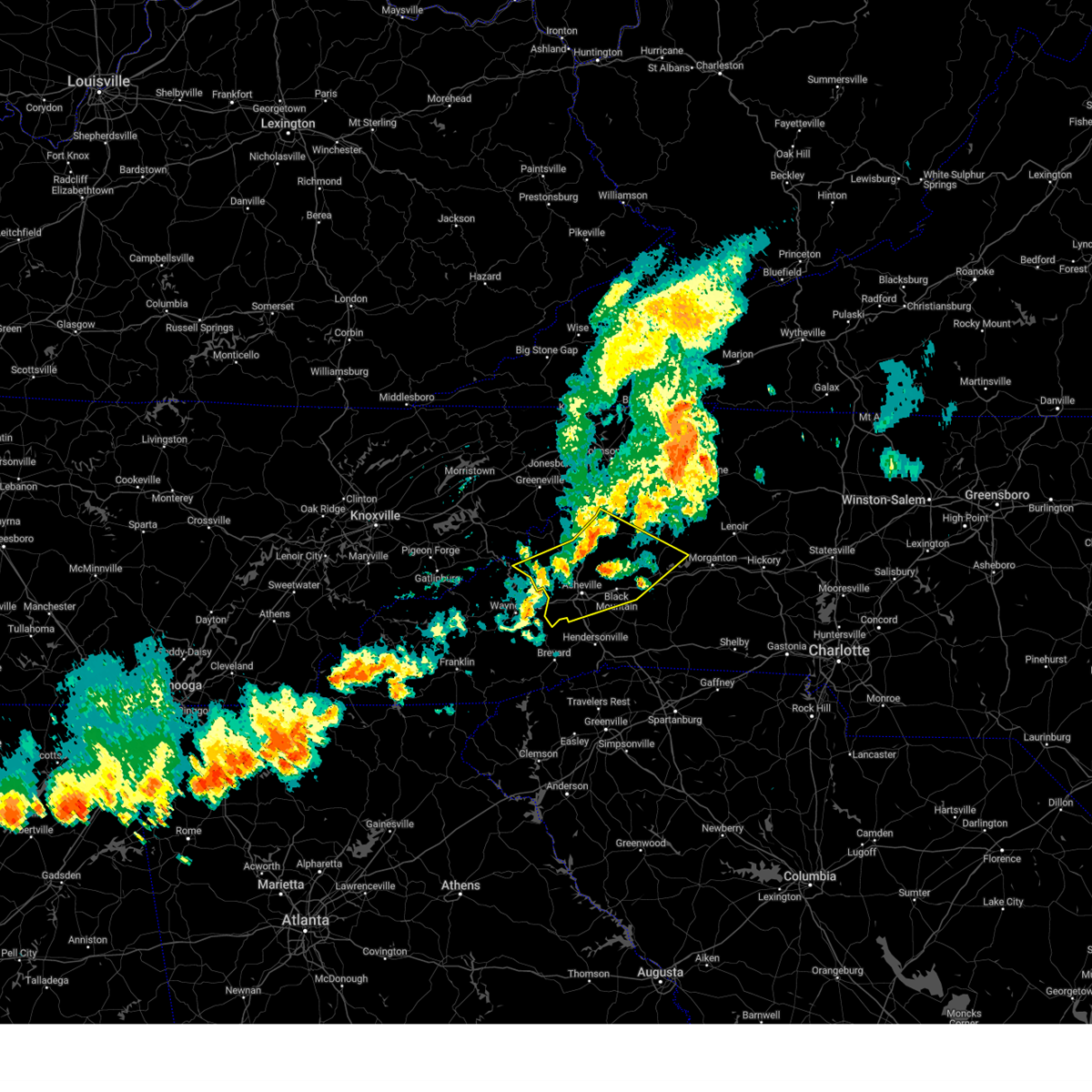
Hail Map for Fairview, NC
The Fairview, NC area has had 6 reports of on-the-ground hail by trained spotters, and has been under severe weather warnings 66 times during the past 12 months. Doppler radar has detected hail at or near Fairview, NC on 81 occasions, including 2 occasions during the past year.
| Name: | Fairview, NC |
| Where Located: | 17.9 miles ESE of Charlotte, NC |
| Map: | Google Map for Fairview, NC |
| Population: | 3324 |
| Housing Units: | 1302 |
| More Info: | Search Google for Fairview, NC |
0
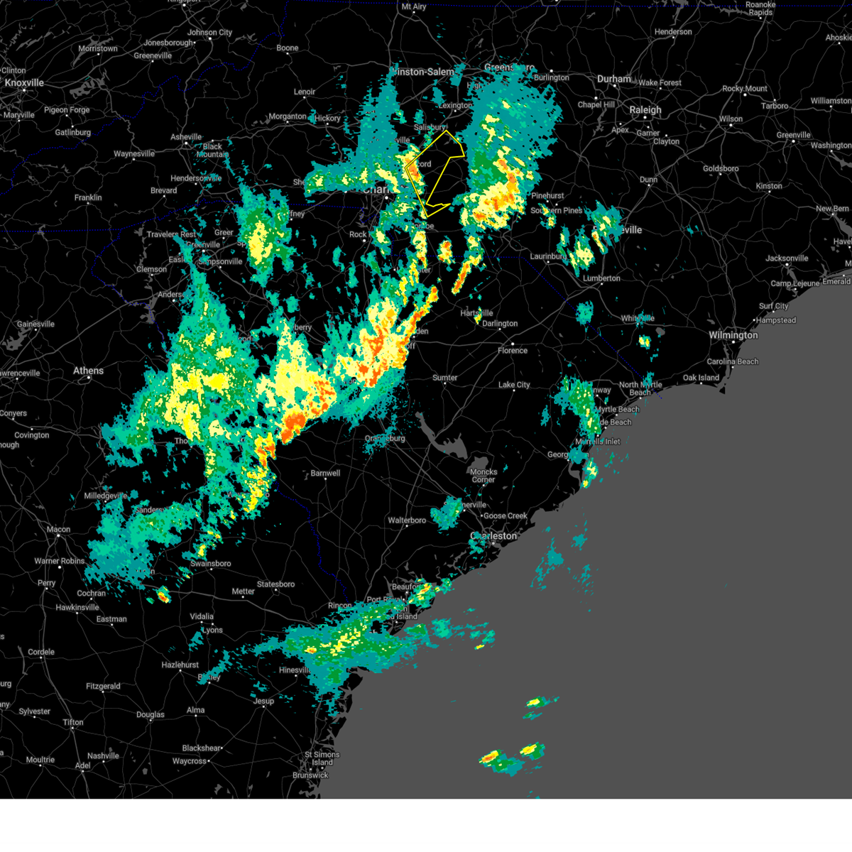
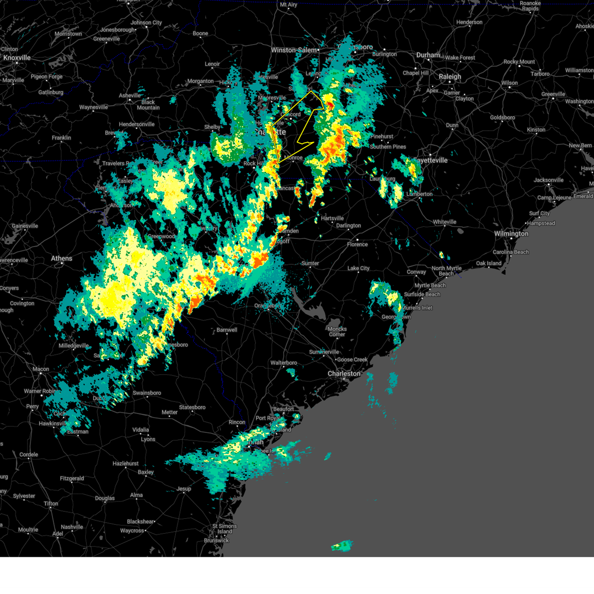
The Top Recent Hail Date for Fairview, NC is Wednesday, June 25, 2025 (41st out of 81)

Hail and Wind Damage Spotted near Fairview, NC
| Date / Time | Report Details |
|---|---|
| 6/25/2025 7:28 PM EDT |
 Svrgsp the national weather service in greenville-spartanburg has issued a * severe thunderstorm warning for, mecklenburg county in the piedmont of north carolina, eastern gaston county in the piedmont of north carolina, northwestern union county in the piedmont of north carolina, * until 815 pm edt. * at 728 pm edt, severe thunderstorms were located along a line extending from 7 miles southwest of huntersville to 9 miles southeast of uptown charlotte, moving southwest at 15 mph (radar indicated). Hazards include 60 mph wind gusts and quarter size hail. Minor hail damage to vehicles is expected. Expect wind damage to trees and power lines. Svrgsp the national weather service in greenville-spartanburg has issued a * severe thunderstorm warning for, mecklenburg county in the piedmont of north carolina, eastern gaston county in the piedmont of north carolina, northwestern union county in the piedmont of north carolina, * until 815 pm edt. * at 728 pm edt, severe thunderstorms were located along a line extending from 7 miles southwest of huntersville to 9 miles southeast of uptown charlotte, moving southwest at 15 mph (radar indicated). Hazards include 60 mph wind gusts and quarter size hail. Minor hail damage to vehicles is expected. Expect wind damage to trees and power lines.
|
| 6/25/2025 4:50 PM EDT |
 At 450 pm edt, a severe thunderstorm was located 14 miles southwest of marion, or 5 miles southwest of old fort, moving east at 10 mph (radar indicated). Hazards include 60 mph wind gusts and nickel size hail. Expect damage to trees and power lines. Locations impacted include, arden, fletcher, fairview in buncombe county, lake lure, chimney rock village, chimney rock state park, bat cave, asheville airport, skyland, and avery creek. At 450 pm edt, a severe thunderstorm was located 14 miles southwest of marion, or 5 miles southwest of old fort, moving east at 10 mph (radar indicated). Hazards include 60 mph wind gusts and nickel size hail. Expect damage to trees and power lines. Locations impacted include, arden, fletcher, fairview in buncombe county, lake lure, chimney rock village, chimney rock state park, bat cave, asheville airport, skyland, and avery creek.
|
| 6/25/2025 4:26 PM EDT | Svrgsp the national weather service in greenville-spartanburg has issued a * severe thunderstorm warning for, southwestern mcdowell county in western north carolina, northwestern rutherford county in western north carolina, northeastern henderson county in western north carolina, southeastern buncombe county in western north carolina, * until 545 pm edt. * at 426 pm edt, a severe thunderstorm was located 10 miles west of marion, or near old fort, moving southeast at 5 mph (radar indicated). Hazards include 60 mph wind gusts and nickel size hail. expect damage to trees and power lines |
| 6/25/2025 2:48 PM EDT |
 the severe thunderstorm warning has been cancelled and is no longer in effect the severe thunderstorm warning has been cancelled and is no longer in effect
|
| 6/25/2025 2:22 PM EDT |
 Svrgsp the national weather service in greenville-spartanburg has issued a * severe thunderstorm warning for, southwestern mcdowell county in western north carolina, west central rutherford county in western north carolina, northeastern henderson county in western north carolina, southeastern buncombe county in western north carolina, * until 300 pm edt. * at 222 pm edt, a severe thunderstorm was located 16 miles east of downtown asheville, or 5 miles north of chimney rock village, moving north at 5 mph (radar indicated). Hazards include 60 mph wind gusts and penny size hail. expect damage to trees and power lines Svrgsp the national weather service in greenville-spartanburg has issued a * severe thunderstorm warning for, southwestern mcdowell county in western north carolina, west central rutherford county in western north carolina, northeastern henderson county in western north carolina, southeastern buncombe county in western north carolina, * until 300 pm edt. * at 222 pm edt, a severe thunderstorm was located 16 miles east of downtown asheville, or 5 miles north of chimney rock village, moving north at 5 mph (radar indicated). Hazards include 60 mph wind gusts and penny size hail. expect damage to trees and power lines
|
| 5/17/2025 4:35 AM EDT |
 Svrgsp the national weather service in greenville-spartanburg has issued a * severe thunderstorm warning for, henderson county in western north carolina, polk county in western north carolina, southwestern buncombe county in western north carolina, * until 500 am edt. * at 435 am edt, a severe thunderstorm was located 6 miles south of downtown asheville, or near skyland, moving southeast at 50 mph (radar indicated). Hazards include 60 mph wind gusts and nickel size hail. expect damage to trees and power lines Svrgsp the national weather service in greenville-spartanburg has issued a * severe thunderstorm warning for, henderson county in western north carolina, polk county in western north carolina, southwestern buncombe county in western north carolina, * until 500 am edt. * at 435 am edt, a severe thunderstorm was located 6 miles south of downtown asheville, or near skyland, moving southeast at 50 mph (radar indicated). Hazards include 60 mph wind gusts and nickel size hail. expect damage to trees and power lines
|
| 5/17/2025 3:42 AM EDT |
 Svrgsp the national weather service in greenville-spartanburg has issued a * severe thunderstorm warning for, mcdowell county in western north carolina, southeastern mitchell county in western north carolina, southwestern avery county in western north carolina, buncombe county in western north carolina, central haywood county in western north carolina, southeastern yancey county in western north carolina, northwestern burke county in western north carolina, * until 430 am edt. * at 341 am edt, severe thunderstorms were located along a line extending from 5 miles northeast of burnsville to 13 miles northeast of downtown asheville to 8 miles north of waynesville, moving southeast at 45 mph (radar indicated). Hazards include 60 mph wind gusts and nickel size hail. expect damage to trees and power lines Svrgsp the national weather service in greenville-spartanburg has issued a * severe thunderstorm warning for, mcdowell county in western north carolina, southeastern mitchell county in western north carolina, southwestern avery county in western north carolina, buncombe county in western north carolina, central haywood county in western north carolina, southeastern yancey county in western north carolina, northwestern burke county in western north carolina, * until 430 am edt. * at 341 am edt, severe thunderstorms were located along a line extending from 5 miles northeast of burnsville to 13 miles northeast of downtown asheville to 8 miles north of waynesville, moving southeast at 45 mph (radar indicated). Hazards include 60 mph wind gusts and nickel size hail. expect damage to trees and power lines
|
| 5/8/2025 6:22 PM EDT |
 Svrgsp the national weather service in greenville-spartanburg has issued a * severe thunderstorm warning for, northeastern henderson county in western north carolina, southeastern buncombe county in western north carolina, * until 730 pm edt. * at 622 pm edt, a severe thunderstorm was located 8 miles northwest of hendersonville, or over asheville airport, moving east at 15 mph (radar indicated). Hazards include 60 mph wind gusts and half dollar size hail. Minor hail damage to vehicles is expected. Expect wind damage to trees and power lines. Svrgsp the national weather service in greenville-spartanburg has issued a * severe thunderstorm warning for, northeastern henderson county in western north carolina, southeastern buncombe county in western north carolina, * until 730 pm edt. * at 622 pm edt, a severe thunderstorm was located 8 miles northwest of hendersonville, or over asheville airport, moving east at 15 mph (radar indicated). Hazards include 60 mph wind gusts and half dollar size hail. Minor hail damage to vehicles is expected. Expect wind damage to trees and power lines.
|
| 5/8/2025 4:16 PM EDT | Svrgsp the national weather service in greenville-spartanburg has issued a * severe thunderstorm warning for, central buncombe county in western north carolina, * until 515 pm edt. * at 416 pm edt, a severe thunderstorm was located near downtown asheville, or over unc-asheville, moving east at 25 mph (radar indicated). Hazards include 60 mph wind gusts and quarter size hail. Minor hail damage to vehicles is expected. Expect wind damage to trees and power lines. |
| 5/4/2025 1:43 AM EDT |
 The storms which prompted the warning have moved out of the area. therefore, the warning will be allowed to expire. to report severe weather to the national weather service greenville-spartanburg, call toll free, 1, 800, 2 6 7, 8 1 0 1, or post on our facebook page, or tweet it using hashtag nwsgsp. your message should describe the event and the specific location where it occurred. The storms which prompted the warning have moved out of the area. therefore, the warning will be allowed to expire. to report severe weather to the national weather service greenville-spartanburg, call toll free, 1, 800, 2 6 7, 8 1 0 1, or post on our facebook page, or tweet it using hashtag nwsgsp. your message should describe the event and the specific location where it occurred.
|
| 5/4/2025 1:19 AM EDT |
 the severe thunderstorm warning has been cancelled and is no longer in effect the severe thunderstorm warning has been cancelled and is no longer in effect
|
| 5/4/2025 1:19 AM EDT |
 At 119 am edt, severe thunderstorms were located along a line extending from near downtown concord to 14 miles north of monroe, moving northeast at 45 mph (radar indicated). Hazards include 60 mph wind gusts. Expect damage to trees and power lines. Locations impacted include, mt pleasant, west concord, gold hill, faith, rockwell, high rock lake, midland, high rock, downtown concord, and granite quarry. At 119 am edt, severe thunderstorms were located along a line extending from near downtown concord to 14 miles north of monroe, moving northeast at 45 mph (radar indicated). Hazards include 60 mph wind gusts. Expect damage to trees and power lines. Locations impacted include, mt pleasant, west concord, gold hill, faith, rockwell, high rock lake, midland, high rock, downtown concord, and granite quarry.
|
| 5/4/2025 1:00 AM EDT |
 Svrgsp the national weather service in greenville-spartanburg has issued a * severe thunderstorm warning for, cabarrus county in the piedmont of north carolina, southeastern mecklenburg county in the piedmont of north carolina, southeastern rowan county in the piedmont of north carolina, northern union county in the piedmont of north carolina, * until 145 am edt. * at 100 am edt, severe thunderstorms were located along a line extending from 8 miles northeast of uptown charlotte to 10 miles northwest of monroe, moving northeast at 45 mph (radar indicated). Hazards include 60 mph wind gusts. expect damage to trees and power lines Svrgsp the national weather service in greenville-spartanburg has issued a * severe thunderstorm warning for, cabarrus county in the piedmont of north carolina, southeastern mecklenburg county in the piedmont of north carolina, southeastern rowan county in the piedmont of north carolina, northern union county in the piedmont of north carolina, * until 145 am edt. * at 100 am edt, severe thunderstorms were located along a line extending from 8 miles northeast of uptown charlotte to 10 miles northwest of monroe, moving northeast at 45 mph (radar indicated). Hazards include 60 mph wind gusts. expect damage to trees and power lines
|
| 5/2/2025 7:15 PM EDT | the severe thunderstorm warning has been cancelled and is no longer in effect |
| 5/2/2025 7:07 PM EDT | At 706 pm edt, a severe thunderstorm was located 13 miles south of downtown concord, or 4 miles west of midland, moving north at 20 mph (radar indicated). Hazards include 60 mph wind gusts and quarter size hail. Minor hail damage to vehicles is expected. expect wind damage to trees and power lines. Locations impacted include, unionville, fairview in union county, and indian trail. |
| 5/2/2025 7:07 PM EDT | the severe thunderstorm warning has been cancelled and is no longer in effect |
| 5/2/2025 6:46 PM EDT | At 646 pm edt, a severe thunderstorm was located 10 miles northwest of monroe, or near hemby bridge, moving north at 20 mph (radar indicated). Hazards include 60 mph wind gusts and quarter size hail. Minor hail damage to vehicles is expected. expect wind damage to trees and power lines. Locations impacted include, indian trail, lake park, mint hill, south charlotte, matthews, stallings, the arboretum, hemby bridge, fairview in union county, and unionville. |
| 5/2/2025 6:16 PM EDT | Svrgsp the national weather service in greenville-spartanburg has issued a * severe thunderstorm warning for, southeastern mecklenburg county in the piedmont of north carolina, central union county in the piedmont of north carolina, * until 730 pm edt. * at 616 pm edt, a severe thunderstorm was located 8 miles west of monroe, or near wesley chapel, moving north at 20 mph (radar indicated). Hazards include 60 mph wind gusts and quarter size hail. Minor hail damage to vehicles is expected. Expect wind damage to trees and power lines. |
| 3/31/2025 5:53 PM EDT |
 the severe thunderstorm warning has been cancelled and is no longer in effect the severe thunderstorm warning has been cancelled and is no longer in effect
|
| 3/31/2025 5:40 PM EDT |
 At 540 pm edt, severe thunderstorms were located along a line extending from 14 miles south of downtown concord to 9 miles northeast of monroe to 22 miles east of lancaster, moving east at 50 mph (radar indicated). Hazards include 60 mph wind gusts. Expect damage to trees and power lines. Locations impacted include, marshville, new salem, fairview in union county, sturdivants, unionville, wingate, hemby bridge, and stallings. At 540 pm edt, severe thunderstorms were located along a line extending from 14 miles south of downtown concord to 9 miles northeast of monroe to 22 miles east of lancaster, moving east at 50 mph (radar indicated). Hazards include 60 mph wind gusts. Expect damage to trees and power lines. Locations impacted include, marshville, new salem, fairview in union county, sturdivants, unionville, wingate, hemby bridge, and stallings.
|
| 3/31/2025 5:30 PM EDT |
 At 530 pm edt, severe thunderstorms were located along a line extending from 10 miles southeast of uptown charlotte to near monroe to 14 miles east of lancaster, moving northeast at 55 mph (radar indicated). Hazards include 60 mph wind gusts. Expect damage to trees and power lines. Locations impacted include, marshville, indian trail, trinity, lake park, wesley chapel, monroe, wingate, stallings, new salem, and hemby bridge. At 530 pm edt, severe thunderstorms were located along a line extending from 10 miles southeast of uptown charlotte to near monroe to 14 miles east of lancaster, moving northeast at 55 mph (radar indicated). Hazards include 60 mph wind gusts. Expect damage to trees and power lines. Locations impacted include, marshville, indian trail, trinity, lake park, wesley chapel, monroe, wingate, stallings, new salem, and hemby bridge.
|
| 3/31/2025 5:30 PM EDT |
 the severe thunderstorm warning has been cancelled and is no longer in effect the severe thunderstorm warning has been cancelled and is no longer in effect
|
| 3/31/2025 5:22 PM EDT |
 At 522 pm edt, severe thunderstorms were located along a line extending from 8 miles southeast of uptown charlotte to 5 miles southwest of monroe to 12 miles southeast of lancaster, moving east at 50 mph (radar indicated). Hazards include 60 mph wind gusts. Expect damage to trees and power lines. Locations impacted include, marshville, trinity, lake park, mint hill, south charlotte, mineral springs, new salem, hemby bridge, southwest charlotte, and fairview in union county. At 522 pm edt, severe thunderstorms were located along a line extending from 8 miles southeast of uptown charlotte to 5 miles southwest of monroe to 12 miles southeast of lancaster, moving east at 50 mph (radar indicated). Hazards include 60 mph wind gusts. Expect damage to trees and power lines. Locations impacted include, marshville, trinity, lake park, mint hill, south charlotte, mineral springs, new salem, hemby bridge, southwest charlotte, and fairview in union county.
|
| 3/31/2025 4:57 PM EDT |
 Svrgsp the national weather service in greenville-spartanburg has issued a * severe thunderstorm warning for, southern mecklenburg county in the piedmont of north carolina, union county in the piedmont of north carolina, * until 615 pm edt. * at 457 pm edt, severe thunderstorms were located along a line extending from 7 miles east of york to 6 miles southeast of rock hill to 13 miles north of springdale, moving east at 50 mph (radar indicated). Hazards include 60 mph wind gusts. expect damage to trees and power lines Svrgsp the national weather service in greenville-spartanburg has issued a * severe thunderstorm warning for, southern mecklenburg county in the piedmont of north carolina, union county in the piedmont of north carolina, * until 615 pm edt. * at 457 pm edt, severe thunderstorms were located along a line extending from 7 miles east of york to 6 miles southeast of rock hill to 13 miles north of springdale, moving east at 50 mph (radar indicated). Hazards include 60 mph wind gusts. expect damage to trees and power lines
|
| 3/16/2025 9:37 AM EDT |
 The storms which prompted the warning have moved out of the area. therefore, the warning will be allowed to expire. The storms which prompted the warning have moved out of the area. therefore, the warning will be allowed to expire.
|
| 3/16/2025 9:25 AM EDT |
 At 924 am edt, severe thunderstorms were located along a line extending from 14 miles southwest of albemarle to 18 miles northwest of wadesboro to 13 miles southeast of monroe, moving northeast at 50 mph (radar indicated). Hazards include 60 mph wind gusts. Expect damage to trees and power lines. Locations impacted include, marshville, sturdivants, new salem, and wingate. At 924 am edt, severe thunderstorms were located along a line extending from 14 miles southwest of albemarle to 18 miles northwest of wadesboro to 13 miles southeast of monroe, moving northeast at 50 mph (radar indicated). Hazards include 60 mph wind gusts. Expect damage to trees and power lines. Locations impacted include, marshville, sturdivants, new salem, and wingate.
|
| 3/16/2025 9:17 AM EDT |
 At 917 am edt, severe thunderstorms were located along a line extending from 12 miles south of downtown concord to 9 miles northeast of monroe to 20 miles west of wadesboro, moving northeast at 50 mph (radar indicated). Hazards include 60 mph wind gusts. Expect damage to trees and power lines. Locations impacted include, marshville, trinity, new salem, fairview in union county, sturdivants, unionville, wingate, and monroe. At 917 am edt, severe thunderstorms were located along a line extending from 12 miles south of downtown concord to 9 miles northeast of monroe to 20 miles west of wadesboro, moving northeast at 50 mph (radar indicated). Hazards include 60 mph wind gusts. Expect damage to trees and power lines. Locations impacted include, marshville, trinity, new salem, fairview in union county, sturdivants, unionville, wingate, and monroe.
|
| 3/16/2025 9:09 AM EDT |
 Svrgsp the national weather service in greenville-spartanburg has issued a * severe thunderstorm warning for, union county in the piedmont of north carolina, * until 945 am edt. * at 909 am edt, severe thunderstorms were located along a line extending from 15 miles east of uptown charlotte to 3 miles northeast of monroe to 18 miles east of lancaster, moving northeast at 50 mph (radar indicated). Hazards include 60 mph wind gusts. expect damage to trees and power lines Svrgsp the national weather service in greenville-spartanburg has issued a * severe thunderstorm warning for, union county in the piedmont of north carolina, * until 945 am edt. * at 909 am edt, severe thunderstorms were located along a line extending from 15 miles east of uptown charlotte to 3 miles northeast of monroe to 18 miles east of lancaster, moving northeast at 50 mph (radar indicated). Hazards include 60 mph wind gusts. expect damage to trees and power lines
|
| 3/5/2025 8:50 AM EST |
 The storm which prompted the warning has moved out of the area. therefore, the warning will be allowed to expire. to report severe weather to the national weather service greenville-spartanburg, call toll free, 1, 800, 2 6 7, 8 1 0 1, or post on our facebook page, or tweet it using hashtag nwsgsp. your message should describe the event and the specific location where it occurred. The storm which prompted the warning has moved out of the area. therefore, the warning will be allowed to expire. to report severe weather to the national weather service greenville-spartanburg, call toll free, 1, 800, 2 6 7, 8 1 0 1, or post on our facebook page, or tweet it using hashtag nwsgsp. your message should describe the event and the specific location where it occurred.
|
| 3/5/2025 8:46 AM EST |
 the severe thunderstorm warning has been cancelled and is no longer in effect the severe thunderstorm warning has been cancelled and is no longer in effect
|
| 3/5/2025 8:46 AM EST |
 At 846 am est, severe thunderstorms were located along a line extending from 4 miles southwest of downtown concord to 9 miles west of monroe, moving northeast at 45 mph (radar indicated). Hazards include 60 mph wind gusts. Expect damage to trees and power lines. Locations impacted include, marshville, mt pleasant, trinity, gold hill, monroe, rockwell, wingate, midland, new salem, and high rock. At 846 am est, severe thunderstorms were located along a line extending from 4 miles southwest of downtown concord to 9 miles west of monroe, moving northeast at 45 mph (radar indicated). Hazards include 60 mph wind gusts. Expect damage to trees and power lines. Locations impacted include, marshville, mt pleasant, trinity, gold hill, monroe, rockwell, wingate, midland, new salem, and high rock.
|
| 3/5/2025 8:44 AM EST |
 At 844 am est, a severe thunderstorm capable of producing a tornado was located 12 miles northeast of monroe, or 6 miles east of fairview, moving northeast at 50 mph (radar indicated rotation). Hazards include tornado. Flying debris will be dangerous to those caught without shelter. mobile homes will be damaged or destroyed. damage to roofs, windows, and vehicles will occur. tree damage is likely. This tornadic thunderstorm will remain over mainly rural areas of northeastern union county, including the following locations, new salem. At 844 am est, a severe thunderstorm capable of producing a tornado was located 12 miles northeast of monroe, or 6 miles east of fairview, moving northeast at 50 mph (radar indicated rotation). Hazards include tornado. Flying debris will be dangerous to those caught without shelter. mobile homes will be damaged or destroyed. damage to roofs, windows, and vehicles will occur. tree damage is likely. This tornadic thunderstorm will remain over mainly rural areas of northeastern union county, including the following locations, new salem.
|
| 3/5/2025 8:39 AM EST |
 Svrrah the national weather service in raleigh has issued a * severe thunderstorm warning for, southeastern davidson county in central north carolina, anson county in central north carolina, montgomery county in central north carolina, western richmond county in central north carolina, southwestern randolph county in central north carolina, stanly county in central north carolina, * until 930 am est. * at 838 am est, severe thunderstorms were located along a line extending from near rockwell to 8 miles south of monroe, moving northeast at 70 mph (radar indicated). Hazards include 60 mph wind gusts. expect damage to roofs, siding, and trees Svrrah the national weather service in raleigh has issued a * severe thunderstorm warning for, southeastern davidson county in central north carolina, anson county in central north carolina, montgomery county in central north carolina, western richmond county in central north carolina, southwestern randolph county in central north carolina, stanly county in central north carolina, * until 930 am est. * at 838 am est, severe thunderstorms were located along a line extending from near rockwell to 8 miles south of monroe, moving northeast at 70 mph (radar indicated). Hazards include 60 mph wind gusts. expect damage to roofs, siding, and trees
|
| 3/5/2025 8:31 AM EST |
 Torgsp the national weather service in greenville-spartanburg has issued a * tornado warning for, northeastern union county in the piedmont of north carolina, * until 900 am est. * at 830 am est, a severe thunderstorm capable of producing a tornado was located 4 miles northwest of monroe, or 4 miles southeast of lake park, moving northeast at 55 mph (radar indicated rotation). Hazards include tornado. Flying debris will be dangerous to those caught without shelter. mobile homes will be damaged or destroyed. damage to roofs, windows, and vehicles will occur. tree damage is likely. this dangerous storm will be near, unionville around 840 am est. Other locations impacted by this dangerous thunderstorm include new salem, and the northern side of monroe. Torgsp the national weather service in greenville-spartanburg has issued a * tornado warning for, northeastern union county in the piedmont of north carolina, * until 900 am est. * at 830 am est, a severe thunderstorm capable of producing a tornado was located 4 miles northwest of monroe, or 4 miles southeast of lake park, moving northeast at 55 mph (radar indicated rotation). Hazards include tornado. Flying debris will be dangerous to those caught without shelter. mobile homes will be damaged or destroyed. damage to roofs, windows, and vehicles will occur. tree damage is likely. this dangerous storm will be near, unionville around 840 am est. Other locations impacted by this dangerous thunderstorm include new salem, and the northern side of monroe.
|
| 3/5/2025 8:08 AM EST |
 Svrgsp the national weather service in greenville-spartanburg has issued a * severe thunderstorm warning for, cabarrus county in the piedmont of north carolina, central mecklenburg county in the piedmont of north carolina, southeastern rowan county in the piedmont of north carolina, union county in the piedmont of north carolina, * until 900 am est. * at 808 am est, severe thunderstorms were located along a line extending from 3 miles east of huntersville to 10 miles southeast of rock hill, moving northeast at 45 mph (radar indicated). Hazards include 60 mph wind gusts. expect damage to trees and power lines Svrgsp the national weather service in greenville-spartanburg has issued a * severe thunderstorm warning for, cabarrus county in the piedmont of north carolina, central mecklenburg county in the piedmont of north carolina, southeastern rowan county in the piedmont of north carolina, union county in the piedmont of north carolina, * until 900 am est. * at 808 am est, severe thunderstorms were located along a line extending from 3 miles east of huntersville to 10 miles southeast of rock hill, moving northeast at 45 mph (radar indicated). Hazards include 60 mph wind gusts. expect damage to trees and power lines
|
| 2/6/2025 10:49 PM EST |
 Svrgsp the national weather service in greenville-spartanburg has issued a * severe thunderstorm warning for, southern madison county in western north carolina, buncombe county in western north carolina, north central haywood county in western north carolina, south central yancey county in western north carolina, * until 1130 pm est. * at 1048 pm est, a severe thunderstorm was located 15 miles west of marshall, or 9 miles southwest of hot springs, moving east at 45 mph (radar indicated). Hazards include 60 mph wind gusts and quarter size hail. Minor hail damage to vehicles is expected. Expect wind damage to trees and power lines. Svrgsp the national weather service in greenville-spartanburg has issued a * severe thunderstorm warning for, southern madison county in western north carolina, buncombe county in western north carolina, north central haywood county in western north carolina, south central yancey county in western north carolina, * until 1130 pm est. * at 1048 pm est, a severe thunderstorm was located 15 miles west of marshall, or 9 miles southwest of hot springs, moving east at 45 mph (radar indicated). Hazards include 60 mph wind gusts and quarter size hail. Minor hail damage to vehicles is expected. Expect wind damage to trees and power lines.
|
| 2/6/2025 10:09 PM EST |
 Svrgsp the national weather service in greenville-spartanburg has issued a * severe thunderstorm warning for, southern madison county in western north carolina, buncombe county in western north carolina, northeastern haywood county in western north carolina, south central yancey county in western north carolina, * until 1100 pm est. * at 1007 pm est, a severe thunderstorm was located near sevierville, moving east at 45 mph (radar indicated). Hazards include 60 mph wind gusts and quarter size hail. Minor hail damage to vehicles is expected. Expect wind damage to trees and power lines. Svrgsp the national weather service in greenville-spartanburg has issued a * severe thunderstorm warning for, southern madison county in western north carolina, buncombe county in western north carolina, northeastern haywood county in western north carolina, south central yancey county in western north carolina, * until 1100 pm est. * at 1007 pm est, a severe thunderstorm was located near sevierville, moving east at 45 mph (radar indicated). Hazards include 60 mph wind gusts and quarter size hail. Minor hail damage to vehicles is expected. Expect wind damage to trees and power lines.
|
| 12/29/2024 10:13 AM EST |
 The storms which prompted the warning have moved out of the area. therefore, the warning will be allowed to expire. a tornado watch remains in effect until 100 pm est for the piedmont of north carolina. The storms which prompted the warning have moved out of the area. therefore, the warning will be allowed to expire. a tornado watch remains in effect until 100 pm est for the piedmont of north carolina.
|
| 12/29/2024 10:02 AM EST |
 the severe thunderstorm warning has been cancelled and is no longer in effect the severe thunderstorm warning has been cancelled and is no longer in effect
|
| 12/29/2024 10:02 AM EST |
 At 1001 am est, severe thunderstorms were located along a line extending from 5 miles south of salisbury to 10 miles west of albemarle to 14 miles southeast of monroe, moving northeast at 50 mph (radar indicated). Hazards include 60 mph wind gusts. Expect damage to trees and power lines. Locations impacted include, monroe, unionville, wingate, marshville, mt pleasant, sturdivants, new salem, midland, and fairview in union county. At 1001 am est, severe thunderstorms were located along a line extending from 5 miles south of salisbury to 10 miles west of albemarle to 14 miles southeast of monroe, moving northeast at 50 mph (radar indicated). Hazards include 60 mph wind gusts. Expect damage to trees and power lines. Locations impacted include, monroe, unionville, wingate, marshville, mt pleasant, sturdivants, new salem, midland, and fairview in union county.
|
| 12/29/2024 9:57 AM EST |
 At 957 am est, severe thunderstorms were located along a line extending from near mt pleasant to 6 miles northeast of unionville to near wingate, moving northeast at 55 mph (radar indicated). Hazards include 60 mph wind gusts. Expect damage to roofs, siding, and trees. Locations impacted include, albemarle, wadesboro, badin lake, ansonville, plyler, midland, polkton, locust, norwood, and badin. At 957 am est, severe thunderstorms were located along a line extending from near mt pleasant to 6 miles northeast of unionville to near wingate, moving northeast at 55 mph (radar indicated). Hazards include 60 mph wind gusts. Expect damage to roofs, siding, and trees. Locations impacted include, albemarle, wadesboro, badin lake, ansonville, plyler, midland, polkton, locust, norwood, and badin.
|
| 12/29/2024 9:40 AM EST |
 Svrrah the national weather service in raleigh has issued a * severe thunderstorm warning for, southern davidson county in central north carolina, anson county in central north carolina, western montgomery county in central north carolina, western richmond county in central north carolina, stanly county in central north carolina, * until 1030 am est. * at 940 am est, severe thunderstorms were located along a line extending from charlotte motor speedway to near lake park to 6 miles north of buford, moving northeast at 55 mph (radar indicated). Hazards include 60 mph wind gusts. expect damage to roofs, siding, and trees Svrrah the national weather service in raleigh has issued a * severe thunderstorm warning for, southern davidson county in central north carolina, anson county in central north carolina, western montgomery county in central north carolina, western richmond county in central north carolina, stanly county in central north carolina, * until 1030 am est. * at 940 am est, severe thunderstorms were located along a line extending from charlotte motor speedway to near lake park to 6 miles north of buford, moving northeast at 55 mph (radar indicated). Hazards include 60 mph wind gusts. expect damage to roofs, siding, and trees
|
| 12/29/2024 9:39 AM EST |
 At 938 am est, severe thunderstorms were located along a line extending from 4 miles east of huntersville to 11 miles east of uptown charlotte to 10 miles east of lancaster, moving northeast at 50 mph (radar indicated). Hazards include 60 mph wind gusts. Expect damage to trees and power lines. Locations impacted include, huntersville, kannapolis, downtown concord, monroe, west concord, matthews, mint hill, indian trail, stallings, and unionville. At 938 am est, severe thunderstorms were located along a line extending from 4 miles east of huntersville to 11 miles east of uptown charlotte to 10 miles east of lancaster, moving northeast at 50 mph (radar indicated). Hazards include 60 mph wind gusts. Expect damage to trees and power lines. Locations impacted include, huntersville, kannapolis, downtown concord, monroe, west concord, matthews, mint hill, indian trail, stallings, and unionville.
|
| 12/29/2024 9:39 AM EST |
 the severe thunderstorm warning has been cancelled and is no longer in effect the severe thunderstorm warning has been cancelled and is no longer in effect
|
| 12/29/2024 8:59 AM EST |
 Svrgsp the national weather service in greenville-spartanburg has issued a * severe thunderstorm warning for, cabarrus county in the piedmont of north carolina, mecklenburg county in the piedmont of north carolina, south central rowan county in the piedmont of north carolina, southeastern gaston county in the piedmont of north carolina, union county in the piedmont of north carolina, * until 1015 am est. * at 859 am est, severe thunderstorms were located along a line extending from 8 miles north of york to 5 miles west of rock hill to 3 miles north of winnsboro, moving northeast at 50 mph (radar indicated). Hazards include 60 mph wind gusts. expect damage to trees and power lines Svrgsp the national weather service in greenville-spartanburg has issued a * severe thunderstorm warning for, cabarrus county in the piedmont of north carolina, mecklenburg county in the piedmont of north carolina, south central rowan county in the piedmont of north carolina, southeastern gaston county in the piedmont of north carolina, union county in the piedmont of north carolina, * until 1015 am est. * at 859 am est, severe thunderstorms were located along a line extending from 8 miles north of york to 5 miles west of rock hill to 3 miles north of winnsboro, moving northeast at 50 mph (radar indicated). Hazards include 60 mph wind gusts. expect damage to trees and power lines
|
| 12/29/2024 7:43 AM EST |
 the severe thunderstorm warning has been cancelled and is no longer in effect the severe thunderstorm warning has been cancelled and is no longer in effect
|
| 12/29/2024 7:43 AM EST |
 At 743 am est, severe thunderstorms were located along a line extending from 13 miles northeast of brevard to near hendersonville to 11 miles southwest of columbus to 13 miles north of greenville downtown, moving northeast at 50 mph (radar indicated). Hazards include 60 mph wind gusts. Expect damage to trees and power lines. Locations impacted include, hendersonville, forest city, rutherfordton, columbus, travelers rest, spindale, flat rock, landrum, mountain home, and laurel park. At 743 am est, severe thunderstorms were located along a line extending from 13 miles northeast of brevard to near hendersonville to 11 miles southwest of columbus to 13 miles north of greenville downtown, moving northeast at 50 mph (radar indicated). Hazards include 60 mph wind gusts. Expect damage to trees and power lines. Locations impacted include, hendersonville, forest city, rutherfordton, columbus, travelers rest, spindale, flat rock, landrum, mountain home, and laurel park.
|
| 12/29/2024 7:26 AM EST |
 Svrgsp the national weather service in greenville-spartanburg has issued a * severe thunderstorm warning for, southwestern mcdowell county in western north carolina, central rutherford county in western north carolina, east central transylvania county in western north carolina, henderson county in western north carolina, polk county in western north carolina, southeastern buncombe county in western north carolina, southeastern yancey county in western north carolina, northern greenville county in upstate south carolina, northwestern spartanburg county in upstate south carolina, * until 845 am est. * at 726 am est, severe thunderstorms were located along a line extending from near brevard to 14 miles southwest of hendersonville to 13 miles northeast of pickens to 6 miles north of easley, moving northeast at 50 mph (radar indicated). Hazards include 60 mph wind gusts. expect damage to trees and power lines Svrgsp the national weather service in greenville-spartanburg has issued a * severe thunderstorm warning for, southwestern mcdowell county in western north carolina, central rutherford county in western north carolina, east central transylvania county in western north carolina, henderson county in western north carolina, polk county in western north carolina, southeastern buncombe county in western north carolina, southeastern yancey county in western north carolina, northern greenville county in upstate south carolina, northwestern spartanburg county in upstate south carolina, * until 845 am est. * at 726 am est, severe thunderstorms were located along a line extending from near brevard to 14 miles southwest of hendersonville to 13 miles northeast of pickens to 6 miles north of easley, moving northeast at 50 mph (radar indicated). Hazards include 60 mph wind gusts. expect damage to trees and power lines
|
| 8/30/2024 2:23 PM EDT |
 Svrgsp the national weather service in greenville-spartanburg has issued a * severe thunderstorm warning for, central buncombe county in western north carolina, * until 330 pm edt. * at 223 pm edt, a severe thunderstorm was located 8 miles northeast of downtown asheville, or near b.r. parkway-east asheville to craggy gardens, and is nearly stationary (radar indicated). Hazards include 60 mph wind gusts and nickel size hail. expect damage to trees and power lines Svrgsp the national weather service in greenville-spartanburg has issued a * severe thunderstorm warning for, central buncombe county in western north carolina, * until 330 pm edt. * at 223 pm edt, a severe thunderstorm was located 8 miles northeast of downtown asheville, or near b.r. parkway-east asheville to craggy gardens, and is nearly stationary (radar indicated). Hazards include 60 mph wind gusts and nickel size hail. expect damage to trees and power lines
|
| 8/17/2024 8:31 PM EDT |
 the severe thunderstorm warning has been cancelled and is no longer in effect the severe thunderstorm warning has been cancelled and is no longer in effect
|
| 8/17/2024 7:52 PM EDT |
 Svrgsp the national weather service in greenville-spartanburg has issued a * severe thunderstorm warning for, central buncombe county in western north carolina, * until 845 pm edt. * at 750 pm edt, a severe thunderstorm was located 8 miles south of marshall, or near leicester, moving east at 15 mph (radar indicated). Hazards include 60 mph wind gusts and quarter size hail. Minor hail damage to vehicles is expected. Expect wind damage to trees and power lines. Svrgsp the national weather service in greenville-spartanburg has issued a * severe thunderstorm warning for, central buncombe county in western north carolina, * until 845 pm edt. * at 750 pm edt, a severe thunderstorm was located 8 miles south of marshall, or near leicester, moving east at 15 mph (radar indicated). Hazards include 60 mph wind gusts and quarter size hail. Minor hail damage to vehicles is expected. Expect wind damage to trees and power lines.
|
| 8/16/2024 7:48 PM EDT |
 At 748 pm edt, severe thunderstorms were located along a line extending from 3 miles north of spruce pine to 8 miles south of burnsville to near downtown asheville, moving east at 25 mph (radar indicated). Hazards include 60 mph wind gusts and penny size hail. Expect damage to trees and power lines. locations impacted include, east asheville, black mountain, swannanoa, fairview in buncombe county, biltmore forest, old fort, b. r. parkway-little switzerland to linville, b. r. parkway-nc arboretum to east asheville, skyland, and b. r. Parkway-craggy to little switzerland. At 748 pm edt, severe thunderstorms were located along a line extending from 3 miles north of spruce pine to 8 miles south of burnsville to near downtown asheville, moving east at 25 mph (radar indicated). Hazards include 60 mph wind gusts and penny size hail. Expect damage to trees and power lines. locations impacted include, east asheville, black mountain, swannanoa, fairview in buncombe county, biltmore forest, old fort, b. r. parkway-little switzerland to linville, b. r. parkway-nc arboretum to east asheville, skyland, and b. r. Parkway-craggy to little switzerland.
|
| 8/16/2024 7:29 PM EDT |
 At 729 pm edt, severe thunderstorms were located along a line extending from 6 miles northeast of burnsville to 16 miles east of marshall to 9 miles west of downtown asheville, moving east at 25 mph (radar indicated). Hazards include 60 mph wind gusts and penny size hail. Expect damage to trees and power lines. Locations impacted include, downtown asheville, burnsville, east asheville, west asheville, north asheville, black mountain, woodfin, swannanoa, weaverville, and fairview in buncombe county. At 729 pm edt, severe thunderstorms were located along a line extending from 6 miles northeast of burnsville to 16 miles east of marshall to 9 miles west of downtown asheville, moving east at 25 mph (radar indicated). Hazards include 60 mph wind gusts and penny size hail. Expect damage to trees and power lines. Locations impacted include, downtown asheville, burnsville, east asheville, west asheville, north asheville, black mountain, woodfin, swannanoa, weaverville, and fairview in buncombe county.
|
| 8/16/2024 7:29 PM EDT |
 the severe thunderstorm warning has been cancelled and is no longer in effect the severe thunderstorm warning has been cancelled and is no longer in effect
|
| 8/16/2024 7:04 PM EDT |
 Svrgsp the national weather service in greenville-spartanburg has issued a * severe thunderstorm warning for, central mcdowell county in western north carolina, southern madison county in western north carolina, southeastern mitchell county in western north carolina, northeastern haywood county in western north carolina, buncombe county in western north carolina, yancey county in western north carolina, west central burke county in western north carolina, * until 800 pm edt. * at 704 pm edt, severe thunderstorms were located along a line extending from 6 miles northwest of burnsville to 9 miles east of marshall to 12 miles northeast of waynesville, moving east at 25 mph (radar indicated). Hazards include 60 mph wind gusts and penny size hail. expect damage to trees and power lines Svrgsp the national weather service in greenville-spartanburg has issued a * severe thunderstorm warning for, central mcdowell county in western north carolina, southern madison county in western north carolina, southeastern mitchell county in western north carolina, northeastern haywood county in western north carolina, buncombe county in western north carolina, yancey county in western north carolina, west central burke county in western north carolina, * until 800 pm edt. * at 704 pm edt, severe thunderstorms were located along a line extending from 6 miles northwest of burnsville to 9 miles east of marshall to 12 miles northeast of waynesville, moving east at 25 mph (radar indicated). Hazards include 60 mph wind gusts and penny size hail. expect damage to trees and power lines
|
| 8/2/2024 2:18 PM EDT |
 At 218 pm edt, a severe thunderstorm was located 6 miles east of downtown asheville, or over warren wilson college, moving east at 15 mph (radar indicated). Hazards include 60 mph wind gusts. Expect damage to trees and power lines. locations impacted include, swannanoa, b. r. parkway-east asheville to craggy gardens, warren wilson college, east asheville, b. r. parkway-nc arboretum to east asheville, fairview in buncombe county, and b. r. Parkway-craggy to little switzerland. At 218 pm edt, a severe thunderstorm was located 6 miles east of downtown asheville, or over warren wilson college, moving east at 15 mph (radar indicated). Hazards include 60 mph wind gusts. Expect damage to trees and power lines. locations impacted include, swannanoa, b. r. parkway-east asheville to craggy gardens, warren wilson college, east asheville, b. r. parkway-nc arboretum to east asheville, fairview in buncombe county, and b. r. Parkway-craggy to little switzerland.
|
| 8/2/2024 1:55 PM EDT |
 At 155 pm edt, a severe thunderstorm was located near downtown asheville, or near north asheville, moving southeast at 10 mph (radar indicated). Hazards include 60 mph wind gusts and penny size hail. Expect damage to trees and power lines. locations impacted include, downtown asheville, east asheville, west asheville, north asheville, woodfin, swannanoa, weaverville, biltmore forest, b. r. parkway-nc arboretum to east asheville, and b. r. Parkway-east asheville to craggy gardens. At 155 pm edt, a severe thunderstorm was located near downtown asheville, or near north asheville, moving southeast at 10 mph (radar indicated). Hazards include 60 mph wind gusts and penny size hail. Expect damage to trees and power lines. locations impacted include, downtown asheville, east asheville, west asheville, north asheville, woodfin, swannanoa, weaverville, biltmore forest, b. r. parkway-nc arboretum to east asheville, and b. r. Parkway-east asheville to craggy gardens.
|
| 8/2/2024 1:16 PM EDT |
 Svrgsp the national weather service in greenville-spartanburg has issued a * severe thunderstorm warning for, central buncombe county in western north carolina, * until 230 pm edt. * at 116 pm edt, a severe thunderstorm was located 7 miles northwest of downtown asheville, or near weaverville, moving east at 15 mph (radar indicated). Hazards include 60 mph wind gusts and penny size hail. expect damage to trees and power lines Svrgsp the national weather service in greenville-spartanburg has issued a * severe thunderstorm warning for, central buncombe county in western north carolina, * until 230 pm edt. * at 116 pm edt, a severe thunderstorm was located 7 miles northwest of downtown asheville, or near weaverville, moving east at 15 mph (radar indicated). Hazards include 60 mph wind gusts and penny size hail. expect damage to trees and power lines
|
| 7/30/2024 9:18 PM EDT |
 At 918 pm edt, a severe thunderstorm was located 5 miles east of uptown charlotte, or near east charlotte, moving east at 30 mph (radar indicated). Hazards include 60 mph wind gusts. Expect damage to trees and power lines. Locations impacted include, uptown charlotte, central charlotte, south charlotte, northeast charlotte, southwest charlotte, east charlotte, northwest charlotte, matthews, mint hill, and indian trail. At 918 pm edt, a severe thunderstorm was located 5 miles east of uptown charlotte, or near east charlotte, moving east at 30 mph (radar indicated). Hazards include 60 mph wind gusts. Expect damage to trees and power lines. Locations impacted include, uptown charlotte, central charlotte, south charlotte, northeast charlotte, southwest charlotte, east charlotte, northwest charlotte, matthews, mint hill, and indian trail.
|
| 7/30/2024 9:18 PM EDT |
 the severe thunderstorm warning has been cancelled and is no longer in effect the severe thunderstorm warning has been cancelled and is no longer in effect
|
| 7/30/2024 8:49 PM EDT |
 Svrgsp the national weather service in greenville-spartanburg has issued a * severe thunderstorm warning for, southwestern cabarrus county in the piedmont of north carolina, mecklenburg county in the piedmont of north carolina, eastern gaston county in the piedmont of north carolina, northern union county in the piedmont of north carolina, northeastern york county in upstate south carolina, * until 945 pm edt. * at 849 pm edt, a severe thunderstorm was located 8 miles east of gastonia, or near belmont, moving east at 30 mph (radar indicated). Hazards include 60 mph wind gusts and penny size hail. expect damage to trees and power lines Svrgsp the national weather service in greenville-spartanburg has issued a * severe thunderstorm warning for, southwestern cabarrus county in the piedmont of north carolina, mecklenburg county in the piedmont of north carolina, eastern gaston county in the piedmont of north carolina, northern union county in the piedmont of north carolina, northeastern york county in upstate south carolina, * until 945 pm edt. * at 849 pm edt, a severe thunderstorm was located 8 miles east of gastonia, or near belmont, moving east at 30 mph (radar indicated). Hazards include 60 mph wind gusts and penny size hail. expect damage to trees and power lines
|
| 7/23/2024 3:33 PM EDT |
 At 332 pm edt, a severe thunderstorm was located 9 miles south of downtown concord, or 4 miles northwest of midland, moving northeast at 20 mph (radar indicated). Hazards include 60 mph wind gusts and penny size hail. Expect damage to trees and power lines. Locations impacted include, harrisburg, mt pleasant, midland, charlotte motor speedway, fairview in union county, downtown concord, west concord, and stallings. At 332 pm edt, a severe thunderstorm was located 9 miles south of downtown concord, or 4 miles northwest of midland, moving northeast at 20 mph (radar indicated). Hazards include 60 mph wind gusts and penny size hail. Expect damage to trees and power lines. Locations impacted include, harrisburg, mt pleasant, midland, charlotte motor speedway, fairview in union county, downtown concord, west concord, and stallings.
|
| 7/23/2024 3:33 PM EDT |
 the severe thunderstorm warning has been cancelled and is no longer in effect the severe thunderstorm warning has been cancelled and is no longer in effect
|
| 7/23/2024 3:10 PM EDT |
 Svrgsp the national weather service in greenville-spartanburg has issued a * severe thunderstorm warning for, central cabarrus county in the piedmont of north carolina, southeastern mecklenburg county in the piedmont of north carolina, north central union county in the piedmont of north carolina, * until 345 pm edt. * at 310 pm edt, a severe thunderstorm was located 10 miles east of uptown charlotte, or near reedy creek park, moving northeast at 20 mph (radar indicated). Hazards include 60 mph wind gusts and penny size hail. expect damage to trees and power lines Svrgsp the national weather service in greenville-spartanburg has issued a * severe thunderstorm warning for, central cabarrus county in the piedmont of north carolina, southeastern mecklenburg county in the piedmont of north carolina, north central union county in the piedmont of north carolina, * until 345 pm edt. * at 310 pm edt, a severe thunderstorm was located 10 miles east of uptown charlotte, or near reedy creek park, moving northeast at 20 mph (radar indicated). Hazards include 60 mph wind gusts and penny size hail. expect damage to trees and power lines
|
| 7/18/2024 6:06 PM EDT |
 The storm which prompted the warning has weakened below severe limits, and has exited the warned area. therefore, the warning will be allowed to expire. a severe thunderstorm watch remains in effect until 900 pm edt for the piedmont of north carolina. The storm which prompted the warning has weakened below severe limits, and has exited the warned area. therefore, the warning will be allowed to expire. a severe thunderstorm watch remains in effect until 900 pm edt for the piedmont of north carolina.
|
| 7/18/2024 5:15 PM EDT |
 Svrgsp the national weather service in greenville-spartanburg has issued a * severe thunderstorm warning for, southern mecklenburg county in the piedmont of north carolina, southeastern gaston county in the piedmont of north carolina, northwestern union county in the piedmont of north carolina, northeastern york county in upstate south carolina, * until 615 pm edt. * at 515 pm edt, a severe thunderstorm was located 7 miles northwest of indian land, or near carowinds, moving east at 40 mph (radar indicated). Hazards include 60 mph wind gusts and quarter size hail. Minor hail damage to vehicles is expected. Expect wind damage to trees and power lines. Svrgsp the national weather service in greenville-spartanburg has issued a * severe thunderstorm warning for, southern mecklenburg county in the piedmont of north carolina, southeastern gaston county in the piedmont of north carolina, northwestern union county in the piedmont of north carolina, northeastern york county in upstate south carolina, * until 615 pm edt. * at 515 pm edt, a severe thunderstorm was located 7 miles northwest of indian land, or near carowinds, moving east at 40 mph (radar indicated). Hazards include 60 mph wind gusts and quarter size hail. Minor hail damage to vehicles is expected. Expect wind damage to trees and power lines.
|
| 5/26/2024 7:49 PM EDT |
 Svrgsp the national weather service in greenville-spartanburg has issued a * severe thunderstorm warning for, southern mcdowell county in western north carolina, central rutherford county in western north carolina, northeastern henderson county in western north carolina, central polk county in western north carolina, southeastern buncombe county in western north carolina, * until 845 pm edt. * at 749 pm edt, a severe thunderstorm was located 9 miles southeast of downtown asheville, or near fairview in buncombe county, moving east at 40 mph (radar indicated). Hazards include 60 mph wind gusts and quarter size hail. Minor hail damage to vehicles is expected. Expect wind damage to trees and power lines. Svrgsp the national weather service in greenville-spartanburg has issued a * severe thunderstorm warning for, southern mcdowell county in western north carolina, central rutherford county in western north carolina, northeastern henderson county in western north carolina, central polk county in western north carolina, southeastern buncombe county in western north carolina, * until 845 pm edt. * at 749 pm edt, a severe thunderstorm was located 9 miles southeast of downtown asheville, or near fairview in buncombe county, moving east at 40 mph (radar indicated). Hazards include 60 mph wind gusts and quarter size hail. Minor hail damage to vehicles is expected. Expect wind damage to trees and power lines.
|
| 5/9/2024 12:35 AM EDT |
 The storm which prompted the warning has moved out of the area. therefore, the warning will be allowed to expire. a tornado watch remains in effect until 400 am edt for western north carolina. The storm which prompted the warning has moved out of the area. therefore, the warning will be allowed to expire. a tornado watch remains in effect until 400 am edt for western north carolina.
|
| 5/8/2024 11:56 PM EDT |
 Svrgsp the national weather service in greenville-spartanburg has issued a * severe thunderstorm warning for, southwestern mcdowell county in western north carolina, northeastern henderson county in western north carolina, east central haywood county in western north carolina, buncombe county in western north carolina, * until 1245 am edt. * at 1155 pm edt, a severe thunderstorm was located 8 miles west of downtown asheville, or near leicester, moving southeast at 45 mph (radar indicated). Hazards include 60 mph wind gusts. expect damage to trees and power lines Svrgsp the national weather service in greenville-spartanburg has issued a * severe thunderstorm warning for, southwestern mcdowell county in western north carolina, northeastern henderson county in western north carolina, east central haywood county in western north carolina, buncombe county in western north carolina, * until 1245 am edt. * at 1155 pm edt, a severe thunderstorm was located 8 miles west of downtown asheville, or near leicester, moving southeast at 45 mph (radar indicated). Hazards include 60 mph wind gusts. expect damage to trees and power lines
|
| 5/8/2024 4:58 PM EDT |
 At 458 pm edt, a severe thunderstorm was located 9 miles northeast of monroe, or near marshville, moving east at 40 mph (radar indicated). Hazards include 70 mph wind gusts and nickel size hail. Expect considerable tree damage. damage is likely to mobile homes, roofs, and outbuildings. Locations impacted include, monroe, unionville, wingate, marshville, sturdivants, and new salem. At 458 pm edt, a severe thunderstorm was located 9 miles northeast of monroe, or near marshville, moving east at 40 mph (radar indicated). Hazards include 70 mph wind gusts and nickel size hail. Expect considerable tree damage. damage is likely to mobile homes, roofs, and outbuildings. Locations impacted include, monroe, unionville, wingate, marshville, sturdivants, and new salem.
|
| 5/8/2024 4:31 PM EDT |
 Svrrah the national weather service in raleigh has issued a * severe thunderstorm warning for, anson county in central north carolina, western montgomery county in central north carolina, western richmond county in central north carolina, stanly county in central north carolina, * until 515 pm edt. * at 429 pm edt, a severe thunderstorm extending from coddle creek reservoir to near fairview in union county to weddington, moving east at 55 mph into stanly and anson counties (radar indicated). Hazards include 70 mph wind gusts and quarter size hail. Hail damage to vehicles is expected. expect considerable tree damage. Wind damage is also likely to mobile homes, roofs, and outbuildings. Svrrah the national weather service in raleigh has issued a * severe thunderstorm warning for, anson county in central north carolina, western montgomery county in central north carolina, western richmond county in central north carolina, stanly county in central north carolina, * until 515 pm edt. * at 429 pm edt, a severe thunderstorm extending from coddle creek reservoir to near fairview in union county to weddington, moving east at 55 mph into stanly and anson counties (radar indicated). Hazards include 70 mph wind gusts and quarter size hail. Hail damage to vehicles is expected. expect considerable tree damage. Wind damage is also likely to mobile homes, roofs, and outbuildings.
|
| 5/8/2024 4:16 PM EDT |
 Svrgsp the national weather service in greenville-spartanburg has issued a * severe thunderstorm warning for, union county in the piedmont of north carolina, * until 515 pm edt. * at 416 pm edt, a severe thunderstorm was located 5 miles east of uptown charlotte, or over east charlotte, moving east at 45 mph (radar indicated). Hazards include 70 mph wind gusts and quarter size hail. Minor hail damage to vehicles is expected. expect considerable tree damage. Wind damage is also likely to mobile homes, roofs, and outbuildings. Svrgsp the national weather service in greenville-spartanburg has issued a * severe thunderstorm warning for, union county in the piedmont of north carolina, * until 515 pm edt. * at 416 pm edt, a severe thunderstorm was located 5 miles east of uptown charlotte, or over east charlotte, moving east at 45 mph (radar indicated). Hazards include 70 mph wind gusts and quarter size hail. Minor hail damage to vehicles is expected. expect considerable tree damage. Wind damage is also likely to mobile homes, roofs, and outbuildings.
|
| 5/8/2024 2:34 PM EDT |
 the severe thunderstorm warning has been cancelled and is no longer in effect the severe thunderstorm warning has been cancelled and is no longer in effect
|
| 5/8/2024 2:16 PM EDT |
 At 215 pm edt, a severe thunderstorm was located 5 miles east of downtown asheville, or over warren wilson college, moving east at 40 mph (radar indicated). Hazards include 60 mph wind gusts and quarter size hail. Minor hail damage to vehicles is expected. expect wind damage to trees and power lines. Locations impacted include, downtown asheville, east asheville, arden, west asheville, north asheville, black mountain, woodfin, swannanoa, weaverville, and fairview in buncombe county. At 215 pm edt, a severe thunderstorm was located 5 miles east of downtown asheville, or over warren wilson college, moving east at 40 mph (radar indicated). Hazards include 60 mph wind gusts and quarter size hail. Minor hail damage to vehicles is expected. expect wind damage to trees and power lines. Locations impacted include, downtown asheville, east asheville, arden, west asheville, north asheville, black mountain, woodfin, swannanoa, weaverville, and fairview in buncombe county.
|
| 5/8/2024 2:16 PM EDT |
 the severe thunderstorm warning has been cancelled and is no longer in effect the severe thunderstorm warning has been cancelled and is no longer in effect
|
| 5/8/2024 2:13 PM EDT |
 At 213 pm edt, a severe thunderstorm was located 13 miles northeast of hendersonville, or over bat cave, moving east at 35 mph (radar indicated). Hazards include tennis ball size hail and 70 mph wind gusts. People and animals outdoors will be injured. expect hail damage to roofs, siding, windows, and vehicles. expect considerable tree damage. wind damage is also likely to mobile homes, roofs, and outbuildings. Locations impacted include, fairview in buncombe county, lake lure, chimney rock village, chimney rock state park, bat cave, shingle hollow, green hill, gerton, thermal city, and edneyville. At 213 pm edt, a severe thunderstorm was located 13 miles northeast of hendersonville, or over bat cave, moving east at 35 mph (radar indicated). Hazards include tennis ball size hail and 70 mph wind gusts. People and animals outdoors will be injured. expect hail damage to roofs, siding, windows, and vehicles. expect considerable tree damage. wind damage is also likely to mobile homes, roofs, and outbuildings. Locations impacted include, fairview in buncombe county, lake lure, chimney rock village, chimney rock state park, bat cave, shingle hollow, green hill, gerton, thermal city, and edneyville.
|
| 5/8/2024 2:06 PM EDT |
 At 206 pm edt, a severe thunderstorm was located 12 miles northeast of hendersonville, or near bat cave, moving east at 25 mph (radar indicated). Hazards include tennis ball size hail and 70 mph wind gusts. People and animals outdoors will be injured. expect hail damage to roofs, siding, windows, and vehicles. expect considerable tree damage. wind damage is also likely to mobile homes, roofs, and outbuildings. Locations impacted include, fairview in buncombe county, lake lure, chimney rock village, chimney rock state park, bat cave, shingle hollow, green hill, gerton, thermal city, and edneyville. At 206 pm edt, a severe thunderstorm was located 12 miles northeast of hendersonville, or near bat cave, moving east at 25 mph (radar indicated). Hazards include tennis ball size hail and 70 mph wind gusts. People and animals outdoors will be injured. expect hail damage to roofs, siding, windows, and vehicles. expect considerable tree damage. wind damage is also likely to mobile homes, roofs, and outbuildings. Locations impacted include, fairview in buncombe county, lake lure, chimney rock village, chimney rock state park, bat cave, shingle hollow, green hill, gerton, thermal city, and edneyville.
|
| 5/8/2024 1:52 PM EDT |
 Svrgsp the national weather service in greenville-spartanburg has issued a * severe thunderstorm warning for, central rutherford county in western north carolina, northeastern henderson county in western north carolina, southeastern buncombe county in western north carolina, * until 245 pm edt. * at 152 pm edt, a severe thunderstorm was located 11 miles northeast of hendersonville, or near bat cave, moving east at 35 mph (radar indicated). Hazards include golf ball size hail and 70 mph wind gusts. People and animals outdoors will be injured. expect hail damage to roofs, siding, windows, and vehicles. expect considerable tree damage. Wind damage is also likely to mobile homes, roofs, and outbuildings. Svrgsp the national weather service in greenville-spartanburg has issued a * severe thunderstorm warning for, central rutherford county in western north carolina, northeastern henderson county in western north carolina, southeastern buncombe county in western north carolina, * until 245 pm edt. * at 152 pm edt, a severe thunderstorm was located 11 miles northeast of hendersonville, or near bat cave, moving east at 35 mph (radar indicated). Hazards include golf ball size hail and 70 mph wind gusts. People and animals outdoors will be injured. expect hail damage to roofs, siding, windows, and vehicles. expect considerable tree damage. Wind damage is also likely to mobile homes, roofs, and outbuildings.
|
| 5/8/2024 1:50 PM EDT | Half Dollar sized hail reported 1.7 miles N of Fairview, NC, half dollar sized hail near fairview nc. |
| 5/8/2024 1:50 PM EDT |
 Svrgsp the national weather service in greenville-spartanburg has issued a * severe thunderstorm warning for, southwestern madison county in western north carolina, east central haywood county in western north carolina, buncombe county in western north carolina, * until 245 pm edt. * at 150 pm edt, a severe thunderstorm was located 13 miles west of downtown asheville, or 5 miles northeast of canton, moving east at 45 mph (radar indicated). Hazards include 60 mph wind gusts and half dollar size hail. Minor hail damage to vehicles is expected. Expect wind damage to trees and power lines. Svrgsp the national weather service in greenville-spartanburg has issued a * severe thunderstorm warning for, southwestern madison county in western north carolina, east central haywood county in western north carolina, buncombe county in western north carolina, * until 245 pm edt. * at 150 pm edt, a severe thunderstorm was located 13 miles west of downtown asheville, or 5 miles northeast of canton, moving east at 45 mph (radar indicated). Hazards include 60 mph wind gusts and half dollar size hail. Minor hail damage to vehicles is expected. Expect wind damage to trees and power lines.
|
| 1/9/2024 3:22 PM EST |
 At 322 pm est, severe thunderstorms were located along a line extending from 7 miles east of rockwell to near sturdivants, moving northeast at 70 mph (radar indicated). Hazards include 60 mph wind gusts. expect damage to roofs, siding, and trees At 322 pm est, severe thunderstorms were located along a line extending from 7 miles east of rockwell to near sturdivants, moving northeast at 70 mph (radar indicated). Hazards include 60 mph wind gusts. expect damage to roofs, siding, and trees
|
| 1/9/2024 3:10 PM EST |
 At 310 pm est, severe thunderstorms were located along a line extending from 18 miles southeast of downtown concord to 5 miles southeast of monroe to 15 miles east of lancaster, moving northeast at 55 mph (radar indicated). Hazards include 60 mph wind gusts. Expect damage to trees and power lines. Locations impacted include, monroe, unionville, wingate, marshville, sturdivants, trinity, new salem, and fairview in union county. At 310 pm est, severe thunderstorms were located along a line extending from 18 miles southeast of downtown concord to 5 miles southeast of monroe to 15 miles east of lancaster, moving northeast at 55 mph (radar indicated). Hazards include 60 mph wind gusts. Expect damage to trees and power lines. Locations impacted include, monroe, unionville, wingate, marshville, sturdivants, trinity, new salem, and fairview in union county.
|
| 1/9/2024 2:45 PM EST |
 At 245 pm est, severe thunderstorms were located along a line extending from 10 miles northeast of indian land to 5 miles northeast of lancaster to 8 miles northwest of lake wateree dam, moving northeast at 60 mph (radar indicated). Hazards include 60 mph wind gusts. expect damage to trees and power lines At 245 pm est, severe thunderstorms were located along a line extending from 10 miles northeast of indian land to 5 miles northeast of lancaster to 8 miles northwest of lake wateree dam, moving northeast at 60 mph (radar indicated). Hazards include 60 mph wind gusts. expect damage to trees and power lines
|
| 1/9/2024 2:32 PM EST |
 At 232 pm est, a severe thunderstorm capable of producing a tornado was located 8 miles southeast of uptown charlotte, or near matthews, moving north at 55 mph (radar indicated rotation). Hazards include tornado. Flying debris will be dangerous to those caught without shelter. mobile homes will be damaged or destroyed. damage to roofs, windows, and vehicles will occur. tree damage is likely. this dangerous storm will be near, east charlotte, west concord, mint hill, harrisburg, and reedy creek park around 240 pm est. Charlotte motor speedway around 250 pm est. At 232 pm est, a severe thunderstorm capable of producing a tornado was located 8 miles southeast of uptown charlotte, or near matthews, moving north at 55 mph (radar indicated rotation). Hazards include tornado. Flying debris will be dangerous to those caught without shelter. mobile homes will be damaged or destroyed. damage to roofs, windows, and vehicles will occur. tree damage is likely. this dangerous storm will be near, east charlotte, west concord, mint hill, harrisburg, and reedy creek park around 240 pm est. Charlotte motor speedway around 250 pm est.
|
| 1/9/2024 2:26 PM EST |
 At 226 pm est, a severe thunderstorm capable of producing a tornado was located 7 miles northeast of indian land, or near the arboretum, moving northeast at 55 mph (radar indicated rotation). Hazards include tornado. Flying debris will be dangerous to those caught without shelter. mobile homes will be damaged or destroyed. damage to roofs, windows, and vehicles will occur. tree damage is likely. this dangerous storm will be near, south charlotte, east charlotte, matthews, and mint hill around 230 pm est. Harrisburg around 240 pm est. At 226 pm est, a severe thunderstorm capable of producing a tornado was located 7 miles northeast of indian land, or near the arboretum, moving northeast at 55 mph (radar indicated rotation). Hazards include tornado. Flying debris will be dangerous to those caught without shelter. mobile homes will be damaged or destroyed. damage to roofs, windows, and vehicles will occur. tree damage is likely. this dangerous storm will be near, south charlotte, east charlotte, matthews, and mint hill around 230 pm est. Harrisburg around 240 pm est.
|
| 1/9/2024 2:24 PM EST |
 At 224 pm est, a severe thunderstorm capable of producing a tornado was located 5 miles northeast of indian land, or near weddington, moving northeast at 55 mph (radar indicated rotation). Hazards include tornado. Flying debris will be dangerous to those caught without shelter. mobile homes will be damaged or destroyed. damage to roofs, windows, and vehicles will occur. tree damage is likely. this dangerous storm will be near, south charlotte, east charlotte, matthews, and mint hill around 230 pm est. Harrisburg around 240 pm est. At 224 pm est, a severe thunderstorm capable of producing a tornado was located 5 miles northeast of indian land, or near weddington, moving northeast at 55 mph (radar indicated rotation). Hazards include tornado. Flying debris will be dangerous to those caught without shelter. mobile homes will be damaged or destroyed. damage to roofs, windows, and vehicles will occur. tree damage is likely. this dangerous storm will be near, south charlotte, east charlotte, matthews, and mint hill around 230 pm est. Harrisburg around 240 pm est.
|
| 1/9/2024 2:03 PM EST |
 At 203 pm est, severe thunderstorms were located along a line extending from near rockwell to near midland to lake park, moving northeast at 50 mph (radar indicated). Hazards include 60 mph wind gusts. expect damage to roofs, siding, and trees At 203 pm est, severe thunderstorms were located along a line extending from near rockwell to near midland to lake park, moving northeast at 50 mph (radar indicated). Hazards include 60 mph wind gusts. expect damage to roofs, siding, and trees
|
| 1/9/2024 1:32 PM EST |
 At 132 pm est, severe thunderstorms were located along a line extending from 8 miles southwest of uptown charlotte to 4 miles southeast of rock hill to 12 miles south of chester, moving northeast at 75 mph (radar indicated). Hazards include 60 mph wind gusts. expect damage to trees and power lines At 132 pm est, severe thunderstorms were located along a line extending from 8 miles southwest of uptown charlotte to 4 miles southeast of rock hill to 12 miles south of chester, moving northeast at 75 mph (radar indicated). Hazards include 60 mph wind gusts. expect damage to trees and power lines
|
| 9/7/2023 8:36 PM EDT |
 At 836 pm edt, severe thunderstorms were located along a line extending from mt pleasant to 10 miles south of albemarle to near ansonville, moving east at 25 mph (radar indicated). Hazards include 60 mph wind gusts and quarter size hail. Hail damage to vehicles is expected. expect wind damage to roofs, siding, and trees. locations impacted include, fairview in union county, locust, oakboro, stanfield and finger. hail threat, radar indicated max hail size, 1. 00 in wind threat, radar indicated max wind gust, 60 mph. At 836 pm edt, severe thunderstorms were located along a line extending from mt pleasant to 10 miles south of albemarle to near ansonville, moving east at 25 mph (radar indicated). Hazards include 60 mph wind gusts and quarter size hail. Hail damage to vehicles is expected. expect wind damage to roofs, siding, and trees. locations impacted include, fairview in union county, locust, oakboro, stanfield and finger. hail threat, radar indicated max hail size, 1. 00 in wind threat, radar indicated max wind gust, 60 mph.
|
| 9/7/2023 8:24 PM EDT |
 At 824 pm edt, severe thunderstorms were located along a line extending from near mt pleasant to 11 miles east of midland to near ansonville, moving northeast at 20 mph (radar indicated). Hazards include 60 mph wind gusts and quarter size hail. Hail damage to vehicles is expected. expect wind damage to roofs, siding, and trees. locations impacted include, ansonville, fairview in union county, locust, oakboro, stanfield and finger. hail threat, radar indicated max hail size, 1. 00 in wind threat, radar indicated max wind gust, 60 mph. At 824 pm edt, severe thunderstorms were located along a line extending from near mt pleasant to 11 miles east of midland to near ansonville, moving northeast at 20 mph (radar indicated). Hazards include 60 mph wind gusts and quarter size hail. Hail damage to vehicles is expected. expect wind damage to roofs, siding, and trees. locations impacted include, ansonville, fairview in union county, locust, oakboro, stanfield and finger. hail threat, radar indicated max hail size, 1. 00 in wind threat, radar indicated max wind gust, 60 mph.
|
| 9/7/2023 8:19 PM EDT |
 At 819 pm edt, severe thunderstorms were located along a line extending from near mt pleasant to 8 miles east of unionville to 7 miles north of marshville, moving northeast at 25 mph (radar indicated). Hazards include 60 mph wind gusts and quarter size hail. Hail damage to vehicles is expected. expect wind damage to roofs, siding, and trees. locations impacted include, wadesboro, ansonville, fairview in union county, polkton, locust, oakboro, stanfield, peachland, finger and white store. hail threat, radar indicated max hail size, 1. 00 in wind threat, radar indicated max wind gust, 60 mph. At 819 pm edt, severe thunderstorms were located along a line extending from near mt pleasant to 8 miles east of unionville to 7 miles north of marshville, moving northeast at 25 mph (radar indicated). Hazards include 60 mph wind gusts and quarter size hail. Hail damage to vehicles is expected. expect wind damage to roofs, siding, and trees. locations impacted include, wadesboro, ansonville, fairview in union county, polkton, locust, oakboro, stanfield, peachland, finger and white store. hail threat, radar indicated max hail size, 1. 00 in wind threat, radar indicated max wind gust, 60 mph.
|
| 9/7/2023 8:06 PM EDT |
 At 806 pm edt, severe thunderstorms were located along a line extending from near midland to near wingate to near sturdivants, moving northeast at 15 mph (radar indicated). Hazards include 60 mph wind gusts and quarter size hail. Hail damage to vehicles is expected. expect wind damage to roofs, siding, and trees. locations impacted include, wadesboro, ansonville, fairview in union county, polkton, locust, oakboro, stanfield, morven, peachland and mcfarlan. hail threat, radar indicated max hail size, 1. 00 in wind threat, radar indicated max wind gust, 60 mph. At 806 pm edt, severe thunderstorms were located along a line extending from near midland to near wingate to near sturdivants, moving northeast at 15 mph (radar indicated). Hazards include 60 mph wind gusts and quarter size hail. Hail damage to vehicles is expected. expect wind damage to roofs, siding, and trees. locations impacted include, wadesboro, ansonville, fairview in union county, polkton, locust, oakboro, stanfield, morven, peachland and mcfarlan. hail threat, radar indicated max hail size, 1. 00 in wind threat, radar indicated max wind gust, 60 mph.
|
| 9/7/2023 7:54 PM EDT |
 At 754 pm edt, severe thunderstorms were located along a line extending from near wingate to near pageland to 11 miles south of sturdivants, moving northeast at 25 mph (radar indicated). Hazards include 60 mph wind gusts and quarter size hail. Hail damage to vehicles is expected. Expect wind damage to roofs, siding, and trees. At 754 pm edt, severe thunderstorms were located along a line extending from near wingate to near pageland to 11 miles south of sturdivants, moving northeast at 25 mph (radar indicated). Hazards include 60 mph wind gusts and quarter size hail. Hail damage to vehicles is expected. Expect wind damage to roofs, siding, and trees.
|
| 9/7/2023 6:47 PM EDT |
 At 647 pm edt, a severe thunderstorm was located near wesley chapel, or 6 miles west of monroe, moving northeast at 25 mph (radar indicated). Hazards include ping pong ball size hail and 60 mph wind gusts. People and animals outdoors will be injured. expect hail damage to roofs, siding, windows, and vehicles. Expect wind damage to trees and power lines. At 647 pm edt, a severe thunderstorm was located near wesley chapel, or 6 miles west of monroe, moving northeast at 25 mph (radar indicated). Hazards include ping pong ball size hail and 60 mph wind gusts. People and animals outdoors will be injured. expect hail damage to roofs, siding, windows, and vehicles. Expect wind damage to trees and power lines.
|
| 8/27/2023 6:52 PM EDT |
 The severe thunderstorm warning for central cabarrus, east central mecklenburg and north central union counties will expire at 700 pm edt, the storm which prompted the warning has weakened below severe limits, and no longer poses an immediate threat to life or property. therefore, the warning will be allowed to expire. however gusty winds and heavy rain are still possible with thunderstorms over the area. The severe thunderstorm warning for central cabarrus, east central mecklenburg and north central union counties will expire at 700 pm edt, the storm which prompted the warning has weakened below severe limits, and no longer poses an immediate threat to life or property. therefore, the warning will be allowed to expire. however gusty winds and heavy rain are still possible with thunderstorms over the area.
|
| 8/27/2023 6:30 PM EDT |
 At 630 pm edt, a severe thunderstorm was located 7 miles south of downtown concord, or 4 miles east of harrisburg, moving south at 10 mph (radar indicated). Hazards include 60 mph wind gusts and penny size hail. Expect damage to trees and power lines. locations impacted include, downtown concord, east charlotte, west concord, mint hill, harrisburg, university city, reedy creek park, charlotte motor speedway, midland and fairview in union county. hail threat, radar indicated max hail size, 0. 75 in wind threat, radar indicated max wind gust, 60 mph. At 630 pm edt, a severe thunderstorm was located 7 miles south of downtown concord, or 4 miles east of harrisburg, moving south at 10 mph (radar indicated). Hazards include 60 mph wind gusts and penny size hail. Expect damage to trees and power lines. locations impacted include, downtown concord, east charlotte, west concord, mint hill, harrisburg, university city, reedy creek park, charlotte motor speedway, midland and fairview in union county. hail threat, radar indicated max hail size, 0. 75 in wind threat, radar indicated max wind gust, 60 mph.
|
| 8/27/2023 6:11 PM EDT |
 At 611 pm edt, a severe thunderstorm was located 4 miles south of downtown concord, or near harrisburg, moving south at 10 mph (radar indicated). Hazards include 60 mph wind gusts and penny size hail. expect damage to trees and power lines At 611 pm edt, a severe thunderstorm was located 4 miles south of downtown concord, or near harrisburg, moving south at 10 mph (radar indicated). Hazards include 60 mph wind gusts and penny size hail. expect damage to trees and power lines
|
| 8/27/2023 3:21 PM EDT |
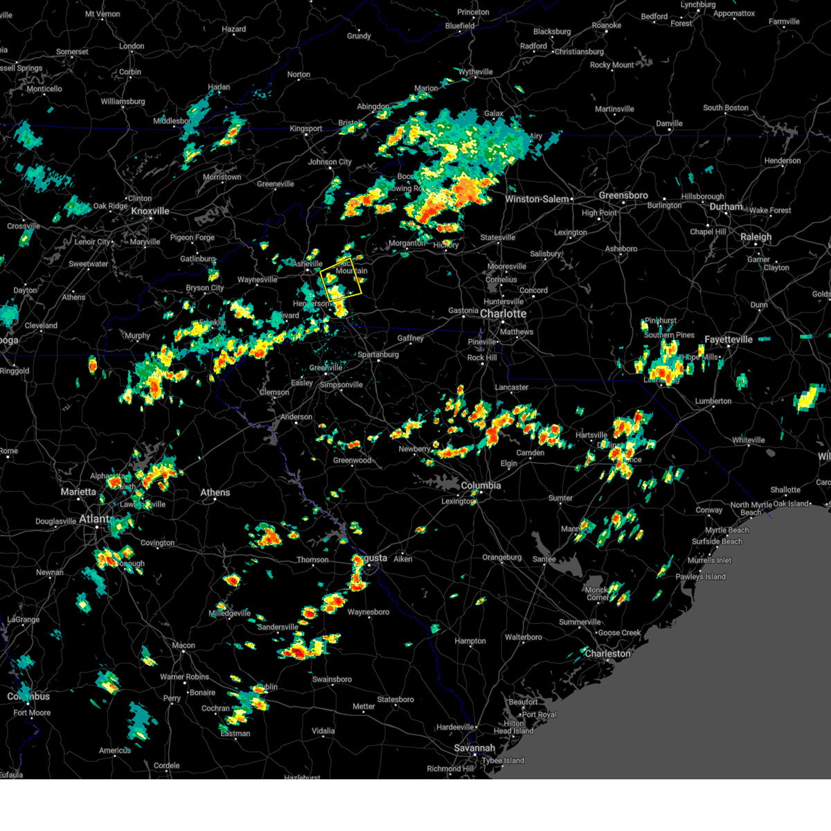 The severe thunderstorm warning for southwestern mcdowell, northwestern rutherford, northeastern henderson and southeastern buncombe counties will expire at 330 pm edt, the storm which prompted the warning has weakened below severe limits, and no longer poses an immediate threat to life or property. therefore, the warning will be allowed to expire. however gusty winds are still possible with thunderstorms across the area. The severe thunderstorm warning for southwestern mcdowell, northwestern rutherford, northeastern henderson and southeastern buncombe counties will expire at 330 pm edt, the storm which prompted the warning has weakened below severe limits, and no longer poses an immediate threat to life or property. therefore, the warning will be allowed to expire. however gusty winds are still possible with thunderstorms across the area.
|
| 8/27/2023 3:03 PM EDT |
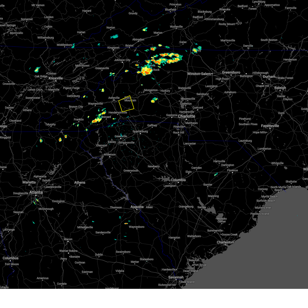 At 302 pm edt, a severe thunderstorm was located 13 miles southeast of downtown asheville, or near fairview in buncombe county, moving east at 15 mph (radar indicated). Hazards include 60 mph wind gusts. Expect damage to trees and power lines. locations impacted include, black mountain, fairview in buncombe county, lake lure, old fort, chimney rock village, chimney rock state park, bat cave, gerton, edneyville and swannanoa. hail threat, radar indicated max hail size, <. 75 in wind threat, radar indicated max wind gust, 60 mph. At 302 pm edt, a severe thunderstorm was located 13 miles southeast of downtown asheville, or near fairview in buncombe county, moving east at 15 mph (radar indicated). Hazards include 60 mph wind gusts. Expect damage to trees and power lines. locations impacted include, black mountain, fairview in buncombe county, lake lure, old fort, chimney rock village, chimney rock state park, bat cave, gerton, edneyville and swannanoa. hail threat, radar indicated max hail size, <. 75 in wind threat, radar indicated max wind gust, 60 mph.
|
| 8/27/2023 2:40 PM EDT |
 At 240 pm edt, a severe thunderstorm was located 10 miles southeast of downtown asheville, or near fairview in buncombe county, moving east at 15 mph (radar indicated). Hazards include 60 mph wind gusts. expect damage to trees and power lines At 240 pm edt, a severe thunderstorm was located 10 miles southeast of downtown asheville, or near fairview in buncombe county, moving east at 15 mph (radar indicated). Hazards include 60 mph wind gusts. expect damage to trees and power lines
|
| 8/15/2023 5:28 PM EDT |
 The severe thunderstorm warning for union county will expire at 530 pm edt, the storms which prompted the warning have weakened below severe limits, and have exited the warned area. therefore, the warning will be allowed to expire. a severe thunderstorm watch remains in effect until 900 pm edt for the piedmont of north carolina. The severe thunderstorm warning for union county will expire at 530 pm edt, the storms which prompted the warning have weakened below severe limits, and have exited the warned area. therefore, the warning will be allowed to expire. a severe thunderstorm watch remains in effect until 900 pm edt for the piedmont of north carolina.
|
| 8/15/2023 5:03 PM EDT |
 At 503 pm edt, severe thunderstorms were located along a line extending from 19 miles northwest of wadesboro to 5 miles southeast of monroe, moving east at 35 mph (radar indicated). Hazards include 60 mph wind gusts and quarter size hail. Minor hail damage to vehicles is expected. Expect wind damage to trees and power lines. At 503 pm edt, severe thunderstorms were located along a line extending from 19 miles northwest of wadesboro to 5 miles southeast of monroe, moving east at 35 mph (radar indicated). Hazards include 60 mph wind gusts and quarter size hail. Minor hail damage to vehicles is expected. Expect wind damage to trees and power lines.
|
| 8/15/2023 5:01 PM EDT |
 At 500 pm edt, severe thunderstorms were located along a line extending from near rockwell to 8 miles west of ansonville to near buford, moving east at 40 mph (radar indicated). Hazards include 60 mph wind gusts. expect damage to roofs, siding, and trees At 500 pm edt, severe thunderstorms were located along a line extending from near rockwell to 8 miles west of ansonville to near buford, moving east at 40 mph (radar indicated). Hazards include 60 mph wind gusts. expect damage to roofs, siding, and trees
|
| 8/12/2023 5:40 PM EDT |
 At 540 pm edt, severe thunderstorms were located along a line extending from 12 miles west of marion to 14 miles northwest of rutherfordton to 6 miles southwest of columbus, moving east at 20 mph (radar indicated). Hazards include 60 mph wind gusts and penny size hail. Expect damage to trees and power lines. locations impacted include, forest city, marion, rutherfordton, columbus, black mountain, spindale, tryon, lake lure, old fort and saluda. hail threat, radar indicated max hail size, 0. 75 in wind threat, radar indicated max wind gust, 60 mph. At 540 pm edt, severe thunderstorms were located along a line extending from 12 miles west of marion to 14 miles northwest of rutherfordton to 6 miles southwest of columbus, moving east at 20 mph (radar indicated). Hazards include 60 mph wind gusts and penny size hail. Expect damage to trees and power lines. locations impacted include, forest city, marion, rutherfordton, columbus, black mountain, spindale, tryon, lake lure, old fort and saluda. hail threat, radar indicated max hail size, 0. 75 in wind threat, radar indicated max wind gust, 60 mph.
|
| 8/12/2023 5:27 PM EDT |
 At 527 pm edt, severe thunderstorms were located along a line extending from 12 miles south of burnsville to 16 miles southwest of marion to 6 miles west of columbus, moving east at 20 mph (radar indicated). Hazards include 60 mph wind gusts and penny size hail. expect damage to trees and power lines At 527 pm edt, severe thunderstorms were located along a line extending from 12 miles south of burnsville to 16 miles southwest of marion to 6 miles west of columbus, moving east at 20 mph (radar indicated). Hazards include 60 mph wind gusts and penny size hail. expect damage to trees and power lines
|
| 8/7/2023 6:31 PM EDT |
 At 631 pm edt, severe thunderstorms were located along a line extending from 15 miles northeast of monroe to 6 miles north of lancaster, moving east at 40 mph (radar indicated). Hazards include 60 mph wind gusts and penny size hail. Expect damage to trees and power lines. locations impacted include, monroe, unionville, wesley chapel, wingate, waxhaw, marshville, mineral springs, fairview in union county, sturdivants and jaars. hail threat, radar indicated max hail size, 0. 75 in wind threat, radar indicated max wind gust, 60 mph. At 631 pm edt, severe thunderstorms were located along a line extending from 15 miles northeast of monroe to 6 miles north of lancaster, moving east at 40 mph (radar indicated). Hazards include 60 mph wind gusts and penny size hail. Expect damage to trees and power lines. locations impacted include, monroe, unionville, wesley chapel, wingate, waxhaw, marshville, mineral springs, fairview in union county, sturdivants and jaars. hail threat, radar indicated max hail size, 0. 75 in wind threat, radar indicated max wind gust, 60 mph.
|
| 8/7/2023 6:27 PM EDT |
 The severe thunderstorm warning for anson, southwestern montgomery, western richmond and southern stanly counties will expire at 630 pm edt, a new severe thunderstorm warning has been issued for the area and is in effect until 715 pm edt. The severe thunderstorm warning for anson, southwestern montgomery, western richmond and southern stanly counties will expire at 630 pm edt, a new severe thunderstorm warning has been issued for the area and is in effect until 715 pm edt.
|
| 8/7/2023 6:16 PM EDT |
 At 615 pm edt, severe thunderstorms were located along a line extending from 10 miles north of monroe to 9 miles northwest of lancaster, moving east at 40 mph (radar indicated). Hazards include 60 mph wind gusts and penny size hail. expect damage to trees and power lines At 615 pm edt, severe thunderstorms were located along a line extending from 10 miles north of monroe to 9 miles northwest of lancaster, moving east at 40 mph (radar indicated). Hazards include 60 mph wind gusts and penny size hail. expect damage to trees and power lines
|
| 8/7/2023 6:06 PM EDT |
 At 605 pm edt, severe thunderstorms were located along a line extending from 14 miles south of downtown concord to near indian land, moving east at 25 mph (radar indicated). Hazards include 60 mph wind gusts and penny size hail. Expect damage to trees and power lines. locations impacted include, monroe, indian trail, weddington, stallings, unionville, wesley chapel, wingate, waxhaw, marshville and lake park. hail threat, radar indicated max hail size, 0. 75 in wind threat, radar indicated max wind gust, 60 mph. At 605 pm edt, severe thunderstorms were located along a line extending from 14 miles south of downtown concord to near indian land, moving east at 25 mph (radar indicated). Hazards include 60 mph wind gusts and penny size hail. Expect damage to trees and power lines. locations impacted include, monroe, indian trail, weddington, stallings, unionville, wesley chapel, wingate, waxhaw, marshville and lake park. hail threat, radar indicated max hail size, 0. 75 in wind threat, radar indicated max wind gust, 60 mph.
|
| 8/7/2023 5:54 PM EDT |
 At 554 pm edt, severe thunderstorms were located along a line extending from near albemarle to near unionville, moving east at 60 mph (radar indicated). Hazards include 60 mph wind gusts. expect damage to roofs, siding, and trees At 554 pm edt, severe thunderstorms were located along a line extending from near albemarle to near unionville, moving east at 60 mph (radar indicated). Hazards include 60 mph wind gusts. expect damage to roofs, siding, and trees
|
| 8/7/2023 5:43 PM EDT |
 At 542 pm edt, severe thunderstorms were located along a line extending from 10 miles southwest of winston-salem to 6 miles south of lexington to 10 miles west of albemarle, moving east at 45 mph (radar indicated). Hazards include 70 mph wind gusts and penny size hail. Expect considerable tree damage. damage is likely to mobile homes, roofs, and outbuildings. Locations impacted include, huntersville, kannapolis, downtown concord, salisbury, mocksville, northeast charlotte, west concord, harrisburg, china grove and spencer. At 542 pm edt, severe thunderstorms were located along a line extending from 10 miles southwest of winston-salem to 6 miles south of lexington to 10 miles west of albemarle, moving east at 45 mph (radar indicated). Hazards include 70 mph wind gusts and penny size hail. Expect considerable tree damage. damage is likely to mobile homes, roofs, and outbuildings. Locations impacted include, huntersville, kannapolis, downtown concord, salisbury, mocksville, northeast charlotte, west concord, harrisburg, china grove and spencer.
|
| 8/7/2023 5:38 PM EDT |
 At 537 pm edt, severe thunderstorms were located along a line extending from 13 miles south of downtown concord to 11 miles southeast of uptown charlotte to 5 miles north of indian land, moving southeast at 40 mph (radar indicated). Hazards include 60 mph wind gusts. expect damage to trees and power lines At 537 pm edt, severe thunderstorms were located along a line extending from 13 miles south of downtown concord to 11 miles southeast of uptown charlotte to 5 miles north of indian land, moving southeast at 40 mph (radar indicated). Hazards include 60 mph wind gusts. expect damage to trees and power lines
|
| 8/7/2023 5:29 PM EDT |
 At 528 pm edt, a severe thunderstorm capable of producing a tornado was located 8 miles southwest of downtown concord, or near harrisburg, moving east at 45 mph (radar indicated rotation). Hazards include tornado. Flying debris will be dangerous to those caught without shelter. mobile homes will be damaged or destroyed. damage to roofs, windows, and vehicles will occur. tree damage is likely. this dangerous storm will be near, downtown concord around 530 pm edt. Midland and mt pleasant around 540 pm edt. At 528 pm edt, a severe thunderstorm capable of producing a tornado was located 8 miles southwest of downtown concord, or near harrisburg, moving east at 45 mph (radar indicated rotation). Hazards include tornado. Flying debris will be dangerous to those caught without shelter. mobile homes will be damaged or destroyed. damage to roofs, windows, and vehicles will occur. tree damage is likely. this dangerous storm will be near, downtown concord around 530 pm edt. Midland and mt pleasant around 540 pm edt.
|
| 8/7/2023 5:20 PM EDT |
 At 519 pm edt, severe thunderstorms were located along a line extending from 8 miles south of yadkinville to 3 miles south of mocksville to 4 miles west of salisbury to 3 miles south of downtown concord, moving east at 45 mph (radar indicated). Hazards include 70 mph wind gusts and penny size hail. Expect considerable tree damage. Damage is likely to mobile homes, roofs, and outbuildings. At 519 pm edt, severe thunderstorms were located along a line extending from 8 miles south of yadkinville to 3 miles south of mocksville to 4 miles west of salisbury to 3 miles south of downtown concord, moving east at 45 mph (radar indicated). Hazards include 70 mph wind gusts and penny size hail. Expect considerable tree damage. Damage is likely to mobile homes, roofs, and outbuildings.
|
| 8/7/2023 5:18 PM EDT |
 At 518 pm edt, a severe thunderstorm capable of producing a tornado was located 5 miles southeast of huntersville, or over northeast charlotte, moving southeast at 45 mph (radar indicated rotation). Hazards include tornado. Flying debris will be dangerous to those caught without shelter. mobile homes will be damaged or destroyed. damage to roofs, windows, and vehicles will occur. tree damage is likely. this dangerous storm will be near, university city, hidden valley and charlotte motor speedway around 520 pm edt. downtown concord, reedy creek park, harrisburg and west concord around 530 pm edt. midland around 540 pm edt. Other locations impacted by this tornadic thunderstorm include croft. At 518 pm edt, a severe thunderstorm capable of producing a tornado was located 5 miles southeast of huntersville, or over northeast charlotte, moving southeast at 45 mph (radar indicated rotation). Hazards include tornado. Flying debris will be dangerous to those caught without shelter. mobile homes will be damaged or destroyed. damage to roofs, windows, and vehicles will occur. tree damage is likely. this dangerous storm will be near, university city, hidden valley and charlotte motor speedway around 520 pm edt. downtown concord, reedy creek park, harrisburg and west concord around 530 pm edt. midland around 540 pm edt. Other locations impacted by this tornadic thunderstorm include croft.
|
| 8/7/2023 5:08 PM EDT |
 At 508 pm edt, a severe thunderstorm capable of producing a tornado was located near huntersville, moving east at 45 mph (radar indicated rotation). Hazards include tornado. Flying debris will be dangerous to those caught without shelter. mobile homes will be damaged or destroyed. damage to roofs, windows, and vehicles will occur. tree damage is likely. this dangerous storm will be near, huntersville, northwest charlotte and davidson around 510 pm edt. northeast charlotte and university city around 520 pm edt. downtown concord, west concord, harrisburg, charlotte motor speedway and reedy creek park around 530 pm edt. midland and mt pleasant around 540 pm edt. Other locations impacted by this dangerous thunderstorm include croft. At 508 pm edt, a severe thunderstorm capable of producing a tornado was located near huntersville, moving east at 45 mph (radar indicated rotation). Hazards include tornado. Flying debris will be dangerous to those caught without shelter. mobile homes will be damaged or destroyed. damage to roofs, windows, and vehicles will occur. tree damage is likely. this dangerous storm will be near, huntersville, northwest charlotte and davidson around 510 pm edt. northeast charlotte and university city around 520 pm edt. downtown concord, west concord, harrisburg, charlotte motor speedway and reedy creek park around 530 pm edt. midland and mt pleasant around 540 pm edt. Other locations impacted by this dangerous thunderstorm include croft.
|
| 8/7/2023 4:10 PM EDT | Duke energy reports multiple locations with fallen trees leading to power outages across buncombe count in buncombe county NC, 0.5 miles SW of Fairview, NC |
| 8/7/2023 4:02 PM EDT |
 At 401 pm edt, severe thunderstorms were located along a line extending from 9 miles east of downtown asheville to 9 miles southwest of brevard, moving east at 50 mph (radar indicated). Hazards include 70 mph wind gusts and penny size hail. Expect considerable tree damage. Damage is likely to mobile homes, roofs, and outbuildings. At 401 pm edt, severe thunderstorms were located along a line extending from 9 miles east of downtown asheville to 9 miles southwest of brevard, moving east at 50 mph (radar indicated). Hazards include 70 mph wind gusts and penny size hail. Expect considerable tree damage. Damage is likely to mobile homes, roofs, and outbuildings.
|
| 8/7/2023 3:50 PM EDT |
 At 349 pm edt, severe thunderstorms were located along a line extending from 4 miles north of downtown asheville to 8 miles northwest of brevard to 15 miles southeast of sylva, moving east at 50 mph (radar indicated). Hazards include 70 mph wind gusts and penny size hail. Expect considerable tree damage. damage is likely to mobile homes, roofs, and outbuildings. locations impacted include, downtown asheville, brevard, sylva, waynesville, burnsville, east asheville, arden, west asheville, north asheville and black mountain. thunderstorm damage threat, considerable hail threat, radar indicated max hail size, 0. 75 in wind threat, radar indicated max wind gust, 70 mph. At 349 pm edt, severe thunderstorms were located along a line extending from 4 miles north of downtown asheville to 8 miles northwest of brevard to 15 miles southeast of sylva, moving east at 50 mph (radar indicated). Hazards include 70 mph wind gusts and penny size hail. Expect considerable tree damage. damage is likely to mobile homes, roofs, and outbuildings. locations impacted include, downtown asheville, brevard, sylva, waynesville, burnsville, east asheville, arden, west asheville, north asheville and black mountain. thunderstorm damage threat, considerable hail threat, radar indicated max hail size, 0. 75 in wind threat, radar indicated max wind gust, 70 mph.
|
| 8/7/2023 3:34 PM EDT |
 At 334 pm edt, severe thunderstorms were located along a line extending from 14 miles southwest of marshall to 7 miles south of waynesville to 9 miles south of sylva, moving east at 50 mph (radar indicated). Hazards include 70 mph wind gusts and quarter size hail. Minor hail damage to vehicles is expected. expect considerable tree damage. Wind damage is also likely to mobile homes, roofs, and outbuildings. At 334 pm edt, severe thunderstorms were located along a line extending from 14 miles southwest of marshall to 7 miles south of waynesville to 9 miles south of sylva, moving east at 50 mph (radar indicated). Hazards include 70 mph wind gusts and quarter size hail. Minor hail damage to vehicles is expected. expect considerable tree damage. Wind damage is also likely to mobile homes, roofs, and outbuildings.
|
| 8/6/2023 4:24 PM EDT |
 At 424 pm edt, severe thunderstorms were located along a line extending from 7 miles east of salisbury to 12 miles northwest of albemarle to 10 miles south of downtown concord, moving east at 15 mph (radar indicated). Hazards include 60 mph wind gusts and penny size hail. Expect damage to trees and power lines. locations impacted include, east charlotte, granite quarry, rockwell, mt pleasant, faith, midland, gold hill, high rock, reedy creek park and high rock lake. hail threat, radar indicated max hail size, 0. 75 in wind threat, radar indicated max wind gust, 60 mph. At 424 pm edt, severe thunderstorms were located along a line extending from 7 miles east of salisbury to 12 miles northwest of albemarle to 10 miles south of downtown concord, moving east at 15 mph (radar indicated). Hazards include 60 mph wind gusts and penny size hail. Expect damage to trees and power lines. locations impacted include, east charlotte, granite quarry, rockwell, mt pleasant, faith, midland, gold hill, high rock, reedy creek park and high rock lake. hail threat, radar indicated max hail size, 0. 75 in wind threat, radar indicated max wind gust, 60 mph.
|
| 8/6/2023 4:06 PM EDT |
 At 406 pm edt, severe thunderstorms were located along a line extending from 3 miles east of salisbury to 8 miles east of downtown concord to 10 miles east of uptown charlotte, moving east at 20 mph (radar indicated). Hazards include 60 mph wind gusts and penny size hail. expect damage to trees and power lines At 406 pm edt, severe thunderstorms were located along a line extending from 3 miles east of salisbury to 8 miles east of downtown concord to 10 miles east of uptown charlotte, moving east at 20 mph (radar indicated). Hazards include 60 mph wind gusts and penny size hail. expect damage to trees and power lines
|
| 7/30/2023 5:07 PM EDT |
 The severe thunderstorm warning for northeastern union county will expire at 515 pm edt, the storm which prompted the warning has moved out of the area. therefore, the warning will be allowed to expire. however gusty winds are still possible with this thunderstorm. The severe thunderstorm warning for northeastern union county will expire at 515 pm edt, the storm which prompted the warning has moved out of the area. therefore, the warning will be allowed to expire. however gusty winds are still possible with this thunderstorm.
|
| 7/30/2023 4:31 PM EDT |
 At 431 pm edt, a severe thunderstorm was located 8 miles northeast of monroe, or near unionville, moving southeast at 25 mph (radar indicated). Hazards include 60 mph wind gusts and quarter size hail. Minor hail damage to vehicles is expected. Expect wind damage to trees and power lines. At 431 pm edt, a severe thunderstorm was located 8 miles northeast of monroe, or near unionville, moving southeast at 25 mph (radar indicated). Hazards include 60 mph wind gusts and quarter size hail. Minor hail damage to vehicles is expected. Expect wind damage to trees and power lines.
|
| 7/29/2023 8:58 PM EDT |
 The severe thunderstorm warning for cabarrus, mecklenburg, southeastern gaston and northeastern york counties will expire at 900 pm edt, the storms which prompted the warning have weakened below severe limits, and no longer pose an immediate threat to life or property. therefore, the warning will be allowed to expire. however gusty winds are still possible with these thunderstorms. to report severe weather to the national weather service greenville-spartanburg, call toll free, 1, 800, 2 6 7, 8 1 0 1, or post on our facebook page, or tweet it using hashtag nwsgsp. your message should describe the event and the specific location where it occurred. The severe thunderstorm warning for cabarrus, mecklenburg, southeastern gaston and northeastern york counties will expire at 900 pm edt, the storms which prompted the warning have weakened below severe limits, and no longer pose an immediate threat to life or property. therefore, the warning will be allowed to expire. however gusty winds are still possible with these thunderstorms. to report severe weather to the national weather service greenville-spartanburg, call toll free, 1, 800, 2 6 7, 8 1 0 1, or post on our facebook page, or tweet it using hashtag nwsgsp. your message should describe the event and the specific location where it occurred.
|
| 7/29/2023 8:47 PM EDT |
 At 846 pm edt, severe thunderstorms were located along a line extending from 5 miles west of downtown concord to 8 miles north of york, moving southeast at 35 mph (trained weather spotters). Hazards include 60 mph wind gusts. Expect damage to trees and power lines. locations impacted include, rock hill, charlotte, and concord. hail threat, radar indicated max hail size, <. 75 in wind threat, radar indicated max wind gust, 60 mph. At 846 pm edt, severe thunderstorms were located along a line extending from 5 miles west of downtown concord to 8 miles north of york, moving southeast at 35 mph (trained weather spotters). Hazards include 60 mph wind gusts. Expect damage to trees and power lines. locations impacted include, rock hill, charlotte, and concord. hail threat, radar indicated max hail size, <. 75 in wind threat, radar indicated max wind gust, 60 mph.
|
| 7/29/2023 8:18 PM EDT |
 At 817 pm edt, severe thunderstorms were located along a line extending from 7 miles northwest of huntersville to 9 miles southeast of shelby, moving southeast at 35 mph (trained weather spotters and doppler radar). Hazards include 60 mph wind gusts and pea to dime size hail. expect damage to trees and power lines At 817 pm edt, severe thunderstorms were located along a line extending from 7 miles northwest of huntersville to 9 miles southeast of shelby, moving southeast at 35 mph (trained weather spotters and doppler radar). Hazards include 60 mph wind gusts and pea to dime size hail. expect damage to trees and power lines
|
| 7/29/2023 6:46 PM EDT |
 At 645 pm edt, severe thunderstorms were located along a line extending from 9 miles northeast of lenoir to near marion to 8 miles southwest of downtown asheville, moving east at 40 mph (radar indicated). Hazards include 60 mph wind gusts. Expect damage to trees and power lines. locations impacted include, lenoir, marion, black mountain, gamewell, fairview in buncombe county, biltmore forest, bent creek, glen alpine, old fort and cedar rock. hail threat, radar indicated max hail size, <. 75 in wind threat, radar indicated max wind gust, 60 mph. At 645 pm edt, severe thunderstorms were located along a line extending from 9 miles northeast of lenoir to near marion to 8 miles southwest of downtown asheville, moving east at 40 mph (radar indicated). Hazards include 60 mph wind gusts. Expect damage to trees and power lines. locations impacted include, lenoir, marion, black mountain, gamewell, fairview in buncombe county, biltmore forest, bent creek, glen alpine, old fort and cedar rock. hail threat, radar indicated max hail size, <. 75 in wind threat, radar indicated max wind gust, 60 mph.
|
| 7/29/2023 6:11 PM EDT |
 At 610 pm edt, severe thunderstorms were located along a line extending from 4 miles northeast of newland to 9 miles southwest of burnsville to 7 miles north of waynesville, moving east at 35 mph (radar indicated). Hazards include 60 mph wind gusts. expect damage to trees and power lines At 610 pm edt, severe thunderstorms were located along a line extending from 4 miles northeast of newland to 9 miles southwest of burnsville to 7 miles north of waynesville, moving east at 35 mph (radar indicated). Hazards include 60 mph wind gusts. expect damage to trees and power lines
|
| 7/23/2023 1:39 PM EDT |
 At 138 pm edt, a severe thunderstorm was located 7 miles east of monroe, or near wingate, moving east at 20 mph (radar indicated). Hazards include 60 mph wind gusts and penny size hail. Expect damage to trees and power lines. locations impacted include, unionville, wingate, monroe and marshville. hail threat, radar indicated max hail size, 0. 75 in wind threat, radar indicated max wind gust, 60 mph. At 138 pm edt, a severe thunderstorm was located 7 miles east of monroe, or near wingate, moving east at 20 mph (radar indicated). Hazards include 60 mph wind gusts and penny size hail. Expect damage to trees and power lines. locations impacted include, unionville, wingate, monroe and marshville. hail threat, radar indicated max hail size, 0. 75 in wind threat, radar indicated max wind gust, 60 mph.
|
| 7/23/2023 1:02 PM EDT |
 At 101 pm edt, a severe thunderstorm was located 6 miles northwest of monroe, or near wesley chapel, moving east at 15 mph (radar indicated). Hazards include 60 mph wind gusts and quarter size hail. Minor hail damage to vehicles is expected. Expect wind damage to trees and power lines. At 101 pm edt, a severe thunderstorm was located 6 miles northwest of monroe, or near wesley chapel, moving east at 15 mph (radar indicated). Hazards include 60 mph wind gusts and quarter size hail. Minor hail damage to vehicles is expected. Expect wind damage to trees and power lines.
|
| 7/18/2023 4:31 PM EDT |
 At 430 pm edt, a severe thunderstorm was located 4 miles southwest of downtown asheville, or near west asheville, moving southeast at 20 mph (radar indicated). Hazards include 60 mph wind gusts and quarter size hail. Minor hail damage to vehicles is expected. Expect wind damage to trees and power lines. At 430 pm edt, a severe thunderstorm was located 4 miles southwest of downtown asheville, or near west asheville, moving southeast at 20 mph (radar indicated). Hazards include 60 mph wind gusts and quarter size hail. Minor hail damage to vehicles is expected. Expect wind damage to trees and power lines.
|
| 7/14/2023 5:39 PM EDT |
 At 539 pm edt, a severe thunderstorm was located near midland, or 10 miles southeast of downtown concord, moving east at 10 mph (radar indicated). Hazards include 60 mph wind gusts and penny size hail. expect damage to roofs, siding, and trees At 539 pm edt, a severe thunderstorm was located near midland, or 10 miles southeast of downtown concord, moving east at 10 mph (radar indicated). Hazards include 60 mph wind gusts and penny size hail. expect damage to roofs, siding, and trees
|
| 6/26/2023 10:14 PM EDT |
 At 1014 pm edt, a severe thunderstorm was located 7 miles south of downtown concord, or 5 miles east of harrisburg, moving east at 20 mph (radar indicated). Hazards include 60 mph wind gusts and quarter size hail. Minor hail damage to vehicles is expected. Expect wind damage to trees and power lines. At 1014 pm edt, a severe thunderstorm was located 7 miles south of downtown concord, or 5 miles east of harrisburg, moving east at 20 mph (radar indicated). Hazards include 60 mph wind gusts and quarter size hail. Minor hail damage to vehicles is expected. Expect wind damage to trees and power lines.
|
| 5/7/2023 7:14 PM EDT |
 At 713 pm edt, a severe thunderstorm was located 9 miles northwest of hendersonville, or near mills river, moving southeast at 35 mph (radar indicated). Hazards include 60 mph wind gusts and penny size hail. expect damage to trees and power lines At 713 pm edt, a severe thunderstorm was located 9 miles northwest of hendersonville, or near mills river, moving southeast at 35 mph (radar indicated). Hazards include 60 mph wind gusts and penny size hail. expect damage to trees and power lines
|
| 1/12/2023 7:30 PM EST |
 At 729 pm est, severe thunderstorms were located along a line extending from near randleman to 10 miles north of marshville, moving northeast at 65 mph (radar indicated). Hazards include 60 mph wind gusts and penny size hail. Expect damage to roofs, siding, and trees. locations impacted include, asheboro, albemarle, troy, badin lake, north carolina zoo, ansonville, seagrove, plyler, midland and polkton. hail threat, radar indicated max hail size, 0. 75 in wind threat, radar indicated max wind gust, 60 mph. At 729 pm est, severe thunderstorms were located along a line extending from near randleman to 10 miles north of marshville, moving northeast at 65 mph (radar indicated). Hazards include 60 mph wind gusts and penny size hail. Expect damage to roofs, siding, and trees. locations impacted include, asheboro, albemarle, troy, badin lake, north carolina zoo, ansonville, seagrove, plyler, midland and polkton. hail threat, radar indicated max hail size, 0. 75 in wind threat, radar indicated max wind gust, 60 mph.
|
| 1/12/2023 7:23 PM EST |
 The severe thunderstorm warning for eastern cabarrus county will expire at 730 pm est, the storms which prompted the warning have moved out of the area. therefore, the warning will be allowed to expire. a tornado watch remains in effect until 1000 pm est for the piedmont of north carolina. The severe thunderstorm warning for eastern cabarrus county will expire at 730 pm est, the storms which prompted the warning have moved out of the area. therefore, the warning will be allowed to expire. a tornado watch remains in effect until 1000 pm est for the piedmont of north carolina.
|
| 1/12/2023 7:20 PM EST |
 At 719 pm est, severe thunderstorms were located along a line extending from 14 miles southeast of downtown concord to near monroe to 8 miles northwest of lancaster, moving east at 40 mph (radar indicated). Hazards include 60 mph wind gusts. Expect damage to trees and power lines. locations impacted include, monroe, unionville, wingate, waxhaw, marshville, mineral springs, sturdivants, jaars, trinity and new salem. hail threat, radar indicated max hail size, <. 75 in wind threat, radar indicated max wind gust, 60 mph. At 719 pm est, severe thunderstorms were located along a line extending from 14 miles southeast of downtown concord to near monroe to 8 miles northwest of lancaster, moving east at 40 mph (radar indicated). Hazards include 60 mph wind gusts. Expect damage to trees and power lines. locations impacted include, monroe, unionville, wingate, waxhaw, marshville, mineral springs, sturdivants, jaars, trinity and new salem. hail threat, radar indicated max hail size, <. 75 in wind threat, radar indicated max wind gust, 60 mph.
|
| 1/12/2023 7:10 PM EST |
 At 710 pm est, severe thunderstorms were located along a line extending from 10 miles south of salisbury to 14 miles north of monroe, moving east at 35 mph (radar indicated). Hazards include 60 mph wind gusts. expect damage to trees and power lines At 710 pm est, severe thunderstorms were located along a line extending from 10 miles south of salisbury to 14 miles north of monroe, moving east at 35 mph (radar indicated). Hazards include 60 mph wind gusts. expect damage to trees and power lines
|
| 1/12/2023 7:10 PM EST |
 At 710 pm est, severe thunderstorms were located along a line extending from 6 miles southeast of lexington to wesley chapel, moving east at 65 mph (radar indicated). Hazards include 60 mph wind gusts and penny size hail. expect damage to roofs, siding, and trees At 710 pm est, severe thunderstorms were located along a line extending from 6 miles southeast of lexington to wesley chapel, moving east at 65 mph (radar indicated). Hazards include 60 mph wind gusts and penny size hail. expect damage to roofs, siding, and trees
|
| 1/12/2023 6:59 PM EST |
 At 658 pm est, severe thunderstorms were located along a line extending from 3 miles west of downtown concord to 5 miles southeast of uptown charlotte to 4 miles west of indian land, moving east at 40 mph (radar indicated). Hazards include 60 mph wind gusts. expect damage to trees and power lines At 658 pm est, severe thunderstorms were located along a line extending from 3 miles west of downtown concord to 5 miles southeast of uptown charlotte to 4 miles west of indian land, moving east at 40 mph (radar indicated). Hazards include 60 mph wind gusts. expect damage to trees and power lines
|
| 8/10/2022 5:25 PM EDT |
 The severe thunderstorm warning for stanly county will expire at 530 pm edt, the storms which prompted the warning have moved out of the area. therefore, the warning will be allowed to expire. however gusty winds are still possible with these thunderstorms. The severe thunderstorm warning for stanly county will expire at 530 pm edt, the storms which prompted the warning have moved out of the area. therefore, the warning will be allowed to expire. however gusty winds are still possible with these thunderstorms.
|
| 8/10/2022 4:55 PM EDT |
 The severe thunderstorm warning for south central cabarrus, east central mecklenburg and north central union counties will expire at 500 pm edt, the storm which prompted the warning has moved out of the area. therefore, the warning will be allowed to expire. however heavy rain is still possible with this thunderstorm. The severe thunderstorm warning for south central cabarrus, east central mecklenburg and north central union counties will expire at 500 pm edt, the storm which prompted the warning has moved out of the area. therefore, the warning will be allowed to expire. however heavy rain is still possible with this thunderstorm.
|
| 8/10/2022 4:54 PM EDT |
 At 453 pm edt, severe thunderstorms were located along a line extending from 6 miles southeast of rockwell to near midland, moving northeast at 15 mph (law enforcement. at 443 pm, law enforcement reported trees down near locust). Hazards include 60 mph wind gusts. Expect damage to roofs, siding, and trees. locations impacted include, albemarle, badin lake, plyler, fairview in union county, locust, badin, oakboro, stanfield, richfield and new london. hail threat, radar indicated max hail size, <. 75 in wind threat, observed max wind gust, 60 mph. At 453 pm edt, severe thunderstorms were located along a line extending from 6 miles southeast of rockwell to near midland, moving northeast at 15 mph (law enforcement. at 443 pm, law enforcement reported trees down near locust). Hazards include 60 mph wind gusts. Expect damage to roofs, siding, and trees. locations impacted include, albemarle, badin lake, plyler, fairview in union county, locust, badin, oakboro, stanfield, richfield and new london. hail threat, radar indicated max hail size, <. 75 in wind threat, observed max wind gust, 60 mph.
|
| 8/10/2022 4:41 PM EDT |
 At 440 pm edt, severe thunderstorms were located along a line extending from near mt pleasant to midland, moving northeast at 15 mph (radar indicated). Hazards include 60 mph wind gusts. expect damage to roofs, siding, and trees At 440 pm edt, severe thunderstorms were located along a line extending from near mt pleasant to midland, moving northeast at 15 mph (radar indicated). Hazards include 60 mph wind gusts. expect damage to roofs, siding, and trees
|
| 8/10/2022 4:40 PM EDT |
 At 440 pm edt, a severe thunderstorm was located 13 miles south of downtown concord, or near midland, moving east at 10 mph (radar indicated). Hazards include 60 mph wind gusts and quarter size hail. Minor hail damage to vehicles is expected. expect wind damage to trees and power lines. locations impacted include, mint hill, midland, fairview in union county and stallings. hail threat, radar indicated max hail size, 1. 00 in wind threat, radar indicated max wind gust, 60 mph. At 440 pm edt, a severe thunderstorm was located 13 miles south of downtown concord, or near midland, moving east at 10 mph (radar indicated). Hazards include 60 mph wind gusts and quarter size hail. Minor hail damage to vehicles is expected. expect wind damage to trees and power lines. locations impacted include, mint hill, midland, fairview in union county and stallings. hail threat, radar indicated max hail size, 1. 00 in wind threat, radar indicated max wind gust, 60 mph.
|
| 8/10/2022 4:23 PM EDT |
 At 422 pm edt, a severe thunderstorm was located 12 miles east of uptown charlotte, or near mint hill, moving east at 10 mph (radar indicated). Hazards include 60 mph wind gusts and quarter size hail. Minor hail damage to vehicles is expected. expect wind damage to trees and power lines. locations impacted include, east charlotte, matthews, mint hill, harrisburg, reedy creek park, the plaza, midland, fairview in union county, stallings and south charlotte. hail threat, radar indicated max hail size, 1. 00 in wind threat, radar indicated max wind gust, 60 mph. At 422 pm edt, a severe thunderstorm was located 12 miles east of uptown charlotte, or near mint hill, moving east at 10 mph (radar indicated). Hazards include 60 mph wind gusts and quarter size hail. Minor hail damage to vehicles is expected. expect wind damage to trees and power lines. locations impacted include, east charlotte, matthews, mint hill, harrisburg, reedy creek park, the plaza, midland, fairview in union county, stallings and south charlotte. hail threat, radar indicated max hail size, 1. 00 in wind threat, radar indicated max wind gust, 60 mph.
|
| 8/10/2022 4:10 PM EDT |
 At 410 pm edt, a severe thunderstorm was located 10 miles east of uptown charlotte, or over mint hill, moving east at 10 mph (radar indicated). Hazards include 60 mph wind gusts and quarter size hail. Minor hail damage to vehicles is expected. Expect wind damage to trees and power lines. At 410 pm edt, a severe thunderstorm was located 10 miles east of uptown charlotte, or over mint hill, moving east at 10 mph (radar indicated). Hazards include 60 mph wind gusts and quarter size hail. Minor hail damage to vehicles is expected. Expect wind damage to trees and power lines.
|
| 7/29/2022 6:34 PM EDT |
 At 633 pm edt, a severe thunderstorm was located near midland, or 9 miles southeast of downtown concord, moving east at 20 mph (radar indicated). Hazards include 60 mph wind gusts. expect damage to roofs, siding, and trees At 633 pm edt, a severe thunderstorm was located near midland, or 9 miles southeast of downtown concord, moving east at 20 mph (radar indicated). Hazards include 60 mph wind gusts. expect damage to roofs, siding, and trees
|
| 7/16/2022 2:37 PM EDT |
 At 237 pm edt, a severe thunderstorm was located 9 miles southeast of downtown concord, or 4 miles north of midland, moving southeast at 20 mph (radar indicated). Hazards include 60 mph wind gusts and quarter size hail. Minor hail damage to vehicles is expected. Expect wind damage to trees and power lines. At 237 pm edt, a severe thunderstorm was located 9 miles southeast of downtown concord, or 4 miles north of midland, moving southeast at 20 mph (radar indicated). Hazards include 60 mph wind gusts and quarter size hail. Minor hail damage to vehicles is expected. Expect wind damage to trees and power lines.
|
| 7/9/2022 6:17 PM EDT |
 At 617 pm edt, a severe thunderstorm was located 7 miles north of monroe, or near hemby bridge, moving east at 25 mph (radar indicated). Hazards include 60 mph wind gusts and quarter size hail. Minor hail damage to vehicles is expected. Expect wind damage to trees and power lines. At 617 pm edt, a severe thunderstorm was located 7 miles north of monroe, or near hemby bridge, moving east at 25 mph (radar indicated). Hazards include 60 mph wind gusts and quarter size hail. Minor hail damage to vehicles is expected. Expect wind damage to trees and power lines.
|
| 7/6/2022 8:06 PM EDT |
 At 805 pm edt, a severe thunderstorm was located near monroe, moving southeast at 15 mph (radar indicated). Hazards include 60 mph wind gusts and penny size hail. Expect damage to trees and power lines. locations impacted include, monroe, unionville, wesley chapel, wingate, waxhaw, marshville, mineral springs, sturdivants, trinity and new salem. hail threat, radar indicated max hail size, 0. 75 in wind threat, radar indicated max wind gust, 60 mph. At 805 pm edt, a severe thunderstorm was located near monroe, moving southeast at 15 mph (radar indicated). Hazards include 60 mph wind gusts and penny size hail. Expect damage to trees and power lines. locations impacted include, monroe, unionville, wesley chapel, wingate, waxhaw, marshville, mineral springs, sturdivants, trinity and new salem. hail threat, radar indicated max hail size, 0. 75 in wind threat, radar indicated max wind gust, 60 mph.
|
| 7/6/2022 7:30 PM EDT |
 At 730 pm edt, a severe thunderstorm was located 8 miles east of indian land, or near weddington, moving southeast at 15 mph (radar indicated). Hazards include 60 mph wind gusts and quarter size hail. Minor hail damage to vehicles is expected. Expect wind damage to trees and power lines. At 730 pm edt, a severe thunderstorm was located 8 miles east of indian land, or near weddington, moving southeast at 15 mph (radar indicated). Hazards include 60 mph wind gusts and quarter size hail. Minor hail damage to vehicles is expected. Expect wind damage to trees and power lines.
|
| 7/6/2022 7:11 PM EDT |
 At 710 pm edt, a severe thunderstorm was located 7 miles northeast of indian land, or near the arboretum, moving southeast at 10 mph (radar indicated). Hazards include 60 mph wind gusts and quarter size hail. Minor hail damage to vehicles is expected. expect wind damage to trees and power lines. locations impacted include, south charlotte, east charlotte, matthews, mint hill, indian trail, weddington, stallings, wesley chapel, waxhaw and lake park. hail threat, radar indicated max hail size, 1. 00 in wind threat, radar indicated max wind gust, 60 mph. At 710 pm edt, a severe thunderstorm was located 7 miles northeast of indian land, or near the arboretum, moving southeast at 10 mph (radar indicated). Hazards include 60 mph wind gusts and quarter size hail. Minor hail damage to vehicles is expected. expect wind damage to trees and power lines. locations impacted include, south charlotte, east charlotte, matthews, mint hill, indian trail, weddington, stallings, wesley chapel, waxhaw and lake park. hail threat, radar indicated max hail size, 1. 00 in wind threat, radar indicated max wind gust, 60 mph.
|
| 7/6/2022 6:49 PM EDT |
 At 649 pm edt, a severe thunderstorm was located 7 miles south of uptown charlotte, or near southpark mall, moving southeast at 10 mph (radar indicated). Hazards include 60 mph wind gusts and quarter size hail. Minor hail damage to vehicles is expected. Expect wind damage to trees and power lines. At 649 pm edt, a severe thunderstorm was located 7 miles south of uptown charlotte, or near southpark mall, moving southeast at 10 mph (radar indicated). Hazards include 60 mph wind gusts and quarter size hail. Minor hail damage to vehicles is expected. Expect wind damage to trees and power lines.
|
| 7/5/2022 8:05 PM EDT |
 At 804 pm edt, severe thunderstorms were located along a line extending from near shelby to 9 miles west of albemarle, moving southeast at 35 mph (radar indicated). Hazards include 60 mph wind gusts and penny size hail. expect damage to trees and power lines At 804 pm edt, severe thunderstorms were located along a line extending from near shelby to 9 miles west of albemarle, moving southeast at 35 mph (radar indicated). Hazards include 60 mph wind gusts and penny size hail. expect damage to trees and power lines
|
| 7/5/2022 7:29 PM EDT |
 At 729 pm edt, severe thunderstorms were located along a line extending from 5 miles west of downtown asheville to 12 miles southwest of marion to 10 miles south of morganton, moving south at 20 mph (radar indicated). Hazards include 60 mph wind gusts and nickel size hail. expect damage to trees and power lines At 729 pm edt, severe thunderstorms were located along a line extending from 5 miles west of downtown asheville to 12 miles southwest of marion to 10 miles south of morganton, moving south at 20 mph (radar indicated). Hazards include 60 mph wind gusts and nickel size hail. expect damage to trees and power lines
|
| 6/16/2022 4:41 PM EDT |
 At 441 pm edt, severe thunderstorms were located along a line extending from 7 miles southeast of downtown concord to 8 miles southeast of uptown charlotte to 8 miles northwest of indian land, moving southeast at 20 mph (radar indicated). Hazards include 60 mph wind gusts and quarter size hail. Minor hail damage to vehicles is expected. Expect wind damage to trees and power lines. At 441 pm edt, severe thunderstorms were located along a line extending from 7 miles southeast of downtown concord to 8 miles southeast of uptown charlotte to 8 miles northwest of indian land, moving southeast at 20 mph (radar indicated). Hazards include 60 mph wind gusts and quarter size hail. Minor hail damage to vehicles is expected. Expect wind damage to trees and power lines.
|
| 6/16/2022 4:27 PM EDT |
 At 425 pm edt, a severe thunderstorm was located near plyler, or near albemarle, and is nearly stationary. a second severe thunderstorm was located northeast of locust (radar indicated). Hazards include 60 mph wind gusts and nickel size hail. expect damage to roofs, siding, and trees At 425 pm edt, a severe thunderstorm was located near plyler, or near albemarle, and is nearly stationary. a second severe thunderstorm was located northeast of locust (radar indicated). Hazards include 60 mph wind gusts and nickel size hail. expect damage to roofs, siding, and trees
|
| 6/14/2022 8:01 AM EDT | At 800 am edt, severe thunderstorms were located along a line extending from 9 miles northeast of shelby to 8 miles east of gastonia to 11 miles south of downtown concord, moving south at 10 mph (radar indicated). Hazards include 60 mph wind gusts and quarter size hail. Minor hail damage to vehicles is expected. expect wind damage to trees and power lines. locations impacted include, charlotte, gastonia, shelby, matthews and mint hill. hail threat, radar indicated max hail size, 1. 00 in wind threat, radar indicated max wind gust, 60 mph. |
| 6/14/2022 7:41 AM EDT |
 At 739 am edt, severe thunderstorms were located along a line extending from 16 miles southeast of morganton to 4 miles southeast of downtown concord, moving south at 20 mph (radar indicated). Hazards include 60 mph wind gusts and quarter size hail. Minor hail damage to vehicles is expected. Expect wind damage to trees and power lines. At 739 am edt, severe thunderstorms were located along a line extending from 16 miles southeast of morganton to 4 miles southeast of downtown concord, moving south at 20 mph (radar indicated). Hazards include 60 mph wind gusts and quarter size hail. Minor hail damage to vehicles is expected. Expect wind damage to trees and power lines.
|
| 6/14/2022 6:55 AM EDT |
 At 655 am edt, severe thunderstorms were located along a line extending from 6 miles southeast of erwin to 12 miles north of morganton to 4 miles southwest of kannapolis, moving south at 25 mph (radar indicated). Hazards include 60 mph wind gusts. expect damage to trees and power lines At 655 am edt, severe thunderstorms were located along a line extending from 6 miles southeast of erwin to 12 miles north of morganton to 4 miles southwest of kannapolis, moving south at 25 mph (radar indicated). Hazards include 60 mph wind gusts. expect damage to trees and power lines
|
| 5/23/2022 1:44 PM EDT |
 At 144 pm edt, severe thunderstorms were located along a line extending from near midland to near sturdivants, moving northeast at 40 mph (radar indicated). Hazards include 60 mph wind gusts. expect damage to roofs, siding, and trees At 144 pm edt, severe thunderstorms were located along a line extending from near midland to near sturdivants, moving northeast at 40 mph (radar indicated). Hazards include 60 mph wind gusts. expect damage to roofs, siding, and trees
|
| 5/19/2022 6:05 AM EDT |
 At 604 am edt, a severe thunderstorm was located near downtown asheville, or near woodfin, moving east at 20 mph (radar indicated). Hazards include 60 mph wind gusts and quarter size hail. Minor hail damage to vehicles is expected. expect wind damage to trees and power lines. locations impacted include, asheville, woodfin, swannanoa, biltmore forest, unc-asheville, enka, and a portion of the blue ridge parkway from the nc arboretum to east asheville. hail threat, radar indicated max hail size, 1. 00 in wind threat, radar indicated max wind gust, 60 mph. At 604 am edt, a severe thunderstorm was located near downtown asheville, or near woodfin, moving east at 20 mph (radar indicated). Hazards include 60 mph wind gusts and quarter size hail. Minor hail damage to vehicles is expected. expect wind damage to trees and power lines. locations impacted include, asheville, woodfin, swannanoa, biltmore forest, unc-asheville, enka, and a portion of the blue ridge parkway from the nc arboretum to east asheville. hail threat, radar indicated max hail size, 1. 00 in wind threat, radar indicated max wind gust, 60 mph.
|
| 5/19/2022 5:53 AM EDT |
 At 552 am edt, a severe thunderstorm was located 12 miles west of downtown asheville, or 5 miles southwest of leicester, moving east at 30 mph (radar indicated). Hazards include 60 mph wind gusts and quarter size hail. Minor hail damage to vehicles is expected. Expect wind damage to trees and power lines. At 552 am edt, a severe thunderstorm was located 12 miles west of downtown asheville, or 5 miles southwest of leicester, moving east at 30 mph (radar indicated). Hazards include 60 mph wind gusts and quarter size hail. Minor hail damage to vehicles is expected. Expect wind damage to trees and power lines.
|
| 5/6/2022 7:13 PM EDT |
 At 713 pm edt, a severe thunderstorm was located near ansonville, or 14 miles north of wadesboro, moving northeast at 65 mph (radar indicated). Hazards include quarter size hail. Damage to vehicles is expected. locations impacted include, albemarle, rockingham, wadesboro, hamlet, ansonville, hoffman, polkton, locust, norwood and badin. hail threat, radar indicated max hail size, 1. 00 in wind threat, radar indicated max wind gust, <50 mph. At 713 pm edt, a severe thunderstorm was located near ansonville, or 14 miles north of wadesboro, moving northeast at 65 mph (radar indicated). Hazards include quarter size hail. Damage to vehicles is expected. locations impacted include, albemarle, rockingham, wadesboro, hamlet, ansonville, hoffman, polkton, locust, norwood and badin. hail threat, radar indicated max hail size, 1. 00 in wind threat, radar indicated max wind gust, <50 mph.
|
| 5/6/2022 6:50 PM EDT |
 At 649 pm edt, a severe thunderstorm was located near sturdivants, or 15 miles southeast of monroe, moving east at 55 mph (radar indicated). Hazards include 60 mph wind gusts and quarter size hail. Hail damage to vehicles is expected. Expect wind damage to roofs, siding, and trees. At 649 pm edt, a severe thunderstorm was located near sturdivants, or 15 miles southeast of monroe, moving east at 55 mph (radar indicated). Hazards include 60 mph wind gusts and quarter size hail. Hail damage to vehicles is expected. Expect wind damage to roofs, siding, and trees.
|
| 5/4/2022 6:32 PM EDT |
 At 631 pm edt, a severe thunderstorm was located 13 miles northeast of monroe, or 8 miles east of unionville, moving east at 25 mph. additional severe thunderstorms winds are arriving from mecklenburg county in the western end of union county (radar indicated). Hazards include 60 mph wind gusts and quarter size hail. Minor hail damage to vehicles is expected. expect wind damage to trees and power lines. locations impacted include, monroe, indian trail, weddington, stallings, unionville, wesley chapel, wingate, waxhaw, marshville and lake park. hail threat, radar indicated max hail size, 1. 00 in wind threat, radar indicated max wind gust, 60 mph. At 631 pm edt, a severe thunderstorm was located 13 miles northeast of monroe, or 8 miles east of unionville, moving east at 25 mph. additional severe thunderstorms winds are arriving from mecklenburg county in the western end of union county (radar indicated). Hazards include 60 mph wind gusts and quarter size hail. Minor hail damage to vehicles is expected. expect wind damage to trees and power lines. locations impacted include, monroe, indian trail, weddington, stallings, unionville, wesley chapel, wingate, waxhaw, marshville and lake park. hail threat, radar indicated max hail size, 1. 00 in wind threat, radar indicated max wind gust, 60 mph.
|
| 5/4/2022 6:18 PM EDT |
 At 617 pm edt, a severe thunderstorm was located 7 miles northeast of indian land, or near the arboretum, moving east at 15 mph (radar indicated). Hazards include 60 mph wind gusts and quarter size hail. Minor hail damage to vehicles is expected. expect wind damage to trees and power lines. locations impacted include, monroe, south charlotte, matthews, mint hill, indian trail, weddington, stallings, unionville, wesley chapel and wingate. hail threat, radar indicated max hail size, 1. 00 in wind threat, radar indicated max wind gust, 60 mph. At 617 pm edt, a severe thunderstorm was located 7 miles northeast of indian land, or near the arboretum, moving east at 15 mph (radar indicated). Hazards include 60 mph wind gusts and quarter size hail. Minor hail damage to vehicles is expected. expect wind damage to trees and power lines. locations impacted include, monroe, south charlotte, matthews, mint hill, indian trail, weddington, stallings, unionville, wesley chapel and wingate. hail threat, radar indicated max hail size, 1. 00 in wind threat, radar indicated max wind gust, 60 mph.
|
| 5/4/2022 6:03 PM EDT |
 At 602 pm edt, severe thunderstorms were located along a line extending from 5 miles southeast of uptown charlotte to near indian land, moving east at 15 mph (radar indicated). Hazards include 60 mph wind gusts and quarter size hail. Minor hail damage to vehicles is expected. Expect wind damage to trees and power lines. At 602 pm edt, severe thunderstorms were located along a line extending from 5 miles southeast of uptown charlotte to near indian land, moving east at 15 mph (radar indicated). Hazards include 60 mph wind gusts and quarter size hail. Minor hail damage to vehicles is expected. Expect wind damage to trees and power lines.
|
| 5/3/2022 4:19 PM EDT |
 At 418 pm edt, a severe thunderstorm was located 5 miles west of monroe, or near wesley chapel, moving east at 20 mph (radar indicated). Hazards include 60 mph wind gusts. Expect damage to trees and power lines. locations impacted include, monroe, indian trail, unionville, wesley chapel, lake park, mineral springs, hemby bridge, fairview in union county, stallings and wingate. hail threat, radar indicated max hail size, <. 75 in wind threat, radar indicated max wind gust, 60 mph. At 418 pm edt, a severe thunderstorm was located 5 miles west of monroe, or near wesley chapel, moving east at 20 mph (radar indicated). Hazards include 60 mph wind gusts. Expect damage to trees and power lines. locations impacted include, monroe, indian trail, unionville, wesley chapel, lake park, mineral springs, hemby bridge, fairview in union county, stallings and wingate. hail threat, radar indicated max hail size, <. 75 in wind threat, radar indicated max wind gust, 60 mph.
|
| 5/3/2022 4:03 PM EDT |
 At 402 pm edt, a severe thunderstorm was located 7 miles southeast of indian land, or near waxhaw, moving east at 20 mph (radar indicated). Hazards include 60 mph wind gusts and penny size hail. expect damage to trees and power lines At 402 pm edt, a severe thunderstorm was located 7 miles southeast of indian land, or near waxhaw, moving east at 20 mph (radar indicated). Hazards include 60 mph wind gusts and penny size hail. expect damage to trees and power lines
|
| 8/17/2021 1:56 PM EDT | Trees down across brush creek road in buncombe county NC, 3.1 miles NNW of Fairview, NC |
| 8/14/2021 5:05 PM EDT |
 The severe thunderstorm warning for northeastern henderson and southeastern buncombe counties will expire at 515 pm edt, the storm which prompted the warning has weakened below severe limits, and no longer poses an immediate threat to life or property. therefore, the warning will be allowed to expire. however, gusty winds and heavy rain are still possible with this thunderstorm. The severe thunderstorm warning for northeastern henderson and southeastern buncombe counties will expire at 515 pm edt, the storm which prompted the warning has weakened below severe limits, and no longer poses an immediate threat to life or property. therefore, the warning will be allowed to expire. however, gusty winds and heavy rain are still possible with this thunderstorm.
|
| 8/14/2021 4:50 PM EDT |
 At 450 pm edt, a severe thunderstorm was located 8 miles southeast of downtown asheville, or near fairview in buncombe county, and is nearly stationary (radar indicated). Hazards include 60 mph wind gusts and quarter size hail. Minor hail damage to vehicles is expected. expect wind damage to trees and power lines. locations impacted include, east asheville, arden, black mountain, mills river, fletcher, swannanoa, fairview in buncombe county, mountain home, biltmore forest and bat cave. hail threat, radar indicated max hail size, 1. 00 in wind threat, radar indicated max wind gust, 60 mph. At 450 pm edt, a severe thunderstorm was located 8 miles southeast of downtown asheville, or near fairview in buncombe county, and is nearly stationary (radar indicated). Hazards include 60 mph wind gusts and quarter size hail. Minor hail damage to vehicles is expected. expect wind damage to trees and power lines. locations impacted include, east asheville, arden, black mountain, mills river, fletcher, swannanoa, fairview in buncombe county, mountain home, biltmore forest and bat cave. hail threat, radar indicated max hail size, 1. 00 in wind threat, radar indicated max wind gust, 60 mph.
|
| 8/14/2021 4:22 PM EDT |
 At 422 pm edt, a severe thunderstorm was located 9 miles southeast of downtown asheville, or near fairview in buncombe county, moving south at 10 mph (radar indicated). Hazards include 60 mph wind gusts and quarter size hail. Minor hail damage to vehicles is expected. Expect wind damage to trees and power lines. At 422 pm edt, a severe thunderstorm was located 9 miles southeast of downtown asheville, or near fairview in buncombe county, moving south at 10 mph (radar indicated). Hazards include 60 mph wind gusts and quarter size hail. Minor hail damage to vehicles is expected. Expect wind damage to trees and power lines.
|
| 8/14/2021 3:39 PM EDT |
 At 339 pm edt, a severe thunderstorm was located 4 miles west of monroe, or near wesley chapel, moving west at 5 mph (radar indicated). Hazards include 60 mph wind gusts and quarter size hail. Minor hail damage to vehicles is expected. Expect wind damage to trees and power lines. At 339 pm edt, a severe thunderstorm was located 4 miles west of monroe, or near wesley chapel, moving west at 5 mph (radar indicated). Hazards include 60 mph wind gusts and quarter size hail. Minor hail damage to vehicles is expected. Expect wind damage to trees and power lines.
|
| 8/14/2021 3:27 PM EDT |
 The severe thunderstorm warning for northeastern union county will expire at 330 pm edt, the storm which prompted the warning has weakened below severe limits, and has exited the warned area. therefore, the warning will be allowed to expire. however, gusty winds and heavy rain are still possible with this thunderstorm. The severe thunderstorm warning for northeastern union county will expire at 330 pm edt, the storm which prompted the warning has weakened below severe limits, and has exited the warned area. therefore, the warning will be allowed to expire. however, gusty winds and heavy rain are still possible with this thunderstorm.
|
| 8/14/2021 2:43 PM EDT |
 At 243 pm edt, a severe thunderstorm was located 13 miles northeast of monroe, or 7 miles north of marshville, and is nearly stationary (radar indicated). Hazards include 60 mph wind gusts and quarter size hail. Minor hail damage to vehicles is expected. Expect wind damage to trees and power lines. At 243 pm edt, a severe thunderstorm was located 13 miles northeast of monroe, or 7 miles north of marshville, and is nearly stationary (radar indicated). Hazards include 60 mph wind gusts and quarter size hail. Minor hail damage to vehicles is expected. Expect wind damage to trees and power lines.
|
| 8/11/2021 5:34 PM EDT |
 At 534 pm edt, a severe thunderstorm was located 9 miles north of monroe, or near fairview in union county, and is nearly stationary (radar indicated). Hazards include 60 mph wind gusts and quarter size hail. Minor hail damage to vehicles is expected. Expect wind damage to trees and power lines. At 534 pm edt, a severe thunderstorm was located 9 miles north of monroe, or near fairview in union county, and is nearly stationary (radar indicated). Hazards include 60 mph wind gusts and quarter size hail. Minor hail damage to vehicles is expected. Expect wind damage to trees and power lines.
|
| 8/11/2021 3:51 PM EDT |
 At 351 pm edt, a severe thunderstorm was located 4 miles southeast of downtown asheville, or near b.r. parkway-nc arboretum to east asheville, moving southeast at 5 mph (radar indicated). Hazards include 60 mph wind gusts and quarter size hail. Minor hail damage to vehicles is expected. Expect wind damage to trees and power lines. At 351 pm edt, a severe thunderstorm was located 4 miles southeast of downtown asheville, or near b.r. parkway-nc arboretum to east asheville, moving southeast at 5 mph (radar indicated). Hazards include 60 mph wind gusts and quarter size hail. Minor hail damage to vehicles is expected. Expect wind damage to trees and power lines.
|
| 5/4/2021 4:38 PM EDT |
 The severe thunderstorm warning for union county will expire at 445 pm edt, the storm which prompted the warning has weakened below severe limits, and has exited the warned area. therefore the warning will be allowed to expire. The severe thunderstorm warning for union county will expire at 445 pm edt, the storm which prompted the warning has weakened below severe limits, and has exited the warned area. therefore the warning will be allowed to expire.
|
| 5/4/2021 4:11 PM EDT |
 At 411 pm edt, a severe thunderstorm was located 9 miles southeast of indian land, or near waxhaw, moving east at 40 mph (radar indicated). Hazards include 60 mph wind gusts and penny size hail. Expect damage to trees and power lines. Locations impacted include, monroe, indian trail, weddington, stallings, unionville, wesley chapel, wingate, waxhaw, lake park and mineral springs. At 411 pm edt, a severe thunderstorm was located 9 miles southeast of indian land, or near waxhaw, moving east at 40 mph (radar indicated). Hazards include 60 mph wind gusts and penny size hail. Expect damage to trees and power lines. Locations impacted include, monroe, indian trail, weddington, stallings, unionville, wesley chapel, wingate, waxhaw, lake park and mineral springs.
|
| 5/4/2021 3:53 PM EDT |
 At 353 pm edt, a severe thunderstorm was located 6 miles southeast of rock hill, or near lesslie, moving east at 40 mph (radar indicated). Hazards include 70 mph wind gusts and penny size hail. Expect considerable tree damage. Damage is likely to mobile homes, roofs, and outbuildings. At 353 pm edt, a severe thunderstorm was located 6 miles southeast of rock hill, or near lesslie, moving east at 40 mph (radar indicated). Hazards include 70 mph wind gusts and penny size hail. Expect considerable tree damage. Damage is likely to mobile homes, roofs, and outbuildings.
|
| 5/3/2021 1:41 PM EDT |
 At 126 pm edt, a severe thunderstorm capable of producing a tornado was located near uptown charlotte, or near freedom park, moving east at 40 mph (radar indicated rotation). Hazards include tornado. Expect damage to mobile homes, roofs, and vehicles. this dangerous storm will be near, mint hill, matthews, reedy creek park and east charlotte around 140 pm edt. Midland around 150 pm edt. At 126 pm edt, a severe thunderstorm capable of producing a tornado was located near uptown charlotte, or near freedom park, moving east at 40 mph (radar indicated rotation). Hazards include tornado. Expect damage to mobile homes, roofs, and vehicles. this dangerous storm will be near, mint hill, matthews, reedy creek park and east charlotte around 140 pm edt. Midland around 150 pm edt.
|
| 5/3/2021 1:26 PM EDT |
 At 126 pm edt, a severe thunderstorm capable of producing a tornado was located near uptown charlotte, or near freedom park, moving east at 40 mph (radar indicated rotation). Hazards include tornado. Expect damage to mobile homes, roofs, and vehicles. this dangerous storm will be near, mint hill, matthews, reedy creek park and east charlotte around 140 pm edt. Midland around 150 pm edt. At 126 pm edt, a severe thunderstorm capable of producing a tornado was located near uptown charlotte, or near freedom park, moving east at 40 mph (radar indicated rotation). Hazards include tornado. Expect damage to mobile homes, roofs, and vehicles. this dangerous storm will be near, mint hill, matthews, reedy creek park and east charlotte around 140 pm edt. Midland around 150 pm edt.
|
| 5/3/2021 1:17 PM EDT |
 At 116 pm edt, a severe thunderstorm capable of producing a tornado was located 6 miles southwest of uptown charlotte, or near southwest charlotte, moving east at 45 mph (radar indicated rotation). Hazards include tornado. Expect damage to mobile homes, roofs, and vehicles. this dangerous storm will be near, southpark mall and freedom park around 120 pm edt. uptown charlotte, south charlotte, the plaza, matthews and central charlotte around 130 pm edt. Mint hill, reedy creek park, east charlotte, harrisburg and midland around 140 pm edt. At 116 pm edt, a severe thunderstorm capable of producing a tornado was located 6 miles southwest of uptown charlotte, or near southwest charlotte, moving east at 45 mph (radar indicated rotation). Hazards include tornado. Expect damage to mobile homes, roofs, and vehicles. this dangerous storm will be near, southpark mall and freedom park around 120 pm edt. uptown charlotte, south charlotte, the plaza, matthews and central charlotte around 130 pm edt. Mint hill, reedy creek park, east charlotte, harrisburg and midland around 140 pm edt.
|
| 3/27/2021 4:59 PM EDT |
 At 459 pm edt, a severe thunderstorm was located over badin lake, moving east at 40 mph (radar indicated). Hazards include 60 mph wind gusts and quarter size hail. Hail damage to vehicles is expected. expect wind damage to roofs, siding, and trees. Locations impacted include, albemarle, troy, badin lake, plyler, fairview in union county, locust, norwood, badin, oakboro and stanfield. At 459 pm edt, a severe thunderstorm was located over badin lake, moving east at 40 mph (radar indicated). Hazards include 60 mph wind gusts and quarter size hail. Hail damage to vehicles is expected. expect wind damage to roofs, siding, and trees. Locations impacted include, albemarle, troy, badin lake, plyler, fairview in union county, locust, norwood, badin, oakboro and stanfield.
|
| 3/27/2021 4:29 PM EDT |
 At 428 pm edt, a severe thunderstorm was located near mt pleasant, or 7 miles east of downtown concord, moving east at 40 mph. additional storms were located near richfield and mount gilead (radar indicated). Hazards include 60 mph wind gusts and half dollar size hail. Hail damage to vehicles is expected. Expect wind damage to roofs, siding, and trees. At 428 pm edt, a severe thunderstorm was located near mt pleasant, or 7 miles east of downtown concord, moving east at 40 mph. additional storms were located near richfield and mount gilead (radar indicated). Hazards include 60 mph wind gusts and half dollar size hail. Hail damage to vehicles is expected. Expect wind damage to roofs, siding, and trees.
|
| 3/27/2021 1:30 PM EDT |
 At 130 pm edt, a severe thunderstorm was located 12 miles northeast of waynesville, or near canton, moving east at 55 mph (radar indicated). Hazards include 60 mph wind gusts. expect damage to trees and power lines At 130 pm edt, a severe thunderstorm was located 12 miles northeast of waynesville, or near canton, moving east at 55 mph (radar indicated). Hazards include 60 mph wind gusts. expect damage to trees and power lines
|
| 3/25/2021 6:15 PM EDT |
 At 615 pm edt, a severe thunderstorm capable of producing a tornado was located over midland, or 14 miles north of monroe, moving east at 35 mph (radar indicated rotation). Hazards include tornado. Flying debris will be dangerous to those caught without shelter. mobile homes will be damaged or destroyed. damage to roofs, windows, and vehicles will occur. tree damage is likely. this dangerous storm will be near, albemarle around 650 pm edt. Other locations impacted by this tornadic thunderstorm include norwood, stanfield, locust, morrow mountain state park and oakboro. At 615 pm edt, a severe thunderstorm capable of producing a tornado was located over midland, or 14 miles north of monroe, moving east at 35 mph (radar indicated rotation). Hazards include tornado. Flying debris will be dangerous to those caught without shelter. mobile homes will be damaged or destroyed. damage to roofs, windows, and vehicles will occur. tree damage is likely. this dangerous storm will be near, albemarle around 650 pm edt. Other locations impacted by this tornadic thunderstorm include norwood, stanfield, locust, morrow mountain state park and oakboro.
|
| 3/25/2021 6:13 PM EDT |
 At 613 pm edt, a severe thunderstorm capable of producing a tornado was located 14 miles south of downtown concord, or near midland, moving east at 40 mph (radar indicated rotation). Hazards include tornado and golf ball size hail. Flying debris will be dangerous to those caught without shelter. mobile homes will be damaged or destroyed. damage to roofs, windows, and vehicles will occur. tree damage is likely. This dangerous thunderstorm will remain over mainly rural areas of south central cabarrus and northeastern union counties. At 613 pm edt, a severe thunderstorm capable of producing a tornado was located 14 miles south of downtown concord, or near midland, moving east at 40 mph (radar indicated rotation). Hazards include tornado and golf ball size hail. Flying debris will be dangerous to those caught without shelter. mobile homes will be damaged or destroyed. damage to roofs, windows, and vehicles will occur. tree damage is likely. This dangerous thunderstorm will remain over mainly rural areas of south central cabarrus and northeastern union counties.
|
| 3/18/2021 5:13 PM EDT |
 At 512 pm edt, a severe thunderstorm capable of producing a tornado was located 8 miles east of uptown charlotte, or near mint hill, moving northeast at 35 mph (radar indicated rotation). Hazards include tornado. Flying debris will be dangerous to those caught without shelter. mobile homes will be damaged or destroyed. damage to roofs, windows, and vehicles will occur. tree damage is likely. this dangerous storm will be near, midland around 530 pm edt. Mt pleasant around 540 pm edt. At 512 pm edt, a severe thunderstorm capable of producing a tornado was located 8 miles east of uptown charlotte, or near mint hill, moving northeast at 35 mph (radar indicated rotation). Hazards include tornado. Flying debris will be dangerous to those caught without shelter. mobile homes will be damaged or destroyed. damage to roofs, windows, and vehicles will occur. tree damage is likely. this dangerous storm will be near, midland around 530 pm edt. Mt pleasant around 540 pm edt.
|
| 9/29/2020 4:10 PM EDT |
 The severe thunderstorm warning for montgomery and stanly counties will expire at 415 pm edt, the storm which prompted the warning has weakened below severe limits, and no longer poses an immediate threat to life or property. therefore, the warning will be allowed to expire. however small hail and gusty winds are still possible with this thunderstorm. The severe thunderstorm warning for montgomery and stanly counties will expire at 415 pm edt, the storm which prompted the warning has weakened below severe limits, and no longer poses an immediate threat to life or property. therefore, the warning will be allowed to expire. however small hail and gusty winds are still possible with this thunderstorm.
|
| 9/29/2020 3:40 PM EDT |
 At 340 pm edt, a severe thunderstorm was located near albemarle, moving northeast at 40 mph (radar indicated). Hazards include 60 mph wind gusts and penny size hail. Expect damage to roofs, siding, and trees. Locations impacted include, albemarle, troy, badin lake, biscoe, plyler, midland, locust, norwood, badin and oakboro. At 340 pm edt, a severe thunderstorm was located near albemarle, moving northeast at 40 mph (radar indicated). Hazards include 60 mph wind gusts and penny size hail. Expect damage to roofs, siding, and trees. Locations impacted include, albemarle, troy, badin lake, biscoe, plyler, midland, locust, norwood, badin and oakboro.
|
| 9/29/2020 3:21 PM EDT |
 At 321 pm edt, a severe thunderstorm was located 7 miles east of midland, or 13 miles southwest of albemarle, moving northeast at 55 mph (radar indicated). Hazards include 60 mph wind gusts. expect damage to roofs, siding, and trees At 321 pm edt, a severe thunderstorm was located 7 miles east of midland, or 13 miles southwest of albemarle, moving northeast at 55 mph (radar indicated). Hazards include 60 mph wind gusts. expect damage to roofs, siding, and trees
|
| 8/31/2020 10:10 AM EDT |
 At 1010 am edt, a severe thunderstorm was located 7 miles northeast of monroe, or near unionville, moving northeast at 15 mph (radar indicated). Hazards include 60 mph wind gusts and quarter size hail. Minor hail damage to vehicles is expected. Expect wind damage to trees and power lines. At 1010 am edt, a severe thunderstorm was located 7 miles northeast of monroe, or near unionville, moving northeast at 15 mph (radar indicated). Hazards include 60 mph wind gusts and quarter size hail. Minor hail damage to vehicles is expected. Expect wind damage to trees and power lines.
|
| 8/31/2020 7:42 AM EDT |
 The severe thunderstorm warning for stanly county will expire at 745 am edt, the storm which prompted the warning has weakened below severe limits, and no longer poses an immediate threat to life or property. therefore, the warning will be allowed to expire. however gusty winds and heavy rain are still possible with this thunderstorm. The severe thunderstorm warning for stanly county will expire at 745 am edt, the storm which prompted the warning has weakened below severe limits, and no longer poses an immediate threat to life or property. therefore, the warning will be allowed to expire. however gusty winds and heavy rain are still possible with this thunderstorm.
|
| 8/31/2020 7:21 AM EDT |
 At 655 am edt, a severe thunderstorm was located near midland, or 10 miles southeast of downtown concord, moving east at 15 mph (radar indicated). Hazards include 60 mph wind gusts and penny size hail. expect damage to roofs, siding, and trees At 655 am edt, a severe thunderstorm was located near midland, or 10 miles southeast of downtown concord, moving east at 15 mph (radar indicated). Hazards include 60 mph wind gusts and penny size hail. expect damage to roofs, siding, and trees
|
| 8/31/2020 6:56 AM EDT |
 At 655 am edt, a severe thunderstorm was located near midland, or 10 miles southeast of downtown concord, moving east at 15 mph (radar indicated). Hazards include 60 mph wind gusts and penny size hail. expect damage to roofs, siding, and trees At 655 am edt, a severe thunderstorm was located near midland, or 10 miles southeast of downtown concord, moving east at 15 mph (radar indicated). Hazards include 60 mph wind gusts and penny size hail. expect damage to roofs, siding, and trees
|
| 8/10/2020 5:41 PM EDT |
 At 541 pm edt, a severe thunderstorm was located 9 miles north of monroe, or near fairview in union county, moving east at 10 mph (radar indicated). Hazards include 60 mph wind gusts and penny size hail. expect damage to trees and power lines At 541 pm edt, a severe thunderstorm was located 9 miles north of monroe, or near fairview in union county, moving east at 10 mph (radar indicated). Hazards include 60 mph wind gusts and penny size hail. expect damage to trees and power lines
|
| 7/22/2020 10:19 PM EDT |
 At 1019 pm edt, a severe thunderstorm was located 11 miles south of downtown concord, or 4 miles north of mint hill, moving northeast at 20 mph (radar indicated). Hazards include 60 mph wind gusts and quarter size hail. Minor hail damage to vehicles is expected. expect wind damage to trees and power lines. Locations impacted include, kannapolis, downtown concord, west concord, mint hill, harrisburg, midland, reedy creek park, charlotte motor speedway, university city and east charlotte. At 1019 pm edt, a severe thunderstorm was located 11 miles south of downtown concord, or 4 miles north of mint hill, moving northeast at 20 mph (radar indicated). Hazards include 60 mph wind gusts and quarter size hail. Minor hail damage to vehicles is expected. expect wind damage to trees and power lines. Locations impacted include, kannapolis, downtown concord, west concord, mint hill, harrisburg, midland, reedy creek park, charlotte motor speedway, university city and east charlotte.
|
| 7/20/2020 5:46 PM EDT |
 At 546 pm edt, a severe thunderstorm was located near uptown charlotte, or over the plaza, moving northeast at 10 mph (radar indicated). Hazards include 60 mph wind gusts. Expect damage to trees and power lines. Locations impacted include, northeast charlotte, east charlotte, mint hill, university city, reedy creek park, the plaza, hidden valley, southpark mall, south charlotte and uptown charlotte. At 546 pm edt, a severe thunderstorm was located near uptown charlotte, or over the plaza, moving northeast at 10 mph (radar indicated). Hazards include 60 mph wind gusts. Expect damage to trees and power lines. Locations impacted include, northeast charlotte, east charlotte, mint hill, university city, reedy creek park, the plaza, hidden valley, southpark mall, south charlotte and uptown charlotte.
|
| 7/20/2020 5:11 PM EDT |
 At 511 pm edt, a severe thunderstorm was located 4 miles southwest of monroe, and is nearly stationary (radar indicated). Hazards include 60 mph wind gusts and penny size hail. Expect damage to trees and power lines. Locations impacted include, monroe, unionville, wesley chapel, wingate, marshville, mineral springs, trinity and indian trail. At 511 pm edt, a severe thunderstorm was located 4 miles southwest of monroe, and is nearly stationary (radar indicated). Hazards include 60 mph wind gusts and penny size hail. Expect damage to trees and power lines. Locations impacted include, monroe, unionville, wesley chapel, wingate, marshville, mineral springs, trinity and indian trail.
|
| 7/20/2020 4:49 PM EDT |
 At 449 pm edt, a severe thunderstorm was located 4 miles southwest of monroe, or 4 miles east of mineral springs, and is nearly stationary (radar indicated). Hazards include 60 mph wind gusts and penny size hail. expect damage to trees and power lines At 449 pm edt, a severe thunderstorm was located 4 miles southwest of monroe, or 4 miles east of mineral springs, and is nearly stationary (radar indicated). Hazards include 60 mph wind gusts and penny size hail. expect damage to trees and power lines
|
| 7/18/2020 6:46 PM EDT |
 At 645 pm edt, a severe thunderstorm was located near monroe, moving southeast at 15 mph (radar indicated). Hazards include 60 mph wind gusts and quarter size hail. Minor hail damage to vehicles is expected. expect wind damage to trees and power lines. Locations impacted include, monroe, indian trail, weddington, unionville, wesley chapel, wingate, marshville, lake park, hemby bridge and fairview in union county. At 645 pm edt, a severe thunderstorm was located near monroe, moving southeast at 15 mph (radar indicated). Hazards include 60 mph wind gusts and quarter size hail. Minor hail damage to vehicles is expected. expect wind damage to trees and power lines. Locations impacted include, monroe, indian trail, weddington, unionville, wesley chapel, wingate, marshville, lake park, hemby bridge and fairview in union county.
|
| 7/18/2020 6:41 PM EDT |
 The severe thunderstorm warning for southern mecklenburg and northwestern union counties will expire at 645 pm edt, the storm which prompted the warning has moved out of the area. therefore the warning will be allowed to expire. however gusty winds and heavy rain are still possible with this thunderstorm. The severe thunderstorm warning for southern mecklenburg and northwestern union counties will expire at 645 pm edt, the storm which prompted the warning has moved out of the area. therefore the warning will be allowed to expire. however gusty winds and heavy rain are still possible with this thunderstorm.
|
| 7/18/2020 6:36 PM EDT |
 The severe thunderstorm warning for northwestern anson, western montgomery and stanly counties will expire at 645 pm edt, the storms which prompted the warning have weakened below severe limits, and no longer pose an immediate threat to life or property. therefore, the warning will be allowed to expire. however, gusty winds are still possible with these thunderstorms. The severe thunderstorm warning for northwestern anson, western montgomery and stanly counties will expire at 645 pm edt, the storms which prompted the warning have weakened below severe limits, and no longer pose an immediate threat to life or property. therefore, the warning will be allowed to expire. however, gusty winds are still possible with these thunderstorms.
|
| 7/18/2020 6:33 PM EDT |
 At 632 pm edt, a severe thunderstorm was located 6 miles northwest of monroe, or near lake park, moving southeast at 15 mph (radar indicated). Hazards include 60 mph wind gusts and quarter size hail. Minor hail damage to vehicles is expected. Expect wind damage to trees and power lines. At 632 pm edt, a severe thunderstorm was located 6 miles northwest of monroe, or near lake park, moving southeast at 15 mph (radar indicated). Hazards include 60 mph wind gusts and quarter size hail. Minor hail damage to vehicles is expected. Expect wind damage to trees and power lines.
|
| 7/18/2020 6:05 PM EDT |
 At 604 pm edt, severe thunderstorms were located along a line extending from 6 miles northeast of mt pleasant to midland, moving southeast at 25 mph (radar indicated). Hazards include 60 mph wind gusts and penny size hail. expect damage to roofs, siding, and trees At 604 pm edt, severe thunderstorms were located along a line extending from 6 miles northeast of mt pleasant to midland, moving southeast at 25 mph (radar indicated). Hazards include 60 mph wind gusts and penny size hail. expect damage to roofs, siding, and trees
|
| 7/18/2020 5:59 PM EDT |
 At 559 pm edt, a severe thunderstorm was located 7 miles north of indian land, or near the arboretum, moving southeast at 15 mph (radar indicated). Hazards include 60 mph wind gusts and quarter size hail. Minor hail damage to vehicles is expected. Expect wind damage to trees and power lines. At 559 pm edt, a severe thunderstorm was located 7 miles north of indian land, or near the arboretum, moving southeast at 15 mph (radar indicated). Hazards include 60 mph wind gusts and quarter size hail. Minor hail damage to vehicles is expected. Expect wind damage to trees and power lines.
|
| 7/18/2020 4:33 PM EDT |
 At 432 pm edt, a severe thunderstorm was located 7 miles east of monroe, or near marshville, moving east at 10 mph (radar indicated). Hazards include 60 mph wind gusts and quarter size hail. Minor hail damage to vehicles is expected. Expect wind damage to trees and power lines. At 432 pm edt, a severe thunderstorm was located 7 miles east of monroe, or near marshville, moving east at 10 mph (radar indicated). Hazards include 60 mph wind gusts and quarter size hail. Minor hail damage to vehicles is expected. Expect wind damage to trees and power lines.
|
| 7/17/2020 4:21 PM EDT |
 The severe thunderstorm warning for southeastern buncombe county will expire at 430 pm edt, the storm which prompted the warning has weakened below severe limits, and no longer poses an immediate threat to life or property. therefore the warning will be allowed to expire. however gusty winds and heavy rain are still possible with this thunderstorm. The severe thunderstorm warning for southeastern buncombe county will expire at 430 pm edt, the storm which prompted the warning has weakened below severe limits, and no longer poses an immediate threat to life or property. therefore the warning will be allowed to expire. however gusty winds and heavy rain are still possible with this thunderstorm.
|
| 7/17/2020 4:05 PM EDT |
 At 405 pm edt, a severe thunderstorm was located 9 miles east of downtown asheville, or near fairview in buncombe county, moving northwest at 5 mph (radar indicated). Hazards include 60 mph wind gusts and quarter size hail. Minor hail damage to vehicles is expected. expect wind damage to trees and power lines. locations impacted include, swannanoa, fairview in buncombe county, warren wilson college, black mountain, east asheville and b. r. Parkway-nc arboretum to east asheville. At 405 pm edt, a severe thunderstorm was located 9 miles east of downtown asheville, or near fairview in buncombe county, moving northwest at 5 mph (radar indicated). Hazards include 60 mph wind gusts and quarter size hail. Minor hail damage to vehicles is expected. expect wind damage to trees and power lines. locations impacted include, swannanoa, fairview in buncombe county, warren wilson college, black mountain, east asheville and b. r. Parkway-nc arboretum to east asheville.
|
| 7/17/2020 3:51 PM EDT |
 At 351 pm edt, a severe thunderstorm was located 10 miles southeast of downtown asheville, or near fairview in buncombe county, moving northwest at 5 mph (radar indicated). Hazards include 60 mph wind gusts and quarter size hail. Minor hail damage to vehicles is expected. Expect wind damage to trees and power lines. At 351 pm edt, a severe thunderstorm was located 10 miles southeast of downtown asheville, or near fairview in buncombe county, moving northwest at 5 mph (radar indicated). Hazards include 60 mph wind gusts and quarter size hail. Minor hail damage to vehicles is expected. Expect wind damage to trees and power lines.
|
| 7/17/2020 3:37 PM EDT |
 At 337 pm edt, a severe thunderstorm was located 7 miles north of hendersonville, or 5 miles east of fletcher, moving northwest at 5 mph (radar indicated). Hazards include 60 mph wind gusts and quarter size hail. Minor hail damage to vehicles is expected. expect wind damage to trees and power lines. Locations impacted include, hendersonville, arden, fletcher, flat rock, edneyville, dana, gerton, east flat rock, mountain home and valley hill. At 337 pm edt, a severe thunderstorm was located 7 miles north of hendersonville, or 5 miles east of fletcher, moving northwest at 5 mph (radar indicated). Hazards include 60 mph wind gusts and quarter size hail. Minor hail damage to vehicles is expected. expect wind damage to trees and power lines. Locations impacted include, hendersonville, arden, fletcher, flat rock, edneyville, dana, gerton, east flat rock, mountain home and valley hill.
|
| 7/17/2020 3:18 PM EDT |
 At 318 pm edt, a severe thunderstorm was located 6 miles northeast of hendersonville, moving northwest at 5 mph (radar indicated). Hazards include 60 mph wind gusts and quarter size hail. Minor hail damage to vehicles is expected. Expect wind damage to trees and power lines. At 318 pm edt, a severe thunderstorm was located 6 miles northeast of hendersonville, moving northwest at 5 mph (radar indicated). Hazards include 60 mph wind gusts and quarter size hail. Minor hail damage to vehicles is expected. Expect wind damage to trees and power lines.
|
| 6/22/2020 7:42 PM EDT |
 At 741 pm edt, a cluster of severe thunderstorms were located along a line extending from near plyler to near midland and stanfield, moving east at 25 mph (radar indicated). Hazards include 60 mph wind gusts. Expect damage to roofs, siding, and trees. Locations impacted include, albemarle, wadesboro, badin lake, ansonville, plyler, midland, polkton, locust, norwood and badin. At 741 pm edt, a cluster of severe thunderstorms were located along a line extending from near plyler to near midland and stanfield, moving east at 25 mph (radar indicated). Hazards include 60 mph wind gusts. Expect damage to roofs, siding, and trees. Locations impacted include, albemarle, wadesboro, badin lake, ansonville, plyler, midland, polkton, locust, norwood and badin.
|
| 6/22/2020 7:30 PM EDT |
 At 729 pm edt, severe thunderstorms were located along a line extending from 4 miles south of salisbury to 10 miles east of downtown concord to 14 miles north of monroe, moving east at 35 mph (radar indicated). Hazards include 60 mph wind gusts and penny size hail. Expect damage to trees and power lines. Locations impacted include, granite quarry, rockwell, mt pleasant, faith, midland, gold hill, high rock lake, china grove and downtown concord. At 729 pm edt, severe thunderstorms were located along a line extending from 4 miles south of salisbury to 10 miles east of downtown concord to 14 miles north of monroe, moving east at 35 mph (radar indicated). Hazards include 60 mph wind gusts and penny size hail. Expect damage to trees and power lines. Locations impacted include, granite quarry, rockwell, mt pleasant, faith, midland, gold hill, high rock lake, china grove and downtown concord.
|
| 6/22/2020 7:20 PM EDT |
 At 719 pm edt, a severe thunderstorm was located over mint hill, or 13 miles north of monroe, moving east at 20 mph (radar indicated). Hazards include 60 mph wind gusts. expect damage to roofs, siding, and trees At 719 pm edt, a severe thunderstorm was located over mint hill, or 13 miles north of monroe, moving east at 20 mph (radar indicated). Hazards include 60 mph wind gusts. expect damage to roofs, siding, and trees
|
| 6/11/2020 10:42 PM EDT |
 The severe thunderstorm warning for northern anson, southern montgomery, northwestern richmond and stanly counties will expire at 1045 pm edt, the storms which prompted the warning have weakened below severe limits, and no longer pose an immediate threat to life or property. therefore, the warning will be allowed to expire. however heavy rain is still possible with these thunderstorms. The severe thunderstorm warning for northern anson, southern montgomery, northwestern richmond and stanly counties will expire at 1045 pm edt, the storms which prompted the warning have weakened below severe limits, and no longer pose an immediate threat to life or property. therefore, the warning will be allowed to expire. however heavy rain is still possible with these thunderstorms.
|
| 6/11/2020 10:24 PM EDT |
 At 1024 pm edt, severe thunderstorms were located along a line extending from near biscoe to 6 miles south of albemarle, moving south at 5 mph (radar indicated). Hazards include 60 mph wind gusts. Expect damage to roofs, siding, and trees. Locations impacted include, albemarle, ansonville, locust, norwood, badin, oakboro, stanfield, mount gilead, candor and norman. At 1024 pm edt, severe thunderstorms were located along a line extending from near biscoe to 6 miles south of albemarle, moving south at 5 mph (radar indicated). Hazards include 60 mph wind gusts. Expect damage to roofs, siding, and trees. Locations impacted include, albemarle, ansonville, locust, norwood, badin, oakboro, stanfield, mount gilead, candor and norman.
|
| 6/11/2020 10:09 PM EDT |
 At 1009 pm edt, severe thunderstorms were located along a line extending from near biscoe to near albemarle, moving south at 5 mph (radar indicated). Hazards include 60 mph wind gusts. Expect damage to roofs, siding, and trees. Locations impacted include, albemarle, troy, biscoe, ansonville, plyler, locust, norwood, badin, oakboro and stanfield. At 1009 pm edt, severe thunderstorms were located along a line extending from near biscoe to near albemarle, moving south at 5 mph (radar indicated). Hazards include 60 mph wind gusts. Expect damage to roofs, siding, and trees. Locations impacted include, albemarle, troy, biscoe, ansonville, plyler, locust, norwood, badin, oakboro and stanfield.
|
| 6/11/2020 9:43 PM EDT |
 At 942 pm edt, severe thunderstorms were located along a line extending from near biscoe to near albemarle, moving south at 5 mph (radar indicated). Hazards include 60 mph wind gusts. expect damage to roofs, siding, and trees At 942 pm edt, severe thunderstorms were located along a line extending from near biscoe to near albemarle, moving south at 5 mph (radar indicated). Hazards include 60 mph wind gusts. expect damage to roofs, siding, and trees
|
| 5/29/2020 1:41 PM EDT |
 The severe thunderstorm warning for anson, montgomery, western richmond and stanly counties will expire at 145 pm edt, the storms which prompted the warning has weakened. therefore, the warning will be allowed to expire. however, heavy downpours will continue over the next 30 minutes, resulting in some the threat for some minor flooding. The severe thunderstorm warning for anson, montgomery, western richmond and stanly counties will expire at 145 pm edt, the storms which prompted the warning has weakened. therefore, the warning will be allowed to expire. however, heavy downpours will continue over the next 30 minutes, resulting in some the threat for some minor flooding.
|
| 5/29/2020 1:27 PM EDT |
 At 127 pm edt, severe thunderstorms were located along a line extending from near albemarle to 6 miles northwest of ansonville to 8 miles southwest of wadesboro, moving east at 35 mph (radar indicated). Hazards include 60 mph wind gusts. Expect damage to roofs, siding, and trees. Locations impacted include, albemarle, wadesboro, troy, badin lake, biscoe, ansonville, plyler, midland, polkton and locust. At 127 pm edt, severe thunderstorms were located along a line extending from near albemarle to 6 miles northwest of ansonville to 8 miles southwest of wadesboro, moving east at 35 mph (radar indicated). Hazards include 60 mph wind gusts. Expect damage to roofs, siding, and trees. Locations impacted include, albemarle, wadesboro, troy, badin lake, biscoe, ansonville, plyler, midland, polkton and locust.
|
| 5/29/2020 1:10 PM EDT |
 At 110 pm edt, severe thunderstorms were located along a line extending from 16 miles southwest of albemarle to 10 miles southeast of monroe, moving east at 20 mph (radar indicated). Hazards include 60 mph wind gusts and quarter size hail. Minor hail damage to vehicles is expected. expect wind damage to trees and power lines. Locations impacted include, unionville, wingate, marshville, sturdivants, new salem, trinity, monroe and fairview in union county. At 110 pm edt, severe thunderstorms were located along a line extending from 16 miles southwest of albemarle to 10 miles southeast of monroe, moving east at 20 mph (radar indicated). Hazards include 60 mph wind gusts and quarter size hail. Minor hail damage to vehicles is expected. expect wind damage to trees and power lines. Locations impacted include, unionville, wingate, marshville, sturdivants, new salem, trinity, monroe and fairview in union county.
|
| 5/29/2020 1:09 PM EDT |
 At 108 pm edt, a severe thunderstorm was located 5 miles east of monroe, or over wingate, moving east at 20 mph (radar indicated). Hazards include 60 mph wind gusts and penny size hail. Expect damage to trees and power lines. Locations impacted include, unionville, wingate, marshville, sturdivants, monroe and fairview in union county. At 108 pm edt, a severe thunderstorm was located 5 miles east of monroe, or over wingate, moving east at 20 mph (radar indicated). Hazards include 60 mph wind gusts and penny size hail. Expect damage to trees and power lines. Locations impacted include, unionville, wingate, marshville, sturdivants, monroe and fairview in union county.
|
| 5/29/2020 1:04 PM EDT |
 At 103 pm edt, severe thunderstorms were located along a line extending from near mt pleasant to 8 miles north of marshville to 7 miles northeast of buford, moving east-northeast at 35 mph (radar indicated). Hazards include 60 mph wind gusts. Expect damage to roofs, siding, and trees. Locations impacted include, albemarle, wadesboro, troy, badin lake, biscoe, ansonville, plyler, midland, polkton and locust. At 103 pm edt, severe thunderstorms were located along a line extending from near mt pleasant to 8 miles north of marshville to 7 miles northeast of buford, moving east-northeast at 35 mph (radar indicated). Hazards include 60 mph wind gusts. Expect damage to roofs, siding, and trees. Locations impacted include, albemarle, wadesboro, troy, badin lake, biscoe, ansonville, plyler, midland, polkton and locust.
|
| 5/29/2020 12:58 PM EDT |
 At 1257 pm edt, severe thunderstorms were located along a line extending from 19 miles southwest of albemarle to 10 miles south of monroe, moving east at 20 mph (radar indicated). Hazards include 60 mph wind gusts and quarter size hail. Minor hail damage to vehicles is expected. Expect wind damage to trees and power lines. At 1257 pm edt, severe thunderstorms were located along a line extending from 19 miles southwest of albemarle to 10 miles south of monroe, moving east at 20 mph (radar indicated). Hazards include 60 mph wind gusts and quarter size hail. Minor hail damage to vehicles is expected. Expect wind damage to trees and power lines.
|
| 5/29/2020 12:51 PM EDT |
 At 1239 pm edt, a severe thunderstorm was located 6 miles southwest of monroe, or near mineral springs, moving east at 20 mph (radar indicated). Hazards include 60 mph wind gusts and quarter size hail. Minor hail damage to vehicles is expected. Expect wind damage to trees and power lines. At 1239 pm edt, a severe thunderstorm was located 6 miles southwest of monroe, or near mineral springs, moving east at 20 mph (radar indicated). Hazards include 60 mph wind gusts and quarter size hail. Minor hail damage to vehicles is expected. Expect wind damage to trees and power lines.
|
| 5/29/2020 12:50 PM EDT |
 At 1250 pm edt, severe thunderstorms were located along a line extending from near midland to wingate to near buford, moving east at 35 mph (radar indicated). Hazards include 60 mph wind gusts. expect damage to roofs, siding, and trees At 1250 pm edt, severe thunderstorms were located along a line extending from near midland to wingate to near buford, moving east at 35 mph (radar indicated). Hazards include 60 mph wind gusts. expect damage to roofs, siding, and trees
|
| 5/29/2020 12:39 PM EDT |
 The national weather service in greenville-spartanburg has issued a * severe thunderstorm warning for. union county in the piedmont of north carolina. until 130 pm edt. At 1239 pm edt, a severe thunderstorm was located 6 miles southwest of monroe, or near mineral springs, moving east at 20 mph. The national weather service in greenville-spartanburg has issued a * severe thunderstorm warning for. union county in the piedmont of north carolina. until 130 pm edt. At 1239 pm edt, a severe thunderstorm was located 6 miles southwest of monroe, or near mineral springs, moving east at 20 mph.
|
| 5/28/2020 3:54 PM EDT |
 At 354 pm edt, a severe thunderstorm was located near midland, or 15 miles north of monroe, moving northeast at 25 mph (radar indicated). Hazards include 60 mph wind gusts. Expect damage to roofs, siding, and trees. Locations impacted include, albemarle, badin lake, plyler, fairview in union county, locust, norwood, badin, oakboro, stanfield and new london. At 354 pm edt, a severe thunderstorm was located near midland, or 15 miles north of monroe, moving northeast at 25 mph (radar indicated). Hazards include 60 mph wind gusts. Expect damage to roofs, siding, and trees. Locations impacted include, albemarle, badin lake, plyler, fairview in union county, locust, norwood, badin, oakboro, stanfield and new london.
|
| 5/28/2020 3:46 PM EDT |
 At 345 pm edt, a severe thunderstorm was located 11 miles north of monroe, or over fairview in union county, moving northeast at 20 mph (radar indicated). Hazards include 60 mph wind gusts and quarter size hail. Minor hail damage to vehicles is expected. expect wind damage to trees and power lines. Locations impacted include, indian trail, stallings, unionville, lake park, hemby bridge, midland, fairview in union county, new salem, wesley chapel and monroe. At 345 pm edt, a severe thunderstorm was located 11 miles north of monroe, or over fairview in union county, moving northeast at 20 mph (radar indicated). Hazards include 60 mph wind gusts and quarter size hail. Minor hail damage to vehicles is expected. expect wind damage to trees and power lines. Locations impacted include, indian trail, stallings, unionville, lake park, hemby bridge, midland, fairview in union county, new salem, wesley chapel and monroe.
|
| 5/28/2020 3:34 PM EDT |
 At 334 pm edt, a severe thunderstorm was located over fairview in union county, or 12 miles north of monroe, moving northeast at 35 mph (radar indicated). Hazards include 60 mph wind gusts. expect damage to roofs, siding, and trees At 334 pm edt, a severe thunderstorm was located over fairview in union county, or 12 miles north of monroe, moving northeast at 35 mph (radar indicated). Hazards include 60 mph wind gusts. expect damage to roofs, siding, and trees
|
| 5/28/2020 3:30 PM EDT |
 At 329 pm edt, a severe thunderstorm was located 9 miles northwest of monroe, or over hemby bridge, moving northeast at 20 mph (radar indicated). Hazards include 60 mph wind gusts and quarter size hail. Minor hail damage to vehicles is expected. expect wind damage to trees and power lines. Locations impacted include, matthews, mint hill, indian trail, stallings, unionville, lake park, hemby bridge, midland, fairview in union county and new salem. At 329 pm edt, a severe thunderstorm was located 9 miles northwest of monroe, or over hemby bridge, moving northeast at 20 mph (radar indicated). Hazards include 60 mph wind gusts and quarter size hail. Minor hail damage to vehicles is expected. expect wind damage to trees and power lines. Locations impacted include, matthews, mint hill, indian trail, stallings, unionville, lake park, hemby bridge, midland, fairview in union county and new salem.
|
| 5/28/2020 3:09 PM EDT |
 At 309 pm edt, a severe thunderstorm was located 9 miles northeast of indian land, or near stallings, moving northeast at 20 mph (radar indicated). Hazards include 60 mph wind gusts and quarter size hail. Minor hail damage to vehicles is expected. Expect wind damage to trees and power lines. At 309 pm edt, a severe thunderstorm was located 9 miles northeast of indian land, or near stallings, moving northeast at 20 mph (radar indicated). Hazards include 60 mph wind gusts and quarter size hail. Minor hail damage to vehicles is expected. Expect wind damage to trees and power lines.
|
| 5/24/2020 5:24 PM EDT |
 The severe thunderstorm warning for union county will expire at 530 pm edt, the storm which prompted the warning has weakened below severe limits, and no longer poses an immediate threat to life or property. therefore the warning will be allowed to expire. however heavy rain is still possible with this thunderstorm. The severe thunderstorm warning for union county will expire at 530 pm edt, the storm which prompted the warning has weakened below severe limits, and no longer poses an immediate threat to life or property. therefore the warning will be allowed to expire. however heavy rain is still possible with this thunderstorm.
|
| 5/24/2020 5:02 PM EDT |
 At 502 pm edt, a severe thunderstorm was located 5 miles east of monroe, or over wingate, moving northeast at 5 mph (radar indicated). Hazards include 60 mph wind gusts and quarter size hail. Minor hail damage to vehicles is expected. expect wind damage to trees and power lines. Locations impacted include, monroe, unionville, wesley chapel, wingate, marshville, mineral springs, sturdivants, trinity, waxhaw and weddington. At 502 pm edt, a severe thunderstorm was located 5 miles east of monroe, or over wingate, moving northeast at 5 mph (radar indicated). Hazards include 60 mph wind gusts and quarter size hail. Minor hail damage to vehicles is expected. expect wind damage to trees and power lines. Locations impacted include, monroe, unionville, wesley chapel, wingate, marshville, mineral springs, sturdivants, trinity, waxhaw and weddington.
|
| 5/24/2020 4:42 PM EDT |
 At 442 pm edt, a severe thunderstorm was located near monroe, or near wingate, moving northeast at 5 mph (radar indicated). Hazards include 60 mph wind gusts and quarter size hail. Minor hail damage to vehicles is expected. Expect wind damage to trees and power lines. At 442 pm edt, a severe thunderstorm was located near monroe, or near wingate, moving northeast at 5 mph (radar indicated). Hazards include 60 mph wind gusts and quarter size hail. Minor hail damage to vehicles is expected. Expect wind damage to trees and power lines.
|
| 5/22/2020 4:32 PM EDT |
 At 432 pm edt, severe thunderstorms were located along a line extending from west concord to fairview in union county to near lancaster, moving northeast at 55 mph (radar indicated). Hazards include 60 mph wind gusts and nickel size hail. expect damage to roofs, siding, and trees At 432 pm edt, severe thunderstorms were located along a line extending from west concord to fairview in union county to near lancaster, moving northeast at 55 mph (radar indicated). Hazards include 60 mph wind gusts and nickel size hail. expect damage to roofs, siding, and trees
|
| 5/22/2020 4:30 PM EDT |
 At 430 pm edt, severe thunderstorms were located along a line extending from 14 miles south of downtown concord to 3 miles north of lancaster, moving east at 40 mph (radar indicated). Hazards include 60 mph wind gusts and penny size hail. expect damage to trees and power lines At 430 pm edt, severe thunderstorms were located along a line extending from 14 miles south of downtown concord to 3 miles north of lancaster, moving east at 40 mph (radar indicated). Hazards include 60 mph wind gusts and penny size hail. expect damage to trees and power lines
|
| 5/22/2020 4:12 PM EDT |
 At 412 pm edt, severe thunderstorms were located along a line extending from 10 miles northeast of gastonia to 5 miles northwest of uptown charlotte to 10 miles northeast of indian land, moving northeast at 45 mph (radar indicated). Hazards include 60 mph wind gusts and nickel size hail. expect damage to trees and power lines At 412 pm edt, severe thunderstorms were located along a line extending from 10 miles northeast of gastonia to 5 miles northwest of uptown charlotte to 10 miles northeast of indian land, moving northeast at 45 mph (radar indicated). Hazards include 60 mph wind gusts and nickel size hail. expect damage to trees and power lines
|
| 5/21/2020 2:54 PM EDT |
 At 253 pm edt, severe thunderstorms were located along a line extending from 6 miles northwest of ansonville to 8 miles west of wadesboro to near pageland, moving north at 20 mph (radar indicated). Hazards include 60 mph wind gusts. Expect damage to roofs, siding, and trees. Locations impacted include, albemarle, wadesboro, troy, badin lake, ansonville, plyler, polkton, locust, norwood and badin. At 253 pm edt, severe thunderstorms were located along a line extending from 6 miles northwest of ansonville to 8 miles west of wadesboro to near pageland, moving north at 20 mph (radar indicated). Hazards include 60 mph wind gusts. Expect damage to roofs, siding, and trees. Locations impacted include, albemarle, wadesboro, troy, badin lake, ansonville, plyler, polkton, locust, norwood and badin.
|
| 5/21/2020 2:27 PM EDT |
 At 227 pm edt, severe thunderstorms were located along a line extending from near ansonville to 6 miles northwest of wadesboro to 6 miles east of pageland, moving north at 20 mph (radar indicated). Hazards include 60 mph wind gusts. Expect damage to roofs, siding, and trees. Locations impacted include, albemarle, wadesboro, troy, badin lake, ansonville, plyler, polkton, locust, norwood and badin. At 227 pm edt, severe thunderstorms were located along a line extending from near ansonville to 6 miles northwest of wadesboro to 6 miles east of pageland, moving north at 20 mph (radar indicated). Hazards include 60 mph wind gusts. Expect damage to roofs, siding, and trees. Locations impacted include, albemarle, wadesboro, troy, badin lake, ansonville, plyler, polkton, locust, norwood and badin.
|
| 5/21/2020 2:24 PM EDT |
 The severe thunderstorm warning for eastern union county will expire at 230 pm edt, the storms which prompted the warning have weakened below severe limits, and have exited the warned area. therefore the warning will be allowed to expire. The severe thunderstorm warning for eastern union county will expire at 230 pm edt, the storms which prompted the warning have weakened below severe limits, and have exited the warned area. therefore the warning will be allowed to expire.
|
| 5/21/2020 2:19 PM EDT |
 At 219 pm edt, severe thunderstorms were located along a line extending from near badin lake to near ansonville to near pageland, moving north at 10 mph (radar indicated). Hazards include 60 mph wind gusts. expect damage to roofs, siding, and trees At 219 pm edt, severe thunderstorms were located along a line extending from near badin lake to near ansonville to near pageland, moving north at 10 mph (radar indicated). Hazards include 60 mph wind gusts. expect damage to roofs, siding, and trees
|
| 5/21/2020 2:11 PM EDT |
 At 211 pm edt, rain showers capable of producing damaging winds were located along a line extending from 14 miles southwest of albemarle to 10 miles east of monroe, moving northeast at 20 mph (radar indicated). Hazards include 60 mph wind gusts. Expect damage to trees and power lines. Locations impacted include, wingate, marshville, sturdivants, new salem, unionville and fairview in union county. At 211 pm edt, rain showers capable of producing damaging winds were located along a line extending from 14 miles southwest of albemarle to 10 miles east of monroe, moving northeast at 20 mph (radar indicated). Hazards include 60 mph wind gusts. Expect damage to trees and power lines. Locations impacted include, wingate, marshville, sturdivants, new salem, unionville and fairview in union county.
|
| 5/21/2020 1:39 PM EDT |
 At 139 pm edt, severe thunderstorms were located along a line extending from 8 miles north of monroe to 19 miles northeast of lancaster, moving northeast at 20 mph (radar indicated). Hazards include 60 mph wind gusts. expect damage to trees and power lines At 139 pm edt, severe thunderstorms were located along a line extending from 8 miles north of monroe to 19 miles northeast of lancaster, moving northeast at 20 mph (radar indicated). Hazards include 60 mph wind gusts. expect damage to trees and power lines
|
| 5/5/2020 4:51 AM EDT |
 At 450 am edt, severe thunderstorms were located along a line extending from 10 miles northeast of monroe to 18 miles east of lancaster, moving east at 45 mph (radar indicated). Hazards include 60 mph wind gusts and quarter size hail. Minor hail damage to vehicles is expected. expect wind damage to trees and power lines. Locations impacted include, monroe, unionville, wingate, marshville, lake park, hemby bridge, fairview in union county, sturdivants, trinity and new salem. At 450 am edt, severe thunderstorms were located along a line extending from 10 miles northeast of monroe to 18 miles east of lancaster, moving east at 45 mph (radar indicated). Hazards include 60 mph wind gusts and quarter size hail. Minor hail damage to vehicles is expected. expect wind damage to trees and power lines. Locations impacted include, monroe, unionville, wingate, marshville, lake park, hemby bridge, fairview in union county, sturdivants, trinity and new salem.
|
| 5/5/2020 4:33 AM EDT |
 At 432 am edt, severe thunderstorms were located along a line extending from 11 miles southeast of uptown charlotte to 6 miles northeast of lancaster, moving east at 45 mph (radar indicated). Hazards include 60 mph wind gusts and quarter size hail. Minor hail damage to vehicles is expected. Expect wind damage to trees and power lines. At 432 am edt, severe thunderstorms were located along a line extending from 11 miles southeast of uptown charlotte to 6 miles northeast of lancaster, moving east at 45 mph (radar indicated). Hazards include 60 mph wind gusts and quarter size hail. Minor hail damage to vehicles is expected. Expect wind damage to trees and power lines.
|
| 4/25/2020 11:53 PM EDT |
 The severe thunderstorm warning for northwestern moore, southeastern davidson, northern anson, montgomery, northwestern richmond, randolph and stanly counties will expire at midnight edt, the storms which prompted the warning have weakened below severe limits, and no longer pose an immediate threat to life or property. therefore, the warning will be allowed to expire. to report severe weather, contact your nearest law enforcement agency. they will relay your report to the national weather service raleigh. The severe thunderstorm warning for northwestern moore, southeastern davidson, northern anson, montgomery, northwestern richmond, randolph and stanly counties will expire at midnight edt, the storms which prompted the warning have weakened below severe limits, and no longer pose an immediate threat to life or property. therefore, the warning will be allowed to expire. to report severe weather, contact your nearest law enforcement agency. they will relay your report to the national weather service raleigh.
|
| 4/25/2020 11:37 PM EDT |
 At 1136 pm edt, severe thunderstorms were located along a line extending from 9 miles east of randleman to 6 miles east of north carolina zoo to 7 miles southeast of albemarle, moving east at 30 mph (radar indicated). Hazards include 60 mph wind gusts and half dollar size hail. Hail damage to vehicles is expected. expect wind damage to roofs, siding, and trees. Locations impacted include, asheboro, albemarle, randleman, troy, badin lake, north carolina zoo, biscoe, ansonville, seagrove and plyler. At 1136 pm edt, severe thunderstorms were located along a line extending from 9 miles east of randleman to 6 miles east of north carolina zoo to 7 miles southeast of albemarle, moving east at 30 mph (radar indicated). Hazards include 60 mph wind gusts and half dollar size hail. Hail damage to vehicles is expected. expect wind damage to roofs, siding, and trees. Locations impacted include, asheboro, albemarle, randleman, troy, badin lake, north carolina zoo, biscoe, ansonville, seagrove and plyler.
|
| 4/25/2020 11:22 PM EDT |
 At 1122 pm edt, a severe thunderstorm was located 8 miles northwest of monroe, or near indian trail, moving east at 40 mph (radar indicated). Hazards include 60 mph wind gusts and quarter size hail. Minor hail damage to vehicles is expected. expect wind damage to trees and power lines. Locations impacted include, monroe, south charlotte, east charlotte, matthews, mint hill, indian trail, weddington, stallings, unionville and wesley chapel. At 1122 pm edt, a severe thunderstorm was located 8 miles northwest of monroe, or near indian trail, moving east at 40 mph (radar indicated). Hazards include 60 mph wind gusts and quarter size hail. Minor hail damage to vehicles is expected. expect wind damage to trees and power lines. Locations impacted include, monroe, south charlotte, east charlotte, matthews, mint hill, indian trail, weddington, stallings, unionville and wesley chapel.
|
| 4/25/2020 11:18 PM EDT |
 At 1118 pm edt, severe thunderstorms were located along a line extending from near randleman to near north carolina zoo to 9 miles south of plyler, moving northeast at 55 mph (radar indicated). Hazards include 60 mph wind gusts and half dollar size hail. Hail damage to vehicles is expected. expect wind damage to roofs, siding, and trees. Locations impacted include, asheboro, albemarle, randleman, troy, badin lake, north carolina zoo, biscoe, ansonville, seagrove and plyler. At 1118 pm edt, severe thunderstorms were located along a line extending from near randleman to near north carolina zoo to 9 miles south of plyler, moving northeast at 55 mph (radar indicated). Hazards include 60 mph wind gusts and half dollar size hail. Hail damage to vehicles is expected. expect wind damage to roofs, siding, and trees. Locations impacted include, asheboro, albemarle, randleman, troy, badin lake, north carolina zoo, biscoe, ansonville, seagrove and plyler.
|
| 4/25/2020 11:09 PM EDT |
 The tornado warning for southeastern cabarrus county will expire at 1115 pm edt, the storm which prompted the warning has weakened below severe limits, and has exited the warned area. therefore the warning will be allowed to expire. The tornado warning for southeastern cabarrus county will expire at 1115 pm edt, the storm which prompted the warning has weakened below severe limits, and has exited the warned area. therefore the warning will be allowed to expire.
|
| 4/25/2020 10:59 PM EDT |
 The national weather service in greenville-spartanburg has issued a * severe thunderstorm warning for. southern mecklenburg county in the piedmont of north carolina. union county in the piedmont of north carolina. northeastern york county in upstate south carolina. Until midnight edt. The national weather service in greenville-spartanburg has issued a * severe thunderstorm warning for. southern mecklenburg county in the piedmont of north carolina. union county in the piedmont of north carolina. northeastern york county in upstate south carolina. Until midnight edt.
|
| 4/25/2020 10:57 PM EDT |
 At 1056 pm edt, severe thunderstorms were located along a line extending from 9 miles southeast of lexington to near badin lake to 6 miles southeast of midland, moving east at 30 mph (radar indicated). Hazards include 60 mph wind gusts and quarter size hail. Hail damage to vehicles is expected. Expect wind damage to roofs, siding, and trees. At 1056 pm edt, severe thunderstorms were located along a line extending from 9 miles southeast of lexington to near badin lake to 6 miles southeast of midland, moving east at 30 mph (radar indicated). Hazards include 60 mph wind gusts and quarter size hail. Hail damage to vehicles is expected. Expect wind damage to roofs, siding, and trees.
|
| 4/25/2020 10:57 PM EDT |
 A tornado warning remains in effect until 1115 pm edt for southeastern cabarrus county. at 1057 pm edt, a severe thunderstorm capable of producing a tornado was located 12 miles southeast of downtown concord, or near midland, moving east at 40 mph. hazard. Tornado and quarter size hail. A tornado warning remains in effect until 1115 pm edt for southeastern cabarrus county. at 1057 pm edt, a severe thunderstorm capable of producing a tornado was located 12 miles southeast of downtown concord, or near midland, moving east at 40 mph. hazard. Tornado and quarter size hail.
|
| 4/25/2020 10:57 PM EDT |
 The national weather service in raleigh has issued a * severe thunderstorm warning for. northwestern moore county in central north carolina. southeastern davidson county in central north carolina. northern anson county in central north carolina. Montgomery county in central north carolina. The national weather service in raleigh has issued a * severe thunderstorm warning for. northwestern moore county in central north carolina. southeastern davidson county in central north carolina. northern anson county in central north carolina. Montgomery county in central north carolina.
|
| 4/25/2020 10:37 PM EDT |
 At 1036 pm edt, a severe thunderstorm capable of producing a tornado was located 6 miles southeast of uptown charlotte, or near east charlotte, moving east at 40 mph (radar indicated rotation). Hazards include tornado and quarter size hail. Flying debris will be dangerous to those caught without shelter. mobile homes will be damaged or destroyed. damage to roofs, windows, and vehicles will occur. tree damage is likely. This dangerous storm will be near, mint hill, hemby bridge and fairview in union county around 1050 pm edt. At 1036 pm edt, a severe thunderstorm capable of producing a tornado was located 6 miles southeast of uptown charlotte, or near east charlotte, moving east at 40 mph (radar indicated rotation). Hazards include tornado and quarter size hail. Flying debris will be dangerous to those caught without shelter. mobile homes will be damaged or destroyed. damage to roofs, windows, and vehicles will occur. tree damage is likely. This dangerous storm will be near, mint hill, hemby bridge and fairview in union county around 1050 pm edt.
|
| 4/25/2020 10:30 PM EDT |
 At 1030 pm edt, a severe thunderstorm capable of producing a tornado was located near uptown charlotte, or near southpark mall, moving east at 40 mph (radar indicated rotation). Hazards include tornado and quarter size hail. Flying debris will be dangerous to those caught without shelter. mobile homes will be damaged or destroyed. damage to roofs, windows, and vehicles will occur. tree damage is likely. this dangerous storm will be near, reedy creek park around 1040 pm edt. Mint hill, hemby bridge and fairview in union county around 1050 pm edt. At 1030 pm edt, a severe thunderstorm capable of producing a tornado was located near uptown charlotte, or near southpark mall, moving east at 40 mph (radar indicated rotation). Hazards include tornado and quarter size hail. Flying debris will be dangerous to those caught without shelter. mobile homes will be damaged or destroyed. damage to roofs, windows, and vehicles will occur. tree damage is likely. this dangerous storm will be near, reedy creek park around 1040 pm edt. Mint hill, hemby bridge and fairview in union county around 1050 pm edt.
|
| 4/25/2020 10:29 PM EDT |
 At 1028 pm edt, a severe thunderstorm was located near rockwell, or 12 miles east of kannapolis, moving northeast at 60 mph (radar indicated). Hazards include 60 mph wind gusts and quarter size hail. Hail damage to vehicles is expected. Expect wind damage to roofs, siding, and trees. At 1028 pm edt, a severe thunderstorm was located near rockwell, or 12 miles east of kannapolis, moving northeast at 60 mph (radar indicated). Hazards include 60 mph wind gusts and quarter size hail. Hail damage to vehicles is expected. Expect wind damage to roofs, siding, and trees.
|
| 4/25/2020 10:22 PM EDT |
 At 1022 pm edt, a severe thunderstorm capable of producing a tornado was located 6 miles southwest of uptown charlotte, or near southwest charlotte, moving east at 40 mph (radar indicated rotation). Hazards include tornado and quarter size hail. Flying debris will be dangerous to those caught without shelter. mobile homes will be damaged or destroyed. damage to roofs, windows, and vehicles will occur. tree damage is likely. this dangerous storm will be near, south charlotte, the arboretum and the plaza around 1030 pm edt. Matthews, east charlotte, mint hill, reedy creek park and stallings around 1040 pm edt. At 1022 pm edt, a severe thunderstorm capable of producing a tornado was located 6 miles southwest of uptown charlotte, or near southwest charlotte, moving east at 40 mph (radar indicated rotation). Hazards include tornado and quarter size hail. Flying debris will be dangerous to those caught without shelter. mobile homes will be damaged or destroyed. damage to roofs, windows, and vehicles will occur. tree damage is likely. this dangerous storm will be near, south charlotte, the arboretum and the plaza around 1030 pm edt. Matthews, east charlotte, mint hill, reedy creek park and stallings around 1040 pm edt.
|
| 4/25/2020 9:37 PM EDT |
 At 937 pm edt, a severe thunderstorm was located 7 miles northwest of uptown charlotte, or near paw creek, moving east at 40 mph (radar indicated). Hazards include 60 mph wind gusts and quarter size hail. Minor hail damage to vehicles is expected. Expect wind damage to trees and power lines. At 937 pm edt, a severe thunderstorm was located 7 miles northwest of uptown charlotte, or near paw creek, moving east at 40 mph (radar indicated). Hazards include 60 mph wind gusts and quarter size hail. Minor hail damage to vehicles is expected. Expect wind damage to trees and power lines.
|
| 4/13/2020 5:52 AM EDT |
 At 552 am edt, severe thunderstorms were located along a line extending from 8 miles southwest of seagrove to near ansonville to near buford, moving northeast at 55 mph (radar indicated). Hazards include 60 mph wind gusts. expect damage to roofs, siding, and trees At 552 am edt, severe thunderstorms were located along a line extending from 8 miles southwest of seagrove to near ansonville to near buford, moving northeast at 55 mph (radar indicated). Hazards include 60 mph wind gusts. expect damage to roofs, siding, and trees
|
| 4/13/2020 5:51 AM EDT |
 The severe thunderstorm warning for cabarrus, central davie, mecklenburg, rowan, union, chester and southeastern york counties will expire at 600 am edt, the storms which prompted the warning have moved out of the area. therefore the warning will be allowed to expire. a tornado watch remains in effect until 800 am edt for the piedmont of north carolina, and upstate south carolina. if you observed large hail or wind damage, please report it to the national weather service greenville-spartanburg by calling toll free, 1, 800, 2 6 7, 8 1 0 1, or by posting on our facebook page, or tweet it using hashtag nwsgsp. your message should describe the event and the specific location where it occurred. remember, a severe thunderstorm warning still remains in effect for central and eastern union county in north carolina until 630 am edt. The severe thunderstorm warning for cabarrus, central davie, mecklenburg, rowan, union, chester and southeastern york counties will expire at 600 am edt, the storms which prompted the warning have moved out of the area. therefore the warning will be allowed to expire. a tornado watch remains in effect until 800 am edt for the piedmont of north carolina, and upstate south carolina. if you observed large hail or wind damage, please report it to the national weather service greenville-spartanburg by calling toll free, 1, 800, 2 6 7, 8 1 0 1, or by posting on our facebook page, or tweet it using hashtag nwsgsp. your message should describe the event and the specific location where it occurred. remember, a severe thunderstorm warning still remains in effect for central and eastern union county in north carolina until 630 am edt.
|
| 4/13/2020 5:48 AM EDT |
 At 548 am edt, severe thunderstorms were located along a line extending from 14 miles southeast of downtown concord to near lancaster, moving northeast at 60 mph (radar indicated). Hazards include 60 mph wind gusts. expect damage to trees and power lines At 548 am edt, severe thunderstorms were located along a line extending from 14 miles southeast of downtown concord to near lancaster, moving northeast at 60 mph (radar indicated). Hazards include 60 mph wind gusts. expect damage to trees and power lines
|
| 4/13/2020 5:30 AM EDT |
 At 530 am edt, severe thunderstorms were located along a line extending from near badin lake to 9 miles north of marshville, moving northeast at 70 mph (radar indicated). Hazards include 60 mph wind gusts. Expect damage to roofs, siding, and trees. Locations impacted include, albemarle, troy, badin lake, plyler, locust, norwood, badin, oakboro, stanfield and mount gilead. At 530 am edt, severe thunderstorms were located along a line extending from near badin lake to 9 miles north of marshville, moving northeast at 70 mph (radar indicated). Hazards include 60 mph wind gusts. Expect damage to roofs, siding, and trees. Locations impacted include, albemarle, troy, badin lake, plyler, locust, norwood, badin, oakboro, stanfield and mount gilead.
|
| 4/13/2020 5:10 AM EDT |
 At 509 am edt, severe thunderstorms were located along a line extending from 5 miles east of mocksville to 9 miles southeast of chester, moving northeast at 60 mph (radar indicated). Hazards include 60 mph wind gusts. expect damage to trees and power lines At 509 am edt, severe thunderstorms were located along a line extending from 5 miles east of mocksville to 9 miles southeast of chester, moving northeast at 60 mph (radar indicated). Hazards include 60 mph wind gusts. expect damage to trees and power lines
|
| 4/13/2020 5:10 AM EDT |
 At 510 am edt, severe thunderstorms were located along a line extending from 6 miles east of rockwell to fairview in union county, moving northeast at 75 mph (radar indicated). Hazards include 60 mph wind gusts. expect damage to roofs, siding, and trees At 510 am edt, severe thunderstorms were located along a line extending from 6 miles east of rockwell to fairview in union county, moving northeast at 75 mph (radar indicated). Hazards include 60 mph wind gusts. expect damage to roofs, siding, and trees
|
| 4/13/2020 5:10 AM EDT |
 At 509 am edt, severe thunderstorms were located along a line extending from 5 miles east of mocksville to 9 miles southeast of chester, moving northeast at 60 mph (radar indicated). Hazards include 60 mph wind gusts. expect damage to trees and power lines At 509 am edt, severe thunderstorms were located along a line extending from 5 miles east of mocksville to 9 miles southeast of chester, moving northeast at 60 mph (radar indicated). Hazards include 60 mph wind gusts. expect damage to trees and power lines
|
| 4/9/2020 6:40 AM EDT |
 At 640 am edt, a severe thunderstorm was located 5 miles east of monroe, or near wingate, moving east at 45 mph (radar indicated). Hazards include 60 mph wind gusts and penny size hail. Expect damage to trees and power lines. Locations impacted include, monroe, unionville, wingate, marshville, sturdivants, trinity and new salem. At 640 am edt, a severe thunderstorm was located 5 miles east of monroe, or near wingate, moving east at 45 mph (radar indicated). Hazards include 60 mph wind gusts and penny size hail. Expect damage to trees and power lines. Locations impacted include, monroe, unionville, wingate, marshville, sturdivants, trinity and new salem.
|
| 4/9/2020 6:26 AM EDT |
 At 626 am edt, a severe thunderstorm was located 5 miles west of monroe, or near wesley chapel, moving east at 45 mph (radar indicated). Hazards include 60 mph wind gusts and penny size hail. expect damage to trees and power lines At 626 am edt, a severe thunderstorm was located 5 miles west of monroe, or near wesley chapel, moving east at 45 mph (radar indicated). Hazards include 60 mph wind gusts and penny size hail. expect damage to trees and power lines
|
| 4/8/2020 9:43 PM EDT |
 The severe thunderstorm warning for mecklenburg, cleveland, gaston, union, central york and northeastern cherokee counties will expire at 945 pm edt, the storms which prompted the warning have weakened below severe limits, and no longer pose an immediate threat to life or property. therefore the warning will be allowed to expire. however heavy rain is still possible with these thunderstorms. The severe thunderstorm warning for mecklenburg, cleveland, gaston, union, central york and northeastern cherokee counties will expire at 945 pm edt, the storms which prompted the warning have weakened below severe limits, and no longer pose an immediate threat to life or property. therefore the warning will be allowed to expire. however heavy rain is still possible with these thunderstorms.
|
| 4/8/2020 9:26 PM EDT |
 At 925 pm edt, severe thunderstorms were located along a line extending from 3 miles south of shelby to 10 miles east of monroe, moving southeast at 5 mph (radar indicated). Hazards include 60 mph wind gusts and quarter size hail. Minor hail damage to vehicles is expected. expect wind damage to trees and power lines. Locations impacted include, gastonia, rock hill, uptown charlotte, monroe, shelby, york, central charlotte, south charlotte, southwest charlotte and east charlotte. At 925 pm edt, severe thunderstorms were located along a line extending from 3 miles south of shelby to 10 miles east of monroe, moving southeast at 5 mph (radar indicated). Hazards include 60 mph wind gusts and quarter size hail. Minor hail damage to vehicles is expected. expect wind damage to trees and power lines. Locations impacted include, gastonia, rock hill, uptown charlotte, monroe, shelby, york, central charlotte, south charlotte, southwest charlotte and east charlotte.
|
| 4/8/2020 8:56 PM EDT |
 At 855 pm edt, severe thunderstorms were located along a line extending from 3 miles west of shelby to 8 miles east of monroe, moving southeast at 5 mph (radar indicated). Hazards include 60 mph wind gusts and quarter size hail. Minor hail damage to vehicles is expected. Expect wind damage to trees and power lines. At 855 pm edt, severe thunderstorms were located along a line extending from 3 miles west of shelby to 8 miles east of monroe, moving southeast at 5 mph (radar indicated). Hazards include 60 mph wind gusts and quarter size hail. Minor hail damage to vehicles is expected. Expect wind damage to trees and power lines.
|
| 4/8/2020 6:54 PM EDT |
 The severe thunderstorm warning for northeastern union county will expire at 700 pm edt, the storm which prompted the warning has weakened below severe limits, and has exited the warned area. therefore the warning will be allowed to expire. however small hail and gusty winds are still possible with this thunderstorm. if you observed large hail or wind damage, please report it to the national weather service greenville-spartanburg by calling toll free, 1, 800, 2 6 7, 8 1 0 1, or by posting on our facebook page, or tweet it using hashtag nwsgsp. your message should describe the event and the specific location where it occurred. The severe thunderstorm warning for northeastern union county will expire at 700 pm edt, the storm which prompted the warning has weakened below severe limits, and has exited the warned area. therefore the warning will be allowed to expire. however small hail and gusty winds are still possible with this thunderstorm. if you observed large hail or wind damage, please report it to the national weather service greenville-spartanburg by calling toll free, 1, 800, 2 6 7, 8 1 0 1, or by posting on our facebook page, or tweet it using hashtag nwsgsp. your message should describe the event and the specific location where it occurred.
|
| 4/8/2020 6:25 PM EDT |
 At 625 pm edt, a severe thunderstorm was located 10 miles north of monroe, or near fairview in union county, moving southeast at 20 mph (radar indicated). Hazards include 60 mph wind gusts and quarter size hail. Minor hail damage to vehicles is expected. expect wind damage to trees and power lines. Locations impacted include, unionville, fairview in union county, new salem, marshville, hemby bridge and stallings. At 625 pm edt, a severe thunderstorm was located 10 miles north of monroe, or near fairview in union county, moving southeast at 20 mph (radar indicated). Hazards include 60 mph wind gusts and quarter size hail. Minor hail damage to vehicles is expected. expect wind damage to trees and power lines. Locations impacted include, unionville, fairview in union county, new salem, marshville, hemby bridge and stallings.
|
| 4/8/2020 6:12 PM EDT |
 At 612 pm edt, a severe thunderstorm was located 12 miles north of monroe, or near fairview in union county, moving southeast at 20 mph (radar indicated). Hazards include 60 mph wind gusts and quarter size hail. Minor hail damage to vehicles is expected. Expect wind damage to trees and power lines. At 612 pm edt, a severe thunderstorm was located 12 miles north of monroe, or near fairview in union county, moving southeast at 20 mph (radar indicated). Hazards include 60 mph wind gusts and quarter size hail. Minor hail damage to vehicles is expected. Expect wind damage to trees and power lines.
|
| 2/13/2020 10:08 AM EST |
 At 1007 am est, severe thunderstorms were located along a line extending from near uptown charlotte to 6 miles northwest of indian land to 6 miles southwest of rock hill, moving east at 45 mph (radar indicated). Hazards include 60 mph wind gusts. Expect damage to trees and power lines. Locations impacted include, rock hill, uptown charlotte, downtown concord, central charlotte, south charlotte, northeast charlotte, southwest charlotte, east charlotte, northwest charlotte and west concord. At 1007 am est, severe thunderstorms were located along a line extending from near uptown charlotte to 6 miles northwest of indian land to 6 miles southwest of rock hill, moving east at 45 mph (radar indicated). Hazards include 60 mph wind gusts. Expect damage to trees and power lines. Locations impacted include, rock hill, uptown charlotte, downtown concord, central charlotte, south charlotte, northeast charlotte, southwest charlotte, east charlotte, northwest charlotte and west concord.
|
| 2/13/2020 9:47 AM EST |
 At 947 am est, severe thunderstorms were located along a line extending from 4 miles southeast of gastonia to 4 miles northeast of york to 15 miles northeast of union, moving east at 55 mph (radar indicated). Hazards include 60 mph wind gusts. expect damage to trees and power lines At 947 am est, severe thunderstorms were located along a line extending from 4 miles southeast of gastonia to 4 miles northeast of york to 15 miles northeast of union, moving east at 55 mph (radar indicated). Hazards include 60 mph wind gusts. expect damage to trees and power lines
|
| 2/6/2020 12:42 PM EST |
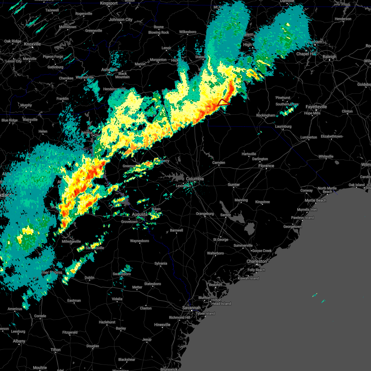 The tornado warning for north central union county will expire at 1245 pm est. the storm which prompted the warning has weakened and no longer appears capable of producing a tornado therefore the warning will be allowed to expire. A tornado watch remains in effect until 500 pm est for the piedmont. The tornado warning for north central union county will expire at 1245 pm est. the storm which prompted the warning has weakened and no longer appears capable of producing a tornado therefore the warning will be allowed to expire. A tornado watch remains in effect until 500 pm est for the piedmont.
|
| 2/6/2020 12:35 PM EST |
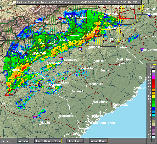 At 1235 pm est, a severe thunderstorm capable of producing a tornado was located 11 miles north of monroe, or near fairview in union county, moving east at 60 mph (radar indicated rotation). Hazards include tornado and quarter size hail. Flying debris will be dangerous to those caught without shelter. mobile homes will be damaged or destroyed. damage to roofs, windows, and vehicles will occur. tree damage is likely. This dangerous storm will remain over mainly rural areas of north central union county. At 1235 pm est, a severe thunderstorm capable of producing a tornado was located 11 miles north of monroe, or near fairview in union county, moving east at 60 mph (radar indicated rotation). Hazards include tornado and quarter size hail. Flying debris will be dangerous to those caught without shelter. mobile homes will be damaged or destroyed. damage to roofs, windows, and vehicles will occur. tree damage is likely. This dangerous storm will remain over mainly rural areas of north central union county.
|
| 2/6/2020 12:34 PM EST |
 At 1234 pm est, a severe thunderstorm capable of producing a tornado was located 13 miles south of downtown concord, or near midland, moving east at 60 mph (radar indicated rotation). Hazards include tornado. Flying debris will be dangerous to those caught without shelter. mobile homes will be damaged or destroyed. damage to roofs, windows, and vehicles will occur. tree damage is likely. This dangerous thunderstorm will remain over mainly rural areas of southeastern cabarrus county. At 1234 pm est, a severe thunderstorm capable of producing a tornado was located 13 miles south of downtown concord, or near midland, moving east at 60 mph (radar indicated rotation). Hazards include tornado. Flying debris will be dangerous to those caught without shelter. mobile homes will be damaged or destroyed. damage to roofs, windows, and vehicles will occur. tree damage is likely. This dangerous thunderstorm will remain over mainly rural areas of southeastern cabarrus county.
|
| 2/6/2020 12:30 PM EST |
 At 1230 pm est, severe thunderstorms were located along a line extending from 3 miles west of downtown concord to 7 miles east of uptown charlotte to 6 miles northwest of indian land, moving east at 70 mph (radar indicated). Hazards include 60 mph wind gusts and quarter size hail. Minor hail damage to vehicles is expected. expect wind damage to trees and power lines. Locations impacted include, rock hill, kannapolis, downtown concord, monroe, south charlotte, east charlotte, west concord, matthews, mint hill and indian trail. At 1230 pm est, severe thunderstorms were located along a line extending from 3 miles west of downtown concord to 7 miles east of uptown charlotte to 6 miles northwest of indian land, moving east at 70 mph (radar indicated). Hazards include 60 mph wind gusts and quarter size hail. Minor hail damage to vehicles is expected. expect wind damage to trees and power lines. Locations impacted include, rock hill, kannapolis, downtown concord, monroe, south charlotte, east charlotte, west concord, matthews, mint hill and indian trail.
|
| 2/6/2020 12:26 PM EST |
 At 1225 pm est, a severe thunderstorm capable of producing a tornado was located 9 miles southeast of uptown charlotte, or near matthews, moving east at 60 mph (radar indicated rotation). Hazards include tornado and quarter size hail. Flying debris will be dangerous to those caught without shelter. mobile homes will be damaged or destroyed. damage to roofs, windows, and vehicles will occur. tree damage is likely. this dangerous storm will be near, hemby bridge and mint hill around 1230 pm est. Fairview in union county around 1240 pm est. At 1225 pm est, a severe thunderstorm capable of producing a tornado was located 9 miles southeast of uptown charlotte, or near matthews, moving east at 60 mph (radar indicated rotation). Hazards include tornado and quarter size hail. Flying debris will be dangerous to those caught without shelter. mobile homes will be damaged or destroyed. damage to roofs, windows, and vehicles will occur. tree damage is likely. this dangerous storm will be near, hemby bridge and mint hill around 1230 pm est. Fairview in union county around 1240 pm est.
|
| 2/6/2020 12:20 PM EST |
 At 1220 pm est, a severe thunderstorm capable of producing a tornado was located 7 miles south of uptown charlotte, or near southpark mall, moving east at 50 mph (radar indicated rotation). Hazards include tornado. Flying debris will be dangerous to those caught without shelter. mobile homes will be damaged or destroyed. damage to roofs, windows, and vehicles will occur. tree damage is likely. this dangerous storm will be near, lake park around 1230 pm est. Indian trail, hemby bridge, fairview in union county, stallings and mint hill around 1240 pm est. At 1220 pm est, a severe thunderstorm capable of producing a tornado was located 7 miles south of uptown charlotte, or near southpark mall, moving east at 50 mph (radar indicated rotation). Hazards include tornado. Flying debris will be dangerous to those caught without shelter. mobile homes will be damaged or destroyed. damage to roofs, windows, and vehicles will occur. tree damage is likely. this dangerous storm will be near, lake park around 1230 pm est. Indian trail, hemby bridge, fairview in union county, stallings and mint hill around 1240 pm est.
|
| 2/6/2020 12:12 PM EST |
 At 1212 pm est, a severe thunderstorm capable of producing a tornado was located 9 miles northwest of indian land, or over carowinds, moving east at 60 mph (radar indicated rotation). Hazards include tornado. Flying debris will be dangerous to those caught without shelter. mobile homes will be damaged or destroyed. damage to roofs, windows, and vehicles will occur. tree damage is likely. this dangerous storm will be near, the arboretum and south charlotte around 1220 pm est. stallings, hemby bridge, matthews, lake park and indian trail around 1230 pm est. Fairview in union county around 1240 pm est. At 1212 pm est, a severe thunderstorm capable of producing a tornado was located 9 miles northwest of indian land, or over carowinds, moving east at 60 mph (radar indicated rotation). Hazards include tornado. Flying debris will be dangerous to those caught without shelter. mobile homes will be damaged or destroyed. damage to roofs, windows, and vehicles will occur. tree damage is likely. this dangerous storm will be near, the arboretum and south charlotte around 1220 pm est. stallings, hemby bridge, matthews, lake park and indian trail around 1230 pm est. Fairview in union county around 1240 pm est.
|
| 2/6/2020 12:02 PM EST |
 At 1202 pm est, severe thunderstorms were located along a line extending from near gastonia to near york to 15 miles northeast of union, moving east at 70 mph (radar indicated). Hazards include 60 mph wind gusts. expect damage to trees and power lines At 1202 pm est, severe thunderstorms were located along a line extending from near gastonia to near york to 15 miles northeast of union, moving east at 70 mph (radar indicated). Hazards include 60 mph wind gusts. expect damage to trees and power lines
|
| 2/6/2020 11:49 AM EST |
 At 1148 am est, severe thunderstorms were located along a line extending from 6 miles east of linwood to east charlotte, moving east at 35 mph (radar indicated). Hazards include 60 mph wind gusts. expect damage to roofs, siding, and trees At 1148 am est, severe thunderstorms were located along a line extending from 6 miles east of linwood to east charlotte, moving east at 35 mph (radar indicated). Hazards include 60 mph wind gusts. expect damage to roofs, siding, and trees
|
| 1/11/2020 10:38 PM EST |
 At 1037 pm est, severe thunderstorms were located along a line extending from 7 miles southeast of midland to 7 miles north of mt pisgah, moving east at 65 mph (radar indicated). Hazards include 60 mph wind gusts. expect damage to roofs, siding, and trees At 1037 pm est, severe thunderstorms were located along a line extending from 7 miles southeast of midland to 7 miles north of mt pisgah, moving east at 65 mph (radar indicated). Hazards include 60 mph wind gusts. expect damage to roofs, siding, and trees
|
| 1/11/2020 10:37 PM EST |
 At 1037 pm est, severe thunderstorms were located along a line extending from near stoneville to near mt pleasant, moving east at 45 mph (radar indicated). Hazards include 60 mph wind gusts. Expect damage to roofs, siding, and trees. Locations impacted include, greensboro, winston-salem, high point, asheboro, lexington, albemarle, randleman, badin lake, thomasville and kernersville. At 1037 pm est, severe thunderstorms were located along a line extending from near stoneville to near mt pleasant, moving east at 45 mph (radar indicated). Hazards include 60 mph wind gusts. Expect damage to roofs, siding, and trees. Locations impacted include, greensboro, winston-salem, high point, asheboro, lexington, albemarle, randleman, badin lake, thomasville and kernersville.
|
| 1/11/2020 10:23 PM EST |
 At 1022 pm est, severe thunderstorms were located along a line extending from 11 miles east of uptown charlotte to 5 miles northwest of monroe to 11 miles northeast of lancaster, moving east at 45 mph (radar indicated). Hazards include 60 mph wind gusts. Expect damage to trees and power lines. locations impacted include, monroe, south charlotte, matthews, mint hill, indian trail, weddington, stallings, unionville, wesley chapel and wingate. A tornado watch remains in effect until midnight est for the piedmont of north carolina. At 1022 pm est, severe thunderstorms were located along a line extending from 11 miles east of uptown charlotte to 5 miles northwest of monroe to 11 miles northeast of lancaster, moving east at 45 mph (radar indicated). Hazards include 60 mph wind gusts. Expect damage to trees and power lines. locations impacted include, monroe, south charlotte, matthews, mint hill, indian trail, weddington, stallings, unionville, wesley chapel and wingate. A tornado watch remains in effect until midnight est for the piedmont of north carolina.
|
| 1/11/2020 10:00 PM EST |
 At 959 pm est, severe thunderstorms were located along a line extending from king to near charlotte, moving northeast at 45 mph (radar indicated). Hazards include 60 mph wind gusts. expect fallen trees and damage to roofs and siding At 959 pm est, severe thunderstorms were located along a line extending from king to near charlotte, moving northeast at 45 mph (radar indicated). Hazards include 60 mph wind gusts. expect fallen trees and damage to roofs and siding
|
| 1/11/2020 9:55 PM EST |
 At 955 pm est, severe thunderstorms were located along a line extending from 7 miles south of gastonia to 12 miles southeast of chester, moving east at 55 mph (radar indicated). Hazards include 60 mph wind gusts. expect damage to trees and power lines At 955 pm est, severe thunderstorms were located along a line extending from 7 miles south of gastonia to 12 miles southeast of chester, moving east at 55 mph (radar indicated). Hazards include 60 mph wind gusts. expect damage to trees and power lines
|
| 1/11/2020 7:43 PM EST |
 The severe thunderstorm warning for central henderson and central buncombe counties will expire at 745 pm est, the storms which prompted the warning have moved out of the area. therefore the warning will be allowed to expire. a tornado watch remains in effect until midnight est for western north carolina, and upstate south carolina. The severe thunderstorm warning for central henderson and central buncombe counties will expire at 745 pm est, the storms which prompted the warning have moved out of the area. therefore the warning will be allowed to expire. a tornado watch remains in effect until midnight est for western north carolina, and upstate south carolina.
|
| 1/11/2020 7:32 PM EST |
 At 732 pm est, severe thunderstorms were located along a line extending from 10 miles southwest of burnsville to 10 miles south of hendersonville, moving northeast at 40 mph (radar indicated). Hazards include 60 mph wind gusts. expect damage to trees and power lines At 732 pm est, severe thunderstorms were located along a line extending from 10 miles southwest of burnsville to 10 miles south of hendersonville, moving northeast at 40 mph (radar indicated). Hazards include 60 mph wind gusts. expect damage to trees and power lines
|
| 1/11/2020 7:30 PM EST |
 At 730 pm est, severe thunderstorms were located along a line extending from 5 miles south of marshall to 7 miles south of brevard, moving northeast at 15 mph (radar indicated). Hazards include 60 mph wind gusts. Expect damage to trees and power lines. locations impacted include, downtown asheville, hendersonville, east asheville, arden, west asheville, north asheville, mills river, woodfin, fletcher and flat rock. A tornado watch remains in effect until midnight est for western north carolina, and upstate south carolina. At 730 pm est, severe thunderstorms were located along a line extending from 5 miles south of marshall to 7 miles south of brevard, moving northeast at 15 mph (radar indicated). Hazards include 60 mph wind gusts. Expect damage to trees and power lines. locations impacted include, downtown asheville, hendersonville, east asheville, arden, west asheville, north asheville, mills river, woodfin, fletcher and flat rock. A tornado watch remains in effect until midnight est for western north carolina, and upstate south carolina.
|
| 1/11/2020 7:02 PM EST |
 At 702 pm est, severe thunderstorms were located along a line extending from 12 miles southwest of marshall to 13 miles southwest of brevard, moving northeast at 40 mph (radar indicated). Hazards include 60 mph wind gusts. expect damage to trees and power lines At 702 pm est, severe thunderstorms were located along a line extending from 12 miles southwest of marshall to 13 miles southwest of brevard, moving northeast at 40 mph (radar indicated). Hazards include 60 mph wind gusts. expect damage to trees and power lines
|
| 10/31/2019 6:33 PM EDT |
 At 633 pm edt, a severe thunderstorm was located 11 miles east of monroe, or near marshville, moving northeast at 50 mph (radar indicated). Hazards include 60 mph wind gusts. Expect damage to trees and power lines. locations impacted include, monroe, unionville, wingate, marshville, mineral springs, fairview in union county, sturdivants, jaars, trinity and new salem. A tornado watch remains in effect until 1100 pm edt for the piedmont of north carolina. At 633 pm edt, a severe thunderstorm was located 11 miles east of monroe, or near marshville, moving northeast at 50 mph (radar indicated). Hazards include 60 mph wind gusts. Expect damage to trees and power lines. locations impacted include, monroe, unionville, wingate, marshville, mineral springs, fairview in union county, sturdivants, jaars, trinity and new salem. A tornado watch remains in effect until 1100 pm edt for the piedmont of north carolina.
|
| 10/31/2019 6:26 PM EDT |
 At 626 pm edt, a severe thunderstorm was located near wingate, or near monroe, moving northeast at 45 mph (radar indicated). Hazards include 60 mph wind gusts. expect damage to roofs, siding, and trees At 626 pm edt, a severe thunderstorm was located near wingate, or near monroe, moving northeast at 45 mph (radar indicated). Hazards include 60 mph wind gusts. expect damage to roofs, siding, and trees
|
| 10/31/2019 6:17 PM EDT |
 At 616 pm edt, severe thunderstorms were located along a line extending from 5 miles southeast of downtown concord to 10 miles northeast of lancaster, moving northeast at 45 mph (radar indicated). Hazards include 60 mph wind gusts. Expect damage to trees and power lines. locations impacted include, monroe, unionville, wesley chapel, wingate, waxhaw, marshville, lake park, mineral springs, rockwell and hemby bridge. A tornado watch remains in effect until 1100 pm edt for the piedmont of north carolina. At 616 pm edt, severe thunderstorms were located along a line extending from 5 miles southeast of downtown concord to 10 miles northeast of lancaster, moving northeast at 45 mph (radar indicated). Hazards include 60 mph wind gusts. Expect damage to trees and power lines. locations impacted include, monroe, unionville, wesley chapel, wingate, waxhaw, marshville, lake park, mineral springs, rockwell and hemby bridge. A tornado watch remains in effect until 1100 pm edt for the piedmont of north carolina.
|
| 10/31/2019 5:53 PM EDT |
 At 553 pm edt, severe thunderstorms were located along a line extending from 6 miles southeast of uptown charlotte to 7 miles north of lancaster, moving northeast at 55 mph (radar indicated). Hazards include 60 mph wind gusts. expect damage to trees and power lines At 553 pm edt, severe thunderstorms were located along a line extending from 6 miles southeast of uptown charlotte to 7 miles north of lancaster, moving northeast at 55 mph (radar indicated). Hazards include 60 mph wind gusts. expect damage to trees and power lines
|
| 10/31/2019 5:35 PM EDT |
 At 534 pm edt, severe thunderstorms were located along a line extending from 6 miles south of mocksville to 8 miles northeast of uptown charlotte to 7 miles north of indian land, moving northeast at 50 mph (radar indicated). Hazards include 60 mph wind gusts. expect damage to trees and power lines At 534 pm edt, severe thunderstorms were located along a line extending from 6 miles south of mocksville to 8 miles northeast of uptown charlotte to 7 miles north of indian land, moving northeast at 50 mph (radar indicated). Hazards include 60 mph wind gusts. expect damage to trees and power lines
|
| 10/31/2019 3:12 PM EDT |
 At 312 pm edt, rain showers capable of producing damaging winds were located along a line extending from 13 miles southwest of burnsville to 5 miles southeast of downtown asheville to 8 miles northwest of hendersonville, moving northeast at 55 mph (radar indicated). Hazards include 60 mph wind gusts. expect damage to trees and power lines At 312 pm edt, rain showers capable of producing damaging winds were located along a line extending from 13 miles southwest of burnsville to 5 miles southeast of downtown asheville to 8 miles northwest of hendersonville, moving northeast at 55 mph (radar indicated). Hazards include 60 mph wind gusts. expect damage to trees and power lines
|
| 10/31/2019 3:02 PM EDT |
 At 301 pm edt, severe thunderstorms were located along a line extending from 8 miles west of downtown asheville to 5 miles northwest of brevard, moving northeast at 45 mph (radar indicated). Hazards include 60 mph wind gusts. Expect damage to trees and power lines. Locations impacted include, downtown asheville, east asheville, arden, west asheville, north asheville, mills river, woodfin, fletcher, swannanoa and etowah. At 301 pm edt, severe thunderstorms were located along a line extending from 8 miles west of downtown asheville to 5 miles northwest of brevard, moving northeast at 45 mph (radar indicated). Hazards include 60 mph wind gusts. Expect damage to trees and power lines. Locations impacted include, downtown asheville, east asheville, arden, west asheville, north asheville, mills river, woodfin, fletcher, swannanoa and etowah.
|
| 10/31/2019 2:42 PM EDT |
 At 242 pm edt, severe thunderstorms were located along a line extending from 6 miles east of waynesville to 11 miles northwest of brevard to 17 miles southeast of sylva, moving northeast at 45 mph (radar indicated). Hazards include 60 mph wind gusts. expect damage to trees and power lines At 242 pm edt, severe thunderstorms were located along a line extending from 6 miles east of waynesville to 11 miles northwest of brevard to 17 miles southeast of sylva, moving northeast at 45 mph (radar indicated). Hazards include 60 mph wind gusts. expect damage to trees and power lines
|
| 9/13/2019 6:35 PM EDT |
 The severe thunderstorm warning for southern mcdowell, northwestern rutherford and southeastern buncombe counties will expire at 645 pm edt, the storm which prompted the warning has weakened below severe limits, and no longer poses an immediate threat to life or property. therefore the warning will be allowed to expire. however gusty winds and heavy rain are still possible with this thunderstorm. if you observed large hail or wind damage, please report it to the national weather service greenville-spartanburg by calling toll free, 1, 800, 2 6 7, 8 1 0 1, or by posting on our facebook page, or tweet it using hashtag nwsgsp. your message should describe the event and the specific location where it occurred. The severe thunderstorm warning for southern mcdowell, northwestern rutherford and southeastern buncombe counties will expire at 645 pm edt, the storm which prompted the warning has weakened below severe limits, and no longer poses an immediate threat to life or property. therefore the warning will be allowed to expire. however gusty winds and heavy rain are still possible with this thunderstorm. if you observed large hail or wind damage, please report it to the national weather service greenville-spartanburg by calling toll free, 1, 800, 2 6 7, 8 1 0 1, or by posting on our facebook page, or tweet it using hashtag nwsgsp. your message should describe the event and the specific location where it occurred.
|
| 9/13/2019 6:00 PM EDT |
 At 559 pm edt, severe thunderstorms were located along a line extending from 16 miles east of downtown asheville to 6 miles south of marion, moving southwest at 15 mph (radar indicated). Hazards include 60 mph wind gusts and quarter size hail. Minor hail damage to vehicles is expected. Expect wind damage to trees and power lines. At 559 pm edt, severe thunderstorms were located along a line extending from 16 miles east of downtown asheville to 6 miles south of marion, moving southwest at 15 mph (radar indicated). Hazards include 60 mph wind gusts and quarter size hail. Minor hail damage to vehicles is expected. Expect wind damage to trees and power lines.
|
| 9/13/2019 3:28 PM EDT |
 At 328 pm edt, a severe thunderstorm was located 11 miles northwest of monroe, or near hemby bridge, moving southwest at 10 mph (radar indicated). Hazards include 60 mph wind gusts and quarter size hail. Minor hail damage to vehicles is expected. Expect wind damage to trees and power lines. At 328 pm edt, a severe thunderstorm was located 11 miles northwest of monroe, or near hemby bridge, moving southwest at 10 mph (radar indicated). Hazards include 60 mph wind gusts and quarter size hail. Minor hail damage to vehicles is expected. Expect wind damage to trees and power lines.
|
| 8/19/2019 3:53 PM EDT |
 The national weather service in greenville-spartanburg has issued a * severe thunderstorm warning for. southern mecklenburg county in the piedmont of north carolina. northwestern union county in the piedmont of north carolina. until 445 pm edt. At 353 pm edt, a severe thunderstorm was located 4 miles southeast. The national weather service in greenville-spartanburg has issued a * severe thunderstorm warning for. southern mecklenburg county in the piedmont of north carolina. northwestern union county in the piedmont of north carolina. until 445 pm edt. At 353 pm edt, a severe thunderstorm was located 4 miles southeast.
|
| 7/31/2019 6:11 PM EDT |
 At 611 pm edt, severe thunderstorms were located along a line extending from 13 miles west of marion to 14 miles north of columbus, moving northeast at 15 mph (radar indicated). Hazards include 60 mph wind gusts and quarter size hail. Minor hail damage to vehicles is expected. Expect wind damage to trees and power lines. At 611 pm edt, severe thunderstorms were located along a line extending from 13 miles west of marion to 14 miles north of columbus, moving northeast at 15 mph (radar indicated). Hazards include 60 mph wind gusts and quarter size hail. Minor hail damage to vehicles is expected. Expect wind damage to trees and power lines.
|
| 7/12/2019 6:21 PM EDT |
 The severe thunderstorm warning for stanly county will expire at 630 pm edt, the storm which prompted the warning has weakened below severe limits, and no longer poses an immediate threat to life or property. therefore the warning will be allowed to expire. however gusty winds and heavy rain are still possible with this thunderstorm. to report severe weather, contact your nearest law enforcement agency. they will relay your report to the national weather service raleigh. The severe thunderstorm warning for stanly county will expire at 630 pm edt, the storm which prompted the warning has weakened below severe limits, and no longer poses an immediate threat to life or property. therefore the warning will be allowed to expire. however gusty winds and heavy rain are still possible with this thunderstorm. to report severe weather, contact your nearest law enforcement agency. they will relay your report to the national weather service raleigh.
|
| 7/12/2019 6:14 PM EDT |
 At 614 pm edt, a severe thunderstorm was located 8 miles south of albemarle, moving east at 25 mph (radar indicated). Hazards include 60 mph wind gusts. Expect damage to roofs, siding, and trees. Locations impacted include, albemarle, fairview in union county, locust, norwood, oakboro, stanfield, lake tillery and morrow mountain state park. At 614 pm edt, a severe thunderstorm was located 8 miles south of albemarle, moving east at 25 mph (radar indicated). Hazards include 60 mph wind gusts. Expect damage to roofs, siding, and trees. Locations impacted include, albemarle, fairview in union county, locust, norwood, oakboro, stanfield, lake tillery and morrow mountain state park.
|
| 7/12/2019 5:47 PM EDT |
 At 546 pm edt, a severe thunderstorm was located over locust, moving east at 25 mph (radar indicated). Hazards include 60 mph wind gusts. expect damage to roofs, siding, and trees At 546 pm edt, a severe thunderstorm was located over locust, moving east at 25 mph (radar indicated). Hazards include 60 mph wind gusts. expect damage to roofs, siding, and trees
|
| 6/24/2019 10:17 PM EDT |
 At 1016 pm edt, severe thunderstorms were located along a line extending from 7 miles southwest of winston-salem to 6 miles west of lexington to 11 miles north of badin lake to 9 miles east of downtown concord to 13 miles south of albemarle to 8 miles south of monroe to 14 miles northeast of lake wateree dam, moving east at 40 mph (radar indicated). Hazards include 60 mph wind gusts. Expect damage to trees and power lines. Locations impacted include, monroe, chester, indian trail, weddington, stallings, unionville, wesley chapel, wingate, waxhaw and marshville. At 1016 pm edt, severe thunderstorms were located along a line extending from 7 miles southwest of winston-salem to 6 miles west of lexington to 11 miles north of badin lake to 9 miles east of downtown concord to 13 miles south of albemarle to 8 miles south of monroe to 14 miles northeast of lake wateree dam, moving east at 40 mph (radar indicated). Hazards include 60 mph wind gusts. Expect damage to trees and power lines. Locations impacted include, monroe, chester, indian trail, weddington, stallings, unionville, wesley chapel, wingate, waxhaw and marshville.
|
| 6/24/2019 10:03 PM EDT |
 At 1003 pm edt, severe thunderstorms were located along a line extending from 12 miles southwest of winston-salem to 5 miles southeast of mocksville to 12 miles south of lexington to near downtown concord to 16 miles southwest of albemarle to 11 miles southwest of monroe to 13 miles south of lancaster, moving east at 40 mph (radar indicated). Hazards include 60 mph wind gusts. Expect damage to trees and power lines. Locations impacted include, rock hill, kannapolis, downtown concord, monroe, salisbury, mocksville, central charlotte, south charlotte, southwest charlotte and east charlotte. At 1003 pm edt, severe thunderstorms were located along a line extending from 12 miles southwest of winston-salem to 5 miles southeast of mocksville to 12 miles south of lexington to near downtown concord to 16 miles southwest of albemarle to 11 miles southwest of monroe to 13 miles south of lancaster, moving east at 40 mph (radar indicated). Hazards include 60 mph wind gusts. Expect damage to trees and power lines. Locations impacted include, rock hill, kannapolis, downtown concord, monroe, salisbury, mocksville, central charlotte, south charlotte, southwest charlotte and east charlotte.
|
| 6/24/2019 9:48 PM EDT |
 At 948 pm edt, severe thunderstorms were located along a line extending from 7 miles south of yadkinville to 7 miles southwest of mocksville to 4 miles east of salisbury to 6 miles east of huntersville to 14 miles north of monroe to 8 miles south of indian land to 14 miles southwest of lancaster, moving east at 25 mph (radar indicated). Hazards include 60 mph wind gusts. Expect damage to trees and power lines. Locations impacted include, rock hill, uptown charlotte, huntersville, kannapolis, downtown concord, monroe, salisbury, chester, mocksville and central charlotte. At 948 pm edt, severe thunderstorms were located along a line extending from 7 miles south of yadkinville to 7 miles southwest of mocksville to 4 miles east of salisbury to 6 miles east of huntersville to 14 miles north of monroe to 8 miles south of indian land to 14 miles southwest of lancaster, moving east at 25 mph (radar indicated). Hazards include 60 mph wind gusts. Expect damage to trees and power lines. Locations impacted include, rock hill, uptown charlotte, huntersville, kannapolis, downtown concord, monroe, salisbury, chester, mocksville and central charlotte.
|
| 6/24/2019 9:27 PM EDT |
 At 927 pm edt, severe thunderstorms were located along a line extending from 6 miles south of yadkinville to 4 miles north of statesville to 8 miles north of kannapolis to near huntersville to 7 miles northeast of indian land to 4 miles southwest of rock hill to 11 miles north of winnsboro, moving east at 40 mph (radar indicated). Hazards include 70 mph wind gusts. Expect considerable tree damage. Damage is likely to mobile homes, roofs, and outbuildings. At 927 pm edt, severe thunderstorms were located along a line extending from 6 miles south of yadkinville to 4 miles north of statesville to 8 miles north of kannapolis to near huntersville to 7 miles northeast of indian land to 4 miles southwest of rock hill to 11 miles north of winnsboro, moving east at 40 mph (radar indicated). Hazards include 70 mph wind gusts. Expect considerable tree damage. Damage is likely to mobile homes, roofs, and outbuildings.
|
| 6/24/2019 9:16 PM EDT |
 At 916 pm edt, severe thunderstorms were located along a line extending from 15 miles east of taylorsville to 7 miles northwest of statesville to 14 miles northwest of kannapolis to 5 miles west of huntersville to 6 miles southwest of uptown charlotte to 7 miles south of york to 6 miles south of chester, moving northeast at 70 mph (radar indicated). Hazards include 70 mph wind gusts. Expect considerable tree damage. damage is likely to mobile homes, roofs, and outbuildings. Locations impacted include, gastonia, rock hill, uptown charlotte, huntersville, statesville, lincolnton, york, chester, mocksville and central charlotte. At 916 pm edt, severe thunderstorms were located along a line extending from 15 miles east of taylorsville to 7 miles northwest of statesville to 14 miles northwest of kannapolis to 5 miles west of huntersville to 6 miles southwest of uptown charlotte to 7 miles south of york to 6 miles south of chester, moving northeast at 70 mph (radar indicated). Hazards include 70 mph wind gusts. Expect considerable tree damage. damage is likely to mobile homes, roofs, and outbuildings. Locations impacted include, gastonia, rock hill, uptown charlotte, huntersville, statesville, lincolnton, york, chester, mocksville and central charlotte.
|
| 6/24/2019 9:00 PM EDT |
 At 859 pm edt, severe thunderstorms were located along a line extending from 4 miles southeast of taylorsville to 10 miles southwest of statesville to 7 miles southeast of lincolnton to 8 miles southeast of gastonia to 7 miles southwest of york to 16 miles southeast of union, moving northeast at 50 mph (radar indicated). Hazards include 70 mph wind gusts. Expect considerable tree damage. Damage is likely to mobile homes, roofs, and outbuildings. At 859 pm edt, severe thunderstorms were located along a line extending from 4 miles southeast of taylorsville to 10 miles southwest of statesville to 7 miles southeast of lincolnton to 8 miles southeast of gastonia to 7 miles southwest of york to 16 miles southeast of union, moving northeast at 50 mph (radar indicated). Hazards include 70 mph wind gusts. Expect considerable tree damage. Damage is likely to mobile homes, roofs, and outbuildings.
|
| 6/22/2019 5:08 PM EDT |
 The severe thunderstorm warning for south central cabarrus and union counties will expire at 515 pm edt, the storms which prompted the warning have moved out of the area. therefore the warning will be allowed to expire. however gusty winds and heavy rain are still possible with these thunderstorms. a severe thunderstorm watch remains in effect until 900 pm edt for the piedmont of north carolina. if you observed large hail or wind damage, please report it to the national weather service greenville-spartanburg by calling toll free, 1, 800, 2 6 7, 8 1 0 1, or by posting on our facebook page, or tweet it using hashtag nwsgsp. your message should describe the event and the specific location where it occurred. The severe thunderstorm warning for south central cabarrus and union counties will expire at 515 pm edt, the storms which prompted the warning have moved out of the area. therefore the warning will be allowed to expire. however gusty winds and heavy rain are still possible with these thunderstorms. a severe thunderstorm watch remains in effect until 900 pm edt for the piedmont of north carolina. if you observed large hail or wind damage, please report it to the national weather service greenville-spartanburg by calling toll free, 1, 800, 2 6 7, 8 1 0 1, or by posting on our facebook page, or tweet it using hashtag nwsgsp. your message should describe the event and the specific location where it occurred.
|
| 6/22/2019 4:48 PM EDT |
 At 448 pm edt, severe thunderstorms were located along a line extending from 11 miles southwest of albemarle to 8 miles southeast of monroe, moving east at 45 mph (radar indicated). Hazards include 60 mph wind gusts and penny size hail. Expect damage to trees and power lines. Locations impacted include, monroe, unionville, wingate, marshville, midland, fairview in union county, sturdivants, trinity and new salem. At 448 pm edt, severe thunderstorms were located along a line extending from 11 miles southwest of albemarle to 8 miles southeast of monroe, moving east at 45 mph (radar indicated). Hazards include 60 mph wind gusts and penny size hail. Expect damage to trees and power lines. Locations impacted include, monroe, unionville, wingate, marshville, midland, fairview in union county, sturdivants, trinity and new salem.
|
| 6/22/2019 4:41 PM EDT |
 The national weather service in raleigh has issued a * severe thunderstorm warning for. anson county in central north carolina. southwestern montgomery county in central north carolina. richmond county in central north carolina. Southern stanly county in central north carolina. The national weather service in raleigh has issued a * severe thunderstorm warning for. anson county in central north carolina. southwestern montgomery county in central north carolina. richmond county in central north carolina. Southern stanly county in central north carolina.
|
| 6/22/2019 4:26 PM EDT |
 At 426 pm edt, severe thunderstorms were located along a line extending from 6 miles southeast of downtown concord to 5 miles east of indian land, moving east at 50 mph (radar indicated). Hazards include 60 mph wind gusts and quarter size hail. Minor hail damage to vehicles is expected. Expect wind damage to trees and power lines. At 426 pm edt, severe thunderstorms were located along a line extending from 6 miles southeast of downtown concord to 5 miles east of indian land, moving east at 50 mph (radar indicated). Hazards include 60 mph wind gusts and quarter size hail. Minor hail damage to vehicles is expected. Expect wind damage to trees and power lines.
|
| 6/20/2019 5:42 PM EDT |
 The severe thunderstorm warning for northwestern montgomery, southwestern randolph and stanly counties will expire at 545 pm edt, the storm which prompted the warning has moved out of the area. therefore the warning will be allowed to expire. a severe thunderstorm watch remains in effect until 1000 pm edt for central north carolina. The severe thunderstorm warning for northwestern montgomery, southwestern randolph and stanly counties will expire at 545 pm edt, the storm which prompted the warning has moved out of the area. therefore the warning will be allowed to expire. a severe thunderstorm watch remains in effect until 1000 pm edt for central north carolina.
|
| 6/20/2019 5:29 PM EDT |
 At 529 pm edt, a severe thunderstorm was located near seagrove, or 7 miles southwest of north carolina zoo, moving east at 60 mph (radar indicated). Hazards include 60 mph wind gusts. Expect damage to roofs, siding, and trees. Locations impacted include, asheboro, albemarle, troy, north carolina zoo, badin lake, seagrove, plyler, fairview in union county, locust and badin. At 529 pm edt, a severe thunderstorm was located near seagrove, or 7 miles southwest of north carolina zoo, moving east at 60 mph (radar indicated). Hazards include 60 mph wind gusts. Expect damage to roofs, siding, and trees. Locations impacted include, asheboro, albemarle, troy, north carolina zoo, badin lake, seagrove, plyler, fairview in union county, locust and badin.
|
| 6/20/2019 5:20 PM EDT |
 At 520 pm edt, a severe thunderstorm was located near badin lake, moving east at 45 mph (radar indicated). Hazards include 60 mph wind gusts. Expect damage to roofs, siding, and trees. Locations impacted include, asheboro, albemarle, troy, badin lake, north carolina zoo, seagrove, plyler, fairview in union county, locust and badin. At 520 pm edt, a severe thunderstorm was located near badin lake, moving east at 45 mph (radar indicated). Hazards include 60 mph wind gusts. Expect damage to roofs, siding, and trees. Locations impacted include, asheboro, albemarle, troy, badin lake, north carolina zoo, seagrove, plyler, fairview in union county, locust and badin.
|
| 6/20/2019 5:01 PM EDT |
 At 500 pm edt, a severe thunderstorm was located near rockwell, or 11 miles northwest of albemarle, moving east at 45 mph (radar indicated). Hazards include 60 mph wind gusts and penny size hail. expect damage to roofs, siding, and trees At 500 pm edt, a severe thunderstorm was located near rockwell, or 11 miles northwest of albemarle, moving east at 45 mph (radar indicated). Hazards include 60 mph wind gusts and penny size hail. expect damage to roofs, siding, and trees
|
| 5/4/2019 4:38 PM EDT |
 The severe thunderstorm warning for southeastern mecklenburg and central union counties will expire at 445 pm edt, the storm which prompted the warning has weakened below severe limits, and no longer poses an immediate threat to life or property. therefore the warning will be allowed to expire. however gusty winds and heavy rain are still possible, mainly across southern and eastern portions of union county. The severe thunderstorm warning for southeastern mecklenburg and central union counties will expire at 445 pm edt, the storm which prompted the warning has weakened below severe limits, and no longer poses an immediate threat to life or property. therefore the warning will be allowed to expire. however gusty winds and heavy rain are still possible, mainly across southern and eastern portions of union county.
|
| 5/4/2019 3:46 PM EDT |
 At 346 pm edt, a severe thunderstorm was located near indian land, or near marvin, moving northeast at 25 mph (radar indicated). Hazards include 60 mph wind gusts and half dollar size hail. Minor hail damage to vehicles is expected. Expect wind damage to trees and power lines. At 346 pm edt, a severe thunderstorm was located near indian land, or near marvin, moving northeast at 25 mph (radar indicated). Hazards include 60 mph wind gusts and half dollar size hail. Minor hail damage to vehicles is expected. Expect wind damage to trees and power lines.
|
| 4/19/2019 3:37 PM EDT |
 The severe thunderstorm warning for union county will expire at 345 pm edt, the storm which prompted the warning has moved out of the area. therefore the warning will be allowed to expire. however heavy rain is still possible across eastern union county. a tornado watch remains in effect until 500 pm edt for the piedmont of north carolina. The severe thunderstorm warning for union county will expire at 345 pm edt, the storm which prompted the warning has moved out of the area. therefore the warning will be allowed to expire. however heavy rain is still possible across eastern union county. a tornado watch remains in effect until 500 pm edt for the piedmont of north carolina.
|
| 4/19/2019 3:13 PM EDT |
 At 313 pm edt, a severe thunderstorm was located 7 miles northeast of monroe, or 4 miles north of wingate, moving north at 60 mph (radar indicated). Hazards include 60 mph wind gusts and penny size hail. Expect damage to trees and power lines. locations impacted include, monroe, unionville, wingate, marshville, fairview in union county, sturdivants, trinity and new salem. A tornado watch remains in effect until 500 pm edt for the piedmont of north carolina. At 313 pm edt, a severe thunderstorm was located 7 miles northeast of monroe, or 4 miles north of wingate, moving north at 60 mph (radar indicated). Hazards include 60 mph wind gusts and penny size hail. Expect damage to trees and power lines. locations impacted include, monroe, unionville, wingate, marshville, fairview in union county, sturdivants, trinity and new salem. A tornado watch remains in effect until 500 pm edt for the piedmont of north carolina.
|
| 4/19/2019 2:56 PM EDT |
 At 256 pm edt, a severe thunderstorm was located 9 miles south of monroe, or 7 miles northeast of buford, moving north at 45 mph (radar indicated). Hazards include 60 mph wind gusts and penny size hail. expect damage to trees and power lines At 256 pm edt, a severe thunderstorm was located 9 miles south of monroe, or 7 miles northeast of buford, moving north at 45 mph (radar indicated). Hazards include 60 mph wind gusts and penny size hail. expect damage to trees and power lines
|
| 2/12/2019 5:31 PM EST |
 At 530 pm est, rain showers capable of producing damaging winds were located along a line extending from 3 miles northeast of downtown concord to near monroe, moving east at 50 mph (radar indicated). Hazards include 60 mph wind gusts. expect damage to trees and power lines At 530 pm est, rain showers capable of producing damaging winds were located along a line extending from 3 miles northeast of downtown concord to near monroe, moving east at 50 mph (radar indicated). Hazards include 60 mph wind gusts. expect damage to trees and power lines
|
| 9/27/2018 9:50 PM EDT |
 At 949 pm edt, severe thunderstorms were located along a line extending from near salisbury to 9 miles southeast of downtown concord to 5 miles southwest of monroe, moving northeast at 45 mph (law enforcement reported widespread tree damage as these storms crossed the north carolina piedmont). Hazards include 60 mph wind gusts. Expect damage to trees and power lines. Locations impacted include, monroe, salisbury, unionville, wingate, spencer, marshville, granite quarry, rockwell, mt pleasant and faith. At 949 pm edt, severe thunderstorms were located along a line extending from near salisbury to 9 miles southeast of downtown concord to 5 miles southwest of monroe, moving northeast at 45 mph (law enforcement reported widespread tree damage as these storms crossed the north carolina piedmont). Hazards include 60 mph wind gusts. Expect damage to trees and power lines. Locations impacted include, monroe, salisbury, unionville, wingate, spencer, marshville, granite quarry, rockwell, mt pleasant and faith.
|
| 9/27/2018 9:41 PM EDT |
 At 939 pm edt, severe thunderstorms were located along a line extending from near china grove to fairview in union county to near heath springs, moving northeast at 60 mph (radar indicated). Hazards include 60 mph wind gusts. expect damage to roofs, siding, and trees At 939 pm edt, severe thunderstorms were located along a line extending from near china grove to fairview in union county to near heath springs, moving northeast at 60 mph (radar indicated). Hazards include 60 mph wind gusts. expect damage to roofs, siding, and trees
|
| 9/27/2018 9:27 PM EDT |
 At 925 pm edt, severe thunderstorms were located along a line extending from 9 miles north of kannapolis to 7 miles northwest of lancaster, moving east at 40 mph (law enforcement reported widespread wind damage as this line of storms moved through the western parts of the charlotte metropolitan area). Hazards include 60 mph wind gusts. expect damage to trees and power lines At 925 pm edt, severe thunderstorms were located along a line extending from 9 miles north of kannapolis to 7 miles northwest of lancaster, moving east at 40 mph (law enforcement reported widespread wind damage as this line of storms moved through the western parts of the charlotte metropolitan area). Hazards include 60 mph wind gusts. expect damage to trees and power lines
|
| 9/27/2018 8:45 PM EDT |
 The national weather service in greenville-spartanburg has issued a * severe thunderstorm warning for. western cabarrus county in the piedmont of north carolina. southeastern catawba county in the piedmont of north carolina. lincoln county in the piedmont of north carolina. Southeastern iredell county in the piedmont of north carolina. The national weather service in greenville-spartanburg has issued a * severe thunderstorm warning for. western cabarrus county in the piedmont of north carolina. southeastern catawba county in the piedmont of north carolina. lincoln county in the piedmont of north carolina. Southeastern iredell county in the piedmont of north carolina.
|
| 9/27/2018 8:45 PM EDT |
 At 845 pm edt, severe thunderstorms were located along a line extending from 8 miles southwest of lincolnton to near gastonia to 5 miles east of york, moving northeast at 50 mph (radar indicated). Hazards include 60 mph wind gusts. expect damage to trees and power lines At 845 pm edt, severe thunderstorms were located along a line extending from 8 miles southwest of lincolnton to near gastonia to 5 miles east of york, moving northeast at 50 mph (radar indicated). Hazards include 60 mph wind gusts. expect damage to trees and power lines
|
| 9/10/2018 4:36 PM EDT |
 At 436 pm edt, a severe thunderstorm was located near ansonville, or 8 miles north of wadesboro, moving northeast at 15 mph (radar indicated). Hazards include 60 mph wind gusts. Expect damage to roofs, siding, and trees. Locations impacted include, ansonville, locust, norwood, oakboro, stanfield, mount gilead, lilesville, uwharrie haven, blewett falls lake and lake tillery. At 436 pm edt, a severe thunderstorm was located near ansonville, or 8 miles north of wadesboro, moving northeast at 15 mph (radar indicated). Hazards include 60 mph wind gusts. Expect damage to roofs, siding, and trees. Locations impacted include, ansonville, locust, norwood, oakboro, stanfield, mount gilead, lilesville, uwharrie haven, blewett falls lake and lake tillery.
|
| 9/10/2018 4:10 PM EDT |
 At 410 pm edt, a severe thunderstorm was located over wadesboro, moving northeast at 15 mph (radar indicated). Hazards include 60 mph wind gusts and penny size hail. Expect damage to roofs, siding, and trees. Locations impacted include, wadesboro, ansonville, polkton, locust, norwood, oakboro, stanfield, mount gilead, lilesville and peachland. At 410 pm edt, a severe thunderstorm was located over wadesboro, moving northeast at 15 mph (radar indicated). Hazards include 60 mph wind gusts and penny size hail. Expect damage to roofs, siding, and trees. Locations impacted include, wadesboro, ansonville, polkton, locust, norwood, oakboro, stanfield, mount gilead, lilesville and peachland.
|
| 9/10/2018 3:50 PM EDT |
 At 350 pm edt, a severe thunderstorm was located near wadesboro, moving north at 20 mph (radar indicated). Hazards include 60 mph wind gusts and quarter size hail. Hail damage to vehicles is expected. Expect wind damage to roofs, siding, and trees. At 350 pm edt, a severe thunderstorm was located near wadesboro, moving north at 20 mph (radar indicated). Hazards include 60 mph wind gusts and quarter size hail. Hail damage to vehicles is expected. Expect wind damage to roofs, siding, and trees.
|
| 8/30/2018 5:41 PM EDT |
 At 541 pm edt, a severe thunderstorm was located 11 miles north of monroe, or near fairview in union county, and is nearly stationary (radar indicated). Hazards include 60 mph wind gusts and quarter size hail. Minor hail damage to vehicles is expected. expect wind damage to trees and power lines. Locations impacted include, mint hill, unionville, hemby bridge, midland, fairview in union county, indian trail and stallings. At 541 pm edt, a severe thunderstorm was located 11 miles north of monroe, or near fairview in union county, and is nearly stationary (radar indicated). Hazards include 60 mph wind gusts and quarter size hail. Minor hail damage to vehicles is expected. expect wind damage to trees and power lines. Locations impacted include, mint hill, unionville, hemby bridge, midland, fairview in union county, indian trail and stallings.
|
| 8/30/2018 5:28 PM EDT |
 At 527 pm edt, a severe thunderstorm was located 10 miles north of monroe, or near fairview in union county, and is nearly stationary (radar indicated). Hazards include 60 mph wind gusts and quarter size hail. Minor hail damage to vehicles is expected. Expect wind damage to trees and power lines. At 527 pm edt, a severe thunderstorm was located 10 miles north of monroe, or near fairview in union county, and is nearly stationary (radar indicated). Hazards include 60 mph wind gusts and quarter size hail. Minor hail damage to vehicles is expected. Expect wind damage to trees and power lines.
|
| 8/8/2018 6:39 PM EDT |
 At 639 pm edt, severe thunderstorms were located along a line extending from clemmons to salisbury to near midland, moving east at 30 mph (radar indicated). Hazards include 60 mph wind gusts. expect damage to roofs, siding, and trees At 639 pm edt, severe thunderstorms were located along a line extending from clemmons to salisbury to near midland, moving east at 30 mph (radar indicated). Hazards include 60 mph wind gusts. expect damage to roofs, siding, and trees
|
| 8/7/2018 10:25 PM EDT |
 At 1025 pm edt, a severe thunderstorm was located 9 miles north of monroe, or near fairview in union county, moving east at 25 mph (radar indicated). Hazards include 60 mph wind gusts and quarter size hail. Minor hail damage to vehicles is expected. expect wind damage to trees and power lines. Locations impacted include, unionville, hemby bridge, fairview in union county, new salem, lake park, stallings and indian trail. At 1025 pm edt, a severe thunderstorm was located 9 miles north of monroe, or near fairview in union county, moving east at 25 mph (radar indicated). Hazards include 60 mph wind gusts and quarter size hail. Minor hail damage to vehicles is expected. expect wind damage to trees and power lines. Locations impacted include, unionville, hemby bridge, fairview in union county, new salem, lake park, stallings and indian trail.
|
| 8/7/2018 10:10 PM EDT |
 At 1010 pm edt, severe thunderstorms were located along a line extending from 10 miles southeast of downtown concord to 12 miles northwest of monroe, moving east at 20 mph (radar indicated). Hazards include 60 mph wind gusts and quarter size hail. Minor hail damage to vehicles is expected. expect wind damage to trees and power lines. Locations impacted include, downtown concord, east charlotte, matthews, mint hill, unionville, harrisburg, hemby bridge, mt pleasant, reedy creek park and midland. At 1010 pm edt, severe thunderstorms were located along a line extending from 10 miles southeast of downtown concord to 12 miles northwest of monroe, moving east at 20 mph (radar indicated). Hazards include 60 mph wind gusts and quarter size hail. Minor hail damage to vehicles is expected. expect wind damage to trees and power lines. Locations impacted include, downtown concord, east charlotte, matthews, mint hill, unionville, harrisburg, hemby bridge, mt pleasant, reedy creek park and midland.
|
| 8/7/2018 9:53 PM EDT |
 At 953 pm edt, severe thunderstorms were located along a line extending from 6 miles east of downtown concord to 7 miles southeast of uptown charlotte, moving east at 25 mph (radar indicated). Hazards include 60 mph wind gusts and quarter size hail. Minor hail damage to vehicles is expected. Expect wind damage to trees and power lines. At 953 pm edt, severe thunderstorms were located along a line extending from 6 miles east of downtown concord to 7 miles southeast of uptown charlotte, moving east at 25 mph (radar indicated). Hazards include 60 mph wind gusts and quarter size hail. Minor hail damage to vehicles is expected. Expect wind damage to trees and power lines.
|
| 7/21/2018 5:55 PM EDT |
 At 555 pm edt, a severe thunderstorm was located 8 miles northeast of hendersonville, or 5 miles west of bat cave, moving southeast at 15 mph (radar indicated). Hazards include 70 mph wind gusts and quarter size hail. Minor hail damage to vehicles is expected. expect considerable tree damage. Wind damage is also likely to mobile homes, roofs, and outbuildings. At 555 pm edt, a severe thunderstorm was located 8 miles northeast of hendersonville, or 5 miles west of bat cave, moving southeast at 15 mph (radar indicated). Hazards include 70 mph wind gusts and quarter size hail. Minor hail damage to vehicles is expected. expect considerable tree damage. Wind damage is also likely to mobile homes, roofs, and outbuildings.
|
| 7/6/2018 3:55 PM EDT |
 At 354 pm edt, a severe thunderstorm was located 7 miles northwest of monroe, or near lake park, moving west at 10 mph (radar indicated). Hazards include 60 mph wind gusts and quarter size hail. Minor hail damage to vehicles is expected. Expect wind damage to trees and power lines. At 354 pm edt, a severe thunderstorm was located 7 miles northwest of monroe, or near lake park, moving west at 10 mph (radar indicated). Hazards include 60 mph wind gusts and quarter size hail. Minor hail damage to vehicles is expected. Expect wind damage to trees and power lines.
|
| 7/6/2018 1:40 PM EDT |
 The severe thunderstorm warning for west central rutherford, northeastern henderson, northwestern polk and southeastern buncombe counties will expire at 145 pm edt, the storm which prompted the warning has weakened below severe limits, and no longer poses an immediate threat to life or property. therefore the warning will be allowed to expire. The severe thunderstorm warning for west central rutherford, northeastern henderson, northwestern polk and southeastern buncombe counties will expire at 145 pm edt, the storm which prompted the warning has weakened below severe limits, and no longer poses an immediate threat to life or property. therefore the warning will be allowed to expire.
|
| 7/6/2018 1:29 PM EDT |
 At 128 pm edt, a severe thunderstorm was located 11 miles northeast of hendersonville, or near bat cave, moving south at 15 mph. storm has weakend, but severe wind gusts will be possible for another 15 minutes (radar indicated). Hazards include 60 mph wind gusts. Expect damage to trees and power lines. Locations impacted include, fairview in buncombe county, chimney rock state park, bat cave, dana, gerton, edneyville, lake adger, mill spring, hendersonville and east flat rock. At 128 pm edt, a severe thunderstorm was located 11 miles northeast of hendersonville, or near bat cave, moving south at 15 mph. storm has weakend, but severe wind gusts will be possible for another 15 minutes (radar indicated). Hazards include 60 mph wind gusts. Expect damage to trees and power lines. Locations impacted include, fairview in buncombe county, chimney rock state park, bat cave, dana, gerton, edneyville, lake adger, mill spring, hendersonville and east flat rock.
|
| 7/6/2018 12:58 PM EDT |
 At 1258 pm edt, a severe thunderstorm was located 15 miles east of downtown asheville, or 4 miles north of bat cave, moving south at 15 mph (radar indicated). Hazards include 60 mph wind gusts and quarter size hail. Minor hail damage to vehicles is expected. Expect wind damage to trees and power lines. At 1258 pm edt, a severe thunderstorm was located 15 miles east of downtown asheville, or 4 miles north of bat cave, moving south at 15 mph (radar indicated). Hazards include 60 mph wind gusts and quarter size hail. Minor hail damage to vehicles is expected. Expect wind damage to trees and power lines.
|
| 6/26/2018 7:14 PM EDT |
 At 713 pm edt, severe thunderstorms were located along a line extending from near downtown asheville to 14 miles northwest of hendersonville to 9 miles northwest of brevard, moving southeast at 30 mph (radar indicated). Hazards include 60 mph wind gusts and quarter size hail. Minor hail damage to vehicles is expected. expect wind damage to trees and power lines. Locations impacted include, downtown asheville, waynesville, east asheville, arden, west asheville, north asheville, mills river, woodfin, fletcher and canton. At 713 pm edt, severe thunderstorms were located along a line extending from near downtown asheville to 14 miles northwest of hendersonville to 9 miles northwest of brevard, moving southeast at 30 mph (radar indicated). Hazards include 60 mph wind gusts and quarter size hail. Minor hail damage to vehicles is expected. expect wind damage to trees and power lines. Locations impacted include, downtown asheville, waynesville, east asheville, arden, west asheville, north asheville, mills river, woodfin, fletcher and canton.
|
| 6/26/2018 6:49 PM EDT |
 At 648 pm edt, severe thunderstorms were located along a line extending from near marshall to 13 miles west of downtown asheville to 3 miles northeast of waynesville, moving southeast at 30 mph (radar indicated). Hazards include 60 mph wind gusts and quarter size hail. Minor hail damage to vehicles is expected. Expect wind damage to trees and power lines. At 648 pm edt, severe thunderstorms were located along a line extending from near marshall to 13 miles west of downtown asheville to 3 miles northeast of waynesville, moving southeast at 30 mph (radar indicated). Hazards include 60 mph wind gusts and quarter size hail. Minor hail damage to vehicles is expected. Expect wind damage to trees and power lines.
|
| 6/25/2018 8:40 PM EDT |
 The severe thunderstorm warning for union county will expire at 845 pm edt, the storm which prompted the warning has moved out of the area. therefore the warning will be allowed to expire. however gusty winds are still possible with this thunderstorm. a severe thunderstorm watch remains in effect until 1000 pm edt for the piedmont of north carolina. The severe thunderstorm warning for union county will expire at 845 pm edt, the storm which prompted the warning has moved out of the area. therefore the warning will be allowed to expire. however gusty winds are still possible with this thunderstorm. a severe thunderstorm watch remains in effect until 1000 pm edt for the piedmont of north carolina.
|
| 6/25/2018 8:13 PM EDT |
 At 813 pm edt, a severe thunderstorm was located 12 miles northwest of wadesboro, or 8 miles west of ansonville, moving east at 25 mph (radar indicated). Hazards include 60 mph wind gusts and quarter size hail. Minor hail damage to vehicles is expected. expect wind damage to trees and power lines. Locations impacted include, monroe, indian trail, weddington, stallings, unionville, wesley chapel, wingate, waxhaw, marshville and lake park. At 813 pm edt, a severe thunderstorm was located 12 miles northwest of wadesboro, or 8 miles west of ansonville, moving east at 25 mph (radar indicated). Hazards include 60 mph wind gusts and quarter size hail. Minor hail damage to vehicles is expected. expect wind damage to trees and power lines. Locations impacted include, monroe, indian trail, weddington, stallings, unionville, wesley chapel, wingate, waxhaw, marshville and lake park.
|
| 6/25/2018 7:59 PM EDT |
 At 758 pm edt, a severe thunderstorm was located 12 miles northeast of monroe, or 6 miles north of marshville, moving east at 25 mph (radar indicated). Hazards include 60 mph wind gusts and quarter size hail. Minor hail damage to vehicles is expected. Expect wind damage to trees and power lines. At 758 pm edt, a severe thunderstorm was located 12 miles northeast of monroe, or 6 miles north of marshville, moving east at 25 mph (radar indicated). Hazards include 60 mph wind gusts and quarter size hail. Minor hail damage to vehicles is expected. Expect wind damage to trees and power lines.
|
| 6/25/2018 7:39 PM EDT |
 At 739 pm edt, a severe thunderstorm was located 7 miles north of monroe, or over unionville, moving east at 25 mph (radar indicated). Hazards include 60 mph wind gusts and quarter size hail. Minor hail damage to vehicles is expected. expect wind damage to trees and power lines. Locations impacted include, monroe, indian trail, weddington, stallings, unionville, wesley chapel, wingate, waxhaw, marshville and lake park. At 739 pm edt, a severe thunderstorm was located 7 miles north of monroe, or over unionville, moving east at 25 mph (radar indicated). Hazards include 60 mph wind gusts and quarter size hail. Minor hail damage to vehicles is expected. expect wind damage to trees and power lines. Locations impacted include, monroe, indian trail, weddington, stallings, unionville, wesley chapel, wingate, waxhaw, marshville and lake park.
|
| 6/25/2018 7:21 PM EDT |
 At 721 pm edt, a severe thunderstorm was located 10 miles northwest of monroe, or near hemby bridge, moving east at 25 mph (radar indicated). Hazards include 60 mph wind gusts and quarter size hail. Minor hail damage to vehicles is expected. Expect wind damage to trees and power lines. At 721 pm edt, a severe thunderstorm was located 10 miles northwest of monroe, or near hemby bridge, moving east at 25 mph (radar indicated). Hazards include 60 mph wind gusts and quarter size hail. Minor hail damage to vehicles is expected. Expect wind damage to trees and power lines.
|
| 6/25/2018 7:17 PM EDT |
 At 716 pm edt, a line of severe thunderstorms was moving southeast at 40 to 50 mph into the warning area (radar indicated). Hazards include 60 mph wind gusts. expect damage to trees and crops At 716 pm edt, a line of severe thunderstorms was moving southeast at 40 to 50 mph into the warning area (radar indicated). Hazards include 60 mph wind gusts. expect damage to trees and crops
|
| 6/25/2018 4:38 PM EDT |
 At 437 pm edt, severe thunderstorms were located along a line extending from 5 miles southeast of deep gap to 8 miles east of marion to 15 miles east of downtown asheville, moving east at 45 mph (radar indicated). Hazards include 60 mph wind gusts and quarter size hail. Minor hail damage to vehicles is expected. Expect wind damage to trees and power lines. At 437 pm edt, severe thunderstorms were located along a line extending from 5 miles southeast of deep gap to 8 miles east of marion to 15 miles east of downtown asheville, moving east at 45 mph (radar indicated). Hazards include 60 mph wind gusts and quarter size hail. Minor hail damage to vehicles is expected. Expect wind damage to trees and power lines.
|
| 6/25/2018 4:26 PM EDT |
 At 426 pm edt, severe thunderstorms were located along a line extending from near todd to 8 miles northeast of marion to 12 miles northeast of downtown asheville, moving east at 35 mph (radar indicated). Hazards include 60 mph wind gusts and quarter size hail. Minor hail damage to vehicles is expected. expect wind damage to trees and power lines. Locations impacted include, downtown asheville, marion, spruce pine, burnsville, newland, east asheville, west asheville, north asheville, black mountain and woodfin. At 426 pm edt, severe thunderstorms were located along a line extending from near todd to 8 miles northeast of marion to 12 miles northeast of downtown asheville, moving east at 35 mph (radar indicated). Hazards include 60 mph wind gusts and quarter size hail. Minor hail damage to vehicles is expected. expect wind damage to trees and power lines. Locations impacted include, downtown asheville, marion, spruce pine, burnsville, newland, east asheville, west asheville, north asheville, black mountain and woodfin.
|
| 6/25/2018 4:00 PM EDT |
 At 359 pm edt, severe thunderstorms were located along a line extending from 4 miles north of beech mountain to 11 miles northwest of marion to 6 miles south of marshall, moving east at 35 mph (radar indicated). Hazards include 60 mph wind gusts and quarter size hail. Minor hail damage to vehicles is expected. Expect wind damage to trees and power lines. At 359 pm edt, severe thunderstorms were located along a line extending from 4 miles north of beech mountain to 11 miles northwest of marion to 6 miles south of marshall, moving east at 35 mph (radar indicated). Hazards include 60 mph wind gusts and quarter size hail. Minor hail damage to vehicles is expected. Expect wind damage to trees and power lines.
|
| 6/24/2018 6:05 PM EDT |
 At 604 pm edt, a severe thunderstorm was located 6 miles east of downtown asheville, or near warren wilson college, moving southeast at 20 mph (radar indicated). Hazards include 60 mph wind gusts and quarter size hail. Minor hail damage to vehicles is expected. expect wind damage to trees and power lines. locations impacted include, east asheville, black mountain, swannanoa, fairview in buncombe county, biltmore forest, b. r. parkway-east asheville to craggy gardens, b. r. Parkway-nc arboretum to east asheville, warren wilson college, montreat and downtown asheville. At 604 pm edt, a severe thunderstorm was located 6 miles east of downtown asheville, or near warren wilson college, moving southeast at 20 mph (radar indicated). Hazards include 60 mph wind gusts and quarter size hail. Minor hail damage to vehicles is expected. expect wind damage to trees and power lines. locations impacted include, east asheville, black mountain, swannanoa, fairview in buncombe county, biltmore forest, b. r. parkway-east asheville to craggy gardens, b. r. Parkway-nc arboretum to east asheville, warren wilson college, montreat and downtown asheville.
|
| 6/24/2018 5:43 PM EDT |
 At 543 pm edt, a severe thunderstorm was located near downtown asheville, or over unc asheville, moving southeast at 15 mph (radar indicated). Hazards include 60 mph wind gusts and quarter size hail. Minor hail damage to vehicles is expected. expect wind damage to trees and power lines. Locations impacted include, downtown asheville, east asheville, west asheville, north asheville, black mountain, woodfin, swannanoa, weaverville, fairview in buncombe county and biltmore forest. At 543 pm edt, a severe thunderstorm was located near downtown asheville, or over unc asheville, moving southeast at 15 mph (radar indicated). Hazards include 60 mph wind gusts and quarter size hail. Minor hail damage to vehicles is expected. expect wind damage to trees and power lines. Locations impacted include, downtown asheville, east asheville, west asheville, north asheville, black mountain, woodfin, swannanoa, weaverville, fairview in buncombe county and biltmore forest.
|
| 6/24/2018 5:29 PM EDT |
 At 529 pm edt, a severe thunderstorm was located 7 miles northwest of downtown asheville, or near leicester, moving east at 15 mph (radar indicated). Hazards include 60 mph wind gusts and quarter size hail. Minor hail damage to vehicles is expected. Expect wind damage to trees and power lines. At 529 pm edt, a severe thunderstorm was located 7 miles northwest of downtown asheville, or near leicester, moving east at 15 mph (radar indicated). Hazards include 60 mph wind gusts and quarter size hail. Minor hail damage to vehicles is expected. Expect wind damage to trees and power lines.
|
| 6/23/2018 5:03 PM EDT |
 At 502 pm edt, severe thunderstorms were located along a line extending from 9 miles southeast of waynesville to 5 miles south of brevard to 5 miles south of pickens to 7 miles southeast of clemson, moving east at 55 mph (radar indicated). Hazards include 60 mph wind gusts. expect damage to trees and power lines At 502 pm edt, severe thunderstorms were located along a line extending from 9 miles southeast of waynesville to 5 miles south of brevard to 5 miles south of pickens to 7 miles southeast of clemson, moving east at 55 mph (radar indicated). Hazards include 60 mph wind gusts. expect damage to trees and power lines
|
| 6/20/2018 6:28 PM EDT |
 At 628 pm edt, a severe thunderstorm was located 7 miles northeast of monroe, or near unionville, moving east at 15 mph (radar indicated). Hazards include 60 mph wind gusts and quarter size hail. Minor hail damage to vehicles is expected. expect wind damage to trees and power lines. Locations impacted include, unionville, marshville, new salem and fairview in union county. At 628 pm edt, a severe thunderstorm was located 7 miles northeast of monroe, or near unionville, moving east at 15 mph (radar indicated). Hazards include 60 mph wind gusts and quarter size hail. Minor hail damage to vehicles is expected. expect wind damage to trees and power lines. Locations impacted include, unionville, marshville, new salem and fairview in union county.
|
| 6/20/2018 6:15 PM EDT |
 At 615 pm edt, a severe thunderstorm was located 7 miles north of monroe, or over unionville, moving east at 30 mph (radar indicated). Hazards include 60 mph wind gusts and quarter size hail. Minor hail damage to vehicles is expected. Expect wind damage to trees and power lines. At 615 pm edt, a severe thunderstorm was located 7 miles north of monroe, or over unionville, moving east at 30 mph (radar indicated). Hazards include 60 mph wind gusts and quarter size hail. Minor hail damage to vehicles is expected. Expect wind damage to trees and power lines.
|
| 6/11/2018 2:34 PM EDT |
 At 233 pm edt, a severe thunderstorm was located over ansonville, or 10 miles north of wadesboro, moving southeast at 10 mph (radar indicated). Hazards include 60 mph wind gusts and quarter size hail. Hail damage to vehicles is expected. expect wind damage to roofs, siding, and trees. Locations impacted include, wadesboro, ansonville, polkton, locust, norwood, oakboro, stanfield, mount gilead, lilesville and uwharrie haven. At 233 pm edt, a severe thunderstorm was located over ansonville, or 10 miles north of wadesboro, moving southeast at 10 mph (radar indicated). Hazards include 60 mph wind gusts and quarter size hail. Hail damage to vehicles is expected. expect wind damage to roofs, siding, and trees. Locations impacted include, wadesboro, ansonville, polkton, locust, norwood, oakboro, stanfield, mount gilead, lilesville and uwharrie haven.
|
| 6/11/2018 2:05 PM EDT |
 The national weather service in raleigh has issued a * severe thunderstorm warning for. central anson county in central north carolina. southern montgomery county in central north carolina. northwestern richmond county in central north carolina. Southern stanly county in central north carolina. The national weather service in raleigh has issued a * severe thunderstorm warning for. central anson county in central north carolina. southern montgomery county in central north carolina. northwestern richmond county in central north carolina. Southern stanly county in central north carolina.
|
| 6/3/2018 8:55 PM EDT |
 At 855 pm edt, a severe thunderstorm was located near mt pleasant, or 11 miles northwest of albemarle, moving southeast at 30 mph (radar indicated). Hazards include 60 mph wind gusts and quarter size hail. Hail damage to vehicles is expected. Expect wind damage to roofs, siding, and trees. At 855 pm edt, a severe thunderstorm was located near mt pleasant, or 11 miles northwest of albemarle, moving southeast at 30 mph (radar indicated). Hazards include 60 mph wind gusts and quarter size hail. Hail damage to vehicles is expected. Expect wind damage to roofs, siding, and trees.
|
| 6/1/2018 9:06 PM EDT |
 At 906 pm edt, a severe thunderstorm was located 12 miles east of monroe, or near marshville, moving east at 35 mph (radar indicated). Hazards include 60 mph wind gusts and quarter size hail. Minor hail damage to vehicles is expected. expect wind damage to trees and power lines. Locations impacted include, monroe, unionville, wingate, marshville, lake park, hemby bridge, fairview in union county, sturdivants, trinity and new salem. At 906 pm edt, a severe thunderstorm was located 12 miles east of monroe, or near marshville, moving east at 35 mph (radar indicated). Hazards include 60 mph wind gusts and quarter size hail. Minor hail damage to vehicles is expected. expect wind damage to trees and power lines. Locations impacted include, monroe, unionville, wingate, marshville, lake park, hemby bridge, fairview in union county, sturdivants, trinity and new salem.
|
| 6/1/2018 8:54 PM EDT |
 At 854 pm edt, a severe thunderstorm was located 6 miles east of monroe, or over wingate, moving east at 35 mph (radar indicated). Hazards include 60 mph wind gusts and quarter size hail. Minor hail damage to vehicles is expected. Expect wind damage to trees and power lines. At 854 pm edt, a severe thunderstorm was located 6 miles east of monroe, or over wingate, moving east at 35 mph (radar indicated). Hazards include 60 mph wind gusts and quarter size hail. Minor hail damage to vehicles is expected. Expect wind damage to trees and power lines.
|
| 6/1/2018 8:34 PM EDT |
 At 834 pm edt, severe thunderstorms were located along a line extending from 5 miles south of uptown charlotte to 9 miles west of monroe to 7 miles northeast of lancaster, moving east at 25 mph (radar indicated). Hazards include 60 mph wind gusts and quarter size hail. Minor hail damage to vehicles is expected. expect wind damage to trees and power lines. Locations impacted include, uptown charlotte, monroe, central charlotte, south charlotte, southwest charlotte, east charlotte, northwest charlotte, matthews, mint hill and indian trail. At 834 pm edt, severe thunderstorms were located along a line extending from 5 miles south of uptown charlotte to 9 miles west of monroe to 7 miles northeast of lancaster, moving east at 25 mph (radar indicated). Hazards include 60 mph wind gusts and quarter size hail. Minor hail damage to vehicles is expected. expect wind damage to trees and power lines. Locations impacted include, uptown charlotte, monroe, central charlotte, south charlotte, southwest charlotte, east charlotte, northwest charlotte, matthews, mint hill and indian trail.
|
| 6/1/2018 8:17 PM EDT |
 At 817 pm edt, severe thunderstorms were located along a line extending from 9 miles west of uptown charlotte to 12 miles east of rock hill to 6 miles north of lancaster, moving east at 20 mph (radar indicated). Hazards include 60 mph wind gusts and quarter size hail. Minor hail damage to vehicles is expected. Expect wind damage to trees and power lines. At 817 pm edt, severe thunderstorms were located along a line extending from 9 miles west of uptown charlotte to 12 miles east of rock hill to 6 miles north of lancaster, moving east at 20 mph (radar indicated). Hazards include 60 mph wind gusts and quarter size hail. Minor hail damage to vehicles is expected. Expect wind damage to trees and power lines.
|
| 6/1/2018 6:41 PM EDT |
 The severe thunderstorm warning for western cabarrus, mecklenburg and northeastern york counties will expire at 645 pm edt, the storms which prompted the warning have weakened below severe limits, and no longer pose an immediate threat to life or property. therefore the warning will be allowed to expire. however heavy rain is still possible with these thunderstorms. The severe thunderstorm warning for western cabarrus, mecklenburg and northeastern york counties will expire at 645 pm edt, the storms which prompted the warning have weakened below severe limits, and no longer pose an immediate threat to life or property. therefore the warning will be allowed to expire. however heavy rain is still possible with these thunderstorms.
|
| 6/1/2018 6:23 PM EDT |
 At 621 pm edt, severe thunderstorms were located along a line extending from near huntersville to near uptown charlotte to 12 miles north of rock hill, moving east at 30 mph. the line of storms was weakening. if new storms do not form or strengthen, the warning will be cancelled (radar indicated). Hazards include 60 mph wind gusts. Expect damage to trees and power lines. Locations impacted include, uptown charlotte, huntersville, kannapolis, downtown concord, central charlotte, south charlotte, northeast charlotte, southwest charlotte, east charlotte and northwest charlotte. At 621 pm edt, severe thunderstorms were located along a line extending from near huntersville to near uptown charlotte to 12 miles north of rock hill, moving east at 30 mph. the line of storms was weakening. if new storms do not form or strengthen, the warning will be cancelled (radar indicated). Hazards include 60 mph wind gusts. Expect damage to trees and power lines. Locations impacted include, uptown charlotte, huntersville, kannapolis, downtown concord, central charlotte, south charlotte, northeast charlotte, southwest charlotte, east charlotte and northwest charlotte.
|
| 6/1/2018 5:59 PM EDT |
 At 558 pm edt, severe thunderstorms were located along a line extending from 8 miles west of huntersville to 5 miles east of gastonia to 7 miles north of york, moving east at 30 mph (radar indicated). Hazards include 60 mph wind gusts. expect damage to trees and power lines At 558 pm edt, severe thunderstorms were located along a line extending from 8 miles west of huntersville to 5 miles east of gastonia to 7 miles north of york, moving east at 30 mph (radar indicated). Hazards include 60 mph wind gusts. expect damage to trees and power lines
|
| 5/31/2018 9:03 PM EDT |
 A severe thunderstorm warning remains in effect until 930 pm edt for southwestern mcdowell. northern henderson. east central haywood and buncombe counties. At 903 pm edt, a severe thunderstorm was located 10 miles southeast of downtown asheville, or near fairview in buncombe county, moving southeast at 25 mph. A severe thunderstorm warning remains in effect until 930 pm edt for southwestern mcdowell. northern henderson. east central haywood and buncombe counties. At 903 pm edt, a severe thunderstorm was located 10 miles southeast of downtown asheville, or near fairview in buncombe county, moving southeast at 25 mph.
|
| 5/31/2018 8:41 PM EDT |
 At 840 pm edt, severe thunderstorms were located along a line extending from 12 miles southwest of burnsville to 4 miles north of downtown asheville, moving southeast at 25 mph (radar indicated). Hazards include 60 mph wind gusts. expect damage to trees and power lines At 840 pm edt, severe thunderstorms were located along a line extending from 12 miles southwest of burnsville to 4 miles north of downtown asheville, moving southeast at 25 mph (radar indicated). Hazards include 60 mph wind gusts. expect damage to trees and power lines
|
| 4/15/2018 4:24 PM EDT |
 The severe thunderstorm warning for western anson and stanly counties will expire at 430 pm edt, the storm which prompted the warning has moved out of the area. therefore the warning will be allowed to expire. however gusty winds and heavy rain are still possible with this thunderstorm. a tornado watch remains in effect until 1100 pm edt for central north carolina. to report severe weather, contact your nearest law enforcement agency. they will relay your report to the national weather service raleigh. The severe thunderstorm warning for western anson and stanly counties will expire at 430 pm edt, the storm which prompted the warning has moved out of the area. therefore the warning will be allowed to expire. however gusty winds and heavy rain are still possible with this thunderstorm. a tornado watch remains in effect until 1100 pm edt for central north carolina. to report severe weather, contact your nearest law enforcement agency. they will relay your report to the national weather service raleigh.
|
| 4/15/2018 4:00 PM EDT |
 At 359 pm edt, a severe thunderstorm was located over plyler, or near albemarle, moving northeast at 55 mph (radar indicated). Hazards include 70 mph wind gusts and quarter size hail. Hail damage to vehicles is expected. expect considerable tree damage. wind damage is also likely to mobile homes, roofs, and outbuildings. locations impacted include, albemarle, badin lake, ansonville, plyler, midland, polkton, locust, norwood, badin and oakboro. A tornado watch remains in effect until 1100 pm edt for central north carolina. At 359 pm edt, a severe thunderstorm was located over plyler, or near albemarle, moving northeast at 55 mph (radar indicated). Hazards include 70 mph wind gusts and quarter size hail. Hail damage to vehicles is expected. expect considerable tree damage. wind damage is also likely to mobile homes, roofs, and outbuildings. locations impacted include, albemarle, badin lake, ansonville, plyler, midland, polkton, locust, norwood, badin and oakboro. A tornado watch remains in effect until 1100 pm edt for central north carolina.
|
| 4/15/2018 3:58 PM EDT |
 At 357 pm edt, severe thunderstorms were located along a line extending from 4 miles west of downtown concord to 11 miles west of albemarle, moving northeast at 55 mph (radar indicated). Hazards include 60 mph wind gusts and quarter size hail. Minor hail damage to vehicles is expected. expect wind damage to trees and power lines. locations impacted include, downtown concord, west concord, wingate, marshville, granite quarry and rockwell. A tornado watch remains in effect until 700 pm edt for the piedmont of north carolina. At 357 pm edt, severe thunderstorms were located along a line extending from 4 miles west of downtown concord to 11 miles west of albemarle, moving northeast at 55 mph (radar indicated). Hazards include 60 mph wind gusts and quarter size hail. Minor hail damage to vehicles is expected. expect wind damage to trees and power lines. locations impacted include, downtown concord, west concord, wingate, marshville, granite quarry and rockwell. A tornado watch remains in effect until 700 pm edt for the piedmont of north carolina.
|
| 4/15/2018 3:45 PM EDT |
 At 344 pm edt, a severe thunderstorm was located near midland, or 14 miles north of monroe, moving northeast at 50 mph (radar indicated). Hazards include 70 mph wind gusts and quarter size hail. Hail damage to vehicles is expected. expect considerable tree damage. Wind damage is also likely to mobile homes, roofs, and outbuildings. At 344 pm edt, a severe thunderstorm was located near midland, or 14 miles north of monroe, moving northeast at 50 mph (radar indicated). Hazards include 70 mph wind gusts and quarter size hail. Hail damage to vehicles is expected. expect considerable tree damage. Wind damage is also likely to mobile homes, roofs, and outbuildings.
|
| 4/15/2018 3:41 PM EDT |
 At 340 pm edt, severe thunderstorms were located along a line extending from 4 miles southeast of uptown charlotte to 17 miles south of downtown concord to 9 miles east of monroe, moving northeast at 55 mph (radar indicated). Hazards include 60 mph wind gusts and quarter size hail. Minor hail damage to vehicles is expected. Expect wind damage to trees and power lines. At 340 pm edt, severe thunderstorms were located along a line extending from 4 miles southeast of uptown charlotte to 17 miles south of downtown concord to 9 miles east of monroe, moving northeast at 55 mph (radar indicated). Hazards include 60 mph wind gusts and quarter size hail. Minor hail damage to vehicles is expected. Expect wind damage to trees and power lines.
|
| 4/15/2018 3:25 PM EDT |
 At 324 pm edt, a severe thunderstorm was located 8 miles west of monroe, or over wesley chapel, moving north at 60 mph (radar indicated). Hazards include 60 mph wind gusts and quarter size hail. Minor hail damage to vehicles is expected. expect wind damage to trees and power lines. locations impacted include, uptown charlotte, monroe, south charlotte, east charlotte, matthews, mint hill, indian trail, weddington, stallings and unionville. A tornado watch remains in effect until 700 pm edt for the piedmont of north carolina. At 324 pm edt, a severe thunderstorm was located 8 miles west of monroe, or over wesley chapel, moving north at 60 mph (radar indicated). Hazards include 60 mph wind gusts and quarter size hail. Minor hail damage to vehicles is expected. expect wind damage to trees and power lines. locations impacted include, uptown charlotte, monroe, south charlotte, east charlotte, matthews, mint hill, indian trail, weddington, stallings and unionville. A tornado watch remains in effect until 700 pm edt for the piedmont of north carolina.
|
| 4/15/2018 3:15 PM EDT |
 At 315 pm edt, a severe thunderstorm was located 9 miles north of lancaster, or 4 miles south of waxhaw, moving north at 65 mph (radar indicated). Hazards include 60 mph wind gusts and quarter size hail. Minor hail damage to vehicles is expected. Expect wind damage to trees and power lines. At 315 pm edt, a severe thunderstorm was located 9 miles north of lancaster, or 4 miles south of waxhaw, moving north at 65 mph (radar indicated). Hazards include 60 mph wind gusts and quarter size hail. Minor hail damage to vehicles is expected. Expect wind damage to trees and power lines.
|
| 10/23/2017 5:55 PM EDT |
 At 554 pm edt, severe thunderstorms were located along a line extending from 11 miles north of badin lake to 6 miles east of albemarle to 15 miles north of wadesboro, moving northeast at 40 mph (radar indicated). Hazards include 60 mph wind gusts. Expect damage to trees and power lines. locations impacted include, kannapolis, downtown concord, monroe, west concord, unionville, harrisburg, wesley chapel, wingate, waxhaw and lake park. A tornado watch remains in effect until 900 pm edt for the piedmont of north carolina. At 554 pm edt, severe thunderstorms were located along a line extending from 11 miles north of badin lake to 6 miles east of albemarle to 15 miles north of wadesboro, moving northeast at 40 mph (radar indicated). Hazards include 60 mph wind gusts. Expect damage to trees and power lines. locations impacted include, kannapolis, downtown concord, monroe, west concord, unionville, harrisburg, wesley chapel, wingate, waxhaw and lake park. A tornado watch remains in effect until 900 pm edt for the piedmont of north carolina.
|
| 10/23/2017 5:26 PM EDT |
 At 526 pm edt, severe thunderstorms were located along a line extending from 5 miles southeast of huntersville to 9 miles southeast of uptown charlotte to 13 miles east of rock hill, moving northeast at 40 mph (radar indicated). Hazards include 60 mph wind gusts. expect damage to trees and power lines At 526 pm edt, severe thunderstorms were located along a line extending from 5 miles southeast of huntersville to 9 miles southeast of uptown charlotte to 13 miles east of rock hill, moving northeast at 40 mph (radar indicated). Hazards include 60 mph wind gusts. expect damage to trees and power lines
|
| 9/5/2017 4:11 PM EDT |
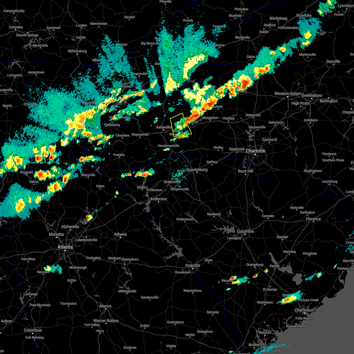 The severe thunderstorm warning for southwestern mcdowell, eastern buncombe and southeastern yancey counties will expire at 415 pm edt, the storm which prompted the warning has weakened below severe limits, and no longer poses an immediate threat to life or property. therefore the warning will be allowed to expire. The severe thunderstorm warning for southwestern mcdowell, eastern buncombe and southeastern yancey counties will expire at 415 pm edt, the storm which prompted the warning has weakened below severe limits, and no longer poses an immediate threat to life or property. therefore the warning will be allowed to expire.
|
| 9/5/2017 4:02 PM EDT |
 At 402 pm edt, a severe thunderstorm was located 13 miles east of downtown asheville, or near black mountain, moving east at 15 mph (radar indicated). Hazards include 60 mph wind gusts and quarter size hail. Minor hail damage to vehicles is expected. expect wind damage to trees and power lines. locations impacted include, black mountain, old fort, mount mitchell state park, b. r. parkway-craggy to little switzerland, montreat, busick, swannanoa, sugar hill and b. r. Parkway-east asheville to craggy gardens. At 402 pm edt, a severe thunderstorm was located 13 miles east of downtown asheville, or near black mountain, moving east at 15 mph (radar indicated). Hazards include 60 mph wind gusts and quarter size hail. Minor hail damage to vehicles is expected. expect wind damage to trees and power lines. locations impacted include, black mountain, old fort, mount mitchell state park, b. r. parkway-craggy to little switzerland, montreat, busick, swannanoa, sugar hill and b. r. Parkway-east asheville to craggy gardens.
|
| 9/5/2017 3:52 PM EDT |
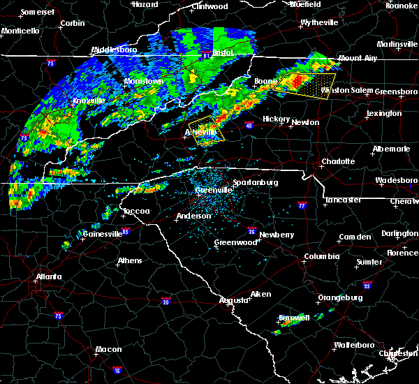 At 352 pm edt, a severe thunderstorm was located 10 miles east of downtown asheville, or near black mountain, moving east at 15 mph (radar indicated). Hazards include 60 mph wind gusts and quarter size hail. Minor hail damage to vehicles is expected. expect wind damage to trees and power lines. locations impacted include, black mountain, swannanoa, old fort, b. r. parkway-east asheville to craggy gardens, mount mitchell state park, b. r. Parkway-craggy to little switzerland, montreat, busick, sugar hill and fairview in buncombe county. At 352 pm edt, a severe thunderstorm was located 10 miles east of downtown asheville, or near black mountain, moving east at 15 mph (radar indicated). Hazards include 60 mph wind gusts and quarter size hail. Minor hail damage to vehicles is expected. expect wind damage to trees and power lines. locations impacted include, black mountain, swannanoa, old fort, b. r. parkway-east asheville to craggy gardens, mount mitchell state park, b. r. Parkway-craggy to little switzerland, montreat, busick, sugar hill and fairview in buncombe county.
|
| 9/5/2017 3:36 PM EDT |
 At 336 pm edt, a severe thunderstorm was located 5 miles east of downtown asheville, or over warren wilson college, moving east at 15 mph (radar indicated). Hazards include 60 mph wind gusts and quarter size hail. Minor hail damage to vehicles is expected. Expect wind damage to trees and power lines. At 336 pm edt, a severe thunderstorm was located 5 miles east of downtown asheville, or over warren wilson college, moving east at 15 mph (radar indicated). Hazards include 60 mph wind gusts and quarter size hail. Minor hail damage to vehicles is expected. Expect wind damage to trees and power lines.
|
| 9/1/2017 3:05 PM EDT |
 The severe thunderstorm warning for southeastern mecklenburg, western union and southeastern york counties will expire at 315 pm edt, the storm which prompted the warning has weakened below severe limits, and no longer poses an immediate threat to life or property. therefore the warning will be allowed to expire. a tornado watch remains in effect until 1000 pm edt for the piedmont of north carolina, and upstate south carolina. The severe thunderstorm warning for southeastern mecklenburg, western union and southeastern york counties will expire at 315 pm edt, the storm which prompted the warning has weakened below severe limits, and no longer poses an immediate threat to life or property. therefore the warning will be allowed to expire. a tornado watch remains in effect until 1000 pm edt for the piedmont of north carolina, and upstate south carolina.
|
| 9/1/2017 2:55 PM EDT |
 At 254 pm edt, a severe thunderstorm was located 13 miles east of rock hill, or near marvin, moving northeast at 45 mph (radar indicated). Hazards include 60 mph wind gusts and quarter size hail. Minor hail damage to vehicles is expected. expect wind damage to trees and power lines. locations impacted include, south charlotte, east charlotte, matthews, mint hill, indian trail, weddington, stallings, unionville, wesley chapel and waxhaw. A tornado watch remains in effect until 1000 pm edt for the piedmont of north carolina, and upstate south carolina. At 254 pm edt, a severe thunderstorm was located 13 miles east of rock hill, or near marvin, moving northeast at 45 mph (radar indicated). Hazards include 60 mph wind gusts and quarter size hail. Minor hail damage to vehicles is expected. expect wind damage to trees and power lines. locations impacted include, south charlotte, east charlotte, matthews, mint hill, indian trail, weddington, stallings, unionville, wesley chapel and waxhaw. A tornado watch remains in effect until 1000 pm edt for the piedmont of north carolina, and upstate south carolina.
|
| 9/1/2017 2:25 PM EDT |
 At 225 pm edt, a severe thunderstorm was located 10 miles east of chester, or near richburg, moving northeast at 45 mph (radar indicated). Hazards include 60 mph wind gusts and quarter size hail. Minor hail damage to vehicles is expected. Expect wind damage to trees and power lines. At 225 pm edt, a severe thunderstorm was located 10 miles east of chester, or near richburg, moving northeast at 45 mph (radar indicated). Hazards include 60 mph wind gusts and quarter size hail. Minor hail damage to vehicles is expected. Expect wind damage to trees and power lines.
|
| 8/23/2017 3:42 PM EDT |
 At 342 pm edt, a severe thunderstorm was located 11 miles south of uptown charlotte, or near pineville, moving east at 25 mph (radar indicated). Hazards include 60 mph wind gusts and penny size hail. expect damage to trees and power lines At 342 pm edt, a severe thunderstorm was located 11 miles south of uptown charlotte, or near pineville, moving east at 25 mph (radar indicated). Hazards include 60 mph wind gusts and penny size hail. expect damage to trees and power lines
|
| 7/28/2017 5:59 PM EDT |
 At 556 pm edt, a severe thunderstorm was located 9 miles southeast of sturdivants, or 11 miles southwest of wadesboro, moving east at 20 mph (radar indicated). Hazards include 60 mph wind gusts. Expect damage to trees and crops. Locations impacted include, albemarle, wadesboro, badin lake, ansonville, plyler, midland, polkton, locust, norwood and badin. At 556 pm edt, a severe thunderstorm was located 9 miles southeast of sturdivants, or 11 miles southwest of wadesboro, moving east at 20 mph (radar indicated). Hazards include 60 mph wind gusts. Expect damage to trees and crops. Locations impacted include, albemarle, wadesboro, badin lake, ansonville, plyler, midland, polkton, locust, norwood and badin.
|
| 7/28/2017 5:54 PM EDT |
 The severe thunderstorm warning for eastern cabarrus and eastern union counties will expire at 600 pm edt, the storms which prompted the warning have moved out of the area. therefore the warning will be allowed to expire. however gusty winds are still possible with these thunderstorms. The severe thunderstorm warning for eastern cabarrus and eastern union counties will expire at 600 pm edt, the storms which prompted the warning have moved out of the area. therefore the warning will be allowed to expire. however gusty winds are still possible with these thunderstorms.
|
| 7/28/2017 5:44 PM EDT |
 At 543 pm edt, severe thunderstorms were located along a line extending from 12 miles northwest of albemarle to 15 miles northeast of monroe to 16 miles southwest of wadesboro, moving east at 40 mph (radar indicated). Hazards include 60 mph wind gusts. Expect damage to trees and power lines. Locations impacted include, wingate, marshville, mt pleasant, midland, sturdivants, trinity, new salem, unionville, fairview in union county and monroe. At 543 pm edt, severe thunderstorms were located along a line extending from 12 miles northwest of albemarle to 15 miles northeast of monroe to 16 miles southwest of wadesboro, moving east at 40 mph (radar indicated). Hazards include 60 mph wind gusts. Expect damage to trees and power lines. Locations impacted include, wingate, marshville, mt pleasant, midland, sturdivants, trinity, new salem, unionville, fairview in union county and monroe.
|
| 7/28/2017 5:30 PM EDT |
 At 530 pm edt, severe thunderstorms were located along a line extending from 9 miles northeast of downtown concord to 10 miles northeast of monroe to 19 miles southwest of wadesboro, moving east at 45 mph (radar indicated). Hazards include 60 mph wind gusts. expect damage to trees and power lines At 530 pm edt, severe thunderstorms were located along a line extending from 9 miles northeast of downtown concord to 10 miles northeast of monroe to 19 miles southwest of wadesboro, moving east at 45 mph (radar indicated). Hazards include 60 mph wind gusts. expect damage to trees and power lines
|
| 7/28/2017 5:26 PM EDT |
 At 524 pm edt, a line of severe thunderstorms were located from near monroe to concord, moving moving northeast at 25 mph (radar indicated). Hazards include 60 mph wind gusts. expect damage to trees and crops At 524 pm edt, a line of severe thunderstorms were located from near monroe to concord, moving moving northeast at 25 mph (radar indicated). Hazards include 60 mph wind gusts. expect damage to trees and crops
|
| 7/28/2017 5:01 PM EDT |
 At 501 pm edt, severe thunderstorms were located along a line extending from 6 miles northeast of huntersville to 4 miles southeast of uptown charlotte to 11 miles northeast of lancaster, moving east at 30 mph (radar indicated). Hazards include 70 mph wind gusts. Expect considerable tree damage. damage is likely to mobile homes, roofs, and outbuildings. Locations impacted include, uptown charlotte, huntersville, kannapolis, downtown concord, monroe, central charlotte, south charlotte, northeast charlotte, southwest charlotte and east charlotte. At 501 pm edt, severe thunderstorms were located along a line extending from 6 miles northeast of huntersville to 4 miles southeast of uptown charlotte to 11 miles northeast of lancaster, moving east at 30 mph (radar indicated). Hazards include 70 mph wind gusts. Expect considerable tree damage. damage is likely to mobile homes, roofs, and outbuildings. Locations impacted include, uptown charlotte, huntersville, kannapolis, downtown concord, monroe, central charlotte, south charlotte, northeast charlotte, southwest charlotte and east charlotte.
|
| 7/28/2017 4:47 PM EDT |
 At 447 pm edt, severe thunderstorms were located along a line extending from 5 miles northwest of huntersville to 3 miles southwest of uptown charlotte to 6 miles northeast of lancaster, moving east at 30 mph (radar indicated). Hazards include 70 mph wind gusts. Expect considerable tree damage. damage is likely to mobile homes, roofs, and outbuildings. Locations impacted include, rock hill, uptown charlotte, huntersville, kannapolis, downtown concord, monroe, central charlotte, south charlotte, northeast charlotte and southwest charlotte. At 447 pm edt, severe thunderstorms were located along a line extending from 5 miles northwest of huntersville to 3 miles southwest of uptown charlotte to 6 miles northeast of lancaster, moving east at 30 mph (radar indicated). Hazards include 70 mph wind gusts. Expect considerable tree damage. damage is likely to mobile homes, roofs, and outbuildings. Locations impacted include, rock hill, uptown charlotte, huntersville, kannapolis, downtown concord, monroe, central charlotte, south charlotte, northeast charlotte and southwest charlotte.
|
| 7/28/2017 4:22 PM EDT |
 At 422 pm edt, severe thunderstorms were located along a line extending from 10 miles northeast of lincolnton to 9 miles southeast of gastonia to 8 miles south of rock hill, moving east at 30 mph (radar indicated). Hazards include 60 mph wind gusts. expect damage to trees and power lines At 422 pm edt, severe thunderstorms were located along a line extending from 10 miles northeast of lincolnton to 9 miles southeast of gastonia to 8 miles south of rock hill, moving east at 30 mph (radar indicated). Hazards include 60 mph wind gusts. expect damage to trees and power lines
|
| 7/23/2017 4:52 PM EDT |
 At 451 pm edt, a severe thunderstorm was located 10 miles northwest of monroe, or near hemby bridge, moving east at 15 mph (radar indicated). Hazards include 60 mph wind gusts and quarter size hail. Minor hail damage to vehicles is expected. expect wind damage to trees and power lines. Locations impacted include, monroe, unionville, wesley chapel, lake park, hemby bridge, fairview in union county, indian trail, wingate, stallings and weddington. At 451 pm edt, a severe thunderstorm was located 10 miles northwest of monroe, or near hemby bridge, moving east at 15 mph (radar indicated). Hazards include 60 mph wind gusts and quarter size hail. Minor hail damage to vehicles is expected. expect wind damage to trees and power lines. Locations impacted include, monroe, unionville, wesley chapel, lake park, hemby bridge, fairview in union county, indian trail, wingate, stallings and weddington.
|
| 7/23/2017 4:31 PM EDT |
 At 431 pm edt, a severe thunderstorm was located 8 miles southeast of uptown charlotte, or near matthews, moving east at 15 mph (radar indicated). Hazards include 60 mph wind gusts and quarter size hail. Minor hail damage to vehicles is expected. Expect wind damage to trees and power lines. At 431 pm edt, a severe thunderstorm was located 8 miles southeast of uptown charlotte, or near matthews, moving east at 15 mph (radar indicated). Hazards include 60 mph wind gusts and quarter size hail. Minor hail damage to vehicles is expected. Expect wind damage to trees and power lines.
|
| 7/23/2017 4:14 PM EDT |
 At 414 pm edt, a severe thunderstorm was located 8 miles southeast of uptown charlotte, or near matthews, moving east at 15 mph (radar indicated). Hazards include 60 mph wind gusts and quarter size hail. Minor hail damage to vehicles is expected. expect wind damage to trees and power lines. Locations impacted include, uptown charlotte, central charlotte, south charlotte, southwest charlotte, east charlotte, matthews, mint hill, indian trail, weddington and stallings. At 414 pm edt, a severe thunderstorm was located 8 miles southeast of uptown charlotte, or near matthews, moving east at 15 mph (radar indicated). Hazards include 60 mph wind gusts and quarter size hail. Minor hail damage to vehicles is expected. expect wind damage to trees and power lines. Locations impacted include, uptown charlotte, central charlotte, south charlotte, southwest charlotte, east charlotte, matthews, mint hill, indian trail, weddington and stallings.
|
| 7/23/2017 3:45 PM EDT |
 At 345 pm edt, a severe thunderstorm was located 4 miles south of uptown charlotte, or near freedom park, moving east at 15 mph (radar indicated). Hazards include 60 mph wind gusts and quarter size hail. Minor hail damage to vehicles is expected. Expect wind damage to trees and power lines. At 345 pm edt, a severe thunderstorm was located 4 miles south of uptown charlotte, or near freedom park, moving east at 15 mph (radar indicated). Hazards include 60 mph wind gusts and quarter size hail. Minor hail damage to vehicles is expected. Expect wind damage to trees and power lines.
|
| 7/23/2017 1:42 PM EDT |
 At 142 pm edt, a severe thunderstorm was located 7 miles north of hendersonville, or near fletcher, moving southeast at 15 mph (radar indicated). Hazards include 60 mph wind gusts and quarter size hail. Minor hail damage to vehicles is expected. Expect wind damage to trees and power lines. At 142 pm edt, a severe thunderstorm was located 7 miles north of hendersonville, or near fletcher, moving southeast at 15 mph (radar indicated). Hazards include 60 mph wind gusts and quarter size hail. Minor hail damage to vehicles is expected. Expect wind damage to trees and power lines.
|
| 7/18/2017 8:43 PM EDT |
 The severe thunderstorm warning for southwestern cabarrus. southeastern mecklenburg and north central union counties will expire at 845 pm edt. the storm which prompted the warning has weakened below severe limits, and no longer poses an immediate threat to life or property. Therefore the warning will be allowed to expire. The severe thunderstorm warning for southwestern cabarrus. southeastern mecklenburg and north central union counties will expire at 845 pm edt. the storm which prompted the warning has weakened below severe limits, and no longer poses an immediate threat to life or property. Therefore the warning will be allowed to expire.
|
| 7/18/2017 8:07 PM EDT |
 At 806 pm edt, a severe thunderstorm was located 11 miles south of downtown concord, or 5 miles northeast of mint hill, moving south at 15 mph (radar indicated). Hazards include 60 mph wind gusts and quarter size hail. Minor hail damage to vehicles is expected. Expect wind damage to trees and power lines. At 806 pm edt, a severe thunderstorm was located 11 miles south of downtown concord, or 5 miles northeast of mint hill, moving south at 15 mph (radar indicated). Hazards include 60 mph wind gusts and quarter size hail. Minor hail damage to vehicles is expected. Expect wind damage to trees and power lines.
|
| 7/18/2017 7:43 PM EDT |
 At 742 pm edt, severe thunderstorms were located along a line extending from near biscoe to 9 miles south of plyler, moving south at 10 mph (radar indicated). Hazards include 60 mph wind gusts. Expect damage to roofs, siding, and trees. Locations impacted include, albemarle, troy, biscoe, locust, norwood, oakboro, stanfield, mount gilead, star and candor. At 742 pm edt, severe thunderstorms were located along a line extending from near biscoe to 9 miles south of plyler, moving south at 10 mph (radar indicated). Hazards include 60 mph wind gusts. Expect damage to roofs, siding, and trees. Locations impacted include, albemarle, troy, biscoe, locust, norwood, oakboro, stanfield, mount gilead, star and candor.
|
| 7/18/2017 7:11 PM EDT |
 At 711 pm edt, severe thunderstorms were located along a line extending from near troy to albemarle, moving south at 20 mph (radar indicated). Hazards include 60 mph wind gusts. Expect damage to roofs, siding, and trees. Locations impacted include, albemarle, troy, badin lake, biscoe, plyler, locust, norwood, badin, oakboro and stanfield. At 711 pm edt, severe thunderstorms were located along a line extending from near troy to albemarle, moving south at 20 mph (radar indicated). Hazards include 60 mph wind gusts. Expect damage to roofs, siding, and trees. Locations impacted include, albemarle, troy, badin lake, biscoe, plyler, locust, norwood, badin, oakboro and stanfield.
|
| 7/18/2017 6:48 PM EDT |
 At 648 pm edt, severe thunderstorms were located along a line extending from 9 miles north of troy to near mt pleasant, moving south at 10 mph (radar indicated). Hazards include 60 mph wind gusts. expect damage to roofs, siding, and trees At 648 pm edt, severe thunderstorms were located along a line extending from 9 miles north of troy to near mt pleasant, moving south at 10 mph (radar indicated). Hazards include 60 mph wind gusts. expect damage to roofs, siding, and trees
|
| 7/18/2017 4:36 PM EDT |
 The severe thunderstorm warning for southeastern buncombe county will expire at 445 pm edt, the severe thunderstorm which prompted the warning has weakened. therefore, the warning will be allowed to expire. however heavy rain is still possible with this thunderstorm. if you observed large hail or wind damage, please report it to the national weather service greenville-spartanburg by calling toll free, 1, 800, 2 6 7, 8 1 0 1, or by posting on our facebook page, or tweet it using hashtag nwsgsp. your message should describe the event and the specific location where it occurred. The severe thunderstorm warning for southeastern buncombe county will expire at 445 pm edt, the severe thunderstorm which prompted the warning has weakened. therefore, the warning will be allowed to expire. however heavy rain is still possible with this thunderstorm. if you observed large hail or wind damage, please report it to the national weather service greenville-spartanburg by calling toll free, 1, 800, 2 6 7, 8 1 0 1, or by posting on our facebook page, or tweet it using hashtag nwsgsp. your message should describe the event and the specific location where it occurred.
|
| 7/18/2017 4:30 PM EDT |
 At 429 pm edt, a severe thunderstorm was located 10 miles east of downtown asheville, or near swannanoa, moving southwest at 10 mph (radar indicated). Hazards include 60 mph wind gusts and quarter size hail. Minor hail damage to vehicles is expected. expect wind damage to trees and power lines. locations impacted include, downtown asheville, east asheville, black mountain, swannanoa, fairview in buncombe county, b. r. parkway-nc arboretum to east asheville, warren wilson college, biltmore forest, west asheville and b. r. Parkway-east asheville to craggy gardens. At 429 pm edt, a severe thunderstorm was located 10 miles east of downtown asheville, or near swannanoa, moving southwest at 10 mph (radar indicated). Hazards include 60 mph wind gusts and quarter size hail. Minor hail damage to vehicles is expected. expect wind damage to trees and power lines. locations impacted include, downtown asheville, east asheville, black mountain, swannanoa, fairview in buncombe county, b. r. parkway-nc arboretum to east asheville, warren wilson college, biltmore forest, west asheville and b. r. Parkway-east asheville to craggy gardens.
|
| 7/18/2017 4:03 PM EDT |
 At 403 pm edt, a severe thunderstorm was located 12 miles east of downtown asheville, or over black mountain, moving west at 10 mph (radar indicated). Hazards include 60 mph wind gusts and quarter size hail. Minor hail damage to vehicles is expected. Expect wind damage to trees and power lines. At 403 pm edt, a severe thunderstorm was located 12 miles east of downtown asheville, or over black mountain, moving west at 10 mph (radar indicated). Hazards include 60 mph wind gusts and quarter size hail. Minor hail damage to vehicles is expected. Expect wind damage to trees and power lines.
|
| 7/15/2017 4:07 PM EDT |
 At 407 pm edt, a severe thunderstorm was located 9 miles northeast of monroe, or near unionville, moving east at 15 mph (radar indicated). Hazards include 60 mph wind gusts and quarter size hail. Minor hail damage to vehicles is expected. expect wind damage to trees and power lines. Locations impacted include, unionville, lake park, hemby bridge, fairview in union county, new salem, wingate, monroe, stallings and indian trail. At 407 pm edt, a severe thunderstorm was located 9 miles northeast of monroe, or near unionville, moving east at 15 mph (radar indicated). Hazards include 60 mph wind gusts and quarter size hail. Minor hail damage to vehicles is expected. expect wind damage to trees and power lines. Locations impacted include, unionville, lake park, hemby bridge, fairview in union county, new salem, wingate, monroe, stallings and indian trail.
|
| 7/15/2017 3:43 PM EDT |
 At 343 pm edt, a severe thunderstorm was located 8 miles north of monroe, or near hemby bridge, moving east at 15 mph (radar indicated). Hazards include 60 mph wind gusts and quarter size hail. Minor hail damage to vehicles is expected. Expect wind damage to trees and power lines. At 343 pm edt, a severe thunderstorm was located 8 miles north of monroe, or near hemby bridge, moving east at 15 mph (radar indicated). Hazards include 60 mph wind gusts and quarter size hail. Minor hail damage to vehicles is expected. Expect wind damage to trees and power lines.
|
| 7/14/2017 4:38 PM EDT |
 At 437 pm edt, a severe thunderstorm was located 8 miles southeast of downtown asheville, or over fairview in buncombe county, moving east at 10 mph. another storm between bent creek and avery creek could become severe at any time (radar indicated). Hazards include 60 mph wind gusts and quarter size hail. Minor hail damage to vehicles is expected. expect wind damage to trees and power lines. locations impacted include, arden, black mountain, swannanoa, fairview in buncombe county, biltmore forest, bent creek, b. r. Parkway-nc arboretum to east asheville, skyland, warren wilson college and avery creek. At 437 pm edt, a severe thunderstorm was located 8 miles southeast of downtown asheville, or over fairview in buncombe county, moving east at 10 mph. another storm between bent creek and avery creek could become severe at any time (radar indicated). Hazards include 60 mph wind gusts and quarter size hail. Minor hail damage to vehicles is expected. expect wind damage to trees and power lines. locations impacted include, arden, black mountain, swannanoa, fairview in buncombe county, biltmore forest, bent creek, b. r. Parkway-nc arboretum to east asheville, skyland, warren wilson college and avery creek.
|
| 7/14/2017 4:25 PM EDT |
 At 425 pm edt, a severe thunderstorm was located 7 miles southeast of downtown asheville, or near fairview in buncombe county, moving east at 10 mph (radar indicated). Hazards include 60 mph wind gusts and quarter size hail. Minor hail damage to vehicles is expected. Expect wind damage to trees and power lines. At 425 pm edt, a severe thunderstorm was located 7 miles southeast of downtown asheville, or near fairview in buncombe county, moving east at 10 mph (radar indicated). Hazards include 60 mph wind gusts and quarter size hail. Minor hail damage to vehicles is expected. Expect wind damage to trees and power lines.
|
| 7/14/2017 4:06 PM EDT |
 At 406 pm edt, a severe thunderstorm was located 4 miles east of downtown asheville, or near warren wilson college, moving east at 10 mph (radar indicated). Hazards include 60 mph wind gusts and quarter size hail. Minor hail damage to vehicles is expected. expect wind damage to trees and power lines. locations impacted include, downtown asheville, east asheville, black mountain, swannanoa, fairview in buncombe county, biltmore forest, b. r. parkway-east asheville to craggy gardens, b. r. Parkway-nc arboretum to east asheville, warren wilson college and montreat. At 406 pm edt, a severe thunderstorm was located 4 miles east of downtown asheville, or near warren wilson college, moving east at 10 mph (radar indicated). Hazards include 60 mph wind gusts and quarter size hail. Minor hail damage to vehicles is expected. expect wind damage to trees and power lines. locations impacted include, downtown asheville, east asheville, black mountain, swannanoa, fairview in buncombe county, biltmore forest, b. r. parkway-east asheville to craggy gardens, b. r. Parkway-nc arboretum to east asheville, warren wilson college and montreat.
|
| 7/14/2017 3:49 PM EDT |
 At 349 pm edt, a severe thunderstorm was located 4 miles east of downtown asheville, or near warren wilson college, moving east at 15 mph (radar indicated). Hazards include 60 mph wind gusts and quarter size hail. Minor hail damage to vehicles is expected. Expect wind damage to trees and power lines. At 349 pm edt, a severe thunderstorm was located 4 miles east of downtown asheville, or near warren wilson college, moving east at 15 mph (radar indicated). Hazards include 60 mph wind gusts and quarter size hail. Minor hail damage to vehicles is expected. Expect wind damage to trees and power lines.
|
| 7/13/2017 5:38 PM EDT |
 At 537 pm edt, a severe thunderstorm was located 10 miles northeast of hendersonville, or 4 miles west of bat cave, moving southeast at 10 mph (radar indicated). Hazards include 60 mph wind gusts. Expect damage to trees and power lines. Locations impacted include, arden, fletcher, fairview in buncombe county, bat cave, asheville airport, skyland, avery creek, gerton and mills river. At 537 pm edt, a severe thunderstorm was located 10 miles northeast of hendersonville, or 4 miles west of bat cave, moving southeast at 10 mph (radar indicated). Hazards include 60 mph wind gusts. Expect damage to trees and power lines. Locations impacted include, arden, fletcher, fairview in buncombe county, bat cave, asheville airport, skyland, avery creek, gerton and mills river.
|
| 7/13/2017 5:17 PM EDT |
 At 517 pm edt, a severe thunderstorm was located 10 miles southeast of downtown asheville, or near fairview in buncombe county, moving east at 15 mph (radar indicated). Hazards include 60 mph wind gusts. expect damage to trees and power lines At 517 pm edt, a severe thunderstorm was located 10 miles southeast of downtown asheville, or near fairview in buncombe county, moving east at 15 mph (radar indicated). Hazards include 60 mph wind gusts. expect damage to trees and power lines
|
| 7/5/2017 6:21 PM EDT |
 At 620 pm edt, severe thunderstorms were located along a line extending from near plyler to near midland, moving east at 35 mph (radar indicated). Hazards include 60 mph wind gusts. expect damage to roofs, siding, and trees At 620 pm edt, severe thunderstorms were located along a line extending from near plyler to near midland, moving east at 35 mph (radar indicated). Hazards include 60 mph wind gusts. expect damage to roofs, siding, and trees
|
| 7/5/2017 6:18 PM EDT |
 At 617 pm edt, a severe thunderstorm was located 8 miles southeast of uptown charlotte, or near matthews, moving east at 30 mph (radar indicated). Hazards include 60 mph wind gusts and penny size hail. Expect damage to trees and power lines. Locations impacted include, uptown charlotte, central charlotte, south charlotte, southwest charlotte, east charlotte, matthews, mint hill, indian trail, weddington and stallings. At 617 pm edt, a severe thunderstorm was located 8 miles southeast of uptown charlotte, or near matthews, moving east at 30 mph (radar indicated). Hazards include 60 mph wind gusts and penny size hail. Expect damage to trees and power lines. Locations impacted include, uptown charlotte, central charlotte, south charlotte, southwest charlotte, east charlotte, matthews, mint hill, indian trail, weddington and stallings.
|
| 7/5/2017 5:56 PM EDT |
 At 556 pm edt, a severe thunderstorm was located 7 miles southwest of uptown charlotte, or near southwest charlotte, moving east at 30 mph (radar indicated). Hazards include 60 mph wind gusts and quarter size hail. Minor hail damage to vehicles is expected. Expect wind damage to trees and power lines. At 556 pm edt, a severe thunderstorm was located 7 miles southwest of uptown charlotte, or near southwest charlotte, moving east at 30 mph (radar indicated). Hazards include 60 mph wind gusts and quarter size hail. Minor hail damage to vehicles is expected. Expect wind damage to trees and power lines.
|
| 7/1/2017 6:46 PM EDT |
 At 646 pm edt, severe thunderstorms were located along a line extending from 4 miles north of monroe to 16 miles northeast of lancaster to 10 miles east of rock hill, moving southeast at 15 mph (radar indicated). Hazards include 60 mph wind gusts and nickel size hail. expect damage to trees and power lines At 646 pm edt, severe thunderstorms were located along a line extending from 4 miles north of monroe to 16 miles northeast of lancaster to 10 miles east of rock hill, moving southeast at 15 mph (radar indicated). Hazards include 60 mph wind gusts and nickel size hail. expect damage to trees and power lines
|
| 6/24/2017 2:17 AM EDT |
 At 217 am edt, severe thunderstorms were located along a line extending from near prospect hill to 11 miles south of graham to 8 miles east of albemarle, moving northeast at 60 mph (radar indicated). Hazards include 60 mph wind gusts. Expect damage to roofs, siding, and trees. Locations impacted include, burlington, asheboro, albemarle, graham, hillsborough, pittsboro, troy, carthage, siler city and north carolina zoo. At 217 am edt, severe thunderstorms were located along a line extending from near prospect hill to 11 miles south of graham to 8 miles east of albemarle, moving northeast at 60 mph (radar indicated). Hazards include 60 mph wind gusts. Expect damage to roofs, siding, and trees. Locations impacted include, burlington, asheboro, albemarle, graham, hillsborough, pittsboro, troy, carthage, siler city and north carolina zoo.
|
| 6/24/2017 2:03 AM EDT |
 At 202 am edt, severe thunderstorms were located along a line extending from 7 miles south of jericho to 9 miles northwest of siler city to 9 miles south of plyler, moving northeast at 60 mph (radar indicated). Hazards include 60 mph wind gusts. Expect damage to roofs, siding, and trees. Locations impacted include, burlington, asheboro, albemarle, graham, hillsborough, randleman, pittsboro, troy, carthage and siler city. At 202 am edt, severe thunderstorms were located along a line extending from 7 miles south of jericho to 9 miles northwest of siler city to 9 miles south of plyler, moving northeast at 60 mph (radar indicated). Hazards include 60 mph wind gusts. Expect damage to roofs, siding, and trees. Locations impacted include, burlington, asheboro, albemarle, graham, hillsborough, randleman, pittsboro, troy, carthage and siler city.
|
| 6/24/2017 1:46 AM EDT |
 At 146 am edt, severe thunderstorms were located along a line extending from near mcleansville to near asheboro to 9 miles south of plyler, moving northeast at 60 mph (radar indicated). Hazards include 60 mph wind gusts. expect damage to roofs, siding, and trees At 146 am edt, severe thunderstorms were located along a line extending from near mcleansville to near asheboro to 9 miles south of plyler, moving northeast at 60 mph (radar indicated). Hazards include 60 mph wind gusts. expect damage to roofs, siding, and trees
|
| 6/13/2017 6:40 PM EDT |
 At 640 pm edt, a severe thunderstorm was located 11 miles southeast of uptown charlotte, or near south charlotte, moving southeast at 15 mph (radar indicated). Hazards include 60 mph wind gusts and quarter size hail. Minor hail damage to vehicles is expected. expect wind damage to trees and power lines. Locations impacted include, uptown charlotte, central charlotte, south charlotte, northeast charlotte, southwest charlotte, east charlotte, northwest charlotte, matthews, mint hill and indian trail. At 640 pm edt, a severe thunderstorm was located 11 miles southeast of uptown charlotte, or near south charlotte, moving southeast at 15 mph (radar indicated). Hazards include 60 mph wind gusts and quarter size hail. Minor hail damage to vehicles is expected. expect wind damage to trees and power lines. Locations impacted include, uptown charlotte, central charlotte, south charlotte, northeast charlotte, southwest charlotte, east charlotte, northwest charlotte, matthews, mint hill and indian trail.
|
| 6/13/2017 6:17 PM EDT |
 At 616 pm edt, a severe thunderstorm was located near uptown charlotte, or near northwest charlotte, moving east at 10 mph. other severe storms were developing over southern mecklenburg county to the west of matthews and west of mint hill (radar indicated). Hazards include 60 mph wind gusts and quarter size hail. Minor hail damage to vehicles is expected. Expect wind damage to trees and power lines. At 616 pm edt, a severe thunderstorm was located near uptown charlotte, or near northwest charlotte, moving east at 10 mph. other severe storms were developing over southern mecklenburg county to the west of matthews and west of mint hill (radar indicated). Hazards include 60 mph wind gusts and quarter size hail. Minor hail damage to vehicles is expected. Expect wind damage to trees and power lines.
|
| 5/31/2017 5:48 PM EDT |
 At 548 pm edt, severe thunderstorms were located along a line extending from 12 miles south of downtown concord to 9 miles southeast of uptown charlotte, moving southeast at 25 mph (radar indicated). Hazards include 60 mph wind gusts. Expect damage to trees and power lines. Locations impacted include, east charlotte, matthews, mint hill, freedom park, midland, reedy creek park, southpark mall, the plaza, harrisburg and south charlotte. At 548 pm edt, severe thunderstorms were located along a line extending from 12 miles south of downtown concord to 9 miles southeast of uptown charlotte, moving southeast at 25 mph (radar indicated). Hazards include 60 mph wind gusts. Expect damage to trees and power lines. Locations impacted include, east charlotte, matthews, mint hill, freedom park, midland, reedy creek park, southpark mall, the plaza, harrisburg and south charlotte.
|
| 5/31/2017 5:42 PM EDT |
 At 542 pm edt, severe thunderstorms were located along a line extending from 11 miles south of downtown concord to 8 miles southeast of uptown charlotte, moving southeast at 15 mph (radar indicated). Hazards include 60 mph wind gusts. expect damage to trees and power lines At 542 pm edt, severe thunderstorms were located along a line extending from 11 miles south of downtown concord to 8 miles southeast of uptown charlotte, moving southeast at 15 mph (radar indicated). Hazards include 60 mph wind gusts. expect damage to trees and power lines
|
| 5/31/2017 5:21 PM EDT |
 At 521 pm edt, severe thunderstorms were located along a line extending from 7 miles south of downtown concord to 3 miles west of uptown charlotte, moving southeast at 20 mph (radar indicated). Hazards include 60 mph wind gusts. expect damage to trees and power lines At 521 pm edt, severe thunderstorms were located along a line extending from 7 miles south of downtown concord to 3 miles west of uptown charlotte, moving southeast at 20 mph (radar indicated). Hazards include 60 mph wind gusts. expect damage to trees and power lines
|
| 5/28/2017 12:18 AM EDT |
 At 1217 am edt, severe thunderstorms were located along a line extending from 4 miles northwest of downtown asheville to 6 miles northeast of brevard to 17 miles northwest of pickens, moving southeast at 45 mph (radar indicated). Hazards include 60 mph wind gusts and penny size hail. expect damage to trees and power lines At 1217 am edt, severe thunderstorms were located along a line extending from 4 miles northwest of downtown asheville to 6 miles northeast of brevard to 17 miles northwest of pickens, moving southeast at 45 mph (radar indicated). Hazards include 60 mph wind gusts and penny size hail. expect damage to trees and power lines
|
| 5/5/2017 2:08 AM EDT |
 At 207 am edt, a severe thunderstorm was located 10 miles southeast of midland, or 15 miles southwest of albemarle, moving northeast at 45 mph (radar indicated). Hazards include 60 mph wind gusts. expect damage to roofs, siding, and trees At 207 am edt, a severe thunderstorm was located 10 miles southeast of midland, or 15 miles southwest of albemarle, moving northeast at 45 mph (radar indicated). Hazards include 60 mph wind gusts. expect damage to roofs, siding, and trees
|
| 4/3/2017 5:08 PM EDT |
 The severe thunderstorm warning for union county will expire at 515 pm edt, the storm which prompted the warning has moved out of the area. therefore the warning will be allowed to expire. a tornado watch remains in effect until 900 pm edt for the piedmont of north carolina. The severe thunderstorm warning for union county will expire at 515 pm edt, the storm which prompted the warning has moved out of the area. therefore the warning will be allowed to expire. a tornado watch remains in effect until 900 pm edt for the piedmont of north carolina.
|
| 4/3/2017 4:45 PM EDT |
 At 444 pm edt, a severe thunderstorm was located 12 miles southwest of albemarle, or 7 miles northeast of midland, moving northeast at 60 mph (radar indicated). Hazards include 60 mph wind gusts and penny size hail. Expect damage to trees and minor damage to roofs and siding. locations impacted include, monroe, unionville, wingate, marshville, fairview in union county, sturdivants, trinity and new salem. A tornado watch remains in effect until 900 pm edt for the piedmont of north carolina. At 444 pm edt, a severe thunderstorm was located 12 miles southwest of albemarle, or 7 miles northeast of midland, moving northeast at 60 mph (radar indicated). Hazards include 60 mph wind gusts and penny size hail. Expect damage to trees and minor damage to roofs and siding. locations impacted include, monroe, unionville, wingate, marshville, fairview in union county, sturdivants, trinity and new salem. A tornado watch remains in effect until 900 pm edt for the piedmont of north carolina.
|
| 4/3/2017 4:24 PM EDT |
 At 423 pm edt, a severe thunderstorm was located 11 miles southeast of uptown charlotte, or near matthews, moving northeast at 60 mph (radar indicated). Hazards include 60 mph wind gusts and penny size hail. expect damage to trees and minor damage to roofs and siding At 423 pm edt, a severe thunderstorm was located 11 miles southeast of uptown charlotte, or near matthews, moving northeast at 60 mph (radar indicated). Hazards include 60 mph wind gusts and penny size hail. expect damage to trees and minor damage to roofs and siding
|
| 4/3/2017 4:05 PM EDT |
 At 405 pm edt, severe thunderstorms were located along a line extending from 7 miles southwest of uptown charlotte to 5 miles northeast of rock hill, moving northeast at 55 mph (radar indicated). Hazards include 60 mph wind gusts. expect damage to trees and minor damage to roofs and siding At 405 pm edt, severe thunderstorms were located along a line extending from 7 miles southwest of uptown charlotte to 5 miles northeast of rock hill, moving northeast at 55 mph (radar indicated). Hazards include 60 mph wind gusts. expect damage to trees and minor damage to roofs and siding
|
| 4/3/2017 4:05 PM EDT |
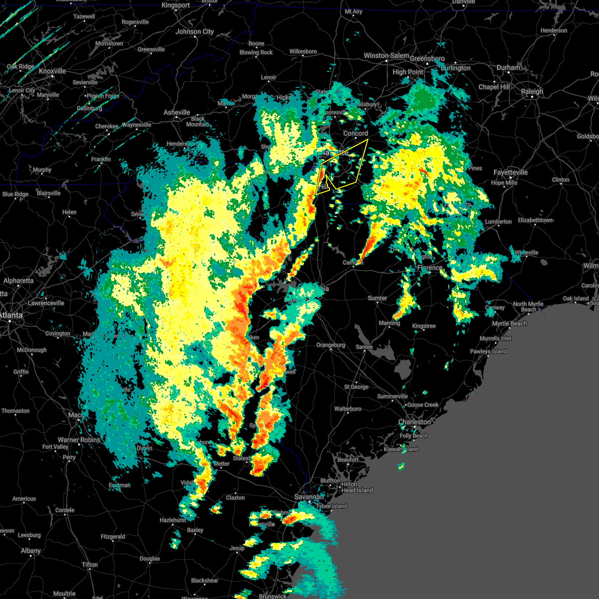 At 405 pm edt, severe thunderstorms were located along a line extending from 7 miles southwest of uptown charlotte to 5 miles northeast of rock hill, moving northeast at 55 mph (radar indicated). Hazards include 60 mph wind gusts. expect damage to trees and minor damage to roofs and siding At 405 pm edt, severe thunderstorms were located along a line extending from 7 miles southwest of uptown charlotte to 5 miles northeast of rock hill, moving northeast at 55 mph (radar indicated). Hazards include 60 mph wind gusts. expect damage to trees and minor damage to roofs and siding
|
| 3/21/2017 10:32 PM EDT |
 At 1030 pm edt, an outflow of severe winds from the decaying thunderstorms stretched along a line extending from 12 miles southwest of downtown asheville to 7 miles east of brevard to 16 miles southwest of hendersonville. the leading edge of these winds were moving east at 35 mph. 40 to 60 mph winds will remain possible behind the passing outflow through 1045 pm (radar indicated). Hazards include 60 mph wind gusts. Expect damage to siding and trees. Locations impacted include, hendersonville, brevard, arden, mills river, fletcher, flat rock, etowah, mountain home, laurel park and rosman. At 1030 pm edt, an outflow of severe winds from the decaying thunderstorms stretched along a line extending from 12 miles southwest of downtown asheville to 7 miles east of brevard to 16 miles southwest of hendersonville. the leading edge of these winds were moving east at 35 mph. 40 to 60 mph winds will remain possible behind the passing outflow through 1045 pm (radar indicated). Hazards include 60 mph wind gusts. Expect damage to siding and trees. Locations impacted include, hendersonville, brevard, arden, mills river, fletcher, flat rock, etowah, mountain home, laurel park and rosman.
|
| 3/21/2017 9:59 PM EDT |
 At 958 pm edt, outflows from severe thunderstorms were located along a line extending from 8 miles southeast of waynesville to 8 miles west of brevard to 17 miles northwest of pickens, moving east at 55 mph (radar indicated). Hazards include 60 mph wind gusts. Expect damage to roofs. Siding and trees. At 958 pm edt, outflows from severe thunderstorms were located along a line extending from 8 miles southeast of waynesville to 8 miles west of brevard to 17 miles northwest of pickens, moving east at 55 mph (radar indicated). Hazards include 60 mph wind gusts. Expect damage to roofs. Siding and trees.
|
| 3/1/2017 8:54 PM EST |
 The severe thunderstorm warning for union and chester counties will expire at 900 pm est, the storms which prompted the warning have weakened below severe limits, and have exited the warned area. therefore the warning will be allowed to expire. if you observed large hail or wind damage, please report it to the national weather service greenville-spartanburg by calling toll free, 1, 800, 2 6 7, 8 1 0 1, or by posting on our facebook page, or tweet it using hashtag nwsgsp. your message should describe the event and the specific location where it occurred. The severe thunderstorm warning for union and chester counties will expire at 900 pm est, the storms which prompted the warning have weakened below severe limits, and have exited the warned area. therefore the warning will be allowed to expire. if you observed large hail or wind damage, please report it to the national weather service greenville-spartanburg by calling toll free, 1, 800, 2 6 7, 8 1 0 1, or by posting on our facebook page, or tweet it using hashtag nwsgsp. your message should describe the event and the specific location where it occurred.
|
| 3/1/2017 8:36 PM EST |
 At 834 pm est, severe thunderstorms were located along a line extending from 9 miles southwest of albemarle north carolina, to 11 miles southwest of monroe, to 11 miles north of winnsboro south carolina, moving east at 65 mph (indicated by radar. some of these storms also have a history of producing damaging winds). Hazards include 60 mph wind gusts and penny size hail. Expect damage to roofs. siding and trees. Locations impacted include, monroe, chester, indian trail, weddington, stallings, unionville, wesley chapel, wingate, waxhaw and marshville. At 834 pm est, severe thunderstorms were located along a line extending from 9 miles southwest of albemarle north carolina, to 11 miles southwest of monroe, to 11 miles north of winnsboro south carolina, moving east at 65 mph (indicated by radar. some of these storms also have a history of producing damaging winds). Hazards include 60 mph wind gusts and penny size hail. Expect damage to roofs. siding and trees. Locations impacted include, monroe, chester, indian trail, weddington, stallings, unionville, wesley chapel, wingate, waxhaw and marshville.
|
| 3/1/2017 8:21 PM EST |
 At 820 pm est, severe thunderstorms were located along a line extending from 9 miles east of uptown charlotte to 3 miles south of rock hill to 16 miles southwest of chester, moving east at 60 mph. several of these storms have already produced damaging winds and large hail (indicated by radar and public reports). Hazards include 60 mph wind gusts and quarter size hail. Hail damage to vehicles is expected. expect wind damage to roofs, siding and trees. Locations impacted include, rock hill, uptown charlotte, monroe, chester, central charlotte, south charlotte, southwest charlotte, east charlotte, matthews and mint hill. At 820 pm est, severe thunderstorms were located along a line extending from 9 miles east of uptown charlotte to 3 miles south of rock hill to 16 miles southwest of chester, moving east at 60 mph. several of these storms have already produced damaging winds and large hail (indicated by radar and public reports). Hazards include 60 mph wind gusts and quarter size hail. Hail damage to vehicles is expected. expect wind damage to roofs, siding and trees. Locations impacted include, rock hill, uptown charlotte, monroe, chester, central charlotte, south charlotte, southwest charlotte, east charlotte, matthews and mint hill.
|
| 3/1/2017 7:45 PM EST |
 At 745 pm est, severe thunderstorms were located along a line extending from 11 miles northwest of york to 10 miles northeast of union to 18 miles northeast of newberry, moving east at 55 mph (radar indicated). Hazards include 60 mph wind gusts and quarter size hail. Hail damage to vehicles is expected. Expect wind damage to roofs, siding and trees. At 745 pm est, severe thunderstorms were located along a line extending from 11 miles northwest of york to 10 miles northeast of union to 18 miles northeast of newberry, moving east at 55 mph (radar indicated). Hazards include 60 mph wind gusts and quarter size hail. Hail damage to vehicles is expected. Expect wind damage to roofs, siding and trees.
|
| 3/1/2017 7:41 PM EST |
 At 740 pm est, a severe thunderstorm was located 11 miles east of uptown charlotte, or near mint hill, moving east at 60 mph (radar indicated). Hazards include quarter size hail. Damage to vehicles is expected. Locations impacted include, mint hill, midland, reedy creek park, fairview in union county, matthews, east charlotte, stallings and mt pleasant. At 740 pm est, a severe thunderstorm was located 11 miles east of uptown charlotte, or near mint hill, moving east at 60 mph (radar indicated). Hazards include quarter size hail. Damage to vehicles is expected. Locations impacted include, mint hill, midland, reedy creek park, fairview in union county, matthews, east charlotte, stallings and mt pleasant.
|
| 3/1/2017 7:27 PM EST |
 At 726 pm est, a severe thunderstorm was located 4 miles southwest of uptown charlotte, moving east at 60 mph (radar indicated wind. public report of hail). Hazards include 60 mph wind gusts and penny size hail. Expect damage to roofs. siding and trees. Locations impacted include, uptown charlotte, central charlotte, southwest charlotte, east charlotte, matthews, mint hill, freedom park, reedy creek park, the plaza and charlotte douglas airport. At 726 pm est, a severe thunderstorm was located 4 miles southwest of uptown charlotte, moving east at 60 mph (radar indicated wind. public report of hail). Hazards include 60 mph wind gusts and penny size hail. Expect damage to roofs. siding and trees. Locations impacted include, uptown charlotte, central charlotte, southwest charlotte, east charlotte, matthews, mint hill, freedom park, reedy creek park, the plaza and charlotte douglas airport.
|
| 3/1/2017 7:12 PM EST |
 At 712 pm est, a severe thunderstorm was located 9 miles south of gastonia, or 4 miles west of town of lake wylie, moving east at 55 mph (radar indicated). Hazards include 60 mph wind gusts and quarter size hail. Hail damage to vehicles is expected. Expect wind damage to roofs, siding and trees. At 712 pm est, a severe thunderstorm was located 9 miles south of gastonia, or 4 miles west of town of lake wylie, moving east at 55 mph (radar indicated). Hazards include 60 mph wind gusts and quarter size hail. Hail damage to vehicles is expected. Expect wind damage to roofs, siding and trees.
|
| 11/30/2016 7:25 PM EST |
 The severe thunderstorm warning for rowan, union, eastern cabarrus and davie counties will expire at 730 pm est, the storms which prompted the warning have moved out of the area. therefore the warning will be allowed to expire. The severe thunderstorm warning for rowan, union, eastern cabarrus and davie counties will expire at 730 pm est, the storms which prompted the warning have moved out of the area. therefore the warning will be allowed to expire.
|
| 11/30/2016 7:25 PM EST |
 At 724 pm est, severe thunderstorms were located along a line extending from near badin lake to near wadesboro to 9 miles east of kershaw, moving northeast at 60 mph (radar indicated). Hazards include 60 mph wind gusts. Expect damage to roofs. siding. and trees. Locations impacted include, albemarle, rockingham, wadesboro, troy, badin lake, hamlet, biscoe, ansonville andhoffman. At 724 pm est, severe thunderstorms were located along a line extending from near badin lake to near wadesboro to 9 miles east of kershaw, moving northeast at 60 mph (radar indicated). Hazards include 60 mph wind gusts. Expect damage to roofs. siding. and trees. Locations impacted include, albemarle, rockingham, wadesboro, troy, badin lake, hamlet, biscoe, ansonville andhoffman.
|
| 11/30/2016 7:11 PM EST |
 At 711 pm est, severe thunderstorms were located along a line extending from 9 miles northeast of mocksville to 9 miles southeast of monroe, moving northeast at 30 mph (radar indicated). Hazards include 60 mph wind gusts. Expect damage to roofs. siding and trees. Locations impacted include, monroe, salisbury, mocksville, unionville, wingate, spencer, marshville, granite quarry, rockwell and mt pleasant. At 711 pm est, severe thunderstorms were located along a line extending from 9 miles northeast of mocksville to 9 miles southeast of monroe, moving northeast at 30 mph (radar indicated). Hazards include 60 mph wind gusts. Expect damage to roofs. siding and trees. Locations impacted include, monroe, salisbury, mocksville, unionville, wingate, spencer, marshville, granite quarry, rockwell and mt pleasant.
|
| 11/30/2016 6:57 PM EST |
 The tornado warning for southeastern mecklenburg. northern union and central cabarrus counties will expire at 700 pm est. the storm which prompted the warning has weakened below severe limits. and no longer appears capable of producing a tornado. therefore the warning will be allowed to expire. However strong and gusty winds are still possible with this thunderstorm. The tornado warning for southeastern mecklenburg. northern union and central cabarrus counties will expire at 700 pm est. the storm which prompted the warning has weakened below severe limits. and no longer appears capable of producing a tornado. therefore the warning will be allowed to expire. However strong and gusty winds are still possible with this thunderstorm.
|
| 11/30/2016 6:56 PM EST |
 At 656 pm est, severe thunderstorms were located along a line extending from 5 miles northeast of mocksville to 12 miles south of monroe, moving northeast at 60 mph (radar indicated). Hazards include 60 mph wind gusts. Expect damage to roofs. Siding and trees. At 656 pm est, severe thunderstorms were located along a line extending from 5 miles northeast of mocksville to 12 miles south of monroe, moving northeast at 60 mph (radar indicated). Hazards include 60 mph wind gusts. Expect damage to roofs. Siding and trees.
|
| 11/30/2016 6:54 PM EST |
 At 650 pm est, severe thunderstorms were located along a line extending from just east of charlotte to 7 miles south of mineral springs to 12 miles south of great falls, moving northeast at 55 mph (radar indicated). Hazards include 60 mph wind gusts. Expect damage to roofs. siding. And trees. At 650 pm est, severe thunderstorms were located along a line extending from just east of charlotte to 7 miles south of mineral springs to 12 miles south of great falls, moving northeast at 55 mph (radar indicated). Hazards include 60 mph wind gusts. Expect damage to roofs. siding. And trees.
|
| 11/30/2016 6:46 PM EST |
 At 646 pm est, a severe thunderstorm capable of producing a tornado was located 6 miles east of uptown charlotte, or near east charlotte, moving northeast at 45 mph (radar indicated rotation). Hazards include tornado. Flying debris will be dangerous to those caught without shelter. mobile homes will be damaged or destroyed. damage to roofs, windows and vehicles will occur. tree damage is likely. This dangerous storm will be near, downtown concord, midland, harrisburg and mt pleasant around 700 pm est. At 646 pm est, a severe thunderstorm capable of producing a tornado was located 6 miles east of uptown charlotte, or near east charlotte, moving northeast at 45 mph (radar indicated rotation). Hazards include tornado. Flying debris will be dangerous to those caught without shelter. mobile homes will be damaged or destroyed. damage to roofs, windows and vehicles will occur. tree damage is likely. This dangerous storm will be near, downtown concord, midland, harrisburg and mt pleasant around 700 pm est.
|
| 11/30/2016 6:40 PM EST |
 At 639 pm est, severe thunderstorms were located along a line extending from 9 miles southeast of yadkinville to 7 miles southeast of statesville to 10 miles north of huntersville to 10 miles southeast of uptown charlotte to 13 miles south of lancaster, moving east at 25 mph (radar indicated). Hazards include 60 mph wind gusts. Expect damage to roofs. siding and trees. Locations impacted include, uptown charlotte, huntersville, kannapolis, downtown concord, monroe, salisbury, statesville, mocksville, central charlotte and south charlotte. At 639 pm est, severe thunderstorms were located along a line extending from 9 miles southeast of yadkinville to 7 miles southeast of statesville to 10 miles north of huntersville to 10 miles southeast of uptown charlotte to 13 miles south of lancaster, moving east at 25 mph (radar indicated). Hazards include 60 mph wind gusts. Expect damage to roofs. siding and trees. Locations impacted include, uptown charlotte, huntersville, kannapolis, downtown concord, monroe, salisbury, statesville, mocksville, central charlotte and south charlotte.
|
| 11/30/2016 6:35 PM EST |
 At 635 pm est, a severe thunderstorm capable of producing a tornado was located 5 miles south of uptown charlotte, or over southpark mall, moving east at 50 mph (radar indicated rotation). Hazards include tornado. Flying debris will be dangerous to those caught without shelter. mobile homes will be damaged or destroyed. damage to roofs, windows and vehicles will occur. tree damage is likely. this dangerous storm will be near, matthews and east charlotte around 640 pm est. mint hill, stallings, hemby bridge, indian trail and fairview in union county around 650 pm est. Midland and mt pleasant around 700 pm est. At 635 pm est, a severe thunderstorm capable of producing a tornado was located 5 miles south of uptown charlotte, or over southpark mall, moving east at 50 mph (radar indicated rotation). Hazards include tornado. Flying debris will be dangerous to those caught without shelter. mobile homes will be damaged or destroyed. damage to roofs, windows and vehicles will occur. tree damage is likely. this dangerous storm will be near, matthews and east charlotte around 640 pm est. mint hill, stallings, hemby bridge, indian trail and fairview in union county around 650 pm est. Midland and mt pleasant around 700 pm est.
|
| 11/30/2016 6:26 PM EST |
 At 626 pm est, a severe thunderstorm capable of producing a tornado was located 8 miles southwest of uptown charlotte, or near carowinds, moving east at 55 mph (radar indicated rotation). Hazards include tornado. Flying debris will be dangerous to those caught without shelter. mobile homes will be damaged or destroyed. damage to roofs, windows and vehicles will occur. tree damage is likely. this dangerous storm will be near, uptown charlotte, southpark mall, the arboretum and freedom park around 630 pm est. matthews, south charlotte, east charlotte, the plaza and reedy creek park around 640 pm est. downtown concord, mint hill, midland and stallings around 650 pm est. Mt pleasant around 700 pm est. At 626 pm est, a severe thunderstorm capable of producing a tornado was located 8 miles southwest of uptown charlotte, or near carowinds, moving east at 55 mph (radar indicated rotation). Hazards include tornado. Flying debris will be dangerous to those caught without shelter. mobile homes will be damaged or destroyed. damage to roofs, windows and vehicles will occur. tree damage is likely. this dangerous storm will be near, uptown charlotte, southpark mall, the arboretum and freedom park around 630 pm est. matthews, south charlotte, east charlotte, the plaza and reedy creek park around 640 pm est. downtown concord, mint hill, midland and stallings around 650 pm est. Mt pleasant around 700 pm est.
|
| 11/30/2016 6:13 PM EST |
 At 613 pm est, severe thunderstorms were located along a line extending from 6 miles north of mocksville to 9 miles southwest of statesville to 10 miles northeast of lincolnton to 9 miles north of winnsboro, moving east at 35 mph (radar indicated). Hazards include 60 mph wind gusts. Expect damage to roofs. Siding and trees. At 613 pm est, severe thunderstorms were located along a line extending from 6 miles north of mocksville to 9 miles southwest of statesville to 10 miles northeast of lincolnton to 9 miles north of winnsboro, moving east at 35 mph (radar indicated). Hazards include 60 mph wind gusts. Expect damage to roofs. Siding and trees.
|
| 9/28/2016 6:20 PM EDT |
 At 620 pm edt, a severe thunderstorm was located 8 miles east of uptown charlotte, or near mint hill, moving northeast at 25 mph (radar indicated). Hazards include 60 mph wind gusts and quarter size hail. Hail damage to vehicles is expected. Expect wind damage to roofs, siding and trees. At 620 pm edt, a severe thunderstorm was located 8 miles east of uptown charlotte, or near mint hill, moving northeast at 25 mph (radar indicated). Hazards include 60 mph wind gusts and quarter size hail. Hail damage to vehicles is expected. Expect wind damage to roofs, siding and trees.
|
| 8/27/2016 5:41 PM EDT |
 At 540 pm edt, severe thunderstorms were located along a line extending from wadesboro to 7 miles south of albemarle, moving west at 30 mph (radar indicated). Hazards include 60 mph wind gusts. Expect damage to roofs. siding. and trees. Locations impacted include, wadesboro, ansonville, fairview in union county, polkton, locust, oakboro, stanfield, lilesville, morven and peachland. At 540 pm edt, severe thunderstorms were located along a line extending from wadesboro to 7 miles south of albemarle, moving west at 30 mph (radar indicated). Hazards include 60 mph wind gusts. Expect damage to roofs. siding. and trees. Locations impacted include, wadesboro, ansonville, fairview in union county, polkton, locust, oakboro, stanfield, lilesville, morven and peachland.
|
| 8/27/2016 5:13 PM EDT |
 At 512 pm edt, severe thunderstorms were located along a line extending from 8 miles east of wadesboro to near badin lake, moving southwest at 30 mph (radar indicated). Hazards include 60 mph wind gusts. Expect damage to roofs. siding. And trees. At 512 pm edt, severe thunderstorms were located along a line extending from 8 miles east of wadesboro to near badin lake, moving southwest at 30 mph (radar indicated). Hazards include 60 mph wind gusts. Expect damage to roofs. siding. And trees.
|
| 7/26/2016 5:58 PM EDT | The severe thunderstorm warning for northeastern mecklenburg and cabarrus counties will expire at 600 pm edt, the storm which prompted the warning has weakened below severe limits, and no longer poses an immediate threat to life or property. therefore the warning will be allowed to expire. however gusty winds are still possible with this thunderstorm. |
| 7/26/2016 5:41 PM EDT |
 At 541 pm edt, a severe thunderstorm was located 8 miles northeast of uptown charlotte, or near unc-charlotte, moving east at 10 mph (radar indicated). Hazards include 60 mph wind gusts. Expect damage to roofs. siding and trees. Locations impacted include, downtown concord, west concord, harrisburg, mt pleasant, charlotte motor speedway, coddle creek reservoir, reedy creek park, unc-charlotte, northeast charlotte and midland. At 541 pm edt, a severe thunderstorm was located 8 miles northeast of uptown charlotte, or near unc-charlotte, moving east at 10 mph (radar indicated). Hazards include 60 mph wind gusts. Expect damage to roofs. siding and trees. Locations impacted include, downtown concord, west concord, harrisburg, mt pleasant, charlotte motor speedway, coddle creek reservoir, reedy creek park, unc-charlotte, northeast charlotte and midland.
|
| 7/26/2016 5:29 PM EDT |
 At 529 pm edt, a severe thunderstorm was located 6 miles west of downtown concord, or near coddle creek reservoir, and is nearly stationary (radar indicated). Hazards include 60 mph wind gusts. Expect damage to roofs. siding and trees. Locations impacted include, downtown concord, west concord, harrisburg, mt pleasant, charlotte motor speedway, coddle creek reservoir, reedy creek park, unc-charlotte, northeast charlotte and midland. At 529 pm edt, a severe thunderstorm was located 6 miles west of downtown concord, or near coddle creek reservoir, and is nearly stationary (radar indicated). Hazards include 60 mph wind gusts. Expect damage to roofs. siding and trees. Locations impacted include, downtown concord, west concord, harrisburg, mt pleasant, charlotte motor speedway, coddle creek reservoir, reedy creek park, unc-charlotte, northeast charlotte and midland.
|
| 7/26/2016 5:14 PM EDT |
 At 514 pm edt, a severe thunderstorm was located 5 miles west of downtown concord, or near west concord, moving southeast at 10 mph (radar indicated). Hazards include 60 mph wind gusts. Expect damage to roofs. Siding and trees. At 514 pm edt, a severe thunderstorm was located 5 miles west of downtown concord, or near west concord, moving southeast at 10 mph (radar indicated). Hazards include 60 mph wind gusts. Expect damage to roofs. Siding and trees.
|
| 7/23/2016 5:19 PM EDT |
 At 519 pm edt, a severe thunderstorm was located 5 miles southeast of huntersville, or near northeast charlotte, moving south at 25 mph (radar indicated). Hazards include 60 mph wind gusts. Expect damage to roofs. Siding and trees. At 519 pm edt, a severe thunderstorm was located 5 miles southeast of huntersville, or near northeast charlotte, moving south at 25 mph (radar indicated). Hazards include 60 mph wind gusts. Expect damage to roofs. Siding and trees.
|
| 7/19/2016 11:59 PM EDT |
 At 1159 pm edt, a severe thunderstorm was located 10 miles northeast of monroe, or near unionville, moving southeast at 30 mph (radar indicated). Hazards include 60 mph wind gusts and penny size hail. Expect damage to roofs. Siding and trees. At 1159 pm edt, a severe thunderstorm was located 10 miles northeast of monroe, or near unionville, moving southeast at 30 mph (radar indicated). Hazards include 60 mph wind gusts and penny size hail. Expect damage to roofs. Siding and trees.
|
| 7/19/2016 11:54 PM EDT |
 At 1154 pm edt, a severe thunderstorm was located 5 miles east of monroe, or over wingate, moving south at 15 mph (radar indicated). Hazards include 60 mph wind gusts. Expect damage to roofs. siding and trees. Locations impacted include, monroe, unionville, wingate, marshville, lake park, hemby bridge, fairview in union county, new salem, indian trail and stallings. At 1154 pm edt, a severe thunderstorm was located 5 miles east of monroe, or over wingate, moving south at 15 mph (radar indicated). Hazards include 60 mph wind gusts. Expect damage to roofs. siding and trees. Locations impacted include, monroe, unionville, wingate, marshville, lake park, hemby bridge, fairview in union county, new salem, indian trail and stallings.
|
| 7/19/2016 11:45 PM EDT |
 At 1145 pm edt, a severe thunderstorm was located 5 miles northeast of monroe, or near wingate, moving southeast at 20 mph (radar indicated). Hazards include 60 mph wind gusts. Expect damage to roofs. siding and trees. Locations impacted include, monroe, unionville, wingate, marshville, lake park, hemby bridge, fairview in union county, new salem, indian trail and stallings. At 1145 pm edt, a severe thunderstorm was located 5 miles northeast of monroe, or near wingate, moving southeast at 20 mph (radar indicated). Hazards include 60 mph wind gusts. Expect damage to roofs. siding and trees. Locations impacted include, monroe, unionville, wingate, marshville, lake park, hemby bridge, fairview in union county, new salem, indian trail and stallings.
|
| 7/19/2016 11:35 PM EDT |
 At 1135 pm edt, a severe thunderstorm was located 9 miles south of downtown concord, or 4 miles northwest of midland, moving south at 15 mph (radar indicated). Hazards include 60 mph wind gusts. Expect damage to roofs. siding and trees. Locations impacted include, downtown concord, west concord, mint hill, harrisburg, charlotte motor speedway, reedy creek park, midland, unc-charlotte, matthews and east charlotte. At 1135 pm edt, a severe thunderstorm was located 9 miles south of downtown concord, or 4 miles northwest of midland, moving south at 15 mph (radar indicated). Hazards include 60 mph wind gusts. Expect damage to roofs. siding and trees. Locations impacted include, downtown concord, west concord, mint hill, harrisburg, charlotte motor speedway, reedy creek park, midland, unc-charlotte, matthews and east charlotte.
|
| 7/19/2016 11:28 PM EDT |
 At 1128 pm edt, a severe thunderstorm was located 8 miles north of monroe, or near unionville, moving south at 15 mph (radar indicated). Hazards include 60 mph wind gusts and penny size hail. Expect damage to roofs. siding and trees. Locations impacted include, monroe, indian trail, stallings, unionville, wingate, marshville, lake park, hemby bridge, fairview in union county and new salem. At 1128 pm edt, a severe thunderstorm was located 8 miles north of monroe, or near unionville, moving south at 15 mph (radar indicated). Hazards include 60 mph wind gusts and penny size hail. Expect damage to roofs. siding and trees. Locations impacted include, monroe, indian trail, stallings, unionville, wingate, marshville, lake park, hemby bridge, fairview in union county and new salem.
|
| 7/19/2016 11:19 PM EDT |
 At 1119 pm edt, a severe thunderstorm was located 5 miles south of downtown concord, or 5 miles east of harrisburg, moving south at 25 mph (radar indicated). Hazards include 60 mph wind gusts and penny size hail. Expect damage to roofs. siding and trees. Locations impacted include, downtown concord, west concord, mint hill, harrisburg, charlotte motor speedway, reedy creek park, midland, unc-charlotte, matthews and east charlotte. At 1119 pm edt, a severe thunderstorm was located 5 miles south of downtown concord, or 5 miles east of harrisburg, moving south at 25 mph (radar indicated). Hazards include 60 mph wind gusts and penny size hail. Expect damage to roofs. siding and trees. Locations impacted include, downtown concord, west concord, mint hill, harrisburg, charlotte motor speedway, reedy creek park, midland, unc-charlotte, matthews and east charlotte.
|
| 7/19/2016 11:03 PM EDT |
 At 1103 pm edt, a severe thunderstorm was located 14 miles south of downtown concord, or 4 miles west of midland, moving south at 15 mph (radar indicated). Hazards include 60 mph wind gusts and penny size hail. Expect damage to roofs. Siding and trees. At 1103 pm edt, a severe thunderstorm was located 14 miles south of downtown concord, or 4 miles west of midland, moving south at 15 mph (radar indicated). Hazards include 60 mph wind gusts and penny size hail. Expect damage to roofs. Siding and trees.
|
| 7/19/2016 10:59 PM EDT |
 At 1059 pm edt, a severe thunderstorm was located 10 miles south of downtown concord, or 5 miles southeast of harrisburg, moving south at 15 mph (radar indicated). Hazards include 60 mph wind gusts and penny size hail. Expect damage to roofs. siding and trees. Locations impacted include, downtown concord, west concord, mint hill, harrisburg, charlotte motor speedway, reedy creek park, midland, unc-charlotte, matthews and east charlotte. At 1059 pm edt, a severe thunderstorm was located 10 miles south of downtown concord, or 5 miles southeast of harrisburg, moving south at 15 mph (radar indicated). Hazards include 60 mph wind gusts and penny size hail. Expect damage to roofs. siding and trees. Locations impacted include, downtown concord, west concord, mint hill, harrisburg, charlotte motor speedway, reedy creek park, midland, unc-charlotte, matthews and east charlotte.
|
| 7/19/2016 10:38 PM EDT |
 At 1037 pm edt, a severe thunderstorm was located 5 miles southwest of downtown concord, or near harrisburg, moving south at 15 mph (radar indicated). Hazards include 60 mph wind gusts and penny size hail. Expect damage to roofs. Siding and trees. At 1037 pm edt, a severe thunderstorm was located 5 miles southwest of downtown concord, or near harrisburg, moving south at 15 mph (radar indicated). Hazards include 60 mph wind gusts and penny size hail. Expect damage to roofs. Siding and trees.
|
| 7/15/2016 6:45 PM EDT |
 At 644 pm edt, severe thunderstorms were located along a line extending from 10 miles east of uptown charlotte to 13 miles northeast of rock hill, moving northeast at 25 mph (radar indicated). Hazards include 60 mph wind gusts. Expect damage to roofs. siding and trees. Locations impacted include, monroe, south charlotte, matthews, mint hill, indian trail, weddington, stallings, unionville, pineville and wesley chapel. At 644 pm edt, severe thunderstorms were located along a line extending from 10 miles east of uptown charlotte to 13 miles northeast of rock hill, moving northeast at 25 mph (radar indicated). Hazards include 60 mph wind gusts. Expect damage to roofs. siding and trees. Locations impacted include, monroe, south charlotte, matthews, mint hill, indian trail, weddington, stallings, unionville, pineville and wesley chapel.
|
| 7/15/2016 6:27 PM EDT |
 At 626 pm edt, a severe thunderstorm was located 9 miles northeast of rock hill, or near fort mill, moving east at 25 mph (radar indicated). Hazards include 60 mph wind gusts and half dollar size hail. Hail damage to vehicles is expected. Expect wind damage to roofs, siding and trees. At 626 pm edt, a severe thunderstorm was located 9 miles northeast of rock hill, or near fort mill, moving east at 25 mph (radar indicated). Hazards include 60 mph wind gusts and half dollar size hail. Hail damage to vehicles is expected. Expect wind damage to roofs, siding and trees.
|
| 7/11/2016 6:27 PM EDT | The severe thunderstorm warning for stanly and northwestern anson counties will expire at 630 pm edt, the storms which prompted the warning have weakened below severe limits, and no longer pose an immediate threat to life or property. therefore the warning will be allowed to expire. however small hail, gusty winds and heavy rain are still possible with these thunderstorms. |
| 7/11/2016 6:16 PM EDT |
 At 615 pm edt, a severe thunderstorm was located 13 miles southeast of downtown concord, or near midland, moving east at 15 mph (radar indicated). Hazards include 60 mph wind gusts and quarter size hail. Hail damage to vehicles is expected. expect wind damage to roofs, siding and trees. Locations impacted include, mt pleasant, fairview in union county, midland, new salem and harrisburg. At 615 pm edt, a severe thunderstorm was located 13 miles southeast of downtown concord, or near midland, moving east at 15 mph (radar indicated). Hazards include 60 mph wind gusts and quarter size hail. Hail damage to vehicles is expected. expect wind damage to roofs, siding and trees. Locations impacted include, mt pleasant, fairview in union county, midland, new salem and harrisburg.
|
| 7/11/2016 6:16 PM EDT |
 At 616 pm edt, severe thunderstorms were located along a line extending from near midland to 7 miles east of sturdivants, moving east at 25 mph (radar indicated). Hazards include 60 mph wind gusts and quarter size hail. Hail damage to vehicles is expected. expect wind damage to roofs, siding, and trees. Locations impacted include, albemarle, badin lake, ansonville, plyler, locust, norwood, badin, oakboro, stanfield and richfield. At 616 pm edt, severe thunderstorms were located along a line extending from near midland to 7 miles east of sturdivants, moving east at 25 mph (radar indicated). Hazards include 60 mph wind gusts and quarter size hail. Hail damage to vehicles is expected. expect wind damage to roofs, siding, and trees. Locations impacted include, albemarle, badin lake, ansonville, plyler, locust, norwood, badin, oakboro, stanfield and richfield.
|
| 7/11/2016 6:06 PM EDT |
 At 606 pm edt, severe thunderstorms were located along a line extending from near midland to near sturdivants, moving east at 25 mph (radar indicated). Hazards include 60 mph wind gusts and quarter size hail. Hail damage to vehicles is expected. expect wind damage to roofs, siding, and trees. Locations impacted include, albemarle, wadesboro, badin lake, ansonville, plyler, midland, polkton, locust, norwood and badin. At 606 pm edt, severe thunderstorms were located along a line extending from near midland to near sturdivants, moving east at 25 mph (radar indicated). Hazards include 60 mph wind gusts and quarter size hail. Hail damage to vehicles is expected. expect wind damage to roofs, siding, and trees. Locations impacted include, albemarle, wadesboro, badin lake, ansonville, plyler, midland, polkton, locust, norwood and badin.
|
| 7/11/2016 5:49 PM EDT |
 At 548 pm edt, severe thunderstorms were located along a line extending from near reedy creek park to near sturdivants, moving east at 25 mph (radar indicated). Hazards include 60 mph wind gusts and quarter size hail. Hail damage to vehicles is expected. Expect wind damage to roofs, siding, and trees. At 548 pm edt, severe thunderstorms were located along a line extending from near reedy creek park to near sturdivants, moving east at 25 mph (radar indicated). Hazards include 60 mph wind gusts and quarter size hail. Hail damage to vehicles is expected. Expect wind damage to roofs, siding, and trees.
|
| 7/11/2016 5:43 PM EDT |
 At 543 pm edt, a severe thunderstorm was located 12 miles east of uptown charlotte, or near mint hill, moving east at 15 mph (radar indicated). Hazards include 60 mph wind gusts and quarter size hail. Hail damage to vehicles is expected. Expect wind damage to roofs, siding and trees. At 543 pm edt, a severe thunderstorm was located 12 miles east of uptown charlotte, or near mint hill, moving east at 15 mph (radar indicated). Hazards include 60 mph wind gusts and quarter size hail. Hail damage to vehicles is expected. Expect wind damage to roofs, siding and trees.
|
| 7/8/2016 9:30 PM EDT |
 At 930 pm edt, severe thunderstorms were located along a line extending from 10 miles west of goldston to 9 miles southwest of troy, moving southeast at 35 mph (radar indicated). Hazards include 60 mph wind gusts and quarter size hail. Hail damage to vehicles is expected. expect wind damage to roofs, siding, and trees. locations impacted include, albemarle, troy, siler city, badin lake, biscoe, goldston, plyler, locust, norwood and badin. A severe thunderstorm watch remains in effect until midnight edt for central north carolina. At 930 pm edt, severe thunderstorms were located along a line extending from 10 miles west of goldston to 9 miles southwest of troy, moving southeast at 35 mph (radar indicated). Hazards include 60 mph wind gusts and quarter size hail. Hail damage to vehicles is expected. expect wind damage to roofs, siding, and trees. locations impacted include, albemarle, troy, siler city, badin lake, biscoe, goldston, plyler, locust, norwood and badin. A severe thunderstorm watch remains in effect until midnight edt for central north carolina.
|
| 7/8/2016 9:06 PM EDT |
 At 906 pm edt, severe thunderstorms were located along a line extending from 4 miles northwest of albemarle to 11 miles west of monroe, moving southeast at 45 mph (radar indicated). Hazards include 60 mph wind gusts. Expect damage to roofs. Siding and trees. At 906 pm edt, severe thunderstorms were located along a line extending from 4 miles northwest of albemarle to 11 miles west of monroe, moving southeast at 45 mph (radar indicated). Hazards include 60 mph wind gusts. Expect damage to roofs. Siding and trees.
|
| 7/8/2016 8:49 PM EDT |
 At 848 pm edt, severe thunderstorms were located along a line extending from 4 miles east of kannapolis to 5 miles east of uptown charlotte to 13 miles northeast of rock hill, moving east at 40 mph (radar indicated). Hazards include 60 mph wind gusts and quarter size hail. Hail damage to vehicles is expected. expect wind damage to roofs, siding and trees. Locations impacted include, uptown charlotte, huntersville, kannapolis, downtown concord, central charlotte, south charlotte, east charlotte, southwest charlotte, northeast charlotte and northwest charlotte. At 848 pm edt, severe thunderstorms were located along a line extending from 4 miles east of kannapolis to 5 miles east of uptown charlotte to 13 miles northeast of rock hill, moving east at 40 mph (radar indicated). Hazards include 60 mph wind gusts and quarter size hail. Hail damage to vehicles is expected. expect wind damage to roofs, siding and trees. Locations impacted include, uptown charlotte, huntersville, kannapolis, downtown concord, central charlotte, south charlotte, east charlotte, southwest charlotte, northeast charlotte and northwest charlotte.
|
| 7/8/2016 8:39 PM EDT |
 At 838 pm edt, severe thunderstorms were located along a line extending from near randleman to 6 miles southeast of high rock lake, moving southeast at 55 mph (radar indicated). Hazards include 60 mph wind gusts and quarter size hail. Hail damage to vehicles is expected. Expect wind damage to roofs, siding, and trees. At 838 pm edt, severe thunderstorms were located along a line extending from near randleman to 6 miles southeast of high rock lake, moving southeast at 55 mph (radar indicated). Hazards include 60 mph wind gusts and quarter size hail. Hail damage to vehicles is expected. Expect wind damage to roofs, siding, and trees.
|
| 7/8/2016 8:30 PM EDT |
 At 829 pm edt, severe thunderstorms were located along a line extending from 9 miles west of kannapolis to 4 miles south of huntersville to 8 miles southeast of gastonia, moving east at 45 mph (radar indicated). Hazards include 60 mph wind gusts and quarter size hail. Hail damage to vehicles is expected. Expect wind damage to roofs, siding and trees. At 829 pm edt, severe thunderstorms were located along a line extending from 9 miles west of kannapolis to 4 miles south of huntersville to 8 miles southeast of gastonia, moving east at 45 mph (radar indicated). Hazards include 60 mph wind gusts and quarter size hail. Hail damage to vehicles is expected. Expect wind damage to roofs, siding and trees.
|
| 7/7/2016 8:37 PM EDT |
 At 836 pm edt, severe thunderstorms were located along a line extending from 9 miles north of hendersonville to 5 miles west of brevard, moving southeast at 35 mph (radar indicated). Hazards include 60 mph wind gusts. Expect damage to roofs. siding and trees. Locations impacted include, hendersonville, brevard, arden, mills river, fletcher, flat rock, etowah, fairview in buncombe county, mountain home and laurel park. At 836 pm edt, severe thunderstorms were located along a line extending from 9 miles north of hendersonville to 5 miles west of brevard, moving southeast at 35 mph (radar indicated). Hazards include 60 mph wind gusts. Expect damage to roofs. siding and trees. Locations impacted include, hendersonville, brevard, arden, mills river, fletcher, flat rock, etowah, fairview in buncombe county, mountain home and laurel park.
|
| 7/7/2016 7:59 PM EDT |
 At 759 pm edt, severe thunderstorms were located along a line extending from 12 miles southwest of greeneville to 5 miles west of waynesville, moving southeast at 60 mph (radar indicated). Hazards include 60 mph wind gusts. Expect damage to roofs. Siding and trees. At 759 pm edt, severe thunderstorms were located along a line extending from 12 miles southwest of greeneville to 5 miles west of waynesville, moving southeast at 60 mph (radar indicated). Hazards include 60 mph wind gusts. Expect damage to roofs. Siding and trees.
|
| 7/6/2016 7:48 PM EDT |
 At 747 pm edt, a severe thunderstorm was located 4 miles northeast of hendersonville, or 4 miles east of mountain home, moving east at 20 mph. quarter size hail has been reported with this storm as well as winds to 55 mph (radar indicated). Hazards include 60 mph wind gusts and quarter size hail. Hail damage to vehicles is expected. expect wind damage to roofs, siding and trees. Locations impacted include, hendersonville, arden, mills river, fletcher, flat rock, mountain home, laurel park, asheville airport, skyland and valley hill. At 747 pm edt, a severe thunderstorm was located 4 miles northeast of hendersonville, or 4 miles east of mountain home, moving east at 20 mph. quarter size hail has been reported with this storm as well as winds to 55 mph (radar indicated). Hazards include 60 mph wind gusts and quarter size hail. Hail damage to vehicles is expected. expect wind damage to roofs, siding and trees. Locations impacted include, hendersonville, arden, mills river, fletcher, flat rock, mountain home, laurel park, asheville airport, skyland and valley hill.
|
| 7/6/2016 7:38 PM EDT | An area near the intersection of old fort road and highway 74 has trees and powerlines dow in buncombe county NC, 2 miles ESE of Fairview, NC |
| 7/6/2016 7:27 PM EDT |
 At 726 pm edt, a severe thunderstorm was located 8 miles northwest of hendersonville, or over asheville airport, moving east at 20 mph (radar indicated). Hazards include 60 mph wind gusts and quarter size hail. Hail damage to vehicles is expected. Expect wind damage to roofs, siding and trees. At 726 pm edt, a severe thunderstorm was located 8 miles northwest of hendersonville, or over asheville airport, moving east at 20 mph (radar indicated). Hazards include 60 mph wind gusts and quarter size hail. Hail damage to vehicles is expected. Expect wind damage to roofs, siding and trees.
|
| 7/5/2016 5:06 PM EDT |
 At 505 pm edt, severe thunderstorms were located along a line extending from 5 miles south of albemarle to 6 miles east of monroe to 7 miles northwest of lancaster, moving east at 35 mph (radar indicated). Hazards include 60 mph wind gusts. Expect damage to roofs. siding and trees. Locations impacted include, monroe, unionville, wesley chapel, wingate, waxhaw, marshville, mineral springs, sturdivants, fairview in union county and jaars. At 505 pm edt, severe thunderstorms were located along a line extending from 5 miles south of albemarle to 6 miles east of monroe to 7 miles northwest of lancaster, moving east at 35 mph (radar indicated). Hazards include 60 mph wind gusts. Expect damage to roofs. siding and trees. Locations impacted include, monroe, unionville, wesley chapel, wingate, waxhaw, marshville, mineral springs, sturdivants, fairview in union county and jaars.
|
| 7/5/2016 4:44 PM EDT |
 At 443 pm edt, the leading edge of very strong winds associated with severe thunderstorms were located along a line extending from 11 miles west of albemarle to 7 miles northwest of monroe to 4 miles south of rock hill, moving east at 35 mph (radar indicated). Hazards include 60 mph wind gusts. Expect damage to roofs. Siding and trees. At 443 pm edt, the leading edge of very strong winds associated with severe thunderstorms were located along a line extending from 11 miles west of albemarle to 7 miles northwest of monroe to 4 miles south of rock hill, moving east at 35 mph (radar indicated). Hazards include 60 mph wind gusts. Expect damage to roofs. Siding and trees.
|
| 7/5/2016 2:02 PM EDT |
 At 201 pm edt, severe thunderstorms were located along a line extending from 11 miles west of marion to 13 miles southeast of downtown asheville, moving east at 35 mph (radar indicated). Hazards include 60 mph wind gusts and penny size hail. Expect damage to roofs. Siding and trees. At 201 pm edt, severe thunderstorms were located along a line extending from 11 miles west of marion to 13 miles southeast of downtown asheville, moving east at 35 mph (radar indicated). Hazards include 60 mph wind gusts and penny size hail. Expect damage to roofs. Siding and trees.
|
| 6/29/2016 5:11 PM EDT |
 At 508 pm edt, a severe thunderstorm was located 6 miles southwest of kannapolis, or near coddle creek reservoir, moving southeast at 25 mph (radar indicated). Hazards include 60 mph wind gusts. Expect damage to roofs. siding and trees. this storm produced wind damage in the form of downed trees in the davidson area. however, it has since weakened. if it weakens further, the warning will be cancelled before 545 pm. Locations impacted include, downtown concord, west concord, harrisburg, mt pleasant, charlotte motor speedway, coddle creek reservoir, midland and kannapolis. At 508 pm edt, a severe thunderstorm was located 6 miles southwest of kannapolis, or near coddle creek reservoir, moving southeast at 25 mph (radar indicated). Hazards include 60 mph wind gusts. Expect damage to roofs. siding and trees. this storm produced wind damage in the form of downed trees in the davidson area. however, it has since weakened. if it weakens further, the warning will be cancelled before 545 pm. Locations impacted include, downtown concord, west concord, harrisburg, mt pleasant, charlotte motor speedway, coddle creek reservoir, midland and kannapolis.
|
| 6/29/2016 4:46 PM EDT |
 At 446 pm edt, a severe thunderstorm was located 5 miles north of huntersville, or over davidson, moving southeast at 25 mph (radar indicated). Hazards include 60 mph wind gusts and quarter size hail. Hail damage to vehicles is expected. Expect wind damage to roofs, siding and trees. At 446 pm edt, a severe thunderstorm was located 5 miles north of huntersville, or over davidson, moving southeast at 25 mph (radar indicated). Hazards include 60 mph wind gusts and quarter size hail. Hail damage to vehicles is expected. Expect wind damage to roofs, siding and trees.
|
| 6/22/2016 5:51 PM EDT |
 The severe thunderstorm warning for southwestern stanly county will expire at 600 pm edt, the storm which prompted the warning has weakened below severe limits, and no longer poses an immediate threat to life or property. therefore the warning will be allowed to expire. to report severe weather, contact your nearest law enforcement agency. they will relay your report to the national weather service raleigh. The severe thunderstorm warning for southwestern stanly county will expire at 600 pm edt, the storm which prompted the warning has weakened below severe limits, and no longer poses an immediate threat to life or property. therefore the warning will be allowed to expire. to report severe weather, contact your nearest law enforcement agency. they will relay your report to the national weather service raleigh.
|
| 6/22/2016 5:34 PM EDT |
 At 533 pm edt, a severe thunderstorm was located near midland, or 10 miles southeast of downtown concord, moving southeast at 20 mph (radar indicated). Hazards include 60 mph wind gusts and penny size hail. Expect minor damage to roofs. siding. and a few downed trees. This storm has downed trees and powerlines in cabarrus county. At 533 pm edt, a severe thunderstorm was located near midland, or 10 miles southeast of downtown concord, moving southeast at 20 mph (radar indicated). Hazards include 60 mph wind gusts and penny size hail. Expect minor damage to roofs. siding. and a few downed trees. This storm has downed trees and powerlines in cabarrus county.
|
| 6/14/2016 7:42 PM EDT |
 At 742 pm edt, severe thunderstorms were located along a line extending from 14 miles west of wadesboro to 5 miles northeast of monroe to 12 miles southeast of uptown charlotte, moving northeast at 10 mph (radar indicated). Hazards include 60 mph wind gusts and penny size hail. Expect damage to roofs. siding and trees. Locations impacted include, monroe, matthews, mint hill, indian trail, stallings, unionville, wesley chapel, wingate, marshville and lake park. At 742 pm edt, severe thunderstorms were located along a line extending from 14 miles west of wadesboro to 5 miles northeast of monroe to 12 miles southeast of uptown charlotte, moving northeast at 10 mph (radar indicated). Hazards include 60 mph wind gusts and penny size hail. Expect damage to roofs. siding and trees. Locations impacted include, monroe, matthews, mint hill, indian trail, stallings, unionville, wesley chapel, wingate, marshville and lake park.
|
| 6/14/2016 7:42 PM EDT |
 A severe thunderstorm warning remains in effect until 815 pm edt for southeastern mecklenburg and central union counties. at 742 pm edt. severe thunderstorms were located along a line extending from 14 miles west of wadesboro to 5 miles northeast of monroe to 12 miles southeast of uptown charlotte. Moving northeast at 10 mph. A severe thunderstorm warning remains in effect until 815 pm edt for southeastern mecklenburg and central union counties. at 742 pm edt. severe thunderstorms were located along a line extending from 14 miles west of wadesboro to 5 miles northeast of monroe to 12 miles southeast of uptown charlotte. Moving northeast at 10 mph.
|
| 6/14/2016 7:18 PM EDT |
 The national weather service in greenville-spartanburg has issued a * severe thunderstorm warning for. southeastern mecklenburg county in the piedmont of north carolina. union county in the piedmont of north carolina. Until 815 pm edt. The national weather service in greenville-spartanburg has issued a * severe thunderstorm warning for. southeastern mecklenburg county in the piedmont of north carolina. union county in the piedmont of north carolina. Until 815 pm edt.
|
| 6/14/2016 7:18 PM EDT |
 At 718 pm edt, severe thunderstorms were located along a line extending from 18 miles west of wadesboro to near monroe to 14 miles south of uptown charlotte, moving northeast at 10 mph (radar indicated). Hazards include 60 mph wind gusts and nickel size hail. Expect damage to roofs. Siding and trees. At 718 pm edt, severe thunderstorms were located along a line extending from 18 miles west of wadesboro to near monroe to 14 miles south of uptown charlotte, moving northeast at 10 mph (radar indicated). Hazards include 60 mph wind gusts and nickel size hail. Expect damage to roofs. Siding and trees.
|
| 5/12/2016 8:24 PM EDT |
 The severe thunderstorm warning for northern union county will expire at 830 pm edt, the storm which prompted the warning has weakened below severe limits, and have exited the warned area. therefore the warning will be allowed to expire. if you observed large hail or wind damage, please report it to the national weather service greenville-spartanburg by calling toll free, 1, 800, 2 6 7, 8 1 0 1, or by posting on our facebook page, or tweet it using hashtag nwsgsp. your message should describe the event and the specific location where it occurred. The severe thunderstorm warning for northern union county will expire at 830 pm edt, the storm which prompted the warning has weakened below severe limits, and have exited the warned area. therefore the warning will be allowed to expire. if you observed large hail or wind damage, please report it to the national weather service greenville-spartanburg by calling toll free, 1, 800, 2 6 7, 8 1 0 1, or by posting on our facebook page, or tweet it using hashtag nwsgsp. your message should describe the event and the specific location where it occurred.
|
| 5/12/2016 8:11 PM EDT |
 At 811 pm edt, a severe thunderstorm was located 8 miles north of monroe, or near hemby bridge, moving east at 30 mph (radar indicated). Hazards include quarter size hail. Damage to vehicles is expected. Locations impacted include, unionville, lake park, hemby bridge, fairview in union county, indian trail, stallings and monroe. At 811 pm edt, a severe thunderstorm was located 8 miles north of monroe, or near hemby bridge, moving east at 30 mph (radar indicated). Hazards include quarter size hail. Damage to vehicles is expected. Locations impacted include, unionville, lake park, hemby bridge, fairview in union county, indian trail, stallings and monroe.
|
| 5/12/2016 7:57 PM EDT |
 At 757 pm edt, a severe thunderstorm was located 10 miles northwest of monroe, or over stallings, moving northeast at 30 mph (radar indicated). Hazards include quarter size hail. damage to vehicles is expected At 757 pm edt, a severe thunderstorm was located 10 miles northwest of monroe, or over stallings, moving northeast at 30 mph (radar indicated). Hazards include quarter size hail. damage to vehicles is expected
|
| 5/3/2016 5:06 PM EDT |
 At 506 pm edt, a severe thunderstorm was located 9 miles north of monroe, or near hemby bridge, moving east at 30 mph (radar indicated). Hazards include 60 mph wind gusts and quarter size hail. Hail damage to vehicles is expected. expect wind damage to roofs, siding and trees. Locations impacted include, indian trail, stallings, unionville, wingate, marshville, lake park, hemby bridge, fairview in union county, new salem and monroe. At 506 pm edt, a severe thunderstorm was located 9 miles north of monroe, or near hemby bridge, moving east at 30 mph (radar indicated). Hazards include 60 mph wind gusts and quarter size hail. Hail damage to vehicles is expected. expect wind damage to roofs, siding and trees. Locations impacted include, indian trail, stallings, unionville, wingate, marshville, lake park, hemby bridge, fairview in union county, new salem and monroe.
|
| 5/3/2016 4:45 PM EDT |
 At 445 pm edt, a severe thunderstorm was located 7 miles southeast of uptown charlotte, or near south charlotte, moving east at 30 mph (radar indicated). Hazards include 60 mph wind gusts and quarter size hail. Hail damage to vehicles is expected. Expect wind damage to roofs, siding and trees. At 445 pm edt, a severe thunderstorm was located 7 miles southeast of uptown charlotte, or near south charlotte, moving east at 30 mph (radar indicated). Hazards include 60 mph wind gusts and quarter size hail. Hail damage to vehicles is expected. Expect wind damage to roofs, siding and trees.
|
| 5/2/2016 3:51 PM EDT |
 At 351 pm edt, a severe thunderstorm was located near monroe, moving northeast at 20 mph (radar indicated). Hazards include 60 mph wind gusts and quarter size hail. Hail damage to vehicles is expected. Expect wind damage to roofs, siding and trees. At 351 pm edt, a severe thunderstorm was located near monroe, moving northeast at 20 mph (radar indicated). Hazards include 60 mph wind gusts and quarter size hail. Hail damage to vehicles is expected. Expect wind damage to roofs, siding and trees.
|
| 2/24/2016 2:02 PM EST |
 At 202 pm est, doppler radar continued to indicate a line of severe thunderstorms capable of producing damaging winds in excess of 58 mph. these storms were located along a line extending from near badin lake to 6 miles southeast of sturdivants, moving northeast at 20 mph. locations impacted include, albemarle, wadesboro, troy, badin lake, biscoe, ansonville, plyler, midland, polkton and locust. a tornado watch remains in effect until 700 pm est for central north carolina. At 202 pm est, doppler radar continued to indicate a line of severe thunderstorms capable of producing damaging winds in excess of 58 mph. these storms were located along a line extending from near badin lake to 6 miles southeast of sturdivants, moving northeast at 20 mph. locations impacted include, albemarle, wadesboro, troy, badin lake, biscoe, ansonville, plyler, midland, polkton and locust. a tornado watch remains in effect until 700 pm est for central north carolina.
|
| 2/24/2016 1:43 PM EST |
 At 143 pm est, doppler radar indicated a line of severe thunderstorms capable of producing damaging winds in excess of 58 mph. these storms were located along a line extending from 8 miles east of high rock lake to 6 miles south of wingate, and moving northeast at 105 mph. At 143 pm est, doppler radar indicated a line of severe thunderstorms capable of producing damaging winds in excess of 58 mph. these storms were located along a line extending from 8 miles east of high rock lake to 6 miles south of wingate, and moving northeast at 105 mph.
|
| 2/24/2016 1:35 PM EST |
 At 134 pm est, doppler radar indicated a line of severe thunderstorms with a history of producing damaging winds in excess of 60 mph, along with numerous downed trees. these storms were located along a line extending from 8 miles southwest of lexington to 9 miles south of salisbury to 10 miles northeast of lancaster, moving northeast at 50 mph. locations impacted include, kannapolis, downtown concord, monroe, salisbury, west concord, matthews, mint hill, indian trail, weddington and stallings. a tornado watch remains in effect until 700 pm est for central north carolina. At 134 pm est, doppler radar indicated a line of severe thunderstorms with a history of producing damaging winds in excess of 60 mph, along with numerous downed trees. these storms were located along a line extending from 8 miles southwest of lexington to 9 miles south of salisbury to 10 miles northeast of lancaster, moving northeast at 50 mph. locations impacted include, kannapolis, downtown concord, monroe, salisbury, west concord, matthews, mint hill, indian trail, weddington and stallings. a tornado watch remains in effect until 700 pm est for central north carolina.
|
| 2/24/2016 1:14 PM EST |
 At 113 pm est, doppler radar indicated a line of severe thunderstorms with a history of producing hurricane force winds in excess of 70 mph, along with numerous downed trees. these storms were located along a line extending from 8 miles northeast of mocksville to 5 miles southeast of salisbury to near downtown concord to 6 miles north of lancaster, and moving northeast at 80 mph. * locations in the warning include, kannapolis, downtown concord, monroe, salisbury, mocksville, west concord, matthews, mint hill, indian trail and weddington. At 113 pm est, doppler radar indicated a line of severe thunderstorms with a history of producing hurricane force winds in excess of 70 mph, along with numerous downed trees. these storms were located along a line extending from 8 miles northeast of mocksville to 5 miles southeast of salisbury to near downtown concord to 6 miles north of lancaster, and moving northeast at 80 mph. * locations in the warning include, kannapolis, downtown concord, monroe, salisbury, mocksville, west concord, matthews, mint hill, indian trail and weddington.
|
| 2/24/2016 1:03 PM EST |
 At 102 pm est, doppler radar indicated a line of severe thunderstorms with a history of producing hurricane force winds in excess of 70 mph, along with downing numerous trees. these storms were located along a line extending from 8 miles northeast of mocksville to 6 miles northeast of kannapolis to 11 miles east of rock hill, moving northeast at 85 mph. locations impacted include, uptown charlotte, huntersville, kannapolis, downtown concord, monroe, salisbury, mocksville, central charlotte, south charlotte and southwest charlotte. a tornado watch remains in effect until 700 pm est for central north carolina and central south carolina. At 102 pm est, doppler radar indicated a line of severe thunderstorms with a history of producing hurricane force winds in excess of 70 mph, along with downing numerous trees. these storms were located along a line extending from 8 miles northeast of mocksville to 6 miles northeast of kannapolis to 11 miles east of rock hill, moving northeast at 85 mph. locations impacted include, uptown charlotte, huntersville, kannapolis, downtown concord, monroe, salisbury, mocksville, central charlotte, south charlotte and southwest charlotte. a tornado watch remains in effect until 700 pm est for central north carolina and central south carolina.
|
| 2/24/2016 12:55 PM EST |
 At 1255 pm est, doppler radar indicated a line of severe thunderstorms capable of producing damaging winds in excess of 60 mph. these storms were located along a line extending from 4 miles southeast of mocksville to near downtown concord to 7 miles southeast of rock hill, moving northeast at 70 mph. locations impacted include, rock hill, uptown charlotte, huntersville, kannapolis, downtown concord, monroe, salisbury, york, chester and mocksville. a tornado watch remains in effect until 700 pm est for central north carolina and central south carolina. At 1255 pm est, doppler radar indicated a line of severe thunderstorms capable of producing damaging winds in excess of 60 mph. these storms were located along a line extending from 4 miles southeast of mocksville to near downtown concord to 7 miles southeast of rock hill, moving northeast at 70 mph. locations impacted include, rock hill, uptown charlotte, huntersville, kannapolis, downtown concord, monroe, salisbury, york, chester and mocksville. a tornado watch remains in effect until 700 pm est for central north carolina and central south carolina.
|
| 2/24/2016 12:13 PM EST |
 At 1212 pm est, doppler radar indicated a line of severe thunderstorms capable of producing damaging winds in excess of 60 mph. these storms were located along a line extending from 8 miles east of gastonia to 15 miles west of winnsboro, and moving northeast at 85 mph. * locations in the warning include, rock hill, uptown charlotte, huntersville, kannapolis, downtown concord, monroe, salisbury, york, chester and mocksville. At 1212 pm est, doppler radar indicated a line of severe thunderstorms capable of producing damaging winds in excess of 60 mph. these storms were located along a line extending from 8 miles east of gastonia to 15 miles west of winnsboro, and moving northeast at 85 mph. * locations in the warning include, rock hill, uptown charlotte, huntersville, kannapolis, downtown concord, monroe, salisbury, york, chester and mocksville.
|
| 2/3/2016 12:35 PM EST |
 At 1235 pm est, doppler radar indicated a line of severe thunderstorms capable of producing damaging winds in excess of 60 mph. these storms were located along a line extending from 6 miles northeast of downtown concord to 15 miles southeast of huntersville to 10 miles south of uptown charlotte, moving east at 40 mph. locations impacted include, downtown concord, south charlotte, east charlotte, matthews, mint hill, indian trail, weddington, fort mill, stallings and pineville. At 1235 pm est, doppler radar indicated a line of severe thunderstorms capable of producing damaging winds in excess of 60 mph. these storms were located along a line extending from 6 miles northeast of downtown concord to 15 miles southeast of huntersville to 10 miles south of uptown charlotte, moving east at 40 mph. locations impacted include, downtown concord, south charlotte, east charlotte, matthews, mint hill, indian trail, weddington, fort mill, stallings and pineville.
|
| 2/3/2016 12:21 PM EST |
 At 1220 pm est, doppler radar indicated a line of severe thunderstorms capable of producing damaging winds in excess of 60 mph. these storms were located along a line extending from 5 miles west of downtown concord to 4 miles east of uptown charlotte to 7 miles northeast of rock hill, and moving east at 45 mph. * locations in the warning include, downtown concord, south charlotte, southwest charlotte, east charlotte, west concord, matthews, mint hill, indian trail, weddington and fort mill. At 1220 pm est, doppler radar indicated a line of severe thunderstorms capable of producing damaging winds in excess of 60 mph. these storms were located along a line extending from 5 miles west of downtown concord to 4 miles east of uptown charlotte to 7 miles northeast of rock hill, and moving east at 45 mph. * locations in the warning include, downtown concord, south charlotte, southwest charlotte, east charlotte, west concord, matthews, mint hill, indian trail, weddington and fort mill.
|
| 12/30/2015 1:05 PM EST |
 At 104 pm est, doppler radar indicated a severe thunderstorm capable of producing damaging winds in excess of 60 mph. this storm was located 10 miles east of lancaster, or 8 miles northeast of elgin, and moving northeast at 55 mph. * locations in the warning include, monroe, unionville, wingate, marshville, sturdivants, new salem and trinity. At 104 pm est, doppler radar indicated a severe thunderstorm capable of producing damaging winds in excess of 60 mph. this storm was located 10 miles east of lancaster, or 8 miles northeast of elgin, and moving northeast at 55 mph. * locations in the warning include, monroe, unionville, wingate, marshville, sturdivants, new salem and trinity.
|
| 9/10/2015 7:37 PM EDT |
 At 736 pm edt, doppler radar indicated a severe thunderstorm capable of producing damaging winds in excess of 60 mph. this storm was located 9 miles north of monroe, or near hemby bridge, moving southeast at 20 mph. locations impacted include, unionville, fairview in union county, hemby bridge, stallings and indian trail. At 736 pm edt, doppler radar indicated a severe thunderstorm capable of producing damaging winds in excess of 60 mph. this storm was located 9 miles north of monroe, or near hemby bridge, moving southeast at 20 mph. locations impacted include, unionville, fairview in union county, hemby bridge, stallings and indian trail.
|
| 9/10/2015 7:09 PM EDT |
 At 708 pm edt, doppler radar indicated a severe thunderstorm capable of producing damaging winds in excess of 60 mph. this storm was located 14 miles north of monroe, or 4 miles northwest of fairview in union county, moving east at 20 mph. locations impacted include, matthews, mint hill, unionville, fairview in union county, midland, hemby bridge, southpark mall, east charlotte, south charlotte and stallings. At 708 pm edt, doppler radar indicated a severe thunderstorm capable of producing damaging winds in excess of 60 mph. this storm was located 14 miles north of monroe, or 4 miles northwest of fairview in union county, moving east at 20 mph. locations impacted include, matthews, mint hill, unionville, fairview in union county, midland, hemby bridge, southpark mall, east charlotte, south charlotte and stallings.
|
| 9/10/2015 6:56 PM EDT |
 At 656 pm edt, doppler radar indicated a severe thunderstorm capable of producing damaging winds in excess of 60 mph. this storm was located 11 miles east of uptown charlotte, or near mint hill, and moving east at 20 mph. * locations in the warning include, matthews, mint hill, unionville, east charlotte, fairview in union county, reedy creek park, midland, hemby bridge, southpark mall and harrisburg. At 656 pm edt, doppler radar indicated a severe thunderstorm capable of producing damaging winds in excess of 60 mph. this storm was located 11 miles east of uptown charlotte, or near mint hill, and moving east at 20 mph. * locations in the warning include, matthews, mint hill, unionville, east charlotte, fairview in union county, reedy creek park, midland, hemby bridge, southpark mall and harrisburg.
|
| 9/4/2015 8:09 PM EDT | A couple trees blown down on hwy 218 east of fairvie in union county NC, 4.1 miles WNW of Fairview, NC |
| 9/4/2015 8:04 PM EDT |
 At 804 pm edt, doppler radar indicated a severe thunderstorm capable of producing quarter size hail and damaging winds in excess of 60 mph. this storm was located 7 miles northeast of monroe, or 4 miles southeast of unionville, moving south at 15 mph. locations impacted include, unionville, marshville, fairview in union county, new salem, wingate and monroe. At 804 pm edt, doppler radar indicated a severe thunderstorm capable of producing quarter size hail and damaging winds in excess of 60 mph. this storm was located 7 miles northeast of monroe, or 4 miles southeast of unionville, moving south at 15 mph. locations impacted include, unionville, marshville, fairview in union county, new salem, wingate and monroe.
|
| 9/4/2015 7:40 PM EDT |
 At 738 pm edt, doppler radar continued to indicate a severe thunderstorm capable of producing quarter size hail and damaging winds in excess of 58 mph. this storm was located near the union and stanly county line, a few miles south of oakboro and stanfield, or 12 miles northeast of monroe, moving southwest at 20 mph. locations impacted include, stanfield, and mostly rural, extreme southern stanly county. At 738 pm edt, doppler radar continued to indicate a severe thunderstorm capable of producing quarter size hail and damaging winds in excess of 58 mph. this storm was located near the union and stanly county line, a few miles south of oakboro and stanfield, or 12 miles northeast of monroe, moving southwest at 20 mph. locations impacted include, stanfield, and mostly rural, extreme southern stanly county.
|
| 9/4/2015 7:30 PM EDT |
 At 728 pm edt, doppler radar and public reports continued to indicate a severe thunderstorm capable of producing quarter size hail and damaging winds in excess of 58 mph. this storm was located near midland, or 15 miles southwest of albemarle, moving southwest at 15 mph. this storm has a history of knocking down trees and power lines around albemarle. locations impacted include, locust, oakboro and stanfield. At 728 pm edt, doppler radar and public reports continued to indicate a severe thunderstorm capable of producing quarter size hail and damaging winds in excess of 58 mph. this storm was located near midland, or 15 miles southwest of albemarle, moving southwest at 15 mph. this storm has a history of knocking down trees and power lines around albemarle. locations impacted include, locust, oakboro and stanfield.
|
| 9/4/2015 7:29 PM EDT |
 At 728 pm edt, doppler radar indicated a severe thunderstorm capable of producing quarter size hail and damaging winds in excess of 60 mph. this storm was located 15 miles northeast of monroe, or 8 miles southeast of midland, and moving south at 15 mph. * locations in the warning include, unionville, marshville, fairview in union county, new salem, wingate and monroe. At 728 pm edt, doppler radar indicated a severe thunderstorm capable of producing quarter size hail and damaging winds in excess of 60 mph. this storm was located 15 miles northeast of monroe, or 8 miles southeast of midland, and moving south at 15 mph. * locations in the warning include, unionville, marshville, fairview in union county, new salem, wingate and monroe.
|
| 9/4/2015 7:18 PM EDT |
 At 717 pm edt, doppler radar continued to indicate a severe thunderstorm capable of producing quarter size hail and damaging winds in excess of 58 mph. this storm was located 7 miles east of midland, or 12 miles southwest of albemarle, moving southwest at 15 mph. locations impacted include, locust, oakboro and stanfield. At 717 pm edt, doppler radar continued to indicate a severe thunderstorm capable of producing quarter size hail and damaging winds in excess of 58 mph. this storm was located 7 miles east of midland, or 12 miles southwest of albemarle, moving southwest at 15 mph. locations impacted include, locust, oakboro and stanfield.
|
| 9/4/2015 7:06 PM EDT |
 At 706 pm edt, doppler radar continued to indicate a severe thunderstorm capable of producing quarter size hail and damaging winds in excess of 58 mph. this storm was located near plyler, or 9 miles southwest of albemarle, moving southwest at 15 mph. locations impacted include, albemarle, plyler, locust, oakboro and stanfield. At 706 pm edt, doppler radar continued to indicate a severe thunderstorm capable of producing quarter size hail and damaging winds in excess of 58 mph. this storm was located near plyler, or 9 miles southwest of albemarle, moving southwest at 15 mph. locations impacted include, albemarle, plyler, locust, oakboro and stanfield.
|
| 9/4/2015 6:51 PM EDT |
 At 651 pm edt, doppler radar continued to indicate a severe thunderstorm capable of producing quarter size hail and damaging winds in excess of 58 mph. this storm was located near plyler, or 7 miles southwest of albemarle, moving southwest at 20 mph. locations impacted include, albemarle, plyler, locust, oakboro, stanfield and lake tillery. At 651 pm edt, doppler radar continued to indicate a severe thunderstorm capable of producing quarter size hail and damaging winds in excess of 58 mph. this storm was located near plyler, or 7 miles southwest of albemarle, moving southwest at 20 mph. locations impacted include, albemarle, plyler, locust, oakboro, stanfield and lake tillery.
|
| 9/4/2015 6:38 PM EDT |
 At 637 pm edt, doppler radar indicated a severe thunderstorm capable of producing quarter size hail and damaging winds in excess of 58 mph. this storm was located near albemarle, and moving southwest at 15 mph. At 637 pm edt, doppler radar indicated a severe thunderstorm capable of producing quarter size hail and damaging winds in excess of 58 mph. this storm was located near albemarle, and moving southwest at 15 mph.
|
| 8/11/2015 10:01 PM EDT |
 At 1001 pm edt, doppler radar indicated a severe thunderstorm capable of producing damaging winds in excess of 60 mph. this storm was located near monroe, or near wingate, moving southeast at 25 mph. locations impacted include, monroe, indian trail, weddington, stallings, unionville, wesley chapel, wingate, marshville, lake park and hemby bridge. At 1001 pm edt, doppler radar indicated a severe thunderstorm capable of producing damaging winds in excess of 60 mph. this storm was located near monroe, or near wingate, moving southeast at 25 mph. locations impacted include, monroe, indian trail, weddington, stallings, unionville, wesley chapel, wingate, marshville, lake park and hemby bridge.
|
| 8/11/2015 9:45 PM EDT |
 At 945 pm edt, doppler radar indicated a severe thunderstorm capable of producing damaging winds in excess of 60 mph. this storm was located 5 miles north of monroe, or 4 miles southeast of lake park, and moving southeast at 25 mph. * locations in the warning include, monroe, indian trail, weddington, stallings, unionville, wesley chapel, wingate, marshville, lake park and hemby bridge. At 945 pm edt, doppler radar indicated a severe thunderstorm capable of producing damaging winds in excess of 60 mph. this storm was located 5 miles north of monroe, or 4 miles southeast of lake park, and moving southeast at 25 mph. * locations in the warning include, monroe, indian trail, weddington, stallings, unionville, wesley chapel, wingate, marshville, lake park and hemby bridge.
|
| 8/11/2015 9:36 PM EDT |
 At 936 pm edt, doppler radar indicated a severe thunderstorm capable of producing damaging winds in excess of 60 mph. this storm was located 8 miles northwest of monroe, or over lake park, moving southeast at 25 mph. locations impacted include, matthews, mint hill, indian trail, weddington, stallings, wesley chapel, lake park, hemby bridge, south charlotte and east charlotte. At 936 pm edt, doppler radar indicated a severe thunderstorm capable of producing damaging winds in excess of 60 mph. this storm was located 8 miles northwest of monroe, or over lake park, moving southeast at 25 mph. locations impacted include, matthews, mint hill, indian trail, weddington, stallings, wesley chapel, lake park, hemby bridge, south charlotte and east charlotte.
|
| 8/11/2015 9:20 PM EDT |
 At 920 pm edt, doppler radar indicated a severe thunderstorm capable of producing damaging winds in excess of 60 mph. this storm was located 9 miles east of uptown charlotte, or near mint hill, moving southeast at 25 mph. locations impacted include, uptown charlotte, matthews, mint hill, indian trail, weddington, stallings, harrisburg, wesley chapel, lake park and hemby bridge. At 920 pm edt, doppler radar indicated a severe thunderstorm capable of producing damaging winds in excess of 60 mph. this storm was located 9 miles east of uptown charlotte, or near mint hill, moving southeast at 25 mph. locations impacted include, uptown charlotte, matthews, mint hill, indian trail, weddington, stallings, harrisburg, wesley chapel, lake park and hemby bridge.
|
| 8/11/2015 9:06 PM EDT |
 At 906 pm edt, doppler radar indicated a severe thunderstorm capable of producing damaging winds in excess of 60 mph. this storm was located 5 miles northeast of uptown charlotte, or near hidden valley, and moving southeast at 25 mph. * locations in the warning include, uptown charlotte, matthews, mint hill, indian trail, weddington, stallings, harrisburg, wesley chapel, lake park and hemby bridge. At 906 pm edt, doppler radar indicated a severe thunderstorm capable of producing damaging winds in excess of 60 mph. this storm was located 5 miles northeast of uptown charlotte, or near hidden valley, and moving southeast at 25 mph. * locations in the warning include, uptown charlotte, matthews, mint hill, indian trail, weddington, stallings, harrisburg, wesley chapel, lake park and hemby bridge.
|
| 8/6/2015 3:06 PM EDT |
 At 305 pm edt, doppler radar indicated a line of severe thunderstorms capable of producing damaging winds in excess of 60 mph. these storms were located along a line extending from 21 miles south of east concord to 7 miles east of monroe, moving east at 30 mph. locations impacted include, monroe, indian trail, unionville, wingate, marshville, lake park, hemby bridge, fairview in union county, new salem and stallings. At 305 pm edt, doppler radar indicated a line of severe thunderstorms capable of producing damaging winds in excess of 60 mph. these storms were located along a line extending from 21 miles south of east concord to 7 miles east of monroe, moving east at 30 mph. locations impacted include, monroe, indian trail, unionville, wingate, marshville, lake park, hemby bridge, fairview in union county, new salem and stallings.
|
| 8/6/2015 2:45 PM EDT |
 At 245 pm edt, doppler radar indicated a line of severe thunderstorms capable of producing damaging winds in excess of 60 mph. these storms were located along a line extending from 16 miles southeast of uptown charlotte to 7 miles southwest of monroe, moving northeast at 30 mph. penny size hail may also accompany the damaging winds. locations impacted include, monroe, indian trail, weddington, unionville, wesley chapel, wingate, waxhaw, marshville, lake park and mineral springs. At 245 pm edt, doppler radar indicated a line of severe thunderstorms capable of producing damaging winds in excess of 60 mph. these storms were located along a line extending from 16 miles southeast of uptown charlotte to 7 miles southwest of monroe, moving northeast at 30 mph. penny size hail may also accompany the damaging winds. locations impacted include, monroe, indian trail, weddington, unionville, wesley chapel, wingate, waxhaw, marshville, lake park and mineral springs.
|
| 8/6/2015 2:29 PM EDT |
 At 229 pm edt, doppler radar indicated a line of severe thunderstorms capable of producing damaging winds in excess of 60 mph. these storms were located along a line extending from 11 miles west of monroe to 7 miles northeast of lancaster, and moving northeast at 20 mph. penny size hail may also accompany the damaging winds. * locations in the warning include, monroe, indian trail, weddington, unionville, wesley chapel, wingate, waxhaw, marshville, lake park and mineral springs. At 229 pm edt, doppler radar indicated a line of severe thunderstorms capable of producing damaging winds in excess of 60 mph. these storms were located along a line extending from 11 miles west of monroe to 7 miles northeast of lancaster, and moving northeast at 20 mph. penny size hail may also accompany the damaging winds. * locations in the warning include, monroe, indian trail, weddington, unionville, wesley chapel, wingate, waxhaw, marshville, lake park and mineral springs.
|
| 7/23/2015 6:38 PM EDT |
 The severe thunderstorm warning for southeastern mecklenburg and northwestern union counties will expire at 645 pm edt, the storm which prompted the warning has weakened below severe limits, and no longer poses an immediate threat to life or property. therefore the warning will be allowed to expire. however heavy rain is still possible with this thunderstorm. The severe thunderstorm warning for southeastern mecklenburg and northwestern union counties will expire at 645 pm edt, the storm which prompted the warning has weakened below severe limits, and no longer poses an immediate threat to life or property. therefore the warning will be allowed to expire. however heavy rain is still possible with this thunderstorm.
|
| 7/23/2015 6:23 PM EDT |
 At 623 pm edt, doppler radar indicated a severe thunderstorm capable of producing quarter size hail and damaging winds in excess of 60 mph. this storm was located 12 miles south of uptown charlotte, or near weddington, moving east at 20 mph. locations impacted include, monroe, matthews, mint hill, indian trail, weddington, stallings, wesley chapel, lake park, hemby bridge and marvin. At 623 pm edt, doppler radar indicated a severe thunderstorm capable of producing quarter size hail and damaging winds in excess of 60 mph. this storm was located 12 miles south of uptown charlotte, or near weddington, moving east at 20 mph. locations impacted include, monroe, matthews, mint hill, indian trail, weddington, stallings, wesley chapel, lake park, hemby bridge and marvin.
|
| 7/23/2015 6:04 PM EDT |
 At 604 pm edt, doppler radar indicated a severe thunderstorm capable of producing quarter size hail and damaging winds in excess of 60 mph. this storm was located 9 miles south of uptown charlotte, or over pineville, and moving east at 20 mph. * locations in the warning include, monroe, matthews, mint hill, indian trail, weddington, fort mill, stallings, pineville, wesley chapel and lake park. At 604 pm edt, doppler radar indicated a severe thunderstorm capable of producing quarter size hail and damaging winds in excess of 60 mph. this storm was located 9 miles south of uptown charlotte, or over pineville, and moving east at 20 mph. * locations in the warning include, monroe, matthews, mint hill, indian trail, weddington, fort mill, stallings, pineville, wesley chapel and lake park.
|
| 7/23/2015 5:26 PM EDT |
 At 526 pm edt, doppler radar continued to indicate a severe thunderstorm capable of producing quarter size hail and damaging winds in excess of 58 mph. this storm was located near midland, or 16 miles northeast of monroe, moving northeast at 15 mph. locations impacted include, albemarle, plyler, fairview in union county, locust, oakboro, stanfield and finger. At 526 pm edt, doppler radar continued to indicate a severe thunderstorm capable of producing quarter size hail and damaging winds in excess of 58 mph. this storm was located near midland, or 16 miles northeast of monroe, moving northeast at 15 mph. locations impacted include, albemarle, plyler, fairview in union county, locust, oakboro, stanfield and finger.
|
| 7/23/2015 5:03 PM EDT |
 At 503 pm edt, doppler radar indicated a severe thunderstorm capable of producing quarter size hail and damaging winds in excess of 58 mph. this storm was located over fairview in union county, or 12 miles north of monroe, and moving northeast at 15 mph. At 503 pm edt, doppler radar indicated a severe thunderstorm capable of producing quarter size hail and damaging winds in excess of 58 mph. this storm was located over fairview in union county, or 12 miles north of monroe, and moving northeast at 15 mph.
|
| 7/23/2015 4:53 PM EDT |
 At 453 pm edt, doppler radar indicated a severe thunderstorm capable of producing quarter size hail and damaging winds in excess of 60 mph. this storm was located 7 miles north of monroe, or over unionville, moving east at 15 mph. locations impacted include, monroe, unionville, wingate, marshville, fairview in union county, new salem, sturdivants, hemby bridge and indian trail. At 453 pm edt, doppler radar indicated a severe thunderstorm capable of producing quarter size hail and damaging winds in excess of 60 mph. this storm was located 7 miles north of monroe, or over unionville, moving east at 15 mph. locations impacted include, monroe, unionville, wingate, marshville, fairview in union county, new salem, sturdivants, hemby bridge and indian trail.
|
| 7/23/2015 4:34 PM EDT |
 At 434 pm edt, doppler radar indicated a severe thunderstorm capable of producing quarter size hail and damaging winds in excess of 60 mph. this storm was located 8 miles northwest of monroe, or near hemby bridge, and moving east at 15 mph. * locations in the warning include, monroe, mint hill, indian trail, unionville, wingate, marshville, lake park, hemby bridge, fairview in union county and new salem. At 434 pm edt, doppler radar indicated a severe thunderstorm capable of producing quarter size hail and damaging winds in excess of 60 mph. this storm was located 8 miles northwest of monroe, or near hemby bridge, and moving east at 15 mph. * locations in the warning include, monroe, mint hill, indian trail, unionville, wingate, marshville, lake park, hemby bridge, fairview in union county and new salem.
|
| 7/20/2015 9:16 PM EDT |
 At 916 pm edt, doppler radar indicated a severe thunderstorm capable of producing damaging winds in excess of 58 mph. this storm was located near mt pleasant, or 10 miles southeast of downtown concord, and moving east at 20 mph. At 916 pm edt, doppler radar indicated a severe thunderstorm capable of producing damaging winds in excess of 58 mph. this storm was located near mt pleasant, or 10 miles southeast of downtown concord, and moving east at 20 mph.
|
| 7/14/2015 8:41 AM EDT |
 The severe thunderstorm warning for rutherford, southern buncombe, southern mcdowell, polk and henderson counties will expire at 845 am edt, the line of storms which prompted the warning have weakened below severe limits, and no longer poses an immediate threat to life or property. therefore the warning will be allowed to expire. however gusty winds and heavy rain are still possible with these thunderstorms. The severe thunderstorm warning for rutherford, southern buncombe, southern mcdowell, polk and henderson counties will expire at 845 am edt, the line of storms which prompted the warning have weakened below severe limits, and no longer poses an immediate threat to life or property. therefore the warning will be allowed to expire. however gusty winds and heavy rain are still possible with these thunderstorms.
|
| 7/14/2015 8:08 AM EDT |
 At 808 am edt, doppler radar indicated a line of severe thunderstorms capable of producing damaging winds in excess of 60 mph. these storms were located along a line extending from 10 miles southwest of morganton to 16 miles north of columbus to 12 miles east of waynesville, moving southeast at 50 mph. penny size hail may also accompany the damaging winds. locations impacted include, hendersonville, forest city, marion, rutherfordton, columbus, arden, mills river, fletcher, spindale and flat rock. At 808 am edt, doppler radar indicated a line of severe thunderstorms capable of producing damaging winds in excess of 60 mph. these storms were located along a line extending from 10 miles southwest of morganton to 16 miles north of columbus to 12 miles east of waynesville, moving southeast at 50 mph. penny size hail may also accompany the damaging winds. locations impacted include, hendersonville, forest city, marion, rutherfordton, columbus, arden, mills river, fletcher, spindale and flat rock.
|
| 7/14/2015 7:47 AM EDT |
 At 747 am edt, doppler radar indicated a line of severe thunderstorms capable of producing damaging winds in excess of 60 mph. these storms were located along a line extending from 9 miles north of marion to 11 miles northeast of downtown asheville to 9 miles northeast of waynesville, and moving southeast at 50 mph. penny size hail may also accompany the damaging winds. At 747 am edt, doppler radar indicated a line of severe thunderstorms capable of producing damaging winds in excess of 60 mph. these storms were located along a line extending from 9 miles north of marion to 11 miles northeast of downtown asheville to 9 miles northeast of waynesville, and moving southeast at 50 mph. penny size hail may also accompany the damaging winds.
|
| 7/13/2015 9:08 PM EDT |
 At 908 pm edt, doppler radar indicated a line of severe thunderstorms capable of producing quarter size hail and damaging winds in excess of 58 mph. these storms were located along a line extending from faith to 6 miles north of plyler to midland, and moving east at 20 mph. At 908 pm edt, doppler radar indicated a line of severe thunderstorms capable of producing quarter size hail and damaging winds in excess of 58 mph. these storms were located along a line extending from faith to 6 miles north of plyler to midland, and moving east at 20 mph.
|
| 7/13/2015 8:16 PM EDT |
 At 815 pm edt, doppler radar indicated a line of showers and thunderstorms capable of producing damaging winds in excess of 60 mph. these storms were located along a line extending from 9 miles south of marion to 8 miles north of brevard, and moving southeast at 35 mph. At 815 pm edt, doppler radar indicated a line of showers and thunderstorms capable of producing damaging winds in excess of 60 mph. these storms were located along a line extending from 9 miles south of marion to 8 miles north of brevard, and moving southeast at 35 mph.
|
| 7/13/2015 7:48 PM EDT |
 At 747 pm edt, doppler radar indicated a line of severe thunderstorms with a history of producing damaging winds in excess of 60 mph. these storms were located along a line extending from 7 miles south of burnsville to 10 miles north of downtown asheville to 5 miles southwest of marshall, moving southeast at 35 mph. penny size hail may also accompany the damaging winds. locations impacted include, asheville, marshall, black mountain, woodfin, swannanoa, weaverville, fairview in buncombe county, biltmore forest, bent creek and old fort. At 747 pm edt, doppler radar indicated a line of severe thunderstorms with a history of producing damaging winds in excess of 60 mph. these storms were located along a line extending from 7 miles south of burnsville to 10 miles north of downtown asheville to 5 miles southwest of marshall, moving southeast at 35 mph. penny size hail may also accompany the damaging winds. locations impacted include, asheville, marshall, black mountain, woodfin, swannanoa, weaverville, fairview in buncombe county, biltmore forest, bent creek and old fort.
|
| 7/13/2015 7:29 PM EDT |
 At 729 pm edt, doppler radar indicated a line of severe thunderstorms with a history of producing damaging winds in excess of 60 mph. these storms were located along a line extending from 4 miles west of burnsville to 3 miles northeast of marshall to 20 miles southeast of newport, and moving southeast at 35 mph. penny size hail may also accompany the damaging winds. At 729 pm edt, doppler radar indicated a line of severe thunderstorms with a history of producing damaging winds in excess of 60 mph. these storms were located along a line extending from 4 miles west of burnsville to 3 miles northeast of marshall to 20 miles southeast of newport, and moving southeast at 35 mph. penny size hail may also accompany the damaging winds.
|
| 6/22/2015 7:12 PM EDT | The severe thunderstorm warning for cabarrus county will expire at 715 pm edt, the storm which prompted the warning has weakened below severe limits, and no longer poses an immediate threat to life or property. therefore the warning will be allowed to expire. however gusty winds and frequent lightning are still possible with this thunderstorm. |
| 6/22/2015 6:46 PM EDT |
 At 645 pm edt, doppler radar indicated a severe thunderstorm capable of producing quarter size hail and damaging winds in excess of 60 mph. this storm was located near downtown concord, moving east at 15 mph. locations impacted include, downtown concord, harrisburg, mt pleasant, charlotte motor speedway, west concord, midland and kannapolis. At 645 pm edt, doppler radar indicated a severe thunderstorm capable of producing quarter size hail and damaging winds in excess of 60 mph. this storm was located near downtown concord, moving east at 15 mph. locations impacted include, downtown concord, harrisburg, mt pleasant, charlotte motor speedway, west concord, midland and kannapolis.
|
| 6/22/2015 6:25 PM EDT |
 At 625 pm edt, doppler radar indicated a severe thunderstorm capable of producing quarter size hail and damaging winds in excess of 60 mph. this storm was located 6 miles southwest of downtown concord, or near charlotte motor speedway, and moving east at 15 mph. At 625 pm edt, doppler radar indicated a severe thunderstorm capable of producing quarter size hail and damaging winds in excess of 60 mph. this storm was located 6 miles southwest of downtown concord, or near charlotte motor speedway, and moving east at 15 mph.
|
| 6/22/2015 4:40 PM EDT |
 The severe thunderstorm warning for southwestern buncombe, east central haywood and northern henderson counties will expire at 445 pm edt, the storm which prompted the warning has weakened below severe limits, and no longer poses an immediate threat to life or property. therefore the warning will be allowed to expire. however gusty winds are still possible with this thunderstorm. The severe thunderstorm warning for southwestern buncombe, east central haywood and northern henderson counties will expire at 445 pm edt, the storm which prompted the warning has weakened below severe limits, and no longer poses an immediate threat to life or property. therefore the warning will be allowed to expire. however gusty winds are still possible with this thunderstorm.
|
| 6/22/2015 4:30 PM EDT |
 At 430 pm edt, doppler radar indicated a severe thunderstorm capable of producing quarter size hail and damaging winds in excess of 60 mph. this storm was located 10 miles northwest of hendersonville, or near mills river, moving east at 20 mph. locations impacted include, arden, asheville airport, skyland, mills river, fletcher, fairview in buncombe county, mountain home, biltmore forest, b.r. parkway, mount pisgah to the nc arboretum and b.r. parkway, nc arboretum to east asheville. At 430 pm edt, doppler radar indicated a severe thunderstorm capable of producing quarter size hail and damaging winds in excess of 60 mph. this storm was located 10 miles northwest of hendersonville, or near mills river, moving east at 20 mph. locations impacted include, arden, asheville airport, skyland, mills river, fletcher, fairview in buncombe county, mountain home, biltmore forest, b.r. parkway, mount pisgah to the nc arboretum and b.r. parkway, nc arboretum to east asheville.
|
| 6/22/2015 3:59 PM EDT |
 At 359 pm edt, doppler radar indicated a severe thunderstorm capable of producing quarter size hail and damaging winds in excess of 60 mph. this storm was located 12 miles southwest of west asheville, or near mount pisgah, and moving east at 20 mph. At 359 pm edt, doppler radar indicated a severe thunderstorm capable of producing quarter size hail and damaging winds in excess of 60 mph. this storm was located 12 miles southwest of west asheville, or near mount pisgah, and moving east at 20 mph.
|
| 6/21/2015 7:20 PM EDT |
 At 720 pm edt, doppler radar indicated a severe thunderstorm capable of producing quarter size hail and damaging winds in excess of 60 mph. this storm was located 9 miles northwest of hendersonville, or near asheville airport, moving southeast at 15 mph. locations impacted include, arden, asheville airport, skyland, mills river, fletcher, fairview in buncombe county, biltmore forest, b.r. parkway, mount pisgah to the nc arboretum, bat cave and b.r. parkway, nc arboretum to east asheville. At 720 pm edt, doppler radar indicated a severe thunderstorm capable of producing quarter size hail and damaging winds in excess of 60 mph. this storm was located 9 miles northwest of hendersonville, or near asheville airport, moving southeast at 15 mph. locations impacted include, arden, asheville airport, skyland, mills river, fletcher, fairview in buncombe county, biltmore forest, b.r. parkway, mount pisgah to the nc arboretum, bat cave and b.r. parkway, nc arboretum to east asheville.
|
| 6/21/2015 7:01 PM EDT |
 At 701 pm edt, doppler radar indicated a severe thunderstorm capable of producing quarter size hail and damaging winds in excess of 60 mph. this storm was located 7 miles south of west asheville, or 4 miles east of b.r. parkway, mount pisgah to the nc arboretum, and moving east at 15 mph. At 701 pm edt, doppler radar indicated a severe thunderstorm capable of producing quarter size hail and damaging winds in excess of 60 mph. this storm was located 7 miles south of west asheville, or 4 miles east of b.r. parkway, mount pisgah to the nc arboretum, and moving east at 15 mph.
|
| 6/19/2015 6:25 PM EDT |
 At 625 pm edt, doppler radar indicated a severe thunderstorm capable of producing quarter size hail and damaging winds in excess of 60 mph. this storm was located 9 miles southwest of west asheville, or near b.r. parkway, mount pisgah to the nc arboretum, moving northeast at 15 mph. locations impacted include, west asheville, east asheville, north asheville, downtown asheville, arden, asheville airport, skyland, mills river, woodfin and fletcher. At 625 pm edt, doppler radar indicated a severe thunderstorm capable of producing quarter size hail and damaging winds in excess of 60 mph. this storm was located 9 miles southwest of west asheville, or near b.r. parkway, mount pisgah to the nc arboretum, moving northeast at 15 mph. locations impacted include, west asheville, east asheville, north asheville, downtown asheville, arden, asheville airport, skyland, mills river, woodfin and fletcher.
|
| 6/19/2015 6:12 PM EDT | The severe thunderstorm warning for southeastern mecklenburg, northeastern union and cabarrus counties will expire at 615 pm edt, the severe thunderstorm which prompted the warning has weakened. therefore the warning will be allowed to expire. |
| 6/19/2015 6:05 PM EDT |
 At 605 pm edt, doppler radar indicated a severe thunderstorm capable of producing quarter size hail and damaging winds in excess of 60 mph. this storm was located 11 miles southwest of west asheville, or near b.r. parkway, mount pisgah to the nc arboretum, and moving northeast at 15 mph. At 605 pm edt, doppler radar indicated a severe thunderstorm capable of producing quarter size hail and damaging winds in excess of 60 mph. this storm was located 11 miles southwest of west asheville, or near b.r. parkway, mount pisgah to the nc arboretum, and moving northeast at 15 mph.
|
| 6/19/2015 5:48 PM EDT |
 At 548 pm edt, doppler radar indicated a severe thunderstorm capable of producing quarter size hail and damaging winds in excess of 60 mph. this storm was located 10 miles east of uptown charlotte, or near mint hill, moving east at 25 mph. locations impacted include, downtown concord, mint hill, harrisburg, mt pleasant, fairview in union county, west concord, midland, new salem, hemby bridge and matthews. At 548 pm edt, doppler radar indicated a severe thunderstorm capable of producing quarter size hail and damaging winds in excess of 60 mph. this storm was located 10 miles east of uptown charlotte, or near mint hill, moving east at 25 mph. locations impacted include, downtown concord, mint hill, harrisburg, mt pleasant, fairview in union county, west concord, midland, new salem, hemby bridge and matthews.
|
| 6/19/2015 5:29 PM EDT |
 At 529 pm edt, doppler radar indicated a severe thunderstorm capable of producing quarter size hail and damaging winds in excess of 60 mph. this storm was located 9 miles southeast of northeast charlotte, or near reedy creek park, and moving east at 35 mph. At 529 pm edt, doppler radar indicated a severe thunderstorm capable of producing quarter size hail and damaging winds in excess of 60 mph. this storm was located 9 miles southeast of northeast charlotte, or near reedy creek park, and moving east at 35 mph.
|
| 6/19/2015 3:47 PM EDT |
 At 346 pm edt, doppler radar indicated a severe thunderstorm capable of producing quarter size hail and damaging winds in excess of 60 mph. this storm was located 8 miles east of east asheville, or near swannanoa, moving east at 10 mph. locations impacted include, black mountain, swannanoa, old fort, b.r. parkway, craggy to little switzerland, mount mitchell state park, montreat, sugar hill, glenwood, busick and fero. At 346 pm edt, doppler radar indicated a severe thunderstorm capable of producing quarter size hail and damaging winds in excess of 60 mph. this storm was located 8 miles east of east asheville, or near swannanoa, moving east at 10 mph. locations impacted include, black mountain, swannanoa, old fort, b.r. parkway, craggy to little switzerland, mount mitchell state park, montreat, sugar hill, glenwood, busick and fero.
|
| 6/19/2015 3:23 PM EDT |
 At 323 pm edt, doppler radar indicated a severe thunderstorm capable of producing quarter size hail and damaging winds in excess of 60 mph. this storm was located 5 miles northeast of east asheville, or over warren wilson college, and moving northeast at 15 mph. At 323 pm edt, doppler radar indicated a severe thunderstorm capable of producing quarter size hail and damaging winds in excess of 60 mph. this storm was located 5 miles northeast of east asheville, or over warren wilson college, and moving northeast at 15 mph.
|
| 6/18/2015 4:57 PM EDT | At 456 pm edt, doppler radar indicated a severe thunderstorm capable of producing quarter size hail and damaging winds in excess of 60 mph. this storm was located 9 miles northwest of hendersonville, or near mills river, moving east at 15 mph. locations impacted include, hendersonville, arden, asheville airport, skyland, mills river, fletcher, flat rock, etowah, mountain home and laurel park. |
| 6/18/2015 4:37 PM EDT | At 437 pm edt, doppler radar indicated a severe thunderstorm capable of producing large damaging hail up to golf ball size and damaging winds in excess of 60 mph. this storm was located 12 miles southwest of west asheville, or near b.r. parkway, mount pisgah to the nc arboretum, and moving east at 10 mph. |
| 6/18/2015 2:37 PM EDT | At 236 pm edt, doppler radar indicated a severe thunderstorm capable of producing quarter size hail and damaging winds in excess of 60 mph. this storm was located 6 miles south of east asheville, or over skyland, moving east at 15 mph. in addition, dime to golf ball sized hail has been reported with this storm to the south of biltmore forest. locations impacted include, arden, asheville airport, skyland, fletcher, fairview in buncombe county, biltmore forest, b.r. parkway, nc arboretum to east asheville, avery creek, gerton and edneyville. |
| 6/18/2015 2:22 PM EDT | At 221 pm edt, doppler radar indicated a severe thunderstorm capable of producing quarter size hail and damaging winds in excess of 60 mph. this storm was located near west asheville, or over biltmore forest, and moving east at 15 mph. |
| 6/2/2015 3:06 PM EDT | The severe thunderstorm warning for southeastern mecklenburg, northern union and south central cabarrus counties will expire at 315 pm edt, the storm which prompted the warning is weakening below severe limits, and no longer poses an immediate threat to life or property. therefore the warning will be allowed to expire. |
| 6/2/2015 2:59 PM EDT | At 259 pm edt, doppler radar indicated a severe thunderstorm capable of producing quarter size hail and damaging winds in excess of 60 mph. this storm was located 11 miles south of uptown charlotte, or over the arboretum, moving northeast at 15 mph. locations impacted include, matthews, mint hill, indian trail, weddington, stallings, unionville, wesley chapel, lake park, hemby bridge and south charlotte. |
| 6/2/2015 2:36 PM EDT | At 235 pm edt, doppler radar indicated a severe thunderstorm capable of producing quarter size hail and damaging winds in excess of 60 mph. this storm was located 10 miles southeast of uptown charlotte, or over the arboretum, and moving northeast at 25 mph. |
| 6/2/2015 2:28 PM EDT | At 227 pm edt, doppler radar indicated a severe thunderstorm capable of producing quarter size hail and damaging winds in excess of 60 mph. this storm was located near hendersonville, or over laurel park, moving east at 20 mph. locations impacted include, east asheville, hendersonville, arden, asheville airport, skyland, mills river, fletcher, etowah, fairview in buncombe county and mountain home. |
| 6/2/2015 2:05 PM EDT | At 205 pm edt, doppler radar indicated a severe thunderstorm capable of producing quarter size hail and damaging winds in excess of 60 mph. this storm was located 7 miles northeast of brevard, or over etowah, and moving northeast at 20 mph. |
| 5/11/2015 3:30 PM EDT | At 328 pm edt, doppler radar indicated a severe thunderstorm capable of producing damaging winds in excess of 60 mph. this storm was located 6 miles east of marion, or over lake james state park, moving slowly northeast. penny size hail may also accompany the damaging winds. locations impacted include, old fort, chimney rock state park, bat cave, gerton, fairview in buncombe county and lake lure. |
| 5/11/2015 2:58 PM EDT | At 257 pm edt, doppler radar indicated a severe thunderstorm capable of producing damaging winds in excess of 60 mph. this storm was located 12 miles southeast of east asheville, or near bat cave, and moving slowly. |
| 4/20/2015 5:58 PM EDT | At 557 pm edt, doppler radar indicated a line of severe thunderstorms capable of producing quarter size hail and damaging winds in excess of 58 mph. these storms were located along a line extending from near rockwell to 6 miles southeast of mt pleasant to near midland, and moving northeast at 50 mph. |
| 6/13/2013 6:14 PM EDT | Estimated 50 mph win in union county NC, 2.3 miles S of Fairview, NC |
| 6/9/2013 2:00 PM EDT | Few trees down in buncombe county NC, 0.4 miles NW of Fairview, NC |
| 4/26/2012 7:30 PM EDT | Half Dollar sized hail reported 2 miles WSW of Fairview, NC, hail produced leaf damage and accumulated on ground. |
| 4/26/2012 7:25 PM EDT | Golf Ball sized hail reported 2.7 miles SW of Fairview, NC, golf ball hail damaged vehicles near echo lake. |
| 4/26/2012 7:24 PM EDT | Ping Pong Ball sized hail reported 4.1 miles WSW of Fairview, NC, quarter to ping pong ball sized hail in southeast buncombe county. |
| 4/26/2012 7:19 PM EDT | Golf Ball sized hail reported 1.4 miles W of Fairview, NC, public report of golf ball size hail. |
| 1/1/0001 12:00 AM | Quarter sized hail reported 0.4 miles NW of Fairview, NC |
| 1/1/0001 12:00 AM | Tree down at intersection of graveyard rd and church rd off of hwy 7 in buncombe county NC, 0.4 miles NW of Fairview, NC |
| 1/1/0001 12:00 AM | Trees down in union county NC, 3.2 miles NE of Fairview, NC |
Hail Maps for Fairview, NC


Connect with Interactive Hail Maps