

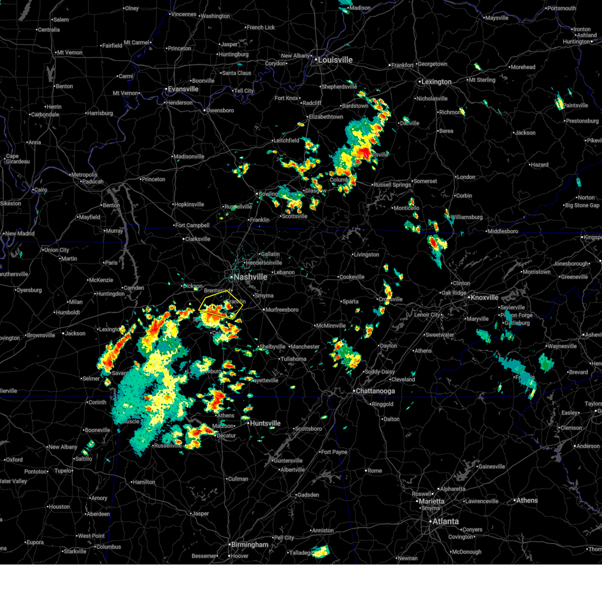
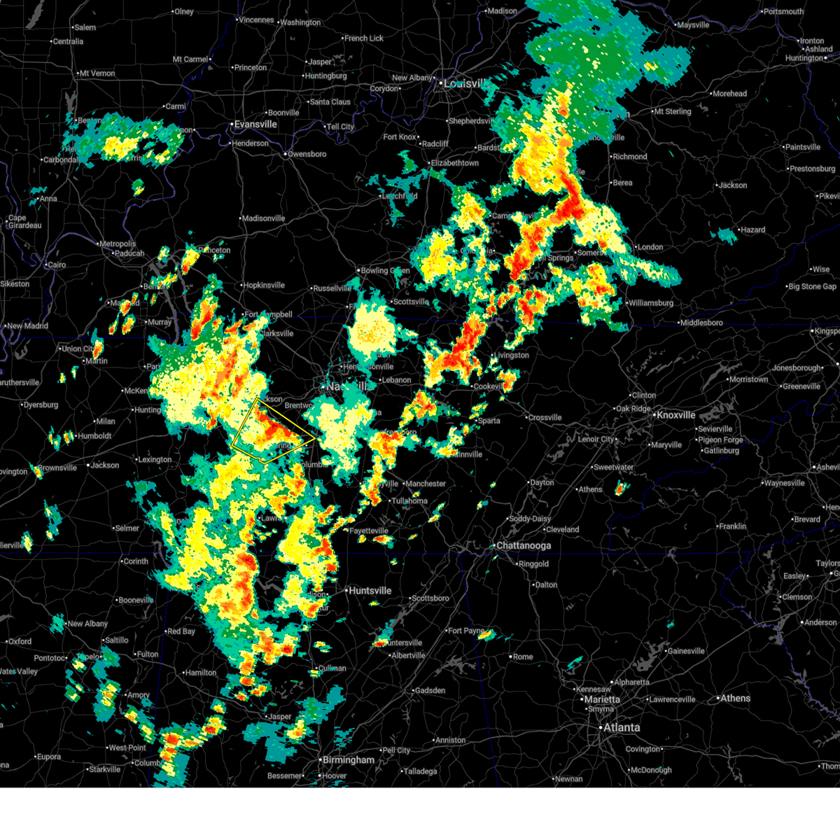
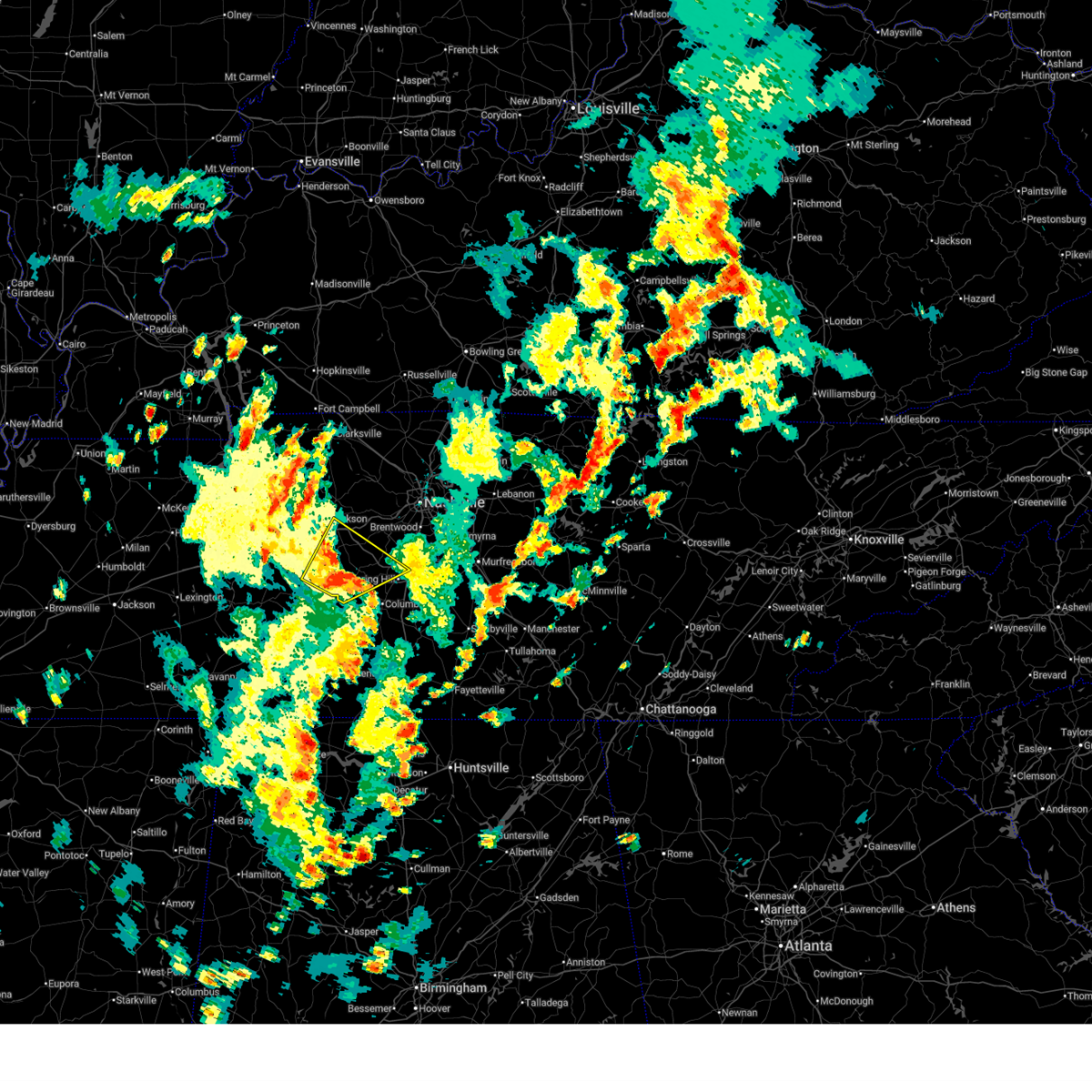
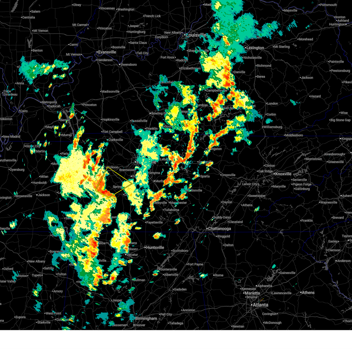
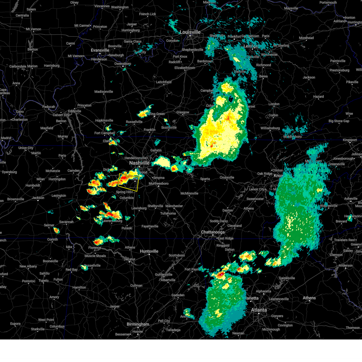
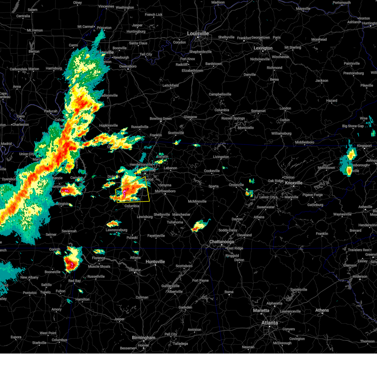
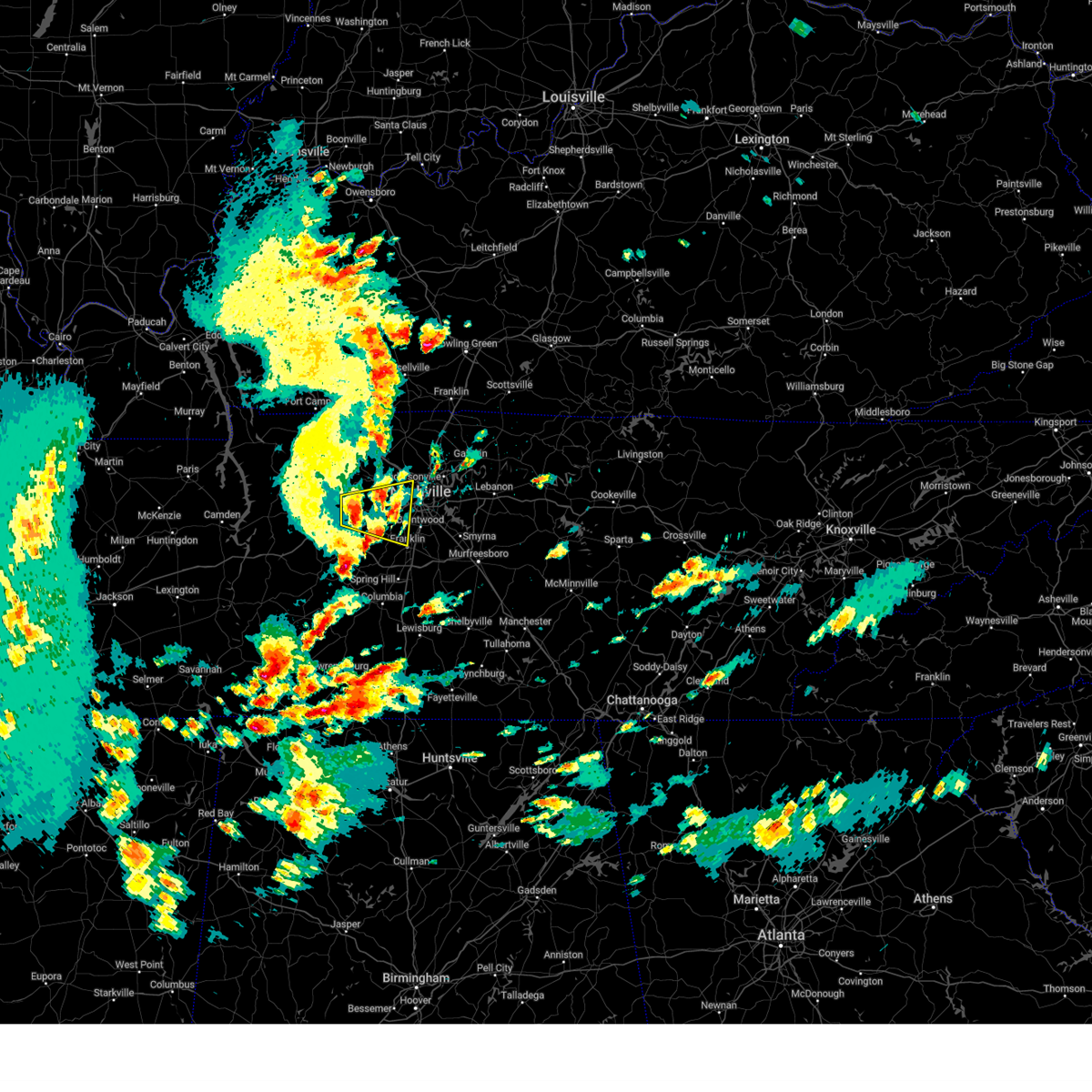
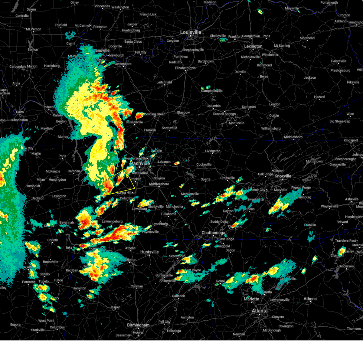
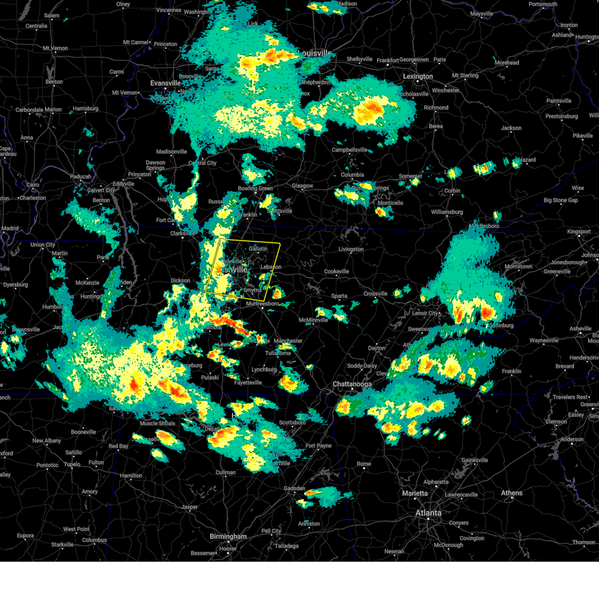
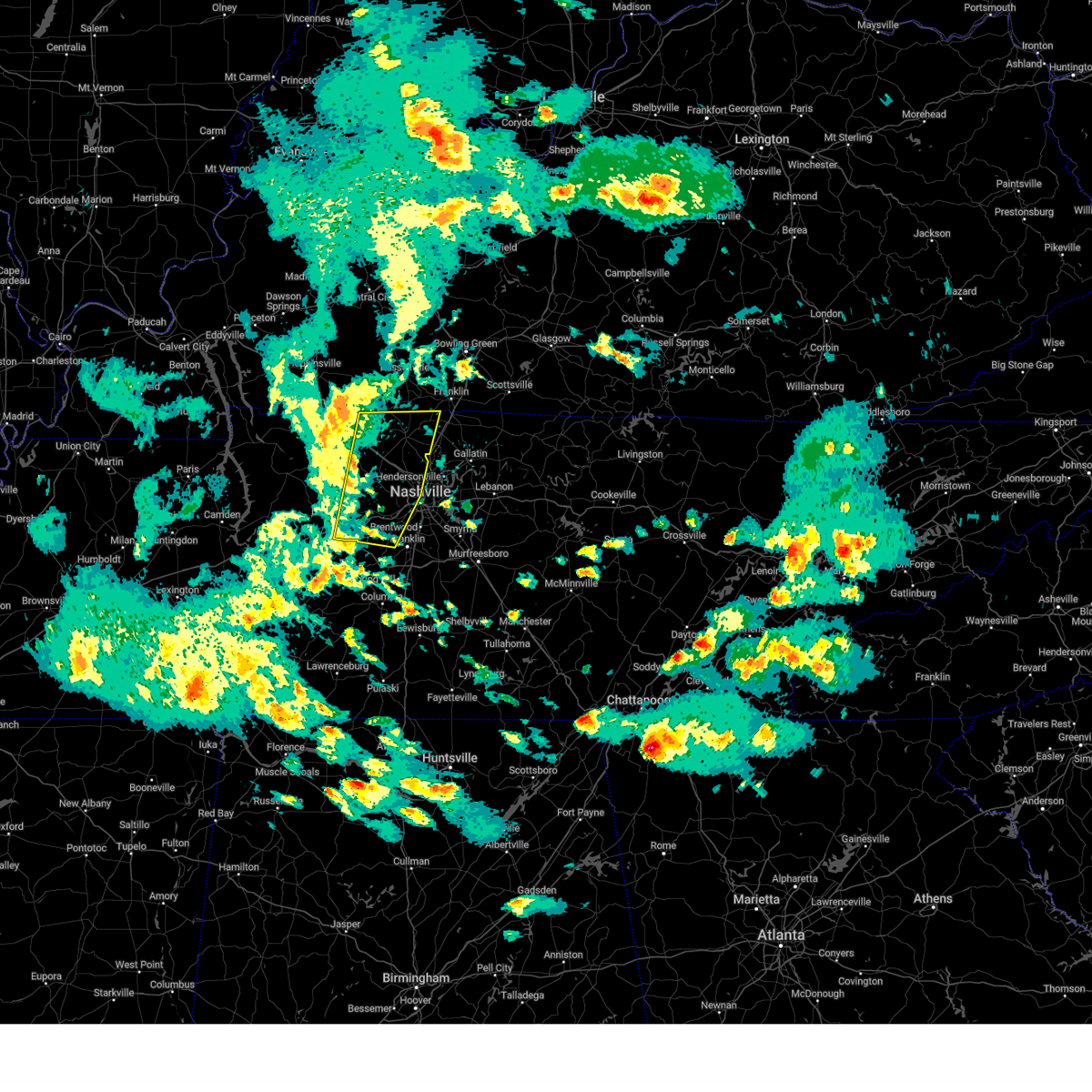
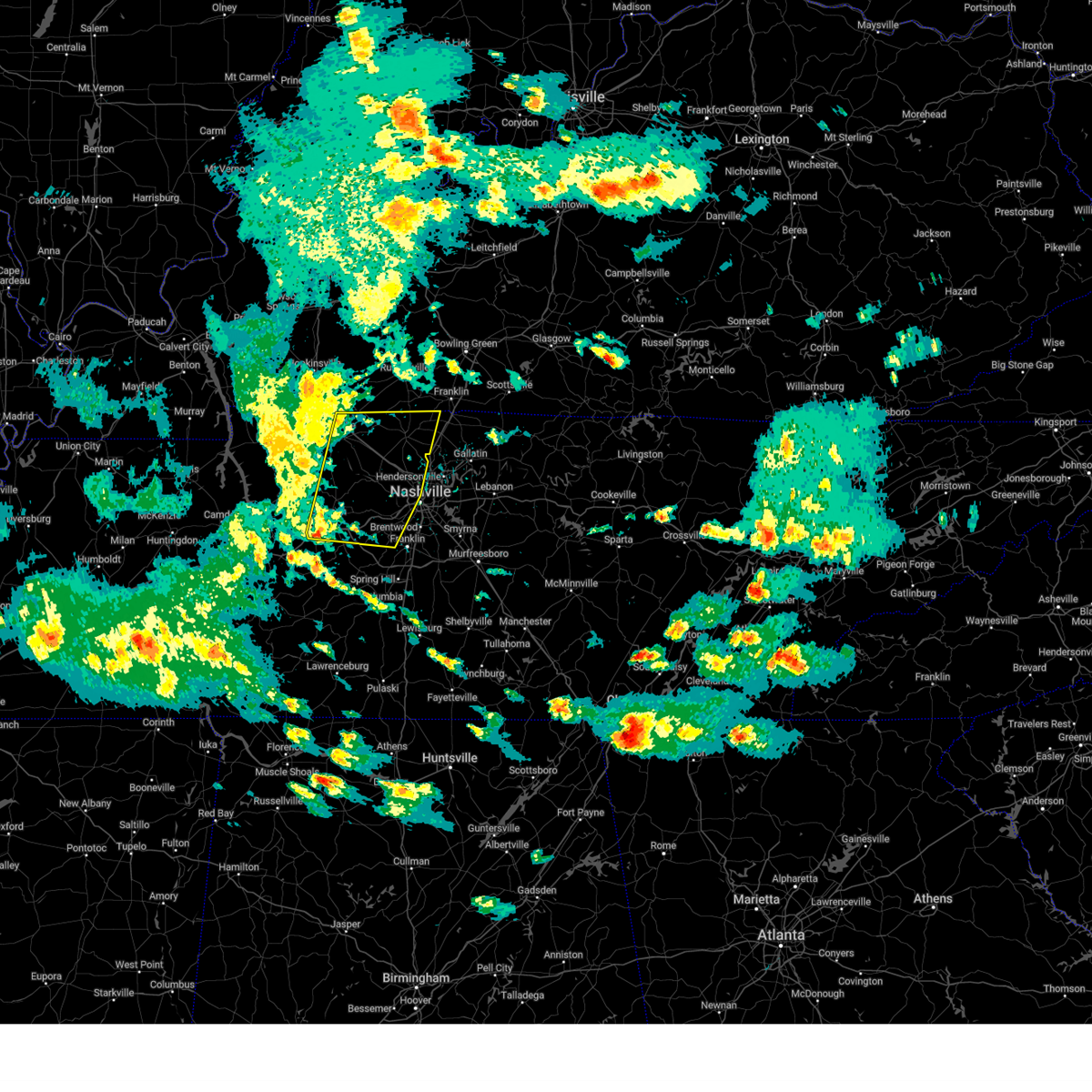
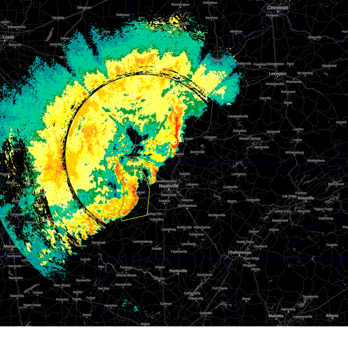
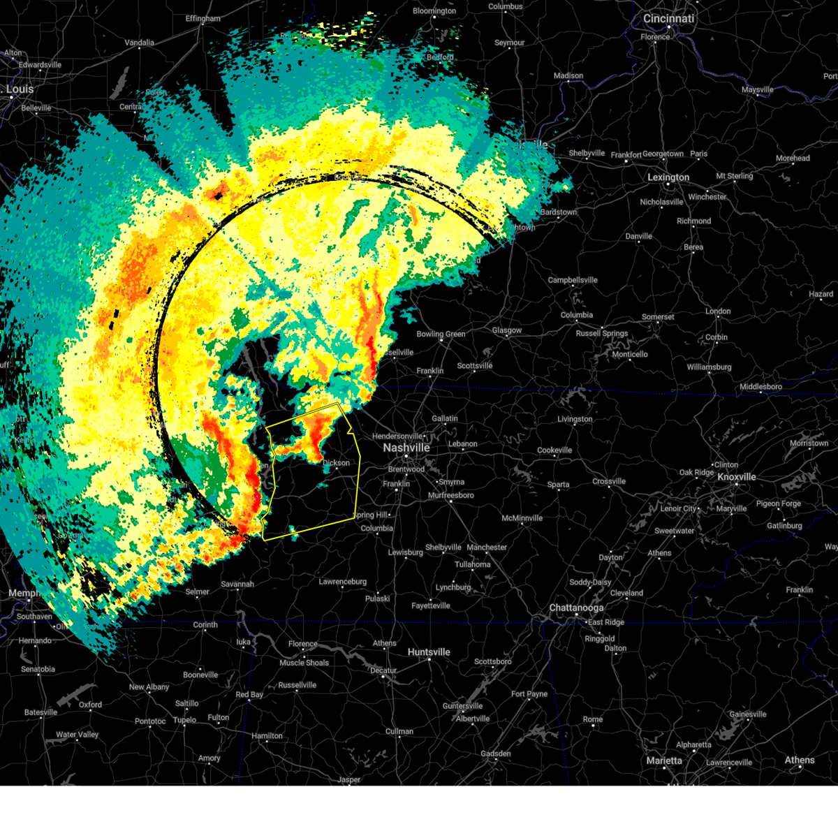
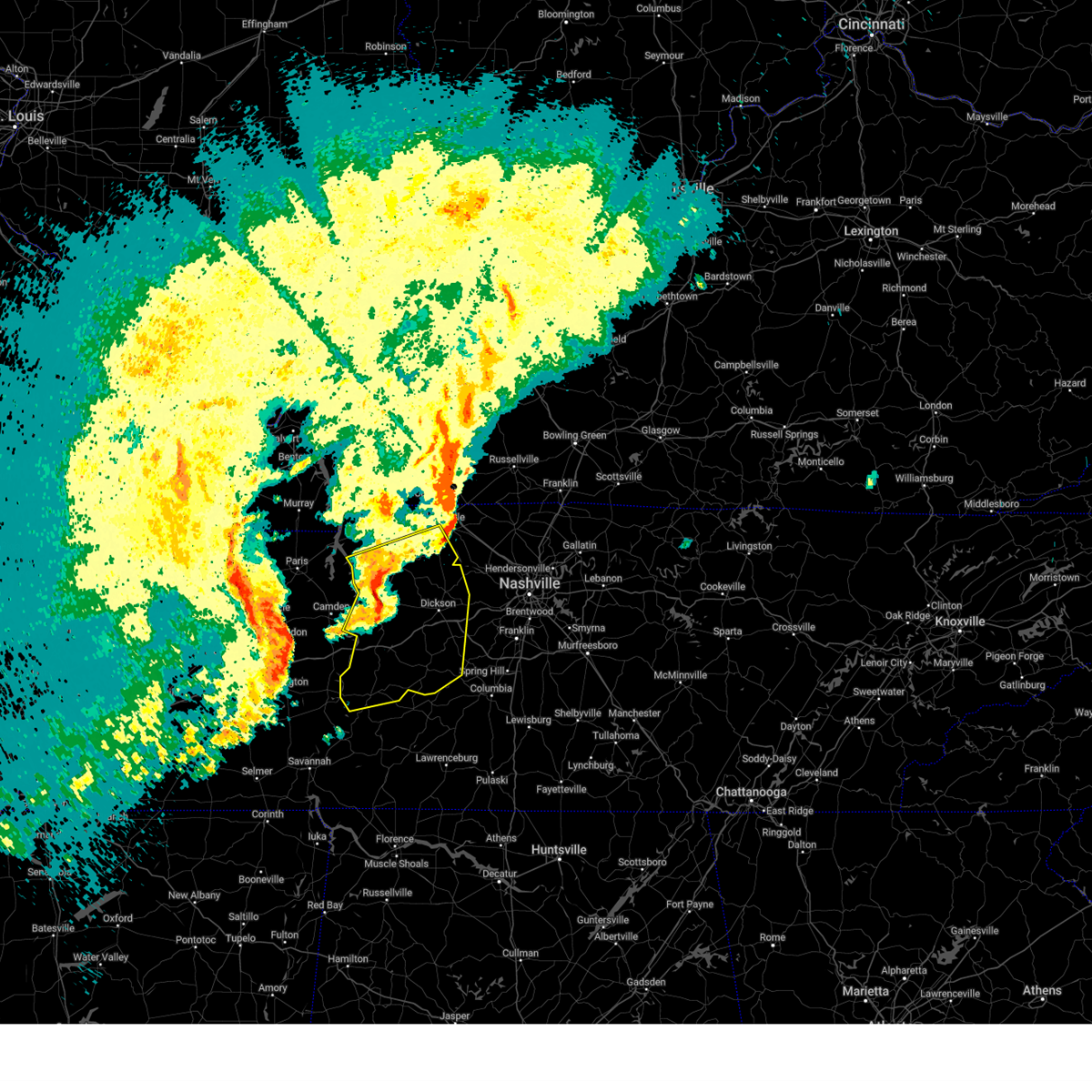
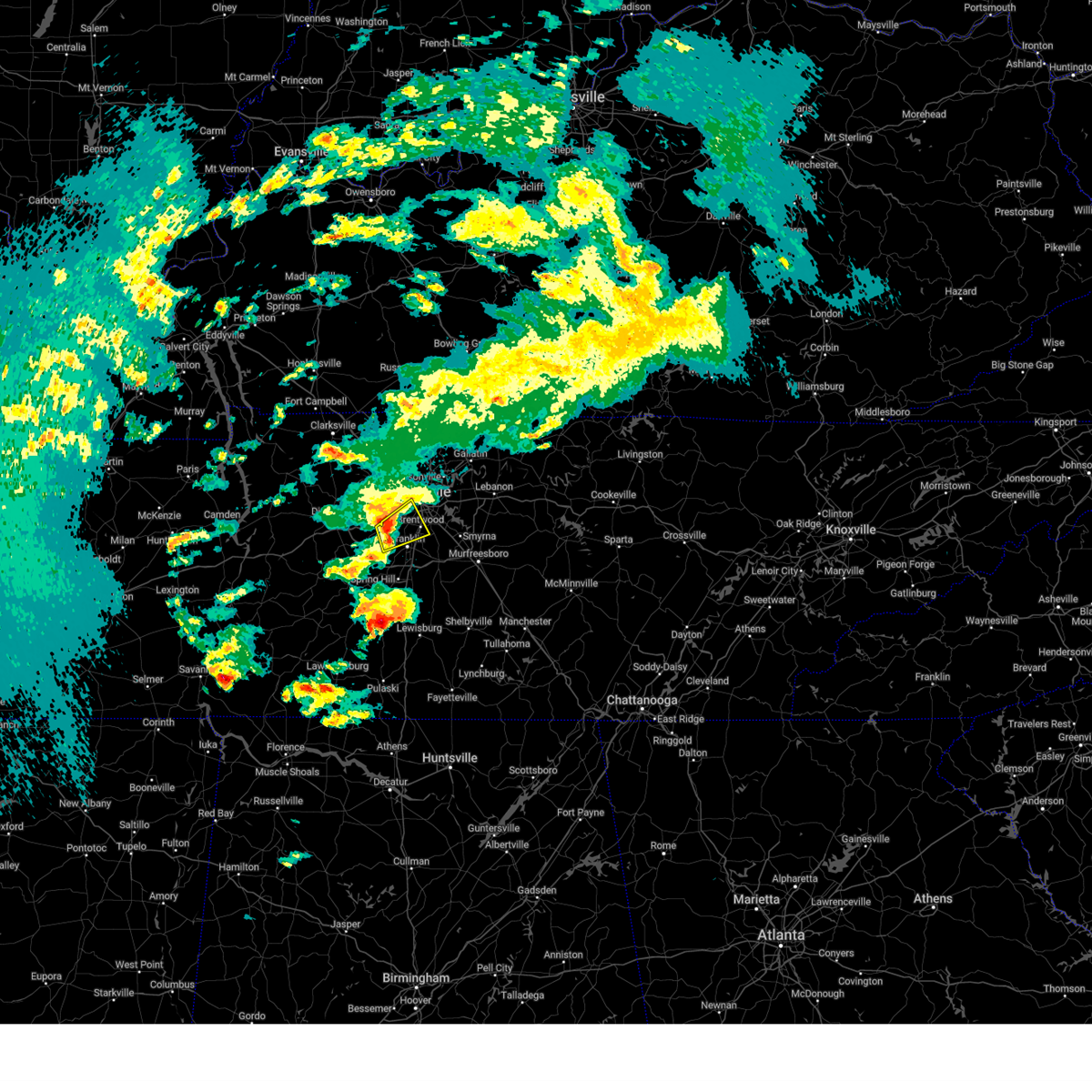
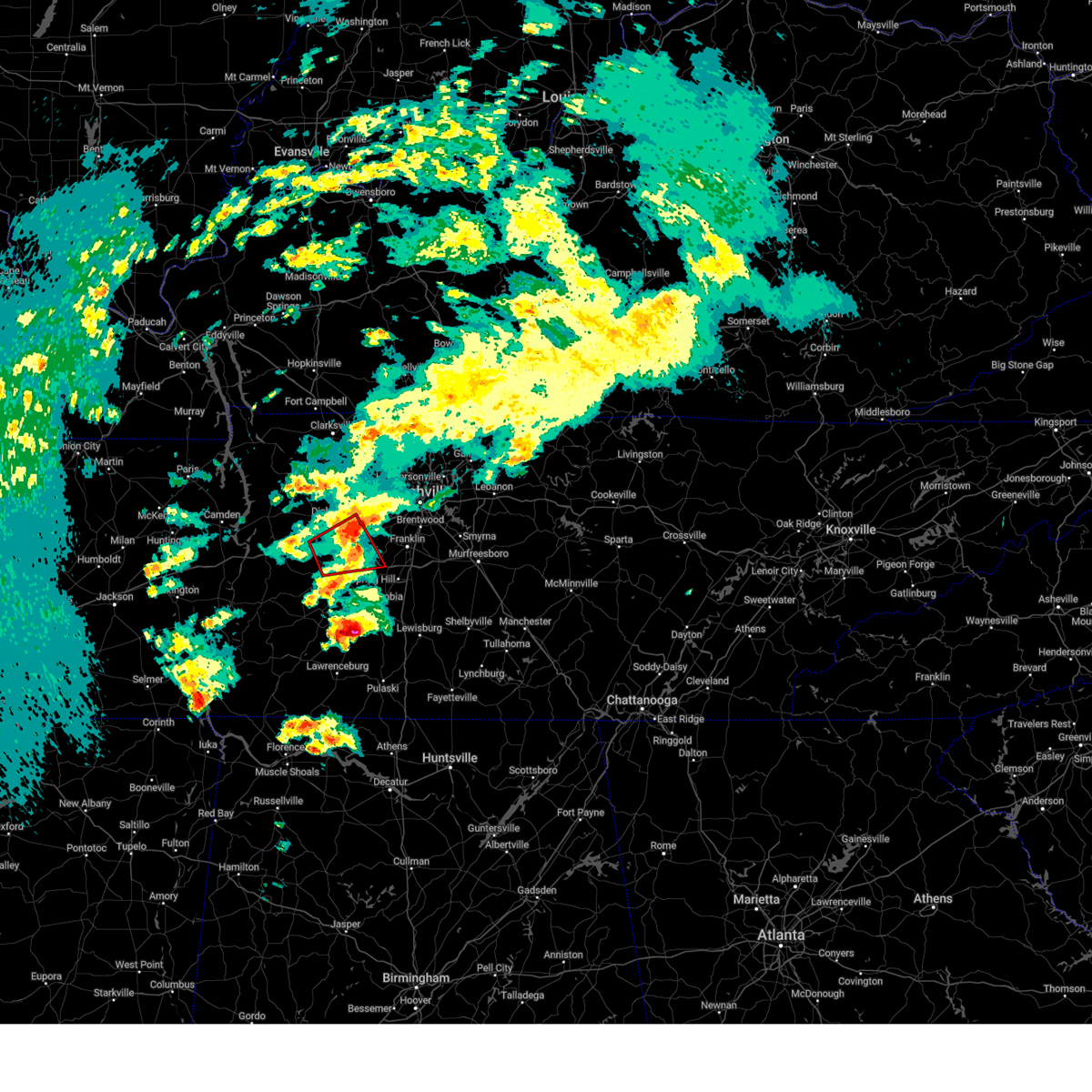
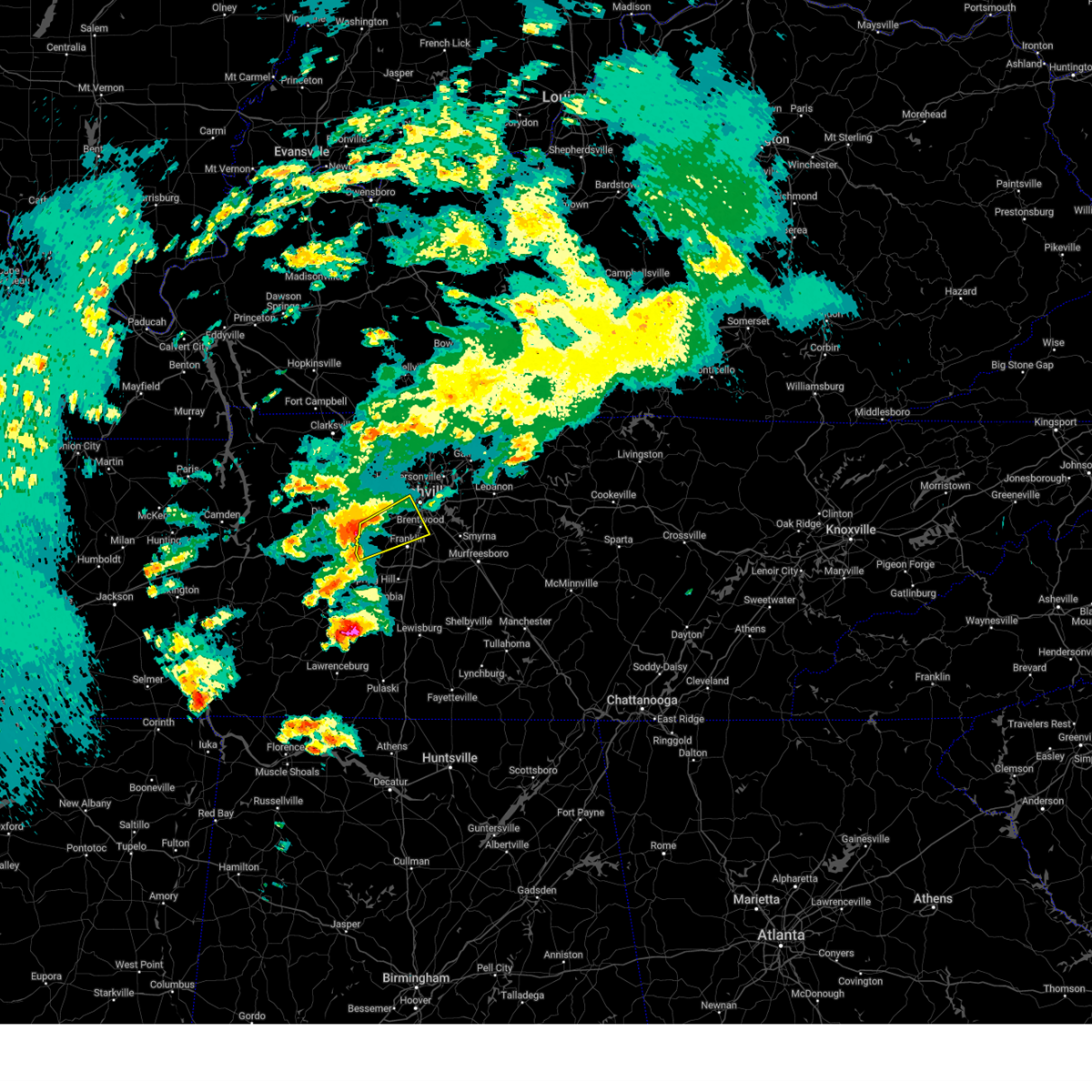
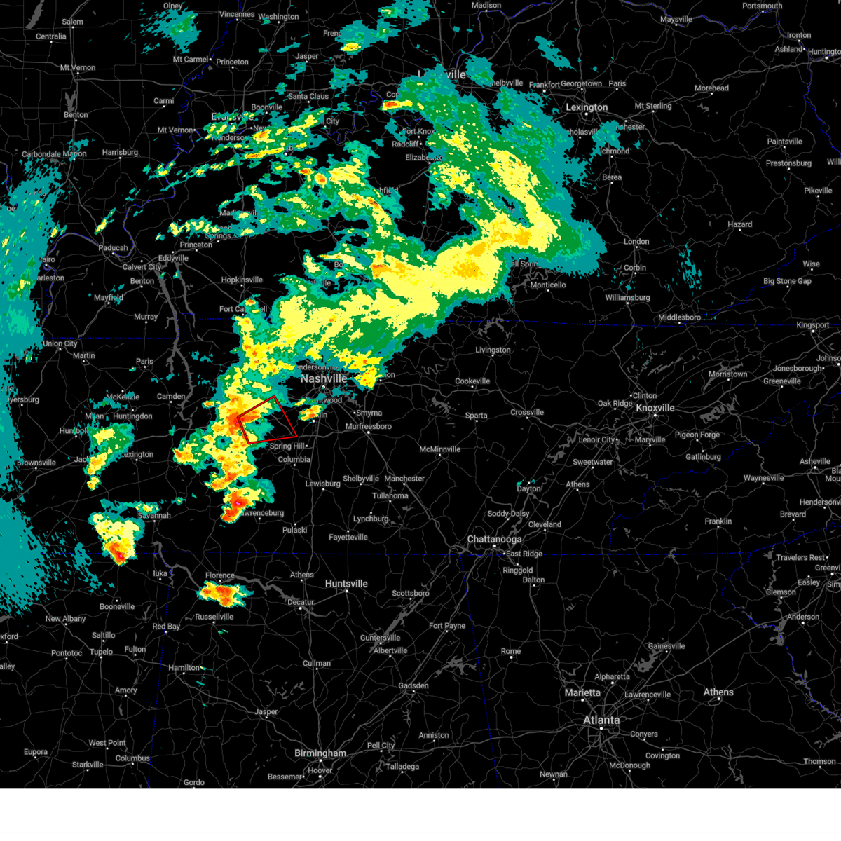
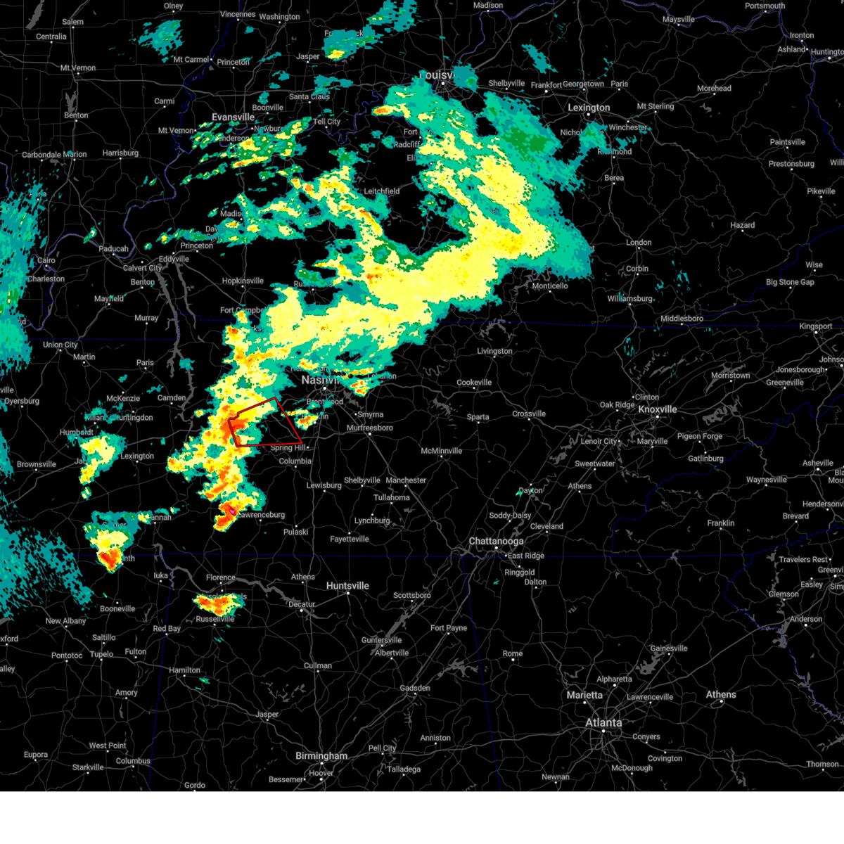
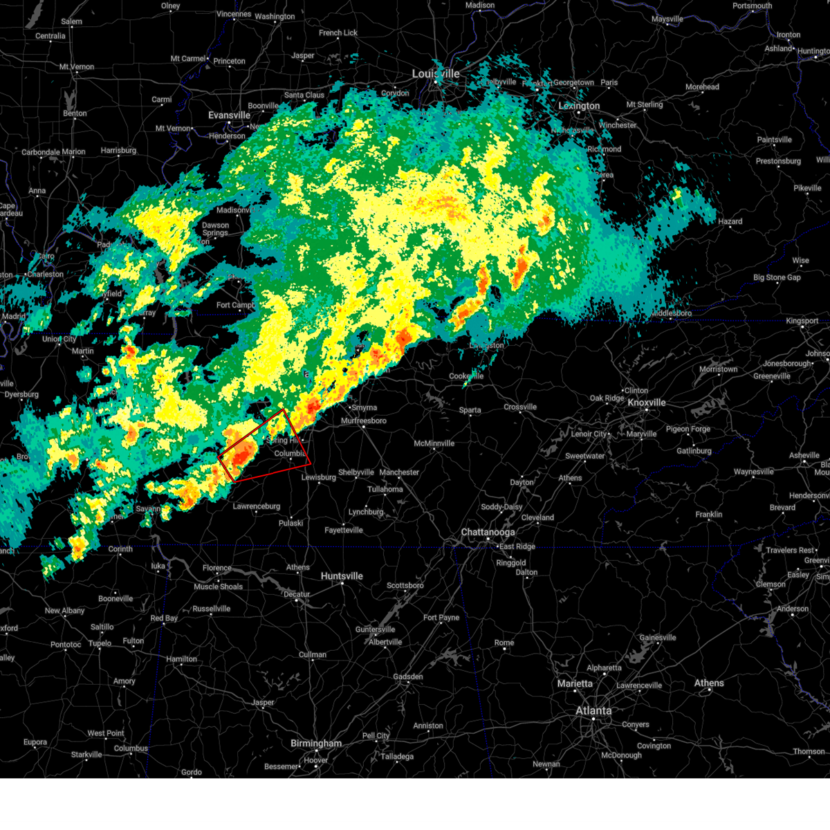
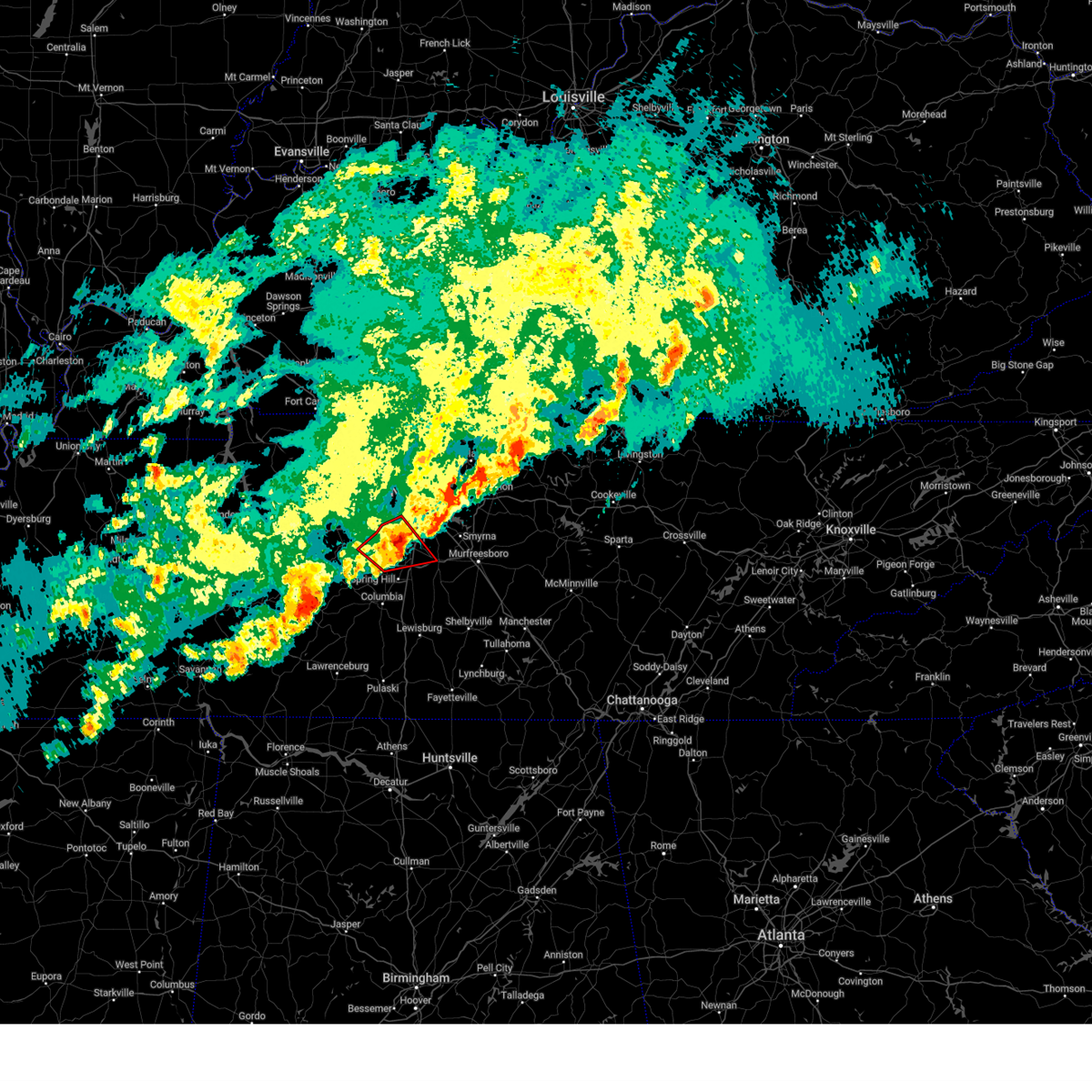
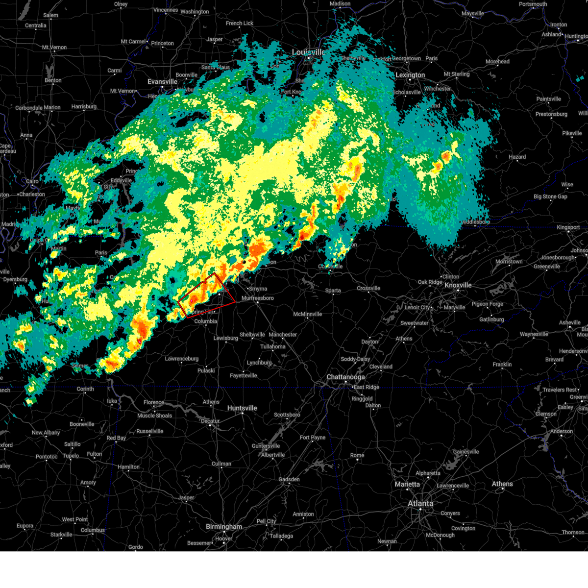
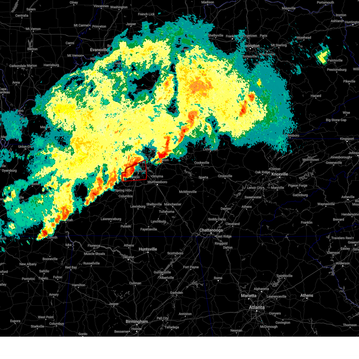
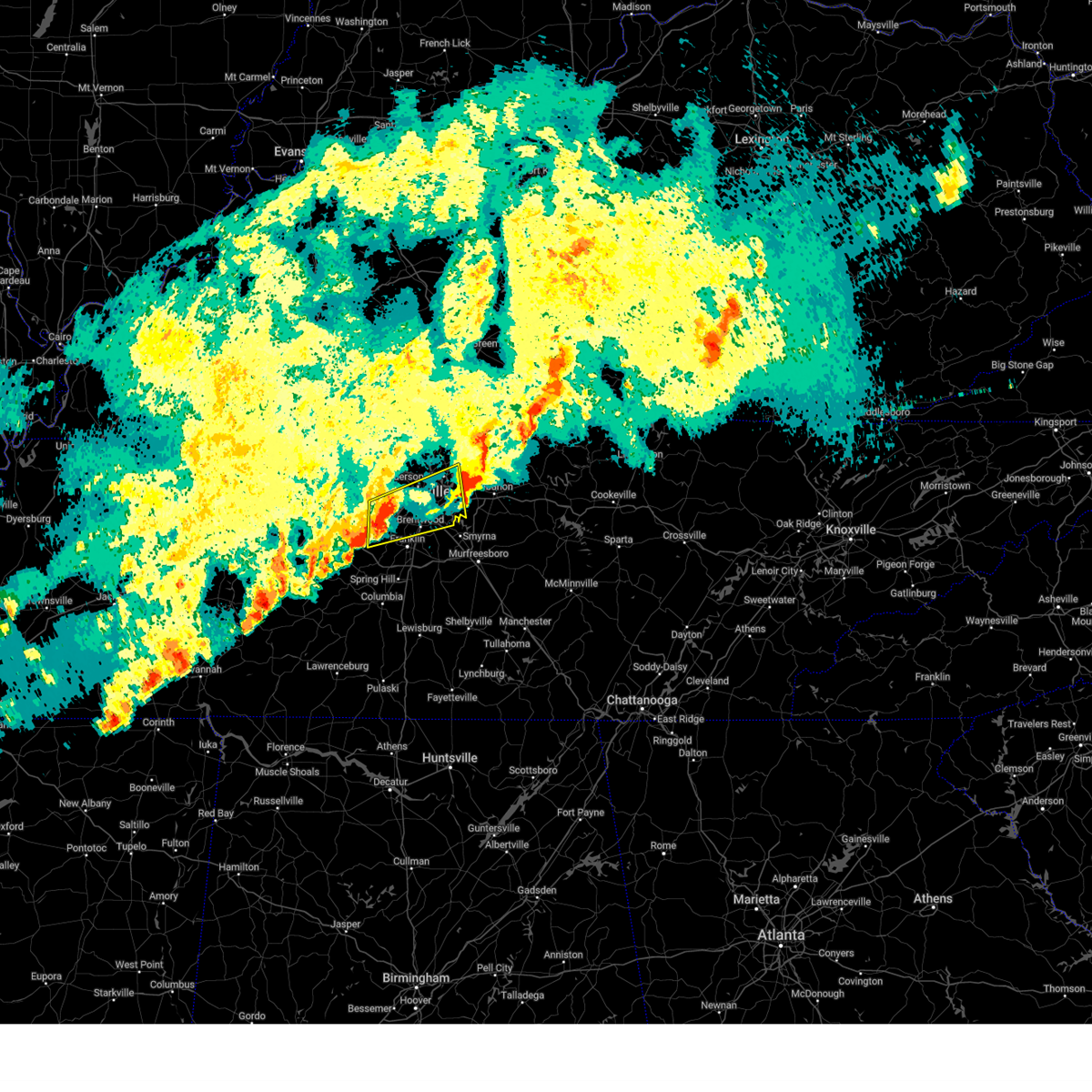
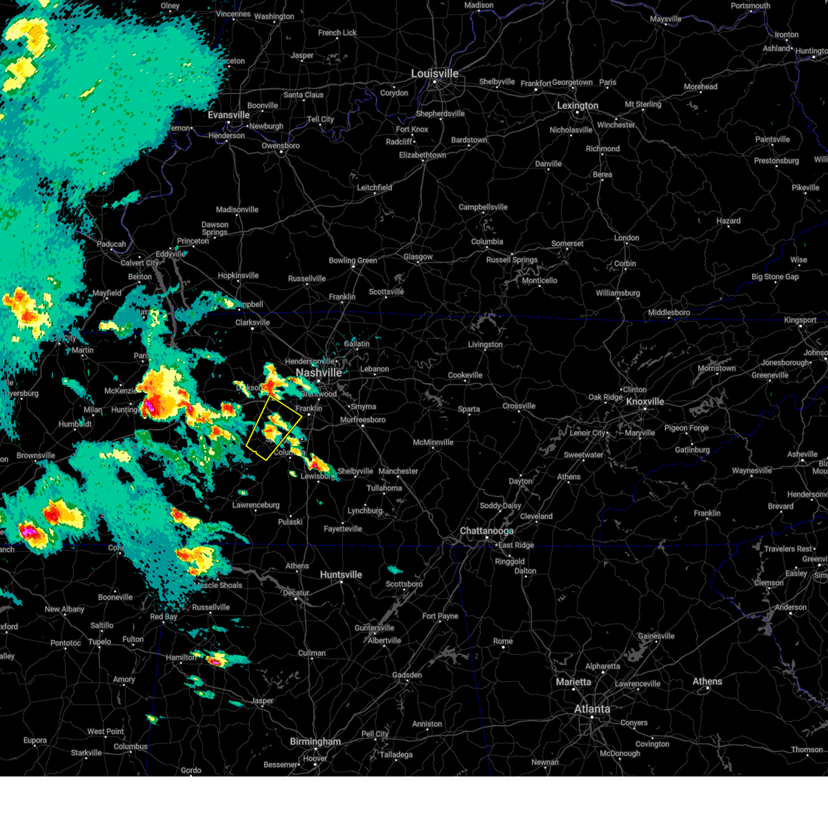
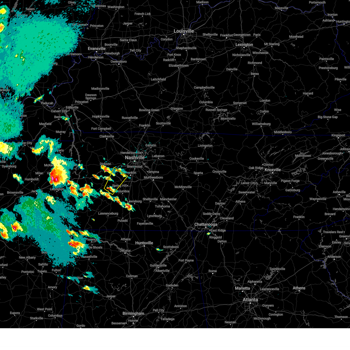
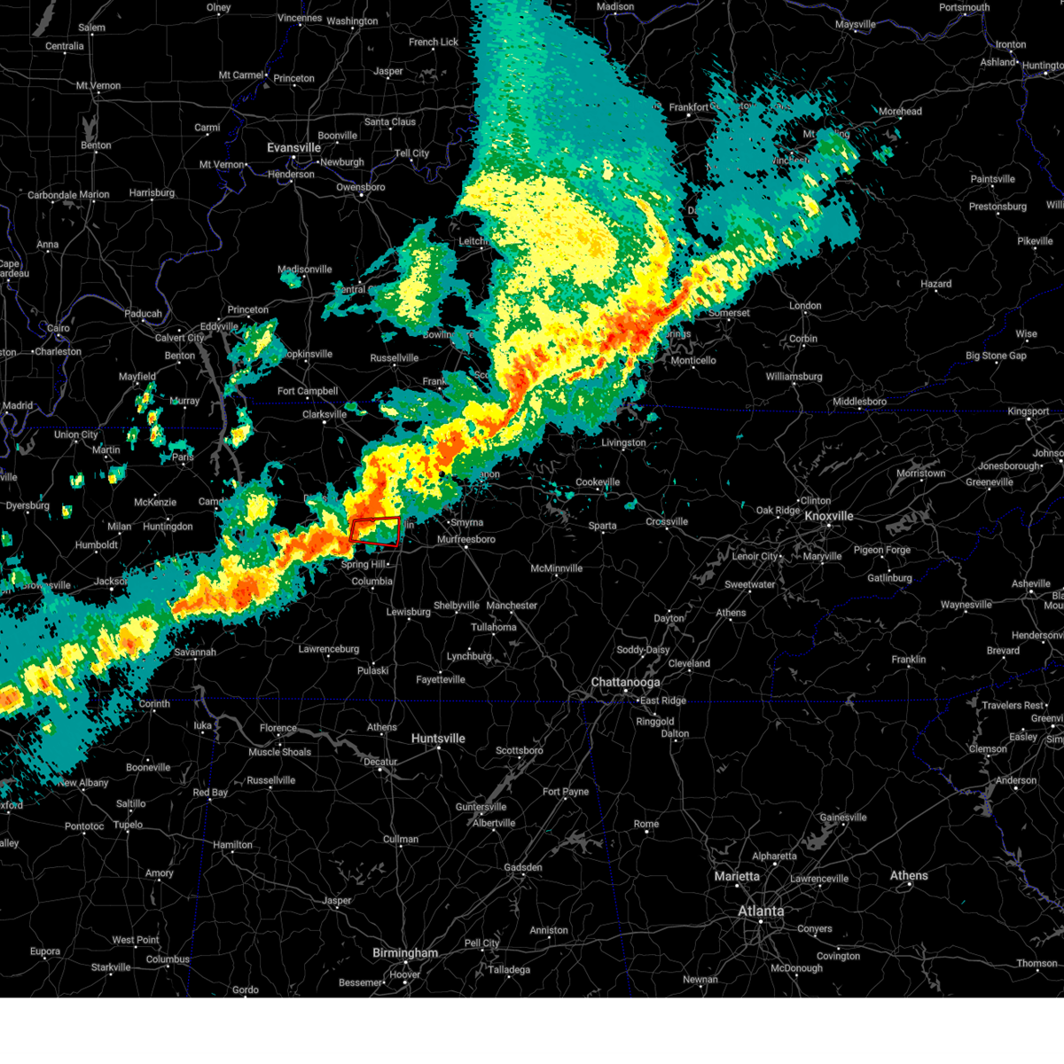
Hail Map for Fairview, TN
The Fairview, TN area has had 9 reports of on-the-ground hail by trained spotters, and has been under severe weather warnings 93 times during the past 12 months. Doppler radar has detected hail at or near Fairview, TN on 106 occasions, including 7 occasions during the past year.
| Name: | Fairview, TN |
| Where Located: | 24.2 miles WSW of Nashville, TN |
| Map: | Google Map for Fairview, TN |
| Population: | 7720 |
| Housing Units: | 2900 |
| More Info: | Search Google for Fairview, TN |
4
The Top Recent Hail Date for Fairview, TN is Wednesday, April 2, 2025 (2nd out of 106)

Hail and Wind Damage Spotted near Fairview, TN
| Date / Time | Report Details |
|---|---|
| 6/27/2025 12:48 PM CDT |
 Svrohx the national weather service in nashville has issued a * severe thunderstorm warning for, central williamson county in middle tennessee, * until 115 pm cdt. * at 1247 pm cdt, severe thunderstorms were located along a line extending from 7 miles northwest of thompson's station to near franklin, moving northeast at 15 mph (radar indicated). Hazards include 60 mph wind gusts. expect damage to roofs, siding, and trees Svrohx the national weather service in nashville has issued a * severe thunderstorm warning for, central williamson county in middle tennessee, * until 115 pm cdt. * at 1247 pm cdt, severe thunderstorms were located along a line extending from 7 miles northwest of thompson's station to near franklin, moving northeast at 15 mph (radar indicated). Hazards include 60 mph wind gusts. expect damage to roofs, siding, and trees
|
| 6/13/2025 2:37 PM CDT |
 The storm which prompted the warning has weakened below severe limits, and no longer poses an immediate threat to life or property. therefore, the warning will be allowed to expire. however, gusty winds are still possible with this thunderstorm. The storm which prompted the warning has weakened below severe limits, and no longer poses an immediate threat to life or property. therefore, the warning will be allowed to expire. however, gusty winds are still possible with this thunderstorm.
|
| 6/13/2025 2:25 PM CDT |
 At 224 pm cdt, a severe thunderstorm was located 10 miles east of centerville, moving northeast at 40 mph (radar indicated). Hazards include 60 mph wind gusts and penny size hail. Expect damage to roofs, siding, and trees. locations impacted include, dickson, centerville, spring hill, thompson's station, burns, santa fe, bon aqua, primm springs, williamsport, lyles, and nunnelly. this includes the following highways, interstate 40 between mile markers 169 and 177. interstate 65 near mile marker 57. Interstate 840 between mile markers 1 and 27. At 224 pm cdt, a severe thunderstorm was located 10 miles east of centerville, moving northeast at 40 mph (radar indicated). Hazards include 60 mph wind gusts and penny size hail. Expect damage to roofs, siding, and trees. locations impacted include, dickson, centerville, spring hill, thompson's station, burns, santa fe, bon aqua, primm springs, williamsport, lyles, and nunnelly. this includes the following highways, interstate 40 between mile markers 169 and 177. interstate 65 near mile marker 57. Interstate 840 between mile markers 1 and 27.
|
| 6/13/2025 2:25 PM CDT |
 the severe thunderstorm warning has been cancelled and is no longer in effect the severe thunderstorm warning has been cancelled and is no longer in effect
|
| 6/13/2025 2:13 PM CDT |
 Svrohx the national weather service in nashville has issued a * severe thunderstorm warning for, northeastern lewis county in middle tennessee, south central dickson county in middle tennessee, northwestern maury county in middle tennessee, southwestern williamson county in middle tennessee, hickman county in middle tennessee, * until 245 pm cdt. * at 212 pm cdt, a severe thunderstorm was located 8 miles southeast of centerville, moving northeast at 40 mph (radar indicated). Hazards include 60 mph wind gusts and penny size hail. expect damage to roofs, siding, and trees Svrohx the national weather service in nashville has issued a * severe thunderstorm warning for, northeastern lewis county in middle tennessee, south central dickson county in middle tennessee, northwestern maury county in middle tennessee, southwestern williamson county in middle tennessee, hickman county in middle tennessee, * until 245 pm cdt. * at 212 pm cdt, a severe thunderstorm was located 8 miles southeast of centerville, moving northeast at 40 mph (radar indicated). Hazards include 60 mph wind gusts and penny size hail. expect damage to roofs, siding, and trees
|
| 6/6/2025 7:54 PM CDT |
 the severe thunderstorm warning has been cancelled and is no longer in effect the severe thunderstorm warning has been cancelled and is no longer in effect
|
| 6/6/2025 7:41 PM CDT | Svrohx the national weather service in nashville has issued a * severe thunderstorm warning for, western williamson county in middle tennessee, * until 830 pm cdt. * at 740 pm cdt, a severe thunderstorm was located near fairview, or 11 miles southeast of dickson, moving east at 30 mph (radar indicated). Hazards include 60 mph wind gusts and quarter size hail. Hail damage to vehicles is expected. Expect wind damage to roofs, siding, and trees. |
| 6/6/2025 7:16 PM CDT | At 716 pm cdt, a severe thunderstorm was located over dickson, moving east at 25 mph (radar indicated). Hazards include 60 mph wind gusts and quarter size hail. Hail damage to vehicles is expected. expect wind damage to roofs, siding, and trees. locations impacted include, dickson, white bluff, kingston springs, pegram, burns, fairview, and charlotte. this includes the following highways, interstate 40 between mile markers 167 and 189. Interstate 840 between mile markers 1 and 4, and near mile marker 6. |
| 6/6/2025 6:59 PM CDT |
 Svrohx the national weather service in nashville has issued a * severe thunderstorm warning for, dickson county in middle tennessee, northwestern williamson county in middle tennessee, south central cheatham county in middle tennessee, * until 745 pm cdt. * at 659 pm cdt, a severe thunderstorm was located near dickson, moving east at 30 mph (radar indicated). Hazards include 60 mph wind gusts and quarter size hail. Hail damage to vehicles is expected. Expect wind damage to roofs, siding, and trees. Svrohx the national weather service in nashville has issued a * severe thunderstorm warning for, dickson county in middle tennessee, northwestern williamson county in middle tennessee, south central cheatham county in middle tennessee, * until 745 pm cdt. * at 659 pm cdt, a severe thunderstorm was located near dickson, moving east at 30 mph (radar indicated). Hazards include 60 mph wind gusts and quarter size hail. Hail damage to vehicles is expected. Expect wind damage to roofs, siding, and trees.
|
| 5/20/2025 6:33 PM CDT |
 the severe thunderstorm warning has been cancelled and is no longer in effect the severe thunderstorm warning has been cancelled and is no longer in effect
|
| 5/20/2025 6:33 PM CDT |
 At 633 pm cdt, severe thunderstorms were located along a line extending from near hartsville to near thompson's station, moving east at 55 mph (radar indicated). Hazards include 60 mph wind gusts and quarter size hail. Hail damage to vehicles is expected. expect wind damage to roofs, siding, and trees. Locations impacted include, franklin, madison, murfreesboro, nolensville, hermitage, belle meade, hartsville, thompson's station, la vergne, dickerson chapel recreation area, triune, natchez trace at highway 96, hendersonville, cedars of lebanon state park, berry hill, mount juliet, leipers fork, smyrna, oak hill, and green hill. At 633 pm cdt, severe thunderstorms were located along a line extending from near hartsville to near thompson's station, moving east at 55 mph (radar indicated). Hazards include 60 mph wind gusts and quarter size hail. Hail damage to vehicles is expected. expect wind damage to roofs, siding, and trees. Locations impacted include, franklin, madison, murfreesboro, nolensville, hermitage, belle meade, hartsville, thompson's station, la vergne, dickerson chapel recreation area, triune, natchez trace at highway 96, hendersonville, cedars of lebanon state park, berry hill, mount juliet, leipers fork, smyrna, oak hill, and green hill.
|
| 5/20/2025 6:06 PM CDT | Svrohx the national weather service in nashville has issued a * severe thunderstorm warning for, davidson county in middle tennessee, central rutherford county in middle tennessee, north central maury county in middle tennessee, southeastern sumner county in middle tennessee, williamson county in middle tennessee, wilson county in middle tennessee, south central cheatham county in middle tennessee, southwestern trousdale county in middle tennessee, east central hickman county in middle tennessee, * until 700 pm cdt. * at 606 pm cdt, severe thunderstorms were located along a line extending from near hendersonville to centerville, moving east at 50 mph (radar indicated). Hazards include 60 mph wind gusts and quarter size hail. Hail damage to vehicles is expected. Expect wind damage to roofs, siding, and trees. |
| 5/20/2025 5:59 PM CDT | At 559 pm cdt, severe thunderstorms were located along a line extending from near kingston springs to 7 miles northeast of centerville to 9 miles northwest of linden, moving east at 65 mph (radar indicated). Hazards include 60 mph wind gusts and quarter size hail. Hail damage to vehicles is expected. expect wind damage to roofs, siding, and trees. Locations impacted include, fairview, lobelville, kingston springs, bon aqua, pinewood, white bluff, lyles, nunnelly, burns, dickson, centerville, and pegram. |
| 5/20/2025 5:59 PM CDT | the severe thunderstorm warning has been cancelled and is no longer in effect |
| 5/20/2025 5:21 PM CDT |
 Svrohx the national weather service in nashville has issued a * severe thunderstorm warning for, dickson county in middle tennessee, southern montgomery county in middle tennessee, northwestern williamson county in middle tennessee, houston county in middle tennessee, western cheatham county in middle tennessee, northern perry county in middle tennessee, humphreys county in middle tennessee, northern hickman county in middle tennessee, * until 615 pm cdt. * at 521 pm cdt, severe thunderstorms were located along a line extending from near springville to linden, moving east at 65 mph (radar indicated). Hazards include 60 mph wind gusts and quarter size hail. Hail damage to vehicles is expected. expect wind damage to roofs, siding, and trees. severe thunderstorms will be near, camden, waverly, and new johnsonville around 525 pm cdt. hurricane mills around 530 pm cdt. tennessee ridge and erin around 535 pm cdt. mcewen around 540 pm cdt. centerville around 545 pm cdt. dickson around 550 pm cdt. burns around 555 pm cdt. white bluff around 600 pm cdt. Other locations impacted by these severe thunderstorms include lobelville, charlotte, bon aqua, pinewood, cheatham dam, vanleer, lyles, slayden, nunnelly, and cunningham. Svrohx the national weather service in nashville has issued a * severe thunderstorm warning for, dickson county in middle tennessee, southern montgomery county in middle tennessee, northwestern williamson county in middle tennessee, houston county in middle tennessee, western cheatham county in middle tennessee, northern perry county in middle tennessee, humphreys county in middle tennessee, northern hickman county in middle tennessee, * until 615 pm cdt. * at 521 pm cdt, severe thunderstorms were located along a line extending from near springville to linden, moving east at 65 mph (radar indicated). Hazards include 60 mph wind gusts and quarter size hail. Hail damage to vehicles is expected. expect wind damage to roofs, siding, and trees. severe thunderstorms will be near, camden, waverly, and new johnsonville around 525 pm cdt. hurricane mills around 530 pm cdt. tennessee ridge and erin around 535 pm cdt. mcewen around 540 pm cdt. centerville around 545 pm cdt. dickson around 550 pm cdt. burns around 555 pm cdt. white bluff around 600 pm cdt. Other locations impacted by these severe thunderstorms include lobelville, charlotte, bon aqua, pinewood, cheatham dam, vanleer, lyles, slayden, nunnelly, and cunningham.
|
| 5/20/2025 4:30 PM CDT | the severe thunderstorm warning has been cancelled and is no longer in effect |
| 5/20/2025 4:30 PM CDT | At 429 pm cdt, a severe thunderstorm was located near leipers fork, or 8 miles southwest of franklin, moving east at 40 mph (radar indicated). Hazards include golf ball size hail and 60 mph wind gusts. People and animals outdoors will be injured. expect hail damage to roofs, siding, windows, and vehicles. expect wind damage to roofs, siding, and trees. Locations impacted include, franklin, spring hill, thompson's station, brentwood, leipers fork, natchez trace at highway 96, forest hills, and oak hill. |
| 5/20/2025 4:14 PM CDT | Golf Ball sized hail reported 4.7 miles NNE of Fairview, TN, estimated golf ball size hail in primm springs. time estimated from radar. |
| 5/20/2025 4:12 PM CDT |
 At 411 pm cdt, a severe thunderstorm was located 11 miles southwest of fairview, or 12 miles east of centerville, moving east at 40 mph. this is a destructive storm for eastern hickman county and williamson county (public. at 407 pm cdt...golfball size hail and blown down trees were reported in centerville with this storm). Hazards include baseball size hail and 70 mph wind gusts. People and animals outdoors will be severely injured. expect shattered windows, extensive damage to roofs, siding, and vehicles. Locations impacted include, franklin, santa fe, fairview, forest hills, spring hill, thompson's station, brentwood, primm springs, leipers fork, oak hill, natchez trace at highway 96, and belle meade. At 411 pm cdt, a severe thunderstorm was located 11 miles southwest of fairview, or 12 miles east of centerville, moving east at 40 mph. this is a destructive storm for eastern hickman county and williamson county (public. at 407 pm cdt...golfball size hail and blown down trees were reported in centerville with this storm). Hazards include baseball size hail and 70 mph wind gusts. People and animals outdoors will be severely injured. expect shattered windows, extensive damage to roofs, siding, and vehicles. Locations impacted include, franklin, santa fe, fairview, forest hills, spring hill, thompson's station, brentwood, primm springs, leipers fork, oak hill, natchez trace at highway 96, and belle meade.
|
| 5/20/2025 4:12 PM CDT |
 the severe thunderstorm warning has been cancelled and is no longer in effect the severe thunderstorm warning has been cancelled and is no longer in effect
|
| 5/20/2025 4:04 PM CDT | At 404 pm cdt, a severe thunderstorm was located near centerville, moving east at 35 mph (radar indicated). Hazards include tennis ball size hail and 70 mph wind gusts. People and animals outdoors will be injured. expect hail damage to roofs, siding, windows, and vehicles. expect considerable tree damage. wind damage is also likely to mobile homes, roofs, and outbuildings. Locations impacted include, franklin, forest hills, bon aqua, spring hill, thompson's station, brentwood, primm springs, lyles, bellevue, natchez trace at highway 96, santa fe, fairview, leipers fork, oak hill, belle meade, and centerville. |
| 5/20/2025 3:56 PM CDT | Svrohx the national weather service in nashville has issued a * severe thunderstorm warning for, southwestern davidson county in middle tennessee, southeastern dickson county in middle tennessee, northern maury county in middle tennessee, williamson county in middle tennessee, eastern hickman county in middle tennessee, * until 500 pm cdt. * at 356 pm cdt, a severe thunderstorm was located near centerville, moving east at 40 mph (radar indicated). Hazards include golf ball size hail and 70 mph wind gusts. People and animals outdoors will be injured. expect hail damage to roofs, siding, windows, and vehicles. expect considerable tree damage. Wind damage is also likely to mobile homes, roofs, and outbuildings. |
| 5/8/2025 3:06 PM CDT | Svrohx the national weather service in nashville has issued a * severe thunderstorm warning for, southwestern davidson county in middle tennessee, northern williamson county in middle tennessee, * until 345 pm cdt. * at 306 pm cdt, a severe thunderstorm was located 7 miles east of fairview, or 8 miles west of franklin, moving east at 30 mph (radar indicated). Hazards include 60 mph wind gusts and quarter size hail. Hail damage to vehicles is expected. Expect wind damage to roofs, siding, and trees. |
| 5/2/2025 1:12 PM CDT |
 The storm which prompted the warning has weakened below severe limits, and no longer poses an immediate threat to life or property. therefore, the warning will be allowed to expire. a severe thunderstorm watch remains in effect until 500 pm cdt for middle tennessee. The storm which prompted the warning has weakened below severe limits, and no longer poses an immediate threat to life or property. therefore, the warning will be allowed to expire. a severe thunderstorm watch remains in effect until 500 pm cdt for middle tennessee.
|
| 5/2/2025 1:01 PM CDT |
 At 101 pm cdt, a severe thunderstorm was located near fairview, or 12 miles west of franklin, moving east at 35 mph (radar indicated). Hazards include 60 mph wind gusts and quarter size hail. Hail damage to vehicles is expected. expect wind damage to roofs, siding, and trees. locations impacted include, fairview, leipers fork, natchez trace at highway 96, and thompson's station. This includes interstate 840 between mile markers 7 and 28. At 101 pm cdt, a severe thunderstorm was located near fairview, or 12 miles west of franklin, moving east at 35 mph (radar indicated). Hazards include 60 mph wind gusts and quarter size hail. Hail damage to vehicles is expected. expect wind damage to roofs, siding, and trees. locations impacted include, fairview, leipers fork, natchez trace at highway 96, and thompson's station. This includes interstate 840 between mile markers 7 and 28.
|
| 5/2/2025 1:01 PM CDT |
 the severe thunderstorm warning has been cancelled and is no longer in effect the severe thunderstorm warning has been cancelled and is no longer in effect
|
| 5/2/2025 12:52 PM CDT |
 At 1252 pm cdt, a severe thunderstorm was located over kingston springs, or 12 miles east of dickson, moving east at 25 mph (radar indicated). Hazards include 60 mph wind gusts and quarter size hail. Hail damage to vehicles is expected. expect wind damage to roofs, siding, and trees. locations impacted include, kingston springs, beaman park, belle meade, bells bend, white bluff, bellevue, natchez trace at highway 96, pegram, forest hills, ashland city, franklin, and brentwood. This includes interstate 40 between mile markers 179 and 204. At 1252 pm cdt, a severe thunderstorm was located over kingston springs, or 12 miles east of dickson, moving east at 25 mph (radar indicated). Hazards include 60 mph wind gusts and quarter size hail. Hail damage to vehicles is expected. expect wind damage to roofs, siding, and trees. locations impacted include, kingston springs, beaman park, belle meade, bells bend, white bluff, bellevue, natchez trace at highway 96, pegram, forest hills, ashland city, franklin, and brentwood. This includes interstate 40 between mile markers 179 and 204.
|
| 5/2/2025 12:49 PM CDT |
 At 1249 pm cdt, a severe thunderstorm was located near fairview, or 13 miles southeast of dickson, moving east at 35 mph (radar indicated). Hazards include 60 mph wind gusts and quarter size hail. Hail damage to vehicles is expected. expect wind damage to roofs, siding, and trees. locations impacted include, fairview, kingston springs, primm springs, leipers fork, natchez trace at highway 96, pegram, and thompson's station. this includes the following highways, interstate 40 between mile markers 181 and 190. Interstate 840 between mile markers 3 and 28. At 1249 pm cdt, a severe thunderstorm was located near fairview, or 13 miles southeast of dickson, moving east at 35 mph (radar indicated). Hazards include 60 mph wind gusts and quarter size hail. Hail damage to vehicles is expected. expect wind damage to roofs, siding, and trees. locations impacted include, fairview, kingston springs, primm springs, leipers fork, natchez trace at highway 96, pegram, and thompson's station. this includes the following highways, interstate 40 between mile markers 181 and 190. Interstate 840 between mile markers 3 and 28.
|
| 5/2/2025 12:43 PM CDT |
 Svrohx the national weather service in nashville has issued a * severe thunderstorm warning for, southwestern davidson county in middle tennessee, southeastern dickson county in middle tennessee, northwestern williamson county in middle tennessee, southeastern cheatham county in middle tennessee, * until 130 pm cdt. * at 1243 pm cdt, a severe thunderstorm was located over white bluff, or 9 miles east of dickson, moving east at 25 mph (radar indicated). Hazards include 60 mph wind gusts and quarter size hail. Hail damage to vehicles is expected. Expect wind damage to roofs, siding, and trees. Svrohx the national weather service in nashville has issued a * severe thunderstorm warning for, southwestern davidson county in middle tennessee, southeastern dickson county in middle tennessee, northwestern williamson county in middle tennessee, southeastern cheatham county in middle tennessee, * until 130 pm cdt. * at 1243 pm cdt, a severe thunderstorm was located over white bluff, or 9 miles east of dickson, moving east at 25 mph (radar indicated). Hazards include 60 mph wind gusts and quarter size hail. Hail damage to vehicles is expected. Expect wind damage to roofs, siding, and trees.
|
| 5/2/2025 12:29 PM CDT |
 Svrohx the national weather service in nashville has issued a * severe thunderstorm warning for, southeastern dickson county in middle tennessee, north central maury county in middle tennessee, northwestern williamson county in middle tennessee, south central cheatham county in middle tennessee, northeastern hickman county in middle tennessee, * until 115 pm cdt. * at 1229 pm cdt, a severe thunderstorm was located near centerville, moving east at 35 mph (radar indicated). Hazards include 60 mph wind gusts and quarter size hail. Hail damage to vehicles is expected. Expect wind damage to roofs, siding, and trees. Svrohx the national weather service in nashville has issued a * severe thunderstorm warning for, southeastern dickson county in middle tennessee, north central maury county in middle tennessee, northwestern williamson county in middle tennessee, south central cheatham county in middle tennessee, northeastern hickman county in middle tennessee, * until 115 pm cdt. * at 1229 pm cdt, a severe thunderstorm was located near centerville, moving east at 35 mph (radar indicated). Hazards include 60 mph wind gusts and quarter size hail. Hail damage to vehicles is expected. Expect wind damage to roofs, siding, and trees.
|
| 4/10/2025 5:24 PM CDT |
 At 524 pm cdt, severe thunderstorms were located along a line extending from near white house to near brentwood, moving east at 45 mph (emergency management). Hazards include 60 mph wind gusts. Expect damage to roofs, siding, and trees. locations impacted include, madison, nolensville, hermitage, belle meade, la vergne, millersville, gallatin, bledsoe creek state park, hendersonville, greenbrier, berry hill, cottontown, mount juliet, smyrna, oak hill, green hill, forest hills, ridgetop, bethpage, and goodlettsville. this includes the following highways, interstate 40 between mile markers 191 and 238. interstate 65 between mile markers 70 and 110. interstate 24 between mile markers 29 and 70. Interstate 840 between mile markers 56 and 76. At 524 pm cdt, severe thunderstorms were located along a line extending from near white house to near brentwood, moving east at 45 mph (emergency management). Hazards include 60 mph wind gusts. Expect damage to roofs, siding, and trees. locations impacted include, madison, nolensville, hermitage, belle meade, la vergne, millersville, gallatin, bledsoe creek state park, hendersonville, greenbrier, berry hill, cottontown, mount juliet, smyrna, oak hill, green hill, forest hills, ridgetop, bethpage, and goodlettsville. this includes the following highways, interstate 40 between mile markers 191 and 238. interstate 65 between mile markers 70 and 110. interstate 24 between mile markers 29 and 70. Interstate 840 between mile markers 56 and 76.
|
| 4/10/2025 5:05 PM CDT |
 Svrohx the national weather service in nashville has issued a * severe thunderstorm warning for, davidson county in middle tennessee, northwestern rutherford county in middle tennessee, southern sumner county in middle tennessee, northeastern williamson county in middle tennessee, western wilson county in middle tennessee, southeastern cheatham county in middle tennessee, western trousdale county in middle tennessee, southeastern robertson county in middle tennessee, * until 545 pm cdt. * at 504 pm cdt, severe thunderstorms were located along a line extending from near springfield to near pegram, moving east at 45 mph (radar indicated). Hazards include 60 mph wind gusts. expect damage to roofs, siding, and trees Svrohx the national weather service in nashville has issued a * severe thunderstorm warning for, davidson county in middle tennessee, northwestern rutherford county in middle tennessee, southern sumner county in middle tennessee, northeastern williamson county in middle tennessee, western wilson county in middle tennessee, southeastern cheatham county in middle tennessee, western trousdale county in middle tennessee, southeastern robertson county in middle tennessee, * until 545 pm cdt. * at 504 pm cdt, severe thunderstorms were located along a line extending from near springfield to near pegram, moving east at 45 mph (radar indicated). Hazards include 60 mph wind gusts. expect damage to roofs, siding, and trees
|
| 4/10/2025 5:01 PM CDT |
 At 501 pm cdt, severe thunderstorms were located along a line extending from 8 miles south of russellville to near fairview, moving east at 45 mph (radar indicated). Hazards include 60 mph wind gusts. Expect damage to roofs, siding, and trees. locations impacted include, belle meade, natchez trace at highway 96, greenbrier, fairview, orlinda, pleasant view, cedar hill, ashland city, white bluff, ridgetop, cheatham dam, adams, bells bend, whites creek, bellevue, pegram, kingston springs, beaman park, springfield, and coopertown. this includes the following highways, interstate 40 between mile markers 172 and 207. interstate 65 between mile markers 85 and 86. interstate 24 between mile markers 11 and 44. Interstate 840 between mile markers 1 and 4. At 501 pm cdt, severe thunderstorms were located along a line extending from 8 miles south of russellville to near fairview, moving east at 45 mph (radar indicated). Hazards include 60 mph wind gusts. Expect damage to roofs, siding, and trees. locations impacted include, belle meade, natchez trace at highway 96, greenbrier, fairview, orlinda, pleasant view, cedar hill, ashland city, white bluff, ridgetop, cheatham dam, adams, bells bend, whites creek, bellevue, pegram, kingston springs, beaman park, springfield, and coopertown. this includes the following highways, interstate 40 between mile markers 172 and 207. interstate 65 between mile markers 85 and 86. interstate 24 between mile markers 11 and 44. Interstate 840 between mile markers 1 and 4.
|
| 4/10/2025 5:01 PM CDT |
 the severe thunderstorm warning has been cancelled and is no longer in effect the severe thunderstorm warning has been cancelled and is no longer in effect
|
| 4/10/2025 4:36 PM CDT |
 Svrohx the national weather service in nashville has issued a * severe thunderstorm warning for, western davidson county in middle tennessee, dickson county in middle tennessee, eastern montgomery county in middle tennessee, northwestern williamson county in middle tennessee, cheatham county in middle tennessee, northeastern hickman county in middle tennessee, robertson county in middle tennessee, * until 515 pm cdt. * at 434 pm cdt, severe thunderstorms were located along a line extending from near elkton to 7 miles southwest of dickson, moving east at 45 mph (radar indicated). Hazards include 60 mph wind gusts. expect damage to roofs, siding, and trees Svrohx the national weather service in nashville has issued a * severe thunderstorm warning for, western davidson county in middle tennessee, dickson county in middle tennessee, eastern montgomery county in middle tennessee, northwestern williamson county in middle tennessee, cheatham county in middle tennessee, northeastern hickman county in middle tennessee, robertson county in middle tennessee, * until 515 pm cdt. * at 434 pm cdt, severe thunderstorms were located along a line extending from near elkton to 7 miles southwest of dickson, moving east at 45 mph (radar indicated). Hazards include 60 mph wind gusts. expect damage to roofs, siding, and trees
|
| 4/5/2025 4:54 PM CDT | At 454 pm cdt, severe thunderstorms were located along a line extending from near ridgetop to near nashville to near franklin, moving northeast at 60 mph (radar indicated). Hazards include 70 mph wind gusts and half dollar size hail. Hail damage to vehicles is expected. expect considerable tree damage. wind damage is also likely to mobile homes, roofs, and outbuildings. locations impacted include, madison, hermitage, belle meade, natchez trace at highway 96, berry hill, ashland city, oak hill, forest hills, ridgetop, bells bend, brentwood, nashville, whites creek, bellevue, antioch, lakewood, beaman park, old hickory, percy priest lake, and joelton. this includes the following highways, interstate 40 between mile markers 193 and 222. interstate 65 between mile markers 70 and 97. Interstate 24 between mile markers 29 and 62. |
| 4/5/2025 4:45 PM CDT | Tree branches snapped out of tree in williamson county TN, 1.2 miles WSW of Fairview, TN |
| 4/5/2025 4:43 PM CDT |
 At 443 pm cdt, severe thunderstorms were located along a line extending from near coopertown to near belle meade to near fairview, moving northeast at 70 mph (radar indicated). Hazards include 70 mph wind gusts and half dollar size hail. Hail damage to vehicles is expected. expect considerable tree damage. wind damage is also likely to mobile homes, roofs, and outbuildings. locations impacted include, madison, hermitage, belle meade, natchez trace at highway 96, fairview, berry hill, ashland city, oak hill, forest hills, ridgetop, bells bend, brentwood, nashville, whites creek, bellevue, antioch, lakewood, pegram, kingston springs, and beaman park. this includes the following highways, interstate 40 between mile markers 182 and 222. interstate 65 between mile markers 70 and 97. interstate 24 between mile markers 29 and 62. Interstate 840 between mile markers 7 and 12. At 443 pm cdt, severe thunderstorms were located along a line extending from near coopertown to near belle meade to near fairview, moving northeast at 70 mph (radar indicated). Hazards include 70 mph wind gusts and half dollar size hail. Hail damage to vehicles is expected. expect considerable tree damage. wind damage is also likely to mobile homes, roofs, and outbuildings. locations impacted include, madison, hermitage, belle meade, natchez trace at highway 96, fairview, berry hill, ashland city, oak hill, forest hills, ridgetop, bells bend, brentwood, nashville, whites creek, bellevue, antioch, lakewood, pegram, kingston springs, and beaman park. this includes the following highways, interstate 40 between mile markers 182 and 222. interstate 65 between mile markers 70 and 97. interstate 24 between mile markers 29 and 62. Interstate 840 between mile markers 7 and 12.
|
| 4/5/2025 4:43 PM CDT |
 the severe thunderstorm warning has been cancelled and is no longer in effect the severe thunderstorm warning has been cancelled and is no longer in effect
|
| 4/5/2025 4:34 PM CDT |
 At 433 pm cdt, severe thunderstorms were located along a line extending from near ashland city to kingston springs to 11 miles east of centerville, moving east at 50 mph (radar indicated). Hazards include 70 mph wind gusts and half dollar size hail. Hail damage to vehicles is expected. expect considerable tree damage. wind damage is also likely to mobile homes, roofs, and outbuildings. locations impacted include, madison, bon aqua, hermitage, belle meade, natchez trace at highway 96, fairview, berry hill, ashland city, white bluff, oak hill, forest hills, ridgetop, bells bend, brentwood, lyles, nashville, whites creek, bellevue, antioch, and lakewood. this includes the following highways, interstate 40 between mile markers 174 and 222. interstate 65 between mile markers 67 and 97. interstate 24 between mile markers 29 and 63. Interstate 840 between mile markers 1 and 14. At 433 pm cdt, severe thunderstorms were located along a line extending from near ashland city to kingston springs to 11 miles east of centerville, moving east at 50 mph (radar indicated). Hazards include 70 mph wind gusts and half dollar size hail. Hail damage to vehicles is expected. expect considerable tree damage. wind damage is also likely to mobile homes, roofs, and outbuildings. locations impacted include, madison, bon aqua, hermitage, belle meade, natchez trace at highway 96, fairview, berry hill, ashland city, white bluff, oak hill, forest hills, ridgetop, bells bend, brentwood, lyles, nashville, whites creek, bellevue, antioch, and lakewood. this includes the following highways, interstate 40 between mile markers 174 and 222. interstate 65 between mile markers 67 and 97. interstate 24 between mile markers 29 and 63. Interstate 840 between mile markers 1 and 14.
|
| 4/5/2025 4:31 PM CDT |
 The storms which prompted the warning have moved out of the area. therefore, the warning has been allowed to expire. a tornado watch remains in effect until 900 pm cdt for middle tennessee. remember, a severe thunderstorm warning still remains in effect for dickson and hickman counties. The storms which prompted the warning have moved out of the area. therefore, the warning has been allowed to expire. a tornado watch remains in effect until 900 pm cdt for middle tennessee. remember, a severe thunderstorm warning still remains in effect for dickson and hickman counties.
|
| 4/5/2025 4:21 PM CDT |
 Svrohx the national weather service in nashville has issued a * severe thunderstorm warning for, davidson county in middle tennessee, eastern dickson county in middle tennessee, northern williamson county in middle tennessee, cheatham county in middle tennessee, northeastern hickman county in middle tennessee, south central robertson county in middle tennessee, * until 515 pm cdt. * at 420 pm cdt, severe thunderstorms were located along a line extending from 10 miles north of dickson to near white bluff to centerville, moving northeast at 65 mph (radar indicated). Hazards include 70 mph wind gusts and quarter size hail. Hail damage to vehicles is expected. expect considerable tree damage. Wind damage is also likely to mobile homes, roofs, and outbuildings. Svrohx the national weather service in nashville has issued a * severe thunderstorm warning for, davidson county in middle tennessee, eastern dickson county in middle tennessee, northern williamson county in middle tennessee, cheatham county in middle tennessee, northeastern hickman county in middle tennessee, south central robertson county in middle tennessee, * until 515 pm cdt. * at 420 pm cdt, severe thunderstorms were located along a line extending from 10 miles north of dickson to near white bluff to centerville, moving northeast at 65 mph (radar indicated). Hazards include 70 mph wind gusts and quarter size hail. Hail damage to vehicles is expected. expect considerable tree damage. Wind damage is also likely to mobile homes, roofs, and outbuildings.
|
| 4/5/2025 4:18 PM CDT |
 the tornado warning has been cancelled and is no longer in effect the tornado warning has been cancelled and is no longer in effect
|
| 4/5/2025 4:18 PM CDT |
 At 418 pm cdt, a severe thunderstorm capable of producing a tornado was located over burns, or near dickson, moving east at 65 mph (radar indicated rotation). Hazards include tornado. Flying debris will be dangerous to those caught without shelter. mobile homes will be damaged or destroyed. damage to roofs, windows, and vehicles will occur. tree damage is likely. this dangerous storm will be near, white bluff around 425 pm cdt. other locations impacted by this tornadic thunderstorm include charlotte and bon aqua. this includes the following highways, interstate 40 between mile markers 164 and 181. Interstate 840 between mile markers 1 and 5. At 418 pm cdt, a severe thunderstorm capable of producing a tornado was located over burns, or near dickson, moving east at 65 mph (radar indicated rotation). Hazards include tornado. Flying debris will be dangerous to those caught without shelter. mobile homes will be damaged or destroyed. damage to roofs, windows, and vehicles will occur. tree damage is likely. this dangerous storm will be near, white bluff around 425 pm cdt. other locations impacted by this tornadic thunderstorm include charlotte and bon aqua. this includes the following highways, interstate 40 between mile markers 164 and 181. Interstate 840 between mile markers 1 and 5.
|
| 4/5/2025 4:10 PM CDT |
 At 409 pm cdt, severe thunderstorms were located along a line extending from 6 miles east of erin to 8 miles southwest of dickson to 12 miles northeast of linden, moving east at 60 mph (radar indicated). Hazards include 60 mph wind gusts and quarter size hail. Hail damage to vehicles is expected. expect wind damage to roofs, siding, and trees. locations impacted include, charlotte, bon aqua, cumberland city, mcewen, primm springs, lyles, palmyra, tennessee ridge, bucksnort, centerville, lobelville, erin, pinewood, pleasantville, vanleer, white bluff, slayden, nunnelly, burns, and cunningham. this includes the following highways, interstate 40 between mile markers 146 and 180. Interstate 840 between mile markers 1 and 6. At 409 pm cdt, severe thunderstorms were located along a line extending from 6 miles east of erin to 8 miles southwest of dickson to 12 miles northeast of linden, moving east at 60 mph (radar indicated). Hazards include 60 mph wind gusts and quarter size hail. Hail damage to vehicles is expected. expect wind damage to roofs, siding, and trees. locations impacted include, charlotte, bon aqua, cumberland city, mcewen, primm springs, lyles, palmyra, tennessee ridge, bucksnort, centerville, lobelville, erin, pinewood, pleasantville, vanleer, white bluff, slayden, nunnelly, burns, and cunningham. this includes the following highways, interstate 40 between mile markers 146 and 180. Interstate 840 between mile markers 1 and 6.
|
| 4/5/2025 4:06 PM CDT | Torohx the national weather service in nashville has issued a * tornado warning for, dickson county in middle tennessee, east central humphreys county in middle tennessee, northeastern hickman county in middle tennessee, * until 430 pm cdt. * at 406 pm cdt, a severe thunderstorm capable of producing a tornado was located 8 miles southeast of mcewen, or 10 miles southwest of dickson, moving east at 65 mph (radar indicated rotation). Hazards include tornado. Flying debris will be dangerous to those caught without shelter. mobile homes will be damaged or destroyed. damage to roofs, windows, and vehicles will occur. tree damage is likely. this dangerous storm will be near, dickson around 410 pm cdt. burns around 415 pm cdt. white bluff around 420 pm cdt. other locations impacted by this tornadic thunderstorm include charlotte and bon aqua. this includes the following highways, interstate 40 between mile markers 156 and 181. Interstate 840 between mile markers 1 and 5. |
| 4/5/2025 3:58 PM CDT |
 At 358 pm cdt, severe thunderstorms were located along a line extending from near erin to 6 miles east of hurricane mills to 6 miles north of linden, moving east at 65 mph (radar indicated). Hazards include 60 mph wind gusts and quarter size hail. Hail damage to vehicles is expected. expect wind damage to roofs, siding, and trees. locations impacted include, hurricane mills, charlotte, bon aqua, mcewen, primm springs, palmyra, tennessee ridge, bucksnort, erin, linden, pleasantville, houston county airport, white bluff, nunnelly, cunningham, dickson, cumberland city, lyles, i-40 near the tennessee river, and centerville. this includes the following highways, interstate 40 between mile markers 136 and 180. Interstate 840 between mile markers 1 and 6. At 358 pm cdt, severe thunderstorms were located along a line extending from near erin to 6 miles east of hurricane mills to 6 miles north of linden, moving east at 65 mph (radar indicated). Hazards include 60 mph wind gusts and quarter size hail. Hail damage to vehicles is expected. expect wind damage to roofs, siding, and trees. locations impacted include, hurricane mills, charlotte, bon aqua, mcewen, primm springs, palmyra, tennessee ridge, bucksnort, erin, linden, pleasantville, houston county airport, white bluff, nunnelly, cunningham, dickson, cumberland city, lyles, i-40 near the tennessee river, and centerville. this includes the following highways, interstate 40 between mile markers 136 and 180. Interstate 840 between mile markers 1 and 6.
|
| 4/5/2025 3:34 PM CDT |
 Svrohx the national weather service in nashville has issued a * severe thunderstorm warning for, dickson county in middle tennessee, southwestern montgomery county in middle tennessee, southeastern stewart county in middle tennessee, houston county in middle tennessee, perry county in middle tennessee, humphreys county in middle tennessee, hickman county in middle tennessee, * until 430 pm cdt. * at 334 pm cdt, severe thunderstorms were located along a line extending from 6 miles east of vale to 10 miles southwest of new johnsonville to decaturville, moving east at 60 mph (radar indicated). Hazards include 60 mph wind gusts and quarter size hail. Hail damage to vehicles is expected. Expect wind damage to roofs, siding, and trees. Svrohx the national weather service in nashville has issued a * severe thunderstorm warning for, dickson county in middle tennessee, southwestern montgomery county in middle tennessee, southeastern stewart county in middle tennessee, houston county in middle tennessee, perry county in middle tennessee, humphreys county in middle tennessee, hickman county in middle tennessee, * until 430 pm cdt. * at 334 pm cdt, severe thunderstorms were located along a line extending from 6 miles east of vale to 10 miles southwest of new johnsonville to decaturville, moving east at 60 mph (radar indicated). Hazards include 60 mph wind gusts and quarter size hail. Hail damage to vehicles is expected. Expect wind damage to roofs, siding, and trees.
|
| 4/3/2025 6:36 PM CDT |
 At 635 pm cdt, a severe thunderstorm was located near bellevue, or 10 miles northwest of franklin, moving northeast at 40 mph (radar indicated). Hazards include 60 mph wind gusts and penny size hail. Expect damage to roofs, siding, and trees. locations impacted include, forest hills, belle meade, brentwood, bellevue, oak hill, natchez trace at highway 96, and franklin. this includes the following highways, interstate 40 between mile markers 194 and 205. Interstate 65 between mile markers 70 and 75. At 635 pm cdt, a severe thunderstorm was located near bellevue, or 10 miles northwest of franklin, moving northeast at 40 mph (radar indicated). Hazards include 60 mph wind gusts and penny size hail. Expect damage to roofs, siding, and trees. locations impacted include, forest hills, belle meade, brentwood, bellevue, oak hill, natchez trace at highway 96, and franklin. this includes the following highways, interstate 40 between mile markers 194 and 205. Interstate 65 between mile markers 70 and 75.
|
| 4/3/2025 6:36 PM CDT |
 the severe thunderstorm warning has been cancelled and is no longer in effect the severe thunderstorm warning has been cancelled and is no longer in effect
|
| 4/3/2025 6:23 PM CDT |
 The tornadic thunderstorm which prompted the warning has weakened. therefore, the warning will be allowed to expire. however, gusty winds are still possible with this thunderstorm. a tornado watch remains in effect until 1000 pm cdt for middle tennessee. The tornadic thunderstorm which prompted the warning has weakened. therefore, the warning will be allowed to expire. however, gusty winds are still possible with this thunderstorm. a tornado watch remains in effect until 1000 pm cdt for middle tennessee.
|
| 4/3/2025 6:21 PM CDT |
 Svrohx the national weather service in nashville has issued a * severe thunderstorm warning for, southwestern davidson county in middle tennessee, northwestern williamson county in middle tennessee, south central cheatham county in middle tennessee, * until 700 pm cdt. * at 621 pm cdt, a severe thunderstorm was located over fairview, or 14 miles southeast of dickson, moving northeast at 40 mph (radar indicated). Hazards include 60 mph wind gusts and penny size hail. expect damage to roofs, siding, and trees Svrohx the national weather service in nashville has issued a * severe thunderstorm warning for, southwestern davidson county in middle tennessee, northwestern williamson county in middle tennessee, south central cheatham county in middle tennessee, * until 700 pm cdt. * at 621 pm cdt, a severe thunderstorm was located over fairview, or 14 miles southeast of dickson, moving northeast at 40 mph (radar indicated). Hazards include 60 mph wind gusts and penny size hail. expect damage to roofs, siding, and trees
|
| 4/3/2025 6:07 PM CDT |
 At 606 pm cdt, a severe thunderstorm capable of producing a tornado was located 9 miles south of burns, or 10 miles northeast of centerville, moving northeast at 45 mph (radar indicated rotation). Hazards include tornado. Flying debris will be dangerous to those caught without shelter. mobile homes will be damaged or destroyed. damage to roofs, windows, and vehicles will occur. tree damage is likely. this dangerous storm will be near, fairview around 615 pm cdt. other locations impacted by this tornadic thunderstorm include primm springs, lyles, bon aqua, and nunnelly. this includes the following highways, interstate 40 between mile markers 169 and 183. Interstate 840 between mile markers 1 and 19. At 606 pm cdt, a severe thunderstorm capable of producing a tornado was located 9 miles south of burns, or 10 miles northeast of centerville, moving northeast at 45 mph (radar indicated rotation). Hazards include tornado. Flying debris will be dangerous to those caught without shelter. mobile homes will be damaged or destroyed. damage to roofs, windows, and vehicles will occur. tree damage is likely. this dangerous storm will be near, fairview around 615 pm cdt. other locations impacted by this tornadic thunderstorm include primm springs, lyles, bon aqua, and nunnelly. this includes the following highways, interstate 40 between mile markers 169 and 183. Interstate 840 between mile markers 1 and 19.
|
| 4/3/2025 5:55 PM CDT |
 Torohx the national weather service in nashville has issued a * tornado warning for, southeastern dickson county in middle tennessee, north central maury county in middle tennessee, western williamson county in middle tennessee, northeastern hickman county in middle tennessee, * until 630 pm cdt. * at 555 pm cdt, a severe thunderstorm capable of producing a tornado was located near centerville, moving east at 45 mph (radar indicated rotation). Hazards include tornado. Flying debris will be dangerous to those caught without shelter. mobile homes will be damaged or destroyed. damage to roofs, windows, and vehicles will occur. tree damage is likely. this dangerous storm will be near, centerville around 600 pm cdt. fairview around 620 pm cdt. other locations impacted by this tornadic thunderstorm include primm springs, lyles, bon aqua, nunnelly, and pinewood. this includes the following highways, interstate 40 between mile markers 156 and 159, and between mile markers 161 and 183. Interstate 840 between mile markers 1 and 21. Torohx the national weather service in nashville has issued a * tornado warning for, southeastern dickson county in middle tennessee, north central maury county in middle tennessee, western williamson county in middle tennessee, northeastern hickman county in middle tennessee, * until 630 pm cdt. * at 555 pm cdt, a severe thunderstorm capable of producing a tornado was located near centerville, moving east at 45 mph (radar indicated rotation). Hazards include tornado. Flying debris will be dangerous to those caught without shelter. mobile homes will be damaged or destroyed. damage to roofs, windows, and vehicles will occur. tree damage is likely. this dangerous storm will be near, centerville around 600 pm cdt. fairview around 620 pm cdt. other locations impacted by this tornadic thunderstorm include primm springs, lyles, bon aqua, nunnelly, and pinewood. this includes the following highways, interstate 40 between mile markers 156 and 159, and between mile markers 161 and 183. Interstate 840 between mile markers 1 and 21.
|
| 4/3/2025 7:45 AM CDT | Ping Pong Ball sized hail reported 5.3 miles N of Fairview, TN, south harpeth rd between pinewood rd and i-840 closed because of high water. |
| 4/3/2025 4:36 AM CDT |
 Torohx the national weather service in nashville has issued a * tornado warning for, lewis county in middle tennessee, maury county in middle tennessee, southwestern williamson county in middle tennessee, southeastern hickman county in middle tennessee, * until 515 am cdt. * at 436 am cdt, a severe thunderstorm capable of producing a tornado was located near hohenwald, moving northeast at 50 mph (radar indicated rotation). Hazards include tornado and ping pong ball size hail. Flying debris will be dangerous to those caught without shelter. mobile homes will be damaged or destroyed. damage to roofs, windows, and vehicles will occur. tree damage is likely. this dangerous storm will be near, spring hill around 505 am cdt. other locations impacted by this tornadic thunderstorm include santa fe, primm springs, williamsport, gordonsburg, kimmins, and hampshire. this includes the following highways, interstate 65 between mile markers 42 and 45. Interstate 840 between mile markers 9 and 21. Torohx the national weather service in nashville has issued a * tornado warning for, lewis county in middle tennessee, maury county in middle tennessee, southwestern williamson county in middle tennessee, southeastern hickman county in middle tennessee, * until 515 am cdt. * at 436 am cdt, a severe thunderstorm capable of producing a tornado was located near hohenwald, moving northeast at 50 mph (radar indicated rotation). Hazards include tornado and ping pong ball size hail. Flying debris will be dangerous to those caught without shelter. mobile homes will be damaged or destroyed. damage to roofs, windows, and vehicles will occur. tree damage is likely. this dangerous storm will be near, spring hill around 505 am cdt. other locations impacted by this tornadic thunderstorm include santa fe, primm springs, williamsport, gordonsburg, kimmins, and hampshire. this includes the following highways, interstate 65 between mile markers 42 and 45. Interstate 840 between mile markers 9 and 21.
|
| 4/3/2025 4:30 AM CDT | Trees down on pinecrest ct in fairview. no structural damag in williamson county TN, 1.1 miles ESE of Fairview, TN |
| 4/3/2025 4:28 AM CDT | Tspotter report of a tree that fell on a house and car on pine crest cour in williamson county TN, 1.1 miles ESE of Fairview, TN |
| 4/3/2025 4:27 AM CDT |
 At 426 am cdt, a severe thunderstorm capable of producing a tornado was located near franklin, moving northeast at 55 mph (radar indicated rotation). Hazards include tornado and quarter size hail. Flying debris will be dangerous to those caught without shelter. mobile homes will be damaged or destroyed. damage to roofs, windows, and vehicles will occur. tree damage is likely. this dangerous storm will be near, forest hills, franklin, and brentwood around 430 am cdt. other locations impacted by this tornadic thunderstorm include natchez trace at highway 96 and leipers fork. this includes the following highways, interstate 65 between mile markers 60 and 70. Interstate 840 between mile markers 9 and 31, and between mile markers 39 and 40. At 426 am cdt, a severe thunderstorm capable of producing a tornado was located near franklin, moving northeast at 55 mph (radar indicated rotation). Hazards include tornado and quarter size hail. Flying debris will be dangerous to those caught without shelter. mobile homes will be damaged or destroyed. damage to roofs, windows, and vehicles will occur. tree damage is likely. this dangerous storm will be near, forest hills, franklin, and brentwood around 430 am cdt. other locations impacted by this tornadic thunderstorm include natchez trace at highway 96 and leipers fork. this includes the following highways, interstate 65 between mile markers 60 and 70. Interstate 840 between mile markers 9 and 31, and between mile markers 39 and 40.
|
| 4/3/2025 4:27 AM CDT |
 the tornado warning has been cancelled and is no longer in effect the tornado warning has been cancelled and is no longer in effect
|
| 4/3/2025 4:17 AM CDT | At 417 am cdt, a severe thunderstorm capable of producing a tornado was located 7 miles south of fairview, or 13 miles west of franklin, moving northeast at 55 mph (radar indicated rotation). Hazards include tornado and quarter size hail. Flying debris will be dangerous to those caught without shelter. mobile homes will be damaged or destroyed. damage to roofs, windows, and vehicles will occur. tree damage is likely. this dangerous storm will be near, franklin around 425 am cdt. brentwood around 430 am cdt. forest hills around 435 am cdt. other locations impacted by this tornadic thunderstorm include natchez trace at highway 96 and leipers fork. this includes the following highways, interstate 40 between mile markers 193 and 200. interstate 65 between mile markers 58 and 71. Interstate 840 between mile markers 7 and 32, and between mile markers 39 and 40. |
| 4/3/2025 4:09 AM CDT |
 Torohx the national weather service in nashville has issued a * tornado warning for, southwestern davidson county in middle tennessee, northwestern maury county in middle tennessee, williamson county in middle tennessee, east central hickman county in middle tennessee, * until 445 am cdt. * at 409 am cdt, a severe thunderstorm capable of producing a tornado was located 12 miles south of fairview, or 15 miles east of centerville, moving northeast at 50 mph (radar indicated rotation). Hazards include tornado and quarter size hail. Flying debris will be dangerous to those caught without shelter. mobile homes will be damaged or destroyed. damage to roofs, windows, and vehicles will occur. tree damage is likely. this dangerous storm will be near, franklin around 425 am cdt. brentwood around 430 am cdt. forest hills around 435 am cdt. other locations impacted by this tornadic thunderstorm include santa fe, primm springs, leipers fork, and natchez trace at highway 96. this includes the following highways, interstate 40 between mile markers 193 and 200. interstate 65 between mile markers 58 and 71. Interstate 840 between mile markers 6 and 32, and between mile markers 39 and 40. Torohx the national weather service in nashville has issued a * tornado warning for, southwestern davidson county in middle tennessee, northwestern maury county in middle tennessee, williamson county in middle tennessee, east central hickman county in middle tennessee, * until 445 am cdt. * at 409 am cdt, a severe thunderstorm capable of producing a tornado was located 12 miles south of fairview, or 15 miles east of centerville, moving northeast at 50 mph (radar indicated rotation). Hazards include tornado and quarter size hail. Flying debris will be dangerous to those caught without shelter. mobile homes will be damaged or destroyed. damage to roofs, windows, and vehicles will occur. tree damage is likely. this dangerous storm will be near, franklin around 425 am cdt. brentwood around 430 am cdt. forest hills around 435 am cdt. other locations impacted by this tornadic thunderstorm include santa fe, primm springs, leipers fork, and natchez trace at highway 96. this includes the following highways, interstate 40 between mile markers 193 and 200. interstate 65 between mile markers 58 and 71. Interstate 840 between mile markers 6 and 32, and between mile markers 39 and 40.
|
| 4/3/2025 3:54 AM CDT | At 354 am cdt, a severe thunderstorm capable of producing a tornado was located near centerville, moving northeast at 55 mph (radar indicated rotation). Hazards include tornado and quarter size hail. Flying debris will be dangerous to those caught without shelter. mobile homes will be damaged or destroyed. damage to roofs, windows, and vehicles will occur. tree damage is likely. this tornadic thunderstorm will remain over mainly rural areas of south central dickson, northwestern maury, southwestern williamson and eastern hickman counties, including the following locations, santa fe, primm springs, lyles, bon aqua, and nunnelly. this includes the following highways, interstate 40 near mile marker 178. Interstate 840 between mile markers 1 and 20. |
| 4/3/2025 3:54 AM CDT | the tornado warning has been cancelled and is no longer in effect |
| 4/3/2025 3:42 AM CDT | Torohx the national weather service in nashville has issued a * tornado warning for, northwestern lewis county in middle tennessee, south central dickson county in middle tennessee, northwestern maury county in middle tennessee, southwestern williamson county in middle tennessee, hickman county in middle tennessee, * until 415 am cdt. * at 342 am cdt, a severe thunderstorm capable of producing a tornado was located near centerville, moving northeast at 60 mph (radar indicated rotation). Hazards include tornado and quarter size hail. Flying debris will be dangerous to those caught without shelter. mobile homes will be damaged or destroyed. damage to roofs, windows, and vehicles will occur. tree damage is likely. this dangerous storm will be near, centerville around 345 am cdt. other locations impacted by this tornadic thunderstorm include santa fe, primm springs, lyles, kimmins, bon aqua, and nunnelly. this includes the following highways, interstate 40 near mile marker 178. Interstate 840 between mile markers 1 and 20. |
| 4/3/2025 3:38 AM CDT |
 Torohx the national weather service in nashville has issued a * tornado warning for, southern davidson county in middle tennessee, northern williamson county in middle tennessee, * until 415 am cdt. * at 338 am cdt, a severe thunderstorm capable of producing a tornado was located near fairview, or 10 miles northwest of franklin, moving northeast at 45 mph (radar indicated rotation). Hazards include tornado and quarter size hail. Flying debris will be dangerous to those caught without shelter. mobile homes will be damaged or destroyed. damage to roofs, windows, and vehicles will occur. tree damage is likely. this dangerous storm will be near, forest hills, brentwood, bellevue, and belle meade around 345 am cdt. oak hill around 350 am cdt. other locations impacted by this tornadic thunderstorm include berry hill and natchez trace at highway 96. this includes the following highways, interstate 40 between mile markers 192 and 218. interstate 65 between mile markers 66 and 86. Interstate 24 between mile markers 47 and 63. Torohx the national weather service in nashville has issued a * tornado warning for, southern davidson county in middle tennessee, northern williamson county in middle tennessee, * until 415 am cdt. * at 338 am cdt, a severe thunderstorm capable of producing a tornado was located near fairview, or 10 miles northwest of franklin, moving northeast at 45 mph (radar indicated rotation). Hazards include tornado and quarter size hail. Flying debris will be dangerous to those caught without shelter. mobile homes will be damaged or destroyed. damage to roofs, windows, and vehicles will occur. tree damage is likely. this dangerous storm will be near, forest hills, brentwood, bellevue, and belle meade around 345 am cdt. oak hill around 350 am cdt. other locations impacted by this tornadic thunderstorm include berry hill and natchez trace at highway 96. this includes the following highways, interstate 40 between mile markers 192 and 218. interstate 65 between mile markers 66 and 86. Interstate 24 between mile markers 47 and 63.
|
| 4/3/2025 3:37 AM CDT | 60 mph wind gust measured at highway 100 and brush creek r in williamson county TN, 3.8 miles WSW of Fairview, TN |
| 4/3/2025 3:23 AM CDT |
 Svrohx the national weather service in nashville has issued a * severe thunderstorm warning for, davidson county in middle tennessee, southwestern sumner county in middle tennessee, northwestern williamson county in middle tennessee, west central wilson county in middle tennessee, southeastern cheatham county in middle tennessee, * until 400 am cdt. * at 323 am cdt, a severe thunderstorm was located near pegram, or 13 miles south of ashland city, moving northeast at 45 mph (radar indicated). Hazards include 60 mph wind gusts and quarter size hail. Hail damage to vehicles is expected. Expect wind damage to roofs, siding, and trees. Svrohx the national weather service in nashville has issued a * severe thunderstorm warning for, davidson county in middle tennessee, southwestern sumner county in middle tennessee, northwestern williamson county in middle tennessee, west central wilson county in middle tennessee, southeastern cheatham county in middle tennessee, * until 400 am cdt. * at 323 am cdt, a severe thunderstorm was located near pegram, or 13 miles south of ashland city, moving northeast at 45 mph (radar indicated). Hazards include 60 mph wind gusts and quarter size hail. Hail damage to vehicles is expected. Expect wind damage to roofs, siding, and trees.
|
| 4/3/2025 2:43 AM CDT |
 Svrohx the national weather service in nashville has issued a * severe thunderstorm warning for, southern dickson county in middle tennessee, north central maury county in middle tennessee, northwestern williamson county in middle tennessee, south central cheatham county in middle tennessee, southeastern humphreys county in middle tennessee, hickman county in middle tennessee, * until 345 am cdt. * at 243 am cdt, a severe thunderstorm was located near centerville, moving northeast at 45 mph (radar indicated). Hazards include 60 mph wind gusts and quarter size hail. Hail damage to vehicles is expected. Expect wind damage to roofs, siding, and trees. Svrohx the national weather service in nashville has issued a * severe thunderstorm warning for, southern dickson county in middle tennessee, north central maury county in middle tennessee, northwestern williamson county in middle tennessee, south central cheatham county in middle tennessee, southeastern humphreys county in middle tennessee, hickman county in middle tennessee, * until 345 am cdt. * at 243 am cdt, a severe thunderstorm was located near centerville, moving northeast at 45 mph (radar indicated). Hazards include 60 mph wind gusts and quarter size hail. Hail damage to vehicles is expected. Expect wind damage to roofs, siding, and trees.
|
| 4/3/2025 2:36 AM CDT | Torohx the national weather service in nashville has issued a * tornado warning for, davidson county in middle tennessee, williamson county in middle tennessee, southeastern cheatham county in middle tennessee, * until 300 am cdt. * at 236 am cdt, a severe thunderstorm capable of producing a tornado was located over fairview, or 13 miles west of franklin, moving northeast at 70 mph (radar indicated rotation). Hazards include tornado and quarter size hail. Flying debris will be dangerous to those caught without shelter. mobile homes will be damaged or destroyed. damage to roofs, windows, and vehicles will occur. Tree damage is likely. |
| 4/3/2025 2:33 AM CDT | Tennis Ball sized hail reported 4.2 miles NE of Fairview, TN, pinewood road and hwy 100. time estimated from radar. |
| 4/3/2025 2:22 AM CDT | At 222 am cdt, a severe thunderstorm capable of producing a tornado was located 11 miles southwest of fairview, or 11 miles northeast of centerville, moving northeast at 50 mph (radar indicated rotation). Hazards include tornado and quarter size hail. Flying debris will be dangerous to those caught without shelter. mobile homes will be damaged or destroyed. damage to roofs, windows, and vehicles will occur. tree damage is likely. this dangerous storm will be near, fairview around 230 am cdt. other locations impacted by this tornadic thunderstorm include santa fe, primm springs, leipers fork, lyles, bon aqua, and nunnelly. this includes the following highways, interstate 40 between mile markers 170 and 184. interstate 65 near mile marker 54. Interstate 840 between mile markers 1 and 26. |
| 4/3/2025 2:02 AM CDT | Torohx the national weather service in nashville has issued a * tornado warning for, southeastern dickson county in middle tennessee, northern maury county in middle tennessee, western williamson county in middle tennessee, hickman county in middle tennessee, * until 245 am cdt. * at 202 am cdt, a confirmed large and extremely dangerous tornado was located 8 miles southwest of centerville, moving northeast at 45 mph. this is a particularly dangerous situation. take cover now! (radar confirmed tornado). Hazards include damaging tornado. You are in a life-threatening situation. flying debris may be deadly to those caught without shelter. mobile homes will be destroyed. considerable damage to homes, businesses, and vehicles is likely and complete destruction is possible. the tornado will be near, centerville around 205 am cdt. other locations impacted by this tornadic thunderstorm include santa fe, bon aqua, pinewood, primm springs, williamsport, leipers fork, lyles, and nunnelly. this includes the following highways, interstate 40 between mile markers 170 and 184. interstate 65 near mile marker 54. Interstate 840 between mile markers 1 and 26. |
| 4/3/2025 2:00 AM CDT | Svrohx the national weather service in nashville has issued a * severe thunderstorm warning for, davidson county in middle tennessee, east central dickson county in middle tennessee, western sumner county in middle tennessee, northwestern williamson county in middle tennessee, northwestern wilson county in middle tennessee, cheatham county in middle tennessee, southeastern robertson county in middle tennessee, * until 245 am cdt. * at 200 am cdt, a severe thunderstorm was located near joelton, or 8 miles northwest of nashville, moving northeast at 45 mph (radar indicated). Hazards include 60 mph wind gusts and quarter size hail. Hail damage to vehicles is expected. Expect wind damage to roofs, siding, and trees. |
| 4/3/2025 1:34 AM CDT |
 the severe thunderstorm warning has been cancelled and is no longer in effect the severe thunderstorm warning has been cancelled and is no longer in effect
|
| 4/3/2025 1:34 AM CDT |
 At 133 am cdt, a severe thunderstorm was located 7 miles south of dickson, moving northeast at 50 mph (radar indicated). Hazards include 60 mph wind gusts and quarter size hail. Hail damage to vehicles is expected. expect wind damage to roofs, siding, and trees. locations impacted include, charlotte, bon aqua, pinewood, lyles, nunnelly, burns, centerville, and dickson. this includes the following highways, interstate 40 between mile markers 156 and 179. Interstate 840 between mile markers 1 and 6. At 133 am cdt, a severe thunderstorm was located 7 miles south of dickson, moving northeast at 50 mph (radar indicated). Hazards include 60 mph wind gusts and quarter size hail. Hail damage to vehicles is expected. expect wind damage to roofs, siding, and trees. locations impacted include, charlotte, bon aqua, pinewood, lyles, nunnelly, burns, centerville, and dickson. this includes the following highways, interstate 40 between mile markers 156 and 179. Interstate 840 between mile markers 1 and 6.
|
| 4/3/2025 1:21 AM CDT | Svrohx the national weather service in nashville has issued a * severe thunderstorm warning for, davidson county in middle tennessee, dickson county in middle tennessee, northwestern williamson county in middle tennessee, cheatham county in middle tennessee, northeastern hickman county in middle tennessee, * until 200 am cdt. * at 121 am cdt, a severe thunderstorm was located over dickson, moving northeast at 50 mph (radar indicated). Hazards include 60 mph wind gusts and quarter size hail. Hail damage to vehicles is expected. Expect wind damage to roofs, siding, and trees. |
| 4/3/2025 1:16 AM CDT | At 116 am cdt, a severe thunderstorm was located 10 miles west of centerville, moving northeast at 50 mph (radar indicated). Hazards include 60 mph wind gusts and quarter size hail. Hail damage to vehicles is expected. expect wind damage to roofs, siding, and trees. locations impacted include, hurricane mills, charlotte, bon aqua, pinewood, pleasantville, primm springs, lyles, nunnelly, burns, bucksnort, centerville, and dickson. this includes the following highways, interstate 40 between mile markers 143 and 179. Interstate 840 between mile markers 1 and 6. |
| 4/3/2025 12:58 AM CDT |
 Svrohx the national weather service in nashville has issued a * severe thunderstorm warning for, southern dickson county in middle tennessee, northern perry county in middle tennessee, southern humphreys county in middle tennessee, hickman county in middle tennessee, * until 200 am cdt. * at 1258 am cdt, a severe thunderstorm was located 9 miles north of linden, moving northeast at 50 mph (radar indicated). Hazards include 60 mph wind gusts and quarter size hail. Hail damage to vehicles is expected. Expect wind damage to roofs, siding, and trees. Svrohx the national weather service in nashville has issued a * severe thunderstorm warning for, southern dickson county in middle tennessee, northern perry county in middle tennessee, southern humphreys county in middle tennessee, hickman county in middle tennessee, * until 200 am cdt. * at 1258 am cdt, a severe thunderstorm was located 9 miles north of linden, moving northeast at 50 mph (radar indicated). Hazards include 60 mph wind gusts and quarter size hail. Hail damage to vehicles is expected. Expect wind damage to roofs, siding, and trees.
|
| 4/2/2025 5:42 PM CDT |
 The storm which prompted the warning has weakened below severe limits, and no longer poses an immediate threat to life or property. therefore, the warning will be allowed to expire. The storm which prompted the warning has weakened below severe limits, and no longer poses an immediate threat to life or property. therefore, the warning will be allowed to expire.
|
| 4/2/2025 5:40 PM CDT |
 Svrohx the national weather service in nashville has issued a * severe thunderstorm warning for, northwestern davidson county in middle tennessee, eastern dickson county in middle tennessee, cheatham county in middle tennessee, * until 615 pm cdt. * at 540 pm cdt, a severe thunderstorm was located over white bluff, or 9 miles northeast of dickson, moving northeast at 45 mph (radar indicated). Hazards include 60 mph wind gusts and quarter size hail. Hail damage to vehicles is expected. Expect wind damage to roofs, siding, and trees. Svrohx the national weather service in nashville has issued a * severe thunderstorm warning for, northwestern davidson county in middle tennessee, eastern dickson county in middle tennessee, cheatham county in middle tennessee, * until 615 pm cdt. * at 540 pm cdt, a severe thunderstorm was located over white bluff, or 9 miles northeast of dickson, moving northeast at 45 mph (radar indicated). Hazards include 60 mph wind gusts and quarter size hail. Hail damage to vehicles is expected. Expect wind damage to roofs, siding, and trees.
|
| 4/2/2025 5:22 PM CDT |
 Svrohx the national weather service in nashville has issued a * severe thunderstorm warning for, southeastern dickson county in middle tennessee, northwestern maury county in middle tennessee, northwestern williamson county in middle tennessee, eastern hickman county in middle tennessee, * until 545 pm cdt. * at 522 pm cdt, a severe thunderstorm was located 10 miles northwest of mount pleasant, or 12 miles southeast of centerville, moving northeast at 50 mph (radar indicated). Hazards include 60 mph wind gusts and quarter size hail. Hail damage to vehicles is expected. Expect wind damage to roofs, siding, and trees. Svrohx the national weather service in nashville has issued a * severe thunderstorm warning for, southeastern dickson county in middle tennessee, northwestern maury county in middle tennessee, northwestern williamson county in middle tennessee, eastern hickman county in middle tennessee, * until 545 pm cdt. * at 522 pm cdt, a severe thunderstorm was located 10 miles northwest of mount pleasant, or 12 miles southeast of centerville, moving northeast at 50 mph (radar indicated). Hazards include 60 mph wind gusts and quarter size hail. Hail damage to vehicles is expected. Expect wind damage to roofs, siding, and trees.
|
| 3/31/2025 12:05 AM CDT | Tspotter photos received of minor damage to roof of a home on fairview blvd (highway 100). time is radar estimate in williamson county TN, 3.3 miles NE of Fairview, TN |
| 3/30/2025 11:16 PM CDT |
 At 1116 pm cdt, a severe thunderstorm capable of producing a tornado was located near fairview, or 12 miles west of franklin, moving east at 45 mph (radar indicated rotation). Hazards include tornado. Flying debris will be dangerous to those caught without shelter. mobile homes will be damaged or destroyed. damage to roofs, windows, and vehicles will occur. tree damage is likely. this dangerous storm will be near, franklin around 1125 pm cdt. other locations impacted by this tornadic thunderstorm include natchez trace at highway 96 and leipers fork. This includes interstate 840 between mile markers 9 and 14. At 1116 pm cdt, a severe thunderstorm capable of producing a tornado was located near fairview, or 12 miles west of franklin, moving east at 45 mph (radar indicated rotation). Hazards include tornado. Flying debris will be dangerous to those caught without shelter. mobile homes will be damaged or destroyed. damage to roofs, windows, and vehicles will occur. tree damage is likely. this dangerous storm will be near, franklin around 1125 pm cdt. other locations impacted by this tornadic thunderstorm include natchez trace at highway 96 and leipers fork. This includes interstate 840 between mile markers 9 and 14.
|
| 3/30/2025 11:16 PM CDT |
 the tornado warning has been cancelled and is no longer in effect the tornado warning has been cancelled and is no longer in effect
|
| 3/30/2025 11:16 PM CDT |
 At 1115 pm cdt, severe thunderstorms were located along a line extending from near joelton to near fairview to near centerville, moving east at 40 mph (radar indicated). Hazards include 70 mph wind gusts and quarter size hail. Hail damage to vehicles is expected. expect considerable tree damage. wind damage is also likely to mobile homes, roofs, and outbuildings. locations impacted include, madison, bon aqua, belle meade, primm springs, natchez trace at highway 96, fairview, berry hill, ashland city, white bluff, leipers fork, nunnelly, oak hill, dickson, forest hills, bells bend, lyles, nashville, whites creek, bellevue, and lakewood. this includes the following highways, interstate 40 between mile markers 165 and 215. interstate 65 between mile markers 77 and 92. interstate 24 between mile markers 41 and 53. Interstate 840 between mile markers 1 and 17. At 1115 pm cdt, severe thunderstorms were located along a line extending from near joelton to near fairview to near centerville, moving east at 40 mph (radar indicated). Hazards include 70 mph wind gusts and quarter size hail. Hail damage to vehicles is expected. expect considerable tree damage. wind damage is also likely to mobile homes, roofs, and outbuildings. locations impacted include, madison, bon aqua, belle meade, primm springs, natchez trace at highway 96, fairview, berry hill, ashland city, white bluff, leipers fork, nunnelly, oak hill, dickson, forest hills, bells bend, lyles, nashville, whites creek, bellevue, and lakewood. this includes the following highways, interstate 40 between mile markers 165 and 215. interstate 65 between mile markers 77 and 92. interstate 24 between mile markers 41 and 53. Interstate 840 between mile markers 1 and 17.
|
| 3/30/2025 11:16 PM CDT |
 the severe thunderstorm warning has been cancelled and is no longer in effect the severe thunderstorm warning has been cancelled and is no longer in effect
|
| 3/30/2025 11:12 PM CDT | Tspotter report of groups of trees down and damage in the area of highway 100/840/pinewood road/liberty road. time is radar estimate in williamson county TN, 3 miles NNE of Fairview, TN |
| 3/30/2025 11:06 PM CDT | Multiple trees down on highway 100 east near the williamson county line. time estimated on rada in williamson county TN, 1.8 miles N of Fairview, TN |
| 3/30/2025 11:06 PM CDT | Fire at a substation near highway 100/pinewood. 776 power outages in the area. time estimated on rada in williamson county TN, 4.2 miles NE of Fairview, TN |
| 3/30/2025 11:06 PM CDT |
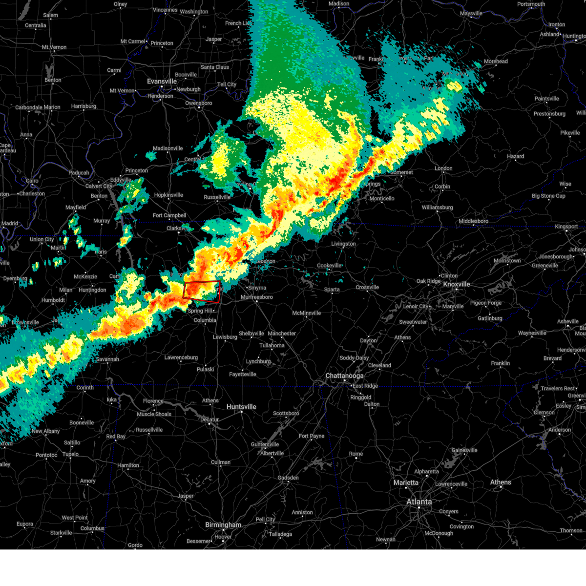 At 1106 pm cdt, a severe thunderstorm capable of producing a tornado was located near fairview, or 12 miles southeast of dickson, moving east at 45 mph (radar indicated rotation). Hazards include tornado. Flying debris will be dangerous to those caught without shelter. mobile homes will be damaged or destroyed. damage to roofs, windows, and vehicles will occur. tree damage is likely. this dangerous storm will be near, fairview around 1110 pm cdt. franklin around 1120 pm cdt. other locations impacted by this tornadic thunderstorm include natchez trace at highway 96 and leipers fork. this includes the following highways, interstate 40 between mile markers 176 and 182. Interstate 840 between mile markers 1 and 16. At 1106 pm cdt, a severe thunderstorm capable of producing a tornado was located near fairview, or 12 miles southeast of dickson, moving east at 45 mph (radar indicated rotation). Hazards include tornado. Flying debris will be dangerous to those caught without shelter. mobile homes will be damaged or destroyed. damage to roofs, windows, and vehicles will occur. tree damage is likely. this dangerous storm will be near, fairview around 1110 pm cdt. franklin around 1120 pm cdt. other locations impacted by this tornadic thunderstorm include natchez trace at highway 96 and leipers fork. this includes the following highways, interstate 40 between mile markers 176 and 182. Interstate 840 between mile markers 1 and 16.
|
| 3/30/2025 10:53 PM CDT |
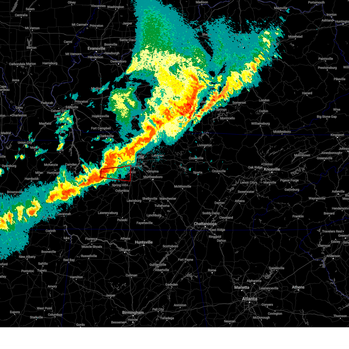 Torohx the national weather service in nashville has issued a * tornado warning for, southwestern davidson county in middle tennessee, southeastern dickson county in middle tennessee, northwestern williamson county in middle tennessee, northeastern hickman county in middle tennessee, * until 1145 pm cdt. * at 1052 pm cdt, a severe thunderstorm capable of producing a tornado was located 7 miles southwest of burns, or 8 miles south of dickson, moving east at 50 mph (radar indicated rotation). Hazards include tornado. Flying debris will be dangerous to those caught without shelter. mobile homes will be damaged or destroyed. damage to roofs, windows, and vehicles will occur. tree damage is likely. this dangerous storm will be near, fairview around 1105 pm cdt. franklin around 1120 pm cdt. other locations impacted by this tornadic thunderstorm include leipers fork, lyles, bon aqua, and natchez trace at highway 96. this includes the following highways, interstate 40 between mile markers 165 and 184. Interstate 840 between mile markers 1 and 17, and near mile marker 28. Torohx the national weather service in nashville has issued a * tornado warning for, southwestern davidson county in middle tennessee, southeastern dickson county in middle tennessee, northwestern williamson county in middle tennessee, northeastern hickman county in middle tennessee, * until 1145 pm cdt. * at 1052 pm cdt, a severe thunderstorm capable of producing a tornado was located 7 miles southwest of burns, or 8 miles south of dickson, moving east at 50 mph (radar indicated rotation). Hazards include tornado. Flying debris will be dangerous to those caught without shelter. mobile homes will be damaged or destroyed. damage to roofs, windows, and vehicles will occur. tree damage is likely. this dangerous storm will be near, fairview around 1105 pm cdt. franklin around 1120 pm cdt. other locations impacted by this tornadic thunderstorm include leipers fork, lyles, bon aqua, and natchez trace at highway 96. this includes the following highways, interstate 40 between mile markers 165 and 184. Interstate 840 between mile markers 1 and 17, and near mile marker 28.
|
| 3/30/2025 10:41 PM CDT |
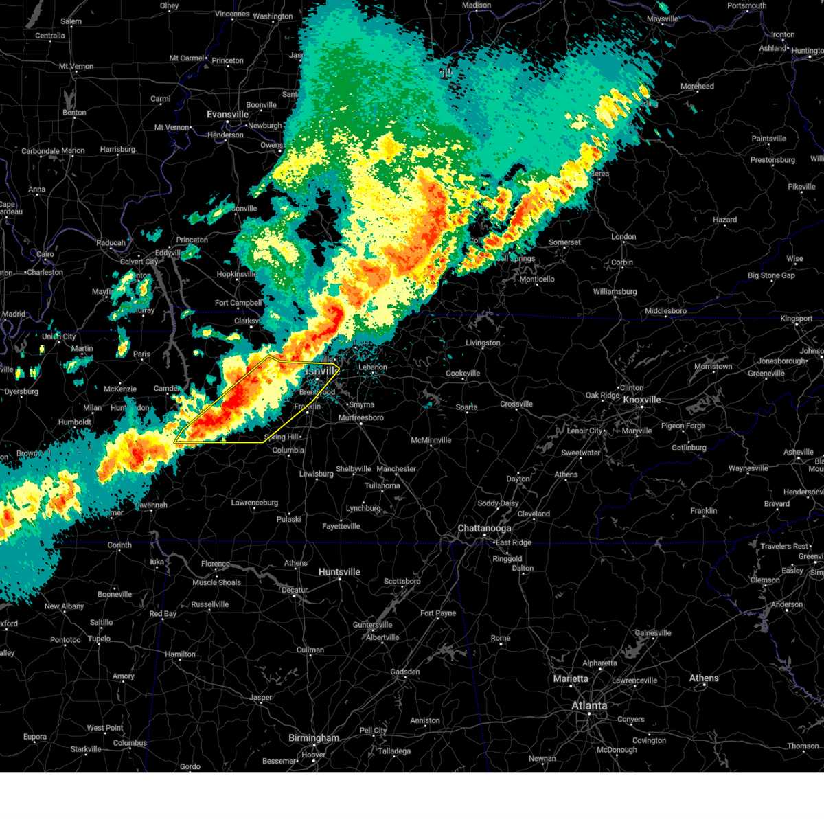 Svrohx the national weather service in nashville has issued a * severe thunderstorm warning for, central davidson county in middle tennessee, dickson county in middle tennessee, northwestern maury county in middle tennessee, northwestern williamson county in middle tennessee, southern cheatham county in middle tennessee, northern perry county in middle tennessee, southeastern humphreys county in middle tennessee, hickman county in middle tennessee, * until 1145 pm cdt. * at 1040 pm cdt, severe thunderstorms were located along a line extending from 8 miles north of white bluff to 7 miles southwest of dickson to 9 miles north of linden, moving east at 40 mph (radar indicated). Hazards include 60 mph wind gusts and quarter size hail. Hail damage to vehicles is expected. Expect wind damage to roofs, siding, and trees. Svrohx the national weather service in nashville has issued a * severe thunderstorm warning for, central davidson county in middle tennessee, dickson county in middle tennessee, northwestern maury county in middle tennessee, northwestern williamson county in middle tennessee, southern cheatham county in middle tennessee, northern perry county in middle tennessee, southeastern humphreys county in middle tennessee, hickman county in middle tennessee, * until 1145 pm cdt. * at 1040 pm cdt, severe thunderstorms were located along a line extending from 8 miles north of white bluff to 7 miles southwest of dickson to 9 miles north of linden, moving east at 40 mph (radar indicated). Hazards include 60 mph wind gusts and quarter size hail. Hail damage to vehicles is expected. Expect wind damage to roofs, siding, and trees.
|
| 3/23/2025 6:03 PM CDT |
 At 603 pm cdt, a severe thunderstorm was located near thompson's station, or 8 miles southwest of franklin, moving northeast at 50 mph (radar indicated). Hazards include 60 mph wind gusts and quarter size hail. Hail damage to vehicles is expected. expect wind damage to roofs, siding, and trees. locations impacted include, thompson's station and spring hill. this includes the following highways, interstate 65 near mile marker 54. Interstate 840 between mile markers 11 and 26. At 603 pm cdt, a severe thunderstorm was located near thompson's station, or 8 miles southwest of franklin, moving northeast at 50 mph (radar indicated). Hazards include 60 mph wind gusts and quarter size hail. Hail damage to vehicles is expected. expect wind damage to roofs, siding, and trees. locations impacted include, thompson's station and spring hill. this includes the following highways, interstate 65 near mile marker 54. Interstate 840 between mile markers 11 and 26.
|
| 3/23/2025 6:03 PM CDT |
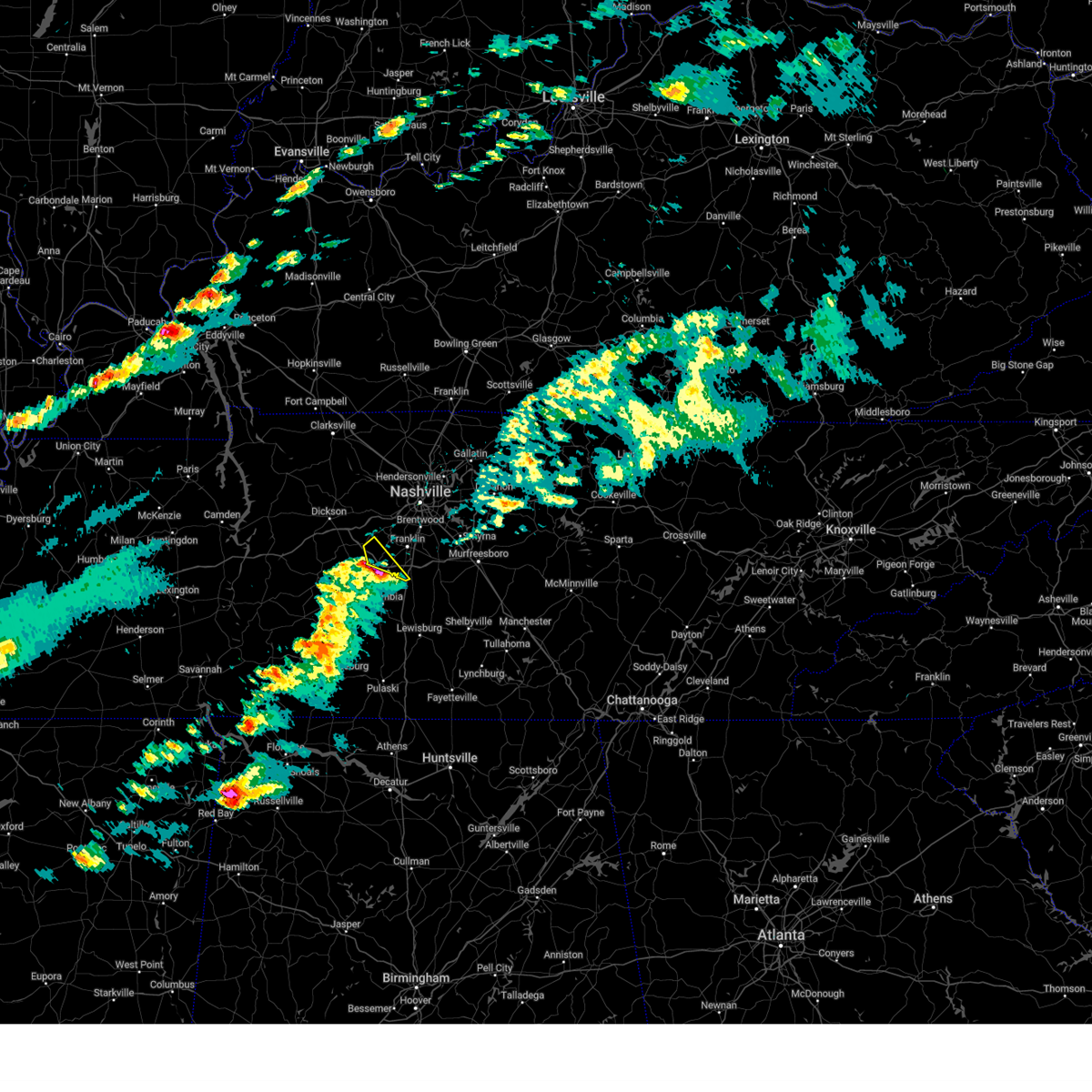 the severe thunderstorm warning has been cancelled and is no longer in effect the severe thunderstorm warning has been cancelled and is no longer in effect
|
| 3/23/2025 6:02 PM CDT |
 Svrohx the national weather service in nashville has issued a * severe thunderstorm warning for, southern davidson county in middle tennessee, northwestern rutherford county in middle tennessee, central williamson county in middle tennessee, * until 645 pm cdt. * at 601 pm cdt, a severe thunderstorm was located near thompson's station, or 10 miles southwest of franklin, moving northeast at 50 mph (radar indicated). Hazards include 60 mph wind gusts and quarter size hail. Hail damage to vehicles is expected. Expect wind damage to roofs, siding, and trees. Svrohx the national weather service in nashville has issued a * severe thunderstorm warning for, southern davidson county in middle tennessee, northwestern rutherford county in middle tennessee, central williamson county in middle tennessee, * until 645 pm cdt. * at 601 pm cdt, a severe thunderstorm was located near thompson's station, or 10 miles southwest of franklin, moving northeast at 50 mph (radar indicated). Hazards include 60 mph wind gusts and quarter size hail. Hail damage to vehicles is expected. Expect wind damage to roofs, siding, and trees.
|
| 3/23/2025 5:55 PM CDT |
 At 555 pm cdt, a severe thunderstorm was located 10 miles west of spring hill, or 11 miles north of columbia, moving northeast at 50 mph (radar indicated). Hazards include 60 mph wind gusts and quarter size hail. Hail damage to vehicles is expected. expect wind damage to roofs, siding, and trees. locations impacted include, santa fe, spring hill, thompson's station, and columbia. this includes the following highways, interstate 65 between mile markers 52 and 54. Interstate 840 between mile markers 9 and 26. At 555 pm cdt, a severe thunderstorm was located 10 miles west of spring hill, or 11 miles north of columbia, moving northeast at 50 mph (radar indicated). Hazards include 60 mph wind gusts and quarter size hail. Hail damage to vehicles is expected. expect wind damage to roofs, siding, and trees. locations impacted include, santa fe, spring hill, thompson's station, and columbia. this includes the following highways, interstate 65 between mile markers 52 and 54. Interstate 840 between mile markers 9 and 26.
|
| 3/23/2025 5:55 PM CDT |
 the severe thunderstorm warning has been cancelled and is no longer in effect the severe thunderstorm warning has been cancelled and is no longer in effect
|
| 3/23/2025 5:42 PM CDT |
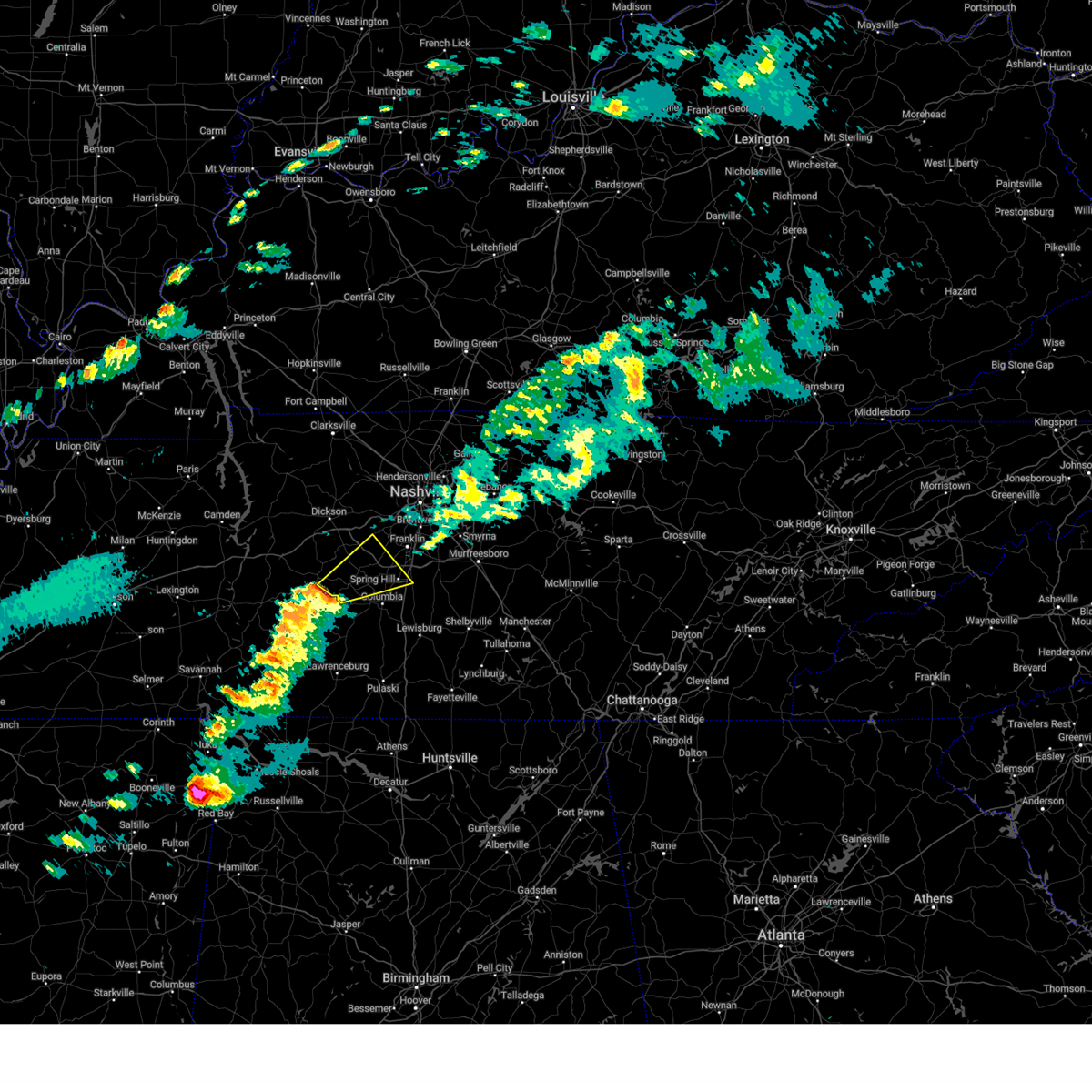 Svrohx the national weather service in nashville has issued a * severe thunderstorm warning for, northern maury county in middle tennessee, western williamson county in middle tennessee, southeastern hickman county in middle tennessee, * until 615 pm cdt. * at 542 pm cdt, a severe thunderstorm was located 10 miles southeast of centerville, moving east at 50 mph (radar indicated). Hazards include 60 mph wind gusts and quarter size hail. Hail damage to vehicles is expected. Expect wind damage to roofs, siding, and trees. Svrohx the national weather service in nashville has issued a * severe thunderstorm warning for, northern maury county in middle tennessee, western williamson county in middle tennessee, southeastern hickman county in middle tennessee, * until 615 pm cdt. * at 542 pm cdt, a severe thunderstorm was located 10 miles southeast of centerville, moving east at 50 mph (radar indicated). Hazards include 60 mph wind gusts and quarter size hail. Hail damage to vehicles is expected. Expect wind damage to roofs, siding, and trees.
|
| 3/19/2025 9:53 PM CDT |
 At 951 pm cdt, a severe thunderstorm was located over fairview, or 12 miles east of dickson, moving northeast at 55 mph (radar indicated). Hazards include 60 mph wind gusts and penny size hail. Expect damage to roofs, siding, and trees. locations impacted include, fairview, kingston springs, belle meade, bells bend, bellevue, natchez trace at highway 96, pegram, forest hills, and brentwood. This includes interstate 40 between mile markers 183 and 203. At 951 pm cdt, a severe thunderstorm was located over fairview, or 12 miles east of dickson, moving northeast at 55 mph (radar indicated). Hazards include 60 mph wind gusts and penny size hail. Expect damage to roofs, siding, and trees. locations impacted include, fairview, kingston springs, belle meade, bells bend, bellevue, natchez trace at highway 96, pegram, forest hills, and brentwood. This includes interstate 40 between mile markers 183 and 203.
|
| 3/19/2025 9:53 PM CDT |
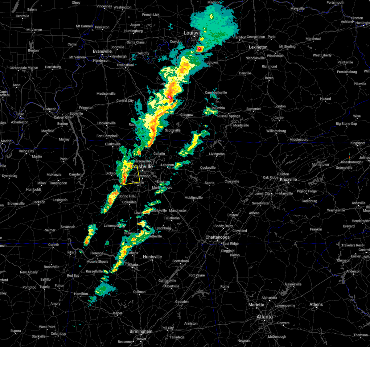 the severe thunderstorm warning has been cancelled and is no longer in effect the severe thunderstorm warning has been cancelled and is no longer in effect
|
| 3/19/2025 9:33 PM CDT |
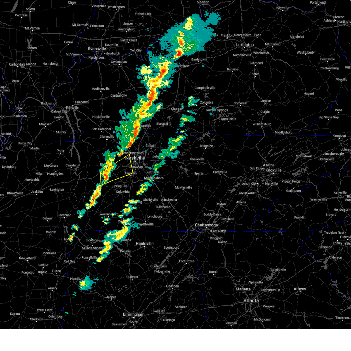 Svrohx the national weather service in nashville has issued a * severe thunderstorm warning for, southwestern davidson county in middle tennessee, southeastern dickson county in middle tennessee, northwestern williamson county in middle tennessee, southeastern cheatham county in middle tennessee, northeastern hickman county in middle tennessee, * until 1015 pm cdt. * at 933 pm cdt, a severe thunderstorm was located near centerville, moving northeast at 55 mph (radar indicated). Hazards include 60 mph wind gusts and penny size hail. expect damage to roofs, siding, and trees Svrohx the national weather service in nashville has issued a * severe thunderstorm warning for, southwestern davidson county in middle tennessee, southeastern dickson county in middle tennessee, northwestern williamson county in middle tennessee, southeastern cheatham county in middle tennessee, northeastern hickman county in middle tennessee, * until 1015 pm cdt. * at 933 pm cdt, a severe thunderstorm was located near centerville, moving northeast at 55 mph (radar indicated). Hazards include 60 mph wind gusts and penny size hail. expect damage to roofs, siding, and trees
|
| 8/17/2024 11:13 PM CDT | Facebook report of a tree down blocking chester rd at birch bark d in williamson county TN, 1.3 miles WNW of Fairview, TN |
| 7/30/2024 10:19 PM CDT |
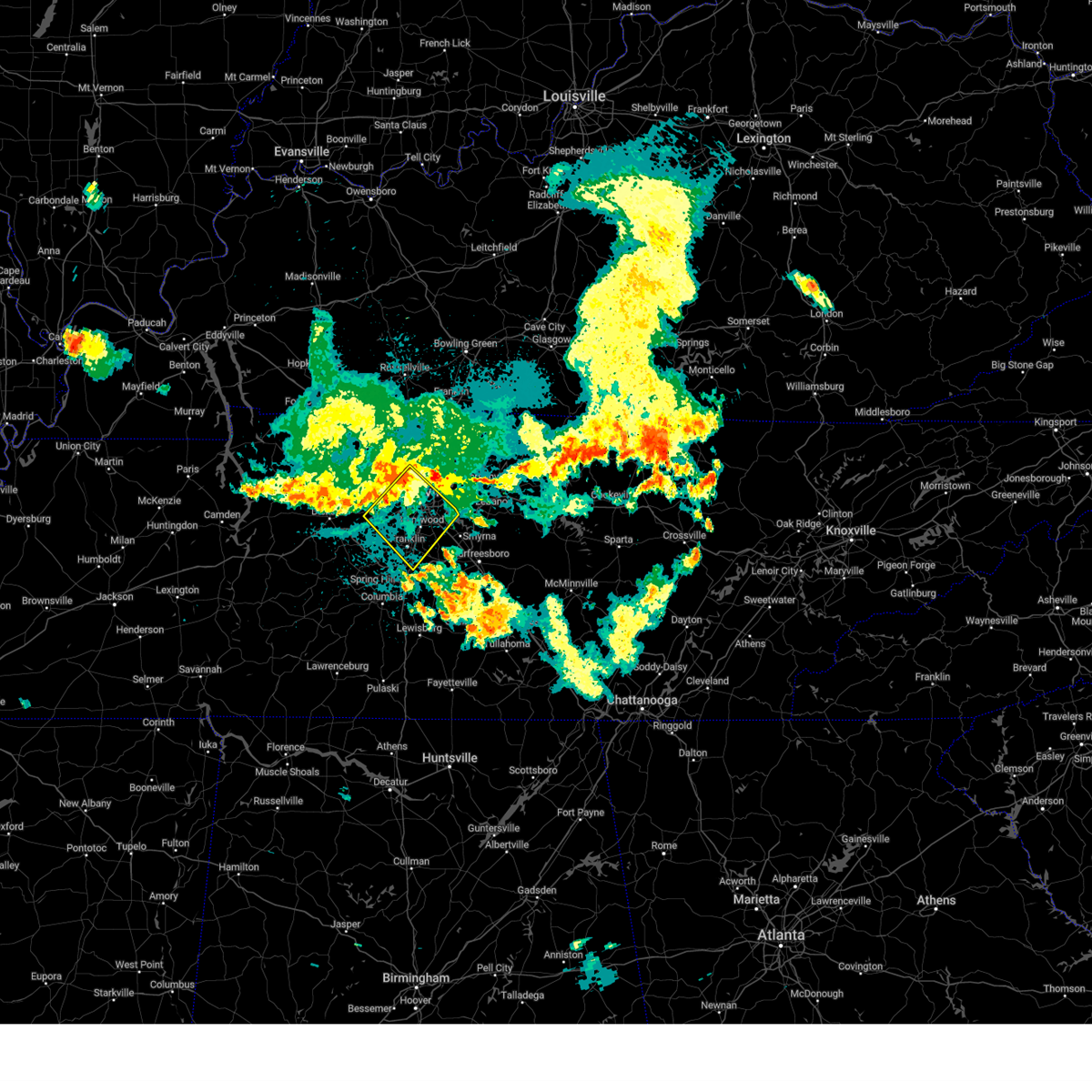 Svrohx the national weather service in nashville has issued a * severe thunderstorm warning for, davidson county in middle tennessee, northeastern williamson county in middle tennessee, southeastern cheatham county in middle tennessee, * until 1100 pm cdt. * at 1019 pm cdt, severe thunderstorms were located along a line extending from near joelton to pegram, moving southeast at 30 mph (radar indicated). Hazards include 70 mph wind gusts. Expect considerable tree damage. Damage is likely to mobile homes, roofs, and outbuildings. Svrohx the national weather service in nashville has issued a * severe thunderstorm warning for, davidson county in middle tennessee, northeastern williamson county in middle tennessee, southeastern cheatham county in middle tennessee, * until 1100 pm cdt. * at 1019 pm cdt, severe thunderstorms were located along a line extending from near joelton to pegram, moving southeast at 30 mph (radar indicated). Hazards include 70 mph wind gusts. Expect considerable tree damage. Damage is likely to mobile homes, roofs, and outbuildings.
|
| 7/30/2024 9:55 PM CDT |
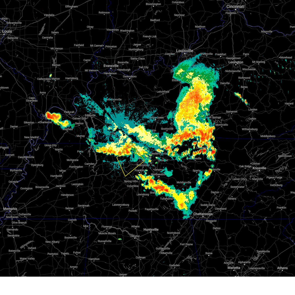 Svrohx the national weather service in nashville has issued a * severe thunderstorm warning for, western davidson county in middle tennessee, eastern dickson county in middle tennessee, northwestern williamson county in middle tennessee, cheatham county in middle tennessee, northeastern hickman county in middle tennessee, southwestern robertson county in middle tennessee, * until 1030 pm cdt. * at 954 pm cdt, severe thunderstorms were located along a line extending from near coopertown to charlotte, moving southeast at 30 mph (radar indicated). Hazards include 70 mph wind gusts and penny size hail. Expect considerable tree damage. Damage is likely to mobile homes, roofs, and outbuildings. Svrohx the national weather service in nashville has issued a * severe thunderstorm warning for, western davidson county in middle tennessee, eastern dickson county in middle tennessee, northwestern williamson county in middle tennessee, cheatham county in middle tennessee, northeastern hickman county in middle tennessee, southwestern robertson county in middle tennessee, * until 1030 pm cdt. * at 954 pm cdt, severe thunderstorms were located along a line extending from near coopertown to charlotte, moving southeast at 30 mph (radar indicated). Hazards include 70 mph wind gusts and penny size hail. Expect considerable tree damage. Damage is likely to mobile homes, roofs, and outbuildings.
|
| 5/26/2024 3:06 PM CDT |
 the severe thunderstorm warning has been cancelled and is no longer in effect the severe thunderstorm warning has been cancelled and is no longer in effect
|
| 5/26/2024 3:06 PM CDT |
 At 306 pm cdt, a severe thunderstorm was located near franklin, moving east at 30 mph (radar indicated). Hazards include golf ball size hail and 60 mph wind gusts. People and animals outdoors will be injured. expect hail damage to roofs, siding, windows, and vehicles. expect wind damage to roofs, siding, and trees. locations impacted include, franklin, nashville, hendersonville, smyrna, brentwood, la vergne, nolensville, forest hills, oak hill, belle meade, lakewood, hermitage, bellevue, antioch, fairview, old hickory, berry hill, natchez trace at highway 96, leipers fork, and percy priest lake. this includes the following highways, interstate 40 between mile markers 195 and 198, and between mile markers 205 and 222. interstate 65 between mile markers 63 and 86. Interstate 24 between mile markers 47 and 70. At 306 pm cdt, a severe thunderstorm was located near franklin, moving east at 30 mph (radar indicated). Hazards include golf ball size hail and 60 mph wind gusts. People and animals outdoors will be injured. expect hail damage to roofs, siding, windows, and vehicles. expect wind damage to roofs, siding, and trees. locations impacted include, franklin, nashville, hendersonville, smyrna, brentwood, la vergne, nolensville, forest hills, oak hill, belle meade, lakewood, hermitage, bellevue, antioch, fairview, old hickory, berry hill, natchez trace at highway 96, leipers fork, and percy priest lake. this includes the following highways, interstate 40 between mile markers 195 and 198, and between mile markers 205 and 222. interstate 65 between mile markers 63 and 86. Interstate 24 between mile markers 47 and 70.
|
| 5/26/2024 2:56 PM CDT |
 Svrohx the national weather service in nashville has issued a * severe thunderstorm warning for, davidson county in middle tennessee, northwestern rutherford county in middle tennessee, williamson county in middle tennessee, south central cheatham county in middle tennessee, * until 345 pm cdt. * at 255 pm cdt, a severe thunderstorm was located near fairview, or 10 miles west of franklin, moving east at 35 mph (radar indicated). Hazards include golf ball size hail and 60 mph wind gusts. People and animals outdoors will be injured. expect hail damage to roofs, siding, windows, and vehicles. Expect wind damage to roofs, siding, and trees. Svrohx the national weather service in nashville has issued a * severe thunderstorm warning for, davidson county in middle tennessee, northwestern rutherford county in middle tennessee, williamson county in middle tennessee, south central cheatham county in middle tennessee, * until 345 pm cdt. * at 255 pm cdt, a severe thunderstorm was located near fairview, or 10 miles west of franklin, moving east at 35 mph (radar indicated). Hazards include golf ball size hail and 60 mph wind gusts. People and animals outdoors will be injured. expect hail damage to roofs, siding, windows, and vehicles. Expect wind damage to roofs, siding, and trees.
|
| 5/26/2024 2:49 PM CDT | Golf Ball sized hail reported 0.7 miles WSW of Fairview, TN |
| 5/26/2024 2:49 PM CDT |
 At 249 pm cdt, a severe thunderstorm was located over fairview, or 12 miles west of franklin, moving east at 35 mph (radar indicated). Hazards include golf ball size hail and 60 mph wind gusts. People and animals outdoors will be injured. expect hail damage to roofs, siding, windows, and vehicles. expect wind damage to roofs, siding, and trees. locations impacted include, franklin, ashland city, kingston springs, pegram, fairview, bellevue, and natchez trace at highway 96. this includes the following highways, interstate 40 between mile markers 178 and 198. Interstate 840 between mile markers 1 and 13. At 249 pm cdt, a severe thunderstorm was located over fairview, or 12 miles west of franklin, moving east at 35 mph (radar indicated). Hazards include golf ball size hail and 60 mph wind gusts. People and animals outdoors will be injured. expect hail damage to roofs, siding, windows, and vehicles. expect wind damage to roofs, siding, and trees. locations impacted include, franklin, ashland city, kingston springs, pegram, fairview, bellevue, and natchez trace at highway 96. this includes the following highways, interstate 40 between mile markers 178 and 198. Interstate 840 between mile markers 1 and 13.
|
| 5/26/2024 2:48 PM CDT | Quarter sized hail reported 2.1 miles WNW of Fairview, TN |
| 5/26/2024 2:48 PM CDT |
 the severe thunderstorm warning has been cancelled and is no longer in effect the severe thunderstorm warning has been cancelled and is no longer in effect
|
| 5/26/2024 2:48 PM CDT |
 At 248 pm cdt, severe thunderstorms were located along a line extending from near lafayette to near franklin, moving east at 50 mph (radar indicated). Hazards include 60 mph wind gusts and nickel size hail. Expect damage to roofs, siding, and trees. locations impacted include, murfreesboro, franklin, lebanon, hartsville, nashville, hendersonville, smyrna, brentwood, la vergne, mount juliet, nolensville, forest hills, oak hill, belle meade, kingston springs, lakewood, pegram, hermitage, fairview, and walterhill. this includes the following highways, interstate 40 between mile markers 182 and 243. interstate 65 between mile markers 67 and 87. interstate 24 between mile markers 47 and 71. Interstate 840 between mile markers 56 and 76. At 248 pm cdt, severe thunderstorms were located along a line extending from near lafayette to near franklin, moving east at 50 mph (radar indicated). Hazards include 60 mph wind gusts and nickel size hail. Expect damage to roofs, siding, and trees. locations impacted include, murfreesboro, franklin, lebanon, hartsville, nashville, hendersonville, smyrna, brentwood, la vergne, mount juliet, nolensville, forest hills, oak hill, belle meade, kingston springs, lakewood, pegram, hermitage, fairview, and walterhill. this includes the following highways, interstate 40 between mile markers 182 and 243. interstate 65 between mile markers 67 and 87. interstate 24 between mile markers 47 and 71. Interstate 840 between mile markers 56 and 76.
|
| 5/26/2024 2:46 PM CDT | Hen Egg sized hail reported 0.7 miles WSW of Fairview, TN |
| 5/26/2024 2:35 PM CDT |
 At 234 pm cdt, a severe thunderstorm was located near fairview, or 9 miles southeast of dickson, moving east at 35 mph (radar indicated). Hazards include ping pong ball size hail and 60 mph wind gusts. People and animals outdoors will be injured. expect hail damage to roofs, siding, windows, and vehicles. expect wind damage to roofs, siding, and trees. locations impacted include, franklin, dickson, ashland city, white bluff, kingston springs, pegram, burns, fairview, bellevue, bon aqua, lyles, and natchez trace at highway 96. this includes the following highways, interstate 40 between mile markers 169 and 198. Interstate 840 between mile markers 1 and 13. At 234 pm cdt, a severe thunderstorm was located near fairview, or 9 miles southeast of dickson, moving east at 35 mph (radar indicated). Hazards include ping pong ball size hail and 60 mph wind gusts. People and animals outdoors will be injured. expect hail damage to roofs, siding, windows, and vehicles. expect wind damage to roofs, siding, and trees. locations impacted include, franklin, dickson, ashland city, white bluff, kingston springs, pegram, burns, fairview, bellevue, bon aqua, lyles, and natchez trace at highway 96. this includes the following highways, interstate 40 between mile markers 169 and 198. Interstate 840 between mile markers 1 and 13.
|
| 5/26/2024 2:33 PM CDT |
 At 233 pm cdt, severe thunderstorms were located along a line extending from near westmoreland to near fairview, moving east at 50 mph (radar indicated). Hazards include 60 mph wind gusts and nickel size hail. Expect damage to roofs, siding, and trees. locations impacted include, murfreesboro, franklin, gallatin, lebanon, lafayette, hartsville, nashville, madison, hendersonville, smyrna, brentwood, la vergne, mount juliet, goodlettsville, nolensville, forest hills, oak hill, belle meade, kingston springs, and lakewood. this includes the following highways, interstate 40 between mile markers 182 and 243. interstate 65 between mile markers 67 and 95. interstate 24 between mile markers 41 and 71. Interstate 840 between mile markers 56 and 76. At 233 pm cdt, severe thunderstorms were located along a line extending from near westmoreland to near fairview, moving east at 50 mph (radar indicated). Hazards include 60 mph wind gusts and nickel size hail. Expect damage to roofs, siding, and trees. locations impacted include, murfreesboro, franklin, gallatin, lebanon, lafayette, hartsville, nashville, madison, hendersonville, smyrna, brentwood, la vergne, mount juliet, goodlettsville, nolensville, forest hills, oak hill, belle meade, kingston springs, and lakewood. this includes the following highways, interstate 40 between mile markers 182 and 243. interstate 65 between mile markers 67 and 95. interstate 24 between mile markers 41 and 71. Interstate 840 between mile markers 56 and 76.
|
| 5/26/2024 2:18 PM CDT |
 At 218 pm cdt, severe thunderstorms were located along a line extending from 7 miles southwest of westmoreland to near burns, moving east at 50 mph (radar indicated). Hazards include 60 mph wind gusts and nickel size hail. Expect damage to roofs, siding, and trees. locations impacted include, murfreesboro, franklin, gallatin, lebanon, ashland city, lafayette, hartsville, nashville, madison, hendersonville, smyrna, brentwood, la vergne, mount juliet, goodlettsville, millersville, nolensville, forest hills, oak hill, and belle meade. this includes the following highways, interstate 40 between mile markers 182 and 243. interstate 65 between mile markers 67 and 101. interstate 24 between mile markers 33 and 71. Interstate 840 between mile markers 56 and 76. At 218 pm cdt, severe thunderstorms were located along a line extending from 7 miles southwest of westmoreland to near burns, moving east at 50 mph (radar indicated). Hazards include 60 mph wind gusts and nickel size hail. Expect damage to roofs, siding, and trees. locations impacted include, murfreesboro, franklin, gallatin, lebanon, ashland city, lafayette, hartsville, nashville, madison, hendersonville, smyrna, brentwood, la vergne, mount juliet, goodlettsville, millersville, nolensville, forest hills, oak hill, and belle meade. this includes the following highways, interstate 40 between mile markers 182 and 243. interstate 65 between mile markers 67 and 101. interstate 24 between mile markers 33 and 71. Interstate 840 between mile markers 56 and 76.
|
| 5/26/2024 2:18 PM CDT |
 the severe thunderstorm warning has been cancelled and is no longer in effect the severe thunderstorm warning has been cancelled and is no longer in effect
|
| 5/26/2024 2:17 PM CDT |
 Svrohx the national weather service in nashville has issued a * severe thunderstorm warning for, southwestern davidson county in middle tennessee, southern dickson county in middle tennessee, northwestern williamson county in middle tennessee, southeastern cheatham county in middle tennessee, northeastern hickman county in middle tennessee, * until 300 pm cdt. * at 216 pm cdt, a severe thunderstorm was located 7 miles southwest of dickson, moving east at 35 mph (radar indicated). Hazards include 60 mph wind gusts and quarter size hail. Hail damage to vehicles is expected. Expect wind damage to roofs, siding, and trees. Svrohx the national weather service in nashville has issued a * severe thunderstorm warning for, southwestern davidson county in middle tennessee, southern dickson county in middle tennessee, northwestern williamson county in middle tennessee, southeastern cheatham county in middle tennessee, northeastern hickman county in middle tennessee, * until 300 pm cdt. * at 216 pm cdt, a severe thunderstorm was located 7 miles southwest of dickson, moving east at 35 mph (radar indicated). Hazards include 60 mph wind gusts and quarter size hail. Hail damage to vehicles is expected. Expect wind damage to roofs, siding, and trees.
|
| 5/26/2024 2:04 PM CDT |
 the severe thunderstorm warning has been cancelled and is no longer in effect the severe thunderstorm warning has been cancelled and is no longer in effect
|
| 5/26/2024 2:04 PM CDT |
 At 204 pm cdt, severe thunderstorms were located along a line extending from near coopertown to near white bluff to near dickson, moving east at 50 mph (radar indicated). Hazards include 60 mph wind gusts and nickel size hail. Expect damage to roofs, siding, and trees. locations impacted include, springfield, dickson, ashland city, coopertown, white bluff, kingston springs, pegram, burns, pleasant view, charlotte, cedar hill, and cheatham dam. this includes the following highways, interstate 40 between mile markers 161 and 181, and between mile markers 185 and 191. interstate 24 between mile markers 19 and 31. Interstate 840 between mile markers 1 and 6. At 204 pm cdt, severe thunderstorms were located along a line extending from near coopertown to near white bluff to near dickson, moving east at 50 mph (radar indicated). Hazards include 60 mph wind gusts and nickel size hail. Expect damage to roofs, siding, and trees. locations impacted include, springfield, dickson, ashland city, coopertown, white bluff, kingston springs, pegram, burns, pleasant view, charlotte, cedar hill, and cheatham dam. this includes the following highways, interstate 40 between mile markers 161 and 181, and between mile markers 185 and 191. interstate 24 between mile markers 19 and 31. Interstate 840 between mile markers 1 and 6.
|
| 5/26/2024 1:55 PM CDT |
 At 154 pm cdt, severe thunderstorms were located along a line extending from 8 miles northwest of coopertown to near ashland city to near dickson, moving east at 45 mph (radar indicated). Hazards include 60 mph wind gusts and nickel size hail. Expect damage to roofs, siding, and trees. locations impacted include, springfield, dickson, ashland city, coopertown, white bluff, kingston springs, pegram, mcewen, burns, pleasant view, charlotte, adams, vanleer, cedar hill, slayden, and cheatham dam. this includes the following highways, interstate 40 between mile markers 161 and 181, and between mile markers 185 and 191. interstate 24 between mile markers 18 and 31. Interstate 840 between mile markers 1 and 6. At 154 pm cdt, severe thunderstorms were located along a line extending from 8 miles northwest of coopertown to near ashland city to near dickson, moving east at 45 mph (radar indicated). Hazards include 60 mph wind gusts and nickel size hail. Expect damage to roofs, siding, and trees. locations impacted include, springfield, dickson, ashland city, coopertown, white bluff, kingston springs, pegram, mcewen, burns, pleasant view, charlotte, adams, vanleer, cedar hill, slayden, and cheatham dam. this includes the following highways, interstate 40 between mile markers 161 and 181, and between mile markers 185 and 191. interstate 24 between mile markers 18 and 31. Interstate 840 between mile markers 1 and 6.
|
| 5/26/2024 1:55 PM CDT |
 the severe thunderstorm warning has been cancelled and is no longer in effect the severe thunderstorm warning has been cancelled and is no longer in effect
|
| 5/26/2024 1:53 PM CDT |
 Svrohx the national weather service in nashville has issued a * severe thunderstorm warning for, davidson county in middle tennessee, northwestern rutherford county in middle tennessee, sumner county in middle tennessee, northern williamson county in middle tennessee, wilson county in middle tennessee, cheatham county in middle tennessee, western macon county in middle tennessee, trousdale county in middle tennessee, robertson county in middle tennessee, * until 300 pm cdt. * at 153 pm cdt, severe thunderstorms were located along a line extending from near springfield to 6 miles west of dickson, moving east at 50 mph (radar indicated). Hazards include 60 mph wind gusts and nickel size hail. expect damage to roofs, siding, and trees Svrohx the national weather service in nashville has issued a * severe thunderstorm warning for, davidson county in middle tennessee, northwestern rutherford county in middle tennessee, sumner county in middle tennessee, northern williamson county in middle tennessee, wilson county in middle tennessee, cheatham county in middle tennessee, western macon county in middle tennessee, trousdale county in middle tennessee, robertson county in middle tennessee, * until 300 pm cdt. * at 153 pm cdt, severe thunderstorms were located along a line extending from near springfield to 6 miles west of dickson, moving east at 50 mph (radar indicated). Hazards include 60 mph wind gusts and nickel size hail. expect damage to roofs, siding, and trees
|
| 5/26/2024 1:40 PM CDT |
 At 140 pm cdt, severe thunderstorms were located along a line extending from 8 miles southeast of clarksville to 12 miles north of white bluff to near mcewen, moving east at 50 mph (radar indicated). Hazards include 60 mph wind gusts and nickel size hail. Expect damage to roofs, siding, and trees. locations impacted include, springfield, dickson, ashland city, waverly, clarksville, coopertown, white bluff, kingston springs, pegram, mcewen, burns, pleasant view, charlotte, adams, vanleer, cedar hill, slayden, cheatham dam, and cunningham. this includes the following highways, interstate 40 between mile markers 161 and 181, and between mile markers 185 and 191. interstate 24 between mile markers 11 and 31. Interstate 840 between mile markers 1 and 6. At 140 pm cdt, severe thunderstorms were located along a line extending from 8 miles southeast of clarksville to 12 miles north of white bluff to near mcewen, moving east at 50 mph (radar indicated). Hazards include 60 mph wind gusts and nickel size hail. Expect damage to roofs, siding, and trees. locations impacted include, springfield, dickson, ashland city, waverly, clarksville, coopertown, white bluff, kingston springs, pegram, mcewen, burns, pleasant view, charlotte, adams, vanleer, cedar hill, slayden, cheatham dam, and cunningham. this includes the following highways, interstate 40 between mile markers 161 and 181, and between mile markers 185 and 191. interstate 24 between mile markers 11 and 31. Interstate 840 between mile markers 1 and 6.
|
| 5/26/2024 1:25 PM CDT |
 the severe thunderstorm warning has been cancelled and is no longer in effect the severe thunderstorm warning has been cancelled and is no longer in effect
|
| 5/26/2024 1:25 PM CDT |
 At 125 pm cdt, severe thunderstorms were located along a line extending from 10 miles southwest of clarksville to 9 miles east of erin to waverly, moving east at 45 mph (radar indicated). Hazards include 60 mph wind gusts and nickel size hail. Expect damage to roofs, siding, and trees. locations impacted include, clarksville, springfield, dickson, ashland city, waverly, camden, erin, coopertown, white bluff, kingston springs, pegram, new johnsonville, mcewen, burns, pleasant view, charlotte, adams, vanleer, cedar hill, and cumberland city. this includes the following highways, interstate 40 between mile markers 161 and 181, and between mile markers 185 and 191. interstate 24 between mile markers 7 and 31. Interstate 840 between mile markers 1 and 6. At 125 pm cdt, severe thunderstorms were located along a line extending from 10 miles southwest of clarksville to 9 miles east of erin to waverly, moving east at 45 mph (radar indicated). Hazards include 60 mph wind gusts and nickel size hail. Expect damage to roofs, siding, and trees. locations impacted include, clarksville, springfield, dickson, ashland city, waverly, camden, erin, coopertown, white bluff, kingston springs, pegram, new johnsonville, mcewen, burns, pleasant view, charlotte, adams, vanleer, cedar hill, and cumberland city. this includes the following highways, interstate 40 between mile markers 161 and 181, and between mile markers 185 and 191. interstate 24 between mile markers 7 and 31. Interstate 840 between mile markers 1 and 6.
|
| 5/26/2024 1:14 PM CDT |
 Svrohx the national weather service in nashville has issued a * severe thunderstorm warning for, dickson county in middle tennessee, montgomery county in middle tennessee, southeastern stewart county in middle tennessee, houston county in middle tennessee, cheatham county in middle tennessee, humphreys county in middle tennessee, northeastern hickman county in middle tennessee, western robertson county in middle tennessee, * until 215 pm cdt. * at 114 pm cdt, severe thunderstorms were located along a line extending from 11 miles northeast of tennessee ridge to near erin to near new johnsonville, moving east at 45 mph (radar indicated). Hazards include 60 mph wind gusts and nickel size hail. expect damage to roofs, siding, and trees Svrohx the national weather service in nashville has issued a * severe thunderstorm warning for, dickson county in middle tennessee, montgomery county in middle tennessee, southeastern stewart county in middle tennessee, houston county in middle tennessee, cheatham county in middle tennessee, humphreys county in middle tennessee, northeastern hickman county in middle tennessee, western robertson county in middle tennessee, * until 215 pm cdt. * at 114 pm cdt, severe thunderstorms were located along a line extending from 11 miles northeast of tennessee ridge to near erin to near new johnsonville, moving east at 45 mph (radar indicated). Hazards include 60 mph wind gusts and nickel size hail. expect damage to roofs, siding, and trees
|
| 5/14/2024 3:58 PM CDT |
 Svrohx the national weather service in nashville has issued a * severe thunderstorm warning for, southeastern dickson county in middle tennessee, north central maury county in middle tennessee, northwestern williamson county in middle tennessee, northeastern hickman county in middle tennessee, * until 445 pm cdt. * at 358 pm cdt, a severe thunderstorm was located 13 miles south of fairview, or 13 miles northwest of columbia, moving north at 20 mph (radar indicated). Hazards include quarter size hail. damage to vehicles is expected Svrohx the national weather service in nashville has issued a * severe thunderstorm warning for, southeastern dickson county in middle tennessee, north central maury county in middle tennessee, northwestern williamson county in middle tennessee, northeastern hickman county in middle tennessee, * until 445 pm cdt. * at 358 pm cdt, a severe thunderstorm was located 13 miles south of fairview, or 13 miles northwest of columbia, moving north at 20 mph (radar indicated). Hazards include quarter size hail. damage to vehicles is expected
|
| 5/9/2024 2:42 AM CDT |
 the severe thunderstorm warning has been cancelled and is no longer in effect the severe thunderstorm warning has been cancelled and is no longer in effect
|
| 5/9/2024 2:36 AM CDT |
 At 235 am cdt, a severe thunderstorm was located near fairview, or 9 miles southeast of dickson, moving east at 45 mph (radar indicated). Hazards include 60 mph wind gusts and penny size hail. Expect damage to roofs, siding, and trees. locations impacted include, franklin, columbia, dickson, centerville, spring hill, forest hills, white bluff, kingston springs, thompson's station, pegram, burns, bellevue, fairview, bon aqua, bells bend, primm springs, lyles, natchez trace at highway 96, santa fe, and hampshire. this includes the following highways, interstate 40 between mile markers 165 and 202. interstate 65 between mile markers 48 and 63. Interstate 840 between mile markers 1 and 32. At 235 am cdt, a severe thunderstorm was located near fairview, or 9 miles southeast of dickson, moving east at 45 mph (radar indicated). Hazards include 60 mph wind gusts and penny size hail. Expect damage to roofs, siding, and trees. locations impacted include, franklin, columbia, dickson, centerville, spring hill, forest hills, white bluff, kingston springs, thompson's station, pegram, burns, bellevue, fairview, bon aqua, bells bend, primm springs, lyles, natchez trace at highway 96, santa fe, and hampshire. this includes the following highways, interstate 40 between mile markers 165 and 202. interstate 65 between mile markers 48 and 63. Interstate 840 between mile markers 1 and 32.
|
| 5/9/2024 2:17 AM CDT |
 Svrohx the national weather service in nashville has issued a * severe thunderstorm warning for, southwestern davidson county in middle tennessee, northern lewis county in middle tennessee, southern dickson county in middle tennessee, northern maury county in middle tennessee, williamson county in middle tennessee, south central cheatham county in middle tennessee, hickman county in middle tennessee, * until 300 am cdt. * at 216 am cdt, a severe thunderstorm was located 8 miles northwest of centerville, moving east at 45 mph (radar indicated). Hazards include 60 mph wind gusts and penny size hail. expect damage to roofs, siding, and trees Svrohx the national weather service in nashville has issued a * severe thunderstorm warning for, southwestern davidson county in middle tennessee, northern lewis county in middle tennessee, southern dickson county in middle tennessee, northern maury county in middle tennessee, williamson county in middle tennessee, south central cheatham county in middle tennessee, hickman county in middle tennessee, * until 300 am cdt. * at 216 am cdt, a severe thunderstorm was located 8 miles northwest of centerville, moving east at 45 mph (radar indicated). Hazards include 60 mph wind gusts and penny size hail. expect damage to roofs, siding, and trees
|
| 5/9/2024 1:59 AM CDT |
 Svrohx the national weather service in nashville has issued a * severe thunderstorm warning for, southern davidson county in middle tennessee, western rutherford county in middle tennessee, northern maury county in middle tennessee, williamson county in middle tennessee, * until 245 am cdt. * at 158 am cdt, a severe thunderstorm was located 10 miles south of fairview, or 15 miles north of columbia, moving east at 40 mph (radar indicated). Hazards include 60 mph wind gusts and penny size hail. expect damage to roofs, siding, and trees Svrohx the national weather service in nashville has issued a * severe thunderstorm warning for, southern davidson county in middle tennessee, western rutherford county in middle tennessee, northern maury county in middle tennessee, williamson county in middle tennessee, * until 245 am cdt. * at 158 am cdt, a severe thunderstorm was located 10 miles south of fairview, or 15 miles north of columbia, moving east at 40 mph (radar indicated). Hazards include 60 mph wind gusts and penny size hail. expect damage to roofs, siding, and trees
|
| 5/9/2024 1:41 AM CDT |
 At 141 am cdt, a severe thunderstorm was located near centerville, moving east at 35 mph (radar indicated). Hazards include 60 mph wind gusts and quarter size hail. Hail damage to vehicles is expected. expect wind damage to roofs, siding, and trees. locations impacted include, dickson, centerville, burns, santa fe, bon aqua, pinewood, primm springs, lyles, and nunnelly. this includes the following highways, interstate 40 between mile markers 151 and 158, and between mile markers 166 and 180. Interstate 840 between mile markers 1 and 11. At 141 am cdt, a severe thunderstorm was located near centerville, moving east at 35 mph (radar indicated). Hazards include 60 mph wind gusts and quarter size hail. Hail damage to vehicles is expected. expect wind damage to roofs, siding, and trees. locations impacted include, dickson, centerville, burns, santa fe, bon aqua, pinewood, primm springs, lyles, and nunnelly. this includes the following highways, interstate 40 between mile markers 151 and 158, and between mile markers 166 and 180. Interstate 840 between mile markers 1 and 11.
|
| 5/9/2024 1:27 AM CDT |
 Svrohx the national weather service in nashville has issued a * severe thunderstorm warning for, southeastern dickson county in middle tennessee, northwestern maury county in middle tennessee, west central williamson county in middle tennessee, hickman county in middle tennessee, * until 200 am cdt. * at 127 am cdt, a severe thunderstorm was located near centerville, moving east at 35 mph (radar indicated). Hazards include 60 mph wind gusts and quarter size hail. Hail damage to vehicles is expected. Expect wind damage to roofs, siding, and trees. Svrohx the national weather service in nashville has issued a * severe thunderstorm warning for, southeastern dickson county in middle tennessee, northwestern maury county in middle tennessee, west central williamson county in middle tennessee, hickman county in middle tennessee, * until 200 am cdt. * at 127 am cdt, a severe thunderstorm was located near centerville, moving east at 35 mph (radar indicated). Hazards include 60 mph wind gusts and quarter size hail. Hail damage to vehicles is expected. Expect wind damage to roofs, siding, and trees.
|
| 5/6/2024 3:23 PM CDT |
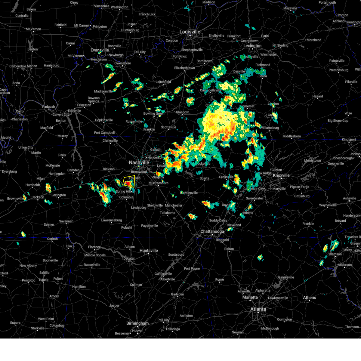 At 322 pm cdt, a severe thunderstorm was located near fairview, or 9 miles west of franklin, moving east at 20 mph (radar indicated). Hazards include golf ball size hail and 60 mph wind gusts. People and animals outdoors will be injured. expect hail damage to roofs, siding, windows, and vehicles. expect wind damage to roofs, siding, and trees. locations impacted include, franklin, thompson's station, leipers fork, and natchez trace at highway 96. This includes interstate 840 between mile markers 14 and 16, and near mile marker 28. At 322 pm cdt, a severe thunderstorm was located near fairview, or 9 miles west of franklin, moving east at 20 mph (radar indicated). Hazards include golf ball size hail and 60 mph wind gusts. People and animals outdoors will be injured. expect hail damage to roofs, siding, windows, and vehicles. expect wind damage to roofs, siding, and trees. locations impacted include, franklin, thompson's station, leipers fork, and natchez trace at highway 96. This includes interstate 840 between mile markers 14 and 16, and near mile marker 28.
|
| 5/6/2024 3:12 PM CDT |
 At 312 pm cdt, a severe thunderstorm was located near fairview, or 13 miles west of franklin, moving east at 20 mph (radar indicated). Hazards include golf ball size hail and 60 mph wind gusts. People and animals outdoors will be injured. expect hail damage to roofs, siding, windows, and vehicles. expect wind damage to roofs, siding, and trees. locations impacted include, franklin, thompson's station, leipers fork, and natchez trace at highway 96. This includes interstate 840 between mile markers 10 and 16, and near mile marker 28. At 312 pm cdt, a severe thunderstorm was located near fairview, or 13 miles west of franklin, moving east at 20 mph (radar indicated). Hazards include golf ball size hail and 60 mph wind gusts. People and animals outdoors will be injured. expect hail damage to roofs, siding, windows, and vehicles. expect wind damage to roofs, siding, and trees. locations impacted include, franklin, thompson's station, leipers fork, and natchez trace at highway 96. This includes interstate 840 between mile markers 10 and 16, and near mile marker 28.
|
| 5/6/2024 3:06 PM CDT |
 Svrohx the national weather service in nashville has issued a * severe thunderstorm warning for, northwestern williamson county in middle tennessee, * until 345 pm cdt. * at 306 pm cdt, a severe thunderstorm was located near fairview, or 15 miles west of franklin, moving east at 20 mph (radar indicated). Hazards include 60 mph wind gusts and quarter size hail. Hail damage to vehicles is expected. Expect wind damage to roofs, siding, and trees. Svrohx the national weather service in nashville has issued a * severe thunderstorm warning for, northwestern williamson county in middle tennessee, * until 345 pm cdt. * at 306 pm cdt, a severe thunderstorm was located near fairview, or 15 miles west of franklin, moving east at 20 mph (radar indicated). Hazards include 60 mph wind gusts and quarter size hail. Hail damage to vehicles is expected. Expect wind damage to roofs, siding, and trees.
|
| 5/6/2024 3:03 PM CDT | Quarter sized hail reported 2.6 miles N of Fairview, TN, social media report. |
| 12/9/2023 5:51 PM CST |
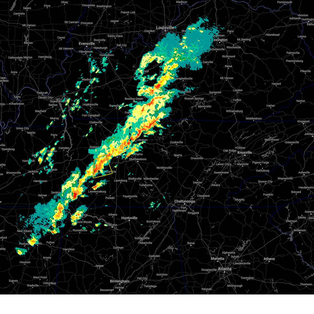 At 551 pm cst, a severe thunderstorm was located 12 miles east of centerville, moving east at 50 mph (radar indicated). Hazards include 60 mph wind gusts and quarter size hail. Hail damage to vehicles is expected. expect wind damage to roofs, siding, and trees. locations impacted include, columbia, santa fe, williamsport, primm springs, and hampshire. this includes interstate 840 between mile markers 7 and 15. hail threat, radar indicated max hail size, 1. 00 in wind threat, radar indicated max wind gust, 60 mph. At 551 pm cst, a severe thunderstorm was located 12 miles east of centerville, moving east at 50 mph (radar indicated). Hazards include 60 mph wind gusts and quarter size hail. Hail damage to vehicles is expected. expect wind damage to roofs, siding, and trees. locations impacted include, columbia, santa fe, williamsport, primm springs, and hampshire. this includes interstate 840 between mile markers 7 and 15. hail threat, radar indicated max hail size, 1. 00 in wind threat, radar indicated max wind gust, 60 mph.
|
| 12/9/2023 5:27 PM CST |
 At 527 pm cst, a severe thunderstorm was located near hohenwald, moving northeast at 50 mph (radar indicated). Hazards include 60 mph wind gusts and quarter size hail. Hail damage to vehicles is expected. Expect wind damage to roofs, siding, and trees. At 527 pm cst, a severe thunderstorm was located near hohenwald, moving northeast at 50 mph (radar indicated). Hazards include 60 mph wind gusts and quarter size hail. Hail damage to vehicles is expected. Expect wind damage to roofs, siding, and trees.
|
| 12/9/2023 4:06 PM CST |
 At 406 pm cst, a severe thunderstorm capable of producing a tornado was located 5 miles southwest of dickson, moving east at 45 mph (radar indicated rotation). Hazards include tornado. Flying debris will be dangerous to those caught without shelter. mobile homes will be damaged or destroyed. damage to roofs, windows, and vehicles will occur. tree damage is likely. this dangerous storm will be near, dickson and burns around 410 pm cst. white bluff around 420 pm cst. kingston springs around 425 pm cst. this includes the following highways, interstate 40 between mile markers 164 and 189. Interstate 840 between mile markers 1 and 4. At 406 pm cst, a severe thunderstorm capable of producing a tornado was located 5 miles southwest of dickson, moving east at 45 mph (radar indicated rotation). Hazards include tornado. Flying debris will be dangerous to those caught without shelter. mobile homes will be damaged or destroyed. damage to roofs, windows, and vehicles will occur. tree damage is likely. this dangerous storm will be near, dickson and burns around 410 pm cst. white bluff around 420 pm cst. kingston springs around 425 pm cst. this includes the following highways, interstate 40 between mile markers 164 and 189. Interstate 840 between mile markers 1 and 4.
|
| 12/9/2023 3:52 PM CST |
 At 352 pm cst, a severe thunderstorm was located near mcewen, or 8 miles southeast of waverly, moving east at 50 mph (radar indicated). Hazards include 60 mph wind gusts and nickel size hail. expect damage to roofs, siding, and trees At 352 pm cst, a severe thunderstorm was located near mcewen, or 8 miles southeast of waverly, moving east at 50 mph (radar indicated). Hazards include 60 mph wind gusts and nickel size hail. expect damage to roofs, siding, and trees
|
| 8/13/2023 3:13 PM CDT |
 At 312 pm cdt, severe thunderstorms were located along a line extending from 6 miles southwest of coopertown to 8 miles west of franklin, moving east at 40 mph (radar indicated). Hazards include 60 mph wind gusts. Expect damage to roofs, siding, and trees. locations impacted include, murfreesboro, franklin, gallatin, lebanon, springfield, ashland city, nashville, madison, hendersonville, smyrna, brentwood, la vergne, mount juliet, goodlettsville, white house, millersville, greenbrier, nolensville, forest hills and oak hill. this includes the following highways, interstate 40 between mile markers 182 and 232. interstate 65 between mile markers 63 and 109. interstate 24 between mile markers 22 and 74. interstate 840 between mile markers 7 and 16, and between mile markers 53 and 72. hail threat, radar indicated max hail size, <. 75 in wind threat, radar indicated max wind gust, 60 mph. At 312 pm cdt, severe thunderstorms were located along a line extending from 6 miles southwest of coopertown to 8 miles west of franklin, moving east at 40 mph (radar indicated). Hazards include 60 mph wind gusts. Expect damage to roofs, siding, and trees. locations impacted include, murfreesboro, franklin, gallatin, lebanon, springfield, ashland city, nashville, madison, hendersonville, smyrna, brentwood, la vergne, mount juliet, goodlettsville, white house, millersville, greenbrier, nolensville, forest hills and oak hill. this includes the following highways, interstate 40 between mile markers 182 and 232. interstate 65 between mile markers 63 and 109. interstate 24 between mile markers 22 and 74. interstate 840 between mile markers 7 and 16, and between mile markers 53 and 72. hail threat, radar indicated max hail size, <. 75 in wind threat, radar indicated max wind gust, 60 mph.
|
| 8/13/2023 2:57 PM CDT |
 At 257 pm cdt, severe thunderstorms were located along a line extending from 10 miles northwest of ashland city to near fairview, moving east at 40 mph (radar indicated). Hazards include 60 mph wind gusts. expect damage to roofs, siding, and trees At 257 pm cdt, severe thunderstorms were located along a line extending from 10 miles northwest of ashland city to near fairview, moving east at 40 mph (radar indicated). Hazards include 60 mph wind gusts. expect damage to roofs, siding, and trees
|
| 8/13/2023 2:45 PM CDT |
 At 245 pm cdt, severe thunderstorms were located along a line extending from oak grove to 9 miles north of white bluff to 9 miles northeast of centerville, moving east at 40 mph (radar indicated). Hazards include 60 mph wind gusts. Expect damage to roofs, siding, and trees. locations impacted include, clarksville, springfield, dickson, oak grove, ashland city, centerville, fort campbell, coopertown, white bluff, kingston springs, pegram, burns, guthrie, fairview, pleasant view, charlotte, adams, vanleer, cedar hill and slayden. this includes the following highways, interstate 40 between mile markers 152 and 159, and between mile markers 161 and 191. interstate 24 between mile markers 1 and 31. interstate 840 between mile markers 1 and 14. hail threat, radar indicated max hail size, <. 75 in wind threat, radar indicated max wind gust, 60 mph. At 245 pm cdt, severe thunderstorms were located along a line extending from oak grove to 9 miles north of white bluff to 9 miles northeast of centerville, moving east at 40 mph (radar indicated). Hazards include 60 mph wind gusts. Expect damage to roofs, siding, and trees. locations impacted include, clarksville, springfield, dickson, oak grove, ashland city, centerville, fort campbell, coopertown, white bluff, kingston springs, pegram, burns, guthrie, fairview, pleasant view, charlotte, adams, vanleer, cedar hill and slayden. this includes the following highways, interstate 40 between mile markers 152 and 159, and between mile markers 161 and 191. interstate 24 between mile markers 1 and 31. interstate 840 between mile markers 1 and 14. hail threat, radar indicated max hail size, <. 75 in wind threat, radar indicated max wind gust, 60 mph.
|
| 8/13/2023 2:44 PM CDT | Tspotter report of 3 large oak trees down at i-40 and highway 9 in williamson county TN, 4.3 miles SSE of Fairview, TN |
| 8/13/2023 2:09 PM CDT |
 At 209 pm cdt, severe thunderstorms were located along a line extending from near big rock to mcewen to hurricane mills, moving east at 50 mph (radar indicated). Hazards include 60 mph wind gusts. expect damage to roofs, siding, and trees At 209 pm cdt, severe thunderstorms were located along a line extending from near big rock to mcewen to hurricane mills, moving east at 50 mph (radar indicated). Hazards include 60 mph wind gusts. expect damage to roofs, siding, and trees
|
| 8/12/2023 11:39 AM CDT |
 At 1138 am cdt, severe thunderstorms were located along a line extending from nashville to 7 miles east of fairview, moving east at 40 mph (radar indicated). Hazards include 60 mph wind gusts. Expect damage to roofs, siding, and trees. locations impacted include, franklin, brentwood, nolensville, forest hills, oak hill, belle meade, fairview, bellevue, antioch, berry hill, bells bend and natchez trace at highway 96. this includes the following highways, interstate 40 between mile markers 193 and 206, and between mile markers 209 and 214. interstate 65 between mile markers 64 and 82. interstate 24 between mile markers 52 and 59. hail threat, radar indicated max hail size, <. 75 in wind threat, radar indicated max wind gust, 60 mph. At 1138 am cdt, severe thunderstorms were located along a line extending from nashville to 7 miles east of fairview, moving east at 40 mph (radar indicated). Hazards include 60 mph wind gusts. Expect damage to roofs, siding, and trees. locations impacted include, franklin, brentwood, nolensville, forest hills, oak hill, belle meade, fairview, bellevue, antioch, berry hill, bells bend and natchez trace at highway 96. this includes the following highways, interstate 40 between mile markers 193 and 206, and between mile markers 209 and 214. interstate 65 between mile markers 64 and 82. interstate 24 between mile markers 52 and 59. hail threat, radar indicated max hail size, <. 75 in wind threat, radar indicated max wind gust, 60 mph.
|
| 8/12/2023 11:37 AM CDT | Tree down on hwy 100 near whippoorwill hill blocking both lanes of traffi in williamson county TN, 1.1 miles N of Fairview, TN |
| 8/12/2023 11:35 AM CDT |
 At 1134 am cdt, a severe thunderstorm was located 9 miles south of fairview, or 13 miles west of franklin, moving east at 50 mph (radar indicated). Hazards include 70 mph wind gusts. Expect considerable tree damage. damage is likely to mobile homes, roofs, and outbuildings. locations impacted include, franklin, columbia, centerville, spring hill, thompson`s station, santa fe, primm springs, leipers fork and i-65 east of columbia. this includes the following highways, interstate 65 between mile markers 45 and 63. interstate 840 between mile markers 6 and 36. thunderstorm damage threat, considerable hail threat, radar indicated max hail size, <. 75 in wind threat, radar indicated max wind gust, 70 mph. At 1134 am cdt, a severe thunderstorm was located 9 miles south of fairview, or 13 miles west of franklin, moving east at 50 mph (radar indicated). Hazards include 70 mph wind gusts. Expect considerable tree damage. damage is likely to mobile homes, roofs, and outbuildings. locations impacted include, franklin, columbia, centerville, spring hill, thompson`s station, santa fe, primm springs, leipers fork and i-65 east of columbia. this includes the following highways, interstate 65 between mile markers 45 and 63. interstate 840 between mile markers 6 and 36. thunderstorm damage threat, considerable hail threat, radar indicated max hail size, <. 75 in wind threat, radar indicated max wind gust, 70 mph.
|
| 8/12/2023 11:32 AM CDT | Report of trees down with scattered power outages in the fairview are in williamson county TN, 4.7 miles NNE of Fairview, TN |
| 8/12/2023 11:26 AM CDT |
 At 1126 am cdt, a severe thunderstorm was located 8 miles southwest of fairview, or 15 miles east of centerville, moving east at 50 mph (radar indicated). Hazards include 60 mph wind gusts. expect damage to roofs, siding, and trees At 1126 am cdt, a severe thunderstorm was located 8 miles southwest of fairview, or 15 miles east of centerville, moving east at 50 mph (radar indicated). Hazards include 60 mph wind gusts. expect damage to roofs, siding, and trees
|
| 8/12/2023 11:09 AM CDT |
 At 1109 am cdt, a severe thunderstorm was located near dickson, moving east at 40 mph (radar indicated). Hazards include 60 mph wind gusts. expect damage to roofs, siding, and trees At 1109 am cdt, a severe thunderstorm was located near dickson, moving east at 40 mph (radar indicated). Hazards include 60 mph wind gusts. expect damage to roofs, siding, and trees
|
| 8/10/2023 12:43 AM CDT |
 At 1243 am cdt, severe thunderstorms were located along a line extending from parsons to near savannah, moving east at 50 mph (radar indicated). Hazards include 60 mph wind gusts and penny size hail. expect damage to roofs, siding, and trees At 1243 am cdt, severe thunderstorms were located along a line extending from parsons to near savannah, moving east at 50 mph (radar indicated). Hazards include 60 mph wind gusts and penny size hail. expect damage to roofs, siding, and trees
|
| 7/20/2023 1:21 PM CDT |
 The severe thunderstorm warning for northwestern davidson, dickson, cheatham, northeastern hickman and southwestern robertson counties will expire at 130 pm cdt, the storms which prompted the warning have weakened below severe limits, and no longer pose an immediate threat to life or property. therefore, the warning will be allowed to expire. however gusty winds and heavy rain are still possible with these thunderstorms. a severe thunderstorm watch remains in effect until 700 pm cdt for middle tennessee. The severe thunderstorm warning for northwestern davidson, dickson, cheatham, northeastern hickman and southwestern robertson counties will expire at 130 pm cdt, the storms which prompted the warning have weakened below severe limits, and no longer pose an immediate threat to life or property. therefore, the warning will be allowed to expire. however gusty winds and heavy rain are still possible with these thunderstorms. a severe thunderstorm watch remains in effect until 700 pm cdt for middle tennessee.
|
| 7/20/2023 1:03 PM CDT |
 At 102 pm cdt, severe thunderstorms were located along a line extending from 8 miles west of coopertown to 9 miles north of dickson, moving southeast at 35 mph (radar indicated). Hazards include 60 mph wind gusts and penny size hail. Expect damage to roofs, siding, and trees. locations impacted include, dickson, ashland city, nashville, madison, forest hills, coopertown, white bluff, belle meade, kingston springs, lakewood, pegram, burns, bellevue, joelton, pleasant view, charlotte, vanleer, slayden, cheatham dam and bells bend. this includes the following highways, interstate 40 between mile markers 171 and 181, and between mile markers 185 and 211. interstate 65 between mile markers 82 and 93. interstate 24 between mile markers 18 and 49. interstate 840 between mile markers 1 and 5. hail threat, radar indicated max hail size, 0. 75 in wind threat, radar indicated max wind gust, 60 mph. At 102 pm cdt, severe thunderstorms were located along a line extending from 8 miles west of coopertown to 9 miles north of dickson, moving southeast at 35 mph (radar indicated). Hazards include 60 mph wind gusts and penny size hail. Expect damage to roofs, siding, and trees. locations impacted include, dickson, ashland city, nashville, madison, forest hills, coopertown, white bluff, belle meade, kingston springs, lakewood, pegram, burns, bellevue, joelton, pleasant view, charlotte, vanleer, slayden, cheatham dam and bells bend. this includes the following highways, interstate 40 between mile markers 171 and 181, and between mile markers 185 and 211. interstate 65 between mile markers 82 and 93. interstate 24 between mile markers 18 and 49. interstate 840 between mile markers 1 and 5. hail threat, radar indicated max hail size, 0. 75 in wind threat, radar indicated max wind gust, 60 mph.
|
| 7/20/2023 12:51 PM CDT |
 At 1250 pm cdt, severe thunderstorms were located along a line extending from 9 miles southeast of clarksville to 11 miles east of erin, moving southeast at 35 mph (radar indicated). Hazards include 60 mph wind gusts and penny size hail. expect damage to roofs, siding, and trees At 1250 pm cdt, severe thunderstorms were located along a line extending from 9 miles southeast of clarksville to 11 miles east of erin, moving southeast at 35 mph (radar indicated). Hazards include 60 mph wind gusts and penny size hail. expect damage to roofs, siding, and trees
|
| 7/18/2023 3:55 PM CDT |
 At 355 pm cdt, severe thunderstorms were located along a line extending from near thompson`s station to 7 miles north of mount pleasant to 9 miles west of hohenwald, moving southeast at 55 mph (radar indicated). Hazards include 60 mph wind gusts and penny size hail. Expect damage to roofs, siding, and trees. locations impacted include, franklin, columbia, dickson, hohenwald, centerville, linden, spring hill, mount pleasant, white bluff, kingston springs, thompson`s station, pegram, burns, fairview, lobelville, gordonsburg, kimmins, bon aqua, primm springs and natchez trace at highway 96. this includes the following highways, interstate 40 between mile markers 166 and 192. interstate 65 between mile markers 50 and 63. interstate 840 between mile markers 1 and 32. hail threat, radar indicated max hail size, 0. 75 in wind threat, radar indicated max wind gust, 60 mph. At 355 pm cdt, severe thunderstorms were located along a line extending from near thompson`s station to 7 miles north of mount pleasant to 9 miles west of hohenwald, moving southeast at 55 mph (radar indicated). Hazards include 60 mph wind gusts and penny size hail. Expect damage to roofs, siding, and trees. locations impacted include, franklin, columbia, dickson, hohenwald, centerville, linden, spring hill, mount pleasant, white bluff, kingston springs, thompson`s station, pegram, burns, fairview, lobelville, gordonsburg, kimmins, bon aqua, primm springs and natchez trace at highway 96. this includes the following highways, interstate 40 between mile markers 166 and 192. interstate 65 between mile markers 50 and 63. interstate 840 between mile markers 1 and 32. hail threat, radar indicated max hail size, 0. 75 in wind threat, radar indicated max wind gust, 60 mph.
|
| 7/18/2023 3:12 PM CDT |
 At 311 pm cdt, severe thunderstorms were located along a line extending from 14 miles northwest of white bluff to near mcewen to near camden, moving southeast at 55 mph (radar indicated). Hazards include 70 mph wind gusts and penny size hail. Expect considerable tree damage. Damage is likely to mobile homes, roofs, and outbuildings. At 311 pm cdt, severe thunderstorms were located along a line extending from 14 miles northwest of white bluff to near mcewen to near camden, moving southeast at 55 mph (radar indicated). Hazards include 70 mph wind gusts and penny size hail. Expect considerable tree damage. Damage is likely to mobile homes, roofs, and outbuildings.
|
| 7/8/2023 4:41 PM CDT |
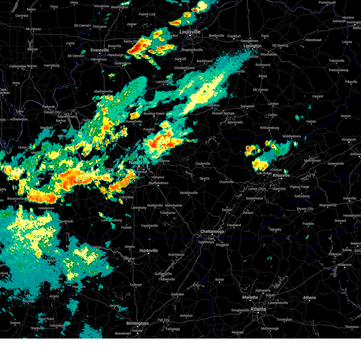 The severe thunderstorm warning for northwestern williamson county will expire at 445 pm cdt, the storm which prompted the warning has weakened below severe limits, and no longer poses an immediate threat to life or property. therefore, the warning will be allowed to expire. The severe thunderstorm warning for northwestern williamson county will expire at 445 pm cdt, the storm which prompted the warning has weakened below severe limits, and no longer poses an immediate threat to life or property. therefore, the warning will be allowed to expire.
|
| 7/8/2023 4:33 PM CDT |
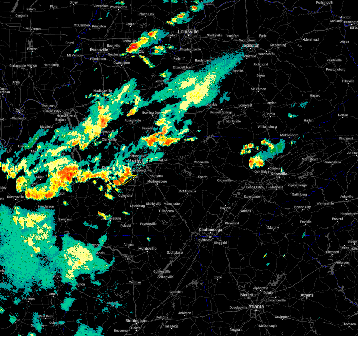 At 433 pm cdt, a severe thunderstorm was located near fairview, or 10 miles west of franklin, moving southeast at 20 mph (radar indicated). Hazards include 60 mph wind gusts. Expect damage to roofs, siding, and trees. locations impacted include, franklin and leipers fork. this includes interstate 840 between mile markers 9 and 17. hail threat, radar indicated max hail size, <. 75 in wind threat, radar indicated max wind gust, 60 mph. At 433 pm cdt, a severe thunderstorm was located near fairview, or 10 miles west of franklin, moving southeast at 20 mph (radar indicated). Hazards include 60 mph wind gusts. Expect damage to roofs, siding, and trees. locations impacted include, franklin and leipers fork. this includes interstate 840 between mile markers 9 and 17. hail threat, radar indicated max hail size, <. 75 in wind threat, radar indicated max wind gust, 60 mph.
|
| 7/8/2023 4:12 PM CDT |
 At 412 pm cdt, a severe thunderstorm was located over kingston springs, or 12 miles south of ashland city, moving southeast at 10 mph (radar indicated). Hazards include 60 mph wind gusts. expect damage to roofs, siding, and trees At 412 pm cdt, a severe thunderstorm was located over kingston springs, or 12 miles south of ashland city, moving southeast at 10 mph (radar indicated). Hazards include 60 mph wind gusts. expect damage to roofs, siding, and trees
|
| 7/1/2023 1:14 PM CDT |
 At 112 pm cdt, severe thunderstorms were located along a line extending from near greenbrier to near thompson`s station, moving east at 50 mph (radar indicated). Hazards include 70 mph wind gusts and penny size hail. Expect considerable tree damage. Damage is likely to mobile homes, roofs, and outbuildings. At 112 pm cdt, severe thunderstorms were located along a line extending from near greenbrier to near thompson`s station, moving east at 50 mph (radar indicated). Hazards include 70 mph wind gusts and penny size hail. Expect considerable tree damage. Damage is likely to mobile homes, roofs, and outbuildings.
|
| 7/1/2023 12:52 PM CDT |
 At 1251 pm cdt, severe thunderstorms were located along a line extending from 8 miles northwest of ashland city to near kingston springs to 9 miles south of fairview, moving east at 70 mph (radar indicated). Hazards include 70 mph wind gusts and nickel size hail. Expect considerable tree damage. Damage is likely to mobile homes, roofs, and outbuildings. At 1251 pm cdt, severe thunderstorms were located along a line extending from 8 miles northwest of ashland city to near kingston springs to 9 miles south of fairview, moving east at 70 mph (radar indicated). Hazards include 70 mph wind gusts and nickel size hail. Expect considerable tree damage. Damage is likely to mobile homes, roofs, and outbuildings.
|
| 7/1/2023 12:47 PM CDT |
 At 1247 pm cdt, severe thunderstorms were located along a line extending from 16 miles north of dickson to near burns to 8 miles south of centerville, moving east at 35 mph (radar indicated). Hazards include 70 mph wind gusts and quarter size hail. Hail damage to vehicles is expected. expect considerable tree damage. wind damage is also likely to mobile homes, roofs, and outbuildings. locations impacted include, dickson, centerville, white bluff, kingston springs, burns, fairview, charlotte, vanleer, slayden, bon aqua, primm springs, lyles and nunnelly. this includes the following highways, interstate 40 between mile markers 164 and 187. interstate 840 between mile markers 1 and 12. thunderstorm damage threat, considerable hail threat, radar indicated max hail size, 1. 00 in wind threat, radar indicated max wind gust, 70 mph. At 1247 pm cdt, severe thunderstorms were located along a line extending from 16 miles north of dickson to near burns to 8 miles south of centerville, moving east at 35 mph (radar indicated). Hazards include 70 mph wind gusts and quarter size hail. Hail damage to vehicles is expected. expect considerable tree damage. wind damage is also likely to mobile homes, roofs, and outbuildings. locations impacted include, dickson, centerville, white bluff, kingston springs, burns, fairview, charlotte, vanleer, slayden, bon aqua, primm springs, lyles and nunnelly. this includes the following highways, interstate 40 between mile markers 164 and 187. interstate 840 between mile markers 1 and 12. thunderstorm damage threat, considerable hail threat, radar indicated max hail size, 1. 00 in wind threat, radar indicated max wind gust, 70 mph.
|
| 7/1/2023 12:23 PM CDT |
 At 1223 pm cdt, severe thunderstorms were located along a line extending from near erin to 10 miles southwest of dickson to 9 miles northwest of hohenwald, moving east at 35 mph (radar indicated). Hazards include 70 mph wind gusts and quarter size hail. Hail damage to vehicles is expected. expect considerable tree damage. Wind damage is also likely to mobile homes, roofs, and outbuildings. At 1223 pm cdt, severe thunderstorms were located along a line extending from near erin to 10 miles southwest of dickson to 9 miles northwest of hohenwald, moving east at 35 mph (radar indicated). Hazards include 70 mph wind gusts and quarter size hail. Hail damage to vehicles is expected. expect considerable tree damage. Wind damage is also likely to mobile homes, roofs, and outbuildings.
|
| 6/4/2023 4:20 PM CDT |
 At 420 pm cdt, a severe thunderstorm was located over bellevue, or 11 miles southwest of nashville, moving southwest at 10 mph (radar indicated). Hazards include 60 mph wind gusts and quarter size hail. Hail damage to vehicles is expected. Expect wind damage to roofs, siding, and trees. At 420 pm cdt, a severe thunderstorm was located over bellevue, or 11 miles southwest of nashville, moving southwest at 10 mph (radar indicated). Hazards include 60 mph wind gusts and quarter size hail. Hail damage to vehicles is expected. Expect wind damage to roofs, siding, and trees.
|
| 4/5/2023 4:27 PM CDT |
 The severe thunderstorm warning for southwestern davidson and northern williamson counties will expire at 430 pm cdt, the storm which prompted the warning has moved out of the area. therefore, the warning will be allowed to expire. a severe thunderstorm watch remains in effect until 900 pm cdt for middle tennessee. The severe thunderstorm warning for southwestern davidson and northern williamson counties will expire at 430 pm cdt, the storm which prompted the warning has moved out of the area. therefore, the warning will be allowed to expire. a severe thunderstorm watch remains in effect until 900 pm cdt for middle tennessee.
|
| 4/5/2023 3:50 PM CDT |
 At 350 pm cdt, a severe thunderstorm was located near fairview, or 16 miles southeast of dickson, moving northeast at 50 mph (radar indicated). Hazards include 60 mph wind gusts and nickel size hail. expect damage to roofs, siding, and trees At 350 pm cdt, a severe thunderstorm was located near fairview, or 16 miles southeast of dickson, moving northeast at 50 mph (radar indicated). Hazards include 60 mph wind gusts and nickel size hail. expect damage to roofs, siding, and trees
|
| 3/24/2023 10:22 PM CDT |
 At 1022 pm cdt, severe thunderstorms were located along a line extending from near pegram to 7 miles southeast of fairview to near mount pleasant, moving east at 60 mph (radar indicated). Hazards include 70 mph wind gusts and nickel size hail. Expect considerable tree damage. Damage is likely to mobile homes, roofs, and outbuildings. At 1022 pm cdt, severe thunderstorms were located along a line extending from near pegram to 7 miles southeast of fairview to near mount pleasant, moving east at 60 mph (radar indicated). Hazards include 70 mph wind gusts and nickel size hail. Expect considerable tree damage. Damage is likely to mobile homes, roofs, and outbuildings.
|
| 3/24/2023 10:18 PM CDT |
 At 1017 pm cdt, severe thunderstorms were located along a line extending from near white bluff to 8 miles south of fairview to 7 miles northwest of mount pleasant, moving east at 70 mph (radar indicated). Hazards include 70 mph wind gusts and quarter size hail. Hail damage to vehicles is expected. expect considerable tree damage. wind damage is also likely to mobile homes, roofs, and outbuildings. locations impacted include, dickson, centerville, white bluff, kingston springs, pegram, burns, fairview, charlotte, gordonsburg, bon aqua, primm springs, lyles, santa fe, hampshire, williamsport and leipers fork. this includes the following highways, interstate 40 between mile markers 166 and 191. interstate 840 between mile markers 1 and 19. thunderstorm damage threat, considerable hail threat, radar indicated max hail size, 1. 00 in wind threat, radar indicated max wind gust, 70 mph. At 1017 pm cdt, severe thunderstorms were located along a line extending from near white bluff to 8 miles south of fairview to 7 miles northwest of mount pleasant, moving east at 70 mph (radar indicated). Hazards include 70 mph wind gusts and quarter size hail. Hail damage to vehicles is expected. expect considerable tree damage. wind damage is also likely to mobile homes, roofs, and outbuildings. locations impacted include, dickson, centerville, white bluff, kingston springs, pegram, burns, fairview, charlotte, gordonsburg, bon aqua, primm springs, lyles, santa fe, hampshire, williamsport and leipers fork. this includes the following highways, interstate 40 between mile markers 166 and 191. interstate 840 between mile markers 1 and 19. thunderstorm damage threat, considerable hail threat, radar indicated max hail size, 1. 00 in wind threat, radar indicated max wind gust, 70 mph.
|
| 3/24/2023 10:08 PM CDT |
 At 1007 pm cdt, severe thunderstorms were located along a line extending from near dickson to 6 miles east of centerville to 6 miles east of hohenwald, moving east at 70 mph (radar indicated). Hazards include 70 mph wind gusts and quarter size hail. Hail damage to vehicles is expected. expect considerable tree damage. wind damage is also likely to mobile homes, roofs, and outbuildings. locations impacted include, dickson, hohenwald, centerville, white bluff, kingston springs, pegram, burns, fairview, charlotte, gordonsburg, kimmins, bon aqua, primm springs, lyles, santa fe, pinewood, hampshire, williamsport, leipers fork and nunnelly. this includes the following highways, interstate 40 between mile markers 158 and 191. interstate 840 between mile markers 1 and 19. thunderstorm damage threat, considerable hail threat, radar indicated max hail size, 1. 00 in wind threat, radar indicated max wind gust, 70 mph. At 1007 pm cdt, severe thunderstorms were located along a line extending from near dickson to 6 miles east of centerville to 6 miles east of hohenwald, moving east at 70 mph (radar indicated). Hazards include 70 mph wind gusts and quarter size hail. Hail damage to vehicles is expected. expect considerable tree damage. wind damage is also likely to mobile homes, roofs, and outbuildings. locations impacted include, dickson, hohenwald, centerville, white bluff, kingston springs, pegram, burns, fairview, charlotte, gordonsburg, kimmins, bon aqua, primm springs, lyles, santa fe, pinewood, hampshire, williamsport, leipers fork and nunnelly. this includes the following highways, interstate 40 between mile markers 158 and 191. interstate 840 between mile markers 1 and 19. thunderstorm damage threat, considerable hail threat, radar indicated max hail size, 1. 00 in wind threat, radar indicated max wind gust, 70 mph.
|
| 3/24/2023 9:55 PM CDT |
 At 954 pm cdt, severe thunderstorms were located along a line extending from 6 miles south of mcewen to 9 miles southwest of centerville to 8 miles west of hohenwald, moving east at 80 mph (radar indicated). Hazards include 60 mph wind gusts and quarter size hail. Hail damage to vehicles is expected. Expect wind damage to roofs, siding, and trees. At 954 pm cdt, severe thunderstorms were located along a line extending from 6 miles south of mcewen to 9 miles southwest of centerville to 8 miles west of hohenwald, moving east at 80 mph (radar indicated). Hazards include 60 mph wind gusts and quarter size hail. Hail damage to vehicles is expected. Expect wind damage to roofs, siding, and trees.
|
| 11/29/2022 6:11 PM CST |
 The severe thunderstorm warning for southern dickson and south central cheatham counties will expire at 615 pm cst, the storm which prompted the warning has moved out of the area. therefore, the warning will be allowed to expire. a downstream warning has been issued. The severe thunderstorm warning for southern dickson and south central cheatham counties will expire at 615 pm cst, the storm which prompted the warning has moved out of the area. therefore, the warning will be allowed to expire. a downstream warning has been issued.
|
| 11/29/2022 5:58 PM CST |
 At 558 pm cst, a severe thunderstorm was located over burns, or over dickson, moving northeast at 65 mph (radar indicated). Hazards include 60 mph wind gusts and quarter size hail. Hail damage to vehicles is expected. expect wind damage to roofs, siding, and trees. locations impacted include, dickson, white bluff, kingston springs, burns and charlotte. this includes the following highways, interstate 40 between mile markers 171 and 181, and between mile markers 185 and 187. interstate 840 between mile markers 1 and 2. hail threat, radar indicated max hail size, 1. 00 in wind threat, radar indicated max wind gust, 60 mph. At 558 pm cst, a severe thunderstorm was located over burns, or over dickson, moving northeast at 65 mph (radar indicated). Hazards include 60 mph wind gusts and quarter size hail. Hail damage to vehicles is expected. expect wind damage to roofs, siding, and trees. locations impacted include, dickson, white bluff, kingston springs, burns and charlotte. this includes the following highways, interstate 40 between mile markers 171 and 181, and between mile markers 185 and 187. interstate 840 between mile markers 1 and 2. hail threat, radar indicated max hail size, 1. 00 in wind threat, radar indicated max wind gust, 60 mph.
|
| 11/29/2022 5:45 PM CST |
 At 545 pm cst, a severe thunderstorm was located 8 miles northwest of centerville, moving northeast at 65 mph (radar indicated). Hazards include 60 mph wind gusts and half dollar size hail. Hail damage to vehicles is expected. Expect wind damage to roofs, siding, and trees. At 545 pm cst, a severe thunderstorm was located 8 miles northwest of centerville, moving northeast at 65 mph (radar indicated). Hazards include 60 mph wind gusts and half dollar size hail. Hail damage to vehicles is expected. Expect wind damage to roofs, siding, and trees.
|
| 10/12/2022 4:03 PM CDT | Large trees down and blocking road on cumberland drive and sugar maple driv in williamson county TN, 2.1 miles WNW of Fairview, TN |
| 10/12/2022 4:00 PM CDT | Large tree limbs down at the intersection of hwy 100 and westview blv in williamson county TN, 1.9 miles NNE of Fairview, TN |
| 10/12/2022 3:57 PM CDT | Gas station awning destroyed by winds near walmart in fairview. tspotter repor in williamson county TN, 1.1 miles N of Fairview, TN |
| 10/12/2022 3:54 PM CDT |
 At 354 pm cdt, severe thunderstorms capable of producing both tornadoes and extensive straight line wind damage were located near white bluff, or 10 miles east of dickson, moving east at 40 mph (radar indicated rotation). Hazards include tornado. Flying debris will be dangerous to those caught without shelter. mobile homes will be damaged or destroyed. damage to roofs, windows, and vehicles will occur. tree damage is likely. these dangerous storms will be near, kingston springs around 400 pm cdt. pegram around 405 pm cdt. bellevue around 415 pm cdt. franklin, forest hills and belle meade around 420 pm cdt. brentwood around 425 pm cdt. other locations impacted by this tornadic thunderstorm include natchez trace at highway 96 and bells bend. this includes the following highways, interstate 40 between mile markers 178 and 204. Interstate 840 between mile markers 3 and 4, and between mile markers 7 and 10. At 354 pm cdt, severe thunderstorms capable of producing both tornadoes and extensive straight line wind damage were located near white bluff, or 10 miles east of dickson, moving east at 40 mph (radar indicated rotation). Hazards include tornado. Flying debris will be dangerous to those caught without shelter. mobile homes will be damaged or destroyed. damage to roofs, windows, and vehicles will occur. tree damage is likely. these dangerous storms will be near, kingston springs around 400 pm cdt. pegram around 405 pm cdt. bellevue around 415 pm cdt. franklin, forest hills and belle meade around 420 pm cdt. brentwood around 425 pm cdt. other locations impacted by this tornadic thunderstorm include natchez trace at highway 96 and bells bend. this includes the following highways, interstate 40 between mile markers 178 and 204. Interstate 840 between mile markers 3 and 4, and between mile markers 7 and 10.
|
| 10/12/2022 3:52 PM CDT |
 At 352 pm cdt, severe thunderstorms were located along a line extending from near white bluff to 10 miles east of centerville, moving east at 40 mph (radar indicated). Hazards include 60 mph wind gusts and nickel size hail. Expect damage to roofs, siding, and trees. locations impacted include, ashland city, white bluff, kingston springs, pegram, burns, fairview, bellevue, bells bend, primm springs, leipers fork and natchez trace at highway 96. this includes the following highways, interstate 40 between mile markers 176 and 202. Interstate 840 between mile markers 1 and 23. At 352 pm cdt, severe thunderstorms were located along a line extending from near white bluff to 10 miles east of centerville, moving east at 40 mph (radar indicated). Hazards include 60 mph wind gusts and nickel size hail. Expect damage to roofs, siding, and trees. locations impacted include, ashland city, white bluff, kingston springs, pegram, burns, fairview, bellevue, bells bend, primm springs, leipers fork and natchez trace at highway 96. this includes the following highways, interstate 40 between mile markers 176 and 202. Interstate 840 between mile markers 1 and 23.
|
| 10/12/2022 3:36 PM CDT |
 At 336 pm cdt, severe thunderstorms were located along a line extending from 7 miles north of dickson to centerville, moving east at 40 mph (radar indicated). Hazards include 60 mph wind gusts and nickel size hail. expect damage to roofs, siding, and trees At 336 pm cdt, severe thunderstorms were located along a line extending from 7 miles north of dickson to centerville, moving east at 40 mph (radar indicated). Hazards include 60 mph wind gusts and nickel size hail. expect damage to roofs, siding, and trees
|
| 7/28/2022 3:32 PM CDT |
 At 331 pm cdt, a severe thunderstorm was located near fairview, or 9 miles west of franklin, moving east at 30 mph (radar indicated). Hazards include 60 mph wind gusts and quarter size hail. Hail damage to vehicles is expected. Expect wind damage to roofs, siding, and trees. At 331 pm cdt, a severe thunderstorm was located near fairview, or 9 miles west of franklin, moving east at 30 mph (radar indicated). Hazards include 60 mph wind gusts and quarter size hail. Hail damage to vehicles is expected. Expect wind damage to roofs, siding, and trees.
|
| 7/7/2022 2:54 PM CDT |
 At 254 pm cdt, a severe thunderstorm was located 7 miles southeast of fairview, or 9 miles west of franklin, moving east at 15 mph (radar indicated). Hazards include 60 mph wind gusts and penny size hail. expect damage to roofs, siding, and trees At 254 pm cdt, a severe thunderstorm was located 7 miles southeast of fairview, or 9 miles west of franklin, moving east at 15 mph (radar indicated). Hazards include 60 mph wind gusts and penny size hail. expect damage to roofs, siding, and trees
|
| 6/26/2022 3:42 PM CDT |
 The severe thunderstorm warning for southwestern dickson and northeastern hickman counties will expire at 345 pm cdt, the storm which prompted the warning has weakened below severe limits, and no longer poses an immediate threat to life or property. therefore, the warning will be allowed to expire. however small hail and gusty winds are still possible with this thunderstorm. The severe thunderstorm warning for southwestern dickson and northeastern hickman counties will expire at 345 pm cdt, the storm which prompted the warning has weakened below severe limits, and no longer poses an immediate threat to life or property. therefore, the warning will be allowed to expire. however small hail and gusty winds are still possible with this thunderstorm.
|
| 6/26/2022 3:19 PM CDT |
 At 319 pm cdt, a severe thunderstorm was located 8 miles northeast of centerville, moving southeast at 25 mph (radar indicated). Hazards include 60 mph wind gusts and penny size hail. Expect damage to roofs, siding, and trees. locations impacted include, dickson, centerville, lyles, bon aqua and nunnelly. this includes interstate 40 between mile markers 161 and 173. hail threat, radar indicated max hail size, 0. 75 in wind threat, radar indicated max wind gust, 60 mph. At 319 pm cdt, a severe thunderstorm was located 8 miles northeast of centerville, moving southeast at 25 mph (radar indicated). Hazards include 60 mph wind gusts and penny size hail. Expect damage to roofs, siding, and trees. locations impacted include, dickson, centerville, lyles, bon aqua and nunnelly. this includes interstate 40 between mile markers 161 and 173. hail threat, radar indicated max hail size, 0. 75 in wind threat, radar indicated max wind gust, 60 mph.
|
| 6/26/2022 3:05 PM CDT |
 At 305 pm cdt, a severe thunderstorm was located 7 miles southwest of dickson, moving southeast at 25 mph (radar indicated). Hazards include 60 mph wind gusts and quarter size hail. Hail damage to vehicles is expected. Expect wind damage to roofs, siding, and trees. At 305 pm cdt, a severe thunderstorm was located 7 miles southwest of dickson, moving southeast at 25 mph (radar indicated). Hazards include 60 mph wind gusts and quarter size hail. Hail damage to vehicles is expected. Expect wind damage to roofs, siding, and trees.
|
| 6/17/2022 10:15 AM CDT | Trees down blocking roadways and power outages in the fairview... leipers fork and grassland area in williamson county TN, 1.2 miles WSW of Fairview, TN |
| 6/17/2022 9:58 AM CDT |
 At 956 am cdt, severe thunderstorms were located along a line extending from near ashland city to near white bluff to near mcewen, moving south at 60 mph (radar indicated). Hazards include 60 mph wind gusts. expect damage to roofs, siding, and trees At 956 am cdt, severe thunderstorms were located along a line extending from near ashland city to near white bluff to near mcewen, moving south at 60 mph (radar indicated). Hazards include 60 mph wind gusts. expect damage to roofs, siding, and trees
|
| 5/25/2022 5:25 PM CDT |
 At 525 pm cdt, severe thunderstorms were located along a line extending from 6 miles west of centerville to 15 miles northeast of hohenwald to near mount pleasant, moving northeast at 50 mph (radar indicated). Hazards include 60 mph wind gusts. expect damage to roofs, siding, and trees At 525 pm cdt, severe thunderstorms were located along a line extending from 6 miles west of centerville to 15 miles northeast of hohenwald to near mount pleasant, moving northeast at 50 mph (radar indicated). Hazards include 60 mph wind gusts. expect damage to roofs, siding, and trees
|
| 4/13/2022 7:33 PM CDT |
 At 732 pm cdt, severe thunderstorms were located along a line extending from near ashland city to near pegram to 10 miles south of fairview, moving east at 65 mph (radar indicated). Hazards include 70 mph wind gusts. Expect considerable tree damage. damage is likely to mobile homes, roofs, and outbuildings. locations impacted include, franklin, columbia, dickson, ashland city, nashville, madison, hendersonville, brentwood, la vergne, spring hill, goodlettsville, nolensville, forest hills, oak hill, white bluff, belle meade, kingston springs, lakewood, thompson`s station and pegram. this includes the following highways, interstate 40 between mile markers 173 and 223. interstate 65 between mile markers 51 and 98. interstate 24 between mile markers 36 and 63. interstate 840 between mile markers 1 and 42. thunderstorm damage threat, considerable hail threat, radar indicated max hail size, <. 75 in wind threat, radar indicated max wind gust, 70 mph. At 732 pm cdt, severe thunderstorms were located along a line extending from near ashland city to near pegram to 10 miles south of fairview, moving east at 65 mph (radar indicated). Hazards include 70 mph wind gusts. Expect considerable tree damage. damage is likely to mobile homes, roofs, and outbuildings. locations impacted include, franklin, columbia, dickson, ashland city, nashville, madison, hendersonville, brentwood, la vergne, spring hill, goodlettsville, nolensville, forest hills, oak hill, white bluff, belle meade, kingston springs, lakewood, thompson`s station and pegram. this includes the following highways, interstate 40 between mile markers 173 and 223. interstate 65 between mile markers 51 and 98. interstate 24 between mile markers 36 and 63. interstate 840 between mile markers 1 and 42. thunderstorm damage threat, considerable hail threat, radar indicated max hail size, <. 75 in wind threat, radar indicated max wind gust, 70 mph.
|
| 4/13/2022 7:16 PM CDT |
 At 716 pm cdt, severe thunderstorms were located along a line extending from 7 miles north of dickson to near burns to centerville, moving east at 65 mph (radar indicated). Hazards include 70 mph wind gusts. Expect considerable tree damage. Damage is likely to mobile homes, roofs, and outbuildings. At 716 pm cdt, severe thunderstorms were located along a line extending from 7 miles north of dickson to near burns to centerville, moving east at 65 mph (radar indicated). Hazards include 70 mph wind gusts. Expect considerable tree damage. Damage is likely to mobile homes, roofs, and outbuildings.
|
| 4/12/2022 5:59 AM CDT |
 At 558 am cdt, a severe thunderstorm was located near dickson, moving east at 35 mph (radar indicated). Hazards include quarter size hail. Damage to vehicles is expected. locations impacted include, dickson, white bluff, burns and charlotte. this includes the following highways, interstate 40 between mile markers 172 and 181. interstate 840 between mile markers 1 and 2. hail threat, radar indicated max hail size, 1. 00 in wind threat, radar indicated max wind gust, <50 mph. At 558 am cdt, a severe thunderstorm was located near dickson, moving east at 35 mph (radar indicated). Hazards include quarter size hail. Damage to vehicles is expected. locations impacted include, dickson, white bluff, burns and charlotte. this includes the following highways, interstate 40 between mile markers 172 and 181. interstate 840 between mile markers 1 and 2. hail threat, radar indicated max hail size, 1. 00 in wind threat, radar indicated max wind gust, <50 mph.
|
| 4/12/2022 5:32 AM CDT |
 At 531 am cdt, a severe thunderstorm was located near mcewen, or 10 miles east of waverly, moving east at 35 mph (radar indicated). Hazards include 60 mph wind gusts and quarter size hail. Hail damage to vehicles is expected. Expect wind damage to roofs, siding, and trees. At 531 am cdt, a severe thunderstorm was located near mcewen, or 10 miles east of waverly, moving east at 35 mph (radar indicated). Hazards include 60 mph wind gusts and quarter size hail. Hail damage to vehicles is expected. Expect wind damage to roofs, siding, and trees.
|
| 1/1/2022 1:14 PM CST |
 At 114 pm cst, a severe thunderstorm was located near fairview, or 15 miles southeast of dickson, moving east at 60 mph (radar indicated). Hazards include 60 mph wind gusts and penny size hail. Expect damage to roofs, siding, and trees. locations impacted include, primm springs. this includes interstate 840 between mile markers 6 and 17. hail threat, radar indicated max hail size, 0. 75 in wind threat, radar indicated max wind gust, 60 mph. At 114 pm cst, a severe thunderstorm was located near fairview, or 15 miles southeast of dickson, moving east at 60 mph (radar indicated). Hazards include 60 mph wind gusts and penny size hail. Expect damage to roofs, siding, and trees. locations impacted include, primm springs. this includes interstate 840 between mile markers 6 and 17. hail threat, radar indicated max hail size, 0. 75 in wind threat, radar indicated max wind gust, 60 mph.
|
| 1/1/2022 1:09 PM CST |
 At 108 pm cst, a severe thunderstorm was located 11 miles southwest of fairview, or 11 miles northeast of centerville, moving east at 60 mph (radar indicated). Hazards include 60 mph wind gusts and penny size hail. Expect damage to roofs, siding, and trees. locations impacted include, centerville, santa fe, primm springs, lyles and nunnelly. this includes interstate 840 between mile markers 6 and 17. hail threat, radar indicated max hail size, 0. 75 in wind threat, radar indicated max wind gust, 60 mph. At 108 pm cst, a severe thunderstorm was located 11 miles southwest of fairview, or 11 miles northeast of centerville, moving east at 60 mph (radar indicated). Hazards include 60 mph wind gusts and penny size hail. Expect damage to roofs, siding, and trees. locations impacted include, centerville, santa fe, primm springs, lyles and nunnelly. this includes interstate 840 between mile markers 6 and 17. hail threat, radar indicated max hail size, 0. 75 in wind threat, radar indicated max wind gust, 60 mph.
|
| 1/1/2022 12:56 PM CST |
 At 1255 pm cst, a severe thunderstorm capable of producing a tornado was located over centerville, moving east at 70 mph (radar indicated rotation). Hazards include tornado. Flying debris will be dangerous to those caught without shelter. mobile homes will be damaged or destroyed. damage to roofs, windows, and vehicles will occur. tree damage is likely. this dangerous storm will be near, fairview around 115 pm cst. other locations impacted by this tornadic thunderstorm include nunnelly, primm springs and lyles. This includes interstate 840 between mile markers 5 and 19. At 1255 pm cst, a severe thunderstorm capable of producing a tornado was located over centerville, moving east at 70 mph (radar indicated rotation). Hazards include tornado. Flying debris will be dangerous to those caught without shelter. mobile homes will be damaged or destroyed. damage to roofs, windows, and vehicles will occur. tree damage is likely. this dangerous storm will be near, fairview around 115 pm cst. other locations impacted by this tornadic thunderstorm include nunnelly, primm springs and lyles. This includes interstate 840 between mile markers 5 and 19.
|
| 1/1/2022 12:43 PM CST |
 At 1243 pm cst, a severe thunderstorm was located 13 miles northeast of linden, moving east at 60 mph (radar indicated). Hazards include 60 mph wind gusts and penny size hail. expect damage to roofs, siding, and trees At 1243 pm cst, a severe thunderstorm was located 13 miles northeast of linden, moving east at 60 mph (radar indicated). Hazards include 60 mph wind gusts and penny size hail. expect damage to roofs, siding, and trees
|
| 1/1/2022 12:39 PM CST |
 At 1238 pm cst, a severe thunderstorm capable of producing a tornado was located 11 miles northwest of centerville, moving east at 70 mph (radar indicated rotation). Hazards include tornado. Flying debris will be dangerous to those caught without shelter. mobile homes will be damaged or destroyed. damage to roofs, windows, and vehicles will occur. tree damage is likely. this dangerous storm will be near, burns around 1255 pm cst. other locations impacted by this tornadic thunderstorm include lyles, bon aqua, nunnelly and pinewood. this includes the following highways, interstate 40 between mile markers 153 and 181. Interstate 840 between mile markers 1 and 6. At 1238 pm cst, a severe thunderstorm capable of producing a tornado was located 11 miles northwest of centerville, moving east at 70 mph (radar indicated rotation). Hazards include tornado. Flying debris will be dangerous to those caught without shelter. mobile homes will be damaged or destroyed. damage to roofs, windows, and vehicles will occur. tree damage is likely. this dangerous storm will be near, burns around 1255 pm cst. other locations impacted by this tornadic thunderstorm include lyles, bon aqua, nunnelly and pinewood. this includes the following highways, interstate 40 between mile markers 153 and 181. Interstate 840 between mile markers 1 and 6.
|
| 1/1/2022 12:28 PM CST |
 At 1228 pm cst, a severe thunderstorm capable of producing a tornado was located near hurricane mills, or 13 miles south of waverly, moving east at 70 mph (radar indicated rotation). Hazards include tornado and quarter size hail. Flying debris will be dangerous to those caught without shelter. mobile homes will be damaged or destroyed. damage to roofs, windows, and vehicles will occur. tree damage is likely. this dangerous storm will be near, burns around 1250 pm cst. other locations impacted by this tornadic thunderstorm include lyles, bon aqua, nunnelly, pinewood and bucksnort. this includes the following highways, interstate 40 between mile markers 142 and 181. Interstate 840 between mile markers 1 and 6. At 1228 pm cst, a severe thunderstorm capable of producing a tornado was located near hurricane mills, or 13 miles south of waverly, moving east at 70 mph (radar indicated rotation). Hazards include tornado and quarter size hail. Flying debris will be dangerous to those caught without shelter. mobile homes will be damaged or destroyed. damage to roofs, windows, and vehicles will occur. tree damage is likely. this dangerous storm will be near, burns around 1250 pm cst. other locations impacted by this tornadic thunderstorm include lyles, bon aqua, nunnelly, pinewood and bucksnort. this includes the following highways, interstate 40 between mile markers 142 and 181. Interstate 840 between mile markers 1 and 6.
|
| 8/13/2021 2:51 PM CDT |
 At 251 pm cdt, a severe thunderstorm was located near burns, or 9 miles southeast of dickson, moving northeast at 5 mph (radar indicated). Hazards include 60 mph wind gusts. expect damage to roofs, siding, and trees At 251 pm cdt, a severe thunderstorm was located near burns, or 9 miles southeast of dickson, moving northeast at 5 mph (radar indicated). Hazards include 60 mph wind gusts. expect damage to roofs, siding, and trees
|
| 7/31/2021 10:33 PM CDT |
 At 1032 pm cdt, severe thunderstorms were located along a line extending from pegram to leipers fork, moving southeast at 50 mph (radar indicated). Hazards include 60 mph wind gusts. Expect damage to roofs, siding, and trees. locations impacted include, franklin, brentwood, spring hill, nolensville, forest hills, oak hill, belle meade, kingston springs, thompson`s station, pegram, bellevue, antioch, fairview, bells bend, natchez trace at highway 96 and leipers fork. this includes the following highways, interstate 40 between mile markers 182 and 203. interstate 65 between mile markers 50 and 79. interstate 24 between mile markers 57 and 60. Interstate 840 between mile markers 7 and 40. At 1032 pm cdt, severe thunderstorms were located along a line extending from pegram to leipers fork, moving southeast at 50 mph (radar indicated). Hazards include 60 mph wind gusts. Expect damage to roofs, siding, and trees. locations impacted include, franklin, brentwood, spring hill, nolensville, forest hills, oak hill, belle meade, kingston springs, thompson`s station, pegram, bellevue, antioch, fairview, bells bend, natchez trace at highway 96 and leipers fork. this includes the following highways, interstate 40 between mile markers 182 and 203. interstate 65 between mile markers 50 and 79. interstate 24 between mile markers 57 and 60. Interstate 840 between mile markers 7 and 40.
|
| 7/31/2021 10:19 PM CDT |
 At 1018 pm cdt, severe thunderstorms were located along a line extending from white bluff to near fairview, moving southeast at 50 mph (radar indicated). Hazards include 60 mph wind gusts. expect damage to roofs, siding, and trees At 1018 pm cdt, severe thunderstorms were located along a line extending from white bluff to near fairview, moving southeast at 50 mph (radar indicated). Hazards include 60 mph wind gusts. expect damage to roofs, siding, and trees
|
| 7/31/2021 9:57 PM CDT |
 The national weather service in nashville has issued a * severe thunderstorm warning for. dickson county in middle tennessee. southeastern montgomery county in middle tennessee. northwestern williamson county in middle tennessee. Cheatham county in middle tennessee. The national weather service in nashville has issued a * severe thunderstorm warning for. dickson county in middle tennessee. southeastern montgomery county in middle tennessee. northwestern williamson county in middle tennessee. Cheatham county in middle tennessee.
|
| 5/6/2021 5:09 PM CDT |
 At 508 pm cdt, severe thunderstorms were located along a line extending from near greenbrier to 10 miles south of fairview, moving east at 55 mph (radar indicated). Hazards include 60 mph wind gusts. expect damage to roofs, siding, and trees At 508 pm cdt, severe thunderstorms were located along a line extending from near greenbrier to 10 miles south of fairview, moving east at 55 mph (radar indicated). Hazards include 60 mph wind gusts. expect damage to roofs, siding, and trees
|
| 5/6/2021 4:59 PM CDT |
 At 459 pm cdt, severe thunderstorms were located along a line extending from 6 miles west of coopertown to near burns to 10 miles west of centerville, moving east at 45 mph (radar indicated). Hazards include 60 mph wind gusts. Expect damage to roofs, siding, and trees. locations impacted include, dickson, ashland city, centerville, coopertown, white bluff, kingston springs, pegram, burns, fairview, pleasant view, charlotte, bon aqua, cheatham dam, primm springs, lyles, pinewood and nunnelly. this includes the following highways, interstate 40 between mile markers 160 and 191. interstate 24 between mile markers 21 and 31. Interstate 840 between mile markers 1 and 11. At 459 pm cdt, severe thunderstorms were located along a line extending from 6 miles west of coopertown to near burns to 10 miles west of centerville, moving east at 45 mph (radar indicated). Hazards include 60 mph wind gusts. Expect damage to roofs, siding, and trees. locations impacted include, dickson, ashland city, centerville, coopertown, white bluff, kingston springs, pegram, burns, fairview, pleasant view, charlotte, bon aqua, cheatham dam, primm springs, lyles, pinewood and nunnelly. this includes the following highways, interstate 40 between mile markers 160 and 191. interstate 24 between mile markers 21 and 31. Interstate 840 between mile markers 1 and 11.
|
| 5/6/2021 4:44 PM CDT |
 At 443 pm cdt, severe thunderstorms were located along a line extending from 12 miles south of clarksville to 7 miles northwest of dickson to 13 miles north of linden, moving east at 45 mph (radar indicated). Hazards include 60 mph wind gusts. expect damage to roofs, siding, and trees At 443 pm cdt, severe thunderstorms were located along a line extending from 12 miles south of clarksville to 7 miles northwest of dickson to 13 miles north of linden, moving east at 45 mph (radar indicated). Hazards include 60 mph wind gusts. expect damage to roofs, siding, and trees
|
| 3/27/2021 10:29 PM CDT |
 At 1029 pm cdt, a severe thunderstorm was located 7 miles northwest of thompson`s station, or 9 miles southwest of franklin, moving northeast at 55 mph (radar indicated). Hazards include 60 mph wind gusts and penny size hail. expect damage to roofs, siding, and trees At 1029 pm cdt, a severe thunderstorm was located 7 miles northwest of thompson`s station, or 9 miles southwest of franklin, moving northeast at 55 mph (radar indicated). Hazards include 60 mph wind gusts and penny size hail. expect damage to roofs, siding, and trees
|
| 3/27/2021 10:12 PM CDT |
 At 1011 pm cdt, a severe thunderstorm was located 10 miles southwest of fairview, or 14 miles east of centerville, moving east at 30 mph (radar indicated). Hazards include 60 mph wind gusts and quarter size hail. Hail damage to vehicles is expected. expect wind damage to roofs, siding, and trees. locations impacted include, franklin, thompson`s station, fairview, primm springs, leipers fork and natchez trace at highway 96. this includes the following highways, interstate 65 between mile markers 57 and 68. Interstate 840 between mile markers 7 and 32. At 1011 pm cdt, a severe thunderstorm was located 10 miles southwest of fairview, or 14 miles east of centerville, moving east at 30 mph (radar indicated). Hazards include 60 mph wind gusts and quarter size hail. Hail damage to vehicles is expected. expect wind damage to roofs, siding, and trees. locations impacted include, franklin, thompson`s station, fairview, primm springs, leipers fork and natchez trace at highway 96. this includes the following highways, interstate 65 between mile markers 57 and 68. Interstate 840 between mile markers 7 and 32.
|
| 3/27/2021 9:59 PM CDT |
 The national weather service in nashville has issued a * severe thunderstorm warning for. northern maury county in middle tennessee. central williamson county in middle tennessee. eastern hickman county in middle tennessee. Until 1030 pm cdt. The national weather service in nashville has issued a * severe thunderstorm warning for. northern maury county in middle tennessee. central williamson county in middle tennessee. eastern hickman county in middle tennessee. Until 1030 pm cdt.
|
| 3/27/2021 6:56 AM CDT |
 At 656 am cdt, severe thunderstorms were located along a line extending from near ashland city to 12 miles east of centerville, moving east at 35 mph (radar indicated). Hazards include 60 mph wind gusts and quarter size hail. Hail damage to vehicles is expected. expect wind damage to roofs, siding, and trees. locations impacted include, franklin, ashland city, nashville, madison, hendersonville, brentwood, spring hill, goodlettsville, millersville, nolensville, forest hills, oak hill, belle meade, kingston springs, lakewood, thompson`s station, pegram, hermitage, fairview and bellevue. this includes the following highways, interstate 40 between mile markers 183 and 219. interstate 65 between mile markers 54 and 101. interstate 24 between mile markers 32 and 59. Interstate 840 between mile markers 8 and 39. At 656 am cdt, severe thunderstorms were located along a line extending from near ashland city to 12 miles east of centerville, moving east at 35 mph (radar indicated). Hazards include 60 mph wind gusts and quarter size hail. Hail damage to vehicles is expected. expect wind damage to roofs, siding, and trees. locations impacted include, franklin, ashland city, nashville, madison, hendersonville, brentwood, spring hill, goodlettsville, millersville, nolensville, forest hills, oak hill, belle meade, kingston springs, lakewood, thompson`s station, pegram, hermitage, fairview and bellevue. this includes the following highways, interstate 40 between mile markers 183 and 219. interstate 65 between mile markers 54 and 101. interstate 24 between mile markers 32 and 59. Interstate 840 between mile markers 8 and 39.
|
| 3/27/2021 6:42 AM CDT |
 At 642 am cdt, severe thunderstorms were located along a line extending from 7 miles north of white bluff to near centerville, moving east at 35 mph (radar indicated). Hazards include 60 mph wind gusts and quarter size hail. Hail damage to vehicles is expected. Expect wind damage to roofs, siding, and trees. At 642 am cdt, severe thunderstorms were located along a line extending from 7 miles north of white bluff to near centerville, moving east at 35 mph (radar indicated). Hazards include 60 mph wind gusts and quarter size hail. Hail damage to vehicles is expected. Expect wind damage to roofs, siding, and trees.
|
| 3/27/2021 6:30 AM CDT |
 At 630 am cdt, severe thunderstorms were located along a line extending from charlotte to 9 miles west of centerville, moving east at 40 mph (radar indicated). Hazards include 60 mph wind gusts and half dollar size hail. Hail damage to vehicles is expected. expect wind damage to roofs, siding, and trees. locations impacted include, dickson, white bluff, kingston springs, pegram, mcewen, burns, charlotte, bon aqua, pinewood, lyles and bucksnort. this includes the following highways, interstate 40 between mile markers 148 and 189. Interstate 840 between mile markers 1 and 7. At 630 am cdt, severe thunderstorms were located along a line extending from charlotte to 9 miles west of centerville, moving east at 40 mph (radar indicated). Hazards include 60 mph wind gusts and half dollar size hail. Hail damage to vehicles is expected. expect wind damage to roofs, siding, and trees. locations impacted include, dickson, white bluff, kingston springs, pegram, mcewen, burns, charlotte, bon aqua, pinewood, lyles and bucksnort. this includes the following highways, interstate 40 between mile markers 148 and 189. Interstate 840 between mile markers 1 and 7.
|
| 3/27/2021 6:17 AM CDT |
 At 617 am cdt, a severe thunderstorm was located near hurricane mills, or 10 miles southeast of waverly, moving northeast at 45 mph (radar indicated). Hazards include 60 mph wind gusts and half dollar size hail. Hail damage to vehicles is expected. Expect wind damage to roofs, siding, and trees. At 617 am cdt, a severe thunderstorm was located near hurricane mills, or 10 miles southeast of waverly, moving northeast at 45 mph (radar indicated). Hazards include 60 mph wind gusts and half dollar size hail. Hail damage to vehicles is expected. Expect wind damage to roofs, siding, and trees.
|
| 3/27/2021 6:13 AM CDT |
 At 613 am cdt, a severe thunderstorm was located near fairview, or 11 miles west of franklin, moving northeast at 35 mph (radar indicated). Hazards include quarter size hail. damage to vehicles is expected At 613 am cdt, a severe thunderstorm was located near fairview, or 11 miles west of franklin, moving northeast at 35 mph (radar indicated). Hazards include quarter size hail. damage to vehicles is expected
|
| 3/27/2021 6:05 AM CDT |
 At 604 am cdt, a severe thunderstorm was located 8 miles south of fairview, or 16 miles west of franklin, moving northeast at 35 mph (radar indicated). Hazards include half dollar size hail. Damage to vehicles is expected. locations impacted include, fairview and leipers fork. This includes interstate 840 between mile markers 7 and 17. At 604 am cdt, a severe thunderstorm was located 8 miles south of fairview, or 16 miles west of franklin, moving northeast at 35 mph (radar indicated). Hazards include half dollar size hail. Damage to vehicles is expected. locations impacted include, fairview and leipers fork. This includes interstate 840 between mile markers 7 and 17.
|
| 3/27/2021 5:48 AM CDT |
 At 548 am cdt, a severe thunderstorm was located 10 miles east of centerville, or near primm springs, moving northeast at 40 mph (radar indicated). Hazards include half dollar size hail. damage to vehicles is expected At 548 am cdt, a severe thunderstorm was located 10 miles east of centerville, or near primm springs, moving northeast at 40 mph (radar indicated). Hazards include half dollar size hail. damage to vehicles is expected
|
| 3/25/2021 4:01 PM CDT |
 At 401 pm cdt, a severe thunderstorm was located near columbia, moving northeast at 80 mph (radar indicated). Hazards include 60 mph wind gusts and quarter size hail. Hail damage to vehicles is expected. Expect wind damage to roofs, siding, and trees. At 401 pm cdt, a severe thunderstorm was located near columbia, moving northeast at 80 mph (radar indicated). Hazards include 60 mph wind gusts and quarter size hail. Hail damage to vehicles is expected. Expect wind damage to roofs, siding, and trees.
|
| 2/28/2021 7:32 PM CST |
 At 732 pm cst, severe thunderstorms were located along a line extending from near greenbrier to near kingston springs, moving east at 65 mph (radar indicated). Hazards include 60 mph wind gusts. expect damage to roofs, siding, and trees At 732 pm cst, severe thunderstorms were located along a line extending from near greenbrier to near kingston springs, moving east at 65 mph (radar indicated). Hazards include 60 mph wind gusts. expect damage to roofs, siding, and trees
|
| 10/23/2020 6:06 PM CDT |
 At 605 pm cdt, a severe thunderstorm was located over pegram, or 10 miles south of ashland city, moving east at 25 mph (radar indicated). Hazards include 60 mph wind gusts and penny size hail. expect damage to roofs, siding, and trees At 605 pm cdt, a severe thunderstorm was located over pegram, or 10 miles south of ashland city, moving east at 25 mph (radar indicated). Hazards include 60 mph wind gusts and penny size hail. expect damage to roofs, siding, and trees
|
| 9/1/2020 4:28 PM CDT |
 At 428 pm cdt, a severe thunderstorm capable of producing a tornado was located 8 miles south of fairview, or 17 miles north of columbia, moving east at 35 mph (radar indicated rotation). Hazards include tornado. Flying debris will be dangerous to those caught without shelter. mobile homes will be damaged or destroyed. damage to roofs, windows, and vehicles will occur. tree damage is likely. this dangerous storm will be near, thompson`s station around 450 pm cdt. franklin around 500 pm cdt. Other locations impacted by this tornadic thunderstorm include leipers fork and natchez trace at highway 96. At 428 pm cdt, a severe thunderstorm capable of producing a tornado was located 8 miles south of fairview, or 17 miles north of columbia, moving east at 35 mph (radar indicated rotation). Hazards include tornado. Flying debris will be dangerous to those caught without shelter. mobile homes will be damaged or destroyed. damage to roofs, windows, and vehicles will occur. tree damage is likely. this dangerous storm will be near, thompson`s station around 450 pm cdt. franklin around 500 pm cdt. Other locations impacted by this tornadic thunderstorm include leipers fork and natchez trace at highway 96.
|
| 9/1/2020 4:22 PM CDT |
 At 421 pm cdt, a severe thunderstorm was located near fairview, or 15 miles southeast of dickson, moving northeast at 55 mph (radar indicated). Hazards include 60 mph wind gusts. expect damage to roofs, siding, and trees At 421 pm cdt, a severe thunderstorm was located near fairview, or 15 miles southeast of dickson, moving northeast at 55 mph (radar indicated). Hazards include 60 mph wind gusts. expect damage to roofs, siding, and trees
|
| 8/28/2020 12:34 PM CDT |
 At 1234 pm cdt, severe thunderstorms were located along a line extending from near white bluff to near fairview, moving northeast at 45 mph (radar indicated). Hazards include 60 mph wind gusts. Expect damage to roofs, siding, and trees. locations impacted include, ashland city, kingston springs, pegram, fairview and natchez trace at highway 96. This includes interstate 40 between mile markers 183 and 196. At 1234 pm cdt, severe thunderstorms were located along a line extending from near white bluff to near fairview, moving northeast at 45 mph (radar indicated). Hazards include 60 mph wind gusts. Expect damage to roofs, siding, and trees. locations impacted include, ashland city, kingston springs, pegram, fairview and natchez trace at highway 96. This includes interstate 40 between mile markers 183 and 196.
|
| 8/28/2020 12:25 PM CDT |
 At 1225 pm cdt, severe thunderstorms were located along a line extending from near white bluff to near fairview, moving northeast at 40 mph (radar indicated). Hazards include 60 mph wind gusts. Expect damage to roofs, siding, and trees. locations impacted include, ashland city, white bluff, kingston springs, pegram, burns, fairview and natchez trace at highway 96. this includes the following highways, interstate 40 between mile markers 178 and 196. Interstate 840 between mile markers 9 and 11. At 1225 pm cdt, severe thunderstorms were located along a line extending from near white bluff to near fairview, moving northeast at 40 mph (radar indicated). Hazards include 60 mph wind gusts. Expect damage to roofs, siding, and trees. locations impacted include, ashland city, white bluff, kingston springs, pegram, burns, fairview and natchez trace at highway 96. this includes the following highways, interstate 40 between mile markers 178 and 196. Interstate 840 between mile markers 9 and 11.
|
| 8/28/2020 12:22 PM CDT |
 At 1221 pm cdt, a severe thunderstorm capable of producing a tornado was located near fairview, or 12 miles southeast of dickson, moving northeast at 45 mph (radar indicated rotation). Hazards include tornado. Flying debris will be dangerous to those caught without shelter. mobile homes will be damaged or destroyed. damage to roofs, windows, and vehicles will occur. tree damage is likely. this dangerous storm will be near, fairview around 1225 pm cdt. kingston springs around 1235 pm cdt. other locations impacted by this tornadic thunderstorm include natchez trace at highway 96. this includes the following highways, interstate 40 between mile markers 182 and 188. Interstate 840 between mile markers 7 and 9. At 1221 pm cdt, a severe thunderstorm capable of producing a tornado was located near fairview, or 12 miles southeast of dickson, moving northeast at 45 mph (radar indicated rotation). Hazards include tornado. Flying debris will be dangerous to those caught without shelter. mobile homes will be damaged or destroyed. damage to roofs, windows, and vehicles will occur. tree damage is likely. this dangerous storm will be near, fairview around 1225 pm cdt. kingston springs around 1235 pm cdt. other locations impacted by this tornadic thunderstorm include natchez trace at highway 96. this includes the following highways, interstate 40 between mile markers 182 and 188. Interstate 840 between mile markers 7 and 9.
|
| 8/28/2020 12:19 PM CDT | Trees down on old franklin road in williamson county TN, 3 miles ENE of Fairview, TN |
| 8/28/2020 12:14 PM CDT |
 At 1214 pm cdt, a severe thunderstorm capable of producing a tornado was located 8 miles southwest of fairview, or 12 miles southeast of dickson, moving northeast at 45 mph (radar indicated rotation). Hazards include tornado. Flying debris will be dangerous to those caught without shelter. mobile homes will be damaged or destroyed. damage to roofs, windows, and vehicles will occur. tree damage is likely. this dangerous storm will be near, fairview around 1225 pm cdt. kingston springs around 1235 pm cdt. other locations impacted by this tornadic thunderstorm include lyles, natchez trace at highway 96 and bon aqua. this includes the following highways, interstate 40 between mile markers 177 and 188. Interstate 840 between mile markers 1 and 12. At 1214 pm cdt, a severe thunderstorm capable of producing a tornado was located 8 miles southwest of fairview, or 12 miles southeast of dickson, moving northeast at 45 mph (radar indicated rotation). Hazards include tornado. Flying debris will be dangerous to those caught without shelter. mobile homes will be damaged or destroyed. damage to roofs, windows, and vehicles will occur. tree damage is likely. this dangerous storm will be near, fairview around 1225 pm cdt. kingston springs around 1235 pm cdt. other locations impacted by this tornadic thunderstorm include lyles, natchez trace at highway 96 and bon aqua. this includes the following highways, interstate 40 between mile markers 177 and 188. Interstate 840 between mile markers 1 and 12.
|
| 8/28/2020 12:13 PM CDT |
 At 1212 pm cdt, severe thunderstorms were located along a line extending from near burns to 10 miles southeast of centerville, moving northeast at 45 mph (radar indicated). Hazards include 60 mph wind gusts. expect damage to roofs, siding, and trees At 1212 pm cdt, severe thunderstorms were located along a line extending from near burns to 10 miles southeast of centerville, moving northeast at 45 mph (radar indicated). Hazards include 60 mph wind gusts. expect damage to roofs, siding, and trees
|
| 8/28/2020 12:09 PM CDT |
 At 1209 pm cdt, a severe thunderstorm capable of producing a tornado was located 10 miles southwest of fairview, or 11 miles northeast of centerville, moving northeast at 45 mph (radar indicated rotation). Hazards include tornado. Flying debris will be dangerous to those caught without shelter. mobile homes will be damaged or destroyed. damage to roofs, windows, and vehicles will occur. tree damage is likely. locations impacted include, primm springs and lyles. this includes the following highways, interstate 40 between mile markers 181 and 183. Interstate 840 between mile markers 2 and 15. At 1209 pm cdt, a severe thunderstorm capable of producing a tornado was located 10 miles southwest of fairview, or 11 miles northeast of centerville, moving northeast at 45 mph (radar indicated rotation). Hazards include tornado. Flying debris will be dangerous to those caught without shelter. mobile homes will be damaged or destroyed. damage to roofs, windows, and vehicles will occur. tree damage is likely. locations impacted include, primm springs and lyles. this includes the following highways, interstate 40 between mile markers 181 and 183. Interstate 840 between mile markers 2 and 15.
|
| 8/28/2020 12:08 PM CDT |
 At 1208 pm cdt, severe thunderstorms were located along a line extending from 10 miles northeast of centerville to 6 miles east of hohenwald, moving northeast at 35 mph (radar indicated). Hazards include 60 mph wind gusts. Expect damage to roofs, siding, and trees. locations impacted include, columbia, hohenwald, centerville, fairview, santa fe, gordonsburg, bon aqua, hampshire, williamsport, primm springs and lyles. this includes the following highways, interstate 40 between mile markers 178 and 184. Interstate 840 between mile markers 1 and 18. At 1208 pm cdt, severe thunderstorms were located along a line extending from 10 miles northeast of centerville to 6 miles east of hohenwald, moving northeast at 35 mph (radar indicated). Hazards include 60 mph wind gusts. Expect damage to roofs, siding, and trees. locations impacted include, columbia, hohenwald, centerville, fairview, santa fe, gordonsburg, bon aqua, hampshire, williamsport, primm springs and lyles. this includes the following highways, interstate 40 between mile markers 178 and 184. Interstate 840 between mile markers 1 and 18.
|
| 8/28/2020 12:01 PM CDT |
 At 1200 pm cdt, a severe thunderstorm capable of producing a tornado was located near centerville, moving northeast at 40 mph (radar indicated rotation). Hazards include tornado. Flying debris will be dangerous to those caught without shelter. mobile homes will be damaged or destroyed. damage to roofs, windows, and vehicles will occur. tree damage is likely. this tornadic thunderstorm will remain over mainly rural areas of southeastern dickson, north central maury, northwestern williamson and northeastern hickman counties, including the following locations, primm springs and lyles. this includes the following highways, interstate 40 between mile markers 180 and 183. Interstate 840 between mile markers 2 and 16. At 1200 pm cdt, a severe thunderstorm capable of producing a tornado was located near centerville, moving northeast at 40 mph (radar indicated rotation). Hazards include tornado. Flying debris will be dangerous to those caught without shelter. mobile homes will be damaged or destroyed. damage to roofs, windows, and vehicles will occur. tree damage is likely. this tornadic thunderstorm will remain over mainly rural areas of southeastern dickson, north central maury, northwestern williamson and northeastern hickman counties, including the following locations, primm springs and lyles. this includes the following highways, interstate 40 between mile markers 180 and 183. Interstate 840 between mile markers 2 and 16.
|
| 8/28/2020 11:45 AM CDT |
 At 1145 am cdt, severe thunderstorms were located along a line extending from 7 miles northwest of centerville to hohenwald, moving northeast at 50 mph (radar indicated). Hazards include 60 mph wind gusts. expect damage to roofs, siding, and trees At 1145 am cdt, severe thunderstorms were located along a line extending from 7 miles northwest of centerville to hohenwald, moving northeast at 50 mph (radar indicated). Hazards include 60 mph wind gusts. expect damage to roofs, siding, and trees
|
| 8/27/2020 5:44 PM CDT |
 At 543 pm cdt, a severe thunderstorm was located 7 miles southeast of centerville, moving north at 40 mph (radar indicated). Hazards include 60 mph wind gusts. expect damage to roofs, siding, and trees At 543 pm cdt, a severe thunderstorm was located 7 miles southeast of centerville, moving north at 40 mph (radar indicated). Hazards include 60 mph wind gusts. expect damage to roofs, siding, and trees
|
| 7/12/2020 4:14 AM CDT |
 At 413 am cdt, a severe thunderstorm was located near dickson, moving south at 45 mph (radar indicated). Hazards include 60 mph wind gusts and nickel size hail. expect damage to roofs, siding, and trees At 413 am cdt, a severe thunderstorm was located near dickson, moving south at 45 mph (radar indicated). Hazards include 60 mph wind gusts and nickel size hail. expect damage to roofs, siding, and trees
|
| 5/22/2020 7:27 PM CDT |
 At 727 pm cdt, a severe thunderstorm was located 7 miles southeast of fairview, or 11 miles west of franklin, moving east at 25 mph (radar indicated). Hazards include 60 mph wind gusts. Expect damage to roofs, siding, and trees. locations impacted include, franklin, spring hill, thompson`s station, leipers fork and natchez trace at highway 96. this includes the following highways, interstate 65 between mile markers 57 and 60. Interstate 840 between mile markers 16 and 31. At 727 pm cdt, a severe thunderstorm was located 7 miles southeast of fairview, or 11 miles west of franklin, moving east at 25 mph (radar indicated). Hazards include 60 mph wind gusts. Expect damage to roofs, siding, and trees. locations impacted include, franklin, spring hill, thompson`s station, leipers fork and natchez trace at highway 96. this includes the following highways, interstate 65 between mile markers 57 and 60. Interstate 840 between mile markers 16 and 31.
|
| 5/22/2020 7:12 PM CDT |
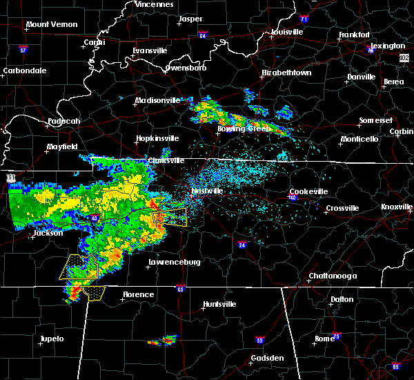 At 712 pm cdt, a severe thunderstorm was located 7 miles south of fairview, or 17 miles southeast of dickson, moving east at 25 mph (radar indicated). Hazards include 60 mph wind gusts. Expect damage to roofs, siding, and trees. locations impacted include, franklin, spring hill, thompson`s station, leipers fork and natchez trace at highway 96. this includes the following highways, interstate 65 between mile markers 57 and 60. Interstate 840 between mile markers 6 and 31. At 712 pm cdt, a severe thunderstorm was located 7 miles south of fairview, or 17 miles southeast of dickson, moving east at 25 mph (radar indicated). Hazards include 60 mph wind gusts. Expect damage to roofs, siding, and trees. locations impacted include, franklin, spring hill, thompson`s station, leipers fork and natchez trace at highway 96. this includes the following highways, interstate 65 between mile markers 57 and 60. Interstate 840 between mile markers 6 and 31.
|
| 5/22/2020 7:10 PM CDT | Roof blown off of a carport as well as tree damage. time estimated from rada in williamson county TN, 4.9 miles NNE of Fairview, TN |
| 5/22/2020 7:10 PM CDT | Roof blown off of a carport as well as tree damage. time estimated from rada in williamson county TN, 4.9 miles NNE of Fairview, TN |
| 5/22/2020 7:06 PM CDT |
 At 706 pm cdt, a severe thunderstorm was located 8 miles southwest of fairview, or 14 miles east of centerville, moving east at 25 mph (radar indicated). Hazards include 60 mph wind gusts. expect damage to roofs, siding, and trees At 706 pm cdt, a severe thunderstorm was located 8 miles southwest of fairview, or 14 miles east of centerville, moving east at 25 mph (radar indicated). Hazards include 60 mph wind gusts. expect damage to roofs, siding, and trees
|
| 5/22/2020 6:14 PM CDT |
 At 614 pm cdt, a severe thunderstorm was located near mcewen, or near waverly, moving east at 35 mph (radar indicated). Hazards include 60 mph wind gusts. expect damage to roofs, siding, and trees At 614 pm cdt, a severe thunderstorm was located near mcewen, or near waverly, moving east at 35 mph (radar indicated). Hazards include 60 mph wind gusts. expect damage to roofs, siding, and trees
|
| 5/3/2020 4:22 PM CDT |
 At 422 pm cdt, severe thunderstorms were located along a line extending from 6 miles north of white bluff to near burns to near centerville, moving east at 45 mph (radar indicated). Hazards include 70 mph wind gusts and penny size hail. Expect considerable tree damage. damage is likely to mobile homes, roofs, and outbuildings. locations impacted include, dickson, white bluff, kingston springs, pegram, burns, fairview, bon aqua, primm springs and lyles. this includes the following highways, interstate 40 between mile markers 174 and 190. Interstate 840 between mile markers 1 and 12. At 422 pm cdt, severe thunderstorms were located along a line extending from 6 miles north of white bluff to near burns to near centerville, moving east at 45 mph (radar indicated). Hazards include 70 mph wind gusts and penny size hail. Expect considerable tree damage. damage is likely to mobile homes, roofs, and outbuildings. locations impacted include, dickson, white bluff, kingston springs, pegram, burns, fairview, bon aqua, primm springs and lyles. this includes the following highways, interstate 40 between mile markers 174 and 190. Interstate 840 between mile markers 1 and 12.
|
| 5/3/2020 4:17 PM CDT |
 At 417 pm cdt, severe thunderstorms were located along a line extending from near white bluff to near fairview to 8 miles east of centerville, moving east at 60 mph (radar indicated). Hazards include 70 mph wind gusts and penny size hail. Expect considerable tree damage. Damage is likely to mobile homes, roofs, and outbuildings. At 417 pm cdt, severe thunderstorms were located along a line extending from near white bluff to near fairview to 8 miles east of centerville, moving east at 60 mph (radar indicated). Hazards include 70 mph wind gusts and penny size hail. Expect considerable tree damage. Damage is likely to mobile homes, roofs, and outbuildings.
|
| 5/3/2020 3:54 PM CDT |
 At 354 pm cdt, severe thunderstorms were located along a line extending from 8 miles southeast of erin to 6 miles south of mcewen to 8 miles south of hurricane mills, moving east at 45 mph (radar indicated). Hazards include 70 mph wind gusts and penny size hail. Expect considerable tree damage. Damage is likely to mobile homes, roofs, and outbuildings. At 354 pm cdt, severe thunderstorms were located along a line extending from 8 miles southeast of erin to 6 miles south of mcewen to 8 miles south of hurricane mills, moving east at 45 mph (radar indicated). Hazards include 70 mph wind gusts and penny size hail. Expect considerable tree damage. Damage is likely to mobile homes, roofs, and outbuildings.
|
| 3/28/2020 10:54 PM CDT |
 At 1053 pm cdt, severe thunderstorms were located along a line extending from cumberland furnace to near burns, moving east at 55 mph (radar indicated). Hazards include 60 mph wind gusts and penny size hail. expect damage to roofs, siding, and trees At 1053 pm cdt, severe thunderstorms were located along a line extending from cumberland furnace to near burns, moving east at 55 mph (radar indicated). Hazards include 60 mph wind gusts and penny size hail. expect damage to roofs, siding, and trees
|
| 1/14/2020 1:24 AM CST |
 At 124 am cst, a severe thunderstorm was located near fairview, or 15 miles west of franklin, moving northeast at 55 mph (radar indicated). Hazards include 60 mph wind gusts. Expect damage to roofs, siding, and trees. locations impacted include, franklin, forest hills, belle meade, kingston springs, pegram, fairview, bellevue, bells bend, leipers fork and natchez trace at highway 96. this includes the following highways, interstate 40 between mile markers 182 and 202. Interstate 840 between mile markers 7 and 14. At 124 am cst, a severe thunderstorm was located near fairview, or 15 miles west of franklin, moving northeast at 55 mph (radar indicated). Hazards include 60 mph wind gusts. Expect damage to roofs, siding, and trees. locations impacted include, franklin, forest hills, belle meade, kingston springs, pegram, fairview, bellevue, bells bend, leipers fork and natchez trace at highway 96. this includes the following highways, interstate 40 between mile markers 182 and 202. Interstate 840 between mile markers 7 and 14.
|
| 1/14/2020 1:13 AM CST |
 At 113 am cst, a severe thunderstorm was located 8 miles south of burns, or 11 miles southeast of dickson, moving east at 55 mph (radar indicated). Hazards include 60 mph wind gusts and penny size hail. expect damage to roofs, siding, and trees At 113 am cst, a severe thunderstorm was located 8 miles south of burns, or 11 miles southeast of dickson, moving east at 55 mph (radar indicated). Hazards include 60 mph wind gusts and penny size hail. expect damage to roofs, siding, and trees
|
| 1/11/2020 9:13 AM CST |
 At 911 am cst, severe thunderstorms were located along a line extending from near bellevue to 6 miles west of spring hill, moving northeast at 45 mph (radar indicated). Hazards include 60 mph wind gusts. Expect damage to roofs, siding, and trees. locations impacted include, franklin, forest hills, belle meade, thompson`s station, bellevue, santa fe, leipers fork and natchez trace at highway 96. this includes the following highways, interstate 40 between mile markers 195 and 197. Interstate 840 between mile markers 14 and 28. At 911 am cst, severe thunderstorms were located along a line extending from near bellevue to 6 miles west of spring hill, moving northeast at 45 mph (radar indicated). Hazards include 60 mph wind gusts. Expect damage to roofs, siding, and trees. locations impacted include, franklin, forest hills, belle meade, thompson`s station, bellevue, santa fe, leipers fork and natchez trace at highway 96. this includes the following highways, interstate 40 between mile markers 195 and 197. Interstate 840 between mile markers 14 and 28.
|
| 1/11/2020 8:53 AM CST |
 At 852 am cst, severe thunderstorms were located along a line extending from 9 miles southwest of kingston springs to 8 miles northwest of mount pleasant, moving northeast at 45 mph (radar indicated). Hazards include 60 mph wind gusts. expect damage to roofs, siding, and trees At 852 am cst, severe thunderstorms were located along a line extending from 9 miles southwest of kingston springs to 8 miles northwest of mount pleasant, moving northeast at 45 mph (radar indicated). Hazards include 60 mph wind gusts. expect damage to roofs, siding, and trees
|
| 1/11/2020 8:25 AM CST |
 At 824 am cst, severe thunderstorms were located along a line extending from near coopertown to 7 miles southeast of burns, moving northeast at 30 mph (radar indicated). Hazards include 60 mph wind gusts. expect damage to roofs, siding, and trees At 824 am cst, severe thunderstorms were located along a line extending from near coopertown to 7 miles southeast of burns, moving northeast at 30 mph (radar indicated). Hazards include 60 mph wind gusts. expect damage to roofs, siding, and trees
|
| 1/11/2020 7:42 AM CST |
 At 742 am cst, severe thunderstorms were located along a line extending from near mcewen to 11 miles west of centerville to 9 miles northwest of waynesboro, moving northeast at 45 mph (radar indicated). Hazards include 60 mph wind gusts. expect damage to roofs, siding, and trees At 742 am cst, severe thunderstorms were located along a line extending from near mcewen to 11 miles west of centerville to 9 miles northwest of waynesboro, moving northeast at 45 mph (radar indicated). Hazards include 60 mph wind gusts. expect damage to roofs, siding, and trees
|
| 6/27/2019 5:41 PM CDT |
 At 540 pm cdt, a severe thunderstorm was located over pegram, or 11 miles south of ashland city, moving north at 35 mph (radar indicated). Hazards include 60 mph wind gusts. expect damage to roofs, siding, and trees At 540 pm cdt, a severe thunderstorm was located over pegram, or 11 miles south of ashland city, moving north at 35 mph (radar indicated). Hazards include 60 mph wind gusts. expect damage to roofs, siding, and trees
|
| 6/21/2019 7:44 PM CDT |
 At 744 pm cdt, severe thunderstorms were located along a line extending from near joelton to near pegram to 6 miles southeast of burns, moving southeast at 45 mph (radar indicated). Hazards include 60 mph wind gusts and nickel size hail. Expect damage to roofs, siding, and trees. locations impacted include, franklin, ashland city, nashville, madison, smyrna, brentwood, la vergne, spring hill, mount juliet, nolensville, forest hills, oak hill, white bluff, belle meade, kingston springs, lakewood, thompson`s station, pegram, hermitage and fairview. this includes the following highways, interstate 40 between mile markers 174 and 228. interstate 65 between mile markers 55 and 93. interstate 24 between mile markers 34 and 69. Interstate 840 between mile markers 1 and 35, and between mile markers 66 and 72. At 744 pm cdt, severe thunderstorms were located along a line extending from near joelton to near pegram to 6 miles southeast of burns, moving southeast at 45 mph (radar indicated). Hazards include 60 mph wind gusts and nickel size hail. Expect damage to roofs, siding, and trees. locations impacted include, franklin, ashland city, nashville, madison, smyrna, brentwood, la vergne, spring hill, mount juliet, nolensville, forest hills, oak hill, white bluff, belle meade, kingston springs, lakewood, thompson`s station, pegram, hermitage and fairview. this includes the following highways, interstate 40 between mile markers 174 and 228. interstate 65 between mile markers 55 and 93. interstate 24 between mile markers 34 and 69. Interstate 840 between mile markers 1 and 35, and between mile markers 66 and 72.
|
| 6/21/2019 7:43 PM CDT | Tree down on house at intersection of fairlawn rd and brush creek r in williamson county TN, 1.2 miles WSW of Fairview, TN |
| 6/21/2019 7:29 PM CDT |
 At 728 pm cdt, severe thunderstorms were located along a line extending from near coopertown to near white bluff to near dickson, moving southeast at 45 mph (radar indicated). Hazards include 60 mph wind gusts and nickel size hail. expect damage to roofs, siding, and trees At 728 pm cdt, severe thunderstorms were located along a line extending from near coopertown to near white bluff to near dickson, moving southeast at 45 mph (radar indicated). Hazards include 60 mph wind gusts and nickel size hail. expect damage to roofs, siding, and trees
|
| 6/21/2019 7:08 PM CDT |
 At 708 pm cdt, severe thunderstorms were located along a line extending from 8 miles northeast of mcewen to waverly to 9 miles southwest of new johnsonville, moving southeast at 40 mph (radar indicated). Hazards include 60 mph wind gusts and nickel size hail. Expect damage to roofs, siding, and trees. locations impacted include, dickson, waverly, centerville, linden, white bluff, new johnsonville, mcewen, burns, hurricane mills, charlotte, lobelville, vanleer, slayden, bon aqua, lyles, bucksnort, mousetail landing state park, pinewood and nunnelly. this includes the following highways, interstate 40 between mile markers 136 and 181. Interstate 840 between mile markers 1 and 4. At 708 pm cdt, severe thunderstorms were located along a line extending from 8 miles northeast of mcewen to waverly to 9 miles southwest of new johnsonville, moving southeast at 40 mph (radar indicated). Hazards include 60 mph wind gusts and nickel size hail. Expect damage to roofs, siding, and trees. locations impacted include, dickson, waverly, centerville, linden, white bluff, new johnsonville, mcewen, burns, hurricane mills, charlotte, lobelville, vanleer, slayden, bon aqua, lyles, bucksnort, mousetail landing state park, pinewood and nunnelly. this includes the following highways, interstate 40 between mile markers 136 and 181. Interstate 840 between mile markers 1 and 4.
|
| 6/21/2019 6:54 PM CDT |
 At 653 pm cdt, severe thunderstorms were located along a line extending from erin to 7 miles northwest of waverly to near bruceton, moving southeast at 40 mph (radar indicated). Hazards include 60 mph wind gusts and nickel size hail. expect damage to roofs, siding, and trees At 653 pm cdt, severe thunderstorms were located along a line extending from erin to 7 miles northwest of waverly to near bruceton, moving southeast at 40 mph (radar indicated). Hazards include 60 mph wind gusts and nickel size hail. expect damage to roofs, siding, and trees
|
| 6/19/2019 8:06 PM CDT |
 At 805 pm cdt, a severe thunderstorm was located near centerville, moving east at 40 mph (radar indicated). Hazards include 60 mph wind gusts and quarter size hail. Hail damage to vehicles is expected. expect wind damage to roofs, siding, and trees. Locations impacted include, centerville, primm springs, lyles, nunnelly and pinewood. At 805 pm cdt, a severe thunderstorm was located near centerville, moving east at 40 mph (radar indicated). Hazards include 60 mph wind gusts and quarter size hail. Hail damage to vehicles is expected. expect wind damage to roofs, siding, and trees. Locations impacted include, centerville, primm springs, lyles, nunnelly and pinewood.
|
| 6/19/2019 7:58 PM CDT |
 At 757 pm cdt, severe thunderstorms were located along a line extending from near rural hill to nolensville to leipers fork, moving east at 30 mph (radar indicated. at 756 pm cdt...numerous reports of quarter size hail were received from brentwood with these storms). Hazards include 60 mph wind gusts and quarter size hail. Hail damage to vehicles is expected. Expect wind damage to roofs, siding, and trees. At 757 pm cdt, severe thunderstorms were located along a line extending from near rural hill to nolensville to leipers fork, moving east at 30 mph (radar indicated. at 756 pm cdt...numerous reports of quarter size hail were received from brentwood with these storms). Hazards include 60 mph wind gusts and quarter size hail. Hail damage to vehicles is expected. Expect wind damage to roofs, siding, and trees.
|
| 6/19/2019 7:54 PM CDT |
 At 754 pm cdt, a severe thunderstorm was located 12 miles southeast of hurricane mills, or 13 miles west of centerville, moving east at 25 mph (radar indicated). Hazards include 60 mph wind gusts and quarter size hail. Hail damage to vehicles is expected. Expect wind damage to roofs, siding, and trees. At 754 pm cdt, a severe thunderstorm was located 12 miles southeast of hurricane mills, or 13 miles west of centerville, moving east at 25 mph (radar indicated). Hazards include 60 mph wind gusts and quarter size hail. Hail damage to vehicles is expected. Expect wind damage to roofs, siding, and trees.
|
| 6/19/2019 7:07 PM CDT |
 At 707 pm cdt, a severe thunderstorm was located over burns, moving east at 40 mph (radar indicated). Hazards include 60 mph wind gusts and quarter size hail. Hail damage to vehicles is expected. expect wind damage to roofs, siding, and trees. locations impacted include, dickson, white bluff, kingston springs, pegram, burns and fairview. this includes the following highways, interstate 40 between mile markers 168 and 190. Interstate 840 between mile markers 1 and 4. At 707 pm cdt, a severe thunderstorm was located over burns, moving east at 40 mph (radar indicated). Hazards include 60 mph wind gusts and quarter size hail. Hail damage to vehicles is expected. expect wind damage to roofs, siding, and trees. locations impacted include, dickson, white bluff, kingston springs, pegram, burns and fairview. this includes the following highways, interstate 40 between mile markers 168 and 190. Interstate 840 between mile markers 1 and 4.
|
| 6/19/2019 6:55 PM CDT |
 At 655 pm cdt, a severe thunderstorm was located near dickson, moving east at 40 mph (radar indicated). Hazards include 60 mph wind gusts and quarter size hail. Hail damage to vehicles is expected. Expect wind damage to roofs, siding, and trees. At 655 pm cdt, a severe thunderstorm was located near dickson, moving east at 40 mph (radar indicated). Hazards include 60 mph wind gusts and quarter size hail. Hail damage to vehicles is expected. Expect wind damage to roofs, siding, and trees.
|
| 5/1/2019 5:30 PM CDT | Large tree hit back section of dos margaritas restaurant. time estimated by rada in williamson county TN, 0.8 miles NW of Fairview, TN |
| 4/13/2019 9:35 PM CDT |
 At 935 pm cdt, a severe thunderstorm was located 10 miles northeast of centerville, or near bon aqua, moving north at 45 mph (public. at 933 pm...dime size hail was reported in hickman county with this storm). Hazards include quarter size hail. Damage to vehicles is expected. locations impacted include, dickson, white bluff, burns, primm springs, lyles and bon aqua. this includes the following highways, interstate 40 between mile markers 169 and 180. Interstate 840 between mile markers 1 and 6. At 935 pm cdt, a severe thunderstorm was located 10 miles northeast of centerville, or near bon aqua, moving north at 45 mph (public. at 933 pm...dime size hail was reported in hickman county with this storm). Hazards include quarter size hail. Damage to vehicles is expected. locations impacted include, dickson, white bluff, burns, primm springs, lyles and bon aqua. this includes the following highways, interstate 40 between mile markers 169 and 180. Interstate 840 between mile markers 1 and 6.
|
| 4/13/2019 9:23 PM CDT |
 At 923 pm cdt, a severe thunderstorm was located 9 miles southeast of centerville, moving north at 45 mph (radar indicated). Hazards include quarter size hail. damage to vehicles is expected At 923 pm cdt, a severe thunderstorm was located 9 miles southeast of centerville, moving north at 45 mph (radar indicated). Hazards include quarter size hail. damage to vehicles is expected
|
| 4/7/2019 4:00 PM CDT |
 At 359 pm cdt, severe thunderstorms were located along a line extending from 6 miles south of white bluff to 12 miles southwest of fairview, moving northeast at 45 mph (radar indicated). Hazards include 60 mph wind gusts. Expect damage to roofs, siding, and trees. Locations impacted include, spring hill, kingston springs, thompson`s station, pegram, fairview, leipers fork and natchez trace at highway 96. At 359 pm cdt, severe thunderstorms were located along a line extending from 6 miles south of white bluff to 12 miles southwest of fairview, moving northeast at 45 mph (radar indicated). Hazards include 60 mph wind gusts. Expect damage to roofs, siding, and trees. Locations impacted include, spring hill, kingston springs, thompson`s station, pegram, fairview, leipers fork and natchez trace at highway 96.
|
| 4/7/2019 3:48 PM CDT |
 At 347 pm cdt, severe thunderstorms were located along a line extending from near burns to 10 miles east of centerville, moving northeast at 45 mph (radar indicated). Hazards include 60 mph wind gusts. expect damage to roofs, siding, and trees At 347 pm cdt, severe thunderstorms were located along a line extending from near burns to 10 miles east of centerville, moving northeast at 45 mph (radar indicated). Hazards include 60 mph wind gusts. expect damage to roofs, siding, and trees
|
| 3/30/2019 6:28 PM CDT |
 At 627 pm cdt, a severe thunderstorm was located 10 miles northwest of columbia, moving east at 45 mph (radar indicated). Hazards include 60 mph wind gusts and penny size hail. Expect damage to roofs, siding, and trees. locations impacted include, spring hill, thompson`s station, santa fe, williamsport, primm springs and leipers fork. This includes interstate 840 between mile markers 8 and 27. At 627 pm cdt, a severe thunderstorm was located 10 miles northwest of columbia, moving east at 45 mph (radar indicated). Hazards include 60 mph wind gusts and penny size hail. Expect damage to roofs, siding, and trees. locations impacted include, spring hill, thompson`s station, santa fe, williamsport, primm springs and leipers fork. This includes interstate 840 between mile markers 8 and 27.
|
| 3/30/2019 6:14 PM CDT |
 At 613 pm cdt, severe thunderstorms were located along a line extending from near ashland city to 9 miles south of white bluff, moving east at 60 mph (radar indicated). Hazards include 60 mph wind gusts. expect damage to roofs, siding, and trees At 613 pm cdt, severe thunderstorms were located along a line extending from near ashland city to 9 miles south of white bluff, moving east at 60 mph (radar indicated). Hazards include 60 mph wind gusts. expect damage to roofs, siding, and trees
|
| 3/30/2019 6:04 PM CDT |
 At 604 pm cdt, a severe thunderstorm was located near centerville, moving east at 55 mph (radar indicated). Hazards include 60 mph wind gusts and penny size hail. expect damage to roofs, siding, and trees At 604 pm cdt, a severe thunderstorm was located near centerville, moving east at 55 mph (radar indicated). Hazards include 60 mph wind gusts and penny size hail. expect damage to roofs, siding, and trees
|
| 2/6/2019 8:12 PM CST |
 At 812 pm cst, a severe thunderstorm capable of producing a tornado was located over pegram, or 14 miles south of ashland city, moving east at 40 mph (radar indicated rotation). Hazards include tornado. Flying debris will be dangerous to those caught without shelter. mobile homes will be damaged or destroyed. damage to roofs, windows, and vehicles will occur. tree damage is likely. this tornadic thunderstorm will remain over mainly rural areas of southwestern davidson, northwestern williamson and south central cheatham counties. This includes interstate 40 between mile markers 182 and 197. At 812 pm cst, a severe thunderstorm capable of producing a tornado was located over pegram, or 14 miles south of ashland city, moving east at 40 mph (radar indicated rotation). Hazards include tornado. Flying debris will be dangerous to those caught without shelter. mobile homes will be damaged or destroyed. damage to roofs, windows, and vehicles will occur. tree damage is likely. this tornadic thunderstorm will remain over mainly rural areas of southwestern davidson, northwestern williamson and south central cheatham counties. This includes interstate 40 between mile markers 182 and 197.
|
| 2/6/2019 7:58 PM CST |
 At 758 pm cst, a severe thunderstorm capable of producing a tornado was located near white bluff, or 9 miles east of dickson, moving east at 40 mph (radar indicated rotation). Hazards include tornado. Flying debris will be dangerous to those caught without shelter. mobile homes will be damaged or destroyed. damage to roofs, windows, and vehicles will occur. tree damage is likely. this dangerous storm will be near, kingston springs and fairview around 805 pm cst. pegram around 815 pm cst. other locations impacted by this tornadic thunderstorm include natchez trace at highway 96. this includes the following highways, interstate 40 between mile markers 177 and 197. Interstate 840 between mile markers 1 and 3. At 758 pm cst, a severe thunderstorm capable of producing a tornado was located near white bluff, or 9 miles east of dickson, moving east at 40 mph (radar indicated rotation). Hazards include tornado. Flying debris will be dangerous to those caught without shelter. mobile homes will be damaged or destroyed. damage to roofs, windows, and vehicles will occur. tree damage is likely. this dangerous storm will be near, kingston springs and fairview around 805 pm cst. pegram around 815 pm cst. other locations impacted by this tornadic thunderstorm include natchez trace at highway 96. this includes the following highways, interstate 40 between mile markers 177 and 197. Interstate 840 between mile markers 1 and 3.
|
| 12/31/2018 1:57 PM CST |
 At 157 pm cst, severe thunderstorms were located along a line extending from 6 miles north of springfield to 11 miles southwest of fairview, moving east at 55 mph (radar indicated). Hazards include 60 mph wind gusts. expect damage to roofs, siding, and trees At 157 pm cst, severe thunderstorms were located along a line extending from 6 miles north of springfield to 11 miles southwest of fairview, moving east at 55 mph (radar indicated). Hazards include 60 mph wind gusts. expect damage to roofs, siding, and trees
|
| 8/30/2018 7:40 PM CDT |
 The severe thunderstorm warning for north central maury, west central williamson and northeastern hickman counties will expire at 745 pm cdt, the storms which prompted the warning have weakened below severe limits, and no longer pose an immediate threat to life or property. therefore, the warning will be allowed to expire. however gusty winds and heavy rain are still possible with these thunderstorms. The severe thunderstorm warning for north central maury, west central williamson and northeastern hickman counties will expire at 745 pm cdt, the storms which prompted the warning have weakened below severe limits, and no longer pose an immediate threat to life or property. therefore, the warning will be allowed to expire. however gusty winds and heavy rain are still possible with these thunderstorms.
|
| 8/30/2018 7:15 PM CDT |
 At 714 pm cdt, severe thunderstorms were located along a line extending from near centerville to 14 miles southwest of fairview, moving northwest at 15 mph (radar indicated). Hazards include 60 mph wind gusts. expect damage to roofs, siding, and trees At 714 pm cdt, severe thunderstorms were located along a line extending from near centerville to 14 miles southwest of fairview, moving northwest at 15 mph (radar indicated). Hazards include 60 mph wind gusts. expect damage to roofs, siding, and trees
|
| 7/14/2018 1:14 PM CDT |
 At 114 pm cdt, a severe thunderstorm was located near fairview, or 12 miles west of franklin, and is nearly stationary (radar indicated). Hazards include 60 mph wind gusts and penny size hail. expect damage to roofs, siding, and trees At 114 pm cdt, a severe thunderstorm was located near fairview, or 12 miles west of franklin, and is nearly stationary (radar indicated). Hazards include 60 mph wind gusts and penny size hail. expect damage to roofs, siding, and trees
|
| 6/28/2018 1:04 PM CDT |
 At 103 pm cdt, severe thunderstorms were located along a line extending from spring hill to summertown, moving southeast at 50 mph (emergency management. at 100 pm cdt, trees were blown down and a home was damaged in hickman county with these storms). Hazards include 70 mph wind gusts and quarter size hail. Hail damage to vehicles is expected. expect considerable tree damage. wind damage is also likely to mobile homes, roofs, and outbuildings. locations impacted include, columbia, hohenwald, spring hill, mount pleasant, thompson`s station, summertown, fairview, ethridge, gordonsburg, kimmins, henryville, culleoka, i-65 east of columbia, santa fe, hampshire, williamsport and leipers fork. this includes the following highways, interstate 65 between mile markers 37 and 54. Interstate 840 between mile markers 7 and 27. At 103 pm cdt, severe thunderstorms were located along a line extending from spring hill to summertown, moving southeast at 50 mph (emergency management. at 100 pm cdt, trees were blown down and a home was damaged in hickman county with these storms). Hazards include 70 mph wind gusts and quarter size hail. Hail damage to vehicles is expected. expect considerable tree damage. wind damage is also likely to mobile homes, roofs, and outbuildings. locations impacted include, columbia, hohenwald, spring hill, mount pleasant, thompson`s station, summertown, fairview, ethridge, gordonsburg, kimmins, henryville, culleoka, i-65 east of columbia, santa fe, hampshire, williamsport and leipers fork. this includes the following highways, interstate 65 between mile markers 37 and 54. Interstate 840 between mile markers 7 and 27.
|
| 6/28/2018 12:43 PM CDT |
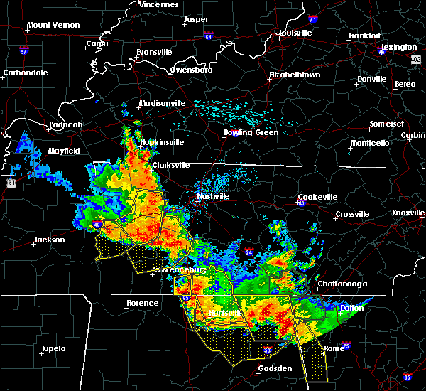 The national weather service in nashville has issued a * severe thunderstorm warning for. lewis county in middle tennessee. maury county in middle tennessee. northern lawrence county in middle tennessee. Western williamson county in middle tennessee. The national weather service in nashville has issued a * severe thunderstorm warning for. lewis county in middle tennessee. maury county in middle tennessee. northern lawrence county in middle tennessee. Western williamson county in middle tennessee.
|
| 6/1/2018 2:36 AM CDT |
 The severe thunderstorm warning for northwestern williamson and south central cheatham counties will expire at 245 am cdt, the storm which prompted the warning has weakened below severe limits, and no longer poses an immediate threat to life or property. therefore, the warning will be allowed to expire. however gusty winds are still possible with this thunderstorm. The severe thunderstorm warning for northwestern williamson and south central cheatham counties will expire at 245 am cdt, the storm which prompted the warning has weakened below severe limits, and no longer poses an immediate threat to life or property. therefore, the warning will be allowed to expire. however gusty winds are still possible with this thunderstorm.
|
| 6/1/2018 2:30 AM CDT |
 At 230 am cdt, a severe thunderstorm was located near kingston springs, or 12 miles east of dickson, moving east at 30 mph (radar indicated). Hazards include 60 mph wind gusts and penny size hail. Expect damage to roofs, siding, and trees. locations impacted include, kingston springs, pegram and fairview. This includes interstate 40 between mile markers 182 and 190. At 230 am cdt, a severe thunderstorm was located near kingston springs, or 12 miles east of dickson, moving east at 30 mph (radar indicated). Hazards include 60 mph wind gusts and penny size hail. Expect damage to roofs, siding, and trees. locations impacted include, kingston springs, pegram and fairview. This includes interstate 40 between mile markers 182 and 190.
|
| 6/1/2018 2:18 AM CDT |
 At 218 am cdt, a severe thunderstorm was located near burns, or 7 miles southeast of dickson, moving east at 30 mph (radar indicated). Hazards include 60 mph wind gusts and penny size hail. expect damage to roofs, siding, and trees At 218 am cdt, a severe thunderstorm was located near burns, or 7 miles southeast of dickson, moving east at 30 mph (radar indicated). Hazards include 60 mph wind gusts and penny size hail. expect damage to roofs, siding, and trees
|
| 4/3/2018 8:43 PM CDT |
 At 843 pm cdt, a severe thunderstorm was located 10 miles southwest of fairview, or 17 miles west of franklin, moving northeast at 55 mph (radar indicated). Hazards include 60 mph wind gusts and nickel size hail. expect damage to roofs, siding, and trees At 843 pm cdt, a severe thunderstorm was located 10 miles southwest of fairview, or 17 miles west of franklin, moving northeast at 55 mph (radar indicated). Hazards include 60 mph wind gusts and nickel size hail. expect damage to roofs, siding, and trees
|
| 2/24/2018 10:34 PM CST |
 At 1034 pm cst, a severe thunderstorm was located near fairview, or near franklin, moving east at 55 mph (radar indicated). Hazards include 60 mph wind gusts. Expect damage to roofs, siding, and trees. locations impacted include, franklin, columbia, brentwood, spring hill, nolensville, forest hills, oak hill, belle meade, thompson`s station, antioch, fairview, bellevue, primm springs, natchez trace at highway 96, triune, santa fe, williamsport and leipers fork. A tornado watch remains in effect until 200 am cst for middle tennessee. At 1034 pm cst, a severe thunderstorm was located near fairview, or near franklin, moving east at 55 mph (radar indicated). Hazards include 60 mph wind gusts. Expect damage to roofs, siding, and trees. locations impacted include, franklin, columbia, brentwood, spring hill, nolensville, forest hills, oak hill, belle meade, thompson`s station, antioch, fairview, bellevue, primm springs, natchez trace at highway 96, triune, santa fe, williamsport and leipers fork. A tornado watch remains in effect until 200 am cst for middle tennessee.
|
| 2/24/2018 10:33 PM CST |
 At 1032 pm cst, a severe thunderstorm was located over gallatin, moving east at 55 mph (radar indicated). Hazards include 60 mph wind gusts. Expect damage to roofs, siding, and trees. locations impacted include, gallatin, lebanon, nashville, madison, hendersonville, brentwood, mount juliet, goodlettsville, millersville, forest hills, oak hill, belle meade, lakewood, ridgetop, hermitage, rural hill, bellevue, antioch, belinda city and old hickory. A tornado watch remains in effect until 200 am cst for middle tennessee. At 1032 pm cst, a severe thunderstorm was located over gallatin, moving east at 55 mph (radar indicated). Hazards include 60 mph wind gusts. Expect damage to roofs, siding, and trees. locations impacted include, gallatin, lebanon, nashville, madison, hendersonville, brentwood, mount juliet, goodlettsville, millersville, forest hills, oak hill, belle meade, lakewood, ridgetop, hermitage, rural hill, bellevue, antioch, belinda city and old hickory. A tornado watch remains in effect until 200 am cst for middle tennessee.
|
| 2/24/2018 10:22 PM CST |
 At 1021 pm cst, a severe thunderstorm was located 12 miles southwest of fairview, or 16 miles north of columbia, moving east at 55 mph (trained weather spotters). Hazards include 60 mph wind gusts. Expect damage to roofs, siding, and trees. locations impacted include, franklin, columbia, centerville, brentwood, la vergne, spring hill, nolensville, forest hills, oak hill, belle meade, thompson`s station, antioch, fairview, bellevue, bon aqua, kimmins, primm springs, lyles, natchez trace at highway 96 and triune. A tornado watch remains in effect until 200 am cst for middle tennessee. At 1021 pm cst, a severe thunderstorm was located 12 miles southwest of fairview, or 16 miles north of columbia, moving east at 55 mph (trained weather spotters). Hazards include 60 mph wind gusts. Expect damage to roofs, siding, and trees. locations impacted include, franklin, columbia, centerville, brentwood, la vergne, spring hill, nolensville, forest hills, oak hill, belle meade, thompson`s station, antioch, fairview, bellevue, bon aqua, kimmins, primm springs, lyles, natchez trace at highway 96 and triune. A tornado watch remains in effect until 200 am cst for middle tennessee.
|
| 2/24/2018 10:17 PM CST |
 At 1016 pm cst, a severe thunderstorm was located over madison, or 7 miles north of nashville, moving east at 55 mph (radar indicated). Hazards include 60 mph wind gusts. Expect damage to roofs, siding, and trees. locations impacted include, gallatin, lebanon, ashland city, nashville, madison, hendersonville, brentwood, mount juliet, goodlettsville, millersville, forest hills, oak hill, white bluff, belle meade, kingston springs, lakewood, pegram, ridgetop, hermitage and rural hill. A tornado watch remains in effect until 200 am cst for middle tennessee. At 1016 pm cst, a severe thunderstorm was located over madison, or 7 miles north of nashville, moving east at 55 mph (radar indicated). Hazards include 60 mph wind gusts. Expect damage to roofs, siding, and trees. locations impacted include, gallatin, lebanon, ashland city, nashville, madison, hendersonville, brentwood, mount juliet, goodlettsville, millersville, forest hills, oak hill, white bluff, belle meade, kingston springs, lakewood, pegram, ridgetop, hermitage and rural hill. A tornado watch remains in effect until 200 am cst for middle tennessee.
|
| 2/24/2018 10:15 PM CST | Wind gusts 65 measured by a home weather station near the intersection of highway 100 and brush creek roa in williamson county TN, 1.2 miles WSW of Fairview, TN |
| 2/24/2018 10:07 PM CST |
 At 1007 pm cst, a severe thunderstorm was located near centerville, moving east at 55 mph (radar indicated). Hazards include 60 mph wind gusts. expect damage to roofs, siding, and trees At 1007 pm cst, a severe thunderstorm was located near centerville, moving east at 55 mph (radar indicated). Hazards include 60 mph wind gusts. expect damage to roofs, siding, and trees
|
| 2/24/2018 9:59 PM CST |
 At 959 pm cst, a severe thunderstorm was located near ashland city, moving east at 55 mph (radar indicated). Hazards include 60 mph wind gusts. expect damage to roofs, siding, and trees At 959 pm cst, a severe thunderstorm was located near ashland city, moving east at 55 mph (radar indicated). Hazards include 60 mph wind gusts. expect damage to roofs, siding, and trees
|
| 11/18/2017 4:25 PM CST |
 At 424 pm cst, severe thunderstorms were located along a line extending from cross plains to leiper`s fork, moving east at 50 mph (radar indicated). Hazards include 70 mph wind gusts. Expect considerable tree damage. Damage is likely to mobile homes, roofs, and outbuildings. At 424 pm cst, severe thunderstorms were located along a line extending from cross plains to leiper`s fork, moving east at 50 mph (radar indicated). Hazards include 70 mph wind gusts. Expect considerable tree damage. Damage is likely to mobile homes, roofs, and outbuildings.
|
| 11/18/2017 4:12 PM CST |
 At 412 pm cst, severe thunderstorms were located along a line extending from cedar hill to fairview, moving east at 60 mph (radar indicated). Hazards include 70 mph wind gusts. Expect considerable tree damage. damage is likely to mobile homes, roofs, and outbuildings. Locations impacted include, franklin, springfield, dickson, ashland city, clarksville, brentwood, greenbrier, forest hills, coopertown, white bluff, belle meade, kingston springs, pegram, ridgetop, cross plains, burns, fairview, bellevue, joelton and pleasant view. At 412 pm cst, severe thunderstorms were located along a line extending from cedar hill to fairview, moving east at 60 mph (radar indicated). Hazards include 70 mph wind gusts. Expect considerable tree damage. damage is likely to mobile homes, roofs, and outbuildings. Locations impacted include, franklin, springfield, dickson, ashland city, clarksville, brentwood, greenbrier, forest hills, coopertown, white bluff, belle meade, kingston springs, pegram, ridgetop, cross plains, burns, fairview, bellevue, joelton and pleasant view.
|
| 11/18/2017 4:00 PM CST |
 At 359 pm cst, severe thunderstorms were located along a line extending from guthrie to centerville, moving east at 60 mph (radar indicated). Hazards include 70 mph wind gusts. Expect considerable tree damage. Damage is likely to mobile homes, roofs, and outbuildings. At 359 pm cst, severe thunderstorms were located along a line extending from guthrie to centerville, moving east at 60 mph (radar indicated). Hazards include 70 mph wind gusts. Expect considerable tree damage. Damage is likely to mobile homes, roofs, and outbuildings.
|
| 11/6/2017 9:36 PM CST | A report of one tree down. it was cleared fairly quickl in williamson county TN, 2.8 miles SE of Fairview, TN |
| 8/31/2017 8:09 PM CDT |
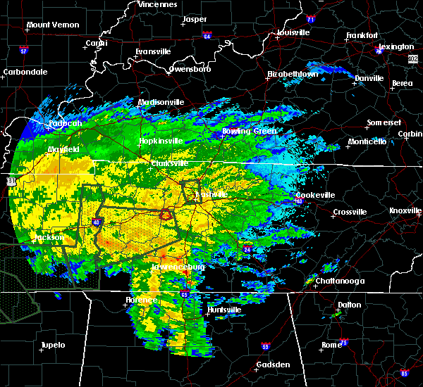 At 808 pm cdt, a severe thunderstorm capable of producing a tornado was located 9 miles west of fairview, or 14 miles southeast of dickson, moving northwest at 25 mph (radar indicated rotation). Hazards include tornado. Flying debris will be dangerous to those caught without shelter. mobile homes will be damaged or destroyed. damage to roofs, windows, and vehicles will occur. tree damage is likely. Locations impacted include, fairview. At 808 pm cdt, a severe thunderstorm capable of producing a tornado was located 9 miles west of fairview, or 14 miles southeast of dickson, moving northwest at 25 mph (radar indicated rotation). Hazards include tornado. Flying debris will be dangerous to those caught without shelter. mobile homes will be damaged or destroyed. damage to roofs, windows, and vehicles will occur. tree damage is likely. Locations impacted include, fairview.
|
| 8/31/2017 7:50 PM CDT |
 At 750 pm cdt, a severe thunderstorm capable of producing a tornado was located 7 miles southwest of fairview, or 12 miles west of franklin, moving northwest at 25 mph (radar indicated rotation). Hazards include tornado. Flying debris will be dangerous to those caught without shelter. mobile homes will be damaged or destroyed. damage to roofs, windows, and vehicles will occur. tree damage is likely. This tornadic thunderstorm will remain over mainly rural areas of northwestern williamson county. At 750 pm cdt, a severe thunderstorm capable of producing a tornado was located 7 miles southwest of fairview, or 12 miles west of franklin, moving northwest at 25 mph (radar indicated rotation). Hazards include tornado. Flying debris will be dangerous to those caught without shelter. mobile homes will be damaged or destroyed. damage to roofs, windows, and vehicles will occur. tree damage is likely. This tornadic thunderstorm will remain over mainly rural areas of northwestern williamson county.
|
| 7/5/2017 9:38 PM CDT |
 At 938 pm cdt, severe thunderstorms were located along a line extending from 7 miles northwest of kingston springs to near fairview to 11 miles northeast of centerville, moving east at 35 mph (radar indicated). Hazards include 60 mph wind gusts. expect damage to roofs, siding, and trees At 938 pm cdt, severe thunderstorms were located along a line extending from 7 miles northwest of kingston springs to near fairview to 11 miles northeast of centerville, moving east at 35 mph (radar indicated). Hazards include 60 mph wind gusts. expect damage to roofs, siding, and trees
|
| 7/5/2017 9:04 PM CDT |
 At 903 pm cdt, severe thunderstorms were located along a line extending from 8 miles southwest of dickson to near centerville, moving east at 40 mph (radar indicated). Hazards include 60 mph wind gusts. expect damage to roofs, siding, and trees At 903 pm cdt, severe thunderstorms were located along a line extending from 8 miles southwest of dickson to near centerville, moving east at 40 mph (radar indicated). Hazards include 60 mph wind gusts. expect damage to roofs, siding, and trees
|
| 7/3/2017 12:27 PM CDT |
 The national weather service in nashville has issued a * severe thunderstorm warning for. southwestern davidson county in middle tennessee. east central dickson county in middle tennessee. southeastern cheatham county in middle tennessee. Until 100 pm cdt. The national weather service in nashville has issued a * severe thunderstorm warning for. southwestern davidson county in middle tennessee. east central dickson county in middle tennessee. southeastern cheatham county in middle tennessee. Until 100 pm cdt.
|
| 7/1/2017 5:20 PM CDT |
 At 519 pm cdt, a severe thunderstorm was located near fairview, or 13 miles west of franklin, moving east at 40 mph (radar indicated). Hazards include 60 mph wind gusts. Expect damage to roofs, siding, and trees. Locations impacted include, franklin, brentwood, spring hill, thompson`s station, fairview, thompsons station, leipers fork and natchez trace at highway 96. At 519 pm cdt, a severe thunderstorm was located near fairview, or 13 miles west of franklin, moving east at 40 mph (radar indicated). Hazards include 60 mph wind gusts. Expect damage to roofs, siding, and trees. Locations impacted include, franklin, brentwood, spring hill, thompson`s station, fairview, thompsons station, leipers fork and natchez trace at highway 96.
|
| 7/1/2017 5:11 PM CDT |
 At 511 pm cdt, a severe thunderstorm was located 11 miles west of fairview, or 15 miles southeast of dickson, moving east at 40 mph (radar indicated). Hazards include 60 mph wind gusts. expect damage to roofs, siding, and trees At 511 pm cdt, a severe thunderstorm was located 11 miles west of fairview, or 15 miles southeast of dickson, moving east at 40 mph (radar indicated). Hazards include 60 mph wind gusts. expect damage to roofs, siding, and trees
|
| 5/30/2017 4:30 PM CDT |
 At 430 pm cdt, a severe thunderstorm was located over dickson, moving east at 25 mph (radar indicated). Hazards include 60 mph wind gusts and quarter size hail. Hail damage to vehicles is expected. expect wind damage to roofs, siding, and trees. Locations impacted include, dickson, white bluff, burns and charlotte. At 430 pm cdt, a severe thunderstorm was located over dickson, moving east at 25 mph (radar indicated). Hazards include 60 mph wind gusts and quarter size hail. Hail damage to vehicles is expected. expect wind damage to roofs, siding, and trees. Locations impacted include, dickson, white bluff, burns and charlotte.
|
| 5/30/2017 4:08 PM CDT |
 At 408 pm cdt, a severe thunderstorm was located 7 miles northwest of dickson, moving east at 25 mph (radar indicated). Hazards include 60 mph wind gusts and quarter size hail. Hail damage to vehicles is expected. Expect wind damage to roofs, siding, and trees. At 408 pm cdt, a severe thunderstorm was located 7 miles northwest of dickson, moving east at 25 mph (radar indicated). Hazards include 60 mph wind gusts and quarter size hail. Hail damage to vehicles is expected. Expect wind damage to roofs, siding, and trees.
|
| 5/27/2017 8:04 PM CDT |
 At 803 pm cdt, a severe thunderstorm was located 9 miles southeast of burns, or 12 miles southeast of dickson, moving east at 35 mph (radar indicated). Hazards include 70 mph wind gusts and quarter size hail. Hail damage to vehicles is expected. expect considerable tree damage. wind damage is also likely to mobile homes, roofs, and outbuildings. locations impacted include, franklin, dickson, ashland city, centerville, nashville, brentwood, spring hill, nolensville, forest hills, oak hill, coopertown, white bluff, belle meade, kingston springs, thompson`s station, pegram, mcewen, burns, hurricane mills and fairview. Nashville sounds baseball will also be impacted. At 803 pm cdt, a severe thunderstorm was located 9 miles southeast of burns, or 12 miles southeast of dickson, moving east at 35 mph (radar indicated). Hazards include 70 mph wind gusts and quarter size hail. Hail damage to vehicles is expected. expect considerable tree damage. wind damage is also likely to mobile homes, roofs, and outbuildings. locations impacted include, franklin, dickson, ashland city, centerville, nashville, brentwood, spring hill, nolensville, forest hills, oak hill, coopertown, white bluff, belle meade, kingston springs, thompson`s station, pegram, mcewen, burns, hurricane mills and fairview. Nashville sounds baseball will also be impacted.
|
| 5/27/2017 7:49 PM CDT |
 At 749 pm cdt, a severe thunderstorm was located near burns, or 9 miles southeast of dickson, moving east at 70 mph (radar indicated). Hazards include 70 mph wind gusts and quarter size hail. Hail damage to vehicles is expected. expect considerable tree damage. Wind damage is also likely to mobile homes, roofs, and outbuildings. At 749 pm cdt, a severe thunderstorm was located near burns, or 9 miles southeast of dickson, moving east at 70 mph (radar indicated). Hazards include 70 mph wind gusts and quarter size hail. Hail damage to vehicles is expected. expect considerable tree damage. Wind damage is also likely to mobile homes, roofs, and outbuildings.
|
| 5/27/2017 7:36 PM CDT |
 At 735 pm cdt, a severe thunderstorm was located over antioch, or 10 miles southeast of nashville, moving east at 40 mph (radar indicated). Hazards include 70 mph wind gusts and quarter size hail. Hail damage to vehicles is expected. expect considerable tree damage. wind damage is also likely to mobile homes, roofs, and outbuildings. Locations impacted include, murfreesboro, franklin, lebanon, smyrna, brentwood, la vergne, mount juliet, nolensville, forest hills, oak hill, belle meade, kingston springs, thompson`s station, pegram, watertown, walterhill, rural hill, bellevue, antioch and belinda city. At 735 pm cdt, a severe thunderstorm was located over antioch, or 10 miles southeast of nashville, moving east at 40 mph (radar indicated). Hazards include 70 mph wind gusts and quarter size hail. Hail damage to vehicles is expected. expect considerable tree damage. wind damage is also likely to mobile homes, roofs, and outbuildings. Locations impacted include, murfreesboro, franklin, lebanon, smyrna, brentwood, la vergne, mount juliet, nolensville, forest hills, oak hill, belle meade, kingston springs, thompson`s station, pegram, watertown, walterhill, rural hill, bellevue, antioch and belinda city.
|
| 5/27/2017 7:20 PM CDT |
 At 720 pm cdt, a severe thunderstorm was located over dickson, moving southeast at 55 mph (radar indicated). Hazards include 70 mph wind gusts and quarter size hail. Hail damage to vehicles is expected. expect considerable tree damage. Wind damage is also likely to mobile homes, roofs, and outbuildings. At 720 pm cdt, a severe thunderstorm was located over dickson, moving southeast at 55 mph (radar indicated). Hazards include 70 mph wind gusts and quarter size hail. Hail damage to vehicles is expected. expect considerable tree damage. Wind damage is also likely to mobile homes, roofs, and outbuildings.
|
| 5/27/2017 7:18 PM CDT |
 At 718 pm cdt, a severe thunderstorm was located over nashville, moving southeast at 60 mph (radar indicated). Hazards include 70 mph wind gusts and quarter size hail. Hail damage to vehicles is expected. expect considerable tree damage. Wind damage is also likely to mobile homes, roofs, and outbuildings. At 718 pm cdt, a severe thunderstorm was located over nashville, moving southeast at 60 mph (radar indicated). Hazards include 70 mph wind gusts and quarter size hail. Hail damage to vehicles is expected. expect considerable tree damage. Wind damage is also likely to mobile homes, roofs, and outbuildings.
|
| 5/27/2017 6:44 PM CDT |
 At 644 pm cdt, a line of severe thunderstorm was centered near ashland city, moving southeast at 55 mph (radar indicated). Hazards include 70 mph wind gusts and quarter size hail. Hail damage to vehicles is expected. expect considerable tree damage. Wind damage is also likely to mobile homes, roofs, and outbuildings. At 644 pm cdt, a line of severe thunderstorm was centered near ashland city, moving southeast at 55 mph (radar indicated). Hazards include 70 mph wind gusts and quarter size hail. Hail damage to vehicles is expected. expect considerable tree damage. Wind damage is also likely to mobile homes, roofs, and outbuildings.
|
| 5/27/2017 4:13 PM CDT |
 At 413 pm cdt, a severe thunderstorm was located over kingston springs, or 15 miles east of dickson, moving east at 30 mph (trained weather spotters). Hazards include quarter size hail. damage to vehicles is expected At 413 pm cdt, a severe thunderstorm was located over kingston springs, or 15 miles east of dickson, moving east at 30 mph (trained weather spotters). Hazards include quarter size hail. damage to vehicles is expected
|
| 5/20/2017 4:00 PM CDT |
 At 359 pm cdt, a severe thunderstorm was located over fairview, or 10 miles northwest of franklin, moving northeast at 50 mph (radar indicated). Hazards include 60 mph wind gusts. Expect damage to roofs, siding, and trees. Locations impacted include, brentwood, forest hills, belle meade, kingston springs, pegram, fairview, bellevue, leipers fork and natchez trace at highway 96. At 359 pm cdt, a severe thunderstorm was located over fairview, or 10 miles northwest of franklin, moving northeast at 50 mph (radar indicated). Hazards include 60 mph wind gusts. Expect damage to roofs, siding, and trees. Locations impacted include, brentwood, forest hills, belle meade, kingston springs, pegram, fairview, bellevue, leipers fork and natchez trace at highway 96.
|
| 5/20/2017 3:44 PM CDT |
 At 344 pm cdt, a severe thunderstorm was located 11 miles southwest of fairview, or 17 miles west of franklin, moving northeast at 50 mph (radar indicated). Hazards include 60 mph wind gusts. expect damage to roofs, siding, and trees At 344 pm cdt, a severe thunderstorm was located 11 miles southwest of fairview, or 17 miles west of franklin, moving northeast at 50 mph (radar indicated). Hazards include 60 mph wind gusts. expect damage to roofs, siding, and trees
|
| 3/27/2017 6:14 PM CDT |
 At 614 pm cdt, a severe thunderstorm was located 9 miles southwest of fairview, or 15 miles west of franklin, moving east at 40 mph (radar indicated). Hazards include 60 mph wind gusts and penny size hail. Expect damage to roofs, siding, and trees. Locations impacted include, columbia, spring hill, thompson`s station, fairview, leipers fork and natchez trace at highway 96. At 614 pm cdt, a severe thunderstorm was located 9 miles southwest of fairview, or 15 miles west of franklin, moving east at 40 mph (radar indicated). Hazards include 60 mph wind gusts and penny size hail. Expect damage to roofs, siding, and trees. Locations impacted include, columbia, spring hill, thompson`s station, fairview, leipers fork and natchez trace at highway 96.
|
| 3/27/2017 5:45 PM CDT |
 At 545 pm cdt, a severe thunderstorm was located 7 miles north of centerville, moving east at 40 mph (radar indicated). Hazards include 60 mph wind gusts and quarter size hail. Hail damage to vehicles is expected. Expect wind damage to roofs, siding, and trees. At 545 pm cdt, a severe thunderstorm was located 7 miles north of centerville, moving east at 40 mph (radar indicated). Hazards include 60 mph wind gusts and quarter size hail. Hail damage to vehicles is expected. Expect wind damage to roofs, siding, and trees.
|
| 3/27/2017 3:36 PM CDT |
 At 336 pm cdt, a severe thunderstorm was located over bellevue, or 9 miles northwest of franklin, moving northeast at 50 mph (radar indicated). Hazards include 60 mph wind gusts and quarter size hail. Hail damage to vehicles is expected. Expect wind damage to roofs, siding, and trees. At 336 pm cdt, a severe thunderstorm was located over bellevue, or 9 miles northwest of franklin, moving northeast at 50 mph (radar indicated). Hazards include 60 mph wind gusts and quarter size hail. Hail damage to vehicles is expected. Expect wind damage to roofs, siding, and trees.
|
| 3/20/2017 7:19 PM CDT | At the intersection of brusch creek road and cc road a 60 foot long large tree was blocking the roa in williamson county TN, 1.2 miles WSW of Fairview, TN |
| 3/9/2017 10:44 PM CST |
 At 1044 pm cst, a severe thunderstorm was located near belle meade, or near nashville, moving east at 55 mph (radar indicated). Hazards include 60 mph wind gusts. Expect damage to roofs, siding, and trees. Locations impacted include, ashland city, nashville, brentwood, goodlettsville, forest hills, oak hill, coopertown, white bluff, belle meade, kingston springs, pegram, ridgetop, burns, bellevue, fairview, joelton, pleasant view, berry hill, bon aqua and bells bend. At 1044 pm cst, a severe thunderstorm was located near belle meade, or near nashville, moving east at 55 mph (radar indicated). Hazards include 60 mph wind gusts. Expect damage to roofs, siding, and trees. Locations impacted include, ashland city, nashville, brentwood, goodlettsville, forest hills, oak hill, coopertown, white bluff, belle meade, kingston springs, pegram, ridgetop, burns, bellevue, fairview, joelton, pleasant view, berry hill, bon aqua and bells bend.
|
| 3/9/2017 10:32 PM CST |
 At 1032 pm cst, a severe thunderstorm was located near kingston springs, or 7 miles southwest of ashland city, moving east at 55 mph (radar indicated). Hazards include 60 mph wind gusts. expect damage to roofs, siding, and trees At 1032 pm cst, a severe thunderstorm was located near kingston springs, or 7 miles southwest of ashland city, moving east at 55 mph (radar indicated). Hazards include 60 mph wind gusts. expect damage to roofs, siding, and trees
|
| 3/9/2017 8:12 PM CST |
 At 811 pm cst, a severe thunderstorm was located over white bluff, or 9 miles east of dickson, moving northeast at 50 mph (radar indicated). Hazards include 60 mph wind gusts and quarter size hail. Hail damage to vehicles is expected. expect wind damage to roofs, siding, and trees. Locations impacted include, dickson, white bluff, kingston springs, burns and fairview. At 811 pm cst, a severe thunderstorm was located over white bluff, or 9 miles east of dickson, moving northeast at 50 mph (radar indicated). Hazards include 60 mph wind gusts and quarter size hail. Hail damage to vehicles is expected. expect wind damage to roofs, siding, and trees. Locations impacted include, dickson, white bluff, kingston springs, burns and fairview.
|
| 3/9/2017 7:56 PM CST |
 At 756 pm cst, a severe thunderstorm was located 9 miles southeast of mcewen, or 12 miles southwest of dickson, moving east at 50 mph (radar indicated). Hazards include 60 mph wind gusts and quarter size hail. Hail damage to vehicles is expected. Expect wind damage to roofs, siding, and trees. At 756 pm cst, a severe thunderstorm was located 9 miles southeast of mcewen, or 12 miles southwest of dickson, moving east at 50 mph (radar indicated). Hazards include 60 mph wind gusts and quarter size hail. Hail damage to vehicles is expected. Expect wind damage to roofs, siding, and trees.
|
| 3/1/2017 6:39 AM CST |
 At 638 am cst, severe thunderstorms were located along a line extending from 12 miles south of clarksville to white bluff to near centerville, moving east at 70 mph (radar indicated). Hazards include 70 mph wind gusts and quarter size hail. Hail damage to vehicles is expected. expect considerable tree damage. wind damage is also likely to mobile homes, roofs, and outbuildings. locations impacted include, franklin, springfield, dickson, ashland city, centerville, nashville, brentwood, goodlettsville, greenbrier, forest hills, oak hill, coopertown, white bluff, belle meade, kingston springs, pegram, ridgetop, burns, fairview and bellevue. A tornado watch remains in effect until 1000 am cst for middle tennessee. At 638 am cst, severe thunderstorms were located along a line extending from 12 miles south of clarksville to white bluff to near centerville, moving east at 70 mph (radar indicated). Hazards include 70 mph wind gusts and quarter size hail. Hail damage to vehicles is expected. expect considerable tree damage. wind damage is also likely to mobile homes, roofs, and outbuildings. locations impacted include, franklin, springfield, dickson, ashland city, centerville, nashville, brentwood, goodlettsville, greenbrier, forest hills, oak hill, coopertown, white bluff, belle meade, kingston springs, pegram, ridgetop, burns, fairview and bellevue. A tornado watch remains in effect until 1000 am cst for middle tennessee.
|
| 3/1/2017 6:24 AM CST |
 At 624 am cst, severe thunderstorms were located along a line extending from 8 miles east of erin to near dickson to 11 miles west of centerville, moving east at 70 mph (radar indicated). Hazards include 70 mph wind gusts. Expect considerable tree damage. Damage is likely to mobile homes, roofs, and outbuildings. At 624 am cst, severe thunderstorms were located along a line extending from 8 miles east of erin to near dickson to 11 miles west of centerville, moving east at 70 mph (radar indicated). Hazards include 70 mph wind gusts. Expect considerable tree damage. Damage is likely to mobile homes, roofs, and outbuildings.
|
| 2/7/2017 9:53 AM CST |
 At 952 am cst, severe thunderstorms were located along a line extending from near ashland city to bon aqua, moving east at 45 mph (radar indicated). Hazards include 60 mph wind gusts and penny size hail. Expect damage to roofs, siding, and trees. Locations impacted include, franklin, ashland city, nashville, madison, brentwood, spring hill, forest hills, oak hill, belle meade, kingston springs, thompson`s station, pegram, bellevue, fairview, berry hill, thompsons station, bells bend, primm springs, whites creek and natchez trace at highway 96. At 952 am cst, severe thunderstorms were located along a line extending from near ashland city to bon aqua, moving east at 45 mph (radar indicated). Hazards include 60 mph wind gusts and penny size hail. Expect damage to roofs, siding, and trees. Locations impacted include, franklin, ashland city, nashville, madison, brentwood, spring hill, forest hills, oak hill, belle meade, kingston springs, thompson`s station, pegram, bellevue, fairview, berry hill, thompsons station, bells bend, primm springs, whites creek and natchez trace at highway 96.
|
| 2/7/2017 9:44 AM CST |
 At 944 am cst, severe thunderstorms were located along a line extending from ashland city to bon aqua, moving east at 50 mph (radar indicated). Hazards include 60 mph wind gusts and penny size hail. expect damage to roofs, siding, and trees At 944 am cst, severe thunderstorms were located along a line extending from ashland city to bon aqua, moving east at 50 mph (radar indicated). Hazards include 60 mph wind gusts and penny size hail. expect damage to roofs, siding, and trees
|
| 11/28/2016 6:13 PM CST |
 At 612 pm cst, severe thunderstorms were located along a line extending from goodlettsville to near leipers fork, moving east at 40 mph (radar indicated). Hazards include 60 mph wind gusts. Expect damage to roofs. siding. and trees. Locations impacted include, franklin, gallatin, nashville, madison, hendersonville, brentwood, la vergne, mount juliet, goodlettsville, nolensville, forest hills, oak hill, belle meade, lakewood, thompson`s station, hermitage, joelton, bellevue, old hickory and antioch. At 612 pm cst, severe thunderstorms were located along a line extending from goodlettsville to near leipers fork, moving east at 40 mph (radar indicated). Hazards include 60 mph wind gusts. Expect damage to roofs. siding. and trees. Locations impacted include, franklin, gallatin, nashville, madison, hendersonville, brentwood, la vergne, mount juliet, goodlettsville, nolensville, forest hills, oak hill, belle meade, lakewood, thompson`s station, hermitage, joelton, bellevue, old hickory and antioch.
|
| 11/28/2016 6:01 PM CST |
 At 600 pm cst, severe thunderstorms were located along a line extending from joelton to fairview, moving east at 45 mph (radar indicated). Hazards include 60 mph wind gusts. Expect damage to roofs. siding. And trees. At 600 pm cst, severe thunderstorms were located along a line extending from joelton to fairview, moving east at 45 mph (radar indicated). Hazards include 60 mph wind gusts. Expect damage to roofs. siding. And trees.
|
| 9/10/2016 4:44 PM CDT |
 At 443 pm cdt, severe thunderstorms were located along a line extending from near hendersonville to near bellevue, moving east at 35 mph (radar indicated). Hazards include 65 mph wind gusts and half inch size hail. Expect damage to roofs. siding. and trees. locations impacted include, franklin, nashville, madison, hendersonville, brentwood, goodlettsville, millersville, forest hills, oak hill, belle meade, lakewood, hermitage, bellevue, old hickory, berry hill, whites creek, bells bend and natchez trace at highway 96. The vanderbilt stadium and the tennessee state fair in nashville will also be impacted. At 443 pm cdt, severe thunderstorms were located along a line extending from near hendersonville to near bellevue, moving east at 35 mph (radar indicated). Hazards include 65 mph wind gusts and half inch size hail. Expect damage to roofs. siding. and trees. locations impacted include, franklin, nashville, madison, hendersonville, brentwood, goodlettsville, millersville, forest hills, oak hill, belle meade, lakewood, hermitage, bellevue, old hickory, berry hill, whites creek, bells bend and natchez trace at highway 96. The vanderbilt stadium and the tennessee state fair in nashville will also be impacted.
|
| 9/10/2016 4:36 PM CDT |
 At 435 pm cdt, severe thunderstorms were located along a line extending from goodlettsville to near fairview, moving east at 35 mph (public. at 433 pm...trees were blown down in fairview with these storms). Hazards include 60 mph wind gusts and half inch size hail. Expect damage to roofs. siding. and trees. locations impacted include, franklin, nashville, madison, hendersonville, brentwood, goodlettsville, millersville, forest hills, oak hill, belle meade, kingston springs, lakewood, pegram, hermitage, bellevue, old hickory, fairview, berry hill, whites creek and bells bend. The vanderbilt stadium and the tennessee state fair in nashville will also be impacted. At 435 pm cdt, severe thunderstorms were located along a line extending from goodlettsville to near fairview, moving east at 35 mph (public. at 433 pm...trees were blown down in fairview with these storms). Hazards include 60 mph wind gusts and half inch size hail. Expect damage to roofs. siding. and trees. locations impacted include, franklin, nashville, madison, hendersonville, brentwood, goodlettsville, millersville, forest hills, oak hill, belle meade, kingston springs, lakewood, pegram, hermitage, bellevue, old hickory, fairview, berry hill, whites creek and bells bend. The vanderbilt stadium and the tennessee state fair in nashville will also be impacted.
|
| 9/10/2016 4:30 PM CDT | Trees/tree limbs on powerlines in fairvie in williamson county TN, 1.2 miles WSW of Fairview, TN |
| 9/10/2016 4:28 PM CDT |
 At 428 pm cdt, severe thunderstorms were located along a line extending from near goodlettsville to near kingston springs, moving east at 35 mph (radar indicated). Hazards include 60 mph wind gusts and penny size hail. Expect damage to roofs. siding. And trees. At 428 pm cdt, severe thunderstorms were located along a line extending from near goodlettsville to near kingston springs, moving east at 35 mph (radar indicated). Hazards include 60 mph wind gusts and penny size hail. Expect damage to roofs. siding. And trees.
|
| 8/27/2016 4:56 PM CDT |
 The severe thunderstorm warning for eastern dickson, central cheatham, northwestern williamson and northeastern hickman counties will expire at 500 pm cdt, the storms which prompted the warning have weakened below severe limits, and no longer pose an immediate threat to life or property. therefore the warning will be allowed to expire. The severe thunderstorm warning for eastern dickson, central cheatham, northwestern williamson and northeastern hickman counties will expire at 500 pm cdt, the storms which prompted the warning have weakened below severe limits, and no longer pose an immediate threat to life or property. therefore the warning will be allowed to expire.
|
| 8/27/2016 4:44 PM CDT |
 At 444 pm cdt, severe thunderstorms were located along a line extending from near ashland city to 8 miles southeast of burns, moving northwest at 20 mph (radar indicated). Hazards include 60 mph wind gusts and penny size hail. Expect damage to roofs. siding. and trees. Locations impacted include, ashland city, white bluff, kingston springs, burns and cheatham dam. At 444 pm cdt, severe thunderstorms were located along a line extending from near ashland city to 8 miles southeast of burns, moving northwest at 20 mph (radar indicated). Hazards include 60 mph wind gusts and penny size hail. Expect damage to roofs. siding. and trees. Locations impacted include, ashland city, white bluff, kingston springs, burns and cheatham dam.
|
| 8/27/2016 4:27 PM CDT |
 At 427 pm cdt, severe thunderstorms were located along a line extending from near pegram to 11 miles southwest of fairview, moving northwest at 20 mph (radar indicated). Hazards include 60 mph wind gusts and penny size hail. Expect damage to roofs. siding. And trees. At 427 pm cdt, severe thunderstorms were located along a line extending from near pegram to 11 miles southwest of fairview, moving northwest at 20 mph (radar indicated). Hazards include 60 mph wind gusts and penny size hail. Expect damage to roofs. siding. And trees.
|
| 8/27/2016 4:19 PM CDT |
 At 419 pm cdt, a severe thunderstorm was located over pegram, or 11 miles south of ashland city, moving northwest at 15 mph (radar indicated). Hazards include 60 mph wind gusts. Expect damage to roofs. siding. and trees. Locations impacted include, ashland city, belle meade, kingston springs, pegram, bellevue, beaman park, natchez trace at highway 96 and bells bend. At 419 pm cdt, a severe thunderstorm was located over pegram, or 11 miles south of ashland city, moving northwest at 15 mph (radar indicated). Hazards include 60 mph wind gusts. Expect damage to roofs. siding. and trees. Locations impacted include, ashland city, belle meade, kingston springs, pegram, bellevue, beaman park, natchez trace at highway 96 and bells bend.
|
| 8/27/2016 4:08 PM CDT |
 At 407 pm cdt, a severe thunderstorm was located over bellevue, or 12 miles southwest of nashville, moving northwest at 15 mph (radar indicated). Hazards include 60 mph wind gusts. Expect damage to roofs. siding. and trees. Locations impacted include, ashland city, nashville, forest hills, oak hill, belle meade, kingston springs, pegram, bellevue, berry hill, beaman park, bells bend and natchez trace at highway 96. At 407 pm cdt, a severe thunderstorm was located over bellevue, or 12 miles southwest of nashville, moving northwest at 15 mph (radar indicated). Hazards include 60 mph wind gusts. Expect damage to roofs. siding. and trees. Locations impacted include, ashland city, nashville, forest hills, oak hill, belle meade, kingston springs, pegram, bellevue, berry hill, beaman park, bells bend and natchez trace at highway 96.
|
| 8/27/2016 3:44 PM CDT |
 At 344 pm cdt, an area of severe thunderstorms was centered over forest hills, or 8 miles north of franklin, moving northwest at 15 mph (radar indicated). Hazards include 60 mph wind gusts. Expect damage to roofs. siding. And trees. At 344 pm cdt, an area of severe thunderstorms was centered over forest hills, or 8 miles north of franklin, moving northwest at 15 mph (radar indicated). Hazards include 60 mph wind gusts. Expect damage to roofs. siding. And trees.
|
| 8/26/2016 8:57 PM CDT |
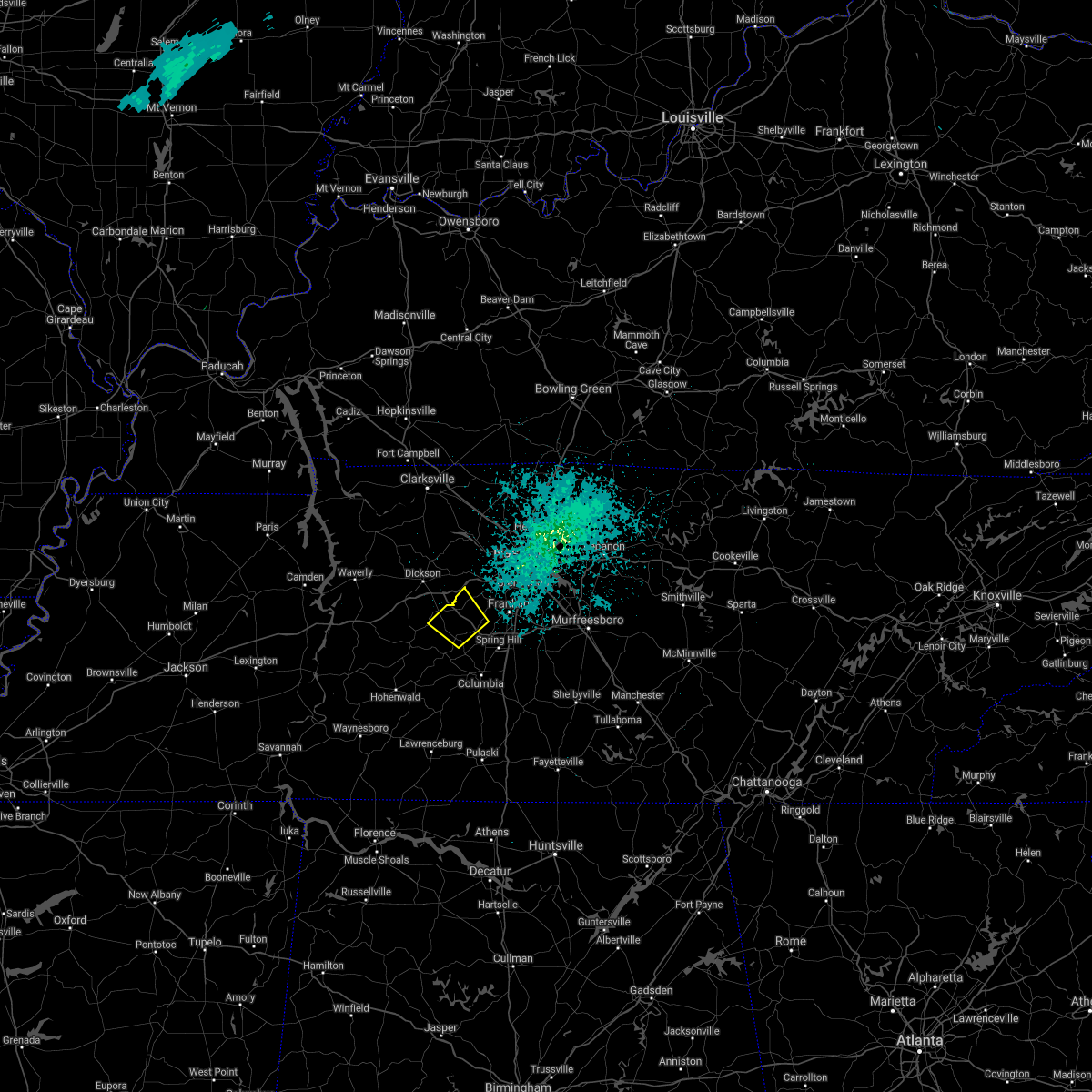 The severe thunderstorm warning for northwestern williamson, east central hickman and north central maury counties will expire at 900 pm cdt, the storm which prompted the warning has weakened below severe limits, and no longer poses an immediate threat to life or property. therefore the warning will be allowed to expire. however gusty winds and heavy rain are still possible with this thunderstorm. The severe thunderstorm warning for northwestern williamson, east central hickman and north central maury counties will expire at 900 pm cdt, the storm which prompted the warning has weakened below severe limits, and no longer poses an immediate threat to life or property. therefore the warning will be allowed to expire. however gusty winds and heavy rain are still possible with this thunderstorm.
|
| 8/26/2016 8:45 PM CDT |
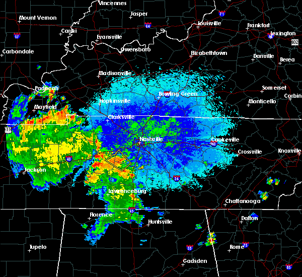 At 844 pm cdt, a severe thunderstorm was located 12 miles southwest of fairview, or 17 miles east of centerville, moving northwest at 35 mph (radar indicated). Hazards include 60 mph wind gusts and quarter size hail. Hail damage to vehicles is expected. expect wind damage to roofs, siding, and trees. Locations impacted include, fairview and primm springs. At 844 pm cdt, a severe thunderstorm was located 12 miles southwest of fairview, or 17 miles east of centerville, moving northwest at 35 mph (radar indicated). Hazards include 60 mph wind gusts and quarter size hail. Hail damage to vehicles is expected. expect wind damage to roofs, siding, and trees. Locations impacted include, fairview and primm springs.
|
| 8/26/2016 8:34 PM CDT |
 At 833 pm cdt, a severe thunderstorm was located 8 miles west of thompson`s station, or 12 miles north of columbia, moving northwest at 15 mph (radar indicated). Hazards include 60 mph wind gusts and quarter size hail. Hail damage to vehicles is expected. Expect wind damage to roofs, siding, and trees. At 833 pm cdt, a severe thunderstorm was located 8 miles west of thompson`s station, or 12 miles north of columbia, moving northwest at 15 mph (radar indicated). Hazards include 60 mph wind gusts and quarter size hail. Hail damage to vehicles is expected. Expect wind damage to roofs, siding, and trees.
|
| 8/1/2016 6:07 PM CDT |
 At 607 pm cdt, a severe thunderstorm was located near fairview, or 13 miles west of franklin, moving east at 35 mph (radar indicated). Hazards include 60 mph wind gusts. Expect damage to roofs. siding. and trees. Locations impacted include, fairview, natchez trace at highway 96 and leipers fork. At 607 pm cdt, a severe thunderstorm was located near fairview, or 13 miles west of franklin, moving east at 35 mph (radar indicated). Hazards include 60 mph wind gusts. Expect damage to roofs. siding. and trees. Locations impacted include, fairview, natchez trace at highway 96 and leipers fork.
|
| 8/1/2016 5:49 PM CDT |
 At 548 pm cdt, a severe thunderstorm was located near burns, or 9 miles southeast of dickson, moving east at 35 mph (radar indicated). Hazards include 60 mph wind gusts. Expect damage to roofs. siding. And trees. At 548 pm cdt, a severe thunderstorm was located near burns, or 9 miles southeast of dickson, moving east at 35 mph (radar indicated). Hazards include 60 mph wind gusts. Expect damage to roofs. siding. And trees.
|
| 8/1/2016 5:30 PM CDT |
 At 530 pm cdt, a severe thunderstorm was located 7 miles north of centerville, moving east at 25 mph (radar indicated). Hazards include 60 mph wind gusts and penny size hail. Expect damage to roofs. siding. And trees. At 530 pm cdt, a severe thunderstorm was located 7 miles north of centerville, moving east at 25 mph (radar indicated). Hazards include 60 mph wind gusts and penny size hail. Expect damage to roofs. siding. And trees.
|
| 7/8/2016 9:22 PM CDT |
 The severe thunderstorm warning for southwestern davidson and northern williamson counties will expire at 930 pm cdt, the storm which prompted the warning has moved out of the area. therefore the warning will be allowed to expire. a severe thunderstorm watch remains in effect until midnight cdt for middle tennessee. The severe thunderstorm warning for southwestern davidson and northern williamson counties will expire at 930 pm cdt, the storm which prompted the warning has moved out of the area. therefore the warning will be allowed to expire. a severe thunderstorm watch remains in effect until midnight cdt for middle tennessee.
|
| 7/8/2016 9:03 PM CDT |
 At 903 pm cdt, a severe thunderstorm was located 11 miles northeast of centerville, moving east at 25 mph (radar indicated). Hazards include 60 mph wind gusts and quarter size hail. Hail damage to vehicles is expected. expect wind damage to roofs, siding, and trees. Locations impacted include, fairview. At 903 pm cdt, a severe thunderstorm was located 11 miles northeast of centerville, moving east at 25 mph (radar indicated). Hazards include 60 mph wind gusts and quarter size hail. Hail damage to vehicles is expected. expect wind damage to roofs, siding, and trees. Locations impacted include, fairview.
|
| 7/8/2016 8:58 PM CDT |
 At 858 pm cdt, a severe thunderstorm was located near fairview, or 12 miles northwest of franklin, moving east at 20 mph. this is a very dangerous storm (radar indicated). Hazards include 80 mph wind gusts and quarter size hail. Flying debris will be dangerous to those caught without shelter. mobile homes will be heavily damaged. expect considerable damage to roofs, windows, and vehicles. Extensive tree damage and power outages are likely. At 858 pm cdt, a severe thunderstorm was located near fairview, or 12 miles northwest of franklin, moving east at 20 mph. this is a very dangerous storm (radar indicated). Hazards include 80 mph wind gusts and quarter size hail. Flying debris will be dangerous to those caught without shelter. mobile homes will be heavily damaged. expect considerable damage to roofs, windows, and vehicles. Extensive tree damage and power outages are likely.
|
| 7/8/2016 8:57 PM CDT | Home weather station measured 65 mph at intersection of brush creek and hwy 10 in williamson county TN, 1.2 miles WSW of Fairview, TN |
| 7/8/2016 8:50 PM CDT | Tree down and blocking 7600 block of chester road in fairview in williamson county TN, 1.3 miles WNW of Fairview, TN |
| 7/8/2016 8:45 PM CDT | Large tree and power lines down on timberline driv in williamson county TN, 1.2 miles WSW of Fairview, TN |
| 7/8/2016 8:43 PM CDT |
 At 843 pm cdt, severe thunderstorms were located along a line extending from near portland to near fairview, moving east at 55 mph (radar indicated). Hazards include 60 mph wind gusts and quarter size hail. Hail damage to vehicles is expected. expect wind damage to roofs, siding, and trees. Locations impacted include, franklin, gallatin, springfield, ashland city, nashville, madison, hendersonville, brentwood, goodlettsville, white house, millersville, greenbrier, forest hills, oak hill, coopertown, white bluff, belle meade, kingston springs, lakewood and pegram. At 843 pm cdt, severe thunderstorms were located along a line extending from near portland to near fairview, moving east at 55 mph (radar indicated). Hazards include 60 mph wind gusts and quarter size hail. Hail damage to vehicles is expected. expect wind damage to roofs, siding, and trees. Locations impacted include, franklin, gallatin, springfield, ashland city, nashville, madison, hendersonville, brentwood, goodlettsville, white house, millersville, greenbrier, forest hills, oak hill, coopertown, white bluff, belle meade, kingston springs, lakewood and pegram.
|
| 7/8/2016 8:41 PM CDT |
 At 841 pm cdt, a severe thunderstorm was located near centerville, moving east at 20 mph (radar indicated). Hazards include 60 mph wind gusts and quarter size hail. Hail damage to vehicles is expected. Expect wind damage to roofs, siding, and trees. At 841 pm cdt, a severe thunderstorm was located near centerville, moving east at 20 mph (radar indicated). Hazards include 60 mph wind gusts and quarter size hail. Hail damage to vehicles is expected. Expect wind damage to roofs, siding, and trees.
|
| 7/8/2016 8:25 PM CDT |
 At 824 pm cdt, severe thunderstorms were located along a line extending from 1springfield to near white bluff, moving east at 45 mph (radar indicated). Hazards include 60 mph wind gusts and quarter size hail. Hail damage to vehicles is expected. Expect wind damage to roofs, siding, and trees. At 824 pm cdt, severe thunderstorms were located along a line extending from 1springfield to near white bluff, moving east at 45 mph (radar indicated). Hazards include 60 mph wind gusts and quarter size hail. Hail damage to vehicles is expected. Expect wind damage to roofs, siding, and trees.
|
| 7/8/2016 8:17 PM CDT |
 At 816 pm cdt, a severe thunderstorm was located 9 miles south of burns, or 10 miles northeast of centerville, moving east at 25 mph (radar indicated). Hazards include 60 mph wind gusts and quarter size hail. Hail damage to vehicles is expected. Expect wind damage to roofs, siding, and trees. At 816 pm cdt, a severe thunderstorm was located 9 miles south of burns, or 10 miles northeast of centerville, moving east at 25 mph (radar indicated). Hazards include 60 mph wind gusts and quarter size hail. Hail damage to vehicles is expected. Expect wind damage to roofs, siding, and trees.
|
| 7/7/2016 7:05 AM CDT | Two trees down in fairview on horn tavern road at cleveland drive and highway 96 at dice lampley road in williamson county TN, 1.2 miles WSW of Fairview, TN |
| 7/6/2016 4:58 PM CDT |
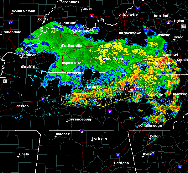 At 457 pm cdt, severe thunderstorms were located along a line extending from near antioch to fairview, moving east at 40 mph (radar indicated). Hazards include 60 mph wind gusts and penny size hail. Expect damage to roofs. siding. And trees. At 457 pm cdt, severe thunderstorms were located along a line extending from near antioch to fairview, moving east at 40 mph (radar indicated). Hazards include 60 mph wind gusts and penny size hail. Expect damage to roofs. siding. And trees.
|
| 7/6/2016 4:45 PM CDT | Tree down on walker road in fairview in williamson county TN, 2.4 miles NE of Fairview, TN |
| 7/6/2016 4:37 PM CDT |
 At 437 pm cdt, severe thunderstorms were located along a line extending from near brentwood to near centerville, moving southeast at 35 mph (radar indicated). Hazards include 60 mph wind gusts and penny size hail. Expect damage to roofs. siding. and trees. Locations impacted include, franklin, centerville, brentwood, nolensville, forest hills, oak hill, thompson`s station, fairview, primm springs, bon aqua, nunnelly, lyles, leipers fork and natchez trace at highway 96. At 437 pm cdt, severe thunderstorms were located along a line extending from near brentwood to near centerville, moving southeast at 35 mph (radar indicated). Hazards include 60 mph wind gusts and penny size hail. Expect damage to roofs. siding. and trees. Locations impacted include, franklin, centerville, brentwood, nolensville, forest hills, oak hill, thompson`s station, fairview, primm springs, bon aqua, nunnelly, lyles, leipers fork and natchez trace at highway 96.
|
| 7/6/2016 4:15 PM CDT |
 At 414 pm cdt, severe thunderstorms were located along a line extending from near bellevue to near centerville, moving east at 30 mph (radar indicated). Hazards include 60 mph wind gusts and penny size hail. Expect damage to roofs. siding. And trees. At 414 pm cdt, severe thunderstorms were located along a line extending from near bellevue to near centerville, moving east at 30 mph (radar indicated). Hazards include 60 mph wind gusts and penny size hail. Expect damage to roofs. siding. And trees.
|
| 5/1/2016 5:39 PM CDT |
 At 539 pm cdt, a severe thunderstorm was located over fairview, or 11 miles west of franklin, moving east at 25 mph (radar indicated). Hazards include 60 mph wind gusts and quarter size hail. Hail damage to vehicles is expected. Expect wind damage to roofs, siding, and trees. At 539 pm cdt, a severe thunderstorm was located over fairview, or 11 miles west of franklin, moving east at 25 mph (radar indicated). Hazards include 60 mph wind gusts and quarter size hail. Hail damage to vehicles is expected. Expect wind damage to roofs, siding, and trees.
|
| 5/1/2016 5:26 PM CDT |
 At 525 pm cdt, a severe thunderstorm was located near pegram, or 14 miles northwest of franklin, moving east at 25 mph (radar indicated). Hazards include 60 mph wind gusts and quarter size hail. Hail damage to vehicles is expected. expect wind damage to roofs, siding, and trees. Locations impacted include, brentwood, forest hills, belle meade, kingston springs, pegram, fairview, bellevue, natchez trace at highway 96 and bells bend. At 525 pm cdt, a severe thunderstorm was located near pegram, or 14 miles northwest of franklin, moving east at 25 mph (radar indicated). Hazards include 60 mph wind gusts and quarter size hail. Hail damage to vehicles is expected. expect wind damage to roofs, siding, and trees. Locations impacted include, brentwood, forest hills, belle meade, kingston springs, pegram, fairview, bellevue, natchez trace at highway 96 and bells bend.
|
| 5/1/2016 5:11 PM CDT |
 At 510 pm cdt, a severe thunderstorm was located near kingston springs, or 13 miles east of dickson, moving east at 30 mph (radar indicated). Hazards include 60 mph wind gusts and quarter size hail. Hail damage to vehicles is expected. Expect wind damage to roofs, siding, and trees. At 510 pm cdt, a severe thunderstorm was located near kingston springs, or 13 miles east of dickson, moving east at 30 mph (radar indicated). Hazards include 60 mph wind gusts and quarter size hail. Hail damage to vehicles is expected. Expect wind damage to roofs, siding, and trees.
|
| 4/6/2016 4:50 PM CDT | Two large trees blown down at 1746 braxton bend drive... just south of downtown fairvie in williamson county TN, 2.2 miles NNW of Fairview, TN |
| 4/6/2016 4:37 PM CDT | Two large trees blown down at 1746 braxton bend drive... just south of downtown fairvie in williamson county TN, 2.2 miles NNW of Fairview, TN |
| 12/23/2015 7:11 PM CST | At 710 pm cst, a severe thunderstorm capable of producing a tornado was located over fairview, or 9 miles west of franklin, moving northeast at 65 mph (radar indicated rotation). Hazards include tornado. Flying debris will be dangerous to those caught without shelter. mobile homes will be damaged or destroyed. damage to roofs, windows and vehicles will occur. tree damage is likely. this dangerous storm will be near, franklin around 720 pm cst. Other locations impacted by this tornadic thunderstorm include natchez trace at highway 96. |
| 12/23/2015 7:08 PM CST | At 707 pm cst, a severe thunderstorm capable of producing a tornado was located near fairview, or 12 miles west of franklin, moving northeast at 40 mph (radar indicated rotation). Hazards include tornado. Flying debris will be dangerous to those caught without shelter. mobile homes will be damaged or destroyed. damage to roofs, windows and vehicles will occur. tree damage is likely. this dangerous storm will be near, bellevue around 720 pm cst. brentwood around 725 pm cst. forest hills and belle meade around 730 pm cst. oak hill around 735 pm cst. Other locations impacted by this tornadic thunderstorm include natchez trace at highway 96, bells bend and berry hill. |
| 12/23/2015 6:58 PM CST | At 658 pm cst, a severe thunderstorm capable of producing a tornado was located 11 miles east of centerville, moving northeast at 55 mph (radar indicated rotation. this storm has a history of producing damage in perry county). Hazards include tornado. Flying debris will be dangerous to those caught without shelter. mobile homes will be damaged or destroyed. damage to roofs, windows and vehicles will occur. tree damage is likely. this dangerous storm will be near, fairview around 710 pm cst. franklin around 725 pm cst. Other locations impacted by this tornadic thunderstorm include natchez trace at highway 96, primm springs and leipers fork. |
| 7/14/2015 3:06 PM CDT |
 The severe thunderstorm warning for southwestern davidson, northwestern williamson and southeastern cheatham counties will expire at 315 pm cdt, the storm which prompted the warning has moved out of the area. therefore the warning will be allowed to expire, but a new warning has been issued. a severe thunderstorm watch remains in effect until 900 pm cdt for middle tennessee. The severe thunderstorm warning for southwestern davidson, northwestern williamson and southeastern cheatham counties will expire at 315 pm cdt, the storm which prompted the warning has moved out of the area. therefore the warning will be allowed to expire, but a new warning has been issued. a severe thunderstorm watch remains in effect until 900 pm cdt for middle tennessee.
|
| 7/14/2015 2:50 PM CDT |
 At 250 pm cdt, a severe thunderstorm was located over pegram, or 11 miles south of ashland city, moving east at 40 mph (radar indicated). Hazards include 60 mph wind gusts and quarter size hail. Hail damage to vehicles is expected. expect wind damage to roofs, siding and trees. this severe storm will be near, bellevue around 300 pm cdt. brentwood, forest hills and belle meade around 305 pm cdt. Other locations impacted by this severe thunderstorm include natchez trace at highway 96, bells bend and leipers fork. At 250 pm cdt, a severe thunderstorm was located over pegram, or 11 miles south of ashland city, moving east at 40 mph (radar indicated). Hazards include 60 mph wind gusts and quarter size hail. Hail damage to vehicles is expected. expect wind damage to roofs, siding and trees. this severe storm will be near, bellevue around 300 pm cdt. brentwood, forest hills and belle meade around 305 pm cdt. Other locations impacted by this severe thunderstorm include natchez trace at highway 96, bells bend and leipers fork.
|
| 7/14/2015 2:46 PM CDT |
 At 245 pm cdt, a severe thunderstorm was located 11 miles north of centerville, moving east at 25 mph (radar indicated). Hazards include 60 mph wind gusts and quarter size hail. Hail damage to vehicles is expected. expect wind damage to roofs, siding and trees. this severe storm will be near, centerville around 300 pm cdt. Other locations impacted by this severe thunderstorm include nunnelly, lyles, pinewood and bon aqua. At 245 pm cdt, a severe thunderstorm was located 11 miles north of centerville, moving east at 25 mph (radar indicated). Hazards include 60 mph wind gusts and quarter size hail. Hail damage to vehicles is expected. expect wind damage to roofs, siding and trees. this severe storm will be near, centerville around 300 pm cdt. Other locations impacted by this severe thunderstorm include nunnelly, lyles, pinewood and bon aqua.
|
| 7/14/2015 2:41 PM CDT |
 At 241 pm cdt, a severe thunderstorm was located over white bluff, or 11 miles east of dickson, moving east at 30 mph (radar indicated). Hazards include 60 mph wind gusts and quarter size hail. Hail damage to vehicles is expected. expect wind damage to roofs, siding and trees. this severe thunderstorm will be near, fairview and kingston springs around 250 pm cdt. pegram around 255 pm cdt. franklin, brentwood, forest hills, belle meade and bellevue around 315 pm cdt. Other locations impacted by this severe thunderstorm include natchez trace at highway 96, bells bend and leipers fork. At 241 pm cdt, a severe thunderstorm was located over white bluff, or 11 miles east of dickson, moving east at 30 mph (radar indicated). Hazards include 60 mph wind gusts and quarter size hail. Hail damage to vehicles is expected. expect wind damage to roofs, siding and trees. this severe thunderstorm will be near, fairview and kingston springs around 250 pm cdt. pegram around 255 pm cdt. franklin, brentwood, forest hills, belle meade and bellevue around 315 pm cdt. Other locations impacted by this severe thunderstorm include natchez trace at highway 96, bells bend and leipers fork.
|
| 7/14/2015 2:23 PM CDT |
 At 223 pm cdt, a severe thunderstorm was located 7 miles southwest of dickson, moving southeast at 25 mph (radar indicated). Hazards include 60 mph wind gusts and quarter size hail. Hail damage to vehicles is expected. expect wind damage to roofs, siding and trees. this severe thunderstorm will be near, dickson around 230 pm cdt. burns around 245 pm cdt. Other locations impacted by this severe thunderstorm include nunnelly, lyles, pinewood, bon aqua and bucksnort. At 223 pm cdt, a severe thunderstorm was located 7 miles southwest of dickson, moving southeast at 25 mph (radar indicated). Hazards include 60 mph wind gusts and quarter size hail. Hail damage to vehicles is expected. expect wind damage to roofs, siding and trees. this severe thunderstorm will be near, dickson around 230 pm cdt. burns around 245 pm cdt. Other locations impacted by this severe thunderstorm include nunnelly, lyles, pinewood, bon aqua and bucksnort.
|
| 7/7/2015 5:51 PM CDT |
 At 551 pm cdt, a severe thunderstorm was located near fairview, or 12 miles east of dickson, moving east at 45 mph (radar indicated). Hazards include 60 mph wind gusts. Expect damage to roofs. siding and trees. this severe storm will be near, kingston springs around 555 pm cdt. Pegram around 600 pm cdt. At 551 pm cdt, a severe thunderstorm was located near fairview, or 12 miles east of dickson, moving east at 45 mph (radar indicated). Hazards include 60 mph wind gusts. Expect damage to roofs. siding and trees. this severe storm will be near, kingston springs around 555 pm cdt. Pegram around 600 pm cdt.
|
| 7/7/2015 5:31 PM CDT |
 At 531 pm cdt, a severe thunderstorm was located near dickson, moving east at 45 mph (radar indicated). Hazards include 60 mph wind gusts. Expect damage to roofs. siding and trees. this severe thunderstorm will be near, dickson around 535 pm cdt. burns around 540 pm cdt. white bluff around 545 pm cdt. fairview around 550 pm cdt. kingston springs around 555 pm cdt. pegram around 600 pm cdt. Other locations impacted by this severe thunderstorm include bon aqua and lyles. At 531 pm cdt, a severe thunderstorm was located near dickson, moving east at 45 mph (radar indicated). Hazards include 60 mph wind gusts. Expect damage to roofs. siding and trees. this severe thunderstorm will be near, dickson around 535 pm cdt. burns around 540 pm cdt. white bluff around 545 pm cdt. fairview around 550 pm cdt. kingston springs around 555 pm cdt. pegram around 600 pm cdt. Other locations impacted by this severe thunderstorm include bon aqua and lyles.
|
| 6/8/2015 4:41 PM CDT | At 440 pm cdt, a severe thunderstorm was located 9 miles northeast of centerville, and moving east at 35 mph (radar indicated). Hazards include 60 mph wind gusts. Expect damage to roofs. siding and trees. The severe thunderstorm will affect mainly rural areas of east central hickman, north central maury and west central williamson counties, including the following locations, leipers fork. |
| 6/8/2015 4:10 PM CDT | At 408 pm cdt, a severe thunderstorm was located 7 miles southeast of fairview, and moving east at 30 mph (radar indicated). Hazards include 60 mph wind gusts and quarter size hail. Hail damage to vehicles is expected. expect wind damage to roofs, siding and trees. the severe thunderstorm will be near, franklin around 425 pm cdt. Brentwood around 435 pm cdt. |
| 6/8/2015 3:58 PM CDT | At 355 pm cdt, a severe thunderstorm was located 9 miles south of burns, and moving east at 30 mph (radar indicated). Hazards include 60 mph wind gusts. Expect damage to roofs. siding and trees. The severe thunderstorm will be near, fairview around 415 pm cdt. |
| 6/8/2015 3:47 PM CDT | At 345 pm cdt, a severe thunderstorm was located 10 miles south of dickson, and moving east at 30 mph (radar indicated). Hazards include 60 mph wind gusts and penny size hail. Expect damage to roofs. siding and trees. the severe thunderstorm will be near, fairview around 415 pm cdt. Other locations in the warning include lyles and bon aqua. |
| 6/8/2015 3:37 PM CDT | At 335 pm cdt, a severe thunderstorm was located 12 miles northwest of centerville, and moving east at 30 mph (trained weather spotters). Hazards include 60 mph wind gusts and half dollar size hail. Hail damage to vehicles is expected. expect wind damage to roofs, siding and trees. the severe thunderstorm will be near, fairview around 415 pm cdt. Other locations in the warning include nunnelly, lyles and bon aqua. |
| 6/8/2015 3:25 PM CDT |
 At 320 pm cdt, a severe thunderstorm was located 7 miles east of hurricane mills, and moving east at 35 mph (radar indicated). Hazards include 60 mph wind gusts and half dollar size hail. Hail damage to vehicles is expected. expect wind damage to roofs, siding and trees. the severe thunderstorm will be near, fairview around 410 pm cdt. Other locations in the warning include pinewood, nunnelly, lyles and bon aqua. At 320 pm cdt, a severe thunderstorm was located 7 miles east of hurricane mills, and moving east at 35 mph (radar indicated). Hazards include 60 mph wind gusts and half dollar size hail. Hail damage to vehicles is expected. expect wind damage to roofs, siding and trees. the severe thunderstorm will be near, fairview around 410 pm cdt. Other locations in the warning include pinewood, nunnelly, lyles and bon aqua.
|
| 5/31/2015 2:09 PM CDT | At 209 pm cdt, a severe thunderstorm was located 12 miles south of fairview, and moving east at 40 mph (radar indicated). Hazards include 60 mph wind gusts and quarter size hail. Hail damage to vehicles is expected. expect wind damage to roofs, siding and trees. The severe thunderstorm will affect mainly rural areas of east central hickman, north central maury and west central williamson counties. |
| 5/31/2015 1:44 PM CDT | At 144 pm cdt, a severe thunderstorm was located 8 miles east of centerville, and moving northeast at 40 mph (radar indicated). Hazards include 60 mph wind gusts and quarter size hail. Hail damage to vehicles is expected. expect wind damage to roofs, siding and trees. The severe thunderstorm will affect mainly rural areas of east central hickman, north central maury and west central williamson counties. |
| 4/20/2015 1:06 AM CDT | At 102 am cdt, a severe thunderstorm was located 10 miles southeast of fairview, and moving east at 50 mph (radar indicated). Hazards include 60 mph wind gusts and penny size hail. Expect damage to roofs. siding and trees. the severe thunderstorm will be near, franklin around 115 am cdt. 0. 75in. |
| 4/20/2015 12:43 AM CDT | At 1241 am cdt, a severe thunderstorm was located 11 miles east of centerville, and moving east at 50 mph (radar indicated). Hazards include 60 mph wind gusts and penny size hail. Expect damage to roofs. siding and trees. the severe thunderstorm will be near, franklin around 110 am cdt. other locations in the warning include leipers fork and natchez trace at highway 96. 0. 75in. |
| 4/20/2015 12:06 AM CDT | At 1204 am cdt, a severe thunderstorm was located 9 miles southeast of hurricane mills, and moving east at 40 mph (radar indicated). Hazards include 60 mph wind gusts and penny size hail. Expect damage to roofs. siding and trees. the severe thunderstorm will affect mainly rural areas of hickman, northeastern perry, southeastern dickson and southeastern humphreys counties, including the following locations, pinewood, nunnelly, lyles and bon aqua. 0. 75in. |
| 4/3/2015 5:28 PM CDT | The national weather service in nashville has issued a * severe thunderstorm warning for. southern davidson county in middle tennessee. rutherford county in middle tennessee. williamson county in middle tennessee. Until 615 pm cdt. |
| 4/2/2015 3:10 PM CST | Powerlines down and blocking one lane of traffic at old cox pike by crow cut rd. time estimated based on rada in williamson county TN, 3.3 miles E of Fairview, TN |
| 4/2/2015 4:09 PM CDT | The national weather service in nashville has issued a * severe thunderstorm warning for. south central cheatham county in middle tennessee. western davidson county in middle tennessee. northern williamson county in middle tennessee. Until 445 pm cdt. |
| 4/2/2015 3:57 PM CDT | A severe thunderstorm warning remains in effect for north central maury. northeastern hickman. southeastern dickson and northwestern williamson counties until 415 pm cdt. at 355 pm cdt. a severe thunderstorm was located 10 miles south of burns. and moving east at 45 mph. hazard. 60 mph wind gusts and quarter size hail. |
| 4/2/2015 3:40 PM CDT | The national weather service in nashville has issued a * severe thunderstorm warning for. southern dickson county in middle tennessee. hickman county in middle tennessee. north central maury county in middle tennessee. Northwestern williamson county in middle tennessee. |
| 6/21/2014 2:45 PM CDT | Tree on ca in williamson county TN, 1.2 miles WSW of Fairview, TN |
| 2/20/2014 7:59 PM CST | Tree down on house in fairview in williamson county TN, 1.2 miles WSW of Fairview, TN |
| 12/21/2013 9:02 PM CST | Power outages being reports in fairview in williamson county TN, 1.2 miles WSW of Fairview, TN |
| 1/30/2013 3:08 AM CST | Numerous trees were reported down in fairvie in williamson county TN, 1.2 miles WSW of Fairview, TN |
| 1/30/2013 2:59 AM CST | A nws storm survey found wind damage along pinewood rd east of walker hill rd in western williamson county. one barn was damaged and several trees were snapped or uproo in williamson county TN, 6.8 miles N of Fairview, TN |
| 8/16/2012 10:30 PM CDT | Tree down on horne tavern and bahne road in williamson county TN, 1.2 miles WSW of Fairview, TN |
| 8/16/2012 10:30 PM CDT | Two foot diameter tree down on horne tavern and bahne road in williamson county TN, 1.2 miles WSW of Fairview, TN |
| 7/8/2012 4:17 PM CDT | Multiple trees reported down across fairview rd and surrounding roads. reported by williamson county ema in williamson county TN, 2.8 miles SW of Fairview, TN |
| 7/6/2012 5:20 PM CDT | Trees were downed in the leapers fork are in williamson county TN, 5.6 miles NW of Fairview, TN |
| 7/6/2012 5:20 PM CDT | Trees were downed in the leipers fork are in williamson county TN, 5.6 miles NW of Fairview, TN |
| 3/15/2012 2:50 PM CDT | Quarter sized hail reported 1.2 miles WSW of Fairview, TN |
| 3/14/2012 5:25 PM CDT | Quarter sized hail reported 1.2 miles WSW of Fairview, TN |
| 1/1/0001 12:00 AM | Tree down across road at crow cut road and old cox pik in williamson county TN, 1.2 miles WSW of Fairview, TN |
| 1/1/0001 12:00 AM | Tree down on hillboro rd and bobby drive in williamson county TN, 1.2 miles WSW of Fairview, TN |
| 1/1/0001 12:00 AM | Trees down on hillsboro rd across dody drive near fairview in williamson county TN, 1.2 miles WSW of Fairview, TN |
| 1/1/0001 12:00 AM | Several trees down and other debris along a miles-long stretch of highway 100 in williamson county TN, 1.2 miles WSW of Fairview, TN |
| 1/1/0001 12:00 AM | Several trees down in williamson county TN, 2.2 miles NNW of Fairview, TN |
Hail Maps for Fairview, TN


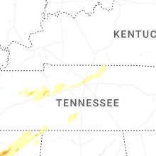


Connect with Interactive Hail Maps