

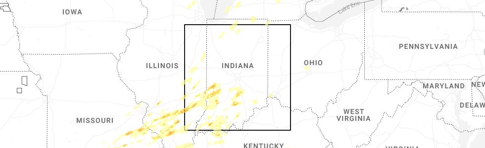
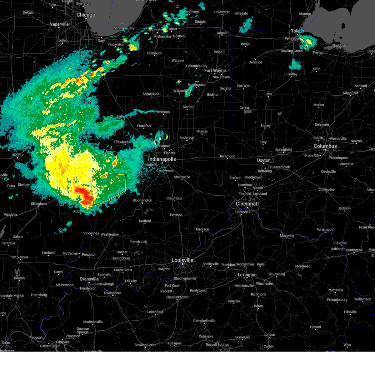
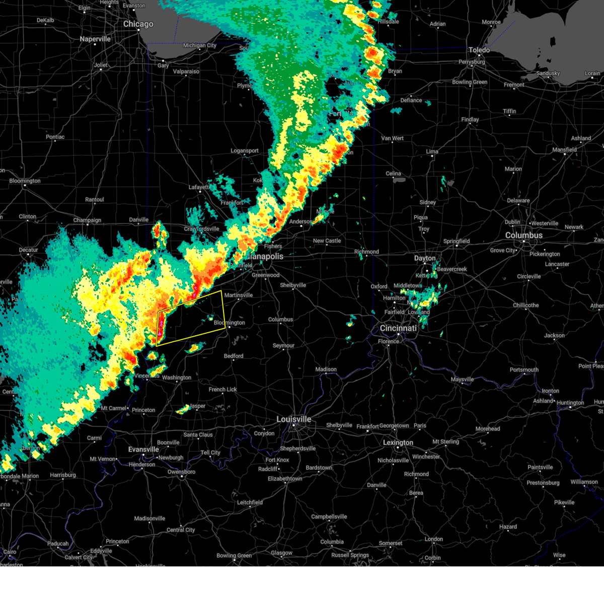
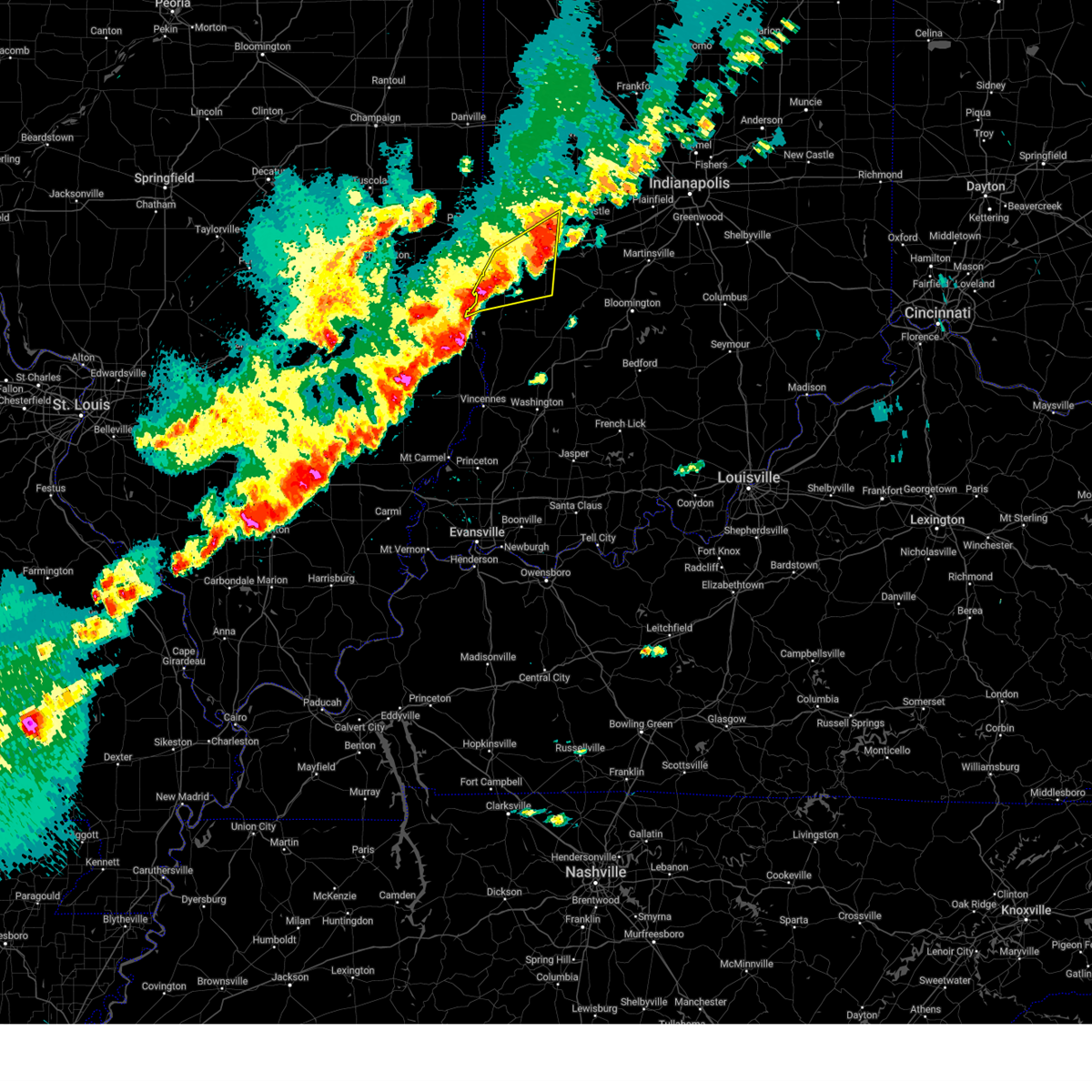
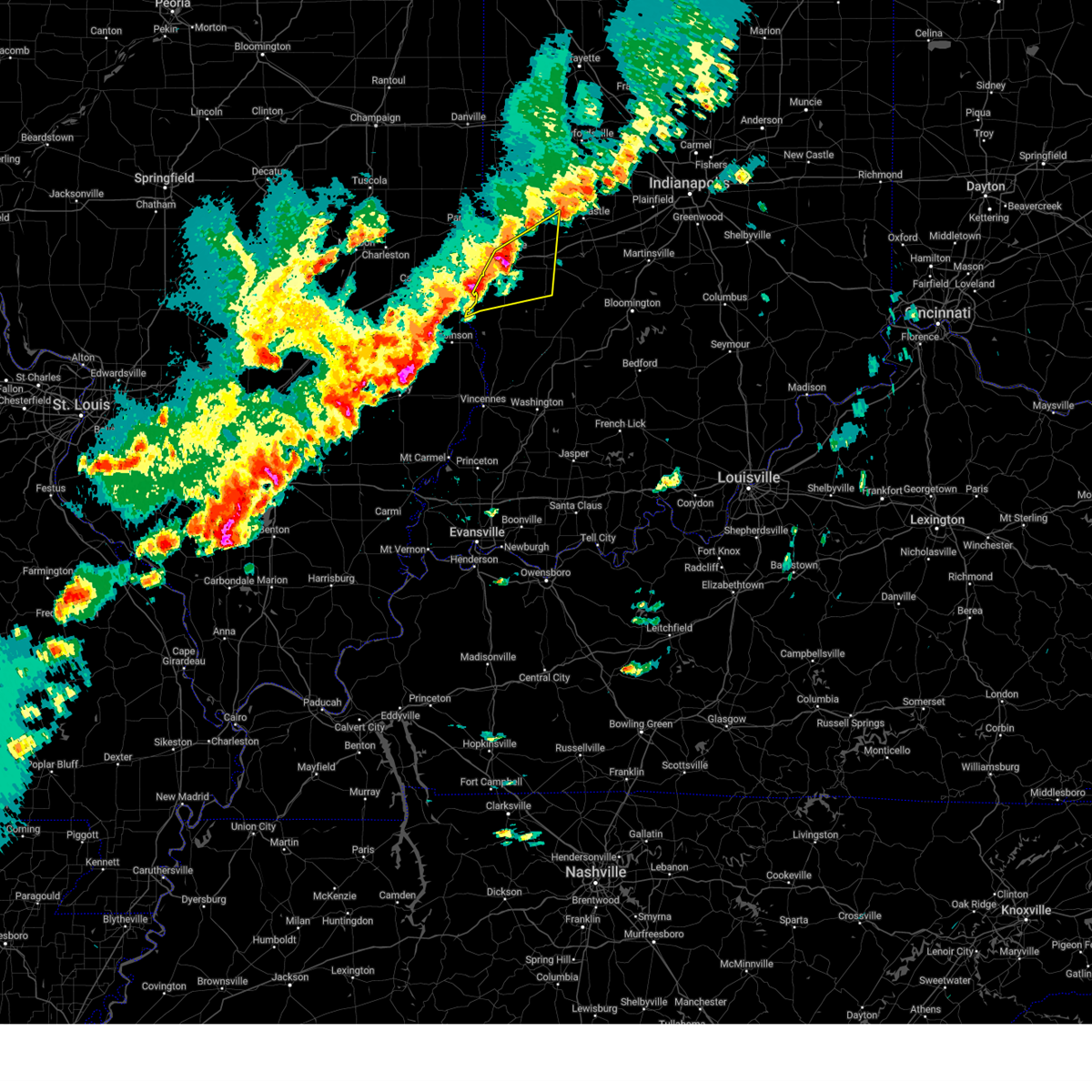
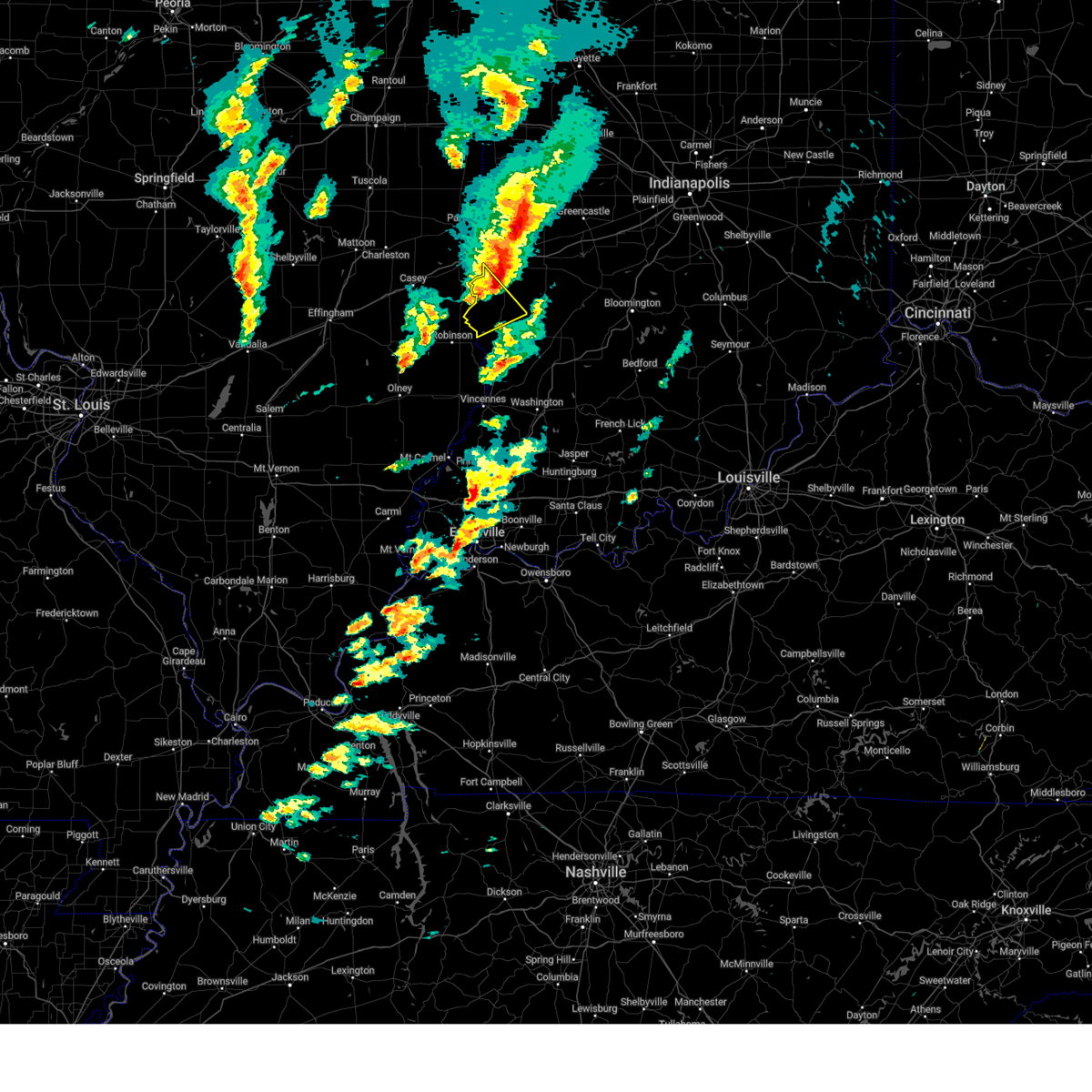
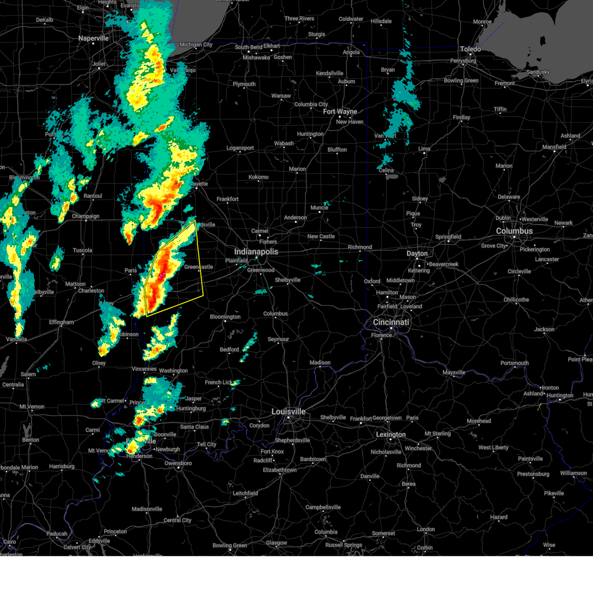
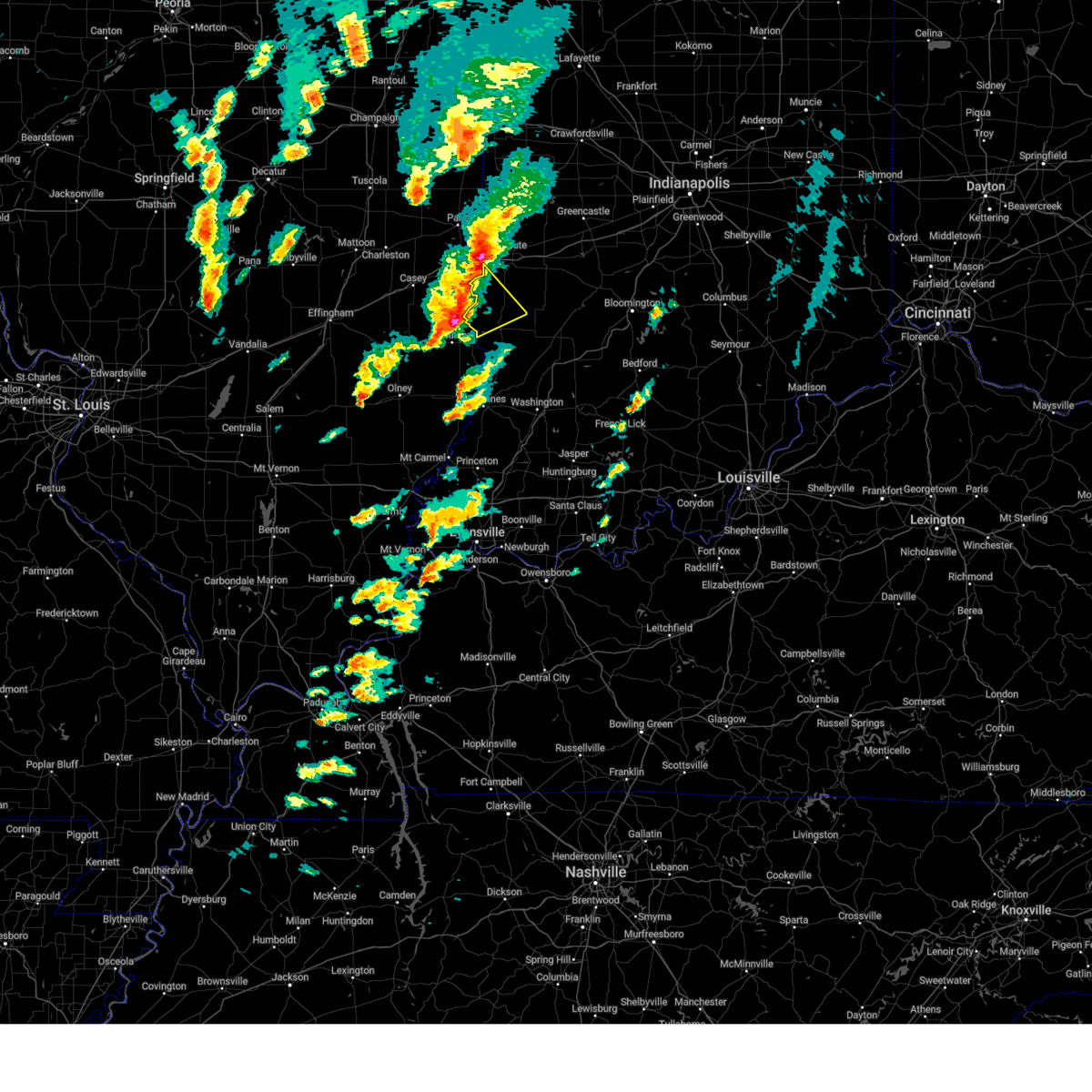
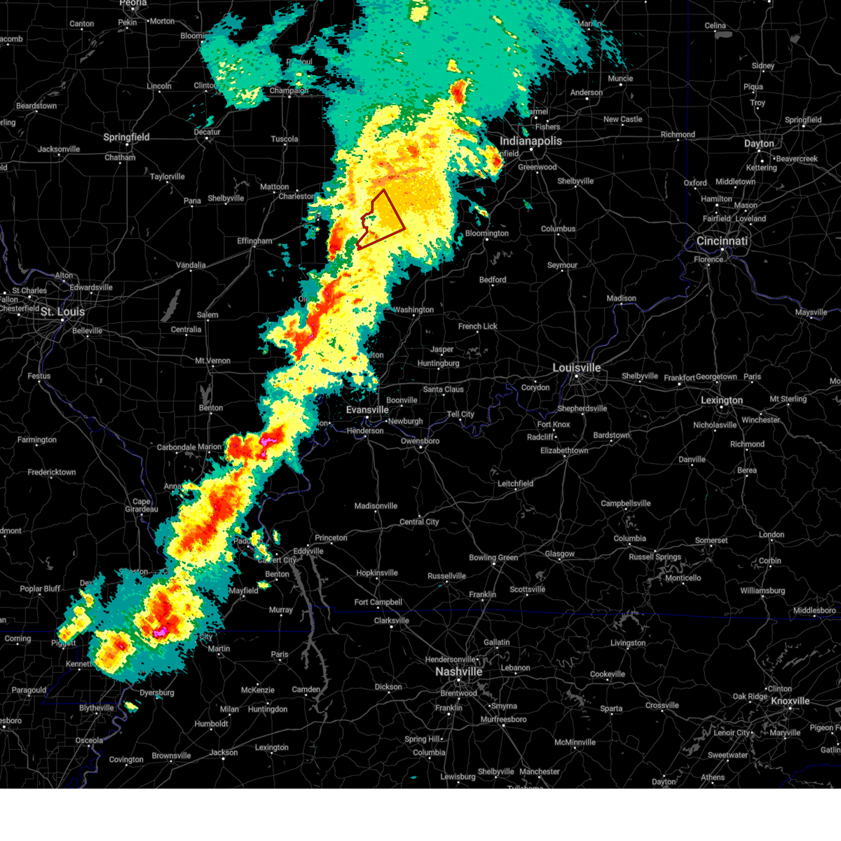
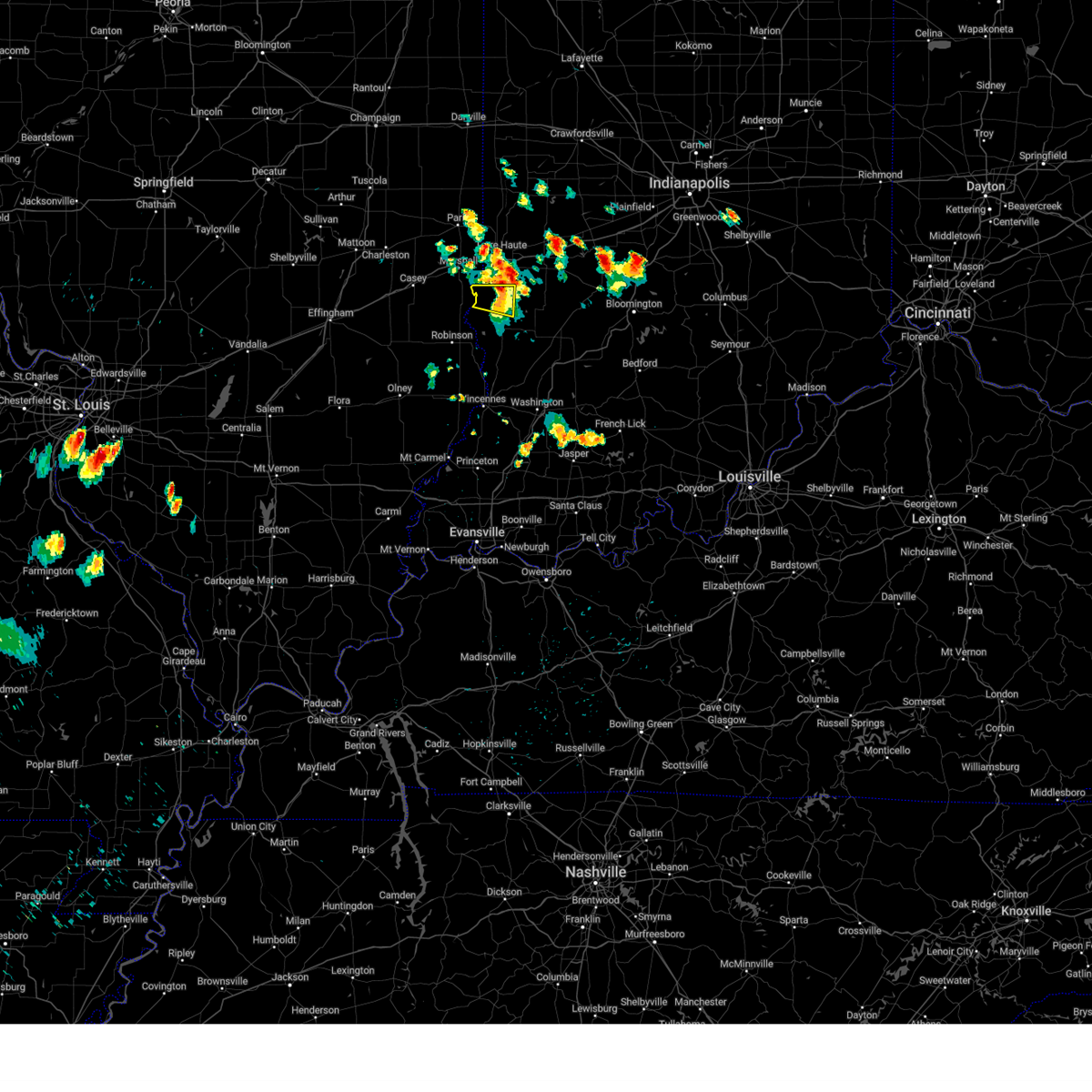
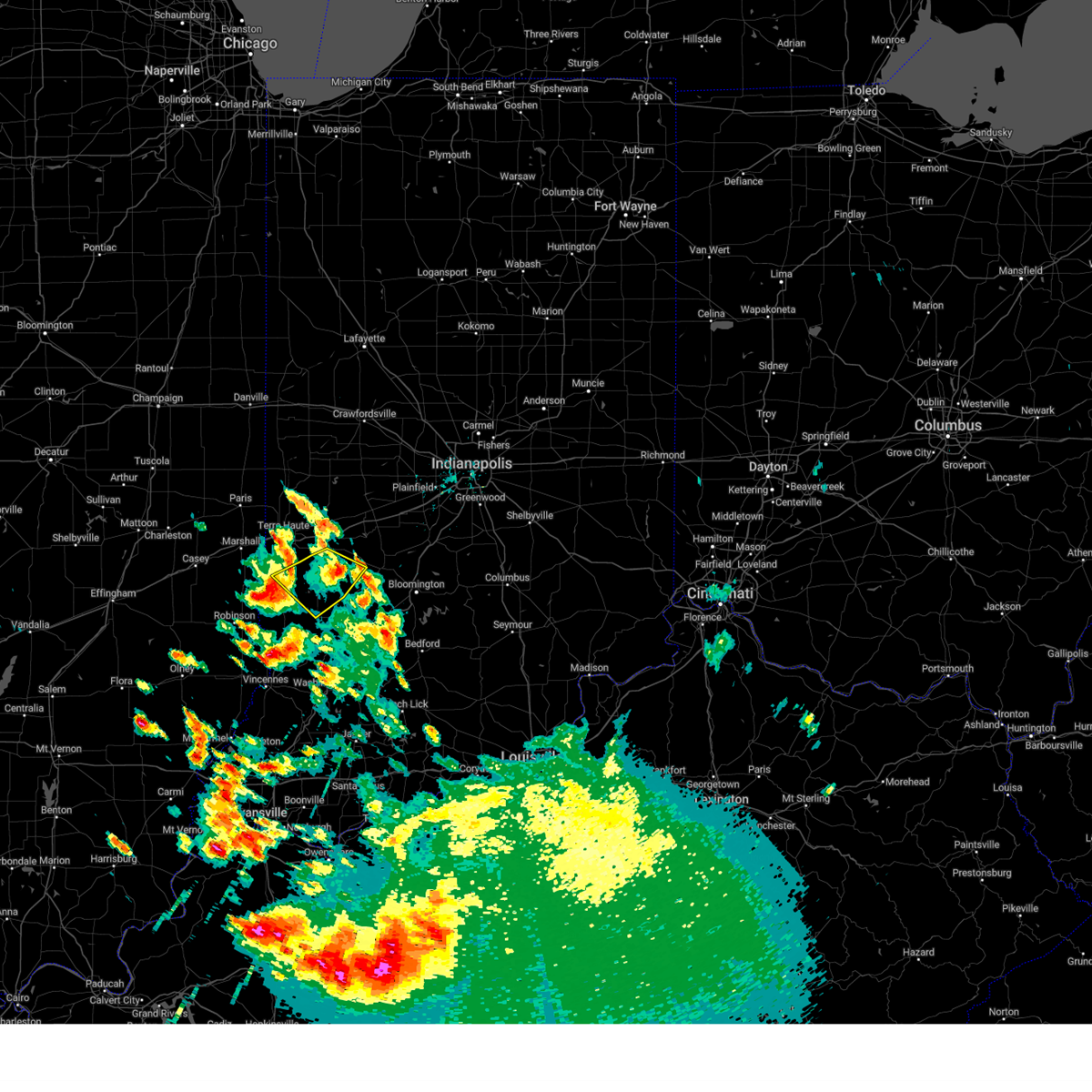
Hail Map for Farmersburg, IN
The Farmersburg, IN area has had 1 report of on-the-ground hail by trained spotters, and has been under severe weather warnings 22 times during the past 12 months. Doppler radar has detected hail at or near Farmersburg, IN on 58 occasions, including 3 occasions during the past year.
| Name: | Farmersburg, IN |
| Where Located: | 55.5 miles ESE of Mattoon, IL |
| Map: | Google Map for Farmersburg, IN |
| Population: | 1118 |
| Housing Units: | 548 |
| More Info: | Search Google for Farmersburg, IN |
5
The Top Recent Hail Date for Farmersburg, IN is Sunday, March 30, 2025 (4th out of 58)
Hail and Wind Damage Spotted near Farmersburg, IN
| Date / Time | Report Details |
|---|---|
| 6/18/2025 4:11 PM EDT | Measured at wtw in sullivan county IN, 0.5 miles ENE of Farmersburg, IN |
| 6/18/2025 3:26 PM EDT |
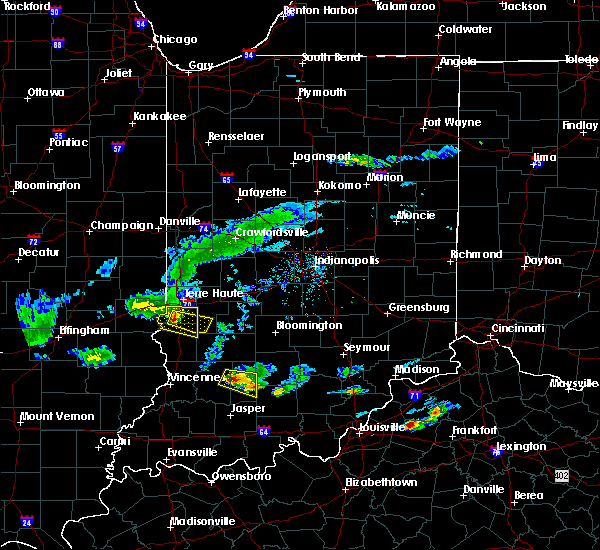
 Svrind the national weather service in indianapolis has issued a * severe thunderstorm warning for, south central vigo county in west central indiana, sullivan county in southwestern indiana, knox county in southwestern indiana, southwestern clay county in west central indiana, southwestern owen county in west central indiana, greene county in southwestern indiana, daviess county in southwestern indiana, * until 415 pm edt. * at 325 pm edt, severe thunderstorms were located along a line extending from 12 miles north of sullivan to 7 miles northeast of vincennes, moving east at 30 mph (radar indicated). Hazards include 70 mph wind gusts and quarter size hail. Hail damage to vehicles is expected. expect considerable tree damage. Wind damage is also likely to mobile homes, roofs, and outbuildings. Svrind the national weather service in indianapolis has issued a * severe thunderstorm warning for, south central vigo county in west central indiana, sullivan county in southwestern indiana, knox county in southwestern indiana, southwestern clay county in west central indiana, southwestern owen county in west central indiana, greene county in southwestern indiana, daviess county in southwestern indiana, * until 415 pm edt. * at 325 pm edt, severe thunderstorms were located along a line extending from 12 miles north of sullivan to 7 miles northeast of vincennes, moving east at 30 mph (radar indicated). Hazards include 70 mph wind gusts and quarter size hail. Hail damage to vehicles is expected. expect considerable tree damage. Wind damage is also likely to mobile homes, roofs, and outbuildings.
|
| 6/18/2025 3:00 PM EDT |
 Svrind the national weather service in indianapolis has issued a * severe thunderstorm warning for, south central vigo county in west central indiana, sullivan county in southwestern indiana, north central knox county in southwestern indiana, * until 345 pm edt. * at 300 pm edt, severe thunderstorms were located along a line extending from near hutsonville to near lawrenceville, moving northeast at 30 mph (radar indicated). Hazards include 60 mph wind gusts and quarter size hail. Hail damage to vehicles is expected. Expect wind damage to roofs, siding, and trees. Svrind the national weather service in indianapolis has issued a * severe thunderstorm warning for, south central vigo county in west central indiana, sullivan county in southwestern indiana, north central knox county in southwestern indiana, * until 345 pm edt. * at 300 pm edt, severe thunderstorms were located along a line extending from near hutsonville to near lawrenceville, moving northeast at 30 mph (radar indicated). Hazards include 60 mph wind gusts and quarter size hail. Hail damage to vehicles is expected. Expect wind damage to roofs, siding, and trees.
|
| 5/16/2025 8:29 PM EDT | The storms which prompted the warning have moved out of the area. therefore, the warning will be allowed to expire. a tornado watch remains in effect until 1100 pm edt for southwestern and west central indiana. |
| 5/16/2025 7:47 PM EDT |
 Torind the national weather service in indianapolis has issued a * tornado warning for, southern vigo county in west central indiana, northern sullivan county in southwestern indiana, southwestern clay county in west central indiana, * until 830 pm edt. * at 747 pm edt, a severe thunderstorm capable of producing a tornado was located near hutsonville, or 12 miles north of robinson, moving east at 50 mph (radar indicated rotation). Hazards include tornado. Flying debris will be dangerous to those caught without shelter. mobile homes will be damaged or destroyed. damage to roofs, windows, and vehicles will occur. Tree damage is likely. Torind the national weather service in indianapolis has issued a * tornado warning for, southern vigo county in west central indiana, northern sullivan county in southwestern indiana, southwestern clay county in west central indiana, * until 830 pm edt. * at 747 pm edt, a severe thunderstorm capable of producing a tornado was located near hutsonville, or 12 miles north of robinson, moving east at 50 mph (radar indicated rotation). Hazards include tornado. Flying debris will be dangerous to those caught without shelter. mobile homes will be damaged or destroyed. damage to roofs, windows, and vehicles will occur. Tree damage is likely.
|
| 5/16/2025 7:44 PM EDT |
 Svrind the national weather service in indianapolis has issued a * severe thunderstorm warning for, vigo county in west central indiana, northern sullivan county in southwestern indiana, northwestern clay county in west central indiana, * until 830 pm edt. * at 744 pm edt, severe thunderstorms were located along a line extending from 8 miles south of vermilion to near hutsonville, moving east at 50 mph (radar indicated). Hazards include 60 mph wind gusts and quarter size hail. Hail damage to vehicles is expected. Expect wind damage to roofs, siding, and trees. Svrind the national weather service in indianapolis has issued a * severe thunderstorm warning for, vigo county in west central indiana, northern sullivan county in southwestern indiana, northwestern clay county in west central indiana, * until 830 pm edt. * at 744 pm edt, severe thunderstorms were located along a line extending from 8 miles south of vermilion to near hutsonville, moving east at 50 mph (radar indicated). Hazards include 60 mph wind gusts and quarter size hail. Hail damage to vehicles is expected. Expect wind damage to roofs, siding, and trees.
|
| 5/16/2025 6:02 PM EDT | Svrind the national weather service in indianapolis has issued a * severe thunderstorm warning for, vigo county in west central indiana, northern sullivan county in southwestern indiana, clay county in west central indiana, owen county in west central indiana, southern parke county in west central indiana, southwestern boone county in central indiana, southern vermillion county in west central indiana, southeastern montgomery county in west central indiana, putnam county in west central indiana, * until 700 pm edt. * at 602 pm edt, severe thunderstorms were located along a line extending from near clinton to near hutsonville, moving northeast at 70 mph (radar indicated). Hazards include 60 mph wind gusts and quarter size hail. Hail damage to vehicles is expected. Expect wind damage to roofs, siding, and trees. |
| 4/19/2025 4:39 AM EDT |
 Svrind the national weather service in indianapolis has issued a * severe thunderstorm warning for, vigo county in west central indiana, northeastern sullivan county in southwestern indiana, clay county in west central indiana, northwestern owen county in west central indiana, southwestern putnam county in west central indiana, * until 515 am edt. * at 439 am edt, severe thunderstorms were located along a line extending from near marshall to near terre haute to 6 miles north of sullivan, moving northeast at 70 mph (radar indicated). Hazards include 60 mph wind gusts and penny size hail. expect damage to roofs, siding, and trees Svrind the national weather service in indianapolis has issued a * severe thunderstorm warning for, vigo county in west central indiana, northeastern sullivan county in southwestern indiana, clay county in west central indiana, northwestern owen county in west central indiana, southwestern putnam county in west central indiana, * until 515 am edt. * at 439 am edt, severe thunderstorms were located along a line extending from near marshall to near terre haute to 6 miles north of sullivan, moving northeast at 70 mph (radar indicated). Hazards include 60 mph wind gusts and penny size hail. expect damage to roofs, siding, and trees
|
| 4/2/2025 8:54 PM EDT | At 854 pm edt, a severe thunderstorm was located 8 miles east of greencastle, or 27 miles southeast of crawfordsville, moving northeast at 75 mph (radar indicated). Hazards include 70 mph wind gusts and quarter size hail. Hail damage to vehicles is expected. expect considerable tree damage. wind damage is also likely to mobile homes, roofs, and outbuildings. locations impacted include, newberry, pittsboro, bicknell, smithville, plainfield, fillmore, crane, carlisle, freedom, farmersburg, reelsville, vincennes university, dugger, elnora, pimento, pleasantville, brazil, worthington, martinsville, and eminence. this includes the following highways, interstate 65 between mile markers 131 and 132. interstate 70 between mile markers 13 and 67. Interstate 74 between mile markers 59 and 68. |
| 4/2/2025 8:43 PM EDT | Svrind the national weather service in indianapolis has issued a * severe thunderstorm warning for, southeastern vigo county in west central indiana, monroe county in south central indiana, morgan county in central indiana, northern knox county in southwestern indiana, owen county in west central indiana, northern martin county in southwestern indiana, south central boone county in central indiana, northwestern lawrence county in south central indiana, southern putnam county in west central indiana, northern daviess county in southwestern indiana, sullivan county in southwestern indiana, hendricks county in central indiana, clay county in west central indiana, greene county in southwestern indiana, * until 930 pm edt. * at 843 pm edt, severe thunderstorms were located along a line extending from 8 miles east of brazil to 14 miles north of linton to 7 miles southeast of russellville, moving east at 70 mph (radar indicated). Hazards include 70 mph wind gusts and half dollar size hail. Hail damage to vehicles is expected. expect considerable tree damage. Wind damage is also likely to mobile homes, roofs, and outbuildings. |
| 4/2/2025 8:19 PM EDT | At 819 pm edt, severe thunderstorms were located along a line extending from 7 miles south of newport to near terre haute to near sullivan, moving northeast at 70 mph (radar indicated). Hazards include 70 mph wind gusts and penny size hail. Expect considerable tree damage. damage is likely to mobile homes, roofs, and outbuildings. locations impacted include, bicknell, carlisle, farmersburg, reelsville, vincennes university, dugger, pimento, pleasantville, brazil, terre haute, knightsville, fontanet, blanford, universal, coal city, seelyville, bowling green, mecca, harmony, and shelburn. This includes interstate 70 between mile markers 1 and 35. |
| 4/2/2025 8:00 PM EDT | Svrind the national weather service in indianapolis has issued a * severe thunderstorm warning for, vigo county in west central indiana, sullivan county in southwestern indiana, northeastern knox county in southwestern indiana, clay county in west central indiana, northwestern owen county in west central indiana, parke county in west central indiana, western greene county in southwestern indiana, southern vermillion county in west central indiana, western putnam county in west central indiana, northwestern daviess county in southwestern indiana, * until 845 pm edt. * at 759 pm edt, severe thunderstorms were located along a line extending from near kansas to near marshall to near olney, moving east at 60 mph (radar indicated). Hazards include 70 mph wind gusts and penny size hail. Expect considerable tree damage. Damage is likely to mobile homes, roofs, and outbuildings. |
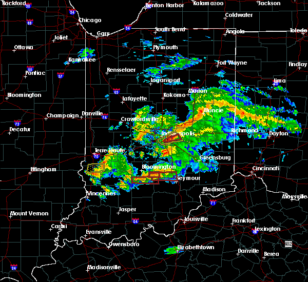
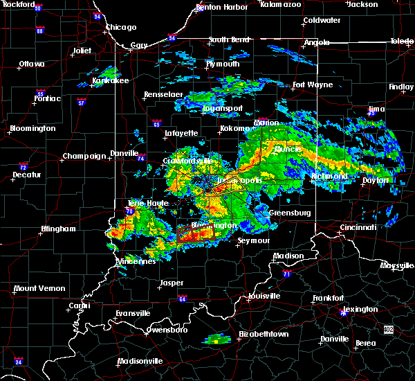
| 3/30/2025 6:00 PM EDT | At 559 pm edt, a severe thunderstorm was located 13 miles north of linton, or 19 miles southeast of terre haute, moving east at 45 mph (radar indicated). Hazards include 60 mph wind gusts and quarter size hail. Hail damage to vehicles is expected. expect wind damage to roofs, siding, and trees. Locations impacted include, hymera, quincy, clay city, freedom, farmersburg, saline city, dugger, pimento, worthington, vicksburg, devore, ellettsville, jasonville, gosport, coal city, bowling green, mccormicks creek state park, shelburn, spencer, and patricksburg. |
| 3/30/2025 5:46 PM EDT |
 Svrind the national weather service in indianapolis has issued a * severe thunderstorm warning for, southeastern vigo county in west central indiana, northwestern monroe county in south central indiana, southwestern morgan county in central indiana, northeastern sullivan county in southwestern indiana, southern clay county in west central indiana, owen county in west central indiana, northern greene county in southwestern indiana, southern putnam county in west central indiana, * until 630 pm edt. * at 545 pm edt, severe thunderstorms were located along a line extending from near terre haute to near sullivan, moving northeast at 50 mph (radar indicated). Hazards include 60 mph wind gusts and quarter size hail. Hail damage to vehicles is expected. Expect wind damage to roofs, siding, and trees. Svrind the national weather service in indianapolis has issued a * severe thunderstorm warning for, southeastern vigo county in west central indiana, northwestern monroe county in south central indiana, southwestern morgan county in central indiana, northeastern sullivan county in southwestern indiana, southern clay county in west central indiana, owen county in west central indiana, northern greene county in southwestern indiana, southern putnam county in west central indiana, * until 630 pm edt. * at 545 pm edt, severe thunderstorms were located along a line extending from near terre haute to near sullivan, moving northeast at 50 mph (radar indicated). Hazards include 60 mph wind gusts and quarter size hail. Hail damage to vehicles is expected. Expect wind damage to roofs, siding, and trees.
|
| 3/30/2025 5:26 PM EDT |
 At 525 pm edt, a severe thunderstorm was located over brazil, or 13 miles east of terre haute, moving northeast at 40 mph (radar indicated). Hazards include 60 mph wind gusts and half dollar size hail. Hail damage to vehicles is expected. expect wind damage to roofs, siding, and trees. locations impacted include, fontanet, west terre haute, fairbanks, prairieton, seelyville, staunton, harmony, lena, clay city, carbon, farmersburg, cory, saline city, pimento, center point, brazil, terre haute, riley, knightsville, and indiana state university. This includes interstate 70 between mile markers 4 and 27. At 525 pm edt, a severe thunderstorm was located over brazil, or 13 miles east of terre haute, moving northeast at 40 mph (radar indicated). Hazards include 60 mph wind gusts and half dollar size hail. Hail damage to vehicles is expected. expect wind damage to roofs, siding, and trees. locations impacted include, fontanet, west terre haute, fairbanks, prairieton, seelyville, staunton, harmony, lena, clay city, carbon, farmersburg, cory, saline city, pimento, center point, brazil, terre haute, riley, knightsville, and indiana state university. This includes interstate 70 between mile markers 4 and 27.
|
| 3/30/2025 5:09 PM EDT |
 At 509 pm edt, severe thunderstorms were located along a line extending from 8 miles northwest of brazil to 10 miles northwest of sullivan, moving northeast at 40 mph (radar indicated). Hazards include 60 mph wind gusts and quarter size hail. Hail damage to vehicles is expected. expect wind damage to roofs, siding, and trees. locations impacted include, fontanet, west terre haute, fairbanks, prairieton, seelyville, staunton, harmony, lena, clay city, carbon, farmersburg, cory, saline city, pimento, center point, brazil, terre haute, riley, knightsville, and indiana state university. This includes interstate 70 between mile markers 4 and 27. At 509 pm edt, severe thunderstorms were located along a line extending from 8 miles northwest of brazil to 10 miles northwest of sullivan, moving northeast at 40 mph (radar indicated). Hazards include 60 mph wind gusts and quarter size hail. Hail damage to vehicles is expected. expect wind damage to roofs, siding, and trees. locations impacted include, fontanet, west terre haute, fairbanks, prairieton, seelyville, staunton, harmony, lena, clay city, carbon, farmersburg, cory, saline city, pimento, center point, brazil, terre haute, riley, knightsville, and indiana state university. This includes interstate 70 between mile markers 4 and 27.
|
| 3/30/2025 5:02 PM EDT | At 502 pm edt, severe thunderstorms were located along a line extending from 8 miles southeast of clinton to 7 miles northeast of hutsonville, moving northeast at 40 mph (radar indicated). Hazards include 60 mph wind gusts and quarter size hail. Hail damage to vehicles is expected. expect wind damage to roofs, siding, and trees. locations impacted include, fontanet, west terre haute, fairbanks, prairieton, seelyville, staunton, harmony, lena, clay city, carbon, farmersburg, cory, saline city, pimento, center point, brazil, terre haute, riley, knightsville, and indiana state university. This includes interstate 70 between mile markers 4 and 27. |
| 3/30/2025 4:54 PM EDT | Svrind the national weather service in indianapolis has issued a * severe thunderstorm warning for, vigo county in west central indiana, northern sullivan county in southwestern indiana, clay county in west central indiana, southeastern parke county in west central indiana, * until 545 pm edt. * at 453 pm edt, severe thunderstorms were located along a line extending from near terre haute to near hutsonville, moving northeast at 40 mph (radar indicated). Hazards include 60 mph wind gusts and penny size hail. expect damage to roofs, siding, and trees |
| 3/19/2025 6:55 PM EDT |
 the severe thunderstorm warning has been cancelled and is no longer in effect the severe thunderstorm warning has been cancelled and is no longer in effect
|
| 3/19/2025 6:53 PM EDT |
 Svrind the national weather service in indianapolis has issued a * severe thunderstorm warning for, vigo county in west central indiana, southeastern fountain county in west central indiana, north central sullivan county in southwestern indiana, clay county in west central indiana, northwestern owen county in west central indiana, parke county in west central indiana, southeastern vermillion county in west central indiana, southwestern montgomery county in west central indiana, western putnam county in west central indiana, * until 745 pm edt. * at 652 pm edt, severe thunderstorms were located along a line extending from rockville to 11 miles north of sullivan, moving northeast at 55 mph (radar indicated). Hazards include 70 mph wind gusts and quarter size hail. Hail damage to vehicles is expected. expect considerable tree damage. Wind damage is also likely to mobile homes, roofs, and outbuildings. Svrind the national weather service in indianapolis has issued a * severe thunderstorm warning for, vigo county in west central indiana, southeastern fountain county in west central indiana, north central sullivan county in southwestern indiana, clay county in west central indiana, northwestern owen county in west central indiana, parke county in west central indiana, southeastern vermillion county in west central indiana, southwestern montgomery county in west central indiana, western putnam county in west central indiana, * until 745 pm edt. * at 652 pm edt, severe thunderstorms were located along a line extending from rockville to 11 miles north of sullivan, moving northeast at 55 mph (radar indicated). Hazards include 70 mph wind gusts and quarter size hail. Hail damage to vehicles is expected. expect considerable tree damage. Wind damage is also likely to mobile homes, roofs, and outbuildings.
|
| 3/19/2025 6:32 PM EDT |
 Svrind the national weather service in indianapolis has issued a * severe thunderstorm warning for, southwestern vigo county in west central indiana, northern sullivan county in southwestern indiana, * until 715 pm edt. * at 632 pm edt, a severe thunderstorm was located over hutsonville, or 8 miles north of robinson, moving northeast at 45 mph (radar indicated). Hazards include 60 mph wind gusts and quarter size hail. Hail damage to vehicles is expected. Expect wind damage to roofs, siding, and trees. Svrind the national weather service in indianapolis has issued a * severe thunderstorm warning for, southwestern vigo county in west central indiana, northern sullivan county in southwestern indiana, * until 715 pm edt. * at 632 pm edt, a severe thunderstorm was located over hutsonville, or 8 miles north of robinson, moving northeast at 45 mph (radar indicated). Hazards include 60 mph wind gusts and quarter size hail. Hail damage to vehicles is expected. Expect wind damage to roofs, siding, and trees.
|
| 3/15/2025 3:25 AM EDT |
 The storm which prompted the warning has weakened below severe limits, and no longer appears capable of producing a tornado. therefore, the warning will be allowed to expire. a tornado watch remains in effect until 400 am edt for southwestern and west central indiana. The storm which prompted the warning has weakened below severe limits, and no longer appears capable of producing a tornado. therefore, the warning will be allowed to expire. a tornado watch remains in effect until 400 am edt for southwestern and west central indiana.
|
| 3/15/2025 3:19 AM EDT | Large tree limb down over in-24 in vigo county IN, 1.9 miles SE of Farmersburg, IN |
| 3/15/2025 3:01 AM EDT |
 Torind the national weather service in indianapolis has issued a * tornado warning for, southwestern vigo county in west central indiana, northern sullivan county in southwestern indiana, * until 330 am edt. * at 301 am edt, a severe thunderstorm capable of producing a tornado was located near hutsonville, or 9 miles north of robinson, moving northeast at 60 mph (radar indicated rotation). Hazards include tornado and quarter size hail. Flying debris will be dangerous to those caught without shelter. mobile homes will be damaged or destroyed. damage to roofs, windows, and vehicles will occur. Tree damage is likely. Torind the national weather service in indianapolis has issued a * tornado warning for, southwestern vigo county in west central indiana, northern sullivan county in southwestern indiana, * until 330 am edt. * at 301 am edt, a severe thunderstorm capable of producing a tornado was located near hutsonville, or 9 miles north of robinson, moving northeast at 60 mph (radar indicated rotation). Hazards include tornado and quarter size hail. Flying debris will be dangerous to those caught without shelter. mobile homes will be damaged or destroyed. damage to roofs, windows, and vehicles will occur. Tree damage is likely.
|
| 6/25/2024 2:29 PM EDT |
 Svrind the national weather service in indianapolis has issued a * severe thunderstorm warning for, vigo county in west central indiana, northeastern sullivan county in southwestern indiana, northwestern clay county in west central indiana, * until 315 pm edt. * at 227 pm edt, a severe thunderstorm was located near paris, moving east at 40 mph (radar indicated). Hazards include ping pong ball size hail and 60 mph wind gusts. People and animals outdoors will be injured. expect hail damage to roofs, siding, windows, and vehicles. Expect wind damage to roofs, siding, and trees. Svrind the national weather service in indianapolis has issued a * severe thunderstorm warning for, vigo county in west central indiana, northeastern sullivan county in southwestern indiana, northwestern clay county in west central indiana, * until 315 pm edt. * at 227 pm edt, a severe thunderstorm was located near paris, moving east at 40 mph (radar indicated). Hazards include ping pong ball size hail and 60 mph wind gusts. People and animals outdoors will be injured. expect hail damage to roofs, siding, windows, and vehicles. Expect wind damage to roofs, siding, and trees.
|
| 6/17/2024 5:51 PM EDT | Localized downburst downed a couple trees and snapped several power poles. time estimated from rada in vigo county IN, 1.7 miles SW of Farmersburg, IN |
| 5/26/2024 10:23 PM EDT |
 At 1022 pm edt, severe thunderstorms were located along a line extending from 9 miles north of sullivan to near linton to 7 miles southeast of washington to 8 miles northeast of winslow, moving east at 60 mph (radar indicated). Hazards include 70 mph wind gusts and penny size hail. Expect considerable tree damage. damage is likely to mobile homes, roofs, and outbuildings. Locations impacted include, bloomington, bedford, washington, linton, sullivan, bloomfield, spencer, shoals, ellettsville, mitchell, bicknell, loogootee, jasonville, worthington, odon, shelburn, oolitic, farmersburg, dugger, and clay city. At 1022 pm edt, severe thunderstorms were located along a line extending from 9 miles north of sullivan to near linton to 7 miles southeast of washington to 8 miles northeast of winslow, moving east at 60 mph (radar indicated). Hazards include 70 mph wind gusts and penny size hail. Expect considerable tree damage. damage is likely to mobile homes, roofs, and outbuildings. Locations impacted include, bloomington, bedford, washington, linton, sullivan, bloomfield, spencer, shoals, ellettsville, mitchell, bicknell, loogootee, jasonville, worthington, odon, shelburn, oolitic, farmersburg, dugger, and clay city.
|
| 5/26/2024 10:12 PM EDT |
 Svrind the national weather service in indianapolis has issued a * severe thunderstorm warning for, southeastern vigo county in west central indiana, monroe county in south central indiana, southwestern morgan county in central indiana, sullivan county in southwestern indiana, southwestern brown county in south central indiana, eastern knox county in southwestern indiana, southern clay county in west central indiana, owen county in west central indiana, martin county in southwestern indiana, lawrence county in south central indiana, greene county in southwestern indiana, daviess county in southwestern indiana, * until 1100 pm edt. * at 1012 pm edt, severe thunderstorms were located along a line extending from 8 miles northwest of sullivan to near linton to near washington to near winslow, moving east at 60 mph (radar indicated). Hazards include 70 mph wind gusts and penny size hail. Expect considerable tree damage. Damage is likely to mobile homes, roofs, and outbuildings. Svrind the national weather service in indianapolis has issued a * severe thunderstorm warning for, southeastern vigo county in west central indiana, monroe county in south central indiana, southwestern morgan county in central indiana, sullivan county in southwestern indiana, southwestern brown county in south central indiana, eastern knox county in southwestern indiana, southern clay county in west central indiana, owen county in west central indiana, martin county in southwestern indiana, lawrence county in south central indiana, greene county in southwestern indiana, daviess county in southwestern indiana, * until 1100 pm edt. * at 1012 pm edt, severe thunderstorms were located along a line extending from 8 miles northwest of sullivan to near linton to near washington to near winslow, moving east at 60 mph (radar indicated). Hazards include 70 mph wind gusts and penny size hail. Expect considerable tree damage. Damage is likely to mobile homes, roofs, and outbuildings.
|
| 5/26/2024 9:30 PM EDT |
 Svrind the national weather service in indianapolis has issued a * severe thunderstorm warning for, sullivan county in southwestern indiana, knox county in southwestern indiana, western greene county in southwestern indiana, western daviess county in southwestern indiana, * until 1015 pm edt. * at 930 pm edt, severe thunderstorms were located along a line extending from near willow hill to 6 miles southeast of oblong to near chauncey to grayville, moving east at 50 mph (radar indicated). Hazards include 70 mph wind gusts and nickel size hail. Expect considerable tree damage. Damage is likely to mobile homes, roofs, and outbuildings. Svrind the national weather service in indianapolis has issued a * severe thunderstorm warning for, sullivan county in southwestern indiana, knox county in southwestern indiana, western greene county in southwestern indiana, western daviess county in southwestern indiana, * until 1015 pm edt. * at 930 pm edt, severe thunderstorms were located along a line extending from near willow hill to 6 miles southeast of oblong to near chauncey to grayville, moving east at 50 mph (radar indicated). Hazards include 70 mph wind gusts and nickel size hail. Expect considerable tree damage. Damage is likely to mobile homes, roofs, and outbuildings.
|
| 4/18/2024 9:59 PM EDT |
 At 959 pm edt, severe thunderstorms were located along a line extending from 8 miles southwest of terre haute to near palestine to mount carmel, moving east at 60 mph (radar indicated). Hazards include up to 60 mph wind gusts. Expect damage to roofs, siding, and trees. Locations impacted include, terre haute, vincennes, washington, linton, sullivan, bicknell, jasonville, shelburn, prairieton, prairie creek, farmersburg, dugger, clay city, hymera, lyons, fairbanks, carlisle, elnora, oaktown, and monroe city. At 959 pm edt, severe thunderstorms were located along a line extending from 8 miles southwest of terre haute to near palestine to mount carmel, moving east at 60 mph (radar indicated). Hazards include up to 60 mph wind gusts. Expect damage to roofs, siding, and trees. Locations impacted include, terre haute, vincennes, washington, linton, sullivan, bicknell, jasonville, shelburn, prairieton, prairie creek, farmersburg, dugger, clay city, hymera, lyons, fairbanks, carlisle, elnora, oaktown, and monroe city.
|
| 4/18/2024 9:38 PM EDT |
 At 936 pm edt, severe thunderstorms were located along a line extending from martinsville to robinson to parkersburg, moving east at 40 mph (radar indicated). Hazards include up to 60 mph wind gusts and penny size hail. Expect damage to roofs, siding, and trees. Locations impacted include, terre haute, vincennes, washington, linton, sullivan, bicknell, jasonville, shelburn, prairieton, prairie creek, farmersburg, dugger, clay city, hymera, lyons, fairbanks, carlisle, elnora, oaktown, and monroe city. At 936 pm edt, severe thunderstorms were located along a line extending from martinsville to robinson to parkersburg, moving east at 40 mph (radar indicated). Hazards include up to 60 mph wind gusts and penny size hail. Expect damage to roofs, siding, and trees. Locations impacted include, terre haute, vincennes, washington, linton, sullivan, bicknell, jasonville, shelburn, prairieton, prairie creek, farmersburg, dugger, clay city, hymera, lyons, fairbanks, carlisle, elnora, oaktown, and monroe city.
|
| 4/18/2024 9:20 PM EDT |
 Svrind the national weather service in indianapolis has issued a * severe thunderstorm warning for, vigo county in west central indiana, sullivan county in southwestern indiana, knox county in southwestern indiana, southwestern clay county in west central indiana, western greene county in southwestern indiana, northwestern daviess county in southwestern indiana, * until 1015 pm edt. * at 919 pm edt, severe thunderstorms were located along a line extending from charleston to near willow hill to noble, moving east at 50 mph (radar indicated). Hazards include 60 mph wind gusts and penny size hail. expect damage to roofs, siding, and trees Svrind the national weather service in indianapolis has issued a * severe thunderstorm warning for, vigo county in west central indiana, sullivan county in southwestern indiana, knox county in southwestern indiana, southwestern clay county in west central indiana, western greene county in southwestern indiana, northwestern daviess county in southwestern indiana, * until 1015 pm edt. * at 919 pm edt, severe thunderstorms were located along a line extending from charleston to near willow hill to noble, moving east at 50 mph (radar indicated). Hazards include 60 mph wind gusts and penny size hail. expect damage to roofs, siding, and trees
|
| 3/14/2024 7:54 PM EDT |
 Svrind the national weather service in indianapolis has issued a * severe thunderstorm warning for, vigo county in west central indiana, northern sullivan county in southwestern indiana, southwestern parke county in west central indiana, southern vermillion county in west central indiana, * until 830 pm edt. * at 754 pm edt, severe thunderstorms were located along a line extending from 8 miles southwest of newport to 13 miles southeast of marshall, moving east at 30 mph (radar indicated). Hazards include 60 mph wind gusts and quarter size hail. Hail damage to vehicles is expected. Expect wind damage to roofs, siding, and trees. Svrind the national weather service in indianapolis has issued a * severe thunderstorm warning for, vigo county in west central indiana, northern sullivan county in southwestern indiana, southwestern parke county in west central indiana, southern vermillion county in west central indiana, * until 830 pm edt. * at 754 pm edt, severe thunderstorms were located along a line extending from 8 miles southwest of newport to 13 miles southeast of marshall, moving east at 30 mph (radar indicated). Hazards include 60 mph wind gusts and quarter size hail. Hail damage to vehicles is expected. Expect wind damage to roofs, siding, and trees.
|
| 3/14/2024 10:48 AM EDT |
 Svrind the national weather service in indianapolis has issued a * severe thunderstorm warning for, southern vigo county in west central indiana, northern sullivan county in southwestern indiana, * until 1115 am edt. * at 1047 am edt, a severe thunderstorm was located 7 miles northwest of hutsonville, or 11 miles north of robinson, moving northeast at 65 mph (radar indicated). Hazards include 60 mph wind gusts and half dollar size hail. Hail damage to vehicles is expected. Expect wind damage to roofs, siding, and trees. Svrind the national weather service in indianapolis has issued a * severe thunderstorm warning for, southern vigo county in west central indiana, northern sullivan county in southwestern indiana, * until 1115 am edt. * at 1047 am edt, a severe thunderstorm was located 7 miles northwest of hutsonville, or 11 miles north of robinson, moving northeast at 65 mph (radar indicated). Hazards include 60 mph wind gusts and half dollar size hail. Hail damage to vehicles is expected. Expect wind damage to roofs, siding, and trees.
|
| 7/24/2023 3:38 AM EDT |
 The severe thunderstorm warning for southwestern vigo and northern sullivan counties will expire at 345 am edt, the storm which prompted the warning has weakened below severe limits, and no longer poses an immediate threat to life or property. therefore, the warning will be allowed to expire. The severe thunderstorm warning for southwestern vigo and northern sullivan counties will expire at 345 am edt, the storm which prompted the warning has weakened below severe limits, and no longer poses an immediate threat to life or property. therefore, the warning will be allowed to expire.
|
| 7/24/2023 3:09 AM EDT |
 At 309 am edt, a severe thunderstorm was located 9 miles east of west union, or 14 miles southeast of marshall, moving east at 20 mph (radar indicated). Hazards include 60 mph wind gusts and half dollar size hail. Hail damage to vehicles is expected. expect wind damage to roofs, siding, and trees. locations impacted include, shelburn and farmersburg. hail threat, radar indicated max hail size, 1. 25 in wind threat, radar indicated max wind gust, 60 mph. At 309 am edt, a severe thunderstorm was located 9 miles east of west union, or 14 miles southeast of marshall, moving east at 20 mph (radar indicated). Hazards include 60 mph wind gusts and half dollar size hail. Hail damage to vehicles is expected. expect wind damage to roofs, siding, and trees. locations impacted include, shelburn and farmersburg. hail threat, radar indicated max hail size, 1. 25 in wind threat, radar indicated max wind gust, 60 mph.
|
| 7/24/2023 2:57 AM EDT |
 At 257 am edt, a severe thunderstorm was located near west union, or 11 miles southeast of marshall, moving east at 20 mph (radar indicated). Hazards include 60 mph wind gusts and half dollar size hail. Hail damage to vehicles is expected. expect wind damage to roofs, siding, and trees. this severe thunderstorm will be near, fairbanks around 310 am edt. other locations in the path of this severe thunderstorm include shelburn and farmersburg. hail threat, radar indicated max hail size, 1. 25 in wind threat, radar indicated max wind gust, 60 mph. At 257 am edt, a severe thunderstorm was located near west union, or 11 miles southeast of marshall, moving east at 20 mph (radar indicated). Hazards include 60 mph wind gusts and half dollar size hail. Hail damage to vehicles is expected. expect wind damage to roofs, siding, and trees. this severe thunderstorm will be near, fairbanks around 310 am edt. other locations in the path of this severe thunderstorm include shelburn and farmersburg. hail threat, radar indicated max hail size, 1. 25 in wind threat, radar indicated max wind gust, 60 mph.
|
| 6/29/2023 2:32 PM EDT |
 At 231 pm edt, severe thunderstorms were located along a line extending from near oakwood to casey, moving east at 55 mph (radar indicated). Hazards include 70 mph wind gusts and quarter size hail. Hail damage to vehicles is expected. expect considerable tree damage. wind damage is also likely to mobile homes, roofs, and outbuildings. severe thunderstorms will be near, state line city, foster and gessie around 245 pm edt. covington and perrysville around 250 pm edt. other locations in the path of these severe thunderstorms include veedersburg, prairieton, prairie creek, fairbanks, shelburn, farmersburg, hillsboro, newtown, mellott, pimento, waynetown, hymera, wingate, riley, new richmond and cory. this includes the following highways, interstate 70 between mile markers 1 and 20. interstate 74 between mile markers 1 and 28. thunderstorm damage threat, considerable hail threat, radar indicated max hail size, 1. 00 in wind threat, radar indicated max wind gust, 70 mph. At 231 pm edt, severe thunderstorms were located along a line extending from near oakwood to casey, moving east at 55 mph (radar indicated). Hazards include 70 mph wind gusts and quarter size hail. Hail damage to vehicles is expected. expect considerable tree damage. wind damage is also likely to mobile homes, roofs, and outbuildings. severe thunderstorms will be near, state line city, foster and gessie around 245 pm edt. covington and perrysville around 250 pm edt. other locations in the path of these severe thunderstorms include veedersburg, prairieton, prairie creek, fairbanks, shelburn, farmersburg, hillsboro, newtown, mellott, pimento, waynetown, hymera, wingate, riley, new richmond and cory. this includes the following highways, interstate 70 between mile markers 1 and 20. interstate 74 between mile markers 1 and 28. thunderstorm damage threat, considerable hail threat, radar indicated max hail size, 1. 00 in wind threat, radar indicated max wind gust, 70 mph.
|
| 6/29/2023 11:56 AM EDT |
 The severe thunderstorm warning for southeastern vigo, northeastern sullivan, southern clay, southwestern owen and northwestern greene counties will expire at noon edt, the storm which prompted the warning has weakened below severe limits, and has exited the warned area. therefore, the warning will be allowed to expire. The severe thunderstorm warning for southeastern vigo, northeastern sullivan, southern clay, southwestern owen and northwestern greene counties will expire at noon edt, the storm which prompted the warning has weakened below severe limits, and has exited the warned area. therefore, the warning will be allowed to expire.
|
| 6/29/2023 11:49 AM EDT |
 At 1149 am edt, a severe thunderstorm was located 13 miles west of spencer, or 23 miles southeast of terre haute, moving east at 40 mph (radar indicated). Hazards include 60 mph wind gusts and quarter size hail. Hail damage to vehicles is expected. expect wind damage to roofs, siding, and trees. this severe thunderstorm will remain over mainly rural areas of southeastern vigo, northeastern sullivan, southern clay, southwestern owen and northwestern greene counties. hail threat, radar indicated max hail size, 1. 00 in wind threat, radar indicated max wind gust, 60 mph. At 1149 am edt, a severe thunderstorm was located 13 miles west of spencer, or 23 miles southeast of terre haute, moving east at 40 mph (radar indicated). Hazards include 60 mph wind gusts and quarter size hail. Hail damage to vehicles is expected. expect wind damage to roofs, siding, and trees. this severe thunderstorm will remain over mainly rural areas of southeastern vigo, northeastern sullivan, southern clay, southwestern owen and northwestern greene counties. hail threat, radar indicated max hail size, 1. 00 in wind threat, radar indicated max wind gust, 60 mph.
|
| 6/29/2023 11:30 AM EDT |
 At 1130 am edt, a severe thunderstorm was located 13 miles southeast of terre haute, moving southeast at 40 mph (public). Hazards include golf ball size hail and 60 mph wind gusts. People and animals outdoors will be injured. expect hail damage to roofs, siding, windows, and vehicles. expect wind damage to roofs, siding, and trees. this severe storm will be near, coalmont around 1135 am edt. jasonville and saline city around 1140 am edt. other locations in the path of this severe thunderstorm include clay city, coal city and patricksburg. thunderstorm damage threat, considerable hail threat, radar indicated max hail size, 1. 75 in wind threat, radar indicated max wind gust, 60 mph. At 1130 am edt, a severe thunderstorm was located 13 miles southeast of terre haute, moving southeast at 40 mph (public). Hazards include golf ball size hail and 60 mph wind gusts. People and animals outdoors will be injured. expect hail damage to roofs, siding, windows, and vehicles. expect wind damage to roofs, siding, and trees. this severe storm will be near, coalmont around 1135 am edt. jasonville and saline city around 1140 am edt. other locations in the path of this severe thunderstorm include clay city, coal city and patricksburg. thunderstorm damage threat, considerable hail threat, radar indicated max hail size, 1. 75 in wind threat, radar indicated max wind gust, 60 mph.
|
| 6/29/2023 11:22 AM EDT |
 At 1122 am edt, a severe thunderstorm was located 11 miles south of terre haute, moving east at 35 mph (radar indicated). Hazards include 60 mph wind gusts and quarter size hail. Hail damage to vehicles is expected. expect wind damage to roofs, siding, and trees. this severe thunderstorm will be near, shelburn and riley around 1125 am edt. hymera around 1135 am edt. coalmont around 1140 am edt. other locations in the path of this severe thunderstorm include jasonville, clay city and coal city. hail threat, radar indicated max hail size, 1. 00 in wind threat, radar indicated max wind gust, 60 mph. At 1122 am edt, a severe thunderstorm was located 11 miles south of terre haute, moving east at 35 mph (radar indicated). Hazards include 60 mph wind gusts and quarter size hail. Hail damage to vehicles is expected. expect wind damage to roofs, siding, and trees. this severe thunderstorm will be near, shelburn and riley around 1125 am edt. hymera around 1135 am edt. coalmont around 1140 am edt. other locations in the path of this severe thunderstorm include jasonville, clay city and coal city. hail threat, radar indicated max hail size, 1. 00 in wind threat, radar indicated max wind gust, 60 mph.
|
| 5/19/2022 10:34 PM EDT |
 At 1034 pm edt, severe thunderstorms were located along a line extending from 7 miles east of hutsonville to 6 miles north of sullivan to near linton, moving northeast at 40 mph (radar indicated). Hazards include 60 mph wind gusts. Expect damage to roofs, siding, and trees. these severe storms will be near, hymera around 1040 pm edt. other locations in the path of these severe thunderstorms include farmersburg. hail threat, radar indicated max hail size, <. 75 in wind threat, radar indicated max wind gust, 60 mph. At 1034 pm edt, severe thunderstorms were located along a line extending from 7 miles east of hutsonville to 6 miles north of sullivan to near linton, moving northeast at 40 mph (radar indicated). Hazards include 60 mph wind gusts. Expect damage to roofs, siding, and trees. these severe storms will be near, hymera around 1040 pm edt. other locations in the path of these severe thunderstorms include farmersburg. hail threat, radar indicated max hail size, <. 75 in wind threat, radar indicated max wind gust, 60 mph.
|
| 5/19/2022 10:21 PM EDT |
 At 1020 pm edt, severe thunderstorms were located along a line extending from 6 miles west of sullivan to 11 miles west of linton to 8 miles northeast of russellville, moving northeast at 50 mph (radar indicated. this storm produced a 65 mph wind gust at lawrenceville illinois airport). Hazards include 60 mph wind gusts. Expect damage to roofs, siding, and trees. severe thunderstorms will be near, sullivan, dugger and fairbanks around 1030 pm edt. shelburn and pleasantville around 1035 pm edt. farmersburg and hymera around 1040 pm edt. hail threat, radar indicated max hail size, <. 75 in wind threat, radar indicated max wind gust, 60 mph. At 1020 pm edt, severe thunderstorms were located along a line extending from 6 miles west of sullivan to 11 miles west of linton to 8 miles northeast of russellville, moving northeast at 50 mph (radar indicated. this storm produced a 65 mph wind gust at lawrenceville illinois airport). Hazards include 60 mph wind gusts. Expect damage to roofs, siding, and trees. severe thunderstorms will be near, sullivan, dugger and fairbanks around 1030 pm edt. shelburn and pleasantville around 1035 pm edt. farmersburg and hymera around 1040 pm edt. hail threat, radar indicated max hail size, <. 75 in wind threat, radar indicated max wind gust, 60 mph.
|
| 8/12/2021 6:30 PM EDT |
 At 629 pm edt, severe thunderstorms were located along a line extending from 12 miles southeast of terre haute to 6 miles northeast of lancaster, moving southeast at 25 mph (radar indicated). Hazards include 60 mph wind gusts and quarter size hail. Hail damage to vehicles is expected. Expect wind damage to roofs, siding, and trees. At 629 pm edt, severe thunderstorms were located along a line extending from 12 miles southeast of terre haute to 6 miles northeast of lancaster, moving southeast at 25 mph (radar indicated). Hazards include 60 mph wind gusts and quarter size hail. Hail damage to vehicles is expected. Expect wind damage to roofs, siding, and trees.
|
| 8/12/2021 6:15 PM EDT | Large tree blown onto power lines. time estimated from rada in sullivan county IN, 0.7 miles WNW of Farmersburg, IN |
| 6/18/2021 11:41 PM EDT |
 The severe thunderstorm warning for southern vigo, monroe, northeastern sullivan, southern clay, owen and northeastern greene counties will expire at 1145 pm edt, the storms which prompted the warning have weakened below severe limits, and no longer pose an immediate threat to life or property. therefore, the warning will be allowed to expire. however heavy rain is still possible with these thunderstorms. a severe thunderstorm watch remains in effect until 200 am edt for south central, central, southwestern and west central indiana. The severe thunderstorm warning for southern vigo, monroe, northeastern sullivan, southern clay, owen and northeastern greene counties will expire at 1145 pm edt, the storms which prompted the warning have weakened below severe limits, and no longer pose an immediate threat to life or property. therefore, the warning will be allowed to expire. however heavy rain is still possible with these thunderstorms. a severe thunderstorm watch remains in effect until 200 am edt for south central, central, southwestern and west central indiana.
|
| 6/18/2021 11:22 PM EDT |
 At 1122 pm edt, severe thunderstorms were located along a line extending from 13 miles west of spencer to near bloomington, moving east at 40 mph (radar indicated). Hazards include 60 mph wind gusts and quarter size hail. Hail damage to vehicles is expected. expect wind damage to roofs, siding, and trees. Locations impacted include, bloomington, spencer, ellettsville, prairieton, prairie creek, farmersburg, clay city, gosport, stinesville, coal city, indiana university, smithville, mccormicks creek state park, lake lemon, freedom, patricksburg, coalmont, saline city, pimento and monroe reservoir. At 1122 pm edt, severe thunderstorms were located along a line extending from 13 miles west of spencer to near bloomington, moving east at 40 mph (radar indicated). Hazards include 60 mph wind gusts and quarter size hail. Hail damage to vehicles is expected. expect wind damage to roofs, siding, and trees. Locations impacted include, bloomington, spencer, ellettsville, prairieton, prairie creek, farmersburg, clay city, gosport, stinesville, coal city, indiana university, smithville, mccormicks creek state park, lake lemon, freedom, patricksburg, coalmont, saline city, pimento and monroe reservoir.
|
| 6/18/2021 11:05 PM EDT |
 At 1105 pm edt, severe thunderstorms were located along a line extending from 16 miles north of linton to near bloomington, moving east at 40 mph (radar indicated). Hazards include ping pong ball size hail and 60 mph wind gusts. People and animals outdoors will be injured. expect hail damage to roofs, siding, windows, and vehicles. expect wind damage to roofs, siding, and trees. Locations impacted include, ellettsville, indiana university, whitehall, unionville, patricksburg, lake lemon, woodville hills, freedom, spencer, mccormicks creek state park, bloomington, smithville and monroe reservoir. At 1105 pm edt, severe thunderstorms were located along a line extending from 16 miles north of linton to near bloomington, moving east at 40 mph (radar indicated). Hazards include ping pong ball size hail and 60 mph wind gusts. People and animals outdoors will be injured. expect hail damage to roofs, siding, windows, and vehicles. expect wind damage to roofs, siding, and trees. Locations impacted include, ellettsville, indiana university, whitehall, unionville, patricksburg, lake lemon, woodville hills, freedom, spencer, mccormicks creek state park, bloomington, smithville and monroe reservoir.
|
| 6/18/2021 10:42 PM EDT |
 At 1041 pm edt, severe thunderstorms were located along a line extending from 9 miles southwest of terre haute to near spencer, moving east at 40 mph (radar indicated). Hazards include ping pong ball size hail and 60 mph wind gusts. People and animals outdoors will be injured. expect hail damage to roofs, siding, windows, and vehicles. expect wind damage to roofs, siding, and trees. severe thunderstorms will be near, spencer and mccormicks creek state park around 1050 pm edt. ellettsville and stinesville around 1100 pm edt. Other locations in the path of these severe thunderstorms include coalmont, saline city, bloomington, clay city, indiana university, whitehall, coal city, unionville, smithville, patricksburg, monroe reservoir, lake lemon, woodville hills and freedom. At 1041 pm edt, severe thunderstorms were located along a line extending from 9 miles southwest of terre haute to near spencer, moving east at 40 mph (radar indicated). Hazards include ping pong ball size hail and 60 mph wind gusts. People and animals outdoors will be injured. expect hail damage to roofs, siding, windows, and vehicles. expect wind damage to roofs, siding, and trees. severe thunderstorms will be near, spencer and mccormicks creek state park around 1050 pm edt. ellettsville and stinesville around 1100 pm edt. Other locations in the path of these severe thunderstorms include coalmont, saline city, bloomington, clay city, indiana university, whitehall, coal city, unionville, smithville, patricksburg, monroe reservoir, lake lemon, woodville hills and freedom.
|
| 10/23/2020 2:42 PM EDT |
 At 242 pm edt, a severe thunderstorm was located 8 miles northeast of west union, or 12 miles southeast of marshall, moving east at 30 mph (radar indicated). Hazards include 60 mph wind gusts and quarter size hail. Hail damage to vehicles is expected. Expect wind damage to roofs, siding, and trees. At 242 pm edt, a severe thunderstorm was located 8 miles northeast of west union, or 12 miles southeast of marshall, moving east at 30 mph (radar indicated). Hazards include 60 mph wind gusts and quarter size hail. Hail damage to vehicles is expected. Expect wind damage to roofs, siding, and trees.
|
| 7/12/2020 12:44 AM EDT |
 At 1243 am edt, severe thunderstorms were located along a line extending from 12 miles east of greencastle to 8 miles west of spencer to near chauncey, moving southeast at 60 mph (radar indicated). Hazards include 60 mph wind gusts and quarter size hail. Hail damage to vehicles is expected. expect wind damage to roofs, siding, and trees. locations impacted include, greencastle, mooresville, linton, sullivan, spencer, ellettsville, jasonville, cloverdale, brooklyn, worthington, shelburn, farmersburg, monrovia, clayton, dugger, clay city, gosport, hymera, fairbanks and carlisle. This includes interstate 70 between mile markers 27 and 65. At 1243 am edt, severe thunderstorms were located along a line extending from 12 miles east of greencastle to 8 miles west of spencer to near chauncey, moving southeast at 60 mph (radar indicated). Hazards include 60 mph wind gusts and quarter size hail. Hail damage to vehicles is expected. expect wind damage to roofs, siding, and trees. locations impacted include, greencastle, mooresville, linton, sullivan, spencer, ellettsville, jasonville, cloverdale, brooklyn, worthington, shelburn, farmersburg, monrovia, clayton, dugger, clay city, gosport, hymera, fairbanks and carlisle. This includes interstate 70 between mile markers 27 and 65.
|
| 7/12/2020 12:29 AM EDT |
 At 1228 am edt, severe thunderstorms were located along a line extending from near greencastle to 10 miles south of brazil to near newton, moving southeast at 60 mph. quarter size hail was reported in carlisle in vigo county at 1222 am (radar indicated). Hazards include 60 mph wind gusts and quarter size hail. Hail damage to vehicles is expected. Expect wind damage to roofs, siding, and trees. At 1228 am edt, severe thunderstorms were located along a line extending from near greencastle to 10 miles south of brazil to near newton, moving southeast at 60 mph. quarter size hail was reported in carlisle in vigo county at 1222 am (radar indicated). Hazards include 60 mph wind gusts and quarter size hail. Hail damage to vehicles is expected. Expect wind damage to roofs, siding, and trees.
|
| 7/11/2020 8:10 PM EDT |
 At 810 pm edt, a severe thunderstorm was located 13 miles northeast of sullivan, or 16 miles southeast of terre haute, moving southeast at 20 mph (radar indicated). Hazards include 60 mph wind gusts and quarter size hail. Hail damage to vehicles is expected. expect wind damage to roofs, siding, and trees. locations impacted include, terre haute, sullivan, west terre haute, jasonville, shelburn, prairieton, farmersburg, clay city, hymera, riley, coalmont, cory, saline city, pimento, indiana state university and north terre haute. This includes interstate 70 between mile markers 1 and 17. At 810 pm edt, a severe thunderstorm was located 13 miles northeast of sullivan, or 16 miles southeast of terre haute, moving southeast at 20 mph (radar indicated). Hazards include 60 mph wind gusts and quarter size hail. Hail damage to vehicles is expected. expect wind damage to roofs, siding, and trees. locations impacted include, terre haute, sullivan, west terre haute, jasonville, shelburn, prairieton, farmersburg, clay city, hymera, riley, coalmont, cory, saline city, pimento, indiana state university and north terre haute. This includes interstate 70 between mile markers 1 and 17.
|
| 7/11/2020 7:56 PM EDT |
 At 756 pm edt, a severe thunderstorm was located 13 miles southeast of terre haute, moving southeast at 20 mph (radar indicated). Hazards include 60 mph wind gusts and half dollar size hail. Hail damage to vehicles is expected. Expect wind damage to roofs, siding, and trees. At 756 pm edt, a severe thunderstorm was located 13 miles southeast of terre haute, moving southeast at 20 mph (radar indicated). Hazards include 60 mph wind gusts and half dollar size hail. Hail damage to vehicles is expected. Expect wind damage to roofs, siding, and trees.
|
| 7/11/2020 7:27 PM EDT |
 At 726 pm edt, a severe thunderstorm was located near terre haute, moving southeast at 25 mph (trained weather spotters). Hazards include 70 mph wind gusts and half dollar size hail. Hail damage to vehicles is expected. expect considerable tree damage. Wind damage is also likely to mobile homes, roofs, and outbuildings. At 726 pm edt, a severe thunderstorm was located near terre haute, moving southeast at 25 mph (trained weather spotters). Hazards include 70 mph wind gusts and half dollar size hail. Hail damage to vehicles is expected. expect considerable tree damage. Wind damage is also likely to mobile homes, roofs, and outbuildings.
|
| 7/11/2020 7:06 PM EDT |
 At 706 pm edt, a severe thunderstorm was located over terre haute, moving southeast at 40 mph (radar indicated). Hazards include 60 mph wind gusts and quarter size hail. Hail damage to vehicles is expected. Expect wind damage to roofs, siding, and trees. At 706 pm edt, a severe thunderstorm was located over terre haute, moving southeast at 40 mph (radar indicated). Hazards include 60 mph wind gusts and quarter size hail. Hail damage to vehicles is expected. Expect wind damage to roofs, siding, and trees.
|
| 5/17/2020 7:07 PM EDT |
 At 707 pm edt, a severe thunderstorm was located near sullivan, or 20 miles south of terre haute, moving northeast at 30 mph (radar indicated). Hazards include 60 mph wind gusts. Expect damage to roofs, siding, and trees. Locations impacted include, sullivan, shelburn, farmersburg, dugger, hymera, fairbanks, merom, turtle creek reservoir, graysville and paxton. At 707 pm edt, a severe thunderstorm was located near sullivan, or 20 miles south of terre haute, moving northeast at 30 mph (radar indicated). Hazards include 60 mph wind gusts. Expect damage to roofs, siding, and trees. Locations impacted include, sullivan, shelburn, farmersburg, dugger, hymera, fairbanks, merom, turtle creek reservoir, graysville and paxton.
|
| 5/17/2020 6:54 PM EDT |
 At 654 pm edt, a severe thunderstorm was located near sullivan, or 18 miles northeast of robinson, moving northeast at 40 mph (radar indicated). Hazards include 60 mph wind gusts. Expect damage to roofs, siding, and trees. Locations impacted include, sullivan, shelburn, farmersburg, dugger, hymera, fairbanks, merom, turtle creek reservoir, graysville and paxton. At 654 pm edt, a severe thunderstorm was located near sullivan, or 18 miles northeast of robinson, moving northeast at 40 mph (radar indicated). Hazards include 60 mph wind gusts. Expect damage to roofs, siding, and trees. Locations impacted include, sullivan, shelburn, farmersburg, dugger, hymera, fairbanks, merom, turtle creek reservoir, graysville and paxton.
|
| 5/17/2020 6:39 PM EDT |
 At 638 pm edt, a severe thunderstorm was located over palestine, or 8 miles east of robinson, moving northeast at 40 mph (radar indicated). Hazards include 60 mph wind gusts. expect damage to roofs, siding, and trees At 638 pm edt, a severe thunderstorm was located over palestine, or 8 miles east of robinson, moving northeast at 40 mph (radar indicated). Hazards include 60 mph wind gusts. expect damage to roofs, siding, and trees
|
| 5/3/2020 1:22 AM EDT |
 At 122 am edt, a severe thunderstorm was located 9 miles northeast of sullivan, or 17 miles south of terre haute, moving east at 50 mph (radar indicated). Hazards include 60 mph wind gusts and quarter size hail. Hail damage to vehicles is expected. expect wind damage to roofs, siding, and trees. Locations impacted include, sullivan, jasonville, shelburn, farmersburg, clay city, hymera, riley, coalmont, cory, saline city and vicksburg. At 122 am edt, a severe thunderstorm was located 9 miles northeast of sullivan, or 17 miles south of terre haute, moving east at 50 mph (radar indicated). Hazards include 60 mph wind gusts and quarter size hail. Hail damage to vehicles is expected. expect wind damage to roofs, siding, and trees. Locations impacted include, sullivan, jasonville, shelburn, farmersburg, clay city, hymera, riley, coalmont, cory, saline city and vicksburg.
|
| 5/3/2020 1:03 AM EDT |
 At 103 am edt, a severe thunderstorm was located over west union, or 11 miles south of marshall, moving east at 50 mph (radar indicated). Hazards include 60 mph wind gusts and quarter size hail. Hail damage to vehicles is expected. Expect wind damage to roofs, siding, and trees. At 103 am edt, a severe thunderstorm was located over west union, or 11 miles south of marshall, moving east at 50 mph (radar indicated). Hazards include 60 mph wind gusts and quarter size hail. Hail damage to vehicles is expected. Expect wind damage to roofs, siding, and trees.
|
| 4/8/2020 8:24 PM EDT |
 At 824 pm edt, a severe thunderstorm was located near sullivan, or 19 miles northeast of robinson, moving southeast at 55 mph (radar indicated). Hazards include 60 mph wind gusts and quarter size hail. Hail damage to vehicles is expected. Expect wind damage to roofs, siding, and trees. At 824 pm edt, a severe thunderstorm was located near sullivan, or 19 miles northeast of robinson, moving southeast at 55 mph (radar indicated). Hazards include 60 mph wind gusts and quarter size hail. Hail damage to vehicles is expected. Expect wind damage to roofs, siding, and trees.
|
| 3/28/2020 4:09 PM EDT |
 At 409 pm edt, a severe thunderstorm was located 10 miles north of sullivan, or 15 miles south of terre haute, moving northeast at 55 mph (radar indicated). Hazards include quarter size hail. damage to vehicles is expected At 409 pm edt, a severe thunderstorm was located 10 miles north of sullivan, or 15 miles south of terre haute, moving northeast at 55 mph (radar indicated). Hazards include quarter size hail. damage to vehicles is expected
|
| 8/13/2019 1:22 AM EDT |
 At 121 am edt, a severe thunderstorm was located near linton, or 25 miles east of robinson, moving southeast at 30 mph (radar indicated). Hazards include 70 mph wind gusts. Expect considerable tree damage. damage is likely to mobile homes, roofs, and outbuildings. Locations impacted include, linton, sullivan, jasonville, shelburn, farmersburg, dugger, hymera, merom, coalmont, pleasantville, turtle creek reservoir, vicksburg and paxton. At 121 am edt, a severe thunderstorm was located near linton, or 25 miles east of robinson, moving southeast at 30 mph (radar indicated). Hazards include 70 mph wind gusts. Expect considerable tree damage. damage is likely to mobile homes, roofs, and outbuildings. Locations impacted include, linton, sullivan, jasonville, shelburn, farmersburg, dugger, hymera, merom, coalmont, pleasantville, turtle creek reservoir, vicksburg and paxton.
|
| 8/13/2019 1:14 AM EDT |
 At 113 am edt, a severe thunderstorm was located near sullivan, or 20 miles east of robinson, moving southeast at 30 mph (radar indicated). Hazards include 70 mph wind gusts. Expect considerable tree damage. Damage is likely to mobile homes, roofs, and outbuildings. At 113 am edt, a severe thunderstorm was located near sullivan, or 20 miles east of robinson, moving southeast at 30 mph (radar indicated). Hazards include 70 mph wind gusts. Expect considerable tree damage. Damage is likely to mobile homes, roofs, and outbuildings.
|
| 8/13/2019 12:52 AM EDT |
 At 1251 am edt, a severe thunderstorm was located near sullivan, or 19 miles south of terre haute, moving southeast at 35 mph (radar indicated). Hazards include 60 mph wind gusts. Expect damage to roofs, siding, and trees. Locations impacted include, sullivan, shelburn, farmersburg, dugger, hymera, fairbanks, merom, turtle creek reservoir, graysville and paxton. At 1251 am edt, a severe thunderstorm was located near sullivan, or 19 miles south of terre haute, moving southeast at 35 mph (radar indicated). Hazards include 60 mph wind gusts. Expect damage to roofs, siding, and trees. Locations impacted include, sullivan, shelburn, farmersburg, dugger, hymera, fairbanks, merom, turtle creek reservoir, graysville and paxton.
|
| 8/13/2019 12:40 AM EDT |
 At 1240 am edt, a severe thunderstorm was located 10 miles north of sullivan, or 15 miles south of terre haute, moving southeast at 30 mph (radar indicated). Hazards include 60 mph wind gusts. Expect damage to roofs, siding, and trees. Locations impacted include, sullivan, shelburn, prairieton, prairie creek, farmersburg, dugger, hymera, fairbanks, merom, graysville, pimento, turtle creek reservoir and paxton. At 1240 am edt, a severe thunderstorm was located 10 miles north of sullivan, or 15 miles south of terre haute, moving southeast at 30 mph (radar indicated). Hazards include 60 mph wind gusts. Expect damage to roofs, siding, and trees. Locations impacted include, sullivan, shelburn, prairieton, prairie creek, farmersburg, dugger, hymera, fairbanks, merom, graysville, pimento, turtle creek reservoir and paxton.
|
| 8/13/2019 12:19 AM EDT |
 At 1219 am edt, a severe thunderstorm was located 11 miles south of terre haute, moving southeast at 40 mph (radar indicated). Hazards include 60 mph wind gusts. expect damage to roofs, siding, and trees At 1219 am edt, a severe thunderstorm was located 11 miles south of terre haute, moving southeast at 40 mph (radar indicated). Hazards include 60 mph wind gusts. expect damage to roofs, siding, and trees
|
| 6/21/2019 5:05 PM EDT |
 At 505 pm edt, severe thunderstorms were located along a line extending from 10 miles north of sullivan to 8 miles west of petersburg, moving southeast at 40 mph (radar indicated). Hazards include 60 mph wind gusts. Expect damage to roofs, siding, and trees. Locations impacted include, vincennes, washington, linton, sullivan, bicknell, jasonville, shelburn, farmersburg, dugger, hymera, lyons, fairbanks, carlisle, elnora, oaktown, monroe city, wheatland, bruceville, plainville and sandborn. At 505 pm edt, severe thunderstorms were located along a line extending from 10 miles north of sullivan to 8 miles west of petersburg, moving southeast at 40 mph (radar indicated). Hazards include 60 mph wind gusts. Expect damage to roofs, siding, and trees. Locations impacted include, vincennes, washington, linton, sullivan, bicknell, jasonville, shelburn, farmersburg, dugger, hymera, lyons, fairbanks, carlisle, elnora, oaktown, monroe city, wheatland, bruceville, plainville and sandborn.
|
| 6/21/2019 4:42 PM EDT |
 The national weather service in indianapolis has issued a * severe thunderstorm warning for. south central vigo county in west central indiana. sullivan county in southwestern indiana. knox county in southwestern indiana. Southwestern clay county in west central indiana. The national weather service in indianapolis has issued a * severe thunderstorm warning for. south central vigo county in west central indiana. sullivan county in southwestern indiana. knox county in southwestern indiana. Southwestern clay county in west central indiana.
|
| 6/16/2019 4:21 AM EDT |
 At 411 am edt, a severe thunderstorm was located 7 miles southwest of brazil, or 11 miles east of terre haute, moving east at 45 mph (radar indicated). Hazards include 60 mph wind gusts. Expect damage to roofs, siding, and trees. locations impacted include, terre haute, brazil, linton, clinton, sullivan, rockville, jasonville, fairview park, shelburn, farmersburg, seelyville, dugger, knightsville, clay city, hymera, lyons, rosedale, carlisle, harmony and staunton. This includes interstate 70 between mile markers 13 and 29. At 411 am edt, a severe thunderstorm was located 7 miles southwest of brazil, or 11 miles east of terre haute, moving east at 45 mph (radar indicated). Hazards include 60 mph wind gusts. Expect damage to roofs, siding, and trees. locations impacted include, terre haute, brazil, linton, clinton, sullivan, rockville, jasonville, fairview park, shelburn, farmersburg, seelyville, dugger, knightsville, clay city, hymera, lyons, rosedale, carlisle, harmony and staunton. This includes interstate 70 between mile markers 13 and 29.
|
| 6/16/2019 4:11 AM EDT |
 At 411 am edt, a severe thunderstorm was located 7 miles southwest of brazil, or 11 miles east of terre haute, moving east at 45 mph (radar indicated). Hazards include 60 mph wind gusts. Expect damage to roofs, siding, and trees. locations impacted include, terre haute, brazil, linton, clinton, sullivan, rockville, jasonville, fairview park, shelburn, farmersburg, seelyville, dugger, knightsville, clay city, hymera, lyons, rosedale, carlisle, harmony and staunton. This includes interstate 70 between mile markers 13 and 29. At 411 am edt, a severe thunderstorm was located 7 miles southwest of brazil, or 11 miles east of terre haute, moving east at 45 mph (radar indicated). Hazards include 60 mph wind gusts. Expect damage to roofs, siding, and trees. locations impacted include, terre haute, brazil, linton, clinton, sullivan, rockville, jasonville, fairview park, shelburn, farmersburg, seelyville, dugger, knightsville, clay city, hymera, lyons, rosedale, carlisle, harmony and staunton. This includes interstate 70 between mile markers 13 and 29.
|
| 6/16/2019 4:00 AM EDT |
 At 359 am edt, a severe thunderstorm was located 7 miles southeast of terre haute, moving east at 60 mph (radar indicated). Hazards include 60 mph wind gusts. Expect damage to roofs, siding, and trees. locations impacted include, terre haute, brazil, linton, clinton, sullivan, rockville, west terre haute, jasonville, fairview park, shelburn, prairieton, prairie creek, farmersburg, seelyville, montezuma, dugger, knightsville, clay city, hymera and lyons. This includes interstate 70 between mile markers 1 and 29. At 359 am edt, a severe thunderstorm was located 7 miles southeast of terre haute, moving east at 60 mph (radar indicated). Hazards include 60 mph wind gusts. Expect damage to roofs, siding, and trees. locations impacted include, terre haute, brazil, linton, clinton, sullivan, rockville, west terre haute, jasonville, fairview park, shelburn, prairieton, prairie creek, farmersburg, seelyville, montezuma, dugger, knightsville, clay city, hymera and lyons. This includes interstate 70 between mile markers 1 and 29.
|
| 6/16/2019 3:40 AM EDT |
 At 340 am edt, a severe thunderstorm was located 7 miles southeast of marshall, moving east at 50 mph (radar indicated). Hazards include 60 mph wind gusts. expect damage to roofs, siding, and trees At 340 am edt, a severe thunderstorm was located 7 miles southeast of marshall, moving east at 50 mph (radar indicated). Hazards include 60 mph wind gusts. expect damage to roofs, siding, and trees
|
| 6/15/2019 7:48 PM EDT |
 At 748 pm edt, a severe thunderstorm was located 12 miles northeast of sullivan, or 16 miles south of terre haute, moving east at 35 mph (radar indicated). Hazards include 60 mph wind gusts. Expect damage to roofs, siding, and trees. Locations impacted include, jasonville, shelburn, farmersburg, hymera and coalmont. At 748 pm edt, a severe thunderstorm was located 12 miles northeast of sullivan, or 16 miles south of terre haute, moving east at 35 mph (radar indicated). Hazards include 60 mph wind gusts. Expect damage to roofs, siding, and trees. Locations impacted include, jasonville, shelburn, farmersburg, hymera and coalmont.
|
| 6/15/2019 7:34 PM EDT |
 At 734 pm edt, a severe thunderstorm was located 9 miles north of sullivan, or 16 miles south of terre haute, moving east at 30 mph (radar indicated). Hazards include 60 mph wind gusts. expect damage to roofs, siding, and trees At 734 pm edt, a severe thunderstorm was located 9 miles north of sullivan, or 16 miles south of terre haute, moving east at 30 mph (radar indicated). Hazards include 60 mph wind gusts. expect damage to roofs, siding, and trees
|
| 8/25/2018 8:22 AM EDT |
 At 822 am edt, a severe thunderstorm was located 10 miles south of terre haute, moving east at 30 mph (radar indicated). Hazards include 60 mph wind gusts. expect damage to roofs, siding, and trees At 822 am edt, a severe thunderstorm was located 10 miles south of terre haute, moving east at 30 mph (radar indicated). Hazards include 60 mph wind gusts. expect damage to roofs, siding, and trees
|
| 5/15/2018 8:28 PM EDT |
 At 827 pm edt, a severe thunderstorm was located 12 miles northeast of sullivan, or 15 miles south of terre haute, moving east at 25 mph (radar indicated). Hazards include 60 mph wind gusts and quarter size hail. Hail damage to vehicles is expected. expect wind damage to roofs, siding, and trees. Locations impacted include, jasonville, farmersburg, clay city, hymera, coalmont and pimento. At 827 pm edt, a severe thunderstorm was located 12 miles northeast of sullivan, or 15 miles south of terre haute, moving east at 25 mph (radar indicated). Hazards include 60 mph wind gusts and quarter size hail. Hail damage to vehicles is expected. expect wind damage to roofs, siding, and trees. Locations impacted include, jasonville, farmersburg, clay city, hymera, coalmont and pimento.
|
| 5/15/2018 8:11 PM EDT |
 At 810 pm edt, a severe thunderstorm was located 12 miles south of terre haute, moving east at 25 mph (radar indicated). Hazards include 60 mph wind gusts and half dollar size hail. Hail damage to vehicles is expected. Expect wind damage to roofs, siding, and trees. At 810 pm edt, a severe thunderstorm was located 12 miles south of terre haute, moving east at 25 mph (radar indicated). Hazards include 60 mph wind gusts and half dollar size hail. Hail damage to vehicles is expected. Expect wind damage to roofs, siding, and trees.
|
| 5/15/2018 7:51 PM EDT |
 At 750 pm edt, a severe thunderstorm was located 9 miles southeast of marshall, illinois, moving east at 20 mph (trained weather spotters). Hazards include 70 mph wind gusts and half dollar size hail. Hail damage to vehicles is expected. expect considerable tree damage. wind damage is also likely to mobile homes, roofs, and outbuildings. Locations impacted include, shelburn, prairieton, prairie creek, farmersburg, hymera, fairbanks, riley and pimento. At 750 pm edt, a severe thunderstorm was located 9 miles southeast of marshall, illinois, moving east at 20 mph (trained weather spotters). Hazards include 70 mph wind gusts and half dollar size hail. Hail damage to vehicles is expected. expect considerable tree damage. wind damage is also likely to mobile homes, roofs, and outbuildings. Locations impacted include, shelburn, prairieton, prairie creek, farmersburg, hymera, fairbanks, riley and pimento.
|
| 5/15/2018 7:31 PM EDT |
 At 730 pm edt, a severe thunderstorm was located near marshall, illinois, moving east at 25 mph (trained weather spotters). Hazards include ping pong ball size hail and 60 mph wind gusts. People and animals outdoors will be injured. expect hail damage to roofs, siding, windows, and vehicles. Expect wind damage to roofs, siding, and trees. At 730 pm edt, a severe thunderstorm was located near marshall, illinois, moving east at 25 mph (trained weather spotters). Hazards include ping pong ball size hail and 60 mph wind gusts. People and animals outdoors will be injured. expect hail damage to roofs, siding, windows, and vehicles. Expect wind damage to roofs, siding, and trees.
|
| 7/22/2017 8:39 PM EDT |
 At 838 pm edt, a severe thunderstorm was located 9 miles north of sullivan, or 16 miles south of terre haute, moving east at 20 mph (radar indicated). Hazards include half dollar size hail. Damage to vehicles is expected. Locations impacted include, jasonville, shelburn, farmersburg, dugger, clay city, hymera, fairbanks, coalmont, saline city, pimento and vicksburg. At 838 pm edt, a severe thunderstorm was located 9 miles north of sullivan, or 16 miles south of terre haute, moving east at 20 mph (radar indicated). Hazards include half dollar size hail. Damage to vehicles is expected. Locations impacted include, jasonville, shelburn, farmersburg, dugger, clay city, hymera, fairbanks, coalmont, saline city, pimento and vicksburg.
|
| 7/22/2017 8:25 PM EDT |
 At 824 pm edt, a severe thunderstorm was located 9 miles east of west union, or 14 miles southeast of marshall, moving east at 20 mph (radar indicated). Hazards include half dollar size hail. damage to vehicles is expected At 824 pm edt, a severe thunderstorm was located 9 miles east of west union, or 14 miles southeast of marshall, moving east at 20 mph (radar indicated). Hazards include half dollar size hail. damage to vehicles is expected
|
| 7/12/2017 7:27 PM EDT |
 The severe thunderstorm warning for vigo, northeastern sullivan and southwestern clay counties will expire at 730 pm edt, the storm which prompted the warning has weakened below severe limits, and no longer poses an immediate threat to life or property. therefore the warning will be allowed to expire. The severe thunderstorm warning for vigo, northeastern sullivan and southwestern clay counties will expire at 730 pm edt, the storm which prompted the warning has weakened below severe limits, and no longer poses an immediate threat to life or property. therefore the warning will be allowed to expire.
|
| 7/12/2017 7:11 PM EDT |
 At 711 pm edt, a severe thunderstorm was located near terre haute, moving south at 20 mph (radar indicated). Hazards include 60 mph wind gusts and quarter size hail. Hail damage to vehicles is expected. expect wind damage to roofs, siding, and trees. locations impacted include, terre haute, west terre haute, shelburn, prairieton, farmersburg, seelyville, clay city, staunton, riley, fontanet, cory, saline city, pimento, north terre haute and indiana state university. This includes interstate 70 between mile markers 2 and 21. At 711 pm edt, a severe thunderstorm was located near terre haute, moving south at 20 mph (radar indicated). Hazards include 60 mph wind gusts and quarter size hail. Hail damage to vehicles is expected. expect wind damage to roofs, siding, and trees. locations impacted include, terre haute, west terre haute, shelburn, prairieton, farmersburg, seelyville, clay city, staunton, riley, fontanet, cory, saline city, pimento, north terre haute and indiana state university. This includes interstate 70 between mile markers 2 and 21.
|
| 7/12/2017 6:54 PM EDT |
 At 654 pm edt, a severe thunderstorm was located over terre haute, moving south at 45 mph (radar indicated). Hazards include 60 mph wind gusts and quarter size hail. Hail damage to vehicles is expected. Expect wind damage to roofs, siding, and trees. At 654 pm edt, a severe thunderstorm was located over terre haute, moving south at 45 mph (radar indicated). Hazards include 60 mph wind gusts and quarter size hail. Hail damage to vehicles is expected. Expect wind damage to roofs, siding, and trees.
|
| 5/10/2017 10:57 PM EDT |
 The severe thunderstorm warning for vigo, northern sullivan, clay, parke and vermillion counties will expire at 1100 pm edt, the storms which prompted the warning have moved out of the area. therefore the warning will be allowed to expire. a severe thunderstorm warning remains in effect for clay and eastern parke county. a severe thunderstorm watch remains in effect until 100 am edt for southwestern and west central indiana. The severe thunderstorm warning for vigo, northern sullivan, clay, parke and vermillion counties will expire at 1100 pm edt, the storms which prompted the warning have moved out of the area. therefore the warning will be allowed to expire. a severe thunderstorm warning remains in effect for clay and eastern parke county. a severe thunderstorm watch remains in effect until 100 am edt for southwestern and west central indiana.
|
| 5/10/2017 10:34 PM EDT |
 At 1033 pm edt, severe thunderstorms were located along a line extending from 6 miles east of rockville to 10 miles east of west union, moving east at 55 mph (trained weather spotters. at 1030 pm edt...trees were reported down near terre haute, along with 60 mph wind gusts. numerous power outages were also reported). Hazards include 60 mph wind gusts. Expect damage to roofs, siding, and trees. locations impacted include, terre haute, brazil, clinton, rockville, newport, west terre haute, jasonville, fairview park, shelburn, prairieton, prairie creek, farmersburg, seelyville, montezuma, knightsville, clay city, hymera, fairbanks, rosedale and harmony. This includes interstate 70 between mile markers 1 and 27. At 1033 pm edt, severe thunderstorms were located along a line extending from 6 miles east of rockville to 10 miles east of west union, moving east at 55 mph (trained weather spotters. at 1030 pm edt...trees were reported down near terre haute, along with 60 mph wind gusts. numerous power outages were also reported). Hazards include 60 mph wind gusts. Expect damage to roofs, siding, and trees. locations impacted include, terre haute, brazil, clinton, rockville, newport, west terre haute, jasonville, fairview park, shelburn, prairieton, prairie creek, farmersburg, seelyville, montezuma, knightsville, clay city, hymera, fairbanks, rosedale and harmony. This includes interstate 70 between mile markers 1 and 27.
|
| 5/10/2017 10:14 PM EDT |
 At 1014 pm edt, severe thunderstorms were located along a line extending from 6 miles south of newport to near martinsville, moving east at 50 mph (radar indicated). Hazards include 60 mph wind gusts. expect damage to roofs, siding, and trees At 1014 pm edt, severe thunderstorms were located along a line extending from 6 miles south of newport to near martinsville, moving east at 50 mph (radar indicated). Hazards include 60 mph wind gusts. expect damage to roofs, siding, and trees
|
| 4/29/2017 9:16 PM EDT |
 At 915 pm edt, severe thunderstorms were located along a line extending from near templeton to near linton, moving east at 25 mph (radar indicated. at 909 pm, quarter size hail was reported in covington). Hazards include 60 mph wind gusts and quarter size hail. Hail damage to vehicles is expected. expect wind damage to roofs, siding, and trees. locations impacted include, terre haute, crawfordsville, west lafayette, brazil, clinton, sullivan, covington, rockville, veedersburg, williamsport, newport, attica, west terre haute, jasonville, shadeland, fairview park, shelburn, prairieton, prairie creek and cayuga. this includes the following highways, interstate 65 between mile markers 183 and 184. interstate 70 between mile markers 1 and 34. Interstate 74 between mile markers 4 and 32. At 915 pm edt, severe thunderstorms were located along a line extending from near templeton to near linton, moving east at 25 mph (radar indicated. at 909 pm, quarter size hail was reported in covington). Hazards include 60 mph wind gusts and quarter size hail. Hail damage to vehicles is expected. expect wind damage to roofs, siding, and trees. locations impacted include, terre haute, crawfordsville, west lafayette, brazil, clinton, sullivan, covington, rockville, veedersburg, williamsport, newport, attica, west terre haute, jasonville, shadeland, fairview park, shelburn, prairieton, prairie creek and cayuga. this includes the following highways, interstate 65 between mile markers 183 and 184. interstate 70 between mile markers 1 and 34. Interstate 74 between mile markers 4 and 32.
|
| 4/29/2017 8:41 PM EDT |
 At 839 pm edt, severe thunderstorms were located along a line extending from near hoopeston to near hutsonville, moving east at 65 mph (radar indicated). Hazards include 60 mph wind gusts and quarter size hail. Hail damage to vehicles is expected. Expect wind damage to roofs, siding, and trees. At 839 pm edt, severe thunderstorms were located along a line extending from near hoopeston to near hutsonville, moving east at 65 mph (radar indicated). Hazards include 60 mph wind gusts and quarter size hail. Hail damage to vehicles is expected. Expect wind damage to roofs, siding, and trees.
|
| 4/26/2017 5:55 PM EDT |
 At 554 pm edt, severe thunderstorms were located along a line extending from clarksville to 6 miles northeast of west union to near palestine, moving northeast at 60 mph (radar indicated). Hazards include 70 mph wind gusts. Expect considerable tree damage. Damage is likely to mobile homes, roofs, and outbuildings. At 554 pm edt, severe thunderstorms were located along a line extending from clarksville to 6 miles northeast of west union to near palestine, moving northeast at 60 mph (radar indicated). Hazards include 70 mph wind gusts. Expect considerable tree damage. Damage is likely to mobile homes, roofs, and outbuildings.
|
| 2/28/2017 9:58 PM EST |
 The severe thunderstorm warning for southeastern vigo, northern sullivan and southwestern clay counties will expire at 1000 pm est, the storm which prompted the warning has weakened below severe limits, and no longer poses an immediate threat to life or property. therefore, the warning will be allowed to expire. a tornado watch remains in effect until 500 am est for southwestern and west central indiana. The severe thunderstorm warning for southeastern vigo, northern sullivan and southwestern clay counties will expire at 1000 pm est, the storm which prompted the warning has weakened below severe limits, and no longer poses an immediate threat to life or property. therefore, the warning will be allowed to expire. a tornado watch remains in effect until 500 am est for southwestern and west central indiana.
|
| 2/28/2017 9:41 PM EST |
 At 940 pm est, a severe thunderstorm was located 9 miles north of sullivan, or 16 miles south of terre haute, moving northeast at 55 mph (radar indicated). Hazards include 60 mph wind gusts and quarter size hail. Hail damage to vehicles is expected. expect wind damage to roofs, siding, and trees. locations impacted include, sullivan, shelburn, farmersburg, clay city, hymera, fairbanks, center point, merom, graysville, coalmont, saline city, pimento and turtle creek reservoir. A tornado watch remains in effect until 500 am est for southwestern and west central indiana. At 940 pm est, a severe thunderstorm was located 9 miles north of sullivan, or 16 miles south of terre haute, moving northeast at 55 mph (radar indicated). Hazards include 60 mph wind gusts and quarter size hail. Hail damage to vehicles is expected. expect wind damage to roofs, siding, and trees. locations impacted include, sullivan, shelburn, farmersburg, clay city, hymera, fairbanks, center point, merom, graysville, coalmont, saline city, pimento and turtle creek reservoir. A tornado watch remains in effect until 500 am est for southwestern and west central indiana.
|
| 2/28/2017 9:23 PM EST |
 At 923 pm est, a severe thunderstorm was located over hutsonville, or 9 miles northeast of robinson, moving northeast at 55 mph (radar indicated). Hazards include 60 mph wind gusts and quarter size hail. Hail damage to vehicles is expected. Expect wind damage to roofs, siding, and trees. At 923 pm est, a severe thunderstorm was located over hutsonville, or 9 miles northeast of robinson, moving northeast at 55 mph (radar indicated). Hazards include 60 mph wind gusts and quarter size hail. Hail damage to vehicles is expected. Expect wind damage to roofs, siding, and trees.
|
| 11/18/2016 5:09 PM EST |
 At 508 pm est, severe thunderstorms were located along a line extending from 11 miles northeast of rockville to 8 miles southwest of linton, moving east at 35 mph (radar indicated). Hazards include 70 mph wind gusts. Expect considerable tree damage. damage is likely to mobile homes, roofs, and outbuildings. locations impacted include, terre haute, greencastle, brazil, linton, sullivan, rockville, bloomfield, spencer, jasonville, cloverdale, worthington, shelburn, farmersburg, seelyville, ladoga, roachdale, dugger, knightsville, clay city and hymera. This includes interstate 70 between mile markers 10 and 47. At 508 pm est, severe thunderstorms were located along a line extending from 11 miles northeast of rockville to 8 miles southwest of linton, moving east at 35 mph (radar indicated). Hazards include 70 mph wind gusts. Expect considerable tree damage. damage is likely to mobile homes, roofs, and outbuildings. locations impacted include, terre haute, greencastle, brazil, linton, sullivan, rockville, bloomfield, spencer, jasonville, cloverdale, worthington, shelburn, farmersburg, seelyville, ladoga, roachdale, dugger, knightsville, clay city and hymera. This includes interstate 70 between mile markers 10 and 47.
|
| 11/18/2016 4:48 PM EST |
 At 447 pm est, severe thunderstorms were located along a line extending from 6 miles east of newport to 6 miles southeast of palestine, moving east at 30 mph (radar indicated). Hazards include 70 mph wind gusts. Expect considerable tree damage. Damage is likely to mobile homes, roofs, and outbuildings. At 447 pm est, severe thunderstorms were located along a line extending from 6 miles east of newport to 6 miles southeast of palestine, moving east at 30 mph (radar indicated). Hazards include 70 mph wind gusts. Expect considerable tree damage. Damage is likely to mobile homes, roofs, and outbuildings.
|
| 7/13/2016 7:39 PM EDT |
 The severe thunderstorm warning for central knox, west central clay, eastern sullivan, southwestern parke, vigo and southern vermillion counties will expire at 745 pm edt, the storms which prompted the warning have moved out of the area. therefore, the warning will be allowed to expire. a severe thunderstorm watch remains in effect until 100 am edt for west central and southwestern indiana. to report severe weather, contact your nearest law enforcement agency. they will relay your report to the national weather service indianapolis. time, mot, loc 2337z 223deg 134kt 4003 8721 3873 8718. The severe thunderstorm warning for central knox, west central clay, eastern sullivan, southwestern parke, vigo and southern vermillion counties will expire at 745 pm edt, the storms which prompted the warning have moved out of the area. therefore, the warning will be allowed to expire. a severe thunderstorm watch remains in effect until 100 am edt for west central and southwestern indiana. to report severe weather, contact your nearest law enforcement agency. they will relay your report to the national weather service indianapolis. time, mot, loc 2337z 223deg 134kt 4003 8721 3873 8718.
|
| 7/13/2016 7:24 PM EDT |
 At 723 pm edt, severe thunderstorms were located along a line extending from 6 miles southeast of veedersburg to near washington, moving northeast at 155 mph (radar indicated). Hazards include 60 mph wind gusts. Expect damage to roofs. siding. and trees. locations impacted include, terre haute, vincennes, clinton, sullivan, rockville, bicknell, west terre haute, fairview park, shelburn, farmersburg, seelyville, montezuma, dugger, hymera, rosedale, carlisle, dana, monroe city, wheatland and universal. this includes interstate 70 between mile markers 5 and 17. Time, mot, loc 2323z 223deg 134kt 4003 8721 3873 8718. At 723 pm edt, severe thunderstorms were located along a line extending from 6 miles southeast of veedersburg to near washington, moving northeast at 155 mph (radar indicated). Hazards include 60 mph wind gusts. Expect damage to roofs. siding. and trees. locations impacted include, terre haute, vincennes, clinton, sullivan, rockville, bicknell, west terre haute, fairview park, shelburn, farmersburg, seelyville, montezuma, dugger, hymera, rosedale, carlisle, dana, monroe city, wheatland and universal. this includes interstate 70 between mile markers 5 and 17. Time, mot, loc 2323z 223deg 134kt 4003 8721 3873 8718.
|
| 7/13/2016 7:16 PM EDT |
 At 716 pm edt, severe thunderstorms were located along a line extending from near newport to 7 miles northwest of petersburg, moving northeast at 55 mph (radar indicated). Hazards include 60 mph wind gusts. Expect damage to roofs. siding. and trees. locations impacted include, terre haute, vincennes, clinton, sullivan, rockville, russellville, bicknell, west terre haute, fairview park, shelburn, prairieton, prairie creek, farmersburg, seelyville, montezuma, dugger, hymera, fairbanks, rosedale and carlisle. This includes interstate 70 between mile markers 1 and 17. At 716 pm edt, severe thunderstorms were located along a line extending from near newport to 7 miles northwest of petersburg, moving northeast at 55 mph (radar indicated). Hazards include 60 mph wind gusts. Expect damage to roofs. siding. and trees. locations impacted include, terre haute, vincennes, clinton, sullivan, rockville, russellville, bicknell, west terre haute, fairview park, shelburn, prairieton, prairie creek, farmersburg, seelyville, montezuma, dugger, hymera, fairbanks, rosedale and carlisle. This includes interstate 70 between mile markers 1 and 17.
|
| 7/13/2016 7:07 PM EDT |
 At 706 pm edt, a severe thunderstorm was located 9 miles east of west union, or 15 miles southeast of marshall, moving northeast at 155 mph (radar indicated). Hazards include 60 mph wind gusts. Expect damage to roofs. siding. And trees. At 706 pm edt, a severe thunderstorm was located 9 miles east of west union, or 15 miles southeast of marshall, moving northeast at 155 mph (radar indicated). Hazards include 60 mph wind gusts. Expect damage to roofs. siding. And trees.
|
| 6/15/2016 5:56 PM EDT | The severe thunderstorm warning for putnam, western greene, southeastern vigo, owen, western morgan, clay and sullivan counties will expire at 600 pm edt, the storms which prompted the warning have weakened below severe limits, and no longer pose an immediate threat to life or property. therefore the warning will be allowed to expire. however gusty winds and heavy rain are still possible with these thunderstorms. a severe thunderstorm watch remains in effect until 1100 pm edt for south central, west central, central and southwestern indiana. |
| 6/15/2016 5:46 PM EDT |
 At 546 pm edt, severe thunderstorms were located along a line extending from near danville to 7 miles south of sullivan, moving east at 45 mph (radar indicated). Hazards include 60 mph wind gusts. Expect damage to roofs. siding. and trees. locations impacted include, greencastle, brazil, linton, sullivan, bloomfield, spencer, jasonville, cloverdale, worthington, shelburn, farmersburg, dugger, knightsville, clay city, gosport, hymera, lyons, paragon, harmony and fillmore. This includes interstate 70 between mile markers 20 and 56. At 546 pm edt, severe thunderstorms were located along a line extending from near danville to 7 miles south of sullivan, moving east at 45 mph (radar indicated). Hazards include 60 mph wind gusts. Expect damage to roofs. siding. and trees. locations impacted include, greencastle, brazil, linton, sullivan, bloomfield, spencer, jasonville, cloverdale, worthington, shelburn, farmersburg, dugger, knightsville, clay city, gosport, hymera, lyons, paragon, harmony and fillmore. This includes interstate 70 between mile markers 20 and 56.
|
| 6/15/2016 5:30 PM EDT |
 At 529 pm edt, severe thunderstorms were located along a line extending from 9 miles north of greencastle to palestine, moving east at 45 mph (radar indicated). Hazards include 60 mph wind gusts. Expect damage to roofs. siding. And trees. At 529 pm edt, severe thunderstorms were located along a line extending from 9 miles north of greencastle to palestine, moving east at 45 mph (radar indicated). Hazards include 60 mph wind gusts. Expect damage to roofs. siding. And trees.
|
| 6/15/2016 5:18 PM EDT |
 At 518 pm edt, severe thunderstorms were located along a line extending from 9 miles northwest of greencastle to 7 miles north of sullivan, moving southeast at 40 mph (radar indicated). Hazards include 60 mph wind gusts. Expect damage to roofs. siding. and trees. locations impacted include, terre haute, greencastle, brazil, sullivan, west terre haute, jasonville, cloverdale, shelburn, prairieton, prairie creek, farmersburg, seelyville, knightsville, clay city, hymera, fairbanks, rosedale, carlisle, harmony and staunton. This includes interstate 70 between mile markers 5 and 47. At 518 pm edt, severe thunderstorms were located along a line extending from 9 miles northwest of greencastle to 7 miles north of sullivan, moving southeast at 40 mph (radar indicated). Hazards include 60 mph wind gusts. Expect damage to roofs. siding. and trees. locations impacted include, terre haute, greencastle, brazil, sullivan, west terre haute, jasonville, cloverdale, shelburn, prairieton, prairie creek, farmersburg, seelyville, knightsville, clay city, hymera, fairbanks, rosedale, carlisle, harmony and staunton. This includes interstate 70 between mile markers 5 and 47.
|
| 6/15/2016 5:05 PM EDT |
 At 505 pm edt, severe thunderstorms were located along a line extending from 10 miles northeast of rockville to 9 miles northeast of west union, moving southeast at 40 mph (radar indicated). Hazards include 60 mph wind gusts. Expect damage to roofs. siding. And trees. At 505 pm edt, severe thunderstorms were located along a line extending from 10 miles northeast of rockville to 9 miles northeast of west union, moving southeast at 40 mph (radar indicated). Hazards include 60 mph wind gusts. Expect damage to roofs. siding. And trees.
|
| 5/11/2016 5:29 PM CDT |
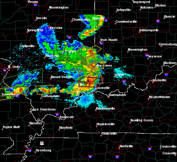 At 629 pm edt, a severe thunderstorm was located near west union, or 14 miles northeast of robinson, moving northeast at 25 mph (radar indicated). Hazards include 60 mph wind gusts and quarter size hail. Hail damage to vehicles is expected. expect wind damage to roofs, siding, and trees. Locations impacted include, york, prairie creek, farmersburg, fairbanks, merom and graysville. At 629 pm edt, a severe thunderstorm was located near west union, or 14 miles northeast of robinson, moving northeast at 25 mph (radar indicated). Hazards include 60 mph wind gusts and quarter size hail. Hail damage to vehicles is expected. expect wind damage to roofs, siding, and trees. Locations impacted include, york, prairie creek, farmersburg, fairbanks, merom and graysville.
|
| 5/11/2016 5:15 PM CDT |
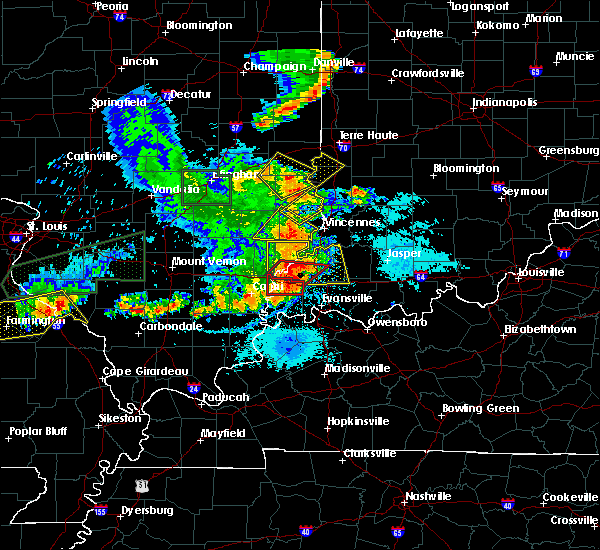 At 614 pm edt, a severe thunderstorm was located over hutsonville, or 8 miles northeast of robinson, moving northeast at 25 mph (radar indicated). Hazards include 60 mph wind gusts and quarter size hail. Hail damage to vehicles is expected. Expect wind damage to roofs, siding, and trees. At 614 pm edt, a severe thunderstorm was located over hutsonville, or 8 miles northeast of robinson, moving northeast at 25 mph (radar indicated). Hazards include 60 mph wind gusts and quarter size hail. Hail damage to vehicles is expected. Expect wind damage to roofs, siding, and trees.
|
| 6/8/2015 12:23 AM EDT | At 1220 am edt, severe thunderstorms were located along a line extending from 8 miles southwest of greencastle to 11 miles northeast of sullivan, and moving southeast at 20 mph (radar indicated). Hazards include 60 mph wind gusts. Expect damage to roofs. siding and trees. locations impacted include, clay city, bowling green, jasonville, dugger, cagles mill lake, vicksburg, cloverdale, coal city, patricksburg and belle union. This includes interstate 70 between mile markers 20 and 47. |
| 6/8/2015 12:09 AM EDT | At 1206 am edt, severe thunderstorms were located along a line extending from 9 miles northeast of brazil to 12 miles south of terre haute, and moving southeast at 20 mph (radar indicated). Hazards include 60 mph wind gusts. Expect damage to roofs. Siding and trees. |
| 6/7/2015 11:52 PM EDT | At 1150 pm edt, a severe thunderstorm was located near terre haute, and moving east at 55 mph (radar indicated). Hazards include 60 mph wind gusts. Expect damage to roofs. Siding and trees. |
| 5/15/2015 7:42 PM EDT | At 741 pm edt, a severe thunderstorm was located 7 miles south of terre haute, and moving northeast at 30 mph (trained weather spotters). Hazards include 60 mph wind gusts. Expect damage to roofs. siding and trees. locations impacted include, riley, cory, saline city and seelyville. this includes interstate 70 between mile markers 10 and 21. 75in. |
| 5/15/2015 7:27 PM EDT | At 725 pm edt, a severe thunderstorm was located 11 miles north of sullivan, and moving northeast at 30 mph (trained weather spotters). Hazards include 60 mph wind gusts. Expect damage to roofs. Siding and trees. |
| 5/15/2015 7:20 PM EDT | 60 mph wind measured ay channel 2 locatio in sullivan county IN, 0.2 miles NNW of Farmersburg, IN |
| 1/1/0001 12:00 AM | Quarter sized hail reported 4 miles ENE of Farmersburg, IN |
Hail Maps for Farmersburg, IN


Connect with Interactive Hail Maps