

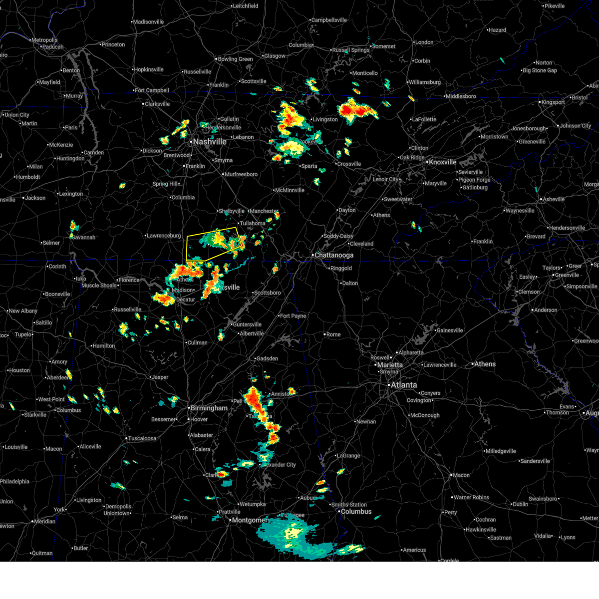
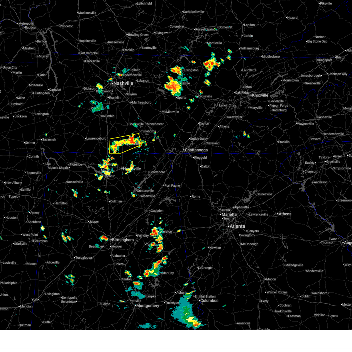
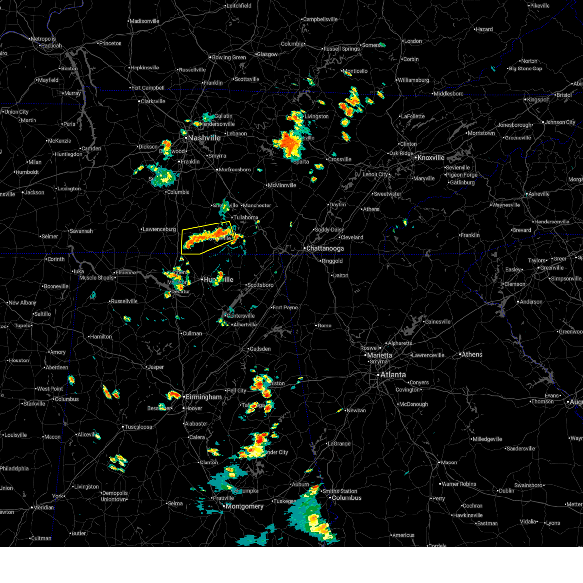
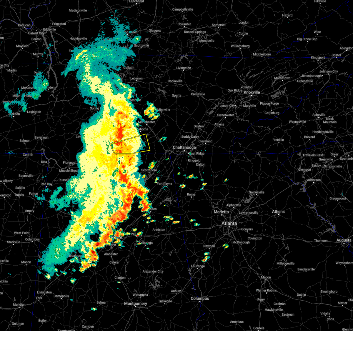
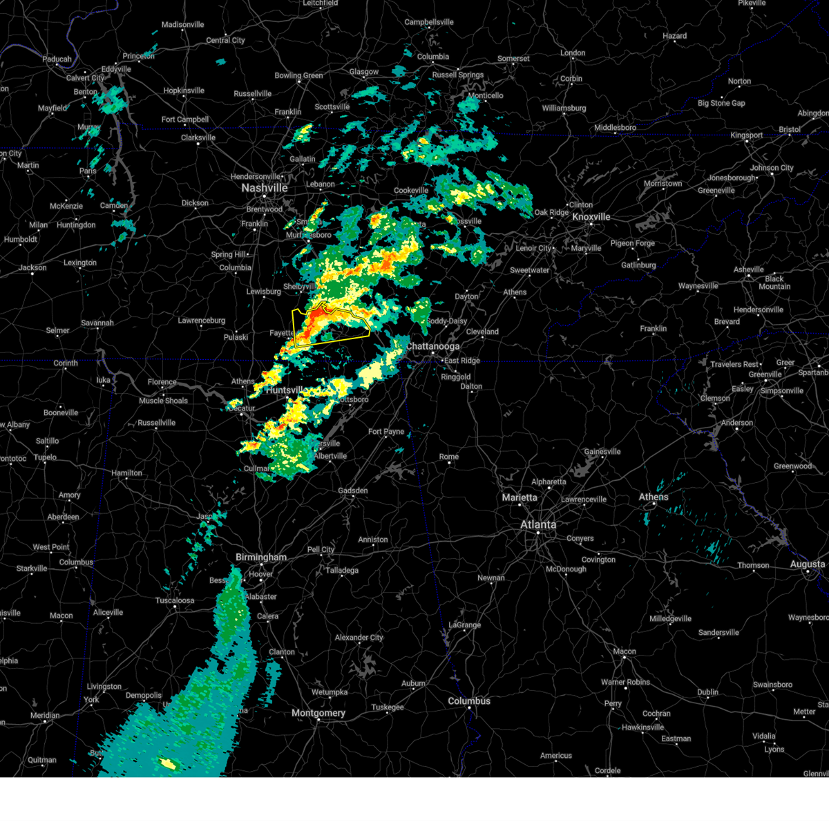
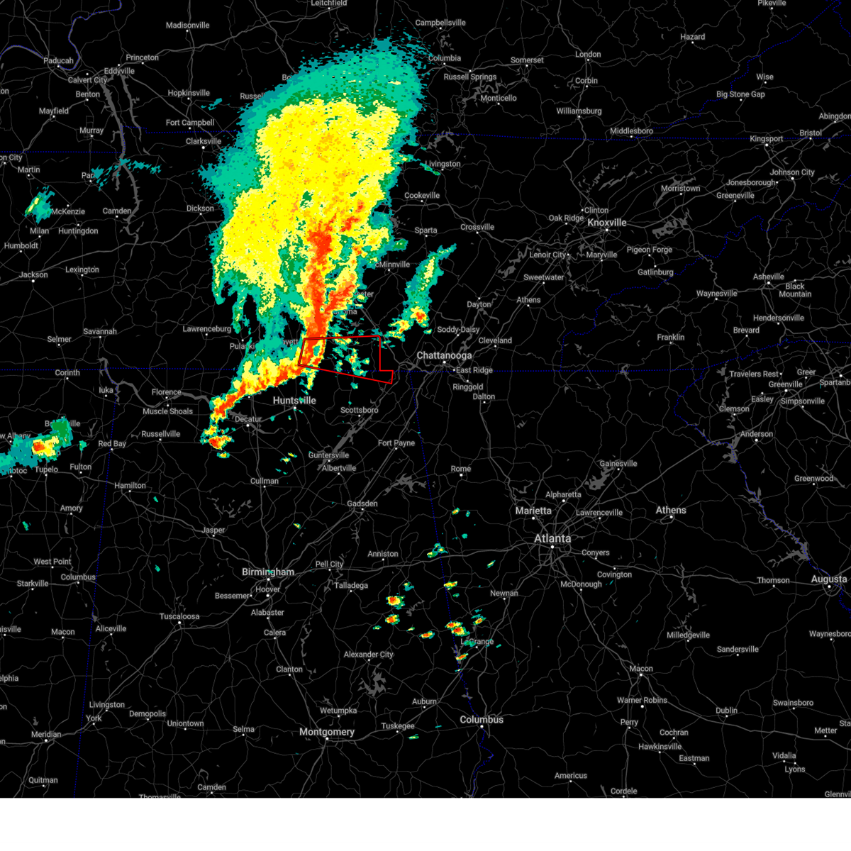
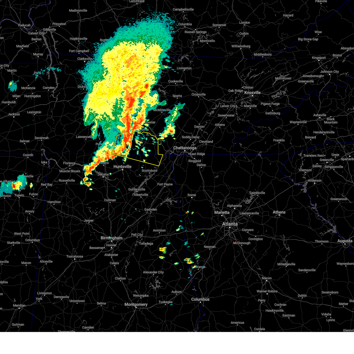
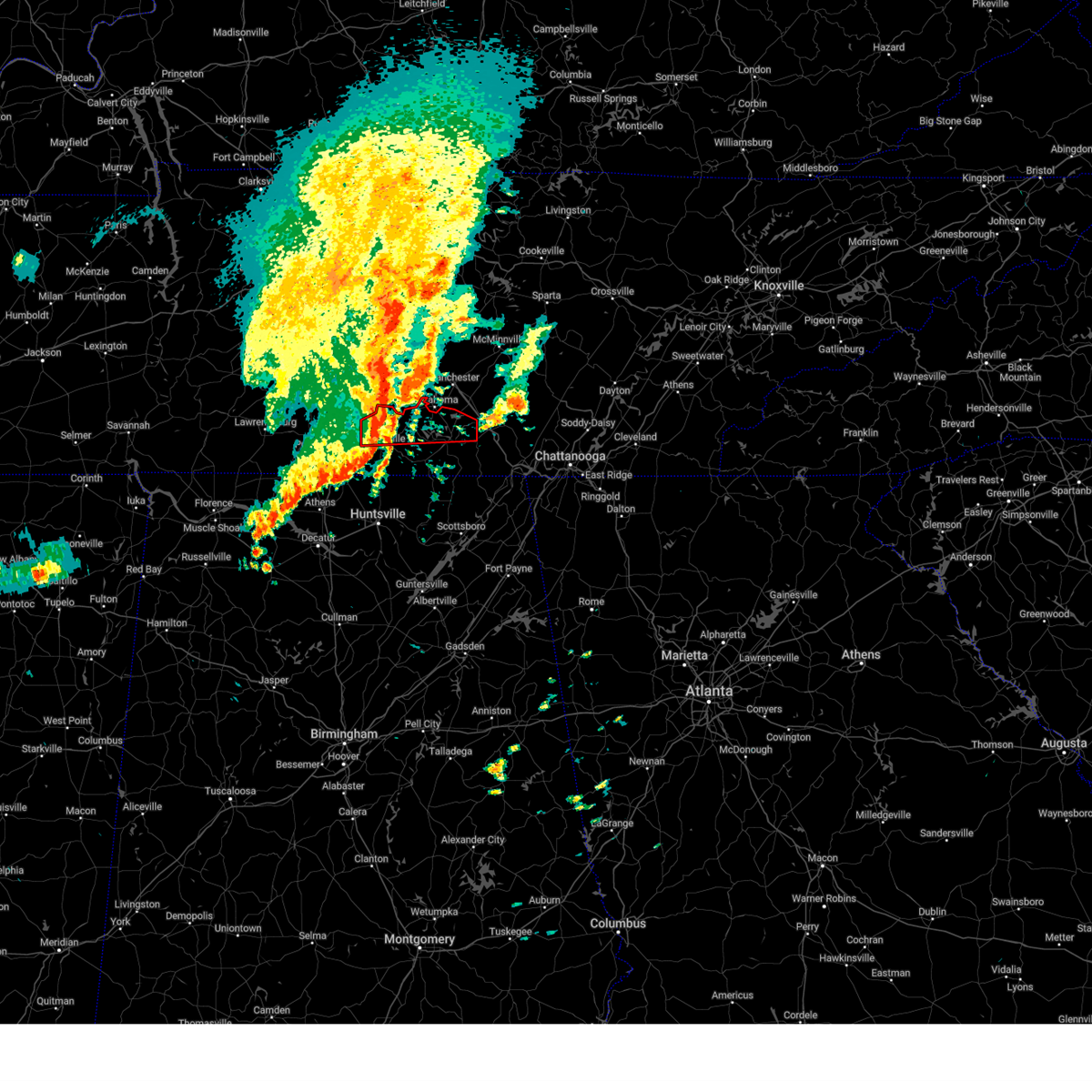
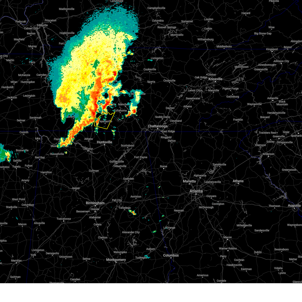
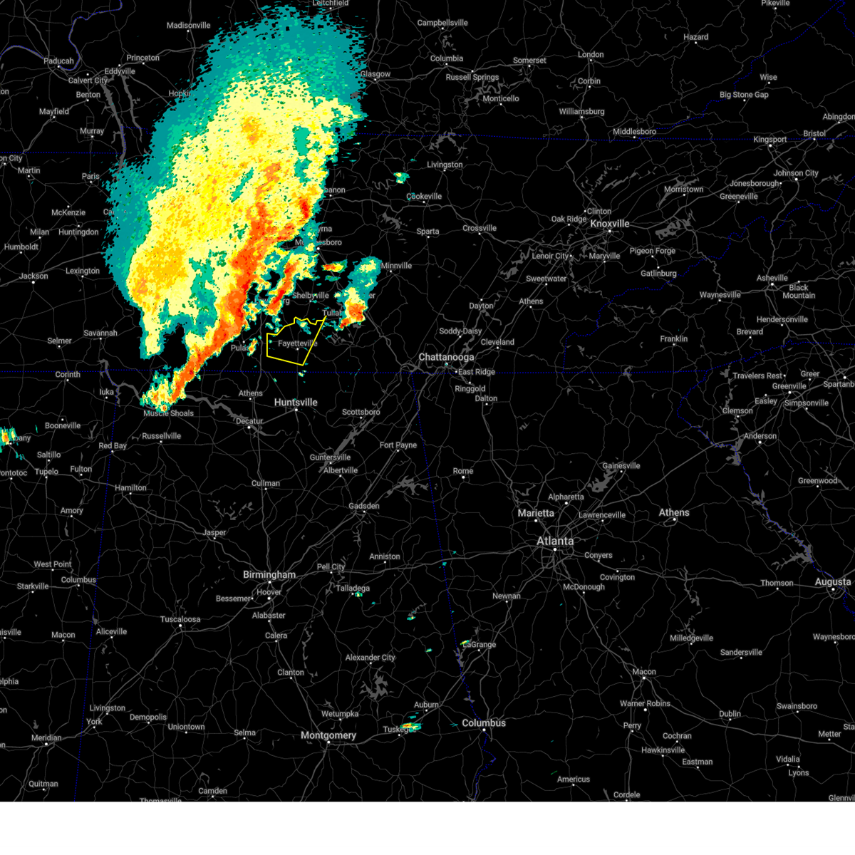
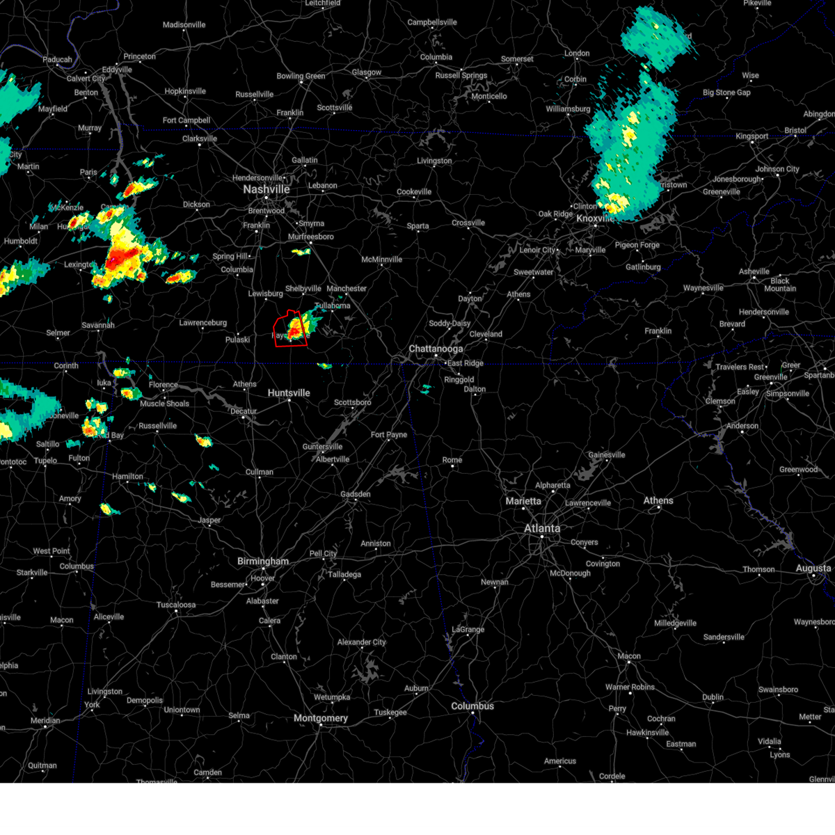
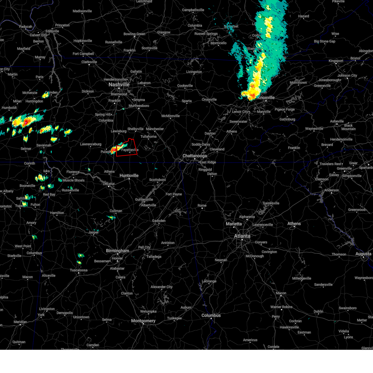
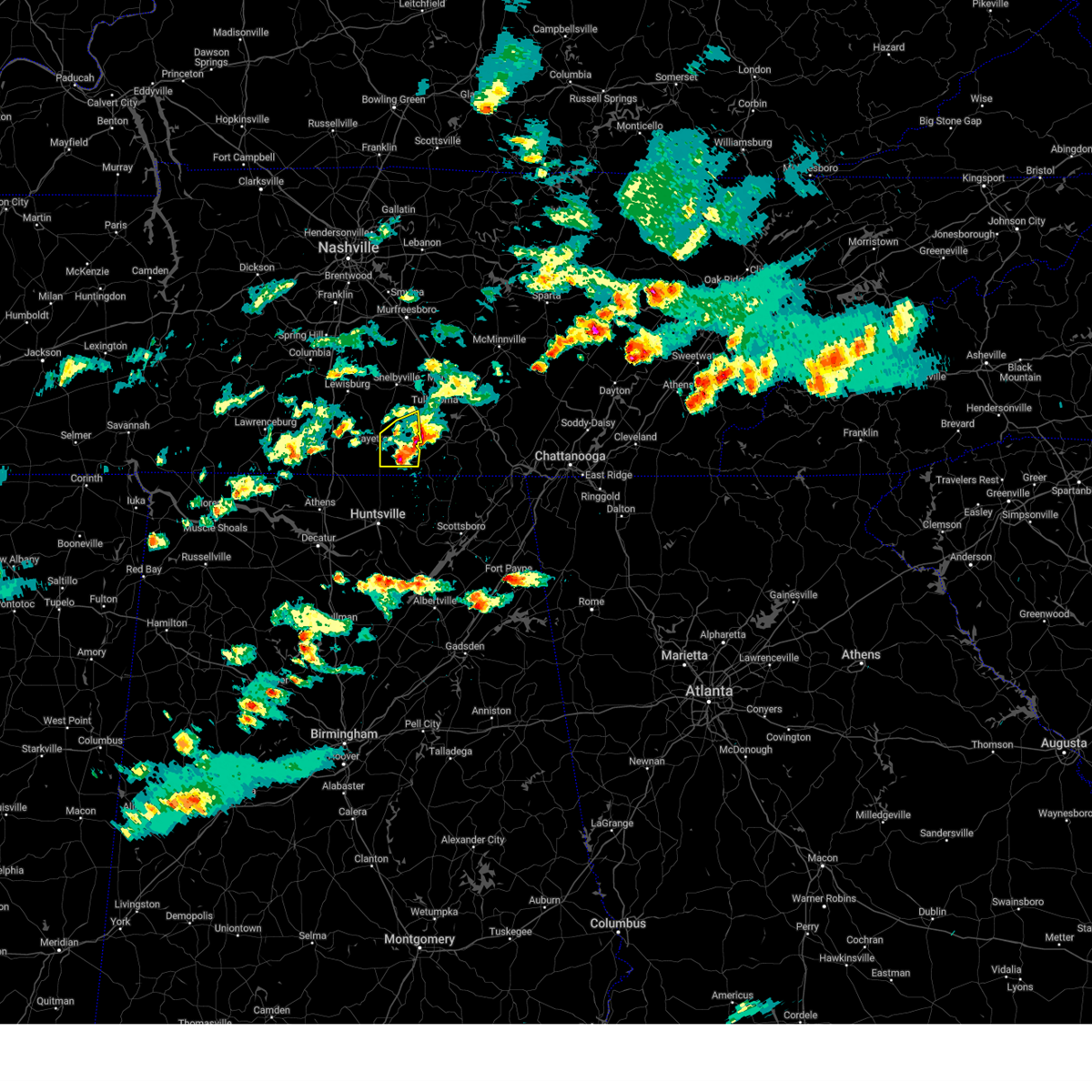
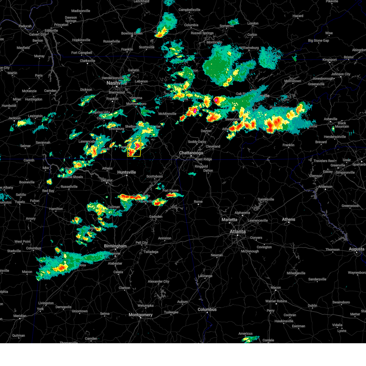
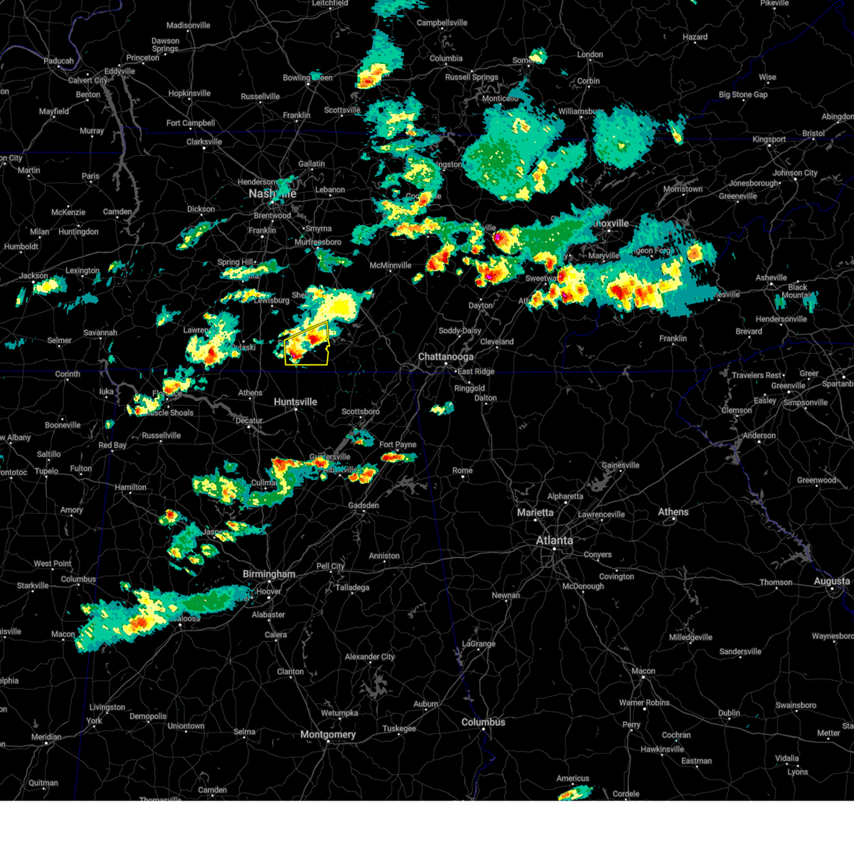
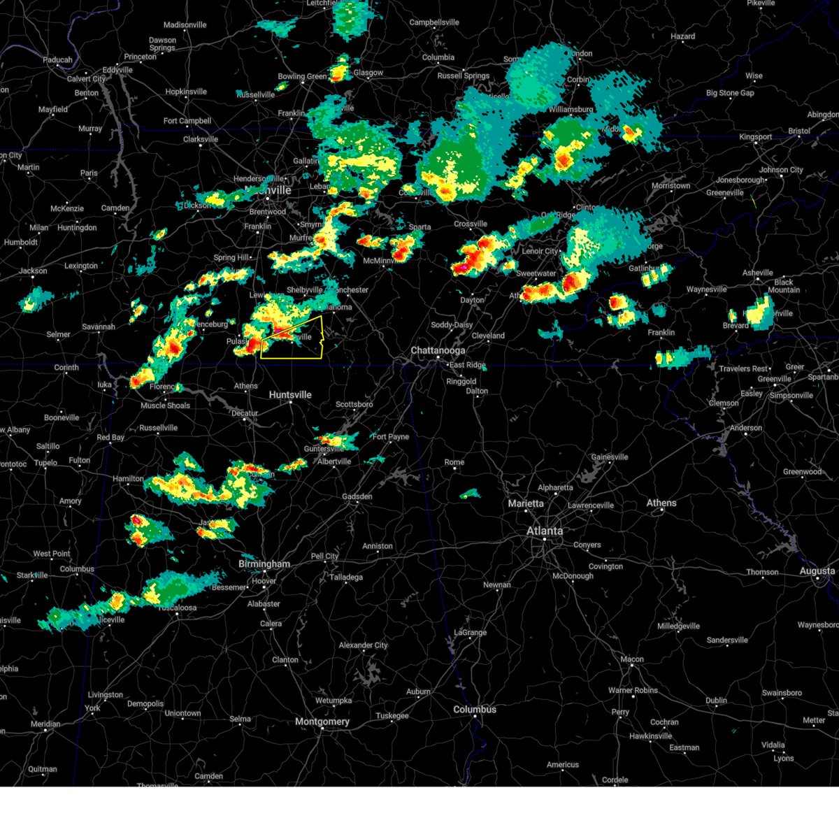
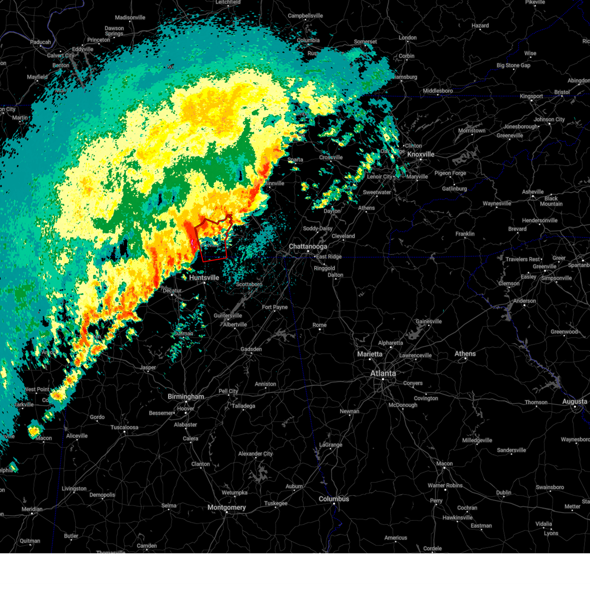
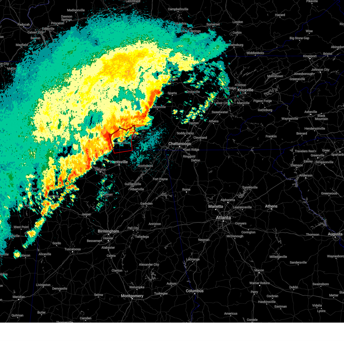
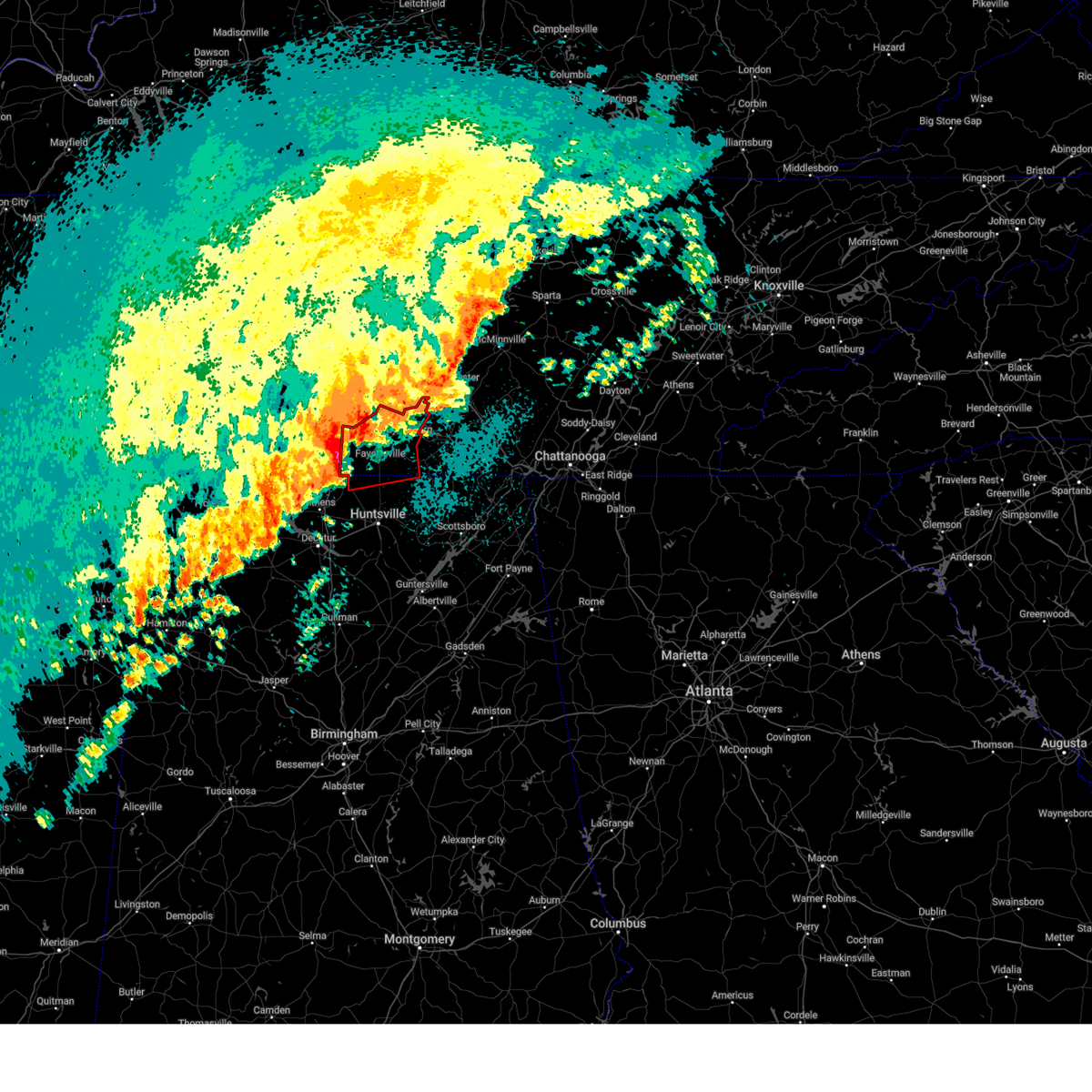
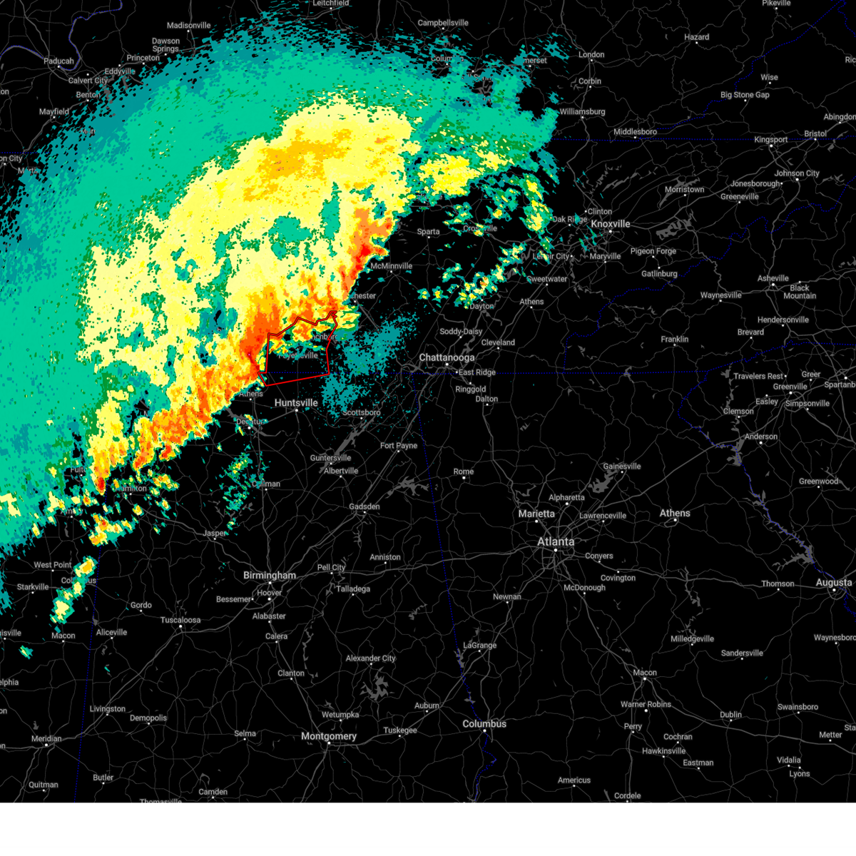
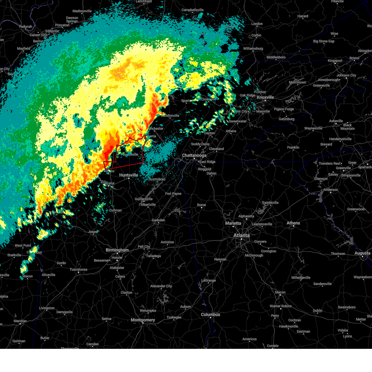
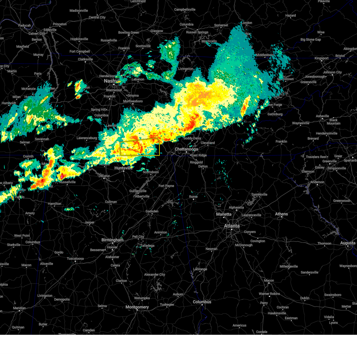
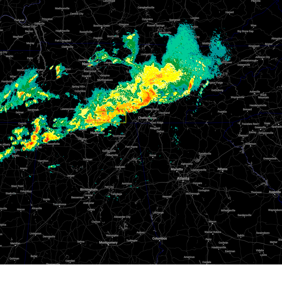
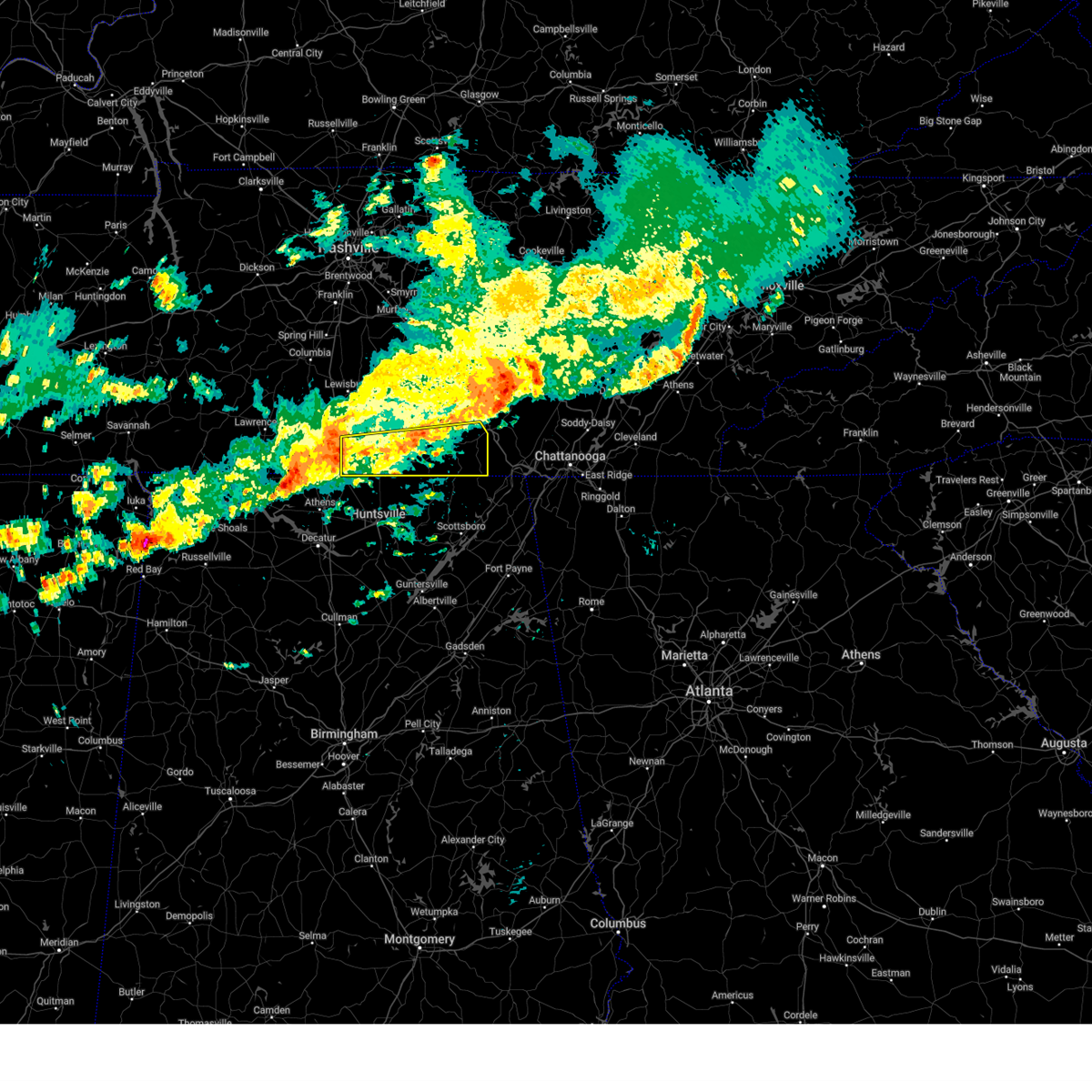
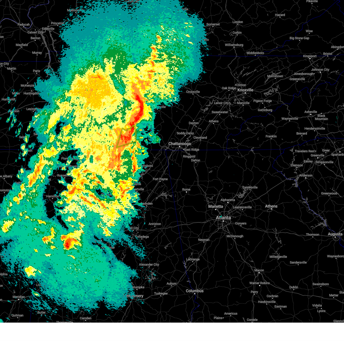
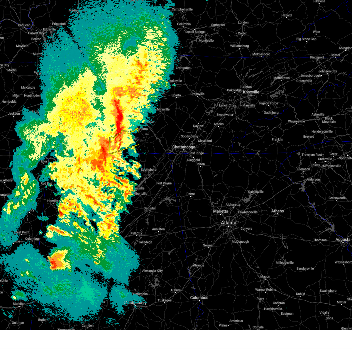
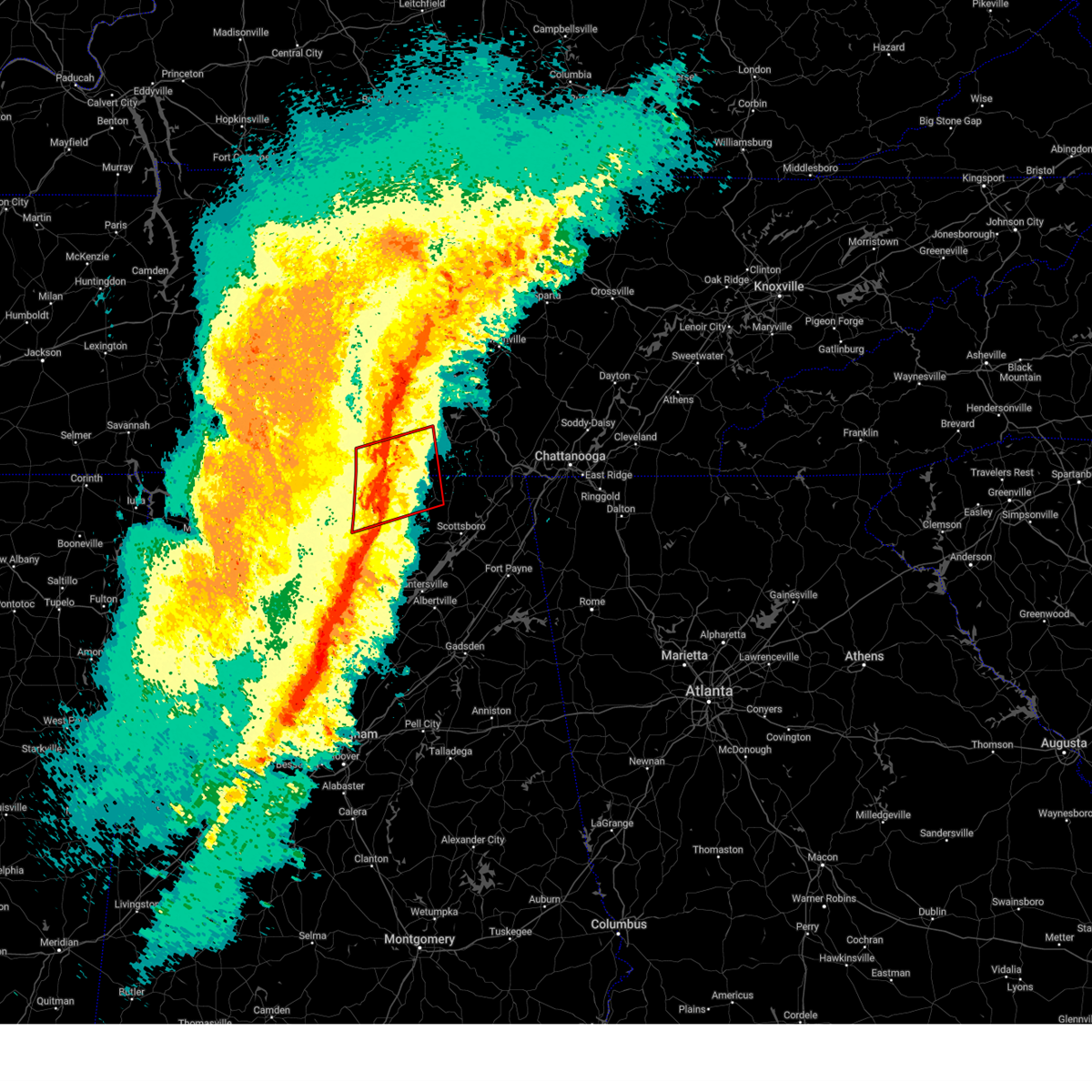
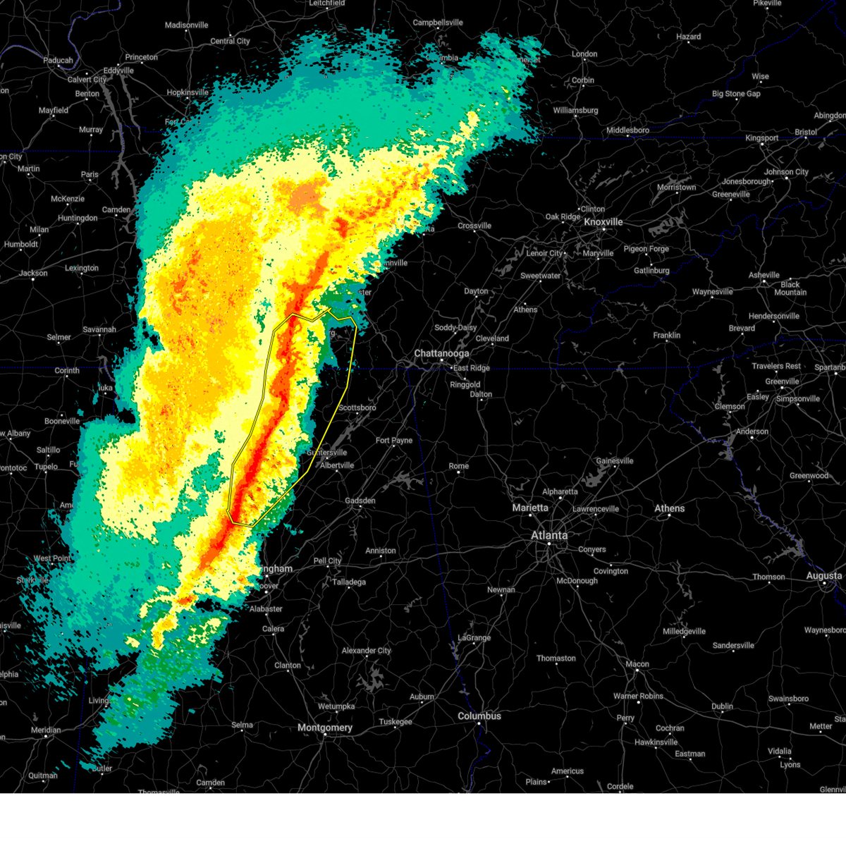
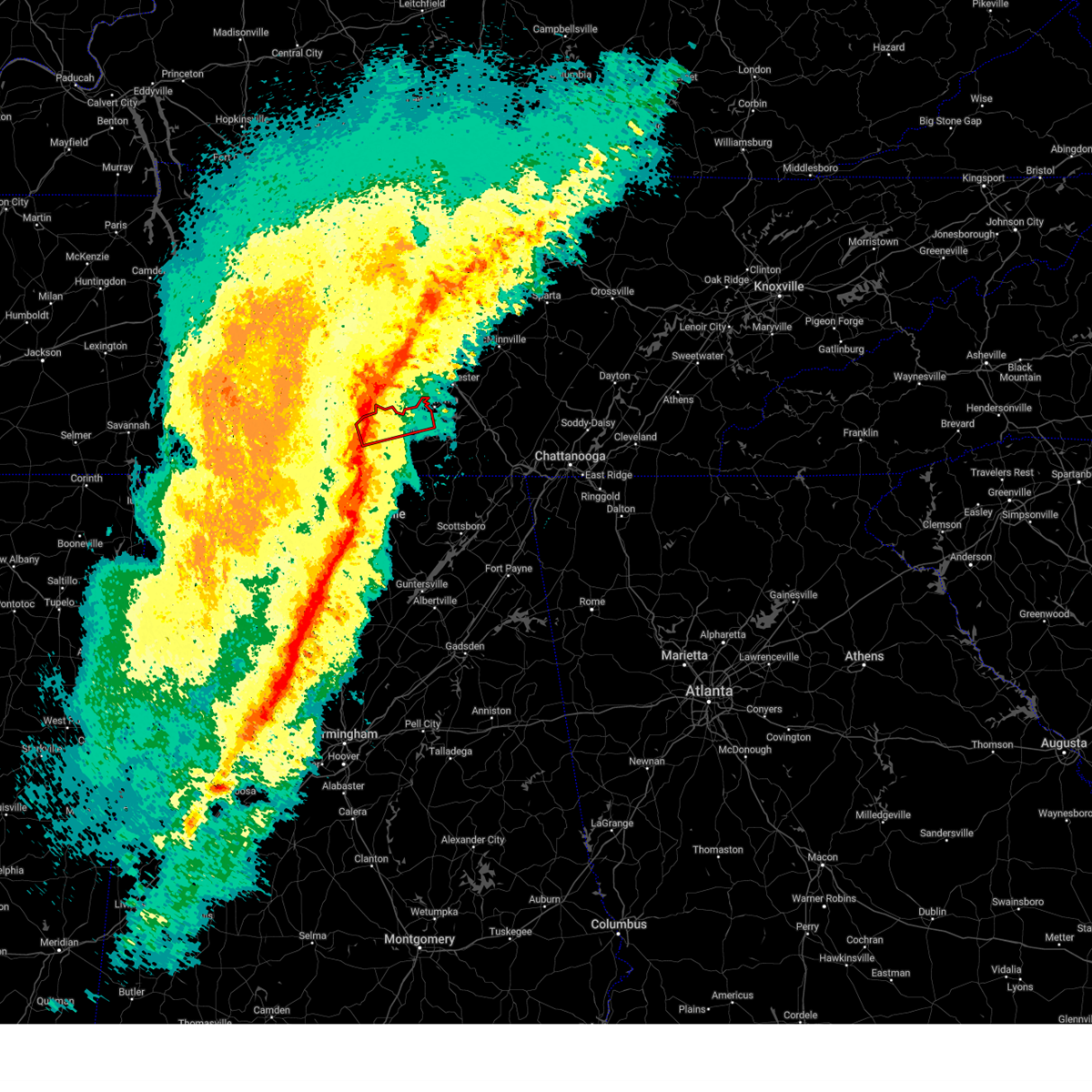
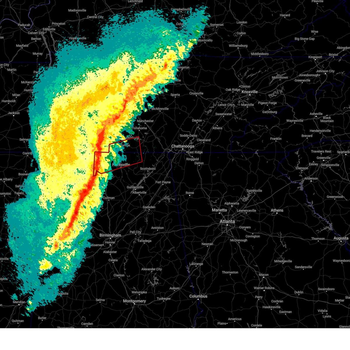
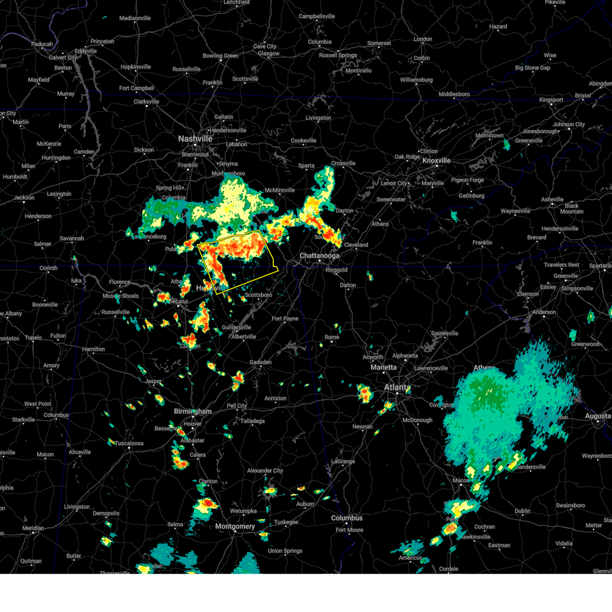
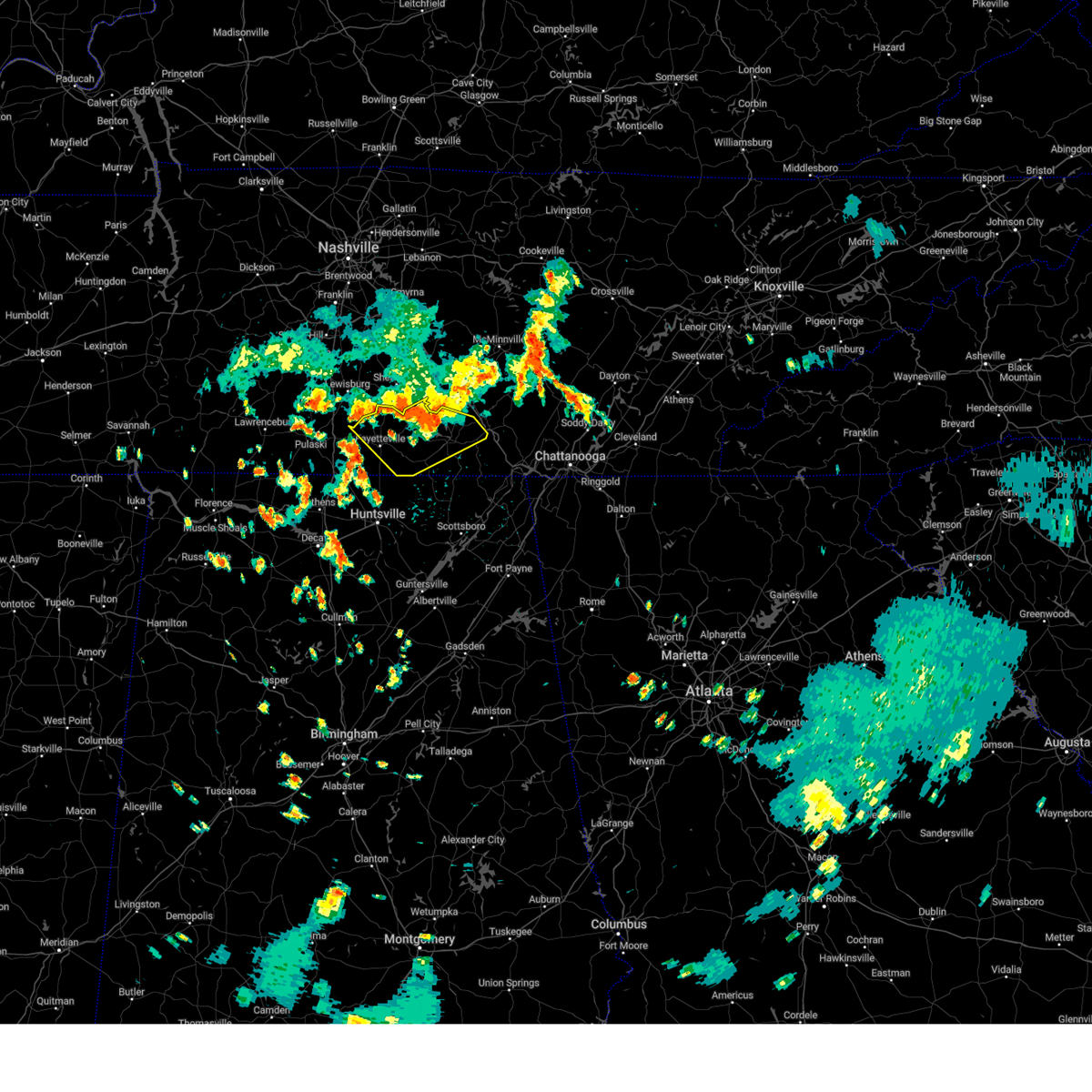
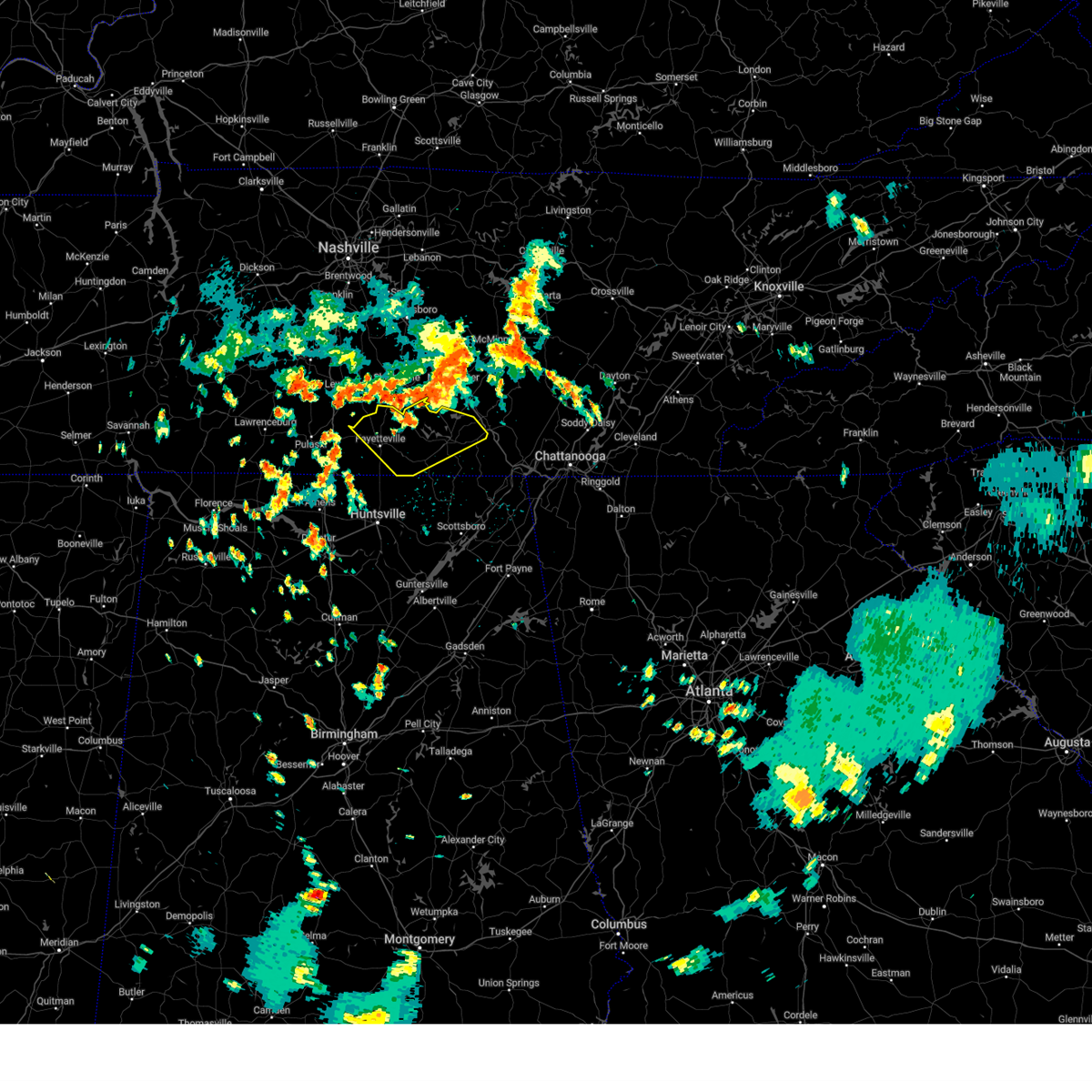
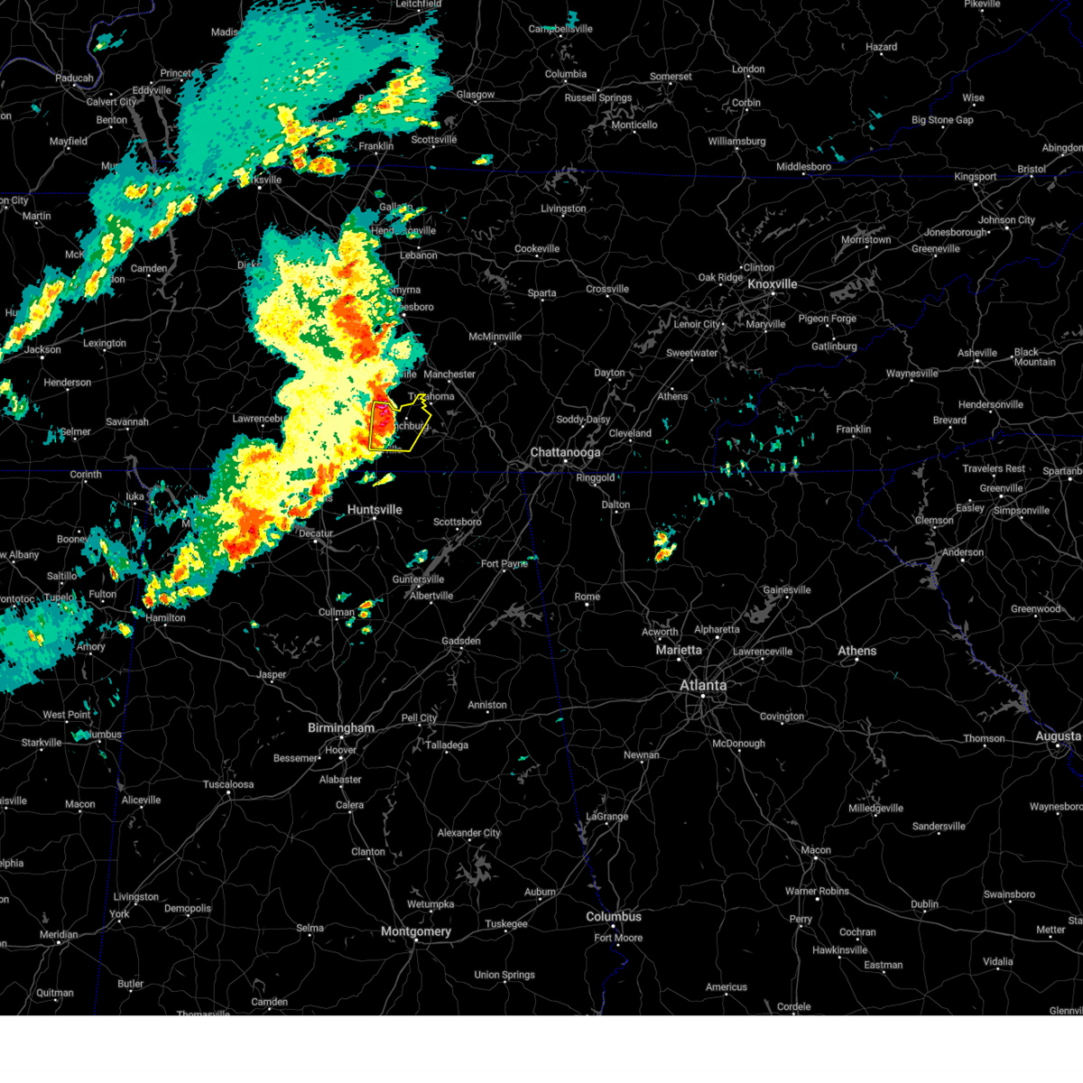
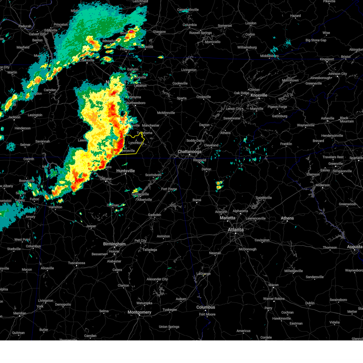
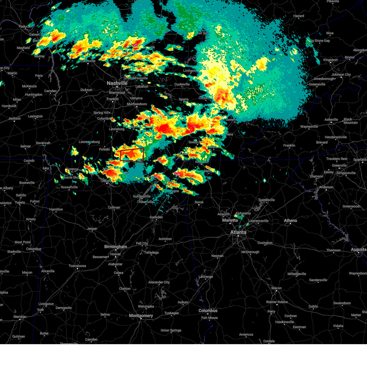
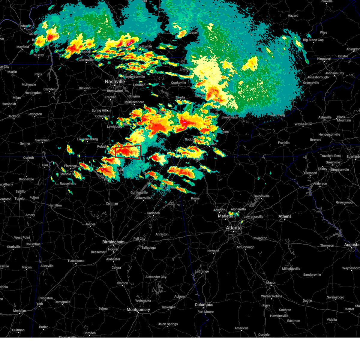
Hail Map for Fayetteville, TN
The Fayetteville, TN area has had 11 reports of on-the-ground hail by trained spotters, and has been under severe weather warnings 62 times during the past 12 months. Doppler radar has detected hail at or near Fayetteville, TN on 63 occasions, including 6 occasions during the past year.
| Name: | Fayetteville, TN |
| Where Located: | 67.7 miles ENE of Florence, AL |
| Map: | Google Map for Fayetteville, TN |
| Population: | 6827 |
| Housing Units: | 3382 |
| More Info: | Search Google for Fayetteville, TN |
1
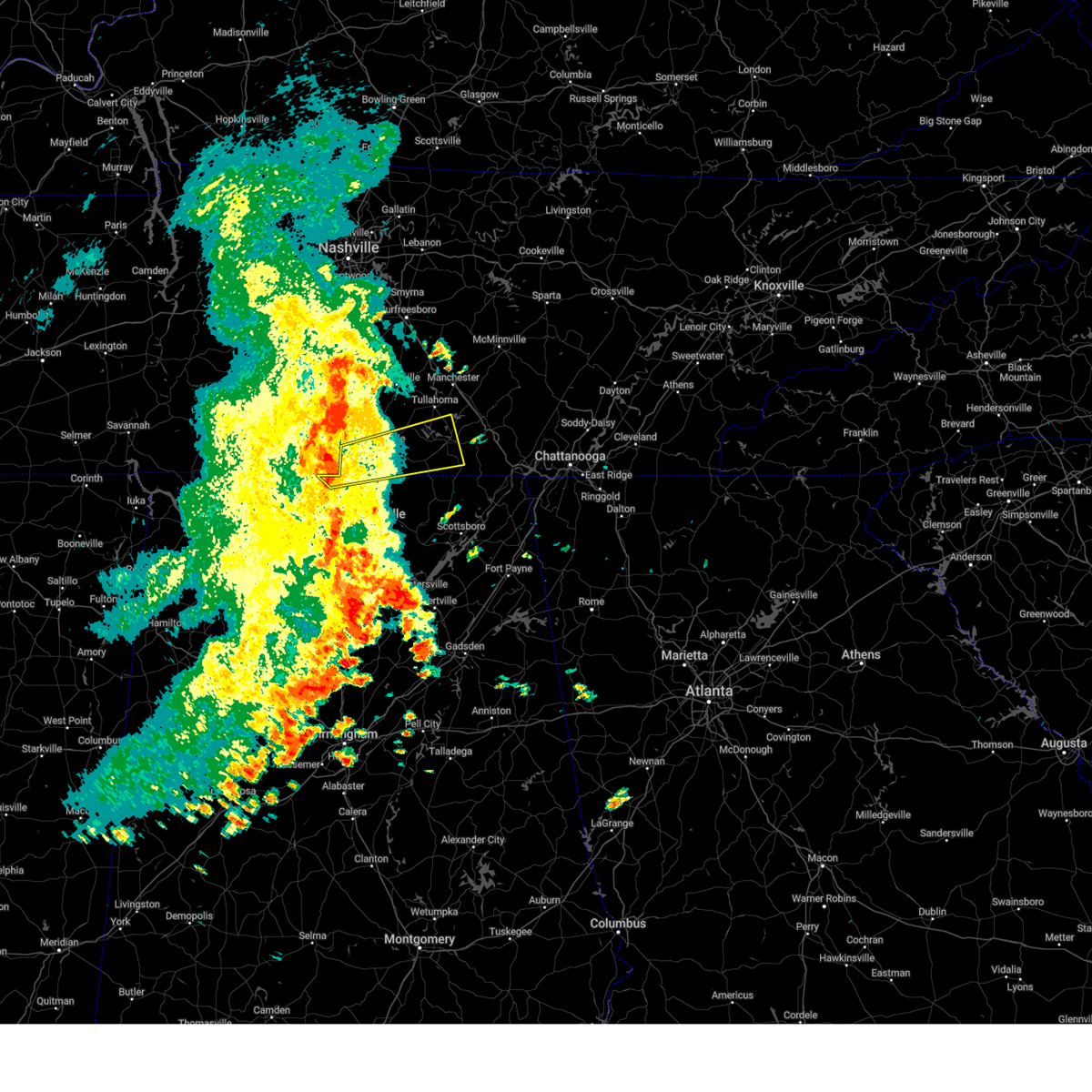
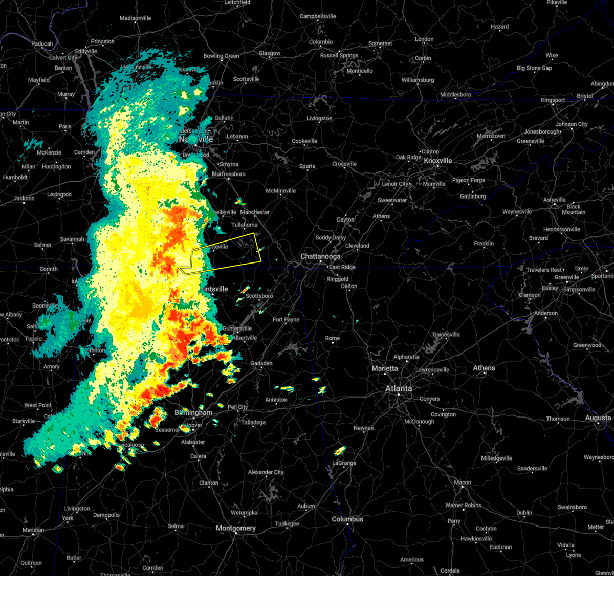
The Top Recent Hail Date for Fayetteville, TN is Thursday, May 8, 2025 (20th out of 63)

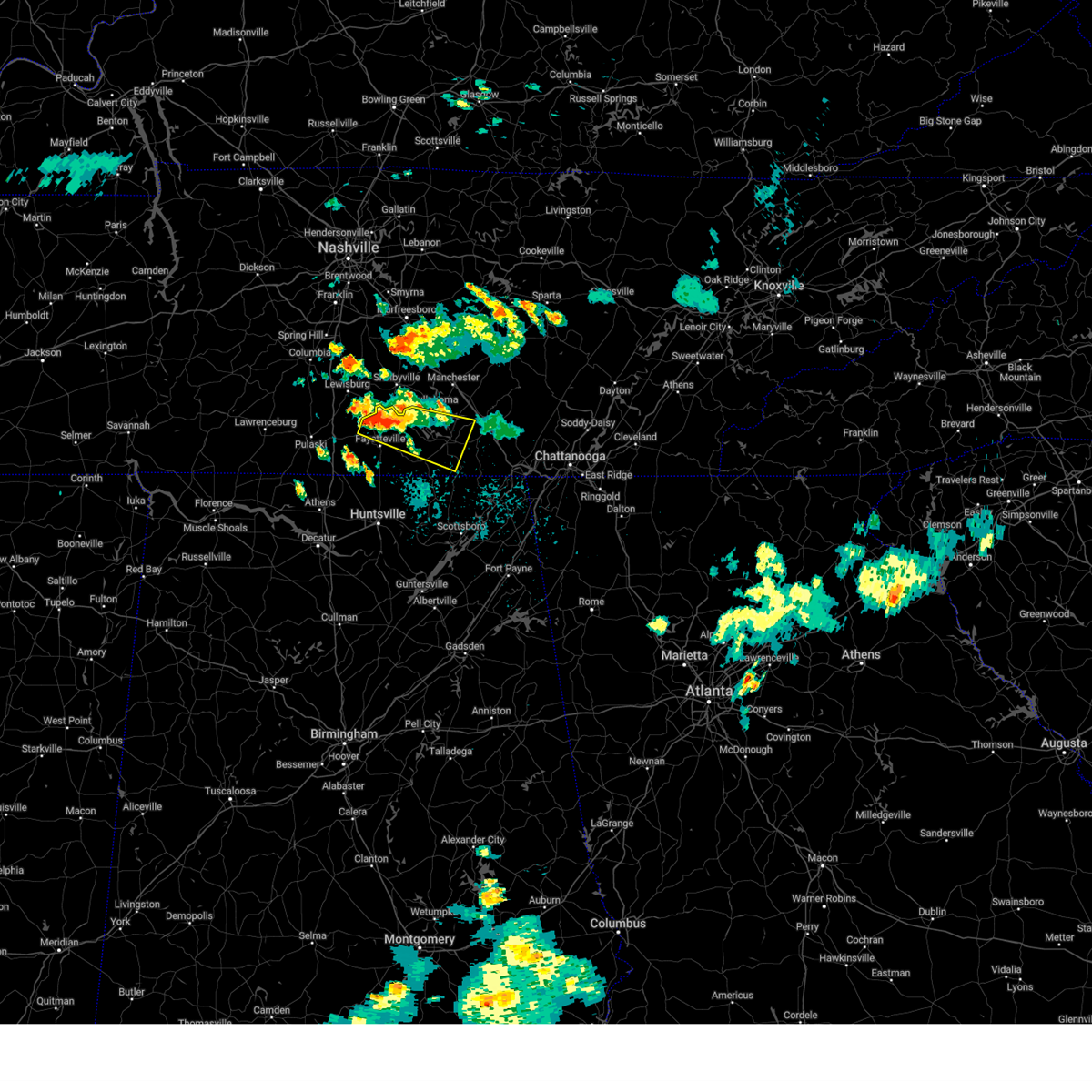
Hail and Wind Damage Spotted near Fayetteville, TN
| Date / Time | Report Details |
|---|---|
| 6/22/2025 4:47 PM CDT |
 the severe thunderstorm warning has been cancelled and is no longer in effect the severe thunderstorm warning has been cancelled and is no longer in effect
|
| 6/22/2025 4:17 PM CDT |
 At 416 pm cdt, a severe thunderstorm was located near lynchburg, moving west at 10 mph (radar indicated). Hazards include 60 mph wind gusts and penny size hail. Expect damage to roofs, siding, and trees. Locations impacted include, fayetteville, lynchburg, ardmore, tims ford lake, howell, hurdlow, mimosa, smithland, coldwater, and blanche. At 416 pm cdt, a severe thunderstorm was located near lynchburg, moving west at 10 mph (radar indicated). Hazards include 60 mph wind gusts and penny size hail. Expect damage to roofs, siding, and trees. Locations impacted include, fayetteville, lynchburg, ardmore, tims ford lake, howell, hurdlow, mimosa, smithland, coldwater, and blanche.
|
| 6/22/2025 4:03 PM CDT |
 Svrhun the national weather service in huntsville alabama has issued a * severe thunderstorm warning for, southeastern moore county in middle tennessee, lincoln county in middle tennessee, northwestern franklin county in middle tennessee, * until 500 pm cdt. * at 403 pm cdt, a severe thunderstorm was located near lynchburg, moving west at 15 mph (radar indicated). Hazards include 60 mph wind gusts and penny size hail. expect damage to roofs, siding, and trees Svrhun the national weather service in huntsville alabama has issued a * severe thunderstorm warning for, southeastern moore county in middle tennessee, lincoln county in middle tennessee, northwestern franklin county in middle tennessee, * until 500 pm cdt. * at 403 pm cdt, a severe thunderstorm was located near lynchburg, moving west at 15 mph (radar indicated). Hazards include 60 mph wind gusts and penny size hail. expect damage to roofs, siding, and trees
|
| 6/7/2025 2:31 PM CDT |
 At 230 pm cdt, a severe thunderstorm was located near fayetteville, moving east at 55 mph (radar indicated). Hazards include 70 mph wind gusts. Expect considerable tree damage. damage is likely to mobile homes, roofs, and outbuildings. Locations impacted include, winchester, fayetteville, decherd, estill springs, huntland, tims ford lake, lincoln, elora, hurdlow, and maxwell. At 230 pm cdt, a severe thunderstorm was located near fayetteville, moving east at 55 mph (radar indicated). Hazards include 70 mph wind gusts. Expect considerable tree damage. damage is likely to mobile homes, roofs, and outbuildings. Locations impacted include, winchester, fayetteville, decherd, estill springs, huntland, tims ford lake, lincoln, elora, hurdlow, and maxwell.
|
| 6/7/2025 2:31 PM CDT |
 the severe thunderstorm warning has been cancelled and is no longer in effect the severe thunderstorm warning has been cancelled and is no longer in effect
|
| 6/7/2025 2:13 PM CDT |
 At 213 pm cdt, a severe thunderstorm was located near ardmore, or 15 miles southeast of pulaski, moving east at 55 mph (radar indicated). Hazards include 70 mph wind gusts. Expect considerable tree damage. damage is likely to mobile homes, roofs, and outbuildings. Locations impacted include, winchester, fayetteville, decherd, estill springs, ardmore, huntland, tims ford lake, lincoln, elkwood, and elora. At 213 pm cdt, a severe thunderstorm was located near ardmore, or 15 miles southeast of pulaski, moving east at 55 mph (radar indicated). Hazards include 70 mph wind gusts. Expect considerable tree damage. damage is likely to mobile homes, roofs, and outbuildings. Locations impacted include, winchester, fayetteville, decherd, estill springs, ardmore, huntland, tims ford lake, lincoln, elkwood, and elora.
|
| 6/7/2025 2:03 PM CDT |
 Svrhun the national weather service in huntsville alabama has issued a * severe thunderstorm warning for, northwestern madison county in north central alabama, northeastern limestone county in north central alabama, southeastern moore county in middle tennessee, lincoln county in middle tennessee, western franklin county in middle tennessee, * until 300 pm cdt. * at 203 pm cdt, a severe thunderstorm was located 9 miles west of ardmore, or 12 miles south of pulaski, moving east at 55 mph (radar indicated). Hazards include 60 mph wind gusts. expect damage to roofs, siding, and trees Svrhun the national weather service in huntsville alabama has issued a * severe thunderstorm warning for, northwestern madison county in north central alabama, northeastern limestone county in north central alabama, southeastern moore county in middle tennessee, lincoln county in middle tennessee, western franklin county in middle tennessee, * until 300 pm cdt. * at 203 pm cdt, a severe thunderstorm was located 9 miles west of ardmore, or 12 miles south of pulaski, moving east at 55 mph (radar indicated). Hazards include 60 mph wind gusts. expect damage to roofs, siding, and trees
|
| 6/6/2025 10:04 PM CDT |
 the tornado warning has been cancelled and is no longer in effect the tornado warning has been cancelled and is no longer in effect
|
| 6/6/2025 10:02 PM CDT |
 Svrhun the national weather service in huntsville alabama has issued a * severe thunderstorm warning for, moore county in middle tennessee, central lincoln county in middle tennessee, central franklin county in middle tennessee, * until 1100 pm cdt. * at 1002 pm cdt, a severe thunderstorm was located near lynchburg, moving east at 40 mph (radar indicated). Hazards include 60 mph wind gusts and quarter size hail. Hail damage to vehicles is expected. Expect wind damage to roofs, siding, and trees. Svrhun the national weather service in huntsville alabama has issued a * severe thunderstorm warning for, moore county in middle tennessee, central lincoln county in middle tennessee, central franklin county in middle tennessee, * until 1100 pm cdt. * at 1002 pm cdt, a severe thunderstorm was located near lynchburg, moving east at 40 mph (radar indicated). Hazards include 60 mph wind gusts and quarter size hail. Hail damage to vehicles is expected. Expect wind damage to roofs, siding, and trees.
|
| 6/6/2025 9:42 PM CDT |
 Torhun the national weather service in huntsville alabama has issued a * tornado warning for, west central moore county in middle tennessee, northern lincoln county in middle tennessee, * until 1030 pm cdt. * at 942 pm cdt, a severe thunderstorm capable of producing a tornado was located near petersburg, or 12 miles northwest of fayetteville, moving east at 20 mph (radar indicated rotation). Hazards include tornado. Flying debris will be dangerous to those caught without shelter. mobile homes will be damaged or destroyed. damage to roofs, windows, and vehicles will occur. tree damage is likely. this dangerous storm will be near, petersburg around 950 pm cdt. Other locations impacted by this tornadic thunderstorm include belleville, mulberry, chestnut ridge, mimosa, booneville, and howell. Torhun the national weather service in huntsville alabama has issued a * tornado warning for, west central moore county in middle tennessee, northern lincoln county in middle tennessee, * until 1030 pm cdt. * at 942 pm cdt, a severe thunderstorm capable of producing a tornado was located near petersburg, or 12 miles northwest of fayetteville, moving east at 20 mph (radar indicated rotation). Hazards include tornado. Flying debris will be dangerous to those caught without shelter. mobile homes will be damaged or destroyed. damage to roofs, windows, and vehicles will occur. tree damage is likely. this dangerous storm will be near, petersburg around 950 pm cdt. Other locations impacted by this tornadic thunderstorm include belleville, mulberry, chestnut ridge, mimosa, booneville, and howell.
|
| 6/6/2025 9:22 PM CDT | Svrhun the national weather service in huntsville alabama has issued a * severe thunderstorm warning for, northwestern moore county in middle tennessee, northern lincoln county in middle tennessee, * until 1000 pm cdt. * at 922 pm cdt, a severe thunderstorm was located 8 miles south of lewisburg, moving east at 25 mph (radar indicated). Hazards include 60 mph wind gusts and penny size hail. expect damage to roofs, siding, and trees |
| 6/6/2025 3:17 PM CDT | the severe thunderstorm warning has been cancelled and is no longer in effect |
| 6/6/2025 3:04 PM CDT | Svrhun the national weather service in huntsville alabama has issued a * severe thunderstorm warning for, northwestern madison county in north central alabama, northeastern limestone county in north central alabama, southwestern lincoln county in middle tennessee, * until 400 pm cdt. * at 303 pm cdt, a severe thunderstorm was located 7 miles southwest of ardmore, or 8 miles north of athens, moving east at 30 mph. this storm has a history of producing wind damage and power outages (radar indicated). Hazards include 60 mph wind gusts and penny size hail. expect damage to roofs, siding, and trees |
| 5/27/2025 8:20 PM CDT |
 Svrhun the national weather service in huntsville alabama has issued a * severe thunderstorm warning for, moore county in middle tennessee, northeastern lincoln county in middle tennessee, northern franklin county in middle tennessee, * until 915 pm cdt. * at 819 pm cdt, a severe thunderstorm was located over lynchburg, moving east at 10 mph (radar indicated). Hazards include 60 mph wind gusts. expect damage to roofs, siding, and trees Svrhun the national weather service in huntsville alabama has issued a * severe thunderstorm warning for, moore county in middle tennessee, northeastern lincoln county in middle tennessee, northern franklin county in middle tennessee, * until 915 pm cdt. * at 819 pm cdt, a severe thunderstorm was located over lynchburg, moving east at 10 mph (radar indicated). Hazards include 60 mph wind gusts. expect damage to roofs, siding, and trees
|
| 5/25/2025 3:54 PM CDT |
 Torhun the national weather service in huntsville alabama has issued a * tornado warning for, north central jackson county in northeastern alabama, southeastern moore county in middle tennessee, southeastern lincoln county in middle tennessee, franklin county in middle tennessee, * until 445 pm cdt. * at 354 pm cdt, a severe thunderstorm capable of producing a tornado was located 9 miles east of fayetteville, moving east at 50 mph (radar indicated rotation). Hazards include tornado. Flying debris will be dangerous to those caught without shelter. mobile homes will be damaged or destroyed. damage to roofs, windows, and vehicles will occur. tree damage is likely. this dangerous storm will be near, winchester around 410 pm cdt. cowan around 415 pm cdt. sewanee around 425 pm cdt. other locations impacted by this tornadic thunderstorm include lexie crossroads, bass, mulberry, harmony, jericho, russell cave national monument, elora, hurdlow, maxwell, and st. Andrews. Torhun the national weather service in huntsville alabama has issued a * tornado warning for, north central jackson county in northeastern alabama, southeastern moore county in middle tennessee, southeastern lincoln county in middle tennessee, franklin county in middle tennessee, * until 445 pm cdt. * at 354 pm cdt, a severe thunderstorm capable of producing a tornado was located 9 miles east of fayetteville, moving east at 50 mph (radar indicated rotation). Hazards include tornado. Flying debris will be dangerous to those caught without shelter. mobile homes will be damaged or destroyed. damage to roofs, windows, and vehicles will occur. tree damage is likely. this dangerous storm will be near, winchester around 410 pm cdt. cowan around 415 pm cdt. sewanee around 425 pm cdt. other locations impacted by this tornadic thunderstorm include lexie crossroads, bass, mulberry, harmony, jericho, russell cave national monument, elora, hurdlow, maxwell, and st. Andrews.
|
| 5/25/2025 3:50 PM CDT | Tspotter report of trees down near mt. herman road and hawthorne hill road - southern bedford c in bedford county TN, 15.1 miles SSW of Fayetteville, TN |
| 5/25/2025 3:45 PM CDT |
 Svrhun the national weather service in huntsville alabama has issued a * severe thunderstorm warning for, northwestern jackson county in northeastern alabama, northeastern madison county in north central alabama, moore county in middle tennessee, lincoln county in middle tennessee, franklin county in middle tennessee, * until 445 pm cdt. * at 345 pm cdt, a severe thunderstorm was located near fayetteville, moving east at 45 mph (radar indicated). Hazards include 70 mph wind gusts and penny size hail. Expect considerable tree damage. Damage is likely to mobile homes, roofs, and outbuildings. Svrhun the national weather service in huntsville alabama has issued a * severe thunderstorm warning for, northwestern jackson county in northeastern alabama, northeastern madison county in north central alabama, moore county in middle tennessee, lincoln county in middle tennessee, franklin county in middle tennessee, * until 445 pm cdt. * at 345 pm cdt, a severe thunderstorm was located near fayetteville, moving east at 45 mph (radar indicated). Hazards include 70 mph wind gusts and penny size hail. Expect considerable tree damage. Damage is likely to mobile homes, roofs, and outbuildings.
|
| 5/25/2025 3:41 PM CDT |
 Torhun the national weather service in huntsville alabama has issued a * tornado warning for, moore county in middle tennessee, central lincoln county in middle tennessee, northern franklin county in middle tennessee, * until 430 pm cdt. * at 341 pm cdt, a severe thunderstorm capable of producing a tornado was located near fayetteville, moving east at 45 mph (radar indicated rotation). Hazards include tornado. Flying debris will be dangerous to those caught without shelter. mobile homes will be damaged or destroyed. damage to roofs, windows, and vehicles will occur. tree damage is likely. this dangerous storm will be near, lynchburg around 350 pm cdt. tims ford lake around 400 pm cdt. estill springs around 410 pm cdt. winchester and decherd around 415 pm cdt. Other locations impacted by this tornadic thunderstorm include mulberry, chestnut ridge, howell, harmony, belleville, hurdlow, lois, mimosa, booneville, and marble hill. Torhun the national weather service in huntsville alabama has issued a * tornado warning for, moore county in middle tennessee, central lincoln county in middle tennessee, northern franklin county in middle tennessee, * until 430 pm cdt. * at 341 pm cdt, a severe thunderstorm capable of producing a tornado was located near fayetteville, moving east at 45 mph (radar indicated rotation). Hazards include tornado. Flying debris will be dangerous to those caught without shelter. mobile homes will be damaged or destroyed. damage to roofs, windows, and vehicles will occur. tree damage is likely. this dangerous storm will be near, lynchburg around 350 pm cdt. tims ford lake around 400 pm cdt. estill springs around 410 pm cdt. winchester and decherd around 415 pm cdt. Other locations impacted by this tornadic thunderstorm include mulberry, chestnut ridge, howell, harmony, belleville, hurdlow, lois, mimosa, booneville, and marble hill.
|
| 5/25/2025 3:28 PM CDT |
 At 328 pm cdt, a severe thunderstorm was located 8 miles west of petersburg, moving east at 50 mph (radar indicated). Hazards include 70 mph wind gusts and penny size hail. Expect considerable tree damage. damage is likely to mobile homes, roofs, and outbuildings. Locations impacted include, mulberry, fayetteville, chestnut ridge, howell, belleville, dellrose, mimosa, booneville, skinem, and petersburg. At 328 pm cdt, a severe thunderstorm was located 8 miles west of petersburg, moving east at 50 mph (radar indicated). Hazards include 70 mph wind gusts and penny size hail. Expect considerable tree damage. damage is likely to mobile homes, roofs, and outbuildings. Locations impacted include, mulberry, fayetteville, chestnut ridge, howell, belleville, dellrose, mimosa, booneville, skinem, and petersburg.
|
| 5/25/2025 3:11 PM CDT |
 Svrhun the national weather service in huntsville alabama has issued a * severe thunderstorm warning for, northwestern moore county in middle tennessee, central lincoln county in middle tennessee, * until 345 pm cdt. * at 310 pm cdt, a severe thunderstorm was located 9 miles north of pulaski, moving east at 50 mph (radar indicated). Hazards include 60 mph wind gusts and penny size hail. expect damage to roofs, siding, and trees Svrhun the national weather service in huntsville alabama has issued a * severe thunderstorm warning for, northwestern moore county in middle tennessee, central lincoln county in middle tennessee, * until 345 pm cdt. * at 310 pm cdt, a severe thunderstorm was located 9 miles north of pulaski, moving east at 50 mph (radar indicated). Hazards include 60 mph wind gusts and penny size hail. expect damage to roofs, siding, and trees
|
| 5/20/2025 2:56 PM CDT |
 The tornado warning that was previously in effect has been reissued for franklin and moore counties and is in effect until 345 pm. please refer to that bulletin for the latest severe weather information. a tornado watch remains in effect until 1000 pm cdt for north central and northeastern alabama, and middle tennessee. The tornado warning that was previously in effect has been reissued for franklin and moore counties and is in effect until 345 pm. please refer to that bulletin for the latest severe weather information. a tornado watch remains in effect until 1000 pm cdt for north central and northeastern alabama, and middle tennessee.
|
| 5/20/2025 2:55 PM CDT | Torhun the national weather service in huntsville alabama has issued a * tornado warning for, moore county in middle tennessee, northeastern lincoln county in middle tennessee, northwestern franklin county in middle tennessee, * until 345 pm cdt. * at 255 pm cdt, a severe thunderstorm capable of producing a tornado was located over fayetteville, moving east at 30 mph (radar indicated rotation). Hazards include tornado. Flying debris will be dangerous to those caught without shelter. mobile homes will be damaged or destroyed. damage to roofs, windows, and vehicles will occur. tree damage is likely. this dangerous storm will be near, tims ford lake around 320 pm cdt. winchester around 330 pm cdt. Other locations impacted by this tornadic thunderstorm include lexie crossroads, mulberry, harmony, belleville, hurdlow, lois, mimosa, booneville, marble hill, and belvidere. |
| 5/20/2025 2:44 PM CDT | At 244 pm cdt, a severe thunderstorm capable of producing a tornado was located near fayetteville, moving east at 30 mph (radar indicated rotation). Hazards include tornado. Flying debris will be dangerous to those caught without shelter. mobile homes will be damaged or destroyed. damage to roofs, windows, and vehicles will occur. tree damage is likely. this dangerous storm will be near, fayetteville around 250 pm cdt. Other locations impacted by this tornadic thunderstorm include mulberry, chestnut ridge, howell, belleville, harms, mimosa, and kelso. |
| 5/20/2025 2:20 PM CDT |
 Torhun the national weather service in huntsville alabama has issued a * tornado warning for, west central moore county in middle tennessee, central lincoln county in middle tennessee, * until 300 pm cdt. * at 219 pm cdt, a severe thunderstorm capable of producing a tornado was located 9 miles east of pulaski, moving east at 30 mph (radar indicated rotation). Hazards include tornado. Flying debris will be dangerous to those caught without shelter. mobile homes will be damaged or destroyed. damage to roofs, windows, and vehicles will occur. tree damage is likely. this dangerous storm will be near, fayetteville around 245 pm cdt. Other locations impacted by this tornadic thunderstorm include mulberry, chestnut ridge, howell, belleville, mcburg, dellrose, harms, mimosa, boonshill, and kelso. Torhun the national weather service in huntsville alabama has issued a * tornado warning for, west central moore county in middle tennessee, central lincoln county in middle tennessee, * until 300 pm cdt. * at 219 pm cdt, a severe thunderstorm capable of producing a tornado was located 9 miles east of pulaski, moving east at 30 mph (radar indicated rotation). Hazards include tornado. Flying debris will be dangerous to those caught without shelter. mobile homes will be damaged or destroyed. damage to roofs, windows, and vehicles will occur. tree damage is likely. this dangerous storm will be near, fayetteville around 245 pm cdt. Other locations impacted by this tornadic thunderstorm include mulberry, chestnut ridge, howell, belleville, mcburg, dellrose, harms, mimosa, boonshill, and kelso.
|
| 5/8/2025 7:12 PM CDT |
 The storm which prompted the warning has moved out of the area. therefore, the warning will be allowed to expire. a severe thunderstorm watch remains in effect until 1000 pm cdt for north central and northeastern alabama, and middle tennessee. remember, a severe thunderstorm warning still remains in effect for portions of lincoln, moore, and franklin counties until 8:15 pm. The storm which prompted the warning has moved out of the area. therefore, the warning will be allowed to expire. a severe thunderstorm watch remains in effect until 1000 pm cdt for north central and northeastern alabama, and middle tennessee. remember, a severe thunderstorm warning still remains in effect for portions of lincoln, moore, and franklin counties until 8:15 pm.
|
| 5/8/2025 7:04 PM CDT |
 At 703 pm cdt, a severe thunderstorm was located near fayetteville, moving east at 30 mph (radar indicated). Hazards include 60 mph wind gusts and quarter size hail. Hail damage to vehicles is expected. expect wind damage to roofs, siding, and trees. Locations impacted include, mulberry, hurdlow, lois, lynchburg, mimosa, booneville, marble hill, smithland, molino, and flintville. At 703 pm cdt, a severe thunderstorm was located near fayetteville, moving east at 30 mph (radar indicated). Hazards include 60 mph wind gusts and quarter size hail. Hail damage to vehicles is expected. expect wind damage to roofs, siding, and trees. Locations impacted include, mulberry, hurdlow, lois, lynchburg, mimosa, booneville, marble hill, smithland, molino, and flintville.
|
| 5/8/2025 6:54 PM CDT |
 At 653 pm cdt, a severe thunderstorm was located near fayetteville, moving east at 35 mph (radar indicated). Hazards include 60 mph wind gusts and quarter size hail. Hail damage to vehicles is expected. expect wind damage to roofs, siding, and trees. Locations impacted include, mulberry, fayetteville, howell, hurdlow, belleview, lois, lynchburg, mimosa, booneville, and marble hill. At 653 pm cdt, a severe thunderstorm was located near fayetteville, moving east at 35 mph (radar indicated). Hazards include 60 mph wind gusts and quarter size hail. Hail damage to vehicles is expected. expect wind damage to roofs, siding, and trees. Locations impacted include, mulberry, fayetteville, howell, hurdlow, belleview, lois, lynchburg, mimosa, booneville, and marble hill.
|
| 5/8/2025 6:20 PM CDT |
 Svrhun the national weather service in huntsville alabama has issued a * severe thunderstorm warning for, central moore county in middle tennessee, lincoln county in middle tennessee, * until 715 pm cdt. * at 619 pm cdt, a severe thunderstorm was located 8 miles north of ardmore, or 11 miles southeast of pulaski, moving east at 30 mph (radar indicated). Hazards include 60 mph wind gusts and quarter size hail. Hail damage to vehicles is expected. Expect wind damage to roofs, siding, and trees. Svrhun the national weather service in huntsville alabama has issued a * severe thunderstorm warning for, central moore county in middle tennessee, lincoln county in middle tennessee, * until 715 pm cdt. * at 619 pm cdt, a severe thunderstorm was located 8 miles north of ardmore, or 11 miles southeast of pulaski, moving east at 30 mph (radar indicated). Hazards include 60 mph wind gusts and quarter size hail. Hail damage to vehicles is expected. Expect wind damage to roofs, siding, and trees.
|
| 5/2/2025 4:24 PM CDT | At 424 pm cdt, severe thunderstorms were located along a line extending from 8 miles southeast of fayetteville to owens cross roads, moving east at 55 mph (public). Hazards include 60 mph wind gusts and quarter size hail. Hail damage to vehicles is expected. expect wind damage to roofs, siding, and trees. Locations impacted include, madison, huntsville, elkwood, marshall space flight center, elora, harvest, smithland, hazel green, blanche, and capshaw. |
| 5/2/2025 4:10 PM CDT | At 409 pm cdt, a severe thunderstorm was located over harvest, or 8 miles north of madison, moving east at 45 mph (radar indicated). Hazards include 60 mph wind gusts and quarter size hail. Hail damage to vehicles is expected. expect wind damage to roofs, siding, and trees. Locations impacted include, madison, huntsville, elkwood, marshall space flight center, elora, mooresville, harvest, smithland, hazel green, and coldwater. |
| 5/2/2025 3:47 PM CDT |
 Svrhun the national weather service in huntsville alabama has issued a * severe thunderstorm warning for, west central jackson county in northeastern alabama, madison county in north central alabama, eastern limestone county in north central alabama, southern lincoln county in middle tennessee, * until 445 pm cdt. * at 347 pm cdt, a severe thunderstorm was located near athens, moving east at 45 mph (radar indicated). Hazards include 60 mph wind gusts and quarter size hail. Hail damage to vehicles is expected. Expect wind damage to roofs, siding, and trees. Svrhun the national weather service in huntsville alabama has issued a * severe thunderstorm warning for, west central jackson county in northeastern alabama, madison county in north central alabama, eastern limestone county in north central alabama, southern lincoln county in middle tennessee, * until 445 pm cdt. * at 347 pm cdt, a severe thunderstorm was located near athens, moving east at 45 mph (radar indicated). Hazards include 60 mph wind gusts and quarter size hail. Hail damage to vehicles is expected. Expect wind damage to roofs, siding, and trees.
|
| 5/2/2025 2:50 PM CDT | At 249 pm cdt, a severe thunderstorm was located 7 miles northwest of huntland, or 9 miles south of lynchburg, moving east at 35 mph (radar indicated). Hazards include 60 mph wind gusts and penny size hail. Expect damage to roofs, siding, and trees. Locations impacted include, huntland, elora, hurdlow, lynchburg, maxwell, mimosa, smithland, tims ford lake, beans creek, and lincoln. |
| 5/2/2025 2:29 PM CDT | Svrhun the national weather service in huntsville alabama has issued a * severe thunderstorm warning for, moore county in middle tennessee, lincoln county in middle tennessee, western franklin county in middle tennessee, * until 330 pm cdt. * at 229 pm cdt, a severe thunderstorm was located near fayetteville, moving east at 25 mph (radar indicated). Hazards include 60 mph wind gusts and penny size hail. expect damage to roofs, siding, and trees |
| 4/6/2025 12:15 AM CDT | Awos station kfym fayettevill in lincoln county TN, 5.4 miles N of Fayetteville, TN |
| 4/6/2025 12:07 AM CDT |
 At 1207 am cdt, a severe thunderstorm capable of producing a tornado was located 7 miles southeast of fayetteville, moving east at 45 mph (radar indicated rotation). Hazards include tornado. Flying debris will be dangerous to those caught without shelter. mobile homes will be damaged or destroyed. damage to roofs, windows, and vehicles will occur. tree damage is likely. This tornadic thunderstorm will remain over mainly rural areas of north central madison, moore and lincoln counties, including the following locations, mulberry, chestnut ridge, howell, belleville, elora, hurdlow, belleview, lois, mimosa, and booneville. At 1207 am cdt, a severe thunderstorm capable of producing a tornado was located 7 miles southeast of fayetteville, moving east at 45 mph (radar indicated rotation). Hazards include tornado. Flying debris will be dangerous to those caught without shelter. mobile homes will be damaged or destroyed. damage to roofs, windows, and vehicles will occur. tree damage is likely. This tornadic thunderstorm will remain over mainly rural areas of north central madison, moore and lincoln counties, including the following locations, mulberry, chestnut ridge, howell, belleville, elora, hurdlow, belleview, lois, mimosa, and booneville.
|
| 4/5/2025 11:54 PM CDT |
 At 1154 pm cdt, a severe thunderstorm capable of producing a tornado was located near fayetteville, moving northeast at 45 mph (radar indicated rotation). Hazards include tornado. Flying debris will be dangerous to those caught without shelter. mobile homes will be damaged or destroyed. damage to roofs, windows, and vehicles will occur. tree damage is likely. this dangerous storm will be near, fayetteville around 1200 am cdt. lynchburg and tims ford lake around 1220 am cdt. Other locations impacted by this tornadic thunderstorm include mulberry, chestnut ridge, howell, belleville, elora, hurdlow, belleview, lois, mimosa, and booneville. At 1154 pm cdt, a severe thunderstorm capable of producing a tornado was located near fayetteville, moving northeast at 45 mph (radar indicated rotation). Hazards include tornado. Flying debris will be dangerous to those caught without shelter. mobile homes will be damaged or destroyed. damage to roofs, windows, and vehicles will occur. tree damage is likely. this dangerous storm will be near, fayetteville around 1200 am cdt. lynchburg and tims ford lake around 1220 am cdt. Other locations impacted by this tornadic thunderstorm include mulberry, chestnut ridge, howell, belleville, elora, hurdlow, belleview, lois, mimosa, and booneville.
|
| 4/5/2025 11:49 PM CDT |
 At 1148 pm cdt, a severe thunderstorm capable of producing a tornado was located 7 miles northeast of ardmore, or 11 miles southwest of fayetteville, moving northeast at 45 mph (radar indicated rotation). Hazards include tornado. Flying debris will be dangerous to those caught without shelter. mobile homes will be damaged or destroyed. damage to roofs, windows, and vehicles will occur. tree damage is likely. this dangerous storm will be near, fayetteville around 1155 pm cdt. lynchburg around 1220 am cdt. tims ford lake around 1225 am cdt. Other locations impacted by this tornadic thunderstorm include elkwood, howell, elora, hurdlow, mimosa, smithland, coldwater, blanche, fisk, and lincoln. At 1148 pm cdt, a severe thunderstorm capable of producing a tornado was located 7 miles northeast of ardmore, or 11 miles southwest of fayetteville, moving northeast at 45 mph (radar indicated rotation). Hazards include tornado. Flying debris will be dangerous to those caught without shelter. mobile homes will be damaged or destroyed. damage to roofs, windows, and vehicles will occur. tree damage is likely. this dangerous storm will be near, fayetteville around 1155 pm cdt. lynchburg around 1220 am cdt. tims ford lake around 1225 am cdt. Other locations impacted by this tornadic thunderstorm include elkwood, howell, elora, hurdlow, mimosa, smithland, coldwater, blanche, fisk, and lincoln.
|
| 4/5/2025 11:49 PM CDT |
 the tornado warning has been cancelled and is no longer in effect the tornado warning has been cancelled and is no longer in effect
|
| 4/5/2025 11:41 PM CDT |
 At 1141 pm cdt, a severe thunderstorm capable of producing a tornado was located near ardmore, or 15 miles southeast of pulaski, moving northeast at 45 mph (radar indicated rotation). Hazards include tornado. Flying debris will be dangerous to those caught without shelter. mobile homes will be damaged or destroyed. damage to roofs, windows, and vehicles will occur. tree damage is likely. this dangerous storm will be near, fayetteville around 1200 am cdt. lynchburg around 1220 am cdt. tims ford lake around 1225 am cdt. Other locations impacted by this tornadic thunderstorm include elkwood, howell, elora, hurdlow, mimosa, smithland, holland gin, coldwater, blanche, and fisk. At 1141 pm cdt, a severe thunderstorm capable of producing a tornado was located near ardmore, or 15 miles southeast of pulaski, moving northeast at 45 mph (radar indicated rotation). Hazards include tornado. Flying debris will be dangerous to those caught without shelter. mobile homes will be damaged or destroyed. damage to roofs, windows, and vehicles will occur. tree damage is likely. this dangerous storm will be near, fayetteville around 1200 am cdt. lynchburg around 1220 am cdt. tims ford lake around 1225 am cdt. Other locations impacted by this tornadic thunderstorm include elkwood, howell, elora, hurdlow, mimosa, smithland, holland gin, coldwater, blanche, and fisk.
|
| 4/5/2025 11:29 PM CDT |
 Torhun the national weather service in huntsville alabama has issued a * tornado warning for, northwestern madison county in north central alabama, northeastern limestone county in north central alabama, moore county in middle tennessee, lincoln county in middle tennessee, * until 1230 am cdt. * at 1129 pm cdt, a severe thunderstorm capable of producing a tornado was located 7 miles west of ardmore, or 13 miles north of athens, moving northeast at 45 mph (radar indicated rotation). Hazards include tornado. Flying debris will be dangerous to those caught without shelter. mobile homes will be damaged or destroyed. damage to roofs, windows, and vehicles will occur. tree damage is likely. this dangerous storm will be near, ardmore around 1135 pm cdt. fayetteville around 1200 am cdt. lynchburg around 1220 am cdt. tims ford lake around 1225 am cdt. Other locations impacted by this tornadic thunderstorm include elkwood, howell, elora, hurdlow, mimosa, smithland, holland gin, leggtown, coldwater, and blanche. Torhun the national weather service in huntsville alabama has issued a * tornado warning for, northwestern madison county in north central alabama, northeastern limestone county in north central alabama, moore county in middle tennessee, lincoln county in middle tennessee, * until 1230 am cdt. * at 1129 pm cdt, a severe thunderstorm capable of producing a tornado was located 7 miles west of ardmore, or 13 miles north of athens, moving northeast at 45 mph (radar indicated rotation). Hazards include tornado. Flying debris will be dangerous to those caught without shelter. mobile homes will be damaged or destroyed. damage to roofs, windows, and vehicles will occur. tree damage is likely. this dangerous storm will be near, ardmore around 1135 pm cdt. fayetteville around 1200 am cdt. lynchburg around 1220 am cdt. tims ford lake around 1225 am cdt. Other locations impacted by this tornadic thunderstorm include elkwood, howell, elora, hurdlow, mimosa, smithland, holland gin, leggtown, coldwater, and blanche.
|
| 3/31/2025 3:31 AM CDT |
 the severe thunderstorm warning has been cancelled and is no longer in effect the severe thunderstorm warning has been cancelled and is no longer in effect
|
| 3/31/2025 3:22 AM CDT |
 At 321 am cdt, a severe thunderstorm was located near huntland, or 10 miles south of lynchburg, moving east at 60 mph (radar indicated). Hazards include 60 mph wind gusts and penny size hail. Expect damage to roofs, siding, and trees. locations impacted include, huntland, elora, hurdlow, maxwell, mimosa, st. Andrews, smithland, tims ford lake, beans creek, and alto. At 321 am cdt, a severe thunderstorm was located near huntland, or 10 miles south of lynchburg, moving east at 60 mph (radar indicated). Hazards include 60 mph wind gusts and penny size hail. Expect damage to roofs, siding, and trees. locations impacted include, huntland, elora, hurdlow, maxwell, mimosa, st. Andrews, smithland, tims ford lake, beans creek, and alto.
|
| 3/31/2025 2:56 AM CDT |
 Svrhun the national weather service in huntsville alabama has issued a * severe thunderstorm warning for, southeastern moore county in middle tennessee, lincoln county in middle tennessee, franklin county in middle tennessee, * until 345 am cdt. * at 256 am cdt, a severe thunderstorm was located 8 miles northeast of ardmore, or 12 miles west of fayetteville, moving east at 60 mph (radar indicated). Hazards include 60 mph wind gusts and penny size hail. expect damage to roofs, siding, and trees Svrhun the national weather service in huntsville alabama has issued a * severe thunderstorm warning for, southeastern moore county in middle tennessee, lincoln county in middle tennessee, franklin county in middle tennessee, * until 345 am cdt. * at 256 am cdt, a severe thunderstorm was located 8 miles northeast of ardmore, or 12 miles west of fayetteville, moving east at 60 mph (radar indicated). Hazards include 60 mph wind gusts and penny size hail. expect damage to roofs, siding, and trees
|
| 3/15/2025 3:49 PM CDT |
 At 349 pm cdt, a severe thunderstorm was located near lynchburg, moving northeast at 35 mph (radar indicated). Hazards include 60 mph wind gusts. Expect damage to roofs, siding, and trees. Locations impacted include, lexie crossroads, mulberry, fayetteville, harmony, hurdlow, belleview, lois, lynchburg, mimosa, and booneville. At 349 pm cdt, a severe thunderstorm was located near lynchburg, moving northeast at 35 mph (radar indicated). Hazards include 60 mph wind gusts. Expect damage to roofs, siding, and trees. Locations impacted include, lexie crossroads, mulberry, fayetteville, harmony, hurdlow, belleview, lois, lynchburg, mimosa, and booneville.
|
| 3/15/2025 3:48 PM CDT | Svrhun the national weather service in huntsville alabama has issued a * severe thunderstorm warning for, northern jackson county in northeastern alabama, northern madison county in north central alabama, moore county in middle tennessee, eastern lincoln county in middle tennessee, franklin county in middle tennessee, * until 445 pm cdt. * at 347 pm cdt, severe thunderstorms were located along a line extending from lynchburg to 7 miles north of new market to near alabama a and m university, moving east at 45 mph (radar indicated). Hazards include 60 mph wind gusts. expect damage to roofs, siding, and trees |
| 3/15/2025 3:21 PM CDT |
 Svrhun the national weather service in huntsville alabama has issued a * severe thunderstorm warning for, moore county in middle tennessee, lincoln county in middle tennessee, northwestern franklin county in middle tennessee, * until 400 pm cdt. * at 321 pm cdt, a severe thunderstorm was located near petersburg, or near fayetteville, moving northeast at 35 mph (radar indicated). Hazards include 60 mph wind gusts. expect damage to roofs, siding, and trees Svrhun the national weather service in huntsville alabama has issued a * severe thunderstorm warning for, moore county in middle tennessee, lincoln county in middle tennessee, northwestern franklin county in middle tennessee, * until 400 pm cdt. * at 321 pm cdt, a severe thunderstorm was located near petersburg, or near fayetteville, moving northeast at 35 mph (radar indicated). Hazards include 60 mph wind gusts. expect damage to roofs, siding, and trees
|
| 2/16/2025 12:45 AM CST |
 Svrhun the national weather service in huntsville alabama has issued a * severe thunderstorm warning for, marshall county in northeastern alabama, jackson county in northeastern alabama, madison county in north central alabama, dekalb county in northeastern alabama, cullman county in north central alabama, southeastern morgan county in north central alabama, moore county in middle tennessee, eastern lincoln county in middle tennessee, franklin county in middle tennessee, * until 145 am cst. * at 1243 am cst, severe thunderstorms were located along a line extending from 11 miles northwest of manchester to near new market to near morgan city to near arkadelphia, moving east at 75 mph. multiple areas of rotation are present within this line. this line of storms has a history of producing confirmed winds of 65-75 mph (radar indicated). Hazards include 70 mph wind gusts and quarter size hail. Hail damage to vehicles is expected. expect considerable tree damage. Wind damage is also likely to mobile homes, roofs, and outbuildings. Svrhun the national weather service in huntsville alabama has issued a * severe thunderstorm warning for, marshall county in northeastern alabama, jackson county in northeastern alabama, madison county in north central alabama, dekalb county in northeastern alabama, cullman county in north central alabama, southeastern morgan county in north central alabama, moore county in middle tennessee, eastern lincoln county in middle tennessee, franklin county in middle tennessee, * until 145 am cst. * at 1243 am cst, severe thunderstorms were located along a line extending from 11 miles northwest of manchester to near new market to near morgan city to near arkadelphia, moving east at 75 mph. multiple areas of rotation are present within this line. this line of storms has a history of producing confirmed winds of 65-75 mph (radar indicated). Hazards include 70 mph wind gusts and quarter size hail. Hail damage to vehicles is expected. expect considerable tree damage. Wind damage is also likely to mobile homes, roofs, and outbuildings.
|
| 2/16/2025 12:32 AM CST |
 the tornado warning has been cancelled and is no longer in effect the tornado warning has been cancelled and is no longer in effect
|
| 2/16/2025 12:32 AM CST |
 At 1230 am cst, severe thunderstorms capable of producing tornadoes were located along a line extending from fayetteville to huntsville, moving east at 50 mph. the best circulations along this line were located near fayetteville and huntsville (radar indicated rotation). Hazards include tornado. Flying debris will be dangerous to those caught without shelter. mobile homes will be damaged or destroyed. damage to roofs, windows, and vehicles will occur. tree damage is likely. these dangerous storms will be near, northern huntsville, moores mill, meridianville, hazel green, alabama a and m university, and new market around 1235 am cst. huntland around 1245 am cst. Other locations impacted by these tornadic storms include elkwood, elora, hurdlow, maxwell, larkin, smithland, francisco, beans creek, fisk, and ryland. At 1230 am cst, severe thunderstorms capable of producing tornadoes were located along a line extending from fayetteville to huntsville, moving east at 50 mph. the best circulations along this line were located near fayetteville and huntsville (radar indicated rotation). Hazards include tornado. Flying debris will be dangerous to those caught without shelter. mobile homes will be damaged or destroyed. damage to roofs, windows, and vehicles will occur. tree damage is likely. these dangerous storms will be near, northern huntsville, moores mill, meridianville, hazel green, alabama a and m university, and new market around 1235 am cst. huntland around 1245 am cst. Other locations impacted by these tornadic storms include elkwood, elora, hurdlow, maxwell, larkin, smithland, francisco, beans creek, fisk, and ryland.
|
| 2/16/2025 12:31 AM CST |
 At 1229 am cst, severe thunderstorms were located along a line extending from 7 miles west of shelbyville to near meridianville to near triana to near smith dam, moving northeast at 65 mph. multiple areas of rotation are present within this line. additionally, there has recently been a confirmed report of a wind gust of 75 mph at huntsville international airport (radar indicated). Hazards include 70 mph wind gusts and quarter size hail. Hail damage to vehicles is expected. expect considerable tree damage. wind damage is also likely to mobile homes, roofs, and outbuildings. Locations impacted include, huntsville, decatur, madison, cullman, hartselle, winchester, arab, fayetteville, moores mill, and meridianville. At 1229 am cst, severe thunderstorms were located along a line extending from 7 miles west of shelbyville to near meridianville to near triana to near smith dam, moving northeast at 65 mph. multiple areas of rotation are present within this line. additionally, there has recently been a confirmed report of a wind gust of 75 mph at huntsville international airport (radar indicated). Hazards include 70 mph wind gusts and quarter size hail. Hail damage to vehicles is expected. expect considerable tree damage. wind damage is also likely to mobile homes, roofs, and outbuildings. Locations impacted include, huntsville, decatur, madison, cullman, hartselle, winchester, arab, fayetteville, moores mill, and meridianville.
|
| 2/16/2025 12:31 AM CST |
 the severe thunderstorm warning has been cancelled and is no longer in effect the severe thunderstorm warning has been cancelled and is no longer in effect
|
| 2/16/2025 12:21 AM CST |
 Torhun the national weather service in huntsville alabama has issued a * tornado warning for, moore county in middle tennessee, northern lincoln county in middle tennessee, northwestern franklin county in middle tennessee, * until 1245 am cst. * at 1220 am cst, a severe thunderstorm capable of producing a tornado was located over petersburg, or 10 miles north of fayetteville, moving east at 45 mph (radar indicated rotation). Hazards include tornado. Flying debris will be dangerous to those caught without shelter. mobile homes will be damaged or destroyed. damage to roofs, windows, and vehicles will occur. tree damage is likely. this dangerous storm will be near, lynchburg around 1235 am cst. Other locations impacted by this tornadic thunderstorm include mulberry, chestnut ridge, howell, belleville, lois, mimosa, and booneville. Torhun the national weather service in huntsville alabama has issued a * tornado warning for, moore county in middle tennessee, northern lincoln county in middle tennessee, northwestern franklin county in middle tennessee, * until 1245 am cst. * at 1220 am cst, a severe thunderstorm capable of producing a tornado was located over petersburg, or 10 miles north of fayetteville, moving east at 45 mph (radar indicated rotation). Hazards include tornado. Flying debris will be dangerous to those caught without shelter. mobile homes will be damaged or destroyed. damage to roofs, windows, and vehicles will occur. tree damage is likely. this dangerous storm will be near, lynchburg around 1235 am cst. Other locations impacted by this tornadic thunderstorm include mulberry, chestnut ridge, howell, belleville, lois, mimosa, and booneville.
|
| 2/16/2025 12:18 AM CST | At 1215 am cst, severe thunderstorms were located along a line extending from lewisburg to near harvest to near hartselle to near camp mcdowell, moving northeast at 65 mph. multiple areas of rotation are present within this line. additionally, there have been confirmed reports of wind gusts of 60-65 mph along county line road in madison and at pryor field in decatur (radar indicated). Hazards include 60 mph wind gusts and quarter size hail. Hail damage to vehicles is expected. expect wind damage to roofs, siding, and trees. Locations impacted include, huntsville, decatur, madison, athens, cullman, hartselle, winchester, arab, fayetteville, and moores mill. |
| 2/16/2025 12:16 AM CST | the tornado warning has been cancelled and is no longer in effect |
| 2/16/2025 12:16 AM CST | At 1212 am cst, a line of severe thunderstorms capable of producing tornadoes was located from west of fayetteville southward through athens moving east at 60 mph. the best circulations with this line were located near ardmore and just south of athens (radar indicated rotation). Hazards include tornado. Flying debris will be dangerous to those caught without shelter. mobile homes will be damaged or destroyed. damage to roofs, windows, and vehicles will occur. tree damage is likely. this dangerous storm will be near, huntland around 1240 am cst. Other locations impacted by this tornadic thunderstorm include french mill, elkwood, elora, hurdlow, maxwell, larkin, smithland, francisco, beans creek, and holland gin. |
| 2/16/2025 12:04 AM CST |
 Svrhun the national weather service in huntsville alabama has issued a * severe thunderstorm warning for, northwestern marshall county in northeastern alabama, northwestern jackson county in northeastern alabama, madison county in north central alabama, limestone county in north central alabama, cullman county in north central alabama, morgan county in north central alabama, southeastern lawrence county in northwestern alabama, moore county in middle tennessee, lincoln county in middle tennessee, western franklin county in middle tennessee, * until 1245 am cst. * at 1203 am cst, severe thunderstorms were located along a line extending from 11 miles southwest of lewisburg to tanner to 8 miles northeast of brushy lake to near carbon hill, moving northeast at 65 mph. multiple areas of rotation are present within this line. this line of storms has a history of producing wind damage (radar indicated). Hazards include 60 mph wind gusts and quarter size hail. Hail damage to vehicles is expected. Expect wind damage to roofs, siding, and trees. Svrhun the national weather service in huntsville alabama has issued a * severe thunderstorm warning for, northwestern marshall county in northeastern alabama, northwestern jackson county in northeastern alabama, madison county in north central alabama, limestone county in north central alabama, cullman county in north central alabama, morgan county in north central alabama, southeastern lawrence county in northwestern alabama, moore county in middle tennessee, lincoln county in middle tennessee, western franklin county in middle tennessee, * until 1245 am cst. * at 1203 am cst, severe thunderstorms were located along a line extending from 11 miles southwest of lewisburg to tanner to 8 miles northeast of brushy lake to near carbon hill, moving northeast at 65 mph. multiple areas of rotation are present within this line. this line of storms has a history of producing wind damage (radar indicated). Hazards include 60 mph wind gusts and quarter size hail. Hail damage to vehicles is expected. Expect wind damage to roofs, siding, and trees.
|
| 2/15/2025 11:59 PM CST |
 Torhun the national weather service in huntsville alabama has issued a * tornado warning for, northwestern jackson county in northeastern alabama, northern madison county in north central alabama, limestone county in north central alabama, east central lawrence county in northwestern alabama, southeastern moore county in middle tennessee, lincoln county in middle tennessee, southwestern franklin county in middle tennessee, * until 1245 am cst. * at 1159 pm cst, a severe thunderstorm capable of producing a tornado was located 8 miles northwest of athens, moving east at 60 mph. a funnel cloud has been spotted west of elkmont by spotters (radar indicated rotation). Hazards include tornado. Flying debris will be dangerous to those caught without shelter. mobile homes will be damaged or destroyed. damage to roofs, windows, and vehicles will occur. tree damage is likely. this dangerous storm will be near, ardmore around 1205 am cst. huntland around 1240 am cst. Other locations impacted by this tornadic thunderstorm include cartwright, french mill, elkwood, elora, hurdlow, maxwell, larkin, smithland, francisco, and beans creek. Torhun the national weather service in huntsville alabama has issued a * tornado warning for, northwestern jackson county in northeastern alabama, northern madison county in north central alabama, limestone county in north central alabama, east central lawrence county in northwestern alabama, southeastern moore county in middle tennessee, lincoln county in middle tennessee, southwestern franklin county in middle tennessee, * until 1245 am cst. * at 1159 pm cst, a severe thunderstorm capable of producing a tornado was located 8 miles northwest of athens, moving east at 60 mph. a funnel cloud has been spotted west of elkmont by spotters (radar indicated rotation). Hazards include tornado. Flying debris will be dangerous to those caught without shelter. mobile homes will be damaged or destroyed. damage to roofs, windows, and vehicles will occur. tree damage is likely. this dangerous storm will be near, ardmore around 1205 am cst. huntland around 1240 am cst. Other locations impacted by this tornadic thunderstorm include cartwright, french mill, elkwood, elora, hurdlow, maxwell, larkin, smithland, francisco, and beans creek.
|
| 12/28/2024 11:26 PM CST |
 Svrhun the national weather service in huntsville alabama has issued a * severe thunderstorm warning for, north central madison county in north central alabama, moore county in middle tennessee, lincoln county in middle tennessee, western franklin county in middle tennessee, * until 1230 am cst. * at 1124 pm cst, severe thunderstorms were located along a line extending from near ardmore to harvest to madison, moving northeast at 60 mph. these storms have a history of producing power outages across northern alabama (radar indicated). Hazards include 60 mph wind gusts. expect damage to roofs, siding, and trees Svrhun the national weather service in huntsville alabama has issued a * severe thunderstorm warning for, north central madison county in north central alabama, moore county in middle tennessee, lincoln county in middle tennessee, western franklin county in middle tennessee, * until 1230 am cst. * at 1124 pm cst, severe thunderstorms were located along a line extending from near ardmore to harvest to madison, moving northeast at 60 mph. these storms have a history of producing power outages across northern alabama (radar indicated). Hazards include 60 mph wind gusts. expect damage to roofs, siding, and trees
|
| 8/31/2024 4:24 PM CDT | A tree was knocked down into the roadway at 1000 washington street w in fayetteville. time estimated by rada in lincoln county TN, 1.4 miles SE of Fayetteville, TN |
| 8/31/2024 4:19 PM CDT | The metal roof of a church was partially blown off. time estimated by rada in lincoln county TN, 1 miles SSE of Fayetteville, TN |
| 8/31/2024 4:19 PM CDT | A tree was knocked down onto a powerline and hanging down in the roadway at east prospect road and mcdoughal road. time estimated by rada in lincoln county TN, 4.6 miles N of Fayetteville, TN |
| 8/31/2024 4:19 PM CDT | A tree was knocked down into the roadway at 74 carmargo road. time estimated by rada in lincoln county TN, 4.9 miles NE of Fayetteville, TN |
| 7/29/2024 4:11 PM CDT |
 At 409 pm cdt, a severe thunderstorm was located near lynchburg, moving southeast at 25 mph (emergency management). Hazards include 70 mph wind gusts and quarter size hail. Hail damage to vehicles is expected. expect considerable tree damage. wind damage is also likely to mobile homes, roofs, and outbuildings. Locations impacted include, winchester, fayetteville, moores mill, meridianville, hazel green, cowan, huntland, new market, anderson, and lincoln. At 409 pm cdt, a severe thunderstorm was located near lynchburg, moving southeast at 25 mph (emergency management). Hazards include 70 mph wind gusts and quarter size hail. Hail damage to vehicles is expected. expect considerable tree damage. wind damage is also likely to mobile homes, roofs, and outbuildings. Locations impacted include, winchester, fayetteville, moores mill, meridianville, hazel green, cowan, huntland, new market, anderson, and lincoln.
|
| 7/29/2024 3:59 PM CDT |
 At 359 pm cdt, a severe thunderstorm was located over lynchburg, moving southeast at 25 mph (radar indicated). Hazards include 70 mph wind gusts and quarter size hail. Hail damage to vehicles is expected. expect considerable tree damage. wind damage is also likely to mobile homes, roofs, and outbuildings. Locations impacted include, northern huntsville, winchester, fayetteville, moores mill, meridianville, lynchburg, hazel green, decherd, estill springs, and cowan. At 359 pm cdt, a severe thunderstorm was located over lynchburg, moving southeast at 25 mph (radar indicated). Hazards include 70 mph wind gusts and quarter size hail. Hail damage to vehicles is expected. expect considerable tree damage. wind damage is also likely to mobile homes, roofs, and outbuildings. Locations impacted include, northern huntsville, winchester, fayetteville, moores mill, meridianville, lynchburg, hazel green, decherd, estill springs, and cowan.
|
| 7/29/2024 3:45 PM CDT | A tree was reported down on camper creek road near old huntsville roa in lincoln county TN, 9.5 miles N of Fayetteville, TN |
| 7/29/2024 3:40 PM CDT |
 Svrhun the national weather service in huntsville alabama has issued a * severe thunderstorm warning for, northwestern jackson county in northeastern alabama, northeastern madison county in north central alabama, moore county in middle tennessee, lincoln county in middle tennessee, franklin county in middle tennessee, * until 430 pm cdt. * at 340 pm cdt, a severe thunderstorm was located near lynchburg, moving southeast at 25 mph (radar indicated). Hazards include 70 mph wind gusts and quarter size hail. Hail damage to vehicles is expected. expect considerable tree damage. Wind damage is also likely to mobile homes, roofs, and outbuildings. Svrhun the national weather service in huntsville alabama has issued a * severe thunderstorm warning for, northwestern jackson county in northeastern alabama, northeastern madison county in north central alabama, moore county in middle tennessee, lincoln county in middle tennessee, franklin county in middle tennessee, * until 430 pm cdt. * at 340 pm cdt, a severe thunderstorm was located near lynchburg, moving southeast at 25 mph (radar indicated). Hazards include 70 mph wind gusts and quarter size hail. Hail damage to vehicles is expected. expect considerable tree damage. Wind damage is also likely to mobile homes, roofs, and outbuildings.
|
| 7/29/2024 3:31 PM CDT |
 At 330 pm cdt, a severe thunderstorm was located near lynchburg, moving southeast at 30 mph (radar indicated). Hazards include ping pong ball size hail and 60 mph wind gusts. People and animals outdoors will be injured. expect hail damage to roofs, siding, windows, and vehicles. expect wind damage to roofs, siding, and trees. Locations impacted include, winchester, fayetteville, lynchburg, decherd, estill springs, cowan, huntland, petersburg, tims ford lake, and sewanee. At 330 pm cdt, a severe thunderstorm was located near lynchburg, moving southeast at 30 mph (radar indicated). Hazards include ping pong ball size hail and 60 mph wind gusts. People and animals outdoors will be injured. expect hail damage to roofs, siding, windows, and vehicles. expect wind damage to roofs, siding, and trees. Locations impacted include, winchester, fayetteville, lynchburg, decherd, estill springs, cowan, huntland, petersburg, tims ford lake, and sewanee.
|
| 7/29/2024 3:16 PM CDT |
 Svrhun the national weather service in huntsville alabama has issued a * severe thunderstorm warning for, moore county in middle tennessee, lincoln county in middle tennessee, franklin county in middle tennessee, * until 345 pm cdt. * at 316 pm cdt, a severe thunderstorm was located near shelbyville, moving southeast at 30 mph (radar indicated). Hazards include 60 mph wind gusts and quarter size hail. Hail damage to vehicles is expected. Expect wind damage to roofs, siding, and trees. Svrhun the national weather service in huntsville alabama has issued a * severe thunderstorm warning for, moore county in middle tennessee, lincoln county in middle tennessee, franklin county in middle tennessee, * until 345 pm cdt. * at 316 pm cdt, a severe thunderstorm was located near shelbyville, moving southeast at 30 mph (radar indicated). Hazards include 60 mph wind gusts and quarter size hail. Hail damage to vehicles is expected. Expect wind damage to roofs, siding, and trees.
|
| 7/21/2024 4:57 PM CDT |
 Svrhun the national weather service in huntsville alabama has issued a * severe thunderstorm warning for, northwestern jackson county in northeastern alabama, northeastern madison county in north central alabama, moore county in middle tennessee, southeastern lincoln county in middle tennessee, southwestern franklin county in middle tennessee, * until 545 pm cdt. * at 456 pm cdt, a severe thunderstorm was located 7 miles north of new market, or 12 miles southeast of fayetteville, moving northeast at 15 mph (radar indicated). Hazards include 60 mph wind gusts and penny size hail. expect damage to roofs, siding, and trees Svrhun the national weather service in huntsville alabama has issued a * severe thunderstorm warning for, northwestern jackson county in northeastern alabama, northeastern madison county in north central alabama, moore county in middle tennessee, southeastern lincoln county in middle tennessee, southwestern franklin county in middle tennessee, * until 545 pm cdt. * at 456 pm cdt, a severe thunderstorm was located 7 miles north of new market, or 12 miles southeast of fayetteville, moving northeast at 15 mph (radar indicated). Hazards include 60 mph wind gusts and penny size hail. expect damage to roofs, siding, and trees
|
| 6/5/2024 9:44 PM CDT | Tree down across roa in moore county TN, 11.1 miles WSW of Fayetteville, TN |
| 5/25/2024 6:20 AM CDT |
 At 620 am cdt, severe thunderstorms were located along a line extending from lynchburg to near morgan city, moving southeast at 50 mph (radar indicated). Hazards include 60 mph wind gusts and nickel size hail. Expect damage to roofs, siding, and trees. Locations impacted include, huntsville, scottsboro, winchester, fayetteville, rainsville, moores mill, meridianville, lynchburg, redstone arsenal, and hazel green. At 620 am cdt, severe thunderstorms were located along a line extending from lynchburg to near morgan city, moving southeast at 50 mph (radar indicated). Hazards include 60 mph wind gusts and nickel size hail. Expect damage to roofs, siding, and trees. Locations impacted include, huntsville, scottsboro, winchester, fayetteville, rainsville, moores mill, meridianville, lynchburg, redstone arsenal, and hazel green.
|
| 5/25/2024 6:14 AM CDT |
 the severe thunderstorm warning has been cancelled and is no longer in effect the severe thunderstorm warning has been cancelled and is no longer in effect
|
| 5/25/2024 6:14 AM CDT |
 At 614 am cdt, severe thunderstorms were located along a line extending from near lynchburg to near morgan city, moving southeast at 45 mph (radar indicated). Hazards include 70 mph wind gusts and nickel size hail. Expect considerable tree damage. damage is likely to mobile homes, roofs, and outbuildings. Locations impacted include, huntsville, madison, scottsboro, winchester, fayetteville, rainsville, moores mill, meridianville, lynchburg, and redstone arsenal. At 614 am cdt, severe thunderstorms were located along a line extending from near lynchburg to near morgan city, moving southeast at 45 mph (radar indicated). Hazards include 70 mph wind gusts and nickel size hail. Expect considerable tree damage. damage is likely to mobile homes, roofs, and outbuildings. Locations impacted include, huntsville, madison, scottsboro, winchester, fayetteville, rainsville, moores mill, meridianville, lynchburg, and redstone arsenal.
|
| 5/25/2024 6:00 AM CDT |
 At 600 am cdt, severe thunderstorms were located along a line extending from near petersburg to triana, moving southeast at 50 mph (radar indicated). Hazards include 70 mph wind gusts and nickel size hail. Expect considerable tree damage. damage is likely to mobile homes, roofs, and outbuildings. Locations impacted include, huntsville, madison, athens, scottsboro, winchester, fayetteville, rainsville, moores mill, meridianville, and lynchburg. At 600 am cdt, severe thunderstorms were located along a line extending from near petersburg to triana, moving southeast at 50 mph (radar indicated). Hazards include 70 mph wind gusts and nickel size hail. Expect considerable tree damage. damage is likely to mobile homes, roofs, and outbuildings. Locations impacted include, huntsville, madison, athens, scottsboro, winchester, fayetteville, rainsville, moores mill, meridianville, and lynchburg.
|
| 5/25/2024 5:53 AM CDT |
 Svrhun the national weather service in huntsville alabama has issued a * severe thunderstorm warning for, northeastern marshall county in northeastern alabama, jackson county in northeastern alabama, madison county in north central alabama, limestone county in north central alabama, central dekalb county in northeastern alabama, moore county in middle tennessee, lincoln county in middle tennessee, franklin county in middle tennessee, * until 700 am cdt. * at 553 am cdt, severe thunderstorms were located along a line extending from petersburg to near huntsville international airport, moving southeast at 50 mph (radar indicated). Hazards include 60 mph wind gusts and nickel size hail. expect damage to roofs, siding, and trees Svrhun the national weather service in huntsville alabama has issued a * severe thunderstorm warning for, northeastern marshall county in northeastern alabama, jackson county in northeastern alabama, madison county in north central alabama, limestone county in north central alabama, central dekalb county in northeastern alabama, moore county in middle tennessee, lincoln county in middle tennessee, franklin county in middle tennessee, * until 700 am cdt. * at 553 am cdt, severe thunderstorms were located along a line extending from petersburg to near huntsville international airport, moving southeast at 50 mph (radar indicated). Hazards include 60 mph wind gusts and nickel size hail. expect damage to roofs, siding, and trees
|
| 5/14/2024 5:23 PM CDT | A downed power line was reported by moore county ema at the intersection of shelbyville hwy and charity r in moore county TN, 12 miles S of Fayetteville, TN |
| 5/14/2024 5:22 PM CDT |
 At 521 pm cdt, severe thunderstorms were located along a line extending from near shelbyville to near lynchburg to 7 miles northwest of hazel green, moving east at 45 mph (radar indicated). Hazards include 60 mph wind gusts and nickel size hail. Expect damage to roofs, siding, and trees. Locations impacted include, fayetteville, lynchburg, tims ford lake, mulberry, chestnut ridge, belleville, hurdlow, lois, mimosa, and booneville. At 521 pm cdt, severe thunderstorms were located along a line extending from near shelbyville to near lynchburg to 7 miles northwest of hazel green, moving east at 45 mph (radar indicated). Hazards include 60 mph wind gusts and nickel size hail. Expect damage to roofs, siding, and trees. Locations impacted include, fayetteville, lynchburg, tims ford lake, mulberry, chestnut ridge, belleville, hurdlow, lois, mimosa, and booneville.
|
| 5/14/2024 5:07 PM CDT |
 Svrhun the national weather service in huntsville alabama has issued a * severe thunderstorm warning for, moore county in middle tennessee, lincoln county in middle tennessee, northwestern franklin county in middle tennessee, * until 530 pm cdt. * at 507 pm cdt, severe thunderstorms were located along a line extending from 6 miles north of petersburg to 6 miles north of fayetteville to near ardmore, moving east at 45 mph (radar indicated). Hazards include 60 mph wind gusts and nickel size hail. expect damage to roofs, siding, and trees Svrhun the national weather service in huntsville alabama has issued a * severe thunderstorm warning for, moore county in middle tennessee, lincoln county in middle tennessee, northwestern franklin county in middle tennessee, * until 530 pm cdt. * at 507 pm cdt, severe thunderstorms were located along a line extending from 6 miles north of petersburg to 6 miles north of fayetteville to near ardmore, moving east at 45 mph (radar indicated). Hazards include 60 mph wind gusts and nickel size hail. expect damage to roofs, siding, and trees
|
| 5/9/2024 3:41 AM CDT |
 Svrhun the national weather service in huntsville alabama has issued a * severe thunderstorm warning for, northwestern madison county in north central alabama, southern lincoln county in middle tennessee, * until 430 am cdt. * at 341 am cdt, a severe thunderstorm was located 9 miles north of ardmore, or 9 miles southeast of pulaski, moving southeast at 55 mph (radar indicated). Hazards include 60 mph wind gusts and penny size hail. expect damage to roofs, siding, and trees Svrhun the national weather service in huntsville alabama has issued a * severe thunderstorm warning for, northwestern madison county in north central alabama, southern lincoln county in middle tennessee, * until 430 am cdt. * at 341 am cdt, a severe thunderstorm was located 9 miles north of ardmore, or 9 miles southeast of pulaski, moving southeast at 55 mph (radar indicated). Hazards include 60 mph wind gusts and penny size hail. expect damage to roofs, siding, and trees
|
| 5/8/2024 10:16 PM CDT |
 Svrhun the national weather service in huntsville alabama has issued a * severe thunderstorm warning for, south central moore county in middle tennessee, southeastern lincoln county in middle tennessee, southern franklin county in middle tennessee, * until 1100 pm cdt. * at 1016 pm cdt, a severe thunderstorm was located 7 miles west of huntland, or 11 miles east of fayetteville, moving east at 40 mph (radar indicated). Hazards include 60 mph wind gusts and quarter size hail. Hail damage to vehicles is expected. Expect wind damage to roofs, siding, and trees. Svrhun the national weather service in huntsville alabama has issued a * severe thunderstorm warning for, south central moore county in middle tennessee, southeastern lincoln county in middle tennessee, southern franklin county in middle tennessee, * until 1100 pm cdt. * at 1016 pm cdt, a severe thunderstorm was located 7 miles west of huntland, or 11 miles east of fayetteville, moving east at 40 mph (radar indicated). Hazards include 60 mph wind gusts and quarter size hail. Hail damage to vehicles is expected. Expect wind damage to roofs, siding, and trees.
|
| 5/8/2024 9:34 PM CDT |
 Svrhun the national weather service in huntsville alabama has issued a * severe thunderstorm warning for, north central madison county in north central alabama, southern lincoln county in middle tennessee, * until 1015 pm cdt. * at 934 pm cdt, a severe thunderstorm was located near ardmore, or 13 miles southwest of fayetteville, moving east at 25 mph (radar indicated). Hazards include 60 mph wind gusts and half dollar size hail. Hail damage to vehicles is expected. Expect wind damage to roofs, siding, and trees. Svrhun the national weather service in huntsville alabama has issued a * severe thunderstorm warning for, north central madison county in north central alabama, southern lincoln county in middle tennessee, * until 1015 pm cdt. * at 934 pm cdt, a severe thunderstorm was located near ardmore, or 13 miles southwest of fayetteville, moving east at 25 mph (radar indicated). Hazards include 60 mph wind gusts and half dollar size hail. Hail damage to vehicles is expected. Expect wind damage to roofs, siding, and trees.
|
| 5/8/2024 9:06 PM CDT |
 Torhun the national weather service in huntsville alabama has issued a * tornado warning for, northwestern jackson county in northeastern alabama, northeastern madison county in north central alabama, south central moore county in middle tennessee, southeastern lincoln county in middle tennessee, southwestern franklin county in middle tennessee, * until 1000 pm cdt. * at 905 pm cdt, a severe thunderstorm capable of producing a tornado was located 8 miles southeast of fayetteville, moving east at 20 mph (radar indicated rotation). Hazards include tornado and golf ball size hail. Flying debris will be dangerous to those caught without shelter. mobile homes will be damaged or destroyed. damage to roofs, windows, and vehicles will occur. tree damage is likely. this dangerous storm will be near, huntland around 925 pm cdt. Other locations impacted by this tornadic thunderstorm include lexie crossroads, plevna, jericho, elora, maxwell, hytop, smithland, francisco, beans creek, and molino. Torhun the national weather service in huntsville alabama has issued a * tornado warning for, northwestern jackson county in northeastern alabama, northeastern madison county in north central alabama, south central moore county in middle tennessee, southeastern lincoln county in middle tennessee, southwestern franklin county in middle tennessee, * until 1000 pm cdt. * at 905 pm cdt, a severe thunderstorm capable of producing a tornado was located 8 miles southeast of fayetteville, moving east at 20 mph (radar indicated rotation). Hazards include tornado and golf ball size hail. Flying debris will be dangerous to those caught without shelter. mobile homes will be damaged or destroyed. damage to roofs, windows, and vehicles will occur. tree damage is likely. this dangerous storm will be near, huntland around 925 pm cdt. Other locations impacted by this tornadic thunderstorm include lexie crossroads, plevna, jericho, elora, maxwell, hytop, smithland, francisco, beans creek, and molino.
|
| 5/8/2024 9:02 PM CDT |
 At 901 pm cdt, a confirmed tornado was located 7 miles southeast of fayetteville, moving east at 25 mph (radar confirmed tornado). Hazards include damaging tornado and golf ball size hail. Flying debris will be dangerous to those caught without shelter. mobile homes will be damaged or destroyed. damage to roofs, windows, and vehicles will occur. tree damage is likely. this tornado will be near, huntland around 920 pm cdt. Other locations impacted by this tornadic thunderstorm include lexie crossroads, smithland, molino, plevna, flintville, elora, lincoln, crystal springs, and kelso. At 901 pm cdt, a confirmed tornado was located 7 miles southeast of fayetteville, moving east at 25 mph (radar confirmed tornado). Hazards include damaging tornado and golf ball size hail. Flying debris will be dangerous to those caught without shelter. mobile homes will be damaged or destroyed. damage to roofs, windows, and vehicles will occur. tree damage is likely. this tornado will be near, huntland around 920 pm cdt. Other locations impacted by this tornadic thunderstorm include lexie crossroads, smithland, molino, plevna, flintville, elora, lincoln, crystal springs, and kelso.
|
| 5/8/2024 8:48 PM CDT |
 At 848 pm cdt, a confirmed tornado was located near fayetteville, moving east at 35 mph (radar confirmed tornado). Hazards include damaging tornado and golf ball size hail. Flying debris will be dangerous to those caught without shelter. mobile homes will be damaged or destroyed. damage to roofs, windows, and vehicles will occur. tree damage is likely. this tornado will be near, huntland around 910 pm cdt. Other locations impacted by this tornadic thunderstorm include lexie crossroads, skinem, smithland, molino, plevna, flintville, elora, belleview, lincoln, and camargo. At 848 pm cdt, a confirmed tornado was located near fayetteville, moving east at 35 mph (radar confirmed tornado). Hazards include damaging tornado and golf ball size hail. Flying debris will be dangerous to those caught without shelter. mobile homes will be damaged or destroyed. damage to roofs, windows, and vehicles will occur. tree damage is likely. this tornado will be near, huntland around 910 pm cdt. Other locations impacted by this tornadic thunderstorm include lexie crossroads, skinem, smithland, molino, plevna, flintville, elora, belleview, lincoln, and camargo.
|
| 5/8/2024 8:42 PM CDT |
 At 842 pm cdt, a confirmed tornado was located 8 miles southwest of fayetteville, moving east at 20 mph (radar confirmed tornado). Hazards include damaging tornado and ping pong ball size hail. Flying debris will be dangerous to those caught without shelter. mobile homes will be damaged or destroyed. damage to roofs, windows, and vehicles will occur. tree damage is likely. this tornado will be near, fayetteville around 855 pm cdt. Other locations impacted by this tornadic thunderstorm include lexie crossroads, plevna, elora, belleview, skinem, smithland, molino, flintville, lincoln, and camargo. At 842 pm cdt, a confirmed tornado was located 8 miles southwest of fayetteville, moving east at 20 mph (radar confirmed tornado). Hazards include damaging tornado and ping pong ball size hail. Flying debris will be dangerous to those caught without shelter. mobile homes will be damaged or destroyed. damage to roofs, windows, and vehicles will occur. tree damage is likely. this tornado will be near, fayetteville around 855 pm cdt. Other locations impacted by this tornadic thunderstorm include lexie crossroads, plevna, elora, belleview, skinem, smithland, molino, flintville, lincoln, and camargo.
|
| 5/8/2024 8:34 PM CDT |
 At 833 pm cdt, a severe thunderstorm capable of producing a tornado was located 9 miles southwest of fayetteville, moving east at 25 mph (radar indicated rotation). Hazards include tornado and half dollar size hail. Flying debris will be dangerous to those caught without shelter. mobile homes will be damaged or destroyed. damage to roofs, windows, and vehicles will occur. tree damage is likely. this dangerous storm will be near, huntland around 915 pm cdt. Other locations impacted by this tornadic thunderstorm include lexie crossroads, elkwood, plevna, elora, hurdlow, belleview, skinem, smithland, molino, and flintville. At 833 pm cdt, a severe thunderstorm capable of producing a tornado was located 9 miles southwest of fayetteville, moving east at 25 mph (radar indicated rotation). Hazards include tornado and half dollar size hail. Flying debris will be dangerous to those caught without shelter. mobile homes will be damaged or destroyed. damage to roofs, windows, and vehicles will occur. tree damage is likely. this dangerous storm will be near, huntland around 915 pm cdt. Other locations impacted by this tornadic thunderstorm include lexie crossroads, elkwood, plevna, elora, hurdlow, belleview, skinem, smithland, molino, and flintville.
|
| 5/8/2024 8:28 PM CDT |
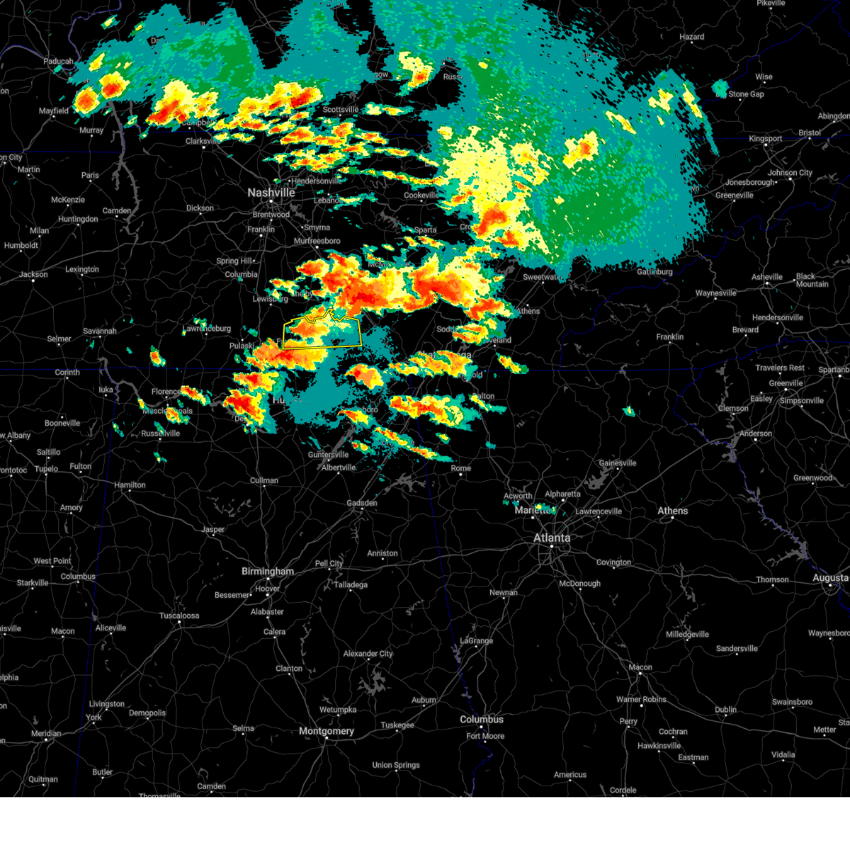 Svrhun the national weather service in huntsville alabama has issued a * severe thunderstorm warning for, moore county in middle tennessee, central lincoln county in middle tennessee, northwestern franklin county in middle tennessee, * until 915 pm cdt. * at 828 pm cdt, a severe thunderstorm was located near lynchburg, moving east at 40 mph (radar indicated). Hazards include 60 mph wind gusts and quarter size hail. Hail damage to vehicles is expected. Expect wind damage to roofs, siding, and trees. Svrhun the national weather service in huntsville alabama has issued a * severe thunderstorm warning for, moore county in middle tennessee, central lincoln county in middle tennessee, northwestern franklin county in middle tennessee, * until 915 pm cdt. * at 828 pm cdt, a severe thunderstorm was located near lynchburg, moving east at 40 mph (radar indicated). Hazards include 60 mph wind gusts and quarter size hail. Hail damage to vehicles is expected. Expect wind damage to roofs, siding, and trees.
|
| 5/8/2024 8:26 PM CDT |
 Torhun the national weather service in huntsville alabama has issued a * tornado warning for, northeastern madison county in north central alabama, south central moore county in middle tennessee, southern lincoln county in middle tennessee, southwestern franklin county in middle tennessee, * until 915 pm cdt. * at 825 pm cdt, a severe thunderstorm capable of producing a tornado was located 8 miles northeast of ardmore, or 10 miles southwest of fayetteville, moving east at 30 mph (radar indicated rotation). Hazards include tornado and golf ball size hail. Flying debris will be dangerous to those caught without shelter. mobile homes will be damaged or destroyed. damage to roofs, windows, and vehicles will occur. tree damage is likely. this dangerous storm will be near, fayetteville around 840 pm cdt. huntland around 905 pm cdt. Other locations impacted by this tornadic thunderstorm include lexie crossroads, elkwood, plevna, elora, hurdlow, belleview, skinem, smithland, molino, and flintville. Torhun the national weather service in huntsville alabama has issued a * tornado warning for, northeastern madison county in north central alabama, south central moore county in middle tennessee, southern lincoln county in middle tennessee, southwestern franklin county in middle tennessee, * until 915 pm cdt. * at 825 pm cdt, a severe thunderstorm capable of producing a tornado was located 8 miles northeast of ardmore, or 10 miles southwest of fayetteville, moving east at 30 mph (radar indicated rotation). Hazards include tornado and golf ball size hail. Flying debris will be dangerous to those caught without shelter. mobile homes will be damaged or destroyed. damage to roofs, windows, and vehicles will occur. tree damage is likely. this dangerous storm will be near, fayetteville around 840 pm cdt. huntland around 905 pm cdt. Other locations impacted by this tornadic thunderstorm include lexie crossroads, elkwood, plevna, elora, hurdlow, belleview, skinem, smithland, molino, and flintville.
|
| 5/8/2024 8:20 PM CDT |
 At 820 pm cdt, a confirmed large and extremely dangerous tornado was located near ardmore, or 13 miles southwest of fayetteville, moving east at 30 mph. this is a particularly dangerous situation. take cover now! (radar confirmed tornado). Hazards include damaging tornado. You are in a life-threatening situation. flying debris may be deadly to those caught without shelter. mobile homes will be destroyed. considerable damage to homes, businesses, and vehicles is likely and complete destruction is possible. the tornado will be near, fayetteville around 840 pm cdt. Other locations impacted by this tornadic thunderstorm include skinem, molino, dellrose, coldwater, blanche, belleview, harms, taft, camargo, and cash point. At 820 pm cdt, a confirmed large and extremely dangerous tornado was located near ardmore, or 13 miles southwest of fayetteville, moving east at 30 mph. this is a particularly dangerous situation. take cover now! (radar confirmed tornado). Hazards include damaging tornado. You are in a life-threatening situation. flying debris may be deadly to those caught without shelter. mobile homes will be destroyed. considerable damage to homes, businesses, and vehicles is likely and complete destruction is possible. the tornado will be near, fayetteville around 840 pm cdt. Other locations impacted by this tornadic thunderstorm include skinem, molino, dellrose, coldwater, blanche, belleview, harms, taft, camargo, and cash point.
|
| 5/8/2024 8:17 PM CDT |
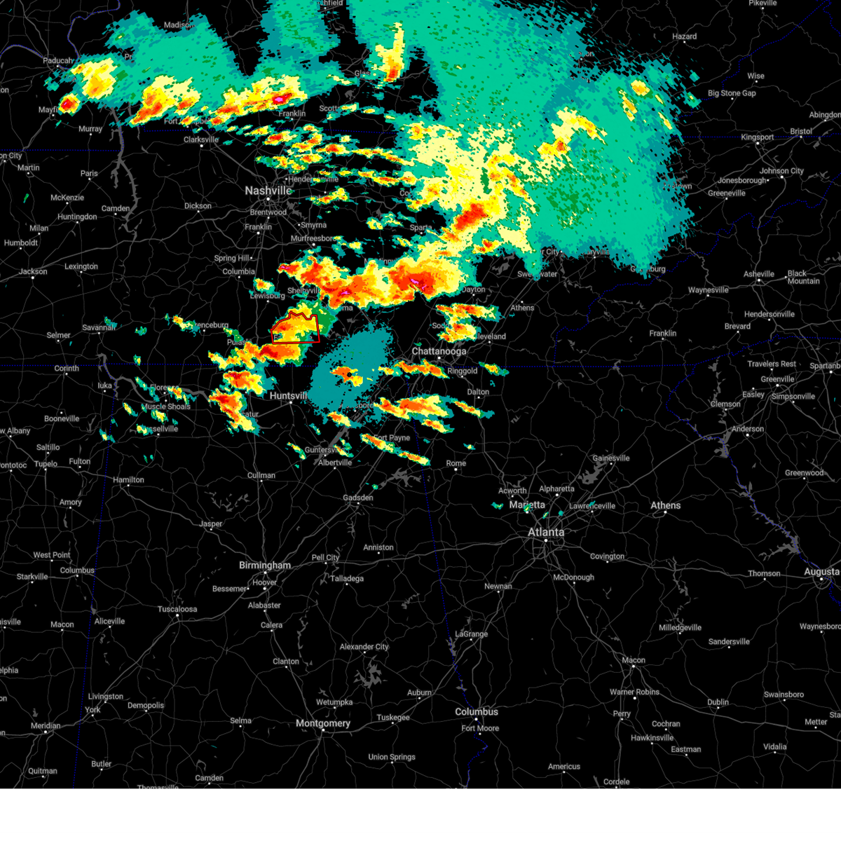 At 817 pm cdt, a severe thunderstorm capable of producing a tornado was located near petersburg, or 8 miles northwest of fayetteville, moving east at 25 mph (radar indicated rotation). Hazards include tornado and ping pong ball size hail. Flying debris will be dangerous to those caught without shelter. mobile homes will be damaged or destroyed. damage to roofs, windows, and vehicles will occur. tree damage is likely. Locations impacted include, fayetteville, lynchburg, petersburg, mulberry, chestnut ridge, howell, belleville, lois, harms, and mimosa. At 817 pm cdt, a severe thunderstorm capable of producing a tornado was located near petersburg, or 8 miles northwest of fayetteville, moving east at 25 mph (radar indicated rotation). Hazards include tornado and ping pong ball size hail. Flying debris will be dangerous to those caught without shelter. mobile homes will be damaged or destroyed. damage to roofs, windows, and vehicles will occur. tree damage is likely. Locations impacted include, fayetteville, lynchburg, petersburg, mulberry, chestnut ridge, howell, belleville, lois, harms, and mimosa.
|
| 5/8/2024 8:07 PM CDT |
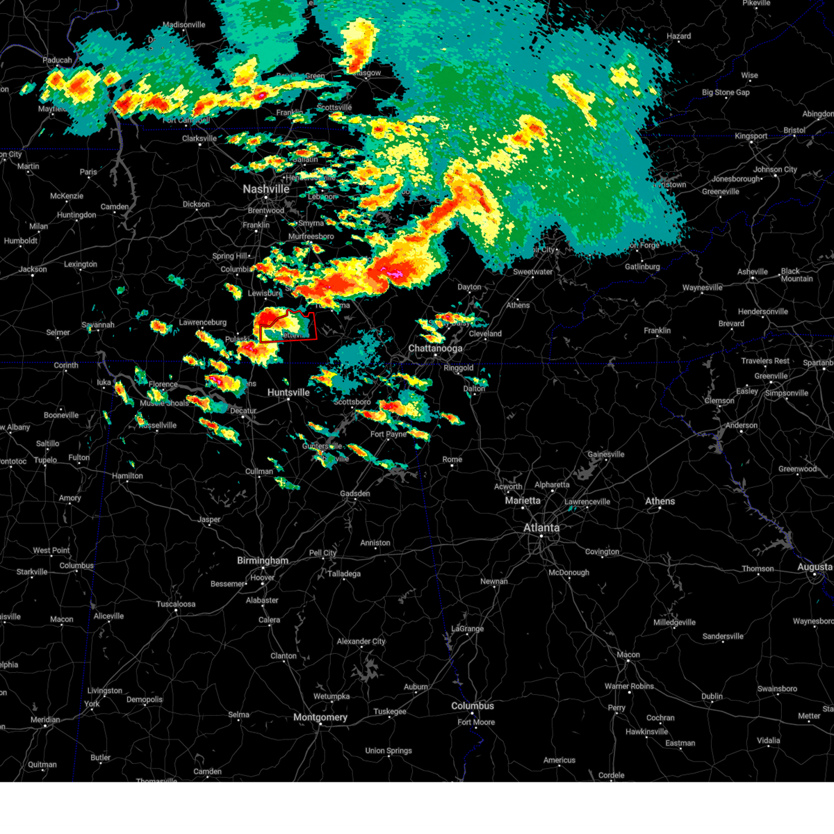 At 806 pm cdt, a severe thunderstorm capable of producing a tornado was located 8 miles southwest of petersburg, or 12 miles northwest of fayetteville, moving east at 25 mph (radar indicated rotation). Hazards include tornado and ping pong ball size hail. Flying debris will be dangerous to those caught without shelter. mobile homes will be damaged or destroyed. damage to roofs, windows, and vehicles will occur. tree damage is likely. Locations impacted include, fayetteville, lynchburg, petersburg, mulberry, chestnut ridge, howell, belleville, lois, mimosa, and booneville. At 806 pm cdt, a severe thunderstorm capable of producing a tornado was located 8 miles southwest of petersburg, or 12 miles northwest of fayetteville, moving east at 25 mph (radar indicated rotation). Hazards include tornado and ping pong ball size hail. Flying debris will be dangerous to those caught without shelter. mobile homes will be damaged or destroyed. damage to roofs, windows, and vehicles will occur. tree damage is likely. Locations impacted include, fayetteville, lynchburg, petersburg, mulberry, chestnut ridge, howell, belleville, lois, mimosa, and booneville.
|
| 5/8/2024 8:03 PM CDT |
 At 802 pm cdt, a confirmed tornado was located near ardmore, or 12 miles southeast of pulaski, moving east at 35 mph (radar confirmed tornado). Hazards include damaging tornado and ping pong ball size hail. Flying debris will be dangerous to those caught without shelter. mobile homes will be damaged or destroyed. damage to roofs, windows, and vehicles will occur. tree damage is likely. this tornado will be near, ardmore around 810 pm cdt. Other locations impacted by this tornadic thunderstorm include skinem, molino, dellrose, coldwater, blanche, belleview, harms, taft, camargo, and cash point. At 802 pm cdt, a confirmed tornado was located near ardmore, or 12 miles southeast of pulaski, moving east at 35 mph (radar confirmed tornado). Hazards include damaging tornado and ping pong ball size hail. Flying debris will be dangerous to those caught without shelter. mobile homes will be damaged or destroyed. damage to roofs, windows, and vehicles will occur. tree damage is likely. this tornado will be near, ardmore around 810 pm cdt. Other locations impacted by this tornadic thunderstorm include skinem, molino, dellrose, coldwater, blanche, belleview, harms, taft, camargo, and cash point.
|
| 5/8/2024 7:57 PM CDT |
 Torhun the national weather service in huntsville alabama has issued a * tornado warning for, southwestern lincoln county in middle tennessee, * until 830 pm cdt. * at 757 pm cdt, a tornado producing storm was located 7 miles west of ardmore, or 12 miles south of pulaski, moving east at 35 mph (radar confirmed tornado). Hazards include damaging tornado and ping pong ball size hail. Flying debris will be dangerous to those caught without shelter. mobile homes will be damaged or destroyed. damage to roofs, windows, and vehicles will occur. tree damage is likely. this tornadic storm will be near, ardmore around 805 pm cdt. Other locations impacted by this tornadic thunderstorm include skinem, molino, dellrose, coldwater, blanche, belleview, harms, taft, camargo, and cash point. Torhun the national weather service in huntsville alabama has issued a * tornado warning for, southwestern lincoln county in middle tennessee, * until 830 pm cdt. * at 757 pm cdt, a tornado producing storm was located 7 miles west of ardmore, or 12 miles south of pulaski, moving east at 35 mph (radar confirmed tornado). Hazards include damaging tornado and ping pong ball size hail. Flying debris will be dangerous to those caught without shelter. mobile homes will be damaged or destroyed. damage to roofs, windows, and vehicles will occur. tree damage is likely. this tornadic storm will be near, ardmore around 805 pm cdt. Other locations impacted by this tornadic thunderstorm include skinem, molino, dellrose, coldwater, blanche, belleview, harms, taft, camargo, and cash point.
|
| 5/8/2024 7:52 PM CDT |
 Torhun the national weather service in huntsville alabama has issued a * tornado warning for, central moore county in middle tennessee, central lincoln county in middle tennessee, * until 830 pm cdt. * at 752 pm cdt, a severe thunderstorm capable of producing a tornado was located 10 miles east of pulaski, moving east at 35 mph (radar indicated rotation). Hazards include tornado and ping pong ball size hail. Flying debris will be dangerous to those caught without shelter. mobile homes will be damaged or destroyed. damage to roofs, windows, and vehicles will occur. tree damage is likely. This tornadic thunderstorm will remain over mainly rural areas of central moore and central lincoln counties, including the following locations, mulberry, chestnut ridge, howell, belleville, mcburg, lois, harms, mimosa, booneville, and boonshill. Torhun the national weather service in huntsville alabama has issued a * tornado warning for, central moore county in middle tennessee, central lincoln county in middle tennessee, * until 830 pm cdt. * at 752 pm cdt, a severe thunderstorm capable of producing a tornado was located 10 miles east of pulaski, moving east at 35 mph (radar indicated rotation). Hazards include tornado and ping pong ball size hail. Flying debris will be dangerous to those caught without shelter. mobile homes will be damaged or destroyed. damage to roofs, windows, and vehicles will occur. tree damage is likely. This tornadic thunderstorm will remain over mainly rural areas of central moore and central lincoln counties, including the following locations, mulberry, chestnut ridge, howell, belleville, mcburg, lois, harms, mimosa, booneville, and boonshill.
|
| 4/2/2024 7:00 PM CDT |
 The storm which prompted the warning has moved out of the area. therefore, the warning will be allowed to expire. a tornado watch remains in effect until 900 pm cdt for north central alabama, and middle tennessee. a tornado watch also remains in effect until 200 am cdt for northeastern alabama. remember, a tornado warning still remains in effect for portions of lincoln, franklin tn, and moore county until 7:30 pm. The storm which prompted the warning has moved out of the area. therefore, the warning will be allowed to expire. a tornado watch remains in effect until 900 pm cdt for north central alabama, and middle tennessee. a tornado watch also remains in effect until 200 am cdt for northeastern alabama. remember, a tornado warning still remains in effect for portions of lincoln, franklin tn, and moore county until 7:30 pm.
|
| 4/2/2024 6:47 PM CDT |
 At 645 pm cdt, a severe thunderstorm capable of producing a tornado was located near hazel green, or 9 miles north of meridianville, moving northeast at 30 mph (radar indicated rotation). Hazards include tornado. Flying debris will be dangerous to those caught without shelter. mobile homes will be damaged or destroyed. damage to roofs, windows, and vehicles will occur. tree damage is likely. this dangerous storm will be near, huntland around 705 pm cdt. Other locations impacted by this tornadic thunderstorm include smithland, molino, plevna, flintville, elora, fisk, lincoln, crystal springs, kelso, and mulberry. At 645 pm cdt, a severe thunderstorm capable of producing a tornado was located near hazel green, or 9 miles north of meridianville, moving northeast at 30 mph (radar indicated rotation). Hazards include tornado. Flying debris will be dangerous to those caught without shelter. mobile homes will be damaged or destroyed. damage to roofs, windows, and vehicles will occur. tree damage is likely. this dangerous storm will be near, huntland around 705 pm cdt. Other locations impacted by this tornadic thunderstorm include smithland, molino, plevna, flintville, elora, fisk, lincoln, crystal springs, kelso, and mulberry.
|
| 4/2/2024 6:28 PM CDT |
 Torhun the national weather service in huntsville alabama has issued a * tornado warning for, northern madison county in north central alabama, south central moore county in middle tennessee, southeastern lincoln county in middle tennessee, southwestern franklin county in middle tennessee, * until 700 pm cdt. * at 628 pm cdt, a severe thunderstorm capable of producing a tornado was located near hazel green, or 7 miles northwest of meridianville, moving northeast at 40 mph. funnel clouds have been previously reported with this storm (radar indicated rotation). Hazards include tornado. Flying debris will be dangerous to those caught without shelter. mobile homes will be damaged or destroyed. damage to roofs, windows, and vehicles will occur. tree damage is likely. this dangerous storm will be near, fayetteville around 640 pm cdt. Other locations impacted by this tornadic thunderstorm include mulberry, plevna, elora, belleview, booneville, skinem, smithland, molino, flintville, and fisk. Torhun the national weather service in huntsville alabama has issued a * tornado warning for, northern madison county in north central alabama, south central moore county in middle tennessee, southeastern lincoln county in middle tennessee, southwestern franklin county in middle tennessee, * until 700 pm cdt. * at 628 pm cdt, a severe thunderstorm capable of producing a tornado was located near hazel green, or 7 miles northwest of meridianville, moving northeast at 40 mph. funnel clouds have been previously reported with this storm (radar indicated rotation). Hazards include tornado. Flying debris will be dangerous to those caught without shelter. mobile homes will be damaged or destroyed. damage to roofs, windows, and vehicles will occur. tree damage is likely. this dangerous storm will be near, fayetteville around 640 pm cdt. Other locations impacted by this tornadic thunderstorm include mulberry, plevna, elora, belleview, booneville, skinem, smithland, molino, flintville, and fisk.
|
| 3/14/2024 11:11 PM CDT |
 The storm which prompted the warning has weakened below severe limits, and no longer poses an immediate threat to life or property. therefore, the warning will be allowed to expire. however, gusty winds are still possible with this thunderstorm. The storm which prompted the warning has weakened below severe limits, and no longer poses an immediate threat to life or property. therefore, the warning will be allowed to expire. however, gusty winds are still possible with this thunderstorm.
|
| 3/14/2024 10:55 PM CDT |
 At 1054 pm cdt, a severe thunderstorm was located near hazel green, or 9 miles northwest of meridianville, moving east at 30 mph (radar indicated). Hazards include 60 mph wind gusts and quarter size hail. Hail damage to vehicles is expected. expect wind damage to roofs, siding, and trees. Locations impacted include, fayetteville, meridianville, hazel green, new market, lincoln, elkwood, plevna, belleview, skinem, and molino. At 1054 pm cdt, a severe thunderstorm was located near hazel green, or 9 miles northwest of meridianville, moving east at 30 mph (radar indicated). Hazards include 60 mph wind gusts and quarter size hail. Hail damage to vehicles is expected. expect wind damage to roofs, siding, and trees. Locations impacted include, fayetteville, meridianville, hazel green, new market, lincoln, elkwood, plevna, belleview, skinem, and molino.
|
| 3/14/2024 10:43 PM CDT |
 Svrhun the national weather service in huntsville alabama has issued a * severe thunderstorm warning for, northern madison county in north central alabama, southern lincoln county in middle tennessee, * until 1115 pm cdt. * at 1043 pm cdt, a severe thunderstorm was located near ardmore, or 11 miles northwest of meridianville, moving east at 25 mph (radar indicated). Hazards include 60 mph wind gusts and quarter size hail. Hail damage to vehicles is expected. Expect wind damage to roofs, siding, and trees. Svrhun the national weather service in huntsville alabama has issued a * severe thunderstorm warning for, northern madison county in north central alabama, southern lincoln county in middle tennessee, * until 1115 pm cdt. * at 1043 pm cdt, a severe thunderstorm was located near ardmore, or 11 miles northwest of meridianville, moving east at 25 mph (radar indicated). Hazards include 60 mph wind gusts and quarter size hail. Hail damage to vehicles is expected. Expect wind damage to roofs, siding, and trees.
|
| 2/28/2024 9:37 AM CST |
 At 937 am cst, severe thunderstorms were located along a line extending from near lynchburg to near harvest, moving east at 50 mph (radar indicated). Hazards include 60 mph wind gusts and quarter size hail. Hail damage to vehicles is expected. expect wind damage to roofs, siding, and trees. Locations impacted include, huntsville, decatur, madison, winchester, fayetteville, moores mill, meridianville, lynchburg, redstone arsenal, and hazel green. At 937 am cst, severe thunderstorms were located along a line extending from near lynchburg to near harvest, moving east at 50 mph (radar indicated). Hazards include 60 mph wind gusts and quarter size hail. Hail damage to vehicles is expected. expect wind damage to roofs, siding, and trees. Locations impacted include, huntsville, decatur, madison, winchester, fayetteville, moores mill, meridianville, lynchburg, redstone arsenal, and hazel green.
|
| 2/28/2024 9:20 AM CST |
 Svrhun the national weather service in huntsville alabama has issued a * severe thunderstorm warning for, northwestern jackson county in northeastern alabama, madison county in north central alabama, limestone county in north central alabama, northern morgan county in north central alabama, east central lawrence county in northwestern alabama, moore county in middle tennessee, lincoln county in middle tennessee, franklin county in middle tennessee, * until 945 am cst. * at 920 am cst, severe thunderstorms were located along a line extending from near fayetteville to near athens, moving east at 50 mph (radar indicated). Hazards include 60 mph wind gusts and quarter size hail. Hail damage to vehicles is expected. Expect wind damage to roofs, siding, and trees. Svrhun the national weather service in huntsville alabama has issued a * severe thunderstorm warning for, northwestern jackson county in northeastern alabama, madison county in north central alabama, limestone county in north central alabama, northern morgan county in north central alabama, east central lawrence county in northwestern alabama, moore county in middle tennessee, lincoln county in middle tennessee, franklin county in middle tennessee, * until 945 am cst. * at 920 am cst, severe thunderstorms were located along a line extending from near fayetteville to near athens, moving east at 50 mph (radar indicated). Hazards include 60 mph wind gusts and quarter size hail. Hail damage to vehicles is expected. Expect wind damage to roofs, siding, and trees.
|
| 8/14/2023 11:58 PM CDT |
 At 1157 pm cdt, severe thunderstorms were located along a line extending from near harvest to near huntland, moving southeast at 40 mph (radar indicated). Hazards include 60 mph wind gusts and quarter size hail. Hail damage to vehicles is expected. expect wind damage to roofs, siding, and trees. locations impacted include, huntsville, madison, fayetteville, moores mill, meridianville, redstone arsenal, hazel green, ardmore, huntland and gurley. hail threat, radar indicated max hail size, 1. 00 in wind threat, radar indicated max wind gust, 60 mph. At 1157 pm cdt, severe thunderstorms were located along a line extending from near harvest to near huntland, moving southeast at 40 mph (radar indicated). Hazards include 60 mph wind gusts and quarter size hail. Hail damage to vehicles is expected. expect wind damage to roofs, siding, and trees. locations impacted include, huntsville, madison, fayetteville, moores mill, meridianville, redstone arsenal, hazel green, ardmore, huntland and gurley. hail threat, radar indicated max hail size, 1. 00 in wind threat, radar indicated max wind gust, 60 mph.
|
| 8/14/2023 11:33 PM CDT |
 At 1132 pm cdt, severe thunderstorms were located along a line extending from near harvest to near gurley, moving northeast at 35 mph (radar indicated). Hazards include 60 mph wind gusts and quarter size hail. Hail damage to vehicles is expected. Expect wind damage to roofs, siding, and trees. At 1132 pm cdt, severe thunderstorms were located along a line extending from near harvest to near gurley, moving northeast at 35 mph (radar indicated). Hazards include 60 mph wind gusts and quarter size hail. Hail damage to vehicles is expected. Expect wind damage to roofs, siding, and trees.
|
| 8/14/2023 7:13 PM CDT |
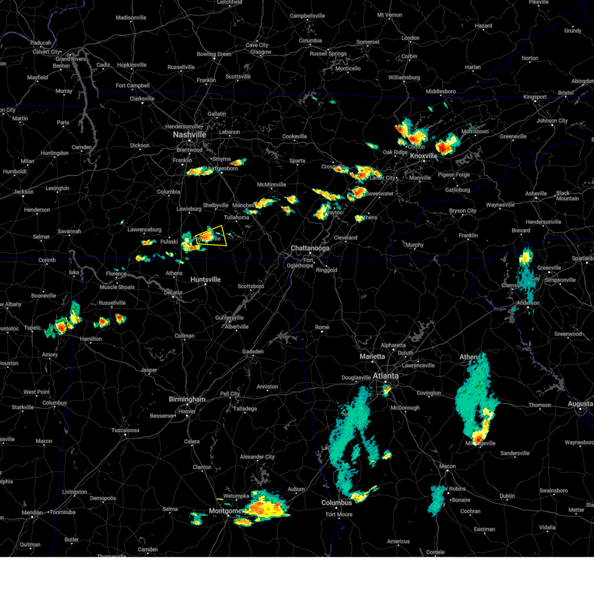 The severe thunderstorm warning for central moore and central lincoln counties will expire at 715 pm cdt, the storm which prompted the warning has weakened below severe limits, and no longer poses an immediate threat to life or property. therefore, the warning will be allowed to expire. The severe thunderstorm warning for central moore and central lincoln counties will expire at 715 pm cdt, the storm which prompted the warning has weakened below severe limits, and no longer poses an immediate threat to life or property. therefore, the warning will be allowed to expire.
|
| 8/14/2023 7:04 PM CDT |
 At 703 pm cdt, a severe thunderstorm was located near fayetteville, moving east at 25 mph (radar indicated). Hazards include 60 mph wind gusts and quarter size hail. Hail damage to vehicles is expected. expect wind damage to roofs, siding, and trees. locations impacted include, fayetteville, lynchburg, mulberry, howell, lois, harms, mimosa and booneville. hail threat, radar indicated max hail size, 1. 00 in wind threat, radar indicated max wind gust, 60 mph. At 703 pm cdt, a severe thunderstorm was located near fayetteville, moving east at 25 mph (radar indicated). Hazards include 60 mph wind gusts and quarter size hail. Hail damage to vehicles is expected. expect wind damage to roofs, siding, and trees. locations impacted include, fayetteville, lynchburg, mulberry, howell, lois, harms, mimosa and booneville. hail threat, radar indicated max hail size, 1. 00 in wind threat, radar indicated max wind gust, 60 mph.
|
| 8/14/2023 6:52 PM CDT |
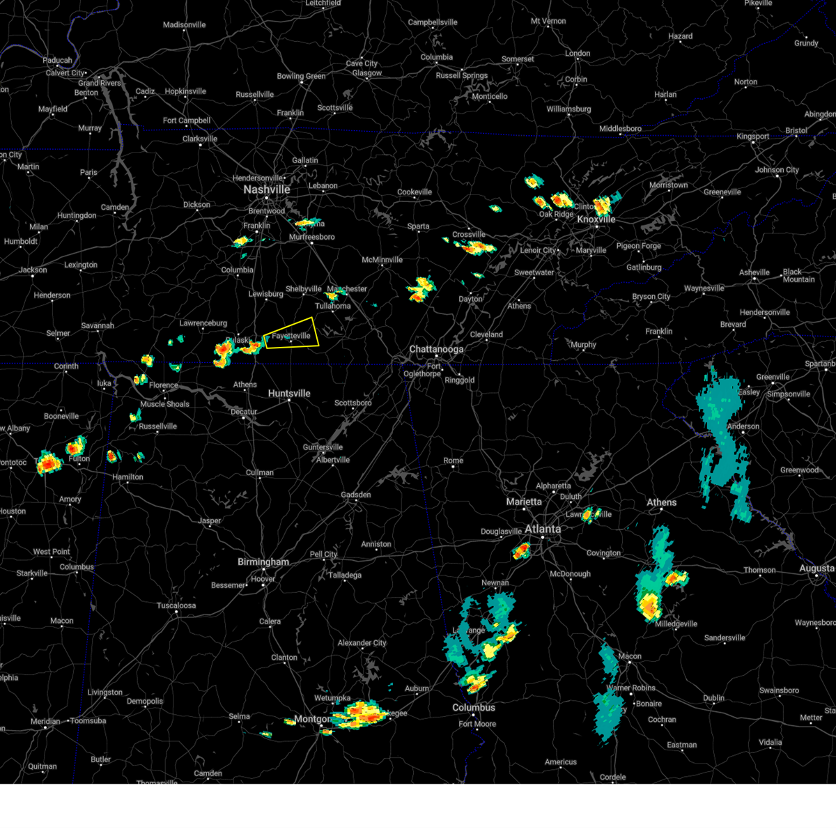 At 651 pm cdt, a severe thunderstorm was located 9 miles west of fayetteville, moving east at 25 mph (radar indicated). Hazards include 60 mph wind gusts and quarter size hail. Hail damage to vehicles is expected. Expect wind damage to roofs, siding, and trees. At 651 pm cdt, a severe thunderstorm was located 9 miles west of fayetteville, moving east at 25 mph (radar indicated). Hazards include 60 mph wind gusts and quarter size hail. Hail damage to vehicles is expected. Expect wind damage to roofs, siding, and trees.
|
| 8/13/2023 4:41 PM CDT |
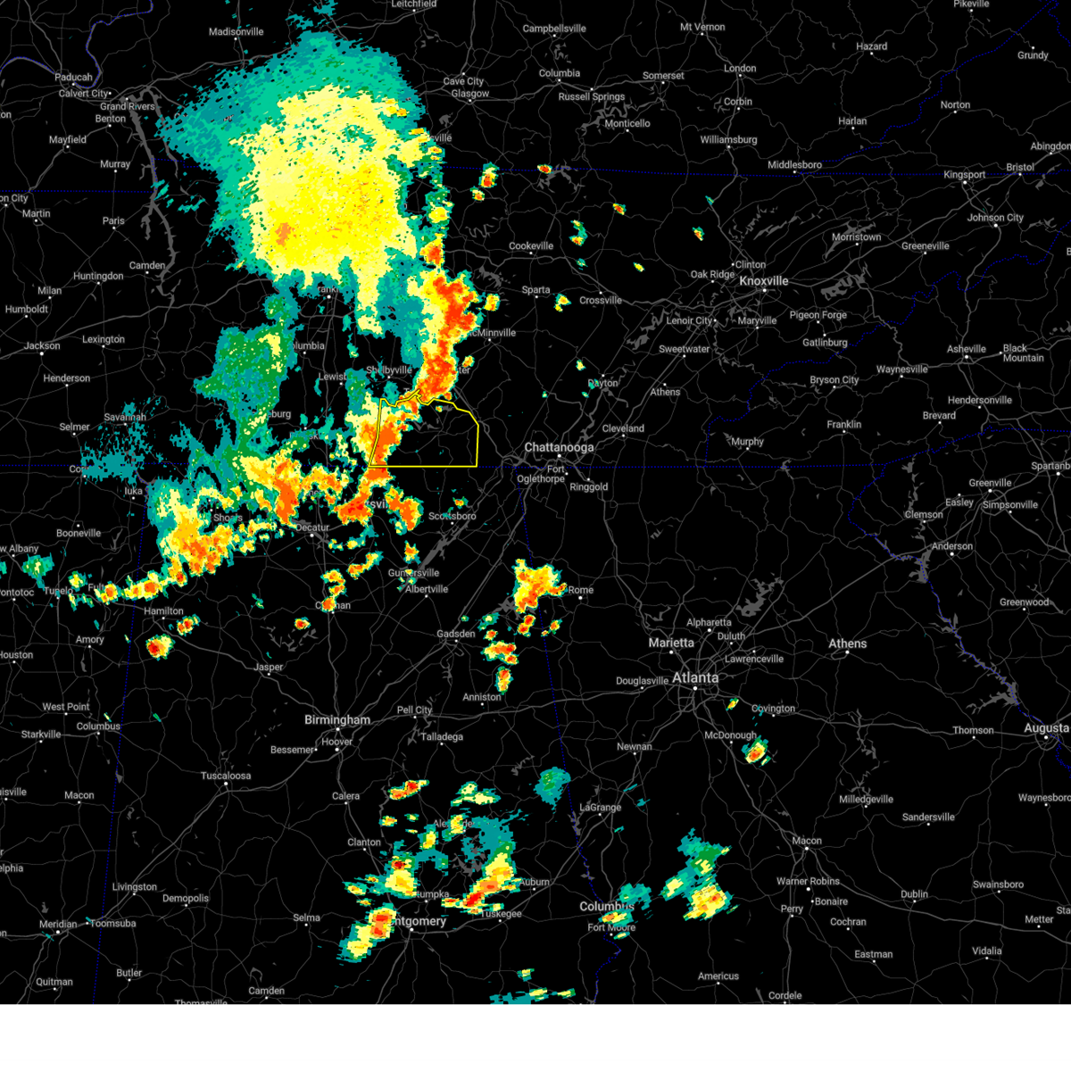 At 440 pm cdt, severe thunderstorms were located along a line extending from near tullahoma to near huntland to elora, moving east at 30 mph (radar indicated). Hazards include 60 mph wind gusts. expect damage to roofs, siding, and trees At 440 pm cdt, severe thunderstorms were located along a line extending from near tullahoma to near huntland to elora, moving east at 30 mph (radar indicated). Hazards include 60 mph wind gusts. expect damage to roofs, siding, and trees
|
| 8/13/2023 4:34 PM CDT |
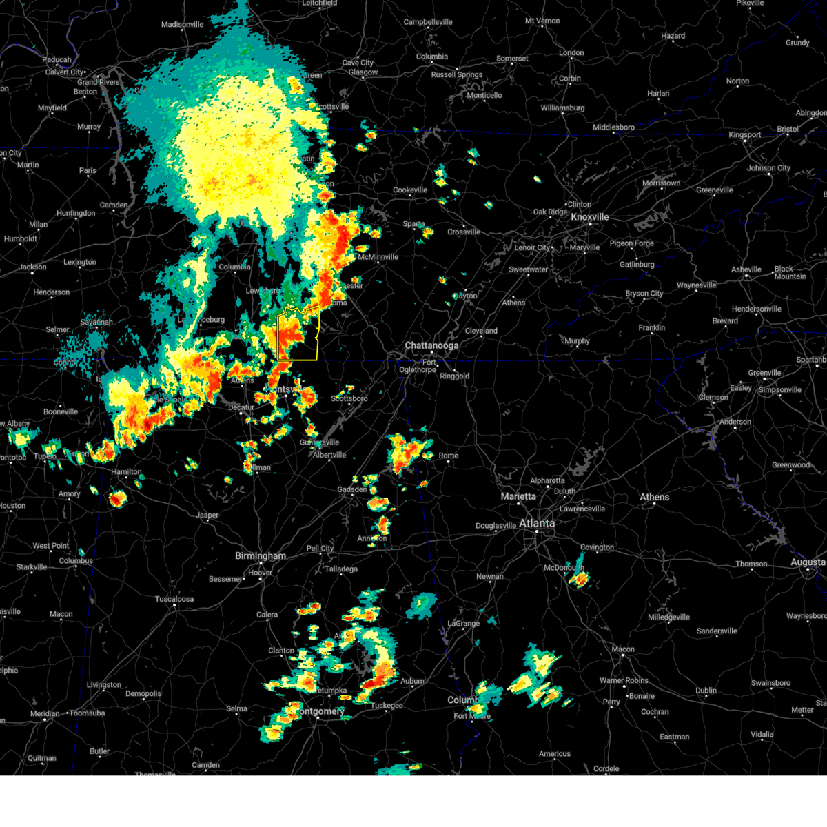 At 433 pm cdt, a severe thunderstorm was located near fayetteville, moving east at 30 mph (radar indicated). Hazards include 60 mph wind gusts and penny size hail. Expect damage to roofs, siding, and trees. locations impacted include, fayetteville, lynchburg, tims ford lake, lincoln, mulberry, chestnut ridge, howell, belleville, hurdlow and elora. hail threat, radar indicated max hail size, 0. 75 in wind threat, radar indicated max wind gust, 60 mph. At 433 pm cdt, a severe thunderstorm was located near fayetteville, moving east at 30 mph (radar indicated). Hazards include 60 mph wind gusts and penny size hail. Expect damage to roofs, siding, and trees. locations impacted include, fayetteville, lynchburg, tims ford lake, lincoln, mulberry, chestnut ridge, howell, belleville, hurdlow and elora. hail threat, radar indicated max hail size, 0. 75 in wind threat, radar indicated max wind gust, 60 mph.
|
| 8/13/2023 4:23 PM CDT |
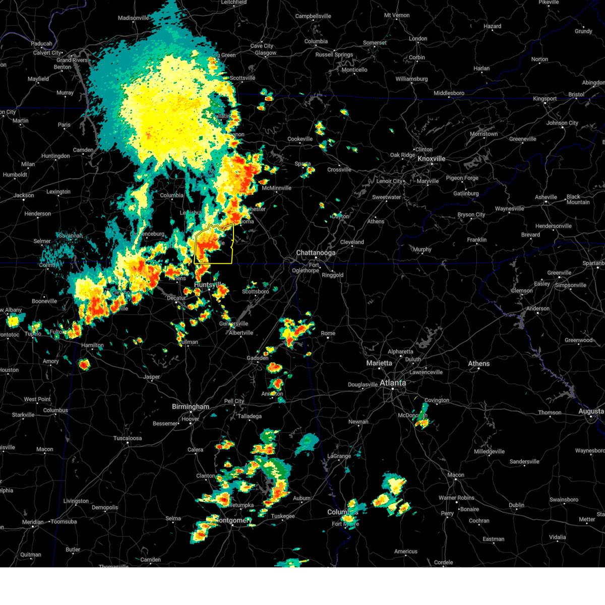 At 422 pm cdt, a severe thunderstorm was located over fayetteville, moving east at 30 mph (radar indicated). Hazards include 60 mph wind gusts and penny size hail. Expect damage to roofs, siding, and trees. locations impacted include, fayetteville, lynchburg, petersburg, tims ford lake, lincoln, howell, hurdlow, elora, mimosa and smithland. hail threat, radar indicated max hail size, 0. 75 in wind threat, radar indicated max wind gust, 60 mph. At 422 pm cdt, a severe thunderstorm was located over fayetteville, moving east at 30 mph (radar indicated). Hazards include 60 mph wind gusts and penny size hail. Expect damage to roofs, siding, and trees. locations impacted include, fayetteville, lynchburg, petersburg, tims ford lake, lincoln, howell, hurdlow, elora, mimosa and smithland. hail threat, radar indicated max hail size, 0. 75 in wind threat, radar indicated max wind gust, 60 mph.
|
| 8/13/2023 4:14 PM CDT |
 At 413 pm cdt, severe thunderstorms were located along a line extending from petersburg to near fayetteville to 6 miles east of ardmore, moving east at 35 mph (radar indicated). Hazards include 60 mph wind gusts and penny size hail. Expect damage to roofs, siding, and trees. locations impacted include, fayetteville, lynchburg, ardmore, petersburg, tims ford lake, lincoln, howell, hurdlow, elora and mimosa. hail threat, radar indicated max hail size, 0. 75 in wind threat, radar indicated max wind gust, 60 mph. At 413 pm cdt, severe thunderstorms were located along a line extending from petersburg to near fayetteville to 6 miles east of ardmore, moving east at 35 mph (radar indicated). Hazards include 60 mph wind gusts and penny size hail. Expect damage to roofs, siding, and trees. locations impacted include, fayetteville, lynchburg, ardmore, petersburg, tims ford lake, lincoln, howell, hurdlow, elora and mimosa. hail threat, radar indicated max hail size, 0. 75 in wind threat, radar indicated max wind gust, 60 mph.
|
| 8/13/2023 3:55 PM CDT |
 At 354 pm cdt, severe thunderstorms were located along a line extending from 9 miles west of petersburg to near ardmore, moving east at 30 mph (radar indicated). Hazards include 60 mph wind gusts and penny size hail. expect damage to roofs, siding, and trees At 354 pm cdt, severe thunderstorms were located along a line extending from 9 miles west of petersburg to near ardmore, moving east at 30 mph (radar indicated). Hazards include 60 mph wind gusts and penny size hail. expect damage to roofs, siding, and trees
|
| 8/12/2023 1:25 PM CDT |
 At 124 pm cdt, severe thunderstorms were located along a line extending from near estill springs to near tims ford lake to 9 miles north of new market, moving southeast at 25 mph (radar indicated). Hazards include 70 mph wind gusts and penny size hail. Expect considerable tree damage. damage is likely to mobile homes, roofs, and outbuildings. locations impacted include, winchester, fayetteville, decherd, estill springs, cowan, huntland, tims ford lake, sewanee, anderson and hurdlow. thunderstorm damage threat, considerable hail threat, radar indicated max hail size, 0. 75 in wind threat, radar indicated max wind gust, 70 mph. At 124 pm cdt, severe thunderstorms were located along a line extending from near estill springs to near tims ford lake to 9 miles north of new market, moving southeast at 25 mph (radar indicated). Hazards include 70 mph wind gusts and penny size hail. Expect considerable tree damage. damage is likely to mobile homes, roofs, and outbuildings. locations impacted include, winchester, fayetteville, decherd, estill springs, cowan, huntland, tims ford lake, sewanee, anderson and hurdlow. thunderstorm damage threat, considerable hail threat, radar indicated max hail size, 0. 75 in wind threat, radar indicated max wind gust, 70 mph.
|
| 8/12/2023 1:10 PM CDT |
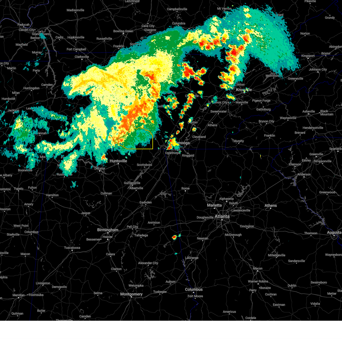 At 110 pm cdt, severe thunderstorms were located along a line extending from tullahoma to near tims ford lake to near fayetteville, moving southeast at 30 mph (radar indicated). Hazards include 60 mph wind gusts and penny size hail. expect damage to roofs, siding, and trees At 110 pm cdt, severe thunderstorms were located along a line extending from tullahoma to near tims ford lake to near fayetteville, moving southeast at 30 mph (radar indicated). Hazards include 60 mph wind gusts and penny size hail. expect damage to roofs, siding, and trees
|
| 8/12/2023 12:59 PM CDT |
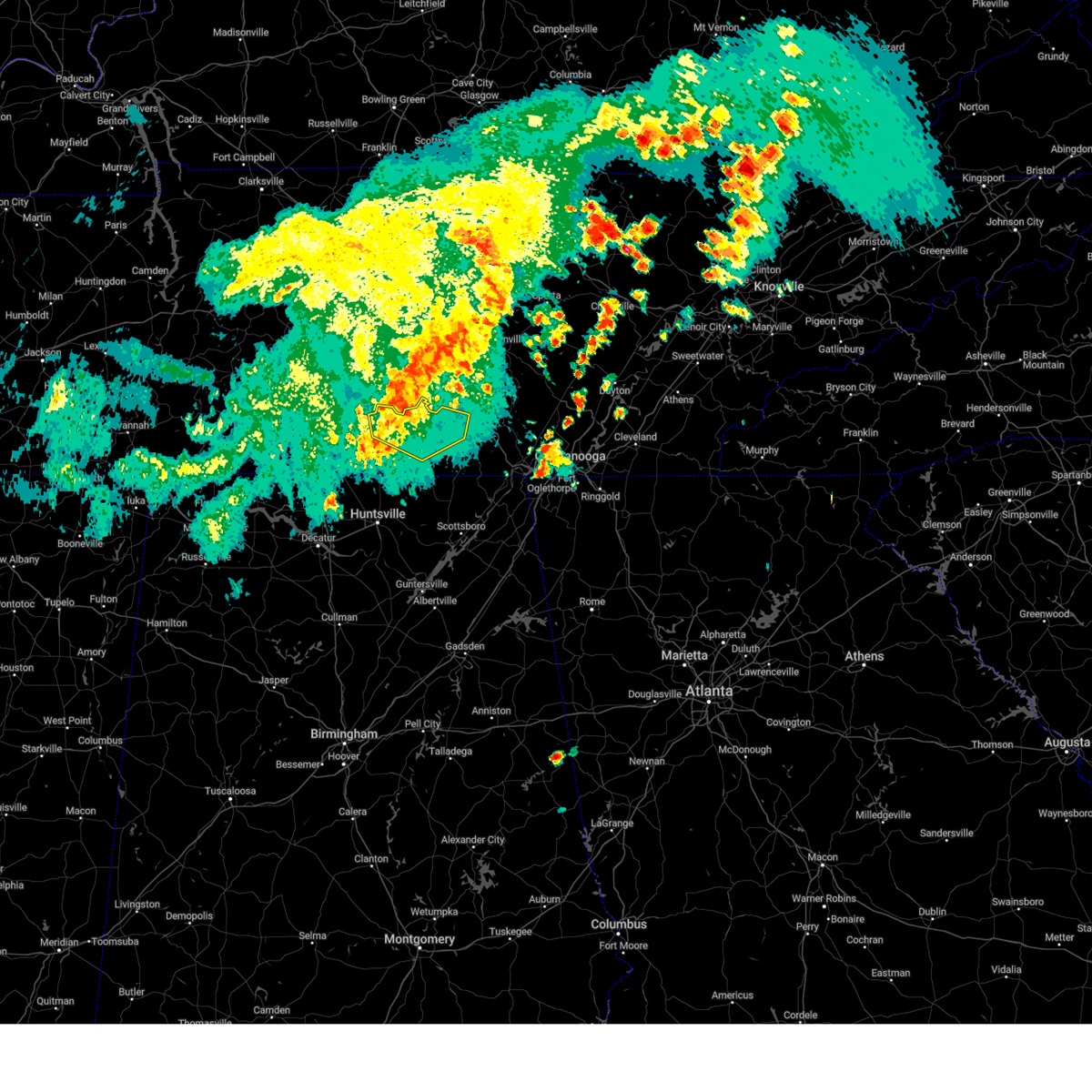 At 1258 pm cdt, severe thunderstorms were located along a line extending from near tullahoma to lynchburg to 6 miles northeast of fayetteville, moving east at 45 mph (radar indicated). Hazards include 60 mph wind gusts and penny size hail. Expect damage to roofs, siding, and trees. locations impacted include, winchester, lynchburg, decherd, estill springs, petersburg, tims ford lake, lexie crossroads, mulberry, chestnut ridge and howell. hail threat, radar indicated max hail size, 0. 75 in wind threat, radar indicated max wind gust, 60 mph. At 1258 pm cdt, severe thunderstorms were located along a line extending from near tullahoma to lynchburg to 6 miles northeast of fayetteville, moving east at 45 mph (radar indicated). Hazards include 60 mph wind gusts and penny size hail. Expect damage to roofs, siding, and trees. locations impacted include, winchester, lynchburg, decherd, estill springs, petersburg, tims ford lake, lexie crossroads, mulberry, chestnut ridge and howell. hail threat, radar indicated max hail size, 0. 75 in wind threat, radar indicated max wind gust, 60 mph.
|
| 8/12/2023 12:50 PM CDT |
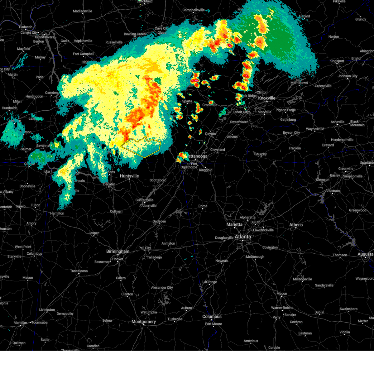 At 1249 pm cdt, a severe thunderstorm was located near lynchburg, moving east at 50 mph (radar indicated). Hazards include 60 mph wind gusts and penny size hail. Expect damage to roofs, siding, and trees. locations impacted include, winchester, lynchburg, decherd, estill springs, petersburg, tims ford lake, lexie crossroads, mulberry, chestnut ridge and howell. hail threat, radar indicated max hail size, 0. 75 in wind threat, radar indicated max wind gust, 60 mph. At 1249 pm cdt, a severe thunderstorm was located near lynchburg, moving east at 50 mph (radar indicated). Hazards include 60 mph wind gusts and penny size hail. Expect damage to roofs, siding, and trees. locations impacted include, winchester, lynchburg, decherd, estill springs, petersburg, tims ford lake, lexie crossroads, mulberry, chestnut ridge and howell. hail threat, radar indicated max hail size, 0. 75 in wind threat, radar indicated max wind gust, 60 mph.
|
| 8/12/2023 12:31 PM CDT |
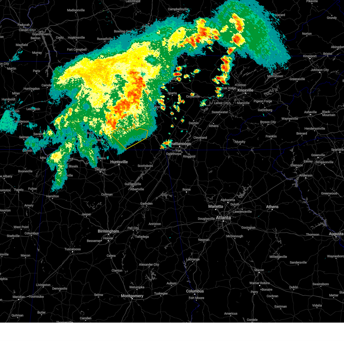 At 1230 pm cdt, a severe thunderstorm was located near lewisburg, moving east at 45 mph (radar indicated). Hazards include 60 mph wind gusts and penny size hail. expect damage to roofs, siding, and trees At 1230 pm cdt, a severe thunderstorm was located near lewisburg, moving east at 45 mph (radar indicated). Hazards include 60 mph wind gusts and penny size hail. expect damage to roofs, siding, and trees
|
| 8/9/2023 3:36 PM CDT |
 At 335 pm cdt, a severe thunderstorm was located 8 miles east of pulaski, moving east at 50 mph (radar indicated). Hazards include 60 to 70 mph wind gusts and penny size hail. expect damage to roofs, siding, and trees At 335 pm cdt, a severe thunderstorm was located 8 miles east of pulaski, moving east at 50 mph (radar indicated). Hazards include 60 to 70 mph wind gusts and penny size hail. expect damage to roofs, siding, and trees
|
| 8/6/2023 5:39 AM CDT |
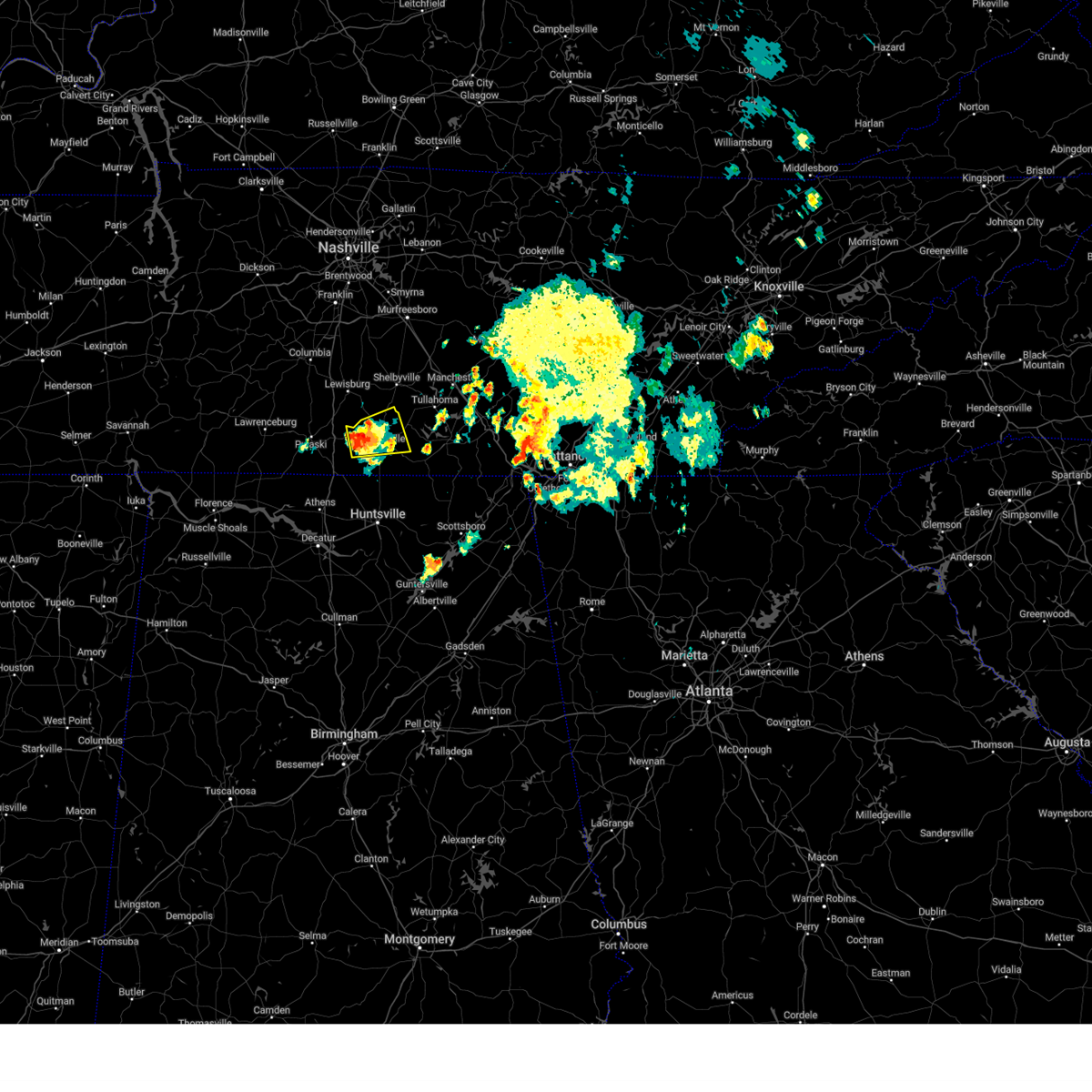 At 538 am cdt, a severe thunderstorm was located 7 miles northwest of fayetteville, moving east at 15 mph (radar indicated). Hazards include 60 mph wind gusts and quarter size hail. Hail damage to vehicles is expected. Expect wind damage to roofs, siding, and trees. At 538 am cdt, a severe thunderstorm was located 7 miles northwest of fayetteville, moving east at 15 mph (radar indicated). Hazards include 60 mph wind gusts and quarter size hail. Hail damage to vehicles is expected. Expect wind damage to roofs, siding, and trees.
|
| 7/20/2023 3:59 PM CDT |
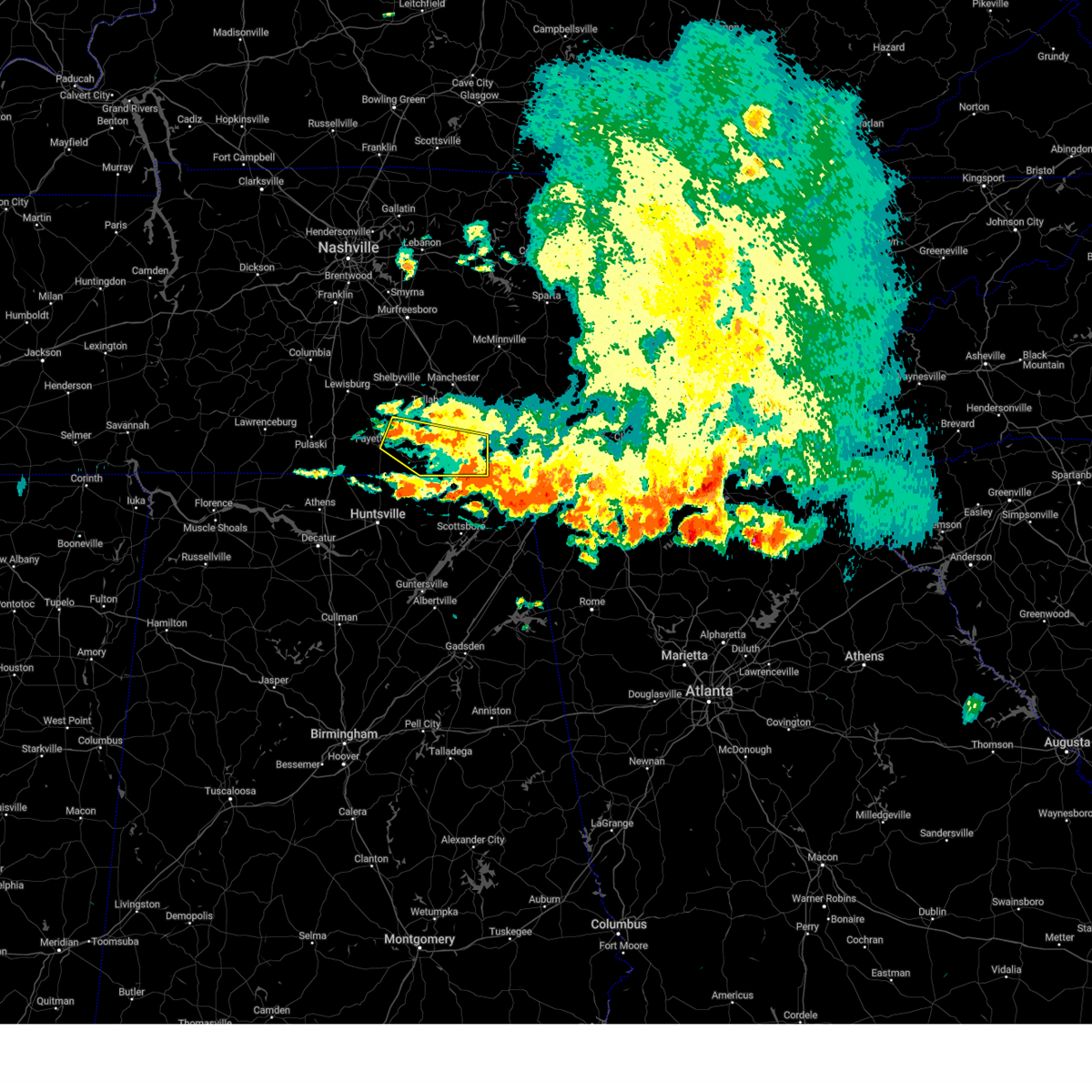 At 358 pm cdt, a severe thunderstorm was located near lynchburg, moving east at 50 mph (radar indicated). Hazards include 60 mph wind gusts. expect damage to roofs, siding, and trees At 358 pm cdt, a severe thunderstorm was located near lynchburg, moving east at 50 mph (radar indicated). Hazards include 60 mph wind gusts. expect damage to roofs, siding, and trees
|
| 7/20/2023 3:33 PM CDT |
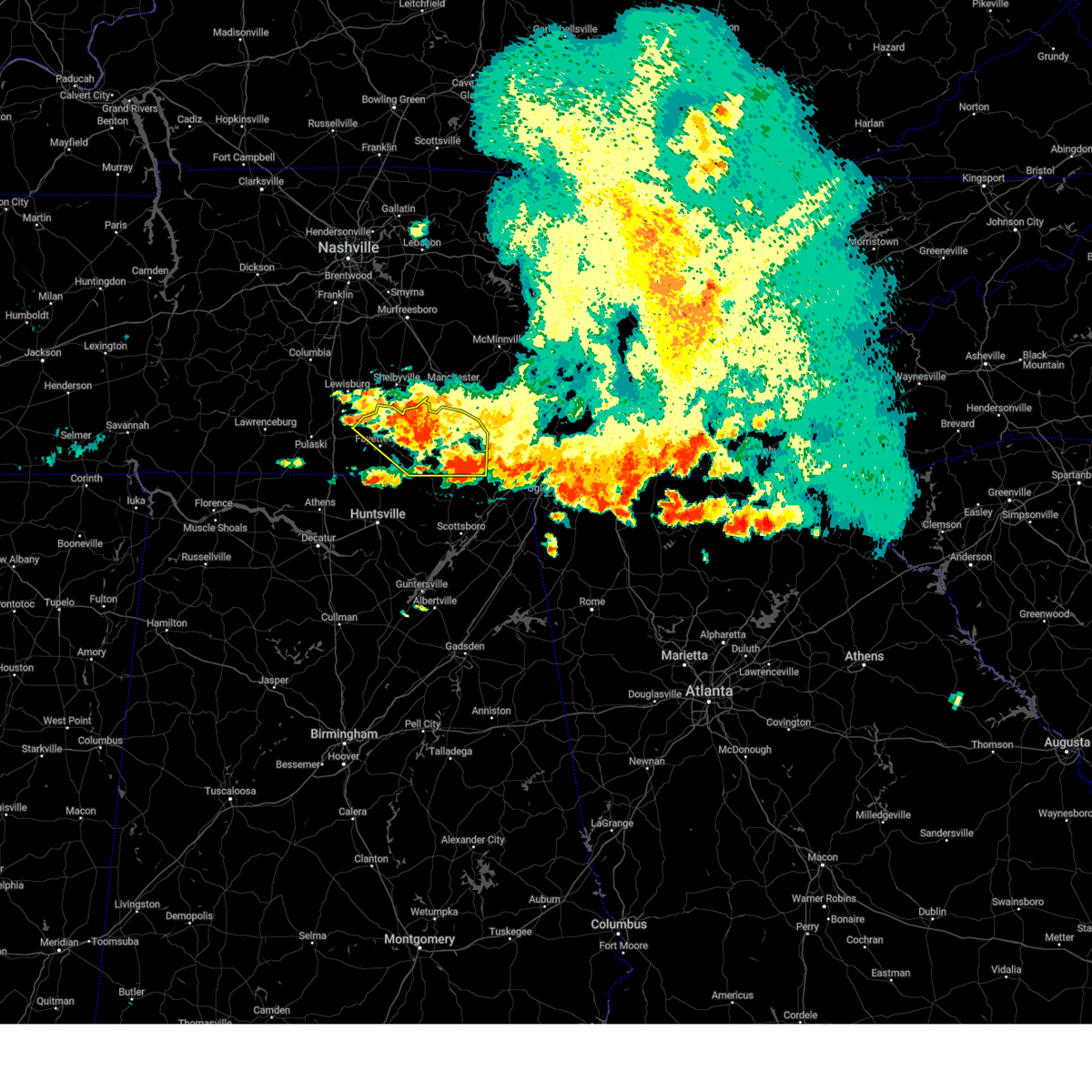 At 332 pm cdt, severe thunderstorms were located along a line extending from 7 miles south of tracy city to near fayetteville, moving southeast at 35 mph (radar indicated). Hazards include 60 mph wind gusts and penny size hail. Expect damage to roofs, siding, and trees. locations impacted include, winchester, fayetteville, lynchburg, decherd, estill springs, cowan, huntland, petersburg, tims ford lake and sewanee. hail threat, radar indicated max hail size, 0. 75 in wind threat, observed max wind gust, 60 mph. At 332 pm cdt, severe thunderstorms were located along a line extending from 7 miles south of tracy city to near fayetteville, moving southeast at 35 mph (radar indicated). Hazards include 60 mph wind gusts and penny size hail. Expect damage to roofs, siding, and trees. locations impacted include, winchester, fayetteville, lynchburg, decherd, estill springs, cowan, huntland, petersburg, tims ford lake and sewanee. hail threat, radar indicated max hail size, 0. 75 in wind threat, observed max wind gust, 60 mph.
|
| 7/20/2023 2:58 PM CDT |
 At 257 pm cdt, severe thunderstorms were located along a line extending from near sewanee to 10 miles southwest of lewisburg, moving southeast at 35 mph. prolonged heavy rainfall may also lead to localized flooding (radar indicated). Hazards include 60 mph wind gusts and penny size hail. expect damage to roofs, siding, and trees At 257 pm cdt, severe thunderstorms were located along a line extending from near sewanee to 10 miles southwest of lewisburg, moving southeast at 35 mph. prolonged heavy rainfall may also lead to localized flooding (radar indicated). Hazards include 60 mph wind gusts and penny size hail. expect damage to roofs, siding, and trees
|
| 7/20/2023 2:54 PM CDT |
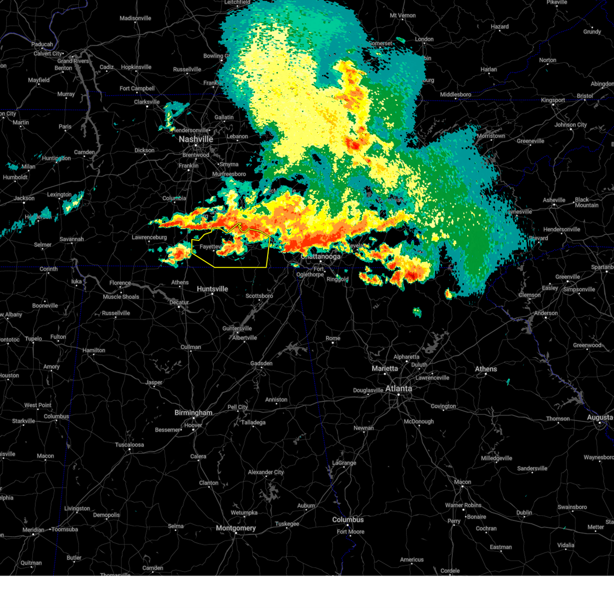 The severe thunderstorm warning for moore, lincoln and franklin counties will expire at 300 pm cdt, the storm which prompted the warning will continue to be a threat and a subsequent severe thunderstorm warning will be issued as this one expires at 300 pm. a severe thunderstorm watch remains in effect until 900 pm cdt for north central and northeastern alabama, and middle tennessee. to report severe weather, contact your nearest law enforcement agency. they will relay your report to the national weather service huntsville alabama. The severe thunderstorm warning for moore, lincoln and franklin counties will expire at 300 pm cdt, the storm which prompted the warning will continue to be a threat and a subsequent severe thunderstorm warning will be issued as this one expires at 300 pm. a severe thunderstorm watch remains in effect until 900 pm cdt for north central and northeastern alabama, and middle tennessee. to report severe weather, contact your nearest law enforcement agency. they will relay your report to the national weather service huntsville alabama.
|
| 7/20/2023 2:33 PM CDT |
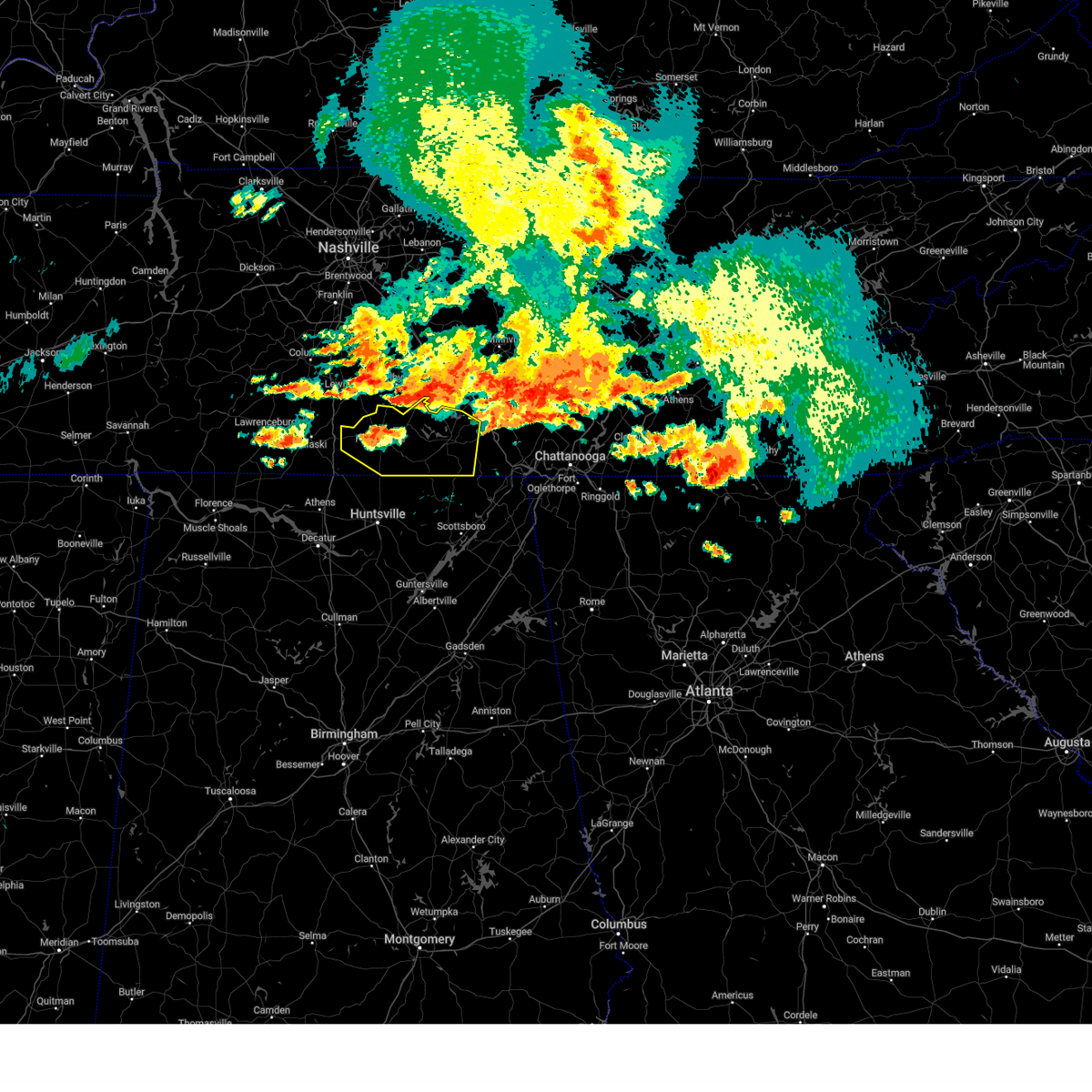 At 232 pm cdt, a severe thunderstorm was located near lynchburg, moving southeast at 25 mph (radar indicated). Hazards include 70 mph wind gusts and quarter size hail. numerous trees have fallen as a result of this storm. Hail damage to vehicles is expected. expect considerable tree damage. wind damage is also likely to mobile homes, roofs, and outbuildings. locations impacted include, winchester, fayetteville, lynchburg, decherd, estill springs, cowan, huntland, petersburg, tims ford lake and sewanee. thunderstorm damage threat, considerable hail threat, radar indicated max hail size, 1. 00 in wind threat, observed max wind gust, 70 mph. At 232 pm cdt, a severe thunderstorm was located near lynchburg, moving southeast at 25 mph (radar indicated). Hazards include 70 mph wind gusts and quarter size hail. numerous trees have fallen as a result of this storm. Hail damage to vehicles is expected. expect considerable tree damage. wind damage is also likely to mobile homes, roofs, and outbuildings. locations impacted include, winchester, fayetteville, lynchburg, decherd, estill springs, cowan, huntland, petersburg, tims ford lake and sewanee. thunderstorm damage threat, considerable hail threat, radar indicated max hail size, 1. 00 in wind threat, observed max wind gust, 70 mph.
|
| 7/20/2023 2:15 PM CDT |
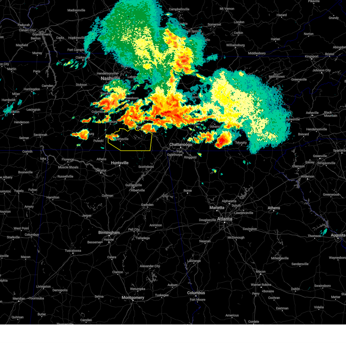 At 215 pm cdt, a severe thunderstorm was located 8 miles southwest of petersburg, or 9 miles northwest of fayetteville, moving east at 55 mph (radar indicated). Hazards include 60 mph wind gusts and quarter size hail. Hail damage to vehicles is expected. Expect wind damage to roofs, siding, and trees. At 215 pm cdt, a severe thunderstorm was located 8 miles southwest of petersburg, or 9 miles northwest of fayetteville, moving east at 55 mph (radar indicated). Hazards include 60 mph wind gusts and quarter size hail. Hail damage to vehicles is expected. Expect wind damage to roofs, siding, and trees.
|
| 7/18/2023 5:32 PM CDT |
 At 532 pm cdt, severe thunderstorms were located along a line extending from near huntland to near new market to huntsville, moving southeast at 45 mph (radar indicated). Hazards include 60 mph wind gusts and penny size hail. Expect damage to roofs, siding, and trees. Locations impacted include, huntsville, madison, moores mill, meridianville, redstone arsenal, hazel green, huntland, marshall space flight center, harvest and alabama a and m university. At 532 pm cdt, severe thunderstorms were located along a line extending from near huntland to near new market to huntsville, moving southeast at 45 mph (radar indicated). Hazards include 60 mph wind gusts and penny size hail. Expect damage to roofs, siding, and trees. Locations impacted include, huntsville, madison, moores mill, meridianville, redstone arsenal, hazel green, huntland, marshall space flight center, harvest and alabama a and m university.
|
| 7/18/2023 5:14 PM CDT |
 At 513 pm cdt, severe thunderstorms were located along a line extending from near lynchburg to near hazel green to harvest, moving southeast at 45 mph (radar indicated). Hazards include 60 mph wind gusts and penny size hail. expect damage to roofs, siding, and trees At 513 pm cdt, severe thunderstorms were located along a line extending from near lynchburg to near hazel green to harvest, moving southeast at 45 mph (radar indicated). Hazards include 60 mph wind gusts and penny size hail. expect damage to roofs, siding, and trees
|
| 7/18/2023 4:37 PM CDT |
 At 437 pm cdt, severe thunderstorms were located along a line extending from 15 miles northwest of shelbyville to lewisburg to 10 miles northeast of pulaski, moving southeast at 45 mph (radar indicated). Hazards include 60 mph wind gusts and penny size hail. expect damage to roofs, siding, and trees At 437 pm cdt, severe thunderstorms were located along a line extending from 15 miles northwest of shelbyville to lewisburg to 10 miles northeast of pulaski, moving southeast at 45 mph (radar indicated). Hazards include 60 mph wind gusts and penny size hail. expect damage to roofs, siding, and trees
|
| 7/2/2023 1:27 PM CDT |
 The severe thunderstorm warning for southwestern lincoln county will expire at 130 pm cdt, the storm which prompted the warning has weakened below severe limits, and no longer poses an immediate threat to life or property. therefore, the warning will be allowed to expire. a severe thunderstorm watch remains in effect until 800 pm cdt for north central and northeastern alabama, and middle tennessee. The severe thunderstorm warning for southwestern lincoln county will expire at 130 pm cdt, the storm which prompted the warning has weakened below severe limits, and no longer poses an immediate threat to life or property. therefore, the warning will be allowed to expire. a severe thunderstorm watch remains in effect until 800 pm cdt for north central and northeastern alabama, and middle tennessee.
|
| 7/2/2023 1:23 PM CDT |
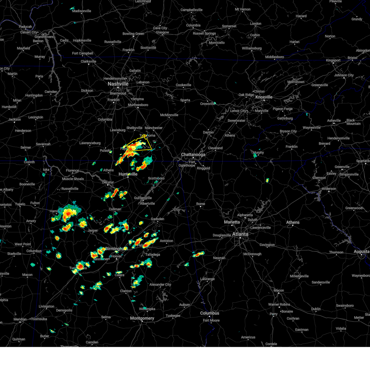 At 123 pm cdt, a severe thunderstorm was located near fayetteville, moving northeast at 35 mph (radar indicated). Hazards include 60 mph wind gusts and quarter size hail. Hail damage to vehicles is expected. Expect wind damage to roofs, siding, and trees. At 123 pm cdt, a severe thunderstorm was located near fayetteville, moving northeast at 35 mph (radar indicated). Hazards include 60 mph wind gusts and quarter size hail. Hail damage to vehicles is expected. Expect wind damage to roofs, siding, and trees.
|
| 7/2/2023 12:59 PM CDT |
 At 1259 pm cdt, a severe thunderstorm was located near ardmore, or 12 miles southwest of fayetteville, moving east at 25 mph (radar indicated). Hazards include 60 mph wind gusts and quarter size hail. Hail damage to vehicles is expected. Expect wind damage to roofs, siding, and trees. At 1259 pm cdt, a severe thunderstorm was located near ardmore, or 12 miles southwest of fayetteville, moving east at 25 mph (radar indicated). Hazards include 60 mph wind gusts and quarter size hail. Hail damage to vehicles is expected. Expect wind damage to roofs, siding, and trees.
|
| 7/1/2023 1:35 PM CDT |
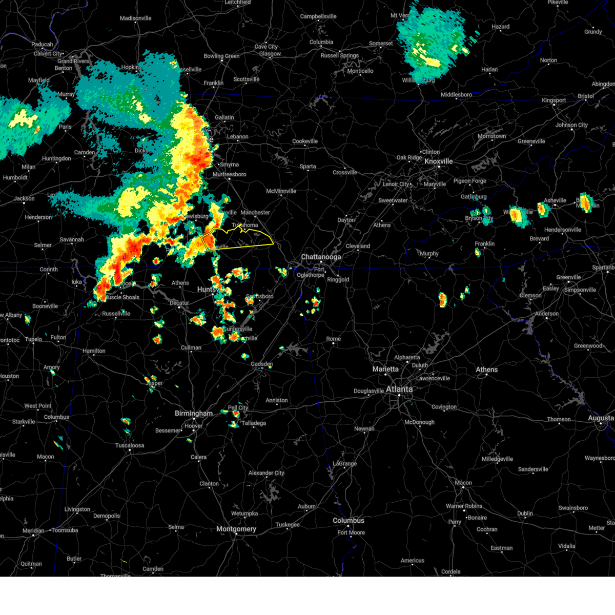 At 135 pm cdt, a severe thunderstorm was located 7 miles west of lynchburg, moving east at 30 mph (radar indicated). Hazards include 60 mph wind gusts and quarter size hail. Hail damage to vehicles is expected. Expect wind damage to roofs, siding, and trees. At 135 pm cdt, a severe thunderstorm was located 7 miles west of lynchburg, moving east at 30 mph (radar indicated). Hazards include 60 mph wind gusts and quarter size hail. Hail damage to vehicles is expected. Expect wind damage to roofs, siding, and trees.
|
| 7/1/2023 12:42 PM CDT |
 At 1241 pm cdt, a severe thunderstorm was located near ardmore, or 15 miles southwest of fayetteville, moving east at 20 mph (radar indicated). Hazards include 60 mph wind gusts and quarter size hail. Hail damage to vehicles is expected. Expect wind damage to roofs, siding, and trees. At 1241 pm cdt, a severe thunderstorm was located near ardmore, or 15 miles southwest of fayetteville, moving east at 20 mph (radar indicated). Hazards include 60 mph wind gusts and quarter size hail. Hail damage to vehicles is expected. Expect wind damage to roofs, siding, and trees.
|
| 6/11/2023 8:36 PM CDT |
 At 835 pm cdt, a severe thunderstorm was located 9 miles southeast of fayetteville, moving east-southeastward at 40 mph (radar indicated). Hazards include 60 mph wind gusts and penny size hail. expect damage to roofs, siding, and trees At 835 pm cdt, a severe thunderstorm was located 9 miles southeast of fayetteville, moving east-southeastward at 40 mph (radar indicated). Hazards include 60 mph wind gusts and penny size hail. expect damage to roofs, siding, and trees
|
| 6/11/2023 8:27 PM CDT |
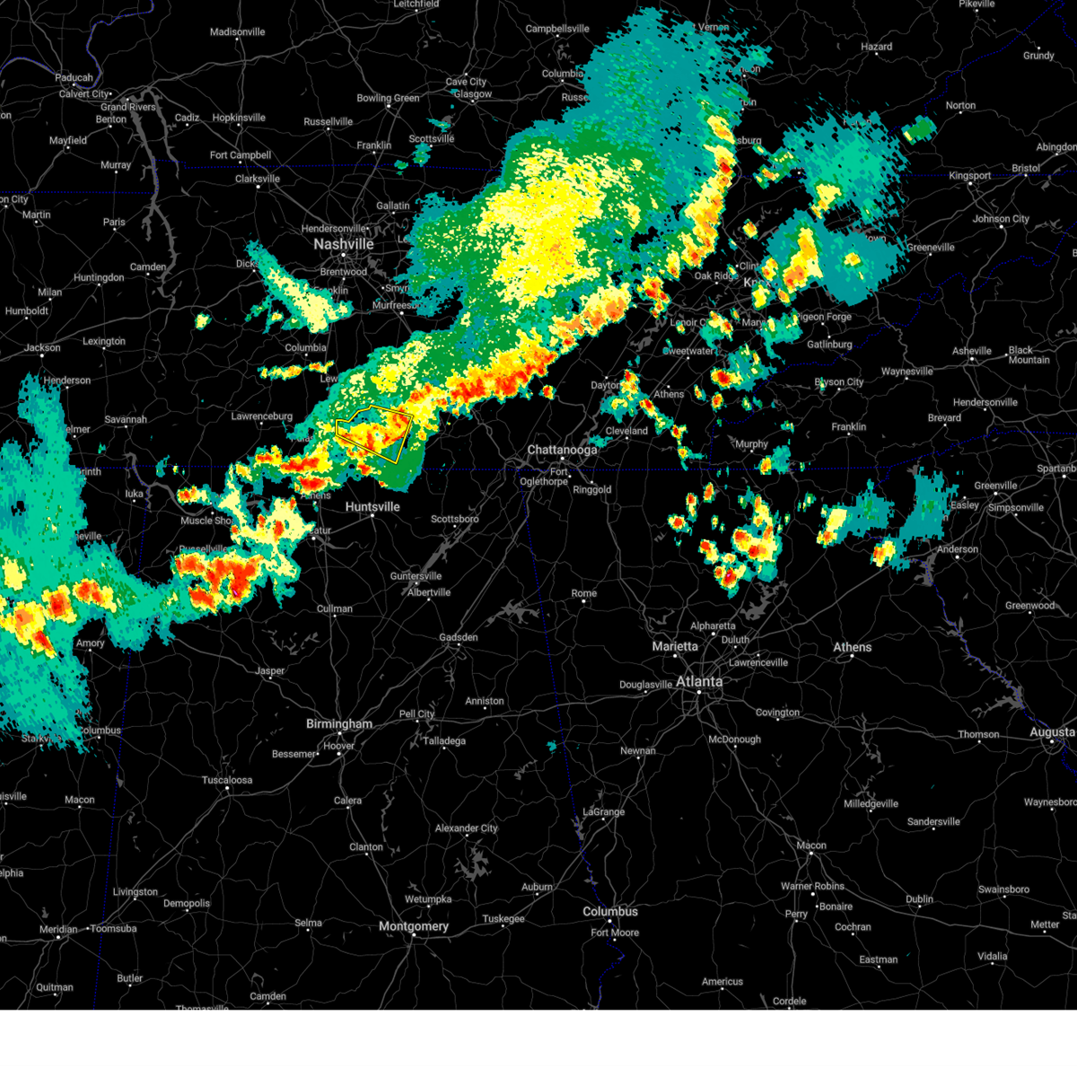 The severe thunderstorm warning for central moore and central lincoln counties will expire at 830 pm cdt, the storm which prompted the warning has moved out of the area. therefore, the warning will be allowed to expire. however gusty winds are still possible with this thunderstorm. a severe thunderstorm watch remains in effect until 200 am cdt for north central and northeastern alabama, and middle tennessee. The severe thunderstorm warning for central moore and central lincoln counties will expire at 830 pm cdt, the storm which prompted the warning has moved out of the area. therefore, the warning will be allowed to expire. however gusty winds are still possible with this thunderstorm. a severe thunderstorm watch remains in effect until 200 am cdt for north central and northeastern alabama, and middle tennessee.
|
| 6/11/2023 8:08 PM CDT |
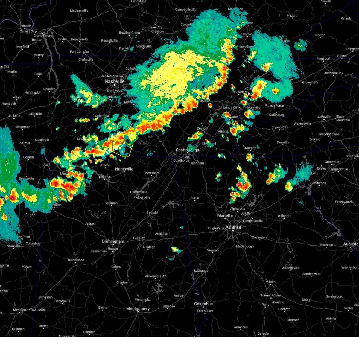 At 808 pm cdt, a severe thunderstorm was located near pulaski, moving east-southeastward at 40 mph (radar indicated). Hazards include 60 to 70 mph wind gusts and quarter size hail. Hail damage to vehicles is expected. expect considerable tree damage. Wind damage is also likely to mobile homes, roofs, and outbuildings. At 808 pm cdt, a severe thunderstorm was located near pulaski, moving east-southeastward at 40 mph (radar indicated). Hazards include 60 to 70 mph wind gusts and quarter size hail. Hail damage to vehicles is expected. expect considerable tree damage. Wind damage is also likely to mobile homes, roofs, and outbuildings.
|
| 6/11/2023 7:52 PM CDT |
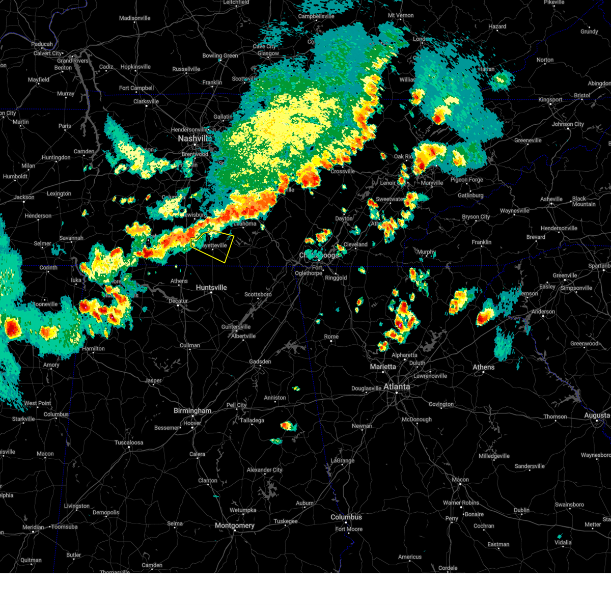 At 752 pm cdt, a severe thunderstorm was located 10 miles west of petersburg, or 11 miles south of lewisburg, moving east at 40 mph (radar indicated). Hazards include 60 mph wind gusts and quarter size hail. Hail damage to vehicles is expected. Expect wind damage to roofs, siding, and trees. At 752 pm cdt, a severe thunderstorm was located 10 miles west of petersburg, or 11 miles south of lewisburg, moving east at 40 mph (radar indicated). Hazards include 60 mph wind gusts and quarter size hail. Hail damage to vehicles is expected. Expect wind damage to roofs, siding, and trees.
|
| 6/5/2023 11:15 PM CDT |
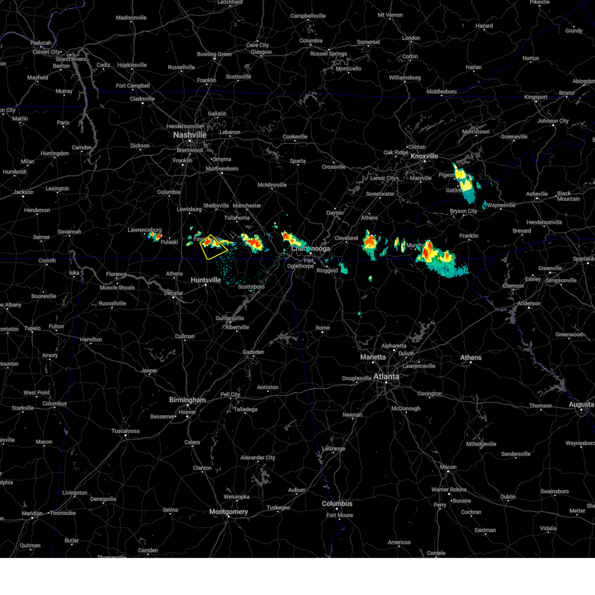 At 1115 pm cdt, a severe thunderstorm was located over fayetteville, moving southeast at 10 mph (radar indicated). Hazards include 60 mph wind gusts and quarter size hail. Hail damage to vehicles is expected. Expect wind damage to roofs, siding, and trees. At 1115 pm cdt, a severe thunderstorm was located over fayetteville, moving southeast at 10 mph (radar indicated). Hazards include 60 mph wind gusts and quarter size hail. Hail damage to vehicles is expected. Expect wind damage to roofs, siding, and trees.
|
| 5/18/2023 4:26 PM CDT |
 At 426 pm cdt, severe thunderstorms were located along a line extending from near tims ford lake to near lynchburg to near fayetteville, moving north at 10 mph (radar indicated). Hazards include 60 mph wind gusts and quarter size hail. Hail damage to vehicles is expected. Expect wind damage to roofs, siding, and trees. At 426 pm cdt, severe thunderstorms were located along a line extending from near tims ford lake to near lynchburg to near fayetteville, moving north at 10 mph (radar indicated). Hazards include 60 mph wind gusts and quarter size hail. Hail damage to vehicles is expected. Expect wind damage to roofs, siding, and trees.
|
| 5/16/2023 5:53 PM CDT |
 At 553 pm cdt, a severe thunderstorm was located 8 miles southeast of fayetteville, moving east at 35 mph (radar indicated). Hazards include 60 mph wind gusts and quarter size hail. Hail damage to vehicles is expected. Expect wind damage to roofs, siding, and trees. At 553 pm cdt, a severe thunderstorm was located 8 miles southeast of fayetteville, moving east at 35 mph (radar indicated). Hazards include 60 mph wind gusts and quarter size hail. Hail damage to vehicles is expected. Expect wind damage to roofs, siding, and trees.
|
| 5/16/2023 5:43 PM CDT |
 At 542 pm cdt, a severe thunderstorm was located over fayetteville, moving east at 35 mph (radar indicated). Hazards include 60 mph wind gusts and quarter size hail. Hail damage to vehicles is expected. expect wind damage to roofs, siding, and trees. locations impacted include, fayetteville, lincoln, skinem, molino, belleview, harms, camargo, crystal springs and kelso. hail threat, radar indicated max hail size, 1. 00 in wind threat, radar indicated max wind gust, 60 mph. At 542 pm cdt, a severe thunderstorm was located over fayetteville, moving east at 35 mph (radar indicated). Hazards include 60 mph wind gusts and quarter size hail. Hail damage to vehicles is expected. expect wind damage to roofs, siding, and trees. locations impacted include, fayetteville, lincoln, skinem, molino, belleview, harms, camargo, crystal springs and kelso. hail threat, radar indicated max hail size, 1. 00 in wind threat, radar indicated max wind gust, 60 mph.
|
| 5/16/2023 5:26 PM CDT |
 At 526 pm cdt, a severe thunderstorm was located 8 miles west of fayetteville, moving east at 35 mph (radar indicated). Hazards include 60 mph wind gusts. expect damage to roofs, siding, and trees At 526 pm cdt, a severe thunderstorm was located 8 miles west of fayetteville, moving east at 35 mph (radar indicated). Hazards include 60 mph wind gusts. expect damage to roofs, siding, and trees
|
| 3/25/2023 12:08 AM CDT |
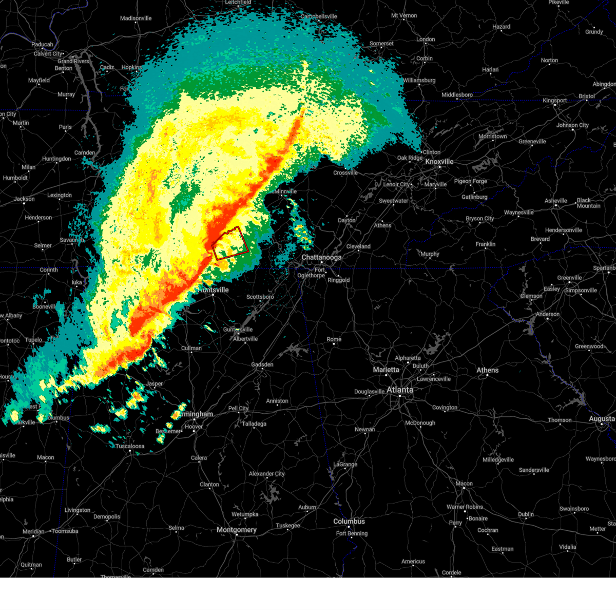 At 1208 am cdt, a severe thunderstorm capable of producing a tornado was located near fayetteville, moving east at 40 mph (radar indicated rotation). Hazards include tornado. Flying debris will be dangerous to those caught without shelter. mobile homes will be damaged or destroyed. damage to roofs, windows, and vehicles will occur. tree damage is likely. Locations impacted include, fayetteville, lynchburg, tims ford lake, lexie crossroads, mulberry, harmony, hurdlow, lois, mimosa and booneville. At 1208 am cdt, a severe thunderstorm capable of producing a tornado was located near fayetteville, moving east at 40 mph (radar indicated rotation). Hazards include tornado. Flying debris will be dangerous to those caught without shelter. mobile homes will be damaged or destroyed. damage to roofs, windows, and vehicles will occur. tree damage is likely. Locations impacted include, fayetteville, lynchburg, tims ford lake, lexie crossroads, mulberry, harmony, hurdlow, lois, mimosa and booneville.
|
| 3/25/2023 12:06 AM CDT |
 At 1205 am cdt, severe thunderstorms were located along a line extending from near lynchburg to near fayetteville to near harvest to near tanner, moving east at 45 mph (radar indicated). Hazards include 60 mph wind gusts and quarter size hail. Hail damage to vehicles is expected. Expect wind damage to roofs, siding, and trees. At 1205 am cdt, severe thunderstorms were located along a line extending from near lynchburg to near fayetteville to near harvest to near tanner, moving east at 45 mph (radar indicated). Hazards include 60 mph wind gusts and quarter size hail. Hail damage to vehicles is expected. Expect wind damage to roofs, siding, and trees.
|
| 3/25/2023 12:00 AM CDT | Damage reported at the hospital in fayetteville. multiple trees reported down as well. possible tornad in lincoln county TN, 0.2 miles S of Fayetteville, TN |
| 3/25/2023 12:00 AM CDT |
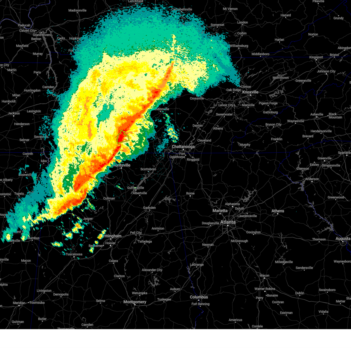 At 1200 am cdt, a severe thunderstorm was located near petersburg, or 8 miles north of fayetteville, moving east at 50 mph (radar indicated). Hazards include 60 mph wind gusts and quarter size hail. Hail damage to vehicles is expected. expect wind damage to roofs, siding, and trees. locations impacted include, fayetteville, mulberry, chestnut ridge, howell, belleville, harms, mimosa and booneville. hail threat, radar indicated max hail size, 1. 00 in wind threat, radar indicated max wind gust, 60 mph. At 1200 am cdt, a severe thunderstorm was located near petersburg, or 8 miles north of fayetteville, moving east at 50 mph (radar indicated). Hazards include 60 mph wind gusts and quarter size hail. Hail damage to vehicles is expected. expect wind damage to roofs, siding, and trees. locations impacted include, fayetteville, mulberry, chestnut ridge, howell, belleville, harms, mimosa and booneville. hail threat, radar indicated max hail size, 1. 00 in wind threat, radar indicated max wind gust, 60 mph.
|
| 3/24/2023 11:58 PM CDT |
 At 1158 pm cdt, a severe thunderstorm capable of producing a tornado was located over fayetteville, moving east at 50 mph (radar indicated rotation). Hazards include tornado. Flying debris will be dangerous to those caught without shelter. mobile homes will be damaged or destroyed. damage to roofs, windows, and vehicles will occur. tree damage is likely. this dangerous storm will be near, lynchburg around 1215 am cdt. tims ford lake around 1230 am cdt. Other locations impacted by this tornadic thunderstorm include lexie crossroads, mulberry, howell, harmony, hurdlow, lois, mimosa, booneville, marble hill and skinem. At 1158 pm cdt, a severe thunderstorm capable of producing a tornado was located over fayetteville, moving east at 50 mph (radar indicated rotation). Hazards include tornado. Flying debris will be dangerous to those caught without shelter. mobile homes will be damaged or destroyed. damage to roofs, windows, and vehicles will occur. tree damage is likely. this dangerous storm will be near, lynchburg around 1215 am cdt. tims ford lake around 1230 am cdt. Other locations impacted by this tornadic thunderstorm include lexie crossroads, mulberry, howell, harmony, hurdlow, lois, mimosa, booneville, marble hill and skinem.
|
| 3/24/2023 11:57 PM CDT |
 At 1157 pm cdt, severe thunderstorms were located along a line extending from near fayetteville to near hazel green to near harvest, moving east at 60 mph (radar indicated). Hazards include 60 mph wind gusts and quarter size hail. Hail damage to vehicles is expected. expect wind damage to roofs, siding, and trees. Locations impacted include, northern huntsville, athens, fayetteville, moores mill, meridianville, hazel green, alabama a and m university, harvest, new market and lincoln. At 1157 pm cdt, severe thunderstorms were located along a line extending from near fayetteville to near hazel green to near harvest, moving east at 60 mph (radar indicated). Hazards include 60 mph wind gusts and quarter size hail. Hail damage to vehicles is expected. expect wind damage to roofs, siding, and trees. Locations impacted include, northern huntsville, athens, fayetteville, moores mill, meridianville, hazel green, alabama a and m university, harvest, new market and lincoln.
|
| 3/24/2023 11:49 PM CDT |
 At 1148 pm cdt, severe thunderstorms were located along a line extending from 10 miles west of fayetteville to near ardmore to near athens, moving east at 60 mph (radar indicated). Hazards include 60 mph wind gusts and quarter size hail. Hail damage to vehicles is expected. expect wind damage to roofs, siding, and trees. Locations impacted include, northern huntsville, athens, fayetteville, moores mill, meridianville, hazel green, ardmore, harvest, alabama a and m university and new market. At 1148 pm cdt, severe thunderstorms were located along a line extending from 10 miles west of fayetteville to near ardmore to near athens, moving east at 60 mph (radar indicated). Hazards include 60 mph wind gusts and quarter size hail. Hail damage to vehicles is expected. expect wind damage to roofs, siding, and trees. Locations impacted include, northern huntsville, athens, fayetteville, moores mill, meridianville, hazel green, ardmore, harvest, alabama a and m university and new market.
|
| 3/24/2023 11:39 PM CDT |
 At 1138 pm cdt, a severe thunderstorm was located 10 miles east of pulaski, moving east at 60 mph (radar indicated). Hazards include 60 mph wind gusts and quarter size hail. Hail damage to vehicles is expected. Expect wind damage to roofs, siding, and trees. At 1138 pm cdt, a severe thunderstorm was located 10 miles east of pulaski, moving east at 60 mph (radar indicated). Hazards include 60 mph wind gusts and quarter size hail. Hail damage to vehicles is expected. Expect wind damage to roofs, siding, and trees.
|
| 3/24/2023 11:33 PM CDT |
 At 1131 pm cdt, severe thunderstorms were located along a line extending from 9 miles northwest of ardmore to 9 miles north of athens to near rogersville, moving east at 60 mph (radar indicated). Hazards include 70 mph wind gusts and half dollar size hail. Hail damage to vehicles is expected. expect considerable tree damage. wind damage is also likely to mobile homes, roofs, and outbuildings. Locations impacted include, huntsville, madison, athens, fayetteville, moores mill, meridianville, redstone arsenal, hazel green, rogersville and ardmore. At 1131 pm cdt, severe thunderstorms were located along a line extending from 9 miles northwest of ardmore to 9 miles north of athens to near rogersville, moving east at 60 mph (radar indicated). Hazards include 70 mph wind gusts and half dollar size hail. Hail damage to vehicles is expected. expect considerable tree damage. wind damage is also likely to mobile homes, roofs, and outbuildings. Locations impacted include, huntsville, madison, athens, fayetteville, moores mill, meridianville, redstone arsenal, hazel green, rogersville and ardmore.
|
| 3/24/2023 11:12 PM CDT |
 At 1111 pm cdt, severe thunderstorms were located along a line extending from 6 miles east of lexington to rogersville to near leighton, moving east at 70 mph (radar indicated). Hazards include 70 mph wind gusts and half dollar size hail. Hail damage to vehicles is expected. expect considerable tree damage. Wind damage is also likely to mobile homes, roofs, and outbuildings. At 1111 pm cdt, severe thunderstorms were located along a line extending from 6 miles east of lexington to rogersville to near leighton, moving east at 70 mph (radar indicated). Hazards include 70 mph wind gusts and half dollar size hail. Hail damage to vehicles is expected. expect considerable tree damage. Wind damage is also likely to mobile homes, roofs, and outbuildings.
|
| 3/3/2023 11:33 AM CST |
 At 1131 am cst, severe thunderstorms were located along a line extending from 7 miles northwest of lynchburg to meridianville, moving northeast at 70 mph. huntsville airport has recorded a wind gusts of 69 mph and wind damage has been reported with this line of storms (radar indicated). Hazards include 70 mph wind gusts. Expect considerable tree damage. damage is likely to mobile homes, roofs, and outbuildings. locations impacted include, northern huntsville, madison, winchester, fayetteville, moores mill, meridianville, lynchburg, hazel green, decherd and estill springs. thunderstorm damage threat, considerable hail threat, radar indicated max hail size, <. 75 in wind threat, radar indicated max wind gust, 70 mph. At 1131 am cst, severe thunderstorms were located along a line extending from 7 miles northwest of lynchburg to meridianville, moving northeast at 70 mph. huntsville airport has recorded a wind gusts of 69 mph and wind damage has been reported with this line of storms (radar indicated). Hazards include 70 mph wind gusts. Expect considerable tree damage. damage is likely to mobile homes, roofs, and outbuildings. locations impacted include, northern huntsville, madison, winchester, fayetteville, moores mill, meridianville, lynchburg, hazel green, decherd and estill springs. thunderstorm damage threat, considerable hail threat, radar indicated max hail size, <. 75 in wind threat, radar indicated max wind gust, 70 mph.
|
| 3/3/2023 11:25 AM CST |
 The severe thunderstorm warning for northwestern madison, eastern limestone, central morgan, central moore and lincoln counties will expire at 1130 am cst, the storm which prompted the warning has moved out of the area. therefore, the warning will be allowed to expire. however strong to damaging non thunderstorm winds are still possible with this thunderstorm. a tornado watch remains in effect until 100 pm cst for north central and northwestern alabama, and middle tennessee. a tornado watch also remains in effect until 400 pm cst for northeastern alabama, and middle tennessee. The severe thunderstorm warning for northwestern madison, eastern limestone, central morgan, central moore and lincoln counties will expire at 1130 am cst, the storm which prompted the warning has moved out of the area. therefore, the warning will be allowed to expire. however strong to damaging non thunderstorm winds are still possible with this thunderstorm. a tornado watch remains in effect until 100 pm cst for north central and northwestern alabama, and middle tennessee. a tornado watch also remains in effect until 400 pm cst for northeastern alabama, and middle tennessee.
|
| 3/3/2023 11:25 AM CST |
 At 1123 am cst, severe thunderstorms were located along a line extending from near petersburg to near madison, moving northeast at 100 mph (radar indicated). Hazards include 70 mph wind gusts. Expect considerable tree damage. Damage is likely to mobile homes, roofs, and outbuildings. At 1123 am cst, severe thunderstorms were located along a line extending from near petersburg to near madison, moving northeast at 100 mph (radar indicated). Hazards include 70 mph wind gusts. Expect considerable tree damage. Damage is likely to mobile homes, roofs, and outbuildings.
|
| 3/3/2023 11:25 AM CST |
 The severe thunderstorm warning for northwestern madison, eastern limestone, central morgan, central moore and lincoln counties will expire at 1130 am cst, the storm which prompted the warning has moved out of the area. therefore, the warning will be allowed to expire. however strong to damaging non thunderstorm winds are still possible with this thunderstorm. a tornado watch remains in effect until 100 pm cst for north central and northwestern alabama, and middle tennessee. a tornado watch also remains in effect until 400 pm cst for northeastern alabama, and middle tennessee. The severe thunderstorm warning for northwestern madison, eastern limestone, central morgan, central moore and lincoln counties will expire at 1130 am cst, the storm which prompted the warning has moved out of the area. therefore, the warning will be allowed to expire. however strong to damaging non thunderstorm winds are still possible with this thunderstorm. a tornado watch remains in effect until 100 pm cst for north central and northwestern alabama, and middle tennessee. a tornado watch also remains in effect until 400 pm cst for northeastern alabama, and middle tennessee.
|
| 3/3/2023 11:09 AM CST |
 At 1108 am cst, a severe thunderstorm was located near ardmore, or 11 miles north of athens, moving northeast at 60 mph (radar indicated). Hazards include 70 mph wind gusts. Expect considerable tree damage. Damage is likely to mobile homes, roofs, and outbuildings. At 1108 am cst, a severe thunderstorm was located near ardmore, or 11 miles north of athens, moving northeast at 60 mph (radar indicated). Hazards include 70 mph wind gusts. Expect considerable tree damage. Damage is likely to mobile homes, roofs, and outbuildings.
|
| 2/16/2023 5:59 PM CST |
 At 559 pm cst, a severe thunderstorm was located near fayetteville, moving east at 35 mph (radar indicated). Hazards include 60 mph wind gusts and penny size hail. Expect damage to roofs, siding, and trees. locations impacted include, fayetteville, petersburg, lincoln, howell, belleview, skinem, molino, coldwater, blanche and harms. hail threat, radar indicated max hail size, 0. 75 in wind threat, radar indicated max wind gust, 60 mph. At 559 pm cst, a severe thunderstorm was located near fayetteville, moving east at 35 mph (radar indicated). Hazards include 60 mph wind gusts and penny size hail. Expect damage to roofs, siding, and trees. locations impacted include, fayetteville, petersburg, lincoln, howell, belleview, skinem, molino, coldwater, blanche and harms. hail threat, radar indicated max hail size, 0. 75 in wind threat, radar indicated max wind gust, 60 mph.
|
| 2/16/2023 5:45 PM CST |
 At 544 pm cst, a severe thunderstorm was located 9 miles north of ardmore, or near dellrose, moving east at 35 mph (radar indicated). Hazards include 60 mph wind gusts and penny size hail. Expect damage to roofs, siding, and trees. locations impacted include, fayetteville, petersburg, lincoln, howell, dellrose, belleview, cash point, skinem, molino and mcburg. hail threat, radar indicated max hail size, 0. 75 in wind threat, radar indicated max wind gust, 60 mph. At 544 pm cst, a severe thunderstorm was located 9 miles north of ardmore, or near dellrose, moving east at 35 mph (radar indicated). Hazards include 60 mph wind gusts and penny size hail. Expect damage to roofs, siding, and trees. locations impacted include, fayetteville, petersburg, lincoln, howell, dellrose, belleview, cash point, skinem, molino and mcburg. hail threat, radar indicated max hail size, 0. 75 in wind threat, radar indicated max wind gust, 60 mph.
|
| 2/16/2023 5:29 PM CST |
 At 529 pm cst, a severe thunderstorm was located 8 miles south of pulaski, moving east at 35 mph (radar indicated). Hazards include 60 mph wind gusts and penny size hail. expect damage to roofs, siding, and trees At 529 pm cst, a severe thunderstorm was located 8 miles south of pulaski, moving east at 35 mph (radar indicated). Hazards include 60 mph wind gusts and penny size hail. expect damage to roofs, siding, and trees
|
| 1/12/2023 4:55 PM CST |
 At 455 pm cst, a severe thunderstorm was located 7 miles east of fayetteville, moving east at 45 mph (radar indicated). Hazards include 60 mph wind gusts and penny size hail. Expect damage to roofs, siding, and trees. locations impacted include, winchester, fayetteville, lynchburg, decherd, huntland, tims ford lake, lexie crossroads, mulberry, harmony and hurdlow. hail threat, radar indicated max hail size, 0. 75 in wind threat, radar indicated max wind gust, 60 mph. At 455 pm cst, a severe thunderstorm was located 7 miles east of fayetteville, moving east at 45 mph (radar indicated). Hazards include 60 mph wind gusts and penny size hail. Expect damage to roofs, siding, and trees. locations impacted include, winchester, fayetteville, lynchburg, decherd, huntland, tims ford lake, lexie crossroads, mulberry, harmony and hurdlow. hail threat, radar indicated max hail size, 0. 75 in wind threat, radar indicated max wind gust, 60 mph.
|
| 1/12/2023 4:50 PM CST |
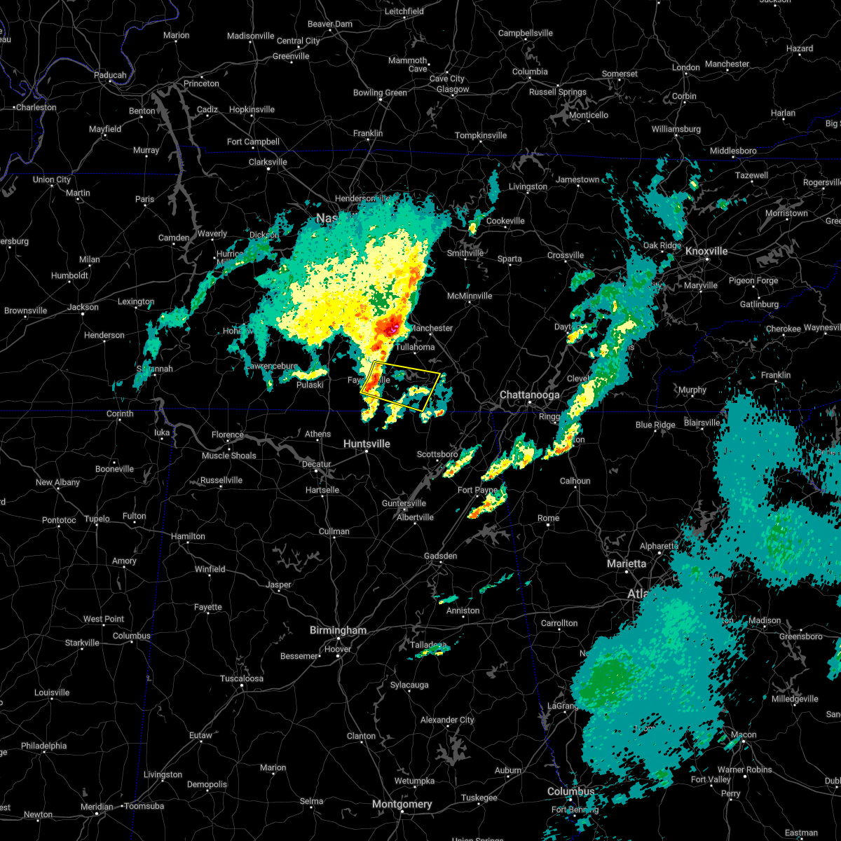 At 450 pm cst, a severe thunderstorm was located near fayetteville, moving east at 45 mph (radar indicated). Hazards include 60 mph wind gusts and penny size hail. expect damage to roofs, siding, and trees At 450 pm cst, a severe thunderstorm was located near fayetteville, moving east at 45 mph (radar indicated). Hazards include 60 mph wind gusts and penny size hail. expect damage to roofs, siding, and trees
|
| 7/7/2022 4:32 PM CDT |
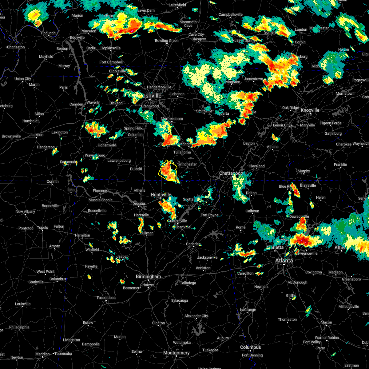 At 431 pm cdt, a severe thunderstorm was located near fayetteville, moving southeast at 15 mph (radar indicated). Hazards include 60 mph wind gusts and penny size hail. Expect damage to roofs, siding, and trees. locations impacted include, fayetteville, lincoln, mulberry, elora, hurdlow, mimosa, booneville, marble hill, skinem and smithland. hail threat, radar indicated max hail size, 0. 75 in wind threat, radar indicated max wind gust, 60 mph. At 431 pm cdt, a severe thunderstorm was located near fayetteville, moving southeast at 15 mph (radar indicated). Hazards include 60 mph wind gusts and penny size hail. Expect damage to roofs, siding, and trees. locations impacted include, fayetteville, lincoln, mulberry, elora, hurdlow, mimosa, booneville, marble hill, skinem and smithland. hail threat, radar indicated max hail size, 0. 75 in wind threat, radar indicated max wind gust, 60 mph.
|
| 7/7/2022 4:21 PM CDT |
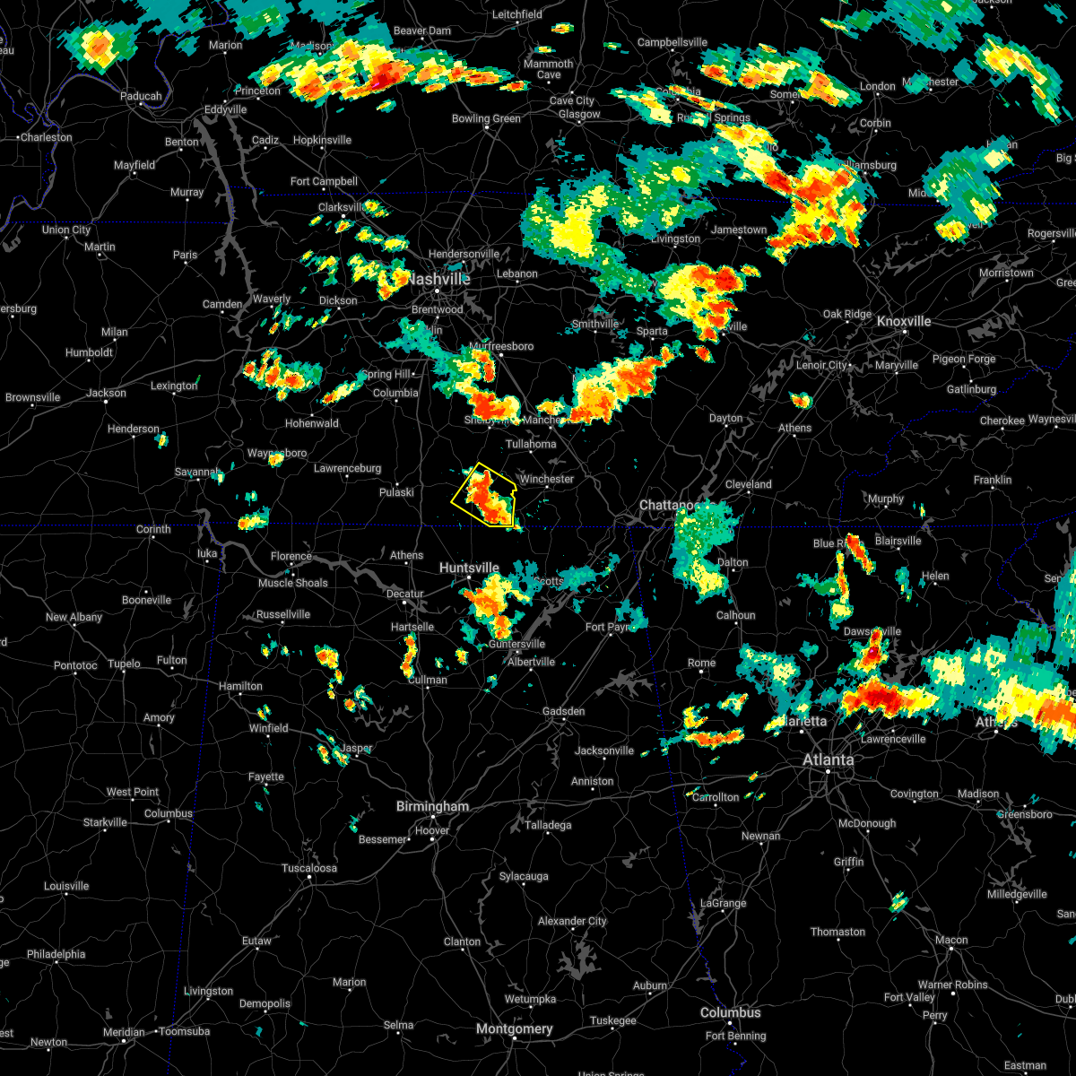 At 421 pm cdt, a severe thunderstorm was located near fayetteville, moving southeast at 15 mph (radar indicated). Hazards include 60 mph wind gusts and penny size hail. expect damage to roofs, siding, and trees At 421 pm cdt, a severe thunderstorm was located near fayetteville, moving southeast at 15 mph (radar indicated). Hazards include 60 mph wind gusts and penny size hail. expect damage to roofs, siding, and trees
|
| 6/17/2022 1:14 PM CDT | Trees down across bugtussel road just south of the southern end of e clark and bugtussel roa in lincoln county TN, 11.4 miles E of Fayetteville, TN |
| 6/17/2022 12:07 PM CDT |
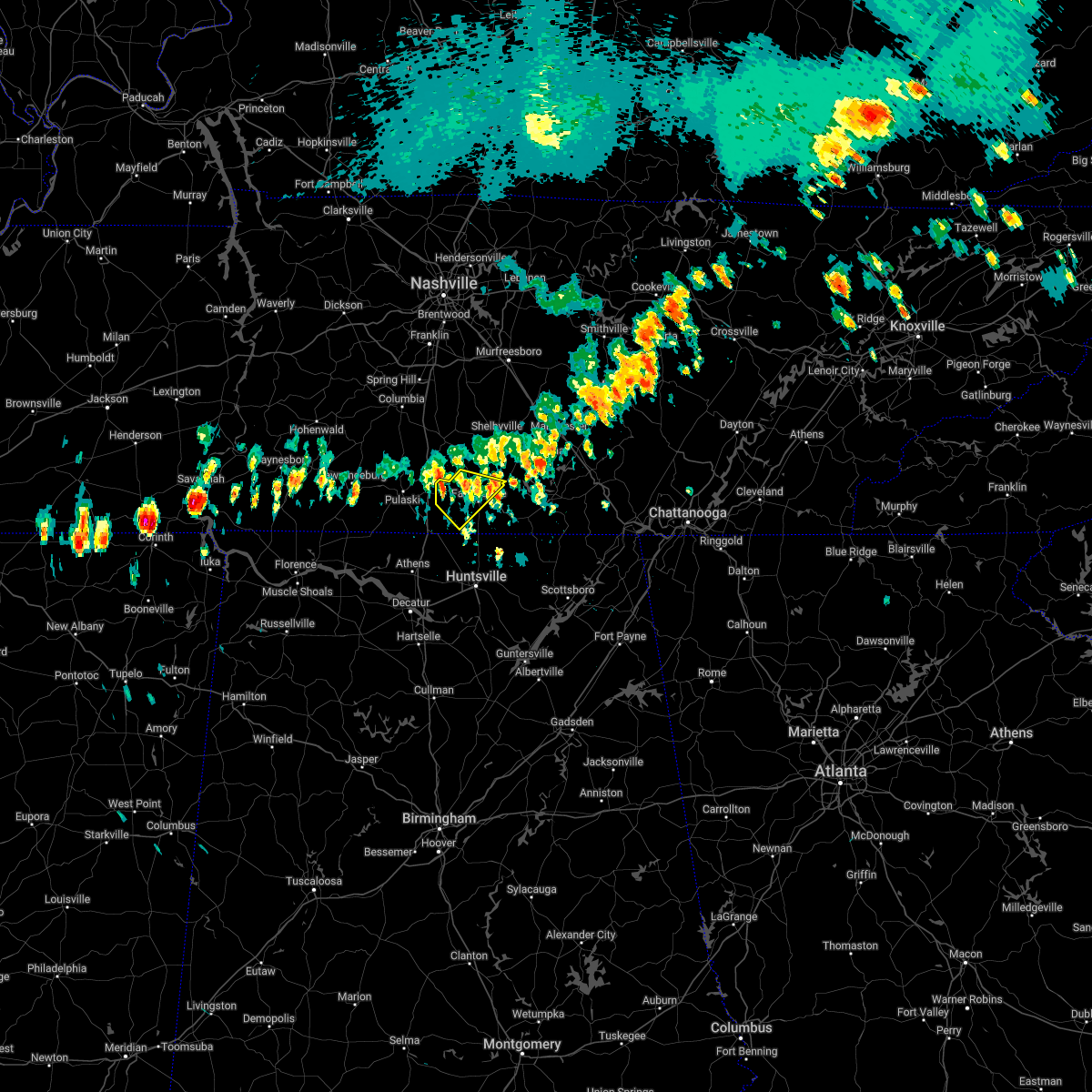 At 1206 pm cdt, a severe thunderstorm was located 7 miles southwest of petersburg, or 10 miles northwest of fayetteville, moving southeast at 25 mph (radar indicated). Hazards include 60 mph wind gusts and quarter size hail. Hail damage to vehicles is expected. expect wind damage to roofs, siding, and trees. locations impacted include, fayetteville, mulberry, howell, belleville, mcburg, coldwater, harms, mimosa, camargo and boonshill. hail threat, radar indicated max hail size, 1. 00 in wind threat, radar indicated max wind gust, 60 mph. At 1206 pm cdt, a severe thunderstorm was located 7 miles southwest of petersburg, or 10 miles northwest of fayetteville, moving southeast at 25 mph (radar indicated). Hazards include 60 mph wind gusts and quarter size hail. Hail damage to vehicles is expected. expect wind damage to roofs, siding, and trees. locations impacted include, fayetteville, mulberry, howell, belleville, mcburg, coldwater, harms, mimosa, camargo and boonshill. hail threat, radar indicated max hail size, 1. 00 in wind threat, radar indicated max wind gust, 60 mph.
|
| 6/17/2022 11:51 AM CDT |
 At 1150 am cdt, a severe thunderstorm was located 11 miles west of petersburg, or 12 miles northeast of pulaski, moving southeast at 25 mph (radar indicated). Hazards include 60 mph wind gusts and quarter size hail. Hail damage to vehicles is expected. Expect wind damage to roofs, siding, and trees. At 1150 am cdt, a severe thunderstorm was located 11 miles west of petersburg, or 12 miles northeast of pulaski, moving southeast at 25 mph (radar indicated). Hazards include 60 mph wind gusts and quarter size hail. Hail damage to vehicles is expected. Expect wind damage to roofs, siding, and trees.
|
| 5/6/2022 1:51 PM CDT |
 The severe thunderstorm warning for central moore and central lincoln counties will expire at 200 pm cdt, the storm which prompted the warning has weakened below severe limits, and no longer poses an immediate threat to life or property. therefore, the warning will be allowed to expire. however gusty winds are still possible with this thunderstorm. The severe thunderstorm warning for central moore and central lincoln counties will expire at 200 pm cdt, the storm which prompted the warning has weakened below severe limits, and no longer poses an immediate threat to life or property. therefore, the warning will be allowed to expire. however gusty winds are still possible with this thunderstorm.
|
| 5/6/2022 1:43 PM CDT |
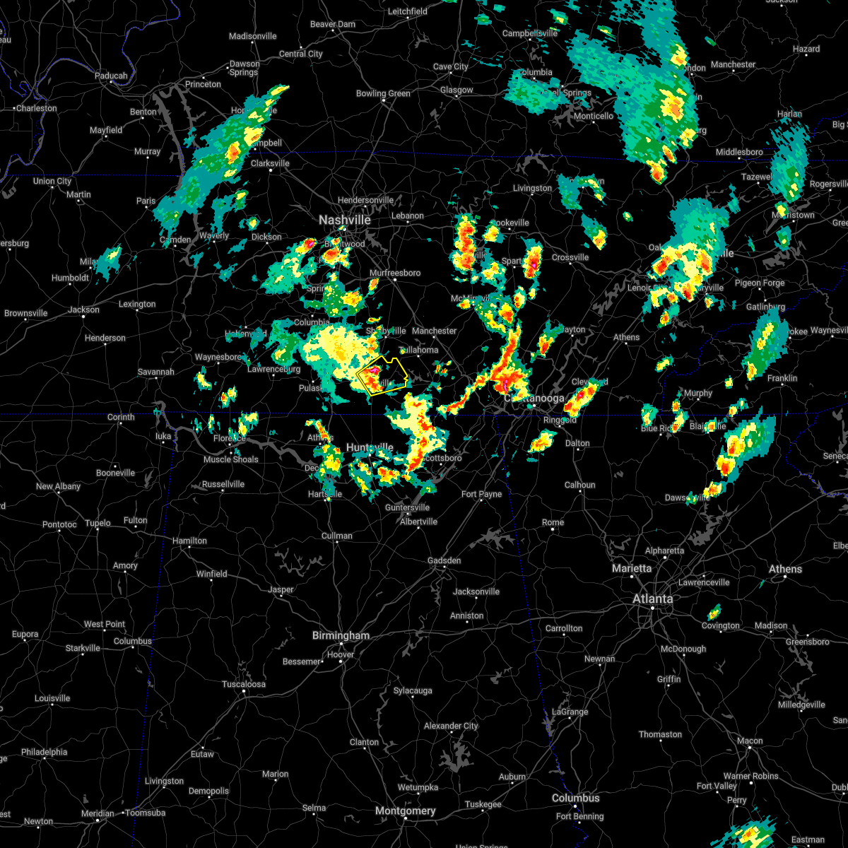 At 143 pm cdt, a severe thunderstorm was located 7 miles northeast of fayetteville, moving northeast at 45 mph (radar indicated). Hazards include 60 mph wind gusts and penny size hail. Expect damage to roofs, siding, and trees. locations impacted include, fayetteville, lynchburg, mulberry, chestnut ridge, howell, belleville, hurdlow, lois, mimosa and booneville. hail threat, radar indicated max hail size, 0. 75 in wind threat, radar indicated max wind gust, 60 mph. At 143 pm cdt, a severe thunderstorm was located 7 miles northeast of fayetteville, moving northeast at 45 mph (radar indicated). Hazards include 60 mph wind gusts and penny size hail. Expect damage to roofs, siding, and trees. locations impacted include, fayetteville, lynchburg, mulberry, chestnut ridge, howell, belleville, hurdlow, lois, mimosa and booneville. hail threat, radar indicated max hail size, 0. 75 in wind threat, radar indicated max wind gust, 60 mph.
|
| 5/6/2022 1:27 PM CDT |
 At 127 pm cdt, a severe thunderstorm was located near fayetteville, moving northeast at 45 mph (radar indicated). Hazards include 60 mph wind gusts and penny size hail. expect damage to roofs, siding, and trees At 127 pm cdt, a severe thunderstorm was located near fayetteville, moving northeast at 45 mph (radar indicated). Hazards include 60 mph wind gusts and penny size hail. expect damage to roofs, siding, and trees
|
| 4/13/2022 8:15 PM CDT |
 At 814 pm cdt, severe thunderstorms were located along a line extending from 10 miles southwest of shelbyville to 6 miles south of petersburg to 11 miles west of fayetteville to ardmore, moving east at 65 mph (radar indicated). Hazards include 70 mph wind gusts. Expect considerable tree damage. damage is likely to mobile homes, roofs, and outbuildings. locations impacted include, fayetteville, lynchburg, ardmore, petersburg, tims ford lake, lincoln, howell, elora, hurdlow and mimosa. thunderstorm damage threat, considerable hail threat, radar indicated max hail size, <. 75 in wind threat, radar indicated max wind gust, 70 mph. At 814 pm cdt, severe thunderstorms were located along a line extending from 10 miles southwest of shelbyville to 6 miles south of petersburg to 11 miles west of fayetteville to ardmore, moving east at 65 mph (radar indicated). Hazards include 70 mph wind gusts. Expect considerable tree damage. damage is likely to mobile homes, roofs, and outbuildings. locations impacted include, fayetteville, lynchburg, ardmore, petersburg, tims ford lake, lincoln, howell, elora, hurdlow and mimosa. thunderstorm damage threat, considerable hail threat, radar indicated max hail size, <. 75 in wind threat, radar indicated max wind gust, 70 mph.
|
| 4/13/2022 7:52 PM CDT |
 At 751 pm cdt, severe thunderstorms were located along a line extending from 15 miles southwest of lewisburg to near pulaski to 12 miles northeast of lexington to near rogersville, moving east at 60 mph (radar indicated). Hazards include 70 mph wind gusts. Expect considerable tree damage. Damage is likely to mobile homes, roofs, and outbuildings. At 751 pm cdt, severe thunderstorms were located along a line extending from 15 miles southwest of lewisburg to near pulaski to 12 miles northeast of lexington to near rogersville, moving east at 60 mph (radar indicated). Hazards include 70 mph wind gusts. Expect considerable tree damage. Damage is likely to mobile homes, roofs, and outbuildings.
|
| 3/30/2022 11:05 PM CDT | A tree was reported down on louse creek roa in moore county TN, 11.2 miles WSW of Fayetteville, TN |
| 3/30/2022 10:26 PM CDT |
 At 1024 pm cdt, severe thunderstorms were located along a line extending from near hazel green to 7 miles southeast of helicon, moving east at 40 mph (radar indicated). Hazards include 60 mph wind gusts. expect damage to roofs, siding, and trees At 1024 pm cdt, severe thunderstorms were located along a line extending from near hazel green to 7 miles southeast of helicon, moving east at 40 mph (radar indicated). Hazards include 60 mph wind gusts. expect damage to roofs, siding, and trees
|
| 3/30/2022 9:27 PM CDT |
 At 926 pm cdt, severe thunderstorms were located along a line extending from pulaski to near poplar springs, moving northeast at 55 mph (radar indicated). Hazards include 60 mph wind gusts. expect damage to roofs, siding, and trees At 926 pm cdt, severe thunderstorms were located along a line extending from pulaski to near poplar springs, moving northeast at 55 mph (radar indicated). Hazards include 60 mph wind gusts. expect damage to roofs, siding, and trees
|
| 2/22/2022 8:10 PM CST |
 The severe thunderstorm warning for central moore and lincoln counties will expire at 815 pm cst, the storm which prompted the warning has weakened below severe limits, and no longer poses an immediate threat to life or property. therefore, the warning will be allowed to expire. however gusty winds are still possible with this thunderstorm. a tornado watch remains in effect until midnight cst for north central and northeastern alabama. The severe thunderstorm warning for central moore and lincoln counties will expire at 815 pm cst, the storm which prompted the warning has weakened below severe limits, and no longer poses an immediate threat to life or property. therefore, the warning will be allowed to expire. however gusty winds are still possible with this thunderstorm. a tornado watch remains in effect until midnight cst for north central and northeastern alabama.
|
| 2/22/2022 7:49 PM CST |
 At 749 pm cst, a severe thunderstorm was located near ardmore, or 14 miles southeast of pulaski, moving east at 40 mph (radar indicated). Hazards include 60 mph wind gusts. expect damage to roofs, siding, and trees At 749 pm cst, a severe thunderstorm was located near ardmore, or 14 miles southeast of pulaski, moving east at 40 mph (radar indicated). Hazards include 60 mph wind gusts. expect damage to roofs, siding, and trees
|
| 2/22/2022 6:53 PM CST |
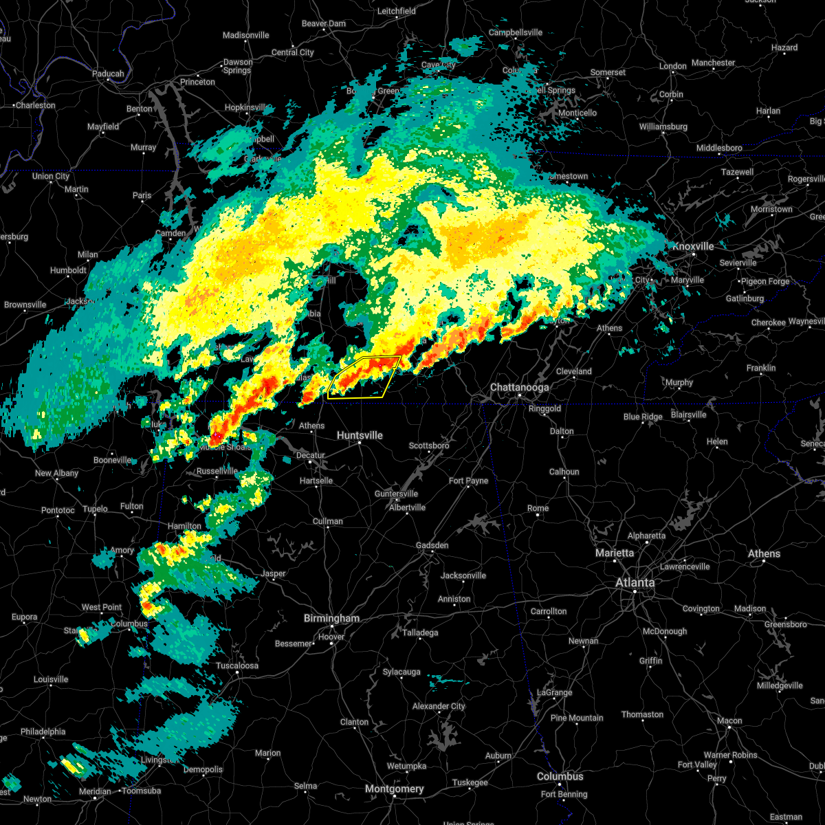 The severe thunderstorm warning for central moore and lincoln counties will expire at 700 pm cst, the storm which prompted the warning has weakened below severe limits, and no longer poses an immediate threat to life or property. therefore, the warning will be allowed to expire. however small hail and gusty winds are still possible with this thunderstorm. a tornado watch remains in effect until midnight cst for north central alabama. The severe thunderstorm warning for central moore and lincoln counties will expire at 700 pm cst, the storm which prompted the warning has weakened below severe limits, and no longer poses an immediate threat to life or property. therefore, the warning will be allowed to expire. however small hail and gusty winds are still possible with this thunderstorm. a tornado watch remains in effect until midnight cst for north central alabama.
|
| 2/22/2022 6:42 PM CST |
 At 641 pm cst, a severe thunderstorm was located over fayetteville, moving east at 55 mph (radar indicated). Hazards include 60 mph wind gusts and pea size hail. Expect damage to roofs, siding, and trees. locations impacted include, fayetteville, lynchburg, tims ford lake, mulberry, howell, belleville, dellrose, hurdlow, belleview and lois. hail threat, radar indicated max hail size, 0. 88 in wind threat, radar indicated max wind gust, 60 mph. At 641 pm cst, a severe thunderstorm was located over fayetteville, moving east at 55 mph (radar indicated). Hazards include 60 mph wind gusts and pea size hail. Expect damage to roofs, siding, and trees. locations impacted include, fayetteville, lynchburg, tims ford lake, mulberry, howell, belleville, dellrose, hurdlow, belleview and lois. hail threat, radar indicated max hail size, 0. 88 in wind threat, radar indicated max wind gust, 60 mph.
|
| 2/22/2022 6:26 PM CST |
 At 625 pm cst, a severe thunderstorm was located 11 miles north of ardmore, or 12 miles east of pulaski, moving east at 50 mph (radar indicated). Hazards include 60 mph wind gusts and pea size hail. expect damage to roofs, siding, and trees At 625 pm cst, a severe thunderstorm was located 11 miles north of ardmore, or 12 miles east of pulaski, moving east at 50 mph (radar indicated). Hazards include 60 mph wind gusts and pea size hail. expect damage to roofs, siding, and trees
|
| 1/1/2022 6:43 PM CST |
 The severe thunderstorm warning for northern madison. moore. southeastern lincoln and western franklin counties will expire at 645 pm cst. the storms which prompted the warning have weakened below severe limits, and no longer pose an immediate threat to life or property. Therefore, the warning will be allowed to expire. The severe thunderstorm warning for northern madison. moore. southeastern lincoln and western franklin counties will expire at 645 pm cst. the storms which prompted the warning have weakened below severe limits, and no longer pose an immediate threat to life or property. Therefore, the warning will be allowed to expire.
|
| 1/1/2022 6:43 PM CST |
 The severe thunderstorm warning for northern madison, moore, southeastern lincoln and western franklin counties will expire at 645 pm cst, the storms which prompted the warning have weakened below severe limits, and no longer pose an immediate threat to life or property. therefore, the warning will be allowed to expire. a tornado watch remains in effect until 700 pm cst for north central, northeastern and northwestern alabama, and middle tennessee. a tornado watch also remains in effect until 1000 pm cst for northeastern alabama. remember, a tornado warning still remains in effect for southern franklin county in southern middle tennessee. The severe thunderstorm warning for northern madison, moore, southeastern lincoln and western franklin counties will expire at 645 pm cst, the storms which prompted the warning have weakened below severe limits, and no longer pose an immediate threat to life or property. therefore, the warning will be allowed to expire. a tornado watch remains in effect until 700 pm cst for north central, northeastern and northwestern alabama, and middle tennessee. a tornado watch also remains in effect until 1000 pm cst for northeastern alabama. remember, a tornado warning still remains in effect for southern franklin county in southern middle tennessee.
|
| 1/1/2022 6:23 PM CST | Tree down along old fayetteville highwa in moore county TN, 11.9 miles SW of Fayetteville, TN |
| 1/1/2022 6:23 PM CST |
 At 623 pm cst, severe thunderstorms were located along a line extending from near lynchburg to near university of alabama in huntsville, moving east at 45 mph (radar indicated). Hazards include 60 mph wind gusts. Expect damage to roofs, siding, and trees. locations impacted include, northern huntsville, madison, winchester, lynchburg, moores mill, meridianville, hazel green, decherd, estill springs and huntland. hail threat, radar indicated max hail size, <. 75 in wind threat, radar indicated max wind gust, 60 mph. At 623 pm cst, severe thunderstorms were located along a line extending from near lynchburg to near university of alabama in huntsville, moving east at 45 mph (radar indicated). Hazards include 60 mph wind gusts. Expect damage to roofs, siding, and trees. locations impacted include, northern huntsville, madison, winchester, lynchburg, moores mill, meridianville, hazel green, decherd, estill springs and huntland. hail threat, radar indicated max hail size, <. 75 in wind threat, radar indicated max wind gust, 60 mph.
|
| 1/1/2022 6:00 PM CST |
 At 600 pm cst, severe thunderstorms were located along a line extending from near petersburg to near tanner, moving east at 50 mph (radar indicated). Hazards include 60 mph wind gusts. expect damage to roofs, siding, and trees At 600 pm cst, severe thunderstorms were located along a line extending from near petersburg to near tanner, moving east at 50 mph (radar indicated). Hazards include 60 mph wind gusts. expect damage to roofs, siding, and trees
|
| 1/1/2022 5:56 PM CST |
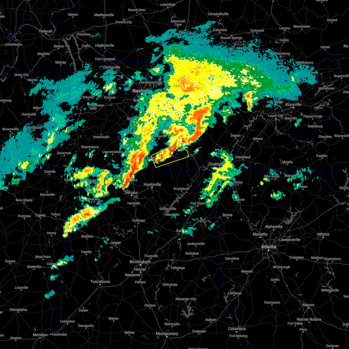 The severe thunderstorm warning for moore, southeastern lincoln and northern franklin counties will expire at 600 pm cst, the storm which prompted the warning has weakened below severe limits, and no longer poses an immediate threat to life or property. therefore, the warning will be allowed to expire. a tornado watch remains in effect until 700 pm cst for north central and northeastern alabama, and middle tennessee. The severe thunderstorm warning for moore, southeastern lincoln and northern franklin counties will expire at 600 pm cst, the storm which prompted the warning has weakened below severe limits, and no longer poses an immediate threat to life or property. therefore, the warning will be allowed to expire. a tornado watch remains in effect until 700 pm cst for north central and northeastern alabama, and middle tennessee.
|
| 1/1/2022 5:33 PM CST |
 At 532 pm cst, a severe thunderstorm was located near fayetteville, moving east at 50 mph (radar indicated). Hazards include 60 mph wind gusts. expect damage to roofs, siding, and trees At 532 pm cst, a severe thunderstorm was located near fayetteville, moving east at 50 mph (radar indicated). Hazards include 60 mph wind gusts. expect damage to roofs, siding, and trees
|
| 12/11/2021 6:41 AM CST | Tree down on clay ave in downtown fayetteville... t in lincoln county TN, 1.4 miles SE of Fayetteville, TN |
| 12/11/2021 6:41 AM CST |
 At 640 am cst, severe thunderstorms were located along a line extending from near petersburg to near fayetteville to 10 miles north of hazel green to 6 miles north of harvest, moving east at 60 mph (radar indicated). Hazards include 60 mph wind gusts. expect damage to roofs, siding, and trees At 640 am cst, severe thunderstorms were located along a line extending from near petersburg to near fayetteville to 10 miles north of hazel green to 6 miles north of harvest, moving east at 60 mph (radar indicated). Hazards include 60 mph wind gusts. expect damage to roofs, siding, and trees
|
| 12/6/2021 7:27 AM CST |
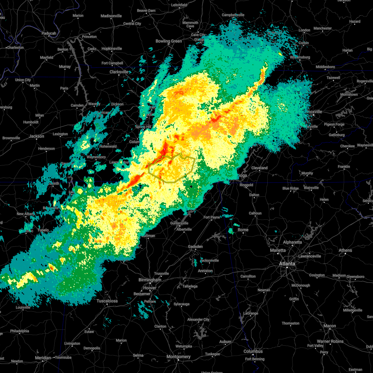 At 727 am cst, severe thunderstorms were located along a line extending from 9 miles northwest of shelbyville to near petersburg to 11 miles east of pulaski, moving southeast at 45 mph (radar indicated). Hazards include 70 mph wind gusts. Expect considerable tree damage. Damage is likely to mobile homes, roofs, and outbuildings. At 727 am cst, severe thunderstorms were located along a line extending from 9 miles northwest of shelbyville to near petersburg to 11 miles east of pulaski, moving southeast at 45 mph (radar indicated). Hazards include 70 mph wind gusts. Expect considerable tree damage. Damage is likely to mobile homes, roofs, and outbuildings.
|
| 10/6/2021 5:27 PM CDT |
 The severe thunderstorm warning for southeastern moore, southeastern lincoln and southwestern franklin counties will expire at 530 pm cdt, the storm which prompted the warning has weakened below severe limits, and no longer poses an immediate threat to life or property. therefore, the warning will be allowed to expire. however heavy rain is still possible with this thunderstorm. a tornado watch remains in effect until 1000 pm cdt for north central and northeastern alabama, and middle tennessee. to report severe weather, contact your nearest law enforcement agency. they will relay your report to the national weather service huntsville alabama. The severe thunderstorm warning for southeastern moore, southeastern lincoln and southwestern franklin counties will expire at 530 pm cdt, the storm which prompted the warning has weakened below severe limits, and no longer poses an immediate threat to life or property. therefore, the warning will be allowed to expire. however heavy rain is still possible with this thunderstorm. a tornado watch remains in effect until 1000 pm cdt for north central and northeastern alabama, and middle tennessee. to report severe weather, contact your nearest law enforcement agency. they will relay your report to the national weather service huntsville alabama.
|
| 10/6/2021 5:16 PM CDT |
 At 516 pm cdt, a severe thunderstorm was located near huntland, or 13 miles south of lynchburg, moving north at 30 mph (radar indicated). Hazards include 60 mph wind gusts and quarter size hail. Hail damage to vehicles is expected. expect wind damage to roofs, siding, and trees. locations impacted include, huntland, tims ford lake, lexie crossroads, harmony, elora, hurdlow, maxwell, marble hill, smithland and beans creek. hail threat, radar indicated max hail size, 1. 00 in wind threat, radar indicated max wind gust, 60 mph. At 516 pm cdt, a severe thunderstorm was located near huntland, or 13 miles south of lynchburg, moving north at 30 mph (radar indicated). Hazards include 60 mph wind gusts and quarter size hail. Hail damage to vehicles is expected. expect wind damage to roofs, siding, and trees. locations impacted include, huntland, tims ford lake, lexie crossroads, harmony, elora, hurdlow, maxwell, marble hill, smithland and beans creek. hail threat, radar indicated max hail size, 1. 00 in wind threat, radar indicated max wind gust, 60 mph.
|
| 10/6/2021 4:54 PM CDT |
 At 454 pm cdt, a severe thunderstorm was located 8 miles south of huntland, or 15 miles northeast of moores mill, moving north at 30 mph (radar indicated). Hazards include 60 mph wind gusts and quarter size hail. Hail damage to vehicles is expected. Expect wind damage to roofs, siding, and trees. At 454 pm cdt, a severe thunderstorm was located 8 miles south of huntland, or 15 miles northeast of moores mill, moving north at 30 mph (radar indicated). Hazards include 60 mph wind gusts and quarter size hail. Hail damage to vehicles is expected. Expect wind damage to roofs, siding, and trees.
|
| 8/1/2021 12:12 AM CDT |
 The severe thunderstorm warning for moore, lincoln and franklin counties will expire at 1215 am cdt, the storms which prompted the warning have moved out of the area. therefore, the warning will be allowed to expire. a severe thunderstorm watch remains in effect until 300 am cdt for north central and northeastern alabama, and middle tennessee. remember, a severe thunderstorm warning still remains in effect for franklin county tennessee until 100 am cdt. The severe thunderstorm warning for moore, lincoln and franklin counties will expire at 1215 am cdt, the storms which prompted the warning have moved out of the area. therefore, the warning will be allowed to expire. a severe thunderstorm watch remains in effect until 300 am cdt for north central and northeastern alabama, and middle tennessee. remember, a severe thunderstorm warning still remains in effect for franklin county tennessee until 100 am cdt.
|
| 7/31/2021 11:49 PM CDT |
 At 1148 pm cdt, severe thunderstorms were located along a line extending from 8 miles northwest of manchester to near lynchburg to 8 miles east of pulaski, moving east at 40 mph (radar indicated). Hazards include 60 mph wind gusts. Expect damage to roofs, siding, and trees. Locations impacted include, winchester, fayetteville, lynchburg, decherd, estill springs, cowan, huntland, petersburg, tims ford lake and sewanee. At 1148 pm cdt, severe thunderstorms were located along a line extending from 8 miles northwest of manchester to near lynchburg to 8 miles east of pulaski, moving east at 40 mph (radar indicated). Hazards include 60 mph wind gusts. Expect damage to roofs, siding, and trees. Locations impacted include, winchester, fayetteville, lynchburg, decherd, estill springs, cowan, huntland, petersburg, tims ford lake and sewanee.
|
| 7/31/2021 11:27 PM CDT |
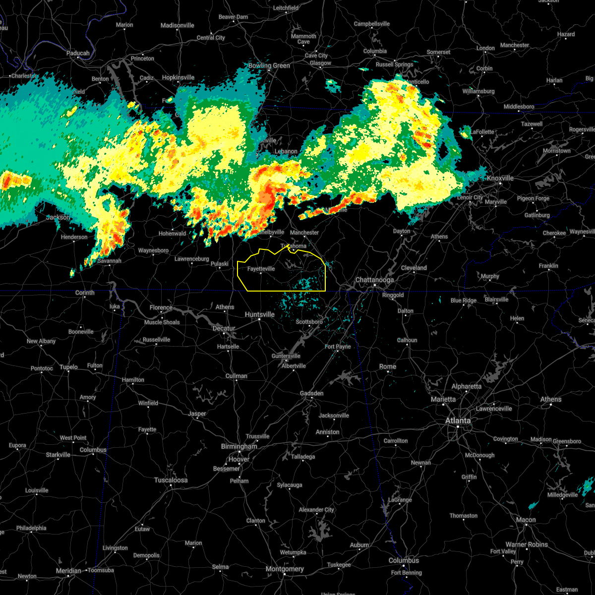 At 1126 pm cdt, severe thunderstorms were located along a line extending from 11 miles south of murfreesboro to 6 miles west of shelbyville to 8 miles southwest of lewisburg, moving southeast at 45 mph (radar indicated). Hazards include 60 mph wind gusts. expect damage to roofs, siding, and trees At 1126 pm cdt, severe thunderstorms were located along a line extending from 11 miles south of murfreesboro to 6 miles west of shelbyville to 8 miles southwest of lewisburg, moving southeast at 45 mph (radar indicated). Hazards include 60 mph wind gusts. expect damage to roofs, siding, and trees
|
| 5/6/2021 6:56 PM CDT |
 The severe thunderstorm warning for moore, lincoln and western franklin counties will expire at 700 pm cdt, the storms which prompted the warning have moved out of the area. therefore, the warning will be allowed to expire. remember, a severe thunderstorm warning still remains in effect for southeastern lincoln and franklin counties until 730 pm. The severe thunderstorm warning for moore, lincoln and western franklin counties will expire at 700 pm cdt, the storms which prompted the warning have moved out of the area. therefore, the warning will be allowed to expire. remember, a severe thunderstorm warning still remains in effect for southeastern lincoln and franklin counties until 730 pm.
|
| 5/6/2021 6:34 PM CDT | Trees down and hail of unknown size near park city. time estimated from rada in lincoln county TN, 4 miles N of Fayetteville, TN |
| 5/6/2021 6:28 PM CDT | Portions of a metal roof was peeled off of a home in park cit in lincoln county TN, 4.8 miles NNE of Fayetteville, TN |
| 5/6/2021 6:00 PM CDT |
 At 559 pm cdt, severe thunderstorms were located along a line extending from 11 miles northwest of shelbyville to 13 miles east of lexington, moving east at 35 mph (radar indicated). Hazards include 60 mph wind gusts and penny size hail. expect damage to roofs, siding, and trees At 559 pm cdt, severe thunderstorms were located along a line extending from 11 miles northwest of shelbyville to 13 miles east of lexington, moving east at 35 mph (radar indicated). Hazards include 60 mph wind gusts and penny size hail. expect damage to roofs, siding, and trees
|
| 5/4/2021 7:51 AM CDT |
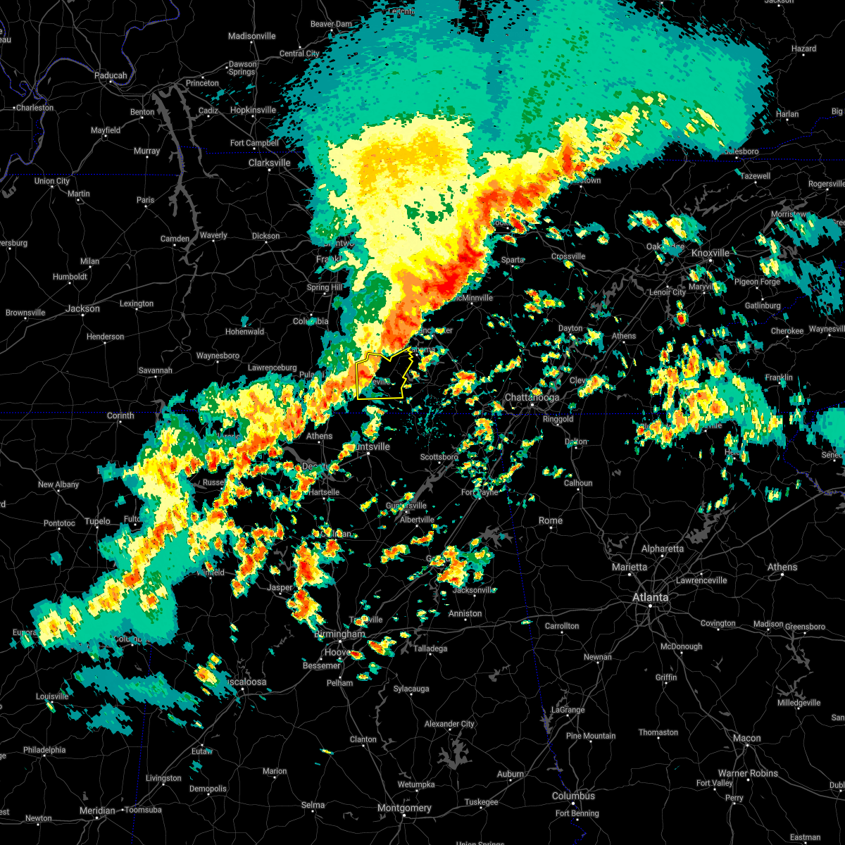 At 751 am cdt, a severe thunderstorm was located near fayetteville, moving east at 50 mph (radar indicated). Hazards include 60 mph wind gusts and quarter size hail. Hail damage to vehicles is expected. expect wind damage to roofs, siding, and trees. Locations impacted include, fayetteville, lynchburg, petersburg, tims ford lake, mulberry, chestnut ridge, howell, belleville, hurdlow and lois. At 751 am cdt, a severe thunderstorm was located near fayetteville, moving east at 50 mph (radar indicated). Hazards include 60 mph wind gusts and quarter size hail. Hail damage to vehicles is expected. expect wind damage to roofs, siding, and trees. Locations impacted include, fayetteville, lynchburg, petersburg, tims ford lake, mulberry, chestnut ridge, howell, belleville, hurdlow and lois.
|
| 5/4/2021 7:38 AM CDT |
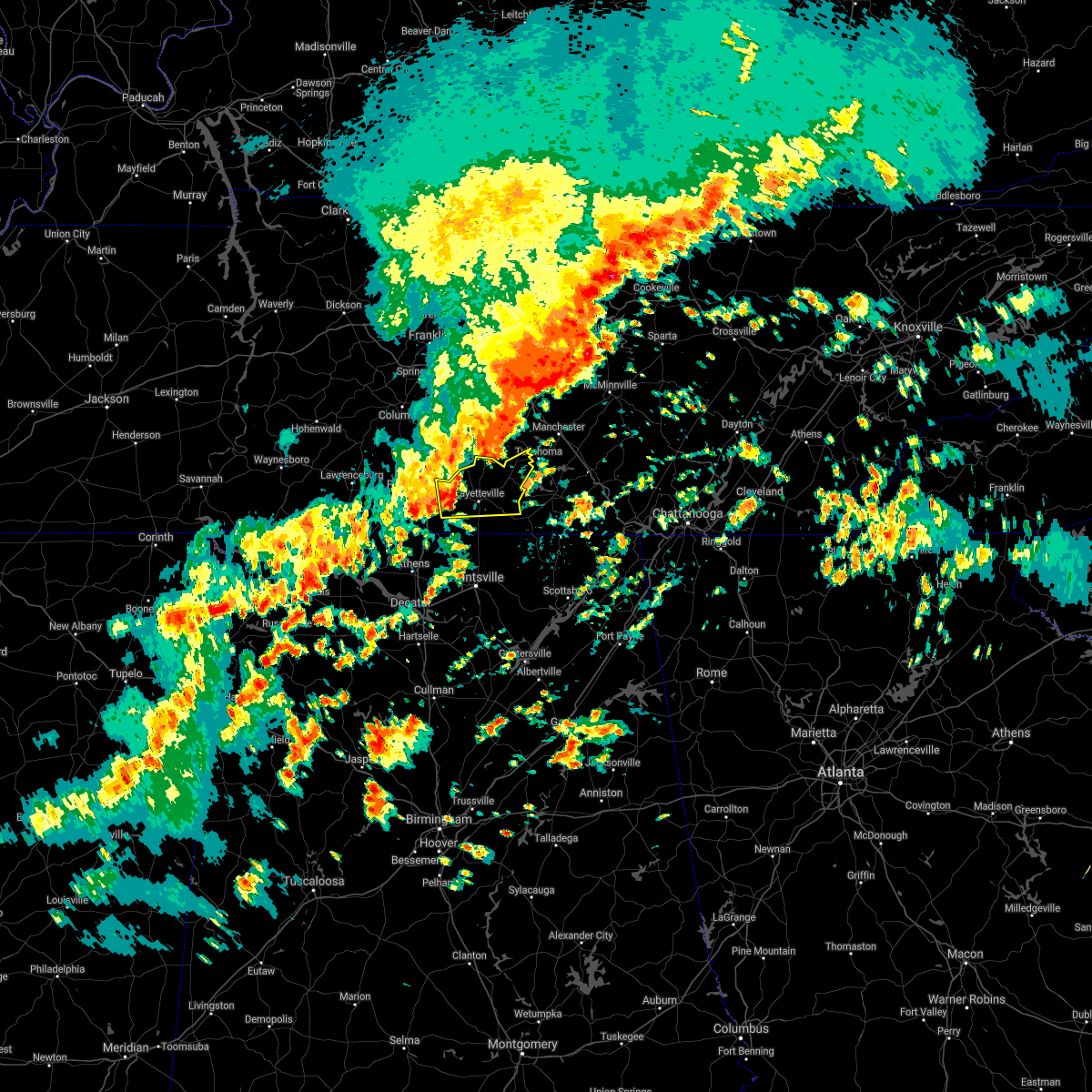 At 738 am cdt, a severe thunderstorm was located near fayetteville, moving east at 50 mph (radar indicated). Hazards include 60 mph wind gusts and quarter size hail. Hail damage to vehicles is expected. Expect wind damage to roofs, siding, and trees. At 738 am cdt, a severe thunderstorm was located near fayetteville, moving east at 50 mph (radar indicated). Hazards include 60 mph wind gusts and quarter size hail. Hail damage to vehicles is expected. Expect wind damage to roofs, siding, and trees.
|
| 5/23/2020 9:26 PM CDT |
 The severe thunderstorm warning for south central moore and east central lincoln counties will expire at 930 pm cdt, the storm which prompted the warning has weakened below severe limits, and no longer poses an immediate threat to life or property. therefore, the warning will be allowed to expire. however pea size hail and wind gusts around 40 mph are still possible with this thunderstorm. The severe thunderstorm warning for south central moore and east central lincoln counties will expire at 930 pm cdt, the storm which prompted the warning has weakened below severe limits, and no longer poses an immediate threat to life or property. therefore, the warning will be allowed to expire. however pea size hail and wind gusts around 40 mph are still possible with this thunderstorm.
|
| 5/23/2020 9:17 PM CDT |
 At 917 pm cdt, a severe thunderstorm was located near fayetteville, moving east at 25 mph (radar indicated). Hazards include quarter size hail. Damage to vehicles is expected. Locations impacted include, mulberry, lois, smithland and kelso. At 917 pm cdt, a severe thunderstorm was located near fayetteville, moving east at 25 mph (radar indicated). Hazards include quarter size hail. Damage to vehicles is expected. Locations impacted include, mulberry, lois, smithland and kelso.
|
| 5/23/2020 9:00 PM CDT |
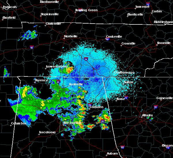 At 900 pm cdt, a severe thunderstorm was located over fayetteville, moving east at 25 mph (radar indicated). Hazards include quarter size hail. damage to vehicles is expected At 900 pm cdt, a severe thunderstorm was located over fayetteville, moving east at 25 mph (radar indicated). Hazards include quarter size hail. damage to vehicles is expected
|
| 5/22/2020 9:23 PM CDT |
 At 923 pm cdt, severe thunderstorms were located along a line extending from near tims ford lake to near hazel green, moving east at 40 mph (radar indicated). Hazards include 60 mph wind gusts. Expect damage to roofs, siding, and trees. Locations impacted include, winchester, fayetteville, hazel green, decherd, cowan, huntland, tims ford lake, sewanee, new market and lincoln. At 923 pm cdt, severe thunderstorms were located along a line extending from near tims ford lake to near hazel green, moving east at 40 mph (radar indicated). Hazards include 60 mph wind gusts. Expect damage to roofs, siding, and trees. Locations impacted include, winchester, fayetteville, hazel green, decherd, cowan, huntland, tims ford lake, sewanee, new market and lincoln.
|
| 5/22/2020 9:00 PM CDT |
 At 859 pm cdt, severe thunderstorms were located along a line extending from 7 miles west of lynchburg to ardmore, moving east at 40 mph (radar indicated). Hazards include 60 mph wind gusts. expect damage to roofs, siding, and trees At 859 pm cdt, severe thunderstorms were located along a line extending from 7 miles west of lynchburg to ardmore, moving east at 40 mph (radar indicated). Hazards include 60 mph wind gusts. expect damage to roofs, siding, and trees
|
| 5/4/2020 9:45 PM CDT |
 At 943 pm cdt, severe thunderstorms were located along a line extending from near winchester to near new market, moving southeast at 50 mph. this storm has a history of producing wind damage (radar indicated). Hazards include 60 mph wind gusts and quarter size hail. Hail damage to vehicles is expected. expect wind damage to roofs, siding, and trees. Locations impacted include, northern huntsville, winchester, fayetteville, lynchburg, moores mill, meridianville, hazel green, decherd, cowan and huntland. At 943 pm cdt, severe thunderstorms were located along a line extending from near winchester to near new market, moving southeast at 50 mph. this storm has a history of producing wind damage (radar indicated). Hazards include 60 mph wind gusts and quarter size hail. Hail damage to vehicles is expected. expect wind damage to roofs, siding, and trees. Locations impacted include, northern huntsville, winchester, fayetteville, lynchburg, moores mill, meridianville, hazel green, decherd, cowan and huntland.
|
| 5/4/2020 9:22 PM CDT |
 At 922 pm cdt, severe thunderstorms were located along a line extending from near lynchburg to 9 miles southwest of fayetteville, moving southeast at 50 mph (radar indicated). Hazards include 60 mph wind gusts and quarter size hail. Hail damage to vehicles is expected. Expect wind damage to roofs, siding, and trees. At 922 pm cdt, severe thunderstorms were located along a line extending from near lynchburg to 9 miles southwest of fayetteville, moving southeast at 50 mph (radar indicated). Hazards include 60 mph wind gusts and quarter size hail. Hail damage to vehicles is expected. Expect wind damage to roofs, siding, and trees.
|
| 5/4/2020 9:19 PM CDT |
 At 919 pm cdt, a severe thunderstorm was located 8 miles southwest of fayetteville, moving southeast at 55 mph (radar indicated). Hazards include 60 mph wind gusts and half dollar size hail. Hail damage to vehicles is expected. expect wind damage to roofs, siding, and trees. Locations impacted include, fayetteville, ardmore, petersburg, chestnut ridge, howell, belleville, dellrose, mimosa, booneville and cash point. At 919 pm cdt, a severe thunderstorm was located 8 miles southwest of fayetteville, moving southeast at 55 mph (radar indicated). Hazards include 60 mph wind gusts and half dollar size hail. Hail damage to vehicles is expected. expect wind damage to roofs, siding, and trees. Locations impacted include, fayetteville, ardmore, petersburg, chestnut ridge, howell, belleville, dellrose, mimosa, booneville and cash point.
|
| 5/4/2020 8:43 PM CDT |
 At 843 pm cdt, a severe thunderstorm was located 8 miles southwest of lewisburg, moving southeast at 40 mph (radar indicated). Hazards include 60 mph wind gusts and half dollar size hail. Hail damage to vehicles is expected. Expect wind damage to roofs, siding, and trees. At 843 pm cdt, a severe thunderstorm was located 8 miles southwest of lewisburg, moving southeast at 40 mph (radar indicated). Hazards include 60 mph wind gusts and half dollar size hail. Hail damage to vehicles is expected. Expect wind damage to roofs, siding, and trees.
|
| 5/3/2020 5:36 PM CDT |
 At 535 pm cdt, severe thunderstorms were located along a line extending from 7 miles north of sewanee to near new market to near madison, moving southeast at 65 mph. this storm continues to produce widespread wind damage (radar indicated). Hazards include 70 mph wind gusts. Expect considerable tree damage. damage is likely to mobile homes, roofs, and outbuildings. Locations impacted include, huntsville, decatur, madison, athens, scottsboro, winchester, fayetteville, bridgeport, moores mill and meridianville. At 535 pm cdt, severe thunderstorms were located along a line extending from 7 miles north of sewanee to near new market to near madison, moving southeast at 65 mph. this storm continues to produce widespread wind damage (radar indicated). Hazards include 70 mph wind gusts. Expect considerable tree damage. damage is likely to mobile homes, roofs, and outbuildings. Locations impacted include, huntsville, decatur, madison, athens, scottsboro, winchester, fayetteville, bridgeport, moores mill and meridianville.
|
| 5/3/2020 5:23 PM CDT |
 At 522 pm cdt, severe thunderstorms were located along a line extending from near tullahoma to hazel green to near athens, moving southeast at 65 mph. this storm has a history of producing wind damage, most recently in northern limestone and madison county (radar indicated). Hazards include 70 mph wind gusts. Expect considerable tree damage. damage is likely to mobile homes, roofs, and outbuildings. Locations impacted include, huntsville, decatur, madison, athens, scottsboro, winchester, fayetteville, bridgeport, moores mill and meridianville. At 522 pm cdt, severe thunderstorms were located along a line extending from near tullahoma to hazel green to near athens, moving southeast at 65 mph. this storm has a history of producing wind damage, most recently in northern limestone and madison county (radar indicated). Hazards include 70 mph wind gusts. Expect considerable tree damage. damage is likely to mobile homes, roofs, and outbuildings. Locations impacted include, huntsville, decatur, madison, athens, scottsboro, winchester, fayetteville, bridgeport, moores mill and meridianville.
|
| 5/3/2020 5:13 PM CDT |
 At 512 pm cdt, severe thunderstorms were located along a line extending from near tullahoma to near ardmore to 7 miles east of rogersville, moving southeast at 65 mph (radar indicated. this storm has a history of producing wind damage). Hazards include 60 mph wind gusts and penny size hail. expect damage to roofs, siding, and trees At 512 pm cdt, severe thunderstorms were located along a line extending from near tullahoma to near ardmore to 7 miles east of rogersville, moving southeast at 65 mph (radar indicated. this storm has a history of producing wind damage). Hazards include 60 mph wind gusts and penny size hail. expect damage to roofs, siding, and trees
|
| 5/3/2020 5:10 PM CDT | A large tree was uprooted and knocked down. report via social medi in lincoln county TN, 5 miles SW of Fayetteville, TN |
| 5/3/2020 5:07 PM CDT |
 At 506 pm cdt, severe thunderstorms were located along a line extending from shelbyville to near ardmore to near leighton, moving southeast at 65 mph. this storm has a history producing wind damage in eastern lauderdale county (radar indicated). Hazards include 60 mph wind gusts and quarter size hail. Hail damage to vehicles is expected. expect wind damage to roofs, siding, and trees. Locations impacted include, northwestern huntsville, decatur, madison, florence, athens, winchester, fayetteville, moores mill, meridianville and lynchburg. At 506 pm cdt, severe thunderstorms were located along a line extending from shelbyville to near ardmore to near leighton, moving southeast at 65 mph. this storm has a history producing wind damage in eastern lauderdale county (radar indicated). Hazards include 60 mph wind gusts and quarter size hail. Hail damage to vehicles is expected. expect wind damage to roofs, siding, and trees. Locations impacted include, northwestern huntsville, decatur, madison, florence, athens, winchester, fayetteville, moores mill, meridianville and lynchburg.
|
| 5/3/2020 4:30 PM CDT |
 At 430 pm cdt, severe thunderstorms were located along a line extending from near spring hill to 6 miles west of lawrenceburg to near walnut grove, moving southeast at 65 mph (radar indicated). Hazards include 60 mph wind gusts and quarter size hail. Hail damage to vehicles is expected. Expect wind damage to roofs, siding, and trees. At 430 pm cdt, severe thunderstorms were located along a line extending from near spring hill to 6 miles west of lawrenceburg to near walnut grove, moving southeast at 65 mph (radar indicated). Hazards include 60 mph wind gusts and quarter size hail. Hail damage to vehicles is expected. Expect wind damage to roofs, siding, and trees.
|
| 3/29/2020 3:06 AM CDT |
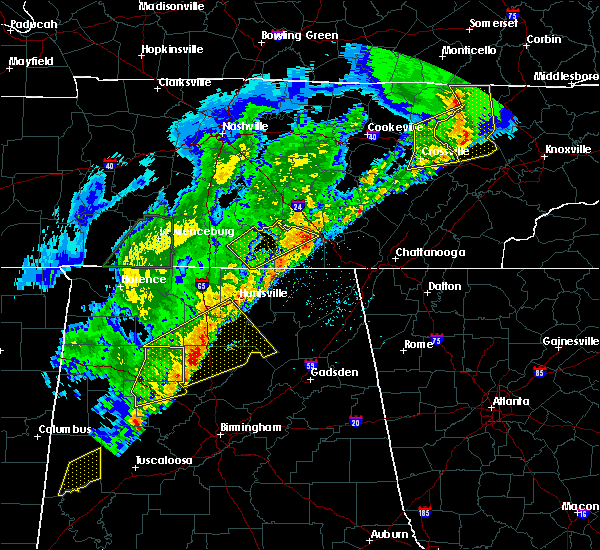 The severe thunderstorm warning for moore, central lincoln and northern franklin counties will expire at 315 am cdt, the storm which prompted the warning has moved out of the area. therefore, the warning will be allowed to expire. however gusty winds are still possible with this thunderstorm. a tornado watch remains in effect until 500 am cdt for north central and northeastern alabama, and middle tennessee. The severe thunderstorm warning for moore, central lincoln and northern franklin counties will expire at 315 am cdt, the storm which prompted the warning has moved out of the area. therefore, the warning will be allowed to expire. however gusty winds are still possible with this thunderstorm. a tornado watch remains in effect until 500 am cdt for north central and northeastern alabama, and middle tennessee.
|
| 3/29/2020 2:42 AM CDT |
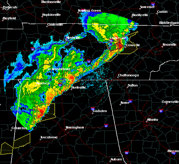 At 242 am cdt, a severe thunderstorm was located near fayetteville, moving northeast at 65 mph (radar indicated). Hazards include 60 mph wind gusts and quarter size hail. Hail damage to vehicles is expected. Expect wind damage to roofs, siding, and trees. At 242 am cdt, a severe thunderstorm was located near fayetteville, moving northeast at 65 mph (radar indicated). Hazards include 60 mph wind gusts and quarter size hail. Hail damage to vehicles is expected. Expect wind damage to roofs, siding, and trees.
|
| 3/29/2020 2:31 AM CDT |
 At 230 am cdt, a severe thunderstorm was located over ardmore, or 16 miles northwest of meridianville, moving northeast at 65 mph (radar indicated). Hazards include 60 mph wind gusts. Expect damage to roofs, siding, and trees. Locations impacted include, fayetteville, meridianville, hazel green, ardmore, harvest, lincoln, elkwood, plevna, dellrose and belleview. At 230 am cdt, a severe thunderstorm was located over ardmore, or 16 miles northwest of meridianville, moving northeast at 65 mph (radar indicated). Hazards include 60 mph wind gusts. Expect damage to roofs, siding, and trees. Locations impacted include, fayetteville, meridianville, hazel green, ardmore, harvest, lincoln, elkwood, plevna, dellrose and belleview.
|
| 3/29/2020 2:20 AM CDT |
 At 220 am cdt, a severe thunderstorm was located near athens, moving northeast at 65 mph (radar indicated). Hazards include 60 mph wind gusts. expect damage to roofs, siding, and trees At 220 am cdt, a severe thunderstorm was located near athens, moving northeast at 65 mph (radar indicated). Hazards include 60 mph wind gusts. expect damage to roofs, siding, and trees
|
| 3/29/2020 1:43 AM CDT | Tree down on warren hollow road and at the intersection of warren hollow and mount herman road. time estimated from rada in moore county TN, 13.7 miles SSW of Fayetteville, TN |
| 2/12/2020 6:16 PM CST | Numerous trees down near highways 231 and 129 at charity road. time estimated by rada in moore county TN, 12 miles S of Fayetteville, TN |
| 2/12/2020 6:10 PM CST | A tree was blocking u.s. highway 231 between union hollow road and stonesboro road. time estimated by rada in lincoln county TN, 10.5 miles S of Fayetteville, TN |
| 2/5/2020 7:10 PM CST |
 The severe thunderstorm warning for moore, lincoln and western franklin counties will expire at 715 pm cst, the storms which prompted the warning have weakened below severe limits, and no longer pose an immediate threat to life or property. therefore, the warning will be allowed to expire. however gusty winds are still possible with these thunderstorms. a tornado watch remains in effect until 1100 pm cst for north central and northeastern alabama, and middle tennessee. The severe thunderstorm warning for moore, lincoln and western franklin counties will expire at 715 pm cst, the storms which prompted the warning have weakened below severe limits, and no longer pose an immediate threat to life or property. therefore, the warning will be allowed to expire. however gusty winds are still possible with these thunderstorms. a tornado watch remains in effect until 1100 pm cst for north central and northeastern alabama, and middle tennessee.
|
| 2/5/2020 7:00 PM CST |
 At 700 pm cst, severe thunderstorms were located along a line extending from 8 miles northeast of shelbyville to 8 miles northwest of hazel green, moving east at 50 mph (radar indicated). Hazards include 60 mph wind gusts and a possible tornado. Expect damage to roofs, siding, and trees. Locations impacted include, fayetteville, lynchburg, estill springs, ardmore, huntland, tims ford lake, lincoln, howell, elora and hurdlow. At 700 pm cst, severe thunderstorms were located along a line extending from 8 miles northeast of shelbyville to 8 miles northwest of hazel green, moving east at 50 mph (radar indicated). Hazards include 60 mph wind gusts and a possible tornado. Expect damage to roofs, siding, and trees. Locations impacted include, fayetteville, lynchburg, estill springs, ardmore, huntland, tims ford lake, lincoln, howell, elora and hurdlow.
|
| 2/5/2020 6:29 PM CST |
 At 628 pm cst, severe thunderstorms were located along a line extending from near lewisburg to 12 miles west of ardmore, moving northeast at 65 mph. at 615 pm cst, wind damage to multiple structures was reported around lawrenceburg (radar indicated). Hazards include 60 mph wind gusts. expect damage to roofs, siding, and trees At 628 pm cst, severe thunderstorms were located along a line extending from near lewisburg to 12 miles west of ardmore, moving northeast at 65 mph. at 615 pm cst, wind damage to multiple structures was reported around lawrenceburg (radar indicated). Hazards include 60 mph wind gusts. expect damage to roofs, siding, and trees
|
| 12/16/2019 6:17 PM CST | Trees reported down on dry prong roa in moore county TN, 11.3 miles WSW of Fayetteville, TN |
| 12/16/2019 6:15 PM CST | Power outages reported in the lois are in moore county TN, 12.2 miles WSW of Fayetteville, TN |
| 12/16/2019 6:14 PM CST |
 At 614 pm cst, a severe thunderstorm capable of producing a tornado was located 8 miles west of huntland, or 9 miles southeast of fayetteville, moving east at 60 mph (radar indicated rotation). Hazards include tornado. Flying debris will be dangerous to those caught without shelter. mobile homes will be damaged or destroyed. damage to roofs, windows, and vehicles will occur. Tree damage is likely. At 614 pm cst, a severe thunderstorm capable of producing a tornado was located 8 miles west of huntland, or 9 miles southeast of fayetteville, moving east at 60 mph (radar indicated rotation). Hazards include tornado. Flying debris will be dangerous to those caught without shelter. mobile homes will be damaged or destroyed. damage to roofs, windows, and vehicles will occur. Tree damage is likely.
|
| 12/16/2019 6:09 PM CST |
 The severe thunderstorm warning for madison, eastern limestone, central morgan, west central moore and lincoln counties will expire at 615 pm cst, the storms which prompted the warning have moved out of the area. therefore, the warning will be allowed to expire. a tornado watch remains in effect until 1100 pm cst for north central, northeastern and northwestern alabama, and middle tennessee. remember, a severe thunderstorm warning still remains in effect for madison and lincoln counties until 7 pm cst. The severe thunderstorm warning for madison, eastern limestone, central morgan, west central moore and lincoln counties will expire at 615 pm cst, the storms which prompted the warning have moved out of the area. therefore, the warning will be allowed to expire. a tornado watch remains in effect until 1100 pm cst for north central, northeastern and northwestern alabama, and middle tennessee. remember, a severe thunderstorm warning still remains in effect for madison and lincoln counties until 7 pm cst.
|
| 12/16/2019 6:09 PM CST |
 At 608 pm cst, a severe thunderstorm capable of producing a tornado was located near fayetteville, moving east at 65 mph (radar indicated rotation). Hazards include tornado. Flying debris will be dangerous to those caught without shelter. mobile homes will be damaged or destroyed. damage to roofs, windows, and vehicles will occur. tree damage is likely. Locations impacted include, fayetteville, mulberry, skinem, smithland, molino, flintville, belleview, mimosa, booneville and crystal springs. At 608 pm cst, a severe thunderstorm capable of producing a tornado was located near fayetteville, moving east at 65 mph (radar indicated rotation). Hazards include tornado. Flying debris will be dangerous to those caught without shelter. mobile homes will be damaged or destroyed. damage to roofs, windows, and vehicles will occur. tree damage is likely. Locations impacted include, fayetteville, mulberry, skinem, smithland, molino, flintville, belleview, mimosa, booneville and crystal springs.
|
| 12/16/2019 6:05 PM CST | Trees reported down on bagley hollow roa in moore county TN, 12.9 miles SSW of Fayetteville, TN |
| 12/16/2019 6:03 PM CST |
 At 602 pm cst, severe thunderstorms were located along a line extending from near petersburg to huntsville to triana, moving northeast at 70 mph. wind gusts of 60 to 70 mph have been measured (radar indicated). Hazards include 70 mph wind gusts and quarter size hail. Hail damage to vehicles is expected. expect considerable tree damage. Wind damage is also likely to mobile homes, roofs, and outbuildings. At 602 pm cst, severe thunderstorms were located along a line extending from near petersburg to huntsville to triana, moving northeast at 70 mph. wind gusts of 60 to 70 mph have been measured (radar indicated). Hazards include 70 mph wind gusts and quarter size hail. Hail damage to vehicles is expected. expect considerable tree damage. Wind damage is also likely to mobile homes, roofs, and outbuildings.
|
| 12/16/2019 5:59 PM CST |
 At 559 pm cst, severe thunderstorms were located along a line extending from 7 miles east of petersburg to meridianville to near triana, moving northeast at 70 mph. in capshaw, 70 mph winds were observed (radar indicated). Hazards include 70 mph wind gusts and quarter size hail. Hail damage to vehicles is expected. expect considerable tree damage. wind damage is also likely to mobile homes, roofs, and outbuildings. Locations impacted include, huntsville, decatur, madison, athens, hartselle, fayetteville, moores mill, meridianville, redstone arsenal and hazel green. At 559 pm cst, severe thunderstorms were located along a line extending from 7 miles east of petersburg to meridianville to near triana, moving northeast at 70 mph. in capshaw, 70 mph winds were observed (radar indicated). Hazards include 70 mph wind gusts and quarter size hail. Hail damage to vehicles is expected. expect considerable tree damage. wind damage is also likely to mobile homes, roofs, and outbuildings. Locations impacted include, huntsville, decatur, madison, athens, hartselle, fayetteville, moores mill, meridianville, redstone arsenal and hazel green.
|
| 12/16/2019 5:52 PM CST |
 At 551 pm cst, severe thunderstorms were located along a line extending from near fayetteville to 7 miles west of huntland to huntsville, moving east at 75 mph (radar indicated). Hazards include 60 mph wind gusts and quarter size hail. Hail damage to vehicles is expected. expect wind damage to roofs, siding, and trees. Locations impacted include, huntsville, decatur, madison, athens, hartselle, fayetteville, moores mill, meridianville, redstone arsenal and hazel green. At 551 pm cst, severe thunderstorms were located along a line extending from near fayetteville to 7 miles west of huntland to huntsville, moving east at 75 mph (radar indicated). Hazards include 60 mph wind gusts and quarter size hail. Hail damage to vehicles is expected. expect wind damage to roofs, siding, and trees. Locations impacted include, huntsville, decatur, madison, athens, hartselle, fayetteville, moores mill, meridianville, redstone arsenal and hazel green.
|
| 12/16/2019 5:49 PM CST |
 At 548 pm cst, a severe thunderstorm capable of producing a tornado was located over ardmore, or 16 miles southeast of pulaski, moving east at 65 mph (radar indicated rotation). Hazards include tornado. Flying debris will be dangerous to those caught without shelter. mobile homes will be damaged or destroyed. damage to roofs, windows, and vehicles will occur. Tree damage is likely. At 548 pm cst, a severe thunderstorm capable of producing a tornado was located over ardmore, or 16 miles southeast of pulaski, moving east at 65 mph (radar indicated rotation). Hazards include tornado. Flying debris will be dangerous to those caught without shelter. mobile homes will be damaged or destroyed. damage to roofs, windows, and vehicles will occur. Tree damage is likely.
|
| 12/16/2019 5:13 PM CST |
 At 513 pm cst, severe thunderstorms were located along a line extending from lexington to 6 miles east of rogersville to near moulton, moving east at 30 mph (radar indicated). Hazards include 60 mph wind gusts. expect damage to roofs, siding, and trees At 513 pm cst, severe thunderstorms were located along a line extending from lexington to 6 miles east of rogersville to near moulton, moving east at 30 mph (radar indicated). Hazards include 60 mph wind gusts. expect damage to roofs, siding, and trees
|
| 9/10/2019 5:38 PM CDT | Trees were knocked down on spankhem road. time estimated by rada in moore county TN, 14 miles SSW of Fayetteville, TN |
| 9/10/2019 5:25 PM CDT | Corrects previous tstm wnd dmg report from 5 s lynchburg. trees were knocked down on preston ridge road and wet prong road. time estimated by rada in moore county TN, 11.6 miles WSW of Fayetteville, TN |
| 9/10/2019 5:25 PM CDT | Trees were knocked down on preston ridge road. time estimated by rada in moore county TN, 11.6 miles WSW of Fayetteville, TN |
| 9/10/2019 5:25 PM CDT | Corrects previous tstm wnd dmg report from 5 s lynchburg. trees were knocked down on preston ridge road and wet prong road. time estimated by rada in moore county TN, 11.6 miles WSW of Fayetteville, TN |
| 8/13/2019 7:10 PM CDT |
 At 710 pm cdt, severe thunderstorms were located along a line extending from near winchester to near huntland to near fayetteville, moving southeast at 25 mph (radar indicated). Hazards include 60 mph wind gusts. expect damage to roofs, siding, and trees At 710 pm cdt, severe thunderstorms were located along a line extending from near winchester to near huntland to near fayetteville, moving southeast at 25 mph (radar indicated). Hazards include 60 mph wind gusts. expect damage to roofs, siding, and trees
|
| 8/7/2019 1:58 PM CDT |
 At 158 pm cdt, a severe thunderstorm was located near lynchburg, moving southeast at 15 mph (radar indicated). Hazards include 60 mph wind gusts and quarter size hail. Hail damage to vehicles is expected. expect wind damage to roofs, siding, and trees. Locations impacted include, lynchburg, tims ford lake, mulberry, lois and booneville. At 158 pm cdt, a severe thunderstorm was located near lynchburg, moving southeast at 15 mph (radar indicated). Hazards include 60 mph wind gusts and quarter size hail. Hail damage to vehicles is expected. expect wind damage to roofs, siding, and trees. Locations impacted include, lynchburg, tims ford lake, mulberry, lois and booneville.
|
| 8/7/2019 1:42 PM CDT |
 At 142 pm cdt, a severe thunderstorm was located 7 miles east of petersburg, moving southeast at 15 mph (radar indicated). Hazards include 60 mph wind gusts and quarter size hail. Hail damage to vehicles is expected. Expect wind damage to roofs, siding, and trees. At 142 pm cdt, a severe thunderstorm was located 7 miles east of petersburg, moving southeast at 15 mph (radar indicated). Hazards include 60 mph wind gusts and quarter size hail. Hail damage to vehicles is expected. Expect wind damage to roofs, siding, and trees.
|
| 6/21/2019 9:31 PM CDT |
 At 931 pm cdt, severe thunderstorms were located along a line extending from gruetli-laager to near hazel green, moving east at 50 mph (radar indicated). Hazards include 70 mph wind gusts. Expect considerable tree damage. damage is likely to mobile homes, roofs, and outbuildings. Locations impacted include, northern huntsville, winchester, fayetteville, moores mill, meridianville, lynchburg, hazel green, decherd, estill springs and cowan. At 931 pm cdt, severe thunderstorms were located along a line extending from gruetli-laager to near hazel green, moving east at 50 mph (radar indicated). Hazards include 70 mph wind gusts. Expect considerable tree damage. damage is likely to mobile homes, roofs, and outbuildings. Locations impacted include, northern huntsville, winchester, fayetteville, moores mill, meridianville, lynchburg, hazel green, decherd, estill springs and cowan.
|
| 6/21/2019 9:26 PM CDT | Trees down across the count in lincoln county TN, 1 miles SSE of Fayetteville, TN |
| 6/21/2019 9:13 PM CDT |
 At 912 pm cdt, severe thunderstorms were located along a line extending from 9 miles east of manchester to near ardmore, moving east at 40 mph (radar indicated). Hazards include 60 mph wind gusts and penny size hail. expect damage to roofs, siding, and trees At 912 pm cdt, severe thunderstorms were located along a line extending from 9 miles east of manchester to near ardmore, moving east at 40 mph (radar indicated). Hazards include 60 mph wind gusts and penny size hail. expect damage to roofs, siding, and trees
|
| 6/21/2019 9:08 PM CDT | Storm damage reported in lincoln county TN, 8.5 miles S of Fayetteville, TN |
| 6/21/2019 8:59 PM CDT |
 At 859 pm cdt, severe thunderstorms were located along a line extending from 6 miles east of shelbyville to 8 miles west of pulaski, moving southeast at 35 mph (radar indicated). Hazards include 60 mph wind gusts and penny sized hail. Expect damage to roofs, siding, and trees. Locations impacted include, winchester, fayetteville, lynchburg, decherd, estill springs, ardmore, petersburg, tims ford lake, howell and hurdlow. At 859 pm cdt, severe thunderstorms were located along a line extending from 6 miles east of shelbyville to 8 miles west of pulaski, moving southeast at 35 mph (radar indicated). Hazards include 60 mph wind gusts and penny sized hail. Expect damage to roofs, siding, and trees. Locations impacted include, winchester, fayetteville, lynchburg, decherd, estill springs, ardmore, petersburg, tims ford lake, howell and hurdlow.
|
| 6/21/2019 8:38 PM CDT |
 At 837 pm cdt, severe thunderstorms were located along a line extending from 7 miles northwest of shelbyville to near lawrenceburg, moving southeast at 35 mph (radar indicated). Hazards include 60 mph wind gusts and penny size hail. expect damage to roofs, siding, and trees At 837 pm cdt, severe thunderstorms were located along a line extending from 7 miles northwest of shelbyville to near lawrenceburg, moving southeast at 35 mph (radar indicated). Hazards include 60 mph wind gusts and penny size hail. expect damage to roofs, siding, and trees
|
| 6/20/2019 3:32 AM CDT |
 At 331 am cdt, severe thunderstorms were located along a line extending from shelbyville to near madison, moving northeast at 45 mph (radar indicated). Hazards include 60 mph wind gusts. Expect damage to roofs, siding, and trees. Locations impacted include, huntsville, madison, fayetteville, redstone arsenal, meridianville, moores mill, hazel green, petersburg, triana and marshall space flight center. At 331 am cdt, severe thunderstorms were located along a line extending from shelbyville to near madison, moving northeast at 45 mph (radar indicated). Hazards include 60 mph wind gusts. Expect damage to roofs, siding, and trees. Locations impacted include, huntsville, madison, fayetteville, redstone arsenal, meridianville, moores mill, hazel green, petersburg, triana and marshall space flight center.
|
| 6/20/2019 3:30 AM CDT |
 At 329 am cdt, a severe thunderstorm was located 7 miles north of hazel green, or 7 miles south of fayetteville, moving northeast at 45 mph (radar indicated). Hazards include 60 mph wind gusts. expect damage to roofs, siding, and trees At 329 am cdt, a severe thunderstorm was located 7 miles north of hazel green, or 7 miles south of fayetteville, moving northeast at 45 mph (radar indicated). Hazards include 60 mph wind gusts. expect damage to roofs, siding, and trees
|
| 6/20/2019 3:19 AM CDT |
 At 318 am cdt, severe thunderstorms were located along a line extending from lewisburg to near mooresville, moving northeast at 45 mph. several downed trees and power lines have been reported with this activity (radar indicated). Hazards include 60 mph wind gusts. Expect damage to roofs, siding, and trees. Locations impacted include, huntsville, madison, athens, fayetteville, redstone arsenal, meridianville, moores mill, hazel green, ardmore and petersburg. At 318 am cdt, severe thunderstorms were located along a line extending from lewisburg to near mooresville, moving northeast at 45 mph. several downed trees and power lines have been reported with this activity (radar indicated). Hazards include 60 mph wind gusts. Expect damage to roofs, siding, and trees. Locations impacted include, huntsville, madison, athens, fayetteville, redstone arsenal, meridianville, moores mill, hazel green, ardmore and petersburg.
|
| 6/20/2019 2:44 AM CDT |
 At 244 am cdt, severe thunderstorms were located along a line extending from 12 miles southwest of pulaski to 8 miles northeast of inmanfield, moving northeast at 45 mph (radar indicated). Hazards include 60 mph wind gusts. expect damage to roofs, siding, and trees At 244 am cdt, severe thunderstorms were located along a line extending from 12 miles southwest of pulaski to 8 miles northeast of inmanfield, moving northeast at 45 mph (radar indicated). Hazards include 60 mph wind gusts. expect damage to roofs, siding, and trees
|
| 5/9/2019 1:25 PM CDT |
 The severe thunderstorm warning for northwestern jackson. eastern madison. moore. eastern lincoln and western franklin counties will expire at 130 pm cdt. the storms which prompted the warning have moved out of the area. Therefore, the warning will be allowed to expire. The severe thunderstorm warning for northwestern jackson. eastern madison. moore. eastern lincoln and western franklin counties will expire at 130 pm cdt. the storms which prompted the warning have moved out of the area. Therefore, the warning will be allowed to expire.
|
| 5/9/2019 1:11 PM CDT |
 A severe thunderstorm warning remains in effect until 130 pm cdt for northwestern jackson. eastern madison. moore. eastern lincoln and western franklin counties. at 110 pm cdt, severe thunderstorms were located along a line extending from 8 miles east of petersburg to near gurley, moving northeast at 35 mph. This line has a history of producing damage. A severe thunderstorm warning remains in effect until 130 pm cdt for northwestern jackson. eastern madison. moore. eastern lincoln and western franklin counties. at 110 pm cdt, severe thunderstorms were located along a line extending from 8 miles east of petersburg to near gurley, moving northeast at 35 mph. This line has a history of producing damage.
|
| 5/9/2019 1:07 PM CDT |
 The tornado warning for moore and northern lincoln counties will expire at 115 pm cdt. the storm which prompted the warning has weakened below severe limits, and no longer appears capable of producing a tornado. therefore, the warning will be allowed to expire. However heavy rain is still possible with this thunderstorm. The tornado warning for moore and northern lincoln counties will expire at 115 pm cdt. the storm which prompted the warning has weakened below severe limits, and no longer appears capable of producing a tornado. therefore, the warning will be allowed to expire. However heavy rain is still possible with this thunderstorm.
|
| 5/9/2019 1:02 PM CDT |
 The national weather service in huntsville alabama has issued a * tornado warning for. moore county in middle tennessee. southeastern lincoln county in middle tennessee. northwestern franklin county in middle tennessee. Until 130 pm cdt. The national weather service in huntsville alabama has issued a * tornado warning for. moore county in middle tennessee. southeastern lincoln county in middle tennessee. northwestern franklin county in middle tennessee. Until 130 pm cdt.
|
| 5/9/2019 12:55 PM CDT | Tree down reported on quick school roa in lincoln county TN, 10.3 miles N of Fayetteville, TN |
| 5/9/2019 12:53 PM CDT |
 The national weather service in huntsville alabama has issued a * severe thunderstorm warning for. northwestern jackson county in northeastern alabama. central madison county in north central alabama. moore county in middle tennessee. Eastern lincoln county in middle tennessee. The national weather service in huntsville alabama has issued a * severe thunderstorm warning for. northwestern jackson county in northeastern alabama. central madison county in north central alabama. moore county in middle tennessee. Eastern lincoln county in middle tennessee.
|
| 5/9/2019 12:32 PM CDT |
 The national weather service in huntsville alabama has issued a * severe thunderstorm warning for. west central jackson county in northeastern alabama. madison county in north central alabama. northeastern limestone county in north central alabama. Southeastern morgan county in north central alabama. The national weather service in huntsville alabama has issued a * severe thunderstorm warning for. west central jackson county in northeastern alabama. madison county in north central alabama. northeastern limestone county in north central alabama. Southeastern morgan county in north central alabama.
|
| 11/6/2018 1:07 AM CST |
 The tornado warning for central moore and central lincoln counties will expire at 115 am cst, the storm which prompted the warning has moved out of the area. therefore, the warning will be allowed to expire. however gusty winds and heavy rain are still possible with this thunderstorm. a tornado watch remains in effect until 600 am cst for north central and northeastern alabama, and middle tennessee. remember, a severe thunderstorm warning still remains in effect for portions of lincoln and moore counties until 115 am cst. The tornado warning for central moore and central lincoln counties will expire at 115 am cst, the storm which prompted the warning has moved out of the area. therefore, the warning will be allowed to expire. however gusty winds and heavy rain are still possible with this thunderstorm. a tornado watch remains in effect until 600 am cst for north central and northeastern alabama, and middle tennessee. remember, a severe thunderstorm warning still remains in effect for portions of lincoln and moore counties until 115 am cst.
|
| 11/6/2018 12:42 AM CST |
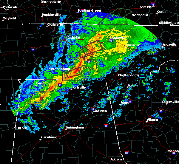 At 1241 am cst, a severe thunderstorm capable of producing a tornado was located near fayetteville, moving east at 50 mph (radar indicated rotation). Hazards include tornado. Flying debris will be dangerous to those caught without shelter. mobile homes will be damaged or destroyed. damage to roofs, windows, and vehicles will occur. Tree damage is likely. At 1241 am cst, a severe thunderstorm capable of producing a tornado was located near fayetteville, moving east at 50 mph (radar indicated rotation). Hazards include tornado. Flying debris will be dangerous to those caught without shelter. mobile homes will be damaged or destroyed. damage to roofs, windows, and vehicles will occur. Tree damage is likely.
|
| 11/6/2018 12:39 AM CST |
 At 1238 am cst, severe thunderstorms were located along a line extending from 6 miles southwest of shelbyville to near ardmore, moving east at 45 mph (radar indicated). Hazards include 60 mph wind gusts. expect damage to roofs, siding, and trees At 1238 am cst, severe thunderstorms were located along a line extending from 6 miles southwest of shelbyville to near ardmore, moving east at 45 mph (radar indicated). Hazards include 60 mph wind gusts. expect damage to roofs, siding, and trees
|
| 11/6/2018 12:22 AM CST |
 At 1222 am cst, severe thunderstorms were located along a line extending from near lewisburg to 6 miles west of ardmore, moving east at 45 mph (radar indicated). Hazards include 60 mph wind gusts. expect damage to roofs, siding, and trees At 1222 am cst, severe thunderstorms were located along a line extending from near lewisburg to 6 miles west of ardmore, moving east at 45 mph (radar indicated). Hazards include 60 mph wind gusts. expect damage to roofs, siding, and trees
|
| 6/28/2018 1:51 PM CDT |
 At 150 pm cdt, severe thunderstorms were located along a line extending from near lynchburg to 6 miles northeast of harvest to 6 miles east of rogersville, moving southeast at 55 mph (radar indicated). Hazards include 70 mph wind gusts and penny size hail. Expect considerable tree damage. Damage is likely to mobile homes, roofs, and outbuildings. At 150 pm cdt, severe thunderstorms were located along a line extending from near lynchburg to 6 miles northeast of harvest to 6 miles east of rogersville, moving southeast at 55 mph (radar indicated). Hazards include 70 mph wind gusts and penny size hail. Expect considerable tree damage. Damage is likely to mobile homes, roofs, and outbuildings.
|
| 6/28/2018 1:22 PM CDT |
 At 122 pm cdt, severe thunderstorms were located along a line extending from 8 miles east of lewisburg to 8 miles southwest of petersburg to near pulaski, moving southeast at 50 mph (radar indicated). Hazards include 70 mph wind gusts and penny size hail. Expect considerable tree damage. Damage is likely to mobile homes, roofs, and outbuildings. At 122 pm cdt, severe thunderstorms were located along a line extending from 8 miles east of lewisburg to 8 miles southwest of petersburg to near pulaski, moving southeast at 50 mph (radar indicated). Hazards include 70 mph wind gusts and penny size hail. Expect considerable tree damage. Damage is likely to mobile homes, roofs, and outbuildings.
|
| 6/28/2018 12:40 PM CDT |
 At 1239 pm cdt, severe thunderstorms were located along a line extending from near fayetteville to ardmore, moving southeast at 25 mph. this storm has a history of producing widespread trees down and power outages (radar indicated). Hazards include 60 mph wind gusts and nickel size hail. expect damage to roofs, siding, and trees At 1239 pm cdt, severe thunderstorms were located along a line extending from near fayetteville to ardmore, moving southeast at 25 mph. this storm has a history of producing widespread trees down and power outages (radar indicated). Hazards include 60 mph wind gusts and nickel size hail. expect damage to roofs, siding, and trees
|
| 6/28/2018 12:22 PM CDT | Tree down on power line on march mill road near fayettevill in lincoln county TN, 6.4 miles SE of Fayetteville, TN |
| 6/28/2018 12:21 PM CDT | Trees reported down at orchard hill rd fayetteville...t in lincoln county TN, 3.1 miles NNE of Fayetteville, TN |
| 6/28/2018 11:55 AM CDT |
 At 1154 am cdt, a severe thunderstorm was located near tims ford lake, or 7 miles south of lynchburg, moving southeast at 35 mph (radar indicated). Hazards include 70 mph wind gusts and penny size hail. Expect considerable tree damage. Damage is likely to mobile homes, roofs, and outbuildings. At 1154 am cdt, a severe thunderstorm was located near tims ford lake, or 7 miles south of lynchburg, moving southeast at 35 mph (radar indicated). Hazards include 70 mph wind gusts and penny size hail. Expect considerable tree damage. Damage is likely to mobile homes, roofs, and outbuildings.
|
| 6/28/2018 11:45 AM CDT | Trees down at highland rim road. time estimated from rada in lincoln county TN, 6.1 miles N of Fayetteville, TN |
| 6/28/2018 11:36 AM CDT |
 At 1135 am cdt, a severe thunderstorm was located 7 miles west of lynchburg, moving southeast at 30 mph. an area of very strong winds is moving through winchester, tn now and will impact jackson county al soon (radar indicated). Hazards include 70 mph wind gusts. Expect considerable tree damage. damage is likely to mobile homes, roofs, and outbuildings. Locations impacted include, winchester, fayetteville, lynchburg, decherd, estill springs, cowan, ardmore, huntland, petersburg and tims ford lake. At 1135 am cdt, a severe thunderstorm was located 7 miles west of lynchburg, moving southeast at 30 mph. an area of very strong winds is moving through winchester, tn now and will impact jackson county al soon (radar indicated). Hazards include 70 mph wind gusts. Expect considerable tree damage. damage is likely to mobile homes, roofs, and outbuildings. Locations impacted include, winchester, fayetteville, lynchburg, decherd, estill springs, cowan, ardmore, huntland, petersburg and tims ford lake.
|
| 6/28/2018 11:02 AM CDT |
 At 1101 am cdt, a severe thunderstorm was located 8 miles northeast of lewisburg, moving southeast at 30 mph (radar indicated). Hazards include 70 mph wind gusts and nickel size hail. Expect considerable tree damage. Damage is likely to mobile homes, roofs, and outbuildings. At 1101 am cdt, a severe thunderstorm was located 8 miles northeast of lewisburg, moving southeast at 30 mph (radar indicated). Hazards include 70 mph wind gusts and nickel size hail. Expect considerable tree damage. Damage is likely to mobile homes, roofs, and outbuildings.
|
| 6/23/2018 11:57 AM CDT |
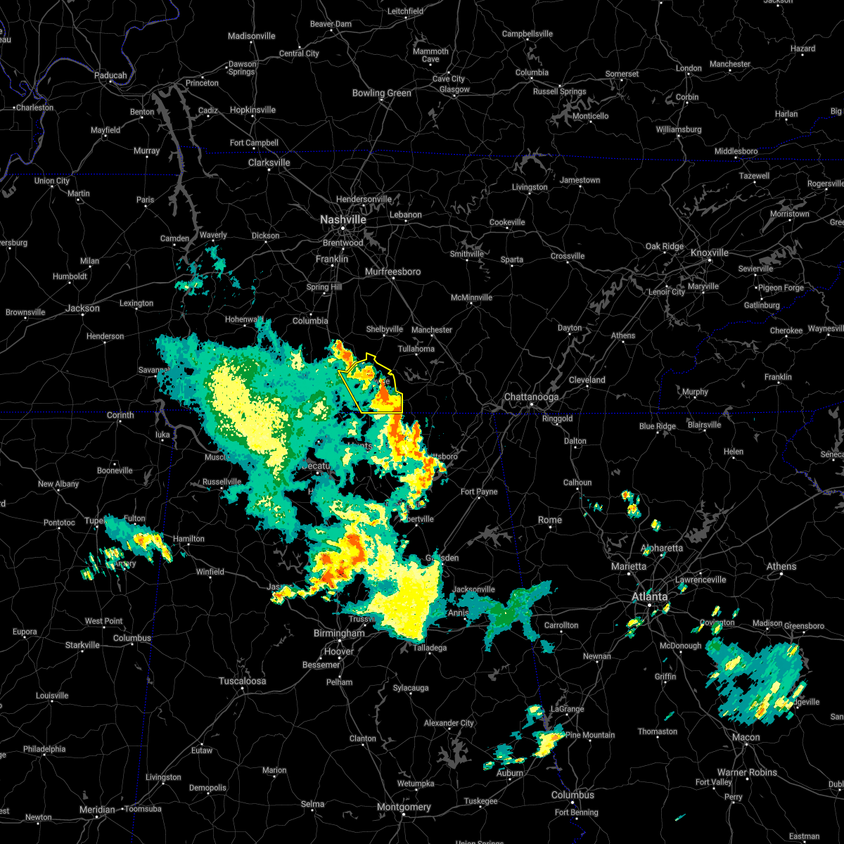 The severe thunderstorm warning for lincoln county will expire at noon cdt, the storms which prompted the warning have weakened below severe limits, and no longer pose an immediate threat to life or property. therefore, the warning will be allowed to expire. however gusty winds are still possible with these thunderstorms. a severe thunderstorm watch remains in effect until 300 pm cdt for north alabama and south tennessee. The severe thunderstorm warning for lincoln county will expire at noon cdt, the storms which prompted the warning have weakened below severe limits, and no longer pose an immediate threat to life or property. therefore, the warning will be allowed to expire. however gusty winds are still possible with these thunderstorms. a severe thunderstorm watch remains in effect until 300 pm cdt for north alabama and south tennessee.
|
| 6/23/2018 11:50 AM CDT |
 At 1150 am cdt, severe thunderstorms were located along a line extending from petersburg to near new market, moving east at 80 mph (radar indicated). Hazards include 60 mph wind gusts. Expect damage to roofs, siding, and trees. Locations impacted include, fayetteville, petersburg, lincoln, mulberry, chestnut ridge, howell, belleville, elora, belleview and mimosa. At 1150 am cdt, severe thunderstorms were located along a line extending from petersburg to near new market, moving east at 80 mph (radar indicated). Hazards include 60 mph wind gusts. Expect damage to roofs, siding, and trees. Locations impacted include, fayetteville, petersburg, lincoln, mulberry, chestnut ridge, howell, belleville, elora, belleview and mimosa.
|
| 6/23/2018 11:20 AM CDT |
 At 1120 am cdt, severe thunderstorms were located along a line extending from 8 miles southeast of summertown to 6 miles west of ardmore, moving east at 50 mph (radar indicated). Hazards include 60 mph wind gusts. expect damage to roofs, siding, and trees At 1120 am cdt, severe thunderstorms were located along a line extending from 8 miles southeast of summertown to 6 miles west of ardmore, moving east at 50 mph (radar indicated). Hazards include 60 mph wind gusts. expect damage to roofs, siding, and trees
|
| 4/3/2018 11:02 PM CDT |
 At 1102 pm cdt, severe thunderstorms were located along a line extending from shelbyville to near fayetteville, moving northeast at 50 mph (radar indicated). Hazards include 60 mph wind gusts and penny size hail. Expect damage to roofs, siding, and trees. Locations impacted include, fayetteville, lynchburg, tims ford lake, lincoln, mulberry, chestnut ridge, howell, belleville, elora and hurdlow. At 1102 pm cdt, severe thunderstorms were located along a line extending from shelbyville to near fayetteville, moving northeast at 50 mph (radar indicated). Hazards include 60 mph wind gusts and penny size hail. Expect damage to roofs, siding, and trees. Locations impacted include, fayetteville, lynchburg, tims ford lake, lincoln, mulberry, chestnut ridge, howell, belleville, elora and hurdlow.
|
| 4/3/2018 10:41 PM CDT |
 At 1041 pm cdt, severe thunderstorms were located along a line extending from near petersburg to ardmore, moving northeast at 50 mph (radar indicated). Hazards include 60 mph wind gusts and penny size hail. expect damage to roofs, siding, and trees At 1041 pm cdt, severe thunderstorms were located along a line extending from near petersburg to ardmore, moving northeast at 50 mph (radar indicated). Hazards include 60 mph wind gusts and penny size hail. expect damage to roofs, siding, and trees
|
| 8/31/2017 10:24 PM CDT |
 At 1024 pm cdt, a severe thunderstorm was located near mulberry, moving north at 35 mph (radar indicated). Hazards include 60 mph wind gusts. expect damage to roofs, siding, and trees At 1024 pm cdt, a severe thunderstorm was located near mulberry, moving north at 35 mph (radar indicated). Hazards include 60 mph wind gusts. expect damage to roofs, siding, and trees
|
| 7/5/2017 2:25 PM CDT | Power lines downed. reported by medi in lincoln county TN, 4.1 miles SW of Fayetteville, TN |
| 7/5/2017 2:18 PM CDT |
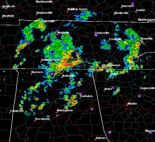 At 218 pm cdt, a severe thunderstorm was located near lynchburg, moving northeast at 45 mph (radar indicated). Hazards include 60 mph wind gusts. expect damage to roofs, siding, and trees At 218 pm cdt, a severe thunderstorm was located near lynchburg, moving northeast at 45 mph (radar indicated). Hazards include 60 mph wind gusts. expect damage to roofs, siding, and trees
|
| 7/5/2017 2:14 PM CDT |
 At 214 pm cdt, a severe thunderstorm was located over fayetteville, moving northeast at 25 mph (radar indicated). Hazards include 60 mph wind gusts. Expect damage to roofs, siding, and trees. Locations impacted include, fayetteville, lynchburg, meridianville, hazel green, petersburg, harvest, lincoln, blanche, coldwater and mulberry. At 214 pm cdt, a severe thunderstorm was located over fayetteville, moving northeast at 25 mph (radar indicated). Hazards include 60 mph wind gusts. Expect damage to roofs, siding, and trees. Locations impacted include, fayetteville, lynchburg, meridianville, hazel green, petersburg, harvest, lincoln, blanche, coldwater and mulberry.
|
| 7/5/2017 2:12 PM CDT | A tree was blown down on cooper branch roa in lincoln county TN, 7.9 miles WSW of Fayetteville, TN |
| 7/5/2017 2:10 PM CDT | Power lines down in the twin oaks subdivisio in lincoln county TN, 2.1 miles NW of Fayetteville, TN |
| 7/5/2017 2:08 PM CDT | Numerous trees were reported down on kelso-mulberry road and providence roa in lincoln county TN, 5.6 miles WSW of Fayetteville, TN |
| 7/5/2017 2:08 PM CDT | At this location on kelso-mulberry road... an old house was heavily damaged. winds ripped numerous shingles off of this house. also... winds snapped porch columns and b in lincoln county TN, 5.3 miles WSW of Fayetteville, TN |
| 7/5/2017 2:05 PM CDT | A tree was blown down on morton driv in lincoln county TN, 1.6 miles S of Fayetteville, TN |
| 7/5/2017 2:04 PM CDT |
 At 203 pm cdt, a severe thunderstorm was located near fayetteville, moving northeast at 35 mph (radar indicated). Hazards include 60 mph wind gusts. Expect damage to roofs, siding, and trees. Locations impacted include, fayetteville, lynchburg, meridianville, hazel green, ardmore, petersburg, harvest, lincoln, blanche and coldwater. At 203 pm cdt, a severe thunderstorm was located near fayetteville, moving northeast at 35 mph (radar indicated). Hazards include 60 mph wind gusts. Expect damage to roofs, siding, and trees. Locations impacted include, fayetteville, lynchburg, meridianville, hazel green, ardmore, petersburg, harvest, lincoln, blanche and coldwater.
|
| 7/5/2017 1:48 PM CDT |
 At 147 pm cdt, severe thunderstorms were located along a line extending from 7 miles northwest of hazel green to near ardmore to 13 miles northwest of athens, moving northeast at 25 mph (radar indicated). Hazards include 60 mph wind gusts and penny size hail. expect damage to roofs, siding, and trees At 147 pm cdt, severe thunderstorms were located along a line extending from 7 miles northwest of hazel green to near ardmore to 13 miles northwest of athens, moving northeast at 25 mph (radar indicated). Hazards include 60 mph wind gusts and penny size hail. expect damage to roofs, siding, and trees
|
| 6/23/2017 2:44 PM CDT |
 At 243 pm cdt, a severe thunderstorm was located over harvest, or 9 miles west of meridianville, moving northeast at 50 mph (radar indicated). Hazards include 60 mph wind gusts. expect damage to roofs, siding, and trees At 243 pm cdt, a severe thunderstorm was located over harvest, or 9 miles west of meridianville, moving northeast at 50 mph (radar indicated). Hazards include 60 mph wind gusts. expect damage to roofs, siding, and trees
|
| 6/15/2017 1:44 PM CDT |
 At 144 pm cdt, severe thunderstorms were located along a line extending from 7 miles southwest of tims ford lake to near new market to huntsville, moving southeast at 80 mph (radar indicated). Hazards include 60 mph wind gusts. expect damage to roofs, siding, and trees At 144 pm cdt, severe thunderstorms were located along a line extending from 7 miles southwest of tims ford lake to near new market to huntsville, moving southeast at 80 mph (radar indicated). Hazards include 60 mph wind gusts. expect damage to roofs, siding, and trees
|
| 5/27/2017 9:50 PM CDT |
 At 936 pm cdt, a severe thunderstorm was located near fayetteville, moving southeast at 30 mph (radar indicated). Hazards include 60 mph wind gusts and quarter size hail. Hail damage to vehicles is expected. expect wind damage to roofs, siding, and trees. Locations impacted include, winchester, fayetteville, lynchburg, huntland, petersburg, tims ford lake, anderson, lincoln, hurdlow and maxwell. At 936 pm cdt, a severe thunderstorm was located near fayetteville, moving southeast at 30 mph (radar indicated). Hazards include 60 mph wind gusts and quarter size hail. Hail damage to vehicles is expected. expect wind damage to roofs, siding, and trees. Locations impacted include, winchester, fayetteville, lynchburg, huntland, petersburg, tims ford lake, anderson, lincoln, hurdlow and maxwell.
|
| 5/27/2017 9:48 PM CDT | Tree down at 159 shelbyville hw in lincoln county TN, 1.6 miles S of Fayetteville, TN |
| 5/27/2017 9:37 PM CDT |
 At 936 pm cdt, a severe thunderstorm was located near fayetteville, moving southeast at 30 mph (radar indicated). Hazards include 60 mph wind gusts and quarter size hail. Hail damage to vehicles is expected. expect wind damage to roofs, siding, and trees. Locations impacted include, winchester, fayetteville, lynchburg, huntland, petersburg, tims ford lake, anderson, lincoln, hurdlow and maxwell. At 936 pm cdt, a severe thunderstorm was located near fayetteville, moving southeast at 30 mph (radar indicated). Hazards include 60 mph wind gusts and quarter size hail. Hail damage to vehicles is expected. expect wind damage to roofs, siding, and trees. Locations impacted include, winchester, fayetteville, lynchburg, huntland, petersburg, tims ford lake, anderson, lincoln, hurdlow and maxwell.
|
| 5/27/2017 9:23 PM CDT |
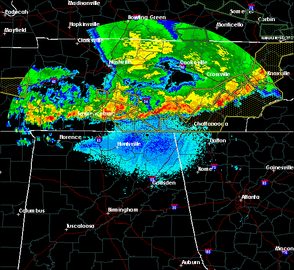 At 923 pm cdt, a severe thunderstorm was located over petersburg, or 11 miles north of fayetteville, moving southeast at 60 mph (radar indicated). Hazards include 60 mph wind gusts. expect damage to roofs, siding, and trees At 923 pm cdt, a severe thunderstorm was located over petersburg, or 11 miles north of fayetteville, moving southeast at 60 mph (radar indicated). Hazards include 60 mph wind gusts. expect damage to roofs, siding, and trees
|
| 5/20/2017 6:11 PM CDT |
 At 610 pm cdt, severe thunderstorms were located along a line extending from 7 miles northwest of hazel green to near scottsboro, moving northeast at 45 mph. wind damage has already been reported with this line of storms in madison county (radar indicated). Hazards include 60 mph wind gusts. Expect damage to roofs, siding, and trees. Locations impacted include, scottsboro, fayetteville, moores mill, meridianville, hazel green, hollywood, skyline, section, pisgah and new market. At 610 pm cdt, severe thunderstorms were located along a line extending from 7 miles northwest of hazel green to near scottsboro, moving northeast at 45 mph. wind damage has already been reported with this line of storms in madison county (radar indicated). Hazards include 60 mph wind gusts. Expect damage to roofs, siding, and trees. Locations impacted include, scottsboro, fayetteville, moores mill, meridianville, hazel green, hollywood, skyline, section, pisgah and new market.
|
| 5/20/2017 5:55 PM CDT |
 At 554 pm cdt, severe thunderstorms were located along a line extending from near harvest to 7 miles northeast of grant, moving northeast at 50 mph. this line of storms has a history of producing winds in excess of 50 mph and producing wind damage across madison county (radar indicated). Hazards include 60 mph wind gusts. expect damage to roofs, siding, and trees At 554 pm cdt, severe thunderstorms were located along a line extending from near harvest to 7 miles northeast of grant, moving northeast at 50 mph. this line of storms has a history of producing winds in excess of 50 mph and producing wind damage across madison county (radar indicated). Hazards include 60 mph wind gusts. expect damage to roofs, siding, and trees
|
| 4/30/2017 3:17 PM CDT |
 At 317 pm cdt, severe thunderstorms were located along a line extending from lynchburg to albertville, moving northeast at 40 mph (radar indicated). Hazards include 60 mph wind gusts. Expect damage to roofs, siding, and trees. locations impacted include, albertville, scottsboro, fort payne, boaz, winchester, guntersville, fayetteville, rainsville, bridgeport and lynchburg. A tornado watch remains in effect until 700 pm cdt for north central and northeastern alabama, and middle tennessee. At 317 pm cdt, severe thunderstorms were located along a line extending from lynchburg to albertville, moving northeast at 40 mph (radar indicated). Hazards include 60 mph wind gusts. Expect damage to roofs, siding, and trees. locations impacted include, albertville, scottsboro, fort payne, boaz, winchester, guntersville, fayetteville, rainsville, bridgeport and lynchburg. A tornado watch remains in effect until 700 pm cdt for north central and northeastern alabama, and middle tennessee.
|
| 4/30/2017 2:59 PM CDT | *** 1 fatal *** lincoln co. ema and media relayed report trees down near fayetteville. one individual has died after being hit by a falling tre in lincoln county TN, 2.6 miles WNW of Fayetteville, TN |
| 4/30/2017 2:54 PM CDT |
 At 252 pm cdt, severe thunderstorms were located along a line extending from near petersburg to near altoona, moving northeast at 55 mph (radar indicated). Hazards include 60 mph wind gusts. expect damage to roofs, siding, and trees At 252 pm cdt, severe thunderstorms were located along a line extending from near petersburg to near altoona, moving northeast at 55 mph (radar indicated). Hazards include 60 mph wind gusts. expect damage to roofs, siding, and trees
|
| 4/30/2017 2:29 PM CDT |
 At 228 pm cdt, severe thunderstorms were located along a line extending from near ardmore to near blountsville, moving northeast at 35 mph (emergency management. at 223 pm cdt, cullman county emergency management reported numerous trees down in the city of cullman area). Hazards include 60 mph wind gusts. Expect damage to roofs, siding, and trees. locations impacted include, huntsville, madison, athens, albertville, boaz, guntersville, arab, fayetteville, moores mill and meridianville. a tornado watch remains in effect until 700 pm cdt for north central and northwestern alabama. A tornado watch also remains in effect until 700 pm cdt for north central and northeastern alabama, and middle tennessee. At 228 pm cdt, severe thunderstorms were located along a line extending from near ardmore to near blountsville, moving northeast at 35 mph (emergency management. at 223 pm cdt, cullman county emergency management reported numerous trees down in the city of cullman area). Hazards include 60 mph wind gusts. Expect damage to roofs, siding, and trees. locations impacted include, huntsville, madison, athens, albertville, boaz, guntersville, arab, fayetteville, moores mill and meridianville. a tornado watch remains in effect until 700 pm cdt for north central and northwestern alabama. A tornado watch also remains in effect until 700 pm cdt for north central and northeastern alabama, and middle tennessee.
|
| 4/30/2017 2:21 PM CDT |
 At 220 pm cdt, severe thunderstorms were located along a line extending from ardmore to holly pond, moving northeast at 35 mph (radar indicated. this line of storms has downed trees across portions of northwest alabama). Hazards include 60 mph wind gusts. expect damage to roofs, siding, and trees At 220 pm cdt, severe thunderstorms were located along a line extending from ardmore to holly pond, moving northeast at 35 mph (radar indicated. this line of storms has downed trees across portions of northwest alabama). Hazards include 60 mph wind gusts. expect damage to roofs, siding, and trees
|
| 4/22/2017 5:06 PM CDT |
 The severe thunderstorm warning for northwestern madison, northeastern limestone and southwestern lincoln counties will expire at 515 pm cdt, the storm which prompted the warning has moved out of the area. therefore the warning will be allowed to expire. a severe thunderstorm watch remains in effect until 900 pm cdt for north central and northwestern alabama, and middle tennessee. remember, a severe thunderstorm warning still remains in effect for southeastern lincoln county in tennessee. The severe thunderstorm warning for northwestern madison, northeastern limestone and southwestern lincoln counties will expire at 515 pm cdt, the storm which prompted the warning has moved out of the area. therefore the warning will be allowed to expire. a severe thunderstorm watch remains in effect until 900 pm cdt for north central and northwestern alabama, and middle tennessee. remember, a severe thunderstorm warning still remains in effect for southeastern lincoln county in tennessee.
|
| 4/22/2017 4:57 PM CDT |
 At 457 pm cdt, a severe thunderstorm was located over hazel green, or 8 miles north of meridianville, moving east at 30 mph. this storm has a history of producing quarter and golf ball size hail (radar indicated). Hazards include golf ball size hail and 60 mph wind gusts. People and animals outdoors will be injured. expect hail damage to roofs, siding, windows, and vehicles. Expect wind damage to roofs, siding, and trees. At 457 pm cdt, a severe thunderstorm was located over hazel green, or 8 miles north of meridianville, moving east at 30 mph. this storm has a history of producing quarter and golf ball size hail (radar indicated). Hazards include golf ball size hail and 60 mph wind gusts. People and animals outdoors will be injured. expect hail damage to roofs, siding, windows, and vehicles. Expect wind damage to roofs, siding, and trees.
|
| 4/22/2017 4:26 PM CDT |
 At 426 pm cdt, a severe thunderstorm was located near ardmore, or 13 miles southeast of pulaski, moving east at 40 mph (radar indicated). Hazards include 60 mph wind gusts and quarter size hail. Hail damage to vehicles is expected. Expect wind damage to roofs, siding, and trees. At 426 pm cdt, a severe thunderstorm was located near ardmore, or 13 miles southeast of pulaski, moving east at 40 mph (radar indicated). Hazards include 60 mph wind gusts and quarter size hail. Hail damage to vehicles is expected. Expect wind damage to roofs, siding, and trees.
|
| 4/22/2017 4:06 PM CDT |
 At 405 pm cdt, a severe thunderstorm was located near pulaski, moving east at 45 mph. trees down have been reported with this storm in lawrence county, tennessee (radar indicated). Hazards include 60 mph wind gusts and quarter size hail. Hail damage to vehicles is expected. Expect wind damage to roofs, siding, and trees. At 405 pm cdt, a severe thunderstorm was located near pulaski, moving east at 45 mph. trees down have been reported with this storm in lawrence county, tennessee (radar indicated). Hazards include 60 mph wind gusts and quarter size hail. Hail damage to vehicles is expected. Expect wind damage to roofs, siding, and trees.
|
| 4/5/2017 3:59 PM CDT | Quarter sized hail reported 8.5 miles S of Fayetteville, TN, quarter size hail in belleville. |
| 4/5/2017 3:57 PM CDT | Half Dollar sized hail reported 8.5 miles S of Fayetteville, TN, half-dollar size hail in belleville. |
| 4/5/2017 3:57 PM CDT |
 The severe thunderstorm warning for northern moore and northeastern lincoln counties will expire at 400 pm cdt, the storm which prompted the warning is moving out of lincoln and moore counties. therefore the warning will be allowed to expire. a tornado watch remains in effect until 900 pm cdt for north central and northeastern alabama, and middle tennessee. to report severe weather, contact your nearest law enforcement agency. they will relay your report to the national weather service huntsville alabama. The severe thunderstorm warning for northern moore and northeastern lincoln counties will expire at 400 pm cdt, the storm which prompted the warning is moving out of lincoln and moore counties. therefore the warning will be allowed to expire. a tornado watch remains in effect until 900 pm cdt for north central and northeastern alabama, and middle tennessee. to report severe weather, contact your nearest law enforcement agency. they will relay your report to the national weather service huntsville alabama.
|
| 4/5/2017 3:47 PM CDT |
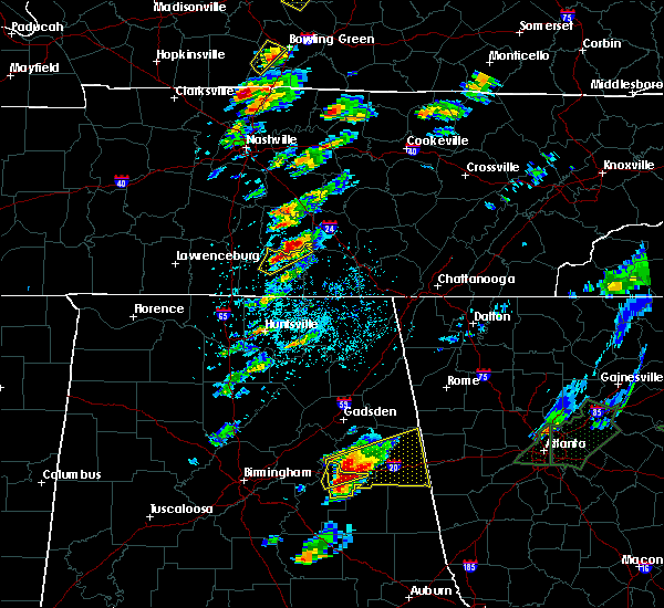 At 346 pm cdt, a severe thunderstorm was located near petersburg, or 9 miles north of fayetteville, moving northeast at 50 mph (radar indicated. at 340 pm cdt, emergency management reported small hail in the cyruston area northwest of fayetteville, but the storm has intensified since then). Hazards include ping pong ball size hail and 60 mph wind gusts. People and animals outdoors will be injured. expect hail damage to roofs, siding, windows, and vehicles. expect wind damage to roofs, siding, and trees. locations impacted include, fayetteville, lynchburg, chestnut ridge, howell, belleville, mimosa and booneville. A tornado watch remains in effect until 900 pm cdt for north central and northeastern alabama, and middle tennessee. At 346 pm cdt, a severe thunderstorm was located near petersburg, or 9 miles north of fayetteville, moving northeast at 50 mph (radar indicated. at 340 pm cdt, emergency management reported small hail in the cyruston area northwest of fayetteville, but the storm has intensified since then). Hazards include ping pong ball size hail and 60 mph wind gusts. People and animals outdoors will be injured. expect hail damage to roofs, siding, windows, and vehicles. expect wind damage to roofs, siding, and trees. locations impacted include, fayetteville, lynchburg, chestnut ridge, howell, belleville, mimosa and booneville. A tornado watch remains in effect until 900 pm cdt for north central and northeastern alabama, and middle tennessee.
|
| 4/5/2017 3:36 PM CDT |
 At 336 pm cdt, a severe thunderstorm was located near fayetteville, moving northeast at 50 mph (radar indicated). Hazards include 60 mph wind gusts and quarter size hail. Hail damage to vehicles is expected. Expect wind damage to roofs, siding, and trees. At 336 pm cdt, a severe thunderstorm was located near fayetteville, moving northeast at 50 mph (radar indicated). Hazards include 60 mph wind gusts and quarter size hail. Hail damage to vehicles is expected. Expect wind damage to roofs, siding, and trees.
|
| 3/27/2017 5:12 PM CDT |
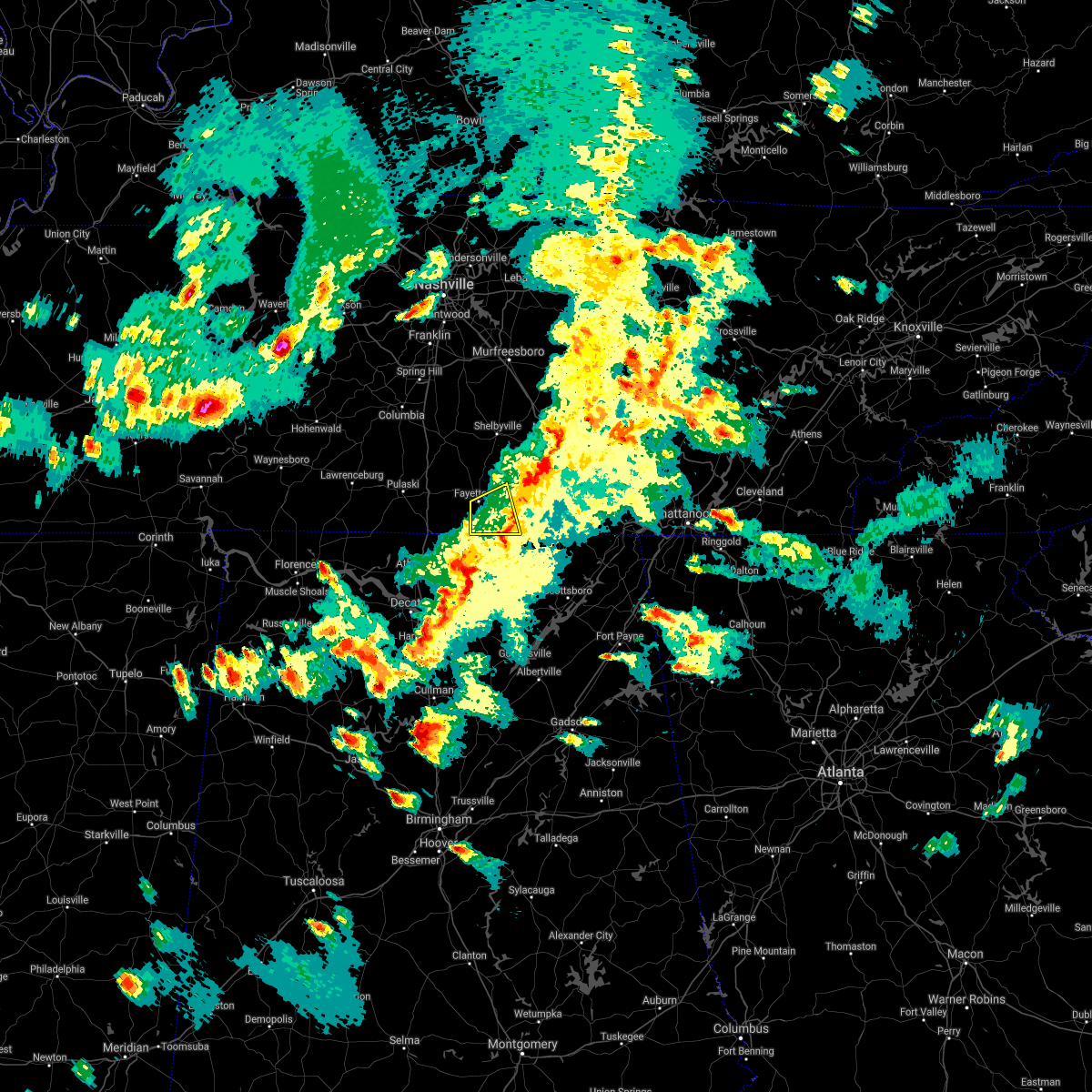 The severe thunderstorm warning for southeastern lincoln county will expire at 515 pm cdt. the storm which prompted the warning has weakened below severe limits, and has exited the warned area. therefore, the warning will be allowed to expire. A severe thunderstorm watch remains in effect until 900 pm cdt for. The severe thunderstorm warning for southeastern lincoln county will expire at 515 pm cdt. the storm which prompted the warning has weakened below severe limits, and has exited the warned area. therefore, the warning will be allowed to expire. A severe thunderstorm watch remains in effect until 900 pm cdt for.
|
| 3/27/2017 4:55 PM CDT |
 A severe thunderstorm warning remains in effect until 515 pm cdt for southeastern lincoln county. at 455 pm cdt, a severe thunderstorm was located near fayetteville, moving northeast at 45 mph. hazard. 60 mph wind gusts and quarter size hail. source. Radar indicated. A severe thunderstorm warning remains in effect until 515 pm cdt for southeastern lincoln county. at 455 pm cdt, a severe thunderstorm was located near fayetteville, moving northeast at 45 mph. hazard. 60 mph wind gusts and quarter size hail. source. Radar indicated.
|
| 3/27/2017 4:46 PM CDT |
 At 446 pm cdt, a severe thunderstorm was located 7 miles southwest of fayetteville, moving northeast at 45 mph (radar indicated). Hazards include 60 mph wind gusts and quarter size hail. Hail damage to vehicles is expected. expect wind damage to roofs, siding, and trees. Locations impacted include, fayetteville, hazel green, lincoln, elkwood, elora, smithland, blanche, coldwater, fisk and kelso. At 446 pm cdt, a severe thunderstorm was located 7 miles southwest of fayetteville, moving northeast at 45 mph (radar indicated). Hazards include 60 mph wind gusts and quarter size hail. Hail damage to vehicles is expected. expect wind damage to roofs, siding, and trees. Locations impacted include, fayetteville, hazel green, lincoln, elkwood, elora, smithland, blanche, coldwater, fisk and kelso.
|
| 3/27/2017 4:26 PM CDT |
 At 426 pm cdt, a severe thunderstorm was located over ardmore, or 12 miles northeast of athens, moving northeast at 40 mph (radar indicated). Hazards include 60 mph wind gusts and quarter size hail. Hail damage to vehicles is expected. Expect wind damage to roofs, siding, and trees. At 426 pm cdt, a severe thunderstorm was located over ardmore, or 12 miles northeast of athens, moving northeast at 40 mph (radar indicated). Hazards include 60 mph wind gusts and quarter size hail. Hail damage to vehicles is expected. Expect wind damage to roofs, siding, and trees.
|
| 3/21/2017 5:56 PM CDT | Golf Ball sized hail reported 10.6 miles SW of Fayetteville, TN |
| 3/21/2017 5:05 PM CDT |
 At 504 pm cdt, severe thunderstorms were located along a line extending from near tims ford lake to near hazel green, moving southeast at 55 mph (trained weather spotters). Hazards include 70 mph wind gusts and quarter size hail. Hail damage to vehicles is expected. expect considerable tree damage. wind damage is also likely to mobile homes, roofs, and outbuildings. Locations impacted include, winchester, fayetteville, hazel green, decherd, cowan, huntland, tims ford lake, new market, anderson and lincoln. At 504 pm cdt, severe thunderstorms were located along a line extending from near tims ford lake to near hazel green, moving southeast at 55 mph (trained weather spotters). Hazards include 70 mph wind gusts and quarter size hail. Hail damage to vehicles is expected. expect considerable tree damage. wind damage is also likely to mobile homes, roofs, and outbuildings. Locations impacted include, winchester, fayetteville, hazel green, decherd, cowan, huntland, tims ford lake, new market, anderson and lincoln.
|
| 3/21/2017 5:02 PM CDT | Widespread area of trees down on shelbyville hwy and along hwy 43 in lincoln county TN, 0.2 miles S of Fayetteville, TN |
| 3/21/2017 4:57 PM CDT |
 At 456 pm cdt, severe thunderstorms were located along a line extending from near tims ford lake to 8 miles east of ardmore, moving southeast at 45 mph (radar indicated). Hazards include 70 mph wind gusts and quarter size hail. Hail damage to vehicles is expected. expect considerable tree damage. Wind damage is also likely to mobile homes, roofs, and outbuildings. At 456 pm cdt, severe thunderstorms were located along a line extending from near tims ford lake to 8 miles east of ardmore, moving southeast at 45 mph (radar indicated). Hazards include 70 mph wind gusts and quarter size hail. Hail damage to vehicles is expected. expect considerable tree damage. Wind damage is also likely to mobile homes, roofs, and outbuildings.
|
| 3/21/2017 4:56 PM CDT | Golf Ball sized hail reported 11.7 miles WSW of Fayetteville, TN |
| 3/21/2017 4:46 PM CDT |
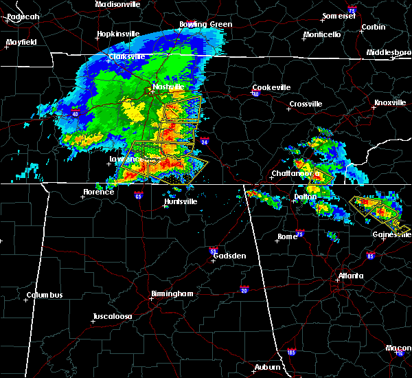 At 445 pm cdt, severe thunderstorms were located along a line extending from 6 miles west of lynchburg to 8 miles southwest of fayetteville, moving southeast at 60 mph (radar indicated). Hazards include 70 mph wind gusts and quarter size hail. Hail damage to vehicles is expected. expect considerable tree damage. wind damage is also likely to mobile homes, roofs, and outbuildings. Locations impacted include, winchester, fayetteville, lynchburg, estill springs, huntland, petersburg, tims ford lake, lincoln, hurdlow and smithland. At 445 pm cdt, severe thunderstorms were located along a line extending from 6 miles west of lynchburg to 8 miles southwest of fayetteville, moving southeast at 60 mph (radar indicated). Hazards include 70 mph wind gusts and quarter size hail. Hail damage to vehicles is expected. expect considerable tree damage. wind damage is also likely to mobile homes, roofs, and outbuildings. Locations impacted include, winchester, fayetteville, lynchburg, estill springs, huntland, petersburg, tims ford lake, lincoln, hurdlow and smithland.
|
| 3/21/2017 4:33 PM CDT |
 At 433 pm cdt, severe thunderstorms were located along a line extending from 7 miles north of petersburg to 9 miles east of pulaski, moving southeast at 60 mph (radar indicated). Hazards include 70 mph wind gusts and quarter size hail. Hail damage to vehicles is expected. expect considerable tree damage. Wind damage is also likely to mobile homes, roofs, and outbuildings. At 433 pm cdt, severe thunderstorms were located along a line extending from 7 miles north of petersburg to 9 miles east of pulaski, moving southeast at 60 mph (radar indicated). Hazards include 70 mph wind gusts and quarter size hail. Hail damage to vehicles is expected. expect considerable tree damage. Wind damage is also likely to mobile homes, roofs, and outbuildings.
|
| 3/9/2017 11:52 PM CST | Trees were knocked down at 5857 charity roa in moore county TN, 11.4 miles SSW of Fayetteville, TN |
| 3/9/2017 11:50 PM CST | Trees were knocked down at 1201 mount herman roa in moore county TN, 15.2 miles SSW of Fayetteville, TN |
| 3/9/2017 11:43 PM CST |
 At 1142 pm cst, severe thunderstorms were located along a line extending from 7 miles west of shelbyville to 6 miles southwest of pulaski, moving southeast at 40 mph (radar indicated). Hazards include 60 mph wind gusts and quarter size hail. Hail damage to vehicles is expected. expect wind damage to roofs, siding, and trees. Locations impacted include, fayetteville, lynchburg, ardmore, petersburg, tims ford lake, lincoln, hurdlow, smithland, blanche and coldwater. At 1142 pm cst, severe thunderstorms were located along a line extending from 7 miles west of shelbyville to 6 miles southwest of pulaski, moving southeast at 40 mph (radar indicated). Hazards include 60 mph wind gusts and quarter size hail. Hail damage to vehicles is expected. expect wind damage to roofs, siding, and trees. Locations impacted include, fayetteville, lynchburg, ardmore, petersburg, tims ford lake, lincoln, hurdlow, smithland, blanche and coldwater.
|
| 3/9/2017 11:30 PM CST |
 At 1130 pm cst, severe thunderstorms were located along a line extending from 10 miles northeast of lewisburg to 8 miles west of pulaski, moving southeast at 40 mph (radar indicated). Hazards include 60 mph wind gusts and quarter size hail. Hail damage to vehicles is expected. Expect wind damage to roofs, siding, and trees. At 1130 pm cst, severe thunderstorms were located along a line extending from 10 miles northeast of lewisburg to 8 miles west of pulaski, moving southeast at 40 mph (radar indicated). Hazards include 60 mph wind gusts and quarter size hail. Hail damage to vehicles is expected. Expect wind damage to roofs, siding, and trees.
|
| 3/9/2017 11:53 AM CST | Trees were knocked down at 1506 fayetteville highwa in moore county TN, 11.9 miles SW of Fayetteville, TN |
| 3/9/2017 11:52 AM CST | Trees were knocked down on champ roa in moore county TN, 11.3 miles WSW of Fayetteville, TN |
| 12/18/2016 1:50 AM CST |
 At 150 am cst, severe thunderstorms were located along a line extending from 7 miles southwest of lynchburg to near fayetteville to near harvest, moving northeast at 65 mph (radar indicated). Hazards include 60 mph wind gusts. Expect damage to roofs, siding, and trees. locations impacted include, fayetteville, lynchburg, hazel green, ardmore, harvest, tims ford lake, lincoln, hurdlow, taft and mimosa. A tornado watch remains in effect until 300 am cst for north central alabama, and middle tennessee. At 150 am cst, severe thunderstorms were located along a line extending from 7 miles southwest of lynchburg to near fayetteville to near harvest, moving northeast at 65 mph (radar indicated). Hazards include 60 mph wind gusts. Expect damage to roofs, siding, and trees. locations impacted include, fayetteville, lynchburg, hazel green, ardmore, harvest, tims ford lake, lincoln, hurdlow, taft and mimosa. A tornado watch remains in effect until 300 am cst for north central alabama, and middle tennessee.
|
| 12/18/2016 1:30 AM CST |
 At 129 am cst, severe thunderstorms were located along a line extending from 14 miles north of harvest to ardmore to 6 miles west of tanner, moving northeast at 60 mph (radar indicated). Hazards include 60 mph wind gusts. expect damage to roofs, siding, and trees At 129 am cst, severe thunderstorms were located along a line extending from 14 miles north of harvest to ardmore to 6 miles west of tanner, moving northeast at 60 mph (radar indicated). Hazards include 60 mph wind gusts. expect damage to roofs, siding, and trees
|
| 11/29/2016 10:35 PM CST | Tree down on an abandoned home. the home is pretty much destroyed. powerlines also reported dow in lincoln county TN, 7.1 miles SW of Fayetteville, TN |
| 11/29/2016 10:34 PM CST |
 At 1034 pm cst, a severe thunderstorm was located over hazel green, or near meridianville, moving northeast at 50 mph (radar indicated). Hazards include 60 mph wind gusts. Expect damage to roofs. siding. And trees. At 1034 pm cst, a severe thunderstorm was located over hazel green, or near meridianville, moving northeast at 50 mph (radar indicated). Hazards include 60 mph wind gusts. Expect damage to roofs. siding. And trees.
|
| 11/29/2016 8:40 PM CST |
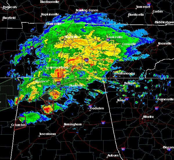 At 840 pm cst, a severe thunderstorm was located near fayetteville, moving northeast at 35 mph (radar indicated). Hazards include 60 mph wind gusts and nickel size hail. Expect damage to roofs. siding. And trees. At 840 pm cst, a severe thunderstorm was located near fayetteville, moving northeast at 35 mph (radar indicated). Hazards include 60 mph wind gusts and nickel size hail. Expect damage to roofs. siding. And trees.
|
| 11/29/2016 8:32 PM CST |
 At 831 pm cst, a severe thunderstorm was located 7 miles north of athens, moving east at 55 mph (radar indicated). Hazards include 60 to 70 mph wind gusts and nickel size hail. Expect damage to roofs. siding. And trees. At 831 pm cst, a severe thunderstorm was located 7 miles north of athens, moving east at 55 mph (radar indicated). Hazards include 60 to 70 mph wind gusts and nickel size hail. Expect damage to roofs. siding. And trees.
|
| 7/8/2016 8:44 PM CDT |
 At 843 pm cdt, a severe thunderstorm was located near fayetteville, moving east at 30 mph (radar indicated). Hazards include 60 mph wind gusts. Expect damage to roofs. siding. and trees. Locations impacted include, fayetteville, ardmore, lincoln, blanche, taft, mimosa, molino, mcburg, skinem and belleville. At 843 pm cdt, a severe thunderstorm was located near fayetteville, moving east at 30 mph (radar indicated). Hazards include 60 mph wind gusts. Expect damage to roofs. siding. and trees. Locations impacted include, fayetteville, ardmore, lincoln, blanche, taft, mimosa, molino, mcburg, skinem and belleville.
|
| 7/8/2016 8:27 PM CDT |
 At 826 pm cdt, a severe thunderstorm was located 9 miles west of fayetteville, moving east at 25 mph (radar indicated). Hazards include 60 mph wind gusts and penny size hail. Expect damage to roofs. siding. And trees. At 826 pm cdt, a severe thunderstorm was located 9 miles west of fayetteville, moving east at 25 mph (radar indicated). Hazards include 60 mph wind gusts and penny size hail. Expect damage to roofs. siding. And trees.
|
| 6/25/2016 8:05 PM CDT |
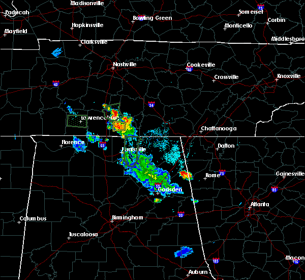 The severe thunderstorm warning for west central lincoln county will expire at 815 pm cdt, the storm which prompted the warning has weakened below severe limits, and no longer pose an immediate threat to life or property. therefore the warning will be allowed to expire. however heavy rain is still possible with this thunderstorm. The severe thunderstorm warning for west central lincoln county will expire at 815 pm cdt, the storm which prompted the warning has weakened below severe limits, and no longer pose an immediate threat to life or property. therefore the warning will be allowed to expire. however heavy rain is still possible with this thunderstorm.
|
| 6/25/2016 7:45 PM CDT |
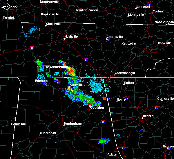 At 745 pm cdt, a severe thunderstorm was located near fayetteville, and is nearly stationary (radar indicated). Hazards include 60 mph wind gusts and penny size hail. Expect damage to roofs. siding. And trees. At 745 pm cdt, a severe thunderstorm was located near fayetteville, and is nearly stationary (radar indicated). Hazards include 60 mph wind gusts and penny size hail. Expect damage to roofs. siding. And trees.
|
| 6/25/2016 7:15 PM CDT | Measured at the fayetteville municipal airpor in lincoln county TN, 6 miles N of Fayetteville, TN |
| 6/25/2016 7:12 PM CDT | Numerous trees and some power lines were reported down across southern lincoln county... including on old lincoln roa in lincoln county TN, 9.9 miles NNW of Fayetteville, TN |
| 6/25/2016 7:07 PM CDT | Numerous trees and powerlines were reported down in the park city are in lincoln county TN, 4.7 miles N of Fayetteville, TN |
| 6/25/2016 7:07 AM CDT | Numerous trees and powerlines were reported down in the park city are in lincoln county TN, 4.7 miles N of Fayetteville, TN |
| 6/15/2016 6:24 PM CDT |
 The severe thunderstorm warning for lincoln, northern franklin and moore counties will expire at 630 pm cdt, the storms which prompted the warning have moved out of the warned area. therefore the warning will be allowed to expire. an additional warning remains in effect for parts of lincoln, franklin and moore counties in tn. The severe thunderstorm warning for lincoln, northern franklin and moore counties will expire at 630 pm cdt, the storms which prompted the warning have moved out of the warned area. therefore the warning will be allowed to expire. an additional warning remains in effect for parts of lincoln, franklin and moore counties in tn.
|
| 6/15/2016 6:15 PM CDT | Trees reported down on ellis childress roa in lincoln county TN, 9.6 miles N of Fayetteville, TN |
| 6/15/2016 6:15 PM CDT | Trees were reported down on smith mill roa in lincoln county TN, 8.3 miles NNW of Fayetteville, TN |
| 6/15/2016 6:05 PM CDT | Report via twitter of trees and power lines down in the kirkland and bellview area in lincoln county t in lincoln county TN, 7 miles NE of Fayetteville, TN |
| 6/15/2016 6:05 PM CDT | Trees down 2 inch diameter...estimated wind gusts 60 mph in lincoln county TN, 4.7 miles N of Fayetteville, TN |
| 6/15/2016 5:58 PM CDT |
 At 558 pm cdt, severe thunderstorms were located along a line extending from 8 miles north of monteagle to ardmore, moving southeast at 35 mph. this storm has a history of producing downed trees (radar indicated). Hazards include 60 mph wind gusts and quarter size hail. Hail damage to vehicles is expected. Expect wind damage to roofs, siding, and trees. At 558 pm cdt, severe thunderstorms were located along a line extending from 8 miles north of monteagle to ardmore, moving southeast at 35 mph. this storm has a history of producing downed trees (radar indicated). Hazards include 60 mph wind gusts and quarter size hail. Hail damage to vehicles is expected. Expect wind damage to roofs, siding, and trees.
|
| 6/15/2016 5:57 PM CDT | Trees reported down on roa in lincoln county TN, 1.7 miles E of Fayetteville, TN |
| 6/15/2016 5:54 PM CDT |
 At 553 pm cdt, severe thunderstorms were located along a line extending from 9 miles south of mcminnville to 10 miles east of pulaski, moving southeast at 20 mph. this storm did topple trees in lynchburg, tn as it passed through as reported by law enforcement (radar indicated). Hazards include 60 mph wind gusts and quarter size hail. Hail damage to vehicles is expected. expect wind damage to roofs, siding, and trees. Locations impacted include, winchester, fayetteville, lynchburg, decherd, estill springs, ardmore, monteagle, petersburg, tims ford lake and sewanee. At 553 pm cdt, severe thunderstorms were located along a line extending from 9 miles south of mcminnville to 10 miles east of pulaski, moving southeast at 20 mph. this storm did topple trees in lynchburg, tn as it passed through as reported by law enforcement (radar indicated). Hazards include 60 mph wind gusts and quarter size hail. Hail damage to vehicles is expected. expect wind damage to roofs, siding, and trees. Locations impacted include, winchester, fayetteville, lynchburg, decherd, estill springs, ardmore, monteagle, petersburg, tims ford lake and sewanee.
|
| 6/15/2016 5:45 PM CDT | Trees reported down on paint hollow roa in lincoln county TN, 6.5 miles S of Fayetteville, TN |
| 6/15/2016 5:42 PM CDT |
 At 541 pm cdt, severe thunderstorms were located along a line extending from 7 miles south of mcminnville to 6 miles east of pulaski, moving southeast at 20 mph (radar indicated). Hazards include 60 mph wind gusts and quarter size hail. Hail damage to vehicles is expected. Expect wind damage to roofs, siding, and trees. At 541 pm cdt, severe thunderstorms were located along a line extending from 7 miles south of mcminnville to 6 miles east of pulaski, moving southeast at 20 mph (radar indicated). Hazards include 60 mph wind gusts and quarter size hail. Hail damage to vehicles is expected. Expect wind damage to roofs, siding, and trees.
|
| 4/30/2016 5:42 PM CDT | The severe thunderstorm warning for lincoln, northwestern franklin and moore counties will expire at 545 pm cdt, the storm which prompted the warning has weakened below severe limits, and no longer pose an immediate threat to life or property. therefore the warning will be allowed to expire. |
| 4/30/2016 5:23 PM CDT |
 At 522 pm cdt, a severe thunderstorm was located near fayetteville, moving northeast at 45 mph (radar indicated). Hazards include 60 mph wind gusts and quarter size hail. Hail damage to vehicles is expected. expect wind damage to roofs, siding, and trees. Locations impacted include, winchester, fayetteville, lynchburg, petersburg, tims ford lake, harmony, hurdlow, taft, mimosa and marble hill. At 522 pm cdt, a severe thunderstorm was located near fayetteville, moving northeast at 45 mph (radar indicated). Hazards include 60 mph wind gusts and quarter size hail. Hail damage to vehicles is expected. expect wind damage to roofs, siding, and trees. Locations impacted include, winchester, fayetteville, lynchburg, petersburg, tims ford lake, harmony, hurdlow, taft, mimosa and marble hill.
|
| 4/30/2016 5:05 PM CDT |
 At 505 pm cdt, a severe thunderstorm was located 9 miles northeast of ardmore, or 9 miles southwest of fayetteville, moving northeast at 55 mph (radar indicated). Hazards include 60 mph wind gusts and quarter size hail. Hail damage to vehicles is expected. Expect wind damage to roofs, siding, and trees. At 505 pm cdt, a severe thunderstorm was located 9 miles northeast of ardmore, or 9 miles southwest of fayetteville, moving northeast at 55 mph (radar indicated). Hazards include 60 mph wind gusts and quarter size hail. Hail damage to vehicles is expected. Expect wind damage to roofs, siding, and trees.
|
| 4/27/2016 6:48 PM CDT | A report of trees down and power outages in crystal ridge. via social medi in lincoln county TN, 8.7 miles WSW of Fayetteville, TN |
| 3/31/2016 9:18 PM CDT |
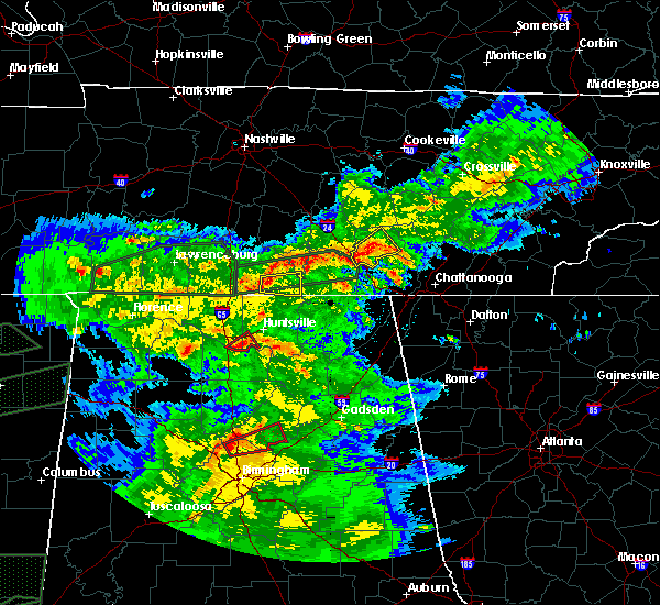 At 918 pm cdt, a severe thunderstorm was located near fayetteville, moving east at 35 mph (radar indicated). Hazards include 60 mph wind gusts and quarter size hail. Hail damage to vehicles is expected. Expect wind damage to roofs, siding, and trees. At 918 pm cdt, a severe thunderstorm was located near fayetteville, moving east at 35 mph (radar indicated). Hazards include 60 mph wind gusts and quarter size hail. Hail damage to vehicles is expected. Expect wind damage to roofs, siding, and trees.
|
| 3/31/2016 7:43 PM CDT | Quarter sized hail reported 11.2 miles WSW of Fayetteville, TN, quarter size hail was reported. |
| 3/31/2016 7:43 PM CDT |
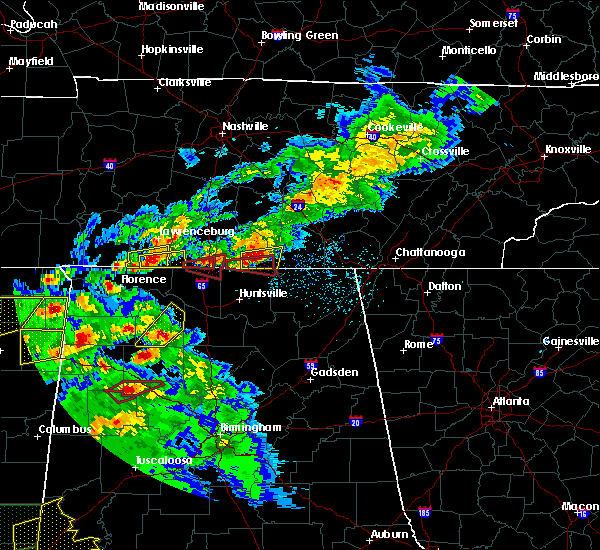 At 742 pm cdt, a severe thunderstorm was located 7 miles south of fayetteville, moving east at 30 mph (trained weather spotters). Hazards include 60 mph wind gusts and quarter size hail. Hail damage to vehicles is expected. Expect wind damage to roofs, siding, and trees. At 742 pm cdt, a severe thunderstorm was located 7 miles south of fayetteville, moving east at 30 mph (trained weather spotters). Hazards include 60 mph wind gusts and quarter size hail. Hail damage to vehicles is expected. Expect wind damage to roofs, siding, and trees.
|
| 9/11/2015 4:22 PM CDT | 3 inch diameter tree limb knocked down on morningside driv in lincoln county TN, 1.4 miles SE of Fayetteville, TN |
| 8/16/2015 1:44 PM CDT |
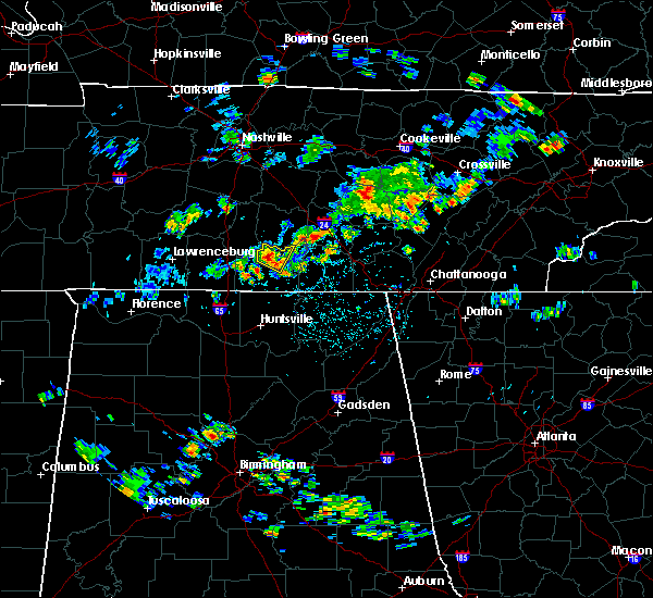 At 143 pm cdt, a severe thunderstorm was located near petersburg, or 8 miles north of fayetteville, moving north at 10 mph (radar indicated). Hazards include 60 mph wind gusts and penny size hail. Expect damage to roofs. Siding and trees. At 143 pm cdt, a severe thunderstorm was located near petersburg, or 8 miles north of fayetteville, moving north at 10 mph (radar indicated). Hazards include 60 mph wind gusts and penny size hail. Expect damage to roofs. Siding and trees.
|
| 7/14/2015 5:31 PM CDT |
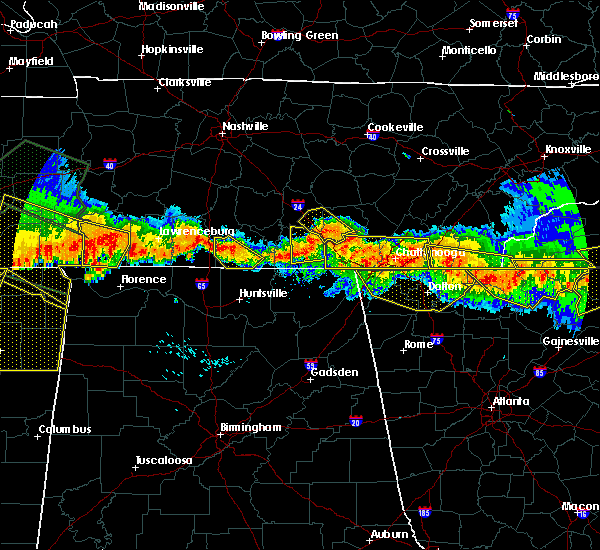 At 530 pm cdt, a severe thunderstorm was located west of fayetteville, moving southeast at 30 mph (radar indicated). Hazards include 70 mph wind gusts. Expect considerable tree damage. damage is likely to mobile homes, roofs and outbuildings. Locations impacted include, fayetteville, lincoln, taft, molino, mcburg, skinem, flintville, belleview, crystal springs and dellrose. At 530 pm cdt, a severe thunderstorm was located west of fayetteville, moving southeast at 30 mph (radar indicated). Hazards include 70 mph wind gusts. Expect considerable tree damage. damage is likely to mobile homes, roofs and outbuildings. Locations impacted include, fayetteville, lincoln, taft, molino, mcburg, skinem, flintville, belleview, crystal springs and dellrose.
|
| 7/14/2015 5:14 PM CDT |
 At 513 pm cdt, a severe thunderstorm was located 10 miles southwest of petersburg, or 12 miles west of fayetteville, moving southeast at 30 mph (radar indicated). Hazards include 70 mph wind gusts. Expect considerable tree damage. Damage is likely to mobile homes, roofs and outbuildings. At 513 pm cdt, a severe thunderstorm was located 10 miles southwest of petersburg, or 12 miles west of fayetteville, moving southeast at 30 mph (radar indicated). Hazards include 70 mph wind gusts. Expect considerable tree damage. Damage is likely to mobile homes, roofs and outbuildings.
|
| 7/14/2015 4:52 PM CDT |
 At 451 pm cdt, a severe thunderstorm was located near petersburg, or 9 miles northwest of fayetteville, moving southeast at 35 mph (radar indicated). Hazards include 70 mph wind gusts. Expect considerable tree damage. damage is likely to mobile homes, roofs and outbuildings. Locations impacted include, fayetteville, lynchburg, petersburg, tims ford lake, smithland, hurdlow, mimosa, chestnut ridge, marble hill and molino. At 451 pm cdt, a severe thunderstorm was located near petersburg, or 9 miles northwest of fayetteville, moving southeast at 35 mph (radar indicated). Hazards include 70 mph wind gusts. Expect considerable tree damage. damage is likely to mobile homes, roofs and outbuildings. Locations impacted include, fayetteville, lynchburg, petersburg, tims ford lake, smithland, hurdlow, mimosa, chestnut ridge, marble hill and molino.
|
| 7/14/2015 4:35 PM CDT |
 At 435 pm cdt, a severe thunderstorm was located near lewisburg, moving southeast at 35 mph (radar indicated). Hazards include 70 mph wind gusts. Expect considerable tree damage. Damage is likely to mobile homes, roofs and outbuildings. At 435 pm cdt, a severe thunderstorm was located near lewisburg, moving southeast at 35 mph (radar indicated). Hazards include 70 mph wind gusts. Expect considerable tree damage. Damage is likely to mobile homes, roofs and outbuildings.
|
| 7/1/2015 2:22 PM CDT |
 The severe thunderstorm warning for southwestern lincoln county will expire at 230 pm cdt, the storm which prompted the warning has weakened below severe limits, and no longer pose an immediate threat to life or property. therefore the warning will be allowed to expire. however gusty winds up to 50 mph are still possible with this thunderstorm. The severe thunderstorm warning for southwestern lincoln county will expire at 230 pm cdt, the storm which prompted the warning has weakened below severe limits, and no longer pose an immediate threat to life or property. therefore the warning will be allowed to expire. however gusty winds up to 50 mph are still possible with this thunderstorm.
|
| 7/1/2015 2:07 PM CDT |
 At 206 pm cdt, a severe thunderstorm was located 9 miles west of fayetteville, moving southeast at 30 mph (radar indicated). Hazards include 60 mph wind gusts. Expect damage to roofs. Siding and trees. At 206 pm cdt, a severe thunderstorm was located 9 miles west of fayetteville, moving southeast at 30 mph (radar indicated). Hazards include 60 mph wind gusts. Expect damage to roofs. Siding and trees.
|
| 4/20/2015 2:10 AM CDT | At 210 am cdt, severe thunderstorms were located along a line extending from near lynchburg to 7 miles northeast of hazel green, moving east at 45 mph (radar indicated). Hazards include 60 mph wind gusts and penny size hail. Expect damage to roofs. siding and trees. these severe storms will be near, lynchburg around 215 am cdt. tims ford lake around 230 am cdt. other locations impacted by these severe thunderstorms include flintville, belleview, elora, smithland, hurdlow, crystal springs, howell, kelso, mimosa and chestnut ridge. 0. 75in. |
| 4/20/2015 2:00 AM CDT | At 159 am cdt, severe thunderstorms were located along a line extending from near petersburg to 7 miles northwest of hazel green, moving east at 45 mph (radar indicated). Hazards include 60 mph wind gusts and penny size hail. Expect damage to roofs. siding and trees. these severe storms will be near, lynchburg around 215 am cdt. tims ford lake around 230 am cdt. other locations impacted by these severe thunderstorms include blanche, elora, smithland, hurdlow, taft, mimosa, chestnut ridge, marble hill, lincoln and molino. 0. 75in. |
| 4/20/2015 1:42 AM CDT | At 142 am cdt, severe thunderstorms were located along a line extending from 10 miles west of petersburg to ardmore, moving east at 35 mph (radar indicated). Hazards include 60 mph wind gusts and penny size hail. Expect damage to roofs. siding and trees. severe thunderstorms will be near, petersburg around 200 am cdt. lynchburg around 220 am cdt. other locations impacted by these severe thunderstorms include blanche, elora, smithland, hurdlow, taft, mimosa, chestnut ridge, marble hill, lincoln and molino. 0. 75in. |
| 4/3/2015 7:37 PM CDT | A tornado warning remains in effect until 800 pm cdt for northern madison and southern lincoln counties. at 737 pm cdt. a severe thunderstorm capable of producing a tornado was located 8 miles northwest of hazel green. or 8 miles southwest of fayetteville. moving east at 50 mph. hazard. Tornado and quarter size hail. |
| 4/3/2015 7:37 PM CDT | A tornado warning remains in effect until 800 pm cdt for northern madison and southern lincoln counties. at 737 pm cdt. a severe thunderstorm capable of producing a tornado was located 8 miles northwest of hazel green. or 8 miles southwest of fayetteville. moving east at 50 mph. hazard. Tornado and quarter size hail. |
| 4/3/2015 7:27 PM CDT | The national weather service in huntsville has issued a * tornado warning for. northern madison county in north central alabama. southern lincoln county in middle tennessee. until 800 pm cdt * at 727 pm cdt. A severe thunderstorm capable of producing a. |
| 4/3/2015 7:27 PM CDT | The national weather service in huntsville has issued a * tornado warning for. northern madison county in north central alabama. southern lincoln county in middle tennessee. until 800 pm cdt * at 727 pm cdt. A severe thunderstorm capable of producing a. |
| 4/3/2015 7:11 PM CDT | The national weather service in huntsville has issued a * severe thunderstorm warning for. northern madison county in north central alabama. northeastern limestone county in north central alabama. southern lincoln county in middle tennessee. Until 745 pm cdt. |
| 4/3/2015 7:11 PM CDT | The national weather service in huntsville has issued a * severe thunderstorm warning for. northern madison county in north central alabama. northeastern limestone county in north central alabama. southern lincoln county in middle tennessee. Until 745 pm cdt. |
| 4/28/2014 6:24 PM CDT | Wind damage reported from lincoln road to flintville. possible tornado damag in lincoln county TN, 9.2 miles NNW of Fayetteville, TN |
| 4/28/2014 6:20 PM CDT | Powerlines down...and trees down. old lincoln road and lincoln road intersection impassibl in lincoln county TN, 9.9 miles NNW of Fayetteville, TN |
| 12/21/2013 11:28 PM CST | Trees knocked down on eldad road. power out in parts of fayettevill in lincoln county TN, 1.6 miles NW of Fayetteville, TN |
| 12/21/2013 11:27 PM CST | Trees knocked down on west campbell stree in lincoln county TN, 1.2 miles E of Fayetteville, TN |
| 12/21/2013 11:28 AM CST | Trees knocked down on eldad road. power out in parts of fayettevill in lincoln county TN, 1.6 miles NW of Fayetteville, TN |
| 12/21/2013 11:27 AM CST | Trees knocked down on west campbell stree in lincoln county TN, 1.2 miles E of Fayetteville, TN |
| 11/17/2013 9:40 PM CST | Along march mill road a carport was blown down onto a ca in lincoln county TN, 6.4 miles SE of Fayetteville, TN |
| 11/17/2013 9:40 PM CST | Near the 400 block of haysland road a roof was blown off of a house. damage occurred to 3 vehicles. a porch roof was blown of in lincoln county TN, 6.8 miles SE of Fayetteville, TN |
| 7/10/2013 9:00 PM CDT | One tree of unknown size and type reported down on old fayetteville highway. another tree was reported down on highway 23 in lincoln county TN, 8 miles SW of Fayetteville, TN |
| 4/19/2013 2:12 AM CDT | Louse creek road completely blocked by downed tree in lincoln county TN, 10.2 miles SW of Fayetteville, TN |
| 3/31/2012 5:45 PM CDT | Quarter sized hail reported 9.8 miles SW of Fayetteville, TN, quarter sized hail was reported on highway 50 near the lincoln county line. time estimated by radar. |
| 3/31/2012 4:00 PM CDT | Quarter sized hail reported 5.2 miles WNW of Fayetteville, TN, quarter size hail was reported. |
| 3/31/2012 2:45 PM CDT | Quarter sized hail reported 14.4 miles SSW of Fayetteville, TN, quarter size hail was reported in the eastern portion of the chestnut ridge community. |
| 3/24/2012 4:22 PM CDT | Quarter sized hail reported 5.5 miles SSE of Fayetteville, TN |
| 3/2/2012 2:45 PM CST | Golf Ball sized hail reported 2.6 miles N of Fayetteville, TN, golf ball size hail reported at park city. |
| 1/1/0001 12:00 AM | Golf Ball sized hail reported 8.5 miles S of Fayetteville, TN, golfball -- or larger -- hail reported on minusa road. |
| 1/1/0001 12:00 AM | Numerous reports of trees and power lines down in lincoln county. several streets include oak street... clay street...lewisburg hwy...kidd rd...north main street...thor in lincoln county TN, 0.2 miles S of Fayetteville, TN |
| 1/1/0001 12:00 AM | By the west fayetteville fairgrounds there are trees on in lincoln county TN, 1.2 miles E of Fayetteville, TN |
| 1/1/0001 12:00 AM | Trees and powerlines down along amana ave in fayettevill in lincoln county TN, 1.2 miles E of Fayetteville, TN |
| 1/1/0001 12:00 AM | Roof damage to horse barn on hedgemont ave near robertson st in fayettevill in lincoln county TN, 0.6 miles ESE of Fayetteville, TN |
| 1/1/0001 12:00 AM | Roof damage to building on hedgemont ave near robertson st in lincoln county TN, 0.6 miles ESE of Fayetteville, TN |
| 1/1/0001 12:00 AM | Mobile home blown over in lincoln county TN, 0.2 miles S of Fayetteville, TN |
| 1/1/0001 12:00 AM | Tree reported down on house along with a tin structure badly damage in lincoln county TN, 0.2 miles S of Fayetteville, TN |
| 1/1/0001 12:00 AM | Many trees are down with structural damage in fayettevill in lincoln county TN, 0.2 miles S of Fayetteville, TN |
| 1/1/0001 12:00 AM | Tree reported down on gattistown road. substation was also hit resulting in 781 residents briefly without powe in lincoln county TN, 10 miles WSW of Fayetteville, TN |
| 1/1/0001 12:00 AM | Reported trees down on lewisburg hwy. damage reported to fayetteville public utilitie in lincoln county TN, 7 miles SSE of Fayetteville, TN |
| 1/1/0001 12:00 AM | Reported trees down on lewisburg hw in lincoln county TN, 7 miles SSE of Fayetteville, TN |
| 1/1/0001 12:00 AM | Trees down on shelbyville hwy. power outages reported in vann town are in lincoln county TN, 0.9 miles S of Fayetteville, TN |
Hail Maps for Fayetteville, TN


Connect with Interactive Hail Maps