

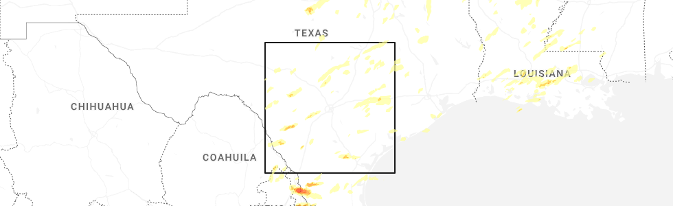
Hail Map for Flatonia, TX
The Flatonia, TX area has had 10 reports of on-the-ground hail by trained spotters, and has been under severe weather warnings 9 times during the past 12 months. Doppler radar has detected hail at or near Flatonia, TX on 39 occasions, including 3 occasions during the past year.
| Name: | Flatonia, TX |
| Where Located: | 85.8 miles ENE of San Antonio, TX |
| Map: | Google Map for Flatonia, TX |
| Population: | 1383 |
| Housing Units: | 599 |
| More Info: | Search Google for Flatonia, TX |
5
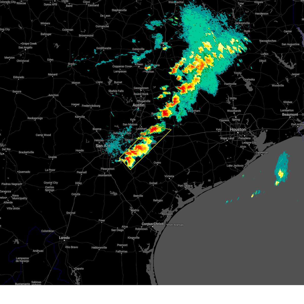
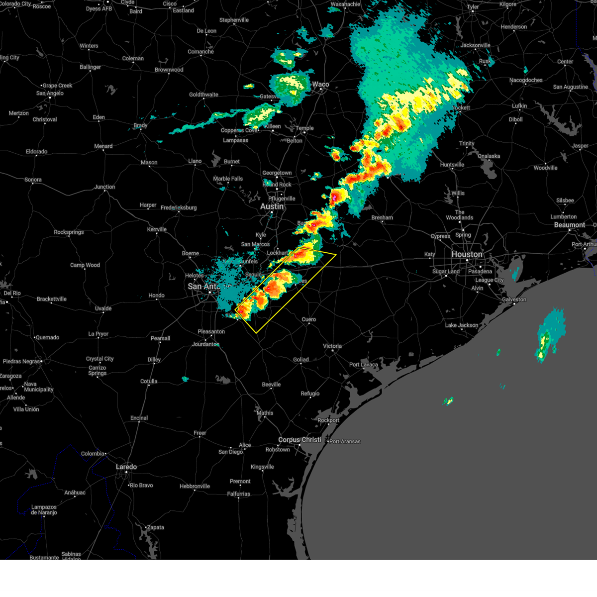
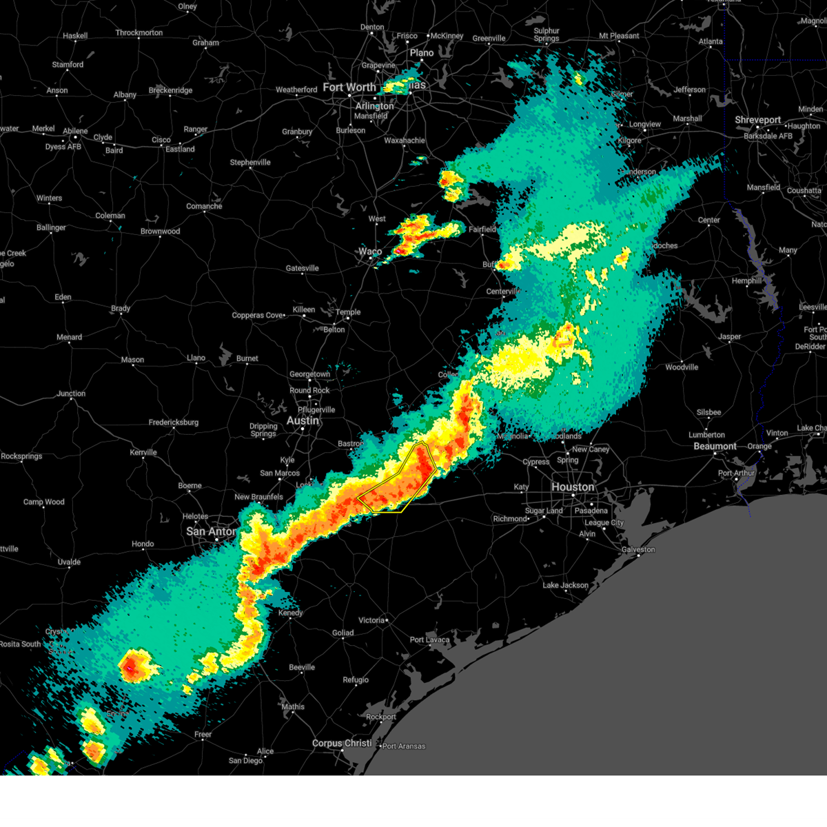
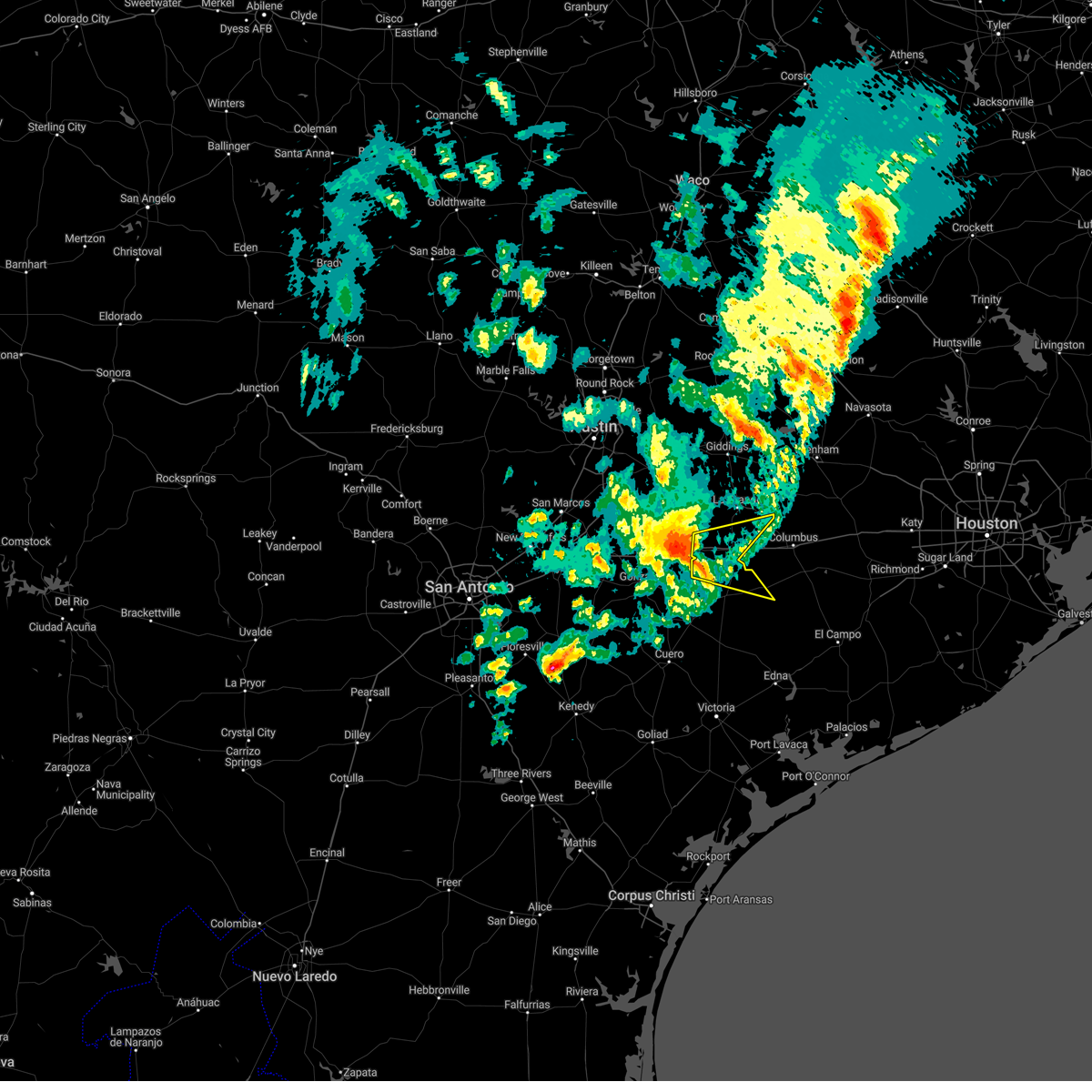
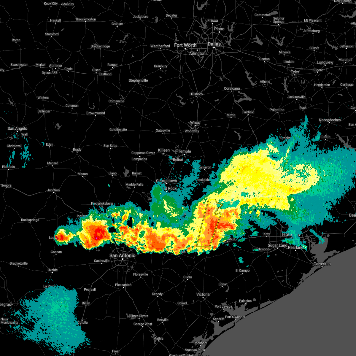
The Top Recent Hail Date for Flatonia, TX is Tuesday, May 6, 2025 (7th out of 39)
Hail and Wind Damage Spotted near Flatonia, TX
| Date / Time | Report Details |
|---|---|
| 5/6/2025 5:04 PM CDT |
 the severe thunderstorm warning has been cancelled and is no longer in effect the severe thunderstorm warning has been cancelled and is no longer in effect
|
| 5/6/2025 5:04 PM CDT |
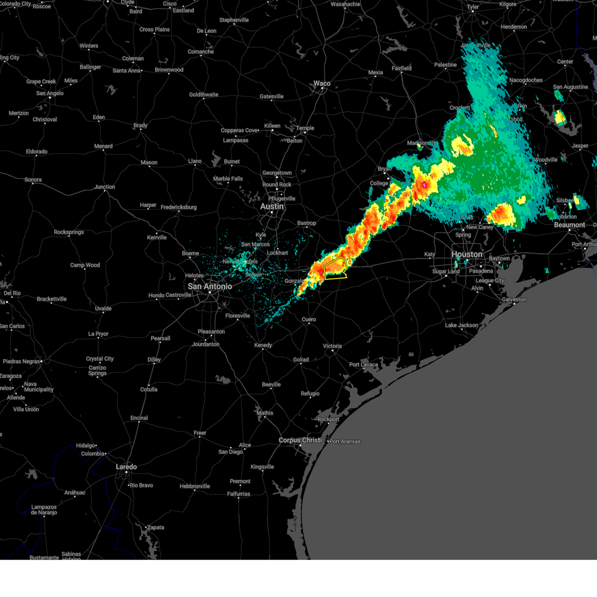 At 503 pm cdt, a severe thunderstorm was located near flatonia, moving east at 30 mph (radar indicated). Hazards include 60 mph wind gusts and quarter size hail. Hail damage to vehicles is expected. expect wind damage to roofs, siding, and trees. Locations impacted include, schulenburg, flatonia, komensky, swiss alp, freyburg, moravia, high hill, and engle. At 503 pm cdt, a severe thunderstorm was located near flatonia, moving east at 30 mph (radar indicated). Hazards include 60 mph wind gusts and quarter size hail. Hail damage to vehicles is expected. expect wind damage to roofs, siding, and trees. Locations impacted include, schulenburg, flatonia, komensky, swiss alp, freyburg, moravia, high hill, and engle.
|
| 5/6/2025 4:54 PM CDT |
 At 454 pm cdt, a severe thunderstorm was located near moulton, moving northeast at 30 mph (radar indicated). Hazards include 60 mph wind gusts and quarter size hail. Hail damage to vehicles is expected. expect wind damage to roofs, siding, and trees. Locations impacted include, schulenburg, flatonia, moulton, komensky, swiss alp, freyburg, dubina, moravia, high hill, newtonville, and engle. At 454 pm cdt, a severe thunderstorm was located near moulton, moving northeast at 30 mph (radar indicated). Hazards include 60 mph wind gusts and quarter size hail. Hail damage to vehicles is expected. expect wind damage to roofs, siding, and trees. Locations impacted include, schulenburg, flatonia, moulton, komensky, swiss alp, freyburg, dubina, moravia, high hill, newtonville, and engle.
|
| 5/6/2025 4:37 PM CDT | At 437 pm cdt, a severe thunderstorm was located 8 miles west of moulton, moving northeast at 30 mph (radar indicated). Hazards include 60 mph wind gusts and quarter size hail. Hail damage to vehicles is expected. expect wind damage to roofs, siding, and trees. Locations impacted include, schulenburg, flatonia, moulton, waelder, muldoon, komensky, swiss alp, freyburg, dubina, moravia, high hill, newtonville, elm grove, engle, o'quinn, nickle, dilworth, floy, little new york, and colony. |
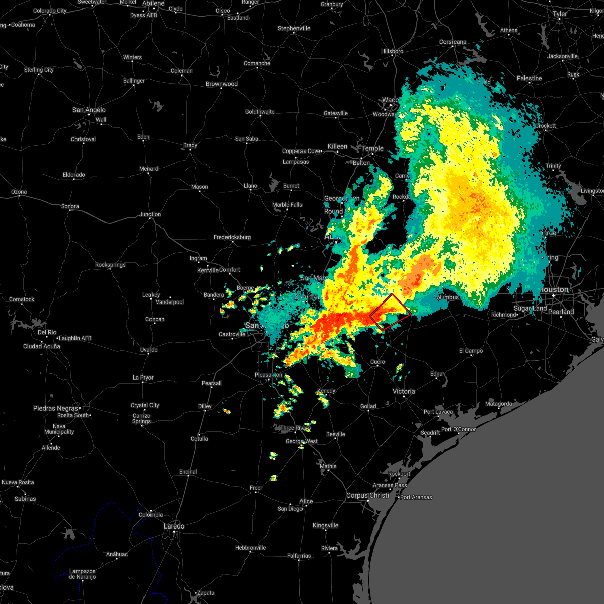
| 5/6/2025 4:26 PM CDT | Ping Pong Ball sized hail reported 0.9 miles NNE of Flatonia, TX, broadcast media relayed a report of ping pong ball sized hail in flatonia. |
| 5/6/2025 4:22 PM CDT | Ping Pong Ball sized hail reported 4.4 miles NE of Flatonia, TX, picture via social media. time estimated via radar. |
| 5/6/2025 4:19 PM CDT | Svrewx the national weather service in austin san antonio has issued a * severe thunderstorm warning for, northeastern gonzales county in south central texas, southwestern fayette county in south central texas, northwestern lavaca county in south central texas, * until 515 pm cdt. * at 418 pm cdt, a pair of severe thunderstorms were located over gonzales and southwest of flatonia, moving northeast at 25 mph (radar indicated). Hazards include 60 mph wind gusts and quarter size hail. Hail damage to vehicles is expected. Expect wind damage to roofs, siding, and trees. |
| 12/24/2024 10:26 PM CST | Golf Ball sized hail reported 9.1 miles SSW of Flatonia, TX, time estimated by radar. |
| 12/24/2024 9:16 PM CST |
 The storms which prompted the warning have weakened below severe limits, and no longer pose an immediate threat to life or property. therefore, the warning has been allowed to expire. however small hail, gusty winds and heavy rain are still possible with these thunderstorms. a severe thunderstorm watch remains in effect until midnight cst for south central texas. The storms which prompted the warning have weakened below severe limits, and no longer pose an immediate threat to life or property. therefore, the warning has been allowed to expire. however small hail, gusty winds and heavy rain are still possible with these thunderstorms. a severe thunderstorm watch remains in effect until midnight cst for south central texas.
|
| 12/24/2024 8:54 PM CST |
 At 853 pm cst, severe thunderstorms were located along a line extending from cistern to 7 miles north of waelder to near luling to 6 miles south of palmeto state park to 9 miles north of nixon to near stockdale, moving northeast at 10 mph (radar indicated). Hazards include 60 mph wind gusts and quarter size hail. Hail damage to vehicles is expected. expect wind damage to roofs, siding, and trees. Locations impacted include, gonzales, luling, stockdale, flatonia, kosciusko, nixon, waelder, smiley, pandora, gillett, muldoon, cestohowa, sutherland springs, cistern, palmeto state park, delhi, leesville, oak forest, belmont, and mcneil. At 853 pm cst, severe thunderstorms were located along a line extending from cistern to 7 miles north of waelder to near luling to 6 miles south of palmeto state park to 9 miles north of nixon to near stockdale, moving northeast at 10 mph (radar indicated). Hazards include 60 mph wind gusts and quarter size hail. Hail damage to vehicles is expected. expect wind damage to roofs, siding, and trees. Locations impacted include, gonzales, luling, stockdale, flatonia, kosciusko, nixon, waelder, smiley, pandora, gillett, muldoon, cestohowa, sutherland springs, cistern, palmeto state park, delhi, leesville, oak forest, belmont, and mcneil.
|
| 12/24/2024 8:32 PM CST |
 At 831 pm cst, severe thunderstorms were located along a line extending from 6 miles west of cistern to 10 miles northwest of waelder to palmeto state park to 13 miles southeast of kingsbury to 8 miles northwest of nixon to near sutherland springs, moving east at 15 mph. the largest hail is 10 miles northwest of waelder (radar indicated). Hazards include two inch hail and 60 mph wind gusts. People and animals outdoors will be injured. expect hail damage to roofs, siding, windows, and vehicles. expect wind damage to roofs, siding, and trees. Locations impacted include, gonzales, luling, stockdale, flatonia, kosciusko, nixon, waelder, smiley, pandora, gillett, muldoon, cestohowa, sutherland springs, cistern, palmeto state park, delhi, leesville, oak forest, belmont, and mcneil. At 831 pm cst, severe thunderstorms were located along a line extending from 6 miles west of cistern to 10 miles northwest of waelder to palmeto state park to 13 miles southeast of kingsbury to 8 miles northwest of nixon to near sutherland springs, moving east at 15 mph. the largest hail is 10 miles northwest of waelder (radar indicated). Hazards include two inch hail and 60 mph wind gusts. People and animals outdoors will be injured. expect hail damage to roofs, siding, windows, and vehicles. expect wind damage to roofs, siding, and trees. Locations impacted include, gonzales, luling, stockdale, flatonia, kosciusko, nixon, waelder, smiley, pandora, gillett, muldoon, cestohowa, sutherland springs, cistern, palmeto state park, delhi, leesville, oak forest, belmont, and mcneil.
|
| 12/24/2024 8:14 PM CST |
 Svrewx the national weather service in austin san antonio has issued a * severe thunderstorm warning for, southeastern caldwell county in south central texas, southeastern guadalupe county in south central texas, north central karnes county in south central texas, south central bastrop county in south central texas, gonzales county in south central texas, southwestern fayette county in south central texas, northeastern wilson county in south central texas, * until 915 pm cst. * at 814 pm cst, severe thunderstorms were located along a line extending from 8 miles southwest of rosanky to palmeto state park to 13 miles south of kingsbury to 8 miles north of pandora to near sutherland springs, moving east at 20 mph (radar indicated). Hazards include 60 mph wind gusts and quarter size hail. Hail damage to vehicles is expected. Expect wind damage to roofs, siding, and trees. Svrewx the national weather service in austin san antonio has issued a * severe thunderstorm warning for, southeastern caldwell county in south central texas, southeastern guadalupe county in south central texas, north central karnes county in south central texas, south central bastrop county in south central texas, gonzales county in south central texas, southwestern fayette county in south central texas, northeastern wilson county in south central texas, * until 915 pm cst. * at 814 pm cst, severe thunderstorms were located along a line extending from 8 miles southwest of rosanky to palmeto state park to 13 miles south of kingsbury to 8 miles north of pandora to near sutherland springs, moving east at 20 mph (radar indicated). Hazards include 60 mph wind gusts and quarter size hail. Hail damage to vehicles is expected. Expect wind damage to roofs, siding, and trees.
|
| 9/14/2023 7:18 PM CDT | Fayette county sheriffs office reports damage to roofs in the city of flatonia. time estimated from rada in fayette county TX, 0.4 miles ENE of Flatonia, TX |
| 9/14/2023 7:18 PM CDT |
 At 717 pm cdt, a severe thunderstorm was located near flatonia, moving southeast at 20 mph (radar indicated). Hazards include 60 mph wind gusts and quarter size hail. Hail damage to vehicles is expected. Expect wind damage to roofs, siding, and trees. At 717 pm cdt, a severe thunderstorm was located near flatonia, moving southeast at 20 mph (radar indicated). Hazards include 60 mph wind gusts and quarter size hail. Hail damage to vehicles is expected. Expect wind damage to roofs, siding, and trees.
|
| 6/21/2023 9:02 PM CDT |
 At 902 pm cdt, severe thunderstorms were located along a line extending from near cistern to near flatonia to near nixon, moving southeast at 25 mph (radar indicated). Hazards include 60 mph wind gusts and quarter size hail. Hail damage to vehicles is expected. Expect wind damage to roofs, siding, and trees. At 902 pm cdt, severe thunderstorms were located along a line extending from near cistern to near flatonia to near nixon, moving southeast at 25 mph (radar indicated). Hazards include 60 mph wind gusts and quarter size hail. Hail damage to vehicles is expected. Expect wind damage to roofs, siding, and trees.
|
| 6/3/2023 10:56 PM CDT |
 The severe thunderstorm warning for southeastern bastrop, northeastern gonzales, south central lee, fayette and northwestern lavaca counties will expire at 1100 pm cdt, the storms which prompted the warning have weakened below severe limits, and no longer pose an immediate threat to life or property. therefore, the warning will be allowed to expire. however small hail, gusty winds and heavy rain are still possible with these thunderstorms. The severe thunderstorm warning for southeastern bastrop, northeastern gonzales, south central lee, fayette and northwestern lavaca counties will expire at 1100 pm cdt, the storms which prompted the warning have weakened below severe limits, and no longer pose an immediate threat to life or property. therefore, the warning will be allowed to expire. however small hail, gusty winds and heavy rain are still possible with these thunderstorms.
|
| 6/3/2023 10:41 PM CDT |
 At 1040 pm cdt, severe thunderstorms were located along a line extending from 9 miles north of la grange to 6 miles southeast of muldoon to near flatonia, moving southeast at 40 mph (radar indicated). Hazards include 60 mph wind gusts and penny size hail. Expect damage to roofs, siding, and trees. locations impacted include, la grange, smithville, schulenburg, flatonia, moulton, waelder, fayetteville, muldoon, cistern, komensky, swiss alp, henkhaus, dubina, rutersville, engle, plum, buescher state park, ammannsville, mullins prairie and freyburg. hail threat, radar indicated max hail size, 0. 75 in wind threat, radar indicated max wind gust, 60 mph. At 1040 pm cdt, severe thunderstorms were located along a line extending from 9 miles north of la grange to 6 miles southeast of muldoon to near flatonia, moving southeast at 40 mph (radar indicated). Hazards include 60 mph wind gusts and penny size hail. Expect damage to roofs, siding, and trees. locations impacted include, la grange, smithville, schulenburg, flatonia, moulton, waelder, fayetteville, muldoon, cistern, komensky, swiss alp, henkhaus, dubina, rutersville, engle, plum, buescher state park, ammannsville, mullins prairie and freyburg. hail threat, radar indicated max hail size, 0. 75 in wind threat, radar indicated max wind gust, 60 mph.
|
| 6/3/2023 10:14 PM CDT |
 At 1013 pm cdt, severe thunderstorms were located along a line extending from near paige to near cistern to near waelder, moving southeast at 20 mph. the severe thunderstorm near smithville has been absorbed by the line of thunderstorms (radar indicated). Hazards include two inch hail and 60 mph wind gusts. People and animals outdoors will be injured. expect hail damage to roofs, siding, windows, and vehicles. expect wind damage to roofs, siding, and trees. locations impacted include, bastrop, la grange, smithville, schulenburg, flatonia, moulton, waelder, fayetteville, camp swift, circle d-kc estates, rosanky, muldoon, cistern, wyldwood, upton, komensky, swiss alp, henkhaus, hills prairie and rutersville. thunderstorm damage threat, considerable hail threat, radar indicated max hail size, 2. 00 in wind threat, radar indicated max wind gust, 60 mph. At 1013 pm cdt, severe thunderstorms were located along a line extending from near paige to near cistern to near waelder, moving southeast at 20 mph. the severe thunderstorm near smithville has been absorbed by the line of thunderstorms (radar indicated). Hazards include two inch hail and 60 mph wind gusts. People and animals outdoors will be injured. expect hail damage to roofs, siding, windows, and vehicles. expect wind damage to roofs, siding, and trees. locations impacted include, bastrop, la grange, smithville, schulenburg, flatonia, moulton, waelder, fayetteville, camp swift, circle d-kc estates, rosanky, muldoon, cistern, wyldwood, upton, komensky, swiss alp, henkhaus, hills prairie and rutersville. thunderstorm damage threat, considerable hail threat, radar indicated max hail size, 2. 00 in wind threat, radar indicated max wind gust, 60 mph.
|
| 6/3/2023 10:02 PM CDT |
 At 1002 pm cdt, severe thunderstorms were located along a line extending from near bastrop to rosanky to 10 miles east of lockhart, moving southeast at 40 mph. an isolated severe thunderstorm was near smithville, and nearly stationary (radar indicated). Hazards include ping pong ball size hail and 60 mph wind gusts. People and animals outdoors will be injured. expect hail damage to roofs, siding, windows, and vehicles. Expect wind damage to roofs, siding, and trees. At 1002 pm cdt, severe thunderstorms were located along a line extending from near bastrop to rosanky to 10 miles east of lockhart, moving southeast at 40 mph. an isolated severe thunderstorm was near smithville, and nearly stationary (radar indicated). Hazards include ping pong ball size hail and 60 mph wind gusts. People and animals outdoors will be injured. expect hail damage to roofs, siding, windows, and vehicles. Expect wind damage to roofs, siding, and trees.
|
| 5/8/2023 5:35 PM CDT | Quarter sized hail reported 7.2 miles SSW of Flatonia, TX, quarter size hail currently falling. |
| 4/28/2023 7:25 PM CDT |
 At 725 pm cdt, a severe thunderstorm was located near fayetteville, or 11 miles north of columbus, moving east at 40 mph (radar indicated). Hazards include 60 mph wind gusts and quarter size hail. Hail damage to vehicles is expected. expect wind damage to roofs, siding, and trees. locations impacted include, la grange, schulenburg, flatonia, fayetteville, round top, muldoon, carmine, swiss alp, dubina, rutersville, warrenton, engle, waldeck, ammannsville, mullins prairie, freyburg, high hill, elm grove, o`quinn and floy. hail threat, radar indicated max hail size, 1. 00 in wind threat, radar indicated max wind gust, 60 mph. At 725 pm cdt, a severe thunderstorm was located near fayetteville, or 11 miles north of columbus, moving east at 40 mph (radar indicated). Hazards include 60 mph wind gusts and quarter size hail. Hail damage to vehicles is expected. expect wind damage to roofs, siding, and trees. locations impacted include, la grange, schulenburg, flatonia, fayetteville, round top, muldoon, carmine, swiss alp, dubina, rutersville, warrenton, engle, waldeck, ammannsville, mullins prairie, freyburg, high hill, elm grove, o`quinn and floy. hail threat, radar indicated max hail size, 1. 00 in wind threat, radar indicated max wind gust, 60 mph.
|
| 4/28/2023 7:08 PM CDT |
 At 708 pm cdt, a severe thunderstorm was located near la grange, moving east at 40 mph (radar indicated). Hazards include 60 mph wind gusts and quarter size hail. Hail damage to vehicles is expected. Expect wind damage to roofs, siding, and trees. At 708 pm cdt, a severe thunderstorm was located near la grange, moving east at 40 mph (radar indicated). Hazards include 60 mph wind gusts and quarter size hail. Hail damage to vehicles is expected. Expect wind damage to roofs, siding, and trees.
|
| 4/28/2023 6:58 PM CDT |
 At 657 pm cdt, severe thunderstorms were located along a line extending from near lake somerville dam to near muldoon, moving east at 35 mph (radar indicated). Hazards include 60 mph wind gusts and quarter size hail. Hail damage to vehicles is expected. expect wind damage to roofs, siding, and trees. locations impacted include, giddings, la grange, smithville, schulenburg, flatonia, fayetteville, dime box, round top, rosanky, muldoon, cistern, lake somerville state park & trailway, upton, carmine, swiss alp, northrup, rutersville, ledbetter, waldeck and plum. hail threat, radar indicated max hail size, 1. 00 in wind threat, radar indicated max wind gust, 60 mph. At 657 pm cdt, severe thunderstorms were located along a line extending from near lake somerville dam to near muldoon, moving east at 35 mph (radar indicated). Hazards include 60 mph wind gusts and quarter size hail. Hail damage to vehicles is expected. expect wind damage to roofs, siding, and trees. locations impacted include, giddings, la grange, smithville, schulenburg, flatonia, fayetteville, dime box, round top, rosanky, muldoon, cistern, lake somerville state park & trailway, upton, carmine, swiss alp, northrup, rutersville, ledbetter, waldeck and plum. hail threat, radar indicated max hail size, 1. 00 in wind threat, radar indicated max wind gust, 60 mph.
|
| 4/28/2023 6:36 PM CDT |
 At 636 pm cdt, severe thunderstorms were located along a line extending from near lake somerville state park & trailway to near rosanky, moving east at 35 mph (radar indicated). Hazards include 60 mph wind gusts and quarter size hail. Hail damage to vehicles is expected. expect wind damage to roofs, siding, and trees. locations impacted include, bastrop, giddings, la grange, smithville, schulenburg, flatonia, lexington, shelby, fayetteville, dime box, round top, fedor, camp swift, circle d-kc estates, cedar creek, rosanky, paige, muldoon, cistern and lake somerville state park & trailway. hail threat, radar indicated max hail size, 1. 00 in wind threat, radar indicated max wind gust, 60 mph. At 636 pm cdt, severe thunderstorms were located along a line extending from near lake somerville state park & trailway to near rosanky, moving east at 35 mph (radar indicated). Hazards include 60 mph wind gusts and quarter size hail. Hail damage to vehicles is expected. expect wind damage to roofs, siding, and trees. locations impacted include, bastrop, giddings, la grange, smithville, schulenburg, flatonia, lexington, shelby, fayetteville, dime box, round top, fedor, camp swift, circle d-kc estates, cedar creek, rosanky, paige, muldoon, cistern and lake somerville state park & trailway. hail threat, radar indicated max hail size, 1. 00 in wind threat, radar indicated max wind gust, 60 mph.
|
| 4/28/2023 6:25 PM CDT |
 At 624 pm cdt, severe thunderstorms were located along a line extending from near lake somerville state park & trailway to near rosanky, moving east at 35 mph (radar indicated). Hazards include 60 mph wind gusts and quarter size hail. Hail damage to vehicles is expected. Expect wind damage to roofs, siding, and trees. At 624 pm cdt, severe thunderstorms were located along a line extending from near lake somerville state park & trailway to near rosanky, moving east at 35 mph (radar indicated). Hazards include 60 mph wind gusts and quarter size hail. Hail damage to vehicles is expected. Expect wind damage to roofs, siding, and trees.
|
| 4/15/2023 7:30 PM CDT |
 At 730 pm cdt, severe thunderstorms were located along a line extending from near fayetteville to near flatonia to near gonzales, moving southeast at 20 mph (radar indicated). Hazards include 60 mph wind gusts and quarter size hail. Hail damage to vehicles is expected. expect wind damage to roofs, siding, and trees. severe thunderstorms will be near, moulton around 740 pm cdt. hallettsville around 815 pm cdt. hochheim around 820 pm cdt. yoakum and ezzell around 830 pm cdt. other locations impacted by these severe thunderstorms include komensky, worthing, swiss alp, henkhaus, edgar, dubina, terryville, engle, dilworth and ammannsville. hail threat, observed max hail size, 1. 00 in wind threat, radar indicated max wind gust, 60 mph. At 730 pm cdt, severe thunderstorms were located along a line extending from near fayetteville to near flatonia to near gonzales, moving southeast at 20 mph (radar indicated). Hazards include 60 mph wind gusts and quarter size hail. Hail damage to vehicles is expected. expect wind damage to roofs, siding, and trees. severe thunderstorms will be near, moulton around 740 pm cdt. hallettsville around 815 pm cdt. hochheim around 820 pm cdt. yoakum and ezzell around 830 pm cdt. other locations impacted by these severe thunderstorms include komensky, worthing, swiss alp, henkhaus, edgar, dubina, terryville, engle, dilworth and ammannsville. hail threat, observed max hail size, 1. 00 in wind threat, radar indicated max wind gust, 60 mph.
|
| 4/15/2023 7:11 PM CDT | Ping Pong Ball sized hail reported 8.4 miles SW of Flatonia, TX |
| 4/15/2023 7:01 PM CDT | Quarter sized hail reported 9.1 miles SSW of Flatonia, TX, time estimated via radar. |
| 3/2/2023 9:28 PM CST |
 At 927 pm cst, a severe thunderstorm was located near flatonia, moving east at 50 mph (radar indicated). Hazards include 60 mph wind gusts and penny size hail. Expect damage to roofs, siding, and trees. locations impacted include, flatonia, moulton, komensky, floy and breslau. hail threat, radar indicated max hail size, 0. 75 in wind threat, radar indicated max wind gust, 60 mph. At 927 pm cst, a severe thunderstorm was located near flatonia, moving east at 50 mph (radar indicated). Hazards include 60 mph wind gusts and penny size hail. Expect damage to roofs, siding, and trees. locations impacted include, flatonia, moulton, komensky, floy and breslau. hail threat, radar indicated max hail size, 0. 75 in wind threat, radar indicated max wind gust, 60 mph.
|
| 3/2/2023 9:22 PM CST |
 At 922 pm cst, a severe thunderstorm was located over flatonia, moving east at 50 mph (radar indicated). Hazards include 60 mph wind gusts. expect damage to roofs, siding, and trees At 922 pm cst, a severe thunderstorm was located over flatonia, moving east at 50 mph (radar indicated). Hazards include 60 mph wind gusts. expect damage to roofs, siding, and trees
|
| 3/2/2023 9:08 PM CST |
 At 907 pm cst, severe thunderstorms were located along a line extending from 10 miles west of waelder to near palmeto state park to 7 miles southeast of gonzales, moving east at 70 mph (radar indicated). Hazards include 60 mph wind gusts and penny size hail. Expect damage to roofs, siding, and trees. locations impacted include, gonzales, hallettsville, shiner, flatonia, moulton, waelder, cistern, palmeto state park, komensky, worthing, henkhaus, cost, dilworth, thompsonville, glaze city, newtonville, elm grove, breslau, nickle and mont. hail threat, radar indicated max hail size, 0. 75 in wind threat, radar indicated max wind gust, 60 mph. At 907 pm cst, severe thunderstorms were located along a line extending from 10 miles west of waelder to near palmeto state park to 7 miles southeast of gonzales, moving east at 70 mph (radar indicated). Hazards include 60 mph wind gusts and penny size hail. Expect damage to roofs, siding, and trees. locations impacted include, gonzales, hallettsville, shiner, flatonia, moulton, waelder, cistern, palmeto state park, komensky, worthing, henkhaus, cost, dilworth, thompsonville, glaze city, newtonville, elm grove, breslau, nickle and mont. hail threat, radar indicated max hail size, 0. 75 in wind threat, radar indicated max wind gust, 60 mph.
|
| 3/2/2023 8:53 PM CST |
 At 853 pm cst, severe thunderstorms were located along a line extending from luling to 6 miles southeast of kingsbury to 10 miles north of smiley, moving east at 60 mph (radar indicated). Hazards include 60 mph wind gusts and quarter size hail. Hail damage to vehicles is expected. Expect wind damage to roofs, siding, and trees. At 853 pm cst, severe thunderstorms were located along a line extending from luling to 6 miles southeast of kingsbury to 10 miles north of smiley, moving east at 60 mph (radar indicated). Hazards include 60 mph wind gusts and quarter size hail. Hail damage to vehicles is expected. Expect wind damage to roofs, siding, and trees.
|
| 10/24/2022 10:28 PM CDT |
 At 1027 pm cdt, severe thunderstorms were located along a line extending from near dime box to near bastrop to fentress to cibolo, moving east at 30 mph (radar indicated). Hazards include 60 mph wind gusts and nickel size hail. Expect damage to roofs, siding, and trees. locations impacted include, new braunfels, schertz, seguin, cibolo, lockhart, bastrop, gonzales, luling, giddings, la grange, smithville, flatonia, mcqueeney, martindale, waelder, marion, kingsbury, santa clara, new berlin and staples. hail threat, radar indicated max hail size, 0. 88 in wind threat, radar indicated max wind gust, 60 mph. At 1027 pm cdt, severe thunderstorms were located along a line extending from near dime box to near bastrop to fentress to cibolo, moving east at 30 mph (radar indicated). Hazards include 60 mph wind gusts and nickel size hail. Expect damage to roofs, siding, and trees. locations impacted include, new braunfels, schertz, seguin, cibolo, lockhart, bastrop, gonzales, luling, giddings, la grange, smithville, flatonia, mcqueeney, martindale, waelder, marion, kingsbury, santa clara, new berlin and staples. hail threat, radar indicated max hail size, 0. 88 in wind threat, radar indicated max wind gust, 60 mph.
|
| 10/24/2022 10:08 PM CDT |
 At 1008 pm cdt, severe thunderstorms were located along a line extending from near tanglewood to cedar creek to near zorn to live oak, moving east at 30 mph (radar indicated). Hazards include 60 mph wind gusts and nickel size hail. expect damage to roofs, siding, and trees At 1008 pm cdt, severe thunderstorms were located along a line extending from near tanglewood to cedar creek to near zorn to live oak, moving east at 30 mph (radar indicated). Hazards include 60 mph wind gusts and nickel size hail. expect damage to roofs, siding, and trees
|
| 5/25/2022 1:28 AM CDT |
 The severe thunderstorm warning for fayette county will expire at 130 am cdt, the storms which prompted the warning have weakened below severe limits, and have exited the warned area. therefore, the warning will be allowed to expire. however gusty winds and heavy rain are still possible with these thunderstorms. a severe thunderstorm watch remains in effect until 500 am cdt for south central texas. The severe thunderstorm warning for fayette county will expire at 130 am cdt, the storms which prompted the warning have weakened below severe limits, and have exited the warned area. therefore, the warning will be allowed to expire. however gusty winds and heavy rain are still possible with these thunderstorms. a severe thunderstorm watch remains in effect until 500 am cdt for south central texas.
|
| 5/25/2022 1:06 AM CDT |
 At 106 am cdt, severe thunderstorms were located along a line extending from near burton to 6 miles northeast of la grange to near schulenburg, moving southeast at 35 mph (radar indicated). Hazards include 60 mph wind gusts and penny size hail. Expect damage to roofs, siding, and trees. locations impacted include, la grange, schulenburg, flatonia, fayetteville, round top, muldoon, carmine, swiss alp, dubina, rutersville, warrenton, engle, waldeck, plum, ammannsville, mullins prairie, nechanitz, freyburg, high hill and o`quinn. hail threat, radar indicated max hail size, 0. 75 in wind threat, radar indicated max wind gust, 60 mph. At 106 am cdt, severe thunderstorms were located along a line extending from near burton to 6 miles northeast of la grange to near schulenburg, moving southeast at 35 mph (radar indicated). Hazards include 60 mph wind gusts and penny size hail. Expect damage to roofs, siding, and trees. locations impacted include, la grange, schulenburg, flatonia, fayetteville, round top, muldoon, carmine, swiss alp, dubina, rutersville, warrenton, engle, waldeck, plum, ammannsville, mullins prairie, nechanitz, freyburg, high hill and o`quinn. hail threat, radar indicated max hail size, 0. 75 in wind threat, radar indicated max wind gust, 60 mph.
|
| 5/25/2022 12:39 AM CDT |
 At 1239 am cdt, severe thunderstorms were located along a line extending from near caldwell to near giddings to near muldoon, moving east at 45 mph (radar indicated). Hazards include 60 mph wind gusts and penny size hail. Expect damage to roofs, siding, and trees. locations impacted include, bastrop, giddings, la grange, smithville, schulenburg, flatonia, lexington, fayetteville, dime box, round top, fedor, camp swift, circle d-kc estates, rosanky, paige, muldoon, tanglewood, cistern, lake somerville state park & trailway and upton. hail threat, radar indicated max hail size, 0. 75 in wind threat, radar indicated max wind gust, 60 mph. At 1239 am cdt, severe thunderstorms were located along a line extending from near caldwell to near giddings to near muldoon, moving east at 45 mph (radar indicated). Hazards include 60 mph wind gusts and penny size hail. Expect damage to roofs, siding, and trees. locations impacted include, bastrop, giddings, la grange, smithville, schulenburg, flatonia, lexington, fayetteville, dime box, round top, fedor, camp swift, circle d-kc estates, rosanky, paige, muldoon, tanglewood, cistern, lake somerville state park & trailway and upton. hail threat, radar indicated max hail size, 0. 75 in wind threat, radar indicated max wind gust, 60 mph.
|
| 5/25/2022 12:26 AM CDT |
 At 1226 am cdt, severe thunderstorms were located along a line extending from 7 miles east of tanglewood to near giddings to cistern, moving east at 45 mph (radar indicated). Hazards include 60 mph wind gusts and penny size hail. expect damage to roofs, siding, and trees At 1226 am cdt, severe thunderstorms were located along a line extending from 7 miles east of tanglewood to near giddings to cistern, moving east at 45 mph (radar indicated). Hazards include 60 mph wind gusts and penny size hail. expect damage to roofs, siding, and trees
|
| 5/5/2022 8:27 PM CDT |
 The severe thunderstorm warning for northeastern gonzales and southwestern fayette counties will expire at 830 pm cdt, the storm which prompted the warning has weakened below severe limits, and no longer poses an immediate threat to life or property. therefore, the warning will be allowed to expire. however small hail and gusty winds are still possible with this thunderstorm. The severe thunderstorm warning for northeastern gonzales and southwestern fayette counties will expire at 830 pm cdt, the storm which prompted the warning has weakened below severe limits, and no longer poses an immediate threat to life or property. therefore, the warning will be allowed to expire. however small hail and gusty winds are still possible with this thunderstorm.
|
| 5/5/2022 8:11 PM CDT |
 At 810 pm cdt, a severe thunderstorm was located near waelder, or 10 miles north of gonzales, moving southeast at 35 mph (radar indicated). Hazards include 60 mph wind gusts and quarter size hail. Hail damage to vehicles is expected. expect wind damage to roofs, siding, and trees. locations impacted include, gonzales, flatonia, waelder, palmeto state park, little new york, thompsonville, glaze city, newtonville, elm grove, nickle and dilworth. hail threat, radar indicated max hail size, 1. 00 in wind threat, radar indicated max wind gust, 60 mph. At 810 pm cdt, a severe thunderstorm was located near waelder, or 10 miles north of gonzales, moving southeast at 35 mph (radar indicated). Hazards include 60 mph wind gusts and quarter size hail. Hail damage to vehicles is expected. expect wind damage to roofs, siding, and trees. locations impacted include, gonzales, flatonia, waelder, palmeto state park, little new york, thompsonville, glaze city, newtonville, elm grove, nickle and dilworth. hail threat, radar indicated max hail size, 1. 00 in wind threat, radar indicated max wind gust, 60 mph.
|
| 5/5/2022 7:52 PM CDT |
 At 751 pm cdt, a severe thunderstorm was located near luling, moving southeast at 35 mph (trained weather spotters). Hazards include 60 mph wind gusts and quarter size hail. Hail damage to vehicles is expected. Expect wind damage to roofs, siding, and trees. At 751 pm cdt, a severe thunderstorm was located near luling, moving southeast at 35 mph (trained weather spotters). Hazards include 60 mph wind gusts and quarter size hail. Hail damage to vehicles is expected. Expect wind damage to roofs, siding, and trees.
|
| 10/14/2021 4:24 AM CDT |
 At 424 am cdt, a severe thunderstorm was located near flatonia, moving northeast at 25 mph (radar indicated). Hazards include 60 mph wind gusts. expect damage to roofs, siding, and trees At 424 am cdt, a severe thunderstorm was located near flatonia, moving northeast at 25 mph (radar indicated). Hazards include 60 mph wind gusts. expect damage to roofs, siding, and trees
|
| 10/14/2021 4:12 AM CDT |
 The tornado warning for east central gonzales, southwestern fayette and northwestern lavaca counties will expire at 415 am cdt, the storm which prompted the warning has weakened below severe limits, and no longer appears capable of producing a tornado. therefore, the warning will be allowed to expire. however gusty winds and heavy rain are still possible with this thunderstorm. The tornado warning for east central gonzales, southwestern fayette and northwestern lavaca counties will expire at 415 am cdt, the storm which prompted the warning has weakened below severe limits, and no longer appears capable of producing a tornado. therefore, the warning will be allowed to expire. however gusty winds and heavy rain are still possible with this thunderstorm.
|
| 10/14/2021 4:01 AM CDT |
 At 400 am cdt, a severe thunderstorm capable of producing a tornado was located near flatonia, moving northeast at 30 mph (radar indicated rotation). Hazards include tornado. Flying debris will be dangerous to those caught without shelter. mobile homes will be damaged or destroyed. damage to roofs, windows, and vehicles will occur. tree damage is likely. Locations impacted include, flatonia, moulton, komensky, henkhaus, moravia, newtonville, and nickle. At 400 am cdt, a severe thunderstorm capable of producing a tornado was located near flatonia, moving northeast at 30 mph (radar indicated rotation). Hazards include tornado. Flying debris will be dangerous to those caught without shelter. mobile homes will be damaged or destroyed. damage to roofs, windows, and vehicles will occur. tree damage is likely. Locations impacted include, flatonia, moulton, komensky, henkhaus, moravia, newtonville, and nickle.
|
| 10/14/2021 3:48 AM CDT |
 At 348 am cdt, a severe thunderstorm capable of producing a tornado was located over moulton, moving northeast at 30 mph (radar indicated rotation). Hazards include tornado. Flying debris will be dangerous to those caught without shelter. mobile homes will be damaged or destroyed. damage to roofs, windows, and vehicles will occur. tree damage is likely. Locations impacted include, flatonia, moulton, komensky, henkhaus, moravia, newtonville, and nickle. At 348 am cdt, a severe thunderstorm capable of producing a tornado was located over moulton, moving northeast at 30 mph (radar indicated rotation). Hazards include tornado. Flying debris will be dangerous to those caught without shelter. mobile homes will be damaged or destroyed. damage to roofs, windows, and vehicles will occur. tree damage is likely. Locations impacted include, flatonia, moulton, komensky, henkhaus, moravia, newtonville, and nickle.
|
| 10/14/2021 3:39 AM CDT |
 At 339 am cdt, a severe thunderstorm capable of producing a tornado was located near moulton, moving northeast at 30 mph (radar indicated rotation). Hazards include tornado. Flying debris will be dangerous to those caught without shelter. mobile homes will be damaged or destroyed. damage to roofs, windows, and vehicles will occur. Tree damage is likely. At 339 am cdt, a severe thunderstorm capable of producing a tornado was located near moulton, moving northeast at 30 mph (radar indicated rotation). Hazards include tornado. Flying debris will be dangerous to those caught without shelter. mobile homes will be damaged or destroyed. damage to roofs, windows, and vehicles will occur. Tree damage is likely.
|
| 5/28/2021 10:23 PM CDT |
 At 1022 pm cdt, severe thunderstorms were located along a line extending from near zorn to 8 miles southeast of seguin to near kosciusko to near pleasanton, moving east at 45 mph (radar indicated). Hazards include 60 mph wind gusts. expect damage to roofs, siding, and trees At 1022 pm cdt, severe thunderstorms were located along a line extending from near zorn to 8 miles southeast of seguin to near kosciusko to near pleasanton, moving east at 45 mph (radar indicated). Hazards include 60 mph wind gusts. expect damage to roofs, siding, and trees
|
| 5/28/2021 8:53 PM CDT |
 At 853 pm cdt, severe thunderstorms were located along a line extending from near giddings to near la grange to 6 miles southeast of muldoon to near flatonia, moving east at 30 mph (radar indicated). Hazards include 60 mph wind gusts and quarter size hail. Hail damage to vehicles is expected. expect wind damage to roofs, siding, and trees. Locations impacted include, giddings, la grange, schulenburg, flatonia, dime box, round top, muldoon, lake somerville state park & trailway, carmine, swiss alp, northrup, rutersville, warrenton, engle, ledbetter, waldeck, loebau, plum, ammannsville and mullins prairie. At 853 pm cdt, severe thunderstorms were located along a line extending from near giddings to near la grange to 6 miles southeast of muldoon to near flatonia, moving east at 30 mph (radar indicated). Hazards include 60 mph wind gusts and quarter size hail. Hail damage to vehicles is expected. expect wind damage to roofs, siding, and trees. Locations impacted include, giddings, la grange, schulenburg, flatonia, dime box, round top, muldoon, lake somerville state park & trailway, carmine, swiss alp, northrup, rutersville, warrenton, engle, ledbetter, waldeck, loebau, plum, ammannsville and mullins prairie.
|
| 5/28/2021 8:38 PM CDT |
 At 838 pm cdt, severe thunderstorms were located along a line extending from near lake somerville state park & trailway to near schulenburg, moving east at 40 mph (radar indicated). Hazards include 60 mph wind gusts and quarter size hail. Hail damage to vehicles is expected. Expect wind damage to roofs, siding, and trees. At 838 pm cdt, severe thunderstorms were located along a line extending from near lake somerville state park & trailway to near schulenburg, moving east at 40 mph (radar indicated). Hazards include 60 mph wind gusts and quarter size hail. Hail damage to vehicles is expected. Expect wind damage to roofs, siding, and trees.
|
| 5/28/2021 8:21 PM CDT |
 At 820 pm cdt, severe thunderstorms were located along a line extending from near fedor to 7 miles east of smithville to near cistern to 7 miles northwest of waelder, moving southeast at 30 mph (radar indicated). Hazards include 60 mph wind gusts and quarter size hail. Hail damage to vehicles is expected. expect wind damage to roofs, siding, and trees. Locations impacted include, bastrop, giddings, la grange, smithville, schulenburg, flatonia, waelder, dime box, round top, fedor, camp swift, circle d-kc estates, rosanky, paige, muldoon, cistern, lake somerville state park & trailway, upton, carmine and swiss alp. At 820 pm cdt, severe thunderstorms were located along a line extending from near fedor to 7 miles east of smithville to near cistern to 7 miles northwest of waelder, moving southeast at 30 mph (radar indicated). Hazards include 60 mph wind gusts and quarter size hail. Hail damage to vehicles is expected. expect wind damage to roofs, siding, and trees. Locations impacted include, bastrop, giddings, la grange, smithville, schulenburg, flatonia, waelder, dime box, round top, fedor, camp swift, circle d-kc estates, rosanky, paige, muldoon, cistern, lake somerville state park & trailway, upton, carmine and swiss alp.
|
| 5/28/2021 7:56 PM CDT |
 At 756 pm cdt, severe thunderstorms were located along a line extending from 10 miles west of fedor to near rosanky to 10 miles southeast of lockhart, moving east at 30 mph (radar indicated). Hazards include ping pong ball size hail and 60 mph wind gusts. People and animals outdoors will be injured. expect hail damage to roofs, siding, windows, and vehicles. Expect wind damage to roofs, siding, and trees. At 756 pm cdt, severe thunderstorms were located along a line extending from 10 miles west of fedor to near rosanky to 10 miles southeast of lockhart, moving east at 30 mph (radar indicated). Hazards include ping pong ball size hail and 60 mph wind gusts. People and animals outdoors will be injured. expect hail damage to roofs, siding, windows, and vehicles. Expect wind damage to roofs, siding, and trees.
|
| 5/18/2021 5:36 PM CDT |
 The severe thunderstorm warning for northeastern gonzales, southwestern fayette and northwestern lavaca counties will expire at 545 pm cdt, the storm which prompted the warning has weakened below severe limits, and no longer poses an immediate threat to life or property. therefore, the warning will be allowed to expire. however heavy rain is still possible with this thunderstorm. a tornado watch remains in effect until 900 pm cdt for south central texas. The severe thunderstorm warning for northeastern gonzales, southwestern fayette and northwestern lavaca counties will expire at 545 pm cdt, the storm which prompted the warning has weakened below severe limits, and no longer poses an immediate threat to life or property. therefore, the warning will be allowed to expire. however heavy rain is still possible with this thunderstorm. a tornado watch remains in effect until 900 pm cdt for south central texas.
|
| 5/18/2021 4:39 PM CDT |
 At 439 pm cdt, a severe thunderstorm was located near gonzales, moving east at 20 mph (radar indicated). Hazards include 60 mph wind gusts and quarter size hail. Hail damage to vehicles is expected. Expect wind damage to roofs, siding, and trees. At 439 pm cdt, a severe thunderstorm was located near gonzales, moving east at 20 mph (radar indicated). Hazards include 60 mph wind gusts and quarter size hail. Hail damage to vehicles is expected. Expect wind damage to roofs, siding, and trees.
|
| 3/23/2021 3:03 AM CDT |
 At 303 am cdt, severe thunderstorms were located along a line extending from near la grange to near schulenburg to near shiner, moving east at 40 mph (radar indicated). Hazards include 60 mph wind gusts and quarter size hail. Hail damage to vehicles is expected. Expect wind damage to roofs, siding, and trees. At 303 am cdt, severe thunderstorms were located along a line extending from near la grange to near schulenburg to near shiner, moving east at 40 mph (radar indicated). Hazards include 60 mph wind gusts and quarter size hail. Hail damage to vehicles is expected. Expect wind damage to roofs, siding, and trees.
|
| 3/23/2021 2:41 AM CDT |
 At 240 am cdt, a severe thunderstorm was located over waelder, or 11 miles west of flatonia, moving east at 35 mph (radar indicated). Hazards include ping pong ball size hail and 60 mph wind gusts. People and animals outdoors will be injured. expect hail damage to roofs, siding, windows, and vehicles. expect wind damage to roofs, siding, and trees. Locations impacted include, la grange, smithville, schulenburg, hallettsville, flatonia, moulton, waelder, muldoon, cistern, rosanky, upton, komensky, delhi, swiss alp, henkhaus, hills prairie, watterson, engle, waldeck and plum. At 240 am cdt, a severe thunderstorm was located over waelder, or 11 miles west of flatonia, moving east at 35 mph (radar indicated). Hazards include ping pong ball size hail and 60 mph wind gusts. People and animals outdoors will be injured. expect hail damage to roofs, siding, windows, and vehicles. expect wind damage to roofs, siding, and trees. Locations impacted include, la grange, smithville, schulenburg, hallettsville, flatonia, moulton, waelder, muldoon, cistern, rosanky, upton, komensky, delhi, swiss alp, henkhaus, hills prairie, watterson, engle, waldeck and plum.
|
| 3/23/2021 2:16 AM CDT |
 At 216 am cdt, a severe thunderstorm was located 8 miles northeast of luling, moving east at 35 mph (radar indicated). Hazards include ping pong ball size hail and 60 mph wind gusts. People and animals outdoors will be injured. expect hail damage to roofs, siding, windows, and vehicles. Expect wind damage to roofs, siding, and trees. At 216 am cdt, a severe thunderstorm was located 8 miles northeast of luling, moving east at 35 mph (radar indicated). Hazards include ping pong ball size hail and 60 mph wind gusts. People and animals outdoors will be injured. expect hail damage to roofs, siding, windows, and vehicles. Expect wind damage to roofs, siding, and trees.
|
| 5/27/2020 9:56 PM CDT |
 At 956 pm cdt, a severe thunderstorm was located near hochheim, or near yoakum, moving southeast at 35 mph (radar indicated). Hazards include 60 mph wind gusts and quarter size hail. Hail damage to vehicles is expected. Expect wind damage to roofs, siding, and trees. At 956 pm cdt, a severe thunderstorm was located near hochheim, or near yoakum, moving southeast at 35 mph (radar indicated). Hazards include 60 mph wind gusts and quarter size hail. Hail damage to vehicles is expected. Expect wind damage to roofs, siding, and trees.
|
| 5/27/2020 9:27 PM CDT |
 At 926 pm cdt, a severe thunderstorm was located 8 miles west of moulton, moving southeast at 35 mph (radar indicated). Hazards include 60 mph wind gusts and quarter size hail. Hail damage to vehicles is expected. expect wind damage to roofs, siding, and trees. Locations impacted include, gonzales, yoakum, shiner, flatonia, moulton, waelder, cistern, hochheim, komensky, worthing, henkhaus, dilworth, thompsonville, moravia, newtonville, glaze city, elm grove, breslau, nickle, and mont. At 926 pm cdt, a severe thunderstorm was located 8 miles west of moulton, moving southeast at 35 mph (radar indicated). Hazards include 60 mph wind gusts and quarter size hail. Hail damage to vehicles is expected. expect wind damage to roofs, siding, and trees. Locations impacted include, gonzales, yoakum, shiner, flatonia, moulton, waelder, cistern, hochheim, komensky, worthing, henkhaus, dilworth, thompsonville, moravia, newtonville, glaze city, elm grove, breslau, nickle, and mont.
|
| 5/27/2020 8:56 PM CDT |
 At 856 pm cdt, a severe thunderstorm was located 8 miles east of luling, moving southeast at 35 mph (radar indicated). Hazards include 60 mph wind gusts and quarter size hail. Hail damage to vehicles is expected. Expect wind damage to roofs, siding, and trees. At 856 pm cdt, a severe thunderstorm was located 8 miles east of luling, moving southeast at 35 mph (radar indicated). Hazards include 60 mph wind gusts and quarter size hail. Hail damage to vehicles is expected. Expect wind damage to roofs, siding, and trees.
|
| 5/25/2020 11:58 PM CDT |
 At 1157 pm cdt, severe thunderstorms were located along a line extending from near gonzales to near westhoff, moving east at 50 mph (radar indicated). Hazards include quarter size hail. Damage to vehicles is expected. Locations impacted include, cuero, gonzales, yoakum, schulenburg, hallettsville, shiner, flatonia, moulton, smiley, cheapside, hochheim, westhoff, komensky, worthing, edgar, henkhaus, oak forest, terryville, engle and cost. At 1157 pm cdt, severe thunderstorms were located along a line extending from near gonzales to near westhoff, moving east at 50 mph (radar indicated). Hazards include quarter size hail. Damage to vehicles is expected. Locations impacted include, cuero, gonzales, yoakum, schulenburg, hallettsville, shiner, flatonia, moulton, smiley, cheapside, hochheim, westhoff, komensky, worthing, edgar, henkhaus, oak forest, terryville, engle and cost.
|
| 5/25/2020 11:36 PM CDT |
 At 1136 pm cdt, severe thunderstorms were located along a line extending from 6 miles southwest of palmeto state park to near gillett, moving east at 50 mph (radar indicated). Hazards include quarter size hail. damage to vehicles is expected At 1136 pm cdt, severe thunderstorms were located along a line extending from 6 miles southwest of palmeto state park to near gillett, moving east at 50 mph (radar indicated). Hazards include quarter size hail. damage to vehicles is expected
|
| 5/25/2020 12:12 AM CDT |
 The severe thunderstorm warning for northeastern gonzales, southwestern fayette and northwestern lavaca counties will expire at 1215 am cdt, the storm which prompted the warning has weakened below severe limits, and no longer poses an immediate threat to life or property. therefore, the warning will be allowed to expire. a severe thunderstorm watch remains in effect until 400 am cdt for south central texas. The severe thunderstorm warning for northeastern gonzales, southwestern fayette and northwestern lavaca counties will expire at 1215 am cdt, the storm which prompted the warning has weakened below severe limits, and no longer poses an immediate threat to life or property. therefore, the warning will be allowed to expire. a severe thunderstorm watch remains in effect until 400 am cdt for south central texas.
|
| 5/25/2020 12:06 AM CDT |
 The tornado warning for east central caldwell, south central bastrop, northeastern gonzales, southwestern fayette and northwestern lavaca counties will expire at 1215 am cdt, the storm which prompted the warning has weakened below severe limits, and no longer appears capable of producing a tornado. therefore, the warning will be allowed to expire. a severe thunderstorm watch remains in effect until 400 am cdt for south central texas. The tornado warning for east central caldwell, south central bastrop, northeastern gonzales, southwestern fayette and northwestern lavaca counties will expire at 1215 am cdt, the storm which prompted the warning has weakened below severe limits, and no longer appears capable of producing a tornado. therefore, the warning will be allowed to expire. a severe thunderstorm watch remains in effect until 400 am cdt for south central texas.
|
| 5/25/2020 12:01 AM CDT |
 At 1201 am cdt, a severe thunderstorm was located near flatonia, moving northeast at 35 mph (radar indicated). Hazards include 60 mph wind gusts. Expect damage to roofs, siding, and trees. Locations impacted include, gonzales, shiner, flatonia, moulton, waelder, cistern, komensky, henkhaus, newtonville, glaze city, elm grove, nickle, dilworth, floy, little new york, thompsonville, colony and witting. At 1201 am cdt, a severe thunderstorm was located near flatonia, moving northeast at 35 mph (radar indicated). Hazards include 60 mph wind gusts. Expect damage to roofs, siding, and trees. Locations impacted include, gonzales, shiner, flatonia, moulton, waelder, cistern, komensky, henkhaus, newtonville, glaze city, elm grove, nickle, dilworth, floy, little new york, thompsonville, colony and witting.
|
| 5/24/2020 11:50 PM CDT |
 At 1149 pm cdt, a severe thunderstorm capable of producing a tornado was located near waelder, or 10 miles northwest of moulton, moving northeast at 35 mph (radar indicated rotation). Hazards include tornado. Flying debris will be dangerous to those caught without shelter. mobile homes will be damaged or destroyed. damage to roofs, windows, and vehicles will occur. Tree damage is likely. At 1149 pm cdt, a severe thunderstorm capable of producing a tornado was located near waelder, or 10 miles northwest of moulton, moving northeast at 35 mph (radar indicated rotation). Hazards include tornado. Flying debris will be dangerous to those caught without shelter. mobile homes will be damaged or destroyed. damage to roofs, windows, and vehicles will occur. Tree damage is likely.
|
| 5/24/2020 11:28 PM CDT |
 At 1128 pm cdt, a severe thunderstorm was located near gonzales, moving northeast at 35 mph (radar indicated). Hazards include 60 mph wind gusts. expect damage to roofs, siding, and trees At 1128 pm cdt, a severe thunderstorm was located near gonzales, moving northeast at 35 mph (radar indicated). Hazards include 60 mph wind gusts. expect damage to roofs, siding, and trees
|
| 1/10/2020 9:01 PM CST |
 At 900 pm cst, severe thunderstorms were located along a line extending from near rockdale to near westhoff, moving east at 50 mph (radar indicated). Hazards include 60 mph wind gusts. expect damage to roofs, siding, and trees At 900 pm cst, severe thunderstorms were located along a line extending from near rockdale to near westhoff, moving east at 50 mph (radar indicated). Hazards include 60 mph wind gusts. expect damage to roofs, siding, and trees
|
| 6/17/2019 3:14 AM CDT |
 At 313 am cdt, severe thunderstorms were located along a line extending from near schulenburg to 10 miles northwest of edna, moving northeast at 45 mph (radar indicated). Hazards include 60 mph wind gusts and penny size hail. Expect damage to roofs, siding, and trees. Locations impacted include, schulenburg, hallettsville, flatonia, muldoon, sublime, cistern, ezzell, speaks, komensky, worthing, swiss alp, dubina, engle, ammannsville, vienna, mullins prairie, freyburg, koerth, moravia and high hill. At 313 am cdt, severe thunderstorms were located along a line extending from near schulenburg to 10 miles northwest of edna, moving northeast at 45 mph (radar indicated). Hazards include 60 mph wind gusts and penny size hail. Expect damage to roofs, siding, and trees. Locations impacted include, schulenburg, hallettsville, flatonia, muldoon, sublime, cistern, ezzell, speaks, komensky, worthing, swiss alp, dubina, engle, ammannsville, vienna, mullins prairie, freyburg, koerth, moravia and high hill.
|
| 6/17/2019 2:56 AM CDT |
 At 255 am cdt, severe thunderstorms were located along a line extending from near muldoon to 6 miles west of hallettsville to 8 miles southwest of ezzell to near fordtran to mission valley, moving east at 40 mph (radar indicated). Hazards include 60 mph wind gusts. expect damage to roofs, siding, and trees At 255 am cdt, severe thunderstorms were located along a line extending from near muldoon to 6 miles west of hallettsville to 8 miles southwest of ezzell to near fordtran to mission valley, moving east at 40 mph (radar indicated). Hazards include 60 mph wind gusts. expect damage to roofs, siding, and trees
|
| 6/9/2019 8:19 PM CDT |
 At 818 pm cdt, severe thunderstorms were located along a line extending from near rosanky to near seguin to near bulverde, moving south at 45 mph (radar indicated). Hazards include golf ball size hail and 70 mph wind gusts. People and animals outdoors will be injured. expect hail damage to roofs, siding, windows, and vehicles. expect considerable tree damage. wind damage is also likely to mobile homes, roofs, and outbuildings. Locations impacted include, san antonio, new braunfels, san marcos, schertz, kyle, seguin, cibolo, universal city, live oak, lockhart, selma, luling, flatonia, canyon lake dam, san antonio int airport, canyon lake, bulverde, garden ridge, shavano park and hollywood park. At 818 pm cdt, severe thunderstorms were located along a line extending from near rosanky to near seguin to near bulverde, moving south at 45 mph (radar indicated). Hazards include golf ball size hail and 70 mph wind gusts. People and animals outdoors will be injured. expect hail damage to roofs, siding, windows, and vehicles. expect considerable tree damage. wind damage is also likely to mobile homes, roofs, and outbuildings. Locations impacted include, san antonio, new braunfels, san marcos, schertz, kyle, seguin, cibolo, universal city, live oak, lockhart, selma, luling, flatonia, canyon lake dam, san antonio int airport, canyon lake, bulverde, garden ridge, shavano park and hollywood park.
|
| 6/9/2019 8:08 PM CDT |
 At 807 pm cdt, severe thunderstorms were located along a line extending from 8 miles west of cistern to near zorn to near smithson valley, moving south at 50 mph (radar indicated). Hazards include golf ball size hail and 70 mph wind gusts. People and animals outdoors will be injured. expect hail damage to roofs, siding, windows, and vehicles. expect considerable tree damage. wind damage is also likely to mobile homes, roofs, and outbuildings. Locations impacted include, san antonio, new braunfels, san marcos, schertz, kyle, seguin, cibolo, universal city, live oak, lockhart, selma, luling, smithville, wimberley, flatonia, canyon lake dam, san antonio int airport, canyon lake, bulverde and garden ridge. At 807 pm cdt, severe thunderstorms were located along a line extending from 8 miles west of cistern to near zorn to near smithson valley, moving south at 50 mph (radar indicated). Hazards include golf ball size hail and 70 mph wind gusts. People and animals outdoors will be injured. expect hail damage to roofs, siding, windows, and vehicles. expect considerable tree damage. wind damage is also likely to mobile homes, roofs, and outbuildings. Locations impacted include, san antonio, new braunfels, san marcos, schertz, kyle, seguin, cibolo, universal city, live oak, lockhart, selma, luling, smithville, wimberley, flatonia, canyon lake dam, san antonio int airport, canyon lake, bulverde and garden ridge.
|
| 6/9/2019 7:56 PM CDT |
 At 756 pm cdt, severe thunderstorms were located along a line extending from near rosanky to near spring branch, moving south at 40 mph (radar indicated). Hazards include 60 mph wind gusts and quarter size hail. Hail damage to vehicles is expected. expect wind damage to roofs, siding, and trees. Locations impacted include, san antonio, austin, new braunfels, san marcos, schertz, kyle, seguin, cibolo, universal city, live oak, buda, lockhart, selma, bastrop, luling, smithville, dripping springs, wimberley, blanco and flatonia. At 756 pm cdt, severe thunderstorms were located along a line extending from near rosanky to near spring branch, moving south at 40 mph (radar indicated). Hazards include 60 mph wind gusts and quarter size hail. Hail damage to vehicles is expected. expect wind damage to roofs, siding, and trees. Locations impacted include, san antonio, austin, new braunfels, san marcos, schertz, kyle, seguin, cibolo, universal city, live oak, buda, lockhart, selma, bastrop, luling, smithville, dripping springs, wimberley, blanco and flatonia.
|
| 6/9/2019 7:46 PM CDT |
 At 745 pm cdt, severe thunderstorms were located along a line extending from near bastrop to twin sisters, moving south at 40 mph (radar indicated). Hazards include 60 mph wind gusts and quarter size hail. Hail damage to vehicles is expected. Expect wind damage to roofs, siding, and trees. At 745 pm cdt, severe thunderstorms were located along a line extending from near bastrop to twin sisters, moving south at 40 mph (radar indicated). Hazards include 60 mph wind gusts and quarter size hail. Hail damage to vehicles is expected. Expect wind damage to roofs, siding, and trees.
|
| 6/6/2019 5:05 PM CDT |
 At 505 pm cdt, a severe thunderstorm was located near flatonia, moving east at 35 mph (radar indicated). Hazards include 60 mph wind gusts and quarter size hail. Hail damage to vehicles is expected. Expect wind damage to roofs, siding, and trees. At 505 pm cdt, a severe thunderstorm was located near flatonia, moving east at 35 mph (radar indicated). Hazards include 60 mph wind gusts and quarter size hail. Hail damage to vehicles is expected. Expect wind damage to roofs, siding, and trees.
|
| 5/3/2019 9:27 AM CDT |
 At 925 am cdt, a severe thunderstorm was located near hallettsville, moving northeast at 20 mph (radar indicated). Hazards include 60 mph wind gusts and quarter size hail. Hail damage to vehicles is expected. expect wind damage to roofs, siding, and trees. Locations impacted include, schulenburg, flatonia, moulton, komensky, henkhaus, moravia, witting, engle, and highway 77 between hallettsville and schulenburg. At 925 am cdt, a severe thunderstorm was located near hallettsville, moving northeast at 20 mph (radar indicated). Hazards include 60 mph wind gusts and quarter size hail. Hail damage to vehicles is expected. expect wind damage to roofs, siding, and trees. Locations impacted include, schulenburg, flatonia, moulton, komensky, henkhaus, moravia, witting, engle, and highway 77 between hallettsville and schulenburg.
|
| 5/3/2019 9:14 AM CDT |
 At 913 am cdt, a severe thunderstorm was located near moulton, moving northeast at 20 mph (radar indicated). Hazards include 60 mph wind gusts and quarter size hail. Hail damage to vehicles is expected. Expect wind damage to roofs, siding, and trees. At 913 am cdt, a severe thunderstorm was located near moulton, moving northeast at 20 mph (radar indicated). Hazards include 60 mph wind gusts and quarter size hail. Hail damage to vehicles is expected. Expect wind damage to roofs, siding, and trees.
|
| 5/3/2019 7:25 AM CDT |
 The national weather service in austin san antonio has issued a * tornado warning for. south central fayette county in south central texas. until 800 am cdt. At 724 am cdt, a severe thunderstorm capable of producing a tornado was located near flatonia, moving north at 15 mph. The national weather service in austin san antonio has issued a * tornado warning for. south central fayette county in south central texas. until 800 am cdt. At 724 am cdt, a severe thunderstorm capable of producing a tornado was located near flatonia, moving north at 15 mph.
|
| 4/24/2019 11:02 AM CDT |
 At 1102 am cdt, a severe thunderstorm was located 8 miles west of moulton, moving northeast at 25 mph (radar indicated). Hazards include 60 mph wind gusts and quarter size hail. Hail damage to vehicles is expected. expect wind damage to roofs, siding, and trees. Locations impacted include, flatonia, moulton, waelder, komensky, little new york, newtonville, nickle and dilworth. At 1102 am cdt, a severe thunderstorm was located 8 miles west of moulton, moving northeast at 25 mph (radar indicated). Hazards include 60 mph wind gusts and quarter size hail. Hail damage to vehicles is expected. expect wind damage to roofs, siding, and trees. Locations impacted include, flatonia, moulton, waelder, komensky, little new york, newtonville, nickle and dilworth.
|
| 4/24/2019 10:35 AM CDT |
 At 1035 am cdt, a severe thunderstorm was located near gonzales, moving northeast at 30 mph (radar indicated). Hazards include 60 mph wind gusts and quarter size hail. Hail damage to vehicles is expected. expect wind damage to roofs, siding, and trees. Locations impacted include, gonzales, luling, hallettsville, shiner, flatonia, moulton, waelder, palmeto state park, komensky, delhi, henkhaus, oak forest, cost, mcneil, dilworth, thompsonville, ottine, monthalia, string prairie and glaze city. At 1035 am cdt, a severe thunderstorm was located near gonzales, moving northeast at 30 mph (radar indicated). Hazards include 60 mph wind gusts and quarter size hail. Hail damage to vehicles is expected. expect wind damage to roofs, siding, and trees. Locations impacted include, gonzales, luling, hallettsville, shiner, flatonia, moulton, waelder, palmeto state park, komensky, delhi, henkhaus, oak forest, cost, mcneil, dilworth, thompsonville, ottine, monthalia, string prairie and glaze city.
|
| 4/24/2019 10:10 AM CDT |
 At 1010 am cdt, a severe thunderstorm was located 9 miles north of smiley, or 13 miles southwest of gonzales, moving northeast at 30 mph (radar indicated). Hazards include 60 mph wind gusts and quarter size hail. Hail damage to vehicles is expected. Expect wind damage to roofs, siding, and trees. At 1010 am cdt, a severe thunderstorm was located 9 miles north of smiley, or 13 miles southwest of gonzales, moving northeast at 30 mph (radar indicated). Hazards include 60 mph wind gusts and quarter size hail. Hail damage to vehicles is expected. Expect wind damage to roofs, siding, and trees.
|
| 3/18/2018 6:58 PM CDT |
 The severe thunderstorm warning for northeastern gonzales, south central fayette and northwestern lavaca counties will expire at 700 pm cdt, the storm which prompted the warning has weakened below severe limits, and no longer poses an immediate threat to life or property. therefore the warning will be allowed to expire. however small hail is still possible with this thunderstorm. a severe thunderstorm watch remains in effect until 1100 pm cdt for south central texas. The severe thunderstorm warning for northeastern gonzales, south central fayette and northwestern lavaca counties will expire at 700 pm cdt, the storm which prompted the warning has weakened below severe limits, and no longer poses an immediate threat to life or property. therefore the warning will be allowed to expire. however small hail is still possible with this thunderstorm. a severe thunderstorm watch remains in effect until 1100 pm cdt for south central texas.
|
| 3/18/2018 6:38 PM CDT |
 At 637 pm cdt, a severe thunderstorm was located 8 miles west of moulton, moving east at 25 mph (trained weather spotters. at 6:25 pm one inch hail was reported in gonzales). Hazards include 60 mph wind gusts and half dollar size hail. Hail damage to vehicles is expected. expect wind damage to roofs, siding, and trees. Locations impacted include, gonzales, shiner, flatonia, moulton, komensky, henkhaus, witting, little new york, newtonville, breslau, nickle and dilworth. At 637 pm cdt, a severe thunderstorm was located 8 miles west of moulton, moving east at 25 mph (trained weather spotters. at 6:25 pm one inch hail was reported in gonzales). Hazards include 60 mph wind gusts and half dollar size hail. Hail damage to vehicles is expected. expect wind damage to roofs, siding, and trees. Locations impacted include, gonzales, shiner, flatonia, moulton, komensky, henkhaus, witting, little new york, newtonville, breslau, nickle and dilworth.
|
| 3/18/2018 6:18 PM CDT |
 At 618 pm cdt, a severe thunderstorm was located over gonzales, moving east at 25 mph (radar indicated). Hazards include 60 mph wind gusts and half dollar size hail. Hail damage to vehicles is expected. Expect wind damage to roofs, siding, and trees. At 618 pm cdt, a severe thunderstorm was located over gonzales, moving east at 25 mph (radar indicated). Hazards include 60 mph wind gusts and half dollar size hail. Hail damage to vehicles is expected. Expect wind damage to roofs, siding, and trees.
|
| 6/4/2017 6:04 PM CDT |
 At 541 pm cdt, severe thunderstorms were located along a line extending from near flatonia to near cheapside, moving southeast at 25 mph (radar indicated). Hazards include 60 mph wind gusts and quarter size hail. Hail damage to vehicles is expected. Expect wind damage to roofs, siding, and trees. At 541 pm cdt, severe thunderstorms were located along a line extending from near flatonia to near cheapside, moving southeast at 25 mph (radar indicated). Hazards include 60 mph wind gusts and quarter size hail. Hail damage to vehicles is expected. Expect wind damage to roofs, siding, and trees.
|
| 6/4/2017 5:41 PM CDT |
 At 541 pm cdt, severe thunderstorms were located along a line extending from near flatonia to near cheapside, moving southeast at 25 mph (radar indicated). Hazards include 60 mph wind gusts and quarter size hail. Hail damage to vehicles is expected. Expect wind damage to roofs, siding, and trees. At 541 pm cdt, severe thunderstorms were located along a line extending from near flatonia to near cheapside, moving southeast at 25 mph (radar indicated). Hazards include 60 mph wind gusts and quarter size hail. Hail damage to vehicles is expected. Expect wind damage to roofs, siding, and trees.
|
| 4/12/2016 11:45 PM CDT |
 At 1145 pm cdt, severe thunderstorms were located along a line extending from 7 miles north of camp swift to 8 miles east of smithville to near muldoon to 6 miles northwest of schulenburg to near shiner, moving east at 65 mph (radar indicated). Hazards include 70 mph wind gusts and quarter size hail. Hail damage to vehicles is expected. expect considerable tree damage. Wind damage is also likely to mobile homes, roofs, and outbuildings. At 1145 pm cdt, severe thunderstorms were located along a line extending from 7 miles north of camp swift to 8 miles east of smithville to near muldoon to 6 miles northwest of schulenburg to near shiner, moving east at 65 mph (radar indicated). Hazards include 70 mph wind gusts and quarter size hail. Hail damage to vehicles is expected. expect considerable tree damage. Wind damage is also likely to mobile homes, roofs, and outbuildings.
|
| 4/12/2016 11:35 PM CDT |
 At 1135 pm cdt, severe thunderstorms were located along a line extending from circle d-kc estates to near muldoon to near flatonia to near shiner, moving east at 60 mph (radar indicated). Hazards include 60 mph wind gusts and quarter size hail. Hail damage to vehicles is expected. expect wind damage to roofs, siding, and trees. Locations impacted include, bastrop, la grange, smithville, schulenburg, hallettsville, shiner, flatonia, moulton, waelder, rosanky, paige, muldoon, circle d-kc estate, cistern, circle d-kc estates, camp swift, wyldwood, upton, moravia and komensky. At 1135 pm cdt, severe thunderstorms were located along a line extending from circle d-kc estates to near muldoon to near flatonia to near shiner, moving east at 60 mph (radar indicated). Hazards include 60 mph wind gusts and quarter size hail. Hail damage to vehicles is expected. expect wind damage to roofs, siding, and trees. Locations impacted include, bastrop, la grange, smithville, schulenburg, hallettsville, shiner, flatonia, moulton, waelder, rosanky, paige, muldoon, circle d-kc estate, cistern, circle d-kc estates, camp swift, wyldwood, upton, moravia and komensky.
|
| 4/12/2016 10:57 PM CDT |
 At 1056 pm cdt, severe thunderstorms were located along a line extending from near austin bergstrom int ap to 12 miles east of lockhart to palmeto, moving east at 40 mph (radar indicated). Hazards include 60 mph wind gusts and quarter size hail. Hail damage to vehicles is expected. Expect wind damage to roofs, siding, and trees. At 1056 pm cdt, severe thunderstorms were located along a line extending from near austin bergstrom int ap to 12 miles east of lockhart to palmeto, moving east at 40 mph (radar indicated). Hazards include 60 mph wind gusts and quarter size hail. Hail damage to vehicles is expected. Expect wind damage to roofs, siding, and trees.
|
| 3/24/2016 2:37 AM CDT |
 At 237 am cdt, severe thunderstorms were located along a line extending from 6 miles east of elgin to 7 miles west of cistern, moving east at 45 mph (radar indicated). Hazards include 60 mph wind gusts and penny size hail. Expect damage to roofs. siding. and trees. Locations impacted include, austin, lockhart, elgin, bastrop, giddings, la grange, smithville, schulenburg, flatonia, lexington, manor, waelder, mustang ridge, fedor, rosanky, paige, cedar creek, muldoon, circle d-kc estate and wyldwood. At 237 am cdt, severe thunderstorms were located along a line extending from 6 miles east of elgin to 7 miles west of cistern, moving east at 45 mph (radar indicated). Hazards include 60 mph wind gusts and penny size hail. Expect damage to roofs. siding. and trees. Locations impacted include, austin, lockhart, elgin, bastrop, giddings, la grange, smithville, schulenburg, flatonia, lexington, manor, waelder, mustang ridge, fedor, rosanky, paige, cedar creek, muldoon, circle d-kc estate and wyldwood.
|
| 3/24/2016 2:16 AM CDT |
 At 215 am cdt, severe thunderstorms were located along a line extending from near manor to 7 miles northeast of luling, moving east at 45 mph (radar indicated). Hazards include 70 mph wind gusts and quarter size hail. Hail damage to vehicles is expected. expect considerable tree damage. Wind damage is also likely to mobile homes, roofs, and outbuildings. At 215 am cdt, severe thunderstorms were located along a line extending from near manor to 7 miles northeast of luling, moving east at 45 mph (radar indicated). Hazards include 70 mph wind gusts and quarter size hail. Hail damage to vehicles is expected. expect considerable tree damage. Wind damage is also likely to mobile homes, roofs, and outbuildings.
|
| 5/25/2015 7:30 PM CDT | At 729 pm cdt, severe thunderstorms were located along a line extending from near fayetteville to near nixon, moving east at 10 mph (radar indicated). Hazards include 60 mph wind gusts and penny size hail. Expect damage to roofs. Siding and trees. |
| 5/25/2015 7:11 PM CDT | At 711 pm cdt, severe thunderstorms were located along a line extending from 7 miles southeast of smithville to near flatonia to 7 miles east of gonzales, moving east at 45 mph (radar indicated). Hazards include 70 mph wind gusts. Expect considerable tree damage. damage is likely to mobile homes, roofs and outbuildings. locations impacted include, schulenburg, flatonia, moulton, muldoon, freyburg, o quinn, high hill, moravia, plum, west point, engle, komensky, newtonville and floy. a tornado watch remains in effect until 1000 pm cdt for south central texas. A tornado watch also remains in effect until 200 am cdt for south central texas. |
| 5/25/2015 6:48 PM CDT | At 648 pm cdt, severe thunderstorms were located along a line extending from 8 miles southwest of rosanky to 6 miles northeast of gonzales to 11 miles north of smiley, moving east at 50 mph (radar indicated). Hazards include 70 mph wind gusts. Expect considerable tree damage. Damage is likely to mobile homes, roofs and outbuildings. |
| 5/25/2015 6:00 PM CDT | At 600 pm cdt, severe thunderstorms were located along a line extending from 6 miles north of dime box to smithville to 6 miles southeast of kingsbury to near la vernia, moving southeast at 15 mph (radar indicated). Hazards include 60 mph wind gusts. Expect damage to roofs. Siding and trees. |
| 5/23/2015 10:03 PM CDT | At 1003 pm cdt, severe thunderstorms were located along a line extending from near coupland to 6 miles northeast of camp swift to rosanky to 6 miles northeast of palmeto, moving east at 40 mph (radar indicated). Hazards include 70 mph wind gusts. Expect considerable tree damage. Damage is likely to mobile homes, roofs and outbuildings. |
| 4/27/2015 3:04 AM CDT | At 303 am cdt, severe thunderstorms were located along a line extending from near dime box to near la grange to near schulenburg, moving east at 50 mph (radar indicated). Hazards include 60 mph wind gusts. Expect damage to roofs. siding and trees. locations impacted include, giddings, la grange, smithville, schulenburg, flatonia, lexington, shelby, fayetteville, round top, fedor, paige, muldoon, circle d-kc estate, tanglewood, dime box, circle d-kc estates, carmine, wicchester, blue and ellinger. a tornado watch remains in effect until 900 am cdt for south central texas. 75in. |
| 4/27/2015 2:43 AM CDT | At 242 am cdt, severe thunderstorms were located along a line extending from lexington to near smithville to near shiner, moving east at 60 mph (radar indicated). Hazards include 60 mph wind gusts. Expect damage to roofs. siding and trees. locations impacted include, elgin, bastrop, giddings, la grange, smithville, schulenburg, flatonia, lexington, moulton, shelby, waelder, fayetteville, round top, fedor, rosanky, paige, cedar creek, muldoon, circle d-kc estate and wyldwood. a tornado watch remains in effect until 900 am cdt for south central texas. 75in. |
| 4/27/2015 2:30 AM CDT | At 230 am cdt, severe thunderstorms were located along a line extending from 8 miles northwest of fedor to rosanky to 8 miles east of gonzales, moving east at 50 mph (radar indicated). Hazards include 60 mph wind gusts. Expect damage to roofs. Siding and trees. |
| 4/27/2015 2:16 AM CDT | At 215 am cdt, severe thunderstorms were located along a line extending from 7 miles southeast of rogers to near palmeto to near stockdale to near floresville to near poteet to 6 miles west of schattel to 8 miles east of dilley, and are nearly stationary (radar indicated). Hazards include 60 mph wind gusts and penny size hail. Expect damage to roofs. siding and trees. locations impacted include, san antonio, austin, new braunfels, pflugerville, san marcos, seguin, taylor, lockhart, pearsall, pleasanton, elgin, gonzales, bastrop, crystal city, floresville, luling, giddings, dilley, jourdanton and smithville. a tornado watch remains in effect until 900 am cdt for south central texas. 0. 75in. |
| 4/27/2015 1:58 AM CDT | At 157 am cdt, severe thunderstorms were located along a line extending from near cameron to 9 miles south of cedar creek to near sutherland springs to near elmendorf to near bigfoot to pearsall to dilley, moving east at 55 mph (radar indicated). Hazards include 60 mph wind gusts and penny size hail. Expect damage to roofs. siding and trees. locations impacted include, san antonio, austin, round rock, new braunfels, cedar park, georgetown, pflugerville, san marcos, seguin, universal city, taylor, lockhart, pearsall, pleasanton, elgin, gonzales, bastrop, crystal city, floresville and luling. a tornado watch remains in effect until 900 am cdt for south central texas. 0. 75in. |
| 4/27/2015 1:38 AM CDT | At 137 am cdt, severe thunderstorms were located along a line extending from near bartlett to zorn to near somerset to moore to 9 miles east of batesville to near brundage, moving east at 50 mph (radar indicated). Hazards include 60 mph wind gusts and penny size hail. Expect damage to roofs. Siding and trees. |
| 4/16/2015 7:03 PM CDT | Large trees toppled over by thunderstorms in fayette county TX, 9.7 miles S of Flatonia, TX |
| 3/28/2014 6:50 PM CDT | Quarter sized hail reported 3.9 miles NW of Flatonia, TX |
| 3/28/2014 6:40 PM CDT | Quarter sized hail reported 0.4 miles ENE of Flatonia, TX |
| 4/2/2013 6:25 PM CDT | Half Dollar sized hail reported 1.2 miles ESE of Flatonia, TX, quarter to half dollar size hail |
| 6/26/2012 6:55 PM CDT | Several trees blown down north of the cit in fayette county TX, 7 miles SE of Flatonia, TX |
| 4/20/2012 1:45 PM CDT | Quarter sized hail reported 11.3 miles SE of Flatonia, TX, dime to quarter size hail... covering the parking lot. |
Hail Maps for Flatonia, TX


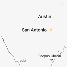
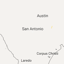


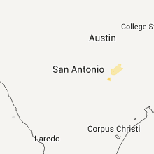


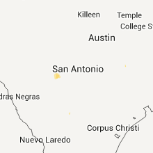


Connect with Interactive Hail Maps