

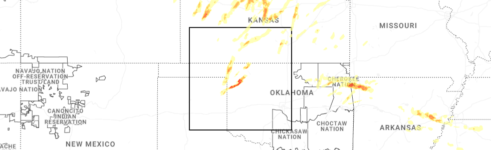
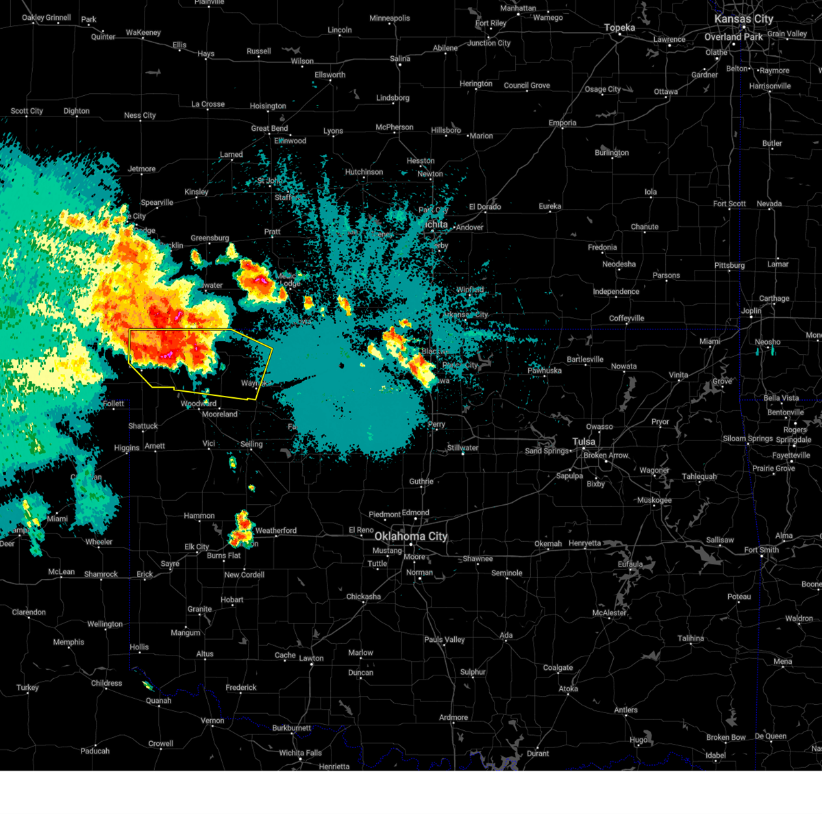
Hail Map for Fort Supply, OK
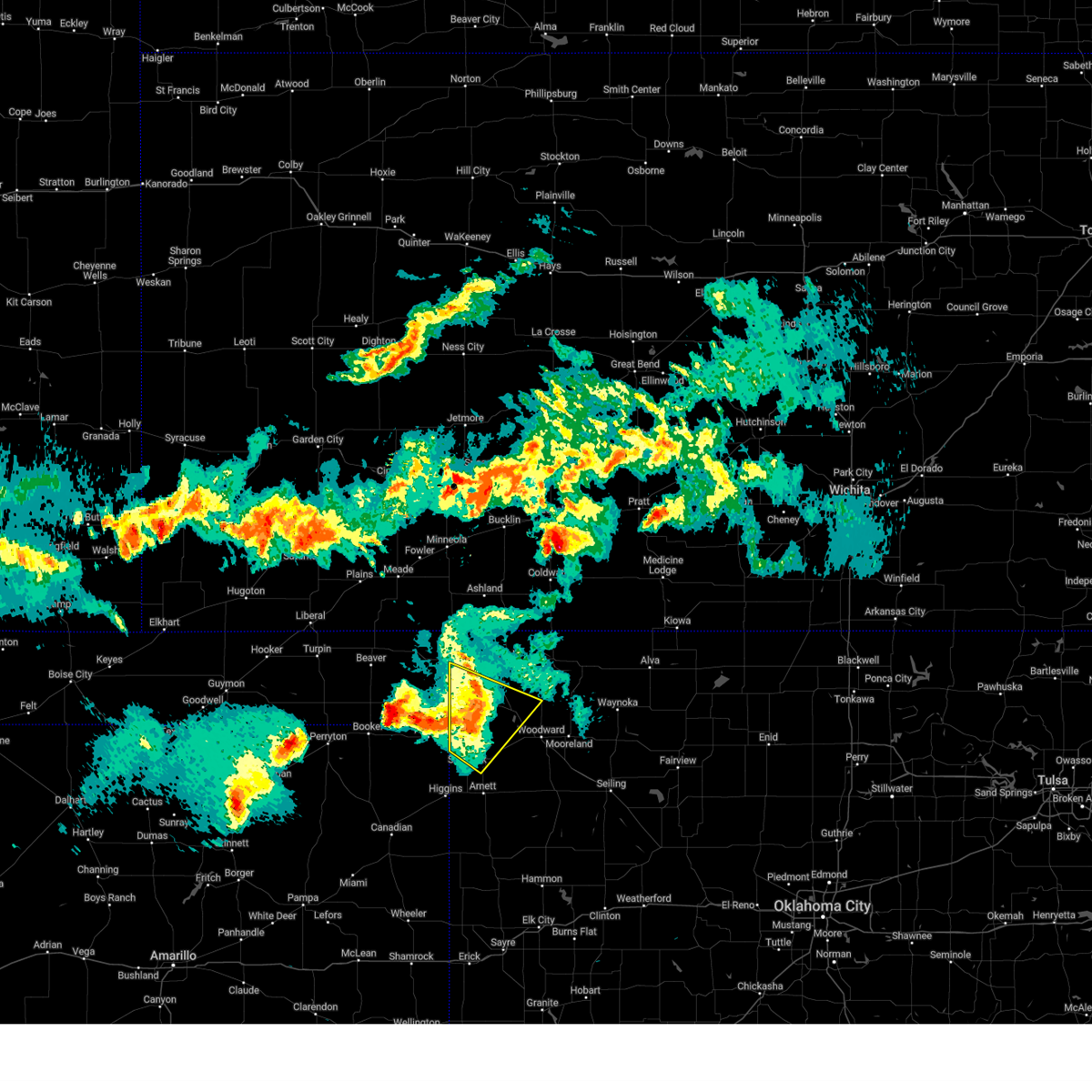
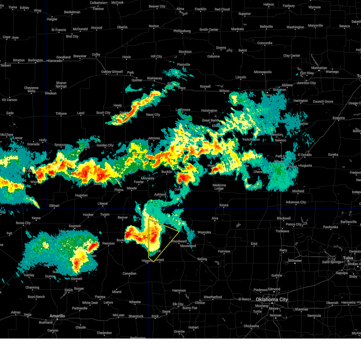
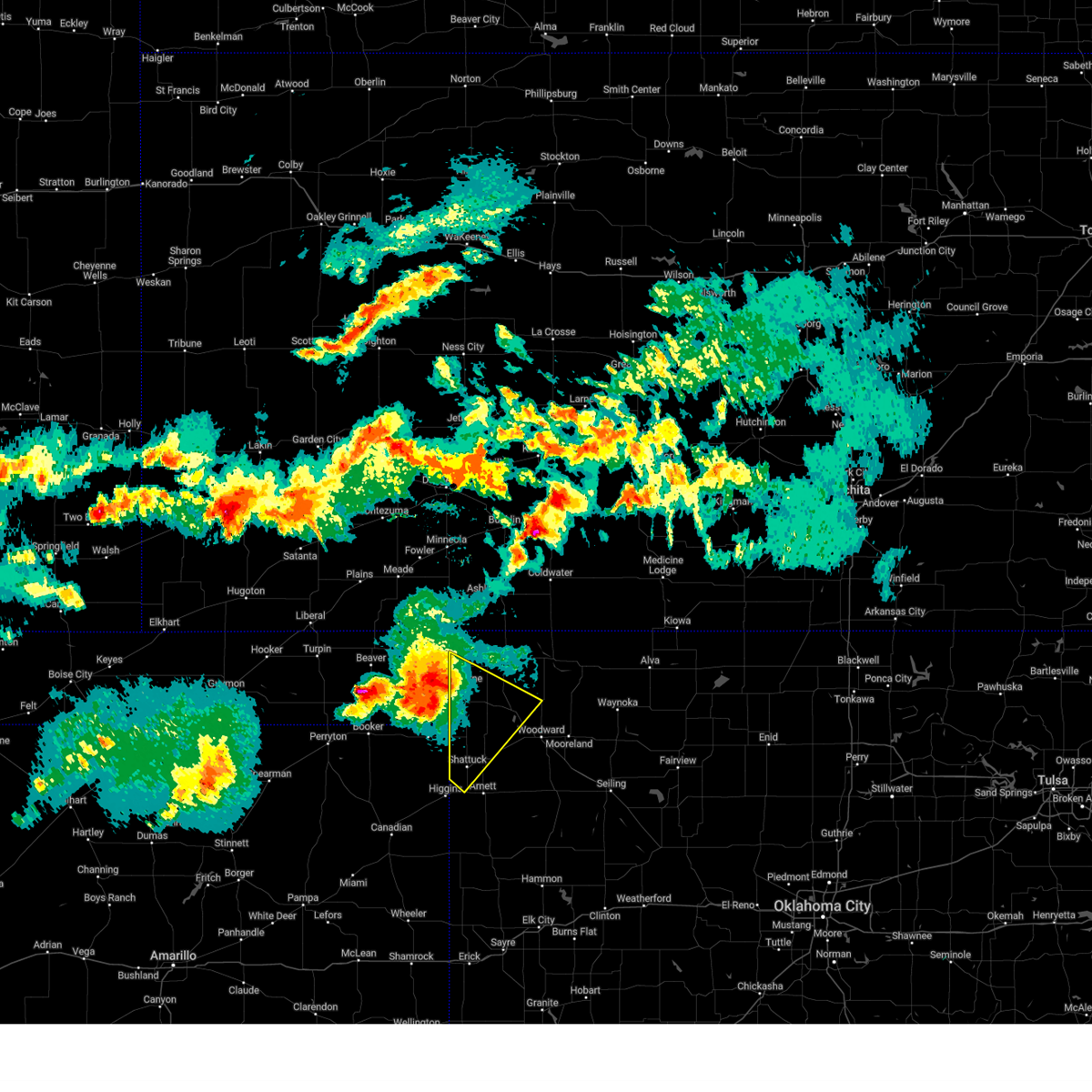
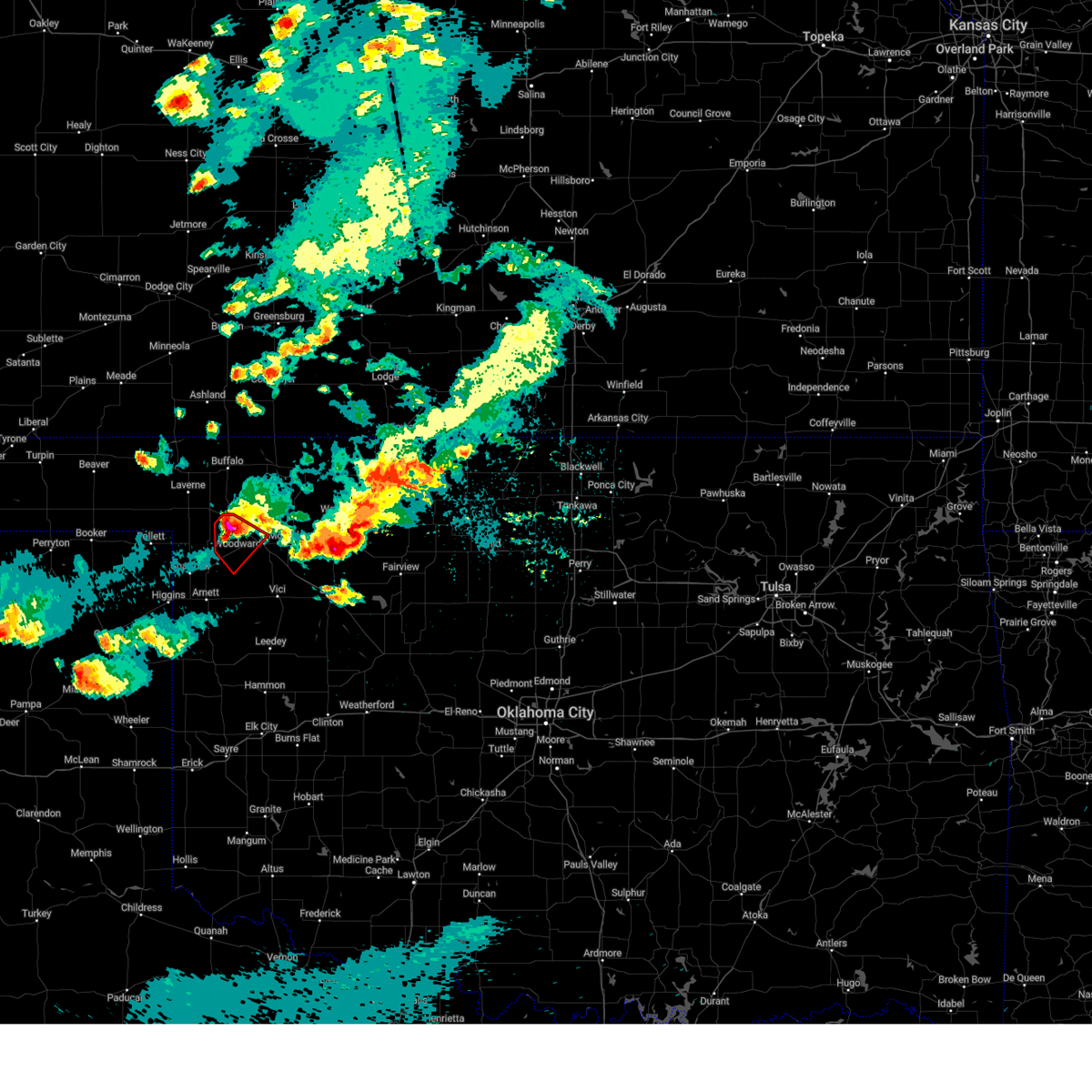
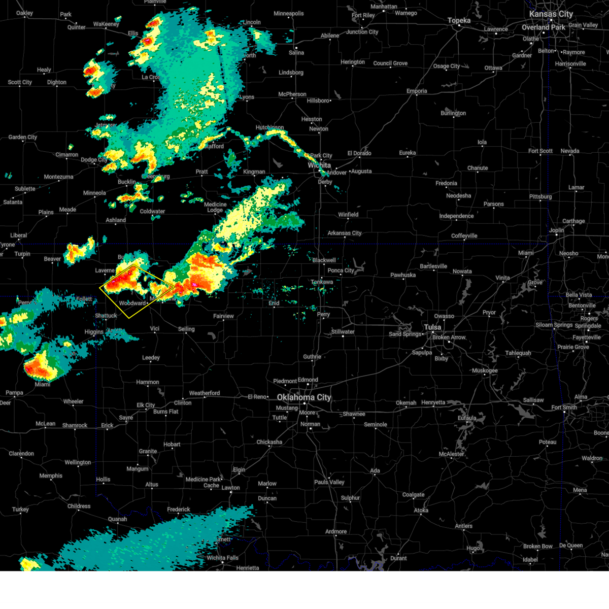
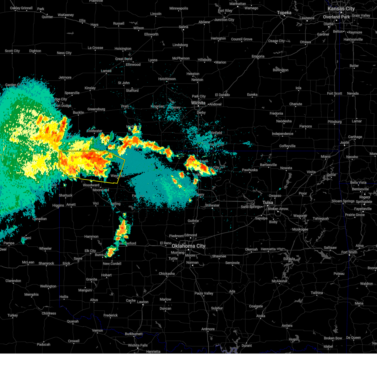
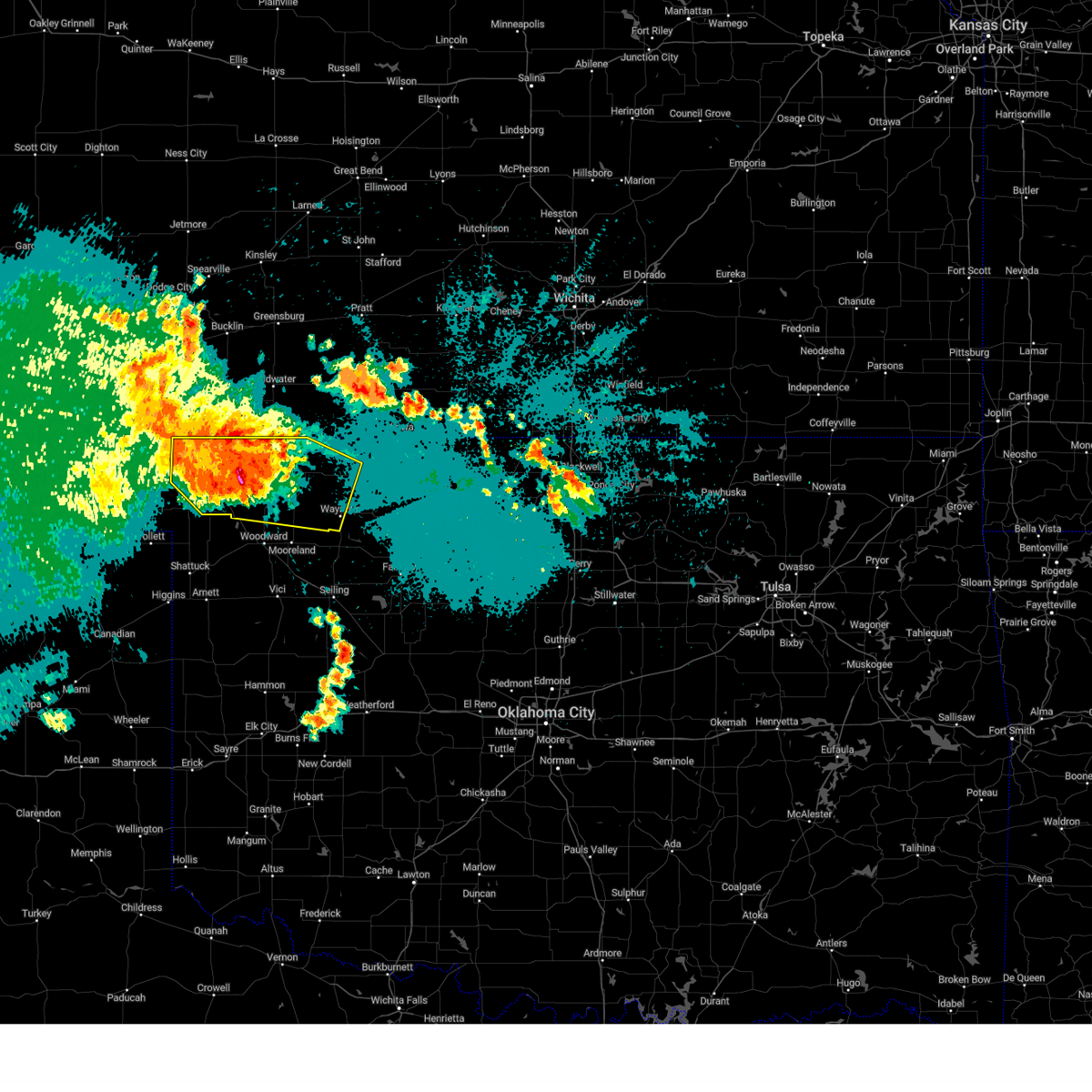
The Fort Supply, OK area has had 8 reports of on-the-ground hail by trained spotters, and has been under severe weather warnings 22 times during the past 12 months. Doppler radar has detected hail at or near Fort Supply, OK on 89 occasions, including 3 occasions during the past year.
| Name: | Fort Supply, OK |
| Where Located: | 13.7 miles NW of Woodward, OK |
| Map: | Google Map for Fort Supply, OK |
| Population: | 330 |
| Housing Units: | 166 |
| More Info: | Search Google for Fort Supply, OK |
1
The Top Recent Hail Date for Fort Supply, OK is Sunday, May 18, 2025 (28th out of 89)
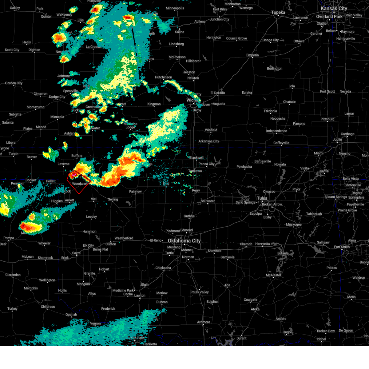
Hail and Wind Damage Spotted near Fort Supply, OK
| Date / Time | Report Details |
|---|---|
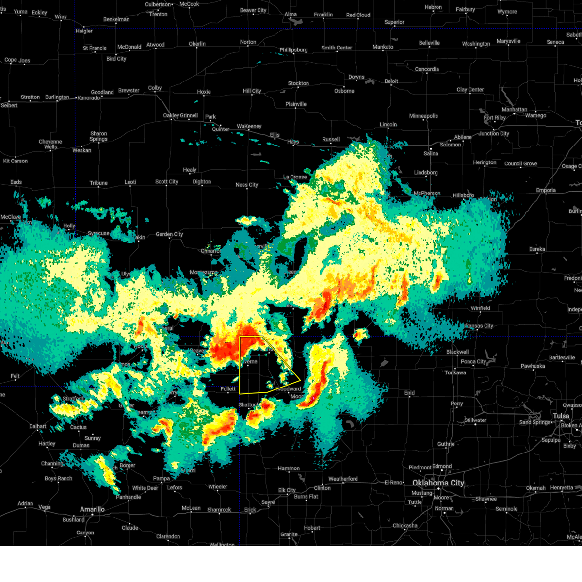
| 6/7/2025 12:42 AM CDT |
 Svroun the national weather service in norman has issued a * severe thunderstorm warning for, north central ellis county in northwestern oklahoma, woods county in northwestern oklahoma, eastern harper county in northwestern oklahoma, western alfalfa county in northwestern oklahoma, western major county in northwestern oklahoma, central woodward county in northwestern oklahoma, * until 130 am cdt. * at 1242 am cdt, a severe thunderstorm was located 4 miles west of freedom, moving east at 50 mph. this is a destructive storm for woods and northern harper counties (radar indicated). Hazards include 80 mph wind gusts and quarter size hail. Flying debris will be dangerous to those caught without shelter. mobile homes will be heavily damaged. expect considerable damage to roofs, windows, and vehicles. Extensive tree damage and power outages are likely. Svroun the national weather service in norman has issued a * severe thunderstorm warning for, north central ellis county in northwestern oklahoma, woods county in northwestern oklahoma, eastern harper county in northwestern oklahoma, western alfalfa county in northwestern oklahoma, western major county in northwestern oklahoma, central woodward county in northwestern oklahoma, * until 130 am cdt. * at 1242 am cdt, a severe thunderstorm was located 4 miles west of freedom, moving east at 50 mph. this is a destructive storm for woods and northern harper counties (radar indicated). Hazards include 80 mph wind gusts and quarter size hail. Flying debris will be dangerous to those caught without shelter. mobile homes will be heavily damaged. expect considerable damage to roofs, windows, and vehicles. Extensive tree damage and power outages are likely.
|
| 6/7/2025 12:40 AM CDT | Tree downed. individual trapped in tent. time estimated by rada in woodward county OK, 0.3 miles NW of Fort Supply, OK |
| 6/7/2025 12:33 AM CDT |
 At 1232 am cdt, a severe thunderstorm was located near selman, moving east at 55 mph (mesonet station). Hazards include 70 mph wind gusts and half dollar size hail. Hail damage to vehicles is expected. expect considerable tree damage. wind damage is also likely to mobile homes, roofs, and outbuildings. Locations impacted include, buffalo, fort supply, freedom, may, alabaster caverns state park, selman, and camp houston. At 1232 am cdt, a severe thunderstorm was located near selman, moving east at 55 mph (mesonet station). Hazards include 70 mph wind gusts and half dollar size hail. Hail damage to vehicles is expected. expect considerable tree damage. wind damage is also likely to mobile homes, roofs, and outbuildings. Locations impacted include, buffalo, fort supply, freedom, may, alabaster caverns state park, selman, and camp houston.
|
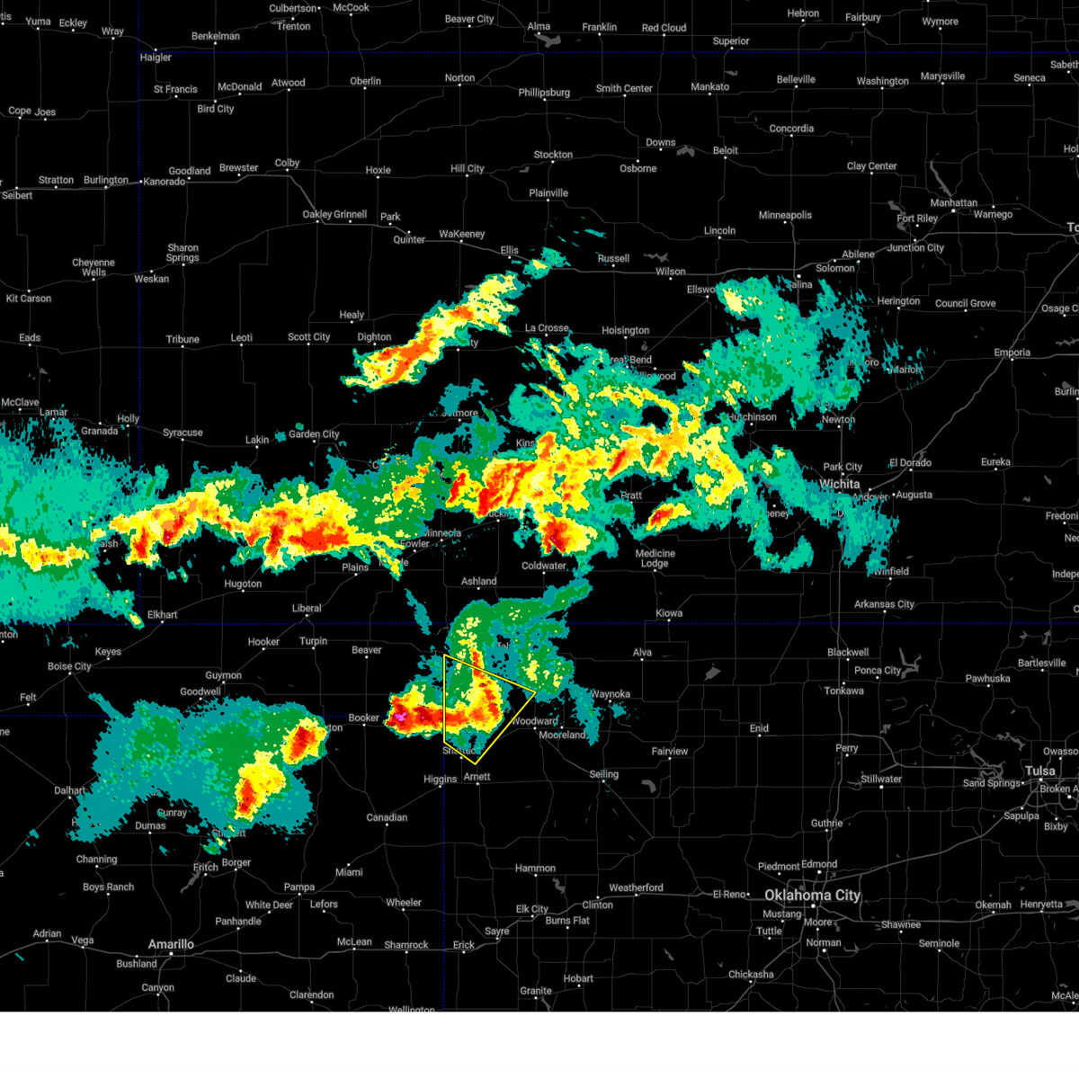
| 6/7/2025 12:00 AM CDT | Svroun the national weather service in norman has issued a * severe thunderstorm warning for, north central ellis county in northwestern oklahoma, northwestern woods county in northwestern oklahoma, harper county in northwestern oklahoma, central woodward county in northwestern oklahoma, * until 1245 am cdt. * at 1200 am cdt, a severe thunderstorm was located 5 miles southeast of englewood, moving southeast at 55 mph (radar indicated). Hazards include 60 mph wind gusts and half dollar size hail. Hail damage to vehicles is expected. Expect wind damage to roofs, siding, and trees. |
| 5/28/2025 10:21 PM CDT |
 At 1021 pm cdt, severe thunderstorms were located along a line extending from 7 miles southeast of slapout to near may to near selman, moving southeast at 35 mph (radar indicated). Hazards include 60 mph wind gusts. Expect damage to roofs, siding, and trees. Locations impacted include, laverne, buffalo, fort supply, may, rosston, and catesby. At 1021 pm cdt, severe thunderstorms were located along a line extending from 7 miles southeast of slapout to near may to near selman, moving southeast at 35 mph (radar indicated). Hazards include 60 mph wind gusts. Expect damage to roofs, siding, and trees. Locations impacted include, laverne, buffalo, fort supply, may, rosston, and catesby.
|
| 5/28/2025 9:52 PM CDT |
 Svroun the national weather service in norman has issued a * severe thunderstorm warning for, northwestern ellis county in northwestern oklahoma, harper county in northwestern oklahoma, west central woodward county in northwestern oklahoma, * until 1030 pm cdt. * at 951 pm cdt, severe thunderstorms were located along a line extending from 11 miles southwest of knowles to 4 miles southwest of rosston to 10 miles northwest of buffalo, moving southeast at 55 mph (radar indicated). Hazards include 60 mph wind gusts and penny size hail. expect damage to roofs, siding, and trees Svroun the national weather service in norman has issued a * severe thunderstorm warning for, northwestern ellis county in northwestern oklahoma, harper county in northwestern oklahoma, west central woodward county in northwestern oklahoma, * until 1030 pm cdt. * at 951 pm cdt, severe thunderstorms were located along a line extending from 11 miles southwest of knowles to 4 miles southwest of rosston to 10 miles northwest of buffalo, moving southeast at 55 mph (radar indicated). Hazards include 60 mph wind gusts and penny size hail. expect damage to roofs, siding, and trees
|
| 5/28/2025 8:24 PM CDT |
 The storm which prompted the warning has weakened below severe limits, therefore the warning will be allowed to expire. however, small hail and gusty winds are still possible with this thunderstorm. The storm which prompted the warning has weakened below severe limits, therefore the warning will be allowed to expire. however, small hail and gusty winds are still possible with this thunderstorm.
|
| 5/28/2025 8:13 PM CDT |
 At 813 pm cdt, a severe thunderstorm was located 5 miles southwest of may, moving southeast at 30 mph (radar indicated). Hazards include 60 mph wind gusts and penny size hail. Expect damage to roofs, siding, and trees. Locations impacted include, laverne, gage, fort supply, may, and catesby. At 813 pm cdt, a severe thunderstorm was located 5 miles southwest of may, moving southeast at 30 mph (radar indicated). Hazards include 60 mph wind gusts and penny size hail. Expect damage to roofs, siding, and trees. Locations impacted include, laverne, gage, fort supply, may, and catesby.
|
| 5/28/2025 8:07 PM CDT |
 At 807 pm cdt, a severe thunderstorm was located 8 miles west of may, moving southeast at 30 mph (radar indicated). Hazards include 70 mph wind gusts and penny size hail. Expect considerable tree damage. damage is likely to mobile homes, roofs, and outbuildings. Locations impacted include, shattuck, laverne, gage, fort supply, may, and catesby. At 807 pm cdt, a severe thunderstorm was located 8 miles west of may, moving southeast at 30 mph (radar indicated). Hazards include 70 mph wind gusts and penny size hail. Expect considerable tree damage. damage is likely to mobile homes, roofs, and outbuildings. Locations impacted include, shattuck, laverne, gage, fort supply, may, and catesby.
|
| 5/28/2025 7:38 PM CDT |
 Svroun the national weather service in norman has issued a * severe thunderstorm warning for, northwestern ellis county in northwestern oklahoma, southwestern harper county in northwestern oklahoma, west central woodward county in northwestern oklahoma, * until 830 pm cdt. * at 738 pm cdt, a severe thunderstorm was located 5 miles northwest of slapout, moving southeast at 30 mph (radar indicated). Hazards include 70 mph wind gusts and quarter size hail. Hail damage to vehicles is expected. expect considerable tree damage. Wind damage is also likely to mobile homes, roofs, and outbuildings. Svroun the national weather service in norman has issued a * severe thunderstorm warning for, northwestern ellis county in northwestern oklahoma, southwestern harper county in northwestern oklahoma, west central woodward county in northwestern oklahoma, * until 830 pm cdt. * at 738 pm cdt, a severe thunderstorm was located 5 miles northwest of slapout, moving southeast at 30 mph (radar indicated). Hazards include 70 mph wind gusts and quarter size hail. Hail damage to vehicles is expected. expect considerable tree damage. Wind damage is also likely to mobile homes, roofs, and outbuildings.
|
| 5/18/2025 7:24 PM CDT | the severe thunderstorm warning has been cancelled and is no longer in effect |
| 5/18/2025 7:24 PM CDT | At 724 pm cdt, a severe thunderstorm was located 5 miles northeast of fort supply, moving northeast at 25 mph (radar indicated). Hazards include ping pong ball size hail and 60 mph wind gusts. People and animals outdoors will be injured. expect hail damage to roofs, siding, windows, and vehicles. expect wind damage to roofs, siding, and trees. Locations impacted include, fort supply. |
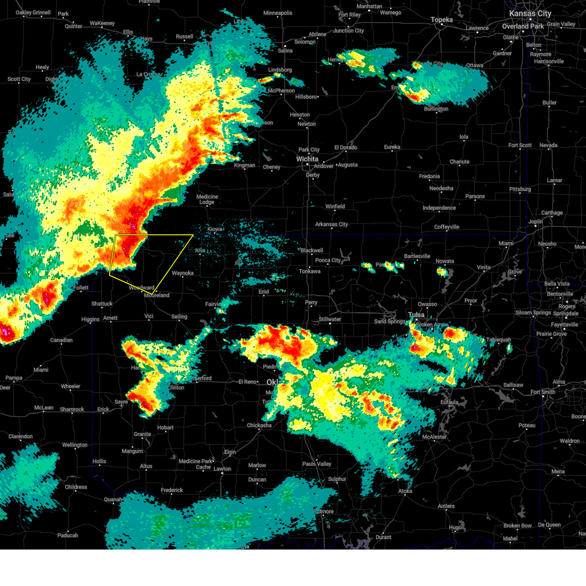
| 5/18/2025 7:11 PM CDT | At 711 pm cdt, a severe thunderstorm was located near fort supply, moving northeast at 30 mph (trained weather spotters reported quarter hail in fort supply). Hazards include ping pong ball size hail and 60 mph wind gusts. People and animals outdoors will be injured. expect hail damage to roofs, siding, windows, and vehicles. expect wind damage to roofs, siding, and trees. Locations impacted include, fort supply. |
| 5/18/2025 7:09 PM CDT | Quarter sized hail reported 0.3 miles NW of Fort Supply, OK, report from mping: quarter (1.00 in.). |
| 5/18/2025 7:01 PM CDT | Svroun the national weather service in norman has issued a * severe thunderstorm warning for, north central ellis county in northwestern oklahoma, southeastern harper county in northwestern oklahoma, west central woodward county in northwestern oklahoma, * until 745 pm cdt. * at 701 pm cdt, a severe thunderstorm was located 4 miles southwest of fort supply, moving northeast at 20 mph (radar indicated). Hazards include ping pong ball size hail and 60 mph wind gusts. People and animals outdoors will be injured. expect hail damage to roofs, siding, windows, and vehicles. Expect wind damage to roofs, siding, and trees. |
| 4/24/2025 9:41 PM CDT |
 the tornado warning has been cancelled and is no longer in effect the tornado warning has been cancelled and is no longer in effect
|
| 4/24/2025 9:41 PM CDT |
 At 941 pm cdt, a severe thunderstorm capable of producing a tornado was located 5 miles southwest of fort supply, moving southeast at 20 mph (radar indicated rotation). Hazards include tornado and golf ball size hail. Flying debris will be dangerous to those caught without shelter. mobile homes will be damaged or destroyed. damage to roofs, windows, and vehicles will occur. tree damage is likely. Locations impacted include, woodward, fargo, fort supply, and tangier. At 941 pm cdt, a severe thunderstorm capable of producing a tornado was located 5 miles southwest of fort supply, moving southeast at 20 mph (radar indicated rotation). Hazards include tornado and golf ball size hail. Flying debris will be dangerous to those caught without shelter. mobile homes will be damaged or destroyed. damage to roofs, windows, and vehicles will occur. tree damage is likely. Locations impacted include, woodward, fargo, fort supply, and tangier.
|
| 4/24/2025 9:38 PM CDT |
 At 938 pm cdt, severe thunderstorms were located along a line extending from near fort supply to 8 miles southeast of may, moving southeast at 10 mph (radar indicated). Hazards include golf ball size hail and 60 mph wind gusts. People and animals outdoors will be injured. expect hail damage to roofs, siding, windows, and vehicles. expect wind damage to roofs, siding, and trees. Locations impacted include, woodward, fargo, fort supply, and tangier. At 938 pm cdt, severe thunderstorms were located along a line extending from near fort supply to 8 miles southeast of may, moving southeast at 10 mph (radar indicated). Hazards include golf ball size hail and 60 mph wind gusts. People and animals outdoors will be injured. expect hail damage to roofs, siding, windows, and vehicles. expect wind damage to roofs, siding, and trees. Locations impacted include, woodward, fargo, fort supply, and tangier.
|
| 4/24/2025 9:27 PM CDT |
 Toroun the national weather service in norman has issued a * tornado warning for, north central ellis county in northwestern oklahoma, south central harper county in northwestern oklahoma, west central woodward county in northwestern oklahoma, * until 1000 pm cdt. * at 927 pm cdt, a severe thunderstorm capable of producing a tornado was located 5 miles southeast of may, moving southeast at 20 mph (radar indicated rotation). Hazards include tornado and golf ball size hail. Flying debris will be dangerous to those caught without shelter. mobile homes will be damaged or destroyed. damage to roofs, windows, and vehicles will occur. Tree damage is likely. Toroun the national weather service in norman has issued a * tornado warning for, north central ellis county in northwestern oklahoma, south central harper county in northwestern oklahoma, west central woodward county in northwestern oklahoma, * until 1000 pm cdt. * at 927 pm cdt, a severe thunderstorm capable of producing a tornado was located 5 miles southeast of may, moving southeast at 20 mph (radar indicated rotation). Hazards include tornado and golf ball size hail. Flying debris will be dangerous to those caught without shelter. mobile homes will be damaged or destroyed. damage to roofs, windows, and vehicles will occur. Tree damage is likely.
|
| 4/24/2025 9:09 PM CDT |
 Svroun the national weather service in norman has issued a * severe thunderstorm warning for, north central ellis county in northwestern oklahoma, southeastern harper county in northwestern oklahoma, northern woodward county in northwestern oklahoma, * until 1000 pm cdt. * at 909 pm cdt, severe thunderstorms were located along a line extending from 8 miles north of fort supply to near may, moving southeast at 20 mph (radar indicated). Hazards include ping pong ball size hail and 60 mph wind gusts. People and animals outdoors will be injured. expect hail damage to roofs, siding, windows, and vehicles. Expect wind damage to roofs, siding, and trees. Svroun the national weather service in norman has issued a * severe thunderstorm warning for, north central ellis county in northwestern oklahoma, southeastern harper county in northwestern oklahoma, northern woodward county in northwestern oklahoma, * until 1000 pm cdt. * at 909 pm cdt, severe thunderstorms were located along a line extending from 8 miles north of fort supply to near may, moving southeast at 20 mph (radar indicated). Hazards include ping pong ball size hail and 60 mph wind gusts. People and animals outdoors will be injured. expect hail damage to roofs, siding, windows, and vehicles. Expect wind damage to roofs, siding, and trees.
|
| 8/2/2024 1:16 AM CDT |
 The storms which prompted the warning have weakened below severe limits, therefore the warning has been allowed to expire. however, gusty winds of 50 mph and small hail are still possible with these thunderstorms. The storms which prompted the warning have weakened below severe limits, therefore the warning has been allowed to expire. however, gusty winds of 50 mph and small hail are still possible with these thunderstorms.
|
| 8/2/2024 12:56 AM CDT |
 At 1255 am cdt, severe thunderstorms were located along a line extending from 8 miles north of freedom to 5 miles northeast of fort supply, moving southeast at 20 mph. the mesonet station near buffalo measured a wind gust of 56 mph at 1230 am (radar indicated). Hazards include 60 mph wind gusts and quarter size hail. Hail damage to vehicles is expected. expect wind damage to roofs, siding, and trees. Locations impacted include, laverne, buffalo, waynoka, fort supply, freedom, may, rosston, alabaster caverns state park, selman, and camp houston. At 1255 am cdt, severe thunderstorms were located along a line extending from 8 miles north of freedom to 5 miles northeast of fort supply, moving southeast at 20 mph. the mesonet station near buffalo measured a wind gust of 56 mph at 1230 am (radar indicated). Hazards include 60 mph wind gusts and quarter size hail. Hail damage to vehicles is expected. expect wind damage to roofs, siding, and trees. Locations impacted include, laverne, buffalo, waynoka, fort supply, freedom, may, rosston, alabaster caverns state park, selman, and camp houston.
|
| 8/2/2024 12:32 AM CDT |
 Svroun the national weather service in norman has issued a * severe thunderstorm warning for, northeastern woods county in northwestern oklahoma, harper county in northwestern oklahoma, northern woodward county in northwestern oklahoma, * until 115 am cdt. * at 1231 am cdt, severe thunderstorms were located along a line extending from 11 miles southeast of buttermilk to 9 miles southeast of selman to 3 miles south of rosston, moving southeast at 25 mph. winds to near 60 mph were measured near the kansas border northwest of freedom (radar indicated). Hazards include 60 mph wind gusts and quarter size hail. Hail damage to vehicles is expected. Expect wind damage to roofs, siding, and trees. Svroun the national weather service in norman has issued a * severe thunderstorm warning for, northeastern woods county in northwestern oklahoma, harper county in northwestern oklahoma, northern woodward county in northwestern oklahoma, * until 115 am cdt. * at 1231 am cdt, severe thunderstorms were located along a line extending from 11 miles southeast of buttermilk to 9 miles southeast of selman to 3 miles south of rosston, moving southeast at 25 mph. winds to near 60 mph were measured near the kansas border northwest of freedom (radar indicated). Hazards include 60 mph wind gusts and quarter size hail. Hail damage to vehicles is expected. Expect wind damage to roofs, siding, and trees.
|
| 7/16/2024 11:07 PM CDT |
 Svroun the national weather service in norman has issued a * severe thunderstorm warning for, central ellis county in northwestern oklahoma, northwestern woods county in northwestern oklahoma, eastern harper county in northwestern oklahoma, northwestern dewey county in northwestern oklahoma, western woodward county in northwestern oklahoma, * until 1145 pm cdt. * at 1106 pm cdt, severe thunderstorms were located along a line extending from 3 miles north of ashland to 4 miles northwest of selman to near fargo to 6 miles north of arnett, moving east at 20 mph. buffalo mesonet measured a 61 mph wind gusts and 60 mph at gage (radar indicated). Hazards include 60 mph wind gusts and quarter size hail. Hail damage to vehicles is expected. Expect wind damage to roofs, siding, and trees. Svroun the national weather service in norman has issued a * severe thunderstorm warning for, central ellis county in northwestern oklahoma, northwestern woods county in northwestern oklahoma, eastern harper county in northwestern oklahoma, northwestern dewey county in northwestern oklahoma, western woodward county in northwestern oklahoma, * until 1145 pm cdt. * at 1106 pm cdt, severe thunderstorms were located along a line extending from 3 miles north of ashland to 4 miles northwest of selman to near fargo to 6 miles north of arnett, moving east at 20 mph. buffalo mesonet measured a 61 mph wind gusts and 60 mph at gage (radar indicated). Hazards include 60 mph wind gusts and quarter size hail. Hail damage to vehicles is expected. Expect wind damage to roofs, siding, and trees.
|
| 6/28/2024 12:49 AM CDT |
 Svroun the national weather service in norman has issued a * severe thunderstorm warning for, central woodward county in northwestern oklahoma, * until 130 am cdt. * at 1249 am cdt, severe thunderstorms were located along a line extending from near fort supply to 4 miles southeast of gage, moving east at 35 mph (radar indicated). Hazards include 60 mph wind gusts and nickel size hail. expect damage to roofs, siding, and trees Svroun the national weather service in norman has issued a * severe thunderstorm warning for, central woodward county in northwestern oklahoma, * until 130 am cdt. * at 1249 am cdt, severe thunderstorms were located along a line extending from near fort supply to 4 miles southeast of gage, moving east at 35 mph (radar indicated). Hazards include 60 mph wind gusts and nickel size hail. expect damage to roofs, siding, and trees
|
| 6/3/2024 7:14 AM CDT |
 The storm which prompted the warning has weakened below severe limits, therefore the warning will be allowed to expire. The storm which prompted the warning has weakened below severe limits, therefore the warning will be allowed to expire.
|
| 6/3/2024 6:28 AM CDT |
 Svroun the national weather service in norman has issued a * severe thunderstorm warning for, northwestern ellis county in northwestern oklahoma, southwestern harper county in northwestern oklahoma, southwestern woodward county in northwestern oklahoma, * until 715 am cdt. * at 628 am cdt, a severe thunderstorm was located 6 miles southwest of may, moving southeast at 30 mph (radar indicated). Hazards include 60 mph wind gusts and quarter size hail. Hail damage to vehicles is expected. Expect wind damage to roofs, siding, and trees. Svroun the national weather service in norman has issued a * severe thunderstorm warning for, northwestern ellis county in northwestern oklahoma, southwestern harper county in northwestern oklahoma, southwestern woodward county in northwestern oklahoma, * until 715 am cdt. * at 628 am cdt, a severe thunderstorm was located 6 miles southwest of may, moving southeast at 30 mph (radar indicated). Hazards include 60 mph wind gusts and quarter size hail. Hail damage to vehicles is expected. Expect wind damage to roofs, siding, and trees.
|
| 6/3/2024 5:39 AM CDT |
 Svroun the national weather service in norman has issued a * severe thunderstorm warning for, northwestern ellis county in northwestern oklahoma, northern woods county in northwestern oklahoma, harper county in northwestern oklahoma, central woodward county in northwestern oklahoma, * until 630 am cdt. * at 538 am cdt, severe thunderstorms were located along a line extending from 9 miles north of aetna to 5 miles north of buffalo to 3 miles southwest of slapout, moving east at 35 mph (radar indicated). Hazards include 60 mph wind gusts and penny size hail. expect damage to roofs, siding, and trees Svroun the national weather service in norman has issued a * severe thunderstorm warning for, northwestern ellis county in northwestern oklahoma, northern woods county in northwestern oklahoma, harper county in northwestern oklahoma, central woodward county in northwestern oklahoma, * until 630 am cdt. * at 538 am cdt, severe thunderstorms were located along a line extending from 9 miles north of aetna to 5 miles north of buffalo to 3 miles southwest of slapout, moving east at 35 mph (radar indicated). Hazards include 60 mph wind gusts and penny size hail. expect damage to roofs, siding, and trees
|
| 5/28/2024 10:15 AM CDT |
 At 1015 am cdt, a severe thunderstorm was located 4 miles east of may, moving northeast at 15 mph (radar indicated). Hazards include 60 mph wind gusts and half dollar size hail. Hail damage to vehicles is expected. expect wind damage to roofs, siding, and trees. Locations impacted include, fort supply and may. At 1015 am cdt, a severe thunderstorm was located 4 miles east of may, moving northeast at 15 mph (radar indicated). Hazards include 60 mph wind gusts and half dollar size hail. Hail damage to vehicles is expected. expect wind damage to roofs, siding, and trees. Locations impacted include, fort supply and may.
|
| 5/28/2024 10:01 AM CDT |
 Svroun the national weather service in norman has issued a * severe thunderstorm warning for, north central ellis county in northwestern oklahoma, southeastern harper county in northwestern oklahoma, west central woodward county in northwestern oklahoma, * until 1045 am cdt. * at 1001 am cdt, a severe thunderstorm was located near may, moving northeast at 15 mph (radar indicated). Hazards include two inch hail and 60 mph wind gusts. People and animals outdoors will be injured. expect hail damage to roofs, siding, windows, and vehicles. Expect wind damage to roofs, siding, and trees. Svroun the national weather service in norman has issued a * severe thunderstorm warning for, north central ellis county in northwestern oklahoma, southeastern harper county in northwestern oklahoma, west central woodward county in northwestern oklahoma, * until 1045 am cdt. * at 1001 am cdt, a severe thunderstorm was located near may, moving northeast at 15 mph (radar indicated). Hazards include two inch hail and 60 mph wind gusts. People and animals outdoors will be injured. expect hail damage to roofs, siding, windows, and vehicles. Expect wind damage to roofs, siding, and trees.
|
| 5/28/2024 9:15 AM CDT | Quarter sized hail reported 2.9 miles NW of Fort Supply, OK |
| 5/25/2024 5:38 PM CDT |
 At 537 pm cdt, a severe thunderstorm was located near fargo, moving northeast at 35 mph. this is a destructive storm for woodward! (broadcast media reported 3.5 inch hail). Hazards include three inch hail and 60 mph wind gusts. People and animals outdoors will be severely injured. expect shattered windows, extensive damage to roofs, siding, and vehicles. Locations impacted include, woodward, mooreland, fargo, fort supply, and tangier. At 537 pm cdt, a severe thunderstorm was located near fargo, moving northeast at 35 mph. this is a destructive storm for woodward! (broadcast media reported 3.5 inch hail). Hazards include three inch hail and 60 mph wind gusts. People and animals outdoors will be severely injured. expect shattered windows, extensive damage to roofs, siding, and vehicles. Locations impacted include, woodward, mooreland, fargo, fort supply, and tangier.
|
| 5/25/2024 5:34 PM CDT |
 Svroun the national weather service in norman has issued a * severe thunderstorm warning for, north central ellis county in northwestern oklahoma, south central harper county in northwestern oklahoma, west central woodward county in northwestern oklahoma, * until 615 pm cdt. * at 534 pm cdt, a severe thunderstorm was located 4 miles east of gage, moving northeast at 35 mph (radar indicated). Hazards include golf ball size hail and 60 mph wind gusts. People and animals outdoors will be injured. expect hail damage to roofs, siding, windows, and vehicles. Expect wind damage to roofs, siding, and trees. Svroun the national weather service in norman has issued a * severe thunderstorm warning for, north central ellis county in northwestern oklahoma, south central harper county in northwestern oklahoma, west central woodward county in northwestern oklahoma, * until 615 pm cdt. * at 534 pm cdt, a severe thunderstorm was located 4 miles east of gage, moving northeast at 35 mph (radar indicated). Hazards include golf ball size hail and 60 mph wind gusts. People and animals outdoors will be injured. expect hail damage to roofs, siding, windows, and vehicles. Expect wind damage to roofs, siding, and trees.
|
| 5/15/2024 8:06 PM CDT |
 Svroun the national weather service in norman has issued a * severe thunderstorm warning for, northwestern ellis county in northwestern oklahoma, southern harper county in northwestern oklahoma, northwestern woodward county in northwestern oklahoma, * until 845 pm cdt. * at 806 pm cdt, severe thunderstorms were located along a line extending from 9 miles south of laverne to 4 miles northeast of fort supply to 6 miles north of mooreland, moving north at 10 mph (radar indicated). Hazards include 60 mph wind gusts and quarter size hail. Hail damage to vehicles is expected. Expect wind damage to roofs, siding, and trees. Svroun the national weather service in norman has issued a * severe thunderstorm warning for, northwestern ellis county in northwestern oklahoma, southern harper county in northwestern oklahoma, northwestern woodward county in northwestern oklahoma, * until 845 pm cdt. * at 806 pm cdt, severe thunderstorms were located along a line extending from 9 miles south of laverne to 4 miles northeast of fort supply to 6 miles north of mooreland, moving north at 10 mph (radar indicated). Hazards include 60 mph wind gusts and quarter size hail. Hail damage to vehicles is expected. Expect wind damage to roofs, siding, and trees.
|
| 5/15/2024 7:59 PM CDT |
 At 759 pm cdt, a severe thunderstorm was located near may, moving northeast at 20 mph (radar indicated). Hazards include 60 mph wind gusts and quarter size hail. Hail damage to vehicles is expected. expect wind damage to roofs, siding, and trees. Locations impacted include, fort supply, may, and catesby. At 759 pm cdt, a severe thunderstorm was located near may, moving northeast at 20 mph (radar indicated). Hazards include 60 mph wind gusts and quarter size hail. Hail damage to vehicles is expected. expect wind damage to roofs, siding, and trees. Locations impacted include, fort supply, may, and catesby.
|
| 5/15/2024 7:27 PM CDT |
 Svroun the national weather service in norman has issued a * severe thunderstorm warning for, northwestern ellis county in northwestern oklahoma, southwestern harper county in northwestern oklahoma, northwestern woodward county in northwestern oklahoma, * until 815 pm cdt. * at 727 pm cdt, a severe thunderstorm was located 11 miles southwest of may, moving northeast at 20 mph (radar indicated). Hazards include ping pong ball size hail and 60 mph wind gusts. People and animals outdoors will be injured. expect hail damage to roofs, siding, windows, and vehicles. Expect wind damage to roofs, siding, and trees. Svroun the national weather service in norman has issued a * severe thunderstorm warning for, northwestern ellis county in northwestern oklahoma, southwestern harper county in northwestern oklahoma, northwestern woodward county in northwestern oklahoma, * until 815 pm cdt. * at 727 pm cdt, a severe thunderstorm was located 11 miles southwest of may, moving northeast at 20 mph (radar indicated). Hazards include ping pong ball size hail and 60 mph wind gusts. People and animals outdoors will be injured. expect hail damage to roofs, siding, windows, and vehicles. Expect wind damage to roofs, siding, and trees.
|
| 5/15/2024 6:58 PM CDT |
 At 658 pm cdt, a severe thunderstorm was located 11 miles north of shattuck, moving northeast at 25 mph (radar indicated). Hazards include ping pong ball size hail and 60 mph wind gusts. People and animals outdoors will be injured. expect hail damage to roofs, siding, windows, and vehicles. expect wind damage to roofs, siding, and trees. Locations impacted include, fort supply, may, and catesby. At 658 pm cdt, a severe thunderstorm was located 11 miles north of shattuck, moving northeast at 25 mph (radar indicated). Hazards include ping pong ball size hail and 60 mph wind gusts. People and animals outdoors will be injured. expect hail damage to roofs, siding, windows, and vehicles. expect wind damage to roofs, siding, and trees. Locations impacted include, fort supply, may, and catesby.
|
| 5/15/2024 6:49 PM CDT |
 Svroun the national weather service in norman has issued a * severe thunderstorm warning for, northwestern ellis county in northwestern oklahoma, south central harper county in northwestern oklahoma, west central woodward county in northwestern oklahoma, * until 730 pm cdt. * at 649 pm cdt, a severe thunderstorm was located 10 miles northwest of gage, moving northeast at 30 mph (radar indicated). Hazards include 60 mph wind gusts and half dollar size hail. Hail damage to vehicles is expected. Expect wind damage to roofs, siding, and trees. Svroun the national weather service in norman has issued a * severe thunderstorm warning for, northwestern ellis county in northwestern oklahoma, south central harper county in northwestern oklahoma, west central woodward county in northwestern oklahoma, * until 730 pm cdt. * at 649 pm cdt, a severe thunderstorm was located 10 miles northwest of gage, moving northeast at 30 mph (radar indicated). Hazards include 60 mph wind gusts and half dollar size hail. Hail damage to vehicles is expected. Expect wind damage to roofs, siding, and trees.
|
| 10/4/2023 7:23 AM CDT |
 The severe thunderstorm warning for north central ellis, southeastern harper and northwestern woodward counties will expire at 730 am cdt, the storms which prompted the warning have weakened below severe limits, therefore the warning will be allowed to expire. The severe thunderstorm warning for north central ellis, southeastern harper and northwestern woodward counties will expire at 730 am cdt, the storms which prompted the warning have weakened below severe limits, therefore the warning will be allowed to expire.
|
| 10/4/2023 7:19 AM CDT |
 At 719 am cdt, severe thunderstorms were located along a line extending from 11 miles east of fort supply to 5 miles northeast of woodward to 8 miles east of fargo, moving east at 45 mph (radar indicated). Hazards include 60 mph wind gusts and quarter size hail. Hail damage to vehicles is expected. expect wind damage to roofs, siding, and trees. locations impacted include, woodward, fargo, fort supply, and tangier. hail threat, radar indicated max hail size, 1. 00 in wind threat, radar indicated max wind gust, 60 mph. At 719 am cdt, severe thunderstorms were located along a line extending from 11 miles east of fort supply to 5 miles northeast of woodward to 8 miles east of fargo, moving east at 45 mph (radar indicated). Hazards include 60 mph wind gusts and quarter size hail. Hail damage to vehicles is expected. expect wind damage to roofs, siding, and trees. locations impacted include, woodward, fargo, fort supply, and tangier. hail threat, radar indicated max hail size, 1. 00 in wind threat, radar indicated max wind gust, 60 mph.
|
| 10/4/2023 6:58 AM CDT |
 At 658 am cdt, severe thunderstorms were located along a line extending from near fort supply to 4 miles northeast of fargo to near gage, moving east at 45 mph (radar indicated). Hazards include 60 mph wind gusts and quarter size hail. Hail damage to vehicles is expected. Expect wind damage to roofs, siding, and trees. At 658 am cdt, severe thunderstorms were located along a line extending from near fort supply to 4 miles northeast of fargo to near gage, moving east at 45 mph (radar indicated). Hazards include 60 mph wind gusts and quarter size hail. Hail damage to vehicles is expected. Expect wind damage to roofs, siding, and trees.
|
| 8/13/2023 8:00 PM CDT |
 At 800 pm cdt, severe thunderstorms were located along a line extending from 4 miles northeast of may to 11 miles southeast of selman, moving northeast at 25 mph (radar indicated). Hazards include ping pong ball size hail and 60 mph wind gusts. People and animals outdoors will be injured. expect hail damage to roofs, siding, windows, and vehicles. expect wind damage to roofs, siding, and trees. locations impacted include, buffalo, fort supply, freedom, may, alabaster caverns state park, selman, and camp houston. hail threat, radar indicated max hail size, 1. 50 in wind threat, radar indicated max wind gust, 60 mph. At 800 pm cdt, severe thunderstorms were located along a line extending from 4 miles northeast of may to 11 miles southeast of selman, moving northeast at 25 mph (radar indicated). Hazards include ping pong ball size hail and 60 mph wind gusts. People and animals outdoors will be injured. expect hail damage to roofs, siding, windows, and vehicles. expect wind damage to roofs, siding, and trees. locations impacted include, buffalo, fort supply, freedom, may, alabaster caverns state park, selman, and camp houston. hail threat, radar indicated max hail size, 1. 50 in wind threat, radar indicated max wind gust, 60 mph.
|
| 8/13/2023 7:48 PM CDT |
 At 748 pm cdt, a severe thunderstorm was located 5 miles northeast of fort supply, moving northeast at 25 mph (radar indicated). Hazards include ping pong ball size hail and 60 mph wind gusts. People and animals outdoors will be injured. expect hail damage to roofs, siding, windows, and vehicles. expect wind damage to roofs, siding, and trees. locations impacted include, woodward, buffalo, fargo, fort supply, freedom, may, alabaster caverns state park, selman, tangier, and camp houston. hail threat, radar indicated max hail size, 1. 50 in wind threat, radar indicated max wind gust, 60 mph. At 748 pm cdt, a severe thunderstorm was located 5 miles northeast of fort supply, moving northeast at 25 mph (radar indicated). Hazards include ping pong ball size hail and 60 mph wind gusts. People and animals outdoors will be injured. expect hail damage to roofs, siding, windows, and vehicles. expect wind damage to roofs, siding, and trees. locations impacted include, woodward, buffalo, fargo, fort supply, freedom, may, alabaster caverns state park, selman, tangier, and camp houston. hail threat, radar indicated max hail size, 1. 50 in wind threat, radar indicated max wind gust, 60 mph.
|
| 8/13/2023 7:25 PM CDT |
 At 725 pm cdt, a severe thunderstorm was located near fort supply, moving northeast at 35 mph (radar indicated). Hazards include 60 mph wind gusts and penny size hail. expect damage to roofs, siding, and trees At 725 pm cdt, a severe thunderstorm was located near fort supply, moving northeast at 35 mph (radar indicated). Hazards include 60 mph wind gusts and penny size hail. expect damage to roofs, siding, and trees
|
| 8/13/2023 6:58 PM CDT |
 At 658 pm cdt, a severe thunderstorm was located 5 miles southeast of fargo, moving northeast at 35 mph (radar indicated). Hazards include 60 mph wind gusts and quarter size hail. Hail damage to vehicles is expected. expect wind damage to roofs, siding, and trees. locations impacted include, woodward, mooreland, gage, fargo, fort supply, sharon, harmon, and tangier. hail threat, radar indicated max hail size, 1. 00 in wind threat, radar indicated max wind gust, 60 mph. At 658 pm cdt, a severe thunderstorm was located 5 miles southeast of fargo, moving northeast at 35 mph (radar indicated). Hazards include 60 mph wind gusts and quarter size hail. Hail damage to vehicles is expected. expect wind damage to roofs, siding, and trees. locations impacted include, woodward, mooreland, gage, fargo, fort supply, sharon, harmon, and tangier. hail threat, radar indicated max hail size, 1. 00 in wind threat, radar indicated max wind gust, 60 mph.
|
| 8/13/2023 6:41 PM CDT |
 At 641 pm cdt, a severe thunderstorm was located 6 miles northwest of harmon, moving northeast at 40 mph (radar indicated). Hazards include 60 mph wind gusts and half dollar size hail. Hail damage to vehicles is expected. Expect wind damage to roofs, siding, and trees. At 641 pm cdt, a severe thunderstorm was located 6 miles northwest of harmon, moving northeast at 40 mph (radar indicated). Hazards include 60 mph wind gusts and half dollar size hail. Hail damage to vehicles is expected. Expect wind damage to roofs, siding, and trees.
|
| 8/8/2023 1:42 AM CDT |
 At 141 am cdt, a severe thunderstorm was located 4 miles northeast of woodward, moving southeast at 45 mph (radar indicated). Hazards include 70 mph wind gusts and half dollar size hail. Hail damage to vehicles is expected. expect considerable tree damage. wind damage is also likely to mobile homes, roofs, and outbuildings. locations impacted include, woodward, mooreland, fort supply, and quinlan. thunderstorm damage threat, considerable hail threat, radar indicated max hail size, 1. 25 in wind threat, radar indicated max wind gust, 70 mph. At 141 am cdt, a severe thunderstorm was located 4 miles northeast of woodward, moving southeast at 45 mph (radar indicated). Hazards include 70 mph wind gusts and half dollar size hail. Hail damage to vehicles is expected. expect considerable tree damage. wind damage is also likely to mobile homes, roofs, and outbuildings. locations impacted include, woodward, mooreland, fort supply, and quinlan. thunderstorm damage threat, considerable hail threat, radar indicated max hail size, 1. 25 in wind threat, radar indicated max wind gust, 70 mph.
|
| 8/8/2023 1:31 AM CDT |
 At 131 am cdt, a severe thunderstorm was located 5 miles east of fort supply, moving southeast at 45 mph (radar indicated). Hazards include 60 mph wind gusts and quarter size hail. Hail damage to vehicles is expected. Expect wind damage to roofs, siding, and trees. At 131 am cdt, a severe thunderstorm was located 5 miles east of fort supply, moving southeast at 45 mph (radar indicated). Hazards include 60 mph wind gusts and quarter size hail. Hail damage to vehicles is expected. Expect wind damage to roofs, siding, and trees.
|
| 8/7/2023 4:18 AM CDT |
 At 418 am cdt, a severe thunderstorm was located 4 miles west of woodward, moving southeast at 55 mph (radar indicated). Hazards include quarter size hail. Damage to vehicles is expected. locations impacted include, woodward, mooreland, fargo, fort supply, sharon, and tangier. hail threat, radar indicated max hail size, 1. 00 in wind threat, radar indicated max wind gust, <50 mph. At 418 am cdt, a severe thunderstorm was located 4 miles west of woodward, moving southeast at 55 mph (radar indicated). Hazards include quarter size hail. Damage to vehicles is expected. locations impacted include, woodward, mooreland, fargo, fort supply, sharon, and tangier. hail threat, radar indicated max hail size, 1. 00 in wind threat, radar indicated max wind gust, <50 mph.
|
| 8/7/2023 3:43 AM CDT |
 At 343 am cdt, a severe thunderstorm was located 6 miles east of slapout, moving southeast at 55 mph (radar indicated). Hazards include 60 mph wind gusts and quarter size hail. Hail damage to vehicles is expected. Expect wind damage to roofs, siding, and trees. At 343 am cdt, a severe thunderstorm was located 6 miles east of slapout, moving southeast at 55 mph (radar indicated). Hazards include 60 mph wind gusts and quarter size hail. Hail damage to vehicles is expected. Expect wind damage to roofs, siding, and trees.
|
| 7/21/2023 1:51 AM CDT |
 At 151 am cdt, severe thunderstorms were located along a line extending from 10 miles south of buttermilk to 7 miles northeast of fort supply to near gage, moving east at 45 mph (radar indicated). Hazards include 60 mph wind gusts. Expect damage to roofs, siding, and trees. locations impacted include, woodward, shattuck, laverne, buffalo, gage, fargo, fort supply, freedom, may, alabaster caverns state park, selman, tangier, catesby, and camp houston. hail threat, radar indicated max hail size, <. 75 in wind threat, radar indicated max wind gust, 60 mph. At 151 am cdt, severe thunderstorms were located along a line extending from 10 miles south of buttermilk to 7 miles northeast of fort supply to near gage, moving east at 45 mph (radar indicated). Hazards include 60 mph wind gusts. Expect damage to roofs, siding, and trees. locations impacted include, woodward, shattuck, laverne, buffalo, gage, fargo, fort supply, freedom, may, alabaster caverns state park, selman, tangier, catesby, and camp houston. hail threat, radar indicated max hail size, <. 75 in wind threat, radar indicated max wind gust, 60 mph.
|
| 7/21/2023 1:29 AM CDT |
 At 128 am cdt, severe thunderstorms were located along a line extending from 7 miles south of protection to 8 miles southwest of buffalo to 6 miles southeast of follett, moving east at 50 mph (radar indicated). Hazards include 70 mph wind gusts. Expect considerable tree damage. Damage is likely to mobile homes, roofs, and outbuildings. At 128 am cdt, severe thunderstorms were located along a line extending from 7 miles south of protection to 8 miles southwest of buffalo to 6 miles southeast of follett, moving east at 50 mph (radar indicated). Hazards include 70 mph wind gusts. Expect considerable tree damage. Damage is likely to mobile homes, roofs, and outbuildings.
|
| 7/14/2023 7:21 PM CDT |
 At 721 pm cdt, a severe thunderstorm was located 5 miles north of fort supply, moving southeast at 25 mph (radar indicated). Hazards include 60 mph wind gusts and nickel size hail. expect damage to roofs, siding, and trees At 721 pm cdt, a severe thunderstorm was located 5 miles north of fort supply, moving southeast at 25 mph (radar indicated). Hazards include 60 mph wind gusts and nickel size hail. expect damage to roofs, siding, and trees
|
| 7/14/2023 7:03 PM CDT |
 At 702 pm cdt, a severe thunderstorm was located 4 miles south of fort supply, moving southeast at 20 mph (radar indicated). Hazards include golf ball size hail and 70 mph wind gusts. People and animals outdoors will be injured. expect hail damage to roofs, siding, windows, and vehicles. expect considerable tree damage. wind damage is also likely to mobile homes, roofs, and outbuildings. Locations impacted include, fort supply. At 702 pm cdt, a severe thunderstorm was located 4 miles south of fort supply, moving southeast at 20 mph (radar indicated). Hazards include golf ball size hail and 70 mph wind gusts. People and animals outdoors will be injured. expect hail damage to roofs, siding, windows, and vehicles. expect considerable tree damage. wind damage is also likely to mobile homes, roofs, and outbuildings. Locations impacted include, fort supply.
|
| 7/14/2023 6:53 PM CDT |
 At 653 pm cdt, a severe thunderstorm was located near fort supply, moving southeast at 15 mph (radar indicated). Hazards include 60 mph wind gusts and half dollar size hail. Hail damage to vehicles is expected. expect wind damage to roofs, siding, and trees. locations impacted include, fort supply. hail threat, radar indicated max hail size, 1. 25 in wind threat, radar indicated max wind gust, 60 mph. At 653 pm cdt, a severe thunderstorm was located near fort supply, moving southeast at 15 mph (radar indicated). Hazards include 60 mph wind gusts and half dollar size hail. Hail damage to vehicles is expected. expect wind damage to roofs, siding, and trees. locations impacted include, fort supply. hail threat, radar indicated max hail size, 1. 25 in wind threat, radar indicated max wind gust, 60 mph.
|
| 7/14/2023 6:29 PM CDT |
 At 629 pm cdt, a severe thunderstorm was located near may, moving southeast at 15 mph (radar indicated). Hazards include 60 mph wind gusts and quarter size hail. Hail damage to vehicles is expected. Expect wind damage to roofs, siding, and trees. At 629 pm cdt, a severe thunderstorm was located near may, moving southeast at 15 mph (radar indicated). Hazards include 60 mph wind gusts and quarter size hail. Hail damage to vehicles is expected. Expect wind damage to roofs, siding, and trees.
|
| 7/7/2023 4:53 AM CDT |
 At 452 am cdt, severe thunderstorms were located along a line extending from 4 miles southeast of mooreland to 5 miles east of vici to 8 miles north of crawford, moving southeast at 45 mph (woodward mesonet reported a 68 mph wind gust). Hazards include 70 mph wind gusts and ping pong ball size hail. People and animals outdoors will be injured. expect hail damage to roofs, siding, windows, and vehicles. expect considerable tree damage. wind damage is also likely to mobile homes, roofs, and outbuildings. Locations impacted include, woodward, shattuck, arnett, taloga, mooreland, seiling, vici, gage, leedey, fargo, fort supply, camargo, sharon, mutual, strong city, putnam, angora, moorewood, harmon, and cestos. At 452 am cdt, severe thunderstorms were located along a line extending from 4 miles southeast of mooreland to 5 miles east of vici to 8 miles north of crawford, moving southeast at 45 mph (woodward mesonet reported a 68 mph wind gust). Hazards include 70 mph wind gusts and ping pong ball size hail. People and animals outdoors will be injured. expect hail damage to roofs, siding, windows, and vehicles. expect considerable tree damage. wind damage is also likely to mobile homes, roofs, and outbuildings. Locations impacted include, woodward, shattuck, arnett, taloga, mooreland, seiling, vici, gage, leedey, fargo, fort supply, camargo, sharon, mutual, strong city, putnam, angora, moorewood, harmon, and cestos.
|
| 7/7/2023 4:36 AM CDT |
 At 436 am cdt, severe thunderstorms were located along a line extending from 7 miles northwest of mooreland to 5 miles southwest of sharon to 8 miles southeast of higgins, moving southeast at 45 mph (radar indicated). Hazards include 70 mph wind gusts and ping pong ball size hail. People and animals outdoors will be injured. expect hail damage to roofs, siding, windows, and vehicles. expect considerable tree damage. Wind damage is also likely to mobile homes, roofs, and outbuildings. At 436 am cdt, severe thunderstorms were located along a line extending from 7 miles northwest of mooreland to 5 miles southwest of sharon to 8 miles southeast of higgins, moving southeast at 45 mph (radar indicated). Hazards include 70 mph wind gusts and ping pong ball size hail. People and animals outdoors will be injured. expect hail damage to roofs, siding, windows, and vehicles. expect considerable tree damage. Wind damage is also likely to mobile homes, roofs, and outbuildings.
|
| 7/6/2023 3:34 AM CDT |
 At 334 am cdt, severe thunderstorms were located along a line extending from 6 miles southeast of slapout to 7 miles south of follett to 9 miles southeast of wolf creek park, moving southeast at 30 mph (radar indicated). Hazards include 70 mph wind gusts and quarter size hail. Hail damage to vehicles is expected. expect considerable tree damage. Wind damage is also likely to mobile homes, roofs, and outbuildings. At 334 am cdt, severe thunderstorms were located along a line extending from 6 miles southeast of slapout to 7 miles south of follett to 9 miles southeast of wolf creek park, moving southeast at 30 mph (radar indicated). Hazards include 70 mph wind gusts and quarter size hail. Hail damage to vehicles is expected. expect considerable tree damage. Wind damage is also likely to mobile homes, roofs, and outbuildings.
|
| 6/27/2023 9:22 PM CDT |
 At 921 pm cdt, severe thunderstorms were located along a line extending from 8 miles south of acres to near buffalo to 4 miles northwest of fort supply, moving east at 45 mph (radar indicated). Hazards include 60 mph wind gusts and quarter size hail. Hail damage to vehicles is expected. expect wind damage to roofs, siding, and trees. locations impacted include, laverne, buffalo, fort supply, freedom, may, rosston, selman, alabaster caverns state park, and camp houston. hail threat, radar indicated max hail size, 1. 00 in wind threat, radar indicated max wind gust, 60 mph. At 921 pm cdt, severe thunderstorms were located along a line extending from 8 miles south of acres to near buffalo to 4 miles northwest of fort supply, moving east at 45 mph (radar indicated). Hazards include 60 mph wind gusts and quarter size hail. Hail damage to vehicles is expected. expect wind damage to roofs, siding, and trees. locations impacted include, laverne, buffalo, fort supply, freedom, may, rosston, selman, alabaster caverns state park, and camp houston. hail threat, radar indicated max hail size, 1. 00 in wind threat, radar indicated max wind gust, 60 mph.
|
| 6/27/2023 8:53 PM CDT |
 At 853 pm cdt, severe thunderstorms were located along a line extending from 11 miles south of sitka to 8 miles southwest of buffalo to 4 miles southeast of slapout, moving east at 45 mph (radar indicated). Hazards include 60 mph wind gusts and quarter size hail. Hail damage to vehicles is expected. Expect wind damage to roofs, siding, and trees. At 853 pm cdt, severe thunderstorms were located along a line extending from 11 miles south of sitka to 8 miles southwest of buffalo to 4 miles southeast of slapout, moving east at 45 mph (radar indicated). Hazards include 60 mph wind gusts and quarter size hail. Hail damage to vehicles is expected. Expect wind damage to roofs, siding, and trees.
|
| 6/17/2023 8:16 PM CDT | Em reports power line damage in vicinity of fort supply. time estimated by rada in woodward county OK, 0.3 miles NW of Fort Supply, OK |
| 6/15/2023 6:34 PM CDT |
 At 633 pm cdt, severe thunderstorms were located along a line extending from 7 miles southwest of buttermilk to near alabaster caverns state park to 3 miles west of fort supply, moving east at 35 mph (radar indicated). Hazards include 60 mph wind gusts and half dollar size hail. Hail damage to vehicles is expected. expect wind damage to roofs, siding, and trees. Locations impacted include, buffalo, fort supply, freedom, may, alabaster caverns state park, selman, and camp houston. At 633 pm cdt, severe thunderstorms were located along a line extending from 7 miles southwest of buttermilk to near alabaster caverns state park to 3 miles west of fort supply, moving east at 35 mph (radar indicated). Hazards include 60 mph wind gusts and half dollar size hail. Hail damage to vehicles is expected. expect wind damage to roofs, siding, and trees. Locations impacted include, buffalo, fort supply, freedom, may, alabaster caverns state park, selman, and camp houston.
|
| 6/15/2023 6:09 PM CDT |
 At 607 pm cdt, severe thunderstorms were located along a line extending from 11 miles southeast of acres to 9 miles south of selman to 11 miles southwest of may, moving east at 35 mph (radar indicated). Hazards include 60 mph wind gusts and half dollar size hail. Hail damage to vehicles is expected. Expect wind damage to roofs, siding, and trees. At 607 pm cdt, severe thunderstorms were located along a line extending from 11 miles southeast of acres to 9 miles south of selman to 11 miles southwest of may, moving east at 35 mph (radar indicated). Hazards include 60 mph wind gusts and half dollar size hail. Hail damage to vehicles is expected. Expect wind damage to roofs, siding, and trees.
|
| 6/15/2023 5:36 PM CDT |
 At 535 pm cdt, severe thunderstorms were located along a line extending from 8 miles north of acres to 4 miles east of englewood to 7 miles northwest of follett, moving east at 45 mph (radar indicated). Hazards include 60 mph wind gusts and quarter size hail. Hail damage to vehicles is expected. Expect wind damage to roofs, siding, and trees. At 535 pm cdt, severe thunderstorms were located along a line extending from 8 miles north of acres to 4 miles east of englewood to 7 miles northwest of follett, moving east at 45 mph (radar indicated). Hazards include 60 mph wind gusts and quarter size hail. Hail damage to vehicles is expected. Expect wind damage to roofs, siding, and trees.
|
| 5/31/2023 12:43 AM CDT |
 The severe thunderstorm warning for northwestern ellis, harper and west central woodward counties will expire at 1245 am cdt, the storms which prompted the warning have weakened below severe limits, therefore the warning will be allowed to expire. however, gusty winds are still possible with these thunderstorms. The severe thunderstorm warning for northwestern ellis, harper and west central woodward counties will expire at 1245 am cdt, the storms which prompted the warning have weakened below severe limits, therefore the warning will be allowed to expire. however, gusty winds are still possible with these thunderstorms.
|
| 5/30/2023 11:59 PM CDT |
 At 1158 pm cdt, severe thunderstorms were located along a line extending from 3 miles south of englewood to 3 miles northeast of slapout to 5 miles northeast of darrouzett, moving east at 50 mph (radar indicated). Hazards include 70 mph wind gusts. Expect considerable tree damage. Damage is likely to mobile homes, roofs, and outbuildings. At 1158 pm cdt, severe thunderstorms were located along a line extending from 3 miles south of englewood to 3 miles northeast of slapout to 5 miles northeast of darrouzett, moving east at 50 mph (radar indicated). Hazards include 70 mph wind gusts. Expect considerable tree damage. Damage is likely to mobile homes, roofs, and outbuildings.
|
| 2/26/2023 7:09 PM CST |
 At 709 pm cst, a severe thunderstorm was located 5 miles northwest of fargo, moving northeast at 90 mph (radar indicated). Hazards include 70 mph wind gusts and nickel size hail. Expect considerable tree damage. Damage is likely to mobile homes, roofs, and outbuildings. At 709 pm cst, a severe thunderstorm was located 5 miles northwest of fargo, moving northeast at 90 mph (radar indicated). Hazards include 70 mph wind gusts and nickel size hail. Expect considerable tree damage. Damage is likely to mobile homes, roofs, and outbuildings.
|
| 5/31/2022 10:25 PM CDT |
 The severe thunderstorm warning for north central ellis, southeastern harper and west central woodward counties will expire at 1030 pm cdt, the storm which prompted the warning has weakened below severe limits, therefore the warning will be allowed to expire. however small hail and gusty winds are still possible with this thunderstorm. The severe thunderstorm warning for north central ellis, southeastern harper and west central woodward counties will expire at 1030 pm cdt, the storm which prompted the warning has weakened below severe limits, therefore the warning will be allowed to expire. however small hail and gusty winds are still possible with this thunderstorm.
|
| 5/31/2022 10:14 PM CDT |
 At 1014 pm cdt, a severe thunderstorm was located 5 miles north of fargo, moving northeast at 30 mph (radar indicated). Hazards include 60 mph wind gusts and quarter size hail. Hail damage to vehicles is expected. expect wind damage to roofs, siding, and trees. locations impacted include, woodward, fargo, fort supply and tangier. hail threat, radar indicated max hail size, 1. 00 in wind threat, radar indicated max wind gust, 60 mph. At 1014 pm cdt, a severe thunderstorm was located 5 miles north of fargo, moving northeast at 30 mph (radar indicated). Hazards include 60 mph wind gusts and quarter size hail. Hail damage to vehicles is expected. expect wind damage to roofs, siding, and trees. locations impacted include, woodward, fargo, fort supply and tangier. hail threat, radar indicated max hail size, 1. 00 in wind threat, radar indicated max wind gust, 60 mph.
|
| 5/31/2022 9:50 PM CDT |
 At 949 pm cdt, a severe thunderstorm was located near gage, moving northeast at 30 mph (radar indicated). Hazards include 60 mph wind gusts and quarter size hail. Hail damage to vehicles is expected. Expect wind damage to roofs, siding, and trees. At 949 pm cdt, a severe thunderstorm was located near gage, moving northeast at 30 mph (radar indicated). Hazards include 60 mph wind gusts and quarter size hail. Hail damage to vehicles is expected. Expect wind damage to roofs, siding, and trees.
|
| 5/31/2022 8:36 PM CDT |
 At 835 pm cdt, a severe thunderstorm was located 5 miles east of fort supply, moving north at 25 mph (radar indicated). Hazards include ping pong ball size hail and 60 mph wind gusts. People and animals outdoors will be injured. expect hail damage to roofs, siding, windows, and vehicles. expect wind damage to roofs, siding, and trees. locations impacted include, fort supply and selman. hail threat, radar indicated max hail size, 1. 50 in wind threat, radar indicated max wind gust, 60 mph. At 835 pm cdt, a severe thunderstorm was located 5 miles east of fort supply, moving north at 25 mph (radar indicated). Hazards include ping pong ball size hail and 60 mph wind gusts. People and animals outdoors will be injured. expect hail damage to roofs, siding, windows, and vehicles. expect wind damage to roofs, siding, and trees. locations impacted include, fort supply and selman. hail threat, radar indicated max hail size, 1. 50 in wind threat, radar indicated max wind gust, 60 mph.
|
| 5/31/2022 8:22 PM CDT |
 At 822 pm cdt, a severe thunderstorm was located 4 miles southeast of fort supply, moving north at 25 mph (radar indicated). Hazards include ping pong ball size hail and 60 mph wind gusts. People and animals outdoors will be injured. expect hail damage to roofs, siding, windows, and vehicles. expect wind damage to roofs, siding, and trees. locations impacted include, woodward, fargo, fort supply, selman and tangier. hail threat, radar indicated max hail size, 1. 50 in wind threat, radar indicated max wind gust, 60 mph. At 822 pm cdt, a severe thunderstorm was located 4 miles southeast of fort supply, moving north at 25 mph (radar indicated). Hazards include ping pong ball size hail and 60 mph wind gusts. People and animals outdoors will be injured. expect hail damage to roofs, siding, windows, and vehicles. expect wind damage to roofs, siding, and trees. locations impacted include, woodward, fargo, fort supply, selman and tangier. hail threat, radar indicated max hail size, 1. 50 in wind threat, radar indicated max wind gust, 60 mph.
|
| 5/31/2022 8:12 PM CDT |
 At 812 pm cdt, a severe thunderstorm was located 7 miles northeast of fargo, moving north at 25 mph (radar indicated). Hazards include 60 mph wind gusts and quarter size hail. Hail damage to vehicles is expected. Expect wind damage to roofs, siding, and trees. At 812 pm cdt, a severe thunderstorm was located 7 miles northeast of fargo, moving north at 25 mph (radar indicated). Hazards include 60 mph wind gusts and quarter size hail. Hail damage to vehicles is expected. Expect wind damage to roofs, siding, and trees.
|
| 5/19/2022 12:39 AM CDT |
 At 1238 am cdt, severe thunderstorms were located along a line extending from 10 miles south of buttermilk to 4 miles northeast of fort supply to 6 miles northeast of arnett, moving east at 30 mph (radar indicated). Hazards include 60 mph wind gusts and nickel size hail. Expect damage to roofs, siding, and trees. locations impacted include, woodward, shattuck, buffalo, arnett, gage, fargo, fort supply, freedom, alabaster caverns state park, selman, harmon, tangier and camp houston. hail threat, radar indicated max hail size, 0. 88 in wind threat, radar indicated max wind gust, 60 mph. At 1238 am cdt, severe thunderstorms were located along a line extending from 10 miles south of buttermilk to 4 miles northeast of fort supply to 6 miles northeast of arnett, moving east at 30 mph (radar indicated). Hazards include 60 mph wind gusts and nickel size hail. Expect damage to roofs, siding, and trees. locations impacted include, woodward, shattuck, buffalo, arnett, gage, fargo, fort supply, freedom, alabaster caverns state park, selman, harmon, tangier and camp houston. hail threat, radar indicated max hail size, 0. 88 in wind threat, radar indicated max wind gust, 60 mph.
|
| 5/19/2022 12:25 AM CDT | Storm damage reported in woodward county OK, 2.3 miles N of Fort Supply, OK |
| 5/19/2022 12:06 AM CDT |
 At 1206 am cdt, severe thunderstorms were located along a line extending from 9 miles north of buffalo to near may to 8 miles south of follett, moving east at 35 mph (radar indicated). Hazards include 70 mph wind gusts and quarter size hail. Hail damage to vehicles is expected. expect considerable tree damage. Wind damage is also likely to mobile homes, roofs, and outbuildings. At 1206 am cdt, severe thunderstorms were located along a line extending from 9 miles north of buffalo to near may to 8 miles south of follett, moving east at 35 mph (radar indicated). Hazards include 70 mph wind gusts and quarter size hail. Hail damage to vehicles is expected. expect considerable tree damage. Wind damage is also likely to mobile homes, roofs, and outbuildings.
|
| 5/14/2022 8:53 PM CDT |
 At 852 pm cdt, a severe thunderstorm was located 6 miles north of fort supply, moving southeast at 20 mph (emergency management reported golf ball size hail northwest of fort supply). Hazards include golf ball size hail and 60 mph wind gusts. People and animals outdoors will be injured. expect hail damage to roofs, siding, windows, and vehicles. expect wind damage to roofs, siding, and trees. locations impacted include, fort supply and selman. thunderstorm damage threat, considerable hail threat, observed max hail size, 1. 75 in wind threat, radar indicated max wind gust, 60 mph. At 852 pm cdt, a severe thunderstorm was located 6 miles north of fort supply, moving southeast at 20 mph (emergency management reported golf ball size hail northwest of fort supply). Hazards include golf ball size hail and 60 mph wind gusts. People and animals outdoors will be injured. expect hail damage to roofs, siding, windows, and vehicles. expect wind damage to roofs, siding, and trees. locations impacted include, fort supply and selman. thunderstorm damage threat, considerable hail threat, observed max hail size, 1. 75 in wind threat, radar indicated max wind gust, 60 mph.
|
| 5/14/2022 8:31 PM CDT |
 At 831 pm cdt, a severe thunderstorm was located 5 miles south of buffalo, moving southeast at 20 mph (radar indicated). Hazards include golf ball size hail and 60 mph wind gusts. accumulating small hail is also possible. People and animals outdoors will be injured. expect hail damage to roofs, siding, windows, and vehicles. Expect wind damage to roofs, siding, and trees. At 831 pm cdt, a severe thunderstorm was located 5 miles south of buffalo, moving southeast at 20 mph (radar indicated). Hazards include golf ball size hail and 60 mph wind gusts. accumulating small hail is also possible. People and animals outdoors will be injured. expect hail damage to roofs, siding, windows, and vehicles. Expect wind damage to roofs, siding, and trees.
|
| 5/10/2022 8:46 PM CDT |
 At 845 pm cdt, severe thunderstorms were located along a line extending from 3 miles southeast of may to 5 miles northwest of gage to 7 miles west of arnett to 4 miles northwest of durham, moving northeast at 40 mph (radar indicated). Hazards include 60 mph wind gusts and nickel size hail. Expect damage to roofs, siding, and trees. locations impacted include, shattuck, arnett, gage, fargo, fort supply, may, crawford, roll, durham and catesby. hail threat, radar indicated max hail size, 0. 88 in wind threat, radar indicated max wind gust, 60 mph. At 845 pm cdt, severe thunderstorms were located along a line extending from 3 miles southeast of may to 5 miles northwest of gage to 7 miles west of arnett to 4 miles northwest of durham, moving northeast at 40 mph (radar indicated). Hazards include 60 mph wind gusts and nickel size hail. Expect damage to roofs, siding, and trees. locations impacted include, shattuck, arnett, gage, fargo, fort supply, may, crawford, roll, durham and catesby. hail threat, radar indicated max hail size, 0. 88 in wind threat, radar indicated max wind gust, 60 mph.
|
| 5/10/2022 8:12 PM CDT |
 At 812 pm cdt, severe thunderstorms were located along a line extending from 9 miles south of may to 5 miles northwest of higgins to 4 miles northeast of lake marvin to 10 miles northwest of allison, moving northeast at 30 mph (radar indicated). Hazards include 60 mph wind gusts and nickel size hail. expect damage to roofs, siding, and trees At 812 pm cdt, severe thunderstorms were located along a line extending from 9 miles south of may to 5 miles northwest of higgins to 4 miles northeast of lake marvin to 10 miles northwest of allison, moving northeast at 30 mph (radar indicated). Hazards include 60 mph wind gusts and nickel size hail. expect damage to roofs, siding, and trees
|
| 10/26/2021 7:09 PM CDT |
 At 709 pm cdt, a severe thunderstorm was located 7 miles southwest of fort supply, moving north at 55 mph (radar indicated). Hazards include 60 mph wind gusts and quarter size hail. Hail damage to vehicles is expected. expect wind damage to roofs, siding, and trees. locations impacted include, buffalo, fort supply, may and selman. hail threat, radar indicated max hail size, 1. 00 in wind threat, radar indicated max wind gust, 60 mph. At 709 pm cdt, a severe thunderstorm was located 7 miles southwest of fort supply, moving north at 55 mph (radar indicated). Hazards include 60 mph wind gusts and quarter size hail. Hail damage to vehicles is expected. expect wind damage to roofs, siding, and trees. locations impacted include, buffalo, fort supply, may and selman. hail threat, radar indicated max hail size, 1. 00 in wind threat, radar indicated max wind gust, 60 mph.
|
| 10/26/2021 7:01 PM CDT |
 At 701 pm cdt, a severe thunderstorm was located 6 miles northwest of fargo, moving northeast at 50 mph (radar indicated). Hazards include 60 mph wind gusts and quarter size hail. Hail damage to vehicles is expected. Expect wind damage to roofs, siding, and trees. At 701 pm cdt, a severe thunderstorm was located 6 miles northwest of fargo, moving northeast at 50 mph (radar indicated). Hazards include 60 mph wind gusts and quarter size hail. Hail damage to vehicles is expected. Expect wind damage to roofs, siding, and trees.
|
| 10/13/2021 1:14 AM CDT |
 At 113 am cdt, severe thunderstorms were located along a line extending from 11 miles southwest of aetna to 10 miles east of fort supply to 7 miles northwest of harmon, moving east at 35 mph (radar indicated). Hazards include 60 mph wind gusts and penny size hail. expect damage to roofs, siding, and trees At 113 am cdt, severe thunderstorms were located along a line extending from 11 miles southwest of aetna to 10 miles east of fort supply to 7 miles northwest of harmon, moving east at 35 mph (radar indicated). Hazards include 60 mph wind gusts and penny size hail. expect damage to roofs, siding, and trees
|
| 10/13/2021 1:04 AM CDT |
 At 104 am cdt, severe thunderstorms were located along a line extending from 9 miles southeast of buttermilk to near fort supply to near shattuck, moving east at 35 mph (radar indicated). Hazards include 70 mph wind gusts and nickel size hail. Expect considerable tree damage. damage is likely to mobile homes, roofs, and outbuildings. locations impacted include, woodward, alva, shattuck, mooreland, waynoka, gage, fargo, fort supply, freedom, sharon, alabaster caverns state park, selman, quinlan, avard, capron, tangier and camp houston. thunderstorm damage threat, considerable hail threat, radar indicated max hail size, 0. 88 in wind threat, radar indicated max wind gust, 70 mph. At 104 am cdt, severe thunderstorms were located along a line extending from 9 miles southeast of buttermilk to near fort supply to near shattuck, moving east at 35 mph (radar indicated). Hazards include 70 mph wind gusts and nickel size hail. Expect considerable tree damage. damage is likely to mobile homes, roofs, and outbuildings. locations impacted include, woodward, alva, shattuck, mooreland, waynoka, gage, fargo, fort supply, freedom, sharon, alabaster caverns state park, selman, quinlan, avard, capron, tangier and camp houston. thunderstorm damage threat, considerable hail threat, radar indicated max hail size, 0. 88 in wind threat, radar indicated max wind gust, 70 mph.
|
| 10/13/2021 12:42 AM CDT |
 At 1242 am cdt, severe thunderstorms were located along a line extending from 9 miles southwest of buttermilk to near buffalo to near shattuck, moving northeast at 45 mph (radar indicated). Hazards include 70 mph wind gusts and nickel size hail. Expect considerable tree damage. damage is likely to mobile homes, roofs, and outbuildings. locations impacted include, woodward, alva, shattuck, buffalo, mooreland, waynoka, gage, fargo, fort supply, freedom, sharon, may, alabaster caverns state park, selman, quinlan, avard, capron, tangier, catesby and camp houston. thunderstorm damage threat, considerable hail threat, radar indicated max hail size, 0. 88 in wind threat, radar indicated max wind gust, 70 mph. At 1242 am cdt, severe thunderstorms were located along a line extending from 9 miles southwest of buttermilk to near buffalo to near shattuck, moving northeast at 45 mph (radar indicated). Hazards include 70 mph wind gusts and nickel size hail. Expect considerable tree damage. damage is likely to mobile homes, roofs, and outbuildings. locations impacted include, woodward, alva, shattuck, buffalo, mooreland, waynoka, gage, fargo, fort supply, freedom, sharon, may, alabaster caverns state park, selman, quinlan, avard, capron, tangier, catesby and camp houston. thunderstorm damage threat, considerable hail threat, radar indicated max hail size, 0. 88 in wind threat, radar indicated max wind gust, 70 mph.
|
| 10/13/2021 12:14 AM CDT |
 At 1214 am cdt, severe thunderstorms were located along a line extending from near buttermilk to near buffalo to near may to near follett, moving northeast at 50 mph (radar indicated). Hazards include 70 mph wind gusts and nickel size hail. Expect considerable tree damage. Damage is likely to mobile homes, roofs, and outbuildings. At 1214 am cdt, severe thunderstorms were located along a line extending from near buttermilk to near buffalo to near may to near follett, moving northeast at 50 mph (radar indicated). Hazards include 70 mph wind gusts and nickel size hail. Expect considerable tree damage. Damage is likely to mobile homes, roofs, and outbuildings.
|
| 10/13/2021 12:06 AM CDT |
 At 1205 am cdt, severe thunderstorms were located along a line extending from near protection to near buffalo to 10 miles east of follett, moving east at 35 mph (radar indicated). Hazards include 70 mph wind gusts and quarter size hail. Hail damage to vehicles is expected. expect considerable tree damage. wind damage is also likely to mobile homes, roofs, and outbuildings. locations impacted include, woodward, laverne, buffalo, gage, fargo, fort supply, may, selman, tangier and catesby. thunderstorm damage threat, considerable hail threat, radar indicated max hail size, 1. 00 in wind threat, radar indicated max wind gust, 70 mph. At 1205 am cdt, severe thunderstorms were located along a line extending from near protection to near buffalo to 10 miles east of follett, moving east at 35 mph (radar indicated). Hazards include 70 mph wind gusts and quarter size hail. Hail damage to vehicles is expected. expect considerable tree damage. wind damage is also likely to mobile homes, roofs, and outbuildings. locations impacted include, woodward, laverne, buffalo, gage, fargo, fort supply, may, selman, tangier and catesby. thunderstorm damage threat, considerable hail threat, radar indicated max hail size, 1. 00 in wind threat, radar indicated max wind gust, 70 mph.
|
| 10/12/2021 11:51 PM CDT |
 At 1150 pm cdt, severe thunderstorms were located along a line extending from near sitka to 3 miles west of buffalo to 10 miles east of follett, moving east at 45 mph (radar indicated). Hazards include 70 mph wind gusts and ping pong ball size hail. People and animals outdoors will be injured. expect hail damage to roofs, siding, windows, and vehicles. expect considerable tree damage. wind damage is also likely to mobile homes, roofs, and outbuildings. locations impacted include, woodward, laverne, buffalo, gage, fargo, fort supply, may, rosston, selman, tangier and catesby. the most damaging wind gusts will impact areas near laverne and may. thunderstorm damage threat, considerable hail threat, radar indicated max hail size, 1. 50 in wind threat, radar indicated max wind gust, 70 mph. At 1150 pm cdt, severe thunderstorms were located along a line extending from near sitka to 3 miles west of buffalo to 10 miles east of follett, moving east at 45 mph (radar indicated). Hazards include 70 mph wind gusts and ping pong ball size hail. People and animals outdoors will be injured. expect hail damage to roofs, siding, windows, and vehicles. expect considerable tree damage. wind damage is also likely to mobile homes, roofs, and outbuildings. locations impacted include, woodward, laverne, buffalo, gage, fargo, fort supply, may, rosston, selman, tangier and catesby. the most damaging wind gusts will impact areas near laverne and may. thunderstorm damage threat, considerable hail threat, radar indicated max hail size, 1. 50 in wind threat, radar indicated max wind gust, 70 mph.
|
| 10/12/2021 11:32 PM CDT |
 At 1132 pm cdt, severe thunderstorms were located along a line extending from near acres to near rosston to near follett, moving east at 45 mph (radar indicated). Hazards include 70 mph wind gusts and quarter size hail. Hail damage to vehicles is expected. expect considerable tree damage. wind damage is also likely to mobile homes, roofs, and outbuildings. locations impacted include, woodward, shattuck, laverne, buffalo, arnett, gage, fargo, fort supply, may, rosston, selman, harmon, tangier and catesby. thunderstorm damage threat, considerable hail threat, radar indicated max hail size, 1. 00 in wind threat, radar indicated max wind gust, 70 mph. At 1132 pm cdt, severe thunderstorms were located along a line extending from near acres to near rosston to near follett, moving east at 45 mph (radar indicated). Hazards include 70 mph wind gusts and quarter size hail. Hail damage to vehicles is expected. expect considerable tree damage. wind damage is also likely to mobile homes, roofs, and outbuildings. locations impacted include, woodward, shattuck, laverne, buffalo, arnett, gage, fargo, fort supply, may, rosston, selman, harmon, tangier and catesby. thunderstorm damage threat, considerable hail threat, radar indicated max hail size, 1. 00 in wind threat, radar indicated max wind gust, 70 mph.
|
| 10/12/2021 10:58 PM CDT |
 At 1057 pm cdt, severe thunderstorms were located along a line extending from 9 miles northwest of englewood to near booker, moving east at 30 mph (radar indicated). Hazards include 70 mph wind gusts and nickel size hail. Expect considerable tree damage. Damage is likely to mobile homes, roofs, and outbuildings. At 1057 pm cdt, severe thunderstorms were located along a line extending from 9 miles northwest of englewood to near booker, moving east at 30 mph (radar indicated). Hazards include 70 mph wind gusts and nickel size hail. Expect considerable tree damage. Damage is likely to mobile homes, roofs, and outbuildings.
|
| 9/17/2021 8:25 PM CDT |
 At 823 pm cdt, a severe thunderstorm was located 8 miles southwest of fort supply, moving southeast at 20 mph (radar indicated). Hazards include 70 mph wind gusts and quarter size hail. Hail damage to vehicles is expected. expect considerable tree damage. wind damage is also likely to mobile homes, roofs, and outbuildings. locations impacted include, woodward, fargo, fort supply and tangier. thunderstorm damage threat, considerable hail threat, radar indicated max hail size, 1. 00 in wind threat, radar indicated max wind gust, 70 mph. At 823 pm cdt, a severe thunderstorm was located 8 miles southwest of fort supply, moving southeast at 20 mph (radar indicated). Hazards include 70 mph wind gusts and quarter size hail. Hail damage to vehicles is expected. expect considerable tree damage. wind damage is also likely to mobile homes, roofs, and outbuildings. locations impacted include, woodward, fargo, fort supply and tangier. thunderstorm damage threat, considerable hail threat, radar indicated max hail size, 1. 00 in wind threat, radar indicated max wind gust, 70 mph.
|
| 9/17/2021 8:04 PM CDT |
 At 803 pm cdt, a severe thunderstorm was located 4 miles southeast of may, moving southeast at 35 mph. this is a destructive storm for northeast ellis county (radar indicated). Hazards include 80 mph wind gusts and quarter size hail. Flying debris will be dangerous to those caught without shelter. mobile homes will be heavily damaged. expect considerable damage to roofs, windows, and vehicles. Extensive tree damage and power outages are likely. At 803 pm cdt, a severe thunderstorm was located 4 miles southeast of may, moving southeast at 35 mph. this is a destructive storm for northeast ellis county (radar indicated). Hazards include 80 mph wind gusts and quarter size hail. Flying debris will be dangerous to those caught without shelter. mobile homes will be heavily damaged. expect considerable damage to roofs, windows, and vehicles. Extensive tree damage and power outages are likely.
|
| 8/29/2021 1:57 PM CDT |
 At 156 pm cdt, severe thunderstorms were located along a line extending from 9 miles northwest of avard to 4 miles southwest of laverne, moving south at 10 mph (radar indicated). Hazards include 60 mph wind gusts. expect damage to roofs, siding, and trees At 156 pm cdt, severe thunderstorms were located along a line extending from 9 miles northwest of avard to 4 miles southwest of laverne, moving south at 10 mph (radar indicated). Hazards include 60 mph wind gusts. expect damage to roofs, siding, and trees
|
| 7/15/2021 7:07 PM CDT | Quarter sized hail reported 0.3 miles NW of Fort Supply, OK, nwschat report. |
| 7/15/2021 7:01 PM CDT |
 At 701 pm cdt, a severe thunderstorm was located near fort supply, moving east at 5 mph (radar indicated). Hazards include golf ball size hail and 60 mph wind gusts. People and animals outdoors will be injured. expect hail damage to roofs, siding, windows, and vehicles. expect wind damage to roofs, siding, and trees. Locations impacted include, fort supply. At 701 pm cdt, a severe thunderstorm was located near fort supply, moving east at 5 mph (radar indicated). Hazards include golf ball size hail and 60 mph wind gusts. People and animals outdoors will be injured. expect hail damage to roofs, siding, windows, and vehicles. expect wind damage to roofs, siding, and trees. Locations impacted include, fort supply.
|
| 6/25/2021 4:46 PM CDT |
 At 446 pm cdt, a severe thunderstorm was located 4 miles northwest of fort supply, moving northeast at 40 mph (radar indicated). Hazards include 60 mph wind gusts and quarter size hail. Hail damage to vehicles is expected. expect wind damage to roofs, siding, and trees. Locations impacted include, fort supply, may and selman. At 446 pm cdt, a severe thunderstorm was located 4 miles northwest of fort supply, moving northeast at 40 mph (radar indicated). Hazards include 60 mph wind gusts and quarter size hail. Hail damage to vehicles is expected. expect wind damage to roofs, siding, and trees. Locations impacted include, fort supply, may and selman.
|
| 6/25/2021 4:26 PM CDT |
 At 426 pm cdt, a severe thunderstorm was located 9 miles north of gage, moving northeast at 35 mph (radar indicated). Hazards include ping pong ball size hail and 60 mph wind gusts. People and animals outdoors will be injured. expect hail damage to roofs, siding, windows, and vehicles. Expect wind damage to roofs, siding, and trees. At 426 pm cdt, a severe thunderstorm was located 9 miles north of gage, moving northeast at 35 mph (radar indicated). Hazards include ping pong ball size hail and 60 mph wind gusts. People and animals outdoors will be injured. expect hail damage to roofs, siding, windows, and vehicles. Expect wind damage to roofs, siding, and trees.
|
| 5/26/2021 10:07 PM CDT |
 At 1007 pm cdt, severe thunderstorms were located along a line extending from near burlington to near alva to 4 miles southeast of alabaster caverns state park to near fort supply, moving east at 40 mph (radar indicated). Hazards include 70 mph wind gusts and quarter size hail. Hail damage to vehicles is expected. expect considerable tree damage. wind damage is also likely to mobile homes, roofs, and outbuildings. Locations impacted include, alva, cherokee, waynoka, fort supply, freedom, burlington, dacoma, amorita, byron, lambert, alabaster caverns state park, selman, avard, ingersoll, great salt plains lake, driftwood, capron, waldron, hopeton and camp houston. At 1007 pm cdt, severe thunderstorms were located along a line extending from near burlington to near alva to 4 miles southeast of alabaster caverns state park to near fort supply, moving east at 40 mph (radar indicated). Hazards include 70 mph wind gusts and quarter size hail. Hail damage to vehicles is expected. expect considerable tree damage. wind damage is also likely to mobile homes, roofs, and outbuildings. Locations impacted include, alva, cherokee, waynoka, fort supply, freedom, burlington, dacoma, amorita, byron, lambert, alabaster caverns state park, selman, avard, ingersoll, great salt plains lake, driftwood, capron, waldron, hopeton and camp houston.
|
| 5/26/2021 9:56 PM CDT |
 At 956 pm cdt, severe thunderstorms were located along a line extending from near capron to 5 miles west of alva to 3 miles west of alabaster caverns state park to 4 miles southeast of may, moving east at 35 mph (radar indicated). Hazards include 60 mph wind gusts and quarter size hail. Hail damage to vehicles is expected. Expect wind damage to roofs, siding, and trees. At 956 pm cdt, severe thunderstorms were located along a line extending from near capron to 5 miles west of alva to 3 miles west of alabaster caverns state park to 4 miles southeast of may, moving east at 35 mph (radar indicated). Hazards include 60 mph wind gusts and quarter size hail. Hail damage to vehicles is expected. Expect wind damage to roofs, siding, and trees.
|
| 3/17/2021 12:05 AM CDT |
 At 1205 am cdt, severe thunderstorms were located along a line extending from 8 miles east of follett to 5 miles south of shattuck to 10 miles north of durham, moving northeast at 40 mph (radar indicated). Hazards include 60 mph wind gusts. Expect damage to roofs, siding, and trees. Locations impacted include, woodward, shattuck, arnett, gage, fargo, fort supply, may, harmon, tangier and catesby. At 1205 am cdt, severe thunderstorms were located along a line extending from 8 miles east of follett to 5 miles south of shattuck to 10 miles north of durham, moving northeast at 40 mph (radar indicated). Hazards include 60 mph wind gusts. Expect damage to roofs, siding, and trees. Locations impacted include, woodward, shattuck, arnett, gage, fargo, fort supply, may, harmon, tangier and catesby.
|
| 3/16/2021 11:47 PM CDT |
 At 1147 pm cdt, severe thunderstorms were located along a line extending from 6 miles northwest of lipscomb to near higgins to 7 miles northwest of durham, moving northeast at 40 mph (radar indicated). Hazards include 60 mph wind gusts and quarter size hail. Hail damage to vehicles is expected. Expect wind damage to roofs, siding, and trees. At 1147 pm cdt, severe thunderstorms were located along a line extending from 6 miles northwest of lipscomb to near higgins to 7 miles northwest of durham, moving northeast at 40 mph (radar indicated). Hazards include 60 mph wind gusts and quarter size hail. Hail damage to vehicles is expected. Expect wind damage to roofs, siding, and trees.
|
| 11/24/2020 3:29 PM CST |
 At 329 pm cst, severe thunderstorms were located along a line extending from 10 miles north of selman to 3 miles southeast of fort supply, moving northeast at 40 mph (radar indicated). Hazards include 60 mph wind gusts and quarter size hail. Hail damage to vehicles is expected. expect wind damage to roofs, siding, and trees. Locations impacted include, fort supply and selman. At 329 pm cst, severe thunderstorms were located along a line extending from 10 miles north of selman to 3 miles southeast of fort supply, moving northeast at 40 mph (radar indicated). Hazards include 60 mph wind gusts and quarter size hail. Hail damage to vehicles is expected. expect wind damage to roofs, siding, and trees. Locations impacted include, fort supply and selman.
|
| 11/24/2020 3:19 PM CST |
 At 318 pm cst, severe thunderstorms were located along a line extending from 5 miles north of buffalo to 5 miles southwest of fort supply, moving northeast at 40 mph (emergency management reported quarter size hail 5 miles southwest of buffalo at 308 pm cst). Hazards include 60 mph wind gusts and quarter size hail. Hail damage to vehicles is expected. expect wind damage to roofs, siding, and trees. Locations impacted include, buffalo, fort supply, may and selman. At 318 pm cst, severe thunderstorms were located along a line extending from 5 miles north of buffalo to 5 miles southwest of fort supply, moving northeast at 40 mph (emergency management reported quarter size hail 5 miles southwest of buffalo at 308 pm cst). Hazards include 60 mph wind gusts and quarter size hail. Hail damage to vehicles is expected. expect wind damage to roofs, siding, and trees. Locations impacted include, buffalo, fort supply, may and selman.
|
| 11/24/2020 3:00 PM CST |
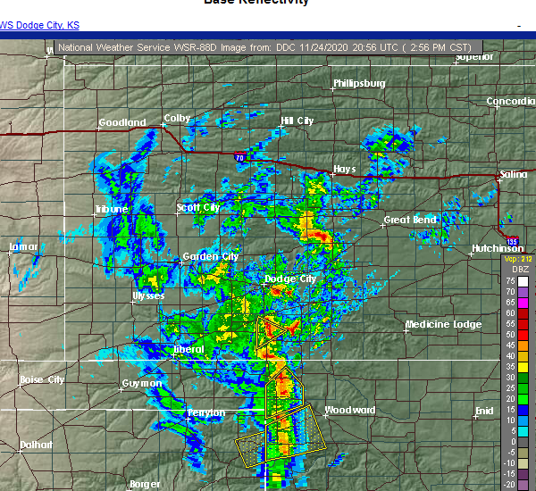 At 300 pm cst, severe thunderstorms were located along a line extending from 7 miles southeast of englewood to 7 miles northwest of gage, moving northeast at 40 mph (radar indicated). Hazards include 60 mph wind gusts and quarter size hail. Hail damage to vehicles is expected. Expect wind damage to roofs, siding, and trees. At 300 pm cst, severe thunderstorms were located along a line extending from 7 miles southeast of englewood to 7 miles northwest of gage, moving northeast at 40 mph (radar indicated). Hazards include 60 mph wind gusts and quarter size hail. Hail damage to vehicles is expected. Expect wind damage to roofs, siding, and trees.
|
| 9/1/2020 5:52 PM CDT |
 At 551 pm cdt, a severe thunderstorm was located 6 miles east of fort supply, moving east at 30 mph (radar indicated). Hazards include 60 mph wind gusts and quarter size hail. Hail damage to vehicles is expected. expect wind damage to roofs, siding, and trees. Locations impacted include, fort supply. At 551 pm cdt, a severe thunderstorm was located 6 miles east of fort supply, moving east at 30 mph (radar indicated). Hazards include 60 mph wind gusts and quarter size hail. Hail damage to vehicles is expected. expect wind damage to roofs, siding, and trees. Locations impacted include, fort supply.
|
| 9/1/2020 5:38 PM CDT |
 At 537 pm cdt, a severe thunderstorm was located near fort supply, moving east at 25 mph (radar indicated). Hazards include ping pong ball size hail and 60 mph wind gusts. People and animals outdoors will be injured. expect hail damage to roofs, siding, windows, and vehicles. expect wind damage to roofs, siding, and trees. Locations impacted include, fort supply. At 537 pm cdt, a severe thunderstorm was located near fort supply, moving east at 25 mph (radar indicated). Hazards include ping pong ball size hail and 60 mph wind gusts. People and animals outdoors will be injured. expect hail damage to roofs, siding, windows, and vehicles. expect wind damage to roofs, siding, and trees. Locations impacted include, fort supply.
|
| 9/1/2020 5:14 PM CDT |
 At 514 pm cdt, a severe thunderstorm was located near may, moving east at 30 mph (radar indicated). Hazards include ping pong ball size hail and 60 mph wind gusts. People and animals outdoors will be injured. expect hail damage to roofs, siding, windows, and vehicles. Expect wind damage to roofs, siding, and trees. At 514 pm cdt, a severe thunderstorm was located near may, moving east at 30 mph (radar indicated). Hazards include ping pong ball size hail and 60 mph wind gusts. People and animals outdoors will be injured. expect hail damage to roofs, siding, windows, and vehicles. Expect wind damage to roofs, siding, and trees.
|
| 8/10/2020 8:49 PM CDT |
 At 849 pm cdt, severe thunderstorms were located along a line extending from 4 miles east of fort supply to 8 miles southeast of fargo to 8 miles south of harmon, moving east at 25 mph (radar indicated). Hazards include 70 mph wind gusts and quarter size hail. Hail damage to vehicles is expected. expect considerable tree damage. wind damage is also likely to mobile homes, roofs, and outbuildings. Locations impacted include, woodward, fargo, fort supply, harmon and tangier. At 849 pm cdt, severe thunderstorms were located along a line extending from 4 miles east of fort supply to 8 miles southeast of fargo to 8 miles south of harmon, moving east at 25 mph (radar indicated). Hazards include 70 mph wind gusts and quarter size hail. Hail damage to vehicles is expected. expect considerable tree damage. wind damage is also likely to mobile homes, roofs, and outbuildings. Locations impacted include, woodward, fargo, fort supply, harmon and tangier.
|
| 8/10/2020 8:45 PM CDT |
 At 844 pm cdt, severe thunderstorms were located along a line extending from 3 miles southeast of fort supply to 6 miles southeast of fargo to 9 miles south of harmon, moving east at 25 mph (radar indicated). Hazards include 70 mph wind gusts and quarter size hail. Hail damage to vehicles is expected. expect considerable tree damage. wind damage is also likely to mobile homes, roofs, and outbuildings. Locations impacted include, woodward, fargo, fort supply, harmon and tangier. At 844 pm cdt, severe thunderstorms were located along a line extending from 3 miles southeast of fort supply to 6 miles southeast of fargo to 9 miles south of harmon, moving east at 25 mph (radar indicated). Hazards include 70 mph wind gusts and quarter size hail. Hail damage to vehicles is expected. expect considerable tree damage. wind damage is also likely to mobile homes, roofs, and outbuildings. Locations impacted include, woodward, fargo, fort supply, harmon and tangier.
|
| 8/10/2020 8:26 PM CDT |
 At 826 pm cdt, severe thunderstorms were located along a line extending from 3 miles west of fort supply to 5 miles southwest of fargo to 3 miles south of arnett, moving east at 25 mph (the gage asos measured a 70 mph wind gust). Hazards include 70 mph wind gusts and quarter size hail. Hail damage to vehicles is expected. expect considerable tree damage. wind damage is also likely to mobile homes, roofs, and outbuildings. Locations impacted include, woodward, arnett, gage, fargo, fort supply, harmon and tangier. At 826 pm cdt, severe thunderstorms were located along a line extending from 3 miles west of fort supply to 5 miles southwest of fargo to 3 miles south of arnett, moving east at 25 mph (the gage asos measured a 70 mph wind gust). Hazards include 70 mph wind gusts and quarter size hail. Hail damage to vehicles is expected. expect considerable tree damage. wind damage is also likely to mobile homes, roofs, and outbuildings. Locations impacted include, woodward, arnett, gage, fargo, fort supply, harmon and tangier.
|
| 8/10/2020 8:23 PM CDT |
 At 823 pm cdt, severe thunderstorms were located along a line extending from 5 miles south of may to near gage to 5 miles southwest of arnett, moving east at 25 mph (radar indicated). Hazards include 60 mph wind gusts and quarter size hail. Hail damage to vehicles is expected. expect wind damage to roofs, siding, and trees. Locations impacted include, woodward, shattuck, arnett, gage, fargo, fort supply, harmon and tangier. At 823 pm cdt, severe thunderstorms were located along a line extending from 5 miles south of may to near gage to 5 miles southwest of arnett, moving east at 25 mph (radar indicated). Hazards include 60 mph wind gusts and quarter size hail. Hail damage to vehicles is expected. expect wind damage to roofs, siding, and trees. Locations impacted include, woodward, shattuck, arnett, gage, fargo, fort supply, harmon and tangier.
|
| 8/10/2020 8:09 PM CDT |
 At 809 pm cdt, severe thunderstorms were located along a line extending from 5 miles southwest of may to 3 miles west of gage to 7 miles east of higgins, moving east at 25 mph (radar indicated). Hazards include 60 mph wind gusts and quarter size hail. Hail damage to vehicles is expected. Expect wind damage to roofs, siding, and trees. At 809 pm cdt, severe thunderstorms were located along a line extending from 5 miles southwest of may to 3 miles west of gage to 7 miles east of higgins, moving east at 25 mph (radar indicated). Hazards include 60 mph wind gusts and quarter size hail. Hail damage to vehicles is expected. Expect wind damage to roofs, siding, and trees.
|
| 7/11/2020 7:59 PM CDT |
 The national weather service in norman has issued a * severe thunderstorm warning for. northeastern ellis county in northwestern oklahoma. southeastern harper county in northwestern oklahoma. western woodward county in northwestern oklahoma. Until 830 pm cdt. The national weather service in norman has issued a * severe thunderstorm warning for. northeastern ellis county in northwestern oklahoma. southeastern harper county in northwestern oklahoma. western woodward county in northwestern oklahoma. Until 830 pm cdt.
|
| 7/11/2020 7:22 PM CDT |
 At 722 pm cdt, a severe thunderstorm was located 5 miles east of may, moving southeast at 15 mph (radar indicated). Hazards include golf ball size hail and 60 mph wind gusts. People and animals outdoors will be injured. expect hail damage to roofs, siding, windows, and vehicles. Expect wind damage to roofs, siding, and trees. At 722 pm cdt, a severe thunderstorm was located 5 miles east of may, moving southeast at 15 mph (radar indicated). Hazards include golf ball size hail and 60 mph wind gusts. People and animals outdoors will be injured. expect hail damage to roofs, siding, windows, and vehicles. Expect wind damage to roofs, siding, and trees.
|
| 6/21/2020 8:35 PM CDT |
 At 835 pm cdt, severe thunderstorms were located along a line extending from 12 miles north of freedom to 7 miles north of woodward to near gage, moving southeast at 45 mph. these are very dangerous storms (radar indicated). Hazards include 80 mph wind gusts and ping pong ball size hail. Flying debris will be dangerous to those caught without shelter. mobile homes will be heavily damaged. expect considerable damage to roofs, windows, and vehicles. extensive tree damage and power outages are likely. Locations impacted include, woodward, shattuck, arnett, mooreland, gage, fargo, fort supply, freedom, may, alabaster caverns state park, selman, tangier, catesby and camp houston. At 835 pm cdt, severe thunderstorms were located along a line extending from 12 miles north of freedom to 7 miles north of woodward to near gage, moving southeast at 45 mph. these are very dangerous storms (radar indicated). Hazards include 80 mph wind gusts and ping pong ball size hail. Flying debris will be dangerous to those caught without shelter. mobile homes will be heavily damaged. expect considerable damage to roofs, windows, and vehicles. extensive tree damage and power outages are likely. Locations impacted include, woodward, shattuck, arnett, mooreland, gage, fargo, fort supply, freedom, may, alabaster caverns state park, selman, tangier, catesby and camp houston.
|
| 6/21/2020 8:32 PM CDT |
 At 831 pm cdt, severe thunderstorms were located along a line extending from 11 miles southeast of buttermilk to 8 miles east of fort supply to 4 miles west of gage, moving southeast at 45 mph (radar indicated). Hazards include 70 mph wind gusts and ping pong ball size hail. People and animals outdoors will be injured. expect hail damage to roofs, siding, windows, and vehicles. expect considerable tree damage. wind damage is also likely to mobile homes, roofs, and outbuildings. Locations impacted include, woodward, shattuck, arnett, mooreland, gage, fargo, fort supply, freedom, may, alabaster caverns state park, selman, tangier, catesby and camp houston. At 831 pm cdt, severe thunderstorms were located along a line extending from 11 miles southeast of buttermilk to 8 miles east of fort supply to 4 miles west of gage, moving southeast at 45 mph (radar indicated). Hazards include 70 mph wind gusts and ping pong ball size hail. People and animals outdoors will be injured. expect hail damage to roofs, siding, windows, and vehicles. expect considerable tree damage. wind damage is also likely to mobile homes, roofs, and outbuildings. Locations impacted include, woodward, shattuck, arnett, mooreland, gage, fargo, fort supply, freedom, may, alabaster caverns state park, selman, tangier, catesby and camp houston.
|
| 6/21/2020 8:02 PM CDT |
 At 802 pm cdt, severe thunderstorms were located along a line extending from 6 miles west of buttermilk to 7 miles southwest of buffalo to 6 miles northeast of darrouzett, moving southeast at 40 mph (radar indicated). Hazards include 70 mph wind gusts and ping pong ball size hail. People and animals outdoors will be injured. expect hail damage to roofs, siding, windows, and vehicles. expect considerable tree damage. Wind damage is also likely to mobile homes, roofs, and outbuildings. At 802 pm cdt, severe thunderstorms were located along a line extending from 6 miles west of buttermilk to 7 miles southwest of buffalo to 6 miles northeast of darrouzett, moving southeast at 40 mph (radar indicated). Hazards include 70 mph wind gusts and ping pong ball size hail. People and animals outdoors will be injured. expect hail damage to roofs, siding, windows, and vehicles. expect considerable tree damage. Wind damage is also likely to mobile homes, roofs, and outbuildings.
|
| 6/4/2020 5:33 PM CDT |
 At 533 pm cdt, severe thunderstorms were located along a line extending from near woodward to near harmon to 4 miles southwest of durham, moving southeast at 30 mph (radar indicated). Hazards include 60 mph wind gusts and penny size hail. Expect damage to roofs, siding, and trees. Locations impacted include, woodward, fargo, fort supply, harmon and tangier. At 533 pm cdt, severe thunderstorms were located along a line extending from near woodward to near harmon to 4 miles southwest of durham, moving southeast at 30 mph (radar indicated). Hazards include 60 mph wind gusts and penny size hail. Expect damage to roofs, siding, and trees. Locations impacted include, woodward, fargo, fort supply, harmon and tangier.
|
| 6/4/2020 5:16 PM CDT |
 At 516 pm cdt, severe thunderstorms were located along a line extending from 6 miles southeast of fort supply to near fargo to 8 miles southwest of arnett, moving east at 25 mph (radar indicated). Hazards include 60 mph wind gusts and quarter size hail. Hail damage to vehicles is expected. expect wind damage to roofs, siding, and trees. Locations impacted include, woodward, arnett, gage, fargo, fort supply, may, harmon and tangier. At 516 pm cdt, severe thunderstorms were located along a line extending from 6 miles southeast of fort supply to near fargo to 8 miles southwest of arnett, moving east at 25 mph (radar indicated). Hazards include 60 mph wind gusts and quarter size hail. Hail damage to vehicles is expected. expect wind damage to roofs, siding, and trees. Locations impacted include, woodward, arnett, gage, fargo, fort supply, may, harmon and tangier.
|
| 6/4/2020 4:59 PM CDT |
 At 459 pm cdt, severe thunderstorms were located along a line extending from 6 miles north of fort supply to 4 miles northwest of gage to 10 miles southwest of arnett, moving east at 20 mph (radar indicated). Hazards include up to ping pong ball size hail and 60 mph wind gusts. People and animals outdoors will be injured. expect hail damage to roofs, siding, windows, and vehicles. expect wind damage to roofs, siding, and trees. Locations impacted include, woodward, shattuck, laverne, arnett, gage, fargo, fort supply, may, harmon and tangier. At 459 pm cdt, severe thunderstorms were located along a line extending from 6 miles north of fort supply to 4 miles northwest of gage to 10 miles southwest of arnett, moving east at 20 mph (radar indicated). Hazards include up to ping pong ball size hail and 60 mph wind gusts. People and animals outdoors will be injured. expect hail damage to roofs, siding, windows, and vehicles. expect wind damage to roofs, siding, and trees. Locations impacted include, woodward, shattuck, laverne, arnett, gage, fargo, fort supply, may, harmon and tangier.
|
| 6/4/2020 4:47 PM CDT |
 At 447 pm cdt, severe thunderstorms were located along a line extending from near rosston to 6 miles northwest of gage to 9 miles southwest of arnett, moving east at 25 mph (radar indicated). Hazards include 60 mph wind gusts and quarter size hail. Hail damage to vehicles is expected. Expect wind damage to roofs, siding, and trees. At 447 pm cdt, severe thunderstorms were located along a line extending from near rosston to 6 miles northwest of gage to 9 miles southwest of arnett, moving east at 25 mph (radar indicated). Hazards include 60 mph wind gusts and quarter size hail. Hail damage to vehicles is expected. Expect wind damage to roofs, siding, and trees.
|
| 5/14/2020 10:25 PM CDT |
 The severe thunderstorm warning for northwestern ellis, south central harper and west central woodward counties will expire at 1030 pm cdt, the storm which prompted the warning has weakened below severe limits, therefore the warning will be allowed to expire. The severe thunderstorm warning for northwestern ellis, south central harper and west central woodward counties will expire at 1030 pm cdt, the storm which prompted the warning has weakened below severe limits, therefore the warning will be allowed to expire.
|
| 5/14/2020 10:02 PM CDT |
 At 1002 pm cdt, a severe thunderstorm was located 9 miles northwest of fargo, moving northeast at 30 mph (radar indicated). Hazards include 60 mph wind gusts and quarter size hail. Hail damage to vehicles is expected. expect wind damage to roofs, siding, and trees. Locations impacted include, gage, fort supply and may. At 1002 pm cdt, a severe thunderstorm was located 9 miles northwest of fargo, moving northeast at 30 mph (radar indicated). Hazards include 60 mph wind gusts and quarter size hail. Hail damage to vehicles is expected. expect wind damage to roofs, siding, and trees. Locations impacted include, gage, fort supply and may.
|
| 5/14/2020 9:41 PM CDT |
 At 940 pm cdt, a severe thunderstorm was located 6 miles north of shattuck, moving northeast at 30 mph (radar indicated). Hazards include 60 mph wind gusts and quarter size hail. Hail damage to vehicles is expected. Expect wind damage to roofs, siding, and trees. At 940 pm cdt, a severe thunderstorm was located 6 miles north of shattuck, moving northeast at 30 mph (radar indicated). Hazards include 60 mph wind gusts and quarter size hail. Hail damage to vehicles is expected. Expect wind damage to roofs, siding, and trees.
|
| 4/19/2020 5:53 PM CDT |
 At 553 pm cdt, a severe thunderstorm was located 6 miles southwest of fort supply, moving southeast at 25 mph (radar indicated). Hazards include ping pong ball size hail and 60 mph wind gusts. People and animals outdoors will be injured. expect hail damage to roofs, siding, windows, and vehicles. Expect wind damage to roofs, siding, and trees. At 553 pm cdt, a severe thunderstorm was located 6 miles southwest of fort supply, moving southeast at 25 mph (radar indicated). Hazards include ping pong ball size hail and 60 mph wind gusts. People and animals outdoors will be injured. expect hail damage to roofs, siding, windows, and vehicles. Expect wind damage to roofs, siding, and trees.
|
| 8/25/2019 12:11 AM CDT |
 At 1210 am cdt, a severe thunderstorm was located 6 miles southeast of fort supply, moving southeast at 30 mph (radar indicated). Hazards include 60 mph wind gusts and quarter size hail. Hail damage to vehicles is expected. expect wind damage to roofs, siding, and trees. Locations impacted include, woodward and fort supply. At 1210 am cdt, a severe thunderstorm was located 6 miles southeast of fort supply, moving southeast at 30 mph (radar indicated). Hazards include 60 mph wind gusts and quarter size hail. Hail damage to vehicles is expected. expect wind damage to roofs, siding, and trees. Locations impacted include, woodward and fort supply.
|
| 8/24/2019 11:55 PM CDT |
 At 1154 pm cdt, a severe thunderstorm was located near fort supply, moving southeast at 30 mph (radar indicated). Hazards include 60 mph wind gusts and quarter size hail. Hail damage to vehicles is expected. Expect wind damage to roofs, siding, and trees. At 1154 pm cdt, a severe thunderstorm was located near fort supply, moving southeast at 30 mph (radar indicated). Hazards include 60 mph wind gusts and quarter size hail. Hail damage to vehicles is expected. Expect wind damage to roofs, siding, and trees.
|
| 8/13/2019 9:45 PM CDT |
 At 945 pm cdt, severe thunderstorms were located along a line extending from 7 miles northeast of aetna to 8 miles east of selman to 4 miles south of gate, moving southeast at 45 mph (radar indicated). Hazards include 60 mph wind gusts and nickel size hail. expect damage to roofs, siding, and trees At 945 pm cdt, severe thunderstorms were located along a line extending from 7 miles northeast of aetna to 8 miles east of selman to 4 miles south of gate, moving southeast at 45 mph (radar indicated). Hazards include 60 mph wind gusts and nickel size hail. expect damage to roofs, siding, and trees
|
| 7/5/2019 11:42 PM CDT |
 At 1141 pm cdt, severe thunderstorms were located along a line extending from near buttermilk to 3 miles north of buffalo to 6 miles north of may, moving southeast at 35 mph (radar indicated). Hazards include 60 mph wind gusts and nickel size hail. expect damage to roofs, siding, and trees At 1141 pm cdt, severe thunderstorms were located along a line extending from near buttermilk to 3 miles north of buffalo to 6 miles north of may, moving southeast at 35 mph (radar indicated). Hazards include 60 mph wind gusts and nickel size hail. expect damage to roofs, siding, and trees
|
| 6/23/2019 3:32 AM CDT |
 At 332 am cdt, a severe thunderstorm was located 8 miles east of slapout, moving northeast at 60 mph (radar indicated). Hazards include 70 mph wind gusts and ping pong ball size hail. People and animals outdoors will be injured. expect hail damage to roofs, siding, windows, and vehicles. expect considerable tree damage. Wind damage is also likely to mobile homes, roofs, and outbuildings. At 332 am cdt, a severe thunderstorm was located 8 miles east of slapout, moving northeast at 60 mph (radar indicated). Hazards include 70 mph wind gusts and ping pong ball size hail. People and animals outdoors will be injured. expect hail damage to roofs, siding, windows, and vehicles. expect considerable tree damage. Wind damage is also likely to mobile homes, roofs, and outbuildings.
|
| 6/19/2019 8:01 PM CDT |
 At 800 pm cdt, a severe thunderstorm was located 5 miles northeast of fort supply, moving south at 30 mph (radar indicated). Hazards include two inch hail and 60 mph wind gusts. People and animals outdoors will be injured. expect hail damage to roofs, siding, windows, and vehicles. expect wind damage to roofs, siding, and trees. Locations impacted include, woodward, mooreland, fort supply, sharon and tangier. At 800 pm cdt, a severe thunderstorm was located 5 miles northeast of fort supply, moving south at 30 mph (radar indicated). Hazards include two inch hail and 60 mph wind gusts. People and animals outdoors will be injured. expect hail damage to roofs, siding, windows, and vehicles. expect wind damage to roofs, siding, and trees. Locations impacted include, woodward, mooreland, fort supply, sharon and tangier.
|
| 6/19/2019 7:37 PM CDT |
 At 736 pm cdt, a severe thunderstorm was located 4 miles southeast of buffalo, moving south at 30 mph (radar indicated. this storm has a history of producing very large hail). Hazards include tennis ball size hail and 60 mph wind gusts. People and animals outdoors will be injured. expect hail damage to roofs, siding, windows, and vehicles. Expect wind damage to roofs, siding, and trees. At 736 pm cdt, a severe thunderstorm was located 4 miles southeast of buffalo, moving south at 30 mph (radar indicated. this storm has a history of producing very large hail). Hazards include tennis ball size hail and 60 mph wind gusts. People and animals outdoors will be injured. expect hail damage to roofs, siding, windows, and vehicles. Expect wind damage to roofs, siding, and trees.
|
| 6/18/2019 11:12 PM CDT |
 At 1111 pm cdt, severe thunderstorms were located along a line extending from 12 miles southeast of sitka to near selman to 8 miles south of may, moving east at 40 mph (radar indicated). Hazards include 60 mph wind gusts and penny size hail. Expect damage to roofs, siding, and trees. Locations impacted include, woodward, buffalo, mooreland, fargo, fort supply, freedom, may, alabaster caverns state park, selman, tangier, catesby and camp houston. At 1111 pm cdt, severe thunderstorms were located along a line extending from 12 miles southeast of sitka to near selman to 8 miles south of may, moving east at 40 mph (radar indicated). Hazards include 60 mph wind gusts and penny size hail. Expect damage to roofs, siding, and trees. Locations impacted include, woodward, buffalo, mooreland, fargo, fort supply, freedom, may, alabaster caverns state park, selman, tangier, catesby and camp houston.
|
| 6/18/2019 10:57 PM CDT |
 At 1056 pm cdt, severe thunderstorms were located along a line extending from 10 miles southeast of acres to near buffalo to 10 miles northeast of follett, moving east at 40 mph (radar indicated). Hazards include 70 mph wind gusts and nickel size hail. Expect considerable tree damage. Damage is likely to mobile homes, roofs, and outbuildings. At 1056 pm cdt, severe thunderstorms were located along a line extending from 10 miles southeast of acres to near buffalo to 10 miles northeast of follett, moving east at 40 mph (radar indicated). Hazards include 70 mph wind gusts and nickel size hail. Expect considerable tree damage. Damage is likely to mobile homes, roofs, and outbuildings.
|
| 6/15/2019 11:23 PM CDT |
 The severe thunderstorm warning for northwestern ellis, west central woods, southern harper and northwestern woodward counties will expire at 1130 pm cdt, the storms which prompted the warning have weakened below severe limits, and no longer pose an immediate threat to life or property. therefore, the warning will be allowed to expire. however small hail, gusty winds and heavy rain are still possible with these thunderstorms. The severe thunderstorm warning for northwestern ellis, west central woods, southern harper and northwestern woodward counties will expire at 1130 pm cdt, the storms which prompted the warning have weakened below severe limits, and no longer pose an immediate threat to life or property. therefore, the warning will be allowed to expire. however small hail, gusty winds and heavy rain are still possible with these thunderstorms.
|
| 6/15/2019 10:27 PM CDT |
 At 1026 pm cdt, severe thunderstorms were located along a line extending from 5 miles south of follett to near shattuck, moving northeast at 20 mph (radar indicated). Hazards include ping pong ball size hail and 60 mph wind gusts. People and animals outdoors will be injured. expect hail damage to roofs, siding, windows, and vehicles. Expect wind damage to roofs, siding, and trees. At 1026 pm cdt, severe thunderstorms were located along a line extending from 5 miles south of follett to near shattuck, moving northeast at 20 mph (radar indicated). Hazards include ping pong ball size hail and 60 mph wind gusts. People and animals outdoors will be injured. expect hail damage to roofs, siding, windows, and vehicles. Expect wind damage to roofs, siding, and trees.
|
| 6/1/2019 9:38 AM CDT |
 At 913 am cdt, severe thunderstorms were located along a line extending from 7 miles north of selman to 5 miles northeast of fort supply to 8 miles south of laverne, moving southeast at 30 mph (radar indicated). Hazards include quarter size hail. damage to vehicles is expected At 913 am cdt, severe thunderstorms were located along a line extending from 7 miles north of selman to 5 miles northeast of fort supply to 8 miles south of laverne, moving southeast at 30 mph (radar indicated). Hazards include quarter size hail. damage to vehicles is expected
|
| 6/1/2019 9:13 AM CDT |
 At 913 am cdt, severe thunderstorms were located along a line extending from 7 miles north of selman to 5 miles northeast of fort supply to 8 miles south of laverne, moving southeast at 30 mph (radar indicated). Hazards include quarter size hail. damage to vehicles is expected At 913 am cdt, severe thunderstorms were located along a line extending from 7 miles north of selman to 5 miles northeast of fort supply to 8 miles south of laverne, moving southeast at 30 mph (radar indicated). Hazards include quarter size hail. damage to vehicles is expected
|
| 5/27/2019 3:15 AM CDT |
 At 315 am cdt, severe thunderstorms were located along a line extending from 5 miles south of buffalo to 7 miles southeast of selman to 5 miles west of woodward to 4 miles south of gage, moving northeast at 45 mph (radar indicated). Hazards include 70 mph wind gusts and quarter size hail. Hail damage to vehicles is expected. expect considerable tree damage. Wind damage is also likely to mobile homes, roofs, and outbuildings. At 315 am cdt, severe thunderstorms were located along a line extending from 5 miles south of buffalo to 7 miles southeast of selman to 5 miles west of woodward to 4 miles south of gage, moving northeast at 45 mph (radar indicated). Hazards include 70 mph wind gusts and quarter size hail. Hail damage to vehicles is expected. expect considerable tree damage. Wind damage is also likely to mobile homes, roofs, and outbuildings.
|
| 5/27/2019 3:05 AM CDT |
 At 305 am cdt, severe thunderstorms were located along a line extending from 5 miles northeast of may to 6 miles northeast of fargo to 5 miles south of gage, moving east at 45 mph (radar indicated). Hazards include 70 mph wind gusts and quarter size hail. Hail damage to vehicles is expected. expect considerable tree damage. wind damage is also likely to mobile homes, roofs, and outbuildings. Locations impacted include, woodward, shattuck, gage, fargo, fort supply, may and tangier. At 305 am cdt, severe thunderstorms were located along a line extending from 5 miles northeast of may to 6 miles northeast of fargo to 5 miles south of gage, moving east at 45 mph (radar indicated). Hazards include 70 mph wind gusts and quarter size hail. Hail damage to vehicles is expected. expect considerable tree damage. wind damage is also likely to mobile homes, roofs, and outbuildings. Locations impacted include, woodward, shattuck, gage, fargo, fort supply, may and tangier.
|
| 5/27/2019 2:40 AM CDT |
 At 240 am cdt, a severe thunderstorm was located 10 miles east of follett, moving northeast at 40 mph (radar indicated). Hazards include 70 mph wind gusts and quarter size hail. Hail damage to vehicles is expected. expect considerable tree damage. Wind damage is also likely to mobile homes, roofs, and outbuildings. At 240 am cdt, a severe thunderstorm was located 10 miles east of follett, moving northeast at 40 mph (radar indicated). Hazards include 70 mph wind gusts and quarter size hail. Hail damage to vehicles is expected. expect considerable tree damage. Wind damage is also likely to mobile homes, roofs, and outbuildings.
|
| 5/27/2019 12:13 AM CDT |
 At 1212 am cdt, severe thunderstorms were located along a line extending from 9 miles southeast of aetna to near mooreland to 7 miles southeast of gage, moving northeast at 60 mph (radar indicated). Hazards include 60 mph wind gusts and penny size hail. expect damage to roofs, siding, and trees At 1212 am cdt, severe thunderstorms were located along a line extending from 9 miles southeast of aetna to near mooreland to 7 miles southeast of gage, moving northeast at 60 mph (radar indicated). Hazards include 60 mph wind gusts and penny size hail. expect damage to roofs, siding, and trees
|
| 5/26/2019 11:49 PM CDT |
 At 1149 pm cdt, severe thunderstorms were located along a line extending from 12 miles north of freedom to 11 miles west of alabaster caverns state park to 3 miles southwest of gage, moving northeast at 55 mph (radar indicated). Hazards include 70 mph wind gusts and penny size hail. Expect considerable tree damage. damage is likely to mobile homes, roofs, and outbuildings. Locations impacted include, woodward, shattuck, laverne, buffalo, mooreland, gage, fargo, fort supply, freedom, may, rosston, alabaster caverns state park, selman, quinlan, tangier, catesby and camp houston. At 1149 pm cdt, severe thunderstorms were located along a line extending from 12 miles north of freedom to 11 miles west of alabaster caverns state park to 3 miles southwest of gage, moving northeast at 55 mph (radar indicated). Hazards include 70 mph wind gusts and penny size hail. Expect considerable tree damage. damage is likely to mobile homes, roofs, and outbuildings. Locations impacted include, woodward, shattuck, laverne, buffalo, mooreland, gage, fargo, fort supply, freedom, may, rosston, alabaster caverns state park, selman, quinlan, tangier, catesby and camp houston.
|
| 5/26/2019 11:24 PM CDT |
 The national weather service in norman has issued a * severe thunderstorm warning for. northwestern ellis county in northwestern oklahoma. western woods county in northwestern oklahoma. harper county in northwestern oklahoma. Woodward county in northwestern oklahoma. The national weather service in norman has issued a * severe thunderstorm warning for. northwestern ellis county in northwestern oklahoma. western woods county in northwestern oklahoma. harper county in northwestern oklahoma. Woodward county in northwestern oklahoma.
|
| 5/25/2019 6:22 PM CDT |
 At 622 pm cdt, severe thunderstorms were located along a line extending from 12 miles southeast of buttermilk to near alabaster caverns state park to near mooreland, moving northeast at 40 mph (radar indicated). Hazards include 70 mph wind gusts and nickel size hail. Expect considerable tree damage. Damage is likely to mobile homes, roofs, and outbuildings. At 622 pm cdt, severe thunderstorms were located along a line extending from 12 miles southeast of buttermilk to near alabaster caverns state park to near mooreland, moving northeast at 40 mph (radar indicated). Hazards include 70 mph wind gusts and nickel size hail. Expect considerable tree damage. Damage is likely to mobile homes, roofs, and outbuildings.
|
| 5/25/2019 6:05 PM CDT |
 At 605 pm cdt, a severe thunderstorm was located 6 miles north of woodward, moving northeast at 35 mph (radar indicated). Hazards include 70 mph wind gusts and nickel size hail. Expect considerable tree damage. damage is likely to mobile homes, roofs, and outbuildings. Locations impacted include, woodward, mooreland, fargo, fort supply, alabaster caverns state park, quinlan and tangier. At 605 pm cdt, a severe thunderstorm was located 6 miles north of woodward, moving northeast at 35 mph (radar indicated). Hazards include 70 mph wind gusts and nickel size hail. Expect considerable tree damage. damage is likely to mobile homes, roofs, and outbuildings. Locations impacted include, woodward, mooreland, fargo, fort supply, alabaster caverns state park, quinlan and tangier.
|
| 5/25/2019 5:50 PM CDT |
 At 550 pm cdt, a severe thunderstorm was located 6 miles northeast of fargo, moving northeast at 35 mph (radar indicated). Hazards include 60 mph wind gusts and nickel size hail. expect damage to roofs, siding, and trees At 550 pm cdt, a severe thunderstorm was located 6 miles northeast of fargo, moving northeast at 35 mph (radar indicated). Hazards include 60 mph wind gusts and nickel size hail. expect damage to roofs, siding, and trees
|
| 5/24/2019 4:34 PM CDT |
 At 434 pm cdt, a severe thunderstorm was located near fort supply, moving northeast at 45 mph (emergency management reported quarter size hail near fort supply). Hazards include quarter size hail. Damage to vehicles is expected. Locations impacted include, fort supply, freedom, alabaster caverns state park, selman and camp houston. At 434 pm cdt, a severe thunderstorm was located near fort supply, moving northeast at 45 mph (emergency management reported quarter size hail near fort supply). Hazards include quarter size hail. Damage to vehicles is expected. Locations impacted include, fort supply, freedom, alabaster caverns state park, selman and camp houston.
|
| 5/24/2019 4:26 PM CDT |
 At 426 pm cdt, a severe thunderstorm was located 5 miles south of fort supply, moving northeast at 35 mph (radar indicated). Hazards include quarter size hail. damage to vehicles is expected At 426 pm cdt, a severe thunderstorm was located 5 miles south of fort supply, moving northeast at 35 mph (radar indicated). Hazards include quarter size hail. damage to vehicles is expected
|
| 5/24/2019 2:11 PM CDT |
 The severe thunderstorm warning for southeastern harper and west central woodward counties will expire at 215 pm cdt, the storm which prompted the warning has moved out of the area. therefore, the warning will be allowed to expire. The severe thunderstorm warning for southeastern harper and west central woodward counties will expire at 215 pm cdt, the storm which prompted the warning has moved out of the area. therefore, the warning will be allowed to expire.
|
| 5/24/2019 2:01 PM CDT |
 At 200 pm cdt, a severe thunderstorm was located near fort supply, moving northeast at 30 mph (radar indicated). Hazards include 60 mph wind gusts and quarter size hail. Hail damage to vehicles is expected. expect wind damage to roofs, siding, and trees. Locations impacted include, fort supply. At 200 pm cdt, a severe thunderstorm was located near fort supply, moving northeast at 30 mph (radar indicated). Hazards include 60 mph wind gusts and quarter size hail. Hail damage to vehicles is expected. expect wind damage to roofs, siding, and trees. Locations impacted include, fort supply.
|
| 5/24/2019 1:43 PM CDT |
 At 143 pm cdt, a severe thunderstorm was located 7 miles north of fargo, moving northeast at 30 mph (radar indicated). Hazards include 60 mph wind gusts and quarter size hail. Hail damage to vehicles is expected. expect wind damage to roofs, siding, and trees. Locations impacted include, woodward, fargo, fort supply and tangier. At 143 pm cdt, a severe thunderstorm was located 7 miles north of fargo, moving northeast at 30 mph (radar indicated). Hazards include 60 mph wind gusts and quarter size hail. Hail damage to vehicles is expected. expect wind damage to roofs, siding, and trees. Locations impacted include, woodward, fargo, fort supply and tangier.
|
| 5/24/2019 1:32 PM CDT |
 At 132 pm cdt, a severe thunderstorm was located 4 miles northwest of fargo, moving northeast at 30 mph (radar indicated). Hazards include 60 mph wind gusts and quarter size hail. Hail damage to vehicles is expected. Expect wind damage to roofs, siding, and trees. At 132 pm cdt, a severe thunderstorm was located 4 miles northwest of fargo, moving northeast at 30 mph (radar indicated). Hazards include 60 mph wind gusts and quarter size hail. Hail damage to vehicles is expected. Expect wind damage to roofs, siding, and trees.
|
| 5/24/2019 1:23 AM CDT |
 At 123 am cdt, a severe thunderstorm was located 5 miles east of fort supply, moving northeast at 50 mph (radar indicated). Hazards include 70 mph wind gusts and quarter size hail. Hail damage to vehicles is expected. expect considerable tree damage. wind damage is also likely to mobile homes, roofs, and outbuildings. Locations impacted include, woodward, mooreland, fargo, fort supply, freedom, alabaster caverns state park, tangier and camp houston. At 123 am cdt, a severe thunderstorm was located 5 miles east of fort supply, moving northeast at 50 mph (radar indicated). Hazards include 70 mph wind gusts and quarter size hail. Hail damage to vehicles is expected. expect considerable tree damage. wind damage is also likely to mobile homes, roofs, and outbuildings. Locations impacted include, woodward, mooreland, fargo, fort supply, freedom, alabaster caverns state park, tangier and camp houston.
|
| 5/24/2019 1:19 AM CDT |
 At 119 am cdt, a severe thunderstorm was located near fort supply, moving northeast at 50 mph (radar indicated). Hazards include 60 mph wind gusts and quarter size hail. Hail damage to vehicles is expected. Expect wind damage to roofs, siding, and trees. At 119 am cdt, a severe thunderstorm was located near fort supply, moving northeast at 50 mph (radar indicated). Hazards include 60 mph wind gusts and quarter size hail. Hail damage to vehicles is expected. Expect wind damage to roofs, siding, and trees.
|
| 5/24/2019 1:18 AM CDT | Storm damage reported in woodward county OK, 0.3 miles NW of Fort Supply, OK |
| 5/23/2019 11:45 PM CDT |
 At 1144 pm cdt, a severe thunderstorm was located 7 miles north of higgins, moving northeast at 50 mph (radar indicated). Hazards include 60 mph wind gusts and quarter size hail. Hail damage to vehicles is expected. Expect wind damage to roofs, siding, and trees. At 1144 pm cdt, a severe thunderstorm was located 7 miles north of higgins, moving northeast at 50 mph (radar indicated). Hazards include 60 mph wind gusts and quarter size hail. Hail damage to vehicles is expected. Expect wind damage to roofs, siding, and trees.
|
| 5/20/2019 11:17 AM CDT |
 At 1117 am cdt, severe thunderstorms were located along a line extending from 4 miles west of may to 7 miles northwest of fargo to 5 miles north of arnett, moving east at 40 mph (radar indicated). Hazards include 60 mph wind gusts and quarter size hail. Hail damage to vehicles is expected. expect wind damage to roofs, siding, and trees. Locations impacted include, woodward, shattuck, laverne, gage, fargo, fort supply, may and tangier. At 1117 am cdt, severe thunderstorms were located along a line extending from 4 miles west of may to 7 miles northwest of fargo to 5 miles north of arnett, moving east at 40 mph (radar indicated). Hazards include 60 mph wind gusts and quarter size hail. Hail damage to vehicles is expected. expect wind damage to roofs, siding, and trees. Locations impacted include, woodward, shattuck, laverne, gage, fargo, fort supply, may and tangier.
|
| 5/20/2019 10:49 AM CDT |
 At 1049 am cdt, severe thunderstorms were located along a line extending from 3 miles southwest of slapout to 5 miles southeast of follett to 5 miles west of higgins, moving east at 40 mph (radar indicated). Hazards include 60 mph wind gusts and quarter size hail. Hail damage to vehicles is expected. Expect wind damage to roofs, siding, and trees. At 1049 am cdt, severe thunderstorms were located along a line extending from 3 miles southwest of slapout to 5 miles southeast of follett to 5 miles west of higgins, moving east at 40 mph (radar indicated). Hazards include 60 mph wind gusts and quarter size hail. Hail damage to vehicles is expected. Expect wind damage to roofs, siding, and trees.
|
| 5/20/2019 8:33 AM CDT | Quarter sized hail reported 0.3 miles NW of Fort Supply, OK, em reported on nwschat |
| 5/20/2019 8:32 AM CDT |
 At 832 am cdt, a severe thunderstorm was located 6 miles west of woodward, moving east at 40 mph (radar indicated). Hazards include ping pong ball size hail and 60 mph wind gusts. People and animals outdoors will be injured. expect hail damage to roofs, siding, windows, and vehicles. expect wind damage to roofs, siding, and trees. Locations impacted include, woodward, mooreland, fargo, fort supply, sharon, may and tangier. At 832 am cdt, a severe thunderstorm was located 6 miles west of woodward, moving east at 40 mph (radar indicated). Hazards include ping pong ball size hail and 60 mph wind gusts. People and animals outdoors will be injured. expect hail damage to roofs, siding, windows, and vehicles. expect wind damage to roofs, siding, and trees. Locations impacted include, woodward, mooreland, fargo, fort supply, sharon, may and tangier.
|
| 5/20/2019 8:10 AM CDT |
 The national weather service in norman has issued a * severe thunderstorm warning for. northern ellis county in northwestern oklahoma. southeastern harper county in northwestern oklahoma. woodward county in northwestern oklahoma. Until 900 am cdt. The national weather service in norman has issued a * severe thunderstorm warning for. northern ellis county in northwestern oklahoma. southeastern harper county in northwestern oklahoma. woodward county in northwestern oklahoma. Until 900 am cdt.
|
| 7/30/2018 12:15 AM CDT |
 At 1215 am cdt, severe thunderstorms were located along a line extending from near alabaster caverns state park to 3 miles north of woodward to 12 miles east of follett, moving southeast at 45 mph (radar indicated). Hazards include 60 mph wind gusts and penny size hail. expect damage to roofs, siding, and trees At 1215 am cdt, severe thunderstorms were located along a line extending from near alabaster caverns state park to 3 miles north of woodward to 12 miles east of follett, moving southeast at 45 mph (radar indicated). Hazards include 60 mph wind gusts and penny size hail. expect damage to roofs, siding, and trees
|
| 7/28/2018 1:11 AM CDT |
 The severe thunderstorm warning for northwestern ellis, northwestern woods, harper and western woodward counties will expire at 115 am cdt, the storms which prompted the warning have weakened below severe limits, and no longer pose an immediate threat to life or property. therefore, the warning will be allowed to expire. however gusty winds are still possible with these thunderstorms. The severe thunderstorm warning for northwestern ellis, northwestern woods, harper and western woodward counties will expire at 115 am cdt, the storms which prompted the warning have weakened below severe limits, and no longer pose an immediate threat to life or property. therefore, the warning will be allowed to expire. however gusty winds are still possible with these thunderstorms.
|
| 7/28/2018 12:47 AM CDT |
 At 1247 am cdt, severe thunderstorms were located along a line extending from 9 miles southeast of acres to 7 miles north of may to 10 miles northwest of gage, moving east at 30 mph (radar indicated). Hazards include 60 mph wind gusts. Expect damage to roofs, siding, and trees. Locations impacted include, woodward, shattuck, laverne, buffalo, gage, fargo, fort supply, may, rosston, selman, tangier and catesby. At 1247 am cdt, severe thunderstorms were located along a line extending from 9 miles southeast of acres to 7 miles north of may to 10 miles northwest of gage, moving east at 30 mph (radar indicated). Hazards include 60 mph wind gusts. Expect damage to roofs, siding, and trees. Locations impacted include, woodward, shattuck, laverne, buffalo, gage, fargo, fort supply, may, rosston, selman, tangier and catesby.
|
| 7/28/2018 12:20 AM CDT |
 At 1219 am cdt, severe thunderstorms were located along a line extending from 5 miles west of acres to near rosston to 5 miles north of follett, moving east at 35 mph. these storms have a history of wind damage over the oklahoma panhandle (radar indicated). Hazards include 65 mph wind gusts. Expect damage to roofs, siding, and trees. Locations impacted include, woodward, shattuck, laverne, buffalo, gage, fargo, fort supply, may, rosston, selman, tangier and catesby. At 1219 am cdt, severe thunderstorms were located along a line extending from 5 miles west of acres to near rosston to 5 miles north of follett, moving east at 35 mph. these storms have a history of wind damage over the oklahoma panhandle (radar indicated). Hazards include 65 mph wind gusts. Expect damage to roofs, siding, and trees. Locations impacted include, woodward, shattuck, laverne, buffalo, gage, fargo, fort supply, may, rosston, selman, tangier and catesby.
|
| 7/28/2018 12:09 AM CDT |
 At 1208 am cdt, severe thunderstorms were located along a line extending from 12 miles northwest of englewood to near gate to 8 miles southwest of slapout, moving east at 35 mph (radar indicated). Hazards include 65 mph wind gusts. expect damage to roofs, siding, and trees At 1208 am cdt, severe thunderstorms were located along a line extending from 12 miles northwest of englewood to near gate to 8 miles southwest of slapout, moving east at 35 mph (radar indicated). Hazards include 65 mph wind gusts. expect damage to roofs, siding, and trees
|
| 7/15/2018 2:53 PM CDT |
 The severe thunderstorm warning for northwestern ellis, south central harper and west central woodward counties will expire at 300 pm cdt, the storms which prompted the warning have moved out of the area. therefore, the warning will be allowed to expire. gusty winds up to 50 mph and heavy rainfall remain possible with these storms from shattuck to fort supply. The severe thunderstorm warning for northwestern ellis, south central harper and west central woodward counties will expire at 300 pm cdt, the storms which prompted the warning have moved out of the area. therefore, the warning will be allowed to expire. gusty winds up to 50 mph and heavy rainfall remain possible with these storms from shattuck to fort supply.
|
| 7/15/2018 2:49 PM CDT |
 At 249 pm cdt, severe thunderstorms were located along a line extending from 3 miles east of may to 5 miles northwest of gage, moving east at 15 mph (radar indicated). Hazards include 60 mph wind gusts. Expect damage to roofs, siding, and trees. Locations impacted include, fort supply and may. At 249 pm cdt, severe thunderstorms were located along a line extending from 3 miles east of may to 5 miles northwest of gage, moving east at 15 mph (radar indicated). Hazards include 60 mph wind gusts. Expect damage to roofs, siding, and trees. Locations impacted include, fort supply and may.
|
| 7/15/2018 2:36 PM CDT |
 At 235 pm cdt, severe thunderstorms were located along a line extending from near may to 6 miles north of shattuck, moving east at 15 mph (radar indicated). Hazards include 60 mph wind gusts and quarter size hail. Hail damage to vehicles is expected. Expect wind damage to roofs, siding, and trees. At 235 pm cdt, severe thunderstorms were located along a line extending from near may to 6 miles north of shattuck, moving east at 15 mph (radar indicated). Hazards include 60 mph wind gusts and quarter size hail. Hail damage to vehicles is expected. Expect wind damage to roofs, siding, and trees.
|
| 6/25/2018 12:07 AM CDT |
 At 1207 am cdt, severe thunderstorms were located along a line extending from 3 miles northwest of capron to near quinlan to near leedey, moving east at 45 mph. these are very dangerous storms (radar indicated). Hazards include 80 mph wind gusts and tennis ball size hail. Flying debris will be dangerous to those caught without shelter. mobile homes will be heavily damaged. expect considerable damage to roofs, windows, and vehicles. extensive tree damage and power outages are likely. Locations impacted include, woodward, alva, cherokee, arnett, taloga, mooreland, waynoka, seiling, vici, gage, leedey, fargo, carmen, fort supply, freedom, aline, camargo, burlington, sharon and dacoma. At 1207 am cdt, severe thunderstorms were located along a line extending from 3 miles northwest of capron to near quinlan to near leedey, moving east at 45 mph. these are very dangerous storms (radar indicated). Hazards include 80 mph wind gusts and tennis ball size hail. Flying debris will be dangerous to those caught without shelter. mobile homes will be heavily damaged. expect considerable damage to roofs, windows, and vehicles. extensive tree damage and power outages are likely. Locations impacted include, woodward, alva, cherokee, arnett, taloga, mooreland, waynoka, seiling, vici, gage, leedey, fargo, carmen, fort supply, freedom, aline, camargo, burlington, sharon and dacoma.
|
| 6/24/2018 11:54 PM CDT |
 At 1153 pm cdt, severe thunderstorms were located along a line extending from 10 miles southeast of aetna to 6 miles northwest of mooreland to 10 miles northeast of roll, moving east at 40 mph. these are very dangerous storms (radar indicated). Hazards include 80 mph wind gusts and two inch hail. Flying debris will be dangerous to those caught without shelter. mobile homes will be heavily damaged. expect considerable damage to roofs, windows, and vehicles. Extensive tree damage and power outages are likely. At 1153 pm cdt, severe thunderstorms were located along a line extending from 10 miles southeast of aetna to 6 miles northwest of mooreland to 10 miles northeast of roll, moving east at 40 mph. these are very dangerous storms (radar indicated). Hazards include 80 mph wind gusts and two inch hail. Flying debris will be dangerous to those caught without shelter. mobile homes will be heavily damaged. expect considerable damage to roofs, windows, and vehicles. Extensive tree damage and power outages are likely.
|
| 6/24/2018 11:50 PM CDT | Tree damage along with other debris on hwy 412 in fort supply in woodward county OK, 0.3 miles NW of Fort Supply, OK |
| 6/24/2018 11:39 PM CDT |
 At 1138 pm cdt, severe thunderstorms were located along a line extending from 10 miles north of freedom to 6 miles southeast of higgins, moving southeast at 35 mph. these are very dangerous storms. the most dangerous part of the storms is approaching woodward and tanger (radar indicated). Hazards include 80 mph wind gusts and tennis ball size hail. Flying debris will be dangerous to those caught without shelter. mobile homes will be heavily damaged. expect considerable damage to roofs, windows, and vehicles. extensive tree damage and power outages are likely. Locations impacted include, woodward, shattuck, laverne, buffalo, arnett, gage, fargo, fort supply, freedom, sharon, may, alabaster caverns state park, selman, crawford, harmon, roll, durham, tangier, catesby and camp houston. At 1138 pm cdt, severe thunderstorms were located along a line extending from 10 miles north of freedom to 6 miles southeast of higgins, moving southeast at 35 mph. these are very dangerous storms. the most dangerous part of the storms is approaching woodward and tanger (radar indicated). Hazards include 80 mph wind gusts and tennis ball size hail. Flying debris will be dangerous to those caught without shelter. mobile homes will be heavily damaged. expect considerable damage to roofs, windows, and vehicles. extensive tree damage and power outages are likely. Locations impacted include, woodward, shattuck, laverne, buffalo, arnett, gage, fargo, fort supply, freedom, sharon, may, alabaster caverns state park, selman, crawford, harmon, roll, durham, tangier, catesby and camp houston.
|
| 6/24/2018 11:32 PM CDT |
 At 1131 pm cdt, severe thunderstorms were located along a line extending from 11 miles north of freedom to 3 miles southeast of higgins, moving east at 45 mph. these are very dangerous storms (radar indicated). Hazards include 80 mph wind gusts and tennis ball size hail. Flying debris will be dangerous to those caught without shelter. mobile homes will be heavily damaged. expect considerable damage to roofs, windows, and vehicles. extensive tree damage and power outages are likely. Locations impacted include, woodward, shattuck, laverne, buffalo, arnett, gage, fargo, fort supply, freedom, sharon, may, alabaster caverns state park, selman, crawford, harmon, roll, durham, tangier, catesby and camp houston. At 1131 pm cdt, severe thunderstorms were located along a line extending from 11 miles north of freedom to 3 miles southeast of higgins, moving east at 45 mph. these are very dangerous storms (radar indicated). Hazards include 80 mph wind gusts and tennis ball size hail. Flying debris will be dangerous to those caught without shelter. mobile homes will be heavily damaged. expect considerable damage to roofs, windows, and vehicles. extensive tree damage and power outages are likely. Locations impacted include, woodward, shattuck, laverne, buffalo, arnett, gage, fargo, fort supply, freedom, sharon, may, alabaster caverns state park, selman, crawford, harmon, roll, durham, tangier, catesby and camp houston.
|
| 6/24/2018 11:11 PM CDT |
 At 1110 pm cdt, severe thunderstorms were located along a line extending from 5 miles southeast of buttermilk to 7 miles northwest of higgins, moving southeast at 35 mph. these are very dangerous storms. the largest hail and strongest wind are expected between catesby and shattuck (radar indicated). Hazards include 80 mph wind gusts and tennis ball size hail. Flying debris will be dangerous to those caught without shelter. mobile homes will be heavily damaged. expect considerable damage to roofs, windows, and vehicles. Extensive tree damage and power outages are likely. At 1110 pm cdt, severe thunderstorms were located along a line extending from 5 miles southeast of buttermilk to 7 miles northwest of higgins, moving southeast at 35 mph. these are very dangerous storms. the largest hail and strongest wind are expected between catesby and shattuck (radar indicated). Hazards include 80 mph wind gusts and tennis ball size hail. Flying debris will be dangerous to those caught without shelter. mobile homes will be heavily damaged. expect considerable damage to roofs, windows, and vehicles. Extensive tree damage and power outages are likely.
|
| 6/24/2018 10:54 PM CDT |
 At 1052 pm cdt, severe thunderstorms were located along a line extending from 4 miles southeast of protection to 10 miles northeast of rosston to 4 miles north of follett, moving southeast at 35 mph. these are very dangerous storms. the strongest wind and largest hail will likely affect laverne and may (radar indicated). Hazards include 80 mph wind gusts and two inch hail. Flying debris will be dangerous to those caught without shelter. mobile homes will be heavily damaged. expect considerable damage to roofs, windows, and vehicles. extensive tree damage and power outages are likely. Locations impacted include, laverne, buffalo, fargo, fort supply, may, rosston, selman, tangier and catesby. At 1052 pm cdt, severe thunderstorms were located along a line extending from 4 miles southeast of protection to 10 miles northeast of rosston to 4 miles north of follett, moving southeast at 35 mph. these are very dangerous storms. the strongest wind and largest hail will likely affect laverne and may (radar indicated). Hazards include 80 mph wind gusts and two inch hail. Flying debris will be dangerous to those caught without shelter. mobile homes will be heavily damaged. expect considerable damage to roofs, windows, and vehicles. extensive tree damage and power outages are likely. Locations impacted include, laverne, buffalo, fargo, fort supply, may, rosston, selman, tangier and catesby.
|
| 6/24/2018 10:42 PM CDT |
 At 1040 pm cdt, severe thunderstorms were located along a line extending from near protection to 8 miles south of acres to 4 miles south of slapout, moving east at 35 mph. the largest hail is expected to affect laverne and may (radar indicated). Hazards include tennis ball size hail and 70 mph wind gusts. People and animals outdoors will be injured. expect hail damage to roofs, siding, windows, and vehicles. expect considerable tree damage. wind damage is also likely to mobile homes, roofs, and outbuildings. Locations impacted include, laverne, buffalo, fargo, fort supply, may, rosston, selman, tangier and catesby. At 1040 pm cdt, severe thunderstorms were located along a line extending from near protection to 8 miles south of acres to 4 miles south of slapout, moving east at 35 mph. the largest hail is expected to affect laverne and may (radar indicated). Hazards include tennis ball size hail and 70 mph wind gusts. People and animals outdoors will be injured. expect hail damage to roofs, siding, windows, and vehicles. expect considerable tree damage. wind damage is also likely to mobile homes, roofs, and outbuildings. Locations impacted include, laverne, buffalo, fargo, fort supply, may, rosston, selman, tangier and catesby.
|
| 6/24/2018 10:32 PM CDT |
 At 1032 pm cdt, severe thunderstorms were located along a line extending from 3 miles northeast of protection to 8 miles south of acres to 4 miles south of slapout, moving east at 40 mph (radar indicated). Hazards include two inch hail and 70 mph wind gusts. People and animals outdoors will be injured. expect hail damage to roofs, siding, windows, and vehicles. expect considerable tree damage. Wind damage is also likely to mobile homes, roofs, and outbuildings. At 1032 pm cdt, severe thunderstorms were located along a line extending from 3 miles northeast of protection to 8 miles south of acres to 4 miles south of slapout, moving east at 40 mph (radar indicated). Hazards include two inch hail and 70 mph wind gusts. People and animals outdoors will be injured. expect hail damage to roofs, siding, windows, and vehicles. expect considerable tree damage. Wind damage is also likely to mobile homes, roofs, and outbuildings.
|
| 6/22/2018 8:51 PM CDT |
 At 850 pm cdt, severe thunderstorms were located along a line extending from 3 miles southeast of hardtner to 4 miles south of alabaster caverns state park to 10 miles south of harmon, moving east at 40 mph. these are very dangerous storms. the strongest wind gusts are east of woodward, approaching quinlan (radar indicated). Hazards include 80 mph wind gusts and quarter size hail. Flying debris will be dangerous to those caught without shelter. mobile homes will be heavily damaged. expect considerable damage to roofs, windows, and vehicles. extensive tree damage and power outages are likely. Locations impacted include, woodward, alva, cherokee, arnett, mooreland, waynoka, vici, gage, fargo, fort supply, freedom, camargo, burlington, sharon, dacoma, mutual, amorita, byron, alabaster caverns state park and avard. At 850 pm cdt, severe thunderstorms were located along a line extending from 3 miles southeast of hardtner to 4 miles south of alabaster caverns state park to 10 miles south of harmon, moving east at 40 mph. these are very dangerous storms. the strongest wind gusts are east of woodward, approaching quinlan (radar indicated). Hazards include 80 mph wind gusts and quarter size hail. Flying debris will be dangerous to those caught without shelter. mobile homes will be heavily damaged. expect considerable damage to roofs, windows, and vehicles. extensive tree damage and power outages are likely. Locations impacted include, woodward, alva, cherokee, arnett, mooreland, waynoka, vici, gage, fargo, fort supply, freedom, camargo, burlington, sharon, dacoma, mutual, amorita, byron, alabaster caverns state park and avard.
|
| 6/22/2018 8:38 PM CDT |
 At 837 pm cdt, severe thunderstorms were located along a line extending from 6 miles west of hardtner to 9 miles west of alabaster caverns state park to 9 miles north of crawford, moving southeast at 50 mph (radar indicated). Hazards include 70 mph wind gusts and quarter size hail. Hail damage to vehicles is expected. expect considerable tree damage. wind damage is also likely to mobile homes, roofs, and outbuildings. Locations impacted include, woodward, alva, cherokee, shattuck, buffalo, arnett, mooreland, waynoka, vici, gage, fargo, fort supply, freedom, camargo, burlington, sharon, dacoma, mutual, may and amorita. At 837 pm cdt, severe thunderstorms were located along a line extending from 6 miles west of hardtner to 9 miles west of alabaster caverns state park to 9 miles north of crawford, moving southeast at 50 mph (radar indicated). Hazards include 70 mph wind gusts and quarter size hail. Hail damage to vehicles is expected. expect considerable tree damage. wind damage is also likely to mobile homes, roofs, and outbuildings. Locations impacted include, woodward, alva, cherokee, shattuck, buffalo, arnett, mooreland, waynoka, vici, gage, fargo, fort supply, freedom, camargo, burlington, sharon, dacoma, mutual, may and amorita.
|
| 6/22/2018 8:26 PM CDT |
 At 826 pm cdt, severe thunderstorms were located along a line extending from 5 miles east of aetna to 8 miles southeast of selman to 10 miles southeast of higgins, moving southeast at 50 mph (radar indicated). Hazards include 70 mph wind gusts and quarter size hail. Hail damage to vehicles is expected. expect considerable tree damage. wind damage is also likely to mobile homes, roofs, and outbuildings. Locations impacted include, woodward, alva, cherokee, shattuck, laverne, buffalo, arnett, mooreland, waynoka, vici, gage, fargo, fort supply, freedom, camargo, burlington, sharon, dacoma, mutual and may. At 826 pm cdt, severe thunderstorms were located along a line extending from 5 miles east of aetna to 8 miles southeast of selman to 10 miles southeast of higgins, moving southeast at 50 mph (radar indicated). Hazards include 70 mph wind gusts and quarter size hail. Hail damage to vehicles is expected. expect considerable tree damage. wind damage is also likely to mobile homes, roofs, and outbuildings. Locations impacted include, woodward, alva, cherokee, shattuck, laverne, buffalo, arnett, mooreland, waynoka, vici, gage, fargo, fort supply, freedom, camargo, burlington, sharon, dacoma, mutual and may.
|
| 6/22/2018 8:12 PM CDT |
 At 811 pm cdt, severe thunderstorms were located along a line extending from 3 miles northwest of aetna to 4 miles southwest of selman to 3 miles south of higgins, moving southeast at 50 mph (radar indicated). Hazards include 70 mph wind gusts and quarter size hail. Hail damage to vehicles is expected. expect considerable tree damage. Wind damage is also likely to mobile homes, roofs, and outbuildings. At 811 pm cdt, severe thunderstorms were located along a line extending from 3 miles northwest of aetna to 4 miles southwest of selman to 3 miles south of higgins, moving southeast at 50 mph (radar indicated). Hazards include 70 mph wind gusts and quarter size hail. Hail damage to vehicles is expected. expect considerable tree damage. Wind damage is also likely to mobile homes, roofs, and outbuildings.
|
| 6/22/2018 7:52 PM CDT |
 At 752 pm cdt, a severe thunderstorm was located over laverne, moving east at 55 mph (radar indicated). Hazards include 70 mph wind gusts and quarter size hail. Hail damage to vehicles is expected. expect considerable tree damage. wind damage is also likely to mobile homes, roofs, and outbuildings. Locations impacted include, woodward, laverne, buffalo, fort supply, may, rosston, selman, tangier and catesby. At 752 pm cdt, a severe thunderstorm was located over laverne, moving east at 55 mph (radar indicated). Hazards include 70 mph wind gusts and quarter size hail. Hail damage to vehicles is expected. expect considerable tree damage. wind damage is also likely to mobile homes, roofs, and outbuildings. Locations impacted include, woodward, laverne, buffalo, fort supply, may, rosston, selman, tangier and catesby.
|
| 6/22/2018 7:37 PM CDT |
 The national weather service in norman has issued a * severe thunderstorm warning for. northwestern ellis county in northwestern oklahoma. northwestern woods county in northwestern oklahoma. harper county in northwestern oklahoma. Northwestern woodward county in northwestern oklahoma. The national weather service in norman has issued a * severe thunderstorm warning for. northwestern ellis county in northwestern oklahoma. northwestern woods county in northwestern oklahoma. harper county in northwestern oklahoma. Northwestern woodward county in northwestern oklahoma.
|
| 5/30/2018 11:04 PM CDT |
 At 1103 pm cdt, severe thunderstorms were located along a line extending from 10 miles southeast of selman to 3 miles west of mooreland to 10 miles northeast of crawford, moving east at 50 mph. these are very dangerous storms (radar indicated). Hazards include 90 mph wind gusts and two inch hail. the strongest winds are approaching mooreland. the largest hail is between harmon and the canadian river. You are in a life-threatening situation. flying debris may be deadly to those caught without shelter. mobile homes will be heavily damaged or destroyed. homes and businesses will have substantial roof and window damage. expect extensive tree damage and power outages. Locations impacted include, woodward, arnett, mooreland, seiling, vici, leedey, fargo, fort supply, camargo, sharon, mutual, alabaster caverns state park, quinlan, angora, chester, moorewood, harmon, cestos and tangier. At 1103 pm cdt, severe thunderstorms were located along a line extending from 10 miles southeast of selman to 3 miles west of mooreland to 10 miles northeast of crawford, moving east at 50 mph. these are very dangerous storms (radar indicated). Hazards include 90 mph wind gusts and two inch hail. the strongest winds are approaching mooreland. the largest hail is between harmon and the canadian river. You are in a life-threatening situation. flying debris may be deadly to those caught without shelter. mobile homes will be heavily damaged or destroyed. homes and businesses will have substantial roof and window damage. expect extensive tree damage and power outages. Locations impacted include, woodward, arnett, mooreland, seiling, vici, leedey, fargo, fort supply, camargo, sharon, mutual, alabaster caverns state park, quinlan, angora, chester, moorewood, harmon, cestos and tangier.
|
| 5/30/2018 10:55 PM CDT | Carport and two sheds destroyed. roof blown off mobile home on the west side of town. timed based on rada in woodward county OK, 0.3 miles NW of Fort Supply, OK |
| 5/30/2018 10:54 PM CDT |
 At 1052 pm cdt, severe thunderstorms were located along a line extending from 7 miles south of selman to 5 miles west of woodward to 10 miles south of arnett, moving east at 45 mph. these are very dangerous storms (radar indicated). Hazards include 90 mph wind gusts and tennis ball size hail. the strongest wind is moving through areas north of woodward and mooreland. the largest hail is approaching the canadian river south of arnett. You are in a life-threatening situation. flying debris may be deadly to those caught without shelter. mobile homes will be heavily damaged or destroyed. homes and businesses will have substantial roof and window damage. expect extensive tree damage and power outages. Locations impacted include, woodward, arnett, mooreland, seiling, vici, gage, leedey, fargo, fort supply, camargo, sharon, mutual, alabaster caverns state park, quinlan, angora, chester, moorewood, harmon, cestos and tangier. At 1052 pm cdt, severe thunderstorms were located along a line extending from 7 miles south of selman to 5 miles west of woodward to 10 miles south of arnett, moving east at 45 mph. these are very dangerous storms (radar indicated). Hazards include 90 mph wind gusts and tennis ball size hail. the strongest wind is moving through areas north of woodward and mooreland. the largest hail is approaching the canadian river south of arnett. You are in a life-threatening situation. flying debris may be deadly to those caught without shelter. mobile homes will be heavily damaged or destroyed. homes and businesses will have substantial roof and window damage. expect extensive tree damage and power outages. Locations impacted include, woodward, arnett, mooreland, seiling, vici, gage, leedey, fargo, fort supply, camargo, sharon, mutual, alabaster caverns state park, quinlan, angora, chester, moorewood, harmon, cestos and tangier.
|
| 5/30/2018 10:48 PM CDT |
 At 1047 pm cdt, severe thunderstorms were located along a line extending from 7 miles southwest of selman to 6 miles northeast of fargo to 10 miles southwest of arnett, moving east at 45 mph. these are very dangerous storms (radar indicated). Hazards include 80 mph wind gusts and tennis ball size hail. the strongest wind is approaching woodward and mooreland. the largest hail is approaching areas near and south of arnett. Flying debris will be dangerous to those caught without shelter. mobile homes will be heavily damaged. expect considerable damage to roofs, windows, and vehicles. extensive tree damage and power outages are likely. Locations impacted include, woodward, arnett, mooreland, seiling, vici, gage, leedey, fargo, fort supply, camargo, sharon, mutual, alabaster caverns state park, quinlan, angora, chester, moorewood, harmon, cestos and tangier. At 1047 pm cdt, severe thunderstorms were located along a line extending from 7 miles southwest of selman to 6 miles northeast of fargo to 10 miles southwest of arnett, moving east at 45 mph. these are very dangerous storms (radar indicated). Hazards include 80 mph wind gusts and tennis ball size hail. the strongest wind is approaching woodward and mooreland. the largest hail is approaching areas near and south of arnett. Flying debris will be dangerous to those caught without shelter. mobile homes will be heavily damaged. expect considerable damage to roofs, windows, and vehicles. extensive tree damage and power outages are likely. Locations impacted include, woodward, arnett, mooreland, seiling, vici, gage, leedey, fargo, fort supply, camargo, sharon, mutual, alabaster caverns state park, quinlan, angora, chester, moorewood, harmon, cestos and tangier.
|
| 5/30/2018 10:40 PM CDT |
 At 1039 pm cdt, severe thunderstorms were located along a line extending from 7 miles south of buffalo to 6 miles north of fargo to 8 miles southeast of higgins, moving southeast at 45 mph. these are very dangerous storms (radar indicated). Hazards include 80 mph wind gusts and tennis ball size hail. strongest wind approaching fort supply and woodward. largest hail approaching arnett and harmon. Flying debris will be dangerous to those caught without shelter. mobile homes will be heavily damaged. expect considerable damage to roofs, windows, and vehicles. Extensive tree damage and power outages are likely. At 1039 pm cdt, severe thunderstorms were located along a line extending from 7 miles south of buffalo to 6 miles north of fargo to 8 miles southeast of higgins, moving southeast at 45 mph. these are very dangerous storms (radar indicated). Hazards include 80 mph wind gusts and tennis ball size hail. strongest wind approaching fort supply and woodward. largest hail approaching arnett and harmon. Flying debris will be dangerous to those caught without shelter. mobile homes will be heavily damaged. expect considerable damage to roofs, windows, and vehicles. Extensive tree damage and power outages are likely.
|
| 5/30/2018 10:28 PM CDT |
 At 1026 pm cdt, severe thunderstorms were located along a line extending from 7 miles southeast of englewood to 6 miles west of may to 3 miles northeast of higgins, moving east at 40 mph. these are very dangerous storms (radar indicated). Hazards include 80 mph wind gusts and tennis ball size hail. strongest wind approaching may and fort supply. largest hail approaching arnett. Flying debris will be dangerous to those caught without shelter. mobile homes will be heavily damaged. expect considerable damage to roofs, windows, and vehicles. extensive tree damage and power outages are likely. Locations impacted include, woodward, shattuck, laverne, buffalo, arnett, gage, fargo, fort supply, may, rosston, selman, harmon, tangier and catesby. At 1026 pm cdt, severe thunderstorms were located along a line extending from 7 miles southeast of englewood to 6 miles west of may to 3 miles northeast of higgins, moving east at 40 mph. these are very dangerous storms (radar indicated). Hazards include 80 mph wind gusts and tennis ball size hail. strongest wind approaching may and fort supply. largest hail approaching arnett. Flying debris will be dangerous to those caught without shelter. mobile homes will be heavily damaged. expect considerable damage to roofs, windows, and vehicles. extensive tree damage and power outages are likely. Locations impacted include, woodward, shattuck, laverne, buffalo, arnett, gage, fargo, fort supply, may, rosston, selman, harmon, tangier and catesby.
|
| 5/30/2018 10:21 PM CDT |
 At 1021 pm cdt, severe thunderstorms were located along a line extending from 7 miles southeast of englewood to 6 miles west of may to 3 miles northeast of higgins, moving east at 40 mph (radar indicated). Hazards include 70 mph wind gusts and ping pong ball size hail. People and animals outdoors will be injured. expect hail damage to roofs, siding, windows, and vehicles. expect considerable tree damage. wind damage is also likely to mobile homes, roofs, and outbuildings. Locations impacted include, woodward, shattuck, laverne, buffalo, arnett, gage, fargo, fort supply, may, rosston, selman, harmon, tangier and catesby. At 1021 pm cdt, severe thunderstorms were located along a line extending from 7 miles southeast of englewood to 6 miles west of may to 3 miles northeast of higgins, moving east at 40 mph (radar indicated). Hazards include 70 mph wind gusts and ping pong ball size hail. People and animals outdoors will be injured. expect hail damage to roofs, siding, windows, and vehicles. expect considerable tree damage. wind damage is also likely to mobile homes, roofs, and outbuildings. Locations impacted include, woodward, shattuck, laverne, buffalo, arnett, gage, fargo, fort supply, may, rosston, selman, harmon, tangier and catesby.
|
| 5/30/2018 10:06 PM CDT |
 At 1006 pm cdt, severe thunderstorms were located along a line extending from 7 miles southwest of englewood to 4 miles southeast of slapout to 7 miles west of higgins, moving east at 40 mph (radar indicated). Hazards include golf ball size hail and 70 mph wind gusts. People and animals outdoors will be injured. expect hail damage to roofs, siding, windows, and vehicles. expect considerable tree damage. Wind damage is also likely to mobile homes, roofs, and outbuildings. At 1006 pm cdt, severe thunderstorms were located along a line extending from 7 miles southwest of englewood to 4 miles southeast of slapout to 7 miles west of higgins, moving east at 40 mph (radar indicated). Hazards include golf ball size hail and 70 mph wind gusts. People and animals outdoors will be injured. expect hail damage to roofs, siding, windows, and vehicles. expect considerable tree damage. Wind damage is also likely to mobile homes, roofs, and outbuildings.
|
| 5/29/2018 8:41 PM CDT |
 The national weather service in norman has issued a * severe thunderstorm warning for. central woodward county in northwestern oklahoma. until 930 pm cdt * at 841 pm cdt, a severe thunderstorm was located near mooreland, moving east at 25 mph. Another severe storm was located near fort. The national weather service in norman has issued a * severe thunderstorm warning for. central woodward county in northwestern oklahoma. until 930 pm cdt * at 841 pm cdt, a severe thunderstorm was located near mooreland, moving east at 25 mph. Another severe storm was located near fort.
|
| 5/29/2018 1:23 AM CDT |
 A severe thunderstorm warning remains in effect until 145 am cdt for west central woodward county. at 123 am cdt, a severe thunderstorm was located near fort supply, moving east at 35 mph. hazard. 70 mph wind gusts and quarter size hail. source. Radar indicated. A severe thunderstorm warning remains in effect until 145 am cdt for west central woodward county. at 123 am cdt, a severe thunderstorm was located near fort supply, moving east at 35 mph. hazard. 70 mph wind gusts and quarter size hail. source. Radar indicated.
|
| 5/29/2018 1:09 AM CDT |
 At 107 am cdt, a severe thunderstorm was located near fargo, moving east at 25 mph. another severe thunderstorms was located 10 miles south of may moving east at 30 mph. this is a very dangerous storm (radar indicated). Hazards include 80 mph wind gusts and two inch hail. Flying debris will be dangerous to those caught without shelter. mobile homes will be heavily damaged. expect considerable damage to roofs, windows, and vehicles. extensive tree damage and power outages are likely. Locations impacted include, woodward, fargo, fort supply, may and tangier. At 107 am cdt, a severe thunderstorm was located near fargo, moving east at 25 mph. another severe thunderstorms was located 10 miles south of may moving east at 30 mph. this is a very dangerous storm (radar indicated). Hazards include 80 mph wind gusts and two inch hail. Flying debris will be dangerous to those caught without shelter. mobile homes will be heavily damaged. expect considerable damage to roofs, windows, and vehicles. extensive tree damage and power outages are likely. Locations impacted include, woodward, fargo, fort supply, may and tangier.
|
| 5/29/2018 12:56 AM CDT |
 At 1255 am cdt, a severe thunderstorm was located 8 miles south of may, moving east at 30 mph. this is a very dangerous storm (radar indicated). Hazards include 80 mph wind gusts and ping pong ball size hail. Flying debris will be dangerous to those caught without shelter. mobile homes will be heavily damaged. expect considerable damage to roofs, windows, and vehicles. Extensive tree damage and power outages are likely. At 1255 am cdt, a severe thunderstorm was located 8 miles south of may, moving east at 30 mph. this is a very dangerous storm (radar indicated). Hazards include 80 mph wind gusts and ping pong ball size hail. Flying debris will be dangerous to those caught without shelter. mobile homes will be heavily damaged. expect considerable damage to roofs, windows, and vehicles. Extensive tree damage and power outages are likely.
|
| 5/29/2018 12:34 AM CDT |
 At 1234 am cdt, a severe thunderstorm was located 12 miles east of follett, moving northeast at 40 mph (radar indicated). Hazards include golf ball size hail and 70 mph wind gusts. People and animals outdoors will be injured. expect hail damage to roofs, siding, windows, and vehicles. expect considerable tree damage. wind damage is also likely to mobile homes, roofs, and outbuildings. Locations impacted include, woodward, shattuck, laverne, buffalo, gage, fargo, fort supply, may, selman, tangier and catesby. At 1234 am cdt, a severe thunderstorm was located 12 miles east of follett, moving northeast at 40 mph (radar indicated). Hazards include golf ball size hail and 70 mph wind gusts. People and animals outdoors will be injured. expect hail damage to roofs, siding, windows, and vehicles. expect considerable tree damage. wind damage is also likely to mobile homes, roofs, and outbuildings. Locations impacted include, woodward, shattuck, laverne, buffalo, gage, fargo, fort supply, may, selman, tangier and catesby.
|
| 5/29/2018 12:09 AM CDT |
 At 1209 am cdt, a severe thunderstorm was located 6 miles south of may, moving northeast at 30 mph (radar indicated). Hazards include 60 mph wind gusts and quarter size hail. Hail damage to vehicles is expected. Expect wind damage to roofs, siding, and trees. At 1209 am cdt, a severe thunderstorm was located 6 miles south of may, moving northeast at 30 mph (radar indicated). Hazards include 60 mph wind gusts and quarter size hail. Hail damage to vehicles is expected. Expect wind damage to roofs, siding, and trees.
|
| 10/6/2017 10:30 PM CDT |
 At 1030 pm cdt, severe thunderstorms were located along a line extending from 3 miles northwest of burlington to 8 miles southeast of alabaster caverns state park to near fargo to 4 miles southwest of durham, moving northeast at 60 mph (radar indicated). Hazards include 60 mph wind gusts and quarter size hail. Hail damage to vehicles is expected. Expect wind damage to roofs, siding, and trees. At 1030 pm cdt, severe thunderstorms were located along a line extending from 3 miles northwest of burlington to 8 miles southeast of alabaster caverns state park to near fargo to 4 miles southwest of durham, moving northeast at 60 mph (radar indicated). Hazards include 60 mph wind gusts and quarter size hail. Hail damage to vehicles is expected. Expect wind damage to roofs, siding, and trees.
|
| 10/6/2017 10:01 PM CDT |
 At 1001 pm cdt, severe thunderstorms were located along a line extending from 6 miles southeast of aetna to 6 miles northwest of alabaster caverns state park to 4 miles northwest of fargo, moving east at 50 mph (radar indicated). Hazards include 60 mph wind gusts and quarter size hail. Hail damage to vehicles is expected. Expect wind damage to roofs, siding, and trees. At 1001 pm cdt, severe thunderstorms were located along a line extending from 6 miles southeast of aetna to 6 miles northwest of alabaster caverns state park to 4 miles northwest of fargo, moving east at 50 mph (radar indicated). Hazards include 60 mph wind gusts and quarter size hail. Hail damage to vehicles is expected. Expect wind damage to roofs, siding, and trees.
|
| 8/20/2017 8:27 PM CDT |
 At 826 pm cdt, a severe thunderstorm was located over fargo, moving northeast at 15 mph (radar indicated). Hazards include 60 mph wind gusts and nickel size hail. Expect damage to roofs, siding, and trees. Locations impacted include, woodward, gage, fargo, fort supply and tangier. At 826 pm cdt, a severe thunderstorm was located over fargo, moving northeast at 15 mph (radar indicated). Hazards include 60 mph wind gusts and nickel size hail. Expect damage to roofs, siding, and trees. Locations impacted include, woodward, gage, fargo, fort supply and tangier.
|
| 8/20/2017 8:15 PM CDT |
 At 815 pm cdt, a severe thunderstorm was located near fargo, moving northeast at 15 mph (radar indicated). Hazards include 60 mph wind gusts and half dollar size hail. Hail damage to vehicles is expected. Expect wind damage to roofs, siding, and trees. At 815 pm cdt, a severe thunderstorm was located near fargo, moving northeast at 15 mph (radar indicated). Hazards include 60 mph wind gusts and half dollar size hail. Hail damage to vehicles is expected. Expect wind damage to roofs, siding, and trees.
|
| 8/5/2017 5:10 PM CDT |
 At 510 pm cdt, a severe thunderstorm was located 8 miles north of shattuck, moving east at 20 mph (radar indicated). Hazards include 60 mph wind gusts and quarter size hail. Hail damage to vehicles is expected. Expect wind damage to roofs, siding, and trees. At 510 pm cdt, a severe thunderstorm was located 8 miles north of shattuck, moving east at 20 mph (radar indicated). Hazards include 60 mph wind gusts and quarter size hail. Hail damage to vehicles is expected. Expect wind damage to roofs, siding, and trees.
|
| 7/3/2017 5:22 PM CDT |
 At 521 pm cdt, a severe thunderstorm was located near fort supply, moving southeast at 40 mph (trained weather spotters have reported 60 to 70 mph wind gusts with this storm, and tree damage). Hazards include golf ball size hail and 70 mph wind gusts. People and animals outdoors will be injured. expect hail damage to roofs, siding, windows, and vehicles. expect considerable tree damage. wind damage is also likely to mobile homes, roofs, and outbuildings. Locations impacted include, woodward, shattuck, laverne, gage, fargo, fort supply, may, tangier and catesby. At 521 pm cdt, a severe thunderstorm was located near fort supply, moving southeast at 40 mph (trained weather spotters have reported 60 to 70 mph wind gusts with this storm, and tree damage). Hazards include golf ball size hail and 70 mph wind gusts. People and animals outdoors will be injured. expect hail damage to roofs, siding, windows, and vehicles. expect considerable tree damage. wind damage is also likely to mobile homes, roofs, and outbuildings. Locations impacted include, woodward, shattuck, laverne, gage, fargo, fort supply, may, tangier and catesby.
|
| 7/3/2017 5:00 PM CDT | Large tree limbs down in woodward county OK, 0.3 miles NW of Fort Supply, OK |
| 7/3/2017 4:54 PM CDT | Storm damage reported in woodward county OK, 0.6 miles SSW of Fort Supply, OK |
| 7/3/2017 4:52 PM CDT |
 At 451 pm cdt, a severe thunderstorm was located 6 miles southeast of follett, moving east at 10 mph. another severe thunderstorm was located near may moving east southeast at 25 mph (radar indicated). Hazards include golf ball size hail and 70 mph wind gusts. People and animals outdoors will be injured. expect hail damage to roofs, siding, windows, and vehicles. expect considerable tree damage. Wind damage is also likely to mobile homes, roofs, and outbuildings. At 451 pm cdt, a severe thunderstorm was located 6 miles southeast of follett, moving east at 10 mph. another severe thunderstorm was located near may moving east southeast at 25 mph (radar indicated). Hazards include golf ball size hail and 70 mph wind gusts. People and animals outdoors will be injured. expect hail damage to roofs, siding, windows, and vehicles. expect considerable tree damage. Wind damage is also likely to mobile homes, roofs, and outbuildings.
|
| 6/15/2017 5:42 PM CDT |
 At 542 pm cdt, severe thunderstorms were located along a line extending from 5 miles east of fort supply to 10 miles northwest of gage, moving northeast at 30 mph (radar indicated). Hazards include golf ball size hail and 60 mph wind gusts. People and animals outdoors will be injured. expect hail damage to roofs, siding, windows, and vehicles. expect wind damage to roofs, siding, and trees. Locations impacted include, woodward, shattuck, laverne, gage, fargo, fort supply, may, selman, tangier and catesby. At 542 pm cdt, severe thunderstorms were located along a line extending from 5 miles east of fort supply to 10 miles northwest of gage, moving northeast at 30 mph (radar indicated). Hazards include golf ball size hail and 60 mph wind gusts. People and animals outdoors will be injured. expect hail damage to roofs, siding, windows, and vehicles. expect wind damage to roofs, siding, and trees. Locations impacted include, woodward, shattuck, laverne, gage, fargo, fort supply, may, selman, tangier and catesby.
|
| 6/15/2017 5:37 PM CDT |
 At 536 pm cdt, severe thunderstorms were located along a line extending from 4 miles east of fort supply to 9 miles north of shattuck, moving northeast at 30 mph (radar indicated). Hazards include 60 mph wind gusts and half dollar size hail. Hail damage to vehicles is expected. Expect wind damage to roofs, siding, and trees. At 536 pm cdt, severe thunderstorms were located along a line extending from 4 miles east of fort supply to 9 miles north of shattuck, moving northeast at 30 mph (radar indicated). Hazards include 60 mph wind gusts and half dollar size hail. Hail damage to vehicles is expected. Expect wind damage to roofs, siding, and trees.
|
| 6/15/2017 5:28 PM CDT |
 At 528 pm cdt, severe thunderstorms were located along a line extending from 3 miles south of fort supply to 10 miles north of shattuck, moving east at 30 mph (radar indicated). Hazards include 60 mph wind gusts and quarter size hail. Hail damage to vehicles is expected. expect wind damage to roofs, siding, and trees. Locations impacted include, woodward, shattuck, gage, fargo, fort supply, tangier and catesby. At 528 pm cdt, severe thunderstorms were located along a line extending from 3 miles south of fort supply to 10 miles north of shattuck, moving east at 30 mph (radar indicated). Hazards include 60 mph wind gusts and quarter size hail. Hail damage to vehicles is expected. expect wind damage to roofs, siding, and trees. Locations impacted include, woodward, shattuck, gage, fargo, fort supply, tangier and catesby.
|
| 6/15/2017 5:03 PM CDT |
 At 503 pm cdt, severe thunderstorms were located along a line extending from 11 miles northwest of gage to 4 miles south of shattuck, moving east at 40 mph (radar indicated). Hazards include 60 mph wind gusts and quarter size hail. Hail damage to vehicles is expected. Expect wind damage to roofs, siding, and trees. At 503 pm cdt, severe thunderstorms were located along a line extending from 11 miles northwest of gage to 4 miles south of shattuck, moving east at 40 mph (radar indicated). Hazards include 60 mph wind gusts and quarter size hail. Hail damage to vehicles is expected. Expect wind damage to roofs, siding, and trees.
|
| 5/27/2017 11:14 PM CDT |
 At 1114 pm cdt, severe thunderstorms were located along a line extending from near fort supply to 6 miles east of mutual, moving east at 40 mph (radar indicated). Hazards include tennis ball size hail and 70 mph wind gusts. People and animals outdoors will be injured. expect hail damage to roofs, siding, windows, and vehicles. expect considerable tree damage. Wind damage is also likely to mobile homes, roofs, and outbuildings. At 1114 pm cdt, severe thunderstorms were located along a line extending from near fort supply to 6 miles east of mutual, moving east at 40 mph (radar indicated). Hazards include tennis ball size hail and 70 mph wind gusts. People and animals outdoors will be injured. expect hail damage to roofs, siding, windows, and vehicles. expect considerable tree damage. Wind damage is also likely to mobile homes, roofs, and outbuildings.
|
| 5/27/2017 11:04 PM CDT |
 At 1103 pm cdt, severe thunderstorms were located along a line extending from 4 miles west of fort supply to 4 miles northeast of mutual, moving east at 55 mph (radar indicated). Hazards include tennis ball size hail and 70 mph wind gusts. People and animals outdoors will be injured. expect hail damage to roofs, siding, windows, and vehicles. expect considerable tree damage. wind damage is also likely to mobile homes, roofs, and outbuildings. Locations impacted include, woodward, mooreland, fort supply, sharon, mutual, chester, quinlan, cestos, tangier and bouse junction. At 1103 pm cdt, severe thunderstorms were located along a line extending from 4 miles west of fort supply to 4 miles northeast of mutual, moving east at 55 mph (radar indicated). Hazards include tennis ball size hail and 70 mph wind gusts. People and animals outdoors will be injured. expect hail damage to roofs, siding, windows, and vehicles. expect considerable tree damage. wind damage is also likely to mobile homes, roofs, and outbuildings. Locations impacted include, woodward, mooreland, fort supply, sharon, mutual, chester, quinlan, cestos, tangier and bouse junction.
|
| 5/27/2017 10:48 PM CDT |
 At 1047 pm cdt, a severe thunderstorm was located 5 miles south of woodward, moving east at 60 mph (radar indicated). Hazards include tennis ball size hail and 70 mph wind gusts. People and animals outdoors will be injured. expect hail damage to roofs, siding, windows, and vehicles. expect considerable tree damage. wind damage is also likely to mobile homes, roofs, and outbuildings. Locations impacted include, woodward, mooreland, vici, fargo, fort supply, sharon, mutual, chester, quinlan, cestos, tangier and bouse junction. At 1047 pm cdt, a severe thunderstorm was located 5 miles south of woodward, moving east at 60 mph (radar indicated). Hazards include tennis ball size hail and 70 mph wind gusts. People and animals outdoors will be injured. expect hail damage to roofs, siding, windows, and vehicles. expect considerable tree damage. wind damage is also likely to mobile homes, roofs, and outbuildings. Locations impacted include, woodward, mooreland, vici, fargo, fort supply, sharon, mutual, chester, quinlan, cestos, tangier and bouse junction.
|
| 5/27/2017 10:26 PM CDT |
 At 1026 pm cdt, a severe thunderstorm was located 6 miles northwest of fargo, moving east at 60 mph (radar indicated). Hazards include tennis ball size hail and 70 mph wind gusts. People and animals outdoors will be injured. expect hail damage to roofs, siding, windows, and vehicles. expect considerable tree damage. Wind damage is also likely to mobile homes, roofs, and outbuildings. At 1026 pm cdt, a severe thunderstorm was located 6 miles northwest of fargo, moving east at 60 mph (radar indicated). Hazards include tennis ball size hail and 70 mph wind gusts. People and animals outdoors will be injured. expect hail damage to roofs, siding, windows, and vehicles. expect considerable tree damage. Wind damage is also likely to mobile homes, roofs, and outbuildings.
|
| 5/18/2017 5:09 PM CDT |
 A severe thunderstorm warning remains in effect until 515 pm cdt for central ellis and southwestern woodward counties. at 509 pm cdt, severe thunderstorms were located along a line extending from 10 miles west of alabaster caverns state park to 6 miles south of arnett, moving northeast at 15 mph. hazard. Ping pong ball size hail and 60 mph wind gusts. A severe thunderstorm warning remains in effect until 515 pm cdt for central ellis and southwestern woodward counties. at 509 pm cdt, severe thunderstorms were located along a line extending from 10 miles west of alabaster caverns state park to 6 miles south of arnett, moving northeast at 15 mph. hazard. Ping pong ball size hail and 60 mph wind gusts.
|
| 5/18/2017 4:26 PM CDT |
 At 425 pm cdt, severe thunderstorms were located along a line extending from 3 miles east of fort supply to 7 miles north of durham, moving northeast at 20 mph (radar indicated). Hazards include ping pong ball size hail and 60 mph wind gusts. People and animals outdoors will be injured. expect hail damage to roofs, siding, windows, and vehicles. Expect wind damage to roofs, siding, and trees. At 425 pm cdt, severe thunderstorms were located along a line extending from 3 miles east of fort supply to 7 miles north of durham, moving northeast at 20 mph (radar indicated). Hazards include ping pong ball size hail and 60 mph wind gusts. People and animals outdoors will be injured. expect hail damage to roofs, siding, windows, and vehicles. Expect wind damage to roofs, siding, and trees.
|
| 5/18/2017 3:41 PM CDT | Ping Pong Ball sized hail reported 0.9 miles WSW of Fort Supply, OK, on hwy 183. |
| 5/18/2017 3:23 PM CDT |
 At 323 pm cdt, a severe thunderstorm was located near fort supply, moving north at 35 mph (radar indicated). Hazards include tennis ball size hail and 60 mph wind gusts. People and animals outdoors will be injured. expect hail damage to roofs, siding, windows, and vehicles. expect wind damage to roofs, siding, and trees. Locations impacted include, buffalo, fort supply, may, selman and tangier. At 323 pm cdt, a severe thunderstorm was located near fort supply, moving north at 35 mph (radar indicated). Hazards include tennis ball size hail and 60 mph wind gusts. People and animals outdoors will be injured. expect hail damage to roofs, siding, windows, and vehicles. expect wind damage to roofs, siding, and trees. Locations impacted include, buffalo, fort supply, may, selman and tangier.
|
| 5/18/2017 3:19 PM CDT | Quarter sized hail reported 1.7 miles ENE of Fort Supply, OK |
| 5/18/2017 3:16 PM CDT |
 At 316 pm cdt, a severe thunderstorm was located near fort supply, moving northeast at 40 mph. this is a very dangerous storm (trained weather spotters). Hazards include baseball size hail and 70 mph wind gusts. People and animals outdoors will be severely injured. expect shattered windows, extensive damage to roofs, siding, and vehicles. Locations impacted include, buffalo, fort supply, may, selman and tangier. At 316 pm cdt, a severe thunderstorm was located near fort supply, moving northeast at 40 mph. this is a very dangerous storm (trained weather spotters). Hazards include baseball size hail and 70 mph wind gusts. People and animals outdoors will be severely injured. expect shattered windows, extensive damage to roofs, siding, and vehicles. Locations impacted include, buffalo, fort supply, may, selman and tangier.
|
| 5/18/2017 3:02 PM CDT |
 At 301 pm cdt, a severe thunderstorm was located 6 miles north of gage, moving north at 35 mph (trained weather spotters reported severe power poles snapped south of gage). Hazards include 70 mph wind gusts and ping pong ball size hail. People and animals outdoors will be injured. expect hail damage to roofs, siding, windows, and vehicles. expect considerable tree damage. Wind damage is also likely to mobile homes, roofs, and outbuildings. At 301 pm cdt, a severe thunderstorm was located 6 miles north of gage, moving north at 35 mph (trained weather spotters reported severe power poles snapped south of gage). Hazards include 70 mph wind gusts and ping pong ball size hail. People and animals outdoors will be injured. expect hail damage to roofs, siding, windows, and vehicles. expect considerable tree damage. Wind damage is also likely to mobile homes, roofs, and outbuildings.
|
| 5/3/2017 12:12 AM CDT |
 At 1212 am cdt, a severe thunderstorm was located over woodward, moving east at 30 mph (radar indicated). Hazards include golf ball size hail and 60 mph wind gusts. People and animals outdoors will be injured. expect hail damage to roofs, siding, windows, and vehicles. expect wind damage to roofs, siding, and trees. Locations impacted include, woodward, mooreland, fort supply, sharon and tangier. At 1212 am cdt, a severe thunderstorm was located over woodward, moving east at 30 mph (radar indicated). Hazards include golf ball size hail and 60 mph wind gusts. People and animals outdoors will be injured. expect hail damage to roofs, siding, windows, and vehicles. expect wind damage to roofs, siding, and trees. Locations impacted include, woodward, mooreland, fort supply, sharon and tangier.
|
| 5/2/2017 11:59 PM CDT |
 At 1158 pm cdt, a severe thunderstorm was located 6 miles northeast of fargo, moving east at 30 mph. this storm is moving into woodward (radar indicated). Hazards include golf ball size hail and 60 mph wind gusts. People and animals outdoors will be injured. expect hail damage to roofs, siding, windows, and vehicles. expect wind damage to roofs, siding, and trees. Locations impacted include, woodward, mooreland, fargo, fort supply, sharon and tangier. At 1158 pm cdt, a severe thunderstorm was located 6 miles northeast of fargo, moving east at 30 mph. this storm is moving into woodward (radar indicated). Hazards include golf ball size hail and 60 mph wind gusts. People and animals outdoors will be injured. expect hail damage to roofs, siding, windows, and vehicles. expect wind damage to roofs, siding, and trees. Locations impacted include, woodward, mooreland, fargo, fort supply, sharon and tangier.
|
| 5/2/2017 11:50 PM CDT |
 At 1149 pm cdt, a severe thunderstorm was located near fargo, moving east at 30 mph (radar indicated). Hazards include golf ball size hail and 60 mph wind gusts. People and animals outdoors will be injured. expect hail damage to roofs, siding, windows, and vehicles. expect wind damage to roofs, siding, and trees. Locations impacted include, woodward, shattuck, mooreland, gage, fargo, fort supply, sharon, mutual, may, tangier and catesby. At 1149 pm cdt, a severe thunderstorm was located near fargo, moving east at 30 mph (radar indicated). Hazards include golf ball size hail and 60 mph wind gusts. People and animals outdoors will be injured. expect hail damage to roofs, siding, windows, and vehicles. expect wind damage to roofs, siding, and trees. Locations impacted include, woodward, shattuck, mooreland, gage, fargo, fort supply, sharon, mutual, may, tangier and catesby.
|
| 5/2/2017 11:39 PM CDT |
 At 1139 pm cdt, a severe thunderstorm was located 8 miles northwest of fargo, moving east at 25 mph (radar indicated). Hazards include 60 mph wind gusts and half dollar size hail. Hail damage to vehicles is expected. Expect wind damage to roofs, siding, and trees. At 1139 pm cdt, a severe thunderstorm was located 8 miles northwest of fargo, moving east at 25 mph (radar indicated). Hazards include 60 mph wind gusts and half dollar size hail. Hail damage to vehicles is expected. Expect wind damage to roofs, siding, and trees.
|
| 5/2/2017 11:15 PM CDT |
 At 1115 pm cdt, a severe thunderstorm was located 10 miles southwest of may, moving east at 35 mph (radar indicated). Hazards include 60 mph wind gusts and quarter size hail. Hail damage to vehicles is expected. expect wind damage to roofs, siding, and trees. Locations impacted include, shattuck, gage, fargo, fort supply, may, tangier and catesby. At 1115 pm cdt, a severe thunderstorm was located 10 miles southwest of may, moving east at 35 mph (radar indicated). Hazards include 60 mph wind gusts and quarter size hail. Hail damage to vehicles is expected. expect wind damage to roofs, siding, and trees. Locations impacted include, shattuck, gage, fargo, fort supply, may, tangier and catesby.
|
| 5/2/2017 11:00 PM CDT |
 At 1059 pm cdt, a severe thunderstorm was located 10 miles southeast of slapout, moving east at 30 mph (radar indicated). Hazards include 60 mph wind gusts and quarter size hail. Hail damage to vehicles is expected. Expect wind damage to roofs, siding, and trees. At 1059 pm cdt, a severe thunderstorm was located 10 miles southeast of slapout, moving east at 30 mph (radar indicated). Hazards include 60 mph wind gusts and quarter size hail. Hail damage to vehicles is expected. Expect wind damage to roofs, siding, and trees.
|
| 4/21/2017 6:05 AM CDT |
 At 605 am cdt, severe thunderstorms were located along a line extending from 4 miles west of fort supply to 4 miles northeast of fargo, moving east at 35 mph (radar indicated). Hazards include 60 mph wind gusts and half dollar size hail. Hail damage to vehicles is expected. expect wind damage to roofs, siding, and trees. Locations impacted include, woodward, fort supply and tangier. At 605 am cdt, severe thunderstorms were located along a line extending from 4 miles west of fort supply to 4 miles northeast of fargo, moving east at 35 mph (radar indicated). Hazards include 60 mph wind gusts and half dollar size hail. Hail damage to vehicles is expected. expect wind damage to roofs, siding, and trees. Locations impacted include, woodward, fort supply and tangier.
|
| 4/21/2017 5:52 AM CDT |
 At 552 am cdt, severe thunderstorms were located along a line extending from 3 miles northwest of may to 10 miles southeast of laverne to 11 miles northwest of fargo to 6 miles north of gage, moving northeast at 30 mph (radar indicated). Hazards include ping pong ball size hail and 60 mph wind gusts. People and animals outdoors will be injured. expect hail damage to roofs, siding, windows, and vehicles. Expect wind damage to roofs, siding, and trees. At 552 am cdt, severe thunderstorms were located along a line extending from 3 miles northwest of may to 10 miles southeast of laverne to 11 miles northwest of fargo to 6 miles north of gage, moving northeast at 30 mph (radar indicated). Hazards include ping pong ball size hail and 60 mph wind gusts. People and animals outdoors will be injured. expect hail damage to roofs, siding, windows, and vehicles. Expect wind damage to roofs, siding, and trees.
|
| 9/9/2016 7:40 PM CDT |
 At 740 pm cdt, severe thunderstorms were located along a line extending from 5 miles east of selman to 5 miles north of fargo, moving southeast at 20 mph (radar indicated). Hazards include 60 mph wind gusts and quarter size hail. Hail damage to vehicles is expected. expect wind damage to roofs, siding, and trees. Locations impacted include, fargo, fort supply, may and selman. At 740 pm cdt, severe thunderstorms were located along a line extending from 5 miles east of selman to 5 miles north of fargo, moving southeast at 20 mph (radar indicated). Hazards include 60 mph wind gusts and quarter size hail. Hail damage to vehicles is expected. expect wind damage to roofs, siding, and trees. Locations impacted include, fargo, fort supply, may and selman.
|
| 9/9/2016 7:11 PM CDT |
 At 711 pm cdt, severe thunderstorms were located along a line extending from 3 miles north of buffalo to 8 miles southwest of may, moving southeast at 15 mph (radar indicated). Hazards include 60 mph wind gusts and half dollar size hail. Hail damage to vehicles is expected. Expect wind damage to roofs, siding, and trees. At 711 pm cdt, severe thunderstorms were located along a line extending from 3 miles north of buffalo to 8 miles southwest of may, moving southeast at 15 mph (radar indicated). Hazards include 60 mph wind gusts and half dollar size hail. Hail damage to vehicles is expected. Expect wind damage to roofs, siding, and trees.
|
| 7/15/2016 9:24 PM CDT |
 At 923 pm cdt, severe thunderstorms were located along a line extending from 8 miles west of avard to 5 miles west of vici, moving east at 35 mph. 59 mph winds were measured near woodward (radar indicated). Hazards include 70 mph wind gusts and penny size hail. Expect considerable tree damage. Damage is likely to mobile homes, roofs, and outbuildings. At 923 pm cdt, severe thunderstorms were located along a line extending from 8 miles west of avard to 5 miles west of vici, moving east at 35 mph. 59 mph winds were measured near woodward (radar indicated). Hazards include 70 mph wind gusts and penny size hail. Expect considerable tree damage. Damage is likely to mobile homes, roofs, and outbuildings.
|
| 7/15/2016 9:12 PM CDT |
 At 911 pm cdt, the leading edge of severe thunderstorms was located along a line extending from 6 miles northeast of harmon to near durham, moving southeast at 40 mph. other severe thunderstorms were located 9 miles west of alabaster caverns state park and 7 miles north of woodward (radar indicated). Hazards include 70 mph wind gusts and quarter size hail. Hail damage to vehicles is expected. expect considerable tree damage. wind damage is also likely to mobile homes, roofs, and outbuildings. Locations impacted include, woodward, alva, shattuck, buffalo, arnett, mooreland, gage, fargo, fort supply, freedom, reydon, sharon, may, alabaster caverns state park, durham, crawford, quinlan, selman, harmon and capron. At 911 pm cdt, the leading edge of severe thunderstorms was located along a line extending from 6 miles northeast of harmon to near durham, moving southeast at 40 mph. other severe thunderstorms were located 9 miles west of alabaster caverns state park and 7 miles north of woodward (radar indicated). Hazards include 70 mph wind gusts and quarter size hail. Hail damage to vehicles is expected. expect considerable tree damage. wind damage is also likely to mobile homes, roofs, and outbuildings. Locations impacted include, woodward, alva, shattuck, buffalo, arnett, mooreland, gage, fargo, fort supply, freedom, reydon, sharon, may, alabaster caverns state park, durham, crawford, quinlan, selman, harmon and capron.
|
| 7/15/2016 8:40 PM CDT |
 At 839 pm cdt, severe thunderstorms were located along a line extending from 12 miles north of freedom to 6 miles southwest of shattuck and into the texas panhandle, moving east-southeast at 30 mph (radar indicated). Hazards include 70 mph wind gusts and penny size hail. Expect considerable tree damage. Damage is likely to mobile homes, roofs, and outbuildings. At 839 pm cdt, severe thunderstorms were located along a line extending from 12 miles north of freedom to 6 miles southwest of shattuck and into the texas panhandle, moving east-southeast at 30 mph (radar indicated). Hazards include 70 mph wind gusts and penny size hail. Expect considerable tree damage. Damage is likely to mobile homes, roofs, and outbuildings.
|
| 7/15/2016 8:02 PM CDT |
 At 800 pm cdt, severe thunderstorms were located along a line extending from 9 miles north of buffalo kansas to near catesby, moving east-southeast at 20 mph (radar indicated). Hazards include 70 mph wind gusts and penny size hail. Expect considerable tree damage. Damage is likely to mobile homes, roofs, and outbuildings. At 800 pm cdt, severe thunderstorms were located along a line extending from 9 miles north of buffalo kansas to near catesby, moving east-southeast at 20 mph (radar indicated). Hazards include 70 mph wind gusts and penny size hail. Expect considerable tree damage. Damage is likely to mobile homes, roofs, and outbuildings.
|
| 6/26/2016 6:10 PM CDT | Storm damage reported in woodward county OK, 0.3 miles NW of Fort Supply, OK |
| 6/26/2016 5:18 PM CDT |
 At 518 pm cdt, a severe thunderstorm was located 5 miles east of fort supply, moving northeast at 15 mph (radar indicated). Hazards include 60 mph wind gusts. Expect damage to roofs. siding. and trees. Locations impacted include, woodward and fort supply. At 518 pm cdt, a severe thunderstorm was located 5 miles east of fort supply, moving northeast at 15 mph (radar indicated). Hazards include 60 mph wind gusts. Expect damage to roofs. siding. and trees. Locations impacted include, woodward and fort supply.
|
| 6/26/2016 4:57 PM CDT |
 At 457 pm cdt, a severe thunderstorm was located 4 miles south of fort supply, moving north at 15 mph (radar indicated). Hazards include 70 mph wind gusts and quarter size hail. Hail damage to vehicles is expected. expect considerable tree damage. Wind damage is also likely to mobile homes, roofs, and outbuildings. At 457 pm cdt, a severe thunderstorm was located 4 miles south of fort supply, moving north at 15 mph (radar indicated). Hazards include 70 mph wind gusts and quarter size hail. Hail damage to vehicles is expected. expect considerable tree damage. Wind damage is also likely to mobile homes, roofs, and outbuildings.
|
| 6/26/2016 4:43 PM CDT |
 At 443 pm cdt, a severe thunderstorm was located 7 miles northwest of fargo, moving north at 10 mph (radar indicated). Hazards include 60 mph wind gusts and quarter size hail. Hail damage to vehicles is expected. expect wind damage to roofs, siding, and trees. Locations impacted include, fort supply and may. At 443 pm cdt, a severe thunderstorm was located 7 miles northwest of fargo, moving north at 10 mph (radar indicated). Hazards include 60 mph wind gusts and quarter size hail. Hail damage to vehicles is expected. expect wind damage to roofs, siding, and trees. Locations impacted include, fort supply and may.
|
| 6/26/2016 4:19 PM CDT |
 At 419 pm cdt, a severe thunderstorm was located 4 miles west of fargo, moving north at 20 mph (radar indicated). Hazards include 70 mph wind gusts and quarter size hail. Hail damage to vehicles is expected. expect considerable tree damage. Wind damage is also likely to mobile homes, roofs, and outbuildings. At 419 pm cdt, a severe thunderstorm was located 4 miles west of fargo, moving north at 20 mph (radar indicated). Hazards include 70 mph wind gusts and quarter size hail. Hail damage to vehicles is expected. expect considerable tree damage. Wind damage is also likely to mobile homes, roofs, and outbuildings.
|
| 6/18/2016 3:38 AM CDT |
 At 338 am cdt, severe thunderstorms were located along a line extending from 6 miles southwest of hardtner to near waynoka to 5 miles southeast of woodward, moving southeast at 40 mph (radar indicated). Hazards include 70 mph wind gusts and half dollar size hail. Hail damage to vehicles is expected. expect considerable tree damage. wind damage is also likely to mobile homes, roofs, and outbuildings. Locations impacted include, woodward, alva, mooreland, waynoka, fort supply, freedom, sharon, dacoma, mutual, alabaster caverns state park, quinlan, selman, chester, capron, avard, orion, hopeton, tangier, camp houston and bouse junction. At 338 am cdt, severe thunderstorms were located along a line extending from 6 miles southwest of hardtner to near waynoka to 5 miles southeast of woodward, moving southeast at 40 mph (radar indicated). Hazards include 70 mph wind gusts and half dollar size hail. Hail damage to vehicles is expected. expect considerable tree damage. wind damage is also likely to mobile homes, roofs, and outbuildings. Locations impacted include, woodward, alva, mooreland, waynoka, fort supply, freedom, sharon, dacoma, mutual, alabaster caverns state park, quinlan, selman, chester, capron, avard, orion, hopeton, tangier, camp houston and bouse junction.
|
| 6/18/2016 3:17 AM CDT |
 At 316 am cdt, severe thunderstorms were located along a line extending from 11 miles southeast of aetna to 7 miles south of alabaster caverns state park to near fort supply, moving southeast at 50 mph. these are very dangerous storms. 80 mph winds have been measured near freedom (radar indicated). Hazards include 80 mph wind gusts and ping pong ball size hail. Flying debris will be dangerous to those caught without shelter. mobile homes will be heavily damaged. expect considerable damage to roofs, windows, and vehicles. Extensive tree damage and power outages are likely. At 316 am cdt, severe thunderstorms were located along a line extending from 11 miles southeast of aetna to 7 miles south of alabaster caverns state park to near fort supply, moving southeast at 50 mph. these are very dangerous storms. 80 mph winds have been measured near freedom (radar indicated). Hazards include 80 mph wind gusts and ping pong ball size hail. Flying debris will be dangerous to those caught without shelter. mobile homes will be heavily damaged. expect considerable damage to roofs, windows, and vehicles. Extensive tree damage and power outages are likely.
|
| 6/18/2016 3:12 AM CDT |
 At 311 am cdt, severe thunderstorms were located along a line extending from 9 miles south of aetna to 3 miles northwest of alabaster caverns state park to 4 miles north of may, moving southeast at 35 mph. these are very dangerous storms. winds of 81 mph were measured 3 miles south-southwest of freedom in northern woodward county (radar indicated). Hazards include 80 mph wind gusts and ping pong ball size hail. Flying debris will be dangerous to those caught without shelter. mobile homes will be heavily damaged. expect considerable damage to roofs, windows, and vehicles. extensive tree damage and power outages are likely. Locations impacted include, laverne, buffalo, fort supply, freedom, may, rosston, alabaster caverns state park, selman and camp houston. At 311 am cdt, severe thunderstorms were located along a line extending from 9 miles south of aetna to 3 miles northwest of alabaster caverns state park to 4 miles north of may, moving southeast at 35 mph. these are very dangerous storms. winds of 81 mph were measured 3 miles south-southwest of freedom in northern woodward county (radar indicated). Hazards include 80 mph wind gusts and ping pong ball size hail. Flying debris will be dangerous to those caught without shelter. mobile homes will be heavily damaged. expect considerable damage to roofs, windows, and vehicles. extensive tree damage and power outages are likely. Locations impacted include, laverne, buffalo, fort supply, freedom, may, rosston, alabaster caverns state park, selman and camp houston.
|
| 6/18/2016 3:06 AM CDT |
 At 306 am cdt, severe thunderstorms were located along a line extending from 8 miles south of aetna to 4 miles northwest of alabaster caverns state park to 6 miles north of may, moving southeast at 30 mph (radar indicated). Hazards include ping pong ball size hail and 60 mph wind gusts. People and animals outdoors will be injured. expect hail damage to roofs, siding, windows, and vehicles. expect wind damage to roofs, siding, and trees. Locations impacted include, laverne, buffalo, fort supply, freedom, may, rosston, alabaster caverns state park, selman and camp houston. At 306 am cdt, severe thunderstorms were located along a line extending from 8 miles south of aetna to 4 miles northwest of alabaster caverns state park to 6 miles north of may, moving southeast at 30 mph (radar indicated). Hazards include ping pong ball size hail and 60 mph wind gusts. People and animals outdoors will be injured. expect hail damage to roofs, siding, windows, and vehicles. expect wind damage to roofs, siding, and trees. Locations impacted include, laverne, buffalo, fort supply, freedom, may, rosston, alabaster caverns state park, selman and camp houston.
|
| 6/18/2016 2:40 AM CDT |
 At 239 am cdt, severe thunderstorms were located along a line extending from 15 miles northwest of freedom to 6 miles north of selman to 6 miles north of rosston, moving southeast at 35 mph (radar indicated). Hazards include ping pong ball size hail and 60 mph wind gusts. People and animals outdoors will be injured. expect hail damage to roofs, siding, windows, and vehicles. Expect wind damage to roofs, siding, and trees. At 239 am cdt, severe thunderstorms were located along a line extending from 15 miles northwest of freedom to 6 miles north of selman to 6 miles north of rosston, moving southeast at 35 mph (radar indicated). Hazards include ping pong ball size hail and 60 mph wind gusts. People and animals outdoors will be injured. expect hail damage to roofs, siding, windows, and vehicles. Expect wind damage to roofs, siding, and trees.
|
| 6/13/2016 5:35 AM CDT |
 At 535 am cdt, a severe thunderstorm was located 5 miles south of fargo, moving southeast at 30 mph (radar indicated). Hazards include 60 mph wind gusts and half dollar size hail. Hail damage to vehicles is expected. expect wind damage to roofs, siding, and trees. Locations impacted include, woodward, shattuck, arnett, gage, fargo, fort supply, sharon, may, harmon and tangier. At 535 am cdt, a severe thunderstorm was located 5 miles south of fargo, moving southeast at 30 mph (radar indicated). Hazards include 60 mph wind gusts and half dollar size hail. Hail damage to vehicles is expected. expect wind damage to roofs, siding, and trees. Locations impacted include, woodward, shattuck, arnett, gage, fargo, fort supply, sharon, may, harmon and tangier.
|
| 6/13/2016 5:14 AM CDT |
 At 513 am cdt, a severe thunderstorm was located 7 miles north of gage, moving southeast at 35 mph (radar indicated). Hazards include 60 mph wind gusts and half dollar size hail. Hail damage to vehicles is expected. Expect wind damage to roofs, siding, and trees. At 513 am cdt, a severe thunderstorm was located 7 miles north of gage, moving southeast at 35 mph (radar indicated). Hazards include 60 mph wind gusts and half dollar size hail. Hail damage to vehicles is expected. Expect wind damage to roofs, siding, and trees.
|
| 6/13/2016 4:55 AM CDT |
 At 454 am cdt, a severe thunderstorm was located over may, moving east at 20 mph (radar indicated). Hazards include 60 mph wind gusts and quarter size hail. Hail damage to vehicles is expected. expect wind damage to roofs, siding, and trees. Locations impacted include, laverne, fort supply, may and catesby. At 454 am cdt, a severe thunderstorm was located over may, moving east at 20 mph (radar indicated). Hazards include 60 mph wind gusts and quarter size hail. Hail damage to vehicles is expected. expect wind damage to roofs, siding, and trees. Locations impacted include, laverne, fort supply, may and catesby.
|
| 6/13/2016 4:36 AM CDT |
 At 436 am cdt, a severe thunderstorm was located near laverne, moving east at 25 mph (radar indicated). Hazards include 60 mph wind gusts and quarter size hail. Hail damage to vehicles is expected. Expect wind damage to roofs, siding, and trees. At 436 am cdt, a severe thunderstorm was located near laverne, moving east at 25 mph (radar indicated). Hazards include 60 mph wind gusts and quarter size hail. Hail damage to vehicles is expected. Expect wind damage to roofs, siding, and trees.
|
| 5/26/2016 8:57 PM CDT |
 At 857 pm cdt, severe thunderstorms were located along a line extending from 9 miles north of mooreland to 4 miles northwest of woodward to 5 miles southeast of gage, moving northeast at 35 mph (radar indicated). Hazards include 60 mph wind gusts and half dollar size hail. Hail damage to vehicles is expected. Expect wind damage to roofs, siding, and trees. At 857 pm cdt, severe thunderstorms were located along a line extending from 9 miles north of mooreland to 4 miles northwest of woodward to 5 miles southeast of gage, moving northeast at 35 mph (radar indicated). Hazards include 60 mph wind gusts and half dollar size hail. Hail damage to vehicles is expected. Expect wind damage to roofs, siding, and trees.
|
| 5/26/2016 8:13 PM CDT |
 At 812 pm cdt, severe thunderstorms were located along a line extending from 5 miles north of shattuck to 6 miles northwest of harmon to 10 miles southeast of higgins, moving northeast at 50 mph (radar indicated). Hazards include 60 mph wind gusts and half dollar size hail. Hail damage to vehicles is expected. Expect wind damage to roofs, siding, and trees. At 812 pm cdt, severe thunderstorms were located along a line extending from 5 miles north of shattuck to 6 miles northwest of harmon to 10 miles southeast of higgins, moving northeast at 50 mph (radar indicated). Hazards include 60 mph wind gusts and half dollar size hail. Hail damage to vehicles is expected. Expect wind damage to roofs, siding, and trees.
|
| 11/16/2015 9:15 PM CST |
 At 915 pm cst, severe thunderstorms capable of producing a tornado were located 13 miles south of laverne and 7 miles south of may, moving northeast at 40 mph. damage has been confirmed with the storms (radar indicated rotation). Hazards include tornado and golf ball size hail. Flying debris will be dangerous to those caught without shelter. mobile homes will be damaged or destroyed. damage to roofs, windows and vehicles will occur. Tree damage is likely. At 915 pm cst, severe thunderstorms capable of producing a tornado were located 13 miles south of laverne and 7 miles south of may, moving northeast at 40 mph. damage has been confirmed with the storms (radar indicated rotation). Hazards include tornado and golf ball size hail. Flying debris will be dangerous to those caught without shelter. mobile homes will be damaged or destroyed. damage to roofs, windows and vehicles will occur. Tree damage is likely.
|
| 6/11/2015 11:31 PM CDT |
 At 1131 pm cdt, a severe thunderstorm was located near fort supply, moving northeast at 40 mph (radar indicated). Hazards include 60 mph wind gusts and half dollar size hail. Hail damage to vehicles is expected. Expect wind damage to roofs, siding and trees. At 1131 pm cdt, a severe thunderstorm was located near fort supply, moving northeast at 40 mph (radar indicated). Hazards include 60 mph wind gusts and half dollar size hail. Hail damage to vehicles is expected. Expect wind damage to roofs, siding and trees.
|
| 6/7/2015 8:40 PM CDT | The severe thunderstorm warning for roger mills, western dewey, woodward and ellis counties will expire at 845 pm cdt, the storms which prompted the warning have weakened below severe limits, and no longer pose an immediate threat to life or property. therefore the warning will be allowed to expire. however wind gusts to near 50 mph and heavy rain are still possible with these thunderstorms. |
| 6/7/2015 7:48 PM CDT | At 747 pm cdt, severe thunderstorms were located along a line extending from 4 miles east of fort supply to 9 miles west of shattuck to 9 miles northwest of lora, moving east at 45 mph (radar indicated). Hazards include 70 mph wind gusts. Expect considerable tree damage. Damage is likely to mobile homes, roofs and outbuildings. |
| 6/7/2015 7:14 PM CDT | At 713 pm cdt, severe thunderstorms were located along a line extending from 5 miles east of alabaster caverns state park to 3 miles north of woodward to 6 miles northwest of shattuck, moving east at 30 mph (radar indicated). Hazards include 60 mph wind gusts and penny size hail. Expect damage to roofs. Siding and trees. |
| 4/12/2015 7:36 PM CDT | A severe thunderstorm warning remains in effect until 800 pm cdt for northern woods. eastern harper. woodward and central ellis counties. at 736 pm cdt. severe thunderstorms were located along a line extending from 9 miles northeast of freedom to 10 miles west of alabaster caverns state park to 6 miles northwest of harmon. Moving. |
| 4/12/2015 7:20 PM CDT | The national weather service in norman has issued a * severe thunderstorm warning for. northern woods county in northwestern oklahoma. eastern harper county in northwestern oklahoma. woodward county in northwestern oklahoma. Central ellis county in northwestern oklahoma. |
| 4/12/2015 7:12 PM CDT | Quarter sized hail reported 11.1 miles WSW of Fort Supply, OK |
| 4/8/2015 5:21 PM CDT | The national weather service in norman has issued a * severe thunderstorm warning for. central woods county in northwestern oklahoma. southeastern harper county in northwestern oklahoma. northern woodward county in northwestern oklahoma. Until 600 pm cdt. |
| 6/28/2014 7:58 AM CDT | Storm damage reported in harper county OK, 10.2 miles WSW of Fort Supply, OK |
| 5/29/2013 6:12 PM CDT | Storm damage reported in woodward county OK, 0.3 miles NW of Fort Supply, OK |
| 4/14/2012 3:47 PM CDT | Golf Ball sized hail reported 0.8 miles WNW of Fort Supply, OK |
Hail Maps for Fort Supply, OK
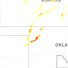
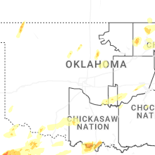
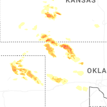


Connect with Interactive Hail Maps