

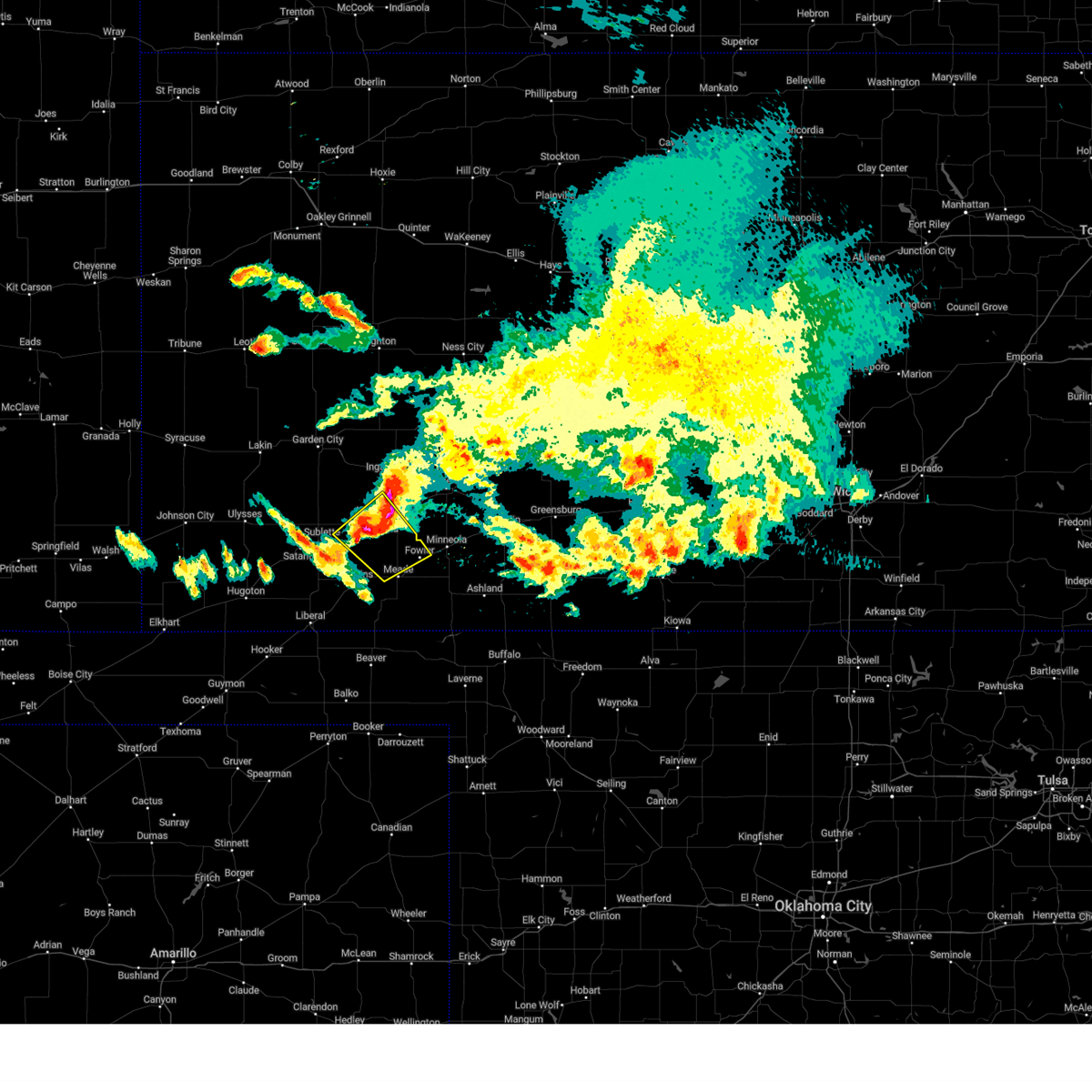
Hail Map for Fowler, KS
The Fowler, KS area has had 19 reports of on-the-ground hail by trained spotters, and has been under severe weather warnings 16 times during the past 12 months. Doppler radar has detected hail at or near Fowler, KS on 73 occasions, including 5 occasions during the past year.
| Name: | Fowler, KS |
| Where Located: | 54.9 miles SE of Garden City, KS |
| Map: | Google Map for Fowler, KS |
| Population: | 590 |
| Housing Units: | 273 |
| More Info: | Search Google for Fowler, KS |
4
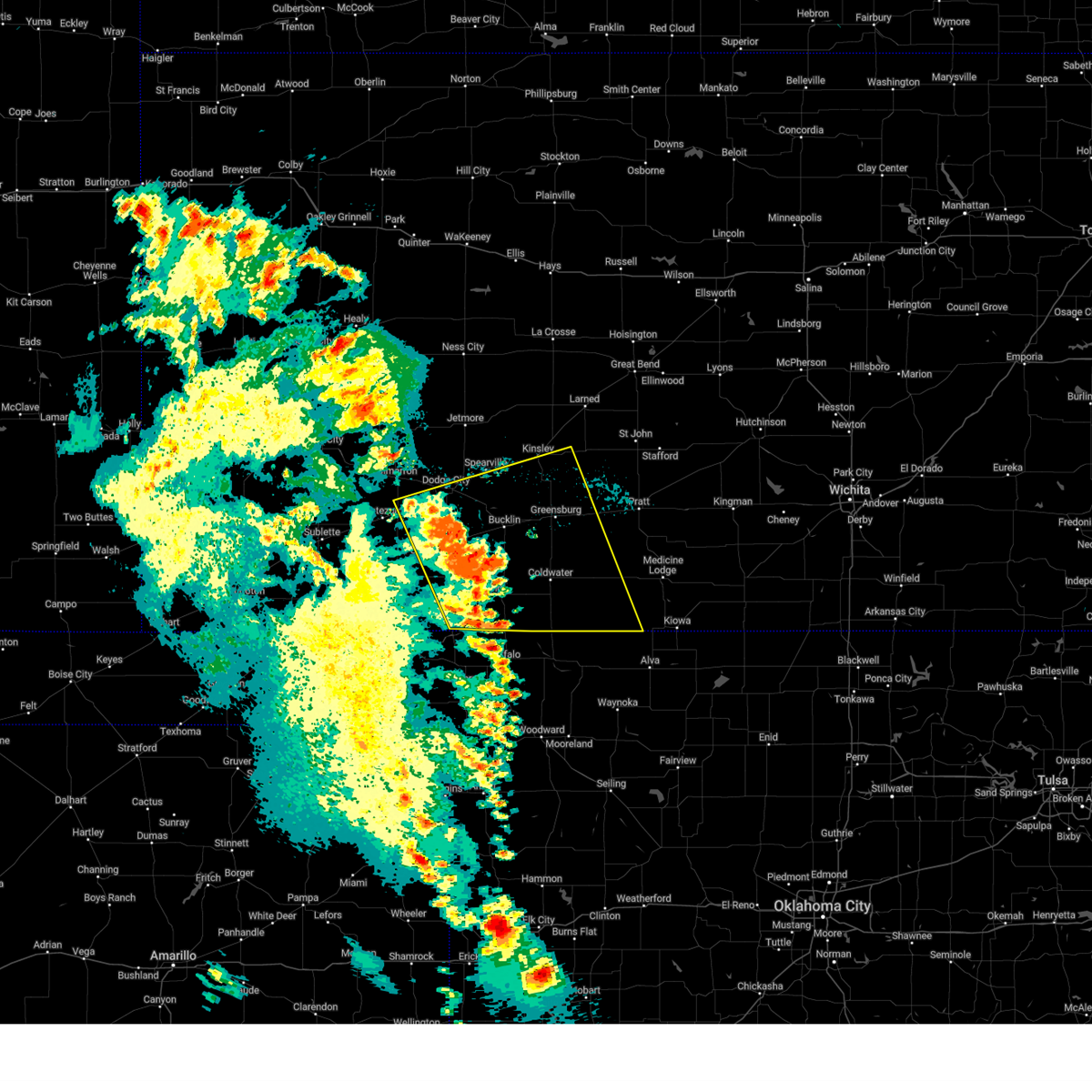
The Top Recent Hail Date for Fowler, KS is Saturday, July 6, 2024 (2nd out of 73)

Hail and Wind Damage Spotted near Fowler, KS
| Date / Time | Report Details |
|---|---|
| 6/2/2025 7:12 PM CDT |
 Svrddc the national weather service in dodge city has issued a * severe thunderstorm warning for, ford county in southwestern kansas, kiowa county in south central kansas, northeastern meade county in southwestern kansas, western barber county in south central kansas, comanche county in south central kansas, southeastern gray county in southwestern kansas, southern edwards county in south central kansas, southwestern pratt county in south central kansas, clark county in southwestern kansas, * until 800 pm cdt. * at 712 pm cdt, severe thunderstorms were located along a line extending from near ft. dodge to near buttermilk, moving east at 50 mph (radar indicated). Hazards include 60 mph wind gusts. Expect damage to roofs, siding, and trees. severe thunderstorms will be near, coldwater, bucklin, protection, ford, wright, and buttermilk around 715 pm cdt. lake coldwater around 720 pm cdt. mullinville and windhorst around 725 pm cdt. wilmore around 730 pm cdt. Other locations in the path of these severe thunderstorms include greensburg, aetna, belvidere, haviland, sun city, centerview and croft. Svrddc the national weather service in dodge city has issued a * severe thunderstorm warning for, ford county in southwestern kansas, kiowa county in south central kansas, northeastern meade county in southwestern kansas, western barber county in south central kansas, comanche county in south central kansas, southeastern gray county in southwestern kansas, southern edwards county in south central kansas, southwestern pratt county in south central kansas, clark county in southwestern kansas, * until 800 pm cdt. * at 712 pm cdt, severe thunderstorms were located along a line extending from near ft. dodge to near buttermilk, moving east at 50 mph (radar indicated). Hazards include 60 mph wind gusts. Expect damage to roofs, siding, and trees. severe thunderstorms will be near, coldwater, bucklin, protection, ford, wright, and buttermilk around 715 pm cdt. lake coldwater around 720 pm cdt. mullinville and windhorst around 725 pm cdt. wilmore around 730 pm cdt. Other locations in the path of these severe thunderstorms include greensburg, aetna, belvidere, haviland, sun city, centerview and croft.
|
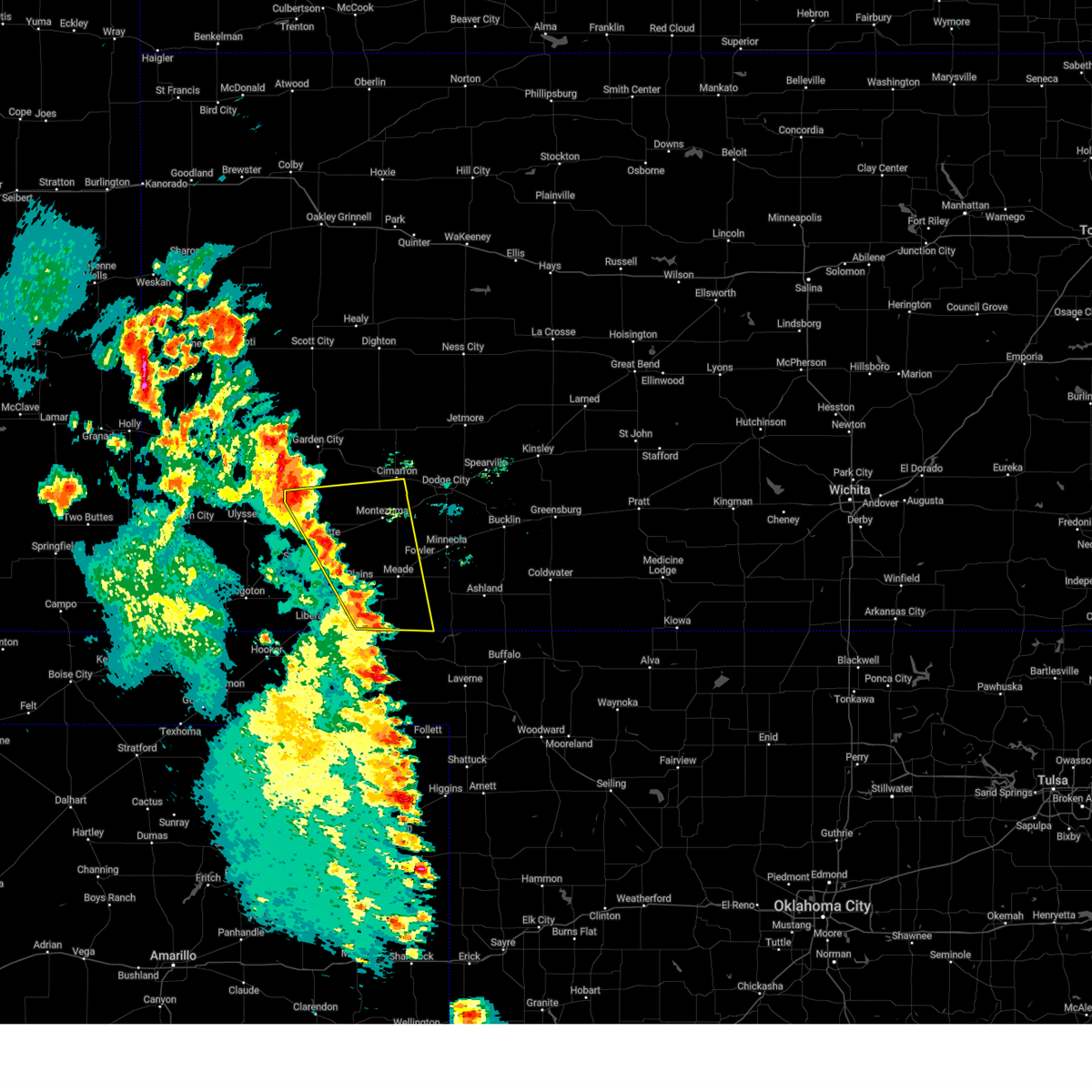
| 6/2/2025 6:33 PM CDT | At 632 pm cdt, severe thunderstorms were located along a line extending from 8 miles south of pierceville to 11 miles north of knowles, moving east at 45 mph (radar indicated). Hazards include 60 mph wind gusts. Expect damage to roofs, siding, and trees. Locations impacted include, meade, montezuma, fowler, copeland, tice, meade state park, the haggard elev, missler, and plains. |
| 6/2/2025 6:20 PM CDT |
 the severe thunderstorm warning has been cancelled and is no longer in effect the severe thunderstorm warning has been cancelled and is no longer in effect
|
| 6/2/2025 6:20 PM CDT |
 At 619 pm cdt, severe thunderstorms were located along a line extending from near garden city to near missler, moving northeast at 45 mph (radar indicated). Hazards include 60 mph wind gusts. Expect damage to roofs, siding, and trees. Locations impacted include, meade, montezuma, missler, fowler and the haggard elev. At 619 pm cdt, severe thunderstorms were located along a line extending from near garden city to near missler, moving northeast at 45 mph (radar indicated). Hazards include 60 mph wind gusts. Expect damage to roofs, siding, and trees. Locations impacted include, meade, montezuma, missler, fowler and the haggard elev.
|
| 6/2/2025 5:42 PM CDT | Svrddc the national weather service in dodge city has issued a * severe thunderstorm warning for, seward county in southwestern kansas, south central finney county in southwestern kansas, northeastern grant county in southwestern kansas, meade county in southwestern kansas, southern gray county in southwestern kansas, haskell county in southwestern kansas, * until 645 pm cdt. * at 542 pm cdt, severe thunderstorms were located along a line extending from 13 miles north of hickok to near liberal, moving northeast at 45 mph (radar indicated). Hazards include 70 mph wind gusts and nickel size hail. Expect considerable tree damage. damage is likely to mobile homes, roofs, and outbuildings. severe thunderstorms will be near, satanta and hayne around 545 pm cdt. sublette around 550 pm cdt. kismet around 555 pm cdt. Other locations in the path of these severe thunderstorms include tice, plains, copeland, missler, meade, montezuma and fowler. |
| 4/24/2025 4:41 PM CDT |
 At 440 pm cdt, a severe thunderstorm was located 8 miles northwest of minneola, moving northeast at 20 mph (public. at 432 pm, the public reported quarter size hail 2 miles south southeast of meade). Hazards include half dollar size hail. Damage to vehicles is expected. This severe thunderstorm will remain over mainly rural areas of northeastern meade county. At 440 pm cdt, a severe thunderstorm was located 8 miles northwest of minneola, moving northeast at 20 mph (public. at 432 pm, the public reported quarter size hail 2 miles south southeast of meade). Hazards include half dollar size hail. Damage to vehicles is expected. This severe thunderstorm will remain over mainly rural areas of northeastern meade county.
|
| 4/24/2025 4:25 PM CDT |
 Svrddc the national weather service in dodge city has issued a * severe thunderstorm warning for, northeastern meade county in southwestern kansas, * until 515 pm cdt. * at 425 pm cdt, a severe thunderstorm was located near meade, moving northeast at 20 mph (radar indicated). Hazards include half dollar size hail. Damage to vehicles is expected. this severe thunderstorm will be near, meade around 430 pm cdt. Other locations in the path of this severe thunderstorm include fowler. Svrddc the national weather service in dodge city has issued a * severe thunderstorm warning for, northeastern meade county in southwestern kansas, * until 515 pm cdt. * at 425 pm cdt, a severe thunderstorm was located near meade, moving northeast at 20 mph (radar indicated). Hazards include half dollar size hail. Damage to vehicles is expected. this severe thunderstorm will be near, meade around 430 pm cdt. Other locations in the path of this severe thunderstorm include fowler.
|
| 7/16/2024 10:07 PM CDT |
 The storms which prompted the warning have weakened below severe limits, and no longer pose an immediate threat to life or property. therefore, the warning will be allowed to expire. however, gusty winds are still possible with these thunderstorms. a severe thunderstorm watch remains in effect until 100 am cdt for southwestern kansas. The storms which prompted the warning have weakened below severe limits, and no longer pose an immediate threat to life or property. therefore, the warning will be allowed to expire. however, gusty winds are still possible with these thunderstorms. a severe thunderstorm watch remains in effect until 100 am cdt for southwestern kansas.
|
| 7/16/2024 10:01 PM CDT |
 At 1001 pm cdt, severe thunderstorms were located along a line extending from near howell to near minneola to near acres, moving southeast at 35 mph (radar indicated). Hazards include 60 mph wind gusts. Expect damage to roofs, siding, and trees. Locations impacted include, minneola, dodge city, bloom, clark state lake and kingsdown. At 1001 pm cdt, severe thunderstorms were located along a line extending from near howell to near minneola to near acres, moving southeast at 35 mph (radar indicated). Hazards include 60 mph wind gusts. Expect damage to roofs, siding, and trees. Locations impacted include, minneola, dodge city, bloom, clark state lake and kingsdown.
|
| 7/16/2024 9:32 PM CDT |
 Svrddc the national weather service in dodge city has issued a * severe thunderstorm warning for, ford county in southwestern kansas, northern meade county in southwestern kansas, southern gray county in southwestern kansas, northern clark county in southwestern kansas, * until 1015 pm cdt. * at 931 pm cdt, severe thunderstorms were located along a line extending from near charleston to near the haggard elev to near meade, moving east at 40 mph. another severe thunderstorm was located near ford, moving south at 20 mph (radar indicated). Hazards include 60 mph wind gusts. Expect damage to roofs, siding, and trees. severe thunderstorms will be near, cimarron, fowler, ingalls, ensign, and the haggard elev around 935 pm cdt. howell around 945 pm cdt. minneola around 950 pm cdt. other locations in the path of these severe thunderstorms include dodge city, bloom and ft. Dodge. Svrddc the national weather service in dodge city has issued a * severe thunderstorm warning for, ford county in southwestern kansas, northern meade county in southwestern kansas, southern gray county in southwestern kansas, northern clark county in southwestern kansas, * until 1015 pm cdt. * at 931 pm cdt, severe thunderstorms were located along a line extending from near charleston to near the haggard elev to near meade, moving east at 40 mph. another severe thunderstorm was located near ford, moving south at 20 mph (radar indicated). Hazards include 60 mph wind gusts. Expect damage to roofs, siding, and trees. severe thunderstorms will be near, cimarron, fowler, ingalls, ensign, and the haggard elev around 935 pm cdt. howell around 945 pm cdt. minneola around 950 pm cdt. other locations in the path of these severe thunderstorms include dodge city, bloom and ft. Dodge.
|
| 7/7/2024 2:17 AM CDT |
 Svrddc the national weather service in dodge city has issued a * severe thunderstorm warning for, southwestern ford county in southwestern kansas, northeastern meade county in southwestern kansas, southeastern gray county in southwestern kansas, * until 315 am cdt. * at 216 am cdt, a severe thunderstorm was located near montezuma, moving east at 20 mph (radar indicated). Hazards include 70 mph wind gusts and penny size hail. Expect considerable tree damage. damage is likely to mobile homes, roofs, and outbuildings. this severe thunderstorm will be near, montezuma around 220 am cdt. the haggard elev around 230 am cdt. Other locations in the path of this severe thunderstorm include ensign. Svrddc the national weather service in dodge city has issued a * severe thunderstorm warning for, southwestern ford county in southwestern kansas, northeastern meade county in southwestern kansas, southeastern gray county in southwestern kansas, * until 315 am cdt. * at 216 am cdt, a severe thunderstorm was located near montezuma, moving east at 20 mph (radar indicated). Hazards include 70 mph wind gusts and penny size hail. Expect considerable tree damage. damage is likely to mobile homes, roofs, and outbuildings. this severe thunderstorm will be near, montezuma around 220 am cdt. the haggard elev around 230 am cdt. Other locations in the path of this severe thunderstorm include ensign.
|
| 7/6/2024 11:08 PM CDT |
 Svrddc the national weather service in dodge city has issued a * severe thunderstorm warning for, eastern meade county in southwestern kansas, western clark county in southwestern kansas, * until 1215 am cdt. * at 1107 pm cdt, a severe thunderstorm was located 7 miles southeast of fowler, moving southeast at 20 mph (radar indicated). Hazards include 60 mph wind gusts and quarter size hail. Hail damage to vehicles is expected. Expect wind damage to roofs, siding, and trees. Svrddc the national weather service in dodge city has issued a * severe thunderstorm warning for, eastern meade county in southwestern kansas, western clark county in southwestern kansas, * until 1215 am cdt. * at 1107 pm cdt, a severe thunderstorm was located 7 miles southeast of fowler, moving southeast at 20 mph (radar indicated). Hazards include 60 mph wind gusts and quarter size hail. Hail damage to vehicles is expected. Expect wind damage to roofs, siding, and trees.
|
| 7/6/2024 10:35 PM CDT |
 At 1034 pm cdt, a severe thunderstorm was located 8 miles north of fowler, moving southeast at 20 mph. this is a destructive storm (radar indicated). Hazards include 80 mph wind gusts and quarter size hail. Flying debris will be dangerous to those caught without shelter. mobile homes will be heavily damaged. expect considerable damage to roofs, windows, and vehicles. extensive tree damage and power outages are likely. Locations impacted include, minneola. At 1034 pm cdt, a severe thunderstorm was located 8 miles north of fowler, moving southeast at 20 mph. this is a destructive storm (radar indicated). Hazards include 80 mph wind gusts and quarter size hail. Flying debris will be dangerous to those caught without shelter. mobile homes will be heavily damaged. expect considerable damage to roofs, windows, and vehicles. extensive tree damage and power outages are likely. Locations impacted include, minneola.
|
| 7/6/2024 10:10 PM CDT |
 Svrddc the national weather service in dodge city has issued a * severe thunderstorm warning for, southwestern ford county in southwestern kansas, northeastern meade county in southwestern kansas, southeastern gray county in southwestern kansas, northwestern clark county in southwestern kansas, * until 1115 pm cdt. * at 1010 pm cdt, a severe thunderstorm was located near the haggard elev, moving southeast at 30 mph. this is a destructive storm (radar indicated). Hazards include 80 mph wind gusts and nickel size hail. Flying debris will be dangerous to those caught without shelter. mobile homes will be heavily damaged. expect considerable damage to roofs, windows, and vehicles. extensive tree damage and power outages are likely. This severe thunderstorm will be near, ensign and the haggard elev around 1015 pm cdt. Svrddc the national weather service in dodge city has issued a * severe thunderstorm warning for, southwestern ford county in southwestern kansas, northeastern meade county in southwestern kansas, southeastern gray county in southwestern kansas, northwestern clark county in southwestern kansas, * until 1115 pm cdt. * at 1010 pm cdt, a severe thunderstorm was located near the haggard elev, moving southeast at 30 mph. this is a destructive storm (radar indicated). Hazards include 80 mph wind gusts and nickel size hail. Flying debris will be dangerous to those caught without shelter. mobile homes will be heavily damaged. expect considerable damage to roofs, windows, and vehicles. extensive tree damage and power outages are likely. This severe thunderstorm will be near, ensign and the haggard elev around 1015 pm cdt.
|
| 7/6/2024 8:38 PM CDT |
 Svrddc the national weather service in dodge city has issued a * severe thunderstorm warning for, kiowa county in south central kansas, meade county in southwestern kansas, northwestern barber county in south central kansas, northern comanche county in south central kansas, southern stafford county in south central kansas, pratt county in south central kansas, clark county in southwestern kansas, * until 945 pm cdt. * at 838 pm cdt, severe thunderstorms were located along a line extending from near macksville to 8 miles northwest of bloom, moving southeast at 45 mph (radar indicated). Hazards include 60 mph wind gusts. Expect damage to roofs, siding, and trees. severe thunderstorms will be near, mullinville, byers, and hopewell around 845 pm cdt. greensburg around 850 pm cdt. haviland, cullison, clark state lake, and wellsford around 855 pm cdt. Other locations in the path of these severe thunderstorms include pratt, coats, belvidere, croft, ashland, sawyer, wilmore, coldwater, protection, sitka, sun city and lake coldwater. Svrddc the national weather service in dodge city has issued a * severe thunderstorm warning for, kiowa county in south central kansas, meade county in southwestern kansas, northwestern barber county in south central kansas, northern comanche county in south central kansas, southern stafford county in south central kansas, pratt county in south central kansas, clark county in southwestern kansas, * until 945 pm cdt. * at 838 pm cdt, severe thunderstorms were located along a line extending from near macksville to 8 miles northwest of bloom, moving southeast at 45 mph (radar indicated). Hazards include 60 mph wind gusts. Expect damage to roofs, siding, and trees. severe thunderstorms will be near, mullinville, byers, and hopewell around 845 pm cdt. greensburg around 850 pm cdt. haviland, cullison, clark state lake, and wellsford around 855 pm cdt. Other locations in the path of these severe thunderstorms include pratt, coats, belvidere, croft, ashland, sawyer, wilmore, coldwater, protection, sitka, sun city and lake coldwater.
|
| 7/6/2024 8:07 PM CDT |
 Svrddc the national weather service in dodge city has issued a * severe thunderstorm warning for, ford county in southwestern kansas, northern kiowa county in south central kansas, northern meade county in southwestern kansas, gray county in southwestern kansas, edwards county in south central kansas, northwestern clark county in southwestern kansas, * until 915 pm cdt. * at 807 pm cdt, severe thunderstorms were located along a line extending from 7 miles south of burdett to near ensign, moving southeast at 40 mph (radar indicated). Hazards include 60 mph wind gusts and penny size hail. Expect damage to roofs, siding, and trees. severe thunderstorms will be near, dodge city, spearville, offerle, wright, ft. dodge, and bellefont around 815 pm cdt. kinsley around 820 pm cdt. lewis and windhorst around 825 pm cdt. Other locations in the path of these severe thunderstorms include ford, bloom, centerview, bucklin, kingsdown, fellsburg, mullinville, trousdale and greensburg. Svrddc the national weather service in dodge city has issued a * severe thunderstorm warning for, ford county in southwestern kansas, northern kiowa county in south central kansas, northern meade county in southwestern kansas, gray county in southwestern kansas, edwards county in south central kansas, northwestern clark county in southwestern kansas, * until 915 pm cdt. * at 807 pm cdt, severe thunderstorms were located along a line extending from 7 miles south of burdett to near ensign, moving southeast at 40 mph (radar indicated). Hazards include 60 mph wind gusts and penny size hail. Expect damage to roofs, siding, and trees. severe thunderstorms will be near, dodge city, spearville, offerle, wright, ft. dodge, and bellefont around 815 pm cdt. kinsley around 820 pm cdt. lewis and windhorst around 825 pm cdt. Other locations in the path of these severe thunderstorms include ford, bloom, centerview, bucklin, kingsdown, fellsburg, mullinville, trousdale and greensburg.
|
| 6/27/2024 8:42 PM CDT |
 Svrddc the national weather service in dodge city has issued a * severe thunderstorm warning for, southeastern seward county in southwestern kansas, meade county in southwestern kansas, western clark county in southwestern kansas, * until 915 pm cdt. * at 838 pm cdt, a severe thunderstorm was located 7 miles east of meade state park, moving east at 20 mph (radar indicated. at 811 pm a 61 mph wind gust was reported in liberal). Hazards include 60 mph wind gusts and penny size hail. Expect damage to roofs, siding, and trees. This severe thunderstorm will remain over mainly rural areas of southeastern seward, meade and western clark counties. Svrddc the national weather service in dodge city has issued a * severe thunderstorm warning for, southeastern seward county in southwestern kansas, meade county in southwestern kansas, western clark county in southwestern kansas, * until 915 pm cdt. * at 838 pm cdt, a severe thunderstorm was located 7 miles east of meade state park, moving east at 20 mph (radar indicated. at 811 pm a 61 mph wind gust was reported in liberal). Hazards include 60 mph wind gusts and penny size hail. Expect damage to roofs, siding, and trees. This severe thunderstorm will remain over mainly rural areas of southeastern seward, meade and western clark counties.
|
| 6/27/2024 8:19 PM CDT |
 Svrddc the national weather service in dodge city has issued a * severe thunderstorm warning for, seward county in southwestern kansas, meade county in southwestern kansas, * until 845 pm cdt. * at 819 pm cdt, a severe thunderstorm was located very near hayne, moving northeast at 25 mph (radar indicated). Hazards include 60 mph wind gusts and nickel size hail. Expect damage to roofs, siding, and trees. This severe thunderstorm will be near, kismet around 830 pm cdt. Svrddc the national weather service in dodge city has issued a * severe thunderstorm warning for, seward county in southwestern kansas, meade county in southwestern kansas, * until 845 pm cdt. * at 819 pm cdt, a severe thunderstorm was located very near hayne, moving northeast at 25 mph (radar indicated). Hazards include 60 mph wind gusts and nickel size hail. Expect damage to roofs, siding, and trees. This severe thunderstorm will be near, kismet around 830 pm cdt.
|
| 6/18/2024 8:33 PM CDT |
 the severe thunderstorm warning has been cancelled and is no longer in effect the severe thunderstorm warning has been cancelled and is no longer in effect
|
| 6/18/2024 8:33 PM CDT |
 At 833 pm cdt, severe thunderstorms were located along a line extending from near fowler to near hooker, moving southeast at 20 mph (radar indicated). Hazards include 60 mph wind gusts and quarter size hail. Hail damage to vehicles is expected. expect wind damage to roofs, siding, and trees. Locations impacted include, liberal, meade and meade state park. At 833 pm cdt, severe thunderstorms were located along a line extending from near fowler to near hooker, moving southeast at 20 mph (radar indicated). Hazards include 60 mph wind gusts and quarter size hail. Hail damage to vehicles is expected. expect wind damage to roofs, siding, and trees. Locations impacted include, liberal, meade and meade state park.
|
| 6/18/2024 7:56 PM CDT |
 Svrddc the national weather service in dodge city has issued a * severe thunderstorm warning for, southwestern ford county in southwestern kansas, seward county in southwestern kansas, southeastern morton county in southwestern kansas, meade county in southwestern kansas, southern stevens county in southwestern kansas, southern gray county in southwestern kansas, northwestern clark county in southwestern kansas, southeastern haskell county in southwestern kansas, * until 845 pm cdt. * at 755 pm cdt, severe thunderstorms were located along a line extending from 9 miles northwest of fowler to 9 miles southeast of feterita, moving southeast at 20 mph (radar indicated). Hazards include 60 mph wind gusts and quarter size hail. Hail damage to vehicles is expected. expect wind damage to roofs, siding, and trees. severe thunderstorms will be near, kismet, missler, and plains around 800 pm cdt. liberal and fowler around 810 pm cdt. Meade and hayne around 815 pm cdt. Svrddc the national weather service in dodge city has issued a * severe thunderstorm warning for, southwestern ford county in southwestern kansas, seward county in southwestern kansas, southeastern morton county in southwestern kansas, meade county in southwestern kansas, southern stevens county in southwestern kansas, southern gray county in southwestern kansas, northwestern clark county in southwestern kansas, southeastern haskell county in southwestern kansas, * until 845 pm cdt. * at 755 pm cdt, severe thunderstorms were located along a line extending from 9 miles northwest of fowler to 9 miles southeast of feterita, moving southeast at 20 mph (radar indicated). Hazards include 60 mph wind gusts and quarter size hail. Hail damage to vehicles is expected. expect wind damage to roofs, siding, and trees. severe thunderstorms will be near, kismet, missler, and plains around 800 pm cdt. liberal and fowler around 810 pm cdt. Meade and hayne around 815 pm cdt.
|
| 6/18/2024 7:21 PM CDT |
 Svrddc the national weather service in dodge city has issued a * severe thunderstorm warning for, seward county in southwestern kansas, meade county in southwestern kansas, southern stevens county in southwestern kansas, southwestern gray county in southwestern kansas, west central clark county in southwestern kansas, southeastern haskell county in southwestern kansas, * until 800 pm cdt. * at 721 pm cdt, severe thunderstorms were located along a line extending from 6 miles northwest of missler to 9 miles south of hugoton, moving southeast at 15 mph (radar indicated). Hazards include 60 mph wind gusts and quarter size hail. Hail damage to vehicles is expected. expect wind damage to roofs, siding, and trees. severe thunderstorms will be near, plains around 725 pm cdt. kismet and missler around 730 pm cdt. liberal around 735 pm cdt. Other locations in the path of these severe thunderstorms include hayne. Svrddc the national weather service in dodge city has issued a * severe thunderstorm warning for, seward county in southwestern kansas, meade county in southwestern kansas, southern stevens county in southwestern kansas, southwestern gray county in southwestern kansas, west central clark county in southwestern kansas, southeastern haskell county in southwestern kansas, * until 800 pm cdt. * at 721 pm cdt, severe thunderstorms were located along a line extending from 6 miles northwest of missler to 9 miles south of hugoton, moving southeast at 15 mph (radar indicated). Hazards include 60 mph wind gusts and quarter size hail. Hail damage to vehicles is expected. expect wind damage to roofs, siding, and trees. severe thunderstorms will be near, plains around 725 pm cdt. kismet and missler around 730 pm cdt. liberal around 735 pm cdt. Other locations in the path of these severe thunderstorms include hayne.
|
| 6/18/2024 6:39 PM CDT |
 Svrddc the national weather service in dodge city has issued a * severe thunderstorm warning for, southern ford county in southwestern kansas, seward county in southwestern kansas, meade county in southwestern kansas, southern stevens county in southwestern kansas, southern gray county in southwestern kansas, northwestern clark county in southwestern kansas, southeastern haskell county in southwestern kansas, * until 730 pm cdt. * at 639 pm cdt, severe thunderstorms were located along a line extending from near ensign to 12 miles south of hugoton, moving southeast at 10 mph (radar indicated). Hazards include 60 mph wind gusts and quarter size hail. Hail damage to vehicles is expected. expect wind damage to roofs, siding, and trees. Severe thunderstorms will be near, montezuma, ensign, woods, and the haggard elev around 645 pm cdt. Svrddc the national weather service in dodge city has issued a * severe thunderstorm warning for, southern ford county in southwestern kansas, seward county in southwestern kansas, meade county in southwestern kansas, southern stevens county in southwestern kansas, southern gray county in southwestern kansas, northwestern clark county in southwestern kansas, southeastern haskell county in southwestern kansas, * until 730 pm cdt. * at 639 pm cdt, severe thunderstorms were located along a line extending from near ensign to 12 miles south of hugoton, moving southeast at 10 mph (radar indicated). Hazards include 60 mph wind gusts and quarter size hail. Hail damage to vehicles is expected. expect wind damage to roofs, siding, and trees. Severe thunderstorms will be near, montezuma, ensign, woods, and the haggard elev around 645 pm cdt.
|
| 6/18/2024 5:59 PM CDT |
 Svrddc the national weather service in dodge city has issued a * severe thunderstorm warning for, southwestern ford county in southwestern kansas, seward county in southwestern kansas, northern meade county in southwestern kansas, southeastern stevens county in southwestern kansas, southern gray county in southwestern kansas, northwestern clark county in southwestern kansas, eastern haskell county in southwestern kansas, * until 645 pm cdt. * at 559 pm cdt, severe thunderstorms were located along a line extending from near cimarron to 12 miles southeast of feterita, moving southeast at 15 mph (radar indicated). Hazards include 60 mph wind gusts and quarter size hail. Hail damage to vehicles is expected. expect wind damage to roofs, siding, and trees. severe thunderstorms will be near, copeland and woods around 605 pm cdt. Montezuma around 610 pm cdt. Svrddc the national weather service in dodge city has issued a * severe thunderstorm warning for, southwestern ford county in southwestern kansas, seward county in southwestern kansas, northern meade county in southwestern kansas, southeastern stevens county in southwestern kansas, southern gray county in southwestern kansas, northwestern clark county in southwestern kansas, eastern haskell county in southwestern kansas, * until 645 pm cdt. * at 559 pm cdt, severe thunderstorms were located along a line extending from near cimarron to 12 miles southeast of feterita, moving southeast at 15 mph (radar indicated). Hazards include 60 mph wind gusts and quarter size hail. Hail damage to vehicles is expected. expect wind damage to roofs, siding, and trees. severe thunderstorms will be near, copeland and woods around 605 pm cdt. Montezuma around 610 pm cdt.
|
| 6/8/2024 11:43 PM CDT |
 At 1143 pm cdt, a severe thunderstorm was located near missler, moving southeast at 20 mph (radar indicated). Hazards include 60 mph wind gusts and nickel size hail. Expect damage to roofs, siding, and trees. Locations impacted include, meade, minneola, fowler, missler, and meade state park. At 1143 pm cdt, a severe thunderstorm was located near missler, moving southeast at 20 mph (radar indicated). Hazards include 60 mph wind gusts and nickel size hail. Expect damage to roofs, siding, and trees. Locations impacted include, meade, minneola, fowler, missler, and meade state park.
|
| 6/8/2024 11:43 PM CDT |
 the severe thunderstorm warning has been cancelled and is no longer in effect the severe thunderstorm warning has been cancelled and is no longer in effect
|
| 6/8/2024 11:23 PM CDT |
 Svrddc the national weather service in dodge city has issued a * severe thunderstorm warning for, meade county in southwestern kansas, south central gray county in southwestern kansas, northwestern clark county in southwestern kansas, * until midnight cdt. * at 1123 pm cdt, a severe thunderstorm was located near missler, moving east at 25 mph (radar indicated). Hazards include 60 mph wind gusts and nickel size hail. expect damage to roofs, siding, and trees Svrddc the national weather service in dodge city has issued a * severe thunderstorm warning for, meade county in southwestern kansas, south central gray county in southwestern kansas, northwestern clark county in southwestern kansas, * until midnight cdt. * at 1123 pm cdt, a severe thunderstorm was located near missler, moving east at 25 mph (radar indicated). Hazards include 60 mph wind gusts and nickel size hail. expect damage to roofs, siding, and trees
|
| 6/8/2024 11:16 PM CDT |
 At 1116 pm cdt, severe thunderstorms were located along a line extending from 13 miles southeast of beeler to 8 miles northeast of cimarron to near plains, moving east at 30 mph (doppler radar). Hazards include 80 mph wind gusts and quarter size hail. Flying debris will be dangerous to those caught without shelter. mobile homes will be heavily damaged. expect considerable damage to roofs, windows, and vehicles. extensive tree damage and power outages are likely. Locations impacted include, montezuma, the haggard elev, ensign, howell, missler and dodge city. At 1116 pm cdt, severe thunderstorms were located along a line extending from 13 miles southeast of beeler to 8 miles northeast of cimarron to near plains, moving east at 30 mph (doppler radar). Hazards include 80 mph wind gusts and quarter size hail. Flying debris will be dangerous to those caught without shelter. mobile homes will be heavily damaged. expect considerable damage to roofs, windows, and vehicles. extensive tree damage and power outages are likely. Locations impacted include, montezuma, the haggard elev, ensign, howell, missler and dodge city.
|
| 6/8/2024 10:50 PM CDT |
 At 1049 pm cdt, severe thunderstorms were located along a line extending from 13 miles north of kalvesta to near ingalls to satanta, moving east at 30 mph. these are destructive storms for ingalls and cimarron (public report of 93 mph wind gust at 1040 pm cdt 10 miles northwest of kalvesta). Hazards include 90 mph wind gusts and golf ball size hail. You are in a life-threatening situation. flying debris may be deadly to those caught without shelter. mobile homes will be heavily damaged or destroyed. homes and businesses will have substantial roof and window damage. expect extensive tree damage and power outages. these severe storms will be near, sublette, ingalls, and kalvesta around 1055 pm cdt. Other locations in the path of these severe thunderstorms include cimarron, copeland, tice, montezuma, howell, the haggard elev, dodge city and ensign. At 1049 pm cdt, severe thunderstorms were located along a line extending from 13 miles north of kalvesta to near ingalls to satanta, moving east at 30 mph. these are destructive storms for ingalls and cimarron (public report of 93 mph wind gust at 1040 pm cdt 10 miles northwest of kalvesta). Hazards include 90 mph wind gusts and golf ball size hail. You are in a life-threatening situation. flying debris may be deadly to those caught without shelter. mobile homes will be heavily damaged or destroyed. homes and businesses will have substantial roof and window damage. expect extensive tree damage and power outages. these severe storms will be near, sublette, ingalls, and kalvesta around 1055 pm cdt. Other locations in the path of these severe thunderstorms include cimarron, copeland, tice, montezuma, howell, the haggard elev, dodge city and ensign.
|
| 6/8/2024 10:39 PM CDT |
 Svrddc the national weather service in dodge city has issued a * severe thunderstorm warning for, western ford county in southwestern kansas, northern seward county in southwestern kansas, eastern finney county in southwestern kansas, western hodgeman county in southwestern kansas, northern meade county in southwestern kansas, gray county in southwestern kansas, haskell county in southwestern kansas, * until 1130 pm cdt. * at 1038 pm cdt, severe thunderstorms were located along a line extending from 12 miles south of alamota to near charleston to near hickok, moving east at 35 mph. these are destructive storms for charleston, ingalls, kalvesta and cimarron (trained weather spotters reported 83 mph winds in garden city at 1034 cdt). Hazards include 80 mph wind gusts and golf ball size hail. Flying debris will be dangerous to those caught without shelter. mobile homes will be heavily damaged. expect considerable damage to roofs, windows, and vehicles. extensive tree damage and power outages are likely. severe thunderstorms will be near, charleston around 1045 pm cdt. ingalls and kalvesta around 1050 pm cdt. Other locations in the path of these severe thunderstorms include cimarron and sublette. Svrddc the national weather service in dodge city has issued a * severe thunderstorm warning for, western ford county in southwestern kansas, northern seward county in southwestern kansas, eastern finney county in southwestern kansas, western hodgeman county in southwestern kansas, northern meade county in southwestern kansas, gray county in southwestern kansas, haskell county in southwestern kansas, * until 1130 pm cdt. * at 1038 pm cdt, severe thunderstorms were located along a line extending from 12 miles south of alamota to near charleston to near hickok, moving east at 35 mph. these are destructive storms for charleston, ingalls, kalvesta and cimarron (trained weather spotters reported 83 mph winds in garden city at 1034 cdt). Hazards include 80 mph wind gusts and golf ball size hail. Flying debris will be dangerous to those caught without shelter. mobile homes will be heavily damaged. expect considerable damage to roofs, windows, and vehicles. extensive tree damage and power outages are likely. severe thunderstorms will be near, charleston around 1045 pm cdt. ingalls and kalvesta around 1050 pm cdt. Other locations in the path of these severe thunderstorms include cimarron and sublette.
|
| 6/3/2024 4:25 AM CDT |
 At 424 am cdt, severe thunderstorms were located along a line extending from near gray to 9 miles south of minneola, moving east at 45 mph (automated equipment. the dodge city airport measured a wind gust of 67 mph at 420 am cdt. this storm has a history of damaging winds, and damaging winds are expected). Hazards include 70 mph wind gusts and nickel size hail. Expect considerable tree damage. damage is likely to mobile homes, roofs, and outbuildings. these severe storms will be near, burdett, ford, bloom, kingsdown, bellefont, clark state lake, and windhorst around 430 am cdt. offerle and rozel around 435 am cdt. Other locations in the path of these severe thunderstorms include bucklin, kinsley, sanford and mullinville. At 424 am cdt, severe thunderstorms were located along a line extending from near gray to 9 miles south of minneola, moving east at 45 mph (automated equipment. the dodge city airport measured a wind gust of 67 mph at 420 am cdt. this storm has a history of damaging winds, and damaging winds are expected). Hazards include 70 mph wind gusts and nickel size hail. Expect considerable tree damage. damage is likely to mobile homes, roofs, and outbuildings. these severe storms will be near, burdett, ford, bloom, kingsdown, bellefont, clark state lake, and windhorst around 430 am cdt. offerle and rozel around 435 am cdt. Other locations in the path of these severe thunderstorms include bucklin, kinsley, sanford and mullinville.
|
| 6/3/2024 4:17 AM CDT |
 Svrddc the national weather service in dodge city has issued a * severe thunderstorm warning for, ford county in southwestern kansas, western kiowa county in south central kansas, eastern hodgeman county in southwestern kansas, northeastern meade county in southwestern kansas, northwestern comanche county in south central kansas, central pawnee county in south central kansas, edwards county in south central kansas, northern clark county in southwestern kansas, * until 500 am cdt. * at 416 am cdt, severe thunderstorms were located along a line extending from near gray to 9 miles south of minneola, moving east at 45 mph (radar indicated). Hazards include 70 mph wind gusts and nickel size hail. Expect considerable tree damage. damage is likely to mobile homes, roofs, and outbuildings. severe thunderstorms will be near, gray, spearville, hanston, and bloom around 420 am cdt. burdett, ford, kingsdown, and bellefont around 425 am cdt. offerle, clark state lake, and windhorst around 430 am cdt. bucklin and rozel around 435 am cdt. Other locations in the path of these severe thunderstorms include kinsley, sanford, mullinville, lewis, garfield and frizell. Svrddc the national weather service in dodge city has issued a * severe thunderstorm warning for, ford county in southwestern kansas, western kiowa county in south central kansas, eastern hodgeman county in southwestern kansas, northeastern meade county in southwestern kansas, northwestern comanche county in south central kansas, central pawnee county in south central kansas, edwards county in south central kansas, northern clark county in southwestern kansas, * until 500 am cdt. * at 416 am cdt, severe thunderstorms were located along a line extending from near gray to 9 miles south of minneola, moving east at 45 mph (radar indicated). Hazards include 70 mph wind gusts and nickel size hail. Expect considerable tree damage. damage is likely to mobile homes, roofs, and outbuildings. severe thunderstorms will be near, gray, spearville, hanston, and bloom around 420 am cdt. burdett, ford, kingsdown, and bellefont around 425 am cdt. offerle, clark state lake, and windhorst around 430 am cdt. bucklin and rozel around 435 am cdt. Other locations in the path of these severe thunderstorms include kinsley, sanford, mullinville, lewis, garfield and frizell.
|
| 6/3/2024 4:10 AM CDT |
 At 409 am cdt, severe thunderstorms were located along a line extending from 9 miles northwest of gray to near fowler, moving east at 30 mph (radar indicated). Hazards include 70 mph wind gusts. Expect considerable tree damage. damage is likely to mobile homes, roofs, and outbuildings. locations impacted include, dodge city, gray, jetmore, spearville, minneola, fowler, burdett, ford, hanston, ensign, rozel, bloom, howell, wright, bellefont, the haggard elev, and ft. Dodge. At 409 am cdt, severe thunderstorms were located along a line extending from 9 miles northwest of gray to near fowler, moving east at 30 mph (radar indicated). Hazards include 70 mph wind gusts. Expect considerable tree damage. damage is likely to mobile homes, roofs, and outbuildings. locations impacted include, dodge city, gray, jetmore, spearville, minneola, fowler, burdett, ford, hanston, ensign, rozel, bloom, howell, wright, bellefont, the haggard elev, and ft. Dodge.
|
| 6/3/2024 4:00 AM CDT |
 At 359 am cdt, severe thunderstorms were located along a line extending from near hanston to near meade, moving east at 35 mph (law enforcement, emergency management. these storms have a history of producing wind damage around garden city and ingalls). Hazards include 60 mph wind gusts and nickel size hail. Expect damage to roofs, siding, and trees. locations impacted include, gray, spearville, minneola, hanston, wright, ft. Dodge, burdett, ford, bloom, bellefont and rozel. At 359 am cdt, severe thunderstorms were located along a line extending from near hanston to near meade, moving east at 35 mph (law enforcement, emergency management. these storms have a history of producing wind damage around garden city and ingalls). Hazards include 60 mph wind gusts and nickel size hail. Expect damage to roofs, siding, and trees. locations impacted include, gray, spearville, minneola, hanston, wright, ft. Dodge, burdett, ford, bloom, bellefont and rozel.
|
| 6/3/2024 3:40 AM CDT |
 Svrddc the national weather service in dodge city has issued a * severe thunderstorm warning for, ford county in southwestern kansas, hodgeman county in southwestern kansas, northeastern meade county in southwestern kansas, west central pawnee county in south central kansas, southeastern gray county in southwestern kansas, northwestern edwards county in south central kansas, northwestern clark county in southwestern kansas, * until 430 am cdt. * at 339 am cdt, severe thunderstorms were located along a line extending from 10 miles northwest of jetmore to near plains, moving southeast at 25 mph (law enforcement, emergency management. these storms have a history of producing wind damage). Hazards include 70 mph wind gusts and nickel size hail. Expect considerable tree damage. damage is likely to mobile homes, roofs, and outbuildings. severe thunderstorms will be near, ensign, howell, and the haggard elev around 345 am cdt. jetmore around 350 am cdt. dodge city around 355 am cdt. other locations in the path of these severe thunderstorms include fowler, wright and ft. Dodge. Svrddc the national weather service in dodge city has issued a * severe thunderstorm warning for, ford county in southwestern kansas, hodgeman county in southwestern kansas, northeastern meade county in southwestern kansas, west central pawnee county in south central kansas, southeastern gray county in southwestern kansas, northwestern edwards county in south central kansas, northwestern clark county in southwestern kansas, * until 430 am cdt. * at 339 am cdt, severe thunderstorms were located along a line extending from 10 miles northwest of jetmore to near plains, moving southeast at 25 mph (law enforcement, emergency management. these storms have a history of producing wind damage). Hazards include 70 mph wind gusts and nickel size hail. Expect considerable tree damage. damage is likely to mobile homes, roofs, and outbuildings. severe thunderstorms will be near, ensign, howell, and the haggard elev around 345 am cdt. jetmore around 350 am cdt. dodge city around 355 am cdt. other locations in the path of these severe thunderstorms include fowler, wright and ft. Dodge.
|
| 5/19/2024 5:10 PM CDT |
 Svrddc the national weather service in dodge city has issued a * severe thunderstorm warning for, ford county in southwestern kansas, western kiowa county in south central kansas, northeastern meade county in southwestern kansas, northwestern comanche county in south central kansas, southwestern edwards county in south central kansas, northern clark county in southwestern kansas, * until 600 pm cdt. * at 510 pm cdt, severe thunderstorms were located along a line extending from howell to near fowler, moving east at 50 mph (radar indicated). Hazards include 70 mph wind gusts. Expect considerable tree damage. damage is likely to mobile homes, roofs, and outbuildings. severe thunderstorms will be near, dodge city and minneola around 515 pm cdt. ft. dodge around 520 pm cdt. bloom and wright around 525 pm cdt. kingsdown and clark state lake around 530 pm cdt. Other locations in the path of these severe thunderstorms include spearville, ford, bucklin, windhorst and mullinville. Svrddc the national weather service in dodge city has issued a * severe thunderstorm warning for, ford county in southwestern kansas, western kiowa county in south central kansas, northeastern meade county in southwestern kansas, northwestern comanche county in south central kansas, southwestern edwards county in south central kansas, northern clark county in southwestern kansas, * until 600 pm cdt. * at 510 pm cdt, severe thunderstorms were located along a line extending from howell to near fowler, moving east at 50 mph (radar indicated). Hazards include 70 mph wind gusts. Expect considerable tree damage. damage is likely to mobile homes, roofs, and outbuildings. severe thunderstorms will be near, dodge city and minneola around 515 pm cdt. ft. dodge around 520 pm cdt. bloom and wright around 525 pm cdt. kingsdown and clark state lake around 530 pm cdt. Other locations in the path of these severe thunderstorms include spearville, ford, bucklin, windhorst and mullinville.
|
| 5/3/2024 9:51 PM CDT |
 The storms which prompted the warning have weakened below severe limits, and no longer pose an immediate threat to life or property. therefore, the warning will be allowed to expire. however, gusty winds are still possible with these thunderstorms. a severe thunderstorm watch remains in effect until 1100 pm cdt for south central and southwestern kansas. The storms which prompted the warning have weakened below severe limits, and no longer pose an immediate threat to life or property. therefore, the warning will be allowed to expire. however, gusty winds are still possible with these thunderstorms. a severe thunderstorm watch remains in effect until 1100 pm cdt for south central and southwestern kansas.
|
| 5/3/2024 9:08 PM CDT |
 Svrddc the national weather service in dodge city has issued a * severe thunderstorm warning for, southern ford county in southwestern kansas, eastern meade county in southwestern kansas, southeastern gray county in southwestern kansas, clark county in southwestern kansas, * until 1000 pm cdt. * at 907 pm cdt, severe thunderstorms were located along a line extending from near ensign to near fowler to 7 miles west of englewood, moving east at 40 mph (radar indicated). Hazards include 60 mph wind gusts. Expect damage to roofs, siding, and trees. severe thunderstorms will be near, minneola and englewood around 915 pm cdt. acres around 920 pm cdt. bloom around 925 pm cdt. ashland and clark state lake around 930 pm cdt. kingsdown around 935 pm cdt. sitka around 940 pm cdt. ford around 945 pm cdt. Bucklin around 950 pm cdt. Svrddc the national weather service in dodge city has issued a * severe thunderstorm warning for, southern ford county in southwestern kansas, eastern meade county in southwestern kansas, southeastern gray county in southwestern kansas, clark county in southwestern kansas, * until 1000 pm cdt. * at 907 pm cdt, severe thunderstorms were located along a line extending from near ensign to near fowler to 7 miles west of englewood, moving east at 40 mph (radar indicated). Hazards include 60 mph wind gusts. Expect damage to roofs, siding, and trees. severe thunderstorms will be near, minneola and englewood around 915 pm cdt. acres around 920 pm cdt. bloom around 925 pm cdt. ashland and clark state lake around 930 pm cdt. kingsdown around 935 pm cdt. sitka around 940 pm cdt. ford around 945 pm cdt. Bucklin around 950 pm cdt.
|
| 5/3/2024 8:34 PM CDT |
 Svrddc the national weather service in dodge city has issued a * severe thunderstorm warning for, eastern seward county in southwestern kansas, meade county in southwestern kansas, southern gray county in southwestern kansas, western clark county in southwestern kansas, southeastern haskell county in southwestern kansas, * until 915 pm cdt. * at 833 pm cdt, severe thunderstorms were located along a line extending from 8 miles southeast of plymell to 8 miles northwest of forgan, moving east at 40 mph (radar indicated). Hazards include 60 mph wind gusts and nickel size hail. Expect damage to roofs, siding, and trees. severe thunderstorms will be near, copeland and plains around 840 pm cdt. meade state park and missler around 845 pm cdt. montezuma around 850 pm cdt. meade around 855 pm cdt. The haggard elev around 900 pm cdt. Svrddc the national weather service in dodge city has issued a * severe thunderstorm warning for, eastern seward county in southwestern kansas, meade county in southwestern kansas, southern gray county in southwestern kansas, western clark county in southwestern kansas, southeastern haskell county in southwestern kansas, * until 915 pm cdt. * at 833 pm cdt, severe thunderstorms were located along a line extending from 8 miles southeast of plymell to 8 miles northwest of forgan, moving east at 40 mph (radar indicated). Hazards include 60 mph wind gusts and nickel size hail. Expect damage to roofs, siding, and trees. severe thunderstorms will be near, copeland and plains around 840 pm cdt. meade state park and missler around 845 pm cdt. montezuma around 850 pm cdt. meade around 855 pm cdt. The haggard elev around 900 pm cdt.
|
| 8/7/2023 11:42 PM CDT |
 At 1141 pm cdt, a severe thunderstorm was located 8 miles south of montezuma, moving southeast at 25 mph (radar indicated). Hazards include 60 mph wind gusts and quarter size hail. Hail damage to vehicles is expected. Expect wind damage to roofs, siding, and trees. At 1141 pm cdt, a severe thunderstorm was located 8 miles south of montezuma, moving southeast at 25 mph (radar indicated). Hazards include 60 mph wind gusts and quarter size hail. Hail damage to vehicles is expected. Expect wind damage to roofs, siding, and trees.
|
| 8/7/2023 11:33 PM CDT |
 At 1133 pm cdt, a severe thunderstorm was located near copeland, moving southeast at 35 mph (radar indicated). Hazards include 70 mph wind gusts and quarter size hail. Hail damage to vehicles is expected. expect considerable tree damage. wind damage is also likely to mobile homes, roofs, and outbuildings. locations impacted include, missler and fowler. thunderstorm damage threat, considerable hail threat, radar indicated max hail size, 1. 00 in wind threat, radar indicated max wind gust, 70 mph. At 1133 pm cdt, a severe thunderstorm was located near copeland, moving southeast at 35 mph (radar indicated). Hazards include 70 mph wind gusts and quarter size hail. Hail damage to vehicles is expected. expect considerable tree damage. wind damage is also likely to mobile homes, roofs, and outbuildings. locations impacted include, missler and fowler. thunderstorm damage threat, considerable hail threat, radar indicated max hail size, 1. 00 in wind threat, radar indicated max wind gust, 70 mph.
|
| 8/7/2023 11:11 PM CDT |
 At 1110 pm cdt, a severe thunderstorm was located 7 miles northwest of copeland, moving southeast at 25 mph (radar indicated). Hazards include 60 mph wind gusts and quarter size hail. Hail damage to vehicles is expected. expect wind damage to roofs, siding, and trees. this severe thunderstorm will be near, tice around 1125 pm cdt. copeland around 1130 pm cdt. hail threat, radar indicated max hail size, 1. 00 in wind threat, radar indicated max wind gust, 60 mph. At 1110 pm cdt, a severe thunderstorm was located 7 miles northwest of copeland, moving southeast at 25 mph (radar indicated). Hazards include 60 mph wind gusts and quarter size hail. Hail damage to vehicles is expected. expect wind damage to roofs, siding, and trees. this severe thunderstorm will be near, tice around 1125 pm cdt. copeland around 1130 pm cdt. hail threat, radar indicated max hail size, 1. 00 in wind threat, radar indicated max wind gust, 60 mph.
|
| 6/27/2023 8:50 PM CDT |
 The severe thunderstorm warning for southwestern ford, eastern meade, southeastern gray and western clark counties will expire at 900 pm cdt, the storms which prompted the warning have moved out of the area. therefore, the warning will be allowed to expire. however gusty winds and heavy rain are still possible with these thunderstorms. a severe thunderstorm watch remains in effect until 900 pm cdt for southwestern kansas. a severe thunderstorm watch also remains in effect until 200 am cdt for southwestern kansas. The severe thunderstorm warning for southwestern ford, eastern meade, southeastern gray and western clark counties will expire at 900 pm cdt, the storms which prompted the warning have moved out of the area. therefore, the warning will be allowed to expire. however gusty winds and heavy rain are still possible with these thunderstorms. a severe thunderstorm watch remains in effect until 900 pm cdt for southwestern kansas. a severe thunderstorm watch also remains in effect until 200 am cdt for southwestern kansas.
|
| 6/27/2023 8:48 PM CDT |
 At 847 pm cdt, severe thunderstorms were located along a line extending from 8 miles north of fowler to 6 miles southeast of englewood, moving east at 45 mph (radar indicated). Hazards include 70 mph wind gusts. Expect considerable tree damage. damage is likely to mobile homes, roofs, and outbuildings. locations impacted include, minneola, fowler, ensign, englewood and acres. thunderstorm damage threat, considerable hail threat, radar indicated max hail size, <. 75 in wind threat, radar indicated max wind gust, 70 mph. At 847 pm cdt, severe thunderstorms were located along a line extending from 8 miles north of fowler to 6 miles southeast of englewood, moving east at 45 mph (radar indicated). Hazards include 70 mph wind gusts. Expect considerable tree damage. damage is likely to mobile homes, roofs, and outbuildings. locations impacted include, minneola, fowler, ensign, englewood and acres. thunderstorm damage threat, considerable hail threat, radar indicated max hail size, <. 75 in wind threat, radar indicated max wind gust, 70 mph.
|
| 6/27/2023 8:43 PM CDT | Multiple tree limbs down 3 inches and bigge in meade county KS, 0.3 miles NW of Fowler, KS |
| 6/27/2023 8:28 PM CDT |
 At 827 pm cdt, severe thunderstorms were located along a line extending from 6 miles south of montezuma to 7 miles north of knowles, moving east at 45 mph. these are destructive storms for fowler (radar indicated). Hazards include 80 mph wind gusts. Flying debris will be dangerous to those caught without shelter. mobile homes will be heavily damaged. expect considerable damage to roofs, windows, and vehicles. extensive tree damage and power outages are likely. locations impacted include, meade, montezuma, minneola, fowler, ensign, englewood, meade state park, the haggard elev, missler and acres. thunderstorm damage threat, destructive hail threat, radar indicated max hail size, <. 75 in wind threat, radar indicated max wind gust, 80 mph. At 827 pm cdt, severe thunderstorms were located along a line extending from 6 miles south of montezuma to 7 miles north of knowles, moving east at 45 mph. these are destructive storms for fowler (radar indicated). Hazards include 80 mph wind gusts. Flying debris will be dangerous to those caught without shelter. mobile homes will be heavily damaged. expect considerable damage to roofs, windows, and vehicles. extensive tree damage and power outages are likely. locations impacted include, meade, montezuma, minneola, fowler, ensign, englewood, meade state park, the haggard elev, missler and acres. thunderstorm damage threat, destructive hail threat, radar indicated max hail size, <. 75 in wind threat, radar indicated max wind gust, 80 mph.
|
| 6/27/2023 8:25 PM CDT | Storm damage reported in meade county KS, 8 miles E of Fowler, KS |
| 6/27/2023 8:19 PM CDT |
 At 819 pm cdt, severe thunderstorms were located along a line extending from 6 miles southeast of copeland to 8 miles northwest of knowles, moving east at 40 mph (radar indicated). Hazards include 70 mph wind gusts. Expect considerable tree damage. damage is likely to mobile homes, roofs, and outbuildings. locations impacted include, meade, montezuma, minneola, fowler, copeland, ensign, englewood, meade state park, missler, tice, the haggard elev, acres and plains. thunderstorm damage threat, considerable hail threat, radar indicated max hail size, <. 75 in wind threat, radar indicated max wind gust, 70 mph. At 819 pm cdt, severe thunderstorms were located along a line extending from 6 miles southeast of copeland to 8 miles northwest of knowles, moving east at 40 mph (radar indicated). Hazards include 70 mph wind gusts. Expect considerable tree damage. damage is likely to mobile homes, roofs, and outbuildings. locations impacted include, meade, montezuma, minneola, fowler, copeland, ensign, englewood, meade state park, missler, tice, the haggard elev, acres and plains. thunderstorm damage threat, considerable hail threat, radar indicated max hail size, <. 75 in wind threat, radar indicated max wind gust, 70 mph.
|
| 6/27/2023 8:02 PM CDT |
 At 802 pm cdt, severe thunderstorms were located along a line extending from near tice to near forgan, moving east at 45 mph (radar indicated). Hazards include 70 mph wind gusts and nickel size hail. Expect considerable tree damage. Damage is likely to mobile homes, roofs, and outbuildings. At 802 pm cdt, severe thunderstorms were located along a line extending from near tice to near forgan, moving east at 45 mph (radar indicated). Hazards include 70 mph wind gusts and nickel size hail. Expect considerable tree damage. Damage is likely to mobile homes, roofs, and outbuildings.
|
| 6/15/2023 5:33 PM CDT |
 At 532 pm cdt, severe thunderstorms were located along a line extending from near ensign to near fowler to 10 miles northwest of knowles, moving east at 30 mph (radar indicated). Hazards include 70 mph wind gusts and nickel size hail. Expect considerable tree damage. damage is likely to mobile homes, roofs, and outbuildings. These severe thunderstorms will remain over mainly rural areas of southern ford, eastern meade and clark counties. At 532 pm cdt, severe thunderstorms were located along a line extending from near ensign to near fowler to 10 miles northwest of knowles, moving east at 30 mph (radar indicated). Hazards include 70 mph wind gusts and nickel size hail. Expect considerable tree damage. damage is likely to mobile homes, roofs, and outbuildings. These severe thunderstorms will remain over mainly rural areas of southern ford, eastern meade and clark counties.
|
| 6/15/2023 5:32 PM CDT | Storm damage reported in meade county KS, 0.4 miles NE of Fowler, KS |
| 6/15/2023 5:27 PM CDT |
 At 526 pm cdt, severe thunderstorms were located along a line extending from near howell to near fowler to 10 miles south of meade state park, moving east at 30 mph (radar indicated). Hazards include 70 mph wind gusts and nickel size hail. Expect considerable tree damage. damage is likely to mobile homes, roofs, and outbuildings. Locations impacted include, minneola. At 526 pm cdt, severe thunderstorms were located along a line extending from near howell to near fowler to 10 miles south of meade state park, moving east at 30 mph (radar indicated). Hazards include 70 mph wind gusts and nickel size hail. Expect considerable tree damage. damage is likely to mobile homes, roofs, and outbuildings. Locations impacted include, minneola.
|
| 6/15/2023 5:06 PM CDT |
 At 506 pm cdt, severe thunderstorms were located along a line extending from near the haggard elev to near meade to 7 miles north of forgan, moving east at 30 mph (radar indicated). Hazards include 70 mph wind gusts and nickel size hail. Expect considerable tree damage. damage is likely to mobile homes, roofs, and outbuildings. severe thunderstorms will be near, meade and the haggard elev around 510 pm cdt. fowler around 520 pm cdt. Other locations in the path of these severe thunderstorms include minneola. At 506 pm cdt, severe thunderstorms were located along a line extending from near the haggard elev to near meade to 7 miles north of forgan, moving east at 30 mph (radar indicated). Hazards include 70 mph wind gusts and nickel size hail. Expect considerable tree damage. damage is likely to mobile homes, roofs, and outbuildings. severe thunderstorms will be near, meade and the haggard elev around 510 pm cdt. fowler around 520 pm cdt. Other locations in the path of these severe thunderstorms include minneola.
|
| 5/30/2023 10:22 PM CDT |
 The severe thunderstorm warning for western ford, northern seward, southern finney, northern meade, gray, northwestern clark and haskell counties will expire at 1030 pm cdt, the storms which prompted the warning have weakened below severe limits, and no longer pose an immediate threat to life or property. therefore, the warning will be allowed to expire. however gusty winds are still possible with these thunderstorms. a severe thunderstorm watch remains in effect until 1100 pm cdt for southwestern kansas. The severe thunderstorm warning for western ford, northern seward, southern finney, northern meade, gray, northwestern clark and haskell counties will expire at 1030 pm cdt, the storms which prompted the warning have weakened below severe limits, and no longer pose an immediate threat to life or property. therefore, the warning will be allowed to expire. however gusty winds are still possible with these thunderstorms. a severe thunderstorm watch remains in effect until 1100 pm cdt for southwestern kansas.
|
| 5/30/2023 10:04 PM CDT |
 At 1004 pm cdt, severe thunderstorms were located along a line extending from dodge city to montezuma to near sublette, moving southeast at 40 mph (radar indicated). Hazards include 60 mph wind gusts and penny size hail. Expect damage to roofs, siding, and trees. locations impacted include, dodge city, the haggard elev, fowler, kismet and plains. hail threat, radar indicated max hail size, 0. 75 in wind threat, radar indicated max wind gust, 60 mph. At 1004 pm cdt, severe thunderstorms were located along a line extending from dodge city to montezuma to near sublette, moving southeast at 40 mph (radar indicated). Hazards include 60 mph wind gusts and penny size hail. Expect damage to roofs, siding, and trees. locations impacted include, dodge city, the haggard elev, fowler, kismet and plains. hail threat, radar indicated max hail size, 0. 75 in wind threat, radar indicated max wind gust, 60 mph.
|
| 5/30/2023 9:43 PM CDT |
 At 943 pm cdt, severe thunderstorms were located along a line extending from 8 miles north of howell to 9 miles south of charleston to 9 miles north of ryus, moving southeast at 40 mph (radar indicated). Hazards include 70 mph wind gusts and penny size hail. Expect considerable tree damage. damage is likely to mobile homes, roofs, and outbuildings. severe thunderstorms will be near, howell around 955 pm cdt. satanta around 1000 pm cdt. other locations in the path of these severe thunderstorms include dodge city, sublette, montezuma, the haggard elev, tice, fowler, kismet and plains. thunderstorm damage threat, considerable hail threat, radar indicated max hail size, 0. 75 in wind threat, radar indicated max wind gust, 70 mph. At 943 pm cdt, severe thunderstorms were located along a line extending from 8 miles north of howell to 9 miles south of charleston to 9 miles north of ryus, moving southeast at 40 mph (radar indicated). Hazards include 70 mph wind gusts and penny size hail. Expect considerable tree damage. damage is likely to mobile homes, roofs, and outbuildings. severe thunderstorms will be near, howell around 955 pm cdt. satanta around 1000 pm cdt. other locations in the path of these severe thunderstorms include dodge city, sublette, montezuma, the haggard elev, tice, fowler, kismet and plains. thunderstorm damage threat, considerable hail threat, radar indicated max hail size, 0. 75 in wind threat, radar indicated max wind gust, 70 mph.
|
| 2/26/2023 5:57 PM CST |
 At 555 pm cst, severe thunderstorms were located along a line extending from 6 miles west of jetmore to 12 miles southeast of meade, moving east at 45 mph (radar indicated). Hazards include 70 mph wind gusts and half dollar size hail. Hail damage to vehicles is expected. expect considerable tree damage. wind damage is also likely to mobile homes, roofs, and outbuildings. severe thunderstorms will be near, jetmore around 605 pm cst. Other locations in the path of these severe thunderstorms include hanston, gray, ashland, sitka, rozel, protection and sanford. At 555 pm cst, severe thunderstorms were located along a line extending from 6 miles west of jetmore to 12 miles southeast of meade, moving east at 45 mph (radar indicated). Hazards include 70 mph wind gusts and half dollar size hail. Hail damage to vehicles is expected. expect considerable tree damage. wind damage is also likely to mobile homes, roofs, and outbuildings. severe thunderstorms will be near, jetmore around 605 pm cst. Other locations in the path of these severe thunderstorms include hanston, gray, ashland, sitka, rozel, protection and sanford.
|
| 2/26/2023 5:44 PM CST |
 At 544 pm cst, severe thunderstorms were located along a line extending from near kalvesta to 7 miles southeast of meade state park, moving northeast at 45 mph (radar indicated). Hazards include 70 mph wind gusts and quarter size hail. Hail damage to vehicles is expected. expect considerable tree damage. wind damage is also likely to mobile homes, roofs, and outbuildings. These severe thunderstorms will remain over mainly rural areas of western ford, southwestern hodgeman, meade, eastern gray and western clark counties. At 544 pm cst, severe thunderstorms were located along a line extending from near kalvesta to 7 miles southeast of meade state park, moving northeast at 45 mph (radar indicated). Hazards include 70 mph wind gusts and quarter size hail. Hail damage to vehicles is expected. expect considerable tree damage. wind damage is also likely to mobile homes, roofs, and outbuildings. These severe thunderstorms will remain over mainly rural areas of western ford, southwestern hodgeman, meade, eastern gray and western clark counties.
|
| 2/26/2023 5:08 PM CST |
 At 508 pm cst, severe thunderstorms were located along a line extending from near pierceville to near floris, moving northeast at 60 mph (radar indicated). Hazards include 70 mph wind gusts and quarter size hail. Hail damage to vehicles is expected. expect considerable tree damage. wind damage is also likely to mobile homes, roofs, and outbuildings. severe thunderstorms will be near, charleston around 515 pm cst. Other locations in the path of these severe thunderstorms include meade state park and minneola. At 508 pm cst, severe thunderstorms were located along a line extending from near pierceville to near floris, moving northeast at 60 mph (radar indicated). Hazards include 70 mph wind gusts and quarter size hail. Hail damage to vehicles is expected. expect considerable tree damage. wind damage is also likely to mobile homes, roofs, and outbuildings. severe thunderstorms will be near, charleston around 515 pm cst. Other locations in the path of these severe thunderstorms include meade state park and minneola.
|
| 9/1/2022 8:49 PM CDT |
 At 848 pm cdt, a severe thunderstorm was located 8 miles north of fowler, moving southwest at 20 mph (radar indicated). Hazards include 60 mph wind gusts. Expect damage to roofs, siding, and trees. locations impacted include, meade and fowler. hail threat, radar indicated max hail size, <. 75 in wind threat, radar indicated max wind gust, 60 mph. At 848 pm cdt, a severe thunderstorm was located 8 miles north of fowler, moving southwest at 20 mph (radar indicated). Hazards include 60 mph wind gusts. Expect damage to roofs, siding, and trees. locations impacted include, meade and fowler. hail threat, radar indicated max hail size, <. 75 in wind threat, radar indicated max wind gust, 60 mph.
|
| 9/1/2022 8:34 PM CDT |
 At 834 pm cdt, a severe thunderstorm was located 8 miles southeast of ensign, moving southwest at 25 mph (radar indicated). Hazards include 60 mph wind gusts and penny size hail. expect damage to roofs, siding, and trees At 834 pm cdt, a severe thunderstorm was located 8 miles southeast of ensign, moving southwest at 25 mph (radar indicated). Hazards include 60 mph wind gusts and penny size hail. expect damage to roofs, siding, and trees
|
| 8/29/2022 7:03 PM CDT |
 At 703 pm cdt, a severe thunderstorm was located near minneola, moving south at 20 mph (radar indicated). Hazards include 60 mph wind gusts and penny size hail. Expect damage to roofs, siding, and trees. locations impacted include, fowler. hail threat, radar indicated max hail size, 0. 75 in wind threat, radar indicated max wind gust, 60 mph. At 703 pm cdt, a severe thunderstorm was located near minneola, moving south at 20 mph (radar indicated). Hazards include 60 mph wind gusts and penny size hail. Expect damage to roofs, siding, and trees. locations impacted include, fowler. hail threat, radar indicated max hail size, 0. 75 in wind threat, radar indicated max wind gust, 60 mph.
|
| 8/29/2022 6:34 PM CDT |
 At 634 pm cdt, a severe thunderstorm was located near minneola, moving south at 20 mph (radar indicated). Hazards include 70 mph wind gusts and penny size hail. Expect considerable tree damage. damage is likely to mobile homes, roofs, and outbuildings. this severe thunderstorm will be near, minneola around 650 pm cdt. other locations in the path of this severe thunderstorm include fowler. thunderstorm damage threat, considerable hail threat, radar indicated max hail size, 0. 75 in wind threat, radar indicated max wind gust, 70 mph. At 634 pm cdt, a severe thunderstorm was located near minneola, moving south at 20 mph (radar indicated). Hazards include 70 mph wind gusts and penny size hail. Expect considerable tree damage. damage is likely to mobile homes, roofs, and outbuildings. this severe thunderstorm will be near, minneola around 650 pm cdt. other locations in the path of this severe thunderstorm include fowler. thunderstorm damage threat, considerable hail threat, radar indicated max hail size, 0. 75 in wind threat, radar indicated max wind gust, 70 mph.
|
| 5/18/2022 11:26 PM CDT |
 At 1126 pm cdt, severe thunderstorms were located along a line extending from 6 miles south of bucklin to 11 miles southeast of acres, moving east at 30 mph (radar indicated). Hazards include 60 mph wind gusts. expect damage to roofs, siding, and trees At 1126 pm cdt, severe thunderstorms were located along a line extending from 6 miles south of bucklin to 11 miles southeast of acres, moving east at 30 mph (radar indicated). Hazards include 60 mph wind gusts. expect damage to roofs, siding, and trees
|
| 5/18/2022 11:15 PM CDT |
 At 1115 pm cdt, severe thunderstorms were located along a line extending from 7 miles north of wright to near bloom to near knowles, moving east at 30 mph (radar indicated). Hazards include 70 mph wind gusts. Expect considerable tree damage. damage is likely to mobile homes, roofs, and outbuildings. locations impacted include, clark state lake, kingsdown, spearville, bellefont and windhorst. thunderstorm damage threat, considerable hail threat, radar indicated max hail size, <. 75 in wind threat, radar indicated max wind gust, 70 mph. At 1115 pm cdt, severe thunderstorms were located along a line extending from 7 miles north of wright to near bloom to near knowles, moving east at 30 mph (radar indicated). Hazards include 70 mph wind gusts. Expect considerable tree damage. damage is likely to mobile homes, roofs, and outbuildings. locations impacted include, clark state lake, kingsdown, spearville, bellefont and windhorst. thunderstorm damage threat, considerable hail threat, radar indicated max hail size, <. 75 in wind threat, radar indicated max wind gust, 70 mph.
|
| 5/18/2022 11:13 PM CDT | Mile marker 4 in meade county KS, 5.7 miles ENE of Fowler, KS |
| 5/18/2022 10:43 PM CDT |
 The severe thunderstorm warning for southwestern ford, seward, meade, southern gray, southeastern haskell and northwestern clark counties will expire at 1045 pm cdt, the storms which prompted the warning have moved out of the area. therefore, the warning will be allowed to expire. however gusty winds are still possible with these thunderstorms. a severe thunderstorm watch remains in effect until midnight cdt for southwestern kansas. The severe thunderstorm warning for southwestern ford, seward, meade, southern gray, southeastern haskell and northwestern clark counties will expire at 1045 pm cdt, the storms which prompted the warning have moved out of the area. therefore, the warning will be allowed to expire. however gusty winds are still possible with these thunderstorms. a severe thunderstorm watch remains in effect until midnight cdt for southwestern kansas.
|
| 5/18/2022 10:42 PM CDT |
 At 1041 pm cdt, severe thunderstorms were located along a line extending from 9 miles southeast of kalvesta to 7 miles north of fowler to 7 miles northeast of forgan, moving east at 30 mph (radar indicated). Hazards include 70 mph wind gusts. Expect considerable tree damage. damage is likely to mobile homes, roofs, and outbuildings. severe thunderstorms will be near, fowler around 1045 pm cdt. minneola around 1100 pm cdt. other locations in the path of these severe thunderstorms include dodge city, bloom, kingsdown, wright, clark state lake, spearville and bellefont. thunderstorm damage threat, considerable hail threat, radar indicated max hail size, <. 75 in wind threat, radar indicated max wind gust, 70 mph. At 1041 pm cdt, severe thunderstorms were located along a line extending from 9 miles southeast of kalvesta to 7 miles north of fowler to 7 miles northeast of forgan, moving east at 30 mph (radar indicated). Hazards include 70 mph wind gusts. Expect considerable tree damage. damage is likely to mobile homes, roofs, and outbuildings. severe thunderstorms will be near, fowler around 1045 pm cdt. minneola around 1100 pm cdt. other locations in the path of these severe thunderstorms include dodge city, bloom, kingsdown, wright, clark state lake, spearville and bellefont. thunderstorm damage threat, considerable hail threat, radar indicated max hail size, <. 75 in wind threat, radar indicated max wind gust, 70 mph.
|
| 5/18/2022 10:29 PM CDT |
 At 1028 pm cdt, severe thunderstorms were located along a line extending from 6 miles northwest of fowler to near turpin, moving east at 35 mph (radar indicated). Hazards include 70 mph wind gusts. Expect considerable tree damage. damage is likely to mobile homes, roofs, and outbuildings. locations impacted include, liberal, meade, minneola, fowler, kismet, meade state park, hayne, missler and plains. thunderstorm damage threat, considerable hail threat, radar indicated max hail size, <. 75 in wind threat, radar indicated max wind gust, 70 mph. At 1028 pm cdt, severe thunderstorms were located along a line extending from 6 miles northwest of fowler to near turpin, moving east at 35 mph (radar indicated). Hazards include 70 mph wind gusts. Expect considerable tree damage. damage is likely to mobile homes, roofs, and outbuildings. locations impacted include, liberal, meade, minneola, fowler, kismet, meade state park, hayne, missler and plains. thunderstorm damage threat, considerable hail threat, radar indicated max hail size, <. 75 in wind threat, radar indicated max wind gust, 70 mph.
|
| 5/18/2022 10:01 PM CDT |
 At 1000 pm cdt, severe thunderstorms were located along a line extending from near copeland to near tyrone, moving east at 35 mph (radar indicated). Hazards include 70 mph wind gusts. Expect considerable tree damage. Damage is likely to mobile homes, roofs, and outbuildings. At 1000 pm cdt, severe thunderstorms were located along a line extending from near copeland to near tyrone, moving east at 35 mph (radar indicated). Hazards include 70 mph wind gusts. Expect considerable tree damage. Damage is likely to mobile homes, roofs, and outbuildings.
|
| 5/14/2022 5:48 PM CDT |
 At 548 pm cdt, a severe thunderstorm was located 8 miles northwest of fowler, moving southeast at 15 mph (radar indicated). Hazards include 60 mph wind gusts and quarter size hail. Hail damage to vehicles is expected. expect wind damage to roofs, siding, and trees. locations impacted include, meade, minneola and fowler. hail threat, radar indicated max hail size, 1. 00 in wind threat, radar indicated max wind gust, 60 mph. At 548 pm cdt, a severe thunderstorm was located 8 miles northwest of fowler, moving southeast at 15 mph (radar indicated). Hazards include 60 mph wind gusts and quarter size hail. Hail damage to vehicles is expected. expect wind damage to roofs, siding, and trees. locations impacted include, meade, minneola and fowler. hail threat, radar indicated max hail size, 1. 00 in wind threat, radar indicated max wind gust, 60 mph.
|
| 5/14/2022 5:38 PM CDT | Quarter sized hail reported 10.9 miles SE of Fowler, KS |
| 5/14/2022 5:32 PM CDT |
 At 532 pm cdt, a severe thunderstorm was located 7 miles southeast of montezuma, moving southeast at 15 mph (radar indicated). Hazards include 60 mph wind gusts and quarter size hail. Hail damage to vehicles is expected. Expect wind damage to roofs, siding, and trees. At 532 pm cdt, a severe thunderstorm was located 7 miles southeast of montezuma, moving southeast at 15 mph (radar indicated). Hazards include 60 mph wind gusts and quarter size hail. Hail damage to vehicles is expected. Expect wind damage to roofs, siding, and trees.
|
| 4/27/2022 8:04 PM CDT |
 At 804 pm cdt, a severe thunderstorm was located 8 miles south of fowler, moving east at 20 mph (radar indicated). Hazards include 70 mph wind gusts and quarter size hail. Hail damage to vehicles is expected. expect considerable tree damage. wind damage is also likely to mobile homes, roofs, and outbuildings. this severe thunderstorm will remain over mainly rural areas of northern meade and northwestern clark counties. thunderstorm damage threat, considerable hail threat, radar indicated max hail size, 1. 00 in wind threat, radar indicated max wind gust, 70 mph. At 804 pm cdt, a severe thunderstorm was located 8 miles south of fowler, moving east at 20 mph (radar indicated). Hazards include 70 mph wind gusts and quarter size hail. Hail damage to vehicles is expected. expect considerable tree damage. wind damage is also likely to mobile homes, roofs, and outbuildings. this severe thunderstorm will remain over mainly rural areas of northern meade and northwestern clark counties. thunderstorm damage threat, considerable hail threat, radar indicated max hail size, 1. 00 in wind threat, radar indicated max wind gust, 70 mph.
|
| 4/27/2022 7:34 PM CDT |
 At 734 pm cdt, a severe thunderstorm was located very near meade, moving east at 25 mph (radar indicated). Hazards include 70 mph wind gusts and quarter size hail. Hail damage to vehicles is expected. expect considerable tree damage. wind damage is also likely to mobile homes, roofs, and outbuildings. this severe storm will be near, fowler around 750 pm cdt. thunderstorm damage threat, considerable hail threat, radar indicated max hail size, 1. 00 in wind threat, radar indicated max wind gust, 70 mph. At 734 pm cdt, a severe thunderstorm was located very near meade, moving east at 25 mph (radar indicated). Hazards include 70 mph wind gusts and quarter size hail. Hail damage to vehicles is expected. expect considerable tree damage. wind damage is also likely to mobile homes, roofs, and outbuildings. this severe storm will be near, fowler around 750 pm cdt. thunderstorm damage threat, considerable hail threat, radar indicated max hail size, 1. 00 in wind threat, radar indicated max wind gust, 70 mph.
|
| 4/27/2022 7:25 PM CDT |
 At 725 pm cdt, a severe thunderstorm was located near missler, moving east at 25 mph (radar indicated). Hazards include 60 mph wind gusts and quarter size hail. Hail damage to vehicles is expected. expect wind damage to roofs, siding, and trees. this severe thunderstorm will be near, meade around 735 pm cdt. other locations in the path of this severe thunderstorm include fowler. hail threat, radar indicated max hail size, 1. 00 in wind threat, radar indicated max wind gust, 60 mph. At 725 pm cdt, a severe thunderstorm was located near missler, moving east at 25 mph (radar indicated). Hazards include 60 mph wind gusts and quarter size hail. Hail damage to vehicles is expected. expect wind damage to roofs, siding, and trees. this severe thunderstorm will be near, meade around 735 pm cdt. other locations in the path of this severe thunderstorm include fowler. hail threat, radar indicated max hail size, 1. 00 in wind threat, radar indicated max wind gust, 60 mph.
|
| 4/23/2022 3:32 AM CDT |
 At 332 am cdt, severe thunderstorms were located along a line extending from near windhorst to near englewood, moving east at 45 mph (radar indicated). Hazards include 60 mph wind gusts. Expect damage to roofs, siding, and trees. locations impacted include, ashland, sitka and protection. hail threat, radar indicated max hail size, <. 75 in wind threat, radar indicated max wind gust, 60 mph. At 332 am cdt, severe thunderstorms were located along a line extending from near windhorst to near englewood, moving east at 45 mph (radar indicated). Hazards include 60 mph wind gusts. Expect damage to roofs, siding, and trees. locations impacted include, ashland, sitka and protection. hail threat, radar indicated max hail size, <. 75 in wind threat, radar indicated max wind gust, 60 mph.
|
| 4/23/2022 2:42 AM CDT |
 At 241 am cdt, severe thunderstorms were located along a line extending from near the haggard elev to 9 miles southeast of hayne, moving east at 45 mph (radar indicated). Hazards include 60 mph wind gusts. Expect damage to roofs, siding, and trees. severe thunderstorms will be near, the haggard elev around 245 am cdt. ensign around 250 am cdt. meade state park around 300 am cdt. other locations in the path of these severe thunderstorms include ford, englewood, acres, ashland and sitka. hail threat, radar indicated max hail size, <. 75 in wind threat, radar indicated max wind gust, 60 mph. At 241 am cdt, severe thunderstorms were located along a line extending from near the haggard elev to 9 miles southeast of hayne, moving east at 45 mph (radar indicated). Hazards include 60 mph wind gusts. Expect damage to roofs, siding, and trees. severe thunderstorms will be near, the haggard elev around 245 am cdt. ensign around 250 am cdt. meade state park around 300 am cdt. other locations in the path of these severe thunderstorms include ford, englewood, acres, ashland and sitka. hail threat, radar indicated max hail size, <. 75 in wind threat, radar indicated max wind gust, 60 mph.
|
| 4/23/2022 1:52 AM CDT |
 At 152 am cdt, severe thunderstorms were located along a line extending from 8 miles northeast of hickok to 11 miles southeast of feterita, moving east at 40 mph (radar indicated). Hazards include 60 mph wind gusts. expect damage to roofs, siding, and trees At 152 am cdt, severe thunderstorms were located along a line extending from 8 miles northeast of hickok to 11 miles southeast of feterita, moving east at 40 mph (radar indicated). Hazards include 60 mph wind gusts. expect damage to roofs, siding, and trees
|
| 10/12/2021 10:22 PM CDT |
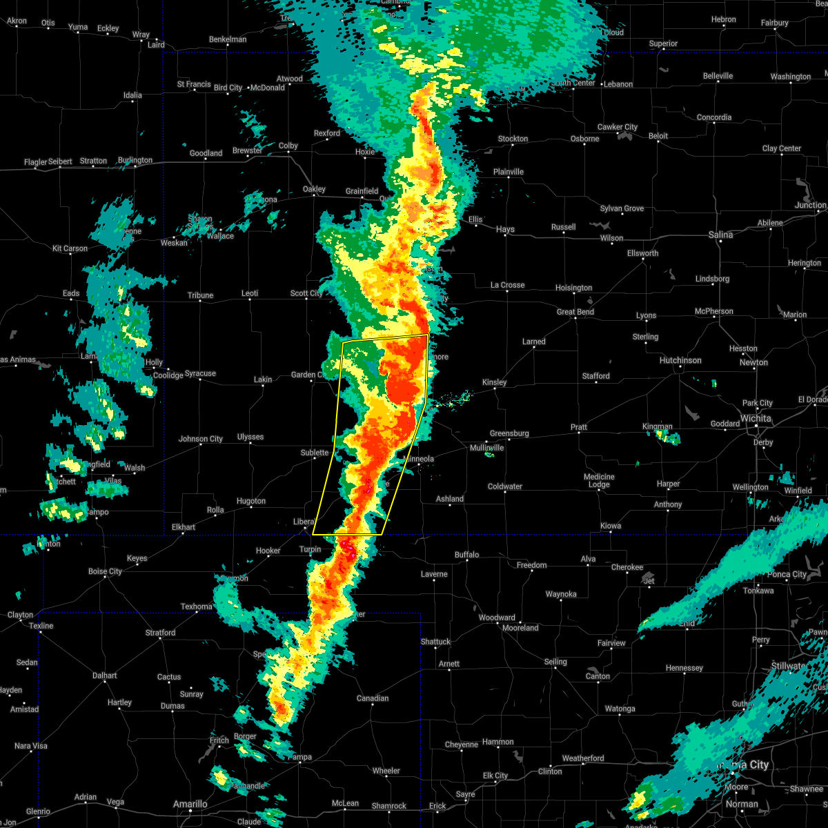 The severe thunderstorm warning for western ford, eastern seward, eastern finney, western hodgeman, meade, gray and eastern haskell counties will expire at 1030 pm cdt, the storms which prompted the warning have moved out of the area. therefore, the warning will be allowed to expire. a tornado watch remains in effect until 1100 pm cdt for southwestern kansas. a tornado watch also remains in effect until 500 am cdt for southwestern kansas. The severe thunderstorm warning for western ford, eastern seward, eastern finney, western hodgeman, meade, gray and eastern haskell counties will expire at 1030 pm cdt, the storms which prompted the warning have moved out of the area. therefore, the warning will be allowed to expire. a tornado watch remains in effect until 1100 pm cdt for southwestern kansas. a tornado watch also remains in effect until 500 am cdt for southwestern kansas.
|
| 10/12/2021 10:20 PM CDT |
 At 1019 pm cdt, severe thunderstorms were located along a line extending from 13 miles north of jetmore to 8 miles east of ensign to 7 miles northeast of forgan, moving northeast at 60 mph (radar indicated). Hazards include 70 mph wind gusts and quarter size hail. Hail damage to vehicles is expected. expect considerable tree damage. wind damage is also likely to mobile homes, roofs, and outbuildings. severe thunderstorms will be near, dodge city and ft. dodge around 1030 pm cdt. wright around 1035 pm cdt. Other locations in the path of these severe thunderstorms include ford, spearville, windhorst, bellefont and ashland. At 1019 pm cdt, severe thunderstorms were located along a line extending from 13 miles north of jetmore to 8 miles east of ensign to 7 miles northeast of forgan, moving northeast at 60 mph (radar indicated). Hazards include 70 mph wind gusts and quarter size hail. Hail damage to vehicles is expected. expect considerable tree damage. wind damage is also likely to mobile homes, roofs, and outbuildings. severe thunderstorms will be near, dodge city and ft. dodge around 1030 pm cdt. wright around 1035 pm cdt. Other locations in the path of these severe thunderstorms include ford, spearville, windhorst, bellefont and ashland.
|
| 10/12/2021 10:08 PM CDT |
 At 1008 pm cdt, severe thunderstorms were located along a line extending from 12 miles south of beeler to near howell to near meade state park, moving northeast at 55 mph (radar indicated). Hazards include 70 mph wind gusts and nickel size hail. Expect considerable tree damage. damage is likely to mobile homes, roofs, and outbuildings. Locations impacted include, howell, dodge city and meade. At 1008 pm cdt, severe thunderstorms were located along a line extending from 12 miles south of beeler to near howell to near meade state park, moving northeast at 55 mph (radar indicated). Hazards include 70 mph wind gusts and nickel size hail. Expect considerable tree damage. damage is likely to mobile homes, roofs, and outbuildings. Locations impacted include, howell, dodge city and meade.
|
| 10/12/2021 9:46 PM CDT |
 At 946 pm cdt, severe thunderstorms were located along a line extending from 9 miles northwest of kalvesta to near montezuma to 6 miles southeast of hayne, moving northeast at 55 mph (radar indicated). Hazards include 70 mph wind gusts and nickel size hail. Expect considerable tree damage. damage is likely to mobile homes, roofs, and outbuildings. severe thunderstorms will be near, montezuma around 950 pm cdt. the haggard elev around 955 pm cdt. ensign around 1000 pm cdt. Other locations in the path of these severe thunderstorms include meade state park, howell, dodge city and meade. At 946 pm cdt, severe thunderstorms were located along a line extending from 9 miles northwest of kalvesta to near montezuma to 6 miles southeast of hayne, moving northeast at 55 mph (radar indicated). Hazards include 70 mph wind gusts and nickel size hail. Expect considerable tree damage. damage is likely to mobile homes, roofs, and outbuildings. severe thunderstorms will be near, montezuma around 950 pm cdt. the haggard elev around 955 pm cdt. ensign around 1000 pm cdt. Other locations in the path of these severe thunderstorms include meade state park, howell, dodge city and meade.
|
| 8/10/2021 7:08 PM CDT | Social media report of 70 mph winds and broken trees/limb in meade county KS, 7.3 miles SSW of Fowler, KS |
| 8/10/2021 6:20 PM CDT | Half Dollar sized hail reported 7.3 miles SSW of Fowler, KS, hail came down for about 10 minutes. |
| 6/25/2021 7:07 PM CDT |
 At 706 pm cdt, a severe thunderstorm was located near meade state park, moving east at 30 mph. this is a very dangerous storm (radar indicated). Hazards include 80 mph wind gusts and quarter size hail. Flying debris will be dangerous to those caught without shelter. mobile homes will be heavily damaged. expect considerable damage to roofs, windows, and vehicles. extensive tree damage and power outages are likely. Locations impacted include, meade state park and meade. At 706 pm cdt, a severe thunderstorm was located near meade state park, moving east at 30 mph. this is a very dangerous storm (radar indicated). Hazards include 80 mph wind gusts and quarter size hail. Flying debris will be dangerous to those caught without shelter. mobile homes will be heavily damaged. expect considerable damage to roofs, windows, and vehicles. extensive tree damage and power outages are likely. Locations impacted include, meade state park and meade.
|
| 6/25/2021 6:40 PM CDT |
 At 640 pm cdt, a severe thunderstorm was located near kismet, moving east at 35 mph (radar indicated). Hazards include two inch hail and 70 mph wind gusts. People and animals outdoors will be injured. expect hail damage to roofs, siding, windows, and vehicles. expect considerable tree damage. wind damage is also likely to mobile homes, roofs, and outbuildings. this severe thunderstorm will be near, plains around 645 pm cdt. meade state park around 700 pm cdt. Other locations in the path of this severe thunderstorm include missler, meade and fowler. At 640 pm cdt, a severe thunderstorm was located near kismet, moving east at 35 mph (radar indicated). Hazards include two inch hail and 70 mph wind gusts. People and animals outdoors will be injured. expect hail damage to roofs, siding, windows, and vehicles. expect considerable tree damage. wind damage is also likely to mobile homes, roofs, and outbuildings. this severe thunderstorm will be near, plains around 645 pm cdt. meade state park around 700 pm cdt. Other locations in the path of this severe thunderstorm include missler, meade and fowler.
|
| 5/26/2021 7:33 PM CDT |
 At 733 pm cdt, a severe thunderstorm was located near montezuma, moving northeast at 30 mph (radar indicated). Hazards include quarter size hail. Damage to vehicles is expected. Locations impacted include, montezuma, fowler, ensign and the haggard elev. At 733 pm cdt, a severe thunderstorm was located near montezuma, moving northeast at 30 mph (radar indicated). Hazards include quarter size hail. Damage to vehicles is expected. Locations impacted include, montezuma, fowler, ensign and the haggard elev.
|
| 5/26/2021 7:20 PM CDT |
 At 720 pm cdt, a severe thunderstorm was located 7 miles south of montezuma, moving northeast at 25 mph (radar indicated). Hazards include two inch hail. People and animals outdoors will be injured. expect damage to roofs, siding, windows, and vehicles. Locations impacted include, montezuma, fowler, ensign and the haggard elev. At 720 pm cdt, a severe thunderstorm was located 7 miles south of montezuma, moving northeast at 25 mph (radar indicated). Hazards include two inch hail. People and animals outdoors will be injured. expect damage to roofs, siding, windows, and vehicles. Locations impacted include, montezuma, fowler, ensign and the haggard elev.
|
| 5/26/2021 7:10 PM CDT |
 At 710 pm cdt, a severe thunderstorm was located near copeland, moving northeast at 30 mph (radar indicated). Hazards include quarter size hail. Damage to vehicles is expected. Locations impacted include, montezuma, fowler, copeland, ensign and the haggard elev. At 710 pm cdt, a severe thunderstorm was located near copeland, moving northeast at 30 mph (radar indicated). Hazards include quarter size hail. Damage to vehicles is expected. Locations impacted include, montezuma, fowler, copeland, ensign and the haggard elev.
|
| 5/26/2021 7:06 PM CDT |
 At 706 pm cdt, a severe thunderstorm was located 7 miles south of copeland, moving northeast at 30 mph (radar indicated). Hazards include quarter size hail. Damage to vehicles is expected. this severe thunderstorm will be near, copeland around 715 pm cdt. Other locations in the path of this severe thunderstorm include montezuma, the haggard elev and ensign. At 706 pm cdt, a severe thunderstorm was located 7 miles south of copeland, moving northeast at 30 mph (radar indicated). Hazards include quarter size hail. Damage to vehicles is expected. this severe thunderstorm will be near, copeland around 715 pm cdt. Other locations in the path of this severe thunderstorm include montezuma, the haggard elev and ensign.
|
| 5/2/2021 10:09 PM CDT |
 The severe thunderstorm warning for ford, southern hodgeman, eastern meade and clark counties will expire at 1015 pm cdt, the storms which prompted the warning have weakened below severe limits, and no longer pose an immediate threat to life or property. therefore, the warning will be allowed to expire. however gusty winds are still possible with these thunderstorms. a severe thunderstorm watch remains in effect until midnight cdt for southwestern kansas. The severe thunderstorm warning for ford, southern hodgeman, eastern meade and clark counties will expire at 1015 pm cdt, the storms which prompted the warning have weakened below severe limits, and no longer pose an immediate threat to life or property. therefore, the warning will be allowed to expire. however gusty winds are still possible with these thunderstorms. a severe thunderstorm watch remains in effect until midnight cdt for southwestern kansas.
|
| 5/2/2021 9:57 PM CDT |
 At 956 pm cdt, severe thunderstorms were located along a line extending from 9 miles south of jetmore to near englewood, moving east at 35 mph (radar indicated). Hazards include 60 mph wind gusts and quarter size hail. Hail damage to vehicles is expected. expect wind damage to roofs, siding, and trees. locations impacted include, dodge city, ashland, bucklin, spearville, minneola, fowler, ford, bloom, englewood, sitka, clark state lake, kingsdown, wright, bellefont, windhorst, acres and ft. Dodge. At 956 pm cdt, severe thunderstorms were located along a line extending from 9 miles south of jetmore to near englewood, moving east at 35 mph (radar indicated). Hazards include 60 mph wind gusts and quarter size hail. Hail damage to vehicles is expected. expect wind damage to roofs, siding, and trees. locations impacted include, dodge city, ashland, bucklin, spearville, minneola, fowler, ford, bloom, englewood, sitka, clark state lake, kingsdown, wright, bellefont, windhorst, acres and ft. Dodge.
|
| 5/2/2021 9:36 PM CDT |
 At 936 pm cdt, severe thunderstorms were located along a line extending from 10 miles southeast of kalvesta to 11 miles west of englewood, moving east at 35 mph (radar indicated). Hazards include 60 mph wind gusts and penny size hail. expect damage to roofs, siding, and trees At 936 pm cdt, severe thunderstorms were located along a line extending from 10 miles southeast of kalvesta to 11 miles west of englewood, moving east at 35 mph (radar indicated). Hazards include 60 mph wind gusts and penny size hail. expect damage to roofs, siding, and trees
|
| 3/13/2021 10:50 PM CDT |
 The severe thunderstorm warning for eastern meade and clark counties will expire at 1000 pm cst, the storm which prompted the warning has weakened below severe limits, and no longer poses an immediate threat to life or property. therefore, the warning will be allowed to expire. however small hail, gusty winds and heavy rain are still possible with this thunderstorm. The severe thunderstorm warning for eastern meade and clark counties will expire at 1000 pm cst, the storm which prompted the warning has weakened below severe limits, and no longer poses an immediate threat to life or property. therefore, the warning will be allowed to expire. however small hail, gusty winds and heavy rain are still possible with this thunderstorm.
|
| 3/13/2021 10:35 PM CDT |
 At 935 pm cst, a severe thunderstorm was located 9 miles northwest of englewood, moving northeast at 45 mph (radar indicated). Hazards include 60 mph wind gusts. Expect damage to roofs, siding, and trees. Locations impacted include, ashland, minneola, fowler, englewood, clark state lake and acres. At 935 pm cst, a severe thunderstorm was located 9 miles northwest of englewood, moving northeast at 45 mph (radar indicated). Hazards include 60 mph wind gusts. Expect damage to roofs, siding, and trees. Locations impacted include, ashland, minneola, fowler, englewood, clark state lake and acres.
|
| 3/13/2021 10:16 PM CDT |
 At 916 pm cst, a severe thunderstorm was located near knowles, or 11 miles southwest of englewood, moving north at 55 mph (radar indicated). Hazards include 60 mph wind gusts. expect damage to roofs, siding, and trees At 916 pm cst, a severe thunderstorm was located near knowles, or 11 miles southwest of englewood, moving north at 55 mph (radar indicated). Hazards include 60 mph wind gusts. expect damage to roofs, siding, and trees
|
| 7/29/2020 7:54 PM CDT |
 At 753 pm cdt, the leading edge gust front of severe thunderstorms were located along a line extending from near dodge city to near minneola to near fowler, moving southeast at 50 mph (radar indicated). Hazards include 60 mph wind gusts. Expect damage to roofs, siding, and trees. Locations impacted include, ashland, bucklin, minneola, fowler, ford, ensign, bloom, clark state lake and kingsdown. At 753 pm cdt, the leading edge gust front of severe thunderstorms were located along a line extending from near dodge city to near minneola to near fowler, moving southeast at 50 mph (radar indicated). Hazards include 60 mph wind gusts. Expect damage to roofs, siding, and trees. Locations impacted include, ashland, bucklin, minneola, fowler, ford, ensign, bloom, clark state lake and kingsdown.
|
| 7/29/2020 7:50 PM CDT | Social media report of 60 mph wind gust in meade county KS, 7.3 miles SSW of Fowler, KS |
| 7/29/2020 7:33 PM CDT |
 At 732 pm cdt, the leading edge of severe thunderstorms were located along a line extending from near howell to near ensign to 7 miles south of montezuma, moving southeast at 50 mph (radar indicated). Hazards include 60 mph wind gusts and penny size hail. expect damage to roofs, siding, and trees At 732 pm cdt, the leading edge of severe thunderstorms were located along a line extending from near howell to near ensign to 7 miles south of montezuma, moving southeast at 50 mph (radar indicated). Hazards include 60 mph wind gusts and penny size hail. expect damage to roofs, siding, and trees
|
| 7/13/2020 12:43 AM CDT |
 The severe thunderstorm warning for southern ford, meade, southwestern comanche, southeastern gray and clark counties will expire at 1245 am cdt, the storms which prompted the warning have weakened below severe limits. therefore, the warning will be allowed to expire. a severe thunderstorm watch remains in effect until 300 am cdt for southwestern kansas. The severe thunderstorm warning for southern ford, meade, southwestern comanche, southeastern gray and clark counties will expire at 1245 am cdt, the storms which prompted the warning have weakened below severe limits. therefore, the warning will be allowed to expire. a severe thunderstorm watch remains in effect until 300 am cdt for southwestern kansas.
|
| 7/13/2020 12:26 AM CDT |
 At 1225 am cdt, severe thunderstorms were located along a line extending from 9 miles southeast of bucklin to near plains, moving southwest at 10 mph (public). Hazards include 60 mph wind gusts and nickel size hail. Expect damage to roofs, siding, and trees. Locations impacted include, meade, ashland, bucklin, minneola, fowler, protection, bloom, englewood, sitka, clark state lake, meade state park, kingsdown, missler and acres. At 1225 am cdt, severe thunderstorms were located along a line extending from 9 miles southeast of bucklin to near plains, moving southwest at 10 mph (public). Hazards include 60 mph wind gusts and nickel size hail. Expect damage to roofs, siding, and trees. Locations impacted include, meade, ashland, bucklin, minneola, fowler, protection, bloom, englewood, sitka, clark state lake, meade state park, kingsdown, missler and acres.
|
| 7/12/2020 11:56 PM CDT |
 At 1155 pm cdt, severe thunderstorms were located along a line extending from near bucklin to near copeland, moving southeast at 35 mph (public. these storms have a history of producing wind gusts to near 60 mph). Hazards include 60 mph wind gusts and nickel size hail. expect damage to roofs, siding, and trees At 1155 pm cdt, severe thunderstorms were located along a line extending from near bucklin to near copeland, moving southeast at 35 mph (public. these storms have a history of producing wind gusts to near 60 mph). Hazards include 60 mph wind gusts and nickel size hail. expect damage to roofs, siding, and trees
|
| 6/21/2020 7:52 PM CDT |
 The severe thunderstorm warning for meade and clark counties will expire at 800 pm cdt, the storms which prompted the warning have weakened below severe limits, and no longer pose an immediate threat to life or property. therefore, the warning will be allowed to expire. however gusty winds and heavy rain are still possible with these thunderstorms. a severe thunderstorm watch remains in effect until 1000 pm cdt for south central and southwestern kansas. The severe thunderstorm warning for meade and clark counties will expire at 800 pm cdt, the storms which prompted the warning have weakened below severe limits, and no longer pose an immediate threat to life or property. therefore, the warning will be allowed to expire. however gusty winds and heavy rain are still possible with these thunderstorms. a severe thunderstorm watch remains in effect until 1000 pm cdt for south central and southwestern kansas.
|
| 6/21/2020 7:18 PM CDT |
 At 718 pm cdt, severe thunderstorms were located along a line extending from ashland to near floris, moving south at 15 mph (radar indicated). Hazards include 60 mph wind gusts and quarter size hail. Hail damage to vehicles is expected. Expect wind damage to roofs, siding, and trees. At 718 pm cdt, severe thunderstorms were located along a line extending from ashland to near floris, moving south at 15 mph (radar indicated). Hazards include 60 mph wind gusts and quarter size hail. Hail damage to vehicles is expected. Expect wind damage to roofs, siding, and trees.
|
| 6/21/2020 6:36 PM CDT |
 At 635 pm cdt, severe thunderstorms were located along a line extending from near kingsdown to near kismet, moving south at 25 mph (radar indicated). Hazards include 60 mph wind gusts and quarter size hail. Hail damage to vehicles is expected. Expect wind damage to roofs, siding, and trees. At 635 pm cdt, severe thunderstorms were located along a line extending from near kingsdown to near kismet, moving south at 25 mph (radar indicated). Hazards include 60 mph wind gusts and quarter size hail. Hail damage to vehicles is expected. Expect wind damage to roofs, siding, and trees.
|
| 6/21/2020 5:30 PM CDT |
 At 530 pm cdt, severe thunderstorms were located along a line extending from near windhorst to near fowler, moving southeast at 40 mph. these are very dangerous storms (radar indicated). Hazards include 80 mph wind gusts and half dollar size hail. Flying debris will be dangerous to those caught without shelter. mobile homes will be heavily damaged. expect considerable damage to roofs, windows, and vehicles. Extensive tree damage and power outages are likely. At 530 pm cdt, severe thunderstorms were located along a line extending from near windhorst to near fowler, moving southeast at 40 mph. these are very dangerous storms (radar indicated). Hazards include 80 mph wind gusts and half dollar size hail. Flying debris will be dangerous to those caught without shelter. mobile homes will be heavily damaged. expect considerable damage to roofs, windows, and vehicles. Extensive tree damage and power outages are likely.
|
| 5/7/2020 8:23 PM CDT |
 At 823 pm cdt, a severe thunderstorm was located very near minneola, moving east at 25 mph (radar indicated). Hazards include half dollar size hail. Damage to vehicles is expected. Locations impacted include, minneola and fowler. At 823 pm cdt, a severe thunderstorm was located very near minneola, moving east at 25 mph (radar indicated). Hazards include half dollar size hail. Damage to vehicles is expected. Locations impacted include, minneola and fowler.
|
| 5/7/2020 8:10 PM CDT |
 At 810 pm cdt, a severe thunderstorm was located near fowler, moving east at 20 mph (radar indicated). Hazards include golf ball size hail. People and animals outdoors will be injured. expect damage to roofs, siding, windows, and vehicles. Locations impacted include, minneola and fowler. At 810 pm cdt, a severe thunderstorm was located near fowler, moving east at 20 mph (radar indicated). Hazards include golf ball size hail. People and animals outdoors will be injured. expect damage to roofs, siding, windows, and vehicles. Locations impacted include, minneola and fowler.
|
| 5/7/2020 8:06 PM CDT |
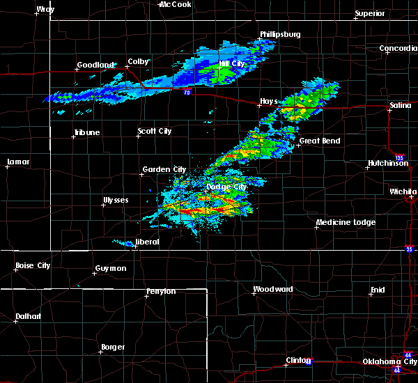 At 806 pm cdt, a severe thunderstorm was located near fowler, moving east at 20 mph (radar indicated). Hazards include quarter size hail. damage to vehicles is expected At 806 pm cdt, a severe thunderstorm was located near fowler, moving east at 20 mph (radar indicated). Hazards include quarter size hail. damage to vehicles is expected
|
| 3/24/2020 1:13 AM CDT | Quarter sized hail reported 6.8 miles SSW of Fowler, KS, quarter size hail was reported via social media. |
| 8/19/2019 6:10 PM CDT |
 At 610 pm cdt, a severe thunderstorm was located very near meade, moving southeast at 15 mph (radar indicated). Hazards include 60 mph wind gusts and penny size hail. Expect damage to roofs, siding, and trees. Locations impacted include, meade. At 610 pm cdt, a severe thunderstorm was located very near meade, moving southeast at 15 mph (radar indicated). Hazards include 60 mph wind gusts and penny size hail. Expect damage to roofs, siding, and trees. Locations impacted include, meade.
|
| 8/19/2019 5:55 PM CDT |
 At 555 pm cdt, a severe thunderstorm was located near meade, moving southeast at 15 mph (radar indicated). Hazards include 60 mph wind gusts and half dollar size hail. Hail damage to vehicles is expected. Expect wind damage to roofs, siding, and trees. At 555 pm cdt, a severe thunderstorm was located near meade, moving southeast at 15 mph (radar indicated). Hazards include 60 mph wind gusts and half dollar size hail. Hail damage to vehicles is expected. Expect wind damage to roofs, siding, and trees.
|
| 8/19/2019 4:41 PM CDT |
 A severe thunderstorm warning remains in effect until 515 pm cdt for northeastern meade county. at 441 pm cdt, a severe thunderstorm was located near meade, moving north at 15 mph. hazard. 60 mph wind gusts and half dollar size hail. source. Radar indicated. A severe thunderstorm warning remains in effect until 515 pm cdt for northeastern meade county. at 441 pm cdt, a severe thunderstorm was located near meade, moving north at 15 mph. hazard. 60 mph wind gusts and half dollar size hail. source. Radar indicated.
|
| 8/19/2019 4:31 PM CDT |
 At 431 pm cdt, a severe thunderstorm was located near meade, moving north at 20 mph (radar indicated). Hazards include 60 mph wind gusts and nickel size hail. expect damage to roofs, siding, and trees At 431 pm cdt, a severe thunderstorm was located near meade, moving north at 20 mph (radar indicated). Hazards include 60 mph wind gusts and nickel size hail. expect damage to roofs, siding, and trees
|
| 8/13/2019 8:43 PM CDT |
 At 842 pm cdt, severe thunderstorms were located along a line extending from near belpre to 12 miles northwest of coldwater to near fowler, moving southeast at 55 mph (radar indicated). Hazards include 70 mph wind gusts. Expect considerable tree damage. damage is likely to mobile homes, roofs, and outbuildings. Locations impacted include, dodge city, kinsley, ashland, coldwater, bucklin, greensburg, minneola, haviland, fowler, protection, mullinville, ford, offerle, bloom, englewood, sitka, wilmore, fellsburg, wright and wellsford. At 842 pm cdt, severe thunderstorms were located along a line extending from near belpre to 12 miles northwest of coldwater to near fowler, moving southeast at 55 mph (radar indicated). Hazards include 70 mph wind gusts. Expect considerable tree damage. damage is likely to mobile homes, roofs, and outbuildings. Locations impacted include, dodge city, kinsley, ashland, coldwater, bucklin, greensburg, minneola, haviland, fowler, protection, mullinville, ford, offerle, bloom, englewood, sitka, wilmore, fellsburg, wright and wellsford.
|
| 8/13/2019 8:16 PM CDT |
 At 815 pm cdt, severe thunderstorms were located along a line extending from near kinsley to near ford to near ensign, moving southeast at 50 mph (radar indicated). Hazards include 70 mph wind gusts and half dollar size hail. Hail damage to vehicles is expected. expect considerable tree damage. Wind damage is also likely to mobile homes, roofs, and outbuildings. At 815 pm cdt, severe thunderstorms were located along a line extending from near kinsley to near ford to near ensign, moving southeast at 50 mph (radar indicated). Hazards include 70 mph wind gusts and half dollar size hail. Hail damage to vehicles is expected. expect considerable tree damage. Wind damage is also likely to mobile homes, roofs, and outbuildings.
|
| 6/18/2019 9:58 PM CDT |
 At 958 pm cdt, a severe thunderstorm was located very near meade state park, moving east at 55 mph (radar indicated). Hazards include 60 mph wind gusts and nickel size hail. Expect damage to roofs, siding, and trees. Locations impacted include, meade, fowler, kismet, meade state park, missler and plains. At 958 pm cdt, a severe thunderstorm was located very near meade state park, moving east at 55 mph (radar indicated). Hazards include 60 mph wind gusts and nickel size hail. Expect damage to roofs, siding, and trees. Locations impacted include, meade, fowler, kismet, meade state park, missler and plains.
|
| 6/18/2019 9:48 PM CDT |
 At 947 pm cdt, a severe thunderstorm was located near kismet, moving east at 55 mph (radar indicated). Hazards include 60 mph wind gusts and quarter size hail. Hail damage to vehicles is expected. Expect wind damage to roofs, siding, and trees. At 947 pm cdt, a severe thunderstorm was located near kismet, moving east at 55 mph (radar indicated). Hazards include 60 mph wind gusts and quarter size hail. Hail damage to vehicles is expected. Expect wind damage to roofs, siding, and trees.
|
| 6/14/2019 10:34 PM CDT |
 At 1023 pm cdt, a severe thunderstorm was located near minneola, moving east at 40 mph (radar indicated). Hazards include 60 mph wind gusts and quarter size hail. Hail damage to vehicles is expected. expect wind damage to roofs, siding, and trees. Locations impacted include, dodge city, meade, ashland, minneola, fowler, ensign, bloom, clark state lake and the haggard elev. At 1023 pm cdt, a severe thunderstorm was located near minneola, moving east at 40 mph (radar indicated). Hazards include 60 mph wind gusts and quarter size hail. Hail damage to vehicles is expected. expect wind damage to roofs, siding, and trees. Locations impacted include, dodge city, meade, ashland, minneola, fowler, ensign, bloom, clark state lake and the haggard elev.
|
| 6/14/2019 10:24 PM CDT |
 At 1023 pm cdt, a severe thunderstorm was located near minneola, moving east at 40 mph (radar indicated). Hazards include 60 mph wind gusts and quarter size hail. Hail damage to vehicles is expected. expect wind damage to roofs, siding, and trees. Locations impacted include, dodge city, meade, ashland, minneola, fowler, ensign, bloom, clark state lake and the haggard elev. At 1023 pm cdt, a severe thunderstorm was located near minneola, moving east at 40 mph (radar indicated). Hazards include 60 mph wind gusts and quarter size hail. Hail damage to vehicles is expected. expect wind damage to roofs, siding, and trees. Locations impacted include, dodge city, meade, ashland, minneola, fowler, ensign, bloom, clark state lake and the haggard elev.
|
| 6/14/2019 10:08 PM CDT |
 At 1008 pm cdt, a severe thunderstorm was located near fowler, moving east at 40 mph (radar indicated). Hazards include 60 mph wind gusts and quarter size hail. Hail damage to vehicles is expected. Expect wind damage to roofs, siding, and trees. At 1008 pm cdt, a severe thunderstorm was located near fowler, moving east at 40 mph (radar indicated). Hazards include 60 mph wind gusts and quarter size hail. Hail damage to vehicles is expected. Expect wind damage to roofs, siding, and trees.
|
| 6/3/2019 9:46 PM CDT |
 At 946 pm cdt, severe thunderstorms were located along a line extending from 7 miles east of ford to near knowles, moving east at 30 mph (radar indicated). Hazards include 60 mph wind gusts and quarter size hail. Hail damage to vehicles is expected. expect wind damage to roofs, siding, and trees. Locations impacted include, ashland, bucklin, minneola, fowler, mullinville, ford, bloom, englewood, sitka, clark state lake, kingsdown and acres. At 946 pm cdt, severe thunderstorms were located along a line extending from 7 miles east of ford to near knowles, moving east at 30 mph (radar indicated). Hazards include 60 mph wind gusts and quarter size hail. Hail damage to vehicles is expected. expect wind damage to roofs, siding, and trees. Locations impacted include, ashland, bucklin, minneola, fowler, mullinville, ford, bloom, englewood, sitka, clark state lake, kingsdown and acres.
|
| 6/3/2019 9:26 PM CDT |
 At 925 pm cdt, severe thunderstorms were located along a line extending from 7 miles southwest of dodge city to near floris, moving southeast at 15 mph (radar indicated). Hazards include 60 mph wind gusts and quarter size hail. Hail damage to vehicles is expected. Expect wind damage to roofs, siding, and trees. At 925 pm cdt, severe thunderstorms were located along a line extending from 7 miles southwest of dodge city to near floris, moving southeast at 15 mph (radar indicated). Hazards include 60 mph wind gusts and quarter size hail. Hail damage to vehicles is expected. Expect wind damage to roofs, siding, and trees.
|
| 6/1/2019 7:36 AM CDT |
 At 736 am cdt, a severe thunderstorm was located 12 miles southeast of meade, moving southeast at 30 mph (radar indicated). Hazards include quarter size hail. Damage to vehicles is expected. Locations impacted include, meade, minneola, fowler, englewood, meade state park, missler and acres. At 736 am cdt, a severe thunderstorm was located 12 miles southeast of meade, moving southeast at 30 mph (radar indicated). Hazards include quarter size hail. Damage to vehicles is expected. Locations impacted include, meade, minneola, fowler, englewood, meade state park, missler and acres.
|
| 6/1/2019 7:11 AM CDT |
 At 710 am cdt, a severe thunderstorm was located near meade, moving east at 25 mph (radar indicated). Hazards include quarter size hail. damage to vehicles is expected At 710 am cdt, a severe thunderstorm was located near meade, moving east at 25 mph (radar indicated). Hazards include quarter size hail. damage to vehicles is expected
|
| 5/26/2019 11:10 PM CDT |
 The severe thunderstorm warning for southern ford, southwestern kiowa, meade, western comanche, southern gray and clark counties will expire at 1115 pm cdt, the storms which prompted the warning have moved out of the area. therefore, the warning will be allowed to expire. however gusty winds are still possible with these thunderstorms. a severe thunderstorm watch remains in effect until 200 am cdt for south central and southwestern kansas. remember, a severe thunderstorm warning still remains in effect for comanche, kiowa, eastern clark and eastern ford counties until midnight. The severe thunderstorm warning for southern ford, southwestern kiowa, meade, western comanche, southern gray and clark counties will expire at 1115 pm cdt, the storms which prompted the warning have moved out of the area. therefore, the warning will be allowed to expire. however gusty winds are still possible with these thunderstorms. a severe thunderstorm watch remains in effect until 200 am cdt for south central and southwestern kansas. remember, a severe thunderstorm warning still remains in effect for comanche, kiowa, eastern clark and eastern ford counties until midnight.
|
| 5/26/2019 10:50 PM CDT |
 At 1050 pm cdt, severe thunderstorms were located along a line extending from 7 miles east of ensign to 7 miles southwest of clark state lake to near laverne, moving east at 55 mph (radar indicated). Hazards include 70 mph wind gusts and nickel size hail. Expect considerable tree damage. damage is likely to mobile homes, roofs, and outbuildings. Locations impacted include, meade, ashland, coldwater, bucklin, minneola, fowler, protection, mullinville, ford, bloom, englewood, sitka, clark state lake, kingsdown, missler, lake coldwater, acres and buttermilk. At 1050 pm cdt, severe thunderstorms were located along a line extending from 7 miles east of ensign to 7 miles southwest of clark state lake to near laverne, moving east at 55 mph (radar indicated). Hazards include 70 mph wind gusts and nickel size hail. Expect considerable tree damage. damage is likely to mobile homes, roofs, and outbuildings. Locations impacted include, meade, ashland, coldwater, bucklin, minneola, fowler, protection, mullinville, ford, bloom, englewood, sitka, clark state lake, kingsdown, missler, lake coldwater, acres and buttermilk.
|
| 5/26/2019 10:22 PM CDT |
 At 1022 pm cdt, severe thunderstorms were located along a line extending from near montezuma to near meade to 9 miles west of slapout, moving east at 50 mph (radar indicated). Hazards include 70 mph wind gusts and nickel size hail. Expect considerable tree damage. Damage is likely to mobile homes, roofs, and outbuildings. At 1022 pm cdt, severe thunderstorms were located along a line extending from near montezuma to near meade to 9 miles west of slapout, moving east at 50 mph (radar indicated). Hazards include 70 mph wind gusts and nickel size hail. Expect considerable tree damage. Damage is likely to mobile homes, roofs, and outbuildings.
|
| 5/25/2019 5:06 PM CDT |
 At 506 pm cdt, a severe thunderstorm was located 10 miles northwest of acres, moving northeast at 30 mph (radar indicated). Hazards include 60 mph wind gusts and quarter size hail. Hail damage to vehicles is expected. Expect wind damage to roofs, siding, and trees. At 506 pm cdt, a severe thunderstorm was located 10 miles northwest of acres, moving northeast at 30 mph (radar indicated). Hazards include 60 mph wind gusts and quarter size hail. Hail damage to vehicles is expected. Expect wind damage to roofs, siding, and trees.
|
| 5/23/2019 6:14 PM CDT |
 At 614 pm cdt, a severe thunderstorm capable of producing a tornado was located near fowler, moving northeast at 30 mph (radar indicated rotation). Hazards include tornado and hail up to two inches in diameter. Flying debris will be dangerous to those caught without shelter. mobile homes will be damaged or destroyed. damage to roofs, windows, and vehicles will occur. tree damage is likely. This tornadic thunderstorm will remain over mainly rural areas of southwestern ford, northeastern meade, southeastern gray and northwestern clark counties. At 614 pm cdt, a severe thunderstorm capable of producing a tornado was located near fowler, moving northeast at 30 mph (radar indicated rotation). Hazards include tornado and hail up to two inches in diameter. Flying debris will be dangerous to those caught without shelter. mobile homes will be damaged or destroyed. damage to roofs, windows, and vehicles will occur. tree damage is likely. This tornadic thunderstorm will remain over mainly rural areas of southwestern ford, northeastern meade, southeastern gray and northwestern clark counties.
|
| 5/23/2019 6:07 PM CDT |
 At 606 pm cdt, a severe thunderstorm was located near fowler, moving northeast at 40 mph (radar indicated). Hazards include golf ball size hail and 60 mph wind gusts. People and animals outdoors will be injured. expect hail damage to roofs, siding, windows, and vehicles. Expect wind damage to roofs, siding, and trees. At 606 pm cdt, a severe thunderstorm was located near fowler, moving northeast at 40 mph (radar indicated). Hazards include golf ball size hail and 60 mph wind gusts. People and animals outdoors will be injured. expect hail damage to roofs, siding, windows, and vehicles. Expect wind damage to roofs, siding, and trees.
|
| 5/23/2019 6:05 PM CDT |
 At 605 pm cdt, a severe thunderstorm was located near fowler, moving northeast at 30 mph (radar indicated). Hazards include golf ball size hail and 60 mph wind gusts. People and animals outdoors will be injured. expect hail damage to roofs, siding, windows, and vehicles. expect wind damage to roofs, siding, and trees. Locations impacted include, meade, minneola, fowler and the haggard elev. At 605 pm cdt, a severe thunderstorm was located near fowler, moving northeast at 30 mph (radar indicated). Hazards include golf ball size hail and 60 mph wind gusts. People and animals outdoors will be injured. expect hail damage to roofs, siding, windows, and vehicles. expect wind damage to roofs, siding, and trees. Locations impacted include, meade, minneola, fowler and the haggard elev.
|
| 5/23/2019 5:48 PM CDT |
 At 547 pm cdt, a severe thunderstorm was located near fowler, moving northeast at 40 mph (radar indicated). Hazards include 60 mph wind gusts and half dollar size hail. Hail damage to vehicles is expected. expect wind damage to roofs, siding, and trees. Locations impacted include, meade, montezuma, minneola, fowler, meade state park, the haggard elev and missler. At 547 pm cdt, a severe thunderstorm was located near fowler, moving northeast at 40 mph (radar indicated). Hazards include 60 mph wind gusts and half dollar size hail. Hail damage to vehicles is expected. expect wind damage to roofs, siding, and trees. Locations impacted include, meade, montezuma, minneola, fowler, meade state park, the haggard elev and missler.
|
| 5/23/2019 5:23 PM CDT |
 At 522 pm cdt, a severe thunderstorm was located near meade state park, moving northeast at 40 mph (radar indicated). Hazards include ping pong ball size hail and 60 mph wind gusts. People and animals outdoors will be injured. expect hail damage to roofs, siding, windows, and vehicles. Expect wind damage to roofs, siding, and trees. At 522 pm cdt, a severe thunderstorm was located near meade state park, moving northeast at 40 mph (radar indicated). Hazards include ping pong ball size hail and 60 mph wind gusts. People and animals outdoors will be injured. expect hail damage to roofs, siding, windows, and vehicles. Expect wind damage to roofs, siding, and trees.
|
| 5/23/2019 5:13 PM CDT |
 At 512 pm cdt, a severe thunderstorm was located near missler, moving north at 40 mph (radar indicated). Hazards include ping pong ball size hail and 60 mph wind gusts. People and animals outdoors will be injured. expect hail damage to roofs, siding, windows, and vehicles. expect wind damage to roofs, siding, and trees. locations impacted include, meade, fowler, meade state park, missler and plains. Time, mot, loc 2212z 189deg 106kt 3729 10047. At 512 pm cdt, a severe thunderstorm was located near missler, moving north at 40 mph (radar indicated). Hazards include ping pong ball size hail and 60 mph wind gusts. People and animals outdoors will be injured. expect hail damage to roofs, siding, windows, and vehicles. expect wind damage to roofs, siding, and trees. locations impacted include, meade, fowler, meade state park, missler and plains. Time, mot, loc 2212z 189deg 106kt 3729 10047.
|
| 5/23/2019 4:50 PM CDT |
 At 449 pm cdt, a severe thunderstorm was located near floris, or 11 miles northwest of beaver, moving northeast at 50 mph. this storm has had a history of producing golf ball sized hail and funnel clouds in beaver county, oklahoma (radar indicated). Hazards include ping pong ball size hail and 60 mph wind gusts. People and animals outdoors will be injured. expect hail damage to roofs, siding, windows, and vehicles. Expect wind damage to roofs, siding, and trees. At 449 pm cdt, a severe thunderstorm was located near floris, or 11 miles northwest of beaver, moving northeast at 50 mph. this storm has had a history of producing golf ball sized hail and funnel clouds in beaver county, oklahoma (radar indicated). Hazards include ping pong ball size hail and 60 mph wind gusts. People and animals outdoors will be injured. expect hail damage to roofs, siding, windows, and vehicles. Expect wind damage to roofs, siding, and trees.
|
| 5/23/2019 3:16 PM CDT |
 At 315 pm cdt, a severe thunderstorm was located 10 miles northwest of acres, moving north at 50 mph (radar indicated). Hazards include 60 mph wind gusts and half dollar size hail. Hail damage to vehicles is expected. Expect wind damage to roofs, siding, and trees. At 315 pm cdt, a severe thunderstorm was located 10 miles northwest of acres, moving north at 50 mph (radar indicated). Hazards include 60 mph wind gusts and half dollar size hail. Hail damage to vehicles is expected. Expect wind damage to roofs, siding, and trees.
|
| 5/18/2019 6:15 PM CDT |
 At 615 pm cdt, severe thunderstorms were located along a line extending from 7 miles northeast of ingalls to near fowler, moving southeast at 30 mph (radar indicated). Hazards include 60 mph wind gusts and quarter size hail. Hail damage to vehicles is expected. expect wind damage to roofs, siding, and trees. Locations impacted include, dodge city, cimarron, meade, montezuma, minneola, fowler, pierceville, ingalls, ensign, charleston, howell and the haggard elev. At 615 pm cdt, severe thunderstorms were located along a line extending from 7 miles northeast of ingalls to near fowler, moving southeast at 30 mph (radar indicated). Hazards include 60 mph wind gusts and quarter size hail. Hail damage to vehicles is expected. expect wind damage to roofs, siding, and trees. Locations impacted include, dodge city, cimarron, meade, montezuma, minneola, fowler, pierceville, ingalls, ensign, charleston, howell and the haggard elev.
|
| 5/18/2019 6:08 PM CDT |
 At 608 pm cdt, severe thunderstorms were located along a line extending from near fowler to 8 miles west of englewood, moving east at 30 mph (radar indicated). Hazards include two inch hail and 70 mph wind gusts. People and animals outdoors will be injured. expect hail damage to roofs, siding, windows, and vehicles. expect considerable tree damage. Wind damage is also likely to mobile homes, roofs, and outbuildings. At 608 pm cdt, severe thunderstorms were located along a line extending from near fowler to 8 miles west of englewood, moving east at 30 mph (radar indicated). Hazards include two inch hail and 70 mph wind gusts. People and animals outdoors will be injured. expect hail damage to roofs, siding, windows, and vehicles. expect considerable tree damage. Wind damage is also likely to mobile homes, roofs, and outbuildings.
|
| 5/18/2019 5:39 PM CDT |
 At 538 pm cdt, severe thunderstorms were located along a line extending from near pierceville to near meade, moving northeast at 30 mph (radar indicated). Hazards include 60 mph wind gusts and quarter size hail. Hail damage to vehicles is expected. Expect wind damage to roofs, siding, and trees. At 538 pm cdt, severe thunderstorms were located along a line extending from near pierceville to near meade, moving northeast at 30 mph (radar indicated). Hazards include 60 mph wind gusts and quarter size hail. Hail damage to vehicles is expected. Expect wind damage to roofs, siding, and trees.
|
| 5/17/2019 8:37 PM CDT |
 At 837 pm cdt, a severe thunderstorm capable of producing a tornado was located near fowler, moving northeast at 40 mph (weather spotters reported funnel cloud). Hazards include tornado and tennis ball size hail. Flying debris will be dangerous to those caught without shelter. mobile homes will be damaged or destroyed. damage to roofs, windows, and vehicles will occur. tree damage is likely. This dangerous storm will be near, dodge city around 905 pm cdt. At 837 pm cdt, a severe thunderstorm capable of producing a tornado was located near fowler, moving northeast at 40 mph (weather spotters reported funnel cloud). Hazards include tornado and tennis ball size hail. Flying debris will be dangerous to those caught without shelter. mobile homes will be damaged or destroyed. damage to roofs, windows, and vehicles will occur. tree damage is likely. This dangerous storm will be near, dodge city around 905 pm cdt.
|
| 5/17/2019 8:02 PM CDT |
 At 740 pm cdt, a confirmed tornado was located 8 miles northwest of forgan oklahoma, moving north at 40 mph (law enforcement confirmed tornado). Hazards include damaging tornado and tennis ball size hail. Flying debris will be dangerous to those caught without shelter. mobile homes will be damaged or destroyed. damage to roofs, windows, and vehicles will occur. tree damage is likely. The tornado will be near, missler around 750 pm cdt. At 740 pm cdt, a confirmed tornado was located 8 miles northwest of forgan oklahoma, moving north at 40 mph (law enforcement confirmed tornado). Hazards include damaging tornado and tennis ball size hail. Flying debris will be dangerous to those caught without shelter. mobile homes will be damaged or destroyed. damage to roofs, windows, and vehicles will occur. tree damage is likely. The tornado will be near, missler around 750 pm cdt.
|
| 5/17/2019 7:57 PM CDT |
 The national weather service in dodge city has issued a * severe thunderstorm warning for. western ford county in southwestern kansas. northeastern meade county in southwestern kansas. southeastern gray county in southwestern kansas. Northwestern clark county in southwestern kansas. The national weather service in dodge city has issued a * severe thunderstorm warning for. western ford county in southwestern kansas. northeastern meade county in southwestern kansas. southeastern gray county in southwestern kansas. Northwestern clark county in southwestern kansas.
|
| 5/17/2019 7:41 PM CDT |
 At 740 pm cdt, a confirmed tornado was located 8 miles northwest of forgan oklahoma, moving north at 40 mph (law enforcement confirmed tornado). Hazards include damaging tornado and tennis ball size hail. Flying debris will be dangerous to those caught without shelter. mobile homes will be damaged or destroyed. damage to roofs, windows, and vehicles will occur. tree damage is likely. The tornado will be near, missler around 750 pm cdt. At 740 pm cdt, a confirmed tornado was located 8 miles northwest of forgan oklahoma, moving north at 40 mph (law enforcement confirmed tornado). Hazards include damaging tornado and tennis ball size hail. Flying debris will be dangerous to those caught without shelter. mobile homes will be damaged or destroyed. damage to roofs, windows, and vehicles will occur. tree damage is likely. The tornado will be near, missler around 750 pm cdt.
|
| 5/17/2019 7:19 PM CDT |
 At 719 pm cdt, a severe thunderstorm was located 8 miles north of forgan, or 11 miles southwest of meade state park, moving north at 40 mph (radar indicated). Hazards include golf ball size hail and 60 mph wind gusts. People and animals outdoors will be injured. expect hail damage to roofs, siding, windows, and vehicles. Expect wind damage to roofs, siding, and trees. At 719 pm cdt, a severe thunderstorm was located 8 miles north of forgan, or 11 miles southwest of meade state park, moving north at 40 mph (radar indicated). Hazards include golf ball size hail and 60 mph wind gusts. People and animals outdoors will be injured. expect hail damage to roofs, siding, windows, and vehicles. Expect wind damage to roofs, siding, and trees.
|
| 5/6/2019 9:32 PM CDT |
 The national weather service in dodge city has issued a * severe thunderstorm warning for. ford county in southwestern kansas. northeastern finney county in southwestern kansas. hodgeman county in southwestern kansas. Northern meade county in southwestern kansas. The national weather service in dodge city has issued a * severe thunderstorm warning for. ford county in southwestern kansas. northeastern finney county in southwestern kansas. hodgeman county in southwestern kansas. Northern meade county in southwestern kansas.
|
| 5/6/2019 9:01 PM CDT | Quarter sized hail reported 1.9 miles S of Fowler, KS, in addition to the quarter size hail some siding damage was also reported. |
| 5/5/2019 8:30 PM CDT | Quarter sized hail reported 5.3 miles NW of Fowler, KS |
| 5/5/2019 8:16 PM CDT |
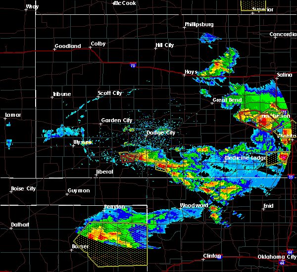 At 815 pm cdt, a severe thunderstorm was located near fowler, moving southeast at 10 mph. a second severe thunderstorm was located 5 miles north of meade. this storm was also moving southeast at 10 mph (radar indicated). Hazards include tennis ball size hail and 70 mph wind gusts. People and animals outdoors will be injured. expect hail damage to roofs, siding, windows, and vehicles. expect considerable tree damage. Wind damage is also likely to mobile homes, roofs, and outbuildings. At 815 pm cdt, a severe thunderstorm was located near fowler, moving southeast at 10 mph. a second severe thunderstorm was located 5 miles north of meade. this storm was also moving southeast at 10 mph (radar indicated). Hazards include tennis ball size hail and 70 mph wind gusts. People and animals outdoors will be injured. expect hail damage to roofs, siding, windows, and vehicles. expect considerable tree damage. Wind damage is also likely to mobile homes, roofs, and outbuildings.
|
| 5/5/2019 7:44 PM CDT |
 At 744 pm cdt, a severe thunderstorm was located near fowler, and is nearly stationary (radar indicated). Hazards include tennis ball size hail and 60 mph wind gusts. People and animals outdoors will be injured. expect hail damage to roofs, siding, windows, and vehicles. Expect wind damage to roofs, siding, and trees. At 744 pm cdt, a severe thunderstorm was located near fowler, and is nearly stationary (radar indicated). Hazards include tennis ball size hail and 60 mph wind gusts. People and animals outdoors will be injured. expect hail damage to roofs, siding, windows, and vehicles. Expect wind damage to roofs, siding, and trees.
|
| 5/5/2019 7:01 PM CDT |
 At 701 pm cdt, a severe thunderstorm was located 7 miles west of fowler, moving east at 10 mph (radar indicated). Hazards include tennis ball size hail and 60 mph wind gusts. People and animals outdoors will be injured. expect hail damage to roofs, siding, windows, and vehicles. Expect wind damage to roofs, siding, and trees. At 701 pm cdt, a severe thunderstorm was located 7 miles west of fowler, moving east at 10 mph (radar indicated). Hazards include tennis ball size hail and 60 mph wind gusts. People and animals outdoors will be injured. expect hail damage to roofs, siding, windows, and vehicles. Expect wind damage to roofs, siding, and trees.
|
| 5/5/2019 6:41 PM CDT |
 At 640 pm cdt, a severe thunderstorm was located near meade, moving east at 10 mph (radar indicated). Hazards include ping pong ball size hail and 60 mph wind gusts. People and animals outdoors will be injured. expect hail damage to roofs, siding, windows, and vehicles. expect wind damage to roofs, siding, and trees. Locations impacted include, fowler. At 640 pm cdt, a severe thunderstorm was located near meade, moving east at 10 mph (radar indicated). Hazards include ping pong ball size hail and 60 mph wind gusts. People and animals outdoors will be injured. expect hail damage to roofs, siding, windows, and vehicles. expect wind damage to roofs, siding, and trees. Locations impacted include, fowler.
|
| 5/5/2019 6:16 PM CDT |
 At 615 pm cdt, a severe thunderstorm was located near missler, moving southeast at 10 mph (radar indicated). Hazards include tennis ball size hail and 60 mph wind gusts. People and animals outdoors will be injured. expect hail damage to roofs, siding, windows, and vehicles. Expect wind damage to roofs, siding, and trees. At 615 pm cdt, a severe thunderstorm was located near missler, moving southeast at 10 mph (radar indicated). Hazards include tennis ball size hail and 60 mph wind gusts. People and animals outdoors will be injured. expect hail damage to roofs, siding, windows, and vehicles. Expect wind damage to roofs, siding, and trees.
|
| 5/5/2019 5:44 PM CDT |
 At 544 pm cdt, a severe thunderstorm was located near fowler, moving east at 15 mph (radar indicated). Hazards include two inch hail and 70 mph wind gusts. People and animals outdoors will be injured. expect hail damage to roofs, siding, windows, and vehicles. expect considerable tree damage. wind damage is also likely to mobile homes, roofs, and outbuildings. Locations impacted include, meade and fowler. At 544 pm cdt, a severe thunderstorm was located near fowler, moving east at 15 mph (radar indicated). Hazards include two inch hail and 70 mph wind gusts. People and animals outdoors will be injured. expect hail damage to roofs, siding, windows, and vehicles. expect considerable tree damage. wind damage is also likely to mobile homes, roofs, and outbuildings. Locations impacted include, meade and fowler.
|
| 5/5/2019 5:14 PM CDT |
 At 513 pm cdt, a severe thunderstorm was located near missler, moving southeast at 15 mph (radar indicated). Hazards include tennis ball size hail and 70 mph wind gusts. People and animals outdoors will be injured. expect hail damage to roofs, siding, windows, and vehicles. expect considerable tree damage. Wind damage is also likely to mobile homes, roofs, and outbuildings. At 513 pm cdt, a severe thunderstorm was located near missler, moving southeast at 15 mph (radar indicated). Hazards include tennis ball size hail and 70 mph wind gusts. People and animals outdoors will be injured. expect hail damage to roofs, siding, windows, and vehicles. expect considerable tree damage. Wind damage is also likely to mobile homes, roofs, and outbuildings.
|
| 5/5/2019 5:03 PM CDT |
 At 503 pm cdt, a severe thunderstorm was located near missler, moving southeast at 20 mph (radar indicated). Hazards include two inch hail and 60 mph wind gusts. People and animals outdoors will be injured. expect hail damage to roofs, siding, windows, and vehicles. expect wind damage to roofs, siding, and trees. Locations impacted include, meade, fowler and missler. At 503 pm cdt, a severe thunderstorm was located near missler, moving southeast at 20 mph (radar indicated). Hazards include two inch hail and 60 mph wind gusts. People and animals outdoors will be injured. expect hail damage to roofs, siding, windows, and vehicles. expect wind damage to roofs, siding, and trees. Locations impacted include, meade, fowler and missler.
|
| 5/5/2019 4:46 PM CDT |
 At 446 pm cdt, a severe thunderstorm was located 7 miles north of missler, moving east at 20 mph (radar indicated). Hazards include ping pong ball size hail and 60 mph wind gusts. People and animals outdoors will be injured. expect hail damage to roofs, siding, windows, and vehicles. expect wind damage to roofs, siding, and trees. Locations impacted include, meade, fowler and missler. At 446 pm cdt, a severe thunderstorm was located 7 miles north of missler, moving east at 20 mph (radar indicated). Hazards include ping pong ball size hail and 60 mph wind gusts. People and animals outdoors will be injured. expect hail damage to roofs, siding, windows, and vehicles. expect wind damage to roofs, siding, and trees. Locations impacted include, meade, fowler and missler.
|
| 5/5/2019 4:18 PM CDT |
 The national weather service in dodge city has issued a * severe thunderstorm warning for. northern meade county in southwestern kansas. southern gray county in southwestern kansas. until 515 pm cdt. At 418 pm cdt, a severe thunderstorm was located 7 miles south of. The national weather service in dodge city has issued a * severe thunderstorm warning for. northern meade county in southwestern kansas. southern gray county in southwestern kansas. until 515 pm cdt. At 418 pm cdt, a severe thunderstorm was located 7 miles south of.
|
| 7/27/2018 11:41 PM CDT |
 At 1140 pm cdt, severe thunderstorms were located along a line extending from 7 miles northeast of missler to 2 miles southeast of meade to 11 miles south of meade state park, moving east at 40 mph (radar indicated). Hazards include ping pong ball size hail and 60 mph wind gusts. People and animals outdoors will be injured. expect hail damage to roofs, siding, windows, and vehicles. Expect wind damage to roofs, siding, and trees. At 1140 pm cdt, severe thunderstorms were located along a line extending from 7 miles northeast of missler to 2 miles southeast of meade to 11 miles south of meade state park, moving east at 40 mph (radar indicated). Hazards include ping pong ball size hail and 60 mph wind gusts. People and animals outdoors will be injured. expect hail damage to roofs, siding, windows, and vehicles. Expect wind damage to roofs, siding, and trees.
|
| 7/27/2018 11:09 PM CDT |
 The severe thunderstorm warning for southwestern ford, seward, southern finney, meade, southeastern stevens, gray, eastern haskell and northwestern clark counties will expire at 1115 pm cdt, the storms which prompted the warning have weakened below severe limits, and no longer pose an immediate threat to life or property. therefore, the warning will be allowed to expire. however gusty winds and heavy rain are still possible with these thunderstorms. a severe thunderstorm watch remains in effect until 200 am cdt for southwestern kansas. The severe thunderstorm warning for southwestern ford, seward, southern finney, meade, southeastern stevens, gray, eastern haskell and northwestern clark counties will expire at 1115 pm cdt, the storms which prompted the warning have weakened below severe limits, and no longer pose an immediate threat to life or property. therefore, the warning will be allowed to expire. however gusty winds and heavy rain are still possible with these thunderstorms. a severe thunderstorm watch remains in effect until 200 am cdt for southwestern kansas.
|
| 7/27/2018 10:57 PM CDT |
 At 1056 pm cdt, severe thunderstorms were located along a line extending from 10 miles northwest of montezuma to 9 miles south of copeland to 5 miles north of liberal, moving southeast at 40 mph (radar indicated). Hazards include 60 mph wind gusts. Expect damage to roofs, siding, and trees. Locations impacted include, liberal, cimarron, meade, sublette, satanta, montezuma, minneola, fowler, kismet, copeland, ingalls, ensign, charleston, meade state park, missler, tice, hayne, woods, the haggard elev and plains. At 1056 pm cdt, severe thunderstorms were located along a line extending from 10 miles northwest of montezuma to 9 miles south of copeland to 5 miles north of liberal, moving southeast at 40 mph (radar indicated). Hazards include 60 mph wind gusts. Expect damage to roofs, siding, and trees. Locations impacted include, liberal, cimarron, meade, sublette, satanta, montezuma, minneola, fowler, kismet, copeland, ingalls, ensign, charleston, meade state park, missler, tice, hayne, woods, the haggard elev and plains.
|
| 7/27/2018 10:46 PM CDT |
 At 1046 pm cdt, severe thunderstorms were located along a line extending from 9 miles northwest of montezuma to 3 miles southeast of tice to 3 miles northeast of woods, moving southeast at 50 mph (radar indicated). Hazards include 70 mph wind gusts and penny size hail. Expect considerable tree damage. damage is likely to mobile homes, roofs, and outbuildings. Locations impacted include, liberal, cimarron, meade, sublette, satanta, montezuma, minneola, fowler, pierceville, kismet, moscow, copeland, ingalls, ensign, charleston, meade state park, missler, tice, hayne and ryus. At 1046 pm cdt, severe thunderstorms were located along a line extending from 9 miles northwest of montezuma to 3 miles southeast of tice to 3 miles northeast of woods, moving southeast at 50 mph (radar indicated). Hazards include 70 mph wind gusts and penny size hail. Expect considerable tree damage. damage is likely to mobile homes, roofs, and outbuildings. Locations impacted include, liberal, cimarron, meade, sublette, satanta, montezuma, minneola, fowler, pierceville, kismet, moscow, copeland, ingalls, ensign, charleston, meade state park, missler, tice, hayne and ryus.
|
| 7/27/2018 10:23 PM CDT |
 At 1022 pm cdt, severe thunderstorms were located along a line extending from pierceville to 12 miles southwest of plymell to 5 miles northwest of moscow, moving southeast at 50 mph. these are very dangerous storms (radar indicated). Hazards include 80 mph wind gusts and penny size hail. Flying debris will be dangerous to those caught without shelter. mobile homes will be heavily damaged. expect considerable damage to roofs, windows, and vehicles. Extensive tree damage and power outages are likely. At 1022 pm cdt, severe thunderstorms were located along a line extending from pierceville to 12 miles southwest of plymell to 5 miles northwest of moscow, moving southeast at 50 mph. these are very dangerous storms (radar indicated). Hazards include 80 mph wind gusts and penny size hail. Flying debris will be dangerous to those caught without shelter. mobile homes will be heavily damaged. expect considerable damage to roofs, windows, and vehicles. Extensive tree damage and power outages are likely.
|
| 7/25/2018 10:07 PM CDT |
 The severe thunderstorm warning for ford, kiowa, eastern meade, comanche, southwestern edwards and clark counties will expire at 1015 pm cdt, the storms which prompted the warning have weakened below severe limits, and no longer pose an immediate threat to life or property. therefore, the warning will be allowed to expire. however gusty winds and heavy rain are still possible with these thunderstorms. a severe thunderstorm watch remains in effect until 100 am cdt for south central and southwestern kansas. The severe thunderstorm warning for ford, kiowa, eastern meade, comanche, southwestern edwards and clark counties will expire at 1015 pm cdt, the storms which prompted the warning have weakened below severe limits, and no longer pose an immediate threat to life or property. therefore, the warning will be allowed to expire. however gusty winds and heavy rain are still possible with these thunderstorms. a severe thunderstorm watch remains in effect until 100 am cdt for south central and southwestern kansas.
|
| 7/25/2018 9:39 PM CDT |
 At 938 pm cdt, severe thunderstorms were located along a line extending from 6 miles southwest of centerview to 3 miles northwest of bucklin to 4 miles west of dodge city, moving south at 45 mph (radar indicated). Hazards include 70 mph wind gusts and penny size hail. Expect considerable tree damage. damage is likely to mobile homes, roofs, and outbuildings. Locations impacted include, dodge city, ashland, coldwater, bucklin, greensburg, minneola, fowler, protection, mullinville, ford, bloom, englewood, sitka, wilmore, clark state lake, kingsdown, wright, lake coldwater, windhorst and acres. At 938 pm cdt, severe thunderstorms were located along a line extending from 6 miles southwest of centerview to 3 miles northwest of bucklin to 4 miles west of dodge city, moving south at 45 mph (radar indicated). Hazards include 70 mph wind gusts and penny size hail. Expect considerable tree damage. damage is likely to mobile homes, roofs, and outbuildings. Locations impacted include, dodge city, ashland, coldwater, bucklin, greensburg, minneola, fowler, protection, mullinville, ford, bloom, englewood, sitka, wilmore, clark state lake, kingsdown, wright, lake coldwater, windhorst and acres.
|
| 7/25/2018 9:09 PM CDT |
 The national weather service in dodge city has issued a * severe thunderstorm warning for. ford county in southwestern kansas. kiowa county in south central kansas. eastern meade county in southwestern kansas. Comanche county in south central kansas. The national weather service in dodge city has issued a * severe thunderstorm warning for. ford county in southwestern kansas. kiowa county in south central kansas. eastern meade county in southwestern kansas. Comanche county in south central kansas.
|
| 7/17/2018 8:07 PM CDT |
 At 806 pm cdt, a severe thunderstorm was located 7 miles south of fowler, moving east at 25 mph (radar indicated). Hazards include 60 mph wind gusts. Expect damage to roofs, siding, and trees. Locations impacted include, minneola and fowler. At 806 pm cdt, a severe thunderstorm was located 7 miles south of fowler, moving east at 25 mph (radar indicated). Hazards include 60 mph wind gusts. Expect damage to roofs, siding, and trees. Locations impacted include, minneola and fowler.
|
| 7/17/2018 7:49 PM CDT |
 At 749 pm cdt, a severe thunderstorm was located 3 miles southeast of meade, moving east at 25 mph (radar indicated). Hazards include 60 mph wind gusts and penny size hail. expect damage to roofs, siding, and trees At 749 pm cdt, a severe thunderstorm was located 3 miles southeast of meade, moving east at 25 mph (radar indicated). Hazards include 60 mph wind gusts and penny size hail. expect damage to roofs, siding, and trees
|
| 6/24/2018 10:15 PM CDT |
 At 1015 pm cdt, severe thunderstorms were located along a line extending from near clark state lake to 9 miles north of knowles, moving east at 55 mph (radar indicated). Hazards include 70 mph wind gusts and quarter size hail. Hail damage to vehicles is expected. expect considerable tree damage. wind damage is also likely to mobile homes, roofs, and outbuildings. Locations impacted include, meade, ashland, minneola, fowler, englewood, sitka, clark state lake and acres. At 1015 pm cdt, severe thunderstorms were located along a line extending from near clark state lake to 9 miles north of knowles, moving east at 55 mph (radar indicated). Hazards include 70 mph wind gusts and quarter size hail. Hail damage to vehicles is expected. expect considerable tree damage. wind damage is also likely to mobile homes, roofs, and outbuildings. Locations impacted include, meade, ashland, minneola, fowler, englewood, sitka, clark state lake and acres.
|
| 6/24/2018 9:47 PM CDT |
 At 947 pm cdt, severe thunderstorms were located along a line extending from 9 miles south of montezuma to 8 miles north of forgan, moving east at 55 mph (radar indicated). Hazards include 70 mph wind gusts and nickel size hail. Expect considerable tree damage. Damage is likely to mobile homes, roofs, and outbuildings. At 947 pm cdt, severe thunderstorms were located along a line extending from 9 miles south of montezuma to 8 miles north of forgan, moving east at 55 mph (radar indicated). Hazards include 70 mph wind gusts and nickel size hail. Expect considerable tree damage. Damage is likely to mobile homes, roofs, and outbuildings.
|
| 6/24/2018 9:21 PM CDT |
 At 920 pm cdt, severe thunderstorms were located along a line extending from 3 miles southwest of tice to 5 miles south of liberal, moving east at 50 mph (radar indicated). Hazards include 70 mph wind gusts and penny size hail. Expect considerable tree damage. damage is likely to mobile homes, roofs, and outbuildings. Locations impacted include, liberal, meade, sublette, satanta, fowler, kismet, meade state park, hayne, missler and plains. At 920 pm cdt, severe thunderstorms were located along a line extending from 3 miles southwest of tice to 5 miles south of liberal, moving east at 50 mph (radar indicated). Hazards include 70 mph wind gusts and penny size hail. Expect considerable tree damage. damage is likely to mobile homes, roofs, and outbuildings. Locations impacted include, liberal, meade, sublette, satanta, fowler, kismet, meade state park, hayne, missler and plains.
|
| 6/24/2018 9:02 PM CDT |
 At 902 pm cdt, severe thunderstorms were located along a line extending from 3 miles southeast of ryus to 6 miles north of hooker, moving east at 45 mph (radar indicated). Hazards include 70 mph wind gusts and penny size hail. Expect considerable tree damage. Damage is likely to mobile homes, roofs, and outbuildings. At 902 pm cdt, severe thunderstorms were located along a line extending from 3 miles southeast of ryus to 6 miles north of hooker, moving east at 45 mph (radar indicated). Hazards include 70 mph wind gusts and penny size hail. Expect considerable tree damage. Damage is likely to mobile homes, roofs, and outbuildings.
|
| 6/22/2018 7:53 PM CDT |
 The severe thunderstorm warning for eastern meade and southwestern clark counties will expire at 800 pm cdt, the storms which prompted the warning have weakened below severe limits, and no longer pose an immediate threat to life or property. therefore, the warning will be allowed to expire. however gusty winds and heavy rain are still possible with these thunderstorms. a severe thunderstorm watch remains in effect until 1100 pm cdt for southwestern kansas. The severe thunderstorm warning for eastern meade and southwestern clark counties will expire at 800 pm cdt, the storms which prompted the warning have weakened below severe limits, and no longer pose an immediate threat to life or property. therefore, the warning will be allowed to expire. however gusty winds and heavy rain are still possible with these thunderstorms. a severe thunderstorm watch remains in effect until 1100 pm cdt for southwestern kansas.
|
| 6/22/2018 7:47 PM CDT |
 At 747 pm cdt, severe thunderstorms were located along a line extending from 3 miles west of minneola to 7 miles west of englewood to 10 miles north of knowles, moving east at 45 mph (radar indicated). Hazards include 60 mph wind gusts and nickel size hail. Expect damage to roofs, siding, and trees. Locations impacted include, fowler, englewood and acres. At 747 pm cdt, severe thunderstorms were located along a line extending from 3 miles west of minneola to 7 miles west of englewood to 10 miles north of knowles, moving east at 45 mph (radar indicated). Hazards include 60 mph wind gusts and nickel size hail. Expect damage to roofs, siding, and trees. Locations impacted include, fowler, englewood and acres.
|
| 6/22/2018 7:30 PM CDT |
 At 730 pm cdt, severe thunderstorms were located along a line extending from 6 miles northwest of acres to 7 miles east of meade state park to 9 miles northwest of knowles, moving southeast at 40 mph (radar indicated). Hazards include 70 mph wind gusts and nickel size hail. Expect considerable tree damage. damage is likely to mobile homes, roofs, and outbuildings. Locations impacted include, meade, fowler, englewood, meade state park, missler, acres and plains. At 730 pm cdt, severe thunderstorms were located along a line extending from 6 miles northwest of acres to 7 miles east of meade state park to 9 miles northwest of knowles, moving southeast at 40 mph (radar indicated). Hazards include 70 mph wind gusts and nickel size hail. Expect considerable tree damage. damage is likely to mobile homes, roofs, and outbuildings. Locations impacted include, meade, fowler, englewood, meade state park, missler, acres and plains.
|
| 6/22/2018 7:07 PM CDT |
 At 706 pm cdt, severe thunderstorms were located along a line extending from 7 miles north of fowler to 3 miles west of kismet, moving south at 35 mph. at 7:00 pm a 72 mph wind gust was reported 10 miles north of liberal. these are very dangerous storms (radar indicated). Hazards include 80 mph wind gusts and nickel size hail. Flying debris will be dangerous to those caught without shelter. mobile homes will be heavily damaged. expect considerable damage to roofs, windows, and vehicles. Extensive tree damage and power outages are likely. At 706 pm cdt, severe thunderstorms were located along a line extending from 7 miles north of fowler to 3 miles west of kismet, moving south at 35 mph. at 7:00 pm a 72 mph wind gust was reported 10 miles north of liberal. these are very dangerous storms (radar indicated). Hazards include 80 mph wind gusts and nickel size hail. Flying debris will be dangerous to those caught without shelter. mobile homes will be heavily damaged. expect considerable damage to roofs, windows, and vehicles. Extensive tree damage and power outages are likely.
|
| 6/22/2018 7:02 PM CDT |
 At 701 pm cdt, a line of severe thunderstorms was located from 9 miles north of kismet to 6 miles southeast of montezuma, moving east at 35 mph (radar indicated). Hazards include 60 mph wind gusts and nickel size hail. Expect damage to roofs, siding, and trees. Locations impacted include, montezuma, fowler, copeland, ensign, tice, the haggard elev and missler. At 701 pm cdt, a line of severe thunderstorms was located from 9 miles north of kismet to 6 miles southeast of montezuma, moving east at 35 mph (radar indicated). Hazards include 60 mph wind gusts and nickel size hail. Expect damage to roofs, siding, and trees. Locations impacted include, montezuma, fowler, copeland, ensign, tice, the haggard elev and missler.
|
| 6/22/2018 6:56 PM CDT |
 At 655 pm cdt, a line of severe thunderstorm was located from 9 miles south of sublette to 3 miles southeast of montezuma, moving east at 35 mph (radar indicated). Hazards include 60 mph wind gusts and nickel size hail. Expect damage to roofs, siding, and trees. Locations impacted include, sublette, satanta, montezuma, fowler, pierceville, copeland, ingalls, ensign, charleston, tice, the haggard elev and missler. At 655 pm cdt, a line of severe thunderstorm was located from 9 miles south of sublette to 3 miles southeast of montezuma, moving east at 35 mph (radar indicated). Hazards include 60 mph wind gusts and nickel size hail. Expect damage to roofs, siding, and trees. Locations impacted include, sublette, satanta, montezuma, fowler, pierceville, copeland, ingalls, ensign, charleston, tice, the haggard elev and missler.
|
| 6/22/2018 6:39 PM CDT |
 At 639 pm cdt, a line of severe thunderstorm was located from very near moscow to 4 miles west of cimarron, moving east at 35 mph (radar indicated). Hazards include 60 mph wind gusts and quarter size hail. Hail damage to vehicles is expected. expect wind damage to roofs, siding, and trees. Locations impacted include, sublette, satanta, montezuma, fowler, pierceville, moscow, copeland, ingalls, ensign, charleston, missler, plymell, tice, cave and the haggard elev. At 639 pm cdt, a line of severe thunderstorm was located from very near moscow to 4 miles west of cimarron, moving east at 35 mph (radar indicated). Hazards include 60 mph wind gusts and quarter size hail. Hail damage to vehicles is expected. expect wind damage to roofs, siding, and trees. Locations impacted include, sublette, satanta, montezuma, fowler, pierceville, moscow, copeland, ingalls, ensign, charleston, missler, plymell, tice, cave and the haggard elev.
|
| 6/22/2018 6:21 PM CDT |
 At 620 pm cdt, a line of severe thunderstorms was located from 3 miles northwest of moscow to 7 miles east of garden city, moving east at 35 mph (radar indicated). Hazards include 60 mph wind gusts and half dollar size hail. Hail damage to vehicles is expected. Expect wind damage to roofs, siding, and trees. At 620 pm cdt, a line of severe thunderstorms was located from 3 miles northwest of moscow to 7 miles east of garden city, moving east at 35 mph (radar indicated). Hazards include 60 mph wind gusts and half dollar size hail. Hail damage to vehicles is expected. Expect wind damage to roofs, siding, and trees.
|
| 6/19/2018 11:32 PM CDT |
 At 1131 pm cdt, severe thunderstorms were located along a line extending from 11 miles south of big bow to 9 miles southwest of meade state park, moving south at 35 mph (radar indicated). Hazards include 70 mph wind gusts and penny size hail. Expect considerable tree damage. damage is likely to mobile homes, roofs, and outbuildings. locations impacted include, liberal, hugoton, meade, sublette, satanta, fowler, kismet, moscow, meade state park, missler, feterita, cave, hayne, woods and plains. At 1113 pm cdt, a 74 mph wind gust was recorded by the automated weather station at the liberal airport. At 1131 pm cdt, severe thunderstorms were located along a line extending from 11 miles south of big bow to 9 miles southwest of meade state park, moving south at 35 mph (radar indicated). Hazards include 70 mph wind gusts and penny size hail. Expect considerable tree damage. damage is likely to mobile homes, roofs, and outbuildings. locations impacted include, liberal, hugoton, meade, sublette, satanta, fowler, kismet, moscow, meade state park, missler, feterita, cave, hayne, woods and plains. At 1113 pm cdt, a 74 mph wind gust was recorded by the automated weather station at the liberal airport.
|
| 6/19/2018 11:00 PM CDT |
 At 1100 pm cdt, severe thunderstorms were located along a line extending from 5 miles south of johnson city to 8 miles north of missler, moving southeast at 50 mph (radar indicated). Hazards include two inch hail and 70 mph wind gusts. People and animals outdoors will be injured. expect hail damage to roofs, siding, windows, and vehicles. expect considerable tree damage. Wind damage is also likely to mobile homes, roofs, and outbuildings. At 1100 pm cdt, severe thunderstorms were located along a line extending from 5 miles south of johnson city to 8 miles north of missler, moving southeast at 50 mph (radar indicated). Hazards include two inch hail and 70 mph wind gusts. People and animals outdoors will be injured. expect hail damage to roofs, siding, windows, and vehicles. expect considerable tree damage. Wind damage is also likely to mobile homes, roofs, and outbuildings.
|
| 6/19/2018 10:40 PM CDT |
 At 1005 pm cdt, severe thunderstorms were located along a line extending from 8 miles southeast of kalvesta to 8 miles northwest of sublette to 3 miles east of the saunders elevator, moving southwest at 65 mph (radar indicated and measured winds by automated weather stations). Hazards include 70 mph wind gusts and penny size hail. Expect considerable tree damage. Damage is likely to mobile homes, roofs, and outbuildings. At 1005 pm cdt, severe thunderstorms were located along a line extending from 8 miles southeast of kalvesta to 8 miles northwest of sublette to 3 miles east of the saunders elevator, moving southwest at 65 mph (radar indicated and measured winds by automated weather stations). Hazards include 70 mph wind gusts and penny size hail. Expect considerable tree damage. Damage is likely to mobile homes, roofs, and outbuildings.
|
| 6/19/2018 10:05 PM CDT |
 At 1005 pm cdt, severe thunderstorms were located along a line extending from 8 miles southeast of kalvesta to 8 miles northwest of sublette to 3 miles east of the saunders elevator, moving southwest at 65 mph (radar indicated and measured winds by automated weather stations). Hazards include 70 mph wind gusts and penny size hail. Expect considerable tree damage. Damage is likely to mobile homes, roofs, and outbuildings. At 1005 pm cdt, severe thunderstorms were located along a line extending from 8 miles southeast of kalvesta to 8 miles northwest of sublette to 3 miles east of the saunders elevator, moving southwest at 65 mph (radar indicated and measured winds by automated weather stations). Hazards include 70 mph wind gusts and penny size hail. Expect considerable tree damage. Damage is likely to mobile homes, roofs, and outbuildings.
|
| 5/18/2018 6:46 PM CDT |
 At 646 pm cdt, a severe thunderstorm was located 12 miles southeast of fowler, moving north at 35 mph (radar indicated). Hazards include ping pong ball size hail and 60 mph wind gusts. People and animals outdoors will be injured. expect hail damage to roofs, siding, windows, and vehicles. Expect wind damage to roofs, siding, and trees. At 646 pm cdt, a severe thunderstorm was located 12 miles southeast of fowler, moving north at 35 mph (radar indicated). Hazards include ping pong ball size hail and 60 mph wind gusts. People and animals outdoors will be injured. expect hail damage to roofs, siding, windows, and vehicles. Expect wind damage to roofs, siding, and trees.
|
| 5/18/2018 6:38 PM CDT |
 At 638 pm cdt, a severe thunderstorm was located 6 miles southeast of kismet, moving north at 40 mph (radar indicated). Hazards include golf ball size hail and 60 mph wind gusts. People and animals outdoors will be injured. expect hail damage to roofs, siding, windows, and vehicles. expect wind damage to roofs, siding, and trees. Locations impacted include, meade, fowler, kismet, meade state park, missler and plains. At 638 pm cdt, a severe thunderstorm was located 6 miles southeast of kismet, moving north at 40 mph (radar indicated). Hazards include golf ball size hail and 60 mph wind gusts. People and animals outdoors will be injured. expect hail damage to roofs, siding, windows, and vehicles. expect wind damage to roofs, siding, and trees. Locations impacted include, meade, fowler, kismet, meade state park, missler and plains.
|
| 5/18/2018 6:21 PM CDT |
 At 621 pm cdt, a severe thunderstorm was located 7 miles north of forgan, or 12 miles southwest of meade state park, moving northeast at 30 mph (radar indicated). Hazards include golf ball size hail and 60 mph wind gusts. People and animals outdoors will be injured. expect hail damage to roofs, siding, windows, and vehicles. Expect wind damage to roofs, siding, and trees. At 621 pm cdt, a severe thunderstorm was located 7 miles north of forgan, or 12 miles southwest of meade state park, moving northeast at 30 mph (radar indicated). Hazards include golf ball size hail and 60 mph wind gusts. People and animals outdoors will be injured. expect hail damage to roofs, siding, windows, and vehicles. Expect wind damage to roofs, siding, and trees.
|
| 5/13/2018 7:55 PM CDT |
 At 722 pm cdt, a severe thunderstorm was located 6 miles south of fowler, moving northeast at 30 mph. this is a very dangerous storm (radar indicated). Hazards include three inch hail and 70 mph wind gusts. People and animals outdoors will be severely injured. expect shattered windows, extensive damage to roofs, siding, and vehicles. this storm is expected to produce large damaging hail near fowler in northeast meade county. Locations impacted include, meade and fowler. At 722 pm cdt, a severe thunderstorm was located 6 miles south of fowler, moving northeast at 30 mph. this is a very dangerous storm (radar indicated). Hazards include three inch hail and 70 mph wind gusts. People and animals outdoors will be severely injured. expect shattered windows, extensive damage to roofs, siding, and vehicles. this storm is expected to produce large damaging hail near fowler in northeast meade county. Locations impacted include, meade and fowler.
|
| 5/13/2018 7:42 PM CDT |
 At 733 pm cdt, a severe thunderstorm was located very near fowler, moving northeast at 35 mph (radar indicated). Hazards include golf ball size hail and 60 mph wind gusts. People and animals outdoors will be injured. expect hail damage to roofs, siding, windows, and vehicles. Expect wind damage to roofs, siding, and trees. At 733 pm cdt, a severe thunderstorm was located very near fowler, moving northeast at 35 mph (radar indicated). Hazards include golf ball size hail and 60 mph wind gusts. People and animals outdoors will be injured. expect hail damage to roofs, siding, windows, and vehicles. Expect wind damage to roofs, siding, and trees.
|
| 5/13/2018 7:33 PM CDT |
 At 733 pm cdt, a severe thunderstorm was located very near fowler, moving northeast at 35 mph (radar indicated). Hazards include golf ball size hail and 60 mph wind gusts. People and animals outdoors will be injured. expect hail damage to roofs, siding, windows, and vehicles. Expect wind damage to roofs, siding, and trees. At 733 pm cdt, a severe thunderstorm was located very near fowler, moving northeast at 35 mph (radar indicated). Hazards include golf ball size hail and 60 mph wind gusts. People and animals outdoors will be injured. expect hail damage to roofs, siding, windows, and vehicles. Expect wind damage to roofs, siding, and trees.
|
| 5/13/2018 7:23 PM CDT |
 At 722 pm cdt, a severe thunderstorm was located 6 miles south of fowler, moving northeast at 30 mph. this is a very dangerous storm (radar indicated). Hazards include three inch hail and 70 mph wind gusts. People and animals outdoors will be severely injured. expect shattered windows, extensive damage to roofs, siding, and vehicles. this storm is expected to produce large damaging hail near fowler in northeast meade county. Locations impacted include, meade and fowler. At 722 pm cdt, a severe thunderstorm was located 6 miles south of fowler, moving northeast at 30 mph. this is a very dangerous storm (radar indicated). Hazards include three inch hail and 70 mph wind gusts. People and animals outdoors will be severely injured. expect shattered windows, extensive damage to roofs, siding, and vehicles. this storm is expected to produce large damaging hail near fowler in northeast meade county. Locations impacted include, meade and fowler.
|
| 5/13/2018 7:14 PM CDT |
 At 713 pm cdt, a severe thunderstorm was located 6 miles southeast of meade, moving northeast at 30 mph (radar indicated). Hazards include two inch hail and 70 mph wind gusts. People and animals outdoors will be injured. expect hail damage to roofs, siding, windows, and vehicles. expect considerable tree damage. Wind damage is also likely to mobile homes, roofs, and outbuildings. At 713 pm cdt, a severe thunderstorm was located 6 miles southeast of meade, moving northeast at 30 mph (radar indicated). Hazards include two inch hail and 70 mph wind gusts. People and animals outdoors will be injured. expect hail damage to roofs, siding, windows, and vehicles. expect considerable tree damage. Wind damage is also likely to mobile homes, roofs, and outbuildings.
|
| 5/2/2018 1:20 PM CDT | Quarter sized hail reported 7.5 miles NNW of Fowler, KS |
| 3/18/2018 8:55 PM CDT |
 At 855 pm cdt, a severe thunderstorm was located 9 miles south of meade state lake, or 16 miles north of beaver, moving northeast at 30 mph (radar indicated). Hazards include 60 mph wind gusts and quarter size hail. Hail damage to vehicles is expected. Expect wind damage to roofs, siding, and trees. At 855 pm cdt, a severe thunderstorm was located 9 miles south of meade state lake, or 16 miles north of beaver, moving northeast at 30 mph (radar indicated). Hazards include 60 mph wind gusts and quarter size hail. Hail damage to vehicles is expected. Expect wind damage to roofs, siding, and trees.
|
| 3/18/2018 8:08 PM CDT |
 At 807 pm cdt, a severe thunderstorm was located 5 miles east of hayne, or 12 miles southwest of plains, moving northeast at 45 mph (radar indicated). Hazards include 60 mph wind gusts and quarter size hail. Hail damage to vehicles is expected. Expect wind damage to roofs, siding, and trees. At 807 pm cdt, a severe thunderstorm was located 5 miles east of hayne, or 12 miles southwest of plains, moving northeast at 45 mph (radar indicated). Hazards include 60 mph wind gusts and quarter size hail. Hail damage to vehicles is expected. Expect wind damage to roofs, siding, and trees.
|
| 6/29/2017 5:46 PM CDT |
 At 1045 pm cdt, a severe thunderstorm was located 7 miles north of fowler, or 15 miles southeast of montezuma, moving east at 15 mph (radar indicated). Hazards include ping pong ball size hail and 60 mph wind gusts. People and animals outdoors will be injured. expect hail damage to roofs, siding, windows, and vehicles. Expect wind damage to roofs, siding, and trees. At 1045 pm cdt, a severe thunderstorm was located 7 miles north of fowler, or 15 miles southeast of montezuma, moving east at 15 mph (radar indicated). Hazards include ping pong ball size hail and 60 mph wind gusts. People and animals outdoors will be injured. expect hail damage to roofs, siding, windows, and vehicles. Expect wind damage to roofs, siding, and trees.
|
| 6/21/2017 7:38 PM CDT |
 At 738 pm cdt, severe thunderstorms were located along a line extending from 8 miles southeast of fowler to 7 miles southwest of meade state lake to 4 miles northeast of tyrone, moving southeast at 40 mph (radar indicated). Hazards include 60 mph wind gusts and penny size hail. expect damage to roofs, siding, and trees At 738 pm cdt, severe thunderstorms were located along a line extending from 8 miles southeast of fowler to 7 miles southwest of meade state lake to 4 miles northeast of tyrone, moving southeast at 40 mph (radar indicated). Hazards include 60 mph wind gusts and penny size hail. expect damage to roofs, siding, and trees
|
| 6/21/2017 7:22 PM CDT |
 At 721 pm cdt, severe thunderstorms were located along a line extending from 3 miles northeast of fowler to 2 miles south of plains to 4 miles east of woods, moving southeast at 40 mph (radar indicated). Hazards include 70 mph wind gusts and quarter size hail. Hail damage to vehicles is expected. expect considerable tree damage. wind damage is also likely to mobile homes, roofs, and outbuildings. Locations impacted include, liberal, meade, plains, montezuma, fowler, kismet, hayne, missler, meade state lake, arkalon park and the hobart elevator. At 721 pm cdt, severe thunderstorms were located along a line extending from 3 miles northeast of fowler to 2 miles south of plains to 4 miles east of woods, moving southeast at 40 mph (radar indicated). Hazards include 70 mph wind gusts and quarter size hail. Hail damage to vehicles is expected. expect considerable tree damage. wind damage is also likely to mobile homes, roofs, and outbuildings. Locations impacted include, liberal, meade, plains, montezuma, fowler, kismet, hayne, missler, meade state lake, arkalon park and the hobart elevator.
|
| 6/21/2017 6:42 PM CDT |
 At 642 pm cdt, severe thunderstorms were located along a line extending from 9 miles north of copeland to 4 miles north of satanta, moving southeast at 40 mph (radar indicated). Hazards include 70 mph wind gusts and ping pong ball size hail. People and animals outdoors will be injured. expect hail damage to roofs, siding, windows, and vehicles. expect considerable tree damage. Wind damage is also likely to mobile homes, roofs, and outbuildings. At 642 pm cdt, severe thunderstorms were located along a line extending from 9 miles north of copeland to 4 miles north of satanta, moving southeast at 40 mph (radar indicated). Hazards include 70 mph wind gusts and ping pong ball size hail. People and animals outdoors will be injured. expect hail damage to roofs, siding, windows, and vehicles. expect considerable tree damage. Wind damage is also likely to mobile homes, roofs, and outbuildings.
|
| 6/17/2017 9:08 PM CDT |
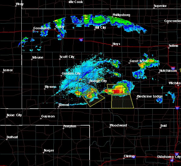 The severe thunderstorm warning for south central ford, northeastern meade and northwestern clark counties will expire at 915 pm cdt, the severe thunderstorm which prompted the warning has moved out of the warned area. therefore, the warning will be allowed to expire. a severe thunderstorm watch remains in effect until 200 am cdt for southwestern kansas. The severe thunderstorm warning for south central ford, northeastern meade and northwestern clark counties will expire at 915 pm cdt, the severe thunderstorm which prompted the warning has moved out of the warned area. therefore, the warning will be allowed to expire. a severe thunderstorm watch remains in effect until 200 am cdt for southwestern kansas.
|
| 6/17/2017 8:59 PM CDT |
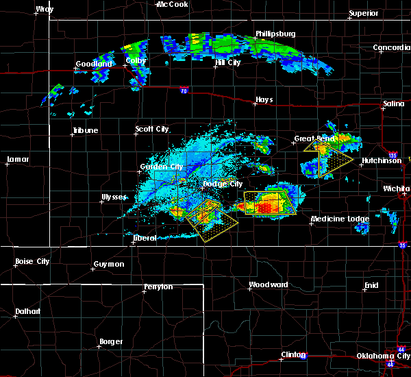 At 858 pm cdt, a severe thunderstorm was located very near minneola, or 19 miles northeast of meade, moving southeast at 30 mph (radar indicated). Hazards include 60 mph wind gusts and quarter size hail. Hail damage to vehicles is expected. expect wind damage to roofs, siding, and trees. Locations impacted include, minneola, fowler and bloom. At 858 pm cdt, a severe thunderstorm was located very near minneola, or 19 miles northeast of meade, moving southeast at 30 mph (radar indicated). Hazards include 60 mph wind gusts and quarter size hail. Hail damage to vehicles is expected. expect wind damage to roofs, siding, and trees. Locations impacted include, minneola, fowler and bloom.
|
| 6/17/2017 8:49 PM CDT |
 At 848 pm cdt, radar indicated two severe thunderstorms, one located just west of minneola, and the other just south of montezuma. both storms are moving southeast at 20 mph. (radar indicated). Hazards include golf ball size hail and 70 mph wind gusts. People and animals outdoors will be injured. expect hail damage to roofs, siding, windows, and vehicles. expect considerable tree damage. wind damage is also likely to mobile homes, roofs, and outbuildings. Locations impacted include, minneola, fowler, ensign, bloom and the haggard elevator. At 848 pm cdt, radar indicated two severe thunderstorms, one located just west of minneola, and the other just south of montezuma. both storms are moving southeast at 20 mph. (radar indicated). Hazards include golf ball size hail and 70 mph wind gusts. People and animals outdoors will be injured. expect hail damage to roofs, siding, windows, and vehicles. expect considerable tree damage. wind damage is also likely to mobile homes, roofs, and outbuildings. Locations impacted include, minneola, fowler, ensign, bloom and the haggard elevator.
|
| 6/17/2017 8:43 PM CDT | Ping Pong Ball sized hail reported 4.9 miles SW of Fowler, KS, quarter to ping pong hail. |
| 6/17/2017 8:40 PM CDT | Golf Ball sized hail reported 7.3 miles SSW of Fowler, KS |
| 6/17/2017 8:28 PM CDT |
 At 828 pm cdt, a severe thunderstorm was located 5 miles south of ensign, or 12 miles east of montezuma, moving southeast at 15 mph (radar indicated). Hazards include tennis ball size hail and 70 mph wind gusts. People and animals outdoors will be injured. expect hail damage to roofs, siding, windows, and vehicles. expect considerable tree damage. wind damage is also likely to mobile homes, roofs, and outbuildings. Locations impacted include, minneola, fowler, ensign, bloom and the haggard elevator. At 828 pm cdt, a severe thunderstorm was located 5 miles south of ensign, or 12 miles east of montezuma, moving southeast at 15 mph (radar indicated). Hazards include tennis ball size hail and 70 mph wind gusts. People and animals outdoors will be injured. expect hail damage to roofs, siding, windows, and vehicles. expect considerable tree damage. wind damage is also likely to mobile homes, roofs, and outbuildings. Locations impacted include, minneola, fowler, ensign, bloom and the haggard elevator.
|
| 6/17/2017 8:19 PM CDT |
 At 819 pm cdt, a severe thunderstorm was located 4 miles south of ensign, or 9 miles east of montezuma, moving southeast at 15 mph. this is a very dangerous storm (radar indicated). Hazards include three inch hail and 70 mph wind gusts. People and animals outdoors will be severely injured. expect shattered windows, extensive damage to roofs, siding, and vehicles. Locations impacted include, fowler, ensign and the haggard elevator. At 819 pm cdt, a severe thunderstorm was located 4 miles south of ensign, or 9 miles east of montezuma, moving southeast at 15 mph. this is a very dangerous storm (radar indicated). Hazards include three inch hail and 70 mph wind gusts. People and animals outdoors will be severely injured. expect shattered windows, extensive damage to roofs, siding, and vehicles. Locations impacted include, fowler, ensign and the haggard elevator.
|
| 6/17/2017 8:18 PM CDT |
 At 817 pm cdt, a severe thunderstorm was located 4 miles south of ensign, or 10 miles east of montezuma, moving southeast at 15 mph. this is a very dangerous storm (radar indicated). Hazards include three inch hail and 70 mph wind gusts. People and animals outdoors will be severely injured. Expect shattered windows, extensive damage to roofs, siding, and vehicles. At 817 pm cdt, a severe thunderstorm was located 4 miles south of ensign, or 10 miles east of montezuma, moving southeast at 15 mph. this is a very dangerous storm (radar indicated). Hazards include three inch hail and 70 mph wind gusts. People and animals outdoors will be severely injured. Expect shattered windows, extensive damage to roofs, siding, and vehicles.
|
| 6/17/2017 8:11 PM CDT |
 At 810 pm cdt, a severe thunderstorm was located 4 miles southwest of ensign, or 8 miles east of montezuma, moving southeast at 10 mph. this is a very dangerous storm (radar indicated). Hazards include three inch hail and 70 mph wind gusts. damaging hail is likely. People and animals outdoors will be severely injured. expect shattered windows, extensive damage to roofs, siding, and vehicles. Locations impacted include, cimarron, montezuma, fowler, ensign and the haggard elevator. At 810 pm cdt, a severe thunderstorm was located 4 miles southwest of ensign, or 8 miles east of montezuma, moving southeast at 10 mph. this is a very dangerous storm (radar indicated). Hazards include three inch hail and 70 mph wind gusts. damaging hail is likely. People and animals outdoors will be severely injured. expect shattered windows, extensive damage to roofs, siding, and vehicles. Locations impacted include, cimarron, montezuma, fowler, ensign and the haggard elevator.
|
| 6/17/2017 8:04 PM CDT |
 At 803 pm cdt, a severe thunderstorm was located 5 miles west of ensign, or 7 miles northeast of montezuma, moving southeast at 15 mph. this is a very dangerous storm (radar indicated). Hazards include softball size hail and 70 mph wind gusts. damaging hail is likely. frequent dangerous lightning is expected. People and animals outdoors will be severely injured. expect shattered windows, extensive damage to roofs, siding, and vehicles. Locations impacted include, cimarron, montezuma, fowler, ensign and the haggard elevator. At 803 pm cdt, a severe thunderstorm was located 5 miles west of ensign, or 7 miles northeast of montezuma, moving southeast at 15 mph. this is a very dangerous storm (radar indicated). Hazards include softball size hail and 70 mph wind gusts. damaging hail is likely. frequent dangerous lightning is expected. People and animals outdoors will be severely injured. expect shattered windows, extensive damage to roofs, siding, and vehicles. Locations impacted include, cimarron, montezuma, fowler, ensign and the haggard elevator.
|
| 6/17/2017 7:55 PM CDT |
 At 755 pm cdt, a severe thunderstorm was located 4 miles west of ensign, or 7 miles east of montezuma, moving southeast at 20 mph. this is a very dangerous storm (radar indicated). Hazards include softball size hail and 70 mph wind gusts. People and animals outdoors will be severely injured. expect shattered windows, extensive damage to roofs, siding, and vehicles. Locations impacted include, cimarron, montezuma, fowler, ensign and the haggard elevator. At 755 pm cdt, a severe thunderstorm was located 4 miles west of ensign, or 7 miles east of montezuma, moving southeast at 20 mph. this is a very dangerous storm (radar indicated). Hazards include softball size hail and 70 mph wind gusts. People and animals outdoors will be severely injured. expect shattered windows, extensive damage to roofs, siding, and vehicles. Locations impacted include, cimarron, montezuma, fowler, ensign and the haggard elevator.
|
| 6/17/2017 7:48 PM CDT |
 At 748 pm cdt, a severe thunderstorm was located 6 miles northeast of montezuma, moving southeast at 25 mph. this is a very dangerous storm (radar indicated). Hazards include three inch hail and 70 mph wind gusts. People and animals outdoors will be severely injured. expect shattered windows, extensive damage to roofs, siding, and vehicles. Locations impacted include, cimarron, montezuma, fowler, ensign and the haggard elevator. At 748 pm cdt, a severe thunderstorm was located 6 miles northeast of montezuma, moving southeast at 25 mph. this is a very dangerous storm (radar indicated). Hazards include three inch hail and 70 mph wind gusts. People and animals outdoors will be severely injured. expect shattered windows, extensive damage to roofs, siding, and vehicles. Locations impacted include, cimarron, montezuma, fowler, ensign and the haggard elevator.
|
| 6/17/2017 7:43 PM CDT |
 At 743 pm cdt, a severe thunderstorm was located 5 miles northeast of montezuma, moving southeast at 20 mph (radar indicated). Hazards include 60 mph wind gusts and half dollar size hail. Hail damage to vehicles is expected. Expect wind damage to roofs, siding, and trees. At 743 pm cdt, a severe thunderstorm was located 5 miles northeast of montezuma, moving southeast at 20 mph (radar indicated). Hazards include 60 mph wind gusts and half dollar size hail. Hail damage to vehicles is expected. Expect wind damage to roofs, siding, and trees.
|
| 5/18/2017 6:21 PM CDT |
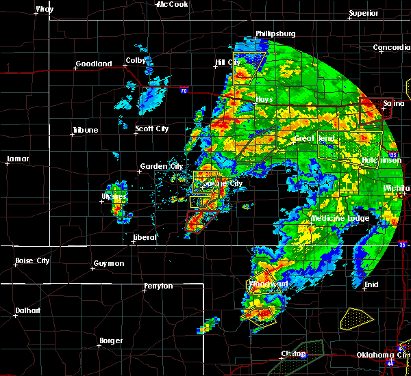 At 621 pm cdt, a severe thunderstorm capable of producing a tornado was located 11 miles south of fowler, or 11 miles east of meade, moving northeast at 45 mph (radar indicated rotation). Hazards include tornado and golf ball size hail. Flying debris will be dangerous to those caught without shelter. mobile homes will be damaged or destroyed. damage to roofs, windows, and vehicles will occur. tree damage is likely. this dangerous storm will be near, minneola around 645 pm cdt. Other locations impacted by this tornadic thunderstorm include big basin preserve. At 621 pm cdt, a severe thunderstorm capable of producing a tornado was located 11 miles south of fowler, or 11 miles east of meade, moving northeast at 45 mph (radar indicated rotation). Hazards include tornado and golf ball size hail. Flying debris will be dangerous to those caught without shelter. mobile homes will be damaged or destroyed. damage to roofs, windows, and vehicles will occur. tree damage is likely. this dangerous storm will be near, minneola around 645 pm cdt. Other locations impacted by this tornadic thunderstorm include big basin preserve.
|
| 5/18/2017 5:58 PM CDT | Ping Pong Ball sized hail reported 5 miles WSW of Fowler, KS |
| 5/16/2017 5:25 PM CDT |
 At 525 pm cdt, a severe thunderstorm capable of producing a tornado was located 8 miles south of fowler, or 9 miles east of meade, moving northeast at 30 mph (radar indicated rotation). Hazards include tornado and tennis ball size hail. Flying debris will be dangerous to those caught without shelter. mobile homes will be damaged or destroyed. damage to roofs, windows, and vehicles will occur. tree damage is likely. This dangerous storm will be near, fowler around 535 pm cdt. At 525 pm cdt, a severe thunderstorm capable of producing a tornado was located 8 miles south of fowler, or 9 miles east of meade, moving northeast at 30 mph (radar indicated rotation). Hazards include tornado and tennis ball size hail. Flying debris will be dangerous to those caught without shelter. mobile homes will be damaged or destroyed. damage to roofs, windows, and vehicles will occur. tree damage is likely. This dangerous storm will be near, fowler around 535 pm cdt.
|
| 5/16/2017 5:09 PM CDT |
 At 509 pm cdt, a severe thunderstorm capable of producing a tornado was located 10 miles southeast of meade, moving northeast at 30 mph (radar indicated rotation). Hazards include tornado and tennis ball size hail. Flying debris will be dangerous to those caught without shelter. mobile homes will be damaged or destroyed. damage to roofs, windows, and vehicles will occur. tree damage is likely. This dangerous storm will be near, fowler around 540 pm cdt. At 509 pm cdt, a severe thunderstorm capable of producing a tornado was located 10 miles southeast of meade, moving northeast at 30 mph (radar indicated rotation). Hazards include tornado and tennis ball size hail. Flying debris will be dangerous to those caught without shelter. mobile homes will be damaged or destroyed. damage to roofs, windows, and vehicles will occur. tree damage is likely. This dangerous storm will be near, fowler around 540 pm cdt.
|
| 5/16/2017 4:52 PM CDT |
 The severe thunderstorm warning for southern ford, northeastern meade and northwestern clark counties will expire at 500 pm cdt, the storm which prompted the warning has weakened below severe limits, and no longer poses an immediate threat to life or property. therefore the warning will be allowed to expire. a tornado watch remains in effect until 1000 pm cdt for southwestern kansas. The severe thunderstorm warning for southern ford, northeastern meade and northwestern clark counties will expire at 500 pm cdt, the storm which prompted the warning has weakened below severe limits, and no longer poses an immediate threat to life or property. therefore the warning will be allowed to expire. a tornado watch remains in effect until 1000 pm cdt for southwestern kansas.
|
| 5/16/2017 4:46 PM CDT |
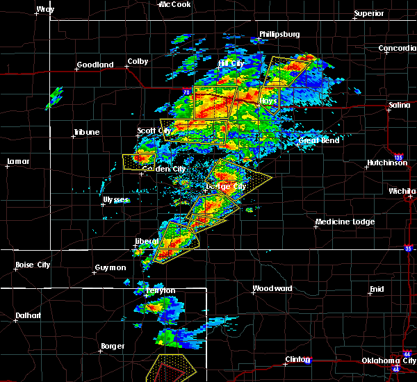 At 446 pm cdt, a severe thunderstorm was located 7 miles southeast of fowler, or 11 miles east of meade, moving northeast at 20 mph (radar indicated). Hazards include two inch hail and 70 mph wind gusts. People and animals outdoors will be injured. expect hail damage to roofs, siding, windows, and vehicles. expect considerable tree damage. wind damage is also likely to mobile homes, roofs, and outbuildings. locations impacted include, fowler. A tornado watch remains in effect until 1000 pm cdt for southwestern kansas. At 446 pm cdt, a severe thunderstorm was located 7 miles southeast of fowler, or 11 miles east of meade, moving northeast at 20 mph (radar indicated). Hazards include two inch hail and 70 mph wind gusts. People and animals outdoors will be injured. expect hail damage to roofs, siding, windows, and vehicles. expect considerable tree damage. wind damage is also likely to mobile homes, roofs, and outbuildings. locations impacted include, fowler. A tornado watch remains in effect until 1000 pm cdt for southwestern kansas.
|
| 5/16/2017 4:36 PM CDT |
 The severe thunderstorm warning for eastern meade and southwestern clark counties will expire at 445 pm cdt, the storm which prompted the warning has moved out of the area. therefore the warning will be allowed to expire. however small hail, gusty winds and heavy rain are still possible with this thunderstorm. a tornado watch remains in effect until 1000 pm cdt for southwestern kansas. to report severe weather, contact your nearest law enforcement agency. they will relay your report to the national weather service dodge city. The severe thunderstorm warning for eastern meade and southwestern clark counties will expire at 445 pm cdt, the storm which prompted the warning has moved out of the area. therefore the warning will be allowed to expire. however small hail, gusty winds and heavy rain are still possible with this thunderstorm. a tornado watch remains in effect until 1000 pm cdt for southwestern kansas. to report severe weather, contact your nearest law enforcement agency. they will relay your report to the national weather service dodge city.
|
| 5/16/2017 4:36 PM CDT |
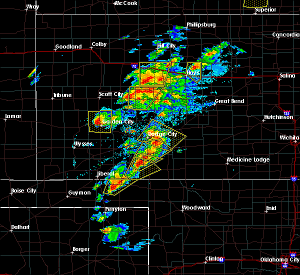 At 436 pm cdt, a severe thunderstorm was located 9 miles east of meade, moving northeast at 20 mph (radar indicated). Hazards include golf ball size hail and 70 mph wind gusts. People and animals outdoors will be injured. expect hail damage to roofs, siding, windows, and vehicles. expect considerable tree damage. Wind damage is also likely to mobile homes, roofs, and outbuildings. At 436 pm cdt, a severe thunderstorm was located 9 miles east of meade, moving northeast at 20 mph (radar indicated). Hazards include golf ball size hail and 70 mph wind gusts. People and animals outdoors will be injured. expect hail damage to roofs, siding, windows, and vehicles. expect considerable tree damage. Wind damage is also likely to mobile homes, roofs, and outbuildings.
|
| 5/16/2017 4:29 PM CDT |
 At 429 pm cdt, a severe thunderstorm was located 5 miles northwest of bloom, or 14 miles south of dodge city, moving northeast at 30 mph (radar indicated). Hazards include 70 mph wind gusts and ping pong ball size hail. People and animals outdoors will be injured. expect hail damage to roofs, siding, windows, and vehicles. expect considerable tree damage. wind damage is also likely to mobile homes, roofs, and outbuildings. locations impacted include, bucklin, minneola, fowler, ford, bloom and kingsdown. A tornado watch remains in effect until 1000 pm cdt for southwestern kansas. At 429 pm cdt, a severe thunderstorm was located 5 miles northwest of bloom, or 14 miles south of dodge city, moving northeast at 30 mph (radar indicated). Hazards include 70 mph wind gusts and ping pong ball size hail. People and animals outdoors will be injured. expect hail damage to roofs, siding, windows, and vehicles. expect considerable tree damage. wind damage is also likely to mobile homes, roofs, and outbuildings. locations impacted include, bucklin, minneola, fowler, ford, bloom and kingsdown. A tornado watch remains in effect until 1000 pm cdt for southwestern kansas.
|
| 5/16/2017 4:20 PM CDT |
 At 420 pm cdt, a severe thunderstorm was located 10 miles southeast of fowler, or 12 miles east of meade, moving northeast at 35 mph (radar indicated). Hazards include tennis ball size hail and 70 mph wind gusts. People and animals outdoors will be injured. expect hail damage to roofs, siding, windows, and vehicles. expect considerable tree damage. wind damage is also likely to mobile homes, roofs, and outbuildings. locations impacted include, fowler and big basin preserve. A tornado watch remains in effect until 1000 pm cdt for southwestern kansas. At 420 pm cdt, a severe thunderstorm was located 10 miles southeast of fowler, or 12 miles east of meade, moving northeast at 35 mph (radar indicated). Hazards include tennis ball size hail and 70 mph wind gusts. People and animals outdoors will be injured. expect hail damage to roofs, siding, windows, and vehicles. expect considerable tree damage. wind damage is also likely to mobile homes, roofs, and outbuildings. locations impacted include, fowler and big basin preserve. A tornado watch remains in effect until 1000 pm cdt for southwestern kansas.
|
| 5/16/2017 4:10 PM CDT |
 At 410 pm cdt, a severe thunderstorm was located 3 miles west of minneola, or 18 miles northeast of meade, moving northeast at 30 mph (radar indicated). Hazards include golf ball size hail and 70 mph wind gusts. People and animals outdoors will be injured. expect hail damage to roofs, siding, windows, and vehicles. expect considerable tree damage. Wind damage is also likely to mobile homes, roofs, and outbuildings. At 410 pm cdt, a severe thunderstorm was located 3 miles west of minneola, or 18 miles northeast of meade, moving northeast at 30 mph (radar indicated). Hazards include golf ball size hail and 70 mph wind gusts. People and animals outdoors will be injured. expect hail damage to roofs, siding, windows, and vehicles. expect considerable tree damage. Wind damage is also likely to mobile homes, roofs, and outbuildings.
|
| 5/16/2017 3:55 PM CDT |
 At 355 pm cdt, a severe thunderstorm was located 10 miles southeast of meade state lake, or 13 miles south of meade, moving northeast at 35 mph (radar indicated). Hazards include tennis ball size hail and 70 mph wind gusts. People and animals outdoors will be injured. expect hail damage to roofs, siding, windows, and vehicles. expect considerable tree damage. Wind damage is also likely to mobile homes, roofs, and outbuildings. At 355 pm cdt, a severe thunderstorm was located 10 miles southeast of meade state lake, or 13 miles south of meade, moving northeast at 35 mph (radar indicated). Hazards include tennis ball size hail and 70 mph wind gusts. People and animals outdoors will be injured. expect hail damage to roofs, siding, windows, and vehicles. expect considerable tree damage. Wind damage is also likely to mobile homes, roofs, and outbuildings.
|
| 5/16/2017 3:44 PM CDT |
 At 344 pm cdt, a severe thunderstorm was located 5 miles northwest of meade state lake, or 6 miles east of plains, moving northeast at 55 mph. this is a very dangerous storm (radar indicated). Hazards include three inch hail and 60 mph wind gusts. People and animals outdoors will be severely injured. Expect shattered windows, extensive damage to roofs, siding, and vehicles. At 344 pm cdt, a severe thunderstorm was located 5 miles northwest of meade state lake, or 6 miles east of plains, moving northeast at 55 mph. this is a very dangerous storm (radar indicated). Hazards include three inch hail and 60 mph wind gusts. People and animals outdoors will be severely injured. Expect shattered windows, extensive damage to roofs, siding, and vehicles.
|
| 5/16/2017 3:35 PM CDT |
 At 335 pm cdt, a severe thunderstorm was located near kismet, or 5 miles west of plains, moving northeast at 40 mph (radar indicated). Hazards include tennis ball size hail and 60 mph wind gusts. People and animals outdoors will be injured. expect hail damage to roofs, siding, windows, and vehicles. expect wind damage to roofs, siding, and trees. locations impacted include, meade, plains, fowler, missler, meade state lake and the hobart elevator. A tornado watch remains in effect until 1000 pm cdt for southwestern kansas. At 335 pm cdt, a severe thunderstorm was located near kismet, or 5 miles west of plains, moving northeast at 40 mph (radar indicated). Hazards include tennis ball size hail and 60 mph wind gusts. People and animals outdoors will be injured. expect hail damage to roofs, siding, windows, and vehicles. expect wind damage to roofs, siding, and trees. locations impacted include, meade, plains, fowler, missler, meade state lake and the hobart elevator. A tornado watch remains in effect until 1000 pm cdt for southwestern kansas.
|
| 5/16/2017 2:59 PM CDT |
 At 259 pm cdt, a severe thunderstorm was located 4 miles northwest of turpin, or 7 miles south of liberal, moving north at 40 mph (radar indicated). Hazards include tennis ball size hail and 60 mph wind gusts. People and animals outdoors will be injured. expect hail damage to roofs, siding, windows, and vehicles. expect wind damage to roofs, siding, and trees. locations impacted include, liberal, meade, plains, fowler, kismet, hayne, woods, missler, meade state lake, arkalon park and the hobart elevator. A tornado watch remains in effect until 1000 pm cdt for southwestern kansas. At 259 pm cdt, a severe thunderstorm was located 4 miles northwest of turpin, or 7 miles south of liberal, moving north at 40 mph (radar indicated). Hazards include tennis ball size hail and 60 mph wind gusts. People and animals outdoors will be injured. expect hail damage to roofs, siding, windows, and vehicles. expect wind damage to roofs, siding, and trees. locations impacted include, liberal, meade, plains, fowler, kismet, hayne, woods, missler, meade state lake, arkalon park and the hobart elevator. A tornado watch remains in effect until 1000 pm cdt for southwestern kansas.
|
| 5/16/2017 2:42 PM CDT |
 At 241 pm cdt, a severe thunderstorm was located 5 miles southwest of floris, or 12 miles west of beaver, moving northeast at 40 mph. this is a very dangerous storm (radar indicated). Hazards include baseball size hail and 60 mph wind gusts. People and animals outdoors will be severely injured. Expect shattered windows, extensive damage to roofs, siding, and vehicles. At 241 pm cdt, a severe thunderstorm was located 5 miles southwest of floris, or 12 miles west of beaver, moving northeast at 40 mph. this is a very dangerous storm (radar indicated). Hazards include baseball size hail and 60 mph wind gusts. People and animals outdoors will be severely injured. Expect shattered windows, extensive damage to roofs, siding, and vehicles.
|
| 5/15/2017 11:51 PM CDT |
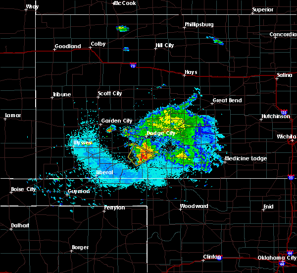 The severe thunderstorm warning for southwestern ford, northeastern meade, southeastern gray and northwestern clark counties will expire at midnight cdt, the severe thunderstorm which prompted the warning is weakening below severe limits. therefore, the warning will be allowed to expire at midnight. The severe thunderstorm warning for southwestern ford, northeastern meade, southeastern gray and northwestern clark counties will expire at midnight cdt, the severe thunderstorm which prompted the warning is weakening below severe limits. therefore, the warning will be allowed to expire at midnight.
|
| 5/15/2017 11:40 PM CDT |
 At 1140 pm cdt, a severe thunderstorm was located 5 miles east of fowler, or 14 miles northeast of meade, moving northeast at 40 mph (radar indicated). Hazards include 60 mph wind gusts and quarter size hail. Hail damage to vehicles is expected. expect wind damage to roofs, siding, and trees. Locations impacted include, minneola and fowler. At 1140 pm cdt, a severe thunderstorm was located 5 miles east of fowler, or 14 miles northeast of meade, moving northeast at 40 mph (radar indicated). Hazards include 60 mph wind gusts and quarter size hail. Hail damage to vehicles is expected. expect wind damage to roofs, siding, and trees. Locations impacted include, minneola and fowler.
|
| 5/15/2017 11:25 PM CDT |
 At 1124 pm cdt, a severe thunderstorm was located 4 miles east of meade, moving northeast at 40 mph (radar indicated). Hazards include 60 mph wind gusts and quarter size hail. Hail damage to vehicles is expected. Expect wind damage to roofs, siding, and trees. At 1124 pm cdt, a severe thunderstorm was located 4 miles east of meade, moving northeast at 40 mph (radar indicated). Hazards include 60 mph wind gusts and quarter size hail. Hail damage to vehicles is expected. Expect wind damage to roofs, siding, and trees.
|
| 5/11/2017 1:36 AM CDT |
 The severe thunderstorm warning for southwestern ford, northeastern meade, southeastern gray and northwestern clark counties will expire at 145 am cdt, the storm which prompted the warning has weakened below severe limits, and no longer poses an immediate threat to life or property. therefore the warning will be allowed to expire. however gusty winds and heavy rain are still possible with this thunderstorm. to report severe weather, contact your nearest law enforcement agency. they will relay your report to the national weather service dodge city. The severe thunderstorm warning for southwestern ford, northeastern meade, southeastern gray and northwestern clark counties will expire at 145 am cdt, the storm which prompted the warning has weakened below severe limits, and no longer poses an immediate threat to life or property. therefore the warning will be allowed to expire. however gusty winds and heavy rain are still possible with this thunderstorm. to report severe weather, contact your nearest law enforcement agency. they will relay your report to the national weather service dodge city.
|
| 5/11/2017 1:14 AM CDT |
 At 114 am cdt, a severe thunderstorm was located 4 miles west of fowler, or 9 miles northeast of meade, moving northeast at 20 mph (radar indicated). Hazards include 60 mph wind gusts and quarter size hail. Hail damage to vehicles is expected. expect wind damage to roofs, siding, and trees. Locations impacted include, fowler and the haggard elevator. At 114 am cdt, a severe thunderstorm was located 4 miles west of fowler, or 9 miles northeast of meade, moving northeast at 20 mph (radar indicated). Hazards include 60 mph wind gusts and quarter size hail. Hail damage to vehicles is expected. expect wind damage to roofs, siding, and trees. Locations impacted include, fowler and the haggard elevator.
|
| 5/11/2017 1:06 AM CDT |
 At 106 am cdt, a severe thunderstorm was located 4 miles north of meade, moving northeast at 20 mph (radar indicated). Hazards include 60 mph wind gusts and quarter size hail. Hail damage to vehicles is expected. Expect wind damage to roofs, siding, and trees. At 106 am cdt, a severe thunderstorm was located 4 miles north of meade, moving northeast at 20 mph (radar indicated). Hazards include 60 mph wind gusts and quarter size hail. Hail damage to vehicles is expected. Expect wind damage to roofs, siding, and trees.
|
| 4/1/2017 9:06 AM CDT |
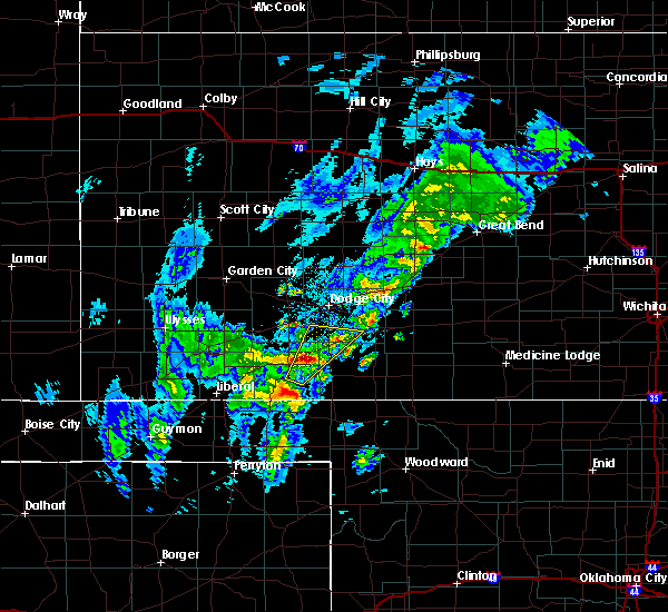 At 906 am cdt, a severe thunderstorm was located near fowler, or 12 miles northeast of meade, moving northeast at 50 mph (radar indicated). Hazards include half dollar size hail. Damage to vehicles is expected. Locations impacted include, minneola, fowler and bloom. At 906 am cdt, a severe thunderstorm was located near fowler, or 12 miles northeast of meade, moving northeast at 50 mph (radar indicated). Hazards include half dollar size hail. Damage to vehicles is expected. Locations impacted include, minneola, fowler and bloom.
|
| 4/1/2017 8:51 AM CDT |
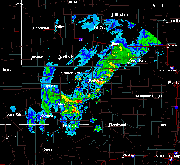 At 851 am cdt, a severe thunderstorm was located 6 miles southeast of meade, moving northeast at 50 mph (radar indicated). Hazards include ping pong ball size hail. People and animals outdoors will be injured. Expect damage to roofs, siding, windows, and vehicles. At 851 am cdt, a severe thunderstorm was located 6 miles southeast of meade, moving northeast at 50 mph (radar indicated). Hazards include ping pong ball size hail. People and animals outdoors will be injured. Expect damage to roofs, siding, windows, and vehicles.
|
| 8/11/2016 4:48 PM CDT | They reported several tree limbs dow in meade county KS, 6 miles NW of Fowler, KS |
| 7/15/2016 6:55 PM CDT |
 The severe thunderstorm warning for southeastern gray, southwestern ford, seward, west central clark, meade and southeastern haskell counties will expire at 700 pm cdt, the storms which prompted the warning are moving out of the warned area. heavy rain and frequent lightning will continue for the next 30 minutes. the severe thunderstorm warning will be allowed to expire at 7 pm cdt. a severe thunderstorm watch remains in effect until 900 pm cdt for southwestern kansas. The severe thunderstorm warning for southeastern gray, southwestern ford, seward, west central clark, meade and southeastern haskell counties will expire at 700 pm cdt, the storms which prompted the warning are moving out of the warned area. heavy rain and frequent lightning will continue for the next 30 minutes. the severe thunderstorm warning will be allowed to expire at 7 pm cdt. a severe thunderstorm watch remains in effect until 900 pm cdt for southwestern kansas.
|
| 7/15/2016 6:39 PM CDT | Several 12 to 14 inch diameter tree limbs blown down. time was estimated by rada in ford county KS, 7.3 miles SSW of Fowler, KS |
| 7/15/2016 6:31 PM CDT |
 At 629 pm cdt, severe thunderstorms were located along a line extending from near fowler to 5 miles north of hayne, moving southeast at 45 mph (radar indicated). Hazards include 70 mph wind gusts and nickel size hail. Expect considerable tree damage. damage is likely to mobile homes, roofs, and outbuildings. wind damage is likely. this line of storms has a history of producing wind damage. Locations impacted include, meade, fowler, kismet, hayne, meade state park, missler and plains. At 629 pm cdt, severe thunderstorms were located along a line extending from near fowler to 5 miles north of hayne, moving southeast at 45 mph (radar indicated). Hazards include 70 mph wind gusts and nickel size hail. Expect considerable tree damage. damage is likely to mobile homes, roofs, and outbuildings. wind damage is likely. this line of storms has a history of producing wind damage. Locations impacted include, meade, fowler, kismet, hayne, meade state park, missler and plains.
|
| 7/15/2016 6:28 PM CDT |
 At 627 pm cdt, a severe thunderstorm was located 3 miles north of meade, moving south at 45 mph (radar indicated). Hazards include 70 mph wind gusts and nickel size hail. Expect considerable tree damage. damage is likely to mobile homes, roofs, and outbuildings. winds to near 70 mph are likely. significant tree damage has been reported in montezuma. Locations impacted include, montezuma, fowler, copeland, ensign and the haggard elev. At 627 pm cdt, a severe thunderstorm was located 3 miles north of meade, moving south at 45 mph (radar indicated). Hazards include 70 mph wind gusts and nickel size hail. Expect considerable tree damage. damage is likely to mobile homes, roofs, and outbuildings. winds to near 70 mph are likely. significant tree damage has been reported in montezuma. Locations impacted include, montezuma, fowler, copeland, ensign and the haggard elev.
|
| 7/15/2016 6:16 PM CDT |
 At 615 pm cdt, severe thunderstorms were located along a line extending from 6 miles south of the haggard elevator to 8 miles south of satanta, moving southeast at 35 mph (radar indicated). Hazards include 70 mph wind gusts and quarter size hail. Hail damage to vehicles is expected. expect considerable tree damage. Wind damage is also likely to mobile homes, roofs, and outbuildings. At 615 pm cdt, severe thunderstorms were located along a line extending from 6 miles south of the haggard elevator to 8 miles south of satanta, moving southeast at 35 mph (radar indicated). Hazards include 70 mph wind gusts and quarter size hail. Hail damage to vehicles is expected. expect considerable tree damage. Wind damage is also likely to mobile homes, roofs, and outbuildings.
|
| 7/15/2016 6:09 PM CDT |
 At 608 pm cdt, a severe thunderstorm was located 4 miles southeast of montezuma, moving south at 40 mph (radar indicated). Hazards include 70 mph wind gusts and nickel size hail. Expect considerable tree damage. damage is likely to mobile homes, roofs, and outbuildings. this storm has a history of producing wind gusts of 70 mph. Locations impacted include, montezuma, fowler, copeland, ensign and the haggard elev. At 608 pm cdt, a severe thunderstorm was located 4 miles southeast of montezuma, moving south at 40 mph (radar indicated). Hazards include 70 mph wind gusts and nickel size hail. Expect considerable tree damage. damage is likely to mobile homes, roofs, and outbuildings. this storm has a history of producing wind gusts of 70 mph. Locations impacted include, montezuma, fowler, copeland, ensign and the haggard elev.
|
| 7/15/2016 5:51 PM CDT |
 At 550 pm cdt, a severe thunderstorm was located 7 miles south of ingalls, moving south at 45 mph (radar indicated). Hazards include 70 mph wind gusts and nickel size hail. Expect considerable tree damage. damage is likely to mobile homes, roofs, and outbuildings. Wind gusts of 70 to 80 mph have been observed with this storm. At 550 pm cdt, a severe thunderstorm was located 7 miles south of ingalls, moving south at 45 mph (radar indicated). Hazards include 70 mph wind gusts and nickel size hail. Expect considerable tree damage. damage is likely to mobile homes, roofs, and outbuildings. Wind gusts of 70 to 80 mph have been observed with this storm.
|
| 7/14/2016 7:56 AM CDT |
 The severe thunderstorm warning for southeastern gray, southwestern ford, northwestern clark and northeastern meade counties will expire at 800 am cdt, the storm which prompted the warning has weakened below severe limits, and no longer pose an immediate threat to life or property. therefore, the warning will be allowed to expire. however small. The severe thunderstorm warning for southeastern gray, southwestern ford, northwestern clark and northeastern meade counties will expire at 800 am cdt, the storm which prompted the warning has weakened below severe limits, and no longer pose an immediate threat to life or property. therefore, the warning will be allowed to expire. however small.
|
| 7/14/2016 7:41 AM CDT |
 At 741 am cdt, a severe thunderstorm was located 8 miles southeast of the haggard elev, moving southeast at 20 mph (radar indicated). Hazards include 60 mph wind gusts and quarter size hail. Hail damage to vehicles is expected. expect wind damage to roofs, siding, and trees. Locations impacted include, montezuma, minneola, fowler, ensign and the haggard elev. At 741 am cdt, a severe thunderstorm was located 8 miles southeast of the haggard elev, moving southeast at 20 mph (radar indicated). Hazards include 60 mph wind gusts and quarter size hail. Hail damage to vehicles is expected. expect wind damage to roofs, siding, and trees. Locations impacted include, montezuma, minneola, fowler, ensign and the haggard elev.
|
| 7/14/2016 7:24 AM CDT |
 At 724 am cdt, a severe thunderstorm was located 3 miles southwest of the haggard elev, moving southeast at 30 mph (radar indicated). Hazards include 60 mph wind gusts and quarter size hail. Hail damage to vehicles is expected. Expect wind damage to roofs, siding, and trees. At 724 am cdt, a severe thunderstorm was located 3 miles southwest of the haggard elev, moving southeast at 30 mph (radar indicated). Hazards include 60 mph wind gusts and quarter size hail. Hail damage to vehicles is expected. Expect wind damage to roofs, siding, and trees.
|
| 7/2/2016 6:13 PM CDT |
 At 612 pm cdt, a severe thunderstorm was located very near meade, moving northeast at 20 mph (radar indicated). Hazards include 60 mph wind gusts and up to half dollar size hail. Hail damage to vehicles is expected. expect wind damage to roofs, siding and trees. Locations impacted include, meade, fowler, missler and meade state park. At 612 pm cdt, a severe thunderstorm was located very near meade, moving northeast at 20 mph (radar indicated). Hazards include 60 mph wind gusts and up to half dollar size hail. Hail damage to vehicles is expected. expect wind damage to roofs, siding and trees. Locations impacted include, meade, fowler, missler and meade state park.
|
| 7/2/2016 5:53 PM CDT |
 At 553 pm cdt, a severe thunderstorm was located 4 miles north of meade state park, moving northeast at 20 mph (radar indicated). Hazards include 60 mph wind gusts and up to half dollar size hail. Hail damage to vehicles is expected. Expect wind damage to roofs, siding and trees. At 553 pm cdt, a severe thunderstorm was located 4 miles north of meade state park, moving northeast at 20 mph (radar indicated). Hazards include 60 mph wind gusts and up to half dollar size hail. Hail damage to vehicles is expected. Expect wind damage to roofs, siding and trees.
|
| 5/26/2016 6:47 PM CDT |
 At 647 pm cdt, a severe thunderstorm was located 6 miles south of clark state lake, moving northeast at 30 mph. this is a very dangerous storm (radar indicated). Hazards include three inch hail and 60 mph wind gusts. People and animals outdoors will be severely injured. expect shattered windows, extensive damage to roofs, siding and vehicles. locations impacted include, minneola, fowler and clark state lake. A tornado watch remains in effect until 1000 pm cdt for southwestern kansas. At 647 pm cdt, a severe thunderstorm was located 6 miles south of clark state lake, moving northeast at 30 mph. this is a very dangerous storm (radar indicated). Hazards include three inch hail and 60 mph wind gusts. People and animals outdoors will be severely injured. expect shattered windows, extensive damage to roofs, siding and vehicles. locations impacted include, minneola, fowler and clark state lake. A tornado watch remains in effect until 1000 pm cdt for southwestern kansas.
|
| 5/26/2016 6:41 PM CDT |
 At 641 pm cdt, a severe thunderstorm was located 8 miles east of meade state park, moving northeast at 35 mph (radar indicated). Hazards include 60 mph wind gusts and half dollar size hail. Hail damage to vehicles is expected. expect wind damage to roofs, siding and trees. Locations impacted include, meade, fowler and meade state park. At 641 pm cdt, a severe thunderstorm was located 8 miles east of meade state park, moving northeast at 35 mph (radar indicated). Hazards include 60 mph wind gusts and half dollar size hail. Hail damage to vehicles is expected. expect wind damage to roofs, siding and trees. Locations impacted include, meade, fowler and meade state park.
|
| 5/26/2016 6:27 PM CDT |
 At 627 pm cdt, a severe thunderstorm was located 5 miles south of meade state park, moving northeast at 30 mph (radar indicated). Hazards include 60 mph wind gusts and half dollar size hail. Hail damage to vehicles is expected. expect wind damage to roofs, siding and trees. Locations impacted include, meade, fowler, missler, meade state park and plains. At 627 pm cdt, a severe thunderstorm was located 5 miles south of meade state park, moving northeast at 30 mph (radar indicated). Hazards include 60 mph wind gusts and half dollar size hail. Hail damage to vehicles is expected. expect wind damage to roofs, siding and trees. Locations impacted include, meade, fowler, missler, meade state park and plains.
|
| 5/26/2016 6:25 PM CDT |
 At 625 pm cdt, a severe thunderstorm was located 4 miles northwest of acres, moving northeast at 20 mph (radar indicated). Hazards include two inch hail and 60 mph wind gusts. People and animals outdoors will be injured. expect hail damage to roofs, siding, windows and vehicles. expect wind damage to roofs, siding and trees. locations impacted include, minneola, fowler and clark state lake. A tornado watch remains in effect until 1000 pm cdt for southwestern kansas. At 625 pm cdt, a severe thunderstorm was located 4 miles northwest of acres, moving northeast at 20 mph (radar indicated). Hazards include two inch hail and 60 mph wind gusts. People and animals outdoors will be injured. expect hail damage to roofs, siding, windows and vehicles. expect wind damage to roofs, siding and trees. locations impacted include, minneola, fowler and clark state lake. A tornado watch remains in effect until 1000 pm cdt for southwestern kansas.
|
| 5/26/2016 6:10 PM CDT |
 At 609 pm cdt, a severe thunderstorm was located 14 miles south of meade state park, moving northeast at 30 mph (radar indicated). Hazards include golf ball size hail. People and animals outdoors will be injured. Expect damage to roofs, siding, windows and vehicles. At 609 pm cdt, a severe thunderstorm was located 14 miles south of meade state park, moving northeast at 30 mph (radar indicated). Hazards include golf ball size hail. People and animals outdoors will be injured. Expect damage to roofs, siding, windows and vehicles.
|
| 5/26/2016 6:08 PM CDT |
 At 607 pm cdt, a severe thunderstorm was located 6 miles northwest of englewood, moving northeast at 35 mph. this is a very dangerous storm (radar indicated). Hazards include three inch hail and 60 mph wind gusts. People and animals outdoors will be severely injured. Expect shattered windows, extensive damage to roofs, siding and vehicles. At 607 pm cdt, a severe thunderstorm was located 6 miles northwest of englewood, moving northeast at 35 mph. this is a very dangerous storm (radar indicated). Hazards include three inch hail and 60 mph wind gusts. People and animals outdoors will be severely injured. Expect shattered windows, extensive damage to roofs, siding and vehicles.
|
| 11/16/2015 9:06 PM CST |
 At 906 pm cst, a severe thunderstorm was located 4 miles south of the haggard elev, moving northeast at 70 mph (radar indicated). Hazards include 60 mph wind gusts and penny size hail. Expect damage to roofs. siding and trees. locations impacted include, dodge city, meade, montezuma, fowler, ensign, howell and the haggard elev. A tornado watch remains in effect until 300 am cst for southwestern kansas. At 906 pm cst, a severe thunderstorm was located 4 miles south of the haggard elev, moving northeast at 70 mph (radar indicated). Hazards include 60 mph wind gusts and penny size hail. Expect damage to roofs. siding and trees. locations impacted include, dodge city, meade, montezuma, fowler, ensign, howell and the haggard elev. A tornado watch remains in effect until 300 am cst for southwestern kansas.
|
| 11/16/2015 8:56 PM CST |
 At 856 pm cst, a severe thunderstorm was located 7 miles north of missler, moving northeast at 70 mph (radar indicated). Hazards include 60 mph wind gusts and penny size hail. Expect damage to roofs. Siding and trees. At 856 pm cst, a severe thunderstorm was located 7 miles north of missler, moving northeast at 70 mph (radar indicated). Hazards include 60 mph wind gusts and penny size hail. Expect damage to roofs. Siding and trees.
|
| 11/16/2015 6:21 PM CST |
 At 621 pm cst, a large and extremely dangerous tornado was located 6 miles northwest of missler, moving northeast at 45 mph. this is a particularly dangerous situation (radar indicated rotation). Hazards include damaging tornado. Flying debris will be dangerous to those caught without shelter. mobile homes will be damaged or destroyed. damage to roofs, windows and vehicles will occur. tree damage is likely. This tornadic thunderstorm will remain over mainly rural areas of southeastern gray and northern meade counties. At 621 pm cst, a large and extremely dangerous tornado was located 6 miles northwest of missler, moving northeast at 45 mph. this is a particularly dangerous situation (radar indicated rotation). Hazards include damaging tornado. Flying debris will be dangerous to those caught without shelter. mobile homes will be damaged or destroyed. damage to roofs, windows and vehicles will occur. tree damage is likely. This tornadic thunderstorm will remain over mainly rural areas of southeastern gray and northern meade counties.
|
| 11/16/2015 6:05 PM CST |
 At 604 pm cst, a large and extremely dangerous tornado was located 3 miles west of plains, or 4 miles northeast of kismet, moving northeast at 40 mph. this is a particularly dangerous situation (radar indicated rotation). Hazards include damaging tornado. Flying debris will be dangerous to those caught without shelter. mobile homes will be damaged or destroyed. damage to roofs, windows and vehicles will occur. tree damage is likely. The tornado will be near, missler around 625 pm cst. At 604 pm cst, a large and extremely dangerous tornado was located 3 miles west of plains, or 4 miles northeast of kismet, moving northeast at 40 mph. this is a particularly dangerous situation (radar indicated rotation). Hazards include damaging tornado. Flying debris will be dangerous to those caught without shelter. mobile homes will be damaged or destroyed. damage to roofs, windows and vehicles will occur. tree damage is likely. The tornado will be near, missler around 625 pm cst.
|
| 11/16/2015 5:52 PM CST |
 At 551 pm cst, a confirmed large and extremely dangerous tornado was located very near kismet, moving northeast at 50 mph. this is a particularly dangerous situation (emergency management confirmed tornado). Hazards include damaging tornado. Flying debris will be dangerous to those caught without shelter. mobile homes will be damaged or destroyed. damage to roofs, windows and vehicles will occur. tree damage is likely. the tornado will be near, plains around 600 pm cst. missler around 610 pm cst. This warning replaces the tornado warning issued earlier for central seward county. At 551 pm cst, a confirmed large and extremely dangerous tornado was located very near kismet, moving northeast at 50 mph. this is a particularly dangerous situation (emergency management confirmed tornado). Hazards include damaging tornado. Flying debris will be dangerous to those caught without shelter. mobile homes will be damaged or destroyed. damage to roofs, windows and vehicles will occur. tree damage is likely. the tornado will be near, plains around 600 pm cst. missler around 610 pm cst. This warning replaces the tornado warning issued earlier for central seward county.
|
| 8/18/2015 12:24 AM CDT |
 The severe thunderstorm warning for meade county will expire at 1230 am cdt, the line of storms which prompted the warning have weakened below severe limits, and no longer pose an immediate threat to life or property. therefore the warning will be allowed to expire. however gusty winds are still possible with these thunderstorms. to report severe weather, contact your nearest law enforcement agency. they will relay your report to the national weather service dodge city. The severe thunderstorm warning for meade county will expire at 1230 am cdt, the line of storms which prompted the warning have weakened below severe limits, and no longer pose an immediate threat to life or property. therefore the warning will be allowed to expire. however gusty winds are still possible with these thunderstorms. to report severe weather, contact your nearest law enforcement agency. they will relay your report to the national weather service dodge city.
|
| 8/17/2015 11:59 PM CDT |
 At 1159 pm cdt, severe thunderstorms were located along a line extending from 5 miles southeast of copeland to 3 miles northeast of plains to 8 miles southeast of kismet to 11 miles southeast of hayne to 17 miles southeast of liberal, moving southeast at 40 mph (radar indicated). Hazards include 60 mph wind gusts and nickel size hail. Expect damage to roofs. siding and trees. Locations impacted include, meade, fowler, missler, meade state park and plains. At 1159 pm cdt, severe thunderstorms were located along a line extending from 5 miles southeast of copeland to 3 miles northeast of plains to 8 miles southeast of kismet to 11 miles southeast of hayne to 17 miles southeast of liberal, moving southeast at 40 mph (radar indicated). Hazards include 60 mph wind gusts and nickel size hail. Expect damage to roofs. siding and trees. Locations impacted include, meade, fowler, missler, meade state park and plains.
|
| 8/17/2015 11:43 PM CDT |
 At 1143 pm cdt, severe thunderstorms were located along a line extending from near tice to 9 miles northwest of plains to 2 miles southwest of kismet to 5 miles south of hayne to 11 miles south of liberal, moving southeast at 40 mph (radar indicated). Hazards include 60 mph wind gusts and nickel size hail. Expect damage to roofs. Siding and trees. At 1143 pm cdt, severe thunderstorms were located along a line extending from near tice to 9 miles northwest of plains to 2 miles southwest of kismet to 5 miles south of hayne to 11 miles south of liberal, moving southeast at 40 mph (radar indicated). Hazards include 60 mph wind gusts and nickel size hail. Expect damage to roofs. Siding and trees.
|
| 8/4/2015 8:47 PM CDT |
 At 846 pm cdt, a severe thunderstorm was located 7 miles south of ft. dodge, moving southeast at 30 mph (radar indicated). Hazards include ping pong ball size hail and 60 mph wind gusts. People and animals outdoors will be injured. expect hail damage to roofs, siding, windows and vehicles. expect wind damage to roofs, siding and trees. locations impacted include, minneola, fowler and bloom. this storm is showing a weakening trend as it is moving into southwestern ford county. Further weakening is anticipated as it approaches northwestern clark county. At 846 pm cdt, a severe thunderstorm was located 7 miles south of ft. dodge, moving southeast at 30 mph (radar indicated). Hazards include ping pong ball size hail and 60 mph wind gusts. People and animals outdoors will be injured. expect hail damage to roofs, siding, windows and vehicles. expect wind damage to roofs, siding and trees. locations impacted include, minneola, fowler and bloom. this storm is showing a weakening trend as it is moving into southwestern ford county. Further weakening is anticipated as it approaches northwestern clark county.
|
| 8/4/2015 8:24 PM CDT |
 At 824 pm cdt, a severe thunderstorm was located 3 miles east of howell, moving southeast at 30 mph. this is a very dangerous storm (radar indicated). Hazards include 80 mph wind gusts and two inch hail. Flying debris will be dangerous to those caught without shelter. mobile homes will be heavily damaged. expect considerable damage to roofs, windows and vehicles. Extensive tree damage and power outages are likely. At 824 pm cdt, a severe thunderstorm was located 3 miles east of howell, moving southeast at 30 mph. this is a very dangerous storm (radar indicated). Hazards include 80 mph wind gusts and two inch hail. Flying debris will be dangerous to those caught without shelter. mobile homes will be heavily damaged. expect considerable damage to roofs, windows and vehicles. Extensive tree damage and power outages are likely.
|
| 7/17/2015 6:03 PM CDT |
 At 603 pm cdt, a severe thunderstorm was located 6 miles southwest of meade state park, moving northeast at 20 mph (radar indicated). Hazards include 70 mph wind gusts and half dollar size hail. Hail damage to vehicles is expected. expect considerable tree damage. wind damage is also likely to mobile homes, roofs and outbuildings. Locations impacted include, meade, fowler, meade state park and plains. At 603 pm cdt, a severe thunderstorm was located 6 miles southwest of meade state park, moving northeast at 20 mph (radar indicated). Hazards include 70 mph wind gusts and half dollar size hail. Hail damage to vehicles is expected. expect considerable tree damage. wind damage is also likely to mobile homes, roofs and outbuildings. Locations impacted include, meade, fowler, meade state park and plains.
|
| 7/17/2015 5:49 PM CDT |
 At 549 pm cdt, a severe thunderstorm was located 5 miles southeast of kismet, moving northeast at 30 mph (radar indicated). Hazards include 70 mph wind gusts and half dollar size hail. Hail damage to vehicles is expected. expect considerable tree damage. wind damage is also likely to mobile homes, roofs and outbuildings. Locations impacted include, meade, fowler, kismet, missler, meade state park and plains. At 549 pm cdt, a severe thunderstorm was located 5 miles southeast of kismet, moving northeast at 30 mph (radar indicated). Hazards include 70 mph wind gusts and half dollar size hail. Hail damage to vehicles is expected. expect considerable tree damage. wind damage is also likely to mobile homes, roofs and outbuildings. Locations impacted include, meade, fowler, kismet, missler, meade state park and plains.
|
| 7/17/2015 5:28 PM CDT |
 At 527 pm cdt, a severe thunderstorm was located 7 miles east of hayne, moving northeast at 25 mph. another strong thunderstorm was rapidly developing near liberal (radar indicated). Hazards include 70 mph wind gusts and quarter size hail. Hail damage to vehicles is expected. expect considerable tree damage. Wind damage is also likely to mobile homes, roofs and outbuildings. At 527 pm cdt, a severe thunderstorm was located 7 miles east of hayne, moving northeast at 25 mph. another strong thunderstorm was rapidly developing near liberal (radar indicated). Hazards include 70 mph wind gusts and quarter size hail. Hail damage to vehicles is expected. expect considerable tree damage. Wind damage is also likely to mobile homes, roofs and outbuildings.
|
| 5/27/2015 6:32 PM CDT | At 632 pm cdt, a severe thunderstorm was located 6 miles southeast of fowler, moving east at 10 mph (radar indicated). Hazards include 60 mph wind gusts and quarter size hail. Hail damage to vehicles is expected. expect wind damage to roofs, siding and trees. locations impacted include, meade, fowler and missler. A tornado watch remains in effect until 1000 pm cdt for southwestern kansas. |
| 5/27/2015 6:10 PM CDT | At 610 pm cdt, a severe thunderstorm was located 5 miles south of fowler, moving east at 10 mph (radar indicated). Hazards include 60 mph wind gusts and quarter size hail. Hail damage to vehicles is expected. Expect wind damage to roofs, siding and trees. |
| 5/27/2015 4:52 PM CDT | Half Dollar sized hail reported 6.9 miles NNE of Fowler, KS, this report was received via mping |
| 5/27/2015 4:52 PM CDT | At 452 pm cdt, a severe thunderstorm was located very near meade, moving east at 20 mph (radar indicated). Hazards include ping pong ball size hail. People and animals outdoors will be injured. Expect damage to roofs, siding, windows and vehicles. |
| 5/9/2015 7:38 PM CDT | At 737 pm cdt, a severe thunderstorm was located 10 miles southeast of meade, moving northeast at 40 mph (radar indicated). Hazards include quarter size hail. Damage to vehicles is expected. locations impacted include, meade, montezuma, minneola, fowler, englewood, missler and meade state park. a tornado watch remains in effect until 1000 pm cdt for southwestern kansas. Possible. |
| 5/9/2015 7:20 PM CDT | At 720 pm cdt, a severe thunderstorm was located 10 miles southeast of meade state park, moving northeast at 30 mph (radar indicated). Hazards include quarter size hail. Damage to vehicles is expected. locations impacted include, meade, montezuma, minneola, fowler, englewood, missler, meade state park and plains. a tornado watch remains in effect until 1000 pm cdt for southwestern kansas. Possible. |
| 5/9/2015 7:09 PM CDT | At 709 pm cdt, a severe thunderstorm was located 8 miles east of meade state park, moving northeast at 40 mph (radar indicated). Hazards include quarter size hail. damage to vehicles is expected |
| 6/1/2014 8:11 PM CDT | Tennis Ball sized hail reported 0.4 miles NE of Fowler, KS |
| 6/1/2014 8:04 PM CDT | Storm damage reported in meade county KS, 7.7 miles NNW of Fowler, KS |
| 4/23/2014 7:00 PM CDT | Ping Pong Ball sized hail reported 1 miles NNW of Fowler, KS |
| 6/24/2013 5:50 PM CDT | Baseball sized hail reported 9.7 miles SSE of Fowler, KS |
| 5/8/2013 4:28 PM CDT | Quarter sized hail reported 8 miles NW of Fowler, KS |
| 8/3/2012 9:15 PM CDT | A tree was blown down by high winds on 30 road one half mile south of the ford county lin in meade county KS, 6.7 miles SSW of Fowler, KS |
| 8/3/2012 9:07 PM CDT | Storm damage reported in meade county KS, 0.4 miles NE of Fowler, KS |
| 5/29/2012 4:59 PM CDT | Quarter sized hail reported 7.8 miles N of Fowler, KS |
| 5/29/2012 4:36 PM CDT | Quarter sized hail reported 5.1 miles N of Fowler, KS |
| 5/26/2012 4:40 PM CDT | Quarter sized hail reported 4.2 miles E of Fowler, KS |
| 4/14/2012 7:10 PM CDT | Quarter sized hail reported 7.5 miles NNW of Fowler, KS |
| 4/2/2012 6:18 PM CDT | Golf Ball sized hail reported 4.2 miles E of Fowler, KS |
| 1/1/0001 12:00 AM | Storm damage reported in meade county KS, 7.4 miles ESE of Fowler, KS |
Hail Maps for Fowler, KS


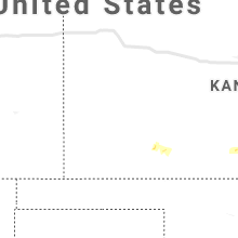


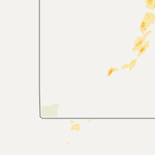


Connect with Interactive Hail Maps