

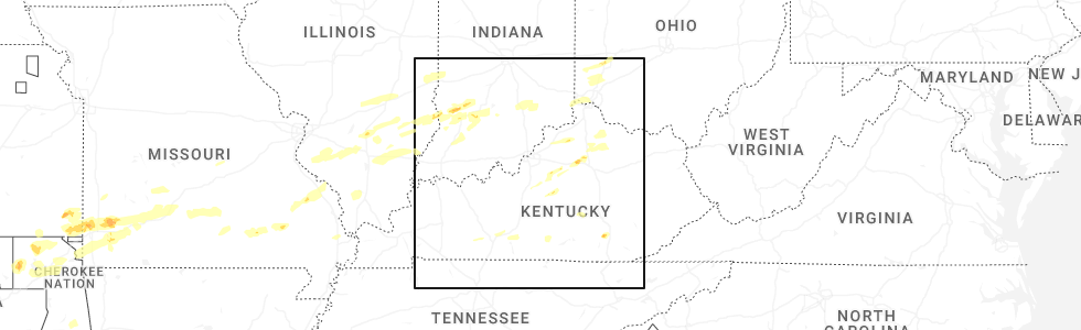
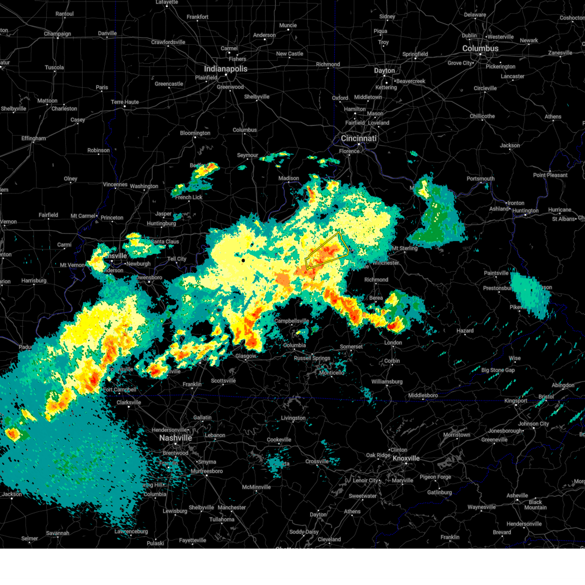
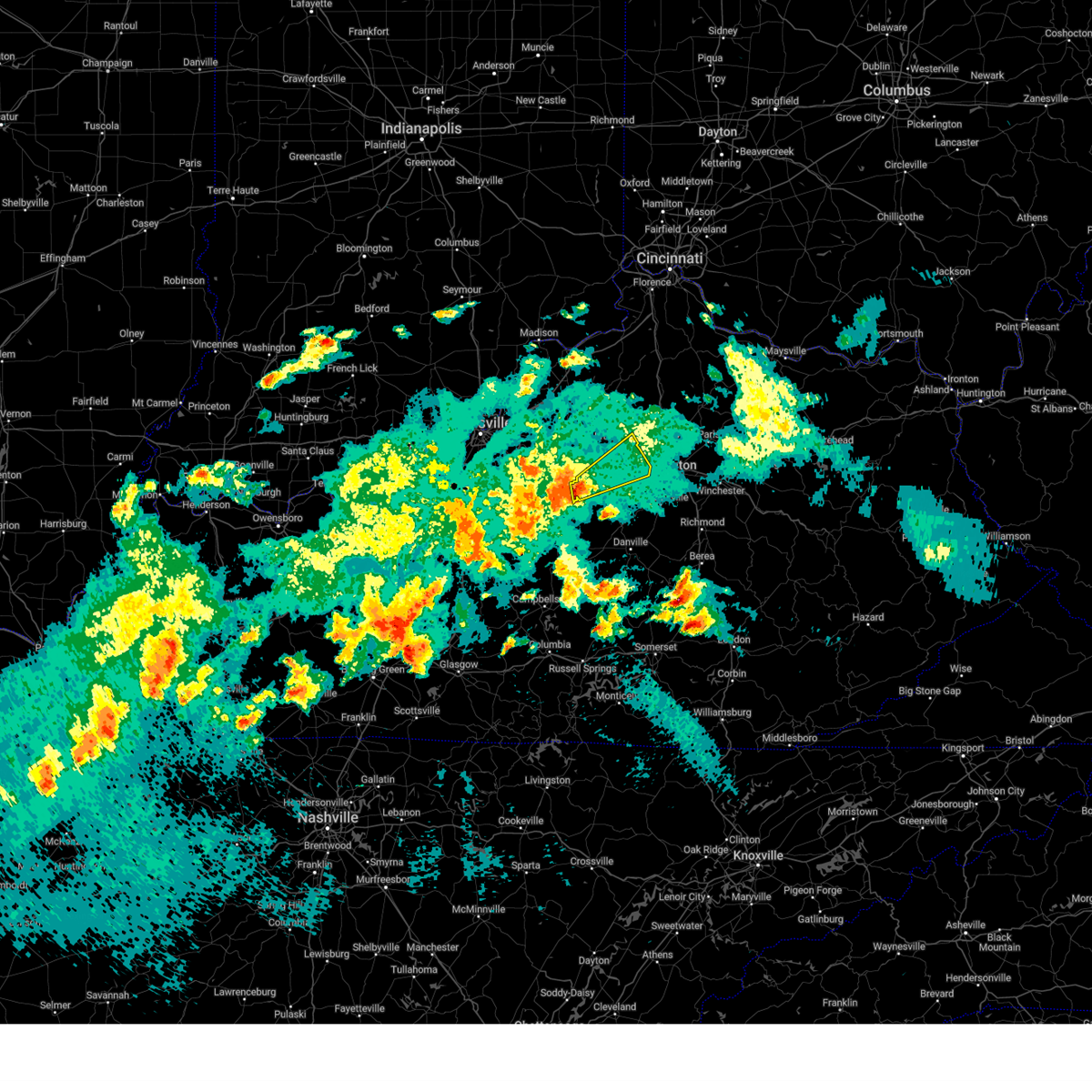
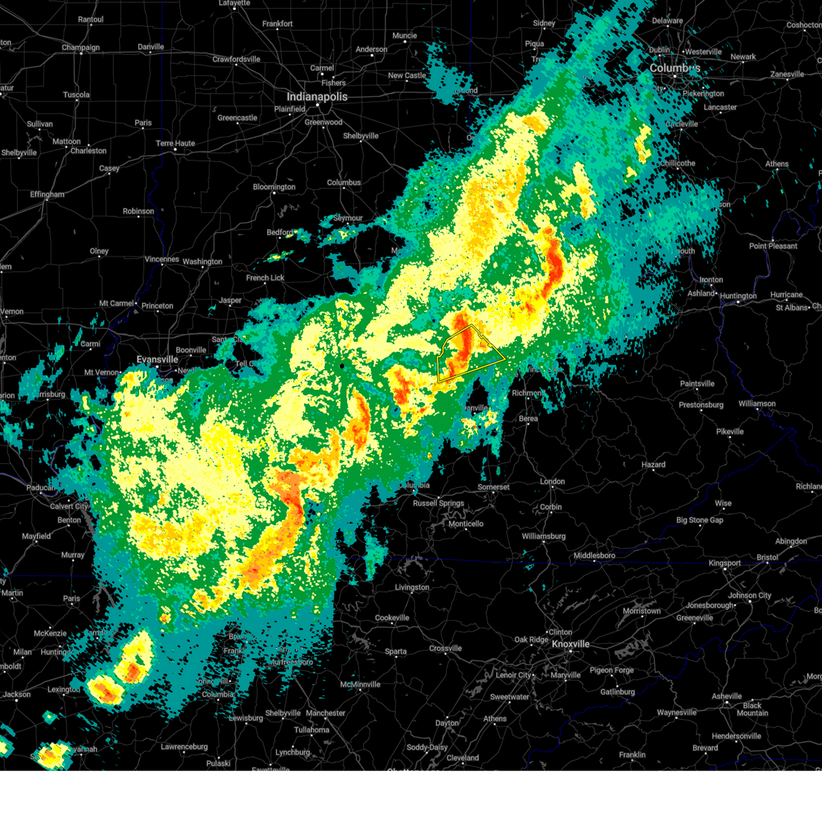
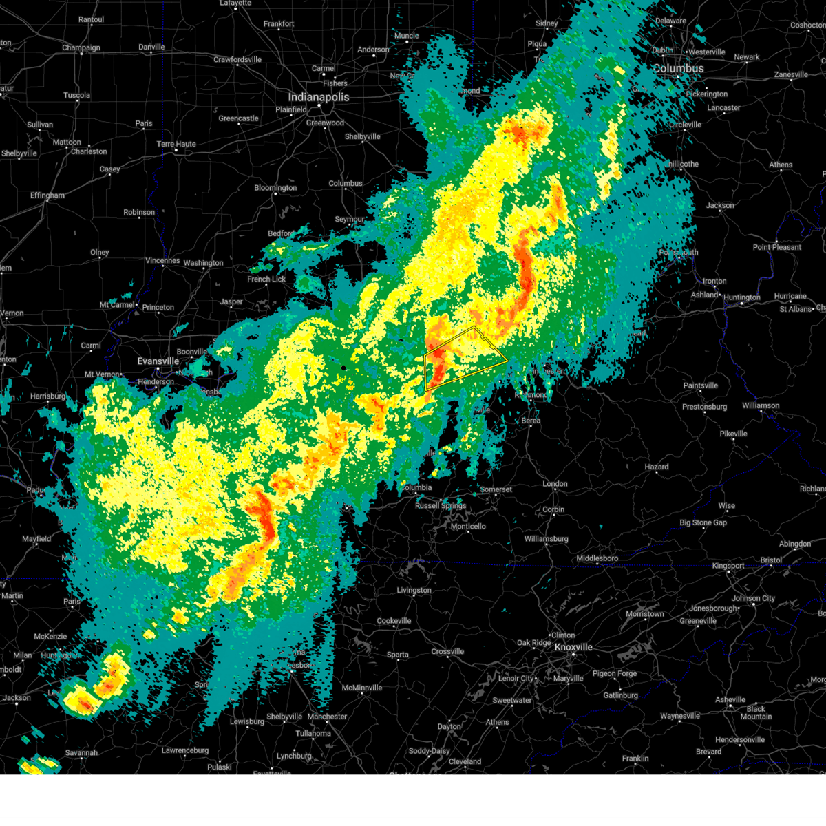
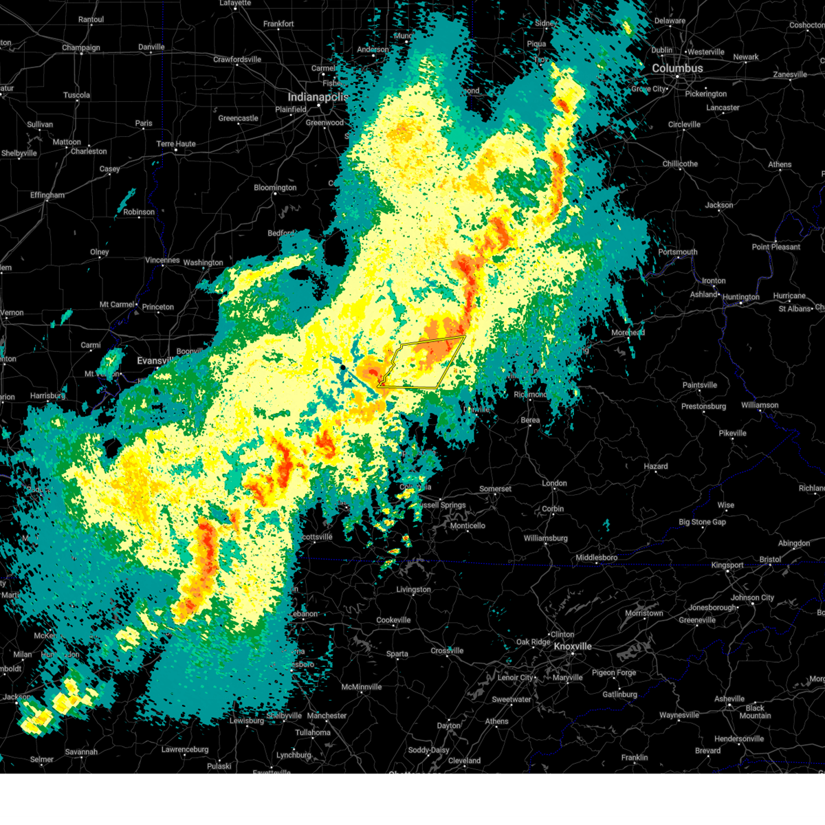
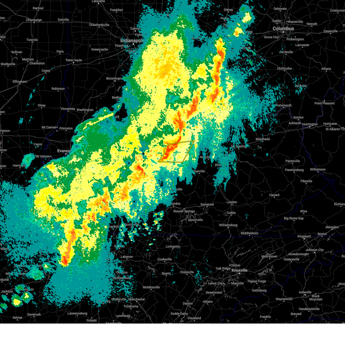
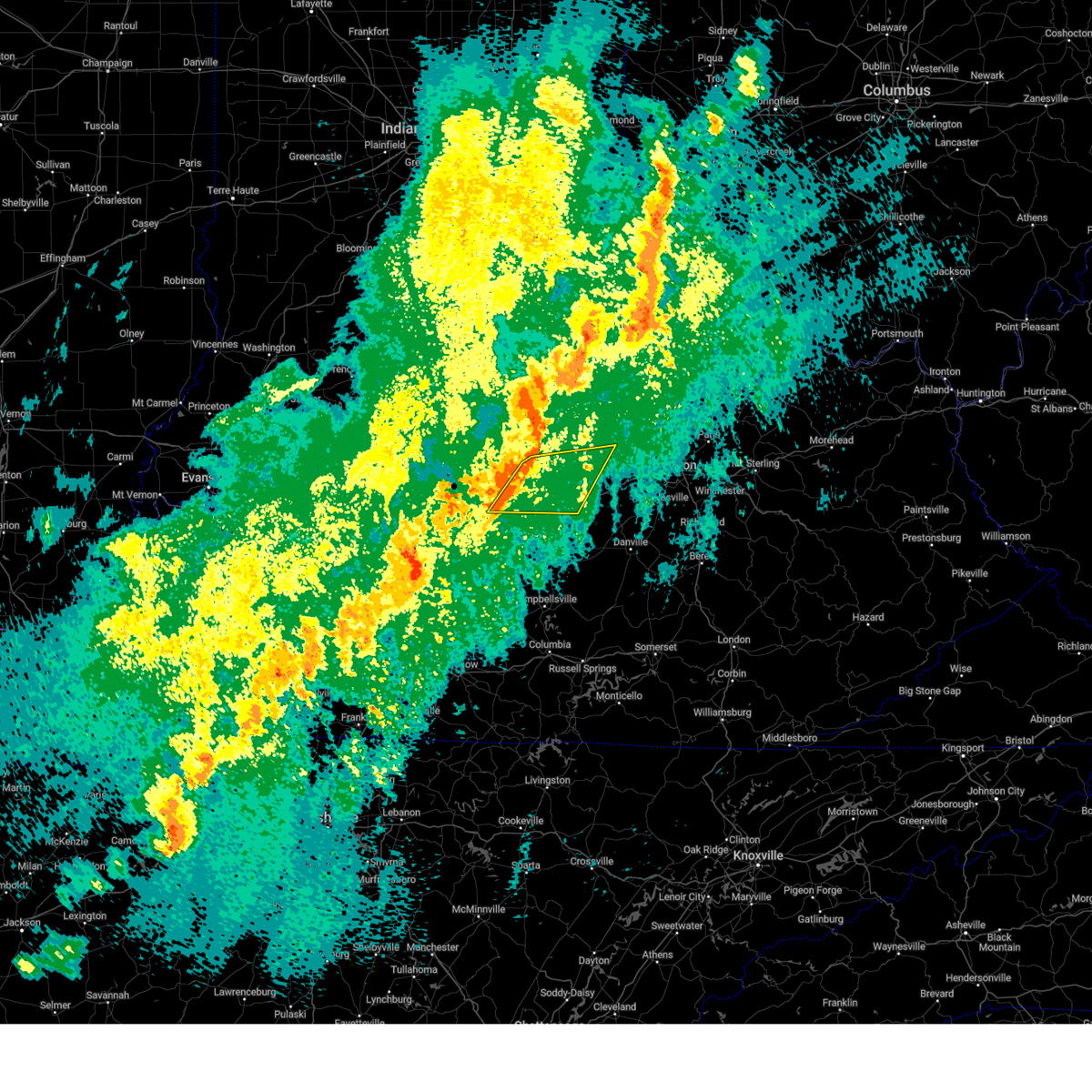
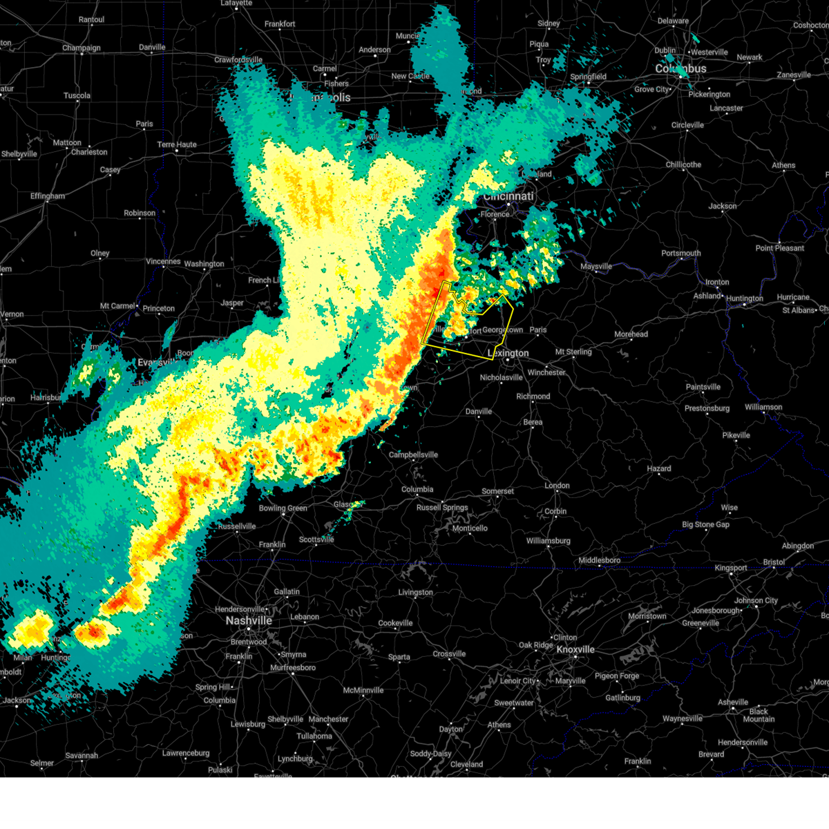
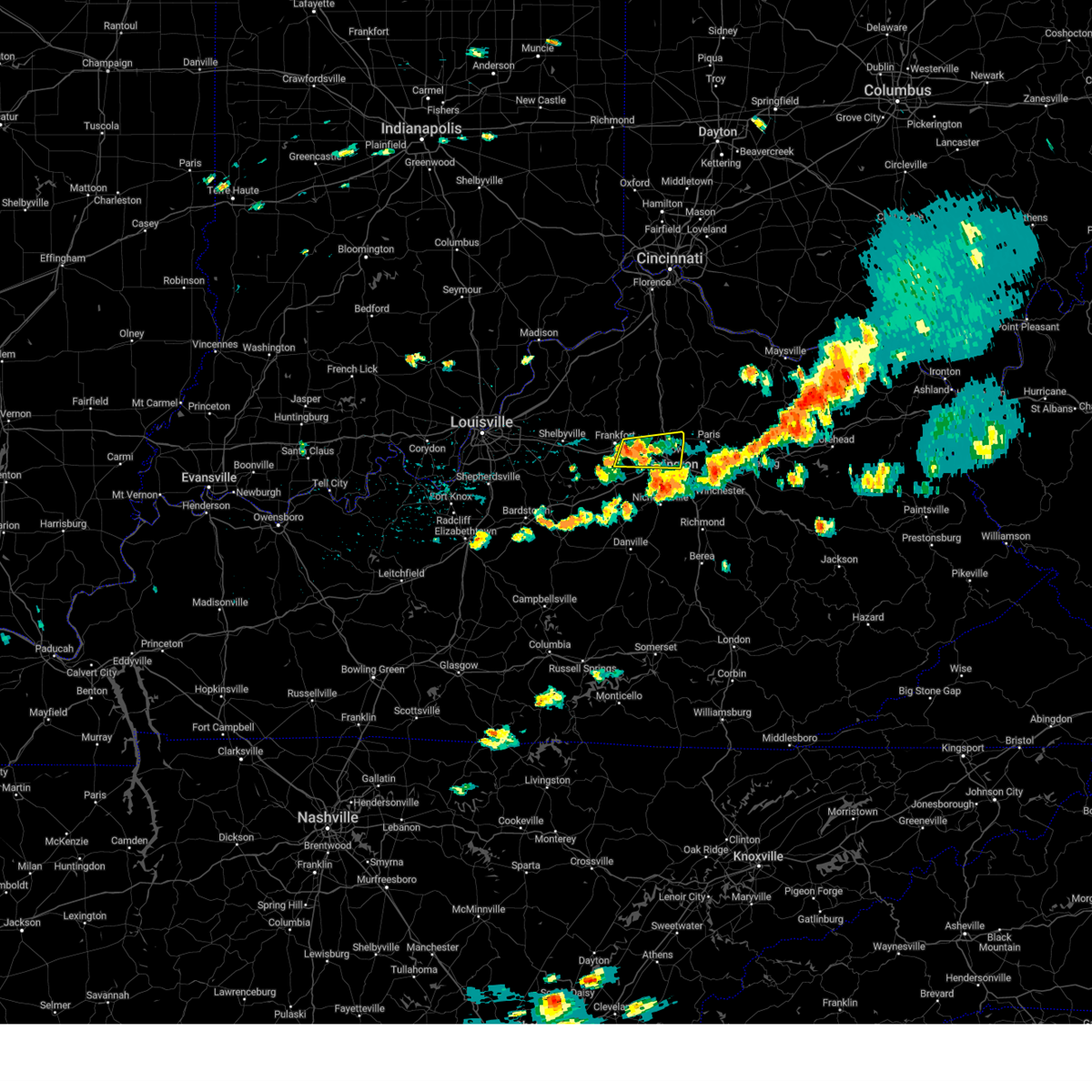
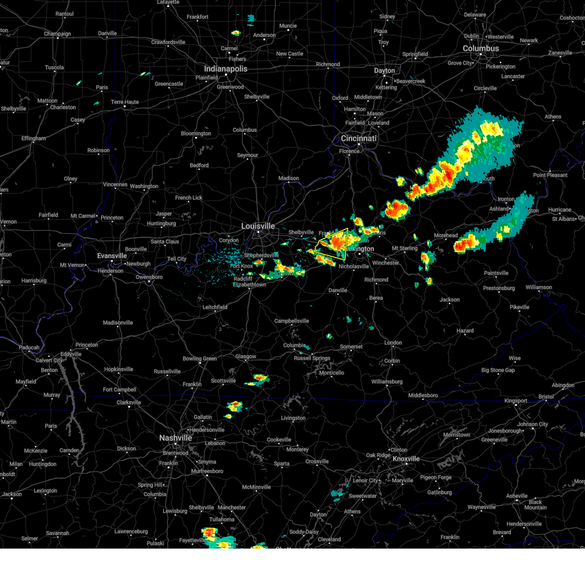
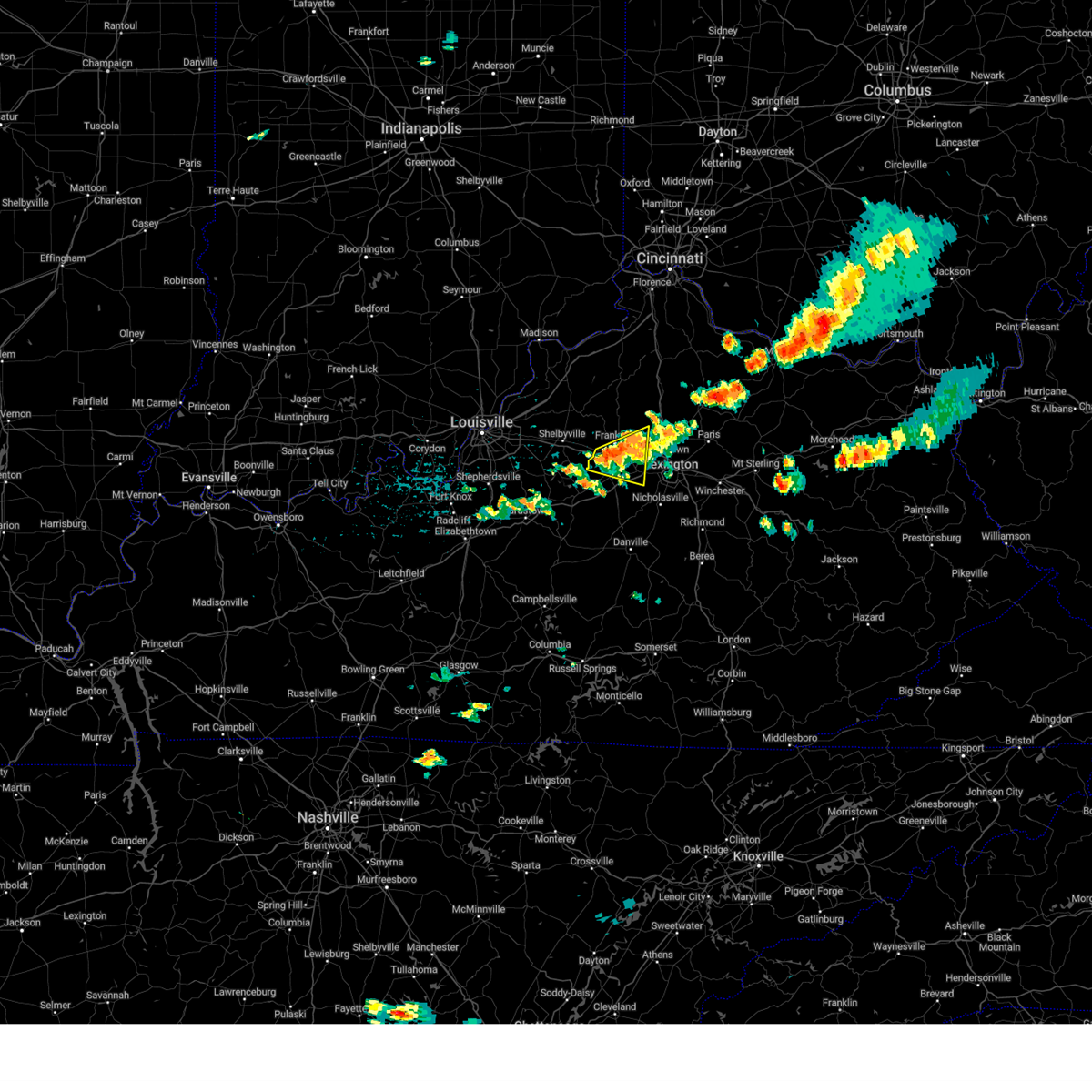
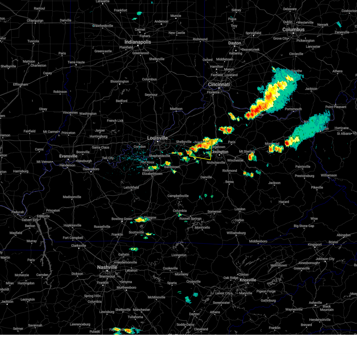
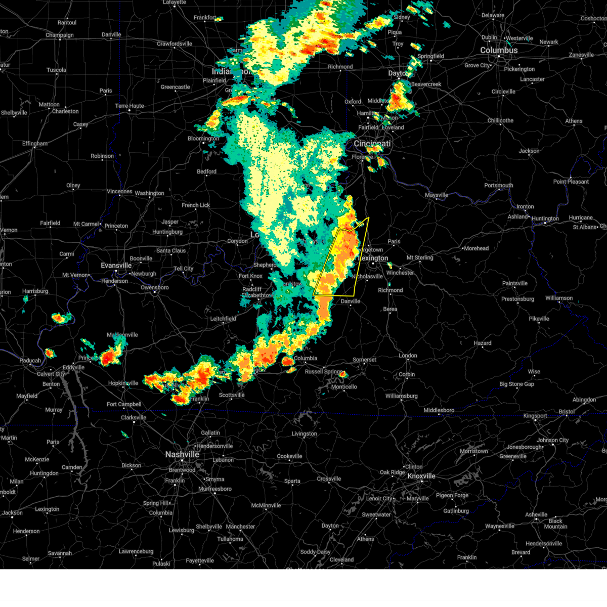
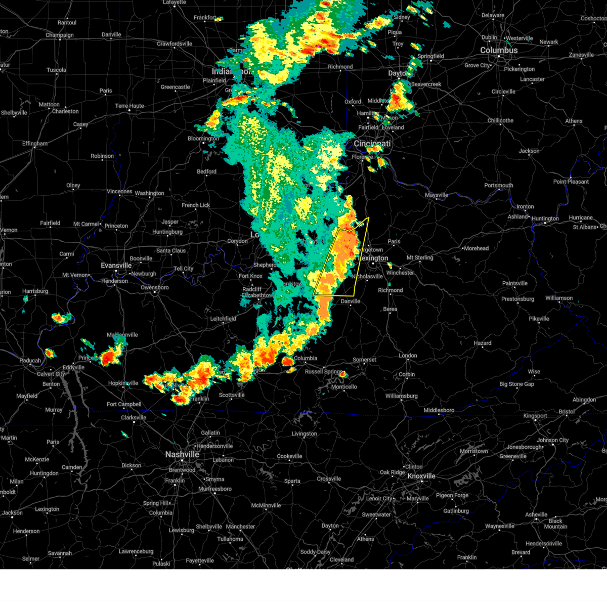
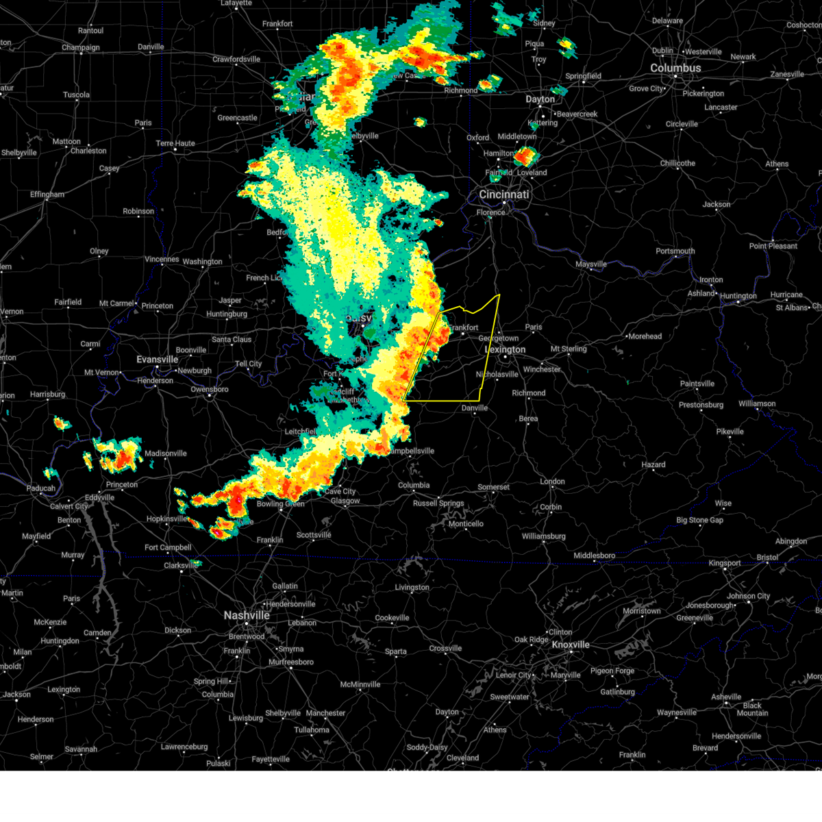
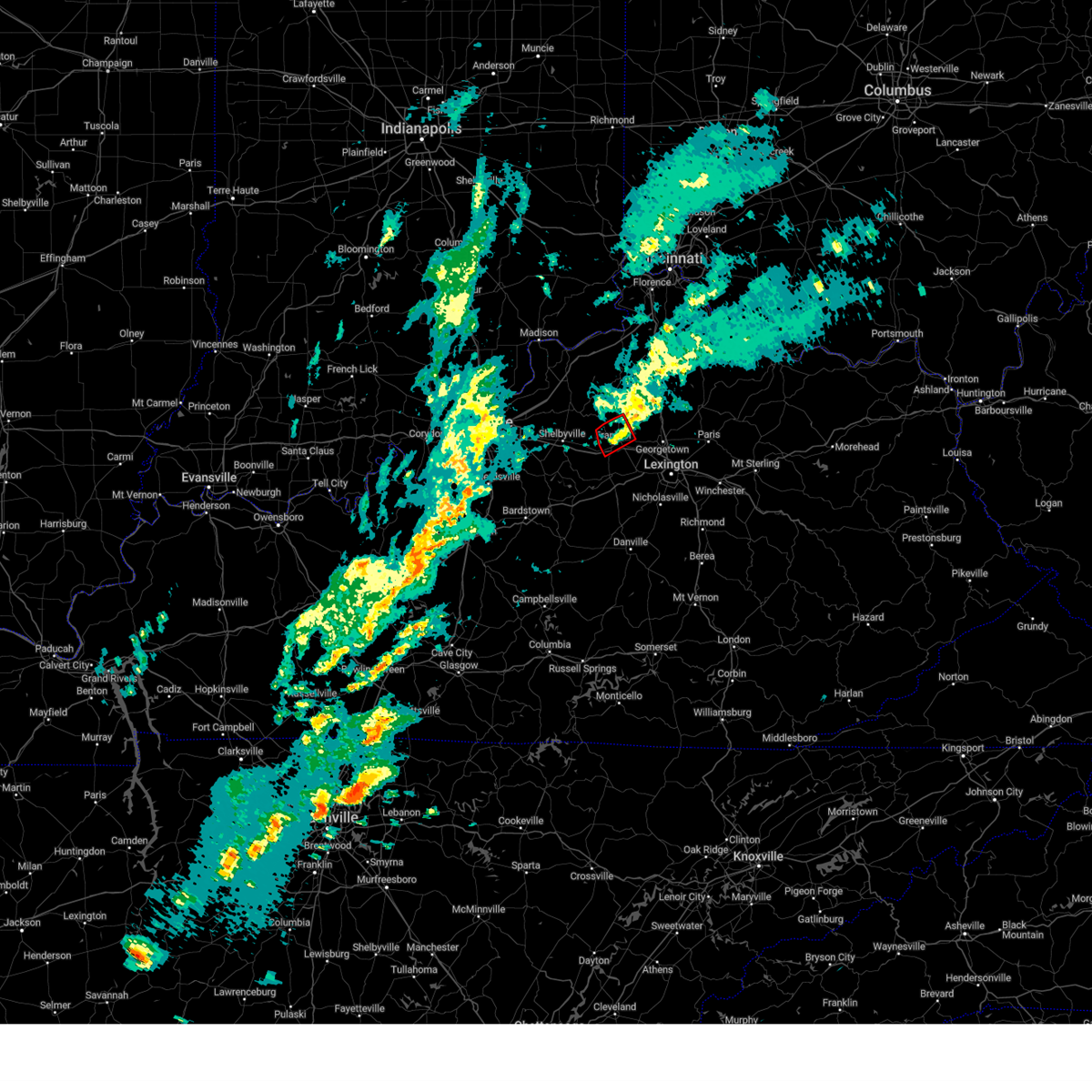
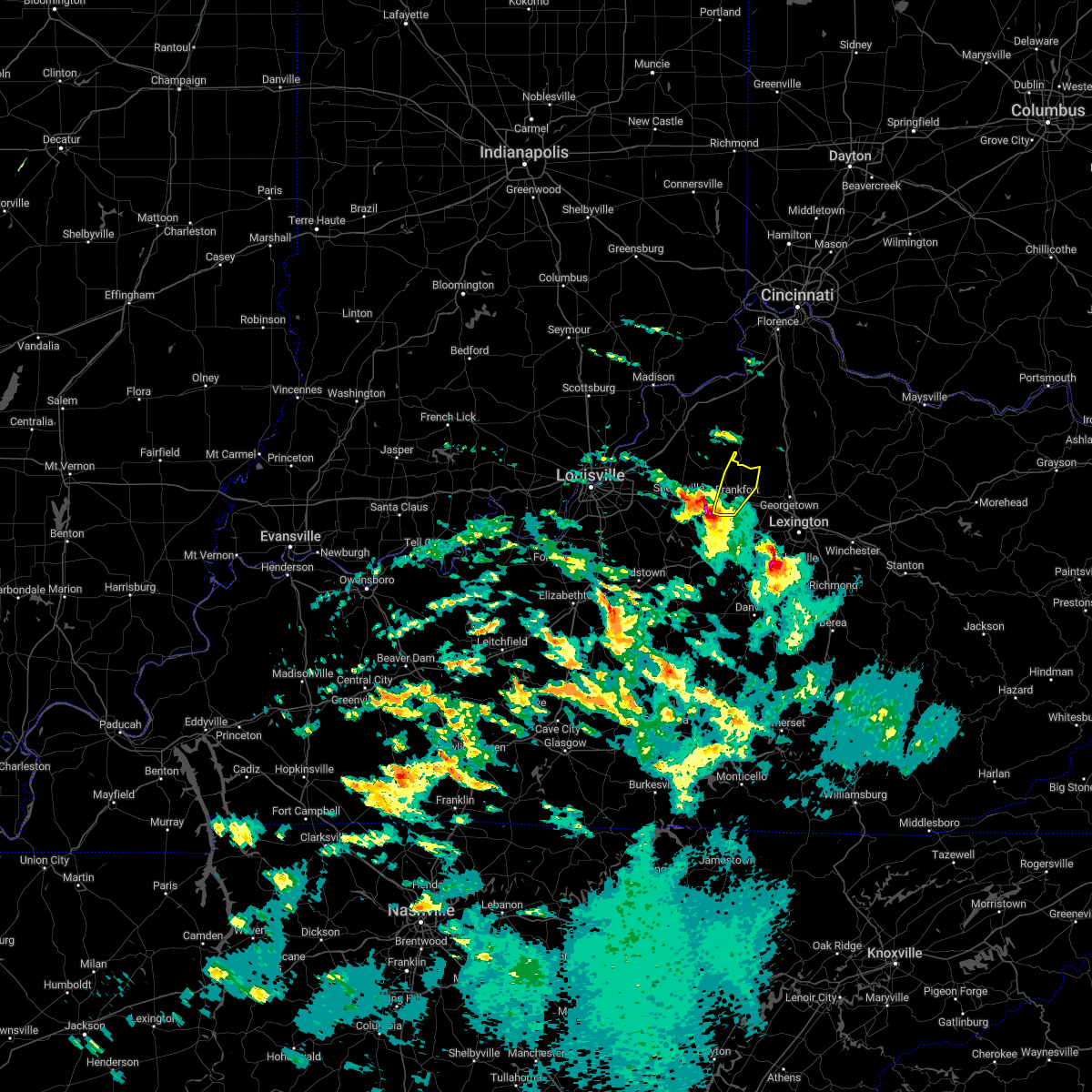
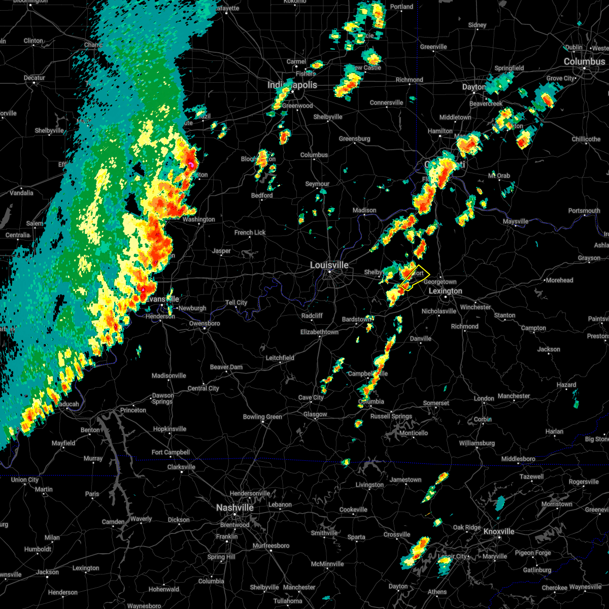
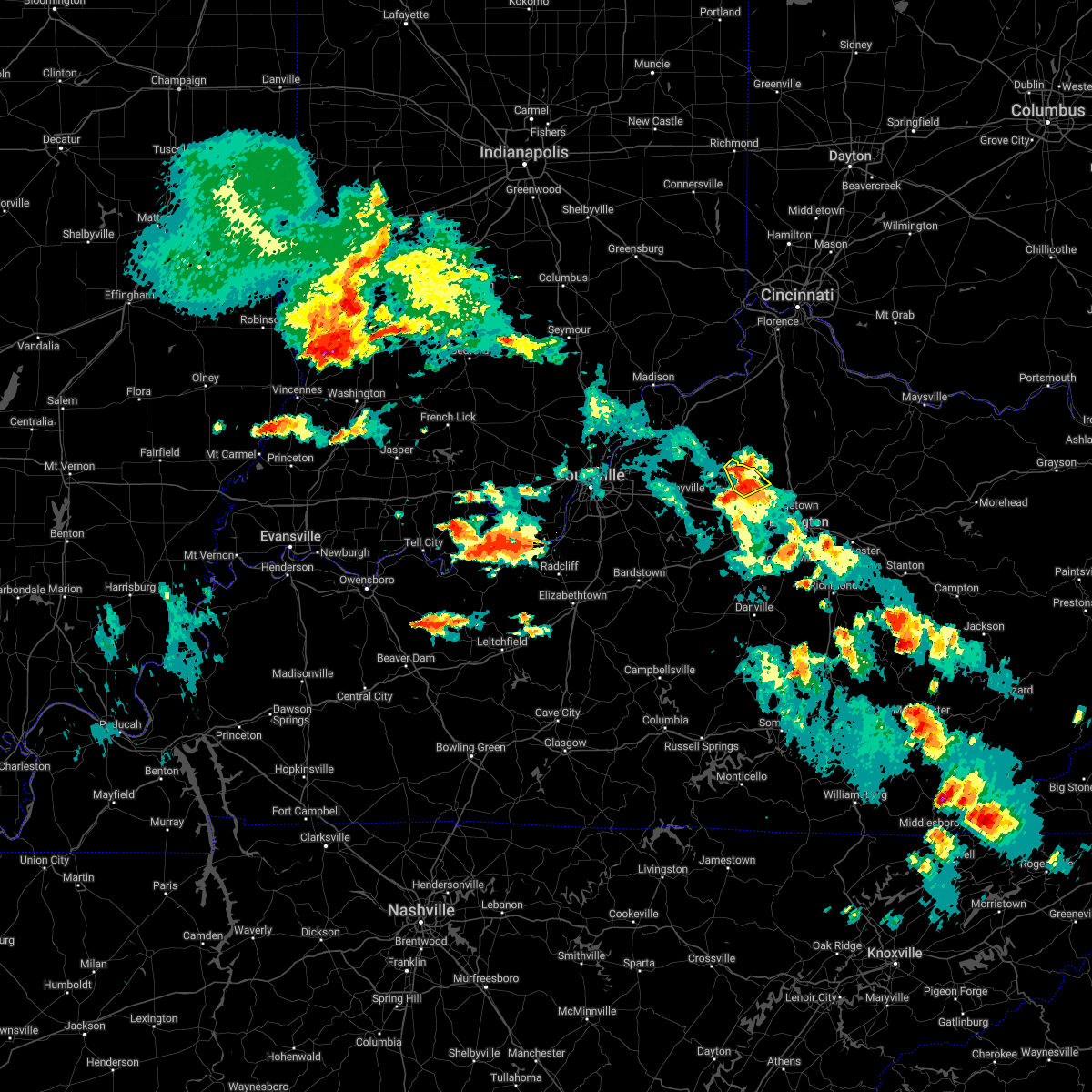
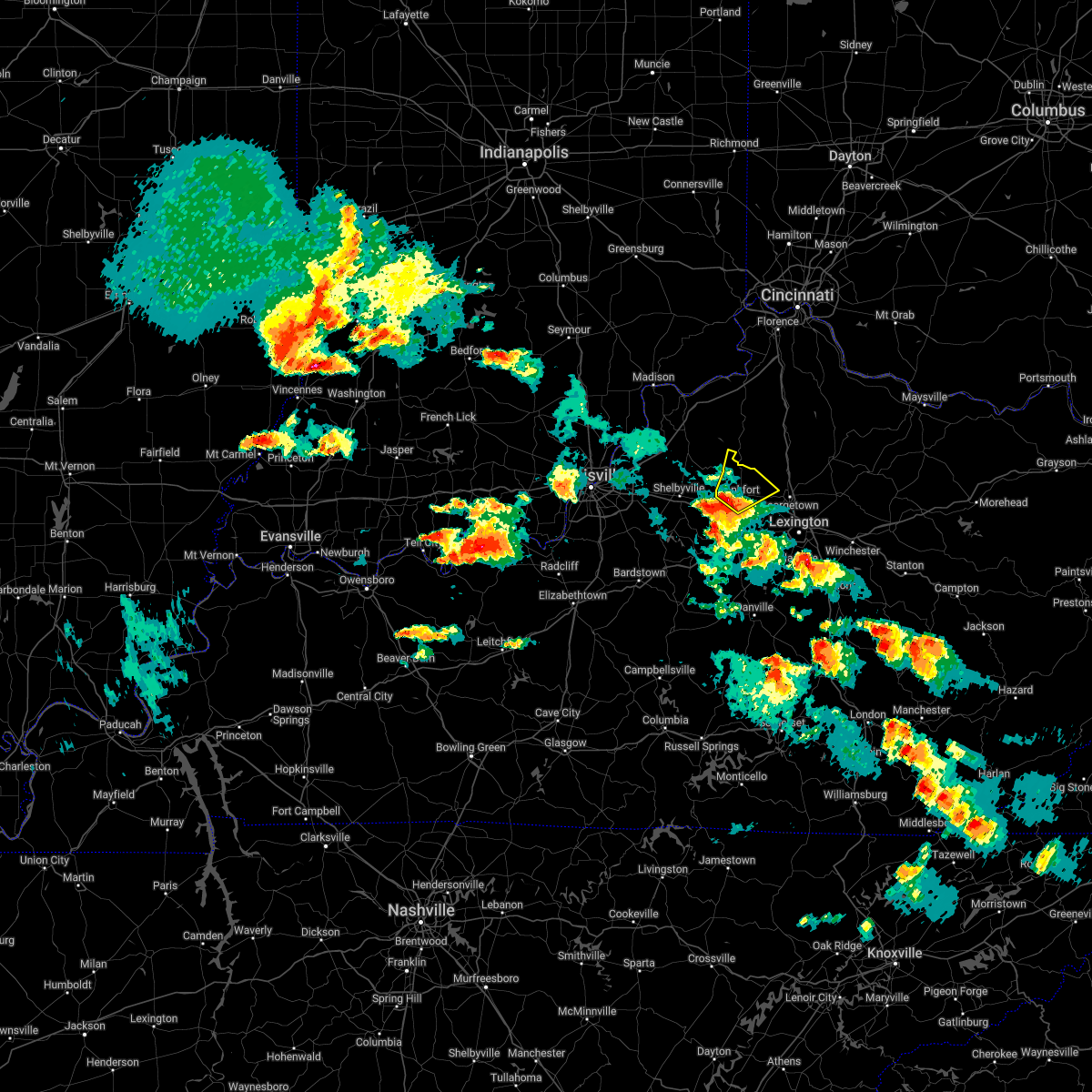
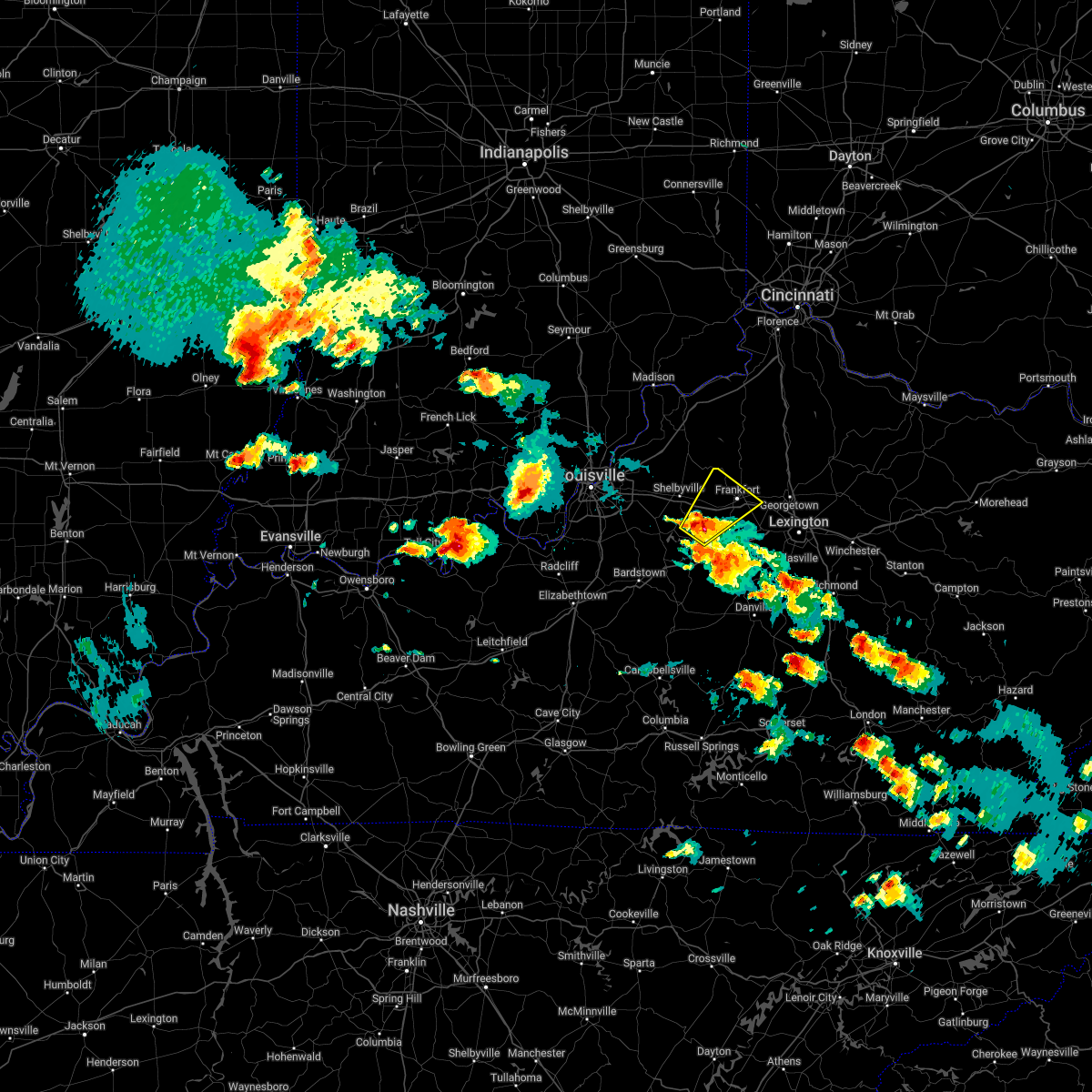
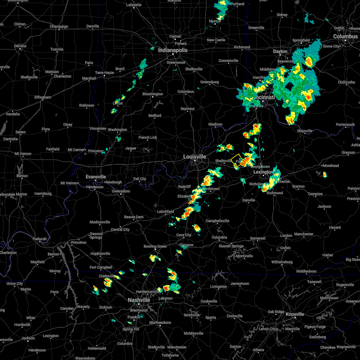
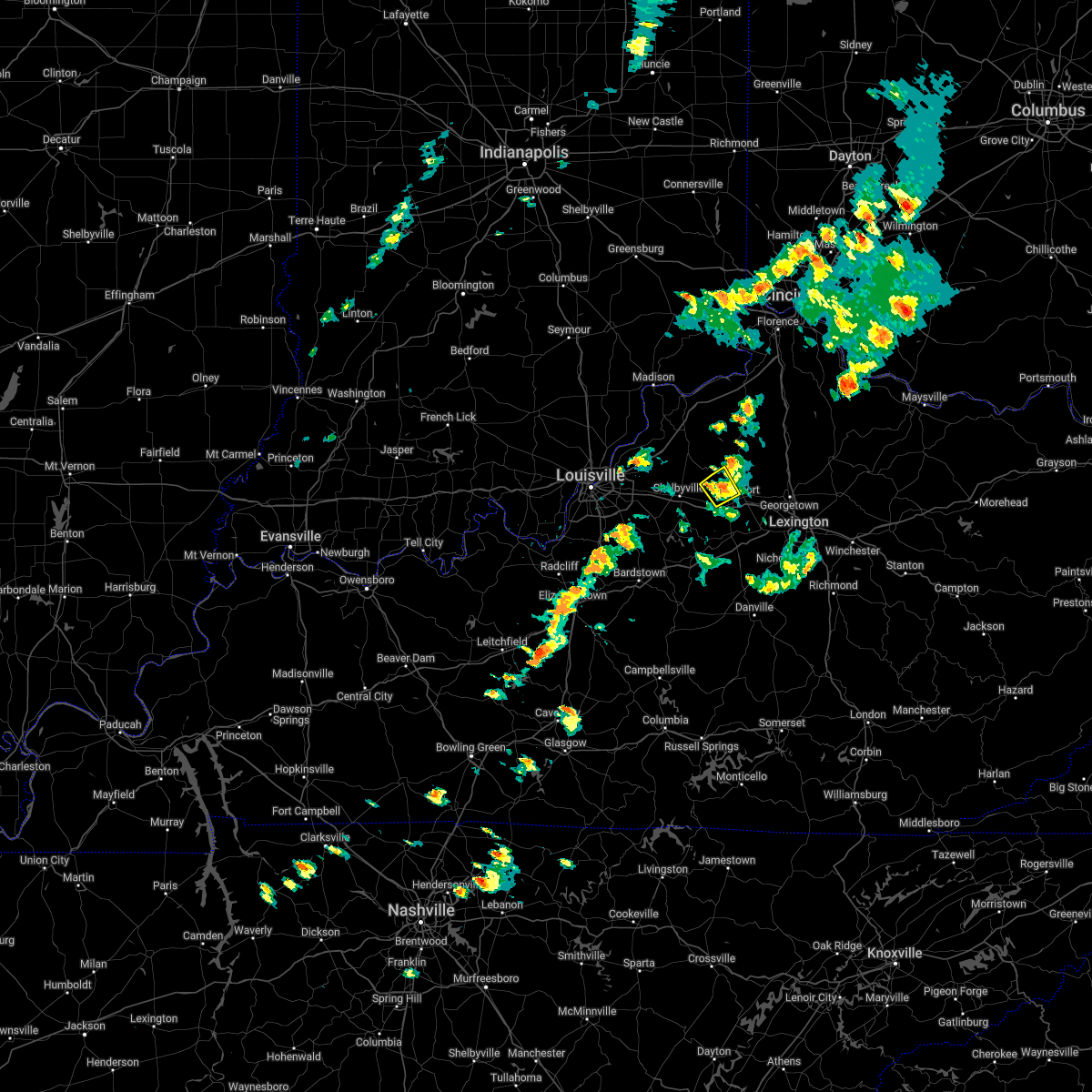
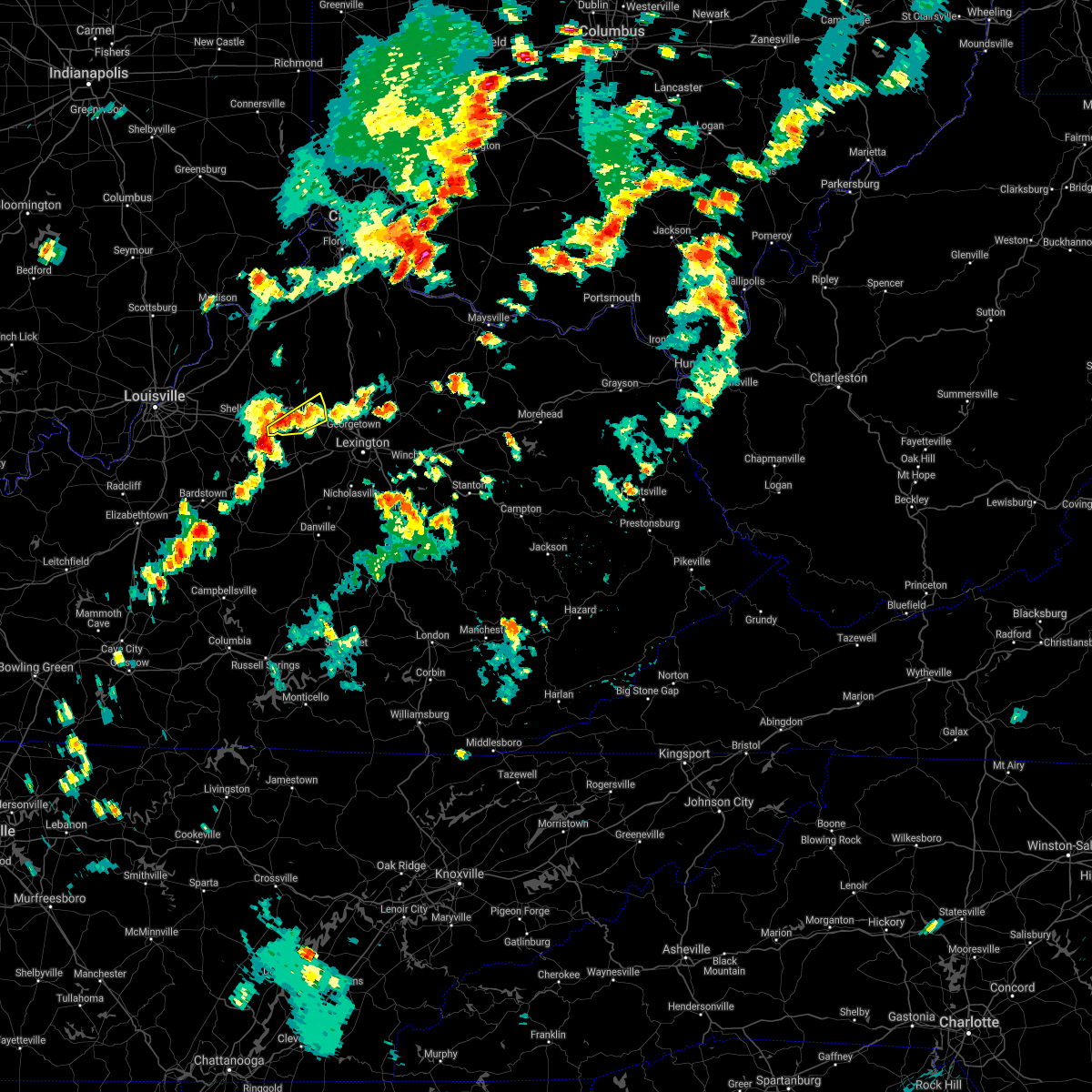
Hail Map for Frankfort, KY
The Frankfort, KY area has had 21 reports of on-the-ground hail by trained spotters, and has been under severe weather warnings 34 times during the past 12 months. Doppler radar has detected hail at or near Frankfort, KY on 54 occasions, including 2 occasions during the past year.
| Name: | Frankfort, KY |
| Where Located: | 48.1 miles ENE of Louisville, KY |
| Map: | Google Map for Frankfort, KY |
| Population: | 25527 |
| Housing Units: | 12938 |
| More Info: | Search Google for Frankfort, KY |
1
The Top Recent Hail Date for Frankfort, KY is Tuesday, April 29, 2025 (29th out of 54)
Hail and Wind Damage Spotted near Frankfort, KY
| Date / Time | Report Details |
|---|---|
| 6/18/2025 8:43 PM EDT | The storm which prompted the warning has weakened below severe limits, and no longer poses an immediate threat to life or property. therefore, the warning will be allowed to expire. however, gusty winds and heavy rain are still possible with this thunderstorm. a severe thunderstorm watch remains in effect until 100 am edt for central kentucky. to report severe weather, contact your nearest law enforcement agency. they will relay your report to the national weather service louisville. |
| 6/18/2025 8:31 PM EDT | Tree down on wilkinson blvd near the capitol plaza hote in franklin county KY, 0.7 miles SSE of Frankfort, KY |
| 6/18/2025 8:30 PM EDT | Asos station kfft frankfor in franklin county KY, 1.7 miles ENE of Frankfort, KY |
| 6/18/2025 8:19 PM EDT | Svrlmk the national weather service in louisville has issued a * severe thunderstorm warning for, spencer county in central kentucky, central shelby county in central kentucky, northwestern woodford county in central kentucky, north central anderson county in central kentucky, franklin county in central kentucky, * until 845 pm edt. * at 818 pm edt, a severe thunderstorm was located near taylorsville, moving east at 45 mph. another severe thunderstorm was located along the shelby and franklin county line, moving east at 45 mph (radar indicated). Hazards include 60 mph wind gusts. expect damage to roofs, siding, and trees |
| 6/18/2025 8:18 PM EDT | Tree down on bob rogers roa in shelby county KY, 9.1 miles E of Frankfort, KY |
| 5/16/2025 10:43 PM EDT |
 Svrlmk the national weather service in louisville has issued a * severe thunderstorm warning for, southeastern anderson county in central kentucky, clark county in central kentucky, jessamine county in central kentucky, nicholas county in central kentucky, harrison county in central kentucky, northeastern franklin county in central kentucky, northern mercer county in central kentucky, woodford county in central kentucky, scott county in central kentucky, bourbon county in central kentucky, northeastern washington county in central kentucky, northern madison county in central kentucky, fayette county in central kentucky, * until 1130 pm edt. * at 1042 pm edt, severe thunderstorms were located along a line extending from 8 miles northwest of owenton to 7 miles northwest of lawrenceburg to 12 miles north of springfield, moving east at 70 mph (radar indicated). Hazards include 70 mph wind gusts and penny size hail. Expect considerable tree damage. Damage is likely to mobile homes, roofs, and outbuildings. Svrlmk the national weather service in louisville has issued a * severe thunderstorm warning for, southeastern anderson county in central kentucky, clark county in central kentucky, jessamine county in central kentucky, nicholas county in central kentucky, harrison county in central kentucky, northeastern franklin county in central kentucky, northern mercer county in central kentucky, woodford county in central kentucky, scott county in central kentucky, bourbon county in central kentucky, northeastern washington county in central kentucky, northern madison county in central kentucky, fayette county in central kentucky, * until 1130 pm edt. * at 1042 pm edt, severe thunderstorms were located along a line extending from 8 miles northwest of owenton to 7 miles northwest of lawrenceburg to 12 miles north of springfield, moving east at 70 mph (radar indicated). Hazards include 70 mph wind gusts and penny size hail. Expect considerable tree damage. Damage is likely to mobile homes, roofs, and outbuildings.
|
| 5/16/2025 10:19 PM EDT |
 Svrlmk the national weather service in louisville has issued a * severe thunderstorm warning for, east central clark county in south central indiana, oldham county in central kentucky, shelby county in central kentucky, northern nelson county in central kentucky, anderson county in central kentucky, henry county in central kentucky, northeastern jefferson county in central kentucky, eastern bullitt county in central kentucky, franklin county in central kentucky, spencer county in central kentucky, northwestern woodford county in central kentucky, southern trimble county in central kentucky, northeastern washington county in central kentucky, * until 1100 pm edt. * at 1018 pm edt, severe thunderstorms were located along a line extending from near prospect to 7 miles southeast of fern creek to 8 miles south of shepherdsville, moving east at 60 mph (radar indicated). Hazards include 70 mph wind gusts and penny size hail. Expect considerable tree damage. Damage is likely to mobile homes, roofs, and outbuildings. Svrlmk the national weather service in louisville has issued a * severe thunderstorm warning for, east central clark county in south central indiana, oldham county in central kentucky, shelby county in central kentucky, northern nelson county in central kentucky, anderson county in central kentucky, henry county in central kentucky, northeastern jefferson county in central kentucky, eastern bullitt county in central kentucky, franklin county in central kentucky, spencer county in central kentucky, northwestern woodford county in central kentucky, southern trimble county in central kentucky, northeastern washington county in central kentucky, * until 1100 pm edt. * at 1018 pm edt, severe thunderstorms were located along a line extending from near prospect to 7 miles southeast of fern creek to 8 miles south of shepherdsville, moving east at 60 mph (radar indicated). Hazards include 70 mph wind gusts and penny size hail. Expect considerable tree damage. Damage is likely to mobile homes, roofs, and outbuildings.
|
| 5/16/2025 8:12 PM EDT |
 Svrlmk the national weather service in louisville has issued a * severe thunderstorm warning for, spencer county in central kentucky, southern shelby county in central kentucky, north central nelson county in central kentucky, northern woodford county in central kentucky, southern scott county in central kentucky, northern anderson county in central kentucky, central bullitt county in central kentucky, franklin county in central kentucky, * until 845 pm edt. * at 812 pm edt, severe thunderstorms were located along a line extending from near pioneer village to taylorsville to near frankfort, moving east at 55 mph (radar indicated). Hazards include 60 mph wind gusts and half dollar size hail. Hail damage to vehicles is expected. Expect wind damage to roofs, siding, and trees. Svrlmk the national weather service in louisville has issued a * severe thunderstorm warning for, spencer county in central kentucky, southern shelby county in central kentucky, north central nelson county in central kentucky, northern woodford county in central kentucky, southern scott county in central kentucky, northern anderson county in central kentucky, central bullitt county in central kentucky, franklin county in central kentucky, * until 845 pm edt. * at 812 pm edt, severe thunderstorms were located along a line extending from near pioneer village to taylorsville to near frankfort, moving east at 55 mph (radar indicated). Hazards include 60 mph wind gusts and half dollar size hail. Hail damage to vehicles is expected. Expect wind damage to roofs, siding, and trees.
|
| 5/16/2025 9:53 AM EDT |
 The storm which prompted the warning has weakened below severe limits, and no longer poses an immediate threat to life or property. therefore, the warning will be allowed to expire. however, small hail is still possible with this thunderstorm. a severe thunderstorm watch remains in effect until noon edt for central kentucky. The storm which prompted the warning has weakened below severe limits, and no longer poses an immediate threat to life or property. therefore, the warning will be allowed to expire. however, small hail is still possible with this thunderstorm. a severe thunderstorm watch remains in effect until noon edt for central kentucky.
|
| 5/16/2025 9:36 AM EDT |
 Svrlmk the national weather service in louisville has issued a * severe thunderstorm warning for, northern woodford county in central kentucky, anderson county in central kentucky, southeastern franklin county in central kentucky, * until 1000 am edt. * at 936 am edt, a severe thunderstorm was located 10 miles southwest of lawrenceburg, moving northeast at 55 mph (radar indicated). Hazards include quarter size hail. damage to vehicles is expected Svrlmk the national weather service in louisville has issued a * severe thunderstorm warning for, northern woodford county in central kentucky, anderson county in central kentucky, southeastern franklin county in central kentucky, * until 1000 am edt. * at 936 am edt, a severe thunderstorm was located 10 miles southwest of lawrenceburg, moving northeast at 55 mph (radar indicated). Hazards include quarter size hail. damage to vehicles is expected
|
| 4/29/2025 6:19 PM EDT | At 618 pm edt, a severe thunderstorm was located 5 miles northwest of georgetown, moving northeast at 35 mph (radar indicated). Hazards include 60 mph wind gusts and quarter size hail. Hail damage to vehicles is expected. expect wind damage to roofs, siding, and trees. Locations impacted include, georgetown, frankfort, midway, stamping ground, longlick, slickway, skinnersburg, moon lake estates, muddy ford, and great crossing. |
| 4/29/2025 6:03 PM EDT | At 602 pm edt, a severe thunderstorm was located near woodlake, moving northeast at 35 mph (radar indicated). Hazards include ping pong ball size hail and 60 mph wind gusts. People and animals outdoors will be injured. expect hail damage to roofs, siding, windows, and vehicles. expect wind damage to roofs, siding, and trees. Locations impacted include, georgetown, frankfort, midway, stamping ground, longlick, slickway, skinnersburg, moon lake estates, muddy ford, and great crossing. |
| 4/29/2025 5:56 PM EDT | Quarter sized hail reported 4.6 miles W of Frankfort, KY, report from mping: quarter (1.00 in.). |
| 4/29/2025 5:52 PM EDT | Svrlmk the national weather service in louisville has issued a * severe thunderstorm warning for, northern woodford county in central kentucky, scott county in central kentucky, central franklin county in central kentucky, * until 630 pm edt. * at 552 pm edt, a severe thunderstorm was located over frankfort, moving northeast at 35 mph (radar indicated). Hazards include 60 mph wind gusts and quarter size hail. Hail damage to vehicles is expected. Expect wind damage to roofs, siding, and trees. |
| 4/3/2025 1:59 AM EDT | Svrlmk the national weather service in louisville has issued a * severe thunderstorm warning for, north central mercer county in central kentucky, woodford county in central kentucky, scott county in central kentucky, east central anderson county in central kentucky, northwestern jessamine county in central kentucky, bourbon county in central kentucky, nicholas county in central kentucky, fayette county in central kentucky, harrison county in central kentucky, eastern franklin county in central kentucky, * until 230 am edt. * at 158 am edt, severe thunderstorms were located along a line extending from 14 miles south of williamstown to near georgetown to 9 miles south of versailles, moving northeast at 95 mph (radar indicated). Hazards include 60 mph wind gusts. expect damage to roofs, siding, and trees |
| 4/3/2025 1:59 AM EDT | The storm which prompted the warning has moved out of the area. therefore, the warning will be allowed to expire. a tornado watch remains in effect until 700 am edt for central kentucky. |
| 4/3/2025 1:44 AM EDT |
 the severe thunderstorm warning has been cancelled and is no longer in effect the severe thunderstorm warning has been cancelled and is no longer in effect
|
| 4/3/2025 1:44 AM EDT |
 At 144 am edt, a severe thunderstorm was located near lawrenceburg, moving northeast at 80 mph (radar indicated). Hazards include 70 mph wind gusts. Expect considerable tree damage. damage is likely to mobile homes, roofs, and outbuildings. Locations impacted include, lexington, frankfort, lawrenceburg, versailles, dunbar high school, cardinal hill, u k arboretum, ballard, midway, and slickway. At 144 am edt, a severe thunderstorm was located near lawrenceburg, moving northeast at 80 mph (radar indicated). Hazards include 70 mph wind gusts. Expect considerable tree damage. damage is likely to mobile homes, roofs, and outbuildings. Locations impacted include, lexington, frankfort, lawrenceburg, versailles, dunbar high school, cardinal hill, u k arboretum, ballard, midway, and slickway.
|
| 4/3/2025 1:33 AM EDT |
 At 133 am edt, a severe thunderstorm was located 12 miles southwest of lawrenceburg, moving northeast at 80 mph (radar indicated). Hazards include 70 mph wind gusts. Expect considerable tree damage. damage is likely to mobile homes, roofs, and outbuildings. Locations impacted include, lexington, frankfort, lawrenceburg, versailles, dunbar high school, cardinal hill, u k arboretum, ballard, midway, and slickway. At 133 am edt, a severe thunderstorm was located 12 miles southwest of lawrenceburg, moving northeast at 80 mph (radar indicated). Hazards include 70 mph wind gusts. Expect considerable tree damage. damage is likely to mobile homes, roofs, and outbuildings. Locations impacted include, lexington, frankfort, lawrenceburg, versailles, dunbar high school, cardinal hill, u k arboretum, ballard, midway, and slickway.
|
| 4/3/2025 1:27 AM EDT | Svrlmk the national weather service in louisville has issued a * severe thunderstorm warning for, southeastern spencer county in central kentucky, southeastern shelby county in central kentucky, northeastern nelson county in central kentucky, northwestern mercer county in central kentucky, woodford county in central kentucky, anderson county in central kentucky, north central jessamine county in central kentucky, northeastern washington county in central kentucky, west central fayette county in central kentucky, southern franklin county in central kentucky, * until 200 am edt. * at 127 am edt, a severe thunderstorm was located 10 miles southeast of taylorsville, moving northeast at 80 mph (radar indicated). Hazards include 60 mph wind gusts. expect damage to roofs, siding, and trees |
| 4/3/2025 1:26 AM EDT | The storms which prompted the warning have moved out of the area. therefore, the warning will be allowed to expire. a tornado watch remains in effect until 700 am edt for central kentucky. |
| 4/3/2025 1:21 AM EDT | At 121 am edt, severe thunderstorms were located along a line extending from near owenton to 6 miles northeast of frankfort to 11 miles southwest of lawrenceburg, moving east at 50 mph (radar indicated). Hazards include 60 mph wind gusts and penny size hail. Expect damage to roofs, siding, and trees. Locations impacted include, georgetown, frankfort, lawrenceburg, midway, stamping ground, longlick, slickway, stonewall, anderson city, and farmdale. |
| 4/3/2025 1:21 AM EDT | the severe thunderstorm warning has been cancelled and is no longer in effect |
| 4/3/2025 1:12 AM EDT |
 The storms which prompted the warning have moved out of the area. therefore, the warning will be allowed to expire. a tornado watch remains in effect until 700 am edt for central kentucky. remember, a severe thunderstorm warning still remains in effect for portions of nelson, spencer, anderson, and franklin county until 130 am edt. remember, a tornado warning still remains in effect for portions of nelson county until 130 am edt. The storms which prompted the warning have moved out of the area. therefore, the warning will be allowed to expire. a tornado watch remains in effect until 700 am edt for central kentucky. remember, a severe thunderstorm warning still remains in effect for portions of nelson, spencer, anderson, and franklin county until 130 am edt. remember, a tornado warning still remains in effect for portions of nelson county until 130 am edt.
|
| 4/3/2025 1:01 AM EDT |
 Svrlmk the national weather service in louisville has issued a * severe thunderstorm warning for, southeastern spencer county in central kentucky, eastern shelby county in central kentucky, northeastern nelson county in central kentucky, northwestern mercer county in central kentucky, northern woodford county in central kentucky, western scott county in central kentucky, anderson county in central kentucky, eastern henry county in central kentucky, northeastern washington county in central kentucky, franklin county in central kentucky, * until 130 am edt. * at 101 am edt, severe thunderstorms were located along a line extending from 8 miles southeast of carrollton to 8 miles east of shelbyville to 6 miles south of taylorsville, moving east at 50 mph (radar indicated). Hazards include 70 mph wind gusts and penny size hail. Expect considerable tree damage. Damage is likely to mobile homes, roofs, and outbuildings. Svrlmk the national weather service in louisville has issued a * severe thunderstorm warning for, southeastern spencer county in central kentucky, eastern shelby county in central kentucky, northeastern nelson county in central kentucky, northwestern mercer county in central kentucky, northern woodford county in central kentucky, western scott county in central kentucky, anderson county in central kentucky, eastern henry county in central kentucky, northeastern washington county in central kentucky, franklin county in central kentucky, * until 130 am edt. * at 101 am edt, severe thunderstorms were located along a line extending from 8 miles southeast of carrollton to 8 miles east of shelbyville to 6 miles south of taylorsville, moving east at 50 mph (radar indicated). Hazards include 70 mph wind gusts and penny size hail. Expect considerable tree damage. Damage is likely to mobile homes, roofs, and outbuildings.
|
| 4/3/2025 12:51 AM EDT |
 At 1250 am edt, severe thunderstorms were located along a line extending from near shelbyville to near bardstown, moving east at 55 mph (radar indicated). Hazards include 60 mph wind gusts and penny size hail. Expect damage to roofs, siding, and trees. Locations impacted include, frankfort, bardstown, taylorsville, bloomfield, fairfield, yoder, highgrove, waterford, wayside, and anderson city. At 1250 am edt, severe thunderstorms were located along a line extending from near shelbyville to near bardstown, moving east at 55 mph (radar indicated). Hazards include 60 mph wind gusts and penny size hail. Expect damage to roofs, siding, and trees. Locations impacted include, frankfort, bardstown, taylorsville, bloomfield, fairfield, yoder, highgrove, waterford, wayside, and anderson city.
|
| 4/3/2025 12:51 AM EDT |
 the severe thunderstorm warning has been cancelled and is no longer in effect the severe thunderstorm warning has been cancelled and is no longer in effect
|
| 4/3/2025 12:41 AM EDT |
 Svrlmk the national weather service in louisville has issued a * severe thunderstorm warning for, spencer county in central kentucky, southern shelby county in central kentucky, northern nelson county in central kentucky, western anderson county in central kentucky, north central washington county in central kentucky, eastern bullitt county in central kentucky, southwestern franklin county in central kentucky, * until 115 am edt. * at 1241 am edt, severe thunderstorms were located along a line extending from 7 miles northwest of taylorsville to 9 miles southeast of shepherdsville, moving east at 55 mph (radar indicated). Hazards include 60 mph wind gusts and penny size hail. expect damage to roofs, siding, and trees Svrlmk the national weather service in louisville has issued a * severe thunderstorm warning for, spencer county in central kentucky, southern shelby county in central kentucky, northern nelson county in central kentucky, western anderson county in central kentucky, north central washington county in central kentucky, eastern bullitt county in central kentucky, southwestern franklin county in central kentucky, * until 115 am edt. * at 1241 am edt, severe thunderstorms were located along a line extending from 7 miles northwest of taylorsville to 9 miles southeast of shepherdsville, moving east at 55 mph (radar indicated). Hazards include 60 mph wind gusts and penny size hail. expect damage to roofs, siding, and trees
|
| 3/30/2025 10:24 PM EDT |
 Svrlmk the national weather service in louisville has issued a * severe thunderstorm warning for, northeastern shelby county in central kentucky, northern woodford county in central kentucky, scott county in central kentucky, northeastern anderson county in central kentucky, eastern henry county in central kentucky, franklin county in central kentucky, * until 1100 pm edt. * at 1024 pm edt, severe thunderstorms were located along a line extending from 8 miles west of owenton to near shelbyville, moving east at 65 mph (radar indicated). Hazards include 60 mph wind gusts and penny size hail. expect damage to roofs, siding, and trees Svrlmk the national weather service in louisville has issued a * severe thunderstorm warning for, northeastern shelby county in central kentucky, northern woodford county in central kentucky, scott county in central kentucky, northeastern anderson county in central kentucky, eastern henry county in central kentucky, franklin county in central kentucky, * until 1100 pm edt. * at 1024 pm edt, severe thunderstorms were located along a line extending from 8 miles west of owenton to near shelbyville, moving east at 65 mph (radar indicated). Hazards include 60 mph wind gusts and penny size hail. expect damage to roofs, siding, and trees
|
| 8/17/2024 3:52 PM EDT |
 Svrlmk the national weather service in louisville has issued a * severe thunderstorm warning for, northern woodford county in central kentucky, southern scott county in central kentucky, northeastern anderson county in central kentucky, northwestern fayette county in central kentucky, southeastern franklin county in central kentucky, * until 415 pm edt. * at 352 pm edt, a severe thunderstorm was located near frankfort, moving east at 40 mph (radar indicated). Hazards include 60 mph wind gusts and quarter size hail. Hail damage to vehicles is expected. Expect wind damage to roofs, siding, and trees. Svrlmk the national weather service in louisville has issued a * severe thunderstorm warning for, northern woodford county in central kentucky, southern scott county in central kentucky, northeastern anderson county in central kentucky, northwestern fayette county in central kentucky, southeastern franklin county in central kentucky, * until 415 pm edt. * at 352 pm edt, a severe thunderstorm was located near frankfort, moving east at 40 mph (radar indicated). Hazards include 60 mph wind gusts and quarter size hail. Hail damage to vehicles is expected. Expect wind damage to roofs, siding, and trees.
|
| 8/17/2024 3:05 PM EDT |
 The storm which prompted the warning has moved out of the area, therefore, the warning has been allowed to expire. however, gusty winds and heavy rain are still possible with this thunderstorm in woodford county. a new severe thunderstorm warning has been issued for woodford county until 330 pm edt. to report severe weather, contact your nearest law enforcement agency. they will relay your report to the national weather service louisville. The storm which prompted the warning has moved out of the area, therefore, the warning has been allowed to expire. however, gusty winds and heavy rain are still possible with this thunderstorm in woodford county. a new severe thunderstorm warning has been issued for woodford county until 330 pm edt. to report severe weather, contact your nearest law enforcement agency. they will relay your report to the national weather service louisville.
|
| 8/17/2024 2:44 PM EDT |
 the severe thunderstorm warning has been cancelled and is no longer in effect the severe thunderstorm warning has been cancelled and is no longer in effect
|
| 8/17/2024 2:44 PM EDT |
 At 243 pm edt, a severe thunderstorm was located 7 miles northwest of lawrenceburg, moving east at 35 mph (radar indicated). Hazards include 60 mph wind gusts and quarter size hail. Hail damage to vehicles is expected. expect wind damage to roofs, siding, and trees. Locations impacted include, frankfort, lawrenceburg, versailles, midway, stamping ground, slickway, farmdale, avenstoke, bridgeport, and mckees crossroads. At 243 pm edt, a severe thunderstorm was located 7 miles northwest of lawrenceburg, moving east at 35 mph (radar indicated). Hazards include 60 mph wind gusts and quarter size hail. Hail damage to vehicles is expected. expect wind damage to roofs, siding, and trees. Locations impacted include, frankfort, lawrenceburg, versailles, midway, stamping ground, slickway, farmdale, avenstoke, bridgeport, and mckees crossroads.
|
| 8/17/2024 2:38 PM EDT | Scattered minor tree damage reported in downtown frankfort and on the east side of town. estimated 900 to 950 people without powe in franklin county KY, 0.9 miles SW of Frankfort, KY |
| 8/17/2024 2:36 PM EDT |
 Svrlmk the national weather service in louisville has issued a * severe thunderstorm warning for, southeastern shelby county in central kentucky, woodford county in central kentucky, southwestern scott county in central kentucky, northern anderson county in central kentucky, southern franklin county in central kentucky, * until 300 pm edt. * at 236 pm edt, a severe thunderstorm was located 10 miles northwest of lawrenceburg, moving east at 35 mph (radar indicated). Hazards include 60 mph wind gusts. expect damage to roofs, siding, and trees Svrlmk the national weather service in louisville has issued a * severe thunderstorm warning for, southeastern shelby county in central kentucky, woodford county in central kentucky, southwestern scott county in central kentucky, northern anderson county in central kentucky, southern franklin county in central kentucky, * until 300 pm edt. * at 236 pm edt, a severe thunderstorm was located 10 miles northwest of lawrenceburg, moving east at 35 mph (radar indicated). Hazards include 60 mph wind gusts. expect damage to roofs, siding, and trees
|
| 8/1/2024 6:27 PM EDT |
 At 626 pm edt, severe thunderstorms were located along a line extending from 10 miles north of georgetown to 10 miles southwest of harrodsburg, moving east at 35 mph (radar indicated). Hazards include 60 mph wind gusts. Expect damage to roofs, siding, and trees. Locations impacted include, frankfort, lawrenceburg, versailles, harrodsburg, ballard, midway, burgin, stamping ground, willisburg, and mackville. At 626 pm edt, severe thunderstorms were located along a line extending from 10 miles north of georgetown to 10 miles southwest of harrodsburg, moving east at 35 mph (radar indicated). Hazards include 60 mph wind gusts. Expect damage to roofs, siding, and trees. Locations impacted include, frankfort, lawrenceburg, versailles, harrodsburg, ballard, midway, burgin, stamping ground, willisburg, and mackville.
|
| 8/1/2024 6:27 PM EDT |
 the severe thunderstorm warning has been cancelled and is no longer in effect the severe thunderstorm warning has been cancelled and is no longer in effect
|
| 8/1/2024 6:14 PM EDT | A tree fell onto an apartment building on ridgewood lane in frankfor in franklin county KY, 2.1 miles NE of Frankfort, KY |
| 8/1/2024 6:14 PM EDT | A tree fell onto an apartment building on ridgewood lane in frankfor in franklin county KY, 2.1 miles NE of Frankfort, KY |
| 8/1/2024 6:12 PM EDT | Tree down at the intersection of cardwell lane and c michael davenport boulevard in frankfor in franklin county KY, 3.3 miles NE of Frankfort, KY |
| 8/1/2024 6:01 PM EDT |
 Svrlmk the national weather service in louisville has issued a * severe thunderstorm warning for, southeastern spencer county in central kentucky, eastern shelby county in central kentucky, northeastern nelson county in central kentucky, mercer county in central kentucky, woodford county in central kentucky, western scott county in central kentucky, anderson county in central kentucky, southeastern henry county in central kentucky, west central jessamine county in central kentucky, central washington county in central kentucky, franklin county in central kentucky, * until 645 pm edt. * at 601 pm edt, severe thunderstorms were located along a line extending from 11 miles south of owenton to near springfield, moving east at 35 mph (radar indicated). Hazards include 60 mph wind gusts. expect damage to roofs, siding, and trees Svrlmk the national weather service in louisville has issued a * severe thunderstorm warning for, southeastern spencer county in central kentucky, eastern shelby county in central kentucky, northeastern nelson county in central kentucky, mercer county in central kentucky, woodford county in central kentucky, western scott county in central kentucky, anderson county in central kentucky, southeastern henry county in central kentucky, west central jessamine county in central kentucky, central washington county in central kentucky, franklin county in central kentucky, * until 645 pm edt. * at 601 pm edt, severe thunderstorms were located along a line extending from 11 miles south of owenton to near springfield, moving east at 35 mph (radar indicated). Hazards include 60 mph wind gusts. expect damage to roofs, siding, and trees
|
| 7/31/2024 4:40 PM EDT | A large tree branch is blocking collins lan in franklin county KY, 1.2 miles NE of Frankfort, KY |
| 7/31/2024 4:39 PM EDT | Svrlmk the national weather service in louisville has issued a * severe thunderstorm warning for, northern woodford county in central kentucky, southwestern scott county in central kentucky, northwestern fayette county in central kentucky, southeastern franklin county in central kentucky, * until 515 pm edt. * at 439 pm edt, a severe thunderstorm was located over frankfort, moving southeast at 35 mph (radar indicated). Hazards include 60 mph wind gusts. expect damage to roofs, siding, and trees |
| 5/26/2024 1:03 PM EDT |
 At 102 pm edt, a severe thunderstorm was located near thoroughbred acres, moving northeast at 60 mph (radar indicated). Hazards include 70 mph wind gusts. Expect considerable tree damage. damage is likely to mobile homes, roofs, and outbuildings. Locations impacted include, lexington, richmond, georgetown, frankfort, nicholasville, winchester, danville, lawrenceburg, versailles, and paris. At 102 pm edt, a severe thunderstorm was located near thoroughbred acres, moving northeast at 60 mph (radar indicated). Hazards include 70 mph wind gusts. Expect considerable tree damage. damage is likely to mobile homes, roofs, and outbuildings. Locations impacted include, lexington, richmond, georgetown, frankfort, nicholasville, winchester, danville, lawrenceburg, versailles, and paris.
|
| 5/26/2024 12:45 PM EDT | Trees down on skyview dr near frankfor in franklin county KY, 1.6 miles ESE of Frankfort, KY |
| 5/26/2024 12:22 PM EDT |
 Svrlmk the national weather service in louisville has issued a * severe thunderstorm warning for, eastern anderson county in central kentucky, garrard county in central kentucky, clark county in central kentucky, jessamine county in central kentucky, nicholas county in central kentucky, harrison county in central kentucky, franklin county in central kentucky, northern lincoln county in central kentucky, mercer county in central kentucky, woodford county in central kentucky, scott county in central kentucky, bourbon county in central kentucky, boyle county in central kentucky, madison county in central kentucky, fayette county in central kentucky, * until 115 pm edt. * at 1222 pm edt, a severe thunderstorm was located 14 miles southwest of lawrenceburg, moving northeast at 60 mph (radar indicated). Hazards include 70 mph wind gusts. Expect considerable tree damage. Damage is likely to mobile homes, roofs, and outbuildings. Svrlmk the national weather service in louisville has issued a * severe thunderstorm warning for, eastern anderson county in central kentucky, garrard county in central kentucky, clark county in central kentucky, jessamine county in central kentucky, nicholas county in central kentucky, harrison county in central kentucky, franklin county in central kentucky, northern lincoln county in central kentucky, mercer county in central kentucky, woodford county in central kentucky, scott county in central kentucky, bourbon county in central kentucky, boyle county in central kentucky, madison county in central kentucky, fayette county in central kentucky, * until 115 pm edt. * at 1222 pm edt, a severe thunderstorm was located 14 miles southwest of lawrenceburg, moving northeast at 60 mph (radar indicated). Hazards include 70 mph wind gusts. Expect considerable tree damage. Damage is likely to mobile homes, roofs, and outbuildings.
|
| 3/6/2024 10:06 AM EST |
 Torlmk the national weather service in louisville has issued a * this is a test message. tornado warning for, meade county in central kentucky, larue county in central kentucky, jessamine county in central kentucky, nicholas county in central kentucky, adair county in south central kentucky, bourbon county in central kentucky, warren county in south central kentucky, cumberland county in south central kentucky, henry county in central kentucky, russell county in south central kentucky, taylor county in central kentucky, jefferson county in central kentucky, hardin county in central kentucky, spencer county in central kentucky, scott county in central kentucky, hancock county in central kentucky, trimble county in central kentucky, monroe county in south central kentucky, metcalfe county in south central kentucky, shelby county in central kentucky, logan county in south central kentucky, nelson county in central kentucky, anderson county in central kentucky, clark county in central kentucky, marion county in central kentucky, simpson county in south central kentucky, grayson county in central kentucky, casey county in central kentucky, franklin county in central kentucky, edmonson county in south central kentucky, lincoln county in central kentucky, woodford county in central kentucky, butler county in south central kentucky, madison county in central kentucky, barren county in south central kentucky, ohio county in central kentucky, oldham county in central kentucky, garrard county in central kentucky, hart county in central kentucky, bullitt county in central kentucky, harrison county in central kentucky, mercer county in central kentucky, clinton county in south central kentucky, green county in central kentucky, allen county in south central kentucky, washington county in central kentucky, boyle county in central kentucky, breckinridge county in central kentucky, fayette county in central kentucky, * this is a test message. until 1030 am est/930 am cst/. * this is a test message. Torlmk the national weather service in louisville has issued a * this is a test message. tornado warning for, meade county in central kentucky, larue county in central kentucky, jessamine county in central kentucky, nicholas county in central kentucky, adair county in south central kentucky, bourbon county in central kentucky, warren county in south central kentucky, cumberland county in south central kentucky, henry county in central kentucky, russell county in south central kentucky, taylor county in central kentucky, jefferson county in central kentucky, hardin county in central kentucky, spencer county in central kentucky, scott county in central kentucky, hancock county in central kentucky, trimble county in central kentucky, monroe county in south central kentucky, metcalfe county in south central kentucky, shelby county in central kentucky, logan county in south central kentucky, nelson county in central kentucky, anderson county in central kentucky, clark county in central kentucky, marion county in central kentucky, simpson county in south central kentucky, grayson county in central kentucky, casey county in central kentucky, franklin county in central kentucky, edmonson county in south central kentucky, lincoln county in central kentucky, woodford county in central kentucky, butler county in south central kentucky, madison county in central kentucky, barren county in south central kentucky, ohio county in central kentucky, oldham county in central kentucky, garrard county in central kentucky, hart county in central kentucky, bullitt county in central kentucky, harrison county in central kentucky, mercer county in central kentucky, clinton county in south central kentucky, green county in central kentucky, allen county in south central kentucky, washington county in central kentucky, boyle county in central kentucky, breckinridge county in central kentucky, fayette county in central kentucky, * this is a test message. until 1030 am est/930 am cst/. * this is a test message.
|
| 2/28/2024 6:34 AM EST |
 At 633 am est, severe thunderstorms were located along a line extending from near frankfort to 6 miles east of bardstown, moving east at 60 mph (public. mping report of one inch hail in bardstown, ky). Hazards include 70 mph wind gusts and ping pong ball size hail. People and animals outdoors will be injured. expect hail damage to roofs, siding, windows, and vehicles. expect considerable tree damage. wind damage is also likely to mobile homes, roofs, and outbuildings. Locations impacted include, frankfort, bardstown, lawrenceburg, springfield, ballard, bloomfield, willisburg, slickway, wayside, and booker. At 633 am est, severe thunderstorms were located along a line extending from near frankfort to 6 miles east of bardstown, moving east at 60 mph (public. mping report of one inch hail in bardstown, ky). Hazards include 70 mph wind gusts and ping pong ball size hail. People and animals outdoors will be injured. expect hail damage to roofs, siding, windows, and vehicles. expect considerable tree damage. wind damage is also likely to mobile homes, roofs, and outbuildings. Locations impacted include, frankfort, bardstown, lawrenceburg, springfield, ballard, bloomfield, willisburg, slickway, wayside, and booker.
|
| 2/28/2024 6:28 AM EST |
 At 627 am est, severe thunderstorms were located along a line extending from near frankfort to near bardstown, moving east at 60 mph (radar indicated). Hazards include 70 mph wind gusts and ping pong ball size hail. People and animals outdoors will be injured. expect hail damage to roofs, siding, windows, and vehicles. expect considerable tree damage. wind damage is also likely to mobile homes, roofs, and outbuildings. Locations impacted include, frankfort, bardstown, lawrenceburg, springfield, ballard, bloomfield, willisburg, fairfield, slickway, and wayside. At 627 am est, severe thunderstorms were located along a line extending from near frankfort to near bardstown, moving east at 60 mph (radar indicated). Hazards include 70 mph wind gusts and ping pong ball size hail. People and animals outdoors will be injured. expect hail damage to roofs, siding, windows, and vehicles. expect considerable tree damage. wind damage is also likely to mobile homes, roofs, and outbuildings. Locations impacted include, frankfort, bardstown, lawrenceburg, springfield, ballard, bloomfield, willisburg, fairfield, slickway, and wayside.
|
| 2/28/2024 6:15 AM EST |
 Svrlmk the national weather service in louisville has issued a * severe thunderstorm warning for, eastern spencer county in central kentucky, southeastern shelby county in central kentucky, nelson county in central kentucky, northwestern woodford county in central kentucky, anderson county in central kentucky, north central larue county in central kentucky, washington county in central kentucky, franklin county in central kentucky, * until 645 am est. * at 615 am est, severe thunderstorms were located along a line extending from 7 miles east of shelbyville to 10 miles southwest of bardstown, moving east at 60 mph (radar indicated). Hazards include 60 mph wind gusts. expect damage to roofs, siding, and trees Svrlmk the national weather service in louisville has issued a * severe thunderstorm warning for, eastern spencer county in central kentucky, southeastern shelby county in central kentucky, nelson county in central kentucky, northwestern woodford county in central kentucky, anderson county in central kentucky, north central larue county in central kentucky, washington county in central kentucky, franklin county in central kentucky, * until 645 am est. * at 615 am est, severe thunderstorms were located along a line extending from 7 miles east of shelbyville to 10 miles southwest of bardstown, moving east at 60 mph (radar indicated). Hazards include 60 mph wind gusts. expect damage to roofs, siding, and trees
|
| 12/9/2023 5:54 PM EST |
 The tornado warning for central franklin county will expire at 600 pm est, the storm which prompted the warning has weakened below severe limits, and no longer appears capable of producing a tornado. therefore, the warning will be allowed to expire. The tornado warning for central franklin county will expire at 600 pm est, the storm which prompted the warning has weakened below severe limits, and no longer appears capable of producing a tornado. therefore, the warning will be allowed to expire.
|
| 12/9/2023 5:42 PM EST |
 At 542 pm est, a severe thunderstorm capable of producing a tornado was located near frankfort, moving northeast at 45 mph (radar indicated rotation). Hazards include tornado. Flying debris will be dangerous to those caught without shelter. mobile homes will be damaged or destroyed. damage to roofs, windows, and vehicles will occur. tree damage is likely. this dangerous storm will be near, frankfort around 545 pm est. Other locations impacted by this tornadic thunderstorm include bryant, benson, capital city airport, broadville manor, peaks mill, harvieland, bridgeport, kennebec, big eddy and swallowfield. At 542 pm est, a severe thunderstorm capable of producing a tornado was located near frankfort, moving northeast at 45 mph (radar indicated rotation). Hazards include tornado. Flying debris will be dangerous to those caught without shelter. mobile homes will be damaged or destroyed. damage to roofs, windows, and vehicles will occur. tree damage is likely. this dangerous storm will be near, frankfort around 545 pm est. Other locations impacted by this tornadic thunderstorm include bryant, benson, capital city airport, broadville manor, peaks mill, harvieland, bridgeport, kennebec, big eddy and swallowfield.
|
| 12/9/2023 5:25 PM EST |
 At 525 pm est, a severe thunderstorm capable of producing a tornado was located 7 miles southeast of shelbyville, moving northeast at 45 mph (radar indicated rotation). Hazards include tornado. Flying debris will be dangerous to those caught without shelter. mobile homes will be damaged or destroyed. damage to roofs, windows, and vehicles will occur. tree damage is likely. this dangerous storm will be near, frankfort around 535 pm est. Other locations impacted by this tornadic thunderstorm include slickway, avenstoke, harvieland, bridgeport, hatton, harrisonville, hooper, peytona, swallowfield and clay village. At 525 pm est, a severe thunderstorm capable of producing a tornado was located 7 miles southeast of shelbyville, moving northeast at 45 mph (radar indicated rotation). Hazards include tornado. Flying debris will be dangerous to those caught without shelter. mobile homes will be damaged or destroyed. damage to roofs, windows, and vehicles will occur. tree damage is likely. this dangerous storm will be near, frankfort around 535 pm est. Other locations impacted by this tornadic thunderstorm include slickway, avenstoke, harvieland, bridgeport, hatton, harrisonville, hooper, peytona, swallowfield and clay village.
|
| 8/25/2023 6:16 PM EDT |
 At 616 pm edt, severe thunderstorms were located along a line extending from 8 miles east of new castle to near georgetown, moving southeast at 25 mph (radar indicated). Hazards include 60 mph wind gusts and quarter size hail. Hail damage to vehicles is expected. Expect wind damage to roofs, siding, and trees. At 616 pm edt, severe thunderstorms were located along a line extending from 8 miles east of new castle to near georgetown, moving southeast at 25 mph (radar indicated). Hazards include 60 mph wind gusts and quarter size hail. Hail damage to vehicles is expected. Expect wind damage to roofs, siding, and trees.
|
| 8/25/2023 5:44 PM EDT | Delayed report. report from mping of 1-inch tree limbs broken; shingles blown of in franklin county KY, 8.3 miles SSW of Frankfort, KY |
| 8/7/2023 11:33 AM EDT |
 At 1133 am edt, a severe thunderstorm was located 7 miles east of frankfort, moving east at 25 mph (radar indicated). Hazards include 60 mph wind gusts and quarter size hail. Hail damage to vehicles is expected. expect wind damage to roofs, siding, and trees. Locations impacted include, georgetown, frankfort, stamping ground, longlick, slickway, skinnersburg, duval, mallard point, moon lake estates and woodlake. At 1133 am edt, a severe thunderstorm was located 7 miles east of frankfort, moving east at 25 mph (radar indicated). Hazards include 60 mph wind gusts and quarter size hail. Hail damage to vehicles is expected. expect wind damage to roofs, siding, and trees. Locations impacted include, georgetown, frankfort, stamping ground, longlick, slickway, skinnersburg, duval, mallard point, moon lake estates and woodlake.
|
| 8/7/2023 11:32 AM EDT | Quarter sized hail reported 5.9 miles WSW of Frankfort, KY, mping report of quarter sized hail. |
| 8/7/2023 11:24 AM EDT |
 At 1124 am edt, a severe thunderstorm was located over frankfort, moving northeast at 25 mph (radar indicated). Hazards include 60 mph wind gusts and quarter size hail. Hail damage to vehicles is expected. Expect wind damage to roofs, siding, and trees. At 1124 am edt, a severe thunderstorm was located over frankfort, moving northeast at 25 mph (radar indicated). Hazards include 60 mph wind gusts and quarter size hail. Hail damage to vehicles is expected. Expect wind damage to roofs, siding, and trees.
|
| 7/2/2023 4:03 PM EDT |
 At 402 pm edt, a severe thunderstorm was located 7 miles south of lawrenceburg, moving east at 45 mph (radar indicated). Hazards include 70 mph wind gusts and quarter size hail. Hail damage to vehicles is expected. expect considerable tree damage. Wind damage is also likely to mobile homes, roofs, and outbuildings. At 402 pm edt, a severe thunderstorm was located 7 miles south of lawrenceburg, moving east at 45 mph (radar indicated). Hazards include 70 mph wind gusts and quarter size hail. Hail damage to vehicles is expected. expect considerable tree damage. Wind damage is also likely to mobile homes, roofs, and outbuildings.
|
| 6/25/2023 9:08 PM EDT | Quarter sized hail reported 9.1 miles E of Frankfort, KY |
| 6/25/2023 9:07 PM EDT |
 At 906 pm edt, a severe thunderstorm was located 9 miles east of shelbyville, moving southeast at 40 mph (radar indicated). Hazards include 60 mph wind gusts and quarter size hail. Hail damage to vehicles is expected. expect wind damage to roofs, siding, and trees. locations impacted include, frankfort, lawrenceburg, anderson city, glensboro, farmdale, avenstoke, old christianburg, bridgeport, hatton and harrisonville. hail threat, radar indicated max hail size, 1. 00 in wind threat, radar indicated max wind gust, 60 mph. At 906 pm edt, a severe thunderstorm was located 9 miles east of shelbyville, moving southeast at 40 mph (radar indicated). Hazards include 60 mph wind gusts and quarter size hail. Hail damage to vehicles is expected. expect wind damage to roofs, siding, and trees. locations impacted include, frankfort, lawrenceburg, anderson city, glensboro, farmdale, avenstoke, old christianburg, bridgeport, hatton and harrisonville. hail threat, radar indicated max hail size, 1. 00 in wind threat, radar indicated max wind gust, 60 mph.
|
| 6/25/2023 8:51 PM EDT |
 At 851 pm edt, a severe thunderstorm was located over shelbyville, moving southeast at 40 mph (radar indicated). Hazards include 60 mph wind gusts and quarter size hail. Hail damage to vehicles is expected. Expect wind damage to roofs, siding, and trees. At 851 pm edt, a severe thunderstorm was located over shelbyville, moving southeast at 40 mph (radar indicated). Hazards include 60 mph wind gusts and quarter size hail. Hail damage to vehicles is expected. Expect wind damage to roofs, siding, and trees.
|
| 4/5/2023 5:56 PM EDT |
 The severe thunderstorm warning for eastern shelby, southeastern trimble, henry and franklin counties will expire at 600 pm edt, the storms which prompted the warning have weakened below severe limits, and have exited the warned area. therefore, the warning will be allowed to expire. however gusty winds are still possible with these thunderstorms. a severe thunderstorm watch remains in effect until 1000 pm edt for central kentucky. The severe thunderstorm warning for eastern shelby, southeastern trimble, henry and franklin counties will expire at 600 pm edt, the storms which prompted the warning have weakened below severe limits, and have exited the warned area. therefore, the warning will be allowed to expire. however gusty winds are still possible with these thunderstorms. a severe thunderstorm watch remains in effect until 1000 pm edt for central kentucky.
|
| 4/5/2023 5:36 PM EDT |
 At 536 pm edt, severe thunderstorms were located along a line extending from 7 miles southeast of bedford to near new castle to 6 miles southeast of shelbyville, moving northeast at 75 mph (radar indicated). Hazards include 60 mph wind gusts. Expect damage to roofs, siding, and trees. severe thunderstorms will be near, frankfort around 550 pm edt. hail threat, radar indicated max hail size, <. 75 in wind threat, radar indicated max wind gust, 60 mph. At 536 pm edt, severe thunderstorms were located along a line extending from 7 miles southeast of bedford to near new castle to 6 miles southeast of shelbyville, moving northeast at 75 mph (radar indicated). Hazards include 60 mph wind gusts. Expect damage to roofs, siding, and trees. severe thunderstorms will be near, frankfort around 550 pm edt. hail threat, radar indicated max hail size, <. 75 in wind threat, radar indicated max wind gust, 60 mph.
|
| 1/12/2023 9:20 AM EST |
 At 919 am est, a severe thunderstorm was located over versailles, moving east at 60 mph (radar indicated). Hazards include 60 mph wind gusts and penny size hail. Expect damage to roofs, siding, and trees. locations impacted include, dunbar high school, cardinal hill and lexington. hail threat, radar indicated max hail size, 0. 75 in wind threat, radar indicated max wind gust, 60 mph. At 919 am est, a severe thunderstorm was located over versailles, moving east at 60 mph (radar indicated). Hazards include 60 mph wind gusts and penny size hail. Expect damage to roofs, siding, and trees. locations impacted include, dunbar high school, cardinal hill and lexington. hail threat, radar indicated max hail size, 0. 75 in wind threat, radar indicated max wind gust, 60 mph.
|
| 1/12/2023 9:03 AM EST |
 At 903 am est, a severe thunderstorm was located 7 miles southwest of lawrenceburg, moving east at 60 mph (radar indicated). Hazards include 60 mph wind gusts. Expect damage to roofs, siding, and trees. this severe thunderstorm will be near, lawrenceburg around 910 am est. versailles around 920 am est. other locations in the path of this severe thunderstorm include lexington, cardinal hill and dunbar high school. hail threat, radar indicated max hail size, <. 75 in wind threat, radar indicated max wind gust, 60 mph. At 903 am est, a severe thunderstorm was located 7 miles southwest of lawrenceburg, moving east at 60 mph (radar indicated). Hazards include 60 mph wind gusts. Expect damage to roofs, siding, and trees. this severe thunderstorm will be near, lawrenceburg around 910 am est. versailles around 920 am est. other locations in the path of this severe thunderstorm include lexington, cardinal hill and dunbar high school. hail threat, radar indicated max hail size, <. 75 in wind threat, radar indicated max wind gust, 60 mph.
|
| 11/29/2022 9:05 PM EST | Quarter sized hail reported 0.2 miles WNW of Frankfort, KY, downtown frankfort... relayed by broadcast media. |
| 11/29/2022 9:00 PM EST |
 At 900 pm est, a severe thunderstorm was located 8 miles southwest of frankfort, moving northeast at 50 mph (radar indicated). Hazards include quarter size hail. Damage to vehicles is expected. this severe thunderstorm will be near, frankfort around 910 pm est. hail threat, radar indicated max hail size, 1. 00 in wind threat, radar indicated max wind gust, <50 mph. At 900 pm est, a severe thunderstorm was located 8 miles southwest of frankfort, moving northeast at 50 mph (radar indicated). Hazards include quarter size hail. Damage to vehicles is expected. this severe thunderstorm will be near, frankfort around 910 pm est. hail threat, radar indicated max hail size, 1. 00 in wind threat, radar indicated max wind gust, <50 mph.
|
| 7/6/2022 4:33 PM EDT | Trees down across evergreen road near bridgeport road. time estimated from rada in franklin county KY, 4.7 miles ENE of Frankfort, KY |
| 7/6/2022 4:32 PM EDT |
 At 432 pm edt, severe thunderstorms were located along a line extending from 7 miles north of georgetown to 9 miles northwest of lawrenceburg, moving southeast at 35 mph (law enforcement). Hazards include 60 mph wind gusts. Expect damage to roofs, siding, and trees. locations impacted include, georgetown, frankfort, lawrenceburg, versailles, midway, stamping ground, sadieville, longlick, slickway and stonewall. hail threat, radar indicated max hail size, <. 75 in wind threat, radar indicated max wind gust, 60 mph. At 432 pm edt, severe thunderstorms were located along a line extending from 7 miles north of georgetown to 9 miles northwest of lawrenceburg, moving southeast at 35 mph (law enforcement). Hazards include 60 mph wind gusts. Expect damage to roofs, siding, and trees. locations impacted include, georgetown, frankfort, lawrenceburg, versailles, midway, stamping ground, sadieville, longlick, slickway and stonewall. hail threat, radar indicated max hail size, <. 75 in wind threat, radar indicated max wind gust, 60 mph.
|
| 7/6/2022 4:24 PM EDT | Report of trees down along evergreen rd at the 3600 block and at bridgeport r in franklin county KY, 4.7 miles NNE of Frankfort, KY |
| 7/6/2022 4:13 PM EDT |
 At 412 pm edt, severe thunderstorms were located along a line extending from 9 miles northeast of frankfort to 6 miles south of shelbyville, moving east at 35 mph (law enforcement). Hazards include 60 mph wind gusts. law enforcement has reported numerous trees down with this line as it passed through shelby county. expect damage to roofs, siding, and trees At 412 pm edt, severe thunderstorms were located along a line extending from 9 miles northeast of frankfort to 6 miles south of shelbyville, moving east at 35 mph (law enforcement). Hazards include 60 mph wind gusts. law enforcement has reported numerous trees down with this line as it passed through shelby county. expect damage to roofs, siding, and trees
|
| 7/6/2022 4:06 PM EDT |
 At 406 pm edt, a severe thunderstorm was located 10 miles northwest of frankfort, moving east at 25 mph (radar indicated). Hazards include 60 mph wind gusts. Expect damage to roofs, siding, and trees. locations impacted include, frankfort, shelbyville, eminence, pleasureville, north pleasureville, elmburg, harvieland, old christianburg, hatton and defoe. hail threat, radar indicated max hail size, <. 75 in wind threat, radar indicated max wind gust, 60 mph. At 406 pm edt, a severe thunderstorm was located 10 miles northwest of frankfort, moving east at 25 mph (radar indicated). Hazards include 60 mph wind gusts. Expect damage to roofs, siding, and trees. locations impacted include, frankfort, shelbyville, eminence, pleasureville, north pleasureville, elmburg, harvieland, old christianburg, hatton and defoe. hail threat, radar indicated max hail size, <. 75 in wind threat, radar indicated max wind gust, 60 mph.
|
| 7/6/2022 3:48 PM EDT |
 At 348 pm edt, a severe thunderstorm was located 7 miles north of shelbyville, moving east at 35 mph (radar indicated). Hazards include 60 mph wind gusts and penny size hail. expect damage to roofs, siding, and trees At 348 pm edt, a severe thunderstorm was located 7 miles north of shelbyville, moving east at 35 mph (radar indicated). Hazards include 60 mph wind gusts and penny size hail. expect damage to roofs, siding, and trees
|
| 6/17/2022 11:43 AM EDT |
 The severe thunderstorm warning for northwestern woodford, southwestern scott and central franklin counties will expire at 1145 am edt, the storm which prompted the warning has moved out of the area. therefore, the warning will be allowed to expire. a severe thunderstorm watch remains in effect until 300 pm edt for central kentucky. remember, a severe thunderstorm warning still remains in effect for eastern franklin, woodford, and scott counties until 1215 pm edt. The severe thunderstorm warning for northwestern woodford, southwestern scott and central franklin counties will expire at 1145 am edt, the storm which prompted the warning has moved out of the area. therefore, the warning will be allowed to expire. a severe thunderstorm watch remains in effect until 300 pm edt for central kentucky. remember, a severe thunderstorm warning still remains in effect for eastern franklin, woodford, and scott counties until 1215 pm edt.
|
| 6/17/2022 11:40 AM EDT | Trees down on grassy springs rd. between us-60 and ky-165 in woodford county KY, 4.4 miles NW of Frankfort, KY |
| 6/17/2022 11:40 AM EDT | Trees down on hippe-agee r in woodford county KY, 5.7 miles NNW of Frankfort, KY |
| 6/17/2022 11:40 AM EDT |
 At 1139 am edt, a severe thunderstorm was located 8 miles east of frankfort, moving east at 40 mph (radar indicated). Hazards include 60 mph wind gusts and penny size hail. Expect damage to roofs, siding, and trees. locations impacted include, frankfort, versailles, midway, stamping ground, slickway, capital city airport, woodlake, peaks mill, switzer and harvieland. hail threat, radar indicated max hail size, 0. 75 in wind threat, radar indicated max wind gust, 60 mph. At 1139 am edt, a severe thunderstorm was located 8 miles east of frankfort, moving east at 40 mph (radar indicated). Hazards include 60 mph wind gusts and penny size hail. Expect damage to roofs, siding, and trees. locations impacted include, frankfort, versailles, midway, stamping ground, slickway, capital city airport, woodlake, peaks mill, switzer and harvieland. hail threat, radar indicated max hail size, 0. 75 in wind threat, radar indicated max wind gust, 60 mph.
|
| 6/17/2022 11:37 AM EDT |
 At 1137 am edt, severe thunderstorms were located along a line extending from 13 miles northwest of georgetown to 7 miles east of frankfort to near lawrenceburg, moving east at 40 mph (radar indicated). Hazards include 60 mph wind gusts and penny size hail. Expect damage to roofs, siding, and trees. severe thunderstorms will be near, lexington and georgetown around 1155 am edt. other locations in the path of these severe thunderstorms include highlands, nicholasville, dunbar high school, bryan station, thoroughbred acres, fayette mall, u k arboretum, cardinal hill, meadowthorpe, paris, cynthiana, veterans park, chevy chase, cadentown and northland. hail threat, radar indicated max hail size, 0. 75 in wind threat, radar indicated max wind gust, 60 mph. At 1137 am edt, severe thunderstorms were located along a line extending from 13 miles northwest of georgetown to 7 miles east of frankfort to near lawrenceburg, moving east at 40 mph (radar indicated). Hazards include 60 mph wind gusts and penny size hail. Expect damage to roofs, siding, and trees. severe thunderstorms will be near, lexington and georgetown around 1155 am edt. other locations in the path of these severe thunderstorms include highlands, nicholasville, dunbar high school, bryan station, thoroughbred acres, fayette mall, u k arboretum, cardinal hill, meadowthorpe, paris, cynthiana, veterans park, chevy chase, cadentown and northland. hail threat, radar indicated max hail size, 0. 75 in wind threat, radar indicated max wind gust, 60 mph.
|
| 6/17/2022 11:35 AM EDT | Trees down on east side of franklin count in franklin county KY, 3.7 miles WSW of Frankfort, KY |
| 6/17/2022 11:27 AM EDT | Large tree limbs dow in franklin county KY, 3.6 miles SW of Frankfort, KY |
| 6/17/2022 11:22 AM EDT |
 At 1122 am edt, a severe thunderstorm was located near frankfort, moving east at 45 mph (radar indicated). Hazards include 60 mph wind gusts and penny size hail. Expect damage to roofs, siding, and trees. locations impacted include, frankfort, versailles, midway, stamping ground, slickway, elmburg, harvieland, old christianburg, bridgeport and mckees crossroads. hail threat, radar indicated max hail size, 0. 75 in wind threat, radar indicated max wind gust, 60 mph. At 1122 am edt, a severe thunderstorm was located near frankfort, moving east at 45 mph (radar indicated). Hazards include 60 mph wind gusts and penny size hail. Expect damage to roofs, siding, and trees. locations impacted include, frankfort, versailles, midway, stamping ground, slickway, elmburg, harvieland, old christianburg, bridgeport and mckees crossroads. hail threat, radar indicated max hail size, 0. 75 in wind threat, radar indicated max wind gust, 60 mph.
|
| 6/17/2022 11:20 AM EDT | Damage to barn roo in franklin county KY, 8.3 miles SSW of Frankfort, KY |
| 6/17/2022 11:12 AM EDT |
 At 1112 am edt, a severe thunderstorm was located 7 miles northeast of shelbyville, moving east at 40 mph (radar indicated). Hazards include 60 mph wind gusts and penny size hail. expect damage to roofs, siding, and trees At 1112 am edt, a severe thunderstorm was located 7 miles northeast of shelbyville, moving east at 40 mph (radar indicated). Hazards include 60 mph wind gusts and penny size hail. expect damage to roofs, siding, and trees
|
| 5/21/2022 4:52 PM EDT |
 At 452 pm edt, a severe thunderstorm was located 8 miles west of frankfort, moving northeast at 25 mph (radar indicated). Hazards include 60 mph wind gusts and penny size hail. Expect damage to roofs, siding, and trees. locations impacted include, frankfort, bryant, benson, polsgrove, orville, harvieland, flag fork, old christianburg, hatton and kennebec. hail threat, radar indicated max hail size, 0. 75 in wind threat, radar indicated max wind gust, 60 mph. At 452 pm edt, a severe thunderstorm was located 8 miles west of frankfort, moving northeast at 25 mph (radar indicated). Hazards include 60 mph wind gusts and penny size hail. Expect damage to roofs, siding, and trees. locations impacted include, frankfort, bryant, benson, polsgrove, orville, harvieland, flag fork, old christianburg, hatton and kennebec. hail threat, radar indicated max hail size, 0. 75 in wind threat, radar indicated max wind gust, 60 mph.
|
| 5/21/2022 4:36 PM EDT |
 At 435 pm edt, a severe thunderstorm was located near shelbyville, moving northeast at 25 mph (radar indicated). Hazards include 60 mph wind gusts and quarter size hail. Hail damage to vehicles is expected. Expect wind damage to roofs, siding, and trees. At 435 pm edt, a severe thunderstorm was located near shelbyville, moving northeast at 25 mph (radar indicated). Hazards include 60 mph wind gusts and quarter size hail. Hail damage to vehicles is expected. Expect wind damage to roofs, siding, and trees.
|
| 5/21/2022 2:39 PM EDT |
 At 238 pm edt, a severe thunderstorm was located three miles east of frankfort, moving northeast at 25 mph (broadcast media). Hazards include 60 mph wind gusts and quarter size hail. Hail damage to vehicles is expected. expect wind damage to roofs, siding, and trees. locations impacted include, frankfort, slickway, jett, watkinsville, elsinore, woodlake, bon air hills, switzer and big eddy. hail threat, observed max hail size, 1. 00 in wind threat, radar indicated max wind gust, 60 mph. At 238 pm edt, a severe thunderstorm was located three miles east of frankfort, moving northeast at 25 mph (broadcast media). Hazards include 60 mph wind gusts and quarter size hail. Hail damage to vehicles is expected. expect wind damage to roofs, siding, and trees. locations impacted include, frankfort, slickway, jett, watkinsville, elsinore, woodlake, bon air hills, switzer and big eddy. hail threat, observed max hail size, 1. 00 in wind threat, radar indicated max wind gust, 60 mph.
|
| 5/21/2022 2:38 PM EDT |
 At 237 pm edt, a severe thunderstorm was located 3 miles east of frankfort, moving northeast at 30 mph (broadcast media). Hazards include 60 mph wind gusts and quarter size hail. Hail damage to vehicles is expected. expect wind damage to roofs, siding, and trees. this severe thunderstorm will remain over mainly rural areas of west central scott and southeastern franklin counties, including the following locations, slickway, jett, watkinsville, elsinore, woodlake, bon air hills, switzer and big eddy. hail threat, radar indicated max hail size, 1. 00 in wind threat, radar indicated max wind gust, 60 mph. At 237 pm edt, a severe thunderstorm was located 3 miles east of frankfort, moving northeast at 30 mph (broadcast media). Hazards include 60 mph wind gusts and quarter size hail. Hail damage to vehicles is expected. expect wind damage to roofs, siding, and trees. this severe thunderstorm will remain over mainly rural areas of west central scott and southeastern franklin counties, including the following locations, slickway, jett, watkinsville, elsinore, woodlake, bon air hills, switzer and big eddy. hail threat, radar indicated max hail size, 1. 00 in wind threat, radar indicated max wind gust, 60 mph.
|
| 5/21/2022 2:34 PM EDT | Quarter sized hail reported 3.7 miles WSW of Frankfort, KY, multiple reports of quarter sized hail in southeast franklin county. time estimated from radar. |
| 5/21/2022 2:24 PM EDT |
 At 224 pm edt, a severe thunderstorm was located near frankfort, moving northeast at 30 mph (radar indicated). Hazards include 60 mph wind gusts and quarter size hail. Hail damage to vehicles is expected. expect wind damage to roofs, siding, and trees. this severe thunderstorm will be near, frankfort around 240 pm edt. hail threat, radar indicated max hail size, 1. 00 in wind threat, radar indicated max wind gust, 60 mph. At 224 pm edt, a severe thunderstorm was located near frankfort, moving northeast at 30 mph (radar indicated). Hazards include 60 mph wind gusts and quarter size hail. Hail damage to vehicles is expected. expect wind damage to roofs, siding, and trees. this severe thunderstorm will be near, frankfort around 240 pm edt. hail threat, radar indicated max hail size, 1. 00 in wind threat, radar indicated max wind gust, 60 mph.
|
| 5/19/2022 5:08 PM EDT |
 At 507 pm edt, a severe thunderstorm was located near frankfort, moving northeast at 30 mph (radar indicated). Hazards include quarter size hail. Damage to vehicles is expected. locations impacted include, frankfort, stamping ground, swallowfield, polsgrove, peaks mill, switzer and ottusville. hail threat, radar indicated max hail size, 1. 00 in wind threat, radar indicated max wind gust, <50 mph. At 507 pm edt, a severe thunderstorm was located near frankfort, moving northeast at 30 mph (radar indicated). Hazards include quarter size hail. Damage to vehicles is expected. locations impacted include, frankfort, stamping ground, swallowfield, polsgrove, peaks mill, switzer and ottusville. hail threat, radar indicated max hail size, 1. 00 in wind threat, radar indicated max wind gust, <50 mph.
|
| 5/19/2022 5:00 PM EDT | Hen Egg sized hail reported 0.2 miles WNW of Frankfort, KY, picture of 2 inch hail in frankfort relayed by nws employee. time estimated by radar. |
| 5/19/2022 4:56 PM EDT |
 At 456 pm edt, a severe thunderstorm was located over frankfort, moving northeast at 30 mph (radar indicated). Hazards include quarter size hail. Damage to vehicles is expected. this severe thunderstorm will remain over mainly rural areas of northwestern woodford, west central scott, southeastern henry and franklin counties, including the following locations, bryant, slickway, duval, benson, polsgrove, capital city airport, broadville manor, woodlake, orville and peaks mill. hail threat, radar indicated max hail size, 1. 00 in wind threat, radar indicated max wind gust, <50 mph. At 456 pm edt, a severe thunderstorm was located over frankfort, moving northeast at 30 mph (radar indicated). Hazards include quarter size hail. Damage to vehicles is expected. this severe thunderstorm will remain over mainly rural areas of northwestern woodford, west central scott, southeastern henry and franklin counties, including the following locations, bryant, slickway, duval, benson, polsgrove, capital city airport, broadville manor, woodlake, orville and peaks mill. hail threat, radar indicated max hail size, 1. 00 in wind threat, radar indicated max wind gust, <50 mph.
|
| 5/19/2022 4:43 PM EDT | Half Dollar sized hail reported 9 miles ENE of Frankfort, KY, picture of half dollar-sized hail in graefenburg via social media. time estimated from radar and confirmed by spotter. |
| 5/19/2022 4:41 PM EDT | Golf Ball sized hail reported 8.3 miles ENE of Frankfort, KY, ham radio operator reports quarter- to golf-ball sized hail near graefenburg. time estimated from radar. |
| 5/19/2022 4:32 PM EDT |
 At 432 pm edt, a severe thunderstorm was located 10 miles west of lawrenceburg, moving northeast at 25 mph (radar indicated). Hazards include quarter size hail. damage to vehicles is expected At 432 pm edt, a severe thunderstorm was located 10 miles west of lawrenceburg, moving northeast at 25 mph (radar indicated). Hazards include quarter size hail. damage to vehicles is expected
|
| 5/3/2022 4:11 PM EDT |
 The severe thunderstorm warning for northeastern shelby and northwestern franklin counties will expire at 415 pm edt, the storm which prompted the warning has weakened below severe limits, and no longer poses an immediate threat to life or property. therefore, the warning will be allowed to expire. The severe thunderstorm warning for northeastern shelby and northwestern franklin counties will expire at 415 pm edt, the storm which prompted the warning has weakened below severe limits, and no longer poses an immediate threat to life or property. therefore, the warning will be allowed to expire.
|
| 5/3/2022 3:56 PM EDT |
 At 356 pm edt, a severe thunderstorm was located 7 miles northwest of frankfort, moving northeast at 35 mph (radar indicated). Hazards include 60 mph wind gusts. Expect damage to roofs, siding, and trees. locations impacted include, bryant, hatton, kennebec, benson, bagdad, harvieland and flag fork. hail threat, radar indicated max hail size, <. 75 in wind threat, radar indicated max wind gust, 60 mph. At 356 pm edt, a severe thunderstorm was located 7 miles northwest of frankfort, moving northeast at 35 mph (radar indicated). Hazards include 60 mph wind gusts. Expect damage to roofs, siding, and trees. locations impacted include, bryant, hatton, kennebec, benson, bagdad, harvieland and flag fork. hail threat, radar indicated max hail size, <. 75 in wind threat, radar indicated max wind gust, 60 mph.
|
| 5/3/2022 3:41 PM EDT |
 At 341 pm edt, a severe thunderstorm was located near shelbyville, moving northeast at 30 mph (radar indicated). Hazards include 60 mph wind gusts and penny size hail. Expect damage to roofs, siding, and trees. This severe thunderstorm will remain over mainly rural areas of eastern shelby and northwestern franklin counties, including the following locations, bryant, mulberry, southville, benson, elmburg, harvieland, veachland, flag fork, old christianburg and graefenburg. At 341 pm edt, a severe thunderstorm was located near shelbyville, moving northeast at 30 mph (radar indicated). Hazards include 60 mph wind gusts and penny size hail. Expect damage to roofs, siding, and trees. This severe thunderstorm will remain over mainly rural areas of eastern shelby and northwestern franklin counties, including the following locations, bryant, mulberry, southville, benson, elmburg, harvieland, veachland, flag fork, old christianburg and graefenburg.
|
| 4/13/2022 9:24 PM EDT |
 The severe thunderstorm warning for central spencer, southeastern oldham, shelby, northeastern nelson, mercer, western woodford, west central scott, anderson, henry, washington, northwestern boyle and franklin counties will expire at 930 pm edt, the storms which prompted the warning have moved out of the area. therefore, the warning will be allowed to expire. The severe thunderstorm warning for central spencer, southeastern oldham, shelby, northeastern nelson, mercer, western woodford, west central scott, anderson, henry, washington, northwestern boyle and franklin counties will expire at 930 pm edt, the storms which prompted the warning have moved out of the area. therefore, the warning will be allowed to expire.
|
| 4/13/2022 9:13 PM EDT |
 At 912 pm edt, severe thunderstorms were located along a line extending from 7 miles south of owenton to 7 miles east of frankfort to near harrodsburg, moving east at 60 mph (radar indicated). Hazards include 70 mph wind gusts and penny size hail. Expect considerable tree damage. damage is likely to mobile homes, roofs, and outbuildings. severe thunderstorms will be near, georgetown and lexington around 925 pm edt. Other locations in the path of these severe thunderstorms include richmond, paris, cynthiana, carlisle and harris ferry. At 912 pm edt, severe thunderstorms were located along a line extending from 7 miles south of owenton to 7 miles east of frankfort to near harrodsburg, moving east at 60 mph (radar indicated). Hazards include 70 mph wind gusts and penny size hail. Expect considerable tree damage. damage is likely to mobile homes, roofs, and outbuildings. severe thunderstorms will be near, georgetown and lexington around 925 pm edt. Other locations in the path of these severe thunderstorms include richmond, paris, cynthiana, carlisle and harris ferry.
|
| 4/13/2022 8:51 PM EDT |
 At 851 pm edt, severe thunderstorms were located along a line extending from near la grange to 6 miles northwest of springfield, moving northeast at 65 mph (radar indicated). Hazards include 70 mph wind gusts and quarter size hail. Hail damage to vehicles is expected. expect considerable tree damage. wind damage is also likely to mobile homes, roofs, and outbuildings. severe thunderstorms will be near, new castle around 900 pm edt. Other locations in the path of these severe thunderstorms include harrodsburg and versailles. At 851 pm edt, severe thunderstorms were located along a line extending from near la grange to 6 miles northwest of springfield, moving northeast at 65 mph (radar indicated). Hazards include 70 mph wind gusts and quarter size hail. Hail damage to vehicles is expected. expect considerable tree damage. wind damage is also likely to mobile homes, roofs, and outbuildings. severe thunderstorms will be near, new castle around 900 pm edt. Other locations in the path of these severe thunderstorms include harrodsburg and versailles.
|
| 4/13/2022 8:32 PM EDT |
 At 832 pm edt, a severe thunderstorm capable of producing a tornado was located near taylorsville, moving east at 65 mph (radar indicated rotation). Hazards include tornado and quarter size hail. Flying debris will be dangerous to those caught without shelter. mobile homes will be damaged or destroyed. damage to roofs, windows, and vehicles will occur. tree damage is likely. this dangerous storm will be near, shelbyville around 845 pm edt. Other locations in the path of this tornadic thunderstorm include frankfort. At 832 pm edt, a severe thunderstorm capable of producing a tornado was located near taylorsville, moving east at 65 mph (radar indicated rotation). Hazards include tornado and quarter size hail. Flying debris will be dangerous to those caught without shelter. mobile homes will be damaged or destroyed. damage to roofs, windows, and vehicles will occur. tree damage is likely. this dangerous storm will be near, shelbyville around 845 pm edt. Other locations in the path of this tornadic thunderstorm include frankfort.
|
| 7/16/2021 3:12 PM EDT |
 At 312 pm edt, a severe thunderstorm was located 9 miles west of frankfort, moving east at 45 mph (radar indicated). Hazards include 60 mph wind gusts. Expect damage to roofs, siding, and trees. This severe thunderstorm will be near, frankfort around 330 pm edt. At 312 pm edt, a severe thunderstorm was located 9 miles west of frankfort, moving east at 45 mph (radar indicated). Hazards include 60 mph wind gusts. Expect damage to roofs, siding, and trees. This severe thunderstorm will be near, frankfort around 330 pm edt.
|
| 6/11/2021 6:58 PM EDT |
 The severe thunderstorm warning for northern woodford, northeastern anderson and southeastern franklin counties will expire at 700 pm edt, the storm which prompted the warning has weakened below severe limits, and no longer poses an immediate threat to life or property. therefore, the warning will be allowed to expire. however gusty winds and heavy rain will continue with this thunderstorm. The severe thunderstorm warning for northern woodford, northeastern anderson and southeastern franklin counties will expire at 700 pm edt, the storm which prompted the warning has weakened below severe limits, and no longer poses an immediate threat to life or property. therefore, the warning will be allowed to expire. however gusty winds and heavy rain will continue with this thunderstorm.
|
| 6/11/2021 6:35 PM EDT |
 At 635 pm edt, a severe thunderstorm was located over frankfort, moving south at 35 mph (radar indicated). Hazards include 60 mph wind gusts. Expect damage to roofs, siding, and trees. this severe thunderstorm will be near, lawrenceburg around 645 pm edt. Versailles around 650 pm edt. At 635 pm edt, a severe thunderstorm was located over frankfort, moving south at 35 mph (radar indicated). Hazards include 60 mph wind gusts. Expect damage to roofs, siding, and trees. this severe thunderstorm will be near, lawrenceburg around 645 pm edt. Versailles around 650 pm edt.
|
| 6/11/2021 6:31 PM EDT | Kfft asos reported a 57 knot wind gust at 631 pm ed in franklin county KY, 2.2 miles ENE of Frankfort, KY |
| 8/18/2020 4:30 PM EDT | Tree down on car on old lawrenceburg roa in franklin county KY, 0.8 miles NNW of Frankfort, KY |
| 8/18/2020 3:57 PM EDT |
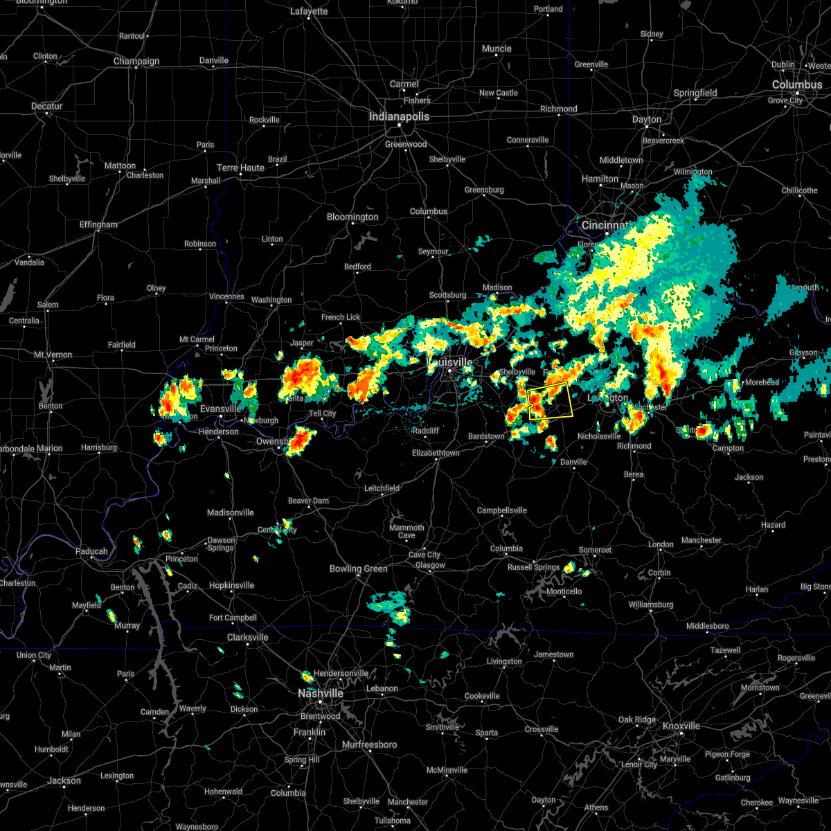 The national weather service in louisville has issued a * severe thunderstorm warning for. southeastern shelby county in central kentucky. northwestern woodford county in central kentucky. anderson county in central kentucky. Southwestern franklin county in central kentucky. The national weather service in louisville has issued a * severe thunderstorm warning for. southeastern shelby county in central kentucky. northwestern woodford county in central kentucky. anderson county in central kentucky. Southwestern franklin county in central kentucky.
|
| 8/18/2020 2:22 PM EDT | Report relayed by broadcast media of large tree branch snapped in juniper hills park in frankfort. time estimated by rada in franklin county KY, 0.9 miles E of Frankfort, KY |
| 7/9/2020 1:45 PM EDT | Transformer sparking due to a tree down on reilly r in franklin county KY, 1.5 miles SSW of Frankfort, KY |
| 7/9/2020 1:45 PM EDT | Reports of trees down on devils hollow access r in franklin county KY, 1.6 miles ESE of Frankfort, KY |
| 7/9/2020 1:45 PM EDT | Tree down near the old capitol parking structure off ky 42 in franklin county KY, 0.8 miles NNW of Frankfort, KY |
| 7/9/2020 1:45 PM EDT | Report of a tree dow in franklin county KY, 0.2 miles WNW of Frankfort, KY |
| 7/9/2020 1:45 PM EDT | Tree down near the thornhill bypas in franklin county KY, 2.7 miles SW of Frankfort, KY |
| 7/9/2020 1:32 PM EDT |
 At 131 pm edt, a severe thunderstorm was located over frankfort, and is nearly stationary (radar indicated). Hazards include 60 mph wind gusts. expect damage to roofs, siding, and trees At 131 pm edt, a severe thunderstorm was located over frankfort, and is nearly stationary (radar indicated). Hazards include 60 mph wind gusts. expect damage to roofs, siding, and trees
|
| 5/23/2020 7:53 PM EDT |
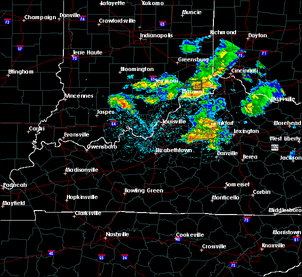 The severe thunderstorm warning for southeastern shelby, northeastern anderson and southern franklin counties will expire at 800 pm edt, the storm which prompted the warning has weakened below severe limits, and no longer poses an immediate threat to life or property. therefore, the warning will be allowed to expire. however gusty winds are still possible with this thunderstorm. The severe thunderstorm warning for southeastern shelby, northeastern anderson and southern franklin counties will expire at 800 pm edt, the storm which prompted the warning has weakened below severe limits, and no longer poses an immediate threat to life or property. therefore, the warning will be allowed to expire. however gusty winds are still possible with this thunderstorm.
|
| 5/23/2020 7:28 PM EDT |
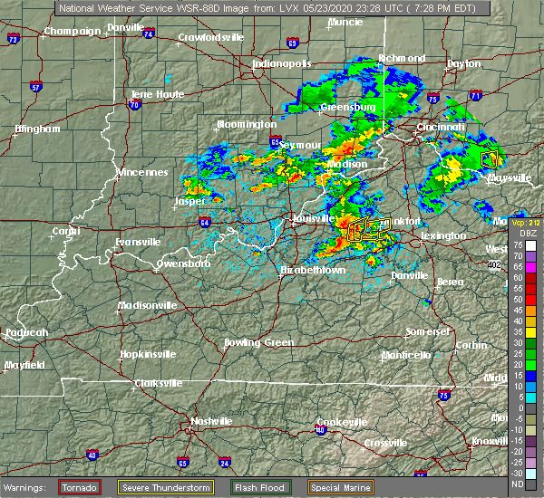 At 728 pm edt, a severe thunderstorm was located 9 miles east of shelbyville, moving east at 30 mph (radar indicated). Hazards include 60 mph wind gusts. expect damage to roofs, siding, and trees At 728 pm edt, a severe thunderstorm was located 9 miles east of shelbyville, moving east at 30 mph (radar indicated). Hazards include 60 mph wind gusts. expect damage to roofs, siding, and trees
|
| 5/23/2020 4:28 PM EDT |
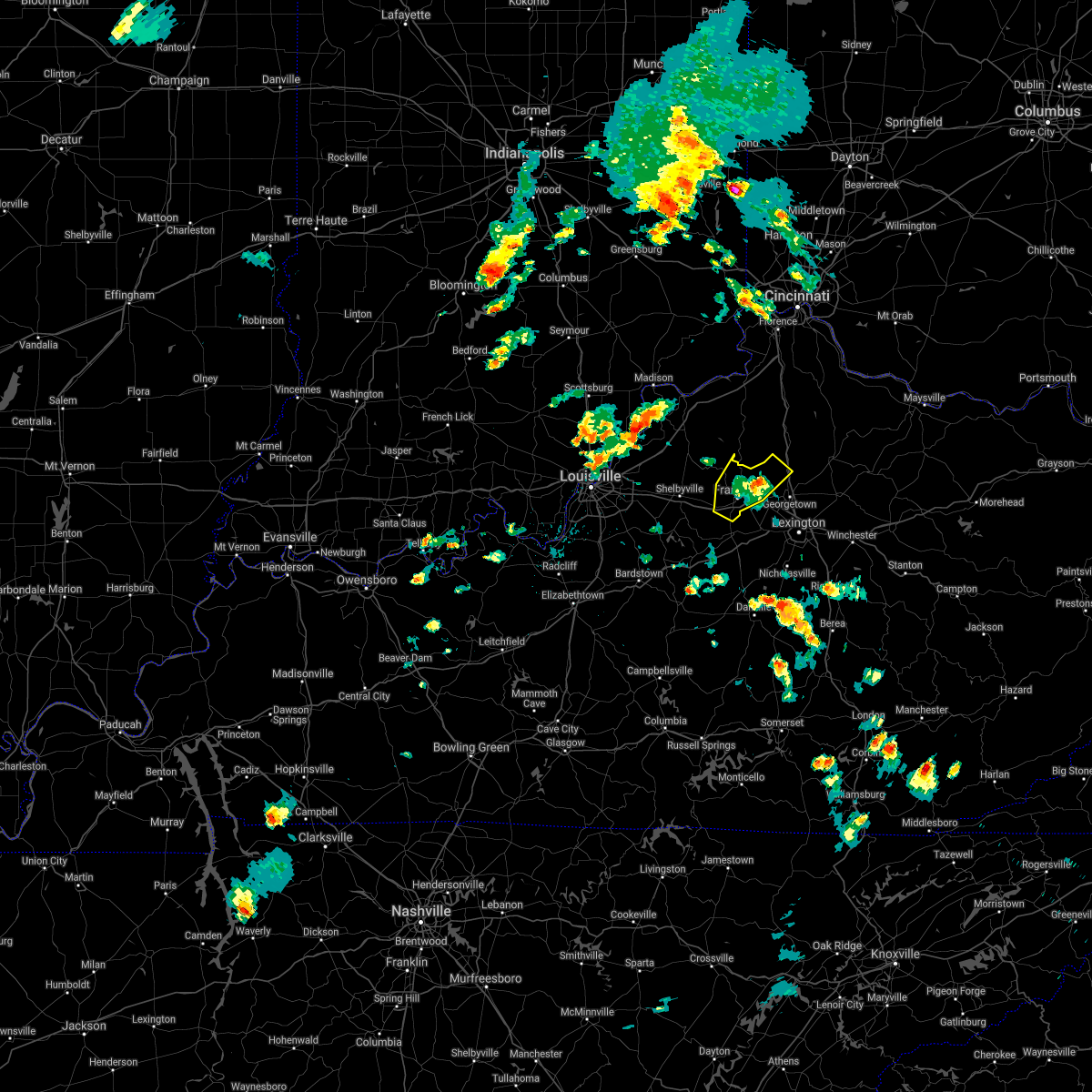 The severe thunderstorm warning for west central scott, eastern henry and franklin counties will expire at 430 pm edt, the storm which prompted the warning has weakened below severe limits, and no longer poses an immediate threat to life or property. therefore, the warning will be allowed to expire. however gusty winds are still possible with this thunderstorm. report severe weather to local law enforcement, post your report to the national weather service louisville facebook page, or tweet your report using hashtag l, m, k, spotter. The severe thunderstorm warning for west central scott, eastern henry and franklin counties will expire at 430 pm edt, the storm which prompted the warning has weakened below severe limits, and no longer poses an immediate threat to life or property. therefore, the warning will be allowed to expire. however gusty winds are still possible with this thunderstorm. report severe weather to local law enforcement, post your report to the national weather service louisville facebook page, or tweet your report using hashtag l, m, k, spotter.
|
| 5/23/2020 4:06 PM EDT |
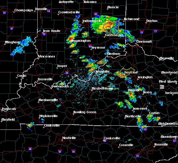 At 405 pm edt, a severe thunderstorm was located over frankfort, moving northeast at 30 mph (radar indicated). Hazards include 60 mph wind gusts and penny size hail. Expect damage to roofs, siding, and trees. capital city airport in frankfort just recorded a wind gust to 51 mph. strong wind gusts are likely over frankfort in the next few minutes. Locations impacted include, frankfort, stamping ground, longlick, slickway, skinnersburg, farmdale, harvieland, elmville, bridgeport and swallowfield. At 405 pm edt, a severe thunderstorm was located over frankfort, moving northeast at 30 mph (radar indicated). Hazards include 60 mph wind gusts and penny size hail. Expect damage to roofs, siding, and trees. capital city airport in frankfort just recorded a wind gust to 51 mph. strong wind gusts are likely over frankfort in the next few minutes. Locations impacted include, frankfort, stamping ground, longlick, slickway, skinnersburg, farmdale, harvieland, elmville, bridgeport and swallowfield.
|
| 5/23/2020 3:57 PM EDT |
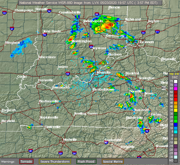 At 357 pm edt, a severe thunderstorm was located near frankfort, moving northeast at 30 mph (radar indicated). Hazards include 60 mph wind gusts and penny size hail. expect damage to roofs, siding, and trees At 357 pm edt, a severe thunderstorm was located near frankfort, moving northeast at 30 mph (radar indicated). Hazards include 60 mph wind gusts and penny size hail. expect damage to roofs, siding, and trees
|
| 4/8/2020 11:10 PM EDT |
 At 1110 pm edt, severe thunderstorms were located along a line extending from 10 miles southeast of owenton to 8 miles northeast of new castle to 6 miles north of shelbyville, moving northwest at 60 mph (radar indicated). Hazards include 60 mph wind gusts and nickel size hail. expect damage to roofs, siding, and trees At 1110 pm edt, severe thunderstorms were located along a line extending from 10 miles southeast of owenton to 8 miles northeast of new castle to 6 miles north of shelbyville, moving northwest at 60 mph (radar indicated). Hazards include 60 mph wind gusts and nickel size hail. expect damage to roofs, siding, and trees
|
| 8/20/2019 4:53 PM EDT |
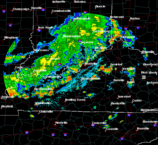 The severe thunderstorm warning for east central spencer, southeastern shelby, central anderson and southwestern franklin counties will expire at 500 pm edt, the storm which prompted the warning has weakened below severe limits, and no longer poses an immediate threat to life or property. therefore, the warning will be allowed to expire. however gusty winds and heavy rain are still possible with this thunderstorm. a severe thunderstorm watch remains in effect until 900 pm edt for central kentucky. The severe thunderstorm warning for east central spencer, southeastern shelby, central anderson and southwestern franklin counties will expire at 500 pm edt, the storm which prompted the warning has weakened below severe limits, and no longer poses an immediate threat to life or property. therefore, the warning will be allowed to expire. however gusty winds and heavy rain are still possible with this thunderstorm. a severe thunderstorm watch remains in effect until 900 pm edt for central kentucky.
|
| 8/20/2019 4:33 PM EDT |
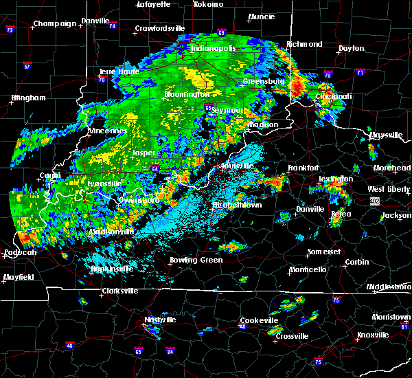 At 433 pm edt, a severe thunderstorm was located 11 miles southeast of shelbyville, moving east at 5 mph (radar indicated). Hazards include 60 mph wind gusts and quarter size hail. Hail damage to vehicles is expected. Expect wind damage to roofs, siding, and trees. At 433 pm edt, a severe thunderstorm was located 11 miles southeast of shelbyville, moving east at 5 mph (radar indicated). Hazards include 60 mph wind gusts and quarter size hail. Hail damage to vehicles is expected. Expect wind damage to roofs, siding, and trees.
|
| 6/30/2019 5:47 PM EDT |
 At 546 pm edt, a severe thunderstorm was located near frankfort, moving south at 15 mph (radar indicated). Hazards include 60 mph wind gusts. Expect damage to roofs, siding, and trees. Locations impacted include, frankfort, harvieland, and elsinore. At 546 pm edt, a severe thunderstorm was located near frankfort, moving south at 15 mph (radar indicated). Hazards include 60 mph wind gusts. Expect damage to roofs, siding, and trees. Locations impacted include, frankfort, harvieland, and elsinore.
|
| 6/30/2019 5:26 PM EDT |
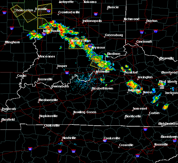 At 526 pm edt, a severe thunderstorm was located 7 miles north of frankfort, moving south at 15 mph (radar indicated). Hazards include 60 mph wind gusts and nickel size hail. expect damage to roofs, siding, and trees At 526 pm edt, a severe thunderstorm was located 7 miles north of frankfort, moving south at 15 mph (radar indicated). Hazards include 60 mph wind gusts and nickel size hail. expect damage to roofs, siding, and trees
|
| 6/23/2019 5:57 PM EDT |
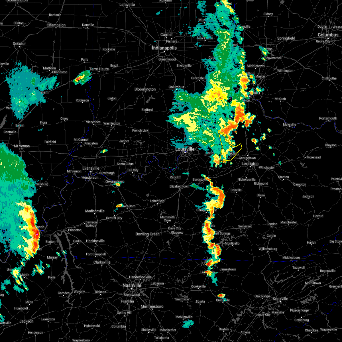 The severe thunderstorm warning for northeastern shelby, west central scott, eastern henry and franklin counties will expire at 600 pm edt, the storms which prompted the warning have weakened below severe limits, and no longer pose an immediate threat to life or property. therefore, the warning will be allowed to expire. however gusty winds are still possible with these thunderstorms. a severe thunderstorm watch remains in effect until 800 pm edt for central kentucky. The severe thunderstorm warning for northeastern shelby, west central scott, eastern henry and franklin counties will expire at 600 pm edt, the storms which prompted the warning have weakened below severe limits, and no longer pose an immediate threat to life or property. therefore, the warning will be allowed to expire. however gusty winds are still possible with these thunderstorms. a severe thunderstorm watch remains in effect until 800 pm edt for central kentucky.
|
| 6/23/2019 5:50 PM EDT |
 At 550 pm edt, severe thunderstorms were located along a line extending from near kentucky speedway to 6 miles north of frankfort to 8 miles northwest of lawrenceburg, moving east at 45 mph (radar indicated). Hazards include 60 mph wind gusts. Expect damage to roofs, siding, and trees. Locations impacted include, frankfort, harvieland, elmville, bridgeport, hatton, peytona, swallowfield, elsinore, ottusville and bryant. At 550 pm edt, severe thunderstorms were located along a line extending from near kentucky speedway to 6 miles north of frankfort to 8 miles northwest of lawrenceburg, moving east at 45 mph (radar indicated). Hazards include 60 mph wind gusts. Expect damage to roofs, siding, and trees. Locations impacted include, frankfort, harvieland, elmville, bridgeport, hatton, peytona, swallowfield, elsinore, ottusville and bryant.
|
| 6/23/2019 5:44 PM EDT |
 At 543 pm edt, severe thunderstorms were located along a line extending from 6 miles southwest of kentucky speedway to 7 miles northwest of frankfort to 11 miles southeast of shelbyville, moving east at 45 mph (radar indicated). Hazards include 60 mph wind gusts. Expect damage to roofs, siding, and trees. Locations impacted include, frankfort, shelbyville, new castle, eminence, pleasureville, campbellsburg, farmdale, harvieland, elmville and old christianburg. At 543 pm edt, severe thunderstorms were located along a line extending from 6 miles southwest of kentucky speedway to 7 miles northwest of frankfort to 11 miles southeast of shelbyville, moving east at 45 mph (radar indicated). Hazards include 60 mph wind gusts. Expect damage to roofs, siding, and trees. Locations impacted include, frankfort, shelbyville, new castle, eminence, pleasureville, campbellsburg, farmdale, harvieland, elmville and old christianburg.
|
| 6/23/2019 5:24 PM EDT |
 At 524 pm edt, severe thunderstorms were located along a line extending from near bedford to near shelbyville to taylorsville, moving east at 45 mph (radar indicated). Hazards include 60 mph wind gusts. expect damage to roofs, siding, and trees At 524 pm edt, severe thunderstorms were located along a line extending from near bedford to near shelbyville to taylorsville, moving east at 45 mph (radar indicated). Hazards include 60 mph wind gusts. expect damage to roofs, siding, and trees
|
| 6/5/2019 8:42 PM EDT |
 The severe thunderstorm warning for scott and northern franklin counties will expire at 845 pm edt, the storms which prompted the warning have weakened below severe limits, and no longer pose an immediate threat to life or property. therefore, the warning will be allowed to expire. however gusty winds are still possible with these thunderstorms. a severe thunderstorm watch remains in effect until 1100 pm edt for central kentucky. a severe thunderstorm watch also remains in effect until 100 am edt for central kentucky. report severe weather to local law enforcement, post your report to the national weather service louisville facebook page, or tweet your report using hashtag l, m, k, spotter. The severe thunderstorm warning for scott and northern franklin counties will expire at 845 pm edt, the storms which prompted the warning have weakened below severe limits, and no longer pose an immediate threat to life or property. therefore, the warning will be allowed to expire. however gusty winds are still possible with these thunderstorms. a severe thunderstorm watch remains in effect until 1100 pm edt for central kentucky. a severe thunderstorm watch also remains in effect until 100 am edt for central kentucky. report severe weather to local law enforcement, post your report to the national weather service louisville facebook page, or tweet your report using hashtag l, m, k, spotter.
|
| 6/5/2019 8:10 PM EDT |
 At 810 pm edt, severe thunderstorms were located along a line extending from 13 miles west of cynthiana to 9 miles north of frankfort, moving east at 40 mph (radar indicated). Hazards include 60 mph wind gusts and penny size hail. expect damage to roofs, siding, and trees At 810 pm edt, severe thunderstorms were located along a line extending from 13 miles west of cynthiana to 9 miles north of frankfort, moving east at 40 mph (radar indicated). Hazards include 60 mph wind gusts and penny size hail. expect damage to roofs, siding, and trees
|
| 3/14/2019 8:02 PM EDT | A few trees down to the north of frankfor in franklin county KY, 5.7 miles SSE of Frankfort, KY |
| 3/14/2019 8:00 PM EDT | A few trees snapped near alumni stadium at kentucky state universit in franklin county KY, 1.3 miles W of Frankfort, KY |
| 8/11/2018 7:45 PM EDT |
 At 745 pm edt, a severe thunderstorm was located near lawrenceburg, moving south at 5 mph (public reported a tree down near millville and dime size hail near alton). Hazards include 60 mph wind gusts and penny size hail. Expect damage to roofs, siding, and trees. Locations impacted include, frankfort, lawrenceburg, slickway, farmdale, capital city airport, broadville manor, avenstoke, tyrone, alton and bridgeport. At 745 pm edt, a severe thunderstorm was located near lawrenceburg, moving south at 5 mph (public reported a tree down near millville and dime size hail near alton). Hazards include 60 mph wind gusts and penny size hail. Expect damage to roofs, siding, and trees. Locations impacted include, frankfort, lawrenceburg, slickway, farmdale, capital city airport, broadville manor, avenstoke, tyrone, alton and bridgeport.
|
| 8/11/2018 7:27 PM EDT |
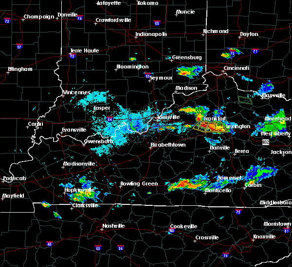 At 727 pm edt, a severe thunderstorm was located near lawrenceburg, moving south at 5 mph (radar indicated). Hazards include 60 mph wind gusts and penny size hail. expect damage to roofs, siding, and trees At 727 pm edt, a severe thunderstorm was located near lawrenceburg, moving south at 5 mph (radar indicated). Hazards include 60 mph wind gusts and penny size hail. expect damage to roofs, siding, and trees
|
| 8/11/2018 6:56 PM EDT | Tree down in millvill in woodford county KY, 5.1 miles NW of Frankfort, KY |
| 8/11/2018 6:42 PM EDT |
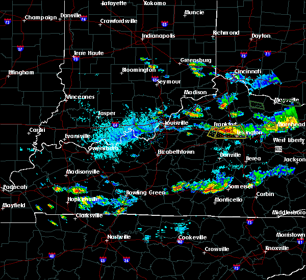 At 642 pm edt, a severe thunderstorm was located near frankfort, moving south at 10 mph (radar indicated). Hazards include 60 mph wind gusts and penny size hail. expect damage to roofs, siding, and trees At 642 pm edt, a severe thunderstorm was located near frankfort, moving south at 10 mph (radar indicated). Hazards include 60 mph wind gusts and penny size hail. expect damage to roofs, siding, and trees
|
| 7/20/2018 8:25 PM EDT |
 At 825 pm edt, a severe thunderstorm was located 9 miles east of shelbyville, moving southeast at 50 mph (radar indicated). Hazards include 70 mph wind gusts and quarter size hail. Hail damage to vehicles is expected. expect considerable tree damage. Wind damage is also likely to mobile homes, roofs, and outbuildings. At 825 pm edt, a severe thunderstorm was located 9 miles east of shelbyville, moving southeast at 50 mph (radar indicated). Hazards include 70 mph wind gusts and quarter size hail. Hail damage to vehicles is expected. expect considerable tree damage. Wind damage is also likely to mobile homes, roofs, and outbuildings.
|
| 7/20/2018 3:45 PM EDT | Franklin county mesone in franklin county KY, 4.9 miles N of Frankfort, KY |
| 7/20/2018 3:40 PM EDT | Multiple trees down around the city... some on power line in franklin county KY, 2.1 miles NE of Frankfort, KY |
| 7/20/2018 3:38 PM EDT |
 At 337 pm edt, a severe thunderstorm was located 8 miles west of frankfort, moving east at 55 mph. other potentially severe storms were locationed over southern franklin county (radar indicated). Hazards include 60 mph wind gusts and quarter size hail. Hail damage to vehicles is expected. Expect wind damage to roofs, siding, and trees. At 337 pm edt, a severe thunderstorm was located 8 miles west of frankfort, moving east at 55 mph. other potentially severe storms were locationed over southern franklin county (radar indicated). Hazards include 60 mph wind gusts and quarter size hail. Hail damage to vehicles is expected. Expect wind damage to roofs, siding, and trees.
|
| 7/2/2018 4:18 PM EDT | Dispatch reported 4 trees down across the county due to thunderstorms. time from rada in franklin county KY, 6.9 miles S of Frankfort, KY |
| 6/26/2018 2:28 PM EDT |
 At 228 pm edt, severe thunderstorms were located along a line extending from near owenton to 7 miles north of frankfort to lawrenceburg, moving east at 50 mph (radar indicated). Hazards include 60 mph wind gusts. expect damage to roofs, siding, and trees At 228 pm edt, severe thunderstorms were located along a line extending from near owenton to 7 miles north of frankfort to lawrenceburg, moving east at 50 mph (radar indicated). Hazards include 60 mph wind gusts. expect damage to roofs, siding, and trees
|
| 6/26/2018 2:21 PM EDT |
 At 220 pm edt, severe thunderstorms were located along a line extending from 6 miles south of kentucky speedway to 8 miles northwest of frankfort to near lawrenceburg, moving east at 45 mph (radar indicated). Hazards include 70 mph wind gusts. Expect considerable tree damage. damage is likely to mobile homes, roofs, and outbuildings. Locations impacted include, frankfort, lawrenceburg, new castle, pleasureville, glensboro, farmdale, harvieland, old christianburg, bridgeport and hatton. At 220 pm edt, severe thunderstorms were located along a line extending from 6 miles south of kentucky speedway to 8 miles northwest of frankfort to near lawrenceburg, moving east at 45 mph (radar indicated). Hazards include 70 mph wind gusts. Expect considerable tree damage. damage is likely to mobile homes, roofs, and outbuildings. Locations impacted include, frankfort, lawrenceburg, new castle, pleasureville, glensboro, farmdale, harvieland, old christianburg, bridgeport and hatton.
|
| 6/26/2018 1:58 PM EDT |
 The national weather service in louisville has issued a * severe thunderstorm warning for. eastern spencer county in central kentucky. shelby county in central kentucky. northern anderson county in central kentucky. Southeastern trimble county in central kentucky. The national weather service in louisville has issued a * severe thunderstorm warning for. eastern spencer county in central kentucky. shelby county in central kentucky. northern anderson county in central kentucky. Southeastern trimble county in central kentucky.
|
| 6/26/2018 11:46 AM EDT |
 At 1146 am edt, severe thunderstorms were located along a line extending from 10 miles northeast of frankfort to u k arboretum, moving east at 30 mph (radar indicated). Hazards include 60 mph wind gusts. expect damage to roofs, siding, and trees At 1146 am edt, severe thunderstorms were located along a line extending from 10 miles northeast of frankfort to u k arboretum, moving east at 30 mph (radar indicated). Hazards include 60 mph wind gusts. expect damage to roofs, siding, and trees
|
| 6/26/2018 11:31 AM EDT | Tree down versailles r in franklin county KY, 2.4 miles WSW of Frankfort, KY |
| 5/31/2018 3:40 PM EDT |
 At 340 pm edt, severe thunderstorms were located along a line extending from 12 miles northwest of georgetown to 7 miles south of versailles to 8 miles northeast of springfield, moving east at 45 mph (radar indicated). Hazards include 60 mph wind gusts. expect damage to roofs, siding, and trees At 340 pm edt, severe thunderstorms were located along a line extending from 12 miles northwest of georgetown to 7 miles south of versailles to 8 miles northeast of springfield, moving east at 45 mph (radar indicated). Hazards include 60 mph wind gusts. expect damage to roofs, siding, and trees
|
| 5/31/2018 3:27 PM EDT | Asos station fft... capital city airpor in franklin county KY, 1.7 miles ENE of Frankfort, KY |
| 5/31/2018 3:25 PM EDT | More than 2 dozen reports of trees down across the southern part of the county from frankfort sout in franklin county KY, 1.5 miles N of Frankfort, KY |
| 5/31/2018 3:25 PM EDT |
 At 323 pm edt, severe thunderstorms were located along a line extending from 7 miles south of owenton to near lawrenceburg, moving east at 55 mph (radar indicated). Hazards include 70 mph wind gusts. Expect considerable tree damage. damage is likely to mobile homes, roofs, and outbuildings. locations impacted include, frankfort, lawrenceburg, versailles, midway, stamping ground, sadieville, gratz, longlick, slickway and stonewall. The strongest winds at 325 pm were just west 0f frankfort - heading directly toward the city. At 323 pm edt, severe thunderstorms were located along a line extending from 7 miles south of owenton to near lawrenceburg, moving east at 55 mph (radar indicated). Hazards include 70 mph wind gusts. Expect considerable tree damage. damage is likely to mobile homes, roofs, and outbuildings. locations impacted include, frankfort, lawrenceburg, versailles, midway, stamping ground, sadieville, gratz, longlick, slickway and stonewall. The strongest winds at 325 pm were just west 0f frankfort - heading directly toward the city.
|
| 5/31/2018 3:18 PM EDT |
 At 318 pm edt, severe thunderstorms were located along a line extending from 6 miles south of owenton to 6 miles southwest of lawrenceburg, moving east at 55 mph (radar indicated). Hazards include 60 mph wind gusts. expect damage to roofs, siding, and trees At 318 pm edt, severe thunderstorms were located along a line extending from 6 miles south of owenton to 6 miles southwest of lawrenceburg, moving east at 55 mph (radar indicated). Hazards include 60 mph wind gusts. expect damage to roofs, siding, and trees
|
| 2/25/2018 12:04 AM EST |
 A severe thunderstorm warning remains in effect until 1215 am est for northeastern nelson. northwestern mercer. northwestern woodford. southwestern scott. anderson. northeastern washington and central franklin counties. At 1203 am est, severe thunderstorms were located along a line extending from 9 miles north of georgetown to 14 miles north of. A severe thunderstorm warning remains in effect until 1215 am est for northeastern nelson. northwestern mercer. northwestern woodford. southwestern scott. anderson. northeastern washington and central franklin counties. At 1203 am est, severe thunderstorms were located along a line extending from 9 miles north of georgetown to 14 miles north of.
|
| 2/24/2018 11:24 PM EST |
 At 1123 pm est, severe thunderstorms were located along a line extending from 6 miles southeast of new castle to 8 miles north of bardstown, moving east at 40 mph (radar indicated). Hazards include 60 mph wind gusts. expect damage to roofs, siding, and trees At 1123 pm est, severe thunderstorms were located along a line extending from 6 miles southeast of new castle to 8 miles north of bardstown, moving east at 40 mph (radar indicated). Hazards include 60 mph wind gusts. expect damage to roofs, siding, and trees
|
| 7/23/2017 3:52 AM EDT |
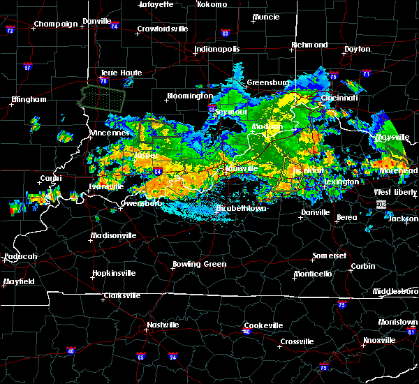 The severe thunderstorm warning for northwestern woodford, northern anderson, southeastern henry and franklin counties will expire at 400 am edt, the storms which prompted the warning have weakened below severe limits, and no longer pose an immediate threat to life or property. therefore the warning will be allowed to expire. however gusty winds are still possible with these thunderstorms. report severe weather to local law enforcement, post your report to the national weather service louisville facebook page, or tweet your report using hashtag l, m, k, spotter. The severe thunderstorm warning for northwestern woodford, northern anderson, southeastern henry and franklin counties will expire at 400 am edt, the storms which prompted the warning have weakened below severe limits, and no longer pose an immediate threat to life or property. therefore the warning will be allowed to expire. however gusty winds are still possible with these thunderstorms. report severe weather to local law enforcement, post your report to the national weather service louisville facebook page, or tweet your report using hashtag l, m, k, spotter.
|
| 7/23/2017 3:42 AM EDT |
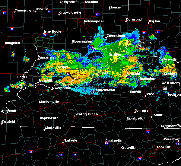 At 342 am edt, severe thunderstorms were located along a line extending from owenton to near lawrenceburg, moving east at 25 mph (radar indicated). Hazards include 60 mph wind gusts. Expect damage to roofs, siding, and trees. Locations impacted include, frankfort, lawrenceburg, slickway, wayside, anderson city, glensboro, farmdale, avenstoke, harvieland and elmville. At 342 am edt, severe thunderstorms were located along a line extending from owenton to near lawrenceburg, moving east at 25 mph (radar indicated). Hazards include 60 mph wind gusts. Expect damage to roofs, siding, and trees. Locations impacted include, frankfort, lawrenceburg, slickway, wayside, anderson city, glensboro, farmdale, avenstoke, harvieland and elmville.
|
| 7/23/2017 3:17 AM EDT |
 At 317 am edt, severe thunderstorms were located along a line extending from 10 miles west of owenton to 8 miles east of taylorsville, moving east at 25 mph (radar indicated). Hazards include 60 mph wind gusts. expect damage to roofs, siding, and trees At 317 am edt, severe thunderstorms were located along a line extending from 10 miles west of owenton to 8 miles east of taylorsville, moving east at 25 mph (radar indicated). Hazards include 60 mph wind gusts. expect damage to roofs, siding, and trees
|
| 6/18/2017 4:54 PM EDT | Trees and power poles snappe in franklin county KY, 0.2 miles WNW of Frankfort, KY |
| 5/20/2017 8:10 PM EDT |
 The severe thunderstorm warning for east central spencer, eastern shelby, northern anderson and western franklin counties will expire at 815 pm edt, the storm which prompted the warning has weakened below severe limits, and no longer poses an immediate threat to life or property. therefore the warning will be allowed to expire. however heavy rain is still possible with this thunderstorm. a severe thunderstorm watch remains in effect until 1100 pm edt for central kentucky. report severe weather to local law enforcement, post your report to the national weather service louisville facebook page, or tweet your report using hashtag l, m, k, spotter. The severe thunderstorm warning for east central spencer, eastern shelby, northern anderson and western franklin counties will expire at 815 pm edt, the storm which prompted the warning has weakened below severe limits, and no longer poses an immediate threat to life or property. therefore the warning will be allowed to expire. however heavy rain is still possible with this thunderstorm. a severe thunderstorm watch remains in effect until 1100 pm edt for central kentucky. report severe weather to local law enforcement, post your report to the national weather service louisville facebook page, or tweet your report using hashtag l, m, k, spotter.
|
| 5/20/2017 7:59 PM EDT |
 At 759 pm edt, a severe thunderstorm was located 9 miles southwest of frankfort, moving east at 35 mph (radar indicated). Hazards include 60 mph wind gusts. Expect damage to roofs, siding, and trees. Locations impacted include, frankfort, shelbyville, lawrenceburg, wayside, anderson city, glensboro, farmdale, avenstoke, old christianburg and bridgeport. At 759 pm edt, a severe thunderstorm was located 9 miles southwest of frankfort, moving east at 35 mph (radar indicated). Hazards include 60 mph wind gusts. Expect damage to roofs, siding, and trees. Locations impacted include, frankfort, shelbyville, lawrenceburg, wayside, anderson city, glensboro, farmdale, avenstoke, old christianburg and bridgeport.
|
| 5/20/2017 7:44 PM EDT |
 At 744 pm edt, a severe thunderstorm was located 8 miles south of shelbyville, moving east at 35 mph (radar indicated). Hazards include 60 mph wind gusts. Expect damage to roofs, siding, and trees. Locations impacted include, frankfort, shelbyville, lawrenceburg, wayside, anderson city, glensboro, farmdale, avenstoke, old christianburg and bridgeport. At 744 pm edt, a severe thunderstorm was located 8 miles south of shelbyville, moving east at 35 mph (radar indicated). Hazards include 60 mph wind gusts. Expect damage to roofs, siding, and trees. Locations impacted include, frankfort, shelbyville, lawrenceburg, wayside, anderson city, glensboro, farmdale, avenstoke, old christianburg and bridgeport.
|
| 5/20/2017 7:31 PM EDT |
 At 731 pm edt, a severe thunderstorm was located over taylorsville, moving east at 35 mph (radar indicated). Hazards include 60 mph wind gusts. expect damage to roofs, siding, and trees At 731 pm edt, a severe thunderstorm was located over taylorsville, moving east at 35 mph (radar indicated). Hazards include 60 mph wind gusts. expect damage to roofs, siding, and trees
|
| 4/30/2017 7:24 PM EDT |
 At 723 pm edt, severe thunderstorms were located along a line extending from 10 miles southwest of owenton to near frankfort to 7 miles south of lawrenceburg, moving northeast at 50 mph (radar indicated). Hazards include 60 mph wind gusts. Expect damage to roofs, siding, and trees. locations impacted include, frankfort, lawrenceburg, versailles, midway, stamping ground, longlick, slickway, farmdale, harvieland and elmville. These storms have a history of tree damage. At 723 pm edt, severe thunderstorms were located along a line extending from 10 miles southwest of owenton to near frankfort to 7 miles south of lawrenceburg, moving northeast at 50 mph (radar indicated). Hazards include 60 mph wind gusts. Expect damage to roofs, siding, and trees. locations impacted include, frankfort, lawrenceburg, versailles, midway, stamping ground, longlick, slickway, farmdale, harvieland and elmville. These storms have a history of tree damage.
|
| 4/30/2017 7:17 PM EDT | Tree dow in franklin county KY, 0.7 miles SSE of Frankfort, KY |
| 4/30/2017 7:11 PM EDT | Tree down on i-6 in franklin county KY, 6 miles ENE of Frankfort, KY |
| 4/30/2017 7:11 PM EDT |
 At 710 pm edt, severe thunderstorms were located along a line extending from 9 miles southeast of new castle to near lawrenceburg to near harrodsburg, moving northeast at 50 mph (radar indicated). Hazards include 60 mph wind gusts. expect damage to roofs, siding, and trees At 710 pm edt, severe thunderstorms were located along a line extending from 9 miles southeast of new castle to near lawrenceburg to near harrodsburg, moving northeast at 50 mph (radar indicated). Hazards include 60 mph wind gusts. expect damage to roofs, siding, and trees
|
| 4/16/2017 3:45 PM EDT |
 At 345 pm edt, severe thunderstorms were from 8 miles northwest of georgetown to near frankfort, moving east at 30 mph (radar indicated). Hazards include 60 mph wind gusts. Expect damage to roofs, siding, and trees. Locations impacted include, frankfort, midway, stamping ground, longlick, slickway, skinnersburg, duval, mallard point, woodlake and switzer. At 345 pm edt, severe thunderstorms were from 8 miles northwest of georgetown to near frankfort, moving east at 30 mph (radar indicated). Hazards include 60 mph wind gusts. Expect damage to roofs, siding, and trees. Locations impacted include, frankfort, midway, stamping ground, longlick, slickway, skinnersburg, duval, mallard point, woodlake and switzer.
|
| 4/16/2017 3:27 PM EDT |
 At 327 pm edt, severe thunderstorms were located from 9 miles northeast of frankfort to 7 miles northwest of lawrenceburg, moving east at 30 mph (radar indicated). Hazards include 60 mph wind gusts. expect damage to roofs, siding, and trees At 327 pm edt, severe thunderstorms were located from 9 miles northeast of frankfort to 7 miles northwest of lawrenceburg, moving east at 30 mph (radar indicated). Hazards include 60 mph wind gusts. expect damage to roofs, siding, and trees
|
| 4/5/2017 6:45 PM EDT | Trees down reported at pearidge rd... frankfort... k in franklin county KY, 3.1 miles E of Frankfort, KY |
| 4/5/2017 6:44 PM EDT |
 At 643 pm edt, severe thunderstorms were located along a line extending from 6 miles northeast of frankfort to near versailles to 7 miles southeast of lawrenceburg, moving east at 55 mph (trained weather spotters). Hazards include 70 mph wind gusts and half dollar size hail. Hail damage to vehicles is expected. expect considerable tree damage. wind damage is also likely to mobile homes, roofs, and outbuildings. a spotter in frankfort just reported a measured 72 mph wind gust as these storms passed through the area. locations impacted include, lexington, georgetown, frankfort, versailles, paris, cynthiana, meadowthorpe, dunbar high school, thoroughbred acres and cardinal hill. A tornado watch remains in effect until 1000 pm edt for central kentucky. At 643 pm edt, severe thunderstorms were located along a line extending from 6 miles northeast of frankfort to near versailles to 7 miles southeast of lawrenceburg, moving east at 55 mph (trained weather spotters). Hazards include 70 mph wind gusts and half dollar size hail. Hail damage to vehicles is expected. expect considerable tree damage. wind damage is also likely to mobile homes, roofs, and outbuildings. a spotter in frankfort just reported a measured 72 mph wind gust as these storms passed through the area. locations impacted include, lexington, georgetown, frankfort, versailles, paris, cynthiana, meadowthorpe, dunbar high school, thoroughbred acres and cardinal hill. A tornado watch remains in effect until 1000 pm edt for central kentucky.
|
| 4/5/2017 6:34 PM EDT | Storm damage reported in franklin county KY, 5.9 miles NNE of Frankfort, KY |
| 4/5/2017 6:34 PM EDT |
 At 634 pm edt, severe thunderstorms were located along a line extending from frankfort to near lawrenceburg to 10 miles southwest of versailles, moving east at 55 mph (radar indicated). Hazards include 70 mph wind gusts and quarter size hail. Hail damage to vehicles is expected. expect considerable tree damage. Wind damage is also likely to mobile homes, roofs, and outbuildings. At 634 pm edt, severe thunderstorms were located along a line extending from frankfort to near lawrenceburg to 10 miles southwest of versailles, moving east at 55 mph (radar indicated). Hazards include 70 mph wind gusts and quarter size hail. Hail damage to vehicles is expected. expect considerable tree damage. Wind damage is also likely to mobile homes, roofs, and outbuildings.
|
| 4/5/2017 6:27 PM EDT |
 At 627 pm edt, a severe thunderstorm was located 8 miles west of lawrenceburg, moving northeast at 45 mph (radar indicated). Hazards include 70 to 80 mph wind gusts and ping pong ball size hail. People and animals outdoors will be injured. expect hail damage to roofs, siding, windows, and vehicles. expect considerable tree damage. wind damage is also likely to mobile homes, roofs, and outbuildings. locations impacted include, frankfort, lawrenceburg, versailles, ballard, slickway, wayside, anderson city, glensboro, farmdale and johnsonville. A tornado watch remains in effect until 1000 pm edt for central kentucky. At 627 pm edt, a severe thunderstorm was located 8 miles west of lawrenceburg, moving northeast at 45 mph (radar indicated). Hazards include 70 to 80 mph wind gusts and ping pong ball size hail. People and animals outdoors will be injured. expect hail damage to roofs, siding, windows, and vehicles. expect considerable tree damage. wind damage is also likely to mobile homes, roofs, and outbuildings. locations impacted include, frankfort, lawrenceburg, versailles, ballard, slickway, wayside, anderson city, glensboro, farmdale and johnsonville. A tornado watch remains in effect until 1000 pm edt for central kentucky.
|
| 4/5/2017 6:14 PM EDT |
 At 613 pm edt, a severe thunderstorm was located 8 miles southeast of taylorsville, moving northeast at 55 mph (radar indicated). Hazards include golf ball size hail and 70 mph wind gusts. People and animals outdoors will be injured. expect hail damage to roofs, siding, windows, and vehicles. expect considerable tree damage. Wind damage is also likely to mobile homes, roofs, and outbuildings. At 613 pm edt, a severe thunderstorm was located 8 miles southeast of taylorsville, moving northeast at 55 mph (radar indicated). Hazards include golf ball size hail and 70 mph wind gusts. People and animals outdoors will be injured. expect hail damage to roofs, siding, windows, and vehicles. expect considerable tree damage. Wind damage is also likely to mobile homes, roofs, and outbuildings.
|
| 3/27/2017 7:04 PM EDT |
 At 703 pm edt, severe thunderstorms were located along a line extending from 13 miles southeast of shelbyville to 7 miles south of lawrenceburg to near harrodsburg, moving northeast at 55 mph (radar indicated). Hazards include 60 mph wind gusts and penny size hail. expect damage to roofs, siding, and trees At 703 pm edt, severe thunderstorms were located along a line extending from 13 miles southeast of shelbyville to 7 miles south of lawrenceburg to near harrodsburg, moving northeast at 55 mph (radar indicated). Hazards include 60 mph wind gusts and penny size hail. expect damage to roofs, siding, and trees
|
| 3/27/2017 6:45 PM EDT | Quarter sized hail reported 3.7 miles WSW of Frankfort, KY, mostly pea size hail with a few quarters mixed in. time estimated by radar. |
| 3/27/2017 6:40 PM EDT | Measured at the lsml kentucky mesonet site near frankfor in franklin county KY, 4.9 miles N of Frankfort, KY |
| 3/27/2017 6:38 PM EDT | Quarter sized hail reported 6.5 miles ENE of Frankfort, KY, lots of small hail covering interstate 64 in 1 inch of hail. largest hail in the area was around the size of a quarter. |
| 3/27/2017 6:35 PM EDT |
 At 635 pm edt, a severe thunderstorm was located near frankfort, moving northeast at 45 mph (radar indicated). Hazards include 70 mph wind gusts and ping pong ball size hail. People and animals outdoors will be injured. expect hail damage to roofs, siding, windows, and vehicles. expect considerable tree damage. Wind damage is also likely to mobile homes, roofs, and outbuildings. At 635 pm edt, a severe thunderstorm was located near frankfort, moving northeast at 45 mph (radar indicated). Hazards include 70 mph wind gusts and ping pong ball size hail. People and animals outdoors will be injured. expect hail damage to roofs, siding, windows, and vehicles. expect considerable tree damage. Wind damage is also likely to mobile homes, roofs, and outbuildings.
|
| 3/27/2017 6:25 PM EDT |
 At 624 pm edt, a severe thunderstorm was located 9 miles northwest of lawrenceburg, moving east at 20 mph (radar indicated). Hazards include 60 mph wind gusts and quarter size hail. Hail damage to vehicles is expected. expect wind damage to roofs, siding, and trees. Locations impacted include, frankfort, bryant, benson, farmdale, capital city airport, broadville manor, avenstoke, harvieland, alton and graefenburg. At 624 pm edt, a severe thunderstorm was located 9 miles northwest of lawrenceburg, moving east at 20 mph (radar indicated). Hazards include 60 mph wind gusts and quarter size hail. Hail damage to vehicles is expected. expect wind damage to roofs, siding, and trees. Locations impacted include, frankfort, bryant, benson, farmdale, capital city airport, broadville manor, avenstoke, harvieland, alton and graefenburg.
|
| 3/27/2017 6:11 PM EDT |
 At 611 pm edt, a severe thunderstorm was located 9 miles southeast of shelbyville, moving east at 20 mph (radar indicated). Hazards include 60 mph wind gusts and quarter size hail. Hail damage to vehicles is expected. Expect wind damage to roofs, siding, and trees. At 611 pm edt, a severe thunderstorm was located 9 miles southeast of shelbyville, moving east at 20 mph (radar indicated). Hazards include 60 mph wind gusts and quarter size hail. Hail damage to vehicles is expected. Expect wind damage to roofs, siding, and trees.
|
| 3/1/2017 7:30 AM EST | Multiple roofs off homes and damage to farm structures in the peaks mill communit in franklin county KY, 6.4 miles SSW of Frankfort, KY |
| 3/1/2017 7:15 AM EST | Sheds blown dow in franklin county KY, 8.3 miles SSW of Frankfort, KY |
| 3/1/2017 7:10 AM EST | The nws in conjunction with 911 operator deron rambo found intermittent straight line wind damage around peak's mill. the most concentrated area of damage was near the in franklin county KY, 8.3 miles SSW of Frankfort, KY |
| 3/1/2017 7:05 AM EST |
 At 704 am est, a severe thunderstorm was located 10 miles south of owenton, moving east at 60 mph (radar indicated). Hazards include 60 mph wind gusts and penny size hail. Expect damage to roofs, siding, and trees. locations impacted include, frankfort, lawrenceburg, farmdale, avenstoke, harvieland, elmville, bridgeport, hatton, peytona and swallowfield. a tornado watch remains in effect until 900 am est for central kentucky. A tornado watch also remains in effect until 1100 am est for central kentucky. At 704 am est, a severe thunderstorm was located 10 miles south of owenton, moving east at 60 mph (radar indicated). Hazards include 60 mph wind gusts and penny size hail. Expect damage to roofs, siding, and trees. locations impacted include, frankfort, lawrenceburg, farmdale, avenstoke, harvieland, elmville, bridgeport, hatton, peytona and swallowfield. a tornado watch remains in effect until 900 am est for central kentucky. A tornado watch also remains in effect until 1100 am est for central kentucky.
|
| 3/1/2017 6:41 AM EST |
 At 641 am est, severe thunderstorms were located along a line extending from 6 miles southeast of carrollton to 8 miles northwest of shelbyville, moving southeast at 55 mph (radar indicated). Hazards include 60 mph wind gusts and quarter size hail. Hail damage to vehicles is expected. Expect wind damage to roofs, siding, and trees. At 641 am est, severe thunderstorms were located along a line extending from 6 miles southeast of carrollton to 8 miles northwest of shelbyville, moving southeast at 55 mph (radar indicated). Hazards include 60 mph wind gusts and quarter size hail. Hail damage to vehicles is expected. Expect wind damage to roofs, siding, and trees.
|
| 3/1/2017 3:41 AM EST |
 At 341 am est, a severe thunderstorm was located near versailles, moving east at 70 mph (radar indicated). Hazards include 60 mph wind gusts. expect damage to roofs, siding, and trees At 341 am est, a severe thunderstorm was located near versailles, moving east at 70 mph (radar indicated). Hazards include 60 mph wind gusts. expect damage to roofs, siding, and trees
|
| 3/1/2017 3:37 AM EST | Quarter sized hail reported 0.4 miles E of Frankfort, KY, quarter size hail. |
| 3/1/2017 3:10 AM EST |
 At 310 am est, severe thunderstorms were located along a line extending from near la grange to near shelbyville to 6 miles southwest of taylorsville, moving east at 70 mph (radar indicated). Hazards include 60 mph wind gusts. expect damage to roofs, siding, and trees At 310 am est, severe thunderstorms were located along a line extending from near la grange to near shelbyville to 6 miles southwest of taylorsville, moving east at 70 mph (radar indicated). Hazards include 60 mph wind gusts. expect damage to roofs, siding, and trees
|
| 9/10/2016 4:57 PM EDT | Tree down on dollar genera in franklin county KY, 1.5 miles SSW of Frankfort, KY |
| 9/10/2016 4:57 PM EDT | Trees down around county including one on old stewart roa in franklin county KY, 6.3 miles SSW of Frankfort, KY |
| 9/10/2016 4:49 PM EDT |
 At 449 pm edt, a severe thunderstorm was located near frankfort, moving east at 40 mph (radar indicated). Hazards include 60 mph wind gusts. Expect damage to roofs. siding. And trees. At 449 pm edt, a severe thunderstorm was located near frankfort, moving east at 40 mph (radar indicated). Hazards include 60 mph wind gusts. Expect damage to roofs. siding. And trees.
|
| 8/28/2016 3:30 PM EDT | Trees dow in franklin county KY, 5.6 miles W of Frankfort, KY |
| 7/13/2016 11:13 PM EDT | The severe thunderstorm warning for southwestern franklin and east central shelby counties will expire at 1115 pm edt, the storm which prompted the warning has moved out of the area. therefore the warning will be allowed to expire. however gusty winds, lightning, and heavy rain are still possible with this thunderstorm. a severe thunderstorm watch remains in effect until 100 am edt for central kentucky. |
| 7/13/2016 11:01 PM EDT |
 At 1100 pm edt, a severe thunderstorm was located 9 miles west of frankfort, moving east at 40 mph (radar indicated). Hazards include 60 mph wind gusts. Expect damage to roofs. siding. and trees. Locations impacted include, frankfort, bryant, graefenburg, hatton, benson, broadville manor, bridgeport and peytona. At 1100 pm edt, a severe thunderstorm was located 9 miles west of frankfort, moving east at 40 mph (radar indicated). Hazards include 60 mph wind gusts. Expect damage to roofs. siding. and trees. Locations impacted include, frankfort, bryant, graefenburg, hatton, benson, broadville manor, bridgeport and peytona.
|
| 7/13/2016 10:52 PM EDT |
 At 1051 pm edt, a severe thunderstorm was located near shelbyville, moving east at 40 mph (radar indicated). Hazards include 60 mph wind gusts. Expect damage to roofs. siding. And trees. At 1051 pm edt, a severe thunderstorm was located near shelbyville, moving east at 40 mph (radar indicated). Hazards include 60 mph wind gusts. Expect damage to roofs. siding. And trees.
|
| 7/8/2016 11:52 AM EDT |
 The severe thunderstorm warning for franklin, southwestern scott, woodford and northeastern anderson counties will expire at noon edt, the storm which prompted the warning has weakened below severe limits, and have exited the warned area. therefore the warning will be allowed to expire. a severe thunderstorm watch remains in effect until 600 pm edt for central kentucky. report severe weather to local law enforcement, post your report to the national weather service louisville facebook page, or tweet your report using hashtag l, m, k, spotter. The severe thunderstorm warning for franklin, southwestern scott, woodford and northeastern anderson counties will expire at noon edt, the storm which prompted the warning has weakened below severe limits, and have exited the warned area. therefore the warning will be allowed to expire. a severe thunderstorm watch remains in effect until 600 pm edt for central kentucky. report severe weather to local law enforcement, post your report to the national weather service louisville facebook page, or tweet your report using hashtag l, m, k, spotter.
|
| 7/8/2016 11:39 AM EDT |
 At 1139 am edt, a severe thunderstorm was located near lawrenceburg, moving east at 40 mph (radar indicated). Hazards include 60 mph wind gusts. Expect damage to roofs. siding. and trees. Locations impacted include, frankfort, lawrenceburg, versailles, midway, stamping ground, bryant, bon air hills, jett, big eddy and millville. At 1139 am edt, a severe thunderstorm was located near lawrenceburg, moving east at 40 mph (radar indicated). Hazards include 60 mph wind gusts. Expect damage to roofs. siding. and trees. Locations impacted include, frankfort, lawrenceburg, versailles, midway, stamping ground, bryant, bon air hills, jett, big eddy and millville.
|
| 7/8/2016 11:27 AM EDT |
 At 1126 am edt, a severe thunderstorm was located near lawrenceburg, moving east at 40 mph (radar indicated). Hazards include 60 mph wind gusts. Expect damage to roofs. siding. And trees. At 1126 am edt, a severe thunderstorm was located near lawrenceburg, moving east at 40 mph (radar indicated). Hazards include 60 mph wind gusts. Expect damage to roofs. siding. And trees.
|
| 6/2/2016 5:40 PM EDT |
 At 540 pm edt, a severe thunderstorm was located north of frankfort, moving east at 15 mph (radar indicated). Hazards include 60 mph wind gusts. Expect damage to roofs. siding. And trees. At 540 pm edt, a severe thunderstorm was located north of frankfort, moving east at 15 mph (radar indicated). Hazards include 60 mph wind gusts. Expect damage to roofs. siding. And trees.
|
| 5/7/2016 5:23 PM EDT |
 At 522 pm edt, severe thunderstorms were located along a line extending from near shelbyville to fern creek, moving southeast at 50 mph (radar indicated). Hazards include 60 mph wind gusts and quarter size hail. Hail damage to vehicles is expected. expect wind damage to roofs, siding, and trees. locations impacted include, frankfort, jeffersontown, shelbyville, middletown, watterson park, hollow creek, taylorsville, fern creek, buechel and newburg. those attending outdoor events in the path of these storms should prepare for imminent dangerous weather conditions. Seek shelter now!. At 522 pm edt, severe thunderstorms were located along a line extending from near shelbyville to fern creek, moving southeast at 50 mph (radar indicated). Hazards include 60 mph wind gusts and quarter size hail. Hail damage to vehicles is expected. expect wind damage to roofs, siding, and trees. locations impacted include, frankfort, jeffersontown, shelbyville, middletown, watterson park, hollow creek, taylorsville, fern creek, buechel and newburg. those attending outdoor events in the path of these storms should prepare for imminent dangerous weather conditions. Seek shelter now!.
|
| 5/7/2016 5:13 PM EDT |
 At 513 pm edt, severe thunderstorms were located along a line extending from 7 miles south of la grange to strathmoor manor, moving southeast at 50 mph (radar indicated). Hazards include 60 mph wind gusts and quarter size hail. Hail damage to vehicles is expected. expect wind damage to roofs, siding, and trees. locations impacted include, louisville, frankfort, jeffersontown, st. matthews, shelbyville, lyndon, middletown, douglass hills, hurstbourne and graymoor-devondale. those attending outdoor events in the path of these storms should prepare for imminent dangerous weather conditions. Seek shelter now!. At 513 pm edt, severe thunderstorms were located along a line extending from 7 miles south of la grange to strathmoor manor, moving southeast at 50 mph (radar indicated). Hazards include 60 mph wind gusts and quarter size hail. Hail damage to vehicles is expected. expect wind damage to roofs, siding, and trees. locations impacted include, louisville, frankfort, jeffersontown, st. matthews, shelbyville, lyndon, middletown, douglass hills, hurstbourne and graymoor-devondale. those attending outdoor events in the path of these storms should prepare for imminent dangerous weather conditions. Seek shelter now!.
|
| 5/7/2016 5:05 PM EDT |
 At 505 pm edt, severe thunderstorms were located along a line extending from near coldstream to rolling fields, moving southeast at 50 mph (radar indicated). Hazards include 60 mph wind gusts and quarter size hail. Hail damage to vehicles is expected. Expect wind damage to roofs, siding, and trees. At 505 pm edt, severe thunderstorms were located along a line extending from near coldstream to rolling fields, moving southeast at 50 mph (radar indicated). Hazards include 60 mph wind gusts and quarter size hail. Hail damage to vehicles is expected. Expect wind damage to roofs, siding, and trees.
|
| 5/1/2016 4:15 PM EDT |
 At 414 pm edt, a severe thunderstorm was located near shelbyville, moving east at 55 mph (radar indicated). Hazards include 60 mph wind gusts and quarter size hail. Hail damage to vehicles is expected. expect wind damage to roofs, siding, and trees. Locations impacted include, frankfort, shelbyville, simpsonville, middletown heights, bryant, hatton, chestnut grove, conner, montclair and clay village. At 414 pm edt, a severe thunderstorm was located near shelbyville, moving east at 55 mph (radar indicated). Hazards include 60 mph wind gusts and quarter size hail. Hail damage to vehicles is expected. expect wind damage to roofs, siding, and trees. Locations impacted include, frankfort, shelbyville, simpsonville, middletown heights, bryant, hatton, chestnut grove, conner, montclair and clay village.
|
| 5/1/2016 4:00 PM EDT |
 At 359 pm edt, a severe thunderstorm was located over middletown, moving east at 35 mph (radar indicated). Hazards include 60 mph wind gusts and quarter size hail. Hail damage to vehicles is expected. Expect wind damage to roofs, siding, and trees. At 359 pm edt, a severe thunderstorm was located over middletown, moving east at 35 mph (radar indicated). Hazards include 60 mph wind gusts and quarter size hail. Hail damage to vehicles is expected. Expect wind damage to roofs, siding, and trees.
|
| 5/1/2016 3:49 PM EDT |
 At 348 pm edt, a severe thunderstorm was located near new castle, moving southeast at 35 mph (radar indicated). Hazards include half dollar size hail. Damage to vehicles is expected. this severe thunderstorm will be near, frankfort around 420 pm edt. georgetown around 430 pm edt. Other locations impacted by this severe thunderstorm include elmburg, lancelot estates, bryant, oxford, duval, cropper, harvieland, stamping ground, minorsville and shiff. At 348 pm edt, a severe thunderstorm was located near new castle, moving southeast at 35 mph (radar indicated). Hazards include half dollar size hail. Damage to vehicles is expected. this severe thunderstorm will be near, frankfort around 420 pm edt. georgetown around 430 pm edt. Other locations impacted by this severe thunderstorm include elmburg, lancelot estates, bryant, oxford, duval, cropper, harvieland, stamping ground, minorsville and shiff.
|
| 4/26/2016 10:11 PM EDT |
 At 1011 pm edt, severe thunderstorms were located along a line extending from 6 miles southeast of owenton to near frankfort, moving east at 45 mph (trained weather spotters). Hazards include 60 mph wind gusts and quarter size hail. Hail damage to vehicles is expected. expect wind damage to roofs, siding, and trees. Locations impacted include, georgetown, frankfort, stamping ground, bryant, bon air hills, jett, big eddy, fallis, lockport and duval. At 1011 pm edt, severe thunderstorms were located along a line extending from 6 miles southeast of owenton to near frankfort, moving east at 45 mph (trained weather spotters). Hazards include 60 mph wind gusts and quarter size hail. Hail damage to vehicles is expected. expect wind damage to roofs, siding, and trees. Locations impacted include, georgetown, frankfort, stamping ground, bryant, bon air hills, jett, big eddy, fallis, lockport and duval.
|
| 4/26/2016 10:08 PM EDT | Several locations without power including traffic lights on the western side of frankfor in franklin county KY, 0.4 miles E of Frankfort, KY |
| 4/26/2016 9:55 PM EDT | 72 people without power in southwest franklin count in franklin county KY, 6.4 miles E of Frankfort, KY |
| 4/26/2016 9:53 PM EDT |
 At 953 pm edt, severe thunderstorms were located along a line extending from 8 miles east of new castle to 9 miles southeast of shelbyville, moving east at 45 mph. these storms have a history of producing 50 to 60 mph wind gusts, power outages and downed trees (trained weather spotters). Hazards include 60 mph wind gusts and quarter size hail. Hail damage to vehicles is expected. Expect wind damage to roofs, siding, and trees. At 953 pm edt, severe thunderstorms were located along a line extending from 8 miles east of new castle to 9 miles southeast of shelbyville, moving east at 45 mph. these storms have a history of producing 50 to 60 mph wind gusts, power outages and downed trees (trained weather spotters). Hazards include 60 mph wind gusts and quarter size hail. Hail damage to vehicles is expected. Expect wind damage to roofs, siding, and trees.
|
| 4/26/2016 7:04 PM EDT | Quarter sized hail reported 0.2 miles WNW of Frankfort, KY, picture via social media. |
| 3/31/2016 5:28 PM EDT | The severe thunderstorm warning for southeastern franklin, southwestern scott and northern woodford counties will expire at 530 pm edt, the storm which prompted the warning has weakened below severe limits and exited the warned area. therefore the warning will be allowed to expire. |
| 3/31/2016 5:18 PM EDT |
 At 517 pm edt, a severe thunderstorm was located 9 miles northeast of frankfort, moving east at 60 mph (radar indicated). Hazards include 70 mph wind gusts. Expect considerable tree damage. damage is likely to mobile homes, roofs, and outbuildings. Locations impacted include, georgetown, frankfort, midway, stamping ground, lancelot estates, bon air hills, jett, millville, big eddy and duval. At 517 pm edt, a severe thunderstorm was located 9 miles northeast of frankfort, moving east at 60 mph (radar indicated). Hazards include 70 mph wind gusts. Expect considerable tree damage. damage is likely to mobile homes, roofs, and outbuildings. Locations impacted include, georgetown, frankfort, midway, stamping ground, lancelot estates, bon air hills, jett, millville, big eddy and duval.
|
| 3/31/2016 4:58 PM EDT |
 At 458 pm edt, a severe thunderstorm was located 9 miles southeast of shelbyville, moving east at 60 mph (radar indicated). Hazards include 70 mph wind gusts. Expect considerable tree damage. Damage is likely to mobile homes, roofs, and outbuildings. At 458 pm edt, a severe thunderstorm was located 9 miles southeast of shelbyville, moving east at 60 mph (radar indicated). Hazards include 70 mph wind gusts. Expect considerable tree damage. Damage is likely to mobile homes, roofs, and outbuildings.
|
| 12/23/2015 8:50 PM EST | Storm damage reported in franklin county KY, 4.9 miles N of Frankfort, KY |
| 12/23/2015 8:36 PM EST | At 836 pm est, a severe thunderstorm was located over frankfort, moving northeast at 50 mph (radar indicated). Hazards include 60 mph wind gusts and quarter size hail. Hail damage to vehicles is expected. expect wind damage to roofs, siding and trees. locations impacted include, georgetown, frankfort, lawrenceburg, eminence, midway, pleasureville, stamping ground, sadieville, elmburg, bryant, hatton, gest, bon air hills, jett, big eddy, josephine, millville, peytona, lockport and duval. A tornado watch remains in effect until 900 pm est for central kentucky. |
| 12/23/2015 8:24 PM EST | At 824 pm est, a severe thunderstorm was located 8 miles west of frankfort, moving northeast at 55 mph (radar indicated). Hazards include 60 mph wind gusts. Expect damage to roofs. Siding and trees. |
| 9/5/2015 10:07 PM EDT | Trees reported down at tanglewood and dakota roa in franklin county KY, 0.2 miles WNW of Frankfort, KY |
| 9/5/2015 9:12 PM EDT | Frankfort plant board reported multiple power outages over southwest franklin county. cloverdale and leawood subdivisions were impacte in franklin county KY, 1.7 miles NNE of Frankfort, KY |
| 9/5/2015 9:11 PM EDT |
 At 911 pm edt, a severe thunderstorm was located near frankfort, moving southwest at 10 mph (radar indicated). Hazards include 60 mph wind gusts and penny size hail. Expect damage to roofs. Siding and trees. At 911 pm edt, a severe thunderstorm was located near frankfort, moving southwest at 10 mph (radar indicated). Hazards include 60 mph wind gusts and penny size hail. Expect damage to roofs. Siding and trees.
|
| 7/29/2015 6:45 PM EDT |
 At 644 pm edt, a severe thunderstorm was located 5 miles southeast of shelbyville, and moving southeast at 25 mph (radar indicated). Hazards include 60 mph wind gusts. Expect damage to roofs. siding and trees. Locations impacted include, frankfort, fairfield, southville, hemp ridge, polsgrove, wakefield, peytona, hatton, ottusville, swallowfield, waddy, bryant, bloomfield, mount eden, harvieland, benson, graefenburg, junte, harrisonville and peaks mill. At 644 pm edt, a severe thunderstorm was located 5 miles southeast of shelbyville, and moving southeast at 25 mph (radar indicated). Hazards include 60 mph wind gusts. Expect damage to roofs. siding and trees. Locations impacted include, frankfort, fairfield, southville, hemp ridge, polsgrove, wakefield, peytona, hatton, ottusville, swallowfield, waddy, bryant, bloomfield, mount eden, harvieland, benson, graefenburg, junte, harrisonville and peaks mill.
|
| 7/29/2015 6:19 PM EDT |
 At 618 pm edt, a severe thunderstorm was located 8 miles west of shelbyville, and moving southeast at 25 mph (radar indicated). Hazards include 60 mph wind gusts. Expect damage to roofs. Siding and trees. At 618 pm edt, a severe thunderstorm was located 8 miles west of shelbyville, and moving southeast at 25 mph (radar indicated). Hazards include 60 mph wind gusts. Expect damage to roofs. Siding and trees.
|
| 7/17/2015 11:15 PM EDT |
 At 1114 pm edt, a severe thunderstorm was located 10 miles northeast of frankfort, and moving east at 40 mph (radar indicated). Hazards include 60 mph wind gusts. Expect damage to roofs. Siding and trees. At 1114 pm edt, a severe thunderstorm was located 10 miles northeast of frankfort, and moving east at 40 mph (radar indicated). Hazards include 60 mph wind gusts. Expect damage to roofs. Siding and trees.
|
| 7/17/2015 11:06 PM EDT | At 1104 pm edt, a severe thunderstorm was located 7 miles east of shelbyville, and moving southeast at 45 mph (radar indicated). Hazards include 60 mph wind gusts. Expect damage to roofs. siding and trees. Locations impacted include, frankfort, flag fork, waddy, hatton, polsgrove, ottusville, graefenburg, bryant, benson, harvieland, bridgeport, kennebec, broadville manor, capital city airport, indian hills and elsinore. |
| 7/17/2015 10:45 PM EDT |
 At 1043 pm edt, a severe thunderstorm was located 8 miles south of la grange, and moving southeast at 45 mph (radar indicated). Hazards include 60 mph wind gusts. Expect damage to roofs. Siding and trees. At 1043 pm edt, a severe thunderstorm was located 8 miles south of la grange, and moving southeast at 45 mph (radar indicated). Hazards include 60 mph wind gusts. Expect damage to roofs. Siding and trees.
|
| 7/14/2015 3:13 AM EDT |
 At 310 am edt, severe thunderstorms were located along a line extending from shelbyville to 7 miles north of taylorsville, and moving southeast at 45 mph (radar indicated). Hazards include 60 mph wind gusts and quarter size hail. Hail damage to vehicles is expected. Expect wind damage to roofs, siding and trees. At 310 am edt, severe thunderstorms were located along a line extending from shelbyville to 7 miles north of taylorsville, and moving southeast at 45 mph (radar indicated). Hazards include 60 mph wind gusts and quarter size hail. Hail damage to vehicles is expected. Expect wind damage to roofs, siding and trees.
|
| 7/13/2015 2:52 PM EDT | Storm damage reported in franklin county KY, 0.9 miles SW of Frankfort, KY |
| 7/13/2015 2:51 PM EDT |
 At 249 pm edt, severe thunderstorms were located along a line extending from 7 miles west of georgetown to 6 miles southwest of shelbyville to shively, and moving southeast at 45 mph (radar indicated). Hazards include 60 mph wind gusts. Expect damage to roofs. Siding and trees. At 249 pm edt, severe thunderstorms were located along a line extending from 7 miles west of georgetown to 6 miles southwest of shelbyville to shively, and moving southeast at 45 mph (radar indicated). Hazards include 60 mph wind gusts. Expect damage to roofs. Siding and trees.
|
| 7/13/2015 2:35 PM EDT |
 At 233 pm edt, severe thunderstorms were located along a line extending from 11 miles northwest of georgetown to 10 miles north of frankfort, and moving south at 50 mph (radar indicated). Hazards include 60 mph wind gusts. Expect damage to roofs. Siding and trees. At 233 pm edt, severe thunderstorms were located along a line extending from 11 miles northwest of georgetown to 10 miles north of frankfort, and moving south at 50 mph (radar indicated). Hazards include 60 mph wind gusts. Expect damage to roofs. Siding and trees.
|
| 7/10/2015 12:11 PM EDT | Few trees down in the northern part of woodford county. tree across shore acres road. limbs down in southern part of the count in woodford county KY, 4.3 miles N of Frankfort, KY |
| 7/10/2015 12:06 PM EDT | Power lines down - hanging about 6' above roa in franklin county KY, 5.7 miles W of Frankfort, KY |
| 7/10/2015 12:04 PM EDT |
 At noon edt, severe thunderstorms were located along a line extending from 11 miles east of new castle to versailles to 6 miles west of harrodsburg, and moving east 45 mph. this storm has a long history of producing wind damage. latest from anderson county reveals tree and power line damage in lawrenceburg (radar indicated). Hazards include 70 mph wind gusts. Expect considerable tree damage. damage is likely to mobile homes, roofs and outbuildings. Locations impacted include, faywood, ebenezer, elsinore, jackson, firmantown, wallace, mortonsville, flag fork, talmage, indian hills, oregon, slickway, bohon, duckers, bon air hills, jett, harvieland and defoe. At noon edt, severe thunderstorms were located along a line extending from 11 miles east of new castle to versailles to 6 miles west of harrodsburg, and moving east 45 mph. this storm has a long history of producing wind damage. latest from anderson county reveals tree and power line damage in lawrenceburg (radar indicated). Hazards include 70 mph wind gusts. Expect considerable tree damage. damage is likely to mobile homes, roofs and outbuildings. Locations impacted include, faywood, ebenezer, elsinore, jackson, firmantown, wallace, mortonsville, flag fork, talmage, indian hills, oregon, slickway, bohon, duckers, bon air hills, jett, harvieland and defoe.
|
| 7/10/2015 11:53 AM EDT |
 At 1150 am edt, severe thunderstorms were located along a line extending from 6 miles southeast of new castle to versailles to 6 miles southeast of lawrenceburg to 8 miles east of springfield, and moving east at 35 mph (radar indicated). Hazards include 60 mph wind gusts. Expect damage to roofs. siding and trees. Locations impacted include, lawrenceburg, milner, capital city airport, pleasureville, cornishville, benson, battle, mackville, terrapin, nevin, cropper, tyrone, broadville manor, clifton, hatton, bagdad, old christianburg, kirkwood, duncan and bridgeport. At 1150 am edt, severe thunderstorms were located along a line extending from 6 miles southeast of new castle to versailles to 6 miles southeast of lawrenceburg to 8 miles east of springfield, and moving east at 35 mph (radar indicated). Hazards include 60 mph wind gusts. Expect damage to roofs. siding and trees. Locations impacted include, lawrenceburg, milner, capital city airport, pleasureville, cornishville, benson, battle, mackville, terrapin, nevin, cropper, tyrone, broadville manor, clifton, hatton, bagdad, old christianburg, kirkwood, duncan and bridgeport.
|
| 7/10/2015 11:48 AM EDT |
 At 1145 am edt, severe thunderstorms were located along a line extending from 7 miles south of new castle to lawrenceburg to 5 miles south of lawrenceburg to 5 miles east of springfield, and moving east at 35 mph (radar indicated). Hazards include 60 mph wind gusts. Expect damage to roofs. siding and trees. Locations impacted include, cropper, bagdad, bridgeport, evergreen, old christianburg, dugansville, cardwell, farmdale, tablow, thompsonville, alton, graefenburg, fox creek, ballard, seaville, sharpsville and hickory grove. At 1145 am edt, severe thunderstorms were located along a line extending from 7 miles south of new castle to lawrenceburg to 5 miles south of lawrenceburg to 5 miles east of springfield, and moving east at 35 mph (radar indicated). Hazards include 60 mph wind gusts. Expect damage to roofs. siding and trees. Locations impacted include, cropper, bagdad, bridgeport, evergreen, old christianburg, dugansville, cardwell, farmdale, tablow, thompsonville, alton, graefenburg, fox creek, ballard, seaville, sharpsville and hickory grove.
|
| 7/10/2015 11:41 AM EDT |
 At 1140 am edt, severe thunderstorms were located along a line extending from 8 miles southeast of la grange to 9 miles northwest of lawrenceburg to 10 miles southwest of lawrenceburg to springfield, and moving west at 35 mph (radar indicated). Hazards include 60 mph wind gusts. Expect damage to roofs. Siding and trees. At 1140 am edt, severe thunderstorms were located along a line extending from 8 miles southeast of la grange to 9 miles northwest of lawrenceburg to 10 miles southwest of lawrenceburg to springfield, and moving west at 35 mph (radar indicated). Hazards include 60 mph wind gusts. Expect damage to roofs. Siding and trees.
|
| 7/10/2015 11:39 AM EDT |
 At 1135 am edt, severe thunderstorms were located along a line extending from shelbyville to 6 miles west of lawrenceburg to 13 miles southwest of lawrenceburg to springfield, and moving east at 30 mph. there has been reports of extensive tree damage in bullitt county and and just received a report of a roof blown off on 31e between bardstown and coxes creek (radar indicated). Hazards include 60 mph wind gusts. Expect damage to roofs. siding and trees. Locations impacted include, frankfort, lawrenceburg, harrodsburg, sharpsville, seaville, hickory grove, thompsonville, peytona, fox creek, avenstoke, ballard, graefenburg, tablow, cardwell, dugansville, alton, mackville, duncan, hatton and battle. At 1135 am edt, severe thunderstorms were located along a line extending from shelbyville to 6 miles west of lawrenceburg to 13 miles southwest of lawrenceburg to springfield, and moving east at 30 mph. there has been reports of extensive tree damage in bullitt county and and just received a report of a roof blown off on 31e between bardstown and coxes creek (radar indicated). Hazards include 60 mph wind gusts. Expect damage to roofs. siding and trees. Locations impacted include, frankfort, lawrenceburg, harrodsburg, sharpsville, seaville, hickory grove, thompsonville, peytona, fox creek, avenstoke, ballard, graefenburg, tablow, cardwell, dugansville, alton, mackville, duncan, hatton and battle.
|
| 7/10/2015 11:16 AM EDT |
 At 1115 am edt, severe thunderstorms were located along a line extending from middletown to 6 miles south of taylorsville to 11 miles south of bardstown, and moving east at 30 mph (radar indicated). Hazards include 60 mph wind gusts. Expect damage to roofs. Siding and trees. At 1115 am edt, severe thunderstorms were located along a line extending from middletown to 6 miles south of taylorsville to 11 miles south of bardstown, and moving east at 30 mph (radar indicated). Hazards include 60 mph wind gusts. Expect damage to roofs. Siding and trees.
|
| 6/26/2015 6:34 PM EDT | At 632 pm edt, a severe thunderstorm was located 11 miles north of frankfort, and moving northeast at 40 mph. this is a very dangerous storm (radar indicated). Hazards include 80 mph wind gusts. Flying debris will be dangerous to those caught without shelter. mobile homes will be heavily damaged. expect considerable damage to roofs, windows and vehicles. extensive tree damage and power outages are likely. Locations impacted include, lockport, polsgrove, orville, fallis, swallowfield, peaks mill, gest and elmville. |
| 6/26/2015 6:26 PM EDT | At 624 pm edt, a severe thunderstorm was located 11 miles southeast of new castle, and moving northeast at 40 mph. this is a very dangerous storm (radar indicated). Hazards include 80 mph wind gusts. Flying debris will be dangerous to those caught without shelter. mobile homes will be heavily damaged. expect considerable damage to roofs, windows and vehicles. Extensive tree damage and power outages are likely. |
| 6/26/2015 6:00 PM EDT | At 558 pm edt, a severe thunderstorm was located 7 miles southwest of shelbyville, and moving northeast at 40 mph. this has a history of producing damaging winds (radar indicated). Hazards include 70 mph wind gusts. Expect considerable tree damage. Damage is likely to mobile homes, roofs and outbuildings. |
| 6/18/2015 6:15 PM EDT | At 613 pm edt, a severe thunderstorm was located near lawrenceburg, and moving northeast at 45 mph (radar indicated). Hazards include 60 mph wind gusts. Expect damage to roofs. Siding and trees. |
| 5/11/2015 3:25 PM EDT | 3 or 4 trees down in franklin county KY, 3.4 miles W of Frankfort, KY |
| 5/11/2015 2:57 PM EDT | At 256 pm edt, severe thunderstorms were located along a line extending from 5 miles northeast of frankfort to lawrenceburg, and moving northeast at 40 mph (radar indicated). Hazards include 60 mph wind gusts. Expect damage to roofs. Siding and trees. |
| 5/11/2015 2:55 PM EDT | Storm damage reported in franklin county KY, 3.5 miles SW of Frankfort, KY |
| 4/8/2015 5:44 PM EDT | A severe thunderstorm warning remains in effect for southwestern franklin and southeastern shelby counties until 605 pm edt. at 542 pm edt. a severe thunderstorm was located 11 miles west of lawrenceburg. and moving east at 30 mph. hazard. quarter size hail. source. Radar indicated. |
| 4/8/2015 5:25 PM EDT | The national weather service in louisville has issued a * severe thunderstorm warning for. northern anderson county in east central kentucky. southwestern franklin county in east central kentucky. southeastern shelby county in north central kentucky. Eastern spencer county in north central kentucky. |
| 4/7/2015 6:03 PM EDT | The severe thunderstorm warning for northeastern franklin and west central scott counties will expire at 605 pm edt/505 pm cdt/. The storm which prompted the warning has weakened and moved out of the warned area. |
| 4/7/2015 5:49 PM EDT | A severe thunderstorm warning remains in effect for northeastern franklin and west central scott counties until 605 pm edt. at 548 pm edt. a severe thunderstorm was located 6 miles north of frankfort. and moving east at 30 mph. hazard. 60 mph wind gusts and quarter size hail. source. Radar indicated. |
| 4/7/2015 5:36 PM EDT | The national weather service in louisville has issued a * severe thunderstorm warning for. northern franklin county in east central kentucky. west central scott county in east central kentucky. until 605 pm edt * at 534 pm edt. A severe thunderstorm was located 6 miles northwest. |
| 4/3/2015 5:02 PM EST | Quarter sized hail reported 3.5 miles SW of Frankfort, KY |
| 10/7/2014 3:40 PM EDT | Several trees down near switzer and bald knob. powerlines down near switzer to in franklin county KY, 7.8 miles WSW of Frankfort, KY |
| 10/7/2014 3:32 PM EDT | Quarter sized hail reported 9.7 miles SSW of Frankfort, KY, pea to quarter size hail in the peaks mill area |
| 6/20/2014 5:41 PM EDT | Tree down on a home damaging its roof in east frankfort in franklin county KY, 0.2 miles WNW of Frankfort, KY |
| 6/20/2014 5:30 PM EDT | Power lines down in franklin county KY, 2.3 miles W of Frankfort, KY |
| 6/4/2014 5:55 PM EDT | Storm damage reported in franklin county KY, 6.8 miles NE of Frankfort, KY |
| 5/21/2014 8:46 PM EDT | Trees down in franklin county KY, 5.9 miles NE of Frankfort, KY |
| 5/21/2014 8:45 PM EDT | Large limbs down...estimated 65 mph gust in franklin county KY, 6.1 miles NNE of Frankfort, KY |
| 5/21/2014 8:45 PM EDT | Storm damage reported in franklin county KY, 4.9 miles N of Frankfort, KY |
| 12/21/2013 11:15 PM EST | Franklin county mesonet reported 62.7 mph wind gust in franklin county KY, 4.9 miles N of Frankfort, KY |
| 12/21/2013 11:14 PM EST | Spotter measured 82 mph wind gust. report via faceboo in franklin county KY, 0.2 miles WNW of Frankfort, KY |
| 12/21/2013 11:12 PM EST | Tree down on a residential property in the indian hills subdivisio in franklin county KY, 2.7 miles SW of Frankfort, KY |
| 12/21/2013 11:10 PM EST | Tree reported down across old sheep pen road via twitter. christmas tree at the capitol also reported dow in franklin county KY, 0.2 miles WNW of Frankfort, KY |
| 12/21/2013 11:10 PM EST | Multiple reports south of wilkinson blvd and north of east main street of trees down on roads and power poles down and blown transformers. reports gathered from dispatc in franklin county KY, 1.5 miles SSW of Frankfort, KY |
| 12/21/2013 11:09 PM EST | Fft asos reported gust of 51 knots in franklin county KY, 0.2 miles WNW of Frankfort, KY |
| 12/21/2013 11:06 PM EST | 63 mph wind in franklin county KY, 6.7 miles NNE of Frankfort, KY |
| 12/21/2013 11:03 PM EST | Twitter report of a tree down across old sheep pen road west of frankfort. time estimated based on rada in franklin county KY, 6.4 miles E of Frankfort, KY |
| 10/31/2013 11:12 PM EDT | Tree reported down across royal parkway near frankfort. nearby weather station reported wind gust of 58 mp in franklin county KY, 6.4 miles SSW of Frankfort, KY |
| 8/21/2013 5:15 PM EDT | Two trees down on peaks mill road in franklin county KY, 6.4 miles SSW of Frankfort, KY |
| 6/26/2013 5:45 PM EDT | Rees reported dow in franklin county KY, 0.2 miles WNW of Frankfort, KY |
| 6/26/2013 5:45 PM EDT | Trees reported dow in franklin county KY, 0.2 miles WNW of Frankfort, KY |
| 10/14/2012 8:59 PM EDT | Power line down at kentucky state universit in franklin county KY, 0.2 miles WNW of Frankfort, KY |
| 9/5/2012 5:17 PM EDT | Tree down at clinton and ann street in franklin county KY, 0.2 miles WNW of Frankfort, KY |
| 7/27/2012 7:46 PM EDT | Multiple reports of widespread trees and power lines down making roads impassable including in the thornhill area in franklin county KY, 1.8 miles SW of Frankfort, KY |
| 7/27/2012 7:37 PM EDT | Large tree fell on a house on nole ave in franklin county KY, 0.2 miles WNW of Frankfort, KY |
| 7/26/2012 11:15 PM EDT | Dispatch reports tree down near intersection of bald knob and bark branch roads in franklin county KY, 5 miles SSE of Frankfort, KY |
| 7/1/2012 10:01 PM EDT | Tree reported on a house as well as multiple trees down blocking roads in franklin county KY, 2.6 miles E of Frankfort, KY |
| 7/1/2012 9:35 PM EDT | A 51 mph wind gust measured by the kentucky mesonet. several trees downed across southern franklin count in franklin county KY, 5.1 miles NNE of Frankfort, KY |
| 7/1/2012 9:33 PM EDT | Tree down just off of us 60 in frankfort...next to farmers bank in franklin county KY, 1.2 miles NE of Frankfort, KY |
| 3/2/2012 5:10 PM EST | Golf Ball sized hail reported 0.2 miles WNW of Frankfort, KY |
| 3/2/2012 5:08 PM EST | Golf Ball sized hail reported 0.2 miles WNW of Frankfort, KY |
| 3/2/2012 5:07 PM EST | Golf Ball sized hail reported 2.6 miles NE of Frankfort, KY |
| 1/1/0001 12:00 AM | Roof blown off storage facility on leestown roa in franklin county KY, 3.4 miles W of Frankfort, KY |
| 1/1/0001 12:00 AM | Estimated 65mph winds. power pole blown down behind toyota dealership near intersection of highways 421 and 60. roofs removed from several storage unit in franklin county KY, 2.9 miles W of Frankfort, KY |
| 1/1/0001 12:00 AM | A trained spotter reported a shop was destroyed on leestown roa in franklin county KY, 3.7 miles WNW of Frankfort, KY |
| 1/1/0001 12:00 AM | Report of numerous trees... tree limbs... and power lines down across much of franklin county including house fires in franklin county KY, 4.8 miles S of Frankfort, KY |
| 1/1/0001 12:00 AM | Tree reported down along lucas lane in franklin county KY, 6.6 miles SW of Frankfort, KY |
| 1/1/0001 12:00 AM | Report of trees snapped and down near peaks mill in franklin county KY, 5.3 miles SSW of Frankfort, KY |
| 1/1/0001 12:00 AM | Trees and tree limbs reported down as well as loss of power near the intersection of owenton rd. and royal pkw in franklin county KY, 6.3 miles SSW of Frankfort, KY |
| 1/1/0001 12:00 AM | Downed power line near the intersection of aztec trail and schenkel lane in franklin county KY, 2.7 miles SW of Frankfort, KY |
| 1/1/0001 12:00 AM | Trees and powerlines down in franklin county KY, 2.1 miles N of Frankfort, KY |
| 1/1/0001 12:00 AM | Trees and powerlines down in franklin county KY, 2.6 miles NE of Frankfort, KY |
| 1/1/0001 12:00 AM | Quarter sized hail reported 5.7 miles N of Frankfort, KY, report of greater than 1 inch hail mixed with pea to three-quarter inch size hail... also estimates greater than 65 mph winds occurred shortly after the hail observatio |
| 1/1/0001 12:00 AM | Quarter sized hail reported 2.1 miles N of Frankfort, KY |
| 1/1/0001 12:00 AM | Storm damage reported in franklin county KY, 0.2 miles WNW of Frankfort, KY |
| 1/1/0001 12:00 AM | Quarter sized hail reported 3.1 miles SW of Frankfort, KY |
| 1/1/0001 12:00 AM | Tree down across dry ridge road in franklin count in franklin county KY, 8.3 miles SE of Frankfort, KY |
| 1/1/0001 12:00 AM | Tree down across bridgeport-benson roa in franklin county KY, 4.7 miles E of Frankfort, KY |
| 1/1/0001 12:00 AM | Tree down across mt. zion road in western franklin count in franklin county KY, 6.7 miles ESE of Frankfort, KY |
| 1/1/0001 12:00 AM | Quarter sized hail reported 0.2 miles WNW of Frankfort, KY |
| 1/1/0001 12:00 AM | Multiple trees downed countywide. power outages both east and west of frankfor in franklin county KY, 0.2 miles WNW of Frankfort, KY |
| 1/1/0001 12:00 AM | Trees were down on roadways throughout the city. a sign was blown in to a window at a business in the 800 block of louisville roa in franklin county KY, 0.2 miles WNW of Frankfort, KY |
| 1/1/0001 12:00 AM | Capital avenue closed by downed tre in franklin county KY, 0.2 miles WNW of Frankfort, KY |
| 1/1/0001 12:00 AM | Reported at capital city airport in franklin county KY, 0.2 miles WNW of Frankfort, KY |
| 1/1/0001 12:00 AM | A storm survey confirmed that straight line winds up to 65 mph destroyed a barn near polsgrove. a large tractor shed was destroyed on bates road near swallowfield. seve in franklin county KY, 6.1 miles S of Frankfort, KY |
| 1/1/0001 12:00 AM | Several trees down near the small town of flag for in franklin county KY, 8.5 miles SE of Frankfort, KY |
Hail Maps for Frankfort, KY


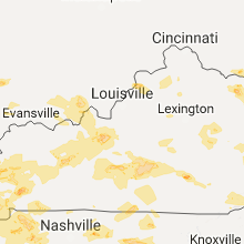


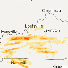


Connect with Interactive Hail Maps