

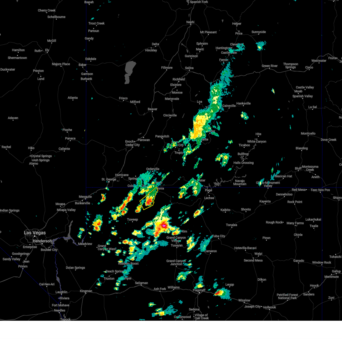
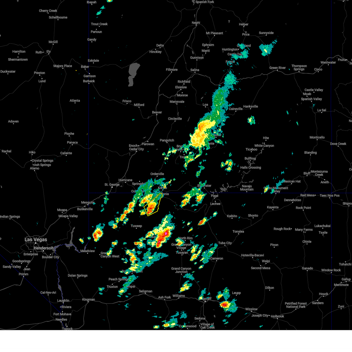
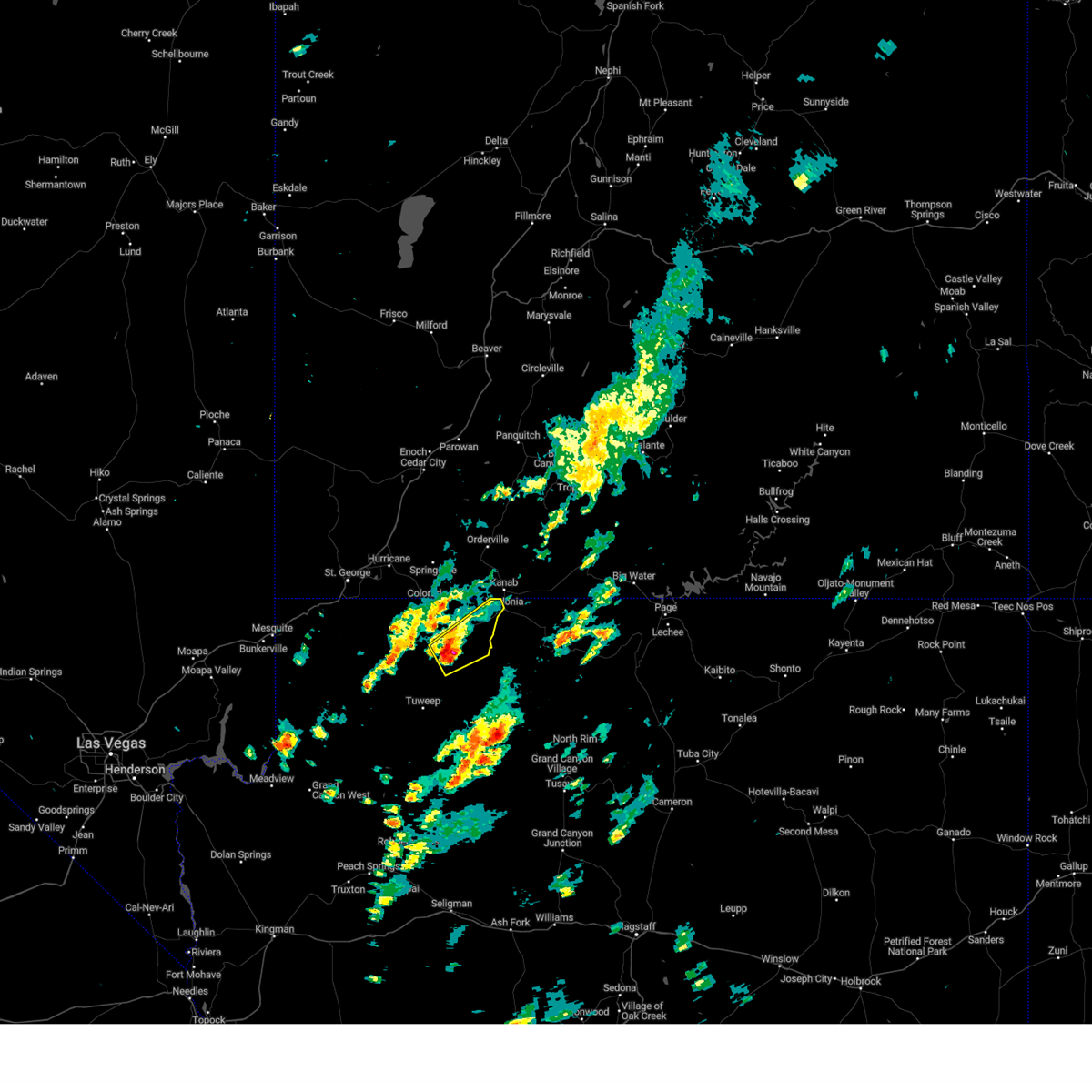
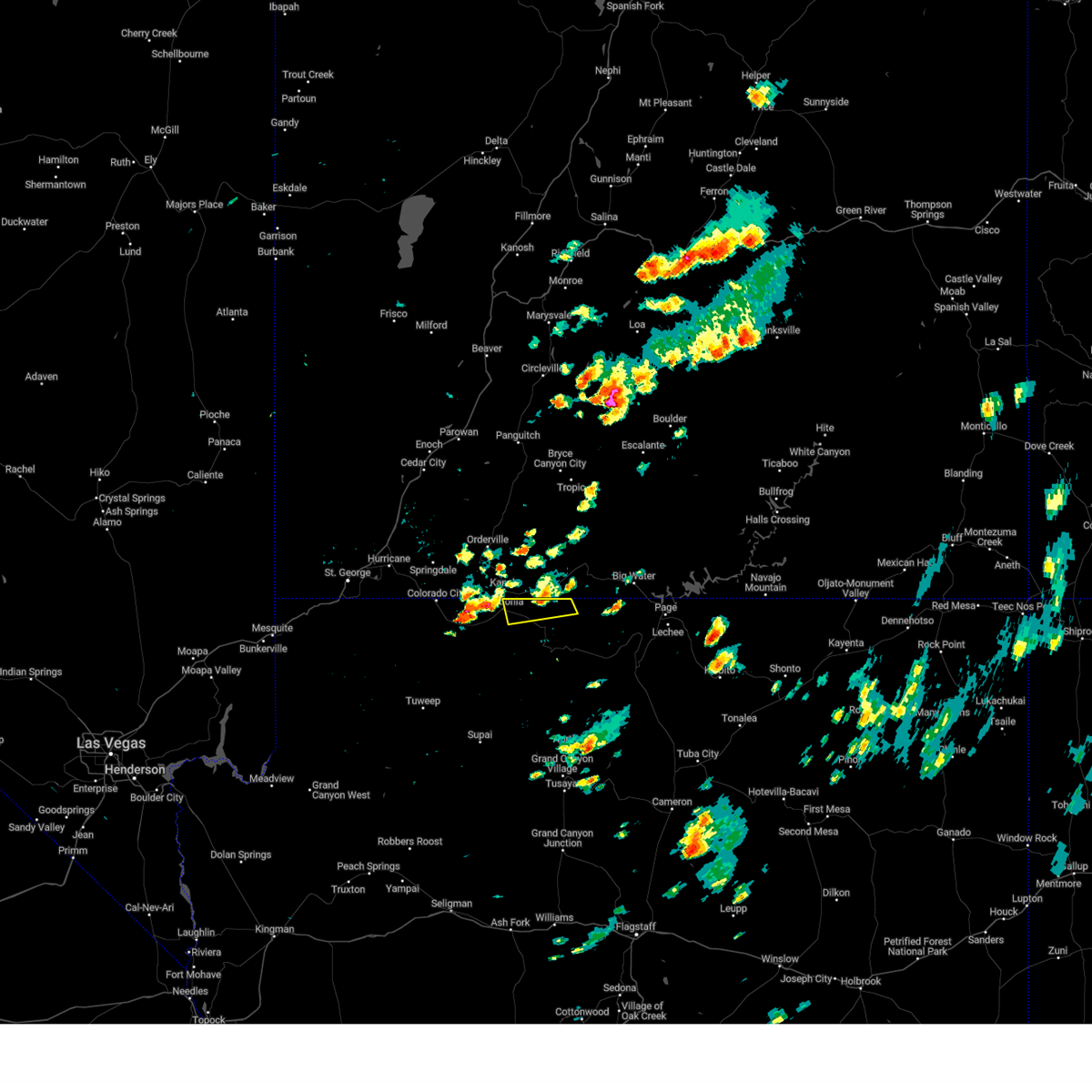
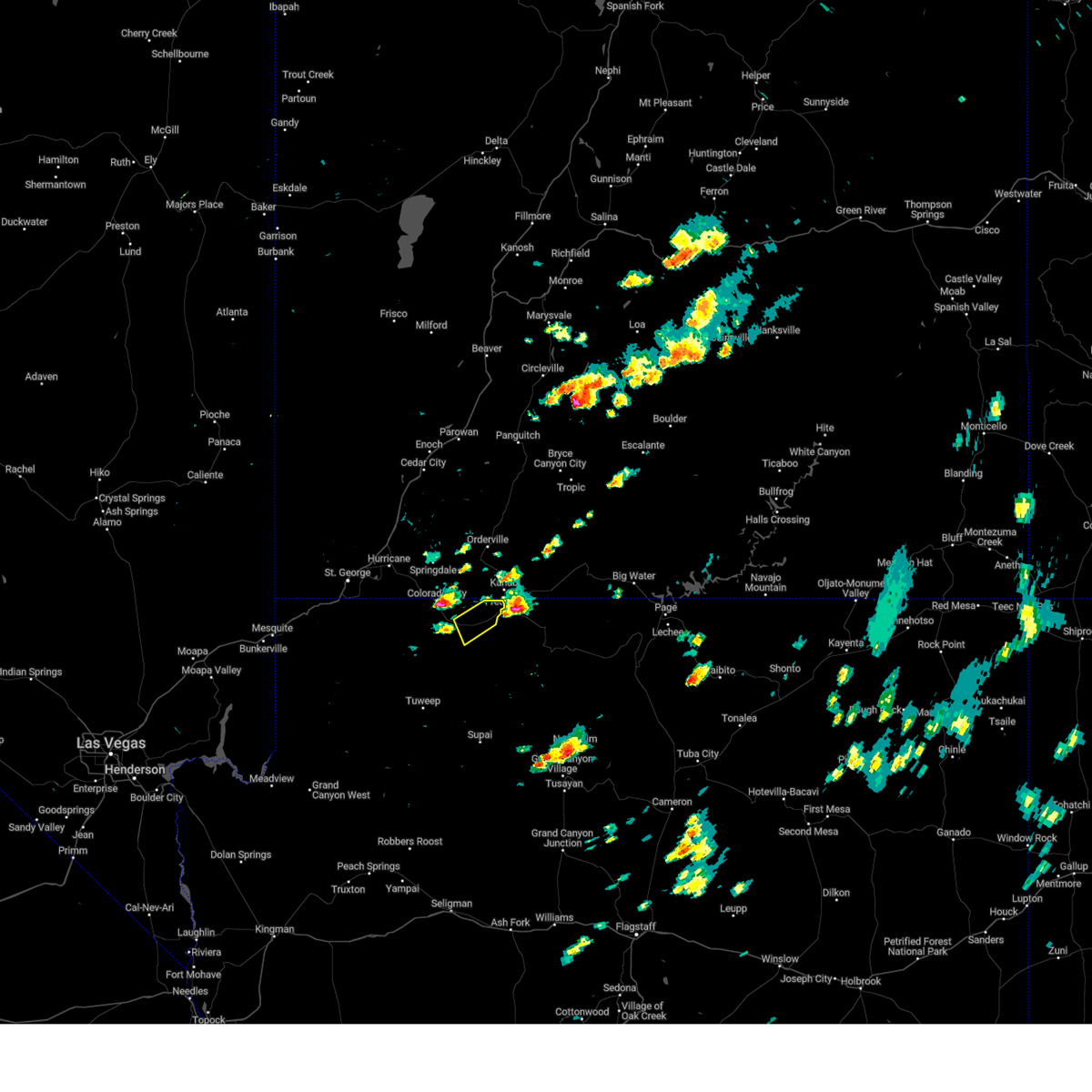
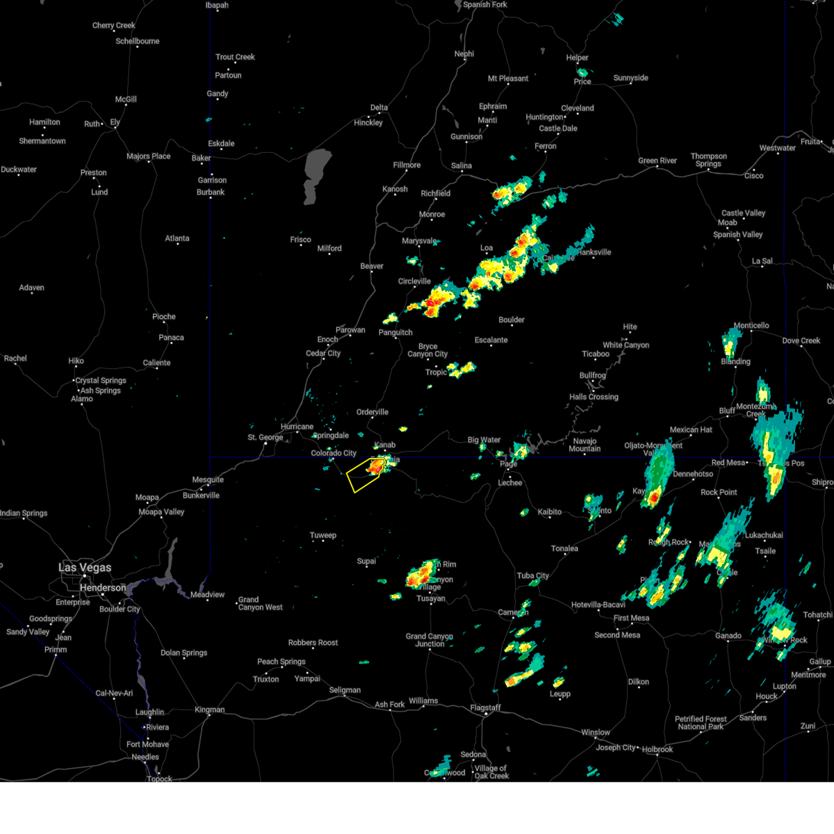
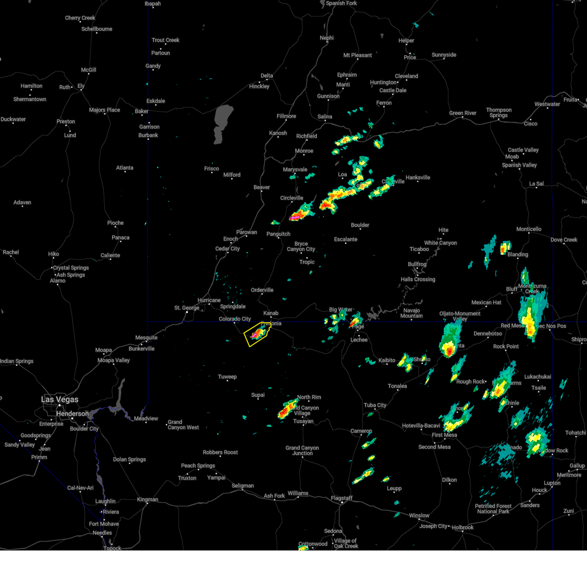
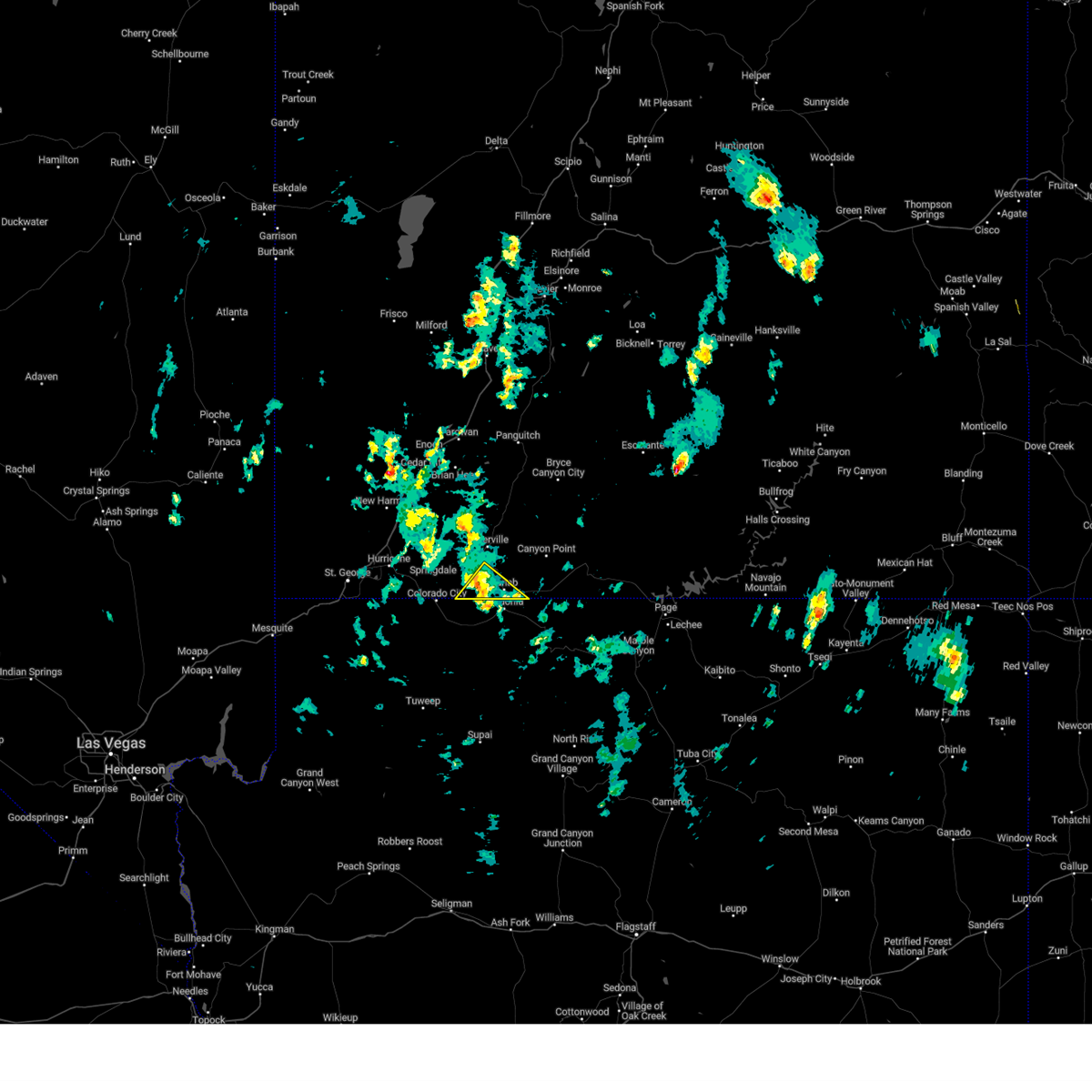
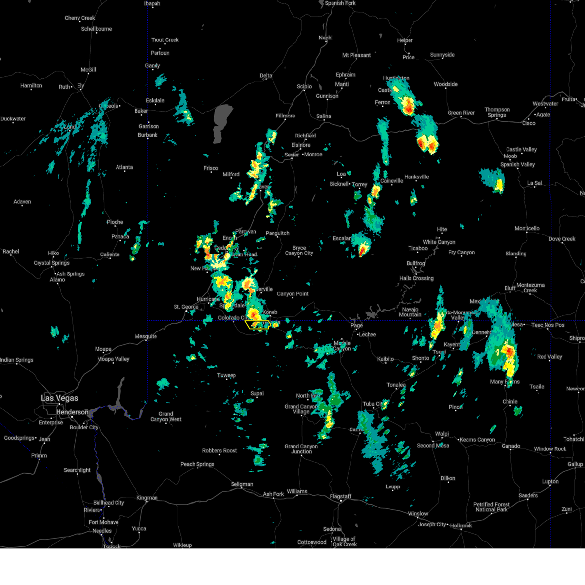
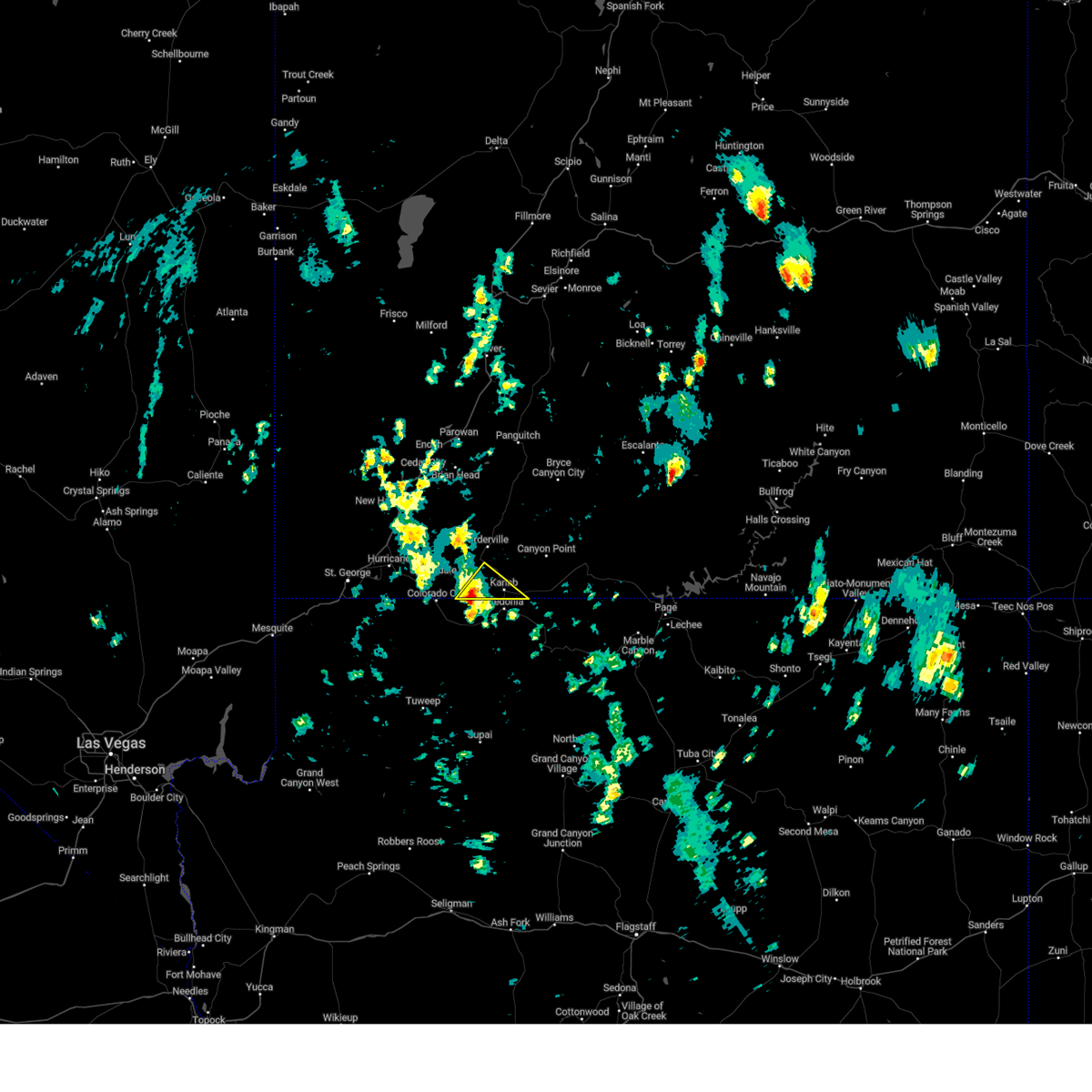
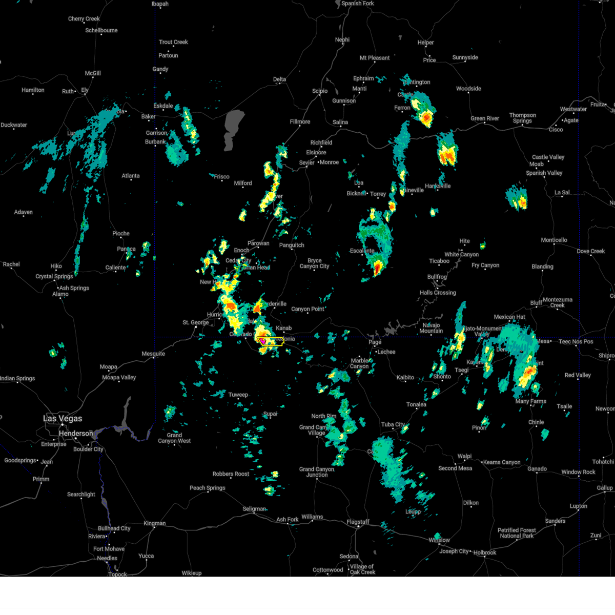
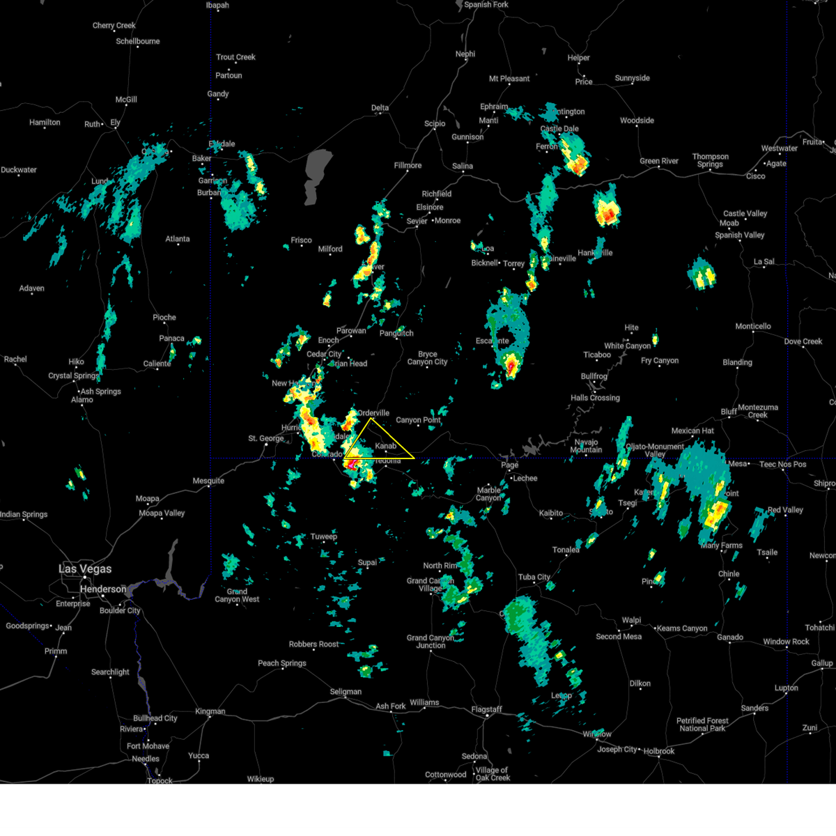
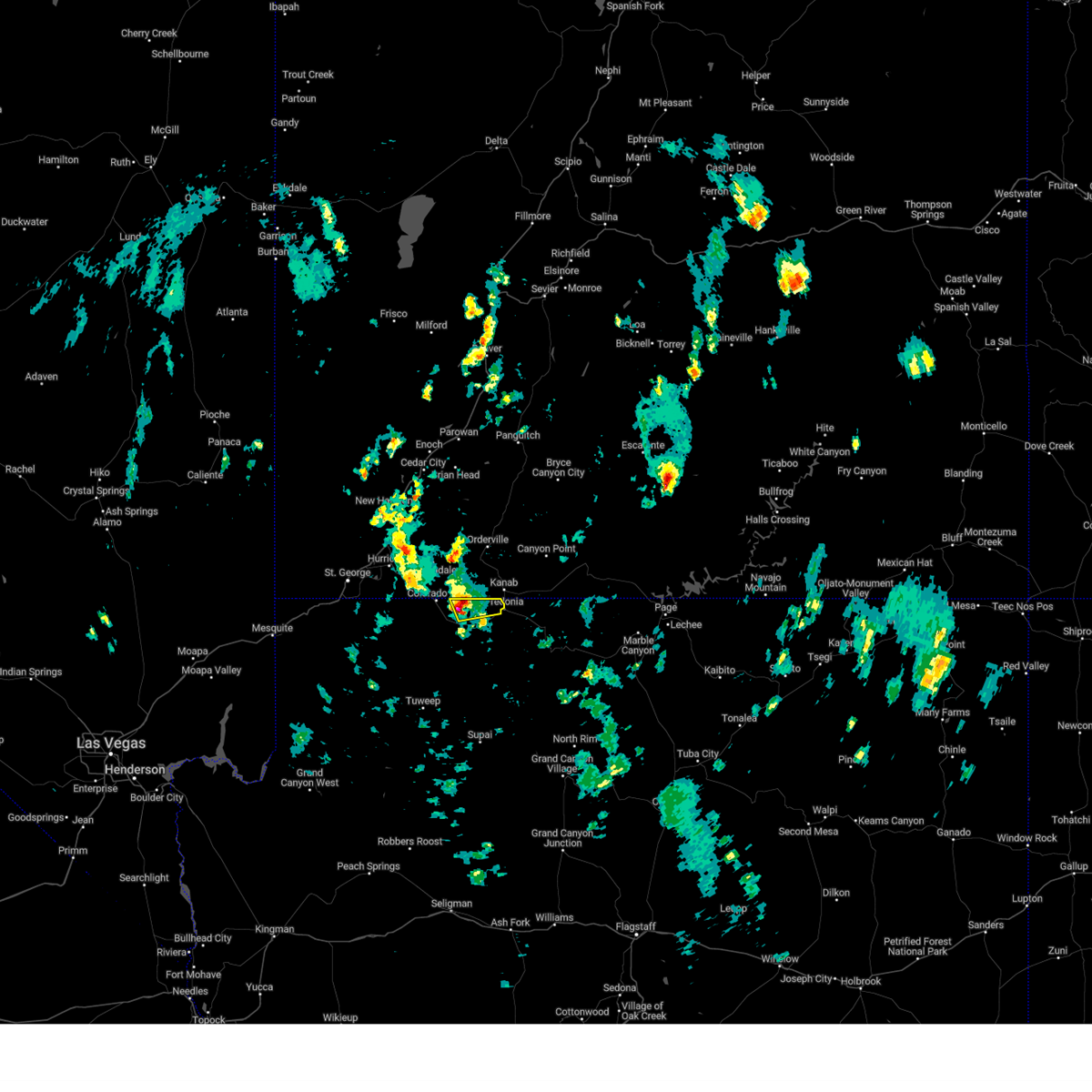
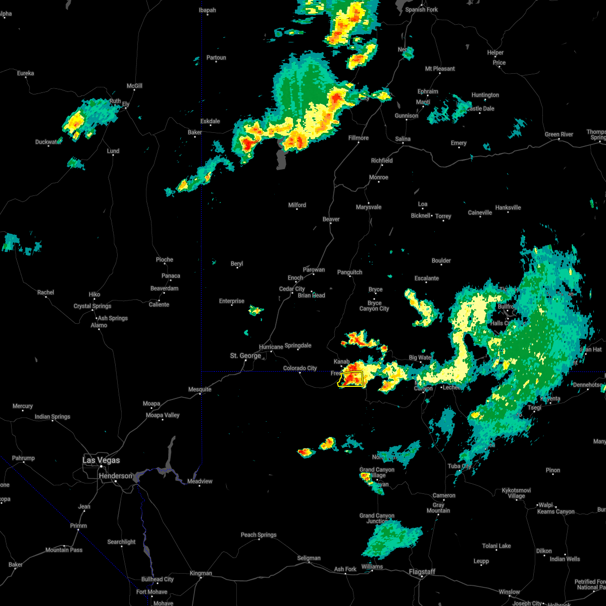
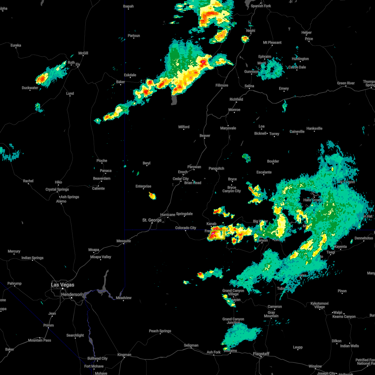
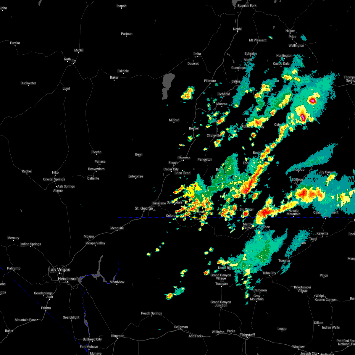
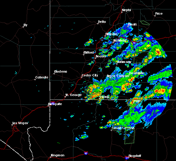
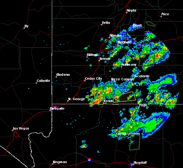
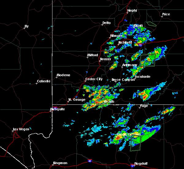
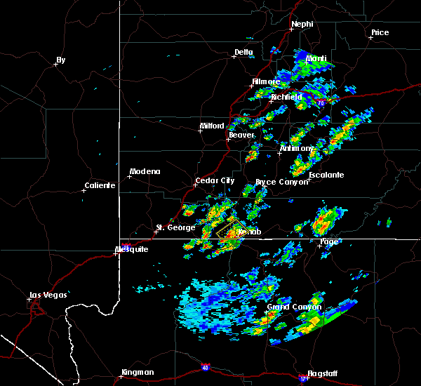
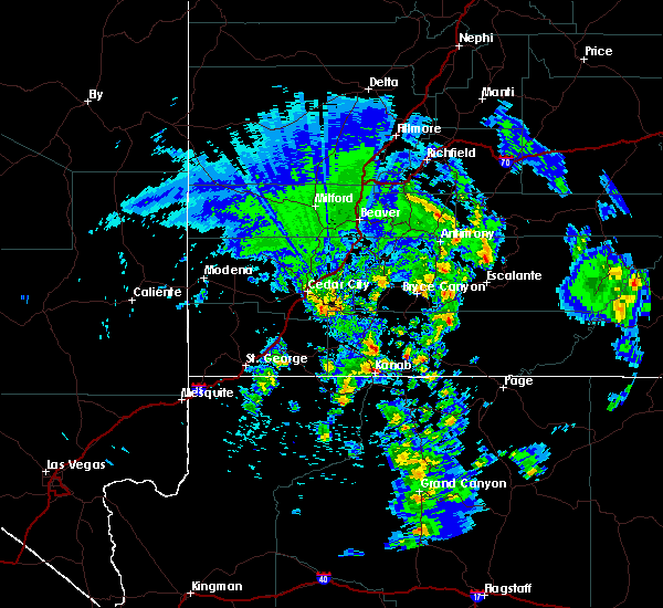
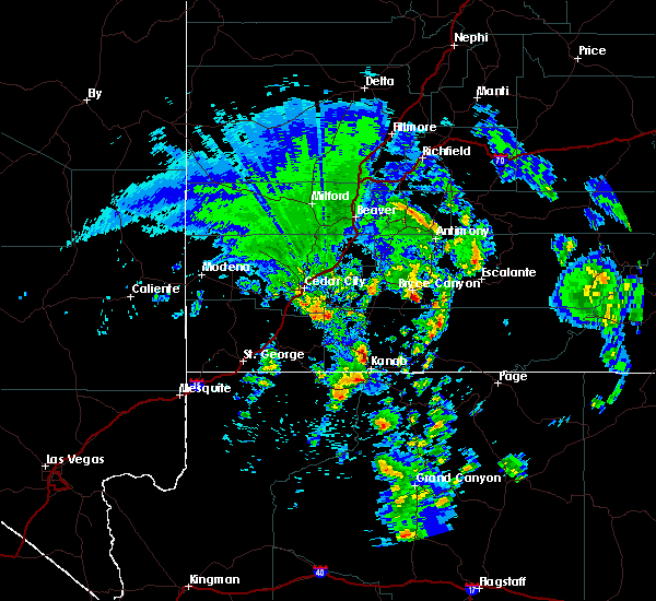
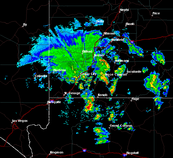
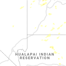
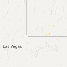
Hail Map for Fredonia, AZ
The Fredonia, AZ area has had 2 reports of on-the-ground hail by trained spotters, and has been under severe weather warnings 3 times during the past 12 months. Doppler radar has detected hail at or near Fredonia, AZ on 14 occasions.
| Name: | Fredonia, AZ |
| Where Located: | 58.8 miles E of Saint George, UT |
| Map: | Google Map for Fredonia, AZ |
| Population: | 1314 |
| Housing Units: | 578 |
| More Info: | Search Google for Fredonia, AZ |
5
The Top Recent Hail Date for Fredonia, AZ is Wednesday, June 26, 2024 (1st out of 14)

Hail and Wind Damage Spotted near Fredonia, AZ
| Date / Time | Report Details |
|---|---|
| 8/22/2024 1:14 PM MST |
 The storm which prompted the warning has weakened, and has exited the warned area. therefore, the warning will be allowed to expire. The storm which prompted the warning has weakened, and has exited the warned area. therefore, the warning will be allowed to expire.
|
| 8/22/2024 12:54 PM MST |
 At 1254 pm mst, a severe thunderstorm was located near pipe spring, or 19 miles southeast of colorado city, moving northeast at 25 mph (radar indicated). Hazards include 60 mph wind gusts and quarter size hail. Hail damage to vehicles is expected. expect wind damage to roofs and trees. locations impacted include, pipe spring. This includes state route 389 in mohave county between mile markers 17 and 32. At 1254 pm mst, a severe thunderstorm was located near pipe spring, or 19 miles southeast of colorado city, moving northeast at 25 mph (radar indicated). Hazards include 60 mph wind gusts and quarter size hail. Hail damage to vehicles is expected. expect wind damage to roofs and trees. locations impacted include, pipe spring. This includes state route 389 in mohave county between mile markers 17 and 32.
|
| 8/22/2024 12:30 PM MST |
 Svrvef the national weather service in las vegas has issued a * severe thunderstorm warning for, northeastern mohave county in northwestern arizona, * until 115 pm mst. * at 1229 pm mst, a severe thunderstorm was located 13 miles southwest of pipe spring, or 19 miles south of colorado city, moving northeast at 25 mph (radar indicated). Hazards include 60 mph wind gusts and quarter size hail. Hail damage to vehicles is expected. Expect wind damage to roofs and trees. Svrvef the national weather service in las vegas has issued a * severe thunderstorm warning for, northeastern mohave county in northwestern arizona, * until 115 pm mst. * at 1229 pm mst, a severe thunderstorm was located 13 miles southwest of pipe spring, or 19 miles south of colorado city, moving northeast at 25 mph (radar indicated). Hazards include 60 mph wind gusts and quarter size hail. Hail damage to vehicles is expected. Expect wind damage to roofs and trees.
|
| 6/27/2024 12:05 PM MST |
 The storm which prompted the warning has weakened below severe limits, and has exited the warned area. therefore, the warning will be allowed to expire. The storm which prompted the warning has weakened below severe limits, and has exited the warned area. therefore, the warning will be allowed to expire.
|
| 6/27/2024 11:36 AM MST |
 The storm which prompted the warning between pipe spring and fredonia has moved east of the area. therefore, the warning will be allowed to expire. The storm which prompted the warning between pipe spring and fredonia has moved east of the area. therefore, the warning will be allowed to expire.
|
| 6/27/2024 11:32 AM MST |
 Svrfgz the national weather service in flagstaff has issued a * severe thunderstorm warning for, coconino county near fredonia in north central arizona, * until 1215 pm mst. * at 1131 am mst, a severe thunderstorm was located 7 miles southeast of kanab, moving east at 25 mph (radar indicated). Hazards include 60 mph wind gusts and quarter size hail. Hail damage to vehicles is expected. Expect wind damage to roofs, siding, and trees. Svrfgz the national weather service in flagstaff has issued a * severe thunderstorm warning for, coconino county near fredonia in north central arizona, * until 1215 pm mst. * at 1131 am mst, a severe thunderstorm was located 7 miles southeast of kanab, moving east at 25 mph (radar indicated). Hazards include 60 mph wind gusts and quarter size hail. Hail damage to vehicles is expected. Expect wind damage to roofs, siding, and trees.
|
| 6/27/2024 11:20 AM MST |
 At 1118 am mst, a severe thunderstorm was located 8 miles east of pipe spring, or 9 miles southwest of kanab, moving northeast at 25 mph (radar indicated). Hazards include 60 mph wind gusts and quarter size hail. Hail damage to vehicles is expected. expect wind damage to roofs and trees. Locations impacted include, arizona 389 between pipe spring and fredonia. At 1118 am mst, a severe thunderstorm was located 8 miles east of pipe spring, or 9 miles southwest of kanab, moving northeast at 25 mph (radar indicated). Hazards include 60 mph wind gusts and quarter size hail. Hail damage to vehicles is expected. expect wind damage to roofs and trees. Locations impacted include, arizona 389 between pipe spring and fredonia.
|
| 6/27/2024 11:00 AM MST |
 Svrvef the national weather service in las vegas has issued a * severe thunderstorm warning for, northeastern mohave county in northwestern arizona, * until 1145 am mst. * at 1059 am mst, a severe thunderstorm was located over pipe spring, or 16 miles southwest of kanab, moving northeast at 20 mph (radar indicated). Hazards include 60 mph wind gusts and quarter size hail. Hail damage to vehicles is expected. Expect wind damage to roofs and trees. Svrvef the national weather service in las vegas has issued a * severe thunderstorm warning for, northeastern mohave county in northwestern arizona, * until 1145 am mst. * at 1059 am mst, a severe thunderstorm was located over pipe spring, or 16 miles southwest of kanab, moving northeast at 20 mph (radar indicated). Hazards include 60 mph wind gusts and quarter size hail. Hail damage to vehicles is expected. Expect wind damage to roofs and trees.
|
| 5/14/2023 2:57 PM MDT |
 The severe thunderstorm warning for southwestern kane county will expire at 300 pm mdt, the storm which prompted the warning has weakened below severe limits, and no longer poses an immediate threat to life or property. therefore, the warning will be allowed to expire. however gusty winds and heavy rain are still possible with this thunderstorm. The severe thunderstorm warning for southwestern kane county will expire at 300 pm mdt, the storm which prompted the warning has weakened below severe limits, and no longer poses an immediate threat to life or property. therefore, the warning will be allowed to expire. however gusty winds and heavy rain are still possible with this thunderstorm.
|
| 5/14/2023 1:52 PM MST |
 The severe thunderstorm warning for northeastern mohave county will expire at 200 pm mst, the storm which prompted the warning has moved out of the area. therefore, the warning will be allowed to expire. The severe thunderstorm warning for northeastern mohave county will expire at 200 pm mst, the storm which prompted the warning has moved out of the area. therefore, the warning will be allowed to expire.
|
| 5/14/2023 2:44 PM MDT |
 At 244 pm mdt, a severe thunderstorm was located 9 miles west of kanab, moving northeast at 20 mph (radar indicated). Hazards include 60 mph wind gusts and quarter size hail. Hail damage to vehicles is expected. expect wind damage to roofs, siding, and trees. locations impacted include, kanab and coral pink sand dunes. This includes us route 89 between mile markers 57 and 70. At 244 pm mdt, a severe thunderstorm was located 9 miles west of kanab, moving northeast at 20 mph (radar indicated). Hazards include 60 mph wind gusts and quarter size hail. Hail damage to vehicles is expected. expect wind damage to roofs, siding, and trees. locations impacted include, kanab and coral pink sand dunes. This includes us route 89 between mile markers 57 and 70.
|
| 5/14/2023 1:41 PM MST |
 At 141 pm mst, a severe thunderstorm was located near kaibab, or 11 miles west of kanab, moving northeast at 25 mph (radar indicated). Hazards include 60 mph wind gusts and quarter size hail. Hail damage to vehicles is expected. expect wind damage to roofs and trees. this severe thunderstorm will remain over mainly rural areas of northeastern mohave county. hail threat, radar indicated max hail size, 1. 00 in wind threat, radar indicated max wind gust, 60 mph. At 141 pm mst, a severe thunderstorm was located near kaibab, or 11 miles west of kanab, moving northeast at 25 mph (radar indicated). Hazards include 60 mph wind gusts and quarter size hail. Hail damage to vehicles is expected. expect wind damage to roofs and trees. this severe thunderstorm will remain over mainly rural areas of northeastern mohave county. hail threat, radar indicated max hail size, 1. 00 in wind threat, radar indicated max wind gust, 60 mph.
|
| 5/14/2023 2:33 PM MDT |
 At 233 pm mdt, a severe thunderstorm was located 8 miles north of kaibab, or 11 miles west of kanab, moving northeast at 20 mph (radar indicated). Hazards include 60 mph wind gusts and quarter size hail. Hail damage to vehicles is expected. Expect wind damage to roofs, siding, and trees. At 233 pm mdt, a severe thunderstorm was located 8 miles north of kaibab, or 11 miles west of kanab, moving northeast at 20 mph (radar indicated). Hazards include 60 mph wind gusts and quarter size hail. Hail damage to vehicles is expected. Expect wind damage to roofs, siding, and trees.
|
| 5/14/2023 1:32 PM MST |
 At 131 pm mst, a severe thunderstorm was located near kaibab, or 10 miles east of colorado city, moving northeast at 25 mph (radar indicated). Hazards include 60 mph wind gusts and quarter size hail. Hail damage to vehicles is expected. Expect wind damage to roofs and trees. At 131 pm mst, a severe thunderstorm was located near kaibab, or 10 miles east of colorado city, moving northeast at 25 mph (radar indicated). Hazards include 60 mph wind gusts and quarter size hail. Hail damage to vehicles is expected. Expect wind damage to roofs and trees.
|
| 6/29/2022 11:38 AM MST |
 The severe thunderstorm warning for northeastern mohave county will expire at 1145 am mst, the storm which prompted the warning has weakened below severe limits, and no longer poses an immediate threat to life or property. therefore, the warning will be allowed to expire. The severe thunderstorm warning for northeastern mohave county will expire at 1145 am mst, the storm which prompted the warning has weakened below severe limits, and no longer poses an immediate threat to life or property. therefore, the warning will be allowed to expire.
|
| 6/29/2022 11:21 AM MST |
 At 1120 am mst, a severe thunderstorm was located near pipe spring, or 13 miles southwest of kanab, moving northeast at 15 mph (radar indicated). Hazards include 60 mph wind gusts. Expect damage to roofs and trees. locations impacted include, pipe spring, kaibab and highway 389. hail threat, radar indicated max hail size, <. 75 in wind threat, radar indicated max wind gust, 60 mph. At 1120 am mst, a severe thunderstorm was located near pipe spring, or 13 miles southwest of kanab, moving northeast at 15 mph (radar indicated). Hazards include 60 mph wind gusts. Expect damage to roofs and trees. locations impacted include, pipe spring, kaibab and highway 389. hail threat, radar indicated max hail size, <. 75 in wind threat, radar indicated max wind gust, 60 mph.
|
| 6/29/2022 11:04 AM MST |
 At 1103 am mst, a severe thunderstorm was located over pipe spring, or 16 miles southwest of kanab, moving northeast at 10 mph (radar indicated). Hazards include 60 mph wind gusts. expect damage to roofs and trees At 1103 am mst, a severe thunderstorm was located over pipe spring, or 16 miles southwest of kanab, moving northeast at 10 mph (radar indicated). Hazards include 60 mph wind gusts. expect damage to roofs and trees
|
| 8/18/2021 5:50 PM MST | Golf Ball sized hail reported 44.4 miles NNW of Fredonia, AZ, golf ball size hail reported near the entrance to the north rim of the grand canyon. |
| 8/17/2021 9:06 PM MST |
 The severe thunderstorm warning for coconino county will expire at 915 pm mst, the storm which prompted the warning near fredonia has weakened below severe limits, and no longer poses an immediate threat to life or property. therefore, the warning will be allowed to expire. however heavy rain is still possible with this thunderstorm. The severe thunderstorm warning for coconino county will expire at 915 pm mst, the storm which prompted the warning near fredonia has weakened below severe limits, and no longer poses an immediate threat to life or property. therefore, the warning will be allowed to expire. however heavy rain is still possible with this thunderstorm.
|
| 8/17/2021 8:42 PM MST |
 At 842 pm mst, a severe thunderstorm was located near fredonia, moving east at 15 mph (radar indicated). Hazards include 60 mph wind gusts and quarter size hail. Hail damage to vehicles is expected. Expect wind damage to roofs, siding, and trees. At 842 pm mst, a severe thunderstorm was located near fredonia, moving east at 15 mph (radar indicated). Hazards include 60 mph wind gusts and quarter size hail. Hail damage to vehicles is expected. Expect wind damage to roofs, siding, and trees.
|
| 7/13/2021 9:52 PM MST |
 The severe thunderstorm warning for northeastern mohave county will expire at 1000 pm mst, the storms which prompted the warning have weakened below severe limits. therefore, the warning will be allowed to expire. however gusty winds to 50 mph are still possible. The severe thunderstorm warning for northeastern mohave county will expire at 1000 pm mst, the storms which prompted the warning have weakened below severe limits. therefore, the warning will be allowed to expire. however gusty winds to 50 mph are still possible.
|
| 7/13/2021 8:29 PM MST |
 At 829 pm mst, a severe thunderstorm was located over littlefield, moving southeast at 15 mph (radar indicated). Hazards include 60 mph wind gusts. expect damage to roofs and trees At 829 pm mst, a severe thunderstorm was located over littlefield, moving southeast at 15 mph (radar indicated). Hazards include 60 mph wind gusts. expect damage to roofs and trees
|
| 8/21/2018 1:27 PM MDT |
 The severe thunderstorm warning for southwestern kane county will expire at 130 pm mdt, the storm which prompted the warning has weakened below severe limits, and no longer poses an immediate threat to life or property. therefore, the warning will be allowed to expire. however small hail and heavy rain are still possible with this thunderstorm. The severe thunderstorm warning for southwestern kane county will expire at 130 pm mdt, the storm which prompted the warning has weakened below severe limits, and no longer poses an immediate threat to life or property. therefore, the warning will be allowed to expire. however small hail and heavy rain are still possible with this thunderstorm.
|
| 8/21/2018 1:17 PM MDT |
 At 117 pm mdt, a severe thunderstorm was located near kanab, moving northeast at 20 mph (radar indicated). Hazards include 60 mph wind gusts and quarter size hail. Hail damage to vehicles is expected. expect wind damage to roofs, siding, and trees. Locations impacted include, kanab and coral pink sand dunes. At 117 pm mdt, a severe thunderstorm was located near kanab, moving northeast at 20 mph (radar indicated). Hazards include 60 mph wind gusts and quarter size hail. Hail damage to vehicles is expected. expect wind damage to roofs, siding, and trees. Locations impacted include, kanab and coral pink sand dunes.
|
| 8/21/2018 12:56 PM MDT |
 At 1256 pm mdt, a severe thunderstorm was located 10 miles north of kaibab, or 11 miles west of kanab, moving northeast at 20 mph (radar indicated). Hazards include 60 mph wind gusts and quarter size hail. Hail damage to vehicles is expected. Expect wind damage to roofs, siding, and trees. At 1256 pm mdt, a severe thunderstorm was located 10 miles north of kaibab, or 11 miles west of kanab, moving northeast at 20 mph (radar indicated). Hazards include 60 mph wind gusts and quarter size hail. Hail damage to vehicles is expected. Expect wind damage to roofs, siding, and trees.
|
| 8/21/2018 11:13 AM MST |
 At 1110 am mst, a severe thunderstorm was located 7 miles southeast of colorado city, moving northeast at 15 mph (radar indicated). Hazards include 60 mph wind gusts and quarter size hail. Hail damage to vehicles is expected. Expect wind damage to roofs and trees. At 1110 am mst, a severe thunderstorm was located 7 miles southeast of colorado city, moving northeast at 15 mph (radar indicated). Hazards include 60 mph wind gusts and quarter size hail. Hail damage to vehicles is expected. Expect wind damage to roofs and trees.
|
| 8/21/2018 12:10 PM MDT |
 The severe thunderstorm warning for southwestern kane county will expire at 1215 pm mdt, the storm which prompted the warning has weakened below severe limits, and no longer poses an immediate threat to life or property. therefore, the warning will be allowed to expire. however heavy rain and small hail is still possible with this thunderstorm. The severe thunderstorm warning for southwestern kane county will expire at 1215 pm mdt, the storm which prompted the warning has weakened below severe limits, and no longer poses an immediate threat to life or property. therefore, the warning will be allowed to expire. however heavy rain and small hail is still possible with this thunderstorm.
|
| 8/21/2018 11:47 AM MDT |
 At 1146 am mdt, a severe thunderstorm was located near kanab, moving northeast at 15 mph (radar indicated). Hazards include 60 mph wind gusts and quarter size hail. Hail damage to vehicles is expected. Expect wind damage to roofs, siding, and trees. At 1146 am mdt, a severe thunderstorm was located near kanab, moving northeast at 15 mph (radar indicated). Hazards include 60 mph wind gusts and quarter size hail. Hail damage to vehicles is expected. Expect wind damage to roofs, siding, and trees.
|
| 9/14/2017 11:26 AM MST |
 At 1125 am mst, the strongest storm had moved north into utah. other weaker storms will continue along and north of highway 389 through noon, but the threat of severe weather is over. therefore the warning will be allowed to expire. At 1125 am mst, the strongest storm had moved north into utah. other weaker storms will continue along and north of highway 389 through noon, but the threat of severe weather is over. therefore the warning will be allowed to expire.
|
| 9/14/2017 11:13 AM MST |
 At 1112 am mst, several strong to severe thunderstorms were located near pipe spring, moving north at 35 mph. the strongest storm was over highway 389 east of pipe spring. at 1045 am mst, dime size hail was reported near pipe spring (radar indicated). Hazards include 60 mph wind gusts and quarter size hail. Hail damage to vehicles is expected. expect wind damage to roofs, siding, and trees. Locations impacted include, pipe spring and kaibab. At 1112 am mst, several strong to severe thunderstorms were located near pipe spring, moving north at 35 mph. the strongest storm was over highway 389 east of pipe spring. at 1045 am mst, dime size hail was reported near pipe spring (radar indicated). Hazards include 60 mph wind gusts and quarter size hail. Hail damage to vehicles is expected. expect wind damage to roofs, siding, and trees. Locations impacted include, pipe spring and kaibab.
|
| 9/14/2017 10:53 AM MST |
 At 1052 am mst, a severe thunderstorm was located 14 miles south of pipe spring, or 24 miles southeast of colorado city, moving north at 35 mph (radar indicated). Hazards include 60 mph wind gusts and quarter size hail. Hail damage to vehicles is expected. Expect wind damage to roofs, siding, and trees. At 1052 am mst, a severe thunderstorm was located 14 miles south of pipe spring, or 24 miles southeast of colorado city, moving north at 35 mph (radar indicated). Hazards include 60 mph wind gusts and quarter size hail. Hail damage to vehicles is expected. Expect wind damage to roofs, siding, and trees.
|
| 8/13/2017 3:08 PM MST |
 At 308 pm mst, a severe thunderstorm was located near kaibab, or 9 miles east of colorado city, moving northeast at 20 mph (radar indicated). Hazards include 60 mph wind gusts and quarter size hail. Hail damage to vehicles is expected. expect wind damage to roofs, siding, and trees. Locations impacted include, pipe spring and kaibab. At 308 pm mst, a severe thunderstorm was located near kaibab, or 9 miles east of colorado city, moving northeast at 20 mph (radar indicated). Hazards include 60 mph wind gusts and quarter size hail. Hail damage to vehicles is expected. expect wind damage to roofs, siding, and trees. Locations impacted include, pipe spring and kaibab.
|
| 8/13/2017 2:48 PM MST |
 At 248 pm mst, a severe thunderstorm was located near kaibab, or 9 miles southeast of colorado city, moving northeast at 20 mph (radar indicated). Hazards include 60 mph wind gusts and quarter size hail. Hail damage to vehicles is expected. Expect wind damage to roofs, siding, and trees. At 248 pm mst, a severe thunderstorm was located near kaibab, or 9 miles southeast of colorado city, moving northeast at 20 mph (radar indicated). Hazards include 60 mph wind gusts and quarter size hail. Hail damage to vehicles is expected. Expect wind damage to roofs, siding, and trees.
|
| 7/30/2016 8:55 PM MST |
 The severe thunderstorm warning for northeastern mohave county will expire at 900 pm mst, the storm which prompted the warning has weakened below severe limits, and no longer poses an immediate threat to life or property. therefore the warning will be allowed to expire. however gusty winds and heavy rain are still possible with this thunderstorm and additional thunderstorms in the warned area. The severe thunderstorm warning for northeastern mohave county will expire at 900 pm mst, the storm which prompted the warning has weakened below severe limits, and no longer poses an immediate threat to life or property. therefore the warning will be allowed to expire. however gusty winds and heavy rain are still possible with this thunderstorm and additional thunderstorms in the warned area.
|
| 7/30/2016 8:41 PM MST |
 At 838 pm mst, doppler radar indicated a severe thunderstorm capable of producing quarter size hail and damaging winds in excess of 60 mph. this storm was located 14 miles south of st. george, or 15 miles south of st george, moving southeast at 10 mph. locations impacted include, colorado city, beaver dam, littlefield, virgin river gorge, virgin river campground, kaibab and pipe spring. At 838 pm mst, doppler radar indicated a severe thunderstorm capable of producing quarter size hail and damaging winds in excess of 60 mph. this storm was located 14 miles south of st. george, or 15 miles south of st george, moving southeast at 10 mph. locations impacted include, colorado city, beaver dam, littlefield, virgin river gorge, virgin river campground, kaibab and pipe spring.
|
| 7/30/2016 8:23 PM MST |
 At 821 pm mst, doppler radar indicated multiple severe thunderstorms capable of producing quarter size hail and damaging winds in excess of 60 mph. these storms were located from st george to hurricane, with additional thunderstorms developing towrad colorado city. storms are generally moving east at 35 mph. At 821 pm mst, doppler radar indicated multiple severe thunderstorms capable of producing quarter size hail and damaging winds in excess of 60 mph. these storms were located from st george to hurricane, with additional thunderstorms developing towrad colorado city. storms are generally moving east at 35 mph.
|
| 10/18/2015 10:38 PM MST |
 The severe thunderstorm warning for northeastern mohave county will expire at 1045 pm mst, the storm which prompted the warning has exited the warned area. therefore the warning will be allowed to expire. The severe thunderstorm warning for northeastern mohave county will expire at 1045 pm mst, the storm which prompted the warning has exited the warned area. therefore the warning will be allowed to expire.
|
| 10/18/2015 10:15 PM MST |
 At 1014 pm mst, doppler radar indicated a severe thunderstorm capable of producing quarter size hail and destructive winds in excess of 70 mph. this storm was located over toroweap campground, or 52 miles south of colorado city, moving northeast at 50 mph. locations impacted include, kaibab, toroweap campground, bar ten ranch, pipe spring, mt. trumbull and tuweep. At 1014 pm mst, doppler radar indicated a severe thunderstorm capable of producing quarter size hail and destructive winds in excess of 70 mph. this storm was located over toroweap campground, or 52 miles south of colorado city, moving northeast at 50 mph. locations impacted include, kaibab, toroweap campground, bar ten ranch, pipe spring, mt. trumbull and tuweep.
|
| 10/18/2015 9:45 PM MST |
 At 943 pm mst, doppler radar indicated a severe thunderstorm capable of producing quarter size hail and destructive winds in excess of 70 mph. this storm was located 16 miles east of grand canyon skywalk, or 61 miles northeast of kingman, and moving northeast at 50 mph. At 943 pm mst, doppler radar indicated a severe thunderstorm capable of producing quarter size hail and destructive winds in excess of 70 mph. this storm was located 16 miles east of grand canyon skywalk, or 61 miles northeast of kingman, and moving northeast at 50 mph.
|
| 6/5/2015 3:41 PM MDT | At 340 pm mdt, doppler radar indicated a severe thunderstorm capable of producing quarter size hail and damaging winds in excess of 60 mph. this storm was located near kanab, and moving northeast at 25 mph. |
| 6/5/2015 3:33 PM MDT | At 332 pm mdt, doppler radar indicated a severe thunderstorm capable of producing quarter size hail and damaging winds in excess of 60 mph. this storm was located near kanab, moving northeast at 30 mph. locations impacted include, kanab, orderville, glendale and mt carmel. this warning includes us 89 between mt carmel and the utah and arizona border. hail may accumulate on us 89 under this storm. |
| 6/5/2015 3:22 PM MDT | At 321 pm mdt, doppler radar indicated a severe thunderstorm capable of producing quarter size hail and damaging winds in excess of 60 mph. this storm was located near kanab, and moving northeast at 30 mph. |
| 9/21/2014 2:15 PM MST | Quarter sized hail reported 12.7 miles ENE of Fredonia, AZ, pipe spring national monument staff reported hail up to quarter size. event time estimated off of radar. |
Hail Maps for Fredonia, AZ


Connect with Interactive Hail Maps