

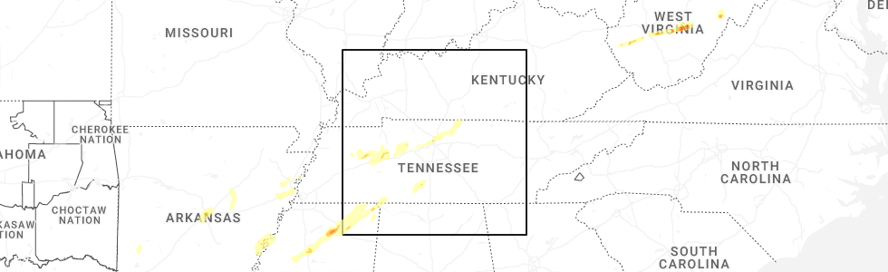
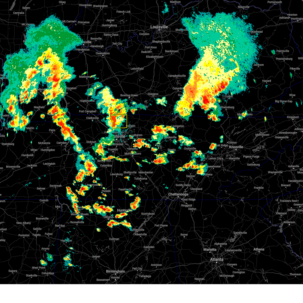
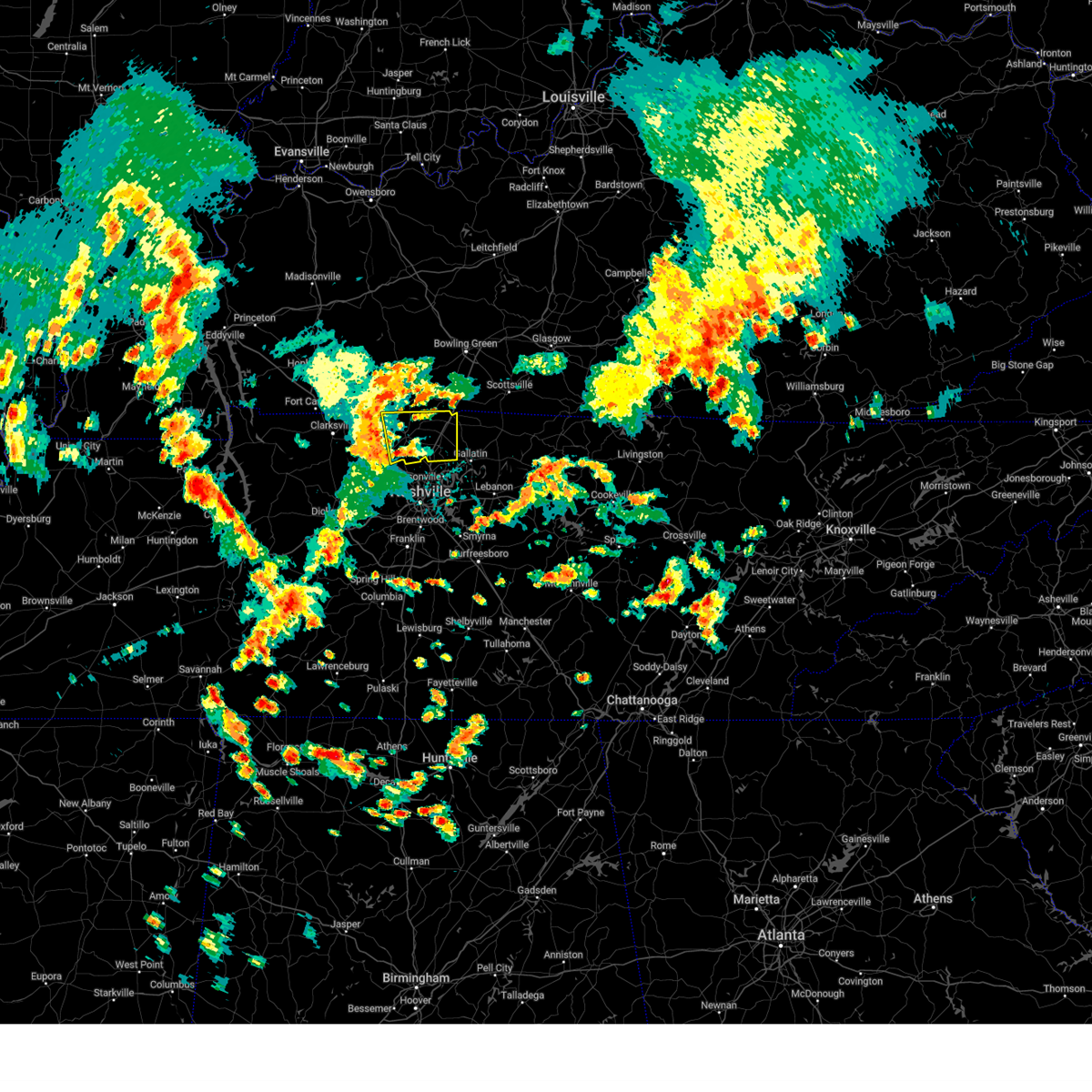
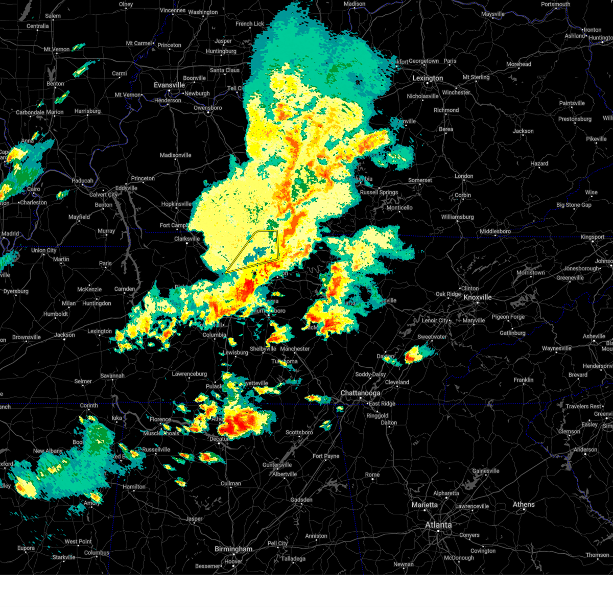
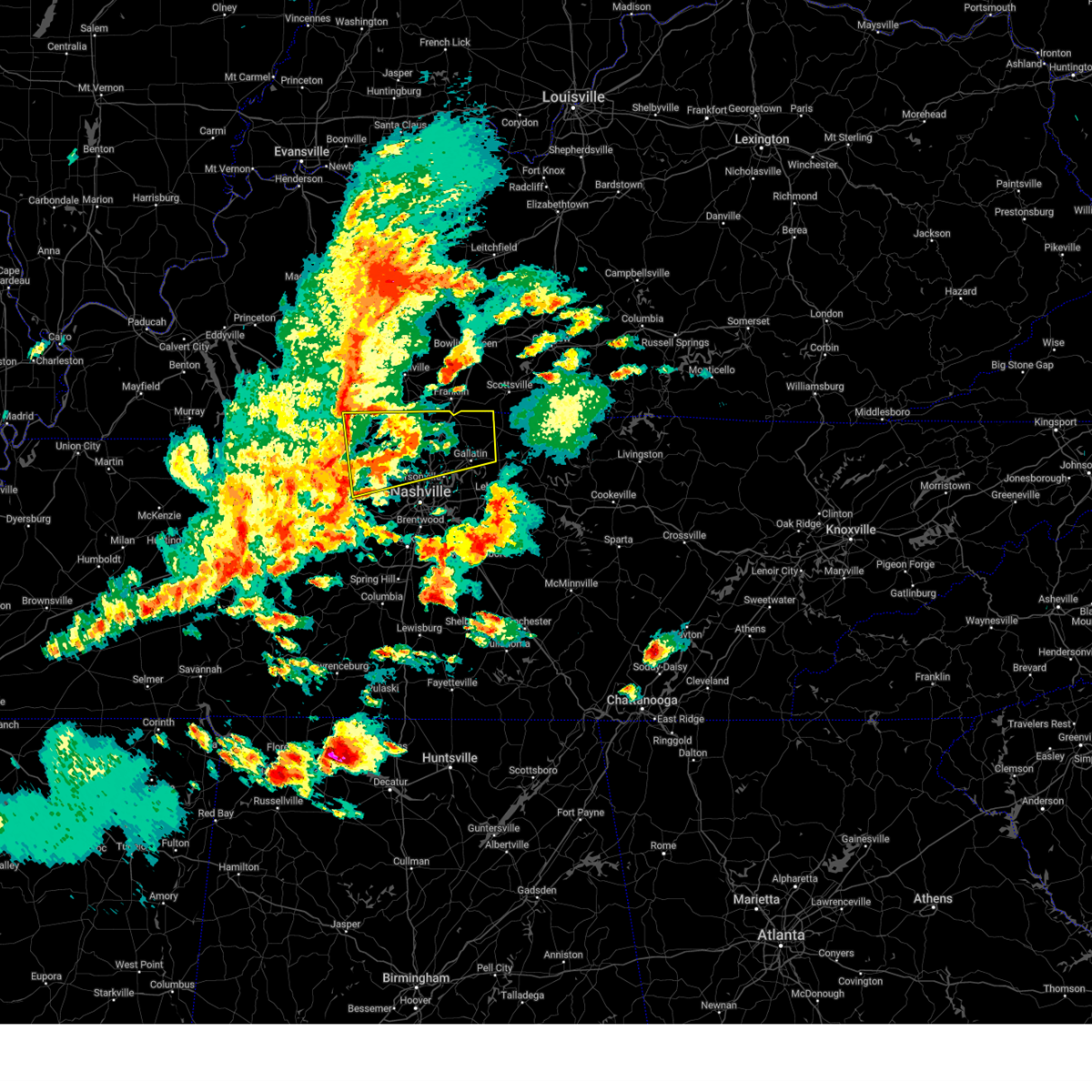
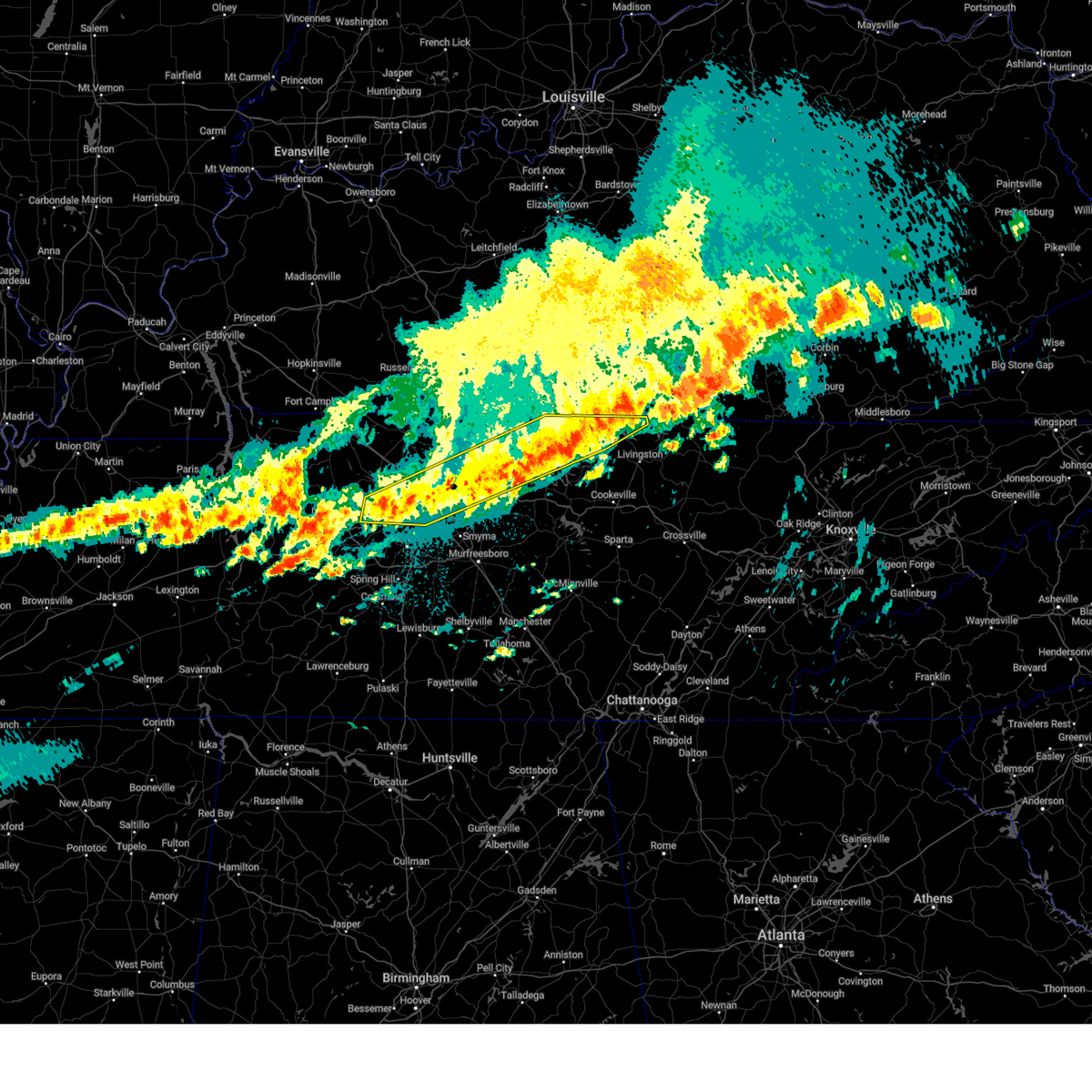
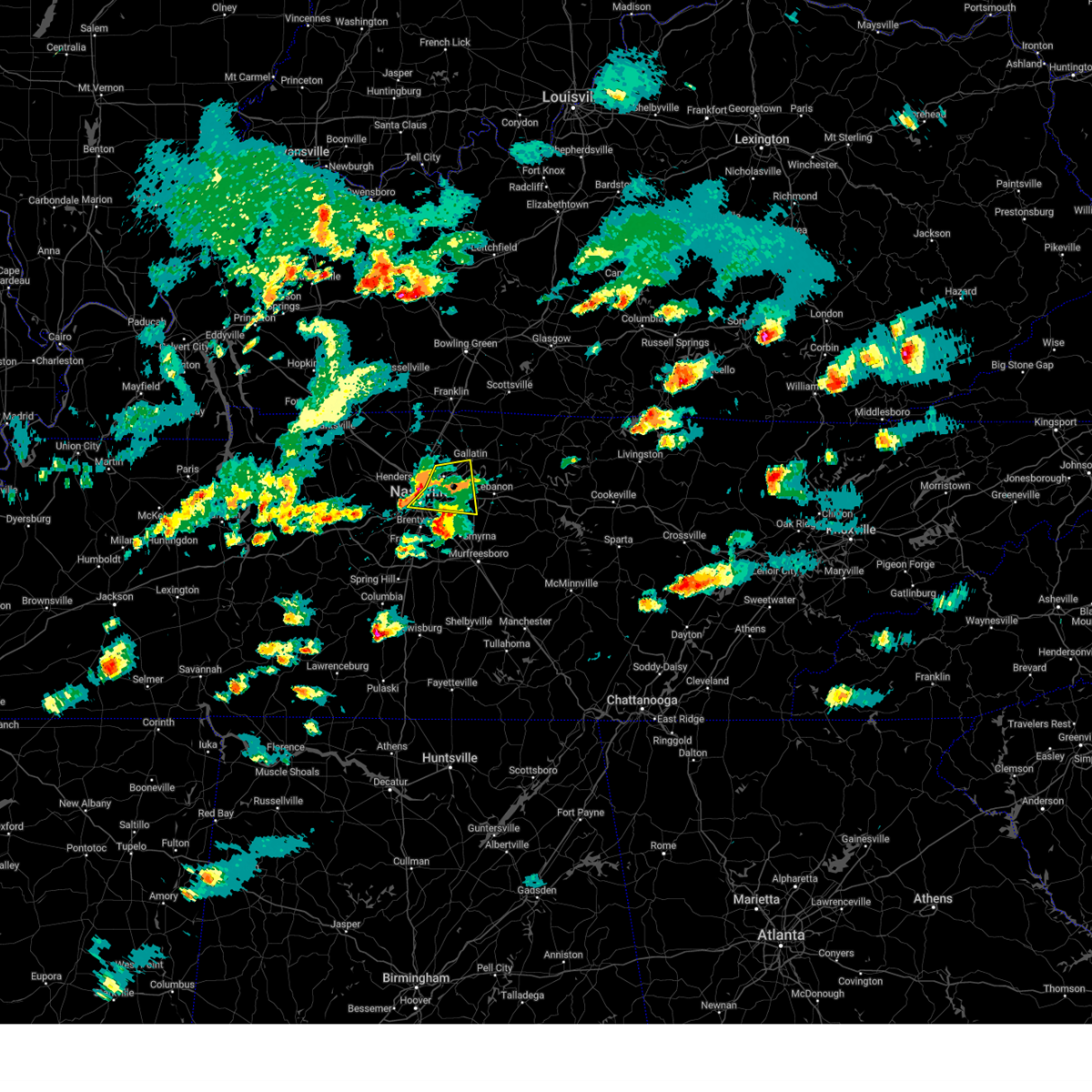
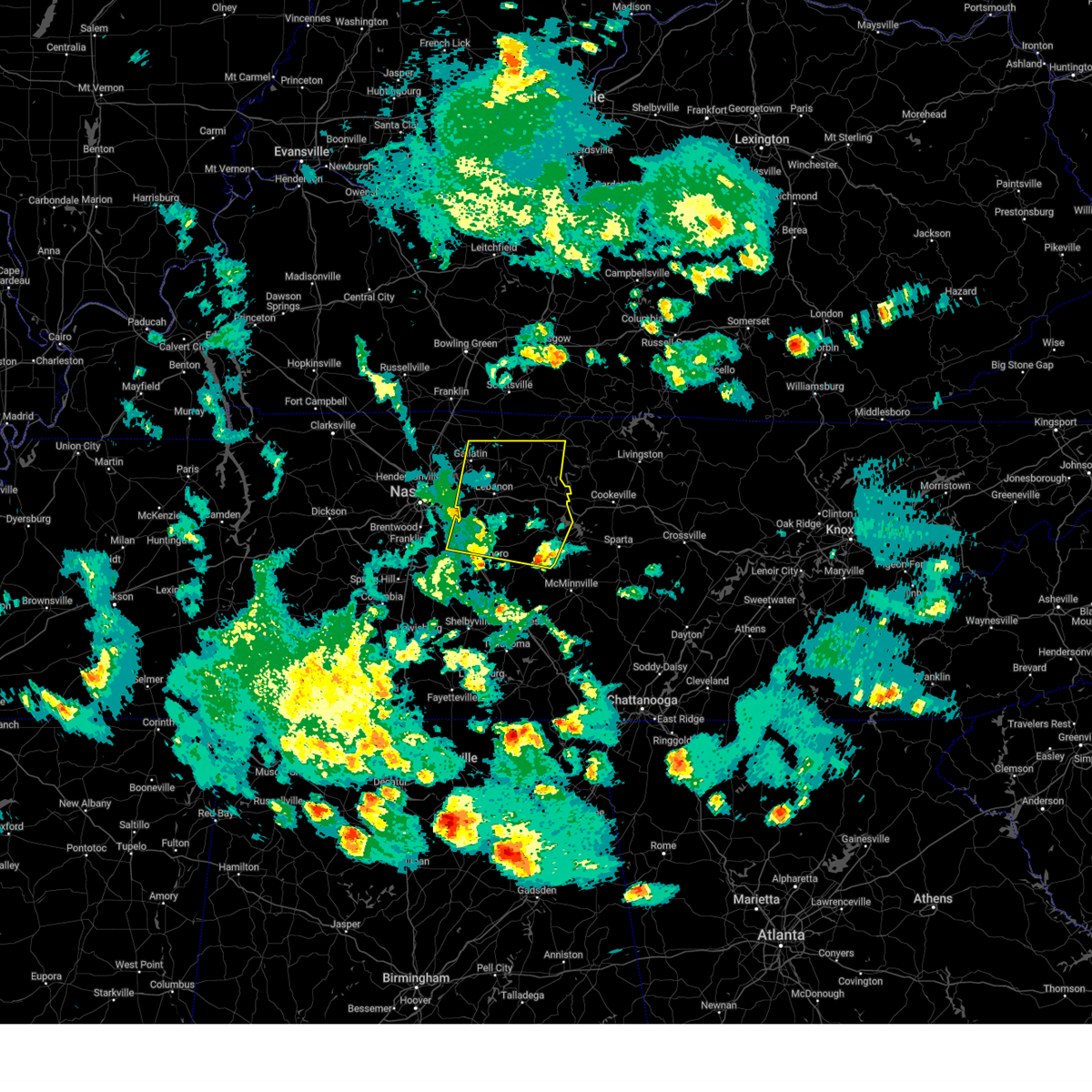
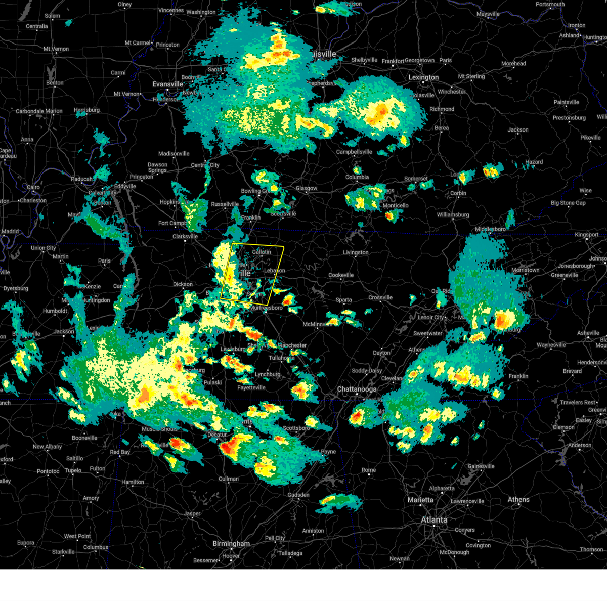
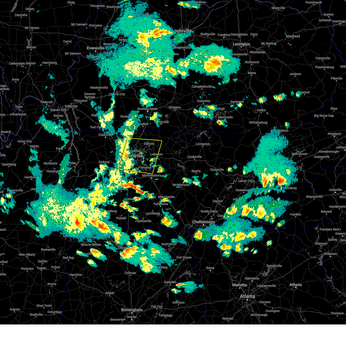
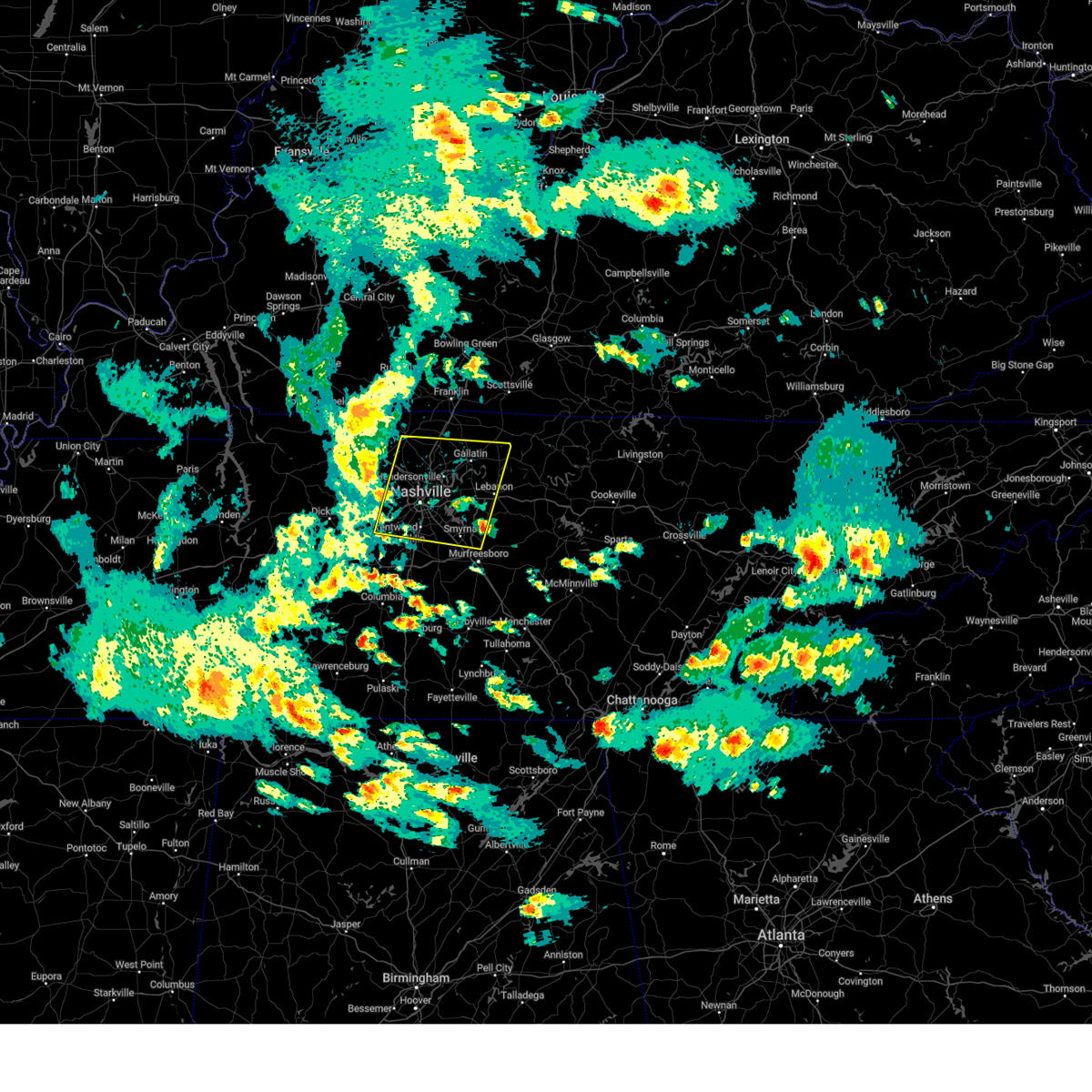
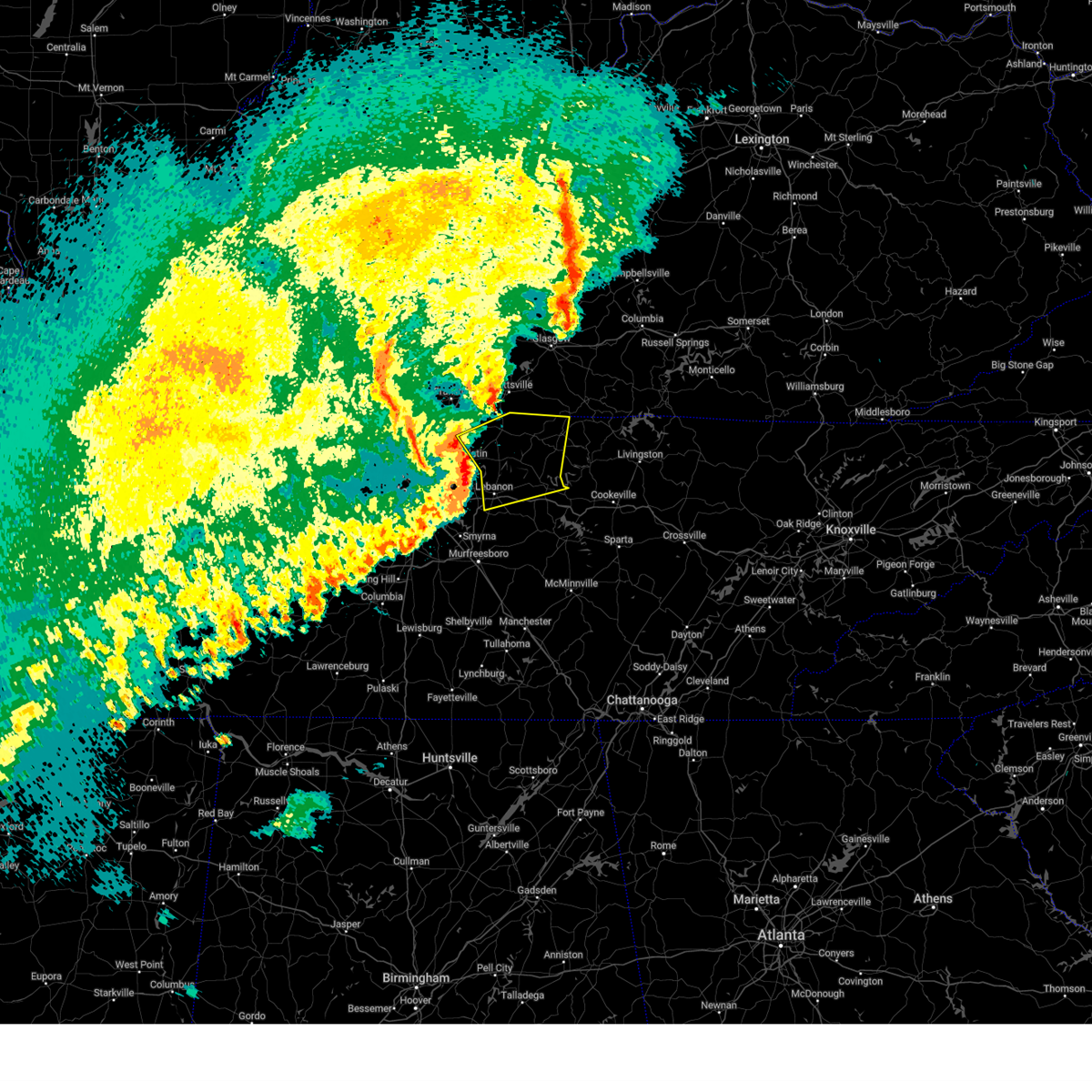
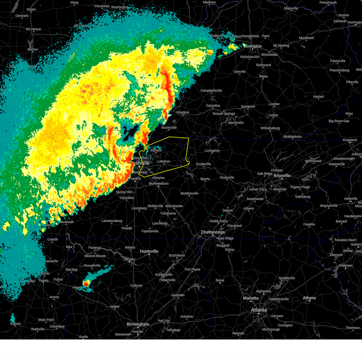
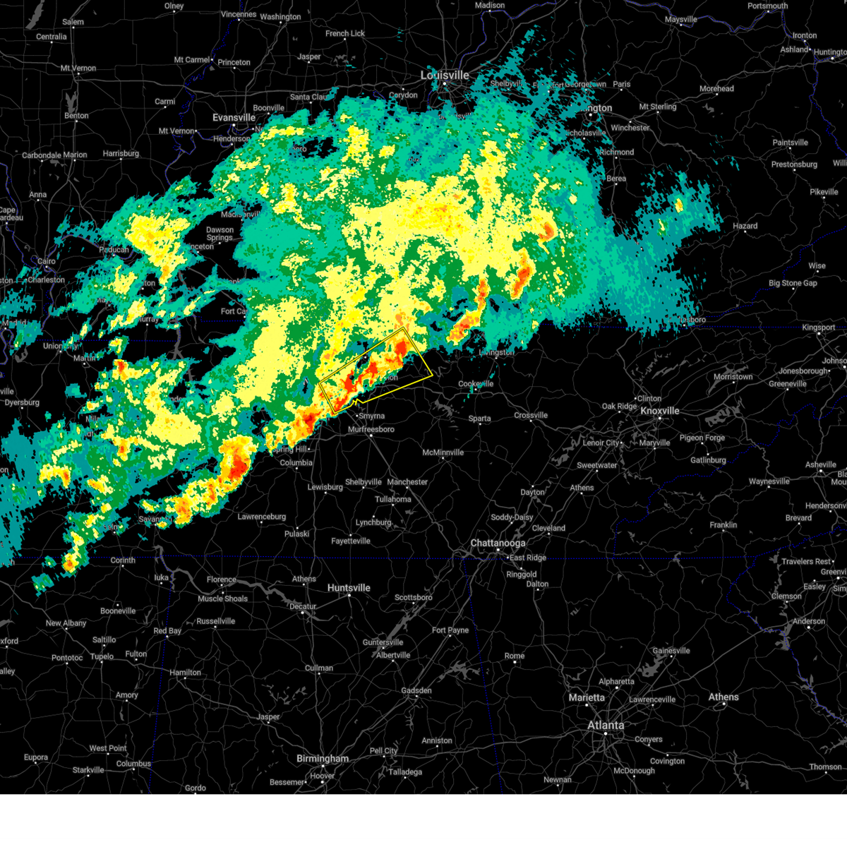
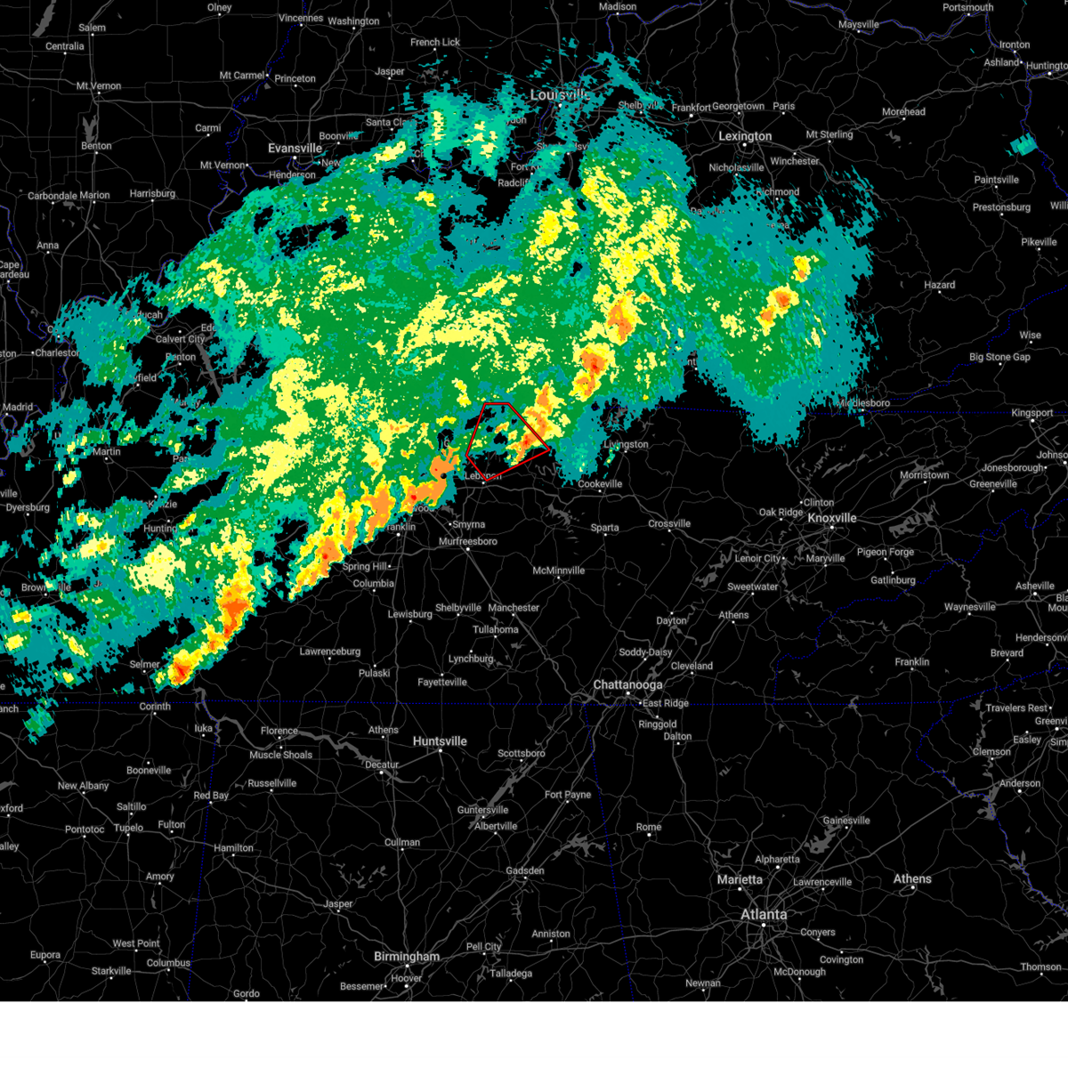
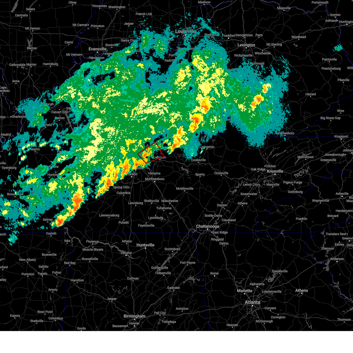
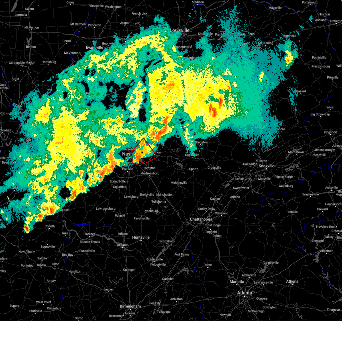
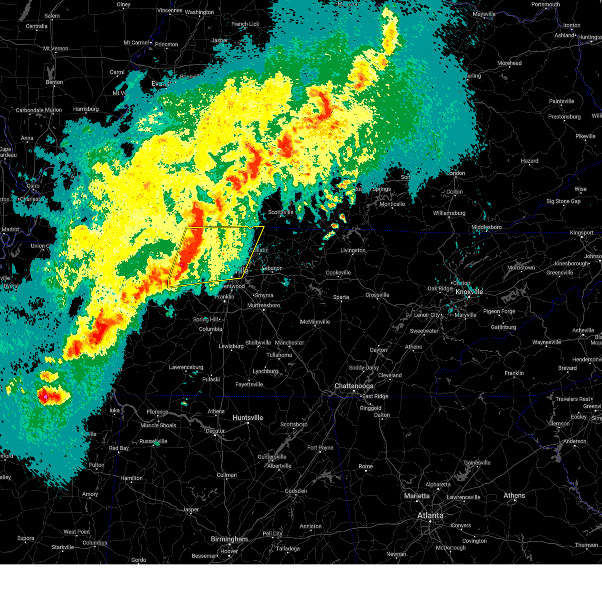
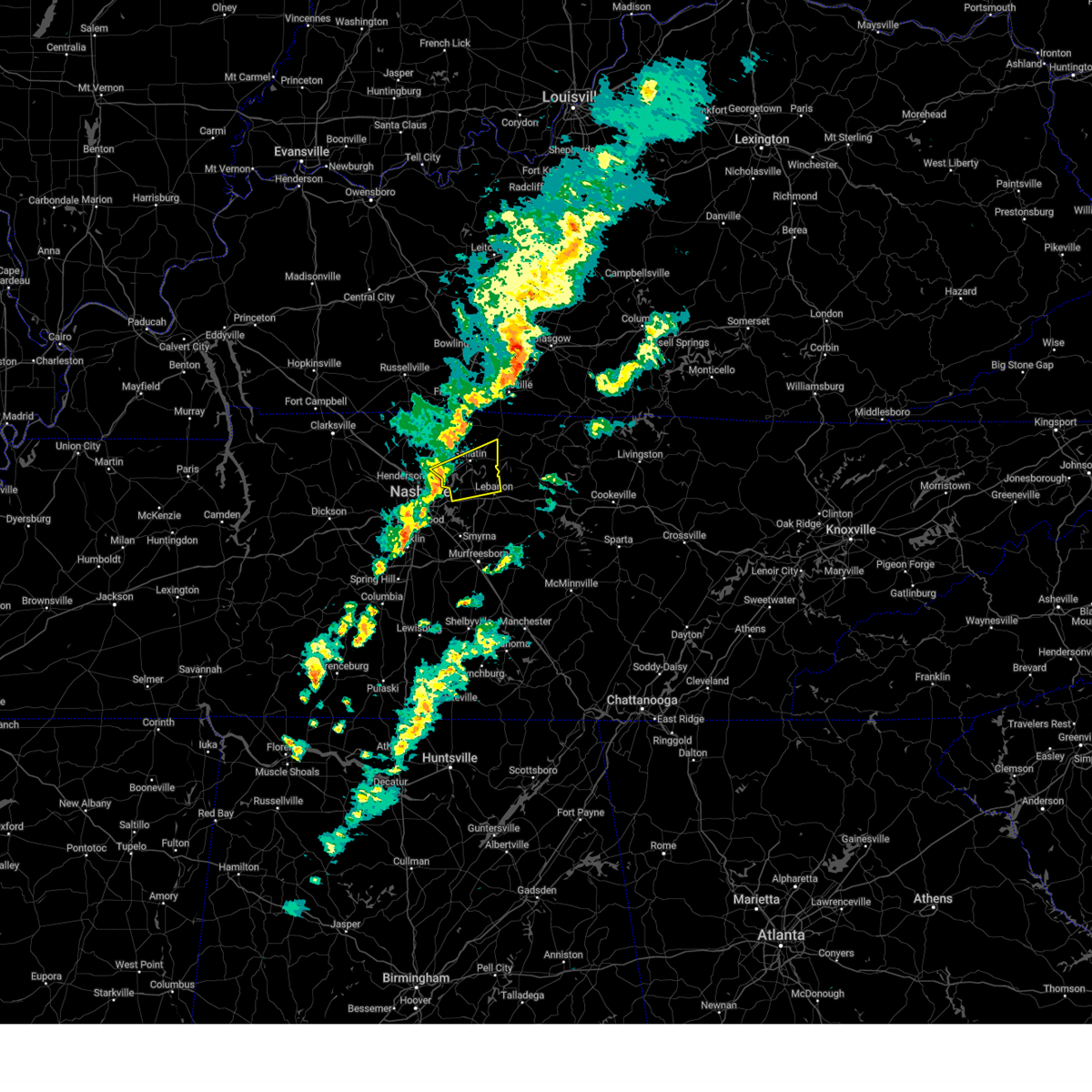
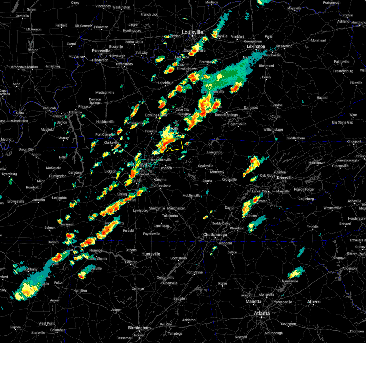
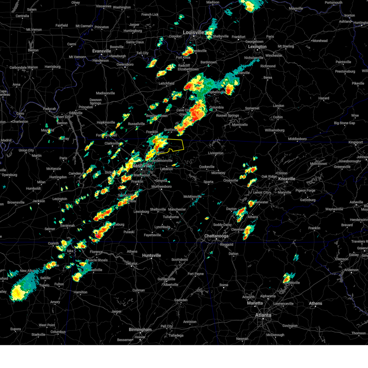
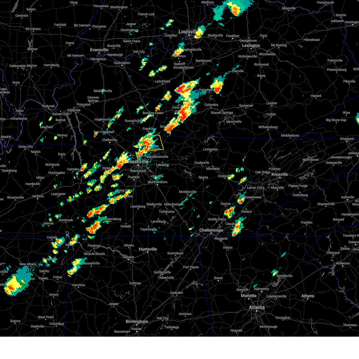
Hail Map for Gallatin, TN
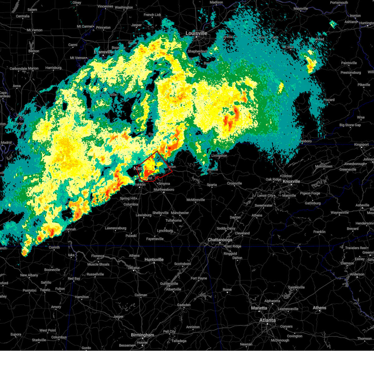
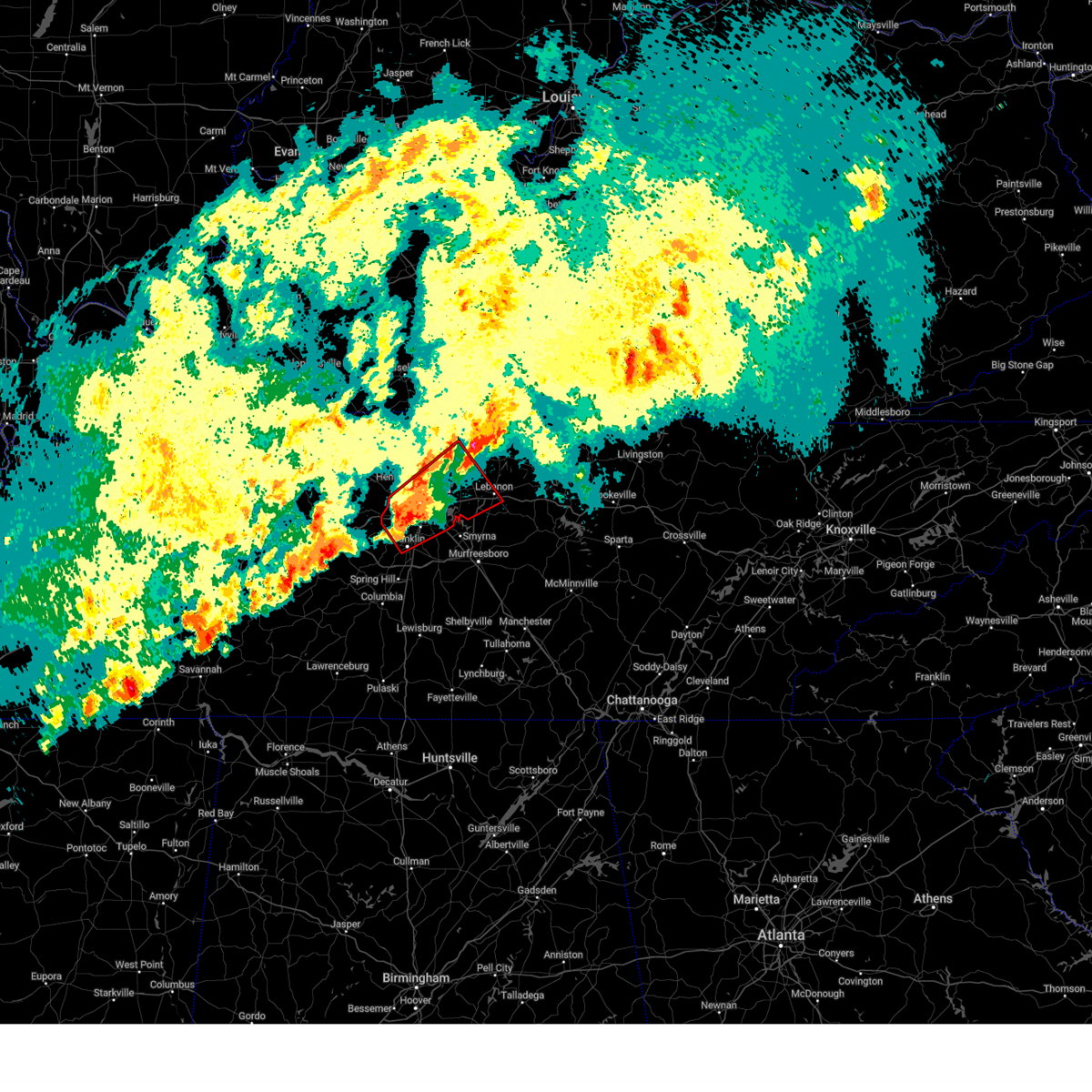
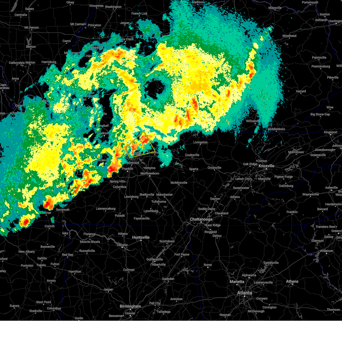
The Gallatin, TN area has had 9 reports of on-the-ground hail by trained spotters, and has been under severe weather warnings 98 times during the past 12 months. Doppler radar has detected hail at or near Gallatin, TN on 98 occasions, including 6 occasions during the past year.
| Name: | Gallatin, TN |
| Where Located: | 21.7 miles NE of Nashville, TN |
| Map: | Google Map for Gallatin, TN |
| Population: | 30278 |
| Housing Units: | 13093 |
| More Info: | Search Google for Gallatin, TN |
3
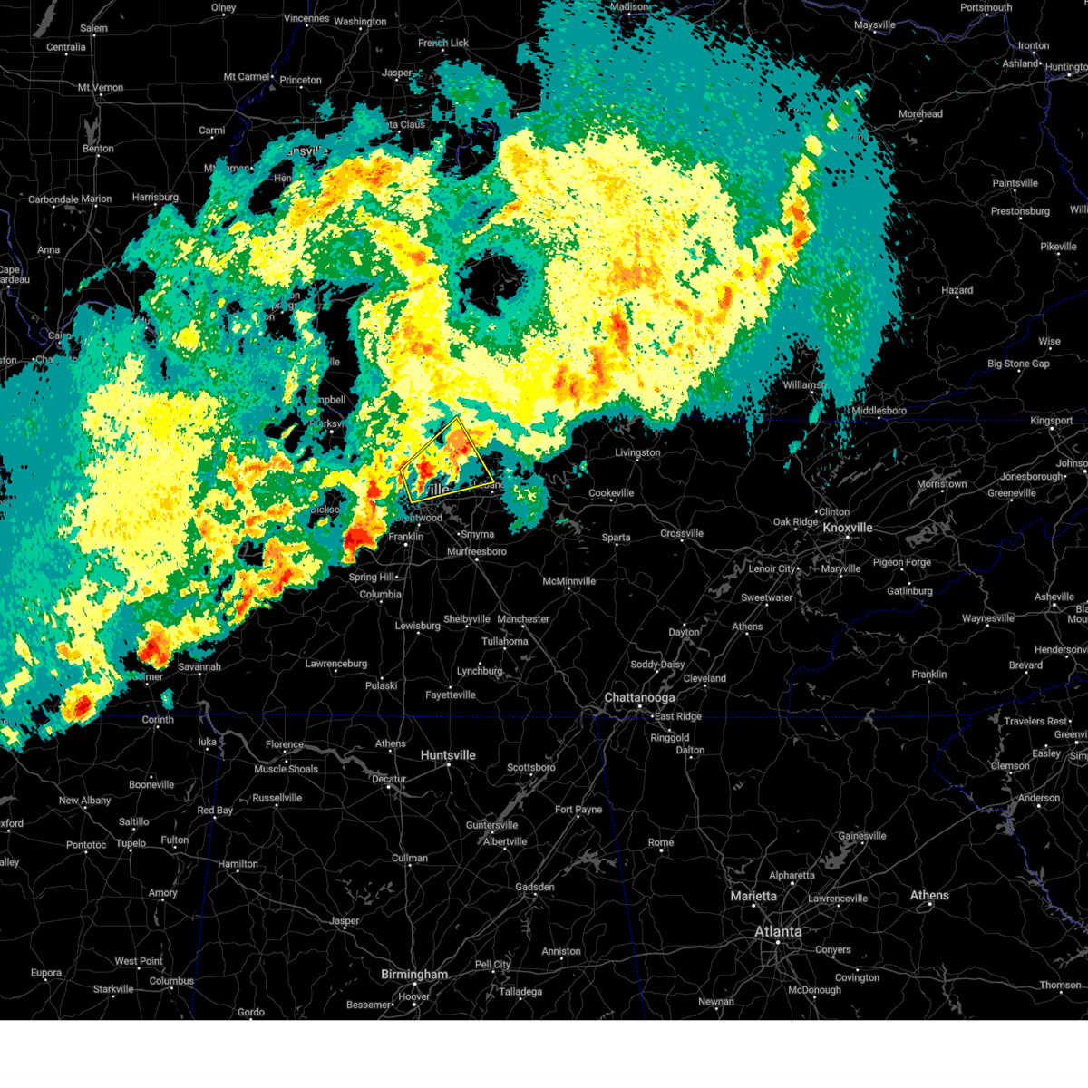
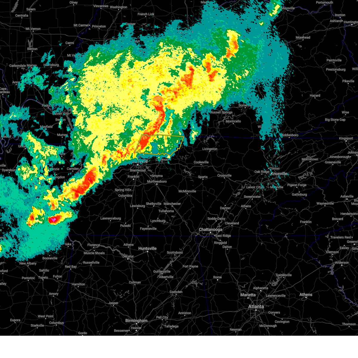
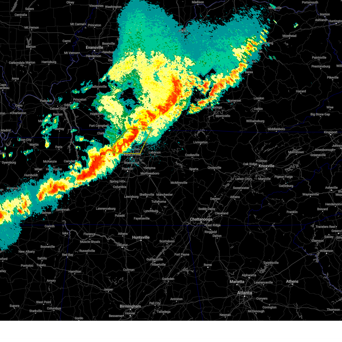
The Top Recent Hail Date for Gallatin, TN is Saturday, April 5, 2025 (4th out of 98)
Hail and Wind Damage Spotted near Gallatin, TN
| Date / Time | Report Details |
|---|---|
| 6/18/2025 8:03 PM CDT | Svrohx the national weather service in nashville has issued a * severe thunderstorm warning for, central davidson county in middle tennessee, sumner county in middle tennessee, northwestern wilson county in middle tennessee, southeastern cheatham county in middle tennessee, southeastern robertson county in middle tennessee, * until 830 pm cdt. * at 802 pm cdt, severe thunderstorms were located along a line extending from near portland to near millersville to pegram, moving east at 50 mph (radar indicated). Hazards include 60 mph wind gusts. expect damage to roofs, siding, and trees |
| 6/6/2025 3:29 PM CDT |
 the severe thunderstorm warning has been cancelled and is no longer in effect the severe thunderstorm warning has been cancelled and is no longer in effect
|
| 6/6/2025 3:17 PM CDT |
 the severe thunderstorm warning has been cancelled and is no longer in effect the severe thunderstorm warning has been cancelled and is no longer in effect
|
| 6/6/2025 3:17 PM CDT |
 At 317 pm cdt, a severe thunderstorm was located near portland, or 16 miles north of gallatin, moving east at 40 mph (radar indicated). Hazards include 60 mph wind gusts and nickel size hail. Expect damage to roofs, siding, and trees. Locations impacted include, gallatin, white house, westmoreland, cross plains, portland, mitchellville, cottontown, bethpage, and oak grove. At 317 pm cdt, a severe thunderstorm was located near portland, or 16 miles north of gallatin, moving east at 40 mph (radar indicated). Hazards include 60 mph wind gusts and nickel size hail. Expect damage to roofs, siding, and trees. Locations impacted include, gallatin, white house, westmoreland, cross plains, portland, mitchellville, cottontown, bethpage, and oak grove.
|
| 6/6/2025 2:55 PM CDT |
 Svrohx the national weather service in nashville has issued a * severe thunderstorm warning for, sumner county in middle tennessee, eastern robertson county in middle tennessee, * until 345 pm cdt. * at 255 pm cdt, a severe thunderstorm was located over cross plains, or 12 miles northeast of springfield, moving east at 40 mph (radar indicated). Hazards include 60 mph wind gusts and nickel size hail. expect damage to roofs, siding, and trees Svrohx the national weather service in nashville has issued a * severe thunderstorm warning for, sumner county in middle tennessee, eastern robertson county in middle tennessee, * until 345 pm cdt. * at 255 pm cdt, a severe thunderstorm was located over cross plains, or 12 miles northeast of springfield, moving east at 40 mph (radar indicated). Hazards include 60 mph wind gusts and nickel size hail. expect damage to roofs, siding, and trees
|
| 6/6/2025 2:44 PM CDT |
 At 244 pm cdt, a severe thunderstorm was located near springfield, moving east at 35 mph (radar indicated). Hazards include 60 mph wind gusts and nickel size hail. Expect damage to roofs, siding, and trees. locations impacted include, springfield, white house, millersville, greenbrier, ridgetop, cross plains, orlinda, and mitchellville. This includes interstate 65 between mile markers 102 and 120. At 244 pm cdt, a severe thunderstorm was located near springfield, moving east at 35 mph (radar indicated). Hazards include 60 mph wind gusts and nickel size hail. Expect damage to roofs, siding, and trees. locations impacted include, springfield, white house, millersville, greenbrier, ridgetop, cross plains, orlinda, and mitchellville. This includes interstate 65 between mile markers 102 and 120.
|
| 6/6/2025 2:23 PM CDT |
 Svrohx the national weather service in nashville has issued a * severe thunderstorm warning for, northwestern sumner county in middle tennessee, robertson county in middle tennessee, * until 300 pm cdt. * at 222 pm cdt, a severe thunderstorm was located 9 miles northwest of coopertown, or 11 miles west of springfield, moving east at 45 mph (radar indicated). Hazards include 60 mph wind gusts and nickel size hail. expect damage to roofs, siding, and trees Svrohx the national weather service in nashville has issued a * severe thunderstorm warning for, northwestern sumner county in middle tennessee, robertson county in middle tennessee, * until 300 pm cdt. * at 222 pm cdt, a severe thunderstorm was located 9 miles northwest of coopertown, or 11 miles west of springfield, moving east at 45 mph (radar indicated). Hazards include 60 mph wind gusts and nickel size hail. expect damage to roofs, siding, and trees
|
| 5/20/2025 6:34 PM CDT |
 the severe thunderstorm warning has been cancelled and is no longer in effect the severe thunderstorm warning has been cancelled and is no longer in effect
|
| 5/20/2025 6:33 PM CDT |
 At 633 pm cdt, severe thunderstorms were located along a line extending from near hartsville to near thompson's station, moving east at 55 mph (radar indicated). Hazards include 60 mph wind gusts and quarter size hail. Hail damage to vehicles is expected. expect wind damage to roofs, siding, and trees. Locations impacted include, franklin, madison, murfreesboro, nolensville, hermitage, belle meade, hartsville, thompson's station, la vergne, dickerson chapel recreation area, triune, natchez trace at highway 96, hendersonville, cedars of lebanon state park, berry hill, mount juliet, leipers fork, smyrna, oak hill, and green hill. At 633 pm cdt, severe thunderstorms were located along a line extending from near hartsville to near thompson's station, moving east at 55 mph (radar indicated). Hazards include 60 mph wind gusts and quarter size hail. Hail damage to vehicles is expected. expect wind damage to roofs, siding, and trees. Locations impacted include, franklin, madison, murfreesboro, nolensville, hermitage, belle meade, hartsville, thompson's station, la vergne, dickerson chapel recreation area, triune, natchez trace at highway 96, hendersonville, cedars of lebanon state park, berry hill, mount juliet, leipers fork, smyrna, oak hill, and green hill.
|
| 5/20/2025 6:33 PM CDT |
 the severe thunderstorm warning has been cancelled and is no longer in effect the severe thunderstorm warning has been cancelled and is no longer in effect
|
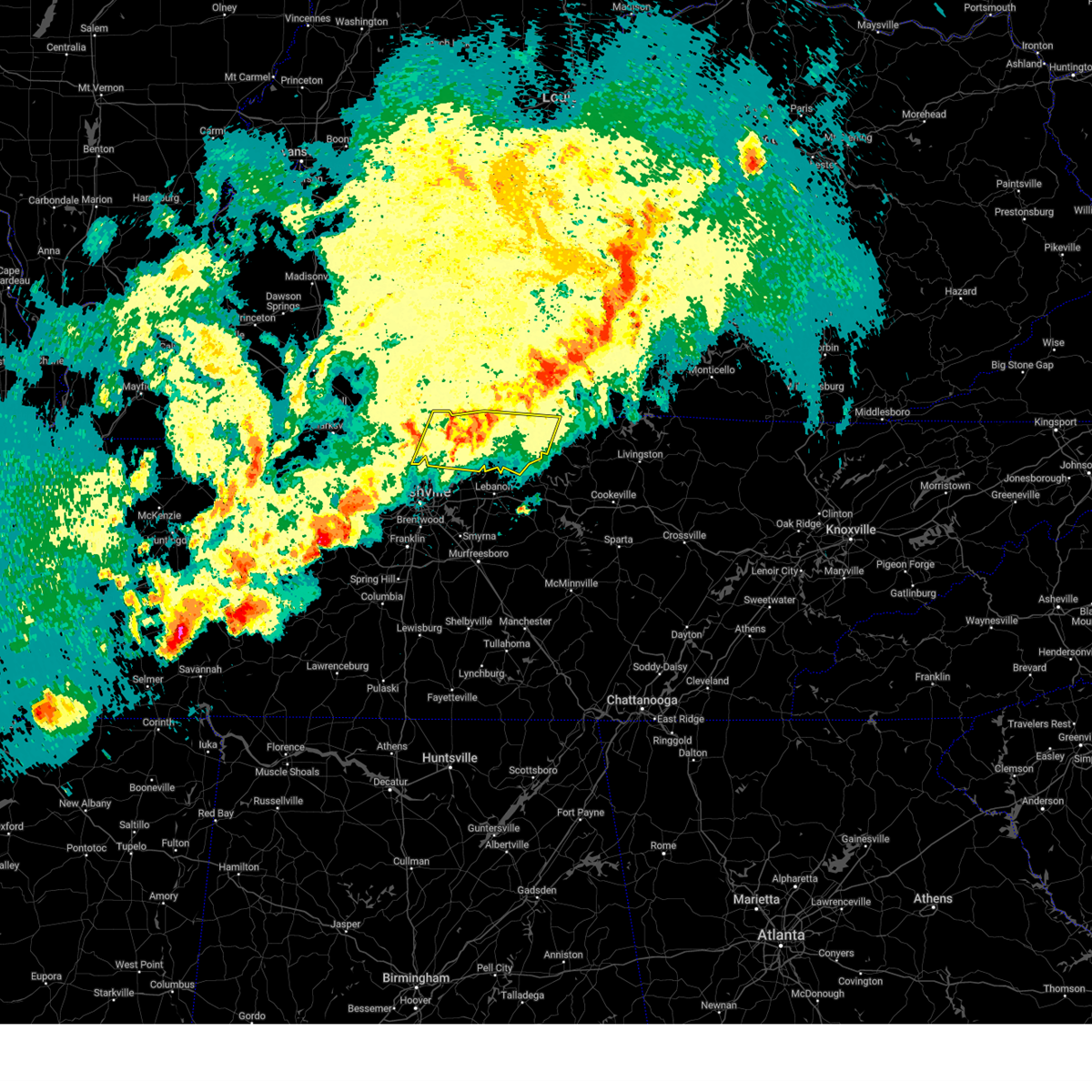
| 5/20/2025 6:07 PM CDT | At 607 pm cdt, severe thunderstorms were located along a line extending from near portland to near hendersonville, moving east at 50 mph (radar indicated). Hazards include 60 mph wind gusts and quarter size hail. Hail damage to vehicles is expected. expect wind damage to roofs, siding, and trees. Locations impacted include, portland, ridgetop, bethpage, goodlettsville, mitchellville, oak grove, millersville, gallatin, white house, bledsoe creek state park, cottontown, hendersonville, cross plains, and orlinda. |
| 5/20/2025 6:07 PM CDT | the severe thunderstorm warning has been cancelled and is no longer in effect |
| 5/20/2025 6:06 PM CDT | Svrohx the national weather service in nashville has issued a * severe thunderstorm warning for, davidson county in middle tennessee, central rutherford county in middle tennessee, north central maury county in middle tennessee, southeastern sumner county in middle tennessee, williamson county in middle tennessee, wilson county in middle tennessee, south central cheatham county in middle tennessee, southwestern trousdale county in middle tennessee, east central hickman county in middle tennessee, * until 700 pm cdt. * at 606 pm cdt, severe thunderstorms were located along a line extending from near hendersonville to centerville, moving east at 50 mph (radar indicated). Hazards include 60 mph wind gusts and quarter size hail. Hail damage to vehicles is expected. Expect wind damage to roofs, siding, and trees. |
| 5/20/2025 5:30 PM CDT |
 Svrohx the national weather service in nashville has issued a * severe thunderstorm warning for, northwestern davidson county in middle tennessee, northeastern dickson county in middle tennessee, eastern montgomery county in middle tennessee, sumner county in middle tennessee, cheatham county in middle tennessee, robertson county in middle tennessee, * until 645 pm cdt. * at 530 pm cdt, severe thunderstorms were located along a line extending from elkton to ashland city, moving east at 45 mph (radar indicated). Hazards include 60 mph wind gusts and quarter size hail. Hail damage to vehicles is expected. Expect wind damage to roofs, siding, and trees. Svrohx the national weather service in nashville has issued a * severe thunderstorm warning for, northwestern davidson county in middle tennessee, northeastern dickson county in middle tennessee, eastern montgomery county in middle tennessee, sumner county in middle tennessee, cheatham county in middle tennessee, robertson county in middle tennessee, * until 645 pm cdt. * at 530 pm cdt, severe thunderstorms were located along a line extending from elkton to ashland city, moving east at 45 mph (radar indicated). Hazards include 60 mph wind gusts and quarter size hail. Hail damage to vehicles is expected. Expect wind damage to roofs, siding, and trees.
|
| 5/16/2025 11:35 PM CDT |
 At 1135 pm cdt, severe thunderstorms were located along a line extending from 6 miles east of celina to forest hills, moving east at 55 mph (radar indicated). Hazards include 60 mph wind gusts and quarter size hail. Hail damage to vehicles is expected. expect wind damage to roofs, siding, and trees. locations impacted include, red boiling springs, madison, hermitage, belle meade, hartsville, moss, pleasant shade, gallatin, bledsoe creek state park, dickerson chapel recreation area, hendersonville, berry hill, mount juliet, boles, oak hill, green hill, forest hills, celina, bethpage, and goodlettsville. this includes the following highways, interstate 40 between mile markers 186 and 235. interstate 65 between mile markers 75 and 98. interstate 24 between mile markers 38 and 57. Interstate 840 near mile marker 76. At 1135 pm cdt, severe thunderstorms were located along a line extending from 6 miles east of celina to forest hills, moving east at 55 mph (radar indicated). Hazards include 60 mph wind gusts and quarter size hail. Hail damage to vehicles is expected. expect wind damage to roofs, siding, and trees. locations impacted include, red boiling springs, madison, hermitage, belle meade, hartsville, moss, pleasant shade, gallatin, bledsoe creek state park, dickerson chapel recreation area, hendersonville, berry hill, mount juliet, boles, oak hill, green hill, forest hills, celina, bethpage, and goodlettsville. this includes the following highways, interstate 40 between mile markers 186 and 235. interstate 65 between mile markers 75 and 98. interstate 24 between mile markers 38 and 57. Interstate 840 near mile marker 76.
|
| 5/16/2025 11:35 PM CDT |
 the severe thunderstorm warning has been cancelled and is no longer in effect the severe thunderstorm warning has been cancelled and is no longer in effect
|
| 5/16/2025 11:08 PM CDT |
 the severe thunderstorm warning has been cancelled and is no longer in effect the severe thunderstorm warning has been cancelled and is no longer in effect
|
| 5/16/2025 11:08 PM CDT |
 At 1107 pm cdt, severe thunderstorms were located along a line extending from near red boiling springs to near burns, moving east at 55 mph (radar indicated). Hazards include 60 mph wind gusts and quarter size hail. Hail damage to vehicles is expected. expect wind damage to roofs, siding, and trees. locations impacted include, charlotte, black jack, hartsville, moss, pleasant shade, millersville, gallatin, bledsoe creek state park, dickerson chapel recreation area, hendersonville, cottontown, mount juliet, westmoreland, white bluff, forest hills, cheatham dam, goodlettsville, dixon springs, oak grove, and nashville. this includes the following highways, interstate 40 between mile markers 186 and 235. interstate 65 between mile markers 75 and 121. interstate 24 between mile markers 22 and 57. Interstate 840 near mile marker 76. At 1107 pm cdt, severe thunderstorms were located along a line extending from near red boiling springs to near burns, moving east at 55 mph (radar indicated). Hazards include 60 mph wind gusts and quarter size hail. Hail damage to vehicles is expected. expect wind damage to roofs, siding, and trees. locations impacted include, charlotte, black jack, hartsville, moss, pleasant shade, millersville, gallatin, bledsoe creek state park, dickerson chapel recreation area, hendersonville, cottontown, mount juliet, westmoreland, white bluff, forest hills, cheatham dam, goodlettsville, dixon springs, oak grove, and nashville. this includes the following highways, interstate 40 between mile markers 186 and 235. interstate 65 between mile markers 75 and 121. interstate 24 between mile markers 22 and 57. Interstate 840 near mile marker 76.
|
| 5/16/2025 10:57 PM CDT | Facebook report of a tree down on south tunnel r in sumner county TN, 8 miles S of Gallatin, TN |
| 5/16/2025 10:40 PM CDT | Svrohx the national weather service in nashville has issued a * severe thunderstorm warning for, northern smith county in middle tennessee, southern montgomery county in middle tennessee, sumner county in middle tennessee, southeastern stewart county in middle tennessee, houston county in middle tennessee, northern wilson county in middle tennessee, cheatham county in middle tennessee, clay county in middle tennessee, northern humphreys county in middle tennessee, robertson county in middle tennessee, davidson county in middle tennessee, dickson county in middle tennessee, northern jackson county in middle tennessee, macon county in middle tennessee, trousdale county in middle tennessee, * until 1145 pm cdt. * at 1040 pm cdt, severe thunderstorms were located along a line extending from near westmoreland to near mcewen, moving east at 55 mph (radar indicated). Hazards include 60 mph wind gusts and quarter size hail. Hail damage to vehicles is expected. Expect wind damage to roofs, siding, and trees. |
| 5/8/2025 4:37 PM CDT |
 the severe thunderstorm warning has been cancelled and is no longer in effect the severe thunderstorm warning has been cancelled and is no longer in effect
|
| 5/8/2025 4:25 PM CDT |
 the severe thunderstorm warning has been cancelled and is no longer in effect the severe thunderstorm warning has been cancelled and is no longer in effect
|
| 5/8/2025 4:25 PM CDT |
 At 425 pm cdt, a severe thunderstorm was located over mount juliet, or 10 miles southwest of gallatin, moving east at 25 mph (radar indicated). Hazards include 60 mph wind gusts and quarter size hail. Hail damage to vehicles is expected. expect wind damage to roofs, siding, and trees. locations impacted include, hendersonville, green hill, lebanon, mount juliet, and belinda city. this includes the following highways, interstate 40 between mile markers 223 and 240. Interstate 840 between mile markers 75 and 76. At 425 pm cdt, a severe thunderstorm was located over mount juliet, or 10 miles southwest of gallatin, moving east at 25 mph (radar indicated). Hazards include 60 mph wind gusts and quarter size hail. Hail damage to vehicles is expected. expect wind damage to roofs, siding, and trees. locations impacted include, hendersonville, green hill, lebanon, mount juliet, and belinda city. this includes the following highways, interstate 40 between mile markers 223 and 240. Interstate 840 between mile markers 75 and 76.
|
| 5/8/2025 4:13 PM CDT | Svrohx the national weather service in nashville has issued a * severe thunderstorm warning for, east central davidson county in middle tennessee, southeastern sumner county in middle tennessee, northwestern wilson county in middle tennessee, * until 500 pm cdt. * at 413 pm cdt, a severe thunderstorm was located over lakewood, or 9 miles east of nashville, moving east at 25 mph (radar indicated). Hazards include 60 mph wind gusts and quarter size hail. Hail damage to vehicles is expected. Expect wind damage to roofs, siding, and trees. |
| 5/8/2025 4:04 PM CDT |
 At 403 pm cdt, a severe thunderstorm was located over lakewood, or 7 miles northeast of nashville, moving east at 30 mph (radar indicated). Hazards include 60 mph wind gusts and quarter size hail. Hail damage to vehicles is expected. expect wind damage to roofs, siding, and trees. locations impacted include, green hill, madison, hermitage, rural hill, gallatin, nashville, belinda city, lakewood, hendersonville, mount juliet, old hickory, percy priest lake, gladeville, goodlettsville, and lebanon. this includes the following highways, interstate 40 between mile markers 205 and 231. interstate 65 between mile markers 82 and 88, near mile marker 91, and between mile markers 95 and 96. Interstate 24 between mile markers 47 and 52. At 403 pm cdt, a severe thunderstorm was located over lakewood, or 7 miles northeast of nashville, moving east at 30 mph (radar indicated). Hazards include 60 mph wind gusts and quarter size hail. Hail damage to vehicles is expected. expect wind damage to roofs, siding, and trees. locations impacted include, green hill, madison, hermitage, rural hill, gallatin, nashville, belinda city, lakewood, hendersonville, mount juliet, old hickory, percy priest lake, gladeville, goodlettsville, and lebanon. this includes the following highways, interstate 40 between mile markers 205 and 231. interstate 65 between mile markers 82 and 88, near mile marker 91, and between mile markers 95 and 96. Interstate 24 between mile markers 47 and 52.
|
| 5/8/2025 3:51 PM CDT |
 At 351 pm cdt, a severe thunderstorm was located near madison, or near nashville, moving east at 30 mph (radar indicated). Hazards include 60 mph wind gusts and quarter size hail. Hail damage to vehicles is expected. expect wind damage to roofs, siding, and trees. locations impacted include, green hill, madison, hermitage, goodlettsville, bells bend, rural hill, gallatin, nashville, whites creek, belinda city, lakewood, hendersonville, mount juliet, old hickory, percy priest lake, gladeville, millersville, and lebanon. this includes the following highways, interstate 40 between mile markers 203 and 231. interstate 65 between mile markers 82 and 99. Interstate 24 between mile markers 39 and 52. At 351 pm cdt, a severe thunderstorm was located near madison, or near nashville, moving east at 30 mph (radar indicated). Hazards include 60 mph wind gusts and quarter size hail. Hail damage to vehicles is expected. expect wind damage to roofs, siding, and trees. locations impacted include, green hill, madison, hermitage, goodlettsville, bells bend, rural hill, gallatin, nashville, whites creek, belinda city, lakewood, hendersonville, mount juliet, old hickory, percy priest lake, gladeville, millersville, and lebanon. this includes the following highways, interstate 40 between mile markers 203 and 231. interstate 65 between mile markers 82 and 99. Interstate 24 between mile markers 39 and 52.
|
| 5/8/2025 3:37 PM CDT |
 Svrohx the national weather service in nashville has issued a * severe thunderstorm warning for, central davidson county in middle tennessee, southwestern sumner county in middle tennessee, northwestern wilson county in middle tennessee, * until 415 pm cdt. * at 337 pm cdt, a severe thunderstorm was located near joelton, or 7 miles east of ashland city, moving east at 30 mph (radar indicated). Hazards include 60 mph wind gusts and quarter size hail. Hail damage to vehicles is expected. Expect wind damage to roofs, siding, and trees. Svrohx the national weather service in nashville has issued a * severe thunderstorm warning for, central davidson county in middle tennessee, southwestern sumner county in middle tennessee, northwestern wilson county in middle tennessee, * until 415 pm cdt. * at 337 pm cdt, a severe thunderstorm was located near joelton, or 7 miles east of ashland city, moving east at 30 mph (radar indicated). Hazards include 60 mph wind gusts and quarter size hail. Hail damage to vehicles is expected. Expect wind damage to roofs, siding, and trees.
|
| 4/10/2025 5:59 PM CDT |
 At 558 pm cdt, severe thunderstorms were located along a line extending from near hartsville to 8 miles southeast of murfreesboro, moving east at 35 mph (radar indicated). Hazards include 60 mph wind gusts. Expect damage to roofs, siding, and trees. locations impacted include, gordonsville, hartsville, pleasant shade, la vergne, gallatin, bledsoe creek state park, dickerson chapel recreation area, liberty, cedars of lebanon state park, carthage, auburntown, center hill lake, mount juliet, alexandria, smyrna, edgar evins state park, south carthage, lascassas, tuckers crossroads, and hickman. this includes the following highways, interstate 40 between mile markers 225 and 267. interstate 24 between mile markers 66 and 73. Interstate 840 between mile markers 54 and 76. At 558 pm cdt, severe thunderstorms were located along a line extending from near hartsville to 8 miles southeast of murfreesboro, moving east at 35 mph (radar indicated). Hazards include 60 mph wind gusts. Expect damage to roofs, siding, and trees. locations impacted include, gordonsville, hartsville, pleasant shade, la vergne, gallatin, bledsoe creek state park, dickerson chapel recreation area, liberty, cedars of lebanon state park, carthage, auburntown, center hill lake, mount juliet, alexandria, smyrna, edgar evins state park, south carthage, lascassas, tuckers crossroads, and hickman. this includes the following highways, interstate 40 between mile markers 225 and 267. interstate 24 between mile markers 66 and 73. Interstate 840 between mile markers 54 and 76.
|
| 4/10/2025 5:59 PM CDT |
 the severe thunderstorm warning has been cancelled and is no longer in effect the severe thunderstorm warning has been cancelled and is no longer in effect
|
| 4/10/2025 5:41 PM CDT | Svrohx the national weather service in nashville has issued a * severe thunderstorm warning for, smith county in middle tennessee, southeastern davidson county in middle tennessee, western de kalb county in middle tennessee, northern rutherford county in middle tennessee, southern sumner county in middle tennessee, northeastern williamson county in middle tennessee, wilson county in middle tennessee, southern macon county in middle tennessee, trousdale county in middle tennessee, northern cannon county in middle tennessee, * until 630 pm cdt. * at 541 pm cdt, severe thunderstorms were located along a line extending from 6 miles northeast of gallatin to near murfreesboro, moving east at 35 mph (radar indicated). Hazards include 60 mph wind gusts. expect damage to roofs, siding, and trees |
| 4/10/2025 5:31 PM CDT |
 the severe thunderstorm warning has been cancelled and is no longer in effect the severe thunderstorm warning has been cancelled and is no longer in effect
|
| 4/10/2025 5:31 PM CDT |
 At 531 pm cdt, severe thunderstorms were located along a line extending from 6 miles east of white house to near antioch, moving east at 45 mph (emergency management). Hazards include 60 mph wind gusts. Expect damage to roofs, siding, and trees. locations impacted include, madison, nolensville, hermitage, belle meade, la vergne, millersville, gallatin, bledsoe creek state park, hendersonville, greenbrier, berry hill, cottontown, mount juliet, smyrna, oak hill, green hill, forest hills, ridgetop, bethpage, and goodlettsville. this includes the following highways, interstate 40 between mile markers 201 and 238. interstate 65 between mile markers 69 and 110. interstate 24 between mile markers 36 and 70. Interstate 840 between mile markers 56 and 76. At 531 pm cdt, severe thunderstorms were located along a line extending from 6 miles east of white house to near antioch, moving east at 45 mph (emergency management). Hazards include 60 mph wind gusts. Expect damage to roofs, siding, and trees. locations impacted include, madison, nolensville, hermitage, belle meade, la vergne, millersville, gallatin, bledsoe creek state park, hendersonville, greenbrier, berry hill, cottontown, mount juliet, smyrna, oak hill, green hill, forest hills, ridgetop, bethpage, and goodlettsville. this includes the following highways, interstate 40 between mile markers 201 and 238. interstate 65 between mile markers 69 and 110. interstate 24 between mile markers 36 and 70. Interstate 840 between mile markers 56 and 76.
|
| 4/10/2025 5:24 PM CDT |
 At 524 pm cdt, severe thunderstorms were located along a line extending from near white house to near brentwood, moving east at 45 mph (emergency management). Hazards include 60 mph wind gusts. Expect damage to roofs, siding, and trees. locations impacted include, madison, nolensville, hermitage, belle meade, la vergne, millersville, gallatin, bledsoe creek state park, hendersonville, greenbrier, berry hill, cottontown, mount juliet, smyrna, oak hill, green hill, forest hills, ridgetop, bethpage, and goodlettsville. this includes the following highways, interstate 40 between mile markers 191 and 238. interstate 65 between mile markers 70 and 110. interstate 24 between mile markers 29 and 70. Interstate 840 between mile markers 56 and 76. At 524 pm cdt, severe thunderstorms were located along a line extending from near white house to near brentwood, moving east at 45 mph (emergency management). Hazards include 60 mph wind gusts. Expect damage to roofs, siding, and trees. locations impacted include, madison, nolensville, hermitage, belle meade, la vergne, millersville, gallatin, bledsoe creek state park, hendersonville, greenbrier, berry hill, cottontown, mount juliet, smyrna, oak hill, green hill, forest hills, ridgetop, bethpage, and goodlettsville. this includes the following highways, interstate 40 between mile markers 191 and 238. interstate 65 between mile markers 70 and 110. interstate 24 between mile markers 29 and 70. Interstate 840 between mile markers 56 and 76.
|
| 4/10/2025 5:05 PM CDT |
 Svrohx the national weather service in nashville has issued a * severe thunderstorm warning for, davidson county in middle tennessee, northwestern rutherford county in middle tennessee, southern sumner county in middle tennessee, northeastern williamson county in middle tennessee, western wilson county in middle tennessee, southeastern cheatham county in middle tennessee, western trousdale county in middle tennessee, southeastern robertson county in middle tennessee, * until 545 pm cdt. * at 504 pm cdt, severe thunderstorms were located along a line extending from near springfield to near pegram, moving east at 45 mph (radar indicated). Hazards include 60 mph wind gusts. expect damage to roofs, siding, and trees Svrohx the national weather service in nashville has issued a * severe thunderstorm warning for, davidson county in middle tennessee, northwestern rutherford county in middle tennessee, southern sumner county in middle tennessee, northeastern williamson county in middle tennessee, western wilson county in middle tennessee, southeastern cheatham county in middle tennessee, western trousdale county in middle tennessee, southeastern robertson county in middle tennessee, * until 545 pm cdt. * at 504 pm cdt, severe thunderstorms were located along a line extending from near springfield to near pegram, moving east at 45 mph (radar indicated). Hazards include 60 mph wind gusts. expect damage to roofs, siding, and trees
|
| 4/5/2025 6:39 PM CDT | Damage to wooden fencing... multiple downed trees and power line in sumner county TN, 4.2 miles SSW of Gallatin, TN |
| 4/5/2025 5:32 PM CDT |
 the severe thunderstorm warning has been cancelled and is no longer in effect the severe thunderstorm warning has been cancelled and is no longer in effect
|
| 4/5/2025 5:32 PM CDT |
 At 532 pm cdt, severe thunderstorms were located along a line extending from westmoreland to hartsville to near lebanon, moving east at 60 mph (radar indicated). Hazards include 70 mph wind gusts and quarter size hail. Hail damage to vehicles is expected. expect considerable tree damage. wind damage is also likely to mobile homes, roofs, and outbuildings. locations impacted include, red boiling springs, tuckers crossroads, bethpage, hartsville, dixon springs, oak grove, pleasant shade, bledsoe creek state park, dickerson chapel recreation area, carthage, lebanon, lafayette, westmoreland, south carthage, and gallatin. this includes the following highways, interstate 40 between mile markers 235 and 248. Interstate 840 between mile markers 75 and 76. At 532 pm cdt, severe thunderstorms were located along a line extending from westmoreland to hartsville to near lebanon, moving east at 60 mph (radar indicated). Hazards include 70 mph wind gusts and quarter size hail. Hail damage to vehicles is expected. expect considerable tree damage. wind damage is also likely to mobile homes, roofs, and outbuildings. locations impacted include, red boiling springs, tuckers crossroads, bethpage, hartsville, dixon springs, oak grove, pleasant shade, bledsoe creek state park, dickerson chapel recreation area, carthage, lebanon, lafayette, westmoreland, south carthage, and gallatin. this includes the following highways, interstate 40 between mile markers 235 and 248. Interstate 840 between mile markers 75 and 76.
|
| 4/5/2025 5:31 PM CDT |
 At 531 pm cdt, a severe thunderstorm capable of producing a tornado was located near westmoreland, or 7 miles northwest of hartsville, moving east at 55 mph (radar indicated rotation). Hazards include tornado. Flying debris will be dangerous to those caught without shelter. mobile homes will be damaged or destroyed. damage to roofs, windows, and vehicles will occur. tree damage is likely. this dangerous storm will be near, lafayette around 535 pm cdt. Other locations impacted by this tornadic thunderstorm include oak grove, bethpage, and bledsoe creek state park. At 531 pm cdt, a severe thunderstorm capable of producing a tornado was located near westmoreland, or 7 miles northwest of hartsville, moving east at 55 mph (radar indicated rotation). Hazards include tornado. Flying debris will be dangerous to those caught without shelter. mobile homes will be damaged or destroyed. damage to roofs, windows, and vehicles will occur. tree damage is likely. this dangerous storm will be near, lafayette around 535 pm cdt. Other locations impacted by this tornadic thunderstorm include oak grove, bethpage, and bledsoe creek state park.
|
| 4/5/2025 5:31 PM CDT |
 the tornado warning has been cancelled and is no longer in effect the tornado warning has been cancelled and is no longer in effect
|
| 4/5/2025 5:24 PM CDT | the severe thunderstorm warning has been cancelled and is no longer in effect |
| 4/5/2025 5:24 PM CDT | At 524 pm cdt, severe thunderstorms were located along a line extending from 6 miles west of westmoreland to 7 miles southwest of hartsville to near rural hill, moving east at 60 mph (radar indicated). Hazards include 70 mph wind gusts and quarter size hail. Hail damage to vehicles is expected. expect considerable tree damage. wind damage is also likely to mobile homes, roofs, and outbuildings. locations impacted include, red boiling springs, gordonsville, hartsville, pleasant shade, millersville, gallatin, bledsoe creek state park, dickerson chapel recreation area, hendersonville, carthage, cottontown, mount juliet, westmoreland, south carthage, green hill, tuckers crossroads, bethpage, rural hill, dixon springs, and oak grove. this includes the following highways, interstate 40 between mile markers 223 and 260. interstate 65 between mile markers 102 and 103. Interstate 840 between mile markers 66 and 76. |
| 4/5/2025 5:16 PM CDT | Trees uprooted along highway 25 behind cambridge farms in gallatin. time approximated by rada in sumner county TN, 3.2 miles SSE of Gallatin, TN |
| 4/5/2025 5:16 PM CDT | Several large trees down in rivermont off douglas bend in gallatin. time approximated by rada in sumner county TN, 3.1 miles NE of Gallatin, TN |
| 4/5/2025 5:16 PM CDT | Tree was reported down on a home near the aldis in gallatin. time approximated by rada in sumner county TN, 0.9 miles S of Gallatin, TN |
| 4/5/2025 5:12 PM CDT | Significant structural damage to a large building at 135 baker l in sumner county TN, 1.8 miles WSW of Gallatin, TN |
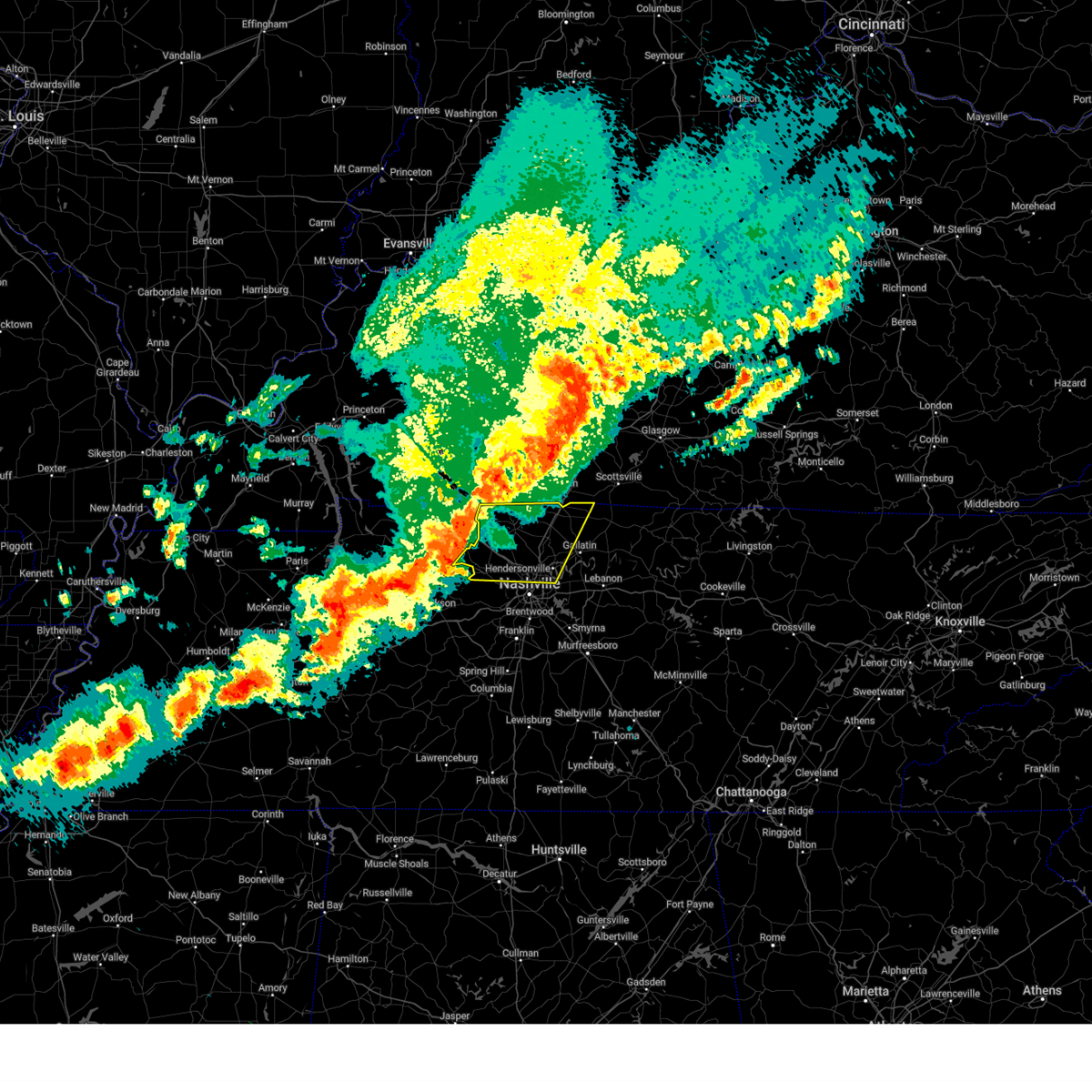
| 4/5/2025 5:12 PM CDT | At 512 pm cdt, a severe thunderstorm capable of producing a tornado was located over gallatin, moving northeast at 55 mph (radar indicated rotation). Hazards include tornado. Flying debris will be dangerous to those caught without shelter. mobile homes will be damaged or destroyed. damage to roofs, windows, and vehicles will occur. tree damage is likely. this tornadic thunderstorm will remain over mainly rural areas of southwestern sumner and northwestern wilson counties, including the following locations, green hill. This includes interstate 65 between mile markers 98 and 103. |
| 4/5/2025 5:12 PM CDT | the tornado warning has been cancelled and is no longer in effect |
| 4/5/2025 5:10 PM CDT | Torohx the national weather service in nashville has issued a * tornado warning for, sumner county in middle tennessee, northwestern wilson county in middle tennessee, western macon county in middle tennessee, trousdale county in middle tennessee, * until 600 pm cdt. * at 510 pm cdt, a severe thunderstorm capable of producing a tornado was located near gallatin, moving east at 60 mph (radar indicated rotation). Hazards include tornado. Flying debris will be dangerous to those caught without shelter. mobile homes will be damaged or destroyed. damage to roofs, windows, and vehicles will occur. tree damage is likely. this dangerous storm will be near, gallatin around 515 pm cdt. lafayette around 535 pm cdt. Other locations impacted by this tornadic thunderstorm include oak grove, bledsoe creek state park, cottontown, dickerson chapel recreation area, and bethpage. |
| 4/5/2025 5:00 PM CDT |
 Svrohx the national weather service in nashville has issued a * severe thunderstorm warning for, smith county in middle tennessee, eastern davidson county in middle tennessee, northwestern rutherford county in middle tennessee, sumner county in middle tennessee, wilson county in middle tennessee, macon county in middle tennessee, trousdale county in middle tennessee, * until 600 pm cdt. * at 500 pm cdt, severe thunderstorms were located along a line extending from millersville to lakewood to brentwood, moving east at 60 mph (radar indicated). Hazards include 70 mph wind gusts and quarter size hail. Hail damage to vehicles is expected. expect considerable tree damage. Wind damage is also likely to mobile homes, roofs, and outbuildings. Svrohx the national weather service in nashville has issued a * severe thunderstorm warning for, smith county in middle tennessee, eastern davidson county in middle tennessee, northwestern rutherford county in middle tennessee, sumner county in middle tennessee, wilson county in middle tennessee, macon county in middle tennessee, trousdale county in middle tennessee, * until 600 pm cdt. * at 500 pm cdt, severe thunderstorms were located along a line extending from millersville to lakewood to brentwood, moving east at 60 mph (radar indicated). Hazards include 70 mph wind gusts and quarter size hail. Hail damage to vehicles is expected. expect considerable tree damage. Wind damage is also likely to mobile homes, roofs, and outbuildings.
|
| 4/5/2025 4:56 PM CDT | At 456 pm cdt, a severe thunderstorm capable of producing a tornado was located over madison, or 7 miles north of nashville, moving northeast at 60 mph (radar indicated rotation). Hazards include tornado. Flying debris will be dangerous to those caught without shelter. mobile homes will be damaged or destroyed. damage to roofs, windows, and vehicles will occur. tree damage is likely. this dangerous storm will be near, lakewood, hendersonville, goodlettsville, and old hickory around 500 pm cdt. gallatin around 505 pm cdt. other locations impacted by this tornadic thunderstorm include green hill and whites creek. this includes the following highways, interstate 40 between mile markers 207 and 209. interstate 65 between mile markers 85 and 103. Interstate 24 between mile markers 35 and 49. |
| 4/5/2025 4:56 PM CDT | the tornado warning has been cancelled and is no longer in effect |
| 4/5/2025 4:46 PM CDT | Torohx the national weather service in nashville has issued a * tornado warning for, davidson county in middle tennessee, southwestern sumner county in middle tennessee, northwestern wilson county in middle tennessee, southeastern cheatham county in middle tennessee, * until 530 pm cdt. * at 446 pm cdt, a severe thunderstorm capable of producing a tornado was located 7 miles south of joelton, or 7 miles northwest of nashville, moving northeast at 60 mph (radar indicated rotation). Hazards include tornado. Flying debris will be dangerous to those caught without shelter. mobile homes will be damaged or destroyed. damage to roofs, windows, and vehicles will occur. tree damage is likely. this dangerous storm will be near, madison, hendersonville, and goodlettsville around 455 pm cdt. lakewood and old hickory around 500 pm cdt. gallatin around 505 pm cdt. other locations impacted by this tornadic thunderstorm include green hill, berry hill, whites creek, beaman park, and bells bend. this includes the following highways, interstate 40 between mile markers 197 and 233. interstate 65 between mile markers 81 and 103. Interstate 24 between mile markers 34 and 52. |
| 4/4/2025 3:02 PM CDT | Svrohx the national weather service in nashville has issued a * severe thunderstorm warning for, central sumner county in middle tennessee, southeastern robertson county in middle tennessee, * until 345 pm cdt. * at 302 pm cdt, a severe thunderstorm was located near millersville, or 11 miles west of gallatin, moving northeast at 35 mph (radar indicated). Hazards include 60 mph wind gusts and quarter size hail. Hail damage to vehicles is expected. Expect wind damage to roofs, siding, and trees. |
| 4/3/2025 4:27 AM CDT |
 At 427 am cdt, severe thunderstorms were located along a line extending from near lafayette to near antioch, moving east at 40 mph (radar indicated). Hazards include 60 mph wind gusts and nickel size hail. Expect damage to roofs, siding, and trees. locations impacted include, madison, hermitage, hartsville, gallatin, bledsoe creek state park, dickerson chapel recreation area, hendersonville, carthage, berry hill, mount juliet, south carthage, green hill, tuckers crossroads, bethpage, rural hill, dixon springs, nashville, antioch, belinda city, and lakewood. this includes the following highways, interstate 40 between mile markers 207 and 247. interstate 65 between mile markers 79 and 92. interstate 24 between mile markers 44 and 61. Interstate 840 between mile markers 68 and 76. At 427 am cdt, severe thunderstorms were located along a line extending from near lafayette to near antioch, moving east at 40 mph (radar indicated). Hazards include 60 mph wind gusts and nickel size hail. Expect damage to roofs, siding, and trees. locations impacted include, madison, hermitage, hartsville, gallatin, bledsoe creek state park, dickerson chapel recreation area, hendersonville, carthage, berry hill, mount juliet, south carthage, green hill, tuckers crossroads, bethpage, rural hill, dixon springs, nashville, antioch, belinda city, and lakewood. this includes the following highways, interstate 40 between mile markers 207 and 247. interstate 65 between mile markers 79 and 92. interstate 24 between mile markers 44 and 61. Interstate 840 between mile markers 68 and 76.
|
| 4/3/2025 4:07 AM CDT |
 Svrohx the national weather service in nashville has issued a * severe thunderstorm warning for, northwestern smith county in middle tennessee, southeastern davidson county in middle tennessee, southeastern sumner county in middle tennessee, wilson county in middle tennessee, western macon county in middle tennessee, trousdale county in middle tennessee, * until 500 am cdt. * at 407 am cdt, a severe thunderstorm was located over hermitage, or 9 miles east of nashville, moving northeast at 50 mph (radar indicated). Hazards include 60 mph wind gusts and quarter size hail. Hail damage to vehicles is expected. Expect wind damage to roofs, siding, and trees. Svrohx the national weather service in nashville has issued a * severe thunderstorm warning for, northwestern smith county in middle tennessee, southeastern davidson county in middle tennessee, southeastern sumner county in middle tennessee, wilson county in middle tennessee, western macon county in middle tennessee, trousdale county in middle tennessee, * until 500 am cdt. * at 407 am cdt, a severe thunderstorm was located over hermitage, or 9 miles east of nashville, moving northeast at 50 mph (radar indicated). Hazards include 60 mph wind gusts and quarter size hail. Hail damage to vehicles is expected. Expect wind damage to roofs, siding, and trees.
|
| 4/3/2025 4:03 AM CDT |
 the tornado warning has been cancelled and is no longer in effect the tornado warning has been cancelled and is no longer in effect
|
| 4/3/2025 3:59 AM CDT |
 the tornado warning has been cancelled and is no longer in effect the tornado warning has been cancelled and is no longer in effect
|
| 4/3/2025 3:56 AM CDT |
 Torohx the national weather service in nashville has issued a * tornado warning for, northeastern davidson county in middle tennessee, southern sumner county in middle tennessee, northwestern wilson county in middle tennessee, * until 430 am cdt. * at 356 am cdt, a severe thunderstorm capable of producing a tornado was located over lakewood, or 11 miles northeast of nashville, moving northeast at 45 mph (radar indicated rotation). Hazards include tornado and quarter size hail. Flying debris will be dangerous to those caught without shelter. mobile homes will be damaged or destroyed. damage to roofs, windows, and vehicles will occur. tree damage is likely. this dangerous storm will be near, mount juliet, hendersonville, and gallatin around 400 am cdt. other locations impacted by this tornadic thunderstorm include green hill and bledsoe creek state park. this includes the following highways, interstate 40 between mile markers 221 and 226. Interstate 65 between mile markers 95 and 97. Torohx the national weather service in nashville has issued a * tornado warning for, northeastern davidson county in middle tennessee, southern sumner county in middle tennessee, northwestern wilson county in middle tennessee, * until 430 am cdt. * at 356 am cdt, a severe thunderstorm capable of producing a tornado was located over lakewood, or 11 miles northeast of nashville, moving northeast at 45 mph (radar indicated rotation). Hazards include tornado and quarter size hail. Flying debris will be dangerous to those caught without shelter. mobile homes will be damaged or destroyed. damage to roofs, windows, and vehicles will occur. tree damage is likely. this dangerous storm will be near, mount juliet, hendersonville, and gallatin around 400 am cdt. other locations impacted by this tornadic thunderstorm include green hill and bledsoe creek state park. this includes the following highways, interstate 40 between mile markers 221 and 226. Interstate 65 between mile markers 95 and 97.
|
| 4/3/2025 3:49 AM CDT | the tornado warning has been cancelled and is no longer in effect |
| 4/3/2025 3:49 AM CDT | At 348 am cdt, a severe thunderstorm capable of producing a tornado was located over lakewood, or 9 miles northeast of nashville, moving northeast at 50 mph (radar indicated rotation). Hazards include tornado and quarter size hail. Flying debris will be dangerous to those caught without shelter. mobile homes will be damaged or destroyed. damage to roofs, windows, and vehicles will occur. tree damage is likely. this dangerous storm will be near, mount juliet, hendersonville, and gallatin around 355 am cdt. other locations impacted by this tornadic thunderstorm include green hill, percy priest lake, whites creek, and berry hill. this includes the following highways, interstate 40 between mile markers 211 and 229. interstate 65 between mile markers 86 and 97. Interstate 24 between mile markers 40 and 59. |
| 4/3/2025 3:39 AM CDT |
 At 339 am cdt, a severe thunderstorm capable of producing a tornado was located 7 miles north of lebanon, moving northeast at 45 mph (radar indicated rotation). Hazards include tornado and golf ball size hail. Flying debris will be dangerous to those caught without shelter. mobile homes will be damaged or destroyed. damage to roofs, windows, and vehicles will occur. tree damage is likely. Locations impacted include, lafayette, bethpage, hartsville, dixon springs, westmoreland, pleasant shade, bledsoe creek state park, dickerson chapel recreation area, and lebanon. At 339 am cdt, a severe thunderstorm capable of producing a tornado was located 7 miles north of lebanon, moving northeast at 45 mph (radar indicated rotation). Hazards include tornado and golf ball size hail. Flying debris will be dangerous to those caught without shelter. mobile homes will be damaged or destroyed. damage to roofs, windows, and vehicles will occur. tree damage is likely. Locations impacted include, lafayette, bethpage, hartsville, dixon springs, westmoreland, pleasant shade, bledsoe creek state park, dickerson chapel recreation area, and lebanon.
|
| 4/3/2025 3:33 AM CDT |
 Torohx the national weather service in nashville has issued a * tornado warning for, davidson county in middle tennessee, southwestern sumner county in middle tennessee, north central williamson county in middle tennessee, northwestern wilson county in middle tennessee, * until 400 am cdt. * at 333 am cdt, a severe thunderstorm capable of producing a tornado was located over belle meade, or near nashville, moving northeast at 45 mph (radar indicated rotation). Hazards include tornado and quarter size hail. Flying debris will be dangerous to those caught without shelter. mobile homes will be damaged or destroyed. damage to roofs, windows, and vehicles will occur. tree damage is likely. this dangerous storm will be near, nashville and oak hill around 340 am cdt. lakewood, mount juliet, hendersonville, hermitage, and old hickory around 350 am cdt. other locations impacted by this tornadic thunderstorm include green hill, berry hill, percy priest lake, whites creek, and bells bend. this includes the following highways, interstate 40 between mile markers 195 and 229. interstate 65 between mile markers 74 and 97. Interstate 24 between mile markers 40 and 59. Torohx the national weather service in nashville has issued a * tornado warning for, davidson county in middle tennessee, southwestern sumner county in middle tennessee, north central williamson county in middle tennessee, northwestern wilson county in middle tennessee, * until 400 am cdt. * at 333 am cdt, a severe thunderstorm capable of producing a tornado was located over belle meade, or near nashville, moving northeast at 45 mph (radar indicated rotation). Hazards include tornado and quarter size hail. Flying debris will be dangerous to those caught without shelter. mobile homes will be damaged or destroyed. damage to roofs, windows, and vehicles will occur. tree damage is likely. this dangerous storm will be near, nashville and oak hill around 340 am cdt. lakewood, mount juliet, hendersonville, hermitage, and old hickory around 350 am cdt. other locations impacted by this tornadic thunderstorm include green hill, berry hill, percy priest lake, whites creek, and bells bend. this includes the following highways, interstate 40 between mile markers 195 and 229. interstate 65 between mile markers 74 and 97. Interstate 24 between mile markers 40 and 59.
|
| 4/3/2025 3:25 AM CDT |
 Torohx the national weather service in nashville has issued a * tornado warning for, northwestern smith county in middle tennessee, eastern sumner county in middle tennessee, northeastern wilson county in middle tennessee, western macon county in middle tennessee, trousdale county in middle tennessee, * until 415 am cdt. * at 325 am cdt, a severe thunderstorm capable of producing a tornado was located near mount juliet, or near lebanon, moving northeast at 45 mph (radar indicated rotation). Hazards include tornado and golf ball size hail. Flying debris will be dangerous to those caught without shelter. mobile homes will be damaged or destroyed. damage to roofs, windows, and vehicles will occur. Tree damage is likely. Torohx the national weather service in nashville has issued a * tornado warning for, northwestern smith county in middle tennessee, eastern sumner county in middle tennessee, northeastern wilson county in middle tennessee, western macon county in middle tennessee, trousdale county in middle tennessee, * until 415 am cdt. * at 325 am cdt, a severe thunderstorm capable of producing a tornado was located near mount juliet, or near lebanon, moving northeast at 45 mph (radar indicated rotation). Hazards include tornado and golf ball size hail. Flying debris will be dangerous to those caught without shelter. mobile homes will be damaged or destroyed. damage to roofs, windows, and vehicles will occur. Tree damage is likely.
|
| 4/3/2025 3:23 AM CDT |
 the tornado warning has been cancelled and is no longer in effect the tornado warning has been cancelled and is no longer in effect
|
| 4/3/2025 3:23 AM CDT |
 At 322 am cdt, a severe thunderstorm capable of producing a tornado was located over mount juliet, or 10 miles west of lebanon, moving northeast at 45 mph (radar indicated rotation). Hazards include tornado and golf ball size hail. Flying debris will be dangerous to those caught without shelter. mobile homes will be damaged or destroyed. damage to roofs, windows, and vehicles will occur. tree damage is likely. locations impacted include, hendersonville, green hill, lebanon, cottontown, mount juliet, rural hill, gallatin, gladeville, belinda city, goodlettsville, and lakewood. this includes the following highways, interstate 40 between mile markers 223 and 240. Interstate 840 between mile markers 69 and 76. At 322 am cdt, a severe thunderstorm capable of producing a tornado was located over mount juliet, or 10 miles west of lebanon, moving northeast at 45 mph (radar indicated rotation). Hazards include tornado and golf ball size hail. Flying debris will be dangerous to those caught without shelter. mobile homes will be damaged or destroyed. damage to roofs, windows, and vehicles will occur. tree damage is likely. locations impacted include, hendersonville, green hill, lebanon, cottontown, mount juliet, rural hill, gallatin, gladeville, belinda city, goodlettsville, and lakewood. this includes the following highways, interstate 40 between mile markers 223 and 240. Interstate 840 between mile markers 69 and 76.
|
| 4/3/2025 3:23 AM CDT |
 Svrohx the national weather service in nashville has issued a * severe thunderstorm warning for, davidson county in middle tennessee, southwestern sumner county in middle tennessee, northwestern williamson county in middle tennessee, west central wilson county in middle tennessee, southeastern cheatham county in middle tennessee, * until 400 am cdt. * at 323 am cdt, a severe thunderstorm was located near pegram, or 13 miles south of ashland city, moving northeast at 45 mph (radar indicated). Hazards include 60 mph wind gusts and quarter size hail. Hail damage to vehicles is expected. Expect wind damage to roofs, siding, and trees. Svrohx the national weather service in nashville has issued a * severe thunderstorm warning for, davidson county in middle tennessee, southwestern sumner county in middle tennessee, northwestern williamson county in middle tennessee, west central wilson county in middle tennessee, southeastern cheatham county in middle tennessee, * until 400 am cdt. * at 323 am cdt, a severe thunderstorm was located near pegram, or 13 miles south of ashland city, moving northeast at 45 mph (radar indicated). Hazards include 60 mph wind gusts and quarter size hail. Hail damage to vehicles is expected. Expect wind damage to roofs, siding, and trees.
|
| 4/3/2025 3:14 AM CDT |
 At 314 am cdt, a severe thunderstorm capable of producing a tornado was located over hermitage, or 8 miles east of nashville, moving northeast at 45 mph (radar indicated rotation). Hazards include tornado and golf ball size hail. Flying debris will be dangerous to those caught without shelter. mobile homes will be damaged or destroyed. damage to roofs, windows, and vehicles will occur. tree damage is likely. locations impacted include, green hill, madison, hermitage, rural hill, gallatin, antioch, belinda city, lakewood, hendersonville, lebanon, berry hill, cottontown, mount juliet, old hickory, percy priest lake, gladeville, goodlettsville, oak hill, and la vergne. this includes the following highways, interstate 40 between mile markers 211 and 240. interstate 65 between mile markers 77 and 81, and between mile markers 87 and 97. interstate 24 between mile markers 47 and 60. Interstate 840 between mile markers 69 and 76. At 314 am cdt, a severe thunderstorm capable of producing a tornado was located over hermitage, or 8 miles east of nashville, moving northeast at 45 mph (radar indicated rotation). Hazards include tornado and golf ball size hail. Flying debris will be dangerous to those caught without shelter. mobile homes will be damaged or destroyed. damage to roofs, windows, and vehicles will occur. tree damage is likely. locations impacted include, green hill, madison, hermitage, rural hill, gallatin, antioch, belinda city, lakewood, hendersonville, lebanon, berry hill, cottontown, mount juliet, old hickory, percy priest lake, gladeville, goodlettsville, oak hill, and la vergne. this includes the following highways, interstate 40 between mile markers 211 and 240. interstate 65 between mile markers 77 and 81, and between mile markers 87 and 97. interstate 24 between mile markers 47 and 60. Interstate 840 between mile markers 69 and 76.
|
| 4/3/2025 3:04 AM CDT |
 the tornado warning has been cancelled and is no longer in effect the tornado warning has been cancelled and is no longer in effect
|
| 4/3/2025 3:04 AM CDT |
 At 303 am cdt, a severe thunderstorm capable of producing a tornado was located over oak hill, or near nashville, moving northeast at 45 mph (radar indicated rotation). Hazards include tornado and golf ball size hail. Flying debris will be dangerous to those caught without shelter. mobile homes will be damaged or destroyed. damage to roofs, windows, and vehicles will occur. tree damage is likely. locations impacted include, madison, hermitage, belle meade, gallatin, hendersonville, berry hill, cottontown, mount juliet, oak hill, green hill, forest hills, goodlettsville, rural hill, nashville, whites creek, antioch, belinda city, lakewood, lebanon, and old hickory. this includes the following highways, interstate 40 between mile markers 202 and 240. interstate 65 between mile markers 74 and 100. interstate 24 between mile markers 39 and 62. Interstate 840 between mile markers 69 and 76. At 303 am cdt, a severe thunderstorm capable of producing a tornado was located over oak hill, or near nashville, moving northeast at 45 mph (radar indicated rotation). Hazards include tornado and golf ball size hail. Flying debris will be dangerous to those caught without shelter. mobile homes will be damaged or destroyed. damage to roofs, windows, and vehicles will occur. tree damage is likely. locations impacted include, madison, hermitage, belle meade, gallatin, hendersonville, berry hill, cottontown, mount juliet, oak hill, green hill, forest hills, goodlettsville, rural hill, nashville, whites creek, antioch, belinda city, lakewood, lebanon, and old hickory. this includes the following highways, interstate 40 between mile markers 202 and 240. interstate 65 between mile markers 74 and 100. interstate 24 between mile markers 39 and 62. Interstate 840 between mile markers 69 and 76.
|
| 4/3/2025 2:54 AM CDT |
 Torohx the national weather service in nashville has issued a * tornado warning for, davidson county in middle tennessee, southwestern sumner county in middle tennessee, northeastern williamson county in middle tennessee, northwestern wilson county in middle tennessee, * until 345 am cdt. * at 254 am cdt, a severe thunderstorm capable of producing a tornado was located over forest hills, or 8 miles north of franklin, moving northeast at 45 mph (radar indicated rotation). Hazards include tornado and golf ball size hail. Flying debris will be dangerous to those caught without shelter. mobile homes will be damaged or destroyed. damage to roofs, windows, and vehicles will occur. Tree damage is likely. Torohx the national weather service in nashville has issued a * tornado warning for, davidson county in middle tennessee, southwestern sumner county in middle tennessee, northeastern williamson county in middle tennessee, northwestern wilson county in middle tennessee, * until 345 am cdt. * at 254 am cdt, a severe thunderstorm capable of producing a tornado was located over forest hills, or 8 miles north of franklin, moving northeast at 45 mph (radar indicated rotation). Hazards include tornado and golf ball size hail. Flying debris will be dangerous to those caught without shelter. mobile homes will be damaged or destroyed. damage to roofs, windows, and vehicles will occur. Tree damage is likely.
|
| 4/3/2025 2:39 AM CDT | The storm which prompted the warning has weakened below severe limits, and no longer poses an immediate threat to life or property. therefore, the warning will be allowed to expire. a tornado watch remains in effect until 600 am cdt for middle tennessee. |
| 4/3/2025 2:30 AM CDT |
 At 229 am cdt, a severe thunderstorm was located near gallatin, moving northeast at 45 mph (radar indicated). Hazards include 60 mph wind gusts and quarter size hail. Hail damage to vehicles is expected. expect wind damage to roofs, siding, and trees. locations impacted include, green hill, madison, portland, ridgetop, hermitage, goodlettsville, millersville, gallatin, nashville, white house, whites creek, lakewood, hendersonville, cottontown, old hickory, joelton, mount juliet, greenbrier, cross plains, and lebanon. this includes the following highways, interstate 40 between mile markers 206 and 208. interstate 65 between mile markers 85 and 112. Interstate 24 between mile markers 34 and 49. At 229 am cdt, a severe thunderstorm was located near gallatin, moving northeast at 45 mph (radar indicated). Hazards include 60 mph wind gusts and quarter size hail. Hail damage to vehicles is expected. expect wind damage to roofs, siding, and trees. locations impacted include, green hill, madison, portland, ridgetop, hermitage, goodlettsville, millersville, gallatin, nashville, white house, whites creek, lakewood, hendersonville, cottontown, old hickory, joelton, mount juliet, greenbrier, cross plains, and lebanon. this includes the following highways, interstate 40 between mile markers 206 and 208. interstate 65 between mile markers 85 and 112. Interstate 24 between mile markers 34 and 49.
|
| 4/3/2025 2:30 AM CDT |
 the severe thunderstorm warning has been cancelled and is no longer in effect the severe thunderstorm warning has been cancelled and is no longer in effect
|
| 4/3/2025 2:16 AM CDT | the severe thunderstorm warning has been cancelled and is no longer in effect |
| 4/3/2025 2:16 AM CDT | At 216 am cdt, a severe thunderstorm was located over goodlettsville, or 12 miles northeast of nashville, moving northeast at 45 mph (radar indicated). Hazards include 60 mph wind gusts and quarter size hail. Hail damage to vehicles is expected. expect wind damage to roofs, siding, and trees. locations impacted include, madison, portland, hermitage, belle meade, millersville, gallatin, hendersonville, greenbrier, berry hill, cottontown, mount juliet, ashland city, green hill, ridgetop, goodlettsville, bells bend, nashville, white house, whites creek, and bellevue. this includes the following highways, interstate 40 between mile markers 195 and 226. interstate 65 between mile markers 80 and 113. Interstate 24 between mile markers 31 and 52. |
| 4/3/2025 2:00 AM CDT | Svrohx the national weather service in nashville has issued a * severe thunderstorm warning for, davidson county in middle tennessee, east central dickson county in middle tennessee, western sumner county in middle tennessee, northwestern williamson county in middle tennessee, northwestern wilson county in middle tennessee, cheatham county in middle tennessee, southeastern robertson county in middle tennessee, * until 245 am cdt. * at 200 am cdt, a severe thunderstorm was located near joelton, or 8 miles northwest of nashville, moving northeast at 45 mph (radar indicated). Hazards include 60 mph wind gusts and quarter size hail. Hail damage to vehicles is expected. Expect wind damage to roofs, siding, and trees. |
| 4/3/2025 1:32 AM CDT |
 the severe thunderstorm warning has been cancelled and is no longer in effect the severe thunderstorm warning has been cancelled and is no longer in effect
|
| 4/3/2025 12:54 AM CDT |
 Svrohx the national weather service in nashville has issued a * severe thunderstorm warning for, sumner county in middle tennessee, macon county in middle tennessee, trousdale county in middle tennessee, eastern robertson county in middle tennessee, * until 200 am cdt. * at 1254 am cdt, severe thunderstorms were located along a line extending from 7 miles north of portland to near joelton, moving east at 45 mph (radar indicated). Hazards include 60 mph wind gusts and nickel size hail. expect damage to roofs, siding, and trees Svrohx the national weather service in nashville has issued a * severe thunderstorm warning for, sumner county in middle tennessee, macon county in middle tennessee, trousdale county in middle tennessee, eastern robertson county in middle tennessee, * until 200 am cdt. * at 1254 am cdt, severe thunderstorms were located along a line extending from 7 miles north of portland to near joelton, moving east at 45 mph (radar indicated). Hazards include 60 mph wind gusts and nickel size hail. expect damage to roofs, siding, and trees
|
| 4/3/2025 12:46 AM CDT |
 At 1246 am cdt, severe thunderstorms were located along a line extending from 9 miles north of portland to near ashland city, moving east at 50 mph (radar indicated). Hazards include 60 mph wind gusts and quarter size hail. Hail damage to vehicles is expected. expect wind damage to roofs, siding, and trees. locations impacted include, madison, charlotte, portland, ridgetop, cheatham dam, goodlettsville, mitchellville, millersville, white house, whites creek, hendersonville, greenbrier, cottontown, orlinda, pleasant view, cross plains, beaman park, springfield, old hickory, and ashland city. this includes the following highways, interstate 65 between mile markers 91 and 121. Interstate 24 between mile markers 20 and 43. At 1246 am cdt, severe thunderstorms were located along a line extending from 9 miles north of portland to near ashland city, moving east at 50 mph (radar indicated). Hazards include 60 mph wind gusts and quarter size hail. Hail damage to vehicles is expected. expect wind damage to roofs, siding, and trees. locations impacted include, madison, charlotte, portland, ridgetop, cheatham dam, goodlettsville, mitchellville, millersville, white house, whites creek, hendersonville, greenbrier, cottontown, orlinda, pleasant view, cross plains, beaman park, springfield, old hickory, and ashland city. this includes the following highways, interstate 65 between mile markers 91 and 121. Interstate 24 between mile markers 20 and 43.
|
| 4/3/2025 12:32 AM CDT | the severe thunderstorm warning has been cancelled and is no longer in effect |
| 4/3/2025 12:32 AM CDT | At 1231 am cdt, severe thunderstorms were located along a line extending from 8 miles north of cross plains to 7 miles northwest of white bluff, moving east at 50 mph (radar indicated). Hazards include 60 mph wind gusts and quarter size hail. Hail damage to vehicles is expected. expect wind damage to roofs, siding, and trees. locations impacted include, madison, charlotte, portland, millersville, hendersonville, greenbrier, cottontown, orlinda, pleasant view, cedar hill, ashland city, white bluff, ridgetop, cheatham dam, goodlettsville, adams, mitchellville, bells bend, nashville, and white house. this includes the following highways, interstate 40 between mile markers 201 and 212. interstate 65 between mile markers 82 and 121. Interstate 24 between mile markers 18 and 49. |
| 4/3/2025 12:07 AM CDT |
 Svrohx the national weather service in nashville has issued a * severe thunderstorm warning for, central davidson county in middle tennessee, dickson county in middle tennessee, eastern montgomery county in middle tennessee, western sumner county in middle tennessee, cheatham county in middle tennessee, robertson county in middle tennessee, * until 100 am cdt. * at 1206 am cdt, severe thunderstorms were located along a line extending from near guthrie to 8 miles northwest of dickson, moving east at 50 mph (radar indicated). Hazards include 60 mph wind gusts and quarter size hail. Hail damage to vehicles is expected. Expect wind damage to roofs, siding, and trees. Svrohx the national weather service in nashville has issued a * severe thunderstorm warning for, central davidson county in middle tennessee, dickson county in middle tennessee, eastern montgomery county in middle tennessee, western sumner county in middle tennessee, cheatham county in middle tennessee, robertson county in middle tennessee, * until 100 am cdt. * at 1206 am cdt, severe thunderstorms were located along a line extending from near guthrie to 8 miles northwest of dickson, moving east at 50 mph (radar indicated). Hazards include 60 mph wind gusts and quarter size hail. Hail damage to vehicles is expected. Expect wind damage to roofs, siding, and trees.
|
| 4/2/2025 6:27 PM CDT |
 Svrohx the national weather service in nashville has issued a * severe thunderstorm warning for, northwestern davidson county in middle tennessee, southwestern sumner county in middle tennessee, eastern robertson county in middle tennessee, * until 715 pm cdt. * at 627 pm cdt, a severe thunderstorm was located over joelton, or 8 miles north of nashville, moving northeast at 50 mph (radar indicated). Hazards include 60 mph wind gusts and quarter size hail. Hail damage to vehicles is expected. Expect wind damage to roofs, siding, and trees. Svrohx the national weather service in nashville has issued a * severe thunderstorm warning for, northwestern davidson county in middle tennessee, southwestern sumner county in middle tennessee, eastern robertson county in middle tennessee, * until 715 pm cdt. * at 627 pm cdt, a severe thunderstorm was located over joelton, or 8 miles north of nashville, moving northeast at 50 mph (radar indicated). Hazards include 60 mph wind gusts and quarter size hail. Hail damage to vehicles is expected. Expect wind damage to roofs, siding, and trees.
|
| 3/30/2025 11:21 PM CDT |
 the severe thunderstorm warning has been cancelled and is no longer in effect the severe thunderstorm warning has been cancelled and is no longer in effect
|
| 3/30/2025 11:21 PM CDT |
 At 1121 pm cdt, a severe thunderstorm was located near lafayette, moving east at 45 mph (radar indicated). Hazards include 70 mph wind gusts and penny size hail. Expect considerable tree damage. damage is likely to mobile homes, roofs, and outbuildings. locations impacted include, red boiling springs, bethpage, goodlettsville, hartsville, dixon springs, oak grove, pleasant shade, millersville, gallatin, bledsoe creek state park, dickerson chapel recreation area, hendersonville, carthage, cottontown, lafayette, westmoreland, south carthage, white house, and mount juliet. this includes the following highways, interstate 65 between mile markers 93 and 102. Interstate 24 between mile markers 38 and 41. At 1121 pm cdt, a severe thunderstorm was located near lafayette, moving east at 45 mph (radar indicated). Hazards include 70 mph wind gusts and penny size hail. Expect considerable tree damage. damage is likely to mobile homes, roofs, and outbuildings. locations impacted include, red boiling springs, bethpage, goodlettsville, hartsville, dixon springs, oak grove, pleasant shade, millersville, gallatin, bledsoe creek state park, dickerson chapel recreation area, hendersonville, carthage, cottontown, lafayette, westmoreland, south carthage, white house, and mount juliet. this includes the following highways, interstate 65 between mile markers 93 and 102. Interstate 24 between mile markers 38 and 41.
|
| 3/30/2025 10:45 PM CDT |
 Svrohx the national weather service in nashville has issued a * severe thunderstorm warning for, northern smith county in middle tennessee, northeastern davidson county in middle tennessee, sumner county in middle tennessee, northern wilson county in middle tennessee, macon county in middle tennessee, trousdale county in middle tennessee, southeastern robertson county in middle tennessee, * until 1145 pm cdt. * at 1044 pm cdt, a severe thunderstorm was located over portland, or 13 miles north of gallatin, moving east at 55 mph (radar indicated). Hazards include 70 mph wind gusts and penny size hail. Expect considerable tree damage. Damage is likely to mobile homes, roofs, and outbuildings. Svrohx the national weather service in nashville has issued a * severe thunderstorm warning for, northern smith county in middle tennessee, northeastern davidson county in middle tennessee, sumner county in middle tennessee, northern wilson county in middle tennessee, macon county in middle tennessee, trousdale county in middle tennessee, southeastern robertson county in middle tennessee, * until 1145 pm cdt. * at 1044 pm cdt, a severe thunderstorm was located over portland, or 13 miles north of gallatin, moving east at 55 mph (radar indicated). Hazards include 70 mph wind gusts and penny size hail. Expect considerable tree damage. Damage is likely to mobile homes, roofs, and outbuildings.
|
| 3/30/2025 10:36 PM CDT |
 At 1036 pm cdt, severe thunderstorms were located along a line extending from near portland to near ashland city, moving east at 40 mph (radar indicated). Hazards include 60 mph wind gusts and penny size hail. Expect damage to roofs, siding, and trees. locations impacted include, madison, portland, ridgetop, goodlettsville, mitchellville, millersville, white house, whites creek, lakewood, hendersonville, greenbrier, cottontown, orlinda, pleasant view, cross plains, beaman park, springfield, old hickory, ashland city, and coopertown. this includes the following highways, interstate 65 between mile markers 89 and 121. Interstate 24 between mile markers 20 and 44. At 1036 pm cdt, severe thunderstorms were located along a line extending from near portland to near ashland city, moving east at 40 mph (radar indicated). Hazards include 60 mph wind gusts and penny size hail. Expect damage to roofs, siding, and trees. locations impacted include, madison, portland, ridgetop, goodlettsville, mitchellville, millersville, white house, whites creek, lakewood, hendersonville, greenbrier, cottontown, orlinda, pleasant view, cross plains, beaman park, springfield, old hickory, ashland city, and coopertown. this includes the following highways, interstate 65 between mile markers 89 and 121. Interstate 24 between mile markers 20 and 44.
|
| 3/30/2025 10:06 PM CDT |
 Svrohx the national weather service in nashville has issued a * severe thunderstorm warning for, northern davidson county in middle tennessee, western sumner county in middle tennessee, northern cheatham county in middle tennessee, robertson county in middle tennessee, * until 1100 pm cdt. * at 1005 pm cdt, severe thunderstorms were located along a line extending from 6 miles east of guthrie to 14 miles north of white bluff, moving east at 55 mph (radar indicated). Hazards include 60 mph wind gusts and penny size hail. expect damage to roofs, siding, and trees Svrohx the national weather service in nashville has issued a * severe thunderstorm warning for, northern davidson county in middle tennessee, western sumner county in middle tennessee, northern cheatham county in middle tennessee, robertson county in middle tennessee, * until 1100 pm cdt. * at 1005 pm cdt, severe thunderstorms were located along a line extending from 6 miles east of guthrie to 14 miles north of white bluff, moving east at 55 mph (radar indicated). Hazards include 60 mph wind gusts and penny size hail. expect damage to roofs, siding, and trees
|
| 3/19/2025 10:44 PM CDT |
 The storm which prompted the warning has weakened below severe limits, and no longer poses an immediate threat to life or property. therefore, the warning will be allowed to expire. The storm which prompted the warning has weakened below severe limits, and no longer poses an immediate threat to life or property. therefore, the warning will be allowed to expire.
|
| 3/19/2025 10:31 PM CDT |
 At 1031 pm cdt, a severe thunderstorm was located near gallatin, moving northeast at 60 mph (radar indicated). Hazards include 60 mph wind gusts and penny size hail. Expect damage to roofs, siding, and trees. Locations impacted include, gallatin, bledsoe creek state park, bethpage, mount juliet, and hendersonville. At 1031 pm cdt, a severe thunderstorm was located near gallatin, moving northeast at 60 mph (radar indicated). Hazards include 60 mph wind gusts and penny size hail. Expect damage to roofs, siding, and trees. Locations impacted include, gallatin, bledsoe creek state park, bethpage, mount juliet, and hendersonville.
|
| 3/19/2025 10:20 PM CDT |
 Svrohx the national weather service in nashville has issued a * severe thunderstorm warning for, southern sumner county in middle tennessee, northwestern wilson county in middle tennessee, * until 1045 pm cdt. * at 1020 pm cdt, a severe thunderstorm was located over lakewood, or 7 miles northeast of nashville, moving northeast at 60 mph (radar indicated). Hazards include 60 mph wind gusts and penny size hail. expect damage to roofs, siding, and trees Svrohx the national weather service in nashville has issued a * severe thunderstorm warning for, southern sumner county in middle tennessee, northwestern wilson county in middle tennessee, * until 1045 pm cdt. * at 1020 pm cdt, a severe thunderstorm was located over lakewood, or 7 miles northeast of nashville, moving northeast at 60 mph (radar indicated). Hazards include 60 mph wind gusts and penny size hail. expect damage to roofs, siding, and trees
|
| 9/24/2024 2:37 PM CDT |
 At 237 pm cdt, a severe thunderstorm was located over westmoreland, or 13 miles northwest of hartsville, moving northeast at 35 mph (radar indicated). Hazards include 60 mph wind gusts and quarter size hail. Hail damage to vehicles is expected. expect wind damage to roofs, siding, and trees. Locations impacted include, gallatin, lafayette, westmoreland, and bethpage. At 237 pm cdt, a severe thunderstorm was located over westmoreland, or 13 miles northwest of hartsville, moving northeast at 35 mph (radar indicated). Hazards include 60 mph wind gusts and quarter size hail. Hail damage to vehicles is expected. expect wind damage to roofs, siding, and trees. Locations impacted include, gallatin, lafayette, westmoreland, and bethpage.
|
| 9/24/2024 2:24 PM CDT |
 Svrohx the national weather service in nashville has issued a * severe thunderstorm warning for, northeastern sumner county in middle tennessee, western macon county in middle tennessee, * until 300 pm cdt. * at 223 pm cdt, a severe thunderstorm was located near portland, or 9 miles north of gallatin, moving northeast at 35 mph (radar indicated). Hazards include 60 mph wind gusts and quarter size hail. Hail damage to vehicles is expected. Expect wind damage to roofs, siding, and trees. Svrohx the national weather service in nashville has issued a * severe thunderstorm warning for, northeastern sumner county in middle tennessee, western macon county in middle tennessee, * until 300 pm cdt. * at 223 pm cdt, a severe thunderstorm was located near portland, or 9 miles north of gallatin, moving northeast at 35 mph (radar indicated). Hazards include 60 mph wind gusts and quarter size hail. Hail damage to vehicles is expected. Expect wind damage to roofs, siding, and trees.
|
| 9/24/2024 2:11 PM CDT |
 At 211 pm cdt, a severe thunderstorm was located near cross plains, or 12 miles northwest of gallatin, moving northeast at 35 mph (radar indicated). Hazards include 60 mph wind gusts and penny size hail. Expect damage to roofs, siding, and trees. locations impacted include, gallatin, white house, cross plains, portland, orlinda, mitchellville, cottontown, black jack, bethpage, and oak grove. This includes interstate 65 between mile markers 110 and 121. At 211 pm cdt, a severe thunderstorm was located near cross plains, or 12 miles northwest of gallatin, moving northeast at 35 mph (radar indicated). Hazards include 60 mph wind gusts and penny size hail. Expect damage to roofs, siding, and trees. locations impacted include, gallatin, white house, cross plains, portland, orlinda, mitchellville, cottontown, black jack, bethpage, and oak grove. This includes interstate 65 between mile markers 110 and 121.
|
| 9/24/2024 1:57 PM CDT |
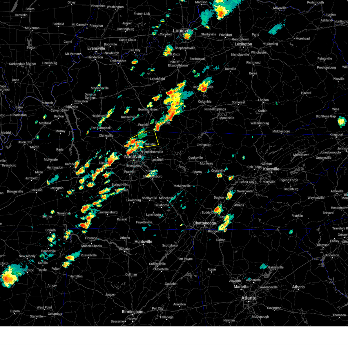 Svrohx the national weather service in nashville has issued a * severe thunderstorm warning for, sumner county in middle tennessee, eastern robertson county in middle tennessee, * until 230 pm cdt. * at 157 pm cdt, a severe thunderstorm was located near white house, or 7 miles east of springfield, moving northeast at 35 mph (radar indicated). Hazards include 60 mph wind gusts and penny size hail. expect damage to roofs, siding, and trees Svrohx the national weather service in nashville has issued a * severe thunderstorm warning for, sumner county in middle tennessee, eastern robertson county in middle tennessee, * until 230 pm cdt. * at 157 pm cdt, a severe thunderstorm was located near white house, or 7 miles east of springfield, moving northeast at 35 mph (radar indicated). Hazards include 60 mph wind gusts and penny size hail. expect damage to roofs, siding, and trees
|
| 8/17/2024 9:56 PM CDT |
 the severe thunderstorm warning has been cancelled and is no longer in effect the severe thunderstorm warning has been cancelled and is no longer in effect
|
| 8/17/2024 9:56 PM CDT |
 At 956 pm cdt, a severe thunderstorm was located near ridgetop, or 11 miles southeast of springfield, moving southeast at 25 mph (radar indicated). Hazards include 60 mph wind gusts and penny size hail. Expect damage to roofs, siding, and trees. locations impacted include, gallatin, madison, hendersonville, goodlettsville, millersville, lakewood, ridgetop, and old hickory. this includes the following highways, interstate 65 between mile markers 91 and 103. Interstate 24 between mile markers 37 and 39. At 956 pm cdt, a severe thunderstorm was located near ridgetop, or 11 miles southeast of springfield, moving southeast at 25 mph (radar indicated). Hazards include 60 mph wind gusts and penny size hail. Expect damage to roofs, siding, and trees. locations impacted include, gallatin, madison, hendersonville, goodlettsville, millersville, lakewood, ridgetop, and old hickory. this includes the following highways, interstate 65 between mile markers 91 and 103. Interstate 24 between mile markers 37 and 39.
|
| 8/17/2024 9:49 PM CDT |
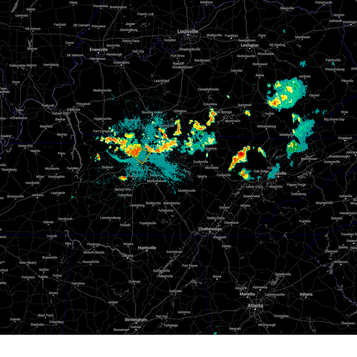 Svrohx the national weather service in nashville has issued a * severe thunderstorm warning for, northeastern davidson county in middle tennessee, southwestern sumner county in middle tennessee, south central robertson county in middle tennessee, * until 1015 pm cdt. * at 949 pm cdt, a severe thunderstorm was located over ridgetop, or 8 miles south of springfield, moving southeast at 25 mph (radar indicated). Hazards include 60 mph wind gusts and penny size hail. expect damage to roofs, siding, and trees Svrohx the national weather service in nashville has issued a * severe thunderstorm warning for, northeastern davidson county in middle tennessee, southwestern sumner county in middle tennessee, south central robertson county in middle tennessee, * until 1015 pm cdt. * at 949 pm cdt, a severe thunderstorm was located over ridgetop, or 8 miles south of springfield, moving southeast at 25 mph (radar indicated). Hazards include 60 mph wind gusts and penny size hail. expect damage to roofs, siding, and trees
|
| 8/1/2024 8:50 PM CDT | Tspotter report and photo of large tree snapped on saint blaise r in sumner county TN, 2.4 miles E of Gallatin, TN |
| 8/1/2024 8:46 PM CDT |
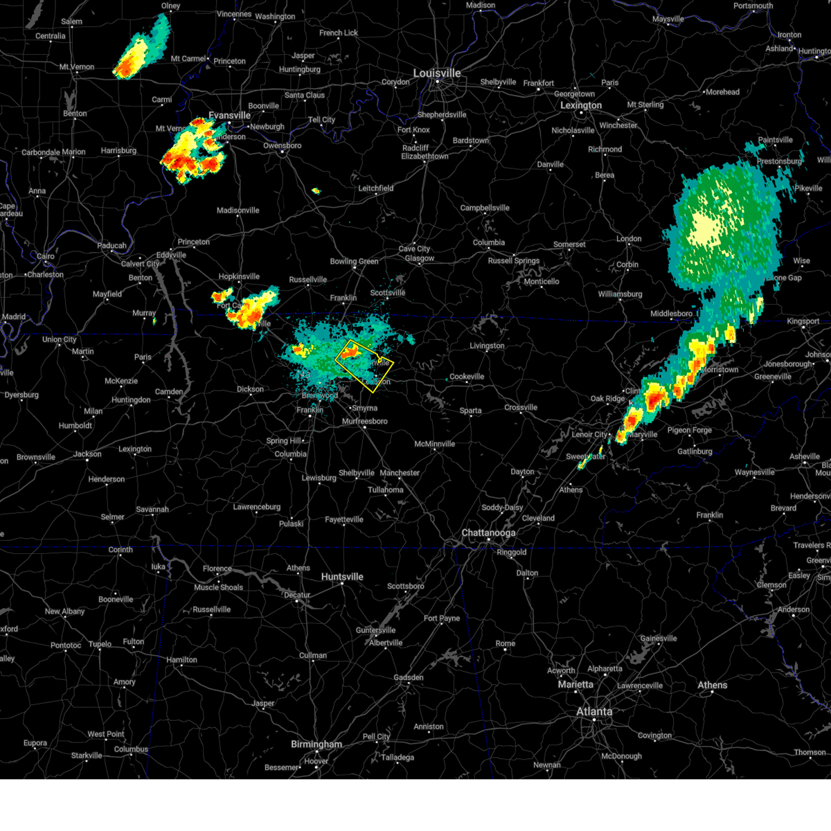 Svrohx the national weather service in nashville has issued a * severe thunderstorm warning for, southern sumner county in middle tennessee, northwestern wilson county in middle tennessee, * until 930 pm cdt. * at 846 pm cdt, a severe thunderstorm was located near gallatin, moving southeast at 25 mph (radar indicated). Hazards include 60 mph wind gusts. expect damage to roofs, siding, and trees Svrohx the national weather service in nashville has issued a * severe thunderstorm warning for, southern sumner county in middle tennessee, northwestern wilson county in middle tennessee, * until 930 pm cdt. * at 846 pm cdt, a severe thunderstorm was located near gallatin, moving southeast at 25 mph (radar indicated). Hazards include 60 mph wind gusts. expect damage to roofs, siding, and trees
|
| 7/30/2024 7:39 PM CDT |
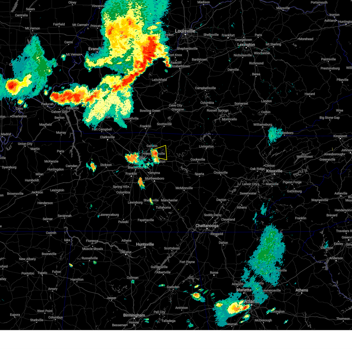 At 739 pm cdt, a severe thunderstorm was located 7 miles north of lebanon, moving east at 25 mph (radar indicated). Hazards include 60 mph wind gusts. Expect damage to roofs, siding, and trees. Locations impacted include, gallatin, lebanon, hartsville, bledsoe creek state park, and dickerson chapel recreation area. At 739 pm cdt, a severe thunderstorm was located 7 miles north of lebanon, moving east at 25 mph (radar indicated). Hazards include 60 mph wind gusts. Expect damage to roofs, siding, and trees. Locations impacted include, gallatin, lebanon, hartsville, bledsoe creek state park, and dickerson chapel recreation area.
|
| 7/30/2024 7:27 PM CDT |
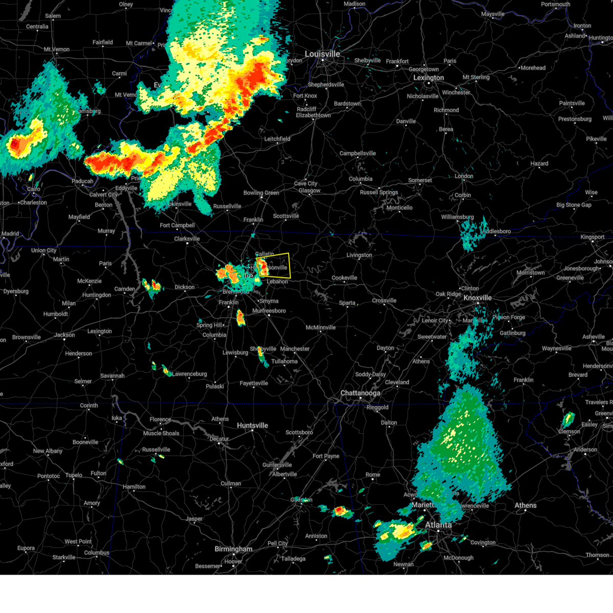 Svrohx the national weather service in nashville has issued a * severe thunderstorm warning for, southeastern sumner county in middle tennessee, northern wilson county in middle tennessee, southwestern trousdale county in middle tennessee, * until 800 pm cdt. * at 727 pm cdt, a severe thunderstorm was located near gallatin, moving east at 15 mph (radar indicated). Hazards include 60 mph wind gusts and penny size hail. expect damage to roofs, siding, and trees Svrohx the national weather service in nashville has issued a * severe thunderstorm warning for, southeastern sumner county in middle tennessee, northern wilson county in middle tennessee, southwestern trousdale county in middle tennessee, * until 800 pm cdt. * at 727 pm cdt, a severe thunderstorm was located near gallatin, moving east at 15 mph (radar indicated). Hazards include 60 mph wind gusts and penny size hail. expect damage to roofs, siding, and trees
|
| 7/30/2024 6:57 PM CDT | Svrohx the national weather service in nashville has issued a * severe thunderstorm warning for, northern davidson county in middle tennessee, southwestern sumner county in middle tennessee, south central robertson county in middle tennessee, * until 730 pm cdt. * at 656 pm cdt, a severe thunderstorms were located over joelton, or 9 miles northwest of nashville, moving southeast at 5 mph. another severe thunderstorm was located over goodlettsville, moving southeast at 5 mph (radar indicated). Hazards include 60 mph wind gusts and quarter size hail. Hail damage to vehicles is expected. Expect wind damage to roofs, siding, and trees. |
| 7/30/2024 3:11 PM CDT | Large tree limb dow in sumner county TN, 7.4 miles SSW of Gallatin, TN |
| 7/30/2024 3:02 PM CDT |
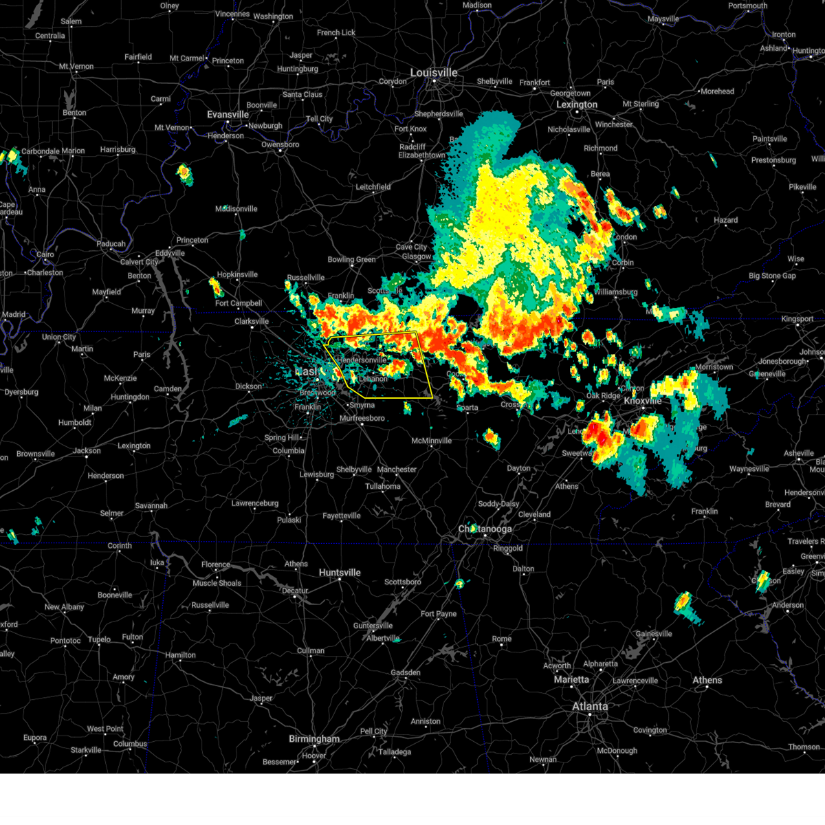 Svrohx the national weather service in nashville has issued a * severe thunderstorm warning for, smith county in middle tennessee, northwestern de kalb county in middle tennessee, southern sumner county in middle tennessee, wilson county in middle tennessee, southwestern macon county in middle tennessee, trousdale county in middle tennessee, * until 400 pm cdt. * at 302 pm cdt, severe thunderstorms were located along a line extending from red boiling springs to near white house, moving southeast at 30 mph (radar indicated). Hazards include 60 mph wind gusts and quarter size hail. Hail damage to vehicles is expected. Expect wind damage to roofs, siding, and trees. Svrohx the national weather service in nashville has issued a * severe thunderstorm warning for, smith county in middle tennessee, northwestern de kalb county in middle tennessee, southern sumner county in middle tennessee, wilson county in middle tennessee, southwestern macon county in middle tennessee, trousdale county in middle tennessee, * until 400 pm cdt. * at 302 pm cdt, severe thunderstorms were located along a line extending from red boiling springs to near white house, moving southeast at 30 mph (radar indicated). Hazards include 60 mph wind gusts and quarter size hail. Hail damage to vehicles is expected. Expect wind damage to roofs, siding, and trees.
|
| 7/30/2024 2:41 PM CDT |
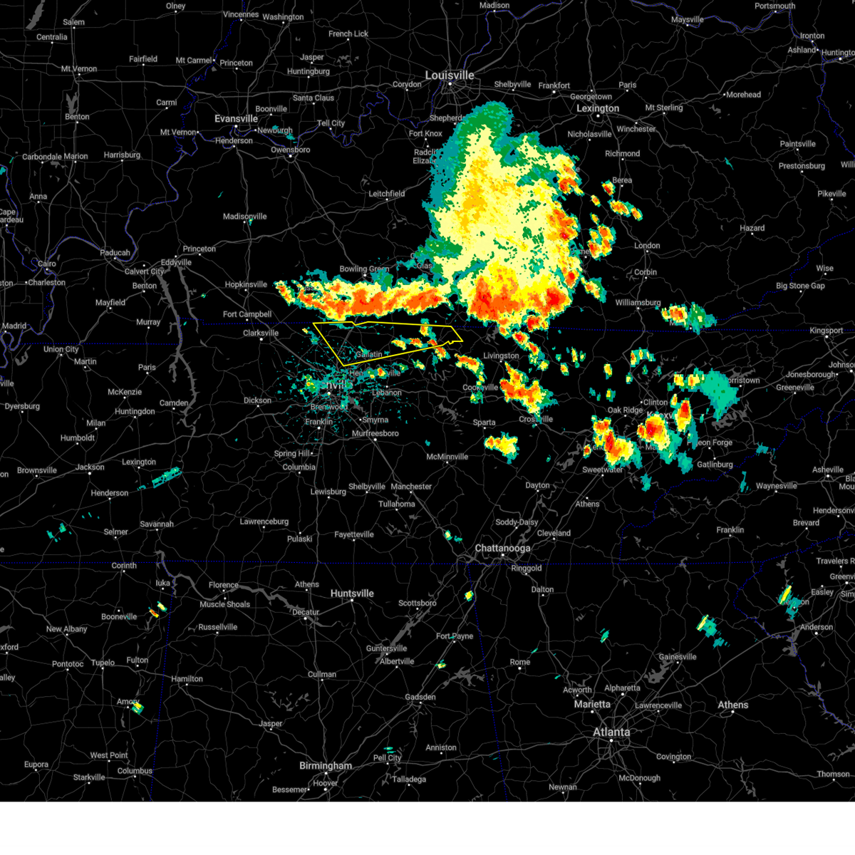 Svrohx the national weather service in nashville has issued a * severe thunderstorm warning for, sumner county in middle tennessee, northwestern clay county in middle tennessee, macon county in middle tennessee, northwestern trousdale county in middle tennessee, eastern robertson county in middle tennessee, * until 315 pm cdt. * at 241 pm cdt, severe thunderstorms were located along a line extending from 10 miles northwest of cross plains to 12 miles northwest of red boiling springs, moving southeast at 35 mph (radar indicated). Hazards include 60 mph wind gusts. expect damage to roofs, siding, and trees Svrohx the national weather service in nashville has issued a * severe thunderstorm warning for, sumner county in middle tennessee, northwestern clay county in middle tennessee, macon county in middle tennessee, northwestern trousdale county in middle tennessee, eastern robertson county in middle tennessee, * until 315 pm cdt. * at 241 pm cdt, severe thunderstorms were located along a line extending from 10 miles northwest of cross plains to 12 miles northwest of red boiling springs, moving southeast at 35 mph (radar indicated). Hazards include 60 mph wind gusts. expect damage to roofs, siding, and trees
|
| 7/4/2024 5:59 PM CDT |
 Svrohx the national weather service in nashville has issued a * severe thunderstorm warning for, western sumner county in middle tennessee, central robertson county in middle tennessee, * until 630 pm cdt. * at 559 pm cdt, a severe thunderstorm was located near springfield, moving east at 30 mph (radar indicated). Hazards include 60 mph wind gusts. expect damage to roofs, siding, and trees Svrohx the national weather service in nashville has issued a * severe thunderstorm warning for, western sumner county in middle tennessee, central robertson county in middle tennessee, * until 630 pm cdt. * at 559 pm cdt, a severe thunderstorm was located near springfield, moving east at 30 mph (radar indicated). Hazards include 60 mph wind gusts. expect damage to roofs, siding, and trees
|
| 6/26/2024 5:53 PM CDT |
 the severe thunderstorm warning has been cancelled and is no longer in effect the severe thunderstorm warning has been cancelled and is no longer in effect
|
| 6/26/2024 5:53 PM CDT |
 At 552 pm cdt, severe thunderstorms were located along a line extending from near portland to near hartsville, moving northeast at 30 mph (radar indicated). Hazards include 60 mph wind gusts. Expect damage to roofs, siding, and trees. locations impacted include, lafayette, hartsville, westmoreland, cross plains, portland, orlinda, mitchellville, bethpage, and oak grove. This includes interstate 65 between mile markers 113 and 120. At 552 pm cdt, severe thunderstorms were located along a line extending from near portland to near hartsville, moving northeast at 30 mph (radar indicated). Hazards include 60 mph wind gusts. Expect damage to roofs, siding, and trees. locations impacted include, lafayette, hartsville, westmoreland, cross plains, portland, orlinda, mitchellville, bethpage, and oak grove. This includes interstate 65 between mile markers 113 and 120.
|
| 6/26/2024 5:28 PM CDT |
 Svrohx the national weather service in nashville has issued a * severe thunderstorm warning for, sumner county in middle tennessee, northwestern wilson county in middle tennessee, macon county in middle tennessee, trousdale county in middle tennessee, northeastern robertson county in middle tennessee, * until 630 pm cdt. * at 527 pm cdt, severe thunderstorms were located along a line extending from cross plains to near lebanon, moving northeast at 35 mph. these storms have blown down trees and power lines across the nashville metro area (public). Hazards include 60 mph wind gusts. expect damage to roofs, siding, and trees Svrohx the national weather service in nashville has issued a * severe thunderstorm warning for, sumner county in middle tennessee, northwestern wilson county in middle tennessee, macon county in middle tennessee, trousdale county in middle tennessee, northeastern robertson county in middle tennessee, * until 630 pm cdt. * at 527 pm cdt, severe thunderstorms were located along a line extending from cross plains to near lebanon, moving northeast at 35 mph. these storms have blown down trees and power lines across the nashville metro area (public). Hazards include 60 mph wind gusts. expect damage to roofs, siding, and trees
|
| 6/26/2024 5:13 PM CDT |
 At 512 pm cdt, severe thunderstorms were located along a line extending from millersville to rural hill, moving northeast at 35 mph (radar indicated). Hazards include 60 mph wind gusts. Expect damage to roofs, siding, and trees. locations impacted include, gallatin, lebanon, madison, hendersonville, smyrna, la vergne, mount juliet, goodlettsville, white house, millersville, greenbrier, lakewood, ridgetop, cross plains, hermitage, rural hill, belinda city, old hickory, orlinda, and green hill. this includes the following highways, interstate 40 between mile markers 219 and 242. interstate 65 between mile markers 92 and 118. Interstate 840 between mile markers 64 and 76. At 512 pm cdt, severe thunderstorms were located along a line extending from millersville to rural hill, moving northeast at 35 mph (radar indicated). Hazards include 60 mph wind gusts. Expect damage to roofs, siding, and trees. locations impacted include, gallatin, lebanon, madison, hendersonville, smyrna, la vergne, mount juliet, goodlettsville, white house, millersville, greenbrier, lakewood, ridgetop, cross plains, hermitage, rural hill, belinda city, old hickory, orlinda, and green hill. this includes the following highways, interstate 40 between mile markers 219 and 242. interstate 65 between mile markers 92 and 118. Interstate 840 between mile markers 64 and 76.
|
| 6/26/2024 4:56 PM CDT |
 Svrohx the national weather service in nashville has issued a * severe thunderstorm warning for, eastern davidson county in middle tennessee, northwestern rutherford county in middle tennessee, western sumner county in middle tennessee, western wilson county in middle tennessee, eastern robertson county in middle tennessee, * until 530 pm cdt. * at 456 pm cdt, severe thunderstorms were located along a line extending from near joelton to la vergne, moving northeast at 35 mph (radar indicated). Hazards include 60 mph wind gusts. expect damage to roofs, siding, and trees Svrohx the national weather service in nashville has issued a * severe thunderstorm warning for, eastern davidson county in middle tennessee, northwestern rutherford county in middle tennessee, western sumner county in middle tennessee, western wilson county in middle tennessee, eastern robertson county in middle tennessee, * until 530 pm cdt. * at 456 pm cdt, severe thunderstorms were located along a line extending from near joelton to la vergne, moving northeast at 35 mph (radar indicated). Hazards include 60 mph wind gusts. expect damage to roofs, siding, and trees
|
| 6/16/2024 8:51 PM CDT |
 The storm which prompted the warning has weakened below severe limits, and no longer poses an immediate threat to life or property. therefore, the warning will be allowed to expire. however, gusty winds are still possible with this thunderstorm. The storm which prompted the warning has weakened below severe limits, and no longer poses an immediate threat to life or property. therefore, the warning will be allowed to expire. however, gusty winds are still possible with this thunderstorm.
|
| 6/16/2024 8:44 PM CDT |
 At 843 pm cdt, a severe thunderstorm was located over hendersonville, or 11 miles southwest of gallatin, moving north at 25 mph (radar indicated). Hazards include 60 mph wind gusts. Expect damage to roofs, siding, and trees. locations impacted include, gallatin, madison, hendersonville, mount juliet, goodlettsville, millersville, lakewood, old hickory, and green hill. This includes interstate 65 between mile markers 90 and 100. At 843 pm cdt, a severe thunderstorm was located over hendersonville, or 11 miles southwest of gallatin, moving north at 25 mph (radar indicated). Hazards include 60 mph wind gusts. Expect damage to roofs, siding, and trees. locations impacted include, gallatin, madison, hendersonville, mount juliet, goodlettsville, millersville, lakewood, old hickory, and green hill. This includes interstate 65 between mile markers 90 and 100.
|
| 6/16/2024 8:34 PM CDT |
 Svrohx the national weather service in nashville has issued a * severe thunderstorm warning for, northeastern davidson county in middle tennessee, southwestern sumner county in middle tennessee, northwestern wilson county in middle tennessee, * until 900 pm cdt. * at 833 pm cdt, a severe thunderstorm was located over old hickory, or 10 miles northeast of nashville, moving north at 30 mph (radar indicated). Hazards include 60 mph wind gusts. expect damage to roofs, siding, and trees Svrohx the national weather service in nashville has issued a * severe thunderstorm warning for, northeastern davidson county in middle tennessee, southwestern sumner county in middle tennessee, northwestern wilson county in middle tennessee, * until 900 pm cdt. * at 833 pm cdt, a severe thunderstorm was located over old hickory, or 10 miles northeast of nashville, moving north at 30 mph (radar indicated). Hazards include 60 mph wind gusts. expect damage to roofs, siding, and trees
|
| 5/26/2024 2:33 PM CDT |
 At 233 pm cdt, severe thunderstorms were located along a line extending from near westmoreland to near fairview, moving east at 50 mph (radar indicated). Hazards include 60 mph wind gusts and nickel size hail. Expect damage to roofs, siding, and trees. locations impacted include, murfreesboro, franklin, gallatin, lebanon, lafayette, hartsville, nashville, madison, hendersonville, smyrna, brentwood, la vergne, mount juliet, goodlettsville, nolensville, forest hills, oak hill, belle meade, kingston springs, and lakewood. this includes the following highways, interstate 40 between mile markers 182 and 243. interstate 65 between mile markers 67 and 95. interstate 24 between mile markers 41 and 71. Interstate 840 between mile markers 56 and 76. At 233 pm cdt, severe thunderstorms were located along a line extending from near westmoreland to near fairview, moving east at 50 mph (radar indicated). Hazards include 60 mph wind gusts and nickel size hail. Expect damage to roofs, siding, and trees. locations impacted include, murfreesboro, franklin, gallatin, lebanon, lafayette, hartsville, nashville, madison, hendersonville, smyrna, brentwood, la vergne, mount juliet, goodlettsville, nolensville, forest hills, oak hill, belle meade, kingston springs, and lakewood. this includes the following highways, interstate 40 between mile markers 182 and 243. interstate 65 between mile markers 67 and 95. interstate 24 between mile markers 41 and 71. Interstate 840 between mile markers 56 and 76.
|
| 5/26/2024 2:18 PM CDT |
 At 218 pm cdt, severe thunderstorms were located along a line extending from 7 miles southwest of westmoreland to near burns, moving east at 50 mph (radar indicated). Hazards include 60 mph wind gusts and nickel size hail. Expect damage to roofs, siding, and trees. locations impacted include, murfreesboro, franklin, gallatin, lebanon, ashland city, lafayette, hartsville, nashville, madison, hendersonville, smyrna, brentwood, la vergne, mount juliet, goodlettsville, millersville, nolensville, forest hills, oak hill, and belle meade. this includes the following highways, interstate 40 between mile markers 182 and 243. interstate 65 between mile markers 67 and 101. interstate 24 between mile markers 33 and 71. Interstate 840 between mile markers 56 and 76. At 218 pm cdt, severe thunderstorms were located along a line extending from 7 miles southwest of westmoreland to near burns, moving east at 50 mph (radar indicated). Hazards include 60 mph wind gusts and nickel size hail. Expect damage to roofs, siding, and trees. locations impacted include, murfreesboro, franklin, gallatin, lebanon, ashland city, lafayette, hartsville, nashville, madison, hendersonville, smyrna, brentwood, la vergne, mount juliet, goodlettsville, millersville, nolensville, forest hills, oak hill, and belle meade. this includes the following highways, interstate 40 between mile markers 182 and 243. interstate 65 between mile markers 67 and 101. interstate 24 between mile markers 33 and 71. Interstate 840 between mile markers 56 and 76.
|
| 5/26/2024 2:18 PM CDT |
 the severe thunderstorm warning has been cancelled and is no longer in effect the severe thunderstorm warning has been cancelled and is no longer in effect
|
| 5/26/2024 1:53 PM CDT |
 Svrohx the national weather service in nashville has issued a * severe thunderstorm warning for, davidson county in middle tennessee, northwestern rutherford county in middle tennessee, sumner county in middle tennessee, northern williamson county in middle tennessee, wilson county in middle tennessee, cheatham county in middle tennessee, western macon county in middle tennessee, trousdale county in middle tennessee, robertson county in middle tennessee, * until 300 pm cdt. * at 153 pm cdt, severe thunderstorms were located along a line extending from near springfield to 6 miles west of dickson, moving east at 50 mph (radar indicated). Hazards include 60 mph wind gusts and nickel size hail. expect damage to roofs, siding, and trees Svrohx the national weather service in nashville has issued a * severe thunderstorm warning for, davidson county in middle tennessee, northwestern rutherford county in middle tennessee, sumner county in middle tennessee, northern williamson county in middle tennessee, wilson county in middle tennessee, cheatham county in middle tennessee, western macon county in middle tennessee, trousdale county in middle tennessee, robertson county in middle tennessee, * until 300 pm cdt. * at 153 pm cdt, severe thunderstorms were located along a line extending from near springfield to 6 miles west of dickson, moving east at 50 mph (radar indicated). Hazards include 60 mph wind gusts and nickel size hail. expect damage to roofs, siding, and trees
|
| 5/26/2024 10:31 AM CDT |
 the severe thunderstorm warning has been cancelled and is no longer in effect the severe thunderstorm warning has been cancelled and is no longer in effect
|
| 5/26/2024 10:31 AM CDT |
 At 1030 am cdt, severe thunderstorms were located along a line extending from 7 miles east of scottsville to near westmoreland to 9 miles northeast of gallatin, moving east at 60 mph (radar indicated). Hazards include 60 mph wind gusts and nickel size hail. Expect damage to roofs, siding, and trees. Locations impacted include, lafayette, hartsville, westmoreland, red boiling springs, bethpage, pleasant shade, and bledsoe creek state park. At 1030 am cdt, severe thunderstorms were located along a line extending from 7 miles east of scottsville to near westmoreland to 9 miles northeast of gallatin, moving east at 60 mph (radar indicated). Hazards include 60 mph wind gusts and nickel size hail. Expect damage to roofs, siding, and trees. Locations impacted include, lafayette, hartsville, westmoreland, red boiling springs, bethpage, pleasant shade, and bledsoe creek state park.
|
| 5/26/2024 10:17 AM CDT |
 At 1017 am cdt, severe thunderstorms were located along a line extending from near scottsville to near portland to near greenbrier, moving east at 65 mph (radar indicated). Hazards include 60 mph wind gusts and nickel size hail. Expect damage to roofs, siding, and trees. locations impacted include, gallatin, lebanon, springfield, lafayette, carthage, hartsville, hendersonville, mount juliet, goodlettsville, white house, millersville, greenbrier, coopertown, westmoreland, ridgetop, cross plains, red boiling springs, portland, pleasant view, and south carthage. this includes the following highways, interstate 65 between mile markers 98 and 121. Interstate 24 between mile markers 18 and 28. At 1017 am cdt, severe thunderstorms were located along a line extending from near scottsville to near portland to near greenbrier, moving east at 65 mph (radar indicated). Hazards include 60 mph wind gusts and nickel size hail. Expect damage to roofs, siding, and trees. locations impacted include, gallatin, lebanon, springfield, lafayette, carthage, hartsville, hendersonville, mount juliet, goodlettsville, white house, millersville, greenbrier, coopertown, westmoreland, ridgetop, cross plains, red boiling springs, portland, pleasant view, and south carthage. this includes the following highways, interstate 65 between mile markers 98 and 121. Interstate 24 between mile markers 18 and 28.
|
| 5/26/2024 10:17 AM CDT |
 the severe thunderstorm warning has been cancelled and is no longer in effect the severe thunderstorm warning has been cancelled and is no longer in effect
|
| 5/26/2024 10:01 AM CDT |
 At 1000 am cdt, severe thunderstorms were located along a line extending from 12 miles north of portland to near white house to 9 miles southeast of clarksville, moving east at 65 mph (radar indicated). Hazards include 70 mph wind gusts and nickel size hail. Expect considerable tree damage. damage is likely to mobile homes, roofs, and outbuildings. locations impacted include, clarksville, gallatin, lebanon, springfield, ashland city, lafayette, carthage, hartsville, madison, hendersonville, mount juliet, goodlettsville, white house, millersville, greenbrier, coopertown, lakewood, westmoreland, ridgetop, and cross plains. this includes the following highways, interstate 65 between mile markers 92 and 121. Interstate 24 between mile markers 1 and 42. At 1000 am cdt, severe thunderstorms were located along a line extending from 12 miles north of portland to near white house to 9 miles southeast of clarksville, moving east at 65 mph (radar indicated). Hazards include 70 mph wind gusts and nickel size hail. Expect considerable tree damage. damage is likely to mobile homes, roofs, and outbuildings. locations impacted include, clarksville, gallatin, lebanon, springfield, ashland city, lafayette, carthage, hartsville, madison, hendersonville, mount juliet, goodlettsville, white house, millersville, greenbrier, coopertown, lakewood, westmoreland, ridgetop, and cross plains. this includes the following highways, interstate 65 between mile markers 92 and 121. Interstate 24 between mile markers 1 and 42.
|
| 5/26/2024 10:01 AM CDT |
 the severe thunderstorm warning has been cancelled and is no longer in effect the severe thunderstorm warning has been cancelled and is no longer in effect
|
| 5/26/2024 9:51 AM CDT |
 Svrohx the national weather service in nashville has issued a * severe thunderstorm warning for, smith county in middle tennessee, northern davidson county in middle tennessee, northeastern dickson county in middle tennessee, montgomery county in middle tennessee, sumner county in middle tennessee, southeastern stewart county in middle tennessee, northern wilson county in middle tennessee, northeastern houston county in middle tennessee, northern cheatham county in middle tennessee, macon county in middle tennessee, trousdale county in middle tennessee, robertson county in middle tennessee, * until 1045 am cdt. * at 951 am cdt, severe thunderstorms were located along a line extending from 12 miles north of cross plains to near coopertown to 13 miles northeast of erin, moving east at 65 mph (radar indicated). Hazards include 70 mph wind gusts and nickel size hail. Expect considerable tree damage. Damage is likely to mobile homes, roofs, and outbuildings. Svrohx the national weather service in nashville has issued a * severe thunderstorm warning for, smith county in middle tennessee, northern davidson county in middle tennessee, northeastern dickson county in middle tennessee, montgomery county in middle tennessee, sumner county in middle tennessee, southeastern stewart county in middle tennessee, northern wilson county in middle tennessee, northeastern houston county in middle tennessee, northern cheatham county in middle tennessee, macon county in middle tennessee, trousdale county in middle tennessee, robertson county in middle tennessee, * until 1045 am cdt. * at 951 am cdt, severe thunderstorms were located along a line extending from 12 miles north of cross plains to near coopertown to 13 miles northeast of erin, moving east at 65 mph (radar indicated). Hazards include 70 mph wind gusts and nickel size hail. Expect considerable tree damage. Damage is likely to mobile homes, roofs, and outbuildings.
|
| 5/9/2024 1:44 AM CDT |
 the severe thunderstorm warning has been cancelled and is no longer in effect the severe thunderstorm warning has been cancelled and is no longer in effect
|
| 5/9/2024 1:32 AM CDT |
 At 131 am cdt, a severe thunderstorm was located near goodlettsville, or 9 miles north of nashville, moving northeast at 40 mph (radar indicated). Hazards include 60 mph wind gusts and quarter size hail. Hail damage to vehicles is expected. expect wind damage to roofs, siding, and trees. locations impacted include, gallatin, madison, hendersonville, mount juliet, goodlettsville, white house, millersville, greenbrier, lakewood, ridgetop, old hickory, joelton, cottontown, and green hill. this includes the following highways, interstate 65 between mile markers 89 and 105. Interstate 24 between mile markers 33 and 43. At 131 am cdt, a severe thunderstorm was located near goodlettsville, or 9 miles north of nashville, moving northeast at 40 mph (radar indicated). Hazards include 60 mph wind gusts and quarter size hail. Hail damage to vehicles is expected. expect wind damage to roofs, siding, and trees. locations impacted include, gallatin, madison, hendersonville, mount juliet, goodlettsville, white house, millersville, greenbrier, lakewood, ridgetop, old hickory, joelton, cottontown, and green hill. this includes the following highways, interstate 65 between mile markers 89 and 105. Interstate 24 between mile markers 33 and 43.
|
| 5/9/2024 1:21 AM CDT |
 At 121 am cdt, a severe thunderstorm was located near joelton, or 8 miles east of ashland city, moving northeast at 40 mph (radar indicated). Hazards include 60 mph wind gusts and half dollar size hail. Hail damage to vehicles is expected. expect wind damage to roofs, siding, and trees. locations impacted include, gallatin, madison, hendersonville, mount juliet, goodlettsville, white house, millersville, greenbrier, lakewood, ridgetop, old hickory, joelton, whites creek, cottontown, beaman park, and green hill. this includes the following highways, interstate 65 between mile markers 88 and 105. Interstate 24 between mile markers 32 and 44. At 121 am cdt, a severe thunderstorm was located near joelton, or 8 miles east of ashland city, moving northeast at 40 mph (radar indicated). Hazards include 60 mph wind gusts and half dollar size hail. Hail damage to vehicles is expected. expect wind damage to roofs, siding, and trees. locations impacted include, gallatin, madison, hendersonville, mount juliet, goodlettsville, white house, millersville, greenbrier, lakewood, ridgetop, old hickory, joelton, whites creek, cottontown, beaman park, and green hill. this includes the following highways, interstate 65 between mile markers 88 and 105. Interstate 24 between mile markers 32 and 44.
|
| 5/9/2024 1:21 AM CDT |
 the severe thunderstorm warning has been cancelled and is no longer in effect the severe thunderstorm warning has been cancelled and is no longer in effect
|
| 5/9/2024 1:14 AM CDT |
 Svrohx the national weather service in nashville has issued a * severe thunderstorm warning for, northern davidson county in middle tennessee, southwestern sumner county in middle tennessee, northwestern wilson county in middle tennessee, northeastern cheatham county in middle tennessee, southeastern robertson county in middle tennessee, * until 200 am cdt. * at 114 am cdt, a severe thunderstorm was located near ashland city, moving northeast at 40 mph (radar indicated). Hazards include 60 mph wind gusts and quarter size hail. Hail damage to vehicles is expected. Expect wind damage to roofs, siding, and trees. Svrohx the national weather service in nashville has issued a * severe thunderstorm warning for, northern davidson county in middle tennessee, southwestern sumner county in middle tennessee, northwestern wilson county in middle tennessee, northeastern cheatham county in middle tennessee, southeastern robertson county in middle tennessee, * until 200 am cdt. * at 114 am cdt, a severe thunderstorm was located near ashland city, moving northeast at 40 mph (radar indicated). Hazards include 60 mph wind gusts and quarter size hail. Hail damage to vehicles is expected. Expect wind damage to roofs, siding, and trees.
|
| 5/8/2024 6:28 PM CDT |
 the severe thunderstorm warning has been cancelled and is no longer in effect the severe thunderstorm warning has been cancelled and is no longer in effect
|
| 5/8/2024 6:28 PM CDT |
 At 628 pm cdt, a severe thunderstorm was located near lebanon, moving east at 45 mph (radar indicated). Hazards include 60 mph wind gusts and quarter size hail. Hail damage to vehicles is expected. expect wind damage to roofs, siding, and trees. locations impacted include, gallatin, lebanon, hartsville, mount juliet, watertown, tuckers crossroads, dixon springs, bledsoe creek state park, and dickerson chapel recreation area. this includes the following highways, interstate 40 between mile markers 229 and 253. Interstate 840 between mile markers 72 and 76. At 628 pm cdt, a severe thunderstorm was located near lebanon, moving east at 45 mph (radar indicated). Hazards include 60 mph wind gusts and quarter size hail. Hail damage to vehicles is expected. expect wind damage to roofs, siding, and trees. locations impacted include, gallatin, lebanon, hartsville, mount juliet, watertown, tuckers crossroads, dixon springs, bledsoe creek state park, and dickerson chapel recreation area. this includes the following highways, interstate 40 between mile markers 229 and 253. Interstate 840 between mile markers 72 and 76.
|
| 5/8/2024 6:11 PM CDT |
 Svrohx the national weather service in nashville has issued a * severe thunderstorm warning for, western smith county in middle tennessee, east central davidson county in middle tennessee, southern sumner county in middle tennessee, wilson county in middle tennessee, trousdale county in middle tennessee, * until 645 pm cdt. * at 610 pm cdt, a severe thunderstorm was located near hendersonville, or 9 miles southwest of gallatin, moving east at 45 mph (radar indicated). Hazards include 60 mph wind gusts and quarter size hail. Hail damage to vehicles is expected. Expect wind damage to roofs, siding, and trees. Svrohx the national weather service in nashville has issued a * severe thunderstorm warning for, western smith county in middle tennessee, east central davidson county in middle tennessee, southern sumner county in middle tennessee, wilson county in middle tennessee, trousdale county in middle tennessee, * until 645 pm cdt. * at 610 pm cdt, a severe thunderstorm was located near hendersonville, or 9 miles southwest of gallatin, moving east at 45 mph (radar indicated). Hazards include 60 mph wind gusts and quarter size hail. Hail damage to vehicles is expected. Expect wind damage to roofs, siding, and trees.
|
| 5/8/2024 6:03 PM CDT |
 the severe thunderstorm warning has been cancelled and is no longer in effect the severe thunderstorm warning has been cancelled and is no longer in effect
|
| 5/8/2024 6:03 PM CDT |
 At 602 pm cdt, a severe thunderstorm was located near hendersonville, or 9 miles southwest of gallatin, moving east at 50 mph (radar indicated). Hazards include 60 mph wind gusts and quarter size hail. Hail damage to vehicles is expected. expect wind damage to roofs, siding, and trees. locations impacted include, gallatin, nashville, madison, hendersonville, mount juliet, goodlettsville, millersville, lakewood, ridgetop, hermitage, rural hill, old hickory, berry hill, green hill, whites creek, and percy priest lake. this includes the following highways, interstate 40 between mile markers 206 and 225. interstate 65 between mile markers 81 and 103. Interstate 24 between mile markers 36 and 53. At 602 pm cdt, a severe thunderstorm was located near hendersonville, or 9 miles southwest of gallatin, moving east at 50 mph (radar indicated). Hazards include 60 mph wind gusts and quarter size hail. Hail damage to vehicles is expected. expect wind damage to roofs, siding, and trees. locations impacted include, gallatin, nashville, madison, hendersonville, mount juliet, goodlettsville, millersville, lakewood, ridgetop, hermitage, rural hill, old hickory, berry hill, green hill, whites creek, and percy priest lake. this includes the following highways, interstate 40 between mile markers 206 and 225. interstate 65 between mile markers 81 and 103. Interstate 24 between mile markers 36 and 53.
|
| 5/8/2024 6:00 PM CDT |
 At 600 pm cdt, a severe thunderstorm capable of producing a tornado was located near gallatin, moving east at 20 mph (radar indicated rotation). Hazards include tornado and quarter size hail. Flying debris will be dangerous to those caught without shelter. mobile homes will be damaged or destroyed. damage to roofs, windows, and vehicles will occur. tree damage is likely. Locations impacted include, gallatin, hartsville, bledsoe creek state park, dickerson chapel recreation area, and bethpage. At 600 pm cdt, a severe thunderstorm capable of producing a tornado was located near gallatin, moving east at 20 mph (radar indicated rotation). Hazards include tornado and quarter size hail. Flying debris will be dangerous to those caught without shelter. mobile homes will be damaged or destroyed. damage to roofs, windows, and vehicles will occur. tree damage is likely. Locations impacted include, gallatin, hartsville, bledsoe creek state park, dickerson chapel recreation area, and bethpage.
|
| 5/8/2024 5:57 PM CDT |
 Torohx the national weather service in nashville has issued a * tornado warning for, southeastern sumner county in middle tennessee, north central wilson county in middle tennessee, southwestern macon county in middle tennessee, western trousdale county in middle tennessee, * until 630 pm cdt. * at 557 pm cdt, a severe thunderstorm capable of producing a tornado was located near gallatin, moving east at 20 mph (radar indicated rotation). Hazards include tornado and quarter size hail. Flying debris will be dangerous to those caught without shelter. mobile homes will be damaged or destroyed. damage to roofs, windows, and vehicles will occur. tree damage is likely. This tornadic thunderstorm will remain over mainly rural areas of southeastern sumner, north central wilson, southwestern macon and western trousdale counties, including the following locations, dickerson chapel recreation area, bethpage, and bledsoe creek state park. Torohx the national weather service in nashville has issued a * tornado warning for, southeastern sumner county in middle tennessee, north central wilson county in middle tennessee, southwestern macon county in middle tennessee, western trousdale county in middle tennessee, * until 630 pm cdt. * at 557 pm cdt, a severe thunderstorm capable of producing a tornado was located near gallatin, moving east at 20 mph (radar indicated rotation). Hazards include tornado and quarter size hail. Flying debris will be dangerous to those caught without shelter. mobile homes will be damaged or destroyed. damage to roofs, windows, and vehicles will occur. tree damage is likely. This tornadic thunderstorm will remain over mainly rural areas of southeastern sumner, north central wilson, southwestern macon and western trousdale counties, including the following locations, dickerson chapel recreation area, bethpage, and bledsoe creek state park.
|
| 5/8/2024 5:50 PM CDT |
 At 549 pm cdt, a severe thunderstorm was located over madison, or near nashville, moving east at 50 mph (radar indicated). Hazards include 60 mph wind gusts and quarter size hail. Hail damage to vehicles is expected. expect wind damage to roofs, siding, and trees. locations impacted include, gallatin, nashville, madison, hendersonville, mount juliet, goodlettsville, millersville, greenbrier, lakewood, ridgetop, hermitage, rural hill, old hickory, joelton, berry hill, green hill, bells bend, whites creek, beaman park, and percy priest lake. this includes the following highways, interstate 40 between mile markers 202 and 225. interstate 65 between mile markers 81 and 103. Interstate 24 between mile markers 29 and 53. At 549 pm cdt, a severe thunderstorm was located over madison, or near nashville, moving east at 50 mph (radar indicated). Hazards include 60 mph wind gusts and quarter size hail. Hail damage to vehicles is expected. expect wind damage to roofs, siding, and trees. locations impacted include, gallatin, nashville, madison, hendersonville, mount juliet, goodlettsville, millersville, greenbrier, lakewood, ridgetop, hermitage, rural hill, old hickory, joelton, berry hill, green hill, bells bend, whites creek, beaman park, and percy priest lake. this includes the following highways, interstate 40 between mile markers 202 and 225. interstate 65 between mile markers 81 and 103. Interstate 24 between mile markers 29 and 53.
|
| 5/8/2024 5:39 PM CDT |
 Svrohx the national weather service in nashville has issued a * severe thunderstorm warning for, central sumner county in middle tennessee, northeastern wilson county in middle tennessee, southwestern macon county in middle tennessee, trousdale county in middle tennessee, * until 615 pm cdt. * at 538 pm cdt, a severe thunderstorm was located near gallatin, moving east at 35 mph (radar indicated). Hazards include 70 mph wind gusts and quarter size hail. Hail damage to vehicles is expected. expect considerable tree damage. Wind damage is also likely to mobile homes, roofs, and outbuildings. Svrohx the national weather service in nashville has issued a * severe thunderstorm warning for, central sumner county in middle tennessee, northeastern wilson county in middle tennessee, southwestern macon county in middle tennessee, trousdale county in middle tennessee, * until 615 pm cdt. * at 538 pm cdt, a severe thunderstorm was located near gallatin, moving east at 35 mph (radar indicated). Hazards include 70 mph wind gusts and quarter size hail. Hail damage to vehicles is expected. expect considerable tree damage. Wind damage is also likely to mobile homes, roofs, and outbuildings.
|
| 5/8/2024 5:35 PM CDT |
 the tornado warning has been cancelled and is no longer in effect the tornado warning has been cancelled and is no longer in effect
|
| 5/8/2024 5:33 PM CDT |
 Svrohx the national weather service in nashville has issued a * severe thunderstorm warning for, davidson county in middle tennessee, southwestern sumner county in middle tennessee, west central wilson county in middle tennessee, northeastern cheatham county in middle tennessee, south central robertson county in middle tennessee, * until 615 pm cdt. * at 533 pm cdt, a severe thunderstorm was located near ashland city, moving east at 50 mph (radar indicated). Hazards include ping pong ball size hail and 60 mph wind gusts. People and animals outdoors will be injured. expect hail damage to roofs, siding, windows, and vehicles. Expect wind damage to roofs, siding, and trees. Svrohx the national weather service in nashville has issued a * severe thunderstorm warning for, davidson county in middle tennessee, southwestern sumner county in middle tennessee, west central wilson county in middle tennessee, northeastern cheatham county in middle tennessee, south central robertson county in middle tennessee, * until 615 pm cdt. * at 533 pm cdt, a severe thunderstorm was located near ashland city, moving east at 50 mph (radar indicated). Hazards include ping pong ball size hail and 60 mph wind gusts. People and animals outdoors will be injured. expect hail damage to roofs, siding, windows, and vehicles. Expect wind damage to roofs, siding, and trees.
|
| 5/8/2024 5:23 PM CDT |
 Svrohx the national weather service in nashville has issued a * severe thunderstorm warning for, southwestern sumner county in middle tennessee, southeastern robertson county in middle tennessee, * until 600 pm cdt. * at 522 pm cdt, a severe thunderstorm was located over white house, or 12 miles east of springfield, moving east at 15 mph (radar indicated). Hazards include 70 mph wind gusts and quarter size hail. Hail damage to vehicles is expected. expect considerable tree damage. Wind damage is also likely to mobile homes, roofs, and outbuildings. Svrohx the national weather service in nashville has issued a * severe thunderstorm warning for, southwestern sumner county in middle tennessee, southeastern robertson county in middle tennessee, * until 600 pm cdt. * at 522 pm cdt, a severe thunderstorm was located over white house, or 12 miles east of springfield, moving east at 15 mph (radar indicated). Hazards include 70 mph wind gusts and quarter size hail. Hail damage to vehicles is expected. expect considerable tree damage. Wind damage is also likely to mobile homes, roofs, and outbuildings.
|
| 5/8/2024 5:23 PM CDT |
 Torohx the national weather service in nashville has issued a * tornado warning for, northeastern davidson county in middle tennessee, southwestern sumner county in middle tennessee, southeastern robertson county in middle tennessee, * until 600 pm cdt. * at 522 pm cdt, a severe thunderstorm capable of producing a tornado was located near greenbrier, or 7 miles south of springfield, moving east at 30 mph (radar indicated rotation). Hazards include tornado and quarter size hail. Flying debris will be dangerous to those caught without shelter. mobile homes will be damaged or destroyed. damage to roofs, windows, and vehicles will occur. Tree damage is likely. Torohx the national weather service in nashville has issued a * tornado warning for, northeastern davidson county in middle tennessee, southwestern sumner county in middle tennessee, southeastern robertson county in middle tennessee, * until 600 pm cdt. * at 522 pm cdt, a severe thunderstorm capable of producing a tornado was located near greenbrier, or 7 miles south of springfield, moving east at 30 mph (radar indicated rotation). Hazards include tornado and quarter size hail. Flying debris will be dangerous to those caught without shelter. mobile homes will be damaged or destroyed. damage to roofs, windows, and vehicles will occur. Tree damage is likely.
|
| 4/2/2024 6:07 PM CDT |
 Svrohx the national weather service in nashville has issued a * severe thunderstorm warning for, north central davidson county in middle tennessee, northwestern sumner county in middle tennessee, northeastern cheatham county in middle tennessee, robertson county in middle tennessee, * until 645 pm cdt. * at 607 pm cdt, a severe thunderstorm was located over coopertown, or near springfield, moving east at 50 mph (radar indicated). Hazards include 60 mph wind gusts and penny size hail. expect damage to roofs, siding, and trees Svrohx the national weather service in nashville has issued a * severe thunderstorm warning for, north central davidson county in middle tennessee, northwestern sumner county in middle tennessee, northeastern cheatham county in middle tennessee, robertson county in middle tennessee, * until 645 pm cdt. * at 607 pm cdt, a severe thunderstorm was located over coopertown, or near springfield, moving east at 50 mph (radar indicated). Hazards include 60 mph wind gusts and penny size hail. expect damage to roofs, siding, and trees
|
| 12/9/2023 5:22 PM CST |
 At 521 pm cst, a large and extremely dangerous tornado was located 7 miles west of hartsville, moving east at 40 mph. this is a particularly dangerous situation. take cover now! (radar indicated rotation). Hazards include damaging tornado. You are in a life-threatening situation. flying debris may be deadly to those caught without shelter. mobile homes will be destroyed. considerable damage to homes, businesses, and vehicles is likely and complete destruction is possible. the tornado will be near, hartsville around 525 pm cst. Other locations impacted by this tornadic thunderstorm include bethpage and bledsoe creek state park. At 521 pm cst, a large and extremely dangerous tornado was located 7 miles west of hartsville, moving east at 40 mph. this is a particularly dangerous situation. take cover now! (radar indicated rotation). Hazards include damaging tornado. You are in a life-threatening situation. flying debris may be deadly to those caught without shelter. mobile homes will be destroyed. considerable damage to homes, businesses, and vehicles is likely and complete destruction is possible. the tornado will be near, hartsville around 525 pm cst. Other locations impacted by this tornadic thunderstorm include bethpage and bledsoe creek state park.
|
| 12/9/2023 5:15 PM CST | Awos station kxnx gallatin airpor in sumner county TN, 3.9 miles WSW of Gallatin, TN |
| 12/9/2023 5:12 PM CST |
 At 512 pm cst, a confirmed large and extremely dangerous tornado was located over gallatin, moving east at 40 mph. this is a particularly dangerous situation. take cover now! (radar confirmed tornado). Hazards include damaging tornado. You are in a life-threatening situation. flying debris may be deadly to those caught without shelter. mobile homes will be destroyed. considerable damage to homes, businesses, and vehicles is likely and complete destruction is possible. the tornado will be near, gallatin around 515 pm cst. hartsville around 525 pm cst. Other locations impacted by this tornadic thunderstorm include bethpage and bledsoe creek state park. At 512 pm cst, a confirmed large and extremely dangerous tornado was located over gallatin, moving east at 40 mph. this is a particularly dangerous situation. take cover now! (radar confirmed tornado). Hazards include damaging tornado. You are in a life-threatening situation. flying debris may be deadly to those caught without shelter. mobile homes will be destroyed. considerable damage to homes, businesses, and vehicles is likely and complete destruction is possible. the tornado will be near, gallatin around 515 pm cst. hartsville around 525 pm cst. Other locations impacted by this tornadic thunderstorm include bethpage and bledsoe creek state park.
|
| 12/9/2023 5:07 PM CST |
 At 507 pm cst, a confirmed large and destructive tornado was located over gallatin, moving east at 40 mph. tornado emergency for gallatin. this is a particularly dangerous situation. take cover now! (radar confirmed tornado). Hazards include deadly tornado. You are in a life-threatening situation. flying debris may be deadly to those caught without shelter. mobile homes will be destroyed. considerable damage to homes, businesses, and vehicles is likely and complete destruction is possible. the tornado will be near, gallatin around 510 pm cst. Other locations impacted by this tornadic thunderstorm include bledsoe creek state park and cottontown. At 507 pm cst, a confirmed large and destructive tornado was located over gallatin, moving east at 40 mph. tornado emergency for gallatin. this is a particularly dangerous situation. take cover now! (radar confirmed tornado). Hazards include deadly tornado. You are in a life-threatening situation. flying debris may be deadly to those caught without shelter. mobile homes will be destroyed. considerable damage to homes, businesses, and vehicles is likely and complete destruction is possible. the tornado will be near, gallatin around 510 pm cst. Other locations impacted by this tornadic thunderstorm include bledsoe creek state park and cottontown.
|
| 12/9/2023 5:00 PM CST |
 At 459 pm cst, a confirmed large and destructive tornado was located near hendersonville, or near gallatin, moving east at 40 mph. tornado emergency for gallatin and hendersonville. this is a particularly dangerous situation. take cover now! (radar confirmed tornado). Hazards include deadly tornado. You are in a life-threatening situation. flying debris may be deadly to those caught without shelter. mobile homes will be destroyed. considerable damage to homes, businesses, and vehicles is likely and complete destruction is possible. the tornado will be near, gallatin around 505 pm cst. other locations impacted by this tornadic thunderstorm include bledsoe creek state park, cottontown, and green hill. This includes interstate 65 between mile markers 98 and 102. At 459 pm cst, a confirmed large and destructive tornado was located near hendersonville, or near gallatin, moving east at 40 mph. tornado emergency for gallatin and hendersonville. this is a particularly dangerous situation. take cover now! (radar confirmed tornado). Hazards include deadly tornado. You are in a life-threatening situation. flying debris may be deadly to those caught without shelter. mobile homes will be destroyed. considerable damage to homes, businesses, and vehicles is likely and complete destruction is possible. the tornado will be near, gallatin around 505 pm cst. other locations impacted by this tornadic thunderstorm include bledsoe creek state park, cottontown, and green hill. This includes interstate 65 between mile markers 98 and 102.
|
| 12/9/2023 4:53 PM CST |
 At 452 pm cst, a confirmed large and destructive tornado was located over hendersonville, or 10 miles southwest of gallatin, moving east at 40 mph. tornado emergency for gallatin and hendersonville. this is a particularly dangerous situation. take cover now! (radar confirmed tornado). Hazards include deadly tornado. You are in a life-threatening situation. flying debris may be deadly to those caught without shelter. mobile homes will be destroyed. considerable damage to homes, businesses, and vehicles is likely and complete destruction is possible. the tornado will be near, gallatin and hendersonville around 500 pm cst. other locations impacted by this tornadic thunderstorm include green hill, bledsoe creek state park, and cottontown. This includes interstate 65 between mile markers 91 and 102. At 452 pm cst, a confirmed large and destructive tornado was located over hendersonville, or 10 miles southwest of gallatin, moving east at 40 mph. tornado emergency for gallatin and hendersonville. this is a particularly dangerous situation. take cover now! (radar confirmed tornado). Hazards include deadly tornado. You are in a life-threatening situation. flying debris may be deadly to those caught without shelter. mobile homes will be destroyed. considerable damage to homes, businesses, and vehicles is likely and complete destruction is possible. the tornado will be near, gallatin and hendersonville around 500 pm cst. other locations impacted by this tornadic thunderstorm include green hill, bledsoe creek state park, and cottontown. This includes interstate 65 between mile markers 91 and 102.
|
| 12/9/2023 4:49 PM CST |
 At 448 pm cst, a confirmed large and extremely dangerous tornado was located over old hickory, or 10 miles northeast of nashville, moving east at 40 mph. this is a particularly dangerous situation. take cover now! (radar confirmed tornado). Hazards include damaging tornado. You are in a life-threatening situation. flying debris may be deadly to those caught without shelter. mobile homes will be destroyed. considerable damage to homes, businesses, and vehicles is likely and complete destruction is possible. the tornado will be near, gallatin and hendersonville around 455 pm cst. other locations impacted by this tornadic thunderstorm include green hill, bledsoe creek state park, and cottontown. this includes the following highways, interstate 65 between mile markers 88 and 102. Interstate 24 between mile markers 41 and 44. At 448 pm cst, a confirmed large and extremely dangerous tornado was located over old hickory, or 10 miles northeast of nashville, moving east at 40 mph. this is a particularly dangerous situation. take cover now! (radar confirmed tornado). Hazards include damaging tornado. You are in a life-threatening situation. flying debris may be deadly to those caught without shelter. mobile homes will be destroyed. considerable damage to homes, businesses, and vehicles is likely and complete destruction is possible. the tornado will be near, gallatin and hendersonville around 455 pm cst. other locations impacted by this tornadic thunderstorm include green hill, bledsoe creek state park, and cottontown. this includes the following highways, interstate 65 between mile markers 88 and 102. Interstate 24 between mile markers 41 and 44.
|
| 12/9/2023 4:36 PM CST |
 At 436 pm cst, a confirmed large and extremely dangerous tornado was located near joelton, or near nashville, moving east at 40 mph. this is a particularly dangerous situation. take cover now! (radar confirmed tornado). Hazards include damaging tornado. You are in a life-threatening situation. flying debris may be deadly to those caught without shelter. mobile homes will be destroyed. considerable damage to homes, businesses, and vehicles is likely and complete destruction is possible. the tornado will be near, madison and goodlettsville around 440 pm cst. hendersonville and old hickory around 445 pm cst. lakewood around 450 pm cst. gallatin around 455 pm cst. other locations impacted by this tornadic thunderstorm include green hill, bledsoe creek state park, cottontown, and whites creek. this includes the following highways, interstate 40 between mile markers 203 and 209. interstate 65 between mile markers 85 and 102. Interstate 24 between mile markers 32 and 49. At 436 pm cst, a confirmed large and extremely dangerous tornado was located near joelton, or near nashville, moving east at 40 mph. this is a particularly dangerous situation. take cover now! (radar confirmed tornado). Hazards include damaging tornado. You are in a life-threatening situation. flying debris may be deadly to those caught without shelter. mobile homes will be destroyed. considerable damage to homes, businesses, and vehicles is likely and complete destruction is possible. the tornado will be near, madison and goodlettsville around 440 pm cst. hendersonville and old hickory around 445 pm cst. lakewood around 450 pm cst. gallatin around 455 pm cst. other locations impacted by this tornadic thunderstorm include green hill, bledsoe creek state park, cottontown, and whites creek. this includes the following highways, interstate 40 between mile markers 203 and 209. interstate 65 between mile markers 85 and 102. Interstate 24 between mile markers 32 and 49.
|
| 8/13/2023 3:27 PM CDT |
 At 326 pm cdt, severe thunderstorms were located along a line extending from near greenbrier to near brentwood, moving east at 40 mph (radar indicated). Hazards include 60 mph wind gusts. Expect damage to roofs, siding, and trees. locations impacted include, murfreesboro, franklin, gallatin, lebanon, springfield, nashville, madison, hendersonville, smyrna, brentwood, la vergne, mount juliet, goodlettsville, white house, millersville, greenbrier, nolensville, forest hills, oak hill and coopertown. this includes the following highways, interstate 40 between mile markers 192 and 232. interstate 65 between mile markers 63 and 109. interstate 24 near mile marker 28, and between mile markers 32 and 74. interstate 840 between mile markers 53 and 72. hail threat, radar indicated max hail size, <. 75 in wind threat, radar indicated max wind gust, 60 mph. At 326 pm cdt, severe thunderstorms were located along a line extending from near greenbrier to near brentwood, moving east at 40 mph (radar indicated). Hazards include 60 mph wind gusts. Expect damage to roofs, siding, and trees. locations impacted include, murfreesboro, franklin, gallatin, lebanon, springfield, nashville, madison, hendersonville, smyrna, brentwood, la vergne, mount juliet, goodlettsville, white house, millersville, greenbrier, nolensville, forest hills, oak hill and coopertown. this includes the following highways, interstate 40 between mile markers 192 and 232. interstate 65 between mile markers 63 and 109. interstate 24 near mile marker 28, and between mile markers 32 and 74. interstate 840 between mile markers 53 and 72. hail threat, radar indicated max hail size, <. 75 in wind threat, radar indicated max wind gust, 60 mph.
|
| 8/13/2023 3:13 PM CDT |
 At 312 pm cdt, severe thunderstorms were located along a line extending from 6 miles southwest of coopertown to 8 miles west of franklin, moving east at 40 mph (radar indicated). Hazards include 60 mph wind gusts. Expect damage to roofs, siding, and trees. locations impacted include, murfreesboro, franklin, gallatin, lebanon, springfield, ashland city, nashville, madison, hendersonville, smyrna, brentwood, la vergne, mount juliet, goodlettsville, white house, millersville, greenbrier, nolensville, forest hills and oak hill. this includes the following highways, interstate 40 between mile markers 182 and 232. interstate 65 between mile markers 63 and 109. interstate 24 between mile markers 22 and 74. interstate 840 between mile markers 7 and 16, and between mile markers 53 and 72. hail threat, radar indicated max hail size, <. 75 in wind threat, radar indicated max wind gust, 60 mph. At 312 pm cdt, severe thunderstorms were located along a line extending from 6 miles southwest of coopertown to 8 miles west of franklin, moving east at 40 mph (radar indicated). Hazards include 60 mph wind gusts. Expect damage to roofs, siding, and trees. locations impacted include, murfreesboro, franklin, gallatin, lebanon, springfield, ashland city, nashville, madison, hendersonville, smyrna, brentwood, la vergne, mount juliet, goodlettsville, white house, millersville, greenbrier, nolensville, forest hills and oak hill. this includes the following highways, interstate 40 between mile markers 182 and 232. interstate 65 between mile markers 63 and 109. interstate 24 between mile markers 22 and 74. interstate 840 between mile markers 7 and 16, and between mile markers 53 and 72. hail threat, radar indicated max hail size, <. 75 in wind threat, radar indicated max wind gust, 60 mph.
|
| 8/13/2023 2:57 PM CDT |
 At 257 pm cdt, severe thunderstorms were located along a line extending from 10 miles northwest of ashland city to near fairview, moving east at 40 mph (radar indicated). Hazards include 60 mph wind gusts. expect damage to roofs, siding, and trees At 257 pm cdt, severe thunderstorms were located along a line extending from 10 miles northwest of ashland city to near fairview, moving east at 40 mph (radar indicated). Hazards include 60 mph wind gusts. expect damage to roofs, siding, and trees
|
| 8/12/2023 11:49 AM CDT |
 At 1148 am cdt, severe thunderstorms were located along a line extending from gallatin to near franklin, moving east at 30 mph (radar indicated). Hazards include 60 mph wind gusts. expect damage to roofs, siding, and trees At 1148 am cdt, severe thunderstorms were located along a line extending from gallatin to near franklin, moving east at 30 mph (radar indicated). Hazards include 60 mph wind gusts. expect damage to roofs, siding, and trees
|
| 8/12/2023 11:37 AM CDT |
 At 1136 am cdt, severe thunderstorms were located along a line extending from 6 miles northwest of gallatin to near hermitage, moving east at 35 mph (radar indicated). Hazards include 60 mph wind gusts. Expect damage to roofs, siding, and trees. locations impacted include, gallatin, lebanon, nashville, madison, hendersonville, mount juliet, goodlettsville, white house, millersville, lakewood, hermitage, rural hill, belinda city, old hickory, green hill, whites creek, cottontown and percy priest lake. this includes the following highways, interstate 40 between mile markers 207 and 208, and between mile markers 215 and 230. interstate 65 between mile markers 85 and 101. interstate 24 between mile markers 39 and 49. hail threat, radar indicated max hail size, <. 75 in wind threat, radar indicated max wind gust, 60 mph. At 1136 am cdt, severe thunderstorms were located along a line extending from 6 miles northwest of gallatin to near hermitage, moving east at 35 mph (radar indicated). Hazards include 60 mph wind gusts. Expect damage to roofs, siding, and trees. locations impacted include, gallatin, lebanon, nashville, madison, hendersonville, mount juliet, goodlettsville, white house, millersville, lakewood, hermitage, rural hill, belinda city, old hickory, green hill, whites creek, cottontown and percy priest lake. this includes the following highways, interstate 40 between mile markers 207 and 208, and between mile markers 215 and 230. interstate 65 between mile markers 85 and 101. interstate 24 between mile markers 39 and 49. hail threat, radar indicated max hail size, <. 75 in wind threat, radar indicated max wind gust, 60 mph.
|
| 8/12/2023 11:19 AM CDT |
 At 1118 am cdt, severe thunderstorms were located along a line extending from near greenbrier to near joelton, moving east at 35 mph (radar indicated). Hazards include 60 mph wind gusts. Expect damage to roofs, siding, and trees. locations impacted include, gallatin, lebanon, springfield, nashville, madison, hendersonville, mount juliet, goodlettsville, white house, millersville, greenbrier, lakewood, ridgetop, hermitage, rural hill, belinda city, old hickory, joelton, green hill and whites creek. this includes the following highways, interstate 40 between mile markers 207 and 208, and between mile markers 215 and 230. interstate 65 between mile markers 85 and 108. interstate 24 between mile markers 33 and 49. hail threat, radar indicated max hail size, <. 75 in wind threat, radar indicated max wind gust, 60 mph. At 1118 am cdt, severe thunderstorms were located along a line extending from near greenbrier to near joelton, moving east at 35 mph (radar indicated). Hazards include 60 mph wind gusts. Expect damage to roofs, siding, and trees. locations impacted include, gallatin, lebanon, springfield, nashville, madison, hendersonville, mount juliet, goodlettsville, white house, millersville, greenbrier, lakewood, ridgetop, hermitage, rural hill, belinda city, old hickory, joelton, green hill and whites creek. this includes the following highways, interstate 40 between mile markers 207 and 208, and between mile markers 215 and 230. interstate 65 between mile markers 85 and 108. interstate 24 between mile markers 33 and 49. hail threat, radar indicated max hail size, <. 75 in wind threat, radar indicated max wind gust, 60 mph.
|
| 8/12/2023 11:07 AM CDT |
 At 1106 am cdt, a severe thunderstorm was located near joelton, or 8 miles northeast of ashland city, moving east at 35 mph (radar indicated). Hazards include 60 mph wind gusts. expect damage to roofs, siding, and trees At 1106 am cdt, a severe thunderstorm was located near joelton, or 8 miles northeast of ashland city, moving east at 35 mph (radar indicated). Hazards include 60 mph wind gusts. expect damage to roofs, siding, and trees
|
| 7/29/2023 3:31 PM CDT |
 At 331 pm cdt, a severe thunderstorm was located near westmoreland, or 14 miles northwest of hartsville, moving southeast at 30 mph (radar indicated). Hazards include 60 mph wind gusts and quarter size hail. Hail damage to vehicles is expected. expect wind damage to roofs, siding, and trees. locations impacted include, lafayette, hartsville, westmoreland, bethpage, dixon springs, oak grove and bledsoe creek state park. hail threat, radar indicated max hail size, 1. 00 in wind threat, radar indicated max wind gust, 60 mph. At 331 pm cdt, a severe thunderstorm was located near westmoreland, or 14 miles northwest of hartsville, moving southeast at 30 mph (radar indicated). Hazards include 60 mph wind gusts and quarter size hail. Hail damage to vehicles is expected. expect wind damage to roofs, siding, and trees. locations impacted include, lafayette, hartsville, westmoreland, bethpage, dixon springs, oak grove and bledsoe creek state park. hail threat, radar indicated max hail size, 1. 00 in wind threat, radar indicated max wind gust, 60 mph.
|
| 7/29/2023 3:11 PM CDT |
 At 311 pm cdt, a severe thunderstorm was located 7 miles east of portland, or 15 miles north of gallatin, moving southeast at 30 mph (radar indicated). Hazards include 60 mph wind gusts and quarter size hail. Hail damage to vehicles is expected. Expect wind damage to roofs, siding, and trees. At 311 pm cdt, a severe thunderstorm was located 7 miles east of portland, or 15 miles north of gallatin, moving southeast at 30 mph (radar indicated). Hazards include 60 mph wind gusts and quarter size hail. Hail damage to vehicles is expected. Expect wind damage to roofs, siding, and trees.
|
| 7/20/2023 1:11 PM CDT |
 At 110 pm cdt, a severe thunderstorm was located near mount juliet, or 7 miles west of lebanon, moving southeast at 45 mph. this is a destructive storm for the mount juliet and lebanon areas (radar indicated). Hazards include 80 mph wind gusts and nickel size hail. Flying debris will be dangerous to those caught without shelter. mobile homes will be heavily damaged. expect considerable damage to roofs, windows, and vehicles. Extensive tree damage and power outages are likely. At 110 pm cdt, a severe thunderstorm was located near mount juliet, or 7 miles west of lebanon, moving southeast at 45 mph. this is a destructive storm for the mount juliet and lebanon areas (radar indicated). Hazards include 80 mph wind gusts and nickel size hail. Flying debris will be dangerous to those caught without shelter. mobile homes will be heavily damaged. expect considerable damage to roofs, windows, and vehicles. Extensive tree damage and power outages are likely.
|
| 7/20/2023 1:01 PM CDT |
 At 101 pm cdt, a severe thunderstorm was located near hendersonville, or 7 miles southwest of gallatin, moving southeast at 45 mph (radar indicated). Hazards include 70 mph wind gusts and nickel size hail. Expect considerable tree damage. damage is likely to mobile homes, roofs, and outbuildings. locations impacted include, gallatin, madison, hendersonville, mount juliet, goodlettsville, white house, millersville, greenbrier, lakewood, ridgetop, hermitage, old hickory, rural hill, green hill, bledsoe creek state park and cottontown. this includes the following highways, interstate 40 between mile markers 220 and 226. interstate 65 between mile markers 91 and 110. interstate 24 between mile markers 36 and 39. thunderstorm damage threat, considerable hail threat, radar indicated max hail size, 0. 88 in wind threat, radar indicated max wind gust, 70 mph. At 101 pm cdt, a severe thunderstorm was located near hendersonville, or 7 miles southwest of gallatin, moving southeast at 45 mph (radar indicated). Hazards include 70 mph wind gusts and nickel size hail. Expect considerable tree damage. damage is likely to mobile homes, roofs, and outbuildings. locations impacted include, gallatin, madison, hendersonville, mount juliet, goodlettsville, white house, millersville, greenbrier, lakewood, ridgetop, hermitage, old hickory, rural hill, green hill, bledsoe creek state park and cottontown. this includes the following highways, interstate 40 between mile markers 220 and 226. interstate 65 between mile markers 91 and 110. interstate 24 between mile markers 36 and 39. thunderstorm damage threat, considerable hail threat, radar indicated max hail size, 0. 88 in wind threat, radar indicated max wind gust, 70 mph.
|
| 7/20/2023 1:00 PM CDT | Social media photos of numerous trees down around gallatin with some blocking road in sumner county TN, 1.8 miles WSW of Gallatin, TN |
| 7/20/2023 1:00 PM CDT |
 At 1259 pm cdt, a severe thunderstorm was located over hendersonville, or 9 miles west of gallatin, moving southeast at 45 mph (radar indicated). Hazards include 70 mph wind gusts and nickel size hail. Expect considerable tree damage. damage is likely to mobile homes, roofs, and outbuildings. locations impacted include, gallatin, lebanon, nashville, madison, hendersonville, mount juliet, goodlettsville, white house, millersville, greenbrier, lakewood, ridgetop, cross plains, hermitage, belinda city, old hickory, joelton, rural hill, bledsoe creek state park and cottontown. this includes the following highways, interstate 40 between mile markers 207 and 231. interstate 65 between mile markers 82 and 116. interstate 24 between mile markers 35 and 55. thunderstorm damage threat, considerable hail threat, radar indicated max hail size, 0. 88 in wind threat, radar indicated max wind gust, 70 mph. At 1259 pm cdt, a severe thunderstorm was located over hendersonville, or 9 miles west of gallatin, moving southeast at 45 mph (radar indicated). Hazards include 70 mph wind gusts and nickel size hail. Expect considerable tree damage. damage is likely to mobile homes, roofs, and outbuildings. locations impacted include, gallatin, lebanon, nashville, madison, hendersonville, mount juliet, goodlettsville, white house, millersville, greenbrier, lakewood, ridgetop, cross plains, hermitage, belinda city, old hickory, joelton, rural hill, bledsoe creek state park and cottontown. this includes the following highways, interstate 40 between mile markers 207 and 231. interstate 65 between mile markers 82 and 116. interstate 24 between mile markers 35 and 55. thunderstorm damage threat, considerable hail threat, radar indicated max hail size, 0. 88 in wind threat, radar indicated max wind gust, 70 mph.
|
| 7/20/2023 12:41 PM CDT |
 At 1241 pm cdt, a severe thunderstorm was located over greenbrier, or near springfield, moving southeast at 50 mph. this is a destructive storm for the greenbrier area (radar indicated). Hazards include 80 mph wind gusts and nickel size hail. Flying debris will be dangerous to those caught without shelter. mobile homes will be heavily damaged. expect considerable damage to roofs, windows, and vehicles. Extensive tree damage and power outages are likely. At 1241 pm cdt, a severe thunderstorm was located over greenbrier, or near springfield, moving southeast at 50 mph. this is a destructive storm for the greenbrier area (radar indicated). Hazards include 80 mph wind gusts and nickel size hail. Flying debris will be dangerous to those caught without shelter. mobile homes will be heavily damaged. expect considerable damage to roofs, windows, and vehicles. Extensive tree damage and power outages are likely.
|
| 7/20/2023 12:36 PM CDT |
 At 1236 pm cdt, a severe thunderstorm was located over springfield, moving southeast at 45 mph (radar indicated). Hazards include 70 mph wind gusts and nickel size hail. Expect considerable tree damage. Damage is likely to mobile homes, roofs, and outbuildings. At 1236 pm cdt, a severe thunderstorm was located over springfield, moving southeast at 45 mph (radar indicated). Hazards include 70 mph wind gusts and nickel size hail. Expect considerable tree damage. Damage is likely to mobile homes, roofs, and outbuildings.
|
| 7/18/2023 4:43 PM CDT |
 At 443 pm cdt, severe thunderstorms were located along a line extending from near westmoreland to near lebanon to la vergne, moving east at 50 mph (radar indicated). Hazards include 60 mph wind gusts and penny size hail. Expect damage to roofs, siding, and trees. locations impacted include, murfreesboro, gallatin, lebanon, lafayette, carthage, hartsville, smyrna, la vergne, mount juliet, westmoreland, watertown, gordonsville, red boiling springs, walterhill, rural hill, belinda city, hickman, south carthage, alexandria and liberty. this includes the following highways, interstate 40 between mile markers 223 and 264. interstate 840 between mile markers 58 and 76. hail threat, radar indicated max hail size, 0. 75 in wind threat, radar indicated max wind gust, 60 mph. At 443 pm cdt, severe thunderstorms were located along a line extending from near westmoreland to near lebanon to la vergne, moving east at 50 mph (radar indicated). Hazards include 60 mph wind gusts and penny size hail. Expect damage to roofs, siding, and trees. locations impacted include, murfreesboro, gallatin, lebanon, lafayette, carthage, hartsville, smyrna, la vergne, mount juliet, westmoreland, watertown, gordonsville, red boiling springs, walterhill, rural hill, belinda city, hickman, south carthage, alexandria and liberty. this includes the following highways, interstate 40 between mile markers 223 and 264. interstate 840 between mile markers 58 and 76. hail threat, radar indicated max hail size, 0. 75 in wind threat, radar indicated max wind gust, 60 mph.
|
| 7/18/2023 4:28 PM CDT |
 At 428 pm cdt, severe thunderstorms were located along a line extending from 7 miles northwest of westmoreland to near lebanon to antioch, moving east at 50 mph (radar indicated). Hazards include 60 mph wind gusts and penny size hail. Expect damage to roofs, siding, and trees. locations impacted include, murfreesboro, gallatin, lebanon, lafayette, carthage, hartsville, nashville, hendersonville, smyrna, la vergne, mount juliet, lakewood, westmoreland, watertown, gordonsville, red boiling springs, hermitage, walterhill, rural hill and belinda city. this includes the following highways, interstate 40 between mile markers 207 and 264. interstate 65 between mile markers 82 and 88. interstate 24 between mile markers 47 and 54. interstate 840 between mile markers 58 and 76. hail threat, radar indicated max hail size, 0. 75 in wind threat, radar indicated max wind gust, 60 mph. At 428 pm cdt, severe thunderstorms were located along a line extending from 7 miles northwest of westmoreland to near lebanon to antioch, moving east at 50 mph (radar indicated). Hazards include 60 mph wind gusts and penny size hail. Expect damage to roofs, siding, and trees. locations impacted include, murfreesboro, gallatin, lebanon, lafayette, carthage, hartsville, nashville, hendersonville, smyrna, la vergne, mount juliet, lakewood, westmoreland, watertown, gordonsville, red boiling springs, hermitage, walterhill, rural hill and belinda city. this includes the following highways, interstate 40 between mile markers 207 and 264. interstate 65 between mile markers 82 and 88. interstate 24 between mile markers 47 and 54. interstate 840 between mile markers 58 and 76. hail threat, radar indicated max hail size, 0. 75 in wind threat, radar indicated max wind gust, 60 mph.
|
| 7/18/2023 4:13 PM CDT |
 At 413 pm cdt, severe thunderstorms were located along a line extending from 7 miles northeast of portland to near hendersonville to forest hills, moving east at 50 mph (radar indicated). Hazards include 60 mph wind gusts and penny size hail. expect damage to roofs, siding, and trees At 413 pm cdt, severe thunderstorms were located along a line extending from 7 miles northeast of portland to near hendersonville to forest hills, moving east at 50 mph (radar indicated). Hazards include 60 mph wind gusts and penny size hail. expect damage to roofs, siding, and trees
|
| 7/18/2023 3:43 PM CDT |
 At 343 pm cdt, severe thunderstorms were located along a line extending from near cross plains to near nashville to burns, moving east at 50 mph (radar indicated). Hazards include 70 mph wind gusts and quarter size hail. Hail damage to vehicles is expected. expect considerable tree damage. wind damage is also likely to mobile homes, roofs, and outbuildings. locations impacted include, franklin, gallatin, lebanon, springfield, ashland city, nashville, madison, hendersonville, smyrna, brentwood, la vergne, mount juliet, goodlettsville, white house, millersville, greenbrier, nolensville, forest hills, oak hill and coopertown. this includes the following highways, interstate 40 between mile markers 191 and 243. interstate 65 between mile markers 66 and 121. interstate 24 between mile markers 31 and 65. interstate 840 between mile markers 64 and 76. thunderstorm damage threat, considerable hail threat, radar indicated max hail size, 1. 00 in wind threat, radar indicated max wind gust, 70 mph. At 343 pm cdt, severe thunderstorms were located along a line extending from near cross plains to near nashville to burns, moving east at 50 mph (radar indicated). Hazards include 70 mph wind gusts and quarter size hail. Hail damage to vehicles is expected. expect considerable tree damage. wind damage is also likely to mobile homes, roofs, and outbuildings. locations impacted include, franklin, gallatin, lebanon, springfield, ashland city, nashville, madison, hendersonville, smyrna, brentwood, la vergne, mount juliet, goodlettsville, white house, millersville, greenbrier, nolensville, forest hills, oak hill and coopertown. this includes the following highways, interstate 40 between mile markers 191 and 243. interstate 65 between mile markers 66 and 121. interstate 24 between mile markers 31 and 65. interstate 840 between mile markers 64 and 76. thunderstorm damage threat, considerable hail threat, radar indicated max hail size, 1. 00 in wind threat, radar indicated max wind gust, 70 mph.
|
| 7/18/2023 3:21 PM CDT |
 At 320 pm cdt, severe thunderstorms were located along a line extending from 10 miles south of russellville to near ashland city to 7 miles northeast of mcewen, moving east at 50 mph (radar indicated). Hazards include 70 mph wind gusts and penny size hail. Expect considerable tree damage. Damage is likely to mobile homes, roofs, and outbuildings. At 320 pm cdt, severe thunderstorms were located along a line extending from 10 miles south of russellville to near ashland city to 7 miles northeast of mcewen, moving east at 50 mph (radar indicated). Hazards include 70 mph wind gusts and penny size hail. Expect considerable tree damage. Damage is likely to mobile homes, roofs, and outbuildings.
|
| 7/8/2023 4:27 PM CDT |
 At 427 pm cdt, severe thunderstorms were located along a line extending from near portland to near lafayette, and are nearly stationary (radar indicated). Hazards include 60 mph wind gusts and penny size hail. expect damage to roofs, siding, and trees At 427 pm cdt, severe thunderstorms were located along a line extending from near portland to near lafayette, and are nearly stationary (radar indicated). Hazards include 60 mph wind gusts and penny size hail. expect damage to roofs, siding, and trees
|
| 7/8/2023 4:23 PM CDT |
 The severe thunderstorm warning for northeastern davidson, southwestern sumner and northwestern wilson counties will expire at 430 pm cdt, the storm which prompted the warning has weakened below severe limits, and no longer poses an immediate threat to life or property. therefore, the warning will be allowed to expire. The severe thunderstorm warning for northeastern davidson, southwestern sumner and northwestern wilson counties will expire at 430 pm cdt, the storm which prompted the warning has weakened below severe limits, and no longer poses an immediate threat to life or property. therefore, the warning will be allowed to expire.
|
| 7/8/2023 4:03 PM CDT |
 At 403 pm cdt, severe thunderstorms were located along a line extending from 6 miles northwest of lafayette to near westmoreland to near portland, moving southeast at 20 mph (radar indicated). Hazards include 60 mph wind gusts. expect damage to roofs, siding, and trees At 403 pm cdt, severe thunderstorms were located along a line extending from 6 miles northwest of lafayette to near westmoreland to near portland, moving southeast at 20 mph (radar indicated). Hazards include 60 mph wind gusts. expect damage to roofs, siding, and trees
|
| 7/8/2023 4:00 PM CDT |
 At 400 pm cdt, a severe thunderstorm was located over hendersonville, or 11 miles southwest of gallatin, moving southeast at 15 mph (radar indicated). Hazards include 60 mph wind gusts and penny size hail. expect damage to roofs, siding, and trees At 400 pm cdt, a severe thunderstorm was located over hendersonville, or 11 miles southwest of gallatin, moving southeast at 15 mph (radar indicated). Hazards include 60 mph wind gusts and penny size hail. expect damage to roofs, siding, and trees
|
| 7/8/2023 3:35 PM CDT |
 At 335 pm cdt, a severe thunderstorm was located over ridgetop, or 9 miles southeast of springfield, moving southeast at 20 mph (radar indicated). Hazards include 60 mph wind gusts and penny size hail. expect damage to roofs, siding, and trees At 335 pm cdt, a severe thunderstorm was located over ridgetop, or 9 miles southeast of springfield, moving southeast at 20 mph (radar indicated). Hazards include 60 mph wind gusts and penny size hail. expect damage to roofs, siding, and trees
|
| 7/1/2023 2:03 PM CDT |
 At 202 pm cdt, severe thunderstorms were located along a line extending from near hartsville to 6 miles north of watertown to 6 miles northwest of woodbury, moving east at 50 mph (emergency management). Hazards include 70 mph wind gusts. Expect considerable tree damage. damage is likely to mobile homes, roofs, and outbuildings. locations impacted include, murfreesboro, gallatin, lebanon, smithville, carthage, hartsville, watertown, gordonsville, walterhill, hickman, south carthage, alexandria, dowelltown, liberty, auburntown, pleasant shade, bledsoe creek state park, dickerson chapel recreation area, cedars of lebanon state park and center hill lake. this includes the following highways, interstate 40 between mile markers 235 and 266. interstate 840 near mile marker 76. thunderstorm damage threat, considerable hail threat, radar indicated max hail size, <. 75 in wind threat, observed max wind gust, 70 mph. At 202 pm cdt, severe thunderstorms were located along a line extending from near hartsville to 6 miles north of watertown to 6 miles northwest of woodbury, moving east at 50 mph (emergency management). Hazards include 70 mph wind gusts. Expect considerable tree damage. damage is likely to mobile homes, roofs, and outbuildings. locations impacted include, murfreesboro, gallatin, lebanon, smithville, carthage, hartsville, watertown, gordonsville, walterhill, hickman, south carthage, alexandria, dowelltown, liberty, auburntown, pleasant shade, bledsoe creek state park, dickerson chapel recreation area, cedars of lebanon state park and center hill lake. this includes the following highways, interstate 40 between mile markers 235 and 266. interstate 840 near mile marker 76. thunderstorm damage threat, considerable hail threat, radar indicated max hail size, <. 75 in wind threat, observed max wind gust, 70 mph.
|
| 7/1/2023 2:00 PM CDT |
 At 200 pm cdt, a severe thunderstorm was located near westmoreland, or 10 miles northwest of hartsville, moving east at 45 mph (radar indicated). Hazards include 60 mph wind gusts. expect damage to roofs, siding, and trees At 200 pm cdt, a severe thunderstorm was located near westmoreland, or 10 miles northwest of hartsville, moving east at 45 mph (radar indicated). Hazards include 60 mph wind gusts. expect damage to roofs, siding, and trees
|
| 7/1/2023 1:51 PM CDT |
 At 151 pm cdt, severe thunderstorms were located along a line extending from 6 miles southwest of westmoreland to near walterhill, moving east at 50 mph (trained weather spotters). Hazards include 70 mph wind gusts and penny size hail. Expect considerable tree damage. damage is likely to mobile homes, roofs, and outbuildings. locations impacted include, murfreesboro, gallatin, lebanon, hendersonville, smyrna, la vergne, mount juliet, goodlettsville, millersville, walterhill, rural hill, belinda city, green hill, bledsoe creek state park, cedars of lebanon state park and gladeville. this includes the following highways, interstate 40 between mile markers 224 and 242. interstate 65 between mile markers 101 and 103. interstate 24 between mile markers 64 and 82. interstate 840 between mile markers 46 and 76. thunderstorm damage threat, considerable hail threat, radar indicated max hail size, 0. 75 in wind threat, observed max wind gust, 70 mph. At 151 pm cdt, severe thunderstorms were located along a line extending from 6 miles southwest of westmoreland to near walterhill, moving east at 50 mph (trained weather spotters). Hazards include 70 mph wind gusts and penny size hail. Expect considerable tree damage. damage is likely to mobile homes, roofs, and outbuildings. locations impacted include, murfreesboro, gallatin, lebanon, hendersonville, smyrna, la vergne, mount juliet, goodlettsville, millersville, walterhill, rural hill, belinda city, green hill, bledsoe creek state park, cedars of lebanon state park and gladeville. this includes the following highways, interstate 40 between mile markers 224 and 242. interstate 65 between mile markers 101 and 103. interstate 24 between mile markers 64 and 82. interstate 840 between mile markers 46 and 76. thunderstorm damage threat, considerable hail threat, radar indicated max hail size, 0. 75 in wind threat, observed max wind gust, 70 mph.
|
| 7/1/2023 1:49 PM CDT |
 At 148 pm cdt, severe thunderstorms were located along a line extending from 7 miles west of hartsville to 7 miles east of murfreesboro, moving east at 50 mph (emergency management). Hazards include 70 mph wind gusts. Expect considerable tree damage. Damage is likely to mobile homes, roofs, and outbuildings. At 148 pm cdt, severe thunderstorms were located along a line extending from 7 miles west of hartsville to 7 miles east of murfreesboro, moving east at 50 mph (emergency management). Hazards include 70 mph wind gusts. Expect considerable tree damage. Damage is likely to mobile homes, roofs, and outbuildings.
|
| 7/1/2023 1:43 PM CDT |
 At 142 pm cdt, a severe thunderstorm was located near portland, or 8 miles north of gallatin, moving east at 45 mph (radar indicated). Hazards include 60 mph wind gusts. Expect damage to roofs, siding, and trees. locations impacted include, gallatin, hendersonville, goodlettsville, white house, millersville, cross plains, portland, orlinda, mitchellville, bethpage, oak grove, bledsoe creek state park and cottontown. this includes interstate 65 between mile markers 99 and 121. hail threat, radar indicated max hail size, <. 75 in wind threat, radar indicated max wind gust, 60 mph. At 142 pm cdt, a severe thunderstorm was located near portland, or 8 miles north of gallatin, moving east at 45 mph (radar indicated). Hazards include 60 mph wind gusts. Expect damage to roofs, siding, and trees. locations impacted include, gallatin, hendersonville, goodlettsville, white house, millersville, cross plains, portland, orlinda, mitchellville, bethpage, oak grove, bledsoe creek state park and cottontown. this includes interstate 65 between mile markers 99 and 121. hail threat, radar indicated max hail size, <. 75 in wind threat, radar indicated max wind gust, 60 mph.
|
| 7/1/2023 1:40 PM CDT |
 At 140 pm cdt, severe thunderstorms were located along a line extending from 6 miles north of gallatin to near murfreesboro, moving east at 50 mph (radar indicated). Hazards include 70 mph wind gusts and penny size hail. Expect considerable tree damage. damage is likely to mobile homes, roofs, and outbuildings. locations impacted include, murfreesboro, franklin, gallatin, lebanon, nashville, madison, hendersonville, smyrna, brentwood, la vergne, mount juliet, goodlettsville, millersville, nolensville, oak hill, lakewood, ridgetop, hermitage, walterhill and rural hill. this includes the following highways, interstate 40 between mile markers 210 and 242. interstate 65 between mile markers 77 and 82, and between mile markers 86 and 103. interstate 24 between mile markers 43 and 82. interstate 840 between mile markers 36 and 76. thunderstorm damage threat, considerable hail threat, radar indicated max hail size, 0. 75 in wind threat, radar indicated max wind gust, 70 mph. At 140 pm cdt, severe thunderstorms were located along a line extending from 6 miles north of gallatin to near murfreesboro, moving east at 50 mph (radar indicated). Hazards include 70 mph wind gusts and penny size hail. Expect considerable tree damage. damage is likely to mobile homes, roofs, and outbuildings. locations impacted include, murfreesboro, franklin, gallatin, lebanon, nashville, madison, hendersonville, smyrna, brentwood, la vergne, mount juliet, goodlettsville, millersville, nolensville, oak hill, lakewood, ridgetop, hermitage, walterhill and rural hill. this includes the following highways, interstate 40 between mile markers 210 and 242. interstate 65 between mile markers 77 and 82, and between mile markers 86 and 103. interstate 24 between mile markers 43 and 82. interstate 840 between mile markers 36 and 76. thunderstorm damage threat, considerable hail threat, radar indicated max hail size, 0. 75 in wind threat, radar indicated max wind gust, 70 mph.
|
| 7/1/2023 1:29 PM CDT |
 At 129 pm cdt, a severe thunderstorm was located over white house, or 12 miles east of springfield, moving east at 45 mph (radar indicated). Hazards include 60 mph wind gusts. expect damage to roofs, siding, and trees At 129 pm cdt, a severe thunderstorm was located over white house, or 12 miles east of springfield, moving east at 45 mph (radar indicated). Hazards include 60 mph wind gusts. expect damage to roofs, siding, and trees
|
| 7/1/2023 1:27 PM CDT |
 At 126 pm cdt, severe thunderstorms were located along a line extending from white house to 6 miles south of nolensville, moving east at 50 mph (radar indicated). Hazards include 70 mph wind gusts and penny size hail. Expect considerable tree damage. damage is likely to mobile homes, roofs, and outbuildings. locations impacted include, murfreesboro, franklin, gallatin, lebanon, nashville, madison, hendersonville, smyrna, brentwood, la vergne, spring hill, mount juliet, goodlettsville, millersville, nolensville, forest hills, oak hill, belle meade, lakewood and thompson`s station. this includes the following highways, interstate 40 between mile markers 199 and 242. interstate 65 between mile markers 56 and 103. interstate 24 between mile markers 34 and 82. interstate 840 between mile markers 25 and 76. thunderstorm damage threat, considerable hail threat, radar indicated max hail size, 0. 75 in wind threat, radar indicated max wind gust, 70 mph. At 126 pm cdt, severe thunderstorms were located along a line extending from white house to 6 miles south of nolensville, moving east at 50 mph (radar indicated). Hazards include 70 mph wind gusts and penny size hail. Expect considerable tree damage. damage is likely to mobile homes, roofs, and outbuildings. locations impacted include, murfreesboro, franklin, gallatin, lebanon, nashville, madison, hendersonville, smyrna, brentwood, la vergne, spring hill, mount juliet, goodlettsville, millersville, nolensville, forest hills, oak hill, belle meade, lakewood and thompson`s station. this includes the following highways, interstate 40 between mile markers 199 and 242. interstate 65 between mile markers 56 and 103. interstate 24 between mile markers 34 and 82. interstate 840 between mile markers 25 and 76. thunderstorm damage threat, considerable hail threat, radar indicated max hail size, 0. 75 in wind threat, radar indicated max wind gust, 70 mph.
|
| 7/1/2023 1:16 PM CDT |
 At 116 pm cdt, a severe thunderstorm was located over greenbrier, or near springfield, moving east at 45 mph (radar indicated). Hazards include 60 mph wind gusts and penny size hail. Expect damage to roofs, siding, and trees. locations impacted include, springfield, hendersonville, goodlettsville, white house, millersville, greenbrier, coopertown, ridgetop, cross plains, pleasant view, orlinda, cedar hill and cottontown. this includes the following highways, interstate 65 between mile markers 98 and 118. interstate 24 between mile markers 25 and 32. hail threat, radar indicated max hail size, 0. 75 in wind threat, radar indicated max wind gust, 60 mph. At 116 pm cdt, a severe thunderstorm was located over greenbrier, or near springfield, moving east at 45 mph (radar indicated). Hazards include 60 mph wind gusts and penny size hail. Expect damage to roofs, siding, and trees. locations impacted include, springfield, hendersonville, goodlettsville, white house, millersville, greenbrier, coopertown, ridgetop, cross plains, pleasant view, orlinda, cedar hill and cottontown. this includes the following highways, interstate 65 between mile markers 98 and 118. interstate 24 between mile markers 25 and 32. hail threat, radar indicated max hail size, 0. 75 in wind threat, radar indicated max wind gust, 60 mph.
|
| 7/1/2023 1:14 PM CDT |
 At 112 pm cdt, severe thunderstorms were located along a line extending from near greenbrier to near thompson`s station, moving east at 50 mph (radar indicated). Hazards include 70 mph wind gusts and penny size hail. Expect considerable tree damage. Damage is likely to mobile homes, roofs, and outbuildings. At 112 pm cdt, severe thunderstorms were located along a line extending from near greenbrier to near thompson`s station, moving east at 50 mph (radar indicated). Hazards include 70 mph wind gusts and penny size hail. Expect considerable tree damage. Damage is likely to mobile homes, roofs, and outbuildings.
|
| 7/1/2023 1:00 PM CDT |
 At 100 pm cdt, a severe thunderstorm was located near coopertown, or 11 miles north of ashland city, moving east at 45 mph (radar indicated). Hazards include 60 mph wind gusts and penny size hail. expect damage to roofs, siding, and trees At 100 pm cdt, a severe thunderstorm was located near coopertown, or 11 miles north of ashland city, moving east at 45 mph (radar indicated). Hazards include 60 mph wind gusts and penny size hail. expect damage to roofs, siding, and trees
|
| 7/1/2023 12:52 PM CDT |
 At 1251 pm cdt, severe thunderstorms were located along a line extending from 8 miles northwest of ashland city to near kingston springs to 9 miles south of fairview, moving east at 70 mph (radar indicated). Hazards include 70 mph wind gusts and nickel size hail. Expect considerable tree damage. Damage is likely to mobile homes, roofs, and outbuildings. At 1251 pm cdt, severe thunderstorms were located along a line extending from 8 miles northwest of ashland city to near kingston springs to 9 miles south of fairview, moving east at 70 mph (radar indicated). Hazards include 70 mph wind gusts and nickel size hail. Expect considerable tree damage. Damage is likely to mobile homes, roofs, and outbuildings.
|
| 6/30/2023 8:30 PM CDT |
 At 829 pm cdt, a severe thunderstorm was located over hendersonville, or 9 miles southwest of gallatin, moving south at 35 mph (radar indicated). Hazards include 70 mph wind gusts and quarter size hail. Hail damage to vehicles is expected. expect considerable tree damage. wind damage is also likely to mobile homes, roofs, and outbuildings. locations impacted include, gallatin, lebanon, madison, hendersonville, mount juliet, goodlettsville, millersville, lakewood, old hickory, hermitage and green hill. this includes interstate 65 between mile markers 92 and 102. thunderstorm damage threat, considerable hail threat, radar indicated max hail size, 1. 00 in wind threat, radar indicated max wind gust, 70 mph. At 829 pm cdt, a severe thunderstorm was located over hendersonville, or 9 miles southwest of gallatin, moving south at 35 mph (radar indicated). Hazards include 70 mph wind gusts and quarter size hail. Hail damage to vehicles is expected. expect considerable tree damage. wind damage is also likely to mobile homes, roofs, and outbuildings. locations impacted include, gallatin, lebanon, madison, hendersonville, mount juliet, goodlettsville, millersville, lakewood, old hickory, hermitage and green hill. this includes interstate 65 between mile markers 92 and 102. thunderstorm damage threat, considerable hail threat, radar indicated max hail size, 1. 00 in wind threat, radar indicated max wind gust, 70 mph.
|
| 6/30/2023 8:24 PM CDT | At 824 pm cdt, a severe thunderstorm was located near hendersonville, or near gallatin, moving southeast at 30 mph (radar indicated). Hazards include 60 mph wind gusts and quarter size hail. Hail damage to vehicles is expected. expect wind damage to roofs, siding, and trees. locations impacted include, gallatin, lebanon, springfield, madison, hendersonville, mount juliet, goodlettsville, white house, millersville, greenbrier, lakewood, ridgetop, hermitage, old hickory, green hill, bledsoe creek state park and cottontown. this includes interstate 65 between mile markers 92 and 108. hail threat, radar indicated max hail size, 1. 00 in wind threat, radar indicated max wind gust, 60 mph. |
| 6/30/2023 8:11 PM CDT |
 At 811 pm cdt, a severe thunderstorm was located near white house, or 7 miles northwest of gallatin, moving southeast at 30 mph (radar indicated). Hazards include 60 mph wind gusts and quarter size hail. Hail damage to vehicles is expected. Expect wind damage to roofs, siding, and trees. At 811 pm cdt, a severe thunderstorm was located near white house, or 7 miles northwest of gallatin, moving southeast at 30 mph (radar indicated). Hazards include 60 mph wind gusts and quarter size hail. Hail damage to vehicles is expected. Expect wind damage to roofs, siding, and trees.
|
| 6/30/2023 7:47 PM CDT |
 At 747 pm cdt, a severe thunderstorm was located 8 miles north of gallatin, moving south at 20 mph (radar indicated). Hazards include 60 mph wind gusts and quarter size hail. Hail damage to vehicles is expected. expect wind damage to roofs, siding, and trees. locations impacted include, gallatin, hartsville, hendersonville, westmoreland, portland, mitchellville, cottontown, bethpage, oak grove and bledsoe creek state park. hail threat, radar indicated max hail size, 1. 00 in wind threat, radar indicated max wind gust, 60 mph. At 747 pm cdt, a severe thunderstorm was located 8 miles north of gallatin, moving south at 20 mph (radar indicated). Hazards include 60 mph wind gusts and quarter size hail. Hail damage to vehicles is expected. expect wind damage to roofs, siding, and trees. locations impacted include, gallatin, hartsville, hendersonville, westmoreland, portland, mitchellville, cottontown, bethpage, oak grove and bledsoe creek state park. hail threat, radar indicated max hail size, 1. 00 in wind threat, radar indicated max wind gust, 60 mph.
|
| 6/30/2023 7:45 PM CDT | Corrects previous tstm wnd dmg report from 6 ssw bethpage. multiple trees down across brights lane. time estimated on rada in sumner county TN, 7.2 miles WSW of Gallatin, TN |
| 6/30/2023 7:15 PM CDT |
 At 714 pm cdt, a severe thunderstorm was located 7 miles northeast of portland, or 19 miles north of gallatin, moving south at 20 mph (radar indicated). Hazards include ping pong ball size hail and 60 mph wind gusts. People and animals outdoors will be injured. expect hail damage to roofs, siding, windows, and vehicles. Expect wind damage to roofs, siding, and trees. At 714 pm cdt, a severe thunderstorm was located 7 miles northeast of portland, or 19 miles north of gallatin, moving south at 20 mph (radar indicated). Hazards include ping pong ball size hail and 60 mph wind gusts. People and animals outdoors will be injured. expect hail damage to roofs, siding, windows, and vehicles. Expect wind damage to roofs, siding, and trees.
|
| 6/29/2023 12:30 PM CDT | Tree down on rock bridge rd. in addition... a ham operator estimated 60 mph winds in gallati in sumner county TN, 9.2 miles SW of Gallatin, TN |
| 6/29/2023 12:25 PM CDT |
 At 1224 pm cdt, a severe thunderstorm was located near gallatin, moving south at 25 mph (radar indicated). Hazards include 60 mph wind gusts and penny size hail. expect damage to roofs, siding, and trees At 1224 pm cdt, a severe thunderstorm was located near gallatin, moving south at 25 mph (radar indicated). Hazards include 60 mph wind gusts and penny size hail. expect damage to roofs, siding, and trees
|
| 6/29/2023 12:14 PM CDT | Corrects previous tstm wnd dmg report from 3 wsw bethpage. tree down on rock bridge rd. in addition... a ham operator estimated 60 mph winds in gallati in sumner county TN, 9.2 miles SW of Gallatin, TN |
| 6/29/2023 11:30 AM CDT |
 At 1129 am cdt, severe thunderstorms were located along a line extending from near memphis junction to 6 miles southwest of russellville, moving south at 35 mph (radar indicated). Hazards include 60 mph wind gusts and nickel size hail. expect damage to roofs, siding, and trees At 1129 am cdt, severe thunderstorms were located along a line extending from near memphis junction to 6 miles southwest of russellville, moving south at 35 mph (radar indicated). Hazards include 60 mph wind gusts and nickel size hail. expect damage to roofs, siding, and trees
|
| 6/26/2023 1:34 AM CDT |
 At 133 am cdt, a severe thunderstorm was located near hartsville, moving east at 60 mph (radar indicated). Hazards include 60 mph wind gusts and nickel size hail. Expect damage to roofs, siding, and trees. locations impacted include, gallatin, portland, oak grove, bledsoe creek state park, cottontown and bethpage. hail threat, radar indicated max hail size, 0. 88 in wind threat, radar indicated max wind gust, 60 mph. At 133 am cdt, a severe thunderstorm was located near hartsville, moving east at 60 mph (radar indicated). Hazards include 60 mph wind gusts and nickel size hail. Expect damage to roofs, siding, and trees. locations impacted include, gallatin, portland, oak grove, bledsoe creek state park, cottontown and bethpage. hail threat, radar indicated max hail size, 0. 88 in wind threat, radar indicated max wind gust, 60 mph.
|
| 6/26/2023 1:24 AM CDT |
 At 124 am cdt, a severe thunderstorm was located 7 miles southwest of westmoreland, or 10 miles northeast of gallatin, moving east at 50 mph (radar indicated). Hazards include 60 mph wind gusts and quarter size hail. Hail damage to vehicles is expected. expect wind damage to roofs, siding, and trees. locations impacted include, gallatin, hendersonville, goodlettsville, white house, millersville, cross plains, portland, orlinda, cottontown, bethpage, oak grove and bledsoe creek state park. this includes interstate 65 between mile markers 98 and 118. hail threat, radar indicated max hail size, 1. 00 in wind threat, radar indicated max wind gust, 60 mph. At 124 am cdt, a severe thunderstorm was located 7 miles southwest of westmoreland, or 10 miles northeast of gallatin, moving east at 50 mph (radar indicated). Hazards include 60 mph wind gusts and quarter size hail. Hail damage to vehicles is expected. expect wind damage to roofs, siding, and trees. locations impacted include, gallatin, hendersonville, goodlettsville, white house, millersville, cross plains, portland, orlinda, cottontown, bethpage, oak grove and bledsoe creek state park. this includes interstate 65 between mile markers 98 and 118. hail threat, radar indicated max hail size, 1. 00 in wind threat, radar indicated max wind gust, 60 mph.
|
| 6/26/2023 1:08 AM CDT |
 At 108 am cdt, a severe thunderstorm was located 7 miles southeast of portland, or 11 miles north of gallatin, moving east at 60 mph (radar indicated). Hazards include 60 mph wind gusts and quarter size hail. Hail damage to vehicles is expected. Expect wind damage to roofs, siding, and trees. At 108 am cdt, a severe thunderstorm was located 7 miles southeast of portland, or 11 miles north of gallatin, moving east at 60 mph (radar indicated). Hazards include 60 mph wind gusts and quarter size hail. Hail damage to vehicles is expected. Expect wind damage to roofs, siding, and trees.
|
| 6/11/2023 6:08 PM CDT |
 At 607 pm cdt, a severe thunderstorm was located near belinda city, or near lebanon, moving northeast at 55 mph (radar indicated). Hazards include 60 mph wind gusts and penny size hail. Expect damage to roofs, siding, and trees. locations impacted include, gallatin, lebanon, nashville, hendersonville, la vergne, mount juliet, oak hill, lakewood, hermitage, rural hill, antioch, belinda city, old hickory, berry hill, green hill, tuckers crossroads, bethpage, bledsoe creek state park, dickerson chapel recreation area and percy priest lake. this includes the following highways, interstate 40 between mile markers 205 and 248. interstate 65 between mile markers 75 and 88. interstate 24 between mile markers 47 and 62. interstate 840 between mile markers 68 and 76. hail threat, radar indicated max hail size, 0. 75 in wind threat, radar indicated max wind gust, 60 mph. At 607 pm cdt, a severe thunderstorm was located near belinda city, or near lebanon, moving northeast at 55 mph (radar indicated). Hazards include 60 mph wind gusts and penny size hail. Expect damage to roofs, siding, and trees. locations impacted include, gallatin, lebanon, nashville, hendersonville, la vergne, mount juliet, oak hill, lakewood, hermitage, rural hill, antioch, belinda city, old hickory, berry hill, green hill, tuckers crossroads, bethpage, bledsoe creek state park, dickerson chapel recreation area and percy priest lake. this includes the following highways, interstate 40 between mile markers 205 and 248. interstate 65 between mile markers 75 and 88. interstate 24 between mile markers 47 and 62. interstate 840 between mile markers 68 and 76. hail threat, radar indicated max hail size, 0. 75 in wind threat, radar indicated max wind gust, 60 mph.
|
| 6/11/2023 5:43 PM CDT |
 At 543 pm cdt, a severe thunderstorm was located over oak hill, or 7 miles south of nashville, moving northeast at 55 mph (radar indicated). Hazards include 60 mph wind gusts and penny size hail. expect damage to roofs, siding, and trees At 543 pm cdt, a severe thunderstorm was located over oak hill, or 7 miles south of nashville, moving northeast at 55 mph (radar indicated). Hazards include 60 mph wind gusts and penny size hail. expect damage to roofs, siding, and trees
|
| 6/11/2023 4:11 PM CDT |
 At 411 pm cdt, a severe thunderstorm was located near mount juliet, or 9 miles southwest of gallatin, moving east at 25 mph (radar indicated). Hazards include 60 mph wind gusts and quarter size hail. Hail damage to vehicles is expected. expect wind damage to roofs, siding, and trees. locations impacted include, lebanon, hendersonville, mount juliet and green hill. hail threat, radar indicated max hail size, 1. 00 in wind threat, radar indicated max wind gust, 60 mph. At 411 pm cdt, a severe thunderstorm was located near mount juliet, or 9 miles southwest of gallatin, moving east at 25 mph (radar indicated). Hazards include 60 mph wind gusts and quarter size hail. Hail damage to vehicles is expected. expect wind damage to roofs, siding, and trees. locations impacted include, lebanon, hendersonville, mount juliet and green hill. hail threat, radar indicated max hail size, 1. 00 in wind threat, radar indicated max wind gust, 60 mph.
|
| 6/11/2023 4:00 PM CDT |
 At 400 pm cdt, a severe thunderstorm was located over lakewood, or 11 miles northeast of nashville, moving east at 25 mph (radar indicated). Hazards include 60 mph wind gusts and quarter size hail. Hail damage to vehicles is expected. Expect wind damage to roofs, siding, and trees. At 400 pm cdt, a severe thunderstorm was located over lakewood, or 11 miles northeast of nashville, moving east at 25 mph (radar indicated). Hazards include 60 mph wind gusts and quarter size hail. Hail damage to vehicles is expected. Expect wind damage to roofs, siding, and trees.
|
| 4/5/2023 4:58 PM CDT |
 The severe thunderstorm warning for southern sumner and northwestern wilson counties will expire at 500 pm cdt, the storm which prompted the warning has weakened below severe limits, and has exited the warned area. therefore, the warning will be allowed to expire. a severe thunderstorm watch remains in effect until 900 pm cdt for middle tennessee. The severe thunderstorm warning for southern sumner and northwestern wilson counties will expire at 500 pm cdt, the storm which prompted the warning has weakened below severe limits, and has exited the warned area. therefore, the warning will be allowed to expire. a severe thunderstorm watch remains in effect until 900 pm cdt for middle tennessee.
|
| 4/5/2023 4:24 PM CDT |
 At 424 pm cdt, a severe thunderstorm was located near hendersonville, or near gallatin, moving east at 50 mph (radar indicated). Hazards include 60 mph wind gusts and penny size hail. expect damage to roofs, siding, and trees At 424 pm cdt, a severe thunderstorm was located near hendersonville, or near gallatin, moving east at 50 mph (radar indicated). Hazards include 60 mph wind gusts and penny size hail. expect damage to roofs, siding, and trees
|
| 4/5/2023 4:06 PM CDT |
 At 406 pm cdt, a severe thunderstorm was located near madison, or near nashville, moving east at 55 mph (radar indicated). Hazards include 60 mph wind gusts and penny size hail. expect damage to roofs, siding, and trees At 406 pm cdt, a severe thunderstorm was located near madison, or near nashville, moving east at 55 mph (radar indicated). Hazards include 60 mph wind gusts and penny size hail. expect damage to roofs, siding, and trees
|
| 4/1/2023 12:18 AM CDT | Quarter sized hail reported 1.8 miles WSW of Gallatin, TN, twitter report w/ photo. |
| 3/24/2023 11:17 PM CDT |
 At 1116 pm cdt, severe thunderstorms were located along a line extending from 7 miles west of hartsville to near lebanon to near murfreesboro, moving northeast at 70 mph (radar indicated). Hazards include 60 mph wind gusts. Expect damage to roofs, siding, and trees. locations impacted include, murfreesboro, gallatin, lebanon, carthage, hartsville, hendersonville, smyrna, watertown, walterhill, south carthage, lascassas, tuckers crossroads, dixon springs, bledsoe creek state park, dickerson chapel recreation area, cedars of lebanon state park and milton. hail threat, radar indicated max hail size, <. 75 in wind threat, radar indicated max wind gust, 60 mph. At 1116 pm cdt, severe thunderstorms were located along a line extending from 7 miles west of hartsville to near lebanon to near murfreesboro, moving northeast at 70 mph (radar indicated). Hazards include 60 mph wind gusts. Expect damage to roofs, siding, and trees. locations impacted include, murfreesboro, gallatin, lebanon, carthage, hartsville, hendersonville, smyrna, watertown, walterhill, south carthage, lascassas, tuckers crossroads, dixon springs, bledsoe creek state park, dickerson chapel recreation area, cedars of lebanon state park and milton. hail threat, radar indicated max hail size, <. 75 in wind threat, radar indicated max wind gust, 60 mph.
|
| 3/24/2023 11:13 PM CDT |
 At 1112 pm cdt, severe thunderstorms were located along a line extending from 8 miles northwest of portland to 6 miles north of hendersonville, moving northeast at 45 mph (radar indicated). Hazards include 60 mph wind gusts. expect damage to roofs, siding, and trees At 1112 pm cdt, severe thunderstorms were located along a line extending from 8 miles northwest of portland to 6 miles north of hendersonville, moving northeast at 45 mph (radar indicated). Hazards include 60 mph wind gusts. expect damage to roofs, siding, and trees
|
| 3/24/2023 10:59 PM CDT |
 At 1058 pm cdt, severe thunderstorms were located along a line extending from near lakewood to la vergne to 12 miles east of spring hill, moving northeast at 70 mph (radar indicated). Hazards include 70 mph wind gusts. Expect considerable tree damage. Damage is likely to mobile homes, roofs, and outbuildings. At 1058 pm cdt, severe thunderstorms were located along a line extending from near lakewood to la vergne to 12 miles east of spring hill, moving northeast at 70 mph (radar indicated). Hazards include 70 mph wind gusts. Expect considerable tree damage. Damage is likely to mobile homes, roofs, and outbuildings.
|
| 3/24/2023 10:52 PM CDT |
 At 1052 pm cdt, severe thunderstorms were located along a line extending from 6 miles south of russellville to near springfield to near madison, moving east at 65 mph (radar indicated). Hazards include 70 mph wind gusts. Expect considerable tree damage. damage is likely to mobile homes, roofs, and outbuildings. locations impacted include, gallatin, springfield, goodlettsville, white house, millersville, greenbrier, coopertown, ridgetop, cross plains, portland, joelton, orlinda, mitchellville, cottontown and black jack. this includes the following highways, interstate 65 between mile markers 98 and 121. interstate 24 between mile markers 32 and 39. thunderstorm damage threat, considerable hail threat, radar indicated max hail size, <. 75 in wind threat, radar indicated max wind gust, 70 mph. At 1052 pm cdt, severe thunderstorms were located along a line extending from 6 miles south of russellville to near springfield to near madison, moving east at 65 mph (radar indicated). Hazards include 70 mph wind gusts. Expect considerable tree damage. damage is likely to mobile homes, roofs, and outbuildings. locations impacted include, gallatin, springfield, goodlettsville, white house, millersville, greenbrier, coopertown, ridgetop, cross plains, portland, joelton, orlinda, mitchellville, cottontown and black jack. this includes the following highways, interstate 65 between mile markers 98 and 121. interstate 24 between mile markers 32 and 39. thunderstorm damage threat, considerable hail threat, radar indicated max hail size, <. 75 in wind threat, radar indicated max wind gust, 70 mph.
|
| 3/24/2023 10:45 PM CDT |
 At 1044 pm cdt, severe thunderstorms were located along a line extending from near nashville to near brentwood to 6 miles south of spring hill, moving east at 55 mph (radar indicated). Hazards include 70 mph wind gusts and nickel size hail. Expect considerable tree damage. damage is likely to mobile homes, roofs, and outbuildings. locations impacted include, murfreesboro, franklin, columbia, gallatin, lebanon, nashville, madison, hendersonville, smyrna, brentwood, la vergne, spring hill, mount juliet, goodlettsville, nolensville, forest hills, oak hill, belle meade, lakewood and thompson`s station. thunderstorm damage threat, considerable hail threat, radar indicated max hail size, 0. 88 in wind threat, radar indicated max wind gust, 70 mph. At 1044 pm cdt, severe thunderstorms were located along a line extending from near nashville to near brentwood to 6 miles south of spring hill, moving east at 55 mph (radar indicated). Hazards include 70 mph wind gusts and nickel size hail. Expect considerable tree damage. damage is likely to mobile homes, roofs, and outbuildings. locations impacted include, murfreesboro, franklin, columbia, gallatin, lebanon, nashville, madison, hendersonville, smyrna, brentwood, la vergne, spring hill, mount juliet, goodlettsville, nolensville, forest hills, oak hill, belle meade, lakewood and thompson`s station. thunderstorm damage threat, considerable hail threat, radar indicated max hail size, 0. 88 in wind threat, radar indicated max wind gust, 70 mph.
|
| 3/24/2023 10:35 PM CDT |
 At 1034 pm cdt, severe thunderstorms were located along a line extending from near guthrie to 9 miles west of coopertown to near ashland city, moving east at 65 mph (radar indicated). Hazards include 70 mph wind gusts. Expect considerable tree damage. Damage is likely to mobile homes, roofs, and outbuildings. At 1034 pm cdt, severe thunderstorms were located along a line extending from near guthrie to 9 miles west of coopertown to near ashland city, moving east at 65 mph (radar indicated). Hazards include 70 mph wind gusts. Expect considerable tree damage. Damage is likely to mobile homes, roofs, and outbuildings.
|
| 3/24/2023 10:22 PM CDT |
 At 1022 pm cdt, severe thunderstorms were located along a line extending from near pegram to 7 miles southeast of fairview to near mount pleasant, moving east at 60 mph (radar indicated). Hazards include 70 mph wind gusts and nickel size hail. Expect considerable tree damage. Damage is likely to mobile homes, roofs, and outbuildings. At 1022 pm cdt, severe thunderstorms were located along a line extending from near pegram to 7 miles southeast of fairview to near mount pleasant, moving east at 60 mph (radar indicated). Hazards include 70 mph wind gusts and nickel size hail. Expect considerable tree damage. Damage is likely to mobile homes, roofs, and outbuildings.
|
| 3/3/2023 12:02 PM CST |
 At 1202 pm cst, a severe thunderstorm was located 9 miles southwest of scottsville, or 20 miles south of bowling green, moving northeast at 65 mph (radar indicated). Hazards include 70 mph wind gusts. Expect considerable tree damage. damage is likely to mobile homes, roofs, and outbuildings. locations impacted include, gallatin, portland and oak grove. thunderstorm damage threat, considerable hail threat, radar indicated max hail size, <. 75 in wind threat, radar indicated max wind gust, 70 mph. At 1202 pm cst, a severe thunderstorm was located 9 miles southwest of scottsville, or 20 miles south of bowling green, moving northeast at 65 mph (radar indicated). Hazards include 70 mph wind gusts. Expect considerable tree damage. damage is likely to mobile homes, roofs, and outbuildings. locations impacted include, gallatin, portland and oak grove. thunderstorm damage threat, considerable hail threat, radar indicated max hail size, <. 75 in wind threat, radar indicated max wind gust, 70 mph.
|
| 3/3/2023 11:59 AM CST |
 At 1158 am cst, severe thunderstorms were located along a line extending from 6 miles southeast of gallatin to near lebanon to walterhill, moving northeast at 65 mph (radar indicated). Hazards include 70 mph wind gusts. Expect considerable tree damage. damage is likely to mobile homes, roofs, and outbuildings. locations impacted include, murfreesboro, gallatin, lebanon, smyrna, mount juliet, watertown, walterhill, lascassas, tuckers crossroads, bledsoe creek state park, dickerson chapel recreation area, cedars of lebanon state park and gladeville. this includes the following highways, interstate 40 between mile markers 229 and 247. interstate 24 between mile markers 79 and 80. interstate 840 between mile markers 57 and 76. thunderstorm damage threat, considerable hail threat, radar indicated max hail size, <. 75 in wind threat, radar indicated max wind gust, 70 mph. At 1158 am cst, severe thunderstorms were located along a line extending from 6 miles southeast of gallatin to near lebanon to walterhill, moving northeast at 65 mph (radar indicated). Hazards include 70 mph wind gusts. Expect considerable tree damage. damage is likely to mobile homes, roofs, and outbuildings. locations impacted include, murfreesboro, gallatin, lebanon, smyrna, mount juliet, watertown, walterhill, lascassas, tuckers crossroads, bledsoe creek state park, dickerson chapel recreation area, cedars of lebanon state park and gladeville. this includes the following highways, interstate 40 between mile markers 229 and 247. interstate 24 between mile markers 79 and 80. interstate 840 between mile markers 57 and 76. thunderstorm damage threat, considerable hail threat, radar indicated max hail size, <. 75 in wind threat, radar indicated max wind gust, 70 mph.
|
| 3/3/2023 11:53 AM CST |
 At 1152 am cst, a severe thunderstorm was located near portland, or 12 miles north of gallatin, moving northeast at 65 mph (radar indicated). Hazards include 70 mph wind gusts. Expect considerable tree damage. damage is likely to mobile homes, roofs, and outbuildings. locations impacted include, gallatin, hendersonville, white house, portland, mitchellville, cottontown and oak grove. thunderstorm damage threat, considerable hail threat, radar indicated max hail size, <. 75 in wind threat, radar indicated max wind gust, 70 mph. At 1152 am cst, a severe thunderstorm was located near portland, or 12 miles north of gallatin, moving northeast at 65 mph (radar indicated). Hazards include 70 mph wind gusts. Expect considerable tree damage. damage is likely to mobile homes, roofs, and outbuildings. locations impacted include, gallatin, hendersonville, white house, portland, mitchellville, cottontown and oak grove. thunderstorm damage threat, considerable hail threat, radar indicated max hail size, <. 75 in wind threat, radar indicated max wind gust, 70 mph.
|
| 3/3/2023 11:49 AM CST |
 At 1148 am cst, a severe thunderstorm was located near portland, or 9 miles north of gallatin, moving northeast at 65 mph (radar indicated). Hazards include 70 mph wind gusts. Expect considerable tree damage. Damage is likely to mobile homes, roofs, and outbuildings. At 1148 am cst, a severe thunderstorm was located near portland, or 9 miles north of gallatin, moving northeast at 65 mph (radar indicated). Hazards include 70 mph wind gusts. Expect considerable tree damage. Damage is likely to mobile homes, roofs, and outbuildings.
|
| 3/3/2023 11:46 AM CST |
 At 1145 am cst, severe thunderstorms were located along a line extending from near mount juliet to smyrna to 7 miles west of murfreesboro, moving northeast at 70 mph (radar indicated). Hazards include 70 mph wind gusts. Expect considerable tree damage. damage is likely to mobile homes, roofs, and outbuildings. locations impacted include, murfreesboro, gallatin, lebanon, hendersonville, smyrna, la vergne, mount juliet, nolensville, lakewood, watertown, hermitage, walterhill, rural hill, belinda city, old hickory, green hill, lascassas, tuckers crossroads, bledsoe creek state park and dickerson chapel recreation area. this includes the following highways, interstate 40 between mile markers 218 and 247. interstate 24 between mile markers 62 and 80. interstate 840 between mile markers 46 and 76. thunderstorm damage threat, considerable hail threat, radar indicated max hail size, <. 75 in wind threat, radar indicated max wind gust, 70 mph. At 1145 am cst, severe thunderstorms were located along a line extending from near mount juliet to smyrna to 7 miles west of murfreesboro, moving northeast at 70 mph (radar indicated). Hazards include 70 mph wind gusts. Expect considerable tree damage. damage is likely to mobile homes, roofs, and outbuildings. locations impacted include, murfreesboro, gallatin, lebanon, hendersonville, smyrna, la vergne, mount juliet, nolensville, lakewood, watertown, hermitage, walterhill, rural hill, belinda city, old hickory, green hill, lascassas, tuckers crossroads, bledsoe creek state park and dickerson chapel recreation area. this includes the following highways, interstate 40 between mile markers 218 and 247. interstate 24 between mile markers 62 and 80. interstate 840 between mile markers 46 and 76. thunderstorm damage threat, considerable hail threat, radar indicated max hail size, <. 75 in wind threat, radar indicated max wind gust, 70 mph.
|
| 3/3/2023 11:37 AM CST |
 At 1135 am cst, a severe thunderstorm was located near goodlettsville, or 9 miles north of nashville, moving northeast at 65 mph (radar indicated). Hazards include 70 mph wind gusts. Expect considerable tree damage. damage is likely to mobile homes, roofs, and outbuildings. locations impacted include, springfield, nashville, madison, hendersonville, goodlettsville, white house, millersville, greenbrier, ridgetop and whites creek. this includes the following highways, interstate 40 between mile markers 207 and 210. interstate 65 between mile markers 85 and 108. interstate 24 between mile markers 37 and 49. thunderstorm damage threat, considerable hail threat, radar indicated max hail size, <. 75 in wind threat, radar indicated max wind gust, 70 mph. At 1135 am cst, a severe thunderstorm was located near goodlettsville, or 9 miles north of nashville, moving northeast at 65 mph (radar indicated). Hazards include 70 mph wind gusts. Expect considerable tree damage. damage is likely to mobile homes, roofs, and outbuildings. locations impacted include, springfield, nashville, madison, hendersonville, goodlettsville, white house, millersville, greenbrier, ridgetop and whites creek. this includes the following highways, interstate 40 between mile markers 207 and 210. interstate 65 between mile markers 85 and 108. interstate 24 between mile markers 37 and 49. thunderstorm damage threat, considerable hail threat, radar indicated max hail size, <. 75 in wind threat, radar indicated max wind gust, 70 mph.
|
| 3/3/2023 11:28 AM CST |
 At 1128 am cst, severe thunderstorms were located along a line extending from near franklin to 8 miles east of thompson`s station to 11 miles north of lewisburg, moving northeast at 65 mph (radar indicated). Hazards include 70 mph wind gusts. Expect considerable tree damage. Damage is likely to mobile homes, roofs, and outbuildings. At 1128 am cst, severe thunderstorms were located along a line extending from near franklin to 8 miles east of thompson`s station to 11 miles north of lewisburg, moving northeast at 65 mph (radar indicated). Hazards include 70 mph wind gusts. Expect considerable tree damage. Damage is likely to mobile homes, roofs, and outbuildings.
|
| 3/3/2023 11:20 AM CST |
 At 1119 am cst, a severe thunderstorm was located over bellevue, or 10 miles southwest of nashville, moving northeast at 65 mph (radar indicated). Hazards include 70 mph wind gusts. Expect considerable tree damage. Damage is likely to mobile homes, roofs, and outbuildings. At 1119 am cst, a severe thunderstorm was located over bellevue, or 10 miles southwest of nashville, moving northeast at 65 mph (radar indicated). Hazards include 70 mph wind gusts. Expect considerable tree damage. Damage is likely to mobile homes, roofs, and outbuildings.
|
| 10/12/2022 4:57 PM CDT |
 At 456 pm cdt, a severe thunderstorm was located near lebanon, moving east at 40 mph (radar indicated). Hazards include 60 mph wind gusts and penny size hail. Expect damage to roofs, siding, and trees. locations impacted include, gallatin, lebanon, mount juliet and belinda city. this includes the following highways, interstate 40 between mile markers 225 and 237. Interstate 840 between mile markers 72 and 76. At 456 pm cdt, a severe thunderstorm was located near lebanon, moving east at 40 mph (radar indicated). Hazards include 60 mph wind gusts and penny size hail. Expect damage to roofs, siding, and trees. locations impacted include, gallatin, lebanon, mount juliet and belinda city. this includes the following highways, interstate 40 between mile markers 225 and 237. Interstate 840 between mile markers 72 and 76.
|
| 10/12/2022 4:43 PM CDT | Two lanes blocked by fallen tree at the intersection of gallatin road and big station camp blvd. tspotter repor in sumner county TN, 3.2 miles ENE of Gallatin, TN |
| 10/12/2022 4:41 PM CDT |
 At 441 pm cdt, a severe thunderstorm was located over lakewood, or 11 miles southwest of gallatin, moving east at 40 mph (radar indicated). Hazards include 60 mph wind gusts and penny size hail. expect damage to roofs, siding, and trees At 441 pm cdt, a severe thunderstorm was located over lakewood, or 11 miles southwest of gallatin, moving east at 40 mph (radar indicated). Hazards include 60 mph wind gusts and penny size hail. expect damage to roofs, siding, and trees
|
| 8/29/2022 3:02 PM CDT |
 At 301 pm cdt, a severe thunderstorm was located over goodlettsville, or 12 miles southeast of springfield, moving east at 10 mph (radar indicated). Hazards include 60 mph wind gusts. Expect damage to roofs, siding, and trees. locations impacted include, madison, hendersonville, goodlettsville, white house, millersville, greenbrier, ridgetop and whites creek. this includes the following highways, interstate 65 between mile markers 92 and 110. interstate 24 between mile markers 36 and 42. hail threat, radar indicated max hail size, <. 75 in wind threat, radar indicated max wind gust, 60 mph. At 301 pm cdt, a severe thunderstorm was located over goodlettsville, or 12 miles southeast of springfield, moving east at 10 mph (radar indicated). Hazards include 60 mph wind gusts. Expect damage to roofs, siding, and trees. locations impacted include, madison, hendersonville, goodlettsville, white house, millersville, greenbrier, ridgetop and whites creek. this includes the following highways, interstate 65 between mile markers 92 and 110. interstate 24 between mile markers 36 and 42. hail threat, radar indicated max hail size, <. 75 in wind threat, radar indicated max wind gust, 60 mph.
|
| 8/29/2022 2:50 PM CDT |
 At 250 pm cdt, a severe thunderstorm was located near ridgetop, or 11 miles southeast of springfield, moving east at 15 mph (radar indicated). Hazards include 60 mph wind gusts. expect damage to roofs, siding, and trees At 250 pm cdt, a severe thunderstorm was located near ridgetop, or 11 miles southeast of springfield, moving east at 15 mph (radar indicated). Hazards include 60 mph wind gusts. expect damage to roofs, siding, and trees
|
| 7/26/2022 2:50 PM CDT |
 The severe thunderstorm warning for central davidson, northeastern dickson, southern sumner, northwestern wilson, cheatham and southeastern robertson counties will expire at 300 pm cdt, the storms which prompted the warning have weakened below severe limits, and no longer pose an immediate threat to life or property. therefore, the warning will be allowed to expire. to report severe weather, contact your nearest law enforcement agency. they will relay your report to the national weather service nashville. The severe thunderstorm warning for central davidson, northeastern dickson, southern sumner, northwestern wilson, cheatham and southeastern robertson counties will expire at 300 pm cdt, the storms which prompted the warning have weakened below severe limits, and no longer pose an immediate threat to life or property. therefore, the warning will be allowed to expire. to report severe weather, contact your nearest law enforcement agency. they will relay your report to the national weather service nashville.
|
| 7/26/2022 2:12 PM CDT |
 At 211 pm cdt, severe thunderstorms were located along a line extending from near springfield to near vanleen, moving southeast at 30 mph (radar indicated). Hazards include 60 mph wind gusts. expect damage to roofs, siding, and trees At 211 pm cdt, severe thunderstorms were located along a line extending from near springfield to near vanleen, moving southeast at 30 mph (radar indicated). Hazards include 60 mph wind gusts. expect damage to roofs, siding, and trees
|
| 7/21/2022 2:14 AM CDT |
 At 214 am cdt, a severe thunderstorm was located near cross plains, or 14 miles northwest of gallatin, moving east at 35 mph (radar indicated). Hazards include 60 mph wind gusts. expect damage to roofs, siding, and trees At 214 am cdt, a severe thunderstorm was located near cross plains, or 14 miles northwest of gallatin, moving east at 35 mph (radar indicated). Hazards include 60 mph wind gusts. expect damage to roofs, siding, and trees
|
| 7/12/2022 4:10 PM CDT |
 At 409 pm cdt, a severe thunderstorm was located near portland, or 11 miles north of gallatin, moving southeast at 15 mph (radar indicated). Hazards include 60 mph wind gusts and nickel size hail. Expect damage to roofs, siding, and trees. locations impacted include, gallatin, westmoreland, portland, oak grove and cottontown. hail threat, radar indicated max hail size, 0. 88 in wind threat, radar indicated max wind gust, 60 mph. At 409 pm cdt, a severe thunderstorm was located near portland, or 11 miles north of gallatin, moving southeast at 15 mph (radar indicated). Hazards include 60 mph wind gusts and nickel size hail. Expect damage to roofs, siding, and trees. locations impacted include, gallatin, westmoreland, portland, oak grove and cottontown. hail threat, radar indicated max hail size, 0. 88 in wind threat, radar indicated max wind gust, 60 mph.
|
| 7/12/2022 3:56 PM CDT |
 At 356 pm cdt, a severe thunderstorm was located near portland, or 13 miles northwest of gallatin, moving southeast at 15 mph (radar indicated). Hazards include 60 mph wind gusts and nickel size hail. expect damage to roofs, siding, and trees At 356 pm cdt, a severe thunderstorm was located near portland, or 13 miles northwest of gallatin, moving southeast at 15 mph (radar indicated). Hazards include 60 mph wind gusts and nickel size hail. expect damage to roofs, siding, and trees
|
| 7/7/2022 3:03 PM CDT |
 At 302 pm cdt, severe thunderstorms were located along a line extending from 6 miles south of westmoreland to gallatin, moving east at 15 mph (radar indicated). Hazards include 60 mph wind gusts and penny size hail. Expect damage to roofs, siding, and trees. locations impacted include, gallatin, hartsville, westmoreland, bledsoe creek state park, cottontown and bethpage. hail threat, radar indicated max hail size, 0. 75 in wind threat, radar indicated max wind gust, 60 mph. At 302 pm cdt, severe thunderstorms were located along a line extending from 6 miles south of westmoreland to gallatin, moving east at 15 mph (radar indicated). Hazards include 60 mph wind gusts and penny size hail. Expect damage to roofs, siding, and trees. locations impacted include, gallatin, hartsville, westmoreland, bledsoe creek state park, cottontown and bethpage. hail threat, radar indicated max hail size, 0. 75 in wind threat, radar indicated max wind gust, 60 mph.
|
| 7/7/2022 2:50 PM CDT |
 At 250 pm cdt, severe thunderstorms were located along a line extending from westmoreland to near millersville, moving east at 15 mph (radar indicated). Hazards include 60 mph wind gusts and penny size hail. Expect damage to roofs, siding, and trees. locations impacted include, gallatin, hartsville, westmoreland, cottontown, bethpage, oak grove and bledsoe creek state park. hail threat, radar indicated max hail size, 0. 75 in wind threat, radar indicated max wind gust, 60 mph. At 250 pm cdt, severe thunderstorms were located along a line extending from westmoreland to near millersville, moving east at 15 mph (radar indicated). Hazards include 60 mph wind gusts and penny size hail. Expect damage to roofs, siding, and trees. locations impacted include, gallatin, hartsville, westmoreland, cottontown, bethpage, oak grove and bledsoe creek state park. hail threat, radar indicated max hail size, 0. 75 in wind threat, radar indicated max wind gust, 60 mph.
|
| 7/7/2022 2:41 PM CDT | Report from mping: 3-inch tree limbs broken; power poles broke in sumner county TN, 7.9 miles S of Gallatin, TN |
| 7/7/2022 2:36 PM CDT |
 At 236 pm cdt, severe thunderstorms were located along a line extending from near westmoreland to millersville, moving east at 15 mph (radar indicated). Hazards include 60 mph wind gusts and penny size hail. expect damage to roofs, siding, and trees At 236 pm cdt, severe thunderstorms were located along a line extending from near westmoreland to millersville, moving east at 15 mph (radar indicated). Hazards include 60 mph wind gusts and penny size hail. expect damage to roofs, siding, and trees
|
| 7/7/2022 2:29 PM CDT |
 At 229 pm cdt, a severe thunderstorm was located over millersville, or 11 miles southeast of springfield, moving east at 15 mph (radar indicated). Hazards include 60 mph wind gusts and penny size hail. Expect damage to roofs, siding, and trees. locations impacted include, springfield, hendersonville, goodlettsville, white house, millersville, greenbrier, coopertown, ridgetop, joelton and cottontown. this includes the following highways, interstate 65 between mile markers 95 and 110. interstate 24 between mile markers 33 and 39. hail threat, radar indicated max hail size, 0. 75 in wind threat, radar indicated max wind gust, 60 mph. At 229 pm cdt, a severe thunderstorm was located over millersville, or 11 miles southeast of springfield, moving east at 15 mph (radar indicated). Hazards include 60 mph wind gusts and penny size hail. Expect damage to roofs, siding, and trees. locations impacted include, springfield, hendersonville, goodlettsville, white house, millersville, greenbrier, coopertown, ridgetop, joelton and cottontown. this includes the following highways, interstate 65 between mile markers 95 and 110. interstate 24 between mile markers 33 and 39. hail threat, radar indicated max hail size, 0. 75 in wind threat, radar indicated max wind gust, 60 mph.
|
| 7/7/2022 2:13 PM CDT |
 At 213 pm cdt, a severe thunderstorm was located over ridgetop, or 7 miles southeast of springfield, moving east at 15 mph (radar indicated). Hazards include 60 mph wind gusts and penny size hail. expect damage to roofs, siding, and trees At 213 pm cdt, a severe thunderstorm was located over ridgetop, or 7 miles southeast of springfield, moving east at 15 mph (radar indicated). Hazards include 60 mph wind gusts and penny size hail. expect damage to roofs, siding, and trees
|
| 7/7/2022 12:15 PM CDT | Corrects previous tstm wnd dmg report from 5 ne hendersonville. corrects previous tstm wnd dmg report from 5 ne hendersonville. wsmv reported a tree down at 137 mulberr in sumner county TN, 3.9 miles NE of Gallatin, TN |
| 7/7/2022 12:15 PM CDT | Wsmv reported a tree down in hendersonville. location and time estimate in sumner county TN, 3.5 miles ENE of Gallatin, TN |
| 7/5/2022 6:25 PM CDT | Report of trees down and one barn collapsed south of gallatin. locations include peach valley... nichols lane... and lock 4 roa in sumner county TN, 0.6 miles NW of Gallatin, TN |
| 6/17/2022 10:02 AM CDT |
 At 1001 am cdt, severe thunderstorms were located along a line extending from portland to nashville, moving east at 50 mph (radar indicated). Hazards include 60 mph wind gusts. expect damage to roofs, siding, and trees At 1001 am cdt, severe thunderstorms were located along a line extending from portland to nashville, moving east at 50 mph (radar indicated). Hazards include 60 mph wind gusts. expect damage to roofs, siding, and trees
|
| 6/7/2022 1:33 AM CDT |
 At 133 am cdt, severe thunderstorms were located along a line extending from near westmoreland to near gallatin, moving east at 35 mph (radar indicated). Hazards include 60 mph wind gusts and quarter size hail. Hail damage to vehicles is expected. expect wind damage to roofs, siding, and trees. Locations impacted include, gallatin, hendersonville, westmoreland, oak grove and bethpage. At 133 am cdt, severe thunderstorms were located along a line extending from near westmoreland to near gallatin, moving east at 35 mph (radar indicated). Hazards include 60 mph wind gusts and quarter size hail. Hail damage to vehicles is expected. expect wind damage to roofs, siding, and trees. Locations impacted include, gallatin, hendersonville, westmoreland, oak grove and bethpage.
|
| 6/7/2022 1:13 AM CDT |
 At 113 am cdt, severe thunderstorms were located along a line extending from portland to millersville, moving east at 25 mph (radar indicated). Hazards include 60 mph wind gusts and quarter size hail. Hail damage to vehicles is expected. Expect wind damage to roofs, siding, and trees. At 113 am cdt, severe thunderstorms were located along a line extending from portland to millersville, moving east at 25 mph (radar indicated). Hazards include 60 mph wind gusts and quarter size hail. Hail damage to vehicles is expected. Expect wind damage to roofs, siding, and trees.
|
| 5/6/2022 2:31 PM CDT |
 At 230 pm cdt, severe thunderstorms were located along a line extending from near hendersonville to near watertown, moving northeast at 35 mph (radar indicated). Hazards include 60 mph wind gusts and quarter size hail. Hail damage to vehicles is expected. expect wind damage to roofs, siding, and trees. locations impacted include, gallatin, lebanon, hendersonville, mount juliet, watertown, belinda city, alexandria, cedars of lebanon state park, green hill, tuckers crossroads, cottontown and gladeville. this includes the following highways, interstate 40 between mile markers 224 and 252. interstate 840 between mile markers 67 and 76. hail threat, radar indicated max hail size, 1. 00 in wind threat, radar indicated max wind gust, 60 mph. At 230 pm cdt, severe thunderstorms were located along a line extending from near hendersonville to near watertown, moving northeast at 35 mph (radar indicated). Hazards include 60 mph wind gusts and quarter size hail. Hail damage to vehicles is expected. expect wind damage to roofs, siding, and trees. locations impacted include, gallatin, lebanon, hendersonville, mount juliet, watertown, belinda city, alexandria, cedars of lebanon state park, green hill, tuckers crossroads, cottontown and gladeville. this includes the following highways, interstate 40 between mile markers 224 and 252. interstate 840 between mile markers 67 and 76. hail threat, radar indicated max hail size, 1. 00 in wind threat, radar indicated max wind gust, 60 mph.
|
| 5/6/2022 2:17 PM CDT |
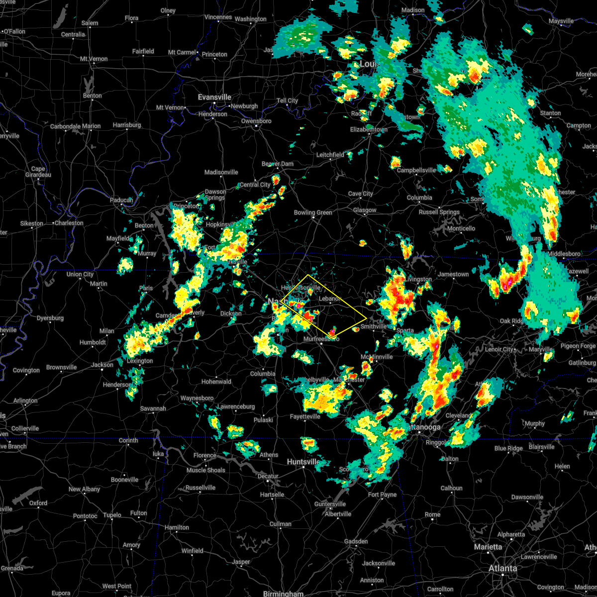 At 217 pm cdt, severe thunderstorms were located along a line extending from near madison to 6 miles east of walterhill, moving northeast at 35 mph (radar indicated). Hazards include 60 mph wind gusts and quarter size hail. Hail damage to vehicles is expected. Expect wind damage to roofs, siding, and trees. At 217 pm cdt, severe thunderstorms were located along a line extending from near madison to 6 miles east of walterhill, moving northeast at 35 mph (radar indicated). Hazards include 60 mph wind gusts and quarter size hail. Hail damage to vehicles is expected. Expect wind damage to roofs, siding, and trees.
|
| 4/13/2022 8:11 PM CDT |
 At 810 pm cdt, severe thunderstorms were located along a line extending from 7 miles northeast of lebanon to 8 miles southwest of murfreesboro, moving east at 65 mph (radar indicated). Hazards include 70 mph wind gusts. Expect considerable tree damage. damage is likely to mobile homes, roofs, and outbuildings. locations impacted include, murfreesboro, gallatin, lebanon, woodbury, carthage, hendersonville, smyrna, la vergne, mount juliet, watertown, gordonsville, walterhill, rural hill, belinda city, hickman, south carthage, alexandria, eagleville, dowelltown and liberty. this includes the following highways, interstate 40 between mile markers 223 and 263. interstate 24 between mile markers 65 and 91. Interstate 840 between mile markers 46 and 76. At 810 pm cdt, severe thunderstorms were located along a line extending from 7 miles northeast of lebanon to 8 miles southwest of murfreesboro, moving east at 65 mph (radar indicated). Hazards include 70 mph wind gusts. Expect considerable tree damage. damage is likely to mobile homes, roofs, and outbuildings. locations impacted include, murfreesboro, gallatin, lebanon, woodbury, carthage, hendersonville, smyrna, la vergne, mount juliet, watertown, gordonsville, walterhill, rural hill, belinda city, hickman, south carthage, alexandria, eagleville, dowelltown and liberty. this includes the following highways, interstate 40 between mile markers 223 and 263. interstate 24 between mile markers 65 and 91. Interstate 840 between mile markers 46 and 76.
|
| 4/13/2022 7:52 PM CDT |
 At 752 pm cdt, severe thunderstorms were located along a line extending from hendersonville to 6 miles east of spring hill, moving east at 65 mph (radar indicated). Hazards include 70 mph wind gusts. Expect considerable tree damage. Damage is likely to mobile homes, roofs, and outbuildings. At 752 pm cdt, severe thunderstorms were located along a line extending from hendersonville to 6 miles east of spring hill, moving east at 65 mph (radar indicated). Hazards include 70 mph wind gusts. Expect considerable tree damage. Damage is likely to mobile homes, roofs, and outbuildings.
|
| 4/13/2022 6:43 PM CDT |
 At 643 pm cdt, severe thunderstorms were located along a line extending from 13 miles west of scottsville to near portland to near nashville, moving east at 60 mph (radar indicated). Hazards include 60 mph wind gusts. Expect damage to roofs, siding, and trees. locations impacted include, gallatin, springfield, hendersonville, goodlettsville, white house, millersville, greenbrier, coopertown, ridgetop, cross plains, portland, pleasant view, orlinda, adams, cedar hill, mitchellville, oak grove, cottontown and black jack. this includes the following highways, interstate 65 between mile markers 98 and 121. interstate 24 between mile markers 18 and 33. hail threat, radar indicated max hail size, <. 75 in wind threat, radar indicated max wind gust, 60 mph. At 643 pm cdt, severe thunderstorms were located along a line extending from 13 miles west of scottsville to near portland to near nashville, moving east at 60 mph (radar indicated). Hazards include 60 mph wind gusts. Expect damage to roofs, siding, and trees. locations impacted include, gallatin, springfield, hendersonville, goodlettsville, white house, millersville, greenbrier, coopertown, ridgetop, cross plains, portland, pleasant view, orlinda, adams, cedar hill, mitchellville, oak grove, cottontown and black jack. this includes the following highways, interstate 65 between mile markers 98 and 121. interstate 24 between mile markers 18 and 33. hail threat, radar indicated max hail size, <. 75 in wind threat, radar indicated max wind gust, 60 mph.
|
| 4/13/2022 6:13 PM CDT |
 At 613 pm cdt, severe thunderstorms were located along a line extending from 11 miles south of russellville to 8 miles northwest of coopertown to near dickson, moving east at 60 mph (radar indicated). Hazards include 60 mph wind gusts. expect damage to roofs, siding, and trees At 613 pm cdt, severe thunderstorms were located along a line extending from 11 miles south of russellville to 8 miles northwest of coopertown to near dickson, moving east at 60 mph (radar indicated). Hazards include 60 mph wind gusts. expect damage to roofs, siding, and trees
|
| 3/30/2022 9:29 PM CDT |
 At 928 pm cdt, a severe thunderstorm was located over old hickory, or 10 miles northeast of nashville, moving northeast at 70 mph (radar indicated). Hazards include 60 mph wind gusts. expect damage to roofs, siding, and trees At 928 pm cdt, a severe thunderstorm was located over old hickory, or 10 miles northeast of nashville, moving northeast at 70 mph (radar indicated). Hazards include 60 mph wind gusts. expect damage to roofs, siding, and trees
|
| 2/22/2022 9:11 AM CST |
 At 911 am cst, a severe thunderstorm was located over springfield, moving east at 55 mph (radar indicated). Hazards include 60 mph wind gusts. Expect damage to roofs, siding, and trees. locations impacted include, gallatin, springfield, goodlettsville, white house, millersville, greenbrier, coopertown, ridgetop, cross plains, portland, orlinda, mitchellville, black jack and cottontown. this includes the following highways, interstate 65 between mile markers 99 and 121. interstate 24 near mile marker 26. hail threat, radar indicated max hail size, <. 75 in wind threat, radar indicated max wind gust, 60 mph. At 911 am cst, a severe thunderstorm was located over springfield, moving east at 55 mph (radar indicated). Hazards include 60 mph wind gusts. Expect damage to roofs, siding, and trees. locations impacted include, gallatin, springfield, goodlettsville, white house, millersville, greenbrier, coopertown, ridgetop, cross plains, portland, orlinda, mitchellville, black jack and cottontown. this includes the following highways, interstate 65 between mile markers 99 and 121. interstate 24 near mile marker 26. hail threat, radar indicated max hail size, <. 75 in wind threat, radar indicated max wind gust, 60 mph.
|
| 2/22/2022 8:59 AM CST |
 At 858 am cst, a severe thunderstorm was located near coopertown, or 12 miles north of ashland city, moving east at 55 mph (radar indicated). Hazards include 60 mph wind gusts. expect damage to roofs, siding, and trees At 858 am cst, a severe thunderstorm was located near coopertown, or 12 miles north of ashland city, moving east at 55 mph (radar indicated). Hazards include 60 mph wind gusts. expect damage to roofs, siding, and trees
|
| 1/1/2022 1:02 PM CST |
 At 101 pm cst, severe thunderstorms were located along a line extending from 6 miles south of scottsville to forest hills, moving northeast at 50 mph (radar indicated). Hazards include 60 mph wind gusts. expect damage to roofs, siding, and trees At 101 pm cst, severe thunderstorms were located along a line extending from 6 miles south of scottsville to forest hills, moving northeast at 50 mph (radar indicated). Hazards include 60 mph wind gusts. expect damage to roofs, siding, and trees
|
| 12/6/2021 5:31 AM CST |
 At 530 am cst, severe thunderstorms were located along a line extending from portland to old hickory to near bellevue, moving east at 45 mph (radar indicated). Hazards include 60 mph wind gusts. Expect damage to roofs, siding, and trees. locations impacted include, gallatin, lebanon, nashville, madison, hendersonville, mount juliet, goodlettsville, white house, millersville, forest hills, oak hill, belle meade, lakewood, westmoreland, portland, hermitage, rural hill, antioch, belinda city and old hickory. this includes the following highways, interstate 40 between mile markers 203 and 234. interstate 65 between mile markers 77 and 100. interstate 24 between mile markers 42 and 59. hail threat, radar indicated max hail size, <. 75 in wind threat, radar indicated max wind gust, 60 mph. At 530 am cst, severe thunderstorms were located along a line extending from portland to old hickory to near bellevue, moving east at 45 mph (radar indicated). Hazards include 60 mph wind gusts. Expect damage to roofs, siding, and trees. locations impacted include, gallatin, lebanon, nashville, madison, hendersonville, mount juliet, goodlettsville, white house, millersville, forest hills, oak hill, belle meade, lakewood, westmoreland, portland, hermitage, rural hill, antioch, belinda city and old hickory. this includes the following highways, interstate 40 between mile markers 203 and 234. interstate 65 between mile markers 77 and 100. interstate 24 between mile markers 42 and 59. hail threat, radar indicated max hail size, <. 75 in wind threat, radar indicated max wind gust, 60 mph.
|
| 12/6/2021 5:09 AM CST |
 At 508 am cst, severe thunderstorms were located along a line extending from cross plains to joelton to white bluff, moving east at 55 mph (radar indicated). Hazards include 60 mph wind gusts. expect damage to roofs, siding, and trees At 508 am cst, severe thunderstorms were located along a line extending from cross plains to joelton to white bluff, moving east at 55 mph (radar indicated). Hazards include 60 mph wind gusts. expect damage to roofs, siding, and trees
|
| 5/6/2021 5:52 PM CDT |
 At 552 pm cdt, a severe thunderstorm was located near westmoreland, or 9 miles north of hartsville, moving east at 35 mph (radar indicated). Hazards include 60 mph wind gusts. Expect damage to roofs, siding, and trees. Locations impacted include, gallatin, lafayette, hartsville, westmoreland, bledsoe creek state park and bethpage. At 552 pm cdt, a severe thunderstorm was located near westmoreland, or 9 miles north of hartsville, moving east at 35 mph (radar indicated). Hazards include 60 mph wind gusts. Expect damage to roofs, siding, and trees. Locations impacted include, gallatin, lafayette, hartsville, westmoreland, bledsoe creek state park and bethpage.
|
| 5/6/2021 5:42 PM CDT |
 At 542 pm cdt, severe thunderstorms were located along a line extending from near gallatin to near columbia, moving east at 40 mph (radar indicated). Hazards include 60 mph wind gusts. expect damage to roofs, siding, and trees At 542 pm cdt, severe thunderstorms were located along a line extending from near gallatin to near columbia, moving east at 40 mph (radar indicated). Hazards include 60 mph wind gusts. expect damage to roofs, siding, and trees
|
| 5/6/2021 5:34 PM CDT |
 At 534 pm cdt, severe thunderstorms were located along a line extending from 7 miles east of gallatin to 10 miles south of nolensville, moving east at 55 mph (radar indicated). Hazards include 60 mph wind gusts. Expect damage to roofs, siding, and trees. locations impacted include, murfreesboro, franklin, gallatin, lebanon, nashville, hartsville, madison, hendersonville, smyrna, brentwood, la vergne, spring hill, mount juliet, goodlettsville, millersville, nolensville, forest hills, oak hill, belle meade and lakewood. this includes the following highways, interstate 40 between mile markers 203 and 248. interstate 65 between mile markers 53 and 102. interstate 24 between mile markers 38 and 87. Interstate 840 between mile markers 18 and 76. At 534 pm cdt, severe thunderstorms were located along a line extending from 7 miles east of gallatin to 10 miles south of nolensville, moving east at 55 mph (radar indicated). Hazards include 60 mph wind gusts. Expect damage to roofs, siding, and trees. locations impacted include, murfreesboro, franklin, gallatin, lebanon, nashville, hartsville, madison, hendersonville, smyrna, brentwood, la vergne, spring hill, mount juliet, goodlettsville, millersville, nolensville, forest hills, oak hill, belle meade and lakewood. this includes the following highways, interstate 40 between mile markers 203 and 248. interstate 65 between mile markers 53 and 102. interstate 24 between mile markers 38 and 87. Interstate 840 between mile markers 18 and 76.
|
| 5/6/2021 5:29 PM CDT |
 At 528 pm cdt, a severe thunderstorm was located near portland, or 10 miles north of gallatin, moving east at 35 mph (radar indicated). Hazards include 60 mph wind gusts. expect damage to roofs, siding, and trees At 528 pm cdt, a severe thunderstorm was located near portland, or 10 miles north of gallatin, moving east at 35 mph (radar indicated). Hazards include 60 mph wind gusts. expect damage to roofs, siding, and trees
|
| 5/6/2021 5:19 PM CDT |
 A severe thunderstorm warning remains in effect until 530 pm cdt for sumner and eastern robertson counties. at 518 pm cdt, severe thunderstorms were located along a line extending from 7 miles north of portland to near white house to near goodlettsville, moving east at 35 mph. hazard. 60 mph wind gusts. A severe thunderstorm warning remains in effect until 530 pm cdt for sumner and eastern robertson counties. at 518 pm cdt, severe thunderstorms were located along a line extending from 7 miles north of portland to near white house to near goodlettsville, moving east at 35 mph. hazard. 60 mph wind gusts.
|
| 5/6/2021 5:09 PM CDT |
 At 508 pm cdt, severe thunderstorms were located along a line extending from near greenbrier to 10 miles south of fairview, moving east at 55 mph (radar indicated). Hazards include 60 mph wind gusts. expect damage to roofs, siding, and trees At 508 pm cdt, severe thunderstorms were located along a line extending from near greenbrier to 10 miles south of fairview, moving east at 55 mph (radar indicated). Hazards include 60 mph wind gusts. expect damage to roofs, siding, and trees
|
| 5/6/2021 4:56 PM CDT |
 At 456 pm cdt, severe thunderstorms were located along a line extending from 10 miles southeast of russellville to near springfield to near coopertown, moving east at 35 mph (radar indicated). Hazards include 60 mph wind gusts. expect damage to roofs, siding, and trees At 456 pm cdt, severe thunderstorms were located along a line extending from 10 miles southeast of russellville to near springfield to near coopertown, moving east at 35 mph (radar indicated). Hazards include 60 mph wind gusts. expect damage to roofs, siding, and trees
|
| 5/4/2021 6:28 AM CDT |
 At 628 am cdt, a severe thunderstorm capable of producing a tornado was located over gallatin, moving east at 45 mph (radar indicated rotation). Hazards include tornado. Flying debris will be dangerous to those caught without shelter. mobile homes will be damaged or destroyed. damage to roofs, windows, and vehicles will occur. tree damage is likely. Locations impacted include, gallatin, hartsville, bledsoe creek state park and dickerson chapel recreation area. At 628 am cdt, a severe thunderstorm capable of producing a tornado was located over gallatin, moving east at 45 mph (radar indicated rotation). Hazards include tornado. Flying debris will be dangerous to those caught without shelter. mobile homes will be damaged or destroyed. damage to roofs, windows, and vehicles will occur. tree damage is likely. Locations impacted include, gallatin, hartsville, bledsoe creek state park and dickerson chapel recreation area.
|
| 5/4/2021 6:26 AM CDT |
 At 626 am cdt, a severe thunderstorm capable of producing a tornado was located near cottontown, moving east at 40 mph (radar indicated rotation). Hazards include tornado. Flying debris will be dangerous to those caught without shelter. mobile homes will be damaged or destroyed. damage to roofs, windows, and vehicles will occur. tree damage is likely. Locations impacted include, westmoreland, oak grove and bethpage. At 626 am cdt, a severe thunderstorm capable of producing a tornado was located near cottontown, moving east at 40 mph (radar indicated rotation). Hazards include tornado. Flying debris will be dangerous to those caught without shelter. mobile homes will be damaged or destroyed. damage to roofs, windows, and vehicles will occur. tree damage is likely. Locations impacted include, westmoreland, oak grove and bethpage.
|
| 5/4/2021 6:24 AM CDT |
 The tornado warning for southwestern sumner county will expire at 630 am cdt, the tornado warning that was previously in effect has been reissued for sumner county. please refer to that bulletin for the latest severe weather information. a severe thunderstorm watch remains in effect until 1100 am cdt for middle tennessee. The tornado warning for southwestern sumner county will expire at 630 am cdt, the tornado warning that was previously in effect has been reissued for sumner county. please refer to that bulletin for the latest severe weather information. a severe thunderstorm watch remains in effect until 1100 am cdt for middle tennessee.
|
| 5/4/2021 6:21 AM CDT |
 At 621 am cdt, a severe thunderstorm capable of producing a tornado was located near hendersonville, moving east at 45 mph (radar indicated rotation). Hazards include tornado. Flying debris will be dangerous to those caught without shelter. mobile homes will be damaged or destroyed. damage to roofs, windows, and vehicles will occur. tree damage is likely. this dangerous storm will be near, gallatin around 630 am cdt. hartsville around 645 am cdt. Other locations impacted by this tornadic thunderstorm include dickerson chapel recreation area and bledsoe creek state park. At 621 am cdt, a severe thunderstorm capable of producing a tornado was located near hendersonville, moving east at 45 mph (radar indicated rotation). Hazards include tornado. Flying debris will be dangerous to those caught without shelter. mobile homes will be damaged or destroyed. damage to roofs, windows, and vehicles will occur. tree damage is likely. this dangerous storm will be near, gallatin around 630 am cdt. hartsville around 645 am cdt. Other locations impacted by this tornadic thunderstorm include dickerson chapel recreation area and bledsoe creek state park.
|
| 5/4/2021 6:17 AM CDT |
 At 617 am cdt, a severe thunderstorm capable of producing a tornado was located near portland, or 14 miles north of gallatin, moving east at 45 mph. another possible tornado was located just east of white house, moving east at 45 mph (radar indicated rotation). Hazards include tornado. Flying debris will be dangerous to those caught without shelter. mobile homes will be damaged or destroyed. damage to roofs, windows, and vehicles will occur. tree damage is likely. this dangerous storm will be near, westmoreland around 640 am cdt. Other locations impacted by this tornadic thunderstorm include oak grove, bethpage and cottontown. At 617 am cdt, a severe thunderstorm capable of producing a tornado was located near portland, or 14 miles north of gallatin, moving east at 45 mph. another possible tornado was located just east of white house, moving east at 45 mph (radar indicated rotation). Hazards include tornado. Flying debris will be dangerous to those caught without shelter. mobile homes will be damaged or destroyed. damage to roofs, windows, and vehicles will occur. tree damage is likely. this dangerous storm will be near, westmoreland around 640 am cdt. Other locations impacted by this tornadic thunderstorm include oak grove, bethpage and cottontown.
|
| 5/4/2021 6:16 AM CDT |
 At 615 am cdt, severe thunderstorms were located along a line extending from near portland to forest hills, moving east at 45 mph (radar indicated). Hazards include 60 mph wind gusts and penny size hail. expect damage to roofs, siding, and trees At 615 am cdt, severe thunderstorms were located along a line extending from near portland to forest hills, moving east at 45 mph (radar indicated). Hazards include 60 mph wind gusts and penny size hail. expect damage to roofs, siding, and trees
|
| 5/4/2021 6:13 AM CDT |
 At 613 am cdt, a severe thunderstorm capable of producing a tornado was located over goodlettsville, or 11 miles west of gallatin, moving east at 45 mph (radar indicated rotation). Hazards include tornado. Flying debris will be dangerous to those caught without shelter. mobile homes will be damaged or destroyed. damage to roofs, windows, and vehicles will occur. tree damage is likely. locations impacted include, hendersonville, goodlettsville and millersville. This includes interstate 65 between mile markers 98 and 101. At 613 am cdt, a severe thunderstorm capable of producing a tornado was located over goodlettsville, or 11 miles west of gallatin, moving east at 45 mph (radar indicated rotation). Hazards include tornado. Flying debris will be dangerous to those caught without shelter. mobile homes will be damaged or destroyed. damage to roofs, windows, and vehicles will occur. tree damage is likely. locations impacted include, hendersonville, goodlettsville and millersville. This includes interstate 65 between mile markers 98 and 101.
|
| 5/4/2021 6:10 AM CDT |
 At 610 am cdt, a severe thunderstorm capable of producing a tornado was located near orlinda, or 14 miles northeast of springfield, moving east at 45 mph. another possible tornado was located near white house, moving east at 45 mph (radar indicated rotation). Hazards include tornado. Flying debris will be dangerous to those caught without shelter. mobile homes will be damaged or destroyed. damage to roofs, windows, and vehicles will occur. tree damage is likely. this dangerous storm will be near, portland around 620 am cdt. westmoreland around 640 am cdt. other locations impacted by this tornadic thunderstorm include oak grove, cottontown, orlinda and bethpage. This includes interstate 65 between mile markers 107 and 120. At 610 am cdt, a severe thunderstorm capable of producing a tornado was located near orlinda, or 14 miles northeast of springfield, moving east at 45 mph. another possible tornado was located near white house, moving east at 45 mph (radar indicated rotation). Hazards include tornado. Flying debris will be dangerous to those caught without shelter. mobile homes will be damaged or destroyed. damage to roofs, windows, and vehicles will occur. tree damage is likely. this dangerous storm will be near, portland around 620 am cdt. westmoreland around 640 am cdt. other locations impacted by this tornadic thunderstorm include oak grove, cottontown, orlinda and bethpage. This includes interstate 65 between mile markers 107 and 120.
|
| 5/4/2021 6:07 AM CDT |
 At 606 am cdt, a severe thunderstorm capable of producing a tornado was located over goodlettsville, or 11 miles southeast of springfield, moving east at 45 mph (radar indicated rotation). Hazards include tornado. Flying debris will be dangerous to those caught without shelter. mobile homes will be damaged or destroyed. damage to roofs, windows, and vehicles will occur. tree damage is likely. locations impacted include, hendersonville, goodlettsville, millersville and ridgetop. This includes interstate 65 between mile markers 95 and 102. At 606 am cdt, a severe thunderstorm capable of producing a tornado was located over goodlettsville, or 11 miles southeast of springfield, moving east at 45 mph (radar indicated rotation). Hazards include tornado. Flying debris will be dangerous to those caught without shelter. mobile homes will be damaged or destroyed. damage to roofs, windows, and vehicles will occur. tree damage is likely. locations impacted include, hendersonville, goodlettsville, millersville and ridgetop. This includes interstate 65 between mile markers 95 and 102.
|
| 5/4/2021 6:05 AM CDT |
 At 605 am cdt, severe thunderstorms were located along a line extending from near cross plains to bellevue, moving east at 40 mph (radar indicated). Hazards include 70 mph wind gusts and penny size hail. Expect considerable tree damage. damage is likely to mobile homes, roofs, and outbuildings. locations impacted include, springfield, nashville, madison, hendersonville, goodlettsville, white house, millersville, greenbrier, forest hills, oak hill, belle meade, lakewood, ridgetop, cross plains, portland, hermitage, bellevue, old hickory, joelton and orlinda. this includes the following highways, interstate 40 between mile markers 194 and 218. interstate 65 between mile markers 77 and 121. Interstate 24 between mile markers 34 and 57. At 605 am cdt, severe thunderstorms were located along a line extending from near cross plains to bellevue, moving east at 40 mph (radar indicated). Hazards include 70 mph wind gusts and penny size hail. Expect considerable tree damage. damage is likely to mobile homes, roofs, and outbuildings. locations impacted include, springfield, nashville, madison, hendersonville, goodlettsville, white house, millersville, greenbrier, forest hills, oak hill, belle meade, lakewood, ridgetop, cross plains, portland, hermitage, bellevue, old hickory, joelton and orlinda. this includes the following highways, interstate 40 between mile markers 194 and 218. interstate 65 between mile markers 77 and 121. Interstate 24 between mile markers 34 and 57.
|
| 5/4/2021 5:56 AM CDT |
 At 556 am cdt, a severe thunderstorm capable of producing a tornado was located over joelton, or 9 miles south of springfield, moving east at 50 mph (radar indicated rotation). Hazards include tornado. Flying debris will be dangerous to those caught without shelter. mobile homes will be damaged or destroyed. damage to roofs, windows, and vehicles will occur. Tree damage is likely. At 556 am cdt, a severe thunderstorm capable of producing a tornado was located over joelton, or 9 miles south of springfield, moving east at 50 mph (radar indicated rotation). Hazards include tornado. Flying debris will be dangerous to those caught without shelter. mobile homes will be damaged or destroyed. damage to roofs, windows, and vehicles will occur. Tree damage is likely.
|
| 5/4/2021 5:39 AM CDT |
 At 539 am cdt, severe thunderstorms were located along a line extending from 9 miles east of guthrie to near white bluff, moving east at 45 mph (radar indicated). Hazards include 60 mph wind gusts and penny size hail. expect damage to roofs, siding, and trees At 539 am cdt, severe thunderstorms were located along a line extending from 9 miles east of guthrie to near white bluff, moving east at 45 mph (radar indicated). Hazards include 60 mph wind gusts and penny size hail. expect damage to roofs, siding, and trees
|
| 3/27/2021 6:49 AM CDT |
 At 649 am cdt, a severe thunderstorm was located near antioch, or 8 miles southeast of nashville, moving northeast at 40 mph (radar indicated). Hazards include quarter size hail. Damage to vehicles is expected. locations impacted include, gallatin, lebanon, hendersonville, la vergne, mount juliet, forest hills, oak hill, belle meade, lakewood, hermitage, rural hill, antioch, belinda city, berry hill, green hill, percy priest lake, gladeville and bledsoe creek state park. this includes the following highways, interstate 40 between mile markers 210 and 242. interstate 65 between mile markers 75 and 82. interstate 24 between mile markers 49 and 63. Interstate 840 between mile markers 68 and 76. At 649 am cdt, a severe thunderstorm was located near antioch, or 8 miles southeast of nashville, moving northeast at 40 mph (radar indicated). Hazards include quarter size hail. Damage to vehicles is expected. locations impacted include, gallatin, lebanon, hendersonville, la vergne, mount juliet, forest hills, oak hill, belle meade, lakewood, hermitage, rural hill, antioch, belinda city, berry hill, green hill, percy priest lake, gladeville and bledsoe creek state park. this includes the following highways, interstate 40 between mile markers 210 and 242. interstate 65 between mile markers 75 and 82. interstate 24 between mile markers 49 and 63. Interstate 840 between mile markers 68 and 76.
|
| 3/27/2021 6:38 AM CDT |
 At 638 am cdt, a severe thunderstorm was located over oak hill, or 7 miles south of nashville, moving northeast at 40 mph (radar indicated). Hazards include quarter size hail. damage to vehicles is expected At 638 am cdt, a severe thunderstorm was located over oak hill, or 7 miles south of nashville, moving northeast at 40 mph (radar indicated). Hazards include quarter size hail. damage to vehicles is expected
|
| 3/25/2021 4:52 PM CDT |
 The severe thunderstorm warning for northeastern davidson, central sumner and northwestern wilson counties will expire at 500 pm cdt, the storm which prompted the warning has moved out of the area. therefore, the warning will be allowed to expire. a tornado watch remains in effect until 1100 pm cdt for middle tennessee. The severe thunderstorm warning for northeastern davidson, central sumner and northwestern wilson counties will expire at 500 pm cdt, the storm which prompted the warning has moved out of the area. therefore, the warning will be allowed to expire. a tornado watch remains in effect until 1100 pm cdt for middle tennessee.
|
| 3/25/2021 4:50 PM CDT |
 At 450 pm cdt, a severe thunderstorm was located near white house, or 7 miles northwest of gallatin, moving northeast at 70 mph (trained weather spotters). Hazards include 60 mph wind gusts and half dollar size hail. Hail damage to vehicles is expected. Expect wind damage to roofs, siding, and trees. At 450 pm cdt, a severe thunderstorm was located near white house, or 7 miles northwest of gallatin, moving northeast at 70 mph (trained weather spotters). Hazards include 60 mph wind gusts and half dollar size hail. Hail damage to vehicles is expected. Expect wind damage to roofs, siding, and trees.
|
| 3/25/2021 4:38 PM CDT |
 At 437 pm cdt, a severe thunderstorm was located over lakewood, or 7 miles northeast of nashville, moving northeast at 75 mph (trained weather spotters). Hazards include 60 mph wind gusts and half dollar size hail. Hail damage to vehicles is expected. expect wind damage to roofs, siding, and trees. locations impacted include, gallatin, madison, hendersonville, mount juliet, goodlettsville, white house, millersville, lakewood, portland, hermitage, old hickory, green hill, bledsoe creek state park and cottontown. sumner county covid-19 vaccine will also be impacted. this includes the following highways, interstate 40 between mile markers 214 and 222. interstate 65 between mile markers 86 and 98. Interstate 24 between mile markers 43 and 48. At 437 pm cdt, a severe thunderstorm was located over lakewood, or 7 miles northeast of nashville, moving northeast at 75 mph (trained weather spotters). Hazards include 60 mph wind gusts and half dollar size hail. Hail damage to vehicles is expected. expect wind damage to roofs, siding, and trees. locations impacted include, gallatin, madison, hendersonville, mount juliet, goodlettsville, white house, millersville, lakewood, portland, hermitage, old hickory, green hill, bledsoe creek state park and cottontown. sumner county covid-19 vaccine will also be impacted. this includes the following highways, interstate 40 between mile markers 214 and 222. interstate 65 between mile markers 86 and 98. Interstate 24 between mile markers 43 and 48.
|
| 3/25/2021 4:23 PM CDT |
 At 423 pm cdt, a severe thunderstorm was located near forest hills, or near franklin, moving northeast at 75 mph (trained weather spotters). Hazards include golf ball size hail and 70 mph wind gusts. People and animals outdoors will be injured. expect hail damage to roofs, siding, windows, and vehicles. expect considerable tree damage. Wind damage is also likely to mobile homes, roofs, and outbuildings. At 423 pm cdt, a severe thunderstorm was located near forest hills, or near franklin, moving northeast at 75 mph (trained weather spotters). Hazards include golf ball size hail and 70 mph wind gusts. People and animals outdoors will be injured. expect hail damage to roofs, siding, windows, and vehicles. expect considerable tree damage. Wind damage is also likely to mobile homes, roofs, and outbuildings.
|
| 2/28/2021 8:05 PM CST |
 At 805 pm cst, a severe thunderstorm was located near gallatin, moving east at 50 mph (radar indicated). Hazards include 60 mph wind gusts and penny size hail. expect damage to roofs, siding, and trees At 805 pm cst, a severe thunderstorm was located near gallatin, moving east at 50 mph (radar indicated). Hazards include 60 mph wind gusts and penny size hail. expect damage to roofs, siding, and trees
|
| 2/28/2021 8:02 PM CST |
 At 801 pm cst, severe thunderstorms were located along a line extending from near westmoreland to near rural hill, moving east at 55 mph (radar indicated). Hazards include 60 mph wind gusts. Expect damage to roofs, siding, and trees. locations impacted include, gallatin, lebanon, hendersonville, mount juliet, belinda city and bledsoe creek state park. This includes interstate 40 between mile markers 226 and 232. At 801 pm cst, severe thunderstorms were located along a line extending from near westmoreland to near rural hill, moving east at 55 mph (radar indicated). Hazards include 60 mph wind gusts. Expect damage to roofs, siding, and trees. locations impacted include, gallatin, lebanon, hendersonville, mount juliet, belinda city and bledsoe creek state park. This includes interstate 40 between mile markers 226 and 232.
|
| 2/28/2021 7:32 PM CST |
 At 732 pm cst, severe thunderstorms were located along a line extending from near greenbrier to near kingston springs, moving east at 65 mph (radar indicated). Hazards include 60 mph wind gusts. expect damage to roofs, siding, and trees At 732 pm cst, severe thunderstorms were located along a line extending from near greenbrier to near kingston springs, moving east at 65 mph (radar indicated). Hazards include 60 mph wind gusts. expect damage to roofs, siding, and trees
|
| 2/28/2021 7:15 PM CST |
 At 715 pm cst, severe thunderstorms were located along a line extending from near westmoreland to near gallatin to millersville, moving east at 45 mph (radar indicated). Hazards include 60 mph wind gusts. expect damage to roofs, siding, and trees At 715 pm cst, severe thunderstorms were located along a line extending from near westmoreland to near gallatin to millersville, moving east at 45 mph (radar indicated). Hazards include 60 mph wind gusts. expect damage to roofs, siding, and trees
|
| 2/28/2021 7:03 PM CST |
 At 703 pm cst, a severe thunderstorm was located near white house, or 9 miles northwest of gallatin, moving east at 60 mph (radar indicated). Hazards include 60 mph wind gusts and penny size hail. Expect damage to roofs, siding, and trees. Locations impacted include, gallatin, hendersonville, goodlettsville, white house, westmoreland, portland, mitchellville, cottontown, bethpage, oak grove and bledsoe creek state park. At 703 pm cst, a severe thunderstorm was located near white house, or 9 miles northwest of gallatin, moving east at 60 mph (radar indicated). Hazards include 60 mph wind gusts and penny size hail. Expect damage to roofs, siding, and trees. Locations impacted include, gallatin, hendersonville, goodlettsville, white house, westmoreland, portland, mitchellville, cottontown, bethpage, oak grove and bledsoe creek state park.
|
| 2/28/2021 6:48 PM CST |
 At 647 pm cst, a severe thunderstorm was located near springfield, moving east at 55 mph (radar indicated). Hazards include 60 mph wind gusts and penny size hail. expect damage to roofs, siding, and trees At 647 pm cst, a severe thunderstorm was located near springfield, moving east at 55 mph (radar indicated). Hazards include 60 mph wind gusts and penny size hail. expect damage to roofs, siding, and trees
|
| 8/28/2020 1:51 PM CDT |
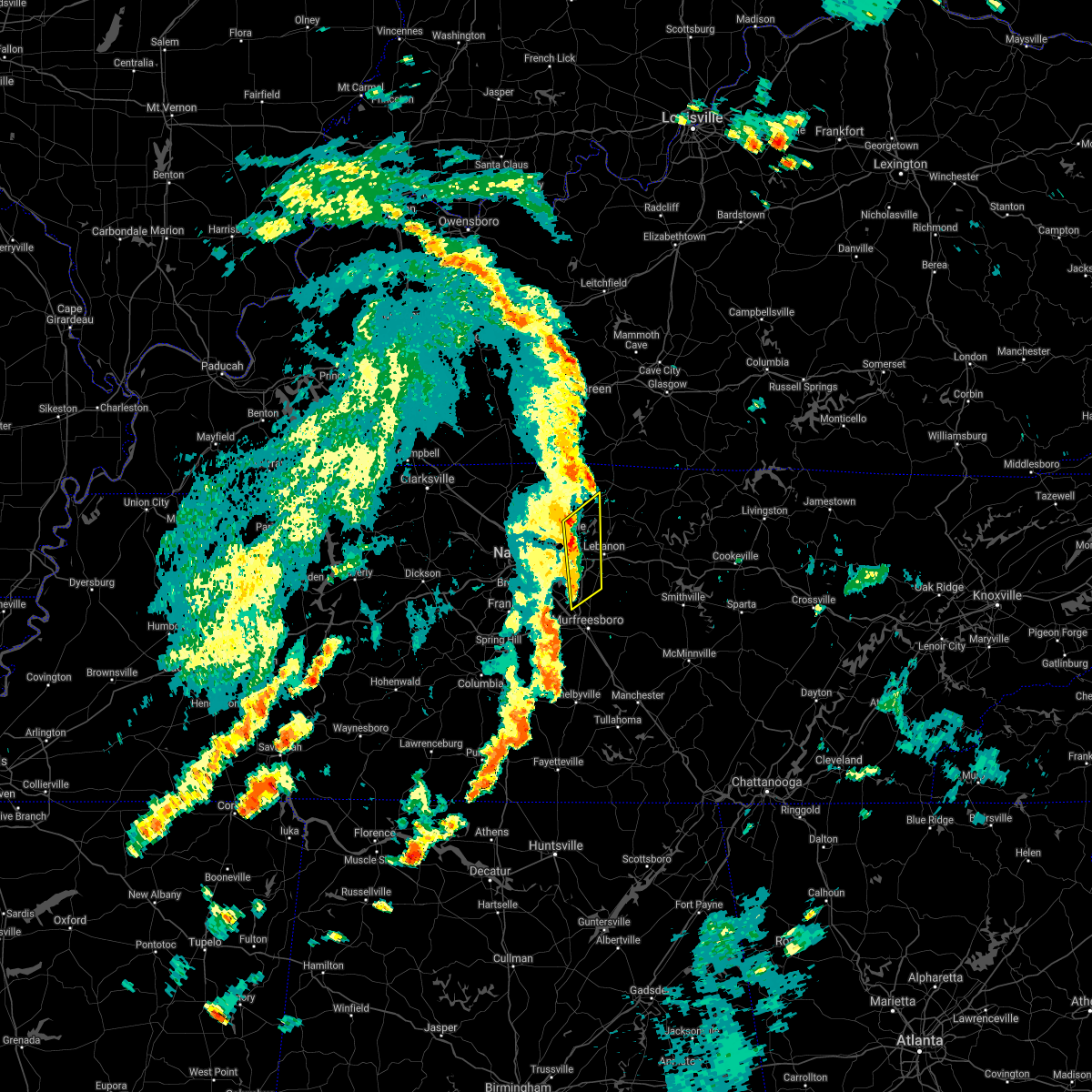 At 150 pm cdt, severe thunderstorms were located along a line extending from near gallatin to near walterhill, moving northeast at 40 mph (radar indicated). Hazards include 60 mph wind gusts. Expect damage to roofs, siding, and trees. locations impacted include, gallatin, lebanon, hendersonville, smyrna, la vergne, mount juliet, belinda city, rural hill, bledsoe creek state park and gladeville. this includes the following highways, interstate 40 between mile markers 226 and 237. Interstate 840 between mile markers 60 and 76. At 150 pm cdt, severe thunderstorms were located along a line extending from near gallatin to near walterhill, moving northeast at 40 mph (radar indicated). Hazards include 60 mph wind gusts. Expect damage to roofs, siding, and trees. locations impacted include, gallatin, lebanon, hendersonville, smyrna, la vergne, mount juliet, belinda city, rural hill, bledsoe creek state park and gladeville. this includes the following highways, interstate 40 between mile markers 226 and 237. Interstate 840 between mile markers 60 and 76.
|
| 8/28/2020 1:38 PM CDT |
 At 138 pm cdt, severe thunderstorms were located along a line extending from near hendersonville to smyrna, moving northeast at 35 mph (radar indicated). Hazards include 60 mph wind gusts. Expect damage to roofs, siding, and trees. locations impacted include, gallatin, lebanon, hendersonville, smyrna, la vergne, mount juliet, lakewood, hermitage, rural hill, belinda city, green hill, bledsoe creek state park, percy priest lake and gladeville. this includes the following highways, interstate 40 between mile markers 219 and 237. interstate 24 between mile markers 63 and 70. Interstate 840 between mile markers 60 and 76. At 138 pm cdt, severe thunderstorms were located along a line extending from near hendersonville to smyrna, moving northeast at 35 mph (radar indicated). Hazards include 60 mph wind gusts. Expect damage to roofs, siding, and trees. locations impacted include, gallatin, lebanon, hendersonville, smyrna, la vergne, mount juliet, lakewood, hermitage, rural hill, belinda city, green hill, bledsoe creek state park, percy priest lake and gladeville. this includes the following highways, interstate 40 between mile markers 219 and 237. interstate 24 between mile markers 63 and 70. Interstate 840 between mile markers 60 and 76.
|
| 8/28/2020 1:22 PM CDT |
 At 122 pm cdt, severe thunderstorms were located along a line extending from near madison to near nolensville, moving northeast at 40 mph (radar indicated). Hazards include 60 mph wind gusts. expect damage to roofs, siding, and trees At 122 pm cdt, severe thunderstorms were located along a line extending from near madison to near nolensville, moving northeast at 40 mph (radar indicated). Hazards include 60 mph wind gusts. expect damage to roofs, siding, and trees
|
| 7/20/2020 6:14 PM CDT |
 At 613 pm cdt, a severe thunderstorm was located over belinda city, or 7 miles west of lebanon, moving east at 15 mph (radar indicated). Hazards include 60 mph wind gusts and penny size hail. Expect damage to roofs, siding, and trees. locations impacted include, gallatin, lebanon, hendersonville, mount juliet, rural hill, belinda city, green hill, percy priest lake, bledsoe creek state park, dickerson chapel recreation area and gladeville. this includes the following highways, interstate 40 between mile markers 221 and 244. Interstate 840 between mile markers 70 and 76. At 613 pm cdt, a severe thunderstorm was located over belinda city, or 7 miles west of lebanon, moving east at 15 mph (radar indicated). Hazards include 60 mph wind gusts and penny size hail. Expect damage to roofs, siding, and trees. locations impacted include, gallatin, lebanon, hendersonville, mount juliet, rural hill, belinda city, green hill, percy priest lake, bledsoe creek state park, dickerson chapel recreation area and gladeville. this includes the following highways, interstate 40 between mile markers 221 and 244. Interstate 840 between mile markers 70 and 76.
|
| 7/20/2020 6:10 PM CDT |
 At 610 pm cdt, a severe thunderstorm was located over belinda city, or 9 miles west of lebanon, moving east at 15 mph (radar indicated). Hazards include 60 mph wind gusts and penny size hail. expect damage to roofs, siding, and trees At 610 pm cdt, a severe thunderstorm was located over belinda city, or 9 miles west of lebanon, moving east at 15 mph (radar indicated). Hazards include 60 mph wind gusts and penny size hail. expect damage to roofs, siding, and trees
|
| 5/25/2020 4:40 PM CDT |
 The severe thunderstorm warning for northeastern davidson and southwestern sumner counties will expire at 445 pm cdt, the storm which prompted the warning has weakened below severe limits, and has exited the warned area. therefore, the warning will be allowed to expire. The severe thunderstorm warning for northeastern davidson and southwestern sumner counties will expire at 445 pm cdt, the storm which prompted the warning has weakened below severe limits, and has exited the warned area. therefore, the warning will be allowed to expire.
|
| 5/25/2020 4:32 PM CDT |
 At 431 pm cdt, a severe thunderstorm was located over goodlettsville, or 11 miles northeast of nashville, moving northwest at 25 mph (radar indicated). Hazards include 60 mph wind gusts. Expect damage to roofs, siding, and trees. locations impacted include, hendersonville, goodlettsville, lakewood, hermitage, old hickory and green hill. This includes interstate 65 between mile markers 95 and 98. At 431 pm cdt, a severe thunderstorm was located over goodlettsville, or 11 miles northeast of nashville, moving northwest at 25 mph (radar indicated). Hazards include 60 mph wind gusts. Expect damage to roofs, siding, and trees. locations impacted include, hendersonville, goodlettsville, lakewood, hermitage, old hickory and green hill. This includes interstate 65 between mile markers 95 and 98.
|
| 5/25/2020 4:11 PM CDT |
 At 411 pm cdt, a severe thunderstorm was located over hermitage, or 10 miles east of nashville, moving northwest at 25 mph (radar indicated). Hazards include 60 mph wind gusts. expect damage to roofs, siding, and trees At 411 pm cdt, a severe thunderstorm was located over hermitage, or 10 miles east of nashville, moving northwest at 25 mph (radar indicated). Hazards include 60 mph wind gusts. expect damage to roofs, siding, and trees
|
| 5/3/2020 5:03 PM CDT |
 At 503 pm cdt, severe thunderstorms were located along a line extending from 13 miles south of memphis junction to 8 miles east of portland to near gallatin, moving northeast at 65 mph. these are very dangerous storms (radar indicated). Hazards include 80 mph wind gusts and nickel size hail. Flying debris will be dangerous to those caught without shelter. mobile homes will be heavily damaged. expect considerable damage to roofs, windows, and vehicles. extensive tree damage and power outages are likely. Locations impacted include, gallatin, lebanon, springfield, hartsville, hendersonville, mount juliet, goodlettsville, white house, millersville, lakewood, westmoreland, cross plains, portland, hermitage, belinda city, old hickory, orlinda, mitchellville, bledsoe creek state park and dickerson chapel recreation area. At 503 pm cdt, severe thunderstorms were located along a line extending from 13 miles south of memphis junction to 8 miles east of portland to near gallatin, moving northeast at 65 mph. these are very dangerous storms (radar indicated). Hazards include 80 mph wind gusts and nickel size hail. Flying debris will be dangerous to those caught without shelter. mobile homes will be heavily damaged. expect considerable damage to roofs, windows, and vehicles. extensive tree damage and power outages are likely. Locations impacted include, gallatin, lebanon, springfield, hartsville, hendersonville, mount juliet, goodlettsville, white house, millersville, lakewood, westmoreland, cross plains, portland, hermitage, belinda city, old hickory, orlinda, mitchellville, bledsoe creek state park and dickerson chapel recreation area.
|
| 5/3/2020 4:58 PM CDT | Numerous trees down in gallatin in sumner county TN, 1.8 miles WSW of Gallatin, TN |
| 5/3/2020 4:43 PM CDT |
 At 443 pm cdt, severe thunderstorms were located along a line extending from near springfield to near white house to near hermitage, moving northeast at 65 mph (radar indicated). Hazards include 60 mph wind gusts and nickel size hail. expect damage to roofs, siding, and trees At 443 pm cdt, severe thunderstorms were located along a line extending from near springfield to near white house to near hermitage, moving northeast at 65 mph (radar indicated). Hazards include 60 mph wind gusts and nickel size hail. expect damage to roofs, siding, and trees
|
| 4/8/2020 10:10 PM CDT | Half inch hail and small limbs down on desha creek roa in sumner county TN, 1.8 miles WSW of Gallatin, TN |
| 4/8/2020 10:09 PM CDT |
 At 1009 pm cdt, severe thunderstorms were located along a line extending from 6 miles southwest of westmoreland to near mount juliet, moving southeast at 55 mph (radar indicated). Hazards include 60 mph wind gusts and nickel size hail. expect damage to roofs, siding, and trees At 1009 pm cdt, severe thunderstorms were located along a line extending from 6 miles southwest of westmoreland to near mount juliet, moving southeast at 55 mph (radar indicated). Hazards include 60 mph wind gusts and nickel size hail. expect damage to roofs, siding, and trees
|
| 4/8/2020 10:06 PM CDT | Report of power pole snapped in half and a couple of trees down around coles ferry road... drivers lane. time estimated via rada in sumner county TN, 3.2 miles W of Gallatin, TN |
| 4/8/2020 10:02 PM CDT |
 At 1001 pm cdt, severe thunderstorms were located along a line extending from 7 miles southwest of westmoreland to near hendersonville, moving east at 50 mph (radar indicated). Hazards include 70 mph wind gusts and quarter size hail. Hail damage to vehicles is expected. expect considerable tree damage. wind damage is also likely to mobile homes, roofs, and outbuildings. locations impacted include, gallatin, lebanon, hendersonville, mount juliet, goodlettsville, westmoreland, portland, cottontown, bethpage, oak grove and bledsoe creek state park. this includes the following highways, interstate 40 between mile markers 229 and 233. Interstate 65 between mile markers 95 and 96. At 1001 pm cdt, severe thunderstorms were located along a line extending from 7 miles southwest of westmoreland to near hendersonville, moving east at 50 mph (radar indicated). Hazards include 70 mph wind gusts and quarter size hail. Hail damage to vehicles is expected. expect considerable tree damage. wind damage is also likely to mobile homes, roofs, and outbuildings. locations impacted include, gallatin, lebanon, hendersonville, mount juliet, goodlettsville, westmoreland, portland, cottontown, bethpage, oak grove and bledsoe creek state park. this includes the following highways, interstate 40 between mile markers 229 and 233. Interstate 65 between mile markers 95 and 96.
|
| 4/8/2020 9:36 PM CDT |
 At 936 pm cdt, severe thunderstorms were located along a line extending from near cross plains to near greenbrier, moving east at 50 mph (radar indicated). Hazards include 70 mph wind gusts and quarter size hail. Hail damage to vehicles is expected. expect considerable tree damage. Wind damage is also likely to mobile homes, roofs, and outbuildings. At 936 pm cdt, severe thunderstorms were located along a line extending from near cross plains to near greenbrier, moving east at 50 mph (radar indicated). Hazards include 70 mph wind gusts and quarter size hail. Hail damage to vehicles is expected. expect considerable tree damage. Wind damage is also likely to mobile homes, roofs, and outbuildings.
|
| 3/3/2020 3:47 AM CST |
 At 347 am cst, a severe thunderstorm was located near ashland city, moving east at 60 mph (radar indicated). Hazards include 60 mph wind gusts. expect damage to roofs, siding, and trees At 347 am cst, a severe thunderstorm was located near ashland city, moving east at 60 mph (radar indicated). Hazards include 60 mph wind gusts. expect damage to roofs, siding, and trees
|
| 3/3/2020 1:21 AM CST |
 At 120 am cst, a severe thunderstorm was located 8 miles west of carthage, moving east at 55 mph (national weather service employee reported 60 mph winds with this storm). Hazards include 60 mph wind gusts and quarter size hail. Hail damage to vehicles is expected. expect wind damage to roofs, siding, and trees. locations impacted include, gallatin, lebanon, hartsville, hendersonville, mount juliet, goodlettsville, millersville, belinda city, tuckers crossroads, dixon springs, bledsoe creek state park and dickerson chapel recreation area. this includes the following highways, interstate 40 between mile markers 226 and 256. interstate 65 between mile markers 98 and 100. Interstate 840 between mile markers 72 and 76. At 120 am cst, a severe thunderstorm was located 8 miles west of carthage, moving east at 55 mph (national weather service employee reported 60 mph winds with this storm). Hazards include 60 mph wind gusts and quarter size hail. Hail damage to vehicles is expected. expect wind damage to roofs, siding, and trees. locations impacted include, gallatin, lebanon, hartsville, hendersonville, mount juliet, goodlettsville, millersville, belinda city, tuckers crossroads, dixon springs, bledsoe creek state park and dickerson chapel recreation area. this includes the following highways, interstate 40 between mile markers 226 and 256. interstate 65 between mile markers 98 and 100. Interstate 840 between mile markers 72 and 76.
|
| 3/3/2020 1:13 AM CST |
 At 112 am cst, a severe thunderstorm was located near lebanon, moving east at 55 mph (radar indicated). Hazards include golf ball size hail and 60 mph wind gusts. People and animals outdoors will be injured. expect hail damage to roofs, siding, windows, and vehicles. expect wind damage to roofs, siding, and trees. locations impacted include, gallatin, lebanon, hartsville, madison, hendersonville, mount juliet, goodlettsville, millersville, lakewood, hermitage, belinda city, old hickory, tuckers crossroads, dixon springs, bledsoe creek state park and dickerson chapel recreation area. this includes the following highways, interstate 40 between mile markers 220 and 256. interstate 65 between mile markers 87 and 100. interstate 24 between mile markers 40 and 44. Interstate 840 between mile markers 72 and 76. At 112 am cst, a severe thunderstorm was located near lebanon, moving east at 55 mph (radar indicated). Hazards include golf ball size hail and 60 mph wind gusts. People and animals outdoors will be injured. expect hail damage to roofs, siding, windows, and vehicles. expect wind damage to roofs, siding, and trees. locations impacted include, gallatin, lebanon, hartsville, madison, hendersonville, mount juliet, goodlettsville, millersville, lakewood, hermitage, belinda city, old hickory, tuckers crossroads, dixon springs, bledsoe creek state park and dickerson chapel recreation area. this includes the following highways, interstate 40 between mile markers 220 and 256. interstate 65 between mile markers 87 and 100. interstate 24 between mile markers 40 and 44. Interstate 840 between mile markers 72 and 76.
|
| 3/3/2020 12:46 AM CST |
 At 1245 am cst, a severe thunderstorm was located over madison, or near nashville, moving east at 55 mph (radar indicated). Hazards include golf ball size hail and 60 mph wind gusts. People and animals outdoors will be injured. expect hail damage to roofs, siding, windows, and vehicles. Expect wind damage to roofs, siding, and trees. At 1245 am cst, a severe thunderstorm was located over madison, or near nashville, moving east at 55 mph (radar indicated). Hazards include golf ball size hail and 60 mph wind gusts. People and animals outdoors will be injured. expect hail damage to roofs, siding, windows, and vehicles. Expect wind damage to roofs, siding, and trees.
|
| 1/11/2020 6:09 PM CST |
 At 609 pm cst, severe thunderstorms were located along a line extending from 6 miles southwest of westmoreland to near lebanon, moving east at 50 mph (radar indicated). Hazards include 60 mph wind gusts. expect damage to roofs, siding, and trees At 609 pm cst, severe thunderstorms were located along a line extending from 6 miles southwest of westmoreland to near lebanon, moving east at 50 mph (radar indicated). Hazards include 60 mph wind gusts. expect damage to roofs, siding, and trees
|
| 1/11/2020 9:46 AM CST |
 At 946 am cst, severe thunderstorms were located along a line extending from 8 miles southeast of portland to near gallatin, moving northeast at 65 mph (radar indicated). Hazards include 60 mph wind gusts. Expect damage to roofs, siding, and trees. Locations impacted include, gallatin, hendersonville, mount juliet, lakewood, hermitage and old hickory. At 946 am cst, severe thunderstorms were located along a line extending from 8 miles southeast of portland to near gallatin, moving northeast at 65 mph (radar indicated). Hazards include 60 mph wind gusts. Expect damage to roofs, siding, and trees. Locations impacted include, gallatin, hendersonville, mount juliet, lakewood, hermitage and old hickory.
|
| 1/11/2020 9:29 AM CST |
 At 928 am cst, severe thunderstorms were located along a line extending from millersville to near nashville, moving northeast at 65 mph (radar indicated). Hazards include 60 mph wind gusts. expect damage to roofs, siding, and trees At 928 am cst, severe thunderstorms were located along a line extending from millersville to near nashville, moving northeast at 65 mph (radar indicated). Hazards include 60 mph wind gusts. expect damage to roofs, siding, and trees
|
| 9/10/2019 6:08 PM CDT |
 At 607 pm cdt, a severe thunderstorm was located near gallatin, moving northeast at 5 mph (radar indicated). Hazards include 60 mph wind gusts and quarter size hail. Hail damage to vehicles is expected. expect wind damage to roofs, siding, and trees. Locations impacted include, gallatin and bledsoe creek state park. At 607 pm cdt, a severe thunderstorm was located near gallatin, moving northeast at 5 mph (radar indicated). Hazards include 60 mph wind gusts and quarter size hail. Hail damage to vehicles is expected. expect wind damage to roofs, siding, and trees. Locations impacted include, gallatin and bledsoe creek state park.
|
| 9/10/2019 5:51 PM CDT |
 At 551 pm cdt, a severe thunderstorm was located over gallatin, moving northeast at 5 mph (radar indicated). Hazards include 60 mph wind gusts and quarter size hail. Hail damage to vehicles is expected. Expect wind damage to roofs, siding, and trees. At 551 pm cdt, a severe thunderstorm was located over gallatin, moving northeast at 5 mph (radar indicated). Hazards include 60 mph wind gusts and quarter size hail. Hail damage to vehicles is expected. Expect wind damage to roofs, siding, and trees.
|
| 8/13/2019 3:27 PM CDT |
 At 306 pm cdt, severe thunderstorms were located along a line extending from near westmoreland to near gallatin to near hendersonville, moving east at 45 mph (radar indicated). Hazards include 60 mph wind gusts. expect damage to roofs, siding, and trees At 306 pm cdt, severe thunderstorms were located along a line extending from near westmoreland to near gallatin to near hendersonville, moving east at 45 mph (radar indicated). Hazards include 60 mph wind gusts. expect damage to roofs, siding, and trees
|
| 8/13/2019 3:06 PM CDT |
 At 306 pm cdt, severe thunderstorms were located along a line extending from near westmoreland to near gallatin to near hendersonville, moving east at 45 mph (radar indicated). Hazards include 60 mph wind gusts. expect damage to roofs, siding, and trees At 306 pm cdt, severe thunderstorms were located along a line extending from near westmoreland to near gallatin to near hendersonville, moving east at 45 mph (radar indicated). Hazards include 60 mph wind gusts. expect damage to roofs, siding, and trees
|
| 8/6/2019 7:58 PM CDT |
 The national weather service in nashville has issued a * severe thunderstorm warning for. central davidson county in middle tennessee. southern sumner county in middle tennessee. central wilson county in middle tennessee. East central cheatham county in middle tennessee. The national weather service in nashville has issued a * severe thunderstorm warning for. central davidson county in middle tennessee. southern sumner county in middle tennessee. central wilson county in middle tennessee. East central cheatham county in middle tennessee.
|
| 6/27/2019 6:31 PM CDT |
 At 630 pm cdt, severe thunderstorms were located along a line extending from near springfield to 7 miles southwest of westmoreland, moving north at 30 mph (radar indicated). Hazards include 60 mph wind gusts and penny size hail. Expect damage to roofs, siding, and trees. locations impacted include, gallatin, white house, millersville, greenbrier, ridgetop, cross plains, portland, orlinda, cottontown, bethpage, oak grove and bledsoe creek state park. This includes interstate 65 between mile markers 101 and 120. At 630 pm cdt, severe thunderstorms were located along a line extending from near springfield to 7 miles southwest of westmoreland, moving north at 30 mph (radar indicated). Hazards include 60 mph wind gusts and penny size hail. Expect damage to roofs, siding, and trees. locations impacted include, gallatin, white house, millersville, greenbrier, ridgetop, cross plains, portland, orlinda, cottontown, bethpage, oak grove and bledsoe creek state park. This includes interstate 65 between mile markers 101 and 120.
|
| 6/27/2019 6:20 PM CDT | Tree down across dickerson bay d in sumner county TN, 1.8 miles WSW of Gallatin, TN |
| 6/27/2019 6:05 PM CDT |
 At 605 pm cdt, severe thunderstorms were located along a line extending from near millersville to near lebanon, moving north at 35 mph (radar indicated). Hazards include 60 mph wind gusts and penny size hail. expect damage to roofs, siding, and trees At 605 pm cdt, severe thunderstorms were located along a line extending from near millersville to near lebanon, moving north at 35 mph (radar indicated). Hazards include 60 mph wind gusts and penny size hail. expect damage to roofs, siding, and trees
|
| 6/26/2019 9:04 PM CDT | Quarter sized hail reported 1.8 miles WSW of Gallatin, TN, 1 inch hail in gallatin. |
| 6/26/2019 9:04 PM CDT | Trees down in gallati in sumner county TN, 1.8 miles WSW of Gallatin, TN |
| 6/26/2019 8:58 PM CDT |
 At 858 pm cdt, a severe thunderstorm was located over gallatin, moving northeast at 25 mph (radar indicated). Hazards include 60 mph wind gusts and quarter size hail. Hail damage to vehicles is expected. expect wind damage to roofs, siding, and trees. Locations impacted include, gallatin, hendersonville and bledsoe creek state park. At 858 pm cdt, a severe thunderstorm was located over gallatin, moving northeast at 25 mph (radar indicated). Hazards include 60 mph wind gusts and quarter size hail. Hail damage to vehicles is expected. expect wind damage to roofs, siding, and trees. Locations impacted include, gallatin, hendersonville and bledsoe creek state park.
|
| 6/26/2019 8:47 PM CDT |
 At 847 pm cdt, a severe thunderstorm was located near gallatin, moving northeast at 25 mph (radar indicated). Hazards include 60 mph wind gusts and quarter size hail. Hail damage to vehicles is expected. Expect wind damage to roofs, siding, and trees. At 847 pm cdt, a severe thunderstorm was located near gallatin, moving northeast at 25 mph (radar indicated). Hazards include 60 mph wind gusts and quarter size hail. Hail damage to vehicles is expected. Expect wind damage to roofs, siding, and trees.
|
| 6/22/2019 4:53 PM CDT |
 The severe thunderstorm warning for sumner, northwestern wilson and southeastern robertson counties will expire at 500 pm cdt, the storms which prompted the warning have moved out of the area. therefore, the warning will be allowed to expire. to report severe weather, contact your nearest law enforcement agency. they will relay your report to the national weather service nashville. The severe thunderstorm warning for sumner, northwestern wilson and southeastern robertson counties will expire at 500 pm cdt, the storms which prompted the warning have moved out of the area. therefore, the warning will be allowed to expire. to report severe weather, contact your nearest law enforcement agency. they will relay your report to the national weather service nashville.
|
| 6/22/2019 4:52 PM CDT |
 At 452 pm cdt, severe thunderstorms were located along a line extending from near gallatin to brentwood, moving southeast at 40 mph (radar indicated). Hazards include 60 mph wind gusts. expect damage to roofs, siding, and trees At 452 pm cdt, severe thunderstorms were located along a line extending from near gallatin to brentwood, moving southeast at 40 mph (radar indicated). Hazards include 60 mph wind gusts. expect damage to roofs, siding, and trees
|
| 6/22/2019 4:28 PM CDT |
 At 417 pm cdt, severe thunderstorms were located along a line extending from near cross plains to near greenbrier, moving east at 45 mph (radar indicated). Hazards include 60 mph wind gusts. expect damage to roofs, siding, and trees At 417 pm cdt, severe thunderstorms were located along a line extending from near cross plains to near greenbrier, moving east at 45 mph (radar indicated). Hazards include 60 mph wind gusts. expect damage to roofs, siding, and trees
|
| 6/22/2019 4:17 PM CDT |
 At 417 pm cdt, severe thunderstorms were located along a line extending from near cross plains to near greenbrier, moving east at 45 mph (radar indicated). Hazards include 60 mph wind gusts. expect damage to roofs, siding, and trees At 417 pm cdt, severe thunderstorms were located along a line extending from near cross plains to near greenbrier, moving east at 45 mph (radar indicated). Hazards include 60 mph wind gusts. expect damage to roofs, siding, and trees
|
| 6/21/2019 8:01 PM CDT |
 At 801 pm cdt, severe thunderstorms were located along a line extending from 7 miles northwest of lafayette to 7 miles east of gallatin to mount juliet, moving east at 45 mph (radar indicated). Hazards include 70 mph wind gusts and nickel size hail. Expect considerable tree damage. Damage is likely to mobile homes, roofs, and outbuildings. At 801 pm cdt, severe thunderstorms were located along a line extending from 7 miles northwest of lafayette to 7 miles east of gallatin to mount juliet, moving east at 45 mph (radar indicated). Hazards include 70 mph wind gusts and nickel size hail. Expect considerable tree damage. Damage is likely to mobile homes, roofs, and outbuildings.
|
| 6/21/2019 7:57 PM CDT |
 At 741 pm cdt, severe thunderstorms were located along a line extending from near portland to near greenbrier to near joelton, moving east at 30 mph. these are very dangerous storms (radar indicated). Hazards include spotter reports of 80 mph wind gusts and half dollar size hail. Flying debris will be dangerous to those caught without shelter. mobile homes will be heavily damaged. expect considerable damage to roofs, windows, and vehicles. extensive tree damage and power outages are likely. locations impacted include, gallatin, lebanon, springfield, madison, hendersonville, mount juliet, goodlettsville, white house, millersville, greenbrier, coopertown, lakewood, westmoreland, ridgetop, cross plains, portland, hermitage, rural hill, belinda city and old hickory. this includes the following highways, interstate 40 between mile markers 217 and 234. interstate 65 between mile markers 86 and 121. interstate 24 between mile markers 22 and 47. Interstate 840 between mile markers 68 and 69, and near mile marker 71. At 741 pm cdt, severe thunderstorms were located along a line extending from near portland to near greenbrier to near joelton, moving east at 30 mph. these are very dangerous storms (radar indicated). Hazards include spotter reports of 80 mph wind gusts and half dollar size hail. Flying debris will be dangerous to those caught without shelter. mobile homes will be heavily damaged. expect considerable damage to roofs, windows, and vehicles. extensive tree damage and power outages are likely. locations impacted include, gallatin, lebanon, springfield, madison, hendersonville, mount juliet, goodlettsville, white house, millersville, greenbrier, coopertown, lakewood, westmoreland, ridgetop, cross plains, portland, hermitage, rural hill, belinda city and old hickory. this includes the following highways, interstate 40 between mile markers 217 and 234. interstate 65 between mile markers 86 and 121. interstate 24 between mile markers 22 and 47. Interstate 840 between mile markers 68 and 69, and near mile marker 71.
|
| 6/21/2019 7:41 PM CDT |
 At 741 pm cdt, severe thunderstorms were located along a line extending from near portland to near greenbrier to near joelton, moving east at 30 mph. these are very dangerous storms (radar indicated). Hazards include spotter reports of 80 mph wind gusts and half dollar size hail. Flying debris will be dangerous to those caught without shelter. mobile homes will be heavily damaged. expect considerable damage to roofs, windows, and vehicles. extensive tree damage and power outages are likely. locations impacted include, gallatin, lebanon, springfield, madison, hendersonville, mount juliet, goodlettsville, white house, millersville, greenbrier, coopertown, lakewood, westmoreland, ridgetop, cross plains, portland, hermitage, rural hill, belinda city and old hickory. this includes the following highways, interstate 40 between mile markers 217 and 234. interstate 65 between mile markers 86 and 121. interstate 24 between mile markers 22 and 47. Interstate 840 between mile markers 68 and 69, and near mile marker 71. At 741 pm cdt, severe thunderstorms were located along a line extending from near portland to near greenbrier to near joelton, moving east at 30 mph. these are very dangerous storms (radar indicated). Hazards include spotter reports of 80 mph wind gusts and half dollar size hail. Flying debris will be dangerous to those caught without shelter. mobile homes will be heavily damaged. expect considerable damage to roofs, windows, and vehicles. extensive tree damage and power outages are likely. locations impacted include, gallatin, lebanon, springfield, madison, hendersonville, mount juliet, goodlettsville, white house, millersville, greenbrier, coopertown, lakewood, westmoreland, ridgetop, cross plains, portland, hermitage, rural hill, belinda city and old hickory. this includes the following highways, interstate 40 between mile markers 217 and 234. interstate 65 between mile markers 86 and 121. interstate 24 between mile markers 22 and 47. Interstate 840 between mile markers 68 and 69, and near mile marker 71.
|
| 6/21/2019 7:29 PM CDT |
 At 729 pm cdt, severe thunderstorms were located along a line extending from 9 miles northwest of cross plains to springfield to near coopertown, moving east at 30 mph (radar indicated). Hazards include 70 mph wind gusts and ping pong ball size hail. People and animals outdoors will be injured. expect hail damage to roofs, siding, windows, and vehicles. expect considerable tree damage. Wind damage is also likely to mobile homes, roofs, and outbuildings. At 729 pm cdt, severe thunderstorms were located along a line extending from 9 miles northwest of cross plains to springfield to near coopertown, moving east at 30 mph (radar indicated). Hazards include 70 mph wind gusts and ping pong ball size hail. People and animals outdoors will be injured. expect hail damage to roofs, siding, windows, and vehicles. expect considerable tree damage. Wind damage is also likely to mobile homes, roofs, and outbuildings.
|
| 5/2/2019 4:35 PM CDT |
 The severe thunderstorm warning for southeastern sumner and northwestern wilson counties will expire at 445 pm cdt, the storm which prompted the warning has moved out of the area. therefore, the warning will be allowed to expire. The severe thunderstorm warning for southeastern sumner and northwestern wilson counties will expire at 445 pm cdt, the storm which prompted the warning has moved out of the area. therefore, the warning will be allowed to expire.
|
| 5/2/2019 4:18 PM CDT | Shingles blown off of roof and heavy outdoor furniture displaced. time estimated by rada in sumner county TN, 1.4 miles NNE of Gallatin, TN |
| 5/2/2019 4:18 PM CDT |
 At 418 pm cdt, a severe thunderstorm was located near gallatin, moving north at 20 mph (radar indicated). Hazards include 60 mph wind gusts and penny size hail. expect damage to roofs, siding, and trees At 418 pm cdt, a severe thunderstorm was located near gallatin, moving north at 20 mph (radar indicated). Hazards include 60 mph wind gusts and penny size hail. expect damage to roofs, siding, and trees
|
| 5/2/2019 4:04 PM CDT |
 At 403 pm cdt, a severe thunderstorm was located over mount juliet, or 10 miles west of lebanon, moving northeast at 30 mph (radar indicated). Hazards include 60 mph wind gusts and penny size hail. expect damage to roofs, siding, and trees At 403 pm cdt, a severe thunderstorm was located over mount juliet, or 10 miles west of lebanon, moving northeast at 30 mph (radar indicated). Hazards include 60 mph wind gusts and penny size hail. expect damage to roofs, siding, and trees
|
| 3/30/2019 6:46 PM CDT |
 At 646 pm cdt, severe thunderstorms were located along a line extending from near portland to madison, moving east at 65 mph (radar indicated). Hazards include 60 mph wind gusts. expect damage to roofs, siding, and trees At 646 pm cdt, severe thunderstorms were located along a line extending from near portland to madison, moving east at 65 mph (radar indicated). Hazards include 60 mph wind gusts. expect damage to roofs, siding, and trees
|
| 3/30/2019 6:14 PM CDT |
 At 613 pm cdt, severe thunderstorms were located along a line extending from near ashland city to 9 miles south of white bluff, moving east at 60 mph (radar indicated). Hazards include 60 mph wind gusts. expect damage to roofs, siding, and trees At 613 pm cdt, severe thunderstorms were located along a line extending from near ashland city to 9 miles south of white bluff, moving east at 60 mph (radar indicated). Hazards include 60 mph wind gusts. expect damage to roofs, siding, and trees
|
| 12/31/2018 2:51 PM CST |
 At 250 pm cst, severe thunderstorms were located along a line extending from 9 miles northeast of scottsville to near mount juliet, moving northeast at 70 mph (radar indicated). Hazards include 60 mph wind gusts. Expect damage to roofs, siding, and trees. Locations impacted include, murfreesboro, franklin, gallatin, lebanon, lafayette, hartsville, hendersonville, smyrna, brentwood, la vergne, mount juliet, nolensville, westmoreland, hermitage, walterhill, rural hill, antioch, belinda city, bethpage and oak grove. At 250 pm cst, severe thunderstorms were located along a line extending from 9 miles northeast of scottsville to near mount juliet, moving northeast at 70 mph (radar indicated). Hazards include 60 mph wind gusts. Expect damage to roofs, siding, and trees. Locations impacted include, murfreesboro, franklin, gallatin, lebanon, lafayette, hartsville, hendersonville, smyrna, brentwood, la vergne, mount juliet, nolensville, westmoreland, hermitage, walterhill, rural hill, antioch, belinda city, bethpage and oak grove.
|
| 12/31/2018 2:25 PM CST |
 At 224 pm cst, severe thunderstorms were located along a line extending from portland to near franklin, moving northeast at 60 mph (radar indicated). Hazards include 60 mph wind gusts. expect damage to roofs, siding, and trees At 224 pm cst, severe thunderstorms were located along a line extending from portland to near franklin, moving northeast at 60 mph (radar indicated). Hazards include 60 mph wind gusts. expect damage to roofs, siding, and trees
|
| 12/31/2018 1:57 PM CST |
 At 157 pm cst, severe thunderstorms were located along a line extending from 6 miles north of springfield to 11 miles southwest of fairview, moving east at 55 mph (radar indicated). Hazards include 60 mph wind gusts. expect damage to roofs, siding, and trees At 157 pm cst, severe thunderstorms were located along a line extending from 6 miles north of springfield to 11 miles southwest of fairview, moving east at 55 mph (radar indicated). Hazards include 60 mph wind gusts. expect damage to roofs, siding, and trees
|
| 11/5/2018 10:33 PM CST |
 At 1032 pm cst, a severe thunderstorm capable of producing a tornado was located over gallatin, moving east at 35 mph (radar indicated rotation). Hazards include tornado. Flying debris will be dangerous to those caught without shelter. mobile homes will be damaged or destroyed. damage to roofs, windows, and vehicles will occur. tree damage is likely. Locations impacted include, gallatin, hendersonville, bledsoe creek state park, cottontown, dickerson chapel recreation area and bethpage. At 1032 pm cst, a severe thunderstorm capable of producing a tornado was located over gallatin, moving east at 35 mph (radar indicated rotation). Hazards include tornado. Flying debris will be dangerous to those caught without shelter. mobile homes will be damaged or destroyed. damage to roofs, windows, and vehicles will occur. tree damage is likely. Locations impacted include, gallatin, hendersonville, bledsoe creek state park, cottontown, dickerson chapel recreation area and bethpage.
|
| 11/5/2018 10:22 PM CST |
 The tornado warning for west central sumner county will expire at 1030 pm cst, the tornado warning that was previously in effect has been reissued for sumner county and is in effect until 1045 pm cdt. please refer to that bulletin for the latest severe weather information. a tornado watch remains in effect until 300 am cst for middle tennessee. The tornado warning for west central sumner county will expire at 1030 pm cst, the tornado warning that was previously in effect has been reissued for sumner county and is in effect until 1045 pm cdt. please refer to that bulletin for the latest severe weather information. a tornado watch remains in effect until 300 am cst for middle tennessee.
|
| 11/5/2018 10:20 PM CST |
 At 1020 pm cst, a severe thunderstorm capable of producing a tornado was located near millersville, or 8 miles west of gallatin, moving east at 40 mph (radar indicated rotation). Hazards include tornado. Flying debris will be dangerous to those caught without shelter. mobile homes will be damaged or destroyed. damage to roofs, windows, and vehicles will occur. Tree damage is likely. At 1020 pm cst, a severe thunderstorm capable of producing a tornado was located near millersville, or 8 miles west of gallatin, moving east at 40 mph (radar indicated rotation). Hazards include tornado. Flying debris will be dangerous to those caught without shelter. mobile homes will be damaged or destroyed. damage to roofs, windows, and vehicles will occur. Tree damage is likely.
|
| 11/5/2018 10:17 PM CST |
 At 1017 pm cst, a severe thunderstorm capable of producing a tornado was located near millersville, or 9 miles west of gallatin, moving east at 45 mph (radar indicated rotation). Hazards include tornado. Flying debris will be dangerous to those caught without shelter. mobile homes will be damaged or destroyed. damage to roofs, windows, and vehicles will occur. tree damage is likely. locations impacted include, gallatin, goodlettsville, millersville and cottontown. This includes interstate 65 between mile markers 101 and 102. At 1017 pm cst, a severe thunderstorm capable of producing a tornado was located near millersville, or 9 miles west of gallatin, moving east at 45 mph (radar indicated rotation). Hazards include tornado. Flying debris will be dangerous to those caught without shelter. mobile homes will be damaged or destroyed. damage to roofs, windows, and vehicles will occur. tree damage is likely. locations impacted include, gallatin, goodlettsville, millersville and cottontown. This includes interstate 65 between mile markers 101 and 102.
|
| 11/5/2018 10:03 PM CST |
 At 1003 pm cst, a severe thunderstorm capable of producing a tornado was located near ridgetop, or 9 miles southeast of springfield, moving east at 45 mph (radar indicated rotation). Hazards include tornado. Flying debris will be dangerous to those caught without shelter. mobile homes will be damaged or destroyed. damage to roofs, windows, and vehicles will occur. tree damage is likely. locations impacted include, gallatin, goodlettsville, white house, millersville, greenbrier, ridgetop, cross plains and cottontown. This includes interstate 65 between mile markers 99 and 116. At 1003 pm cst, a severe thunderstorm capable of producing a tornado was located near ridgetop, or 9 miles southeast of springfield, moving east at 45 mph (radar indicated rotation). Hazards include tornado. Flying debris will be dangerous to those caught without shelter. mobile homes will be damaged or destroyed. damage to roofs, windows, and vehicles will occur. tree damage is likely. locations impacted include, gallatin, goodlettsville, white house, millersville, greenbrier, ridgetop, cross plains and cottontown. This includes interstate 65 between mile markers 99 and 116.
|
| 11/5/2018 9:55 PM CST |
 At 955 pm cst, a severe thunderstorm capable of producing a tornado was located over pleasant view, or 8 miles southwest of springfield, moving east at 50 mph (radar indicated rotation). Hazards include tornado. Flying debris will be dangerous to those caught without shelter. mobile homes will be damaged or destroyed. damage to roofs, windows, and vehicles will occur. Tree damage is likely. At 955 pm cst, a severe thunderstorm capable of producing a tornado was located over pleasant view, or 8 miles southwest of springfield, moving east at 50 mph (radar indicated rotation). Hazards include tornado. Flying debris will be dangerous to those caught without shelter. mobile homes will be damaged or destroyed. damage to roofs, windows, and vehicles will occur. Tree damage is likely.
|
| 8/30/2018 5:55 PM CDT |
 At 554 pm cdt, a severe thunderstorm was located near gallatin, moving northeast at 10 mph (radar indicated). Hazards include 60 mph wind gusts. expect damage to roofs, siding, and trees At 554 pm cdt, a severe thunderstorm was located near gallatin, moving northeast at 10 mph (radar indicated). Hazards include 60 mph wind gusts. expect damage to roofs, siding, and trees
|
| 8/30/2018 5:35 PM CDT | Power lines were blown down and a tree fell on a house in gallatin... reported by gallatin f in sumner county TN, 1.8 miles WSW of Gallatin, TN |
| 8/21/2018 12:08 AM CDT |
 The national weather service in nashville has issued a * severe thunderstorm warning for. eastern sumner county in middle tennessee. northwestern macon county in middle tennessee. northwestern trousdale county in middle tennessee. Until 1245 am cdt. The national weather service in nashville has issued a * severe thunderstorm warning for. eastern sumner county in middle tennessee. northwestern macon county in middle tennessee. northwestern trousdale county in middle tennessee. Until 1245 am cdt.
|
| 7/21/2018 1:21 AM CDT |
 At 120 am cdt, a severe thunderstorm was located near watertown, or 10 miles southwest of carthage, moving east at 20 mph (radar indicated). Hazards include 60 mph wind gusts and quarter size hail. Hail damage to vehicles is expected. Expect wind damage to roofs, siding, and trees. At 120 am cdt, a severe thunderstorm was located near watertown, or 10 miles southwest of carthage, moving east at 20 mph (radar indicated). Hazards include 60 mph wind gusts and quarter size hail. Hail damage to vehicles is expected. Expect wind damage to roofs, siding, and trees.
|
| 6/27/2018 4:46 PM CDT |
 At 446 pm cdt, a severe thunderstorm was located near castalian springs, moving east at 45 mph (radar indicated). Hazards include 70 mph wind gusts and penny size hail. Expect considerable tree damage. damage is likely to mobile homes, roofs, and outbuildings. Locations impacted include, gallatin, lafayette, hartsville, westmoreland, bethpage, oak grove, bledsoe creek state park and dickerson chapel recreation area. At 446 pm cdt, a severe thunderstorm was located near castalian springs, moving east at 45 mph (radar indicated). Hazards include 70 mph wind gusts and penny size hail. Expect considerable tree damage. damage is likely to mobile homes, roofs, and outbuildings. Locations impacted include, gallatin, lafayette, hartsville, westmoreland, bethpage, oak grove, bledsoe creek state park and dickerson chapel recreation area.
|
| 6/27/2018 4:39 PM CDT |
 At 439 pm cdt, severe thunderstorms were located along a line extending from near westmoreland to near gallatin, moving east at 50 mph (radar indicated). Hazards include 60 mph wind gusts and penny size hail. Expect damage to roofs, siding, and trees. Locations impacted include, gallatin, lafayette, hartsville, hendersonville, goodlettsville, white house, millersville, westmoreland, portland, mitchellville, bethpage, oak grove, bledsoe creek state park, dickerson chapel recreation area and cottontown. At 439 pm cdt, severe thunderstorms were located along a line extending from near westmoreland to near gallatin, moving east at 50 mph (radar indicated). Hazards include 60 mph wind gusts and penny size hail. Expect damage to roofs, siding, and trees. Locations impacted include, gallatin, lafayette, hartsville, hendersonville, goodlettsville, white house, millersville, westmoreland, portland, mitchellville, bethpage, oak grove, bledsoe creek state park, dickerson chapel recreation area and cottontown.
|
| 6/27/2018 4:24 PM CDT |
 At 424 pm cdt, severe thunderstorms were located along a line extending from near portland to near white house, moving east at 45 mph (radar indicated). Hazards include 60 mph wind gusts and penny size hail. expect damage to roofs, siding, and trees At 424 pm cdt, severe thunderstorms were located along a line extending from near portland to near white house, moving east at 45 mph (radar indicated). Hazards include 60 mph wind gusts and penny size hail. expect damage to roofs, siding, and trees
|
| 6/27/2018 4:08 PM CDT |
 At 407 pm cdt, a severe thunderstorm was located near orlinda, or 9 miles northeast of springfield, moving east at 30 mph (radar indicated). Hazards include 60 mph wind gusts. expect damage to roofs, siding, and trees At 407 pm cdt, a severe thunderstorm was located near orlinda, or 9 miles northeast of springfield, moving east at 30 mph (radar indicated). Hazards include 60 mph wind gusts. expect damage to roofs, siding, and trees
|
| 6/17/2018 4:28 PM CDT | Reports of several trees down across gallati in sumner county TN, 1.8 miles WSW of Gallatin, TN |
| 6/17/2018 4:22 PM CDT |
 At 422 pm cdt, a severe thunderstorm was located over gallatin, moving south at 5 mph (radar indicated). Hazards include 60 mph wind gusts and nickel size hail. expect damage to roofs, siding, and trees At 422 pm cdt, a severe thunderstorm was located over gallatin, moving south at 5 mph (radar indicated). Hazards include 60 mph wind gusts and nickel size hail. expect damage to roofs, siding, and trees
|
| 6/11/2018 7:39 PM CDT |
 At 724 pm cdt, a severe thunderstorm was located 7 miles east of gallatin, and is nearly stationary (radar indicated). Hazards include 60 mph wind gusts and quarter size hail. Hail damage to vehicles is expected. Expect wind damage to roofs, siding, and trees. At 724 pm cdt, a severe thunderstorm was located 7 miles east of gallatin, and is nearly stationary (radar indicated). Hazards include 60 mph wind gusts and quarter size hail. Hail damage to vehicles is expected. Expect wind damage to roofs, siding, and trees.
|
| 6/11/2018 7:24 PM CDT |
 At 724 pm cdt, a severe thunderstorm was located 7 miles east of gallatin, and is nearly stationary (radar indicated). Hazards include 60 mph wind gusts and quarter size hail. Hail damage to vehicles is expected. Expect wind damage to roofs, siding, and trees. At 724 pm cdt, a severe thunderstorm was located 7 miles east of gallatin, and is nearly stationary (radar indicated). Hazards include 60 mph wind gusts and quarter size hail. Hail damage to vehicles is expected. Expect wind damage to roofs, siding, and trees.
|
| 6/10/2018 3:43 PM CDT |
 At 342 pm cdt, a severe thunderstorm was located near white house, or 7 miles northwest of gallatin, moving south at 20 mph (radar indicated). Hazards include 60 mph wind gusts and penny size hail. Expect damage to roofs, siding, and trees. locations impacted include, gallatin, hendersonville, goodlettsville, white house, millersville, cross plains, portland, orlinda, cottontown and bledsoe creek state park. This includes interstate 65 between mile markers 101 and 102, and between mile markers 105 and 120. At 342 pm cdt, a severe thunderstorm was located near white house, or 7 miles northwest of gallatin, moving south at 20 mph (radar indicated). Hazards include 60 mph wind gusts and penny size hail. Expect damage to roofs, siding, and trees. locations impacted include, gallatin, hendersonville, goodlettsville, white house, millersville, cross plains, portland, orlinda, cottontown and bledsoe creek state park. This includes interstate 65 between mile markers 101 and 102, and between mile markers 105 and 120.
|
| 6/10/2018 3:28 PM CDT |
 At 328 pm cdt, a severe thunderstorm was located near cross plains, or 12 miles northwest of gallatin, moving south at 20 mph (radar indicated). Hazards include 60 mph wind gusts and penny size hail. expect damage to roofs, siding, and trees At 328 pm cdt, a severe thunderstorm was located near cross plains, or 12 miles northwest of gallatin, moving south at 20 mph (radar indicated). Hazards include 60 mph wind gusts and penny size hail. expect damage to roofs, siding, and trees
|
| 5/20/2018 6:58 PM CDT |
 At 658 pm cdt, a severe thunderstorm was located near westmoreland, or 13 miles northeast of gallatin, moving northeast at 20 mph (radar indicated). Hazards include 60 mph wind gusts and quarter size hail. Hail damage to vehicles is expected. expect wind damage to roofs, siding, and trees. Locations impacted include, gallatin, westmoreland, oak grove and bethpage. At 658 pm cdt, a severe thunderstorm was located near westmoreland, or 13 miles northeast of gallatin, moving northeast at 20 mph (radar indicated). Hazards include 60 mph wind gusts and quarter size hail. Hail damage to vehicles is expected. expect wind damage to roofs, siding, and trees. Locations impacted include, gallatin, westmoreland, oak grove and bethpage.
|
| 5/20/2018 6:38 PM CDT |
 At 638 pm cdt, a severe thunderstorm was located 8 miles north of gallatin, moving northeast at 20 mph (radar indicated). Hazards include 60 mph wind gusts and quarter size hail. Hail damage to vehicles is expected. Expect wind damage to roofs, siding, and trees. At 638 pm cdt, a severe thunderstorm was located 8 miles north of gallatin, moving northeast at 20 mph (radar indicated). Hazards include 60 mph wind gusts and quarter size hail. Hail damage to vehicles is expected. Expect wind damage to roofs, siding, and trees.
|
| 5/20/2018 6:15 PM CDT |
 At 613 pm cdt, several severe thunderstorms were located in the warned area, one just north of white house, one between gallatin and white house and another one just southwest of portland. the storms are generally moving north at 10 mph (radar indicated). Hazards include 60 mph wind gusts...quarter size hail...and torrential downpours. Hail damage to vehicles is expected. expect wind damage to roofs, siding, and trees. Localized flooding is also possible due to the slow movement of the storms. At 613 pm cdt, several severe thunderstorms were located in the warned area, one just north of white house, one between gallatin and white house and another one just southwest of portland. the storms are generally moving north at 10 mph (radar indicated). Hazards include 60 mph wind gusts...quarter size hail...and torrential downpours. Hail damage to vehicles is expected. expect wind damage to roofs, siding, and trees. Localized flooding is also possible due to the slow movement of the storms.
|
| 4/14/2018 8:46 AM CDT |
 At 845 am cdt, a severe thunderstorm was located 7 miles east of white house, or 8 miles northwest of gallatin, moving east at 35 mph (radar indicated). Hazards include 60 mph wind gusts. Expect damage to roofs, siding, and trees. Locations impacted include, gallatin, westmoreland, oak grove, bledsoe creek state park, cottontown and bethpage. At 845 am cdt, a severe thunderstorm was located 7 miles east of white house, or 8 miles northwest of gallatin, moving east at 35 mph (radar indicated). Hazards include 60 mph wind gusts. Expect damage to roofs, siding, and trees. Locations impacted include, gallatin, westmoreland, oak grove, bledsoe creek state park, cottontown and bethpage.
|
| 4/14/2018 8:31 AM CDT |
 At 831 am cdt, a severe thunderstorm was located over cross plains, or 10 miles east of springfield, moving east at 35 mph (radar indicated). Hazards include 60 mph wind gusts. expect damage to roofs, siding, and trees At 831 am cdt, a severe thunderstorm was located over cross plains, or 10 miles east of springfield, moving east at 35 mph (radar indicated). Hazards include 60 mph wind gusts. expect damage to roofs, siding, and trees
|
| 4/14/2018 8:29 AM CDT |
 At 828 am cdt, a severe thunderstorm was located near madison, or 8 miles north of nashville, moving southeast at 45 mph (radar indicated). Hazards include 60 mph wind gusts. Expect damage to roofs, siding, and trees. locations impacted include, gallatin, madison, hendersonville, goodlettsville, millersville, lakewood, ridgetop, old hickory, hermitage and whites creek. this includes the following highways, interstate 40 between mile markers 215 and 221. interstate 65 between mile markers 87 and 103. Interstate 24 between mile markers 38 and 47. At 828 am cdt, a severe thunderstorm was located near madison, or 8 miles north of nashville, moving southeast at 45 mph (radar indicated). Hazards include 60 mph wind gusts. Expect damage to roofs, siding, and trees. locations impacted include, gallatin, madison, hendersonville, goodlettsville, millersville, lakewood, ridgetop, old hickory, hermitage and whites creek. this includes the following highways, interstate 40 between mile markers 215 and 221. interstate 65 between mile markers 87 and 103. Interstate 24 between mile markers 38 and 47.
|
| 4/14/2018 8:12 AM CDT |
 At 812 am cdt, a severe thunderstorm was located near coopertown, or 9 miles northeast of ashland city, moving southeast at 45 mph (radar indicated). Hazards include 60 mph wind gusts. expect damage to roofs, siding, and trees At 812 am cdt, a severe thunderstorm was located near coopertown, or 9 miles northeast of ashland city, moving southeast at 45 mph (radar indicated). Hazards include 60 mph wind gusts. expect damage to roofs, siding, and trees
|
| 2/24/2018 10:41 PM CST |
 At 1041 pm cst, severe thunderstorms were located along a line extending from 6 miles north of lafayette to near spring hill, moving east at 45 mph (radar indicated). Hazards include 60 mph wind gusts. expect damage to roofs, siding, and trees At 1041 pm cst, severe thunderstorms were located along a line extending from 6 miles north of lafayette to near spring hill, moving east at 45 mph (radar indicated). Hazards include 60 mph wind gusts. expect damage to roofs, siding, and trees
|
| 2/24/2018 10:33 PM CST |
 At 1032 pm cst, a severe thunderstorm was located over gallatin, moving east at 55 mph (radar indicated). Hazards include 60 mph wind gusts. Expect damage to roofs, siding, and trees. locations impacted include, gallatin, lebanon, nashville, madison, hendersonville, brentwood, mount juliet, goodlettsville, millersville, forest hills, oak hill, belle meade, lakewood, ridgetop, hermitage, rural hill, bellevue, antioch, belinda city and old hickory. A tornado watch remains in effect until 200 am cst for middle tennessee. At 1032 pm cst, a severe thunderstorm was located over gallatin, moving east at 55 mph (radar indicated). Hazards include 60 mph wind gusts. Expect damage to roofs, siding, and trees. locations impacted include, gallatin, lebanon, nashville, madison, hendersonville, brentwood, mount juliet, goodlettsville, millersville, forest hills, oak hill, belle meade, lakewood, ridgetop, hermitage, rural hill, bellevue, antioch, belinda city and old hickory. A tornado watch remains in effect until 200 am cst for middle tennessee.
|
| 2/24/2018 10:17 PM CST |
 At 1016 pm cst, a severe thunderstorm was located over madison, or 7 miles north of nashville, moving east at 55 mph (radar indicated). Hazards include 60 mph wind gusts. Expect damage to roofs, siding, and trees. locations impacted include, gallatin, lebanon, ashland city, nashville, madison, hendersonville, brentwood, mount juliet, goodlettsville, millersville, forest hills, oak hill, white bluff, belle meade, kingston springs, lakewood, pegram, ridgetop, hermitage and rural hill. A tornado watch remains in effect until 200 am cst for middle tennessee. At 1016 pm cst, a severe thunderstorm was located over madison, or 7 miles north of nashville, moving east at 55 mph (radar indicated). Hazards include 60 mph wind gusts. Expect damage to roofs, siding, and trees. locations impacted include, gallatin, lebanon, ashland city, nashville, madison, hendersonville, brentwood, mount juliet, goodlettsville, millersville, forest hills, oak hill, white bluff, belle meade, kingston springs, lakewood, pegram, ridgetop, hermitage and rural hill. A tornado watch remains in effect until 200 am cst for middle tennessee.
|
| 2/24/2018 10:15 PM CST |
 At 1014 pm cst, a severe thunderstorm was located 8 miles southwest of westmoreland, or 9 miles northeast of gallatin, moving east at 35 mph (radar indicated). Hazards include 60 mph wind gusts and penny size hail. Expect damage to roofs, siding, and trees. this severe storm will be near, hartsville and westmoreland around 1030 pm cst. other locations impacted by this severe thunderstorm include oak grove, bledsoe creek state park, cottontown and bethpage. A tornado watch remains in effect until 200 am cst for middle tennessee. At 1014 pm cst, a severe thunderstorm was located 8 miles southwest of westmoreland, or 9 miles northeast of gallatin, moving east at 35 mph (radar indicated). Hazards include 60 mph wind gusts and penny size hail. Expect damage to roofs, siding, and trees. this severe storm will be near, hartsville and westmoreland around 1030 pm cst. other locations impacted by this severe thunderstorm include oak grove, bledsoe creek state park, cottontown and bethpage. A tornado watch remains in effect until 200 am cst for middle tennessee.
|
| 2/24/2018 9:59 PM CST |
 At 958 pm cst, a severe thunderstorm was located near white house, or 10 miles northwest of gallatin, moving east at 35 mph (radar indicated). Hazards include 60 mph wind gusts and penny size hail. Expect damage to roofs, siding, and trees. this severe thunderstorm will be near, gallatin around 1010 pm cst. hartsville and westmoreland around 1030 pm cst. other locations impacted by this severe thunderstorm include oak grove, bledsoe creek state park, cottontown and bethpage. A tornado watch remains in effect until 200 am cst for middle tennessee. At 958 pm cst, a severe thunderstorm was located near white house, or 10 miles northwest of gallatin, moving east at 35 mph (radar indicated). Hazards include 60 mph wind gusts and penny size hail. Expect damage to roofs, siding, and trees. this severe thunderstorm will be near, gallatin around 1010 pm cst. hartsville and westmoreland around 1030 pm cst. other locations impacted by this severe thunderstorm include oak grove, bledsoe creek state park, cottontown and bethpage. A tornado watch remains in effect until 200 am cst for middle tennessee.
|
| 2/24/2018 9:59 PM CST |
 At 959 pm cst, a severe thunderstorm was located near ashland city, moving east at 55 mph (radar indicated). Hazards include 60 mph wind gusts. expect damage to roofs, siding, and trees At 959 pm cst, a severe thunderstorm was located near ashland city, moving east at 55 mph (radar indicated). Hazards include 60 mph wind gusts. expect damage to roofs, siding, and trees
|
| 2/24/2018 9:34 PM CST |
 At 933 pm cst, a severe thunderstorm was located over springfield, moving east at 50 mph (radar indicated). Hazards include 60 mph wind gusts. expect damage to roofs, siding, and trees At 933 pm cst, a severe thunderstorm was located over springfield, moving east at 50 mph (radar indicated). Hazards include 60 mph wind gusts. expect damage to roofs, siding, and trees
|
| 11/18/2017 4:54 PM CST | Two trees down blocking browns lane in sumner county TN, 1.4 miles NNE of Gallatin, TN |
| 11/18/2017 4:54 PM CST | Large trees down in fairvue plantation in sumner county TN, 2 miles NNE of Gallatin, TN |
| 11/18/2017 4:38 PM CST |
 At 438 pm cst, severe thunderstorms were located along a line extending from portland to thompson`s station, moving east at 50 mph (radar indicated). Hazards include 70 mph wind gusts. Expect considerable tree damage. damage is likely to mobile homes, roofs, and outbuildings. Locations impacted include, murfreesboro, franklin, gallatin, lebanon, springfield, nashville, madison, hendersonville, smyrna, brentwood, la vergne, spring hill, mount juliet, goodlettsville, white house, millersville, greenbrier, nolensville, forest hills and oak hill. At 438 pm cst, severe thunderstorms were located along a line extending from portland to thompson`s station, moving east at 50 mph (radar indicated). Hazards include 70 mph wind gusts. Expect considerable tree damage. damage is likely to mobile homes, roofs, and outbuildings. Locations impacted include, murfreesboro, franklin, gallatin, lebanon, springfield, nashville, madison, hendersonville, smyrna, brentwood, la vergne, spring hill, mount juliet, goodlettsville, white house, millersville, greenbrier, nolensville, forest hills and oak hill.
|
| 11/18/2017 4:25 PM CST |
 At 424 pm cst, severe thunderstorms were located along a line extending from cross plains to leiper`s fork, moving east at 50 mph (radar indicated). Hazards include 70 mph wind gusts. Expect considerable tree damage. Damage is likely to mobile homes, roofs, and outbuildings. At 424 pm cst, severe thunderstorms were located along a line extending from cross plains to leiper`s fork, moving east at 50 mph (radar indicated). Hazards include 70 mph wind gusts. Expect considerable tree damage. Damage is likely to mobile homes, roofs, and outbuildings.
|
| 8/22/2017 6:12 PM CDT |
 At 612 pm cdt, a severe thunderstorm was located over millersville, or 12 miles southeast of springfield, moving east at 35 mph (radar indicated). Hazards include 60 mph wind gusts. expect damage to roofs, siding, and trees At 612 pm cdt, a severe thunderstorm was located over millersville, or 12 miles southeast of springfield, moving east at 35 mph (radar indicated). Hazards include 60 mph wind gusts. expect damage to roofs, siding, and trees
|
| 5/27/2017 7:31 PM CDT |
 At 730 pm cdt, a severe thunderstorm was located over hartsville, moving east at 45 mph (radar indicated). Hazards include 70 mph wind gusts and quarter size hail. Hail damage to vehicles is expected. expect considerable tree damage. wind damage is also likely to mobile homes, roofs, and outbuildings. Locations impacted include, gallatin, lafayette, hartsville, hendersonville, westmoreland, cottontown, bethpage, dixon springs, oak grove, bledsoe creek state park and dickerson chapel recreation area. At 730 pm cdt, a severe thunderstorm was located over hartsville, moving east at 45 mph (radar indicated). Hazards include 70 mph wind gusts and quarter size hail. Hail damage to vehicles is expected. expect considerable tree damage. wind damage is also likely to mobile homes, roofs, and outbuildings. Locations impacted include, gallatin, lafayette, hartsville, hendersonville, westmoreland, cottontown, bethpage, dixon springs, oak grove, bledsoe creek state park and dickerson chapel recreation area.
|
| 5/27/2017 7:16 PM CDT | Tree snapped at gallatin marin in sumner county TN, 1.8 miles WSW of Gallatin, TN |
| 5/27/2017 7:15 PM CDT | Tree fell on car on hull circle in gallatin. no injurie in sumner county TN, 1.8 miles WSW of Gallatin, TN |
| 5/27/2017 7:15 PM CDT |
 At 715 pm cdt, a severe thunderstorm was located over gallatin, moving east at 50 mph (radar indicated). Hazards include 70 mph wind gusts and quarter size hail. Hail damage to vehicles is expected. expect considerable tree damage. Wind damage is also likely to mobile homes, roofs, and outbuildings. At 715 pm cdt, a severe thunderstorm was located over gallatin, moving east at 50 mph (radar indicated). Hazards include 70 mph wind gusts and quarter size hail. Hail damage to vehicles is expected. expect considerable tree damage. Wind damage is also likely to mobile homes, roofs, and outbuildings.
|
| 5/27/2017 6:51 PM CDT |
 At 651 pm cdt, a severe thunderstorm was located near greenbrier, or 7 miles east of springfield, moving southeast at 45 mph (radar indicated). Hazards include 70 mph wind gusts and quarter size hail. Hail damage to vehicles is expected. expect considerable tree damage. Wind damage is also likely to mobile homes, roofs, and outbuildings. At 651 pm cdt, a severe thunderstorm was located near greenbrier, or 7 miles east of springfield, moving southeast at 45 mph (radar indicated). Hazards include 70 mph wind gusts and quarter size hail. Hail damage to vehicles is expected. expect considerable tree damage. Wind damage is also likely to mobile homes, roofs, and outbuildings.
|
| 4/30/2017 3:47 PM CDT |
 At 346 pm cdt, severe thunderstorms were located along a line extending from 9 miles southwest of scottsville to near westmoreland, moving northeast at 55 mph (radar indicated). Hazards include 60 mph wind gusts. Expect damage to roofs, siding, and trees. locations impacted include, gallatin, lafayette, hartsville, westmoreland, bethpage, oak grove and bledsoe creek state park. A tornado watch remains in effect until 700 pm cdt for middle tennessee. At 346 pm cdt, severe thunderstorms were located along a line extending from 9 miles southwest of scottsville to near westmoreland, moving northeast at 55 mph (radar indicated). Hazards include 60 mph wind gusts. Expect damage to roofs, siding, and trees. locations impacted include, gallatin, lafayette, hartsville, westmoreland, bethpage, oak grove and bledsoe creek state park. A tornado watch remains in effect until 700 pm cdt for middle tennessee.
|
| 4/30/2017 3:29 PM CDT |
 At 329 pm cdt, severe thunderstorms were located along a line extending from 8 miles east of white house to 6 miles southeast of gallatin, moving northeast at 55 mph (radar indicated). Hazards include 60 mph wind gusts. expect damage to roofs, siding, and trees At 329 pm cdt, severe thunderstorms were located along a line extending from 8 miles east of white house to 6 miles southeast of gallatin, moving northeast at 55 mph (radar indicated). Hazards include 60 mph wind gusts. expect damage to roofs, siding, and trees
|
| 4/30/2017 3:26 PM CDT | Large tree branch down in gallatin in sumner county TN, 1.8 miles WSW of Gallatin, TN |
| 4/30/2017 3:21 PM CDT |
 At 321 pm cdt, severe thunderstorms were located along a line extending from near millersville to near mount juliet, moving northeast at 50 mph (radar indicated). Hazards include 60 mph wind gusts. Expect damage to roofs, siding, and trees. locations impacted include, gallatin, lebanon, hendersonville, mount juliet, white house, lakewood, hermitage, cottontown, percy priest lake and bledsoe creek state park. A tornado watch remains in effect until 700 pm cdt for middle tennessee. At 321 pm cdt, severe thunderstorms were located along a line extending from near millersville to near mount juliet, moving northeast at 50 mph (radar indicated). Hazards include 60 mph wind gusts. Expect damage to roofs, siding, and trees. locations impacted include, gallatin, lebanon, hendersonville, mount juliet, white house, lakewood, hermitage, cottontown, percy priest lake and bledsoe creek state park. A tornado watch remains in effect until 700 pm cdt for middle tennessee.
|
| 4/30/2017 3:04 PM CDT |
 At 304 pm cdt, severe thunderstorms were located along a line extending from near madison to near antioch, moving northeast at 50 mph (radar indicated). Hazards include 70 mph wind gusts. Expect considerable tree damage. Damage is likely to mobile homes, roofs, and outbuildings. At 304 pm cdt, severe thunderstorms were located along a line extending from near madison to near antioch, moving northeast at 50 mph (radar indicated). Hazards include 70 mph wind gusts. Expect considerable tree damage. Damage is likely to mobile homes, roofs, and outbuildings.
|
| 3/27/2017 4:39 PM CDT |
 The severe thunderstorm warning for sumner, north central wilson, southwestern macon and northwestern trousdale counties will expire at 445 pm cdt, the storm which prompted the warning has been replaced with a new severe thunderstorm warning. a severe thunderstorm watch remains in effect until 1000 pm cdt for middle tennessee. remember, a severe thunderstorm warning still remains in effect for sumner, trousdale, and macon counties. The severe thunderstorm warning for sumner, north central wilson, southwestern macon and northwestern trousdale counties will expire at 445 pm cdt, the storm which prompted the warning has been replaced with a new severe thunderstorm warning. a severe thunderstorm watch remains in effect until 1000 pm cdt for middle tennessee. remember, a severe thunderstorm warning still remains in effect for sumner, trousdale, and macon counties.
|
| 3/27/2017 4:38 PM CDT |
 At 437 pm cdt, a severe thunderstorm was located over belinda city, or 8 miles west of lebanon, moving northeast at 45 mph (radar indicated). Hazards include 60 mph wind gusts and penny size hail. Expect damage to roofs, siding, and trees. Locations impacted include, gallatin, lebanon, hendersonville, mount juliet, rural hill, belinda city, dickerson chapel recreation area and gladeville. At 437 pm cdt, a severe thunderstorm was located over belinda city, or 8 miles west of lebanon, moving northeast at 45 mph (radar indicated). Hazards include 60 mph wind gusts and penny size hail. Expect damage to roofs, siding, and trees. Locations impacted include, gallatin, lebanon, hendersonville, mount juliet, rural hill, belinda city, dickerson chapel recreation area and gladeville.
|
| 3/27/2017 4:28 PM CDT |
 At 427 pm cdt, a severe thunderstorm was located near gallatin, moving northeast at 45 mph (radar indicated). Hazards include 60 mph wind gusts and quarter size hail. Hail damage to vehicles is expected. expect wind damage to roofs, siding, and trees. Locations impacted include, gallatin, lafayette, white house, westmoreland, portland, mitchellville, cottontown, bethpage, oak grove and bledsoe creek state park. At 427 pm cdt, a severe thunderstorm was located near gallatin, moving northeast at 45 mph (radar indicated). Hazards include 60 mph wind gusts and quarter size hail. Hail damage to vehicles is expected. expect wind damage to roofs, siding, and trees. Locations impacted include, gallatin, lafayette, white house, westmoreland, portland, mitchellville, cottontown, bethpage, oak grove and bledsoe creek state park.
|
| 3/27/2017 4:19 PM CDT |
 At 419 pm cdt, a severe thunderstorm was located over la vergne, or 14 miles northwest of murfreesboro, moving northeast at 45 mph (radar indicated). Hazards include 60 mph wind gusts and penny size hail. expect damage to roofs, siding, and trees At 419 pm cdt, a severe thunderstorm was located over la vergne, or 14 miles northwest of murfreesboro, moving northeast at 45 mph (radar indicated). Hazards include 60 mph wind gusts and penny size hail. expect damage to roofs, siding, and trees
|
| 3/27/2017 4:19 PM CDT |
 At 418 pm cdt, a severe thunderstorm was located over gallatin, moving northeast at 50 mph (emergency management. radar indicated). Hazards include 70 mph wind gusts and quarter size hail. Hail damage to vehicles is expected. expect considerable tree damage. wind damage is also likely to mobile homes, roofs, and outbuildings. Locations impacted include, gallatin, lafayette, hendersonville, mount juliet, goodlettsville, white house, millersville, westmoreland, portland, mitchellville, bethpage, oak grove, bledsoe creek state park and cottontown. At 418 pm cdt, a severe thunderstorm was located over gallatin, moving northeast at 50 mph (emergency management. radar indicated). Hazards include 70 mph wind gusts and quarter size hail. Hail damage to vehicles is expected. expect considerable tree damage. wind damage is also likely to mobile homes, roofs, and outbuildings. Locations impacted include, gallatin, lafayette, hendersonville, mount juliet, goodlettsville, white house, millersville, westmoreland, portland, mitchellville, bethpage, oak grove, bledsoe creek state park and cottontown.
|
| 3/27/2017 4:14 PM CDT |
 At 413 pm cdt, a severe thunderstorm was located near gallatin, moving northeast at 45 mph (radar indicated). Hazards include 60 mph wind gusts and quarter size hail. Hail damage to vehicles is expected. Expect wind damage to roofs, siding, and trees. At 413 pm cdt, a severe thunderstorm was located near gallatin, moving northeast at 45 mph (radar indicated). Hazards include 60 mph wind gusts and quarter size hail. Hail damage to vehicles is expected. Expect wind damage to roofs, siding, and trees.
|
| 3/27/2017 4:07 PM CDT |
 At 406 pm cdt, a severe thunderstorm was located over hendersonville, or 8 miles west of gallatin, moving northeast at 50 mph (emergency management). Hazards include 60 mph wind gusts and quarter size hail. Hail damage to vehicles is expected. expect wind damage to roofs, siding, and trees. Locations impacted include, gallatin, madison, hendersonville, mount juliet, goodlettsville, white house, millersville, lakewood, cross plains, hermitage, old hickory, orlinda, bledsoe creek state park and cottontown. At 406 pm cdt, a severe thunderstorm was located over hendersonville, or 8 miles west of gallatin, moving northeast at 50 mph (emergency management). Hazards include 60 mph wind gusts and quarter size hail. Hail damage to vehicles is expected. expect wind damage to roofs, siding, and trees. Locations impacted include, gallatin, madison, hendersonville, mount juliet, goodlettsville, white house, millersville, lakewood, cross plains, hermitage, old hickory, orlinda, bledsoe creek state park and cottontown.
|
| 3/27/2017 3:52 PM CDT |
 At 352 pm cdt, a severe thunderstorm was located near nashville, moving northeast at 50 mph (radar indicated). Hazards include 70 mph wind gusts and quarter size hail. Hail damage to vehicles is expected. expect considerable tree damage. Wind damage is also likely to mobile homes, roofs, and outbuildings. At 352 pm cdt, a severe thunderstorm was located near nashville, moving northeast at 50 mph (radar indicated). Hazards include 70 mph wind gusts and quarter size hail. Hail damage to vehicles is expected. expect considerable tree damage. Wind damage is also likely to mobile homes, roofs, and outbuildings.
|
| 3/9/2017 8:42 PM CST |
 At 842 pm cst, a severe thunderstorm was located over madison, or near nashville, moving northeast at 45 mph (radar indicated). Hazards include 60 mph wind gusts and quarter size hail. Hail damage to vehicles is expected. Expect wind damage to roofs, siding, and trees. At 842 pm cst, a severe thunderstorm was located over madison, or near nashville, moving northeast at 45 mph (radar indicated). Hazards include 60 mph wind gusts and quarter size hail. Hail damage to vehicles is expected. Expect wind damage to roofs, siding, and trees.
|
| 3/1/2017 7:26 AM CST |
 At 726 am cst, severe thunderstorms were located along a line extending from 7 miles northwest of westmoreland to near murfreesboro, moving east at 70 mph (radar indicated). Hazards include 60 mph wind gusts and penny size hail. expect damage to roofs, siding, and trees At 726 am cst, severe thunderstorms were located along a line extending from 7 miles northwest of westmoreland to near murfreesboro, moving east at 70 mph (radar indicated). Hazards include 60 mph wind gusts and penny size hail. expect damage to roofs, siding, and trees
|
| 3/1/2017 6:55 AM CST |
 At 654 am cst, severe thunderstorms were located along a line extending from near springfield to near oak hill to near thompson`s station, moving east at 65 mph (radar indicated). Hazards include 70 mph wind gusts and nickel size hail. Expect considerable tree damage. Damage is likely to mobile homes, roofs, and outbuildings. At 654 am cst, severe thunderstorms were located along a line extending from near springfield to near oak hill to near thompson`s station, moving east at 65 mph (radar indicated). Hazards include 70 mph wind gusts and nickel size hail. Expect considerable tree damage. Damage is likely to mobile homes, roofs, and outbuildings.
|
| 2/7/2017 10:41 AM CST |
 The national weather service in nashville has issued a * severe thunderstorm warning for. western smith county in middle tennessee. rutherford county in middle tennessee. southeastern sumner county in middle tennessee. Wilson county in middle tennessee. The national weather service in nashville has issued a * severe thunderstorm warning for. western smith county in middle tennessee. rutherford county in middle tennessee. southeastern sumner county in middle tennessee. Wilson county in middle tennessee.
|
| 2/7/2017 10:25 AM CST |
 At 1024 am cst, severe thunderstorms were located along a line extending from hendersonville to thompson`s station, moving east at 50 mph (radar indicated). Hazards include 60 mph wind gusts and penny size hail. Expect damage to roofs, siding, and trees. Locations impacted include, murfreesboro, franklin, gallatin, lebanon, nashville, madison, hendersonville, smyrna, brentwood, la vergne, spring hill, mount juliet, goodlettsville, millersville, nolensville, forest hills, oak hill, belle meade, lakewood and thompson`s station. At 1024 am cst, severe thunderstorms were located along a line extending from hendersonville to thompson`s station, moving east at 50 mph (radar indicated). Hazards include 60 mph wind gusts and penny size hail. Expect damage to roofs, siding, and trees. Locations impacted include, murfreesboro, franklin, gallatin, lebanon, nashville, madison, hendersonville, smyrna, brentwood, la vergne, spring hill, mount juliet, goodlettsville, millersville, nolensville, forest hills, oak hill, belle meade, lakewood and thompson`s station.
|
| 2/7/2017 10:11 AM CST |
 At 1010 am cst, severe thunderstorms were located along a line extending from near joelton to near franklin, moving east at 50 mph (radar indicated). Hazards include 70 mph wind gusts. Expect considerable tree damage. Damage is likely to mobile homes, roofs, and outbuildings. At 1010 am cst, severe thunderstorms were located along a line extending from near joelton to near franklin, moving east at 50 mph (radar indicated). Hazards include 70 mph wind gusts. Expect considerable tree damage. Damage is likely to mobile homes, roofs, and outbuildings.
|
| 12/17/2016 11:41 PM CST |
 The severe thunderstorm warning for west central smith, southeastern sumner, trousdale, northeastern wilson and southwestern macon counties will expire at 1145 pm cst, the storm which prompted the warning has weakened below severe limits, and no longer poses an immediate threat to life or property. therefore the warning will be allowed to expire. a tornado watch remains in effect until 300 am cst for middle tennessee. The severe thunderstorm warning for west central smith, southeastern sumner, trousdale, northeastern wilson and southwestern macon counties will expire at 1145 pm cst, the storm which prompted the warning has weakened below severe limits, and no longer poses an immediate threat to life or property. therefore the warning will be allowed to expire. a tornado watch remains in effect until 300 am cst for middle tennessee.
|
| 12/17/2016 11:30 PM CST |
 At 1130 pm cst, a severe thunderstorm was located near gallatin, moving northeast at 40 mph (radar indicated). Hazards include 60 mph wind gusts. Expect damage to roofs, siding, and trees. locations impacted include, gallatin, lebanon, hartsville, dickerson chapel recreation area and bledsoe creek state park. A tornado watch remains in effect until 300 am cst for middle tennessee. At 1130 pm cst, a severe thunderstorm was located near gallatin, moving northeast at 40 mph (radar indicated). Hazards include 60 mph wind gusts. Expect damage to roofs, siding, and trees. locations impacted include, gallatin, lebanon, hartsville, dickerson chapel recreation area and bledsoe creek state park. A tornado watch remains in effect until 300 am cst for middle tennessee.
|
| 12/17/2016 11:19 PM CST |
 At 1119 pm cst, a severe thunderstorm was located near mount juliet, or 9 miles southwest of gallatin, moving northeast at 40 mph (radar indicated). Hazards include 60 mph wind gusts. expect damage to roofs, siding, and trees At 1119 pm cst, a severe thunderstorm was located near mount juliet, or 9 miles southwest of gallatin, moving northeast at 40 mph (radar indicated). Hazards include 60 mph wind gusts. expect damage to roofs, siding, and trees
|
| 11/28/2016 6:49 PM CST |
 At 648 pm cst, severe thunderstorms were located along a line extending from near westmoreland to castalian springs to near la vergne, moving east at 45 mph (radar indicated). Hazards include 60 mph wind gusts. Expect damage to roofs. siding. and trees. Locations impacted include, gallatin, lebanon, lafayette, hartsville, smyrna, la vergne, mount juliet, westmoreland, belinda city, walterhill, dickerson chapel recreation area, bledsoe creek state park, cedars of lebanon state park, tuckers crossroads, gladeville and bethpage. At 648 pm cst, severe thunderstorms were located along a line extending from near westmoreland to castalian springs to near la vergne, moving east at 45 mph (radar indicated). Hazards include 60 mph wind gusts. Expect damage to roofs. siding. and trees. Locations impacted include, gallatin, lebanon, lafayette, hartsville, smyrna, la vergne, mount juliet, westmoreland, belinda city, walterhill, dickerson chapel recreation area, bledsoe creek state park, cedars of lebanon state park, tuckers crossroads, gladeville and bethpage.
|
| 11/28/2016 6:34 PM CST |
 At 634 pm cst, severe thunderstorms were located along a line extending from portland to near antioch, moving east at 40 mph (radar indicated). Hazards include 60 mph wind gusts. Expect damage to roofs. siding. And trees. At 634 pm cst, severe thunderstorms were located along a line extending from portland to near antioch, moving east at 40 mph (radar indicated). Hazards include 60 mph wind gusts. Expect damage to roofs. siding. And trees.
|
| 11/28/2016 6:13 PM CST |
 At 612 pm cst, severe thunderstorms were located along a line extending from goodlettsville to near leipers fork, moving east at 40 mph (radar indicated). Hazards include 60 mph wind gusts. Expect damage to roofs. siding. and trees. Locations impacted include, franklin, gallatin, nashville, madison, hendersonville, brentwood, la vergne, mount juliet, goodlettsville, nolensville, forest hills, oak hill, belle meade, lakewood, thompson`s station, hermitage, joelton, bellevue, old hickory and antioch. At 612 pm cst, severe thunderstorms were located along a line extending from goodlettsville to near leipers fork, moving east at 40 mph (radar indicated). Hazards include 60 mph wind gusts. Expect damage to roofs. siding. and trees. Locations impacted include, franklin, gallatin, nashville, madison, hendersonville, brentwood, la vergne, mount juliet, goodlettsville, nolensville, forest hills, oak hill, belle meade, lakewood, thompson`s station, hermitage, joelton, bellevue, old hickory and antioch.
|
| 11/28/2016 6:01 PM CST |
 At 600 pm cst, severe thunderstorms were located along a line extending from joelton to fairview, moving east at 45 mph (radar indicated). Hazards include 60 mph wind gusts. Expect damage to roofs. siding. And trees. At 600 pm cst, severe thunderstorms were located along a line extending from joelton to fairview, moving east at 45 mph (radar indicated). Hazards include 60 mph wind gusts. Expect damage to roofs. siding. And trees.
|
| 9/10/2016 4:55 PM CDT |
 At 454 pm cdt, severe thunderstorms were located along a line extending from near gallatin to near franklin, moving east at 35 mph (trained weather spotters. at 450 pm...several trees have been reportedly blown down by these storms). Hazards include 60 mph wind gusts and pea size hail. Expect damage to roofs. siding. and trees. locations impacted include, franklin, nashville, madison, hendersonville, brentwood, goodlettsville, millersville, forest hills, oak hill, belle meade, lakewood, hermitage, bellevue, old hickory, berry hill and natchez trace at highway 96. The vanderbilt stadium and the tennessee state fair in nashville will also be impacted. At 454 pm cdt, severe thunderstorms were located along a line extending from near gallatin to near franklin, moving east at 35 mph (trained weather spotters. at 450 pm...several trees have been reportedly blown down by these storms). Hazards include 60 mph wind gusts and pea size hail. Expect damage to roofs. siding. and trees. locations impacted include, franklin, nashville, madison, hendersonville, brentwood, goodlettsville, millersville, forest hills, oak hill, belle meade, lakewood, hermitage, bellevue, old hickory, berry hill and natchez trace at highway 96. The vanderbilt stadium and the tennessee state fair in nashville will also be impacted.
|
| 9/10/2016 4:44 PM CDT |
 At 443 pm cdt, severe thunderstorms were located along a line extending from near hendersonville to near bellevue, moving east at 35 mph (radar indicated). Hazards include 65 mph wind gusts and half inch size hail. Expect damage to roofs. siding. and trees. locations impacted include, franklin, nashville, madison, hendersonville, brentwood, goodlettsville, millersville, forest hills, oak hill, belle meade, lakewood, hermitage, bellevue, old hickory, berry hill, whites creek, bells bend and natchez trace at highway 96. The vanderbilt stadium and the tennessee state fair in nashville will also be impacted. At 443 pm cdt, severe thunderstorms were located along a line extending from near hendersonville to near bellevue, moving east at 35 mph (radar indicated). Hazards include 65 mph wind gusts and half inch size hail. Expect damage to roofs. siding. and trees. locations impacted include, franklin, nashville, madison, hendersonville, brentwood, goodlettsville, millersville, forest hills, oak hill, belle meade, lakewood, hermitage, bellevue, old hickory, berry hill, whites creek, bells bend and natchez trace at highway 96. The vanderbilt stadium and the tennessee state fair in nashville will also be impacted.
|
| 9/10/2016 4:36 PM CDT |
 At 435 pm cdt, severe thunderstorms were located along a line extending from goodlettsville to near fairview, moving east at 35 mph (public. at 433 pm...trees were blown down in fairview with these storms). Hazards include 60 mph wind gusts and half inch size hail. Expect damage to roofs. siding. and trees. locations impacted include, franklin, nashville, madison, hendersonville, brentwood, goodlettsville, millersville, forest hills, oak hill, belle meade, kingston springs, lakewood, pegram, hermitage, bellevue, old hickory, fairview, berry hill, whites creek and bells bend. The vanderbilt stadium and the tennessee state fair in nashville will also be impacted. At 435 pm cdt, severe thunderstorms were located along a line extending from goodlettsville to near fairview, moving east at 35 mph (public. at 433 pm...trees were blown down in fairview with these storms). Hazards include 60 mph wind gusts and half inch size hail. Expect damage to roofs. siding. and trees. locations impacted include, franklin, nashville, madison, hendersonville, brentwood, goodlettsville, millersville, forest hills, oak hill, belle meade, kingston springs, lakewood, pegram, hermitage, bellevue, old hickory, fairview, berry hill, whites creek and bells bend. The vanderbilt stadium and the tennessee state fair in nashville will also be impacted.
|
| 9/10/2016 4:35 PM CDT | Tree down across hunters horn lane north of gallatin in sumner county TN, 7 miles SW of Gallatin, TN |
| 9/10/2016 4:28 PM CDT |
 At 428 pm cdt, severe thunderstorms were located along a line extending from near goodlettsville to near kingston springs, moving east at 35 mph (radar indicated). Hazards include 60 mph wind gusts and penny size hail. Expect damage to roofs. siding. And trees. At 428 pm cdt, severe thunderstorms were located along a line extending from near goodlettsville to near kingston springs, moving east at 35 mph (radar indicated). Hazards include 60 mph wind gusts and penny size hail. Expect damage to roofs. siding. And trees.
|
| 8/27/2016 4:06 PM CDT |
 At 406 pm cdt, a severe thunderstorm was located near goodlettsville, or 11 miles northeast of nashville, moving northwest at 30 mph (radar indicated). Hazards include 60 mph wind gusts. Expect damage to roofs. siding. and trees. Locations impacted include, madison, hendersonville, goodlettsville, millersville, lakewood and old hickory. At 406 pm cdt, a severe thunderstorm was located near goodlettsville, or 11 miles northeast of nashville, moving northwest at 30 mph (radar indicated). Hazards include 60 mph wind gusts. Expect damage to roofs. siding. and trees. Locations impacted include, madison, hendersonville, goodlettsville, millersville, lakewood and old hickory.
|
| 8/27/2016 3:48 PM CDT |
 At 348 pm cdt, a severe thunderstorm was located near mount juliet, or 9 miles south of gallatin, moving northwest at 30 mph (radar indicated). Hazards include 60 mph wind gusts. Expect damage to roofs. siding. and trees. Locations impacted include, gallatin, lebanon, madison, hendersonville, mount juliet, goodlettsville, millersville, lakewood, hermitage, old hickory and belinda city. At 348 pm cdt, a severe thunderstorm was located near mount juliet, or 9 miles south of gallatin, moving northwest at 30 mph (radar indicated). Hazards include 60 mph wind gusts. Expect damage to roofs. siding. and trees. Locations impacted include, gallatin, lebanon, madison, hendersonville, mount juliet, goodlettsville, millersville, lakewood, hermitage, old hickory and belinda city.
|
| 8/27/2016 3:31 PM CDT |
 The national weather service in nashville has issued a * severe thunderstorm warning for. northeastern davidson county in middle tennessee. southwestern sumner county in middle tennessee. northwestern wilson county in middle tennessee. Until 415 pm cdt. The national weather service in nashville has issued a * severe thunderstorm warning for. northeastern davidson county in middle tennessee. southwestern sumner county in middle tennessee. northwestern wilson county in middle tennessee. Until 415 pm cdt.
|
| 7/8/2016 9:10 PM CDT |
 At 909 pm cdt, severe thunderstorms were located along a line extending from lafayette to thompson`s station, moving east at 60 mph (trained weather spotters. numerous trees and power lines have been blown down with these storms all across the nashville metro area). Hazards include 70 mph wind gusts and quarter size hail. Hail damage to vehicles is expected. expect considerable tree damage. wind damage is also likely to mobile homes, roofs, and outbuildings. Locations impacted include, murfreesboro, franklin, gallatin, lebanon, lafayette, carthage, hartsville, nashville, madison, hendersonville, smyrna, brentwood, la vergne, spring hill, mount juliet, goodlettsville, white house, nolensville, forest hills and oak hill. At 909 pm cdt, severe thunderstorms were located along a line extending from lafayette to thompson`s station, moving east at 60 mph (trained weather spotters. numerous trees and power lines have been blown down with these storms all across the nashville metro area). Hazards include 70 mph wind gusts and quarter size hail. Hail damage to vehicles is expected. expect considerable tree damage. wind damage is also likely to mobile homes, roofs, and outbuildings. Locations impacted include, murfreesboro, franklin, gallatin, lebanon, lafayette, carthage, hartsville, nashville, madison, hendersonville, smyrna, brentwood, la vergne, spring hill, mount juliet, goodlettsville, white house, nolensville, forest hills and oak hill.
|
| 7/8/2016 9:06 PM CDT |
 At 905 pm cdt, severe thunderstorms were located along a line extending from westmoreland to near thompson`s station, moving east at 45 mph (trained spotters. at 9 pm cdt...60 mph winds were estimated at the nws nashville office in old hickory. numerous trees and power lines have been blown down with these storms across the nashville metro area). Hazards include 60 mph wind gusts and quarter size hail. Hail damage to vehicles is expected. expect wind damage to roofs, siding, and trees. Locations impacted include, murfreesboro, franklin, gallatin, lebanon, lafayette, carthage, hartsville, nashville, madison, hendersonville, smyrna, brentwood, la vergne, spring hill, mount juliet, goodlettsville, white house, nolensville, forest hills and oak hill. At 905 pm cdt, severe thunderstorms were located along a line extending from westmoreland to near thompson`s station, moving east at 45 mph (trained spotters. at 9 pm cdt...60 mph winds were estimated at the nws nashville office in old hickory. numerous trees and power lines have been blown down with these storms across the nashville metro area). Hazards include 60 mph wind gusts and quarter size hail. Hail damage to vehicles is expected. expect wind damage to roofs, siding, and trees. Locations impacted include, murfreesboro, franklin, gallatin, lebanon, lafayette, carthage, hartsville, nashville, madison, hendersonville, smyrna, brentwood, la vergne, spring hill, mount juliet, goodlettsville, white house, nolensville, forest hills and oak hill.
|
| 7/8/2016 8:55 PM CDT | Tspotter report of a tree down on a house in gallatin. no injurie in sumner county TN, 1.8 miles WSW of Gallatin, TN |
| 7/8/2016 8:50 PM CDT |
 At 849 pm cdt, severe thunderstorms were located along a line extending from portland to near thompson`s station, moving east at 55 mph (radar indicated). Hazards include 60 mph wind gusts and quarter size hail. Hail damage to vehicles is expected. Expect wind damage to roofs, siding, and trees. At 849 pm cdt, severe thunderstorms were located along a line extending from portland to near thompson`s station, moving east at 55 mph (radar indicated). Hazards include 60 mph wind gusts and quarter size hail. Hail damage to vehicles is expected. Expect wind damage to roofs, siding, and trees.
|
| 7/8/2016 8:43 PM CDT |
 At 843 pm cdt, severe thunderstorms were located along a line extending from near portland to near fairview, moving east at 55 mph (radar indicated). Hazards include 60 mph wind gusts and quarter size hail. Hail damage to vehicles is expected. expect wind damage to roofs, siding, and trees. Locations impacted include, franklin, gallatin, springfield, ashland city, nashville, madison, hendersonville, brentwood, goodlettsville, white house, millersville, greenbrier, forest hills, oak hill, coopertown, white bluff, belle meade, kingston springs, lakewood and pegram. At 843 pm cdt, severe thunderstorms were located along a line extending from near portland to near fairview, moving east at 55 mph (radar indicated). Hazards include 60 mph wind gusts and quarter size hail. Hail damage to vehicles is expected. expect wind damage to roofs, siding, and trees. Locations impacted include, franklin, gallatin, springfield, ashland city, nashville, madison, hendersonville, brentwood, goodlettsville, white house, millersville, greenbrier, forest hills, oak hill, coopertown, white bluff, belle meade, kingston springs, lakewood and pegram.
|
| 7/8/2016 8:25 PM CDT |
 At 824 pm cdt, severe thunderstorms were located along a line extending from 1springfield to near white bluff, moving east at 45 mph (radar indicated). Hazards include 60 mph wind gusts and quarter size hail. Hail damage to vehicles is expected. Expect wind damage to roofs, siding, and trees. At 824 pm cdt, severe thunderstorms were located along a line extending from 1springfield to near white bluff, moving east at 45 mph (radar indicated). Hazards include 60 mph wind gusts and quarter size hail. Hail damage to vehicles is expected. Expect wind damage to roofs, siding, and trees.
|
| 7/7/2016 3:36 PM CDT |
 At 335 pm cdt, a severe thunderstorm was located near hartsville, moving southeast at 35 mph (radar indicated). Hazards include 60 mph wind gusts. Expect damage to roofs. siding. and trees. Locations impacted include, gallatin, lafayette, hartsville, westmoreland, dickerson chapel recreation area, bledsoe creek state park and bethpage. At 335 pm cdt, a severe thunderstorm was located near hartsville, moving southeast at 35 mph (radar indicated). Hazards include 60 mph wind gusts. Expect damage to roofs. siding. and trees. Locations impacted include, gallatin, lafayette, hartsville, westmoreland, dickerson chapel recreation area, bledsoe creek state park and bethpage.
|
| 7/7/2016 3:13 PM CDT |
 At 312 pm cdt, a severe thunderstorm was located near millersville, or 10 miles west of gallatin, moving southeast at 40 mph (radar indicated). Hazards include 60 mph wind gusts and penny size hail. Expect damage to roofs. siding. And trees. At 312 pm cdt, a severe thunderstorm was located near millersville, or 10 miles west of gallatin, moving southeast at 40 mph (radar indicated). Hazards include 60 mph wind gusts and penny size hail. Expect damage to roofs. siding. And trees.
|
| 7/7/2016 3:09 PM CDT |
 At 308 pm cdt, a severe thunderstorm was located 8 miles west of westmoreland, or 11 miles north of gallatin, moving east at 40 mph (radar indicated). Hazards include 60 mph wind gusts. Expect damage to roofs. siding. And trees. At 308 pm cdt, a severe thunderstorm was located 8 miles west of westmoreland, or 11 miles north of gallatin, moving east at 40 mph (radar indicated). Hazards include 60 mph wind gusts. Expect damage to roofs. siding. And trees.
|
| 7/7/2016 3:03 PM CDT |
 At 301 pm cdt, a severe thunderstorm was located near white house, or 9 miles northwest of gallatin, moving east at 45 mph (radar indicated. this storm has a history of wind damage in northwest robertson county). Hazards include 60 mph wind gusts and penny size hail. Expect damage to roofs. siding. and trees. Locations impacted include, gallatin, springfield, hendersonville, goodlettsville, white house, millersville, greenbrier, coopertown, ridgetop, cross plains, portland, orlinda, cedar hill, mitchellville, cottontown and oak grove. At 301 pm cdt, a severe thunderstorm was located near white house, or 9 miles northwest of gallatin, moving east at 45 mph (radar indicated. this storm has a history of wind damage in northwest robertson county). Hazards include 60 mph wind gusts and penny size hail. Expect damage to roofs. siding. and trees. Locations impacted include, gallatin, springfield, hendersonville, goodlettsville, white house, millersville, greenbrier, coopertown, ridgetop, cross plains, portland, orlinda, cedar hill, mitchellville, cottontown and oak grove.
|
| 7/7/2016 2:38 PM CDT |
 At 238 pm cdt, a severe thunderstorm was located near springfield, moving east at 50 mph (radar indicated). Hazards include 60 mph wind gusts and penny size hail. Expect damage to roofs. siding. And trees. At 238 pm cdt, a severe thunderstorm was located near springfield, moving east at 50 mph (radar indicated). Hazards include 60 mph wind gusts and penny size hail. Expect damage to roofs. siding. And trees.
|
| 7/7/2016 12:57 AM CDT |
 The severe thunderstorm warning for northeastern robertson and central sumner counties will expire at 100 am cdt, the storm which prompted the warning has weakened below severe limits, and no longer poses an immediate threat to life or property. therefore the warning will be allowed to expire. The severe thunderstorm warning for northeastern robertson and central sumner counties will expire at 100 am cdt, the storm which prompted the warning has weakened below severe limits, and no longer poses an immediate threat to life or property. therefore the warning will be allowed to expire.
|
| 7/7/2016 12:44 AM CDT |
 At 1243 am cdt, a severe thunderstorm was located 8 miles east of white house, or 8 miles northwest of gallatin, moving southeast at 35 mph (radar indicated). Hazards include 60 mph wind gusts. Expect damage to roofs. siding. and trees. Locations impacted include, gallatin, hendersonville, white house, cross plains, portland, orlinda and cottontown. At 1243 am cdt, a severe thunderstorm was located 8 miles east of white house, or 8 miles northwest of gallatin, moving southeast at 35 mph (radar indicated). Hazards include 60 mph wind gusts. Expect damage to roofs. siding. and trees. Locations impacted include, gallatin, hendersonville, white house, cross plains, portland, orlinda and cottontown.
|
| 7/7/2016 12:27 AM CDT |
 At 1226 am cdt, a severe thunderstorm was located over cross plains, or 13 miles east of springfield, moving southeast at 35 mph (radar indicated). Hazards include 70 mph wind gusts. Expect considerable tree damage. Damage is likely to mobile homes, roofs, and outbuildings. At 1226 am cdt, a severe thunderstorm was located over cross plains, or 13 miles east of springfield, moving southeast at 35 mph (radar indicated). Hazards include 70 mph wind gusts. Expect considerable tree damage. Damage is likely to mobile homes, roofs, and outbuildings.
|
| 7/6/2016 4:35 PM CDT |
 At 435 pm cdt, severe thunderstorms were located along a line extending from celina to near rural hill, moving east at 60 mph (radar indicated). Hazards include 60 mph wind gusts and penny size hail. Expect damage to roofs. siding. and trees. Locations impacted include, gallatin, lebanon, lafayette, hartsville, nashville, madison, hendersonville, mount juliet, goodlettsville, forest hills, oak hill, belle meade, lakewood, hermitage, belinda city, bellevue, old hickory, antioch, rural hill and berry hill. At 435 pm cdt, severe thunderstorms were located along a line extending from celina to near rural hill, moving east at 60 mph (radar indicated). Hazards include 60 mph wind gusts and penny size hail. Expect damage to roofs. siding. and trees. Locations impacted include, gallatin, lebanon, lafayette, hartsville, nashville, madison, hendersonville, mount juliet, goodlettsville, forest hills, oak hill, belle meade, lakewood, hermitage, belinda city, bellevue, old hickory, antioch, rural hill and berry hill.
|
| 7/6/2016 4:20 PM CDT |
 At 419 pm cdt, severe thunderstorms were located along a line extending from lafayette to oak hill, moving east at 55 mph (radar indicated). Hazards include 60 mph wind gusts and penny size hail. Expect damage to roofs. siding. and trees. Locations impacted include, gallatin, lebanon, lafayette, hartsville, nashville, madison, hendersonville, mount juliet, goodlettsville, white house, millersville, forest hills, oak hill, belle meade, lakewood, westmoreland, hermitage, belinda city, bellevue and old hickory. At 419 pm cdt, severe thunderstorms were located along a line extending from lafayette to oak hill, moving east at 55 mph (radar indicated). Hazards include 60 mph wind gusts and penny size hail. Expect damage to roofs. siding. and trees. Locations impacted include, gallatin, lebanon, lafayette, hartsville, nashville, madison, hendersonville, mount juliet, goodlettsville, white house, millersville, forest hills, oak hill, belle meade, lakewood, westmoreland, hermitage, belinda city, bellevue and old hickory.
|
| 7/6/2016 4:06 PM CDT |
 At 406 pm cdt, severe thunderstorms were located along a line extending from westmoreland to bellevue, moving east at 50 mph (radar indicated and spotter reported. at 350 pm cdt...trees were blown down in cross plains and ashland city with these storms. at 404 pm cdt, dime size hail was reported near portland). Hazards include 60 mph wind gusts and penny size hail. Expect damage to roofs. siding. and trees. Locations impacted include, gallatin, lebanon, springfield, lafayette, hartsville, nashville, madison, hendersonville, mount juliet, goodlettsville, white house, millersville, greenbrier, forest hills, oak hill, belle meade, lakewood, westmoreland, pegram and ridgetop. At 406 pm cdt, severe thunderstorms were located along a line extending from westmoreland to bellevue, moving east at 50 mph (radar indicated and spotter reported. at 350 pm cdt...trees were blown down in cross plains and ashland city with these storms. at 404 pm cdt, dime size hail was reported near portland). Hazards include 60 mph wind gusts and penny size hail. Expect damage to roofs. siding. and trees. Locations impacted include, gallatin, lebanon, springfield, lafayette, hartsville, nashville, madison, hendersonville, mount juliet, goodlettsville, white house, millersville, greenbrier, forest hills, oak hill, belle meade, lakewood, westmoreland, pegram and ridgetop.
|
| 7/6/2016 3:56 PM CDT |
 At 355 pm cdt, severe thunderstorms were located along a line extending from 8 miles northwest of westmoreland to pegram, moving east at 55 mph (radar indicated). Hazards include 60 mph wind gusts and penny size hail. Expect damage to roofs. siding. And trees. At 355 pm cdt, severe thunderstorms were located along a line extending from 8 miles northwest of westmoreland to pegram, moving east at 55 mph (radar indicated). Hazards include 60 mph wind gusts and penny size hail. Expect damage to roofs. siding. And trees.
|
| 7/6/2016 3:49 PM CDT |
 At 349 pm cdt, severe thunderstorms were located along a line extending from three springs to near white house, moving east at 60 mph (radar indicated). Hazards include 60 mph wind gusts and penny size hail. Expect damage to roofs. siding. and trees. Locations impacted include, gallatin, springfield, white house, millersville, greenbrier, westmoreland, ridgetop, cross plains, portland, orlinda, mitchellville, bledsoe creek state park, cottontown, bethpage, oak grove and black jack. At 349 pm cdt, severe thunderstorms were located along a line extending from three springs to near white house, moving east at 60 mph (radar indicated). Hazards include 60 mph wind gusts and penny size hail. Expect damage to roofs. siding. and trees. Locations impacted include, gallatin, springfield, white house, millersville, greenbrier, westmoreland, ridgetop, cross plains, portland, orlinda, mitchellville, bledsoe creek state park, cottontown, bethpage, oak grove and black jack.
|
| 7/6/2016 3:34 PM CDT |
 At 333 pm cdt, severe thunderstorms were located along a line extending from russellville to near greenbrier, moving east at 60 mph (radar indicated). Hazards include 60 mph wind gusts and penny size hail. Expect damage to roofs. siding. And trees. At 333 pm cdt, severe thunderstorms were located along a line extending from russellville to near greenbrier, moving east at 60 mph (radar indicated). Hazards include 60 mph wind gusts and penny size hail. Expect damage to roofs. siding. And trees.
|
| 7/4/2016 2:55 PM CDT |
 At 255 pm cdt, a severe thunderstorm was located 7 miles west of hartsville, moving northeast at 45 mph (radar indicated). Hazards include 60 mph wind gusts. Expect damage to roofs. siding. and trees. Locations impacted include, gallatin, lebanon, lafayette, hartsville, westmoreland, dickerson chapel recreation area, bledsoe creek state park, dixon springs, pleasant shade and bethpage. At 255 pm cdt, a severe thunderstorm was located 7 miles west of hartsville, moving northeast at 45 mph (radar indicated). Hazards include 60 mph wind gusts. Expect damage to roofs. siding. and trees. Locations impacted include, gallatin, lebanon, lafayette, hartsville, westmoreland, dickerson chapel recreation area, bledsoe creek state park, dixon springs, pleasant shade and bethpage.
|
| 7/4/2016 2:42 PM CDT |
 At 242 pm cdt, a severe thunderstorm was located near mount juliet, or 7 miles south of gallatin, moving northeast at 45 mph (radar indicated). Hazards include 60 mph wind gusts. Expect damage to roofs. siding. And trees. At 242 pm cdt, a severe thunderstorm was located near mount juliet, or 7 miles south of gallatin, moving northeast at 45 mph (radar indicated). Hazards include 60 mph wind gusts. Expect damage to roofs. siding. And trees.
|
| 6/26/2016 9:53 PM CDT |
 The severe thunderstorm warning for southern sumner and northwestern wilson counties will expire at 1000 pm cdt, the storm which prompted the warning has weakened below severe limits, and has exited the warned area. therefore the warning will be allowed to expire. The severe thunderstorm warning for southern sumner and northwestern wilson counties will expire at 1000 pm cdt, the storm which prompted the warning has weakened below severe limits, and has exited the warned area. therefore the warning will be allowed to expire.
|
| 6/26/2016 9:27 PM CDT |
 At 927 pm cdt, a severe thunderstorm was located near hendersonville, or near gallatin, moving northeast at 20 mph (radar indicated). Hazards include 60 mph wind gusts. Expect damage to roofs. siding. And trees. At 927 pm cdt, a severe thunderstorm was located near hendersonville, or near gallatin, moving northeast at 20 mph (radar indicated). Hazards include 60 mph wind gusts. Expect damage to roofs. siding. And trees.
|
| 6/16/2016 7:24 PM CDT |
 The severe thunderstorm warning for southwestern sumner and northwestern wilson counties will expire at 730 pm cdt, the storm which prompted the warning has moved out of the area. therefore the warning will be allowed to expire. The severe thunderstorm warning for southwestern sumner and northwestern wilson counties will expire at 730 pm cdt, the storm which prompted the warning has moved out of the area. therefore the warning will be allowed to expire.
|
| 6/16/2016 7:09 PM CDT |
 At 709 pm cdt, a severe thunderstorm was located over mount juliet, or 9 miles south of gallatin, moving south at 30 mph (radar indicated). Hazards include 60 mph wind gusts. Expect damage to roofs. siding. and trees. Locations impacted include, gallatin, lebanon, hendersonville, mount juliet, goodlettsville, millersville and lakewood. At 709 pm cdt, a severe thunderstorm was located over mount juliet, or 9 miles south of gallatin, moving south at 30 mph (radar indicated). Hazards include 60 mph wind gusts. Expect damage to roofs. siding. and trees. Locations impacted include, gallatin, lebanon, hendersonville, mount juliet, goodlettsville, millersville and lakewood.
|
| 6/16/2016 6:55 PM CDT |
 At 654 pm cdt, a severe thunderstorm was located near gallatin, moving south at 30 mph (radar indicated). Hazards include 60 mph wind gusts. Expect damage to roofs. siding. and trees. Locations impacted include, gallatin, lebanon, hendersonville, mount juliet, goodlettsville, white house, millersville, lakewood and cottontown. At 654 pm cdt, a severe thunderstorm was located near gallatin, moving south at 30 mph (radar indicated). Hazards include 60 mph wind gusts. Expect damage to roofs. siding. and trees. Locations impacted include, gallatin, lebanon, hendersonville, mount juliet, goodlettsville, white house, millersville, lakewood and cottontown.
|
| 6/16/2016 6:38 PM CDT |
 At 638 pm cdt, a severe thunderstorm was located near white house, or 8 miles northwest of gallatin, moving south at 30 mph (radar indicated). Hazards include 60 mph wind gusts. Expect damage to roofs. siding. And trees. At 638 pm cdt, a severe thunderstorm was located near white house, or 8 miles northwest of gallatin, moving south at 30 mph (radar indicated). Hazards include 60 mph wind gusts. Expect damage to roofs. siding. And trees.
|
| 6/15/2016 4:24 PM CDT |
 At 423 pm cdt, a severe thunderstorm was located over mount juliet, or 11 miles west of lebanon, moving southeast at 45 mph (radar indicated). Hazards include 60 mph wind gusts. Expect damage to roofs. siding. And trees. At 423 pm cdt, a severe thunderstorm was located over mount juliet, or 11 miles west of lebanon, moving southeast at 45 mph (radar indicated). Hazards include 60 mph wind gusts. Expect damage to roofs. siding. And trees.
|
| 6/15/2016 4:21 PM CDT | Trees down in the deshea creek area northeast of gallatin in sumner county TN, 7 miles SW of Gallatin, TN |
| 6/15/2016 4:18 PM CDT | Image of a large tree limb snapped in sumner county TN, 1.8 miles WSW of Gallatin, TN |
| 6/15/2016 4:17 PM CDT | Gallatin news reported numerous trees down across gallatin with one falling onto a truck on perrolee st in sumner county TN, 2.6 miles SW of Gallatin, TN |
| 6/15/2016 4:07 PM CDT |
 At 405 pm cdt, severe thunderstorms were located along a line extending from portland to goodlettsville to 6 miles northwest of belle meade, moving southeast at 35 mph (radar indicated). Hazards include 60 mph wind gusts. Expect damage to roofs. siding. and trees. Locations impacted include, gallatin, lebanon, springfield, nashville, madison, hendersonville, mount juliet, goodlettsville, white house, millersville, greenbrier, forest hills, oak hill, coopertown, belle meade, lakewood, westmoreland, ridgetop, cross plains and portland. At 405 pm cdt, severe thunderstorms were located along a line extending from portland to goodlettsville to 6 miles northwest of belle meade, moving southeast at 35 mph (radar indicated). Hazards include 60 mph wind gusts. Expect damage to roofs. siding. and trees. Locations impacted include, gallatin, lebanon, springfield, nashville, madison, hendersonville, mount juliet, goodlettsville, white house, millersville, greenbrier, forest hills, oak hill, coopertown, belle meade, lakewood, westmoreland, ridgetop, cross plains and portland.
|
| 6/15/2016 3:52 PM CDT |
 At 351 pm cdt, severe thunderstorms were located along a line extending from 6 miles west of cross plains to near joelton, moving east at 40 mph (radar indicated). Hazards include 60 mph wind gusts. Expect damage to roofs. siding. And trees. At 351 pm cdt, severe thunderstorms were located along a line extending from 6 miles west of cross plains to near joelton, moving east at 40 mph (radar indicated). Hazards include 60 mph wind gusts. Expect damage to roofs. siding. And trees.
|
| 6/13/2016 3:58 PM CDT | Four trees...including one large tree...down on gibbs lane. time estimated based on rada in sumner county TN, 3.6 miles SW of Gallatin, TN |
| 6/13/2016 3:58 PM CDT | Several limbs and four trees...including one large tree...down on gibbs lane and graystone drive. time estimated based on rada in sumner county TN, 3.5 miles SW of Gallatin, TN |
| 5/12/2016 2:22 PM CDT |
 The severe thunderstorm warning for southwestern sumner and northwestern wilson counties will expire at 230 pm cdt, the storm which prompted the warning has moved out of the area. therefore the warning will be allowed to expire. another strong storm has developed in northeast wilson county and strong winds will be possible with that storm as it heads into trousdale and smith counties. to report severe weather, contact your nearest law enforcement agency. they will relay your report to the national weather service nashville. The severe thunderstorm warning for southwestern sumner and northwestern wilson counties will expire at 230 pm cdt, the storm which prompted the warning has moved out of the area. therefore the warning will be allowed to expire. another strong storm has developed in northeast wilson county and strong winds will be possible with that storm as it heads into trousdale and smith counties. to report severe weather, contact your nearest law enforcement agency. they will relay your report to the national weather service nashville.
|
| 5/12/2016 2:10 PM CDT |
 At 209 pm cdt, a severe thunderstorm was located near gallatin, moving northeast at 60 mph (radar indicated). Hazards include 70 mph wind gusts and penny size hail. Expect considerable tree damage. damage is likely to mobile homes, roofs, and outbuildings. Locations impacted include, gallatin, hendersonville, mount juliet, goodlettsville, white house and millersville. At 209 pm cdt, a severe thunderstorm was located near gallatin, moving northeast at 60 mph (radar indicated). Hazards include 70 mph wind gusts and penny size hail. Expect considerable tree damage. damage is likely to mobile homes, roofs, and outbuildings. Locations impacted include, gallatin, hendersonville, mount juliet, goodlettsville, white house and millersville.
|
| 5/12/2016 1:39 PM CDT |
 At 139 pm cdt, a severe thunderstorm was located over nashville, moving northeast at 30 mph (radar indicated). Hazards include 70 mph wind gusts and penny size hail. Expect considerable tree damage. Damage is likely to mobile homes, roofs, and outbuildings. At 139 pm cdt, a severe thunderstorm was located over nashville, moving northeast at 30 mph (radar indicated). Hazards include 70 mph wind gusts and penny size hail. Expect considerable tree damage. Damage is likely to mobile homes, roofs, and outbuildings.
|
| 5/10/2016 11:45 PM CDT |
 At 1145 pm cdt, severe thunderstorms were located along a line extending from 6 miles northeast of mount juliet to belinda city to near hermitage, moving southeast at 40 mph (radar indicated). Hazards include 60 mph wind gusts and quarter size hail. Hail damage to vehicles is expected. Expect wind damage to roofs, siding, and trees. At 1145 pm cdt, severe thunderstorms were located along a line extending from 6 miles northeast of mount juliet to belinda city to near hermitage, moving southeast at 40 mph (radar indicated). Hazards include 60 mph wind gusts and quarter size hail. Hail damage to vehicles is expected. Expect wind damage to roofs, siding, and trees.
|
| 5/10/2016 11:38 PM CDT |
 At 1137 pm cdt, severe thunderstorms were located along a line extending from 6 miles southeast of gallatin to mount juliet to near hermitage, moving southeast at 20 mph (radar indicated). Hazards include golf ball size hail and 60 mph wind gusts. People and animals outdoors will be injured. expect hail damage to roofs, siding, windows, and vehicles. expect wind damage to roofs, siding, and trees. Locations impacted include, gallatin, lebanon, nashville, madison, hendersonville, mount juliet, goodlettsville, millersville, lakewood, hermitage, belinda city, old hickory, rural hill, bledsoe creek state park, whites creek, percy priest lake and gladeville. At 1137 pm cdt, severe thunderstorms were located along a line extending from 6 miles southeast of gallatin to mount juliet to near hermitage, moving southeast at 20 mph (radar indicated). Hazards include golf ball size hail and 60 mph wind gusts. People and animals outdoors will be injured. expect hail damage to roofs, siding, windows, and vehicles. expect wind damage to roofs, siding, and trees. Locations impacted include, gallatin, lebanon, nashville, madison, hendersonville, mount juliet, goodlettsville, millersville, lakewood, hermitage, belinda city, old hickory, rural hill, bledsoe creek state park, whites creek, percy priest lake and gladeville.
|
| 5/10/2016 11:11 PM CDT |
 At 1110 pm cdt, severe thunderstorms were located along a line extending from near gallatin to near old hickory to near joelton, moving east at 30 mph (radar indicated). Hazards include golf ball size hail and 60 mph wind gusts. People and animals outdoors will be injured. expect hail damage to roofs, siding, windows, and vehicles. Expect wind damage to roofs, siding, and trees. At 1110 pm cdt, severe thunderstorms were located along a line extending from near gallatin to near old hickory to near joelton, moving east at 30 mph (radar indicated). Hazards include golf ball size hail and 60 mph wind gusts. People and animals outdoors will be injured. expect hail damage to roofs, siding, windows, and vehicles. Expect wind damage to roofs, siding, and trees.
|
| 5/10/2016 11:01 PM CDT |
 At 1101 pm cdt, severe thunderstorms were located along a line extending from near joelton to near millersville, moving east at 30 mph (radar indicated). Hazards include golf ball size hail and 60 mph wind gusts. People and animals outdoors will be injured. expect hail damage to roofs, siding, windows, and vehicles. expect wind damage to roofs, siding, and trees. Locations impacted include, springfield, ashland city, hendersonville, goodlettsville, white house, millersville, greenbrier, coopertown, ridgetop, joelton, pleasant view and cottontown. At 1101 pm cdt, severe thunderstorms were located along a line extending from near joelton to near millersville, moving east at 30 mph (radar indicated). Hazards include golf ball size hail and 60 mph wind gusts. People and animals outdoors will be injured. expect hail damage to roofs, siding, windows, and vehicles. expect wind damage to roofs, siding, and trees. Locations impacted include, springfield, ashland city, hendersonville, goodlettsville, white house, millersville, greenbrier, coopertown, ridgetop, joelton, pleasant view and cottontown.
|
| 5/10/2016 10:51 PM CDT |
 At 1050 pm cdt, severe thunderstorms were located along a line extending from near coopertown to millersville, moving east at 35 mph (radar indicated). Hazards include golf ball size hail. People and animals outdoors will be injured. Expect damage to roofs, siding, windows, and vehicles. At 1050 pm cdt, severe thunderstorms were located along a line extending from near coopertown to millersville, moving east at 35 mph (radar indicated). Hazards include golf ball size hail. People and animals outdoors will be injured. Expect damage to roofs, siding, windows, and vehicles.
|
| 5/10/2016 10:40 PM CDT |
 At 1040 pm cdt, a severe thunderstorm was located 7 miles northeast of gallatin, moving east at 20 mph. this is a very dangerous storm (radar indicated). Hazards include softball size hail. People and animals outdoors will be severely injured. Expect shattered windows, extensive damage to roofs, siding, and vehicles. At 1040 pm cdt, a severe thunderstorm was located 7 miles northeast of gallatin, moving east at 20 mph. this is a very dangerous storm (radar indicated). Hazards include softball size hail. People and animals outdoors will be severely injured. Expect shattered windows, extensive damage to roofs, siding, and vehicles.
|
| 5/10/2016 10:35 PM CDT | Half Dollar sized hail reported 8 miles S of Gallatin, TN, dime to half dollar size hail fell for 5 minutes near dobbins pike and bushs lane |
| 5/10/2016 10:34 PM CDT |
 At 1034 pm cdt, a severe thunderstorm was located 7 miles southwest of westmoreland, or 9 miles northeast of gallatin, moving east at 30 mph (radar indicated). Hazards include golf ball size hail. People and animals outdoors will be injured. expect damage to roofs, siding, windows, and vehicles. locations impacted include, gallatin, westmoreland, bethpage and bledsoe creek state park. A tornado watch remains in effect until 1100 pm cdt for central tennessee. At 1034 pm cdt, a severe thunderstorm was located 7 miles southwest of westmoreland, or 9 miles northeast of gallatin, moving east at 30 mph (radar indicated). Hazards include golf ball size hail. People and animals outdoors will be injured. expect damage to roofs, siding, windows, and vehicles. locations impacted include, gallatin, westmoreland, bethpage and bledsoe creek state park. A tornado watch remains in effect until 1100 pm cdt for central tennessee.
|
| 5/10/2016 10:30 PM CDT | Quarter sized hail reported 5.9 miles SSW of Gallatin, TN, quarter size hail at south tunnel road and dobbins road |
| 5/10/2016 10:12 PM CDT |
 At 1011 pm cdt, a severe thunderstorm was located 7 miles northeast of white house, or 10 miles northwest of gallatin, moving east at 30 mph (radar indicated). Hazards include golf ball size hail. People and animals outdoors will be injured. Expect damage to roofs, siding, windows, and vehicles. At 1011 pm cdt, a severe thunderstorm was located 7 miles northeast of white house, or 10 miles northwest of gallatin, moving east at 30 mph (radar indicated). Hazards include golf ball size hail. People and animals outdoors will be injured. Expect damage to roofs, siding, windows, and vehicles.
|
| 5/10/2016 10:01 PM CDT |
 At 1000 pm cdt, a severe thunderstorm was located near white house, or 12 miles northwest of gallatin, moving east at 30 mph (radar indicated). Hazards include golf ball size hail and 60 mph wind gusts. People and animals outdoors will be injured. expect hail damage to roofs, siding, windows, and vehicles. expect wind damage to roofs, siding, and trees. locations impacted include, gallatin, white house, cross plains, portland, orlinda, cottontown and oak grove. nickel size hail was reported at cross plains. A tornado watch remains in effect until 1100 pm cdt for middle tennessee. At 1000 pm cdt, a severe thunderstorm was located near white house, or 12 miles northwest of gallatin, moving east at 30 mph (radar indicated). Hazards include golf ball size hail and 60 mph wind gusts. People and animals outdoors will be injured. expect hail damage to roofs, siding, windows, and vehicles. expect wind damage to roofs, siding, and trees. locations impacted include, gallatin, white house, cross plains, portland, orlinda, cottontown and oak grove. nickel size hail was reported at cross plains. A tornado watch remains in effect until 1100 pm cdt for middle tennessee.
|
| 5/10/2016 9:43 PM CDT |
 At 942 pm cdt, a severe thunderstorm was located near cross plains, or near springfield, moving east at 30 mph (radar indicated). Hazards include golf ball size hail and 60 mph wind gusts. People and animals outdoors will be injured. expect hail damage to roofs, siding, windows, and vehicles. Expect wind damage to roofs, siding, and trees. At 942 pm cdt, a severe thunderstorm was located near cross plains, or near springfield, moving east at 30 mph (radar indicated). Hazards include golf ball size hail and 60 mph wind gusts. People and animals outdoors will be injured. expect hail damage to roofs, siding, windows, and vehicles. Expect wind damage to roofs, siding, and trees.
|
| 5/4/2016 4:47 PM CDT |
 At 447 pm cdt, a severe thunderstorm was located over lakewood, or 11 miles northeast of nashville, moving southeast at 35 mph (radar indicated). Hazards include 60 mph wind gusts and nickel size hail. Expect damage to roofs. siding. and trees. Locations impacted include, gallatin, lebanon, madison, hendersonville, mount juliet, goodlettsville, millersville, lakewood, hermitage, belinda city, old hickory, rural hill and percy priest lake. At 447 pm cdt, a severe thunderstorm was located over lakewood, or 11 miles northeast of nashville, moving southeast at 35 mph (radar indicated). Hazards include 60 mph wind gusts and nickel size hail. Expect damage to roofs. siding. and trees. Locations impacted include, gallatin, lebanon, madison, hendersonville, mount juliet, goodlettsville, millersville, lakewood, hermitage, belinda city, old hickory, rural hill and percy priest lake.
|
| 5/4/2016 4:36 PM CDT |
 At 435 pm cdt, a severe thunderstorm was located over goodlettsville, or 11 miles northeast of nashville, moving southeast at 40 mph (radar indicated). Hazards include 60 mph wind gusts and nickel size hail. Expect damage to roofs. siding. And trees. At 435 pm cdt, a severe thunderstorm was located over goodlettsville, or 11 miles northeast of nashville, moving southeast at 40 mph (radar indicated). Hazards include 60 mph wind gusts and nickel size hail. Expect damage to roofs. siding. And trees.
|
| 4/6/2016 5:37 PM CDT |
 At 535 pm cdt, severe thunderstorms were located along a line extending from 8 miles southwest of westmoreland to near lebanon, moving northeast at 55 mph (radar indicated. this storm does have a history of producing wind damage, including large trees). Hazards include 60 mph wind gusts. Expect damage to roofs. siding. And trees. At 535 pm cdt, severe thunderstorms were located along a line extending from 8 miles southwest of westmoreland to near lebanon, moving northeast at 55 mph (radar indicated. this storm does have a history of producing wind damage, including large trees). Hazards include 60 mph wind gusts. Expect damage to roofs. siding. And trees.
|
| 4/6/2016 5:32 PM CDT |
 At 531 pm cdt, a severe thunderstorm was located over gallatin, moving northeast at 50 mph (radar indicated. several reports of damage including large trees have fallen in the wind). Hazards include 60 mph wind gusts. Expect damage to roofs. siding. and trees. Locations impacted include, gallatin, lebanon, hendersonville, mount juliet, dickerson chapel recreation area and bledsoe creek state park. At 531 pm cdt, a severe thunderstorm was located over gallatin, moving northeast at 50 mph (radar indicated. several reports of damage including large trees have fallen in the wind). Hazards include 60 mph wind gusts. Expect damage to roofs. siding. and trees. Locations impacted include, gallatin, lebanon, hendersonville, mount juliet, dickerson chapel recreation area and bledsoe creek state park.
|
| 4/6/2016 5:23 PM CDT | Tree down across woods ferry rd in gallati in sumner county TN, 1.9 miles NW of Gallatin, TN |
| 4/6/2016 5:23 PM CDT |
 At 523 pm cdt, a severe thunderstorm was located near hendersonville, or near gallatin, moving northeast at 50 mph (radar indicated). Hazards include 60 mph wind gusts. Expect damage to roofs. siding. and trees. Locations impacted include, gallatin, lebanon, hendersonville, mount juliet, dickerson chapel recreation area and bledsoe creek state park. At 523 pm cdt, a severe thunderstorm was located near hendersonville, or near gallatin, moving northeast at 50 mph (radar indicated). Hazards include 60 mph wind gusts. Expect damage to roofs. siding. and trees. Locations impacted include, gallatin, lebanon, hendersonville, mount juliet, dickerson chapel recreation area and bledsoe creek state park.
|
| 4/6/2016 5:04 PM CDT |
 At 503 pm cdt, a severe thunderstorm was located over nashville, moving northeast at 50 mph (radar indicated). Hazards include 60 mph wind gusts. Expect damage to roofs. siding. And trees. At 503 pm cdt, a severe thunderstorm was located over nashville, moving northeast at 50 mph (radar indicated). Hazards include 60 mph wind gusts. Expect damage to roofs. siding. And trees.
|
| 7/28/2015 3:57 PM CDT |
 The national weather service in nashville has issued a * severe thunderstorm warning for. west central wilson county in middle tennessee. eastern davidson county in middle tennessee. southwestern sumner county in middle tennessee. Until 430 pm cdt. The national weather service in nashville has issued a * severe thunderstorm warning for. west central wilson county in middle tennessee. eastern davidson county in middle tennessee. southwestern sumner county in middle tennessee. Until 430 pm cdt.
|
| 7/28/2015 3:46 PM CDT |
 At 345 pm cdt, a severe thunderstorm was located near hendersonville, or 9 miles west of gallatin, moving southeast at 20 mph (radar indicated). Hazards include 60 mph wind gusts and penny size hail. Expect damage to roofs. siding and trees. this severe storm will be near, hendersonville around 350 pm cdt. madison around 355 pm cdt. mount juliet, lakewood, old hickory and hermitage around 400 pm cdt. Other locations impacted by this severe thunderstorm include cottontown. At 345 pm cdt, a severe thunderstorm was located near hendersonville, or 9 miles west of gallatin, moving southeast at 20 mph (radar indicated). Hazards include 60 mph wind gusts and penny size hail. Expect damage to roofs. siding and trees. this severe storm will be near, hendersonville around 350 pm cdt. madison around 355 pm cdt. mount juliet, lakewood, old hickory and hermitage around 400 pm cdt. Other locations impacted by this severe thunderstorm include cottontown.
|
| 7/28/2015 3:27 PM CDT |
 At 326 pm cdt, a severe thunderstorm was located near millersville, or 10 miles west of gallatin, moving southeast at 25 mph (radar indicated). Hazards include 60 mph wind gusts and penny size hail. Expect damage to roofs. siding and trees. this severe thunderstorm will be near, hendersonville around 335 pm cdt. madison around 340 pm cdt. lakewood and old hickory around 345 pm cdt. mount juliet around 350 pm cdt. hermitage around 355 pm cdt. lebanon around 400 pm cdt. Other locations impacted by this severe thunderstorm include cottontown. At 326 pm cdt, a severe thunderstorm was located near millersville, or 10 miles west of gallatin, moving southeast at 25 mph (radar indicated). Hazards include 60 mph wind gusts and penny size hail. Expect damage to roofs. siding and trees. this severe thunderstorm will be near, hendersonville around 335 pm cdt. madison around 340 pm cdt. lakewood and old hickory around 345 pm cdt. mount juliet around 350 pm cdt. hermitage around 355 pm cdt. lebanon around 400 pm cdt. Other locations impacted by this severe thunderstorm include cottontown.
|
| 7/14/2015 11:23 PM CDT |
 The severe thunderstorm warning for northern smith, sumner, trousdale and southern macon counties will expire at 1130 pm cdt, the storms which prompted the warning have weakened below severe limits, and no longer pose an immediate threat to life or property. therefore the warning will be allowed to expire. however gusty winds are still possible with these thunderstorms. The severe thunderstorm warning for northern smith, sumner, trousdale and southern macon counties will expire at 1130 pm cdt, the storms which prompted the warning have weakened below severe limits, and no longer pose an immediate threat to life or property. therefore the warning will be allowed to expire. however gusty winds are still possible with these thunderstorms.
|
| 7/14/2015 11:16 PM CDT |
 At 1115 pm cdt, severe thunderstorms were located along a line extending from gallatin to 7 miles north of carthage, moving southeast at 40 mph (radar indicated). Hazards include 60 mph wind gusts and penny size hail. Expect damage to roofs. siding and trees. These severe thunderstorms will remain over mainly rural areas of northern smith, sumner, trousdale and southern macon counties, including the following locations, castalian springs, mitchellville, bledsoe creek state park, dixon springs, pleasant shade, cottontown, bethpage and oak grove. At 1115 pm cdt, severe thunderstorms were located along a line extending from gallatin to 7 miles north of carthage, moving southeast at 40 mph (radar indicated). Hazards include 60 mph wind gusts and penny size hail. Expect damage to roofs. siding and trees. These severe thunderstorms will remain over mainly rural areas of northern smith, sumner, trousdale and southern macon counties, including the following locations, castalian springs, mitchellville, bledsoe creek state park, dixon springs, pleasant shade, cottontown, bethpage and oak grove.
|
| 7/14/2015 11:03 PM CDT |
 At 1102 pm cdt, severe thunderstorms were located along a line extending from near portland to near westmoreland to 8 miles south of red boiling springs, moving southeast at 35 mph (radar indicated). Hazards include 60 mph wind gusts and penny size hail. Expect damage to roofs. siding and trees. these severe storms will be near, castalian springs around 1115 pm cdt. hartsville around 1115 pm cdt. Other locations impacted by these severe thunderstorms include mitchellville, bledsoe creek state park, dixon springs, pleasant shade, cottontown, bethpage and oak grove. At 1102 pm cdt, severe thunderstorms were located along a line extending from near portland to near westmoreland to 8 miles south of red boiling springs, moving southeast at 35 mph (radar indicated). Hazards include 60 mph wind gusts and penny size hail. Expect damage to roofs. siding and trees. these severe storms will be near, castalian springs around 1115 pm cdt. hartsville around 1115 pm cdt. Other locations impacted by these severe thunderstorms include mitchellville, bledsoe creek state park, dixon springs, pleasant shade, cottontown, bethpage and oak grove.
|
| 7/14/2015 10:46 PM CDT |
 At 1044 pm cdt, severe thunderstorms were located along a line extending from 7 miles northwest of portland to 7 miles southeast of scottsville, moving southeast at 45 mph (radar indicated. at 1038 pm cdt...trees were blown down in scottsville kentucky with these storms). Hazards include 60 mph wind gusts and nickel size hail. Expect damage to roofs. siding and trees. severe thunderstorms will be near, lafayette around 1045 pm cdt. gallatin, red boiling springs around 1110 pm cdt. hartsville around 1125 pm cdt. Other locations impacted by these severe thunderstorms include mitchellville, bledsoe creek state park, dixon springs, pleasant shade, cottontown, bethpage and oak grove. At 1044 pm cdt, severe thunderstorms were located along a line extending from 7 miles northwest of portland to 7 miles southeast of scottsville, moving southeast at 45 mph (radar indicated. at 1038 pm cdt...trees were blown down in scottsville kentucky with these storms). Hazards include 60 mph wind gusts and nickel size hail. Expect damage to roofs. siding and trees. severe thunderstorms will be near, lafayette around 1045 pm cdt. gallatin, red boiling springs around 1110 pm cdt. hartsville around 1125 pm cdt. Other locations impacted by these severe thunderstorms include mitchellville, bledsoe creek state park, dixon springs, pleasant shade, cottontown, bethpage and oak grove.
|
| 7/14/2015 3:05 PM CDT | Power lines and trees down along double log cabin road in wilson county TN, 4.2 miles NNW of Gallatin, TN |
| 7/14/2015 2:05 PM CDT | Trees down on highway 31e between gallatin and bethpage in sumner county TN, 6.1 miles SW of Gallatin, TN |
| 7/1/2015 12:29 PM CDT |
 At 1229 pm cdt, a severe thunderstorm was located over old hickory, or 9 miles northeast of nashville, moving east at 45 mph (radar indicated). Hazards include 60 mph wind gusts. Expect damage to roofs. siding and trees. this severe storm will be near, mount juliet around 1240 pm cdt. Lebanon, belinda city and rural hill around 1245 pm cdt. At 1229 pm cdt, a severe thunderstorm was located over old hickory, or 9 miles northeast of nashville, moving east at 45 mph (radar indicated). Hazards include 60 mph wind gusts. Expect damage to roofs. siding and trees. this severe storm will be near, mount juliet around 1240 pm cdt. Lebanon, belinda city and rural hill around 1245 pm cdt.
|
| 7/1/2015 12:18 PM CDT |
 At 1217 pm cdt, a severe thunderstorm was located near goodlettsville, or 10 miles north of nashville, moving east at 45 mph (radar indicated). Hazards include 60 mph wind gusts. Expect damage to roofs. siding and trees. this severe thunderstorm will be near, old hickory around 1225 pm cdt. hendersonville, lakewood and hermitage around 1230 pm cdt. mount juliet around 1235 pm cdt. lebanon and belinda city around 1240 pm cdt. Other locations impacted by this severe thunderstorm include whites creek. At 1217 pm cdt, a severe thunderstorm was located near goodlettsville, or 10 miles north of nashville, moving east at 45 mph (radar indicated). Hazards include 60 mph wind gusts. Expect damage to roofs. siding and trees. this severe thunderstorm will be near, old hickory around 1225 pm cdt. hendersonville, lakewood and hermitage around 1230 pm cdt. mount juliet around 1235 pm cdt. lebanon and belinda city around 1240 pm cdt. Other locations impacted by this severe thunderstorm include whites creek.
|
| 6/26/2015 5:51 PM CDT | Image of a large tree down on long hollow pike near long hollow pike golf course. time estimated based on rada in sumner county TN, 1.2 miles SE of Gallatin, TN |
| 6/8/2015 2:23 PM CDT |
 The severe thunderstorm warning for central sumner and east central robertson counties will expire at 230 pm cdt, the storm which prompted the warning has weakened below severe limits, and no longer poses an immediate threat to life or property. The severe thunderstorm warning for central sumner and east central robertson counties will expire at 230 pm cdt, the storm which prompted the warning has weakened below severe limits, and no longer poses an immediate threat to life or property.
|
| 6/8/2015 2:10 PM CDT |
 At 209 pm cdt, a severe thunderstorm was located 6 miles east of white house, and moving east at 30 mph (radar indicated). Hazards include 60 mph wind gusts and quarter size hail. Hail damage to vehicles is expected. expect wind damage to roofs, siding and trees. The severe thunderstorm will affect mainly rural areas of central sumner and east central robertson counties. At 209 pm cdt, a severe thunderstorm was located 6 miles east of white house, and moving east at 30 mph (radar indicated). Hazards include 60 mph wind gusts and quarter size hail. Hail damage to vehicles is expected. expect wind damage to roofs, siding and trees. The severe thunderstorm will affect mainly rural areas of central sumner and east central robertson counties.
|
| 6/8/2015 1:56 PM CDT |
 At 154 pm cdt, a severe thunderstorm was located near white house, and moving east at 30 mph (radar indicated). Hazards include 60 mph wind gusts and quarter size hail. Hail damage to vehicles is expected. expect wind damage to roofs, siding and trees. the severe thunderstorm will be near, gallatin around 220 pm cdt. Other locations in the warning include cottontown. At 154 pm cdt, a severe thunderstorm was located near white house, and moving east at 30 mph (radar indicated). Hazards include 60 mph wind gusts and quarter size hail. Hail damage to vehicles is expected. expect wind damage to roofs, siding and trees. the severe thunderstorm will be near, gallatin around 220 pm cdt. Other locations in the warning include cottontown.
|
| 6/8/2015 1:29 PM CDT |
 At 128 pm cdt, a severe thunderstorm was located near springfield, and moving east at 40 mph (radar indicated). Hazards include 60 mph wind gusts and quarter size hail. Hail damage to vehicles is expected. expect wind damage to roofs, siding and trees. the severe thunderstorm will be near, greenbrier around 135 pm cdt. ridgetop around 140 pm cdt. cross plains and millersville around 145 pm cdt. white house around 150 pm cdt. Other locations in the warning include cottontown. At 128 pm cdt, a severe thunderstorm was located near springfield, and moving east at 40 mph (radar indicated). Hazards include 60 mph wind gusts and quarter size hail. Hail damage to vehicles is expected. expect wind damage to roofs, siding and trees. the severe thunderstorm will be near, greenbrier around 135 pm cdt. ridgetop around 140 pm cdt. cross plains and millersville around 145 pm cdt. white house around 150 pm cdt. Other locations in the warning include cottontown.
|
| 5/27/2015 1:56 PM CDT | Trees and tree limbs down along long hollow pike and at long hollow golf cours in sumner county TN, 1.2 miles SE of Gallatin, TN |
| 5/26/2015 3:15 PM CDT | At 310 pm cdt, a severe thunderstorm was located 8 miles east of gallatin, and moving northeast at 50 mph (radar indicated). Hazards include 60 mph wind gusts. Expect damage to roofs. siding and trees. The severe thunderstorm will be near, westmoreland around 325 pm cdt. |
| 5/26/2015 3:09 PM CDT | The severe thunderstorm warning for northwestern macon and northeastern sumner counties will expire at 315 pm cdt, the storm which prompted the warning has weakened below severe limits, and no longer poses an immediate threat to life or property. however, gusty winds are still possible with this thunderstorm. |
| 5/26/2015 2:59 PM CDT | At 255 pm cdt, a severe thunderstorm was located 8 miles southeast of portland, and moving northeast at 40 mph (radar indicated). Hazards include 60 mph wind gusts. Expect damage to roofs. siding and trees. The severe thunderstorm will be near, westmoreland around 310 pm cdt. |
| 5/17/2015 5:20 PM CDT | At 518 pm cdt, a severe thunderstorm was located 6 miles northeast of hendersonville, and moving northeast at 35 mph (radar indicated). Hazards include 60 mph wind gusts. Expect damage to roofs. siding and trees. the severe thunderstorm will be near, gallatin around 525 pm cdt. other locations in the warning include cottontown. 75in. |
| 5/17/2015 5:10 PM CDT | At 507 pm cdt, a severe thunderstorm was located near hendersonville, and moving northeast at 35 mph (radar indicated). Hazards include 60 mph wind gusts. Expect damage to roofs. siding and trees. the severe thunderstorm will be near, gallatin around 525 pm cdt. other locations in the warning include cottontown. 75in. |
| 4/20/2015 1:52 AM CDT | The severe thunderstorm warning for southwestern macon, northern wilson, trousdale, southeastern sumner and west central smith counties will expire at 200 am cdt, the storm which prompted the warning has weakened below severe limits, and no longer poses an immediate threat to life or property. however, gusty winds up to 50 mph are still possible with this thunderstorm. |
| 4/20/2015 1:43 AM CDT | At 140 am cdt, a severe thunderstorm was located 7 miles southwest of hartsville, and moving east at 45 mph (radar indicated). Hazards include 60 mph wind gusts. Expect damage to roofs. siding and trees. the severe thunderstorm will be near, hartsville around 150 am cdt. other locations in the warning include dixon springs. 75in. |
| 4/20/2015 1:29 AM CDT | At 127 am cdt, a severe thunderstorm was located near gallatin, and moving east at 45 mph (radar indicated). Hazards include 60 mph wind gusts. Expect damage to roofs. siding and trees. the severe thunderstorm will be near, hartsville around 150 am cdt. other locations in the warning include bledsoe creek state park, castalian springs, dickerson chapel recreation area and dixon springs. 75in. |
| 4/20/2015 1:22 AM CDT | At 121 am cdt, a severe thunderstorm was located near hendersonville, and moving east at 45 mph (radar indicated). Hazards include 60 mph wind gusts. Expect damage to roofs. siding and trees. the severe thunderstorm will be near, gallatin around 130 am cdt. 75in. |
| 4/20/2015 1:14 AM CDT | At 110 am cdt, a severe thunderstorm was located near old hickory, and moving east at 45 mph (radar indicated). Hazards include 60 mph wind gusts. Expect damage to roofs. siding and trees. the severe thunderstorm will be near, mount juliet around 120 am cdt. lebanon around 130 am cdt. 75in. |
| 4/20/2015 1:02 AM CDT | At 100 am cdt, a severe thunderstorm was located near madison, and moving east at 45 mph (radar indicated). Hazards include 60 mph wind gusts. Expect damage to roofs. siding and trees. the severe thunderstorm will be near, old hickory and hermitage around 110 am cdt. hendersonville around 115 am cdt. mount juliet around 120 am cdt. gallatin around 125 am cdt. lebanon around 130 am cdt. other locations in the warning include bledsoe creek state park. 75in. |
| 4/19/2015 3:58 PM CDT | At 351 pm cdt, a severe thunderstorm was located 5 miles west of gallatin, and moving northeast at 45 mph (radar indicated). Hazards include 60 mph wind gusts and penny size hail. Expect damage to roofs. siding and trees. the severe thunderstorm will affect mainly rural areas of northwestern wilson and sumner counties. 0. 75in. |
| 4/19/2015 3:33 PM CDT | this alert has expired |
| 4/10/2015 2:38 AM CDT | A severe thunderstorm warning remains in effect for northwestern macon and northern sumner counties until 300 am cdt. at 235 am cdt. a severe thunderstorm was located near scottsville. and moving northeast at 85 mph. hazard. 60 mph wind gusts and quarter size hail. source. Radar indicated. |
| 4/10/2015 2:27 AM CDT | The national weather service in nashville has issued a * severe thunderstorm warning for. northwestern macon county in middle tennessee. northern sumner county in middle tennessee. until 300 am cdt * at 227 am cdt. A severe thunderstorm was located near portland. |
| 4/3/2015 5:14 PM CDT | A tornado warning remains in effect for northern wilson. southwestern trousdale and south central sumner counties until 530 pm cdt. at 510 pm cdt. a severe thunderstorm capable of producing a tornado was located near mount juliet. and moving east at 50 mph. hazard. Tornado and quarter size hail. |
| 4/3/2015 5:00 PM CDT | The national weather service in nashville has issued a * tornado warning for. east central davidson county in middle tennessee. southern sumner county in middle tennessee. southwestern trousdale county in middle tennessee. Northern wilson county in middle tennessee. |
| 4/3/2015 4:56 PM CDT | The national weather service in nashville has issued a * severe thunderstorm warning for. northeastern davidson county in middle tennessee. southern sumner county in middle tennessee. western trousdale county in middle tennessee. Northern wilson county in middle tennessee. |
| 4/3/2015 4:46 PM CDT | A severe thunderstorm warning remains in effect for northern davidson. northwestern wilson. southwestern sumner and south central robertson counties until 500 pm cdt. at 443 pm cdt. a severe thunderstorm was located near joelton. and moving east at 50 mph. hazard. 60 mph wind gusts and quarter size hail. |
| 4/3/2015 4:33 PM CDT | The national weather service in nashville has issued a * severe thunderstorm warning for. northern cheatham county in middle tennessee. northern davidson county in middle tennessee. south central robertson county in middle tennessee. Southwestern sumner county in middle tennessee. |
| 4/3/2015 2:06 PM CDT | A severe thunderstorm warning remains in effect for northern sumner and extreme northeastern robertson counties until 230 pm cdt. at 205 pm cdt. a severe thunderstorm was located 5 miles southeast of portland. and moving east at 60 mph. hazard. 60 mph wind gusts and quarter size hail. |
| 4/3/2015 1:56 PM CDT | The national weather service in nashville has issued a * severe thunderstorm warning for. eastern robertson county in middle tennessee. northern sumner county in middle tennessee. until 230 pm cdt * at 155 pm cdt. A severe thunderstorm was located near cross. |
| 10/8/2014 12:48 AM CDT | Quarter sized hail reported 4.7 miles WNW of Gallatin, TN, nickel to quarter size hail reported at odoms bend road at steam plant road |
| 10/8/2014 12:39 AM CDT | Quarter sized hail reported 0.5 miles WSW of Gallatin, TN, two reports of quarter size hail around gallatin |
| 10/8/2014 12:10 AM CDT | Quarter sized hail reported 1.8 miles WSW of Gallatin, TN, quarter size hail reported in gallatin via spotternetwork |
| 7/27/2014 9:27 PM CDT | Tree down at the intersection of estes road and luchan road. the tree was blocking the roadwa in wilson county TN, 5.6 miles NW of Gallatin, TN |
| 7/27/2014 9:27 PM CDT | A tree was blocking the roadway at bradshaw road and nw williams roa in wilson county TN, 5.3 miles NNW of Gallatin, TN |
| 4/28/2014 7:00 AM CDT | Trees were blown down and a barn suffered roof damage in station cam in sumner county TN, 3.6 miles ESE of Gallatin, TN |
| 6/9/2013 7:10 PM CDT | Several trees were blown down in central sumner count in sumner county TN, 4.2 miles SSW of Gallatin, TN |
| 5/21/2013 12:52 PM CDT | *** 1 inj *** large road construction crane blown down onto a car on highway 109. one occupant received minor injurie in wilson county TN, 2.8 miles NW of Gallatin, TN |
| 1/30/2013 4:25 AM CST | Roof off building and debris blocking road at homer scott road in castalian springs in sumner county TN, 4.4 miles WSW of Gallatin, TN |
| 1/30/2013 3:58 AM CST | Apple barn building with partial roof missing in castalian springs in sumner county TN, 4.4 miles WSW of Gallatin, TN |
| 1/30/2013 3:33 AM CST | Trees and power lines down on lock 4 road in gallatin. also damage reported at gallatin marin in sumner county TN, 1.8 miles WSW of Gallatin, TN |
| 1/30/2013 3:28 AM CST | At fairview plantation reports of bark ripped off trees... twisted metal debri... and top story torn off old brick building in sumner county TN, 0.5 miles NNE of Gallatin, TN |
| 1/30/2013 3:28 AM CST | Along browns ln and woodlake dr... reports of trees down... windows broken and roof damag in sumner county TN, 1.4 miles NNE of Gallatin, TN |
| 8/9/2012 9:50 AM CDT | Several trees down on rockbridge road near 31 in sumner county TN, 5.7 miles SW of Gallatin, TN |
| 7/6/2012 3:12 PM CDT | Seven trees were downed in gallati in sumner county TN, 1.8 miles WSW of Gallatin, TN |
| 7/6/2012 2:55 PM CDT | Several trees were downed. roof damage occurred...with one roof in a roadway on south water avenue. a tree also fell on a house. the power to traffic signals were out i in sumner county TN, 1.8 miles WSW of Gallatin, TN |
| 7/6/2012 2:50 PM CDT | Large limbs blown down resulting in power outages. roof damage and signs blown dow in sumner county TN, 1.8 miles WSW of Gallatin, TN |
| 7/6/2012 2:50 PM CDT | Several large trees fell into homes on lock 4 road in gallatin. hail of unknown size also reporte in sumner county TN, 1.2 miles NNW of Gallatin, TN |
| 7/6/2012 2:45 PM CDT | Seven trees were downed in gallati in sumner county TN, 1.8 miles WSW of Gallatin, TN |
| 5/31/2012 8:47 PM CDT | Multiple trees down in the gallatin area. power lines down as well with power loss in the cit in sumner county TN, 2.1 miles W of Gallatin, TN |
| 3/17/2012 3:11 PM CDT | Trained spotter reported a measured wind gust of 63 mph in gallatin t in sumner county TN, 1.8 miles WSW of Gallatin, TN |
| 3/14/2012 7:10 PM CDT | Quarter sized hail reported 3.3 miles SSW of Gallatin, TN |
| 1/1/0001 12:00 AM | Trained spotter measures 62 mph gust 4 nw gallatin in sumner county TN, 3.9 miles SSE of Gallatin, TN |
| 1/1/0001 12:00 AM | Power lines down at 1112 douglas place in gallati in sumner county TN, 1.8 miles WSW of Gallatin, TN |
| 1/1/0001 12:00 AM | Quarter sized hail reported 1.8 miles WSW of Gallatin, TN |
| 1/1/0001 12:00 AM | A few trees down and power outages between gallatin and castalian springs in sumner county TN, 4.4 miles WSW of Gallatin, TN |
| 1/1/0001 12:00 AM | A tree was reported downed near the intersection of highway 25 and highway 7 in sumner county TN, 1.8 miles WSW of Gallatin, TN |
| 1/1/0001 12:00 AM | Emergency manager reports 6-10 roads in sumner county closed due to trees and power lines dow in sumner county TN, 1.8 miles WSW of Gallatin, TN |
| 1/1/0001 12:00 AM | Trees down county-wide in sumner county TN, 1.8 miles WSW of Gallatin, TN |
| 1/1/0001 12:00 AM | National weather service survey of damage along gibbs lane in northeast gallatin found about two dozen trees snapped or uprooted and an additional two dozen trees with in sumner county TN, 3.5 miles SW of Gallatin, TN |
| 1/1/0001 12:00 AM | National weather service survey of tree damage at 1291 gibbs lane found two dozen trees snapped or uprooted and two dozen more with large limbs snapped. winds estimated in sumner county TN, 3.5 miles SW of Gallatin, TN |
| 1/1/0001 12:00 AM | Sheriffs office reported trees down along cairo r in sumner county TN, 1.8 miles WSW of Gallatin, TN |
| 1/1/0001 12:00 AM | Boxwell. roof off main dining hall. possible tornad in wilson county TN, 4.2 miles NNW of Gallatin, TN |
Hail Maps for Gallatin, TN

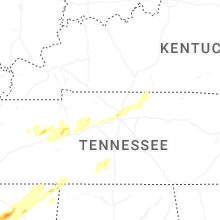

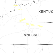


Connect with Interactive Hail Maps