

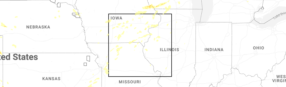
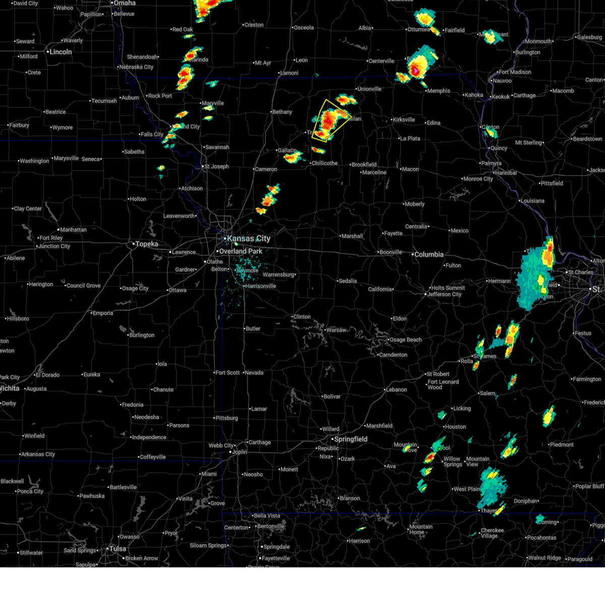
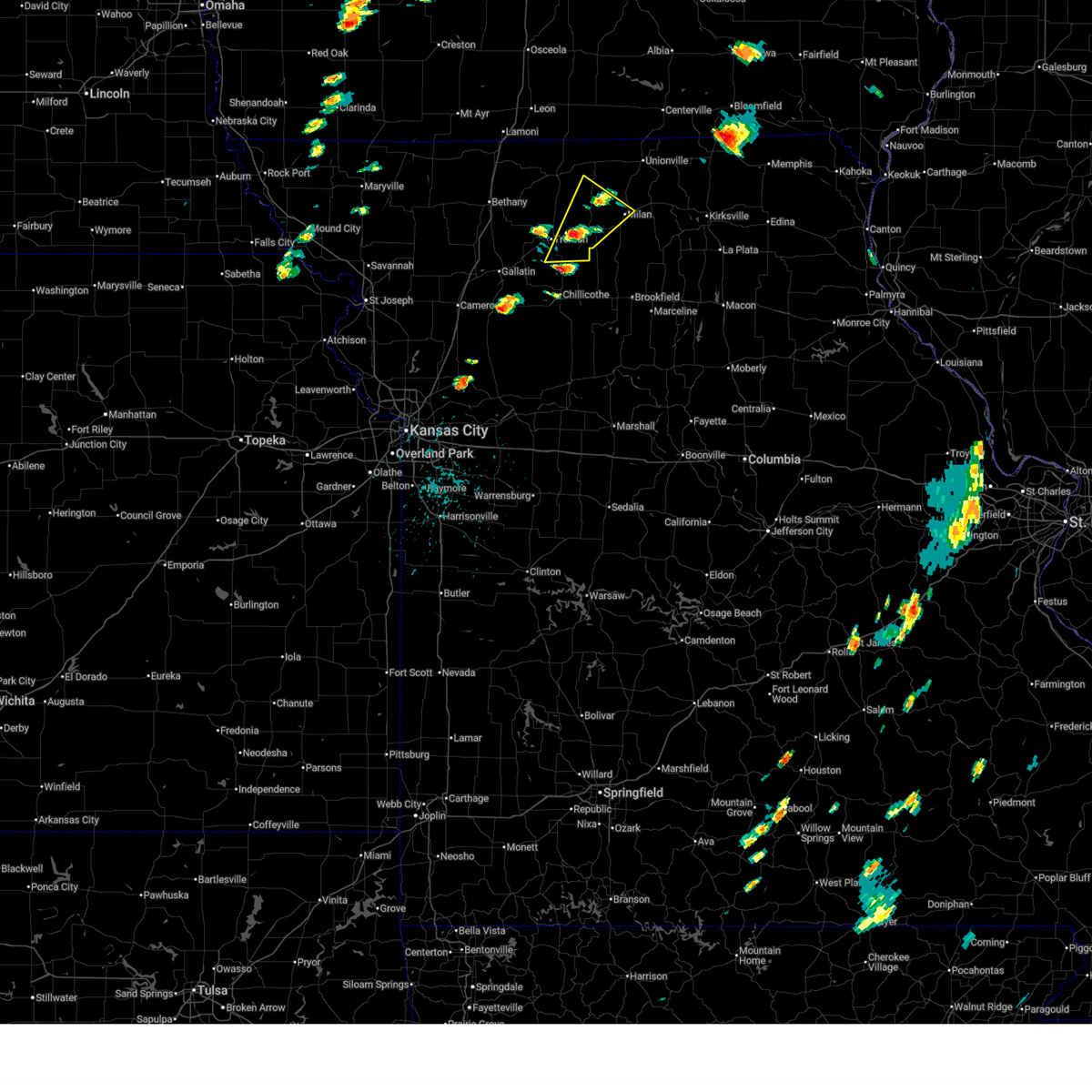
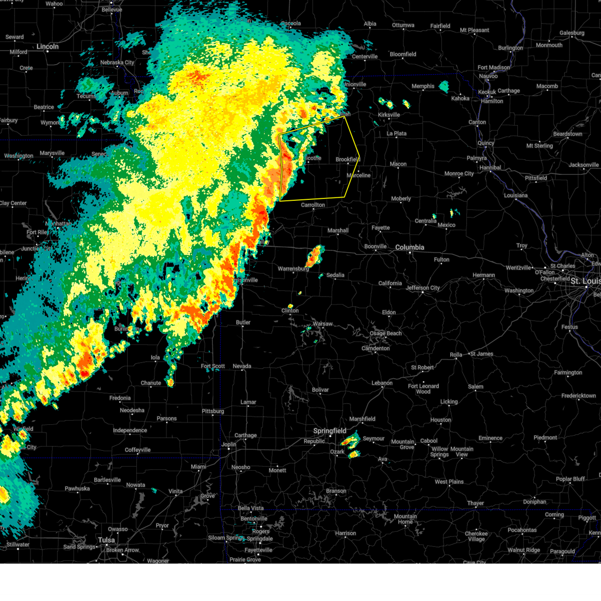
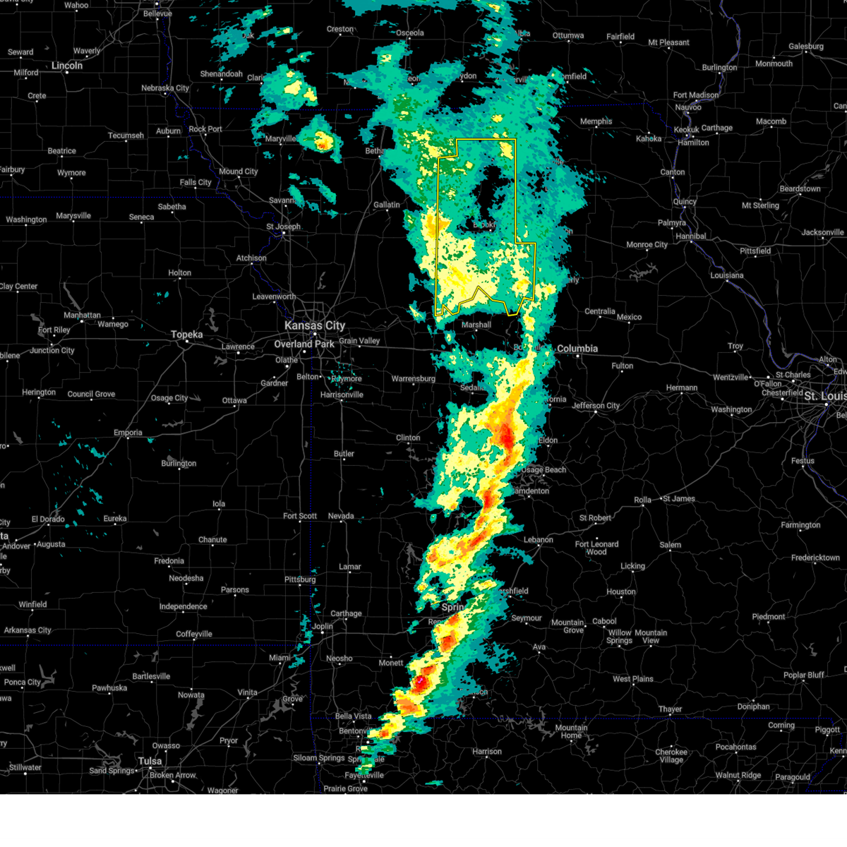
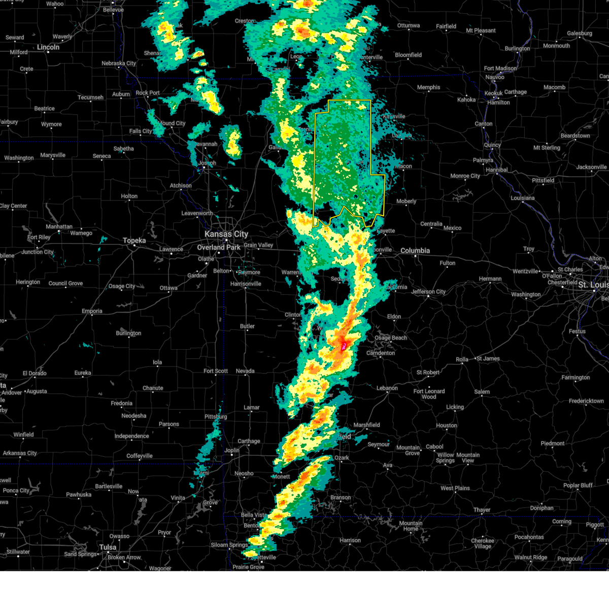
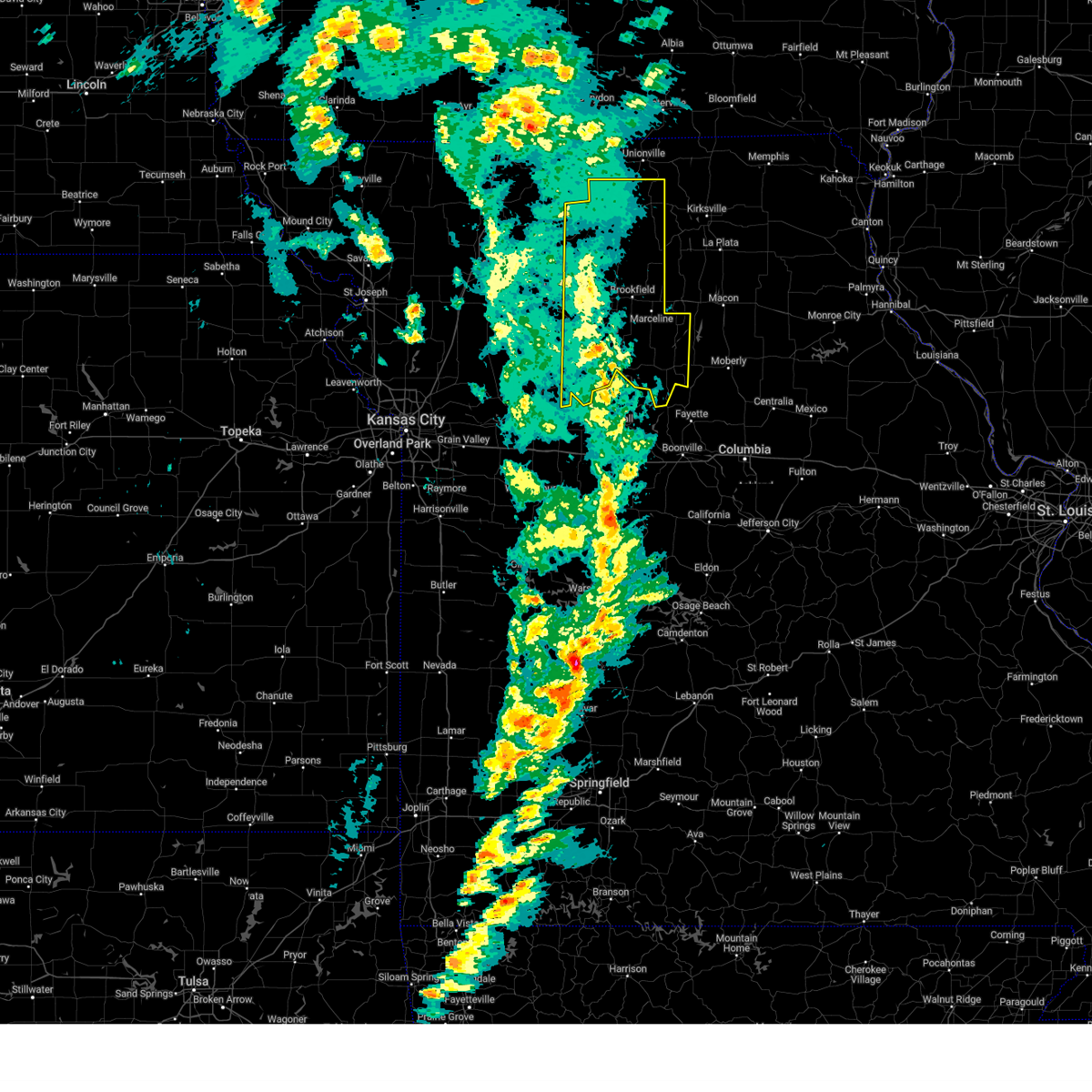
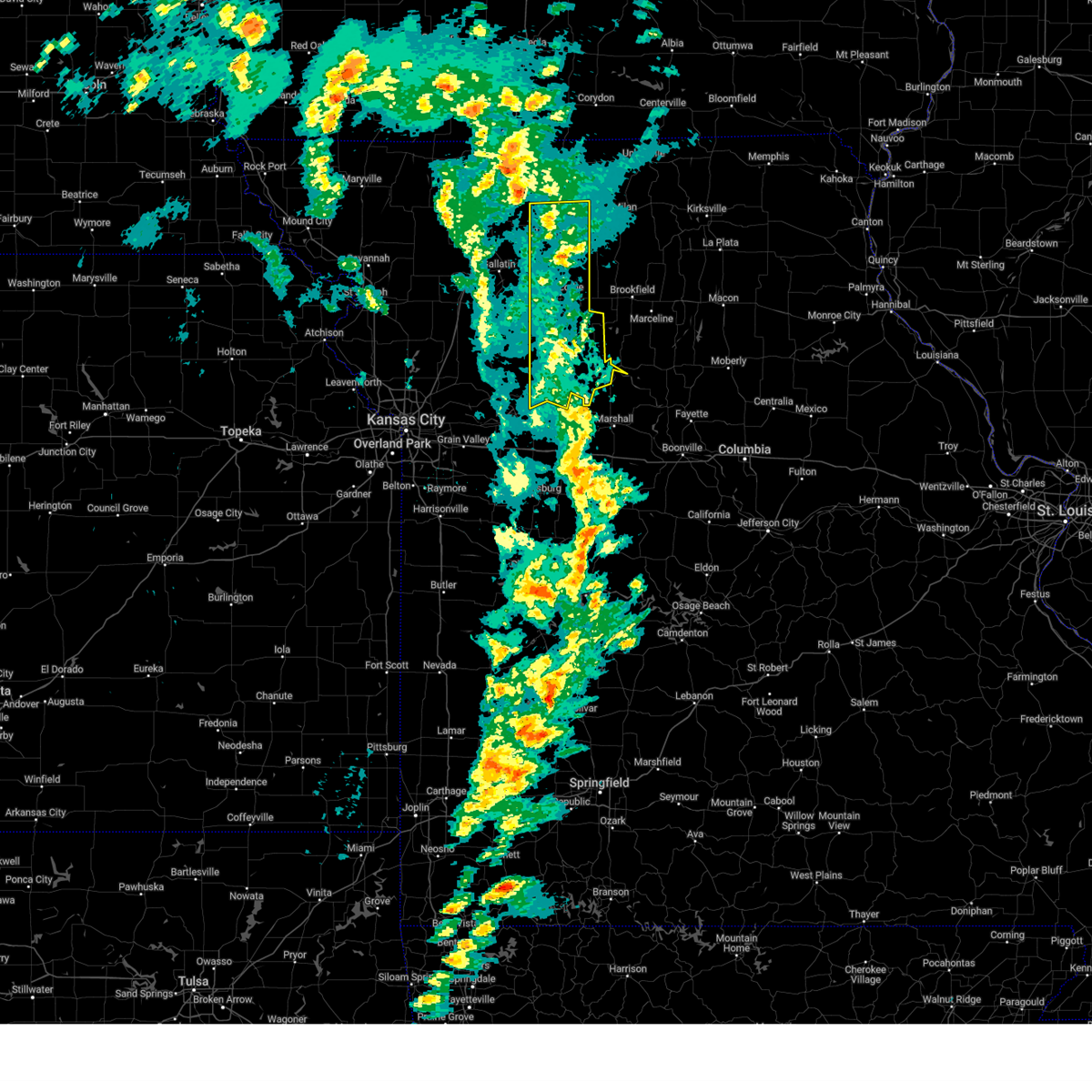
Hail Map for Galt, MO
The Galt, MO area has had 2 reports of on-the-ground hail by trained spotters, and has been under severe weather warnings 10 times during the past 12 months. Doppler radar has detected hail at or near Galt, MO on 63 occasions, including 2 occasions during the past year.
| Name: | Galt, MO |
| Where Located: | 90.4 miles WSW of Kahoka, MO |
| Map: | Google Map for Galt, MO |
| Population: | 253 |
| Housing Units: | 138 |
| More Info: | Search Google for Galt, MO |
3
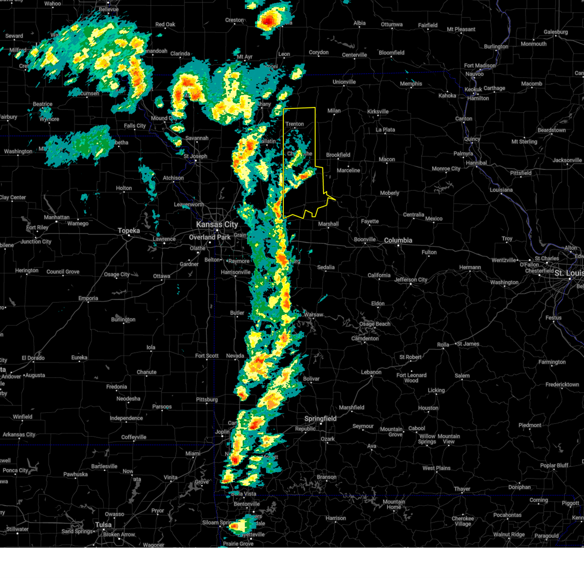
The Top Recent Hail Date for Galt, MO is Friday, July 11, 2025 (9th out of 63)
Hail and Wind Damage Spotted near Galt, MO
| Date / Time | Report Details |
|---|---|
| 7/11/2025 2:40 PM CDT |
 At 239 pm cdt, a severe thunderstorm was located near galt, or 12 miles west of milan, moving northeast at 25 mph (radar indicated). Hazards include 60 mph wind gusts and quarter size hail. Hail damage to vehicles is expected. expect wind damage to roofs, siding, and trees. Locations impacted include, milan, galt, laredo, humphreys, harris, osgood, and reger. At 239 pm cdt, a severe thunderstorm was located near galt, or 12 miles west of milan, moving northeast at 25 mph (radar indicated). Hazards include 60 mph wind gusts and quarter size hail. Hail damage to vehicles is expected. expect wind damage to roofs, siding, and trees. Locations impacted include, milan, galt, laredo, humphreys, harris, osgood, and reger.
|
| 7/11/2025 2:24 PM CDT |
 Svreax the national weather service in pleasant hill has issued a * severe thunderstorm warning for, eastern grundy county in north central missouri, southeastern mercer county in north central missouri, western sullivan county in north central missouri, * until 315 pm cdt. * at 224 pm cdt, a severe thunderstorm was located over galt, or 9 miles east of trenton, moving northeast at 25 mph (radar indicated). Hazards include 60 mph wind gusts and quarter size hail. Hail damage to vehicles is expected. Expect wind damage to roofs, siding, and trees. Svreax the national weather service in pleasant hill has issued a * severe thunderstorm warning for, eastern grundy county in north central missouri, southeastern mercer county in north central missouri, western sullivan county in north central missouri, * until 315 pm cdt. * at 224 pm cdt, a severe thunderstorm was located over galt, or 9 miles east of trenton, moving northeast at 25 mph (radar indicated). Hazards include 60 mph wind gusts and quarter size hail. Hail damage to vehicles is expected. Expect wind damage to roofs, siding, and trees.
|
| 6/3/2025 4:00 PM CDT | the severe thunderstorm warning has been cancelled and is no longer in effect |
| 6/3/2025 4:00 PM CDT | At 359 pm cdt, severe thunderstorms were located along a line extending from 10 miles northwest of milan to 9 miles northeast of browning to 7 miles east of hale, moving east at 40 mph (radar indicated). Hazards include 60 mph wind gusts and penny size hail. Expect damage to roofs, siding, and trees. Locations impacted include, chillicothe, brookfield, milan, meadville, hale, laclede, bosworth, linneus, wheeling, browning, galt, chula, laredo, purdin, mendon, bogard, tina, humphreys, sumner, and rothville. |
| 6/3/2025 3:13 PM CDT |
 Svreax the national weather service in pleasant hill has issued a * severe thunderstorm warning for, northwestern chariton county in north central missouri, eastern daviess county in north central missouri, linn county in north central missouri, southern grundy county in north central missouri, southwestern sullivan county in north central missouri, northeastern ray county in west central missouri, northern carroll county in north central missouri, eastern caldwell county in north central missouri, livingston county in north central missouri, * until 415 pm cdt. * at 312 pm cdt, severe thunderstorms were located along a line extending from jamesport to near utica to near braymer, moving east at 40 mph (radar indicated). Hazards include 60 mph wind gusts and penny size hail. expect damage to roofs, siding, and trees Svreax the national weather service in pleasant hill has issued a * severe thunderstorm warning for, northwestern chariton county in north central missouri, eastern daviess county in north central missouri, linn county in north central missouri, southern grundy county in north central missouri, southwestern sullivan county in north central missouri, northeastern ray county in west central missouri, northern carroll county in north central missouri, eastern caldwell county in north central missouri, livingston county in north central missouri, * until 415 pm cdt. * at 312 pm cdt, severe thunderstorms were located along a line extending from jamesport to near utica to near braymer, moving east at 40 mph (radar indicated). Hazards include 60 mph wind gusts and penny size hail. expect damage to roofs, siding, and trees
|
| 3/14/2025 5:43 PM CDT |
 The storm which prompted the warning has weakened below severe limits, and has exited the warned area. therefore, the warning will be allowed to expire. however, non-thunderstorm wind gusts up to 60 mph are still expected. a tornado watch remains in effect until 1100 pm cdt for central and north central missouri. a severe thunderstorm watch remains in effect until 700 pm cdt for west central missouri. The storm which prompted the warning has weakened below severe limits, and has exited the warned area. therefore, the warning will be allowed to expire. however, non-thunderstorm wind gusts up to 60 mph are still expected. a tornado watch remains in effect until 1100 pm cdt for central and north central missouri. a severe thunderstorm watch remains in effect until 700 pm cdt for west central missouri.
|
| 3/14/2025 5:19 PM CDT |
 At 518 pm cdt, showers with embedded thunderstorms were located 7 miles west of browning, or 15 miles southwest of milan, moving north at 60 mph (radar indicated). Hazards include 60 mph wind gusts. Expect damage to roofs, siding, and trees. Locations impacted include, carrollton, avalon, marceline, triplett, prairie hill, linneus, newtown, salisbury, reger, osgood, purdin, bogard, sumner, dalton, humphreys, pollock, saint catherine, brunswick, galt, and chula. At 518 pm cdt, showers with embedded thunderstorms were located 7 miles west of browning, or 15 miles southwest of milan, moving north at 60 mph (radar indicated). Hazards include 60 mph wind gusts. Expect damage to roofs, siding, and trees. Locations impacted include, carrollton, avalon, marceline, triplett, prairie hill, linneus, newtown, salisbury, reger, osgood, purdin, bogard, sumner, dalton, humphreys, pollock, saint catherine, brunswick, galt, and chula.
|
| 3/14/2025 4:57 PM CDT |
 Svreax the national weather service in pleasant hill has issued a * severe thunderstorm warning for, chariton county in north central missouri, linn county in north central missouri, eastern grundy county in north central missouri, sullivan county in north central missouri, central carroll county in north central missouri, eastern livingston county in north central missouri, * until 545 pm cdt. * at 456 pm cdt, a cluster of severe thunderstorms were located near wheeling, or 10 miles southeast of chillicothe, moving north at 60 mph (radar indicated). Hazards include 70 mph wind gusts and penny size hail. Expect considerable tree damage. Damage is likely to mobile homes, roofs, and outbuildings. Svreax the national weather service in pleasant hill has issued a * severe thunderstorm warning for, chariton county in north central missouri, linn county in north central missouri, eastern grundy county in north central missouri, sullivan county in north central missouri, central carroll county in north central missouri, eastern livingston county in north central missouri, * until 545 pm cdt. * at 456 pm cdt, a cluster of severe thunderstorms were located near wheeling, or 10 miles southeast of chillicothe, moving north at 60 mph (radar indicated). Hazards include 70 mph wind gusts and penny size hail. Expect considerable tree damage. Damage is likely to mobile homes, roofs, and outbuildings.
|
| 3/14/2025 4:43 PM CDT |
 At 443 pm cdt, a severe thunderstorm was located near galt, or 9 miles east of trenton, moving north at 65 mph (radio station in trenton reported a 70 mph wind gust). Hazards include 70 mph wind gusts and penny size hail. Expect considerable tree damage. damage is likely to mobile homes, roofs, and outbuildings. Locations impacted include, carrollton, tindall, spring hill, avalon, mooresville, ludlow, utica, spickard, dawn, bogard, stet, brimson, galt, chula, wheeling, laredo, tina, wakenda, hale, and chillicothe. At 443 pm cdt, a severe thunderstorm was located near galt, or 9 miles east of trenton, moving north at 65 mph (radio station in trenton reported a 70 mph wind gust). Hazards include 70 mph wind gusts and penny size hail. Expect considerable tree damage. damage is likely to mobile homes, roofs, and outbuildings. Locations impacted include, carrollton, tindall, spring hill, avalon, mooresville, ludlow, utica, spickard, dawn, bogard, stet, brimson, galt, chula, wheeling, laredo, tina, wakenda, hale, and chillicothe.
|
| 3/14/2025 4:19 PM CDT |
 Svreax the national weather service in pleasant hill has issued a * severe thunderstorm warning for, grundy county in north central missouri, carroll county in north central missouri, livingston county in north central missouri, * until 500 pm cdt. * at 419 pm cdt, a cluster of severe thunderstorms were located 8 miles west of hale, or 10 miles south of chillicothe, moving north at 65 mph (radar indicated). Hazards include 70 mph wind gusts and penny size hail. Expect considerable tree damage. Damage is likely to mobile homes, roofs, and outbuildings. Svreax the national weather service in pleasant hill has issued a * severe thunderstorm warning for, grundy county in north central missouri, carroll county in north central missouri, livingston county in north central missouri, * until 500 pm cdt. * at 419 pm cdt, a cluster of severe thunderstorms were located 8 miles west of hale, or 10 miles south of chillicothe, moving north at 65 mph (radar indicated). Hazards include 70 mph wind gusts and penny size hail. Expect considerable tree damage. Damage is likely to mobile homes, roofs, and outbuildings.
|
| 7/2/2024 7:18 PM CDT |
 Svreax the national weather service in pleasant hill has issued a * severe thunderstorm warning for, west central adair county in northeastern missouri, northwestern chariton county in north central missouri, linn county in north central missouri, southeastern grundy county in north central missouri, southern sullivan county in north central missouri, east central caldwell county in north central missouri, livingston county in north central missouri, * until 800 pm cdt. * at 718 pm cdt, severe thunderstorms were located along a line extending from near galt to 6 miles southeast of breckenridge, moving east at 25 mph (radar indicated). Hazards include 60 mph wind gusts and penny size hail. expect damage to roofs, siding, and trees Svreax the national weather service in pleasant hill has issued a * severe thunderstorm warning for, west central adair county in northeastern missouri, northwestern chariton county in north central missouri, linn county in north central missouri, southeastern grundy county in north central missouri, southern sullivan county in north central missouri, east central caldwell county in north central missouri, livingston county in north central missouri, * until 800 pm cdt. * at 718 pm cdt, severe thunderstorms were located along a line extending from near galt to 6 miles southeast of breckenridge, moving east at 25 mph (radar indicated). Hazards include 60 mph wind gusts and penny size hail. expect damage to roofs, siding, and trees
|
| 7/2/2024 6:57 PM CDT |
 At 656 pm cdt, severe thunderstorms were located along a line extending from 6 miles west of trenton to near kingston, moving east at 25 mph (public. 60 mph winds were reported in brimson, and these storms have a history of producing damage in dekalb county). Hazards include 60 mph wind gusts and penny size hail. Expect damage to roofs, siding, and trees. locations impacted include, trenton, hamilton, gallatin, jamesport, breckenridge, kingston, galt, kidder, laredo, mooresville, lock springs, and spring hill. This includes interstate 35 in missouri between mile markers 44 and 51. At 656 pm cdt, severe thunderstorms were located along a line extending from 6 miles west of trenton to near kingston, moving east at 25 mph (public. 60 mph winds were reported in brimson, and these storms have a history of producing damage in dekalb county). Hazards include 60 mph wind gusts and penny size hail. Expect damage to roofs, siding, and trees. locations impacted include, trenton, hamilton, gallatin, jamesport, breckenridge, kingston, galt, kidder, laredo, mooresville, lock springs, and spring hill. This includes interstate 35 in missouri between mile markers 44 and 51.
|
| 7/2/2024 6:45 PM CDT |
 Svreax the national weather service in pleasant hill has issued a * severe thunderstorm warning for, adair county in northeastern missouri, northeastern grundy county in north central missouri, sullivan county in north central missouri, eastern putnam county in north central missouri, schuyler county in northeastern missouri, * until 745 pm cdt. * at 645 pm cdt, severe thunderstorms were located along a line extending from near lancaster to near greencastle to near galt, moving east at 35 mph (radar indicated). Hazards include 60 mph wind gusts and quarter size hail. Hail damage to vehicles is expected. Expect wind damage to roofs, siding, and trees. Svreax the national weather service in pleasant hill has issued a * severe thunderstorm warning for, adair county in northeastern missouri, northeastern grundy county in north central missouri, sullivan county in north central missouri, eastern putnam county in north central missouri, schuyler county in northeastern missouri, * until 745 pm cdt. * at 645 pm cdt, severe thunderstorms were located along a line extending from near lancaster to near greencastle to near galt, moving east at 35 mph (radar indicated). Hazards include 60 mph wind gusts and quarter size hail. Hail damage to vehicles is expected. Expect wind damage to roofs, siding, and trees.
|
| 7/2/2024 6:43 PM CDT |
 Svreax the national weather service in pleasant hill has issued a * severe thunderstorm warning for, eastern daviess county in north central missouri, southern grundy county in north central missouri, east central clinton county in northwestern missouri, caldwell county in north central missouri, northwestern livingston county in north central missouri, * until 730 pm cdt. * at 643 pm cdt, severe thunderstorms were located along a line extending from near gilman city to near cameron, moving east at 25 mph (radar indicated). Hazards include 60 mph wind gusts and penny size hail. expect damage to roofs, siding, and trees Svreax the national weather service in pleasant hill has issued a * severe thunderstorm warning for, eastern daviess county in north central missouri, southern grundy county in north central missouri, east central clinton county in northwestern missouri, caldwell county in north central missouri, northwestern livingston county in north central missouri, * until 730 pm cdt. * at 643 pm cdt, severe thunderstorms were located along a line extending from near gilman city to near cameron, moving east at 25 mph (radar indicated). Hazards include 60 mph wind gusts and penny size hail. expect damage to roofs, siding, and trees
|
| 7/2/2024 6:24 PM CDT |
 Svreax the national weather service in pleasant hill has issued a * severe thunderstorm warning for, eastern grundy county in north central missouri, sullivan county in north central missouri, * until 645 pm cdt. * at 622 pm cdt, a severe thunderstorm was located 8 miles north of galt, or 12 miles west of milan, moving east northeast at 40 mph (radar indicated). Hazards include 60 mph wind gusts and quarter size hail. Hail damage to vehicles is expected. Expect wind damage to roofs, siding, and trees. Svreax the national weather service in pleasant hill has issued a * severe thunderstorm warning for, eastern grundy county in north central missouri, sullivan county in north central missouri, * until 645 pm cdt. * at 622 pm cdt, a severe thunderstorm was located 8 miles north of galt, or 12 miles west of milan, moving east northeast at 40 mph (radar indicated). Hazards include 60 mph wind gusts and quarter size hail. Hail damage to vehicles is expected. Expect wind damage to roofs, siding, and trees.
|
| 6/26/2024 12:18 AM CDT |
 Svreax the national weather service in pleasant hill has issued a * severe thunderstorm warning for, northwestern linn county in north central missouri, grundy county in north central missouri, southern sullivan county in north central missouri, northern livingston county in north central missouri, * until 100 am cdt. * at 1218 am cdt, severe thunderstorms were located along a line extending from near princeton to near gilman city, moving southeast at 35 mph (radar indicated). Hazards include 70 mph wind gusts and nickel size hail. Expect considerable tree damage. Damage is likely to mobile homes, roofs, and outbuildings. Svreax the national weather service in pleasant hill has issued a * severe thunderstorm warning for, northwestern linn county in north central missouri, grundy county in north central missouri, southern sullivan county in north central missouri, northern livingston county in north central missouri, * until 100 am cdt. * at 1218 am cdt, severe thunderstorms were located along a line extending from near princeton to near gilman city, moving southeast at 35 mph (radar indicated). Hazards include 70 mph wind gusts and nickel size hail. Expect considerable tree damage. Damage is likely to mobile homes, roofs, and outbuildings.
|
| 5/24/2024 1:59 AM CDT |
 At 159 am cdt, a severe thunderstorm was located over trenton, moving northeast at 25 mph (radar indicated). Hazards include 60 mph wind gusts and half dollar size hail. Hail damage to vehicles is expected. expect wind damage to roofs, siding, and trees. Locations impacted include, trenton, spickard, galt, tindall, and brimson. At 159 am cdt, a severe thunderstorm was located over trenton, moving northeast at 25 mph (radar indicated). Hazards include 60 mph wind gusts and half dollar size hail. Hail damage to vehicles is expected. expect wind damage to roofs, siding, and trees. Locations impacted include, trenton, spickard, galt, tindall, and brimson.
|
| 5/24/2024 1:42 AM CDT |
 Svreax the national weather service in pleasant hill has issued a * severe thunderstorm warning for, grundy county in north central missouri, * until 230 am cdt. * at 142 am cdt, a severe thunderstorm was located near jamesport, or 8 miles southwest of trenton, moving northeast at 25 mph (radar indicated). Hazards include 60 mph wind gusts and half dollar size hail. Hail damage to vehicles is expected. Expect wind damage to roofs, siding, and trees. Svreax the national weather service in pleasant hill has issued a * severe thunderstorm warning for, grundy county in north central missouri, * until 230 am cdt. * at 142 am cdt, a severe thunderstorm was located near jamesport, or 8 miles southwest of trenton, moving northeast at 25 mph (radar indicated). Hazards include 60 mph wind gusts and half dollar size hail. Hail damage to vehicles is expected. Expect wind damage to roofs, siding, and trees.
|
| 5/21/2024 4:58 PM CDT |
 Svreax the national weather service in pleasant hill has issued a * severe thunderstorm warning for, northwestern linn county in north central missouri, grundy county in north central missouri, sullivan county in north central missouri, southeastern mercer county in north central missouri, western putnam county in north central missouri, north central livingston county in north central missouri, * until 530 pm cdt. * at 458 pm cdt, a severe thunderstorm was located near galt, or 8 miles northeast of trenton, moving northeast at 60 mph (radar indicated). Hazards include 60 mph wind gusts and quarter size hail. Hail damage to vehicles is expected. Expect wind damage to roofs, siding, and trees. Svreax the national weather service in pleasant hill has issued a * severe thunderstorm warning for, northwestern linn county in north central missouri, grundy county in north central missouri, sullivan county in north central missouri, southeastern mercer county in north central missouri, western putnam county in north central missouri, north central livingston county in north central missouri, * until 530 pm cdt. * at 458 pm cdt, a severe thunderstorm was located near galt, or 8 miles northeast of trenton, moving northeast at 60 mph (radar indicated). Hazards include 60 mph wind gusts and quarter size hail. Hail damage to vehicles is expected. Expect wind damage to roofs, siding, and trees.
|
| 5/7/2024 12:51 AM CDT |
 At 1250 am cdt, severe thunderstorms were located along a line extending from 6 miles north of mercer to near wheeling, moving northeast at 45 mph (emergency management. a 57 mph wind gust was reported in trenton. numerous power outages have been reported in harrison county). Hazards include 60 mph wind gusts. Expect damage to roofs, siding, and trees. Locations impacted include, chillicothe, trenton, brookfield, marceline, milan, unionville, princeton, meadville, laclede, mercer, cainsville, linneus, wheeling, utica, browning, spickard, galt, chula, laredo, and purdin. At 1250 am cdt, severe thunderstorms were located along a line extending from 6 miles north of mercer to near wheeling, moving northeast at 45 mph (emergency management. a 57 mph wind gust was reported in trenton. numerous power outages have been reported in harrison county). Hazards include 60 mph wind gusts. Expect damage to roofs, siding, and trees. Locations impacted include, chillicothe, trenton, brookfield, marceline, milan, unionville, princeton, meadville, laclede, mercer, cainsville, linneus, wheeling, utica, browning, spickard, galt, chula, laredo, and purdin.
|
| 5/7/2024 12:51 AM CDT |
 the severe thunderstorm warning has been cancelled and is no longer in effect the severe thunderstorm warning has been cancelled and is no longer in effect
|
| 5/7/2024 12:21 AM CDT |
 Svreax the national weather service in pleasant hill has issued a * severe thunderstorm warning for, northwestern chariton county in north central missouri, eastern daviess county in north central missouri, linn county in north central missouri, grundy county in north central missouri, sullivan county in north central missouri, mercer county in north central missouri, western putnam county in north central missouri, harrison county in north central missouri, northeastern caldwell county in north central missouri, livingston county in north central missouri, * until 115 am cdt. * at 1220 am cdt, severe thunderstorms were located along a line extending from near eagleville to near braymer, moving northeast at 45 mph (radar indicated). Hazards include 60 mph wind gusts. expect damage to roofs, siding, and trees Svreax the national weather service in pleasant hill has issued a * severe thunderstorm warning for, northwestern chariton county in north central missouri, eastern daviess county in north central missouri, linn county in north central missouri, grundy county in north central missouri, sullivan county in north central missouri, mercer county in north central missouri, western putnam county in north central missouri, harrison county in north central missouri, northeastern caldwell county in north central missouri, livingston county in north central missouri, * until 115 am cdt. * at 1220 am cdt, severe thunderstorms were located along a line extending from near eagleville to near braymer, moving northeast at 45 mph (radar indicated). Hazards include 60 mph wind gusts. expect damage to roofs, siding, and trees
|
| 4/27/2024 6:57 PM CDT |
 At 657 pm cdt, a severe thunderstorm was located near galt, or 9 miles east of trenton, moving northeast at 25 mph (radar indicated). Hazards include 60 mph wind gusts and quarter size hail. Hail damage to vehicles is expected. expect wind damage to roofs, siding, and trees. Locations impacted include, trenton, milan, browning, galt, laredo, humphreys, osgood, and reger. At 657 pm cdt, a severe thunderstorm was located near galt, or 9 miles east of trenton, moving northeast at 25 mph (radar indicated). Hazards include 60 mph wind gusts and quarter size hail. Hail damage to vehicles is expected. expect wind damage to roofs, siding, and trees. Locations impacted include, trenton, milan, browning, galt, laredo, humphreys, osgood, and reger.
|
| 4/27/2024 6:57 PM CDT |
 the severe thunderstorm warning has been cancelled and is no longer in effect the severe thunderstorm warning has been cancelled and is no longer in effect
|
| 4/27/2024 6:34 PM CDT | Quarter sized hail reported 5.4 miles SSW of Galt, MO, 1 inch hail reported near osgood. time estimate via radar. |
| 4/27/2024 6:27 PM CDT |
 Svreax the national weather service in pleasant hill has issued a * severe thunderstorm warning for, southeastern daviess county in north central missouri, northwestern linn county in north central missouri, grundy county in north central missouri, western sullivan county in north central missouri, southeastern mercer county in north central missouri, northern livingston county in north central missouri, * until 715 pm cdt. * at 627 pm cdt, severe thunderstorms were located along a line extending from 7 miles northeast of galt to 8 miles southeast of jamesport, moving northeast at 30 mph (radar indicated). Hazards include 60 mph wind gusts and quarter size hail. Hail damage to vehicles is expected. Expect wind damage to roofs, siding, and trees. Svreax the national weather service in pleasant hill has issued a * severe thunderstorm warning for, southeastern daviess county in north central missouri, northwestern linn county in north central missouri, grundy county in north central missouri, western sullivan county in north central missouri, southeastern mercer county in north central missouri, northern livingston county in north central missouri, * until 715 pm cdt. * at 627 pm cdt, severe thunderstorms were located along a line extending from 7 miles northeast of galt to 8 miles southeast of jamesport, moving northeast at 30 mph (radar indicated). Hazards include 60 mph wind gusts and quarter size hail. Hail damage to vehicles is expected. Expect wind damage to roofs, siding, and trees.
|
| 4/27/2024 6:21 PM CDT |
 At 621 pm cdt, a severe thunderstorm was located over galt, or 10 miles east of trenton, moving east at 45 mph (emergency management). Hazards include 60 mph wind gusts and half dollar size hail. Hail damage to vehicles is expected. expect wind damage to roofs, siding, and trees. Locations impacted include, trenton, galt, laredo, and tindall. At 621 pm cdt, a severe thunderstorm was located over galt, or 10 miles east of trenton, moving east at 45 mph (emergency management). Hazards include 60 mph wind gusts and half dollar size hail. Hail damage to vehicles is expected. expect wind damage to roofs, siding, and trees. Locations impacted include, trenton, galt, laredo, and tindall.
|
| 4/27/2024 6:21 PM CDT |
 the severe thunderstorm warning has been cancelled and is no longer in effect the severe thunderstorm warning has been cancelled and is no longer in effect
|
| 4/27/2024 6:10 PM CDT |
 At 609 pm cdt, a severe thunderstorm was located near galt, or 7 miles east of trenton, moving east at 40 mph (emergency management. quarter size hail was reported in trenton at 605 pm). Hazards include ping pong ball size hail and 60 mph wind gusts. People and animals outdoors will be injured. expect hail damage to roofs, siding, windows, and vehicles. expect wind damage to roofs, siding, and trees. locations impacted include, trenton, gallatin, jamesport, galt, laredo, jameson, and tindall. This includes interstate 35 in missouri between mile markers 69 and 73. At 609 pm cdt, a severe thunderstorm was located near galt, or 7 miles east of trenton, moving east at 40 mph (emergency management. quarter size hail was reported in trenton at 605 pm). Hazards include ping pong ball size hail and 60 mph wind gusts. People and animals outdoors will be injured. expect hail damage to roofs, siding, windows, and vehicles. expect wind damage to roofs, siding, and trees. locations impacted include, trenton, gallatin, jamesport, galt, laredo, jameson, and tindall. This includes interstate 35 in missouri between mile markers 69 and 73.
|
| 4/27/2024 6:10 PM CDT |
 the severe thunderstorm warning has been cancelled and is no longer in effect the severe thunderstorm warning has been cancelled and is no longer in effect
|
| 4/27/2024 5:55 PM CDT |
 Svreax the national weather service in pleasant hill has issued a * severe thunderstorm warning for, daviess county in north central missouri, grundy county in north central missouri, northwestern livingston county in north central missouri, * until 630 pm cdt. * at 554 pm cdt, a severe thunderstorm was located near trenton, moving east at 45 mph. other storms were rapidly developing southwest of trenton (radar indicated). Hazards include 60 mph wind gusts and quarter size hail. Hail damage to vehicles is expected. Expect wind damage to roofs, siding, and trees. Svreax the national weather service in pleasant hill has issued a * severe thunderstorm warning for, daviess county in north central missouri, grundy county in north central missouri, northwestern livingston county in north central missouri, * until 630 pm cdt. * at 554 pm cdt, a severe thunderstorm was located near trenton, moving east at 45 mph. other storms were rapidly developing southwest of trenton (radar indicated). Hazards include 60 mph wind gusts and quarter size hail. Hail damage to vehicles is expected. Expect wind damage to roofs, siding, and trees.
|
| 4/27/2024 5:45 PM CDT |
 At 545 pm cdt, severe thunderstorms were located along a line extending from near mercer to near spickard to 7 miles west of browning, moving east at 45 mph (public. quarter size hail was reported in spickard at 541 pm). Hazards include 60 mph wind gusts and half dollar size hail. Hail damage to vehicles is expected. expect wind damage to roofs, siding, and trees. Locations impacted include, trenton, milan, unionville, princeton, green city, mercer, greencastle, browning, spickard, galt, laredo, newtown, humphreys, pollock, lucerne, tindall, harris, powersville, osgood, and winigan. At 545 pm cdt, severe thunderstorms were located along a line extending from near mercer to near spickard to 7 miles west of browning, moving east at 45 mph (public. quarter size hail was reported in spickard at 541 pm). Hazards include 60 mph wind gusts and half dollar size hail. Hail damage to vehicles is expected. expect wind damage to roofs, siding, and trees. Locations impacted include, trenton, milan, unionville, princeton, green city, mercer, greencastle, browning, spickard, galt, laredo, newtown, humphreys, pollock, lucerne, tindall, harris, powersville, osgood, and winigan.
|
| 4/27/2024 5:36 PM CDT |
 Svreax the national weather service in pleasant hill has issued a * severe thunderstorm warning for, northern linn county in north central missouri, northeastern grundy county in north central missouri, sullivan county in north central missouri, eastern mercer county in north central missouri, putnam county in north central missouri, * until 615 pm cdt. * at 535 pm cdt, severe thunderstorms were located along a line extending from near princeton to spickard to 8 miles south of galt, moving east at 45 mph (public). Hazards include 60 mph wind gusts and half dollar size hail. Hail damage to vehicles is expected. Expect wind damage to roofs, siding, and trees. Svreax the national weather service in pleasant hill has issued a * severe thunderstorm warning for, northern linn county in north central missouri, northeastern grundy county in north central missouri, sullivan county in north central missouri, eastern mercer county in north central missouri, putnam county in north central missouri, * until 615 pm cdt. * at 535 pm cdt, severe thunderstorms were located along a line extending from near princeton to spickard to 8 miles south of galt, moving east at 45 mph (public). Hazards include 60 mph wind gusts and half dollar size hail. Hail damage to vehicles is expected. Expect wind damage to roofs, siding, and trees.
|
| 4/16/2024 1:46 PM CDT |
 Svreax the national weather service in pleasant hill has issued a * severe thunderstorm warning for, northwestern chariton county in north central missouri, western linn county in north central missouri, eastern grundy county in north central missouri, sullivan county in north central missouri, east central ray county in west central missouri, carroll county in north central missouri, northwestern saline county in central missouri, northeastern lafayette county in west central missouri, central livingston county in north central missouri, * until 215 pm cdt. * at 145 pm cdt, a severe thunderstorm was located near hardin, or 8 miles east of lexington, moving northeast at 65 mph (radar indicated). Hazards include 60 mph wind gusts and penny size hail. expect damage to roofs, siding, and trees Svreax the national weather service in pleasant hill has issued a * severe thunderstorm warning for, northwestern chariton county in north central missouri, western linn county in north central missouri, eastern grundy county in north central missouri, sullivan county in north central missouri, east central ray county in west central missouri, carroll county in north central missouri, northwestern saline county in central missouri, northeastern lafayette county in west central missouri, central livingston county in north central missouri, * until 215 pm cdt. * at 145 pm cdt, a severe thunderstorm was located near hardin, or 8 miles east of lexington, moving northeast at 65 mph (radar indicated). Hazards include 60 mph wind gusts and penny size hail. expect damage to roofs, siding, and trees
|
| 4/16/2024 12:41 PM CDT |
 Svreax the national weather service in pleasant hill has issued a * severe thunderstorm warning for, eastern grundy county in north central missouri, northwestern sullivan county in north central missouri, southeastern mercer county in north central missouri, southwestern putnam county in north central missouri, * until 115 pm cdt. * at 1241 pm cdt, a severe thunderstorm was located 7 miles southeast of trenton, moving northeast at 65 mph (radar indicated). Hazards include 60 mph wind gusts and quarter size hail. Hail damage to vehicles is expected. Expect wind damage to roofs, siding, and trees. Svreax the national weather service in pleasant hill has issued a * severe thunderstorm warning for, eastern grundy county in north central missouri, northwestern sullivan county in north central missouri, southeastern mercer county in north central missouri, southwestern putnam county in north central missouri, * until 115 pm cdt. * at 1241 pm cdt, a severe thunderstorm was located 7 miles southeast of trenton, moving northeast at 65 mph (radar indicated). Hazards include 60 mph wind gusts and quarter size hail. Hail damage to vehicles is expected. Expect wind damage to roofs, siding, and trees.
|
| 8/12/2023 12:43 AM CDT |
 At 1243 am cdt, a severe thunderstorm was located 7 miles west of browning, or 16 miles southwest of milan, moving east at 25 mph (radar indicated). Hazards include two inch hail and 60 mph wind gusts. People and animals outdoors will be injured. expect hail damage to roofs, siding, windows, and vehicles. expect wind damage to roofs, siding, and trees. locations impacted include, linneus, browning, laredo and purdin. thunderstorm damage threat, considerable hail threat, radar indicated max hail size, 2. 00 in wind threat, radar indicated max wind gust, 60 mph. At 1243 am cdt, a severe thunderstorm was located 7 miles west of browning, or 16 miles southwest of milan, moving east at 25 mph (radar indicated). Hazards include two inch hail and 60 mph wind gusts. People and animals outdoors will be injured. expect hail damage to roofs, siding, windows, and vehicles. expect wind damage to roofs, siding, and trees. locations impacted include, linneus, browning, laredo and purdin. thunderstorm damage threat, considerable hail threat, radar indicated max hail size, 2. 00 in wind threat, radar indicated max wind gust, 60 mph.
|
| 8/12/2023 12:30 AM CDT |
 At 1230 am cdt, a severe thunderstorm was located near galt, or 12 miles east of trenton, moving southeast at 25 mph (radar indicated). Hazards include 60 mph wind gusts and half dollar size hail. Hail damage to vehicles is expected. Expect wind damage to roofs, siding, and trees. At 1230 am cdt, a severe thunderstorm was located near galt, or 12 miles east of trenton, moving southeast at 25 mph (radar indicated). Hazards include 60 mph wind gusts and half dollar size hail. Hail damage to vehicles is expected. Expect wind damage to roofs, siding, and trees.
|
| 8/12/2023 12:10 AM CDT |
 At 1210 am cdt, a severe thunderstorm was located near spickard, or 8 miles northeast of trenton, moving east at 30 mph (radar indicated). Hazards include 60 mph wind gusts and half dollar size hail. Hail damage to vehicles is expected. Expect wind damage to roofs, siding, and trees. At 1210 am cdt, a severe thunderstorm was located near spickard, or 8 miles northeast of trenton, moving east at 30 mph (radar indicated). Hazards include 60 mph wind gusts and half dollar size hail. Hail damage to vehicles is expected. Expect wind damage to roofs, siding, and trees.
|
| 8/2/2023 12:12 AM CDT |
 At 1211 am cdt, a severe thunderstorm was located 7 miles north of galt, or 11 miles west of milan, moving east at 30 mph (radar indicated). Hazards include 60 mph wind gusts and quarter size hail. Hail damage to vehicles is expected. Expect wind damage to roofs, siding, and trees. At 1211 am cdt, a severe thunderstorm was located 7 miles north of galt, or 11 miles west of milan, moving east at 30 mph (radar indicated). Hazards include 60 mph wind gusts and quarter size hail. Hail damage to vehicles is expected. Expect wind damage to roofs, siding, and trees.
|
| 7/29/2023 12:26 PM CDT |
 At 1226 pm cdt, severe thunderstorms were located along a line extending from near princeton to near linneus to keytesville, moving east at 30 mph (trained weather spotters). Hazards include 60 mph wind gusts. Expect damage to roofs, siding, and trees. locations impacted include, trenton, brookfield, fayette, marceline, milan, slater, salisbury, glasgow, princeton, brunswick, keytesville, bucklin, meadville, laclede, armstrong, linneus, wheeling, browning, spickard and galt. hail threat, radar indicated max hail size, <. 75 in wind threat, observed max wind gust, 60 mph. At 1226 pm cdt, severe thunderstorms were located along a line extending from near princeton to near linneus to keytesville, moving east at 30 mph (trained weather spotters). Hazards include 60 mph wind gusts. Expect damage to roofs, siding, and trees. locations impacted include, trenton, brookfield, fayette, marceline, milan, slater, salisbury, glasgow, princeton, brunswick, keytesville, bucklin, meadville, laclede, armstrong, linneus, wheeling, browning, spickard and galt. hail threat, radar indicated max hail size, <. 75 in wind threat, observed max wind gust, 60 mph.
|
| 7/29/2023 12:16 PM CDT |
 At 1215 pm cdt, severe thunderstorms were located along a line extending from near cainsville to near linneus to near keytesville, moving east at 30 mph (trained weather spotters). Hazards include 60 mph wind gusts. Expect damage to roofs, siding, and trees. locations impacted include, trenton, brookfield, fayette, marceline, milan, slater, salisbury, glasgow, princeton, brunswick, keytesville, bucklin, ridgeway, meadville, gilman city, laclede, armstrong, linneus, wheeling and browning. hail threat, radar indicated max hail size, <. 75 in wind threat, observed max wind gust, 60 mph. At 1215 pm cdt, severe thunderstorms were located along a line extending from near cainsville to near linneus to near keytesville, moving east at 30 mph (trained weather spotters). Hazards include 60 mph wind gusts. Expect damage to roofs, siding, and trees. locations impacted include, trenton, brookfield, fayette, marceline, milan, slater, salisbury, glasgow, princeton, brunswick, keytesville, bucklin, ridgeway, meadville, gilman city, laclede, armstrong, linneus, wheeling and browning. hail threat, radar indicated max hail size, <. 75 in wind threat, observed max wind gust, 60 mph.
|
| 7/29/2023 12:09 PM CDT |
 At 1209 pm cdt, severe thunderstorms were located along a line extending from near cainsville to near linneus to brunswick, moving east at 35 mph (trained weather spotters). Hazards include 60 mph wind gusts. expect damage to roofs, siding, and trees At 1209 pm cdt, severe thunderstorms were located along a line extending from near cainsville to near linneus to brunswick, moving east at 35 mph (trained weather spotters). Hazards include 60 mph wind gusts. expect damage to roofs, siding, and trees
|
| 7/1/2023 12:05 AM CDT |
 At 1205 am cdt, severe thunderstorms were located along a line extending from near spickard to 9 miles west of browning to wheeling, moving east at 35 mph (radar indicated). Hazards include 60 mph wind gusts. Expect damage to roofs, siding, and trees. locations impacted include, trenton, spickard, galt, laredo, tindall, brimson, modena and mill grove. hail threat, radar indicated max hail size, <. 75 in wind threat, radar indicated max wind gust, 60 mph. At 1205 am cdt, severe thunderstorms were located along a line extending from near spickard to 9 miles west of browning to wheeling, moving east at 35 mph (radar indicated). Hazards include 60 mph wind gusts. Expect damage to roofs, siding, and trees. locations impacted include, trenton, spickard, galt, laredo, tindall, brimson, modena and mill grove. hail threat, radar indicated max hail size, <. 75 in wind threat, radar indicated max wind gust, 60 mph.
|
| 6/30/2023 11:45 PM CDT |
 At 1145 pm cdt, severe thunderstorms were located along a line extending from near spickard to 11 miles southeast of trenton to near chillicothe, moving east at 35 mph (emergency management). Hazards include 60 mph wind gusts. Expect damage to roofs, siding, and trees. locations impacted include, chillicothe, trenton, bethany, gilman city, wheeling, utica, spickard, galt, chula, laredo, ludlow, mooresville, mount moriah, tindall, brimson, spring hill, modena, avalon, mill grove and dawn. this includes interstate 35 in missouri between mile markers 86 and 93. hail threat, radar indicated max hail size, <. 75 in wind threat, observed max wind gust, 60 mph. At 1145 pm cdt, severe thunderstorms were located along a line extending from near spickard to 11 miles southeast of trenton to near chillicothe, moving east at 35 mph (emergency management). Hazards include 60 mph wind gusts. Expect damage to roofs, siding, and trees. locations impacted include, chillicothe, trenton, bethany, gilman city, wheeling, utica, spickard, galt, chula, laredo, ludlow, mooresville, mount moriah, tindall, brimson, spring hill, modena, avalon, mill grove and dawn. this includes interstate 35 in missouri between mile markers 86 and 93. hail threat, radar indicated max hail size, <. 75 in wind threat, observed max wind gust, 60 mph.
|
| 6/30/2023 11:13 PM CDT |
 At 1113 pm cdt, severe thunderstorms were located along a line extending from 7 miles west of gilman city to near breckenridge to near braymer, moving east at 35 mph (radar indicated). Hazards include 60 mph wind gusts. expect damage to roofs, siding, and trees At 1113 pm cdt, severe thunderstorms were located along a line extending from 7 miles west of gilman city to near breckenridge to near braymer, moving east at 35 mph (radar indicated). Hazards include 60 mph wind gusts. expect damage to roofs, siding, and trees
|
| 6/29/2023 9:37 AM CDT |
 At 937 am cdt, severe thunderstorms were located along a line extending from near trenton to near wheeling to 8 miles west of hale, moving east at 65 mph (radar indicated). Hazards include 70 mph wind gusts. Expect considerable tree damage. damage is likely to mobile homes, roofs, and outbuildings. locations impacted include, chillicothe, trenton, brookfield, marceline, braymer, polo, jamesport, bucklin, meadville, hale, breckenridge, gilman city, laclede, linneus, wheeling, utica, browning, galt, cowgill and chula. thunderstorm damage threat, considerable hail threat, radar indicated max hail size, <. 75 in wind threat, radar indicated max wind gust, 70 mph. At 937 am cdt, severe thunderstorms were located along a line extending from near trenton to near wheeling to 8 miles west of hale, moving east at 65 mph (radar indicated). Hazards include 70 mph wind gusts. Expect considerable tree damage. damage is likely to mobile homes, roofs, and outbuildings. locations impacted include, chillicothe, trenton, brookfield, marceline, braymer, polo, jamesport, bucklin, meadville, hale, breckenridge, gilman city, laclede, linneus, wheeling, utica, browning, galt, cowgill and chula. thunderstorm damage threat, considerable hail threat, radar indicated max hail size, <. 75 in wind threat, radar indicated max wind gust, 70 mph.
|
| 6/29/2023 9:20 AM CDT |
 At 919 am cdt, severe thunderstorms were located along a line extending from 7 miles southwest of gilman city to near breckenridge to near cowgill, moving east at 65 mph (radar indicated). Hazards include 70 mph wind gusts. Expect considerable tree damage. Damage is likely to mobile homes, roofs, and outbuildings. At 919 am cdt, severe thunderstorms were located along a line extending from 7 miles southwest of gilman city to near breckenridge to near cowgill, moving east at 65 mph (radar indicated). Hazards include 70 mph wind gusts. Expect considerable tree damage. Damage is likely to mobile homes, roofs, and outbuildings.
|
| 6/29/2023 9:08 AM CDT |
 At 906 am cdt, severe thunderstorms were located along a line extending from 8 miles northeast of mercer to near green city to browning, moving east at 50 mph (radar indicated). Hazards include 70 mph wind gusts. Expect considerable tree damage. Damage is likely to mobile homes, roofs, and outbuildings. At 906 am cdt, severe thunderstorms were located along a line extending from 8 miles northeast of mercer to near green city to browning, moving east at 50 mph (radar indicated). Hazards include 70 mph wind gusts. Expect considerable tree damage. Damage is likely to mobile homes, roofs, and outbuildings.
|
| 6/29/2023 8:52 AM CDT |
 At 851 am cdt, severe thunderstorms were located along a line extending from 7 miles southeast of mercer to 11 miles east of spickard to near galt, moving east at 55 mph (trained weather spotters). Hazards include 60 mph wind gusts. Expect damage to roofs, siding, and trees. locations impacted include, trenton, milan, unionville, princeton, green city, mercer, greencastle, browning, spickard, galt, newtown, humphreys, pollock, lucerne, tindall, harris, powersville, osgood, mill grove and reger. hail threat, radar indicated max hail size, <. 75 in wind threat, observed max wind gust, 60 mph. At 851 am cdt, severe thunderstorms were located along a line extending from 7 miles southeast of mercer to 11 miles east of spickard to near galt, moving east at 55 mph (trained weather spotters). Hazards include 60 mph wind gusts. Expect damage to roofs, siding, and trees. locations impacted include, trenton, milan, unionville, princeton, green city, mercer, greencastle, browning, spickard, galt, newtown, humphreys, pollock, lucerne, tindall, harris, powersville, osgood, mill grove and reger. hail threat, radar indicated max hail size, <. 75 in wind threat, observed max wind gust, 60 mph.
|
| 6/29/2023 8:39 AM CDT |
 At 839 am cdt, severe thunderstorms were located along a line extending from near cainsville to near spickard to 6 miles west of trenton, moving east at 55 mph (trained weather spotters). Hazards include 70 mph wind gusts. Expect considerable tree damage. damage is likely to mobile homes, roofs, and outbuildings. locations impacted include, trenton, milan, unionville, princeton, green city, jamesport, ridgeway, mercer, cainsville, greencastle, browning, spickard, galt, laredo, blythedale, purdin, newtown, humphreys, pollock and mount moriah. this includes interstate 35 in missouri between mile markers 108 and 111. thunderstorm damage threat, considerable hail threat, radar indicated max hail size, <. 75 in wind threat, observed max wind gust, 70 mph. At 839 am cdt, severe thunderstorms were located along a line extending from near cainsville to near spickard to 6 miles west of trenton, moving east at 55 mph (trained weather spotters). Hazards include 70 mph wind gusts. Expect considerable tree damage. damage is likely to mobile homes, roofs, and outbuildings. locations impacted include, trenton, milan, unionville, princeton, green city, jamesport, ridgeway, mercer, cainsville, greencastle, browning, spickard, galt, laredo, blythedale, purdin, newtown, humphreys, pollock and mount moriah. this includes interstate 35 in missouri between mile markers 108 and 111. thunderstorm damage threat, considerable hail threat, radar indicated max hail size, <. 75 in wind threat, observed max wind gust, 70 mph.
|
| 6/29/2023 8:23 AM CDT |
 At 822 am cdt, severe thunderstorms were located along a line extending from ridgeway to 7 miles east of bethany to near gilman city, moving east at 55 mph (trained weather spotters). Hazards include 70 mph wind gusts. Expect considerable tree damage. Damage is likely to mobile homes, roofs, and outbuildings. At 822 am cdt, severe thunderstorms were located along a line extending from ridgeway to 7 miles east of bethany to near gilman city, moving east at 55 mph (trained weather spotters). Hazards include 70 mph wind gusts. Expect considerable tree damage. Damage is likely to mobile homes, roofs, and outbuildings.
|
| 5/6/2023 8:20 PM CDT |
 At 819 pm cdt, a severe thunderstorm was located near browning, or 16 miles southwest of milan, moving east at 35 mph. this is a destructive storm! (radar indicated). Hazards include three inch hail and 60 mph wind gusts. People and animals outdoors will be severely injured. expect shattered windows, extensive damage to roofs, siding, and vehicles. Locations impacted include, brookfield, laclede, linneus, browning, galt, chula, laredo, purdin and humphreys. At 819 pm cdt, a severe thunderstorm was located near browning, or 16 miles southwest of milan, moving east at 35 mph. this is a destructive storm! (radar indicated). Hazards include three inch hail and 60 mph wind gusts. People and animals outdoors will be severely injured. expect shattered windows, extensive damage to roofs, siding, and vehicles. Locations impacted include, brookfield, laclede, linneus, browning, galt, chula, laredo, purdin and humphreys.
|
| 5/6/2023 8:09 PM CDT |
 At 808 pm cdt, a severe thunderstorm was located 7 miles south of galt, or 12 miles east of trenton, moving east at 35 mph. this is a destructive storm! (radar indicated). Hazards include baseball size hail and 60 mph wind gusts. People and animals outdoors will be severely injured. expect shattered windows, extensive damage to roofs, siding, and vehicles. Locations impacted include, trenton, brookfield, laclede, linneus, browning, galt, chula, laredo, purdin, humphreys and reger. At 808 pm cdt, a severe thunderstorm was located 7 miles south of galt, or 12 miles east of trenton, moving east at 35 mph. this is a destructive storm! (radar indicated). Hazards include baseball size hail and 60 mph wind gusts. People and animals outdoors will be severely injured. expect shattered windows, extensive damage to roofs, siding, and vehicles. Locations impacted include, trenton, brookfield, laclede, linneus, browning, galt, chula, laredo, purdin, humphreys and reger.
|
| 5/6/2023 7:54 PM CDT |
 The severe thunderstorm warning for northeastern daviess, grundy and southeastern harrison counties will expire at 800 pm cdt, this warning has been replaced by a new warning. a tornado watch remains in effect until 1100 pm cdt for north central missouri. The severe thunderstorm warning for northeastern daviess, grundy and southeastern harrison counties will expire at 800 pm cdt, this warning has been replaced by a new warning. a tornado watch remains in effect until 1100 pm cdt for north central missouri.
|
| 5/6/2023 7:53 PM CDT |
 At 753 pm cdt, a severe thunderstorm was located near trenton, moving east at 40 mph. this is a destructive storm! (radar indicated). Hazards include baseball size hail and 60 mph wind gusts. People and animals outdoors will be severely injured. Expect shattered windows, extensive damage to roofs, siding, and vehicles. At 753 pm cdt, a severe thunderstorm was located near trenton, moving east at 40 mph. this is a destructive storm! (radar indicated). Hazards include baseball size hail and 60 mph wind gusts. People and animals outdoors will be severely injured. Expect shattered windows, extensive damage to roofs, siding, and vehicles.
|
| 5/6/2023 7:41 PM CDT |
 At 741 pm cdt, a severe thunderstorm was located near trenton, moving east at 30 mph (radar indicated). Hazards include golf ball size hail and 60 mph wind gusts. People and animals outdoors will be injured. expect hail damage to roofs, siding, windows, and vehicles. expect wind damage to roofs, siding, and trees. locations impacted include, trenton, gilman city, galt, laredo, tindall and brimson. thunderstorm damage threat, considerable hail threat, observed max hail size, 1. 75 in wind threat, radar indicated max wind gust, 60 mph. At 741 pm cdt, a severe thunderstorm was located near trenton, moving east at 30 mph (radar indicated). Hazards include golf ball size hail and 60 mph wind gusts. People and animals outdoors will be injured. expect hail damage to roofs, siding, windows, and vehicles. expect wind damage to roofs, siding, and trees. locations impacted include, trenton, gilman city, galt, laredo, tindall and brimson. thunderstorm damage threat, considerable hail threat, observed max hail size, 1. 75 in wind threat, radar indicated max wind gust, 60 mph.
|
| 5/6/2023 7:14 PM CDT |
 At 714 pm cdt, a severe thunderstorm was located near gilman city, or 12 miles northwest of trenton, moving east at 35 mph (radar indicated). Hazards include ping pong ball size hail and 60 mph wind gusts. People and animals outdoors will be injured. expect hail damage to roofs, siding, windows, and vehicles. Expect wind damage to roofs, siding, and trees. At 714 pm cdt, a severe thunderstorm was located near gilman city, or 12 miles northwest of trenton, moving east at 35 mph (radar indicated). Hazards include ping pong ball size hail and 60 mph wind gusts. People and animals outdoors will be injured. expect hail damage to roofs, siding, windows, and vehicles. Expect wind damage to roofs, siding, and trees.
|
| 6/17/2022 1:52 AM CDT |
 The severe thunderstorm warning for northwestern linn, eastern grundy, sullivan, southeastern mercer and southwestern putnam counties will expire at 200 am cdt, the storm which prompted the warning has weakened below severe limits, and no longer poses an immediate threat to life or property. therefore, the warning will be allowed to expire. however gusty winds and heavy rain are still possible with this thunderstorm. a severe thunderstorm watch remains in effect until 400 am cdt for north central missouri. a severe thunderstorm watch also remains in effect until 800 am cdt for north central and northeastern missouri. The severe thunderstorm warning for northwestern linn, eastern grundy, sullivan, southeastern mercer and southwestern putnam counties will expire at 200 am cdt, the storm which prompted the warning has weakened below severe limits, and no longer poses an immediate threat to life or property. therefore, the warning will be allowed to expire. however gusty winds and heavy rain are still possible with this thunderstorm. a severe thunderstorm watch remains in effect until 400 am cdt for north central missouri. a severe thunderstorm watch also remains in effect until 800 am cdt for north central and northeastern missouri.
|
| 6/17/2022 1:43 AM CDT |
 At 143 am cdt, a severe thunderstorm was located near galt, or 8 miles southwest of milan, moving southeast at 40 mph (radar indicated). Hazards include 60 mph wind gusts and quarter size hail. Hail damage to vehicles is expected. expect wind damage to roofs, siding, and trees. locations impacted include, milan, princeton, green city, galt, laredo, newtown, humphreys, pollock, lucerne, harris, osgood, mill grove, reger and lemons. hail threat, radar indicated max hail size, 1. 00 in wind threat, radar indicated max wind gust, 60 mph. At 143 am cdt, a severe thunderstorm was located near galt, or 8 miles southwest of milan, moving southeast at 40 mph (radar indicated). Hazards include 60 mph wind gusts and quarter size hail. Hail damage to vehicles is expected. expect wind damage to roofs, siding, and trees. locations impacted include, milan, princeton, green city, galt, laredo, newtown, humphreys, pollock, lucerne, harris, osgood, mill grove, reger and lemons. hail threat, radar indicated max hail size, 1. 00 in wind threat, radar indicated max wind gust, 60 mph.
|
| 6/17/2022 1:39 AM CDT |
 At 139 am cdt, a severe thunderstorm was located near galt, or 9 miles west of milan, moving southeast at 40 mph (radar indicated). Hazards include 60 mph wind gusts and penny size hail. Expect damage to roofs, siding, and trees. locations impacted include, milan, princeton, green city, galt, laredo, newtown, humphreys, pollock, lucerne, harris, osgood, mill grove, reger and lemons. hail threat, radar indicated max hail size, 0. 75 in wind threat, radar indicated max wind gust, 60 mph. At 139 am cdt, a severe thunderstorm was located near galt, or 9 miles west of milan, moving southeast at 40 mph (radar indicated). Hazards include 60 mph wind gusts and penny size hail. Expect damage to roofs, siding, and trees. locations impacted include, milan, princeton, green city, galt, laredo, newtown, humphreys, pollock, lucerne, harris, osgood, mill grove, reger and lemons. hail threat, radar indicated max hail size, 0. 75 in wind threat, radar indicated max wind gust, 60 mph.
|
| 6/17/2022 1:21 AM CDT |
 At 121 am cdt, a severe thunderstorm was located 9 miles southeast of princeton, or 18 miles northwest of milan, moving southeast at 40 mph (radar indicated). Hazards include 60 mph wind gusts and nickel size hail. expect damage to roofs, siding, and trees At 121 am cdt, a severe thunderstorm was located 9 miles southeast of princeton, or 18 miles northwest of milan, moving southeast at 40 mph (radar indicated). Hazards include 60 mph wind gusts and nickel size hail. expect damage to roofs, siding, and trees
|
| 5/20/2022 4:25 AM CDT |
 At 424 am cdt, a severe thunderstorm was located near galt, or 8 miles east of trenton, moving east at 40 mph (radar indicated). Hazards include quarter size hail. Damage to vehicles is expected. locations impacted include, spickard, galt and laredo. hail threat, radar indicated max hail size, 1. 00 in wind threat, radar indicated max wind gust, <50 mph. At 424 am cdt, a severe thunderstorm was located near galt, or 8 miles east of trenton, moving east at 40 mph (radar indicated). Hazards include quarter size hail. Damage to vehicles is expected. locations impacted include, spickard, galt and laredo. hail threat, radar indicated max hail size, 1. 00 in wind threat, radar indicated max wind gust, <50 mph.
|
| 5/20/2022 4:13 AM CDT |
 At 413 am cdt, a severe thunderstorm was located near trenton, moving east at 45 mph (radar indicated). Hazards include quarter size hail. Damage to vehicles is expected. locations impacted include, trenton, spickard, galt, laredo, tindall and brimson. hail threat, radar indicated max hail size, 1. 00 in wind threat, radar indicated max wind gust, <50 mph. At 413 am cdt, a severe thunderstorm was located near trenton, moving east at 45 mph (radar indicated). Hazards include quarter size hail. Damage to vehicles is expected. locations impacted include, trenton, spickard, galt, laredo, tindall and brimson. hail threat, radar indicated max hail size, 1. 00 in wind threat, radar indicated max wind gust, <50 mph.
|
| 5/20/2022 3:58 AM CDT |
 At 358 am cdt, a severe thunderstorm was located over gilman city, or 12 miles southeast of bethany, moving east at 45 mph (radar indicated). Hazards include quarter size hail. damage to vehicles is expected At 358 am cdt, a severe thunderstorm was located over gilman city, or 12 miles southeast of bethany, moving east at 45 mph (radar indicated). Hazards include quarter size hail. damage to vehicles is expected
|
| 4/23/2022 9:16 PM CDT |
 At 916 pm cdt, a severe thunderstorm was located near trenton, moving northeast at 55 mph (radar indicated). Hazards include 60 mph wind gusts and penny size hail. Expect damage to roofs, siding, and trees. locations impacted include, trenton, galt, chula, laredo, tindall and brimson. hail threat, radar indicated max hail size, 0. 75 in wind threat, radar indicated max wind gust, 60 mph. At 916 pm cdt, a severe thunderstorm was located near trenton, moving northeast at 55 mph (radar indicated). Hazards include 60 mph wind gusts and penny size hail. Expect damage to roofs, siding, and trees. locations impacted include, trenton, galt, chula, laredo, tindall and brimson. hail threat, radar indicated max hail size, 0. 75 in wind threat, radar indicated max wind gust, 60 mph.
|
| 4/23/2022 9:05 PM CDT |
 At 904 pm cdt, a severe thunderstorm was located over jamesport, or near gallatin, moving northeast at 55 mph (radar indicated). Hazards include 60 mph wind gusts and penny size hail. expect damage to roofs, siding, and trees At 904 pm cdt, a severe thunderstorm was located over jamesport, or near gallatin, moving northeast at 55 mph (radar indicated). Hazards include 60 mph wind gusts and penny size hail. expect damage to roofs, siding, and trees
|
| 3/29/2022 10:24 PM CDT |
 The severe thunderstorm warning for daviess, grundy, southeastern harrison and northern livingston counties will expire at 1030 pm cdt, the storm which prompted the warning has weakened below severe limits, and no longer poses an immediate threat to life or property. therefore, the warning will be allowed to expire. however small hail and gusty winds are still possible with this thunderstorm. a severe thunderstorm watch remains in effect until midnight cdt for north central and northwestern missouri. The severe thunderstorm warning for daviess, grundy, southeastern harrison and northern livingston counties will expire at 1030 pm cdt, the storm which prompted the warning has weakened below severe limits, and no longer poses an immediate threat to life or property. therefore, the warning will be allowed to expire. however small hail and gusty winds are still possible with this thunderstorm. a severe thunderstorm watch remains in effect until midnight cdt for north central and northwestern missouri.
|
| 3/29/2022 9:47 PM CDT |
 At 947 pm cdt, a severe thunderstorm was located over gallatin, moving northeast at 55 mph (radar indicated). Hazards include 60 mph wind gusts and penny size hail. expect damage to roofs, siding, and trees At 947 pm cdt, a severe thunderstorm was located over gallatin, moving northeast at 55 mph (radar indicated). Hazards include 60 mph wind gusts and penny size hail. expect damage to roofs, siding, and trees
|
| 3/5/2022 6:42 PM CST |
 At 642 pm cst, severe thunderstorms were located along a line extending from near galt to 6 miles south of chillicothe to 11 miles southeast of braymer to near norborne, moving east at 40 mph (radar indicated). Hazards include 60 mph wind gusts and quarter size hail. Hail damage to vehicles is expected. expect wind damage to roofs, siding, and trees. locations impacted include, chillicothe, carrollton, waverly, norborne, wheeling, galt, chula, laredo, bogard, tina and avalon. hail threat, radar indicated max hail size, 1. 00 in wind threat, radar indicated max wind gust, 60 mph. At 642 pm cst, severe thunderstorms were located along a line extending from near galt to 6 miles south of chillicothe to 11 miles southeast of braymer to near norborne, moving east at 40 mph (radar indicated). Hazards include 60 mph wind gusts and quarter size hail. Hail damage to vehicles is expected. expect wind damage to roofs, siding, and trees. locations impacted include, chillicothe, carrollton, waverly, norborne, wheeling, galt, chula, laredo, bogard, tina and avalon. hail threat, radar indicated max hail size, 1. 00 in wind threat, radar indicated max wind gust, 60 mph.
|
| 3/5/2022 6:26 PM CST |
 At 626 pm cst, severe thunderstorms were located along a line extending from trenton to near utica to near braymer to 6 miles north of hardin, moving east at 40 mph (radar indicated). Hazards include 60 mph wind gusts and quarter size hail. Hail damage to vehicles is expected. Expect wind damage to roofs, siding, and trees. At 626 pm cst, severe thunderstorms were located along a line extending from trenton to near utica to near braymer to 6 miles north of hardin, moving east at 40 mph (radar indicated). Hazards include 60 mph wind gusts and quarter size hail. Hail damage to vehicles is expected. Expect wind damage to roofs, siding, and trees.
|
| 3/5/2022 5:54 PM CST |
 At 553 pm cst, a severe thunderstorm was located over jamesport, or 11 miles southwest of trenton, moving northeast at 50 mph (radar indicated). Hazards include 60 mph wind gusts and quarter size hail. Hail damage to vehicles is expected. Expect wind damage to roofs, siding, and trees. At 553 pm cst, a severe thunderstorm was located over jamesport, or 11 miles southwest of trenton, moving northeast at 50 mph (radar indicated). Hazards include 60 mph wind gusts and quarter size hail. Hail damage to vehicles is expected. Expect wind damage to roofs, siding, and trees.
|
| 6/24/2021 9:30 PM CDT | Possible tornado. 30 foot section of new barn roof ripped off. whole trees down. 2x4s driven into groun in grundy county MO, 1.3 miles SW of Galt, MO |
| 6/24/2021 9:29 PM CDT |
 At 929 pm cdt, severe thunderstorms were located along a line extending from 10 miles southeast of mercer to 6 miles northeast of galt to 7 miles west of browning to 6 miles north of wheeling to near utica to near hamilton, moving east at 45 mph (radar indicated). Hazards include 70 mph wind gusts and penny size hail. Expect considerable tree damage. Damage is likely to mobile homes, roofs, and outbuildings. At 929 pm cdt, severe thunderstorms were located along a line extending from 10 miles southeast of mercer to 6 miles northeast of galt to 7 miles west of browning to 6 miles north of wheeling to near utica to near hamilton, moving east at 45 mph (radar indicated). Hazards include 70 mph wind gusts and penny size hail. Expect considerable tree damage. Damage is likely to mobile homes, roofs, and outbuildings.
|
| 6/24/2021 9:22 PM CDT |
 At 921 pm cdt, severe thunderstorms were located along a line extending from 8 miles southeast of princeton to galt to 12 miles southeast of trenton to 8 miles north of chillicothe to near breckenridge, moving east at 45 mph (radar indicated). Hazards include 70 mph wind gusts and penny size hail. Expect considerable tree damage. damage is likely to mobile homes, roofs, and outbuildings. Locations impacted include, cameron, chillicothe, trenton, milan, hamilton, gallatin, maysville, princeton, jamesport, breckenridge, kingston, mercer, linneus, wheeling, utica, browning, spickard, galt, kidder and winston. At 921 pm cdt, severe thunderstorms were located along a line extending from 8 miles southeast of princeton to galt to 12 miles southeast of trenton to 8 miles north of chillicothe to near breckenridge, moving east at 45 mph (radar indicated). Hazards include 70 mph wind gusts and penny size hail. Expect considerable tree damage. damage is likely to mobile homes, roofs, and outbuildings. Locations impacted include, cameron, chillicothe, trenton, milan, hamilton, gallatin, maysville, princeton, jamesport, breckenridge, kingston, mercer, linneus, wheeling, utica, browning, spickard, galt, kidder and winston.
|
| 6/24/2021 9:13 PM CDT |
 At 912 pm cdt, a severe thunderstorm capable of producing a tornado was located near spickard, or near trenton, moving east at 50 mph (radar indicated rotation). Hazards include tornado. Flying debris will be dangerous to those caught without shelter. mobile homes will be damaged or destroyed. damage to roofs, windows, and vehicles will occur. Tree damage is likely. At 912 pm cdt, a severe thunderstorm capable of producing a tornado was located near spickard, or near trenton, moving east at 50 mph (radar indicated rotation). Hazards include tornado. Flying debris will be dangerous to those caught without shelter. mobile homes will be damaged or destroyed. damage to roofs, windows, and vehicles will occur. Tree damage is likely.
|
| 6/24/2021 9:02 PM CDT |
 At 902 pm cdt, severe thunderstorms were located along a line extending from 6 miles south of cainsville to near trenton to near jamesport to 7 miles northeast of cameron, moving east at 50 mph (law enforcement). Hazards include 70 mph wind gusts and penny size hail. Expect considerable tree damage. damage is likely to mobile homes, roofs, and outbuildings. Locations impacted include, cameron, chillicothe, trenton, milan, hamilton, gallatin, maysville, princeton, jamesport, ridgeway, gilman city, breckenridge, kingston, mercer, cainsville, linneus, wheeling, utica, browning and spickard. At 902 pm cdt, severe thunderstorms were located along a line extending from 6 miles south of cainsville to near trenton to near jamesport to 7 miles northeast of cameron, moving east at 50 mph (law enforcement). Hazards include 70 mph wind gusts and penny size hail. Expect considerable tree damage. damage is likely to mobile homes, roofs, and outbuildings. Locations impacted include, cameron, chillicothe, trenton, milan, hamilton, gallatin, maysville, princeton, jamesport, ridgeway, gilman city, breckenridge, kingston, mercer, cainsville, linneus, wheeling, utica, browning and spickard.
|
| 6/24/2021 8:51 PM CDT |
 At 850 pm cdt, severe thunderstorms were located along a line extending from near ridgeway to gilman city to near jamesport to gallatin to near maysville, moving east at 45 mph (law enforcement). Hazards include 70 mph wind gusts and penny size hail. Expect considerable tree damage. damage is likely to mobile homes, roofs, and outbuildings. severe thunderstorms will be near, jamesport and gilman city around 855 pm cdt. cainsville around 900 pm cdt. trenton around 905 pm cdt. hamilton, princeton and spickard around 910 pm cdt. other locations in the path of these severe thunderstorms include galt, breckenridge, utica, browning, chillicothe and milan. This includes interstate 35 in missouri between mile markers 53 and 106. At 850 pm cdt, severe thunderstorms were located along a line extending from near ridgeway to gilman city to near jamesport to gallatin to near maysville, moving east at 45 mph (law enforcement). Hazards include 70 mph wind gusts and penny size hail. Expect considerable tree damage. damage is likely to mobile homes, roofs, and outbuildings. severe thunderstorms will be near, jamesport and gilman city around 855 pm cdt. cainsville around 900 pm cdt. trenton around 905 pm cdt. hamilton, princeton and spickard around 910 pm cdt. other locations in the path of these severe thunderstorms include galt, breckenridge, utica, browning, chillicothe and milan. This includes interstate 35 in missouri between mile markers 53 and 106.
|
| 6/20/2021 7:38 PM CDT |
 At 738 pm cdt, a severe thunderstorm was located 9 miles southeast of princeton, or 18 miles northwest of milan, moving east at 40 mph (radar indicated). Hazards include 60 mph wind gusts and quarter size hail. Hail damage to vehicles is expected. expect wind damage to roofs, siding, and trees. Locations impacted include, milan, green city and greencastle. At 738 pm cdt, a severe thunderstorm was located 9 miles southeast of princeton, or 18 miles northwest of milan, moving east at 40 mph (radar indicated). Hazards include 60 mph wind gusts and quarter size hail. Hail damage to vehicles is expected. expect wind damage to roofs, siding, and trees. Locations impacted include, milan, green city and greencastle.
|
| 6/20/2021 7:15 PM CDT |
 At 715 pm cdt, a severe thunderstorm was located near cainsville, or 18 miles northeast of bethany, moving east at 40 mph (radar indicated). Hazards include 60 mph wind gusts and half dollar size hail. Hail damage to vehicles is expected. expect wind damage to roofs, siding, and trees. this severe thunderstorm will be near, princeton around 725 pm cdt. spickard around 730 pm cdt. other locations in the path of this severe thunderstorm include milan. This includes interstate 35 in missouri between mile markers 91 and 98. At 715 pm cdt, a severe thunderstorm was located near cainsville, or 18 miles northeast of bethany, moving east at 40 mph (radar indicated). Hazards include 60 mph wind gusts and half dollar size hail. Hail damage to vehicles is expected. expect wind damage to roofs, siding, and trees. this severe thunderstorm will be near, princeton around 725 pm cdt. spickard around 730 pm cdt. other locations in the path of this severe thunderstorm include milan. This includes interstate 35 in missouri between mile markers 91 and 98.
|
| 8/10/2020 1:58 PM CDT |
 At 157 pm cdt, severe thunderstorms were located along a line extending from near spickard to 6 miles west of milan to 9 miles south of green city to 14 miles north of bucklin to near callao, moving northeast at 40 mph (radar indicated). Hazards include 60 mph wind gusts and penny size hail. expect damage to roofs, siding, and trees At 157 pm cdt, severe thunderstorms were located along a line extending from near spickard to 6 miles west of milan to 9 miles south of green city to 14 miles north of bucklin to near callao, moving northeast at 40 mph (radar indicated). Hazards include 60 mph wind gusts and penny size hail. expect damage to roofs, siding, and trees
|
| 8/10/2020 1:32 PM CDT |
 At 131 pm cdt, severe thunderstorms were located along a line extending from near gilman city to 8 miles southwest of spickard to near trenton to 7 miles southwest of galt to 8 miles northwest of linneus, moving northeast at 30 mph (radar indicated). Hazards include 60 mph wind gusts and penny size hail. Expect damage to roofs, siding, and trees. Locations impacted include, trenton, princeton, gilman city, cainsville, browning, spickard, galt, chula, laredo, purdin, humphreys, mount moriah, tindall, brimson, harris, osgood, modena, mill grove and reger. At 131 pm cdt, severe thunderstorms were located along a line extending from near gilman city to 8 miles southwest of spickard to near trenton to 7 miles southwest of galt to 8 miles northwest of linneus, moving northeast at 30 mph (radar indicated). Hazards include 60 mph wind gusts and penny size hail. Expect damage to roofs, siding, and trees. Locations impacted include, trenton, princeton, gilman city, cainsville, browning, spickard, galt, chula, laredo, purdin, humphreys, mount moriah, tindall, brimson, harris, osgood, modena, mill grove and reger.
|
| 8/10/2020 1:20 PM CDT |
 At 120 pm cdt, severe thunderstorms were located along a line extending from 7 miles south of bethany to near gilman city to near trenton to 12 miles east of jamesport to 7 miles north of wheeling, moving northeast at 30 mph (radar indicated). Hazards include 60 mph wind gusts and penny size hail. Expect damage to roofs, siding, and trees. Locations impacted include, trenton, bethany, princeton, jamesport, ridgeway, gilman city, pattonsburg, eagleville, cainsville, linneus, wheeling, browning, spickard, galt, chula, laredo, blythedale, purdin, coffey and jameson. At 120 pm cdt, severe thunderstorms were located along a line extending from 7 miles south of bethany to near gilman city to near trenton to 12 miles east of jamesport to 7 miles north of wheeling, moving northeast at 30 mph (radar indicated). Hazards include 60 mph wind gusts and penny size hail. Expect damage to roofs, siding, and trees. Locations impacted include, trenton, bethany, princeton, jamesport, ridgeway, gilman city, pattonsburg, eagleville, cainsville, linneus, wheeling, browning, spickard, galt, chula, laredo, blythedale, purdin, coffey and jameson.
|
| 8/10/2020 12:58 PM CDT |
 At 1258 pm cdt, severe thunderstorms were located along a line extending from near pattonsburg to 8 miles northeast of gallatin to jamesport to 11 miles south of trenton to near chillicothe, moving northeast at 25 mph (emergency management). Hazards include 60 mph wind gusts and penny size hail. expect damage to roofs, siding, and trees At 1258 pm cdt, severe thunderstorms were located along a line extending from near pattonsburg to 8 miles northeast of gallatin to jamesport to 11 miles south of trenton to near chillicothe, moving northeast at 25 mph (emergency management). Hazards include 60 mph wind gusts and penny size hail. expect damage to roofs, siding, and trees
|
| 8/10/2020 12:05 PM CDT |
 The severe thunderstorm warning for northeastern daviess, grundy, putnam, southeastern mercer and northwestern sullivan counties will expire at 1215 pm cdt, the gust front which prompted the warning has weakened below severe limits, and no longer pose an immediate threat to life or property. therefore, the warning will be allowed to expire. however gusty winds are still possible with these thunderstorms. The severe thunderstorm warning for northeastern daviess, grundy, putnam, southeastern mercer and northwestern sullivan counties will expire at 1215 pm cdt, the gust front which prompted the warning has weakened below severe limits, and no longer pose an immediate threat to life or property. therefore, the warning will be allowed to expire. however gusty winds are still possible with these thunderstorms.
|
| 8/10/2020 11:52 AM CDT |
 At 1151 am cdt, a severe thunderstorm gust front located along a line extending from 11 miles west of unionville to 12 miles southeast of mercer to 9 miles southeast of princeton to near spickard, moving east at 60 mph (surface automated observation). Hazards include 60 mph wind gusts. Expect damage to roofs, siding, and trees. Locations impacted include, trenton, milan, unionville, gilman city, spickard, galt, laredo, newtown, humphreys, pollock, lucerne, tindall, brimson, harris, powersville, osgood, mill grove, lemons and reger. At 1151 am cdt, a severe thunderstorm gust front located along a line extending from 11 miles west of unionville to 12 miles southeast of mercer to 9 miles southeast of princeton to near spickard, moving east at 60 mph (surface automated observation). Hazards include 60 mph wind gusts. Expect damage to roofs, siding, and trees. Locations impacted include, trenton, milan, unionville, gilman city, spickard, galt, laredo, newtown, humphreys, pollock, lucerne, tindall, brimson, harris, powersville, osgood, mill grove, lemons and reger.
|
| 8/10/2020 11:29 AM CDT |
 At 1128 am cdt, a severe thunderstorm gust front was located along a line extending from 7 miles northwest of mercer to near cainsville to near ridgeway to near bethany, moving east at 55 mph (automated surface observation). Hazards include 60 mph wind gusts. expect damage to roofs, siding, and trees At 1128 am cdt, a severe thunderstorm gust front was located along a line extending from 7 miles northwest of mercer to near cainsville to near ridgeway to near bethany, moving east at 55 mph (automated surface observation). Hazards include 60 mph wind gusts. expect damage to roofs, siding, and trees
|
| 6/5/2020 3:05 AM CDT |
 At 305 am cdt, severe thunderstorms were located along a line extending from near new hampton to near clarksdale to 7 miles east of rushville, moving east at 65 mph (radar indicated). Hazards include 70 mph wind gusts and quarter size hail. Hail damage to vehicles is expected. expect considerable tree damage. Wind damage is also likely to mobile homes, roofs, and outbuildings. At 305 am cdt, severe thunderstorms were located along a line extending from near new hampton to near clarksdale to 7 miles east of rushville, moving east at 65 mph (radar indicated). Hazards include 70 mph wind gusts and quarter size hail. Hail damage to vehicles is expected. expect considerable tree damage. Wind damage is also likely to mobile homes, roofs, and outbuildings.
|
| 5/25/2020 4:56 PM CDT |
 The severe thunderstorm warning for northeastern grundy, southeastern mercer and northwestern sullivan counties will expire at 500 pm cdt, the storm which prompted the warning has moved out of the area. therefore, the warning will be allowed to expire. remember, a severe thunderstorm warning still remains in effect for portions of southern mercer county. The severe thunderstorm warning for northeastern grundy, southeastern mercer and northwestern sullivan counties will expire at 500 pm cdt, the storm which prompted the warning has moved out of the area. therefore, the warning will be allowed to expire. remember, a severe thunderstorm warning still remains in effect for portions of southern mercer county.
|
| 5/25/2020 4:46 PM CDT |
 At 446 pm cdt, a severe thunderstorm was located near galt, or 12 miles northeast of trenton, moving north at 45 mph (radar indicated). Hazards include 60 mph wind gusts and quarter size hail. Hail damage to vehicles is expected. expect wind damage to roofs, siding, and trees. Locations impacted include, princeton, spickard, galt, humphreys, tindall, harris, osgood and mill grove. At 446 pm cdt, a severe thunderstorm was located near galt, or 12 miles northeast of trenton, moving north at 45 mph (radar indicated). Hazards include 60 mph wind gusts and quarter size hail. Hail damage to vehicles is expected. expect wind damage to roofs, siding, and trees. Locations impacted include, princeton, spickard, galt, humphreys, tindall, harris, osgood and mill grove.
|
| 5/25/2020 4:31 PM CDT |
 At 431 pm cdt, a severe thunderstorm was located near trenton, moving north at 45 mph (radar indicated). Hazards include 60 mph wind gusts and quarter size hail. Hail damage to vehicles is expected. Expect wind damage to roofs, siding, and trees. At 431 pm cdt, a severe thunderstorm was located near trenton, moving north at 45 mph (radar indicated). Hazards include 60 mph wind gusts and quarter size hail. Hail damage to vehicles is expected. Expect wind damage to roofs, siding, and trees.
|
| 5/24/2020 5:04 PM CDT |
 At 504 pm cdt, a severe thunderstorm was located 7 miles east of spickard, or 13 miles northeast of trenton, moving northeast at 25 mph (radar indicated). Hazards include 60 mph wind gusts and half dollar size hail. Hail damage to vehicles is expected. Expect wind damage to roofs, siding, and trees. At 504 pm cdt, a severe thunderstorm was located 7 miles east of spickard, or 13 miles northeast of trenton, moving northeast at 25 mph (radar indicated). Hazards include 60 mph wind gusts and half dollar size hail. Hail damage to vehicles is expected. Expect wind damage to roofs, siding, and trees.
|
| 9/27/2019 8:23 PM CDT |
 At 823 pm cdt, a severe thunderstorm was located over gallatin, moving northeast at 35 mph (radar indicated). Hazards include golf ball size hail and 60 mph wind gusts. People and animals outdoors will be injured. expect hail damage to roofs, siding, windows, and vehicles. Expect wind damage to roofs, siding, and trees. At 823 pm cdt, a severe thunderstorm was located over gallatin, moving northeast at 35 mph (radar indicated). Hazards include golf ball size hail and 60 mph wind gusts. People and animals outdoors will be injured. expect hail damage to roofs, siding, windows, and vehicles. Expect wind damage to roofs, siding, and trees.
|
| 9/27/2019 7:38 PM CDT |
 At 738 pm cdt, a severe thunderstorm was located 7 miles southeast of jamesport, or 10 miles northwest of chillicothe, moving northeast at 40 mph (radar indicated). Hazards include 60 mph wind gusts and half dollar size hail. Hail damage to vehicles is expected. Expect wind damage to roofs, siding, and trees. At 738 pm cdt, a severe thunderstorm was located 7 miles southeast of jamesport, or 10 miles northwest of chillicothe, moving northeast at 40 mph (radar indicated). Hazards include 60 mph wind gusts and half dollar size hail. Hail damage to vehicles is expected. Expect wind damage to roofs, siding, and trees.
|
| 9/8/2019 1:29 AM CDT |
 At 128 am cdt, severe thunderstorms were located along a line extending from 7 miles northeast of mercer to near spickard to near trenton, moving east at 55 mph (emergency management). Hazards include 60 mph wind gusts. Expect damage to roofs, siding, and trees. Locations impacted include, chillicothe, trenton, brookfield, milan, unionville, green city, meadville, laclede, linneus, greencastle, wheeling, browning, galt, chula, laredo, purdin, newtown, humphreys, pollock and lucerne. At 128 am cdt, severe thunderstorms were located along a line extending from 7 miles northeast of mercer to near spickard to near trenton, moving east at 55 mph (emergency management). Hazards include 60 mph wind gusts. Expect damage to roofs, siding, and trees. Locations impacted include, chillicothe, trenton, brookfield, milan, unionville, green city, meadville, laclede, linneus, greencastle, wheeling, browning, galt, chula, laredo, purdin, newtown, humphreys, pollock and lucerne.
|
| 9/8/2019 1:15 AM CDT |
 At 115 am cdt, severe thunderstorms were located along a line extending from near mercer to spickard to near jamesport, moving east at 55 mph (emergency management). Hazards include 60 mph wind gusts. Expect damage to roofs, siding, and trees. Locations impacted include, chillicothe, trenton, brookfield, milan, unionville, gallatin, princeton, green city, jamesport, meadville, gilman city, laclede, mercer, cainsville, linneus, greencastle, wheeling, browning, spickard and galt. At 115 am cdt, severe thunderstorms were located along a line extending from near mercer to spickard to near jamesport, moving east at 55 mph (emergency management). Hazards include 60 mph wind gusts. Expect damage to roofs, siding, and trees. Locations impacted include, chillicothe, trenton, brookfield, milan, unionville, gallatin, princeton, green city, jamesport, meadville, gilman city, laclede, mercer, cainsville, linneus, greencastle, wheeling, browning, spickard and galt.
|
| 9/8/2019 12:59 AM CDT |
 The national weather service in pleasant hill has issued a * severe thunderstorm warning for. eastern daviess county in north central missouri. linn county in north central missouri. grundy county in north central missouri. Southwestern putnam county in north central missouri. The national weather service in pleasant hill has issued a * severe thunderstorm warning for. eastern daviess county in north central missouri. linn county in north central missouri. grundy county in north central missouri. Southwestern putnam county in north central missouri.
|
| 8/29/2019 4:59 PM CDT |
 At 458 pm cdt, a severe thunderstorm was located over trenton, moving east at 15 mph (radar indicated). Hazards include 60 mph wind gusts and quarter size hail. Hail damage to vehicles is expected. Expect wind damage to roofs, siding, and trees. At 458 pm cdt, a severe thunderstorm was located over trenton, moving east at 15 mph (radar indicated). Hazards include 60 mph wind gusts and quarter size hail. Hail damage to vehicles is expected. Expect wind damage to roofs, siding, and trees.
|
| 8/29/2019 3:26 PM CDT |
 At 325 pm cdt, a severe thunderstorm was located over galt, or 11 miles east of trenton, moving east at 20 mph (radar indicated). Hazards include 60 mph wind gusts and quarter size hail. Hail damage to vehicles is expected. Expect wind damage to roofs, siding, and trees. At 325 pm cdt, a severe thunderstorm was located over galt, or 11 miles east of trenton, moving east at 20 mph (radar indicated). Hazards include 60 mph wind gusts and quarter size hail. Hail damage to vehicles is expected. Expect wind damage to roofs, siding, and trees.
|
| 6/22/2019 8:13 PM CDT |
 At 812 pm cdt, severe thunderstorms were located along a line extending from 11 miles east of mercer to 7 miles north of carrollton, moving east at 45 mph (radar indicated). Hazards include 70 mph wind gusts and quarter size hail. Hail damage to vehicles is expected. expect considerable tree damage. Wind damage is also likely to mobile homes, roofs, and outbuildings. At 812 pm cdt, severe thunderstorms were located along a line extending from 11 miles east of mercer to 7 miles north of carrollton, moving east at 45 mph (radar indicated). Hazards include 70 mph wind gusts and quarter size hail. Hail damage to vehicles is expected. expect considerable tree damage. Wind damage is also likely to mobile homes, roofs, and outbuildings.
|
| 6/22/2019 7:43 PM CDT |
 At 742 pm cdt, severe thunderstorms were located along a line extending from 8 miles northwest of mercer to near braymer, moving east at 40 mph (radar indicated). Hazards include 70 mph wind gusts and quarter size hail. Hail damage to vehicles is expected. expect considerable tree damage. Wind damage is also likely to mobile homes, roofs, and outbuildings. At 742 pm cdt, severe thunderstorms were located along a line extending from 8 miles northwest of mercer to near braymer, moving east at 40 mph (radar indicated). Hazards include 70 mph wind gusts and quarter size hail. Hail damage to vehicles is expected. expect considerable tree damage. Wind damage is also likely to mobile homes, roofs, and outbuildings.
|
| 6/21/2019 8:08 AM CDT |
 At 808 am cdt, a severe thunderstorm was located 10 miles northwest of linneus, or 14 miles northeast of chillicothe, moving east at 45 mph (radar indicated). Hazards include 60 mph wind gusts and quarter size hail. Hail damage to vehicles is expected. expect wind damage to roofs, siding, and trees. Locations impacted include, chillicothe, brookfield, meadville, laclede, linneus, wheeling, browning, chula, laredo, purdin, humphreys and reger. At 808 am cdt, a severe thunderstorm was located 10 miles northwest of linneus, or 14 miles northeast of chillicothe, moving east at 45 mph (radar indicated). Hazards include 60 mph wind gusts and quarter size hail. Hail damage to vehicles is expected. expect wind damage to roofs, siding, and trees. Locations impacted include, chillicothe, brookfield, meadville, laclede, linneus, wheeling, browning, chula, laredo, purdin, humphreys and reger.
|
| 6/15/2019 7:53 PM CDT |
 The severe thunderstorm warning for northwestern linn, southeastern grundy, southwestern sullivan and northeastern livingston counties will expire at 800 pm cdt, the storm which prompted the warning has moved out of the area. therefore, the warning will be allowed to expire. however gusty winds are still possible with this thunderstorm. a severe thunderstorm watch remains in effect until 200 am cdt for north central missouri. The severe thunderstorm warning for northwestern linn, southeastern grundy, southwestern sullivan and northeastern livingston counties will expire at 800 pm cdt, the storm which prompted the warning has moved out of the area. therefore, the warning will be allowed to expire. however gusty winds are still possible with this thunderstorm. a severe thunderstorm watch remains in effect until 200 am cdt for north central missouri.
|
| 6/15/2019 7:33 PM CDT |
 At 733 pm cdt, a severe thunderstorm was located near galt, or 11 miles east of trenton, moving east at 45 mph (radar indicated). Hazards include 60 mph wind gusts and quarter size hail. Hail damage to vehicles is expected. expect wind damage to roofs, siding, and trees. Locations impacted include, milan, browning, galt, chula, laredo, purdin, humphreys, osgood and reger. At 733 pm cdt, a severe thunderstorm was located near galt, or 11 miles east of trenton, moving east at 45 mph (radar indicated). Hazards include 60 mph wind gusts and quarter size hail. Hail damage to vehicles is expected. expect wind damage to roofs, siding, and trees. Locations impacted include, milan, browning, galt, chula, laredo, purdin, humphreys, osgood and reger.
|
| 6/15/2019 7:16 PM CDT |
 At 716 pm cdt, a severe thunderstorm was located near trenton, moving east at 45 mph (radar indicated). Hazards include 60 mph wind gusts and quarter size hail. Hail damage to vehicles is expected. Expect wind damage to roofs, siding, and trees. At 716 pm cdt, a severe thunderstorm was located near trenton, moving east at 45 mph (radar indicated). Hazards include 60 mph wind gusts and quarter size hail. Hail damage to vehicles is expected. Expect wind damage to roofs, siding, and trees.
|
| 6/5/2019 5:24 PM CDT |
 At 524 pm cdt, a severe thunderstorm was located over trenton, moving east at 20 mph (radar indicated). Hazards include 60 mph wind gusts and half dollar size hail. Hail damage to vehicles is expected. Expect wind damage to roofs, siding, and trees. At 524 pm cdt, a severe thunderstorm was located over trenton, moving east at 20 mph (radar indicated). Hazards include 60 mph wind gusts and half dollar size hail. Hail damage to vehicles is expected. Expect wind damage to roofs, siding, and trees.
|
| 5/28/2019 10:32 AM CDT |
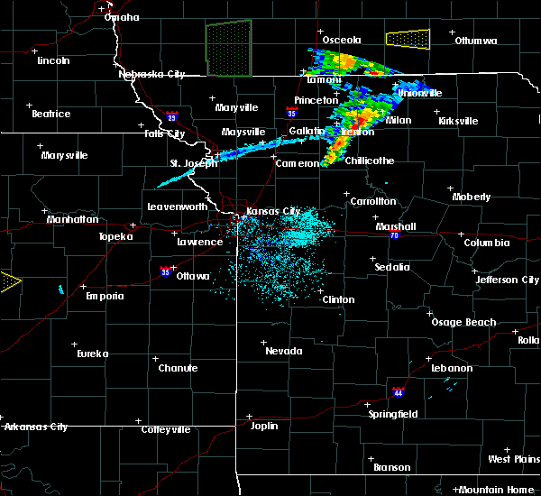 At 1031 am cdt, a severe thunderstorm was located near galt, or 13 miles east of trenton, moving east at 35 mph (radar indicated). Hazards include 60 mph wind gusts and quarter size hail. Hail damage to vehicles is expected. Expect wind damage to roofs, siding, and trees. At 1031 am cdt, a severe thunderstorm was located near galt, or 13 miles east of trenton, moving east at 35 mph (radar indicated). Hazards include 60 mph wind gusts and quarter size hail. Hail damage to vehicles is expected. Expect wind damage to roofs, siding, and trees.
|
| 5/25/2019 7:42 PM CDT |
 At 741 pm cdt, severe thunderstorms were located along a line extending from 13 miles west of unionville to 7 miles northwest of milan to galt, moving east at 45 mph (radar indicated). Hazards include 60 mph wind gusts. expect damage to roofs, siding, and trees At 741 pm cdt, severe thunderstorms were located along a line extending from 13 miles west of unionville to 7 miles northwest of milan to galt, moving east at 45 mph (radar indicated). Hazards include 60 mph wind gusts. expect damage to roofs, siding, and trees
|
| 8/28/2018 7:35 PM CDT | Large trees down and shed doors blown i in grundy county MO, 3.3 miles E of Galt, MO |
| 8/28/2018 6:40 PM CDT | Large maple tree down in gal in grundy county MO, 0.2 miles SE of Galt, MO |
| 8/28/2018 6:35 PM CDT | Corrects previous tstm wnd dmg report from 5 w galt. large trees down and shed doors blown i in grundy county MO, 3.3 miles E of Galt, MO |
| 8/28/2018 6:32 PM CDT |
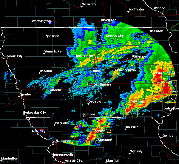 At 632 pm cdt, a severe thunderstorm was located near galt, or 11 miles northeast of trenton, moving east at 30 mph (radar indicated). Hazards include 60 mph wind gusts and quarter size hail. Hail damage to vehicles is expected. Expect wind damage to roofs, siding, and trees. At 632 pm cdt, a severe thunderstorm was located near galt, or 11 miles northeast of trenton, moving east at 30 mph (radar indicated). Hazards include 60 mph wind gusts and quarter size hail. Hail damage to vehicles is expected. Expect wind damage to roofs, siding, and trees.
|
| 6/28/2018 5:38 AM CDT |
 At 537 am cdt, a severe thunderstorm was located 8 miles west of milan, moving south at 25 mph (radar indicated). Hazards include 60 mph wind gusts and half dollar size hail. Hail damage to vehicles is expected. Expect wind damage to roofs, siding, and trees. At 537 am cdt, a severe thunderstorm was located 8 miles west of milan, moving south at 25 mph (radar indicated). Hazards include 60 mph wind gusts and half dollar size hail. Hail damage to vehicles is expected. Expect wind damage to roofs, siding, and trees.
|
| 6/28/2018 3:53 AM CDT |
 At 353 am cdt, a severe thunderstorm was located near galt, or 10 miles east of trenton, moving southeast at 25 mph (radar indicated). Hazards include 60 mph wind gusts and quarter size hail. Hail damage to vehicles is expected. Expect wind damage to roofs, siding, and trees. At 353 am cdt, a severe thunderstorm was located near galt, or 10 miles east of trenton, moving southeast at 25 mph (radar indicated). Hazards include 60 mph wind gusts and quarter size hail. Hail damage to vehicles is expected. Expect wind damage to roofs, siding, and trees.
|
| 6/2/2018 4:27 AM CDT |
 At 427 am cdt, a severe thunderstorm was located near princeton, or 19 miles northeast of bethany, moving east at 30 mph (radar indicated). Hazards include 60 mph wind gusts and quarter size hail. Hail damage to vehicles is expected. Expect wind damage to roofs, siding, and trees. At 427 am cdt, a severe thunderstorm was located near princeton, or 19 miles northeast of bethany, moving east at 30 mph (radar indicated). Hazards include 60 mph wind gusts and quarter size hail. Hail damage to vehicles is expected. Expect wind damage to roofs, siding, and trees.
|
| 7/12/2017 8:57 PM CDT |
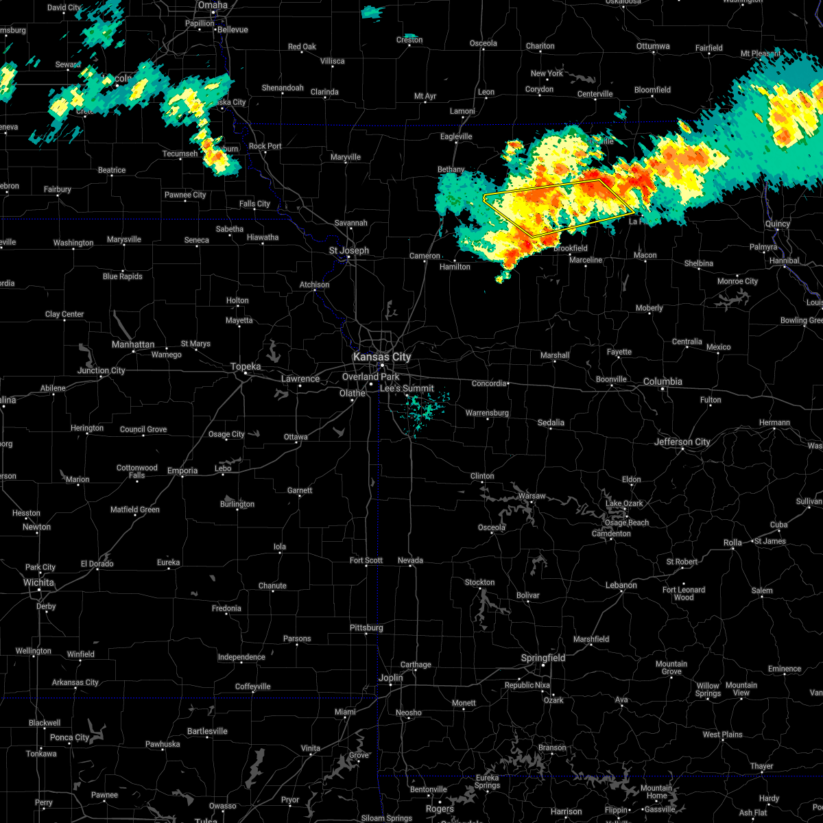 The severe thunderstorm warning for southwestern adair. northern linn. central grundy. southern sullivan. northwestern macon and northeastern livingston counties will expire at 900 pm cdt. the storms which prompted the warning have weakened below severe limits, and no longer pose an immediate threat to life or property. therefore the warning will be allowed to expire. However small hail. The severe thunderstorm warning for southwestern adair. northern linn. central grundy. southern sullivan. northwestern macon and northeastern livingston counties will expire at 900 pm cdt. the storms which prompted the warning have weakened below severe limits, and no longer pose an immediate threat to life or property. therefore the warning will be allowed to expire. However small hail.
|
| 7/12/2017 8:25 PM CDT |
 At 824 pm cdt, severe thunderstorms were located along a line extending from near kirksville to near trenton, moving east at 30 mph (radar indicated). Hazards include 60 mph wind gusts and quarter size hail. Hail damage to vehicles is expected. Expect wind damage to roofs, siding, and trees. At 824 pm cdt, severe thunderstorms were located along a line extending from near kirksville to near trenton, moving east at 30 mph (radar indicated). Hazards include 60 mph wind gusts and quarter size hail. Hail damage to vehicles is expected. Expect wind damage to roofs, siding, and trees.
|
| 6/28/2017 3:53 PM CDT |
 At 853 pm cdt, a severe thunderstorm was located over galt, or 11 miles east of trenton, moving east at 35 mph (radar indicated). Hazards include ping pong ball size hail and 60 mph wind gusts. People and animals outdoors will be injured. expect hail damage to roofs, siding, windows, and vehicles. Expect wind damage to roofs, siding, and trees. At 853 pm cdt, a severe thunderstorm was located over galt, or 11 miles east of trenton, moving east at 35 mph (radar indicated). Hazards include ping pong ball size hail and 60 mph wind gusts. People and animals outdoors will be injured. expect hail damage to roofs, siding, windows, and vehicles. Expect wind damage to roofs, siding, and trees.
|
| 6/28/2017 3:16 PM CDT |
 At 816 pm cdt, a severe thunderstorm was located near new hampton, or 8 miles northeast of albany, moving east at 25 mph (radar indicated). Hazards include 60 mph wind gusts and half dollar size hail. Hail damage to vehicles is expected. expect wind damage to roofs, siding, and trees. locations impacted include, maryville, trenton, bethany, albany, stanberry, princeton, burlington junction, ridgeway, ravenwood, gilman city, new hampton, skidmore, spickard, galt, conception junction, parnell, pickering, darlington, mount moriah and clyde. this includes interstate 35 in missouri between mile markers 84 and 103. A tornado watch remains in effect until 1000 pm cdt for north central and northwestern missouri. At 816 pm cdt, a severe thunderstorm was located near new hampton, or 8 miles northeast of albany, moving east at 25 mph (radar indicated). Hazards include 60 mph wind gusts and half dollar size hail. Hail damage to vehicles is expected. expect wind damage to roofs, siding, and trees. locations impacted include, maryville, trenton, bethany, albany, stanberry, princeton, burlington junction, ridgeway, ravenwood, gilman city, new hampton, skidmore, spickard, galt, conception junction, parnell, pickering, darlington, mount moriah and clyde. this includes interstate 35 in missouri between mile markers 84 and 103. A tornado watch remains in effect until 1000 pm cdt for north central and northwestern missouri.
|
| 6/28/2017 3:04 PM CDT |
 A tornado warning remains in effect until 815 pm cdt for northeastern grundy county. at 804 pm cdt, a severe thunderstorm capable of producing a tornado was located near spickard, or 9 miles northeast of trenton, moving east at 30 mph. hazard. Tornado and two inch hail. A tornado warning remains in effect until 815 pm cdt for northeastern grundy county. at 804 pm cdt, a severe thunderstorm capable of producing a tornado was located near spickard, or 9 miles northeast of trenton, moving east at 30 mph. hazard. Tornado and two inch hail.
|
| 6/28/2017 2:33 PM CDT |
 At 733 pm cdt, a severe thunderstorm capable of producing a tornado was located near gilman city, or 10 miles east of bethany, moving east at 30 mph (radar indicated rotation). Hazards include tornado and hail up to two inches in diameter. Flying debris will be dangerous to those caught without shelter. mobile homes will be damaged or destroyed. damage to roofs, windows, and vehicles will occur. Tree damage is likely. At 733 pm cdt, a severe thunderstorm capable of producing a tornado was located near gilman city, or 10 miles east of bethany, moving east at 30 mph (radar indicated rotation). Hazards include tornado and hail up to two inches in diameter. Flying debris will be dangerous to those caught without shelter. mobile homes will be damaged or destroyed. damage to roofs, windows, and vehicles will occur. Tree damage is likely.
|
| 6/28/2017 2:30 PM CDT |
 At 730 pm cdt, a severe thunderstorm was located 8 miles southeast of ridgeway, or 10 miles east of bethany, moving east at 35 mph (radar indicated). Hazards include golf ball size hail and 60 mph wind gusts. People and animals outdoors will be injured. expect hail damage to roofs, siding, windows, and vehicles. Expect wind damage to roofs, siding, and trees. At 730 pm cdt, a severe thunderstorm was located 8 miles southeast of ridgeway, or 10 miles east of bethany, moving east at 35 mph (radar indicated). Hazards include golf ball size hail and 60 mph wind gusts. People and animals outdoors will be injured. expect hail damage to roofs, siding, windows, and vehicles. Expect wind damage to roofs, siding, and trees.
|
| 6/16/2017 11:41 PM CDT |
 The severe thunderstorm warning for southern daviess, northwestern linn, grundy, western sullivan and northern livingston counties will expire at 1145 pm cdt, the storms which prompted the warning have moved out of the area. therefore the warning will be allowed to expire. however gusty winds to 50 mph and heavy rain are still possible with these thunderstorms. The severe thunderstorm warning for southern daviess, northwestern linn, grundy, western sullivan and northern livingston counties will expire at 1145 pm cdt, the storms which prompted the warning have moved out of the area. therefore the warning will be allowed to expire. however gusty winds to 50 mph and heavy rain are still possible with these thunderstorms.
|
| 6/16/2017 11:28 PM CDT |
 At 1128 pm cdt, severe thunderstorms were located along a line extending from 7 miles northwest of green city to near browning to near chillicothe, moving southeast at 50 mph (radar indicated). Hazards include 60 mph wind gusts. Expect damage to roofs, siding, and trees. locations impacted include, trenton, milan, gallatin, jamesport, browning, galt, chula, laredo, newtown, jameson, humphreys, pollock, harris, lock springs, osgood, spring hill and reger. This includes interstate 35 in missouri between mile markers 67 and 71. At 1128 pm cdt, severe thunderstorms were located along a line extending from 7 miles northwest of green city to near browning to near chillicothe, moving southeast at 50 mph (radar indicated). Hazards include 60 mph wind gusts. Expect damage to roofs, siding, and trees. locations impacted include, trenton, milan, gallatin, jamesport, browning, galt, chula, laredo, newtown, jameson, humphreys, pollock, harris, lock springs, osgood, spring hill and reger. This includes interstate 35 in missouri between mile markers 67 and 71.
|
| 6/16/2017 11:15 PM CDT |
 At 1115 pm cdt, severe thunderstorms were located along a line extending from 13 miles west of unionville to near galt to 10 miles north of chillicothe, moving east at 55 mph (radar indicated). Hazards include 60 mph wind gusts. Expect damage to roofs, siding, and trees. locations impacted include, trenton, milan, gallatin, princeton, jamesport, pattonsburg, mercer, browning, spickard, galt, chula, laredo, newtown, jameson, humphreys, pollock, lucerne, tindall, brimson and harris. This includes interstate 35 in missouri between mile markers 67 and 77. At 1115 pm cdt, severe thunderstorms were located along a line extending from 13 miles west of unionville to near galt to 10 miles north of chillicothe, moving east at 55 mph (radar indicated). Hazards include 60 mph wind gusts. Expect damage to roofs, siding, and trees. locations impacted include, trenton, milan, gallatin, princeton, jamesport, pattonsburg, mercer, browning, spickard, galt, chula, laredo, newtown, jameson, humphreys, pollock, lucerne, tindall, brimson and harris. This includes interstate 35 in missouri between mile markers 67 and 77.
|
| 6/16/2017 11:00 PM CDT |
 At 1059 pm cdt, severe thunderstorms were located along a line extending from near mercer to near spickard to near jamesport, moving east at 40 mph (radar indicated). Hazards include 70 mph wind gusts. Expect considerable tree damage. damage is likely to mobile homes, roofs, and outbuildings. locations impacted include, trenton, milan, gallatin, princeton, jamesport, gilman city, pattonsburg, mercer, cainsville, browning, spickard, galt, chula, laredo, newtown, coffey, jameson, humphreys, mcfall and pollock. This includes interstate 35 in missouri between mile markers 67 and 91. At 1059 pm cdt, severe thunderstorms were located along a line extending from near mercer to near spickard to near jamesport, moving east at 40 mph (radar indicated). Hazards include 70 mph wind gusts. Expect considerable tree damage. damage is likely to mobile homes, roofs, and outbuildings. locations impacted include, trenton, milan, gallatin, princeton, jamesport, gilman city, pattonsburg, mercer, cainsville, browning, spickard, galt, chula, laredo, newtown, coffey, jameson, humphreys, mcfall and pollock. This includes interstate 35 in missouri between mile markers 67 and 91.
|
| 6/16/2017 10:44 PM CDT |
 At 1043 pm cdt, severe thunderstorms were located along a line extending from near cainsville to 7 miles west of spickard to near pattonsburg, moving southeast at 40 mph (radar indicated). Hazards include 70 mph wind gusts. Expect considerable tree damage. Damage is likely to mobile homes, roofs, and outbuildings. At 1043 pm cdt, severe thunderstorms were located along a line extending from near cainsville to 7 miles west of spickard to near pattonsburg, moving southeast at 40 mph (radar indicated). Hazards include 70 mph wind gusts. Expect considerable tree damage. Damage is likely to mobile homes, roofs, and outbuildings.
|
| 3/6/2017 8:32 PM CST |
 At 832 pm cst, severe thunderstorms were located along a line extending from near unionville to near lexington, moving east at 50 mph (radar indicated). Hazards include 60 mph wind gusts and quarter size hail. Hail damage to vehicles is expected. Expect wind damage to roofs, siding, and trees. At 832 pm cst, severe thunderstorms were located along a line extending from near unionville to near lexington, moving east at 50 mph (radar indicated). Hazards include 60 mph wind gusts and quarter size hail. Hail damage to vehicles is expected. Expect wind damage to roofs, siding, and trees.
|
| 3/6/2017 8:06 PM CST |
 At 806 pm cst, severe thunderstorms were located along a line extending from 12 miles south of corydon to near missouri city, moving east at 105 mph (radar indicated). Hazards include 60 mph wind gusts and quarter size hail. Hail damage to vehicles is expected. Expect wind damage to roofs, siding, and trees. At 806 pm cst, severe thunderstorms were located along a line extending from 12 miles south of corydon to near missouri city, moving east at 105 mph (radar indicated). Hazards include 60 mph wind gusts and quarter size hail. Hail damage to vehicles is expected. Expect wind damage to roofs, siding, and trees.
|
| 9/19/2016 8:22 PM CDT |
 At 821 pm cdt, severe thunderstorms were located along a line extending from near galt to near trenton to near gilman city, moving south at 15 mph (radar indicated). Hazards include golf ball size hail and 60 mph wind gusts. People and animals outdoors will be injured. expect hail damage to roofs, siding, windows, and vehicles. expect wind damage to roofs, siding, and trees. locations impacted include, trenton, jamesport, gilman city, linneus, browning, galt, chula, laredo, purdin, humphreys, tindall, brimson, reger and spring hill. A tornado watch remains in effect until midnight cdt for north central missouri. At 821 pm cdt, severe thunderstorms were located along a line extending from near galt to near trenton to near gilman city, moving south at 15 mph (radar indicated). Hazards include golf ball size hail and 60 mph wind gusts. People and animals outdoors will be injured. expect hail damage to roofs, siding, windows, and vehicles. expect wind damage to roofs, siding, and trees. locations impacted include, trenton, jamesport, gilman city, linneus, browning, galt, chula, laredo, purdin, humphreys, tindall, brimson, reger and spring hill. A tornado watch remains in effect until midnight cdt for north central missouri.
|
| 9/19/2016 8:05 PM CDT |
 At 804 pm cdt, severe thunderstorms were located along a line extending from 6 miles southwest of green city to near galt to near gilman city, moving southeast at 25 mph (radar indicated). Hazards include 60 mph wind gusts and quarter size hail. Hail damage to vehicles is expected. Expect wind damage to roofs, siding, and trees. At 804 pm cdt, severe thunderstorms were located along a line extending from 6 miles southwest of green city to near galt to near gilman city, moving southeast at 25 mph (radar indicated). Hazards include 60 mph wind gusts and quarter size hail. Hail damage to vehicles is expected. Expect wind damage to roofs, siding, and trees.
|
| 7/7/2016 5:17 AM CDT |
 At 517 am cdt, severe thunderstorms were located along a line extending from 8 miles southeast of lamoni to near cainsville to 6 miles west of spickard to 7 miles east of jamesport, moving east at 60 mph (radar indicated). Hazards include 60 mph wind gusts. Expect damage to roofs. siding. and trees. locations impacted include, trenton, princeton, jamesport, ridgeway, gilman city, mercer, cainsville, spickard, galt, chula, laredo, blythedale, mount moriah, tindall, brimson, south lineville, mill grove, modena and spring hill. This includes interstate 35 in missouri between mile markers 111 and 113. At 517 am cdt, severe thunderstorms were located along a line extending from 8 miles southeast of lamoni to near cainsville to 6 miles west of spickard to 7 miles east of jamesport, moving east at 60 mph (radar indicated). Hazards include 60 mph wind gusts. Expect damage to roofs. siding. and trees. locations impacted include, trenton, princeton, jamesport, ridgeway, gilman city, mercer, cainsville, spickard, galt, chula, laredo, blythedale, mount moriah, tindall, brimson, south lineville, mill grove, modena and spring hill. This includes interstate 35 in missouri between mile markers 111 and 113.
|
| 7/7/2016 4:26 AM CDT |
 At 426 am cdt, severe thunderstorms were located along a line extending from near irena to 8 miles south of grant city to near albany to near maysville, moving east at 50 mph (radar indicated). Hazards include 60 mph wind gusts. Expect damage to roofs. siding. And trees. At 426 am cdt, severe thunderstorms were located along a line extending from near irena to 8 miles south of grant city to near albany to near maysville, moving east at 50 mph (radar indicated). Hazards include 60 mph wind gusts. Expect damage to roofs. siding. And trees.
|
| 5/27/2016 7:13 PM CDT |
 At 714 pm cdt, a severe thunderstorm was located near princeton, or 17 miles north of trenton, moving north at 30 mph (trained weather spotters). Hazards include 60 mph wind gusts and nickel size hail. Expect damage to roofs. siding. and trees. Locations impacted include, princeton, mercer, cainsville, spickard, tindall, pleasanton, south lineville, mill grove and modena. At 714 pm cdt, a severe thunderstorm was located near princeton, or 17 miles north of trenton, moving north at 30 mph (trained weather spotters). Hazards include 60 mph wind gusts and nickel size hail. Expect damage to roofs. siding. and trees. Locations impacted include, princeton, mercer, cainsville, spickard, tindall, pleasanton, south lineville, mill grove and modena.
|
| 4/27/2016 6:27 PM CDT | The severe thunderstorm warning for mercer, western sullivan, western putnam, grundy and northwestern linn counties will expire at 630 pm cdt, the storms which prompted the warning have weakened below severe limits, and no longer pose an immediate threat to life or property. therefore the warning will be allowed to expire. however small hail and gusty winds are still possible with these thunderstorms. a tornado watch remains in effect until 900 pm cdt for north central missouri. |
| 4/27/2016 6:19 PM CDT |
 At 618 pm cdt, severe thunderstorms were located along a line extending from near mercer to near spickard to 11 miles south of galt, moving east at 30 mph (radar indicated). Hazards include 60 mph wind gusts and quarter size hail. Hail damage to vehicles is expected. expect wind damage to roofs, siding, and trees. locations impacted include, trenton, milan, princeton, mercer, browning, spickard, galt, laredo, newtown, humphreys, lucerne, tindall, harris, powersville, pleasanton, osgood, south lineville, mill grove, modena and reger. A tornado watch remains in effect until 900 pm cdt for north central missouri. At 618 pm cdt, severe thunderstorms were located along a line extending from near mercer to near spickard to 11 miles south of galt, moving east at 30 mph (radar indicated). Hazards include 60 mph wind gusts and quarter size hail. Hail damage to vehicles is expected. expect wind damage to roofs, siding, and trees. locations impacted include, trenton, milan, princeton, mercer, browning, spickard, galt, laredo, newtown, humphreys, lucerne, tindall, harris, powersville, pleasanton, osgood, south lineville, mill grove, modena and reger. A tornado watch remains in effect until 900 pm cdt for north central missouri.
|
| 4/27/2016 5:52 PM CDT |
 At 552 pm cdt, severe thunderstorms were located along a line extending from 6 miles southeast of lamoni to 7 miles west of spickard to 6 miles east of jamesport, moving east at 30 mph (radar indicated). Hazards include 60 mph wind gusts and quarter size hail. Hail damage to vehicles is expected. Expect wind damage to roofs, siding, and trees. At 552 pm cdt, severe thunderstorms were located along a line extending from 6 miles southeast of lamoni to 7 miles west of spickard to 6 miles east of jamesport, moving east at 30 mph (radar indicated). Hazards include 60 mph wind gusts and quarter size hail. Hail damage to vehicles is expected. Expect wind damage to roofs, siding, and trees.
|
| 3/23/2016 8:27 PM CDT |
 At 826 pm cdt, severe thunderstorms were located along a line extending from 7 miles southeast of princeton to near utica, moving east at 40 mph. at 802 pm law enforcement reported tree damage on hwy 146 near brimson (law enforcement). Hazards include 60 mph wind gusts and quarter size hail. Hail damage to vehicles is expected. expect wind damage to roofs, siding, and trees. locations impacted include, chillicothe, trenton, wheeling, utica, spickard, galt, chula, laredo, mooresville, tindall, brimson, mill grove, modena and spring hill. A tornado watch remains in effect until 1000 pm cdt for north central missouri. At 826 pm cdt, severe thunderstorms were located along a line extending from 7 miles southeast of princeton to near utica, moving east at 40 mph. at 802 pm law enforcement reported tree damage on hwy 146 near brimson (law enforcement). Hazards include 60 mph wind gusts and quarter size hail. Hail damage to vehicles is expected. expect wind damage to roofs, siding, and trees. locations impacted include, chillicothe, trenton, wheeling, utica, spickard, galt, chula, laredo, mooresville, tindall, brimson, mill grove, modena and spring hill. A tornado watch remains in effect until 1000 pm cdt for north central missouri.
|
| 3/23/2016 8:02 PM CDT |
 At 801 pm cdt, a severe thunderstorm was located near gilman city, or 10 miles northwest of trenton, moving northeast at 55 mph (radar indicated). Hazards include 60 mph wind gusts and quarter size hail. Hail damage to vehicles is expected. Expect wind damage to roofs, siding, and trees. At 801 pm cdt, a severe thunderstorm was located near gilman city, or 10 miles northwest of trenton, moving northeast at 55 mph (radar indicated). Hazards include 60 mph wind gusts and quarter size hail. Hail damage to vehicles is expected. Expect wind damage to roofs, siding, and trees.
|
| 3/15/2016 3:51 AM CDT |
 At 350 am cdt, severe thunderstorms were located along a line extending from 10 miles south of leon to near princeton to near trenton, moving east at 45 mph (radar indicated). Hazards include 60 mph wind gusts and penny size hail. Expect damage to roofs. siding. and trees. Locations impacted include, princeton, mercer, spickard, galt, tindall and mill grove. At 350 am cdt, severe thunderstorms were located along a line extending from 10 miles south of leon to near princeton to near trenton, moving east at 45 mph (radar indicated). Hazards include 60 mph wind gusts and penny size hail. Expect damage to roofs. siding. and trees. Locations impacted include, princeton, mercer, spickard, galt, tindall and mill grove.
|
| 3/15/2016 3:40 AM CDT |
 A severe thunderstorm warning remains in effect until 415 am cdt for mercer and northern grundy counties. at 340 am cdt. severe thunderstorms were located along a line extending from 7 miles southeast of lamoni to near princeton to 6 miles east of gilman city. moving east at 45 mph. hazard. 60 mph wind gusts and quarter size hail. A severe thunderstorm warning remains in effect until 415 am cdt for mercer and northern grundy counties. at 340 am cdt. severe thunderstorms were located along a line extending from 7 miles southeast of lamoni to near princeton to 6 miles east of gilman city. moving east at 45 mph. hazard. 60 mph wind gusts and quarter size hail.
|
| 3/15/2016 3:28 AM CDT |
 At 327 am cdt, severe thunderstorms were located along a line extending from near eagleville to near cainsville to near gilman city, moving east at 45 mph (radar indicated). Hazards include 60 mph wind gusts and quarter size hail. Hail damage to vehicles is expected. Expect wind damage to roofs, siding, and trees. At 327 am cdt, severe thunderstorms were located along a line extending from near eagleville to near cainsville to near gilman city, moving east at 45 mph (radar indicated). Hazards include 60 mph wind gusts and quarter size hail. Hail damage to vehicles is expected. Expect wind damage to roofs, siding, and trees.
|
| 11/11/2015 3:15 PM CST |
 At 314 pm cst, severe thunderstorms were located along a line extending from 8 miles northwest of unionville to 6 miles southeast of milan to 7 miles northwest of keytesville, moving northeast at 55 mph (radar indicated). Hazards include 60 mph wind gusts. Expect damage to roofs. siding and trees. locations impacted include, brookfield, marceline, milan, unionville, brunswick, green city, meadville, hale, laclede, mercer, bosworth, linneus, browning, galt, purdin, newtown, mendon, de witt, humphreys and sumner. A tornado watch remains in effect until 600 pm cst for north central missouri. At 314 pm cst, severe thunderstorms were located along a line extending from 8 miles northwest of unionville to 6 miles southeast of milan to 7 miles northwest of keytesville, moving northeast at 55 mph (radar indicated). Hazards include 60 mph wind gusts. Expect damage to roofs. siding and trees. locations impacted include, brookfield, marceline, milan, unionville, brunswick, green city, meadville, hale, laclede, mercer, bosworth, linneus, browning, galt, purdin, newtown, mendon, de witt, humphreys and sumner. A tornado watch remains in effect until 600 pm cst for north central missouri.
|
| 11/11/2015 3:03 PM CST |
 At 302 pm cst, severe thunderstorms were located along a line extending from 10 miles east of mercer to near browning to near bosworth, moving northeast at 55 mph (radar indicated). Hazards include 70 mph wind gusts. Expect considerable tree damage. damage is likely to mobile homes, roofs and outbuildings. locations impacted include, chillicothe, trenton, brookfield, carrollton, marceline, milan, unionville, princeton, brunswick, green city, meadville, hale, laclede, mercer, bosworth, linneus, wheeling, browning, spickard and galt. A tornado watch remains in effect until 600 pm cst for north central missouri. At 302 pm cst, severe thunderstorms were located along a line extending from 10 miles east of mercer to near browning to near bosworth, moving northeast at 55 mph (radar indicated). Hazards include 70 mph wind gusts. Expect considerable tree damage. damage is likely to mobile homes, roofs and outbuildings. locations impacted include, chillicothe, trenton, brookfield, carrollton, marceline, milan, unionville, princeton, brunswick, green city, meadville, hale, laclede, mercer, bosworth, linneus, wheeling, browning, spickard and galt. A tornado watch remains in effect until 600 pm cst for north central missouri.
|
| 11/11/2015 2:43 PM CST |
 At 242 pm cst, severe thunderstorms were located along a line extending from near mercer to 9 miles northwest of norborne, moving northeast at 55 mph (radar indicated). Hazards include 60 mph wind gusts. Expect damage to roofs. Siding and trees. At 242 pm cst, severe thunderstorms were located along a line extending from near mercer to 9 miles northwest of norborne, moving northeast at 55 mph (radar indicated). Hazards include 60 mph wind gusts. Expect damage to roofs. Siding and trees.
|
| 11/11/2015 2:18 PM CST |
 At 217 pm cst, severe thunderstorms were located along a line extending from 6 miles southwest of spickard to near hamilton, moving northeast at 55 mph (radar indicated). Hazards include 60 mph wind gusts. Expect damage to roofs. siding and trees. locations impacted include, chillicothe, trenton, hamilton, gallatin, princeton, jamesport, gilman city, breckenridge, utica, spickard, galt, chula, laredo, newtown, mooresville, mount moriah, lucerne, tindall, brimson and harris. A tornado watch remains in effect until 600 pm cst for north central missouri. At 217 pm cst, severe thunderstorms were located along a line extending from 6 miles southwest of spickard to near hamilton, moving northeast at 55 mph (radar indicated). Hazards include 60 mph wind gusts. Expect damage to roofs. siding and trees. locations impacted include, chillicothe, trenton, hamilton, gallatin, princeton, jamesport, gilman city, breckenridge, utica, spickard, galt, chula, laredo, newtown, mooresville, mount moriah, lucerne, tindall, brimson and harris. A tornado watch remains in effect until 600 pm cst for north central missouri.
|
| 11/11/2015 2:02 PM CST |
 At 202 pm cst, severe thunderstorms were located along a line extending from near gilman city to near hamilton, moving northeast at 65 mph (radar indicated). Hazards include 60 mph wind gusts. Expect damage to roofs. Siding and trees. At 202 pm cst, severe thunderstorms were located along a line extending from near gilman city to near hamilton, moving northeast at 65 mph (radar indicated). Hazards include 60 mph wind gusts. Expect damage to roofs. Siding and trees.
|
| 8/2/2015 9:32 PM CDT |
 At 932 pm cdt, a severe thunderstorm was located near trenton, moving southeast at 45 mph (radar indicated). Hazards include 70 mph wind gusts and nickel size hail. Expect considerable tree damage. Damage is likely to mobile homes, roofs and outbuildings. At 932 pm cdt, a severe thunderstorm was located near trenton, moving southeast at 45 mph (radar indicated). Hazards include 70 mph wind gusts and nickel size hail. Expect considerable tree damage. Damage is likely to mobile homes, roofs and outbuildings.
|
| 7/13/2015 4:13 PM CDT |
 At 413 pm cdt, a severe thunderstorm was located near princeton, or 17 miles north of trenton, moving east at 40 mph (radar indicated). Hazards include 60 mph wind gusts and quarter size hail. Hail damage to vehicles is expected. Expect wind damage to roofs, siding and trees. At 413 pm cdt, a severe thunderstorm was located near princeton, or 17 miles north of trenton, moving east at 40 mph (radar indicated). Hazards include 60 mph wind gusts and quarter size hail. Hail damage to vehicles is expected. Expect wind damage to roofs, siding and trees.
|
| 6/11/2015 8:57 PM CDT | The severe thunderstorm warning for southern sullivan, central livingston, linn and southeastern grundy counties in north central missouri will expire at 900 pm cdt, the storm which prompted the warning has moved out of the warned area. however, gusty winds are still possible with this thunderstorm. |
| 6/11/2015 8:22 PM CDT |
 At 820 pm cdt, a severe thunderstorm was located 9 miles east of jamesport, and moving east at 65 mph (radar indicated). Hazards include 60 mph wind gusts and penny size hail. Expect damage to roofs. Siding and trees. At 820 pm cdt, a severe thunderstorm was located 9 miles east of jamesport, and moving east at 65 mph (radar indicated). Hazards include 60 mph wind gusts and penny size hail. Expect damage to roofs. Siding and trees.
|
| 5/17/2015 1:15 AM CDT | At 1244 am, the public reported a 60 mph wind gust in jamesport. at 1250 am, amateur radio operators reported a 60 mph wind gust 1 mile southwest of gilman city. at 112 am cdt, severe thunderstorms were located along a line extending from 9 miles southeast of trenton to alma, and moving east at 30 mph (trained weather spotters). Hazards include 60 mph wind gusts. Expect damage to roofs. siding and trees. locations impacted include, carrollton, waverly, wheeling, galt, chula, laredo, avalon and tina. 75in. |
| 5/17/2015 1:12 AM CDT | At 109 am cdt, severe thunderstorms were located along a line extending from trenton to waverly, and moving east at 40 mph. at 1244 am, the public reported a 60 mph wind gust in jamesport. at 1250 am, amateur radio operators reported a 60 mph wind gust 1 mile southwest of gilman city (radar indicated). Hazards include 60 mph wind gusts. Expect damage to roofs. Siding and trees. |
| 5/17/2015 12:59 AM CDT | At 1234 am, trained weather spotters reported a 70 mph wind gust 1 mile south of hamilton. at 1244 am, the public reported a 60 mph wind gust in jamesport. at 1255 am cdt, severe thunderstorms were located along a line extending from 7 miles east of jamesport to higginsville, and moving east at 30 mph (radar indicated). Hazards include 60 mph wind gusts. Expect damage to roofs. siding and trees. locations impacted include, trenton, chillicothe, carrollton, utica, corder, alma, waverly, wheeling, galt, dawn, bogard, chula, avalon, laredo and tina. winds up to 80 mph are possible in aullville and higginsville. 75in. |
| 5/17/2015 12:39 AM CDT | At 1237 am cdt, severe thunderstorms were located along a line extending from jamesport to mayview, and moving east at 30 mph (radar indicated). Hazards include 60 mph wind gusts. Expect damage to roofs. Siding and trees. |
| 5/10/2015 2:09 PM CDT | At 206 pm cdt, a severe thunderstorm was located 9 miles north of wheeling, and moving northeast at 45 mph (radar indicated). Hazards include 60 mph wind gusts and quarter size hail. Hail damage to vehicles is expected. Expect wind damage to roofs, siding and trees. |
| 6/3/2014 8:02 PM CDT | Ping Pong Ball sized hail reported 9.4 miles SSW of Galt, MO, between osgood and harris |
Hail Maps for Galt, MO


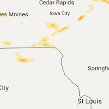


Connect with Interactive Hail Maps