

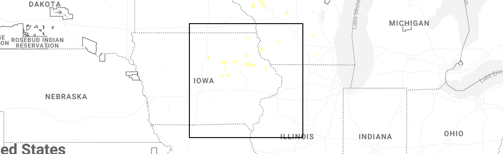
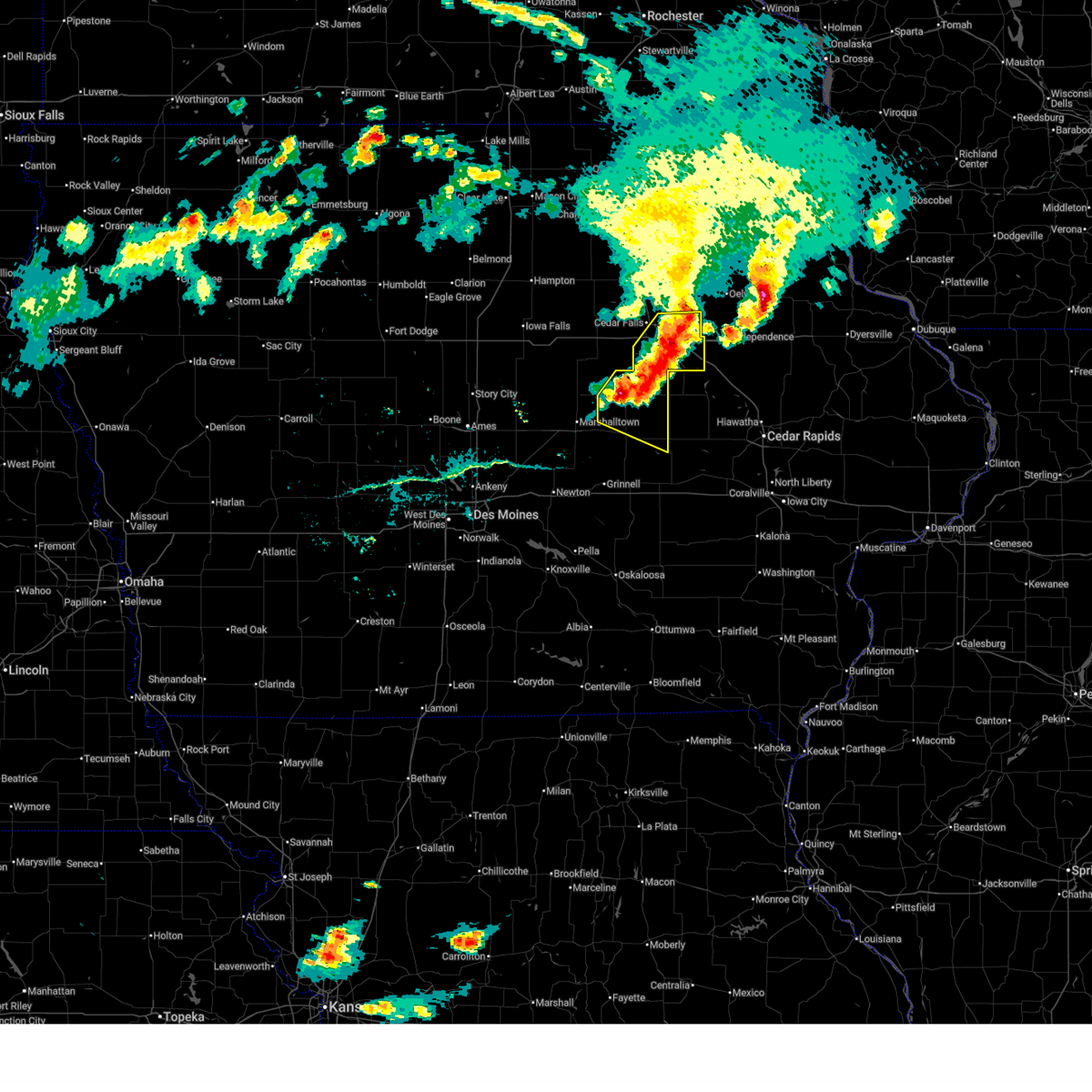
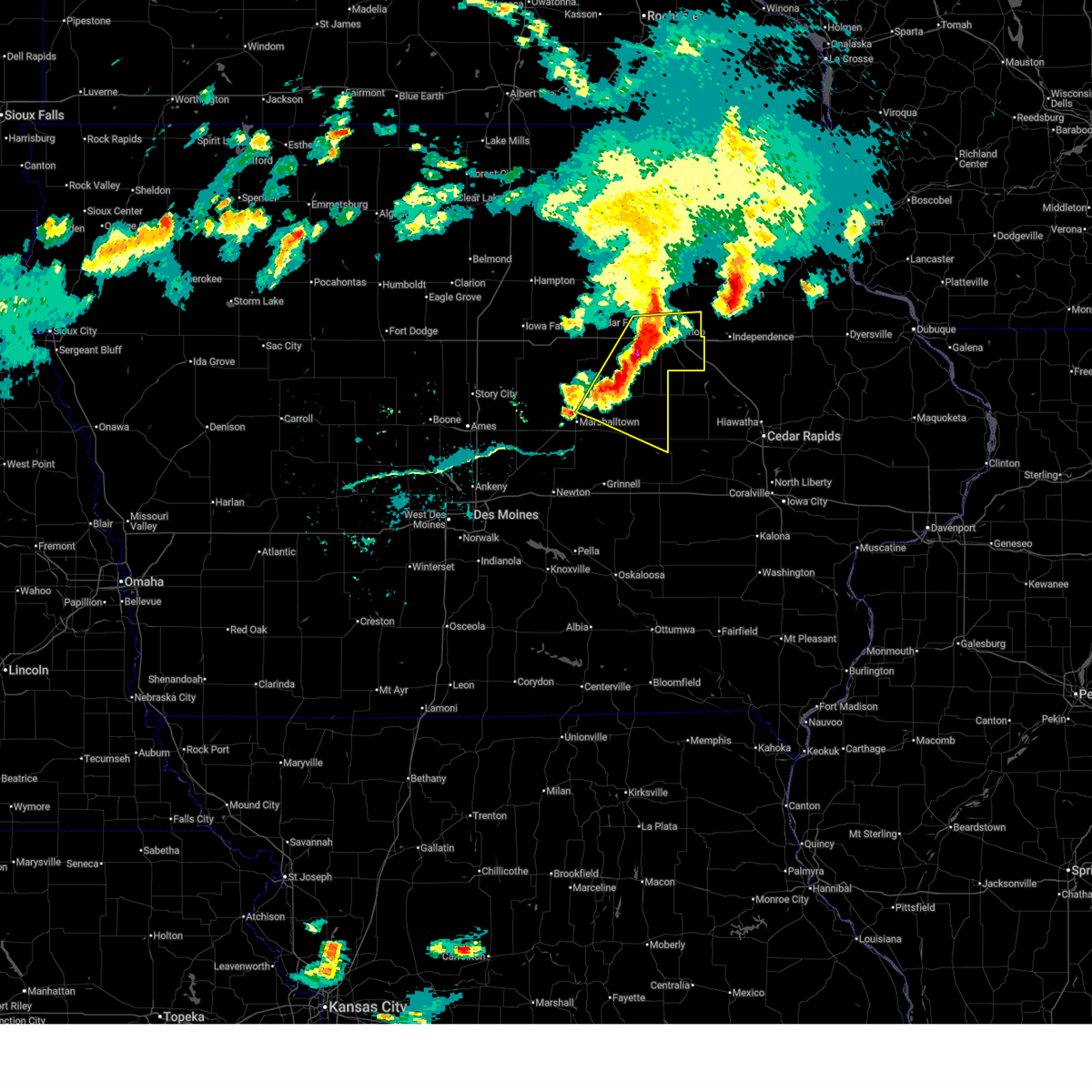
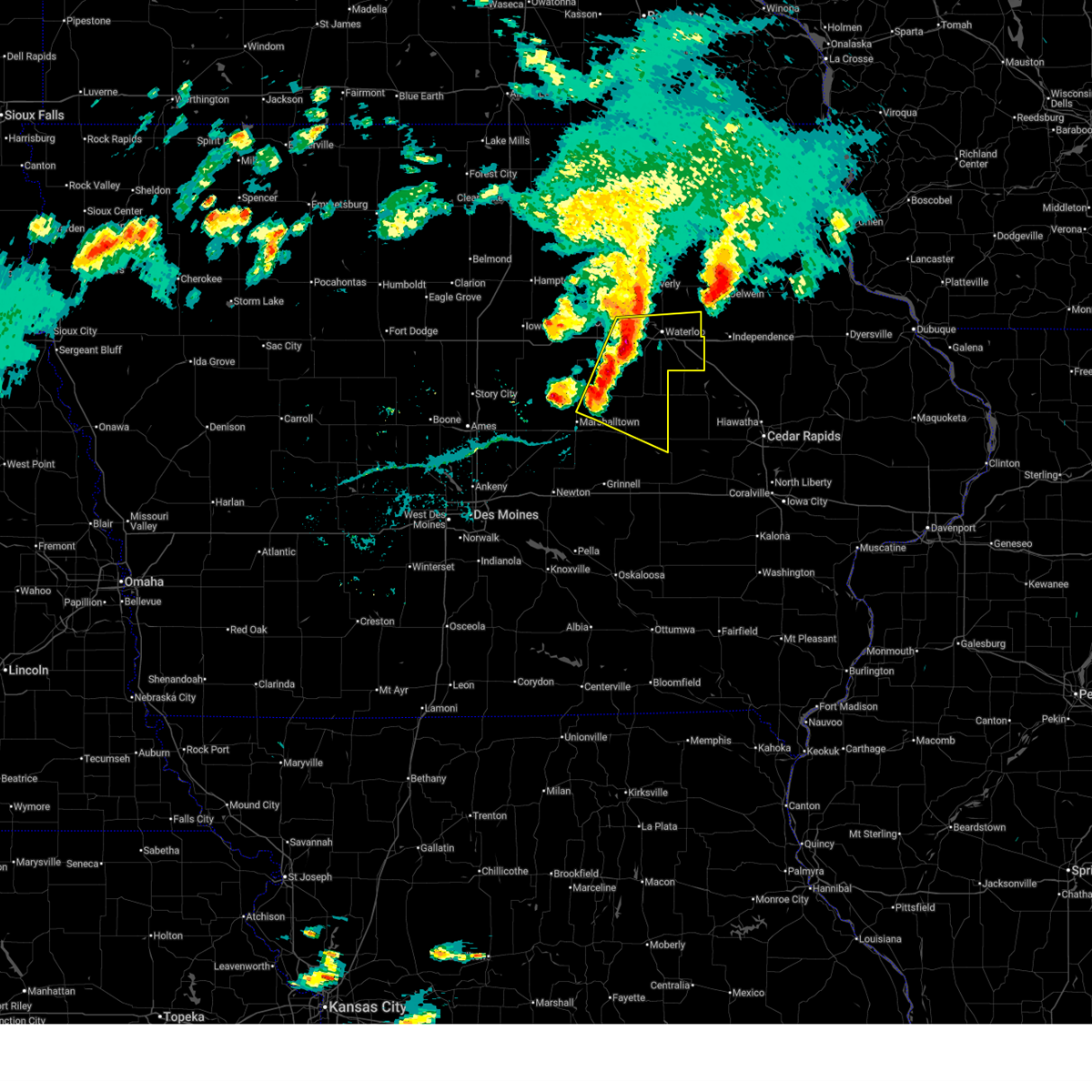
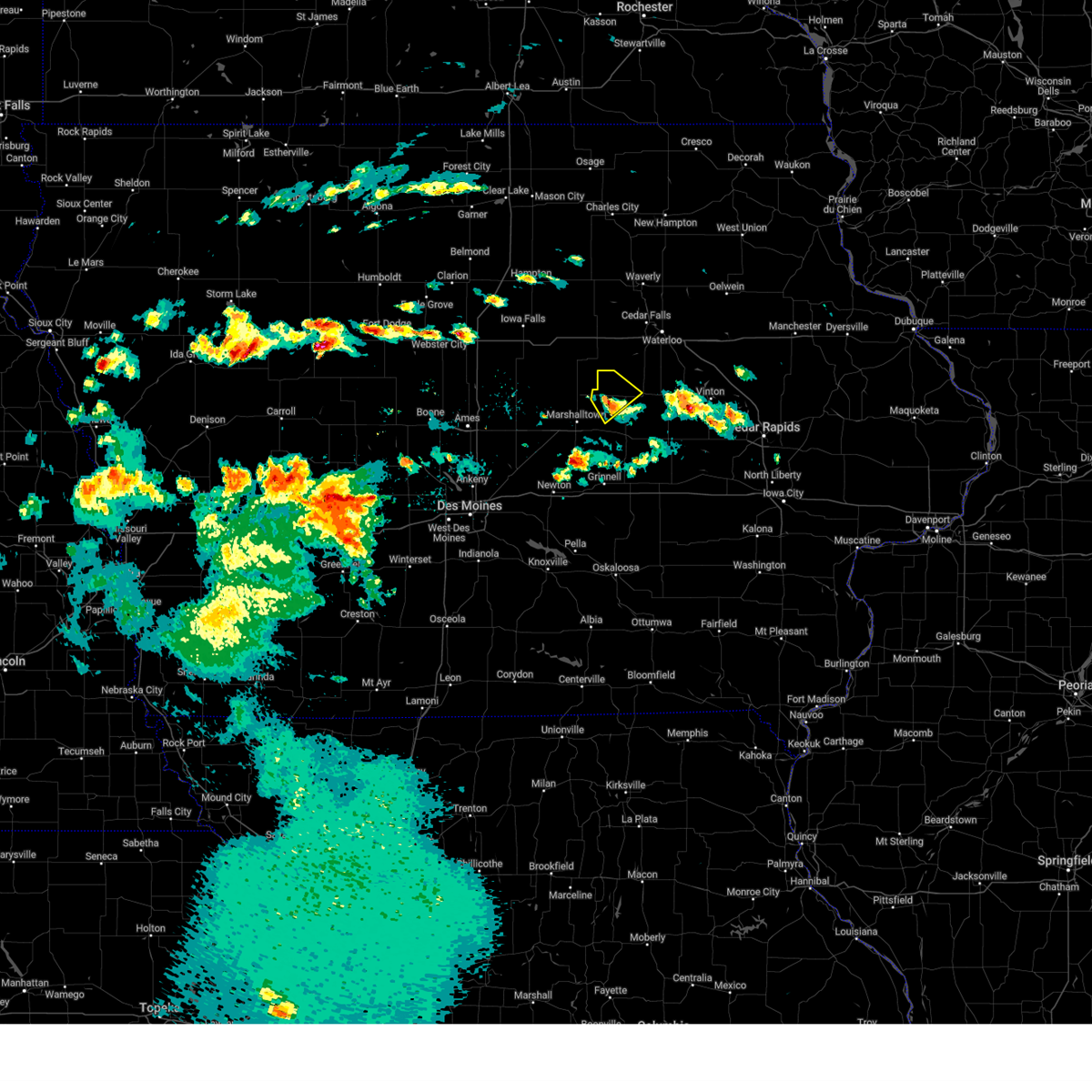
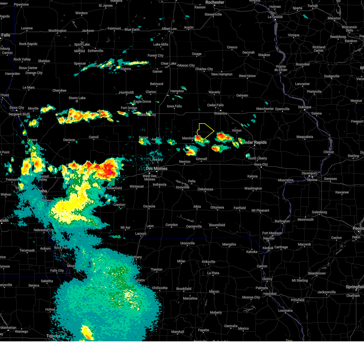
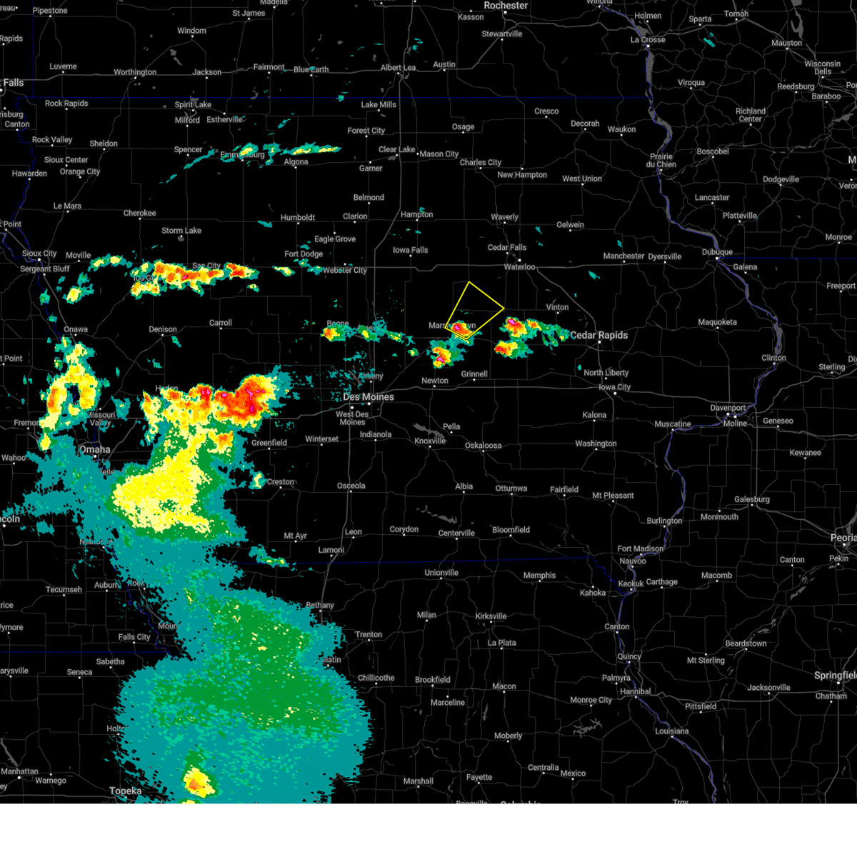
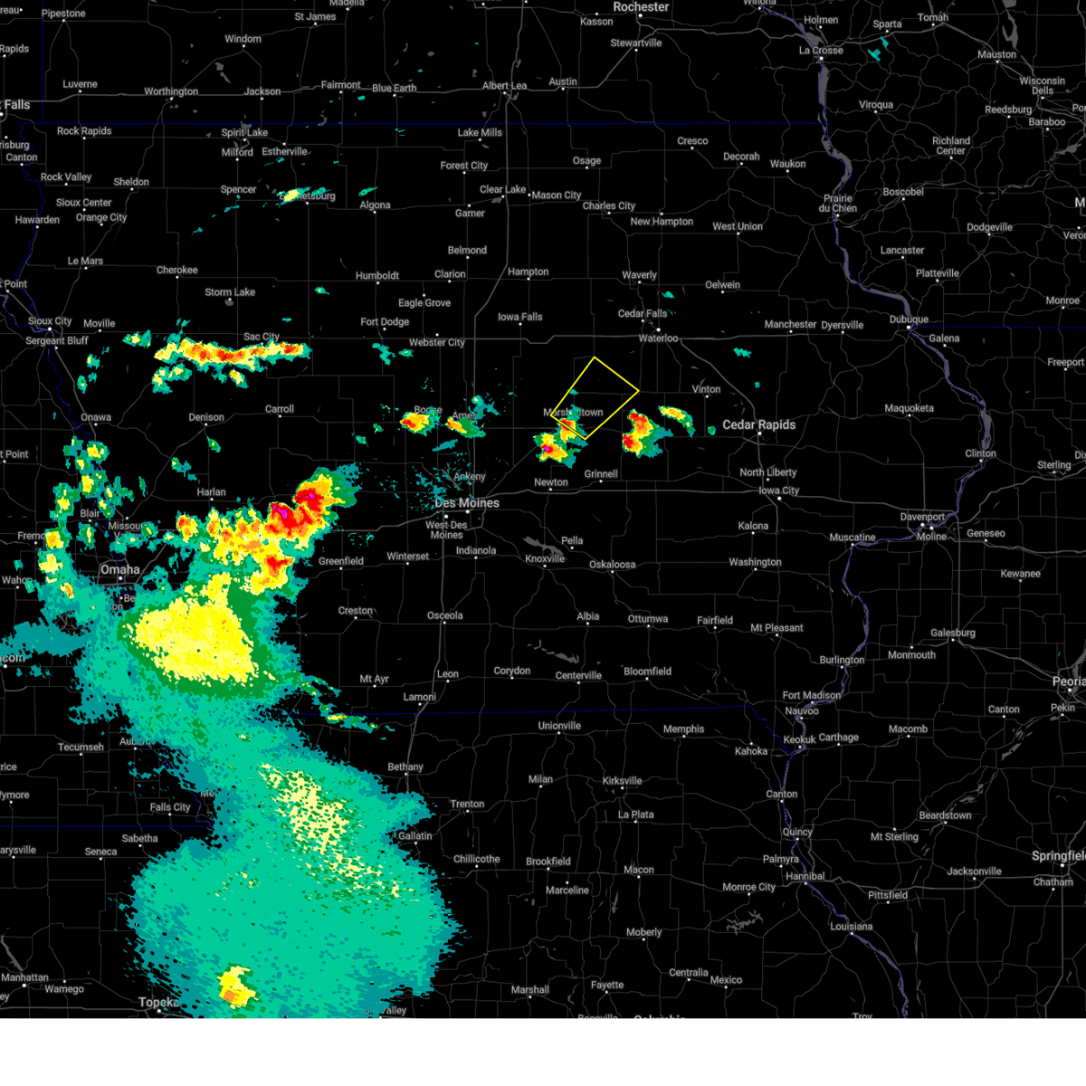
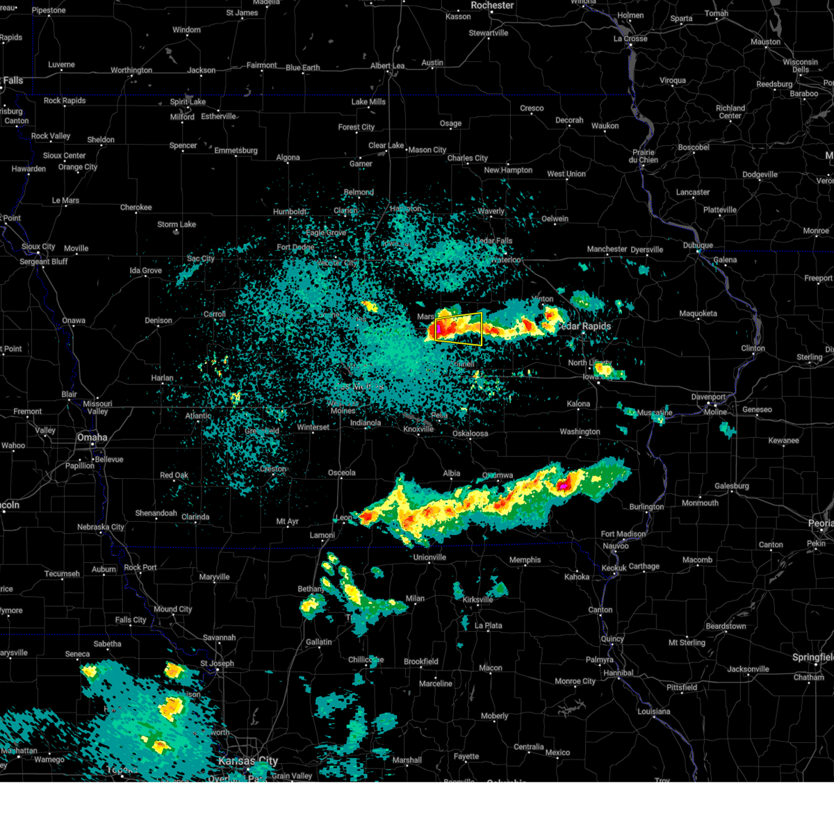
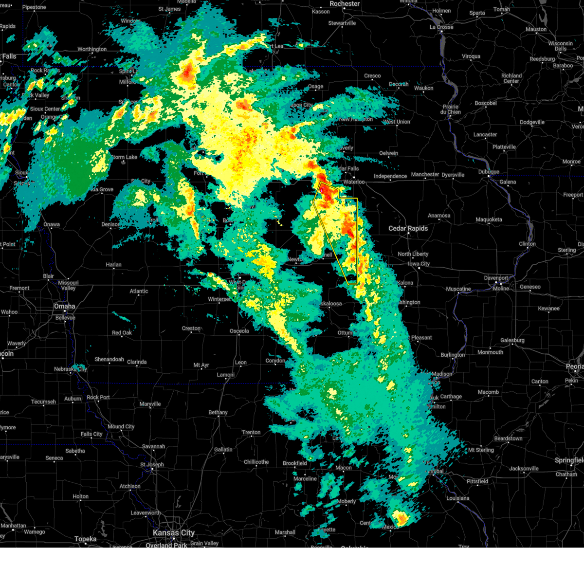
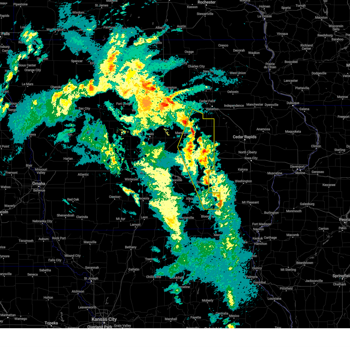
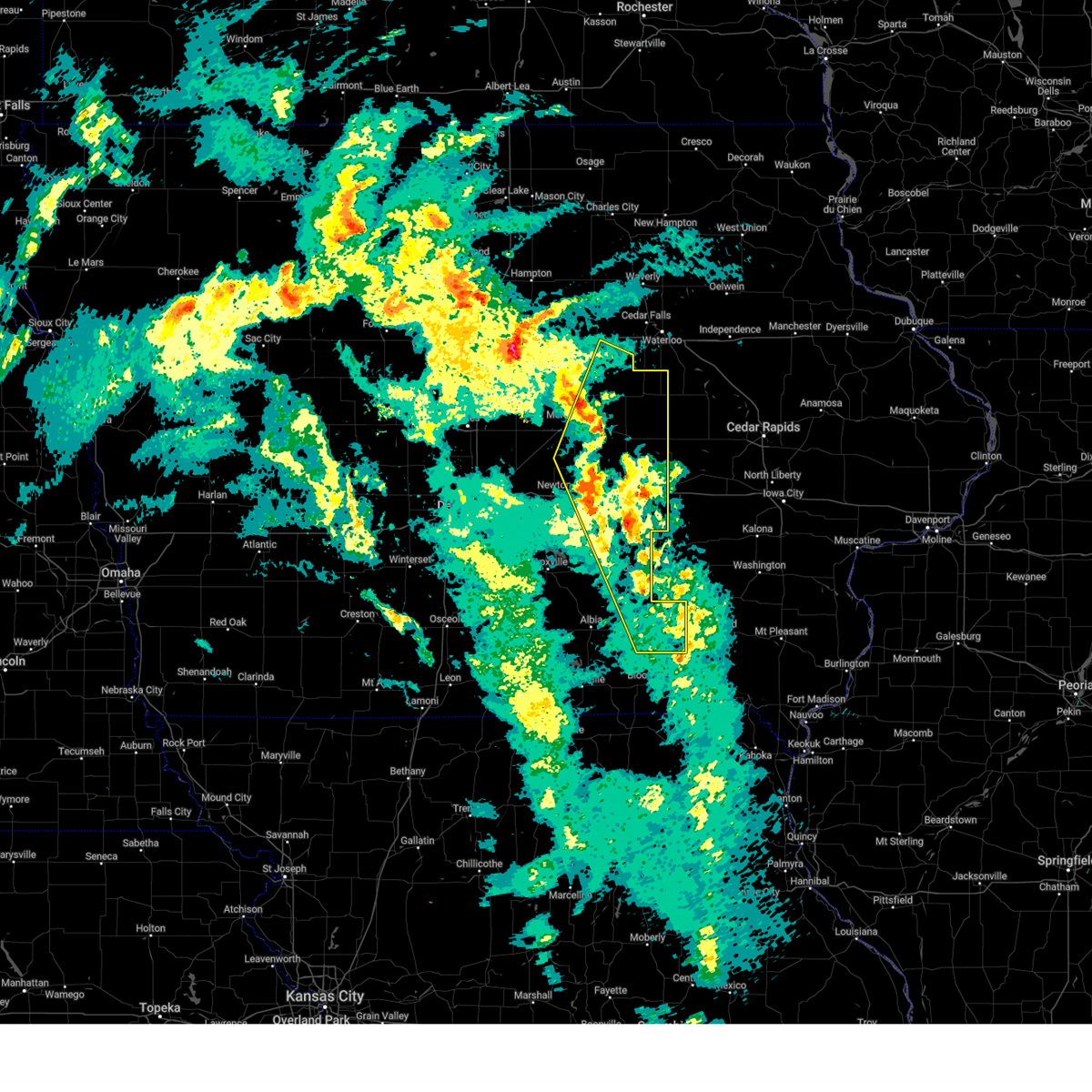
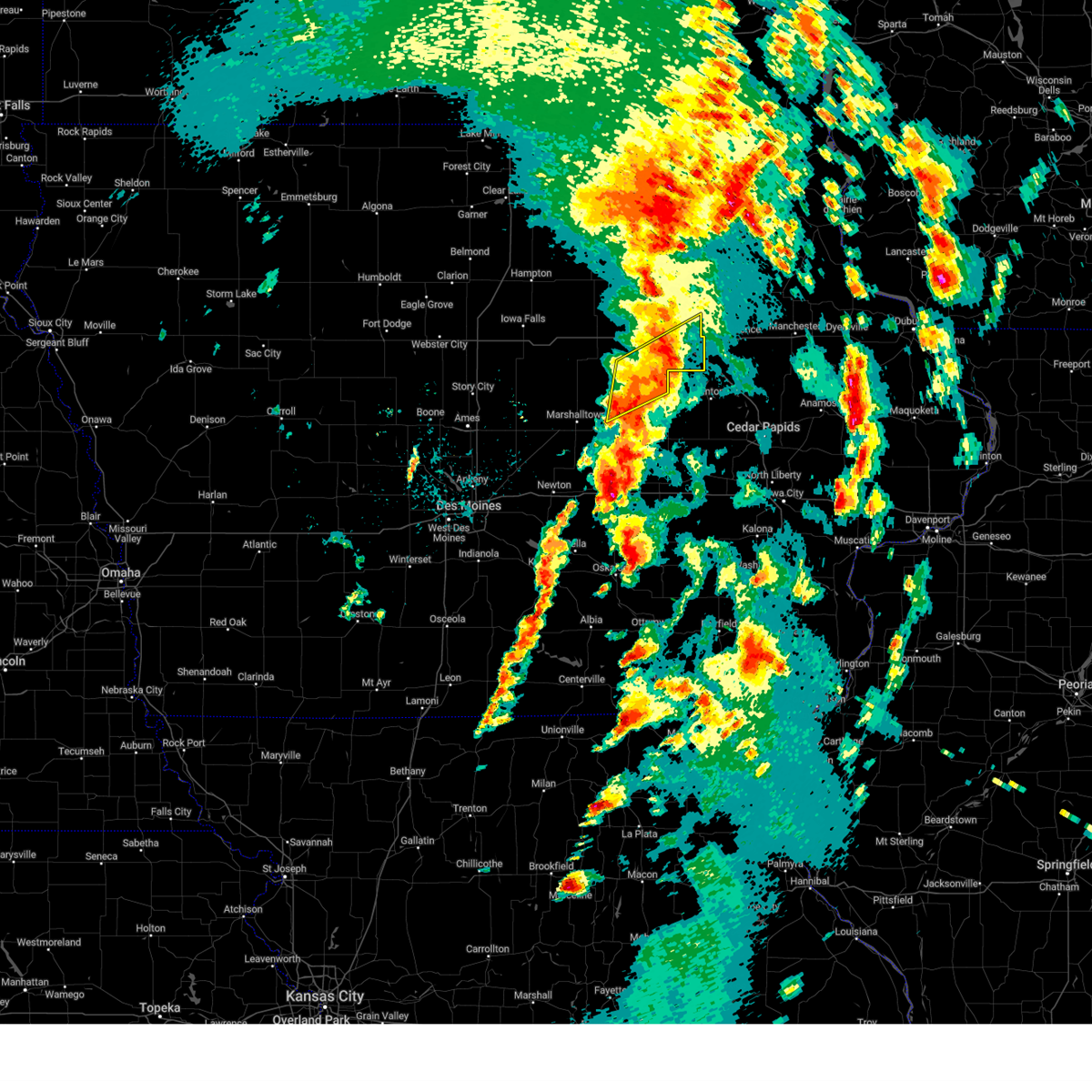
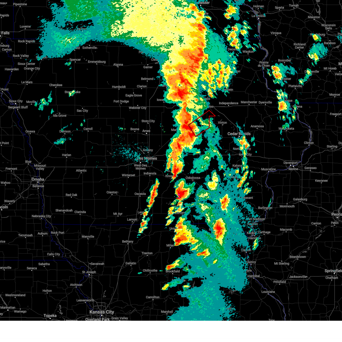
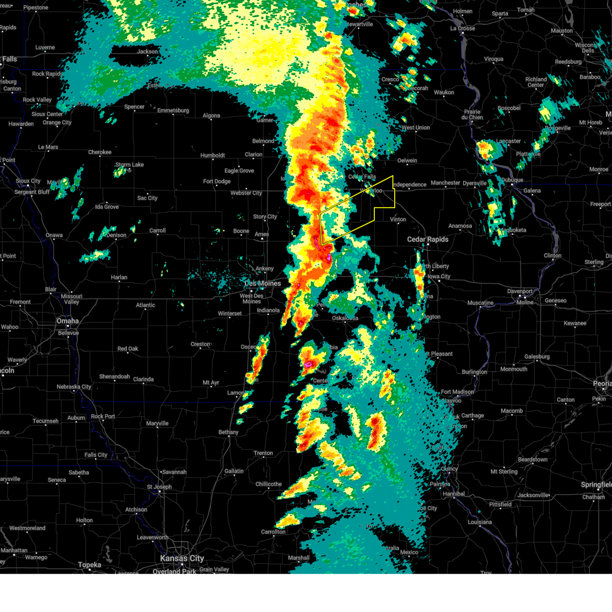
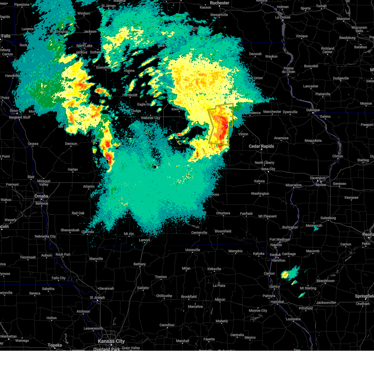
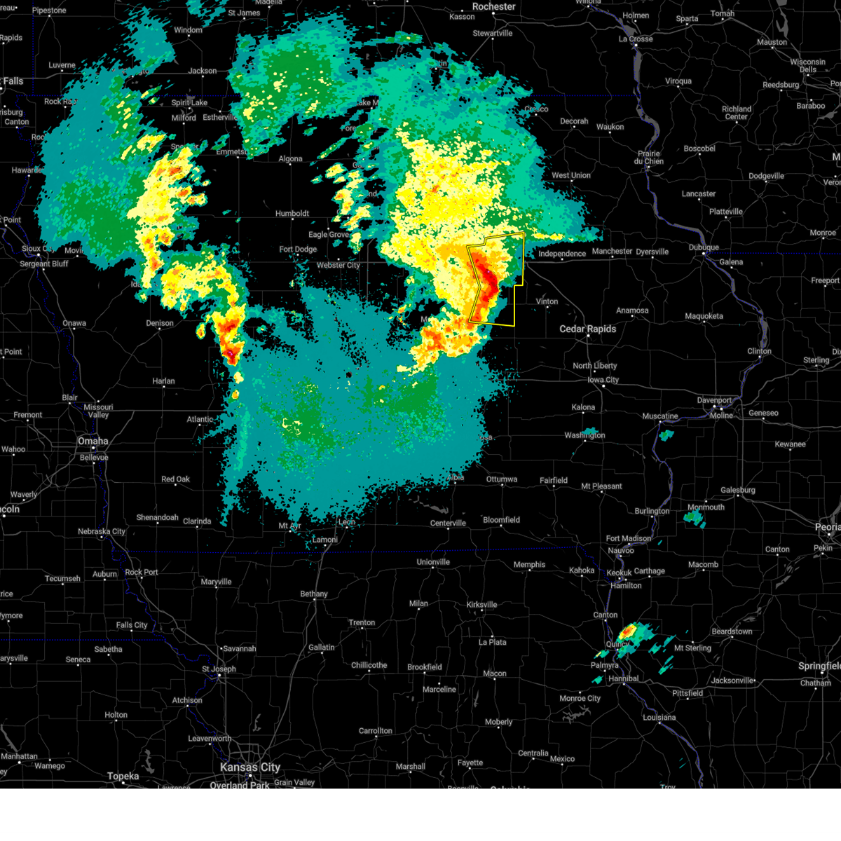
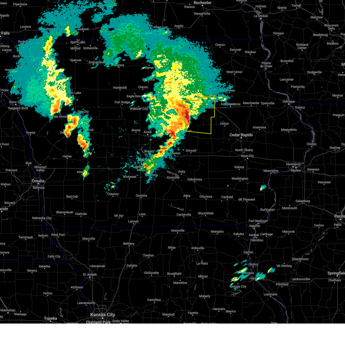
Hail Map for Garwin, IA
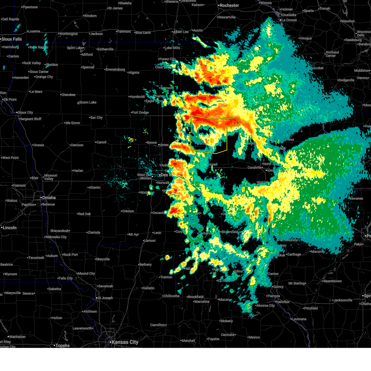
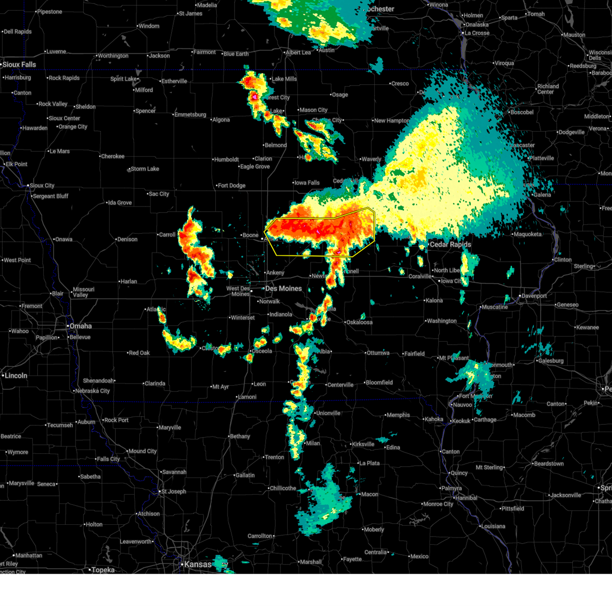
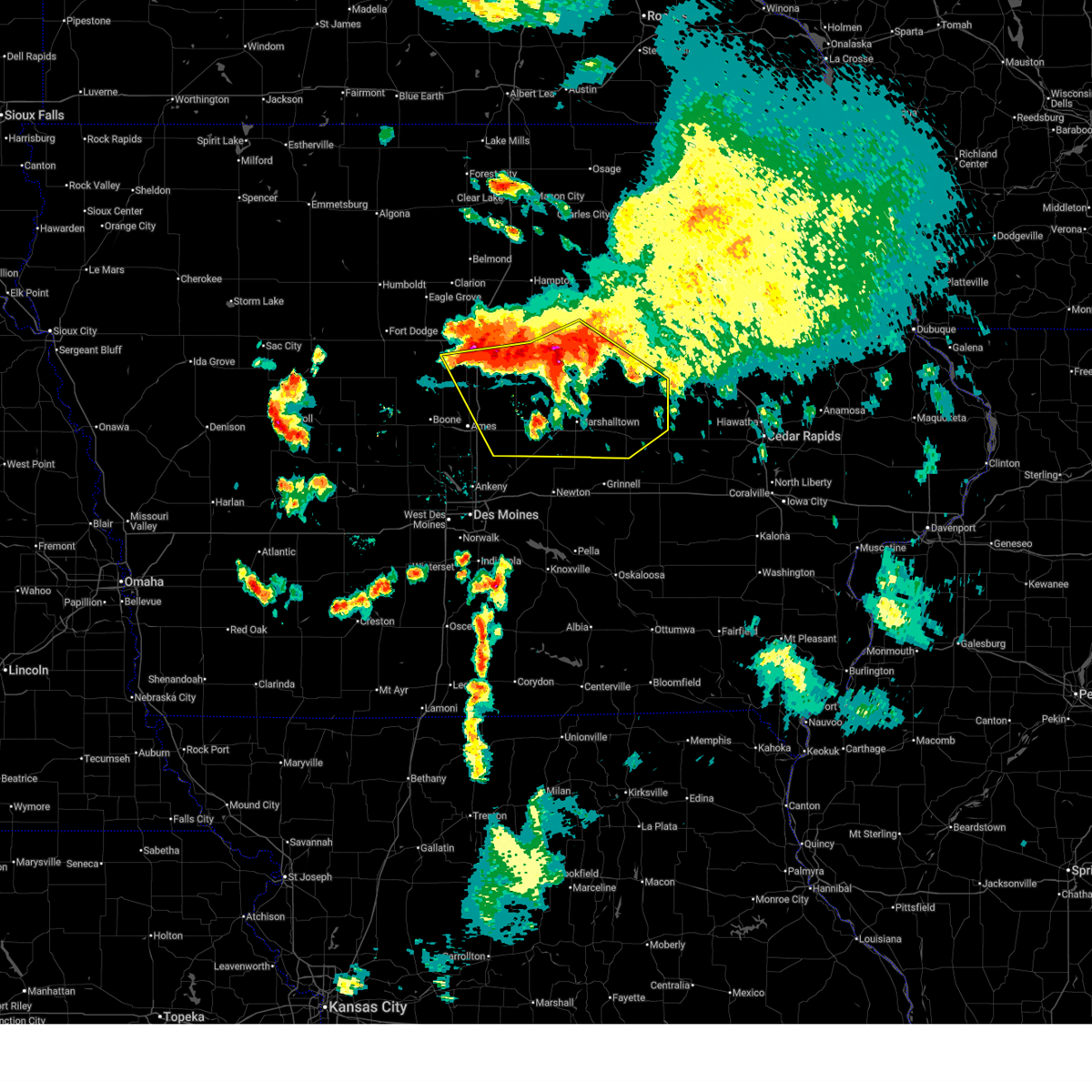
The Garwin, IA area has had 0 reports of on-the-ground hail by trained spotters, and has been under severe weather warnings 30 times during the past 12 months. Doppler radar has detected hail at or near Garwin, IA on 46 occasions, including 5 occasions during the past year.
| Name: | Garwin, IA |
| Where Located: | 52.2 miles W of Cedar Rapids, IA |
| Map: | Google Map for Garwin, IA |
| Population: | 527 |
| Housing Units: | 254 |
| More Info: | Search Google for Garwin, IA |
0
The Top Recent Hail Date for Garwin, IA is Thursday, July 3, 2025 (46th out of 46)
Hail and Wind Damage Spotted near Garwin, IA
| Date / Time | Report Details |
|---|---|
| 6/26/2025 6:07 PM CDT | At 606 pm cdt, severe thunderstorms were located along a line extending from near tf clark state park to near clutier to near hartwick, moving northeast at 50 mph (radar indicated). Hazards include 60 mph wind gusts. Expect damage to roofs, siding, and trees. locations impacted include, toledo, tama, jesup, la porte city, traer, dysart, meskwaki casino, gladbrook, washburn, gilbertville, garwin, holiday lake, chelsea, clutier, elberon, vining, tf clark state park, toledo municipal airport, and union grove state park. This includes interstate 380 between mile markers 56 and 66. |
| 6/26/2025 6:07 PM CDT | the severe thunderstorm warning has been cancelled and is no longer in effect |
| 6/26/2025 5:45 PM CDT | The storms which prompted the warning have moved out of the area. therefore, the warning will be allowed to expire. a severe thunderstorm watch remains in effect until 900 pm cdt for central iowa. remember, a severe thunderstorm warning still remains in effect for portions of tama, marshall, poweshiek, grundy, and black hawk counties. |
| 6/26/2025 5:44 PM CDT | Svrdmx the national weather service in des moines has issued a * severe thunderstorm warning for, northern poweshiek county in central iowa, eastern marshall county in central iowa, southern black hawk county in northeastern iowa, tama county in central iowa, southeastern grundy county in central iowa, northeastern jasper county in central iowa, * until 630 pm cdt. * at 543 pm cdt, severe thunderstorms were located along a line extending from gladbrook to meskwaki casino to near grinnell, moving northeast at 50 mph (radar indicated). Hazards include 60 mph wind gusts. expect damage to roofs, siding, and trees |
| 6/26/2025 5:22 PM CDT | At 521 pm cdt, severe thunderstorms were located along a line extending from 4 miles southwest of marshalltown to laurel to 5 miles northwest of rock creek state park, moving northeast at 55 mph (radar indicated). Hazards include 60 mph wind gusts. Expect damage to roofs, siding, and trees. locations impacted include, marshalltown, newton, toledo, tama, baxter, meskwaki casino, rock creek lake, iowa speedway, gladbrook, le grand, melbourne, kellogg, garwin, gilman, rhodes, montour, laurel, haverhill, lambs grove, and ferguson. This includes interstate 80 between mile markers 162 and 168. |
| 6/26/2025 5:01 PM CDT | Svrdmx the national weather service in des moines has issued a * severe thunderstorm warning for, northwestern poweshiek county in central iowa, southern marshall county in central iowa, southwestern tama county in central iowa, northwestern jasper county in central iowa, * until 545 pm cdt. * at 501 pm cdt, severe thunderstorms were located along a line extending from near mingo to near colfax to prairie city krohn airport, moving northeast at 55 mph (radar indicated). Hazards include 60 mph wind gusts. expect damage to roofs, siding, and trees |
| 6/20/2025 8:39 AM CDT |
 At 839 am cdt, severe thunderstorms were located along a line extending from dysart to 5 miles east of garwin to near albion, moving south at 40 mph (radar indicated). Hazards include 60 mph wind gusts. Expect damage to roofs, siding, and trees. Locations impacted include, marshalltown, toledo, tama, traer, dysart, conrad, meskwaki casino, gladbrook, le grand, garwin, albion, liscomb, chelsea, montour, clutier, elberon, beaman, haverhill, lincoln, and ferguson. At 839 am cdt, severe thunderstorms were located along a line extending from dysart to 5 miles east of garwin to near albion, moving south at 40 mph (radar indicated). Hazards include 60 mph wind gusts. Expect damage to roofs, siding, and trees. Locations impacted include, marshalltown, toledo, tama, traer, dysart, conrad, meskwaki casino, gladbrook, le grand, garwin, albion, liscomb, chelsea, montour, clutier, elberon, beaman, haverhill, lincoln, and ferguson.
|
| 6/20/2025 8:39 AM CDT |
 the severe thunderstorm warning has been cancelled and is no longer in effect the severe thunderstorm warning has been cancelled and is no longer in effect
|
| 6/20/2025 8:19 AM CDT |
 Svrdmx the national weather service in des moines has issued a * severe thunderstorm warning for, eastern marshall county in central iowa, southern black hawk county in northeastern iowa, tama county in central iowa, southern grundy county in central iowa, * until 900 am cdt. * at 819 am cdt, severe thunderstorms were located along a line extending from 6 miles west of la porte city to 5 miles east of lincoln to whitten, moving south at 35 mph (radar indicated). Hazards include 60 mph wind gusts. expect damage to roofs, siding, and trees Svrdmx the national weather service in des moines has issued a * severe thunderstorm warning for, eastern marshall county in central iowa, southern black hawk county in northeastern iowa, tama county in central iowa, southern grundy county in central iowa, * until 900 am cdt. * at 819 am cdt, severe thunderstorms were located along a line extending from 6 miles west of la porte city to 5 miles east of lincoln to whitten, moving south at 35 mph (radar indicated). Hazards include 60 mph wind gusts. expect damage to roofs, siding, and trees
|
| 6/20/2025 5:55 AM CDT |
 At 554 am cdt, severe thunderstorms were located along a line extending from 4 miles south of traer to montour to near colo, moving southeast at 40 mph (radar indicated). Hazards include 60 mph wind gusts and penny size hail. Expect damage to roofs, siding, and trees. locations impacted include, ames, marshalltown, nevada, toledo, tama, traer, state center, dysart, roland, meskwaki casino, gladbrook, le grand, maxwell, colo, melbourne, zearing, garwin, gilman, albion, and collins. This includes interstate 35 between mile markers 114 and 120. At 554 am cdt, severe thunderstorms were located along a line extending from 4 miles south of traer to montour to near colo, moving southeast at 40 mph (radar indicated). Hazards include 60 mph wind gusts and penny size hail. Expect damage to roofs, siding, and trees. locations impacted include, ames, marshalltown, nevada, toledo, tama, traer, state center, dysart, roland, meskwaki casino, gladbrook, le grand, maxwell, colo, melbourne, zearing, garwin, gilman, albion, and collins. This includes interstate 35 between mile markers 114 and 120.
|
| 6/20/2025 5:55 AM CDT |
 the severe thunderstorm warning has been cancelled and is no longer in effect the severe thunderstorm warning has been cancelled and is no longer in effect
|
| 6/20/2025 5:19 AM CDT |
 Svrdmx the national weather service in des moines has issued a * severe thunderstorm warning for, story county in central iowa, marshall county in central iowa, hardin county in central iowa, southwestern black hawk county in northeastern iowa, tama county in central iowa, grundy county in central iowa, southeastern hamilton county in central iowa, * until 615 am cdt. * at 517 am cdt, severe thunderstorms were located along a line extending from near holland to near whitten to near jewell junction, moving southeast at 40 mph (personal weather stations reported wind gusts between 50 and 70 mph). Hazards include 60 mph wind gusts and penny size hail. expect damage to roofs, siding, and trees Svrdmx the national weather service in des moines has issued a * severe thunderstorm warning for, story county in central iowa, marshall county in central iowa, hardin county in central iowa, southwestern black hawk county in northeastern iowa, tama county in central iowa, grundy county in central iowa, southeastern hamilton county in central iowa, * until 615 am cdt. * at 517 am cdt, severe thunderstorms were located along a line extending from near holland to near whitten to near jewell junction, moving southeast at 40 mph (personal weather stations reported wind gusts between 50 and 70 mph). Hazards include 60 mph wind gusts and penny size hail. expect damage to roofs, siding, and trees
|
| 6/11/2025 7:54 PM CDT |
 the severe thunderstorm warning has been cancelled and is no longer in effect the severe thunderstorm warning has been cancelled and is no longer in effect
|
| 6/11/2025 7:54 PM CDT |
 At 753 pm cdt, severe thunderstorms were located along a line extending from near raymond to gilbertville to toledo municipal airport, moving east at 30 mph (emergency management reported 60 mph winds and blowing dust near trear). Hazards include 60 mph wind gusts and penny size hail. Expect damage to roofs, siding, and trees. locations impacted include, waterloo, cedar falls, toledo, evansdale, jesup, la porte city, hudson, traer, dysart, elk run heights, crossroads mall, waterloo municipal airport, gladbrook, washburn, dunkerton, raymond, gilbertville, garwin, chelsea, and clutier. This includes interstate 380 between mile markers 56 and 73. At 753 pm cdt, severe thunderstorms were located along a line extending from near raymond to gilbertville to toledo municipal airport, moving east at 30 mph (emergency management reported 60 mph winds and blowing dust near trear). Hazards include 60 mph wind gusts and penny size hail. Expect damage to roofs, siding, and trees. locations impacted include, waterloo, cedar falls, toledo, evansdale, jesup, la porte city, hudson, traer, dysart, elk run heights, crossroads mall, waterloo municipal airport, gladbrook, washburn, dunkerton, raymond, gilbertville, garwin, chelsea, and clutier. This includes interstate 380 between mile markers 56 and 73.
|
| 6/11/2025 7:35 PM CDT |
 At 734 pm cdt, severe thunderstorms were located along a line extending from near waterloo municipal airport to near crossroads mall to meskwaki casino, moving east at 30 mph (emergency management and multiple personal weather stations reported winds up to 66 mph in the cedar falls and waterloo areas). Hazards include 60 mph wind gusts. Expect damage to roofs, siding, and trees. locations impacted include, waterloo, cedar falls, toledo, evansdale, jesup, la porte city, hudson, traer, reinbeck, dysart, dike, elk run heights, crossroads mall, waterloo municipal airport, uni-dome and mcleod center, gladbrook, washburn, dunkerton, raymond, and gilbertville. This includes interstate 380 between mile markers 56 and 73. At 734 pm cdt, severe thunderstorms were located along a line extending from near waterloo municipal airport to near crossroads mall to meskwaki casino, moving east at 30 mph (emergency management and multiple personal weather stations reported winds up to 66 mph in the cedar falls and waterloo areas). Hazards include 60 mph wind gusts. Expect damage to roofs, siding, and trees. locations impacted include, waterloo, cedar falls, toledo, evansdale, jesup, la porte city, hudson, traer, reinbeck, dysart, dike, elk run heights, crossroads mall, waterloo municipal airport, uni-dome and mcleod center, gladbrook, washburn, dunkerton, raymond, and gilbertville. This includes interstate 380 between mile markers 56 and 73.
|
| 6/11/2025 7:25 PM CDT |
 Svrdmx the national weather service in des moines has issued a * severe thunderstorm warning for, northeastern marshall county in central iowa, black hawk county in northeastern iowa, tama county in central iowa, eastern grundy county in central iowa, * until 830 pm cdt. * at 725 pm cdt, severe thunderstorms were located along a line extending from waterloo municipal airport to hudson to near le grand, moving east at 30 mph (radar indicated). Hazards include 60 mph wind gusts. expect damage to roofs, siding, and trees Svrdmx the national weather service in des moines has issued a * severe thunderstorm warning for, northeastern marshall county in central iowa, black hawk county in northeastern iowa, tama county in central iowa, eastern grundy county in central iowa, * until 830 pm cdt. * at 725 pm cdt, severe thunderstorms were located along a line extending from waterloo municipal airport to hudson to near le grand, moving east at 30 mph (radar indicated). Hazards include 60 mph wind gusts. expect damage to roofs, siding, and trees
|
| 4/23/2025 7:22 PM CDT |
 The storm which prompted the warning has weakened below severe limits, and no longer poses an immediate threat to life or property. therefore, the warning will be allowed to expire. however gusty winds are still possible with this thunderstorm. The storm which prompted the warning has weakened below severe limits, and no longer poses an immediate threat to life or property. therefore, the warning will be allowed to expire. however gusty winds are still possible with this thunderstorm.
|
| 4/23/2025 7:07 PM CDT |
 the severe thunderstorm warning has been cancelled and is no longer in effect the severe thunderstorm warning has been cancelled and is no longer in effect
|
| 4/23/2025 7:07 PM CDT |
 At 706 pm cdt, a severe thunderstorm was located over gladbrook, or 13 miles northwest of toledo, moving northeast at 20 mph (trained weather spotters). Hazards include ping pong ball size hail and 60 mph wind gusts. People and animals outdoors will be injured. expect hail damage to roofs, siding, windows, and vehicles. expect wind damage to roofs, siding, and trees. this severe storm will be near, lincoln and gladbrook around 710 pm cdt. Other locations in the path of this severe thunderstorm include traer. At 706 pm cdt, a severe thunderstorm was located over gladbrook, or 13 miles northwest of toledo, moving northeast at 20 mph (trained weather spotters). Hazards include ping pong ball size hail and 60 mph wind gusts. People and animals outdoors will be injured. expect hail damage to roofs, siding, windows, and vehicles. expect wind damage to roofs, siding, and trees. this severe storm will be near, lincoln and gladbrook around 710 pm cdt. Other locations in the path of this severe thunderstorm include traer.
|
| 4/23/2025 6:50 PM CDT |
 At 649 pm cdt, a severe thunderstorm was located over green mountain, or 6 miles northeast of marshalltown, moving northeast at 25 mph (trained weather spotters). Hazards include ping pong ball size hail and 60 mph wind gusts. People and animals outdoors will be injured. expect hail damage to roofs, siding, windows, and vehicles. expect wind damage to roofs, siding, and trees. this severe storm will be near, garwin, gladbrook, beaman, conrad and union grove state park around 655 pm cdt. Other locations in the path of this severe thunderstorm include lincoln. At 649 pm cdt, a severe thunderstorm was located over green mountain, or 6 miles northeast of marshalltown, moving northeast at 25 mph (trained weather spotters). Hazards include ping pong ball size hail and 60 mph wind gusts. People and animals outdoors will be injured. expect hail damage to roofs, siding, windows, and vehicles. expect wind damage to roofs, siding, and trees. this severe storm will be near, garwin, gladbrook, beaman, conrad and union grove state park around 655 pm cdt. Other locations in the path of this severe thunderstorm include lincoln.
|
| 4/23/2025 6:38 PM CDT |
 Svrdmx the national weather service in des moines has issued a * severe thunderstorm warning for, northeastern marshall county in central iowa, northwestern tama county in central iowa, south central grundy county in central iowa, * until 730 pm cdt. * at 638 pm cdt, a severe thunderstorm was located over marshalltown, moving northeast at 30 mph (trained weather spotters). Hazards include ping pong ball size hail and 60 mph wind gusts. People and animals outdoors will be injured. expect hail damage to roofs, siding, windows, and vehicles. expect wind damage to roofs, siding, and trees. this severe thunderstorm will be near, le grand, beaman, conrad, green mountain, union grove state park and marshalltown municipal airport around 645 pm cdt. garwin and gladbrook around 650 pm cdt. Other locations in the path of this severe thunderstorm include lincoln. Svrdmx the national weather service in des moines has issued a * severe thunderstorm warning for, northeastern marshall county in central iowa, northwestern tama county in central iowa, south central grundy county in central iowa, * until 730 pm cdt. * at 638 pm cdt, a severe thunderstorm was located over marshalltown, moving northeast at 30 mph (trained weather spotters). Hazards include ping pong ball size hail and 60 mph wind gusts. People and animals outdoors will be injured. expect hail damage to roofs, siding, windows, and vehicles. expect wind damage to roofs, siding, and trees. this severe thunderstorm will be near, le grand, beaman, conrad, green mountain, union grove state park and marshalltown municipal airport around 645 pm cdt. garwin and gladbrook around 650 pm cdt. Other locations in the path of this severe thunderstorm include lincoln.
|
| 4/22/2025 11:44 PM CDT |
 Svrdmx the national weather service in des moines has issued a * severe thunderstorm warning for, southeastern marshall county in central iowa, southwestern tama county in central iowa, * until 1230 am cdt. * at 1144 pm cdt, a severe thunderstorm was located over marshalltown, moving east at 20 mph (radar indicated). Hazards include quarter size hail. damage to vehicles is expected Svrdmx the national weather service in des moines has issued a * severe thunderstorm warning for, southeastern marshall county in central iowa, southwestern tama county in central iowa, * until 1230 am cdt. * at 1144 pm cdt, a severe thunderstorm was located over marshalltown, moving east at 20 mph (radar indicated). Hazards include quarter size hail. damage to vehicles is expected
|
| 3/14/2025 7:19 PM CDT |
 At 719 pm cdt, severe thunderstorms were located along a line extending from near dike to near elberon to near harper, moving north at 65 mph (radar indicated). Hazards include 60 mph wind gusts. Expect damage to roofs, siding, and trees. locations impacted include, morrison, tf clark state park, tama, brooklyn, garwin, victor, holiday lake, chelsea, lincoln, union grove state park, clutier, beaman, meskwaki casino, traer, gladbrook, hartwick, elberon, dysart, grundy center, and guernsey. This includes interstate 80 between mile markers 193 and 204. At 719 pm cdt, severe thunderstorms were located along a line extending from near dike to near elberon to near harper, moving north at 65 mph (radar indicated). Hazards include 60 mph wind gusts. Expect damage to roofs, siding, and trees. locations impacted include, morrison, tf clark state park, tama, brooklyn, garwin, victor, holiday lake, chelsea, lincoln, union grove state park, clutier, beaman, meskwaki casino, traer, gladbrook, hartwick, elberon, dysart, grundy center, and guernsey. This includes interstate 80 between mile markers 193 and 204.
|
| 3/14/2025 7:19 PM CDT |
 the severe thunderstorm warning has been cancelled and is no longer in effect the severe thunderstorm warning has been cancelled and is no longer in effect
|
| 3/14/2025 6:58 PM CDT |
 At 657 pm cdt, severe thunderstorms were located along a line extending from near marshalltown to 4 miles southeast of malcom to near agency, moving north at 60 mph (trained weather spotters. at 644pm, a 71 mph gust reported at the ottumwa airport). Hazards include 70 mph wind gusts. Expect considerable tree damage. damage is likely to mobile homes, roofs, and outbuildings. locations impacted include, ferguson, morrison, tf clark state park, ottumwa industrial airport, green mountain, grinnell, oskaloosa municipal airport, garwin, chelsea, lincoln, union grove state park, meskwaki casino, kellogg, traer, gladbrook, laurel, malcom, elberon, montour, and haverhill. This includes interstate 80 between mile markers 171 and 204. At 657 pm cdt, severe thunderstorms were located along a line extending from near marshalltown to 4 miles southeast of malcom to near agency, moving north at 60 mph (trained weather spotters. at 644pm, a 71 mph gust reported at the ottumwa airport). Hazards include 70 mph wind gusts. Expect considerable tree damage. damage is likely to mobile homes, roofs, and outbuildings. locations impacted include, ferguson, morrison, tf clark state park, ottumwa industrial airport, green mountain, grinnell, oskaloosa municipal airport, garwin, chelsea, lincoln, union grove state park, meskwaki casino, kellogg, traer, gladbrook, laurel, malcom, elberon, montour, and haverhill. This includes interstate 80 between mile markers 171 and 204.
|
| 3/14/2025 6:46 PM CDT |
 Svrdmx the national weather service in des moines has issued a * severe thunderstorm warning for, poweshiek county in central iowa, eastern marshall county in central iowa, wapello county in southeastern iowa, tama county in central iowa, mahaska county in south central iowa, southeastern grundy county in central iowa, eastern jasper county in central iowa, * until 745 pm cdt. * at 645 pm cdt, severe thunderstorms were located along a line extending from laurel to near barnes city to 4 miles northeast of ottumwa, moving north at 60 mph (trained weather spotters. a peak gust of 67 mph was reported in oskaloosa). Hazards include 70 mph wind gusts. Expect considerable tree damage. Damage is likely to mobile homes, roofs, and outbuildings. Svrdmx the national weather service in des moines has issued a * severe thunderstorm warning for, poweshiek county in central iowa, eastern marshall county in central iowa, wapello county in southeastern iowa, tama county in central iowa, mahaska county in south central iowa, southeastern grundy county in central iowa, eastern jasper county in central iowa, * until 745 pm cdt. * at 645 pm cdt, severe thunderstorms were located along a line extending from laurel to near barnes city to 4 miles northeast of ottumwa, moving north at 60 mph (trained weather spotters. a peak gust of 67 mph was reported in oskaloosa). Hazards include 70 mph wind gusts. Expect considerable tree damage. Damage is likely to mobile homes, roofs, and outbuildings.
|
| 7/28/2024 10:30 PM CDT |
 The storm which prompted the warning has moved out of the area. therefore, the warning will be allowed to expire. The storm which prompted the warning has moved out of the area. therefore, the warning will be allowed to expire.
|
| 7/28/2024 10:11 PM CDT |
 At 1011 pm cdt, a severe thunderstorm was located near clutier, or 7 miles northeast of toledo, moving east at 35 mph (radar indicated). Hazards include 60 mph wind gusts and nickel size hail. Expect damage to roofs, siding, and trees. Locations impacted include, toledo, tama, traer, dysart, meskwaki casino, garwin, chelsea, clutier, elberon, vining, and toledo municipal airport. At 1011 pm cdt, a severe thunderstorm was located near clutier, or 7 miles northeast of toledo, moving east at 35 mph (radar indicated). Hazards include 60 mph wind gusts and nickel size hail. Expect damage to roofs, siding, and trees. Locations impacted include, toledo, tama, traer, dysart, meskwaki casino, garwin, chelsea, clutier, elberon, vining, and toledo municipal airport.
|
| 7/28/2024 10:11 PM CDT |
 the severe thunderstorm warning has been cancelled and is no longer in effect the severe thunderstorm warning has been cancelled and is no longer in effect
|
| 7/28/2024 10:01 PM CDT | Power line down and an out building destroyed. time estimated from rada in tama county IA, 1.3 miles SSE of Garwin, IA |
| 7/28/2024 9:48 PM CDT |
 Svrdmx the national weather service in des moines has issued a * severe thunderstorm warning for, east central marshall county in central iowa, tama county in central iowa, * until 1030 pm cdt. * at 948 pm cdt, a severe thunderstorm was located over montour, or 6 miles west of toledo, moving northeast at 30 mph (radar indicated). Hazards include 60 mph wind gusts and nickel size hail. expect damage to roofs, siding, and trees Svrdmx the national weather service in des moines has issued a * severe thunderstorm warning for, east central marshall county in central iowa, tama county in central iowa, * until 1030 pm cdt. * at 948 pm cdt, a severe thunderstorm was located over montour, or 6 miles west of toledo, moving northeast at 30 mph (radar indicated). Hazards include 60 mph wind gusts and nickel size hail. expect damage to roofs, siding, and trees
|
| 5/24/2024 5:57 AM CDT |
 Svrdmx the national weather service in des moines has issued a * severe thunderstorm warning for, northern poweshiek county in central iowa, eastern marshall county in central iowa, northeastern hardin county in central iowa, black hawk county in northeastern iowa, tama county in central iowa, bremer county in northeastern iowa, eastern franklin county in north central iowa, grundy county in central iowa, butler county in north central iowa, northeastern jasper county in central iowa, * until 700 am cdt. * at 556 am cdt, severe thunderstorms were located along a line extending from aredale to lincoln to near tama, moving east at 50 mph (public). Hazards include 60 mph wind gusts and quarter size hail. Hail damage to vehicles is expected. Expect wind damage to roofs, siding, and trees. Svrdmx the national weather service in des moines has issued a * severe thunderstorm warning for, northern poweshiek county in central iowa, eastern marshall county in central iowa, northeastern hardin county in central iowa, black hawk county in northeastern iowa, tama county in central iowa, bremer county in northeastern iowa, eastern franklin county in north central iowa, grundy county in central iowa, butler county in north central iowa, northeastern jasper county in central iowa, * until 700 am cdt. * at 556 am cdt, severe thunderstorms were located along a line extending from aredale to lincoln to near tama, moving east at 50 mph (public). Hazards include 60 mph wind gusts and quarter size hail. Hail damage to vehicles is expected. Expect wind damage to roofs, siding, and trees.
|
| 5/24/2024 5:52 AM CDT |
 the severe thunderstorm warning has been cancelled and is no longer in effect the severe thunderstorm warning has been cancelled and is no longer in effect
|
| 5/24/2024 5:52 AM CDT |
 At 552 am cdt, severe thunderstorms were located along a line extending from near hampton municipal airport to liscomb to near laurel, moving east at 45 mph (radar indicated). Hazards include 60 mph wind gusts and penny size hail. Expect damage to roofs, siding, and trees. locations impacted include, marshalltown, newton, grinnell, iowa falls, hampton, eldora, grundy center, toledo, allison, tama, parkersburg, reinbeck, ackley, state center, sheffield, aplington, conrad, meskwaki casino, rock creek lake, and iowa speedway. this includes the following highways, interstate 35 between mile markers 167 and 178. Interstate 80 between mile markers 165 and 167. At 552 am cdt, severe thunderstorms were located along a line extending from near hampton municipal airport to liscomb to near laurel, moving east at 45 mph (radar indicated). Hazards include 60 mph wind gusts and penny size hail. Expect damage to roofs, siding, and trees. locations impacted include, marshalltown, newton, grinnell, iowa falls, hampton, eldora, grundy center, toledo, allison, tama, parkersburg, reinbeck, ackley, state center, sheffield, aplington, conrad, meskwaki casino, rock creek lake, and iowa speedway. this includes the following highways, interstate 35 between mile markers 167 and 178. Interstate 80 between mile markers 165 and 167.
|
| 5/24/2024 5:41 AM CDT |
 At 541 am cdt, severe thunderstorms were located along a line extending from near coulter to 4 miles northeast of clemons to 5 miles east of baxter, moving east at 45 mph (public). Hazards include 60 mph wind gusts and penny size hail. Expect damage to roofs, siding, and trees. locations impacted include, marshalltown, newton, grinnell, iowa falls, hampton, eldora, grundy center, toledo, allison, tama, belmond, colfax, parkersburg, reinbeck, ackley, state center, sheffield, aplington, conrad, and baxter. this includes the following highways, interstate 35 between mile markers 147 and 178. Interstate 80 between mile markers 151 and 168. At 541 am cdt, severe thunderstorms were located along a line extending from near coulter to 4 miles northeast of clemons to 5 miles east of baxter, moving east at 45 mph (public). Hazards include 60 mph wind gusts and penny size hail. Expect damage to roofs, siding, and trees. locations impacted include, marshalltown, newton, grinnell, iowa falls, hampton, eldora, grundy center, toledo, allison, tama, belmond, colfax, parkersburg, reinbeck, ackley, state center, sheffield, aplington, conrad, and baxter. this includes the following highways, interstate 35 between mile markers 147 and 178. Interstate 80 between mile markers 151 and 168.
|
| 5/24/2024 5:18 AM CDT |
 Svrdmx the national weather service in des moines has issued a * severe thunderstorm warning for, northwestern poweshiek county in central iowa, eastern polk county in central iowa, story county in central iowa, marshall county in central iowa, hardin county in central iowa, western tama county in central iowa, wright county in north central iowa, franklin county in north central iowa, grundy county in central iowa, western butler county in north central iowa, northern jasper county in central iowa, hamilton county in central iowa, * until 615 am cdt. * at 517 am cdt, severe thunderstorms were located along a line extending from 4 miles northwest of big wall lake to near mccallsburg to near mingo, moving east at 45 mph (radar indicated). Hazards include 60 mph wind gusts and quarter size hail. Hail damage to vehicles is expected. Expect wind damage to roofs, siding, and trees. Svrdmx the national weather service in des moines has issued a * severe thunderstorm warning for, northwestern poweshiek county in central iowa, eastern polk county in central iowa, story county in central iowa, marshall county in central iowa, hardin county in central iowa, western tama county in central iowa, wright county in north central iowa, franklin county in north central iowa, grundy county in central iowa, western butler county in north central iowa, northern jasper county in central iowa, hamilton county in central iowa, * until 615 am cdt. * at 517 am cdt, severe thunderstorms were located along a line extending from 4 miles northwest of big wall lake to near mccallsburg to near mingo, moving east at 45 mph (radar indicated). Hazards include 60 mph wind gusts and quarter size hail. Hail damage to vehicles is expected. Expect wind damage to roofs, siding, and trees.
|
| 5/21/2024 6:06 PM CDT |
 the severe thunderstorm warning has been cancelled and is no longer in effect the severe thunderstorm warning has been cancelled and is no longer in effect
|
| 5/21/2024 6:06 PM CDT |
 At 606 pm cdt, a severe thunderstorm was located over raymond, or 6 miles east of waterloo, moving northeast at 55 mph (radar indicated). Hazards include 70 mph wind gusts and nickel size hail. Expect considerable tree damage. damage is likely to mobile homes, roofs, and outbuildings. locations impacted include, waterloo, evansdale, jesup, la porte city, hudson, traer, reinbeck, elk run heights, crossroads mall, gladbrook, washburn, raymond, gilbertville, garwin, lincoln, morrison, tf clark state park, and union grove state park. This includes interstate 380 between mile markers 56 and 73. At 606 pm cdt, a severe thunderstorm was located over raymond, or 6 miles east of waterloo, moving northeast at 55 mph (radar indicated). Hazards include 70 mph wind gusts and nickel size hail. Expect considerable tree damage. damage is likely to mobile homes, roofs, and outbuildings. locations impacted include, waterloo, evansdale, jesup, la porte city, hudson, traer, reinbeck, elk run heights, crossroads mall, gladbrook, washburn, raymond, gilbertville, garwin, lincoln, morrison, tf clark state park, and union grove state park. This includes interstate 380 between mile markers 56 and 73.
|
| 5/21/2024 6:06 PM CDT |
 the severe thunderstorm warning has been cancelled and is no longer in effect the severe thunderstorm warning has been cancelled and is no longer in effect
|
| 5/21/2024 6:06 PM CDT |
 At 606 pm cdt, a severe thunderstorm was located near raymond, or 7 miles east of waterloo, moving northeast at 60 mph (radar indicated). Hazards include 60 mph wind gusts and nickel size hail. Expect damage to roofs, siding, and trees. locations impacted include, waterloo, evansdale, jesup, la porte city, hudson, traer, reinbeck, elk run heights, crossroads mall, washburn, raymond, gilbertville, garwin, and tf clark state park. This includes interstate 380 between mile markers 56 and 73. At 606 pm cdt, a severe thunderstorm was located near raymond, or 7 miles east of waterloo, moving northeast at 60 mph (radar indicated). Hazards include 60 mph wind gusts and nickel size hail. Expect damage to roofs, siding, and trees. locations impacted include, waterloo, evansdale, jesup, la porte city, hudson, traer, reinbeck, elk run heights, crossroads mall, washburn, raymond, gilbertville, garwin, and tf clark state park. This includes interstate 380 between mile markers 56 and 73.
|
| 5/21/2024 5:51 PM CDT |
 At 551 pm cdt, severe thunderstorms were located along a line extending from near clutier to near chelsea, moving northeast at 60 mph (trained weather spotters). Hazards include 70 mph wind gusts and quarter size hail. Hail damage to vehicles is expected. expect considerable tree damage. wind damage is also likely to mobile homes, roofs, and outbuildings. Locations impacted include, toledo, tama, traer, dysart, meskwaki casino, rock creek lake, le grand, garwin, gilman, chelsea, montour, clutier, elberon, ferguson, vining, tf clark state park, toledo municipal airport, and rock creek state park. At 551 pm cdt, severe thunderstorms were located along a line extending from near clutier to near chelsea, moving northeast at 60 mph (trained weather spotters). Hazards include 70 mph wind gusts and quarter size hail. Hail damage to vehicles is expected. expect considerable tree damage. wind damage is also likely to mobile homes, roofs, and outbuildings. Locations impacted include, toledo, tama, traer, dysart, meskwaki casino, rock creek lake, le grand, garwin, gilman, chelsea, montour, clutier, elberon, ferguson, vining, tf clark state park, toledo municipal airport, and rock creek state park.
|
| 5/21/2024 5:41 PM CDT |
 Tordmx the national weather service in des moines has issued a * tornado warning for, south central black hawk county in northeastern iowa, northern tama county in central iowa, * until 615 pm cdt. * at 541 pm cdt, a severe thunderstorm capable of producing a tornado was located 5 miles east of garwin, or 7 miles north of toledo, moving northeast at 55 mph (radar indicated rotation). Hazards include tornado. Flying debris will be dangerous to those caught without shelter. mobile homes will be damaged or destroyed. damage to roofs, windows, and vehicles will occur. tree damage is likely. this dangerous storm will be near, traer around 545 pm cdt. tf clark state park around 550 pm cdt. dysart around 555 pm cdt. la porte city around 600 pm cdt. Other locations impacted by this tornadic thunderstorm include garwin, clutier, and tf clark state park. Tordmx the national weather service in des moines has issued a * tornado warning for, south central black hawk county in northeastern iowa, northern tama county in central iowa, * until 615 pm cdt. * at 541 pm cdt, a severe thunderstorm capable of producing a tornado was located 5 miles east of garwin, or 7 miles north of toledo, moving northeast at 55 mph (radar indicated rotation). Hazards include tornado. Flying debris will be dangerous to those caught without shelter. mobile homes will be damaged or destroyed. damage to roofs, windows, and vehicles will occur. tree damage is likely. this dangerous storm will be near, traer around 545 pm cdt. tf clark state park around 550 pm cdt. dysart around 555 pm cdt. la porte city around 600 pm cdt. Other locations impacted by this tornadic thunderstorm include garwin, clutier, and tf clark state park.
|
| 5/21/2024 5:29 PM CDT |
 Svrdmx the national weather service in des moines has issued a * severe thunderstorm warning for, northeastern marshall county in central iowa, southern black hawk county in northeastern iowa, northern tama county in central iowa, southeastern grundy county in central iowa, * until 630 pm cdt. * at 529 pm cdt, a severe thunderstorm was located near beaman, or 10 miles northeast of marshalltown, moving northeast at 60 mph (radar indicated). Hazards include 60 mph wind gusts and nickel size hail. expect damage to roofs, siding, and trees Svrdmx the national weather service in des moines has issued a * severe thunderstorm warning for, northeastern marshall county in central iowa, southern black hawk county in northeastern iowa, northern tama county in central iowa, southeastern grundy county in central iowa, * until 630 pm cdt. * at 529 pm cdt, a severe thunderstorm was located near beaman, or 10 miles northeast of marshalltown, moving northeast at 60 mph (radar indicated). Hazards include 60 mph wind gusts and nickel size hail. expect damage to roofs, siding, and trees
|
| 5/21/2024 5:15 PM CDT |
 Svrdmx the national weather service in des moines has issued a * severe thunderstorm warning for, northern poweshiek county in central iowa, southeastern marshall county in central iowa, tama county in central iowa, northeastern jasper county in central iowa, * until 615 pm cdt. * at 514 pm cdt, severe thunderstorms were located along a line extending from 5 miles southwest of laurel to near iowa speedway, moving northeast at 60 mph (trained weather spotters). Hazards include 70 mph wind gusts and quarter size hail. Hail damage to vehicles is expected. expect considerable tree damage. Wind damage is also likely to mobile homes, roofs, and outbuildings. Svrdmx the national weather service in des moines has issued a * severe thunderstorm warning for, northern poweshiek county in central iowa, southeastern marshall county in central iowa, tama county in central iowa, northeastern jasper county in central iowa, * until 615 pm cdt. * at 514 pm cdt, severe thunderstorms were located along a line extending from 5 miles southwest of laurel to near iowa speedway, moving northeast at 60 mph (trained weather spotters). Hazards include 70 mph wind gusts and quarter size hail. Hail damage to vehicles is expected. expect considerable tree damage. Wind damage is also likely to mobile homes, roofs, and outbuildings.
|
| 5/8/2024 9:43 PM CDT |
 The storm which prompted the warning has moved out of grundy county, as well as western tama and black hawk counties. remember, a severe thunderstorm warning still remains in effect for black hawk county and eastern tama county. The storm which prompted the warning has moved out of grundy county, as well as western tama and black hawk counties. remember, a severe thunderstorm warning still remains in effect for black hawk county and eastern tama county.
|
| 5/8/2024 9:26 PM CDT |
 the severe thunderstorm warning has been cancelled and is no longer in effect the severe thunderstorm warning has been cancelled and is no longer in effect
|
| 5/8/2024 9:26 PM CDT |
 At 925 pm cdt, a severe thunderstorm was located over tf clark state park, or 17 miles south of waterloo, moving east at 30 mph (radar indicated). Hazards include 60 mph wind gusts and quarter size hail. Hail damage to vehicles is expected. expect wind damage to roofs, siding, and trees. locations impacted include, waterloo, cedar falls, evansdale, hudson, traer, reinbeck, dysart, dike, elk run heights, waterloo municipal airport, crossroads mall, uni-dome and mcleod center, washburn, raymond, garwin, clutier, tf clark state park, and george wyth state park. This includes interstate 380 between mile markers 68 and 73. At 925 pm cdt, a severe thunderstorm was located over tf clark state park, or 17 miles south of waterloo, moving east at 30 mph (radar indicated). Hazards include 60 mph wind gusts and quarter size hail. Hail damage to vehicles is expected. expect wind damage to roofs, siding, and trees. locations impacted include, waterloo, cedar falls, evansdale, hudson, traer, reinbeck, dysart, dike, elk run heights, waterloo municipal airport, crossroads mall, uni-dome and mcleod center, washburn, raymond, garwin, clutier, tf clark state park, and george wyth state park. This includes interstate 380 between mile markers 68 and 73.
|
| 5/8/2024 8:53 PM CDT |
 Svrdmx the national weather service in des moines has issued a * severe thunderstorm warning for, northeastern marshall county in central iowa, black hawk county in northeastern iowa, northern tama county in central iowa, grundy county in central iowa, * until 945 pm cdt. * at 853 pm cdt, a severe thunderstorm was located over lincoln, or 8 miles south of grundy center, moving east at 30 mph (radar indicated). Hazards include 60 mph wind gusts and quarter size hail. Hail damage to vehicles is expected. Expect wind damage to roofs, siding, and trees. Svrdmx the national weather service in des moines has issued a * severe thunderstorm warning for, northeastern marshall county in central iowa, black hawk county in northeastern iowa, northern tama county in central iowa, grundy county in central iowa, * until 945 pm cdt. * at 853 pm cdt, a severe thunderstorm was located over lincoln, or 8 miles south of grundy center, moving east at 30 mph (radar indicated). Hazards include 60 mph wind gusts and quarter size hail. Hail damage to vehicles is expected. Expect wind damage to roofs, siding, and trees.
|
| 5/7/2024 3:10 AM CDT |
 The storms which prompted the warning have moved out of the area. therefore, the warning will be allowed to expire. The storms which prompted the warning have moved out of the area. therefore, the warning will be allowed to expire.
|
| 5/7/2024 2:58 AM CDT |
 At 258 am cdt, severe thunderstorms were located along a line extending from traer to lake sugema campground, moving east at 40 mph (radar indicated). Hazards include 60 mph wind gusts and penny size hail. Expect damage to roofs, siding, and trees. locations impacted include, toledo, montezuma, tama, traer, brooklyn, dysart, meskwaki casino, gladbrook, victor, garwin, holiday lake, malcom, deep river, chelsea, clutier, elberon, barnes city, hartwick, guernsey, and vining. This includes interstate 80 between mile markers 192 and 204. At 258 am cdt, severe thunderstorms were located along a line extending from traer to lake sugema campground, moving east at 40 mph (radar indicated). Hazards include 60 mph wind gusts and penny size hail. Expect damage to roofs, siding, and trees. locations impacted include, toledo, montezuma, tama, traer, brooklyn, dysart, meskwaki casino, gladbrook, victor, garwin, holiday lake, malcom, deep river, chelsea, clutier, elberon, barnes city, hartwick, guernsey, and vining. This includes interstate 80 between mile markers 192 and 204.
|
| 5/7/2024 2:58 AM CDT |
 the severe thunderstorm warning has been cancelled and is no longer in effect the severe thunderstorm warning has been cancelled and is no longer in effect
|
| 5/7/2024 2:26 AM CDT |
 Svrdmx the national weather service in des moines has issued a * severe thunderstorm warning for, poweshiek county in central iowa, northeastern monroe county in south central iowa, eastern marshall county in central iowa, davis county in southeastern iowa, wapello county in southeastern iowa, tama county in central iowa, mahaska county in south central iowa, south central grundy county in central iowa, eastern jasper county in central iowa, * until 315 am cdt. * at 225 am cdt, severe thunderstorms were located along a line extending from near marshalltown municipal airport to 5 miles south of bloomfield municipal airport, moving east at 40 mph (radar indicated). Hazards include 60 mph wind gusts and penny size hail. expect damage to roofs, siding, and trees Svrdmx the national weather service in des moines has issued a * severe thunderstorm warning for, poweshiek county in central iowa, northeastern monroe county in south central iowa, eastern marshall county in central iowa, davis county in southeastern iowa, wapello county in southeastern iowa, tama county in central iowa, mahaska county in south central iowa, south central grundy county in central iowa, eastern jasper county in central iowa, * until 315 am cdt. * at 225 am cdt, severe thunderstorms were located along a line extending from near marshalltown municipal airport to 5 miles south of bloomfield municipal airport, moving east at 40 mph (radar indicated). Hazards include 60 mph wind gusts and penny size hail. expect damage to roofs, siding, and trees
|
| 7/28/2023 8:17 PM CDT |
 At 816 pm cdt, a severe thunderstorm was located over meskwaki casino, or near toledo, moving southeast at 30 mph (radar indicated). Hazards include 70 mph wind gusts and quarter size hail. Hail damage to vehicles is expected. expect considerable tree damage. wind damage is also likely to mobile homes, roofs, and outbuildings. locations impacted include, marshalltown, toledo, tama, meskwaki casino, le grand, garwin, gilman, montour, laurel, haverhill, ferguson, green mountain, toledo municipal airport and union grove state park. thunderstorm damage threat, considerable hail threat, radar indicated max hail size, 1. 00 in wind threat, radar indicated max wind gust, 70 mph. At 816 pm cdt, a severe thunderstorm was located over meskwaki casino, or near toledo, moving southeast at 30 mph (radar indicated). Hazards include 70 mph wind gusts and quarter size hail. Hail damage to vehicles is expected. expect considerable tree damage. wind damage is also likely to mobile homes, roofs, and outbuildings. locations impacted include, marshalltown, toledo, tama, meskwaki casino, le grand, garwin, gilman, montour, laurel, haverhill, ferguson, green mountain, toledo municipal airport and union grove state park. thunderstorm damage threat, considerable hail threat, radar indicated max hail size, 1. 00 in wind threat, radar indicated max wind gust, 70 mph.
|
| 7/28/2023 7:58 PM CDT |
 At 757 pm cdt, a severe thunderstorm was located near le grand, or near marshalltown, moving southeast at 30 mph. this is a destructive storm for marshall and tama counties (trained weather spotters). Hazards include 90 mph wind gusts and quarter size hail. You are in a life-threatening situation. flying debris may be deadly to those caught without shelter. mobile homes will be heavily damaged or destroyed. homes and businesses will have substantial roof and window damage. expect extensive tree damage and power outages. this severe storm will be near, garwin around 805 pm cdt. montour around 810 pm cdt. other locations in the path of this severe thunderstorm include meskwaki casino, gilman, toledo, tama and toledo municipal airport. thunderstorm damage threat, destructive hail threat, radar indicated max hail size, 1. 00 in wind threat, observed max wind gust, 90 mph. At 757 pm cdt, a severe thunderstorm was located near le grand, or near marshalltown, moving southeast at 30 mph. this is a destructive storm for marshall and tama counties (trained weather spotters). Hazards include 90 mph wind gusts and quarter size hail. You are in a life-threatening situation. flying debris may be deadly to those caught without shelter. mobile homes will be heavily damaged or destroyed. homes and businesses will have substantial roof and window damage. expect extensive tree damage and power outages. this severe storm will be near, garwin around 805 pm cdt. montour around 810 pm cdt. other locations in the path of this severe thunderstorm include meskwaki casino, gilman, toledo, tama and toledo municipal airport. thunderstorm damage threat, destructive hail threat, radar indicated max hail size, 1. 00 in wind threat, observed max wind gust, 90 mph.
|
| 7/28/2023 7:50 PM CDT |
 At 749 pm cdt, a severe thunderstorm was located over marshalltown municipal airport, or near marshalltown, moving southeast at 30 mph (automated weather station reported 77 mph wind gust). Hazards include 70 mph wind gusts and quarter size hail. Hail damage to vehicles is expected. expect considerable tree damage. wind damage is also likely to mobile homes, roofs, and outbuildings. this severe thunderstorm will be near, union grove state park around 755 pm cdt. le grand, garwin and ferguson around 805 pm cdt. other locations in the path of this severe thunderstorm include montour, meskwaki casino, gilman, toledo, tama and toledo municipal airport. thunderstorm damage threat, considerable hail threat, radar indicated max hail size, 1. 00 in wind threat, observed max wind gust, 70 mph. At 749 pm cdt, a severe thunderstorm was located over marshalltown municipal airport, or near marshalltown, moving southeast at 30 mph (automated weather station reported 77 mph wind gust). Hazards include 70 mph wind gusts and quarter size hail. Hail damage to vehicles is expected. expect considerable tree damage. wind damage is also likely to mobile homes, roofs, and outbuildings. this severe thunderstorm will be near, union grove state park around 755 pm cdt. le grand, garwin and ferguson around 805 pm cdt. other locations in the path of this severe thunderstorm include montour, meskwaki casino, gilman, toledo, tama and toledo municipal airport. thunderstorm damage threat, considerable hail threat, radar indicated max hail size, 1. 00 in wind threat, observed max wind gust, 70 mph.
|
| 7/28/2023 7:40 PM CDT |
 At 739 pm cdt, a severe thunderstorm was located 6 miles north of elberon, or 13 miles southwest of vinton, moving southeast at 45 mph (radar indicated). Hazards include 60 mph wind gusts. Expect damage to roofs, siding, and trees. locations impacted include, toledo, tama, traer, dysart, gladbrook, garwin, chelsea, clutier, elberon, vining, tf clark state park, toledo municipal airport and union grove state park. hail threat, radar indicated max hail size, <. 75 in wind threat, radar indicated max wind gust, 60 mph. At 739 pm cdt, a severe thunderstorm was located 6 miles north of elberon, or 13 miles southwest of vinton, moving southeast at 45 mph (radar indicated). Hazards include 60 mph wind gusts. Expect damage to roofs, siding, and trees. locations impacted include, toledo, tama, traer, dysart, gladbrook, garwin, chelsea, clutier, elberon, vining, tf clark state park, toledo municipal airport and union grove state park. hail threat, radar indicated max hail size, <. 75 in wind threat, radar indicated max wind gust, 60 mph.
|
| 7/28/2023 7:18 PM CDT |
 At 717 pm cdt, a severe thunderstorm was located over lincoln, or 8 miles southeast of grundy center, moving southeast at 25 mph (trained weather spotters). Hazards include 60 mph wind gusts and quarter size hail. Hail damage to vehicles is expected. Expect wind damage to roofs, siding, and trees. At 717 pm cdt, a severe thunderstorm was located over lincoln, or 8 miles southeast of grundy center, moving southeast at 25 mph (trained weather spotters). Hazards include 60 mph wind gusts and quarter size hail. Hail damage to vehicles is expected. Expect wind damage to roofs, siding, and trees.
|
| 7/13/2023 8:25 PM CDT |
 At 823 pm cdt, a severe thunderstorm was located over le grand, or 7 miles east of marshalltown, moving southeast at 40 mph (at 815 am, trained weather spotter reported quarter sized hail near albion). Hazards include 60 mph wind gusts and quarter size hail. Hail damage to vehicles is expected. expect wind damage to roofs, siding, and trees. locations impacted include, marshalltown, toledo, tama, conrad, meskwaki casino, gladbrook, le grand, garwin, gilman, albion, union, liscomb, montour, laurel, new providence, beaman, haverhill, whitten, ferguson and green mountain. hail threat, observed max hail size, 1. 00 in wind threat, radar indicated max wind gust, 60 mph. At 823 pm cdt, a severe thunderstorm was located over le grand, or 7 miles east of marshalltown, moving southeast at 40 mph (at 815 am, trained weather spotter reported quarter sized hail near albion). Hazards include 60 mph wind gusts and quarter size hail. Hail damage to vehicles is expected. expect wind damage to roofs, siding, and trees. locations impacted include, marshalltown, toledo, tama, conrad, meskwaki casino, gladbrook, le grand, garwin, gilman, albion, union, liscomb, montour, laurel, new providence, beaman, haverhill, whitten, ferguson and green mountain. hail threat, observed max hail size, 1. 00 in wind threat, radar indicated max wind gust, 60 mph.
|
| 7/13/2023 7:54 PM CDT |
 At 753 pm cdt, a severe thunderstorm was located over whitten, or 6 miles southeast of eldora, moving southeast at 40 mph (radar indicated). Hazards include 60 mph wind gusts and quarter size hail. Hail damage to vehicles is expected. Expect wind damage to roofs, siding, and trees. At 753 pm cdt, a severe thunderstorm was located over whitten, or 6 miles southeast of eldora, moving southeast at 40 mph (radar indicated). Hazards include 60 mph wind gusts and quarter size hail. Hail damage to vehicles is expected. Expect wind damage to roofs, siding, and trees.
|
| 5/7/2023 4:27 PM CDT |
 At 426 pm cdt, severe thunderstorms were located along a line extending from near garwin to 5 miles north of sully, moving east at 35 mph (trained weather spotters). Hazards include tennis ball size hail and 60 mph wind gusts. People and animals outdoors will be injured. expect hail damage to roofs, siding, windows, and vehicles. expect wind damage to roofs, siding, and trees. locations impacted include, marshalltown, newton, grinnell, meskwaki casino, rock creek lake, iowa speedway, le grand, sully, kellogg, garwin, gilman, lynnville, montour, laurel, haverhill, lambs grove, oakland acres, searsboro, ferguson and grinnell regional airport. this includes interstate 80 between mile markers 159 and 186. thunderstorm damage threat, considerable hail threat, observed max hail size, 2. 50 in wind threat, radar indicated max wind gust, 60 mph. At 426 pm cdt, severe thunderstorms were located along a line extending from near garwin to 5 miles north of sully, moving east at 35 mph (trained weather spotters). Hazards include tennis ball size hail and 60 mph wind gusts. People and animals outdoors will be injured. expect hail damage to roofs, siding, windows, and vehicles. expect wind damage to roofs, siding, and trees. locations impacted include, marshalltown, newton, grinnell, meskwaki casino, rock creek lake, iowa speedway, le grand, sully, kellogg, garwin, gilman, lynnville, montour, laurel, haverhill, lambs grove, oakland acres, searsboro, ferguson and grinnell regional airport. this includes interstate 80 between mile markers 159 and 186. thunderstorm damage threat, considerable hail threat, observed max hail size, 2. 50 in wind threat, radar indicated max wind gust, 60 mph.
|
| 5/7/2023 4:24 PM CDT |
 At 424 pm cdt, severe thunderstorms were located along a line extending from near garwin to 4 miles north of sully, moving east at 35 mph (trained weather spotters). Hazards include ping pong ball size hail and 60 mph wind gusts. People and animals outdoors will be injured. expect hail damage to roofs, siding, windows, and vehicles. expect wind damage to roofs, siding, and trees. locations impacted include, marshalltown, newton, grinnell, meskwaki casino, rock creek lake, iowa speedway, le grand, sully, kellogg, garwin, gilman, lynnville, montour, laurel, haverhill, lambs grove, oakland acres, searsboro, ferguson and grinnell regional airport. this includes interstate 80 between mile markers 159 and 186. hail threat, observed max hail size, 1. 50 in wind threat, radar indicated max wind gust, 60 mph. At 424 pm cdt, severe thunderstorms were located along a line extending from near garwin to 4 miles north of sully, moving east at 35 mph (trained weather spotters). Hazards include ping pong ball size hail and 60 mph wind gusts. People and animals outdoors will be injured. expect hail damage to roofs, siding, windows, and vehicles. expect wind damage to roofs, siding, and trees. locations impacted include, marshalltown, newton, grinnell, meskwaki casino, rock creek lake, iowa speedway, le grand, sully, kellogg, garwin, gilman, lynnville, montour, laurel, haverhill, lambs grove, oakland acres, searsboro, ferguson and grinnell regional airport. this includes interstate 80 between mile markers 159 and 186. hail threat, observed max hail size, 1. 50 in wind threat, radar indicated max wind gust, 60 mph.
|
| 5/7/2023 4:15 PM CDT |
 At 415 pm cdt, severe thunderstorms were located along a line extending from marshalltown municipal airport to lambs grove, moving east at 30 mph (trained weather spotters). Hazards include ping pong ball size hail and 60 mph wind gusts. People and animals outdoors will be injured. expect hail damage to roofs, siding, windows, and vehicles. Expect wind damage to roofs, siding, and trees. At 415 pm cdt, severe thunderstorms were located along a line extending from marshalltown municipal airport to lambs grove, moving east at 30 mph (trained weather spotters). Hazards include ping pong ball size hail and 60 mph wind gusts. People and animals outdoors will be injured. expect hail damage to roofs, siding, windows, and vehicles. Expect wind damage to roofs, siding, and trees.
|
| 5/7/2023 3:54 PM CDT |
 At 354 pm cdt, a severe thunderstorm was located over beaman, or 10 miles south of grundy center, moving east at 40 mph (trained weather spotters). Hazards include 60 mph wind gusts and quarter size hail. Hail damage to vehicles is expected. expect wind damage to roofs, siding, and trees. this severe storm will be near, union grove state park around 400 pm cdt. other locations in the path of this severe thunderstorm include gladbrook, lincoln and reinbeck. hail threat, observed max hail size, 1. 00 in wind threat, radar indicated max wind gust, 60 mph. At 354 pm cdt, a severe thunderstorm was located over beaman, or 10 miles south of grundy center, moving east at 40 mph (trained weather spotters). Hazards include 60 mph wind gusts and quarter size hail. Hail damage to vehicles is expected. expect wind damage to roofs, siding, and trees. this severe storm will be near, union grove state park around 400 pm cdt. other locations in the path of this severe thunderstorm include gladbrook, lincoln and reinbeck. hail threat, observed max hail size, 1. 00 in wind threat, radar indicated max wind gust, 60 mph.
|
| 5/7/2023 3:40 PM CDT |
 At 339 pm cdt, a severe thunderstorm was located over liscomb, or 12 miles south of eldora, moving east at 35 mph (trained weather spotters). Hazards include 60 mph wind gusts and half dollar size hail. Hail damage to vehicles is expected. expect wind damage to roofs, siding, and trees. this severe thunderstorm will be near, marshalltown municipal airport around 350 pm cdt. conrad, beaman and green mountain around 355 pm cdt. other locations in the path of this severe thunderstorm include gladbrook, union grove state park, lincoln and reinbeck. hail threat, observed max hail size, 1. 25 in wind threat, radar indicated max wind gust, 60 mph. At 339 pm cdt, a severe thunderstorm was located over liscomb, or 12 miles south of eldora, moving east at 35 mph (trained weather spotters). Hazards include 60 mph wind gusts and half dollar size hail. Hail damage to vehicles is expected. expect wind damage to roofs, siding, and trees. this severe thunderstorm will be near, marshalltown municipal airport around 350 pm cdt. conrad, beaman and green mountain around 355 pm cdt. other locations in the path of this severe thunderstorm include gladbrook, union grove state park, lincoln and reinbeck. hail threat, observed max hail size, 1. 25 in wind threat, radar indicated max wind gust, 60 mph.
|
| 4/20/2023 12:06 AM CDT |
 At 1204 am cdt, severe thunderstorms were located along a line extending from near lincoln to 4 miles northwest of holiday lake to lake keomah state park, moving east at 30 mph (radar indicated). Hazards include 60 mph wind gusts and quarter size hail. Hail damage to vehicles is expected. expect wind damage to roofs, siding, and trees. locations impacted include, holiday lake, traer, chelsea, hartwick, vining, tf clark state park and elberon. this includes interstate 80 between mile markers 178 and 204. hail threat, radar indicated max hail size, 1. 00 in wind threat, radar indicated max wind gust, 60 mph. At 1204 am cdt, severe thunderstorms were located along a line extending from near lincoln to 4 miles northwest of holiday lake to lake keomah state park, moving east at 30 mph (radar indicated). Hazards include 60 mph wind gusts and quarter size hail. Hail damage to vehicles is expected. expect wind damage to roofs, siding, and trees. locations impacted include, holiday lake, traer, chelsea, hartwick, vining, tf clark state park and elberon. this includes interstate 80 between mile markers 178 and 204. hail threat, radar indicated max hail size, 1. 00 in wind threat, radar indicated max wind gust, 60 mph.
|
| 4/19/2023 11:41 PM CDT |
 At 1140 pm cdt, severe thunderstorms were located along a line extending from beaman to 4 miles northwest of grinnell to 5 miles southwest of beacon, moving northeast at 30 mph (radar indicated). Hazards include 60 mph wind gusts and quarter size hail. Hail damage to vehicles is expected. expect wind damage to roofs, siding, and trees. severe thunderstorms will be near, grinnell, gilman and union grove state park around 1145 pm cdt. gladbrook around 1150 pm cdt. other locations in the path of these severe thunderstorms include keomah village, lake keomah state park, oskaloosa municipal airport, toledo, tama, fremont, holiday lake, toledo municipal airport, rose hill, chelsea, vining and elberon. this includes interstate 80 between mile markers 169 and 204. hail threat, radar indicated max hail size, 1. 00 in wind threat, radar indicated max wind gust, 60 mph. At 1140 pm cdt, severe thunderstorms were located along a line extending from beaman to 4 miles northwest of grinnell to 5 miles southwest of beacon, moving northeast at 30 mph (radar indicated). Hazards include 60 mph wind gusts and quarter size hail. Hail damage to vehicles is expected. expect wind damage to roofs, siding, and trees. severe thunderstorms will be near, grinnell, gilman and union grove state park around 1145 pm cdt. gladbrook around 1150 pm cdt. other locations in the path of these severe thunderstorms include keomah village, lake keomah state park, oskaloosa municipal airport, toledo, tama, fremont, holiday lake, toledo municipal airport, rose hill, chelsea, vining and elberon. this includes interstate 80 between mile markers 169 and 204. hail threat, radar indicated max hail size, 1. 00 in wind threat, radar indicated max wind gust, 60 mph.
|
| 4/4/2023 9:39 PM CDT |
 The severe thunderstorm warning for southwestern tama county will expire at 945 pm cdt, the storm which prompted the warning has weakened below severe limits, and no longer poses an immediate threat to life or property. therefore, the warning will be allowed to expire. a tornado watch remains in effect until 1000 pm cdt for central iowa. a severe thunderstorm watch remains in effect until 100 am cdt for central iowa. The severe thunderstorm warning for southwestern tama county will expire at 945 pm cdt, the storm which prompted the warning has weakened below severe limits, and no longer poses an immediate threat to life or property. therefore, the warning will be allowed to expire. a tornado watch remains in effect until 1000 pm cdt for central iowa. a severe thunderstorm watch remains in effect until 100 am cdt for central iowa.
|
| 4/4/2023 9:28 PM CDT |
 At 928 pm cdt, a severe thunderstorm was located over garwin, or 8 miles northwest of toledo, moving northeast at 45 mph (radar indicated). Hazards include 60 mph wind gusts and quarter size hail. Hail damage to vehicles is expected. expect wind damage to roofs, siding, and trees. locations impacted include, toledo, tama, meskwaki casino, gladbrook, le grand, garwin, montour, toledo municipal airport and union grove state park. hail threat, radar indicated max hail size, 1. 00 in wind threat, radar indicated max wind gust, 60 mph. At 928 pm cdt, a severe thunderstorm was located over garwin, or 8 miles northwest of toledo, moving northeast at 45 mph (radar indicated). Hazards include 60 mph wind gusts and quarter size hail. Hail damage to vehicles is expected. expect wind damage to roofs, siding, and trees. locations impacted include, toledo, tama, meskwaki casino, gladbrook, le grand, garwin, montour, toledo municipal airport and union grove state park. hail threat, radar indicated max hail size, 1. 00 in wind threat, radar indicated max wind gust, 60 mph.
|
| 4/4/2023 9:09 PM CDT |
 At 909 pm cdt, a severe thunderstorm was located over haverhill, or 6 miles south of marshalltown, moving northeast at 45 mph (radar indicated). Hazards include 60 mph wind gusts and quarter size hail. Hail damage to vehicles is expected. expect wind damage to roofs, siding, and trees. locations impacted include, le grand, meskwaki casino, montour, green mountain, garwin, union grove state park and gladbrook. hail threat, radar indicated max hail size, 1. 00 in wind threat, radar indicated max wind gust, 60 mph. At 909 pm cdt, a severe thunderstorm was located over haverhill, or 6 miles south of marshalltown, moving northeast at 45 mph (radar indicated). Hazards include 60 mph wind gusts and quarter size hail. Hail damage to vehicles is expected. expect wind damage to roofs, siding, and trees. locations impacted include, le grand, meskwaki casino, montour, green mountain, garwin, union grove state park and gladbrook. hail threat, radar indicated max hail size, 1. 00 in wind threat, radar indicated max wind gust, 60 mph.
|
| 4/4/2023 8:56 PM CDT |
 At 856 pm cdt, a severe thunderstorm was located near baxter, or 11 miles north of newton, moving northeast at 45 mph (trained weather spotters). Hazards include golf ball size hail and 60 mph wind gusts. People and animals outdoors will be injured. expect hail damage to roofs, siding, windows, and vehicles. expect wind damage to roofs, siding, and trees. this severe thunderstorm will be near, laurel around 905 pm cdt. haverhill around 910 pm cdt. ferguson around 915 pm cdt. other locations in the path of this severe thunderstorm include marshalltown, le grand, meskwaki casino, montour, green mountain, garwin, union grove state park and gladbrook. thunderstorm damage threat, considerable hail threat, observed max hail size, 1. 75 in wind threat, radar indicated max wind gust, 60 mph. At 856 pm cdt, a severe thunderstorm was located near baxter, or 11 miles north of newton, moving northeast at 45 mph (trained weather spotters). Hazards include golf ball size hail and 60 mph wind gusts. People and animals outdoors will be injured. expect hail damage to roofs, siding, windows, and vehicles. expect wind damage to roofs, siding, and trees. this severe thunderstorm will be near, laurel around 905 pm cdt. haverhill around 910 pm cdt. ferguson around 915 pm cdt. other locations in the path of this severe thunderstorm include marshalltown, le grand, meskwaki casino, montour, green mountain, garwin, union grove state park and gladbrook. thunderstorm damage threat, considerable hail threat, observed max hail size, 1. 75 in wind threat, radar indicated max wind gust, 60 mph.
|
| 7/11/2022 5:41 AM CDT |
 At 541 am cdt, severe thunderstorms were located along a line extending from near grundy center to 6 miles south of traer to belle plaine, moving northeast at 40 mph (radar indicated). Hazards include 60 mph wind gusts and quarter size hail. Hail damage to vehicles is expected. Expect wind damage to roofs, siding, and trees. At 541 am cdt, severe thunderstorms were located along a line extending from near grundy center to 6 miles south of traer to belle plaine, moving northeast at 40 mph (radar indicated). Hazards include 60 mph wind gusts and quarter size hail. Hail damage to vehicles is expected. Expect wind damage to roofs, siding, and trees.
|
| 6/15/2022 3:41 AM CDT |
 The severe thunderstorm warning for southern black hawk, tama and southeastern grundy counties will expire at 345 am cdt, the storms which prompted the warning have weakened below severe limits, and no longer pose an immediate threat to life or property. therefore, the warning will be allowed to expire. however gusty winds are still possible with these thunderstorms. a severe thunderstorm watch remains in effect until 400 am cdt for central iowa. The severe thunderstorm warning for southern black hawk, tama and southeastern grundy counties will expire at 345 am cdt, the storms which prompted the warning have weakened below severe limits, and no longer pose an immediate threat to life or property. therefore, the warning will be allowed to expire. however gusty winds are still possible with these thunderstorms. a severe thunderstorm watch remains in effect until 400 am cdt for central iowa.
|
| 6/15/2022 2:58 AM CDT |
 At 257 am cdt, severe thunderstorms were located along a line extending from near reinbeck to 6 miles north of toledo to near meskwaki casino, moving east at 30 mph (radar indicated). Hazards include 60 mph wind gusts. expect damage to roofs, siding, and trees At 257 am cdt, severe thunderstorms were located along a line extending from near reinbeck to 6 miles north of toledo to near meskwaki casino, moving east at 30 mph (radar indicated). Hazards include 60 mph wind gusts. expect damage to roofs, siding, and trees
|
| 4/23/2022 8:39 PM CDT |
 At 839 pm cdt, severe thunderstorms were located along a line extending from reinbeck to near toledo to 8 miles south of grinnell, moving east at 55 mph (broadcast media). Hazards include 60 mph wind gusts. Expect damage to roofs, siding, and trees. locations impacted include, toledo, tama, traer, dysart, meskwaki casino, gladbrook, le grand, garwin, montour, clutier, elberon, lincoln, vining, tf clark state park, toledo municipal airport and union grove state park. hail threat, radar indicated max hail size, <. 75 in wind threat, radar indicated max wind gust, 60 mph. At 839 pm cdt, severe thunderstorms were located along a line extending from reinbeck to near toledo to 8 miles south of grinnell, moving east at 55 mph (broadcast media). Hazards include 60 mph wind gusts. Expect damage to roofs, siding, and trees. locations impacted include, toledo, tama, traer, dysart, meskwaki casino, gladbrook, le grand, garwin, montour, clutier, elberon, lincoln, vining, tf clark state park, toledo municipal airport and union grove state park. hail threat, radar indicated max hail size, <. 75 in wind threat, radar indicated max wind gust, 60 mph.
|
| 4/23/2022 8:17 PM CDT |
 At 817 pm cdt, severe thunderstorms were located along a line extending from near conrad to 9 miles northwest of rock creek lake to near monroe, moving northeast at 55 mph (broadcast media). Hazards include 60 mph wind gusts. expect damage to roofs, siding, and trees At 817 pm cdt, severe thunderstorms were located along a line extending from near conrad to 9 miles northwest of rock creek lake to near monroe, moving northeast at 55 mph (broadcast media). Hazards include 60 mph wind gusts. expect damage to roofs, siding, and trees
|
| 12/15/2021 6:30 PM CST |
 At 629 pm cst, severe thunderstorms were located along a line extending from near easton to 9 miles north of grinnell, moving northeast at 110 mph (radar indicated). Hazards include 70 mph wind gusts. Expect considerable tree damage. damage is likely to mobile homes, roofs, and outbuildings. severe thunderstorms will be near, toledo and tama around 635 pm cst. dysart around 645 pm cst. this includes the following highways, interstate 35 between mile markers 178 and 218. interstate 380 between mile markers 56 and 73. thunderstorm damage threat, considerable hail threat, radar indicated max hail size, <. 75 in wind threat, radar indicated max wind gust, 70 mph. At 629 pm cst, severe thunderstorms were located along a line extending from near easton to 9 miles north of grinnell, moving northeast at 110 mph (radar indicated). Hazards include 70 mph wind gusts. Expect considerable tree damage. damage is likely to mobile homes, roofs, and outbuildings. severe thunderstorms will be near, toledo and tama around 635 pm cst. dysart around 645 pm cst. this includes the following highways, interstate 35 between mile markers 178 and 218. interstate 380 between mile markers 56 and 73. thunderstorm damage threat, considerable hail threat, radar indicated max hail size, <. 75 in wind threat, radar indicated max wind gust, 70 mph.
|
| 8/24/2021 4:58 PM CDT |
 The severe thunderstorm warning for northeastern poweshiek, marshall, southwestern black hawk, tama and central grundy counties will expire at 500 pm cdt, the storm which prompted the warning has moved out of the area. therefore, the warning will be allowed to expire. however small hail and gusty winds are still possible with this thunderstorm. a severe thunderstorm watch remains in effect until 700 pm cdt for central and northeastern iowa. The severe thunderstorm warning for northeastern poweshiek, marshall, southwestern black hawk, tama and central grundy counties will expire at 500 pm cdt, the storm which prompted the warning has moved out of the area. therefore, the warning will be allowed to expire. however small hail and gusty winds are still possible with this thunderstorm. a severe thunderstorm watch remains in effect until 700 pm cdt for central and northeastern iowa.
|
| 8/24/2021 4:35 PM CDT |
 At 434 pm cdt, a severe thunderstorm was located over traer, or 17 miles northeast of toledo, moving east at 50 mph (radar indicated). Hazards include 60 mph wind gusts and quarter size hail. Hail damage to vehicles is expected. expect wind damage to roofs, siding, and trees. locations impacted include, waterloo, cedar falls, marshalltown, grundy center, toledo, evansdale, tama, hudson, traer, reinbeck, dysart, dike, conrad, meskwaki casino, crossroads mall, gladbrook, le grand, victor, garwin and gilman. hail threat, radar indicated max hail size, 1. 00 in wind threat, radar indicated max wind gust, 60 mph. At 434 pm cdt, a severe thunderstorm was located over traer, or 17 miles northeast of toledo, moving east at 50 mph (radar indicated). Hazards include 60 mph wind gusts and quarter size hail. Hail damage to vehicles is expected. expect wind damage to roofs, siding, and trees. locations impacted include, waterloo, cedar falls, marshalltown, grundy center, toledo, evansdale, tama, hudson, traer, reinbeck, dysart, dike, conrad, meskwaki casino, crossroads mall, gladbrook, le grand, victor, garwin and gilman. hail threat, radar indicated max hail size, 1. 00 in wind threat, radar indicated max wind gust, 60 mph.
|
| 8/24/2021 4:03 PM CDT |
 At 402 pm cdt, a severe thunderstorm was located near conrad, or 9 miles southeast of eldora, moving east at 50 mph (radar indicated). Hazards include 60 mph wind gusts and quarter size hail. Hail damage to vehicles is expected. Expect wind damage to roofs, siding, and trees. At 402 pm cdt, a severe thunderstorm was located near conrad, or 9 miles southeast of eldora, moving east at 50 mph (radar indicated). Hazards include 60 mph wind gusts and quarter size hail. Hail damage to vehicles is expected. Expect wind damage to roofs, siding, and trees.
|
| 8/10/2021 3:40 PM CDT |
 At 339 pm cdt, a severe thunderstorm was located near keystone, or 15 miles southwest of vinton, moving east at 50 mph (radar indicated. this storm has a history of producing 60 mph wind gusts). Hazards include 60 mph wind gusts and quarter size hail. Hail damage to vehicles is expected. expect wind damage to roofs, siding, and trees. locations impacted include, toledo, tama, traer, dysart, meskwaki casino, le grand, garwin, gilman, holiday lake, chelsea, montour, clutier, elberon, ferguson, hartwick, vining, tf clark state park and toledo municipal airport. hail threat, radar indicated max hail size, 1. 00 in wind threat, radar indicated max wind gust, 60 mph. At 339 pm cdt, a severe thunderstorm was located near keystone, or 15 miles southwest of vinton, moving east at 50 mph (radar indicated. this storm has a history of producing 60 mph wind gusts). Hazards include 60 mph wind gusts and quarter size hail. Hail damage to vehicles is expected. expect wind damage to roofs, siding, and trees. locations impacted include, toledo, tama, traer, dysart, meskwaki casino, le grand, garwin, gilman, holiday lake, chelsea, montour, clutier, elberon, ferguson, hartwick, vining, tf clark state park and toledo municipal airport. hail threat, radar indicated max hail size, 1. 00 in wind threat, radar indicated max wind gust, 60 mph.
|
| 8/10/2021 3:19 PM CDT |
 At 318 pm cdt, a severe thunderstorm was located over tama, or over toledo, moving east at 40 mph (public. report of 60 mph wind gust along hwy. 30 near le grand at 314 pm). Hazards include 60 mph wind gusts and quarter size hail. Hail damage to vehicles is expected. expect wind damage to roofs, siding, and trees. this severe thunderstorm will remain over mainly rural areas of northern poweshiek, southeastern marshall, tama and northeastern jasper counties, including the following locations, le grand, ferguson, tf clark state park, laurel, haverhill, elberon, montour, garwin, gilman and toledo municipal airport. hail threat, radar indicated max hail size, 1. 00 in wind threat, observed max wind gust, 60 mph. At 318 pm cdt, a severe thunderstorm was located over tama, or over toledo, moving east at 40 mph (public. report of 60 mph wind gust along hwy. 30 near le grand at 314 pm). Hazards include 60 mph wind gusts and quarter size hail. Hail damage to vehicles is expected. expect wind damage to roofs, siding, and trees. this severe thunderstorm will remain over mainly rural areas of northern poweshiek, southeastern marshall, tama and northeastern jasper counties, including the following locations, le grand, ferguson, tf clark state park, laurel, haverhill, elberon, montour, garwin, gilman and toledo municipal airport. hail threat, radar indicated max hail size, 1. 00 in wind threat, observed max wind gust, 60 mph.
|
| 8/10/2021 3:00 PM CDT |
 At 300 pm cdt, a severe thunderstorm was located 8 miles southwest of meskwaki casino, or 11 miles north of grinnell, moving east at 40 mph (radar indicated). Hazards include 60 mph wind gusts and quarter size hail. Hail damage to vehicles is expected. expect wind damage to roofs, siding, and trees. this severe thunderstorm will be near, meskwaki casino around 310 pm cdt. toledo and tama around 320 pm cdt. hail threat, radar indicated max hail size, 1. 00 in wind threat, radar indicated max wind gust, 60 mph. At 300 pm cdt, a severe thunderstorm was located 8 miles southwest of meskwaki casino, or 11 miles north of grinnell, moving east at 40 mph (radar indicated). Hazards include 60 mph wind gusts and quarter size hail. Hail damage to vehicles is expected. expect wind damage to roofs, siding, and trees. this severe thunderstorm will be near, meskwaki casino around 310 pm cdt. toledo and tama around 320 pm cdt. hail threat, radar indicated max hail size, 1. 00 in wind threat, radar indicated max wind gust, 60 mph.
|
| 7/14/2021 6:42 PM CDT |
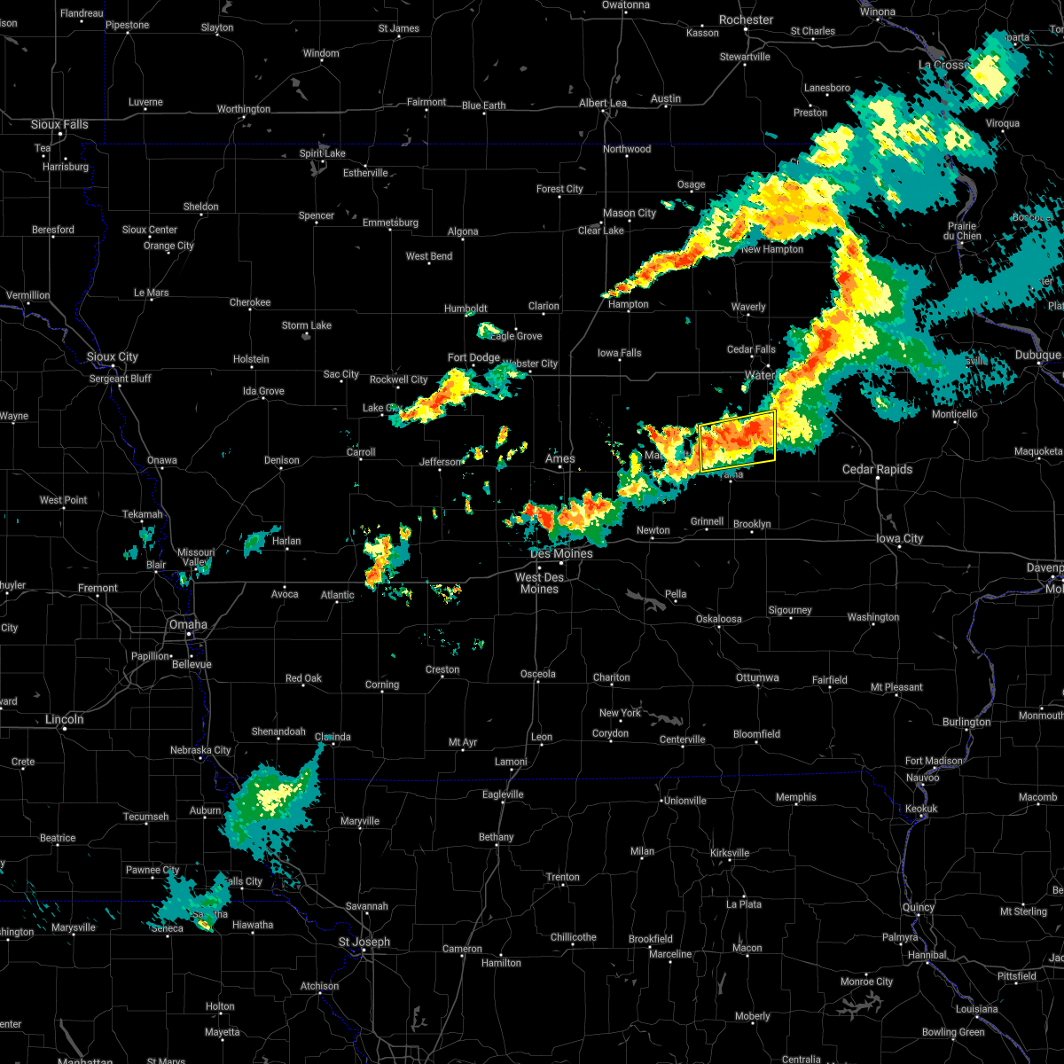 At 642 pm cdt, a severe thunderstorm was located near traer, or 11 miles north of toledo, moving east at 30 mph (radar indicated). Hazards include 60 mph wind gusts. expect damage to roofs, siding, and trees At 642 pm cdt, a severe thunderstorm was located near traer, or 11 miles north of toledo, moving east at 30 mph (radar indicated). Hazards include 60 mph wind gusts. expect damage to roofs, siding, and trees
|
| 7/14/2021 6:24 PM CDT |
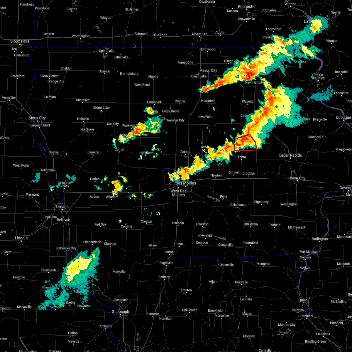 At 624 pm cdt, a severe thunderstorm capable of producing a tornado was located 8 miles southwest of traer, or 9 miles north of toledo, moving east at 45 mph (radar indicated rotation). Hazards include tornado and quarter size hail. Flying debris will be dangerous to those caught without shelter. mobile homes will be damaged or destroyed. damage to roofs, windows, and vehicles will occur. tree damage is likely. Locations impacted include, traer, dysart, gladbrook, garwin and tf clark state park. At 624 pm cdt, a severe thunderstorm capable of producing a tornado was located 8 miles southwest of traer, or 9 miles north of toledo, moving east at 45 mph (radar indicated rotation). Hazards include tornado and quarter size hail. Flying debris will be dangerous to those caught without shelter. mobile homes will be damaged or destroyed. damage to roofs, windows, and vehicles will occur. tree damage is likely. Locations impacted include, traer, dysart, gladbrook, garwin and tf clark state park.
|
| 7/14/2021 6:12 PM CDT |
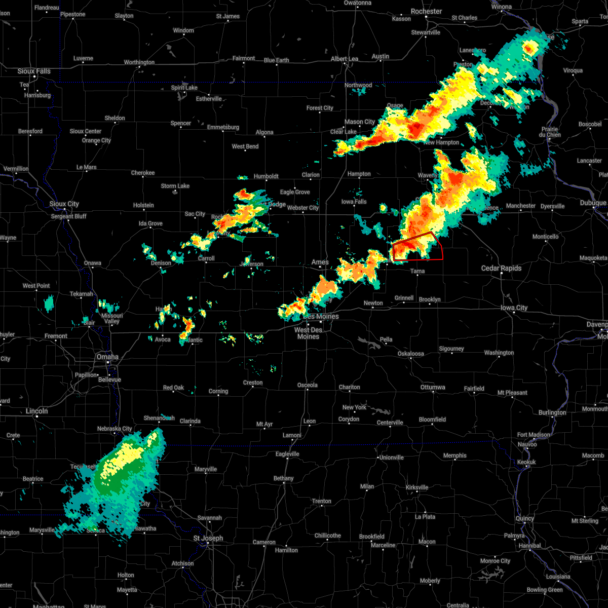 At 612 pm cdt, a severe thunderstorm capable of producing a tornado was located 10 miles west of traer, or 13 miles north of toledo, moving east at 35 mph (weather spotters reported a funnel cloud). Hazards include tornado and quarter size hail. Flying debris will be dangerous to those caught without shelter. mobile homes will be damaged or destroyed. damage to roofs, windows, and vehicles will occur. tree damage is likely. Locations impacted include, traer, dysart, gladbrook, garwin, green mountain, tf clark state park and union grove state park. At 612 pm cdt, a severe thunderstorm capable of producing a tornado was located 10 miles west of traer, or 13 miles north of toledo, moving east at 35 mph (weather spotters reported a funnel cloud). Hazards include tornado and quarter size hail. Flying debris will be dangerous to those caught without shelter. mobile homes will be damaged or destroyed. damage to roofs, windows, and vehicles will occur. tree damage is likely. Locations impacted include, traer, dysart, gladbrook, garwin, green mountain, tf clark state park and union grove state park.
|
| 7/14/2021 6:02 PM CDT |
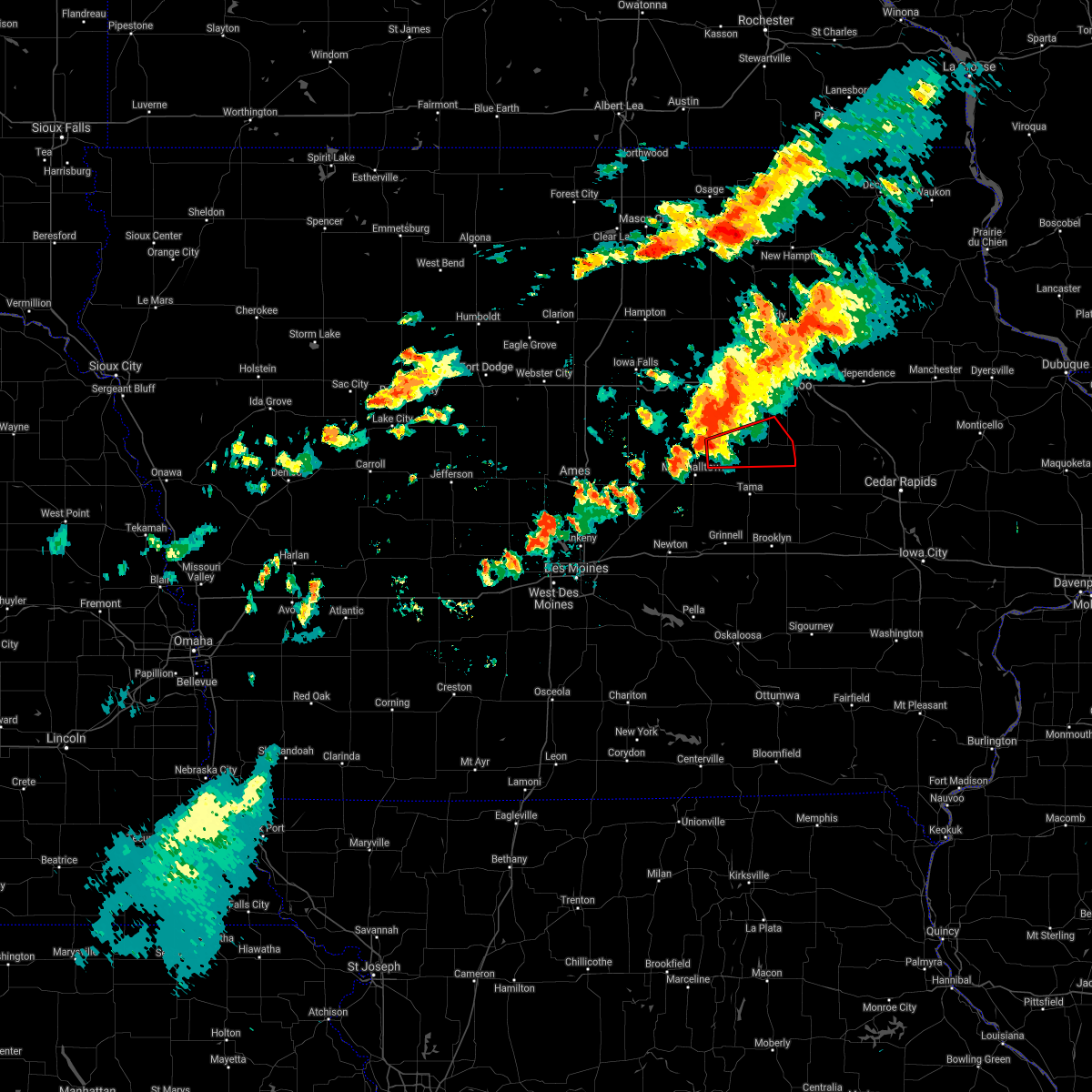 At 602 pm cdt, a severe thunderstorm capable of producing a tornado was located 7 miles southeast of conrad, or 10 miles northeast of marshalltown, moving east at 50 mph (weather spotters reported funnel cloud). Hazards include tornado and quarter size hail. Flying debris will be dangerous to those caught without shelter. mobile homes will be damaged or destroyed. damage to roofs, windows, and vehicles will occur. tree damage is likely. this dangerous storm will be near, traer around 620 pm cdt. Other locations in the path of this tornadic thunderstorm include dysart. At 602 pm cdt, a severe thunderstorm capable of producing a tornado was located 7 miles southeast of conrad, or 10 miles northeast of marshalltown, moving east at 50 mph (weather spotters reported funnel cloud). Hazards include tornado and quarter size hail. Flying debris will be dangerous to those caught without shelter. mobile homes will be damaged or destroyed. damage to roofs, windows, and vehicles will occur. tree damage is likely. this dangerous storm will be near, traer around 620 pm cdt. Other locations in the path of this tornadic thunderstorm include dysart.
|
| 7/14/2021 9:08 AM CDT |
 At 907 am cdt, severe thunderstorms were scattered along a line extending from 6 miles southeast of ackley to 8 miles south of marshalltown, moving east at 25 mph (radar indicated). Hazards include 60 mph wind gusts and penny size hail. Expect damage to roofs, siding, and trees. Locations impacted include, meskwaki casino, toledo, tama and dike. At 907 am cdt, severe thunderstorms were scattered along a line extending from 6 miles southeast of ackley to 8 miles south of marshalltown, moving east at 25 mph (radar indicated). Hazards include 60 mph wind gusts and penny size hail. Expect damage to roofs, siding, and trees. Locations impacted include, meskwaki casino, toledo, tama and dike.
|
| 7/14/2021 8:49 AM CDT |
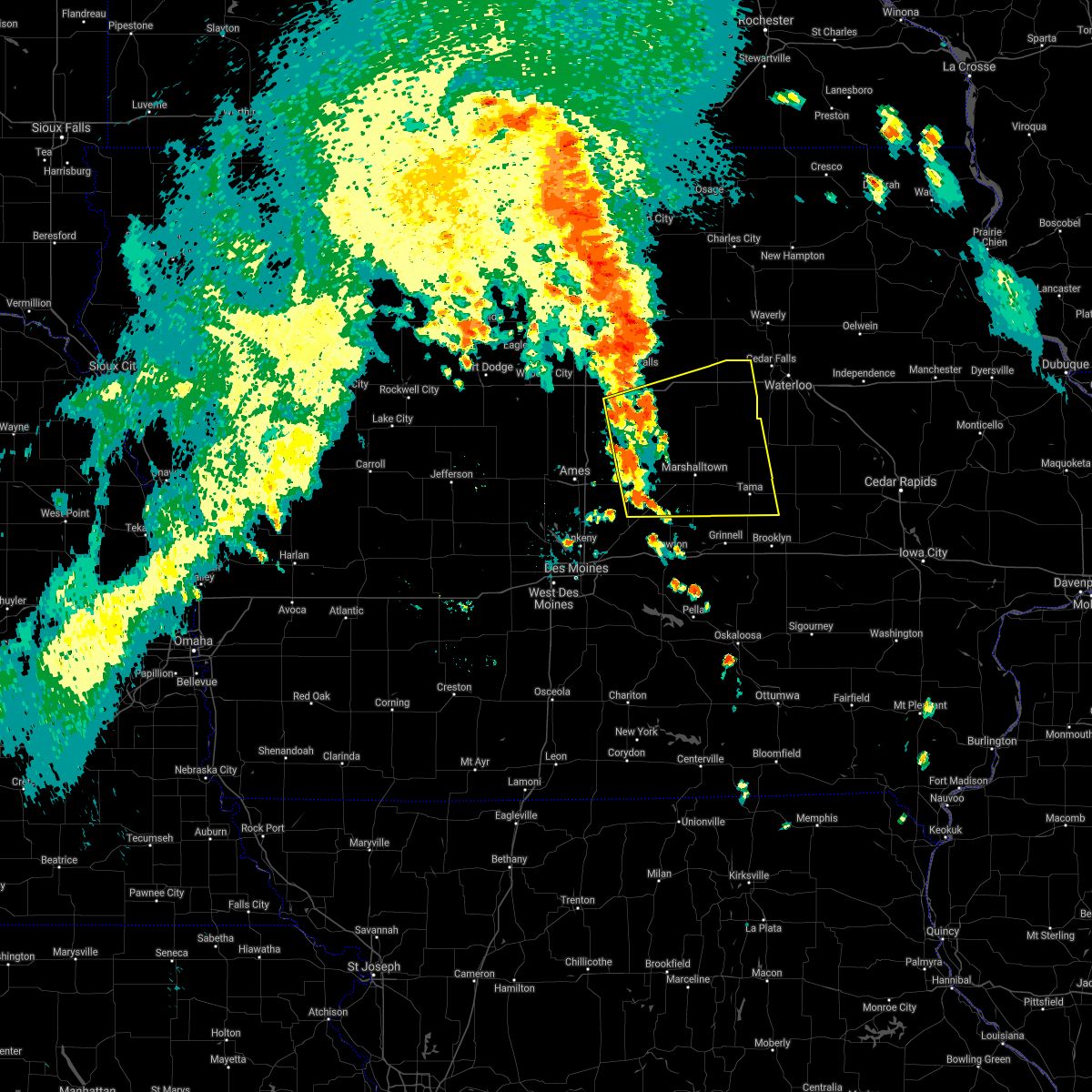 At 848 am cdt, severe thunderstorms were located along a line extending from 6 miles southeast of iowa falls to 6 miles northeast of baxter, moving east at 25 mph (radar indicated. at 841 am emergency management also reported trees down on power lines in nevada). Hazards include 60 mph wind gusts. Expect damage to roofs, siding, and trees. severe thunderstorms will be near, eldora around 855 am cdt. Other locations in the path of these severe thunderstorms include meskwaki casino, toledo and tama. At 848 am cdt, severe thunderstorms were located along a line extending from 6 miles southeast of iowa falls to 6 miles northeast of baxter, moving east at 25 mph (radar indicated. at 841 am emergency management also reported trees down on power lines in nevada). Hazards include 60 mph wind gusts. Expect damage to roofs, siding, and trees. severe thunderstorms will be near, eldora around 855 am cdt. Other locations in the path of these severe thunderstorms include meskwaki casino, toledo and tama.
|
| 8/28/2020 3:41 PM CDT |
 At 341 pm cdt, a severe thunderstorm was located 9 miles west of traer, or 10 miles north of toledo, moving east at 40 mph (radar indicated). Hazards include 60 mph wind gusts and half dollar size hail. Hail damage to vehicles is expected. expect wind damage to roofs, siding, and trees. Locations impacted include, toledo, traer, dysart, gladbrook, garwin, chelsea, clutier, elberon, vining, tf clark state park, toledo municipal airport and union grove state park. At 341 pm cdt, a severe thunderstorm was located 9 miles west of traer, or 10 miles north of toledo, moving east at 40 mph (radar indicated). Hazards include 60 mph wind gusts and half dollar size hail. Hail damage to vehicles is expected. expect wind damage to roofs, siding, and trees. Locations impacted include, toledo, traer, dysart, gladbrook, garwin, chelsea, clutier, elberon, vining, tf clark state park, toledo municipal airport and union grove state park.
|
| 8/28/2020 3:33 PM CDT |
 At 333 pm cdt, a severe thunderstorm was located 8 miles southeast of conrad, or 11 miles northeast of marshalltown, moving east at 30 mph (radar indicated). Hazards include 60 mph wind gusts and quarter size hail. Hail damage to vehicles is expected. Expect wind damage to roofs, siding, and trees. At 333 pm cdt, a severe thunderstorm was located 8 miles southeast of conrad, or 11 miles northeast of marshalltown, moving east at 30 mph (radar indicated). Hazards include 60 mph wind gusts and quarter size hail. Hail damage to vehicles is expected. Expect wind damage to roofs, siding, and trees.
|
| 8/10/2020 12:04 PM CDT |
 At 1203 pm cdt, severe thunderstorms were located along a line extending from near traer to near victor to 6 miles west of delta, moving east at 60 mph. these are very dangerous storms (trained weather spotters reporting widespread wind damage). Hazards include 90 mph wind gusts and quarter size hail. some areas may have winds in excess of 100 mph!. You are in a life-threatening situation. flying debris may be deadly to those caught without shelter. mobile homes will be heavily damaged or destroyed. homes and businesses will have substantial roof and window damage. expect extensive tree damage and power outages. locations impacted include, marshalltown, oskaloosa, pella, grinnell, toledo, montezuma, tama, traer, brooklyn, dysart, new sharon, conrad, meskwaki casino, rock creek lake, gladbrook, le grand, victor, sully, garwin and gilman. This includes interstate 80 between mile markers 175 and 204. At 1203 pm cdt, severe thunderstorms were located along a line extending from near traer to near victor to 6 miles west of delta, moving east at 60 mph. these are very dangerous storms (trained weather spotters reporting widespread wind damage). Hazards include 90 mph wind gusts and quarter size hail. some areas may have winds in excess of 100 mph!. You are in a life-threatening situation. flying debris may be deadly to those caught without shelter. mobile homes will be heavily damaged or destroyed. homes and businesses will have substantial roof and window damage. expect extensive tree damage and power outages. locations impacted include, marshalltown, oskaloosa, pella, grinnell, toledo, montezuma, tama, traer, brooklyn, dysart, new sharon, conrad, meskwaki casino, rock creek lake, gladbrook, le grand, victor, sully, garwin and gilman. This includes interstate 80 between mile markers 175 and 204.
|
| 8/10/2020 11:52 AM CDT |
 At 1152 am cdt, severe thunderstorms were located along a line extending from 8 miles east of conrad to near brooklyn to near oskaloosa, moving east at 60 mph. these are very dangerous storms (trained spotters). Hazards include 90 mph wind gusts and quarter size hail. You are in a life-threatening situation. flying debris may be deadly to those caught without shelter. mobile homes will be heavily damaged or destroyed. homes and businesses will have substantial roof and window damage. Expect extensive tree damage and power outages. At 1152 am cdt, severe thunderstorms were located along a line extending from 8 miles east of conrad to near brooklyn to near oskaloosa, moving east at 60 mph. these are very dangerous storms (trained spotters). Hazards include 90 mph wind gusts and quarter size hail. You are in a life-threatening situation. flying debris may be deadly to those caught without shelter. mobile homes will be heavily damaged or destroyed. homes and businesses will have substantial roof and window damage. Expect extensive tree damage and power outages.
|
| 8/10/2020 11:44 AM CDT |
 At 1143 am cdt, severe thunderstorms were located along a line extending from 9 miles southwest of reinbeck to near brooklyn to 6 miles northwest of oskaloosa, moving east at 70 mph. these are very dangerous storms (radar indicated). Hazards include 80 mph wind gusts and quarter size hail. Flying debris will be dangerous to those caught without shelter. mobile homes will be heavily damaged. expect considerable damage to roofs, windows, and vehicles. extensive tree damage and power outages are likely. locations impacted include, marshalltown, newton, oskaloosa, pella, grinnell, toledo, montezuma, tama, colfax, monroe, traer, prairie city, state center, brooklyn, dysart, new sharon, baxter, iowa speedway, meskwaki casino and rock creek lake. This includes interstate 80 between mile markers 154 and 204. At 1143 am cdt, severe thunderstorms were located along a line extending from 9 miles southwest of reinbeck to near brooklyn to 6 miles northwest of oskaloosa, moving east at 70 mph. these are very dangerous storms (radar indicated). Hazards include 80 mph wind gusts and quarter size hail. Flying debris will be dangerous to those caught without shelter. mobile homes will be heavily damaged. expect considerable damage to roofs, windows, and vehicles. extensive tree damage and power outages are likely. locations impacted include, marshalltown, newton, oskaloosa, pella, grinnell, toledo, montezuma, tama, colfax, monroe, traer, prairie city, state center, brooklyn, dysart, new sharon, baxter, iowa speedway, meskwaki casino and rock creek lake. This includes interstate 80 between mile markers 154 and 204.
|
| 8/10/2020 11:33 AM CDT |
 At 1133 am cdt, severe thunderstorms were located along a line extending from conrad to near grinnell to pella, moving east at 70 mph. these are very dangerous storms (radar indicated). Hazards include 80 mph wind gusts and quarter size hail. Flying debris will be dangerous to those caught without shelter. mobile homes will be heavily damaged. expect considerable damage to roofs, windows, and vehicles. extensive tree damage and power outages are likely. locations impacted include, marshalltown, newton, altoona, oskaloosa, pella, grinnell, pleasant hill, nevada, toledo, montezuma, carlisle, bondurant, story city, tama, mitchellville, colfax, monroe, traer, prairie city and state center. This includes interstate 80 between mile markers 142 and 204. At 1133 am cdt, severe thunderstorms were located along a line extending from conrad to near grinnell to pella, moving east at 70 mph. these are very dangerous storms (radar indicated). Hazards include 80 mph wind gusts and quarter size hail. Flying debris will be dangerous to those caught without shelter. mobile homes will be heavily damaged. expect considerable damage to roofs, windows, and vehicles. extensive tree damage and power outages are likely. locations impacted include, marshalltown, newton, altoona, oskaloosa, pella, grinnell, pleasant hill, nevada, toledo, montezuma, carlisle, bondurant, story city, tama, mitchellville, colfax, monroe, traer, prairie city and state center. This includes interstate 80 between mile markers 142 and 204.
|
| 8/10/2020 11:19 AM CDT |
 At 1118 am cdt, severe thunderstorms were located along a line extending from 12 miles southwest of eldora to near newton to pleasantville, moving east at 70 mph. these are very dangerous storms (radar indicated). Hazards include 80 mph wind gusts and quarter size hail. Flying debris will be dangerous to those caught without shelter. mobile homes will be heavily damaged. expect considerable damage to roofs, windows, and vehicles. Extensive tree damage and power outages are likely. At 1118 am cdt, severe thunderstorms were located along a line extending from 12 miles southwest of eldora to near newton to pleasantville, moving east at 70 mph. these are very dangerous storms (radar indicated). Hazards include 80 mph wind gusts and quarter size hail. Flying debris will be dangerous to those caught without shelter. mobile homes will be heavily damaged. expect considerable damage to roofs, windows, and vehicles. Extensive tree damage and power outages are likely.
|
| 6/15/2019 6:05 PM CDT |
 At 604 pm cdt, a severe thunderstorm was located 8 miles east of toledo, moving east at 40 mph (radar indicated). Hazards include 70 mph wind gusts and nickel size hail. Expect considerable tree damage. damage is likely to mobile homes, roofs, and outbuildings. Locations impacted include, toledo, tama, traer, dysart, meskwaki casino, gladbrook, garwin, gilman, chelsea, montour, clutier, elberon, vining, tf clark state park, union grove state park and toledo municipal airport. At 604 pm cdt, a severe thunderstorm was located 8 miles east of toledo, moving east at 40 mph (radar indicated). Hazards include 70 mph wind gusts and nickel size hail. Expect considerable tree damage. damage is likely to mobile homes, roofs, and outbuildings. Locations impacted include, toledo, tama, traer, dysart, meskwaki casino, gladbrook, garwin, gilman, chelsea, montour, clutier, elberon, vining, tf clark state park, union grove state park and toledo municipal airport.
|
| 6/15/2019 5:54 PM CDT |
 At 553 pm cdt, a severe thunderstorm was located near toledo, moving east at 30 mph (radar indicated). Hazards include 70 mph wind gusts and nickel size hail. Expect considerable tree damage. damage is likely to mobile homes, roofs, and outbuildings. Locations impacted include, marshalltown, toledo, tama, traer, dysart, conrad, meskwaki casino, gladbrook, le grand, garwin, gilman, chelsea, montour, laurel, clutier, elberon, beaman, haverhill, lincoln and ferguson. At 553 pm cdt, a severe thunderstorm was located near toledo, moving east at 30 mph (radar indicated). Hazards include 70 mph wind gusts and nickel size hail. Expect considerable tree damage. damage is likely to mobile homes, roofs, and outbuildings. Locations impacted include, marshalltown, toledo, tama, traer, dysart, conrad, meskwaki casino, gladbrook, le grand, garwin, gilman, chelsea, montour, laurel, clutier, elberon, beaman, haverhill, lincoln and ferguson.
|
| 6/15/2019 5:31 PM CDT |
 At 531 pm cdt, a severe thunderstorm was located near marshalltown, moving east at 45 mph (trained weather spotters). Hazards include 60 mph wind gusts and nickel size hail. expect damage to roofs, siding, and trees At 531 pm cdt, a severe thunderstorm was located near marshalltown, moving east at 45 mph (trained weather spotters). Hazards include 60 mph wind gusts and nickel size hail. expect damage to roofs, siding, and trees
|
| 5/24/2019 7:46 AM CDT |
 At 746 am cdt, a severe thunderstorm was located near meskwaki casino, or 9 miles northwest of toledo, moving northeast at 50 mph (radar indicated). Hazards include 60 mph wind gusts. expect damage to roofs, siding, and trees At 746 am cdt, a severe thunderstorm was located near meskwaki casino, or 9 miles northwest of toledo, moving northeast at 50 mph (radar indicated). Hazards include 60 mph wind gusts. expect damage to roofs, siding, and trees
|
| 5/16/2019 8:04 PM CDT |
 At 804 pm cdt, a severe thunderstorm was located near toledo, moving east at 20 mph (radar indicated). Hazards include ping pong ball size hail. People and animals outdoors will be injured. Expect damage to roofs, siding, windows, and vehicles. At 804 pm cdt, a severe thunderstorm was located near toledo, moving east at 20 mph (radar indicated). Hazards include ping pong ball size hail. People and animals outdoors will be injured. Expect damage to roofs, siding, windows, and vehicles.
|
| 4/17/2019 4:59 PM CDT |
 At 459 pm cdt, a severe thunderstorm was located near meskwaki casino, or 8 miles southeast of marshalltown, moving east at 40 mph (radar indicated). Hazards include 60 mph wind gusts and quarter size hail. Hail damage to vehicles is expected. expect wind damage to roofs, siding, and trees. Locations impacted include, marshalltown, toledo, tama, meskwaki casino, le grand, garwin, gilman, montour, laurel and ferguson. At 459 pm cdt, a severe thunderstorm was located near meskwaki casino, or 8 miles southeast of marshalltown, moving east at 40 mph (radar indicated). Hazards include 60 mph wind gusts and quarter size hail. Hail damage to vehicles is expected. expect wind damage to roofs, siding, and trees. Locations impacted include, marshalltown, toledo, tama, meskwaki casino, le grand, garwin, gilman, montour, laurel and ferguson.
|
| 4/17/2019 4:34 PM CDT |
 At 434 pm cdt, a severe thunderstorm was located 7 miles northeast of baxter, or 12 miles southwest of marshalltown, moving east at 40 mph (radar indicated). Hazards include 60 mph wind gusts and quarter size hail. Hail damage to vehicles is expected. Expect wind damage to roofs, siding, and trees. At 434 pm cdt, a severe thunderstorm was located 7 miles northeast of baxter, or 12 miles southwest of marshalltown, moving east at 40 mph (radar indicated). Hazards include 60 mph wind gusts and quarter size hail. Hail damage to vehicles is expected. Expect wind damage to roofs, siding, and trees.
|
| 7/19/2018 5:02 PM CDT |
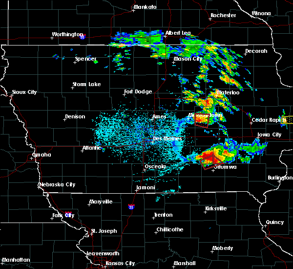 At 502 pm cdt, a severe thunderstorm capable of producing a tornado was located near meskwaki casino, or 7 miles east of marshalltown, moving east at 20 mph (radar indicated rotation). Hazards include tornado and quarter size hail. Flying debris will be dangerous to those caught without shelter. mobile homes will be damaged or destroyed. damage to roofs, windows, and vehicles will occur. tree damage is likely. this dangerous storm will be near, meskwaki casino around 520 pm cdt. toledo and tama around 530 pm cdt. Other locations impacted by this tornadic thunderstorm include garwin, montour, union grove state park and toledo municipal airport. At 502 pm cdt, a severe thunderstorm capable of producing a tornado was located near meskwaki casino, or 7 miles east of marshalltown, moving east at 20 mph (radar indicated rotation). Hazards include tornado and quarter size hail. Flying debris will be dangerous to those caught without shelter. mobile homes will be damaged or destroyed. damage to roofs, windows, and vehicles will occur. tree damage is likely. this dangerous storm will be near, meskwaki casino around 520 pm cdt. toledo and tama around 530 pm cdt. Other locations impacted by this tornadic thunderstorm include garwin, montour, union grove state park and toledo municipal airport.
|
| 7/19/2018 4:52 PM CDT |
 At 451 pm cdt, a confirmed tornado was located near marshalltown, moving east at 20 mph (law enforcement confirmed tornado). Hazards include damaging tornado. this warning replaces the prior tornado emergency which was in effect for marshalltown. Flying debris will be dangerous to those caught without shelter. mobile homes will be damaged or destroyed. damage to roofs, windows, and vehicles will occur. tree damage is likely. the tornado will be near, meskwaki casino around 520 pm cdt. toledo and tama around 530 pm cdt. Other locations impacted by this tornadic thunderstorm include garwin, le grand, toledo municipal airport, green mountain, montour, union grove state park, marshalltown municipal airport and ferguson. At 451 pm cdt, a confirmed tornado was located near marshalltown, moving east at 20 mph (law enforcement confirmed tornado). Hazards include damaging tornado. this warning replaces the prior tornado emergency which was in effect for marshalltown. Flying debris will be dangerous to those caught without shelter. mobile homes will be damaged or destroyed. damage to roofs, windows, and vehicles will occur. tree damage is likely. the tornado will be near, meskwaki casino around 520 pm cdt. toledo and tama around 530 pm cdt. Other locations impacted by this tornadic thunderstorm include garwin, le grand, toledo municipal airport, green mountain, montour, union grove state park, marshalltown municipal airport and ferguson.
|
| 7/19/2018 4:46 PM CDT |
 At 446 pm cdt, a confirmed large and destructive tornado was located over marshalltown, moving east at 20 mph. tornado emergency for marshalltown. this is a particularly dangerous situation. take cover now! (law enforcement confirmed tornado). Hazards include deadly tornado. You are in a life-threatening situation. flying debris may be deadly to those caught without shelter. mobile homes will be destroyed. considerable damage to homes, businesses, and vehicles is likely and complete destruction is possible. the tornado will be near, meskwaki casino around 500 pm cdt. Other locations impacted by this tornadic thunderstorm include garwin, gilman, le grand, ferguson, green mountain, montour, marshalltown municipal airport, toledo municipal airport and albion. At 446 pm cdt, a confirmed large and destructive tornado was located over marshalltown, moving east at 20 mph. tornado emergency for marshalltown. this is a particularly dangerous situation. take cover now! (law enforcement confirmed tornado). Hazards include deadly tornado. You are in a life-threatening situation. flying debris may be deadly to those caught without shelter. mobile homes will be destroyed. considerable damage to homes, businesses, and vehicles is likely and complete destruction is possible. the tornado will be near, meskwaki casino around 500 pm cdt. Other locations impacted by this tornadic thunderstorm include garwin, gilman, le grand, ferguson, green mountain, montour, marshalltown municipal airport, toledo municipal airport and albion.
|
| 7/19/2018 4:37 PM CDT |
 Tornado emergency for marshalltown, the national weather service in des moines has issued a * tornado warning for, eastern marshall county in central iowa, southwestern tama county in central iowa, * until 500 pm cdt. * at 437 pm cdt, a confirmed large and destructive tornado was observed over marshalltown, moving east at 25 mph. tornado emergency for marshalltown. this is a particularly dangerous situation. take cover now! (law enforcement confirmed tornado). Hazards include deadly tornado. You are in a life-threatening situation. flying debris may be deadly to those caught without shelter. mobile homes will be destroyed. considerable damage to homes, businesses, and vehicles is likely and complete destruction is possible. the tornado will be near, meskwaki casino around 500 pm cdt. Other locations impacted by this tornadic thunderstorm include garwin, gilman, le grand, ferguson, green mountain, montour, marshalltown municipal airport, toledo municipal airport and albion. Tornado emergency for marshalltown, the national weather service in des moines has issued a * tornado warning for, eastern marshall county in central iowa, southwestern tama county in central iowa, * until 500 pm cdt. * at 437 pm cdt, a confirmed large and destructive tornado was observed over marshalltown, moving east at 25 mph. tornado emergency for marshalltown. this is a particularly dangerous situation. take cover now! (law enforcement confirmed tornado). Hazards include deadly tornado. You are in a life-threatening situation. flying debris may be deadly to those caught without shelter. mobile homes will be destroyed. considerable damage to homes, businesses, and vehicles is likely and complete destruction is possible. the tornado will be near, meskwaki casino around 500 pm cdt. Other locations impacted by this tornadic thunderstorm include garwin, gilman, le grand, ferguson, green mountain, montour, marshalltown municipal airport, toledo municipal airport and albion.
|
| 6/30/2018 7:30 PM CDT |
 At 730 pm cdt, severe thunderstorms were located along a line extending from near hudson to near traer, moving east at 40 mph (radar indicated). Hazards include 60 mph wind gusts. Expect damage to roofs, siding, and trees. locations impacted include, waterloo, cedar falls, toledo, evansdale, tama, jesup, la porte city, hudson, traer, reinbeck, dysart, dike, elk run heights, meskwaki casino, crossroads mall, uni-dome and mcleod center, waterloo municipal airport, gladbrook, washburn and dunkerton. This includes interstate 380 between mile markers 56 and 73. At 730 pm cdt, severe thunderstorms were located along a line extending from near hudson to near traer, moving east at 40 mph (radar indicated). Hazards include 60 mph wind gusts. Expect damage to roofs, siding, and trees. locations impacted include, waterloo, cedar falls, toledo, evansdale, tama, jesup, la porte city, hudson, traer, reinbeck, dysart, dike, elk run heights, meskwaki casino, crossroads mall, uni-dome and mcleod center, waterloo municipal airport, gladbrook, washburn and dunkerton. This includes interstate 380 between mile markers 56 and 73.
|
| 6/30/2018 7:03 PM CDT |
 At 703 pm cdt, severe thunderstorms were located along a line extending from near dike to 6 miles south of conrad, moving east at 35 mph (radar indicated). Hazards include 60 mph wind gusts and penny size hail. expect damage to roofs, siding, and trees At 703 pm cdt, severe thunderstorms were located along a line extending from near dike to 6 miles south of conrad, moving east at 35 mph (radar indicated). Hazards include 60 mph wind gusts and penny size hail. expect damage to roofs, siding, and trees
|
| 6/6/2018 6:18 PM CDT |
 At 618 pm cdt, a severe thunderstorm was located near marshalltown, moving south at 15 mph (radar indicated). Hazards include 60 mph wind gusts and quarter size hail. Hail damage to vehicles is expected. expect wind damage to roofs, siding, and trees. Locations impacted include, marshalltown, toledo, tama, meskwaki casino, le grand, garwin, gilman, chelsea, montour, laurel, haverhill, ferguson, green mountain, vining, toledo municipal airport and marshalltown municipal airport. At 618 pm cdt, a severe thunderstorm was located near marshalltown, moving south at 15 mph (radar indicated). Hazards include 60 mph wind gusts and quarter size hail. Hail damage to vehicles is expected. expect wind damage to roofs, siding, and trees. Locations impacted include, marshalltown, toledo, tama, meskwaki casino, le grand, garwin, gilman, chelsea, montour, laurel, haverhill, ferguson, green mountain, vining, toledo municipal airport and marshalltown municipal airport.
|
| 6/6/2018 6:03 PM CDT |
 At 603 pm cdt, a severe thunderstorm was located near blairstown, or 10 miles north of marengo, moving southeast at 35 mph (trained weather spotters). Hazards include two inch hail and 60 mph wind gusts. People and animals outdoors will be injured. expect hail damage to roofs, siding, windows, and vehicles. expect wind damage to roofs, siding, and trees. Locations impacted include, traer, garwin, chelsea, clutier, elberon, vining, union grove state park and toledo municipal airport. At 603 pm cdt, a severe thunderstorm was located near blairstown, or 10 miles north of marengo, moving southeast at 35 mph (trained weather spotters). Hazards include two inch hail and 60 mph wind gusts. People and animals outdoors will be injured. expect hail damage to roofs, siding, windows, and vehicles. expect wind damage to roofs, siding, and trees. Locations impacted include, traer, garwin, chelsea, clutier, elberon, vining, union grove state park and toledo municipal airport.
|
| 6/6/2018 5:47 PM CDT |
 At 547 pm cdt, a severe thunderstorm was located near conrad, or 7 miles northeast of marshalltown, moving south at 15 mph (radar indicated). Hazards include 60 mph wind gusts and quarter size hail. Hail damage to vehicles is expected. Expect wind damage to roofs, siding, and trees. At 547 pm cdt, a severe thunderstorm was located near conrad, or 7 miles northeast of marshalltown, moving south at 15 mph (radar indicated). Hazards include 60 mph wind gusts and quarter size hail. Hail damage to vehicles is expected. Expect wind damage to roofs, siding, and trees.
|
| 6/6/2018 5:35 PM CDT |
 At 535 pm cdt, a severe thunderstorm was located near dysart, or 13 miles northeast of toledo, moving southeast at 35 mph (trained weather spotters). Hazards include two inch hail and 60 mph wind gusts. People and animals outdoors will be injured. expect hail damage to roofs, siding, windows, and vehicles. expect wind damage to roofs, siding, and trees. Locations impacted include, traer, dysart, garwin, chelsea, clutier, elberon, vining, tf clark state park, union grove state park and toledo municipal airport. At 535 pm cdt, a severe thunderstorm was located near dysart, or 13 miles northeast of toledo, moving southeast at 35 mph (trained weather spotters). Hazards include two inch hail and 60 mph wind gusts. People and animals outdoors will be injured. expect hail damage to roofs, siding, windows, and vehicles. expect wind damage to roofs, siding, and trees. Locations impacted include, traer, dysart, garwin, chelsea, clutier, elberon, vining, tf clark state park, union grove state park and toledo municipal airport.
|
| 6/6/2018 5:14 PM CDT |
 At 514 pm cdt, a severe thunderstorm was located near traer, or 15 miles north of toledo, moving southeast at 35 mph (trained weather spotters). Hazards include two inch hail and 60 mph wind gusts. People and animals outdoors will be injured. expect hail damage to roofs, siding, windows, and vehicles. Expect wind damage to roofs, siding, and trees. At 514 pm cdt, a severe thunderstorm was located near traer, or 15 miles north of toledo, moving southeast at 35 mph (trained weather spotters). Hazards include two inch hail and 60 mph wind gusts. People and animals outdoors will be injured. expect hail damage to roofs, siding, windows, and vehicles. Expect wind damage to roofs, siding, and trees.
|
| 5/25/2018 7:06 PM CDT |
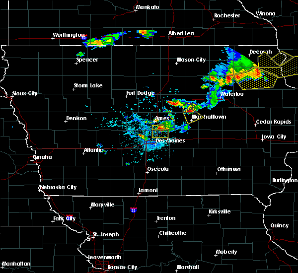 At 706 pm cdt, a severe thunderstorm was located near conrad, or 10 miles north of marshalltown, moving southeast at 10 mph (radar indicated). Hazards include 60 mph wind gusts and quarter size hail. Hail damage to vehicles is expected. Expect wind damage to roofs, siding, and trees. At 706 pm cdt, a severe thunderstorm was located near conrad, or 10 miles north of marshalltown, moving southeast at 10 mph (radar indicated). Hazards include 60 mph wind gusts and quarter size hail. Hail damage to vehicles is expected. Expect wind damage to roofs, siding, and trees.
|
| 5/3/2018 8:48 PM CDT |
 At 847 pm cdt, a severe thunderstorm capable of producing a tornado was located near meskwaki casino, or 8 miles east of marshalltown, moving east at 30 mph (radar indicated rotation). Hazards include tornado. Flying debris will be dangerous to those caught without shelter. mobile homes will be damaged or destroyed. damage to roofs, windows, and vehicles will occur. tree damage is likely. Locations impacted include, toledo, tama, meskwaki casino, le grand, garwin, montour and toledo municipal airport. At 847 pm cdt, a severe thunderstorm capable of producing a tornado was located near meskwaki casino, or 8 miles east of marshalltown, moving east at 30 mph (radar indicated rotation). Hazards include tornado. Flying debris will be dangerous to those caught without shelter. mobile homes will be damaged or destroyed. damage to roofs, windows, and vehicles will occur. tree damage is likely. Locations impacted include, toledo, tama, meskwaki casino, le grand, garwin, montour and toledo municipal airport.
|
| 5/3/2018 8:28 PM CDT |
 At 828 pm cdt, a severe thunderstorm capable of producing a tornado was located near marshalltown, moving northeast at 30 mph (radar indicated rotation). Hazards include tornado. Flying debris will be dangerous to those caught without shelter. mobile homes will be damaged or destroyed. damage to roofs, windows, and vehicles will occur. tree damage is likely. this dangerous storm will be near, meskwaki casino around 855 pm cdt. toledo and tama around 900 pm cdt. Other locations impacted by this tornadic thunderstorm include garwin, gilman, le grand, ferguson, toledo municipal airport, laurel, montour and haverhill. At 828 pm cdt, a severe thunderstorm capable of producing a tornado was located near marshalltown, moving northeast at 30 mph (radar indicated rotation). Hazards include tornado. Flying debris will be dangerous to those caught without shelter. mobile homes will be damaged or destroyed. damage to roofs, windows, and vehicles will occur. tree damage is likely. this dangerous storm will be near, meskwaki casino around 855 pm cdt. toledo and tama around 900 pm cdt. Other locations impacted by this tornadic thunderstorm include garwin, gilman, le grand, ferguson, toledo municipal airport, laurel, montour and haverhill.
|
| 5/1/2018 6:43 PM CDT |
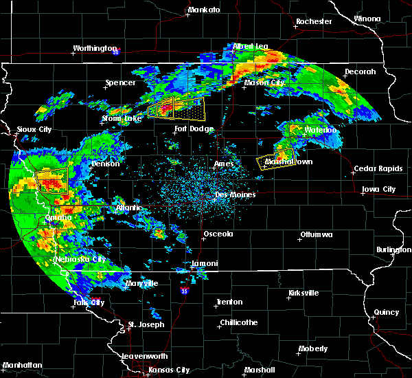 At 643 pm cdt, a severe thunderstorm was located 10 miles north of meskwaki casino, or 11 miles northwest of toledo, moving east at 40 mph (radar indicated). Hazards include 60 mph wind gusts and quarter size hail. Hail damage to vehicles is expected. expect wind damage to roofs, siding, and trees. Locations impacted include, gladbrook, garwin and union grove state park. At 643 pm cdt, a severe thunderstorm was located 10 miles north of meskwaki casino, or 11 miles northwest of toledo, moving east at 40 mph (radar indicated). Hazards include 60 mph wind gusts and quarter size hail. Hail damage to vehicles is expected. expect wind damage to roofs, siding, and trees. Locations impacted include, gladbrook, garwin and union grove state park.
|
| 5/1/2018 6:24 PM CDT |
 At 624 pm cdt, a severe thunderstorm was located near marshalltown, moving northeast at 45 mph (radar indicated). Hazards include 60 mph wind gusts and quarter size hail. Hail damage to vehicles is expected. Expect wind damage to roofs, siding, and trees. At 624 pm cdt, a severe thunderstorm was located near marshalltown, moving northeast at 45 mph (radar indicated). Hazards include 60 mph wind gusts and quarter size hail. Hail damage to vehicles is expected. Expect wind damage to roofs, siding, and trees.
|
| 7/10/2017 3:19 AM CDT |
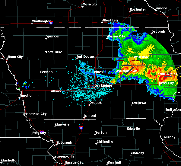 At 319 am cdt, a severe thunderstorm was located near traer, or 10 miles north of toledo, moving southeast at 50 mph (radar indicated). Hazards include 60 mph wind gusts and penny size hail. Expect damage to roofs, siding, and trees. Locations impacted include, traer, gladbrook, garwin, lincoln, tf clark state park and union grove state park. At 319 am cdt, a severe thunderstorm was located near traer, or 10 miles north of toledo, moving southeast at 50 mph (radar indicated). Hazards include 60 mph wind gusts and penny size hail. Expect damage to roofs, siding, and trees. Locations impacted include, traer, gladbrook, garwin, lincoln, tf clark state park and union grove state park.
|
| 7/10/2017 3:10 AM CDT |
 At 310 am cdt, a severe thunderstorm was located near reinbeck, or 10 miles southeast of grundy center, moving southeast at 50 mph (radar indicated). Hazards include 60 mph wind gusts and penny size hail. Expect damage to roofs, siding, and trees. Locations impacted include, grundy center, traer, reinbeck, conrad, gladbrook, garwin, holland, beaman, lincoln, morrison, tf clark state park and union grove state park. At 310 am cdt, a severe thunderstorm was located near reinbeck, or 10 miles southeast of grundy center, moving southeast at 50 mph (radar indicated). Hazards include 60 mph wind gusts and penny size hail. Expect damage to roofs, siding, and trees. Locations impacted include, grundy center, traer, reinbeck, conrad, gladbrook, garwin, holland, beaman, lincoln, morrison, tf clark state park and union grove state park.
|
| 7/10/2017 2:44 AM CDT |
 At 244 am cdt, a severe thunderstorm was located 8 miles southeast of ackley, or 9 miles northeast of eldora, moving southeast at 50 mph (radar indicated). Hazards include 60 mph wind gusts and quarter size hail. Hail damage to vehicles is expected. Expect wind damage to roofs, siding, and trees. At 244 am cdt, a severe thunderstorm was located 8 miles southeast of ackley, or 9 miles northeast of eldora, moving southeast at 50 mph (radar indicated). Hazards include 60 mph wind gusts and quarter size hail. Hail damage to vehicles is expected. Expect wind damage to roofs, siding, and trees.
|
| 6/29/2017 4:50 PM CDT |
 At 950 pm cdt, severe thunderstorms were located along a line extending from 6 miles north of traer to 6 miles north of meskwaki casino, moving southeast at 45 mph (radar indicated). Hazards include 60 mph wind gusts. expect damage to roofs, siding, and trees At 950 pm cdt, severe thunderstorms were located along a line extending from 6 miles north of traer to 6 miles north of meskwaki casino, moving southeast at 45 mph (radar indicated). Hazards include 60 mph wind gusts. expect damage to roofs, siding, and trees
|
| 6/29/2017 4:42 PM CDT |
 At 941 pm cdt, severe thunderstorms were located along a line extending from 8 miles northwest of meskwaki casino to near baxter, moving southeast at 50 mph (radar indicated). Hazards include 60 mph wind gusts. expect damage to roofs, siding, and trees At 941 pm cdt, severe thunderstorms were located along a line extending from 8 miles northwest of meskwaki casino to near baxter, moving southeast at 50 mph (radar indicated). Hazards include 60 mph wind gusts. expect damage to roofs, siding, and trees
|
| 6/29/2017 4:38 PM CDT |
 At 938 pm cdt, severe thunderstorms were located along a line extending from 6 miles northeast of marshalltown to 6 miles south of state center, moving southeast at 45 mph (radar indicated). Hazards include 60 mph wind gusts. Expect damage to roofs, siding, and trees. Locations impacted include, marshalltown, le grand, melbourne, garwin, rhodes, montour, laurel, haverhill, ferguson, green mountain, marshalltown municipal airport and union grove state park. At 938 pm cdt, severe thunderstorms were located along a line extending from 6 miles northeast of marshalltown to 6 miles south of state center, moving southeast at 45 mph (radar indicated). Hazards include 60 mph wind gusts. Expect damage to roofs, siding, and trees. Locations impacted include, marshalltown, le grand, melbourne, garwin, rhodes, montour, laurel, haverhill, ferguson, green mountain, marshalltown municipal airport and union grove state park.
|
| 6/29/2017 4:23 PM CDT |
 At 922 pm cdt, severe thunderstorms were located along a line extending from 8 miles west of conrad to 6 miles east of nevada, moving southeast at 45 mph (radar indicated). Hazards include 60 mph wind gusts. expect damage to roofs, siding, and trees At 922 pm cdt, severe thunderstorms were located along a line extending from 8 miles west of conrad to 6 miles east of nevada, moving southeast at 45 mph (radar indicated). Hazards include 60 mph wind gusts. expect damage to roofs, siding, and trees
|
| 5/17/2017 5:28 PM CDT |
 At 527 pm cdt, severe thunderstorms were located along a line extending from 7 miles southeast of big wall lake to 6 miles west of grundy center to near toledo, moving northeast at 60 mph (trained weather spotters. these storms have a history of producing widespread winds of 60 to 70 mph, with trees down). Hazards include 70 mph wind gusts. Expect considerable tree damage. damage is likely to mobile homes, roofs, and outbuildings. locations impacted include, marshalltown, webster city, iowa falls, eldora, grundy center, toledo, tama, traer, reinbeck, ackley, dysart, dike, conrad, meskwaki casino, gladbrook, le grand, hubbard, alden, wellsburg and radcliffe. this includes interstate 35 between mile markers 134 and 150. A tornado watch remains in effect until 700 pm cdt for central, north central and northeastern iowa. At 527 pm cdt, severe thunderstorms were located along a line extending from 7 miles southeast of big wall lake to 6 miles west of grundy center to near toledo, moving northeast at 60 mph (trained weather spotters. these storms have a history of producing widespread winds of 60 to 70 mph, with trees down). Hazards include 70 mph wind gusts. Expect considerable tree damage. damage is likely to mobile homes, roofs, and outbuildings. locations impacted include, marshalltown, webster city, iowa falls, eldora, grundy center, toledo, tama, traer, reinbeck, ackley, dysart, dike, conrad, meskwaki casino, gladbrook, le grand, hubbard, alden, wellsburg and radcliffe. this includes interstate 35 between mile markers 134 and 150. A tornado watch remains in effect until 700 pm cdt for central, north central and northeastern iowa.
|
| 5/17/2017 5:20 PM CDT |
 At 518 pm cdt, severe thunderstorms were located along a line extending from near big wall lake to 6 miles northwest of conrad to near meskwaki casino, moving northeast at 55 mph (trained weather spotters. at 512pm...69 mph winds were reported at the marshalltown airport. numerous trees were also reported down with some structural damage). Hazards include 70 mph wind gusts. Expect considerable tree damage. damage is likely to mobile homes, roofs, and outbuildings. locations impacted include, marshalltown, webster city, iowa falls, eldora, grundy center, toledo, story city, tama, traer, reinbeck, ackley, state center, dysart, roland, jewell junction, dike, conrad, meskwaki casino, gladbrook and le grand. this includes interstate 35 between mile markers 125 and 150. A tornado watch remains in effect until 700 pm cdt for central, north central and northeastern iowa. At 518 pm cdt, severe thunderstorms were located along a line extending from near big wall lake to 6 miles northwest of conrad to near meskwaki casino, moving northeast at 55 mph (trained weather spotters. at 512pm...69 mph winds were reported at the marshalltown airport. numerous trees were also reported down with some structural damage). Hazards include 70 mph wind gusts. Expect considerable tree damage. damage is likely to mobile homes, roofs, and outbuildings. locations impacted include, marshalltown, webster city, iowa falls, eldora, grundy center, toledo, story city, tama, traer, reinbeck, ackley, state center, dysart, roland, jewell junction, dike, conrad, meskwaki casino, gladbrook and le grand. this includes interstate 35 between mile markers 125 and 150. A tornado watch remains in effect until 700 pm cdt for central, north central and northeastern iowa.
|
| 5/17/2017 5:06 PM CDT |
 At 505 pm cdt, severe thunderstorms were located along a line extending from near webster city to 9 miles southwest of eldora to 10 miles northwest of rock creek lake, moving northeast at 60 mph (trained weather spotters. numerous reports of 60 to 70 mph winds have been reported with these storms with trees and powerlines down). Hazards include 70 mph wind gusts. Expect considerable tree damage. damage is likely to mobile homes, roofs, and outbuildings. locations impacted include, marshalltown, newton, webster city, nevada, iowa falls, eldora, grundy center, toledo, story city, tama, traer, reinbeck, ackley, state center, dysart, roland, jewell junction, dike, conrad and baxter. this includes the following highways, interstate 35 between mile markers 118 and 150. interstate 80 between mile markers 164 and 165. A tornado watch remains in effect until 700 pm cdt for central, north central and northeastern iowa. At 505 pm cdt, severe thunderstorms were located along a line extending from near webster city to 9 miles southwest of eldora to 10 miles northwest of rock creek lake, moving northeast at 60 mph (trained weather spotters. numerous reports of 60 to 70 mph winds have been reported with these storms with trees and powerlines down). Hazards include 70 mph wind gusts. Expect considerable tree damage. damage is likely to mobile homes, roofs, and outbuildings. locations impacted include, marshalltown, newton, webster city, nevada, iowa falls, eldora, grundy center, toledo, story city, tama, traer, reinbeck, ackley, state center, dysart, roland, jewell junction, dike, conrad and baxter. this includes the following highways, interstate 35 between mile markers 118 and 150. interstate 80 between mile markers 164 and 165. A tornado watch remains in effect until 700 pm cdt for central, north central and northeastern iowa.
|
| 5/17/2017 4:53 PM CDT |
 At 452 pm cdt, severe thunderstorms were located along a line extending from 15 miles north of boone to 6 miles east of roland to newton, moving northeast at 60 mph (trained weather spotters. numerous reports of 60 to 70 mph winds with trees and powerlines downed). Hazards include 70 mph wind gusts. Expect considerable tree damage. Damage is likely to mobile homes, roofs, and outbuildings. At 452 pm cdt, severe thunderstorms were located along a line extending from 15 miles north of boone to 6 miles east of roland to newton, moving northeast at 60 mph (trained weather spotters. numerous reports of 60 to 70 mph winds with trees and powerlines downed). Hazards include 70 mph wind gusts. Expect considerable tree damage. Damage is likely to mobile homes, roofs, and outbuildings.
|
| 4/15/2017 7:13 PM CDT |
 At 713 pm cdt, severe thunderstorms were located along a line extending from near hudson to 6 miles west of traer, moving east at 25 mph (radar indicated). Hazards include 60 mph wind gusts and quarter size hail. Hail damage to vehicles is expected. expect wind damage to roofs, siding, and trees. Locations impacted include, waterloo, marshalltown, hudson, reinbeck, meskwaki casino, gladbrook, le grand, garwin, montour, lincoln, green mountain, morrison and union grove state park. At 713 pm cdt, severe thunderstorms were located along a line extending from near hudson to 6 miles west of traer, moving east at 25 mph (radar indicated). Hazards include 60 mph wind gusts and quarter size hail. Hail damage to vehicles is expected. expect wind damage to roofs, siding, and trees. Locations impacted include, waterloo, marshalltown, hudson, reinbeck, meskwaki casino, gladbrook, le grand, garwin, montour, lincoln, green mountain, morrison and union grove state park.
|
| 4/15/2017 6:29 PM CDT |
 At 628 pm cdt, severe thunderstorms were located along a line extending from 6 miles north of grundy center to near conrad, moving east at 25 mph (radar indicated). Hazards include 60 mph wind gusts and quarter size hail. Hail damage to vehicles is expected. Expect wind damage to roofs, siding, and trees. At 628 pm cdt, severe thunderstorms were located along a line extending from 6 miles north of grundy center to near conrad, moving east at 25 mph (radar indicated). Hazards include 60 mph wind gusts and quarter size hail. Hail damage to vehicles is expected. Expect wind damage to roofs, siding, and trees.
|
| 3/6/2017 7:40 PM CST |
 At 740 pm cst, severe thunderstorms were located along a line extending from near reinbeck to monroe, moving east at 45 mph (emergency management. 65 mph winds have been reported with these storms in state center). Hazards include 60 mph wind gusts and quarter size hail. Hail damage to vehicles is expected. Expect wind damage to roofs, siding, and trees. At 740 pm cst, severe thunderstorms were located along a line extending from near reinbeck to monroe, moving east at 45 mph (emergency management. 65 mph winds have been reported with these storms in state center). Hazards include 60 mph wind gusts and quarter size hail. Hail damage to vehicles is expected. Expect wind damage to roofs, siding, and trees.
|
| 11/28/2016 4:08 PM CST |
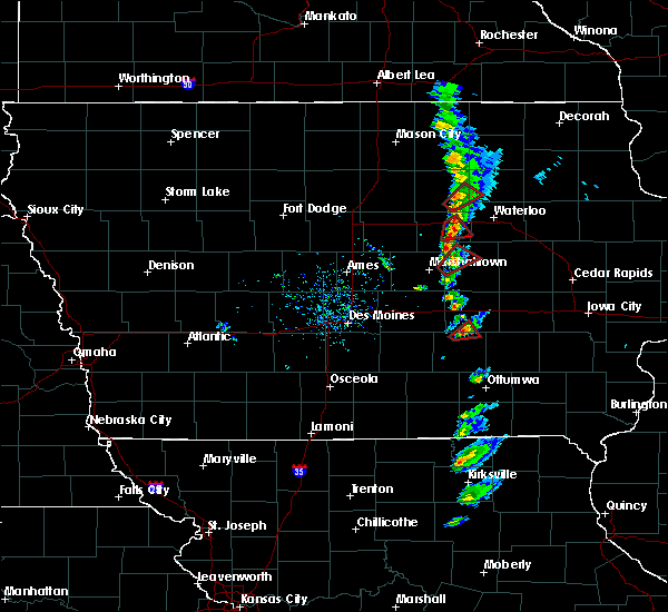 At 408 pm cst, a severe thunderstorm capable of producing a tornado was located 8 miles north of meskwaki casino, or 10 miles northwest of toledo, moving northeast at 25 mph (radar indicated rotation). Hazards include tornado. Expect damage to mobile homes. roofs. and vehicles. Locations impacted include, gladbrook, garwin and union grove state park. At 408 pm cst, a severe thunderstorm capable of producing a tornado was located 8 miles north of meskwaki casino, or 10 miles northwest of toledo, moving northeast at 25 mph (radar indicated rotation). Hazards include tornado. Expect damage to mobile homes. roofs. and vehicles. Locations impacted include, gladbrook, garwin and union grove state park.
|
| 11/28/2016 3:54 PM CST |
 At 354 pm cst, a severe thunderstorm capable of producing a tornado was located near meskwaki casino, or 8 miles east of marshalltown, moving northeast at 25 mph (radar indicated rotation). Hazards include tornado. Expect damage to mobile homes. roofs. and vehicles. This tornadic thunderstorm will remain over mainly rural areas of east central marshall and northwestern tama counties, including the following locations: garwin, union grove state park, gladbrook and le grand. At 354 pm cst, a severe thunderstorm capable of producing a tornado was located near meskwaki casino, or 8 miles east of marshalltown, moving northeast at 25 mph (radar indicated rotation). Hazards include tornado. Expect damage to mobile homes. roofs. and vehicles. This tornadic thunderstorm will remain over mainly rural areas of east central marshall and northwestern tama counties, including the following locations: garwin, union grove state park, gladbrook and le grand.
|
| 8/4/2016 7:43 PM CDT |
 At 742 pm cdt, severe thunderstorms were located along a line extending from near van horne to 8 miles northwest of brooklyn to iowa speedway, moving southeast at 30 mph (trained weather spotters). Hazards include 70 mph wind gusts. Expect considerable tree damage. damage is likely to mobile homes, roofs, and outbuildings. Locations impacted include, newton, grinnell, toledo, tama, traer, meskwaki casino, iowa speedway, rock creek lake, le grand, kellogg, gilman, chelsea, montour, laurel, clutier, elberon, lambs grove, oakland acres, reasnor and vining. At 742 pm cdt, severe thunderstorms were located along a line extending from near van horne to 8 miles northwest of brooklyn to iowa speedway, moving southeast at 30 mph (trained weather spotters). Hazards include 70 mph wind gusts. Expect considerable tree damage. damage is likely to mobile homes, roofs, and outbuildings. Locations impacted include, newton, grinnell, toledo, tama, traer, meskwaki casino, iowa speedway, rock creek lake, le grand, kellogg, gilman, chelsea, montour, laurel, clutier, elberon, lambs grove, oakland acres, reasnor and vining.
|
| 8/4/2016 7:23 PM CDT |
 At 722 pm cdt, severe thunderstorms were located along a line extending from near dysart to 7 miles south of meskwaki casino to near baxter, moving southeast at 40 mph (trained weather spotters). Hazards include 70 mph wind gusts. Expect considerable tree damage. damage is likely to mobile homes, roofs, and outbuildings. Locations impacted include, marshalltown, newton, grinnell, toledo, tama, traer, baxter, meskwaki casino, iowa speedway, rock creek lake, gladbrook, le grand, melbourne, kellogg, garwin, gilman, mingo, chelsea, montour and laurel. At 722 pm cdt, severe thunderstorms were located along a line extending from near dysart to 7 miles south of meskwaki casino to near baxter, moving southeast at 40 mph (trained weather spotters). Hazards include 70 mph wind gusts. Expect considerable tree damage. damage is likely to mobile homes, roofs, and outbuildings. Locations impacted include, marshalltown, newton, grinnell, toledo, tama, traer, baxter, meskwaki casino, iowa speedway, rock creek lake, gladbrook, le grand, melbourne, kellogg, garwin, gilman, mingo, chelsea, montour and laurel.
|
| 8/4/2016 6:52 PM CDT |
 At 652 pm cdt, severe thunderstorms were located along a line extending from near conrad to 10 miles west of baxter, moving southeast at 30 mph (radar indicated). Hazards include 60 mph wind gusts. Expect damage to roofs. siding. And trees. At 652 pm cdt, severe thunderstorms were located along a line extending from near conrad to 10 miles west of baxter, moving southeast at 30 mph (radar indicated). Hazards include 60 mph wind gusts. Expect damage to roofs. siding. And trees.
|
| 7/17/2016 4:26 AM CDT |
 At 426 am cdt, severe thunderstorms were located along a line extending from near hudson to 7 miles south of reinbeck to near state center, moving southeast at 55 mph (radar indicated). Hazards include 70 mph wind gusts. Expect considerable tree damage. damage is likely to mobile homes, roofs, and outbuildings. Locations impacted include, waterloo, cedar falls, marshalltown, grundy center, toledo, evansdale, tama, jesup, la porte city, hudson, traer, reinbeck, dysart, dike, elk run heights, conrad, crossroads mall, uni-dome and mcleod center, meskwaki casino and gladbrook. At 426 am cdt, severe thunderstorms were located along a line extending from near hudson to 7 miles south of reinbeck to near state center, moving southeast at 55 mph (radar indicated). Hazards include 70 mph wind gusts. Expect considerable tree damage. damage is likely to mobile homes, roofs, and outbuildings. Locations impacted include, waterloo, cedar falls, marshalltown, grundy center, toledo, evansdale, tama, jesup, la porte city, hudson, traer, reinbeck, dysart, dike, elk run heights, conrad, crossroads mall, uni-dome and mcleod center, meskwaki casino and gladbrook.
|
| 7/17/2016 4:16 AM CDT |
 At 416 am cdt, severe thunderstorms were located along a line extending from near dike to near conrad to near state center, moving east at 65 mph (radar indicated). Hazards include 70 mph wind gusts. Expect considerable tree damage. damage is likely to mobile homes, roofs, and outbuildings. Locations impacted include, waterloo, cedar falls, marshalltown, grundy center, toledo, evansdale, tama, jesup, la porte city, hudson, traer, reinbeck, dysart, dike, elk run heights, conrad, crossroads mall, uni-dome and mcleod center, meskwaki casino and gladbrook. At 416 am cdt, severe thunderstorms were located along a line extending from near dike to near conrad to near state center, moving east at 65 mph (radar indicated). Hazards include 70 mph wind gusts. Expect considerable tree damage. damage is likely to mobile homes, roofs, and outbuildings. Locations impacted include, waterloo, cedar falls, marshalltown, grundy center, toledo, evansdale, tama, jesup, la porte city, hudson, traer, reinbeck, dysart, dike, elk run heights, conrad, crossroads mall, uni-dome and mcleod center, meskwaki casino and gladbrook.
|
| 7/17/2016 4:00 AM CDT |
 At 400 am cdt, severe thunderstorms were located along a line extending from near ackley to 8 miles southwest of eldora to near nevada, moving southeast at 55 mph (radar indicated). Hazards include 60 mph wind gusts. Expect damage to roofs. siding. And trees. At 400 am cdt, severe thunderstorms were located along a line extending from near ackley to 8 miles southwest of eldora to near nevada, moving southeast at 55 mph (radar indicated). Hazards include 60 mph wind gusts. Expect damage to roofs. siding. And trees.
|
| 5/26/2016 4:01 AM CDT |
 At 400 am cdt, a severe thunderstorm was located 5 miles south of conrad, or 7 miles north of marshalltown, moving east at 50 mph (radar indicated). Hazards include 60 mph wind gusts. Expect damage to roofs. siding. And trees. At 400 am cdt, a severe thunderstorm was located 5 miles south of conrad, or 7 miles north of marshalltown, moving east at 50 mph (radar indicated). Hazards include 60 mph wind gusts. Expect damage to roofs. siding. And trees.
|
| 11/11/2015 4:57 PM CST | The severe thunderstorm warning for tama and northeastern poweshiek counties will expire at 500 pm cst, the storms which prompted the warning have moved out of the area. therefore the warning will be allowed to expire. however gusty winds are still possible with these thunderstorms. a tornado watch remains in effect until 600 pm cst for central iowa. |
| 11/11/2015 4:43 PM CST |
 At 443 pm cst, severe thunderstorms were located along a line extending from 4 miles southwest of dike to 6 miles northeast of toledo to 6 miles north of brooklyn, moving northeast at 55 mph (radar indicated). Hazards include 60 mph wind gusts. Expect damage to roofs. siding and trees. locations impacted include, toledo, tama, traer, brooklyn, dysart, meskwaki casino, gladbrook, victor, garwin, holiday lake, chelsea, clutier, elberon, hartwick, guernsey, vining and toledo municipal airport. this includes interstate 80 between mile markers 194 and 204. A tornado watch remains in effect until 600 pm cst for central iowa. At 443 pm cst, severe thunderstorms were located along a line extending from 4 miles southwest of dike to 6 miles northeast of toledo to 6 miles north of brooklyn, moving northeast at 55 mph (radar indicated). Hazards include 60 mph wind gusts. Expect damage to roofs. siding and trees. locations impacted include, toledo, tama, traer, brooklyn, dysart, meskwaki casino, gladbrook, victor, garwin, holiday lake, chelsea, clutier, elberon, hartwick, guernsey, vining and toledo municipal airport. this includes interstate 80 between mile markers 194 and 204. A tornado watch remains in effect until 600 pm cst for central iowa.
|
| 11/11/2015 4:30 PM CST |
 At 430 pm cst, a severe thunderstorm capable of producing a tornado was located 6 miles northwest of meskwaki casino, or 8 miles east of marshalltown, moving northeast at 50 mph (radar indicated rotation). Hazards include tornado. Flying debris will be dangerous to those caught without shelter. mobile homes will be damaged or destroyed. damage to roofs, windows and vehicles will occur. tree damage is likely. This tornadic thunderstorm will remain over mainly rural areas of northeastern marshall, northwestern tama and southeastern grundy counties, including the following locations, union grove state park, green mountain, garwin, gladbrook, lincoln and beaman. At 430 pm cst, a severe thunderstorm capable of producing a tornado was located 6 miles northwest of meskwaki casino, or 8 miles east of marshalltown, moving northeast at 50 mph (radar indicated rotation). Hazards include tornado. Flying debris will be dangerous to those caught without shelter. mobile homes will be damaged or destroyed. damage to roofs, windows and vehicles will occur. tree damage is likely. This tornadic thunderstorm will remain over mainly rural areas of northeastern marshall, northwestern tama and southeastern grundy counties, including the following locations, union grove state park, green mountain, garwin, gladbrook, lincoln and beaman.
|
| 11/11/2015 4:12 PM CST |
 At 412 pm cst, a severe thunderstorm capable of producing a tornado was located 9 miles south of marshalltown, moving northeast at 50 mph (radar indicated rotation). Hazards include tornado. Flying debris will be dangerous to those caught without shelter. mobile homes will be damaged or destroyed. damage to roofs, windows and vehicles will occur. tree damage is likely. this dangerous storm will be near, marshalltown around 425 pm cst. Other locations impacted by this tornadic thunderstorm include green mountain, garwin, ferguson, union grove state park, le grand, laurel, albion, gilman, melbourne and gladbrook. At 412 pm cst, a severe thunderstorm capable of producing a tornado was located 9 miles south of marshalltown, moving northeast at 50 mph (radar indicated rotation). Hazards include tornado. Flying debris will be dangerous to those caught without shelter. mobile homes will be damaged or destroyed. damage to roofs, windows and vehicles will occur. tree damage is likely. this dangerous storm will be near, marshalltown around 425 pm cst. Other locations impacted by this tornadic thunderstorm include green mountain, garwin, ferguson, union grove state park, le grand, laurel, albion, gilman, melbourne and gladbrook.
|
| 11/11/2015 4:03 PM CST |
 At 403 pm cst, severe thunderstorms were located along a line extending from near state center to 7 miles southeast of iowa speedway to 3 miles east of pella, moving northeast at 55 mph (radar indicated). Hazards include 60 mph wind gusts. Expect damage to roofs. Siding and trees. At 403 pm cst, severe thunderstorms were located along a line extending from near state center to 7 miles southeast of iowa speedway to 3 miles east of pella, moving northeast at 55 mph (radar indicated). Hazards include 60 mph wind gusts. Expect damage to roofs. Siding and trees.
|
| 8/10/2015 12:22 AM CDT |
 At 1222 am cdt, a severe thunderstorm was located over toledo, moving southeast at 35 mph (radar indicated). Hazards include 60 mph wind gusts. Expect damage to roofs. siding and trees. This severe thunderstorm will remain over mainly rural areas of southern tama and northeastern poweshiek counties, including the following locations, garwin, elberon, montour, toledo municipal airport, union grove state park, hartwick, vining, chelsea, victor and holiday lake. At 1222 am cdt, a severe thunderstorm was located over toledo, moving southeast at 35 mph (radar indicated). Hazards include 60 mph wind gusts. Expect damage to roofs. siding and trees. This severe thunderstorm will remain over mainly rural areas of southern tama and northeastern poweshiek counties, including the following locations, garwin, elberon, montour, toledo municipal airport, union grove state park, hartwick, vining, chelsea, victor and holiday lake.
|
| 8/10/2015 12:00 AM CDT |
 At 1200 am cdt, a severe thunderstorm was located 5 miles northeast of marshalltown, moving southeast at 45 mph (law enforcement). Hazards include 60 mph wind gusts. Expect damage to roofs. Siding and trees. At 1200 am cdt, a severe thunderstorm was located 5 miles northeast of marshalltown, moving southeast at 45 mph (law enforcement). Hazards include 60 mph wind gusts. Expect damage to roofs. Siding and trees.
|
| 6/22/2015 10:06 AM CDT |
 At 1005 am cdt, a severe thunderstorm was located 9 miles southwest of reinbeck, or 12 miles southeast of grundy center, moving east at 65 mph (radar indicated). Hazards include 60 mph wind gusts and nickel size hail. Expect damage to roofs. Siding and trees. At 1005 am cdt, a severe thunderstorm was located 9 miles southwest of reinbeck, or 12 miles southeast of grundy center, moving east at 65 mph (radar indicated). Hazards include 60 mph wind gusts and nickel size hail. Expect damage to roofs. Siding and trees.
|
| 6/22/2015 8:46 AM CDT |
 At 846 am cdt, severe thunderstorms were located along a line extending from 3 miles northwest of garrison to 7 miles northeast of toledo, moving southeast at 40 mph (radar indicated). Hazards include 60 mph wind gusts and penny size hail. Expect damage to roofs. siding and trees. Locations impacted include, toledo, tama, traer, dysart, meskwaki casino, gladbrook, garwin, chelsea, clutier, elberon, lincoln, vining, toledo municipal airport, tf clark state park and union grove state park. At 846 am cdt, severe thunderstorms were located along a line extending from 3 miles northwest of garrison to 7 miles northeast of toledo, moving southeast at 40 mph (radar indicated). Hazards include 60 mph wind gusts and penny size hail. Expect damage to roofs. siding and trees. Locations impacted include, toledo, tama, traer, dysart, meskwaki casino, gladbrook, garwin, chelsea, clutier, elberon, lincoln, vining, toledo municipal airport, tf clark state park and union grove state park.
|
| 6/22/2015 8:22 AM CDT |
 At 822 am cdt, severe thunderstorms were located along a line extending from 4 miles northwest of hudson to 7 miles southeast of conrad, moving southeast at 40 mph (radar indicated). Hazards include 60 mph wind gusts and penny size hail. Expect damage to roofs. Siding and trees. At 822 am cdt, severe thunderstorms were located along a line extending from 4 miles northwest of hudson to 7 miles southeast of conrad, moving southeast at 40 mph (radar indicated). Hazards include 60 mph wind gusts and penny size hail. Expect damage to roofs. Siding and trees.
|
| 1/1/0001 12:00 AM | Many trees and fences down. bins down at the coop and roof torn off of the legion hall. possible natural gas leak note in tama county IA, 0.3 miles NE of Garwin, IA |
| 1/1/0001 12:00 AM | Many power lines and trees down in the area including one tree 3.5 feet in diameter. grain bin flattened and at least part of a roof in the yard. windows blown out and in tama county IA, 0.3 miles NE of Garwin, IA |
Hail Maps for Garwin, IA
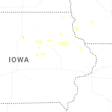
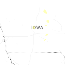
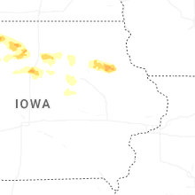
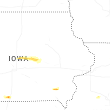


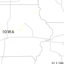


Connect with Interactive Hail Maps