

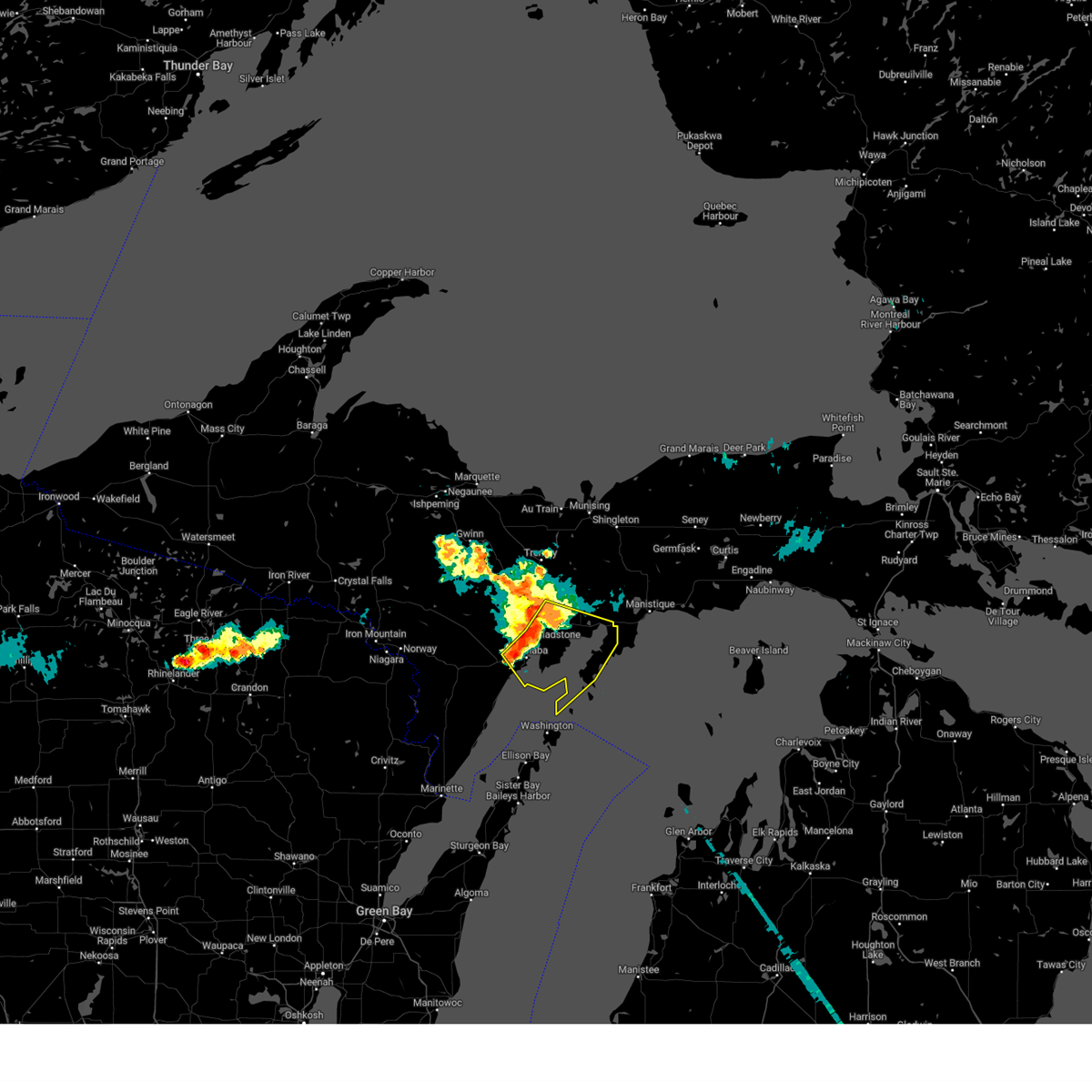
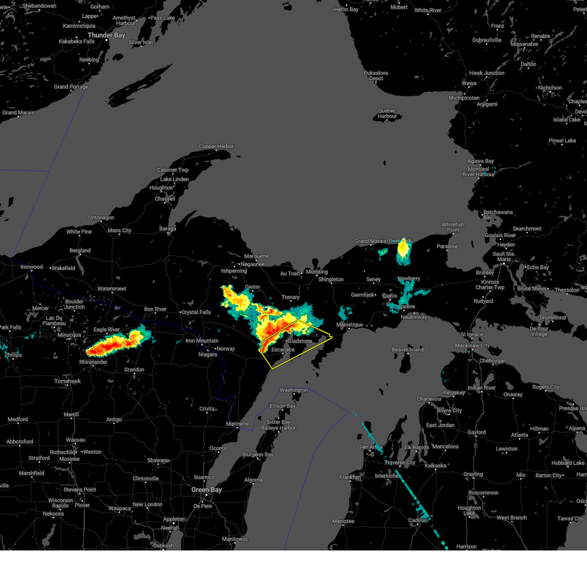
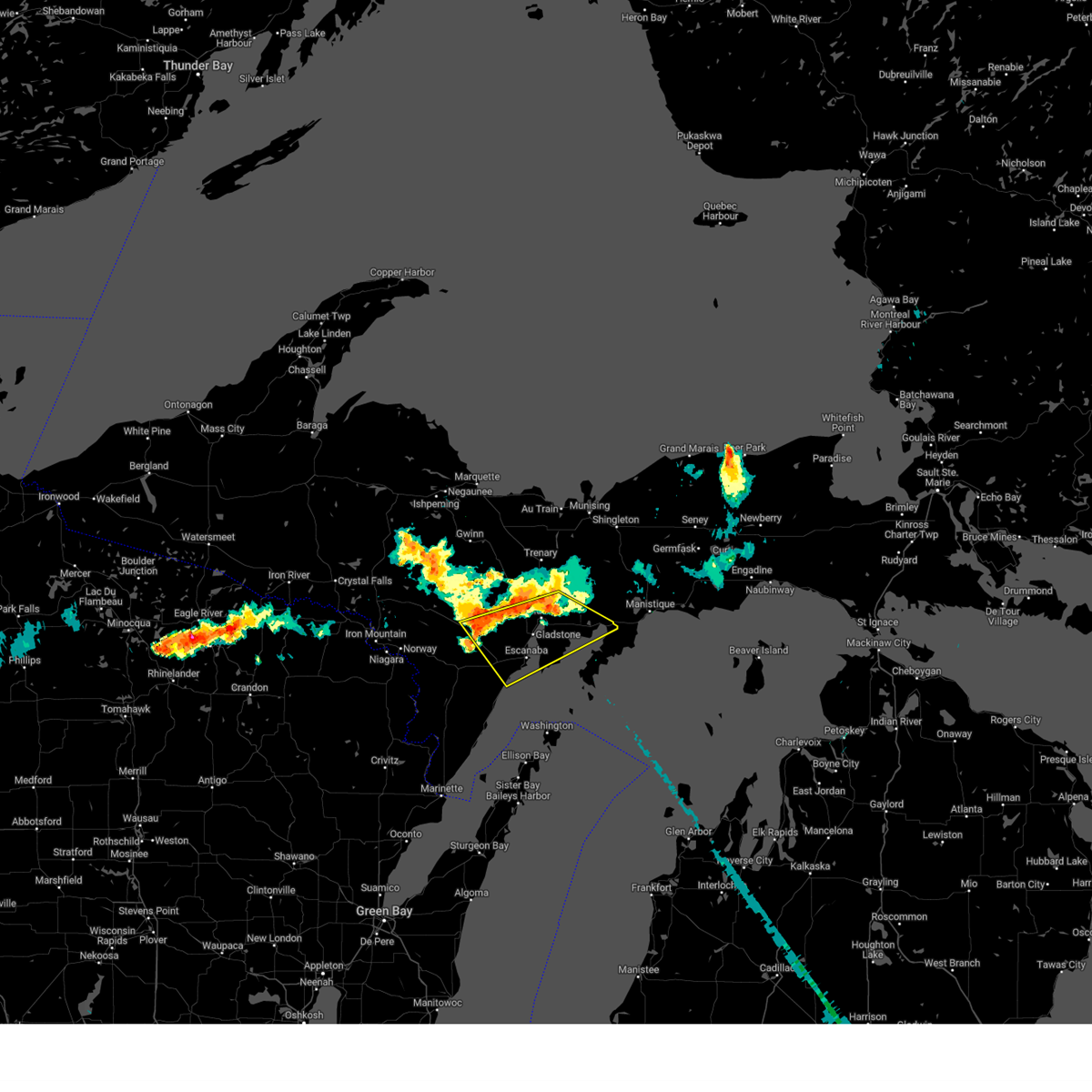
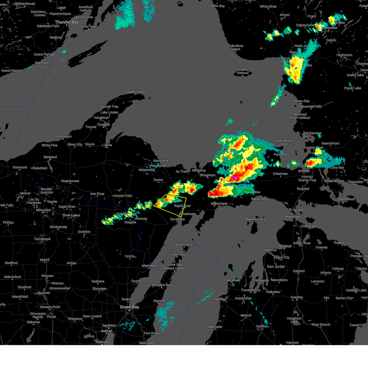
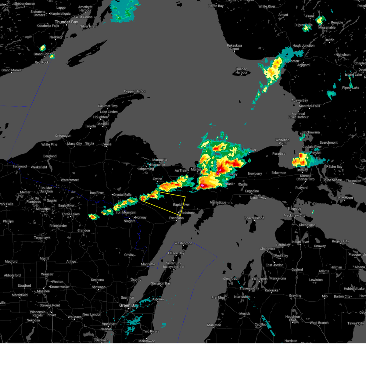
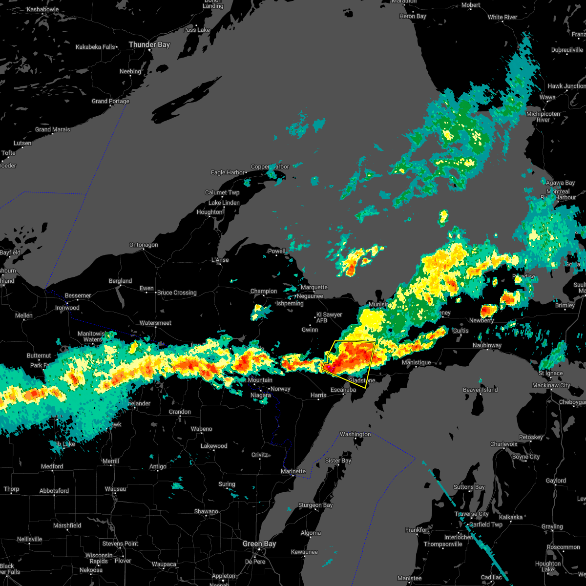
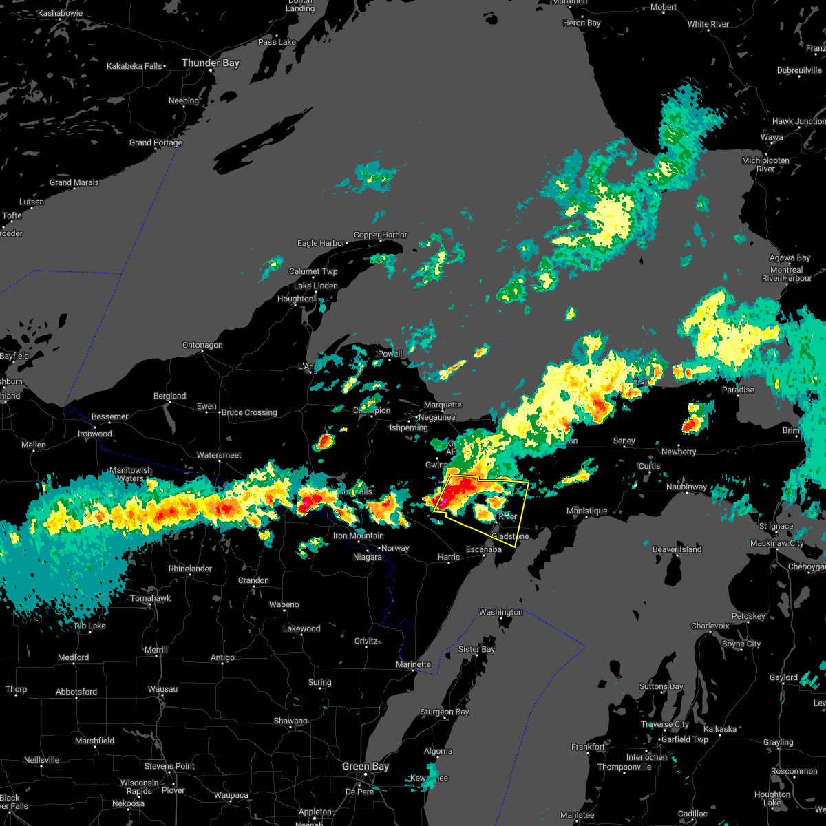
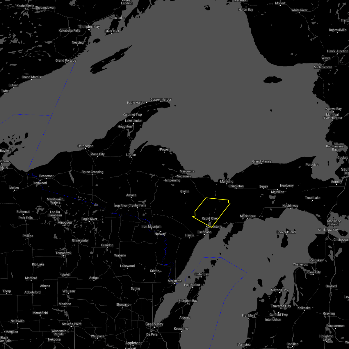
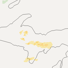
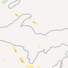
Hail Map for Gladstone, MI
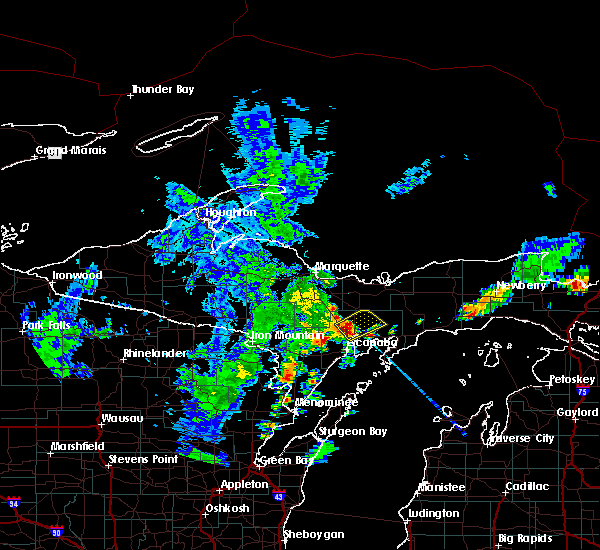
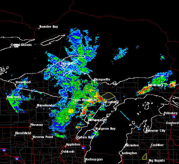
The Gladstone, MI area has had 8 reports of on-the-ground hail by trained spotters, and has been under severe weather warnings 0 times during the past 12 months. Doppler radar has detected hail at or near Gladstone, MI on 30 occasions.
| Name: | Gladstone, MI |
| Where Located: | 51 miles SSE of Marquette, MI |
| Map: | Google Map for Gladstone, MI |
| Population: | 4973 |
| Housing Units: | 2431 |
| More Info: | Search Google for Gladstone, MI |
0
The Top Recent Hail Date for Gladstone, MI is Monday, July 15, 2024 (30th out of 30)

Hail and Wind Damage Spotted near Gladstone, MI
| Date / Time | Report Details |
|---|---|
| 7/14/2024 9:13 PM EDT |
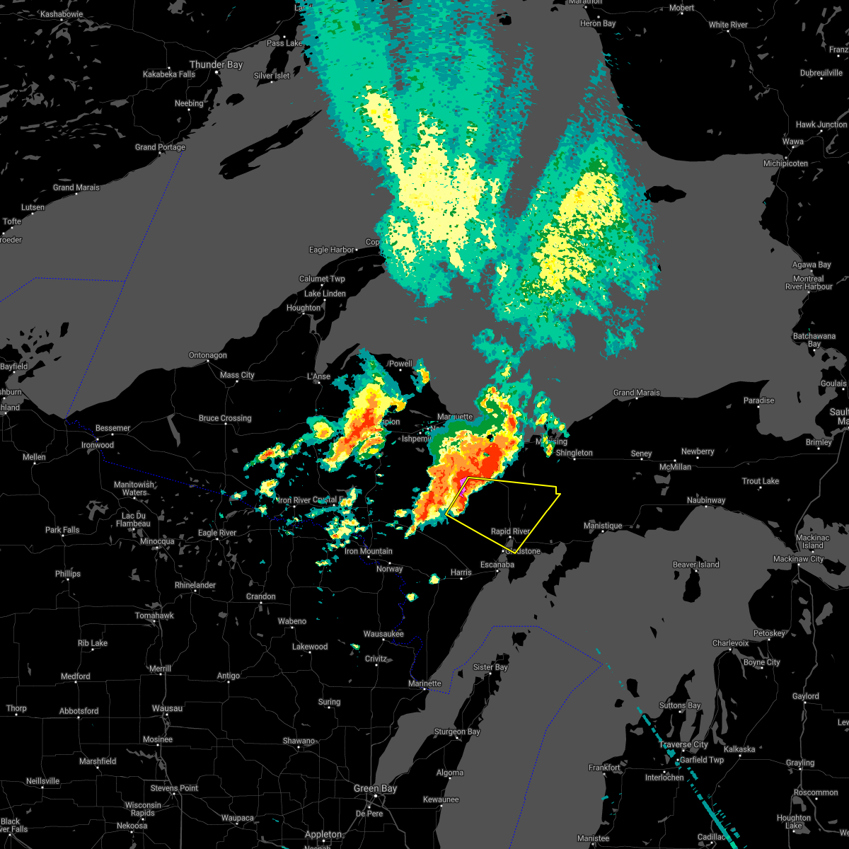
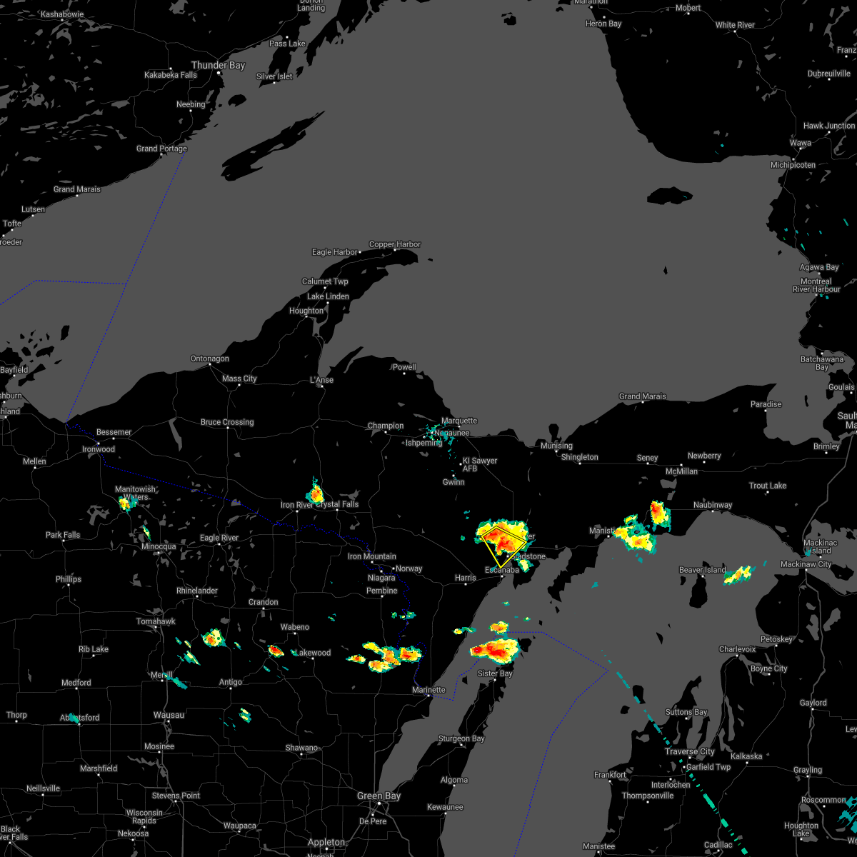
 Svrmqt the national weather service in marquette has issued a * severe thunderstorm warning for, central delta county in south central upper michigan, * until 945 pm edt. * at 912 pm edt, severe thunderstorms were located along a line extending from near rapid river to near gladstone to near escanaba, moving southeast at 30 mph (radar indicated). Hazards include 60 mph wind gusts and quarter size hail. Hail damage to vehicles is expected. Expect wind damage to roofs, siding, and trees. Svrmqt the national weather service in marquette has issued a * severe thunderstorm warning for, central delta county in south central upper michigan, * until 945 pm edt. * at 912 pm edt, severe thunderstorms were located along a line extending from near rapid river to near gladstone to near escanaba, moving southeast at 30 mph (radar indicated). Hazards include 60 mph wind gusts and quarter size hail. Hail damage to vehicles is expected. Expect wind damage to roofs, siding, and trees.
|
| 7/14/2024 8:54 PM EDT |
 the severe thunderstorm warning has been cancelled and is no longer in effect the severe thunderstorm warning has been cancelled and is no longer in effect
|
| 7/14/2024 8:54 PM EDT |
 At 854 pm edt, severe thunderstorms were located along a line extending from 10 miles north of nahma to 10 miles southeast of la branche, moving east at 25 mph (radar indicated). Hazards include 60 mph wind gusts and quarter size hail. Hail damage to vehicles is expected. expect wind damage to roofs, siding, and trees. Locations impacted include, escanaba, gladstone, rapid river, nahma, garden corners, isabella, ford river, brampton, ensign, hyde, maplewood, and schaeffer. At 854 pm edt, severe thunderstorms were located along a line extending from 10 miles north of nahma to 10 miles southeast of la branche, moving east at 25 mph (radar indicated). Hazards include 60 mph wind gusts and quarter size hail. Hail damage to vehicles is expected. expect wind damage to roofs, siding, and trees. Locations impacted include, escanaba, gladstone, rapid river, nahma, garden corners, isabella, ford river, brampton, ensign, hyde, maplewood, and schaeffer.
|
| 7/14/2024 8:44 PM EDT |
 Svrmqt the national weather service in marquette has issued a * severe thunderstorm warning for, central delta county in south central upper michigan, northeastern menominee county in south central upper michigan, * until 915 pm edt/815 pm cdt/. * at 844 pm edt/744 pm cdt/, severe thunderstorms were located along a line extending from 9 miles northeast of rapid river to 6 miles southeast of la branche, moving east at 25 mph (radar indicated). Hazards include 60 mph wind gusts and quarter size hail. Hail damage to vehicles is expected. Expect wind damage to roofs, siding, and trees. Svrmqt the national weather service in marquette has issued a * severe thunderstorm warning for, central delta county in south central upper michigan, northeastern menominee county in south central upper michigan, * until 915 pm edt/815 pm cdt/. * at 844 pm edt/744 pm cdt/, severe thunderstorms were located along a line extending from 9 miles northeast of rapid river to 6 miles southeast of la branche, moving east at 25 mph (radar indicated). Hazards include 60 mph wind gusts and quarter size hail. Hail damage to vehicles is expected. Expect wind damage to roofs, siding, and trees.
|
| 6/17/2024 1:24 PM EDT | Corrects previous hail report from 3 n cornell. tree downed in driveway. no structure damage. pea sized hail reported north of cornell. report from social medi in delta county MI, 10.9 miles SE of Gladstone, MI |
| 6/13/2024 2:11 PM EDT |
 At 211 pm edt/111 pm cdt/, a severe thunderstorm was located near rock, or 20 miles northwest of escanaba, moving east at 45 mph (radar indicated). Hazards include quarter size hail. Damage to vehicles is expected. locations impacted include, gladstone, watson, rapid river, rock, u. s. 41 between trenary and rapid river, brampton, cornell, maplewood, st. Nicholas, and perkins. At 211 pm edt/111 pm cdt/, a severe thunderstorm was located near rock, or 20 miles northwest of escanaba, moving east at 45 mph (radar indicated). Hazards include quarter size hail. Damage to vehicles is expected. locations impacted include, gladstone, watson, rapid river, rock, u. s. 41 between trenary and rapid river, brampton, cornell, maplewood, st. Nicholas, and perkins.
|
| 6/13/2024 2:11 PM EDT |
 the severe thunderstorm warning has been cancelled and is no longer in effect the severe thunderstorm warning has been cancelled and is no longer in effect
|
| 6/13/2024 1:54 PM EDT |
 Svrmqt the national weather service in marquette has issued a * severe thunderstorm warning for, eastern dickinson county in south central upper michigan, northwestern delta county in south central upper michigan, north central menominee county in south central upper michigan, south central marquette county in north central upper michigan, * until 230 pm edt/130 pm cdt/. * at 154 pm edt/1254 pm cdt/, a severe thunderstorm was located near watson, or 29 miles northwest of escanaba, moving east at 45 mph (radar indicated). Hazards include quarter size hail. damage to vehicles is expected Svrmqt the national weather service in marquette has issued a * severe thunderstorm warning for, eastern dickinson county in south central upper michigan, northwestern delta county in south central upper michigan, north central menominee county in south central upper michigan, south central marquette county in north central upper michigan, * until 230 pm edt/130 pm cdt/. * at 154 pm edt/1254 pm cdt/, a severe thunderstorm was located near watson, or 29 miles northwest of escanaba, moving east at 45 mph (radar indicated). Hazards include quarter size hail. damage to vehicles is expected
|
| 6/28/2022 5:44 PM EDT |
 At 544 pm edt, a severe thunderstorm was located near escanaba, moving east at 45 mph (radar indicated). Hazards include 60 mph wind gusts and penny size hail. Expect damage to roofs, siding, and trees. this severe thunderstorm will be near, gladstone around 555 pm edt. hail threat, radar indicated max hail size, 0. 75 in wind threat, radar indicated max wind gust, 60 mph. At 544 pm edt, a severe thunderstorm was located near escanaba, moving east at 45 mph (radar indicated). Hazards include 60 mph wind gusts and penny size hail. Expect damage to roofs, siding, and trees. this severe thunderstorm will be near, gladstone around 555 pm edt. hail threat, radar indicated max hail size, 0. 75 in wind threat, radar indicated max wind gust, 60 mph.
|
| 6/28/2022 5:23 PM EDT |
 At 522 pm edt/422 pm cdt/, a severe thunderstorm was located near la branche, or 18 miles west of escanaba, moving east at 50 mph (radar indicated). Hazards include 60 mph wind gusts and nickel size hail. expect damage to roofs, siding, and trees At 522 pm edt/422 pm cdt/, a severe thunderstorm was located near la branche, or 18 miles west of escanaba, moving east at 50 mph (radar indicated). Hazards include 60 mph wind gusts and nickel size hail. expect damage to roofs, siding, and trees
|
| 6/28/2022 4:33 PM EDT |
 At 433 pm edt, a severe thunderstorm was located near rapid river, or 15 miles north of escanaba, moving east at 40 mph (radar indicated). Hazards include 60 mph wind gusts and quarter size hail. Hail damage to vehicles is expected. expect wind damage to roofs, siding, and trees. locations impacted include, rapid river. hail threat, radar indicated max hail size, 1. 00 in wind threat, radar indicated max wind gust, 60 mph. At 433 pm edt, a severe thunderstorm was located near rapid river, or 15 miles north of escanaba, moving east at 40 mph (radar indicated). Hazards include 60 mph wind gusts and quarter size hail. Hail damage to vehicles is expected. expect wind damage to roofs, siding, and trees. locations impacted include, rapid river. hail threat, radar indicated max hail size, 1. 00 in wind threat, radar indicated max wind gust, 60 mph.
|
| 6/28/2022 4:15 PM EDT |
 At 415 pm edt, a severe thunderstorm was located near watson, or 21 miles northwest of escanaba, moving east at 40 mph (radar indicated). Hazards include ping pong ball size hail and 60 mph wind gusts. People and animals outdoors will be injured. expect hail damage to roofs, siding, windows, and vehicles. expect wind damage to roofs, siding, and trees. this severe thunderstorm will be near, rock around 425 pm edt. other locations in the path of this severe thunderstorm include rapid river. hail threat, radar indicated max hail size, 1. 50 in wind threat, radar indicated max wind gust, 60 mph. At 415 pm edt, a severe thunderstorm was located near watson, or 21 miles northwest of escanaba, moving east at 40 mph (radar indicated). Hazards include ping pong ball size hail and 60 mph wind gusts. People and animals outdoors will be injured. expect hail damage to roofs, siding, windows, and vehicles. expect wind damage to roofs, siding, and trees. this severe thunderstorm will be near, rock around 425 pm edt. other locations in the path of this severe thunderstorm include rapid river. hail threat, radar indicated max hail size, 1. 50 in wind threat, radar indicated max wind gust, 60 mph.
|
| 6/15/2022 10:30 AM EDT | Poplar tree snapped halfway up the tree on the bluff in gladstone. another tree was snapped near the base of the trunk. report via social medi in delta county MI, 0.3 miles N of Gladstone, MI |
| 6/15/2022 10:25 AM EDT |
 At 1025 am edt, a severe thunderstorm was located over gladstone, or 7 miles north of escanaba, moving northeast at 45 mph (radar indicated). Hazards include 60 mph wind gusts and quarter size hail. Hail damage to vehicles is expected. expect wind damage to roofs, siding, and trees. this severe thunderstorm will be near, rapid river around 1030 am edt. hail threat, radar indicated max hail size, 1. 00 in wind threat, radar indicated max wind gust, 60 mph. At 1025 am edt, a severe thunderstorm was located over gladstone, or 7 miles north of escanaba, moving northeast at 45 mph (radar indicated). Hazards include 60 mph wind gusts and quarter size hail. Hail damage to vehicles is expected. expect wind damage to roofs, siding, and trees. this severe thunderstorm will be near, rapid river around 1030 am edt. hail threat, radar indicated max hail size, 1. 00 in wind threat, radar indicated max wind gust, 60 mph.
|
| 6/15/2022 10:07 AM EDT |
 At 1006 am edt/906 am cdt/, a severe thunderstorm was located 10 miles west of escanaba, moving northeast at 35 mph (radar indicated). Hazards include 60 mph wind gusts and quarter size hail. Hail damage to vehicles is expected. expect wind damage to roofs, siding, and trees. locations impacted include, escanaba, ford river, wilson, bark river, gourley, hyde and schaeffer. hail threat, radar indicated max hail size, 1. 00 in wind threat, radar indicated max wind gust, 60 mph. At 1006 am edt/906 am cdt/, a severe thunderstorm was located 10 miles west of escanaba, moving northeast at 35 mph (radar indicated). Hazards include 60 mph wind gusts and quarter size hail. Hail damage to vehicles is expected. expect wind damage to roofs, siding, and trees. locations impacted include, escanaba, ford river, wilson, bark river, gourley, hyde and schaeffer. hail threat, radar indicated max hail size, 1. 00 in wind threat, radar indicated max wind gust, 60 mph.
|
| 6/15/2022 9:43 AM EDT |
 At 942 am edt/842 am cdt/, a severe thunderstorm was located 8 miles north of stephenson, or 27 miles southwest of escanaba, moving northeast at 35 mph (radar indicated). Hazards include 60 mph wind gusts and quarter size hail. Hail damage to vehicles is expected. Expect wind damage to roofs, siding, and trees. At 942 am edt/842 am cdt/, a severe thunderstorm was located 8 miles north of stephenson, or 27 miles southwest of escanaba, moving northeast at 35 mph (radar indicated). Hazards include 60 mph wind gusts and quarter size hail. Hail damage to vehicles is expected. Expect wind damage to roofs, siding, and trees.
|
| 8/10/2021 5:35 PM EDT |
 The severe thunderstorm warning for northwestern delta and southwestern alger counties will expire at 545 pm edt, the storm which prompted the warning has weakened below severe limits, and no longer poses an immediate threat to life or property. therefore, the warning will be allowed to expire. however gusty winds and heavy rain are still possible with this thunderstorm. The severe thunderstorm warning for northwestern delta and southwestern alger counties will expire at 545 pm edt, the storm which prompted the warning has weakened below severe limits, and no longer poses an immediate threat to life or property. therefore, the warning will be allowed to expire. however gusty winds and heavy rain are still possible with this thunderstorm.
|
| 8/10/2021 5:24 PM EDT |
 At 523 pm edt, a severe thunderstorm was located near rapid river, or 17 miles northeast of escanaba, moving southeast at 35 mph (radar indicated). Hazards include 60 mph wind gusts and penny size hail. Expect damage to roofs, siding, and trees. this severe thunderstorm will remain over mainly rural areas of northwestern delta and southwestern alger counties, including the following locations, maplewood, brampton, st. nicholas, ensign, perkins, round lake and diffin. hail threat, radar indicated max hail size, 0. 75 in wind threat, radar indicated max wind gust, 60 mph. At 523 pm edt, a severe thunderstorm was located near rapid river, or 17 miles northeast of escanaba, moving southeast at 35 mph (radar indicated). Hazards include 60 mph wind gusts and penny size hail. Expect damage to roofs, siding, and trees. this severe thunderstorm will remain over mainly rural areas of northwestern delta and southwestern alger counties, including the following locations, maplewood, brampton, st. nicholas, ensign, perkins, round lake and diffin. hail threat, radar indicated max hail size, 0. 75 in wind threat, radar indicated max wind gust, 60 mph.
|
| 8/10/2021 4:53 PM EDT |
 At 453 pm edt, a severe thunderstorm was located near rock, or 24 miles north of escanaba, moving southeast at 35 mph (radar indicated). Hazards include half dollar size hail. Damage to vehicles is expected. this severe thunderstorm will be near, rock around 500 pm edt. other locations in the path of this severe thunderstorm include rapid river. hail threat, radar indicated max hail size, 1. 25 in wind threat, radar indicated max wind gust, <50 mph. At 453 pm edt, a severe thunderstorm was located near rock, or 24 miles north of escanaba, moving southeast at 35 mph (radar indicated). Hazards include half dollar size hail. Damage to vehicles is expected. this severe thunderstorm will be near, rock around 500 pm edt. other locations in the path of this severe thunderstorm include rapid river. hail threat, radar indicated max hail size, 1. 25 in wind threat, radar indicated max wind gust, <50 mph.
|
| 7/27/2021 1:50 AM EDT |
 The severe thunderstorm warning for northern delta county will expire at 200 am edt, the storm which prompted the warning has weakened below severe limits, and no longer poses an immediate threat to life or property. therefore, the warning will be allowed to expire. however gusty winds and heavy rain are still possible with this thunderstorm. The severe thunderstorm warning for northern delta county will expire at 200 am edt, the storm which prompted the warning has weakened below severe limits, and no longer poses an immediate threat to life or property. therefore, the warning will be allowed to expire. however gusty winds and heavy rain are still possible with this thunderstorm.
|
| 7/27/2021 1:32 AM EDT |
 At 132 am edt, a severe thunderstorm was located near gladstone, or 10 miles northeast of escanaba, moving southeast at 40 mph (radar indicated). Hazards include 60 mph wind gusts and penny size hail. Expect damage to roofs, siding, and trees. This severe thunderstorm will remain over mainly rural areas of northern delta county, including the following locations, maplewood, brampton, ensign, chicago lake, perkins, round lake, stonington and nahma junction. At 132 am edt, a severe thunderstorm was located near gladstone, or 10 miles northeast of escanaba, moving southeast at 40 mph (radar indicated). Hazards include 60 mph wind gusts and penny size hail. Expect damage to roofs, siding, and trees. This severe thunderstorm will remain over mainly rural areas of northern delta county, including the following locations, maplewood, brampton, ensign, chicago lake, perkins, round lake, stonington and nahma junction.
|
| 7/27/2021 1:09 AM EDT |
 At 108 am edt/1208 am cdt/, a severe thunderstorm was located 7 miles southwest of rock, or 16 miles northwest of escanaba, moving southeast at 35 mph (radar indicated). Hazards include 60 mph wind gusts and penny size hail. Expect damage to roofs, siding, and trees. this severe thunderstorm will be near, gladstone around 125 am edt. Other locations in the path of this severe thunderstorm include rapid river. At 108 am edt/1208 am cdt/, a severe thunderstorm was located 7 miles southwest of rock, or 16 miles northwest of escanaba, moving southeast at 35 mph (radar indicated). Hazards include 60 mph wind gusts and penny size hail. Expect damage to roofs, siding, and trees. this severe thunderstorm will be near, gladstone around 125 am edt. Other locations in the path of this severe thunderstorm include rapid river.
|
| 7/5/2021 6:46 PM EDT |
 At 646 pm edt, a severe thunderstorm was located over escanaba, moving southeast at 20 mph (radar indicated). Hazards include 50 mph wind gusts and quarter size hail. Hail damage to vehicles is expected. expect wind damage to roofs, siding, and trees. This severe storm will be near, escanaba around 650 pm edt. At 646 pm edt, a severe thunderstorm was located over escanaba, moving southeast at 20 mph (radar indicated). Hazards include 50 mph wind gusts and quarter size hail. Hail damage to vehicles is expected. expect wind damage to roofs, siding, and trees. This severe storm will be near, escanaba around 650 pm edt.
|
| 7/5/2021 6:32 PM EDT |
 At 632 pm edt, a severe thunderstorm was located 8 miles northwest of escanaba, moving southeast at 20 mph (radar indicated). Hazards include quarter size hail. Damage to vehicles is expected. this severe thunderstorm will be near, gladstone around 645 pm edt. Escanaba around 650 pm edt. At 632 pm edt, a severe thunderstorm was located 8 miles northwest of escanaba, moving southeast at 20 mph (radar indicated). Hazards include quarter size hail. Damage to vehicles is expected. this severe thunderstorm will be near, gladstone around 645 pm edt. Escanaba around 650 pm edt.
|
| 7/5/2021 3:15 PM EDT |
 At 313 pm edt, a severe thunderstorm was located over gladstone, or near escanaba, moving southeast at 25 mph (radar indicated). Hazards include 60 mph wind gusts and quarter size hail. Hail damage to vehicles is expected. expect wind damage to roofs, siding, and trees. This severe thunderstorm will remain over mainly rural areas of central delta county, including the following locations, stonington. At 313 pm edt, a severe thunderstorm was located over gladstone, or near escanaba, moving southeast at 25 mph (radar indicated). Hazards include 60 mph wind gusts and quarter size hail. Hail damage to vehicles is expected. expect wind damage to roofs, siding, and trees. This severe thunderstorm will remain over mainly rural areas of central delta county, including the following locations, stonington.
|
| 7/5/2021 3:08 PM EDT |
 At 308 pm edt, a severe thunderstorm was located near gladstone, or 9 miles north of escanaba, moving southeast at 20 mph (radar indicated). Hazards include 60 mph wind gusts and quarter size hail. Hail damage to vehicles is expected. expect wind damage to roofs, siding, and trees. This severe thunderstorm will remain over mainly rural areas of west central delta county, including the following locations, perkins and brampton. At 308 pm edt, a severe thunderstorm was located near gladstone, or 9 miles north of escanaba, moving southeast at 20 mph (radar indicated). Hazards include 60 mph wind gusts and quarter size hail. Hail damage to vehicles is expected. expect wind damage to roofs, siding, and trees. This severe thunderstorm will remain over mainly rural areas of west central delta county, including the following locations, perkins and brampton.
|
| 7/5/2021 3:01 PM EDT |
 The national weather service in marquette has issued a * severe thunderstorm warning for. northwestern delta county in south central upper michigan. until 315 pm edt. At 300 pm edt, a severe thunderstorm was located near gladstone, or 11 miles north of escanaba, moving southeast at 20 mph. The national weather service in marquette has issued a * severe thunderstorm warning for. northwestern delta county in south central upper michigan. until 315 pm edt. At 300 pm edt, a severe thunderstorm was located near gladstone, or 11 miles north of escanaba, moving southeast at 20 mph.
|
| 6/30/2021 3:10 PM EDT |
 The severe thunderstorm warning for central delta county will expire at 315 pm edt, the storm which prompted the warning has moved out of the area. therefore, the warning will be allowed to expire. to report severe weather, contact your nearest law enforcement agency. they will relay your report to the national weather service marquette. The severe thunderstorm warning for central delta county will expire at 315 pm edt, the storm which prompted the warning has moved out of the area. therefore, the warning will be allowed to expire. to report severe weather, contact your nearest law enforcement agency. they will relay your report to the national weather service marquette.
|
| 6/30/2021 2:44 PM EDT |
 At 244 pm edt, a severe thunderstorm was located over gladstone, or near escanaba, moving southeast at 25 mph (radar indicated). Hazards include 60 mph wind gusts and penny size hail. Expect damage to roofs, siding, and trees. Locations impacted include, escanaba. At 244 pm edt, a severe thunderstorm was located over gladstone, or near escanaba, moving southeast at 25 mph (radar indicated). Hazards include 60 mph wind gusts and penny size hail. Expect damage to roofs, siding, and trees. Locations impacted include, escanaba.
|
| 6/30/2021 2:29 PM EDT |
 At 229 pm edt, a severe thunderstorm was located near rapid river, or 15 miles north of escanaba, moving southeast at 20 mph (radar indicated). Hazards include 60 mph wind gusts and nickel size hail. Expect damage to roofs, siding, and trees. this severe thunderstorm will be near, rapid river around 245 pm edt. Other locations in the path of this severe thunderstorm include gladstone. At 229 pm edt, a severe thunderstorm was located near rapid river, or 15 miles north of escanaba, moving southeast at 20 mph (radar indicated). Hazards include 60 mph wind gusts and nickel size hail. Expect damage to roofs, siding, and trees. this severe thunderstorm will be near, rapid river around 245 pm edt. Other locations in the path of this severe thunderstorm include gladstone.
|
| 5/25/2021 9:30 PM EDT |
 At 928 pm edt/828 pm cdt/, severe thunderstorms were located along a line extending from rock to 9 miles north of cedar river to 6 miles northwest of menominee, moving east at 40 mph. trained weather spotters reported wind gusts to near 60 mph with this line of storms (trained weather spotters). Hazards include 60 mph wind gusts. Expect damage to roofs, siding, and trees. severe thunderstorms will be near, rock around 935 pm edt. u. s. 41 between trenary and rapid river around 940 pm edt. Other locations in the path of these severe thunderstorms include ford river, escanaba, gladstone, and point detour. At 928 pm edt/828 pm cdt/, severe thunderstorms were located along a line extending from rock to 9 miles north of cedar river to 6 miles northwest of menominee, moving east at 40 mph. trained weather spotters reported wind gusts to near 60 mph with this line of storms (trained weather spotters). Hazards include 60 mph wind gusts. Expect damage to roofs, siding, and trees. severe thunderstorms will be near, rock around 935 pm edt. u. s. 41 between trenary and rapid river around 940 pm edt. Other locations in the path of these severe thunderstorms include ford river, escanaba, gladstone, and point detour.
|
| 7/19/2020 4:23 AM EDT |
 The severe thunderstorm warning for central delta, central menominee and central schoolcraft counties will expire at 430 am edt/330 am cdt/, the storms which prompted the warning have moved out of the area. therefore, the warning will be allowed to expire. a severe thunderstorm watch remains in effect until 600 am edt/500 am cdt/ for east central upper and south central upper michigan. to report severe weather, contact your nearest law enforcement agency. they will relay your report to the national weather service marquette. remember, a severe thunderstorm warning still remains in effect for southern menominee county until 445 am edt. The severe thunderstorm warning for central delta, central menominee and central schoolcraft counties will expire at 430 am edt/330 am cdt/, the storms which prompted the warning have moved out of the area. therefore, the warning will be allowed to expire. a severe thunderstorm watch remains in effect until 600 am edt/500 am cdt/ for east central upper and south central upper michigan. to report severe weather, contact your nearest law enforcement agency. they will relay your report to the national weather service marquette. remember, a severe thunderstorm warning still remains in effect for southern menominee county until 445 am edt.
|
| 7/19/2020 3:42 AM EDT |
 At 342 am edt/242 am cdt/, severe thunderstorms were located along a line extending from 10 miles southwest of steuben to near escanaba to 9 miles south of pembine, moving east at 55 mph (radar indicated). Hazards include 60 mph wind gusts and nickel size hail. expect damage to roofs, siding, and trees At 342 am edt/242 am cdt/, severe thunderstorms were located along a line extending from 10 miles southwest of steuben to near escanaba to 9 miles south of pembine, moving east at 55 mph (radar indicated). Hazards include 60 mph wind gusts and nickel size hail. expect damage to roofs, siding, and trees
|
| 7/19/2020 2:33 AM CDT |
 At 333 am edt/233 am cdt/, a severe thunderstorm was located near rapid river, or 13 miles north of escanaba, moving east at 50 mph (radar indicated). Hazards include 60 mph wind gusts and penny size hail. Expect damage to roofs, siding, and trees. locations impacted include, escanaba, gladstone, rapid river, rock, la branche, u. s. 41 between trenary and rapid river, brampton, whitney, ensign, cornell, st. Nicholas and perkins. At 333 am edt/233 am cdt/, a severe thunderstorm was located near rapid river, or 13 miles north of escanaba, moving east at 50 mph (radar indicated). Hazards include 60 mph wind gusts and penny size hail. Expect damage to roofs, siding, and trees. locations impacted include, escanaba, gladstone, rapid river, rock, la branche, u. s. 41 between trenary and rapid river, brampton, whitney, ensign, cornell, st. Nicholas and perkins.
|
| 7/19/2020 2:05 AM CDT |
 The national weather service in marquette has issued a * severe thunderstorm warning for. southern dickinson county in south central upper michigan. northwestern delta county in south central upper michigan. northern menominee county in south central upper michigan. Southeastern marquette county in north central upper michigan. The national weather service in marquette has issued a * severe thunderstorm warning for. southern dickinson county in south central upper michigan. northwestern delta county in south central upper michigan. northern menominee county in south central upper michigan. Southeastern marquette county in north central upper michigan.
|
| 7/6/2020 5:16 PM EDT |
 At 515 pm edt, a severe thunderstorm was located near rapid river, or 15 miles north of escanaba, moving northeast at 35 mph (law enforcement reports scattered trees down in delta county). Hazards include 60 mph wind gusts and quarter size hail. Hail damage to vehicles is expected. expect wind damage to roofs, siding, and trees. locations impacted include, escanaba, gladstone, rapid river, u. s. 41 between trenary and rapid river, ford river, brampton, ensign, cornell, perkins, hyde, maplewood and round lake. At 515 pm edt, a severe thunderstorm was located near rapid river, or 15 miles north of escanaba, moving northeast at 35 mph (law enforcement reports scattered trees down in delta county). Hazards include 60 mph wind gusts and quarter size hail. Hail damage to vehicles is expected. expect wind damage to roofs, siding, and trees. locations impacted include, escanaba, gladstone, rapid river, u. s. 41 between trenary and rapid river, ford river, brampton, ensign, cornell, perkins, hyde, maplewood and round lake.
|
| 7/6/2020 4:52 PM EDT |
 At 452 pm edt/352 pm cdt/, severe thunderstorms were located along a line extending from 6 miles south of munising to 6 miles east of powers, moving northeast at 30 mph (radar indicated). Hazards include 60 mph wind gusts and quarter size hail. Hail damage to vehicles is expected. Expect wind damage to roofs, siding, and trees. At 452 pm edt/352 pm cdt/, severe thunderstorms were located along a line extending from 6 miles south of munising to 6 miles east of powers, moving northeast at 30 mph (radar indicated). Hazards include 60 mph wind gusts and quarter size hail. Hail damage to vehicles is expected. Expect wind damage to roofs, siding, and trees.
|
| 8/5/2019 4:25 PM EDT | Corrects previous tstm wnd dmg report from 2 e gladstone. roll out boat dock flipped and twisted. boat damaged. picture of boat partially lifted onto the underside of t in delta county MI, 2.9 miles W of Gladstone, MI |
| 8/5/2019 4:22 PM EDT | Media partner reports trees down in michigan state police parking lot in gladstone. time estimated by rada in delta county MI, 1.4 miles NW of Gladstone, MI |
| 8/5/2019 4:22 PM EDT | Media partner shared report of huge trees down in a park and trees laying across the road in gladstone. time estimated by rada in delta county MI, 1 miles WNW of Gladstone, MI |
| 5/22/2019 9:55 PM EDT | Quarter sized hail reported 1 miles WNW of Gladstone, MI, public reported 1 inch diameter hail in downtown gladstone at 9:23 pm. |
| 10/3/2018 8:36 PM EDT |
 At 836 pm edt/736 pm cdt/, a severe thunderstorm capable of producing a tornado was located 9 miles southeast of la branche, or 12 miles west of escanaba, moving east at 65 mph (radar indicated rotation). Hazards include tornado. Flying debris will be dangerous to those caught without shelter. mobile homes will be damaged or destroyed. damage to roofs, windows, and vehicles will occur. tree damage is likely. this dangerous storm will be near, escanaba around 845 pm edt. Other locations impacted by this tornadic thunderstorm include schaeffer, hyde, brampton, whitney and bark river. At 836 pm edt/736 pm cdt/, a severe thunderstorm capable of producing a tornado was located 9 miles southeast of la branche, or 12 miles west of escanaba, moving east at 65 mph (radar indicated rotation). Hazards include tornado. Flying debris will be dangerous to those caught without shelter. mobile homes will be damaged or destroyed. damage to roofs, windows, and vehicles will occur. tree damage is likely. this dangerous storm will be near, escanaba around 845 pm edt. Other locations impacted by this tornadic thunderstorm include schaeffer, hyde, brampton, whitney and bark river.
|
| 10/3/2018 8:31 PM EDT |
 At 831 pm edt/731 pm cdt/, a severe thunderstorm capable of producing a tornado was located near powers, or 18 miles west of escanaba, moving east at 65 mph (radar indicated rotation). Hazards include tornado. Flying debris will be dangerous to those caught without shelter. mobile homes will be damaged or destroyed. damage to roofs, windows, and vehicles will occur. tree damage is likely. this dangerous storm will be near, escanaba around 845 pm edt. Other locations impacted by this tornadic thunderstorm include wilson, schaeffer, hyde, brampton, whitney and bark river. At 831 pm edt/731 pm cdt/, a severe thunderstorm capable of producing a tornado was located near powers, or 18 miles west of escanaba, moving east at 65 mph (radar indicated rotation). Hazards include tornado. Flying debris will be dangerous to those caught without shelter. mobile homes will be damaged or destroyed. damage to roofs, windows, and vehicles will occur. tree damage is likely. this dangerous storm will be near, escanaba around 845 pm edt. Other locations impacted by this tornadic thunderstorm include wilson, schaeffer, hyde, brampton, whitney and bark river.
|
| 10/3/2018 6:34 PM CDT |
 At 733 pm edt/633 pm cdt/, a severe thunderstorm was located over la branche, or 20 miles northwest of escanaba, moving east at 65 mph (radar indicated). Hazards include 70 mph wind gusts. Expect considerable tree damage. damage is likely to mobile homes, roofs, and outbuildings. locations impacted include, escanaba, gladstone, rapid river, powers, hermansville, la branche, ford river, wilson, spalding, bark river, brampton and whitney. A tornado watch remains in effect until midnight edt/1100 pm cdt/ for north central upper and south central upper michigan. At 733 pm edt/633 pm cdt/, a severe thunderstorm was located over la branche, or 20 miles northwest of escanaba, moving east at 65 mph (radar indicated). Hazards include 70 mph wind gusts. Expect considerable tree damage. damage is likely to mobile homes, roofs, and outbuildings. locations impacted include, escanaba, gladstone, rapid river, powers, hermansville, la branche, ford river, wilson, spalding, bark river, brampton and whitney. A tornado watch remains in effect until midnight edt/1100 pm cdt/ for north central upper and south central upper michigan.
|
| 10/3/2018 6:19 PM CDT |
 At 718 pm edt/618 pm cdt/, a severe thunderstorm was located 7 miles west of la branche, or 21 miles east of iron mountain, moving east at 70 mph (radar indicated). Hazards include 70 mph wind gusts. Expect considerable tree damage. Damage is likely to mobile homes, roofs, and outbuildings. At 718 pm edt/618 pm cdt/, a severe thunderstorm was located 7 miles west of la branche, or 21 miles east of iron mountain, moving east at 70 mph (radar indicated). Hazards include 70 mph wind gusts. Expect considerable tree damage. Damage is likely to mobile homes, roofs, and outbuildings.
|
| 8/1/2018 3:37 PM EDT |
 At 337 pm edt, a severe thunderstorm was located near rapid river, or 18 miles north of escanaba, moving northeast at 25 mph (radar indicated). Hazards include 60 mph wind gusts and penny size hail. Expect damage to roofs, siding, and trees. locations impacted include, gladstone, rapid river, u. s. 41 between trenary and rapid river, brampton, maplewood and perkins. At 337 pm edt, a severe thunderstorm was located near rapid river, or 18 miles north of escanaba, moving northeast at 25 mph (radar indicated). Hazards include 60 mph wind gusts and penny size hail. Expect damage to roofs, siding, and trees. locations impacted include, gladstone, rapid river, u. s. 41 between trenary and rapid river, brampton, maplewood and perkins.
|
| 8/1/2018 3:30 PM EDT | Report of power lines down north of gladstone in the brampton area. time based on rada in delta county MI, 5.4 miles SSE of Gladstone, MI |
| 8/1/2018 3:22 PM EDT |
 At 322 pm edt, a severe thunderstorm was located near rapid river, or 14 miles north of escanaba, moving northeast at 25 mph (radar indicated). Hazards include 60 mph wind gusts and quarter size hail. Hail damage to vehicles is expected. Expect wind damage to roofs, siding, and trees. At 322 pm edt, a severe thunderstorm was located near rapid river, or 14 miles north of escanaba, moving northeast at 25 mph (radar indicated). Hazards include 60 mph wind gusts and quarter size hail. Hail damage to vehicles is expected. Expect wind damage to roofs, siding, and trees.
|
| 6/17/2018 9:10 PM EDT |
 The severe thunderstorm warning for northwestern delta county will expire at 915 pm edt, the storm which prompted the warning has weakened below severe limits, and no longer pose an immediate threat to life or property. therefore the warning will be allowed to expire. however heavy rain is still possible with this thunderstorm. a severe thunderstorm watch remains in effect until 100 am edt for north central upper michigan. The severe thunderstorm warning for northwestern delta county will expire at 915 pm edt, the storm which prompted the warning has weakened below severe limits, and no longer pose an immediate threat to life or property. therefore the warning will be allowed to expire. however heavy rain is still possible with this thunderstorm. a severe thunderstorm watch remains in effect until 100 am edt for north central upper michigan.
|
| 6/17/2018 8:32 PM EDT |
 At 832 pm edt/732 pm cdt/, a severe thunderstorm was located near watson, or 27 miles northeast of iron mountain, moving east at 45 mph (radar indicated). Hazards include 60 mph wind gusts. expect damage to roofs, siding, and trees At 832 pm edt/732 pm cdt/, a severe thunderstorm was located near watson, or 27 miles northeast of iron mountain, moving east at 45 mph (radar indicated). Hazards include 60 mph wind gusts. expect damage to roofs, siding, and trees
|
| 6/16/2018 8:46 AM EDT |
 At 846 am edt, a severe thunderstorm was located near gladstone, or 7 miles northeast of escanaba, moving southeast at 15 mph (radar indicated). Hazards include quarter size hail. Damage to vehicles is expected. Locations impacted include, escanaba, gladstone, rapid river, ensign, maplewood, stonington and nahma junction. At 846 am edt, a severe thunderstorm was located near gladstone, or 7 miles northeast of escanaba, moving southeast at 15 mph (radar indicated). Hazards include quarter size hail. Damage to vehicles is expected. Locations impacted include, escanaba, gladstone, rapid river, ensign, maplewood, stonington and nahma junction.
|
| 6/16/2018 8:32 AM EDT |
 At 832 am edt, a severe thunderstorm was located over gladstone, or 10 miles north of escanaba, moving southeast at 15 mph (radar indicated). Hazards include quarter size hail. Damage to vehicles is expected. locations impacted include, escanaba, gladstone, rapid river, u. s. 41 between trenary and rapid river, brampton, ensign, cornell, maplewood, st. Nicholas, perkins, stonington and nahma junction. At 832 am edt, a severe thunderstorm was located over gladstone, or 10 miles north of escanaba, moving southeast at 15 mph (radar indicated). Hazards include quarter size hail. Damage to vehicles is expected. locations impacted include, escanaba, gladstone, rapid river, u. s. 41 between trenary and rapid river, brampton, ensign, cornell, maplewood, st. Nicholas, perkins, stonington and nahma junction.
|
| 6/16/2018 8:17 AM EDT |
 At 817 am edt, a severe thunderstorm was located near rapid river, or 12 miles north of escanaba, moving southeast at 15 mph (radar indicated). Hazards include 60 mph wind gusts and quarter size hail. Hail damage to vehicles is expected. Expect wind damage to roofs, siding, and trees. At 817 am edt, a severe thunderstorm was located near rapid river, or 12 miles north of escanaba, moving southeast at 15 mph (radar indicated). Hazards include 60 mph wind gusts and quarter size hail. Hail damage to vehicles is expected. Expect wind damage to roofs, siding, and trees.
|
| 6/16/2018 7:15 AM EDT |
 At 715 am edt, a severe thunderstorm was located near rapid river, or 19 miles northeast of escanaba, moving southeast at 20 mph (radar indicated). Hazards include quarter size hail. Damage to vehicles is expected. This severe thunderstorm will remain over mainly rural areas of north central delta and southwestern alger counties, including the following locations: perkins, maplewood and brampton. At 715 am edt, a severe thunderstorm was located near rapid river, or 19 miles northeast of escanaba, moving southeast at 20 mph (radar indicated). Hazards include quarter size hail. Damage to vehicles is expected. This severe thunderstorm will remain over mainly rural areas of north central delta and southwestern alger counties, including the following locations: perkins, maplewood and brampton.
|
| 6/16/2018 7:03 AM EDT |
 At 703 am edt, a severe thunderstorm was located near u.s. 41 between trenary and rapid river, or 20 miles north of escanaba, moving southeast at 25 mph (radar indicated). Hazards include quarter size hail. Damage to vehicles is expected. this severe storm will be near, rapid river around 720 am edt. Other locations impacted by this severe thunderstorm include perkins, maplewood and brampton. At 703 am edt, a severe thunderstorm was located near u.s. 41 between trenary and rapid river, or 20 miles north of escanaba, moving southeast at 25 mph (radar indicated). Hazards include quarter size hail. Damage to vehicles is expected. this severe storm will be near, rapid river around 720 am edt. Other locations impacted by this severe thunderstorm include perkins, maplewood and brampton.
|
| 6/16/2018 6:52 AM EDT |
 At 652 am edt, a severe thunderstorm was located over u.s. 41 between trenary and rapid river, or 25 miles north of escanaba, moving east at 20 mph (radar indicated). Hazards include quarter size hail. Damage to vehicles is expected. this severe storm will be near, u. s. 41 between trenary and rapid river around 700 am edt. Other locations impacted by this severe thunderstorm include perkins, maplewood and brampton. At 652 am edt, a severe thunderstorm was located over u.s. 41 between trenary and rapid river, or 25 miles north of escanaba, moving east at 20 mph (radar indicated). Hazards include quarter size hail. Damage to vehicles is expected. this severe storm will be near, u. s. 41 between trenary and rapid river around 700 am edt. Other locations impacted by this severe thunderstorm include perkins, maplewood and brampton.
|
| 6/16/2018 6:41 AM EDT |
 At 640 am edt, a severe thunderstorm was located near rock, or 25 miles north of escanaba, moving southeast at 20 mph (radar indicated). Hazards include quarter size hail. damage to vehicles is expected At 640 am edt, a severe thunderstorm was located near rock, or 25 miles north of escanaba, moving southeast at 20 mph (radar indicated). Hazards include quarter size hail. damage to vehicles is expected
|
| 7/18/2017 6:09 PM EDT |
 The national weather service in marquette has issued a * severe thunderstorm warning for. delta county in south central upper michigan. southern schoolcraft county in east central upper michigan. Until 700 pm edt * at 609 pm edt, severe thunderstorms were located along a line. The national weather service in marquette has issued a * severe thunderstorm warning for. delta county in south central upper michigan. southern schoolcraft county in east central upper michigan. Until 700 pm edt * at 609 pm edt, severe thunderstorms were located along a line.
|
| 7/18/2017 5:36 PM EDT | Delayed report of several trees down from 6 to 12 inches in diameter. power is out with trees on power lines. time of report was estimated from rada in delta county MI, 12.8 miles S of Gladstone, MI |
| 7/6/2017 10:04 PM EDT |
 At 1004 pm edt/904 pm cdt/, severe thunderstorms were located along a line extending from escanaba to 16 miles west of point detour to 15 miles north of newport state park to 11 miles northeast of cedar river, moving southeast at 45 mph (radar indicated). Hazards include 60 mph wind gusts and nickel size hail. Expect damage to roofs, siding, and trees. Locations impacted include, escanaba, gladstone, rapid river, rock, cedar river, bagley, ford river, nadeau, brampton, ensign, gourley and daggett. At 1004 pm edt/904 pm cdt/, severe thunderstorms were located along a line extending from escanaba to 16 miles west of point detour to 15 miles north of newport state park to 11 miles northeast of cedar river, moving southeast at 45 mph (radar indicated). Hazards include 60 mph wind gusts and nickel size hail. Expect damage to roofs, siding, and trees. Locations impacted include, escanaba, gladstone, rapid river, rock, cedar river, bagley, ford river, nadeau, brampton, ensign, gourley and daggett.
|
| 7/6/2017 8:55 PM CDT |
 At 955 pm edt/855 pm cdt/, severe thunderstorms were located along a line extending from near escanaba to 16 miles south of gladstone to 9 miles northeast of cedar river to 11 miles southeast of powers, moving southeast at 45 mph (radar indicated). Hazards include 70 mph wind gusts and nickel size hail. Expect considerable tree damage. damage is likely to mobile homes, roofs, and outbuildings. Locations impacted include, escanaba, gladstone, rapid river, powers, rock, cedar river, hermansville, bagley, ford river, wilson, spalding and bark river. At 955 pm edt/855 pm cdt/, severe thunderstorms were located along a line extending from near escanaba to 16 miles south of gladstone to 9 miles northeast of cedar river to 11 miles southeast of powers, moving southeast at 45 mph (radar indicated). Hazards include 70 mph wind gusts and nickel size hail. Expect considerable tree damage. damage is likely to mobile homes, roofs, and outbuildings. Locations impacted include, escanaba, gladstone, rapid river, powers, rock, cedar river, hermansville, bagley, ford river, wilson, spalding and bark river.
|
| 7/6/2017 8:44 PM CDT |
 At 944 pm edt/844 pm cdt/, severe thunderstorms were located along a line extending from 9 miles east of la branche to 6 miles west of escanaba to 10 miles north of cedar river to near powers, moving southeast at 45 mph (radar indicated). Hazards include 70 mph wind gusts and nickel size hail. Expect considerable tree damage. damage is likely to mobile homes, roofs, and outbuildings. Locations impacted include, escanaba, gladstone, rapid river, powers, rock, cedar river, hermansville, bagley, ford river, wilson, spalding and bark river. At 944 pm edt/844 pm cdt/, severe thunderstorms were located along a line extending from 9 miles east of la branche to 6 miles west of escanaba to 10 miles north of cedar river to near powers, moving southeast at 45 mph (radar indicated). Hazards include 70 mph wind gusts and nickel size hail. Expect considerable tree damage. damage is likely to mobile homes, roofs, and outbuildings. Locations impacted include, escanaba, gladstone, rapid river, powers, rock, cedar river, hermansville, bagley, ford river, wilson, spalding and bark river.
|
| 7/6/2017 8:25 PM CDT |
 At 925 pm edt/825 pm cdt/, severe thunderstorms were located along a line extending from near watson to 6 miles east of la branche to 8 miles northeast of powers to hermansville, moving southeast at 45 mph (radar indicated). Hazards include 70 mph wind gusts and nickel size hail. Expect considerable tree damage. Damage is likely to mobile homes, roofs, and outbuildings. At 925 pm edt/825 pm cdt/, severe thunderstorms were located along a line extending from near watson to 6 miles east of la branche to 8 miles northeast of powers to hermansville, moving southeast at 45 mph (radar indicated). Hazards include 70 mph wind gusts and nickel size hail. Expect considerable tree damage. Damage is likely to mobile homes, roofs, and outbuildings.
|
| 6/11/2017 11:17 PM EDT |
 At 1116 pm edt, severe thunderstorms were located along a line extending from near rock to near rapid river to near escanaba to 11 miles east of powers to 9 miles northwest of cedar river, moving east at 45 mph (radar indicated). Hazards include 60 mph wind gusts and penny size hail. expect damage to roofs, siding, and trees At 1116 pm edt, severe thunderstorms were located along a line extending from near rock to near rapid river to near escanaba to 11 miles east of powers to 9 miles northwest of cedar river, moving east at 45 mph (radar indicated). Hazards include 60 mph wind gusts and penny size hail. expect damage to roofs, siding, and trees
|
| 6/11/2017 10:50 PM EDT |
 At 1050 pm edt, severe thunderstorms were located along a line extending from 10 miles north of garden corners to 6 miles north of rapid river to 7 miles northwest of escanaba, moving east at 30 mph (radar indicated). Hazards include 60 mph wind gusts and penny size hail. Expect damage to roofs, siding, and trees. locations impacted include, escanaba, gladstone, rapid river, nahma, garden, garden corners, point detour, u. s. 41 between trenary and rapid river, isabella, fayette, brampton, ensign, chicago lake, perkins, hyde, maplewood, fairport, schaeffer, stonington and nahma junction. At 1050 pm edt, severe thunderstorms were located along a line extending from 10 miles north of garden corners to 6 miles north of rapid river to 7 miles northwest of escanaba, moving east at 30 mph (radar indicated). Hazards include 60 mph wind gusts and penny size hail. Expect damage to roofs, siding, and trees. locations impacted include, escanaba, gladstone, rapid river, nahma, garden, garden corners, point detour, u. s. 41 between trenary and rapid river, isabella, fayette, brampton, ensign, chicago lake, perkins, hyde, maplewood, fairport, schaeffer, stonington and nahma junction.
|
| 6/11/2017 10:29 PM EDT |
 At 1028 pm edt, severe thunderstorms were located along a line extending from near u.s. 41 between trenary and rapid river to near watson to 6 miles southeast of la branche, moving east at 40 mph (radar indicated). Hazards include 60 mph wind gusts and penny size hail. expect damage to roofs, siding, and trees At 1028 pm edt, severe thunderstorms were located along a line extending from near u.s. 41 between trenary and rapid river to near watson to 6 miles southeast of la branche, moving east at 40 mph (radar indicated). Hazards include 60 mph wind gusts and penny size hail. expect damage to roofs, siding, and trees
|
| 6/11/2017 3:03 PM EDT | Reports of downed trees and power lines around the gladstone and rapid river areas. time radar estimate in delta county MI, 2.8 miles SSW of Gladstone, MI |
| 6/11/2017 2:50 PM EDT | Delayed report of downed power lines near cornell. time radar estimate in delta county MI, 9.2 miles ESE of Gladstone, MI |
| 6/1/2016 8:07 PM EDT |
 At 807 pm edt/707 pm cdt/, a severe thunderstorm was located near powers, or 16 miles west of escanaba, moving northeast at 25 mph (radar indicated). Hazards include quarter size hail. damage to vehicles is expected At 807 pm edt/707 pm cdt/, a severe thunderstorm was located near powers, or 16 miles west of escanaba, moving northeast at 25 mph (radar indicated). Hazards include quarter size hail. damage to vehicles is expected
|
| 8/14/2015 1:55 PM EDT |
 At 155 pm edt, a severe thunderstorm was located over rapid river, or 13 miles north of escanaba, moving southeast at 15 mph (radar indicated). Hazards include 60 mph wind gusts and penny size hail. Expect damage to roofs. siding and trees. this severe storm will be near, gladstone around 205 pm edt. other locations impacted by this severe thunderstorm include maplewood, st. Nicholas, brampton, ensign and perkins. At 155 pm edt, a severe thunderstorm was located over rapid river, or 13 miles north of escanaba, moving southeast at 15 mph (radar indicated). Hazards include 60 mph wind gusts and penny size hail. Expect damage to roofs. siding and trees. this severe storm will be near, gladstone around 205 pm edt. other locations impacted by this severe thunderstorm include maplewood, st. Nicholas, brampton, ensign and perkins.
|
| 8/14/2015 1:44 PM EDT |
 At 144 pm edt, a severe thunderstorm was located near rock, or 18 miles north of escanaba, moving southeast at 15 mph (radar indicated). Hazards include 60 mph wind gusts and quarter size hail. Hail damage to vehicles is expected. expect wind damage to roofs, siding and trees. this severe storm will be near, gladstone and rapid river around 215 pm edt. other locations impacted by this severe thunderstorm include maplewood, st. Nicholas, brampton, ensign and perkins. At 144 pm edt, a severe thunderstorm was located near rock, or 18 miles north of escanaba, moving southeast at 15 mph (radar indicated). Hazards include 60 mph wind gusts and quarter size hail. Hail damage to vehicles is expected. expect wind damage to roofs, siding and trees. this severe storm will be near, gladstone and rapid river around 215 pm edt. other locations impacted by this severe thunderstorm include maplewood, st. Nicholas, brampton, ensign and perkins.
|
| 8/14/2015 1:33 PM EDT |
 At 133 pm edt, a severe thunderstorm was located over rock, or 21 miles north of escanaba, moving southeast at 30 mph (radar indicated). Hazards include quarter size hail and 60 mph wind gusts. Hail damage to vehicles is expected. expect wind damage to roofs, siding and trees. this severe thunderstorm will be near, rapid river around 155 pm edt. gladstone around 200 pm edt. other locations impacted by this severe thunderstorm include perkins, maplewood, round lake, st. Nicholas, brampton, ensign and lathrop. At 133 pm edt, a severe thunderstorm was located over rock, or 21 miles north of escanaba, moving southeast at 30 mph (radar indicated). Hazards include quarter size hail and 60 mph wind gusts. Hail damage to vehicles is expected. expect wind damage to roofs, siding and trees. this severe thunderstorm will be near, rapid river around 155 pm edt. gladstone around 200 pm edt. other locations impacted by this severe thunderstorm include perkins, maplewood, round lake, st. Nicholas, brampton, ensign and lathrop.
|
| 8/2/2015 8:31 AM EDT | Ping Pong Ball sized hail reported 3.1 miles SW of Gladstone, MI, leaves and small branches torn off trees by the hail. time estimated from radar. report via pictures on social media. |
| 8/2/2015 8:30 AM EDT | Ping Pong Ball sized hail reported 1.8 miles SW of Gladstone, MI, damage to vehicles. time estimated by radar. |
| 8/2/2015 8:30 AM EDT |
 At 828 am edt, severe thunderstorms were located along a line extending from near steuben to 6 miles east of rapid river, moving east at 45 mph (radar indicated. at 817 am edt...1 inch hail was reported in perkins). Hazards include 60 mph wind gusts and quarter size hail. Hail damage to vehicles is expected. expect wind damage to roofs, siding and trees. these severe storms will be near, steuben around 835 am edt. m-94 between steuben and manistique around 840 am edt. garden around 845 am edt. garden corners around 850 am edt. Other locations impacted by these severe thunderstorms include indian lake state park, fish lake, perkins, chicago lake, maplewood, cooks, brampton, nahma junction, isabella and wetmore. At 828 am edt, severe thunderstorms were located along a line extending from near steuben to 6 miles east of rapid river, moving east at 45 mph (radar indicated. at 817 am edt...1 inch hail was reported in perkins). Hazards include 60 mph wind gusts and quarter size hail. Hail damage to vehicles is expected. expect wind damage to roofs, siding and trees. these severe storms will be near, steuben around 835 am edt. m-94 between steuben and manistique around 840 am edt. garden around 845 am edt. garden corners around 850 am edt. Other locations impacted by these severe thunderstorms include indian lake state park, fish lake, perkins, chicago lake, maplewood, cooks, brampton, nahma junction, isabella and wetmore.
|
| 8/2/2015 8:23 AM EDT |
 At 822 am edt, severe thunderstorms were located along a line extending from near steuben to near rapid river, moving east at 50 mph (radar indicated). Hazards include 60 mph wind gusts and quarter size hail. Hail damage to vehicles is expected. expect wind damage to roofs, siding and trees. these severe storms will be near, steuben around 830 am edt. m-94 between steuben and manistique around 840 am edt. garden and garden corners around 845 am edt. manistique around 900 am edt. Other locations impacted by these severe thunderstorms include indian lake state park, fish lake, perkins, chicago lake, maplewood, cooks, brampton, nahma junction, isabella and wetmore. At 822 am edt, severe thunderstorms were located along a line extending from near steuben to near rapid river, moving east at 50 mph (radar indicated). Hazards include 60 mph wind gusts and quarter size hail. Hail damage to vehicles is expected. expect wind damage to roofs, siding and trees. these severe storms will be near, steuben around 830 am edt. m-94 between steuben and manistique around 840 am edt. garden and garden corners around 845 am edt. manistique around 900 am edt. Other locations impacted by these severe thunderstorms include indian lake state park, fish lake, perkins, chicago lake, maplewood, cooks, brampton, nahma junction, isabella and wetmore.
|
| 8/2/2015 8:17 AM EDT | Quarter sized hail reported 8.8 miles S of Gladstone, MI |
| 8/2/2015 8:13 AM EDT |
 At 812 am edt, severe thunderstorms were located along a line extending from 9 miles east of trenary to 7 miles northwest of gladstone, moving east at 45 mph (radar indicated). Hazards include quarter size hail and 60 mph wind gusts. Hail damage to vehicles is expected. expect wind damage to roofs, siding and trees. severe thunderstorms will be near, steuben around 835 am edt. m-94 between steuben and manistique around 845 am edt. garden around 850 am edt. garden corners around 855 am edt. Other locations impacted by these severe thunderstorms include indian lake state park, fish lake, perkins, chicago lake, maplewood, cooks, brampton, nahma junction, isabella and wetmore. At 812 am edt, severe thunderstorms were located along a line extending from 9 miles east of trenary to 7 miles northwest of gladstone, moving east at 45 mph (radar indicated). Hazards include quarter size hail and 60 mph wind gusts. Hail damage to vehicles is expected. expect wind damage to roofs, siding and trees. severe thunderstorms will be near, steuben around 835 am edt. m-94 between steuben and manistique around 845 am edt. garden around 850 am edt. garden corners around 855 am edt. Other locations impacted by these severe thunderstorms include indian lake state park, fish lake, perkins, chicago lake, maplewood, cooks, brampton, nahma junction, isabella and wetmore.
|
| 6/22/2015 8:38 PM EDT |
 At 838 pm edt /738 pm cdt/, a severe thunderstorm was located 9 miles northwest of ford river, or 11 miles west of escanaba, moving southeast at 50 mph (radar indicated). Hazards include 60 mph wind gusts and nickel size hail. Expect damage to roofs. siding and trees. Locations impacted include, escanaba, gladstone, wilson, bark river, whitney, hyde and schaeffer. At 838 pm edt /738 pm cdt/, a severe thunderstorm was located 9 miles northwest of ford river, or 11 miles west of escanaba, moving southeast at 50 mph (radar indicated). Hazards include 60 mph wind gusts and nickel size hail. Expect damage to roofs. siding and trees. Locations impacted include, escanaba, gladstone, wilson, bark river, whitney, hyde and schaeffer.
|
| 6/22/2015 7:31 PM CDT |
 At 831 pm edt /731 pm cdt/, a severe thunderstorm was located near la branche, or 17 miles west of escanaba, moving east at 45 mph (radar indicated). Hazards include quarter size hail. Damage to vehicles is expected. Locations impacted include, escanaba, gladstone, la branche, wilson, spalding, bark river, whitney, hyde and schaeffer. At 831 pm edt /731 pm cdt/, a severe thunderstorm was located near la branche, or 17 miles west of escanaba, moving east at 45 mph (radar indicated). Hazards include quarter size hail. Damage to vehicles is expected. Locations impacted include, escanaba, gladstone, la branche, wilson, spalding, bark river, whitney, hyde and schaeffer.
|
| 6/22/2015 7:22 PM CDT |
 At 822 pm edt /722 pm cdt/, a severe thunderstorm was located near la branche, or 23 miles east of iron mountain, moving east at 50 mph (radar indicated). Hazards include quarter size hail. damage to vehicles is expected At 822 pm edt /722 pm cdt/, a severe thunderstorm was located near la branche, or 23 miles east of iron mountain, moving east at 50 mph (radar indicated). Hazards include quarter size hail. damage to vehicles is expected
|
| 7/26/2014 3:45 PM EDT | 1 large tree down in city of gladstone in delta county MI, 1 miles WNW of Gladstone, MI |
| 9/3/2012 3:48 PM EDT | Several trees down around the area. the largest tree was estimated to be around 40 inches in diameter. time estimated from rada in delta county MI, 9.5 miles SSE of Gladstone, MI |
| 9/3/2012 3:42 PM EDT | Trailer weighing 300+ pounds was moved 100 ft by strong winds. 36 inch diameter trees were snapped. several outbuildings were damaged. power was taken out. also reporte in delta county MI, 11.1 miles SE of Gladstone, MI |
| 9/3/2012 3:41 PM EDT | Spruce tree downed that was 20 to 30 foot tall and 8 inches in diameter. heavy wooden picnic table tossed around the yard. lawn chairs broken. numerous other trees down in delta county MI, 9.7 miles ESE of Gladstone, MI |
| 7/30/2012 6:30 PM EDT | Quarter sized hail reported 1.4 miles NW of Gladstone, MI |
| 6/18/2012 3:35 PM EDT | Hen Egg sized hail reported 1 miles WNW of Gladstone, MI, on the north side of gladstone. most hail stones were dime to quarter sized. |
| 6/18/2012 3:30 PM EDT | Golf Ball sized hail reported 6.1 miles ENE of Gladstone, MI, golf ball sized hail. just stopped. not much wind. |
| 1/1/0001 12:00 AM | Tree down over the roa in delta county MI, 6.2 miles SW of Gladstone, MI |
| 1/1/0001 12:00 AM | Golf Ball sized hail reported 13.2 miles SSW of Gladstone, MI, also reported downed trees along road due to excessive winds during the same time. |
Hail Maps for Gladstone, MI


Connect with Interactive Hail Maps