

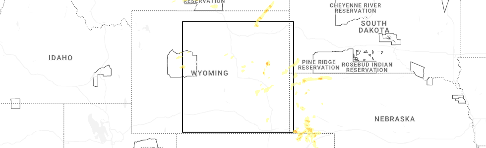
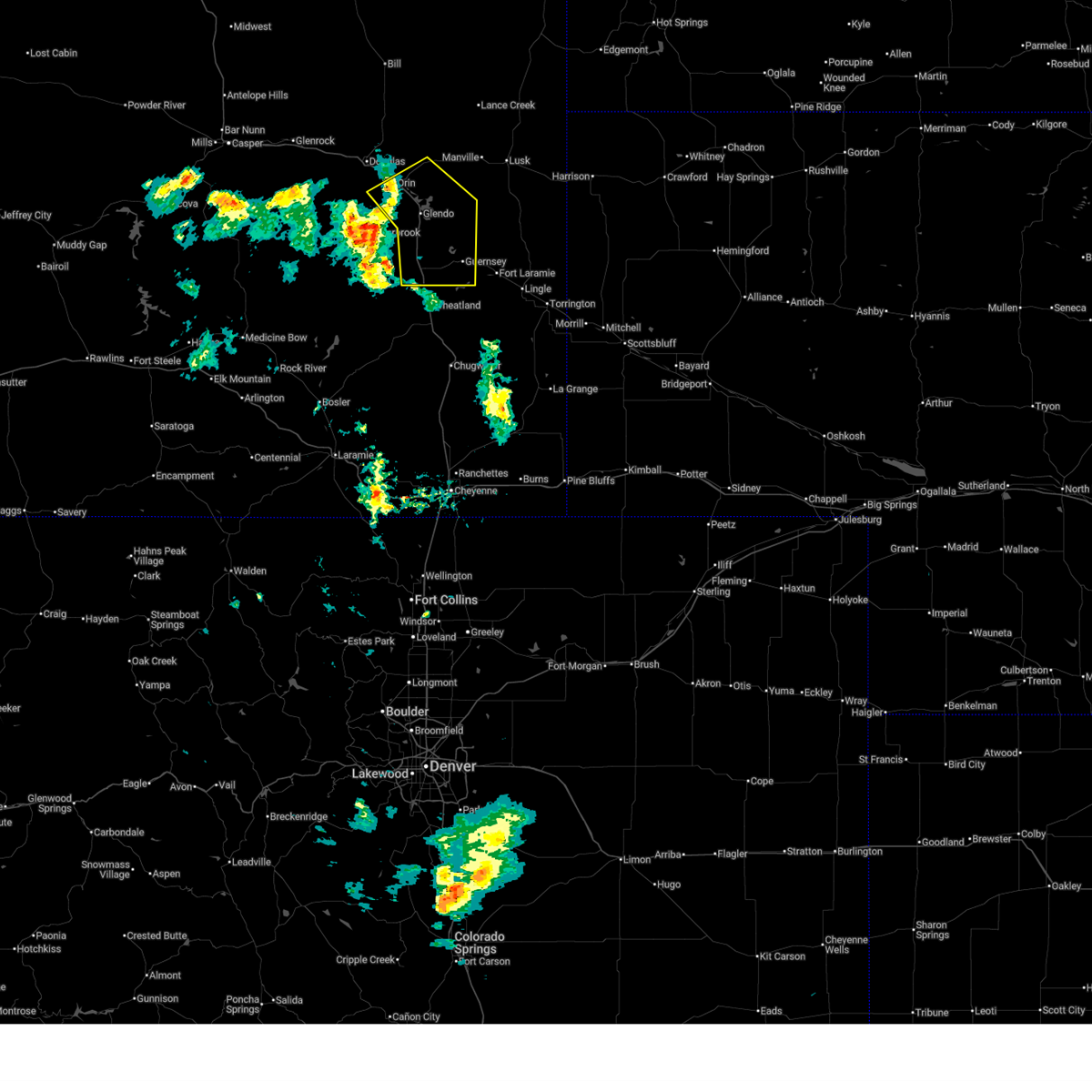
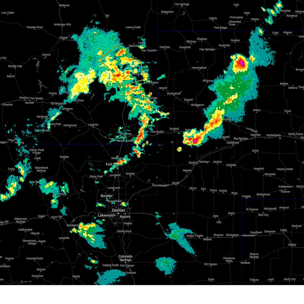
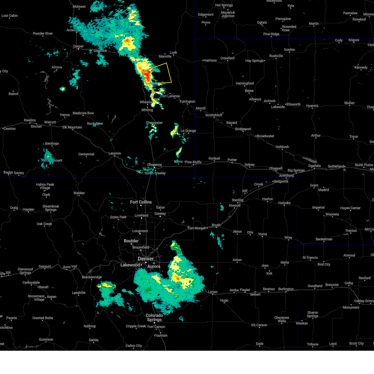
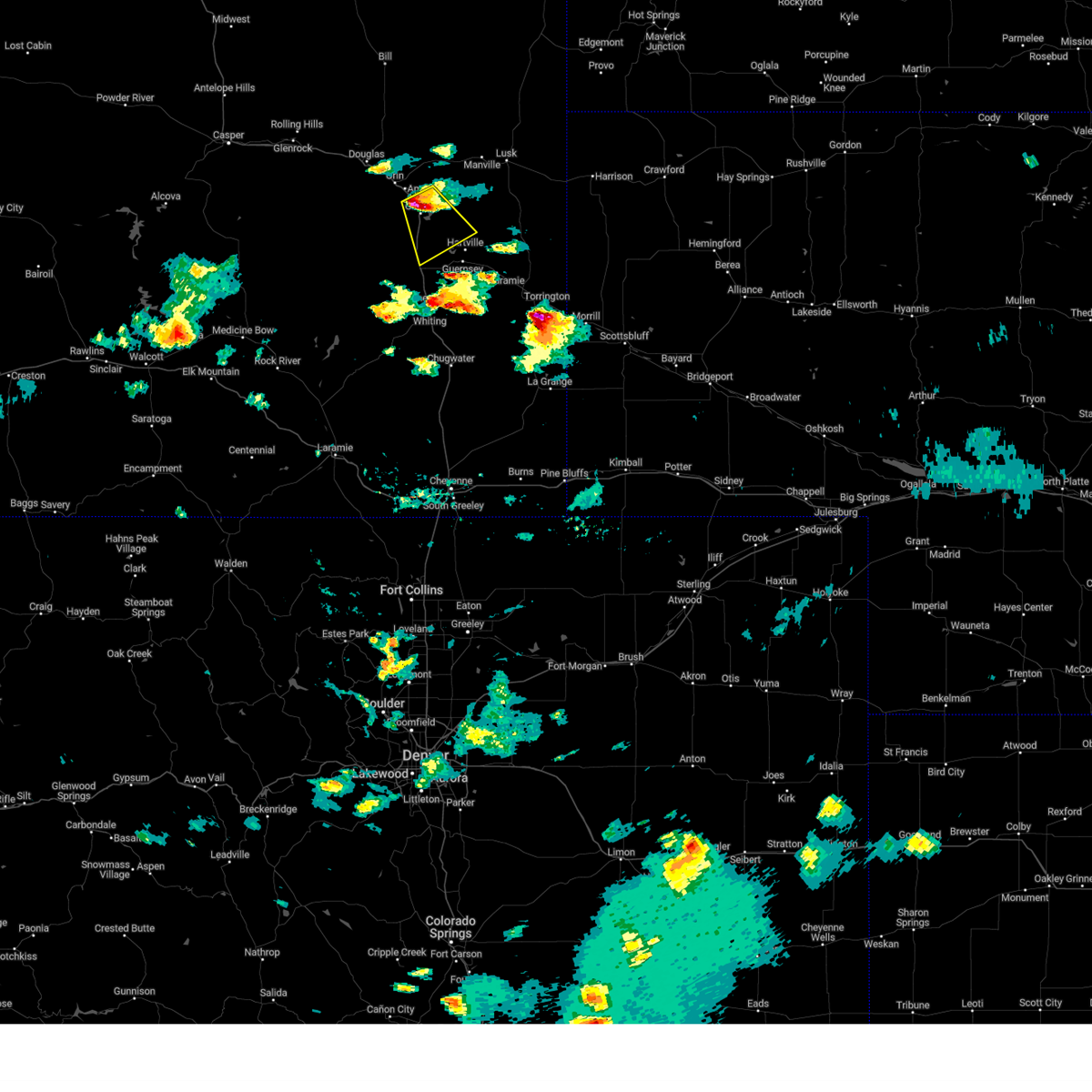
Hail Map for Glendo, WY
The Glendo, WY area has had 23 reports of on-the-ground hail by trained spotters, and has been under severe weather warnings 9 times during the past 12 months. Doppler radar has detected hail at or near Glendo, WY on 44 occasions, including 4 occasions during the past year.
| Name: | Glendo, WY |
| Where Located: | 70.4 miles ESE of Casper, WY |
| Map: | Google Map for Glendo, WY |
| Population: | 205 |
| Housing Units: | 167 |
| More Info: | Search Google for Glendo, WY |
2
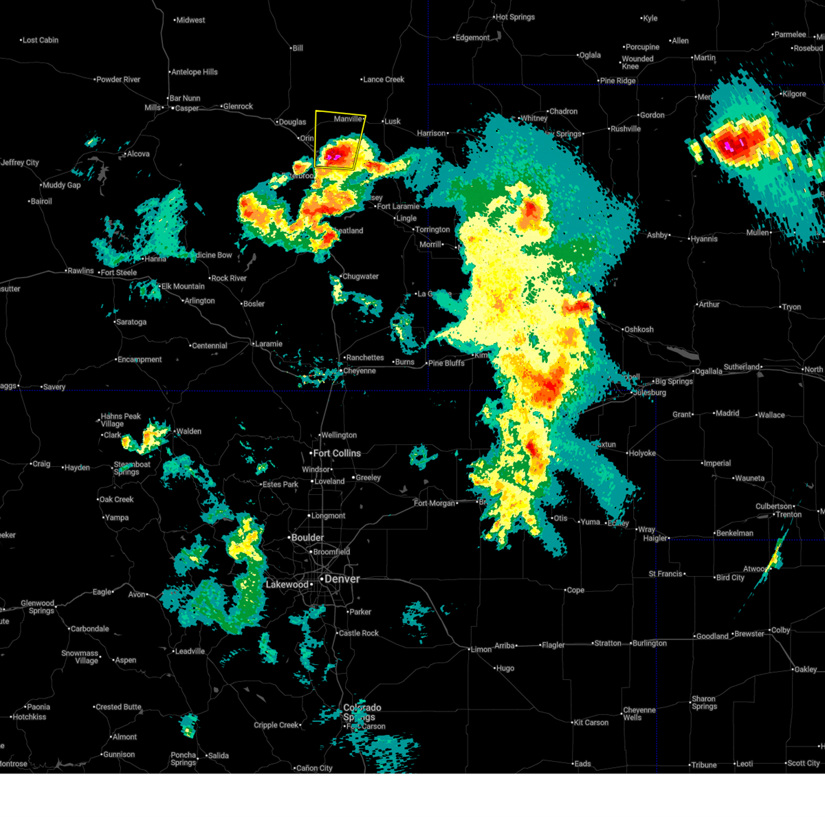
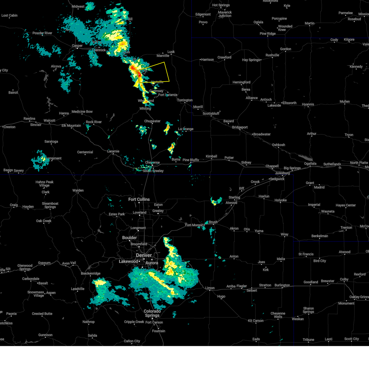
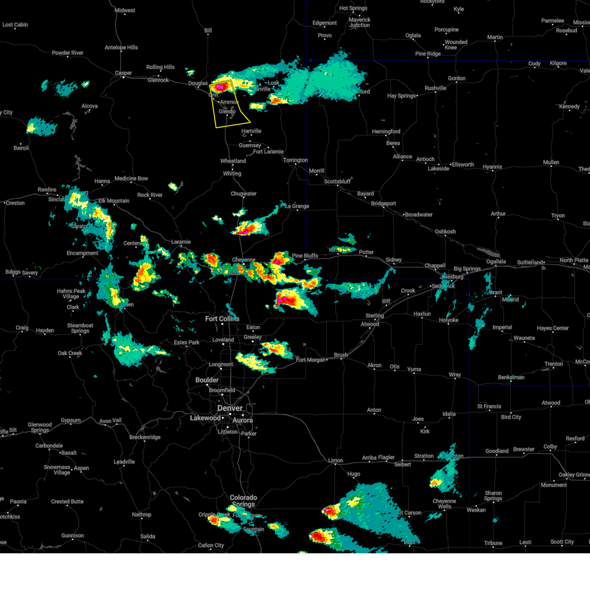
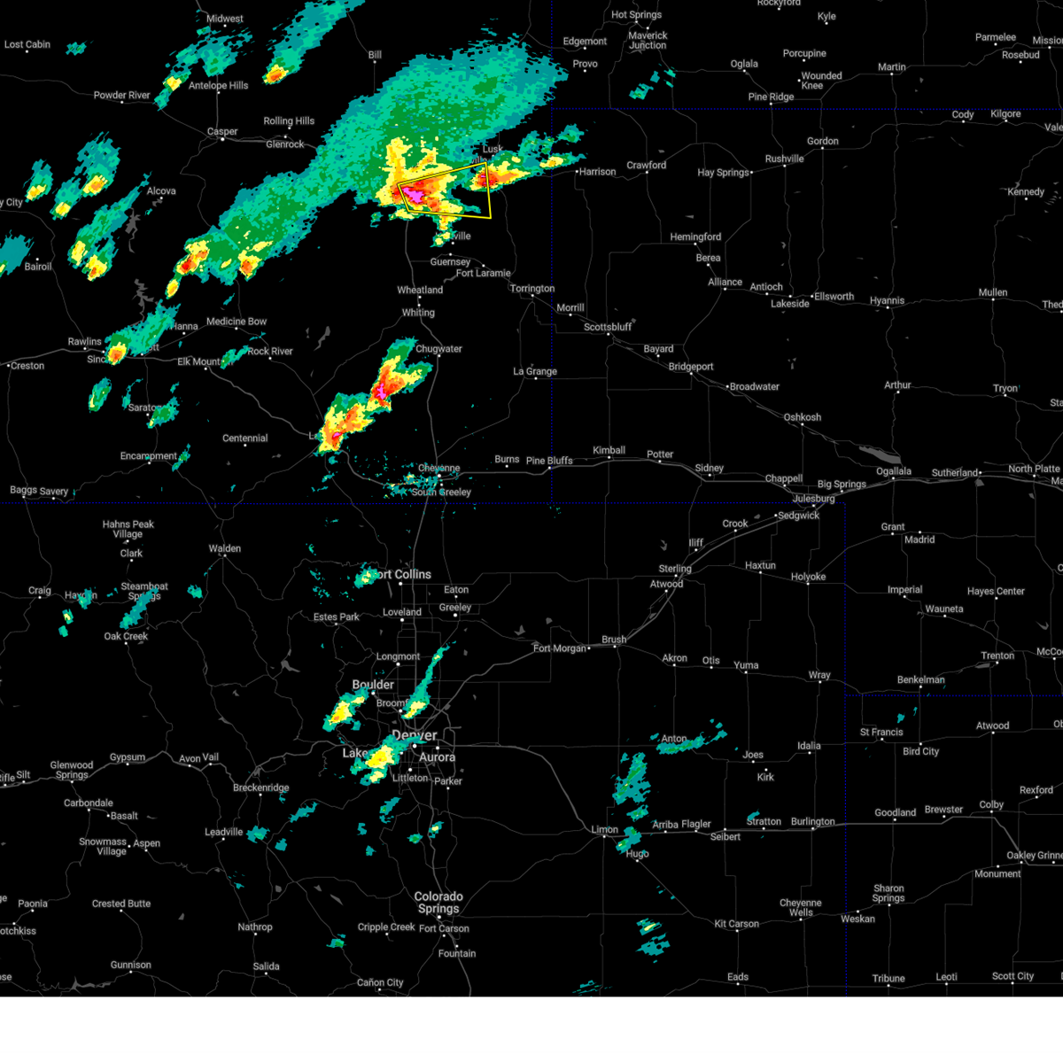
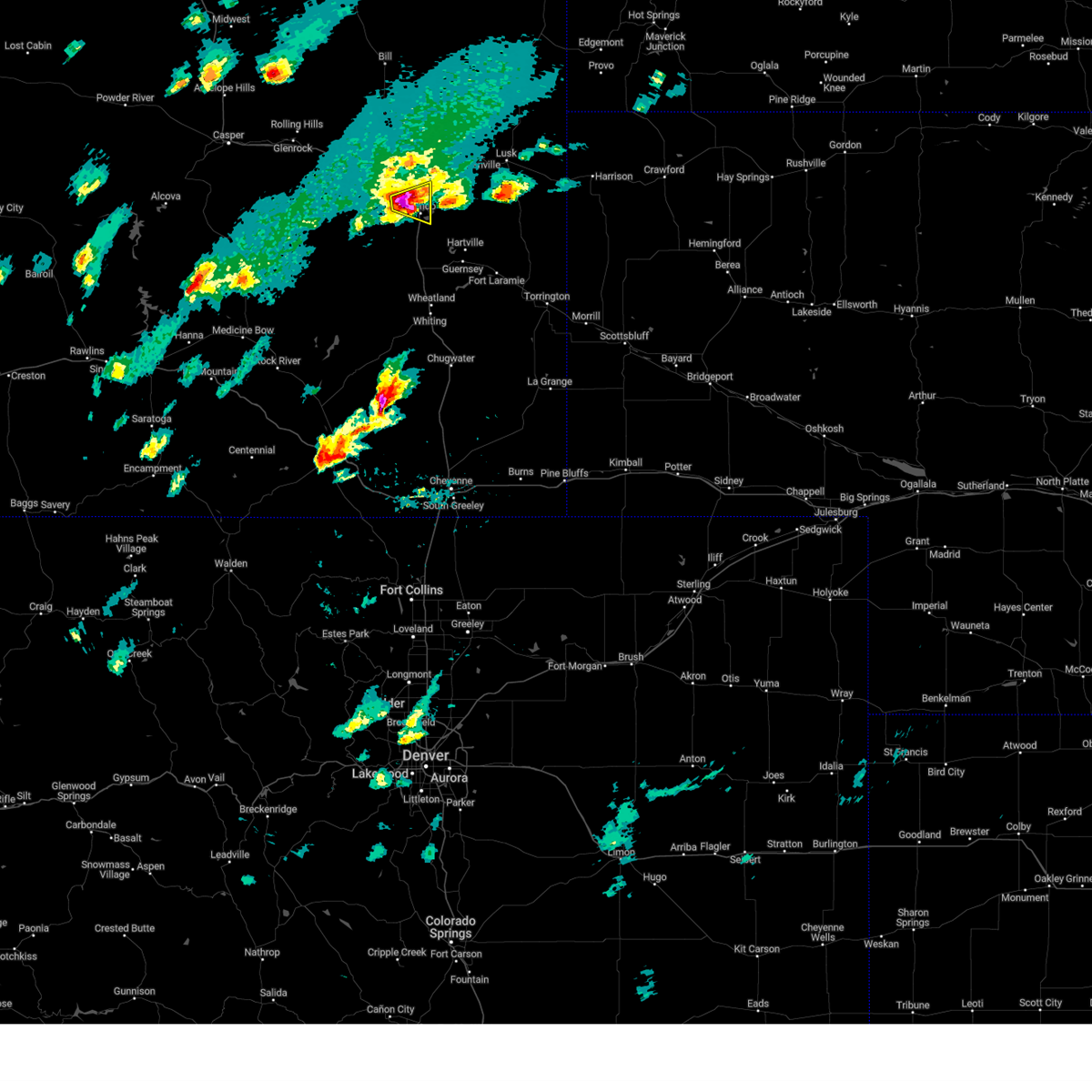
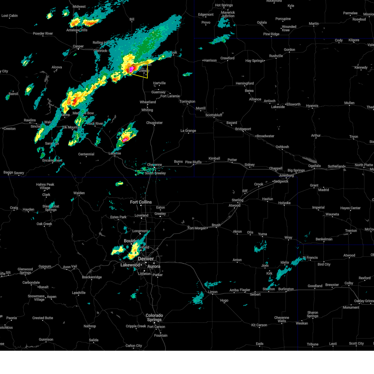
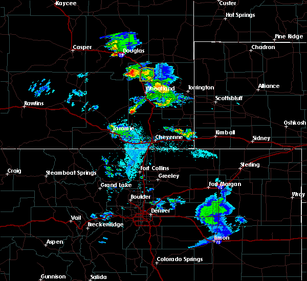
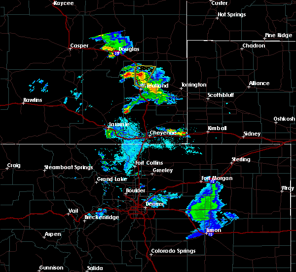
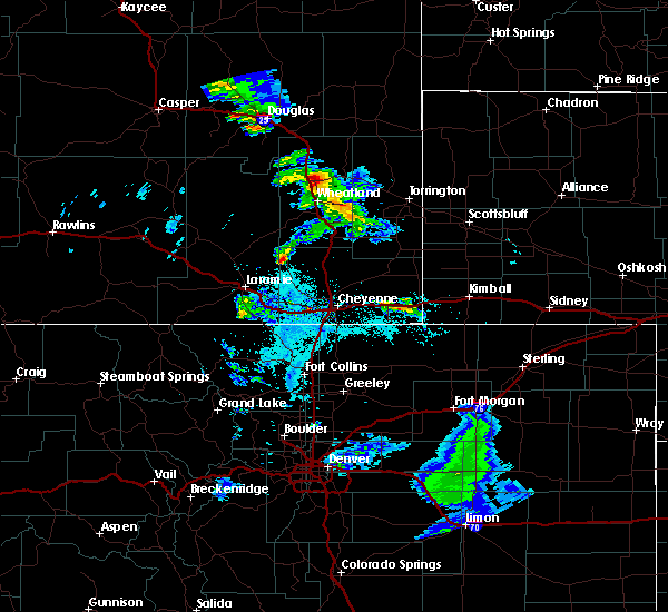
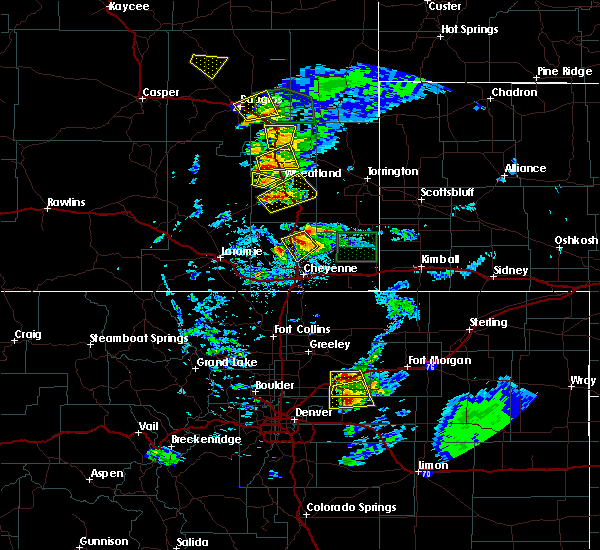
The Top Recent Hail Date for Glendo, WY is Friday, June 13, 2025 (13th out of 44)
Hail and Wind Damage Spotted near Glendo, WY
| Date / Time | Report Details |
|---|---|
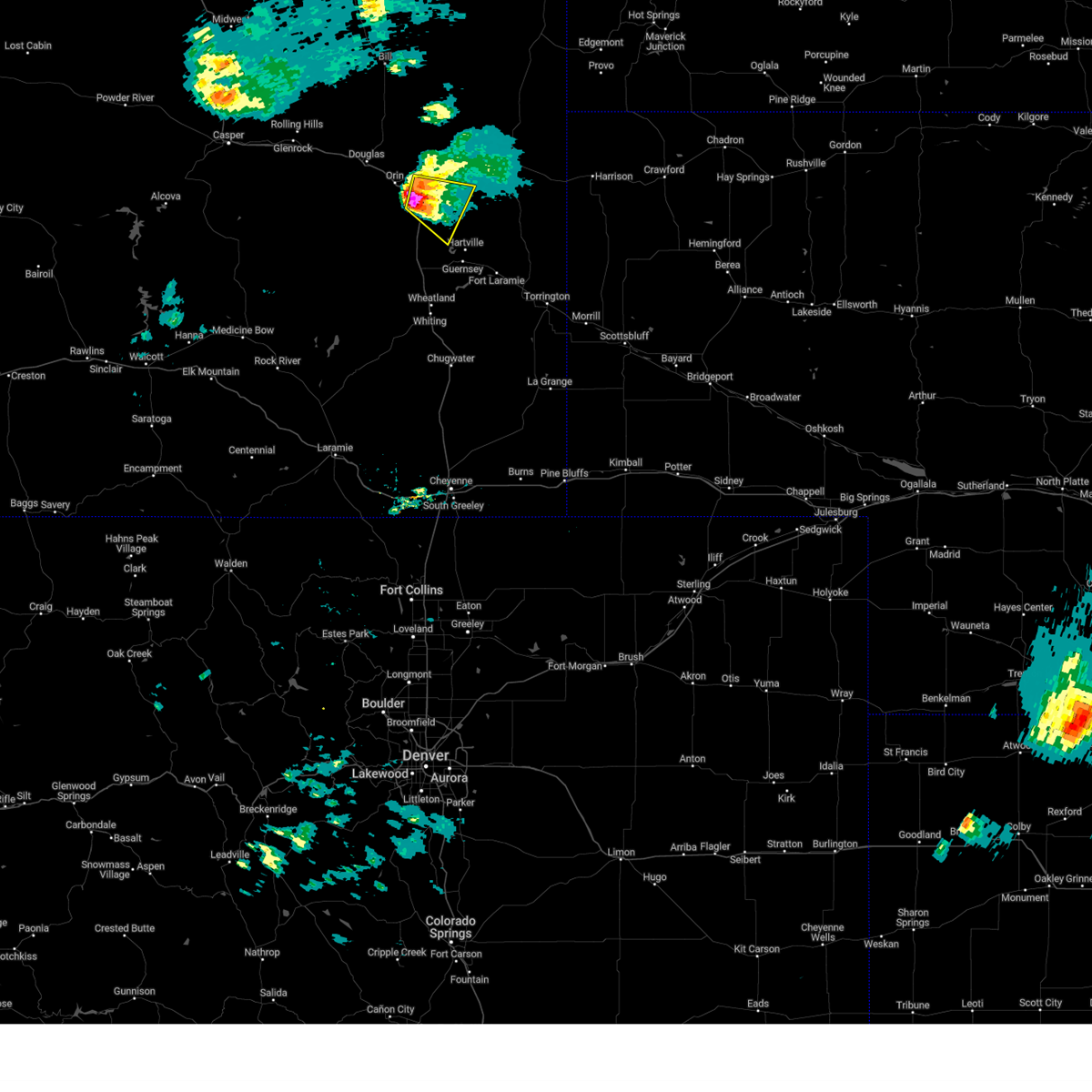
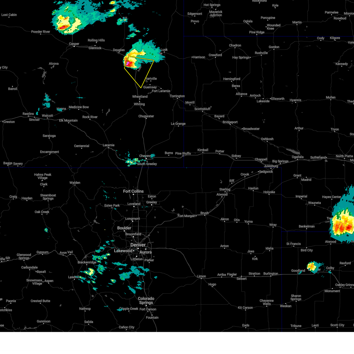
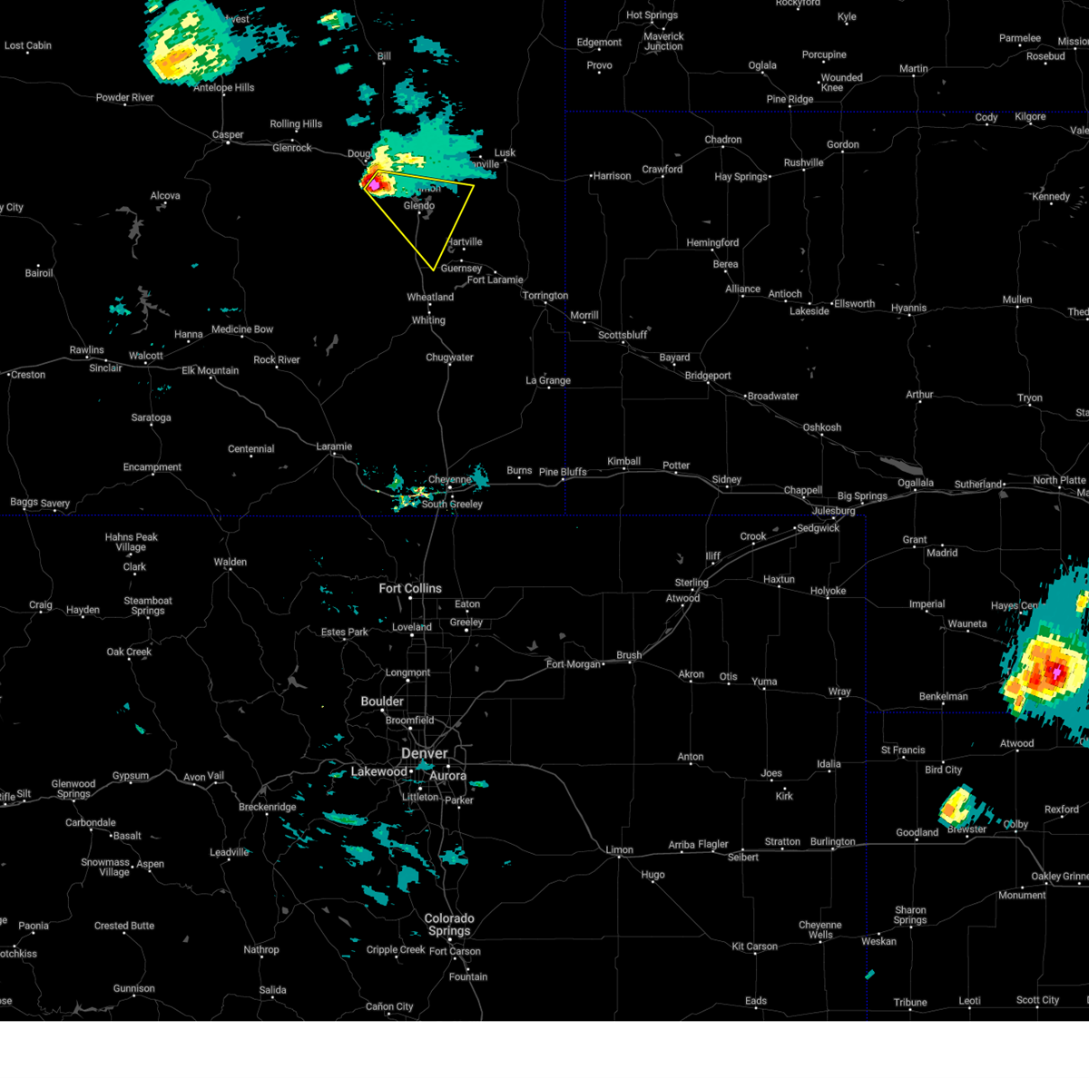
| 6/13/2025 4:01 PM MDT |
 The storms which prompted the warning have moved out of the area. therefore, the warning has been allowed to expire. however, small hail and gusty winds are still possible with these thunderstorms. a severe thunderstorm watch remains in effect until 1000 pm mdt for southeastern and east central wyoming. The storms which prompted the warning have moved out of the area. therefore, the warning has been allowed to expire. however, small hail and gusty winds are still possible with these thunderstorms. a severe thunderstorm watch remains in effect until 1000 pm mdt for southeastern and east central wyoming.
|
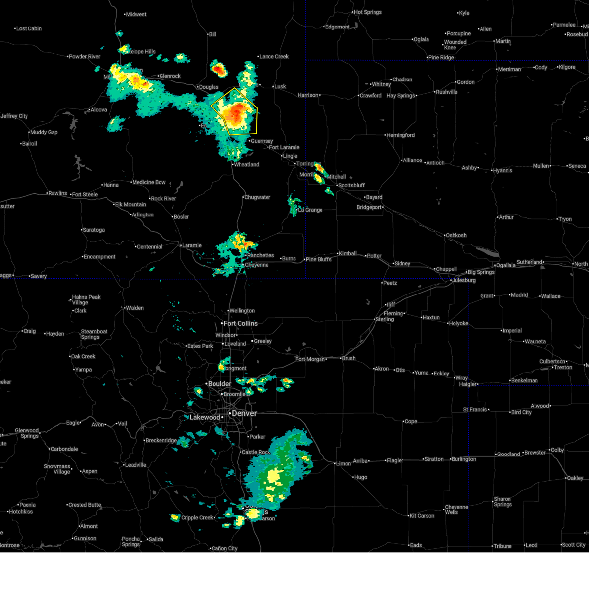
| 6/13/2025 3:51 PM MDT | Observer reported nickel sized hail and wind gusts of 60 mp in platte county WY, 0.4 miles WNW of Glendo, WY |
| 6/13/2025 3:49 PM MDT |
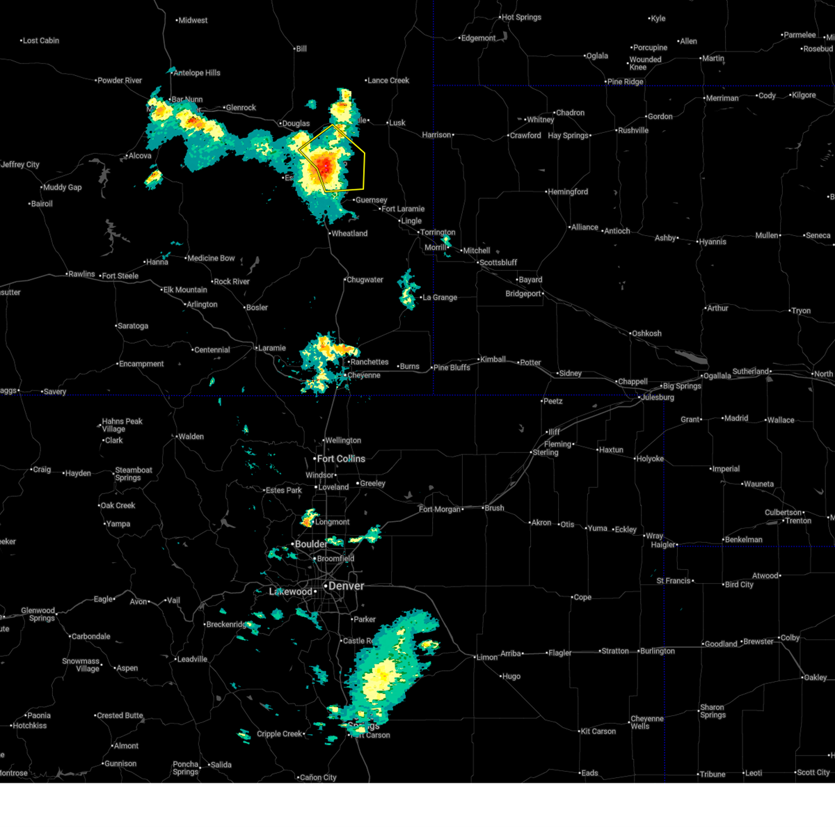 At 349 pm mdt, severe thunderstorms were located along a line extending from near orin to near glendo state park to near sandy cove campground, moving northeast at 25 mph (radar indicated). Hazards include 60 mph wind gusts and quarter size hail. Hail damage to vehicles is expected. expect wind damage to roofs, siding, and trees. Locations impacted include, glendo, sibley peak, glendo state park, sandy beach campground, reno cove campground, bennett hill campground, two moon campground, guernsey state park, and cassa. At 349 pm mdt, severe thunderstorms were located along a line extending from near orin to near glendo state park to near sandy cove campground, moving northeast at 25 mph (radar indicated). Hazards include 60 mph wind gusts and quarter size hail. Hail damage to vehicles is expected. expect wind damage to roofs, siding, and trees. Locations impacted include, glendo, sibley peak, glendo state park, sandy beach campground, reno cove campground, bennett hill campground, two moon campground, guernsey state park, and cassa.
|
| 6/13/2025 3:24 PM MDT |
 At 324 pm mdt, severe thunderstorms were located along a line extending from near orin to near glendo to near dwyer junction, moving east at 20 mph (radar indicated). Hazards include golf ball size hail and 60 mph wind gusts. People and animals outdoors will be injured. expect hail damage to roofs, siding, windows, and vehicles. expect wind damage to roofs, siding, and trees. Locations impacted include, guernsey, glendo, hartville, orin, sibley peak, glendo state park, register cliff state historic site, sandy beach campground, reno cove campground, sandy cove campground, two moon campground, guernsey state park, oregon trail ruts state historic site, dwyer junction, bennett hill campground, grayrocks reservoir, shawnee, and cassa. At 324 pm mdt, severe thunderstorms were located along a line extending from near orin to near glendo to near dwyer junction, moving east at 20 mph (radar indicated). Hazards include golf ball size hail and 60 mph wind gusts. People and animals outdoors will be injured. expect hail damage to roofs, siding, windows, and vehicles. expect wind damage to roofs, siding, and trees. Locations impacted include, guernsey, glendo, hartville, orin, sibley peak, glendo state park, register cliff state historic site, sandy beach campground, reno cove campground, sandy cove campground, two moon campground, guernsey state park, oregon trail ruts state historic site, dwyer junction, bennett hill campground, grayrocks reservoir, shawnee, and cassa.
|
| 6/13/2025 3:05 PM MDT |
 Svrcys the national weather service in cheyenne has issued a * severe thunderstorm warning for, southwestern niobrara county in east central wyoming, northern platte county in southeastern wyoming, southeastern converse county in east central wyoming, * until 400 pm mdt. * at 305 pm mdt, severe thunderstorms were located along a line extending from 10 miles southwest of orin to 7 miles east of esterbrook campground to near dwyer junction, moving northeast at 25 mph (radar indicated). Hazards include 60 mph wind gusts and quarter size hail. Hail damage to vehicles is expected. Expect wind damage to roofs, siding, and trees. Svrcys the national weather service in cheyenne has issued a * severe thunderstorm warning for, southwestern niobrara county in east central wyoming, northern platte county in southeastern wyoming, southeastern converse county in east central wyoming, * until 400 pm mdt. * at 305 pm mdt, severe thunderstorms were located along a line extending from 10 miles southwest of orin to 7 miles east of esterbrook campground to near dwyer junction, moving northeast at 25 mph (radar indicated). Hazards include 60 mph wind gusts and quarter size hail. Hail damage to vehicles is expected. Expect wind damage to roofs, siding, and trees.
|
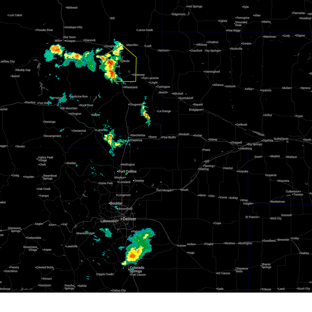
| 6/12/2025 6:47 PM MDT | Golf Ball sized hail reported 5 miles W of Glendo, WY, facebook report of golf ball sized hail east of glendo. |
| 6/12/2025 6:42 PM MDT | Quarter sized hail reported 5.3 miles SW of Glendo, WY, fire fighter reported quarter sized hail while fighting a lightning fire near glendo. |
| 6/12/2025 6:41 PM MDT |
 At 641 pm mdt, a severe thunderstorm was located near sandy beach campground, or 25 miles southwest of lusk, moving northeast at 20 mph (radar indicated). Hazards include ping pong ball size hail and 60 mph wind gusts. People and animals outdoors will be injured. expect hail damage to roofs, siding, windows, and vehicles. expect wind damage to roofs, siding, and trees. Locations impacted include, glendo, manville, keeline, glendo state park, sandy beach campground, reno cove campground, bennett hill campground, two moon campground, lost springs, and shawnee. At 641 pm mdt, a severe thunderstorm was located near sandy beach campground, or 25 miles southwest of lusk, moving northeast at 20 mph (radar indicated). Hazards include ping pong ball size hail and 60 mph wind gusts. People and animals outdoors will be injured. expect hail damage to roofs, siding, windows, and vehicles. expect wind damage to roofs, siding, and trees. Locations impacted include, glendo, manville, keeline, glendo state park, sandy beach campground, reno cove campground, bennett hill campground, two moon campground, lost springs, and shawnee.
|
| 6/12/2025 6:31 PM MDT |
 Svrcys the national weather service in cheyenne has issued a * severe thunderstorm warning for, southwestern niobrara county in east central wyoming, northeastern platte county in southeastern wyoming, east central converse county in east central wyoming, * until 715 pm mdt. * at 631 pm mdt, a severe thunderstorm was located over sandy beach campground, or 28 miles southeast of douglas, moving north at 30 mph (radar indicated). Hazards include 60 mph wind gusts and half dollar size hail. Hail damage to vehicles is expected. Expect wind damage to roofs, siding, and trees. Svrcys the national weather service in cheyenne has issued a * severe thunderstorm warning for, southwestern niobrara county in east central wyoming, northeastern platte county in southeastern wyoming, east central converse county in east central wyoming, * until 715 pm mdt. * at 631 pm mdt, a severe thunderstorm was located over sandy beach campground, or 28 miles southeast of douglas, moving north at 30 mph (radar indicated). Hazards include 60 mph wind gusts and half dollar size hail. Hail damage to vehicles is expected. Expect wind damage to roofs, siding, and trees.
|
| 7/27/2024 6:15 PM MDT |
 The storms which prompted the warning have moved out of the area. therefore, the warning will be allowed to expire. however, gusty winds and heavy rain are still possible with these thunderstorms. remember, a severe thunderstorm warning still remains in effect for converse, niobrara, goshen, sioux, and scotts bluff counties until 645 pm. The storms which prompted the warning have moved out of the area. therefore, the warning will be allowed to expire. however, gusty winds and heavy rain are still possible with these thunderstorms. remember, a severe thunderstorm warning still remains in effect for converse, niobrara, goshen, sioux, and scotts bluff counties until 645 pm.
|
| 7/27/2024 5:56 PM MDT | Corrects previous non-tstm wnd gst report from 8 nnw glendo. mesonet station wy56 i25 us26 us87 - platte convers in platte county WY, 7.7 miles SSE of Glendo, WY |
| 7/27/2024 5:43 PM MDT |
 At 542 pm mdt, severe thunderstorms were located along a line extending from near esterbrook campground to 7 miles south of sibley peak to near chugcreek, moving east at 45 mph (public. at 536pm, a wind gust of 70 mph was reported at coleman along interstate 25). Hazards include 70 mph wind gusts and penny size hail. Expect considerable tree damage. damage is likely to mobile homes, roofs, and outbuildings. Locations impacted include, wheatland, guernsey, fort laramie, glendo, hartville, orin, chugcreek, lakeview north, sibley peak, guernsey state park, pine ridge estates, phifer airfield, oregon trail ruts state historic site, dwyer junction, fort laramie national historic site, bennett hill campground, y-o ranch, glendo state park, register cliff state historic site, and reno cove campground. At 542 pm mdt, severe thunderstorms were located along a line extending from near esterbrook campground to 7 miles south of sibley peak to near chugcreek, moving east at 45 mph (public. at 536pm, a wind gust of 70 mph was reported at coleman along interstate 25). Hazards include 70 mph wind gusts and penny size hail. Expect considerable tree damage. damage is likely to mobile homes, roofs, and outbuildings. Locations impacted include, wheatland, guernsey, fort laramie, glendo, hartville, orin, chugcreek, lakeview north, sibley peak, guernsey state park, pine ridge estates, phifer airfield, oregon trail ruts state historic site, dwyer junction, fort laramie national historic site, bennett hill campground, y-o ranch, glendo state park, register cliff state historic site, and reno cove campground.
|
| 7/27/2024 5:23 PM MDT |
 Svrcys the national weather service in cheyenne has issued a * severe thunderstorm warning for, southwestern niobrara county in east central wyoming, northeastern albany county in southeastern wyoming, northwestern goshen county in southeastern wyoming, northern platte county in southeastern wyoming, southeastern converse county in east central wyoming, * until 615 pm mdt. * at 523 pm mdt, severe thunderstorms were located along a line extending from near esterbrook to near harris park to westview circle, moving east at 45 mph (radar indicated). Hazards include 60 mph wind gusts and penny size hail. expect damage to roofs, siding, and trees Svrcys the national weather service in cheyenne has issued a * severe thunderstorm warning for, southwestern niobrara county in east central wyoming, northeastern albany county in southeastern wyoming, northwestern goshen county in southeastern wyoming, northern platte county in southeastern wyoming, southeastern converse county in east central wyoming, * until 615 pm mdt. * at 523 pm mdt, severe thunderstorms were located along a line extending from near esterbrook to near harris park to westview circle, moving east at 45 mph (radar indicated). Hazards include 60 mph wind gusts and penny size hail. expect damage to roofs, siding, and trees
|
| 9/22/2023 7:18 PM MDT |
 At 718 pm mdt, a severe thunderstorm was located over glendo reservoir, or 27 miles north of wheatland, moving northeast at 25 mph (radar indicated). Hazards include 60 mph wind gusts and half dollar size hail. Hail damage to vehicles is expected. Expect wind damage to roofs, siding, and trees. At 718 pm mdt, a severe thunderstorm was located over glendo reservoir, or 27 miles north of wheatland, moving northeast at 25 mph (radar indicated). Hazards include 60 mph wind gusts and half dollar size hail. Hail damage to vehicles is expected. Expect wind damage to roofs, siding, and trees.
|
| 9/9/2023 10:15 PM MDT |
 At 1014 pm mdt, a severe thunderstorm was located near two moon campground, or 23 miles north of wheatland, moving southeast at 30 mph (radar indicated). Hazards include ping pong ball size hail and 60 mph wind gusts. People and animals outdoors will be injured. expect hail damage to roofs, siding, windows, and vehicles. expect wind damage to roofs, siding, and trees. locations impacted include, guernsey campground. this includes interstate 25 in wyoming between mile markers 85 and 94, and between mile markers 97 and 116. hail threat, radar indicated max hail size, 1. 50 in wind threat, radar indicated max wind gust, 60 mph. At 1014 pm mdt, a severe thunderstorm was located near two moon campground, or 23 miles north of wheatland, moving southeast at 30 mph (radar indicated). Hazards include ping pong ball size hail and 60 mph wind gusts. People and animals outdoors will be injured. expect hail damage to roofs, siding, windows, and vehicles. expect wind damage to roofs, siding, and trees. locations impacted include, guernsey campground. this includes interstate 25 in wyoming between mile markers 85 and 94, and between mile markers 97 and 116. hail threat, radar indicated max hail size, 1. 50 in wind threat, radar indicated max wind gust, 60 mph.
|
| 9/9/2023 9:59 PM MDT |
 At 958 pm mdt, a severe thunderstorm was located near glendo, or 25 miles southeast of douglas, moving southeast at 30 mph (radar indicated). Hazards include ping pong ball size hail and 60 mph wind gusts. People and animals outdoors will be injured. expect hail damage to roofs, siding, windows, and vehicles. expect wind damage to roofs, siding, and trees. this severe storm will be near, sibley peak around 1005 pm mdt. other locations impacted by this severe thunderstorm include hartville. this includes interstate 25 in wyoming between mile markers 85 and 119. hail threat, radar indicated max hail size, 1. 50 in wind threat, radar indicated max wind gust, 60 mph. At 958 pm mdt, a severe thunderstorm was located near glendo, or 25 miles southeast of douglas, moving southeast at 30 mph (radar indicated). Hazards include ping pong ball size hail and 60 mph wind gusts. People and animals outdoors will be injured. expect hail damage to roofs, siding, windows, and vehicles. expect wind damage to roofs, siding, and trees. this severe storm will be near, sibley peak around 1005 pm mdt. other locations impacted by this severe thunderstorm include hartville. this includes interstate 25 in wyoming between mile markers 85 and 119. hail threat, radar indicated max hail size, 1. 50 in wind threat, radar indicated max wind gust, 60 mph.
|
| 9/9/2023 9:43 PM MDT |
 At 943 pm mdt, severe thunderstorms were located along a line extending from 10 miles west of keeline to 7 miles north of esterbrook campground, moving south at 35 mph (radar indicated). Hazards include ping pong ball size hail and 60 mph wind gusts. People and animals outdoors will be injured. expect hail damage to roofs, siding, windows, and vehicles. expect wind damage to roofs, siding, and trees. severe thunderstorms will be near, esterbrook campground around 950 pm mdt. glendo around 955 pm mdt. glendo reservoir, two moon campground and sibley peak around 1000 pm mdt. other locations impacted by these severe thunderstorms include hartville. this includes interstate 25 in wyoming between mile markers 85 and 126. hail threat, radar indicated max hail size, 1. 50 in wind threat, radar indicated max wind gust, 60 mph. At 943 pm mdt, severe thunderstorms were located along a line extending from 10 miles west of keeline to 7 miles north of esterbrook campground, moving south at 35 mph (radar indicated). Hazards include ping pong ball size hail and 60 mph wind gusts. People and animals outdoors will be injured. expect hail damage to roofs, siding, windows, and vehicles. expect wind damage to roofs, siding, and trees. severe thunderstorms will be near, esterbrook campground around 950 pm mdt. glendo around 955 pm mdt. glendo reservoir, two moon campground and sibley peak around 1000 pm mdt. other locations impacted by these severe thunderstorms include hartville. this includes interstate 25 in wyoming between mile markers 85 and 126. hail threat, radar indicated max hail size, 1. 50 in wind threat, radar indicated max wind gust, 60 mph.
|
| 9/9/2023 9:36 PM MDT |
 At 935 pm mdt, a severe thunderstorm was located 11 miles north of esterbrook campground, or 14 miles southeast of douglas, moving south at 20 mph (radar indicated). Hazards include golf ball size hail and 60 mph wind gusts. People and animals outdoors will be injured. expect hail damage to roofs, siding, windows, and vehicles. expect wind damage to roofs, siding, and trees. this severe thunderstorm will remain over mainly rural areas of southwestern niobrara, northwestern platte and southeastern converse counties, including the following locations, lost springs. this includes interstate 25 in wyoming between mile markers 112 and 128. thunderstorm damage threat, considerable hail threat, radar indicated max hail size, 1. 75 in wind threat, radar indicated max wind gust, 60 mph. At 935 pm mdt, a severe thunderstorm was located 11 miles north of esterbrook campground, or 14 miles southeast of douglas, moving south at 20 mph (radar indicated). Hazards include golf ball size hail and 60 mph wind gusts. People and animals outdoors will be injured. expect hail damage to roofs, siding, windows, and vehicles. expect wind damage to roofs, siding, and trees. this severe thunderstorm will remain over mainly rural areas of southwestern niobrara, northwestern platte and southeastern converse counties, including the following locations, lost springs. this includes interstate 25 in wyoming between mile markers 112 and 128. thunderstorm damage threat, considerable hail threat, radar indicated max hail size, 1. 75 in wind threat, radar indicated max wind gust, 60 mph.
|
| 9/9/2023 9:18 PM MDT |
 At 917 pm mdt, a severe thunderstorm was located 10 miles east of douglas, moving southeast at 30 mph (radar indicated). Hazards include golf ball size hail and 60 mph wind gusts. People and animals outdoors will be injured. expect hail damage to roofs, siding, windows, and vehicles. expect wind damage to roofs, siding, and trees. this severe thunderstorm will remain over mainly rural areas of west central niobrara, northwestern platte and southeastern converse counties, including the following locations, lost springs. this includes interstate 25 in wyoming between mile markers 112 and 134. thunderstorm damage threat, considerable hail threat, radar indicated max hail size, 1. 75 in wind threat, radar indicated max wind gust, 60 mph. At 917 pm mdt, a severe thunderstorm was located 10 miles east of douglas, moving southeast at 30 mph (radar indicated). Hazards include golf ball size hail and 60 mph wind gusts. People and animals outdoors will be injured. expect hail damage to roofs, siding, windows, and vehicles. expect wind damage to roofs, siding, and trees. this severe thunderstorm will remain over mainly rural areas of west central niobrara, northwestern platte and southeastern converse counties, including the following locations, lost springs. this includes interstate 25 in wyoming between mile markers 112 and 134. thunderstorm damage threat, considerable hail threat, radar indicated max hail size, 1. 75 in wind threat, radar indicated max wind gust, 60 mph.
|
| 9/9/2023 9:02 PM MDT |
 At 900 pm mdt, a severe thunderstorm was located near douglas, moving southeast at 35 mph. at 900 pm mdt, the public reported golfball to baseball size hail 1/2 mile southwest of douglas (radar indicated). Hazards include golf ball size hail and 60 mph wind gusts. People and animals outdoors will be injured. expect hail damage to roofs, siding, windows, and vehicles. expect wind damage to roofs, siding, and trees. this severe thunderstorm will remain over mainly rural areas of western niobrara, northwestern platte and southeastern converse counties, including the following locations, lost springs. this includes interstate 25 in wyoming between mile markers 112 and 144. thunderstorm damage threat, considerable hail threat, observed max hail size, 1. 75 in wind threat, radar indicated max wind gust, 60 mph. At 900 pm mdt, a severe thunderstorm was located near douglas, moving southeast at 35 mph. at 900 pm mdt, the public reported golfball to baseball size hail 1/2 mile southwest of douglas (radar indicated). Hazards include golf ball size hail and 60 mph wind gusts. People and animals outdoors will be injured. expect hail damage to roofs, siding, windows, and vehicles. expect wind damage to roofs, siding, and trees. this severe thunderstorm will remain over mainly rural areas of western niobrara, northwestern platte and southeastern converse counties, including the following locations, lost springs. this includes interstate 25 in wyoming between mile markers 112 and 144. thunderstorm damage threat, considerable hail threat, observed max hail size, 1. 75 in wind threat, radar indicated max wind gust, 60 mph.
|
| 9/9/2023 8:39 PM MDT |
 At 838 pm mdt, a severe thunderstorm was located 10 miles northwest of douglas, moving southeast at 35 mph (radar indicated). Hazards include 60 mph wind gusts and nickel size hail. Expect damage to roofs, siding, and trees. this severe thunderstorm will be near, douglas around 845 pm mdt. other locations impacted by this severe thunderstorm include lost springs. this includes interstate 25 in wyoming between mile markers 112 and 159. hail threat, radar indicated max hail size, 0. 88 in wind threat, radar indicated max wind gust, 60 mph. At 838 pm mdt, a severe thunderstorm was located 10 miles northwest of douglas, moving southeast at 35 mph (radar indicated). Hazards include 60 mph wind gusts and nickel size hail. Expect damage to roofs, siding, and trees. this severe thunderstorm will be near, douglas around 845 pm mdt. other locations impacted by this severe thunderstorm include lost springs. this includes interstate 25 in wyoming between mile markers 112 and 159. hail threat, radar indicated max hail size, 0. 88 in wind threat, radar indicated max wind gust, 60 mph.
|
| 9/9/2023 7:33 PM MDT |
 At 732 pm mdt, a severe thunderstorm was located near glendo, or 23 miles southeast of douglas, moving east at 25 mph (radar indicated). Hazards include ping pong ball size hail and 60 mph wind gusts. People and animals outdoors will be injured. expect hail damage to roofs, siding, windows, and vehicles. expect wind damage to roofs, siding, and trees. this severe thunderstorm will remain over mainly rural areas of southwestern niobrara, north central platte and southeastern converse counties. this includes interstate 25 in wyoming between mile markers 110 and 119. hail threat, radar indicated max hail size, 1. 50 in wind threat, radar indicated max wind gust, 60 mph. At 732 pm mdt, a severe thunderstorm was located near glendo, or 23 miles southeast of douglas, moving east at 25 mph (radar indicated). Hazards include ping pong ball size hail and 60 mph wind gusts. People and animals outdoors will be injured. expect hail damage to roofs, siding, windows, and vehicles. expect wind damage to roofs, siding, and trees. this severe thunderstorm will remain over mainly rural areas of southwestern niobrara, north central platte and southeastern converse counties. this includes interstate 25 in wyoming between mile markers 110 and 119. hail threat, radar indicated max hail size, 1. 50 in wind threat, radar indicated max wind gust, 60 mph.
|
| 9/9/2023 7:30 PM MDT | Quarter sized hail reported 9.2 miles SE of Glendo, WY, platte/converse county line wydot sensor and webcam. hail covering interstate 25. observation had zero visibility with heavy rain and wind gusts to 51 mph. |
| 9/9/2023 7:15 PM MDT |
 At 714 pm mdt, a severe thunderstorm was located 8 miles northwest of glendo, or 16 miles southeast of douglas, moving southeast at 25 mph (radar indicated). Hazards include ping pong ball size hail and 60 mph wind gusts. People and animals outdoors will be injured. expect hail damage to roofs, siding, windows, and vehicles. expect wind damage to roofs, siding, and trees. this severe storm will be near, glendo around 725 pm mdt. glendo reservoir and two moon campground around 735 pm mdt. this includes interstate 25 in wyoming between mile markers 99 and 126. hail threat, radar indicated max hail size, 1. 50 in wind threat, radar indicated max wind gust, 60 mph. At 714 pm mdt, a severe thunderstorm was located 8 miles northwest of glendo, or 16 miles southeast of douglas, moving southeast at 25 mph (radar indicated). Hazards include ping pong ball size hail and 60 mph wind gusts. People and animals outdoors will be injured. expect hail damage to roofs, siding, windows, and vehicles. expect wind damage to roofs, siding, and trees. this severe storm will be near, glendo around 725 pm mdt. glendo reservoir and two moon campground around 735 pm mdt. this includes interstate 25 in wyoming between mile markers 99 and 126. hail threat, radar indicated max hail size, 1. 50 in wind threat, radar indicated max wind gust, 60 mph.
|
| 9/9/2023 6:59 PM MDT |
 At 659 pm mdt, a severe thunderstorm was located 11 miles southeast of douglas, moving southeast at 30 mph (radar indicated). Hazards include 60 mph wind gusts and quarter size hail. Hail damage to vehicles is expected. expect wind damage to roofs, siding, and trees. this severe thunderstorm will be near, glendo around 720 pm mdt. glendo reservoir and two moon campground around 730 pm mdt. this includes interstate 25 in wyoming between mile markers 99 and 131. hail threat, radar indicated max hail size, 1. 00 in wind threat, radar indicated max wind gust, 60 mph. At 659 pm mdt, a severe thunderstorm was located 11 miles southeast of douglas, moving southeast at 30 mph (radar indicated). Hazards include 60 mph wind gusts and quarter size hail. Hail damage to vehicles is expected. expect wind damage to roofs, siding, and trees. this severe thunderstorm will be near, glendo around 720 pm mdt. glendo reservoir and two moon campground around 730 pm mdt. this includes interstate 25 in wyoming between mile markers 99 and 131. hail threat, radar indicated max hail size, 1. 00 in wind threat, radar indicated max wind gust, 60 mph.
|
| 7/24/2023 7:58 PM MDT |
 At 756 pm mdt, a severe thunderstorm was located over two moon campground, or 28 miles north of wheatland, moving east at 25 mph (radar indicated). Hazards include 60 mph wind gusts and half dollar size hail. Hail damage to vehicles is expected. expect wind damage to roofs, siding, and trees. locations impacted include, glendo, glendo reservoir and two moon campground. this includes interstate 25 in wyoming between mile markers 109 and 113. hail threat, radar indicated max hail size, 1. 25 in wind threat, radar indicated max wind gust, 60 mph. At 756 pm mdt, a severe thunderstorm was located over two moon campground, or 28 miles north of wheatland, moving east at 25 mph (radar indicated). Hazards include 60 mph wind gusts and half dollar size hail. Hail damage to vehicles is expected. expect wind damage to roofs, siding, and trees. locations impacted include, glendo, glendo reservoir and two moon campground. this includes interstate 25 in wyoming between mile markers 109 and 113. hail threat, radar indicated max hail size, 1. 25 in wind threat, radar indicated max wind gust, 60 mph.
|
| 7/24/2023 7:44 PM MDT |
 At 744 pm mdt, a severe thunderstorm was located over sibley peak, or 27 miles southeast of douglas, moving east at 35 mph (radar indicated). Hazards include 60 mph wind gusts and half dollar size hail. Hail damage to vehicles is expected. Expect wind damage to roofs, siding, and trees. At 744 pm mdt, a severe thunderstorm was located over sibley peak, or 27 miles southeast of douglas, moving east at 35 mph (radar indicated). Hazards include 60 mph wind gusts and half dollar size hail. Hail damage to vehicles is expected. Expect wind damage to roofs, siding, and trees.
|
| 7/19/2023 4:51 PM MDT |
 The severe thunderstorm warning for northwestern goshen, northeastern platte and southeastern converse counties will expire at 500 pm mdt, the storm which prompted the warning has weakened below severe limits, and no longer poses an immediate threat to life or property. therefore, the warning will be allowed to expire. however small hail is still possible with this thunderstorm. The severe thunderstorm warning for northwestern goshen, northeastern platte and southeastern converse counties will expire at 500 pm mdt, the storm which prompted the warning has weakened below severe limits, and no longer poses an immediate threat to life or property. therefore, the warning will be allowed to expire. however small hail is still possible with this thunderstorm.
|
| 7/19/2023 4:40 PM MDT |
 At 438 pm mdt, a severe thunderstorm was located near guernsey campground, or 22 miles north of wheatland, moving southeast at 40 mph. at 427 pm the public reported 1.25" at the glendo post office (public). Hazards include 60 mph wind gusts and half dollar size hail. Hail damage to vehicles is expected. expect wind damage to roofs, siding, and trees. locations impacted include, glendo, sibley peak, glendo reservoir and two moon campground. this includes interstate 25 in wyoming between mile markers 97 and 118. hail threat, observed max hail size, 1. 25 in wind threat, radar indicated max wind gust, 60 mph. At 438 pm mdt, a severe thunderstorm was located near guernsey campground, or 22 miles north of wheatland, moving southeast at 40 mph. at 427 pm the public reported 1.25" at the glendo post office (public). Hazards include 60 mph wind gusts and half dollar size hail. Hail damage to vehicles is expected. expect wind damage to roofs, siding, and trees. locations impacted include, glendo, sibley peak, glendo reservoir and two moon campground. this includes interstate 25 in wyoming between mile markers 97 and 118. hail threat, observed max hail size, 1. 25 in wind threat, radar indicated max wind gust, 60 mph.
|
| 7/19/2023 4:27 PM MDT | Half Dollar sized hail reported 0.4 miles WNW of Glendo, WY |
| 7/19/2023 4:26 PM MDT |
 At 426 pm mdt, a severe thunderstorm was located over two moon campground, or 27 miles north of wheatland, moving southeast at 40 mph (radar indicated). Hazards include ping pong ball size hail and 60 mph wind gusts. People and animals outdoors will be injured. expect hail damage to roofs, siding, windows, and vehicles. expect wind damage to roofs, siding, and trees. locations impacted include, glendo, sibley peak, glendo reservoir and two moon campground. this includes interstate 25 in wyoming between mile markers 97 and 118. hail threat, radar indicated max hail size, 1. 50 in wind threat, radar indicated max wind gust, 60 mph. At 426 pm mdt, a severe thunderstorm was located over two moon campground, or 27 miles north of wheatland, moving southeast at 40 mph (radar indicated). Hazards include ping pong ball size hail and 60 mph wind gusts. People and animals outdoors will be injured. expect hail damage to roofs, siding, windows, and vehicles. expect wind damage to roofs, siding, and trees. locations impacted include, glendo, sibley peak, glendo reservoir and two moon campground. this includes interstate 25 in wyoming between mile markers 97 and 118. hail threat, radar indicated max hail size, 1. 50 in wind threat, radar indicated max wind gust, 60 mph.
|
| 7/19/2023 4:13 PM MDT |
 At 413 pm mdt, a severe thunderstorm was located near glendo, or 21 miles southeast of douglas, moving southeast at 40 mph (radar indicated). Hazards include ping pong ball size hail and 60 mph wind gusts. People and animals outdoors will be injured. expect hail damage to roofs, siding, windows, and vehicles. Expect wind damage to roofs, siding, and trees. At 413 pm mdt, a severe thunderstorm was located near glendo, or 21 miles southeast of douglas, moving southeast at 40 mph (radar indicated). Hazards include ping pong ball size hail and 60 mph wind gusts. People and animals outdoors will be injured. expect hail damage to roofs, siding, windows, and vehicles. Expect wind damage to roofs, siding, and trees.
|
| 7/8/2023 7:58 PM MDT |
 The severe thunderstorm warning for northern platte county will expire at 800 pm mdt, the storm which prompted the warning has weakened below severe limits, and no longer poses an immediate threat to life or property. therefore, the warning will be allowed to expire. however small hail and gusty winds are still possible with this thunderstorm. a severe thunderstorm watch remains in effect until 900 pm mdt for southeastern wyoming. The severe thunderstorm warning for northern platte county will expire at 800 pm mdt, the storm which prompted the warning has weakened below severe limits, and no longer poses an immediate threat to life or property. therefore, the warning will be allowed to expire. however small hail and gusty winds are still possible with this thunderstorm. a severe thunderstorm watch remains in effect until 900 pm mdt for southeastern wyoming.
|
| 7/8/2023 7:38 PM MDT | Mesonet station wy56 interstate 25 platte and converse county lin in platte county WY, 7.7 miles SSE of Glendo, WY |
| 7/8/2023 7:35 PM MDT |
 At 735 pm mdt, a severe thunderstorm was located near glendo, or 23 miles southeast of douglas, moving southeast at 35 mph (radar indicated). Hazards include ping pong ball size hail and 60 mph wind gusts. People and animals outdoors will be injured. expect hail damage to roofs, siding, windows, and vehicles. expect wind damage to roofs, siding, and trees. locations impacted include, glendo, glendo reservoir, two moon campground and sibley peak. this includes interstate 25 in wyoming between mile markers 105 and 119. hail threat, radar indicated max hail size, 1. 50 in wind threat, radar indicated max wind gust, 60 mph. At 735 pm mdt, a severe thunderstorm was located near glendo, or 23 miles southeast of douglas, moving southeast at 35 mph (radar indicated). Hazards include ping pong ball size hail and 60 mph wind gusts. People and animals outdoors will be injured. expect hail damage to roofs, siding, windows, and vehicles. expect wind damage to roofs, siding, and trees. locations impacted include, glendo, glendo reservoir, two moon campground and sibley peak. this includes interstate 25 in wyoming between mile markers 105 and 119. hail threat, radar indicated max hail size, 1. 50 in wind threat, radar indicated max wind gust, 60 mph.
|
| 7/8/2023 7:13 PM MDT |
 At 713 pm mdt, a severe thunderstorm was located 14 miles east of douglas, moving southeast at 35 mph (radar indicated). Hazards include ping pong ball size hail and 60 mph wind gusts. People and animals outdoors will be injured. expect hail damage to roofs, siding, windows, and vehicles. expect wind damage to roofs, siding, and trees. this severe thunderstorm will be near, glendo around 740 pm mdt. glendo reservoir around 745 pm mdt. two moon campground and sibley peak around 750 pm mdt. this includes interstate 25 in wyoming between mile markers 105 and 128. hail threat, radar indicated max hail size, 1. 50 in wind threat, radar indicated max wind gust, 60 mph. At 713 pm mdt, a severe thunderstorm was located 14 miles east of douglas, moving southeast at 35 mph (radar indicated). Hazards include ping pong ball size hail and 60 mph wind gusts. People and animals outdoors will be injured. expect hail damage to roofs, siding, windows, and vehicles. expect wind damage to roofs, siding, and trees. this severe thunderstorm will be near, glendo around 740 pm mdt. glendo reservoir around 745 pm mdt. two moon campground and sibley peak around 750 pm mdt. this includes interstate 25 in wyoming between mile markers 105 and 128. hail threat, radar indicated max hail size, 1. 50 in wind threat, radar indicated max wind gust, 60 mph.
|
| 7/6/2023 10:42 PM MDT |
 At 1042 pm mdt, severe thunderstorms were located along a line extending from 15 miles south of manning ranch to 9 miles southwest of keeline to near two moon campground to sibley peak, moving east at 40 mph (radar indicated). Hazards include 60 mph wind gusts and quarter size hail. Hail damage to vehicles is expected. Expect wind damage to roofs, siding, and trees. At 1042 pm mdt, severe thunderstorms were located along a line extending from 15 miles south of manning ranch to 9 miles southwest of keeline to near two moon campground to sibley peak, moving east at 40 mph (radar indicated). Hazards include 60 mph wind gusts and quarter size hail. Hail damage to vehicles is expected. Expect wind damage to roofs, siding, and trees.
|
| 7/3/2023 8:10 PM MDT |
 The severe thunderstorm warning for southern niobrara, goshen, northeastern platte and east central converse counties will expire at 815 pm mdt, the storms which prompted the warning have weakened below severe limits, and no longer pose an immediate threat to life or property. therefore, the warning will be allowed to expire. however gusty winds to 55 mph are still possible with these thunderstorms. a severe thunderstorm watch remains in effect until 1100 pm mdt for east central wyoming. to report severe weather, contact your nearest law enforcement agency. they will relay your report to the national weather service cheyenne. remember, a severe thunderstorm warning still remains in effect for niobrara and eastern converse counties. The severe thunderstorm warning for southern niobrara, goshen, northeastern platte and east central converse counties will expire at 815 pm mdt, the storms which prompted the warning have weakened below severe limits, and no longer pose an immediate threat to life or property. therefore, the warning will be allowed to expire. however gusty winds to 55 mph are still possible with these thunderstorms. a severe thunderstorm watch remains in effect until 1100 pm mdt for east central wyoming. to report severe weather, contact your nearest law enforcement agency. they will relay your report to the national weather service cheyenne. remember, a severe thunderstorm warning still remains in effect for niobrara and eastern converse counties.
|
| 7/3/2023 7:49 PM MDT |
 At 749 pm mdt, severe thunderstorms were located along a line extending from 9 miles west of keeline to 8 miles west of rawhide buttes to near fort laramie to 6 miles west of hawk springs, moving northeast at 30 mph (radar indicated). Hazards include 60 mph wind gusts and quarter size hail. Hail damage to vehicles is expected. expect wind damage to roofs, siding, and trees. locations impacted include, torrington, lusk, guernsey, lingle, fort laramie, glendo, yoder, manville, huntley, prairie center, keeline, jay em, fort laramie national historic site, guernsey campground, rawhide buttes, veteran, hawk springs, hartville, van tassell and lost springs. this includes interstate 25 in wyoming between mile markers 112 and 132. hail threat, radar indicated max hail size, 1. 00 in wind threat, radar indicated max wind gust, 60 mph. At 749 pm mdt, severe thunderstorms were located along a line extending from 9 miles west of keeline to 8 miles west of rawhide buttes to near fort laramie to 6 miles west of hawk springs, moving northeast at 30 mph (radar indicated). Hazards include 60 mph wind gusts and quarter size hail. Hail damage to vehicles is expected. expect wind damage to roofs, siding, and trees. locations impacted include, torrington, lusk, guernsey, lingle, fort laramie, glendo, yoder, manville, huntley, prairie center, keeline, jay em, fort laramie national historic site, guernsey campground, rawhide buttes, veteran, hawk springs, hartville, van tassell and lost springs. this includes interstate 25 in wyoming between mile markers 112 and 132. hail threat, radar indicated max hail size, 1. 00 in wind threat, radar indicated max wind gust, 60 mph.
|
| 7/3/2023 7:36 PM MDT | Mesonet station wy56 i25 us26 us87 - platte convers in platte county WY, 7.7 miles SSE of Glendo, WY |
| 7/3/2023 7:15 PM MDT |
 At 715 pm mdt, severe thunderstorms were located along a line extending from 11 miles northwest of glendo to near two moon campground to near grayrocks reservoir to 9 miles east of slater, moving northeast at 30 mph (trained weather spotters. these storms have a history of producing 60 to 70 mph wind gusts). Hazards include 70 mph wind gusts and quarter size hail. Hail damage to vehicles is expected. expect considerable tree damage. Wind damage is also likely to mobile homes, roofs, and outbuildings. At 715 pm mdt, severe thunderstorms were located along a line extending from 11 miles northwest of glendo to near two moon campground to near grayrocks reservoir to 9 miles east of slater, moving northeast at 30 mph (trained weather spotters. these storms have a history of producing 60 to 70 mph wind gusts). Hazards include 70 mph wind gusts and quarter size hail. Hail damage to vehicles is expected. expect considerable tree damage. Wind damage is also likely to mobile homes, roofs, and outbuildings.
|
| 7/3/2023 6:49 PM MDT |
 At 649 pm mdt, severe thunderstorms were located along a line extending from near esterbrook to y-o ranch to 6 miles south of chugwater, moving east at 40 mph (trained weather spotters. a highway observation at bordeaux along interstate 25 between chugwater and wheatland recorded a wind gust to 59 mph at 642 pm mdt). Hazards include 70 mph wind gusts and quarter size hail. Hail damage to vehicles is expected. expect considerable tree damage. wind damage is also likely to mobile homes, roofs, and outbuildings. locations impacted include, wheatland, guernsey, rock river, chugwater, glendo, bosler, chugcreek, esterbrook, lakeview north, sibley peak, bordeaux, friend park campground, iron mountain, slater, guernsey campground, westview circle, y-o ranch, curtis gulch campground, two moon campground and laramie peak. this includes the following highways, interstate 25 in wyoming between mile markers 37 and 131. interstate 80 in wyoming between mile markers 282 and 284. thunderstorm damage threat, considerable hail threat, radar indicated max hail size, 1. 00 in wind threat, radar indicated max wind gust, 70 mph. At 649 pm mdt, severe thunderstorms were located along a line extending from near esterbrook to y-o ranch to 6 miles south of chugwater, moving east at 40 mph (trained weather spotters. a highway observation at bordeaux along interstate 25 between chugwater and wheatland recorded a wind gust to 59 mph at 642 pm mdt). Hazards include 70 mph wind gusts and quarter size hail. Hail damage to vehicles is expected. expect considerable tree damage. wind damage is also likely to mobile homes, roofs, and outbuildings. locations impacted include, wheatland, guernsey, rock river, chugwater, glendo, bosler, chugcreek, esterbrook, lakeview north, sibley peak, bordeaux, friend park campground, iron mountain, slater, guernsey campground, westview circle, y-o ranch, curtis gulch campground, two moon campground and laramie peak. this includes the following highways, interstate 25 in wyoming between mile markers 37 and 131. interstate 80 in wyoming between mile markers 282 and 284. thunderstorm damage threat, considerable hail threat, radar indicated max hail size, 1. 00 in wind threat, radar indicated max wind gust, 70 mph.
|
| 7/3/2023 6:21 PM MDT |
 At 621 pm mdt, severe thunderstorms were located along a line extending from near campbell creek campground to 8 miles southwest of westview circle to 11 miles southwest of chugwater, moving east at 40 mph (radar indicated). Hazards include 70 mph wind gusts. Expect considerable tree damage. Damage is likely to mobile homes, roofs, and outbuildings. At 621 pm mdt, severe thunderstorms were located along a line extending from near campbell creek campground to 8 miles southwest of westview circle to 11 miles southwest of chugwater, moving east at 40 mph (radar indicated). Hazards include 70 mph wind gusts. Expect considerable tree damage. Damage is likely to mobile homes, roofs, and outbuildings.
|
| 6/29/2023 2:55 PM MDT |
 At 254 pm mdt, a severe thunderstorm was located near glendo, or 26 miles southeast of douglas, moving east at 30 mph (radar indicated). Hazards include two inch hail and 60 mph wind gusts. People and animals outdoors will be injured. expect hail damage to roofs, siding, windows, and vehicles. Expect wind damage to roofs, siding, and trees. At 254 pm mdt, a severe thunderstorm was located near glendo, or 26 miles southeast of douglas, moving east at 30 mph (radar indicated). Hazards include two inch hail and 60 mph wind gusts. People and animals outdoors will be injured. expect hail damage to roofs, siding, windows, and vehicles. Expect wind damage to roofs, siding, and trees.
|
| 6/29/2023 2:37 PM MDT |
 At 237 pm mdt, a severe thunderstorm was located near glendo, or 20 miles southeast of douglas, moving east at 15 mph (radar indicated). Hazards include two inch hail and 60 mph wind gusts. People and animals outdoors will be injured. expect hail damage to roofs, siding, windows, and vehicles. expect wind damage to roofs, siding, and trees. locations impacted include, glendo and glendo reservoir. This includes interstate 25 in wyoming between mile markers 110 and 121. At 237 pm mdt, a severe thunderstorm was located near glendo, or 20 miles southeast of douglas, moving east at 15 mph (radar indicated). Hazards include two inch hail and 60 mph wind gusts. People and animals outdoors will be injured. expect hail damage to roofs, siding, windows, and vehicles. expect wind damage to roofs, siding, and trees. locations impacted include, glendo and glendo reservoir. This includes interstate 25 in wyoming between mile markers 110 and 121.
|
| 6/29/2023 2:14 PM MDT | Golf Ball sized hail reported 6.2 miles E of Glendo, WY, spotter reports golf ball size hail falling for a long duration. |
| 6/29/2023 2:13 PM MDT |
 At 212 pm mdt, a severe thunderstorm was located 9 miles northeast of esterbrook campground, or 15 miles southeast of douglas, moving east at 20 mph (radar indicated). Hazards include two inch hail and 60 mph wind gusts. People and animals outdoors will be injured. expect hail damage to roofs, siding, windows, and vehicles. Expect wind damage to roofs, siding, and trees. At 212 pm mdt, a severe thunderstorm was located 9 miles northeast of esterbrook campground, or 15 miles southeast of douglas, moving east at 20 mph (radar indicated). Hazards include two inch hail and 60 mph wind gusts. People and animals outdoors will be injured. expect hail damage to roofs, siding, windows, and vehicles. Expect wind damage to roofs, siding, and trees.
|
| 6/28/2023 3:31 PM MDT |
 At 330 pm mdt, a severe thunderstorm was located 9 miles northeast of two moon campground, or 22 miles southwest of lusk, moving east at 30 mph (radar indicated). Hazards include 60 mph wind gusts and quarter size hail. Hail damage to vehicles is expected. expect wind damage to roofs, siding, and trees. this severe storm will be near, rawhide buttes around 400 pm mdt. prairie center around 430 pm mdt. other locations impacted by this severe thunderstorm include lost springs and van tassell. this includes interstate 25 in wyoming between mile markers 111 and 116. hail threat, radar indicated max hail size, 1. 00 in wind threat, radar indicated max wind gust, 60 mph. At 330 pm mdt, a severe thunderstorm was located 9 miles northeast of two moon campground, or 22 miles southwest of lusk, moving east at 30 mph (radar indicated). Hazards include 60 mph wind gusts and quarter size hail. Hail damage to vehicles is expected. expect wind damage to roofs, siding, and trees. this severe storm will be near, rawhide buttes around 400 pm mdt. prairie center around 430 pm mdt. other locations impacted by this severe thunderstorm include lost springs and van tassell. this includes interstate 25 in wyoming between mile markers 111 and 116. hail threat, radar indicated max hail size, 1. 00 in wind threat, radar indicated max wind gust, 60 mph.
|
| 6/28/2023 3:13 PM MDT |
 At 313 pm mdt, a severe thunderstorm was located over lusk, moving east at 25 mph (radar indicated). Hazards include 60 mph wind gusts and quarter size hail. Hail damage to vehicles is expected. expect wind damage to roofs, siding, and trees. this severe thunderstorm will remain over mainly rural areas of southern niobrara, northern goshen, northeastern platte and east central converse counties, including the following locations, lost springs and van tassell. this includes interstate 25 in wyoming between mile markers 111 and 116. hail threat, radar indicated max hail size, 1. 00 in wind threat, radar indicated max wind gust, 60 mph. At 313 pm mdt, a severe thunderstorm was located over lusk, moving east at 25 mph (radar indicated). Hazards include 60 mph wind gusts and quarter size hail. Hail damage to vehicles is expected. expect wind damage to roofs, siding, and trees. this severe thunderstorm will remain over mainly rural areas of southern niobrara, northern goshen, northeastern platte and east central converse counties, including the following locations, lost springs and van tassell. this includes interstate 25 in wyoming between mile markers 111 and 116. hail threat, radar indicated max hail size, 1. 00 in wind threat, radar indicated max wind gust, 60 mph.
|
| 6/23/2023 4:34 PM MDT |
 At 434 pm mdt, a severe thunderstorm was located near guernsey, or 14 miles northeast of wheatland, moving northeast at 45 mph (radar indicated). Hazards include golf ball size hail and 60 mph wind gusts. People and animals outdoors will be injured. expect hail damage to roofs, siding, windows, and vehicles. expect wind damage to roofs, siding, and trees. locations impacted include, wheatland, guernsey, fort laramie, glendo, chugcreek, lakeview north, sibley peak, y-o ranch, two moon campground, fort laramie national historic site, grayrocks reservoir, guernsey campground, glendo reservoir and hartville. This includes interstate 25 in wyoming between mile markers 80 and 113. At 434 pm mdt, a severe thunderstorm was located near guernsey, or 14 miles northeast of wheatland, moving northeast at 45 mph (radar indicated). Hazards include golf ball size hail and 60 mph wind gusts. People and animals outdoors will be injured. expect hail damage to roofs, siding, windows, and vehicles. expect wind damage to roofs, siding, and trees. locations impacted include, wheatland, guernsey, fort laramie, glendo, chugcreek, lakeview north, sibley peak, y-o ranch, two moon campground, fort laramie national historic site, grayrocks reservoir, guernsey campground, glendo reservoir and hartville. This includes interstate 25 in wyoming between mile markers 80 and 113.
|
| 6/23/2023 4:13 PM MDT |
 At 413 pm mdt, a severe thunderstorm was located over wheatland, moving northeast at 45 mph (radar indicated). Hazards include golf ball size hail and 60 mph wind gusts. People and animals outdoors will be injured. expect hail damage to roofs, siding, windows, and vehicles. Expect wind damage to roofs, siding, and trees. At 413 pm mdt, a severe thunderstorm was located over wheatland, moving northeast at 45 mph (radar indicated). Hazards include golf ball size hail and 60 mph wind gusts. People and animals outdoors will be injured. expect hail damage to roofs, siding, windows, and vehicles. Expect wind damage to roofs, siding, and trees.
|
| 5/27/2023 3:02 PM MDT |
 At 302 pm mdt, severe thunderstorms were located along a line extending from 16 miles southwest of bill to 7 miles east of douglas to near harris park, moving northeast at 25 mph (radar indicated). Hazards include 60 mph wind gusts and quarter size hail. Hail damage to vehicles is expected. expect wind damage to roofs, siding, and trees. locations impacted include, douglas, glendo, esterbrook campground, esterbrook, sibley peak, glendo reservoir, two moon campground, laramie peak and harris park. This includes interstate 25 in wyoming between mile markers 97 and 150. At 302 pm mdt, severe thunderstorms were located along a line extending from 16 miles southwest of bill to 7 miles east of douglas to near harris park, moving northeast at 25 mph (radar indicated). Hazards include 60 mph wind gusts and quarter size hail. Hail damage to vehicles is expected. expect wind damage to roofs, siding, and trees. locations impacted include, douglas, glendo, esterbrook campground, esterbrook, sibley peak, glendo reservoir, two moon campground, laramie peak and harris park. This includes interstate 25 in wyoming between mile markers 97 and 150.
|
| 5/27/2023 2:16 PM MDT |
 At 215 pm mdt, severe thunderstorms were located along a line extending from near rolling hills to near harris park, moving northeast at 20 mph (radar indicated). Hazards include 60 mph wind gusts and quarter size hail. Hail damage to vehicles is expected. Expect wind damage to roofs, siding, and trees. At 215 pm mdt, severe thunderstorms were located along a line extending from near rolling hills to near harris park, moving northeast at 20 mph (radar indicated). Hazards include 60 mph wind gusts and quarter size hail. Hail damage to vehicles is expected. Expect wind damage to roofs, siding, and trees.
|
| 5/26/2023 5:51 PM MDT |
 At 551 pm mdt, a severe thunderstorm was located 10 miles north of glendo, or 18 miles east of douglas, moving northwest at 35 mph (radar indicated). Hazards include 60 mph wind gusts and quarter size hail. Hail damage to vehicles is expected. expect wind damage to roofs, siding, and trees. locations impacted include, manville, keeline and lost springs. this includes interstate 25 in wyoming between mile markers 113 and 117. hail threat, radar indicated max hail size, 1. 00 in wind threat, radar indicated max wind gust, 60 mph. At 551 pm mdt, a severe thunderstorm was located 10 miles north of glendo, or 18 miles east of douglas, moving northwest at 35 mph (radar indicated). Hazards include 60 mph wind gusts and quarter size hail. Hail damage to vehicles is expected. expect wind damage to roofs, siding, and trees. locations impacted include, manville, keeline and lost springs. this includes interstate 25 in wyoming between mile markers 113 and 117. hail threat, radar indicated max hail size, 1. 00 in wind threat, radar indicated max wind gust, 60 mph.
|
| 5/26/2023 5:27 PM MDT |
 At 527 pm mdt, a severe thunderstorm was located over two moon campground, or 28 miles north of wheatland, moving northwest at 35 mph (radar indicated). Hazards include 60 mph wind gusts and quarter size hail. Hail damage to vehicles is expected. Expect wind damage to roofs, siding, and trees. At 527 pm mdt, a severe thunderstorm was located over two moon campground, or 28 miles north of wheatland, moving northwest at 35 mph (radar indicated). Hazards include 60 mph wind gusts and quarter size hail. Hail damage to vehicles is expected. Expect wind damage to roofs, siding, and trees.
|
| 7/5/2022 4:00 PM MDT | Hen Egg sized hail reported 16 miles WSW of Glendo, WY, social media post. duration 10 minutes. |
| 6/4/2022 8:05 PM MDT |
 At 805 pm mdt, severe thunderstorms were located along a line extending from 6 miles west of keeline to 7 miles west of guernsey campground, moving east at 20 mph (radar indicated). Hazards include 60 mph wind gusts and quarter size hail. Hail damage to vehicles is expected. expect wind damage to roofs, siding, and trees. locations impacted include, guernsey, glendo, manville, keeline, sibley peak, guernsey campground, glendo reservoir, two moon campground and hartville. this includes interstate 25 in wyoming between mile markers 98 and 110. hail threat, radar indicated max hail size, 1. 00 in wind threat, radar indicated max wind gust, 60 mph. At 805 pm mdt, severe thunderstorms were located along a line extending from 6 miles west of keeline to 7 miles west of guernsey campground, moving east at 20 mph (radar indicated). Hazards include 60 mph wind gusts and quarter size hail. Hail damage to vehicles is expected. expect wind damage to roofs, siding, and trees. locations impacted include, guernsey, glendo, manville, keeline, sibley peak, guernsey campground, glendo reservoir, two moon campground and hartville. this includes interstate 25 in wyoming between mile markers 98 and 110. hail threat, radar indicated max hail size, 1. 00 in wind threat, radar indicated max wind gust, 60 mph.
|
| 6/4/2022 7:44 PM MDT |
 At 743 pm mdt, severe thunderstorms were located along a line extending from 6 miles north of glendo to near sibley peak, moving east at 20 mph (radar indicated). Hazards include 60 mph wind gusts and quarter size hail. Hail damage to vehicles is expected. Expect wind damage to roofs, siding, and trees. At 743 pm mdt, severe thunderstorms were located along a line extending from 6 miles north of glendo to near sibley peak, moving east at 20 mph (radar indicated). Hazards include 60 mph wind gusts and quarter size hail. Hail damage to vehicles is expected. Expect wind damage to roofs, siding, and trees.
|
| 8/6/2021 4:21 PM MDT |
 The severe thunderstorm warning for western niobrara, northwestern goshen, northeastern platte and northeastern converse counties will expire at 430 pm mdt, the storms which prompted the warning have moved out of the area. therefore, the warning will be allowed to expire. a severe thunderstorm watch remains in effect until 800 pm mdt for east central wyoming. The severe thunderstorm warning for western niobrara, northwestern goshen, northeastern platte and northeastern converse counties will expire at 430 pm mdt, the storms which prompted the warning have moved out of the area. therefore, the warning will be allowed to expire. a severe thunderstorm watch remains in effect until 800 pm mdt for east central wyoming.
|
| 8/6/2021 3:50 PM MDT |
 At 349 pm mdt, severe thunderstorms were located along a line extending from 12 miles north of bill to near two moon campground, moving northeast at 45 mph (radar indicated). Hazards include 70 mph wind gusts and penny size hail. Expect considerable tree damage. damage is likely to mobile homes, roofs, and outbuildings. these severe storms will be near, dull center around 405 pm mdt. rawhide buttes around 415 pm mdt. other locations impacted by these severe thunderstorms include lost springs. this includes interstate 25 in wyoming between mile markers 104 and 121. thunderstorm damage threat, considerable hail threat, radar indicated max hail size, 0. 75 in wind threat, radar indicated max wind gust, 70 mph. At 349 pm mdt, severe thunderstorms were located along a line extending from 12 miles north of bill to near two moon campground, moving northeast at 45 mph (radar indicated). Hazards include 70 mph wind gusts and penny size hail. Expect considerable tree damage. damage is likely to mobile homes, roofs, and outbuildings. these severe storms will be near, dull center around 405 pm mdt. rawhide buttes around 415 pm mdt. other locations impacted by these severe thunderstorms include lost springs. this includes interstate 25 in wyoming between mile markers 104 and 121. thunderstorm damage threat, considerable hail threat, radar indicated max hail size, 0. 75 in wind threat, radar indicated max wind gust, 70 mph.
|
| 8/6/2021 3:29 PM MDT |
 At 328 pm mdt, severe thunderstorms were located along a line extending from 12 miles west of bill to 6 miles east of esterbrook campground, moving northeast at 45 mph (radar indicated). Hazards include 70 mph wind gusts and penny size hail. Expect considerable tree damage. damage is likely to mobile homes, roofs, and outbuildings. severe thunderstorms will be near, glendo reservoir and two moon campground around 345 pm mdt. dull center around 405 pm mdt. keeline around 410 pm mdt. manville around 420 pm mdt. other locations impacted by these severe thunderstorms include lost springs. this includes interstate 25 in wyoming between mile markers 104 and 143. thunderstorm damage threat, considerable hail threat, radar indicated max hail size, 0. 75 in wind threat, radar indicated max wind gust, 70 mph. At 328 pm mdt, severe thunderstorms were located along a line extending from 12 miles west of bill to 6 miles east of esterbrook campground, moving northeast at 45 mph (radar indicated). Hazards include 70 mph wind gusts and penny size hail. Expect considerable tree damage. damage is likely to mobile homes, roofs, and outbuildings. severe thunderstorms will be near, glendo reservoir and two moon campground around 345 pm mdt. dull center around 405 pm mdt. keeline around 410 pm mdt. manville around 420 pm mdt. other locations impacted by these severe thunderstorms include lost springs. this includes interstate 25 in wyoming between mile markers 104 and 143. thunderstorm damage threat, considerable hail threat, radar indicated max hail size, 0. 75 in wind threat, radar indicated max wind gust, 70 mph.
|
| 6/6/2020 5:06 PM MDT |
 At 505 pm mdt, severe thunderstorms were located along a line extending from 14 miles southeast of dull center to 8 miles northeast of fort laramie, moving northeast at 70 mph (radar indicated). Hazards include 70 mph wind gusts. Expect considerable tree damage. damage is likely to mobile homes, roofs, and outbuildings. locations impacted include, lusk, guernsey, lingle, fort laramie, glendo, manville, sibley peak, dull center, two moon campground, keeline, jay em, fort laramie national historic site, bill, grayrocks reservoir, guernsey campground, rawhide buttes, glendo reservoir, lance creek, manning ranch and chugcreek. This includes interstate 25 in wyoming between mile markers 103 and 124. At 505 pm mdt, severe thunderstorms were located along a line extending from 14 miles southeast of dull center to 8 miles northeast of fort laramie, moving northeast at 70 mph (radar indicated). Hazards include 70 mph wind gusts. Expect considerable tree damage. damage is likely to mobile homes, roofs, and outbuildings. locations impacted include, lusk, guernsey, lingle, fort laramie, glendo, manville, sibley peak, dull center, two moon campground, keeline, jay em, fort laramie national historic site, bill, grayrocks reservoir, guernsey campground, rawhide buttes, glendo reservoir, lance creek, manning ranch and chugcreek. This includes interstate 25 in wyoming between mile markers 103 and 124.
|
| 6/6/2020 4:57 PM MDT |
 At 456 pm mdt, severe thunderstorms were located along a line extending from 13 miles north of manning ranch to near fort laramie national historic site, moving northeast at 60 mph. these are very dangerous storms (radar indicated). Hazards include 80 mph wind gusts. Flying debris will be dangerous to those caught without shelter. mobile homes will be heavily damaged. expect considerable damage to roofs, windows, and vehicles. extensive tree damage and power outages are likely. locations impacted include, lusk, guernsey, lingle, fort laramie, glendo, manville, sibley peak, dull center, two moon campground, keeline, jay em, fort laramie national historic site, bill, grayrocks reservoir, guernsey campground, rawhide buttes, glendo reservoir, lance creek, manning ranch and chugcreek. This includes interstate 25 in wyoming between mile markers 103 and 124. At 456 pm mdt, severe thunderstorms were located along a line extending from 13 miles north of manning ranch to near fort laramie national historic site, moving northeast at 60 mph. these are very dangerous storms (radar indicated). Hazards include 80 mph wind gusts. Flying debris will be dangerous to those caught without shelter. mobile homes will be heavily damaged. expect considerable damage to roofs, windows, and vehicles. extensive tree damage and power outages are likely. locations impacted include, lusk, guernsey, lingle, fort laramie, glendo, manville, sibley peak, dull center, two moon campground, keeline, jay em, fort laramie national historic site, bill, grayrocks reservoir, guernsey campground, rawhide buttes, glendo reservoir, lance creek, manning ranch and chugcreek. This includes interstate 25 in wyoming between mile markers 103 and 124.
|
| 6/6/2020 4:42 PM MDT |
 The severe thunderstorm warning for northeastern albany, platte and southern converse counties will expire at 445 pm mdt, the storms which prompted the warning have moved out of the area. therefore, the warning will be allowed to expire. however gusty winds are still possible with these thunderstorms. a severe thunderstorm watch remains in effect until 800 pm mdt for south central, southeastern and east central wyoming. The severe thunderstorm warning for northeastern albany, platte and southern converse counties will expire at 445 pm mdt, the storms which prompted the warning have moved out of the area. therefore, the warning will be allowed to expire. however gusty winds are still possible with these thunderstorms. a severe thunderstorm watch remains in effect until 800 pm mdt for south central, southeastern and east central wyoming.
|
| 6/6/2020 4:39 PM MDT |
 At 439 pm mdt, severe thunderstorms were located along a line extending from 16 miles north of douglas to lakeview north, moving northeast at 60 mph. these are very dangerous storms (radar indicated). Hazards include 80 mph wind gusts. Flying debris will be dangerous to those caught without shelter. mobile homes will be heavily damaged. expect considerable damage to roofs, windows, and vehicles. Extensive tree damage and power outages are likely. At 439 pm mdt, severe thunderstorms were located along a line extending from 16 miles north of douglas to lakeview north, moving northeast at 60 mph. these are very dangerous storms (radar indicated). Hazards include 80 mph wind gusts. Flying debris will be dangerous to those caught without shelter. mobile homes will be heavily damaged. expect considerable damage to roofs, windows, and vehicles. Extensive tree damage and power outages are likely.
|
| 6/6/2020 4:33 PM MDT |
 At 429 pm mdt, an area of strong winds located along a line of storms extending from 16 miles north of douglas to lakeview north, moving northeast at 60 mph (douglas wyoming automated weather station reported at gust of 71 mph at 429 pm). Hazards include 60 mph wind gusts. Expect damage to roofs, siding, and trees. locations impacted include, douglas, wheatland, glenrock, glendo, esterbrook, chugcreek, lakeview north, sibley peak, bordeaux, westview circle, y-o ranch, friend park campground, curtis gulch campground, laramie peak, esterbrook campground, laprele reservoir, windy peak, deer creek, boxelder and garrett. This includes interstate 25 in wyoming between mile markers 70 and 166. At 429 pm mdt, an area of strong winds located along a line of storms extending from 16 miles north of douglas to lakeview north, moving northeast at 60 mph (douglas wyoming automated weather station reported at gust of 71 mph at 429 pm). Hazards include 60 mph wind gusts. Expect damage to roofs, siding, and trees. locations impacted include, douglas, wheatland, glenrock, glendo, esterbrook, chugcreek, lakeview north, sibley peak, bordeaux, westview circle, y-o ranch, friend park campground, curtis gulch campground, laramie peak, esterbrook campground, laprele reservoir, windy peak, deer creek, boxelder and garrett. This includes interstate 25 in wyoming between mile markers 70 and 166.
|
| 6/6/2020 4:12 PM MDT |
 At 410 pm mdt, severe thunderstorms were located along a line extending from near laprele reservoir to 9 miles southeast of garrett, moving northeast at 65 mph. at 406 pm mdt, deer creek wydot sensor along interstate 25 reported 60 mph wind gust (wydot road sensor). Hazards include 70 mph wind gusts. Expect considerable tree damage. damage is likely to mobile homes, roofs, and outbuildings. locations impacted include, douglas, wheatland, glenrock, glendo, esterbrook, chugcreek, lakeview north, sibley peak, bordeaux, westview circle, y-o ranch, friend park campground, curtis gulch campground, laramie peak, esterbrook campground, laprele reservoir, windy peak, deer creek, boxelder and garrett. This includes interstate 25 in wyoming between mile markers 70 and 166. At 410 pm mdt, severe thunderstorms were located along a line extending from near laprele reservoir to 9 miles southeast of garrett, moving northeast at 65 mph. at 406 pm mdt, deer creek wydot sensor along interstate 25 reported 60 mph wind gust (wydot road sensor). Hazards include 70 mph wind gusts. Expect considerable tree damage. damage is likely to mobile homes, roofs, and outbuildings. locations impacted include, douglas, wheatland, glenrock, glendo, esterbrook, chugcreek, lakeview north, sibley peak, bordeaux, westview circle, y-o ranch, friend park campground, curtis gulch campground, laramie peak, esterbrook campground, laprele reservoir, windy peak, deer creek, boxelder and garrett. This includes interstate 25 in wyoming between mile markers 70 and 166.
|
| 6/6/2020 3:40 PM MDT |
 At 339 pm mdt, severe thunderstorms were located along a line extending from near little medicine school to 9 miles east of rock river, moving northeast at 65 mph (radar indicated). Hazards include 70 mph wind gusts. Expect considerable tree damage. Damage is likely to mobile homes, roofs, and outbuildings. At 339 pm mdt, severe thunderstorms were located along a line extending from near little medicine school to 9 miles east of rock river, moving northeast at 65 mph (radar indicated). Hazards include 70 mph wind gusts. Expect considerable tree damage. Damage is likely to mobile homes, roofs, and outbuildings.
|
| 5/19/2020 7:20 PM MDT |
 The severe thunderstorm warning for north central platte county will expire at 730 pm mdt, the storm which prompted the warning has weakened below severe limits, and no longer poses an immediate threat to life or property. therefore, the warning will be allowed to expire. however gusty winds are still possible with this thunderstorm. The severe thunderstorm warning for north central platte county will expire at 730 pm mdt, the storm which prompted the warning has weakened below severe limits, and no longer poses an immediate threat to life or property. therefore, the warning will be allowed to expire. however gusty winds are still possible with this thunderstorm.
|
| 5/19/2020 7:12 PM MDT |
 At 712 pm mdt, a severe thunderstorm was located near sibley peak, or 22 miles north of wheatland, moving north at 50 mph (radar indicated). Hazards include 60 mph wind gusts and nickel size hail. Expect damage to roofs, siding, and trees. locations impacted include, glendo, sibley peak, glendo reservoir and two moon campground. This includes interstate 25 in wyoming between mile markers 96 and 111. At 712 pm mdt, a severe thunderstorm was located near sibley peak, or 22 miles north of wheatland, moving north at 50 mph (radar indicated). Hazards include 60 mph wind gusts and nickel size hail. Expect damage to roofs, siding, and trees. locations impacted include, glendo, sibley peak, glendo reservoir and two moon campground. This includes interstate 25 in wyoming between mile markers 96 and 111.
|
| 5/19/2020 7:03 PM MDT |
 At 703 pm mdt, a severe thunderstorm was located 11 miles west of guernsey campground, or 15 miles north of wheatland, moving north at 50 mph (radar indicated). Hazards include 60 mph wind gusts and quarter size hail. Hail damage to vehicles is expected. Expect wind damage to roofs, siding, and trees. At 703 pm mdt, a severe thunderstorm was located 11 miles west of guernsey campground, or 15 miles north of wheatland, moving north at 50 mph (radar indicated). Hazards include 60 mph wind gusts and quarter size hail. Hail damage to vehicles is expected. Expect wind damage to roofs, siding, and trees.
|
| 9/10/2019 3:14 PM MDT | Golf Ball sized hail reported 0.2 miles NE of Glendo, WY, golf ball hail measured |
| 9/10/2019 2:17 PM MDT |
 A severe thunderstorm warning remains in effect until 230 pm mdt for southwestern niobrara. northwestern goshen. northeastern platte and east central converse counties. at 216 pm mdt, a severe thunderstorm was located 11 miles north of glendo, or 20 miles east of douglas, moving northeast at 15 mph. At 215 pm, a platte county emergency manager reported golf ball to. A severe thunderstorm warning remains in effect until 230 pm mdt for southwestern niobrara. northwestern goshen. northeastern platte and east central converse counties. at 216 pm mdt, a severe thunderstorm was located 11 miles north of glendo, or 20 miles east of douglas, moving northeast at 15 mph. At 215 pm, a platte county emergency manager reported golf ball to.
|
| 9/10/2019 2:15 PM MDT | Baseball sized hail reported 0.2 miles NE of Glendo, WY, hail up to baseball size in glendo. |
| 9/10/2019 2:10 PM MDT | Ping Pong Ball sized hail reported 0.2 miles NE of Glendo, WY, reports in glendo of 1 to 1 1/2 inch diameter hail. |
| 9/10/2019 2:10 PM MDT |
 A severe thunderstorm warning remains in effect until 230 pm mdt for southwestern niobrara. northwestern goshen. northeastern platte and east central converse counties. at 210 pm mdt, a severe thunderstorm was located 10 miles north of glendo, or 20 miles east of douglas, moving northeast at 15 mph. hazard. Golf ball size hail and 60 mph wind gusts. A severe thunderstorm warning remains in effect until 230 pm mdt for southwestern niobrara. northwestern goshen. northeastern platte and east central converse counties. at 210 pm mdt, a severe thunderstorm was located 10 miles north of glendo, or 20 miles east of douglas, moving northeast at 15 mph. hazard. Golf ball size hail and 60 mph wind gusts.
|
| 9/10/2019 1:59 PM MDT |
 The national weather service in cheyenne has issued a * severe thunderstorm warning for. southwestern niobrara county in east central wyoming. northwestern goshen county in southeastern wyoming. northern platte county in southeastern wyoming. East central converse county in east central wyoming. The national weather service in cheyenne has issued a * severe thunderstorm warning for. southwestern niobrara county in east central wyoming. northwestern goshen county in southeastern wyoming. northern platte county in southeastern wyoming. East central converse county in east central wyoming.
|
| 9/6/2019 4:39 PM MDT |
 At 438 pm mdt, a severe thunderstorm was located near glendo, or 21 miles southeast of douglas, moving northeast at 25 mph (radar indicated). Hazards include 60 mph wind gusts and quarter size hail. Hail damage to vehicles is expected. Expect wind damage to roofs, siding, and trees. At 438 pm mdt, a severe thunderstorm was located near glendo, or 21 miles southeast of douglas, moving northeast at 25 mph (radar indicated). Hazards include 60 mph wind gusts and quarter size hail. Hail damage to vehicles is expected. Expect wind damage to roofs, siding, and trees.
|
| 8/20/2019 6:07 PM MDT |
 The severe thunderstorm warning for north central platte county will expire at 615 pm mdt, the storm which prompted the warning has weakened below severe limits, and no longer poses an immediate threat to life or property. therefore, the warning will be allowed to expire. a severe thunderstorm watch remains in effect until 1100 pm mdt for southeastern wyoming. The severe thunderstorm warning for north central platte county will expire at 615 pm mdt, the storm which prompted the warning has weakened below severe limits, and no longer poses an immediate threat to life or property. therefore, the warning will be allowed to expire. a severe thunderstorm watch remains in effect until 1100 pm mdt for southeastern wyoming.
|
| 8/20/2019 6:01 PM MDT |
 At 601 pm mdt, a severe thunderstorm was located over sibley peak, or 27 miles north of wheatland, moving north at 30 mph (radar indicated). Hazards include ping pong ball size hail. People and animals outdoors will be injured. expect damage to roofs, siding, windows, and vehicles. locations impacted include, glendo, sibley peak, glendo reservoir and two moon campground. This includes interstate 25 in wyoming between mile markers 102 and 118. At 601 pm mdt, a severe thunderstorm was located over sibley peak, or 27 miles north of wheatland, moving north at 30 mph (radar indicated). Hazards include ping pong ball size hail. People and animals outdoors will be injured. expect damage to roofs, siding, windows, and vehicles. locations impacted include, glendo, sibley peak, glendo reservoir and two moon campground. This includes interstate 25 in wyoming between mile markers 102 and 118.
|
| 8/20/2019 6:00 PM MDT | Quarter sized hail reported 4.3 miles N of Glendo, WY, report received from platte county emergency manager. |
| 8/20/2019 5:51 PM MDT |
 The national weather service in cheyenne has issued a * severe thunderstorm warning for. north central platte county in southeastern wyoming. until 615 pm mdt. At 551 pm mdt, a severe thunderstorm was located near sibley peak, or 22 miles north of wheatland, moving north at 30 mph. The national weather service in cheyenne has issued a * severe thunderstorm warning for. north central platte county in southeastern wyoming. until 615 pm mdt. At 551 pm mdt, a severe thunderstorm was located near sibley peak, or 22 miles north of wheatland, moving north at 30 mph.
|
| 8/15/2019 11:24 PM MDT |
 At 1123 pm mdt, a severe thunderstorm was located near glendo, or 23 miles southeast of douglas, moving southeast at 40 mph (radar indicated). Hazards include 60 mph wind gusts and quarter size hail. Hail damage to vehicles is expected. expect wind damage to roofs, siding, and trees. locations impacted include, glendo, sibley peak, glendo reservoir and two moon campground. This includes interstate 25 in wyoming between mile markers 96 and 116. At 1123 pm mdt, a severe thunderstorm was located near glendo, or 23 miles southeast of douglas, moving southeast at 40 mph (radar indicated). Hazards include 60 mph wind gusts and quarter size hail. Hail damage to vehicles is expected. expect wind damage to roofs, siding, and trees. locations impacted include, glendo, sibley peak, glendo reservoir and two moon campground. This includes interstate 25 in wyoming between mile markers 96 and 116.
|
| 8/15/2019 11:14 PM MDT |
 A severe thunderstorm warning remains in effect until 1145 pm mdt for northwestern platte and southeastern converse counties. at 1113 pm mdt, a severe thunderstorm was located 7 miles northeast of esterbrook campground, or 17 miles south of douglas, moving southeast at 40 mph. hazard. 60 mph wind gusts and quarter size hail. A severe thunderstorm warning remains in effect until 1145 pm mdt for northwestern platte and southeastern converse counties. at 1113 pm mdt, a severe thunderstorm was located 7 miles northeast of esterbrook campground, or 17 miles south of douglas, moving southeast at 40 mph. hazard. 60 mph wind gusts and quarter size hail.
|
| 8/15/2019 10:59 PM MDT |
 The national weather service in cheyenne has issued a * severe thunderstorm warning for. northwestern platte county in southeastern wyoming. southeastern converse county in east central wyoming. until 1145 pm mdt. At 1059 pm mdt, a severe thunderstorm was located 11 miles south of. The national weather service in cheyenne has issued a * severe thunderstorm warning for. northwestern platte county in southeastern wyoming. southeastern converse county in east central wyoming. until 1145 pm mdt. At 1059 pm mdt, a severe thunderstorm was located 11 miles south of.
|
| 8/11/2019 4:22 PM MDT |
 The severe thunderstorm warning for southwestern niobrara, northwestern platte and east central converse counties will expire at 430 pm mdt, the storm which prompted the warning has weakened below severe limits, and has exited the warned area. therefore, the warning will be allowed to expire. a severe thunderstorm watch remains in effect until 800 pm mdt for southeastern and east central wyoming. The severe thunderstorm warning for southwestern niobrara, northwestern platte and east central converse counties will expire at 430 pm mdt, the storm which prompted the warning has weakened below severe limits, and has exited the warned area. therefore, the warning will be allowed to expire. a severe thunderstorm watch remains in effect until 800 pm mdt for southeastern and east central wyoming.
|
| 8/11/2019 3:56 PM MDT |
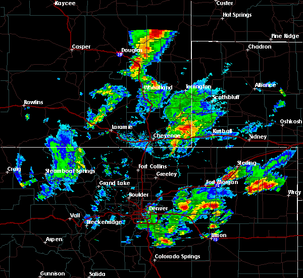 At 356 pm mdt, a severe thunderstorm was located near glendo, or 20 miles southeast of douglas, moving northeast at 35 mph (radar indicated). Hazards include ping pong ball size hail and 60 mph wind gusts. People and animals outdoors will be injured. expect hail damage to roofs, siding, windows, and vehicles. Expect wind damage to roofs, siding, and trees. At 356 pm mdt, a severe thunderstorm was located near glendo, or 20 miles southeast of douglas, moving northeast at 35 mph (radar indicated). Hazards include ping pong ball size hail and 60 mph wind gusts. People and animals outdoors will be injured. expect hail damage to roofs, siding, windows, and vehicles. Expect wind damage to roofs, siding, and trees.
|
| 8/4/2019 9:23 PM MDT |
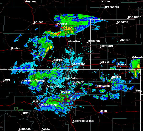 The severe thunderstorm warning for southwestern niobrara, north central platte and southeastern converse counties will expire at 930 pm mdt, the storm which prompted the warning has weakened below severe limits, and no longer poses an immediate threat to life or property. therefore, the warning will be allowed to expire. however gusty winds are still possible with this thunderstorm. The severe thunderstorm warning for southwestern niobrara, north central platte and southeastern converse counties will expire at 930 pm mdt, the storm which prompted the warning has weakened below severe limits, and no longer poses an immediate threat to life or property. therefore, the warning will be allowed to expire. however gusty winds are still possible with this thunderstorm.
|
| 8/4/2019 9:16 PM MDT |
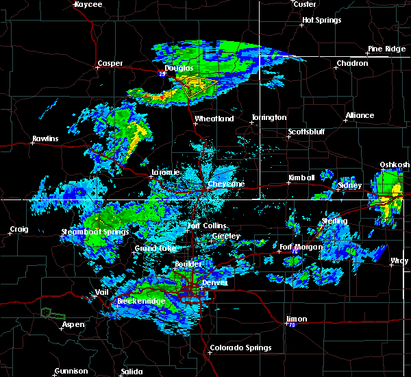 At 915 pm mdt, a severe thunderstorm was located 10 miles southwest of keeline, or 23 miles southwest of lusk, moving southeast at 25 mph (radar indicated). Hazards include 60 mph wind gusts and penny size hail. Expect damage to roofs, siding, and trees. locations impacted include, glendo, sibley peak, glendo reservoir and two moon campground. This includes interstate 25 in wyoming between mile markers 106 and 119. At 915 pm mdt, a severe thunderstorm was located 10 miles southwest of keeline, or 23 miles southwest of lusk, moving southeast at 25 mph (radar indicated). Hazards include 60 mph wind gusts and penny size hail. Expect damage to roofs, siding, and trees. locations impacted include, glendo, sibley peak, glendo reservoir and two moon campground. This includes interstate 25 in wyoming between mile markers 106 and 119.
|
| 8/4/2019 8:56 PM MDT |
 At 854 pm mdt, a severe thunderstorm was located 13 miles north of glendo, or 19 miles east of douglas, moving southeast at 25 mph (radar indicated). Hazards include 60 mph wind gusts and penny size hail. expect damage to roofs, siding, and trees At 854 pm mdt, a severe thunderstorm was located 13 miles north of glendo, or 19 miles east of douglas, moving southeast at 25 mph (radar indicated). Hazards include 60 mph wind gusts and penny size hail. expect damage to roofs, siding, and trees
|
| 7/7/2019 4:34 PM MDT |
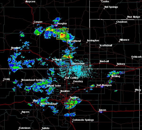 At 433 pm mdt, a severe thunderstorm was located 8 miles west of glendo, or 18 miles southeast of douglas, moving north at 50 mph (radar indicated). Hazards include 60 mph wind gusts and quarter size hail. Hail damage to vehicles is expected. expect wind damage to roofs, siding, and trees. locations impacted include, glendo and sibley peak. This includes interstate 25 in wyoming between mile markers 102 and 123. At 433 pm mdt, a severe thunderstorm was located 8 miles west of glendo, or 18 miles southeast of douglas, moving north at 50 mph (radar indicated). Hazards include 60 mph wind gusts and quarter size hail. Hail damage to vehicles is expected. expect wind damage to roofs, siding, and trees. locations impacted include, glendo and sibley peak. This includes interstate 25 in wyoming between mile markers 102 and 123.
|
| 7/7/2019 4:27 PM MDT |
 At 427 pm mdt, a severe thunderstorm was located near esterbrook campground, or 22 miles southeast of douglas, moving north at 50 mph (radar indicated). Hazards include 60 mph wind gusts and quarter size hail. Hail damage to vehicles is expected. expect wind damage to roofs, siding, and trees. locations impacted include, glendo, esterbrook campground, esterbrook, sibley peak, harris park and glendo reservoir. This includes interstate 25 in wyoming between mile markers 96 and 123. At 427 pm mdt, a severe thunderstorm was located near esterbrook campground, or 22 miles southeast of douglas, moving north at 50 mph (radar indicated). Hazards include 60 mph wind gusts and quarter size hail. Hail damage to vehicles is expected. expect wind damage to roofs, siding, and trees. locations impacted include, glendo, esterbrook campground, esterbrook, sibley peak, harris park and glendo reservoir. This includes interstate 25 in wyoming between mile markers 96 and 123.
|
| 7/7/2019 4:20 PM MDT |
 At 420 pm mdt, a severe thunderstorm was located near harris park, or 26 miles northwest of wheatland, moving north at 50 mph (radar indicated). Hazards include 60 mph wind gusts and quarter size hail. Hail damage to vehicles is expected. expect wind damage to roofs, siding, and trees. locations impacted include, glendo, esterbrook campground, esterbrook, sibley peak, glendo reservoir, harris park and two moon campground. This includes interstate 25 in wyoming between mile markers 93 and 123. At 420 pm mdt, a severe thunderstorm was located near harris park, or 26 miles northwest of wheatland, moving north at 50 mph (radar indicated). Hazards include 60 mph wind gusts and quarter size hail. Hail damage to vehicles is expected. expect wind damage to roofs, siding, and trees. locations impacted include, glendo, esterbrook campground, esterbrook, sibley peak, glendo reservoir, harris park and two moon campground. This includes interstate 25 in wyoming between mile markers 93 and 123.
|
| 7/7/2019 4:14 PM MDT |
 At 358 pm mdt, a severe thunderstorm was located 10 miles northwest of westview circle, or 15 miles west of wheatland, moving north at 50 mph (radar indicated). Hazards include 60 mph wind gusts and quarter size hail. Hail damage to vehicles is expected. Expect wind damage to roofs, siding, and trees. At 358 pm mdt, a severe thunderstorm was located 10 miles northwest of westview circle, or 15 miles west of wheatland, moving north at 50 mph (radar indicated). Hazards include 60 mph wind gusts and quarter size hail. Hail damage to vehicles is expected. Expect wind damage to roofs, siding, and trees.
|
| 7/7/2019 3:58 PM MDT |
 At 358 pm mdt, a severe thunderstorm was located 10 miles northwest of westview circle, or 15 miles west of wheatland, moving north at 50 mph (radar indicated). Hazards include 60 mph wind gusts and quarter size hail. Hail damage to vehicles is expected. Expect wind damage to roofs, siding, and trees. At 358 pm mdt, a severe thunderstorm was located 10 miles northwest of westview circle, or 15 miles west of wheatland, moving north at 50 mph (radar indicated). Hazards include 60 mph wind gusts and quarter size hail. Hail damage to vehicles is expected. Expect wind damage to roofs, siding, and trees.
|
| 7/4/2019 10:02 PM MDT | Tea Cup sized hail reported 5 miles NW of Glendo, WY, glendo marina. numerous cars in parking lot damaged. windows broken. sky lights in buildings shattered. |
| 7/4/2019 10:00 PM MDT | Half Dollar sized hail reported 7.7 miles N of Glendo, WY, half dollar hail at cassa at 10pm |
| 7/4/2019 9:55 PM MDT | Golf Ball sized hail reported 7.7 miles N of Glendo, WY, ongoing at this time. |
| 7/4/2019 9:49 PM MDT |
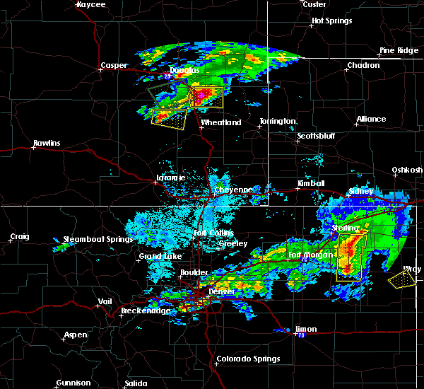 At 948 pm mdt, a severe thunderstorm was located over two moon campground, or 29 miles north of wheatland, moving east at 25 mph (at 9:45 trained spotters reported quarter and larger size hail near glendo). Hazards include two inch hail. People and animals outdoors will be injured. expect damage to roofs, siding, windows, and vehicles. locations impacted include, glendo, sibley peak, glendo reservoir and two moon campground. This includes interstate 25 in wyoming between mile markers 101 and 115. At 948 pm mdt, a severe thunderstorm was located over two moon campground, or 29 miles north of wheatland, moving east at 25 mph (at 9:45 trained spotters reported quarter and larger size hail near glendo). Hazards include two inch hail. People and animals outdoors will be injured. expect damage to roofs, siding, windows, and vehicles. locations impacted include, glendo, sibley peak, glendo reservoir and two moon campground. This includes interstate 25 in wyoming between mile markers 101 and 115.
|
| 7/4/2019 9:48 PM MDT | Half Dollar sized hail reported 3 miles W of Glendo, WY |
| 7/4/2019 9:45 PM MDT | Quarter sized hail reported 3 miles W of Glendo, WY, spotter observed hail the size of quarters near glendo. |
| 7/4/2019 9:35 PM MDT | Storm damage reported in platte county WY, 7.7 miles N of Glendo, WY |
| 7/4/2019 9:33 PM MDT | Grapefruit sized hail reported 5.7 miles N of Glendo, WY, softball sized hail falling 6 miles south of glenco reported by storm chaser. |
| 7/4/2019 9:26 PM MDT |
 At 925 pm mdt, a severe thunderstorm was located over glendo, or 26 miles southeast of douglas, moving east at 30 mph (radar indicated). Hazards include ping pong ball size hail. People and animals outdoors will be injured. Expect damage to roofs, siding, windows, and vehicles. At 925 pm mdt, a severe thunderstorm was located over glendo, or 26 miles southeast of douglas, moving east at 30 mph (radar indicated). Hazards include ping pong ball size hail. People and animals outdoors will be injured. Expect damage to roofs, siding, windows, and vehicles.
|
| 7/4/2019 9:06 PM MDT |
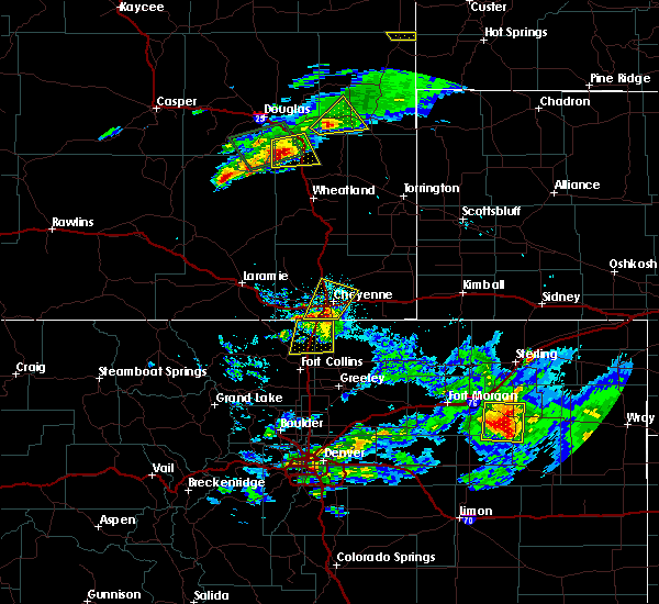 At 906 pm mdt, a severe thunderstorm was located near esterbrook campground, or 23 miles southeast of douglas, moving northeast at 20 mph (radar indicated). Hazards include ping pong ball size hail. People and animals outdoors will be injured. expect damage to roofs, siding, windows, and vehicles. locations impacted include, glendo, sibley peak, glendo reservoir and two moon campground. This includes interstate 25 in wyoming between mile markers 101 and 120. At 906 pm mdt, a severe thunderstorm was located near esterbrook campground, or 23 miles southeast of douglas, moving northeast at 20 mph (radar indicated). Hazards include ping pong ball size hail. People and animals outdoors will be injured. expect damage to roofs, siding, windows, and vehicles. locations impacted include, glendo, sibley peak, glendo reservoir and two moon campground. This includes interstate 25 in wyoming between mile markers 101 and 120.
|
| 7/4/2019 8:56 PM MDT |
 At 856 pm mdt, a severe thunderstorm was located over esterbrook campground, or 23 miles south of douglas, moving northeast at 20 mph (radar indicated). Hazards include ping pong ball size hail. People and animals outdoors will be injured. Expect damage to roofs, siding, windows, and vehicles. At 856 pm mdt, a severe thunderstorm was located over esterbrook campground, or 23 miles south of douglas, moving northeast at 20 mph (radar indicated). Hazards include ping pong ball size hail. People and animals outdoors will be injured. Expect damage to roofs, siding, windows, and vehicles.
|
| 7/4/2019 7:56 PM MDT |
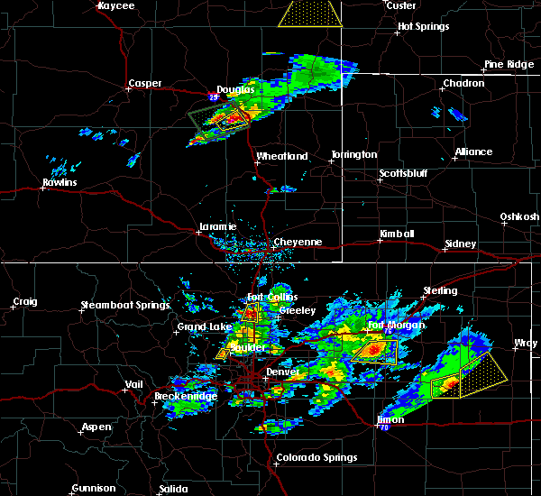 At 756 pm mdt, a severe thunderstorm was located 8 miles northeast of esterbrook campground, or 19 miles southeast of douglas, moving east at 15 mph (radar indicated). Hazards include golf ball size hail and 60 mph wind gusts. People and animals outdoors will be injured. expect hail damage to roofs, siding, windows, and vehicles. Expect wind damage to roofs, siding, and trees. At 756 pm mdt, a severe thunderstorm was located 8 miles northeast of esterbrook campground, or 19 miles southeast of douglas, moving east at 15 mph (radar indicated). Hazards include golf ball size hail and 60 mph wind gusts. People and animals outdoors will be injured. expect hail damage to roofs, siding, windows, and vehicles. Expect wind damage to roofs, siding, and trees.
|
| 7/2/2019 5:26 PM MDT |
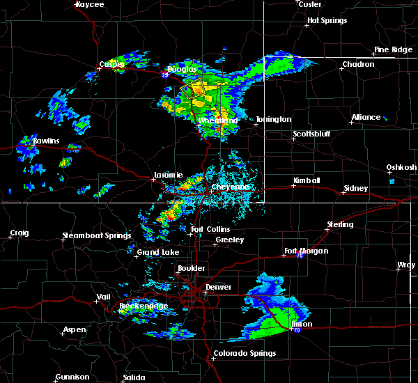 The severe thunderstorm warning for north central platte and southeastern converse counties will expire at 530 pm mdt, the storm which prompted the warning has weakened below severe limits, and has exited the warned area. therefore, the warning will be allowed to expire. however heavy rain is still possible with this thunderstorm. The severe thunderstorm warning for north central platte and southeastern converse counties will expire at 530 pm mdt, the storm which prompted the warning has weakened below severe limits, and has exited the warned area. therefore, the warning will be allowed to expire. however heavy rain is still possible with this thunderstorm.
|
| 7/2/2019 5:16 PM MDT |
 At 515 pm mdt, a severe thunderstorm was located over glendo, or 25 miles southeast of douglas, moving east at 25 mph (radar indicated). Hazards include 60 mph wind gusts and quarter size hail. Hail damage to vehicles is expected. expect wind damage to roofs, siding, and trees. locations impacted include, glendo, glendo reservoir and two moon campground. This includes interstate 25 in wyoming between mile markers 108 and 120. At 515 pm mdt, a severe thunderstorm was located over glendo, or 25 miles southeast of douglas, moving east at 25 mph (radar indicated). Hazards include 60 mph wind gusts and quarter size hail. Hail damage to vehicles is expected. expect wind damage to roofs, siding, and trees. locations impacted include, glendo, glendo reservoir and two moon campground. This includes interstate 25 in wyoming between mile markers 108 and 120.
|
| 7/2/2019 5:05 PM MDT |
 At 504 pm mdt, a severe thunderstorm capable of producing a tornado was located near esterbrook campground, or 24 miles southeast of douglas, moving east at 15 mph (radar indicated rotation). Hazards include tornado and ping pong ball size hail. Flying debris will be dangerous to those caught without shelter. mobile homes will be damaged or destroyed. damage to roofs, windows, and vehicles will occur. tree damage is likely. locations impacted include, glendo and sibley peak. This includes interstate 25 in wyoming between mile markers 105 and 114, and between mile markers 116 and 119. At 504 pm mdt, a severe thunderstorm capable of producing a tornado was located near esterbrook campground, or 24 miles southeast of douglas, moving east at 15 mph (radar indicated rotation). Hazards include tornado and ping pong ball size hail. Flying debris will be dangerous to those caught without shelter. mobile homes will be damaged or destroyed. damage to roofs, windows, and vehicles will occur. tree damage is likely. locations impacted include, glendo and sibley peak. This includes interstate 25 in wyoming between mile markers 105 and 114, and between mile markers 116 and 119.
|
| 7/2/2019 4:55 PM MDT |
 At 454 pm mdt, a severe thunderstorm capable of producing a tornado was located near esterbrook campground, or 24 miles south of douglas, moving northeast at 15 mph (radar indicated rotation). Hazards include tornado and ping pong ball size hail. Flying debris will be dangerous to those caught without shelter. mobile homes will be damaged or destroyed. damage to roofs, windows, and vehicles will occur. tree damage is likely. this tornadic thunderstorm will remain over mainly rural areas of northeastern albany, northwestern platte and southeastern converse counties. This includes interstate 25 in wyoming between mile markers 104 and 114, and between mile markers 116 and 119. At 454 pm mdt, a severe thunderstorm capable of producing a tornado was located near esterbrook campground, or 24 miles south of douglas, moving northeast at 15 mph (radar indicated rotation). Hazards include tornado and ping pong ball size hail. Flying debris will be dangerous to those caught without shelter. mobile homes will be damaged or destroyed. damage to roofs, windows, and vehicles will occur. tree damage is likely. this tornadic thunderstorm will remain over mainly rural areas of northeastern albany, northwestern platte and southeastern converse counties. This includes interstate 25 in wyoming between mile markers 104 and 114, and between mile markers 116 and 119.
|
| 7/2/2019 4:47 PM MDT |
 At 447 pm mdt, a severe thunderstorm was located near esterbrook campground, or 26 miles south of douglas, moving east at 10 mph (radar indicated). Hazards include 60 mph wind gusts and half dollar size hail. Hail damage to vehicles is expected. Expect wind damage to roofs, siding, and trees. At 447 pm mdt, a severe thunderstorm was located near esterbrook campground, or 26 miles south of douglas, moving east at 10 mph (radar indicated). Hazards include 60 mph wind gusts and half dollar size hail. Hail damage to vehicles is expected. Expect wind damage to roofs, siding, and trees.
|
| 6/30/2019 7:14 PM MDT |
 At 714 pm mdt, a severe thunderstorm was located near guernsey campground, or 24 miles north of wheatland, moving north at 35 mph (radar indicated). Hazards include 60 mph wind gusts and quarter size hail. Hail damage to vehicles is expected. expect wind damage to roofs, siding, and trees. locations impacted include, glendo, sibley peak, guernsey campground, rawhide buttes, glendo reservoir, two moon campground and hartville. This includes interstate 25 in wyoming between mile markers 109 and 110, and near mile marker 113. At 714 pm mdt, a severe thunderstorm was located near guernsey campground, or 24 miles north of wheatland, moving north at 35 mph (radar indicated). Hazards include 60 mph wind gusts and quarter size hail. Hail damage to vehicles is expected. expect wind damage to roofs, siding, and trees. locations impacted include, glendo, sibley peak, guernsey campground, rawhide buttes, glendo reservoir, two moon campground and hartville. This includes interstate 25 in wyoming between mile markers 109 and 110, and near mile marker 113.
|
| 6/30/2019 6:53 PM MDT |
 At 653 pm mdt, a severe thunderstorm was located near guernsey, or 13 miles northeast of wheatland, moving north at 35 mph (radar indicated). Hazards include 60 mph wind gusts and quarter size hail. Hail damage to vehicles is expected. Expect wind damage to roofs, siding, and trees. At 653 pm mdt, a severe thunderstorm was located near guernsey, or 13 miles northeast of wheatland, moving north at 35 mph (radar indicated). Hazards include 60 mph wind gusts and quarter size hail. Hail damage to vehicles is expected. Expect wind damage to roofs, siding, and trees.
|
| 6/20/2019 5:13 PM MDT |
 At 513 pm mdt, a severe thunderstorm was located over glendo, or 26 miles southeast of douglas, moving northeast at 30 mph (radar indicated). Hazards include 60 mph wind gusts and quarter size hail. Hail damage to vehicles is expected. Expect wind damage to roofs, siding, and trees. At 513 pm mdt, a severe thunderstorm was located over glendo, or 26 miles southeast of douglas, moving northeast at 30 mph (radar indicated). Hazards include 60 mph wind gusts and quarter size hail. Hail damage to vehicles is expected. Expect wind damage to roofs, siding, and trees.
|
| 6/1/2019 6:05 PM MDT | Golf Ball sized hail reported 10.1 miles W of Glendo, WY, late social media report of ping pong to golf ball sized hail with photos and video. time estimated based on radar. |
| 6/1/2019 5:50 PM MDT |
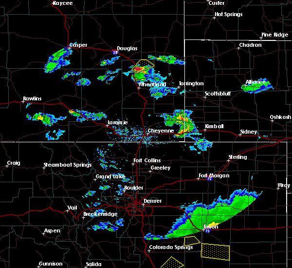 At 550 pm mdt, a severe thunderstorm was located over sibley peak, or 25 miles north of wheatland, moving northeast at 20 mph (radar indicated). Hazards include 60 mph wind gusts and quarter size hail. Hail damage to vehicles is expected. Expect wind damage to roofs, siding, and trees. At 550 pm mdt, a severe thunderstorm was located over sibley peak, or 25 miles north of wheatland, moving northeast at 20 mph (radar indicated). Hazards include 60 mph wind gusts and quarter size hail. Hail damage to vehicles is expected. Expect wind damage to roofs, siding, and trees.
|
| 5/26/2019 3:20 PM MDT |
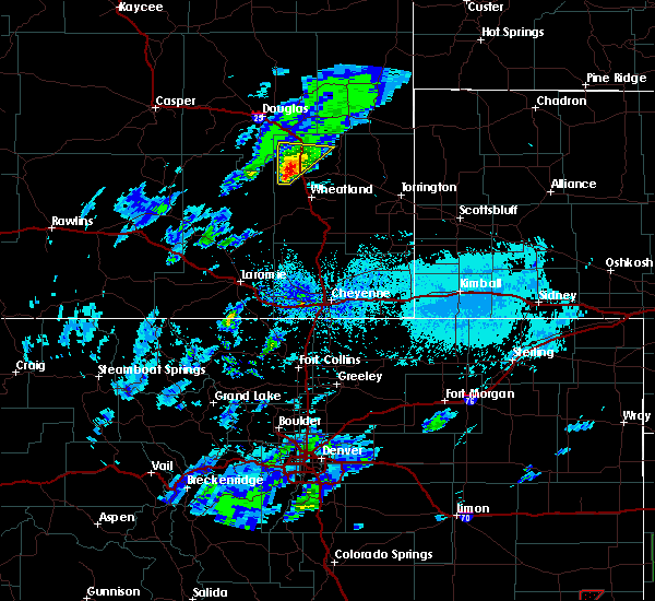 At 319 pm mdt, a severe thunderstorm was located 10 miles east of harris park, or 18 miles northwest of wheatland, moving north at 15 mph (radar indicated). Hazards include ping pong ball size hail and 60 mph wind gusts. People and animals outdoors will be injured. expect hail damage to roofs, siding, windows, and vehicles. expect wind damage to roofs, siding, and trees. this severe storm will be near, glendo, sibley peak, glendo reservoir and two moon campground around 400 pm mdt. This includes interstate 25 in wyoming between mile markers 95 and 113. At 319 pm mdt, a severe thunderstorm was located 10 miles east of harris park, or 18 miles northwest of wheatland, moving north at 15 mph (radar indicated). Hazards include ping pong ball size hail and 60 mph wind gusts. People and animals outdoors will be injured. expect hail damage to roofs, siding, windows, and vehicles. expect wind damage to roofs, siding, and trees. this severe storm will be near, glendo, sibley peak, glendo reservoir and two moon campground around 400 pm mdt. This includes interstate 25 in wyoming between mile markers 95 and 113.
|
| 5/26/2019 3:04 PM MDT |
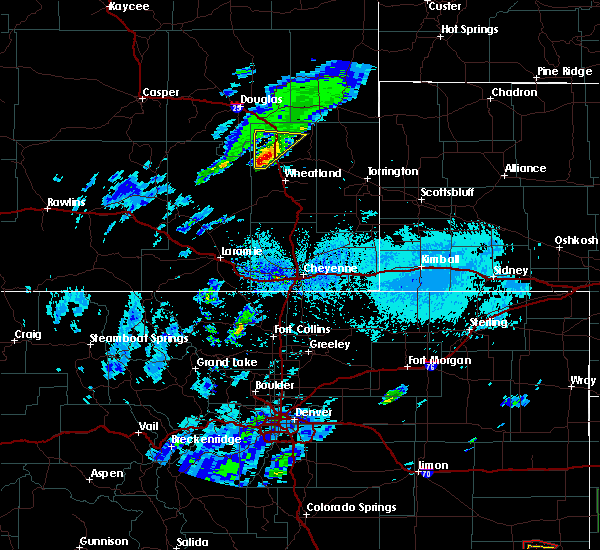 At 303 pm mdt, a severe thunderstorm was located 10 miles southeast of harris park, or 17 miles northwest of wheatland, moving north at 20 mph (radar indicated). Hazards include 60 mph wind gusts and quarter size hail. Hail damage to vehicles is expected. expect wind damage to roofs, siding, and trees. this severe thunderstorm will be near, sibley peak around 350 pm mdt. glendo, glendo reservoir and two moon campground around 400 pm mdt. This includes interstate 25 in wyoming between mile markers 95 and 113. At 303 pm mdt, a severe thunderstorm was located 10 miles southeast of harris park, or 17 miles northwest of wheatland, moving north at 20 mph (radar indicated). Hazards include 60 mph wind gusts and quarter size hail. Hail damage to vehicles is expected. expect wind damage to roofs, siding, and trees. this severe thunderstorm will be near, sibley peak around 350 pm mdt. glendo, glendo reservoir and two moon campground around 400 pm mdt. This includes interstate 25 in wyoming between mile markers 95 and 113.
|
| 4/26/2019 2:06 PM MDT |
 At 204 pm mdt, severe thunderstorms were located along a line extending from near keeline to near glendo park campground, moving east at 70 mph (radar indicated). Hazards include 60 mph wind gusts and nickel size hail. Expect damage to roofs, siding, and trees. locations impacted include, lusk, guernsey, glendo, esterbrook, sibley peak, glendo park campground, laramie peak, esterbrook campground, keeline, windy peak, guernsey campground, rawhide buttes, glendo reservoir, harris park and hartville. This includes interstate 25 in wyoming between mile markers 90 and 118. At 204 pm mdt, severe thunderstorms were located along a line extending from near keeline to near glendo park campground, moving east at 70 mph (radar indicated). Hazards include 60 mph wind gusts and nickel size hail. Expect damage to roofs, siding, and trees. locations impacted include, lusk, guernsey, glendo, esterbrook, sibley peak, glendo park campground, laramie peak, esterbrook campground, keeline, windy peak, guernsey campground, rawhide buttes, glendo reservoir, harris park and hartville. This includes interstate 25 in wyoming between mile markers 90 and 118.
|
| 4/26/2019 1:53 PM MDT |
 At 152 pm mdt, severe thunderstorms were located along a line extending from near keeline to windy peak, moving east at 65 mph (radar indicated). Hazards include 60 mph wind gusts and nickel size hail. expect damage to roofs, siding, and trees At 152 pm mdt, severe thunderstorms were located along a line extending from near keeline to windy peak, moving east at 65 mph (radar indicated). Hazards include 60 mph wind gusts and nickel size hail. expect damage to roofs, siding, and trees
|
| 8/6/2018 5:11 PM MDT |
 At 511 pm mdt, a severe thunderstorm was located near two moon campground, or 26 miles southwest of lusk, moving southeast at 25 mph (radar indicated). Hazards include 60 mph wind gusts and half dollar size hail. Hail damage to vehicles is expected. Expect wind damage to roofs, siding, and trees. At 511 pm mdt, a severe thunderstorm was located near two moon campground, or 26 miles southwest of lusk, moving southeast at 25 mph (radar indicated). Hazards include 60 mph wind gusts and half dollar size hail. Hail damage to vehicles is expected. Expect wind damage to roofs, siding, and trees.
|
| 7/28/2018 7:44 PM MDT |
 At 743 pm mdt, a severe thunderstorm was located over two moon campground, or 29 miles southeast of douglas, moving southeast at 30 mph (radar indicated). Hazards include 60 mph wind gusts and quarter size hail. Hail damage to vehicles is expected. Expect wind damage to roofs, siding, and trees. At 743 pm mdt, a severe thunderstorm was located over two moon campground, or 29 miles southeast of douglas, moving southeast at 30 mph (radar indicated). Hazards include 60 mph wind gusts and quarter size hail. Hail damage to vehicles is expected. Expect wind damage to roofs, siding, and trees.
|
| 7/28/2018 4:30 PM MDT | Ping Pong Ball sized hail reported 6.1 miles WSW of Glendo, WY |
| 7/28/2018 4:08 PM MDT |
 The severe thunderstorm warning for northeastern platte county will expire at 415 pm mdt, the storm which prompted the warning has weakened below severe limits, and no longer poses an immediate threat to life or property. therefore, the warning will be allowed to expire. however small hail is still possible with this thunderstorm. a tornado warning remains in effect for portions of northwest platte county until 430 pm mdt for a separate storm. to report severe weather, contact your nearest law enforcement agency. they will relay your report to the national weather service cheyenne. The severe thunderstorm warning for northeastern platte county will expire at 415 pm mdt, the storm which prompted the warning has weakened below severe limits, and no longer poses an immediate threat to life or property. therefore, the warning will be allowed to expire. however small hail is still possible with this thunderstorm. a tornado warning remains in effect for portions of northwest platte county until 430 pm mdt for a separate storm. to report severe weather, contact your nearest law enforcement agency. they will relay your report to the national weather service cheyenne.
|
| 7/28/2018 3:56 PM MDT |
 At 354 pm mdt, a severe thunderstorm was located near glendo, or 25 miles southeast of douglas, moving southeast at 25 mph (radar indicated). Hazards include ping pong ball size hail and 60 mph wind gusts. People and animals outdoors will be injured. expect hail damage to roofs, siding, windows, and vehicles. expect wind damage to roofs, siding, and trees. locations impacted include, glendo, guernsey campground, sibley peak, glendo reservoir, two moon campground and hartville. this includes interstate 25 in wyoming between mile markers 95 and 119. A tornado watch remains in effect until 1000 pm mdt for southeastern wyoming. At 354 pm mdt, a severe thunderstorm was located near glendo, or 25 miles southeast of douglas, moving southeast at 25 mph (radar indicated). Hazards include ping pong ball size hail and 60 mph wind gusts. People and animals outdoors will be injured. expect hail damage to roofs, siding, windows, and vehicles. expect wind damage to roofs, siding, and trees. locations impacted include, glendo, guernsey campground, sibley peak, glendo reservoir, two moon campground and hartville. this includes interstate 25 in wyoming between mile markers 95 and 119. A tornado watch remains in effect until 1000 pm mdt for southeastern wyoming.
|
| 7/28/2018 3:32 PM MDT |
 At 332 pm mdt, a severe thunderstorm was located 9 miles northwest of glendo, or 16 miles southeast of douglas, moving southeast at 25 mph (radar indicated). Hazards include 60 mph wind gusts and quarter size hail. Hail damage to vehicles is expected. Expect wind damage to roofs, siding, and trees. At 332 pm mdt, a severe thunderstorm was located 9 miles northwest of glendo, or 16 miles southeast of douglas, moving southeast at 25 mph (radar indicated). Hazards include 60 mph wind gusts and quarter size hail. Hail damage to vehicles is expected. Expect wind damage to roofs, siding, and trees.
|
| 7/26/2018 11:24 AM MDT |
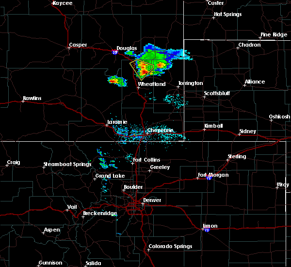 The severe thunderstorm warning for northeastern platte and southeastern converse counties will expire at 1130 am mdt, the storm which prompted the warning has weakened below severe limits, and no longer poses an immediate threat to life or property. therefore, the warning will be allowed to expire. however heavy rain is still possible with this thunderstorm. to report severe weather, contact your nearest law enforcement agency. they will relay your report to the national weather service cheyenne. The severe thunderstorm warning for northeastern platte and southeastern converse counties will expire at 1130 am mdt, the storm which prompted the warning has weakened below severe limits, and no longer poses an immediate threat to life or property. therefore, the warning will be allowed to expire. however heavy rain is still possible with this thunderstorm. to report severe weather, contact your nearest law enforcement agency. they will relay your report to the national weather service cheyenne.
|
| 7/26/2018 11:13 AM MDT |
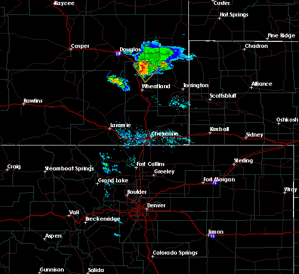 At 1112 am mdt, a severe thunderstorm was located over glendo reservoir, or 27 miles southeast of douglas, moving southeast at 35 mph (radar indicated). Hazards include 65 mph wind gusts and quarter size hail. Hail damage to vehicles is expected. expect wind damage to roofs, siding, and trees. locations impacted include, glendo, sibley peak, glendo reservoir, two moon campground and guernsey campground. This includes interstate 25 in wyoming between mile markers 106 and 116. At 1112 am mdt, a severe thunderstorm was located over glendo reservoir, or 27 miles southeast of douglas, moving southeast at 35 mph (radar indicated). Hazards include 65 mph wind gusts and quarter size hail. Hail damage to vehicles is expected. expect wind damage to roofs, siding, and trees. locations impacted include, glendo, sibley peak, glendo reservoir, two moon campground and guernsey campground. This includes interstate 25 in wyoming between mile markers 106 and 116.
|
| 7/26/2018 10:57 AM MDT |
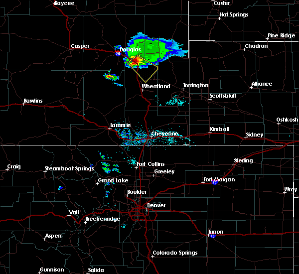 At 1056 am mdt, a severe thunderstorm was located near glendo, or 20 miles southeast of douglas, moving southeast at 40 mph (radar indicated). Hazards include 65 mph wind gusts and quarter size hail. Hail damage to vehicles is possible. Wind damage to roofs, siding, and trees is possible. At 1056 am mdt, a severe thunderstorm was located near glendo, or 20 miles southeast of douglas, moving southeast at 40 mph (radar indicated). Hazards include 65 mph wind gusts and quarter size hail. Hail damage to vehicles is possible. Wind damage to roofs, siding, and trees is possible.
|
| 7/17/2018 9:15 PM MDT |
 At 915 pm mdt, a severe thunderstorm was located 10 miles north of glendo, or 21 miles east of douglas, moving east at 40 mph (radar indicated). Hazards include 60 mph wind gusts and nickel size hail. expect damage to roofs, siding, and trees At 915 pm mdt, a severe thunderstorm was located 10 miles north of glendo, or 21 miles east of douglas, moving east at 40 mph (radar indicated). Hazards include 60 mph wind gusts and nickel size hail. expect damage to roofs, siding, and trees
|
| 5/27/2018 4:18 PM MDT |
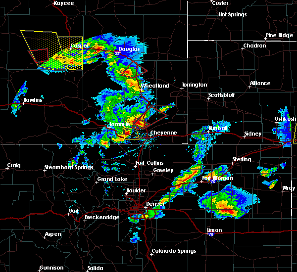 At 417 pm mdt, a confirmed tornado was located 7 miles southwest of sibley peak, or 25 miles northwest of wheatland, moving northeast at 30 mph (weather spotters confirmed tornado). Hazards include damaging tornado and two inch hail. Flying debris will be dangerous to those caught without shelter. mobile homes will be damaged or destroyed. damage to roofs, windows, and vehicles will occur. tree damage is likely. this tornado will be near, sibley peak around 430 pm mdt. glendo and glendo reservoir around 435 pm mdt. two moon campground around 440 pm mdt. This includes interstate 25 in wyoming between mile markers 98 and 115. At 417 pm mdt, a confirmed tornado was located 7 miles southwest of sibley peak, or 25 miles northwest of wheatland, moving northeast at 30 mph (weather spotters confirmed tornado). Hazards include damaging tornado and two inch hail. Flying debris will be dangerous to those caught without shelter. mobile homes will be damaged or destroyed. damage to roofs, windows, and vehicles will occur. tree damage is likely. this tornado will be near, sibley peak around 430 pm mdt. glendo and glendo reservoir around 435 pm mdt. two moon campground around 440 pm mdt. This includes interstate 25 in wyoming between mile markers 98 and 115.
|
| 5/27/2018 4:05 PM MDT |
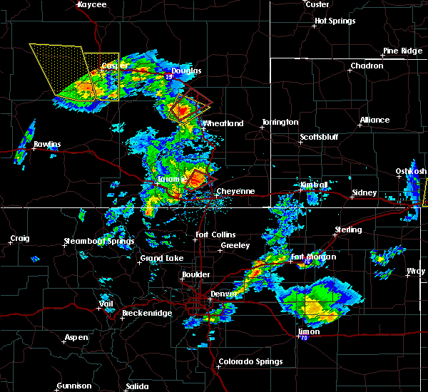 At 405 pm mdt, a confirmed tornado was located near harris park, or 23 miles northwest of wheatland, moving northeast at 30 mph (weather spotters confirmed tornado). Hazards include damaging tornado and hail up to two inches in diameter. Flying debris will be dangerous to those caught without shelter. mobile homes will be damaged or destroyed. damage to roofs, windows, and vehicles will occur. tree damage is likely. the tornado will be near, sibley peak around 430 pm mdt. glendo around 435 pm mdt. glendo reservoir and two moon campground around 440 pm mdt. This includes interstate 25 in wyoming between mile markers 97 and 115. At 405 pm mdt, a confirmed tornado was located near harris park, or 23 miles northwest of wheatland, moving northeast at 30 mph (weather spotters confirmed tornado). Hazards include damaging tornado and hail up to two inches in diameter. Flying debris will be dangerous to those caught without shelter. mobile homes will be damaged or destroyed. damage to roofs, windows, and vehicles will occur. tree damage is likely. the tornado will be near, sibley peak around 430 pm mdt. glendo around 435 pm mdt. glendo reservoir and two moon campground around 440 pm mdt. This includes interstate 25 in wyoming between mile markers 97 and 115.
|
| 6/12/2017 8:37 PM MDT |
 The severe thunderstorm warning for northern platte and eastern converse counties will expire at 845 pm mdt, the storms which prompted the warning have weakened below severe limits, and no longer pose an immediate threat to life or property. therefore the warning will be allowed to expire. however small hail and gusty winds are still possible with these thunderstorms. a tornado watch remains in effect until 900 pm mdt for east central wyoming. The severe thunderstorm warning for northern platte and eastern converse counties will expire at 845 pm mdt, the storms which prompted the warning have weakened below severe limits, and no longer pose an immediate threat to life or property. therefore the warning will be allowed to expire. however small hail and gusty winds are still possible with these thunderstorms. a tornado watch remains in effect until 900 pm mdt for east central wyoming.
|
| 6/12/2017 8:17 PM MDT |
 At 816 pm mdt, severe thunderstorms were located along a line extending from 14 miles southwest of bill to 8 miles southwest of sibley peak, moving northeast at 20 mph (radar indicated). Hazards include 60 mph wind gusts and quarter size hail. Hail damage to vehicles is expected. expect wind damage to roofs, siding, and trees. locations impacted include, douglas, glendo, bill, sibley peak, glendo reservoir and two moon campground. this includes interstate 25 in wyoming between mile markers 94 and 138. A tornado watch remains in effect until 900 pm mdt for east central wyoming. At 816 pm mdt, severe thunderstorms were located along a line extending from 14 miles southwest of bill to 8 miles southwest of sibley peak, moving northeast at 20 mph (radar indicated). Hazards include 60 mph wind gusts and quarter size hail. Hail damage to vehicles is expected. expect wind damage to roofs, siding, and trees. locations impacted include, douglas, glendo, bill, sibley peak, glendo reservoir and two moon campground. this includes interstate 25 in wyoming between mile markers 94 and 138. A tornado watch remains in effect until 900 pm mdt for east central wyoming.
|
| 6/12/2017 7:54 PM MDT |
 At 753 pm mdt, severe thunderstorms were located along a line extending from 14 miles northeast of rolling hills to near harris park, moving northeast at 20 mph (radar indicated). Hazards include 60 mph wind gusts and quarter size hail. Hail damage to vehicles is expected. Expect wind damage to roofs, siding, and trees. At 753 pm mdt, severe thunderstorms were located along a line extending from 14 miles northeast of rolling hills to near harris park, moving northeast at 20 mph (radar indicated). Hazards include 60 mph wind gusts and quarter size hail. Hail damage to vehicles is expected. Expect wind damage to roofs, siding, and trees.
|
| 6/29/2016 7:27 PM MDT |
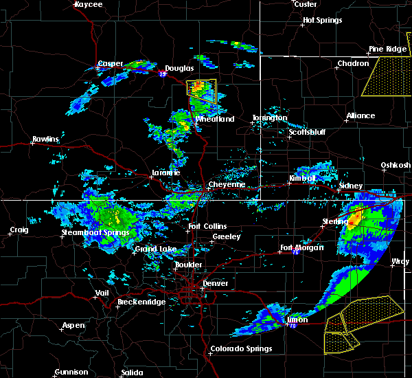 At 726 pm mdt, a severe thunderstorm was located 7 miles northeast of glendo, or 26 miles southeast of douglas, moving east at 25 mph (radar indicated). Hazards include ping pong ball size hail and 60 mph wind gusts. People and animals outdoors will be injured. expect hail damage to roofs, siding, windows, and vehicles. expect wind damage to roofs, siding, and trees. locations impacted include, glendo, two moon campground and glendo reservoir. This includes interstate 25 in wyoming between mile markers 109 and 117. At 726 pm mdt, a severe thunderstorm was located 7 miles northeast of glendo, or 26 miles southeast of douglas, moving east at 25 mph (radar indicated). Hazards include ping pong ball size hail and 60 mph wind gusts. People and animals outdoors will be injured. expect hail damage to roofs, siding, windows, and vehicles. expect wind damage to roofs, siding, and trees. locations impacted include, glendo, two moon campground and glendo reservoir. This includes interstate 25 in wyoming between mile markers 109 and 117.
|
| 6/29/2016 7:06 PM MDT |
 At 705 pm mdt, a severe thunderstorm was located near glendo, or 20 miles southeast of douglas, moving east at 25 mph (radar indicated). Hazards include ping pong ball size hail and 60 mph wind gusts. People and animals outdoors will be injured. expect hail damage to roofs, siding, windows, and vehicles. Expect wind damage to roofs, siding, and trees. At 705 pm mdt, a severe thunderstorm was located near glendo, or 20 miles southeast of douglas, moving east at 25 mph (radar indicated). Hazards include ping pong ball size hail and 60 mph wind gusts. People and animals outdoors will be injured. expect hail damage to roofs, siding, windows, and vehicles. Expect wind damage to roofs, siding, and trees.
|
| 6/12/2016 3:46 PM MDT |
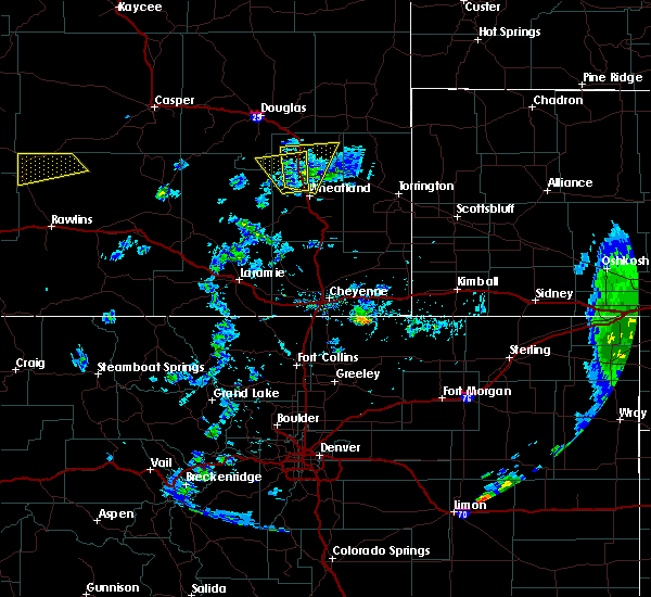 At 346 pm mdt, a severe thunderstorm was located 11 miles northwest of lakeview north, or 14 miles north of wheatland, moving north at 30 mph (radar indicated). Hazards include golf ball size hail and 60 mph wind gusts. People and animals outdoors will be injured. expect hail damage to roofs, siding, windows, and vehicles. Expect wind damage to roofs, siding, and trees. At 346 pm mdt, a severe thunderstorm was located 11 miles northwest of lakeview north, or 14 miles north of wheatland, moving north at 30 mph (radar indicated). Hazards include golf ball size hail and 60 mph wind gusts. People and animals outdoors will be injured. expect hail damage to roofs, siding, windows, and vehicles. Expect wind damage to roofs, siding, and trees.
|
| 6/16/2015 4:19 PM MDT | Golf Ball sized hail reported 0.2 miles NE of Glendo, WY |
| 6/16/2015 4:16 PM MDT |
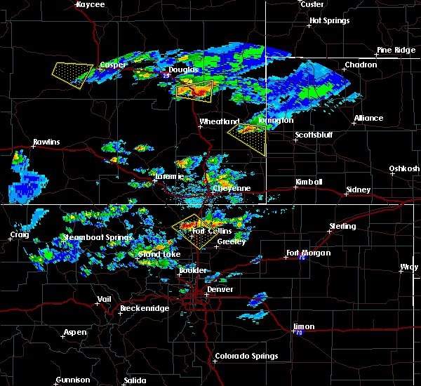 At 416 pm mdt, a severe thunderstorm was located over two moon campground, or 30 miles north of wheatland, moving east at 35 mph (radar indicated). Hazards include tennis ball size hail and 60 mph wind gusts. People and animals outdoors will be injured. expect hail damage to roofs, siding, windows and vehicles. expect wind damage to roofs, siding and trees. locations impacted include, glendo, sibley peak, two moon campground and glendo reservoir. This includes interstate 25 in wyoming between mile markers 107 and 117. At 416 pm mdt, a severe thunderstorm was located over two moon campground, or 30 miles north of wheatland, moving east at 35 mph (radar indicated). Hazards include tennis ball size hail and 60 mph wind gusts. People and animals outdoors will be injured. expect hail damage to roofs, siding, windows and vehicles. expect wind damage to roofs, siding and trees. locations impacted include, glendo, sibley peak, two moon campground and glendo reservoir. This includes interstate 25 in wyoming between mile markers 107 and 117.
|
| 6/16/2015 4:03 PM MDT |
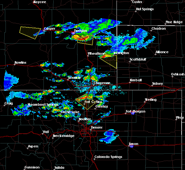 At 402 pm mdt, a severe thunderstorm was located near glendo, or 21 miles southeast of douglas, moving east at 35 mph (radar indicated). Hazards include tennis ball size hail and 60 mph wind gusts. People and animals outdoors will be injured. expect hail damage to roofs, siding, windows and vehicles. expect wind damage to roofs, siding and trees. locations impacted include, glendo, sibley peak, two moon campground and glendo reservoir. This includes interstate 25 in wyoming between mile markers 107 and 122. At 402 pm mdt, a severe thunderstorm was located near glendo, or 21 miles southeast of douglas, moving east at 35 mph (radar indicated). Hazards include tennis ball size hail and 60 mph wind gusts. People and animals outdoors will be injured. expect hail damage to roofs, siding, windows and vehicles. expect wind damage to roofs, siding and trees. locations impacted include, glendo, sibley peak, two moon campground and glendo reservoir. This includes interstate 25 in wyoming between mile markers 107 and 122.
|
| 6/16/2015 3:41 PM MDT |
 At 340 pm mdt, a severe thunderstorm was located 8 miles south of douglas, moving east at 35 mph (radar indicated). Hazards include golf ball size hail and 60 mph wind gusts. People and animals outdoors will be injured. expect hail damage to roofs, siding, windows and vehicles. Expect wind damage to roofs, siding and trees. At 340 pm mdt, a severe thunderstorm was located 8 miles south of douglas, moving east at 35 mph (radar indicated). Hazards include golf ball size hail and 60 mph wind gusts. People and animals outdoors will be injured. expect hail damage to roofs, siding, windows and vehicles. Expect wind damage to roofs, siding and trees.
|
| 6/3/2015 10:16 PM MDT | At 1015 pm mdt, a cluster of severe thunderstorms extended from near glendo to lance creek. the strongest storm was located over manville, or 8 miles west of lusk. the storms were moving to the northeast at 10 mph (radar indicated). Hazards include golf ball size hail and 60 mph wind gusts. People and animals outdoors will be injured. expect hail damage to roofs, siding, windows and vehicles. Expect wind damage to roofs, siding and trees. |
| 6/3/2015 8:50 PM MDT | Hen Egg sized hail reported 9.2 miles WSW of Glendo, WY |
| 7/29/2013 5:46 PM MDT | Golf Ball sized hail reported 7.7 miles N of Glendo, WY |
| 6/13/2013 6:20 PM MDT | Quarter sized hail reported 18.3 miles WSW of Glendo, WY, peas to quarter sized hail |
| 7/5/2012 6:03 PM MDT | Quarter sized hail reported 1.2 miles S of Glendo, WY, largest hail was quarter sized. the majority were pea sized. |
| 7/5/2012 5:41 PM MDT | Observed at the wydot coleman sensor along interstate 25 near milepost 9 in platte county WY, 13.3 miles NNE of Glendo, WY |
Hail Maps for Glendo, WY
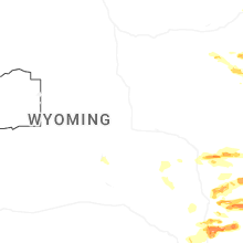
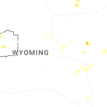
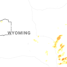
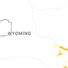


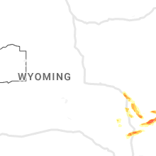


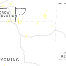


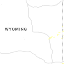

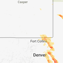


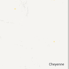


Connect with Interactive Hail Maps