

Hail Map for Goldsmith, TX
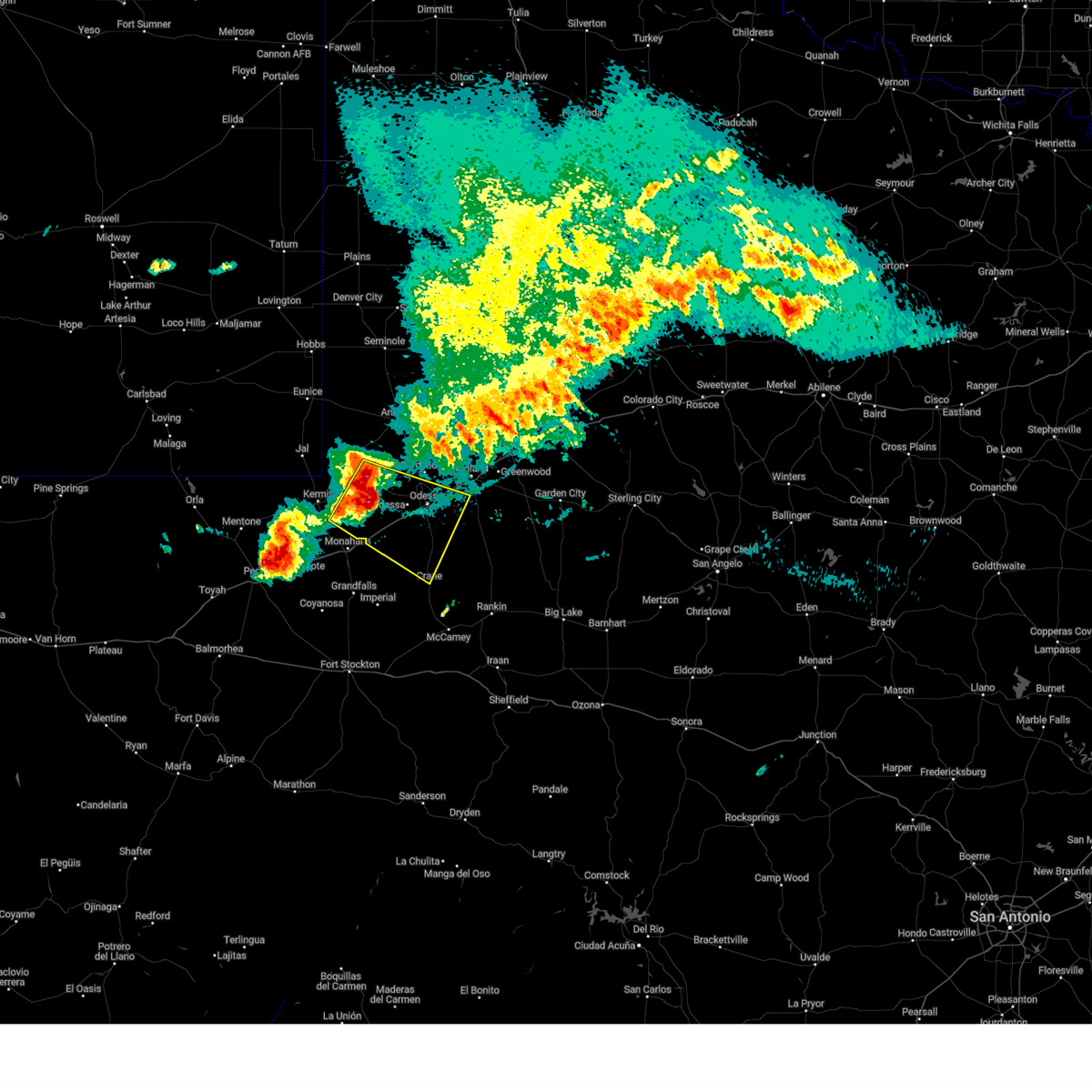
The Goldsmith, TX area has had 7 reports of on-the-ground hail by trained spotters, and has been under severe weather warnings 23 times during the past 12 months. Doppler radar has detected hail at or near Goldsmith, TX on 74 occasions, including 7 occasions during the past year.
| Name: | Goldsmith, TX |
| Where Located: | 16.9 miles WNW of Odessa, TX |
| Map: | Google Map for Goldsmith, TX |
| Population: | 257 |
| Housing Units: | 123 |
| More Info: | Search Google for Goldsmith, TX |
1
The Top Recent Hail Date for Goldsmith, TX is Monday, June 2, 2025 (20th out of 74)
Hail and Wind Damage Spotted near Goldsmith, TX
| Date / Time | Report Details |
|---|---|
| 6/10/2025 8:15 PM CDT |
 At 814 pm cdt, outflow from severe thunderstorms was located along a line extending from 13 miles southeast of andrews to 16 miles south of odessa, moving east at 40 mph (radar indicated). Hazards include 60 mph wind gusts. blowing dust restricting visibility to near zero. Expect damage to roofs, siding, and trees. locations impacted include, midland, odessa, greenwood, stanton, midland international air and space port, west odessa, cotton flat, midkiff, warfield, midland airpark, skywest airport, courtney, odessa schlemeyer field, penwell, stanton municipal aiport, spraberry, and pleasant farms. This includes interstate 20 between mile markers 101 and 158. At 814 pm cdt, outflow from severe thunderstorms was located along a line extending from 13 miles southeast of andrews to 16 miles south of odessa, moving east at 40 mph (radar indicated). Hazards include 60 mph wind gusts. blowing dust restricting visibility to near zero. Expect damage to roofs, siding, and trees. locations impacted include, midland, odessa, greenwood, stanton, midland international air and space port, west odessa, cotton flat, midkiff, warfield, midland airpark, skywest airport, courtney, odessa schlemeyer field, penwell, stanton municipal aiport, spraberry, and pleasant farms. This includes interstate 20 between mile markers 101 and 158.
|
| 6/10/2025 7:51 PM CDT |
 Svrmaf the national weather service in midland has issued a * severe thunderstorm warning for, ector county in western texas, southeastern andrews county in western texas, midland county in western texas, martin county in western texas, northern crane county in western texas, northern upton county in western texas, * until 845 pm cdt. * at 750 pm cdt, severe thunderstorms produced an outflow of strong winds that were located along a line extending from 7 miles south of andrews to 12 miles south of west odessa, moving east at 45 mph (radar indicated). Hazards include 70 mph wind gusts and penny size hail. blowing dust restricting visibility to near zero. Expect considerable tree damage. Damage is likely to mobile homes, roofs, and outbuildings. Svrmaf the national weather service in midland has issued a * severe thunderstorm warning for, ector county in western texas, southeastern andrews county in western texas, midland county in western texas, martin county in western texas, northern crane county in western texas, northern upton county in western texas, * until 845 pm cdt. * at 750 pm cdt, severe thunderstorms produced an outflow of strong winds that were located along a line extending from 7 miles south of andrews to 12 miles south of west odessa, moving east at 45 mph (radar indicated). Hazards include 70 mph wind gusts and penny size hail. blowing dust restricting visibility to near zero. Expect considerable tree damage. Damage is likely to mobile homes, roofs, and outbuildings.
|
| 6/10/2025 2:48 AM CDT |
 At 248 am cdt, a severe thunderstorm was located near goldsmith, or 17 miles west of odessa, moving east at 30 mph (radar indicated). Hazards include 60 mph wind gusts and quarter size hail. Hail damage to vehicles is expected. expect wind damage to roofs, siding, and trees. locations impacted include, odessa, crane, goldsmith, west odessa, notrees, odessa schlemeyer field, penwell, crane county airport, warfield, and pleasant farms. This includes interstate 20 between mile markers 90 and 128. At 248 am cdt, a severe thunderstorm was located near goldsmith, or 17 miles west of odessa, moving east at 30 mph (radar indicated). Hazards include 60 mph wind gusts and quarter size hail. Hail damage to vehicles is expected. expect wind damage to roofs, siding, and trees. locations impacted include, odessa, crane, goldsmith, west odessa, notrees, odessa schlemeyer field, penwell, crane county airport, warfield, and pleasant farms. This includes interstate 20 between mile markers 90 and 128.
|
| 6/10/2025 2:48 AM CDT |
 the severe thunderstorm warning has been cancelled and is no longer in effect the severe thunderstorm warning has been cancelled and is no longer in effect
|
| 6/10/2025 2:40 AM CDT |
 Svrmaf the national weather service in midland has issued a * severe thunderstorm warning for, ector county in western texas, southwestern midland county in western texas, southeastern winkler county in western texas, northern crane county in western texas, northwestern upton county in western texas, * until 345 am cdt. * at 240 am cdt, a severe thunderstorm was located 8 miles southwest of goldsmith, or 21 miles west of odessa, moving east at 30 mph (radar indicated). Hazards include 60 mph wind gusts and quarter size hail. Hail damage to vehicles is expected. Expect wind damage to roofs, siding, and trees. Svrmaf the national weather service in midland has issued a * severe thunderstorm warning for, ector county in western texas, southwestern midland county in western texas, southeastern winkler county in western texas, northern crane county in western texas, northwestern upton county in western texas, * until 345 am cdt. * at 240 am cdt, a severe thunderstorm was located 8 miles southwest of goldsmith, or 21 miles west of odessa, moving east at 30 mph (radar indicated). Hazards include 60 mph wind gusts and quarter size hail. Hail damage to vehicles is expected. Expect wind damage to roofs, siding, and trees.
|
| 6/9/2025 10:36 PM CDT |
 the severe thunderstorm warning has been cancelled and is no longer in effect the severe thunderstorm warning has been cancelled and is no longer in effect
|
| 6/9/2025 10:36 PM CDT |
 At 1035 pm cdt, a severe thunderstorm was located near goldsmith, or 13 miles northwest of odessa, moving south at 20 mph (radar indicated). Hazards include ping pong ball size hail and 60 mph wind gusts. People and animals outdoors will be injured. expect hail damage to roofs, siding, windows, and vehicles. expect wind damage to roofs, siding, and trees. locations impacted include, odessa, goldsmith, west odessa, odessa schlemeyer field, and pleasant farms. This includes interstate 20 between mile markers 102 and 126. At 1035 pm cdt, a severe thunderstorm was located near goldsmith, or 13 miles northwest of odessa, moving south at 20 mph (radar indicated). Hazards include ping pong ball size hail and 60 mph wind gusts. People and animals outdoors will be injured. expect hail damage to roofs, siding, windows, and vehicles. expect wind damage to roofs, siding, and trees. locations impacted include, odessa, goldsmith, west odessa, odessa schlemeyer field, and pleasant farms. This includes interstate 20 between mile markers 102 and 126.
|
| 6/9/2025 10:14 PM CDT |
 Svrmaf the national weather service in midland has issued a * severe thunderstorm warning for, ector county in western texas, southeastern andrews county in western texas, southwestern midland county in western texas, * until 1115 pm cdt. * at 1013 pm cdt, a severe thunderstorm was located 9 miles northeast of goldsmith, or 16 miles northwest of odessa, moving southeast at 25 mph (radar indicated). Hazards include 60 mph wind gusts and quarter size hail. Hail damage to vehicles is expected. Expect wind damage to roofs, siding, and trees. Svrmaf the national weather service in midland has issued a * severe thunderstorm warning for, ector county in western texas, southeastern andrews county in western texas, southwestern midland county in western texas, * until 1115 pm cdt. * at 1013 pm cdt, a severe thunderstorm was located 9 miles northeast of goldsmith, or 16 miles northwest of odessa, moving southeast at 25 mph (radar indicated). Hazards include 60 mph wind gusts and quarter size hail. Hail damage to vehicles is expected. Expect wind damage to roofs, siding, and trees.
|
| 6/6/2025 11:15 PM CDT | At 1115 pm cdt, a severe thunderstorm was located near goldsmith, or 17 miles northwest of odessa, moving east at 25 mph (radar indicated). Hazards include 60 mph wind gusts and quarter size hail. Hail damage to vehicles is expected. expect wind damage to roofs, siding, and trees. Locations impacted include, odessa, goldsmith, and odessa schlemeyer field. |
| 6/6/2025 11:15 PM CDT | the severe thunderstorm warning has been cancelled and is no longer in effect |
| 6/6/2025 10:58 PM CDT |
 Svrmaf the national weather service in midland has issued a * severe thunderstorm warning for, northern ector county in western texas, south central andrews county in western texas, * until midnight cdt. * at 1057 pm cdt, a severe thunderstorm was located 8 miles northwest of goldsmith, or 18 miles southwest of andrews, moving east at 25 mph (radar indicated). Hazards include ping pong ball size hail and 60 mph wind gusts. People and animals outdoors will be injured. expect hail damage to roofs, siding, windows, and vehicles. Expect wind damage to roofs, siding, and trees. Svrmaf the national weather service in midland has issued a * severe thunderstorm warning for, northern ector county in western texas, south central andrews county in western texas, * until midnight cdt. * at 1057 pm cdt, a severe thunderstorm was located 8 miles northwest of goldsmith, or 18 miles southwest of andrews, moving east at 25 mph (radar indicated). Hazards include ping pong ball size hail and 60 mph wind gusts. People and animals outdoors will be injured. expect hail damage to roofs, siding, windows, and vehicles. Expect wind damage to roofs, siding, and trees.
|
| 5/24/2025 7:29 PM CDT |
 The storm which prompted the warning has weakened below severe limits, and no longer poses an immediate threat to life or property. therefore, the warning will be allowed to expire. however, small hail and gusty winds are still possible with this thunderstorm. The storm which prompted the warning has weakened below severe limits, and no longer poses an immediate threat to life or property. therefore, the warning will be allowed to expire. however, small hail and gusty winds are still possible with this thunderstorm.
|
| 5/24/2025 7:18 PM CDT |
 At 718 pm cdt, a severe thunderstorm was located near goldsmith, or 15 miles northwest of odessa, moving northeast at 10 mph (radar indicated). Hazards include 60 mph wind gusts and quarter size hail. Hail damage to vehicles is expected. expect wind damage to roofs, siding, and trees. Locations impacted include, goldsmith. At 718 pm cdt, a severe thunderstorm was located near goldsmith, or 15 miles northwest of odessa, moving northeast at 10 mph (radar indicated). Hazards include 60 mph wind gusts and quarter size hail. Hail damage to vehicles is expected. expect wind damage to roofs, siding, and trees. Locations impacted include, goldsmith.
|
| 5/24/2025 6:45 PM CDT |
 At 645 pm cdt, a severe thunderstorm was located near goldsmith, or 13 miles west of odessa, moving north at 15 mph (radar indicated). Hazards include ping pong ball size hail and 60 mph wind gusts. People and animals outdoors will be injured. expect hail damage to roofs, siding, windows, and vehicles. expect wind damage to roofs, siding, and trees. Locations impacted include, goldsmith. At 645 pm cdt, a severe thunderstorm was located near goldsmith, or 13 miles west of odessa, moving north at 15 mph (radar indicated). Hazards include ping pong ball size hail and 60 mph wind gusts. People and animals outdoors will be injured. expect hail damage to roofs, siding, windows, and vehicles. expect wind damage to roofs, siding, and trees. Locations impacted include, goldsmith.
|
| 5/24/2025 6:31 PM CDT |
 Svrmaf the national weather service in midland has issued a * severe thunderstorm warning for, central ector county in western texas, * until 730 pm cdt. * at 631 pm cdt, a severe thunderstorm was located 13 miles southwest of west odessa, or 17 miles east of monahans, moving north at 15 mph (radar indicated). Hazards include 60 mph wind gusts and quarter size hail. Hail damage to vehicles is expected. Expect wind damage to roofs, siding, and trees. Svrmaf the national weather service in midland has issued a * severe thunderstorm warning for, central ector county in western texas, * until 730 pm cdt. * at 631 pm cdt, a severe thunderstorm was located 13 miles southwest of west odessa, or 17 miles east of monahans, moving north at 15 mph (radar indicated). Hazards include 60 mph wind gusts and quarter size hail. Hail damage to vehicles is expected. Expect wind damage to roofs, siding, and trees.
|
| 5/6/2025 12:00 AM CDT |
 At 1200 am cdt, a severe thunderstorm was located 10 miles southwest of west odessa, or 18 miles northeast of monahans, moving northeast at 40 mph (radar indicated). Hazards include 60 mph wind gusts and half dollar size hail. Hail damage to vehicles is expected. expect wind damage to roofs, siding, and trees. locations impacted include, odessa, goldsmith, west odessa, and penwell. This includes interstate 20 between mile markers 91 and 108. At 1200 am cdt, a severe thunderstorm was located 10 miles southwest of west odessa, or 18 miles northeast of monahans, moving northeast at 40 mph (radar indicated). Hazards include 60 mph wind gusts and half dollar size hail. Hail damage to vehicles is expected. expect wind damage to roofs, siding, and trees. locations impacted include, odessa, goldsmith, west odessa, and penwell. This includes interstate 20 between mile markers 91 and 108.
|
| 5/6/2025 12:00 AM CDT |
 the severe thunderstorm warning has been cancelled and is no longer in effect the severe thunderstorm warning has been cancelled and is no longer in effect
|
| 5/5/2025 11:42 PM CDT |
 At 1141 pm cdt, a severe thunderstorm was located 8 miles east of monahans, moving north at 25 mph (radar indicated). Hazards include golf ball size hail and 70 mph wind gusts. People and animals outdoors will be injured. expect hail damage to roofs, siding, windows, and vehicles. expect considerable tree damage. wind damage is also likely to mobile homes, roofs, and outbuildings. locations impacted include, odessa, goldsmith, west odessa, penwell, odessa schlemeyer field, and monahans sandhills state park. This includes interstate 20 between mile markers 86 and 109. At 1141 pm cdt, a severe thunderstorm was located 8 miles east of monahans, moving north at 25 mph (radar indicated). Hazards include golf ball size hail and 70 mph wind gusts. People and animals outdoors will be injured. expect hail damage to roofs, siding, windows, and vehicles. expect considerable tree damage. wind damage is also likely to mobile homes, roofs, and outbuildings. locations impacted include, odessa, goldsmith, west odessa, penwell, odessa schlemeyer field, and monahans sandhills state park. This includes interstate 20 between mile markers 86 and 109.
|
| 5/5/2025 11:42 PM CDT |
 the severe thunderstorm warning has been cancelled and is no longer in effect the severe thunderstorm warning has been cancelled and is no longer in effect
|
| 5/5/2025 11:34 PM CDT |
 Svrmaf the national weather service in midland has issued a * severe thunderstorm warning for, ector county in western texas, northeastern ward county in western texas, southeastern winkler county in western texas, northwestern crane county in western texas, * until 1230 am cdt. * at 1134 pm cdt, a severe thunderstorm was located 8 miles east of monahans, moving north at 30 mph (radar indicated). Hazards include 60 mph wind gusts and quarter size hail. Hail damage to vehicles is expected. Expect wind damage to roofs, siding, and trees. Svrmaf the national weather service in midland has issued a * severe thunderstorm warning for, ector county in western texas, northeastern ward county in western texas, southeastern winkler county in western texas, northwestern crane county in western texas, * until 1230 am cdt. * at 1134 pm cdt, a severe thunderstorm was located 8 miles east of monahans, moving north at 30 mph (radar indicated). Hazards include 60 mph wind gusts and quarter size hail. Hail damage to vehicles is expected. Expect wind damage to roofs, siding, and trees.
|
| 4/24/2025 6:01 PM CDT |
 Svrmaf the national weather service in midland has issued a * severe thunderstorm warning for, northeastern ector county in western texas, southeastern andrews county in western texas, northwestern midland county in western texas, * until 645 pm cdt. * at 601 pm cdt, a severe thunderstorm was located near goldsmith, or 16 miles northwest of odessa, moving northeast at 20 mph (radar indicated). Hazards include 60 mph wind gusts and half dollar size hail. Hail damage to vehicles is expected. Expect wind damage to roofs, siding, and trees. Svrmaf the national weather service in midland has issued a * severe thunderstorm warning for, northeastern ector county in western texas, southeastern andrews county in western texas, northwestern midland county in western texas, * until 645 pm cdt. * at 601 pm cdt, a severe thunderstorm was located near goldsmith, or 16 miles northwest of odessa, moving northeast at 20 mph (radar indicated). Hazards include 60 mph wind gusts and half dollar size hail. Hail damage to vehicles is expected. Expect wind damage to roofs, siding, and trees.
|
| 4/22/2025 6:52 PM CDT |
 the severe thunderstorm warning has been cancelled and is no longer in effect the severe thunderstorm warning has been cancelled and is no longer in effect
|
| 4/22/2025 6:10 PM CDT |
 Svrmaf the national weather service in midland has issued a * severe thunderstorm warning for, northwestern ector county in western texas, south central andrews county in western texas, northeastern winkler county in western texas, * until 715 pm cdt. * at 609 pm cdt, a severe thunderstorm was located 6 miles southwest of goldsmith, moving northeast at 20 mph (radar indicated). Hazards include ping pong ball size hail and 60 mph wind gusts. People and animals outdoors will be injured. expect hail damage to roofs, siding, windows, and vehicles. Expect wind damage to roofs, siding, and trees. Svrmaf the national weather service in midland has issued a * severe thunderstorm warning for, northwestern ector county in western texas, south central andrews county in western texas, northeastern winkler county in western texas, * until 715 pm cdt. * at 609 pm cdt, a severe thunderstorm was located 6 miles southwest of goldsmith, moving northeast at 20 mph (radar indicated). Hazards include ping pong ball size hail and 60 mph wind gusts. People and animals outdoors will be injured. expect hail damage to roofs, siding, windows, and vehicles. Expect wind damage to roofs, siding, and trees.
|
| 6/9/2024 7:35 PM CDT |
 The storm which prompted the warning has weakened below severe limits, and no longer poses an immediate threat to life or property. therefore, the warning will be allowed to expire. The storm which prompted the warning has weakened below severe limits, and no longer poses an immediate threat to life or property. therefore, the warning will be allowed to expire.
|
| 6/9/2024 7:31 PM CDT |
 the severe thunderstorm warning has been cancelled and is no longer in effect the severe thunderstorm warning has been cancelled and is no longer in effect
|
| 6/9/2024 7:31 PM CDT |
 At 731 pm cdt, a severe thunderstorm was located over goldsmith, or 17 miles northwest of odessa, moving north at 25 mph (radar indicated). Hazards include 60 mph wind gusts and penny size hail. Expect damage to roofs, siding, and trees. Locations impacted include, goldsmith. At 731 pm cdt, a severe thunderstorm was located over goldsmith, or 17 miles northwest of odessa, moving north at 25 mph (radar indicated). Hazards include 60 mph wind gusts and penny size hail. Expect damage to roofs, siding, and trees. Locations impacted include, goldsmith.
|
| 6/9/2024 7:21 PM CDT |
 Svrmaf the national weather service in midland has issued a * severe thunderstorm warning for, northwestern ector county in western texas, south central andrews county in western texas, * until 745 pm cdt. * at 721 pm cdt, a severe thunderstorm was located over goldsmith, or 16 miles northwest of odessa, moving northwest at 25 mph (radar indicated). Hazards include 60 mph wind gusts and quarter size hail. Hail damage to vehicles is expected. Expect wind damage to roofs, siding, and trees. Svrmaf the national weather service in midland has issued a * severe thunderstorm warning for, northwestern ector county in western texas, south central andrews county in western texas, * until 745 pm cdt. * at 721 pm cdt, a severe thunderstorm was located over goldsmith, or 16 miles northwest of odessa, moving northwest at 25 mph (radar indicated). Hazards include 60 mph wind gusts and quarter size hail. Hail damage to vehicles is expected. Expect wind damage to roofs, siding, and trees.
|
| 6/1/2024 1:43 AM CDT |
 Svrmaf the national weather service in midland has issued a * severe thunderstorm warning for, northern ector county in western texas, southeastern andrews county in western texas, western midland county in western texas, * until 245 am cdt. * at 142 am cdt, a severe thunderstorm was located 9 miles north of goldsmith, or 13 miles south of andrews, moving southeast at 25 mph (radar indicated). Hazards include ping pong ball size hail and 60 mph wind gusts. People and animals outdoors will be injured. expect hail damage to roofs, siding, windows, and vehicles. Expect wind damage to roofs, siding, and trees. Svrmaf the national weather service in midland has issued a * severe thunderstorm warning for, northern ector county in western texas, southeastern andrews county in western texas, western midland county in western texas, * until 245 am cdt. * at 142 am cdt, a severe thunderstorm was located 9 miles north of goldsmith, or 13 miles south of andrews, moving southeast at 25 mph (radar indicated). Hazards include ping pong ball size hail and 60 mph wind gusts. People and animals outdoors will be injured. expect hail damage to roofs, siding, windows, and vehicles. Expect wind damage to roofs, siding, and trees.
|
| 5/4/2024 4:06 PM CDT |
 Svrmaf the national weather service in midland has issued a * severe thunderstorm warning for, western ector county in western texas, eastern winkler county in western texas, * until 500 pm cdt. * at 405 pm cdt, a severe thunderstorm was located near kermit, moving east at 30 mph (radar indicated). Hazards include two inch hail and 70 mph wind gusts. People and animals outdoors will be injured. expect hail damage to roofs, siding, windows, and vehicles. expect considerable tree damage. Wind damage is also likely to mobile homes, roofs, and outbuildings. Svrmaf the national weather service in midland has issued a * severe thunderstorm warning for, western ector county in western texas, eastern winkler county in western texas, * until 500 pm cdt. * at 405 pm cdt, a severe thunderstorm was located near kermit, moving east at 30 mph (radar indicated). Hazards include two inch hail and 70 mph wind gusts. People and animals outdoors will be injured. expect hail damage to roofs, siding, windows, and vehicles. expect considerable tree damage. Wind damage is also likely to mobile homes, roofs, and outbuildings.
|
| 9/15/2023 12:21 AM CDT |
 At 1221 am cdt, a severe thunderstorm was located near goldsmith, or 14 miles northwest of odessa, moving east at 25 mph (radar indicated). Hazards include 60 mph wind gusts and quarter size hail. Hail damage to vehicles is expected. expect wind damage to roofs, siding, and trees. locations impacted include, goldsmith and gardendale. hail threat, radar indicated max hail size, 1. 00 in wind threat, radar indicated max wind gust, 60 mph. At 1221 am cdt, a severe thunderstorm was located near goldsmith, or 14 miles northwest of odessa, moving east at 25 mph (radar indicated). Hazards include 60 mph wind gusts and quarter size hail. Hail damage to vehicles is expected. expect wind damage to roofs, siding, and trees. locations impacted include, goldsmith and gardendale. hail threat, radar indicated max hail size, 1. 00 in wind threat, radar indicated max wind gust, 60 mph.
|
| 9/14/2023 11:57 PM CDT |
 At 1156 pm cdt, a severe thunderstorm was located near goldsmith, or 21 miles northwest of odessa, moving northeast at 25 mph (radar indicated). Hazards include 60 mph wind gusts and quarter size hail. Hail damage to vehicles is expected. Expect wind damage to roofs, siding, and trees. At 1156 pm cdt, a severe thunderstorm was located near goldsmith, or 21 miles northwest of odessa, moving northeast at 25 mph (radar indicated). Hazards include 60 mph wind gusts and quarter size hail. Hail damage to vehicles is expected. Expect wind damage to roofs, siding, and trees.
|
| 7/12/2023 9:09 PM CDT |
 At 908 pm cdt, a severe thunderstorm was located near goldsmith, or 11 miles northwest of odessa, moving southwest at 10 mph (radar indicated). Hazards include 60 mph wind gusts and penny size hail. Expect damage to roofs, siding, and trees. locations impacted include, odessa, goldsmith, west odessa and odessa schlemeyer field. hail threat, radar indicated max hail size, 0. 75 in wind threat, radar indicated max wind gust, 60 mph. At 908 pm cdt, a severe thunderstorm was located near goldsmith, or 11 miles northwest of odessa, moving southwest at 10 mph (radar indicated). Hazards include 60 mph wind gusts and penny size hail. Expect damage to roofs, siding, and trees. locations impacted include, odessa, goldsmith, west odessa and odessa schlemeyer field. hail threat, radar indicated max hail size, 0. 75 in wind threat, radar indicated max wind gust, 60 mph.
|
| 7/12/2023 8:44 PM CDT |
 At 844 pm cdt, a severe thunderstorm was located near goldsmith, or 12 miles northwest of odessa, moving southwest at 15 mph (radar indicated). Hazards include 60 mph wind gusts and penny size hail. expect damage to roofs, siding, and trees At 844 pm cdt, a severe thunderstorm was located near goldsmith, or 12 miles northwest of odessa, moving southwest at 15 mph (radar indicated). Hazards include 60 mph wind gusts and penny size hail. expect damage to roofs, siding, and trees
|
| 6/7/2023 9:29 PM CDT |
 At 929 pm cdt, severe thunderstorms were located along a line extending from 14 miles east of seminole to near goldsmith, moving east at 40 mph (andrews mesonet reported a wind gust of 67 mph). Hazards include 70 mph wind gusts and quarter size hail. Hail damage to vehicles is expected. expect considerable tree damage. wind damage is also likely to mobile homes, roofs, and outbuildings. locations impacted include, midland, odessa, andrews, lamesa, seminole, seagraves, goldsmith, seagraves airport, lenorah, midland international air and space port, gaines county airport, welch, lamesa municipal airport, los ybanez, cotton flat, patricia, arvana, hancock, mckenzie lake and midland airpark. this includes interstate 20 between mile markers 121 and 149. thunderstorm damage threat, considerable hail threat, radar indicated max hail size, 1. 00 in wind threat, observed max wind gust, 70 mph. At 929 pm cdt, severe thunderstorms were located along a line extending from 14 miles east of seminole to near goldsmith, moving east at 40 mph (andrews mesonet reported a wind gust of 67 mph). Hazards include 70 mph wind gusts and quarter size hail. Hail damage to vehicles is expected. expect considerable tree damage. wind damage is also likely to mobile homes, roofs, and outbuildings. locations impacted include, midland, odessa, andrews, lamesa, seminole, seagraves, goldsmith, seagraves airport, lenorah, midland international air and space port, gaines county airport, welch, lamesa municipal airport, los ybanez, cotton flat, patricia, arvana, hancock, mckenzie lake and midland airpark. this includes interstate 20 between mile markers 121 and 149. thunderstorm damage threat, considerable hail threat, radar indicated max hail size, 1. 00 in wind threat, observed max wind gust, 70 mph.
|
| 6/7/2023 9:14 PM CDT |
 At 914 pm cdt, severe thunderstorms were located along a line extending from 7 miles northeast of seminole to 14 miles west of goldsmith, moving east at 40 mph (radar indicated). Hazards include 70 mph wind gusts and quarter size hail. Hail damage to vehicles is expected. expect considerable tree damage. wind damage is also likely to mobile homes, roofs, and outbuildings. locations impacted include, midland, odessa, andrews, lamesa, seminole, seagraves, goldsmith, seagraves airport, lenorah, midland international air and space port, gaines county airport, welch, lamesa municipal airport, los ybanez, cotton flat, patricia, arvana, hancock, mckenzie lake and midland airpark. this includes interstate 20 between mile markers 121 and 149. thunderstorm damage threat, considerable hail threat, radar indicated max hail size, 1. 00 in wind threat, radar indicated max wind gust, 70 mph. At 914 pm cdt, severe thunderstorms were located along a line extending from 7 miles northeast of seminole to 14 miles west of goldsmith, moving east at 40 mph (radar indicated). Hazards include 70 mph wind gusts and quarter size hail. Hail damage to vehicles is expected. expect considerable tree damage. wind damage is also likely to mobile homes, roofs, and outbuildings. locations impacted include, midland, odessa, andrews, lamesa, seminole, seagraves, goldsmith, seagraves airport, lenorah, midland international air and space port, gaines county airport, welch, lamesa municipal airport, los ybanez, cotton flat, patricia, arvana, hancock, mckenzie lake and midland airpark. this includes interstate 20 between mile markers 121 and 149. thunderstorm damage threat, considerable hail threat, radar indicated max hail size, 1. 00 in wind threat, radar indicated max wind gust, 70 mph.
|
| 6/7/2023 9:04 PM CDT |
 At 903 pm cdt, severe thunderstorms were located along a line extending from 6 miles north of seminole to 14 miles east of jal airport, moving east at 40 mph (radar indicated). Hazards include 70 mph wind gusts and quarter size hail. Hail damage to vehicles is expected. expect considerable tree damage. wind damage is also likely to mobile homes, roofs, and outbuildings. locations impacted include, midland, odessa, andrews, lamesa, seminole, seagraves, goldsmith, seagraves airport, lenorah, midland international air and space port, gaines county airport, welch, lamesa municipal airport, west odessa, los ybanez, cotton flat, patricia, arvana, hancock and mckenzie lake. this includes interstate 20 between mile markers 115 and 150. thunderstorm damage threat, considerable hail threat, radar indicated max hail size, 1. 00 in wind threat, radar indicated max wind gust, 70 mph. At 903 pm cdt, severe thunderstorms were located along a line extending from 6 miles north of seminole to 14 miles east of jal airport, moving east at 40 mph (radar indicated). Hazards include 70 mph wind gusts and quarter size hail. Hail damage to vehicles is expected. expect considerable tree damage. wind damage is also likely to mobile homes, roofs, and outbuildings. locations impacted include, midland, odessa, andrews, lamesa, seminole, seagraves, goldsmith, seagraves airport, lenorah, midland international air and space port, gaines county airport, welch, lamesa municipal airport, west odessa, los ybanez, cotton flat, patricia, arvana, hancock and mckenzie lake. this includes interstate 20 between mile markers 115 and 150. thunderstorm damage threat, considerable hail threat, radar indicated max hail size, 1. 00 in wind threat, radar indicated max wind gust, 70 mph.
|
| 6/7/2023 8:53 PM CDT |
 At 853 pm cdt/753 pm mdt/, a severe thunderstorm was located 10 miles east of jal airport, or 11 miles east of jal, moving northeast at 40 mph (radar indicated). Hazards include 60 mph wind gusts and quarter size hail. Hail damage to vehicles is expected. expect wind damage to roofs, siding, and trees. locations impacted include, jal, goldsmith, jal airport and bennett. hail threat, radar indicated max hail size, 1. 00 in wind threat, radar indicated max wind gust, 60 mph. At 853 pm cdt/753 pm mdt/, a severe thunderstorm was located 10 miles east of jal airport, or 11 miles east of jal, moving northeast at 40 mph (radar indicated). Hazards include 60 mph wind gusts and quarter size hail. Hail damage to vehicles is expected. expect wind damage to roofs, siding, and trees. locations impacted include, jal, goldsmith, jal airport and bennett. hail threat, radar indicated max hail size, 1. 00 in wind threat, radar indicated max wind gust, 60 mph.
|
| 6/7/2023 8:51 PM CDT |
 At 851 pm cdt/751 pm mdt/, severe thunderstorms were located along a line extending from 9 miles northwest of seminole to 9 miles east of jal airport, moving east at 40 mph (radar indicated). Hazards include 60 mph wind gusts and quarter size hail. Hail damage to vehicles is expected. Expect wind damage to roofs, siding, and trees. At 851 pm cdt/751 pm mdt/, severe thunderstorms were located along a line extending from 9 miles northwest of seminole to 9 miles east of jal airport, moving east at 40 mph (radar indicated). Hazards include 60 mph wind gusts and quarter size hail. Hail damage to vehicles is expected. Expect wind damage to roofs, siding, and trees.
|
| 6/7/2023 8:25 PM CDT |
 At 825 pm cdt/725 pm mdt/, a severe thunderstorm was located 10 miles southwest of jal, moving northeast at 40 mph (radar indicated). Hazards include 60 mph wind gusts and half dollar size hail. Hail damage to vehicles is expected. Expect wind damage to roofs, siding, and trees. At 825 pm cdt/725 pm mdt/, a severe thunderstorm was located 10 miles southwest of jal, moving northeast at 40 mph (radar indicated). Hazards include 60 mph wind gusts and half dollar size hail. Hail damage to vehicles is expected. Expect wind damage to roofs, siding, and trees.
|
| 6/2/2023 6:10 PM CDT |
 At 609 pm cdt, a severe thunderstorm was located near midland, moving southeast at 30 mph (off duty nws meteorologist reported half dollar sized hail in gardendale at 6:02 pm cdt). Hazards include 60 mph wind gusts and half dollar size hail. Hail damage to vehicles is expected. expect wind damage to roofs, siding, and trees. locations impacted include, midland, stanton, goldsmith, courtney, midland airpark and stanton municipal aiport. This includes interstate 20 between mile markers 145 and 158. At 609 pm cdt, a severe thunderstorm was located near midland, moving southeast at 30 mph (off duty nws meteorologist reported half dollar sized hail in gardendale at 6:02 pm cdt). Hazards include 60 mph wind gusts and half dollar size hail. Hail damage to vehicles is expected. expect wind damage to roofs, siding, and trees. locations impacted include, midland, stanton, goldsmith, courtney, midland airpark and stanton municipal aiport. This includes interstate 20 between mile markers 145 and 158.
|
| 6/2/2023 5:51 PM CDT |
 At 551 pm cdt, a severe thunderstorm was located near midland, moving southeast at 30 mph (radar indicated). Hazards include 60 mph wind gusts and quarter size hail. Hail damage to vehicles is expected. Expect wind damage to roofs, siding, and trees. At 551 pm cdt, a severe thunderstorm was located near midland, moving southeast at 30 mph (radar indicated). Hazards include 60 mph wind gusts and quarter size hail. Hail damage to vehicles is expected. Expect wind damage to roofs, siding, and trees.
|
| 5/2/2023 5:58 PM CDT | Half Dollar sized hail reported 9.5 miles ENE of Goldsmith, TX, size estimated from public photo relayed by broadcast media. time estimated from radar imagery. |
| 5/2/2023 5:40 PM CDT |
 At 540 pm cdt, a severe thunderstorm was located 7 miles northeast of goldsmith, or 14 miles northwest of odessa, moving northeast at 15 mph (radar indicated). Hazards include 60 mph wind gusts and quarter size hail. Hail damage to vehicles is expected. expect wind damage to roofs, siding, and trees. locations impacted include, odessa, goldsmith, west odessa, notrees and odessa schlemeyer field. hail threat, radar indicated max hail size, 1. 00 in wind threat, radar indicated max wind gust, 60 mph. At 540 pm cdt, a severe thunderstorm was located 7 miles northeast of goldsmith, or 14 miles northwest of odessa, moving northeast at 15 mph (radar indicated). Hazards include 60 mph wind gusts and quarter size hail. Hail damage to vehicles is expected. expect wind damage to roofs, siding, and trees. locations impacted include, odessa, goldsmith, west odessa, notrees and odessa schlemeyer field. hail threat, radar indicated max hail size, 1. 00 in wind threat, radar indicated max wind gust, 60 mph.
|
| 5/2/2023 5:20 PM CDT |
 At 519 pm cdt, a severe thunderstorm was located over goldsmith, or 14 miles northwest of odessa, moving northeast at 15 mph. a second storm was located approximately 5 miles south of notrees (radar indicated). Hazards include 60 mph wind gusts and quarter size hail. Hail damage to vehicles is expected. Expect wind damage to roofs, siding, and trees. At 519 pm cdt, a severe thunderstorm was located over goldsmith, or 14 miles northwest of odessa, moving northeast at 15 mph. a second storm was located approximately 5 miles south of notrees (radar indicated). Hazards include 60 mph wind gusts and quarter size hail. Hail damage to vehicles is expected. Expect wind damage to roofs, siding, and trees.
|
| 7/14/2022 6:33 PM CDT |
 At 629 pm cdt, severe outflow winds from an associated distant thunderstorm was moving through west odessa and odessa at 40 mph (radar indicated). Hazards include 60 mph wind gusts. Expect damage to roofs, siding, and trees. locations impacted include, odessa, goldsmith, west odessa, notrees, odessa schlemeyer field, penwell and pleasant farms. this includes interstate 20 between mile markers 93 and 121. hail threat, radar indicated max hail size, <. 75 in wind threat, observed max wind gust, 60 mph. At 629 pm cdt, severe outflow winds from an associated distant thunderstorm was moving through west odessa and odessa at 40 mph (radar indicated). Hazards include 60 mph wind gusts. Expect damage to roofs, siding, and trees. locations impacted include, odessa, goldsmith, west odessa, notrees, odessa schlemeyer field, penwell and pleasant farms. this includes interstate 20 between mile markers 93 and 121. hail threat, radar indicated max hail size, <. 75 in wind threat, observed max wind gust, 60 mph.
|
| 7/14/2022 6:06 PM CDT |
 At 604 pm cdt, outflow winds associated with a severe thunderstorm was located over midland international air and space port, or 7 miles northeast of odessa, moving west at 40 mph (radar indicated). Hazards include 60 mph wind gusts. expect damage to roofs, siding, and trees At 604 pm cdt, outflow winds associated with a severe thunderstorm was located over midland international air and space port, or 7 miles northeast of odessa, moving west at 40 mph (radar indicated). Hazards include 60 mph wind gusts. expect damage to roofs, siding, and trees
|
| 6/14/2022 8:53 PM CDT |
 The severe thunderstorm warning for northern ector and southeastern andrews counties will expire at 900 pm cdt, the storm which prompted the warning has weakened below severe limits, and no longer poses an immediate threat to life or property. therefore, the warning will be allowed to expire. The severe thunderstorm warning for northern ector and southeastern andrews counties will expire at 900 pm cdt, the storm which prompted the warning has weakened below severe limits, and no longer poses an immediate threat to life or property. therefore, the warning will be allowed to expire.
|
| 6/14/2022 8:20 PM CDT |
 At 819 pm cdt, a severe thunderstorm was located near goldsmith, or 20 miles west of odessa, moving northeast at 15 mph (radar indicated). Hazards include golf ball size hail and 60 mph wind gusts. People and animals outdoors will be injured. expect hail damage to roofs, siding, windows, and vehicles. expect wind damage to roofs, siding, and trees. locations impacted include, odessa, goldsmith, west odessa, odessa schlemeyer field and notrees. this includes interstate 20 between mile markers 117 and 119. thunderstorm damage threat, considerable hail threat, radar indicated max hail size, 1. 75 in wind threat, radar indicated max wind gust, 60 mph. At 819 pm cdt, a severe thunderstorm was located near goldsmith, or 20 miles west of odessa, moving northeast at 15 mph (radar indicated). Hazards include golf ball size hail and 60 mph wind gusts. People and animals outdoors will be injured. expect hail damage to roofs, siding, windows, and vehicles. expect wind damage to roofs, siding, and trees. locations impacted include, odessa, goldsmith, west odessa, odessa schlemeyer field and notrees. this includes interstate 20 between mile markers 117 and 119. thunderstorm damage threat, considerable hail threat, radar indicated max hail size, 1. 75 in wind threat, radar indicated max wind gust, 60 mph.
|
| 6/14/2022 8:07 PM CDT |
 At 806 pm cdt, a severe thunderstorm was located 7 miles southwest of goldsmith, or 21 miles east of kermit, moving northeast at 15 mph (radar indicated). Hazards include 60 mph wind gusts and half dollar size hail. Hail damage to vehicles is expected. Expect wind damage to roofs, siding, and trees. At 806 pm cdt, a severe thunderstorm was located 7 miles southwest of goldsmith, or 21 miles east of kermit, moving northeast at 15 mph (radar indicated). Hazards include 60 mph wind gusts and half dollar size hail. Hail damage to vehicles is expected. Expect wind damage to roofs, siding, and trees.
|
| 6/1/2022 6:55 PM CDT | Golf Ball sized hail reported 0.3 miles NE of Goldsmith, TX |
| 6/1/2022 6:44 PM CDT |
 At 644 pm cdt, a severe thunderstorm was located over goldsmith, or 16 miles northwest of odessa, moving southeast at 20 mph (radar indicated). Hazards include ping pong ball size hail and 60 mph wind gusts. People and animals outdoors will be injured. expect hail damage to roofs, siding, windows, and vehicles. expect wind damage to roofs, siding, and trees. locations impacted include, odessa, goldsmith, west odessa, odessa schlemeyer field and notrees. hail threat, radar indicated max hail size, 1. 50 in wind threat, radar indicated max wind gust, 60 mph. At 644 pm cdt, a severe thunderstorm was located over goldsmith, or 16 miles northwest of odessa, moving southeast at 20 mph (radar indicated). Hazards include ping pong ball size hail and 60 mph wind gusts. People and animals outdoors will be injured. expect hail damage to roofs, siding, windows, and vehicles. expect wind damage to roofs, siding, and trees. locations impacted include, odessa, goldsmith, west odessa, odessa schlemeyer field and notrees. hail threat, radar indicated max hail size, 1. 50 in wind threat, radar indicated max wind gust, 60 mph.
|
| 6/1/2022 6:31 PM CDT |
 At 629 pm cdt, a severe thunderstorm was located near goldsmith, or 19 miles south of andrews, moving southeast at 20 mph. this is a destructive storm for goldsmith in ector county (chasers measure 76 mph gust on car roof anemometer). Hazards include 80 mph wind gusts and two inch hail. Flying debris will be dangerous to those caught without shelter. mobile homes will be heavily damaged. expect considerable damage to roofs, windows, and vehicles. extensive tree damage and power outages are likely. Locations impacted include, odessa, goldsmith, west odessa, odessa schlemeyer field and notrees. At 629 pm cdt, a severe thunderstorm was located near goldsmith, or 19 miles south of andrews, moving southeast at 20 mph. this is a destructive storm for goldsmith in ector county (chasers measure 76 mph gust on car roof anemometer). Hazards include 80 mph wind gusts and two inch hail. Flying debris will be dangerous to those caught without shelter. mobile homes will be heavily damaged. expect considerable damage to roofs, windows, and vehicles. extensive tree damage and power outages are likely. Locations impacted include, odessa, goldsmith, west odessa, odessa schlemeyer field and notrees.
|
| 6/1/2022 6:18 PM CDT | Recorded by vehicle mounted anemomete in ector county TX, 4.9 miles SE of Goldsmith, TX |
| 6/1/2022 5:56 PM CDT |
 At 556 pm cdt, a severe thunderstorm was located 15 miles southwest of andrews, moving southeast at 20 mph (chasers report two inch hail in western andrews county). Hazards include two inch hail and 70 mph wind gusts. People and animals outdoors will be injured. expect hail damage to roofs, siding, windows, and vehicles. expect considerable tree damage. Wind damage is also likely to mobile homes, roofs, and outbuildings. At 556 pm cdt, a severe thunderstorm was located 15 miles southwest of andrews, moving southeast at 20 mph (chasers report two inch hail in western andrews county). Hazards include two inch hail and 70 mph wind gusts. People and animals outdoors will be injured. expect hail damage to roofs, siding, windows, and vehicles. expect considerable tree damage. Wind damage is also likely to mobile homes, roofs, and outbuildings.
|
| 5/1/2022 5:44 PM CDT |
 At 543 pm cdt, a severe thunderstorm was located 11 miles southwest of andrews, moving northeast at 40 mph. this is a destructive storm moving into andrews (radar indicated). Hazards include 80 mph wind gusts and tennis ball size hail. Flying debris will be dangerous to those caught without shelter. mobile homes will be heavily damaged. expect considerable damage to roofs, windows, and vehicles. extensive tree damage and power outages are likely. locations impacted include, andrews, goldsmith and andrews county airport. thunderstorm damage threat, destructive hail threat, radar indicated max hail size, 2. 50 in wind threat, radar indicated max wind gust, 80 mph. At 543 pm cdt, a severe thunderstorm was located 11 miles southwest of andrews, moving northeast at 40 mph. this is a destructive storm moving into andrews (radar indicated). Hazards include 80 mph wind gusts and tennis ball size hail. Flying debris will be dangerous to those caught without shelter. mobile homes will be heavily damaged. expect considerable damage to roofs, windows, and vehicles. extensive tree damage and power outages are likely. locations impacted include, andrews, goldsmith and andrews county airport. thunderstorm damage threat, destructive hail threat, radar indicated max hail size, 2. 50 in wind threat, radar indicated max wind gust, 80 mph.
|
| 5/1/2022 5:25 PM CDT |
 At 525 pm cdt, a severe thunderstorm was located 10 miles west of goldsmith, or 20 miles northeast of kermit, moving northeast at 35 mph (radar indicated). Hazards include two inch hail and 70 mph wind gusts. People and animals outdoors will be injured. expect hail damage to roofs, siding, windows, and vehicles. expect considerable tree damage. Wind damage is also likely to mobile homes, roofs, and outbuildings. At 525 pm cdt, a severe thunderstorm was located 10 miles west of goldsmith, or 20 miles northeast of kermit, moving northeast at 35 mph (radar indicated). Hazards include two inch hail and 70 mph wind gusts. People and animals outdoors will be injured. expect hail damage to roofs, siding, windows, and vehicles. expect considerable tree damage. Wind damage is also likely to mobile homes, roofs, and outbuildings.
|
| 2/16/2022 9:23 PM CST |
 At 922 pm cst, a severe thunderstorm was located near odessa, moving east at 35 mph. blowing dust is also expected (radar indicated). Hazards include 70 mph wind gusts and nickel size hail. Expect considerable tree damage. damage is likely to mobile homes, roofs, and outbuildings. locations impacted include, odessa, andrews, monahans, thorntonville, goldsmith, west odessa, roy hurd memorial airport, monahans sandhills state park, odessa schlemeyer field, notrees, penwell, pleasant farms and andrews county airport. this includes interstate 20 between mile markers 77 and 119. thunderstorm damage threat, considerable hail threat, radar indicated max hail size, 0. 88 in wind threat, radar indicated max wind gust, 70 mph. At 922 pm cst, a severe thunderstorm was located near odessa, moving east at 35 mph. blowing dust is also expected (radar indicated). Hazards include 70 mph wind gusts and nickel size hail. Expect considerable tree damage. damage is likely to mobile homes, roofs, and outbuildings. locations impacted include, odessa, andrews, monahans, thorntonville, goldsmith, west odessa, roy hurd memorial airport, monahans sandhills state park, odessa schlemeyer field, notrees, penwell, pleasant farms and andrews county airport. this includes interstate 20 between mile markers 77 and 119. thunderstorm damage threat, considerable hail threat, radar indicated max hail size, 0. 88 in wind threat, radar indicated max wind gust, 70 mph.
|
| 2/16/2022 8:57 PM CST |
 At 855 pm cst, a severe thunderstorm was located near andrews, moving northeast at 35 mph. the mesonet at andrews reported a 68kt gust at 836 pm (radar indicated). Hazards include 70 mph wind gusts and nickel size hail. Expect considerable tree damage. Damage is likely to mobile homes, roofs, and outbuildings. At 855 pm cst, a severe thunderstorm was located near andrews, moving northeast at 35 mph. the mesonet at andrews reported a 68kt gust at 836 pm (radar indicated). Hazards include 70 mph wind gusts and nickel size hail. Expect considerable tree damage. Damage is likely to mobile homes, roofs, and outbuildings.
|
| 6/2/2021 5:59 PM CDT | Storm damage reported in ector county TX, 4.9 miles E of Goldsmith, TX |
| 6/2/2021 5:50 PM CDT | Quarter sized hail reported 8.4 miles E of Goldsmith, TX |
| 6/2/2021 5:16 PM CDT |
 At 515 pm cdt/415 pm mdt/, a severe thunderstorm was located 15 miles northwest of goldsmith, or 21 miles southwest of andrews, moving south at 15 mph (radar indicated). Hazards include 60 mph wind gusts and quarter size hail. Hail damage to vehicles is expected. expect wind damage to roofs, siding, and trees. Locations impacted include, kermit, goldsmith, west odessa and notrees. At 515 pm cdt/415 pm mdt/, a severe thunderstorm was located 15 miles northwest of goldsmith, or 21 miles southwest of andrews, moving south at 15 mph (radar indicated). Hazards include 60 mph wind gusts and quarter size hail. Hail damage to vehicles is expected. expect wind damage to roofs, siding, and trees. Locations impacted include, kermit, goldsmith, west odessa and notrees.
|
| 6/2/2021 4:58 PM CDT |
 At 458 pm cdt/358 pm mdt/, a severe thunderstorm was located 14 miles northwest of goldsmith, or 17 miles southwest of andrews, moving south at 15 mph (radar indicated). Hazards include ping pong ball size hail and 60 mph wind gusts. People and animals outdoors will be injured. expect hail damage to roofs, siding, windows, and vehicles. Expect wind damage to roofs, siding, and trees. At 458 pm cdt/358 pm mdt/, a severe thunderstorm was located 14 miles northwest of goldsmith, or 17 miles southwest of andrews, moving south at 15 mph (radar indicated). Hazards include ping pong ball size hail and 60 mph wind gusts. People and animals outdoors will be injured. expect hail damage to roofs, siding, windows, and vehicles. Expect wind damage to roofs, siding, and trees.
|
| 6/2/2021 4:40 PM CDT |
 At 439 pm cdt, a severe thunderstorm was located 8 miles north of goldsmith, or 14 miles south of andrews, moving southeast at 25 mph (radar indicated). Hazards include 60 mph wind gusts and half dollar size hail. Hail damage to vehicles is expected. expect wind damage to roofs, siding, and trees. Locations impacted include, andrews, goldsmith and andrews county airport. At 439 pm cdt, a severe thunderstorm was located 8 miles north of goldsmith, or 14 miles south of andrews, moving southeast at 25 mph (radar indicated). Hazards include 60 mph wind gusts and half dollar size hail. Hail damage to vehicles is expected. expect wind damage to roofs, siding, and trees. Locations impacted include, andrews, goldsmith and andrews county airport.
|
| 6/2/2021 4:14 PM CDT |
 At 414 pm cdt, a severe thunderstorm was located 8 miles southwest of andrews, moving southeast at 25 mph (radar indicated). Hazards include 60 mph wind gusts and quarter size hail. Hail damage to vehicles is expected. Expect wind damage to roofs, siding, and trees. At 414 pm cdt, a severe thunderstorm was located 8 miles southwest of andrews, moving southeast at 25 mph (radar indicated). Hazards include 60 mph wind gusts and quarter size hail. Hail damage to vehicles is expected. Expect wind damage to roofs, siding, and trees.
|
| 6/1/2021 9:31 PM CDT |
 At 931 pm cdt, a severe thunderstorm was located 13 miles southeast of andrews, moving south at 20 mph (radar indicated). Hazards include 60 mph wind gusts and quarter size hail. Hail damage to vehicles is expected. expect wind damage to roofs, siding, and trees. locations impacted include, midland, odessa, goldsmith, midland international air and space port, west odessa, odessa schlemeyer field, warfield and midland airpark. This includes interstate 20 between mile markers 117 and 136. At 931 pm cdt, a severe thunderstorm was located 13 miles southeast of andrews, moving south at 20 mph (radar indicated). Hazards include 60 mph wind gusts and quarter size hail. Hail damage to vehicles is expected. expect wind damage to roofs, siding, and trees. locations impacted include, midland, odessa, goldsmith, midland international air and space port, west odessa, odessa schlemeyer field, warfield and midland airpark. This includes interstate 20 between mile markers 117 and 136.
|
| 6/1/2021 9:16 PM CDT |
 The national weather service in midland has issued a * severe thunderstorm warning for. northeastern ector county in western texas. southeastern andrews county in western texas. northwestern midland county in western texas. Southwestern martin county in western texas. The national weather service in midland has issued a * severe thunderstorm warning for. northeastern ector county in western texas. southeastern andrews county in western texas. northwestern midland county in western texas. Southwestern martin county in western texas.
|
| 5/31/2021 11:14 AM CDT |
 At 1114 am cdt, a severe thunderstorm was located near odessa, moving northeast at 20 mph (radar indicated). Hazards include 70 mph wind gusts and half dollar size hail. hail has been reported in this storm. Hail damage to vehicles is expected. expect considerable tree damage. wind damage is also likely to mobile homes, roofs, and outbuildings. locations impacted include, midland, odessa, goldsmith, midland international air and space port, west odessa, odessa schlemeyer field, penwell, warfield and midland airpark. This includes interstate 20 between mile markers 98 and 142. At 1114 am cdt, a severe thunderstorm was located near odessa, moving northeast at 20 mph (radar indicated). Hazards include 70 mph wind gusts and half dollar size hail. hail has been reported in this storm. Hail damage to vehicles is expected. expect considerable tree damage. wind damage is also likely to mobile homes, roofs, and outbuildings. locations impacted include, midland, odessa, goldsmith, midland international air and space port, west odessa, odessa schlemeyer field, penwell, warfield and midland airpark. This includes interstate 20 between mile markers 98 and 142.
|
| 5/31/2021 10:49 AM CDT |
 At 1031 am cdt, a severe thunderstorm was located near west odessa, or 11 miles west of odessa, moving northeast at 30 mph (radar indicated). Hazards include 60 mph wind gusts and quarter size hail. Hail damage to vehicles is expected. Expect wind damage to roofs, siding, and trees. At 1031 am cdt, a severe thunderstorm was located near west odessa, or 11 miles west of odessa, moving northeast at 30 mph (radar indicated). Hazards include 60 mph wind gusts and quarter size hail. Hail damage to vehicles is expected. Expect wind damage to roofs, siding, and trees.
|
| 5/31/2021 10:31 AM CDT |
 At 1031 am cdt, a severe thunderstorm was located near west odessa, or 11 miles west of odessa, moving northeast at 30 mph (radar indicated). Hazards include 60 mph wind gusts and quarter size hail. Hail damage to vehicles is expected. Expect wind damage to roofs, siding, and trees. At 1031 am cdt, a severe thunderstorm was located near west odessa, or 11 miles west of odessa, moving northeast at 30 mph (radar indicated). Hazards include 60 mph wind gusts and quarter size hail. Hail damage to vehicles is expected. Expect wind damage to roofs, siding, and trees.
|
| 5/28/2021 11:17 PM CDT |
 At 1116 pm cdt, a severe thunderstorm was located 10 miles southwest of lenorah, or 11 miles northwest of greenwood, moving southeast at 40 mph (radar indicated). Hazards include 60 mph wind gusts and quarter size hail. Hail damage to vehicles is expected. expect wind damage to roofs, siding, and trees. locations impacted include, midland, odessa, andrews, lamesa, ackerly, greenwood, gail, stanton, goldsmith, lenorah, midland international air and space port, west odessa, lamesa municipal airport, los ybanez, cotton flat, patricia, arvana, hancock, midland airpark and penwell. This includes interstate 20 between mile markers 99 and 163. At 1116 pm cdt, a severe thunderstorm was located 10 miles southwest of lenorah, or 11 miles northwest of greenwood, moving southeast at 40 mph (radar indicated). Hazards include 60 mph wind gusts and quarter size hail. Hail damage to vehicles is expected. expect wind damage to roofs, siding, and trees. locations impacted include, midland, odessa, andrews, lamesa, ackerly, greenwood, gail, stanton, goldsmith, lenorah, midland international air and space port, west odessa, lamesa municipal airport, los ybanez, cotton flat, patricia, arvana, hancock, midland airpark and penwell. This includes interstate 20 between mile markers 99 and 163.
|
| 5/28/2021 10:45 PM CDT |
 At 1043 pm cdt, a group of severe thunderstorms were located 11 miles south of andrews, to sand, to welch moving south at 45 mph (radar indicated). Hazards include 60 mph wind gusts and quarter size hail. Hail damage to vehicles is expected. Expect wind damage to roofs, siding, and trees. At 1043 pm cdt, a group of severe thunderstorms were located 11 miles south of andrews, to sand, to welch moving south at 45 mph (radar indicated). Hazards include 60 mph wind gusts and quarter size hail. Hail damage to vehicles is expected. Expect wind damage to roofs, siding, and trees.
|
| 5/15/2021 6:21 PM CDT |
 At 621 pm cdt, a severe thunderstorm was located 10 miles west of goldsmith, or 18 miles northeast of kermit, moving northeast at 20 mph (radar indicated). Hazards include 60 mph wind gusts and quarter size hail. Hail damage to vehicles is expected. expect wind damage to roofs, siding, and trees. Locations impacted include, goldsmith and notrees. At 621 pm cdt, a severe thunderstorm was located 10 miles west of goldsmith, or 18 miles northeast of kermit, moving northeast at 20 mph (radar indicated). Hazards include 60 mph wind gusts and quarter size hail. Hail damage to vehicles is expected. expect wind damage to roofs, siding, and trees. Locations impacted include, goldsmith and notrees.
|
| 5/15/2021 6:06 PM CDT |
 At 605 pm cdt, a severe thunderstorm was located 13 miles east of kermit, moving northeast at 20 mph (radar indicated). Hazards include ping pong ball size hail and 60 mph wind gusts. People and animals outdoors will be injured. expect hail damage to roofs, siding, windows, and vehicles. Expect wind damage to roofs, siding, and trees. At 605 pm cdt, a severe thunderstorm was located 13 miles east of kermit, moving northeast at 20 mph (radar indicated). Hazards include ping pong ball size hail and 60 mph wind gusts. People and animals outdoors will be injured. expect hail damage to roofs, siding, windows, and vehicles. Expect wind damage to roofs, siding, and trees.
|
| 6/20/2020 6:54 PM CDT |
 At 652 pm cdt, a severe thunderstorm was located 12 miles northeast of goldsmith, or 15 miles south of andrews, moving south at 10 mph (radar indicated). Hazards include golf ball size hail and 70 mph wind gusts. People and animals outdoors will be injured. expect hail damage to roofs, siding, windows, and vehicles. expect considerable tree damage. wind damage is also likely to mobile homes, roofs, and outbuildings. Locations impacted include, highway 385 south of andrews and midland farms in southeast andrews county. At 652 pm cdt, a severe thunderstorm was located 12 miles northeast of goldsmith, or 15 miles south of andrews, moving south at 10 mph (radar indicated). Hazards include golf ball size hail and 70 mph wind gusts. People and animals outdoors will be injured. expect hail damage to roofs, siding, windows, and vehicles. expect considerable tree damage. wind damage is also likely to mobile homes, roofs, and outbuildings. Locations impacted include, highway 385 south of andrews and midland farms in southeast andrews county.
|
| 6/20/2020 6:38 PM CDT |
 At 637 pm cdt, a severe thunderstorm was located near goldsmith, or 10 miles northwest of odessa, moving east at 5 mph (radar indicated). Hazards include 60 mph wind gusts and quarter size hail. Hail damage to vehicles is expected. expect wind damage to roofs, siding, and trees. Locations impacted include, odessa, goldsmith, west odessa and odessa schlemeyer field. At 637 pm cdt, a severe thunderstorm was located near goldsmith, or 10 miles northwest of odessa, moving east at 5 mph (radar indicated). Hazards include 60 mph wind gusts and quarter size hail. Hail damage to vehicles is expected. expect wind damage to roofs, siding, and trees. Locations impacted include, odessa, goldsmith, west odessa and odessa schlemeyer field.
|
| 6/20/2020 6:28 PM CDT |
 At 628 pm cdt, a severe thunderstorm was located 10 miles south of andrews, moving southeast at 15 mph (radar indicated). Hazards include golf ball size hail and 70 mph wind gusts. People and animals outdoors will be injured. expect hail damage to roofs, siding, windows, and vehicles. expect considerable tree damage. wind damage is also likely to mobile homes, roofs, and outbuildings. Locations impacted include, andrews, goldsmith and andrews county airport. At 628 pm cdt, a severe thunderstorm was located 10 miles south of andrews, moving southeast at 15 mph (radar indicated). Hazards include golf ball size hail and 70 mph wind gusts. People and animals outdoors will be injured. expect hail damage to roofs, siding, windows, and vehicles. expect considerable tree damage. wind damage is also likely to mobile homes, roofs, and outbuildings. Locations impacted include, andrews, goldsmith and andrews county airport.
|
| 6/20/2020 6:13 PM CDT |
 At 613 pm cdt, a severe thunderstorm was located 7 miles southeast of andrews, and is nearly stationary (radar indicated). Hazards include 60 mph wind gusts and quarter size hail. Hail damage to vehicles is expected. Expect wind damage to roofs, siding, and trees. At 613 pm cdt, a severe thunderstorm was located 7 miles southeast of andrews, and is nearly stationary (radar indicated). Hazards include 60 mph wind gusts and quarter size hail. Hail damage to vehicles is expected. Expect wind damage to roofs, siding, and trees.
|
| 6/20/2020 6:11 PM CDT |
 At 611 pm cdt, a severe thunderstorm was located near goldsmith, or 11 miles west of odessa, moving southeast at 10 mph (radar indicated). Hazards include 60 mph wind gusts and quarter size hail. Hail damage to vehicles is expected. Expect wind damage to roofs, siding, and trees. At 611 pm cdt, a severe thunderstorm was located near goldsmith, or 11 miles west of odessa, moving southeast at 10 mph (radar indicated). Hazards include 60 mph wind gusts and quarter size hail. Hail damage to vehicles is expected. Expect wind damage to roofs, siding, and trees.
|
| 5/23/2020 4:41 PM CDT |
 At 441 pm cdt, a severe thunderstorm was located 12 miles west of west odessa, or 16 miles northeast of monahans, moving north at 20 mph (radar indicated). Hazards include 60 mph wind gusts and half dollar size hail. Hail damage to vehicles is expected. Expect wind damage to roofs, siding, and trees. At 441 pm cdt, a severe thunderstorm was located 12 miles west of west odessa, or 16 miles northeast of monahans, moving north at 20 mph (radar indicated). Hazards include 60 mph wind gusts and half dollar size hail. Hail damage to vehicles is expected. Expect wind damage to roofs, siding, and trees.
|
| 5/15/2020 5:22 PM CDT |
 At 522 pm cdt, a severe thunderstorm was located 13 miles northeast of monahans, moving northeast at 20 mph (radar indicated). Hazards include 60 mph wind gusts and quarter size hail. Hail damage to vehicles is expected. Expect wind damage to roofs, siding, and trees. At 522 pm cdt, a severe thunderstorm was located 13 miles northeast of monahans, moving northeast at 20 mph (radar indicated). Hazards include 60 mph wind gusts and quarter size hail. Hail damage to vehicles is expected. Expect wind damage to roofs, siding, and trees.
|
| 5/15/2020 4:02 PM CDT |
 At 401 pm cdt, a severe thunderstorm was located near goldsmith, or 13 miles west of odessa, moving north at 5 mph (radar indicated). Hazards include 60 mph wind gusts and half dollar size hail. Hail damage to vehicles is expected. expect wind damage to roofs, siding, and trees. locations impacted include, odessa, goldsmith, west odessa, odessa schlemeyer field and notrees. This includes interstate 20 between mile markers 103 and 120. At 401 pm cdt, a severe thunderstorm was located near goldsmith, or 13 miles west of odessa, moving north at 5 mph (radar indicated). Hazards include 60 mph wind gusts and half dollar size hail. Hail damage to vehicles is expected. expect wind damage to roofs, siding, and trees. locations impacted include, odessa, goldsmith, west odessa, odessa schlemeyer field and notrees. This includes interstate 20 between mile markers 103 and 120.
|
| 5/15/2020 3:37 PM CDT |
 At 336 pm cdt, a cluster of severe thunderstorms were located near goldsmith, or 15 miles west of odessa, moving north to northeast at 15 mph (radar indicated). Hazards include 60 mph wind gusts and half dollar size hail. Hail damage to vehicles is expected. Expect wind damage to roofs, siding, and trees. At 336 pm cdt, a cluster of severe thunderstorms were located near goldsmith, or 15 miles west of odessa, moving north to northeast at 15 mph (radar indicated). Hazards include 60 mph wind gusts and half dollar size hail. Hail damage to vehicles is expected. Expect wind damage to roofs, siding, and trees.
|
| 5/13/2020 6:04 PM CDT |
 At 604 pm cdt, a severe thunderstorm was located 13 miles southeast of andrews, moving north at 35 mph (radar indicated). Hazards include 60 mph wind gusts and quarter size hail. Hail damage to vehicles is expected. expect wind damage to roofs, siding, and trees. locations impacted include, odessa, goldsmith, west odessa and odessa schlemeyer field. This includes interstate 20 between mile markers 111 and 117. At 604 pm cdt, a severe thunderstorm was located 13 miles southeast of andrews, moving north at 35 mph (radar indicated). Hazards include 60 mph wind gusts and quarter size hail. Hail damage to vehicles is expected. expect wind damage to roofs, siding, and trees. locations impacted include, odessa, goldsmith, west odessa and odessa schlemeyer field. This includes interstate 20 between mile markers 111 and 117.
|
| 5/13/2020 5:46 PM CDT |
 At 546 pm cdt, a severe thunderstorm was located 8 miles east of goldsmith, or 10 miles northwest of odessa, moving north at 35 mph (radar indicated). Hazards include golf ball size hail and 60 mph wind gusts. People and animals outdoors will be injured. expect hail damage to roofs, siding, windows, and vehicles. expect wind damage to roofs, siding, and trees. locations impacted include, odessa, goldsmith, west odessa, odessa schlemeyer field and penwell. This includes interstate 20 between mile markers 99 and 117. At 546 pm cdt, a severe thunderstorm was located 8 miles east of goldsmith, or 10 miles northwest of odessa, moving north at 35 mph (radar indicated). Hazards include golf ball size hail and 60 mph wind gusts. People and animals outdoors will be injured. expect hail damage to roofs, siding, windows, and vehicles. expect wind damage to roofs, siding, and trees. locations impacted include, odessa, goldsmith, west odessa, odessa schlemeyer field and penwell. This includes interstate 20 between mile markers 99 and 117.
|
| 5/13/2020 5:45 PM CDT |
 At 545 pm cdt, a severe thunderstorm was located 9 miles east of goldsmith, or 10 miles northwest of odessa, moving north at 30 mph (radar indicated). Hazards include golf ball size hail and 60 mph wind gusts. People and animals outdoors will be injured. expect hail damage to roofs, siding, windows, and vehicles. expect wind damage to roofs, siding, and trees. locations impacted include, odessa, goldsmith, west odessa, odessa schlemeyer field and penwell. This includes interstate 20 between mile markers 99 and 117. At 545 pm cdt, a severe thunderstorm was located 9 miles east of goldsmith, or 10 miles northwest of odessa, moving north at 30 mph (radar indicated). Hazards include golf ball size hail and 60 mph wind gusts. People and animals outdoors will be injured. expect hail damage to roofs, siding, windows, and vehicles. expect wind damage to roofs, siding, and trees. locations impacted include, odessa, goldsmith, west odessa, odessa schlemeyer field and penwell. This includes interstate 20 between mile markers 99 and 117.
|
| 5/13/2020 5:32 PM CDT |
 At 532 pm cdt, a severe thunderstorm was located near west odessa, or 9 miles west of odessa, moving north at 35 mph (radar indicated). Hazards include two inch hail and 60 mph wind gusts. People and animals outdoors will be injured. expect hail damage to roofs, siding, windows, and vehicles. expect wind damage to roofs, siding, and trees. locations impacted include, odessa, goldsmith, west odessa, odessa schlemeyer field and penwell. This includes interstate 20 between mile markers 93 and 117. At 532 pm cdt, a severe thunderstorm was located near west odessa, or 9 miles west of odessa, moving north at 35 mph (radar indicated). Hazards include two inch hail and 60 mph wind gusts. People and animals outdoors will be injured. expect hail damage to roofs, siding, windows, and vehicles. expect wind damage to roofs, siding, and trees. locations impacted include, odessa, goldsmith, west odessa, odessa schlemeyer field and penwell. This includes interstate 20 between mile markers 93 and 117.
|
| 5/13/2020 5:30 PM CDT |
 At 529 pm cdt, a severe thunderstorm was located near west odessa, or 9 miles west of odessa, moving north at 40 mph (radar indicated). Hazards include two inch hail and 60 mph wind gusts. People and animals outdoors will be injured. expect hail damage to roofs, siding, windows, and vehicles. expect wind damage to roofs, siding, and trees. locations impacted include, odessa, goldsmith, west odessa, odessa schlemeyer field and penwell. This includes interstate 20 between mile markers 93 and 117. At 529 pm cdt, a severe thunderstorm was located near west odessa, or 9 miles west of odessa, moving north at 40 mph (radar indicated). Hazards include two inch hail and 60 mph wind gusts. People and animals outdoors will be injured. expect hail damage to roofs, siding, windows, and vehicles. expect wind damage to roofs, siding, and trees. locations impacted include, odessa, goldsmith, west odessa, odessa schlemeyer field and penwell. This includes interstate 20 between mile markers 93 and 117.
|
| 5/13/2020 5:24 PM CDT |
 At 524 pm cdt, a severe thunderstorm was located near west odessa, or 12 miles west of odessa, moving north at 35 mph (radar indicated). Hazards include two inch hail and 60 mph wind gusts. People and animals outdoors will be injured. expect hail damage to roofs, siding, windows, and vehicles. expect wind damage to roofs, siding, and trees. locations impacted include, odessa, goldsmith, west odessa, odessa schlemeyer field and penwell. This includes interstate 20 between mile markers 89 and 117. At 524 pm cdt, a severe thunderstorm was located near west odessa, or 12 miles west of odessa, moving north at 35 mph (radar indicated). Hazards include two inch hail and 60 mph wind gusts. People and animals outdoors will be injured. expect hail damage to roofs, siding, windows, and vehicles. expect wind damage to roofs, siding, and trees. locations impacted include, odessa, goldsmith, west odessa, odessa schlemeyer field and penwell. This includes interstate 20 between mile markers 89 and 117.
|
| 5/13/2020 5:22 PM CDT |
 At 522 pm cdt, a severe thunderstorm was located near west odessa, or 13 miles southwest of odessa, moving north at 35 mph (radar indicated). Hazards include two inch hail and 60 mph wind gusts. People and animals outdoors will be injured. expect hail damage to roofs, siding, windows, and vehicles. Expect wind damage to roofs, siding, and trees. At 522 pm cdt, a severe thunderstorm was located near west odessa, or 13 miles southwest of odessa, moving north at 35 mph (radar indicated). Hazards include two inch hail and 60 mph wind gusts. People and animals outdoors will be injured. expect hail damage to roofs, siding, windows, and vehicles. Expect wind damage to roofs, siding, and trees.
|
| 5/13/2020 5:14 PM CDT |
 At 514 pm cdt, a severe thunderstorm was located 13 miles southwest of west odessa, or 17 miles east of monahans, moving north at 35 mph (radar indicated). Hazards include 60 mph wind gusts and half dollar size hail. Hail damage to vehicles is expected. Expect wind damage to roofs, siding, and trees. At 514 pm cdt, a severe thunderstorm was located 13 miles southwest of west odessa, or 17 miles east of monahans, moving north at 35 mph (radar indicated). Hazards include 60 mph wind gusts and half dollar size hail. Hail damage to vehicles is expected. Expect wind damage to roofs, siding, and trees.
|
| 5/11/2020 7:15 PM CDT |
 At 715 pm cdt, a severe thunderstorm was located 14 miles northwest of goldsmith, or 16 miles southwest of andrews, moving northeast at 35 mph (radar indicated). Hazards include 60 mph wind gusts and quarter size hail. Hail damage to vehicles is expected. expect wind damage to roofs, siding, and trees. Locations impacted include, kermit, goldsmith and notrees. At 715 pm cdt, a severe thunderstorm was located 14 miles northwest of goldsmith, or 16 miles southwest of andrews, moving northeast at 35 mph (radar indicated). Hazards include 60 mph wind gusts and quarter size hail. Hail damage to vehicles is expected. expect wind damage to roofs, siding, and trees. Locations impacted include, kermit, goldsmith and notrees.
|
| 5/11/2020 6:50 PM CDT |
 At 650 pm cdt, a severe thunderstorm was located 14 miles northeast of kermit, moving northeast at 35 mph (radar indicated). Hazards include golf ball size hail and 60 mph wind gusts. People and animals outdoors will be injured. expect hail damage to roofs, siding, windows, and vehicles. expect wind damage to roofs, siding, and trees. Locations impacted include, kermit, goldsmith and notrees. At 650 pm cdt, a severe thunderstorm was located 14 miles northeast of kermit, moving northeast at 35 mph (radar indicated). Hazards include golf ball size hail and 60 mph wind gusts. People and animals outdoors will be injured. expect hail damage to roofs, siding, windows, and vehicles. expect wind damage to roofs, siding, and trees. Locations impacted include, kermit, goldsmith and notrees.
|
| 5/11/2020 6:33 PM CDT |
 At 633 pm cdt, a severe thunderstorm was located 7 miles east of kermit, moving northeast at 35 mph (radar indicated). Hazards include 60 mph wind gusts and half dollar size hail. Hail damage to vehicles is expected. Expect wind damage to roofs, siding, and trees. At 633 pm cdt, a severe thunderstorm was located 7 miles east of kermit, moving northeast at 35 mph (radar indicated). Hazards include 60 mph wind gusts and half dollar size hail. Hail damage to vehicles is expected. Expect wind damage to roofs, siding, and trees.
|
| 7/3/2019 11:32 PM CDT |
 At 1132 pm cdt, a severe thunderstorm was located 7 miles southwest of goldsmith, or 21 miles west of odessa, moving east at 15 mph (radar indicated). Hazards include 60 mph wind gusts and quarter size hail. Hail damage to vehicles is expected. expect wind damage to roofs, siding, and trees. Locations impacted include, west odessa and notrees. At 1132 pm cdt, a severe thunderstorm was located 7 miles southwest of goldsmith, or 21 miles west of odessa, moving east at 15 mph (radar indicated). Hazards include 60 mph wind gusts and quarter size hail. Hail damage to vehicles is expected. expect wind damage to roofs, siding, and trees. Locations impacted include, west odessa and notrees.
|
| 7/3/2019 11:08 PM CDT |
 At 1108 pm cdt, a severe thunderstorm was located 14 miles east of kermit, moving south at 10 mph (radar indicated). Hazards include ping pong ball size hail and 60 mph wind gusts. People and animals outdoors will be injured. expect hail damage to roofs, siding, windows, and vehicles. expect wind damage to roofs, siding, and trees. Locations impacted include, kermit, west odessa and notrees. At 1108 pm cdt, a severe thunderstorm was located 14 miles east of kermit, moving south at 10 mph (radar indicated). Hazards include ping pong ball size hail and 60 mph wind gusts. People and animals outdoors will be injured. expect hail damage to roofs, siding, windows, and vehicles. expect wind damage to roofs, siding, and trees. Locations impacted include, kermit, west odessa and notrees.
|
| 7/3/2019 10:51 PM CDT |
 At 1050 pm cdt, a severe thunderstorm was located 14 miles west of goldsmith, or 14 miles east of kermit, moving south at 10 mph (radar indicated). Hazards include 60 mph wind gusts and quarter size hail. Hail damage to vehicles is expected. Expect wind damage to roofs, siding, and trees. At 1050 pm cdt, a severe thunderstorm was located 14 miles west of goldsmith, or 14 miles east of kermit, moving south at 10 mph (radar indicated). Hazards include 60 mph wind gusts and quarter size hail. Hail damage to vehicles is expected. Expect wind damage to roofs, siding, and trees.
|
| 6/21/2019 8:02 PM CDT |
 At 802 pm cdt, a severe thunderstorm was located near goldsmith, or 10 miles north of west odessa, moving northeast at 15 mph (radar indicated). Hazards include 60 mph wind gusts and quarter size hail. Hail damage to vehicles is expected. expect wind damage to roofs, siding, and trees. Locations impacted include, odessa, andrews, west odessa, goldsmith, north cowden and andrews county airport. At 802 pm cdt, a severe thunderstorm was located near goldsmith, or 10 miles north of west odessa, moving northeast at 15 mph (radar indicated). Hazards include 60 mph wind gusts and quarter size hail. Hail damage to vehicles is expected. expect wind damage to roofs, siding, and trees. Locations impacted include, odessa, andrews, west odessa, goldsmith, north cowden and andrews county airport.
|
| 6/21/2019 7:51 PM CDT |
 At 751 pm cdt, a severe thunderstorm was located near goldsmith, or 9 miles northwest of west odessa, moving northeast at 20 mph (radar indicated). Hazards include 60 mph wind gusts and quarter size hail. Hail damage to vehicles is expected. expect wind damage to roofs, siding, and trees. This severe thunderstorm will remain over mainly rural areas of northern ector and southeastern andrews counties, including the following locations, north cowden and andrews county airport. At 751 pm cdt, a severe thunderstorm was located near goldsmith, or 9 miles northwest of west odessa, moving northeast at 20 mph (radar indicated). Hazards include 60 mph wind gusts and quarter size hail. Hail damage to vehicles is expected. expect wind damage to roofs, siding, and trees. This severe thunderstorm will remain over mainly rural areas of northern ector and southeastern andrews counties, including the following locations, north cowden and andrews county airport.
|
| 5/29/2019 7:42 AM CDT |
 At 742 am cdt, a severe thunderstorm was located 7 miles east of goldsmith, or 12 miles northwest of odessa, moving northeast at 35 mph (radar indicated). Hazards include 60 mph wind gusts and quarter size hail. Hail damage to vehicles is expected. expect wind damage to roofs, siding, and trees. Locations impacted include, odessa, andrews, goldsmith, west odessa, odessa schlemeyer field and andrews county airport. At 742 am cdt, a severe thunderstorm was located 7 miles east of goldsmith, or 12 miles northwest of odessa, moving northeast at 35 mph (radar indicated). Hazards include 60 mph wind gusts and quarter size hail. Hail damage to vehicles is expected. expect wind damage to roofs, siding, and trees. Locations impacted include, odessa, andrews, goldsmith, west odessa, odessa schlemeyer field and andrews county airport.
|
| 5/29/2019 7:13 AM CDT |
 At 713 am cdt, a severe thunderstorm was located 9 miles southwest of goldsmith, or 20 miles west of odessa, moving northeast at 40 mph (radar indicated). Hazards include 60 mph wind gusts and quarter size hail. Hail damage to vehicles is expected. Expect wind damage to roofs, siding, and trees. At 713 am cdt, a severe thunderstorm was located 9 miles southwest of goldsmith, or 20 miles west of odessa, moving northeast at 40 mph (radar indicated). Hazards include 60 mph wind gusts and quarter size hail. Hail damage to vehicles is expected. Expect wind damage to roofs, siding, and trees.
|
| 5/29/2019 4:31 AM CDT |
 At 430 am cdt, a severe thunderstorm was located near goldsmith, or 21 miles northwest of odessa, moving northeast at 25 mph (radar indicated). Hazards include 60 mph wind gusts and half dollar size hail. Hail damage to vehicles is expected. expect wind damage to roofs, siding, and trees. Locations impacted include, goldsmith and notrees. At 430 am cdt, a severe thunderstorm was located near goldsmith, or 21 miles northwest of odessa, moving northeast at 25 mph (radar indicated). Hazards include 60 mph wind gusts and half dollar size hail. Hail damage to vehicles is expected. expect wind damage to roofs, siding, and trees. Locations impacted include, goldsmith and notrees.
|
| 5/29/2019 3:56 AM CDT |
 At 356 am cdt, a severe thunderstorm was located 10 miles east of kermit, moving northeast at 40 mph (radar indicated). Hazards include 60 mph wind gusts and quarter size hail. Hail damage to vehicles is expected. Expect wind damage to roofs, siding, and trees. At 356 am cdt, a severe thunderstorm was located 10 miles east of kermit, moving northeast at 40 mph (radar indicated). Hazards include 60 mph wind gusts and quarter size hail. Hail damage to vehicles is expected. Expect wind damage to roofs, siding, and trees.
|
| 5/20/2019 9:43 PM CDT |
 At 942 pm cdt, severe thunderstorms were located along a line extending from 19 miles west of lenorah to 8 miles northwest of midland international air and space port to 7 miles south of west odessa, moving northeast at 55 mph (radar indicated). Hazards include 70 mph wind gusts and ping pong ball size hail. People and animals outdoors will be injured. expect hail damage to roofs, siding, windows, and vehicles. expect considerable tree damage. wind damage is also likely to mobile homes, roofs, and outbuildings. locations impacted include, midland, odessa, ackerly, greenwood, stanton, lenorah, midland international air and space port, west odessa, tarzan, sparenberg, cotton flat, patricia, warfield, midland airpark, skywest airport, courtney, odessa schlemeyer field, tenmile, penwell and stanton municipal aiport. This includes interstate 20 between mile markers 95 and 162. At 942 pm cdt, severe thunderstorms were located along a line extending from 19 miles west of lenorah to 8 miles northwest of midland international air and space port to 7 miles south of west odessa, moving northeast at 55 mph (radar indicated). Hazards include 70 mph wind gusts and ping pong ball size hail. People and animals outdoors will be injured. expect hail damage to roofs, siding, windows, and vehicles. expect considerable tree damage. wind damage is also likely to mobile homes, roofs, and outbuildings. locations impacted include, midland, odessa, ackerly, greenwood, stanton, lenorah, midland international air and space port, west odessa, tarzan, sparenberg, cotton flat, patricia, warfield, midland airpark, skywest airport, courtney, odessa schlemeyer field, tenmile, penwell and stanton municipal aiport. This includes interstate 20 between mile markers 95 and 162.
|
| 5/20/2019 9:30 PM CDT | Quarter sized hail reported 6.9 miles W of Goldsmith, TX |
| 5/20/2019 9:29 PM CDT |
 At 929 pm cdt, severe thunderstorms were located along a line extending from 10 miles east of andrews to 8 miles east of goldsmith to 12 miles east of monahans, moving northeast at 55 mph (radar indicated). Hazards include two inch hail and 70 mph wind gusts. People and animals outdoors will be injured. expect hail damage to roofs, siding, windows, and vehicles. expect considerable tree damage. wind damage is also likely to mobile homes, roofs, and outbuildings. locations impacted include, midland, odessa, andrews, ackerly, greenwood, stanton, goldsmith, lenorah, midland international air and space port, west odessa, cotton flat, patricia, midland airpark, penwell, stanton municipal aiport, tarzan, sparenberg, warfield, skywest airport and courtney. This includes interstate 20 between mile markers 90 and 162. At 929 pm cdt, severe thunderstorms were located along a line extending from 10 miles east of andrews to 8 miles east of goldsmith to 12 miles east of monahans, moving northeast at 55 mph (radar indicated). Hazards include two inch hail and 70 mph wind gusts. People and animals outdoors will be injured. expect hail damage to roofs, siding, windows, and vehicles. expect considerable tree damage. wind damage is also likely to mobile homes, roofs, and outbuildings. locations impacted include, midland, odessa, andrews, ackerly, greenwood, stanton, goldsmith, lenorah, midland international air and space port, west odessa, cotton flat, patricia, midland airpark, penwell, stanton municipal aiport, tarzan, sparenberg, warfield, skywest airport and courtney. This includes interstate 20 between mile markers 90 and 162.
|
| 5/20/2019 9:21 PM CDT |
 At 921 pm cdt, severe thunderstorms were located along a line extending from near andrews to near goldsmith to 7 miles east of monahans, moving northeast at 55 mph (radar indicated). Hazards include 70 mph wind gusts and half dollar size hail. Hail damage to vehicles is expected. expect considerable tree damage. Wind damage is also likely to mobile homes, roofs, and outbuildings. At 921 pm cdt, severe thunderstorms were located along a line extending from near andrews to near goldsmith to 7 miles east of monahans, moving northeast at 55 mph (radar indicated). Hazards include 70 mph wind gusts and half dollar size hail. Hail damage to vehicles is expected. expect considerable tree damage. Wind damage is also likely to mobile homes, roofs, and outbuildings.
|
| 5/18/2019 3:19 AM CDT |
 At 318 am cdt, a severe thunderstorm was located 18 miles west of lenorah, or 20 miles north of midland, moving northeast at 25 mph (radar indicated). Hazards include 60 mph wind gusts and quarter size hail. Hail damage to vehicles is expected. expect wind damage to roofs, siding, and trees. Locations impacted include, goldsmith, west odessa and tarzan. At 318 am cdt, a severe thunderstorm was located 18 miles west of lenorah, or 20 miles north of midland, moving northeast at 25 mph (radar indicated). Hazards include 60 mph wind gusts and quarter size hail. Hail damage to vehicles is expected. expect wind damage to roofs, siding, and trees. Locations impacted include, goldsmith, west odessa and tarzan.
|
| 5/18/2019 2:56 AM CDT |
 At 256 am cdt, a severe thunderstorm was located 13 miles southeast of andrews, moving northeast at 25 mph (radar indicated). Hazards include 60 mph wind gusts and quarter size hail. Hail damage to vehicles is expected. Expect wind damage to roofs, siding, and trees. At 256 am cdt, a severe thunderstorm was located 13 miles southeast of andrews, moving northeast at 25 mph (radar indicated). Hazards include 60 mph wind gusts and quarter size hail. Hail damage to vehicles is expected. Expect wind damage to roofs, siding, and trees.
|
| 5/18/2019 2:29 AM CDT |
 At 159 am cdt, a severe thunderstorm was located near goldsmith, or 20 miles southwest of andrews, moving northeast at 50 mph (radar indicated). Hazards include 60 mph wind gusts and quarter size hail. Hail damage to vehicles is expected. Expect wind damage to roofs, siding, and trees. At 159 am cdt, a severe thunderstorm was located near goldsmith, or 20 miles southwest of andrews, moving northeast at 50 mph (radar indicated). Hazards include 60 mph wind gusts and quarter size hail. Hail damage to vehicles is expected. Expect wind damage to roofs, siding, and trees.
|
| 5/18/2019 1:59 AM CDT |
 At 159 am cdt, a severe thunderstorm was located near goldsmith, or 20 miles southwest of andrews, moving northeast at 50 mph (radar indicated). Hazards include 60 mph wind gusts and quarter size hail. Hail damage to vehicles is expected. Expect wind damage to roofs, siding, and trees. At 159 am cdt, a severe thunderstorm was located near goldsmith, or 20 miles southwest of andrews, moving northeast at 50 mph (radar indicated). Hazards include 60 mph wind gusts and quarter size hail. Hail damage to vehicles is expected. Expect wind damage to roofs, siding, and trees.
|
| 5/7/2019 5:32 PM CDT |
 At 532 pm cdt, a severe thunderstorm was located near kermit, moving north at 35 mph (radar indicated). Hazards include ping pong ball size hail and 60 mph wind gusts. People and animals outdoors will be injured. expect hail damage to roofs, siding, windows, and vehicles. expect wind damage to roofs, siding, and trees. Locations impacted include, kermit, goldsmith and notrees. At 532 pm cdt, a severe thunderstorm was located near kermit, moving north at 35 mph (radar indicated). Hazards include ping pong ball size hail and 60 mph wind gusts. People and animals outdoors will be injured. expect hail damage to roofs, siding, windows, and vehicles. expect wind damage to roofs, siding, and trees. Locations impacted include, kermit, goldsmith and notrees.
|
| 5/7/2019 5:07 PM CDT |
 At 506 pm cdt, a severe thunderstorm was located 8 miles northwest of thorntonville, or 9 miles northwest of monahans, moving north at 30 mph (radar indicated). Hazards include ping pong ball size hail and 60 mph wind gusts. People and animals outdoors will be injured. expect hail damage to roofs, siding, windows, and vehicles. Expect wind damage to roofs, siding, and trees. At 506 pm cdt, a severe thunderstorm was located 8 miles northwest of thorntonville, or 9 miles northwest of monahans, moving north at 30 mph (radar indicated). Hazards include ping pong ball size hail and 60 mph wind gusts. People and animals outdoors will be injured. expect hail damage to roofs, siding, windows, and vehicles. Expect wind damage to roofs, siding, and trees.
|
| 5/5/2019 5:53 PM CDT |
 At 553 pm cdt, a severe thunderstorm was located 9 miles northwest of goldsmith, or 16 miles southwest of andrews, moving northeast at 25 mph (radar indicated). Hazards include 60 mph wind gusts and quarter size hail. Hail damage to vehicles is expected. expect wind damage to roofs, siding, and trees. Locations impacted include, goldsmith. At 553 pm cdt, a severe thunderstorm was located 9 miles northwest of goldsmith, or 16 miles southwest of andrews, moving northeast at 25 mph (radar indicated). Hazards include 60 mph wind gusts and quarter size hail. Hail damage to vehicles is expected. expect wind damage to roofs, siding, and trees. Locations impacted include, goldsmith.
|
| 5/5/2019 5:28 PM CDT |
 At 527 pm cdt, a severe thunderstorm was located 13 miles west of goldsmith, or 18 miles northeast of kermit, moving northeast at 25 mph (radar indicated). Hazards include 60 mph wind gusts and quarter size hail. Hail damage to vehicles is expected. Expect wind damage to roofs, siding, and trees. At 527 pm cdt, a severe thunderstorm was located 13 miles west of goldsmith, or 18 miles northeast of kermit, moving northeast at 25 mph (radar indicated). Hazards include 60 mph wind gusts and quarter size hail. Hail damage to vehicles is expected. Expect wind damage to roofs, siding, and trees.
|
| 5/5/2019 5:27 PM CDT | Quarter sized hail reported 14.4 miles ESE of Goldsmith, TX |
| 5/3/2019 5:11 PM CDT |
 The severe thunderstorm warning for northern ector, southwestern andrews and northeastern winkler counties will expire at 515 pm cdt, the storm which prompted the warning has weakened below severe limits, and no longer poses an immediate threat to life or property. therefore, the warning will be allowed to expire. a severe thunderstorm watch remains in effect until 1100 pm cdt for western texas. The severe thunderstorm warning for northern ector, southwestern andrews and northeastern winkler counties will expire at 515 pm cdt, the storm which prompted the warning has weakened below severe limits, and no longer poses an immediate threat to life or property. therefore, the warning will be allowed to expire. a severe thunderstorm watch remains in effect until 1100 pm cdt for western texas.
|
| 5/3/2019 5:00 PM CDT |
 At 500 pm cdt, a severe thunderstorm was located near goldsmith, or 22 miles northwest of odessa, moving southeast at 5 mph (radar indicated). Hazards include 60 mph wind gusts and quarter size hail. Hail damage to vehicles is expected. expect wind damage to roofs, siding, and trees. Locations impacted include, goldsmith and notrees. At 500 pm cdt, a severe thunderstorm was located near goldsmith, or 22 miles northwest of odessa, moving southeast at 5 mph (radar indicated). Hazards include 60 mph wind gusts and quarter size hail. Hail damage to vehicles is expected. expect wind damage to roofs, siding, and trees. Locations impacted include, goldsmith and notrees.
|
| 5/3/2019 4:28 PM CDT |
 At 427 pm cdt, a severe thunderstorm was located 9 miles northwest of goldsmith, or 22 miles southwest of andrews, moving southeast at 5 mph (radar indicated). Hazards include 60 mph wind gusts and quarter size hail. Hail damage to vehicles is expected. Expect wind damage to roofs, siding, and trees. At 427 pm cdt, a severe thunderstorm was located 9 miles northwest of goldsmith, or 22 miles southwest of andrews, moving southeast at 5 mph (radar indicated). Hazards include 60 mph wind gusts and quarter size hail. Hail damage to vehicles is expected. Expect wind damage to roofs, siding, and trees.
|
| 5/3/2019 4:19 PM CDT |
 At 418 pm cdt, a severe thunderstorm was located over goldsmith, or 16 miles west of odessa, moving south at 15 mph (radar indicated). Hazards include 60 mph wind gusts and quarter size hail. Hail damage to vehicles is expected. expect wind damage to roofs, siding, and trees. Locations impacted include, odessa, goldsmith and notrees. At 418 pm cdt, a severe thunderstorm was located over goldsmith, or 16 miles west of odessa, moving south at 15 mph (radar indicated). Hazards include 60 mph wind gusts and quarter size hail. Hail damage to vehicles is expected. expect wind damage to roofs, siding, and trees. Locations impacted include, odessa, goldsmith and notrees.
|
| 5/3/2019 3:48 PM CDT |
 At 347 pm cdt, a severe thunderstorm was located 7 miles northwest of goldsmith, or 19 miles southwest of andrews, moving south at 15 mph (radar indicated). Hazards include 60 mph wind gusts and quarter size hail. Hail damage to vehicles is expected. Expect wind damage to roofs, siding, and trees. At 347 pm cdt, a severe thunderstorm was located 7 miles northwest of goldsmith, or 19 miles southwest of andrews, moving south at 15 mph (radar indicated). Hazards include 60 mph wind gusts and quarter size hail. Hail damage to vehicles is expected. Expect wind damage to roofs, siding, and trees.
|
| 4/5/2019 10:02 PM CDT |
 At 1002 pm cdt, a severe thunderstorm was located 10 miles east of goldsmith, or 12 miles northwest of odessa, moving northeast at 15 mph (radar indicated). Hazards include 60 mph wind gusts and quarter size hail. Hail damage to vehicles is expected. expect wind damage to roofs, siding, and trees. Locations impacted include, goldsmith. At 1002 pm cdt, a severe thunderstorm was located 10 miles east of goldsmith, or 12 miles northwest of odessa, moving northeast at 15 mph (radar indicated). Hazards include 60 mph wind gusts and quarter size hail. Hail damage to vehicles is expected. expect wind damage to roofs, siding, and trees. Locations impacted include, goldsmith.
|
| 4/5/2019 9:43 PM CDT |
 At 943 pm cdt, a severe thunderstorm was located near goldsmith, or 11 miles northwest of odessa, moving northeast at 15 mph (radar indicated). Hazards include 60 mph wind gusts and half dollar size hail. Hail damage to vehicles is expected. expect wind damage to roofs, siding, and trees. Locations impacted include, odessa, goldsmith and west odessa. At 943 pm cdt, a severe thunderstorm was located near goldsmith, or 11 miles northwest of odessa, moving northeast at 15 mph (radar indicated). Hazards include 60 mph wind gusts and half dollar size hail. Hail damage to vehicles is expected. expect wind damage to roofs, siding, and trees. Locations impacted include, odessa, goldsmith and west odessa.
|
| 4/5/2019 9:24 PM CDT |
 At 924 pm cdt, a severe thunderstorm was located near goldsmith, or 14 miles west of odessa, moving northeast at 15 mph (radar indicated). Hazards include 60 mph wind gusts and half dollar size hail. Hail damage to vehicles is expected. Expect wind damage to roofs, siding, and trees. At 924 pm cdt, a severe thunderstorm was located near goldsmith, or 14 miles west of odessa, moving northeast at 15 mph (radar indicated). Hazards include 60 mph wind gusts and half dollar size hail. Hail damage to vehicles is expected. Expect wind damage to roofs, siding, and trees.
|
| 6/3/2018 10:59 PM CDT |
 At 1040 pm cdt/940 pm mdt/, severe thunderstorms were located along a line extending from 6 miles northeast of humble city to 11 miles east of eunice to 15 miles east of jal airport to near kermit, moving east at 40 mph (trained weather spotters). Hazards include 70 mph wind gusts and half dollar size hail. Hail damage to vehicles is expected. expect considerable tree damage. Wind damage is also likely to mobile homes, roofs, and outbuildings. At 1040 pm cdt/940 pm mdt/, severe thunderstorms were located along a line extending from 6 miles northeast of humble city to 11 miles east of eunice to 15 miles east of jal airport to near kermit, moving east at 40 mph (trained weather spotters). Hazards include 70 mph wind gusts and half dollar size hail. Hail damage to vehicles is expected. expect considerable tree damage. Wind damage is also likely to mobile homes, roofs, and outbuildings.
|
| 6/3/2018 10:59 PM CDT |
 At 1058 pm cdt/958 pm mdt/, severe thunderstorms were located along a line extending from near denver city to 7 miles south of gaines county airport to 8 miles south of andrews, moving northeast at 40 mph (trained weather spotters). Hazards include 70 mph wind gusts and half dollar size hail. Hail damage to vehicles is expected. expect considerable tree damage. wind damage is also likely to mobile homes, roofs, and outbuildings. Locations impacted include, hobbs, andrews, seminole, kermit, eunice, wink, goldsmith, monument, humble city, nadine, jal airport, gaines county airport, west odessa, florey, knowles, notrees, frankel city, lea county regional airport, industrial airpark and paynes corner. At 1058 pm cdt/958 pm mdt/, severe thunderstorms were located along a line extending from near denver city to 7 miles south of gaines county airport to 8 miles south of andrews, moving northeast at 40 mph (trained weather spotters). Hazards include 70 mph wind gusts and half dollar size hail. Hail damage to vehicles is expected. expect considerable tree damage. wind damage is also likely to mobile homes, roofs, and outbuildings. Locations impacted include, hobbs, andrews, seminole, kermit, eunice, wink, goldsmith, monument, humble city, nadine, jal airport, gaines county airport, west odessa, florey, knowles, notrees, frankel city, lea county regional airport, industrial airpark and paynes corner.
|
| 6/3/2018 10:40 PM CDT |
 At 1040 pm cdt/940 pm mdt/, severe thunderstorms were located along a line extending from 6 miles northeast of humble city to 11 miles east of eunice to 15 miles east of jal airport to near kermit, moving east at 40 mph (trained weather spotters). Hazards include 70 mph wind gusts and half dollar size hail. Hail damage to vehicles is expected. expect considerable tree damage. Wind damage is also likely to mobile homes, roofs, and outbuildings. At 1040 pm cdt/940 pm mdt/, severe thunderstorms were located along a line extending from 6 miles northeast of humble city to 11 miles east of eunice to 15 miles east of jal airport to near kermit, moving east at 40 mph (trained weather spotters). Hazards include 70 mph wind gusts and half dollar size hail. Hail damage to vehicles is expected. expect considerable tree damage. Wind damage is also likely to mobile homes, roofs, and outbuildings.
|
| 5/17/2018 4:37 PM CDT |
 At 437 pm cdt, a severe thunderstorm was located over goldsmith, or 16 miles west of odessa, moving northeast at 30 mph (radar indicated). Hazards include 60 mph wind gusts and quarter size hail. Hail damage to vehicles is expected. expect wind damage to roofs, siding, and trees. Locations impacted include, goldsmith. At 437 pm cdt, a severe thunderstorm was located over goldsmith, or 16 miles west of odessa, moving northeast at 30 mph (radar indicated). Hazards include 60 mph wind gusts and quarter size hail. Hail damage to vehicles is expected. expect wind damage to roofs, siding, and trees. Locations impacted include, goldsmith.
|
| 5/17/2018 4:24 PM CDT |
 At 424 pm cdt, a severe thunderstorm was located 7 miles southwest of goldsmith, or 21 miles west of odessa, moving northeast at 30 mph (radar indicated). Hazards include 60 mph wind gusts and quarter size hail. Hail damage to vehicles is expected. Expect wind damage to roofs, siding, and trees. At 424 pm cdt, a severe thunderstorm was located 7 miles southwest of goldsmith, or 21 miles west of odessa, moving northeast at 30 mph (radar indicated). Hazards include 60 mph wind gusts and quarter size hail. Hail damage to vehicles is expected. Expect wind damage to roofs, siding, and trees.
|
| 3/27/2018 7:50 PM CDT |
 At 749 pm cdt, a severe thunderstorm was located 10 miles north of goldsmith, or 13 miles south of andrews, moving northeast at 30 mph (radar indicated). Hazards include ping pong ball size hail and 60 mph wind gusts. People and animals outdoors will be injured. expect hail damage to roofs, siding, windows, and vehicles. expect wind damage to roofs, siding, and trees. Locations impacted include, goldsmith and notrees. At 749 pm cdt, a severe thunderstorm was located 10 miles north of goldsmith, or 13 miles south of andrews, moving northeast at 30 mph (radar indicated). Hazards include ping pong ball size hail and 60 mph wind gusts. People and animals outdoors will be injured. expect hail damage to roofs, siding, windows, and vehicles. expect wind damage to roofs, siding, and trees. Locations impacted include, goldsmith and notrees.
|
| 3/27/2018 7:26 PM CDT |
 At 726 pm cdt, a severe thunderstorm was located 8 miles northwest of goldsmith, or 20 miles northwest of west odessa, moving northeast at 35 mph (radar indicated). Hazards include 60 mph wind gusts and quarter size hail. Hail damage to vehicles is expected. Expect wind damage to roofs, siding, and trees. At 726 pm cdt, a severe thunderstorm was located 8 miles northwest of goldsmith, or 20 miles northwest of west odessa, moving northeast at 35 mph (radar indicated). Hazards include 60 mph wind gusts and quarter size hail. Hail damage to vehicles is expected. Expect wind damage to roofs, siding, and trees.
|
| 9/18/2017 7:52 PM CDT |
 At 750 pm cdt, a severe thunderstorm was located near goldsmith, or 14 miles northwest of west odessa, moving east at 20 mph (radar indicated). Hazards include 60 mph wind gusts and half dollar size hail. Hail damage to vehicles is expected. Expect wind damage to roofs, siding, and trees. At 750 pm cdt, a severe thunderstorm was located near goldsmith, or 14 miles northwest of west odessa, moving east at 20 mph (radar indicated). Hazards include 60 mph wind gusts and half dollar size hail. Hail damage to vehicles is expected. Expect wind damage to roofs, siding, and trees.
|
| 7/4/2017 11:58 PM CDT |
 At 1157 pm cdt, a severe thunderstorm was located near notrees, or 17 miles northeast of kermit, moving southeast at 20 mph (radar indicated). Hazards include 60 mph wind gusts and quarter size hail. Hail damage to vehicles is expected. expect wind damage to roofs, siding, and trees. locations impacted include, monahans, kermit, wink, west odessa, wickett, thorntonville, barstow, goldsmith, pyote, monahans sandhills state park, notrees, penwell, winkler county airport, roy hurd memorial airport and north cowden. This includes interstate 20 between mile markers 48 and 112. At 1157 pm cdt, a severe thunderstorm was located near notrees, or 17 miles northeast of kermit, moving southeast at 20 mph (radar indicated). Hazards include 60 mph wind gusts and quarter size hail. Hail damage to vehicles is expected. expect wind damage to roofs, siding, and trees. locations impacted include, monahans, kermit, wink, west odessa, wickett, thorntonville, barstow, goldsmith, pyote, monahans sandhills state park, notrees, penwell, winkler county airport, roy hurd memorial airport and north cowden. This includes interstate 20 between mile markers 48 and 112.
|
| 7/4/2017 11:28 PM CDT |
 At 1125 pm cdt, severe thunderstorm were located 7 miles north of notrees to kermit. the storms were moving to the southeast at 25 mph (radar indicated). Hazards include 60 mph wind gusts and quarter size hail. Hail damage to vehicles is expected. Expect wind damage to roofs, siding, and trees. At 1125 pm cdt, severe thunderstorm were located 7 miles north of notrees to kermit. the storms were moving to the southeast at 25 mph (radar indicated). Hazards include 60 mph wind gusts and quarter size hail. Hail damage to vehicles is expected. Expect wind damage to roofs, siding, and trees.
|
| 6/23/2017 5:48 PM CDT |
 At 535 pm cdt/435 pm mdt/, a severe thunderstorm produced a 74 mph gust at midland airpark. at 545 pm cdt/445 pm mdt/ was located over midland, moving south at 20 mph. another severe thunderstorm was located 7 miles northwest of notrees, moving southeast at 20 mph (radar indicated). Hazards include 70 mph wind gusts and quarter size hail. Hail damage to vehicles is expected. expect considerable tree damage. wind damage is also likely to mobile homes, roofs, and outbuildings. locations impacted include, midland, odessa, andrews, stanton, greenwood, west odessa, goldsmith, cotton flat, lenorah, midland international air and space port, notrees, frankel city, tarzan, florey, warfield, midland airpark, skywest airport, courtney, mission dorado and grady. This includes interstate 20 between mile markers 117 and 162. At 535 pm cdt/435 pm mdt/, a severe thunderstorm produced a 74 mph gust at midland airpark. at 545 pm cdt/445 pm mdt/ was located over midland, moving south at 20 mph. another severe thunderstorm was located 7 miles northwest of notrees, moving southeast at 20 mph (radar indicated). Hazards include 70 mph wind gusts and quarter size hail. Hail damage to vehicles is expected. expect considerable tree damage. wind damage is also likely to mobile homes, roofs, and outbuildings. locations impacted include, midland, odessa, andrews, stanton, greenwood, west odessa, goldsmith, cotton flat, lenorah, midland international air and space port, notrees, frankel city, tarzan, florey, warfield, midland airpark, skywest airport, courtney, mission dorado and grady. This includes interstate 20 between mile markers 117 and 162.
|
| 6/23/2017 5:34 PM CDT |
 At 525 pm cdt/425 pm mdt/, a severe thunderstorm produced 62 mph winds at the mesonet station, 2 miles east of andrews. at 531 pm cdt/431 pm mdt/, another severe thunderstorm was located 2 miles north of midland, moving south at 10 mph (radar indicated). Hazards include 60 mph wind gusts and quarter size hail. Hail damage to vehicles is expected. expect wind damage to roofs, siding, and trees. locations impacted include, midland, odessa, andrews, stanton, greenwood, west odessa, goldsmith, cotton flat, lenorah, midland international air and space port, notrees, frankel city, tarzan, florey, warfield, midland airpark, skywest airport, courtney, mission dorado and grady. This includes interstate 20 between mile markers 117 and 162. At 525 pm cdt/425 pm mdt/, a severe thunderstorm produced 62 mph winds at the mesonet station, 2 miles east of andrews. at 531 pm cdt/431 pm mdt/, another severe thunderstorm was located 2 miles north of midland, moving south at 10 mph (radar indicated). Hazards include 60 mph wind gusts and quarter size hail. Hail damage to vehicles is expected. expect wind damage to roofs, siding, and trees. locations impacted include, midland, odessa, andrews, stanton, greenwood, west odessa, goldsmith, cotton flat, lenorah, midland international air and space port, notrees, frankel city, tarzan, florey, warfield, midland airpark, skywest airport, courtney, mission dorado and grady. This includes interstate 20 between mile markers 117 and 162.
|
| 6/23/2017 5:05 PM CDT |
 At 503 pm cdt/403 pm mdt/, a severe thunderstorm was located 14 miles northeast of jal airport, or 16 miles northeast of jal, moving southeast at 15 mph. additional severe thunderstorms were located 9 miles northeast of midland and 8 miles north of andrews, moving south at 15 mph (radar indicated). Hazards include 60 mph wind gusts and quarter size hail. Hail damage to vehicles is expected. Expect wind damage to roofs, siding, and trees. At 503 pm cdt/403 pm mdt/, a severe thunderstorm was located 14 miles northeast of jal airport, or 16 miles northeast of jal, moving southeast at 15 mph. additional severe thunderstorms were located 9 miles northeast of midland and 8 miles north of andrews, moving south at 15 mph (radar indicated). Hazards include 60 mph wind gusts and quarter size hail. Hail damage to vehicles is expected. Expect wind damage to roofs, siding, and trees.
|
| 6/14/2017 6:53 PM CDT |
 At 652 pm cdt, a severe thunderstorm was located near goldsmith, or 9 miles northwest of west odessa, moving northeast at 50 mph (radar indicated). Hazards include ping pong ball size hail and 60 mph wind gusts. People and animals outdoors will be injured. expect hail damage to roofs, siding, windows, and vehicles. Expect wind damage to roofs, siding, and trees. At 652 pm cdt, a severe thunderstorm was located near goldsmith, or 9 miles northwest of west odessa, moving northeast at 50 mph (radar indicated). Hazards include ping pong ball size hail and 60 mph wind gusts. People and animals outdoors will be injured. expect hail damage to roofs, siding, windows, and vehicles. Expect wind damage to roofs, siding, and trees.
|
| 6/13/2017 6:22 PM CDT |
 At 622 pm cdt, a severe thunderstorm was located 9 miles east of goldsmith, or 11 miles northwest of odessa, moving northeast at 30 mph (radar indicated). Hazards include 60 mph wind gusts and quarter size hail. Hail damage to vehicles is expected. expect wind damage to roofs, siding, and trees. locations impacted include, odessa, west odessa, goldsmith, notrees, odessa schelemeyer field and north cowden. This includes interstate 20 between mile markers 108 and 119. At 622 pm cdt, a severe thunderstorm was located 9 miles east of goldsmith, or 11 miles northwest of odessa, moving northeast at 30 mph (radar indicated). Hazards include 60 mph wind gusts and quarter size hail. Hail damage to vehicles is expected. expect wind damage to roofs, siding, and trees. locations impacted include, odessa, west odessa, goldsmith, notrees, odessa schelemeyer field and north cowden. This includes interstate 20 between mile markers 108 and 119.
|
| 6/13/2017 5:53 PM CDT |
 At 552 pm cdt, a severe thunderstorm was located near notrees, or 12 miles west of west odessa, moving northeast at 10 mph (radar indicated). Hazards include 60 mph wind gusts and quarter size hail. Hail damage to vehicles is expected. Expect wind damage to roofs, siding, and trees. At 552 pm cdt, a severe thunderstorm was located near notrees, or 12 miles west of west odessa, moving northeast at 10 mph (radar indicated). Hazards include 60 mph wind gusts and quarter size hail. Hail damage to vehicles is expected. Expect wind damage to roofs, siding, and trees.
|
| 6/12/2017 6:16 PM CDT |
 At 616 pm cdt, a severe thunderstorm was located over odessa, moving northeast at 35 mph (winds gusting to 70 mph have been observed at the odessa airport). Hazards include 70 mph wind gusts and half dollar size hail. Hail damage to vehicles is expected. expect considerable tree damage. wind damage is also likely to mobile homes, roofs, and outbuildings. locations impacted include, odessa, west odessa, goldsmith, notrees, penwell, odessa schelemeyer field, north cowden and pleasant farms. This includes interstate 20 between mile markers 89 and 121. At 616 pm cdt, a severe thunderstorm was located over odessa, moving northeast at 35 mph (winds gusting to 70 mph have been observed at the odessa airport). Hazards include 70 mph wind gusts and half dollar size hail. Hail damage to vehicles is expected. expect considerable tree damage. wind damage is also likely to mobile homes, roofs, and outbuildings. locations impacted include, odessa, west odessa, goldsmith, notrees, penwell, odessa schelemeyer field, north cowden and pleasant farms. This includes interstate 20 between mile markers 89 and 121.
|
| 6/12/2017 5:55 PM CDT |
 At 554 pm cdt, a severe thunderstorm was located near penwell, or 8 miles south of west odessa, moving northeast at 25 mph (radar indicated). Hazards include 70 mph wind gusts and half dollar size hail. Hail damage to vehicles is expected. expect considerable tree damage. wind damage is also likely to mobile homes, roofs, and outbuildings. locations impacted include, odessa, west odessa, goldsmith, notrees, penwell, odessa schelemeyer field, north cowden and pleasant farms. This includes interstate 20 between mile markers 89 and 121. At 554 pm cdt, a severe thunderstorm was located near penwell, or 8 miles south of west odessa, moving northeast at 25 mph (radar indicated). Hazards include 70 mph wind gusts and half dollar size hail. Hail damage to vehicles is expected. expect considerable tree damage. wind damage is also likely to mobile homes, roofs, and outbuildings. locations impacted include, odessa, west odessa, goldsmith, notrees, penwell, odessa schelemeyer field, north cowden and pleasant farms. This includes interstate 20 between mile markers 89 and 121.
|
| 6/12/2017 5:34 PM CDT |
 At 534 pm cdt, a severe thunderstorm was located 9 miles south of penwell, or 17 miles east of monahans, moving northeast at 25 mph (radar indicated). Hazards include 60 mph wind gusts and quarter size hail. Hail damage to vehicles is expected. Expect wind damage to roofs, siding, and trees. At 534 pm cdt, a severe thunderstorm was located 9 miles south of penwell, or 17 miles east of monahans, moving northeast at 25 mph (radar indicated). Hazards include 60 mph wind gusts and quarter size hail. Hail damage to vehicles is expected. Expect wind damage to roofs, siding, and trees.
|
| 5/31/2017 7:51 PM CDT |
 At 750 pm cdt, a severe thunderstorm was located near odessa, moving east at 10 mph (radar indicated). Hazards include 60 mph wind gusts and half dollar size hail. Hail damage to vehicles is expected. expect wind damage to roofs, siding, and trees. locations impacted include, odessa, west odessa, goldsmith, odessa schelemeyer field and north cowden. This includes areas ner the ector and midland county line. At 750 pm cdt, a severe thunderstorm was located near odessa, moving east at 10 mph (radar indicated). Hazards include 60 mph wind gusts and half dollar size hail. Hail damage to vehicles is expected. expect wind damage to roofs, siding, and trees. locations impacted include, odessa, west odessa, goldsmith, odessa schelemeyer field and north cowden. This includes areas ner the ector and midland county line.
|
| 5/31/2017 7:20 PM CDT |
 At 718 pm cdt, a severe thunderstorm was located 8 miles northwest of odessa, moving east at 15 mph (radar indicated). Hazards include 60 mph wind gusts and quarter size hail. Hail damage to vehicles is expected. Expect wind damage to roofs, siding, and trees. At 718 pm cdt, a severe thunderstorm was located 8 miles northwest of odessa, moving east at 15 mph (radar indicated). Hazards include 60 mph wind gusts and quarter size hail. Hail damage to vehicles is expected. Expect wind damage to roofs, siding, and trees.
|
| 5/22/2017 9:23 PM CDT |
 At 922 pm cdt, a severe thunderstorm was located 8 miles southeast of penwell, or 10 miles south of west odessa, moving southeast at 55 mph (radar indicated). Hazards include 70 mph wind gusts and quarter size hail. Hail damage to vehicles is expected. expect considerable tree damage. wind damage is also likely to mobile homes, roofs, and outbuildings. locations impacted include, midland, odessa, monahans, crane, wink, grandfalls, west odessa, wickett, thorntonville, goldsmith, pyote, cotton flat, monahans sandhills state park, midland international air and space port, royalty, penwell, midkiff, notrees, tubbs corner and crane county airport. This includes interstate 20 between mile markers 67 and 135. At 922 pm cdt, a severe thunderstorm was located 8 miles southeast of penwell, or 10 miles south of west odessa, moving southeast at 55 mph (radar indicated). Hazards include 70 mph wind gusts and quarter size hail. Hail damage to vehicles is expected. expect considerable tree damage. wind damage is also likely to mobile homes, roofs, and outbuildings. locations impacted include, midland, odessa, monahans, crane, wink, grandfalls, west odessa, wickett, thorntonville, goldsmith, pyote, cotton flat, monahans sandhills state park, midland international air and space port, royalty, penwell, midkiff, notrees, tubbs corner and crane county airport. This includes interstate 20 between mile markers 67 and 135.
|
| 5/22/2017 9:05 PM CDT |
 At 904 pm cdt, a severe thunderstorm was located near goldsmith, or 9 miles northwest of west odessa, moving southeast at 55 mph (winkler asos reported a gust of 54 knots). Hazards include 70 mph wind gusts and quarter size hail. Hail damage to vehicles is expected. expect considerable tree damage. Wind damage is also likely to mobile homes, roofs, and outbuildings. At 904 pm cdt, a severe thunderstorm was located near goldsmith, or 9 miles northwest of west odessa, moving southeast at 55 mph (winkler asos reported a gust of 54 knots). Hazards include 70 mph wind gusts and quarter size hail. Hail damage to vehicles is expected. expect considerable tree damage. Wind damage is also likely to mobile homes, roofs, and outbuildings.
|
| 5/21/2017 1:18 PM CDT |
 At 118 pm cdt, a severe thunderstorm was located near goldsmith, or 10 miles northwest of west odessa, moving north at 25 mph (radar indicated). Hazards include 60 mph wind gusts and quarter size hail. Hail damage to vehicles is expected. expect wind damage to roofs, siding, and trees. Locations impacted include, goldsmith. At 118 pm cdt, a severe thunderstorm was located near goldsmith, or 10 miles northwest of west odessa, moving north at 25 mph (radar indicated). Hazards include 60 mph wind gusts and quarter size hail. Hail damage to vehicles is expected. expect wind damage to roofs, siding, and trees. Locations impacted include, goldsmith.
|
| 5/21/2017 12:59 PM CDT |
 At 1259 pm cdt, a severe thunderstorm was located near notrees, or 11 miles west of west odessa, moving north at 30 mph (radar indicated). Hazards include 60 mph wind gusts and quarter size hail. Hail damage to vehicles is expected. Expect wind damage to roofs, siding, and trees. At 1259 pm cdt, a severe thunderstorm was located near notrees, or 11 miles west of west odessa, moving north at 30 mph (radar indicated). Hazards include 60 mph wind gusts and quarter size hail. Hail damage to vehicles is expected. Expect wind damage to roofs, siding, and trees.
|
| 5/19/2017 3:53 AM CDT |
 The severe thunderstorm warning for northeastern ector, southeastern andrews and northwestern midland counties will expire at 400 am cdt, the storm which prompted the warning has weakened below severe limits, and has exited the warned area. therefore, the warning will be allowed to expire. a severe thunderstorm watch remains in effect until 900 am cdt for western texas. The severe thunderstorm warning for northeastern ector, southeastern andrews and northwestern midland counties will expire at 400 am cdt, the storm which prompted the warning has weakened below severe limits, and has exited the warned area. therefore, the warning will be allowed to expire. a severe thunderstorm watch remains in effect until 900 am cdt for western texas.
|
| 5/19/2017 3:38 AM CDT |
 At 336 am cdt, severe thunderstorms were located 8 miles north of odessa and just northwest of midland, moving east at 10 mph (radar indicated). Hazards include 60 mph wind gusts and half dollar size hail. Hail damage to vehicles is expected. expect wind damage to roofs, siding, and trees. locations impacted include, midland, odessa, west odessa, goldsmith, midland international air and space port, mission dorado, odessa schelemeyer field, north cowden and warfield. This includes interstate 20 between mile markers 118 and 130. At 336 am cdt, severe thunderstorms were located 8 miles north of odessa and just northwest of midland, moving east at 10 mph (radar indicated). Hazards include 60 mph wind gusts and half dollar size hail. Hail damage to vehicles is expected. expect wind damage to roofs, siding, and trees. locations impacted include, midland, odessa, west odessa, goldsmith, midland international air and space port, mission dorado, odessa schelemeyer field, north cowden and warfield. This includes interstate 20 between mile markers 118 and 130.
|
| 5/19/2017 2:55 AM CDT |
 At 254 am cdt, a severe thunderstorm was located near goldsmith, or 8 miles north of west odessa, moving east at 10 mph (radar indicated). Hazards include 60 mph wind gusts and half dollar size hail. Hail damage to vehicles is expected. Expect wind damage to roofs, siding, and trees. At 254 am cdt, a severe thunderstorm was located near goldsmith, or 8 miles north of west odessa, moving east at 10 mph (radar indicated). Hazards include 60 mph wind gusts and half dollar size hail. Hail damage to vehicles is expected. Expect wind damage to roofs, siding, and trees.
|
| 5/14/2017 6:37 PM CDT |
 At 637 pm cdt, a severe thunderstorm was located over notrees, or 16 miles west of west odessa, moving northeast at 25 mph (radar indicated). Hazards include 60 mph wind gusts and quarter size hail. Hail damage to vehicles is expected. expect wind damage to roofs, siding, and trees. locations impacted include, kermit, west odessa, goldsmith, notrees, penwell and monahans sandhills state park. This includes interstate 20 between mile markers 93 and 105. At 637 pm cdt, a severe thunderstorm was located over notrees, or 16 miles west of west odessa, moving northeast at 25 mph (radar indicated). Hazards include 60 mph wind gusts and quarter size hail. Hail damage to vehicles is expected. expect wind damage to roofs, siding, and trees. locations impacted include, kermit, west odessa, goldsmith, notrees, penwell and monahans sandhills state park. This includes interstate 20 between mile markers 93 and 105.
|
| 5/14/2017 6:17 PM CDT |
 At 617 pm cdt, a severe thunderstorm was located 7 miles southwest of notrees, or 16 miles north of monahans, moving northeast at 25 mph (radar indicated). Hazards include 70 mph wind gusts and quarter size hail. Hail damage to vehicles is expected. expect considerable tree damage. Wind damage is also likely to mobile homes, roofs, and outbuildings. At 617 pm cdt, a severe thunderstorm was located 7 miles southwest of notrees, or 16 miles north of monahans, moving northeast at 25 mph (radar indicated). Hazards include 70 mph wind gusts and quarter size hail. Hail damage to vehicles is expected. expect considerable tree damage. Wind damage is also likely to mobile homes, roofs, and outbuildings.
|
| 4/16/2017 6:55 PM CDT |
 At 654 pm cdt, a severe thunderstorm was located 8 miles south of andrews, moving northeast at 20 mph (radar indicated). Hazards include two inch hail and 60 mph wind gusts. People and animals outdoors will be injured. expect hail damage to roofs, siding, windows, and vehicles. expect wind damage to roofs, siding, and trees. Locations impacted include, andrews, goldsmith, notrees, north cowden and andrews county airport. At 654 pm cdt, a severe thunderstorm was located 8 miles south of andrews, moving northeast at 20 mph (radar indicated). Hazards include two inch hail and 60 mph wind gusts. People and animals outdoors will be injured. expect hail damage to roofs, siding, windows, and vehicles. expect wind damage to roofs, siding, and trees. Locations impacted include, andrews, goldsmith, notrees, north cowden and andrews county airport.
|
| 4/16/2017 6:51 PM CDT |
 At 650 pm cdt, a severe thunderstorm was located 9 miles south of andrews, moving northeast at 20 mph. at 637 pm cdt, golfball sized hail was reported in goldsmith (radar indicated). Hazards include golf ball size hail and 60 mph wind gusts. People and animals outdoors will be injured. expect hail damage to roofs, siding, windows, and vehicles. expect wind damage to roofs, siding, and trees. Locations impacted include, andrews, goldsmith, notrees, north cowden and andrews county airport. At 650 pm cdt, a severe thunderstorm was located 9 miles south of andrews, moving northeast at 20 mph. at 637 pm cdt, golfball sized hail was reported in goldsmith (radar indicated). Hazards include golf ball size hail and 60 mph wind gusts. People and animals outdoors will be injured. expect hail damage to roofs, siding, windows, and vehicles. expect wind damage to roofs, siding, and trees. Locations impacted include, andrews, goldsmith, notrees, north cowden and andrews county airport.
|
| 4/16/2017 6:42 PM CDT |
 At 641 pm cdt, a severe thunderstorm was located 11 miles north of goldsmith, or 12 miles south of andrews, moving north at 35 mph (radar indicated). Hazards include 60 mph wind gusts and quarter size hail. Hail damage to vehicles is expected. expect wind damage to roofs, siding, and trees. Locations impacted include, andrews, west odessa, goldsmith, notrees, north cowden and andrews county airport. At 641 pm cdt, a severe thunderstorm was located 11 miles north of goldsmith, or 12 miles south of andrews, moving north at 35 mph (radar indicated). Hazards include 60 mph wind gusts and quarter size hail. Hail damage to vehicles is expected. expect wind damage to roofs, siding, and trees. Locations impacted include, andrews, west odessa, goldsmith, notrees, north cowden and andrews county airport.
|
| 4/16/2017 6:37 PM CDT | Golf Ball sized hail reported 0.3 miles NE of Goldsmith, TX |
| 4/16/2017 6:18 PM CDT |
 At 618 pm cdt, a severe thunderstorm was located over goldsmith, or 10 miles northwest of west odessa, moving northeast at 20 mph (radar indicated). Hazards include 60 mph wind gusts and quarter size hail. Hail damage to vehicles is expected. Expect wind damage to roofs, siding, and trees. At 618 pm cdt, a severe thunderstorm was located over goldsmith, or 10 miles northwest of west odessa, moving northeast at 20 mph (radar indicated). Hazards include 60 mph wind gusts and quarter size hail. Hail damage to vehicles is expected. Expect wind damage to roofs, siding, and trees.
|
| 4/16/2017 6:13 PM CDT | Quarter sized hail reported 1 miles WNW of Goldsmith, TX |
| 9/17/2016 9:12 PM CDT |
 At 912 pm cdt/812 pm mdt/, a severe thunderstorm was located 7 miles west of notrees, or 13 miles northeast of kermit, moving east at 30 mph (radar indicated). Hazards include two inch hail and 60 mph wind gusts. People and animals outdoors will be injured. expect hail damage to roofs, siding, windows, and vehicles. Expect wind damage to roofs, siding, and trees. At 912 pm cdt/812 pm mdt/, a severe thunderstorm was located 7 miles west of notrees, or 13 miles northeast of kermit, moving east at 30 mph (radar indicated). Hazards include two inch hail and 60 mph wind gusts. People and animals outdoors will be injured. expect hail damage to roofs, siding, windows, and vehicles. Expect wind damage to roofs, siding, and trees.
|
| 9/17/2016 8:07 PM CDT |
 At 807 pm cdt, a severe thunderstorm capable of producing a tornado was located over west odessa, moving southeast at 25 mph (radar indicated rotation). Hazards include tornado and baseball size hail. Flying debris will be dangerous to those caught without shelter. mobile homes will be damaged or destroyed. damage to roofs, windows, and vehicles will occur. tree damage is likely. this dangerous storm will be near, west odessa around 810 pm cdt. odessa around 815 pm cdt. This includes interstate 20 between mile markers 102 and 117. At 807 pm cdt, a severe thunderstorm capable of producing a tornado was located over west odessa, moving southeast at 25 mph (radar indicated rotation). Hazards include tornado and baseball size hail. Flying debris will be dangerous to those caught without shelter. mobile homes will be damaged or destroyed. damage to roofs, windows, and vehicles will occur. tree damage is likely. this dangerous storm will be near, west odessa around 810 pm cdt. odessa around 815 pm cdt. This includes interstate 20 between mile markers 102 and 117.
|
| 9/17/2016 7:53 PM CDT |
 At 753 pm cdt, a confirmed tornado was located near goldsmith, or 7 miles northwest of west odessa, moving southeast at 30 mph (weather spotters confirmed tornado). Hazards include damaging tornado and baseball size hail. Flying debris will be dangerous to those caught without shelter. mobile homes will be damaged or destroyed. damage to roofs, windows, and vehicles will occur. tree damage is likely. the tornado will be near, west odessa around 800 pm cdt. odessa around 810 pm cdt. This includes interstate 20 between mile markers 101 and 117. At 753 pm cdt, a confirmed tornado was located near goldsmith, or 7 miles northwest of west odessa, moving southeast at 30 mph (weather spotters confirmed tornado). Hazards include damaging tornado and baseball size hail. Flying debris will be dangerous to those caught without shelter. mobile homes will be damaged or destroyed. damage to roofs, windows, and vehicles will occur. tree damage is likely. the tornado will be near, west odessa around 800 pm cdt. odessa around 810 pm cdt. This includes interstate 20 between mile markers 101 and 117.
|
| 9/17/2016 7:40 PM CDT |
 At 739 pm cdt, a severe thunderstorm was located near goldsmith, or 15 miles northwest of west odessa, moving southeast at 20 mph. this storm could produce a tornado at any time (radar indicated). Hazards include tennis ball size hail and 70 mph wind gusts. People and animals outdoors will be injured. expect hail damage to roofs, siding, windows, and vehicles. expect considerable tree damage. Wind damage is also likely to mobile homes, roofs, and outbuildings. At 739 pm cdt, a severe thunderstorm was located near goldsmith, or 15 miles northwest of west odessa, moving southeast at 20 mph. this storm could produce a tornado at any time (radar indicated). Hazards include tennis ball size hail and 70 mph wind gusts. People and animals outdoors will be injured. expect hail damage to roofs, siding, windows, and vehicles. expect considerable tree damage. Wind damage is also likely to mobile homes, roofs, and outbuildings.
|
| 9/16/2016 6:58 PM CDT |
 At 652 pm cdt, the public reported quarter size hail in odessa. at 656 pm cdt, a severe thunderstorm was located over odessa, moving northeast at 25 mph (public). Hazards include quarter size hail. Damage to vehicles is expected. locations impacted include, odessa, west odessa, goldsmith, penwell, notrees, odessa schelemeyer field and north cowden. This includes interstate 20 between mile markers 97 and 121. At 652 pm cdt, the public reported quarter size hail in odessa. at 656 pm cdt, a severe thunderstorm was located over odessa, moving northeast at 25 mph (public). Hazards include quarter size hail. Damage to vehicles is expected. locations impacted include, odessa, west odessa, goldsmith, penwell, notrees, odessa schelemeyer field and north cowden. This includes interstate 20 between mile markers 97 and 121.
|
| 9/16/2016 6:46 PM CDT |
 At 646 pm cdt, a severe thunderstorm was located near west odessa, moving northeast at 25 mph (radar indicated). Hazards include 60 mph wind gusts and quarter size hail. Hail damage to vehicles is expected. Expect wind damage to roofs, siding, and trees. At 646 pm cdt, a severe thunderstorm was located near west odessa, moving northeast at 25 mph (radar indicated). Hazards include 60 mph wind gusts and quarter size hail. Hail damage to vehicles is expected. Expect wind damage to roofs, siding, and trees.
|
| 7/6/2016 8:16 PM CDT |
 At 816 pm cdt, severe thunderstorms were located along a line extending from 15 miles north of odessa schelemeyer field to near north cowden to near goldsmith, moving east at 20 mph (radar indicated). Hazards include 70 mph wind gusts and nickel size hail. Expect considerable tree damage. damage is likely to mobile homes, roofs, and outbuildings. locations impacted include, odessa, west odessa, goldsmith, odessa schelemeyer field and north cowden. This includes interstate 20 between mile markers 110 and 121. At 816 pm cdt, severe thunderstorms were located along a line extending from 15 miles north of odessa schelemeyer field to near north cowden to near goldsmith, moving east at 20 mph (radar indicated). Hazards include 70 mph wind gusts and nickel size hail. Expect considerable tree damage. damage is likely to mobile homes, roofs, and outbuildings. locations impacted include, odessa, west odessa, goldsmith, odessa schelemeyer field and north cowden. This includes interstate 20 between mile markers 110 and 121.
|
| 7/6/2016 7:57 PM CDT |
 At 757 pm cdt, severe thunderstorms were located along a line extending from 11 miles north of north cowden to near goldsmith, moving east at 20 mph (radar indicated). Hazards include 60 mph wind gusts and nickel size hail. Expect damage to roofs. siding. And trees. At 757 pm cdt, severe thunderstorms were located along a line extending from 11 miles north of north cowden to near goldsmith, moving east at 20 mph (radar indicated). Hazards include 60 mph wind gusts and nickel size hail. Expect damage to roofs. siding. And trees.
|
| 5/31/2016 9:52 PM CDT |
 At 952 pm cdt, a severe thunderstorm was located near goldsmith, or 8 miles northwest of west odessa, moving south at 25 mph (radar indicated). Hazards include 60 mph wind gusts and quarter size hail. Hail damage to vehicles is expected. Expect wind damage to roofs, siding, and trees. At 952 pm cdt, a severe thunderstorm was located near goldsmith, or 8 miles northwest of west odessa, moving south at 25 mph (radar indicated). Hazards include 60 mph wind gusts and quarter size hail. Hail damage to vehicles is expected. Expect wind damage to roofs, siding, and trees.
|
| 5/30/2016 11:52 PM CDT |
 At 1152 pm cdt, a severe thunderstorm was located near west odessa, moving east at 25 mph (radar indicated). Hazards include 60 mph wind gusts and quarter size hail. Hail damage to vehicles is expected. Expect wind damage to roofs, siding, and trees. At 1152 pm cdt, a severe thunderstorm was located near west odessa, moving east at 25 mph (radar indicated). Hazards include 60 mph wind gusts and quarter size hail. Hail damage to vehicles is expected. Expect wind damage to roofs, siding, and trees.
|
| 10/22/2015 12:10 AM CDT |
 At 1209 am cdt/1109 pm mdt/, severe thunderstorms were located along a line extending from 8 miles southwest of paynes corner to 6 miles north of kermit, moving northeast at 35 mph (radar indicated). Hazards include 60 mph wind gusts and quarter size hail. Hail damage to vehicles is expected. expect wind damage to roofs, siding and trees. locations impacted include, andrews, kermit, west odessa, eunice, jal, wink, goldsmith, andrews county airport, winkler county airport, frankel city, florey, penwell, notrees, oil center, north cowden, jal airport, eunice airport and bennett. This includes interstate 20 between mile markers 100 and 111. At 1209 am cdt/1109 pm mdt/, severe thunderstorms were located along a line extending from 8 miles southwest of paynes corner to 6 miles north of kermit, moving northeast at 35 mph (radar indicated). Hazards include 60 mph wind gusts and quarter size hail. Hail damage to vehicles is expected. expect wind damage to roofs, siding and trees. locations impacted include, andrews, kermit, west odessa, eunice, jal, wink, goldsmith, andrews county airport, winkler county airport, frankel city, florey, penwell, notrees, oil center, north cowden, jal airport, eunice airport and bennett. This includes interstate 20 between mile markers 100 and 111.
|
| 10/21/2015 10:39 PM MDT |
 At 1138 pm cdt/1038 pm mdt/, doppler radar indicated a line of severe thunderstorms capable of producing quarter size hail and damaging winds in excess of 60 mph. these storms were located along a line extending from near eunice to 7 miles west of winkler county airport, and moving northeast at 35 mph. At 1138 pm cdt/1038 pm mdt/, doppler radar indicated a line of severe thunderstorms capable of producing quarter size hail and damaging winds in excess of 60 mph. these storms were located along a line extending from near eunice to 7 miles west of winkler county airport, and moving northeast at 35 mph.
|
| 6/12/2015 7:07 PM CDT |
 At 702 pm cdt, a severe thunderstorm was located 6 miles west of penwell, and moving southeast at 15 mph (radar indicated). Hazards include 60 mph wind gusts and quarter size hail. Hail damage to vehicles is expected. expect wind damage to roofs, siding and trees. The severe thunderstorm will be near, penwell around 720 pm cdt. At 702 pm cdt, a severe thunderstorm was located 6 miles west of penwell, and moving southeast at 15 mph (radar indicated). Hazards include 60 mph wind gusts and quarter size hail. Hail damage to vehicles is expected. expect wind damage to roofs, siding and trees. The severe thunderstorm will be near, penwell around 720 pm cdt.
|
| 6/12/2015 6:40 PM CDT |
 At 635 pm cdt, a severe thunderstorm was located 6 miles south of notrees, and moving southeast at 15 mph (radar indicated). Hazards include 60 mph wind gusts and quarter size hail. Hail damage to vehicles is expected. expect wind damage to roofs, siding and trees. The severe thunderstorm will be near, penwell around 715 pm cdt. At 635 pm cdt, a severe thunderstorm was located 6 miles south of notrees, and moving southeast at 15 mph (radar indicated). Hazards include 60 mph wind gusts and quarter size hail. Hail damage to vehicles is expected. expect wind damage to roofs, siding and trees. The severe thunderstorm will be near, penwell around 715 pm cdt.
|
| 6/12/2015 5:58 PM CDT |
 At 554 pm cdt, a severe thunderstorm capable of producing a tornado was located near goldsmith, and moving east at 20 mph (radar indicated rotation). Hazards include tornado and golf ball size hail. Flying debris will be dangerous to those caught without shelter. mobile homes will be damaged or destroyed. damage to roofs, windows and vehicles will occur. tree damage is likely. this dangerous storm will be near, north cowden around 605 pm cdt. West odessa around 620 pm cdt. At 554 pm cdt, a severe thunderstorm capable of producing a tornado was located near goldsmith, and moving east at 20 mph (radar indicated rotation). Hazards include tornado and golf ball size hail. Flying debris will be dangerous to those caught without shelter. mobile homes will be damaged or destroyed. damage to roofs, windows and vehicles will occur. tree damage is likely. this dangerous storm will be near, north cowden around 605 pm cdt. West odessa around 620 pm cdt.
|
| 6/12/2015 5:44 PM CDT |
 At 540 pm cdt, a severe thunderstorm capable of producing a tornado was located near goldsmith, and moving southeast at 20 mph (radar indicated rotation). Hazards include tornado and golf ball size hail. Flying debris will be dangerous to those caught without shelter. mobile homes will be damaged or destroyed. damage to roofs, windows and vehicles will occur. tree damage is likely. This dangerous storm will be near, west odessa around 620 pm cdt. At 540 pm cdt, a severe thunderstorm capable of producing a tornado was located near goldsmith, and moving southeast at 20 mph (radar indicated rotation). Hazards include tornado and golf ball size hail. Flying debris will be dangerous to those caught without shelter. mobile homes will be damaged or destroyed. damage to roofs, windows and vehicles will occur. tree damage is likely. This dangerous storm will be near, west odessa around 620 pm cdt.
|
| 6/12/2015 5:29 PM CDT |
 At 527 pm cdt, a severe thunderstorm was located near goldsmith, and moving southeast at 20 mph (radar indicated). Hazards include ping pong ball size hail and 60 mph wind gusts. People and animals outdoors will be injured. expect hail damage to roofs, siding, windows and vehicles. Expect wind damage to roofs, siding and trees. At 527 pm cdt, a severe thunderstorm was located near goldsmith, and moving southeast at 20 mph (radar indicated). Hazards include ping pong ball size hail and 60 mph wind gusts. People and animals outdoors will be injured. expect hail damage to roofs, siding, windows and vehicles. Expect wind damage to roofs, siding and trees.
|
| 6/12/2015 5:08 PM CDT |
 At 504 pm cdt, a severe thunderstorm was located 11 miles north of notrees, and moving east at 10 mph (radar indicated). Hazards include ping pong ball size hail and 60 mph wind gusts. People and animals outdoors will be injured. expect hail damage to roofs, siding, windows and vehicles. expect wind damage to roofs, siding and trees. Locations impacted include, goldsmith and north cowden. At 504 pm cdt, a severe thunderstorm was located 11 miles north of notrees, and moving east at 10 mph (radar indicated). Hazards include ping pong ball size hail and 60 mph wind gusts. People and animals outdoors will be injured. expect hail damage to roofs, siding, windows and vehicles. expect wind damage to roofs, siding and trees. Locations impacted include, goldsmith and north cowden.
|
| 6/12/2015 4:48 PM CDT |
 At 446 pm cdt, a severe thunderstorm was located 13 miles north of notrees, and moving east at 10 mph (radar indicated). Hazards include 60 mph wind gusts and half dollar size hail. Hail damage to vehicles is expected. Expect wind damage to roofs, siding and trees. At 446 pm cdt, a severe thunderstorm was located 13 miles north of notrees, and moving east at 10 mph (radar indicated). Hazards include 60 mph wind gusts and half dollar size hail. Hail damage to vehicles is expected. Expect wind damage to roofs, siding and trees.
|
| 5/30/2015 12:35 AM CDT | At 1234 am cdt, severe thunderstorms were located along a line extending from loraine to 7 miles southwest of lomax to midland airpark to 13 miles southwest of andrews, and moving south at 35 mph (public reported wind gusts to 60 mph in snyder with this line of storms). Hazards include 70 mph wind gusts and quarter size hail. Hail damage to vehicles is expected. expect considerable tree damage. wind damage is also likely to mobile homes, roofs and outbuildings. Locations impacted include, midland, garden city, odessa, west odessa, greenwood, loraine, lees, valley view, champion creek reservoir, gardendale, cotton flat, spraberry, midland international, warfield, north cowden, mission dorado, odessa schelemeyer field, goldsmith, bigby corner and notrees. |
| 5/29/2015 11:58 PM CDT | At 1153 pm cdt, severe thunderstorms were located along a line extending from winston field to lenorah to 12 miles east of andrews county airport to 9 miles northwest of frankel city, and moving south at 50 mph (radar indicated). Hazards include 70 mph wind gusts and quarter size hail. Hail damage to vehicles is expected. expect considerable tree damage. Wind damage is also likely to mobile homes, roofs and outbuildings. |
| 5/23/2015 4:14 PM CDT | At 413 pm cdt, a severe thunderstorm was located 5 miles south of north cowden, and moving northeast at 30 mph (radar indicated). Hazards include 60 mph wind gusts and quarter size hail. Hail damage to vehicles is expected. expect wind damage to roofs, siding and trees. Locations impacted include, andrews, north cowden, odessa schelemeyer field, gardendale and andrews county airport. |
| 5/23/2015 3:44 PM CDT | At 342 pm cdt, a severe thunderstorm was located near goldsmith, and moving northeast at 30 mph (radar indicated). Hazards include 60 mph wind gusts and quarter size hail. Hail damage to vehicles is expected. Expect wind damage to roofs, siding and trees. |
| 5/14/2015 8:37 PM CDT | At 832 pm cdt, severe thunderstorms were located along a line extending from 10 miles north of north cowden to 6 miles east of penwell, and moving northeast at 20 mph (radar indicated). Hazards include 70 mph wind gusts and half dollar size hail. Hail damage to vehicles is expected. expect considerable tree damage. wind damage is also likely to mobile homes, roofs and outbuildings. high profile vehicles, such as tractor trailers, recreational vehicles, and large vans, will experience severe control problems, especially on north-south oriented roads. locations impacted include, west odessa, odessa, pleasant farms, penwell, odessa schlemeyer field, gardendale and mission dorado, interstate 20 from mile marker 100 to mile marker 128 , 1. 25in. |
| 5/14/2015 8:01 PM CDT | At 757 pm cdt, severe thunderstorms were located along a line extending from 9 miles northwest of goldsmith to 7 miles southwest of penwell, and moving northeast at 20 mph (radar indicated). Hazards include 60 mph wind gusts and quarter size hail. Hail damage to vehicles is expected. Expect wind damage to roofs, siding and trees. |
| 5/14/2015 4:40 PM CDT | At 435 pm cdt, a severe thunderstorm was located near wink, and moving northeast at 30 mph (public reported). Hazards include 60 mph wind gusts and quarter size hail. Hail damage to vehicles is expected. Expect wind damage to roofs, siding and trees. |
| 4/12/2015 4:51 PM CDT | A severe thunderstorm warning remains in effect for northern ector county until 515 pm cdt. at 447 pm cdt. a severe thunderstorm was located near notrees. and moving northeast at 20 mph. hazard. golf ball size hail and 60 mph wind gusts. source. Radar indicated. |
| 4/12/2015 4:27 PM CDT | The national weather service in midland has issued a * severe thunderstorm warning for. northern ector county in west texas. northeastern winkler county in west texas. until 515 pm cdt * at 424 pm cdt. A severe thunderstorm was located 8 miles south of. |
| 6/12/2012 10:33 PM CDT | Storm damage reported in ector county TX, 1.6 miles WSW of Goldsmith, TX |
| 6/12/2012 10:16 PM CDT | Storm damage reported in ector county TX, 1.6 miles WSW of Goldsmith, TX |
Hail Maps for Goldsmith, TX
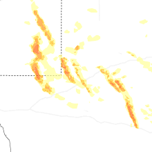

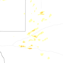
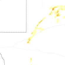
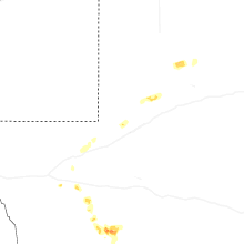
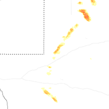
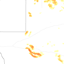


Connect with Interactive Hail Maps