

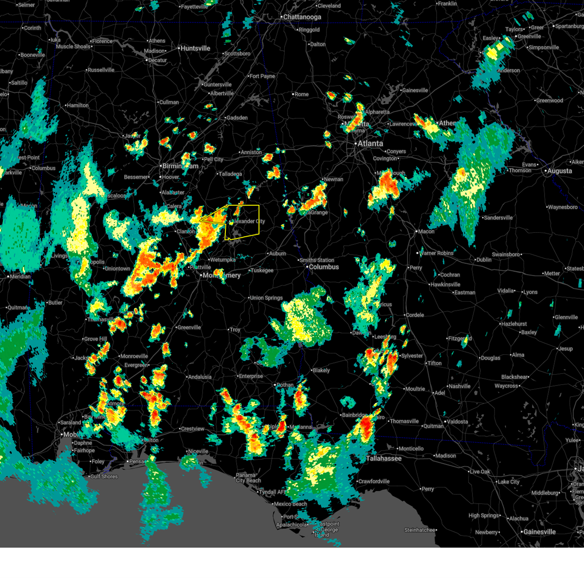
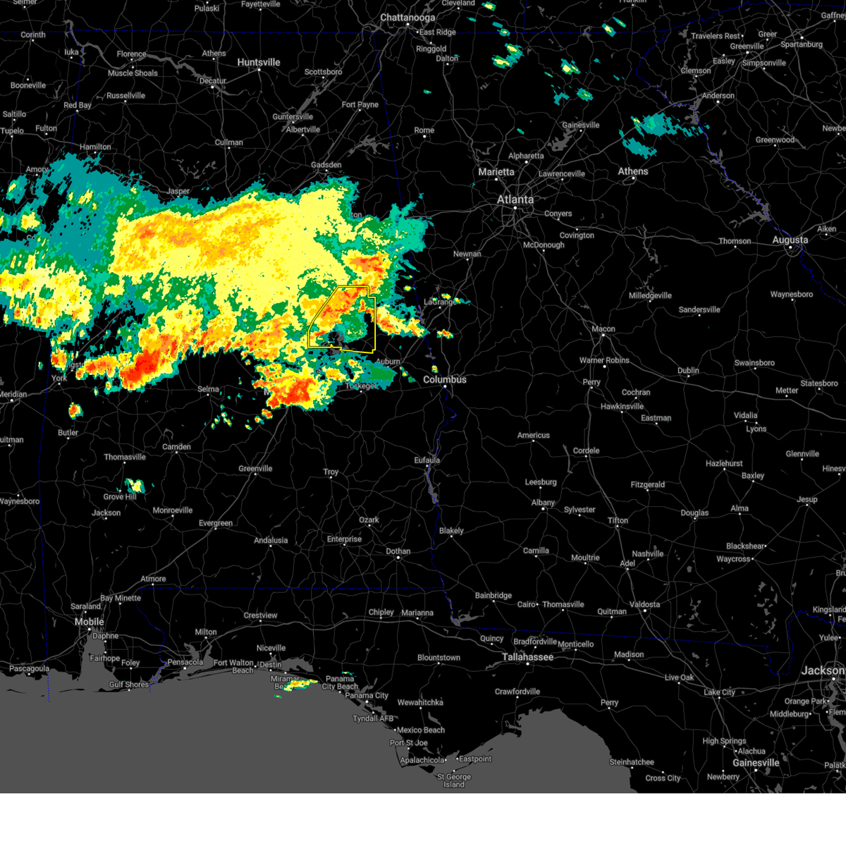
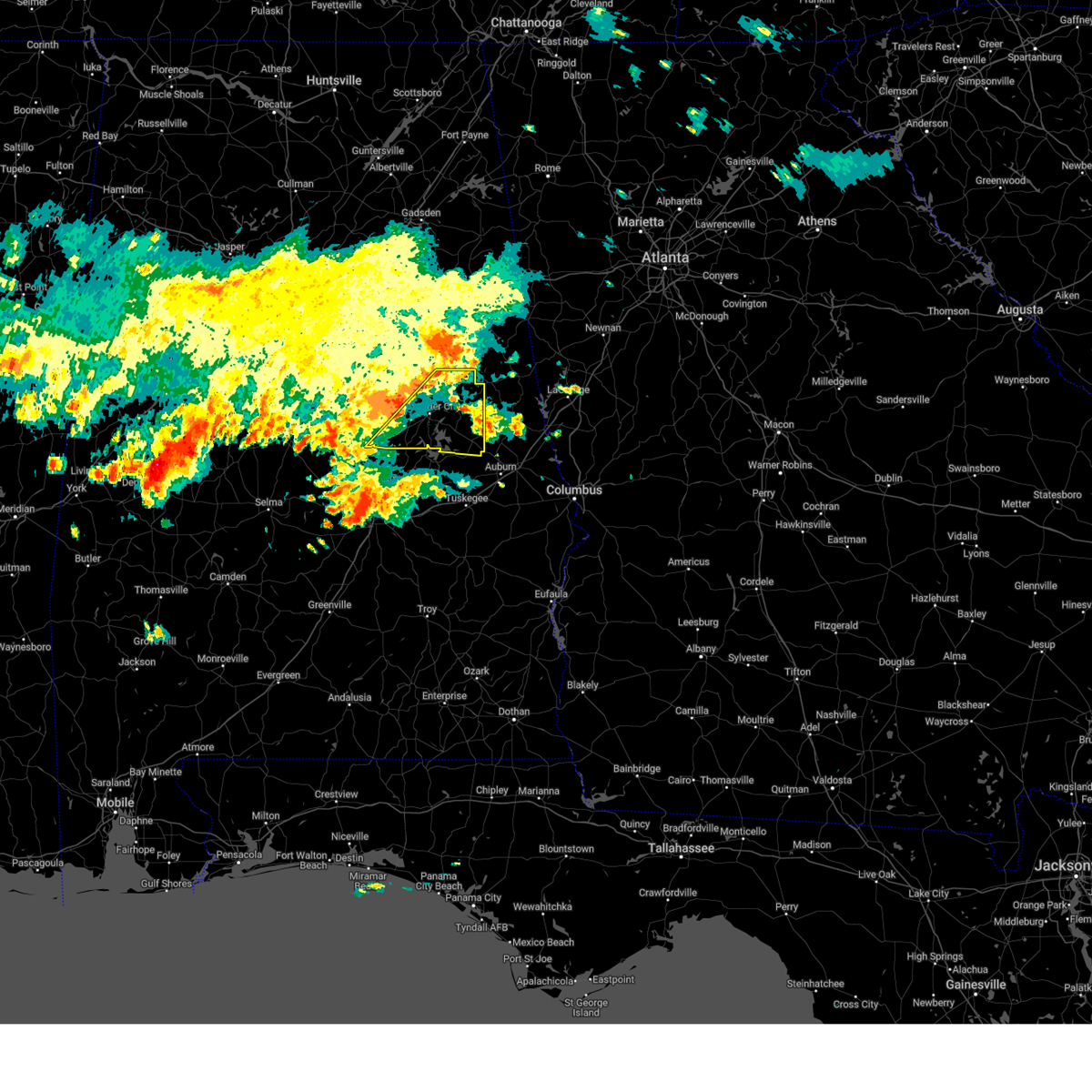
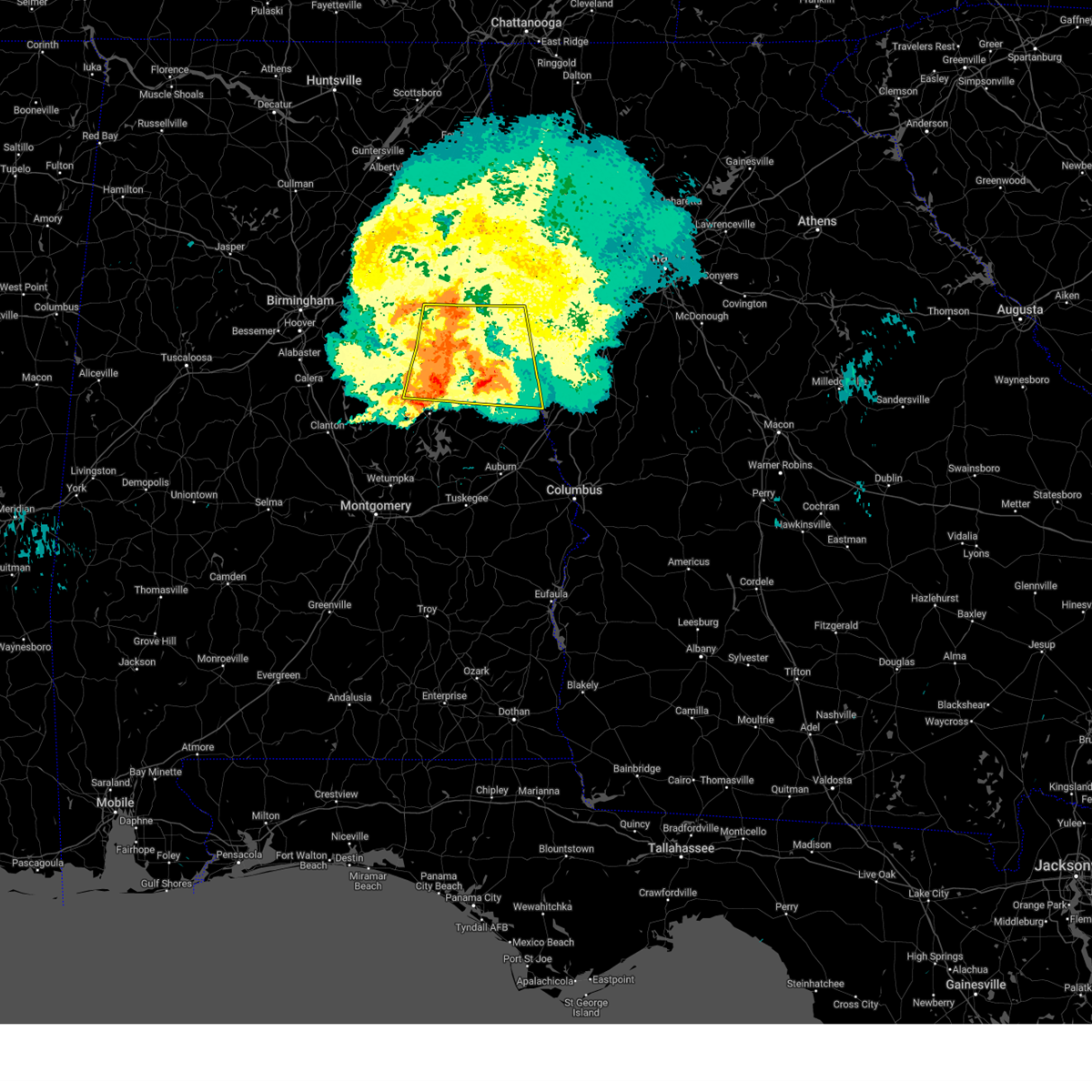
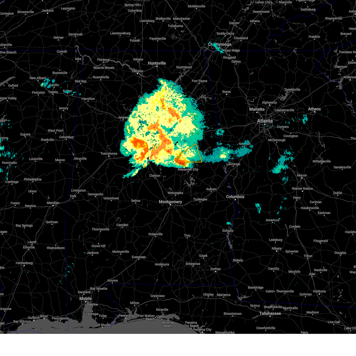
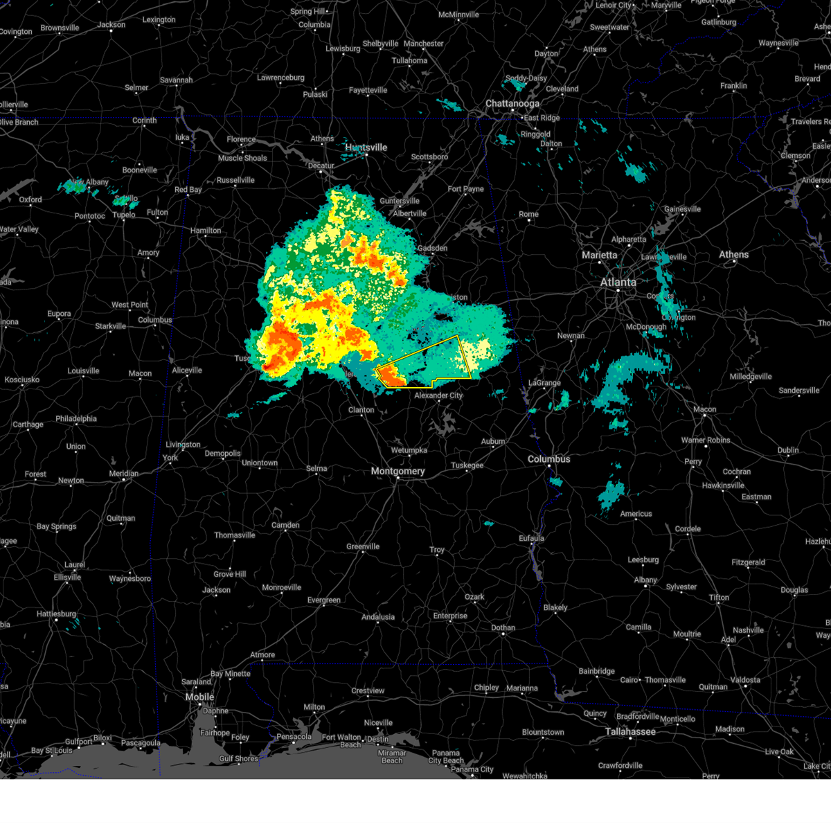
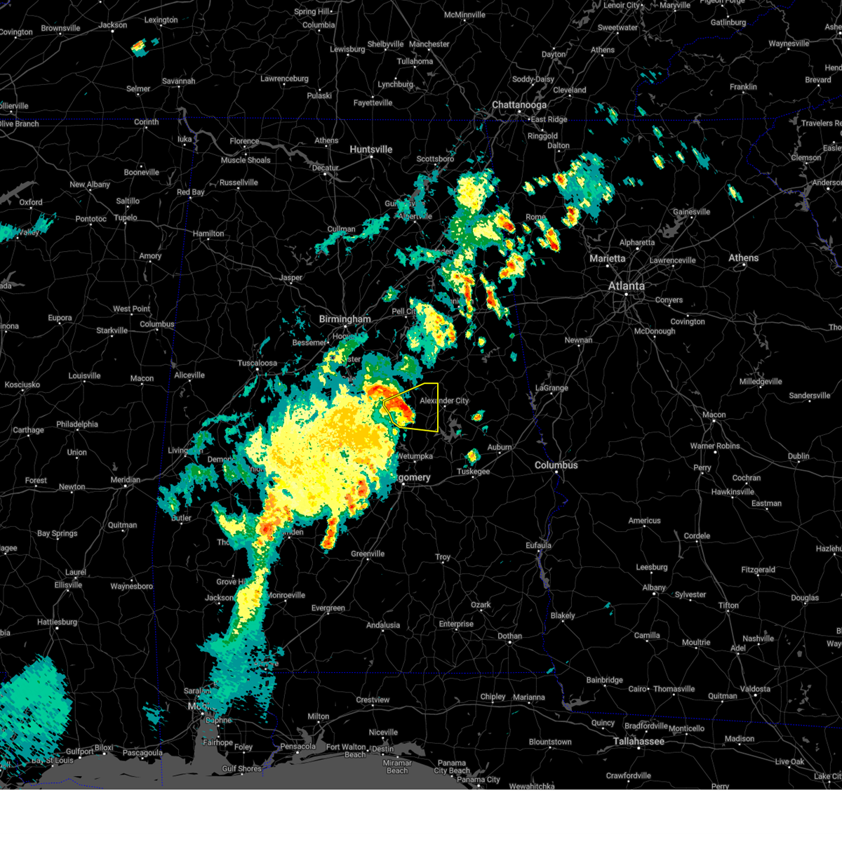
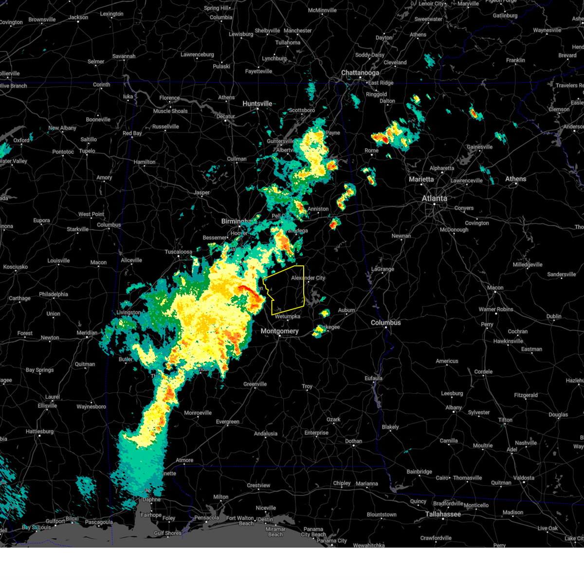
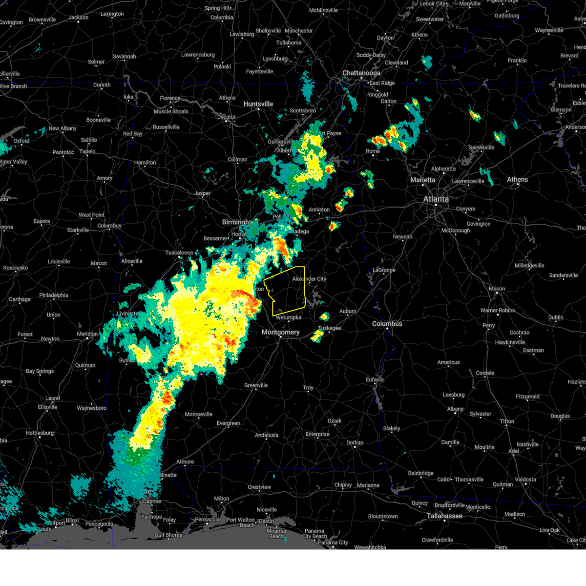
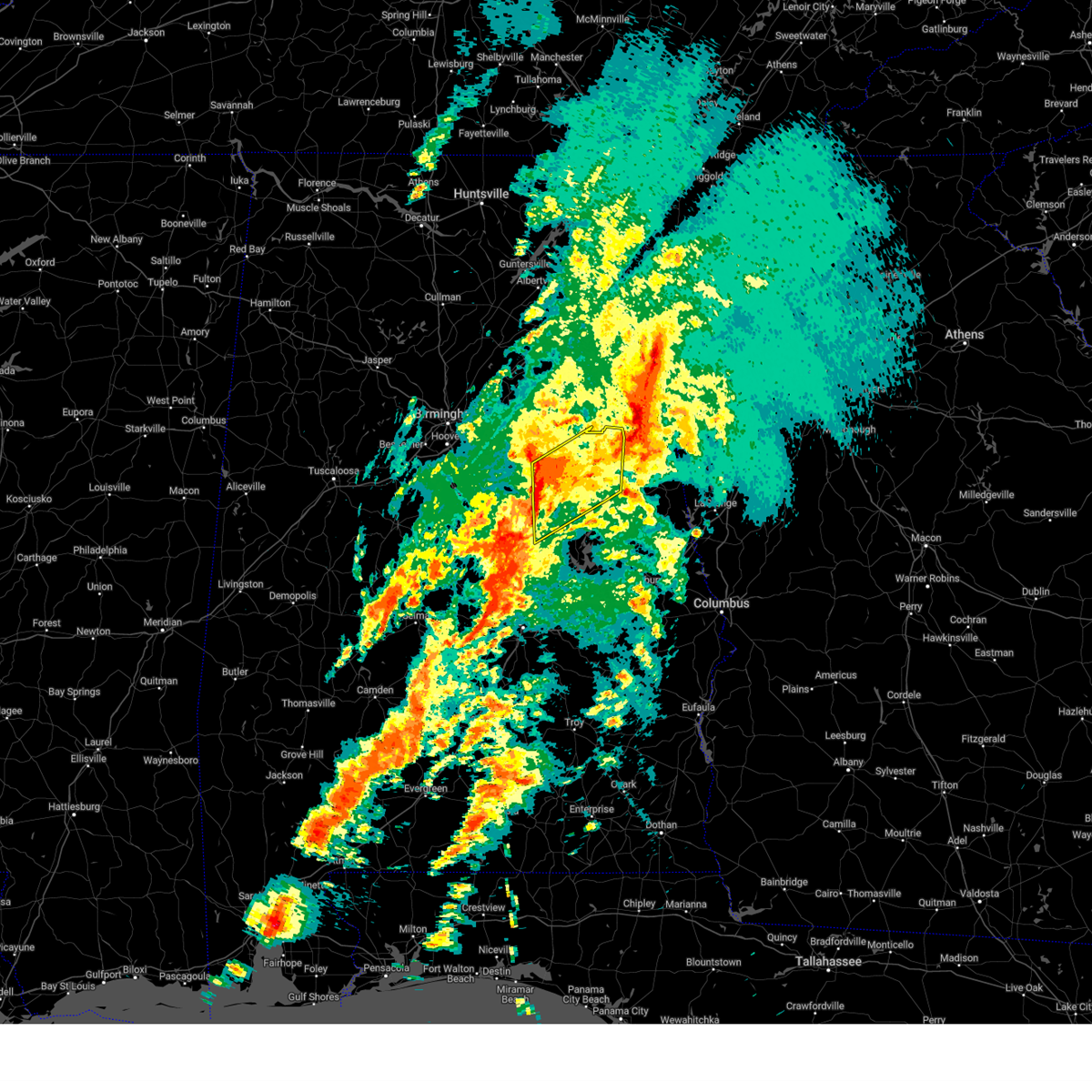
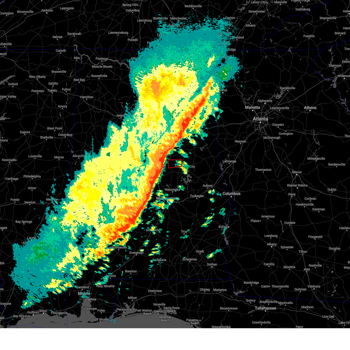
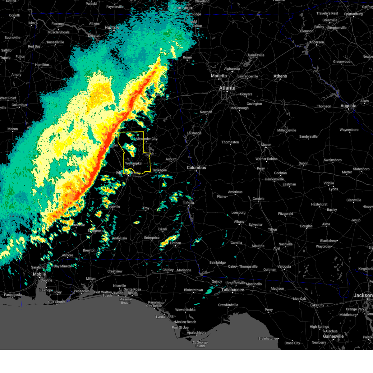
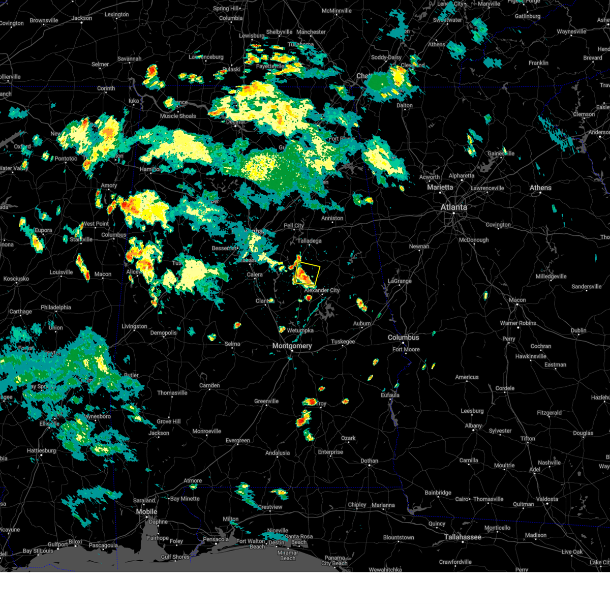
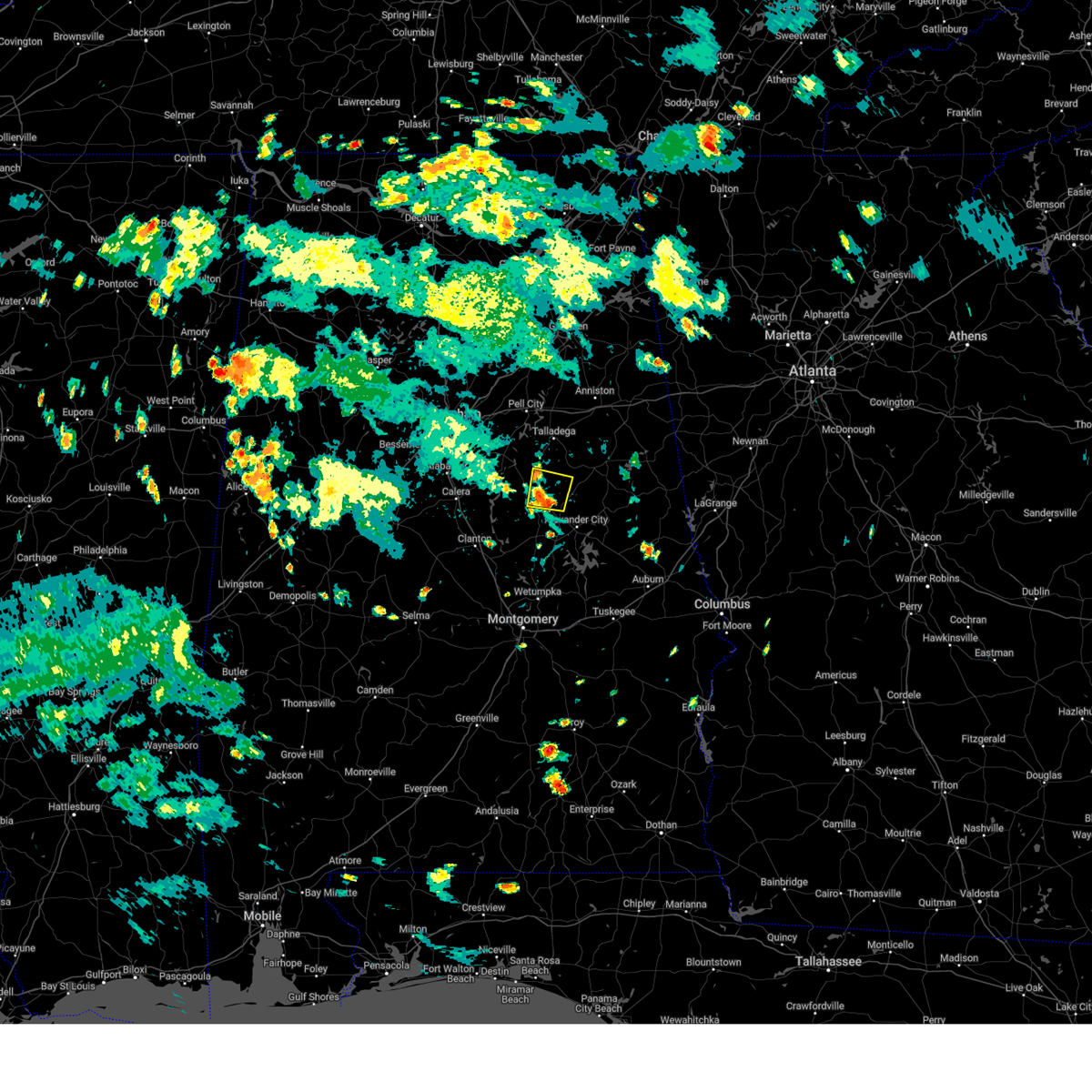
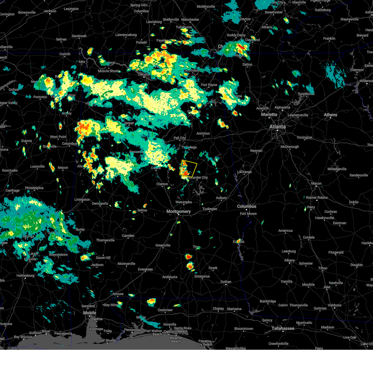
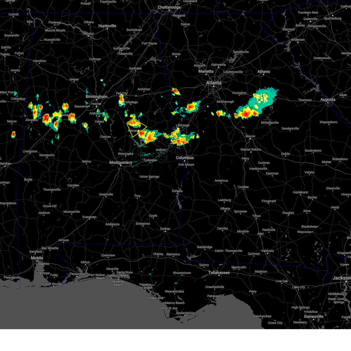
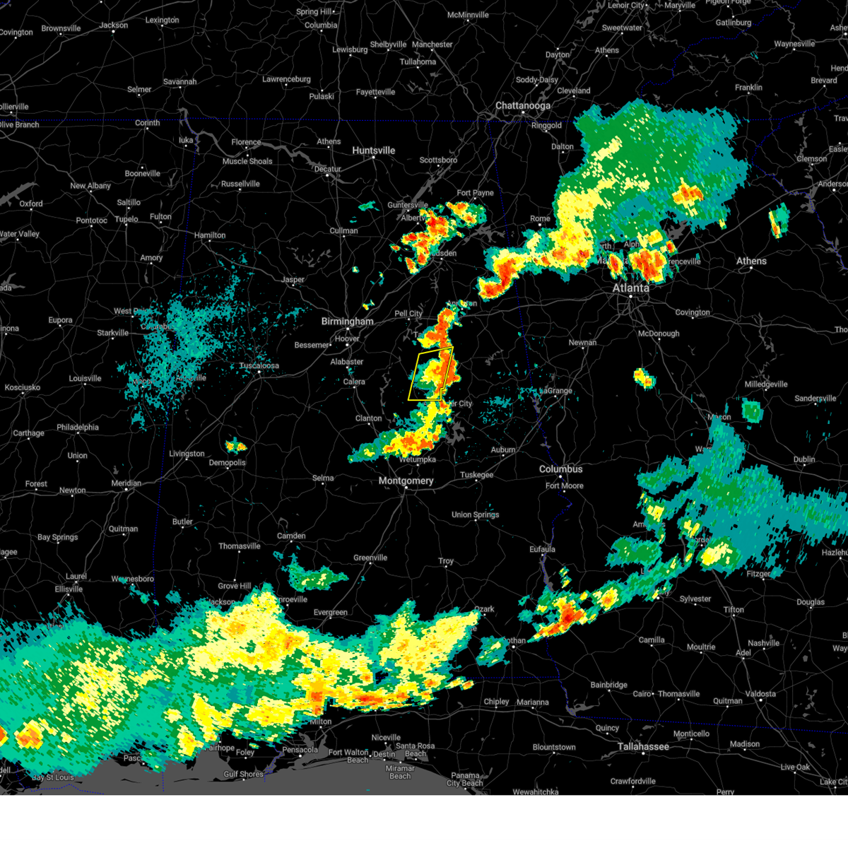
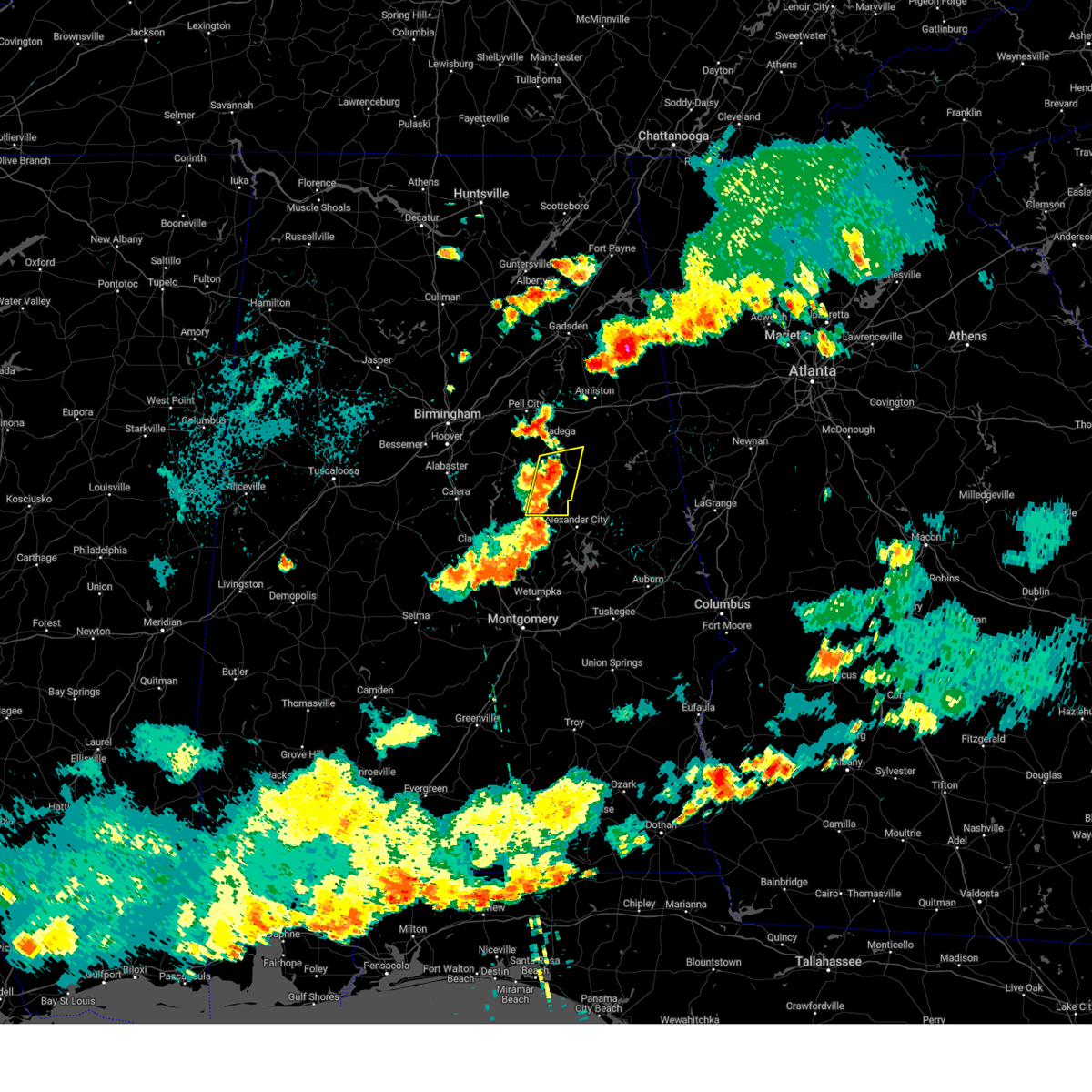
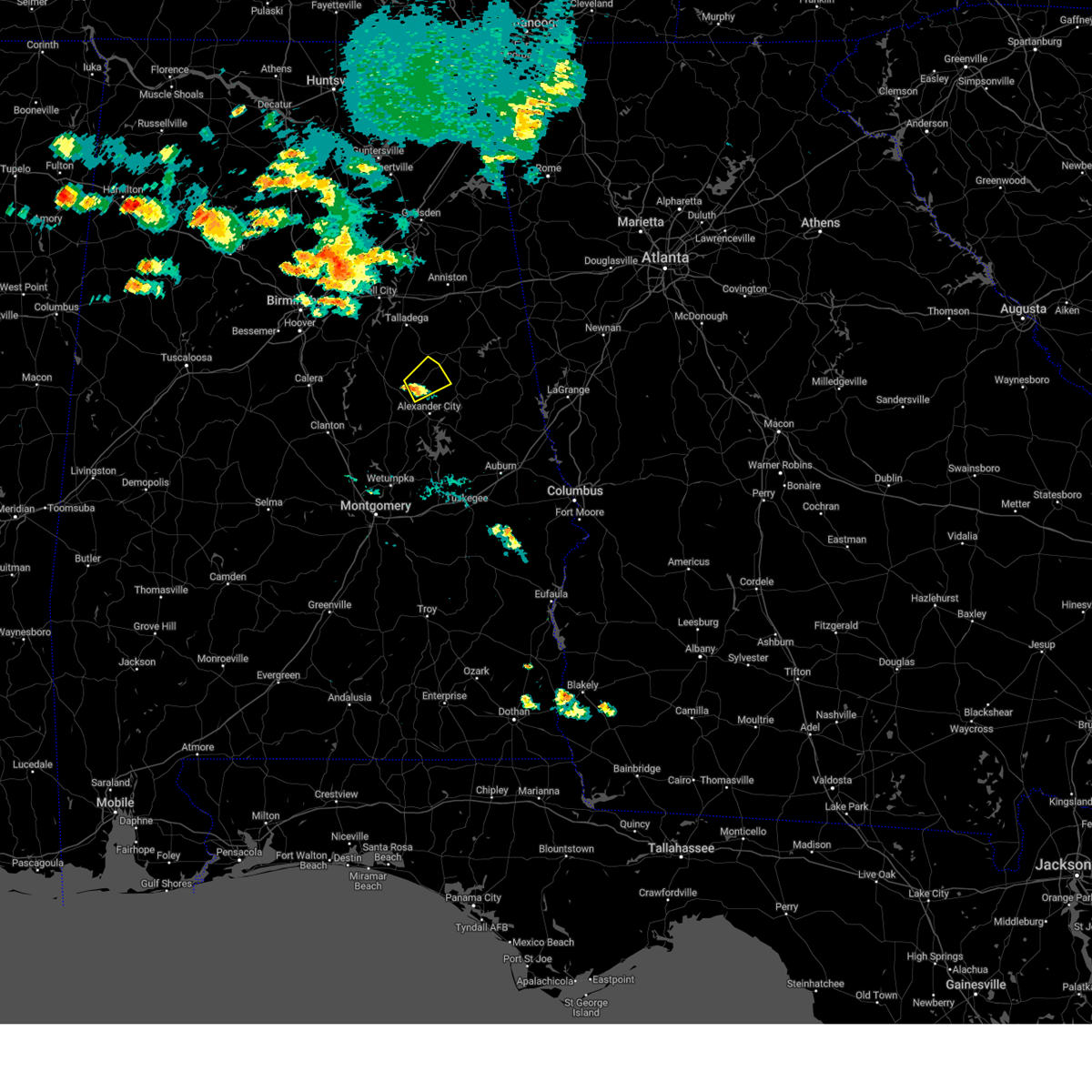
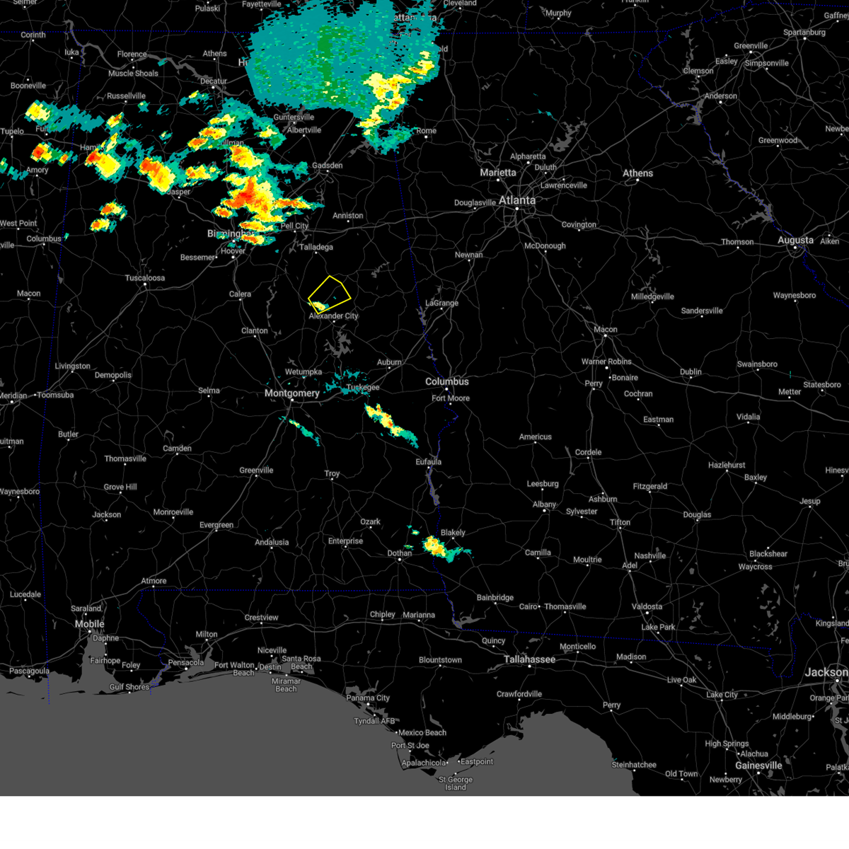
Hail Map for Goodwater, AL
The Goodwater, AL area has had 4 reports of on-the-ground hail by trained spotters, and has been under severe weather warnings 43 times during the past 12 months. Doppler radar has detected hail at or near Goodwater, AL on 56 occasions, including 2 occasions during the past year.
| Name: | Goodwater, AL |
| Where Located: | 45.3 miles NW of Auburn, AL |
| Map: | Google Map for Goodwater, AL |
| Population: | 1475 |
| Housing Units: | 708 |
| More Info: | Search Google for Goodwater, AL |
2
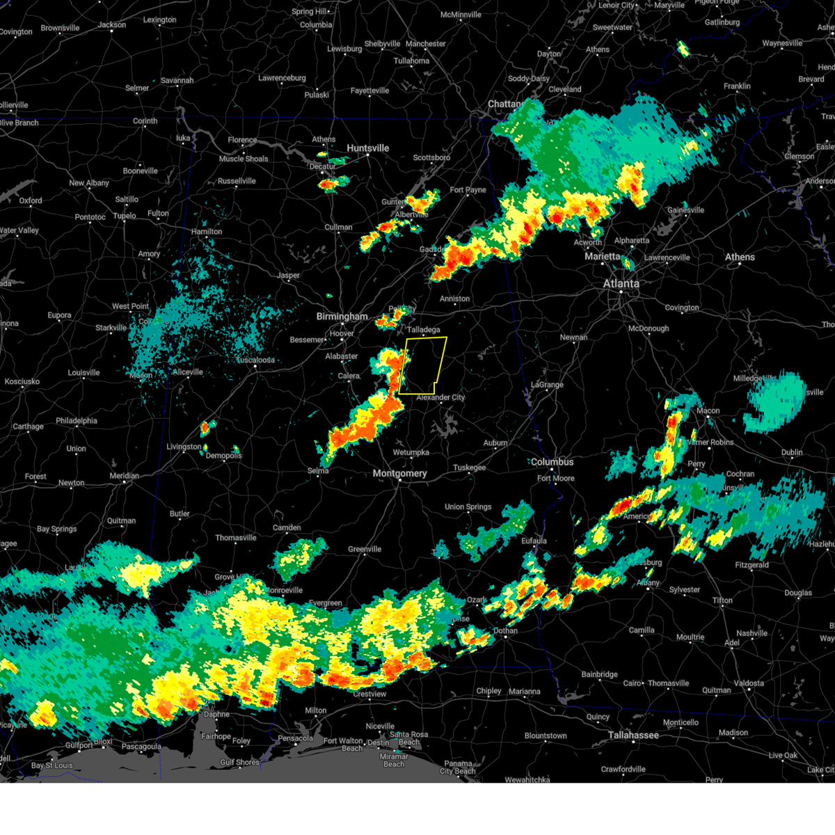
The Top Recent Hail Date for Goodwater, AL is Sunday, August 18, 2024 (10th out of 56)

Hail and Wind Damage Spotted near Goodwater, AL
| Date / Time | Report Details |
|---|---|
| 7/1/2025 5:25 PM CDT | At 525 pm cdt, severe thunderstorms were located along a line extending from near goldville to hillabee creek to near wind creek state park, moving southeast at 25 mph (radar indicated). Hazards include 60 mph wind gusts. Expect damage to roofs, siding, and trees. Locations impacted include, alexander city, dadeville, goodwater, camp hill, kellyton, jacksons' gap, new site, goldville, hillabee creek, eastern lake martin, bradford, western lake martin, northern lake martin, crewsville, wind creek state park, hatchet, daviston, susannah crossing, maxwell gunter recreation area, and horseshoe bend national military park. |
| 7/1/2025 5:10 PM CDT |
 Svrbmx the national weather service in birmingham has issued a * severe thunderstorm warning for, tallapoosa county in east central alabama, northeastern coosa county in east central alabama, * until 615 pm cdt. * at 510 pm cdt, severe thunderstorms were located along a line extending from near goldville to crewsville, moving southeast at 20 mph (radar indicated). Hazards include 60 mph wind gusts. expect damage to roofs, siding, and trees Svrbmx the national weather service in birmingham has issued a * severe thunderstorm warning for, tallapoosa county in east central alabama, northeastern coosa county in east central alabama, * until 615 pm cdt. * at 510 pm cdt, severe thunderstorms were located along a line extending from near goldville to crewsville, moving southeast at 20 mph (radar indicated). Hazards include 60 mph wind gusts. expect damage to roofs, siding, and trees
|
| 6/8/2025 4:51 AM CDT |
 At 451 am cdt, severe thunderstorms were located along a line extending from near goldville to highway 9 and highway 22, moving east at 40 mph (radar indicated). Hazards include 60 mph wind gusts. Expect damage to roofs, siding, and trees. Locations impacted include, alexander city, dadeville, camp hill, kellyton, equality, jacksons' gap, new site, waverly, goldville, cottage grove, nixburg, hillabee creek, eastern lake martin, western lake martin, northern lake martin, highway 9 and highway 22, wind creek state park, still waters resort, southern lake martin, and daviston. At 451 am cdt, severe thunderstorms were located along a line extending from near goldville to highway 9 and highway 22, moving east at 40 mph (radar indicated). Hazards include 60 mph wind gusts. Expect damage to roofs, siding, and trees. Locations impacted include, alexander city, dadeville, camp hill, kellyton, equality, jacksons' gap, new site, waverly, goldville, cottage grove, nixburg, hillabee creek, eastern lake martin, western lake martin, northern lake martin, highway 9 and highway 22, wind creek state park, still waters resort, southern lake martin, and daviston.
|
| 6/8/2025 4:36 AM CDT |
 Svrbmx the national weather service in birmingham has issued a * severe thunderstorm warning for, tallapoosa county in east central alabama, southeastern coosa county in east central alabama, southeastern clay county in east central alabama, * until 515 am cdt. * at 436 am cdt, severe thunderstorms were located along a line extending from 7 miles northeast of goodwater to rockford, moving east at 40 mph (radar indicated). Hazards include 60 mph wind gusts. expect damage to roofs, siding, and trees Svrbmx the national weather service in birmingham has issued a * severe thunderstorm warning for, tallapoosa county in east central alabama, southeastern coosa county in east central alabama, southeastern clay county in east central alabama, * until 515 am cdt. * at 436 am cdt, severe thunderstorms were located along a line extending from 7 miles northeast of goodwater to rockford, moving east at 40 mph (radar indicated). Hazards include 60 mph wind gusts. expect damage to roofs, siding, and trees
|
| 5/18/2025 7:35 AM CDT |
 At 734 am cdt, severe thunderstorms were located along a line extending from near munford to ashland to near hillabee creek, moving east at 70 mph (radar indicated). Hazards include 60 mph wind gusts and quarter size hail. Hail damage to vehicles is expected. expect wind damage to roofs, siding, and trees. Locations impacted include, graham, cleveland crossroads, dickert, goodwater, tennant, roanoke municipal airport, corinth, lineville, mellow valley, gunthertown, grant town, hollis crossroads, white plains, state line park, five points, chandler springs, chalafinnee, stroud, crystal lake, and roselle. At 734 am cdt, severe thunderstorms were located along a line extending from near munford to ashland to near hillabee creek, moving east at 70 mph (radar indicated). Hazards include 60 mph wind gusts and quarter size hail. Hail damage to vehicles is expected. expect wind damage to roofs, siding, and trees. Locations impacted include, graham, cleveland crossroads, dickert, goodwater, tennant, roanoke municipal airport, corinth, lineville, mellow valley, gunthertown, grant town, hollis crossroads, white plains, state line park, five points, chandler springs, chalafinnee, stroud, crystal lake, and roselle.
|
| 5/18/2025 7:35 AM CDT |
 the severe thunderstorm warning has been cancelled and is no longer in effect the severe thunderstorm warning has been cancelled and is no longer in effect
|
| 5/18/2025 7:14 AM CDT |
 Svrbmx the national weather service in birmingham has issued a * severe thunderstorm warning for, central talladega county in east central alabama, randolph county in east central alabama, southeastern st. clair county in central alabama, northern tallapoosa county in east central alabama, northern chambers county in east central alabama, southern cleburne county in east central alabama, northeastern coosa county in east central alabama, clay county in east central alabama, * until 815 am cdt. * at 714 am cdt, severe thunderstorms were located along a line extending from near logan martin lake to near winterboro to near stewartville, moving east at 70 mph (radar indicated). Hazards include 70 mph wind gusts and quarter size hail. Hail damage to vehicles is expected. expect considerable tree damage. Wind damage is also likely to mobile homes, roofs, and outbuildings. Svrbmx the national weather service in birmingham has issued a * severe thunderstorm warning for, central talladega county in east central alabama, randolph county in east central alabama, southeastern st. clair county in central alabama, northern tallapoosa county in east central alabama, northern chambers county in east central alabama, southern cleburne county in east central alabama, northeastern coosa county in east central alabama, clay county in east central alabama, * until 815 am cdt. * at 714 am cdt, severe thunderstorms were located along a line extending from near logan martin lake to near winterboro to near stewartville, moving east at 70 mph (radar indicated). Hazards include 70 mph wind gusts and quarter size hail. Hail damage to vehicles is expected. expect considerable tree damage. Wind damage is also likely to mobile homes, roofs, and outbuildings.
|
| 5/18/2025 6:46 AM CDT |
 the severe thunderstorm warning has been cancelled and is no longer in effect the severe thunderstorm warning has been cancelled and is no longer in effect
|
| 5/18/2025 6:46 AM CDT |
 At 645 am cdt, a severe thunderstorm was located near goodwater, moving east at 45 mph (radar indicated). Hazards include quarter size hail. Damage to vehicles is expected. Locations impacted include, cleveland crossroads, parkdale, hollins, goodwater, roselle, lineville, millerville, mellow valley, and ashland. At 645 am cdt, a severe thunderstorm was located near goodwater, moving east at 45 mph (radar indicated). Hazards include quarter size hail. Damage to vehicles is expected. Locations impacted include, cleveland crossroads, parkdale, hollins, goodwater, roselle, lineville, millerville, mellow valley, and ashland.
|
| 5/18/2025 6:34 AM CDT |
 At 634 am cdt, a severe thunderstorm was located over parkdale, or near goodwater, moving east at 45 mph (radar indicated). Hazards include 60 mph wind gusts and quarter size hail. Hail damage to vehicles is expected. expect wind damage to roofs, siding, and trees. Locations impacted include, cleveland crossroads, sylacauga municipal airport, overbrook, gantts quarry, hollins, oak grove, goodwater, sylacauga, sycamore, parkdale, chandler springs, roselle, lineville, millerville, mellow valley, ashland, mignon, and stewartville. At 634 am cdt, a severe thunderstorm was located over parkdale, or near goodwater, moving east at 45 mph (radar indicated). Hazards include 60 mph wind gusts and quarter size hail. Hail damage to vehicles is expected. expect wind damage to roofs, siding, and trees. Locations impacted include, cleveland crossroads, sylacauga municipal airport, overbrook, gantts quarry, hollins, oak grove, goodwater, sylacauga, sycamore, parkdale, chandler springs, roselle, lineville, millerville, mellow valley, ashland, mignon, and stewartville.
|
| 5/18/2025 6:21 AM CDT |
 Svrbmx the national weather service in birmingham has issued a * severe thunderstorm warning for, southwestern talladega county in east central alabama, northeastern coosa county in east central alabama, clay county in east central alabama, * until 700 am cdt. * at 621 am cdt, a severe thunderstorm was located near stewartville, moving east at 45 mph (radar indicated). Hazards include 60 mph wind gusts and quarter size hail. Hail damage to vehicles is expected. Expect wind damage to roofs, siding, and trees. Svrbmx the national weather service in birmingham has issued a * severe thunderstorm warning for, southwestern talladega county in east central alabama, northeastern coosa county in east central alabama, clay county in east central alabama, * until 700 am cdt. * at 621 am cdt, a severe thunderstorm was located near stewartville, moving east at 45 mph (radar indicated). Hazards include 60 mph wind gusts and quarter size hail. Hail damage to vehicles is expected. Expect wind damage to roofs, siding, and trees.
|
| 4/25/2025 6:26 PM CDT |
 the severe thunderstorm warning has been cancelled and is no longer in effect the severe thunderstorm warning has been cancelled and is no longer in effect
|
| 4/25/2025 6:26 PM CDT |
 At 625 pm cdt, severe thunderstorms were located along a line extending from weogufka to near crewsville to near equality, moving northeast at 40 mph (radar indicated). Hazards include 60 mph wind gusts. Expect damage to roofs, siding, and trees. Locations impacted include, hanover, fishpond, pentonville, lyle, dollar, bradford, cottage grove, goodwater, weogufka, ray, bentleyville, highway 9 and highway 22, unity, parkdale, moriah, rockford, kellyton, hatchet, hissop, and nixburg. At 625 pm cdt, severe thunderstorms were located along a line extending from weogufka to near crewsville to near equality, moving northeast at 40 mph (radar indicated). Hazards include 60 mph wind gusts. Expect damage to roofs, siding, and trees. Locations impacted include, hanover, fishpond, pentonville, lyle, dollar, bradford, cottage grove, goodwater, weogufka, ray, bentleyville, highway 9 and highway 22, unity, parkdale, moriah, rockford, kellyton, hatchet, hissop, and nixburg.
|
| 4/25/2025 6:01 PM CDT |
 At 601 pm cdt, severe thunderstorms were located along a line extending from near gap of the mountain to near welona to near deatsville, moving northeast at 40 mph (radar indicated). Hazards include 60 mph wind gusts. Expect damage to roofs, siding, and trees. Locations impacted include, hanover, fishpond, pentonville, lyle, dollar, bradford, cottage grove, goodwater, weogufka, central, ray, titus, bentleyville, welona, moriah, ten cedar estates, hatchet, nixburg, equality, and speed. At 601 pm cdt, severe thunderstorms were located along a line extending from near gap of the mountain to near welona to near deatsville, moving northeast at 40 mph (radar indicated). Hazards include 60 mph wind gusts. Expect damage to roofs, siding, and trees. Locations impacted include, hanover, fishpond, pentonville, lyle, dollar, bradford, cottage grove, goodwater, weogufka, central, ray, titus, bentleyville, welona, moriah, ten cedar estates, hatchet, nixburg, equality, and speed.
|
| 4/25/2025 5:50 PM CDT |
 Svrbmx the national weather service in birmingham has issued a * severe thunderstorm warning for, northwestern elmore county in east central alabama, coosa county in east central alabama, * until 645 pm cdt. * at 550 pm cdt, severe thunderstorms were located along a line extending from near thorsby to verbena to 6 miles west of deatsville, moving northeast at 40 mph (radar indicated). Hazards include 60 mph wind gusts. expect damage to roofs, siding, and trees Svrbmx the national weather service in birmingham has issued a * severe thunderstorm warning for, northwestern elmore county in east central alabama, coosa county in east central alabama, * until 645 pm cdt. * at 550 pm cdt, severe thunderstorms were located along a line extending from near thorsby to verbena to 6 miles west of deatsville, moving northeast at 40 mph (radar indicated). Hazards include 60 mph wind gusts. expect damage to roofs, siding, and trees
|
| 4/10/2025 10:13 PM CDT |
 the severe thunderstorm warning has been cancelled and is no longer in effect the severe thunderstorm warning has been cancelled and is no longer in effect
|
| 4/10/2025 9:43 PM CDT |
 At 943 pm cdt, severe thunderstorms were located along a line extending from 6 miles south of ashland to near kellyton to dollar, moving southeast at 60 mph (radar indicated). Hazards include 60 mph wind gusts. Expect damage to roofs, siding, and trees. Locations impacted include, dollar, bradford, goodwater, paint creek, ray, bentleyville, jacksons' gap, hatchet, horseshoe bend, equality, hillabee creek, mitchell lake, western lake martin, horseshoe bend national military park, highway 9 and highway 22, unity, rockford, hissop, hanover, and fishpond. At 943 pm cdt, severe thunderstorms were located along a line extending from 6 miles south of ashland to near kellyton to dollar, moving southeast at 60 mph (radar indicated). Hazards include 60 mph wind gusts. Expect damage to roofs, siding, and trees. Locations impacted include, dollar, bradford, goodwater, paint creek, ray, bentleyville, jacksons' gap, hatchet, horseshoe bend, equality, hillabee creek, mitchell lake, western lake martin, horseshoe bend national military park, highway 9 and highway 22, unity, rockford, hissop, hanover, and fishpond.
|
| 4/10/2025 9:29 PM CDT |
 Svrbmx the national weather service in birmingham has issued a * severe thunderstorm warning for, tallapoosa county in east central alabama, coosa county in east central alabama, * until 1045 pm cdt. * at 928 pm cdt, a severe thunderstorm was located over sylacauga, moving southeast at 50 mph (radar indicated). Hazards include 60 mph wind gusts. expect damage to roofs, siding, and trees Svrbmx the national weather service in birmingham has issued a * severe thunderstorm warning for, tallapoosa county in east central alabama, coosa county in east central alabama, * until 1045 pm cdt. * at 928 pm cdt, a severe thunderstorm was located over sylacauga, moving southeast at 50 mph (radar indicated). Hazards include 60 mph wind gusts. expect damage to roofs, siding, and trees
|
| 3/15/2025 9:58 PM CDT |
 the tornado warning has been cancelled and is no longer in effect the tornado warning has been cancelled and is no longer in effect
|
| 3/15/2025 9:57 PM CDT |
 Svrbmx the national weather service in birmingham has issued a * severe thunderstorm warning for, southeastern talladega county in east central alabama, northwestern tallapoosa county in east central alabama, northeastern coosa county in east central alabama, clay county in east central alabama, * until 1115 pm cdt. * at 957 pm cdt, severe thunderstorms were located along a line extending from sycamore to rockford, moving northeast at 40 mph (radar indicated). Hazards include 60 mph wind gusts. expect damage to roofs, siding, and trees Svrbmx the national weather service in birmingham has issued a * severe thunderstorm warning for, southeastern talladega county in east central alabama, northwestern tallapoosa county in east central alabama, northeastern coosa county in east central alabama, clay county in east central alabama, * until 1115 pm cdt. * at 957 pm cdt, severe thunderstorms were located along a line extending from sycamore to rockford, moving northeast at 40 mph (radar indicated). Hazards include 60 mph wind gusts. expect damage to roofs, siding, and trees
|
| 3/15/2025 9:46 PM CDT | At 945 pm cdt, a confirmed tornado was located over weogufka, moving northeast at 50 mph (radar confirmed tornado). Hazards include damaging tornado. Flying debris will be dangerous to those caught without shelter. mobile homes will be damaged or destroyed. damage to roofs, windows, and vehicles will occur. tree damage is likely. Locations impacted include, hanover, unity, parkdale, bradford, hatchet, goodwater, weogufka, bentleyville, stewartville, crewsville, and rockford. |
| 3/15/2025 9:34 PM CDT |
 Torbmx the national weather service in birmingham has issued a * tornado warning for, coosa county in east central alabama, * until 1015 pm cdt. * at 934 pm cdt, a tornado producing storm was located over dollar, or 10 miles southwest of weogufka, moving northeast at 50 mph (radar confirmed tornado). Hazards include damaging tornado. Flying debris will be dangerous to those caught without shelter. mobile homes will be damaged or destroyed. damage to roofs, windows, and vehicles will occur. Tree damage is likely. Torbmx the national weather service in birmingham has issued a * tornado warning for, coosa county in east central alabama, * until 1015 pm cdt. * at 934 pm cdt, a tornado producing storm was located over dollar, or 10 miles southwest of weogufka, moving northeast at 50 mph (radar confirmed tornado). Hazards include damaging tornado. Flying debris will be dangerous to those caught without shelter. mobile homes will be damaged or destroyed. damage to roofs, windows, and vehicles will occur. Tree damage is likely.
|
| 3/4/2025 9:30 PM CST |
 Svrbmx the national weather service in birmingham has issued a * severe thunderstorm warning for, elmore county in east central alabama, montgomery county in south central alabama, coosa county in east central alabama, * until 1045 pm cst. * at 930 pm cst, severe thunderstorms were located along a line extending from 7 miles northeast of jemison to near autaugaville to 12 miles west of lowndes county airport, moving east at 45 mph (radar indicated). Hazards include 60 mph wind gusts. expect damage to roofs, siding, and trees Svrbmx the national weather service in birmingham has issued a * severe thunderstorm warning for, elmore county in east central alabama, montgomery county in south central alabama, coosa county in east central alabama, * until 1045 pm cst. * at 930 pm cst, severe thunderstorms were located along a line extending from 7 miles northeast of jemison to near autaugaville to 12 miles west of lowndes county airport, moving east at 45 mph (radar indicated). Hazards include 60 mph wind gusts. expect damage to roofs, siding, and trees
|
| 2/16/2025 2:15 AM CST |
 the tornado warning has been cancelled and is no longer in effect the tornado warning has been cancelled and is no longer in effect
|
| 2/16/2025 2:07 AM CST |
 At 207 am cst, a severe thunderstorm capable of producing a tornado was located over stewartville, moving east at 65 mph (radar indicated rotation). Hazards include tornado. Flying debris will be dangerous to those caught without shelter. mobile homes will be damaged or destroyed. damage to roofs, windows, and vehicles will occur. tree damage is likely. Locations impacted include, goodwater, stewartville, hanover, hatchet, parkdale, and bradford. At 207 am cst, a severe thunderstorm capable of producing a tornado was located over stewartville, moving east at 65 mph (radar indicated rotation). Hazards include tornado. Flying debris will be dangerous to those caught without shelter. mobile homes will be damaged or destroyed. damage to roofs, windows, and vehicles will occur. tree damage is likely. Locations impacted include, goodwater, stewartville, hanover, hatchet, parkdale, and bradford.
|
| 2/16/2025 1:56 AM CST | Torbmx the national weather service in birmingham has issued a * tornado warning for, northern coosa county in east central alabama, * until 245 am cst. * at 155 am cst, a severe thunderstorm capable of producing a tornado was located over marble valley, or 7 miles west of weogufka, moving east at 65 mph (radar indicated rotation). Hazards include tornado. Flying debris will be dangerous to those caught without shelter. mobile homes will be damaged or destroyed. damage to roofs, windows, and vehicles will occur. Tree damage is likely. |
| 2/16/2025 1:43 AM CST |
 Svrbmx the national weather service in birmingham has issued a * severe thunderstorm warning for, elmore county in east central alabama, coosa county in east central alabama, * until 300 am cst. * at 143 am cst, severe thunderstorms were located along a line extending from near wilsonville to near old cahaba park, moving east at 65 mph (radar indicated). Hazards include 70 mph wind gusts. Expect considerable tree damage. Damage is likely to mobile homes, roofs, and outbuildings. Svrbmx the national weather service in birmingham has issued a * severe thunderstorm warning for, elmore county in east central alabama, coosa county in east central alabama, * until 300 am cst. * at 143 am cst, severe thunderstorms were located along a line extending from near wilsonville to near old cahaba park, moving east at 65 mph (radar indicated). Hazards include 70 mph wind gusts. Expect considerable tree damage. Damage is likely to mobile homes, roofs, and outbuildings.
|
| 8/31/2024 4:47 PM CDT |
 the severe thunderstorm warning has been cancelled and is no longer in effect the severe thunderstorm warning has been cancelled and is no longer in effect
|
| 8/31/2024 4:34 PM CDT |
 At 434 pm cdt, a severe thunderstorm was located over parkdale, or near stewartville, moving north at 10 mph (radar indicated). Hazards include 60 mph wind gusts. Expect damage to roofs, siding, and trees. Locations impacted include, sylacauga, goodwater, stewartville, sycamore, parkdale, overbrook, hollins, roselle, and mignon. At 434 pm cdt, a severe thunderstorm was located over parkdale, or near stewartville, moving north at 10 mph (radar indicated). Hazards include 60 mph wind gusts. Expect damage to roofs, siding, and trees. Locations impacted include, sylacauga, goodwater, stewartville, sycamore, parkdale, overbrook, hollins, roselle, and mignon.
|
| 8/31/2024 4:19 PM CDT |
 Svrbmx the national weather service in birmingham has issued a * severe thunderstorm warning for, south central talladega county in east central alabama, northeastern coosa county in east central alabama, southwestern clay county in east central alabama, * until 500 pm cdt. * at 419 pm cdt, a severe thunderstorm was located near parkdale, or near stewartville, moving north at 10 mph (radar indicated). Hazards include 60 mph wind gusts and quarter size hail. Hail damage to vehicles is expected. Expect wind damage to roofs, siding, and trees. Svrbmx the national weather service in birmingham has issued a * severe thunderstorm warning for, south central talladega county in east central alabama, northeastern coosa county in east central alabama, southwestern clay county in east central alabama, * until 500 pm cdt. * at 419 pm cdt, a severe thunderstorm was located near parkdale, or near stewartville, moving north at 10 mph (radar indicated). Hazards include 60 mph wind gusts and quarter size hail. Hail damage to vehicles is expected. Expect wind damage to roofs, siding, and trees.
|
| 8/18/2024 4:44 PM CDT | the severe thunderstorm warning has been cancelled and is no longer in effect |
| 8/18/2024 4:44 PM CDT | At 444 pm cdt, a severe thunderstorm was located near kellyton, moving southeast at 30 mph (radar indicated). Hazards include ping pong ball size hail and 60 mph wind gusts. People and animals outdoors will be injured. expect hail damage to roofs, siding, windows, and vehicles. expect wind damage to roofs, siding, and trees. Locations impacted include, alexander city, goodwater, kellyton, new site, bradford, hatchet, hackneyville, and ray. |
| 8/18/2024 4:28 PM CDT |
 Svrbmx the national weather service in birmingham has issued a * severe thunderstorm warning for, northwestern tallapoosa county in east central alabama, northeastern coosa county in east central alabama, southwestern clay county in east central alabama, * until 515 pm cdt. * at 428 pm cdt, a severe thunderstorm was located over goodwater, moving southeast at 30 mph (radar indicated). Hazards include 60 mph wind gusts and quarter size hail. Hail damage to vehicles is expected. Expect wind damage to roofs, siding, and trees. Svrbmx the national weather service in birmingham has issued a * severe thunderstorm warning for, northwestern tallapoosa county in east central alabama, northeastern coosa county in east central alabama, southwestern clay county in east central alabama, * until 515 pm cdt. * at 428 pm cdt, a severe thunderstorm was located over goodwater, moving southeast at 30 mph (radar indicated). Hazards include 60 mph wind gusts and quarter size hail. Hail damage to vehicles is expected. Expect wind damage to roofs, siding, and trees.
|
| 8/18/2024 4:05 PM CDT |
 the severe thunderstorm warning has been cancelled and is no longer in effect the severe thunderstorm warning has been cancelled and is no longer in effect
|
| 8/18/2024 4:05 PM CDT |
 At 404 pm cdt, a severe thunderstorm was located near kellyton, moving southeast at 30 mph (radar indicated). Hazards include golf ball size hail and 70 mph wind gusts. People and animals outdoors will be injured. expect hail damage to roofs, siding, windows, and vehicles. expect considerable tree damage. wind damage is also likely to mobile homes, roofs, and outbuildings. Locations impacted include, alexander city, goodwater, kellyton, jacksons' gap, new site, hillabee creek, northern lake martin, fishpond, ray, horseshoe bend national military park, hackneyville, eagle creek, and horseshoe bend. At 404 pm cdt, a severe thunderstorm was located near kellyton, moving southeast at 30 mph (radar indicated). Hazards include golf ball size hail and 70 mph wind gusts. People and animals outdoors will be injured. expect hail damage to roofs, siding, windows, and vehicles. expect considerable tree damage. wind damage is also likely to mobile homes, roofs, and outbuildings. Locations impacted include, alexander city, goodwater, kellyton, jacksons' gap, new site, hillabee creek, northern lake martin, fishpond, ray, horseshoe bend national military park, hackneyville, eagle creek, and horseshoe bend.
|
| 8/18/2024 3:57 PM CDT |
 At 357 pm cdt, a severe thunderstorm was located near goodwater, moving southeast at 30 mph (radar indicated). Hazards include golf ball size hail and 70 mph wind gusts. People and animals outdoors will be injured. expect hail damage to roofs, siding, windows, and vehicles. expect considerable tree damage. wind damage is also likely to mobile homes, roofs, and outbuildings. Locations impacted include, alexander city, goodwater, kellyton, jacksons' gap, new site, hillabee creek, bradford, northern lake martin, highway 9 and highway 22, parkdale, hatchet, wind creek state park, fishpond, cleveland crossroads, ray, horseshoe bend national military park, hackneyville, eagle creek, and horseshoe bend. At 357 pm cdt, a severe thunderstorm was located near goodwater, moving southeast at 30 mph (radar indicated). Hazards include golf ball size hail and 70 mph wind gusts. People and animals outdoors will be injured. expect hail damage to roofs, siding, windows, and vehicles. expect considerable tree damage. wind damage is also likely to mobile homes, roofs, and outbuildings. Locations impacted include, alexander city, goodwater, kellyton, jacksons' gap, new site, hillabee creek, bradford, northern lake martin, highway 9 and highway 22, parkdale, hatchet, wind creek state park, fishpond, cleveland crossroads, ray, horseshoe bend national military park, hackneyville, eagle creek, and horseshoe bend.
|
| 8/18/2024 3:49 PM CDT |
 At 349 pm cdt, a severe thunderstorm was located near goodwater, moving southeast at 30 mph (radar indicated). Hazards include 60 mph wind gusts and half dollar size hail. Hail damage to vehicles is expected. expect wind damage to roofs, siding, and trees. Locations impacted include, alexander city, goodwater, kellyton, jacksons' gap, new site, goldville, bradford, cottage grove, hatchet, nixburg, hillabee creek, northern lake martin, highway 9 and highway 22, parkdale, wind creek state park, crewsville, daviston, fishpond, cleveland crossroads, and ray. At 349 pm cdt, a severe thunderstorm was located near goodwater, moving southeast at 30 mph (radar indicated). Hazards include 60 mph wind gusts and half dollar size hail. Hail damage to vehicles is expected. expect wind damage to roofs, siding, and trees. Locations impacted include, alexander city, goodwater, kellyton, jacksons' gap, new site, goldville, bradford, cottage grove, hatchet, nixburg, hillabee creek, northern lake martin, highway 9 and highway 22, parkdale, wind creek state park, crewsville, daviston, fishpond, cleveland crossroads, and ray.
|
| 8/18/2024 3:32 PM CDT |
 Svrbmx the national weather service in birmingham has issued a * severe thunderstorm warning for, northern tallapoosa county in east central alabama, eastern coosa county in east central alabama, southern clay county in east central alabama, * until 415 pm cdt. * at 332 pm cdt, a severe thunderstorm was located near sycamore, or 9 miles east of sylacauga, moving southeast at 30 mph (radar indicated). Hazards include 60 mph wind gusts and quarter size hail. Hail damage to vehicles is expected. Expect wind damage to roofs, siding, and trees. Svrbmx the national weather service in birmingham has issued a * severe thunderstorm warning for, northern tallapoosa county in east central alabama, eastern coosa county in east central alabama, southern clay county in east central alabama, * until 415 pm cdt. * at 332 pm cdt, a severe thunderstorm was located near sycamore, or 9 miles east of sylacauga, moving southeast at 30 mph (radar indicated). Hazards include 60 mph wind gusts and quarter size hail. Hail damage to vehicles is expected. Expect wind damage to roofs, siding, and trees.
|
| 8/17/2024 5:35 PM CDT |
 The storms which prompted the warning have moved out of the area. therefore, the warning will be allowed to expire. a severe thunderstorm watch remains in effect until 900 pm cdt for east central alabama. to report severe weather, contact your nearest law enforcement agency. they will relay your report to the national weather service birmingham. The storms which prompted the warning have moved out of the area. therefore, the warning will be allowed to expire. a severe thunderstorm watch remains in effect until 900 pm cdt for east central alabama. to report severe weather, contact your nearest law enforcement agency. they will relay your report to the national weather service birmingham.
|
| 8/17/2024 5:25 PM CDT | Trees were blown down along cr 66 west of goodwate in coosa county AL, 2.2 miles E of Goodwater, AL |
| 8/17/2024 5:18 PM CDT |
 At 517 pm cdt, severe thunderstorms were located along a line extending from near waldo to 9 miles northeast of parkdale to hatchet, moving east at 40 mph (radar indicated). Hazards include 60 mph wind gusts and penny size hail. Expect damage to roofs, siding, and trees. Locations impacted include, sylacauga, goodwater, stewartville, waldo, winterboro, sycamore, parkdale, hatchet, cleveland crossroads, overbrook, hollins, chandler springs, roselle, and gunthertown. At 517 pm cdt, severe thunderstorms were located along a line extending from near waldo to 9 miles northeast of parkdale to hatchet, moving east at 40 mph (radar indicated). Hazards include 60 mph wind gusts and penny size hail. Expect damage to roofs, siding, and trees. Locations impacted include, sylacauga, goodwater, stewartville, waldo, winterboro, sycamore, parkdale, hatchet, cleveland crossroads, overbrook, hollins, chandler springs, roselle, and gunthertown.
|
| 8/17/2024 5:00 PM CDT |
 Svrbmx the national weather service in birmingham has issued a * severe thunderstorm warning for, southeastern talladega county in east central alabama, northeastern coosa county in east central alabama, western clay county in east central alabama, * until 545 pm cdt. * at 500 pm cdt, severe thunderstorms were located along a line extending from near winterboro to near weogufka, moving east at 25 mph (radar indicated). Hazards include 60 mph wind gusts and penny size hail. expect damage to roofs, siding, and trees Svrbmx the national weather service in birmingham has issued a * severe thunderstorm warning for, southeastern talladega county in east central alabama, northeastern coosa county in east central alabama, western clay county in east central alabama, * until 545 pm cdt. * at 500 pm cdt, severe thunderstorms were located along a line extending from near winterboro to near weogufka, moving east at 25 mph (radar indicated). Hazards include 60 mph wind gusts and penny size hail. expect damage to roofs, siding, and trees
|
| 7/17/2024 3:29 PM CDT | At 329 pm cdt, severe thunderstorms were located along a line extending from 7 miles southeast of sycamore to near parkdale to near kellyton to near highway 9 and highway 22, moving east at 30 mph (radar indicated). Hazards include 60 mph wind gusts. Expect damage to roofs, siding, and trees. Locations impacted include, alexander city, goodwater, kellyton, jacksons' gap, new site, goldville, hillabee creek, bradford, northern lake martin, parkdale, hatchet, crewsville, cleveland crossroads, ray, hackneyville, hissop, and roselle. |
| 7/17/2024 3:14 PM CDT |
 Svrbmx the national weather service in birmingham has issued a * severe thunderstorm warning for, northwestern tallapoosa county in east central alabama, northeastern coosa county in east central alabama, southwestern clay county in east central alabama, * until 400 pm cdt. * at 314 pm cdt, severe thunderstorms were located along a line extending from sylacauga to near parkdale to hatchet to near rockford, moving east at 30 mph (radar indicated). Hazards include 60 mph wind gusts. expect damage to roofs, siding, and trees Svrbmx the national weather service in birmingham has issued a * severe thunderstorm warning for, northwestern tallapoosa county in east central alabama, northeastern coosa county in east central alabama, southwestern clay county in east central alabama, * until 400 pm cdt. * at 314 pm cdt, severe thunderstorms were located along a line extending from sylacauga to near parkdale to hatchet to near rockford, moving east at 30 mph (radar indicated). Hazards include 60 mph wind gusts. expect damage to roofs, siding, and trees
|
| 4/2/2024 11:47 PM CDT |
 the tornado warning has been cancelled and is no longer in effect the tornado warning has been cancelled and is no longer in effect
|
| 4/2/2024 11:38 PM CDT |
 At 1138 pm cdt, a severe thunderstorm capable of producing a tornado was located over bradford, or near kellyton, moving east at 50 mph (radar indicated rotation). Hazards include tornado. Flying debris will be dangerous to those caught without shelter. mobile homes will be damaged or destroyed. damage to roofs, windows, and vehicles will occur. tree damage is likely. Locations impacted include, goodwater, kellyton, crewsville, bradford, and hatchet. At 1138 pm cdt, a severe thunderstorm capable of producing a tornado was located over bradford, or near kellyton, moving east at 50 mph (radar indicated rotation). Hazards include tornado. Flying debris will be dangerous to those caught without shelter. mobile homes will be damaged or destroyed. damage to roofs, windows, and vehicles will occur. tree damage is likely. Locations impacted include, goodwater, kellyton, crewsville, bradford, and hatchet.
|
| 4/2/2024 11:25 PM CDT |
 At 1125 pm cdt, a severe thunderstorm capable of producing a tornado was located near lyle, or near rockford, moving east at 50 mph (radar indicated rotation). Hazards include tornado. Flying debris will be dangerous to those caught without shelter. mobile homes will be damaged or destroyed. damage to roofs, windows, and vehicles will occur. tree damage is likely. Locations impacted include, rockford, kellyton, bradford, crewsville, bentleyville, hissop, and ray. At 1125 pm cdt, a severe thunderstorm capable of producing a tornado was located near lyle, or near rockford, moving east at 50 mph (radar indicated rotation). Hazards include tornado. Flying debris will be dangerous to those caught without shelter. mobile homes will be damaged or destroyed. damage to roofs, windows, and vehicles will occur. tree damage is likely. Locations impacted include, rockford, kellyton, bradford, crewsville, bentleyville, hissop, and ray.
|
| 4/2/2024 11:16 PM CDT |
 At 1116 pm cdt, a severe thunderstorm capable of producing a tornado was located over dollar, or 10 miles west of rockford, moving east at 50 mph (radar indicated rotation). Hazards include tornado. Flying debris will be dangerous to those caught without shelter. mobile homes will be damaged or destroyed. damage to roofs, windows, and vehicles will occur. tree damage is likely. Locations impacted include, goodwater, rockford, kellyton, lyle, dollar, bradford, cottage grove, bentleyville, highway 9 and highway 22, hatchet, crewsville, moriah, higgins ferry park, mitchell lake, fishpond, ray, and hissop. At 1116 pm cdt, a severe thunderstorm capable of producing a tornado was located over dollar, or 10 miles west of rockford, moving east at 50 mph (radar indicated rotation). Hazards include tornado. Flying debris will be dangerous to those caught without shelter. mobile homes will be damaged or destroyed. damage to roofs, windows, and vehicles will occur. tree damage is likely. Locations impacted include, goodwater, rockford, kellyton, lyle, dollar, bradford, cottage grove, bentleyville, highway 9 and highway 22, hatchet, crewsville, moriah, higgins ferry park, mitchell lake, fishpond, ray, and hissop.
|
| 4/2/2024 11:10 PM CDT |
 Torbmx the national weather service in birmingham has issued a * tornado warning for, southern coosa county in east central alabama, * until midnight cdt. * at 1110 pm cdt, a severe thunderstorm capable of producing a tornado was located over mitchell lake, or 7 miles east of clanton, moving east at 50 mph (radar indicated rotation). Hazards include tornado. Flying debris will be dangerous to those caught without shelter. mobile homes will be damaged or destroyed. damage to roofs, windows, and vehicles will occur. Tree damage is likely. Torbmx the national weather service in birmingham has issued a * tornado warning for, southern coosa county in east central alabama, * until midnight cdt. * at 1110 pm cdt, a severe thunderstorm capable of producing a tornado was located over mitchell lake, or 7 miles east of clanton, moving east at 50 mph (radar indicated rotation). Hazards include tornado. Flying debris will be dangerous to those caught without shelter. mobile homes will be damaged or destroyed. damage to roofs, windows, and vehicles will occur. Tree damage is likely.
|
| 8/11/2023 1:49 PM CDT |
 At 149 pm cdt, severe thunderstorms were located along a line extending from moriah to new site, moving southeast at 25 mph (radar indicated). Hazards include 60 mph wind gusts. expect damage to roofs, siding, and trees At 149 pm cdt, severe thunderstorms were located along a line extending from moriah to new site, moving southeast at 25 mph (radar indicated). Hazards include 60 mph wind gusts. expect damage to roofs, siding, and trees
|
| 8/9/2023 9:45 PM CDT |
 At 944 pm cdt, a severe thunderstorm was located over weogufka, moving southeast at 35 mph (radar indicated). Hazards include golf ball size hail and 60 mph wind gusts. People and animals outdoors will be injured. expect hail damage to roofs, siding, windows, and vehicles. expect wind damage to roofs, siding, and trees. locations impacted include, goodwater, rockford, kellyton, weogufka, equality, stewartville, hanover, bradford, cottage grove, strickland crossroads, bentleyville, highway 9 and highway 22, unity, moriah, hatchet, nixburg, crewsville, western lake martin, fishpond and ray. thunderstorm damage threat, considerable hail threat, radar indicated max hail size, 1. 75 in wind threat, radar indicated max wind gust, 60 mph. At 944 pm cdt, a severe thunderstorm was located over weogufka, moving southeast at 35 mph (radar indicated). Hazards include golf ball size hail and 60 mph wind gusts. People and animals outdoors will be injured. expect hail damage to roofs, siding, windows, and vehicles. expect wind damage to roofs, siding, and trees. locations impacted include, goodwater, rockford, kellyton, weogufka, equality, stewartville, hanover, bradford, cottage grove, strickland crossroads, bentleyville, highway 9 and highway 22, unity, moriah, hatchet, nixburg, crewsville, western lake martin, fishpond and ray. thunderstorm damage threat, considerable hail threat, radar indicated max hail size, 1. 75 in wind threat, radar indicated max wind gust, 60 mph.
|
| 8/9/2023 9:18 PM CDT |
 At 918 pm cdt, a severe thunderstorm was located near talladega springs, moving southeast at 35 mph (radar indicated). Hazards include golf ball size hail and 60 mph wind gusts. People and animals outdoors will be injured. expect hail damage to roofs, siding, windows, and vehicles. Expect wind damage to roofs, siding, and trees. At 918 pm cdt, a severe thunderstorm was located near talladega springs, moving southeast at 35 mph (radar indicated). Hazards include golf ball size hail and 60 mph wind gusts. People and animals outdoors will be injured. expect hail damage to roofs, siding, windows, and vehicles. Expect wind damage to roofs, siding, and trees.
|
| 8/9/2023 7:44 PM CDT |
 At 743 pm cdt, a severe thunderstorm was located near goodwater, moving east at 25 mph (radar indicated). Hazards include 60 mph wind gusts and half dollar size hail. Hail damage to vehicles is expected. Expect wind damage to roofs, siding, and trees. At 743 pm cdt, a severe thunderstorm was located near goodwater, moving east at 25 mph (radar indicated). Hazards include 60 mph wind gusts and half dollar size hail. Hail damage to vehicles is expected. Expect wind damage to roofs, siding, and trees.
|
| 8/9/2023 6:00 PM CDT |
 At 600 pm cdt, a severe thunderstorm was located near goodwater, moving northeast at 20 mph (radar indicated). Hazards include 60 mph wind gusts and half dollar size hail. Hail damage to vehicles is expected. expect wind damage to roofs, siding, and trees. locations impacted include, goodwater, hackneyville, cleveland crossroads, roselle and millerville. hail threat, radar indicated max hail size, 1. 25 in wind threat, radar indicated max wind gust, 60 mph. At 600 pm cdt, a severe thunderstorm was located near goodwater, moving northeast at 20 mph (radar indicated). Hazards include 60 mph wind gusts and half dollar size hail. Hail damage to vehicles is expected. expect wind damage to roofs, siding, and trees. locations impacted include, goodwater, hackneyville, cleveland crossroads, roselle and millerville. hail threat, radar indicated max hail size, 1. 25 in wind threat, radar indicated max wind gust, 60 mph.
|
| 8/9/2023 5:49 PM CDT |
 At 549 pm cdt, a severe thunderstorm was located over goodwater, moving northeast at 15 mph (radar indicated). Hazards include 60 mph wind gusts and quarter size hail. Hail damage to vehicles is expected. Expect wind damage to roofs, siding, and trees. At 549 pm cdt, a severe thunderstorm was located over goodwater, moving northeast at 15 mph (radar indicated). Hazards include 60 mph wind gusts and quarter size hail. Hail damage to vehicles is expected. Expect wind damage to roofs, siding, and trees.
|
| 8/6/2023 5:22 PM CDT |
 At 522 pm cdt, severe thunderstorms were located along a line extending from near goodwater to near western lake martin to dexter, moving southeast at 40 mph (radar indicated). Hazards include 60 mph wind gusts. Expect damage to roofs, siding, and trees. locations impacted include, alexander city, tallassee, dadeville, goodwater, camp hill, kellyton, equality, eclectic, jacksons` gap, new site, waverly, martin dam, santuck, reeves airport, titus, ten cedar estates, nixburg, southern lake martin, dexter and hillabee creek. hail threat, radar indicated max hail size, <. 75 in wind threat, radar indicated max wind gust, 60 mph. At 522 pm cdt, severe thunderstorms were located along a line extending from near goodwater to near western lake martin to dexter, moving southeast at 40 mph (radar indicated). Hazards include 60 mph wind gusts. Expect damage to roofs, siding, and trees. locations impacted include, alexander city, tallassee, dadeville, goodwater, camp hill, kellyton, equality, eclectic, jacksons` gap, new site, waverly, martin dam, santuck, reeves airport, titus, ten cedar estates, nixburg, southern lake martin, dexter and hillabee creek. hail threat, radar indicated max hail size, <. 75 in wind threat, radar indicated max wind gust, 60 mph.
|
| 8/6/2023 5:20 PM CDT |
 At 520 pm cdt, severe thunderstorms were located along a line extending from near hillabee creek to near nixburg to near titus, moving southeast at 35 mph (radar indicated). Hazards include 60 mph wind gusts. Expect damage to roofs, siding, and trees. locations impacted include, goodwater, kellyton, equality, speed, pentonville, highway 9 and highway 22, bradford, cottage grove, nixburg, western lake martin, fishpond and ray. hail threat, radar indicated max hail size, <. 75 in wind threat, radar indicated max wind gust, 60 mph. At 520 pm cdt, severe thunderstorms were located along a line extending from near hillabee creek to near nixburg to near titus, moving southeast at 35 mph (radar indicated). Hazards include 60 mph wind gusts. Expect damage to roofs, siding, and trees. locations impacted include, goodwater, kellyton, equality, speed, pentonville, highway 9 and highway 22, bradford, cottage grove, nixburg, western lake martin, fishpond and ray. hail threat, radar indicated max hail size, <. 75 in wind threat, radar indicated max wind gust, 60 mph.
|
| 8/6/2023 5:08 PM CDT |
 At 508 pm cdt, severe thunderstorms were located along a line extending from goodwater to pentonville, moving southeast at 40 mph (radar indicated). Hazards include 60 mph wind gusts. expect damage to roofs, siding, and trees At 508 pm cdt, severe thunderstorms were located along a line extending from goodwater to pentonville, moving southeast at 40 mph (radar indicated). Hazards include 60 mph wind gusts. expect damage to roofs, siding, and trees
|
| 8/6/2023 4:58 PM CDT |
 At 458 pm cdt, severe thunderstorms were located along a line extending from parkdale to near rockford to near higgins ferry park, moving east at 40 mph (radar indicated). Hazards include 60 mph wind gusts. Expect damage to roofs, siding, and trees. locations impacted include, clanton, goodwater, rockford, kellyton, equality, stewartville, hanover, lyle, pentonville, dollar, bradford, cottage grove, bentleyville, moriah, hatchet, nixburg, speed, mitchell lake, highway 9 and highway 22 and parkdale. hail threat, radar indicated max hail size, <. 75 in wind threat, radar indicated max wind gust, 60 mph. At 458 pm cdt, severe thunderstorms were located along a line extending from parkdale to near rockford to near higgins ferry park, moving east at 40 mph (radar indicated). Hazards include 60 mph wind gusts. Expect damage to roofs, siding, and trees. locations impacted include, clanton, goodwater, rockford, kellyton, equality, stewartville, hanover, lyle, pentonville, dollar, bradford, cottage grove, bentleyville, moriah, hatchet, nixburg, speed, mitchell lake, highway 9 and highway 22 and parkdale. hail threat, radar indicated max hail size, <. 75 in wind threat, radar indicated max wind gust, 60 mph.
|
| 8/6/2023 4:47 PM CDT |
 At 447 pm cdt, severe thunderstorms were located along a line extending from near sylacauga to near moriah to near clanton, moving southeast at 50 mph (radar indicated). Hazards include 60 mph wind gusts. Expect damage to roofs, siding, and trees. locations impacted include, sylacauga, clanton, goodwater, rockford, kellyton, talladega springs, weogufka, equality, stewartville, thorsby, hanover, lyle, pentonville, dollar, bradford, gap of the mountain, cottage grove, strickland crossroads, bentleyville and marble valley. hail threat, radar indicated max hail size, <. 75 in wind threat, radar indicated max wind gust, 60 mph. At 447 pm cdt, severe thunderstorms were located along a line extending from near sylacauga to near moriah to near clanton, moving southeast at 50 mph (radar indicated). Hazards include 60 mph wind gusts. Expect damage to roofs, siding, and trees. locations impacted include, sylacauga, clanton, goodwater, rockford, kellyton, talladega springs, weogufka, equality, stewartville, thorsby, hanover, lyle, pentonville, dollar, bradford, gap of the mountain, cottage grove, strickland crossroads, bentleyville and marble valley. hail threat, radar indicated max hail size, <. 75 in wind threat, radar indicated max wind gust, 60 mph.
|
| 8/6/2023 4:43 PM CDT |
 At 443 pm cdt, severe thunderstorms were located along a line extending from near stewartville to near gap of the mountain, moving southeast at 45 mph (radar indicated). Hazards include 60 mph wind gusts. Expect damage to roofs, siding, and trees. locations impacted include, sylacauga, clanton, goodwater, rockford, kellyton, talladega springs, weogufka, equality, stewartville, thorsby, hanover, lyle, pentonville, dollar, bradford, gap of the mountain, cottage grove, strickland crossroads, bentleyville and marble valley. hail threat, radar indicated max hail size, <. 75 in wind threat, radar indicated max wind gust, 60 mph. At 443 pm cdt, severe thunderstorms were located along a line extending from near stewartville to near gap of the mountain, moving southeast at 45 mph (radar indicated). Hazards include 60 mph wind gusts. Expect damage to roofs, siding, and trees. locations impacted include, sylacauga, clanton, goodwater, rockford, kellyton, talladega springs, weogufka, equality, stewartville, thorsby, hanover, lyle, pentonville, dollar, bradford, gap of the mountain, cottage grove, strickland crossroads, bentleyville and marble valley. hail threat, radar indicated max hail size, <. 75 in wind threat, radar indicated max wind gust, 60 mph.
|
| 8/6/2023 4:25 PM CDT |
 At 425 pm cdt, severe thunderstorms were located along a line extending from near wilsonville to near jemison, moving southeast at 40 mph (radar indicated). Hazards include 60 mph wind gusts. expect damage to roofs, siding, and trees At 425 pm cdt, severe thunderstorms were located along a line extending from near wilsonville to near jemison, moving southeast at 40 mph (radar indicated). Hazards include 60 mph wind gusts. expect damage to roofs, siding, and trees
|
| 8/6/2023 3:43 PM CDT |
 At 342 pm cdt, severe thunderstorms were located along a line extending from near ragland to near munford to near stewartville, moving east at 30 mph (radar indicated). Hazards include 60 mph wind gusts. Expect damage to roofs, siding, and trees. locations impacted include, talladega, sylacauga, goodwater, weogufka, stewartville, lincoln, riverside, ragland, munford, ohatchee, oak grove, waldo, hanover, bradford, winterboro, talladega superspeedway, hatchet, talladega municipal airport, grant town and alpine. hail threat, radar indicated max hail size, <. 75 in wind threat, radar indicated max wind gust, 60 mph. At 342 pm cdt, severe thunderstorms were located along a line extending from near ragland to near munford to near stewartville, moving east at 30 mph (radar indicated). Hazards include 60 mph wind gusts. Expect damage to roofs, siding, and trees. locations impacted include, talladega, sylacauga, goodwater, weogufka, stewartville, lincoln, riverside, ragland, munford, ohatchee, oak grove, waldo, hanover, bradford, winterboro, talladega superspeedway, hatchet, talladega municipal airport, grant town and alpine. hail threat, radar indicated max hail size, <. 75 in wind threat, radar indicated max wind gust, 60 mph.
|
| 8/6/2023 3:24 PM CDT |
 At 324 pm cdt, severe thunderstorms were located along a line extending from near springville to near pell city to lay lake, moving east at 40 mph (radar indicated). Hazards include 60 mph wind gusts. Expect damage to roofs, siding, and trees. locations impacted include, talladega, sylacauga, pell city, childersburg, columbiana, springville, odenville, wilsonville, goodwater, talladega springs, stewartville, weogufka, lincoln, margaret, ashville, riverside, vincent, ragland, harpersville and munford. hail threat, radar indicated max hail size, <. 75 in wind threat, radar indicated max wind gust, 60 mph. At 324 pm cdt, severe thunderstorms were located along a line extending from near springville to near pell city to lay lake, moving east at 40 mph (radar indicated). Hazards include 60 mph wind gusts. Expect damage to roofs, siding, and trees. locations impacted include, talladega, sylacauga, pell city, childersburg, columbiana, springville, odenville, wilsonville, goodwater, talladega springs, stewartville, weogufka, lincoln, margaret, ashville, riverside, vincent, ragland, harpersville and munford. hail threat, radar indicated max hail size, <. 75 in wind threat, radar indicated max wind gust, 60 mph.
|
| 8/6/2023 3:05 PM CDT |
 At 305 pm cdt, severe thunderstorms were located along a line extending from inland lake to near columbiana, moving east at 25 mph (radar indicated). Hazards include 60 mph wind gusts. expect damage to roofs, siding, and trees At 305 pm cdt, severe thunderstorms were located along a line extending from inland lake to near columbiana, moving east at 25 mph (radar indicated). Hazards include 60 mph wind gusts. expect damage to roofs, siding, and trees
|
| 8/3/2023 4:54 PM CDT |
 At 453 pm cdt, severe thunderstorms were located along a line extending from near low gap to near verbena to near new site, moving southeast at 30 mph (radar indicated). Hazards include 60 mph wind gusts. Expect damage to roofs, siding, and trees. locations impacted include, alexander city, clanton, dadeville, goodwater, rockford, kellyton, equality, jacksons` gap, new site, maplesville, goldville, lyle, pentonville, bradford, cottage grove, nixburg, verbena, plecher, hillabee creek and speed. hail threat, radar indicated max hail size, <. 75 in wind threat, radar indicated max wind gust, 60 mph. At 453 pm cdt, severe thunderstorms were located along a line extending from near low gap to near verbena to near new site, moving southeast at 30 mph (radar indicated). Hazards include 60 mph wind gusts. Expect damage to roofs, siding, and trees. locations impacted include, alexander city, clanton, dadeville, goodwater, rockford, kellyton, equality, jacksons` gap, new site, maplesville, goldville, lyle, pentonville, bradford, cottage grove, nixburg, verbena, plecher, hillabee creek and speed. hail threat, radar indicated max hail size, <. 75 in wind threat, radar indicated max wind gust, 60 mph.
|
| 8/3/2023 4:37 PM CDT |
 At 437 pm cdt, severe thunderstorms were located along a line extending from near moundville to near clanton to near goldville, moving southeast at 25 mph (radar indicated). Hazards include 60 mph wind gusts. Expect damage to roofs, siding, and trees. locations impacted include, alexander city, clanton, brent, dadeville, centreville, jemison, goodwater, rockford, kellyton, equality, weogufka, thorsby, jacksons` gap, new site, maplesville, goldville, dollar, bradford, gap of the mountain and bentleyville. hail threat, radar indicated max hail size, <. 75 in wind threat, radar indicated max wind gust, 60 mph. At 437 pm cdt, severe thunderstorms were located along a line extending from near moundville to near clanton to near goldville, moving southeast at 25 mph (radar indicated). Hazards include 60 mph wind gusts. Expect damage to roofs, siding, and trees. locations impacted include, alexander city, clanton, brent, dadeville, centreville, jemison, goodwater, rockford, kellyton, equality, weogufka, thorsby, jacksons` gap, new site, maplesville, goldville, dollar, bradford, gap of the mountain and bentleyville. hail threat, radar indicated max hail size, <. 75 in wind threat, radar indicated max wind gust, 60 mph.
|
| 8/3/2023 4:20 PM CDT |
 At 420 pm cdt, severe thunderstorms were located along a line extending from near shelton state community college to near gap of the mountain to 8 miles northwest of goldville, moving southeast at 30 mph (radar indicated). Hazards include 60 mph wind gusts. Expect damage to roofs, siding, and trees. locations impacted include, southern tuscaloosa, alexander city, sylacauga, calera, clanton, montevallo, brent, dadeville, centreville, jemison, goodwater, rockford, kellyton, talladega springs, weogufka, stewartville, equality, thorsby, coaling and vance. hail threat, radar indicated max hail size, <. 75 in wind threat, radar indicated max wind gust, 60 mph. At 420 pm cdt, severe thunderstorms were located along a line extending from near shelton state community college to near gap of the mountain to 8 miles northwest of goldville, moving southeast at 30 mph (radar indicated). Hazards include 60 mph wind gusts. Expect damage to roofs, siding, and trees. locations impacted include, southern tuscaloosa, alexander city, sylacauga, calera, clanton, montevallo, brent, dadeville, centreville, jemison, goodwater, rockford, kellyton, talladega springs, weogufka, stewartville, equality, thorsby, coaling and vance. hail threat, radar indicated max hail size, <. 75 in wind threat, radar indicated max wind gust, 60 mph.
|
| 8/3/2023 4:14 PM CDT |
 At 414 pm cdt, severe thunderstorms were located along a line extending from 6 miles southwest of tuscaloosa regional airport to near jemison to near goodwater, moving southeast at 30 mph (radar indicated). Hazards include 60 mph wind gusts. Expect damage to roofs, siding, and trees. locations impacted include, tuscaloosa, northport, alexander city, sylacauga, calera, clanton, montevallo, brent, columbiana, dadeville, centreville, jemison, wilsonville, goodwater, rockford, kellyton, talladega springs, weogufka, stewartville and holt. hail threat, radar indicated max hail size, <. 75 in wind threat, radar indicated max wind gust, 60 mph. At 414 pm cdt, severe thunderstorms were located along a line extending from 6 miles southwest of tuscaloosa regional airport to near jemison to near goodwater, moving southeast at 30 mph (radar indicated). Hazards include 60 mph wind gusts. Expect damage to roofs, siding, and trees. locations impacted include, tuscaloosa, northport, alexander city, sylacauga, calera, clanton, montevallo, brent, columbiana, dadeville, centreville, jemison, wilsonville, goodwater, rockford, kellyton, talladega springs, weogufka, stewartville and holt. hail threat, radar indicated max hail size, <. 75 in wind threat, radar indicated max wind gust, 60 mph.
|
| 8/3/2023 3:52 PM CDT |
 At 352 pm cdt, severe thunderstorms were located along a line extending from 6 miles west of coker to calera to near sycamore, moving southeast at 30 mph (radar indicated). Hazards include 60 mph wind gusts. expect damage to roofs, siding, and trees At 352 pm cdt, severe thunderstorms were located along a line extending from 6 miles west of coker to calera to near sycamore, moving southeast at 30 mph (radar indicated). Hazards include 60 mph wind gusts. expect damage to roofs, siding, and trees
|
| 7/2/2023 4:29 PM CDT |
 At 429 pm cdt, severe thunderstorms were located along a line extending from near sylacauga to near weogufka, moving east at 15 mph (radar indicated). Hazards include 60 mph wind gusts and quarter size hail. Hail damage to vehicles is expected. Expect wind damage to roofs, siding, and trees. At 429 pm cdt, severe thunderstorms were located along a line extending from near sylacauga to near weogufka, moving east at 15 mph (radar indicated). Hazards include 60 mph wind gusts and quarter size hail. Hail damage to vehicles is expected. Expect wind damage to roofs, siding, and trees.
|
| 6/25/2023 7:48 PM CDT |
 At 748 pm cdt, a severe thunderstorm was located over crewsville, or near rockford, moving south at 20 mph (radar indicated). Hazards include 60 mph wind gusts and quarter size hail. Hail damage to vehicles is expected. expect wind damage to roofs, siding, and trees. locations impacted include, goodwater, rockford, kellyton, equality, hanover, speed, pentonville, bradford, cottage grove, bentleyville, highway 9 and highway 22, hatchet, nixburg, crewsville, western lake martin, fishpond, ray and hissop. hail threat, radar indicated max hail size, 1. 00 in wind threat, radar indicated max wind gust, 60 mph. At 748 pm cdt, a severe thunderstorm was located over crewsville, or near rockford, moving south at 20 mph (radar indicated). Hazards include 60 mph wind gusts and quarter size hail. Hail damage to vehicles is expected. expect wind damage to roofs, siding, and trees. locations impacted include, goodwater, rockford, kellyton, equality, hanover, speed, pentonville, bradford, cottage grove, bentleyville, highway 9 and highway 22, hatchet, nixburg, crewsville, western lake martin, fishpond, ray and hissop. hail threat, radar indicated max hail size, 1. 00 in wind threat, radar indicated max wind gust, 60 mph.
|
| 6/25/2023 7:36 PM CDT |
 At 736 pm cdt, a severe thunderstorm was located near hanover, or near kellyton, moving south at 25 mph (radar indicated). Hazards include 60 mph wind gusts and quarter size hail. Hail damage to vehicles is expected. expect wind damage to roofs, siding, and trees. locations impacted include, goodwater, rockford, kellyton, weogufka, equality, stewartville, hanover, speed, lyle, pentonville, bradford, cottage grove, bentleyville, highway 9 and highway 22, parkdale, moriah, hatchet, nixburg, crewsville and western lake martin. hail threat, radar indicated max hail size, 1. 00 in wind threat, radar indicated max wind gust, 60 mph. At 736 pm cdt, a severe thunderstorm was located near hanover, or near kellyton, moving south at 25 mph (radar indicated). Hazards include 60 mph wind gusts and quarter size hail. Hail damage to vehicles is expected. expect wind damage to roofs, siding, and trees. locations impacted include, goodwater, rockford, kellyton, weogufka, equality, stewartville, hanover, speed, lyle, pentonville, bradford, cottage grove, bentleyville, highway 9 and highway 22, parkdale, moriah, hatchet, nixburg, crewsville and western lake martin. hail threat, radar indicated max hail size, 1. 00 in wind threat, radar indicated max wind gust, 60 mph.
|
| 6/25/2023 7:30 PM CDT | Instances of trees blown down from alexander city to northeast coosa count in coosa county AL, 3.7 miles NE of Goodwater, AL |
| 6/25/2023 7:30 PM CDT |
 At 730 pm cdt, a severe thunderstorm was located over hanover, or near stewartville, moving south at 20 mph (radar indicated). Hazards include 60 mph wind gusts and quarter size hail. Hail damage to vehicles is expected. expect wind damage to roofs, siding, and trees. locations impacted include, goodwater, rockford, kellyton, weogufka, equality, stewartville, hanover, lyle, pentonville, dollar, bradford, cottage grove, strickland crossroads, bentleyville, moriah, hatchet, nixburg, speed, highway 9 and highway 22 and unity. hail threat, radar indicated max hail size, 1. 00 in wind threat, radar indicated max wind gust, 60 mph. At 730 pm cdt, a severe thunderstorm was located over hanover, or near stewartville, moving south at 20 mph (radar indicated). Hazards include 60 mph wind gusts and quarter size hail. Hail damage to vehicles is expected. expect wind damage to roofs, siding, and trees. locations impacted include, goodwater, rockford, kellyton, weogufka, equality, stewartville, hanover, lyle, pentonville, dollar, bradford, cottage grove, strickland crossroads, bentleyville, moriah, hatchet, nixburg, speed, highway 9 and highway 22 and unity. hail threat, radar indicated max hail size, 1. 00 in wind threat, radar indicated max wind gust, 60 mph.
|
| 6/25/2023 7:27 PM CDT | Quarter sized hail reported 1.1 miles SSE of Goodwater, AL |
| 6/25/2023 7:25 PM CDT | Branches and shallow-rooted trees uprooted along highway in coosa county AL, 1.3 miles SW of Goodwater, AL |
| 6/25/2023 7:22 PM CDT | Trees down on highway 51 in coosa county AL, 1.1 miles SSE of Goodwater, AL |
| 6/25/2023 7:15 PM CDT |
 At 715 pm cdt, a severe thunderstorm was located over stewartville, moving south at 20 mph (radar indicated). Hazards include 60 mph wind gusts and quarter size hail. Hail damage to vehicles is expected. Expect wind damage to roofs, siding, and trees. At 715 pm cdt, a severe thunderstorm was located over stewartville, moving south at 20 mph (radar indicated). Hazards include 60 mph wind gusts and quarter size hail. Hail damage to vehicles is expected. Expect wind damage to roofs, siding, and trees.
|
| 5/9/2023 2:42 PM CDT |
 At 242 pm cdt, a severe thunderstorm was located over wind creek state park, or near alexander city, moving southeast at 35 mph (radar indicated). Hazards include 60 mph wind gusts and quarter size hail. Hail damage to vehicles is expected. expect wind damage to roofs, siding, and trees. locations impacted include, alexander city, goodwater, rockford, kellyton, hillabee creek, bradford, cottage grove, northern lake martin, highway 9 and highway 22, hatchet, nixburg, crewsville, wind creek state park, western lake martin, fishpond, ray, hackneyville and hissop. hail threat, radar indicated max hail size, 1. 00 in wind threat, radar indicated max wind gust, 60 mph. At 242 pm cdt, a severe thunderstorm was located over wind creek state park, or near alexander city, moving southeast at 35 mph (radar indicated). Hazards include 60 mph wind gusts and quarter size hail. Hail damage to vehicles is expected. expect wind damage to roofs, siding, and trees. locations impacted include, alexander city, goodwater, rockford, kellyton, hillabee creek, bradford, cottage grove, northern lake martin, highway 9 and highway 22, hatchet, nixburg, crewsville, wind creek state park, western lake martin, fishpond, ray, hackneyville and hissop. hail threat, radar indicated max hail size, 1. 00 in wind threat, radar indicated max wind gust, 60 mph.
|
| 5/9/2023 2:20 PM CDT |
 At 220 pm cdt, a severe thunderstorm was located over hatchet, or over goodwater, moving southeast at 35 mph (radar indicated). Hazards include 60 mph wind gusts and quarter size hail. Hail damage to vehicles is expected. Expect wind damage to roofs, siding, and trees. At 220 pm cdt, a severe thunderstorm was located over hatchet, or over goodwater, moving southeast at 35 mph (radar indicated). Hazards include 60 mph wind gusts and quarter size hail. Hail damage to vehicles is expected. Expect wind damage to roofs, siding, and trees.
|
| 3/26/2023 7:36 PM CDT |
 At 736 pm cdt, a severe thunderstorm was located over kellyton, moving northeast at 30 mph (radar indicated). Hazards include 60 mph wind gusts and quarter size hail. Hail damage to vehicles is expected. expect wind damage to roofs, siding, and trees. locations impacted include, goodwater, rockford, kellyton, hanover, parkdale, bradford, hatchet, crewsville, hissop and ray. hail threat, radar indicated max hail size, 1. 00 in wind threat, radar indicated max wind gust, 60 mph. At 736 pm cdt, a severe thunderstorm was located over kellyton, moving northeast at 30 mph (radar indicated). Hazards include 60 mph wind gusts and quarter size hail. Hail damage to vehicles is expected. expect wind damage to roofs, siding, and trees. locations impacted include, goodwater, rockford, kellyton, hanover, parkdale, bradford, hatchet, crewsville, hissop and ray. hail threat, radar indicated max hail size, 1. 00 in wind threat, radar indicated max wind gust, 60 mph.
|
| 3/26/2023 7:15 PM CDT |
 At 715 pm cdt, a severe thunderstorm was located over cottage grove, or near rockford, moving northeast at 30 mph (radar indicated). Hazards include two inch hail and 60 mph wind gusts. People and animals outdoors will be injured. expect hail damage to roofs, siding, windows, and vehicles. expect wind damage to roofs, siding, and trees. locations impacted include, goodwater, rockford, kellyton, hanover, bradford, cottage grove, highway 9 and highway 22, parkdale, hatchet, nixburg, crewsville, pentonville, ray and hissop. thunderstorm damage threat, considerable hail threat, radar indicated max hail size, 2. 00 in wind threat, radar indicated max wind gust, 60 mph. At 715 pm cdt, a severe thunderstorm was located over cottage grove, or near rockford, moving northeast at 30 mph (radar indicated). Hazards include two inch hail and 60 mph wind gusts. People and animals outdoors will be injured. expect hail damage to roofs, siding, windows, and vehicles. expect wind damage to roofs, siding, and trees. locations impacted include, goodwater, rockford, kellyton, hanover, bradford, cottage grove, highway 9 and highway 22, parkdale, hatchet, nixburg, crewsville, pentonville, ray and hissop. thunderstorm damage threat, considerable hail threat, radar indicated max hail size, 2. 00 in wind threat, radar indicated max wind gust, 60 mph.
|
| 3/26/2023 7:09 PM CDT |
 At 709 pm cdt, a severe thunderstorm was located over pentonville, or near rockford, moving northeast at 25 mph (radar indicated). Hazards include 60 mph wind gusts and quarter size hail. Hail damage to vehicles is expected. Expect wind damage to roofs, siding, and trees. At 709 pm cdt, a severe thunderstorm was located over pentonville, or near rockford, moving northeast at 25 mph (radar indicated). Hazards include 60 mph wind gusts and quarter size hail. Hail damage to vehicles is expected. Expect wind damage to roofs, siding, and trees.
|
| 3/26/2023 5:23 AM CDT |
 The national weather service in birmingham has issued a * severe thunderstorm warning for. south central talladega county in east central alabama. northeastern coosa county in east central alabama. southern clay county in east central alabama. Until 615 am cdt. The national weather service in birmingham has issued a * severe thunderstorm warning for. south central talladega county in east central alabama. northeastern coosa county in east central alabama. southern clay county in east central alabama. Until 615 am cdt.
|
| 3/26/2023 4:32 AM CDT | Golf Ball sized hail reported 4 miles NNW of Goodwater, AL |
| 3/26/2023 4:26 AM CDT |
 At 426 am cdt, a severe thunderstorm was located over hatchet, or near kellyton, moving east at 45 mph (radar indicated). Hazards include golf ball size hail and 60 mph wind gusts. People and animals outdoors will be injured. expect hail damage to roofs, siding, windows, and vehicles. expect wind damage to roofs, siding, and trees. locations impacted include, goodwater, kellyton, hanover, parkdale, bradford, hatchet and crewsville. thunderstorm damage threat, considerable hail threat, radar indicated max hail size, 1. 75 in wind threat, radar indicated max wind gust, 60 mph. At 426 am cdt, a severe thunderstorm was located over hatchet, or near kellyton, moving east at 45 mph (radar indicated). Hazards include golf ball size hail and 60 mph wind gusts. People and animals outdoors will be injured. expect hail damage to roofs, siding, windows, and vehicles. expect wind damage to roofs, siding, and trees. locations impacted include, goodwater, kellyton, hanover, parkdale, bradford, hatchet and crewsville. thunderstorm damage threat, considerable hail threat, radar indicated max hail size, 1. 75 in wind threat, radar indicated max wind gust, 60 mph.
|
| 3/26/2023 4:14 AM CDT |
 At 414 am cdt, a severe thunderstorm was located over bentleyville, or near weogufka, moving east at 45 mph (radar indicated). Hazards include ping pong ball size hail and 60 mph wind gusts. People and animals outdoors will be injured. expect hail damage to roofs, siding, windows, and vehicles. expect wind damage to roofs, siding, and trees. locations impacted include, goodwater, kellyton, weogufka, stewartville, hanover, unity, parkdale, bradford, moriah, hatchet, crewsville and bentleyville. hail threat, radar indicated max hail size, 1. 50 in wind threat, radar indicated max wind gust, 60 mph. At 414 am cdt, a severe thunderstorm was located over bentleyville, or near weogufka, moving east at 45 mph (radar indicated). Hazards include ping pong ball size hail and 60 mph wind gusts. People and animals outdoors will be injured. expect hail damage to roofs, siding, windows, and vehicles. expect wind damage to roofs, siding, and trees. locations impacted include, goodwater, kellyton, weogufka, stewartville, hanover, unity, parkdale, bradford, moriah, hatchet, crewsville and bentleyville. hail threat, radar indicated max hail size, 1. 50 in wind threat, radar indicated max wind gust, 60 mph.
|
| 3/26/2023 3:49 AM CDT |
 At 348 am cdt, a severe thunderstorm was located near gap of the mountain, or 7 miles north of clanton, moving northeast at 45 mph (radar indicated). Hazards include 60 mph wind gusts and half dollar size hail. Hail damage to vehicles is expected. Expect wind damage to roofs, siding, and trees. At 348 am cdt, a severe thunderstorm was located near gap of the mountain, or 7 miles north of clanton, moving northeast at 45 mph (radar indicated). Hazards include 60 mph wind gusts and half dollar size hail. Hail damage to vehicles is expected. Expect wind damage to roofs, siding, and trees.
|
| 3/26/2023 3:22 AM CDT |
 At 322 am cdt, a severe thunderstorm was located over crewsville, or near rockford, moving northeast at 45 mph (radar indicated). Hazards include 60 mph wind gusts and quarter size hail. Hail damage to vehicles is expected. Expect wind damage to roofs, siding, and trees. At 322 am cdt, a severe thunderstorm was located over crewsville, or near rockford, moving northeast at 45 mph (radar indicated). Hazards include 60 mph wind gusts and quarter size hail. Hail damage to vehicles is expected. Expect wind damage to roofs, siding, and trees.
|
| 1/12/2023 1:35 PM CST |
 At 134 pm cst, severe thunderstorms were located along a line extending from 6 miles southeast of lineville to southern lake martin to near boylston, moving east at 85 mph (radar indicated). Hazards include 70 mph wind gusts and penny size hail. Expect considerable tree damage. damage is likely to mobile homes, roofs, and outbuildings. locations impacted include, prattville, millbrook, wetumpka, tallassee, goodwater, kellyton, equality, elmore, coosada, deatsville, eclectic, autaugaville, booth, martin dam, bradford, santuck, cottage grove, autauga county airport, titus and emerald mountain. thunderstorm damage threat, considerable hail threat, radar indicated max hail size, 0. 75 in wind threat, radar indicated max wind gust, 70 mph. At 134 pm cst, severe thunderstorms were located along a line extending from 6 miles southeast of lineville to southern lake martin to near boylston, moving east at 85 mph (radar indicated). Hazards include 70 mph wind gusts and penny size hail. Expect considerable tree damage. damage is likely to mobile homes, roofs, and outbuildings. locations impacted include, prattville, millbrook, wetumpka, tallassee, goodwater, kellyton, equality, elmore, coosada, deatsville, eclectic, autaugaville, booth, martin dam, bradford, santuck, cottage grove, autauga county airport, titus and emerald mountain. thunderstorm damage threat, considerable hail threat, radar indicated max hail size, 0. 75 in wind threat, radar indicated max wind gust, 70 mph.
|
| 1/12/2023 1:09 PM CST |
 At 109 pm cst, severe thunderstorms were located along a line extending from stewartville to near deatsville to near benton, moving east at 85 mph (radar indicated). Hazards include 70 mph wind gusts and penny size hail. Expect considerable tree damage. Damage is likely to mobile homes, roofs, and outbuildings. At 109 pm cst, severe thunderstorms were located along a line extending from stewartville to near deatsville to near benton, moving east at 85 mph (radar indicated). Hazards include 70 mph wind gusts and penny size hail. Expect considerable tree damage. Damage is likely to mobile homes, roofs, and outbuildings.
|
| 7/21/2022 6:57 PM CDT |
 At 657 pm cdt, severe thunderstorms were located along a line extending from 6 miles east of goodwater to near dollar to near lawley, moving south at 35 mph (radar indicated). Hazards include 60 mph wind gusts and penny size hail. Expect damage to roofs, siding, and trees. locations impacted include, calera, clanton, jemison, goodwater, rockford, kellyton, equality, stewartville, weogufka, thorsby, maplesville, dollar, bradford, gap of the mountain, strickland crossroads, bentleyville, hatchet, verbena, mitchell lake and brierfield ironworks park. hail threat, radar indicated max hail size, 0. 75 in wind threat, radar indicated max wind gust, 60 mph. At 657 pm cdt, severe thunderstorms were located along a line extending from 6 miles east of goodwater to near dollar to near lawley, moving south at 35 mph (radar indicated). Hazards include 60 mph wind gusts and penny size hail. Expect damage to roofs, siding, and trees. locations impacted include, calera, clanton, jemison, goodwater, rockford, kellyton, equality, stewartville, weogufka, thorsby, maplesville, dollar, bradford, gap of the mountain, strickland crossroads, bentleyville, hatchet, verbena, mitchell lake and brierfield ironworks park. hail threat, radar indicated max hail size, 0. 75 in wind threat, radar indicated max wind gust, 60 mph.
|
| 7/21/2022 6:45 PM CDT | Estimated 60 mph winds a couple miles east of coosa central schoo in coosa county AL, 6.7 miles ENE of Goodwater, AL |
| 7/21/2022 6:36 PM CDT |
 At 636 pm cdt, severe thunderstorms were located along a line extending from 10 miles west of ashland to marble valley to 6 miles east of centreville, moving south at 35 mph (radar indicated). Hazards include 60 mph wind gusts and penny size hail. Expect damage to roofs, siding, and trees. locations impacted include, sylacauga, calera, clanton, montevallo, columbiana, jemison, wilsonville, goodwater, rockford, kellyton, talladega springs, equality, stewartville, weogufka, thorsby, maplesville, wilton, oak grove, dollar and bradford. hail threat, radar indicated max hail size, 0. 75 in wind threat, radar indicated max wind gust, 60 mph. At 636 pm cdt, severe thunderstorms were located along a line extending from 10 miles west of ashland to marble valley to 6 miles east of centreville, moving south at 35 mph (radar indicated). Hazards include 60 mph wind gusts and penny size hail. Expect damage to roofs, siding, and trees. locations impacted include, sylacauga, calera, clanton, montevallo, columbiana, jemison, wilsonville, goodwater, rockford, kellyton, talladega springs, equality, stewartville, weogufka, thorsby, maplesville, wilton, oak grove, dollar and bradford. hail threat, radar indicated max hail size, 0. 75 in wind threat, radar indicated max wind gust, 60 mph.
|
| 7/21/2022 6:24 PM CDT |
 At 624 pm cdt, severe thunderstorms were located along a line extending from 6 miles south of waldo to near talladega springs to 6 miles southeast of west blocton, moving south at 35 mph (radar indicated). Hazards include 60 mph wind gusts and quarter size hail. Hail damage to vehicles is expected. Expect wind damage to roofs, siding, and trees. At 624 pm cdt, severe thunderstorms were located along a line extending from 6 miles south of waldo to near talladega springs to 6 miles southeast of west blocton, moving south at 35 mph (radar indicated). Hazards include 60 mph wind gusts and quarter size hail. Hail damage to vehicles is expected. Expect wind damage to roofs, siding, and trees.
|
| 3/22/2022 10:29 PM CDT |
 At 1029 pm cdt, a severe thunderstorm was located near marble valley, or 8 miles west of weogufka, moving northeast at 55 mph (radar indicated). Hazards include 60 mph wind gusts and quarter size hail. Hail damage to vehicles is expected. Expect wind damage to roofs, siding, and trees. At 1029 pm cdt, a severe thunderstorm was located near marble valley, or 8 miles west of weogufka, moving northeast at 55 mph (radar indicated). Hazards include 60 mph wind gusts and quarter size hail. Hail damage to vehicles is expected. Expect wind damage to roofs, siding, and trees.
|
| 3/18/2022 8:16 AM CDT |
 At 815 am cdt, severe thunderstorms were located along a line extending from stewartville to near hunter, moving east at 55 mph (radar indicated). Hazards include 60 mph wind gusts and penny size hail. Expect damage to roofs, siding, and trees. locations impacted include, prattville, alexander city, millbrook, wetumpka, tallassee, goodwater, rockford, kellyton, equality, stewartville, elmore, coosada, deatsville, eclectic, jacksons` gap, martin dam, bradford, santuck, titus and bentleyville. hail threat, radar indicated max hail size, 0. 75 in wind threat, radar indicated max wind gust, 60 mph. At 815 am cdt, severe thunderstorms were located along a line extending from stewartville to near hunter, moving east at 55 mph (radar indicated). Hazards include 60 mph wind gusts and penny size hail. Expect damage to roofs, siding, and trees. locations impacted include, prattville, alexander city, millbrook, wetumpka, tallassee, goodwater, rockford, kellyton, equality, stewartville, elmore, coosada, deatsville, eclectic, jacksons` gap, martin dam, bradford, santuck, titus and bentleyville. hail threat, radar indicated max hail size, 0. 75 in wind threat, radar indicated max wind gust, 60 mph.
|
| 3/18/2022 7:52 AM CDT |
 At 752 am cdt, severe thunderstorms were located along a line extending from near lay lake dam to near white hall, moving east at 60 mph (radar indicated). Hazards include 60 mph wind gusts and penny size hail. expect damage to roofs, siding, and trees At 752 am cdt, severe thunderstorms were located along a line extending from near lay lake dam to near white hall, moving east at 60 mph (radar indicated). Hazards include 60 mph wind gusts and penny size hail. expect damage to roofs, siding, and trees
|
| 3/16/2022 12:27 PM CDT |
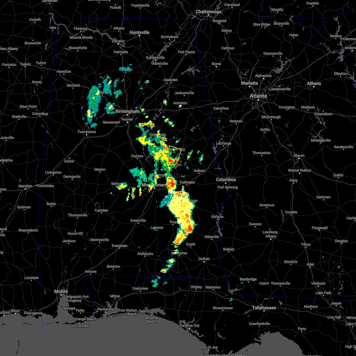 At 1227 pm cdt, a severe thunderstorm was located near western lake martin, or near equality, moving north at 10 mph (radar indicated). Hazards include 60 mph wind gusts and quarter size hail. Hail damage to vehicles is expected. Expect wind damage to roofs, siding, and trees. At 1227 pm cdt, a severe thunderstorm was located near western lake martin, or near equality, moving north at 10 mph (radar indicated). Hazards include 60 mph wind gusts and quarter size hail. Hail damage to vehicles is expected. Expect wind damage to roofs, siding, and trees.
|
| 12/30/2021 9:41 AM CST |
 At 940 am cst, a severe thunderstorm was located over goodwater, moving east at 35 mph (radar indicated). Hazards include 60 mph wind gusts and penny size hail. expect damage to roofs, siding, and trees At 940 am cst, a severe thunderstorm was located over goodwater, moving east at 35 mph (radar indicated). Hazards include 60 mph wind gusts and penny size hail. expect damage to roofs, siding, and trees
|
| 12/6/2021 11:07 AM CST |
 At 1107 am cst, severe thunderstorms were located along a line extending from mount cheaha to near ashland to hatchet, moving east at 45 mph (radar indicated). Hazards include 60 mph wind gusts. Expect damage to roofs, siding, and trees. locations impacted include, lineville, ashland, goodwater, barfield, parkdale, delta, hatchet, cleveland crossroads, cragford, hollins, roselle, lake chinnabee, millerville, mellow valley, gunthertown and motley. hail threat, radar indicated max hail size, <. 75 in wind threat, radar indicated max wind gust, 60 mph. At 1107 am cst, severe thunderstorms were located along a line extending from mount cheaha to near ashland to hatchet, moving east at 45 mph (radar indicated). Hazards include 60 mph wind gusts. Expect damage to roofs, siding, and trees. locations impacted include, lineville, ashland, goodwater, barfield, parkdale, delta, hatchet, cleveland crossroads, cragford, hollins, roselle, lake chinnabee, millerville, mellow valley, gunthertown and motley. hail threat, radar indicated max hail size, <. 75 in wind threat, radar indicated max wind gust, 60 mph.
|
| 12/6/2021 10:58 AM CST |
 At 1058 am cst, severe thunderstorms were located along a line extending from near grant town to 7 miles south of waldo to near hanover, moving east at 45 mph (radar indicated). Hazards include 60 mph wind gusts. Expect damage to roofs, siding, and trees. locations impacted include, sylacauga, lineville, ashland, goodwater, stewartville, waldo, barfield, parkdale, delta, hatchet, cleveland crossroads, cragford, overbrook, hollins, camp mac, chandler springs, ironaton, roselle, lake chinnabee and millerville. hail threat, radar indicated max hail size, <. 75 in wind threat, radar indicated max wind gust, 60 mph. At 1058 am cst, severe thunderstorms were located along a line extending from near grant town to 7 miles south of waldo to near hanover, moving east at 45 mph (radar indicated). Hazards include 60 mph wind gusts. Expect damage to roofs, siding, and trees. locations impacted include, sylacauga, lineville, ashland, goodwater, stewartville, waldo, barfield, parkdale, delta, hatchet, cleveland crossroads, cragford, overbrook, hollins, camp mac, chandler springs, ironaton, roselle, lake chinnabee and millerville. hail threat, radar indicated max hail size, <. 75 in wind threat, radar indicated max wind gust, 60 mph.
|
| 12/6/2021 10:42 AM CST |
 At 1042 am cst, severe thunderstorms were located along a line extending from talladega to talladega springs, moving east at 45 mph (radar indicated). Hazards include 60 mph wind gusts. expect damage to roofs, siding, and trees At 1042 am cst, severe thunderstorms were located along a line extending from talladega to talladega springs, moving east at 45 mph (radar indicated). Hazards include 60 mph wind gusts. expect damage to roofs, siding, and trees
|
| 7/31/2021 4:19 PM CDT |
 At 419 pm cdt, severe thunderstorms were located along a line extending from near parkdale to speed, moving southeast at 30 mph (radar indicated). Hazards include 60 mph wind gusts. Expect damage to roofs, siding, and trees. Locations impacted include, goodwater, rockford, stewartville, hanover, pentonville, parkdale, bradford, hatchet, crewsville, bentleyville and hissop. At 419 pm cdt, severe thunderstorms were located along a line extending from near parkdale to speed, moving southeast at 30 mph (radar indicated). Hazards include 60 mph wind gusts. Expect damage to roofs, siding, and trees. Locations impacted include, goodwater, rockford, stewartville, hanover, pentonville, parkdale, bradford, hatchet, crewsville, bentleyville and hissop.
|
| 7/31/2021 4:02 PM CDT |
 At 402 pm cdt, severe thunderstorms were located along a line extending from sylacauga to near lyle, moving southeast at 30 mph (radar indicated). Hazards include 60 mph wind gusts. Expect damage to roofs, siding, and trees. Locations impacted include, sylacauga, goodwater, rockford, weogufka, stewartville, hanover, lyle, pentonville, dollar, bradford, strickland crossroads, bentleyville, moriah, hatchet, unity, parkdale, crewsville, mitchell lake, higgins ferry park and gantts quarry. At 402 pm cdt, severe thunderstorms were located along a line extending from sylacauga to near lyle, moving southeast at 30 mph (radar indicated). Hazards include 60 mph wind gusts. Expect damage to roofs, siding, and trees. Locations impacted include, sylacauga, goodwater, rockford, weogufka, stewartville, hanover, lyle, pentonville, dollar, bradford, strickland crossroads, bentleyville, moriah, hatchet, unity, parkdale, crewsville, mitchell lake, higgins ferry park and gantts quarry.
|
| 7/31/2021 3:52 PM CDT |
 At 352 pm cdt, severe thunderstorms were located along a line extending from near sylacauga to dollar, moving southeast at 35 mph (radar indicated). Hazards include 60 mph wind gusts. Expect damage to roofs, siding, and trees. Locations impacted include, sylacauga, childersburg, goodwater, rockford, talladega springs, weogufka, stewartville, hanover, lyle, pentonville, dollar, bradford, strickland crossroads, bentleyville, marble valley, moriah, hatchet, fayetteville, unity and parkdale. At 352 pm cdt, severe thunderstorms were located along a line extending from near sylacauga to dollar, moving southeast at 35 mph (radar indicated). Hazards include 60 mph wind gusts. Expect damage to roofs, siding, and trees. Locations impacted include, sylacauga, childersburg, goodwater, rockford, talladega springs, weogufka, stewartville, hanover, lyle, pentonville, dollar, bradford, strickland crossroads, bentleyville, marble valley, moriah, hatchet, fayetteville, unity and parkdale.
|
| 7/31/2021 3:38 PM CDT |
 At 338 pm cdt, severe thunderstorms were located along a line extending from childersburg to near lay lake, moving southeast at 25 mph (radar indicated). Hazards include 60 mph wind gusts. expect damage to roofs, siding, and trees At 338 pm cdt, severe thunderstorms were located along a line extending from childersburg to near lay lake, moving southeast at 25 mph (radar indicated). Hazards include 60 mph wind gusts. expect damage to roofs, siding, and trees
|
| 5/4/2021 6:20 PM CDT |
 At 620 pm cdt, severe thunderstorms were located along a line extending from near parkdale to speed, moving east at 50 mph (radar indicated). Hazards include 70 mph wind gusts. this line of storms has a history of producing high winds and wind damage. Expect considerable tree damage. damage is likely to mobile homes, roofs, and outbuildings. Locations impacted include, goodwater, rockford, kellyton, weogufka, equality, stewartville, hanover, lyle, pentonville, dollar, bradford, cottage grove, strickland crossroads, bentleyville, marble valley, moriah, hatchet, nixburg, speed and highway 9 and highway 22. At 620 pm cdt, severe thunderstorms were located along a line extending from near parkdale to speed, moving east at 50 mph (radar indicated). Hazards include 70 mph wind gusts. this line of storms has a history of producing high winds and wind damage. Expect considerable tree damage. damage is likely to mobile homes, roofs, and outbuildings. Locations impacted include, goodwater, rockford, kellyton, weogufka, equality, stewartville, hanover, lyle, pentonville, dollar, bradford, cottage grove, strickland crossroads, bentleyville, marble valley, moriah, hatchet, nixburg, speed and highway 9 and highway 22.
|
| 5/4/2021 6:08 PM CDT |
 At 608 pm cdt, severe thunderstorms were located along a line extending from strickland crossroads to near marbury, moving east at 65 mph (radar indicated). Hazards include 70 mph wind gusts. Expect considerable tree damage. damage is likely to mobile homes, roofs, and outbuildings. Locations impacted include, goodwater, rockford, kellyton, weogufka, equality, stewartville, hanover, lyle, pentonville, dollar, bradford, cottage grove, strickland crossroads, bentleyville, marble valley, moriah, hatchet, nixburg, speed and highway 9 and highway 22. At 608 pm cdt, severe thunderstorms were located along a line extending from strickland crossroads to near marbury, moving east at 65 mph (radar indicated). Hazards include 70 mph wind gusts. Expect considerable tree damage. damage is likely to mobile homes, roofs, and outbuildings. Locations impacted include, goodwater, rockford, kellyton, weogufka, equality, stewartville, hanover, lyle, pentonville, dollar, bradford, cottage grove, strickland crossroads, bentleyville, marble valley, moriah, hatchet, nixburg, speed and highway 9 and highway 22.
|
| 5/4/2021 5:54 PM CDT |
 At 554 pm cdt, severe thunderstorms were located along a line extending from near lay lake to near pooles crossroads, moving east at 55 mph (radar indicated). Hazards include 60 mph wind gusts. expect damage to roofs, siding, and trees At 554 pm cdt, severe thunderstorms were located along a line extending from near lay lake to near pooles crossroads, moving east at 55 mph (radar indicated). Hazards include 60 mph wind gusts. expect damage to roofs, siding, and trees
|
| 3/25/2021 9:36 PM CDT |
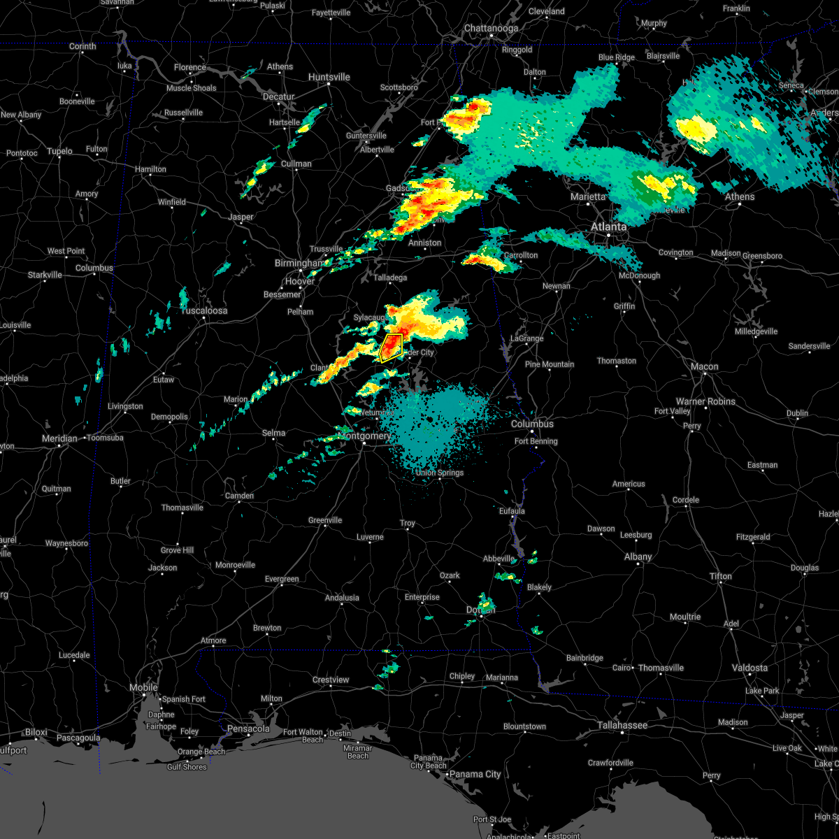 At 936 pm cdt, a severe thunderstorm was located over goodwater, moving northeast at 55 mph (radar indicated). Hazards include 60 mph wind gusts and quarter size hail. Hail damage to vehicles is expected. expect wind damage to roofs, siding, and trees. Locations impacted include, goodwater, kellyton, hatchet, crewsville, parkdale and bradford. At 936 pm cdt, a severe thunderstorm was located over goodwater, moving northeast at 55 mph (radar indicated). Hazards include 60 mph wind gusts and quarter size hail. Hail damage to vehicles is expected. expect wind damage to roofs, siding, and trees. Locations impacted include, goodwater, kellyton, hatchet, crewsville, parkdale and bradford.
|
| 3/25/2021 9:30 PM CDT |
 At 929 pm cdt, a severe thunderstorm capable of producing a tornado was located over crewsville, or near rockford, moving east at 70 mph (radar indicated rotation). Hazards include tornado. Flying debris will be dangerous to those caught without shelter. mobile homes will be damaged or destroyed. damage to roofs, windows, and vehicles will occur. tree damage is likely. Locations impacted include, goodwater, rockford, kellyton, hanover, bradford, hatchet, crewsville and bentleyville. At 929 pm cdt, a severe thunderstorm capable of producing a tornado was located over crewsville, or near rockford, moving east at 70 mph (radar indicated rotation). Hazards include tornado. Flying debris will be dangerous to those caught without shelter. mobile homes will be damaged or destroyed. damage to roofs, windows, and vehicles will occur. tree damage is likely. Locations impacted include, goodwater, rockford, kellyton, hanover, bradford, hatchet, crewsville and bentleyville.
|
| 3/25/2021 9:22 PM CDT |
 At 922 pm cdt, a confirmed tornado was located over lyle, or near rockford, moving northeast at 45 mph (radar confirmed tornado). Hazards include damaging tornado. Flying debris will be dangerous to those caught without shelter. mobile homes will be damaged or destroyed. damage to roofs, windows, and vehicles will occur. tree damage is likely. Locations impacted include, goodwater, rockford, kellyton, hanover, lyle, bradford, moriah, hatchet, crewsville, bentleyville, hissop and ray. At 922 pm cdt, a confirmed tornado was located over lyle, or near rockford, moving northeast at 45 mph (radar confirmed tornado). Hazards include damaging tornado. Flying debris will be dangerous to those caught without shelter. mobile homes will be damaged or destroyed. damage to roofs, windows, and vehicles will occur. tree damage is likely. Locations impacted include, goodwater, rockford, kellyton, hanover, lyle, bradford, moriah, hatchet, crewsville, bentleyville, hissop and ray.
|
| 3/25/2021 9:18 PM CDT |
 At 917 pm cdt, a confirmed tornado was located over rockford, moving east at 70 mph (radar confirmed tornado). Hazards include damaging tornado. Flying debris will be dangerous to those caught without shelter. mobile homes will be damaged or destroyed. damage to roofs, windows, and vehicles will occur. tree damage is likely. Locations impacted include, goodwater, rockford, kellyton, hanover, lyle, dollar, bradford, bentleyville, highway 9 and highway 22, moriah, hatchet, crewsville, mitchell lake, ray and hissop. At 917 pm cdt, a confirmed tornado was located over rockford, moving east at 70 mph (radar confirmed tornado). Hazards include damaging tornado. Flying debris will be dangerous to those caught without shelter. mobile homes will be damaged or destroyed. damage to roofs, windows, and vehicles will occur. tree damage is likely. Locations impacted include, goodwater, rockford, kellyton, hanover, lyle, dollar, bradford, bentleyville, highway 9 and highway 22, moriah, hatchet, crewsville, mitchell lake, ray and hissop.
|
| 3/25/2021 9:07 PM CDT |
 At 906 pm cdt, a confirmed tornado was located over higgins ferry park, or 10 miles east of clanton, moving east at 70 mph (radar confirmed tornado). Hazards include damaging tornado. Flying debris will be dangerous to those caught without shelter. mobile homes will be damaged or destroyed. damage to roofs, windows, and vehicles will occur. tree damage is likely. Locations impacted include, clanton, goodwater, rockford, kellyton, hanover, lyle, mitchell lake, dollar, bradford, cottage grove, bentleyville, highway 9 and highway 22, moriah, hatchet, higgins ferry park, crewsville, verbena, ray, mitchell dam and hissop. At 906 pm cdt, a confirmed tornado was located over higgins ferry park, or 10 miles east of clanton, moving east at 70 mph (radar confirmed tornado). Hazards include damaging tornado. Flying debris will be dangerous to those caught without shelter. mobile homes will be damaged or destroyed. damage to roofs, windows, and vehicles will occur. tree damage is likely. Locations impacted include, clanton, goodwater, rockford, kellyton, hanover, lyle, mitchell lake, dollar, bradford, cottage grove, bentleyville, highway 9 and highway 22, moriah, hatchet, higgins ferry park, crewsville, verbena, ray, mitchell dam and hissop.
|
| 3/25/2021 9:04 PM CDT |
 At 903 pm cdt, a severe thunderstorm capable of producing a tornado was located near verbena, or near clanton, moving east at 70 mph (radar indicated rotation). Hazards include tornado. Flying debris will be dangerous to those caught without shelter. mobile homes will be damaged or destroyed. damage to roofs, windows, and vehicles will occur. Tree damage is likely. At 903 pm cdt, a severe thunderstorm capable of producing a tornado was located near verbena, or near clanton, moving east at 70 mph (radar indicated rotation). Hazards include tornado. Flying debris will be dangerous to those caught without shelter. mobile homes will be damaged or destroyed. damage to roofs, windows, and vehicles will occur. Tree damage is likely.
|
| 3/25/2021 8:58 PM CDT |
 At 858 pm cdt, a severe thunderstorm was located over clanton, moving northeast at 55 mph (radar indicated). Hazards include golf ball size hail and 60 mph wind gusts. People and animals outdoors will be injured. expect hail damage to roofs, siding, windows, and vehicles. Expect wind damage to roofs, siding, and trees. At 858 pm cdt, a severe thunderstorm was located over clanton, moving northeast at 55 mph (radar indicated). Hazards include golf ball size hail and 60 mph wind gusts. People and animals outdoors will be injured. expect hail damage to roofs, siding, windows, and vehicles. Expect wind damage to roofs, siding, and trees.
|
| 3/17/2021 10:53 PM CDT |
 At 1053 pm cdt, severe thunderstorms were located along a line extending from near goodwater to tallassee to 6 miles west of beans crossroads, moving east at 50 mph (radar indicated). Hazards include 60 mph wind gusts. Expect damage to roofs, siding, and trees. Locations impacted include, tallassee, goodwater, kellyton, eclectic, martin dam, bradford, reeves airport, western lake martin, parkdale, hatchet, southern lake martin, kowaliga bridge, fishpond, yates dam, ray, cecil and yates reservoir. At 1053 pm cdt, severe thunderstorms were located along a line extending from near goodwater to tallassee to 6 miles west of beans crossroads, moving east at 50 mph (radar indicated). Hazards include 60 mph wind gusts. Expect damage to roofs, siding, and trees. Locations impacted include, tallassee, goodwater, kellyton, eclectic, martin dam, bradford, reeves airport, western lake martin, parkdale, hatchet, southern lake martin, kowaliga bridge, fishpond, yates dam, ray, cecil and yates reservoir.
|
| 3/17/2021 10:43 PM CDT |
 At 1042 pm cdt, a severe thunderstorm capable of producing a tornado was located over crewsville, or near kellyton, moving northeast at 55 mph (radar indicated rotation). Hazards include tornado. Flying debris will be dangerous to those caught without shelter. mobile homes will be damaged or destroyed. damage to roofs, windows, and vehicles will occur. Tree damage is likely. At 1042 pm cdt, a severe thunderstorm capable of producing a tornado was located over crewsville, or near kellyton, moving northeast at 55 mph (radar indicated rotation). Hazards include tornado. Flying debris will be dangerous to those caught without shelter. mobile homes will be damaged or destroyed. damage to roofs, windows, and vehicles will occur. Tree damage is likely.
|
| 3/17/2021 10:34 PM CDT |
 At 1033 pm cdt, severe thunderstorms were located along a line extending from stewartville to near blue ridge to grady, moving east at 55 mph (radar indicated). Hazards include 60 mph wind gusts. Expect damage to roofs, siding, and trees. Locations impacted include, montgomery, wetumpka, tallassee, goodwater, rockford, kellyton, equality, meadville, stewartville, weogufka, pike road, elmore, coosada, eclectic, martin dam, bradford, santuck, auburn university in montgomery, dublin and titus. At 1033 pm cdt, severe thunderstorms were located along a line extending from stewartville to near blue ridge to grady, moving east at 55 mph (radar indicated). Hazards include 60 mph wind gusts. Expect damage to roofs, siding, and trees. Locations impacted include, montgomery, wetumpka, tallassee, goodwater, rockford, kellyton, equality, meadville, stewartville, weogufka, pike road, elmore, coosada, eclectic, martin dam, bradford, santuck, auburn university in montgomery, dublin and titus.
|
| 3/17/2021 10:23 PM CDT |
 At 1023 pm cdt, severe thunderstorms were located along a line extending from near strickland crossroads to near jordan lake to highland home, moving east at 50 mph (radar indicated). Hazards include 60 mph wind gusts. Expect damage to roofs, siding, and trees. Locations impacted include, montgomery, prattville, millbrook, wetumpka, tallassee, goodwater, rockford, kellyton, weogufka, equality, meadville, stewartville, pike road, elmore, coosada, deatsville, eclectic, bradford, santuck and strickland crossroads. At 1023 pm cdt, severe thunderstorms were located along a line extending from near strickland crossroads to near jordan lake to highland home, moving east at 50 mph (radar indicated). Hazards include 60 mph wind gusts. Expect damage to roofs, siding, and trees. Locations impacted include, montgomery, prattville, millbrook, wetumpka, tallassee, goodwater, rockford, kellyton, weogufka, equality, meadville, stewartville, pike road, elmore, coosada, deatsville, eclectic, bradford, santuck and strickland crossroads.
|
| 3/17/2021 10:07 PM CDT |
 At 1007 pm cdt, severe thunderstorms were located along a line extending from 7 miles northeast of jemison to near booth to near lowndes county airport, moving east at 50 mph (radar indicated). Hazards include 60 mph wind gusts. Expect damage to roofs, siding, and trees. Locations impacted include, montgomery, prattville, millbrook, clanton, wetumpka, tallassee, jemison, goodwater, fort deposit, mosses, hayneville, rockford, kellyton, weogufka, equality, meadville, stewartville, pike road, thorsby and elmore. At 1007 pm cdt, severe thunderstorms were located along a line extending from 7 miles northeast of jemison to near booth to near lowndes county airport, moving east at 50 mph (radar indicated). Hazards include 60 mph wind gusts. Expect damage to roofs, siding, and trees. Locations impacted include, montgomery, prattville, millbrook, clanton, wetumpka, tallassee, jemison, goodwater, fort deposit, mosses, hayneville, rockford, kellyton, weogufka, equality, meadville, stewartville, pike road, thorsby and elmore.
|
| 3/17/2021 9:51 PM CDT |
 At 951 pm cdt, severe thunderstorms were located along a line extending from near ashby to near vida junction to 9 miles northwest of greenville, moving east at 50 mph (radar indicated). Hazards include 60 mph wind gusts. expect damage to roofs, siding, and trees At 951 pm cdt, severe thunderstorms were located along a line extending from near ashby to near vida junction to 9 miles northwest of greenville, moving east at 50 mph (radar indicated). Hazards include 60 mph wind gusts. expect damage to roofs, siding, and trees
|
| 3/17/2021 2:33 PM CDT |
 At 233 pm cdt, a tornado producing storm was located over weogufka, moving northeast at 25 mph (radar confirmed tornado). Hazards include damaging tornado. Flying debris will be dangerous to those caught without shelter. mobile homes will be damaged or destroyed. damage to roofs, windows, and vehicles will occur. Tree damage is likely. At 233 pm cdt, a tornado producing storm was located over weogufka, moving northeast at 25 mph (radar confirmed tornado). Hazards include damaging tornado. Flying debris will be dangerous to those caught without shelter. mobile homes will be damaged or destroyed. damage to roofs, windows, and vehicles will occur. Tree damage is likely.
|
| 7/12/2020 2:48 PM CDT |
 At 247 pm cdt, severe thunderstorms were located along a line extending from 6 miles southwest of ashland to near kellyton to dollar, moving southeast at 40 mph (radar indicated). Hazards include 60 mph wind gusts and penny size hail. Expect damage to roofs, siding, and trees. Locations impacted include, alexander city, dadeville, lineville, ashland, goodwater, camp hill, rockford, kellyton, equality, weogufka, jacksons` gap, new site, goldville, dollar, bradford, bentleyville, hatchet, hillabee creek, mitchell lake and western lake martin. At 247 pm cdt, severe thunderstorms were located along a line extending from 6 miles southwest of ashland to near kellyton to dollar, moving southeast at 40 mph (radar indicated). Hazards include 60 mph wind gusts and penny size hail. Expect damage to roofs, siding, and trees. Locations impacted include, alexander city, dadeville, lineville, ashland, goodwater, camp hill, rockford, kellyton, equality, weogufka, jacksons` gap, new site, goldville, dollar, bradford, bentleyville, hatchet, hillabee creek, mitchell lake and western lake martin.
|
| 7/12/2020 2:31 PM CDT |
 At 231 pm cdt, severe thunderstorms were located along a line extending from 6 miles east of winterboro to near parkdale to near lay lake, moving southeast at 45 mph (radar indicated). Hazards include 60 mph wind gusts and nickel size hail. these storms have a history of producing wind damage. Expect damage to roofs, siding, and trees. Locations impacted include, alexander city, sylacauga, dadeville, lineville, ashland, goodwater, camp hill, rockford, kellyton, talladega springs, equality, stewartville, weogufka, jacksons` gap, new site, goldville, dollar, bradford, strickland crossroads and bentleyville. At 231 pm cdt, severe thunderstorms were located along a line extending from 6 miles east of winterboro to near parkdale to near lay lake, moving southeast at 45 mph (radar indicated). Hazards include 60 mph wind gusts and nickel size hail. these storms have a history of producing wind damage. Expect damage to roofs, siding, and trees. Locations impacted include, alexander city, sylacauga, dadeville, lineville, ashland, goodwater, camp hill, rockford, kellyton, talladega springs, equality, stewartville, weogufka, jacksons` gap, new site, goldville, dollar, bradford, strickland crossroads and bentleyville.
|
| 7/12/2020 2:25 PM CDT |
 At 225 pm cdt, a severe thunderstorm was located near parkdale, or near stewartville, moving southeast at 35 mph (radar indicated). Hazards include 60 mph wind gusts. expect damage to roofs, siding, and trees At 225 pm cdt, a severe thunderstorm was located near parkdale, or near stewartville, moving southeast at 35 mph (radar indicated). Hazards include 60 mph wind gusts. expect damage to roofs, siding, and trees
|
| 5/22/2020 4:36 PM CDT |
 At 436 pm cdt, a severe thunderstorm was located over stewartville, moving northeast at 10 mph (radar indicated). Hazards include 60 mph wind gusts and quarter size hail. Hail damage to vehicles is expected. Expect wind damage to roofs, siding, and trees. At 436 pm cdt, a severe thunderstorm was located over stewartville, moving northeast at 10 mph (radar indicated). Hazards include 60 mph wind gusts and quarter size hail. Hail damage to vehicles is expected. Expect wind damage to roofs, siding, and trees.
|
| 4/19/2020 7:00 AM CDT | Quarter sized hail reported 1.7 miles N of Goodwater, AL, social media photo of large hail accumulation south of goodwater. |
| 4/19/2020 6:53 AM CDT |
 At 653 am cdt, a severe thunderstorm was located over crewsville, or near rockford, moving east at 60 mph. this is a very dangerous storm (radar indicated). Hazards include 80 mph wind gusts and golf ball size hail. Flying debris will be dangerous to those caught without shelter. mobile homes will be heavily damaged. expect considerable damage to roofs, windows, and vehicles. extensive tree damage and power outages are likely. Locations impacted include, alexander city, dadeville, goodwater, camp hill, rockford, kellyton, jacksons` gap, new site, goldville, hanover, pentonville, bradford, cottage grove, bentleyville, hatchet, nixburg, hillabee creek, eastern lake martin, northern lake martin and highway 9 and highway 22. At 653 am cdt, a severe thunderstorm was located over crewsville, or near rockford, moving east at 60 mph. this is a very dangerous storm (radar indicated). Hazards include 80 mph wind gusts and golf ball size hail. Flying debris will be dangerous to those caught without shelter. mobile homes will be heavily damaged. expect considerable damage to roofs, windows, and vehicles. extensive tree damage and power outages are likely. Locations impacted include, alexander city, dadeville, goodwater, camp hill, rockford, kellyton, jacksons` gap, new site, goldville, hanover, pentonville, bradford, cottage grove, bentleyville, hatchet, nixburg, hillabee creek, eastern lake martin, northern lake martin and highway 9 and highway 22.
|
| 4/19/2020 6:46 AM CDT |
 At 646 am cdt, a severe thunderstorm was located over bentleyville, or near weogufka, moving east at 60 mph. this is a very dangerous storm (radar indicated). Hazards include 80 mph wind gusts and half dollar size hail. Flying debris will be dangerous to those caught without shelter. mobile homes will be heavily damaged. expect considerable damage to roofs, windows, and vehicles. Extensive tree damage and power outages are likely. At 646 am cdt, a severe thunderstorm was located over bentleyville, or near weogufka, moving east at 60 mph. this is a very dangerous storm (radar indicated). Hazards include 80 mph wind gusts and half dollar size hail. Flying debris will be dangerous to those caught without shelter. mobile homes will be heavily damaged. expect considerable damage to roofs, windows, and vehicles. Extensive tree damage and power outages are likely.
|
| 4/12/2020 11:10 PM CDT |
 At 1109 pm cdt, severe thunderstorms were located along a line extending from winterboro to near verbena, moving east at 40 mph (radar indicated). Hazards include 60 mph wind gusts. Expect damage to roofs, siding, and trees. Locations impacted include, alexander city, sylacauga, childersburg, ashland, goodwater, rockford, kellyton, talladega springs, equality, stewartville, weogufka, waldo, dollar, bradford, strickland crossroads, bentleyville, hatchet, hillabee creek, alpine and western lake martin. At 1109 pm cdt, severe thunderstorms were located along a line extending from winterboro to near verbena, moving east at 40 mph (radar indicated). Hazards include 60 mph wind gusts. Expect damage to roofs, siding, and trees. Locations impacted include, alexander city, sylacauga, childersburg, ashland, goodwater, rockford, kellyton, talladega springs, equality, stewartville, weogufka, waldo, dollar, bradford, strickland crossroads, bentleyville, hatchet, hillabee creek, alpine and western lake martin.
|
| 4/12/2020 10:59 PM CDT |
 At 1059 pm cdt, severe thunderstorms were located along a line extending from near harpersville to near pooles crossroads, moving east at 30 mph (radar indicated). Hazards include 60 mph wind gusts. expect damage to roofs, siding, and trees At 1059 pm cdt, severe thunderstorms were located along a line extending from near harpersville to near pooles crossroads, moving east at 30 mph (radar indicated). Hazards include 60 mph wind gusts. expect damage to roofs, siding, and trees
|
| 3/31/2020 9:08 AM CDT |
 At 908 am cdt, severe thunderstorms were located along a line extending from mount cheaha to near ashland to near kellyton, moving east at 60 mph (radar indicated). Hazards include 60 mph wind gusts. Expect damage to roofs, siding, and trees. Locations impacted include, alexander city, lineville, ashland, goodwater, kellyton, new site, goldville, hillabee creek, hanover, bradford, barfield, parkdale, delta, hatchet, cleveland crossroads, cragford, hollins, hackneyville, motley and roselle. At 908 am cdt, severe thunderstorms were located along a line extending from mount cheaha to near ashland to near kellyton, moving east at 60 mph (radar indicated). Hazards include 60 mph wind gusts. Expect damage to roofs, siding, and trees. Locations impacted include, alexander city, lineville, ashland, goodwater, kellyton, new site, goldville, hillabee creek, hanover, bradford, barfield, parkdale, delta, hatchet, cleveland crossroads, cragford, hollins, hackneyville, motley and roselle.
|
| 3/31/2020 8:54 AM CDT |
 At 854 am cdt, severe thunderstorms were located along a line extending from near talladega to 7 miles northeast of parkdale to hanover, moving east at 60 mph (radar indicated). Hazards include 60 mph wind gusts. Expect damage to roofs, siding, and trees. Locations impacted include, talladega, alexander city, sylacauga, childersburg, lineville, ashland, goodwater, kellyton, talladega springs, stewartville, weogufka, harpersville, new site, waldo, goldville, alpine bay resort, bradford, strickland crossroads, hatchet and hillabee creek. At 854 am cdt, severe thunderstorms were located along a line extending from near talladega to 7 miles northeast of parkdale to hanover, moving east at 60 mph (radar indicated). Hazards include 60 mph wind gusts. Expect damage to roofs, siding, and trees. Locations impacted include, talladega, alexander city, sylacauga, childersburg, lineville, ashland, goodwater, kellyton, talladega springs, stewartville, weogufka, harpersville, new site, waldo, goldville, alpine bay resort, bradford, strickland crossroads, hatchet and hillabee creek.
|
| 3/31/2020 8:38 AM CDT |
 At 837 am cdt, severe thunderstorms were located along a line extending from coosa island to near sylacauga to near lay lake dam, moving east at 60 mph (radar indicated). Hazards include 60 mph wind gusts. expect damage to roofs, siding, and trees At 837 am cdt, severe thunderstorms were located along a line extending from coosa island to near sylacauga to near lay lake dam, moving east at 60 mph (radar indicated). Hazards include 60 mph wind gusts. expect damage to roofs, siding, and trees
|
| 2/6/2020 5:48 AM CST |
 At 548 am cst, a severe thunderstorm was located near fayetteville, or near sylacauga, moving northeast at 60 mph (radar indicated). Hazards include 60 mph wind gusts. Expect damage to roofs, siding, and trees. Locations impacted include, sylacauga, goodwater, talladega springs, weogufka, stewartville, hanover, fayetteville, strickland crossroads, unity, sycamore, parkdale, moriah, lay lake, cleveland crossroads, sylacauga municipal airport, overbrook, gantts quarry, hollins, roselle and mignon. At 548 am cst, a severe thunderstorm was located near fayetteville, or near sylacauga, moving northeast at 60 mph (radar indicated). Hazards include 60 mph wind gusts. Expect damage to roofs, siding, and trees. Locations impacted include, sylacauga, goodwater, talladega springs, weogufka, stewartville, hanover, fayetteville, strickland crossroads, unity, sycamore, parkdale, moriah, lay lake, cleveland crossroads, sylacauga municipal airport, overbrook, gantts quarry, hollins, roselle and mignon.
|
| 2/6/2020 5:48 AM CST |
 A severe thunderstorm warning remains in effect until 630 am cst for south central talladega. northern coosa and southwestern clay counties. at 548 am cst, a severe thunderstorm was located near fayetteville, or near sylacauga, moving northeast at 60 mph. hazard. 60 mph wind gusts. A severe thunderstorm warning remains in effect until 630 am cst for south central talladega. northern coosa and southwestern clay counties. at 548 am cst, a severe thunderstorm was located near fayetteville, or near sylacauga, moving northeast at 60 mph. hazard. 60 mph wind gusts.
|
| 2/6/2020 5:38 AM CST |
 At 537 am cst, a severe thunderstorm was located over lay lake dam, or 10 miles south of talladega springs, moving northeast at 55 mph (radar indicated). Hazards include 60 mph wind gusts and penny size hail. expect damage to roofs, siding, and trees At 537 am cst, a severe thunderstorm was located over lay lake dam, or 10 miles south of talladega springs, moving northeast at 55 mph (radar indicated). Hazards include 60 mph wind gusts and penny size hail. expect damage to roofs, siding, and trees
|
| 1/11/2020 2:51 PM CST |
 At 250 pm cst, severe thunderstorms were located along a line extending from pleasant gap to near mount cheaha to near eclectic, moving east at 40 mph (radar indicated). Hazards include 70 mph wind gusts. Expect considerable tree damage. damage is likely to mobile homes, roofs, and outbuildings. Locations impacted include, anniston, oxford, piedmont, goodwater, kellyton, equality, cottage grove, highway 9 and highway 22, nixburg, mount cheaha, western lake martin, fishpond, ray, choccolocco and dearmanville. At 250 pm cst, severe thunderstorms were located along a line extending from pleasant gap to near mount cheaha to near eclectic, moving east at 40 mph (radar indicated). Hazards include 70 mph wind gusts. Expect considerable tree damage. damage is likely to mobile homes, roofs, and outbuildings. Locations impacted include, anniston, oxford, piedmont, goodwater, kellyton, equality, cottage grove, highway 9 and highway 22, nixburg, mount cheaha, western lake martin, fishpond, ray, choccolocco and dearmanville.
|
| 1/11/2020 2:29 PM CST |
 At 229 pm cst, severe thunderstorms were located along a line extending from 6 miles southwest of ball flat to waldo to near jordan lake, moving east at 40 mph (radar indicated). Hazards include 70 mph wind gusts. Expect considerable tree damage. damage is likely to mobile homes, roofs, and outbuildings. Locations impacted include, anniston, oxford, talladega, jacksonville, piedmont, goodwater, rockford, kellyton, equality, west end-cobb town, cobb town, fort mcclellan, saks, glencoe, weaver, munford, hobson city, waldo, bradford and bentleyville. At 229 pm cst, severe thunderstorms were located along a line extending from 6 miles southwest of ball flat to waldo to near jordan lake, moving east at 40 mph (radar indicated). Hazards include 70 mph wind gusts. Expect considerable tree damage. damage is likely to mobile homes, roofs, and outbuildings. Locations impacted include, anniston, oxford, talladega, jacksonville, piedmont, goodwater, rockford, kellyton, equality, west end-cobb town, cobb town, fort mcclellan, saks, glencoe, weaver, munford, hobson city, waldo, bradford and bentleyville.
|
| 1/11/2020 2:17 PM CST | Trees down along county road 511 and 49 near hollin in coosa county AL, 4.6 miles SE of Goodwater, AL |
| 1/11/2020 2:17 PM CST |
 At 217 pm cst, severe thunderstorms were located along a line extending from near jacksonville state university to near talladega to near deatsville, moving east at 40 mph (radar indicated). Hazards include 70 mph wind gusts. Expect considerable tree damage. damage is likely to mobile homes, roofs, and outbuildings. Locations impacted include, anniston, oxford, talladega, sylacauga, jacksonville, piedmont, goodwater, rockford, kellyton, equality, west end-cobb town, stewartville, weogufka, cobb town, fort mcclellan, saks, lincoln, glencoe, weaver and riverside. At 217 pm cst, severe thunderstorms were located along a line extending from near jacksonville state university to near talladega to near deatsville, moving east at 40 mph (radar indicated). Hazards include 70 mph wind gusts. Expect considerable tree damage. damage is likely to mobile homes, roofs, and outbuildings. Locations impacted include, anniston, oxford, talladega, sylacauga, jacksonville, piedmont, goodwater, rockford, kellyton, equality, west end-cobb town, stewartville, weogufka, cobb town, fort mcclellan, saks, lincoln, glencoe, weaver and riverside.
|
| 1/11/2020 2:04 PM CST |
 At 204 pm cst, severe thunderstorms were located along a line extending from 6 miles south of glencoe to near alpine to near booth, moving east at 40 mph (radar indicated). Hazards include 70 mph wind gusts. Expect considerable tree damage. damage is likely to mobile homes, roofs, and outbuildings. Locations impacted include, anniston, oxford, talladega, sylacauga, jacksonville, childersburg, piedmont, wilsonville, goodwater, rockford, kellyton, talladega springs, equality, west end-cobb town, stewartville, weogufka, cobb town, fort mcclellan, saks and lincoln. At 204 pm cst, severe thunderstorms were located along a line extending from 6 miles south of glencoe to near alpine to near booth, moving east at 40 mph (radar indicated). Hazards include 70 mph wind gusts. Expect considerable tree damage. damage is likely to mobile homes, roofs, and outbuildings. Locations impacted include, anniston, oxford, talladega, sylacauga, jacksonville, childersburg, piedmont, wilsonville, goodwater, rockford, kellyton, talladega springs, equality, west end-cobb town, stewartville, weogufka, cobb town, fort mcclellan, saks and lincoln.
|
| 1/11/2020 1:54 PM CST |
 At 154 pm cst, severe thunderstorms were located along a line extending from near neely henry lake to near childersburg to near vida junction, moving east at 40 mph (radar indicated). Hazards include 60 mph wind gusts. Expect damage to roofs, siding, and trees. Locations impacted include, anniston, oxford, talladega, sylacauga, jacksonville, childersburg, piedmont, wilsonville, goodwater, rockford, kellyton, talladega springs, equality, west end-cobb town, stewartville, weogufka, cobb town, fort mcclellan, saks and lincoln. At 154 pm cst, severe thunderstorms were located along a line extending from near neely henry lake to near childersburg to near vida junction, moving east at 40 mph (radar indicated). Hazards include 60 mph wind gusts. Expect damage to roofs, siding, and trees. Locations impacted include, anniston, oxford, talladega, sylacauga, jacksonville, childersburg, piedmont, wilsonville, goodwater, rockford, kellyton, talladega springs, equality, west end-cobb town, stewartville, weogufka, cobb town, fort mcclellan, saks and lincoln.
|
| 1/11/2020 1:40 PM CST |
 At 140 pm cst, severe thunderstorms were located along a line extending from near ashville to near westover to near mulberry, moving east at 40 mph (radar indicated). Hazards include 60 mph wind gusts. expect damage to roofs, siding, and trees At 140 pm cst, severe thunderstorms were located along a line extending from near ashville to near westover to near mulberry, moving east at 40 mph (radar indicated). Hazards include 60 mph wind gusts. expect damage to roofs, siding, and trees
|
| 3/14/2019 8:36 PM CDT |
 At 836 pm cdt, a severe thunderstorm capable of producing a tornado was located near parkdale, or near goodwater, moving east at 30 mph (radar indicated rotation). Hazards include tornado. Flying debris will be dangerous to those caught without shelter. mobile homes will be damaged or destroyed. damage to roofs, windows, and vehicles will occur. tree damage is likely. Locations impacted include, goodwater, hatchet, parkdale, hollins, hackneyville and cleveland crossroads. At 836 pm cdt, a severe thunderstorm capable of producing a tornado was located near parkdale, or near goodwater, moving east at 30 mph (radar indicated rotation). Hazards include tornado. Flying debris will be dangerous to those caught without shelter. mobile homes will be damaged or destroyed. damage to roofs, windows, and vehicles will occur. tree damage is likely. Locations impacted include, goodwater, hatchet, parkdale, hollins, hackneyville and cleveland crossroads.
|
| 3/14/2019 8:21 PM CDT |
 At 821 pm cdt, a severe thunderstorm capable of producing a tornado was located over weogufka, moving east at 30 mph (radar indicated rotation). Hazards include tornado. Flying debris will be dangerous to those caught without shelter. mobile homes will be damaged or destroyed. damage to roofs, windows, and vehicles will occur. Tree damage is likely. At 821 pm cdt, a severe thunderstorm capable of producing a tornado was located over weogufka, moving east at 30 mph (radar indicated rotation). Hazards include tornado. Flying debris will be dangerous to those caught without shelter. mobile homes will be damaged or destroyed. damage to roofs, windows, and vehicles will occur. Tree damage is likely.
|
| 7/21/2018 9:49 PM CDT |
 At 949 pm cdt, a severe thunderstorm was located near kellyton, moving southeast at 35 mph (radar indicated). Hazards include 60 mph wind gusts and quarter size hail. Hail damage to vehicles is expected. expect wind damage to roofs, siding, and trees. Locations impacted include, alexander city, goodwater, kellyton, jacksons` gap, hillabee creek, bradford, northern lake martin, wind creek state park, western lake martin, eastern lake martin, fishpond, hackneyville and eagle creek. At 949 pm cdt, a severe thunderstorm was located near kellyton, moving southeast at 35 mph (radar indicated). Hazards include 60 mph wind gusts and quarter size hail. Hail damage to vehicles is expected. expect wind damage to roofs, siding, and trees. Locations impacted include, alexander city, goodwater, kellyton, jacksons` gap, hillabee creek, bradford, northern lake martin, wind creek state park, western lake martin, eastern lake martin, fishpond, hackneyville and eagle creek.
|
| 7/21/2018 9:42 PM CDT |
 At 942 pm cdt, a severe thunderstorm was located over goodwater, moving southeast at 35 mph (radar indicated). Hazards include 60 mph wind gusts and quarter size hail. Hail damage to vehicles is expected. Expect wind damage to roofs, siding, and trees. At 942 pm cdt, a severe thunderstorm was located over goodwater, moving southeast at 35 mph (radar indicated). Hazards include 60 mph wind gusts and quarter size hail. Hail damage to vehicles is expected. Expect wind damage to roofs, siding, and trees.
|
| 7/21/2018 9:18 PM CDT |
 At 918 pm cdt, a severe thunderstorm was located over parkdale, or near goodwater, moving southeast at 45 mph (radar indicated). Hazards include 60 mph wind gusts and quarter size hail. Hail damage to vehicles is expected. Expect wind damage to roofs, siding, and trees. At 918 pm cdt, a severe thunderstorm was located over parkdale, or near goodwater, moving southeast at 45 mph (radar indicated). Hazards include 60 mph wind gusts and quarter size hail. Hail damage to vehicles is expected. Expect wind damage to roofs, siding, and trees.
|
| 6/28/2018 3:00 PM CDT | A roof of a mobile home was blown off near valley grove roa in clay county AL, 6.4 miles SE of Goodwater, AL |
| 6/28/2018 2:49 PM CDT |
 At 249 pm cdt, severe thunderstorms were located along a line extending from harpersville to 6 miles southwest of ashland to ephesus, moving south at 40 mph (emergency management). Hazards include 70 mph wind gusts and penny size hail. Expect considerable tree damage. Damage is likely to mobile homes, roofs, and outbuildings. At 249 pm cdt, severe thunderstorms were located along a line extending from harpersville to 6 miles southwest of ashland to ephesus, moving south at 40 mph (emergency management). Hazards include 70 mph wind gusts and penny size hail. Expect considerable tree damage. Damage is likely to mobile homes, roofs, and outbuildings.
|
| 6/15/2017 4:49 PM CDT |
 At 449 pm cdt, severe thunderstorms were located along a line extending from near ephesus to near dexter, moving east at 50 mph (radar indicated). Hazards include 60 mph wind gusts. Expect damage to roofs, siding, and trees. Locations impacted include, alexander city, sylacauga, roanoke, tallassee, dadeville, lineville, ashland, goodwater, camp hill, wedowee, rockford, kellyton, equality, stewartville, lake wedowee, weogufka, jacksons` gap, new site, wadley and waldo. At 449 pm cdt, severe thunderstorms were located along a line extending from near ephesus to near dexter, moving east at 50 mph (radar indicated). Hazards include 60 mph wind gusts. Expect damage to roofs, siding, and trees. Locations impacted include, alexander city, sylacauga, roanoke, tallassee, dadeville, lineville, ashland, goodwater, camp hill, wedowee, rockford, kellyton, equality, stewartville, lake wedowee, weogufka, jacksons` gap, new site, wadley and waldo.
|
| 6/15/2017 4:36 PM CDT |
 At 436 pm cdt, severe thunderstorms were located along a line extending from near bowdon to dexter, moving southeast at 40 mph (radar indicated). Hazards include 60 mph wind gusts. trees continue to be blown down by these storms. Expect damage to roofs, siding, and trees. Locations impacted include, alexander city, roanoke, tallassee, heflin, dadeville, lineville, ashland, goodwater, camp hill, wedowee, rockford, kellyton, weogufka, equality, stewartville, lake wedowee, jacksons` gap, new site, wadley and ranburne. At 436 pm cdt, severe thunderstorms were located along a line extending from near bowdon to dexter, moving southeast at 40 mph (radar indicated). Hazards include 60 mph wind gusts. trees continue to be blown down by these storms. Expect damage to roofs, siding, and trees. Locations impacted include, alexander city, roanoke, tallassee, heflin, dadeville, lineville, ashland, goodwater, camp hill, wedowee, rockford, kellyton, weogufka, equality, stewartville, lake wedowee, jacksons` gap, new site, wadley and ranburne.
|
| 6/15/2017 4:12 PM CDT |
 At 411 pm cdt, severe thunderstorms were located along a line extending from near mars hills to near booth, moving southeast at 50 mph (radar indicated). Hazards include 60 mph wind gusts. trees have been reported blown down by these storms. expect damage to roofs, siding, and trees At 411 pm cdt, severe thunderstorms were located along a line extending from near mars hills to near booth, moving southeast at 50 mph (radar indicated). Hazards include 60 mph wind gusts. trees have been reported blown down by these storms. expect damage to roofs, siding, and trees
|
| 4/5/2017 7:45 PM CDT | Quarter sized hail reported 9.1 miles ENE of Goodwater, AL, lots of hail ranging from pea to quarter size around hanover. |
| 3/10/2017 3:47 AM CST |
 At 347 am cst, severe thunderstorms were located along a line extending from near sparkling springs to near lyle, moving south at 45 mph (radar indicated). Hazards include 60 mph wind gusts. Expect damage to roofs, siding, and trees. Locations impacted include, alexander city, dadeville, goodwater, camp hill, rockford, kellyton, weogufka, equality, stewartville, jacksons` gap, new site, goldville, hanover, lyle, pentonville, bradford, cottage grove, bentleyville, strickland crossroads and moriah. At 347 am cst, severe thunderstorms were located along a line extending from near sparkling springs to near lyle, moving south at 45 mph (radar indicated). Hazards include 60 mph wind gusts. Expect damage to roofs, siding, and trees. Locations impacted include, alexander city, dadeville, goodwater, camp hill, rockford, kellyton, weogufka, equality, stewartville, jacksons` gap, new site, goldville, hanover, lyle, pentonville, bradford, cottage grove, bentleyville, strickland crossroads and moriah.
|
| 3/10/2017 3:24 AM CST |
 At 324 am cst, severe thunderstorms were located along a line extending from near lake wedowee to strickland crossroads, moving south at 45 mph (radar indicated). Hazards include 60 mph wind gusts. expect damage to roofs, siding, and trees At 324 am cst, severe thunderstorms were located along a line extending from near lake wedowee to strickland crossroads, moving south at 45 mph (radar indicated). Hazards include 60 mph wind gusts. expect damage to roofs, siding, and trees
|
| 3/1/2017 4:49 PM CST |
 At 449 pm cst, a severe thunderstorm was located over gap of the mountain, or near clanton, moving east at 45 mph (radar indicated). Hazards include 70 mph wind gusts and ping pong ball size hail. People and animals outdoors will be injured. expect hail damage to roofs, siding, windows, and vehicles. expect considerable tree damage. Wind damage is also likely to mobile homes, roofs, and outbuildings. At 449 pm cst, a severe thunderstorm was located over gap of the mountain, or near clanton, moving east at 45 mph (radar indicated). Hazards include 70 mph wind gusts and ping pong ball size hail. People and animals outdoors will be injured. expect hail damage to roofs, siding, windows, and vehicles. expect considerable tree damage. Wind damage is also likely to mobile homes, roofs, and outbuildings.
|
| 1/22/2017 12:32 PM CST |
 At 1231 pm cst, severe thunderstorms were located along a line extending from near clanton to 6 miles west of petrey, moving northeast at 60 mph (radar indicated). Hazards include 60 mph wind gusts and quarter size hail. Hail damage to vehicles is expected. Expect wind damage to roofs, siding, and trees. At 1231 pm cst, severe thunderstorms were located along a line extending from near clanton to 6 miles west of petrey, moving northeast at 60 mph (radar indicated). Hazards include 60 mph wind gusts and quarter size hail. Hail damage to vehicles is expected. Expect wind damage to roofs, siding, and trees.
|
| 1/21/2017 8:07 AM CST |
 At 807 am cst, severe thunderstorms were located along a line extending from near stewartville to near speed, moving northeast at 45 mph (radar indicated). Hazards include 60 mph wind gusts. expect damage to roofs, siding, and trees At 807 am cst, severe thunderstorms were located along a line extending from near stewartville to near speed, moving northeast at 45 mph (radar indicated). Hazards include 60 mph wind gusts. expect damage to roofs, siding, and trees
|
| 6/17/2016 4:46 PM CDT |
 At 446 pm cdt, severe thunderstorms were located along a line extending from near kellyton to near higgins ferry park, moving southeast at 30 mph (radar indicated). Hazards include 70 mph wind gusts. Expect considerable tree damage. damage is likely to mobile homes, roofs, and outbuildings. Locations impacted include, goodwater, rockford, kellyton, equality, lyle, highway 9 and highway 22, crewsville, cottage grove, higgins ferry park, bradford, pentonville, hatchet, bentleyville, hanover, speed, nixburg, moriah, dollar, mitchell lake and western lake martin. At 446 pm cdt, severe thunderstorms were located along a line extending from near kellyton to near higgins ferry park, moving southeast at 30 mph (radar indicated). Hazards include 70 mph wind gusts. Expect considerable tree damage. damage is likely to mobile homes, roofs, and outbuildings. Locations impacted include, goodwater, rockford, kellyton, equality, lyle, highway 9 and highway 22, crewsville, cottage grove, higgins ferry park, bradford, pentonville, hatchet, bentleyville, hanover, speed, nixburg, moriah, dollar, mitchell lake and western lake martin.
|
| 6/17/2016 4:36 PM CDT |
 At 436 pm cdt, severe thunderstorms were located along a line extending from goodwater to higgins ferry park, moving southeast at 25 mph (radar indicated). Hazards include 70 mph wind gusts. Expect considerable tree damage. damage is likely to mobile homes, roofs, and outbuildings. Locations impacted include, goodwater, rockford, kellyton, weogufka, stewartville, equality, lyle, unity, pentonville, hatchet, mitchell lake, moriah, highway 9 and highway 22, crewsville, cottage grove, bradford, bentleyville, hanover, speed and nixburg. At 436 pm cdt, severe thunderstorms were located along a line extending from goodwater to higgins ferry park, moving southeast at 25 mph (radar indicated). Hazards include 70 mph wind gusts. Expect considerable tree damage. damage is likely to mobile homes, roofs, and outbuildings. Locations impacted include, goodwater, rockford, kellyton, weogufka, stewartville, equality, lyle, unity, pentonville, hatchet, mitchell lake, moriah, highway 9 and highway 22, crewsville, cottage grove, bradford, bentleyville, hanover, speed and nixburg.
|
| 6/17/2016 4:22 PM CDT |
 At 422 pm cdt, severe thunderstorms were located along a line extending from stewartville to mitchell lake, moving southeast at 30 mph (radar indicated). Hazards include 70 mph wind gusts. Expect considerable tree damage. damage is likely to mobile homes, roofs, and outbuildings. Locations impacted include, goodwater, rockford, kellyton, weogufka, stewartville, equality, lyle, unity, pentonville, hatchet, marble valley, mitchell lake, moriah, highway 9 and highway 22, crewsville, cottage grove, bradford, bentleyville, hanover and speed. At 422 pm cdt, severe thunderstorms were located along a line extending from stewartville to mitchell lake, moving southeast at 30 mph (radar indicated). Hazards include 70 mph wind gusts. Expect considerable tree damage. damage is likely to mobile homes, roofs, and outbuildings. Locations impacted include, goodwater, rockford, kellyton, weogufka, stewartville, equality, lyle, unity, pentonville, hatchet, marble valley, mitchell lake, moriah, highway 9 and highway 22, crewsville, cottage grove, bradford, bentleyville, hanover and speed.
|
| 6/17/2016 3:58 PM CDT |
 At 358 pm cdt, severe thunderstorms were located along a line extending from near fayetteville to 6 miles north of gap of the mountain, moving southeast at 30 mph (radar indicated). Hazards include 60 mph wind gusts. Expect damage to roofs. siding. And trees. At 358 pm cdt, severe thunderstorms were located along a line extending from near fayetteville to 6 miles north of gap of the mountain, moving southeast at 30 mph (radar indicated). Hazards include 60 mph wind gusts. Expect damage to roofs. siding. And trees.
|
| 3/1/2016 6:50 PM CST |
 At 650 pm cst, a severe thunderstorm capable of producing a tornado was located over parkdale, or near goodwater, moving east at 45 mph (radar indicated rotation). Hazards include tornado. Flying debris will be dangerous to those caught without shelter. mobile homes will be damaged or destroyed. damage to roofs, windows and vehicles will occur. tree damage is likely. Locations impacted include, goodwater, new site, goldville, hillabee creek, parkdale, hackneyville, cleveland crossroads and hollins. At 650 pm cst, a severe thunderstorm capable of producing a tornado was located over parkdale, or near goodwater, moving east at 45 mph (radar indicated rotation). Hazards include tornado. Flying debris will be dangerous to those caught without shelter. mobile homes will be damaged or destroyed. damage to roofs, windows and vehicles will occur. tree damage is likely. Locations impacted include, goodwater, new site, goldville, hillabee creek, parkdale, hackneyville, cleveland crossroads and hollins.
|
| 3/1/2016 6:44 PM CST | Multiple trees down and power lines downand guard rail damaged in goodwater along old rock road and hwy 511... peterson lane...possible tornado in clay county AL, 5.1 miles SE of Goodwater, AL |
| 3/1/2016 6:44 PM CST |
 At 643 pm cst, a severe thunderstorm capable of producing a tornado was located near stewartville, moving east at 45 mph (radar indicated rotation). Hazards include tornado. Flying debris will be dangerous to those caught without shelter. mobile homes will be damaged or destroyed. damage to roofs, windows and vehicles will occur. Tree damage is likely. At 643 pm cst, a severe thunderstorm capable of producing a tornado was located near stewartville, moving east at 45 mph (radar indicated rotation). Hazards include tornado. Flying debris will be dangerous to those caught without shelter. mobile homes will be damaged or destroyed. damage to roofs, windows and vehicles will occur. Tree damage is likely.
|
| 7/22/2015 3:11 PM CDT |
 The severe thunderstorm warning for south central talladega and northern coosa counties will expire at 315 pm cdt, the storm which prompted the warning has weakened below severe limits, and no longer pose an immediate threat to life or property. therefore the warning will be allowed to expire. however gusty winds of 40 to 50 mph are still possible with this thunderstorm. The severe thunderstorm warning for south central talladega and northern coosa counties will expire at 315 pm cdt, the storm which prompted the warning has weakened below severe limits, and no longer pose an immediate threat to life or property. therefore the warning will be allowed to expire. however gusty winds of 40 to 50 mph are still possible with this thunderstorm.
|
| 7/22/2015 3:08 PM CDT |
 At 307 pm cdt, a severe thunderstorm was located over stewartville, moving southeast at 20 mph (radar indicated). Hazards include 60 mph wind gusts. Expect damage to roofs. siding and trees. Locations impacted include, sylacauga, goodwater, rockford, weogufka, stewartville, unity, bentleyville, hanover, parkdale, strickland crossroads, hatchet, marble valley, overbrook, mignon, gantts quarry and sylacauga municipal airport. At 307 pm cdt, a severe thunderstorm was located over stewartville, moving southeast at 20 mph (radar indicated). Hazards include 60 mph wind gusts. Expect damage to roofs. siding and trees. Locations impacted include, sylacauga, goodwater, rockford, weogufka, stewartville, unity, bentleyville, hanover, parkdale, strickland crossroads, hatchet, marble valley, overbrook, mignon, gantts quarry and sylacauga municipal airport.
|
| 7/22/2015 2:58 PM CDT |
 At 257 pm cdt, a severe thunderstorm was located near fayetteville, or near sylacauga, moving southeast at 20 mph (radar indicated). Hazards include 60 mph wind gusts. Expect damage to roofs. siding and trees. Locations impacted include, sylacauga, goodwater, rockford, talladega springs, weogufka, stewartville, fayetteville, unity, bentleyville, hanover, parkdale, strickland crossroads, hatchet, lay lake, overbrook, mignon, gantts quarry, sylacauga municipal airport and varnons. At 257 pm cdt, a severe thunderstorm was located near fayetteville, or near sylacauga, moving southeast at 20 mph (radar indicated). Hazards include 60 mph wind gusts. Expect damage to roofs. siding and trees. Locations impacted include, sylacauga, goodwater, rockford, talladega springs, weogufka, stewartville, fayetteville, unity, bentleyville, hanover, parkdale, strickland crossroads, hatchet, lay lake, overbrook, mignon, gantts quarry, sylacauga municipal airport and varnons.
|
| 7/22/2015 2:40 PM CDT |
 At 239 pm cdt, a severe thunderstorm was located near fayetteville, or near wilsonville, moving southeast at 20 mph (radar indicated). Hazards include 60 mph wind gusts. Expect damage to roofs. Siding and trees. At 239 pm cdt, a severe thunderstorm was located near fayetteville, or near wilsonville, moving southeast at 20 mph (radar indicated). Hazards include 60 mph wind gusts. Expect damage to roofs. Siding and trees.
|
| 7/14/2015 8:39 PM CDT |
 At 838 pm cdt, severe thunderstorms were located along a line extending from near lake wildwood to west blocton to 7 miles northwest of wilton to near calera to near wilsonville to logan martin dam, moving southeast at 65 mph (radar indicated). Hazards include 60 mph wind gusts. Expect damage to roofs. Siding and trees. At 838 pm cdt, severe thunderstorms were located along a line extending from near lake wildwood to west blocton to 7 miles northwest of wilton to near calera to near wilsonville to logan martin dam, moving southeast at 65 mph (radar indicated). Hazards include 60 mph wind gusts. Expect damage to roofs. Siding and trees.
|
| 7/3/2015 11:44 PM CDT |
 At 1144 pm cdt, severe thunderstorms were located along a line extending from parkdale to near highway 9 and highway 22 to near speed, moving east at 50 mph (radar indicated). Hazards include 70 mph wind gusts. Expect considerable tree damage. damage is likely to mobile homes, roofs and outbuildings. Locations impacted include, alexander city, dadeville, goodwater, camp hill, rockford, kellyton, equality, jacksons` gap, new site, goldville, western lake martin, pentonville, hatchet, eastern lake martin, hillabee creek, northern lake martin, wind creek state park, highway 9 and highway 22, crewsville and cottage grove. At 1144 pm cdt, severe thunderstorms were located along a line extending from parkdale to near highway 9 and highway 22 to near speed, moving east at 50 mph (radar indicated). Hazards include 70 mph wind gusts. Expect considerable tree damage. damage is likely to mobile homes, roofs and outbuildings. Locations impacted include, alexander city, dadeville, goodwater, camp hill, rockford, kellyton, equality, jacksons` gap, new site, goldville, western lake martin, pentonville, hatchet, eastern lake martin, hillabee creek, northern lake martin, wind creek state park, highway 9 and highway 22, crewsville and cottage grove.
|
| 7/3/2015 11:30 PM CDT |
 At 1129 pm cdt, severe thunderstorms were located along a line extending from stewartville to near bentleyville to near welona, moving east at 50 mph (radar indicated). Hazards include 60 mph wind gusts. Expect damage to roofs. Siding and trees. At 1129 pm cdt, severe thunderstorms were located along a line extending from stewartville to near bentleyville to near welona, moving east at 50 mph (radar indicated). Hazards include 60 mph wind gusts. Expect damage to roofs. Siding and trees.
|
| 4/25/2015 5:29 PM CDT | At 528 pm cdt, a severe thunderstorm was located over stewartville, moving east at 45 mph (radar indicated). Hazards include 60 mph wind gusts. Expect damage to roofs. siding and trees. locations impacted include, goodwater, kellyton, stewartville, hatchet, hanover, parkdale and bradford. 75in. |
| 4/25/2015 5:19 PM CDT | At 519 pm cdt, a severe thunderstorm was located near weogufka, moving east at 45 mph (radar indicated). Hazards include 60 mph wind gusts and quarter size hail. Hail damage to vehicles is expected. expect wind damage to roofs, siding and trees. locations impacted include, sylacauga, goodwater, kellyton, weogufka, stewartville, bradford, unity, hanover, hatchet, parkdale, strickland crossroads, overbrook and gantts quarry. 1. 00in. |
| 4/25/2015 5:06 PM CDT | At 505 pm cdt, a severe thunderstorm was located over lay lake, or near talladega springs, moving east at 45 mph (radar indicated). Hazards include 60 mph wind gusts and quarter size hail. Hail damage to vehicles is expected. Expect wind damage to roofs, siding and trees. |
| 3/23/2013 11:57 PM CDT | Trees and power lines reported down throughout the city of goodwate in coosa county AL, 0.4 miles SSW of Goodwater, AL |
| 1/1/0001 12:00 AM | Trees down near county road in clay county AL, 4.9 miles SSW of Goodwater, AL |
Hail Maps for Goodwater, AL


Connect with Interactive Hail Maps