

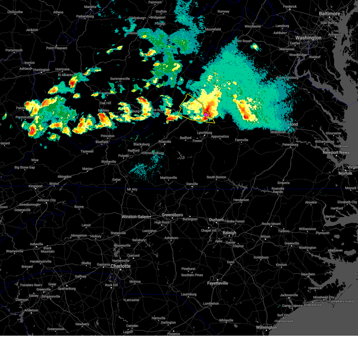
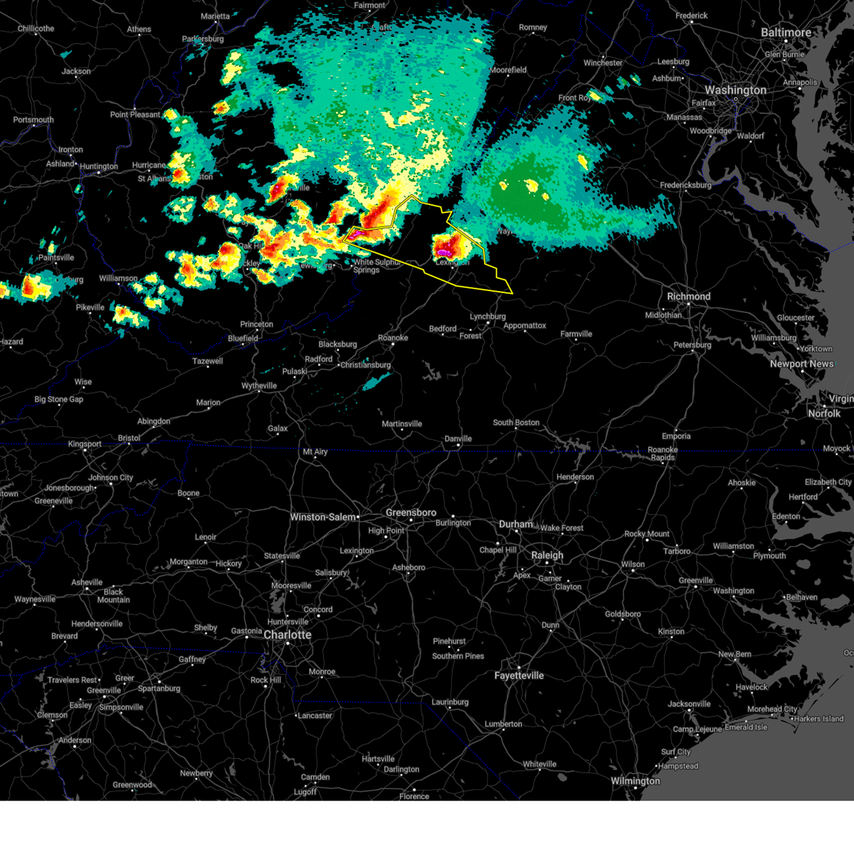
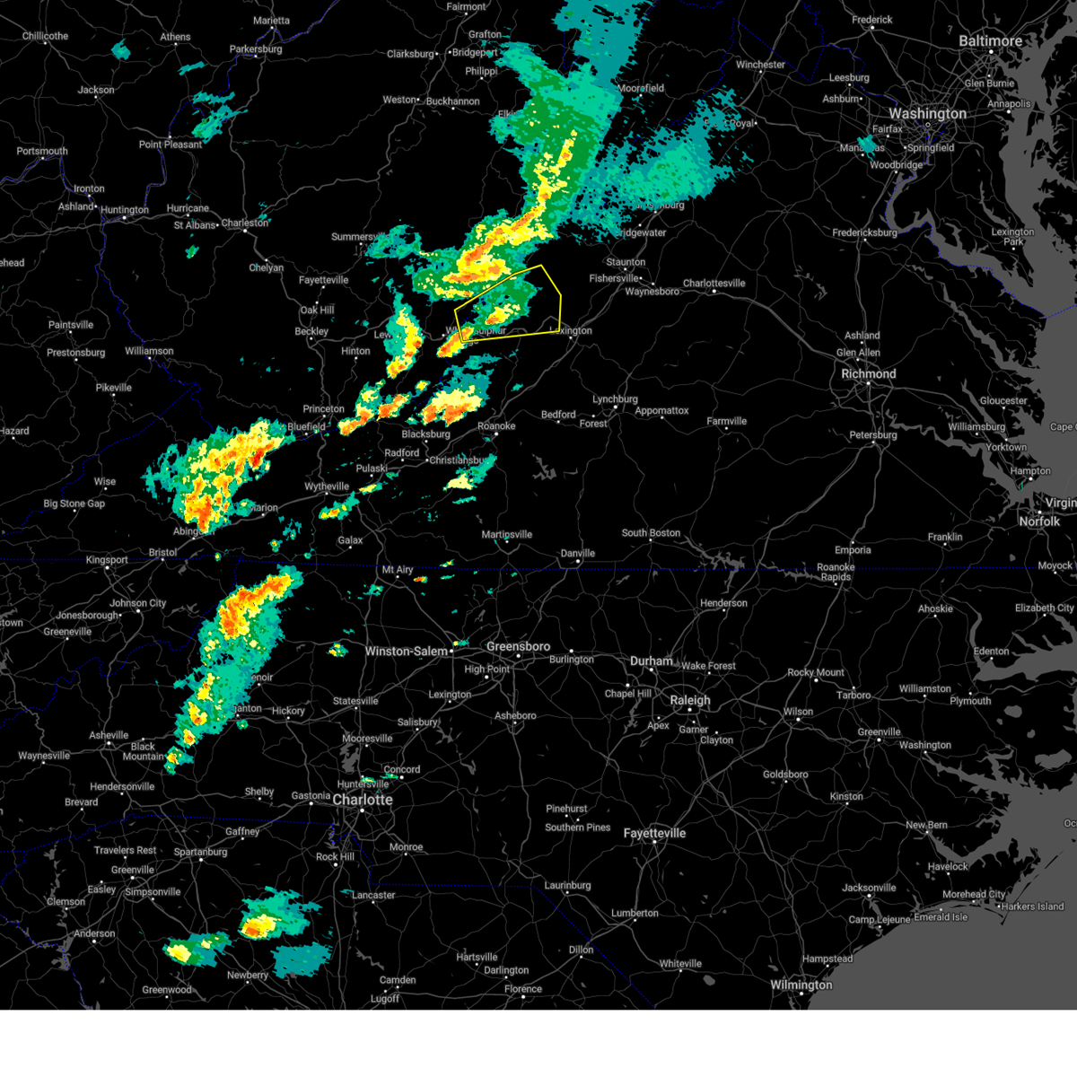
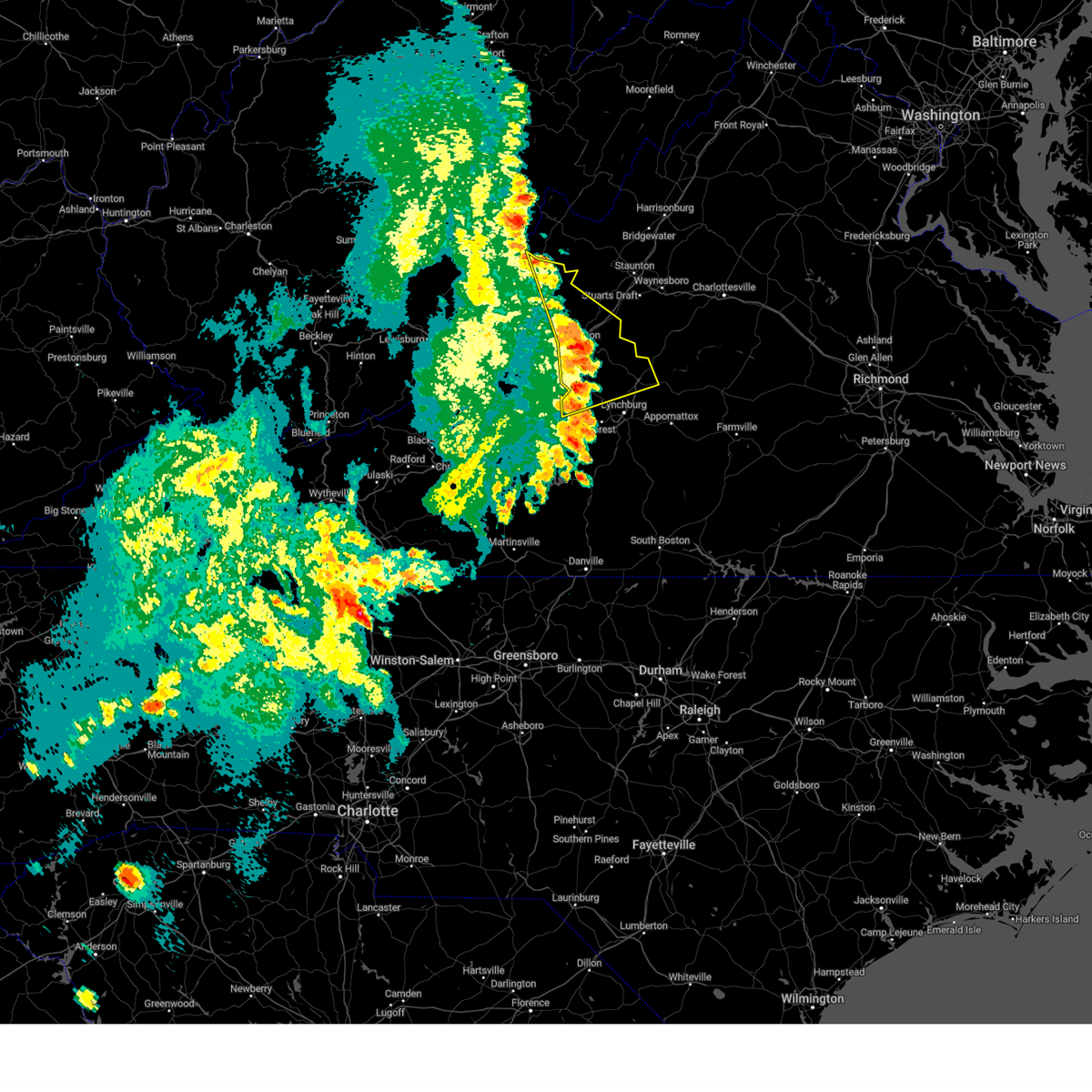
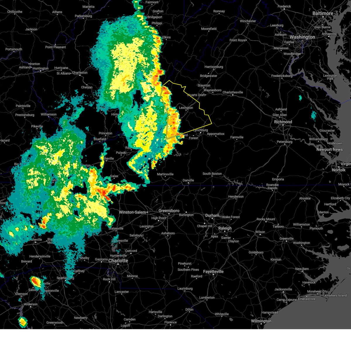
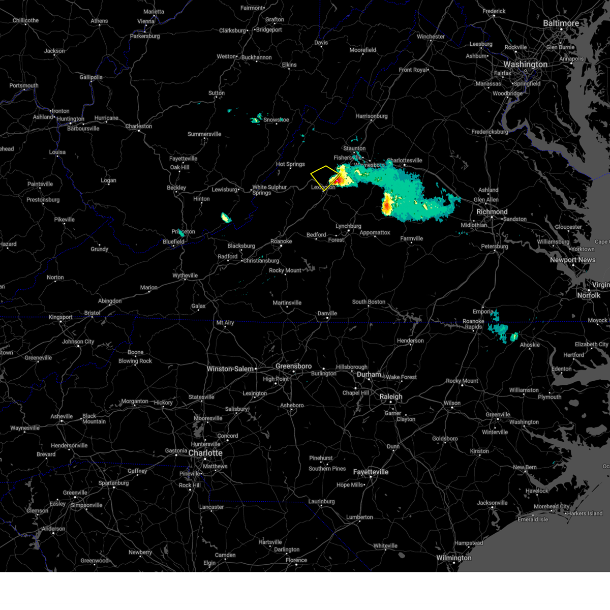
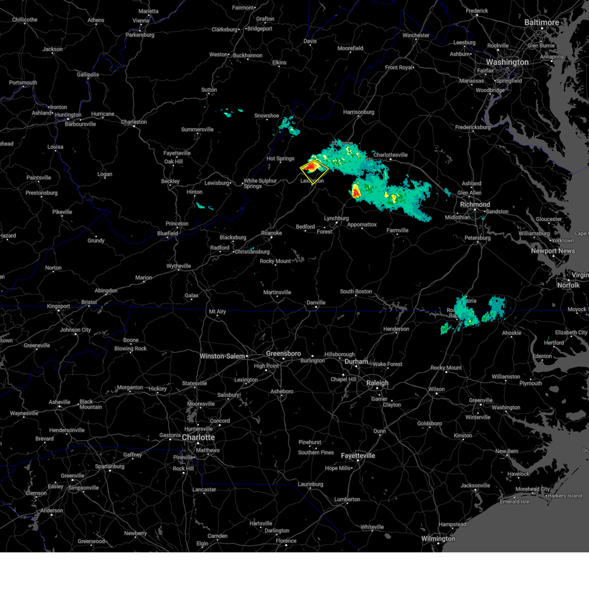
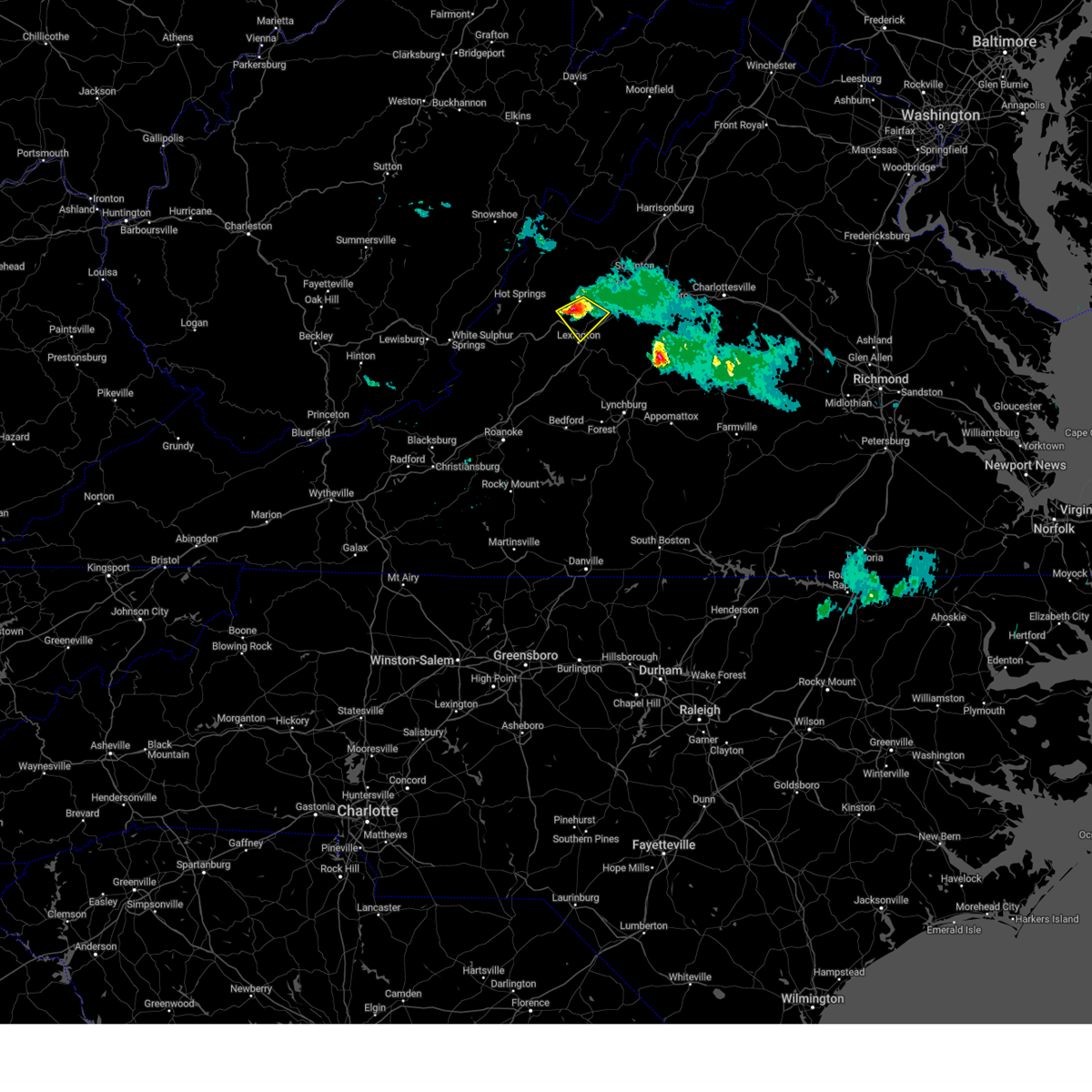
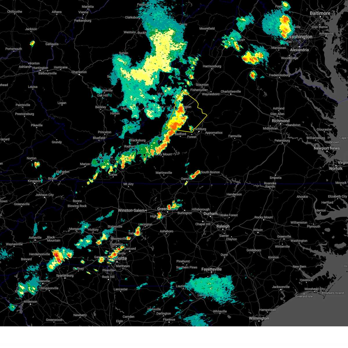
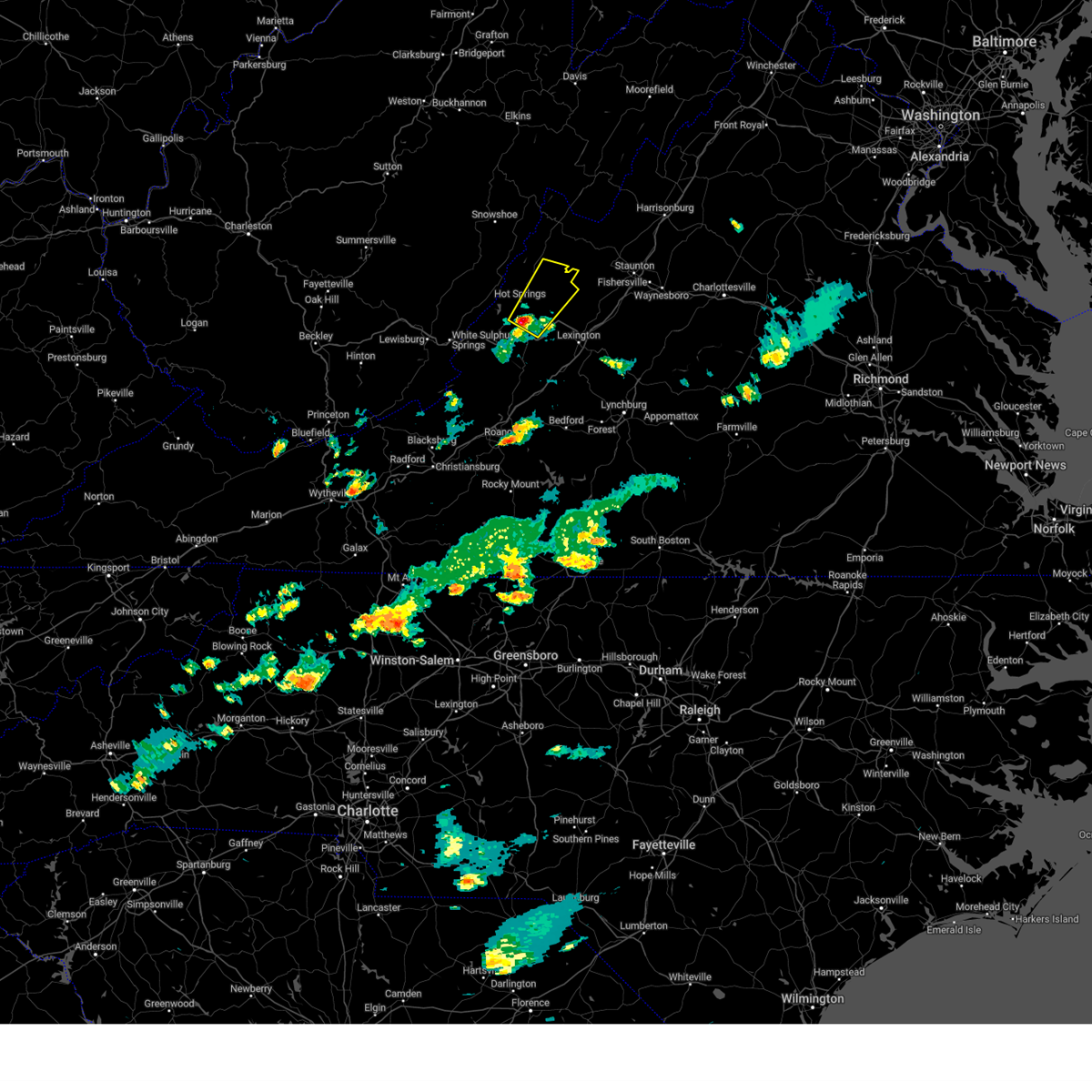
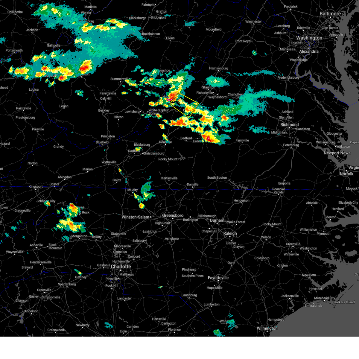
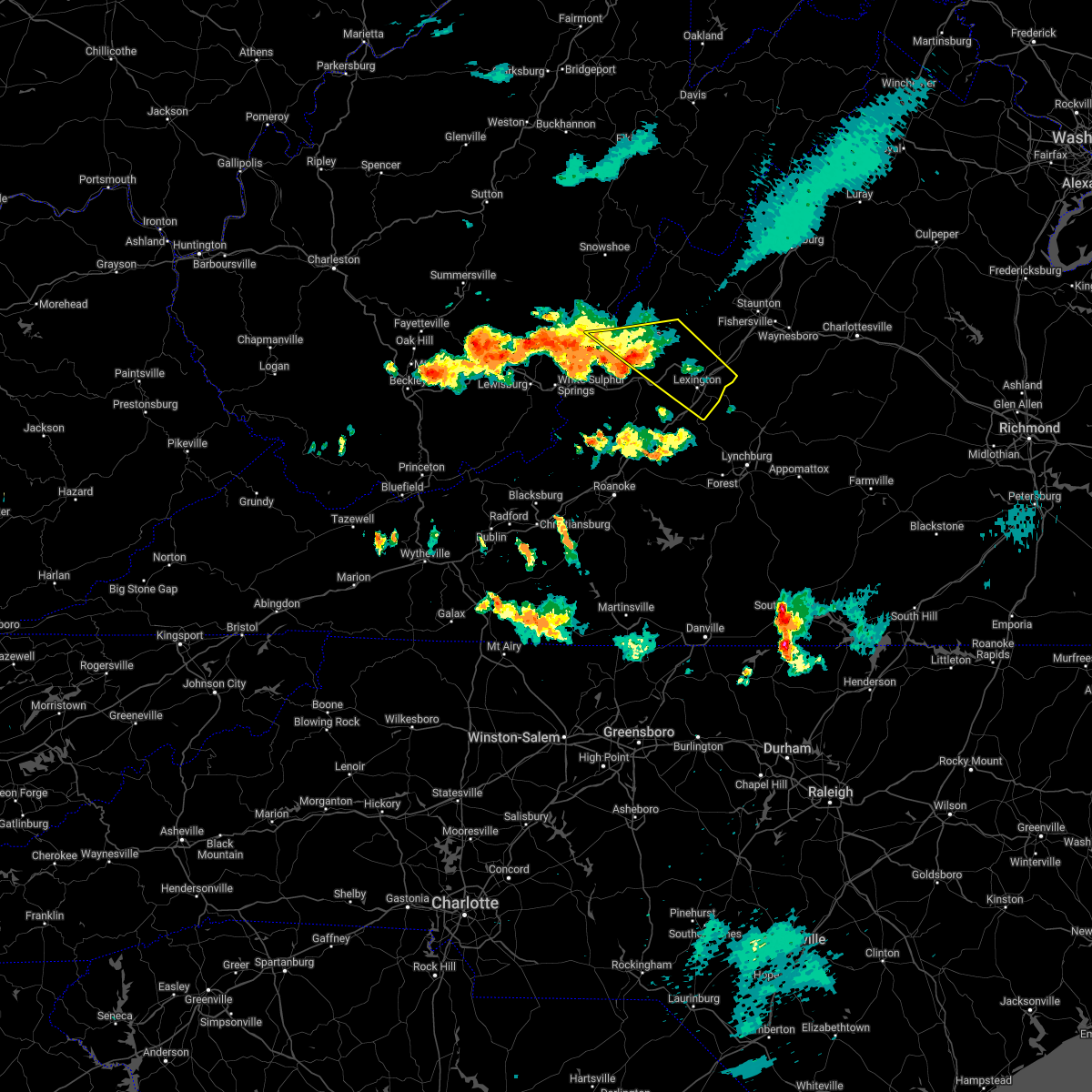
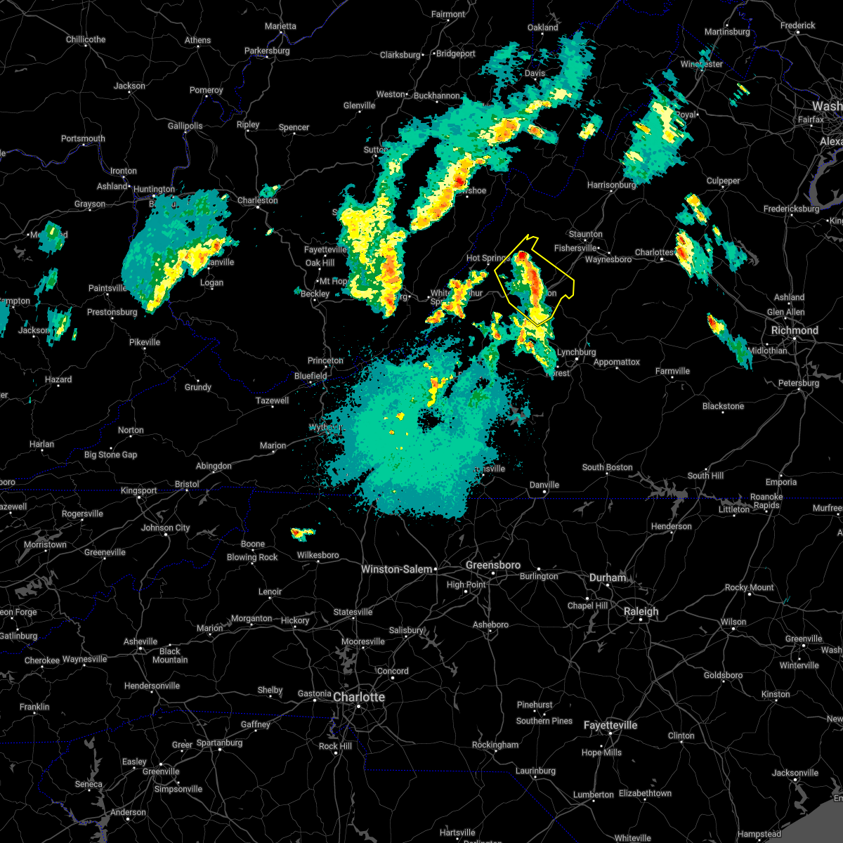
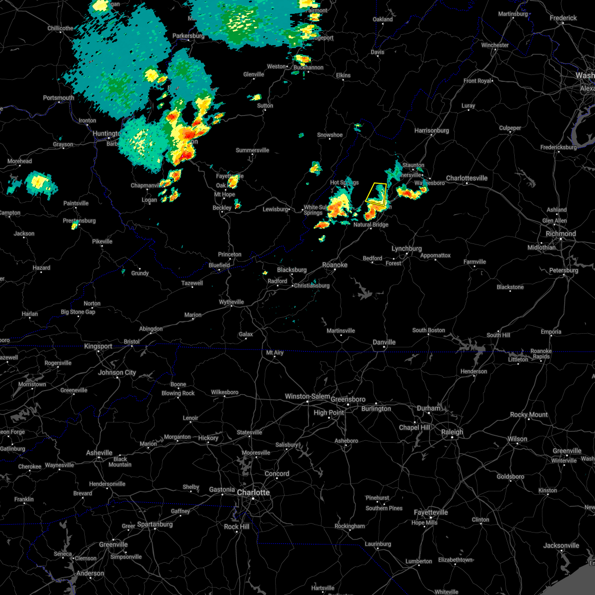
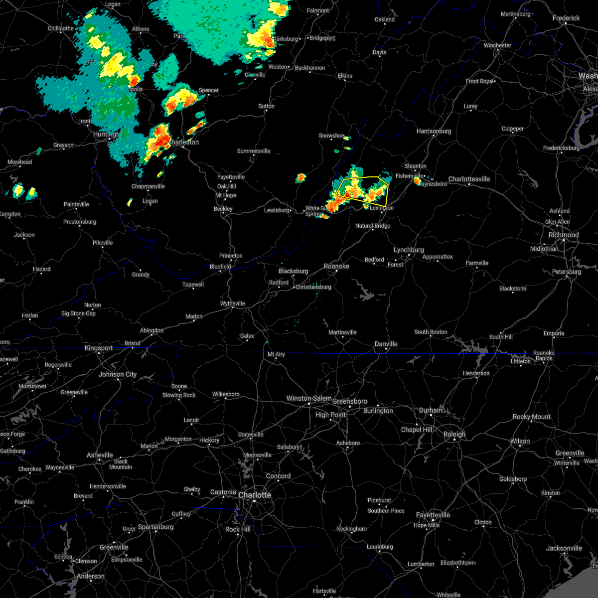
Hail Map for Goshen, VA
The Goshen, VA area has had 4 reports of on-the-ground hail by trained spotters, and has been under severe weather warnings 14 times during the past 12 months. Doppler radar has detected hail at or near Goshen, VA on 21 occasions, including 1 occasion during the past year.
| Name: | Goshen, VA |
| Where Located: | 54.9 miles NNE of Roanoke, VA |
| Map: | Google Map for Goshen, VA |
| Population: | 361 |
| Housing Units: | 192 |
| More Info: | Search Google for Goshen, VA |
0
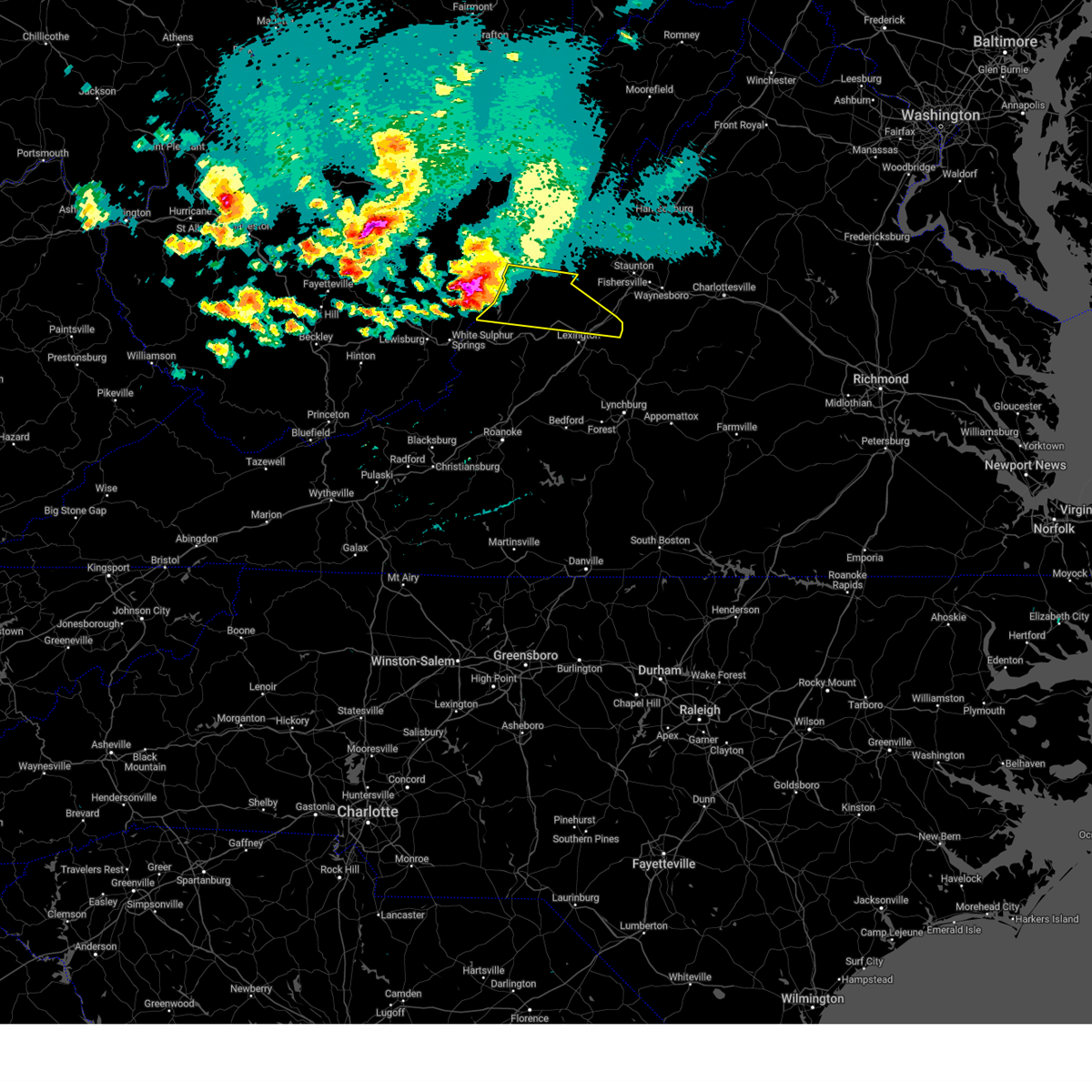
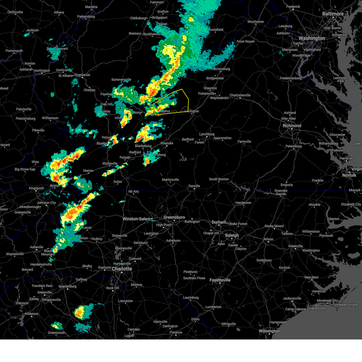
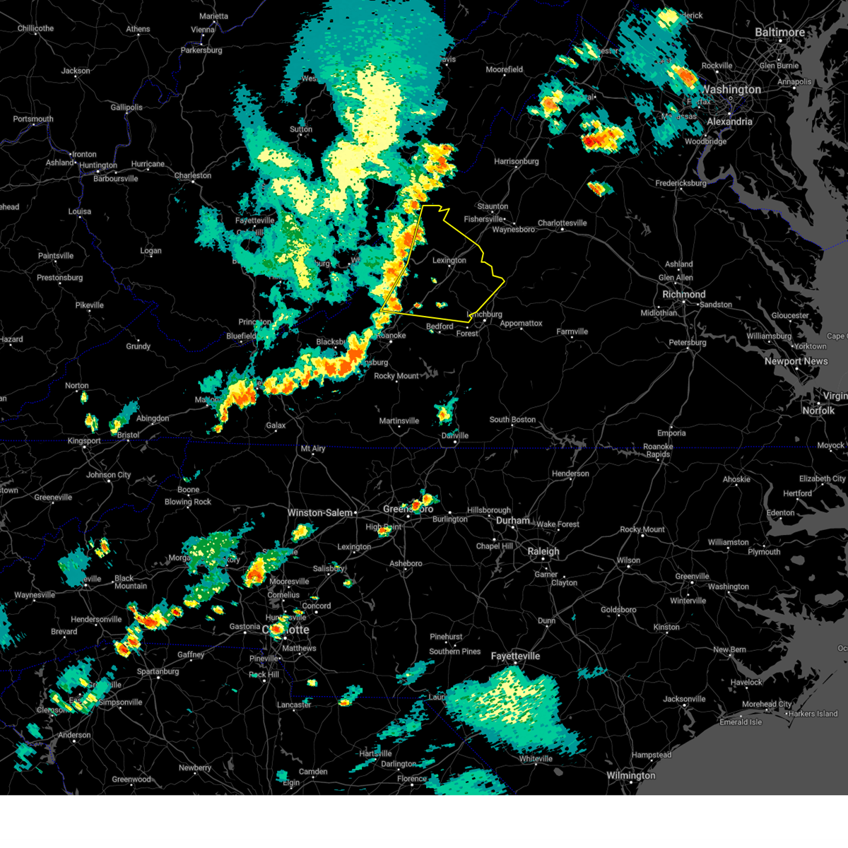
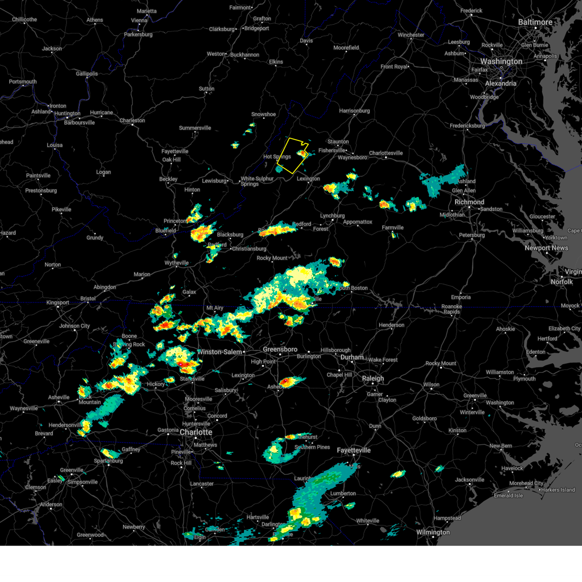
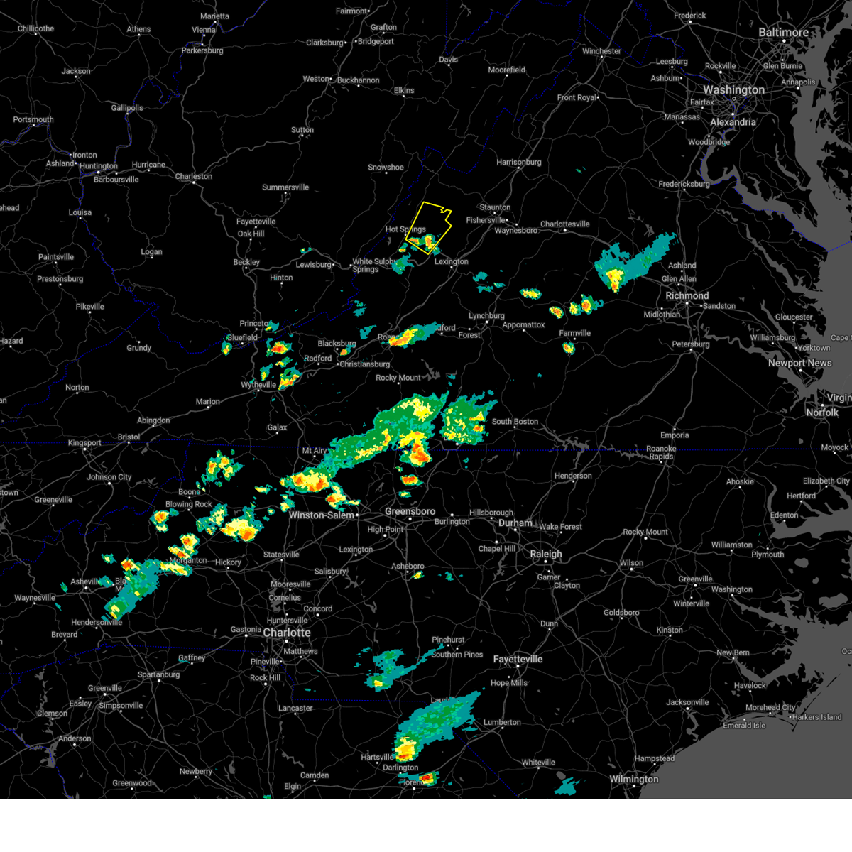
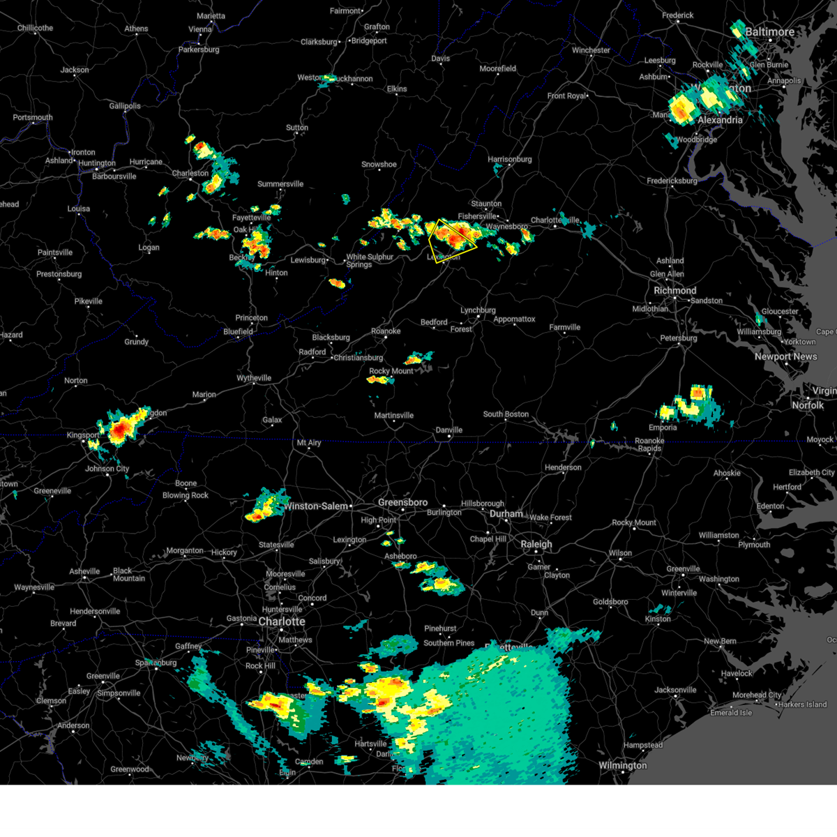
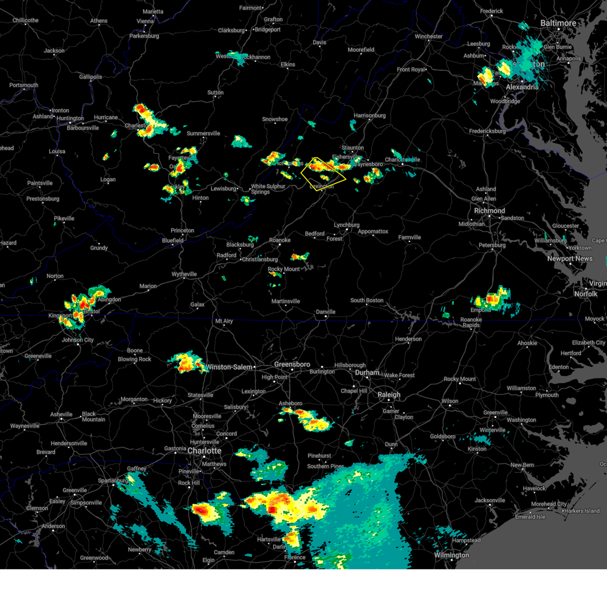
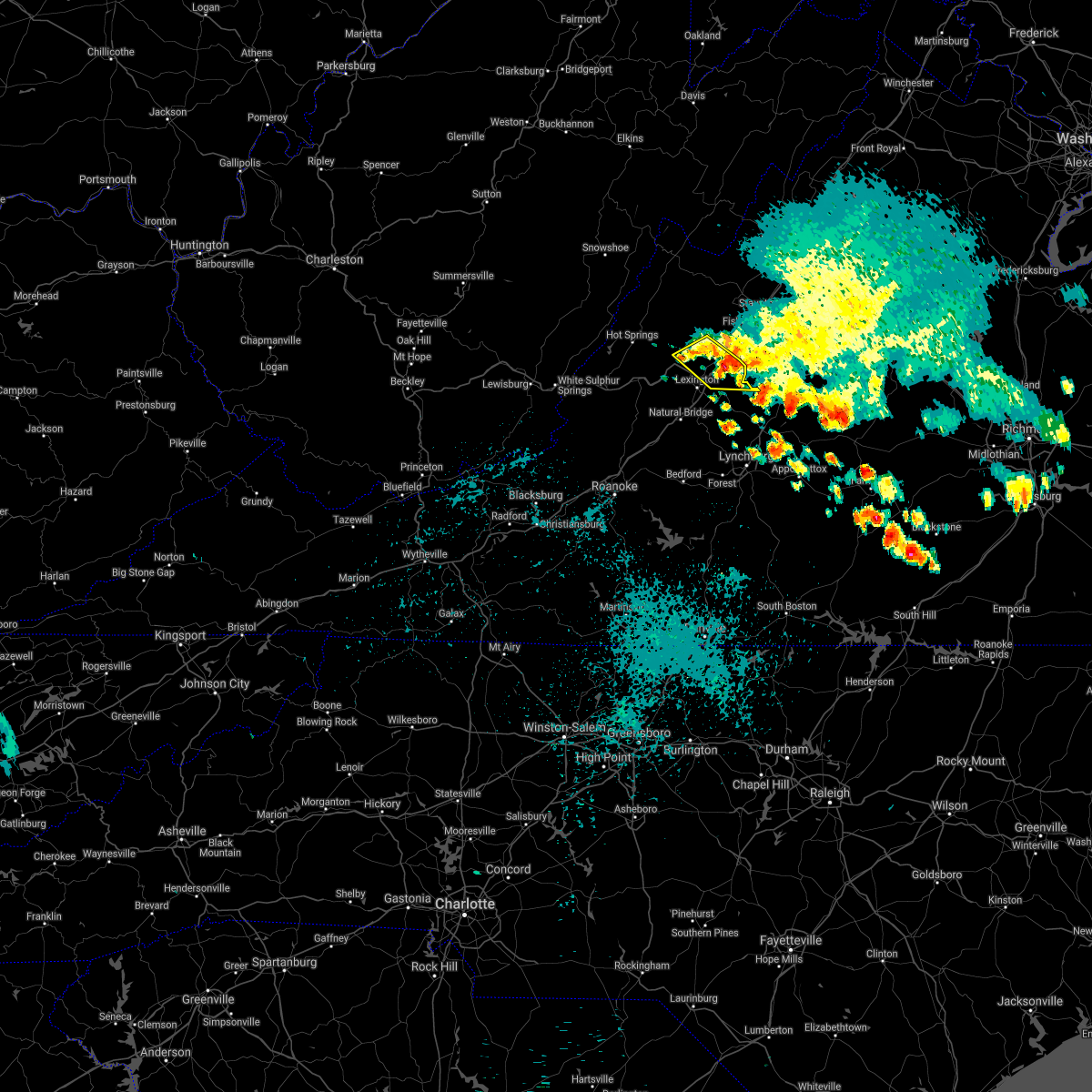
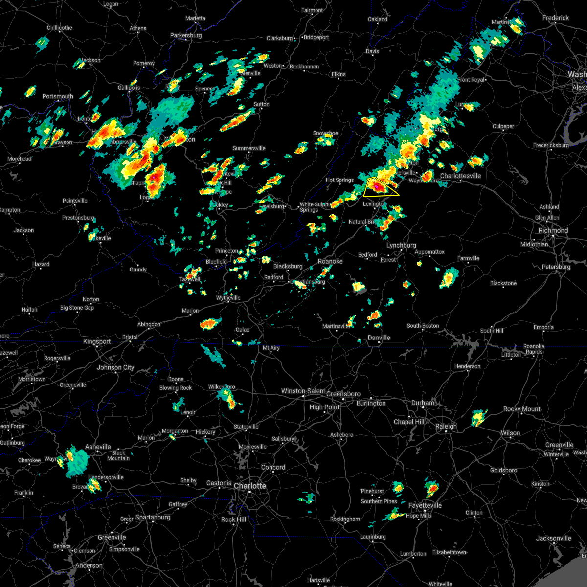
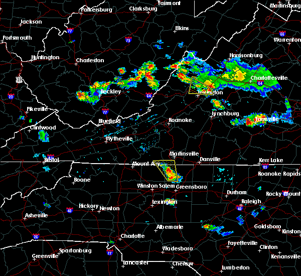
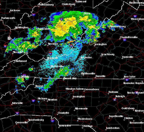
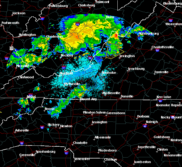
The Top Recent Hail Date for Goshen, VA is Monday, April 14, 2025 (3rd out of 21)

Hail and Wind Damage Spotted near Goshen, VA
| Date / Time | Report Details |
|---|---|
| 4/14/2025 9:12 PM EDT |
 The storms which prompted the warning have moved out of the area. therefore, the warning will be allowed to expire. a severe thunderstorm watch remains in effect until 1100 pm edt for central, southwestern and west central virginia. The storms which prompted the warning have moved out of the area. therefore, the warning will be allowed to expire. a severe thunderstorm watch remains in effect until 1100 pm edt for central, southwestern and west central virginia.
|
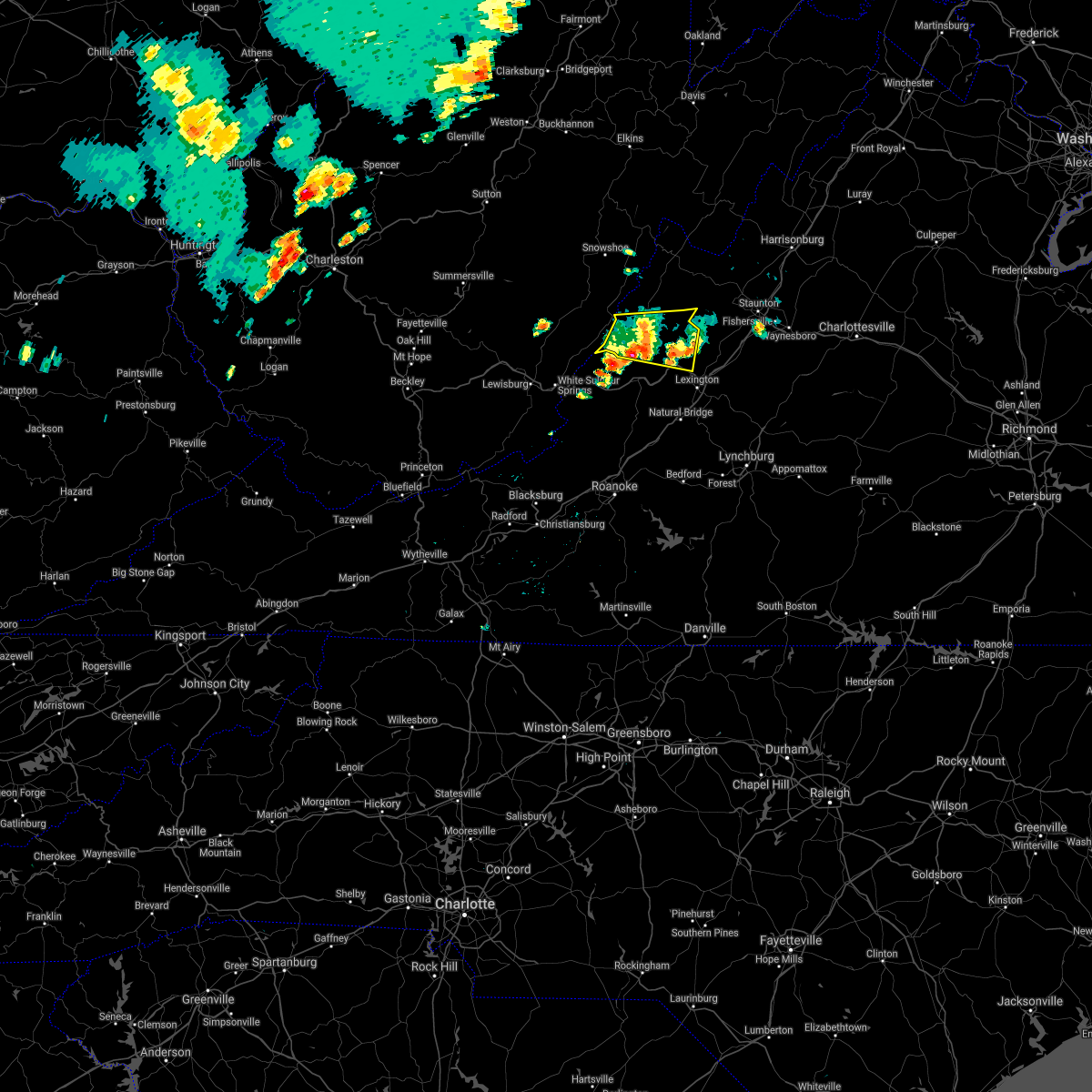
| 4/14/2025 8:36 PM EDT |
 At 835 pm edt, severe thunderstorms were located along a line extending from 9 miles northwest of staunton to near rockbridge baths to near nimrod hall, moving east at 60 mph (radar indicated). Hazards include ping pong ball size hail and 60 mph wind gusts. People and animals outdoors will be injured. expect hail damage to roofs, siding, windows, and vehicles. expect wind damage to roofs, siding, and trees. locations impacted include, lexington, buena vista, goshen, forks of buffalo, clifford, collierstown, and rockbridge baths. This includes the following location vmi. At 835 pm edt, severe thunderstorms were located along a line extending from 9 miles northwest of staunton to near rockbridge baths to near nimrod hall, moving east at 60 mph (radar indicated). Hazards include ping pong ball size hail and 60 mph wind gusts. People and animals outdoors will be injured. expect hail damage to roofs, siding, windows, and vehicles. expect wind damage to roofs, siding, and trees. locations impacted include, lexington, buena vista, goshen, forks of buffalo, clifford, collierstown, and rockbridge baths. This includes the following location vmi.
|
| 4/14/2025 8:36 PM EDT |
 the severe thunderstorm warning has been cancelled and is no longer in effect the severe thunderstorm warning has been cancelled and is no longer in effect
|
| 4/14/2025 8:20 PM EDT |
 the severe thunderstorm warning has been cancelled and is no longer in effect the severe thunderstorm warning has been cancelled and is no longer in effect
|
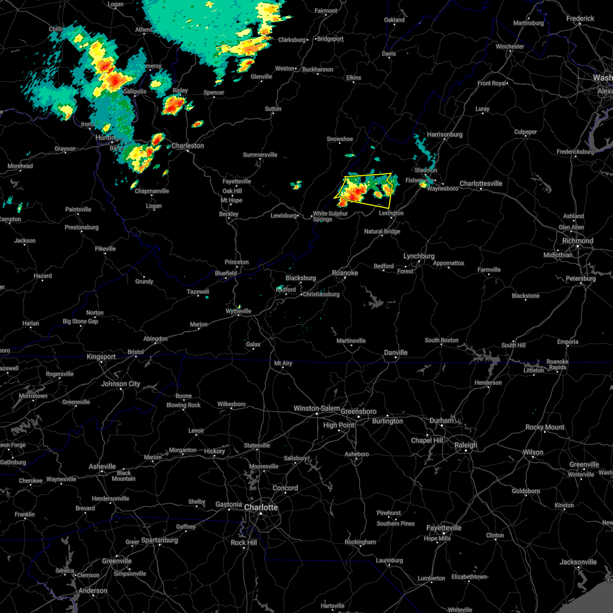
| 4/14/2025 8:20 PM EDT |
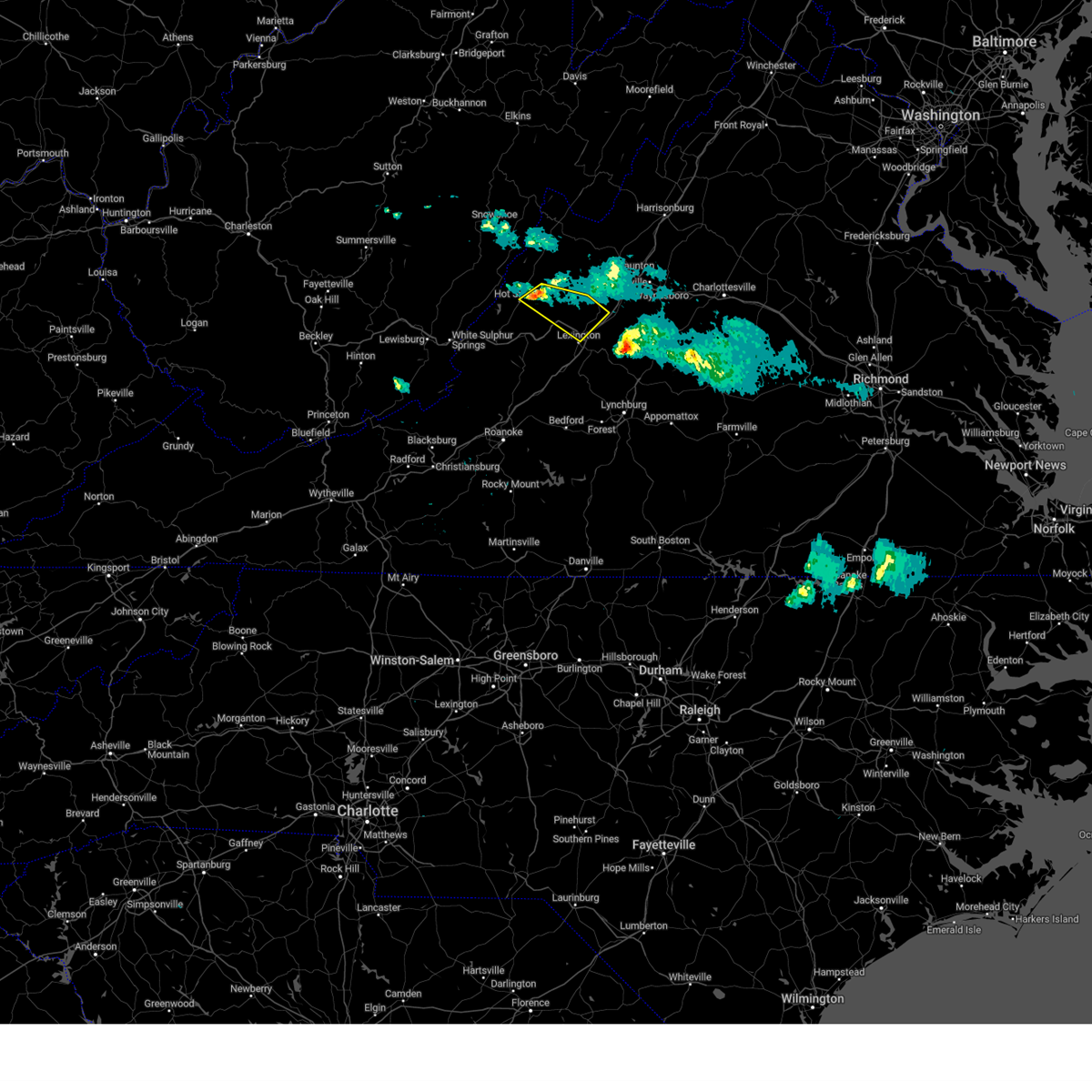
 At 820 pm edt, severe thunderstorms were located along a line extending from 11 miles east of burnsville to nimrod hall to ingalls field, moving east at 60 mph (radar indicated). Hazards include ping pong ball size hail and 60 mph wind gusts. People and animals outdoors will be injured. expect hail damage to roofs, siding, windows, and vehicles. expect wind damage to roofs, siding, and trees. locations impacted include, lexington, buena vista, clifton forge, goshen, forks of buffalo, millboro, and rockbridge baths. This includes the following location vmi. At 820 pm edt, severe thunderstorms were located along a line extending from 11 miles east of burnsville to nimrod hall to ingalls field, moving east at 60 mph (radar indicated). Hazards include ping pong ball size hail and 60 mph wind gusts. People and animals outdoors will be injured. expect hail damage to roofs, siding, windows, and vehicles. expect wind damage to roofs, siding, and trees. locations impacted include, lexington, buena vista, clifton forge, goshen, forks of buffalo, millboro, and rockbridge baths. This includes the following location vmi.
|
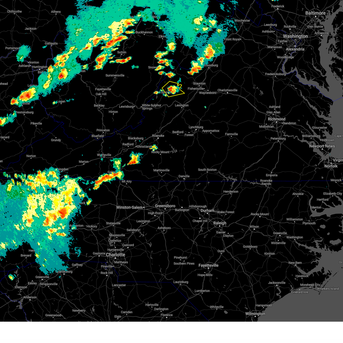
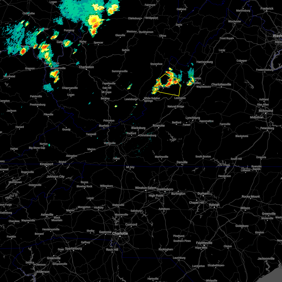
| 4/14/2025 7:57 PM EDT |
 Svrrnk the national weather service in blacksburg has issued a * severe thunderstorm warning for, northeastern alleghany county in west central virginia, the city of buena vista in west central virginia, the city of lexington in west central virginia, rockbridge county in west central virginia, bath county in west central virginia, northern amherst county in central virginia, east central greenbrier county in southeastern west virginia, * until 915 pm edt. * at 756 pm edt, severe thunderstorms were located along a line extending from 8 miles southeast of cass scenic railroad to near neola to near rorer, moving east at 60 mph (radar indicated). Hazards include ping pong ball size hail and 60 mph wind gusts. People and animals outdoors will be injured. expect hail damage to roofs, siding, windows, and vehicles. Expect wind damage to roofs, siding, and trees. Svrrnk the national weather service in blacksburg has issued a * severe thunderstorm warning for, northeastern alleghany county in west central virginia, the city of buena vista in west central virginia, the city of lexington in west central virginia, rockbridge county in west central virginia, bath county in west central virginia, northern amherst county in central virginia, east central greenbrier county in southeastern west virginia, * until 915 pm edt. * at 756 pm edt, severe thunderstorms were located along a line extending from 8 miles southeast of cass scenic railroad to near neola to near rorer, moving east at 60 mph (radar indicated). Hazards include ping pong ball size hail and 60 mph wind gusts. People and animals outdoors will be injured. expect hail damage to roofs, siding, windows, and vehicles. Expect wind damage to roofs, siding, and trees.
|
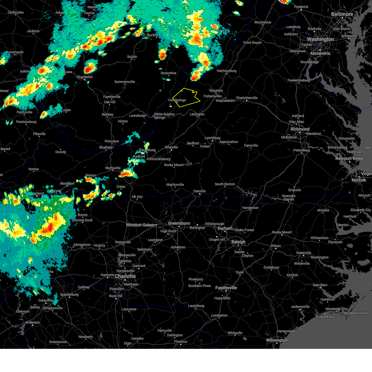
| 4/14/2025 7:06 PM EDT |
 Svrrnk the national weather service in blacksburg has issued a * severe thunderstorm warning for, northeastern alleghany county in west central virginia, northern rockbridge county in west central virginia, bath county in west central virginia, * until 800 pm edt. * at 705 pm edt, a severe thunderstorm was located near lake moomaw, or 7 miles northeast of neola, moving east at 65 mph (radar indicated). Hazards include 60 mph wind gusts and half dollar size hail. Hail damage to vehicles is expected. Expect wind damage to roofs, siding, and trees. Svrrnk the national weather service in blacksburg has issued a * severe thunderstorm warning for, northeastern alleghany county in west central virginia, northern rockbridge county in west central virginia, bath county in west central virginia, * until 800 pm edt. * at 705 pm edt, a severe thunderstorm was located near lake moomaw, or 7 miles northeast of neola, moving east at 65 mph (radar indicated). Hazards include 60 mph wind gusts and half dollar size hail. Hail damage to vehicles is expected. Expect wind damage to roofs, siding, and trees.
|
| 3/5/2025 4:31 PM EST |
 the severe thunderstorm warning has been cancelled and is no longer in effect the severe thunderstorm warning has been cancelled and is no longer in effect
|
| 3/5/2025 4:31 PM EST |
 At 431 pm est, a severe thunderstorm was located over carloover, or near clifton forge, moving northeast at 45 mph (radar indicated). Hazards include 60 mph wind gusts and quarter size hail. Hail damage to vehicles is expected. expect wind damage to roofs, siding, and trees. Locations impacted include, covington, clifton forge, goshen, millboro, rockbridge baths, warm springs, and jordan mines. At 431 pm est, a severe thunderstorm was located over carloover, or near clifton forge, moving northeast at 45 mph (radar indicated). Hazards include 60 mph wind gusts and quarter size hail. Hail damage to vehicles is expected. expect wind damage to roofs, siding, and trees. Locations impacted include, covington, clifton forge, goshen, millboro, rockbridge baths, warm springs, and jordan mines.
|
| 3/5/2025 4:03 PM EST |
 Svrrnk the national weather service in blacksburg has issued a * severe thunderstorm warning for, the city of covington in west central virginia, alleghany county in west central virginia, northeastern craig county in southwestern virginia, northwestern rockbridge county in west central virginia, bath county in west central virginia, northwestern botetourt county in west central virginia, southeastern greenbrier county in southeastern west virginia, northeastern monroe county in southeastern west virginia, * until 500 pm est. * at 402 pm est, a severe thunderstorm was located near earlehurst, or near alleghany, moving northeast at 45 mph (radar indicated). Hazards include 60 mph wind gusts and quarter size hail. Hail damage to vehicles is expected. Expect wind damage to roofs, siding, and trees. Svrrnk the national weather service in blacksburg has issued a * severe thunderstorm warning for, the city of covington in west central virginia, alleghany county in west central virginia, northeastern craig county in southwestern virginia, northwestern rockbridge county in west central virginia, bath county in west central virginia, northwestern botetourt county in west central virginia, southeastern greenbrier county in southeastern west virginia, northeastern monroe county in southeastern west virginia, * until 500 pm est. * at 402 pm est, a severe thunderstorm was located near earlehurst, or near alleghany, moving northeast at 45 mph (radar indicated). Hazards include 60 mph wind gusts and quarter size hail. Hail damage to vehicles is expected. Expect wind damage to roofs, siding, and trees.
|
| 9/24/2024 3:42 PM EDT |
 the severe thunderstorm warning has been cancelled and is no longer in effect the severe thunderstorm warning has been cancelled and is no longer in effect
|
| 9/24/2024 3:19 PM EDT |
 At 319 pm edt, a severe thunderstorm was located near natural well, or near covington, moving northeast at 35 mph (radar indicated). Hazards include 60 mph wind gusts and quarter size hail. Hail damage to vehicles is expected. expect wind damage to roofs, siding, and trees. Locations impacted include, covington, clifton forge, goshen, warm springs, millboro, neola, and hot springs. At 319 pm edt, a severe thunderstorm was located near natural well, or near covington, moving northeast at 35 mph (radar indicated). Hazards include 60 mph wind gusts and quarter size hail. Hail damage to vehicles is expected. expect wind damage to roofs, siding, and trees. Locations impacted include, covington, clifton forge, goshen, warm springs, millboro, neola, and hot springs.
|
| 9/24/2024 2:54 PM EDT |
 Svrrnk the national weather service in blacksburg has issued a * severe thunderstorm warning for, the northeastern city of covington in west central virginia, northern alleghany county in west central virginia, northwestern rockbridge county in west central virginia, bath county in west central virginia, southeastern greenbrier county in southeastern west virginia, * until 400 pm edt. * at 254 pm edt, a severe thunderstorm was located over alvon, or near white sulphur springs, moving east at 30 mph (radar indicated). Hazards include 60 mph wind gusts and quarter size hail. Hail damage to vehicles is expected. Expect wind damage to roofs, siding, and trees. Svrrnk the national weather service in blacksburg has issued a * severe thunderstorm warning for, the northeastern city of covington in west central virginia, northern alleghany county in west central virginia, northwestern rockbridge county in west central virginia, bath county in west central virginia, southeastern greenbrier county in southeastern west virginia, * until 400 pm edt. * at 254 pm edt, a severe thunderstorm was located over alvon, or near white sulphur springs, moving east at 30 mph (radar indicated). Hazards include 60 mph wind gusts and quarter size hail. Hail damage to vehicles is expected. Expect wind damage to roofs, siding, and trees.
|
| 8/31/2024 6:04 PM EDT |
 Svrrnk the national weather service in blacksburg has issued a * severe thunderstorm warning for, the city of buena vista in west central virginia, the city of lexington in west central virginia, rockbridge county in west central virginia, northwestern amherst county in central virginia, * until 700 pm edt. * at 604 pm edt, a severe thunderstorm was located near collierstown, moving east at 20 mph (radar indicated). Hazards include 60 mph wind gusts and quarter size hail. Hail damage to vehicles is expected. Expect wind damage to roofs, siding, and trees. Svrrnk the national weather service in blacksburg has issued a * severe thunderstorm warning for, the city of buena vista in west central virginia, the city of lexington in west central virginia, rockbridge county in west central virginia, northwestern amherst county in central virginia, * until 700 pm edt. * at 604 pm edt, a severe thunderstorm was located near collierstown, moving east at 20 mph (radar indicated). Hazards include 60 mph wind gusts and quarter size hail. Hail damage to vehicles is expected. Expect wind damage to roofs, siding, and trees.
|
| 5/26/2024 7:18 PM EDT |
 the severe thunderstorm warning has been cancelled and is no longer in effect the severe thunderstorm warning has been cancelled and is no longer in effect
|
| 5/26/2024 7:18 PM EDT |
 At 717 pm edt, severe thunderstorms were located along a line extending from near yost to rockbridge baths to coleman falls, moving east at 50 mph (radar indicated). Hazards include 60 mph wind gusts. Expect damage to roofs, siding, and trees. locations impacted include, lexington, buena vista, amherst, glasgow, goshen, forks of buffalo, and big island. This includes the following location vmi. At 717 pm edt, severe thunderstorms were located along a line extending from near yost to rockbridge baths to coleman falls, moving east at 50 mph (radar indicated). Hazards include 60 mph wind gusts. Expect damage to roofs, siding, and trees. locations impacted include, lexington, buena vista, amherst, glasgow, goshen, forks of buffalo, and big island. This includes the following location vmi.
|
| 5/26/2024 7:00 PM EDT |
 At 659 pm edt, severe thunderstorms were located along a line extending from warm springs to near longdale furnace to near peaks of otter summit, moving east at 50 mph (radar indicated). Hazards include 60 mph wind gusts. Expect damage to roofs, siding, and trees. locations impacted include, lexington, buena vista, clifton forge, amherst, buchanan, glasgow, and goshen. This includes the following location vmi. At 659 pm edt, severe thunderstorms were located along a line extending from warm springs to near longdale furnace to near peaks of otter summit, moving east at 50 mph (radar indicated). Hazards include 60 mph wind gusts. Expect damage to roofs, siding, and trees. locations impacted include, lexington, buena vista, clifton forge, amherst, buchanan, glasgow, and goshen. This includes the following location vmi.
|
| 5/26/2024 7:00 PM EDT |
 the severe thunderstorm warning has been cancelled and is no longer in effect the severe thunderstorm warning has been cancelled and is no longer in effect
|
| 5/26/2024 6:46 PM EDT |
 At 646 pm edt, severe thunderstorms were located along a line extending from near mountain grove to iron gate to near laymantown, moving east at 35 mph (radar indicated). Hazards include 60 mph wind gusts. Expect damage to roofs, siding, and trees. locations impacted include, lexington, buena vista, covington, clifton forge, amherst, buchanan, and glasgow. This includes the following location vmi. At 646 pm edt, severe thunderstorms were located along a line extending from near mountain grove to iron gate to near laymantown, moving east at 35 mph (radar indicated). Hazards include 60 mph wind gusts. Expect damage to roofs, siding, and trees. locations impacted include, lexington, buena vista, covington, clifton forge, amherst, buchanan, and glasgow. This includes the following location vmi.
|
| 5/26/2024 6:46 PM EDT |
 the severe thunderstorm warning has been cancelled and is no longer in effect the severe thunderstorm warning has been cancelled and is no longer in effect
|
| 5/26/2024 6:17 PM EDT |
 Svrrnk the national weather service in blacksburg has issued a * severe thunderstorm warning for, the city of covington in west central virginia, alleghany county in west central virginia, the city of buena vista in west central virginia, northeastern craig county in southwestern virginia, the city of lexington in west central virginia, rockbridge county in west central virginia, bath county in west central virginia, northern bedford county in south central virginia, botetourt county in west central virginia, amherst county in central virginia, southeastern greenbrier county in southeastern west virginia, * until 730 pm edt. * at 617 pm edt, severe thunderstorms were located along a line extending from near beartown state park to near jordan mines to near catawba, moving east at 50 mph (radar indicated). Hazards include 70 mph wind gusts and quarter size hail. Hail damage to vehicles is expected. expect considerable tree damage. Wind damage is also likely to mobile homes, roofs, and outbuildings. Svrrnk the national weather service in blacksburg has issued a * severe thunderstorm warning for, the city of covington in west central virginia, alleghany county in west central virginia, the city of buena vista in west central virginia, northeastern craig county in southwestern virginia, the city of lexington in west central virginia, rockbridge county in west central virginia, bath county in west central virginia, northern bedford county in south central virginia, botetourt county in west central virginia, amherst county in central virginia, southeastern greenbrier county in southeastern west virginia, * until 730 pm edt. * at 617 pm edt, severe thunderstorms were located along a line extending from near beartown state park to near jordan mines to near catawba, moving east at 50 mph (radar indicated). Hazards include 70 mph wind gusts and quarter size hail. Hail damage to vehicles is expected. expect considerable tree damage. Wind damage is also likely to mobile homes, roofs, and outbuildings.
|
| 3/31/2024 6:02 PM EDT |
 The storm which prompted the warning has moved out of the area. therefore, the warning has been allowed to expire. remember, a severe thunderstorm warning still remains in effect for east central rockbridge county until 630 pm edt. The storm which prompted the warning has moved out of the area. therefore, the warning has been allowed to expire. remember, a severe thunderstorm warning still remains in effect for east central rockbridge county until 630 pm edt.
|
| 3/31/2024 5:42 PM EDT |
 At 542 pm edt, a severe thunderstorm was located near goshen, moving east at 55 mph (radar indicated). Hazards include 60 mph wind gusts and quarter size hail. Hail damage to vehicles is expected. expect wind damage to roofs, siding, and trees. Locations impacted include, goshen, rockbridge baths, and brownsburg. At 542 pm edt, a severe thunderstorm was located near goshen, moving east at 55 mph (radar indicated). Hazards include 60 mph wind gusts and quarter size hail. Hail damage to vehicles is expected. expect wind damage to roofs, siding, and trees. Locations impacted include, goshen, rockbridge baths, and brownsburg.
|
| 3/31/2024 5:42 PM EDT |
 the severe thunderstorm warning has been cancelled and is no longer in effect the severe thunderstorm warning has been cancelled and is no longer in effect
|
| 3/31/2024 5:26 PM EDT |
 Svrrnk the national weather service in blacksburg has issued a * severe thunderstorm warning for, northern rockbridge county in west central virginia, central bath county in west central virginia, * until 600 pm edt. * at 525 pm edt, a severe thunderstorm was located near warm springs, moving east at 50 mph (radar indicated). Hazards include 60 mph wind gusts and quarter size hail. Hail damage to vehicles is expected. Expect wind damage to roofs, siding, and trees. Svrrnk the national weather service in blacksburg has issued a * severe thunderstorm warning for, northern rockbridge county in west central virginia, central bath county in west central virginia, * until 600 pm edt. * at 525 pm edt, a severe thunderstorm was located near warm springs, moving east at 50 mph (radar indicated). Hazards include 60 mph wind gusts and quarter size hail. Hail damage to vehicles is expected. Expect wind damage to roofs, siding, and trees.
|
| 8/7/2023 3:34 PM EDT |
 At 334 pm edt, a severe thunderstorm was located near burnsville, or 8 miles northeast of warm springs, moving northeast at 30 mph (radar indicated). Hazards include 60 mph wind gusts and quarter size hail. Hail damage to vehicles is expected. expect wind damage to roofs, siding, and trees. locations impacted include, goshen, warm springs, burnsville, bells valley, and yost. hail threat, radar indicated max hail size, 1. 00 in wind threat, radar indicated max wind gust, 60 mph. At 334 pm edt, a severe thunderstorm was located near burnsville, or 8 miles northeast of warm springs, moving northeast at 30 mph (radar indicated). Hazards include 60 mph wind gusts and quarter size hail. Hail damage to vehicles is expected. expect wind damage to roofs, siding, and trees. locations impacted include, goshen, warm springs, burnsville, bells valley, and yost. hail threat, radar indicated max hail size, 1. 00 in wind threat, radar indicated max wind gust, 60 mph.
|
| 8/7/2023 3:18 PM EDT |
 At 317 pm edt, a severe thunderstorm was located over warm springs, moving northeast at 40 mph (radar indicated). Hazards include 60 mph wind gusts and quarter size hail. Hail damage to vehicles is expected. Expect wind damage to roofs, siding, and trees. At 317 pm edt, a severe thunderstorm was located over warm springs, moving northeast at 40 mph (radar indicated). Hazards include 60 mph wind gusts and quarter size hail. Hail damage to vehicles is expected. Expect wind damage to roofs, siding, and trees.
|
| 7/28/2023 6:25 PM EDT |
 At 624 pm edt, severe thunderstorms were located along a line extending from near bells valley to near lexington to near arcadia, moving east at 35 mph (radar indicated). Hazards include 60 mph wind gusts. Expect damage to roofs, siding, and trees. locations impacted include, lexington, buena vista, buchanan, glasgow, goshen, forks of buffalo, and big island. this includes the following location vmi. hail threat, radar indicated max hail size, <. 75 in wind threat, radar indicated max wind gust, 60 mph. At 624 pm edt, severe thunderstorms were located along a line extending from near bells valley to near lexington to near arcadia, moving east at 35 mph (radar indicated). Hazards include 60 mph wind gusts. Expect damage to roofs, siding, and trees. locations impacted include, lexington, buena vista, buchanan, glasgow, goshen, forks of buffalo, and big island. this includes the following location vmi. hail threat, radar indicated max hail size, <. 75 in wind threat, radar indicated max wind gust, 60 mph.
|
| 7/28/2023 6:08 PM EDT |
 The severe thunderstorm warning for alleghany county in west central virginia, northeastern craig county in southwestern virginia, northwestern rockbridge, bath, northwestern botetourt counties in west central virginia and southeastern greenbrier counties in southeastern west virginia and the city of covington will expire at 615 pm edt, the storms which prompted the warning have moved out of the area. therefore, the warning will be allowed to expire. a severe thunderstorm watch remains in effect until 1100 pm edt for southwestern and west central virginia, and southeastern west virginia. The severe thunderstorm warning for alleghany county in west central virginia, northeastern craig county in southwestern virginia, northwestern rockbridge, bath, northwestern botetourt counties in west central virginia and southeastern greenbrier counties in southeastern west virginia and the city of covington will expire at 615 pm edt, the storms which prompted the warning have moved out of the area. therefore, the warning will be allowed to expire. a severe thunderstorm watch remains in effect until 1100 pm edt for southwestern and west central virginia, and southeastern west virginia.
|
| 7/28/2023 5:54 PM EDT |
 At 553 pm edt, severe thunderstorms were located along a line extending from 6 miles east of warm springs to near longdale furnace to near fincastle, moving east at 35 mph (radar indicated). Hazards include 60 mph wind gusts. expect damage to roofs, siding, and trees At 553 pm edt, severe thunderstorms were located along a line extending from 6 miles east of warm springs to near longdale furnace to near fincastle, moving east at 35 mph (radar indicated). Hazards include 60 mph wind gusts. expect damage to roofs, siding, and trees
|
| 7/28/2023 5:40 PM EDT |
 At 540 pm edt, severe thunderstorms were located along a line extending from near warm springs to near covington to near jordan mines, moving east at 45 mph (radar indicated). Hazards include 60 mph wind gusts. Expect damage to roofs, siding, and trees. locations impacted include, alleghany, covington, clifton forge, goshen, millboro, neola, and warm springs. hail threat, radar indicated max hail size, <. 75 in wind threat, radar indicated max wind gust, 60 mph. At 540 pm edt, severe thunderstorms were located along a line extending from near warm springs to near covington to near jordan mines, moving east at 45 mph (radar indicated). Hazards include 60 mph wind gusts. Expect damage to roofs, siding, and trees. locations impacted include, alleghany, covington, clifton forge, goshen, millboro, neola, and warm springs. hail threat, radar indicated max hail size, <. 75 in wind threat, radar indicated max wind gust, 60 mph.
|
| 7/28/2023 5:04 PM EDT |
 At 503 pm edt, severe thunderstorms were located along a line extending from 9 miles east of richwood to maxwelton to near alderson, moving east at 25 mph (radar indicated). Hazards include 60 mph wind gusts. expect damage to roofs, siding, and trees At 503 pm edt, severe thunderstorms were located along a line extending from 9 miles east of richwood to maxwelton to near alderson, moving east at 25 mph (radar indicated). Hazards include 60 mph wind gusts. expect damage to roofs, siding, and trees
|
| 7/23/2023 6:08 PM EDT |
 The severe thunderstorm warning for northwestern rockbridge and eastern bath counties will expire at 615 pm edt, the storm which prompted the warning has weakened below severe limits, and no longer poses an immediate threat to life or property. therefore, the warning will be allowed to expire. The severe thunderstorm warning for northwestern rockbridge and eastern bath counties will expire at 615 pm edt, the storm which prompted the warning has weakened below severe limits, and no longer poses an immediate threat to life or property. therefore, the warning will be allowed to expire.
|
| 7/23/2023 5:34 PM EDT |
 At 534 pm edt, a severe thunderstorm was located near warm springs, moving northeast at 20 mph (radar indicated). Hazards include 60 mph wind gusts and quarter size hail. Hail damage to vehicles is expected. expect wind damage to roofs, siding, and trees. locations impacted include, goshen, millboro, warm springs, nimrod hall, burnsville, yost, and bolar. hail threat, radar indicated max hail size, 1. 00 in wind threat, radar indicated max wind gust, 60 mph. At 534 pm edt, a severe thunderstorm was located near warm springs, moving northeast at 20 mph (radar indicated). Hazards include 60 mph wind gusts and quarter size hail. Hail damage to vehicles is expected. expect wind damage to roofs, siding, and trees. locations impacted include, goshen, millboro, warm springs, nimrod hall, burnsville, yost, and bolar. hail threat, radar indicated max hail size, 1. 00 in wind threat, radar indicated max wind gust, 60 mph.
|
| 7/23/2023 5:13 PM EDT |
 At 513 pm edt, a severe thunderstorm was located over douthat state park, or near clifton forge, moving northeast at 20 mph (radar indicated). Hazards include 60 mph wind gusts and quarter size hail. Hail damage to vehicles is expected. Expect wind damage to roofs, siding, and trees. At 513 pm edt, a severe thunderstorm was located over douthat state park, or near clifton forge, moving northeast at 20 mph (radar indicated). Hazards include 60 mph wind gusts and quarter size hail. Hail damage to vehicles is expected. Expect wind damage to roofs, siding, and trees.
|
| 7/14/2023 6:24 PM EDT |
 At 624 pm edt, a severe thunderstorm was located over goshen, moving east at 15 mph (radar indicated). Hazards include 60 mph wind gusts and penny size hail. Expect damage to roofs, siding, and trees. locations impacted include, goshen, rockbridge baths, fairfield, bells valley, brownsburg, and vesuvius. hail threat, radar indicated max hail size, 0. 75 in wind threat, radar indicated max wind gust, 60 mph. At 624 pm edt, a severe thunderstorm was located over goshen, moving east at 15 mph (radar indicated). Hazards include 60 mph wind gusts and penny size hail. Expect damage to roofs, siding, and trees. locations impacted include, goshen, rockbridge baths, fairfield, bells valley, brownsburg, and vesuvius. hail threat, radar indicated max hail size, 0. 75 in wind threat, radar indicated max wind gust, 60 mph.
|
| 7/14/2023 6:07 PM EDT |
 At 607 pm edt, a severe thunderstorm was located over goshen, moving southeast at 15 mph (radar indicated). Hazards include 60 mph wind gusts. expect damage to roofs, siding, and trees At 607 pm edt, a severe thunderstorm was located over goshen, moving southeast at 15 mph (radar indicated). Hazards include 60 mph wind gusts. expect damage to roofs, siding, and trees
|
| 7/13/2023 5:34 PM EDT |
 At 534 pm edt, severe thunderstorms were located along a line extending from near rockbridge baths to near collierstown, moving east at 15 mph (radar indicated). Hazards include 60 mph wind gusts. Expect damage to roofs, siding, and trees. locations impacted include, lexington, goshen, millboro, collierstown, rockbridge baths, nimrod hall, and douthat state park. this includes the following location vmi. hail threat, radar indicated max hail size, <. 75 in wind threat, radar indicated max wind gust, 60 mph. At 534 pm edt, severe thunderstorms were located along a line extending from near rockbridge baths to near collierstown, moving east at 15 mph (radar indicated). Hazards include 60 mph wind gusts. Expect damage to roofs, siding, and trees. locations impacted include, lexington, goshen, millboro, collierstown, rockbridge baths, nimrod hall, and douthat state park. this includes the following location vmi. hail threat, radar indicated max hail size, <. 75 in wind threat, radar indicated max wind gust, 60 mph.
|
| 7/13/2023 4:54 PM EDT |
 At 454 pm edt, a severe thunderstorm was located near hot springs, moving southeast at 30 mph (radar indicated). Hazards include 60 mph wind gusts and quarter size hail. Hail damage to vehicles is expected. Expect wind damage to roofs, siding, and trees. At 454 pm edt, a severe thunderstorm was located near hot springs, moving southeast at 30 mph (radar indicated). Hazards include 60 mph wind gusts and quarter size hail. Hail damage to vehicles is expected. Expect wind damage to roofs, siding, and trees.
|
| 7/23/2022 6:26 PM EDT | Two trees down due to thunderstorm winds in the goshen are in rockbridge county VA, 0.6 miles NNW of Goshen, VA |
| 7/12/2022 7:29 PM EDT |
 At 729 pm edt, severe thunderstorms were located along a line extending from eagle rock to oakvale, moving southeast at 20 mph (radar indicated). Hazards include 60 mph wind gusts and quarter size hail. Hail damage to vehicles is expected. Expect wind damage to roofs, siding, and trees. At 729 pm edt, severe thunderstorms were located along a line extending from eagle rock to oakvale, moving southeast at 20 mph (radar indicated). Hazards include 60 mph wind gusts and quarter size hail. Hail damage to vehicles is expected. Expect wind damage to roofs, siding, and trees.
|
| 6/17/2022 4:33 PM EDT |
 At 431 pm edt, severe thunderstorms were located along a line extending from near brownsburg to buena vista to near arcadia, moving southeast at 55 mph (radar indicated). Hazards include 70 mph wind gusts. Expect considerable tree damage. damage is likely to mobile homes, roofs, and outbuildings. locations impacted include, lexington, buena vista, buchanan, glasgow, goshen, millboro, and collierstown. this includes the following location vmi. In addition, weak rotation has been detected within this large cluster of thunderstorms in the general area of natural bridge to buena vista. At 431 pm edt, severe thunderstorms were located along a line extending from near brownsburg to buena vista to near arcadia, moving southeast at 55 mph (radar indicated). Hazards include 70 mph wind gusts. Expect considerable tree damage. damage is likely to mobile homes, roofs, and outbuildings. locations impacted include, lexington, buena vista, buchanan, glasgow, goshen, millboro, and collierstown. this includes the following location vmi. In addition, weak rotation has been detected within this large cluster of thunderstorms in the general area of natural bridge to buena vista.
|
| 6/17/2022 3:51 PM EDT |
 At 349 pm edt, severe thunderstorms were located along a line extending from williamsville to covington to jordan mines, moving southeast at 50 mph (radar indicated). Hazards include 70 mph wind gusts. Expect considerable tree damage. Damage is likely to mobile homes, roofs, and outbuildings. At 349 pm edt, severe thunderstorms were located along a line extending from williamsville to covington to jordan mines, moving southeast at 50 mph (radar indicated). Hazards include 70 mph wind gusts. Expect considerable tree damage. Damage is likely to mobile homes, roofs, and outbuildings.
|
| 6/17/2022 12:12 AM EDT |
 The severe thunderstorm warning for northeastern alleghany, rockbridge and southern bath counties in west central virginia, the city of buena vista and the city of lexington will expire at 1215 am edt, the storm which prompted the warning has moved out of the area. therefore, the warning will be allowed to expire. however gusty winds and heavy rain are still possible with this thunderstorm. The severe thunderstorm warning for northeastern alleghany, rockbridge and southern bath counties in west central virginia, the city of buena vista and the city of lexington will expire at 1215 am edt, the storm which prompted the warning has moved out of the area. therefore, the warning will be allowed to expire. however gusty winds and heavy rain are still possible with this thunderstorm.
|
| 6/17/2022 12:03 AM EDT |
 At 1202 am edt, a severe thunderstorm was located near longdale furnace, or near collierstown, moving southeast at 35 mph (radar indicated). Hazards include 60 mph wind gusts. Expect damage to roofs, siding, and trees. locations impacted include, lexington, buena vista, glasgow, goshen, millboro, hot springs, and collierstown. this includes the following location vmi. hail threat, radar indicated max hail size, <. 75 in wind threat, radar indicated max wind gust, 60 mph. At 1202 am edt, a severe thunderstorm was located near longdale furnace, or near collierstown, moving southeast at 35 mph (radar indicated). Hazards include 60 mph wind gusts. Expect damage to roofs, siding, and trees. locations impacted include, lexington, buena vista, glasgow, goshen, millboro, hot springs, and collierstown. this includes the following location vmi. hail threat, radar indicated max hail size, <. 75 in wind threat, radar indicated max wind gust, 60 mph.
|
| 6/16/2022 11:45 PM EDT |
 At 1144 pm edt, a severe thunderstorm was located over douthat state park, or near hot springs, moving southeast at 35 mph (radar indicated). Hazards include 60 mph wind gusts. Expect damage to roofs, siding, and trees. locations impacted include, lexington, buena vista, glasgow, goshen, warm springs, millboro, and hot springs. this includes the following location vmi. hail threat, radar indicated max hail size, <. 75 in wind threat, radar indicated max wind gust, 60 mph. At 1144 pm edt, a severe thunderstorm was located over douthat state park, or near hot springs, moving southeast at 35 mph (radar indicated). Hazards include 60 mph wind gusts. Expect damage to roofs, siding, and trees. locations impacted include, lexington, buena vista, glasgow, goshen, warm springs, millboro, and hot springs. this includes the following location vmi. hail threat, radar indicated max hail size, <. 75 in wind threat, radar indicated max wind gust, 60 mph.
|
| 6/16/2022 11:15 PM EDT |
 At 1115 pm edt, a severe thunderstorm was located over mountain grove, or 8 miles northwest of hot springs, moving southeast at 35 mph (radar indicated). Hazards include 60 mph wind gusts. expect damage to roofs, siding, and trees At 1115 pm edt, a severe thunderstorm was located over mountain grove, or 8 miles northwest of hot springs, moving southeast at 35 mph (radar indicated). Hazards include 60 mph wind gusts. expect damage to roofs, siding, and trees
|
| 6/14/2022 12:22 PM EDT |
 At 1222 pm edt, a severe thunderstorm was located over millboro, moving southeast at 45 mph (radar indicated). Hazards include 60 mph wind gusts. expect damage to roofs, siding, and trees At 1222 pm edt, a severe thunderstorm was located over millboro, moving southeast at 45 mph (radar indicated). Hazards include 60 mph wind gusts. expect damage to roofs, siding, and trees
|
| 6/13/2022 11:41 PM EDT |
 At 1140 pm edt, severe thunderstorms were located along a line extending from blacksburg to near millboro, moving southeast at 40 mph (radar indicated). Hazards include 70 mph wind gusts. Expect considerable tree damage. Damage is likely to mobile homes, roofs, and outbuildings. At 1140 pm edt, severe thunderstorms were located along a line extending from blacksburg to near millboro, moving southeast at 40 mph (radar indicated). Hazards include 70 mph wind gusts. Expect considerable tree damage. Damage is likely to mobile homes, roofs, and outbuildings.
|
| 6/2/2022 3:27 PM EDT |
 At 327 pm edt, a severe thunderstorm was located over cornwall, or near buena vista, moving east at 50 mph (radar indicated). Hazards include 60 mph wind gusts and quarter size hail. Hail damage to vehicles is expected. Expect wind damage to roofs, siding, and trees. At 327 pm edt, a severe thunderstorm was located over cornwall, or near buena vista, moving east at 50 mph (radar indicated). Hazards include 60 mph wind gusts and quarter size hail. Hail damage to vehicles is expected. Expect wind damage to roofs, siding, and trees.
|
| 6/2/2022 3:08 PM EDT |
 At 307 pm edt, severe thunderstorms were located along a line extending from 8 miles west of stuarts draft to near rockbridge baths to near nimrod hall to near covington, moving east at 35 mph (radar indicated). Hazards include 60 mph wind gusts and quarter size hail. Hail damage to vehicles is expected. expect wind damage to roofs, siding, and trees. locations impacted include, lexington, covington, clifton forge, goshen, millboro, rockbridge baths, and hot springs. this includes the following location vmi. hail threat, radar indicated max hail size, 1. 00 in wind threat, radar indicated max wind gust, 60 mph. At 307 pm edt, severe thunderstorms were located along a line extending from 8 miles west of stuarts draft to near rockbridge baths to near nimrod hall to near covington, moving east at 35 mph (radar indicated). Hazards include 60 mph wind gusts and quarter size hail. Hail damage to vehicles is expected. expect wind damage to roofs, siding, and trees. locations impacted include, lexington, covington, clifton forge, goshen, millboro, rockbridge baths, and hot springs. this includes the following location vmi. hail threat, radar indicated max hail size, 1. 00 in wind threat, radar indicated max wind gust, 60 mph.
|
| 6/2/2022 2:43 PM EDT |
 At 242 pm edt, severe thunderstorms were located along a line extending from near bells valley to near douthat state park to ingalls field to near alvon, moving east at 35 mph (radar indicated). Hazards include 60 mph wind gusts and quarter size hail. Hail damage to vehicles is expected. Expect wind damage to roofs, siding, and trees. At 242 pm edt, severe thunderstorms were located along a line extending from near bells valley to near douthat state park to ingalls field to near alvon, moving east at 35 mph (radar indicated). Hazards include 60 mph wind gusts and quarter size hail. Hail damage to vehicles is expected. Expect wind damage to roofs, siding, and trees.
|
| 5/6/2022 8:20 PM EDT |
 At 820 pm edt, severe thunderstorms were located along a line extending from near goshen to near lexington to near sedalia, moving east at 50 mph (radar indicated). Hazards include 60 mph wind gusts and quarter size hail. Hail damage to vehicles is expected. Expect wind damage to roofs, siding, and trees. At 820 pm edt, severe thunderstorms were located along a line extending from near goshen to near lexington to near sedalia, moving east at 50 mph (radar indicated). Hazards include 60 mph wind gusts and quarter size hail. Hail damage to vehicles is expected. Expect wind damage to roofs, siding, and trees.
|
| 5/3/2022 11:23 PM EDT |
 At 1123 pm edt, a severe thunderstorm was located near brownsburg, or 10 miles northeast of rockbridge baths, moving northeast at 45 mph (radar indicated). Hazards include 60 mph wind gusts and quarter size hail. Hail damage to vehicles is expected. expect wind damage to roofs, siding, and trees. locations impacted include, goshen, rockbridge baths, millboro, cornwall, bells valley, fairfield, and brownsburg. hail threat, radar indicated max hail size, 1. 00 in wind threat, radar indicated max wind gust, 60 mph. At 1123 pm edt, a severe thunderstorm was located near brownsburg, or 10 miles northeast of rockbridge baths, moving northeast at 45 mph (radar indicated). Hazards include 60 mph wind gusts and quarter size hail. Hail damage to vehicles is expected. expect wind damage to roofs, siding, and trees. locations impacted include, goshen, rockbridge baths, millboro, cornwall, bells valley, fairfield, and brownsburg. hail threat, radar indicated max hail size, 1. 00 in wind threat, radar indicated max wind gust, 60 mph.
|
| 5/3/2022 11:09 PM EDT |
 At 1109 pm edt, a severe thunderstorm was located over rockbridge baths, moving northeast at 45 mph (radar indicated). Hazards include 60 mph wind gusts and quarter size hail. Hail damage to vehicles is expected. expect wind damage to roofs, siding, and trees. locations impacted include, lexington, buena vista, glasgow, goshen, millboro, collierstown, and rockbridge baths. this includes the following location vmi. hail threat, radar indicated max hail size, 1. 00 in wind threat, radar indicated max wind gust, 60 mph. At 1109 pm edt, a severe thunderstorm was located over rockbridge baths, moving northeast at 45 mph (radar indicated). Hazards include 60 mph wind gusts and quarter size hail. Hail damage to vehicles is expected. expect wind damage to roofs, siding, and trees. locations impacted include, lexington, buena vista, glasgow, goshen, millboro, collierstown, and rockbridge baths. this includes the following location vmi. hail threat, radar indicated max hail size, 1. 00 in wind threat, radar indicated max wind gust, 60 mph.
|
| 5/3/2022 11:06 PM EDT | Thunderstorm winds blew down one tree in the town of goshe in rockbridge county VA, 0.3 miles WSW of Goshen, VA |
| 5/3/2022 10:52 PM EDT |
 At 1051 pm edt, a severe thunderstorm was located over collierstown, moving northeast at 45 mph (radar indicated). Hazards include 60 mph wind gusts and quarter size hail. Hail damage to vehicles is expected. Expect wind damage to roofs, siding, and trees. At 1051 pm edt, a severe thunderstorm was located over collierstown, moving northeast at 45 mph (radar indicated). Hazards include 60 mph wind gusts and quarter size hail. Hail damage to vehicles is expected. Expect wind damage to roofs, siding, and trees.
|
| 8/29/2021 4:27 PM EDT |
 The severe thunderstorm warning for northwestern rockbridge county will expire at 430 pm edt, the storm which prompted the warning has weakened below severe limits, and has exited the warned area. therefore, the warning will be allowed to expire. The severe thunderstorm warning for northwestern rockbridge county will expire at 430 pm edt, the storm which prompted the warning has weakened below severe limits, and has exited the warned area. therefore, the warning will be allowed to expire.
|
| 8/29/2021 4:17 PM EDT |
 At 416 pm edt, a severe thunderstorm was located near longdale furnace, or near clifton forge, moving southeast at 15 mph (radar indicated). Hazards include 60 mph wind gusts and penny size hail. Expect damage to roofs, siding, and trees. locations impacted include, goshen, and rockbridge baths. hail threat, radar indicated max hail size, 0. 75 in wind threat, radar indicated max wind gust, 60 mph. At 416 pm edt, a severe thunderstorm was located near longdale furnace, or near clifton forge, moving southeast at 15 mph (radar indicated). Hazards include 60 mph wind gusts and penny size hail. Expect damage to roofs, siding, and trees. locations impacted include, goshen, and rockbridge baths. hail threat, radar indicated max hail size, 0. 75 in wind threat, radar indicated max wind gust, 60 mph.
|
| 8/29/2021 3:51 PM EDT |
 At 350 pm edt, a severe thunderstorm was located over douthat state park, or near hot springs, moving southeast at 10 mph (radar indicated). Hazards include 60 mph wind gusts and penny size hail. Expect damage to roofs, siding, and trees. locations impacted include, goshen, millboro, warm springs, hot springs, rockbridge baths, nimrod hall, and ingalls field. hail threat, radar indicated max hail size, 0. 75 in wind threat, radar indicated max wind gust, 60 mph. At 350 pm edt, a severe thunderstorm was located over douthat state park, or near hot springs, moving southeast at 10 mph (radar indicated). Hazards include 60 mph wind gusts and penny size hail. Expect damage to roofs, siding, and trees. locations impacted include, goshen, millboro, warm springs, hot springs, rockbridge baths, nimrod hall, and ingalls field. hail threat, radar indicated max hail size, 0. 75 in wind threat, radar indicated max wind gust, 60 mph.
|
| 8/29/2021 3:40 PM EDT |
 The severe thunderstorm warning for northwestern rockbridge and bath counties will expire at 345 pm edt, the severe thunderstorm which prompted the warning has moved out of the warned area. therefore, the warning will be allowed to expire. however small hail and gusty winds are still possible with this thunderstorm. The severe thunderstorm warning for northwestern rockbridge and bath counties will expire at 345 pm edt, the severe thunderstorm which prompted the warning has moved out of the warned area. therefore, the warning will be allowed to expire. however small hail and gusty winds are still possible with this thunderstorm.
|
| 8/29/2021 3:39 PM EDT |
 At 339 pm edt, a severe thunderstorm was located near ingalls field, or near hot springs, moving southeast at 15 mph (radar indicated). Hazards include 60 mph wind gusts and quarter size hail. Hail damage to vehicles is expected. Expect wind damage to roofs, siding, and trees. At 339 pm edt, a severe thunderstorm was located near ingalls field, or near hot springs, moving southeast at 15 mph (radar indicated). Hazards include 60 mph wind gusts and quarter size hail. Hail damage to vehicles is expected. Expect wind damage to roofs, siding, and trees.
|
| 8/29/2021 3:26 PM EDT |
 At 326 pm edt, a severe thunderstorm was located over hot springs, moving east at 5 mph (radar indicated). Hazards include 60 mph wind gusts and quarter size hail. Hail damage to vehicles is expected. expect wind damage to roofs, siding, and trees. locations impacted include, goshen, millboro, warm springs, hot springs, nimrod hall, lake moomaw, and mountain grove. hail threat, radar indicated max hail size, 1. 00 in wind threat, radar indicated max wind gust, 60 mph. At 326 pm edt, a severe thunderstorm was located over hot springs, moving east at 5 mph (radar indicated). Hazards include 60 mph wind gusts and quarter size hail. Hail damage to vehicles is expected. expect wind damage to roofs, siding, and trees. locations impacted include, goshen, millboro, warm springs, hot springs, nimrod hall, lake moomaw, and mountain grove. hail threat, radar indicated max hail size, 1. 00 in wind threat, radar indicated max wind gust, 60 mph.
|
| 8/29/2021 2:59 PM EDT |
 At 259 pm edt, a severe thunderstorm was located over mountain grove, or near warm springs, moving east at 20 mph (radar indicated). Hazards include 60 mph wind gusts and quarter size hail. Hail damage to vehicles is expected. expect wind damage to roofs, siding, and trees. locations impacted include, goshen, warm springs, millboro, hot springs, lake moomaw, nimrod hall, and mountain grove. hail threat, radar indicated max hail size, 1. 00 in wind threat, radar indicated max wind gust, 60 mph. At 259 pm edt, a severe thunderstorm was located over mountain grove, or near warm springs, moving east at 20 mph (radar indicated). Hazards include 60 mph wind gusts and quarter size hail. Hail damage to vehicles is expected. expect wind damage to roofs, siding, and trees. locations impacted include, goshen, warm springs, millboro, hot springs, lake moomaw, nimrod hall, and mountain grove. hail threat, radar indicated max hail size, 1. 00 in wind threat, radar indicated max wind gust, 60 mph.
|
| 8/29/2021 2:50 PM EDT |
 At 250 pm edt, a severe thunderstorm was located near mountain grove, or 7 miles northwest of hot springs, moving east at 20 mph (radar indicated). Hazards include 60 mph wind gusts and quarter size hail. Hail damage to vehicles is expected. Expect wind damage to roofs, siding, and trees. At 250 pm edt, a severe thunderstorm was located near mountain grove, or 7 miles northwest of hot springs, moving east at 20 mph (radar indicated). Hazards include 60 mph wind gusts and quarter size hail. Hail damage to vehicles is expected. Expect wind damage to roofs, siding, and trees.
|
| 8/28/2021 11:44 PM EDT |
 At 1144 pm edt, severe thunderstorms were located along a line extending from near montebello to near goshen, moving southeast at 10 mph (radar indicated). Hazards include 60 mph wind gusts and quarter size hail. Hail damage to vehicles is expected. Expect wind damage to roofs, siding, and trees. At 1144 pm edt, severe thunderstorms were located along a line extending from near montebello to near goshen, moving southeast at 10 mph (radar indicated). Hazards include 60 mph wind gusts and quarter size hail. Hail damage to vehicles is expected. Expect wind damage to roofs, siding, and trees.
|
| 8/13/2021 2:37 PM EDT | Tree down on maury river road. time estimated from rada in rockbridge county VA, 5.9 miles NW of Goshen, VA |
| 8/13/2021 2:36 PM EDT |
 At 236 pm edt, a severe thunderstorm was located near bells valley, or near goshen, moving east at 30 mph (radar indicated). Hazards include 60 mph wind gusts and quarter size hail. Hail damage to vehicles is expected. Expect wind damage to roofs, siding, and trees. At 236 pm edt, a severe thunderstorm was located near bells valley, or near goshen, moving east at 30 mph (radar indicated). Hazards include 60 mph wind gusts and quarter size hail. Hail damage to vehicles is expected. Expect wind damage to roofs, siding, and trees.
|
| 7/26/2021 3:00 PM EDT |
 At 259 pm edt, severe thunderstorms were located along a line extending from near wintergreen to rockbridge baths, moving southeast at 10 mph (radar indicated). Hazards include 60 mph wind gusts. expect damage to roofs, siding, and trees At 259 pm edt, severe thunderstorms were located along a line extending from near wintergreen to rockbridge baths, moving southeast at 10 mph (radar indicated). Hazards include 60 mph wind gusts. expect damage to roofs, siding, and trees
|
| 5/4/2021 2:29 PM EDT |
 At 229 pm edt, a severe thunderstorm was located near collierstown, moving northeast at 30 mph (radar indicated). Hazards include 60 mph wind gusts and quarter size hail. Hail damage to vehicles is expected. expect wind damage to roofs, siding, and trees. locations impacted include, lexington, goshen, collierstown, rockbridge baths, millboro, nimrod hall, and cornwall. This includes the following location vmi. At 229 pm edt, a severe thunderstorm was located near collierstown, moving northeast at 30 mph (radar indicated). Hazards include 60 mph wind gusts and quarter size hail. Hail damage to vehicles is expected. expect wind damage to roofs, siding, and trees. locations impacted include, lexington, goshen, collierstown, rockbridge baths, millboro, nimrod hall, and cornwall. This includes the following location vmi.
|
| 5/4/2021 2:15 PM EDT |
 At 215 pm edt, a severe thunderstorm was located over longdale furnace, or near clifton forge, moving northeast at 30 mph (radar indicated). Hazards include 60 mph wind gusts and quarter size hail. Hail damage to vehicles is expected. Expect wind damage to roofs, siding, and trees. At 215 pm edt, a severe thunderstorm was located over longdale furnace, or near clifton forge, moving northeast at 30 mph (radar indicated). Hazards include 60 mph wind gusts and quarter size hail. Hail damage to vehicles is expected. Expect wind damage to roofs, siding, and trees.
|
| 8/6/2020 3:25 PM EDT | Tree on power line on mountain valley rd near rockbridge county borde in bath county VA, 3.6 miles ESE of Goshen, VA |
| 8/6/2020 3:15 PM EDT | Three trees down on indian draft rd near deerfield r in bath county VA, 8.2 miles SE of Goshen, VA |
| 8/6/2020 2:55 PM EDT |
 At 254 pm edt, a severe thunderstorm was located near warm springs, moving east at 20 mph (radar indicated). Hazards include 60 mph wind gusts and quarter size hail. Hail damage to vehicles is expected. Expect wind damage to roofs, siding, and trees. At 254 pm edt, a severe thunderstorm was located near warm springs, moving east at 20 mph (radar indicated). Hazards include 60 mph wind gusts and quarter size hail. Hail damage to vehicles is expected. Expect wind damage to roofs, siding, and trees.
|
| 7/24/2020 7:15 PM EDT |
 At 713 pm edt, severe thunderstorms were located along the northern border of rockbridge county from yost to just north of rockbridge baths to near montebello, moving south at 5 mph (radar indicated). Hazards include 60 mph wind gusts and quarter size hail. Hail damage to vehicles is expected. Expect wind damage to roofs, siding, and trees. At 713 pm edt, severe thunderstorms were located along the northern border of rockbridge county from yost to just north of rockbridge baths to near montebello, moving south at 5 mph (radar indicated). Hazards include 60 mph wind gusts and quarter size hail. Hail damage to vehicles is expected. Expect wind damage to roofs, siding, and trees.
|
| 7/22/2020 10:01 PM EDT |
 At 1000 pm edt, severe thunderstorms were located along a line extending from 7 miles east of burnsville to near clifton forge, moving east at 25 mph (radar indicated). Hazards include 60 mph wind gusts. Expect damage to roofs, siding, and trees. Locations impacted include, goshen, millboro, rockbridge baths, nimrod hall, bells valley, brownsburg, and yost. At 1000 pm edt, severe thunderstorms were located along a line extending from 7 miles east of burnsville to near clifton forge, moving east at 25 mph (radar indicated). Hazards include 60 mph wind gusts. Expect damage to roofs, siding, and trees. Locations impacted include, goshen, millboro, rockbridge baths, nimrod hall, bells valley, brownsburg, and yost.
|
| 7/22/2020 9:44 PM EDT |
 At 944 pm edt, severe thunderstorms were located along a line extending from near burnsville to near carloover, moving east at 25 mph (radar indicated). Hazards include 60 mph wind gusts and quarter size hail. Hail damage to vehicles is expected. expect wind damage to roofs, siding, and trees. Locations impacted include, clifton forge, goshen, warm springs, millboro, hot springs, rockbridge baths, and douthat state park. At 944 pm edt, severe thunderstorms were located along a line extending from near burnsville to near carloover, moving east at 25 mph (radar indicated). Hazards include 60 mph wind gusts and quarter size hail. Hail damage to vehicles is expected. expect wind damage to roofs, siding, and trees. Locations impacted include, clifton forge, goshen, warm springs, millboro, hot springs, rockbridge baths, and douthat state park.
|
| 7/22/2020 9:27 PM EDT |
 At 926 pm edt, severe thunderstorms were located along a line extending from near burnsville to near natural well, moving east at 25 mph (radar indicated). Hazards include 60 mph wind gusts and quarter size hail. Hail damage to vehicles is expected. Expect wind damage to roofs, siding, and trees. At 926 pm edt, severe thunderstorms were located along a line extending from near burnsville to near natural well, moving east at 25 mph (radar indicated). Hazards include 60 mph wind gusts and quarter size hail. Hail damage to vehicles is expected. Expect wind damage to roofs, siding, and trees.
|
| 7/10/2020 7:35 PM EDT | Tree down at 1216 virginia ave. in goshe in rockbridge county VA, 0.6 miles NNW of Goshen, VA |
| 7/5/2020 7:20 PM EDT |
 The severe thunderstorm warning for east central bath and northern rockbridge counties will expire at 730 pm edt, the storm which prompted the warning has weakened below severe limits, and no longer poses an immediate threat to life or property. therefore, the warning will be allowed to expire. however heavy rain is still possible with this thunderstorm. when it is safe to do so, please send your reports of hail of any size, as well as reports of any wind damage, including downed trees or large limbs, to the national weather service by calling toll free at 1, 8 6 6, 2 1 5, 4 3 2 4. reports and pictures can also be shared on the national weather service blacksburg facebook page and on twitter. The severe thunderstorm warning for east central bath and northern rockbridge counties will expire at 730 pm edt, the storm which prompted the warning has weakened below severe limits, and no longer poses an immediate threat to life or property. therefore, the warning will be allowed to expire. however heavy rain is still possible with this thunderstorm. when it is safe to do so, please send your reports of hail of any size, as well as reports of any wind damage, including downed trees or large limbs, to the national weather service by calling toll free at 1, 8 6 6, 2 1 5, 4 3 2 4. reports and pictures can also be shared on the national weather service blacksburg facebook page and on twitter.
|
| 7/5/2020 6:55 PM EDT |
 At 654 pm edt, a severe thunderstorm was located near bells valley, or near goshen, moving south at 10 mph (radar indicated). Hazards include 60 mph wind gusts and quarter size hail. Hail damage to vehicles is expected. expect wind damage to roofs, siding, and trees. Locations impacted include, goshen, rockbridge baths, bells valley, fairfield, brownsburg, yost, and vesuvius. At 654 pm edt, a severe thunderstorm was located near bells valley, or near goshen, moving south at 10 mph (radar indicated). Hazards include 60 mph wind gusts and quarter size hail. Hail damage to vehicles is expected. expect wind damage to roofs, siding, and trees. Locations impacted include, goshen, rockbridge baths, bells valley, fairfield, brownsburg, yost, and vesuvius.
|
| 7/5/2020 6:27 PM EDT |
 At 626 pm edt, a severe thunderstorm was located over bells valley, or near goshen, moving south at 10 mph (radar indicated). Hazards include 60 mph wind gusts and quarter size hail. Hail damage to vehicles is expected. Expect wind damage to roofs, siding, and trees. At 626 pm edt, a severe thunderstorm was located over bells valley, or near goshen, moving south at 10 mph (radar indicated). Hazards include 60 mph wind gusts and quarter size hail. Hail damage to vehicles is expected. Expect wind damage to roofs, siding, and trees.
|
| 6/6/2020 7:40 PM EDT |
 At 739 pm edt, severe thunderstorms were located along a line extending from near goshen to near alvon to rainelle, moving east at 30 mph (radar indicated). Hazards include 60 mph wind gusts and quarter size hail. Hail damage to vehicles is expected. expect wind damage to roofs, siding, and trees. Locations impacted include, clifton forge, lewisburg, white sulphur springs, rupert, goshen, quinwood, and renick. At 739 pm edt, severe thunderstorms were located along a line extending from near goshen to near alvon to rainelle, moving east at 30 mph (radar indicated). Hazards include 60 mph wind gusts and quarter size hail. Hail damage to vehicles is expected. expect wind damage to roofs, siding, and trees. Locations impacted include, clifton forge, lewisburg, white sulphur springs, rupert, goshen, quinwood, and renick.
|
| 6/6/2020 7:25 PM EDT |
 At 725 pm edt, severe thunderstorms were located along a line extending from near nimrod hall to bingham, moving southeast at 25 mph (radar indicated). Hazards include 60 mph wind gusts and quarter size hail. Hail damage to vehicles is expected. expect wind damage to roofs, siding, and trees. Locations impacted include, clifton forge, lewisburg, white sulphur springs, rainelle, rupert, goshen, and quinwood. At 725 pm edt, severe thunderstorms were located along a line extending from near nimrod hall to bingham, moving southeast at 25 mph (radar indicated). Hazards include 60 mph wind gusts and quarter size hail. Hail damage to vehicles is expected. expect wind damage to roofs, siding, and trees. Locations impacted include, clifton forge, lewisburg, white sulphur springs, rainelle, rupert, goshen, and quinwood.
|
| 6/6/2020 7:11 PM EDT |
 At 710 pm edt, severe thunderstorms were located along a line extending from near warm springs to 6 miles northwest of bingham, moving southeast at 25 mph (radar indicated). Hazards include 60 mph wind gusts and quarter size hail. Hail damage to vehicles is expected. Expect wind damage to roofs, siding, and trees. At 710 pm edt, severe thunderstorms were located along a line extending from near warm springs to 6 miles northwest of bingham, moving southeast at 25 mph (radar indicated). Hazards include 60 mph wind gusts and quarter size hail. Hail damage to vehicles is expected. Expect wind damage to roofs, siding, and trees.
|
| 6/4/2020 11:11 PM EDT |
 The severe thunderstorm warning for eastern bath and northwestern rockbridge counties will expire at 1115 pm edt, the storm which prompted the warning has moved out of the area. therefore, the warning will be allowed to expire. when it is safe to do so, please send your reports of hail of any size, as well as reports of any wind damage, including downed trees or large limbs, to the national weather service by calling toll free at 1, 8 6 6, 2 1 5, 4 3 2 4. reports and pictures can also be shared on the national weather service blacksburg facebook page and on twitter. The severe thunderstorm warning for eastern bath and northwestern rockbridge counties will expire at 1115 pm edt, the storm which prompted the warning has moved out of the area. therefore, the warning will be allowed to expire. when it is safe to do so, please send your reports of hail of any size, as well as reports of any wind damage, including downed trees or large limbs, to the national weather service by calling toll free at 1, 8 6 6, 2 1 5, 4 3 2 4. reports and pictures can also be shared on the national weather service blacksburg facebook page and on twitter.
|
| 6/4/2020 10:54 PM EDT |
 At 1053 pm edt, severe thunderstorms were located along a line extending from 9 miles north of yost to 6 miles north of collierstown, moving east at 35 mph (radar indicated). Hazards include 60 mph wind gusts. Expect damage to roofs, siding, and trees. Locations impacted include, goshen, millboro, rockbridge baths, bells valley, yost, and williamsville. At 1053 pm edt, severe thunderstorms were located along a line extending from 9 miles north of yost to 6 miles north of collierstown, moving east at 35 mph (radar indicated). Hazards include 60 mph wind gusts. Expect damage to roofs, siding, and trees. Locations impacted include, goshen, millboro, rockbridge baths, bells valley, yost, and williamsville.
|
| 6/4/2020 10:30 PM EDT |
 At 1029 pm edt, severe thunderstorms were located along a line extending from near burnsville to iron gate, moving northeast at 35 mph (radar indicated). Hazards include 60 mph wind gusts. Expect damage to roofs, siding, and trees. Locations impacted include, clifton forge, goshen, millboro, warm springs, rockbridge baths, iron gate, and nimrod hall. At 1029 pm edt, severe thunderstorms were located along a line extending from near burnsville to iron gate, moving northeast at 35 mph (radar indicated). Hazards include 60 mph wind gusts. Expect damage to roofs, siding, and trees. Locations impacted include, clifton forge, goshen, millboro, warm springs, rockbridge baths, iron gate, and nimrod hall.
|
| 6/4/2020 10:14 PM EDT |
 At 1013 pm edt, a severe thunderstorm was located over clifton forge, moving northeast at 25 mph (radar indicated). Hazards include 60 mph wind gusts and quarter size hail. Hail damage to vehicles is expected. Expect wind damage to roofs, siding, and trees. At 1013 pm edt, a severe thunderstorm was located over clifton forge, moving northeast at 25 mph (radar indicated). Hazards include 60 mph wind gusts and quarter size hail. Hail damage to vehicles is expected. Expect wind damage to roofs, siding, and trees.
|
| 4/9/2020 3:57 AM EDT |
 The severe thunderstorm warning for northern rockbridge county will expire at 400 am edt, the storm which prompted the warning has weakened below severe limits, and no longer poses an immediate threat to life or property. therefore, the warning will be allowed to expire. a severe thunderstorm watch remains in effect until 600 am edt for central, south central and west central virginia. when it is safe to do so, please send your reports of hail of any size, as well as reports of any wind damage, including downed trees or large limbs, to the national weather service by calling toll free at 1, 8 6 6, 2 1 5, 4 3 2 4. reports and pictures can also be shared on the national weather service blacksburg facebook page and on twitter. The severe thunderstorm warning for northern rockbridge county will expire at 400 am edt, the storm which prompted the warning has weakened below severe limits, and no longer poses an immediate threat to life or property. therefore, the warning will be allowed to expire. a severe thunderstorm watch remains in effect until 600 am edt for central, south central and west central virginia. when it is safe to do so, please send your reports of hail of any size, as well as reports of any wind damage, including downed trees or large limbs, to the national weather service by calling toll free at 1, 8 6 6, 2 1 5, 4 3 2 4. reports and pictures can also be shared on the national weather service blacksburg facebook page and on twitter.
|
| 4/9/2020 3:38 AM EDT |
 At 337 am edt, a severe thunderstorm was located over nimrod hall, or over millboro, moving east at 25 mph (radar indicated). Hazards include quarter size hail. Damage to vehicles is expected. Locations impacted include, goshen, bells valley, brownsburg, and vesuvius. At 337 am edt, a severe thunderstorm was located over nimrod hall, or over millboro, moving east at 25 mph (radar indicated). Hazards include quarter size hail. Damage to vehicles is expected. Locations impacted include, goshen, bells valley, brownsburg, and vesuvius.
|
| 4/9/2020 3:08 AM EDT |
 At 307 am edt, a severe thunderstorm was located over ingalls field, or near hot springs, moving east at 25 mph (radar indicated). Hazards include 60 mph wind gusts and quarter size hail. Hail damage to vehicles is expected. Expect wind damage to roofs, siding, and trees. At 307 am edt, a severe thunderstorm was located over ingalls field, or near hot springs, moving east at 25 mph (radar indicated). Hazards include 60 mph wind gusts and quarter size hail. Hail damage to vehicles is expected. Expect wind damage to roofs, siding, and trees.
|
| 4/8/2020 6:00 AM EDT |
 At 558 am edt, a severe thunderstorm was located over rockbridge baths, moving southeast at 70 mph (radar indicated). Hazards include 60 mph wind gusts and quarter size hail. Hail damage to vehicles is expected. expect wind damage to roofs, siding, and trees. 60 mph wind gusts were reported from the hot springs airport in bath county as this storm moved across that area. Locations impacted include, goshen, rockbridge baths, brownsburg, and bells valley. At 558 am edt, a severe thunderstorm was located over rockbridge baths, moving southeast at 70 mph (radar indicated). Hazards include 60 mph wind gusts and quarter size hail. Hail damage to vehicles is expected. expect wind damage to roofs, siding, and trees. 60 mph wind gusts were reported from the hot springs airport in bath county as this storm moved across that area. Locations impacted include, goshen, rockbridge baths, brownsburg, and bells valley.
|
| 4/8/2020 5:38 AM EDT |
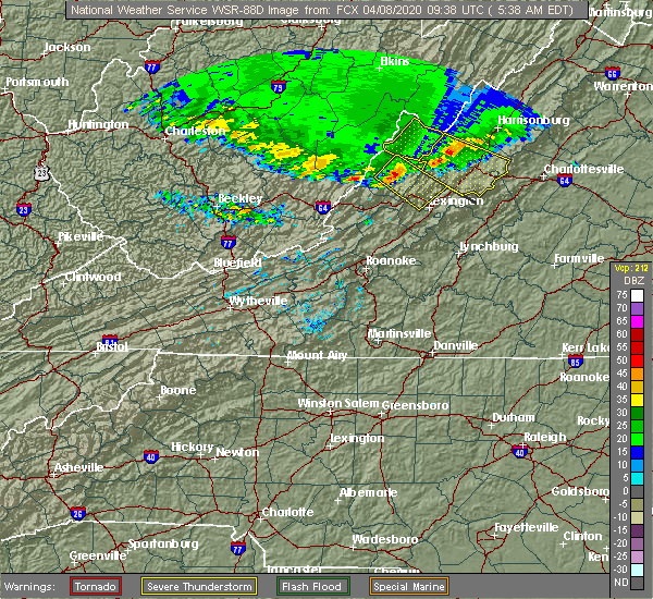 At 538 am edt, a severe thunderstorm was located near warm springs, moving southeast at 70 mph (radar indicated). Hazards include 60 mph wind gusts and quarter size hail. Hail damage to vehicles is expected. Expect wind damage to roofs, siding, and trees. At 538 am edt, a severe thunderstorm was located near warm springs, moving southeast at 70 mph (radar indicated). Hazards include 60 mph wind gusts and quarter size hail. Hail damage to vehicles is expected. Expect wind damage to roofs, siding, and trees.
|
| 4/7/2020 10:07 PM EDT |
 At 1007 pm edt, a severe thunderstorm was located near brownsburg, or 8 miles northeast of rockbridge baths, moving southeast at 30 mph (radar indicated). Hazards include 60 mph wind gusts and quarter size hail. Hail damage to vehicles is expected. expect wind damage to roofs, siding, and trees. Locations impacted include, goshen, rockbridge baths, and bells valley. At 1007 pm edt, a severe thunderstorm was located near brownsburg, or 8 miles northeast of rockbridge baths, moving southeast at 30 mph (radar indicated). Hazards include 60 mph wind gusts and quarter size hail. Hail damage to vehicles is expected. expect wind damage to roofs, siding, and trees. Locations impacted include, goshen, rockbridge baths, and bells valley.
|
| 4/7/2020 9:44 PM EDT |
 At 944 pm edt, a severe thunderstorm was located near yost, or 11 miles north of goshen, moving southeast at 25 mph (radar indicated). Hazards include 60 mph wind gusts and quarter size hail. Hail damage to vehicles is expected. expect wind damage to roofs, siding, and trees. Locations impacted include, goshen, rockbridge baths, burnsville, bells valley, and yost. At 944 pm edt, a severe thunderstorm was located near yost, or 11 miles north of goshen, moving southeast at 25 mph (radar indicated). Hazards include 60 mph wind gusts and quarter size hail. Hail damage to vehicles is expected. expect wind damage to roofs, siding, and trees. Locations impacted include, goshen, rockbridge baths, burnsville, bells valley, and yost.
|
| 4/7/2020 9:31 PM EDT |
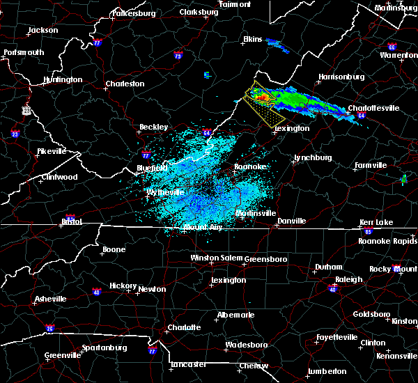 At 930 pm edt, a severe thunderstorm was located over burnsville, or 13 miles northeast of warm springs, moving southeast at 30 mph (radar indicated). Hazards include 60 mph wind gusts and quarter size hail. Hail damage to vehicles is expected. expect wind damage to roofs, siding, and trees. Locations impacted include, goshen, rockbridge baths, burnsville, bells valley, and yost. At 930 pm edt, a severe thunderstorm was located over burnsville, or 13 miles northeast of warm springs, moving southeast at 30 mph (radar indicated). Hazards include 60 mph wind gusts and quarter size hail. Hail damage to vehicles is expected. expect wind damage to roofs, siding, and trees. Locations impacted include, goshen, rockbridge baths, burnsville, bells valley, and yost.
|
| 4/7/2020 9:09 PM EDT |
 At 908 pm edt, a severe thunderstorm was located near greenbank, moving southeast at 25 mph (radar indicated). Hazards include 60 mph wind gusts and quarter size hail. Hail damage to vehicles is expected. Expect wind damage to roofs, siding, and trees. At 908 pm edt, a severe thunderstorm was located near greenbank, moving southeast at 25 mph (radar indicated). Hazards include 60 mph wind gusts and quarter size hail. Hail damage to vehicles is expected. Expect wind damage to roofs, siding, and trees.
|
| 10/31/2019 5:29 PM EDT | Two trees down in the city of millboro. timing estimated by rada in bath county VA, 5.2 miles E of Goshen, VA |
| 9/28/2019 1:51 PM EDT |
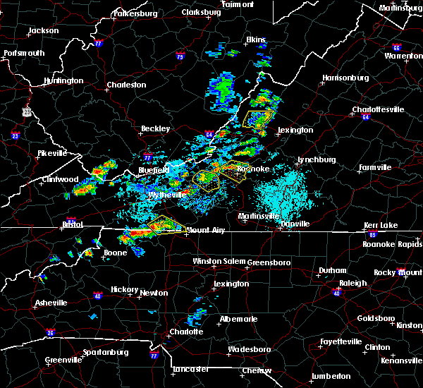 The severe thunderstorm warning for southeastern bath county will expire at 200 pm edt, the storm which prompted the warning has weakened below severe limits, and no longer poses an immediate threat to life or property. therefore, the warning will be allowed to expire. when it is safe to do so, please send your reports of hail of any size, as well as reports of any wind damage, including downed trees or large limbs, to the national weather service by calling toll free at 1, 8 6 6, 2 1 5, 4 3 2 4. reports and pictures can also be shared on the national weather service blacksburg facebook page and on twitter. The severe thunderstorm warning for southeastern bath county will expire at 200 pm edt, the storm which prompted the warning has weakened below severe limits, and no longer poses an immediate threat to life or property. therefore, the warning will be allowed to expire. when it is safe to do so, please send your reports of hail of any size, as well as reports of any wind damage, including downed trees or large limbs, to the national weather service by calling toll free at 1, 8 6 6, 2 1 5, 4 3 2 4. reports and pictures can also be shared on the national weather service blacksburg facebook page and on twitter.
|
| 9/28/2019 1:33 PM EDT |
 At 132 pm edt, a severe thunderstorm was located near warm springs, moving east at 30 mph (radar indicated). Hazards include 60 mph wind gusts and quarter size hail. Hail damage to vehicles is expected. expect wind damage to roofs, siding, and trees. Locations impacted include, millboro, warm springs, hot springs, nimrod hall, and douthat state park. At 132 pm edt, a severe thunderstorm was located near warm springs, moving east at 30 mph (radar indicated). Hazards include 60 mph wind gusts and quarter size hail. Hail damage to vehicles is expected. expect wind damage to roofs, siding, and trees. Locations impacted include, millboro, warm springs, hot springs, nimrod hall, and douthat state park.
|
| 9/28/2019 1:16 PM EDT |
 At 116 pm edt, a severe thunderstorm was located over callison, moving east at 25 mph (radar indicated). Hazards include 60 mph wind gusts and quarter size hail. Hail damage to vehicles is expected. Expect wind damage to roofs, siding, and trees. At 116 pm edt, a severe thunderstorm was located over callison, moving east at 25 mph (radar indicated). Hazards include 60 mph wind gusts and quarter size hail. Hail damage to vehicles is expected. Expect wind damage to roofs, siding, and trees.
|
| 8/22/2019 2:07 PM EDT |
 At 207 pm edt, severe thunderstorms were located along a line extending from 7 miles north of bells valley to 6 miles southeast of nimrod hall, moving east at 20 mph (radar indicated). Hazards include 60 mph wind gusts and quarter size hail. Hail damage to vehicles is expected. expect wind damage to roofs, siding, and trees. locations impacted include, lexington, buena vista, buchanan, glasgow, and goshen. This includes the following location vmi. At 207 pm edt, severe thunderstorms were located along a line extending from 7 miles north of bells valley to 6 miles southeast of nimrod hall, moving east at 20 mph (radar indicated). Hazards include 60 mph wind gusts and quarter size hail. Hail damage to vehicles is expected. expect wind damage to roofs, siding, and trees. locations impacted include, lexington, buena vista, buchanan, glasgow, and goshen. This includes the following location vmi.
|
| 8/22/2019 1:29 PM EDT |
 At 128 pm edt, severe thunderstorms were located along a line extending from near williamsville to clifton forge, moving east at 20 mph (radar indicated). Hazards include 60 mph wind gusts and quarter size hail. Hail damage to vehicles is expected. Expect wind damage to roofs, siding, and trees. At 128 pm edt, severe thunderstorms were located along a line extending from near williamsville to clifton forge, moving east at 20 mph (radar indicated). Hazards include 60 mph wind gusts and quarter size hail. Hail damage to vehicles is expected. Expect wind damage to roofs, siding, and trees.
|
| 7/31/2019 4:00 PM EDT |
 At 338 pm edt, a severe thunderstorm was located over glen wilton, moving northeast at 20 mph (radar indicated). Hazards include 60 mph wind gusts and quarter size hail. Hail damage to vehicles is expected. Expect wind damage to roofs, siding, and trees. At 338 pm edt, a severe thunderstorm was located over glen wilton, moving northeast at 20 mph (radar indicated). Hazards include 60 mph wind gusts and quarter size hail. Hail damage to vehicles is expected. Expect wind damage to roofs, siding, and trees.
|
| 7/31/2019 3:38 PM EDT |
 At 338 pm edt, a severe thunderstorm was located over glen wilton, moving northeast at 20 mph (radar indicated). Hazards include 60 mph wind gusts and quarter size hail. Hail damage to vehicles is expected. Expect wind damage to roofs, siding, and trees. At 338 pm edt, a severe thunderstorm was located over glen wilton, moving northeast at 20 mph (radar indicated). Hazards include 60 mph wind gusts and quarter size hail. Hail damage to vehicles is expected. Expect wind damage to roofs, siding, and trees.
|
| 7/31/2019 2:53 PM EDT |
 At 253 pm edt, a severe thunderstorm was located near warm springs, moving east at 15 mph (radar indicated). Hazards include 60 mph wind gusts. Expect damage to roofs, siding, and trees. Locations impacted include, goshen, millboro, warm springs, hot springs, and rockbridge baths. At 253 pm edt, a severe thunderstorm was located near warm springs, moving east at 15 mph (radar indicated). Hazards include 60 mph wind gusts. Expect damage to roofs, siding, and trees. Locations impacted include, goshen, millboro, warm springs, hot springs, and rockbridge baths.
|
| 7/31/2019 2:41 PM EDT |
 At 241 pm edt, a severe thunderstorm was located over warm springs, moving east at 15 mph (radar indicated). Hazards include 60 mph wind gusts and quarter size hail. Hail damage to vehicles is expected. Expect wind damage to roofs, siding, and trees. At 241 pm edt, a severe thunderstorm was located over warm springs, moving east at 15 mph (radar indicated). Hazards include 60 mph wind gusts and quarter size hail. Hail damage to vehicles is expected. Expect wind damage to roofs, siding, and trees.
|
| 7/4/2019 5:30 PM EDT | Trees down near intersection of cowpasture river highway... and mountain valley road. time estimated by rada in bath county VA, 6.3 miles E of Goshen, VA |
| 5/31/2019 5:23 PM EDT |
 At 522 pm edt, a severe thunderstorm was located near bells valley, moving east at 25 mph (radar indicated). Hazards include 60 mph wind gusts and quarter size hail. Hail damage to vehicles is expected. expect wind damage to roofs, siding, and trees. Locations impacted include, goshen, rockbridge baths, fairfield, bells valley, and brownsburg. At 522 pm edt, a severe thunderstorm was located near bells valley, moving east at 25 mph (radar indicated). Hazards include 60 mph wind gusts and quarter size hail. Hail damage to vehicles is expected. expect wind damage to roofs, siding, and trees. Locations impacted include, goshen, rockbridge baths, fairfield, bells valley, and brownsburg.
|
| 5/31/2019 5:12 PM EDT |
 At 511 pm edt, a severe thunderstorm was located over goshen, moving east at 25 mph (radar indicated). Hazards include 60 mph wind gusts and half dollar size hail. Hail damage to vehicles is expected. expect wind damage to roofs, siding, and trees. locations impacted include, lexington, buena vista, clifton forge, glasgow, and goshen. This includes the following location vmi. At 511 pm edt, a severe thunderstorm was located over goshen, moving east at 25 mph (radar indicated). Hazards include 60 mph wind gusts and half dollar size hail. Hail damage to vehicles is expected. expect wind damage to roofs, siding, and trees. locations impacted include, lexington, buena vista, clifton forge, glasgow, and goshen. This includes the following location vmi.
|
| 5/31/2019 4:55 PM EDT | Spotter reported a couple trees down on route 42 about southwest of millbor in bath county VA, 8.5 miles E of Goshen, VA |
| 5/31/2019 4:49 PM EDT |
 The national weather service in blacksburg has issued a * severe thunderstorm warning for. the city of covington in west central virginia. central alleghany county in west central virginia. the city of buena vista in west central virginia. The city of lexington in west central virginia. The national weather service in blacksburg has issued a * severe thunderstorm warning for. the city of covington in west central virginia. central alleghany county in west central virginia. the city of buena vista in west central virginia. The city of lexington in west central virginia.
|
| 5/25/2019 6:43 PM EDT |
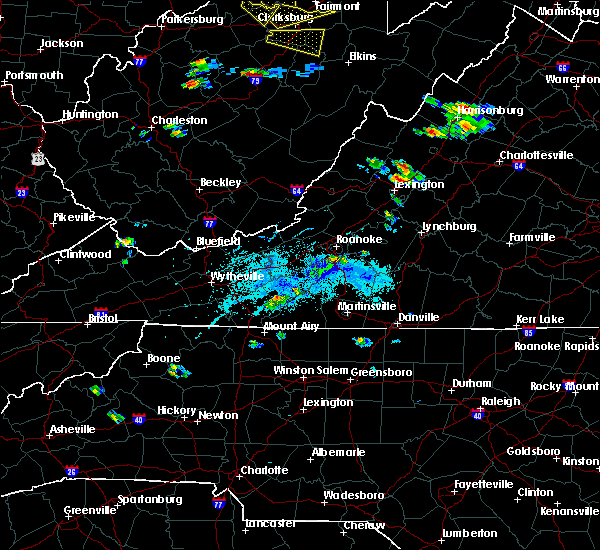 At 643 pm edt, a severe thunderstorm was located over rockbridge baths, moving east at 20 mph (radar indicated). Hazards include 60 mph wind gusts and quarter size hail. Hail damage to vehicles is expected. Expect wind damage to roofs, siding, and trees. At 643 pm edt, a severe thunderstorm was located over rockbridge baths, moving east at 20 mph (radar indicated). Hazards include 60 mph wind gusts and quarter size hail. Hail damage to vehicles is expected. Expect wind damage to roofs, siding, and trees.
|
| 4/14/2019 10:37 PM EDT |
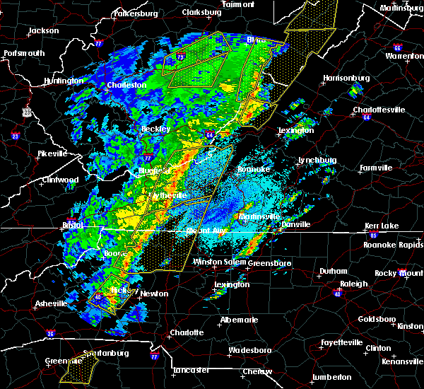 At 1037 pm edt, severe thunderstorms were located along a line extending from 6 miles northwest of burnsville to near ingalls field, moving east at 40 mph (radar indicated). Hazards include 60 mph wind gusts. Expect damage to roofs, siding, and trees. locations impacted include, millboro, warm springs, hot springs, nimrod hall, and douthat state park. A tornado watch remains in effect until 500 am edt for central, south central and west central virginia. At 1037 pm edt, severe thunderstorms were located along a line extending from 6 miles northwest of burnsville to near ingalls field, moving east at 40 mph (radar indicated). Hazards include 60 mph wind gusts. Expect damage to roofs, siding, and trees. locations impacted include, millboro, warm springs, hot springs, nimrod hall, and douthat state park. A tornado watch remains in effect until 500 am edt for central, south central and west central virginia.
|
| 4/14/2019 10:19 PM EDT |
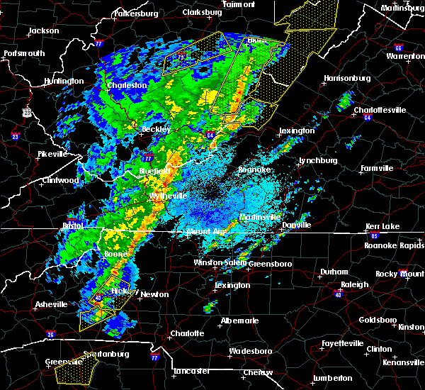 At 1019 pm edt, severe thunderstorms were located along a line extending from 8 miles east of marlinton to near natural well, moving east at 30 mph (radar indicated). Hazards include 60 mph wind gusts. expect damage to roofs, siding, and trees At 1019 pm edt, severe thunderstorms were located along a line extending from 8 miles east of marlinton to near natural well, moving east at 30 mph (radar indicated). Hazards include 60 mph wind gusts. expect damage to roofs, siding, and trees
|
| 8/13/2018 3:38 PM EDT |
 At 338 pm edt, severe thunderstorms were located along a line extending from brownsburg to near douthat state park to near natural well, moving south at 15 mph (radar indicated). Hazards include 60 mph wind gusts and quarter size hail. Hail damage to vehicles is expected. expect wind damage to roofs, siding, and trees. locations impacted include, lexington, buena vista, covington, clifton forge, and goshen. This includes the following location vmi. At 338 pm edt, severe thunderstorms were located along a line extending from brownsburg to near douthat state park to near natural well, moving south at 15 mph (radar indicated). Hazards include 60 mph wind gusts and quarter size hail. Hail damage to vehicles is expected. expect wind damage to roofs, siding, and trees. locations impacted include, lexington, buena vista, covington, clifton forge, and goshen. This includes the following location vmi.
|
| 8/13/2018 3:10 PM EDT |
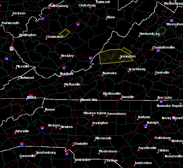 At 309 pm edt, severe thunderstorms were located along a line extending from near brownsburg to near warm springs to natural well, moving south at 15 mph (radar indicated). Hazards include 60 mph wind gusts and quarter size hail. Hail damage to vehicles is expected. Expect wind damage to roofs, siding, and trees. At 309 pm edt, severe thunderstorms were located along a line extending from near brownsburg to near warm springs to natural well, moving south at 15 mph (radar indicated). Hazards include 60 mph wind gusts and quarter size hail. Hail damage to vehicles is expected. Expect wind damage to roofs, siding, and trees.
|
| 8/13/2018 2:29 PM EDT |
 At 207 pm edt, a cluster of severe thunderstorms were located along a line extending from near bells valley to near burnsville, moving south at 15 mph (radar indicated). Hazards include 60 mph wind gusts and quarter size hail. Hail damage to vehicles is expected. Expect wind damage to roofs, siding, and trees. At 207 pm edt, a cluster of severe thunderstorms were located along a line extending from near bells valley to near burnsville, moving south at 15 mph (radar indicated). Hazards include 60 mph wind gusts and quarter size hail. Hail damage to vehicles is expected. Expect wind damage to roofs, siding, and trees.
|
| 8/13/2018 2:07 PM EDT |
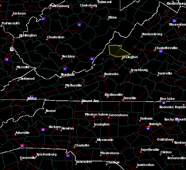 The national weather service in blacksburg has issued a * severe thunderstorm warning for. northern rockbridge county in west central virginia. eastern bath county in west central virginia. Until 300 pm edt * at 207 pm edt, a cluster of severe thunderstorms were located. The national weather service in blacksburg has issued a * severe thunderstorm warning for. northern rockbridge county in west central virginia. eastern bath county in west central virginia. Until 300 pm edt * at 207 pm edt, a cluster of severe thunderstorms were located.
|
| 8/5/2018 5:02 PM EDT |
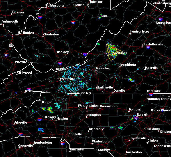 At 501 pm edt, a severe thunderstorm was located over yost, moving south at 5 mph (radar indicated). Hazards include 60 mph wind gusts and quarter size hail. Hail damage to vehicles is expected. expect wind damage to roofs, siding, and trees. Locations impacted include, goshen, rockbridge baths, bells valley, fairfield, and brownsburg. At 501 pm edt, a severe thunderstorm was located over yost, moving south at 5 mph (radar indicated). Hazards include 60 mph wind gusts and quarter size hail. Hail damage to vehicles is expected. expect wind damage to roofs, siding, and trees. Locations impacted include, goshen, rockbridge baths, bells valley, fairfield, and brownsburg.
|
| 8/5/2018 4:42 PM EDT |
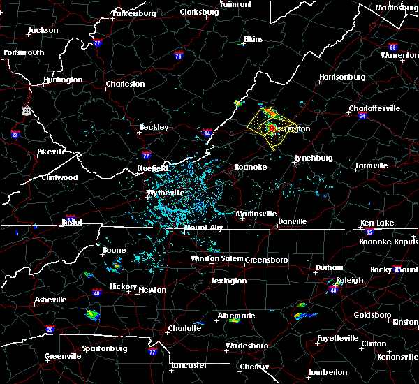 The national weather service in blacksburg has issued a * severe thunderstorm warning for. northeastern alleghany county in west central virginia. northern rockbridge county in west central virginia. southeastern bath county in west central virginia. Until 545 pm edt. The national weather service in blacksburg has issued a * severe thunderstorm warning for. northeastern alleghany county in west central virginia. northern rockbridge county in west central virginia. southeastern bath county in west central virginia. Until 545 pm edt.
|
| 7/15/2018 3:44 PM EDT |
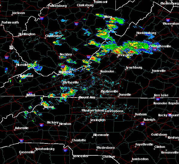 At 344 pm edt, a severe thunderstorm was located over goshen, moving east at 5 mph (radar indicated). Hazards include 60 mph wind gusts and quarter size hail. Hail damage to vehicles is expected. expect wind damage to roofs, siding, and trees. Locations impacted include, goshen, rockbridge baths, fairfield, bells valley, and brownsburg. At 344 pm edt, a severe thunderstorm was located over goshen, moving east at 5 mph (radar indicated). Hazards include 60 mph wind gusts and quarter size hail. Hail damage to vehicles is expected. expect wind damage to roofs, siding, and trees. Locations impacted include, goshen, rockbridge baths, fairfield, bells valley, and brownsburg.
|
| 7/15/2018 3:30 PM EDT |
 At 330 pm edt, a severe thunderstorm was located over goshen, moving east at 5 mph (radar indicated). Hazards include 60 mph wind gusts and quarter size hail. Hail damage to vehicles is expected. Expect wind damage to roofs, siding, and trees. At 330 pm edt, a severe thunderstorm was located over goshen, moving east at 5 mph (radar indicated). Hazards include 60 mph wind gusts and quarter size hail. Hail damage to vehicles is expected. Expect wind damage to roofs, siding, and trees.
|
| 5/14/2018 6:42 PM EDT |
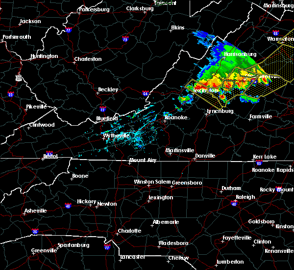 At 641 pm edt, a severe thunderstorm was located over fairfield, moving southeast at 20 mph (radar indicated). Hazards include 60 mph wind gusts and quarter size hail. Hail damage to vehicles is expected. expect wind damage to roofs, siding, and trees. Locations impacted include, buena vista, amherst, goshen, forks of buffalo, and clifford. At 641 pm edt, a severe thunderstorm was located over fairfield, moving southeast at 20 mph (radar indicated). Hazards include 60 mph wind gusts and quarter size hail. Hail damage to vehicles is expected. expect wind damage to roofs, siding, and trees. Locations impacted include, buena vista, amherst, goshen, forks of buffalo, and clifford.
|
| 5/14/2018 6:23 PM EDT |
 At 623 pm edt, a severe thunderstorm was located over brownsburg, moving southeast at 25 mph (radar indicated). Hazards include 60 mph wind gusts and quarter size hail. Hail damage to vehicles is expected. Expect wind damage to roofs, siding, and trees. At 623 pm edt, a severe thunderstorm was located over brownsburg, moving southeast at 25 mph (radar indicated). Hazards include 60 mph wind gusts and quarter size hail. Hail damage to vehicles is expected. Expect wind damage to roofs, siding, and trees.
|
| 4/15/2018 7:23 PM EDT |
 The severe thunderstorm warning for rockbridge, northwestern amherst and northeastern bedford counties, the city of buena vista and the city of lexington will expire at 730 pm edt, the storm which prompted the warning has moved out of the area. therefore the warning will be allowed to expire. however gusty winds are still possible with this thunderstorm. a tornado watch remains in effect until 1100 pm edt for central, south central and west central virginia. when it is safe to do so, please send your reports of hail of any size, as well as reports of any wind damage, including downed trees or large limbs, to the national weather service by calling toll free at 1, 8 6 6, 2 1 5, 4 3 2 4. reports and pictures can also be shared on the national weather service blacksburg facebook page and on twitter. The severe thunderstorm warning for rockbridge, northwestern amherst and northeastern bedford counties, the city of buena vista and the city of lexington will expire at 730 pm edt, the storm which prompted the warning has moved out of the area. therefore the warning will be allowed to expire. however gusty winds are still possible with this thunderstorm. a tornado watch remains in effect until 1100 pm edt for central, south central and west central virginia. when it is safe to do so, please send your reports of hail of any size, as well as reports of any wind damage, including downed trees or large limbs, to the national weather service by calling toll free at 1, 8 6 6, 2 1 5, 4 3 2 4. reports and pictures can also be shared on the national weather service blacksburg facebook page and on twitter.
|
| 4/15/2018 7:03 PM EDT |
 At 703 pm edt, a severe thunderstorm was located over cornwall, moving northeast at 50 mph (radar indicated). Hazards include 60 mph wind gusts and quarter size hail. Hail damage to vehicles is expected. expect wind damage to roofs, siding, and trees. locations impacted include, lexington, buena vista, glasgow, goshen, and forks of buffalo. this includes the following location vmi. A tornado watch remains in effect until 1100 pm edt for central, south central and west central virginia. At 703 pm edt, a severe thunderstorm was located over cornwall, moving northeast at 50 mph (radar indicated). Hazards include 60 mph wind gusts and quarter size hail. Hail damage to vehicles is expected. expect wind damage to roofs, siding, and trees. locations impacted include, lexington, buena vista, glasgow, goshen, and forks of buffalo. this includes the following location vmi. A tornado watch remains in effect until 1100 pm edt for central, south central and west central virginia.
|
| 4/15/2018 6:42 PM EDT |
 At 642 pm edt, a severe thunderstorm was located near natural bridge, moving north at 55 mph. damage has been reported in bedford county (radar indicated). Hazards include 60 mph wind gusts and quarter size hail. Hail damage to vehicles is expected. expect wind damage to roofs, siding, and trees. locations impacted include, lexington, buena vista, bedford, buchanan, and glasgow. this includes the following locations vmi and the national d-day memorial. A tornado watch remains in effect until 1100 pm edt for central, south central and west central virginia. At 642 pm edt, a severe thunderstorm was located near natural bridge, moving north at 55 mph. damage has been reported in bedford county (radar indicated). Hazards include 60 mph wind gusts and quarter size hail. Hail damage to vehicles is expected. expect wind damage to roofs, siding, and trees. locations impacted include, lexington, buena vista, bedford, buchanan, and glasgow. this includes the following locations vmi and the national d-day memorial. A tornado watch remains in effect until 1100 pm edt for central, south central and west central virginia.
|
| 4/15/2018 6:12 PM EDT |
 At 611 pm edt, a severe thunderstorm was located near chamblissburg, moving northeast at 50 mph (radar indicated). Hazards include 60 mph wind gusts and quarter size hail. Hail damage to vehicles is expected. Expect wind damage to roofs, siding, and trees. At 611 pm edt, a severe thunderstorm was located near chamblissburg, moving northeast at 50 mph (radar indicated). Hazards include 60 mph wind gusts and quarter size hail. Hail damage to vehicles is expected. Expect wind damage to roofs, siding, and trees.
|
| 10/23/2017 8:21 PM EDT |
 The severe thunderstorm warning for alleghany, bath, rockbridge, northern botetourt counties in west central virginia and east central greenbrier counties in southeastern west virginia, the city of covington and the city of lexington will expire at 830 pm edt, the storms which prompted the warning have weakened below severe limits, and have exited the warned area. therefore the warning will be allowed to expire. a tornado watch remains in effect until 200 am edt for central, south central, southwestern and west central virginia. when it is safe to do so, please send your reports of hail of any size, as well as reports of any wind damage, including downed trees or large limbs, to the national weather service by calling toll free at 1, 8 6 6, 2 1 5, 4 3 2 4. reports and pictures can also be shared on the national weather service blacksburg facebook page and on twitter. The severe thunderstorm warning for alleghany, bath, rockbridge, northern botetourt counties in west central virginia and east central greenbrier counties in southeastern west virginia, the city of covington and the city of lexington will expire at 830 pm edt, the storms which prompted the warning have weakened below severe limits, and have exited the warned area. therefore the warning will be allowed to expire. a tornado watch remains in effect until 200 am edt for central, south central, southwestern and west central virginia. when it is safe to do so, please send your reports of hail of any size, as well as reports of any wind damage, including downed trees or large limbs, to the national weather service by calling toll free at 1, 8 6 6, 2 1 5, 4 3 2 4. reports and pictures can also be shared on the national weather service blacksburg facebook page and on twitter.
|
| 10/23/2017 7:56 PM EDT |
 At 756 pm edt, severe thunderstorms were located along a line extending from 10 miles south of greenbank to near nimrod hall to 6 miles southwest of collierstown, moving northeast at 70 mph (radar indicated). Hazards include 60 mph wind gusts. Expect damage to roofs, siding, and trees. locations impacted include, lexington, covington, clifton forge, goshen, and millboro. A tornado watch remains in effect until 200 am edt for central, south central, southwestern and west central virginia. At 756 pm edt, severe thunderstorms were located along a line extending from 10 miles south of greenbank to near nimrod hall to 6 miles southwest of collierstown, moving northeast at 70 mph (radar indicated). Hazards include 60 mph wind gusts. Expect damage to roofs, siding, and trees. locations impacted include, lexington, covington, clifton forge, goshen, and millboro. A tornado watch remains in effect until 200 am edt for central, south central, southwestern and west central virginia.
|
| 10/23/2017 7:28 PM EDT |
 At 727 pm edt, severe thunderstorms were located along a line extending from near falling spring to near alleghany to near abbott, moving northeast at 70 mph (radar indicated). Hazards include 60 mph wind gusts and quarter size hail. Hail damage to vehicles is expected. Expect wind damage to roofs, siding, and trees. At 727 pm edt, severe thunderstorms were located along a line extending from near falling spring to near alleghany to near abbott, moving northeast at 70 mph (radar indicated). Hazards include 60 mph wind gusts and quarter size hail. Hail damage to vehicles is expected. Expect wind damage to roofs, siding, and trees.
|
| 9/5/2017 3:02 PM EDT |
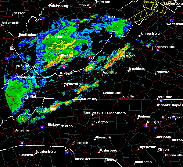 At 301 pm edt, a severe thunderstorm was located over collierstown, moving east at 15 mph (radar indicated). Hazards include 60 mph wind gusts and quarter size hail. Hail damage to vehicles is expected. expect wind damage to roofs, siding, and trees. Locations impacted include, lexington, goshen, eagle rock, collierstown, and rockbridge baths. At 301 pm edt, a severe thunderstorm was located over collierstown, moving east at 15 mph (radar indicated). Hazards include 60 mph wind gusts and quarter size hail. Hail damage to vehicles is expected. expect wind damage to roofs, siding, and trees. Locations impacted include, lexington, goshen, eagle rock, collierstown, and rockbridge baths.
|
| 9/5/2017 2:41 PM EDT |
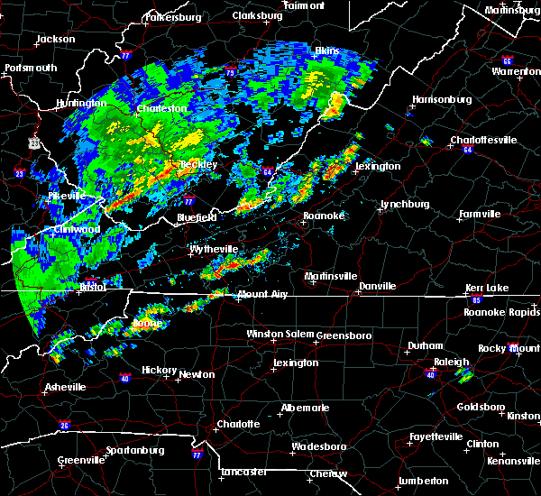 At 241 pm edt, a severe thunderstorm was located near glen wilton, moving northeast at 20 mph (radar indicated). Hazards include 60 mph wind gusts and quarter size hail. Hail damage to vehicles is expected. Expect wind damage to roofs, siding, and trees. At 241 pm edt, a severe thunderstorm was located near glen wilton, moving northeast at 20 mph (radar indicated). Hazards include 60 mph wind gusts and quarter size hail. Hail damage to vehicles is expected. Expect wind damage to roofs, siding, and trees.
|
| 3/1/2017 11:57 AM EST |
 At 1156 am est, severe thunderstorms were located along a line extending from near yost to near collierstown to near new castle, moving east at 75 mph (radar indicated). Hazards include 60 mph wind gusts. expect damage to roofs, siding, and trees At 1156 am est, severe thunderstorms were located along a line extending from near yost to near collierstown to near new castle, moving east at 75 mph (radar indicated). Hazards include 60 mph wind gusts. expect damage to roofs, siding, and trees
|
| 9/29/2016 7:15 PM EDT |
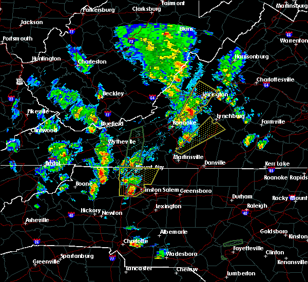 At 714 pm edt, a severe thunderstorm was located over natural bridge, moving north at 25 mph (radar indicated). Hazards include 60 mph wind gusts and quarter size hail. Hail damage to vehicles is expected. Expect wind damage to roofs, siding, and trees. At 714 pm edt, a severe thunderstorm was located over natural bridge, moving north at 25 mph (radar indicated). Hazards include 60 mph wind gusts and quarter size hail. Hail damage to vehicles is expected. Expect wind damage to roofs, siding, and trees.
|
| 6/23/2016 9:20 AM EDT |
 At 919 am edt, severe thunderstorms were located along a line extending from near peaks of otter summit to near montvale to bent mountain, moving southeast at 50 mph. the primary threat for continued wind damage at this time is primarily in eastern roanoke county (radar indicated). Hazards include 60 mph wind gusts. Expect damage to roofs. siding. and trees. locations impacted include, roanoke, salem, vinton, lexington, and buena vista. This includes the following locations vmi, the salem fairgrounds, and roanoke regional airport. At 919 am edt, severe thunderstorms were located along a line extending from near peaks of otter summit to near montvale to bent mountain, moving southeast at 50 mph. the primary threat for continued wind damage at this time is primarily in eastern roanoke county (radar indicated). Hazards include 60 mph wind gusts. Expect damage to roofs. siding. and trees. locations impacted include, roanoke, salem, vinton, lexington, and buena vista. This includes the following locations vmi, the salem fairgrounds, and roanoke regional airport.
|
| 6/23/2016 8:50 AM EDT |
 At 850 am edt, severe thunderstorms were located along a line extending from near nimrod hall to oriskany to maggie, moving southeast at 65 mph (radar indicated). Hazards include 60 mph wind gusts. Expect damage to roofs. siding. And trees. At 850 am edt, severe thunderstorms were located along a line extending from near nimrod hall to oriskany to maggie, moving southeast at 65 mph (radar indicated). Hazards include 60 mph wind gusts. Expect damage to roofs. siding. And trees.
|
| 6/16/2016 8:09 PM EDT |
 At 808 pm edt, severe thunderstorms were located along a line extending from near stuarts draft to near lexington to covington, moving southeast at 45 mph (radar indicated). Hazards include 60 mph wind gusts and quarter size hail. Hail damage to vehicles is expected. expect wind damage to roofs, siding, and trees. locations impacted include, lexington, buena vista, covington, clifton forge, and buchanan. This includes vmi. At 808 pm edt, severe thunderstorms were located along a line extending from near stuarts draft to near lexington to covington, moving southeast at 45 mph (radar indicated). Hazards include 60 mph wind gusts and quarter size hail. Hail damage to vehicles is expected. expect wind damage to roofs, siding, and trees. locations impacted include, lexington, buena vista, covington, clifton forge, and buchanan. This includes vmi.
|
| 6/16/2016 7:59 PM EDT | Tree down on indian craft road in millboro va in bath county VA, 6.9 miles E of Goshen, VA |
| 6/16/2016 7:50 PM EDT |
 At 749 pm edt, severe thunderstorms were located along a line extending from 11 miles east of bells valley to nimrod hall to alvon, moving southeast at 30 mph (radar indicated). Hazards include 60 mph wind gusts and quarter size hail. Hail damage to vehicles is expected. Expect wind damage to roofs, siding, and trees. At 749 pm edt, severe thunderstorms were located along a line extending from 11 miles east of bells valley to nimrod hall to alvon, moving southeast at 30 mph (radar indicated). Hazards include 60 mph wind gusts and quarter size hail. Hail damage to vehicles is expected. Expect wind damage to roofs, siding, and trees.
|
| 9/4/2015 2:50 PM EDT | Quarter sized hail reported 6.3 miles SW of Goshen, VA |
| 9/2/2015 4:11 PM EDT | Large limbs blown down from several trees. time based on rada in rockbridge county VA, 7.5 miles WNW of Goshen, VA |
| 7/14/2015 8:32 PM EDT |
 At 831 pm edt, severe thunderstorms were located along a line extending from near brownsburg to eagle rock to newport, moving east at 55 mph (radar indicated). Hazards include 60 mph wind gusts. Expect damage to roofs. siding and trees. locations impacted include, lexington, covington, clifton forge, pearisburg, and narrows. This includes vmi. At 831 pm edt, severe thunderstorms were located along a line extending from near brownsburg to eagle rock to newport, moving east at 55 mph (radar indicated). Hazards include 60 mph wind gusts. Expect damage to roofs. siding and trees. locations impacted include, lexington, covington, clifton forge, pearisburg, and narrows. This includes vmi.
|
| 7/14/2015 8:18 PM EDT |
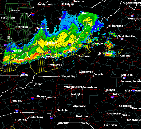 At 818 pm edt, severe thunderstorms were located along a line extending from near yost to near oriskany to kimballton, moving east at 45 mph (radar indicated). Hazards include 60 mph wind gusts. Expect damage to roofs. siding and trees. locations impacted include, lexington, covington, clifton forge, pearisburg, and narrows. This includes vmi. At 818 pm edt, severe thunderstorms were located along a line extending from near yost to near oriskany to kimballton, moving east at 45 mph (radar indicated). Hazards include 60 mph wind gusts. Expect damage to roofs. siding and trees. locations impacted include, lexington, covington, clifton forge, pearisburg, and narrows. This includes vmi.
|
| 7/14/2015 8:05 PM EDT |
 At 805 pm edt, severe thunderstorms were located along a line extending from near burnsville to near jordan mines to pembroke, moving east at 45 mph (radar indicated). Hazards include 60 mph wind gusts. Expect damage to roofs. siding and trees. locations impacted include, lexington, covington, clifton forge, pearisburg, and narrows. This includes vmi. At 805 pm edt, severe thunderstorms were located along a line extending from near burnsville to near jordan mines to pembroke, moving east at 45 mph (radar indicated). Hazards include 60 mph wind gusts. Expect damage to roofs. siding and trees. locations impacted include, lexington, covington, clifton forge, pearisburg, and narrows. This includes vmi.
|
| 7/14/2015 7:51 PM EDT |
 At 751 pm edt, severe thunderstorms were located along a line extending from 6 miles north of mountain grove to white sulphur springs to rich creek, moving southeast at 40 mph (radar indicated). Hazards include 60 mph wind gusts. Expect damage to roofs. Siding and trees. At 751 pm edt, severe thunderstorms were located along a line extending from 6 miles north of mountain grove to white sulphur springs to rich creek, moving southeast at 40 mph (radar indicated). Hazards include 60 mph wind gusts. Expect damage to roofs. Siding and trees.
|
| 7/13/2015 8:10 PM EDT | The severe thunderstorm warning for eastern bath and central alleghany counties will expire at 815 pm edt, the storms which prompted the warning have weakened below severe limits and no longer pose an immediate threat to life or property. therefore the warning will be allowed to expire. light to moderate rainfall and occasional cloud-to-ground lightning will continue for another hour or so. a severe thunderstorm watch remains in effect until 1000 pm edt for southeastern west virginia. a severe thunderstorm watch also remains in effect until 100 am edt for southwestern virginia. when it is safe to do so, please send your reports of hail of any size, as well as any reports of wind damage, including downed trees or large limbs, to the national weather service by calling toll free at 1, 8 6 6, 2 1 5, 4 3 2 4. reports and pictures can also be shared on the national weather service blacksburg facebook page and on twitter. |
| 7/13/2015 8:03 PM EDT |
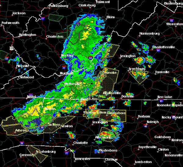 At 802 pm edt, severe thunderstorms were located along a line extending from near burnsville to near gala, moving east at 50 mph (radar indicated). Hazards include 60 mph wind gusts. Expect damage to roofs. siding and trees. Locations impacted include, clifton forge, clifton forge city, millboro, yost, and nimrod hall. At 802 pm edt, severe thunderstorms were located along a line extending from near burnsville to near gala, moving east at 50 mph (radar indicated). Hazards include 60 mph wind gusts. Expect damage to roofs. siding and trees. Locations impacted include, clifton forge, clifton forge city, millboro, yost, and nimrod hall.
|
| 7/13/2015 7:48 PM EDT |
 At 746 pm edt, severe thunderstorms were located along a line extending from near mountain grove, to covington, to elliston, to near laurel fork, moving east at 40 mph (radar indicated). Hazards include 60 mph wind gusts. Expect damage to roofs. siding and trees. Locations impacted include, christiansburg, covington, clifton forge, floyd, and new castle. At 746 pm edt, severe thunderstorms were located along a line extending from near mountain grove, to covington, to elliston, to near laurel fork, moving east at 40 mph (radar indicated). Hazards include 60 mph wind gusts. Expect damage to roofs. siding and trees. Locations impacted include, christiansburg, covington, clifton forge, floyd, and new castle.
|
| 7/13/2015 7:09 PM EDT |
 At 708 pm edt, severe thunderstorms were located along a line extending from near marlinton to near draper, moving east at 70 mph (radar indicated). Hazards include 60 mph wind gusts. Expect damage to roofs. Siding and trees. At 708 pm edt, severe thunderstorms were located along a line extending from near marlinton to near draper, moving east at 70 mph (radar indicated). Hazards include 60 mph wind gusts. Expect damage to roofs. Siding and trees.
|
| 6/24/2013 7:48 PM EDT | Tree down on maury river rd in rockbridge county VA, 0.6 miles NNW of Goshen, VA |
| 8/1/2012 4:25 PM EDT | Quarter sized hail reported 5.2 miles E of Goshen, VA, hail ranged from nickel to quarter size |
| 8/1/2012 4:25 PM EDT | Ping Pong Ball sized hail reported 5.3 miles ENE of Goshen, VA, ping pong size hail in millboro |
| 8/1/2012 3:59 PM EDT | Quarter sized hail reported 5.7 miles E of Goshen, VA, state route 633 |
| 7/3/2012 3:05 PM EDT | Trees down on maury river road in rockbridge county VA, 0.3 miles WSW of Goshen, VA |
| 6/29/2012 8:57 PM EDT | Storm damage reported in rockbridge county VA, 5.6 miles NNW of Goshen, VA |
| 3/28/2012 6:20 PM EDT | Tree down on jump mountain road in rockbridge bath in rockbridge county VA, 5.5 miles WNW of Goshen, VA |
| 1/1/0001 12:00 AM | Trees down along hays creek roa in rockbridge county VA, 8.3 miles WNW of Goshen, VA |
| 1/1/0001 12:00 AM | Trees and limbs down in rockbridge county VA, 0.6 miles NNW of Goshen, VA |
Hail Maps for Goshen, VA


Connect with Interactive Hail Maps