

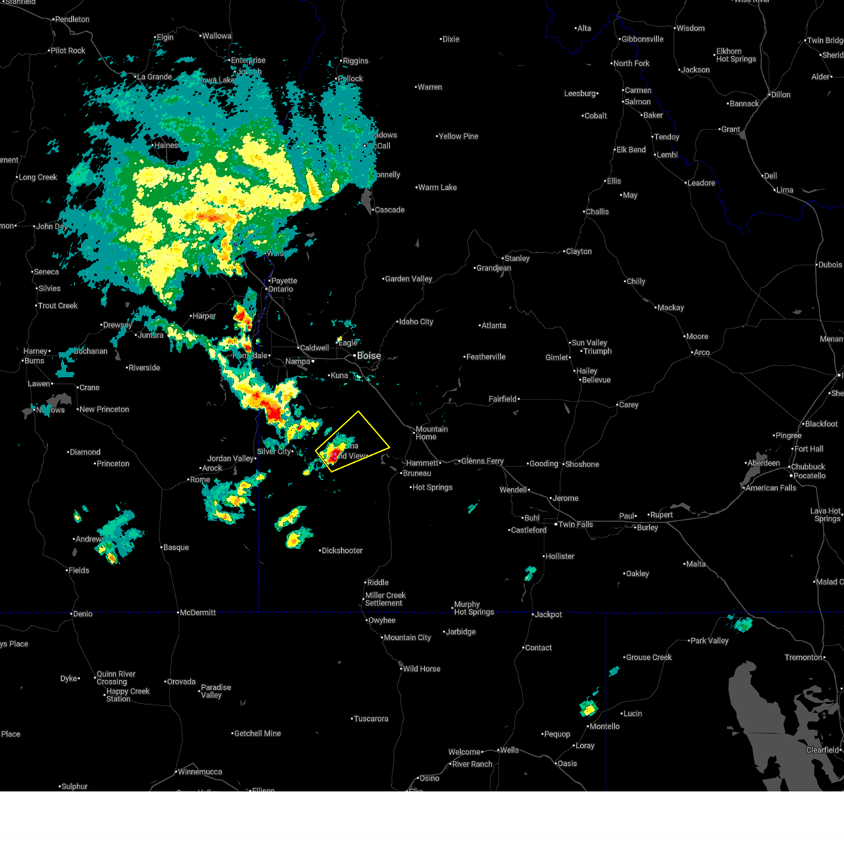
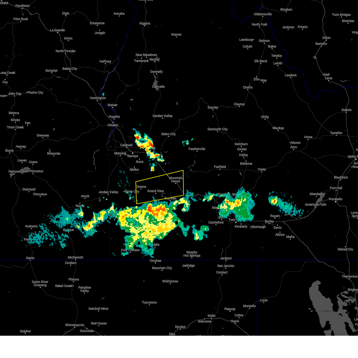
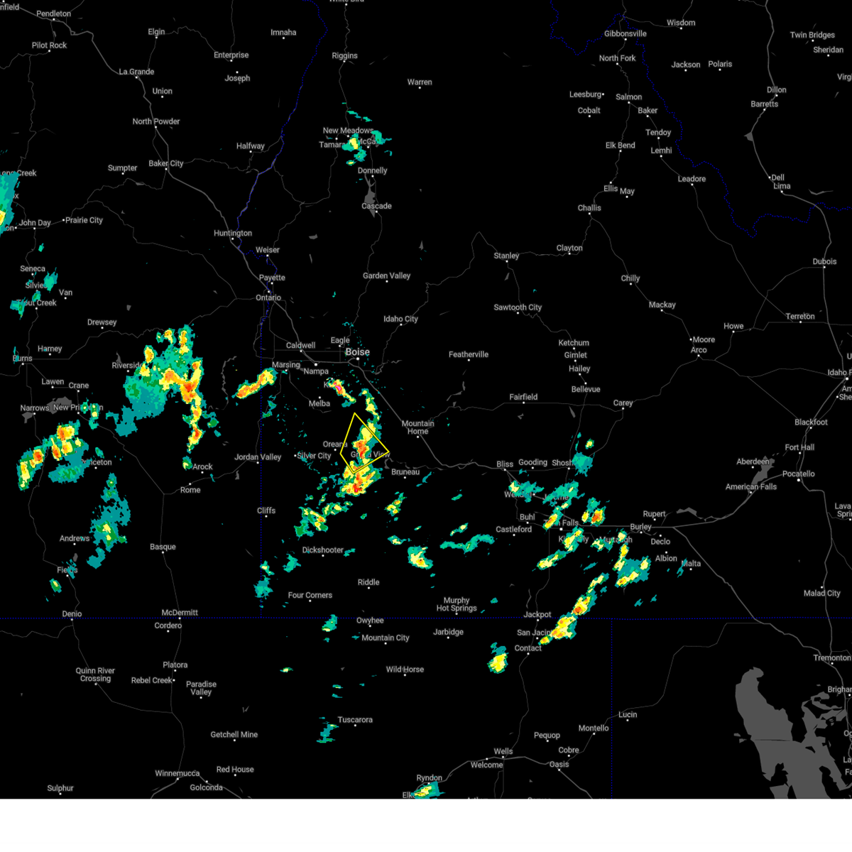
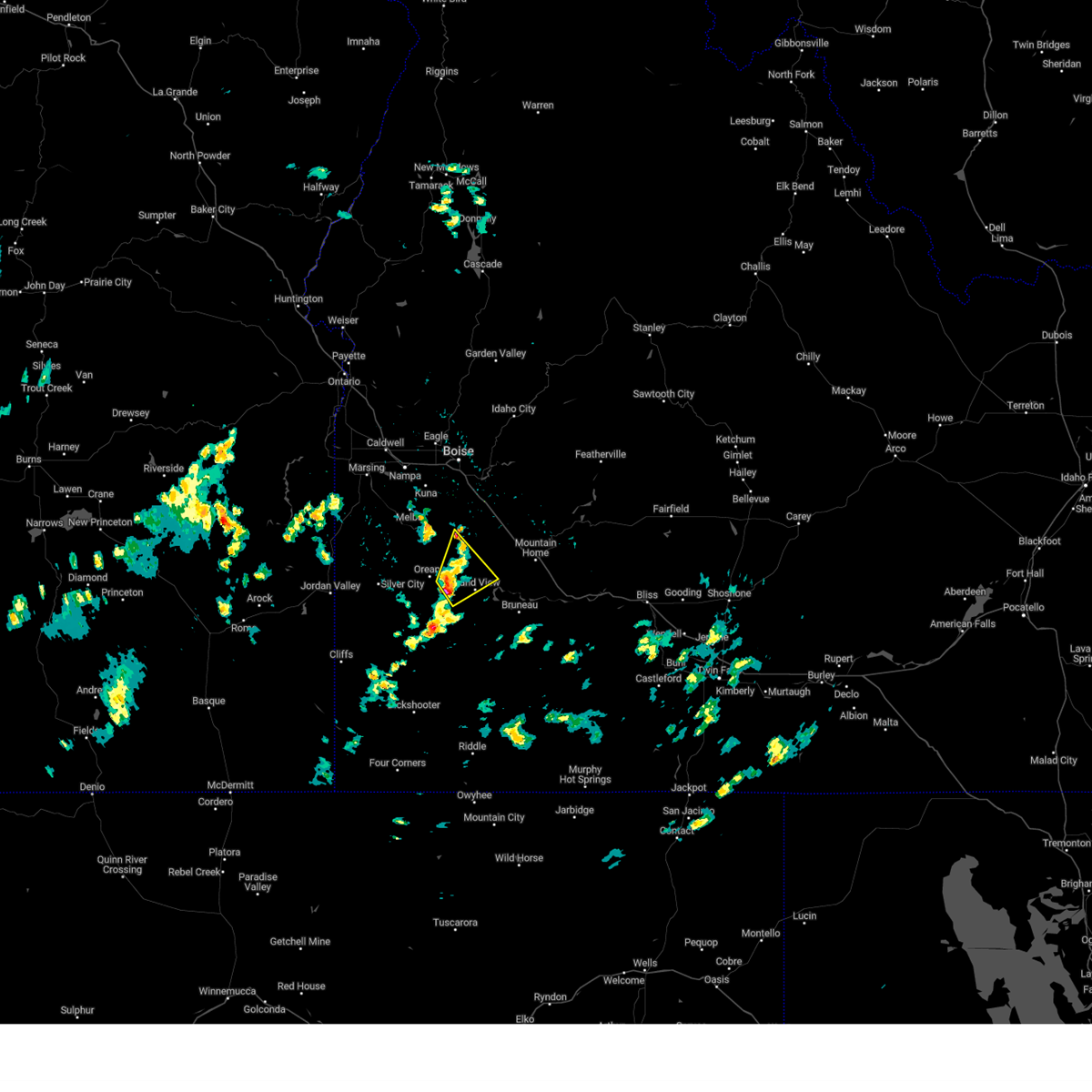
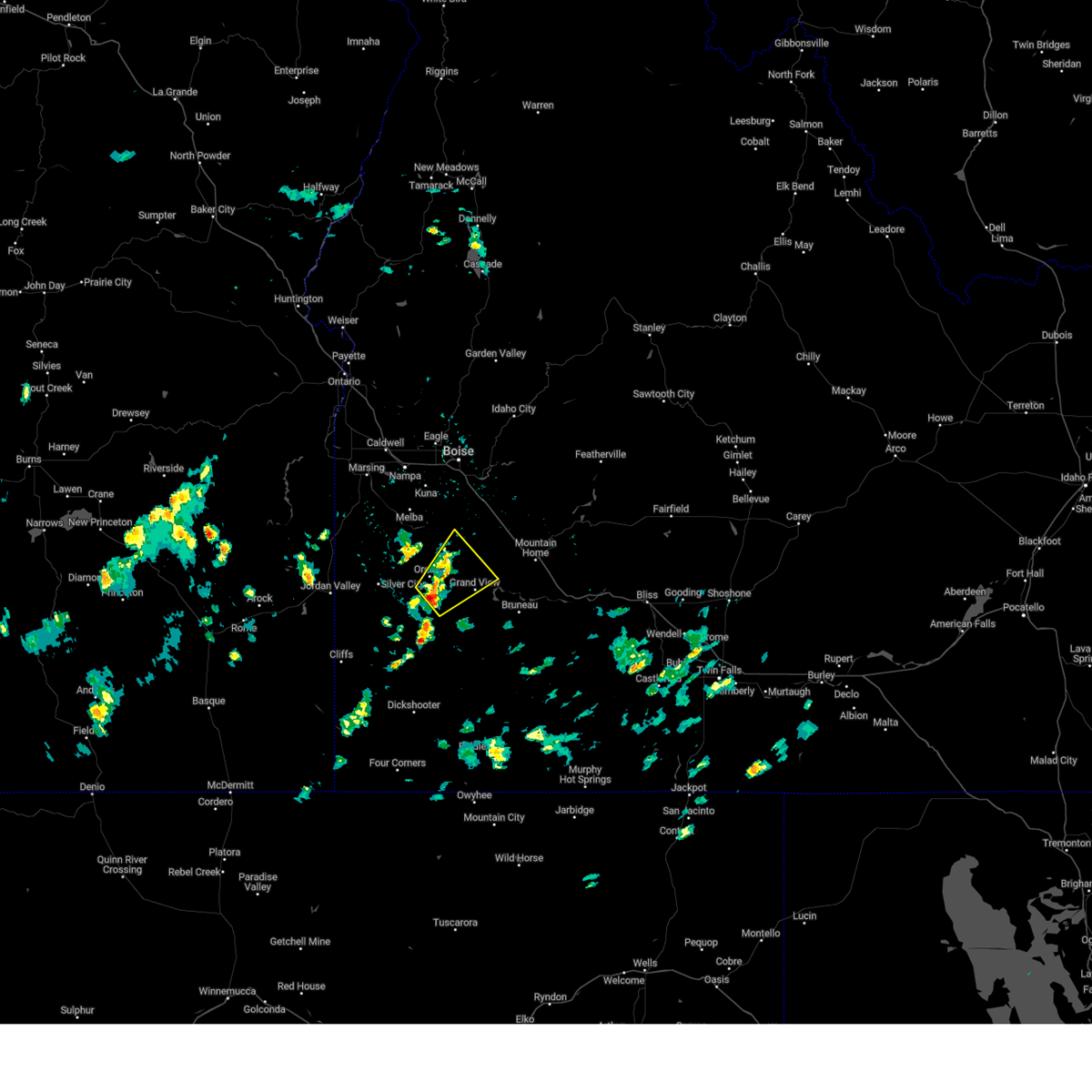
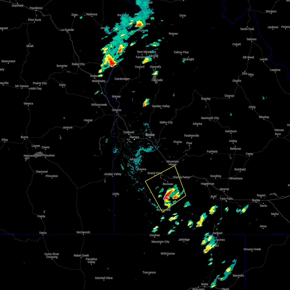
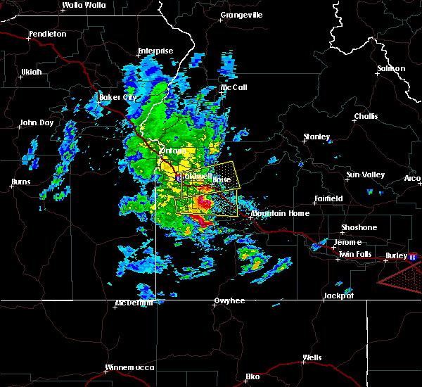
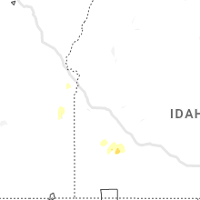
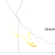
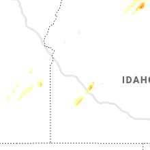
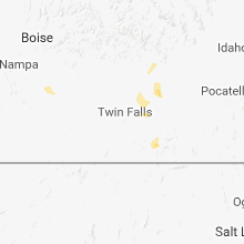
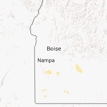
Hail Map for Grand View, ID
The Grand View, ID area has had 2 reports of on-the-ground hail by trained spotters, and has been under severe weather warnings 1 time during the past 12 months. Doppler radar has detected hail at or near Grand View, ID on 7 occasions, including 1 occasion during the past year.
| Name: | Grand View, ID |
| Where Located: | 43.5 miles S of Boise, ID |
| Map: | Google Map for Grand View, ID |
| Population: | 452 |
| Housing Units: | 198 |
| More Info: | Search Google for Grand View, ID |
3
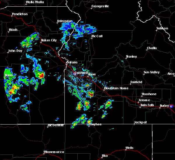
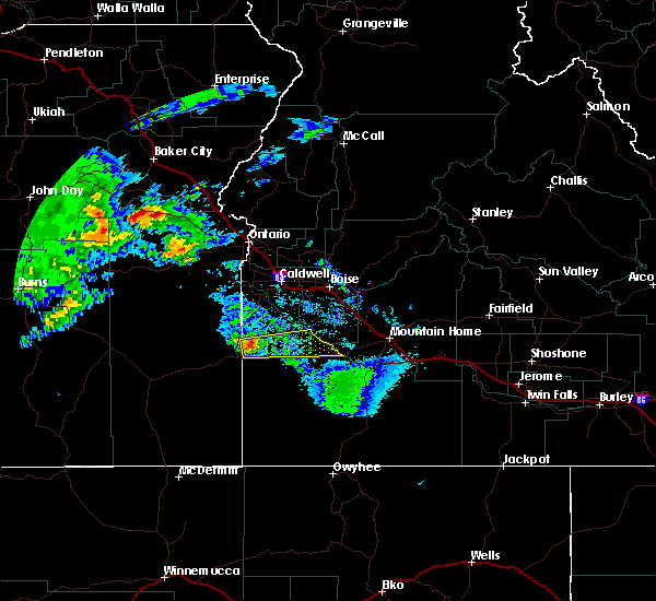
The Top Recent Hail Date for Grand View, ID is Thursday, July 25, 2024 (4th out of 7)

Hail and Wind Damage Spotted near Grand View, ID
| Date / Time | Report Details |
|---|---|
| 7/4/2025 12:57 PM MDT |
 Svrboi the national weather service in boise has issued a * severe thunderstorm warning for, south central ada county in southwestern idaho, southwestern elmore county in southwestern idaho, central owyhee county in southwestern idaho, * until 130 pm mdt. * at 1256 pm mdt, a severe thunderstorm was located near oreana, or 28 miles west of mountain home, moving northeast at 20 mph (radar indicated). Hazards include 60 mph wind gusts and quarter size hail. Hail damage to vehicles is expected. expect wind damage to roofs, siding, and trees. This severe thunderstorm will remain over mainly rural areas of south central ada, southwestern elmore and central owyhee counties. Svrboi the national weather service in boise has issued a * severe thunderstorm warning for, south central ada county in southwestern idaho, southwestern elmore county in southwestern idaho, central owyhee county in southwestern idaho, * until 130 pm mdt. * at 1256 pm mdt, a severe thunderstorm was located near oreana, or 28 miles west of mountain home, moving northeast at 20 mph (radar indicated). Hazards include 60 mph wind gusts and quarter size hail. Hail damage to vehicles is expected. expect wind damage to roofs, siding, and trees. This severe thunderstorm will remain over mainly rural areas of south central ada, southwestern elmore and central owyhee counties.
|
| 6/6/2023 7:59 PM MDT |
 At 759 pm mdt, severe thunderstorms were located along a line extending from 8 miles southwest of hot springs creek reservoir to near doyle mountain, moving north at 35 mph (radar indicated). Hazards include 60 mph wind gusts and penny size hail. Expect damage to roofs, siding, and trees. severe thunderstorms will be near, mountain home air force base, c j strike reservoir and c j strike dam around 800 pm mdt. mountain home and grand view around 810 pm mdt. tollgate and oreana around 820 pm mdt. big foot butte and cinder cone butte around 830 pm mdt. hail threat, radar indicated max hail size, 0. 75 in wind threat, observed max wind gust, 60 mph. At 759 pm mdt, severe thunderstorms were located along a line extending from 8 miles southwest of hot springs creek reservoir to near doyle mountain, moving north at 35 mph (radar indicated). Hazards include 60 mph wind gusts and penny size hail. Expect damage to roofs, siding, and trees. severe thunderstorms will be near, mountain home air force base, c j strike reservoir and c j strike dam around 800 pm mdt. mountain home and grand view around 810 pm mdt. tollgate and oreana around 820 pm mdt. big foot butte and cinder cone butte around 830 pm mdt. hail threat, radar indicated max hail size, 0. 75 in wind threat, observed max wind gust, 60 mph.
|
| 5/15/2023 3:11 PM MDT |
 The severe thunderstorm warning for south central ada, southwestern elmore and northern owyhee counties will expire at 315 pm mdt, the storm which prompted the warning has weakened below severe limits, and no longer poses an immediate threat to life or property. therefore, the warning will be allowed to expire. when safe to do so, please relay storm reports to the national weather service in boise via local law enforcement, or national weather service boise facebook and twitter accounts. The severe thunderstorm warning for south central ada, southwestern elmore and northern owyhee counties will expire at 315 pm mdt, the storm which prompted the warning has weakened below severe limits, and no longer poses an immediate threat to life or property. therefore, the warning will be allowed to expire. when safe to do so, please relay storm reports to the national weather service in boise via local law enforcement, or national weather service boise facebook and twitter accounts.
|
| 5/15/2023 2:50 PM MDT |
 At 250 pm mdt, a severe thunderstorm was located near oreana, or 28 miles west of mountain home, moving northeast at 20 mph (radar indicated). Hazards include 60 mph wind gusts and quarter size hail. Hail damage to vehicles is expected. expect wind damage to roofs, siding, and trees. this severe storm will be near, grand view around 300 pm mdt. big foot butte around 320 pm mdt. hail threat, radar indicated max hail size, 1. 00 in wind threat, radar indicated max wind gust, 60 mph. At 250 pm mdt, a severe thunderstorm was located near oreana, or 28 miles west of mountain home, moving northeast at 20 mph (radar indicated). Hazards include 60 mph wind gusts and quarter size hail. Hail damage to vehicles is expected. expect wind damage to roofs, siding, and trees. this severe storm will be near, grand view around 300 pm mdt. big foot butte around 320 pm mdt. hail threat, radar indicated max hail size, 1. 00 in wind threat, radar indicated max wind gust, 60 mph.
|
| 5/15/2023 2:32 PM MDT |
 At 232 pm mdt, a severe thunderstorm was located near oreana, or 33 miles west of mountain home, moving northeast at 20 mph (radar indicated). Hazards include 60 mph wind gusts and quarter size hail. Hail damage to vehicles is expected. expect wind damage to roofs, siding, and trees. this severe thunderstorm will be near, grand view around 300 pm mdt. big foot butte around 310 pm mdt. hail threat, radar indicated max hail size, 1. 00 in wind threat, radar indicated max wind gust, 60 mph. At 232 pm mdt, a severe thunderstorm was located near oreana, or 33 miles west of mountain home, moving northeast at 20 mph (radar indicated). Hazards include 60 mph wind gusts and quarter size hail. Hail damage to vehicles is expected. expect wind damage to roofs, siding, and trees. this severe thunderstorm will be near, grand view around 300 pm mdt. big foot butte around 310 pm mdt. hail threat, radar indicated max hail size, 1. 00 in wind threat, radar indicated max wind gust, 60 mph.
|
| 8/12/2022 1:58 PM MDT |
 At 158 pm mdt, severe thunderstorms were located along a line extending from near bruneau canyon viewpoint to 6 miles north of gedney butte, moving northwest at 10 mph (radar indicated). Hazards include 60 mph wind gusts and quarter size hail. brief heavy rainfall is expected. Hail damage to vehicles is expected. expect wind damage to roofs, siding, and trees. severe thunderstorms will be near, hot spring around 230 pm mdt. mountain home, bruneau, mountain home air force base and grand view around 240 pm mdt. hail threat, radar indicated max hail size, 1. 00 in wind threat, radar indicated max wind gust, 60 mph. At 158 pm mdt, severe thunderstorms were located along a line extending from near bruneau canyon viewpoint to 6 miles north of gedney butte, moving northwest at 10 mph (radar indicated). Hazards include 60 mph wind gusts and quarter size hail. brief heavy rainfall is expected. Hail damage to vehicles is expected. expect wind damage to roofs, siding, and trees. severe thunderstorms will be near, hot spring around 230 pm mdt. mountain home, bruneau, mountain home air force base and grand view around 240 pm mdt. hail threat, radar indicated max hail size, 1. 00 in wind threat, radar indicated max wind gust, 60 mph.
|
| 7/4/2021 6:39 PM MDT |
 At 639 pm mdt, severe thunderstorms were located along a line extending from near murphy to near big foot butte to c j strike dam, moving northeast at 25 mph (radar indicated). Hazards include 60 mph wind gusts. Expect damage to roofs, siding, and trees. severe thunderstorms will be near, c j strike dam around 640 pm mdt. c j strike reservoir and big foot butte around 650 pm mdt. mountain home air force base and swan falls around 700 pm mdt. Mountain home, kuna, initial point and cinder cone butte around 710 pm mdt. At 639 pm mdt, severe thunderstorms were located along a line extending from near murphy to near big foot butte to c j strike dam, moving northeast at 25 mph (radar indicated). Hazards include 60 mph wind gusts. Expect damage to roofs, siding, and trees. severe thunderstorms will be near, c j strike dam around 640 pm mdt. c j strike reservoir and big foot butte around 650 pm mdt. mountain home air force base and swan falls around 700 pm mdt. Mountain home, kuna, initial point and cinder cone butte around 710 pm mdt.
|
| 4/30/2020 3:02 PM MDT |
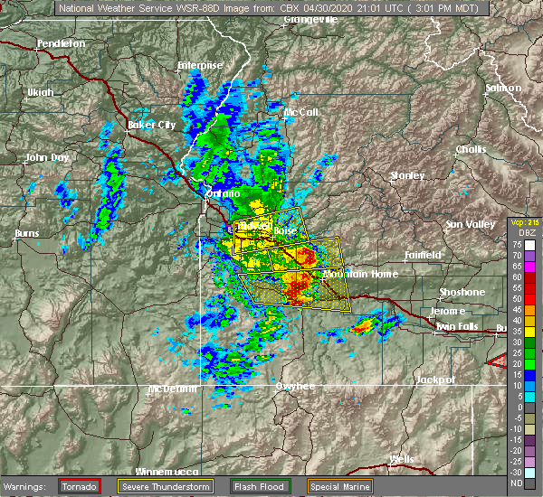 At 301 pm mdt, a severe thunderstorm was located near mountain home air force base, or near mountain home, moving east at 50 mph (radar indicated). Hazards include 60 mph wind gusts and quarter size hail. Hail damage to vehicles is expected. expect wind damage to roofs, siding, and trees. This severe storm will be near, hot springs creek reservoir, tollgate and hammett around 320 pm mdt. At 301 pm mdt, a severe thunderstorm was located near mountain home air force base, or near mountain home, moving east at 50 mph (radar indicated). Hazards include 60 mph wind gusts and quarter size hail. Hail damage to vehicles is expected. expect wind damage to roofs, siding, and trees. This severe storm will be near, hot springs creek reservoir, tollgate and hammett around 320 pm mdt.
|
| 4/30/2020 2:33 PM MDT |
 At 233 pm mdt, a severe thunderstorm was located over oreana, or 30 miles west of mountain home, moving east at 50 mph (radar indicated). Hazards include 60 mph wind gusts and quarter size hail. Hail damage to vehicles is expected. expect wind damage to roofs, siding, and trees. this severe thunderstorm will be near, grand view around 240 pm mdt. c j strike reservoir, cinder cone butte, c j strike dam and hinton reservoir around 250 pm mdt. mountain home air force base and bruneau around 300 pm mdt. Mountain home, hot springs creek reservoir, tollgate and bruneau sand dunes around 310 pm mdt. At 233 pm mdt, a severe thunderstorm was located over oreana, or 30 miles west of mountain home, moving east at 50 mph (radar indicated). Hazards include 60 mph wind gusts and quarter size hail. Hail damage to vehicles is expected. expect wind damage to roofs, siding, and trees. this severe thunderstorm will be near, grand view around 240 pm mdt. c j strike reservoir, cinder cone butte, c j strike dam and hinton reservoir around 250 pm mdt. mountain home air force base and bruneau around 300 pm mdt. Mountain home, hot springs creek reservoir, tollgate and bruneau sand dunes around 310 pm mdt.
|
| 8/10/2019 4:30 PM MDT | Quarter sized hail reported 0.1 miles NE of Grand View, ID |
| 8/10/2019 4:28 PM MDT | Golf Ball sized hail reported 0.1 miles NE of Grand View, ID, via social media |
| 8/10/2019 4:26 PM MDT |
 At 426 pm mdt, a severe thunderstorm was located near grand view, or 19 miles west of mountain home, moving northeast at 30 mph (radar indicated). Hazards include ping pong ball size hail and 60 mph wind gusts. People and animals outdoors will be injured. expect hail damage to roofs, siding, windows, and vehicles. expect wind damage to roofs, siding, and trees. this severe thunderstorm will be near, c j strike reservoir around 430 pm mdt. mountain home air force base around 440 pm mdt. cinder cone butte around 450 pm mdt. Mountain home around 500 pm mdt. At 426 pm mdt, a severe thunderstorm was located near grand view, or 19 miles west of mountain home, moving northeast at 30 mph (radar indicated). Hazards include ping pong ball size hail and 60 mph wind gusts. People and animals outdoors will be injured. expect hail damage to roofs, siding, windows, and vehicles. expect wind damage to roofs, siding, and trees. this severe thunderstorm will be near, c j strike reservoir around 430 pm mdt. mountain home air force base around 440 pm mdt. cinder cone butte around 450 pm mdt. Mountain home around 500 pm mdt.
|
| 6/20/2018 8:07 PM MDT |
 At 806 pm mdt, a severe thunderstorm was located near delamar mine, or 38 miles southwest of nampa, moving east at 45 mph (radar indicated). Hazards include quarter size hail. Damage to vehicles is expected. this severe thunderstorm will be near, silver city around 820 pm mdt. murphy around 830 pm mdt. Grand view and oreana around 840 pm mdt. At 806 pm mdt, a severe thunderstorm was located near delamar mine, or 38 miles southwest of nampa, moving east at 45 mph (radar indicated). Hazards include quarter size hail. Damage to vehicles is expected. this severe thunderstorm will be near, silver city around 820 pm mdt. murphy around 830 pm mdt. Grand view and oreana around 840 pm mdt.
|
| 3/6/2013 12:25 PM MST | Storm damage reported in owyhee county ID, 12.3 miles E of Grand View, ID |
Hail Maps for Grand View, ID


Connect with Interactive Hail Maps