

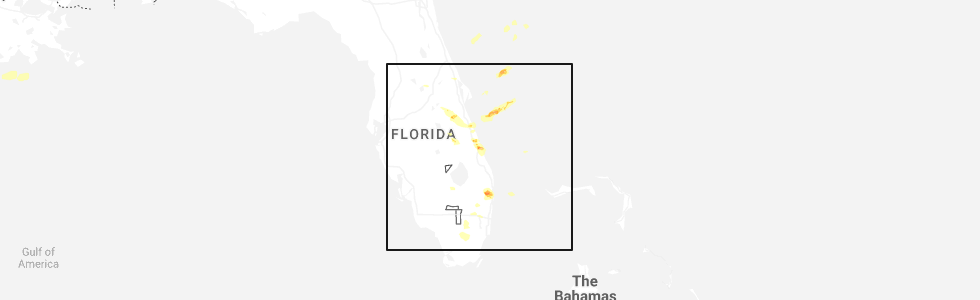
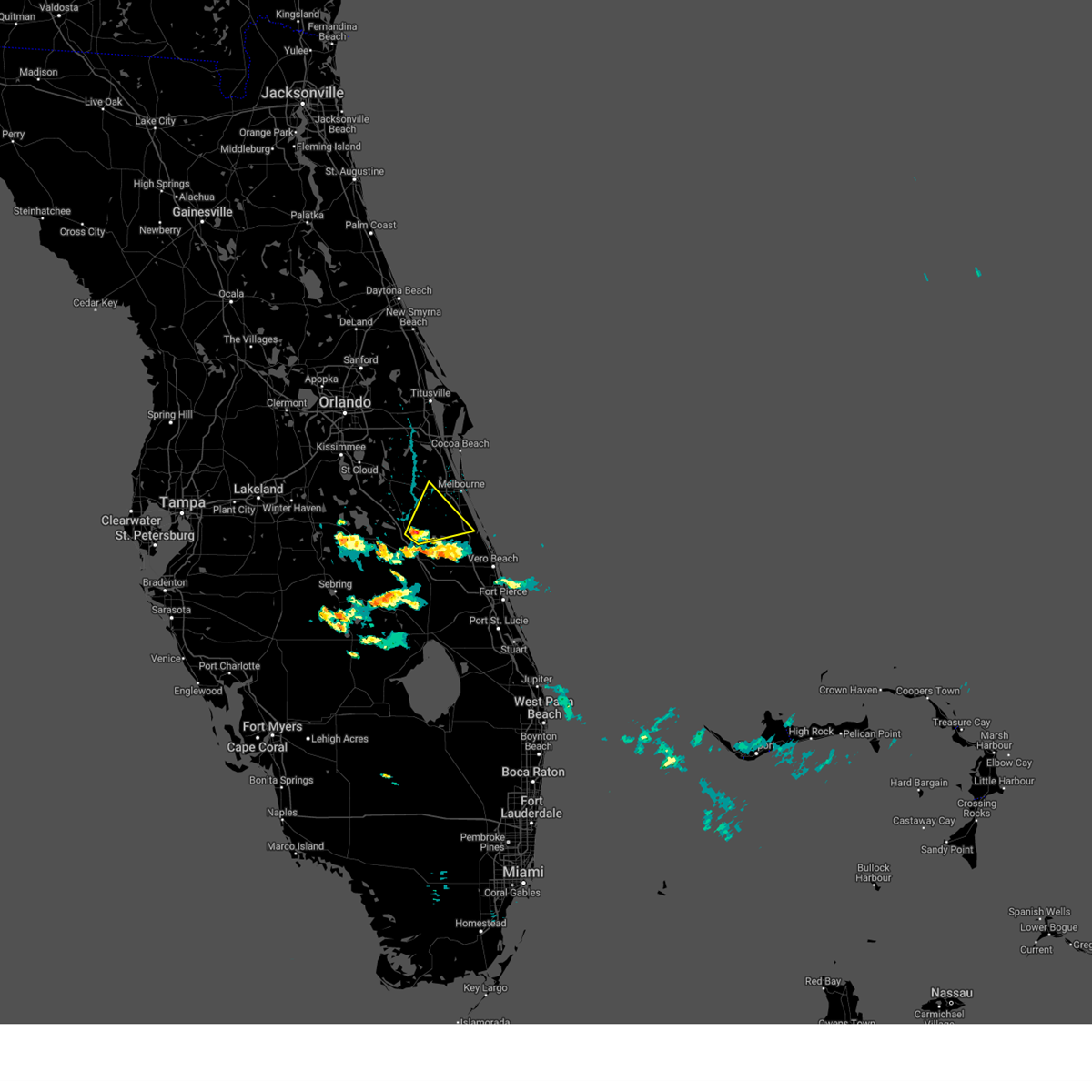
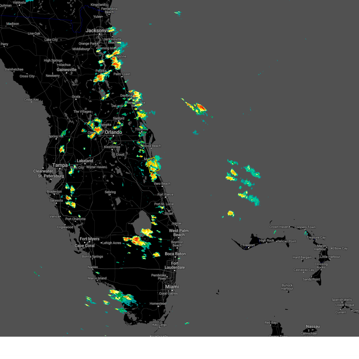
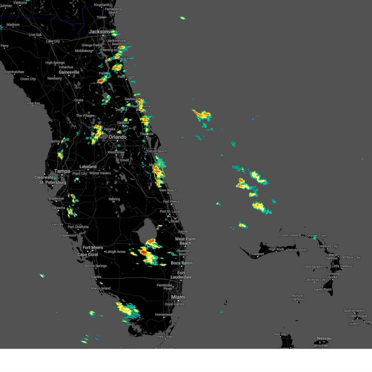
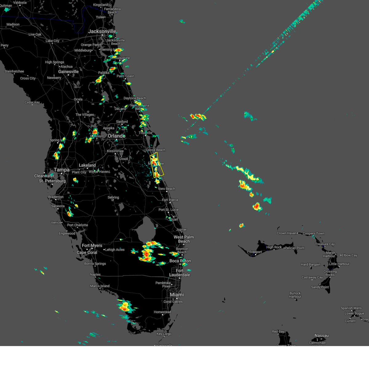
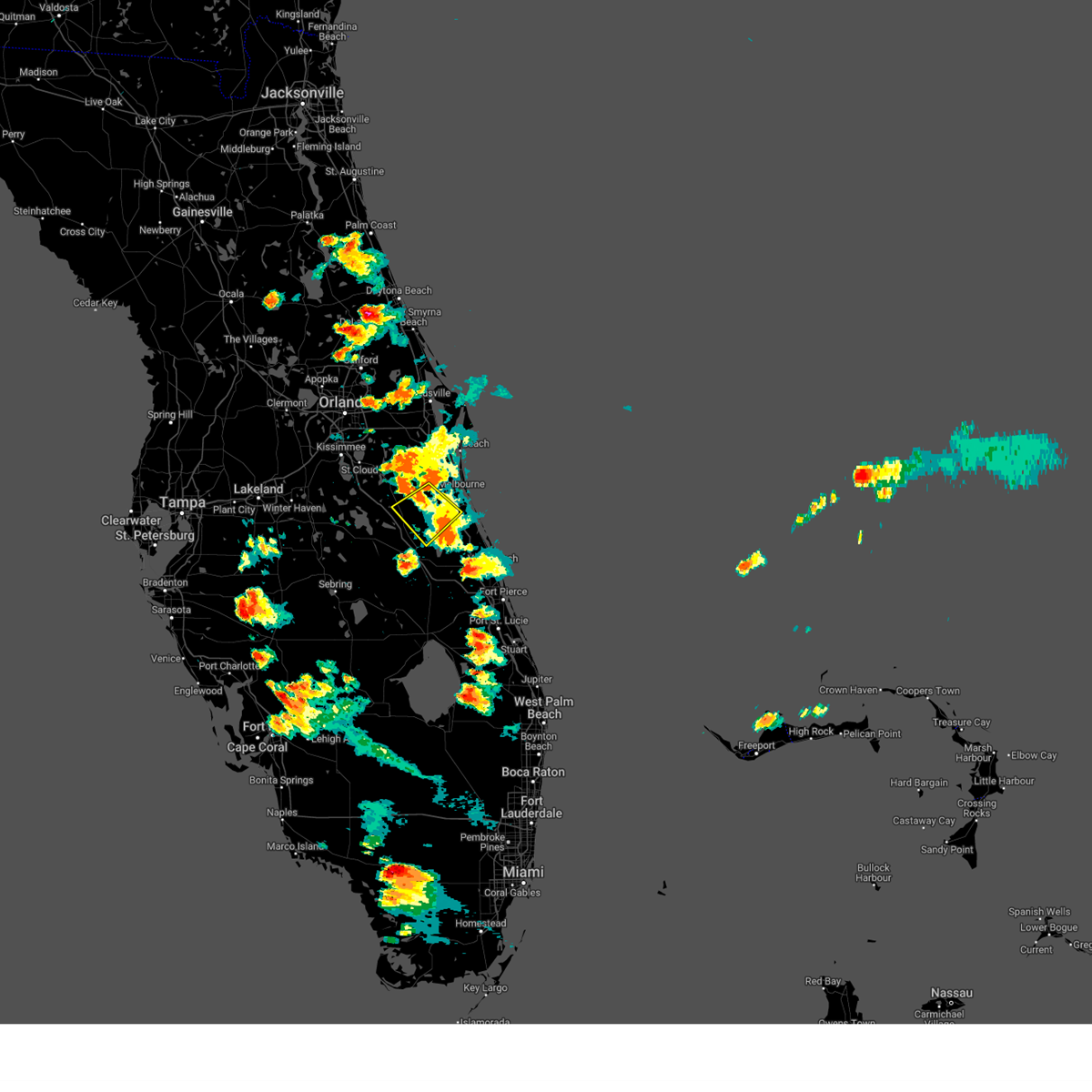
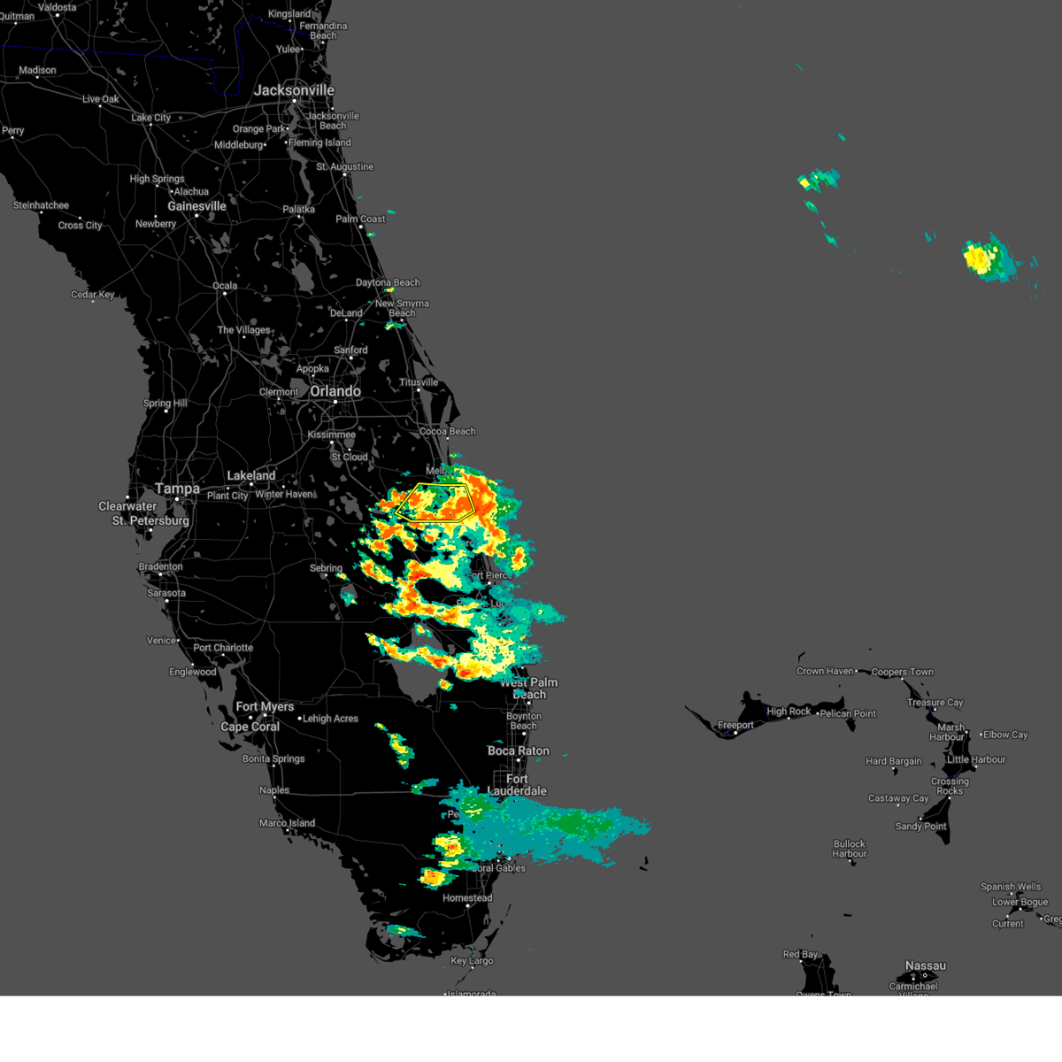
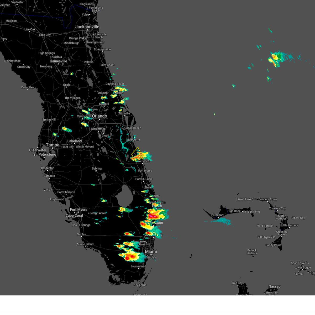
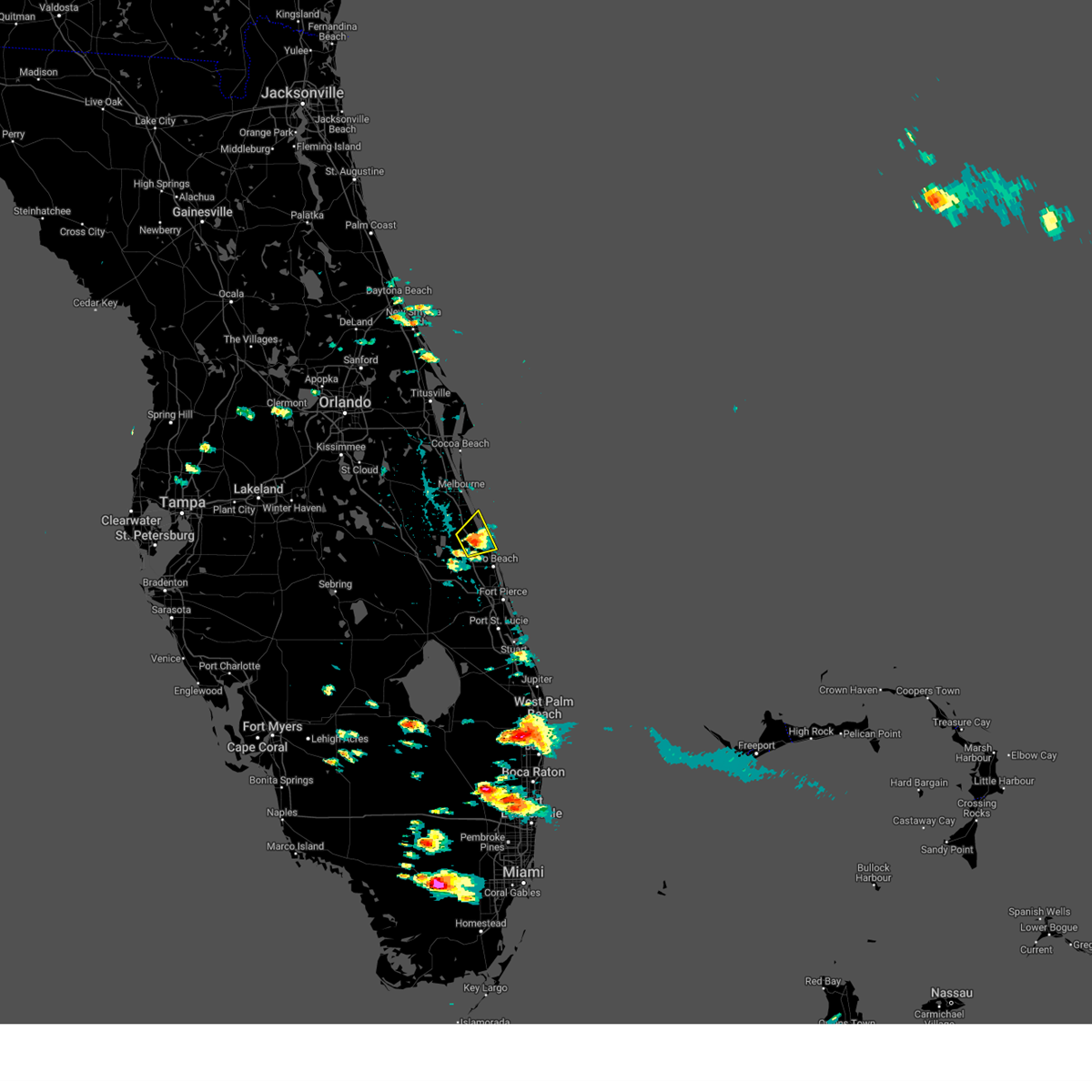
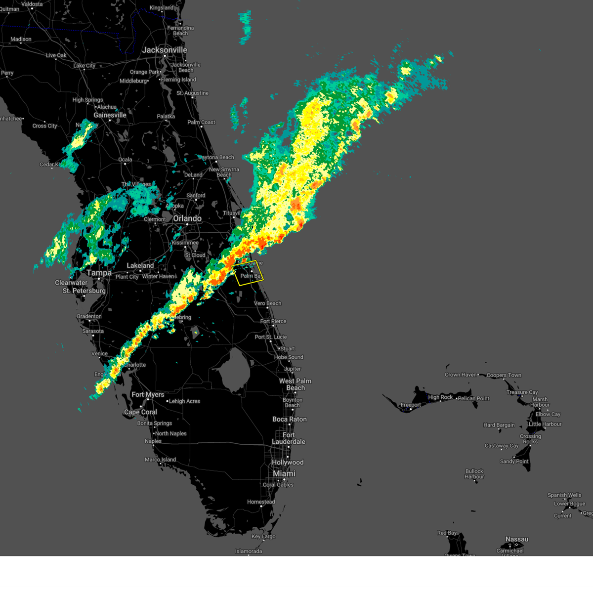
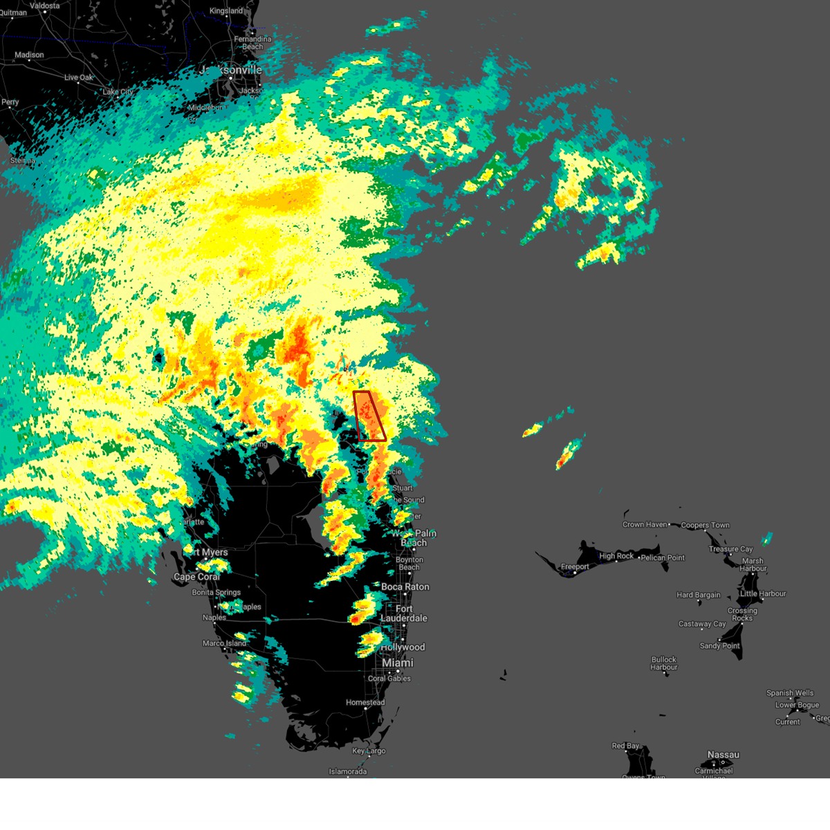
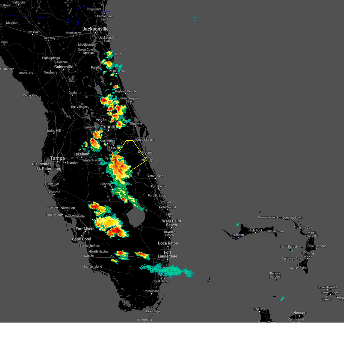
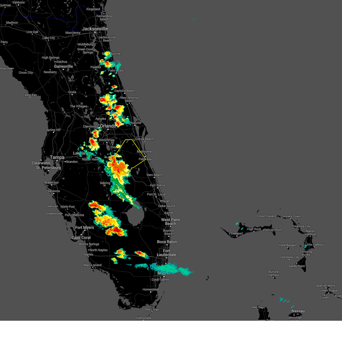
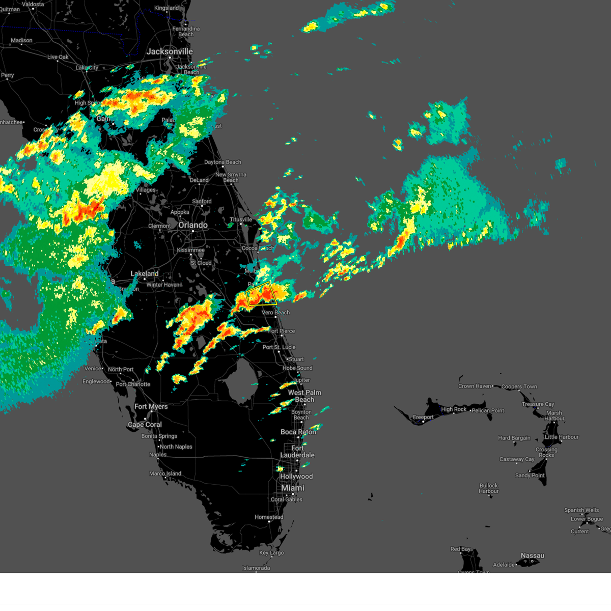
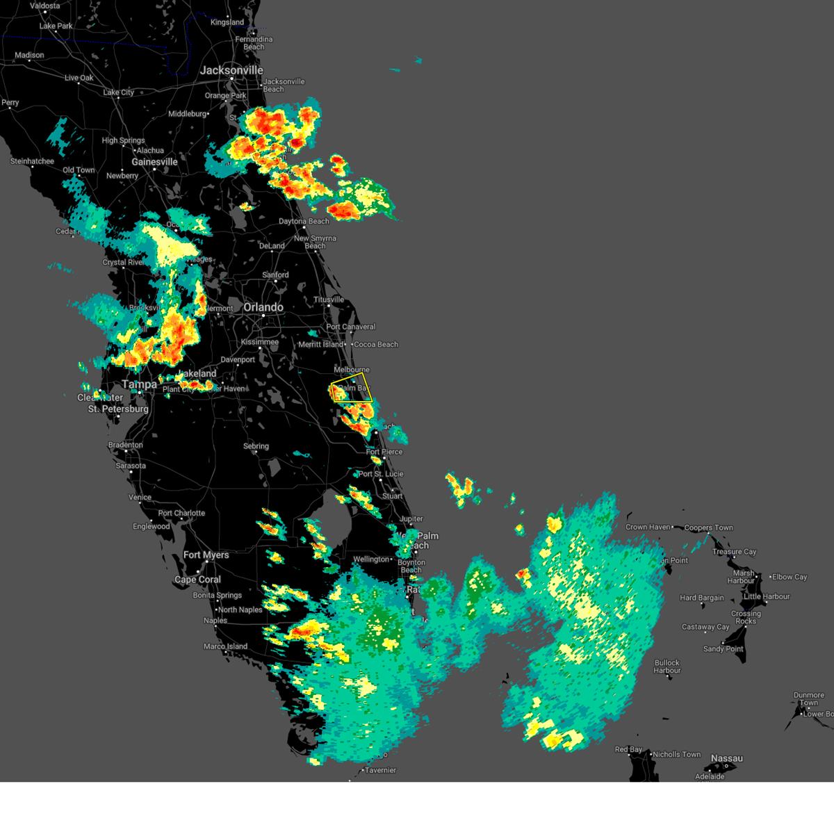
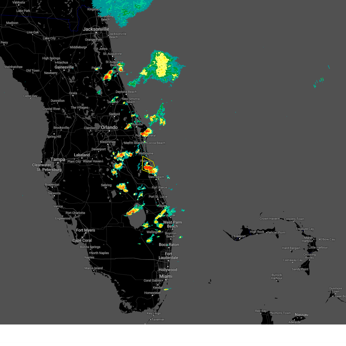
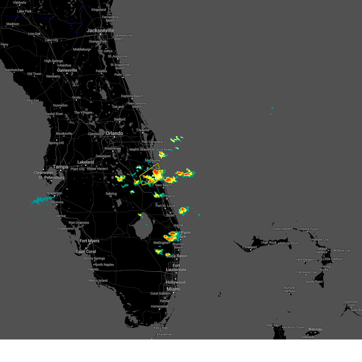
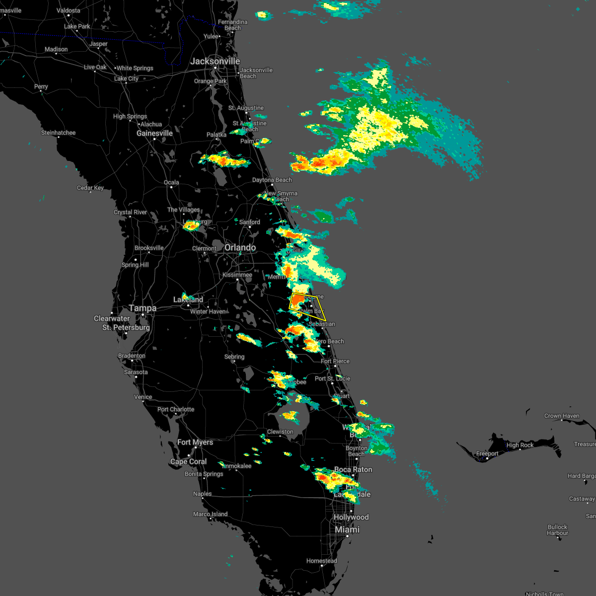
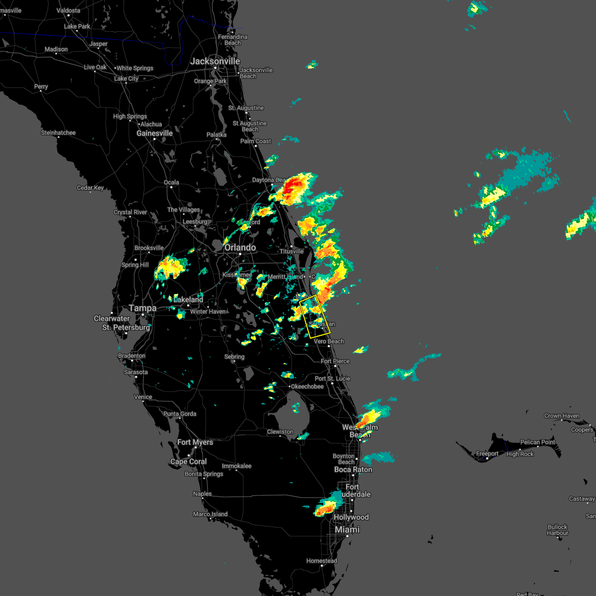
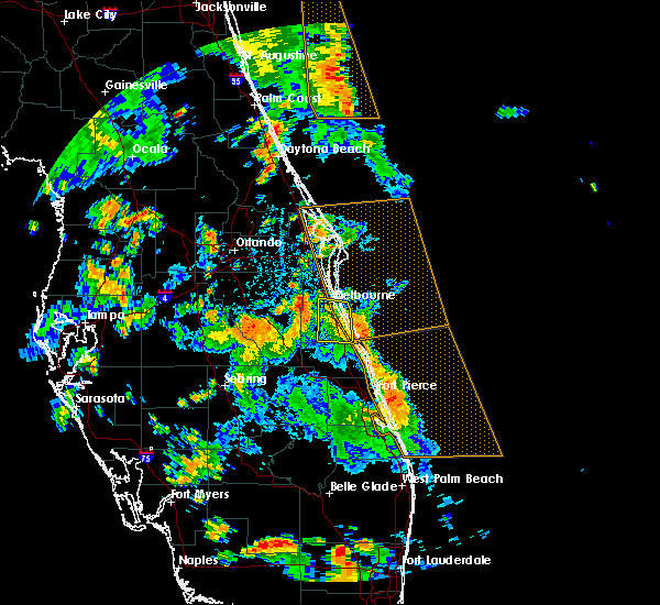
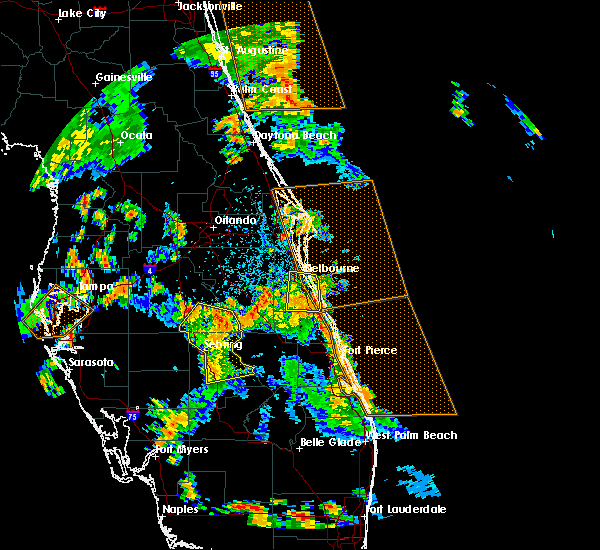
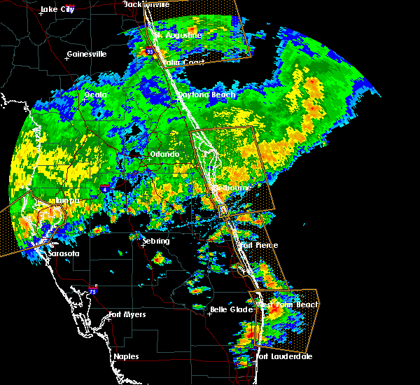
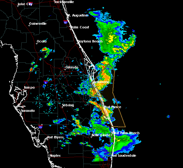
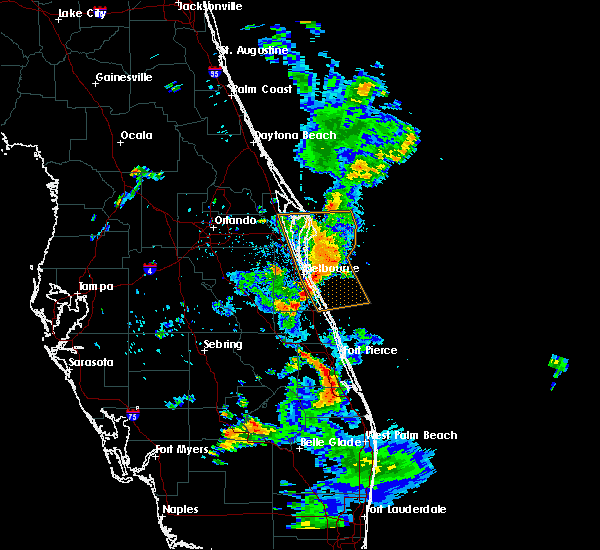
Hail Map for Grant-Valkaria, FL
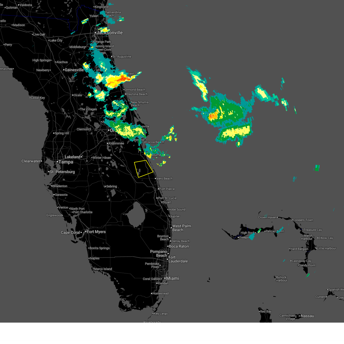
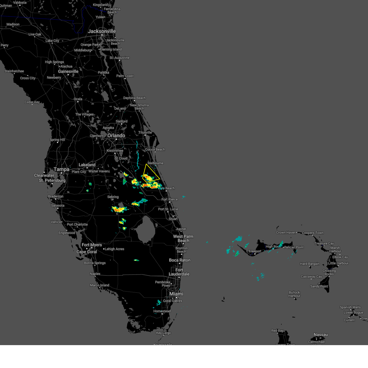
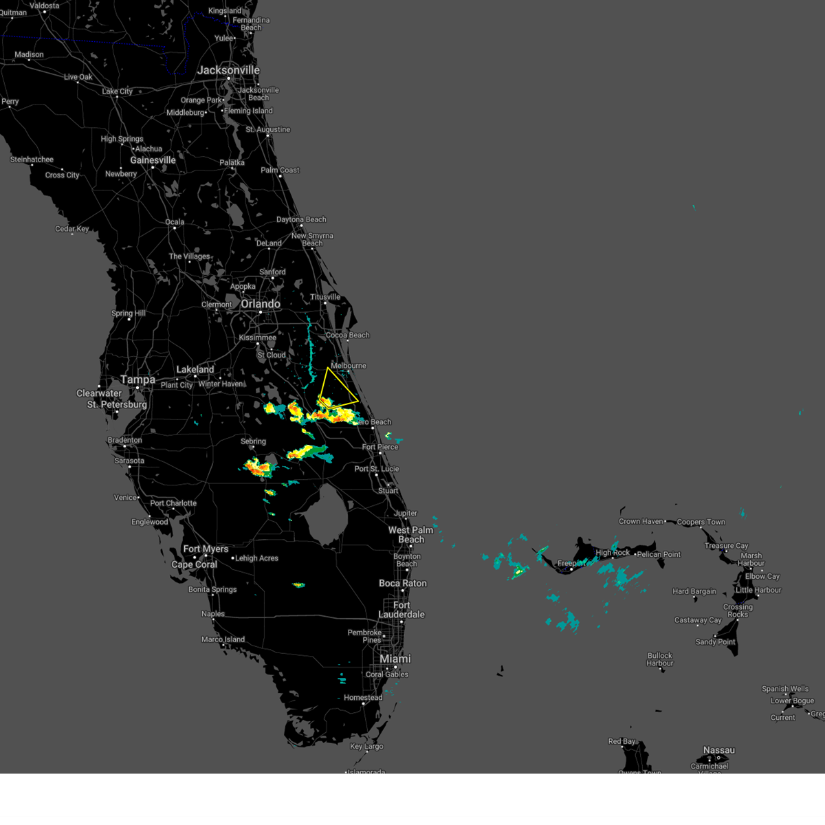
The Grant-Valkaria, FL area has had 1 report of on-the-ground hail by trained spotters, and has been under severe weather warnings 25 times during the past 12 months. Doppler radar has detected hail at or near Grant-Valkaria, FL on 49 occasions, including 3 occasions during the past year.
| Name: | Grant-Valkaria, FL |
| Where Located: | 48.4 miles NNW of Port Saint Lucie, FL |
| Map: | Google Map for Grant-Valkaria, FL |
| Population: | 3850 |
| Housing Units: | 1767 |
| More Info: | Search Google for Grant-Valkaria, FL |
2
The Top Recent Hail Date for Grant-Valkaria, FL is Monday, May 5, 2025 (3rd out of 49)
Hail and Wind Damage Spotted near Grant-Valkaria, FL
| Date / Time | Report Details |
|---|---|
| 7/13/2025 5:36 PM EDT |
 The storm which prompted the warning has weakened below severe limits, and no longer poses an immediate threat to life or property. therefore, the warning will be allowed to expire. however gusty winds are still possible with this thunderstorm. The storm which prompted the warning has weakened below severe limits, and no longer poses an immediate threat to life or property. therefore, the warning will be allowed to expire. however gusty winds are still possible with this thunderstorm.
|
| 7/13/2025 5:20 PM EDT |
 At 519 pm edt, a severe thunderstorm was located 9 miles northwest of fellsmere, moving southeast at 25 mph (radar indicated). Hazards include 60 mph wind gusts and penny size hail. Expect damage to roofs, siding, and trees. Locations impacted include, palm bay, sebastian, fellsmere, malabar, and sebastian highlands. At 519 pm edt, a severe thunderstorm was located 9 miles northwest of fellsmere, moving southeast at 25 mph (radar indicated). Hazards include 60 mph wind gusts and penny size hail. Expect damage to roofs, siding, and trees. Locations impacted include, palm bay, sebastian, fellsmere, malabar, and sebastian highlands.
|
| 7/13/2025 5:04 PM EDT |
 Svrmlb the national weather service in melbourne has issued a * severe thunderstorm warning for, northern indian river county in east central florida, southern brevard county in east central florida, * until 545 pm edt. * at 504 pm edt, a severe thunderstorm was located near palm bay, moving southeast at 20 mph (radar indicated). Hazards include 60 mph wind gusts and penny size hail. expect damage to roofs, siding, and trees Svrmlb the national weather service in melbourne has issued a * severe thunderstorm warning for, northern indian river county in east central florida, southern brevard county in east central florida, * until 545 pm edt. * at 504 pm edt, a severe thunderstorm was located near palm bay, moving southeast at 20 mph (radar indicated). Hazards include 60 mph wind gusts and penny size hail. expect damage to roofs, siding, and trees
|
| 6/1/2025 5:58 PM EDT |
 the severe thunderstorm warning has been cancelled and is no longer in effect the severe thunderstorm warning has been cancelled and is no longer in effect
|
| 6/1/2025 5:40 PM EDT |
 At 540 pm edt, a severe thunderstorm was located 9 miles southwest of palm bay, moving northeast at 25 mph (radar indicated). Hazards include 60 mph wind gusts and quarter size hail. Hail damage to vehicles is expected. expect wind damage to roofs, siding, and trees. Locations impacted include, palm bay. At 540 pm edt, a severe thunderstorm was located 9 miles southwest of palm bay, moving northeast at 25 mph (radar indicated). Hazards include 60 mph wind gusts and quarter size hail. Hail damage to vehicles is expected. expect wind damage to roofs, siding, and trees. Locations impacted include, palm bay.
|
| 6/1/2025 5:40 PM EDT |
 the severe thunderstorm warning has been cancelled and is no longer in effect the severe thunderstorm warning has been cancelled and is no longer in effect
|
| 6/1/2025 5:24 PM EDT |
 Svrmlb the national weather service in melbourne has issued a * severe thunderstorm warning for, northwestern indian river county in east central florida, southwestern brevard county in east central florida, east central osceola county in east central florida, * until 615 pm edt. * at 524 pm edt, a severe thunderstorm was located near kenansville, moving northeast at 25 mph (radar indicated). Hazards include 60 mph wind gusts and quarter size hail. Hail damage to vehicles is expected. Expect wind damage to roofs, siding, and trees. Svrmlb the national weather service in melbourne has issued a * severe thunderstorm warning for, northwestern indian river county in east central florida, southwestern brevard county in east central florida, east central osceola county in east central florida, * until 615 pm edt. * at 524 pm edt, a severe thunderstorm was located near kenansville, moving northeast at 25 mph (radar indicated). Hazards include 60 mph wind gusts and quarter size hail. Hail damage to vehicles is expected. Expect wind damage to roofs, siding, and trees.
|
| 5/25/2025 2:07 PM EDT |
 the severe thunderstorm warning has been cancelled and is no longer in effect the severe thunderstorm warning has been cancelled and is no longer in effect
|
| 5/25/2025 1:55 PM EDT |
 At 154 pm edt, a severe thunderstorm was located near west melbourne, or near indialantic, and is nearly stationary (radar indicated). Hazards include 60 mph wind gusts and quarter size hail. Hail damage to vehicles is expected. expect wind damage to roofs, siding, and trees. Locations impacted include, palm bay, melbourne, malabar, indialantic, and west melbourne. At 154 pm edt, a severe thunderstorm was located near west melbourne, or near indialantic, and is nearly stationary (radar indicated). Hazards include 60 mph wind gusts and quarter size hail. Hail damage to vehicles is expected. expect wind damage to roofs, siding, and trees. Locations impacted include, palm bay, melbourne, malabar, indialantic, and west melbourne.
|
| 5/25/2025 1:38 PM EDT |
 Svrmlb the national weather service in melbourne has issued a * severe thunderstorm warning for, southeastern brevard county in east central florida, * until 230 pm edt. * at 138 pm edt, a severe thunderstorm was located over melbourne, and is nearly stationary (radar indicated). Hazards include 60 mph wind gusts and quarter size hail. Hail damage to vehicles is expected. Expect wind damage to roofs, siding, and trees. Svrmlb the national weather service in melbourne has issued a * severe thunderstorm warning for, southeastern brevard county in east central florida, * until 230 pm edt. * at 138 pm edt, a severe thunderstorm was located over melbourne, and is nearly stationary (radar indicated). Hazards include 60 mph wind gusts and quarter size hail. Hail damage to vehicles is expected. Expect wind damage to roofs, siding, and trees.
|
| 5/24/2025 4:30 PM EDT |
 The storm which prompted the warning has weakened below severe limits, and has exited the warned area. therefore, the warning will be allowed to expire. however small hail and gusty winds are still possible with this thunderstorm. The storm which prompted the warning has weakened below severe limits, and has exited the warned area. therefore, the warning will be allowed to expire. however small hail and gusty winds are still possible with this thunderstorm.
|
| 5/24/2025 3:50 PM EDT |
 The severe thunderstorm which prompted the warning has moved out of the warned area. therefore, the warning has been allowed to expire. however gusty winds are still possible with this thunderstorm. The severe thunderstorm which prompted the warning has moved out of the warned area. therefore, the warning has been allowed to expire. however gusty winds are still possible with this thunderstorm.
|
| 5/24/2025 3:48 PM EDT |
 Svrmlb the national weather service in melbourne has issued a * severe thunderstorm warning for, northwestern indian river county in east central florida, southwestern brevard county in east central florida, east central osceola county in east central florida, * until 430 pm edt. * at 347 pm edt, a severe thunderstorm was located 8 miles southwest of camp holly fish camp, moving southeast at 10 mph (radar indicated). Hazards include 60 mph wind gusts and quarter size hail. Hail damage to vehicles is expected. Expect wind damage to roofs, siding, and trees. Svrmlb the national weather service in melbourne has issued a * severe thunderstorm warning for, northwestern indian river county in east central florida, southwestern brevard county in east central florida, east central osceola county in east central florida, * until 430 pm edt. * at 347 pm edt, a severe thunderstorm was located 8 miles southwest of camp holly fish camp, moving southeast at 10 mph (radar indicated). Hazards include 60 mph wind gusts and quarter size hail. Hail damage to vehicles is expected. Expect wind damage to roofs, siding, and trees.
|
| 5/24/2025 3:33 PM EDT |
 At 333 pm edt, a severe thunderstorm was located near fellsmere, moving south at 25 mph (radar indicated). Hazards include 60 mph wind gusts and quarter size hail. Hail damage to vehicles is expected. expect wind damage to roofs, siding, and trees. Locations impacted include, palm bay, sebastian, fellsmere, indian river shores, and malabar. At 333 pm edt, a severe thunderstorm was located near fellsmere, moving south at 25 mph (radar indicated). Hazards include 60 mph wind gusts and quarter size hail. Hail damage to vehicles is expected. expect wind damage to roofs, siding, and trees. Locations impacted include, palm bay, sebastian, fellsmere, indian river shores, and malabar.
|
| 5/24/2025 3:02 PM EDT |
 Svrmlb the national weather service in melbourne has issued a * severe thunderstorm warning for, northeastern indian river county in east central florida, southeastern brevard county in east central florida, * until 345 pm edt. * at 302 pm edt, a severe thunderstorm was located over palm bay, moving south at 25 mph (radar indicated). Hazards include 60 mph wind gusts and quarter size hail. Hail damage to vehicles is expected. Expect wind damage to roofs, siding, and trees. Svrmlb the national weather service in melbourne has issued a * severe thunderstorm warning for, northeastern indian river county in east central florida, southeastern brevard county in east central florida, * until 345 pm edt. * at 302 pm edt, a severe thunderstorm was located over palm bay, moving south at 25 mph (radar indicated). Hazards include 60 mph wind gusts and quarter size hail. Hail damage to vehicles is expected. Expect wind damage to roofs, siding, and trees.
|
| 5/6/2025 5:20 PM EDT | At 520 pm edt, a severe thunderstorm was located 9 miles southwest of palm bay, moving southeast at 10 mph (radar indicated). Hazards include 60 mph wind gusts and quarter size hail. Hail damage to vehicles is expected. expect wind damage to roofs, siding, and trees. Locations impacted include, palm bay and forever florida. |
| 5/6/2025 5:02 PM EDT | Svrmlb the national weather service in melbourne has issued a * severe thunderstorm warning for, southwestern brevard county in east central florida, east central osceola county in east central florida, * until 545 pm edt. * at 502 pm edt, a severe thunderstorm was located 8 miles southwest of palm bay, moving southeast at 10 mph (radar indicated). Hazards include 60 mph wind gusts and quarter size hail. Hail damage to vehicles is expected. Expect wind damage to roofs, siding, and trees. |
| 5/5/2025 7:47 PM EDT |
 the severe thunderstorm warning has been cancelled and is no longer in effect the severe thunderstorm warning has been cancelled and is no longer in effect
|
| 5/5/2025 7:33 PM EDT | The weather flow site in the indian river near grant (xind) measured a wind gust of 60mph/52kts from the southwes in amz552 county FL, 3.8 miles WSW of Grant-Valkaria, FL |
| 5/5/2025 7:31 PM EDT |
 the severe thunderstorm warning has been cancelled and is no longer in effect the severe thunderstorm warning has been cancelled and is no longer in effect
|
| 5/5/2025 7:31 PM EDT |
 At 731 pm edt, a severe thunderstorm was located over grant-valkaria, or near barefoot bay, moving northeast at 25 mph (radar indicated). Hazards include 60 mph wind gusts and quarter size hail. Hail damage to vehicles is expected. expect wind damage to roofs, siding, and trees. Locations impacted include, palm bay, melbourne, malabar, barefoot bay, and roseland. At 731 pm edt, a severe thunderstorm was located over grant-valkaria, or near barefoot bay, moving northeast at 25 mph (radar indicated). Hazards include 60 mph wind gusts and quarter size hail. Hail damage to vehicles is expected. expect wind damage to roofs, siding, and trees. Locations impacted include, palm bay, melbourne, malabar, barefoot bay, and roseland.
|
| 5/5/2025 7:15 PM EDT |
 Svrmlb the national weather service in melbourne has issued a * severe thunderstorm warning for, northwestern indian river county in east central florida, southeastern brevard county in east central florida, east central osceola county in east central florida, * until 800 pm edt. * at 715 pm edt, a severe thunderstorm was located 8 miles west of palm bay, moving southeast at 20 mph (radar indicated). Hazards include 60 mph wind gusts and quarter size hail. Hail damage to vehicles is expected. Expect wind damage to roofs, siding, and trees. Svrmlb the national weather service in melbourne has issued a * severe thunderstorm warning for, northwestern indian river county in east central florida, southeastern brevard county in east central florida, east central osceola county in east central florida, * until 800 pm edt. * at 715 pm edt, a severe thunderstorm was located 8 miles west of palm bay, moving southeast at 20 mph (radar indicated). Hazards include 60 mph wind gusts and quarter size hail. Hail damage to vehicles is expected. Expect wind damage to roofs, siding, and trees.
|
| 5/5/2025 2:44 PM EDT |
 The storm which prompted the warning has weakened below severe limits, and no longer poses an immediate threat to life or property. therefore, the warning will be allowed to expire. however small hail and gusty winds are still possible with this thunderstorm. a severe thunderstorm watch remains in effect until 900 pm edt for east central florida. The storm which prompted the warning has weakened below severe limits, and no longer poses an immediate threat to life or property. therefore, the warning will be allowed to expire. however small hail and gusty winds are still possible with this thunderstorm. a severe thunderstorm watch remains in effect until 900 pm edt for east central florida.
|
| 5/5/2025 2:22 PM EDT |
 Svrmlb the national weather service in melbourne has issued a * severe thunderstorm warning for, northeastern indian river county in east central florida, southeastern brevard county in east central florida, * until 245 pm edt. * at 222 pm edt, a severe thunderstorm was located over sebastian highlands, moving northeast at 15 mph (radar indicated). Hazards include 60 mph wind gusts and quarter size hail. Hail damage to vehicles is expected. Expect wind damage to roofs, siding, and trees. Svrmlb the national weather service in melbourne has issued a * severe thunderstorm warning for, northeastern indian river county in east central florida, southeastern brevard county in east central florida, * until 245 pm edt. * at 222 pm edt, a severe thunderstorm was located over sebastian highlands, moving northeast at 15 mph (radar indicated). Hazards include 60 mph wind gusts and quarter size hail. Hail damage to vehicles is expected. Expect wind damage to roofs, siding, and trees.
|
| 1/19/2025 2:25 PM EST |
 Svrmlb the national weather service in melbourne has issued a * severe thunderstorm warning for, southeastern brevard county in east central florida, * until 315 pm est. * at 224 pm est, a severe thunderstorm was located over camp holly fish camp, moving east at 55 mph (radar indicated). Hazards include 60 mph wind gusts and penny size hail. expect damage to roofs, siding, and trees Svrmlb the national weather service in melbourne has issued a * severe thunderstorm warning for, southeastern brevard county in east central florida, * until 315 pm est. * at 224 pm est, a severe thunderstorm was located over camp holly fish camp, moving east at 55 mph (radar indicated). Hazards include 60 mph wind gusts and penny size hail. expect damage to roofs, siding, and trees
|
| 10/9/2024 3:46 PM EDT |
 Tormlb the national weather service in melbourne has issued a * tornado warning for, eastern indian river county in east central florida, southeastern brevard county in east central florida, * until 415 pm edt. * at 345 pm edt, a severe thunderstorm capable of producing a tornado was located over winter beach, moving north at 35 mph (radar indicated rotation). Hazards include tornado. Flying debris will be dangerous to those caught without shelter. mobile homes will be damaged or destroyed. damage to roofs, windows, and vehicles will occur. tree damage is likely. this dangerous storm will be near, sebastian, indian river shores, and sebastian highlands around 350 pm edt. sebastian inlet and micco around 400 pm edt. Other locations impacted by this tornadic thunderstorm include orchid. Tormlb the national weather service in melbourne has issued a * tornado warning for, eastern indian river county in east central florida, southeastern brevard county in east central florida, * until 415 pm edt. * at 345 pm edt, a severe thunderstorm capable of producing a tornado was located over winter beach, moving north at 35 mph (radar indicated rotation). Hazards include tornado. Flying debris will be dangerous to those caught without shelter. mobile homes will be damaged or destroyed. damage to roofs, windows, and vehicles will occur. tree damage is likely. this dangerous storm will be near, sebastian, indian river shores, and sebastian highlands around 350 pm edt. sebastian inlet and micco around 400 pm edt. Other locations impacted by this tornadic thunderstorm include orchid.
|
| 6/6/2024 6:27 PM EDT |
 At 626 pm edt, severe thunderstorms were located along a line extending from near holopaw to 11 miles northeast of lake marian to 6 miles east of kenansville, moving northeast at 35 mph (radar indicated). Hazards include 60 mph wind gusts and quarter size hail. Hail damage to vehicles is expected. expect wind damage to roofs, siding, and trees. Locations impacted include, palm bay, melbourne, malabar, lake marian, and holopaw. At 626 pm edt, severe thunderstorms were located along a line extending from near holopaw to 11 miles northeast of lake marian to 6 miles east of kenansville, moving northeast at 35 mph (radar indicated). Hazards include 60 mph wind gusts and quarter size hail. Hail damage to vehicles is expected. expect wind damage to roofs, siding, and trees. Locations impacted include, palm bay, melbourne, malabar, lake marian, and holopaw.
|
| 6/6/2024 6:17 PM EDT |
 Svrmlb the national weather service in melbourne has issued a * severe thunderstorm warning for, southwestern brevard county in east central florida, eastern osceola county in east central florida, * until 645 pm edt. * at 617 pm edt, severe thunderstorms were located along a line extending from near harmony to near kenansville, moving northeast at 45 mph (radar indicated). Hazards include 60 mph wind gusts and quarter size hail. Hail damage to vehicles is expected. Expect wind damage to roofs, siding, and trees. Svrmlb the national weather service in melbourne has issued a * severe thunderstorm warning for, southwestern brevard county in east central florida, eastern osceola county in east central florida, * until 645 pm edt. * at 617 pm edt, severe thunderstorms were located along a line extending from near harmony to near kenansville, moving northeast at 45 mph (radar indicated). Hazards include 60 mph wind gusts and quarter size hail. Hail damage to vehicles is expected. Expect wind damage to roofs, siding, and trees.
|
| 5/19/2024 3:30 PM EDT | Quarter sized hail reported 5.6 miles W of Grant-Valkaria, FL, public reports one inch hail in floridana beach near the intersection of amigos rd and floridana ave. |
| 5/19/2024 3:26 PM EDT |
 At 326 pm edt, a severe thunderstorm was located over barefoot bay, moving northeast at 40 mph (radar indicated). Hazards include 60 mph wind gusts and half dollar size hail. Hail damage to vehicles is expected. expect wind damage to roofs, siding, and trees. Locations impacted include, southeast palm bay, sebastian, malabar, roseland, and barefoot bay. At 326 pm edt, a severe thunderstorm was located over barefoot bay, moving northeast at 40 mph (radar indicated). Hazards include 60 mph wind gusts and half dollar size hail. Hail damage to vehicles is expected. expect wind damage to roofs, siding, and trees. Locations impacted include, southeast palm bay, sebastian, malabar, roseland, and barefoot bay.
|
| 5/19/2024 3:17 PM EDT |
 Svrmlb the national weather service in melbourne has issued a * severe thunderstorm warning for, north central indian river county in east central florida, southeastern brevard county in east central florida, * until 345 pm edt. * at 317 pm edt, a severe thunderstorm was located near grant-valkaria, or near barefoot bay, moving northeast at 45 mph (radar indicated). Hazards include 60 mph wind gusts and quarter size hail. Hail damage to vehicles is expected. Expect wind damage to roofs, siding, and trees. Svrmlb the national weather service in melbourne has issued a * severe thunderstorm warning for, north central indian river county in east central florida, southeastern brevard county in east central florida, * until 345 pm edt. * at 317 pm edt, a severe thunderstorm was located near grant-valkaria, or near barefoot bay, moving northeast at 45 mph (radar indicated). Hazards include 60 mph wind gusts and quarter size hail. Hail damage to vehicles is expected. Expect wind damage to roofs, siding, and trees.
|
| 5/15/2024 1:04 PM EDT |
 the severe thunderstorm warning has been cancelled and is no longer in effect the severe thunderstorm warning has been cancelled and is no longer in effect
|
| 5/15/2024 1:04 PM EDT |
 At 103 pm edt, a severe thunderstorm was located near indian river shores, moving east at 40 mph (radar indicated). Hazards include 60 mph wind gusts and quarter size hail. Hail damage to vehicles is expected. expect wind damage to roofs, siding, and trees. Locations impacted include, sebastian, indian river shores, roseland, winter beach, and wabasso. At 103 pm edt, a severe thunderstorm was located near indian river shores, moving east at 40 mph (radar indicated). Hazards include 60 mph wind gusts and quarter size hail. Hail damage to vehicles is expected. expect wind damage to roofs, siding, and trees. Locations impacted include, sebastian, indian river shores, roseland, winter beach, and wabasso.
|
| 5/15/2024 12:44 PM EDT |
 Svrmlb the national weather service in melbourne has issued a * severe thunderstorm warning for, central indian river county in east central florida, southeastern brevard county in east central florida, * until 130 pm edt. * at 1244 pm edt, a severe thunderstorm was located over fellsmere, moving east at 40 mph (radar indicated). Hazards include 60 mph wind gusts and quarter size hail. Hail damage to vehicles is expected. Expect wind damage to roofs, siding, and trees. Svrmlb the national weather service in melbourne has issued a * severe thunderstorm warning for, central indian river county in east central florida, southeastern brevard county in east central florida, * until 130 pm edt. * at 1244 pm edt, a severe thunderstorm was located over fellsmere, moving east at 40 mph (radar indicated). Hazards include 60 mph wind gusts and quarter size hail. Hail damage to vehicles is expected. Expect wind damage to roofs, siding, and trees.
|
| 5/15/2024 12:32 PM EDT |
 At 1231 pm edt, a severe thunderstorm was located over sebastian inlet, moving east at 30 mph (radar indicated). Hazards include 60 mph wind gusts and quarter size hail. Hail damage to vehicles is expected. expect wind damage to roofs, siding, and trees. Locations impacted include, palm bay, sebastian, fellsmere, malabar, and roseland. At 1231 pm edt, a severe thunderstorm was located over sebastian inlet, moving east at 30 mph (radar indicated). Hazards include 60 mph wind gusts and quarter size hail. Hail damage to vehicles is expected. expect wind damage to roofs, siding, and trees. Locations impacted include, palm bay, sebastian, fellsmere, malabar, and roseland.
|
| 5/15/2024 12:13 PM EDT |
 Svrmlb the national weather service in melbourne has issued a * severe thunderstorm warning for, northeastern indian river county in east central florida, southeastern brevard county in east central florida, * until 1245 pm edt. * at 1212 pm edt, a severe thunderstorm was located 7 miles west of barefoot bay, moving east at 30 mph (radar indicated). Hazards include 60 mph wind gusts and quarter size hail. Hail damage to vehicles is expected. Expect wind damage to roofs, siding, and trees. Svrmlb the national weather service in melbourne has issued a * severe thunderstorm warning for, northeastern indian river county in east central florida, southeastern brevard county in east central florida, * until 1245 pm edt. * at 1212 pm edt, a severe thunderstorm was located 7 miles west of barefoot bay, moving east at 30 mph (radar indicated). Hazards include 60 mph wind gusts and quarter size hail. Hail damage to vehicles is expected. Expect wind damage to roofs, siding, and trees.
|
| 1/9/2024 7:56 PM EST |
 At 756 pm est, a severe thunderstorm was located over melbourne beach, or over indialantic, moving east at 60 mph (radar indicated). Hazards include 60 mph wind gusts. expect damage to roofs, siding, and trees At 756 pm est, a severe thunderstorm was located over melbourne beach, or over indialantic, moving east at 60 mph (radar indicated). Hazards include 60 mph wind gusts. expect damage to roofs, siding, and trees
|
| 1/9/2024 7:43 PM EST |
 At 743 pm est, severe thunderstorms were located along a line extending from near camp holly fish camp to near basinger, moving northeast at 45 mph (radar indicated). Hazards include 60 mph wind gusts. Expect damage to roofs, siding, and trees. Locations impacted include, palm bay, melbourne, satellite beach, fellsmere, and malabar. At 743 pm est, severe thunderstorms were located along a line extending from near camp holly fish camp to near basinger, moving northeast at 45 mph (radar indicated). Hazards include 60 mph wind gusts. Expect damage to roofs, siding, and trees. Locations impacted include, palm bay, melbourne, satellite beach, fellsmere, and malabar.
|
| 1/9/2024 7:12 PM EST |
 At 711 pm est, severe thunderstorms were located along a line extending from 7 miles north of lake marian to near lake istokpoga, moving northeast at 60 mph (radar indicated). Hazards include 60 mph wind gusts. expect damage to roofs, siding, and trees At 711 pm est, severe thunderstorms were located along a line extending from 7 miles north of lake marian to near lake istokpoga, moving northeast at 60 mph (radar indicated). Hazards include 60 mph wind gusts. expect damage to roofs, siding, and trees
|
| 8/29/2023 4:51 PM EDT |
 At 451 pm edt, a severe thunderstorm was located 8 miles southwest of palm bay, moving north at 30 mph (radar indicated). Hazards include 60 mph wind gusts. Expect damage to roofs, siding, and trees. locations impacted include, palm bay, melbourne, malabar, west melbourne, and grant-valkaria. hail threat, radar indicated max hail size, <. 75 in wind threat, radar indicated max wind gust, 60 mph. At 451 pm edt, a severe thunderstorm was located 8 miles southwest of palm bay, moving north at 30 mph (radar indicated). Hazards include 60 mph wind gusts. Expect damage to roofs, siding, and trees. locations impacted include, palm bay, melbourne, malabar, west melbourne, and grant-valkaria. hail threat, radar indicated max hail size, <. 75 in wind threat, radar indicated max wind gust, 60 mph.
|
| 8/29/2023 4:34 PM EDT |
 At 434 pm edt, a severe thunderstorm was located over blue cypress lake, moving north at 30 mph (radar indicated). Hazards include 60 mph wind gusts. expect damage to roofs, siding, and trees At 434 pm edt, a severe thunderstorm was located over blue cypress lake, moving north at 30 mph (radar indicated). Hazards include 60 mph wind gusts. expect damage to roofs, siding, and trees
|
| 7/31/2023 4:48 PM EDT |
 At 448 pm edt, severe thunderstorms were located along a line extending from titusville to palm bay moving east at 25 mph (radar indicated). Hazards include 60 mph wind gusts. Expect damage to roofs, siding, and trees. locations impacted include, palm bay, melbourne, titusville, rockledge, and cocoa. hail threat, radar indicated max hail size, <. 75 in wind threat, radar indicated max wind gust, 60 mph. At 448 pm edt, severe thunderstorms were located along a line extending from titusville to palm bay moving east at 25 mph (radar indicated). Hazards include 60 mph wind gusts. Expect damage to roofs, siding, and trees. locations impacted include, palm bay, melbourne, titusville, rockledge, and cocoa. hail threat, radar indicated max hail size, <. 75 in wind threat, radar indicated max wind gust, 60 mph.
|
| 7/31/2023 4:23 PM EDT |
 At 422 pm edt, severe thunderstorms were located along a line extending from titusville to near camp holly fish camp, moving east at 30 mph (radar indicated). Hazards include 60 mph wind gusts. expect damage to roofs, siding, and trees At 422 pm edt, severe thunderstorms were located along a line extending from titusville to near camp holly fish camp, moving east at 30 mph (radar indicated). Hazards include 60 mph wind gusts. expect damage to roofs, siding, and trees
|
| 6/19/2023 9:42 PM EDT |
 At 940 pm edt, severe thunderstorms were located along a line extending from near sharpes to near lone cabbage fish camp to kenansville, moving east at 35 mph (radar indicated). Hazards include 70 mph wind gusts and quarter size hail. Hail damage to vehicles is expected. expect considerable tree damage. Wind damage is also likely to mobile homes, roofs, and outbuildings. At 940 pm edt, severe thunderstorms were located along a line extending from near sharpes to near lone cabbage fish camp to kenansville, moving east at 35 mph (radar indicated). Hazards include 70 mph wind gusts and quarter size hail. Hail damage to vehicles is expected. expect considerable tree damage. Wind damage is also likely to mobile homes, roofs, and outbuildings.
|
| 6/19/2023 8:17 PM EDT |
 At 816 pm edt, a severe thunderstorm was located over palm bay, moving east at 15 mph (trained weather spotters. at 805 pm, a trained spotter reported quarter size hail in palm bay). Hazards include 60 mph wind gusts and quarter size hail. Hail damage to vehicles is expected. expect wind damage to roofs, siding, and trees. locations impacted include, palm bay, melbourne, malabar, indialantic and west melbourne. hail threat, observed max hail size, 1. 00 in wind threat, radar indicated max wind gust, 60 mph. At 816 pm edt, a severe thunderstorm was located over palm bay, moving east at 15 mph (trained weather spotters. at 805 pm, a trained spotter reported quarter size hail in palm bay). Hazards include 60 mph wind gusts and quarter size hail. Hail damage to vehicles is expected. expect wind damage to roofs, siding, and trees. locations impacted include, palm bay, melbourne, malabar, indialantic and west melbourne. hail threat, observed max hail size, 1. 00 in wind threat, radar indicated max wind gust, 60 mph.
|
| 6/19/2023 8:04 PM EDT |
 At 804 pm edt, a severe thunderstorm was located near palm bay, moving east at 20 mph (radar indicated). Hazards include 60 mph wind gusts and quarter size hail. Hail damage to vehicles is expected. Expect wind damage to roofs, siding, and trees. At 804 pm edt, a severe thunderstorm was located near palm bay, moving east at 20 mph (radar indicated). Hazards include 60 mph wind gusts and quarter size hail. Hail damage to vehicles is expected. Expect wind damage to roofs, siding, and trees.
|
| 6/17/2023 12:25 PM EDT |
 The severe thunderstorm warning for northwestern indian river and southeastern brevard counties will expire at 1230 pm edt, the storm which prompted the warning has weakened below severe limits, and has exited the warned area. therefore, the warning will be allowed to expire. The severe thunderstorm warning for northwestern indian river and southeastern brevard counties will expire at 1230 pm edt, the storm which prompted the warning has weakened below severe limits, and has exited the warned area. therefore, the warning will be allowed to expire.
|
| 6/17/2023 12:19 PM EDT | Weatherflow station indian river db27 (xind) measured a wind gust of 50kt/58mph from the northwes in amz552 county FL, 3.8 miles WSW of Grant-Valkaria, FL |
| 6/17/2023 12:17 PM EDT |
 At 1217 pm edt, a severe thunderstorm capable of producing a tornado was located near grant-valkaria, or near malabar, moving northeast at 45 mph (radar indicated rotation). Hazards include tornado. Flying debris will be dangerous to those caught without shelter. mobile homes will be damaged or destroyed. damage to roofs, windows, and vehicles will occur. tree damage is likely. This tornadic thunderstorm will remain over mainly rural areas of southeastern brevard county, including the following locations, spessard holland park. At 1217 pm edt, a severe thunderstorm capable of producing a tornado was located near grant-valkaria, or near malabar, moving northeast at 45 mph (radar indicated rotation). Hazards include tornado. Flying debris will be dangerous to those caught without shelter. mobile homes will be damaged or destroyed. damage to roofs, windows, and vehicles will occur. tree damage is likely. This tornadic thunderstorm will remain over mainly rural areas of southeastern brevard county, including the following locations, spessard holland park.
|
| 6/17/2023 12:15 PM EDT |
 At 1213 pm edt, a severe thunderstorm was located near barefoot bay, moving northeast at 35 mph (radar indicated). Hazards include 60 mph wind gusts. Expect damage to roofs, siding, and trees. Locations impacted include, palm bay, melbourne, sebastian, fellsmere and malabar. At 1213 pm edt, a severe thunderstorm was located near barefoot bay, moving northeast at 35 mph (radar indicated). Hazards include 60 mph wind gusts. Expect damage to roofs, siding, and trees. Locations impacted include, palm bay, melbourne, sebastian, fellsmere and malabar.
|
| 6/17/2023 12:08 PM EDT |
 At 1207 pm edt, a severe thunderstorm was located 7 miles northwest of fellsmere, moving northeast at 35 mph (radar indicated). Hazards include 60 mph wind gusts. Expect damage to roofs, siding, and trees. Locations impacted include, palm bay, melbourne, sebastian, satellite beach and fellsmere. At 1207 pm edt, a severe thunderstorm was located 7 miles northwest of fellsmere, moving northeast at 35 mph (radar indicated). Hazards include 60 mph wind gusts. Expect damage to roofs, siding, and trees. Locations impacted include, palm bay, melbourne, sebastian, satellite beach and fellsmere.
|
| 6/17/2023 12:07 PM EDT |
 At 1207 pm edt, a severe thunderstorm capable of producing a tornado was located near grant-valkaria, or near malabar, moving northeast at 45 mph (radar indicated rotation). Hazards include tornado. Flying debris will be dangerous to those caught without shelter. mobile homes will be damaged or destroyed. damage to roofs, windows, and vehicles will occur. tree damage is likely. this dangerous storm will be near, barefoot bay, grant-valkaria and micco around 1210 pm edt. Other locations impacted by this tornadic thunderstorm include spessard holland park. At 1207 pm edt, a severe thunderstorm capable of producing a tornado was located near grant-valkaria, or near malabar, moving northeast at 45 mph (radar indicated rotation). Hazards include tornado. Flying debris will be dangerous to those caught without shelter. mobile homes will be damaged or destroyed. damage to roofs, windows, and vehicles will occur. tree damage is likely. this dangerous storm will be near, barefoot bay, grant-valkaria and micco around 1210 pm edt. Other locations impacted by this tornadic thunderstorm include spessard holland park.
|
| 6/17/2023 11:54 AM EDT |
 At 1153 am edt, a severe thunderstorm was located over blue cypress lake, moving northeast at 35 mph (radar indicated). Hazards include 60 mph wind gusts. expect damage to roofs, siding, and trees At 1153 am edt, a severe thunderstorm was located over blue cypress lake, moving northeast at 35 mph (radar indicated). Hazards include 60 mph wind gusts. expect damage to roofs, siding, and trees
|
| 6/17/2023 11:40 AM EDT |
 At 1139 am edt, a severe thunderstorm was located 9 miles northeast of kissimmee prarie preserve, or 9 miles northwest of fort drum, moving northeast at 45 mph (radar indicated). Hazards include 60 mph wind gusts. Expect damage to roofs, siding, and trees. locations impacted include, palm bay, fellsmere, blue cypress lake, fort drum and vero beach south. hail threat, radar indicated max hail size, <. 75 in wind threat, radar indicated max wind gust, 60 mph. At 1139 am edt, a severe thunderstorm was located 9 miles northeast of kissimmee prarie preserve, or 9 miles northwest of fort drum, moving northeast at 45 mph (radar indicated). Hazards include 60 mph wind gusts. Expect damage to roofs, siding, and trees. locations impacted include, palm bay, fellsmere, blue cypress lake, fort drum and vero beach south. hail threat, radar indicated max hail size, <. 75 in wind threat, radar indicated max wind gust, 60 mph.
|
| 6/17/2023 11:34 AM EDT |
 At 1133 am edt, a severe thunderstorm was located along i-95 from viera to the saint johns parkway moving east at 25 mph (radar indicated). Hazards include 60 mph wind gusts. Expect damage to roofs, siding, and trees. locations impacted include, palm bay, west melbourne, rockledge. hail threat, radar indicated max hail size, <. 75 in wind threat, radar indicated max wind gust, 60 mph. At 1133 am edt, a severe thunderstorm was located along i-95 from viera to the saint johns parkway moving east at 25 mph (radar indicated). Hazards include 60 mph wind gusts. Expect damage to roofs, siding, and trees. locations impacted include, palm bay, west melbourne, rockledge. hail threat, radar indicated max hail size, <. 75 in wind threat, radar indicated max wind gust, 60 mph.
|
| 6/17/2023 11:22 AM EDT |
 At 1122 am edt, a severe thunderstorm was located near kissimmee prarie preserve, or 11 miles northwest of basinger, moving northeast at 45 mph (radar indicated). Hazards include 60 mph wind gusts. expect damage to roofs, siding, and trees At 1122 am edt, a severe thunderstorm was located near kissimmee prarie preserve, or 11 miles northwest of basinger, moving northeast at 45 mph (radar indicated). Hazards include 60 mph wind gusts. expect damage to roofs, siding, and trees
|
| 6/17/2023 11:21 AM EDT |
 At 1121 am edt, a severe thunderstorm was located near camp holly fish camp, moving east at 25 mph (radar indicated). Hazards include 60 mph wind gusts. expect damage to roofs, siding, and trees At 1121 am edt, a severe thunderstorm was located near camp holly fish camp, moving east at 25 mph (radar indicated). Hazards include 60 mph wind gusts. expect damage to roofs, siding, and trees
|
| 6/15/2023 7:55 PM EDT |
 At 755 pm edt, a severe thunderstorm was located over vero beach south, moving northeast at 25 mph (radar indicated). Hazards include 60 mph wind gusts and penny size hail. expect damage to roofs, siding, and trees At 755 pm edt, a severe thunderstorm was located over vero beach south, moving northeast at 25 mph (radar indicated). Hazards include 60 mph wind gusts and penny size hail. expect damage to roofs, siding, and trees
|
| 5/17/2023 7:12 PM EDT |
 At 712 pm edt, a severe thunderstorm was located near barefoot bay, moving northeast at 25 mph (radar indicated). Hazards include 60 mph wind gusts and quarter size hail. Hail damage to vehicles is expected. expect wind damage to roofs, siding, and trees. locations impacted include, palm bay, malabar, barefoot bay, roseland and grant-valkaria. hail threat, radar indicated max hail size, 1. 00 in wind threat, radar indicated max wind gust, 60 mph. At 712 pm edt, a severe thunderstorm was located near barefoot bay, moving northeast at 25 mph (radar indicated). Hazards include 60 mph wind gusts and quarter size hail. Hail damage to vehicles is expected. expect wind damage to roofs, siding, and trees. locations impacted include, palm bay, malabar, barefoot bay, roseland and grant-valkaria. hail threat, radar indicated max hail size, 1. 00 in wind threat, radar indicated max wind gust, 60 mph.
|
| 5/17/2023 6:54 PM EDT |
 At 653 pm edt, a severe thunderstorm was located near barefoot bay, moving north at 15 mph (radar indicated). Hazards include 60 mph wind gusts and quarter size hail. Hail damage to vehicles is expected. Expect wind damage to roofs, siding, and trees. At 653 pm edt, a severe thunderstorm was located near barefoot bay, moving north at 15 mph (radar indicated). Hazards include 60 mph wind gusts and quarter size hail. Hail damage to vehicles is expected. Expect wind damage to roofs, siding, and trees.
|
| 4/30/2023 7:24 AM EDT |
 At 724 am edt, a severe thunderstorm was located near buckhead ridge, moving northeast at 65 mph (radar indicated). Hazards include 60 mph wind gusts and penny size hail. expect damage to roofs, siding, and trees At 724 am edt, a severe thunderstorm was located near buckhead ridge, moving northeast at 65 mph (radar indicated). Hazards include 60 mph wind gusts and penny size hail. expect damage to roofs, siding, and trees
|
| 4/28/2023 5:44 PM EDT |
 At 542 pm edt, a severe thunderstorm was located near barefoot bay, moving northeast at 25 mph (public. at 525 pm a cocorahs observer reported three- quarter inch hail in south palm bay). Hazards include 60 mph wind gusts and quarter size hail. Hail damage to vehicles is expected. expect wind damage to roofs, siding, and trees. locations impacted include, palm bay, sebastian, fellsmere, malabar and roseland. hail threat, observed max hail size, 1. 00 in wind threat, radar indicated max wind gust, 60 mph. At 542 pm edt, a severe thunderstorm was located near barefoot bay, moving northeast at 25 mph (public. at 525 pm a cocorahs observer reported three- quarter inch hail in south palm bay). Hazards include 60 mph wind gusts and quarter size hail. Hail damage to vehicles is expected. expect wind damage to roofs, siding, and trees. locations impacted include, palm bay, sebastian, fellsmere, malabar and roseland. hail threat, observed max hail size, 1. 00 in wind threat, radar indicated max wind gust, 60 mph.
|
| 4/28/2023 5:27 PM EDT |
 At 526 pm edt, a severe thunderstorm was located 9 miles south of palm bay, moving northeast at 25 mph (radar indicated). Hazards include 60 mph wind gusts and quarter size hail. Hail damage to vehicles is expected. Expect wind damage to roofs, siding, and trees. At 526 pm edt, a severe thunderstorm was located 9 miles south of palm bay, moving northeast at 25 mph (radar indicated). Hazards include 60 mph wind gusts and quarter size hail. Hail damage to vehicles is expected. Expect wind damage to roofs, siding, and trees.
|
| 4/28/2023 12:11 AM EDT |
 The severe thunderstorm warning for central indian river and southeastern brevard counties will expire at 1215 am edt, the storms which prompted the warning are rapidly moving out of the warned area and into the atlantic. therefore, the warning will be allowed to expire. to report severe weather, contact your nearest law enforcement agency. they will relay your report to the national weather service melbourne. The severe thunderstorm warning for central indian river and southeastern brevard counties will expire at 1215 am edt, the storms which prompted the warning are rapidly moving out of the warned area and into the atlantic. therefore, the warning will be allowed to expire. to report severe weather, contact your nearest law enforcement agency. they will relay your report to the national weather service melbourne.
|
| 4/27/2023 11:56 PM EDT |
 At 1155 pm edt, severe thunderstorms were located along a line extending from 10 miles east of patrick air force base to near barefoot bay, moving east at 50 mph (radar indicated). Hazards include 60 mph wind gusts. Expect damage to roofs, siding, and trees. locations impacted include, sebastian, fellsmere, indian river shores, malabar and roseland. hail threat, radar indicated max hail size, <. 75 in wind threat, radar indicated max wind gust, 60 mph. At 1155 pm edt, severe thunderstorms were located along a line extending from 10 miles east of patrick air force base to near barefoot bay, moving east at 50 mph (radar indicated). Hazards include 60 mph wind gusts. Expect damage to roofs, siding, and trees. locations impacted include, sebastian, fellsmere, indian river shores, malabar and roseland. hail threat, radar indicated max hail size, <. 75 in wind threat, radar indicated max wind gust, 60 mph.
|
| 4/27/2023 11:43 PM EDT |
 At 1142 pm edt, severe thunderstorms were located along a line extending from 13 miles northeast of port canaveral to near indialantic to near blue cypress lake, moving east at 50mph (radar indicated). Hazards include 60 mph wind gusts. expect damage to roofs, siding, and trees At 1142 pm edt, severe thunderstorms were located along a line extending from 13 miles northeast of port canaveral to near indialantic to near blue cypress lake, moving east at 50mph (radar indicated). Hazards include 60 mph wind gusts. expect damage to roofs, siding, and trees
|
| 4/27/2023 11:40 PM EDT |
 At 1140 pm edt, severe thunderstorms were located along a line extending from 13 miles northeast of port canaveral to indialantic to near blue cypress lake, moving northeast at 80 mph (radar indicated). Hazards include 60 mph wind gusts. expect damage to roofs, siding, and trees At 1140 pm edt, severe thunderstorms were located along a line extending from 13 miles northeast of port canaveral to indialantic to near blue cypress lake, moving northeast at 80 mph (radar indicated). Hazards include 60 mph wind gusts. expect damage to roofs, siding, and trees
|
| 4/26/2023 4:08 PM EDT |
 At 407 pm edt, a severe thunderstorm was located over micco, or over barefoot bay, moving southeast at 25 mph (radar indicated). Hazards include ping pong ball size hail and 60 mph wind gusts. People and animals outdoors will be injured. expect hail damage to roofs, siding, windows, and vehicles. Expect wind damage to roofs, siding, and trees. At 407 pm edt, a severe thunderstorm was located over micco, or over barefoot bay, moving southeast at 25 mph (radar indicated). Hazards include ping pong ball size hail and 60 mph wind gusts. People and animals outdoors will be injured. expect hail damage to roofs, siding, windows, and vehicles. Expect wind damage to roofs, siding, and trees.
|
| 4/26/2023 3:51 PM EDT |
 At 351 pm edt, a severe thunderstorm was located over malabar, moving southeast at 30 mph (radar indicated). Hazards include golf ball size hail and 60 mph wind gusts. People and animals outdoors will be injured. expect hail damage to roofs, siding, windows, and vehicles. expect wind damage to roofs, siding, and trees. locations impacted include, palm bay, melbourne, sebastian, malabar and indialantic. thunderstorm damage threat, considerable hail threat, radar indicated max hail size, 1. 75 in wind threat, radar indicated max wind gust, 60 mph. At 351 pm edt, a severe thunderstorm was located over malabar, moving southeast at 30 mph (radar indicated). Hazards include golf ball size hail and 60 mph wind gusts. People and animals outdoors will be injured. expect hail damage to roofs, siding, windows, and vehicles. expect wind damage to roofs, siding, and trees. locations impacted include, palm bay, melbourne, sebastian, malabar and indialantic. thunderstorm damage threat, considerable hail threat, radar indicated max hail size, 1. 75 in wind threat, radar indicated max wind gust, 60 mph.
|
| 4/26/2023 3:29 PM EDT |
 At 329 pm edt, a severe thunderstorm was located over west melbourne, or near camp holly fish camp, moving southeast at 15 mph (radar indicated). Hazards include golf ball size hail and 60 mph wind gusts. People and animals outdoors will be injured. expect hail damage to roofs, siding, windows, and vehicles. Expect wind damage to roofs, siding, and trees. At 329 pm edt, a severe thunderstorm was located over west melbourne, or near camp holly fish camp, moving southeast at 15 mph (radar indicated). Hazards include golf ball size hail and 60 mph wind gusts. People and animals outdoors will be injured. expect hail damage to roofs, siding, windows, and vehicles. Expect wind damage to roofs, siding, and trees.
|
| 4/26/2023 3:27 PM EDT |
 At 326 pm edt, a severe thunderstorm was located over camp holly fish camp, moving southeast at 15 mph (radar indicated). Hazards include golf ball size hail and 60 mph wind gusts. People and animals outdoors will be injured. expect hail damage to roofs, siding, windows, and vehicles. expect wind damage to roofs, siding, and trees. locations impacted include, palm bay, melbourne, satellite beach, malabar and indialantic. thunderstorm damage threat, considerable hail threat, radar indicated max hail size, 1. 75 in wind threat, radar indicated max wind gust, 60 mph. At 326 pm edt, a severe thunderstorm was located over camp holly fish camp, moving southeast at 15 mph (radar indicated). Hazards include golf ball size hail and 60 mph wind gusts. People and animals outdoors will be injured. expect hail damage to roofs, siding, windows, and vehicles. expect wind damage to roofs, siding, and trees. locations impacted include, palm bay, melbourne, satellite beach, malabar and indialantic. thunderstorm damage threat, considerable hail threat, radar indicated max hail size, 1. 75 in wind threat, radar indicated max wind gust, 60 mph.
|
| 4/26/2023 3:12 PM EDT |
 At 311 pm edt, a severe thunderstorm was located near suntree, or near camp holly fish camp, moving southeast at 30 mph (radar indicated). Hazards include golf ball size hail and 60 mph wind gusts. People and animals outdoors will be injured. expect hail damage to roofs, siding, windows, and vehicles. expect wind damage to roofs, siding, and trees. locations impacted include, palm bay, melbourne, satellite beach, malabar and indialantic. thunderstorm damage threat, considerable hail threat, radar indicated max hail size, 1. 75 in wind threat, radar indicated max wind gust, 60 mph. At 311 pm edt, a severe thunderstorm was located near suntree, or near camp holly fish camp, moving southeast at 30 mph (radar indicated). Hazards include golf ball size hail and 60 mph wind gusts. People and animals outdoors will be injured. expect hail damage to roofs, siding, windows, and vehicles. expect wind damage to roofs, siding, and trees. locations impacted include, palm bay, melbourne, satellite beach, malabar and indialantic. thunderstorm damage threat, considerable hail threat, radar indicated max hail size, 1. 75 in wind threat, radar indicated max wind gust, 60 mph.
|
| 4/26/2023 2:57 PM EDT |
 At 257 pm edt, a severe thunderstorm was located near viera, or near rockledge, moving southeast at 15 mph (radar indicated). Hazards include 60 mph wind gusts and quarter size hail. Hail damage to vehicles is expected. Expect wind damage to roofs, siding, and trees. At 257 pm edt, a severe thunderstorm was located near viera, or near rockledge, moving southeast at 15 mph (radar indicated). Hazards include 60 mph wind gusts and quarter size hail. Hail damage to vehicles is expected. Expect wind damage to roofs, siding, and trees.
|
| 4/16/2023 6:05 PM EDT |
 At 603 pm edt, severe thunderstorms were located along a line extending from 13 miles east of melbourne beach to 11 miles east of sebastian inlet state park to indian river shores, moving east at 30 mph (radar indicated). Hazards include 60 mph wind gusts and quarter size hail. Hail damage to vehicles is expected. expect wind damage to roofs, siding, and trees. locations impacted include, palm bay, melbourne, sebastian, vero beach and fellsmere. hail threat, radar indicated max hail size, 1. 00 in wind threat, radar indicated max wind gust, 60 mph. At 603 pm edt, severe thunderstorms were located along a line extending from 13 miles east of melbourne beach to 11 miles east of sebastian inlet state park to indian river shores, moving east at 30 mph (radar indicated). Hazards include 60 mph wind gusts and quarter size hail. Hail damage to vehicles is expected. expect wind damage to roofs, siding, and trees. locations impacted include, palm bay, melbourne, sebastian, vero beach and fellsmere. hail threat, radar indicated max hail size, 1. 00 in wind threat, radar indicated max wind gust, 60 mph.
|
| 4/16/2023 5:38 PM EDT |
 At 538 pm edt, a severe thunderstorm capable of producing a tornado was located over sebastian inlet, moving east at 30 mph (radar indicated rotation). Hazards include tornado. Flying debris will be dangerous to those caught without shelter. mobile homes will be damaged or destroyed. damage to roofs, windows, and vehicles will occur. tree damage is likely. this dangerous storm will be near, sebastian inlet and sebastian inlet state park around 540 pm edt. Other locations impacted by this tornadic thunderstorm include north beach. At 538 pm edt, a severe thunderstorm capable of producing a tornado was located over sebastian inlet, moving east at 30 mph (radar indicated rotation). Hazards include tornado. Flying debris will be dangerous to those caught without shelter. mobile homes will be damaged or destroyed. damage to roofs, windows, and vehicles will occur. tree damage is likely. this dangerous storm will be near, sebastian inlet and sebastian inlet state park around 540 pm edt. Other locations impacted by this tornadic thunderstorm include north beach.
|
| 4/16/2023 5:30 PM EDT |
 At 529 pm edt, severe thunderstorms were located along a line extending from near west melbourne to near micco to 7 miles southeast of blue cypress lake, moving east at 35 mph (radar indicated). Hazards include 60 mph wind gusts and quarter size hail. Hail damage to vehicles is expected. Expect wind damage to roofs, siding, and trees. At 529 pm edt, severe thunderstorms were located along a line extending from near west melbourne to near micco to 7 miles southeast of blue cypress lake, moving east at 35 mph (radar indicated). Hazards include 60 mph wind gusts and quarter size hail. Hail damage to vehicles is expected. Expect wind damage to roofs, siding, and trees.
|
| 10/17/2022 5:49 PM EDT |
 At 549 pm edt, a severe thunderstorm was located over camp holly fish camp, moving east at 30 mph (radar indicated). Hazards include 60 mph wind gusts and quarter size hail. Hail damage to vehicles is expected. Expect wind damage to roofs, siding, and trees. At 549 pm edt, a severe thunderstorm was located over camp holly fish camp, moving east at 30 mph (radar indicated). Hazards include 60 mph wind gusts and quarter size hail. Hail damage to vehicles is expected. Expect wind damage to roofs, siding, and trees.
|
| 4/2/2022 5:26 PM EDT |
 At 525 pm edt, severe thunderstorms were located along a line extending from near sebastian inlet state park to near vero beach, moving east at 30 mph (radar indicated). Hazards include 60 mph wind gusts. Expect damage to roofs, siding, and trees. locations impacted include, sebastian, vero beach, fellsmere, indian river shores and roseland. hail threat, radar indicated max hail size, <. 75 in wind threat, radar indicated max wind gust, 60 mph. At 525 pm edt, severe thunderstorms were located along a line extending from near sebastian inlet state park to near vero beach, moving east at 30 mph (radar indicated). Hazards include 60 mph wind gusts. Expect damage to roofs, siding, and trees. locations impacted include, sebastian, vero beach, fellsmere, indian river shores and roseland. hail threat, radar indicated max hail size, <. 75 in wind threat, radar indicated max wind gust, 60 mph.
|
| 4/2/2022 5:12 PM EDT |
 At 512 pm edt, severe thunderstorms were located along a line extending from near floridana beach to vero lake estates, moving southeast at 40 mph (radar indicated). Hazards include 60 mph wind gusts. expect damage to roofs, siding, and trees At 512 pm edt, severe thunderstorms were located along a line extending from near floridana beach to vero lake estates, moving southeast at 40 mph (radar indicated). Hazards include 60 mph wind gusts. expect damage to roofs, siding, and trees
|
| 4/2/2022 5:07 PM EDT | Off duty nws employee reports power lines down on the 6300 block of a1a in melbourne shore in brevard county FL, 5.6 miles W of Grant-Valkaria, FL |
| 3/16/2022 5:07 PM EDT |
 At 506 pm edt, a severe thunderstorm was located over barefoot bay, moving northeast at 35 mph (radar indicated). Hazards include 60 mph wind gusts and quarter size hail. Hail damage to vehicles is expected. expect wind damage to roofs, siding, and trees. Locations impacted include, palm bay, melbourne, sebastian, fellsmere and malabar. At 506 pm edt, a severe thunderstorm was located over barefoot bay, moving northeast at 35 mph (radar indicated). Hazards include 60 mph wind gusts and quarter size hail. Hail damage to vehicles is expected. expect wind damage to roofs, siding, and trees. Locations impacted include, palm bay, melbourne, sebastian, fellsmere and malabar.
|
| 3/16/2022 4:44 PM EDT |
 At 443 pm edt, a severe thunderstorm was located over malabar, moving east at 25 mph (radar indicated. at 435 pm edt dime to nickel sized hail was reported in west melbourne). Hazards include 60 mph wind gusts and quarter size hail. Hail damage to vehicles is expected. Expect wind damage to roofs, siding, and trees. At 443 pm edt, a severe thunderstorm was located over malabar, moving east at 25 mph (radar indicated. at 435 pm edt dime to nickel sized hail was reported in west melbourne). Hazards include 60 mph wind gusts and quarter size hail. Hail damage to vehicles is expected. Expect wind damage to roofs, siding, and trees.
|
| 3/16/2022 3:39 PM EDT |
 At 339 pm edt, a severe thunderstorm was located near holopaw, moving east at 35 mph (radar indicated). Hazards include 60 mph wind gusts and quarter size hail. Hail damage to vehicles is expected. Expect wind damage to roofs, siding, and trees. At 339 pm edt, a severe thunderstorm was located near holopaw, moving east at 35 mph (radar indicated). Hazards include 60 mph wind gusts and quarter size hail. Hail damage to vehicles is expected. Expect wind damage to roofs, siding, and trees.
|
| 4/11/2021 2:15 PM EDT |
 At 214 pm edt, a severe thunderstorm was located over vero beach south, moving southeast at 45 mph (radar indicated). Hazards include 60 mph wind gusts. Expect damage to roofs, siding, and trees. Locations impacted include, sebastian, vero beach, fellsmere, indian river shores and roseland. At 214 pm edt, a severe thunderstorm was located over vero beach south, moving southeast at 45 mph (radar indicated). Hazards include 60 mph wind gusts. Expect damage to roofs, siding, and trees. Locations impacted include, sebastian, vero beach, fellsmere, indian river shores and roseland.
|
| 4/11/2021 1:55 PM EDT |
 At 155 pm edt, a severe thunderstorm was located over grant-valkaria, or near malabar, moving southeast at 20 mph (radar indicated). Hazards include 60 mph wind gusts. expect damage to roofs, siding, and trees At 155 pm edt, a severe thunderstorm was located over grant-valkaria, or near malabar, moving southeast at 20 mph (radar indicated). Hazards include 60 mph wind gusts. expect damage to roofs, siding, and trees
|
| 4/11/2021 1:46 PM EDT | Weatherflow site xind at indian river measured a peak wind gust of 58 mph or 50 knots from the nort in amz552 county FL, 3.8 miles WSW of Grant-Valkaria, FL |
| 6/23/2020 8:28 PM EDT |
 At 828 pm edt, severe thunderstorms were located along a line extending from grant-valkaria to 6 miles southeast of blue cypress lake, moving southeast at 20 mph (radar indicated). Hazards include 60 mph wind gusts and nickel size hail. expect damage to roofs, siding, and trees At 828 pm edt, severe thunderstorms were located along a line extending from grant-valkaria to 6 miles southeast of blue cypress lake, moving southeast at 20 mph (radar indicated). Hazards include 60 mph wind gusts and nickel size hail. expect damage to roofs, siding, and trees
|
| 4/26/2020 9:35 AM EDT |
 At 935 am edt, a severe thunderstorm was located over sebastian inlet, moving northeast at 30 mph (radar indicated). Hazards include 50 to 60 mph wind gusts and nickel size hail. Expect damage to roofs, siding, and trees. Locations impacted include, sebastian, roseland, barefoot bay, sebastian inlet and sebastian inlet state park. At 935 am edt, a severe thunderstorm was located over sebastian inlet, moving northeast at 30 mph (radar indicated). Hazards include 50 to 60 mph wind gusts and nickel size hail. Expect damage to roofs, siding, and trees. Locations impacted include, sebastian, roseland, barefoot bay, sebastian inlet and sebastian inlet state park.
|
| 4/26/2020 9:07 AM EDT |
 At 905 am edt, a severe thunderstorm was located near fellsmere, moving northeast at 35 mph. the storm will cross i 95 near the st sebastian river state park around 915 am (radar indicated). Hazards include quarter size hail. Damage to vehicles is expected. Locations impacted include, sebastian, fellsmere, indian river shores, roseland and barefoot bay. At 905 am edt, a severe thunderstorm was located near fellsmere, moving northeast at 35 mph. the storm will cross i 95 near the st sebastian river state park around 915 am (radar indicated). Hazards include quarter size hail. Damage to vehicles is expected. Locations impacted include, sebastian, fellsmere, indian river shores, roseland and barefoot bay.
|
| 4/26/2020 8:46 AM EDT |
 At 845 am edt, a severe thunderstorm was located near blue cypress lake, moving northeast at 30 mph (radar indicated). Hazards include quarter size hail. damage to vehicles is expected At 845 am edt, a severe thunderstorm was located near blue cypress lake, moving northeast at 30 mph (radar indicated). Hazards include quarter size hail. damage to vehicles is expected
|
| 2/7/2020 2:21 AM EST |
 The severe thunderstorm warning for southeastern brevard county will expire at 230 am est, the storm which prompted the warning has weakened below severe limits, and no longer poses an immediate threat to life or property. therefore, the warning will be allowed to expire. however gusty winds are still possible with this thunderstorm. a tornado watch remains in effect until 300 am est for east central florida. The severe thunderstorm warning for southeastern brevard county will expire at 230 am est, the storm which prompted the warning has weakened below severe limits, and no longer poses an immediate threat to life or property. therefore, the warning will be allowed to expire. however gusty winds are still possible with this thunderstorm. a tornado watch remains in effect until 300 am est for east central florida.
|
| 2/7/2020 1:45 AM EST |
 At 145 am est, a severe thunderstorm was located over west melbourne, or over melbourne, moving east at 45 mph (radar indicated). Hazards include 60 mph wind gusts. expect damage to roofs, siding, and trees At 145 am est, a severe thunderstorm was located over west melbourne, or over melbourne, moving east at 45 mph (radar indicated). Hazards include 60 mph wind gusts. expect damage to roofs, siding, and trees
|
| 9/3/2019 6:27 PM EDT |
 The tornado warning for eastern indian river and southeastern brevard counties will expire at 630 pm edt, the storms which prompted the warning have weakened below severe limits, and no longer appear capable of producing a tornado. therefore, the warning will be allowed to expire. The tornado warning for eastern indian river and southeastern brevard counties will expire at 630 pm edt, the storms which prompted the warning have weakened below severe limits, and no longer appear capable of producing a tornado. therefore, the warning will be allowed to expire.
|
| 9/3/2019 6:06 PM EDT |
 The national weather service in melbourne has issued a * tornado warning for. eastern indian river county in east central florida. southeastern brevard county in florida. until 630 pm edt. At 606 pm edt, severe thunderstorms capable of producing a tornado. The national weather service in melbourne has issued a * tornado warning for. eastern indian river county in east central florida. southeastern brevard county in florida. until 630 pm edt. At 606 pm edt, severe thunderstorms capable of producing a tornado.
|
| 6/9/2019 2:21 PM EDT |
 The severe thunderstorm warning for southeastern brevard county will expire at 230 pm edt, the storm which prompted the warning has weakened below severe limits, and has exited the warned area. therefore, the warning will be allowed to expire. to report severe weather, contact your nearest law enforcement agency. they will relay your report to the national weather service melbourne. The severe thunderstorm warning for southeastern brevard county will expire at 230 pm edt, the storm which prompted the warning has weakened below severe limits, and has exited the warned area. therefore, the warning will be allowed to expire. to report severe weather, contact your nearest law enforcement agency. they will relay your report to the national weather service melbourne.
|
| 6/9/2019 1:59 PM EDT |
 At 158 pm edt, a severe thunderstorm was located near southwest palm bay, moving north at 20 mph (radar indicated). Hazards include 60 mph wind gusts and nickel size hail. Expect damage to roofs, siding, and trees. Locations impacted include, palm bay, melbourne, malabar, indialantic and barefoot bay. At 158 pm edt, a severe thunderstorm was located near southwest palm bay, moving north at 20 mph (radar indicated). Hazards include 60 mph wind gusts and nickel size hail. Expect damage to roofs, siding, and trees. Locations impacted include, palm bay, melbourne, malabar, indialantic and barefoot bay.
|
| 6/9/2019 1:44 PM EDT |
 At 143 pm edt, a severe thunderstorm was located 7 miles northwest of fellsmere, moving north at 20 mph (radar indicated). Hazards include 60 mph wind gusts and nickel size hail. expect damage to roofs, siding, and trees At 143 pm edt, a severe thunderstorm was located 7 miles northwest of fellsmere, moving north at 20 mph (radar indicated). Hazards include 60 mph wind gusts and nickel size hail. expect damage to roofs, siding, and trees
|
| 5/13/2019 2:39 PM EDT |
 At 239 pm edt, a severe thunderstorm was located over barefoot bay, moving east at 20 mph (radar indicated). Hazards include 60 mph wind gusts and quarter size hail. Hail damage to vehicles is expected. Expect wind damage to roofs, siding, and trees. At 239 pm edt, a severe thunderstorm was located over barefoot bay, moving east at 20 mph (radar indicated). Hazards include 60 mph wind gusts and quarter size hail. Hail damage to vehicles is expected. Expect wind damage to roofs, siding, and trees.
|
| 5/5/2019 2:51 PM EDT |
 At 250 pm edt, a severe thunderstorm was located over palm bay, moving northeast at 30 mph (radar indicated). Hazards include 60 mph wind gusts. Expect damage to roofs, siding, and trees. Locations impacted include, palm bay, melbourne, satellite beach, malabar and indialantic. At 250 pm edt, a severe thunderstorm was located over palm bay, moving northeast at 30 mph (radar indicated). Hazards include 60 mph wind gusts. Expect damage to roofs, siding, and trees. Locations impacted include, palm bay, melbourne, satellite beach, malabar and indialantic.
|
| 5/5/2019 2:42 PM EDT |
 At 242 pm edt, a severe thunderstorm was located near palm bay, moving northeast at 30 mph (radar indicated). Hazards include 60 mph wind gusts. expect damage to roofs, siding, and trees At 242 pm edt, a severe thunderstorm was located near palm bay, moving northeast at 30 mph (radar indicated). Hazards include 60 mph wind gusts. expect damage to roofs, siding, and trees
|
| 5/4/2019 6:34 PM EDT |
 At 631 pm edt, a severe thunderstorm was located over barefoot bay, moving east at 25 mph. this storm is impacting interstate 95 between mile marker 160 and 173 (radar indicated). Hazards include 60 mph wind gusts and quarter size hail. Hail damage to vehicles is expected. expect wind damage to roofs, siding, and trees. Locations impacted include, palm bay, sebastian, malabar, roseland and barefoot bay. At 631 pm edt, a severe thunderstorm was located over barefoot bay, moving east at 25 mph. this storm is impacting interstate 95 between mile marker 160 and 173 (radar indicated). Hazards include 60 mph wind gusts and quarter size hail. Hail damage to vehicles is expected. expect wind damage to roofs, siding, and trees. Locations impacted include, palm bay, sebastian, malabar, roseland and barefoot bay.
|
| 5/4/2019 6:14 PM EDT |
 At 614 pm edt, a severe thunderstorm was located 7 miles south of palm bay, moving east at 25 mph. another severe thunderstorm was located over malabar, moving east at 25 mph. these storms will cross interstate 95 between malabar road and the brevard-indian river county line (radar indicated). Hazards include 60 mph wind gusts and quarter size hail. Hail damage to vehicles is expected. Expect wind damage to roofs, siding, and trees. At 614 pm edt, a severe thunderstorm was located 7 miles south of palm bay, moving east at 25 mph. another severe thunderstorm was located over malabar, moving east at 25 mph. these storms will cross interstate 95 between malabar road and the brevard-indian river county line (radar indicated). Hazards include 60 mph wind gusts and quarter size hail. Hail damage to vehicles is expected. Expect wind damage to roofs, siding, and trees.
|
| 3/27/2019 9:45 AM EDT |
 At 944 am edt, a severe thunderstorm was located over over satellite beach, moving southeast at 20 mph (radar indicated). Hazards include quarter size hail. damage to vehicles is expected At 944 am edt, a severe thunderstorm was located over over satellite beach, moving southeast at 20 mph (radar indicated). Hazards include quarter size hail. damage to vehicles is expected
|
| 1/24/2019 8:03 AM EST |
 At 802 am est, a severe thunderstorm capable of producing a tornado was located near blue cypress lake, moving northeast at 30 mph (radar indicated rotation). Hazards include tornado. Flying debris will be dangerous to those caught without shelter. mobile homes will be damaged or destroyed. damage to roofs, windows, and vehicles will occur. tree damage is likely. This tornadic thunderstorm will pass near the deer run subdivision and cross i-95 near micco. At 802 am est, a severe thunderstorm capable of producing a tornado was located near blue cypress lake, moving northeast at 30 mph (radar indicated rotation). Hazards include tornado. Flying debris will be dangerous to those caught without shelter. mobile homes will be damaged or destroyed. damage to roofs, windows, and vehicles will occur. tree damage is likely. This tornadic thunderstorm will pass near the deer run subdivision and cross i-95 near micco.
|
| 1/24/2019 7:46 AM EST |
 At 745 am est, a severe thunderstorm capable of producing a tornado was located near blue cypress lake, moving northeast at 40 mph (radar indicated rotation). Hazards include tornado. Flying debris will be dangerous to those caught without shelter. mobile homes will be damaged or destroyed. damage to roofs, windows, and vehicles will occur. tree damage is likely. this dangerous storm will be near, blue cypress lake around 750 am est. Fellsmere at 800 am. At 745 am est, a severe thunderstorm capable of producing a tornado was located near blue cypress lake, moving northeast at 40 mph (radar indicated rotation). Hazards include tornado. Flying debris will be dangerous to those caught without shelter. mobile homes will be damaged or destroyed. damage to roofs, windows, and vehicles will occur. tree damage is likely. this dangerous storm will be near, blue cypress lake around 750 am est. Fellsmere at 800 am.
|
| 6/8/2018 6:35 PM EDT |
 At 634 pm edt, a severe thunderstorm was located over melbourne beach, moving east at 45 mph (radar indicated). Hazards include 60 mph wind gusts. Expect damage to roofs, siding, and trees. Locations impacted include, palm bay, melbourne, satellite beach, malabar and indialantic. At 634 pm edt, a severe thunderstorm was located over melbourne beach, moving east at 45 mph (radar indicated). Hazards include 60 mph wind gusts. Expect damage to roofs, siding, and trees. Locations impacted include, palm bay, melbourne, satellite beach, malabar and indialantic.
|
| 6/8/2018 6:12 PM EDT |
 At 611 pm edt, a severe thunderstorm was located near camp holly fish camp, moving east at 45 mph. this storm has the potential of producing damaging wind gusts (radar indicated). Hazards include 60 mph wind gusts. expect damage to roofs, siding, and trees At 611 pm edt, a severe thunderstorm was located near camp holly fish camp, moving east at 45 mph. this storm has the potential of producing damaging wind gusts (radar indicated). Hazards include 60 mph wind gusts. expect damage to roofs, siding, and trees
|
| 9/29/2017 8:38 PM EDT |
 At 836 pm edt, a severe thunderstorm capable of producing a tornado was located near micco, moving northwest at 15 mph (radar indicated rotation). Hazards include tornado. Flying debris will be dangerous to those caught without shelter. mobile homes will be damaged or destroyed. damage to roofs, windows, and vehicles will occur. tree damage is likely. This tornadic thunderstorm will remain over mainly rural areas of south central brevard county but approach south palm bay and malabar. At 836 pm edt, a severe thunderstorm capable of producing a tornado was located near micco, moving northwest at 15 mph (radar indicated rotation). Hazards include tornado. Flying debris will be dangerous to those caught without shelter. mobile homes will be damaged or destroyed. damage to roofs, windows, and vehicles will occur. tree damage is likely. This tornadic thunderstorm will remain over mainly rural areas of south central brevard county but approach south palm bay and malabar.
|
| 9/10/2017 5:52 PM EDT |
 At 552 pm edt, a severe thunderstorm capable of producing a tornado was located over sebastian inlet, moving northwest at 60 mph (radar indicated rotation). Hazards include tornado. Flying debris will be dangerous to those caught without shelter. mobile homes will be damaged or destroyed. damage to roofs, windows, and vehicles will occur. Tree damage is likely. At 552 pm edt, a severe thunderstorm capable of producing a tornado was located over sebastian inlet, moving northwest at 60 mph (radar indicated rotation). Hazards include tornado. Flying debris will be dangerous to those caught without shelter. mobile homes will be damaged or destroyed. damage to roofs, windows, and vehicles will occur. Tree damage is likely.
|
| 9/10/2017 4:59 PM EDT |
 At 458 pm edt, a severe thunderstorm capable of producing a tornado was located over indian river shores, moving northwest at 60 mph (radar indicated rotation). Hazards include tornado. Flying debris will be dangerous to those caught without shelter. mobile homes will be damaged or destroyed. damage to roofs, windows, and vehicles will occur. tree damage is likely. this dangerous storm will be near, winter beach and wabasso around 500 pm edt. sebastian, fellsmere and sebastian highlands around 510 pm edt. Other locations impacted by this tornadic thunderstorm include orchid. At 458 pm edt, a severe thunderstorm capable of producing a tornado was located over indian river shores, moving northwest at 60 mph (radar indicated rotation). Hazards include tornado. Flying debris will be dangerous to those caught without shelter. mobile homes will be damaged or destroyed. damage to roofs, windows, and vehicles will occur. tree damage is likely. this dangerous storm will be near, winter beach and wabasso around 500 pm edt. sebastian, fellsmere and sebastian highlands around 510 pm edt. Other locations impacted by this tornadic thunderstorm include orchid.
|
| 9/10/2017 4:38 PM EDT |
 At 436 pm edt, a severe thunderstorm capable of producing a tornado was located 8 miles northeast of south beach, or 9 miles east of indian river shores, moving northwest at 60 mph (radar indicated rotation). Hazards include tornado. Flying debris will be dangerous to those caught without shelter. mobile homes will be damaged or destroyed. damage to roofs, windows, and vehicles will occur. tree damage is likely. this dangerous storm will be near, sebastian, indian river shores and wabasso around 450 pm edt. barefoot bay, micco and grant-valkaria around 500 pm edt. Other locations impacted by this tornadic thunderstorm include orchid. At 436 pm edt, a severe thunderstorm capable of producing a tornado was located 8 miles northeast of south beach, or 9 miles east of indian river shores, moving northwest at 60 mph (radar indicated rotation). Hazards include tornado. Flying debris will be dangerous to those caught without shelter. mobile homes will be damaged or destroyed. damage to roofs, windows, and vehicles will occur. tree damage is likely. this dangerous storm will be near, sebastian, indian river shores and wabasso around 450 pm edt. barefoot bay, micco and grant-valkaria around 500 pm edt. Other locations impacted by this tornadic thunderstorm include orchid.
|
| 9/10/2017 2:37 PM EDT |
 At 236 pm edt, a severe thunderstorm capable of producing a tornado was located 8 miles east of port canaveral, moving northwest at 40 mph. additional rotating cells offshore central and southern brevard will race onshore and will be capable of producing a tornado (radar indicated rotation). Hazards include tornado. Flying debris will be dangerous to those caught without shelter. mobile homes will be damaged or destroyed. damage to roofs, windows, and vehicles will occur. tree damage is likely. This dangerous storm will be near, titusville around 310 pm edt. At 236 pm edt, a severe thunderstorm capable of producing a tornado was located 8 miles east of port canaveral, moving northwest at 40 mph. additional rotating cells offshore central and southern brevard will race onshore and will be capable of producing a tornado (radar indicated rotation). Hazards include tornado. Flying debris will be dangerous to those caught without shelter. mobile homes will be damaged or destroyed. damage to roofs, windows, and vehicles will occur. tree damage is likely. This dangerous storm will be near, titusville around 310 pm edt.
|
| 9/10/2017 1:27 PM EDT |
 At 126 pm edt, a severe thunderstorm capable of producing a tornado was located just offshore south beach, or near vero beach, moving northwest at 50 mph (radar indicated rotation). Hazards include tornado. Flying debris will be dangerous to those caught without shelter. mobile homes will be damaged or destroyed. damage to roofs, windows, and vehicles will occur. tree damage is likely. this dangerous storm will be near, vero beach and gifford around 130 pm edt. sebastian, indian river shores and wabasso around 140 pm edt. sebastian inlet, roseland and barefoot bay around 150 pm edt. malabar and grant-valkaria around 200 pm edt. Other locations impacted by this tornadic thunderstorm include orchid. At 126 pm edt, a severe thunderstorm capable of producing a tornado was located just offshore south beach, or near vero beach, moving northwest at 50 mph (radar indicated rotation). Hazards include tornado. Flying debris will be dangerous to those caught without shelter. mobile homes will be damaged or destroyed. damage to roofs, windows, and vehicles will occur. tree damage is likely. this dangerous storm will be near, vero beach and gifford around 130 pm edt. sebastian, indian river shores and wabasso around 140 pm edt. sebastian inlet, roseland and barefoot bay around 150 pm edt. malabar and grant-valkaria around 200 pm edt. Other locations impacted by this tornadic thunderstorm include orchid.
|
| 9/10/2017 11:58 AM EDT |
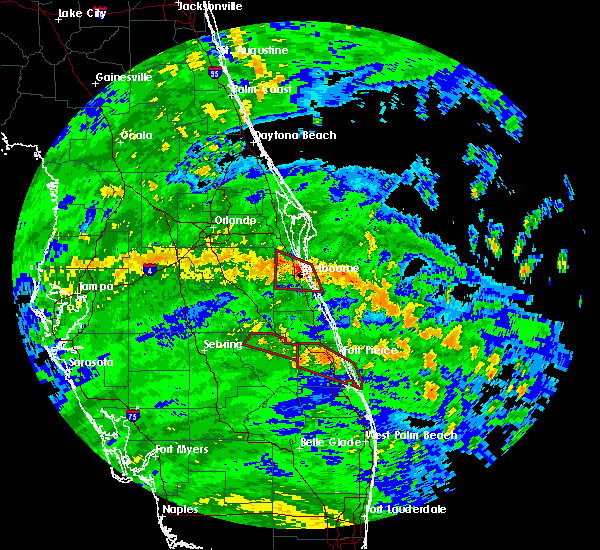 At 1155 am edt, a severe thunderstorm capable of producing a tornado was located 11 miles east of indian river shores, moving northwest at 50 mph (radar indicated rotation). Hazards include tornado. Flying debris will be dangerous to those caught without shelter. mobile homes will be damaged or destroyed. damage to roofs, windows, and vehicles will occur. tree damage is likely. this dangerous storm will be near, sebastian inlet, barefoot bay and sebastian inlet state park around 1220 pm edt. malabar and grant-valkaria around 1230 pm edt. palm bay around 1240 pm edt. Other locations impacted by this tornadic thunderstorm include orchid. At 1155 am edt, a severe thunderstorm capable of producing a tornado was located 11 miles east of indian river shores, moving northwest at 50 mph (radar indicated rotation). Hazards include tornado. Flying debris will be dangerous to those caught without shelter. mobile homes will be damaged or destroyed. damage to roofs, windows, and vehicles will occur. tree damage is likely. this dangerous storm will be near, sebastian inlet, barefoot bay and sebastian inlet state park around 1220 pm edt. malabar and grant-valkaria around 1230 pm edt. palm bay around 1240 pm edt. Other locations impacted by this tornadic thunderstorm include orchid.
|
| 9/10/2017 5:53 AM EDT |
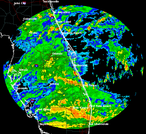 At 552 am edt, a severe thunderstorm capable of producing a tornado was located over barefoot bay, moving west at 35 mph (radar indicated rotation). Hazards include tornado. Flying debris will be dangerous to those caught without shelter. mobile homes will be damaged or destroyed. damage to roofs, windows, and vehicles will occur. tree damage is likely. This tornadic thunderstorm will remain over mainly rural areas of southeastern brevard county. At 552 am edt, a severe thunderstorm capable of producing a tornado was located over barefoot bay, moving west at 35 mph (radar indicated rotation). Hazards include tornado. Flying debris will be dangerous to those caught without shelter. mobile homes will be damaged or destroyed. damage to roofs, windows, and vehicles will occur. tree damage is likely. This tornadic thunderstorm will remain over mainly rural areas of southeastern brevard county.
|
| 9/10/2017 5:33 AM EDT |
 At 513 am edt, a severe thunderstorm capable of producing a tornado was located over sebastian inlet, moving west at 35 mph (radar indicated rotation). Hazards include tornado. Flying debris will be dangerous to those caught without shelter. mobile homes will be damaged or destroyed. damage to roofs, windows, and vehicles will occur. tree damage is likely. this dangerous storm will be near, barefoot bay and micco around 520 am edt. grant-valkaria around 530 am edt. Other locations impacted by this tornadic thunderstorm include floridana beach. At 513 am edt, a severe thunderstorm capable of producing a tornado was located over sebastian inlet, moving west at 35 mph (radar indicated rotation). Hazards include tornado. Flying debris will be dangerous to those caught without shelter. mobile homes will be damaged or destroyed. damage to roofs, windows, and vehicles will occur. tree damage is likely. this dangerous storm will be near, barefoot bay and micco around 520 am edt. grant-valkaria around 530 am edt. Other locations impacted by this tornadic thunderstorm include floridana beach.
|
| 9/10/2017 5:14 AM EDT |
 At 513 am edt, a severe thunderstorm capable of producing a tornado was located over sebastian inlet, moving west at 35 mph (radar indicated rotation). Hazards include tornado. Flying debris will be dangerous to those caught without shelter. mobile homes will be damaged or destroyed. damage to roofs, windows, and vehicles will occur. tree damage is likely. this dangerous storm will be near, barefoot bay and micco around 520 am edt. grant-valkaria around 530 am edt. Other locations impacted by this tornadic thunderstorm include floridana beach. At 513 am edt, a severe thunderstorm capable of producing a tornado was located over sebastian inlet, moving west at 35 mph (radar indicated rotation). Hazards include tornado. Flying debris will be dangerous to those caught without shelter. mobile homes will be damaged or destroyed. damage to roofs, windows, and vehicles will occur. tree damage is likely. this dangerous storm will be near, barefoot bay and micco around 520 am edt. grant-valkaria around 530 am edt. Other locations impacted by this tornadic thunderstorm include floridana beach.
|
| 7/22/2017 3:35 PM EDT |
 At 334 pm edt, a severe thunderstorm was located over west melbourne, or near melbourne, moving east at 15 mph (radar indicated). Hazards include 60 mph wind gusts. expect damage to roofs, siding, and trees At 334 pm edt, a severe thunderstorm was located over west melbourne, or near melbourne, moving east at 15 mph (radar indicated). Hazards include 60 mph wind gusts. expect damage to roofs, siding, and trees
|
| 5/24/2017 5:33 PM EDT |
 At 508 pm edt, national weather service meteorologists were tracking severe thunderstorms from titusville to melbourne, moving northeast at 55 mph. these storms will continue to move northeast at around 50 mph (radar indicated). Hazards include 60 mph wind gusts. Expect damage to roofs, siding, and trees. Locations impacted include, melbourne, titusville, rockledge and cocoa. At 508 pm edt, national weather service meteorologists were tracking severe thunderstorms from titusville to melbourne, moving northeast at 55 mph. these storms will continue to move northeast at around 50 mph (radar indicated). Hazards include 60 mph wind gusts. Expect damage to roofs, siding, and trees. Locations impacted include, melbourne, titusville, rockledge and cocoa.
|
| 5/24/2017 5:11 PM EDT |
 At 508 pm edt, national weather service meteorologists were tracking severe thunderstorms from titusville to melbourne, moving northeast at 55 mph. these storms will continue to move northeast at around 50 mph (radar indicated). Hazards include 60 mph wind gusts. Expect damage to roofs, siding, and trees. Locations impacted include, melbourne, titusville, rockledge and cocoa. At 508 pm edt, national weather service meteorologists were tracking severe thunderstorms from titusville to melbourne, moving northeast at 55 mph. these storms will continue to move northeast at around 50 mph (radar indicated). Hazards include 60 mph wind gusts. Expect damage to roofs, siding, and trees. Locations impacted include, melbourne, titusville, rockledge and cocoa.
|
| 5/24/2017 4:55 PM EDT |
 At 454 pm edt, national weather service meteorologists were tracking severe thunderstorms over eastern osceola and extreme southeastern orange counties, moving northeast at 55 mph. another severe thunderstorm was located over palm bay moving north at 55 mph (radar indicated). Hazards include 60 mph wind gusts. expect damage to roofs, siding, and trees At 454 pm edt, national weather service meteorologists were tracking severe thunderstorms over eastern osceola and extreme southeastern orange counties, moving northeast at 55 mph. another severe thunderstorm was located over palm bay moving north at 55 mph (radar indicated). Hazards include 60 mph wind gusts. expect damage to roofs, siding, and trees
|
| 9/13/2016 2:02 PM EDT |
 At 201 pm edt, a confirmed tornado was located over barefoot bay, moving north at 10 mph (public confirmed tornado). Hazards include damaging tornado. Flying debris will be dangerous to those caught without shelter. mobile homes will be damaged or destroyed. damage to roofs, windows, and vehicles will occur. tree damage is likely. This tornadic thunderstorm will remain over mainly rural areas of southeastern brevard county, including the following locations: floridana beach. At 201 pm edt, a confirmed tornado was located over barefoot bay, moving north at 10 mph (public confirmed tornado). Hazards include damaging tornado. Flying debris will be dangerous to those caught without shelter. mobile homes will be damaged or destroyed. damage to roofs, windows, and vehicles will occur. tree damage is likely. This tornadic thunderstorm will remain over mainly rural areas of southeastern brevard county, including the following locations: floridana beach.
|
| 9/13/2016 1:50 PM EDT |
 At 150 pm edt, a severe thunderstorm capable of producing a tornado was located over micco, or over barefoot bay, moving north at 10 to 15 mph (radar indicated rotation). Hazards include tornado. Flying debris will be dangerous to those caught without shelter. mobile homes will be damaged or destroyed. damage to roofs, windows, and vehicles will occur. tree damage is likely. this dangerous storm will be near, barefoot bay around 200 pm edt. grant-valkaria around 210 pm edt. Other locations impacted by this tornadic thunderstorm include floridana beach. At 150 pm edt, a severe thunderstorm capable of producing a tornado was located over micco, or over barefoot bay, moving north at 10 to 15 mph (radar indicated rotation). Hazards include tornado. Flying debris will be dangerous to those caught without shelter. mobile homes will be damaged or destroyed. damage to roofs, windows, and vehicles will occur. tree damage is likely. this dangerous storm will be near, barefoot bay around 200 pm edt. grant-valkaria around 210 pm edt. Other locations impacted by this tornadic thunderstorm include floridana beach.
|
| 6/18/2016 5:55 PM EDT | The severe thunderstorm warning for northeastern indian river and southeastern brevard counties will expire at 600 pm edt, the storm which prompted the warning has weakened below severe limits, and no longer pose an immediate threat to life or property. therefore the warning will be allowed to expire. however gusty winds and frequent lightning are still expected with this thunderstorm. |
| 6/18/2016 5:43 PM EDT |
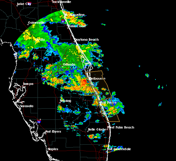 At 542 pm edt, a severe thunderstorm was located over fellsmere, moving south at 15 mph (radar indicated). Hazards include 60 mph wind gusts and quarter size hail. Hail damage to vehicles is expected. expect wind damage to roofs, siding, and trees. Locations impacted include, palm bay, sebastian, fellsmere, indian river shores and barefoot bay. At 542 pm edt, a severe thunderstorm was located over fellsmere, moving south at 15 mph (radar indicated). Hazards include 60 mph wind gusts and quarter size hail. Hail damage to vehicles is expected. expect wind damage to roofs, siding, and trees. Locations impacted include, palm bay, sebastian, fellsmere, indian river shores and barefoot bay.
|
| 6/18/2016 5:20 PM EDT |
 At 520 pm edt, a severe thunderstorm was located near barefoot bay, moving south at 15 mph (radar indicated). Hazards include 60 mph wind gusts and quarter size hail. Hail damage to vehicles is expected. Expect wind damage to roofs, siding, and trees. At 520 pm edt, a severe thunderstorm was located near barefoot bay, moving south at 15 mph (radar indicated). Hazards include 60 mph wind gusts and quarter size hail. Hail damage to vehicles is expected. Expect wind damage to roofs, siding, and trees.
|
| 5/4/2016 8:16 AM EDT |
 At 815 am edt, a severe thunderstorm was located near lake marian, moving east at 50 mph (radar indicated). Hazards include 60 mph wind gusts. Expect damage to roofs. siding. And trees. At 815 am edt, a severe thunderstorm was located near lake marian, moving east at 50 mph (radar indicated). Hazards include 60 mph wind gusts. Expect damage to roofs. siding. And trees.
|
| 4/15/2016 11:41 PM EDT |
 At 1141 pm edt, a severe thunderstorm was located near camp holly fish camp, moving southeast at 15 mph (radar indicated). Hazards include 60 mph wind gusts and quarter size hail. Hail damage to vehicles is expected. Expect wind damage to roofs, siding, and trees. At 1141 pm edt, a severe thunderstorm was located near camp holly fish camp, moving southeast at 15 mph (radar indicated). Hazards include 60 mph wind gusts and quarter size hail. Hail damage to vehicles is expected. Expect wind damage to roofs, siding, and trees.
|
| 4/14/2016 7:05 PM EDT |
 At 705 pm edt, a severe thunderstorm was located 8 miles northwest of fellsmere, moving east at 15 mph (radar indicated). Hazards include 60 mph wind gusts and quarter size hail. Hail damage to vehicles is expected. Expect wind damage to roofs, siding, and trees. At 705 pm edt, a severe thunderstorm was located 8 miles northwest of fellsmere, moving east at 15 mph (radar indicated). Hazards include 60 mph wind gusts and quarter size hail. Hail damage to vehicles is expected. Expect wind damage to roofs, siding, and trees.
|
| 3/25/2016 3:59 PM EDT |
 At 356 pm edt, severe thunderstorms were located along a line extending from rockledge to near suntree, moving east at 55 mph. other strong storms are developing farther south from west of camp holly to west of palm bay (radar indicated). Hazards include 60 mph wind gusts and penny size hail. Expect damage to roofs. siding. and trees. Locations impacted include, palm bay, melbourne, rockledge, cocoa and cocoa beach. At 356 pm edt, severe thunderstorms were located along a line extending from rockledge to near suntree, moving east at 55 mph. other strong storms are developing farther south from west of camp holly to west of palm bay (radar indicated). Hazards include 60 mph wind gusts and penny size hail. Expect damage to roofs. siding. and trees. Locations impacted include, palm bay, melbourne, rockledge, cocoa and cocoa beach.
|
| 3/25/2016 3:43 PM EDT |
 At 342 pm edt, severe thunderstorms were located along a line extending from near lone cabbage fish camp to 8 miles east of holopaw, moving east at 55 mph (radar indicated). Hazards include 60 mph wind gusts and quarter size hail. Hail damage to vehicles is expected. expect wind damage to roofs, siding, and trees. Locations impacted include, palm bay, melbourne, rockledge, cocoa and cocoa beach. At 342 pm edt, severe thunderstorms were located along a line extending from near lone cabbage fish camp to 8 miles east of holopaw, moving east at 55 mph (radar indicated). Hazards include 60 mph wind gusts and quarter size hail. Hail damage to vehicles is expected. expect wind damage to roofs, siding, and trees. Locations impacted include, palm bay, melbourne, rockledge, cocoa and cocoa beach.
|
| 3/25/2016 3:20 PM EDT |
 At 317 pm edt, the band of severe thunderstorms had expanded southward along a line extending from near harmony to 8 miles west of holopaw to 6 miles northwest of lake kissimmee, moving east at near 60 mph (radar indicated). Hazards include 60 mph wind gusts and quarter size hail. Hail damage to vehicles is expected. Expect wind damage to roofs, siding, and trees. At 317 pm edt, the band of severe thunderstorms had expanded southward along a line extending from near harmony to 8 miles west of holopaw to 6 miles northwest of lake kissimmee, moving east at near 60 mph (radar indicated). Hazards include 60 mph wind gusts and quarter size hail. Hail damage to vehicles is expected. Expect wind damage to roofs, siding, and trees.
|
| 3/24/2016 6:05 PM EDT |
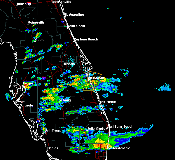 The severe thunderstorm warning for southeastern brevard county will expire at 615 pm edt, the storm which prompted the warning has moved out of the area. therefore the warning will be allowed to expire. however gusty winds are still possible with this thunderstorm. The severe thunderstorm warning for southeastern brevard county will expire at 615 pm edt, the storm which prompted the warning has moved out of the area. therefore the warning will be allowed to expire. however gusty winds are still possible with this thunderstorm.
|
| 3/24/2016 5:48 PM EDT |
 At 548 pm edt, a severe thunderstorm was located over melbourne beach, or near malabar, moving north at 35 mph (trained weather spotters). Hazards include 60 mph wind gusts and penny size hail. Expect damage to roofs. siding. and trees. Locations impacted include, palm bay, melbourne, malabar, indialantic and barefoot bay. At 548 pm edt, a severe thunderstorm was located over melbourne beach, or near malabar, moving north at 35 mph (trained weather spotters). Hazards include 60 mph wind gusts and penny size hail. Expect damage to roofs. siding. and trees. Locations impacted include, palm bay, melbourne, malabar, indialantic and barefoot bay.
|
| 3/24/2016 5:08 PM EDT |
 At 507 pm edt, a severe thunderstorm was located near blue cypress lake, moving north at 35 mph (radar indicated). Hazards include 60 mph wind gusts and quarter size hail. Hail damage to vehicles is expected. Expect wind damage to roofs, siding, and trees. At 507 pm edt, a severe thunderstorm was located near blue cypress lake, moving north at 35 mph (radar indicated). Hazards include 60 mph wind gusts and quarter size hail. Hail damage to vehicles is expected. Expect wind damage to roofs, siding, and trees.
|
| 2/16/2016 5:38 AM EST |
 The severe thunderstorm warning for southeastern brevard county will expire at 545 am est, the storms which prompted the warning have weakened below severe limits, and have exited the warned area. therefore the warning will be allowed to expire. however gusty winds and heavy rain are still possible with these thunderstorms. a tornado watch remains in effect until 800 am est for east central florida. The severe thunderstorm warning for southeastern brevard county will expire at 545 am est, the storms which prompted the warning have weakened below severe limits, and have exited the warned area. therefore the warning will be allowed to expire. however gusty winds and heavy rain are still possible with these thunderstorms. a tornado watch remains in effect until 800 am est for east central florida.
|
| 2/16/2016 5:05 AM EST |
 At 504 am est, severe thunderstorms were located along a line extending from near cocoa beach to 8 miles northwest of fellsmere, moving east at 45 mph (radar indicated). Hazards include 60 mph wind gusts and quarter size hail. Hail damage to vehicles is expected. expect wind damage to roofs, siding, and trees. locations impacted include, palm bay, melbourne, rockledge, cocoa beach and satellite beach. A tornado watch remains in effect until 800 am est for east central florida. At 504 am est, severe thunderstorms were located along a line extending from near cocoa beach to 8 miles northwest of fellsmere, moving east at 45 mph (radar indicated). Hazards include 60 mph wind gusts and quarter size hail. Hail damage to vehicles is expected. expect wind damage to roofs, siding, and trees. locations impacted include, palm bay, melbourne, rockledge, cocoa beach and satellite beach. A tornado watch remains in effect until 800 am est for east central florida.
|
| 2/16/2016 4:51 AM EST |
 At 449 am est, a severe thunderstorm was located over viera, or near rockledge, moving northeast at 45 mph. additional storms with severe wind gusts possible farther south across southern brevard county (radar indicated). Hazards include 60 mph wind gusts and quarter size hail. Hail damage to vehicles is expected. expect wind damage to roofs, siding, and trees. locations impacted include, palm bay, melbourne, rockledge, cocoa beach and satellite beach. A tornado watch remains in effect until 800 am est for east central florida. At 449 am est, a severe thunderstorm was located over viera, or near rockledge, moving northeast at 45 mph. additional storms with severe wind gusts possible farther south across southern brevard county (radar indicated). Hazards include 60 mph wind gusts and quarter size hail. Hail damage to vehicles is expected. expect wind damage to roofs, siding, and trees. locations impacted include, palm bay, melbourne, rockledge, cocoa beach and satellite beach. A tornado watch remains in effect until 800 am est for east central florida.
|
| 2/16/2016 4:40 AM EST |
 At 439 am est, a severe thunderstorm was located 10 miles northwest of camp holly fish camp, moving northeast at 45 mph (radar indicated). Hazards include 60 mph wind gusts and quarter size hail. Hail damage to vehicles is expected. Expect wind damage to roofs, siding, and trees. At 439 am est, a severe thunderstorm was located 10 miles northwest of camp holly fish camp, moving northeast at 45 mph (radar indicated). Hazards include 60 mph wind gusts and quarter size hail. Hail damage to vehicles is expected. Expect wind damage to roofs, siding, and trees.
|
| 7/31/2015 3:51 PM EDT |
 At 351 pm edt, doppler radar indicated a severe thunderstorm capable of producing damaging winds in excess of 60 mph. this storm was located over micco, or over roseland, and moving northeast at 35 mph. At 351 pm edt, doppler radar indicated a severe thunderstorm capable of producing damaging winds in excess of 60 mph. this storm was located over micco, or over roseland, and moving northeast at 35 mph.
|
| 7/2/2015 6:07 PM EDT |
 At 605 pm edt, doppler radar indicated a line of severe thunderstorms capable of producing damaging winds in excess of 60 mph. these storms were located along a line extending from 6 miles northeast of port canaveral to near camp holly fish camp, moving east at 10 mph. nickel size hail may also accompany the damaging winds. several reports of winds to near 50 mph have been received around cape cananveral. locations impacted include, palm bay, melbourne, rockledge, cocoa and cocoa beach. At 605 pm edt, doppler radar indicated a line of severe thunderstorms capable of producing damaging winds in excess of 60 mph. these storms were located along a line extending from 6 miles northeast of port canaveral to near camp holly fish camp, moving east at 10 mph. nickel size hail may also accompany the damaging winds. several reports of winds to near 50 mph have been received around cape cananveral. locations impacted include, palm bay, melbourne, rockledge, cocoa and cocoa beach.
|
| 7/2/2015 5:31 PM EDT |
 At 530 pm edt, doppler radar indicated a developing line of severe thunderstorms capable of producing damaging winds in excess of 60 mph. these storms were located along a line extending from near titusville airport to near camp holly fish camp to melbourne, and moving east at 15 mph. nickel size hail may also accompany the damaging winds. At 530 pm edt, doppler radar indicated a developing line of severe thunderstorms capable of producing damaging winds in excess of 60 mph. these storms were located along a line extending from near titusville airport to near camp holly fish camp to melbourne, and moving east at 15 mph. nickel size hail may also accompany the damaging winds.
|
| 3/26/2015 4:46 PM EDT | A severe thunderstorm warning remains in effect until 530 pm edt for southeastern brevard county. at 444 pm edt. doppler radar indicated a line of severe thunderstorms capable of producing quarter size hail and damaging winds in excess of 60 mph. These storms were located along a line extending from 7 miles southwest of camp holly fish camp to near palm. |
| 3/26/2015 4:25 PM EDT | The national weather service in melbourne has issued a * severe thunderstorm warning for. southeastern brevard county in florida. northwestern indian river county in east central florida. until 530 pm edt * at 425 pm edt. Doppler radar indicated a severe thunderstorm. |
Hail Maps for Grant-Valkaria, FL
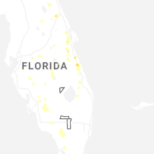
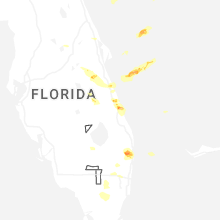


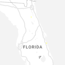


Connect with Interactive Hail Maps