

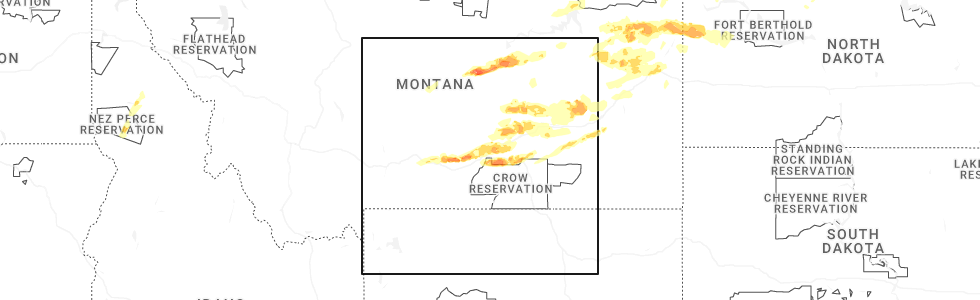
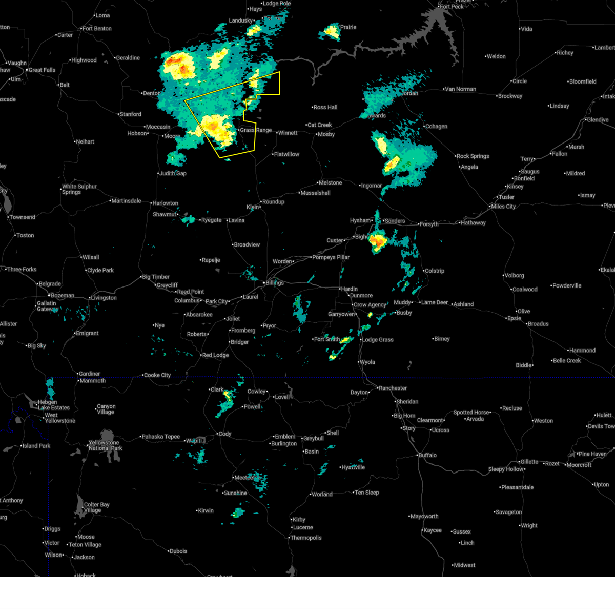
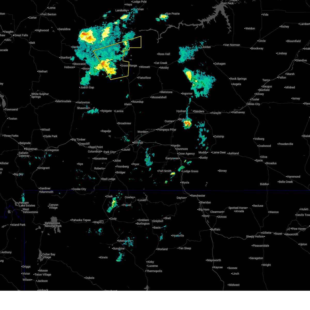
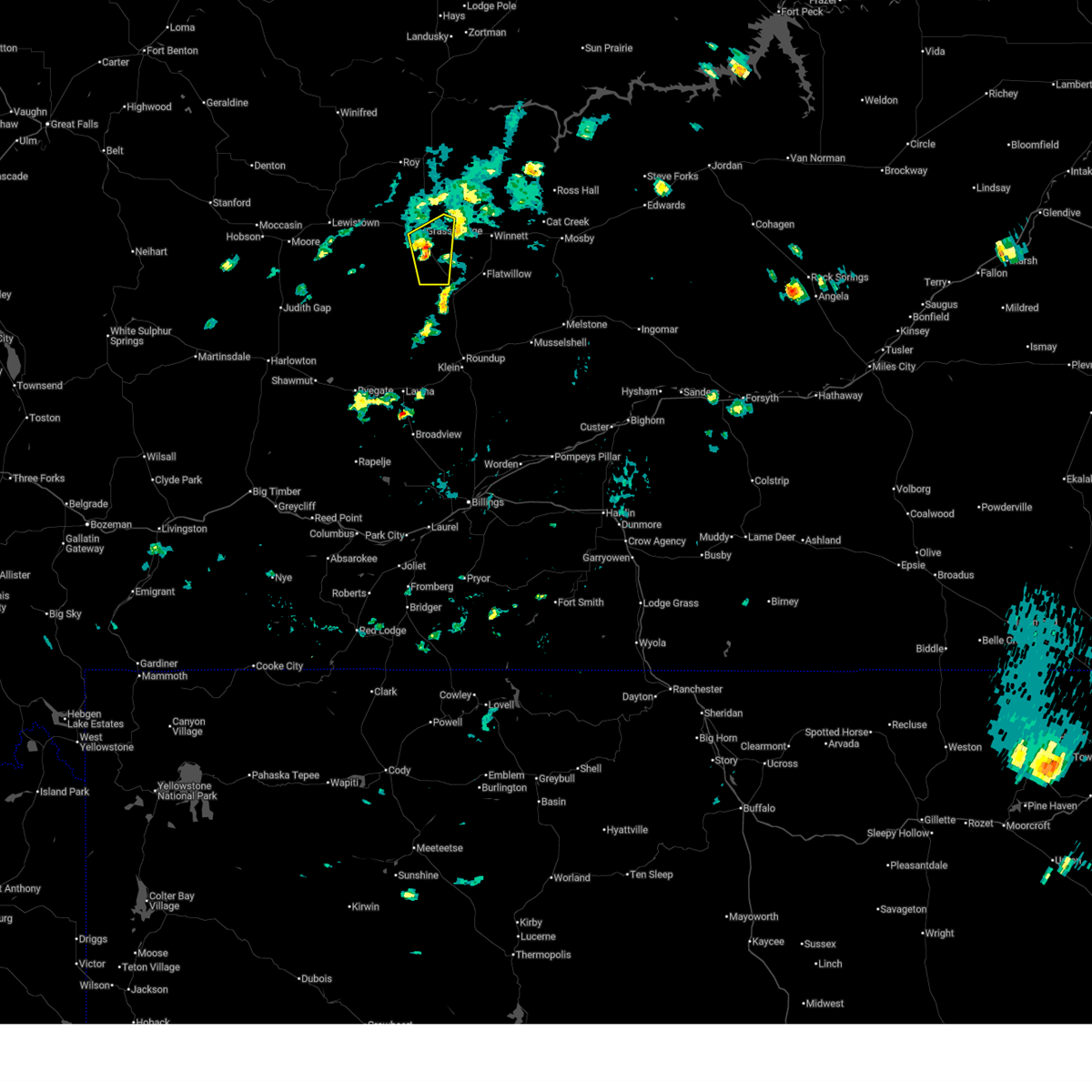
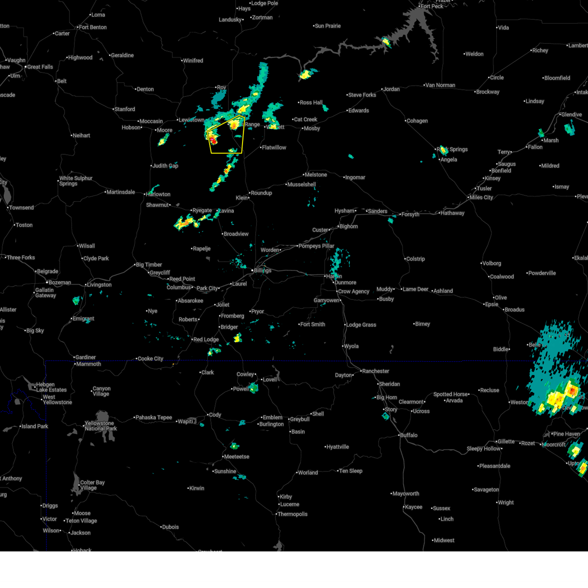
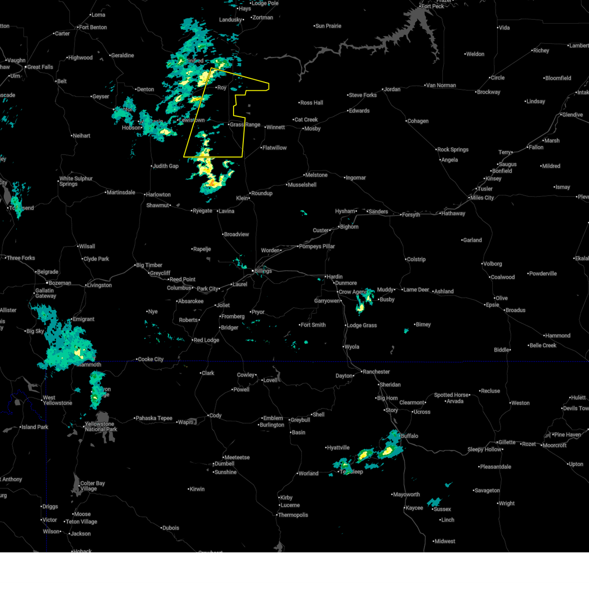
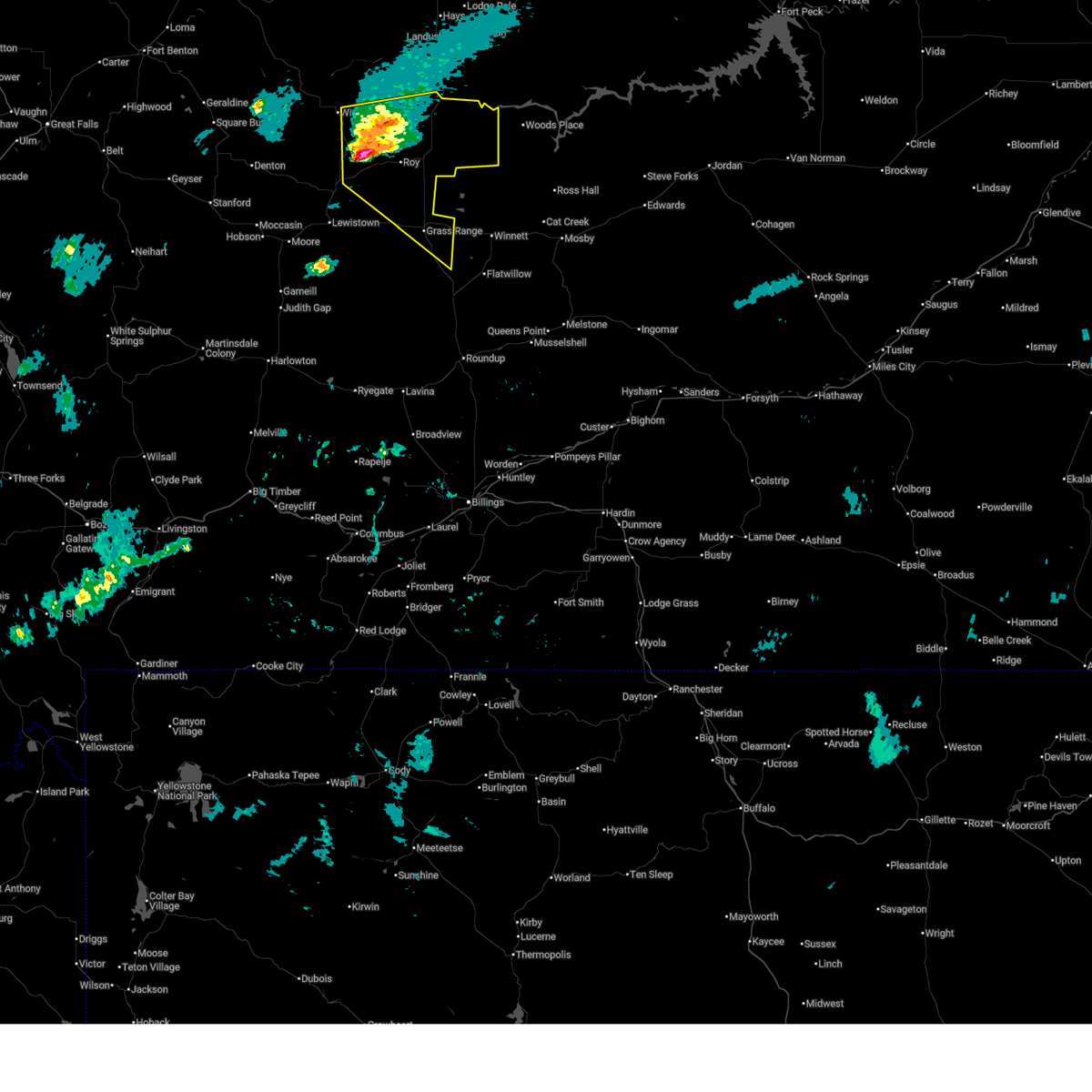
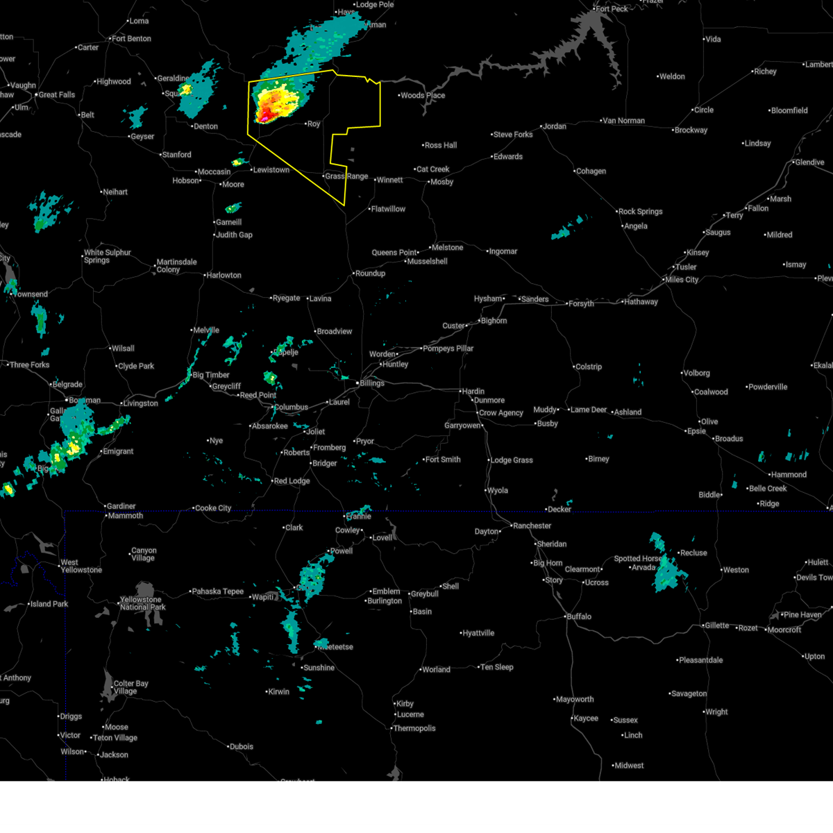
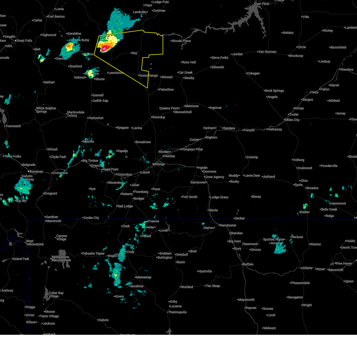
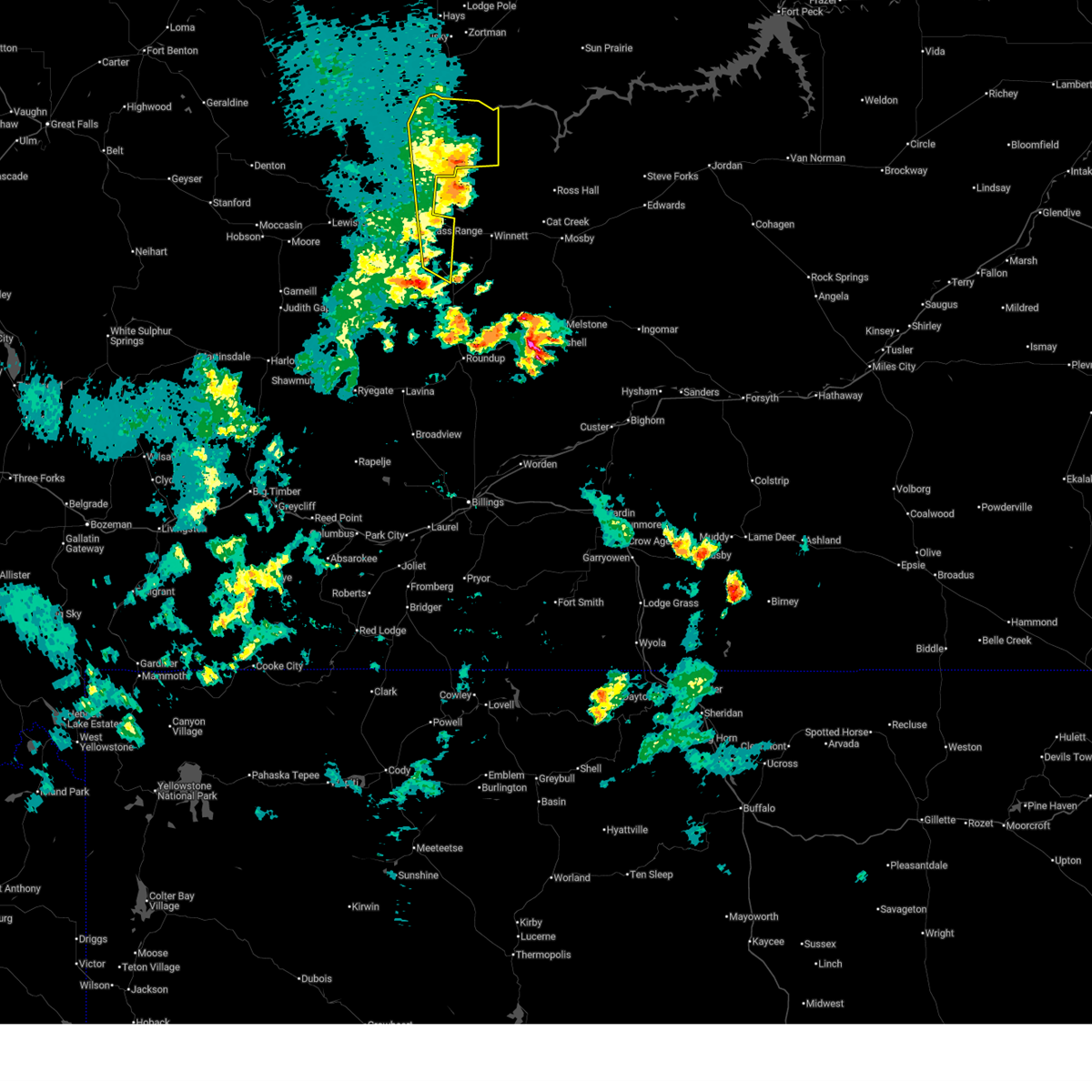
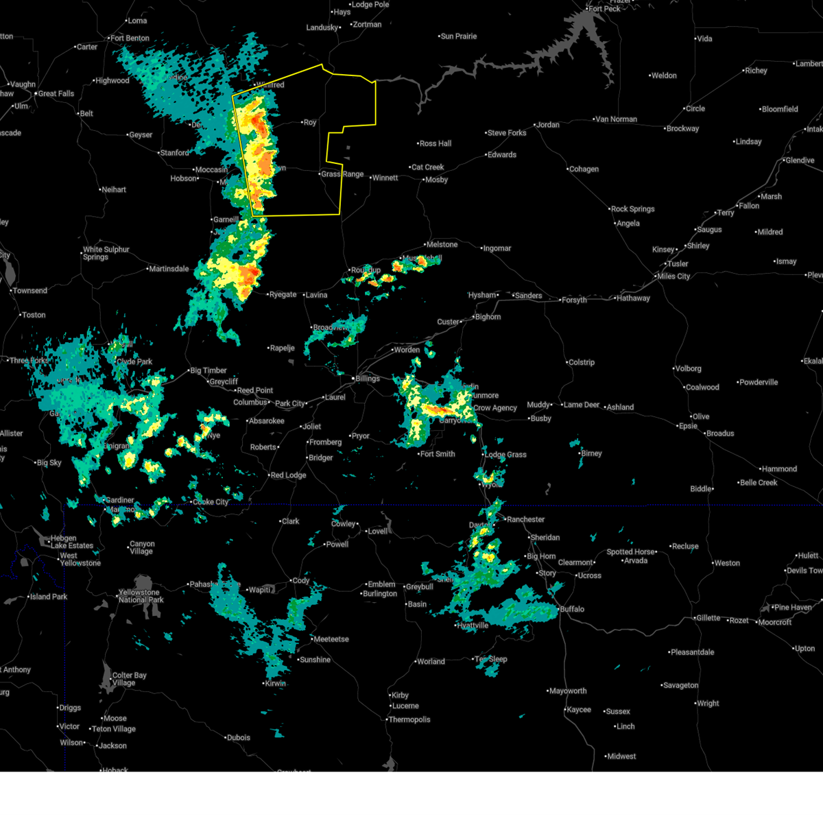
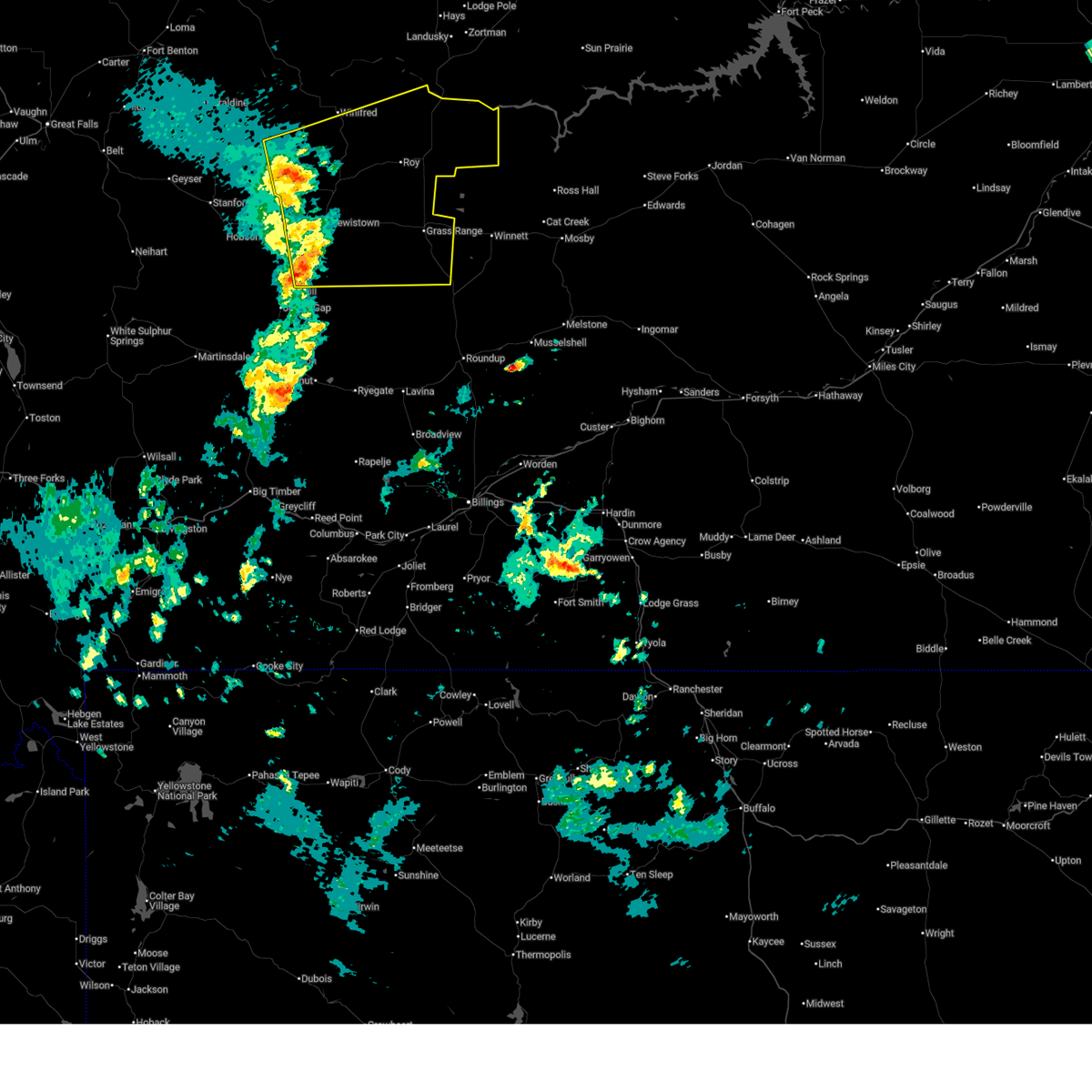
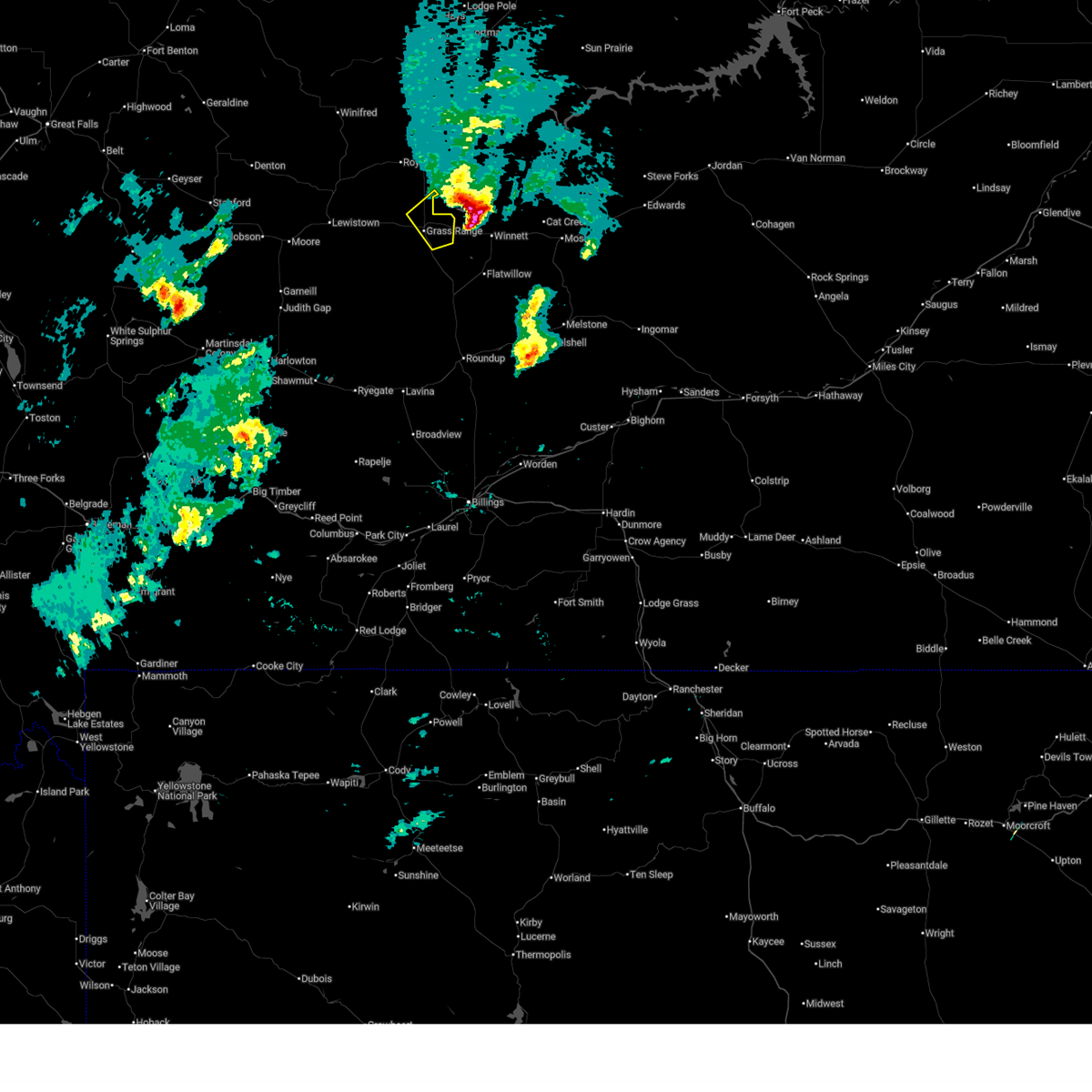
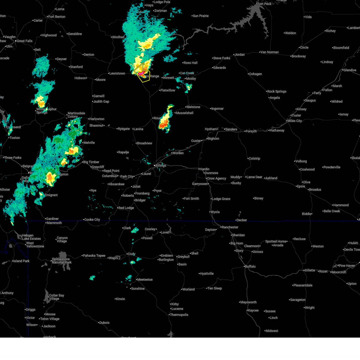
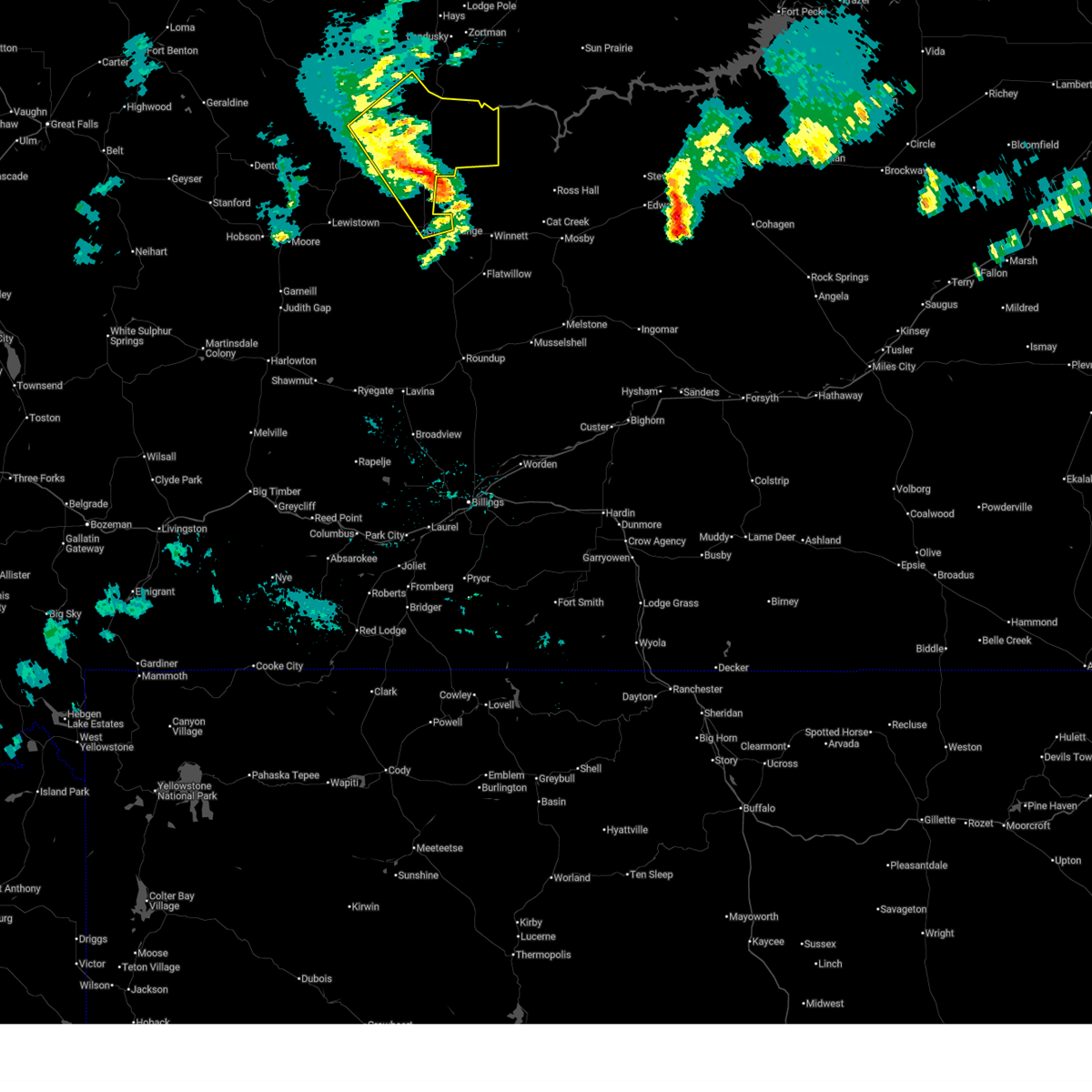
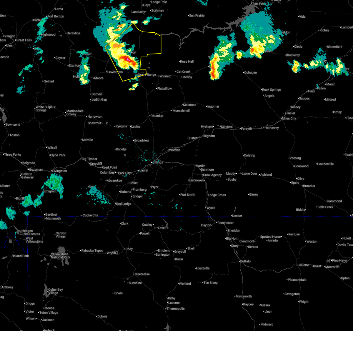
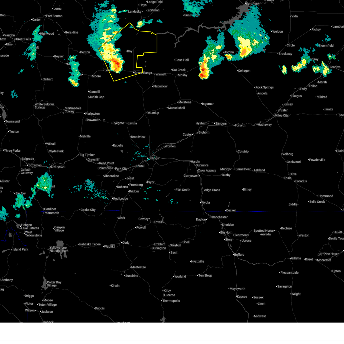
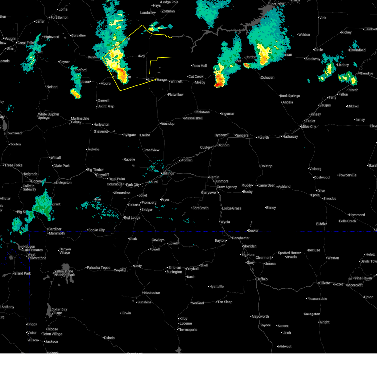
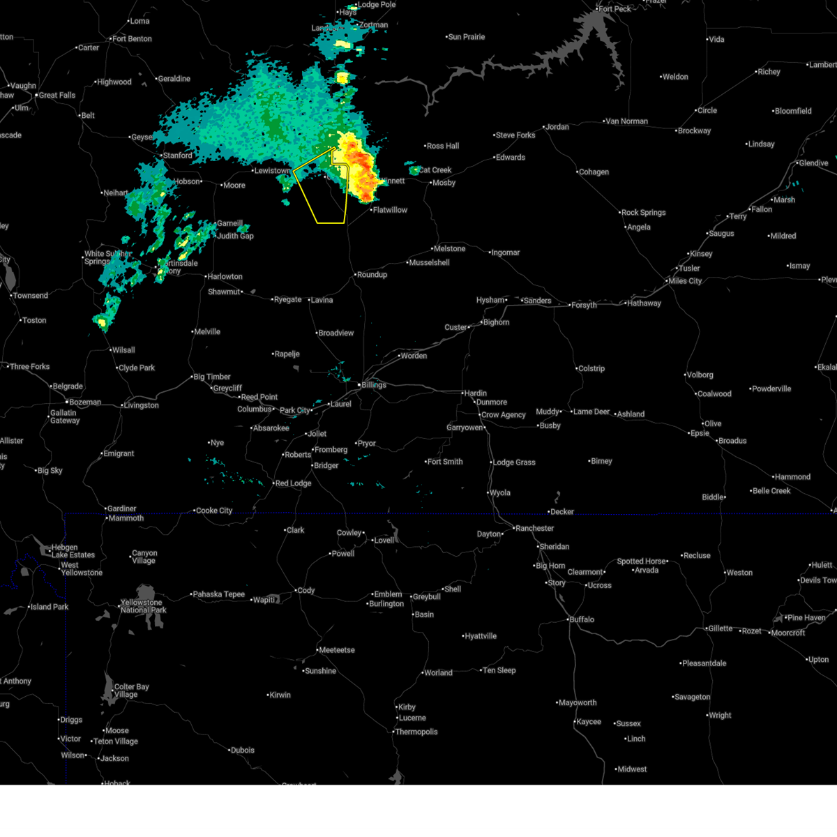
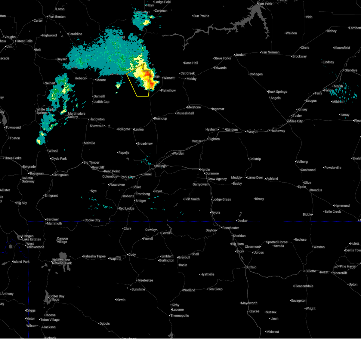
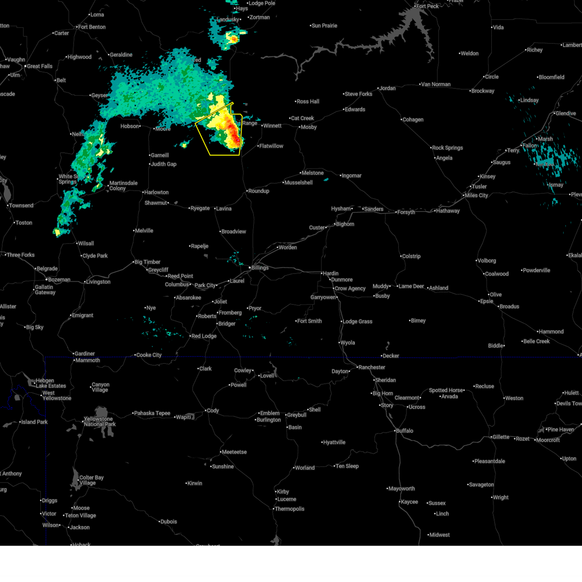
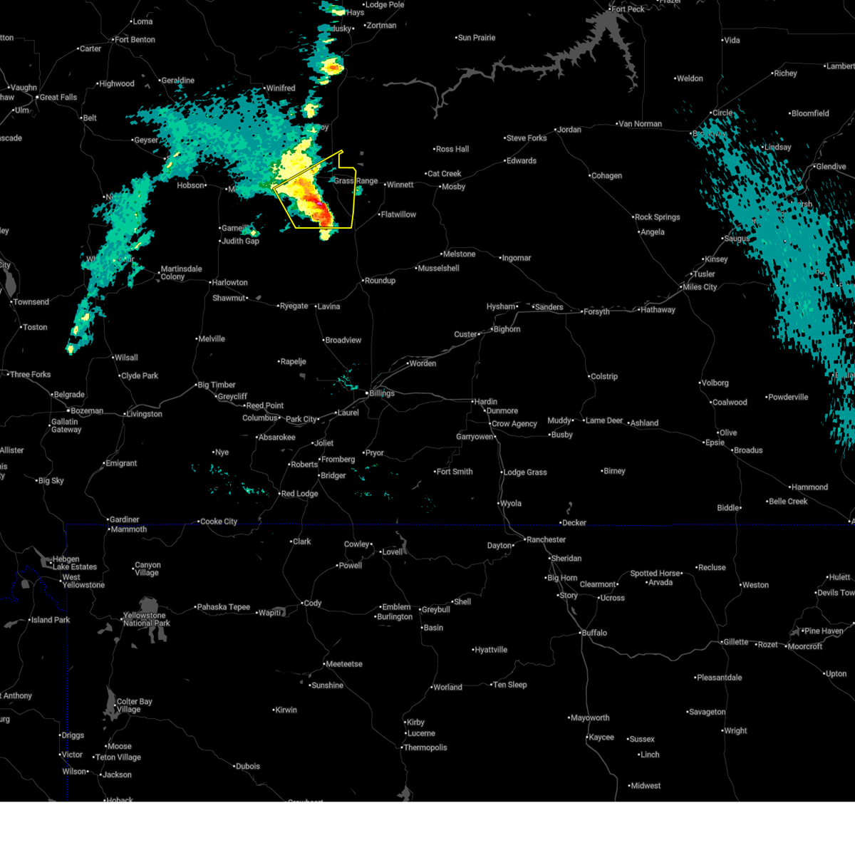
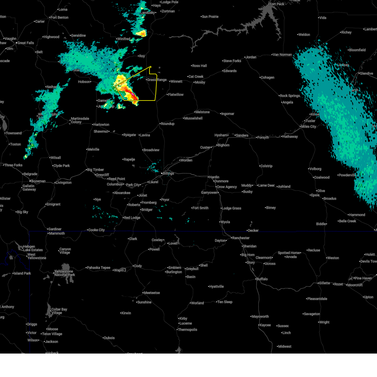
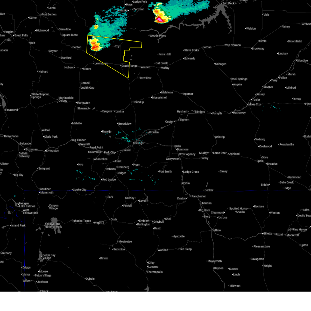
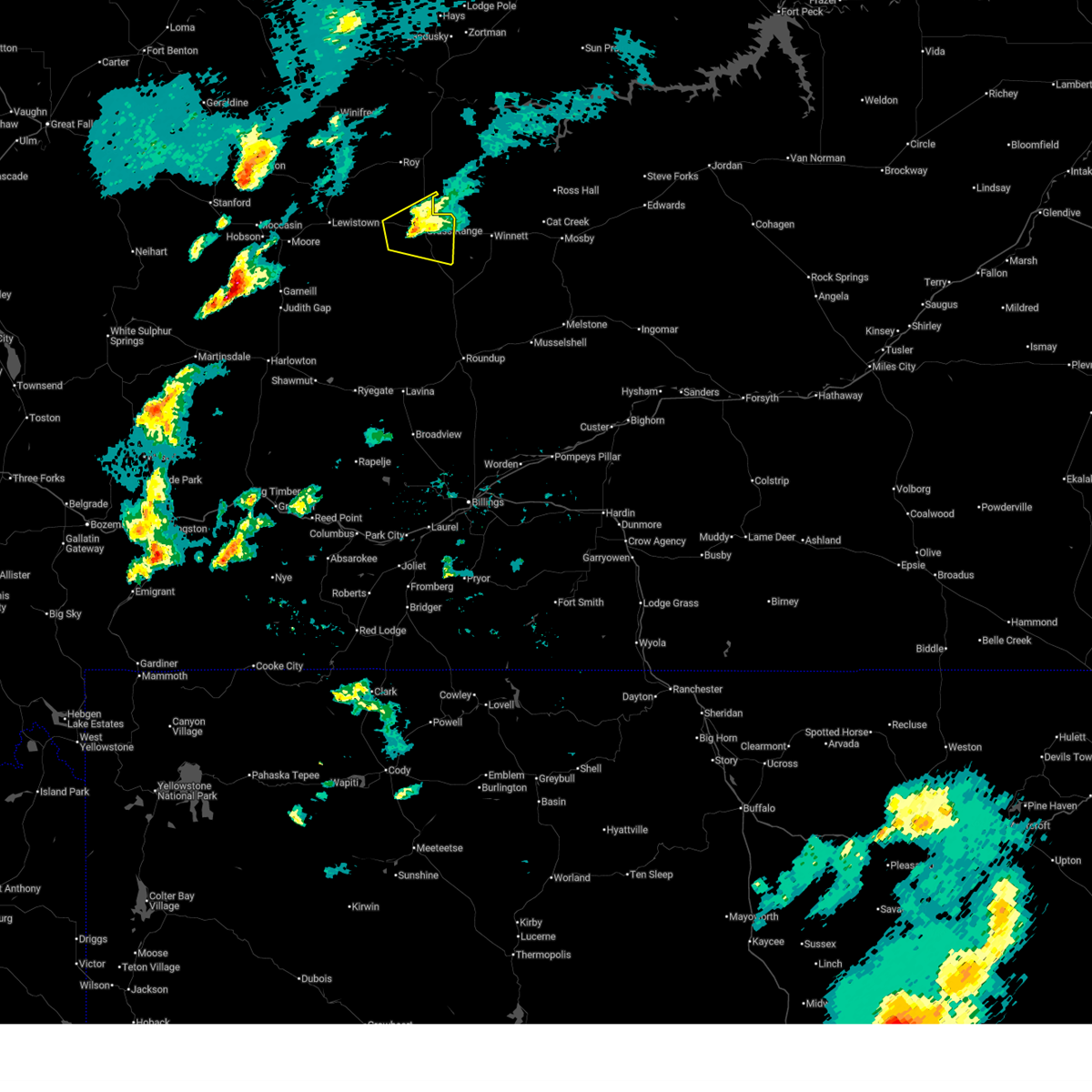
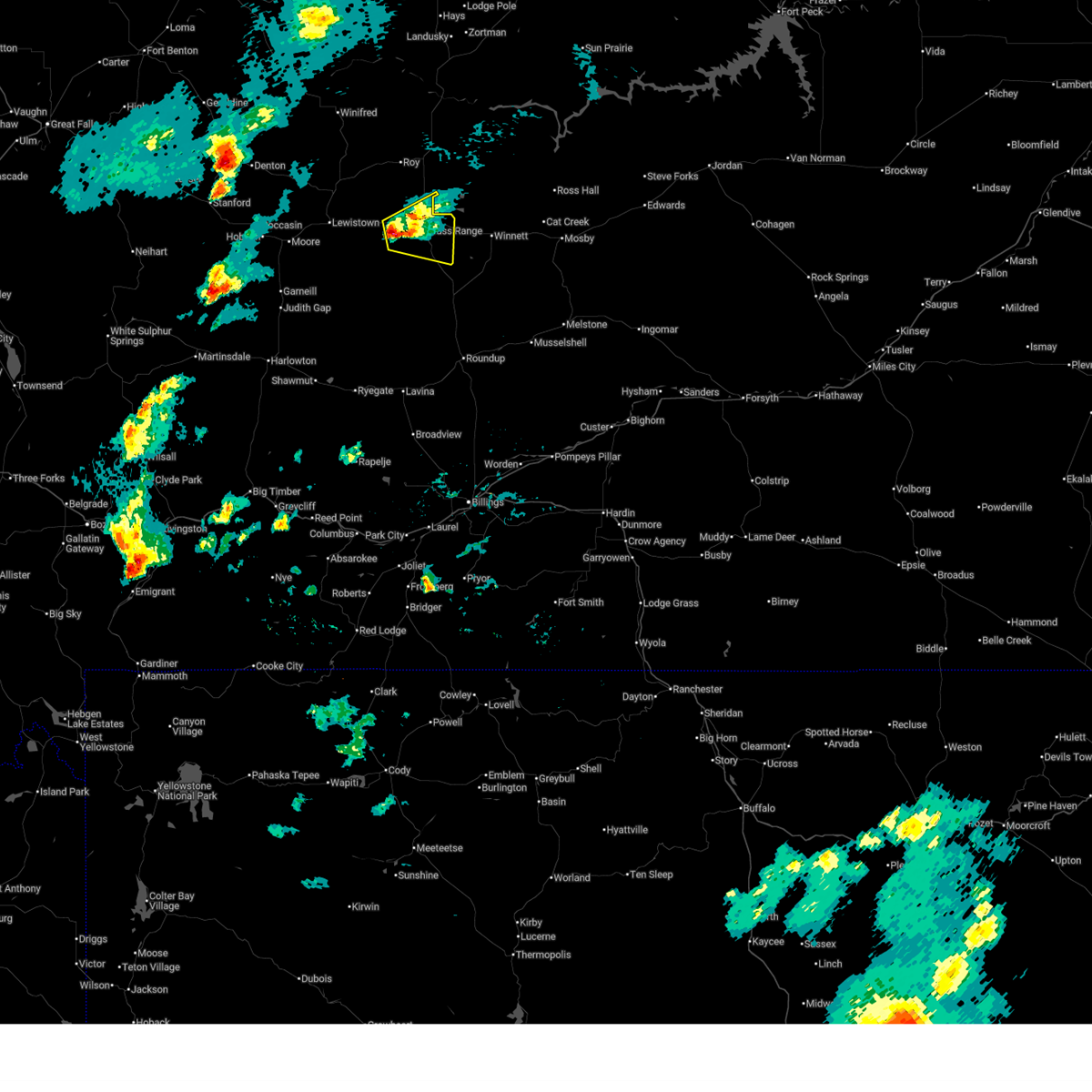
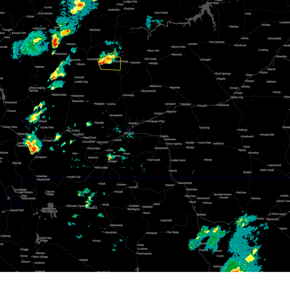
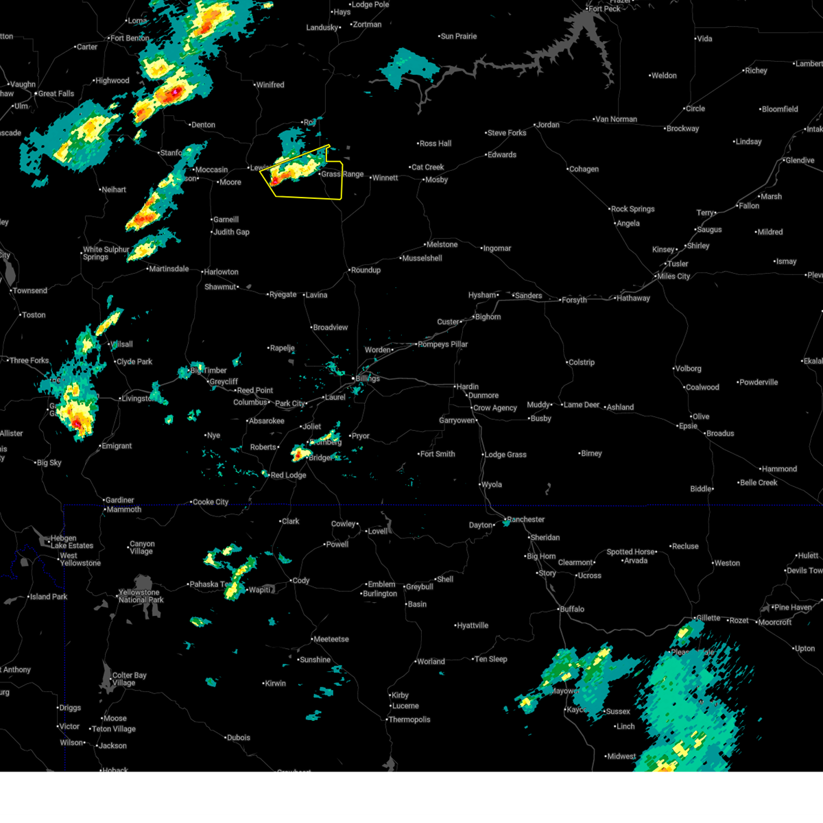
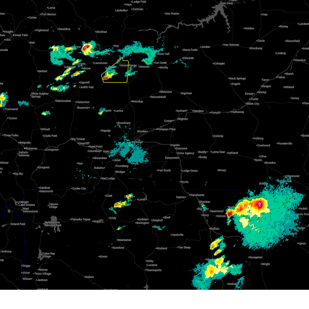
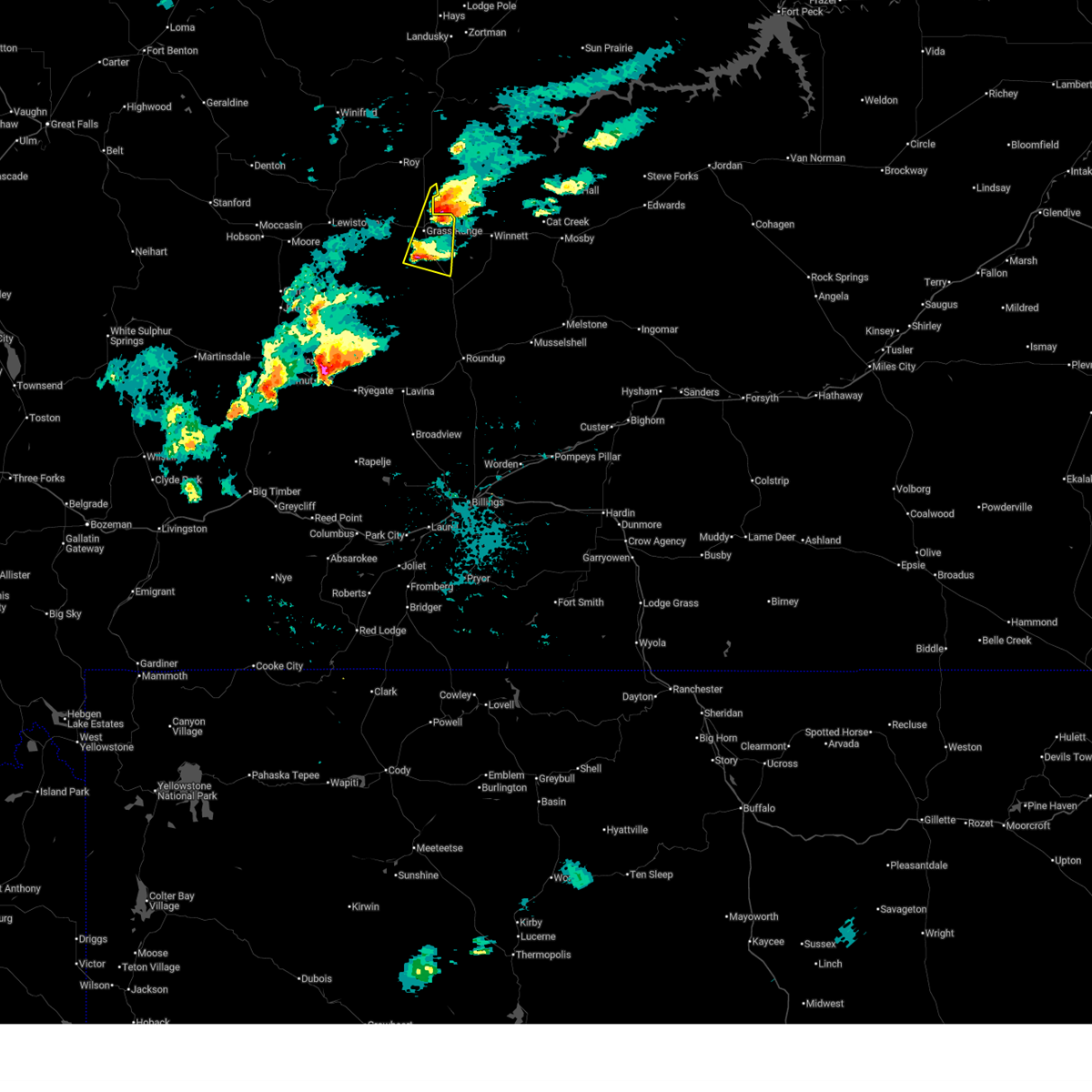
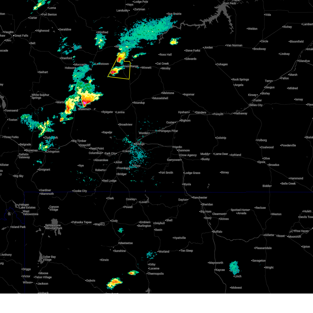
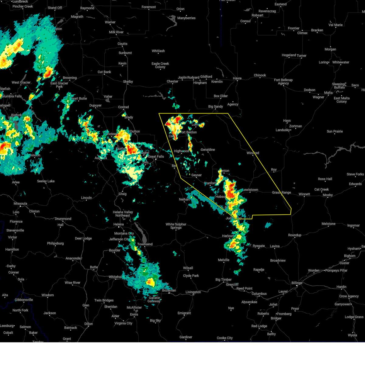
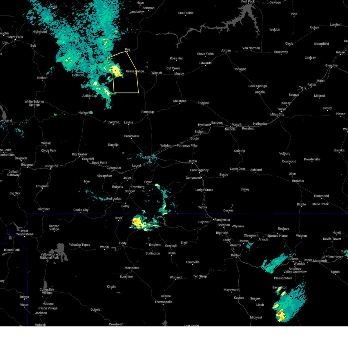
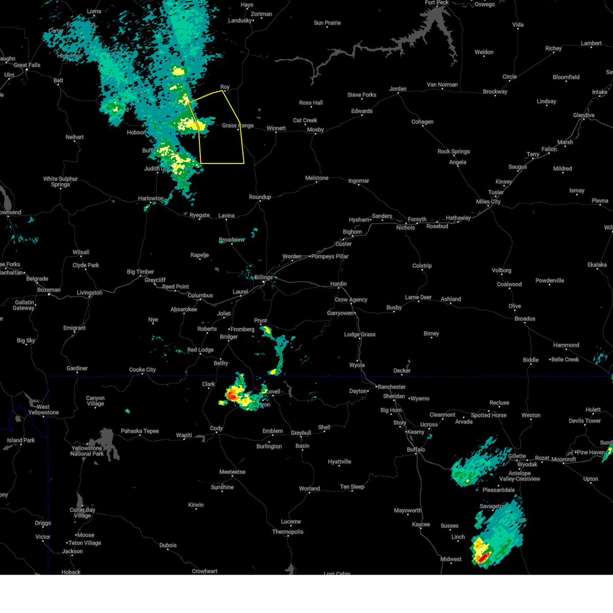
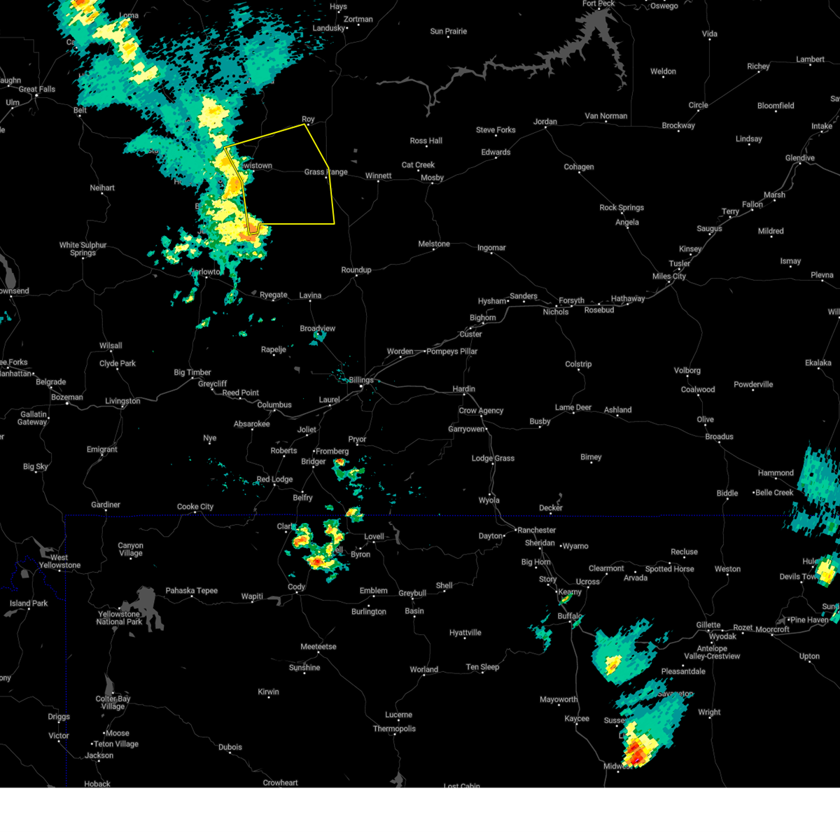
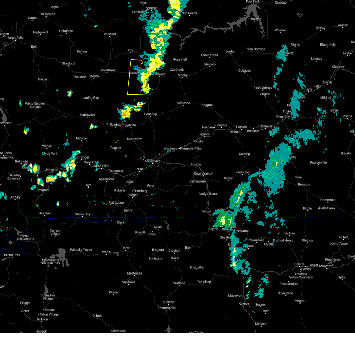
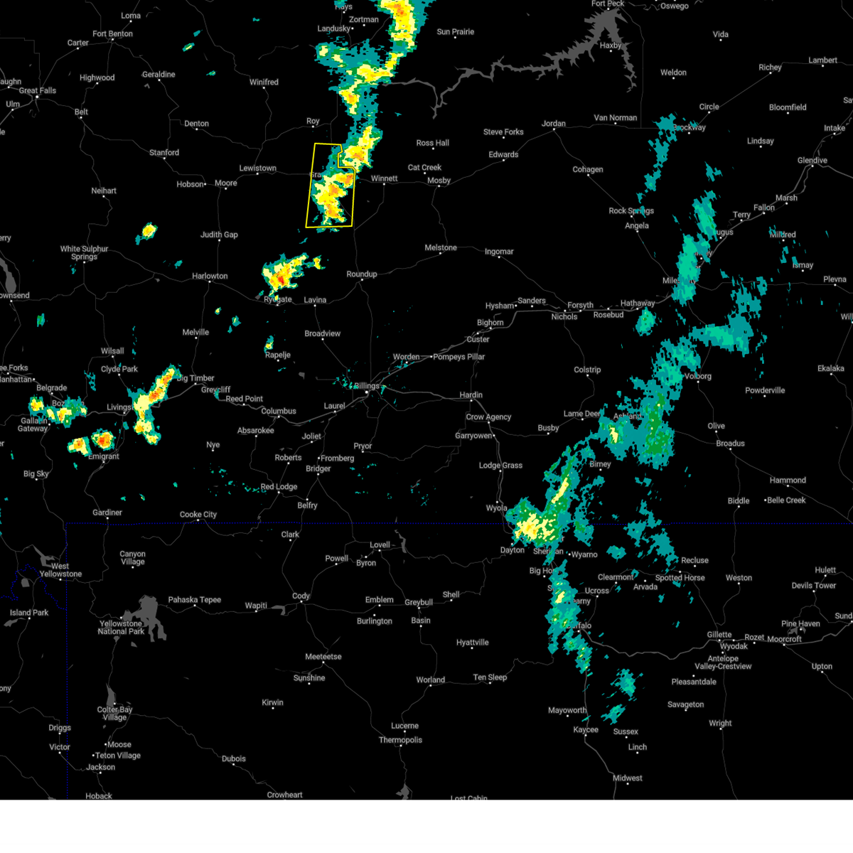
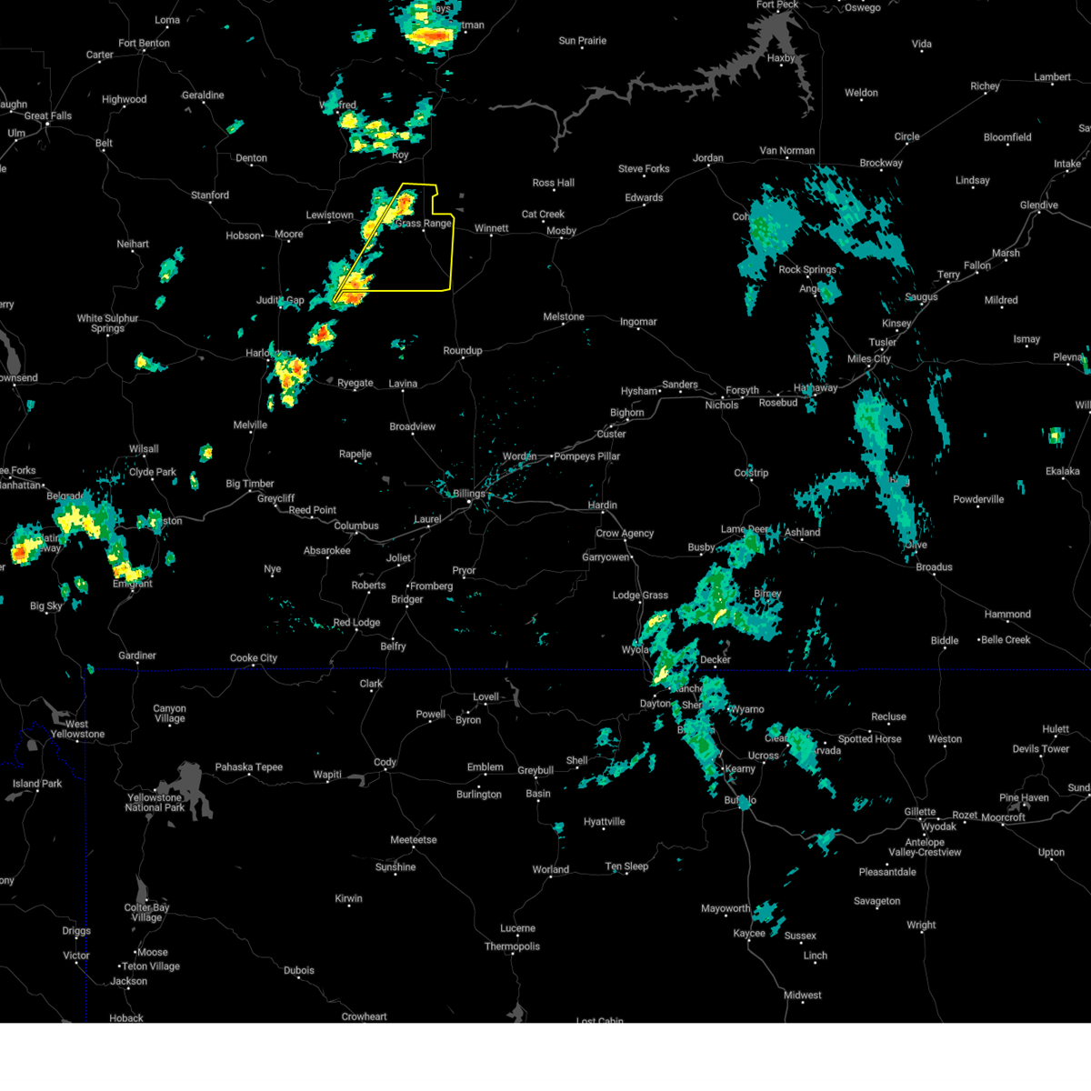
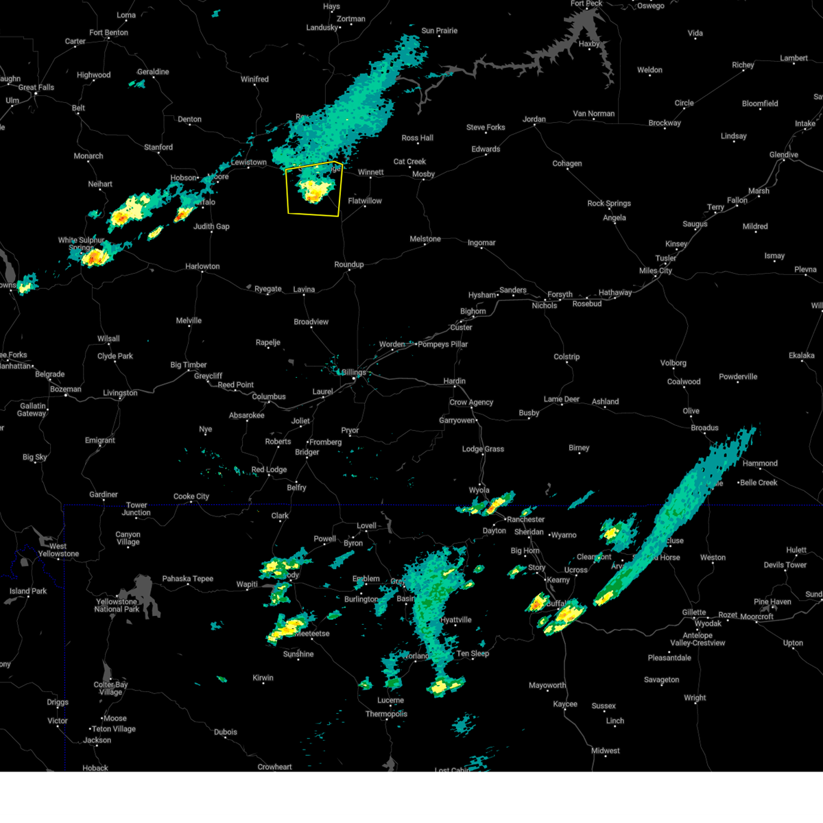
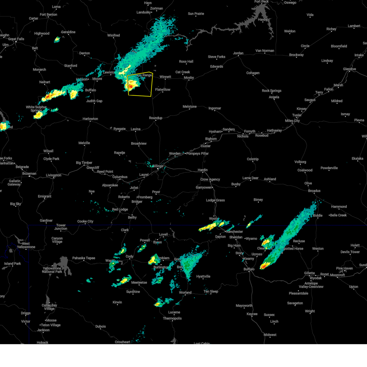
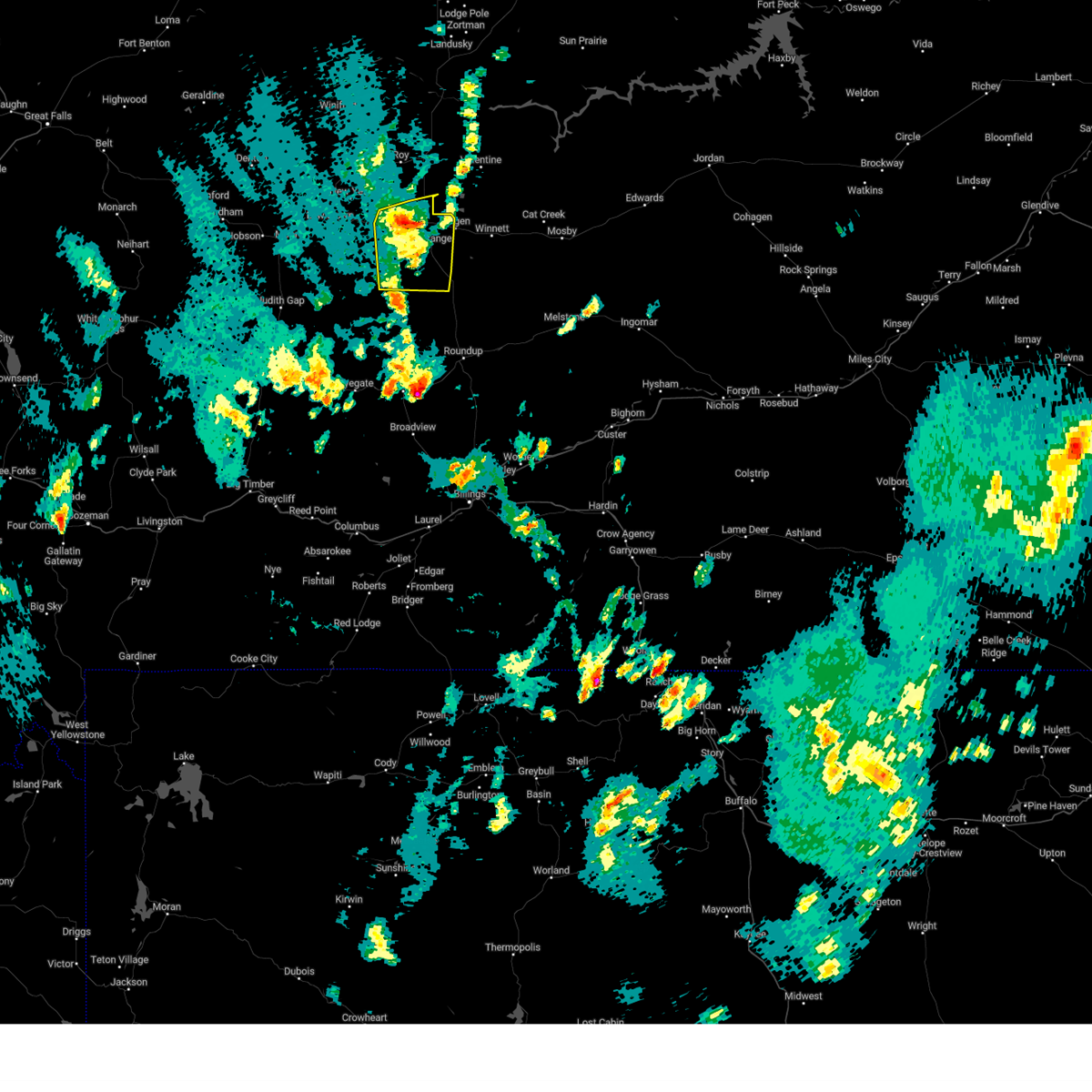
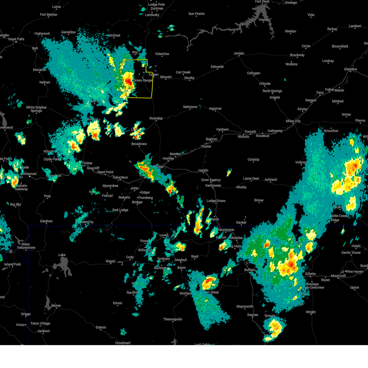
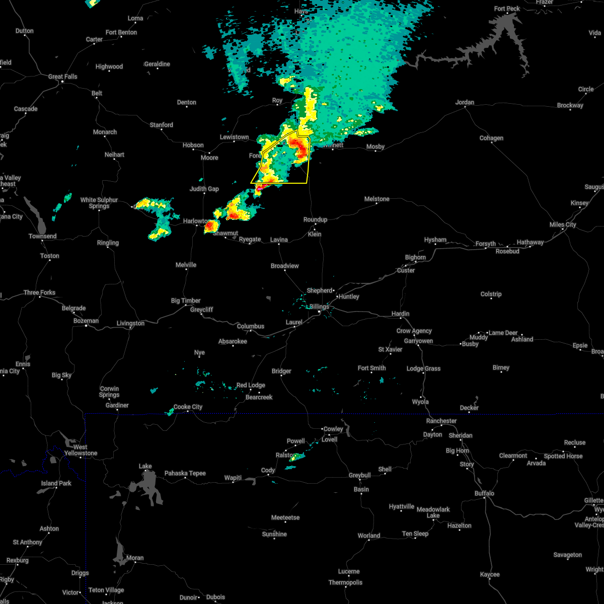
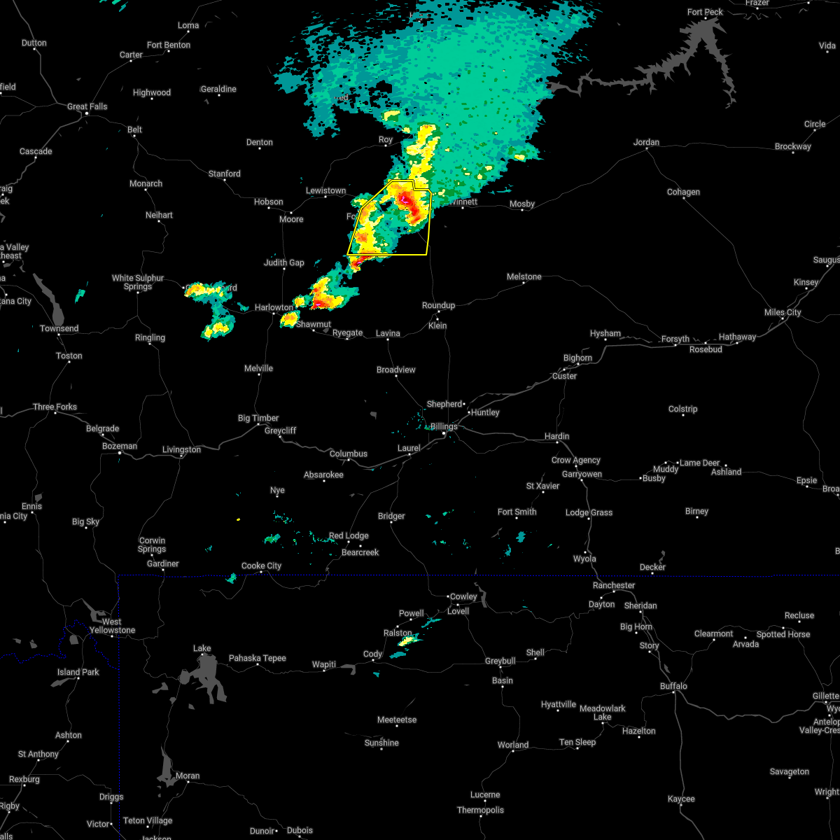
Hail Map for Grass Range, MT
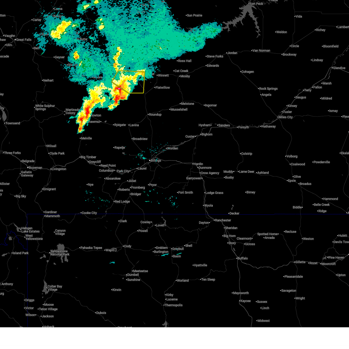
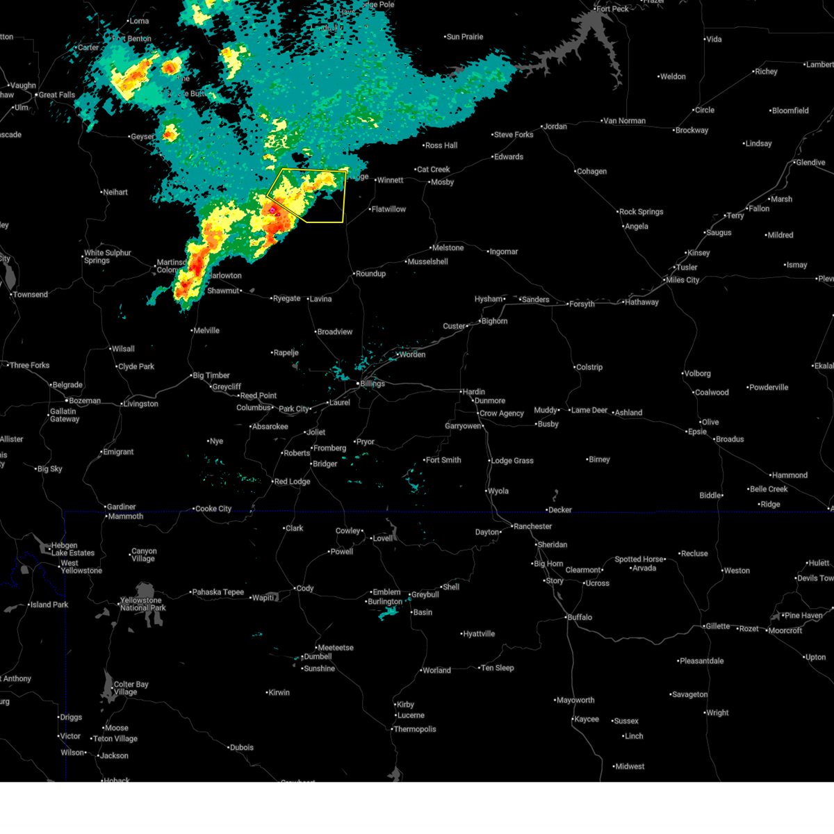
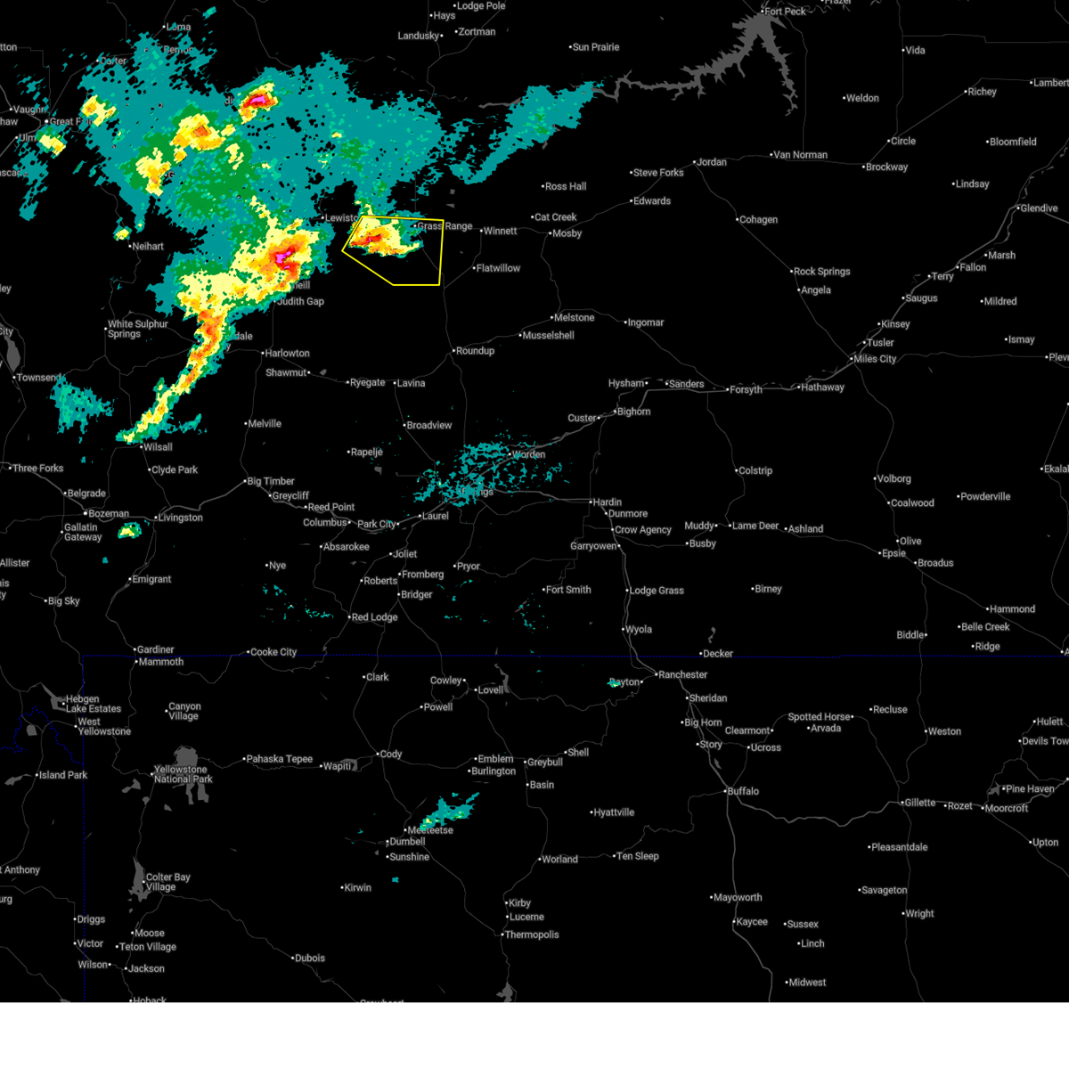
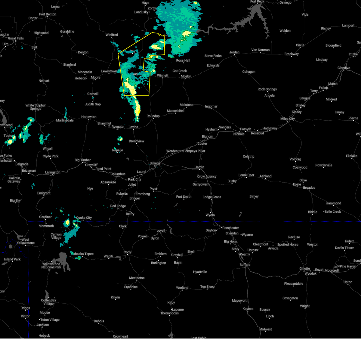
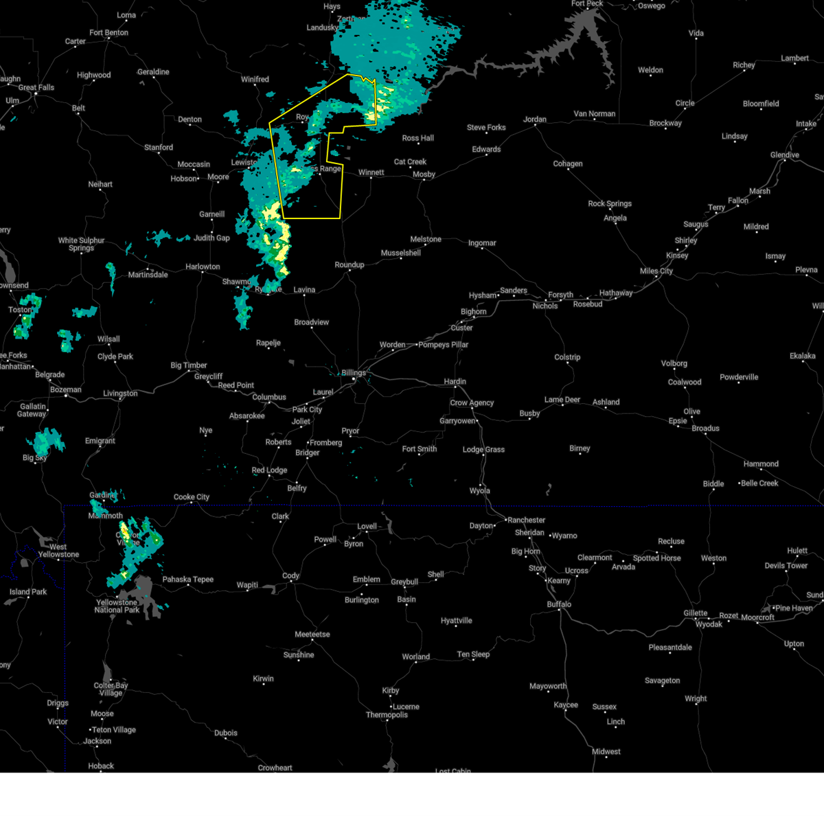
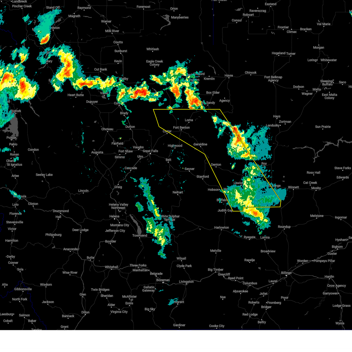
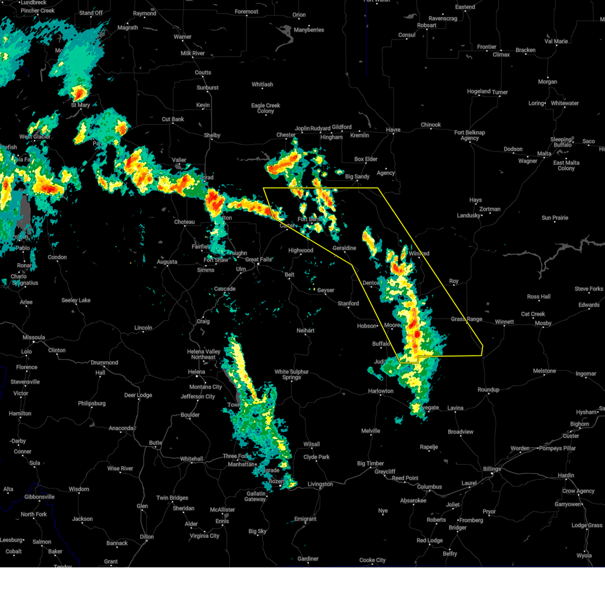
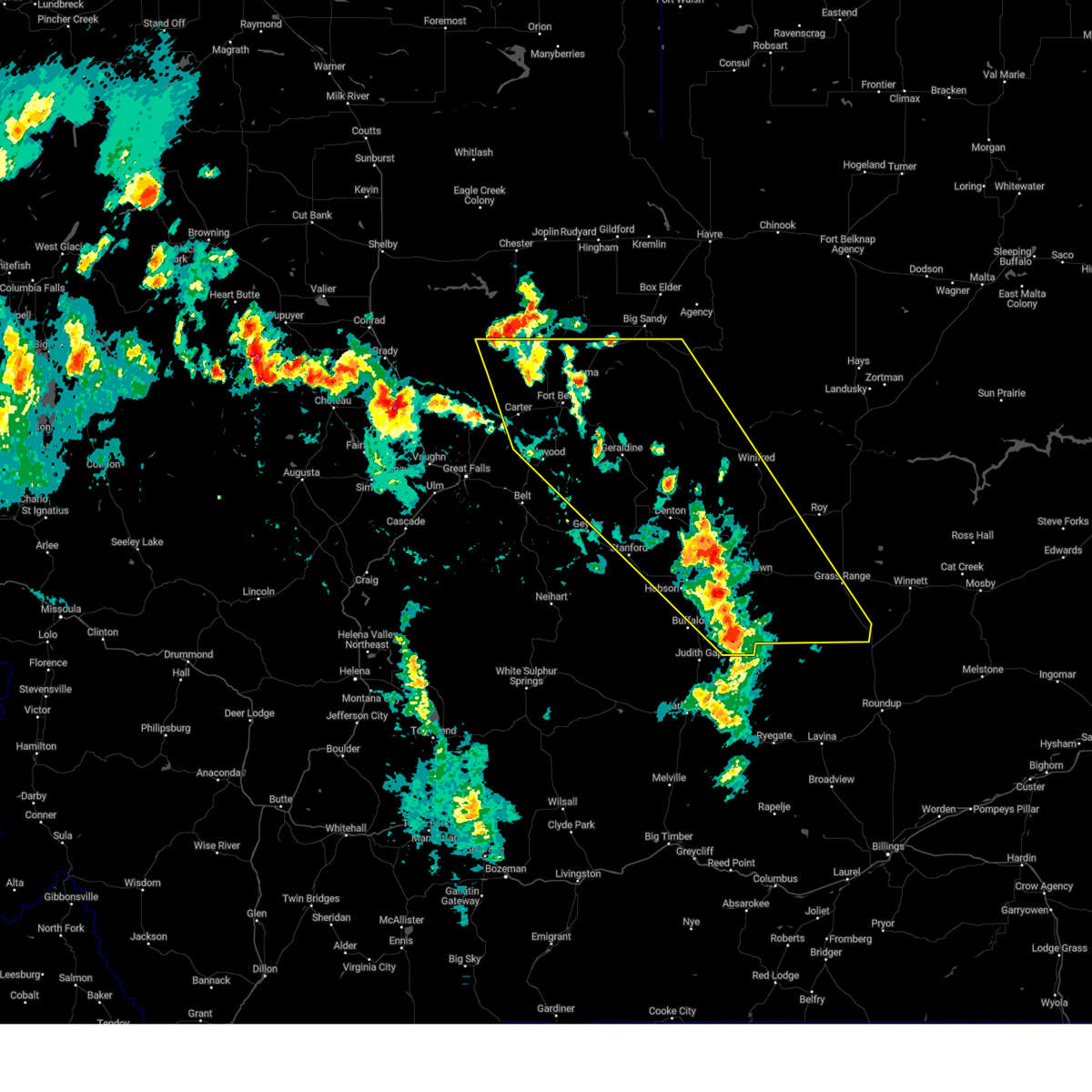
The Grass Range, MT area has had 15 reports of on-the-ground hail by trained spotters, and has been under severe weather warnings 40 times during the past 12 months. Doppler radar has detected hail at or near Grass Range, MT on 24 occasions, including 6 occasions during the past year.
| Name: | Grass Range, MT |
| Where Located: | 86.9 miles N of Billings, MT |
| Map: | Google Map for Grass Range, MT |
| Population: | 110 |
| Housing Units: | 82 |
| More Info: | Search Google for Grass Range, MT |
3
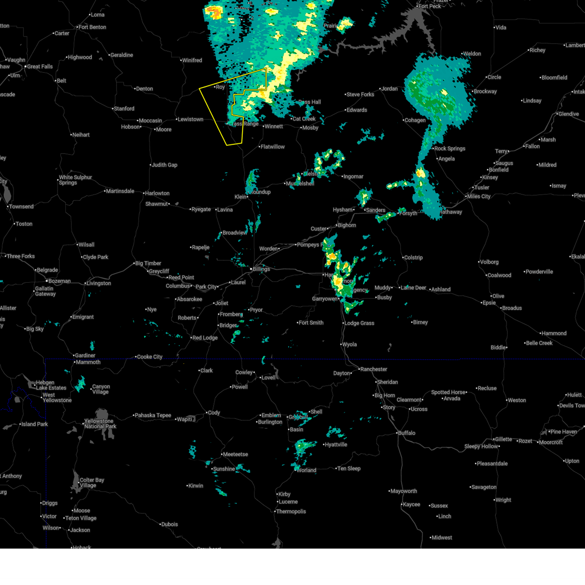
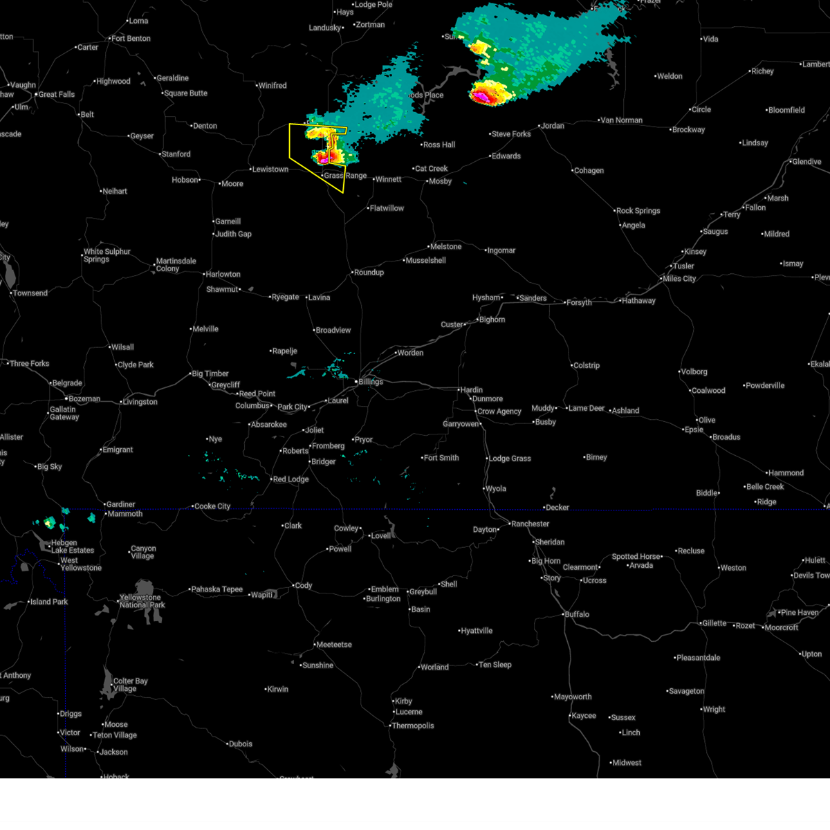
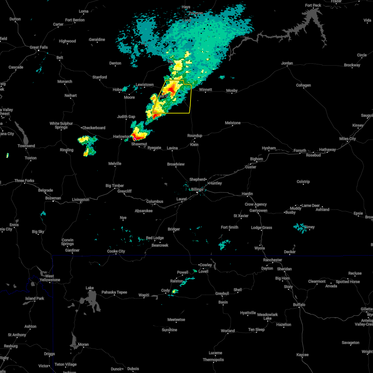
The Top Recent Hail Date for Grass Range, MT is Thursday, August 7, 2025 (2nd out of 24)
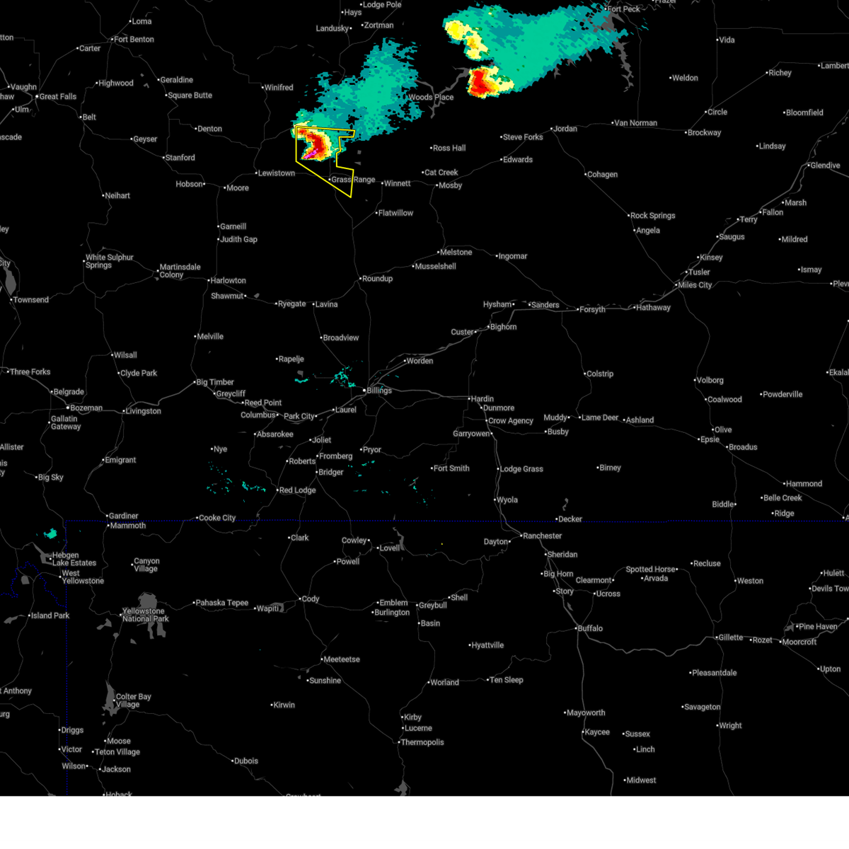
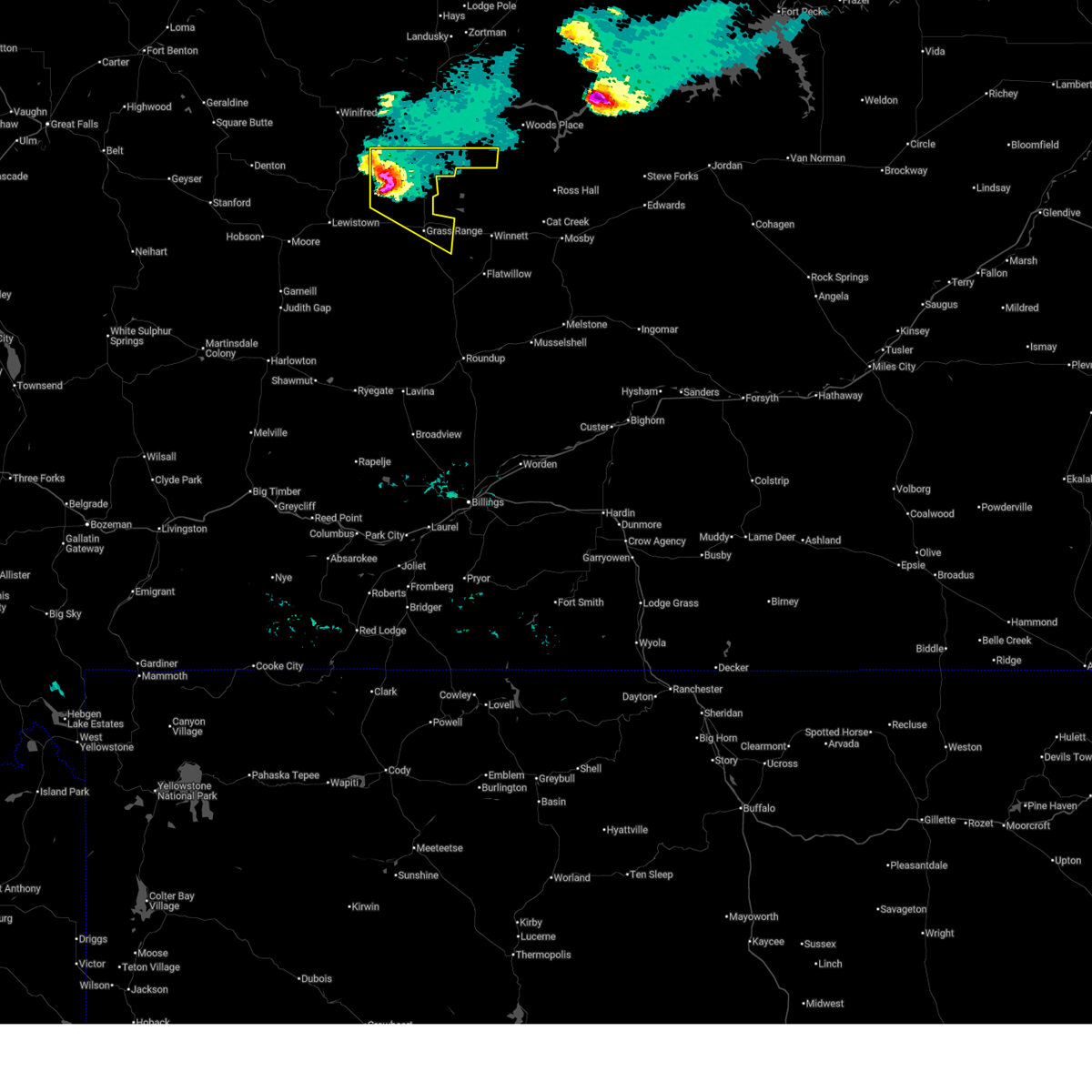
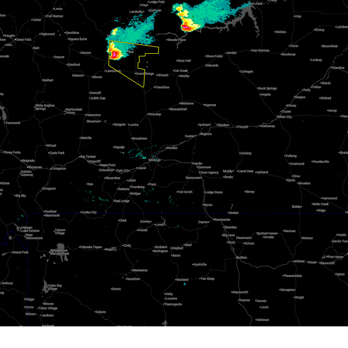
Hail and Wind Damage Spotted near Grass Range, MT
| Date / Time | Report Details |
|---|---|
| 7/5/2026 8:50 PM MDT |
 The storms which prompted the warning have weakened below severe limits, and have exited the warned area. therefore, the warning will be allowed to expire. however, gusty winds are still possible with these thunderstorms. The storms which prompted the warning have weakened below severe limits, and have exited the warned area. therefore, the warning will be allowed to expire. however, gusty winds are still possible with these thunderstorms.
|
| 7/5/2026 8:34 PM MDT |
 At 834 pm mdt, severe thunderstorms were located along a line extending from 7 miles south of roy to 7 miles east of grass range, moving northeast at 30 mph (radar indicated). Hazards include 60 mph wind gusts. Expect damage to roofs, siding, and trees. Locations impacted include, grass range, roy, fergus, and valentine. At 834 pm mdt, severe thunderstorms were located along a line extending from 7 miles south of roy to 7 miles east of grass range, moving northeast at 30 mph (radar indicated). Hazards include 60 mph wind gusts. Expect damage to roofs, siding, and trees. Locations impacted include, grass range, roy, fergus, and valentine.
|
| 7/5/2026 8:25 PM MDT | War horse nw... mt (umt - ggw in petroleum county MT, 13.2 miles SW of Grass Range, MT |
| 7/5/2026 8:23 PM MDT |
 At 822 pm mdt, severe thunderstorms were located along a line extending from 11 miles south of roy to near grass range, moving east northeast at 30 mph (radar indicated). Hazards include 60 mph wind gusts. Expect damage to roofs, siding, and trees. Locations impacted include, grass range, roy, fergus, and valentine. At 822 pm mdt, severe thunderstorms were located along a line extending from 11 miles south of roy to near grass range, moving east northeast at 30 mph (radar indicated). Hazards include 60 mph wind gusts. Expect damage to roofs, siding, and trees. Locations impacted include, grass range, roy, fergus, and valentine.
|
| 7/5/2026 8:04 PM MDT |
 At 803 pm mdt, severe thunderstorms were located along a line extending from 12 miles east of lewistown to 6 miles southwest of grass range, moving northeast at 30 mph (forestgrove reported a 68 mph gust at 758 pm). Hazards include 70 mph wind gusts. Expect considerable tree damage. damage is likely to mobile homes, roofs, and outbuildings. Locations impacted include, grass range, roy, fergus, forestgrove, valentine, giltedge, and hilger. At 803 pm mdt, severe thunderstorms were located along a line extending from 12 miles east of lewistown to 6 miles southwest of grass range, moving northeast at 30 mph (forestgrove reported a 68 mph gust at 758 pm). Hazards include 70 mph wind gusts. Expect considerable tree damage. damage is likely to mobile homes, roofs, and outbuildings. Locations impacted include, grass range, roy, fergus, forestgrove, valentine, giltedge, and hilger.
|
| 7/5/2026 7:52 PM MDT |
 Svrtfx the national weather service in great falls has issued a * severe thunderstorm warning for, southeastern fergus county in central montana, * until 900 pm mdt. * at 751 pm mdt, severe thunderstorms were located along a line extending from near lewistown to 15 miles southwest of grass range, moving northeast at 30 mph (radar indicated). Hazards include 60 mph wind gusts. expect damage to roofs, siding, and trees Svrtfx the national weather service in great falls has issued a * severe thunderstorm warning for, southeastern fergus county in central montana, * until 900 pm mdt. * at 751 pm mdt, severe thunderstorms were located along a line extending from near lewistown to 15 miles southwest of grass range, moving northeast at 30 mph (radar indicated). Hazards include 60 mph wind gusts. expect damage to roofs, siding, and trees
|
| 7/3/2026 2:54 PM MDT |
 At 254 pm mdt, a severe thunderstorm was located near grass range, or 18 miles west of winnett, moving east at 30 mph (radar indicated). Hazards include 60 mph wind gusts and quarter size hail. Hail damage to vehicles is expected. expect wind damage to roofs, siding, and trees. Locations impacted include, grass range. At 254 pm mdt, a severe thunderstorm was located near grass range, or 18 miles west of winnett, moving east at 30 mph (radar indicated). Hazards include 60 mph wind gusts and quarter size hail. Hail damage to vehicles is expected. expect wind damage to roofs, siding, and trees. Locations impacted include, grass range.
|
| 7/3/2026 2:34 PM MDT |
 Svrtfx the national weather service in great falls has issued a * severe thunderstorm warning for, southeastern fergus county in central montana, * until 330 pm mdt. * at 233 pm mdt, a severe thunderstorm was located 11 miles southwest of grass range, or 26 miles southeast of lewistown, moving east at 30 mph (radar indicated). Hazards include ping pong ball size hail and 60 mph wind gusts. People and animals outdoors will be injured. expect hail damage to roofs, siding, windows, and vehicles. Expect wind damage to roofs, siding, and trees. Svrtfx the national weather service in great falls has issued a * severe thunderstorm warning for, southeastern fergus county in central montana, * until 330 pm mdt. * at 233 pm mdt, a severe thunderstorm was located 11 miles southwest of grass range, or 26 miles southeast of lewistown, moving east at 30 mph (radar indicated). Hazards include ping pong ball size hail and 60 mph wind gusts. People and animals outdoors will be injured. expect hail damage to roofs, siding, windows, and vehicles. Expect wind damage to roofs, siding, and trees.
|
| 6/16/2026 8:30 PM MDT | Mesonet station mtbch beacon hill us-87 mp 35. in fergus county MT, 9.1 miles NNW of Grass Range, MT |
| 5/13/2026 9:55 PM MDT | War horse sw mesonet wrhm in petroleum county MT, 12.4 miles SW of Grass Range, MT |
| 5/13/2026 6:05 PM MDT | War horse nw station (wrhm8 in petroleum county MT, 12.8 miles SW of Grass Range, MT |
| 5/13/2026 5:45 PM MDT | Mesonet station beacon hill us 87 mp 35 (mt dot in fergus county MT, 9.1 miles NNW of Grass Range, MT |
| 5/13/2026 5:22 PM MDT |
 Svrtfx the national weather service in great falls has issued a * severe thunderstorm warning for, southeastern fergus county in central montana, * until 600 pm mdt. * at 522 pm mdt, a severe thunderstorm was located 21 miles southwest of grass range, or 26 miles southeast of lewistown, moving northeast at 60 mph (radar indicated). Hazards include 60 mph wind gusts. expect damage to roofs, siding, and trees Svrtfx the national weather service in great falls has issued a * severe thunderstorm warning for, southeastern fergus county in central montana, * until 600 pm mdt. * at 522 pm mdt, a severe thunderstorm was located 21 miles southwest of grass range, or 26 miles southeast of lewistown, moving northeast at 60 mph (radar indicated). Hazards include 60 mph wind gusts. expect damage to roofs, siding, and trees
|
| 8/20/2025 6:38 PM MDT |
 At 637 pm mdt, a severe thunderstorm was located 9 miles west of roy, or 24 miles northeast of lewistown, moving east at 30 mph (radar indicated). Hazards include 70 mph wind gusts and quarter size hail. Hail damage to vehicles is expected. expect considerable tree damage. wind damage is also likely to mobile homes, roofs, and outbuildings. Locations impacted include, grass range, roy, fergus, and christina. At 637 pm mdt, a severe thunderstorm was located 9 miles west of roy, or 24 miles northeast of lewistown, moving east at 30 mph (radar indicated). Hazards include 70 mph wind gusts and quarter size hail. Hail damage to vehicles is expected. expect considerable tree damage. wind damage is also likely to mobile homes, roofs, and outbuildings. Locations impacted include, grass range, roy, fergus, and christina.
|
| 8/20/2025 6:25 PM MDT |
 At 625 pm mdt, a severe thunderstorm was located 14 miles south of winifred, or 21 miles north of lewistown, moving east at 25 mph (radar indicated). Hazards include 70 mph wind gusts and quarter size hail. Hail damage to vehicles is expected. expect considerable tree damage. wind damage is also likely to mobile homes, roofs, and outbuildings. Locations impacted include, winifred, grass range, roy, fergus, suffolk, hilger, and christina. At 625 pm mdt, a severe thunderstorm was located 14 miles south of winifred, or 21 miles north of lewistown, moving east at 25 mph (radar indicated). Hazards include 70 mph wind gusts and quarter size hail. Hail damage to vehicles is expected. expect considerable tree damage. wind damage is also likely to mobile homes, roofs, and outbuildings. Locations impacted include, winifred, grass range, roy, fergus, suffolk, hilger, and christina.
|
| 8/20/2025 6:09 PM MDT |
 Svrtfx the national weather service in great falls has issued a * severe thunderstorm warning for, eastern fergus county in central montana, * until 730 pm mdt. * at 608 pm mdt, a severe thunderstorm was located 11 miles southwest of winifred, or 24 miles north of lewistown, moving east southeast at 45 mph (radar indicated). Hazards include 60 mph wind gusts and quarter size hail. Hail damage to vehicles is expected. Expect wind damage to roofs, siding, and trees. Svrtfx the national weather service in great falls has issued a * severe thunderstorm warning for, eastern fergus county in central montana, * until 730 pm mdt. * at 608 pm mdt, a severe thunderstorm was located 11 miles southwest of winifred, or 24 miles north of lewistown, moving east southeast at 45 mph (radar indicated). Hazards include 60 mph wind gusts and quarter size hail. Hail damage to vehicles is expected. Expect wind damage to roofs, siding, and trees.
|
| 8/17/2025 6:36 PM MDT |
 The storms which prompted the warning have moved out of the area. therefore, the warning will be allowed to expire. however, gusty winds are still possible with these thunderstorms. The storms which prompted the warning have moved out of the area. therefore, the warning will be allowed to expire. however, gusty winds are still possible with these thunderstorms.
|
| 8/17/2025 6:31 PM MDT |
 At 630 pm mdt, severe thunderstorms were located along a line extending from 16 miles northeast of roy to 6 miles east of grass range, moving east at 35 mph (radar indicated). Hazards include 60 mph wind gusts. Expect damage to roofs, siding, and trees. Locations impacted include, grass range. At 630 pm mdt, severe thunderstorms were located along a line extending from 16 miles northeast of roy to 6 miles east of grass range, moving east at 35 mph (radar indicated). Hazards include 60 mph wind gusts. Expect damage to roofs, siding, and trees. Locations impacted include, grass range.
|
| 8/17/2025 6:30 PM MDT | War horse nw hydromet site from the montana climate office mesone in petroleum county MT, 13.2 miles SW of Grass Range, MT |
| 8/17/2025 6:25 PM MDT | War horse nw hydromet site from the montana climate office mesone in petroleum county MT, 13.2 miles SW of Grass Range, MT |
| 8/17/2025 6:21 PM MDT |
 At 621 pm mdt, severe thunderstorms were located along a line extending from 11 miles north of roy to near grass range, moving east at 35 mph (radar indicated). Hazards include 60 mph wind gusts. Expect damage to roofs, siding, and trees. Locations impacted include, grass range and roy. At 621 pm mdt, severe thunderstorms were located along a line extending from 11 miles north of roy to near grass range, moving east at 35 mph (radar indicated). Hazards include 60 mph wind gusts. Expect damage to roofs, siding, and trees. Locations impacted include, grass range and roy.
|
| 8/17/2025 6:13 PM MDT |
 At 613 pm mdt, severe thunderstorms were located along a line extending from 9 miles northwest of roy to 9 miles southwest of grass range, moving east at 35 mph (radar indicated). Hazards include 60 mph wind gusts. Expect damage to roofs, siding, and trees. Locations impacted include, grass range, roy, and fergus. At 613 pm mdt, severe thunderstorms were located along a line extending from 9 miles northwest of roy to 9 miles southwest of grass range, moving east at 35 mph (radar indicated). Hazards include 60 mph wind gusts. Expect damage to roofs, siding, and trees. Locations impacted include, grass range, roy, and fergus.
|
| 8/17/2025 6:02 PM MDT |
 At 600 pm mdt, severe thunderstorms were located along a line extending from 6 miles northwest of roy to 14 miles southwest of grass range, moving east at 40 mph (forestgrove north station reported a 61 mph gust at 555 pm). Hazards include 60 mph wind gusts. Expect damage to roofs, siding, and trees. Locations impacted include, grass range, roy, fergus, giltedge, and forestgrove. At 600 pm mdt, severe thunderstorms were located along a line extending from 6 miles northwest of roy to 14 miles southwest of grass range, moving east at 40 mph (forestgrove north station reported a 61 mph gust at 555 pm). Hazards include 60 mph wind gusts. Expect damage to roofs, siding, and trees. Locations impacted include, grass range, roy, fergus, giltedge, and forestgrove.
|
| 8/17/2025 5:50 PM MDT |
 At 549 pm mdt, severe thunderstorms were located along a line extending from 14 miles south of winifred to 20 miles southeast of lewistown, moving east at 40 mph (radar indicated). Hazards include 60 mph wind gusts. Expect damage to roofs, siding, and trees. Locations impacted include, grass range, roy, fergus, suffolk, forestgrove, giltedge, heath, hilger, and christina. At 549 pm mdt, severe thunderstorms were located along a line extending from 14 miles south of winifred to 20 miles southeast of lewistown, moving east at 40 mph (radar indicated). Hazards include 60 mph wind gusts. Expect damage to roofs, siding, and trees. Locations impacted include, grass range, roy, fergus, suffolk, forestgrove, giltedge, heath, hilger, and christina.
|
| 8/17/2025 5:41 PM MDT |
 At 541 pm mdt, severe thunderstorms were located along a line extending from 13 miles south of winifred to 17 miles southeast of lewistown, moving east at 40 mph (radar indicated). Hazards include 60 mph wind gusts. Expect damage to roofs, siding, and trees. Locations impacted include, lewistown, grass range, roy, fergus, suffolk, forestgrove, giltedge, heath, hilger, and christina. At 541 pm mdt, severe thunderstorms were located along a line extending from 13 miles south of winifred to 17 miles southeast of lewistown, moving east at 40 mph (radar indicated). Hazards include 60 mph wind gusts. Expect damage to roofs, siding, and trees. Locations impacted include, lewistown, grass range, roy, fergus, suffolk, forestgrove, giltedge, heath, hilger, and christina.
|
| 8/17/2025 5:36 PM MDT |
 At 535 pm mdt, severe thunderstorms were located along a line extending from 14 miles south of winifred to 16 miles south of lewistown, moving east at 40 mph (radar indicated). Hazards include 60 mph wind gusts. Expect damage to roofs, siding, and trees. Locations impacted include, lewistown, grass range, roy, fergus, suffolk, forestgrove, giltedge, glengarry, heath, hilger, and christina. At 535 pm mdt, severe thunderstorms were located along a line extending from 14 miles south of winifred to 16 miles south of lewistown, moving east at 40 mph (radar indicated). Hazards include 60 mph wind gusts. Expect damage to roofs, siding, and trees. Locations impacted include, lewistown, grass range, roy, fergus, suffolk, forestgrove, giltedge, glengarry, heath, hilger, and christina.
|
| 8/17/2025 5:17 PM MDT |
 Svrtfx the national weather service in great falls has issued a * severe thunderstorm warning for, fergus county in central montana, * until 645 pm mdt. * at 517 pm mdt, severe thunderstorms were located along a line extending from 9 miles east of denton to 11 miles south of moore, moving east at 35 mph (radar indicated). Hazards include 60 mph wind gusts. expect damage to roofs, siding, and trees Svrtfx the national weather service in great falls has issued a * severe thunderstorm warning for, fergus county in central montana, * until 645 pm mdt. * at 517 pm mdt, severe thunderstorms were located along a line extending from 9 miles east of denton to 11 miles south of moore, moving east at 35 mph (radar indicated). Hazards include 60 mph wind gusts. expect damage to roofs, siding, and trees
|
| 8/7/2025 3:45 PM MDT |
 the severe thunderstorm warning has been cancelled and is no longer in effect the severe thunderstorm warning has been cancelled and is no longer in effect
|
| 8/7/2025 3:29 PM MDT | Quarter sized hail reported 0.3 miles SSW of Grass Range, MT, wind shield cracked from falling hail. |
| 8/7/2025 3:27 PM MDT | Quarter sized hail reported 0.5 miles NE of Grass Range, MT, spotter estimated hail up to an inch in size. |
| 8/7/2025 3:27 PM MDT |
 Svrtfx the national weather service in great falls has issued a * severe thunderstorm warning for, east central fergus county in central montana, * until 400 pm mdt. * at 326 pm mdt, a severe thunderstorm was located near grass range, or 19 miles west of winnett, moving northeast at 45 mph (radar indicated). Hazards include ping pong ball size hail and 60 mph wind gusts. People and animals outdoors will be injured. expect hail damage to roofs, siding, windows, and vehicles. Expect wind damage to roofs, siding, and trees. Svrtfx the national weather service in great falls has issued a * severe thunderstorm warning for, east central fergus county in central montana, * until 400 pm mdt. * at 326 pm mdt, a severe thunderstorm was located near grass range, or 19 miles west of winnett, moving northeast at 45 mph (radar indicated). Hazards include ping pong ball size hail and 60 mph wind gusts. People and animals outdoors will be injured. expect hail damage to roofs, siding, windows, and vehicles. Expect wind damage to roofs, siding, and trees.
|
| 8/7/2025 3:37 AM MDT |
 At 336 am mdt, a severe thunderstorm was located near roy, or 30 miles northwest of winnett, moving northeast at 50 mph (radar indicated). Hazards include 70 mph wind gusts and quarter size hail. Hail damage to vehicles is expected. expect considerable tree damage. wind damage is also likely to mobile homes, roofs, and outbuildings. Locations impacted include, grass range, roy, and fergus. At 336 am mdt, a severe thunderstorm was located near roy, or 30 miles northwest of winnett, moving northeast at 50 mph (radar indicated). Hazards include 70 mph wind gusts and quarter size hail. Hail damage to vehicles is expected. expect considerable tree damage. wind damage is also likely to mobile homes, roofs, and outbuildings. Locations impacted include, grass range, roy, and fergus.
|
| 8/7/2025 3:25 AM MDT |
 At 324 am mdt, a severe thunderstorm was located 11 miles southwest of roy, or 18 miles northeast of lewistown, moving northeast at 45 mph (radar indicated). Hazards include 70 mph wind gusts and quarter size hail. Hail damage to vehicles is expected. expect considerable tree damage. wind damage is also likely to mobile homes, roofs, and outbuildings. Locations impacted include, grass range, roy, fergus, suffolk, forestgrove, giltedge, and christina. At 324 am mdt, a severe thunderstorm was located 11 miles southwest of roy, or 18 miles northeast of lewistown, moving northeast at 45 mph (radar indicated). Hazards include 70 mph wind gusts and quarter size hail. Hail damage to vehicles is expected. expect considerable tree damage. wind damage is also likely to mobile homes, roofs, and outbuildings. Locations impacted include, grass range, roy, fergus, suffolk, forestgrove, giltedge, and christina.
|
| 8/7/2025 3:14 AM MDT |
 At 313 am mdt, a severe thunderstorm was located 11 miles east of lewistown, moving northeast at 40 mph (forestgrove north mesonet station hit 71 mph at 310 am). Hazards include 70 mph wind gusts and penny size hail. Expect considerable tree damage. damage is likely to mobile homes, roofs, and outbuildings. Locations impacted include, grass range, roy, fergus, suffolk, forestgrove, giltedge, heath, hilger, and christina. At 313 am mdt, a severe thunderstorm was located 11 miles east of lewistown, moving northeast at 40 mph (forestgrove north mesonet station hit 71 mph at 310 am). Hazards include 70 mph wind gusts and penny size hail. Expect considerable tree damage. damage is likely to mobile homes, roofs, and outbuildings. Locations impacted include, grass range, roy, fergus, suffolk, forestgrove, giltedge, heath, hilger, and christina.
|
| 8/7/2025 3:12 AM MDT |
 At 312 am mdt, a severe thunderstorm was located 10 miles east of lewistown, moving northeast at 40 mph (radar indicated). Hazards include 60 mph wind gusts and penny size hail. Expect damage to roofs, siding, and trees. Locations impacted include, grass range, roy, fergus, suffolk, forestgrove, giltedge, heath, hilger, and christina. At 312 am mdt, a severe thunderstorm was located 10 miles east of lewistown, moving northeast at 40 mph (radar indicated). Hazards include 60 mph wind gusts and penny size hail. Expect damage to roofs, siding, and trees. Locations impacted include, grass range, roy, fergus, suffolk, forestgrove, giltedge, heath, hilger, and christina.
|
| 8/7/2025 3:06 AM MDT |
 Svrtfx the national weather service in great falls has issued a * severe thunderstorm warning for, eastern fergus county in central montana, * until 415 am mdt. * at 306 am mdt, a severe thunderstorm was located near lewistown, moving northeast at 40 mph (radar indicated). Hazards include 60 mph wind gusts and penny size hail. expect damage to roofs, siding, and trees Svrtfx the national weather service in great falls has issued a * severe thunderstorm warning for, eastern fergus county in central montana, * until 415 am mdt. * at 306 am mdt, a severe thunderstorm was located near lewistown, moving northeast at 40 mph (radar indicated). Hazards include 60 mph wind gusts and penny size hail. expect damage to roofs, siding, and trees
|
| 8/5/2025 6:05 AM MDT |
 the severe thunderstorm warning has been cancelled and is no longer in effect the severe thunderstorm warning has been cancelled and is no longer in effect
|
| 8/5/2025 5:52 AM MDT |
 At 552 am mdt, a severe thunderstorm was located 9 miles southeast of grass range, or 13 miles west of winnett, moving east at 30 mph (radar indicated). Hazards include 60 mph wind gusts and penny size hail. Expect damage to roofs, siding, and trees. Locations impacted include, grass range. At 552 am mdt, a severe thunderstorm was located 9 miles southeast of grass range, or 13 miles west of winnett, moving east at 30 mph (radar indicated). Hazards include 60 mph wind gusts and penny size hail. Expect damage to roofs, siding, and trees. Locations impacted include, grass range.
|
| 8/5/2025 5:41 AM MDT |
 At 540 am mdt, a severe thunderstorm was located 7 miles south of grass range, or 20 miles west of winnett, moving east at 35 mph (radar indicated). Hazards include 60 mph wind gusts and quarter size hail. Hail damage to vehicles is expected. expect wind damage to roofs, siding, and trees. Locations impacted include, grass range and forestgrove. At 540 am mdt, a severe thunderstorm was located 7 miles south of grass range, or 20 miles west of winnett, moving east at 35 mph (radar indicated). Hazards include 60 mph wind gusts and quarter size hail. Hail damage to vehicles is expected. expect wind damage to roofs, siding, and trees. Locations impacted include, grass range and forestgrove.
|
| 8/5/2025 5:28 AM MDT |
 At 528 am mdt, a severe thunderstorm was located 8 miles south of grass range, or 24 miles west of winnett, moving east at 40 mph (radar indicated). Hazards include 60 mph wind gusts and quarter size hail. Hail damage to vehicles is expected. expect wind damage to roofs, siding, and trees. Locations impacted include, grass range and forestgrove. At 528 am mdt, a severe thunderstorm was located 8 miles south of grass range, or 24 miles west of winnett, moving east at 40 mph (radar indicated). Hazards include 60 mph wind gusts and quarter size hail. Hail damage to vehicles is expected. expect wind damage to roofs, siding, and trees. Locations impacted include, grass range and forestgrove.
|
| 8/5/2025 5:11 AM MDT |
 Svrtfx the national weather service in great falls has issued a * severe thunderstorm warning for, southeastern fergus county in central montana, * until 615 am mdt. * at 510 am mdt, a severe thunderstorm was located 18 miles southwest of grass range, or 20 miles southeast of lewistown, moving east at 35 mph (radar indicated). Hazards include 60 mph wind gusts and quarter size hail. Hail damage to vehicles is expected. Expect wind damage to roofs, siding, and trees. Svrtfx the national weather service in great falls has issued a * severe thunderstorm warning for, southeastern fergus county in central montana, * until 615 am mdt. * at 510 am mdt, a severe thunderstorm was located 18 miles southwest of grass range, or 20 miles southeast of lewistown, moving east at 35 mph (radar indicated). Hazards include 60 mph wind gusts and quarter size hail. Hail damage to vehicles is expected. Expect wind damage to roofs, siding, and trees.
|
| 7/28/2025 6:10 PM MDT |
 The storm which prompted the warning has weakened below severe limits, and no longer poses an immediate threat to life or property. therefore, the warning will be allowed to expire. however, gusty winds and heavy rain are still possible with this thunderstorm. a severe thunderstorm watch remains in effect until 900 pm mdt for central montana. The storm which prompted the warning has weakened below severe limits, and no longer poses an immediate threat to life or property. therefore, the warning will be allowed to expire. however, gusty winds and heavy rain are still possible with this thunderstorm. a severe thunderstorm watch remains in effect until 900 pm mdt for central montana.
|
| 7/28/2025 6:05 PM MDT |
 At 605 pm mdt, a severe thunderstorm was located 15 miles south of grass range, or 26 miles southwest of winnett, moving southeast at 20 mph (radar indicated). Hazards include 60 mph wind gusts. Expect damage to roofs, siding, and trees. Locations impacted include, grass range and forestgrove. At 605 pm mdt, a severe thunderstorm was located 15 miles south of grass range, or 26 miles southwest of winnett, moving southeast at 20 mph (radar indicated). Hazards include 60 mph wind gusts. Expect damage to roofs, siding, and trees. Locations impacted include, grass range and forestgrove.
|
| 7/28/2025 5:15 PM MDT |
 Svrtfx the national weather service in great falls has issued a * severe thunderstorm warning for, southeastern fergus county in central montana, * until 615 pm mdt. * at 515 pm mdt, a severe thunderstorm was located 15 miles southeast of lewistown, moving southeast at 20 mph (radar indicated). Hazards include 60 mph wind gusts and quarter size hail. Hail damage to vehicles is expected. Expect wind damage to roofs, siding, and trees. Svrtfx the national weather service in great falls has issued a * severe thunderstorm warning for, southeastern fergus county in central montana, * until 615 pm mdt. * at 515 pm mdt, a severe thunderstorm was located 15 miles southeast of lewistown, moving southeast at 20 mph (radar indicated). Hazards include 60 mph wind gusts and quarter size hail. Hail damage to vehicles is expected. Expect wind damage to roofs, siding, and trees.
|
| 7/17/2025 7:57 PM MDT |
 The storm which prompted the warning is moving out of the area. therefore, the warning will be allowed to expire. however, small hail and gusty winds are still possible with this thunderstorm. a severe thunderstorm watch remains in effect until 1000 pm mdt for central montana. The storm which prompted the warning is moving out of the area. therefore, the warning will be allowed to expire. however, small hail and gusty winds are still possible with this thunderstorm. a severe thunderstorm watch remains in effect until 1000 pm mdt for central montana.
|
| 7/17/2025 7:47 PM MDT |
 At 746 pm mdt, a severe thunderstorm was located 10 miles north of grass range, or 26 miles east of lewistown, moving southeast at 40 mph (radar indicated). Hazards include 60 mph wind gusts and quarter size hail. Hail damage to vehicles is expected. expect wind damage to roofs, siding, and trees. Locations impacted include, grass range. At 746 pm mdt, a severe thunderstorm was located 10 miles north of grass range, or 26 miles east of lewistown, moving southeast at 40 mph (radar indicated). Hazards include 60 mph wind gusts and quarter size hail. Hail damage to vehicles is expected. expect wind damage to roofs, siding, and trees. Locations impacted include, grass range.
|
| 7/17/2025 7:39 PM MDT |
 At 739 pm mdt, a severe thunderstorm was located 8 miles south of roy, or 22 miles northeast of lewistown, moving southeast at 40 mph (radar indicated). Hazards include 60 mph wind gusts and quarter size hail. Hail damage to vehicles is expected. expect wind damage to roofs, siding, and trees. Locations impacted include, grass range, roy, fergus, and valentine. At 739 pm mdt, a severe thunderstorm was located 8 miles south of roy, or 22 miles northeast of lewistown, moving southeast at 40 mph (radar indicated). Hazards include 60 mph wind gusts and quarter size hail. Hail damage to vehicles is expected. expect wind damage to roofs, siding, and trees. Locations impacted include, grass range, roy, fergus, and valentine.
|
| 7/17/2025 7:26 PM MDT |
 At 726 pm mdt, a severe thunderstorm was located 12 miles southwest of roy, or 17 miles northeast of lewistown, moving southeast at 40 mph (radar indicated). Hazards include 60 mph wind gusts and quarter size hail. Hail damage to vehicles is expected. expect wind damage to roofs, siding, and trees. Locations impacted include, grass range, roy, fergus, valentine, giltedge, and christina. At 726 pm mdt, a severe thunderstorm was located 12 miles southwest of roy, or 17 miles northeast of lewistown, moving southeast at 40 mph (radar indicated). Hazards include 60 mph wind gusts and quarter size hail. Hail damage to vehicles is expected. expect wind damage to roofs, siding, and trees. Locations impacted include, grass range, roy, fergus, valentine, giltedge, and christina.
|
| 7/17/2025 7:09 PM MDT |
 Svrtfx the national weather service in great falls has issued a * severe thunderstorm warning for, central fergus county in central montana, * until 800 pm mdt. * at 709 pm mdt, a severe thunderstorm was located 17 miles north of lewistown, moving southeast at 40 mph (radar indicated). Hazards include 60 mph wind gusts and quarter size hail. Hail damage to vehicles is expected. Expect wind damage to roofs, siding, and trees. Svrtfx the national weather service in great falls has issued a * severe thunderstorm warning for, central fergus county in central montana, * until 800 pm mdt. * at 709 pm mdt, a severe thunderstorm was located 17 miles north of lewistown, moving southeast at 40 mph (radar indicated). Hazards include 60 mph wind gusts and quarter size hail. Hail damage to vehicles is expected. Expect wind damage to roofs, siding, and trees.
|
| 6/27/2025 4:35 PM MDT | War horse nw (hydromet) statio in petroleum county MT, 13.2 miles SW of Grass Range, MT |
| 6/15/2025 6:19 PM MDT | Hen Egg sized hail reported 7.4 miles WSW of Grass Range, MT, report from spotter network. |
| 6/15/2025 6:14 PM MDT | Ping Pong Ball sized hail reported 0.3 miles SSW of Grass Range, MT, report from mping: ping pong ball (1.50 in.). |
| 6/15/2025 6:00 PM MDT | Half Dollar sized hail reported 0.3 miles SSW of Grass Range, MT, hail ranging from pea size to half dollar size fell for about 5 minutes. |
| 6/15/2025 5:57 PM MDT | Quarter sized hail reported 2.5 miles SE of Grass Range, MT, report from mping: quarter (1.00 in.). |
| 6/15/2025 5:50 PM MDT |
 the severe thunderstorm warning has been cancelled and is no longer in effect the severe thunderstorm warning has been cancelled and is no longer in effect
|
| 6/15/2025 5:36 PM MDT |
 At 536 pm mdt, a severe thunderstorm was located 9 miles west of grass range, or 21 miles east of lewistown, moving northeast at 15 mph (radar indicated). Hazards include 60 mph wind gusts and quarter size hail. Hail damage to vehicles is expected. expect wind damage to roofs, siding, and trees. Locations impacted include, grass range. At 536 pm mdt, a severe thunderstorm was located 9 miles west of grass range, or 21 miles east of lewistown, moving northeast at 15 mph (radar indicated). Hazards include 60 mph wind gusts and quarter size hail. Hail damage to vehicles is expected. expect wind damage to roofs, siding, and trees. Locations impacted include, grass range.
|
| 6/15/2025 5:26 PM MDT |
 At 525 pm mdt, a severe thunderstorm was located 11 miles west of grass range, or 19 miles east of lewistown, moving east at 30 mph (radar indicated). Hazards include 60 mph wind gusts and quarter size hail. Hail damage to vehicles is expected. expect wind damage to roofs, siding, and trees. Locations impacted include, grass range and forestgrove. At 525 pm mdt, a severe thunderstorm was located 11 miles west of grass range, or 19 miles east of lewistown, moving east at 30 mph (radar indicated). Hazards include 60 mph wind gusts and quarter size hail. Hail damage to vehicles is expected. expect wind damage to roofs, siding, and trees. Locations impacted include, grass range and forestgrove.
|
| 6/15/2025 5:15 PM MDT |
 Svrtfx the national weather service in great falls has issued a * severe thunderstorm warning for, southeastern fergus county in central montana, * until 615 pm mdt. * at 515 pm mdt, a severe thunderstorm was located 14 miles west of grass range, or 16 miles east of lewistown, moving northeast at 35 mph (radar indicated). Hazards include 60 mph wind gusts and quarter size hail. Hail damage to vehicles is expected. Expect wind damage to roofs, siding, and trees. Svrtfx the national weather service in great falls has issued a * severe thunderstorm warning for, southeastern fergus county in central montana, * until 615 pm mdt. * at 515 pm mdt, a severe thunderstorm was located 14 miles west of grass range, or 16 miles east of lewistown, moving northeast at 35 mph (radar indicated). Hazards include 60 mph wind gusts and quarter size hail. Hail damage to vehicles is expected. Expect wind damage to roofs, siding, and trees.
|
| 6/14/2025 7:39 PM MDT |
 Svrtfx the national weather service in great falls has issued a * severe thunderstorm warning for, southeastern fergus county in central montana, * until 845 pm mdt. * at 739 pm mdt, a severe thunderstorm was located 20 miles southwest of grass range, or 22 miles southeast of lewistown, moving northeast at 25 mph (radar indicated). Hazards include 60 mph wind gusts and quarter size hail. Hail damage to vehicles is expected. Expect wind damage to roofs, siding, and trees. Svrtfx the national weather service in great falls has issued a * severe thunderstorm warning for, southeastern fergus county in central montana, * until 845 pm mdt. * at 739 pm mdt, a severe thunderstorm was located 20 miles southwest of grass range, or 22 miles southeast of lewistown, moving northeast at 25 mph (radar indicated). Hazards include 60 mph wind gusts and quarter size hail. Hail damage to vehicles is expected. Expect wind damage to roofs, siding, and trees.
|
| 6/13/2025 3:46 PM MDT |
 At 345 pm mdt, severe thunderstorms were located along a line extending from 18 miles northwest of winnett to near grass range, moving east at 30 mph (radar indicated). Hazards include 60 mph wind gusts and half dollar size hail. Hail damage to vehicles is expected. expect wind damage to roofs, siding, and trees. Locations impacted include, grass range. At 345 pm mdt, severe thunderstorms were located along a line extending from 18 miles northwest of winnett to near grass range, moving east at 30 mph (radar indicated). Hazards include 60 mph wind gusts and half dollar size hail. Hail damage to vehicles is expected. expect wind damage to roofs, siding, and trees. Locations impacted include, grass range.
|
| 6/13/2025 3:29 PM MDT |
 Svrtfx the national weather service in great falls has issued a * severe thunderstorm warning for, southeastern fergus county in central montana, * until 415 pm mdt. * at 328 pm mdt, severe thunderstorms were located along a line extending from 8 miles north of grass range to 23 miles east of lewistown, moving east at 25 mph (radar indicated). Hazards include 60 mph wind gusts and quarter size hail. Hail damage to vehicles is expected. Expect wind damage to roofs, siding, and trees. Svrtfx the national weather service in great falls has issued a * severe thunderstorm warning for, southeastern fergus county in central montana, * until 415 pm mdt. * at 328 pm mdt, severe thunderstorms were located along a line extending from 8 miles north of grass range to 23 miles east of lewistown, moving east at 25 mph (radar indicated). Hazards include 60 mph wind gusts and quarter size hail. Hail damage to vehicles is expected. Expect wind damage to roofs, siding, and trees.
|
| 5/10/2025 7:40 PM MDT |
 The storms which prompted the warning have weakened below severe limits, and no longer pose an immediate threat to life or property. therefore, the warning will be allowed to expire. however, gusty winds are still possible with these thunderstorms. The storms which prompted the warning have weakened below severe limits, and no longer pose an immediate threat to life or property. therefore, the warning will be allowed to expire. however, gusty winds are still possible with these thunderstorms.
|
| 5/10/2025 7:21 PM MDT |
 Svrtfx the national weather service in great falls has issued a * severe thunderstorm warning for, southeastern fergus county in central montana, * until 745 pm mdt. * at 721 pm mdt, severe thunderstorms were located along a line extending from 6 miles west of roy to 21 miles northwest of roundup, moving northeast at 40 mph (radar indicated). Hazards include 60 mph wind gusts. expect damage to roofs, siding, and trees Svrtfx the national weather service in great falls has issued a * severe thunderstorm warning for, southeastern fergus county in central montana, * until 745 pm mdt. * at 721 pm mdt, severe thunderstorms were located along a line extending from 6 miles west of roy to 21 miles northwest of roundup, moving northeast at 40 mph (radar indicated). Hazards include 60 mph wind gusts. expect damage to roofs, siding, and trees
|
| 8/23/2024 7:07 PM MDT |
 The storms which prompted the warning have weakened below severe limits, and no longer pose an immediate threat to life or property. therefore, the warning will be allowed to expire. a severe thunderstorm watch remains in effect until 900 pm mdt for central and north central montana. The storms which prompted the warning have weakened below severe limits, and no longer pose an immediate threat to life or property. therefore, the warning will be allowed to expire. a severe thunderstorm watch remains in effect until 900 pm mdt for central and north central montana.
|
| 8/23/2024 6:59 PM MDT |
 At 659 pm mdt, severe thunderstorms were located along a line extending from 22 miles west of hays to 11 miles northwest of winnett, moving east at 40 mph (radar indicated). Hazards include 60 mph wind gusts. Expect damage to roofs, siding, and trees. Locations impacted include, chinook, grass range, hays, roy, fergus, fred robinson bridge, valentine, lloyd, and cleveland. At 659 pm mdt, severe thunderstorms were located along a line extending from 22 miles west of hays to 11 miles northwest of winnett, moving east at 40 mph (radar indicated). Hazards include 60 mph wind gusts. Expect damage to roofs, siding, and trees. Locations impacted include, chinook, grass range, hays, roy, fergus, fred robinson bridge, valentine, lloyd, and cleveland.
|
| 8/23/2024 6:22 PM MDT |
 The storms which prompted the warning have moved out of the area. therefore, the warning will be allowed to expire. a severe thunderstorm watch remains in effect until 900 pm mdt for central and north central montana. The storms which prompted the warning have moved out of the area. therefore, the warning will be allowed to expire. a severe thunderstorm watch remains in effect until 900 pm mdt for central and north central montana.
|
| 8/23/2024 6:16 PM MDT |
 Svrtfx the national weather service in great falls has issued a * severe thunderstorm warning for, eastern fergus county in central montana, southern blaine county in north central montana, southeastern hill county in north central montana, east central chouteau county in north central montana, * until 715 pm mdt. * at 615 pm mdt, severe thunderstorms were located along a line extending from 20 miles northwest of winifred to 16 miles southwest of grass range, moving northeast at 40 mph (radar indicated). Hazards include 60 mph wind gusts. expect damage to roofs, siding, and trees Svrtfx the national weather service in great falls has issued a * severe thunderstorm warning for, eastern fergus county in central montana, southern blaine county in north central montana, southeastern hill county in north central montana, east central chouteau county in north central montana, * until 715 pm mdt. * at 615 pm mdt, severe thunderstorms were located along a line extending from 20 miles northwest of winifred to 16 miles southwest of grass range, moving northeast at 40 mph (radar indicated). Hazards include 60 mph wind gusts. expect damage to roofs, siding, and trees
|
| 8/23/2024 6:02 PM MDT |
 At 601 pm mdt, severe thunderstorms were located along a line extending from near fort benton to near denton to 25 miles south of lewistown, moving east at 30 mph (radar indicated). Hazards include 70 mph wind gusts. Expect considerable tree damage. damage is likely to mobile homes, roofs, and outbuildings. Locations impacted include, lewistown, fort benton, geraldine, denton, winifred, moore, grass range, forestgrove, glengarry, danvers, loma, suffolk, square butte, giltedge, judith landing, hilger, heath, christina, iliad, and virgelle. At 601 pm mdt, severe thunderstorms were located along a line extending from near fort benton to near denton to 25 miles south of lewistown, moving east at 30 mph (radar indicated). Hazards include 70 mph wind gusts. Expect considerable tree damage. damage is likely to mobile homes, roofs, and outbuildings. Locations impacted include, lewistown, fort benton, geraldine, denton, winifred, moore, grass range, forestgrove, glengarry, danvers, loma, suffolk, square butte, giltedge, judith landing, hilger, heath, christina, iliad, and virgelle.
|
| 8/23/2024 6:02 PM MDT |
 the severe thunderstorm warning has been cancelled and is no longer in effect the severe thunderstorm warning has been cancelled and is no longer in effect
|
| 8/23/2024 5:43 PM MDT |
 At 542 pm mdt, severe thunderstorms were located along a line extending from 7 miles northwest of fort benton to 7 miles west of denton to 20 miles southeast of moore, moving east at 30 mph (radar indicated). Hazards include 70 mph wind gusts. Expect considerable tree damage. damage is likely to mobile homes, roofs, and outbuildings. Locations impacted include, lewistown, fort benton, stanford, geraldine, denton, hobson, winifred, moore, grass range, highwood, carter, floweree, windham, forestgrove, shonkin, danvers, loma, hilger, iliad, and virgelle. At 542 pm mdt, severe thunderstorms were located along a line extending from 7 miles northwest of fort benton to 7 miles west of denton to 20 miles southeast of moore, moving east at 30 mph (radar indicated). Hazards include 70 mph wind gusts. Expect considerable tree damage. damage is likely to mobile homes, roofs, and outbuildings. Locations impacted include, lewistown, fort benton, stanford, geraldine, denton, hobson, winifred, moore, grass range, highwood, carter, floweree, windham, forestgrove, shonkin, danvers, loma, hilger, iliad, and virgelle.
|
| 8/23/2024 5:23 PM MDT |
 Svrtfx the national weather service in great falls has issued a * severe thunderstorm warning for, judith basin county in central montana, fergus county in central montana, southwestern blaine county in north central montana, chouteau county in north central montana, northeastern cascade county in central montana, * until 630 pm mdt. * at 523 pm mdt, severe thunderstorms were located along a line extending from 15 miles southeast of the knees to 8 miles east of geyser to 16 miles south of moore, moving east at 30 mph (radar indicated). Hazards include 70 mph wind gusts. Expect considerable tree damage. Damage is likely to mobile homes, roofs, and outbuildings. Svrtfx the national weather service in great falls has issued a * severe thunderstorm warning for, judith basin county in central montana, fergus county in central montana, southwestern blaine county in north central montana, chouteau county in north central montana, northeastern cascade county in central montana, * until 630 pm mdt. * at 523 pm mdt, severe thunderstorms were located along a line extending from 15 miles southeast of the knees to 8 miles east of geyser to 16 miles south of moore, moving east at 30 mph (radar indicated). Hazards include 70 mph wind gusts. Expect considerable tree damage. Damage is likely to mobile homes, roofs, and outbuildings.
|
| 8/19/2024 8:52 PM MDT |
 The storms which prompted the warning have weakened below severe limits, and no longer pose an immediate threat to life or property. therefore, the warning will be allowed to expire. however, gusty winds are still possible with these thunderstorms. a severe thunderstorm watch remains in effect until 1000 pm mdt for central montana. The storms which prompted the warning have weakened below severe limits, and no longer pose an immediate threat to life or property. therefore, the warning will be allowed to expire. however, gusty winds are still possible with these thunderstorms. a severe thunderstorm watch remains in effect until 1000 pm mdt for central montana.
|
| 8/19/2024 8:40 PM MDT |
 At 839 pm mdt, severe thunderstorms were located along a line extending from 10 miles northeast of lewistown to 18 miles west of grass range to 29 miles southeast of moore, moving east at 30 mph (radar indicated). Hazards include 60 mph wind gusts. Expect damage to roofs, siding, and trees. Locations impacted include, grass range, giltedge, and forestgrove. At 839 pm mdt, severe thunderstorms were located along a line extending from 10 miles northeast of lewistown to 18 miles west of grass range to 29 miles southeast of moore, moving east at 30 mph (radar indicated). Hazards include 60 mph wind gusts. Expect damage to roofs, siding, and trees. Locations impacted include, grass range, giltedge, and forestgrove.
|
| 8/19/2024 8:12 PM MDT |
 Svrtfx the national weather service in great falls has issued a * severe thunderstorm warning for, south central fergus county in central montana, * until 900 pm mdt. * at 812 pm mdt, severe thunderstorms were located along a line extending from 13 miles northeast of moore to near lewistown to 26 miles north of deadmans basin reservoir, moving east at 30 mph (radar indicated). Hazards include 60 mph wind gusts. expect damage to roofs, siding, and trees Svrtfx the national weather service in great falls has issued a * severe thunderstorm warning for, south central fergus county in central montana, * until 900 pm mdt. * at 812 pm mdt, severe thunderstorms were located along a line extending from 13 miles northeast of moore to near lewistown to 26 miles north of deadmans basin reservoir, moving east at 30 mph (radar indicated). Hazards include 60 mph wind gusts. expect damage to roofs, siding, and trees
|
| 7/25/2024 5:52 PM MDT |
 The storms which prompted the warning have moved out of the area. therefore, the warning will be allowed to expire. a severe thunderstorm watch remains in effect until 1100 pm mdt for central montana. The storms which prompted the warning have moved out of the area. therefore, the warning will be allowed to expire. a severe thunderstorm watch remains in effect until 1100 pm mdt for central montana.
|
| 7/25/2024 5:39 PM MDT |
 At 539 pm mdt, severe thunderstorms were located along a line extending from near grass range to 15 miles northwest of flatwillow, moving northeast at 40 mph (radar indicated). Hazards include 70 mph wind gusts and penny size hail. Expect considerable tree damage. damage is likely to mobile homes, roofs, and outbuildings. Locations impacted include, grass range. At 539 pm mdt, severe thunderstorms were located along a line extending from near grass range to 15 miles northwest of flatwillow, moving northeast at 40 mph (radar indicated). Hazards include 70 mph wind gusts and penny size hail. Expect considerable tree damage. damage is likely to mobile homes, roofs, and outbuildings. Locations impacted include, grass range.
|
| 7/25/2024 5:07 PM MDT |
 Svrtfx the national weather service in great falls has issued a * severe thunderstorm warning for, southeastern fergus county in central montana, * until 600 pm mdt. * at 506 pm mdt, severe thunderstorms were located along a line extending from 9 miles northwest of grass range to 24 miles south of lewistown, moving southeast at 25 mph (radar indicated). Hazards include 70 mph wind gusts and penny size hail. Expect considerable tree damage. Damage is likely to mobile homes, roofs, and outbuildings. Svrtfx the national weather service in great falls has issued a * severe thunderstorm warning for, southeastern fergus county in central montana, * until 600 pm mdt. * at 506 pm mdt, severe thunderstorms were located along a line extending from 9 miles northwest of grass range to 24 miles south of lewistown, moving southeast at 25 mph (radar indicated). Hazards include 70 mph wind gusts and penny size hail. Expect considerable tree damage. Damage is likely to mobile homes, roofs, and outbuildings.
|
| 6/21/2024 3:26 PM MDT |
 The storm which prompted the warning has weakened below severe limits, and no longer poses an immediate threat to life or property. therefore, the warning will be allowed to expire. however, small hail is still possible with this thunderstorm. a severe thunderstorm watch remains in effect until 800 pm mdt for central montana. The storm which prompted the warning has weakened below severe limits, and no longer poses an immediate threat to life or property. therefore, the warning will be allowed to expire. however, small hail is still possible with this thunderstorm. a severe thunderstorm watch remains in effect until 800 pm mdt for central montana.
|
| 6/21/2024 3:04 PM MDT |
 At 303 pm mdt, a severe thunderstorm was located 11 miles southwest of grass range, or 22 miles southeast of lewistown, moving east at 30 mph (radar indicated). Hazards include 60 mph wind gusts and quarter size hail. Hail damage to vehicles is expected. expect wind damage to roofs, siding, and trees. Locations impacted include, grass range and forestgrove. At 303 pm mdt, a severe thunderstorm was located 11 miles southwest of grass range, or 22 miles southeast of lewistown, moving east at 30 mph (radar indicated). Hazards include 60 mph wind gusts and quarter size hail. Hail damage to vehicles is expected. expect wind damage to roofs, siding, and trees. Locations impacted include, grass range and forestgrove.
|
| 6/21/2024 2:52 PM MDT |
 At 252 pm mdt, a severe thunderstorm was located 16 miles southwest of grass range, or 17 miles southeast of lewistown, moving east at 30 mph (radar indicated). Hazards include 60 mph wind gusts and quarter size hail. Hail damage to vehicles is expected. expect wind damage to roofs, siding, and trees. Locations impacted include, grass range, heath, and forestgrove. At 252 pm mdt, a severe thunderstorm was located 16 miles southwest of grass range, or 17 miles southeast of lewistown, moving east at 30 mph (radar indicated). Hazards include 60 mph wind gusts and quarter size hail. Hail damage to vehicles is expected. expect wind damage to roofs, siding, and trees. Locations impacted include, grass range, heath, and forestgrove.
|
| 6/21/2024 2:35 PM MDT |
 Svrtfx the national weather service in great falls has issued a * severe thunderstorm warning for, southeastern fergus county in central montana, * until 330 pm mdt. * at 235 pm mdt, a severe thunderstorm was located 11 miles southeast of lewistown, moving east at 30 mph (radar indicated). Hazards include 60 mph wind gusts and quarter size hail. Hail damage to vehicles is expected. Expect wind damage to roofs, siding, and trees. Svrtfx the national weather service in great falls has issued a * severe thunderstorm warning for, southeastern fergus county in central montana, * until 330 pm mdt. * at 235 pm mdt, a severe thunderstorm was located 11 miles southeast of lewistown, moving east at 30 mph (radar indicated). Hazards include 60 mph wind gusts and quarter size hail. Hail damage to vehicles is expected. Expect wind damage to roofs, siding, and trees.
|
| 9/3/2023 6:38 PM MDT |
 At 638 pm mdt, severe thunderstorms were located along a line extending from 18 miles west of roy to 13 miles northeast of lewistown to 15 miles west of grass range, moving east at 40 mph (radar indicated). Hazards include 60 mph wind gusts. Expect damage to roofs, siding, and trees. locations impacted include, grass range, fergus, giltedge, hilger, heath, and forestgrove. hail threat, radar indicated max hail size, <. 75 in wind threat, radar indicated max wind gust, 60 mph. At 638 pm mdt, severe thunderstorms were located along a line extending from 18 miles west of roy to 13 miles northeast of lewistown to 15 miles west of grass range, moving east at 40 mph (radar indicated). Hazards include 60 mph wind gusts. Expect damage to roofs, siding, and trees. locations impacted include, grass range, fergus, giltedge, hilger, heath, and forestgrove. hail threat, radar indicated max hail size, <. 75 in wind threat, radar indicated max wind gust, 60 mph.
|
| 9/3/2023 6:18 PM MDT |
 At 618 pm mdt, severe thunderstorms were located along a line extending from 17 miles east of denton to near lewistown to 15 miles east of moore, moving east at 40 mph (radar indicated). Hazards include 60 mph wind gusts. expect damage to roofs, siding, and trees At 618 pm mdt, severe thunderstorms were located along a line extending from 17 miles east of denton to near lewistown to 15 miles east of moore, moving east at 40 mph (radar indicated). Hazards include 60 mph wind gusts. expect damage to roofs, siding, and trees
|
| 5/25/2023 5:26 PM MDT |
 At 526 pm mdt, a severe thunderstorm was located near grass range, or 25 miles west of winnett, moving northeast at 20 mph (radar indicated). Hazards include 60 mph wind gusts and quarter size hail. Hail damage to vehicles is expected. expect wind damage to roofs, siding, and trees. locations impacted include, grass range and forestgrove. hail threat, radar indicated max hail size, 1. 00 in wind threat, radar indicated max wind gust, 60 mph. At 526 pm mdt, a severe thunderstorm was located near grass range, or 25 miles west of winnett, moving northeast at 20 mph (radar indicated). Hazards include 60 mph wind gusts and quarter size hail. Hail damage to vehicles is expected. expect wind damage to roofs, siding, and trees. locations impacted include, grass range and forestgrove. hail threat, radar indicated max hail size, 1. 00 in wind threat, radar indicated max wind gust, 60 mph.
|
| 5/25/2023 5:02 PM MDT |
 At 501 pm mdt, a severe thunderstorm was located near grass range, or 23 miles east of lewistown, moving northeast at 25 mph (radar indicated). Hazards include 60 mph wind gusts and quarter size hail. Hail damage to vehicles is expected. Expect wind damage to roofs, siding, and trees. At 501 pm mdt, a severe thunderstorm was located near grass range, or 23 miles east of lewistown, moving northeast at 25 mph (radar indicated). Hazards include 60 mph wind gusts and quarter size hail. Hail damage to vehicles is expected. Expect wind damage to roofs, siding, and trees.
|
| 8/4/2022 4:05 PM MDT | At 403 pm mdt, severe thunderstorms were located along a line extending from 15 miles west of hays to 10 miles south of grass range, moving northeast at 60 mph. however, a few additional storms were also moving over northwestern and southwestern fergus county (radar indicated). Hazards include 60 mph wind gusts. Expect damage to roofs, siding, and trees. locations impacted include, lewistown, winifred, grass range, hays, roy, fergus, forestgrove, fred robinson bridge, lodge pole, suffolk, giltedge, judith landing, hilger, heath and christina. hail threat, radar indicated max hail size, <. 75 in wind threat, observed max wind gust, 60 mph. |
| 8/4/2022 3:41 PM MDT | At 340 pm mdt, severe thunderstorms were located along a line extending from 19 miles north of winifred to 24 miles southeast of lewistown, moving northeast at 60 mph (radar indicated). Hazards include 60 mph wind gusts. expect damage to roofs, siding, and trees |
| 7/13/2022 5:27 PM MDT |
 At 428 pm mdt, a severe thunderstorm was located 12 miles southeast of moore, or 16 miles south of lewistown, moving east at 40 mph (radar indicated). Hazards include ping pong ball size hail and 60 mph wind gusts. People and animals outdoors will be injured. expect hail damage to roofs, siding, windows, and vehicles. Expect wind damage to roofs, siding, and trees. At 428 pm mdt, a severe thunderstorm was located 12 miles southeast of moore, or 16 miles south of lewistown, moving east at 40 mph (radar indicated). Hazards include ping pong ball size hail and 60 mph wind gusts. People and animals outdoors will be injured. expect hail damage to roofs, siding, windows, and vehicles. Expect wind damage to roofs, siding, and trees.
|
| 7/13/2022 4:30 PM MDT |
 At 428 pm mdt, a severe thunderstorm was located 12 miles southeast of moore, or 16 miles south of lewistown, moving east at 40 mph (radar indicated). Hazards include ping pong ball size hail and 60 mph wind gusts. People and animals outdoors will be injured. expect hail damage to roofs, siding, windows, and vehicles. Expect wind damage to roofs, siding, and trees. At 428 pm mdt, a severe thunderstorm was located 12 miles southeast of moore, or 16 miles south of lewistown, moving east at 40 mph (radar indicated). Hazards include ping pong ball size hail and 60 mph wind gusts. People and animals outdoors will be injured. expect hail damage to roofs, siding, windows, and vehicles. Expect wind damage to roofs, siding, and trees.
|
| 7/9/2022 7:06 PM MDT |
 At 706 pm mdt, severe thunderstorms were located along a line extending from 21 miles south of st. pierre to stanford, moving east at 45 mph (radar indicated). Hazards include 70 mph wind gusts. Expect considerable tree damage. Damage is likely to mobile homes, roofs, and outbuildings. At 706 pm mdt, severe thunderstorms were located along a line extending from 21 miles south of st. pierre to stanford, moving east at 45 mph (radar indicated). Hazards include 70 mph wind gusts. Expect considerable tree damage. Damage is likely to mobile homes, roofs, and outbuildings.
|
| 7/8/2022 8:26 PM MDT |
 At 826 pm mdt, severe thunderstorms were located along a line extending from 19 miles east of parker school to 16 miles southwest of hays to 22 miles southwest of zortman to 11 miles southeast of grass range, moving east at 40 mph (radar indicated). Hazards include 70 mph wind gusts and nickel size hail. Expect considerable tree damage. Damage is likely to mobile homes, roofs, and outbuildings. At 826 pm mdt, severe thunderstorms were located along a line extending from 19 miles east of parker school to 16 miles southwest of hays to 22 miles southwest of zortman to 11 miles southeast of grass range, moving east at 40 mph (radar indicated). Hazards include 70 mph wind gusts and nickel size hail. Expect considerable tree damage. Damage is likely to mobile homes, roofs, and outbuildings.
|
| 7/5/2022 3:54 PM MDT |
 At 353 pm mdt, severe thunderstorms were located along a line extending from 10 miles northeast of roy to 26 miles northwest of winnett to 9 miles northwest of grass range, moving east at 35 mph (radar indicated). Hazards include ping pong ball size hail and 60 mph wind gusts. People and animals outdoors will be injured. expect hail damage to roofs, siding, windows, and vehicles. expect wind damage to roofs, siding, and trees. localized flash flooding possible. locations impacted include, grass range and roy. hail threat, radar indicated max hail size, 1. 50 in wind threat, radar indicated max wind gust, 60 mph. At 353 pm mdt, severe thunderstorms were located along a line extending from 10 miles northeast of roy to 26 miles northwest of winnett to 9 miles northwest of grass range, moving east at 35 mph (radar indicated). Hazards include ping pong ball size hail and 60 mph wind gusts. People and animals outdoors will be injured. expect hail damage to roofs, siding, windows, and vehicles. expect wind damage to roofs, siding, and trees. localized flash flooding possible. locations impacted include, grass range and roy. hail threat, radar indicated max hail size, 1. 50 in wind threat, radar indicated max wind gust, 60 mph.
|
| 7/5/2022 3:48 PM MDT |
 At 348 pm mdt, severe thunderstorms were located along a line extending from 7 miles northeast of roy to 28 miles northwest of winnett to 12 miles northwest of grass range, moving east at 35 mph (radar indicated). Hazards include 60 mph wind gusts and quarter size hail. Hail damage to vehicles is expected. expect wind damage to roofs, siding, and trees. localized flash flooding possible. locations impacted include, grass range and roy. hail threat, radar indicated max hail size, 1. 00 in wind threat, radar indicated max wind gust, 60 mph. At 348 pm mdt, severe thunderstorms were located along a line extending from 7 miles northeast of roy to 28 miles northwest of winnett to 12 miles northwest of grass range, moving east at 35 mph (radar indicated). Hazards include 60 mph wind gusts and quarter size hail. Hail damage to vehicles is expected. expect wind damage to roofs, siding, and trees. localized flash flooding possible. locations impacted include, grass range and roy. hail threat, radar indicated max hail size, 1. 00 in wind threat, radar indicated max wind gust, 60 mph.
|
| 7/5/2022 3:44 PM MDT | Golf Ball sized hail reported 7.2 miles S of Grass Range, MT, report via facebook of hail up to golf balls about 7 miles north of grass range. time of event is radar estimated. |
| 7/5/2022 3:34 PM MDT |
 At 334 pm mdt, severe thunderstorms were located along a line extending from near roy to 16 miles north of grass range to 14 miles east of lewistown, moving east at 35 mph (radar indicated). Hazards include 60 mph wind gusts and quarter size hail. Hail damage to vehicles is expected. Expect wind damage to roofs, siding, and trees. At 334 pm mdt, severe thunderstorms were located along a line extending from near roy to 16 miles north of grass range to 14 miles east of lewistown, moving east at 35 mph (radar indicated). Hazards include 60 mph wind gusts and quarter size hail. Hail damage to vehicles is expected. Expect wind damage to roofs, siding, and trees.
|
| 7/4/2022 8:06 PM MDT |
 At 805 pm mdt, severe thunderstorms were located along a line extending from 28 miles southeast of lewistown to near grass range, moving east at 20 mph (radar indicated). Hazards include 60 mph wind gusts and quarter size hail. Hail damage to vehicles is expected. expect wind damage to roofs, siding, and trees. localized flash flooding will be possible. locations impacted include, grass range. hail threat, radar indicated max hail size, 1. 00 in wind threat, radar indicated max wind gust, 60 mph. At 805 pm mdt, severe thunderstorms were located along a line extending from 28 miles southeast of lewistown to near grass range, moving east at 20 mph (radar indicated). Hazards include 60 mph wind gusts and quarter size hail. Hail damage to vehicles is expected. expect wind damage to roofs, siding, and trees. localized flash flooding will be possible. locations impacted include, grass range. hail threat, radar indicated max hail size, 1. 00 in wind threat, radar indicated max wind gust, 60 mph.
|
| 7/4/2022 7:59 PM MDT |
 At 759 pm mdt, severe thunderstorms were located along a line extending from 26 miles southeast of lewistown to near grass range, moving east at 20 mph (radar indicated). Hazards include 60 mph wind gusts and quarter size hail. Hail damage to vehicles is expected. expect wind damage to roofs, siding, and trees. localized flash flooding will be possible. locations impacted include, grass range and forestgrove. hail threat, radar indicated max hail size, 1. 00 in wind threat, radar indicated max wind gust, 60 mph. At 759 pm mdt, severe thunderstorms were located along a line extending from 26 miles southeast of lewistown to near grass range, moving east at 20 mph (radar indicated). Hazards include 60 mph wind gusts and quarter size hail. Hail damage to vehicles is expected. expect wind damage to roofs, siding, and trees. localized flash flooding will be possible. locations impacted include, grass range and forestgrove. hail threat, radar indicated max hail size, 1. 00 in wind threat, radar indicated max wind gust, 60 mph.
|
| 7/4/2022 7:52 PM MDT |
 At 751 pm mdt, severe thunderstorms were located along a line extending from 26 miles southeast of lewistown to near grass range, moving east at 20 mph (radar indicated). Hazards include 60 mph wind gusts and quarter size hail. Hail damage to vehicles is expected. expect wind damage to roofs, siding, and trees. localized flash flooding will be possible. locations impacted include, grass range and forestgrove. hail threat, radar indicated max hail size, 1. 00 in wind threat, radar indicated max wind gust, 60 mph. At 751 pm mdt, severe thunderstorms were located along a line extending from 26 miles southeast of lewistown to near grass range, moving east at 20 mph (radar indicated). Hazards include 60 mph wind gusts and quarter size hail. Hail damage to vehicles is expected. expect wind damage to roofs, siding, and trees. localized flash flooding will be possible. locations impacted include, grass range and forestgrove. hail threat, radar indicated max hail size, 1. 00 in wind threat, radar indicated max wind gust, 60 mph.
|
| 7/4/2022 7:39 PM MDT |
 At 738 pm mdt, severe thunderstorms were located along a line extending from 24 miles southeast of lewistown to 7 miles northwest of grass range, moving east at 20 mph (radar indicated). Hazards include 60 mph wind gusts and quarter size hail. Hail damage to vehicles is expected. expect wind damage to roofs, siding, and trees. Localized flash flooding will be possible. At 738 pm mdt, severe thunderstorms were located along a line extending from 24 miles southeast of lewistown to 7 miles northwest of grass range, moving east at 20 mph (radar indicated). Hazards include 60 mph wind gusts and quarter size hail. Hail damage to vehicles is expected. expect wind damage to roofs, siding, and trees. Localized flash flooding will be possible.
|
| 6/28/2022 5:55 PM MDT |
 At 554 pm mdt, severe thunderstorms were located along a line extending from 11 miles east of grass range to 13 miles south of lewistown, moving east at 35 mph (radar indicated). Hazards include 60 mph wind gusts. Expect damage to roofs, siding, and trees. locations impacted include, grass range, heath and forestgrove. hail threat, radar indicated max hail size, <. 75 in wind threat, radar indicated max wind gust, 60 mph. At 554 pm mdt, severe thunderstorms were located along a line extending from 11 miles east of grass range to 13 miles south of lewistown, moving east at 35 mph (radar indicated). Hazards include 60 mph wind gusts. Expect damage to roofs, siding, and trees. locations impacted include, grass range, heath and forestgrove. hail threat, radar indicated max hail size, <. 75 in wind threat, radar indicated max wind gust, 60 mph.
|
| 6/28/2022 5:22 PM MDT |
 At 522 pm mdt, severe thunderstorms were located along a line extending from 8 miles west of grass range to 12 miles south of moore, moving east at 35 mph (radar indicated). Hazards include 60 mph wind gusts. expect damage to roofs, siding, and trees At 522 pm mdt, severe thunderstorms were located along a line extending from 8 miles west of grass range to 12 miles south of moore, moving east at 35 mph (radar indicated). Hazards include 60 mph wind gusts. expect damage to roofs, siding, and trees
|
| 7/7/2021 3:46 PM MDT |
 At 346 pm mdt, a severe thunderstorm was located near grass range, or 16 miles west of winnett, moving east at 40 mph (radar indicated). Hazards include 60 mph wind gusts and quarter size hail. Hail damage to vehicles is expected. expect wind damage to roofs, siding, and trees. Locations impacted include, grass range. At 346 pm mdt, a severe thunderstorm was located near grass range, or 16 miles west of winnett, moving east at 40 mph (radar indicated). Hazards include 60 mph wind gusts and quarter size hail. Hail damage to vehicles is expected. expect wind damage to roofs, siding, and trees. Locations impacted include, grass range.
|
| 7/7/2021 3:37 PM MDT |
 At 337 pm mdt, a severe thunderstorm was located over grass range, or 22 miles west of winnett, moving east at 40 mph (radar indicated). Hazards include 60 mph wind gusts and quarter size hail. Hail damage to vehicles is expected. expect wind damage to roofs, siding, and trees. Locations impacted include, grass range. At 337 pm mdt, a severe thunderstorm was located over grass range, or 22 miles west of winnett, moving east at 40 mph (radar indicated). Hazards include 60 mph wind gusts and quarter size hail. Hail damage to vehicles is expected. expect wind damage to roofs, siding, and trees. Locations impacted include, grass range.
|
| 7/7/2021 3:25 PM MDT |
 At 324 pm mdt, a severe thunderstorm was located 9 miles west of grass range, or 20 miles east of lewistown, moving east at 40 mph (radar indicated). Hazards include 60 mph wind gusts and nickel size hail. Expect damage to roofs, siding, and trees. Locations impacted include, grass range, giltedge and forestgrove. At 324 pm mdt, a severe thunderstorm was located 9 miles west of grass range, or 20 miles east of lewistown, moving east at 40 mph (radar indicated). Hazards include 60 mph wind gusts and nickel size hail. Expect damage to roofs, siding, and trees. Locations impacted include, grass range, giltedge and forestgrove.
|
| 7/7/2021 3:13 PM MDT |
 At 313 pm mdt, a severe thunderstorm was located 12 miles east of lewistown, moving east at 40 mph (radar indicated). Hazards include 60 mph wind gusts and quarter size hail. Hail damage to vehicles is expected. Expect wind damage to roofs, siding, and trees. At 313 pm mdt, a severe thunderstorm was located 12 miles east of lewistown, moving east at 40 mph (radar indicated). Hazards include 60 mph wind gusts and quarter size hail. Hail damage to vehicles is expected. Expect wind damage to roofs, siding, and trees.
|
| 6/24/2021 5:35 PM MDT | Awos station kmvh n bar ranch awos. time estimated based on rada in fergus county MT, 14.8 miles NNE of Grass Range, MT |
| 6/24/2021 5:29 PM MDT |
 At 528 pm mdt, a severe thunderstorm was located 18 miles southeast of lewistown, moving east at 35 mph (radar indicated). Hazards include 60 mph wind gusts and half dollar size hail. Hail damage to vehicles is expected. Expect wind damage to roofs, siding, and trees. At 528 pm mdt, a severe thunderstorm was located 18 miles southeast of lewistown, moving east at 35 mph (radar indicated). Hazards include 60 mph wind gusts and half dollar size hail. Hail damage to vehicles is expected. Expect wind damage to roofs, siding, and trees.
|
| 6/10/2021 3:33 PM MDT | Quarter sized hail reported 3.8 miles SW of Grass Range, MT, report from mping: quarter size (1.00 in.) hail. |
| 6/10/2021 3:08 PM MDT |
 At 308 pm mdt, a severe thunderstorm was located near grass range, or 24 miles east of lewistown, moving north at 35 mph (radar indicated). Hazards include quarter size hail. damage to vehicles is expected At 308 pm mdt, a severe thunderstorm was located near grass range, or 24 miles east of lewistown, moving north at 35 mph (radar indicated). Hazards include quarter size hail. damage to vehicles is expected
|
| 6/4/2021 10:13 PM MDT |
 At 1012 pm mdt, a severe thunderstorm was located near grass range, or 18 miles west of winnett, moving east at 35 mph (radar indicated). Hazards include 60 mph wind gusts and quarter size hail. Hail damage to vehicles is expected. expect wind damage to roofs, siding, and trees. Locations impacted include, grass range. At 1012 pm mdt, a severe thunderstorm was located near grass range, or 18 miles west of winnett, moving east at 35 mph (radar indicated). Hazards include 60 mph wind gusts and quarter size hail. Hail damage to vehicles is expected. expect wind damage to roofs, siding, and trees. Locations impacted include, grass range.
|
| 6/4/2021 10:00 PM MDT |
 At 959 pm mdt, a severe thunderstorm was located near grass range, or 24 miles west of winnett, moving east at 35 mph (radar indicated). Hazards include 60 mph wind gusts and quarter size hail. Hail damage to vehicles is expected. expect wind damage to roofs, siding, and trees. Locations impacted include, grass range. At 959 pm mdt, a severe thunderstorm was located near grass range, or 24 miles west of winnett, moving east at 35 mph (radar indicated). Hazards include 60 mph wind gusts and quarter size hail. Hail damage to vehicles is expected. expect wind damage to roofs, siding, and trees. Locations impacted include, grass range.
|
| 6/4/2021 9:45 PM MDT |
 At 944 pm mdt, two severe thunderstorms were located 11 to 15 miles east of lewistown, moving east-northeast at 35 mph (radar indicated). Hazards include 60 mph wind gusts and quarter size hail. Hail damage to vehicles is expected. Expect wind damage to roofs, siding, and trees. At 944 pm mdt, two severe thunderstorms were located 11 to 15 miles east of lewistown, moving east-northeast at 35 mph (radar indicated). Hazards include 60 mph wind gusts and quarter size hail. Hail damage to vehicles is expected. Expect wind damage to roofs, siding, and trees.
|
| 7/7/2020 4:26 PM MDT |
 The severe thunderstorm warning for eastern fergus county will expire at 430 pm mdt, the storms which prompted the warning have moved out of the area. therefore, the warning will be allowed to expire. however gusty winds and heavy rain are still possible with these thunderstorms. a severe thunderstorm watch remains in effect until 900 pm mdt for central montana. to report severe weather, contact your nearest law enforcement agency. they will relay your report to the national weather service great falls. The severe thunderstorm warning for eastern fergus county will expire at 430 pm mdt, the storms which prompted the warning have moved out of the area. therefore, the warning will be allowed to expire. however gusty winds and heavy rain are still possible with these thunderstorms. a severe thunderstorm watch remains in effect until 900 pm mdt for central montana. to report severe weather, contact your nearest law enforcement agency. they will relay your report to the national weather service great falls.
|
| 7/7/2020 4:00 PM MDT | Half Dollar sized hail reported 0.3 miles SSW of Grass Range, MT, 4 minutes of hail ranging from pea to half dollar sized. |
| 7/7/2020 3:55 PM MDT |
 At 355 pm mdt, severe thunderstorms were located along a line extending from 19 miles north of roy to 12 miles northeast of grass range to 24 miles west of flatwillow, moving east at 40 mph (radar indicated). Hazards include 60 mph wind gusts and half dollar size hail. Hail damage to vehicles is expected. expect wind damage to roofs, siding, and trees. Locations impacted include, grass range and fred robinson bridge. At 355 pm mdt, severe thunderstorms were located along a line extending from 19 miles north of roy to 12 miles northeast of grass range to 24 miles west of flatwillow, moving east at 40 mph (radar indicated). Hazards include 60 mph wind gusts and half dollar size hail. Hail damage to vehicles is expected. expect wind damage to roofs, siding, and trees. Locations impacted include, grass range and fred robinson bridge.
|
| 7/7/2020 3:44 PM MDT |
 At 343 pm mdt, severe thunderstorms were located along a line extending from 13 miles east of winifred to 7 miles north of grass range to 28 miles north of ryegate, moving east at 40 mph (radar indicated). Hazards include 60 mph wind gusts and half dollar size hail. Hail damage to vehicles is expected. Expect wind damage to roofs, siding, and trees. At 343 pm mdt, severe thunderstorms were located along a line extending from 13 miles east of winifred to 7 miles north of grass range to 28 miles north of ryegate, moving east at 40 mph (radar indicated). Hazards include 60 mph wind gusts and half dollar size hail. Hail damage to vehicles is expected. Expect wind damage to roofs, siding, and trees.
|
| 7/7/2020 3:43 PM MDT |
 At 343 pm mdt, a severe thunderstorm capable of producing a tornado was located over grass range, or 22 miles west of winnett, moving northeast at 45 mph (radar indicated rotation). Hazards include tornado and ping pong ball size hail. Flying debris will be dangerous to those caught without shelter. mobile homes will be damaged or destroyed. damage to roofs, windows, and vehicles will occur. tree damage is likely. This tornadic thunderstorm will remain over mainly rural areas of southeastern fergus county. At 343 pm mdt, a severe thunderstorm capable of producing a tornado was located over grass range, or 22 miles west of winnett, moving northeast at 45 mph (radar indicated rotation). Hazards include tornado and ping pong ball size hail. Flying debris will be dangerous to those caught without shelter. mobile homes will be damaged or destroyed. damage to roofs, windows, and vehicles will occur. tree damage is likely. This tornadic thunderstorm will remain over mainly rural areas of southeastern fergus county.
|
| 7/7/2020 3:39 PM MDT |
 At 338 pm mdt, a severe thunderstorm was located 7 miles northwest of u l bend rec area, or 34 miles southeast of zortman, moving northeast at 50 mph (radar indicated). Hazards include ping pong ball size hail and 60 mph wind gusts. People and animals outdoors will be injured. expect hail damage to roofs, siding, windows, and vehicles. expect wind damage to roofs, siding, and trees. Locations impacted include, winifred, grass range, roy, fergus, suffolk, forestgrove and christina. At 338 pm mdt, a severe thunderstorm was located 7 miles northwest of u l bend rec area, or 34 miles southeast of zortman, moving northeast at 50 mph (radar indicated). Hazards include ping pong ball size hail and 60 mph wind gusts. People and animals outdoors will be injured. expect hail damage to roofs, siding, windows, and vehicles. expect wind damage to roofs, siding, and trees. Locations impacted include, winifred, grass range, roy, fergus, suffolk, forestgrove and christina.
|
| 7/7/2020 3:33 PM MDT |
 At 332 pm mdt, a severe thunderstorm capable of producing a tornado was located 10 miles southwest of grass range, or 23 miles southeast of lewistown, moving northeast at 45 mph (radar indicated rotation). Hazards include tornado and ping pong ball size hail. Flying debris will be dangerous to those caught without shelter. mobile homes will be damaged or destroyed. damage to roofs, windows, and vehicles will occur. tree damage is likely. This dangerous storm will be near, grass range around 345 pm mdt. At 332 pm mdt, a severe thunderstorm capable of producing a tornado was located 10 miles southwest of grass range, or 23 miles southeast of lewistown, moving northeast at 45 mph (radar indicated rotation). Hazards include tornado and ping pong ball size hail. Flying debris will be dangerous to those caught without shelter. mobile homes will be damaged or destroyed. damage to roofs, windows, and vehicles will occur. tree damage is likely. This dangerous storm will be near, grass range around 345 pm mdt.
|
| 7/7/2020 3:23 PM MDT |
 At 321 pm mdt, a severe thunderstorm was located 13 miles west of crooked creek rec area, or 32 miles north of winnett, moving northeast at 50 mph (radar indicated). Hazards include ping pong ball size hail and 60 mph wind gusts. People and animals outdoors will be injured. expect hail damage to roofs, siding, windows, and vehicles. expect wind damage to roofs, siding, and trees. Locations impacted include, lewistown, winifred, grass range, roy, fergus, suffolk, forestgrove, giltedge, glengarry, heath, hilger and christina. At 321 pm mdt, a severe thunderstorm was located 13 miles west of crooked creek rec area, or 32 miles north of winnett, moving northeast at 50 mph (radar indicated). Hazards include ping pong ball size hail and 60 mph wind gusts. People and animals outdoors will be injured. expect hail damage to roofs, siding, windows, and vehicles. expect wind damage to roofs, siding, and trees. Locations impacted include, lewistown, winifred, grass range, roy, fergus, suffolk, forestgrove, giltedge, glengarry, heath, hilger and christina.
|
| 7/7/2020 3:13 PM MDT |
 At 312 pm mdt, a broken line of severe thunderstorms were located over western and central fergus county, moving east northeast at 50 mph (radar indicated). Hazards include ping pong ball size hail and 60 mph wind gusts. People and animals outdoors will be injured. expect hail damage to roofs, siding, windows, and vehicles. Expect wind damage to roofs, siding, and trees. At 312 pm mdt, a broken line of severe thunderstorms were located over western and central fergus county, moving east northeast at 50 mph (radar indicated). Hazards include ping pong ball size hail and 60 mph wind gusts. People and animals outdoors will be injured. expect hail damage to roofs, siding, windows, and vehicles. Expect wind damage to roofs, siding, and trees.
|
| 7/14/2019 7:06 PM MDT |
 The severe thunderstorm warning for eastern fergus and south central blaine counties will expire at 715 pm mdt, the storms which prompted the warning have moved out of the area. therefore, the warning will be allowed to expire. The severe thunderstorm warning for eastern fergus and south central blaine counties will expire at 715 pm mdt, the storms which prompted the warning have moved out of the area. therefore, the warning will be allowed to expire.
|
| 7/14/2019 6:24 PM MDT |
 At 624 pm mdt, severe thunderstorms were located along a line extending from 21 miles southwest of hays to 10 miles northeast of roy to 10 miles north of grass range to 25 miles west of flatwillow to 28 miles southeast of lewistown, moving east at 50 mph (radar indicated). Hazards include 60 mph wind gusts and quarter size hail. Hail damage to vehicles is expected. Expect wind damage to roofs, siding, and trees. At 624 pm mdt, severe thunderstorms were located along a line extending from 21 miles southwest of hays to 10 miles northeast of roy to 10 miles north of grass range to 25 miles west of flatwillow to 28 miles southeast of lewistown, moving east at 50 mph (radar indicated). Hazards include 60 mph wind gusts and quarter size hail. Hail damage to vehicles is expected. Expect wind damage to roofs, siding, and trees.
|
| 7/14/2019 6:13 PM MDT |
 At 612 pm mdt, severe thunderstorms were located along a line extending from near winifred to 9 miles northwest of roy to 14 miles west of grass range to 23 miles southeast of lewistown, moving east at 55 mph (radar indicated). Hazards include 70 mph wind gusts and nickel size hail. Expect considerable tree damage. damage is likely to mobile homes, roofs, and outbuildings. Locations impacted include, lewistown, winifred, grass range, roy, fergus, suffolk, forestgrove, fred robinson bridge, giltedge, heath, hilger and christina. At 612 pm mdt, severe thunderstorms were located along a line extending from near winifred to 9 miles northwest of roy to 14 miles west of grass range to 23 miles southeast of lewistown, moving east at 55 mph (radar indicated). Hazards include 70 mph wind gusts and nickel size hail. Expect considerable tree damage. damage is likely to mobile homes, roofs, and outbuildings. Locations impacted include, lewistown, winifred, grass range, roy, fergus, suffolk, forestgrove, fred robinson bridge, giltedge, heath, hilger and christina.
|
| 7/14/2019 5:51 PM MDT |
 At 551 pm mdt, severe thunderstorms were located along a line extending from 20 miles northeast of denton to 15 miles south of winifred to near lewistown to 17 miles southeast of moore to 21 miles northeast of harlowton, moving east at 55 mph (radar indicated). Hazards include 60 mph wind gusts and nickel size hail. expect damage to roofs, siding, and trees At 551 pm mdt, severe thunderstorms were located along a line extending from 20 miles northeast of denton to 15 miles south of winifred to near lewistown to 17 miles southeast of moore to 21 miles northeast of harlowton, moving east at 55 mph (radar indicated). Hazards include 60 mph wind gusts and nickel size hail. expect damage to roofs, siding, and trees
|
| 7/13/2019 5:18 PM MDT |
 At 517 pm mdt, severe thunderstorms were located along a line extending from 16 miles east of winifred to 16 miles northeast of roy to 24 miles northeast of grass range to near winnett, moving northeast at 60 mph (radar indicated). Hazards include 60 mph wind gusts and penny size hail. Expect damage to roofs, siding, and trees. Locations impacted include, grass range, roy, fergus, suffolk and fred robinson bridge. At 517 pm mdt, severe thunderstorms were located along a line extending from 16 miles east of winifred to 16 miles northeast of roy to 24 miles northeast of grass range to near winnett, moving northeast at 60 mph (radar indicated). Hazards include 60 mph wind gusts and penny size hail. Expect damage to roofs, siding, and trees. Locations impacted include, grass range, roy, fergus, suffolk and fred robinson bridge.
|
| 7/13/2019 4:53 PM MDT |
 At 452 pm mdt, severe thunderstorms were located along a line extending from 14 miles south of winifred to 8 miles southwest of roy to grass range to 14 miles west of flatwillow, moving northeast at 60 mph (radar indicated). Hazards include 60 mph wind gusts and penny size hail. expect damage to roofs, siding, and trees At 452 pm mdt, severe thunderstorms were located along a line extending from 14 miles south of winifred to 8 miles southwest of roy to grass range to 14 miles west of flatwillow, moving northeast at 60 mph (radar indicated). Hazards include 60 mph wind gusts and penny size hail. expect damage to roofs, siding, and trees
|
| 7/1/2019 6:00 PM MDT |
 At 546 pm mdt, a severe thunderstorm was located 13 miles southwest of grass range, moving southeast at 35 mph (radar indicated). Hazards include quarter size hail. damage to vehicles is expected At 546 pm mdt, a severe thunderstorm was located 13 miles southwest of grass range, moving southeast at 35 mph (radar indicated). Hazards include quarter size hail. damage to vehicles is expected
|
| 7/1/2019 5:46 PM MDT |
 At 546 pm mdt, a severe thunderstorm was located 13 miles southwest of grass range, moving southeast at 35 mph (radar indicated). Hazards include quarter size hail. damage to vehicles is expected At 546 pm mdt, a severe thunderstorm was located 13 miles southwest of grass range, moving southeast at 35 mph (radar indicated). Hazards include quarter size hail. damage to vehicles is expected
|
| 6/28/2019 7:55 PM MDT |
 The severe thunderstorm warning for southeastern fergus county will expire at 800 pm mdt, the storm which prompted the warning has moved out of the area. therefore, the warning will be allowed to expire. a tornado watch remains in effect until midnight mdt for central montana. remember, a severe thunderstorm warning still remains in effect for eastern fergus county. The severe thunderstorm warning for southeastern fergus county will expire at 800 pm mdt, the storm which prompted the warning has moved out of the area. therefore, the warning will be allowed to expire. a tornado watch remains in effect until midnight mdt for central montana. remember, a severe thunderstorm warning still remains in effect for eastern fergus county.
|
| 6/28/2019 7:43 PM MDT |
 At 743 pm mdt, a severe thunderstorm was located 10 miles south of roy, or 22 miles east of lewistown, moving northeast at 40 mph (trained weather spotters). Hazards include 60 mph wind gusts and half dollar size hail. Hail damage to vehicles is expected. expect wind damage to roofs, siding, and trees. Locations impacted include, grass range, roy and fergus. At 743 pm mdt, a severe thunderstorm was located 10 miles south of roy, or 22 miles east of lewistown, moving northeast at 40 mph (trained weather spotters). Hazards include 60 mph wind gusts and half dollar size hail. Hail damage to vehicles is expected. expect wind damage to roofs, siding, and trees. Locations impacted include, grass range, roy and fergus.
|
| 6/28/2019 7:42 PM MDT |
 The national weather service in great falls has issued a * severe thunderstorm warning for. southeastern fergus county in central montana. until 830 pm mdt. At 741 pm mdt, a severe thunderstorm was located 10 miles south of roy, or 25 miles east of lewistown, moving northeast at 45 mph. The national weather service in great falls has issued a * severe thunderstorm warning for. southeastern fergus county in central montana. until 830 pm mdt. At 741 pm mdt, a severe thunderstorm was located 10 miles south of roy, or 25 miles east of lewistown, moving northeast at 45 mph.
|
| 6/28/2019 7:29 PM MDT |
 At 715 pm mdt, a severe thunderstorm was located over lewistown, moving northeast at 50 mph (trained weather spotters). Hazards include 60 mph wind gusts and quarter size hail. Hail damage to vehicles is expected. Expect wind damage to roofs, siding, and trees. At 715 pm mdt, a severe thunderstorm was located over lewistown, moving northeast at 50 mph (trained weather spotters). Hazards include 60 mph wind gusts and quarter size hail. Hail damage to vehicles is expected. Expect wind damage to roofs, siding, and trees.
|
| 6/28/2019 7:16 PM MDT |
 At 715 pm mdt, a severe thunderstorm was located over lewistown, moving northeast at 50 mph (trained weather spotters). Hazards include 60 mph wind gusts and quarter size hail. Hail damage to vehicles is expected. Expect wind damage to roofs, siding, and trees. At 715 pm mdt, a severe thunderstorm was located over lewistown, moving northeast at 50 mph (trained weather spotters). Hazards include 60 mph wind gusts and quarter size hail. Hail damage to vehicles is expected. Expect wind damage to roofs, siding, and trees.
|
| 6/28/2018 5:19 PM MDT |
 At 519 pm mdt, a severe thunderstorm was located near grass range, or 23 miles west of winnett, moving northeast at 30 mph (radar indicated). Hazards include 60 mph wind gusts and quarter size hail. Hail damage to vehicles is expected. expect wind damage to roofs, siding, and trees. Locations impacted include, grass range. At 519 pm mdt, a severe thunderstorm was located near grass range, or 23 miles west of winnett, moving northeast at 30 mph (radar indicated). Hazards include 60 mph wind gusts and quarter size hail. Hail damage to vehicles is expected. expect wind damage to roofs, siding, and trees. Locations impacted include, grass range.
|
| 6/28/2018 5:03 PM MDT |
 At 503 pm mdt, a severe thunderstorm was located near grass range, or 24 miles east of lewistown, moving northeast at 60 mph (trained weather spotters). Hazards include 60 mph wind gusts and quarter size hail. Hail damage to vehicles is expected. Expect wind damage to roofs, siding, and trees. At 503 pm mdt, a severe thunderstorm was located near grass range, or 24 miles east of lewistown, moving northeast at 60 mph (trained weather spotters). Hazards include 60 mph wind gusts and quarter size hail. Hail damage to vehicles is expected. Expect wind damage to roofs, siding, and trees.
|
| 6/28/2018 3:55 PM MDT |
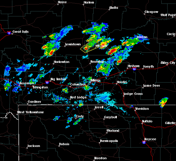 At 354 pm mdt, a severe thunderstorm was located near grass range, or 17 miles west of winnett, moving northeast at 25 mph (radar indicated). Hazards include 60 mph wind gusts and quarter size hail. Hail damage to vehicles is expected. Expect wind damage to roofs, siding, and trees. At 354 pm mdt, a severe thunderstorm was located near grass range, or 17 miles west of winnett, moving northeast at 25 mph (radar indicated). Hazards include 60 mph wind gusts and quarter size hail. Hail damage to vehicles is expected. Expect wind damage to roofs, siding, and trees.
|
| 6/21/2018 5:38 PM MDT |
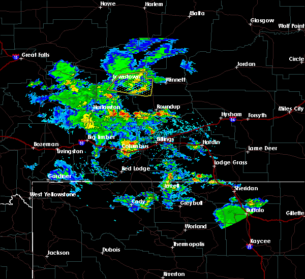 At 535 pm mdt, a severe thunderstorm was located near grass range, or 23 miles west of winnett, moving east at 25 mph (trained weather spotters have reported large amounts of pea to dime sized hail with some hail up to the size of quarters. rainfall amounts of one half to three quarters of an inch have also been reported). Hazards include 60 mph wind gusts and quarter size hail. Hail damage to vehicles is expected. expect wind damage to roofs, siding, and trees. Locations impacted include, grass range, giltedge, heath and forestgrove. At 535 pm mdt, a severe thunderstorm was located near grass range, or 23 miles west of winnett, moving east at 25 mph (trained weather spotters have reported large amounts of pea to dime sized hail with some hail up to the size of quarters. rainfall amounts of one half to three quarters of an inch have also been reported). Hazards include 60 mph wind gusts and quarter size hail. Hail damage to vehicles is expected. expect wind damage to roofs, siding, and trees. Locations impacted include, grass range, giltedge, heath and forestgrove.
|
| 6/21/2018 4:56 PM MDT |
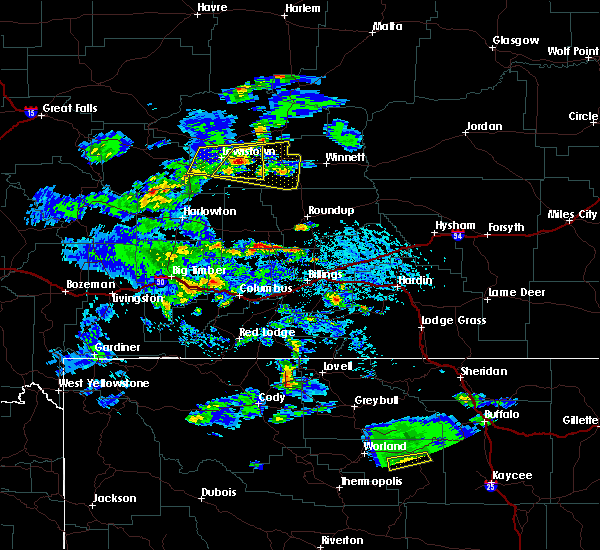 At 454 pm mdt, a severe thunderstorm was located 10 miles east of lewistown, moving east at 25 mph (trained weather spotters have reported hail to size of quarters in addition to large amounts of pea to dime size hail with this storm). Hazards include 60 mph wind gusts and quarter size hail. Hail damage to vehicles is expected. expect wind damage to roofs, siding, and trees. this severe thunderstorm will be near, grass range around 540 pm mdt. Other locations impacted by this severe thunderstorm include giltedge, heath and forestgrove. At 454 pm mdt, a severe thunderstorm was located 10 miles east of lewistown, moving east at 25 mph (trained weather spotters have reported hail to size of quarters in addition to large amounts of pea to dime size hail with this storm). Hazards include 60 mph wind gusts and quarter size hail. Hail damage to vehicles is expected. expect wind damage to roofs, siding, and trees. this severe thunderstorm will be near, grass range around 540 pm mdt. Other locations impacted by this severe thunderstorm include giltedge, heath and forestgrove.
|
| 6/7/2018 10:42 AM MDT |
 The severe thunderstorm warning for southeastern fergus county will expire at 1045 am mdt, the storm which prompted the warning has weakened below severe limits, and no longer poses an immediate threat to life or property. therefore, the warning will be allowed to expire. however heavy rain is still possible with this thunderstorm. to report severe weather, contact your nearest law enforcement agency. they will relay your report to the national weather service great falls. The severe thunderstorm warning for southeastern fergus county will expire at 1045 am mdt, the storm which prompted the warning has weakened below severe limits, and no longer poses an immediate threat to life or property. therefore, the warning will be allowed to expire. however heavy rain is still possible with this thunderstorm. to report severe weather, contact your nearest law enforcement agency. they will relay your report to the national weather service great falls.
|
| 6/7/2018 9:59 AM MDT |
 At 957 am mdt, a severe thunderstorm was located 20 miles south of grass range, or 24 miles northwest of roundup, moving northeast at 30 mph (radar indicated). Hazards include 60 mph wind gusts and quarter size hail. Hail damage to vehicles is expected. Expect wind damage to roofs, siding, and trees. At 957 am mdt, a severe thunderstorm was located 20 miles south of grass range, or 24 miles northwest of roundup, moving northeast at 30 mph (radar indicated). Hazards include 60 mph wind gusts and quarter size hail. Hail damage to vehicles is expected. Expect wind damage to roofs, siding, and trees.
|
| 6/4/2018 4:57 PM MDT |
 At 456 pm mdt, a severe thunderstorm was located 11 miles southeast of moore, or 12 miles south of lewistown, moving northeast at 35 mph (radar indicated). Hazards include 60 mph wind gusts and half dollar size hail. Hail damage to vehicles is expected. Expect wind damage to roofs, siding, and trees. At 456 pm mdt, a severe thunderstorm was located 11 miles southeast of moore, or 12 miles south of lewistown, moving northeast at 35 mph (radar indicated). Hazards include 60 mph wind gusts and half dollar size hail. Hail damage to vehicles is expected. Expect wind damage to roofs, siding, and trees.
|
| 6/12/2017 9:57 PM MDT |
 The severe thunderstorm warning for fergus county will expire at 1000 pm mdt, the storms which prompted the warning have weakened below severe limits, and no longer pose an immediate threat to life or property. therefore the warning will be allowed to expire. however gusty winds and heavy rain are still possible with these thunderstorms. The severe thunderstorm warning for fergus county will expire at 1000 pm mdt, the storms which prompted the warning have weakened below severe limits, and no longer pose an immediate threat to life or property. therefore the warning will be allowed to expire. however gusty winds and heavy rain are still possible with these thunderstorms.
|
| 6/12/2017 9:13 PM MDT |
 At 912 pm mdt, severe thunderstorms were located along a line extending from 12 miles east of denton to near grass range, moving north at 35 mph (wind gusts up to 60 mph were reported at lewistown airport and near grass range as these stormed moved through). Hazards include 60 mph wind gusts and penny size hail. expect damage to roofs, siding, and trees At 912 pm mdt, severe thunderstorms were located along a line extending from 12 miles east of denton to near grass range, moving north at 35 mph (wind gusts up to 60 mph were reported at lewistown airport and near grass range as these stormed moved through). Hazards include 60 mph wind gusts and penny size hail. expect damage to roofs, siding, and trees
|
| 6/12/2017 8:55 PM MDT | Storm damage reported in fergus county MT, 13.8 miles NNE of Grass Range, MT |
| 6/24/2016 4:10 PM MDT | Storm damage reported in fergus county MT, 14.4 miles NNE of Grass Range, MT |
| 6/9/2016 3:26 PM MDT |
 The severe thunderstorm warning for east central fergus county will expire at 330 pm mdt, the storm which prompted the warning has moved out of the area. therefore the warning will be allowed to expire. however small hail and gusty winds are still possible with this thunderstorm. a severe thunderstorm watch remains in effect until 1000 pm mdt for central montana. remember, a severe thunderstorm warning still remains in effect for central musselshell county in central montana, northern yellowstone county in south central montana,. The severe thunderstorm warning for east central fergus county will expire at 330 pm mdt, the storm which prompted the warning has moved out of the area. therefore the warning will be allowed to expire. however small hail and gusty winds are still possible with this thunderstorm. a severe thunderstorm watch remains in effect until 1000 pm mdt for central montana. remember, a severe thunderstorm warning still remains in effect for central musselshell county in central montana, northern yellowstone county in south central montana,.
|
| 6/9/2016 3:18 PM MDT | Quarter sized hail reported 14.3 miles SW of Grass Range, MT |
| 6/9/2016 3:12 PM MDT | Quarter sized hail reported 10.7 miles S of Grass Range, MT |
| 6/9/2016 3:12 PM MDT |
 At 312 pm mdt, a severe thunderstorm was located 10 miles northeast of grass range, or 20 miles northwest of winnett, moving east at 40 mph (trained weather spotters). Hazards include two inch hail and 60 mph wind gusts. People and animals outdoors will be injured. expect hail damage to roofs, siding, windows, and vehicles. expect wind damage to roofs, siding, and trees. Locations impacted include, grass range. At 312 pm mdt, a severe thunderstorm was located 10 miles northeast of grass range, or 20 miles northwest of winnett, moving east at 40 mph (trained weather spotters). Hazards include two inch hail and 60 mph wind gusts. People and animals outdoors will be injured. expect hail damage to roofs, siding, windows, and vehicles. expect wind damage to roofs, siding, and trees. Locations impacted include, grass range.
|
| 6/9/2016 2:57 PM MDT |
 At 257 pm mdt, a severe thunderstorm was located 11 miles south of roy, or 25 miles east of lewistown, moving east at 50 mph (radar indicated). Hazards include ping pong ball size hail and 60 mph wind gusts. People and animals outdoors will be injured. expect hail damage to roofs, siding, windows, and vehicles. Expect wind damage to roofs, siding, and trees. At 257 pm mdt, a severe thunderstorm was located 11 miles south of roy, or 25 miles east of lewistown, moving east at 50 mph (radar indicated). Hazards include ping pong ball size hail and 60 mph wind gusts. People and animals outdoors will be injured. expect hail damage to roofs, siding, windows, and vehicles. Expect wind damage to roofs, siding, and trees.
|
| 6/3/2014 3:10 PM MDT | Quarter sized hail reported 15.3 miles NE of Grass Range, MT, hail covered the ground. still looks like it snowed at report time. |
| 8/3/2013 4:14 PM MDT | Quarter sized hail reported 0.3 miles SSW of Grass Range, MT |
| 8/3/2013 4:14 PM MDT | Half Dollar sized hail reported 0.3 miles SSW of Grass Range, MT |
| 7/4/2013 2:55 PM MDT | Ping Pong Ball sized hail reported 16.8 miles NNW of Grass Range, MT, ping pong size hail falling on highway 191 near mile marker 29. |
Hail Maps for Grass Range, MT
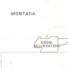
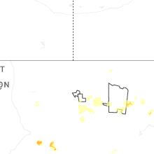
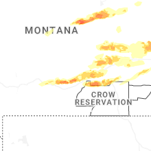
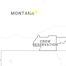
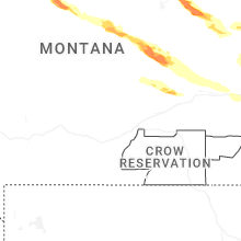
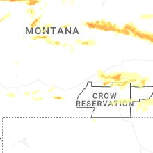


Connect with Interactive Hail Maps