

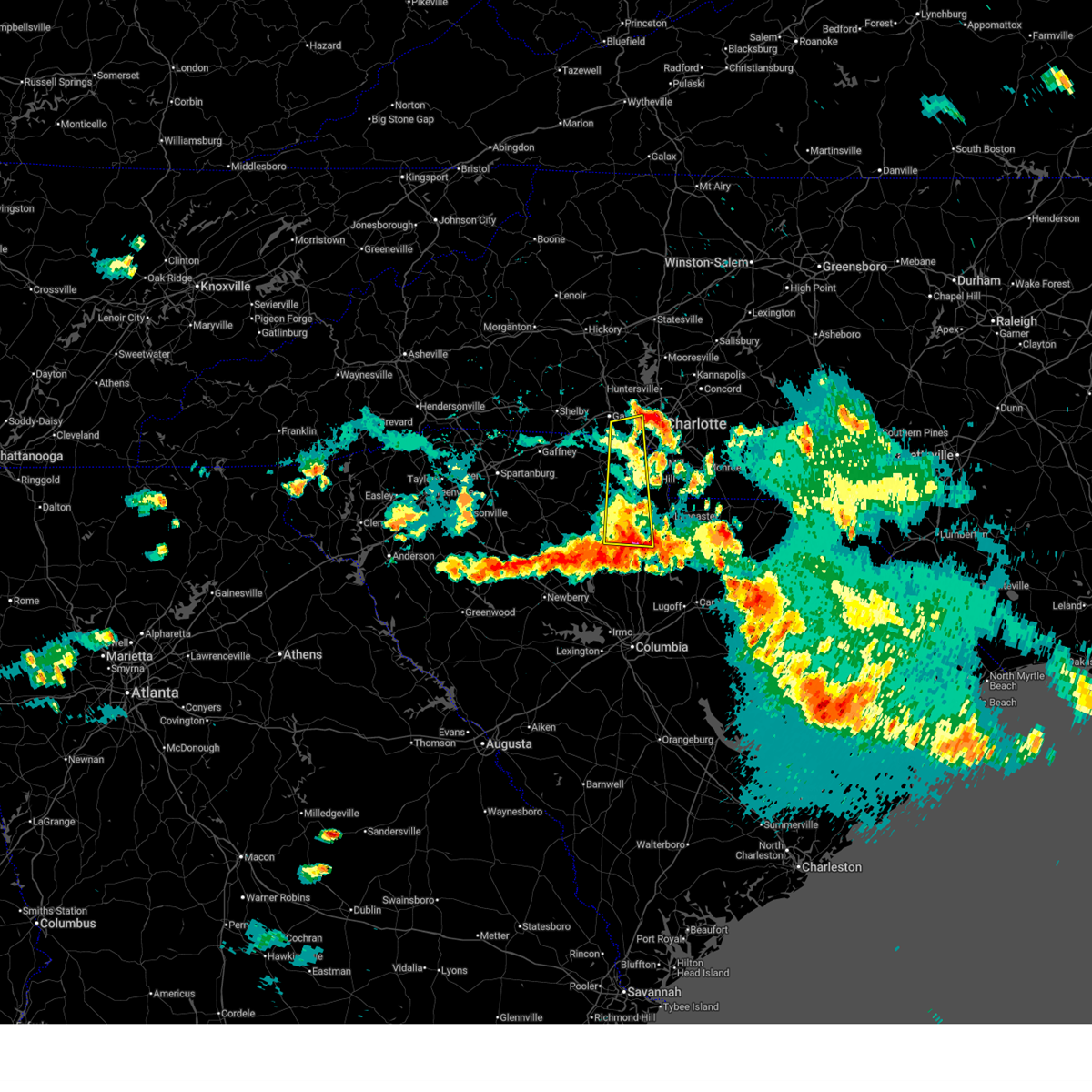
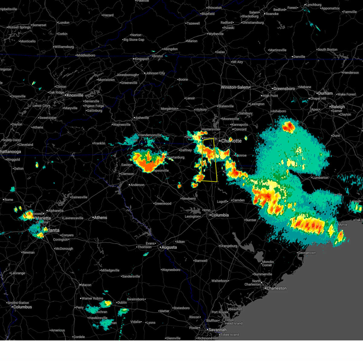
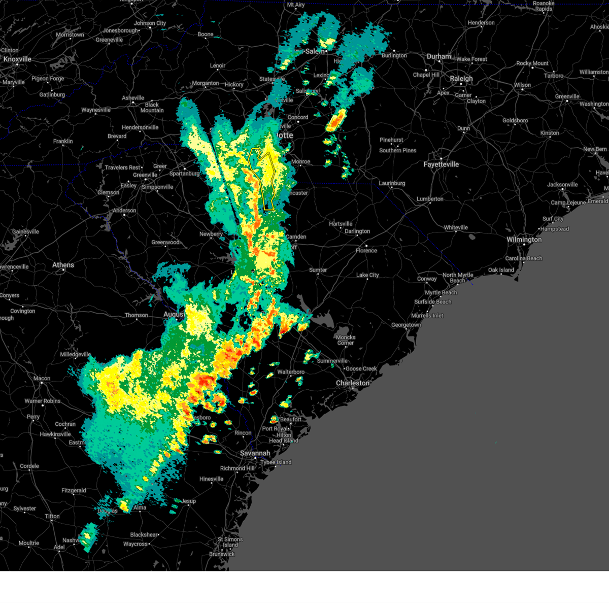
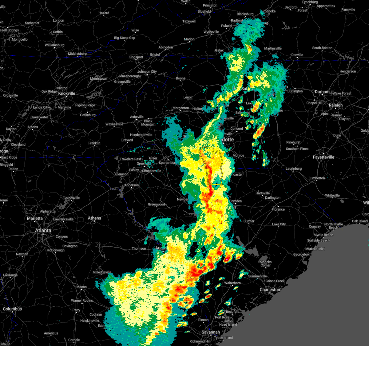
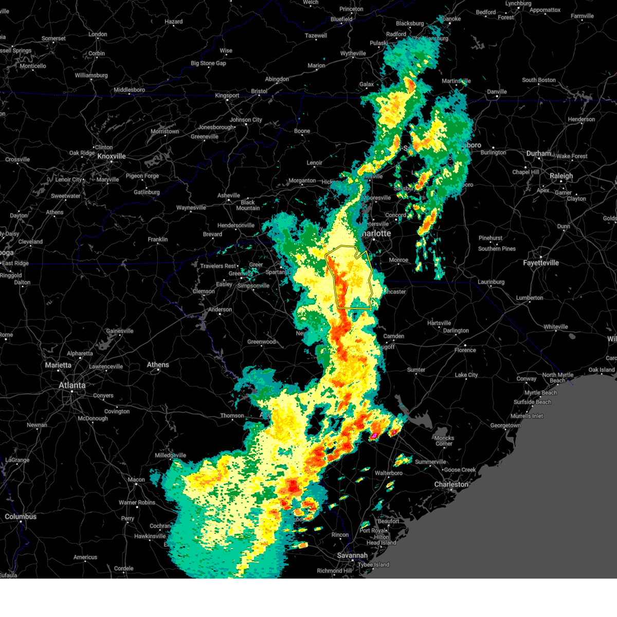
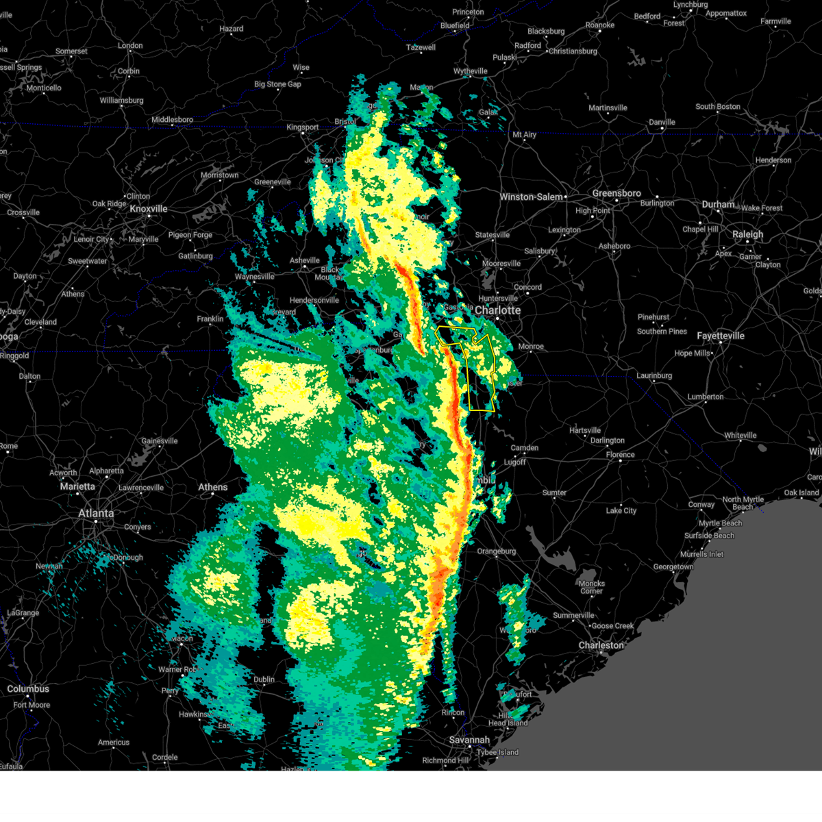
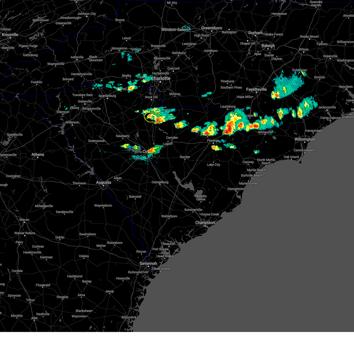
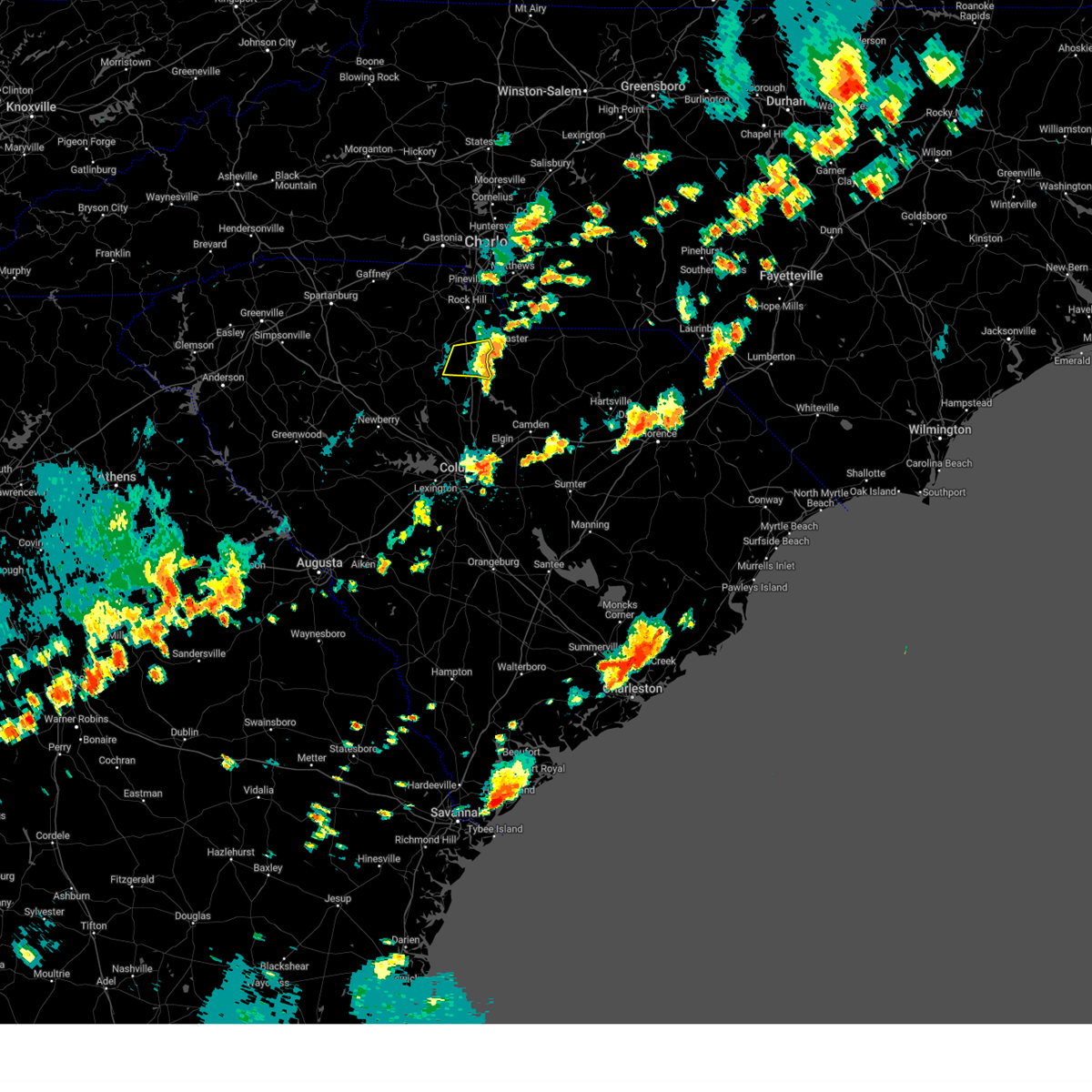
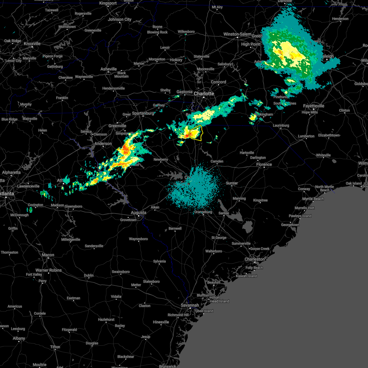
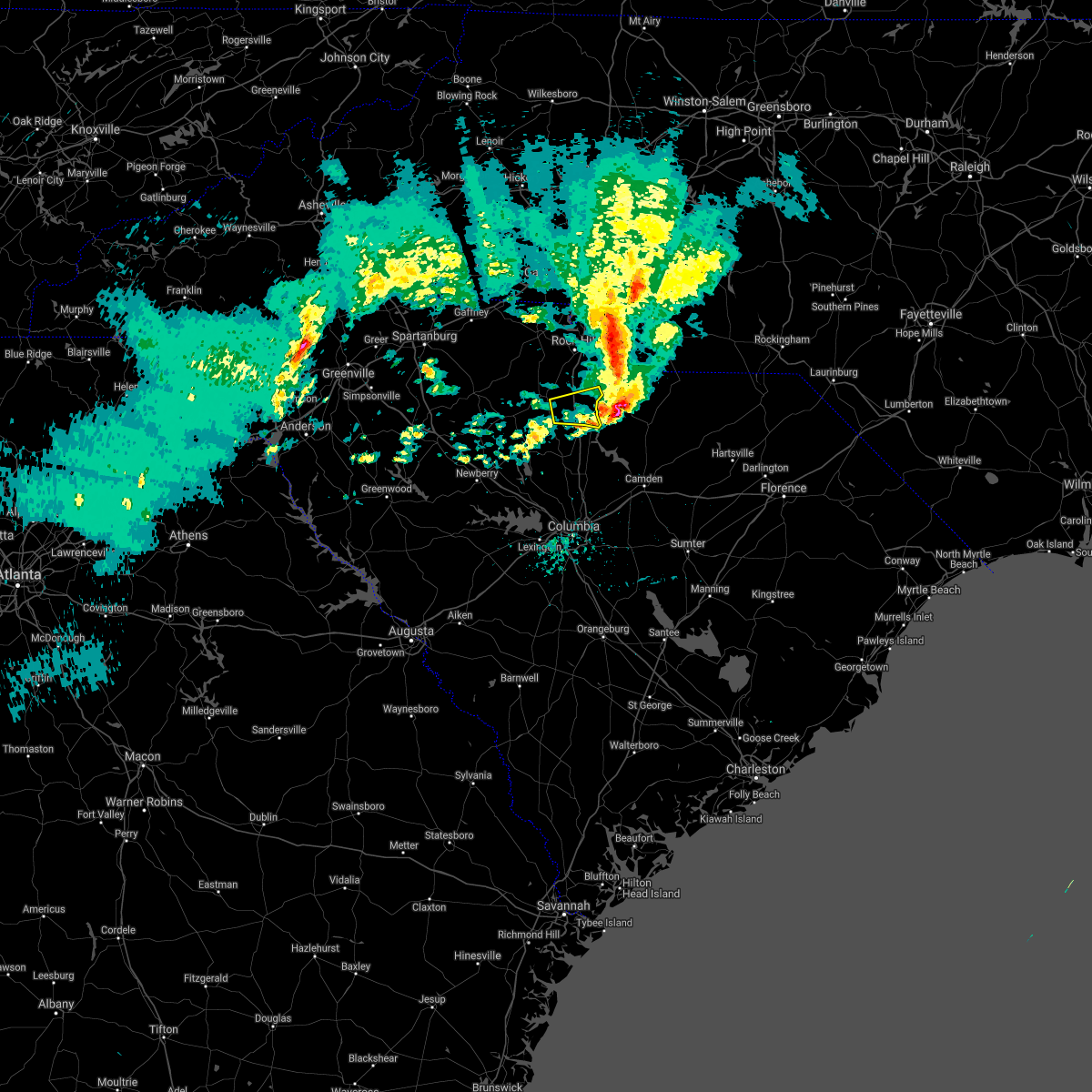
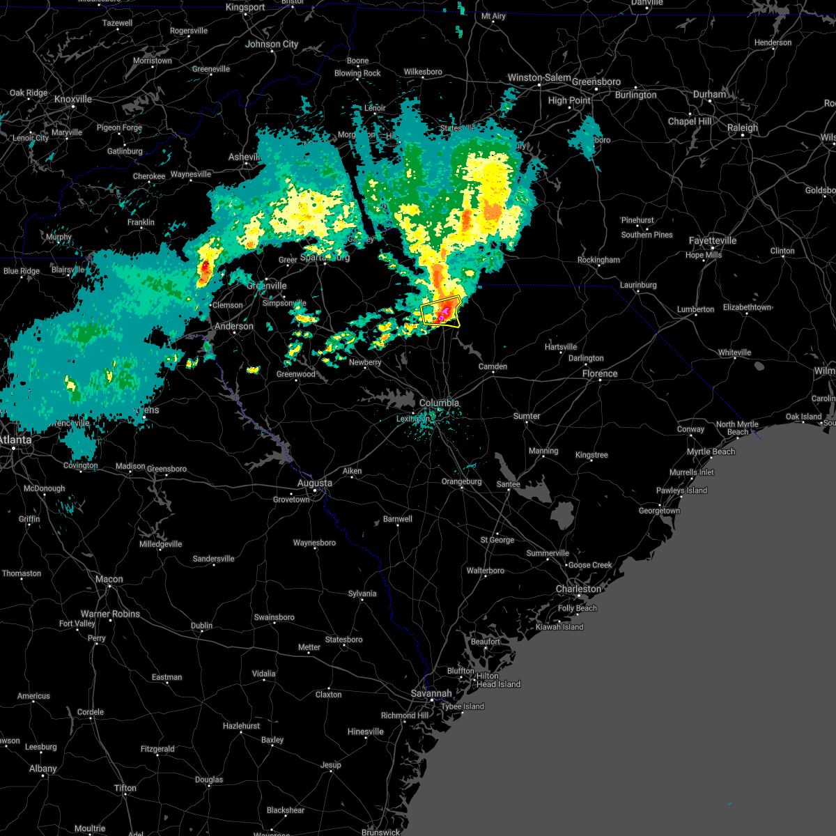
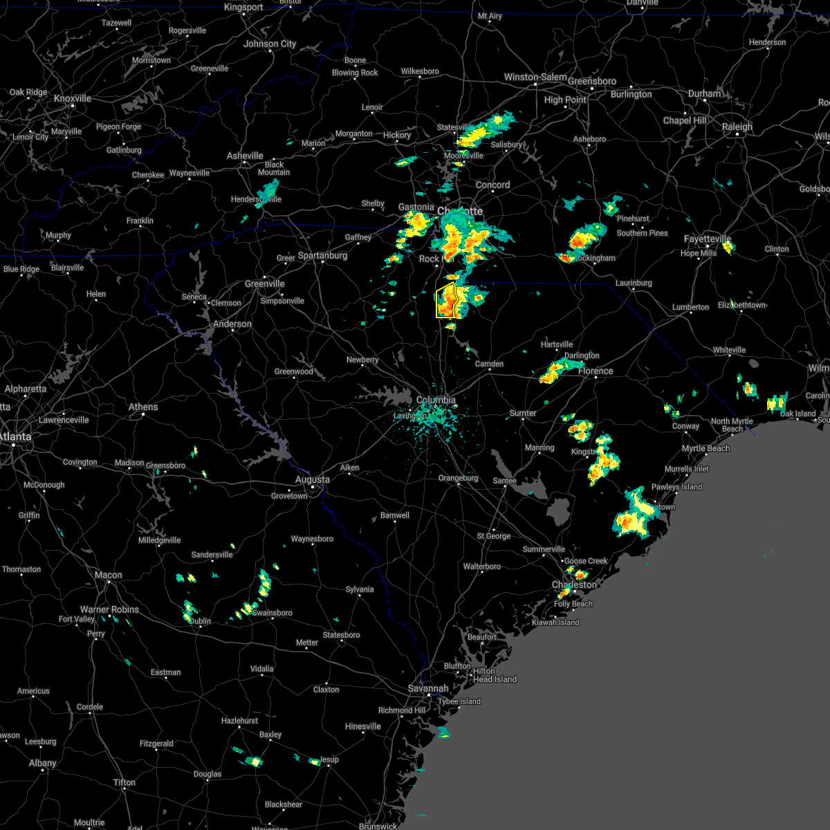
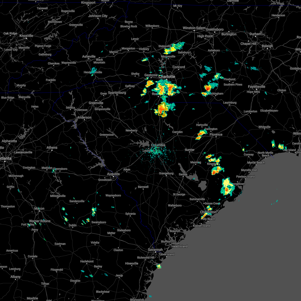
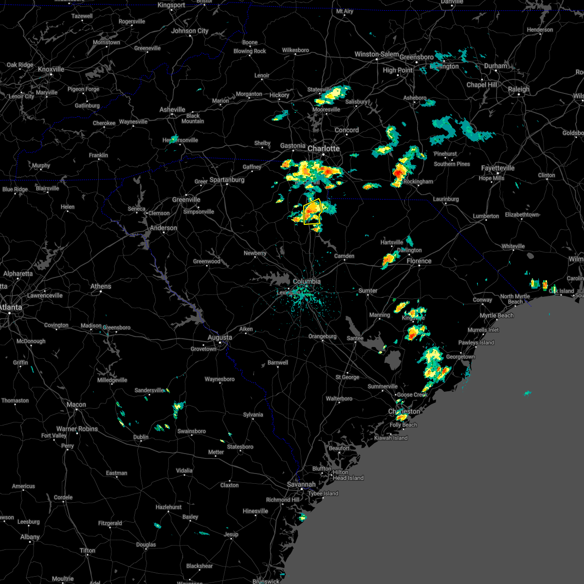
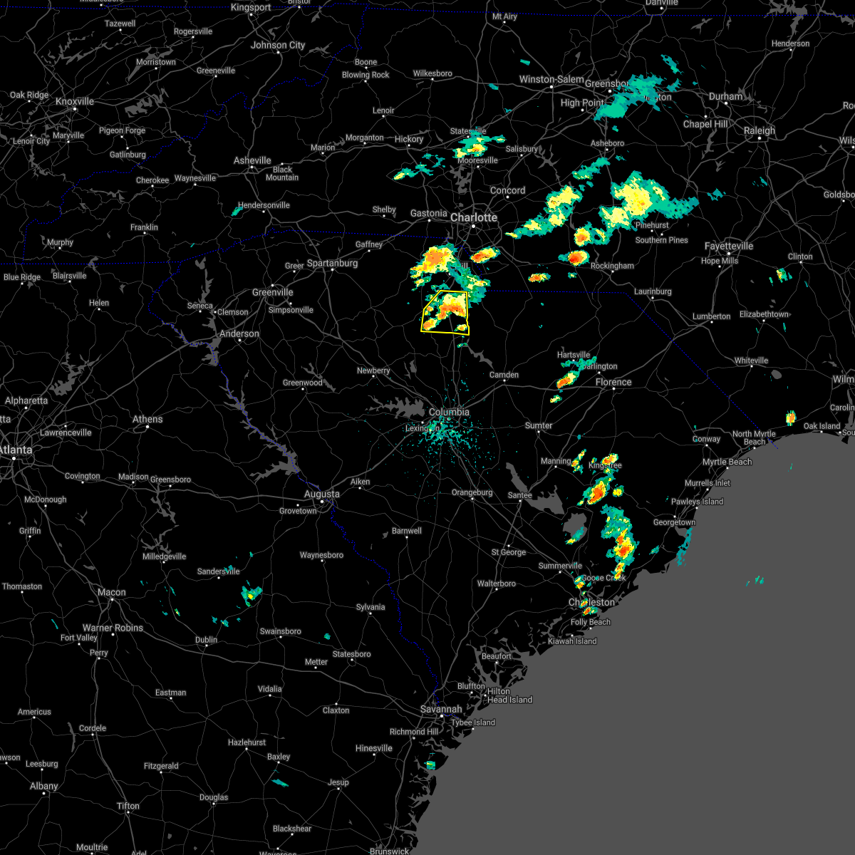
Hail Map for Great Falls, SC
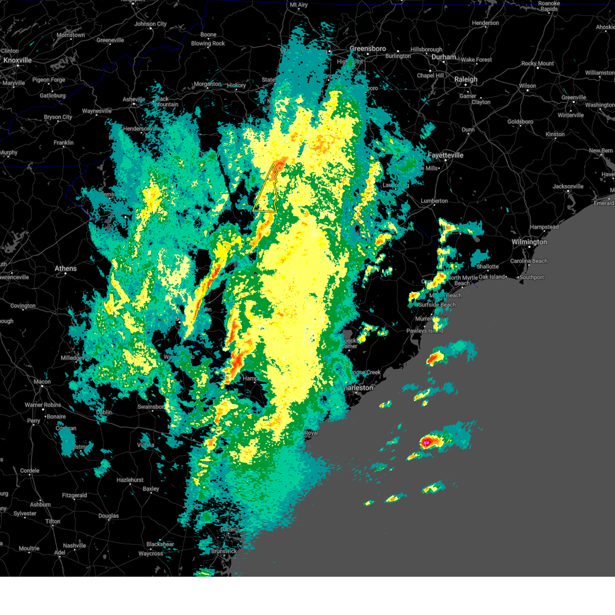
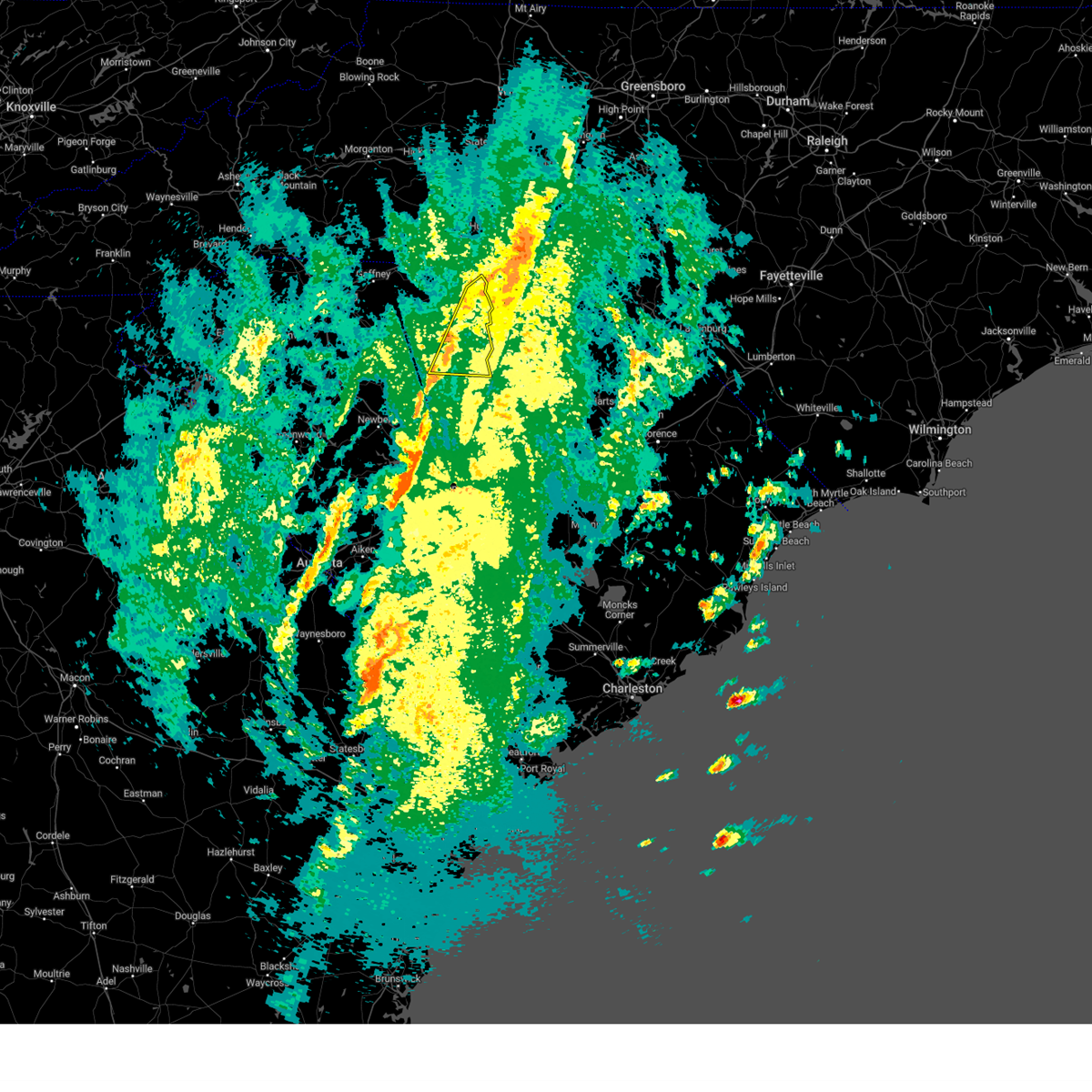
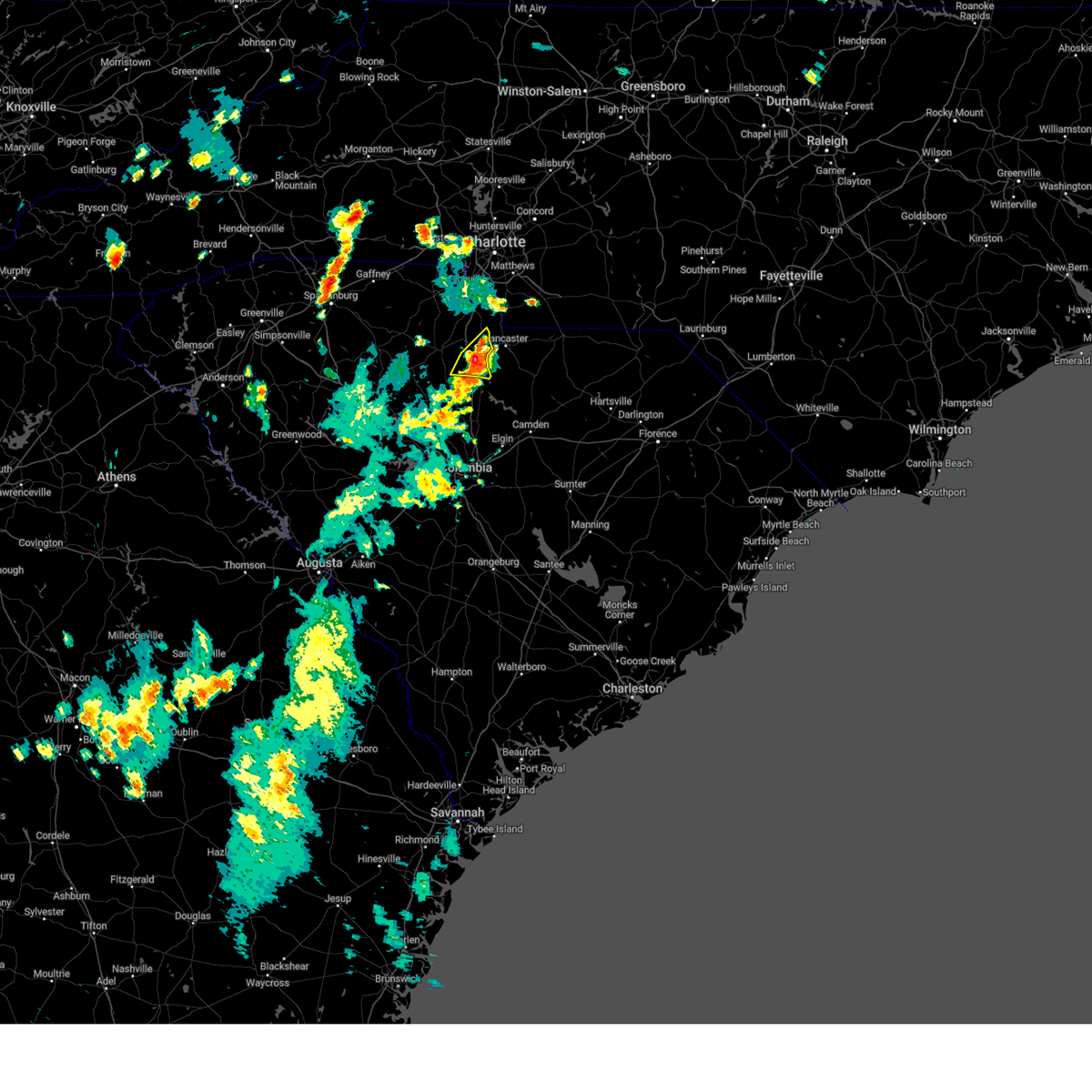
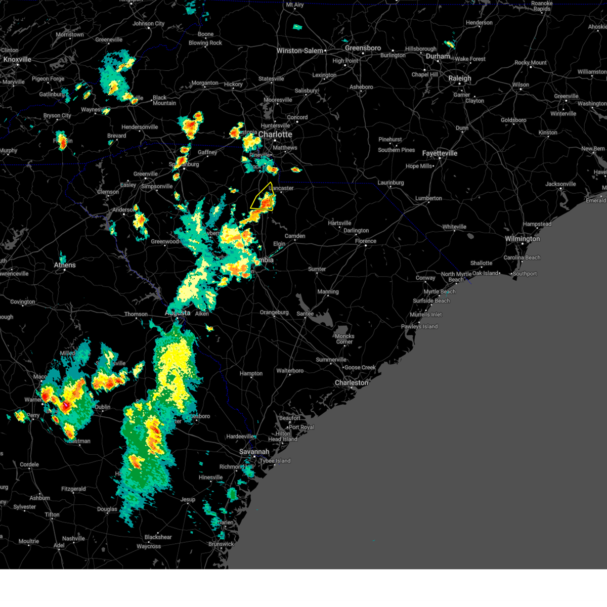
The Great Falls, SC area has had 4 reports of on-the-ground hail by trained spotters, and has been under severe weather warnings 23 times during the past 12 months. Doppler radar has detected hail at or near Great Falls, SC on 50 occasions, including 2 occasions during the past year.
| Name: | Great Falls, SC |
| Where Located: | 45 miles S of Charlotte, NC |
| Map: | Google Map for Great Falls, SC |
| Population: | 1979 |
| Housing Units: | 944 |
| More Info: | Search Google for Great Falls, SC |
1
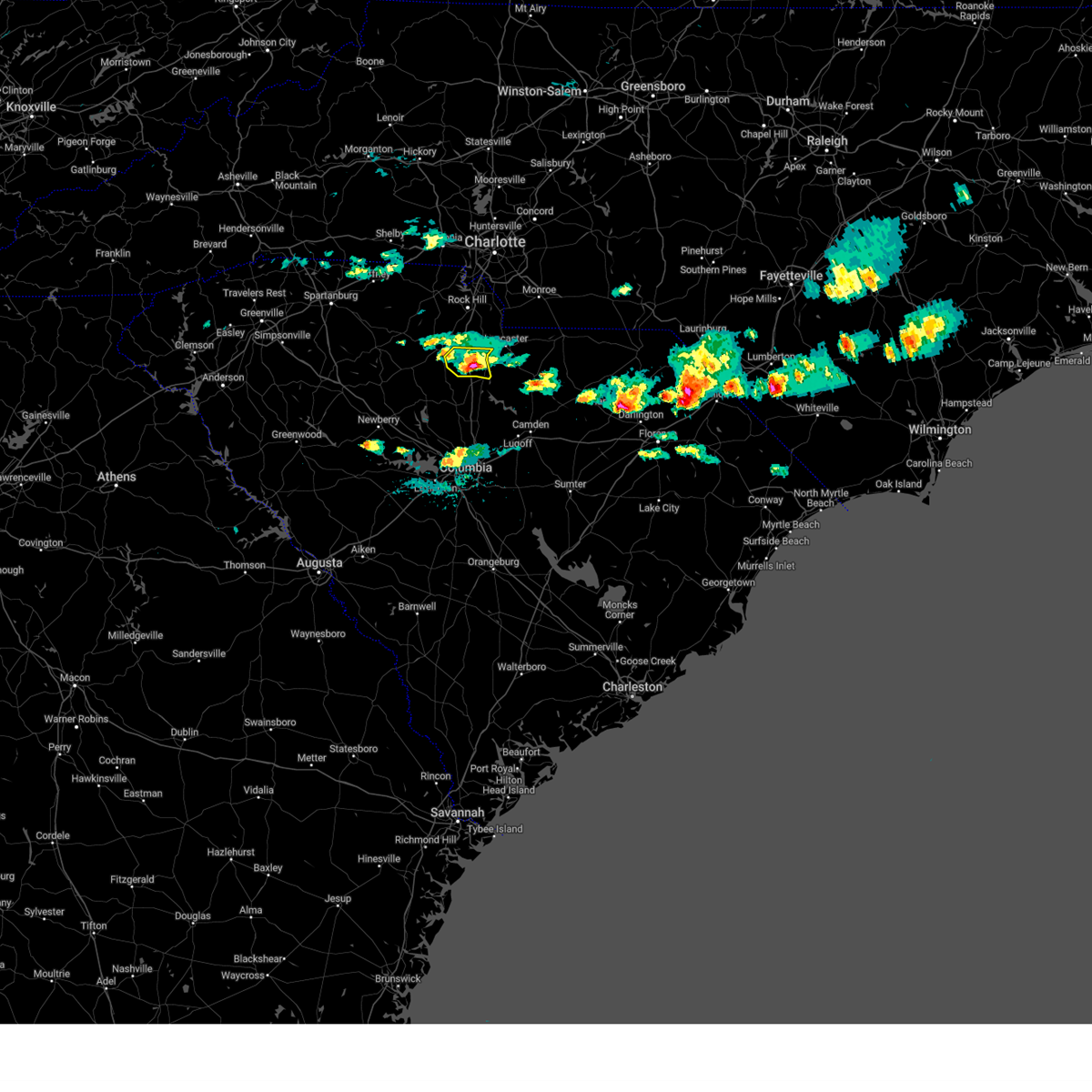
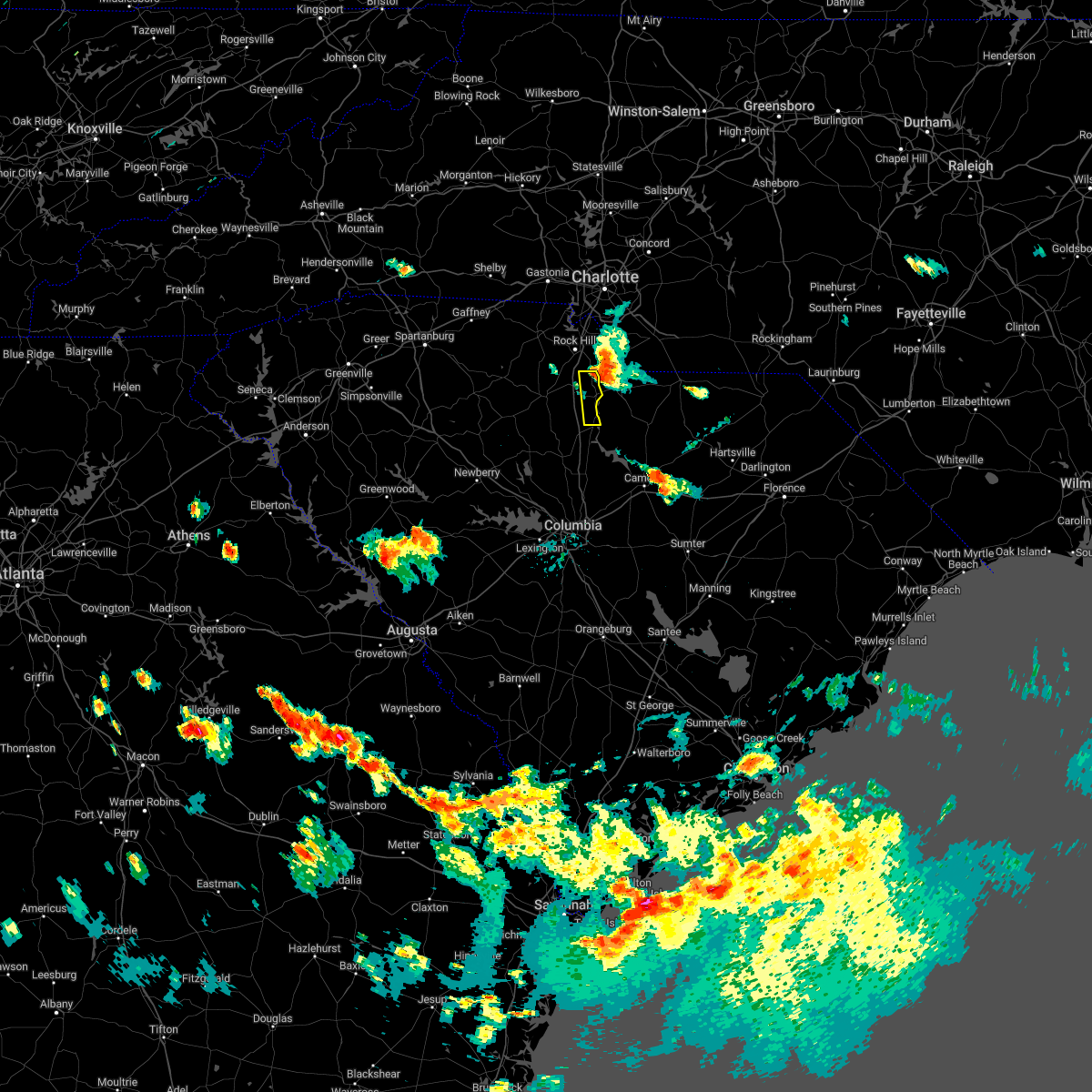
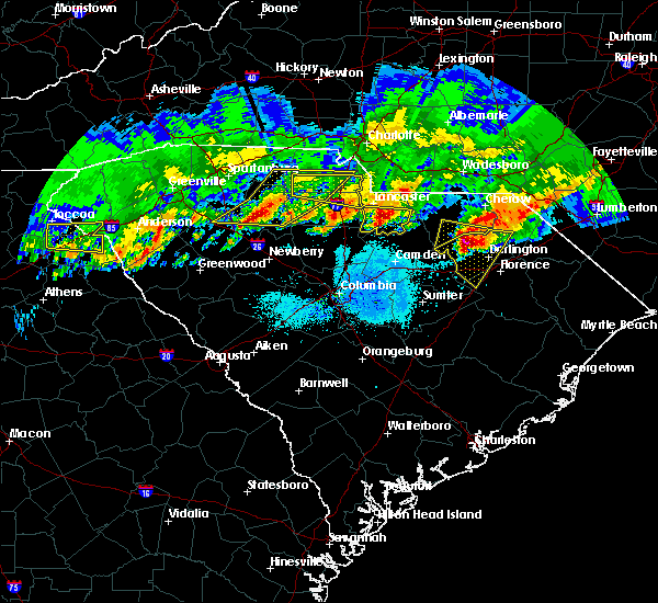
The Top Recent Hail Date for Great Falls, SC is Wednesday, June 25, 2025 (14th out of 50)

Hail and Wind Damage Spotted near Great Falls, SC
| Date / Time | Report Details |
|---|---|
| 6/25/2025 8:01 PM EDT |
 the severe thunderstorm warning has been cancelled and is no longer in effect the severe thunderstorm warning has been cancelled and is no longer in effect
|
| 6/25/2025 7:12 PM EDT |
 Svrgsp the national weather service in greenville-spartanburg has issued a * severe thunderstorm warning for, southwestern mecklenburg county in the piedmont of north carolina, southeastern gaston county in the piedmont of north carolina, eastern chester county in upstate south carolina, eastern york county in upstate south carolina, * until 815 pm edt. * at 712 pm edt, a severe thunderstorm was located near rock hill, moving south at 15 mph (radar indicated). Hazards include ping pong ball size hail and 60 mph wind gusts. People and animals outdoors will be injured. expect hail damage to roofs, siding, windows, and vehicles. Expect wind damage to trees and power lines. Svrgsp the national weather service in greenville-spartanburg has issued a * severe thunderstorm warning for, southwestern mecklenburg county in the piedmont of north carolina, southeastern gaston county in the piedmont of north carolina, eastern chester county in upstate south carolina, eastern york county in upstate south carolina, * until 815 pm edt. * at 712 pm edt, a severe thunderstorm was located near rock hill, moving south at 15 mph (radar indicated). Hazards include ping pong ball size hail and 60 mph wind gusts. People and animals outdoors will be injured. expect hail damage to roofs, siding, windows, and vehicles. Expect wind damage to trees and power lines.
|
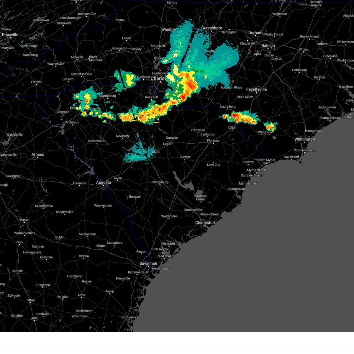
| 6/17/2025 10:36 PM EDT | The storms which prompted the warning have weakened below severe limits, and no longer pose an immediate threat to life or property. therefore, the warning will be allowed to expire. however, gusty winds are still possible with these thunderstorms. |
| 6/17/2025 10:24 PM EDT |
 the severe thunderstorm warning has been cancelled and is no longer in effect the severe thunderstorm warning has been cancelled and is no longer in effect
|
| 6/17/2025 10:24 PM EDT |
 At 1024 pm edt, severe thunderstorms were located along a line extending from 7 miles east of morganton to 6 miles southwest of newton to 8 miles southwest of gastonia to near chester, moving northeast at 45 mph (radar indicated). Hazards include 60 mph wind gusts. Expect damage to trees and power lines. locations impacted include, gastonia, rock hill, hickory, morganton, newton, lincolnton, york, chester, mt holly, and st. Stephens. At 1024 pm edt, severe thunderstorms were located along a line extending from 7 miles east of morganton to 6 miles southwest of newton to 8 miles southwest of gastonia to near chester, moving northeast at 45 mph (radar indicated). Hazards include 60 mph wind gusts. Expect damage to trees and power lines. locations impacted include, gastonia, rock hill, hickory, morganton, newton, lincolnton, york, chester, mt holly, and st. Stephens.
|
| 6/17/2025 10:18 PM EDT |
 At 1018 pm edt, severe thunderstorms were located along a line extending from 4 miles southeast of morganton to 9 miles northwest of lincolnton to 9 miles northwest of york to 5 miles west of chester, moving east at 50 mph (radar indicated). Hazards include 60 mph wind gusts. Expect damage to trees and power lines. Locations impacted include, gastonia, rock hill, hickory, shelby, morganton, newton, gaffney, lincolnton, union, and york. At 1018 pm edt, severe thunderstorms were located along a line extending from 4 miles southeast of morganton to 9 miles northwest of lincolnton to 9 miles northwest of york to 5 miles west of chester, moving east at 50 mph (radar indicated). Hazards include 60 mph wind gusts. Expect damage to trees and power lines. Locations impacted include, gastonia, rock hill, hickory, shelby, morganton, newton, gaffney, lincolnton, union, and york.
|
| 6/17/2025 10:02 PM EDT | At 1002 pm edt, severe thunderstorms were located along a line extending from 9 miles southwest of morganton to 14 miles north of shelby to 11 miles east of gaffney to 11 miles southeast of union, moving east at 50 mph (radar indicated). Hazards include 60 mph wind gusts. Expect damage to trees and power lines. Locations impacted include, gastonia, rock hill, hickory, shelby, morganton, newton, gaffney, lincolnton, union, and york. |
| 6/17/2025 10:02 PM EDT | the severe thunderstorm warning has been cancelled and is no longer in effect |
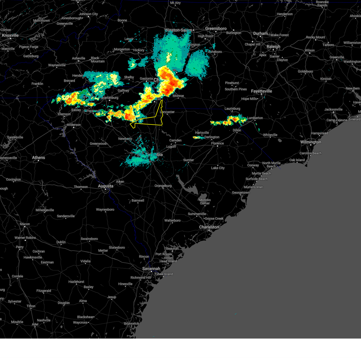
| 6/17/2025 9:43 PM EDT |
 Svrgsp the national weather service in greenville-spartanburg has issued a * severe thunderstorm warning for, catawba county in the piedmont of north carolina, rutherford county in western north carolina, lincoln county in the piedmont of north carolina, gaston county in the piedmont of north carolina, southeastern mcdowell county in western north carolina, cleveland county in the piedmont of north carolina, southern burke county in western north carolina, southeastern laurens county in upstate south carolina, union county in upstate south carolina, chester county in upstate south carolina, york county in upstate south carolina, eastern spartanburg county in upstate south carolina, cherokee county in upstate south carolina, * until 1045 pm edt. * at 943 pm edt, severe thunderstorms were located along a line extending from 10 miles north of rutherfordton to 10 miles east of forest city to 9 miles south of gaffney to 13 miles south of union, moving northeast at 50 mph (radar indicated). Hazards include 60 mph wind gusts. expect damage to trees and power lines Svrgsp the national weather service in greenville-spartanburg has issued a * severe thunderstorm warning for, catawba county in the piedmont of north carolina, rutherford county in western north carolina, lincoln county in the piedmont of north carolina, gaston county in the piedmont of north carolina, southeastern mcdowell county in western north carolina, cleveland county in the piedmont of north carolina, southern burke county in western north carolina, southeastern laurens county in upstate south carolina, union county in upstate south carolina, chester county in upstate south carolina, york county in upstate south carolina, eastern spartanburg county in upstate south carolina, cherokee county in upstate south carolina, * until 1045 pm edt. * at 943 pm edt, severe thunderstorms were located along a line extending from 10 miles north of rutherfordton to 10 miles east of forest city to 9 miles south of gaffney to 13 miles south of union, moving northeast at 50 mph (radar indicated). Hazards include 60 mph wind gusts. expect damage to trees and power lines
|
| 3/31/2025 5:04 PM EDT |
 At 503 pm edt, severe thunderstorms were located along a line extending from 10 miles southeast of gastonia to near indian land to 12 miles northeast of springdale, moving northeast at 60 mph (radar indicated). Hazards include 60 mph wind gusts. Expect damage to trees and power lines. Locations impacted include, newport, lesslie, catawba, edgemoor, tega cay, lake wylie, fort lawn, fort mill, great falls, and rock hill. At 503 pm edt, severe thunderstorms were located along a line extending from 10 miles southeast of gastonia to near indian land to 12 miles northeast of springdale, moving northeast at 60 mph (radar indicated). Hazards include 60 mph wind gusts. Expect damage to trees and power lines. Locations impacted include, newport, lesslie, catawba, edgemoor, tega cay, lake wylie, fort lawn, fort mill, great falls, and rock hill.
|
| 3/31/2025 4:52 PM EDT |
 At 451 pm edt, severe thunderstorms were located along a line extending from 4 miles north of york to near rock hill to 5 miles northeast of winnsboro, moving northeast at 60 mph (radar indicated). Hazards include 60 mph wind gusts. Expect damage to trees and power lines. Locations impacted include, newport, richburg, york, edgemoor, clover, tega cay, fort mill, great falls, rock hill, and lesslie. At 451 pm edt, severe thunderstorms were located along a line extending from 4 miles north of york to near rock hill to 5 miles northeast of winnsboro, moving northeast at 60 mph (radar indicated). Hazards include 60 mph wind gusts. Expect damage to trees and power lines. Locations impacted include, newport, richburg, york, edgemoor, clover, tega cay, fort mill, great falls, rock hill, and lesslie.
|
| 3/31/2025 4:44 PM EDT |
 At 444 pm edt, severe thunderstorms were located along a line extending from 17 miles east of gaffney to 7 miles southeast of york to 4 miles northwest of winnsboro, moving northeast at 55 mph (radar indicated). Hazards include 60 mph wind gusts. Expect damage to trees and power lines. Locations impacted include, newport, chester state park, richburg, york, cornwell, edgemoor, clover, tega cay, fort mill, and sharon. At 444 pm edt, severe thunderstorms were located along a line extending from 17 miles east of gaffney to 7 miles southeast of york to 4 miles northwest of winnsboro, moving northeast at 55 mph (radar indicated). Hazards include 60 mph wind gusts. Expect damage to trees and power lines. Locations impacted include, newport, chester state park, richburg, york, cornwell, edgemoor, clover, tega cay, fort mill, and sharon.
|
| 3/31/2025 4:23 PM EDT | Svrgsp the national weather service in greenville-spartanburg has issued a * severe thunderstorm warning for, chester county in upstate south carolina, york county in upstate south carolina, * until 515 pm edt. * at 422 pm edt, severe thunderstorms were located along a line extending from 7 miles south of gaffney to 11 miles northeast of union to 7 miles west of vc summer nuclear station, moving northeast at 60 mph (radar indicated). Hazards include 60 mph wind gusts. expect damage to trees and power lines |
| 3/5/2025 8:05 AM EST |
 the severe thunderstorm warning has been cancelled and is no longer in effect the severe thunderstorm warning has been cancelled and is no longer in effect
|
| 3/5/2025 8:05 AM EST |
 At 804 am est, severe thunderstorms were located along a line extending from 3 miles southwest of huntersville to 13 miles southwest of lancaster, moving east at 40 mph (radar indicated). Hazards include 60 mph wind gusts. Expect damage to trees and power lines. Locations impacted include, charlotte, charlotte douglas airport, edgemoor, lesslie, freedom park, richburg, and the plaza. At 804 am est, severe thunderstorms were located along a line extending from 3 miles southwest of huntersville to 13 miles southwest of lancaster, moving east at 40 mph (radar indicated). Hazards include 60 mph wind gusts. Expect damage to trees and power lines. Locations impacted include, charlotte, charlotte douglas airport, edgemoor, lesslie, freedom park, richburg, and the plaza.
|
| 3/5/2025 7:45 AM EST |
 Svrgsp the national weather service in greenville-spartanburg has issued a * severe thunderstorm warning for, western mecklenburg county in the piedmont of north carolina, southeastern gaston county in the piedmont of north carolina, eastern chester county in upstate south carolina, eastern york county in upstate south carolina, * until 815 am est. * at 745 am est, severe thunderstorms were located along a line extending from 7 miles east of gastonia to 5 miles southeast of chester, moving northeast at 40 mph (radar indicated). Hazards include 60 mph wind gusts. expect damage to trees and power lines Svrgsp the national weather service in greenville-spartanburg has issued a * severe thunderstorm warning for, western mecklenburg county in the piedmont of north carolina, southeastern gaston county in the piedmont of north carolina, eastern chester county in upstate south carolina, eastern york county in upstate south carolina, * until 815 am est. * at 745 am est, severe thunderstorms were located along a line extending from 7 miles east of gastonia to 5 miles southeast of chester, moving northeast at 40 mph (radar indicated). Hazards include 60 mph wind gusts. expect damage to trees and power lines
|
| 2/16/2025 7:24 AM EST | Sc highway patrol reported tree down on i-77 south of heritage r in fairfield county SC, 5.8 miles ENE of Great Falls, SC |
| 12/29/2024 9:19 AM EST |
 At 919 am est, severe thunderstorms were located along a line extending from 9 miles east of gastonia to 6 miles southwest of uptown charlotte to 8 miles northwest of lancaster, moving northeast at 60 mph (radar indicated). Hazards include 60 mph wind gusts. Expect damage to trees and power lines. Locations impacted include, fort mill, tega cay, lesslie, great falls, fort lawn, catawba, carowinds, fishing creek reservoir, rock hill, and lake wylie. At 919 am est, severe thunderstorms were located along a line extending from 9 miles east of gastonia to 6 miles southwest of uptown charlotte to 8 miles northwest of lancaster, moving northeast at 60 mph (radar indicated). Hazards include 60 mph wind gusts. Expect damage to trees and power lines. Locations impacted include, fort mill, tega cay, lesslie, great falls, fort lawn, catawba, carowinds, fishing creek reservoir, rock hill, and lake wylie.
|
| 12/29/2024 9:07 AM EST |
 the severe thunderstorm warning has been cancelled and is no longer in effect the severe thunderstorm warning has been cancelled and is no longer in effect
|
| 12/29/2024 9:07 AM EST |
 At 907 am est, severe thunderstorms were located along a line extending from 7 miles south of gastonia to 6 miles north of rock hill to 12 miles west of lancaster, moving northeast at 60 mph (radar indicated). Hazards include 60 mph wind gusts. Expect damage to trees and power lines. Locations impacted include, rock hill, fort mill, tega cay, clover, newport, lesslie, great falls, fort lawn, richburg, and kings mountain state park. At 907 am est, severe thunderstorms were located along a line extending from 7 miles south of gastonia to 6 miles north of rock hill to 12 miles west of lancaster, moving northeast at 60 mph (radar indicated). Hazards include 60 mph wind gusts. Expect damage to trees and power lines. Locations impacted include, rock hill, fort mill, tega cay, clover, newport, lesslie, great falls, fort lawn, richburg, and kings mountain state park.
|
| 12/29/2024 8:54 AM EST |
 At 854 am est, severe thunderstorms were located along a line extending from 3 miles northwest of york to 8 miles west of rock hill to 10 miles south of chester, moving northeast at 55 mph (radar indicated). Hazards include 60 mph wind gusts. Expect damage to trees and power lines. Locations impacted include, rock hill, york, chester, fort mill, tega cay, clover, newport, lesslie, great falls, and fort lawn. At 854 am est, severe thunderstorms were located along a line extending from 3 miles northwest of york to 8 miles west of rock hill to 10 miles south of chester, moving northeast at 55 mph (radar indicated). Hazards include 60 mph wind gusts. Expect damage to trees and power lines. Locations impacted include, rock hill, york, chester, fort mill, tega cay, clover, newport, lesslie, great falls, and fort lawn.
|
| 12/29/2024 8:45 AM EST |
 At 845 am est, severe thunderstorms were located along a line extending from 13 miles east of gaffney to 6 miles southwest of york to 9 miles southwest of chester, moving northeast at 60 mph (radar indicated). Hazards include 60 mph wind gusts. Expect damage to trees and power lines. Locations impacted include, rock hill, york, chester, fort mill, tega cay, clover, newport, lesslie, great falls, and fort lawn. At 845 am est, severe thunderstorms were located along a line extending from 13 miles east of gaffney to 6 miles southwest of york to 9 miles southwest of chester, moving northeast at 60 mph (radar indicated). Hazards include 60 mph wind gusts. Expect damage to trees and power lines. Locations impacted include, rock hill, york, chester, fort mill, tega cay, clover, newport, lesslie, great falls, and fort lawn.
|
| 12/29/2024 8:45 AM EST |
 the severe thunderstorm warning has been cancelled and is no longer in effect the severe thunderstorm warning has been cancelled and is no longer in effect
|
| 12/29/2024 8:17 AM EST |
 Svrgsp the national weather service in greenville-spartanburg has issued a * severe thunderstorm warning for, chester county in upstate south carolina, york county in upstate south carolina, southeastern cherokee county in upstate south carolina, union county in upstate south carolina, * until 930 am est. * at 817 am est, severe thunderstorms were located along a line extending from 16 miles southeast of spartanburg to 6 miles south of union to near newberry, moving northeast at 60 mph (radar indicated). Hazards include 60 mph wind gusts. expect damage to trees and power lines Svrgsp the national weather service in greenville-spartanburg has issued a * severe thunderstorm warning for, chester county in upstate south carolina, york county in upstate south carolina, southeastern cherokee county in upstate south carolina, union county in upstate south carolina, * until 930 am est. * at 817 am est, severe thunderstorms were located along a line extending from 16 miles southeast of spartanburg to 6 miles south of union to near newberry, moving northeast at 60 mph (radar indicated). Hazards include 60 mph wind gusts. expect damage to trees and power lines
|
| 6/9/2024 9:35 PM EDT | The storms which prompted the warning have moved out of the area. therefore, the warning will be allowed to expire. to report severe weather to the national weather service greenville-spartanburg, call toll free, 1, 800, 2 6 7, 8 1 0 1, or post on our facebook page, or tweet it using hashtag nwsgsp. your message should describe the event and the specific location where it occurred. |
| 6/9/2024 9:04 PM EDT | Gas station canopy blown over. time estimated from rada in chester county SC, 0.6 miles SSE of Great Falls, SC |
| 6/9/2024 8:51 PM EDT |
 Svrgsp the national weather service in greenville-spartanburg has issued a * severe thunderstorm warning for, chester county in upstate south carolina, southeastern york county in upstate south carolina, * until 945 pm edt. * at 851 pm edt, severe thunderstorms were located along a line extending from 8 miles northwest of lancaster to 13 miles southeast of union, moving southeast at 40 mph (radar indicated). Hazards include 60 mph wind gusts and quarter size hail. Minor hail damage to vehicles is expected. Expect wind damage to trees and power lines. Svrgsp the national weather service in greenville-spartanburg has issued a * severe thunderstorm warning for, chester county in upstate south carolina, southeastern york county in upstate south carolina, * until 945 pm edt. * at 851 pm edt, severe thunderstorms were located along a line extending from 8 miles northwest of lancaster to 13 miles southeast of union, moving southeast at 40 mph (radar indicated). Hazards include 60 mph wind gusts and quarter size hail. Minor hail damage to vehicles is expected. Expect wind damage to trees and power lines.
|
| 5/10/2024 5:05 PM EDT |
 the severe thunderstorm warning has been cancelled and is no longer in effect the severe thunderstorm warning has been cancelled and is no longer in effect
|
| 5/10/2024 4:48 PM EDT |
 At 448 pm edt, a severe thunderstorm was located 14 miles southeast of chester, or 5 miles west of great falls, moving east at 30 mph (radar indicated). Hazards include 60 mph wind gusts and quarter size hail. Minor hail damage to vehicles is expected. expect wind damage to trees and power lines. Locations impacted include, great falls, fort lawn, and fishing creek reservoir. At 448 pm edt, a severe thunderstorm was located 14 miles southeast of chester, or 5 miles west of great falls, moving east at 30 mph (radar indicated). Hazards include 60 mph wind gusts and quarter size hail. Minor hail damage to vehicles is expected. expect wind damage to trees and power lines. Locations impacted include, great falls, fort lawn, and fishing creek reservoir.
|
| 5/10/2024 4:35 PM EDT |
 At 435 pm edt, a severe thunderstorm was located 6 miles southeast of chester, or 5 miles north of blackstock, moving southeast at 35 mph (radar indicated). Hazards include 60 mph wind gusts and quarter size hail. Minor hail damage to vehicles is expected. expect wind damage to trees and power lines. Locations impacted include, chester, great falls, fort lawn, richburg, chester state park, blackstock, cornwell, and fishing creek reservoir. At 435 pm edt, a severe thunderstorm was located 6 miles southeast of chester, or 5 miles north of blackstock, moving southeast at 35 mph (radar indicated). Hazards include 60 mph wind gusts and quarter size hail. Minor hail damage to vehicles is expected. expect wind damage to trees and power lines. Locations impacted include, chester, great falls, fort lawn, richburg, chester state park, blackstock, cornwell, and fishing creek reservoir.
|
| 5/10/2024 4:19 PM EDT |
 Svrgsp the national weather service in greenville-spartanburg has issued a * severe thunderstorm warning for, chester county in upstate south carolina, * until 515 pm edt. * at 418 pm edt, a severe thunderstorm was located 5 miles west of chester, or 4 miles northwest of chester state park, moving east at 30 mph (radar indicated). Hazards include 60 mph wind gusts and quarter size hail. Minor hail damage to vehicles is expected. Expect wind damage to trees and power lines. Svrgsp the national weather service in greenville-spartanburg has issued a * severe thunderstorm warning for, chester county in upstate south carolina, * until 515 pm edt. * at 418 pm edt, a severe thunderstorm was located 5 miles west of chester, or 4 miles northwest of chester state park, moving east at 30 mph (radar indicated). Hazards include 60 mph wind gusts and quarter size hail. Minor hail damage to vehicles is expected. Expect wind damage to trees and power lines.
|
| 5/8/2024 5:12 PM EDT |
 the severe thunderstorm warning has been cancelled and is no longer in effect the severe thunderstorm warning has been cancelled and is no longer in effect
|
| 5/8/2024 5:12 PM EDT |
 At 512 pm edt, severe thunderstorms were located along a line extending from 3 miles south of lancaster to 7 miles northwest of lake wateree dam to 5 miles southwest of winnsboro, moving southeast at 45 mph (radar indicated). Hazards include golf ball size hail and 60 mph wind gusts. People and animals outdoors will be injured. expect hail damage to roofs, siding, windows, and vehicles. expect wind damage to trees and power lines. Locations impacted include, great falls, fort lawn, cornwell, fishing creek reservoir, and blackstock. At 512 pm edt, severe thunderstorms were located along a line extending from 3 miles south of lancaster to 7 miles northwest of lake wateree dam to 5 miles southwest of winnsboro, moving southeast at 45 mph (radar indicated). Hazards include golf ball size hail and 60 mph wind gusts. People and animals outdoors will be injured. expect hail damage to roofs, siding, windows, and vehicles. expect wind damage to trees and power lines. Locations impacted include, great falls, fort lawn, cornwell, fishing creek reservoir, and blackstock.
|
| 5/8/2024 4:34 PM EDT |
 Svrgsp the national weather service in greenville-spartanburg has issued a * severe thunderstorm warning for, southeastern chester county in upstate south carolina, southeastern york county in upstate south carolina, eastern union county in upstate south carolina, * until 530 pm edt. * at 433 pm edt, severe thunderstorms were located along a line extending from 5 miles west of rock hill to 5 miles southeast of chester to 10 miles southeast of union, moving southeast at 45 mph (radar indicated). Hazards include golf ball size hail and 60 mph wind gusts. People and animals outdoors will be injured. expect hail damage to roofs, siding, windows, and vehicles. Expect wind damage to trees and power lines. Svrgsp the national weather service in greenville-spartanburg has issued a * severe thunderstorm warning for, southeastern chester county in upstate south carolina, southeastern york county in upstate south carolina, eastern union county in upstate south carolina, * until 530 pm edt. * at 433 pm edt, severe thunderstorms were located along a line extending from 5 miles west of rock hill to 5 miles southeast of chester to 10 miles southeast of union, moving southeast at 45 mph (radar indicated). Hazards include golf ball size hail and 60 mph wind gusts. People and animals outdoors will be injured. expect hail damage to roofs, siding, windows, and vehicles. Expect wind damage to trees and power lines.
|
| 2/28/2024 5:19 PM EST | At 518 pm est, severe thunderstorms were located along a line extending from near monroe to 10 miles south of chester, moving east at 65 mph (radar indicated). Hazards include 60 mph wind gusts. Expect damage to trees and power lines. Locations impacted include, monroe, wingate, marshville, mineral springs, great falls, fort lawn, sturdivants, jaars, trinity, and fishing creek reservoir. |
| 2/28/2024 4:52 PM EST | Svrgsp the national weather service in greenville-spartanburg has issued a * severe thunderstorm warning for, south central mecklenburg county in the piedmont of north carolina, union county in the piedmont of north carolina, chester county in upstate south carolina, southeastern york county in upstate south carolina, southeastern union county in upstate south carolina, * until 530 pm est. * at 452 pm est, severe thunderstorms were located along a line extending from 5 miles west of indian land to 15 miles north of newberry, moving east at 45 mph (radar indicated). Hazards include 60 mph wind gusts. expect damage to trees and power lines |
| 1/9/2024 2:20 PM EST |
 At 219 pm est, severe thunderstorms were located along a line extending from 9 miles northeast of indian land to 10 miles north of winnsboro, moving northeast at 45 mph (radar indicated). Hazards include 60 mph wind gusts. Expect damage to trees and power lines. Locations impacted include, lesslie, great falls, fort lawn, richburg, catawba, edgemoor, fishing creek reservoir, and blackstock. At 219 pm est, severe thunderstorms were located along a line extending from 9 miles northeast of indian land to 10 miles north of winnsboro, moving northeast at 45 mph (radar indicated). Hazards include 60 mph wind gusts. Expect damage to trees and power lines. Locations impacted include, lesslie, great falls, fort lawn, richburg, catawba, edgemoor, fishing creek reservoir, and blackstock.
|
| 1/9/2024 1:57 PM EST |
 At 157 pm est, severe thunderstorms were located along a line extending from 6 miles north of indian land to 10 miles northwest of winnsboro, moving northeast at 40 mph (radar indicated). Hazards include 60 mph wind gusts. expect damage to trees and power lines At 157 pm est, severe thunderstorms were located along a line extending from 6 miles north of indian land to 10 miles northwest of winnsboro, moving northeast at 40 mph (radar indicated). Hazards include 60 mph wind gusts. expect damage to trees and power lines
|
| 1/9/2024 1:30 PM EST |
 At 130 pm est, severe thunderstorms were located along a line extending from 7 miles northwest of indian land to 11 miles south of chester, moving northeast at 50 mph (radar indicated). Hazards include 60 mph wind gusts. Expect damage to trees and power lines. locations impacted include, rock hill, chester, fort mill, tega cay, newport, lesslie, great falls, fort lawn, richburg, and chester state park. hail threat, radar indicated max hail size, <. 75 in wind threat, radar indicated max wind gust, 60 mph. At 130 pm est, severe thunderstorms were located along a line extending from 7 miles northwest of indian land to 11 miles south of chester, moving northeast at 50 mph (radar indicated). Hazards include 60 mph wind gusts. Expect damage to trees and power lines. locations impacted include, rock hill, chester, fort mill, tega cay, newport, lesslie, great falls, fort lawn, richburg, and chester state park. hail threat, radar indicated max hail size, <. 75 in wind threat, radar indicated max wind gust, 60 mph.
|
| 1/9/2024 12:42 PM EST |
 At 1242 pm est, severe thunderstorms were located along a line extending from 6 miles west of york to 12 miles north of newberry, moving northeast at 50 mph (radar indicated). Hazards include 60 mph wind gusts. expect damage to trees and power lines At 1242 pm est, severe thunderstorms were located along a line extending from 6 miles west of york to 12 miles north of newberry, moving northeast at 50 mph (radar indicated). Hazards include 60 mph wind gusts. expect damage to trees and power lines
|
| 9/7/2023 6:29 PM EDT |
 At 629 pm edt, a new severe thunderstorm was located near fort lawn, or 9 miles west of lancaster, moving northeast at 30 mph (radar indicated). Hazards include ping pong ball size hail and 60 mph wind gusts. People and animals outdoors will be injured. expect hail damage to roofs, siding, windows, and vehicles. expect wind damage to trees and power lines. locations impacted include, great falls, fort lawn, richburg, fishing creek reservoir, and blackstock. hail threat, radar indicated max hail size, 1. 50 in wind threat, radar indicated max wind gust, 60 mph. At 629 pm edt, a new severe thunderstorm was located near fort lawn, or 9 miles west of lancaster, moving northeast at 30 mph (radar indicated). Hazards include ping pong ball size hail and 60 mph wind gusts. People and animals outdoors will be injured. expect hail damage to roofs, siding, windows, and vehicles. expect wind damage to trees and power lines. locations impacted include, great falls, fort lawn, richburg, fishing creek reservoir, and blackstock. hail threat, radar indicated max hail size, 1. 50 in wind threat, radar indicated max wind gust, 60 mph.
|
| 9/7/2023 6:20 PM EDT |
 At 620 pm edt, a severe thunderstorm was located 5 miles west of great falls, or 13 miles north of winnsboro, moving northeast at 30 mph (radar indicated). Hazards include 60 mph wind gusts and quarter size hail. Minor hail damage to vehicles is expected. Expect wind damage to trees and power lines. At 620 pm edt, a severe thunderstorm was located 5 miles west of great falls, or 13 miles north of winnsboro, moving northeast at 30 mph (radar indicated). Hazards include 60 mph wind gusts and quarter size hail. Minor hail damage to vehicles is expected. Expect wind damage to trees and power lines.
|
| 8/15/2023 4:55 PM EDT |
 The severe thunderstorm warning for southeastern chester county will expire at 500 pm edt, the storm which prompted the warning has moved out of the area. therefore, the warning will be allowed to expire. a severe thunderstorm watch remains in effect until 900 pm edt for upstate south carolina. The severe thunderstorm warning for southeastern chester county will expire at 500 pm edt, the storm which prompted the warning has moved out of the area. therefore, the warning will be allowed to expire. a severe thunderstorm watch remains in effect until 900 pm edt for upstate south carolina.
|
| 8/15/2023 4:30 PM EDT |
 At 430 pm edt, a severe thunderstorm was located 12 miles southeast of chester, or 7 miles south of richburg, moving east at 30 mph (radar indicated). Hazards include 60 mph wind gusts and quarter size hail. Minor hail damage to vehicles is expected. expect wind damage to trees and power lines. locations impacted include, great falls, fort lawn, richburg, blackstock, fishing creek reservoir and cornwell. hail threat, radar indicated max hail size, 1. 00 in wind threat, radar indicated max wind gust, 60 mph. At 430 pm edt, a severe thunderstorm was located 12 miles southeast of chester, or 7 miles south of richburg, moving east at 30 mph (radar indicated). Hazards include 60 mph wind gusts and quarter size hail. Minor hail damage to vehicles is expected. expect wind damage to trees and power lines. locations impacted include, great falls, fort lawn, richburg, blackstock, fishing creek reservoir and cornwell. hail threat, radar indicated max hail size, 1. 00 in wind threat, radar indicated max wind gust, 60 mph.
|
| 8/15/2023 4:14 PM EDT |
 At 414 pm edt, a severe thunderstorm was located 6 miles south of chester, or 4 miles north of blackstock, moving east at 30 mph (radar indicated). Hazards include 60 mph wind gusts and quarter size hail. Minor hail damage to vehicles is expected. Expect wind damage to trees and power lines. At 414 pm edt, a severe thunderstorm was located 6 miles south of chester, or 4 miles north of blackstock, moving east at 30 mph (radar indicated). Hazards include 60 mph wind gusts and quarter size hail. Minor hail damage to vehicles is expected. Expect wind damage to trees and power lines.
|
| 8/7/2023 6:29 PM EDT |
 The severe thunderstorm warning for eastern chester and southeastern york counties will expire at 630 pm edt, the storms which prompted the warning have moved out of the area. therefore, the warning will be allowed to expire. a severe thunderstorm watch remains in effect until 900 pm edt for upstate south carolina. The severe thunderstorm warning for eastern chester and southeastern york counties will expire at 630 pm edt, the storms which prompted the warning have moved out of the area. therefore, the warning will be allowed to expire. a severe thunderstorm watch remains in effect until 900 pm edt for upstate south carolina.
|
| 8/7/2023 6:19 PM EDT |
 At 618 pm edt, severe thunderstorms were located along a line extending from 5 miles northeast of rock hill to 10 miles west of lancaster to 13 miles south of chester, moving east at 45 mph (radar indicated). Hazards include 60 mph wind gusts and quarter size hail. Minor hail damage to vehicles is expected. expect wind damage to trees and power lines. locations impacted include, rock hill, newport, lesslie, great falls, fort lawn, richburg, catawba, blackstock, cornwell and edgemoor. hail threat, radar indicated max hail size, 1. 00 in wind threat, radar indicated max wind gust, 60 mph. At 618 pm edt, severe thunderstorms were located along a line extending from 5 miles northeast of rock hill to 10 miles west of lancaster to 13 miles south of chester, moving east at 45 mph (radar indicated). Hazards include 60 mph wind gusts and quarter size hail. Minor hail damage to vehicles is expected. expect wind damage to trees and power lines. locations impacted include, rock hill, newport, lesslie, great falls, fort lawn, richburg, catawba, blackstock, cornwell and edgemoor. hail threat, radar indicated max hail size, 1. 00 in wind threat, radar indicated max wind gust, 60 mph.
|
| 8/7/2023 5:37 PM EDT |
 At 537 pm edt, severe thunderstorms were located along a line extending from 10 miles west of york to 11 miles east of union to 16 miles east of laurens, moving east at 45 mph (radar indicated). Hazards include 60 mph wind gusts and quarter size hail. Minor hail damage to vehicles is expected. Expect wind damage to trees and power lines. At 537 pm edt, severe thunderstorms were located along a line extending from 10 miles west of york to 11 miles east of union to 16 miles east of laurens, moving east at 45 mph (radar indicated). Hazards include 60 mph wind gusts and quarter size hail. Minor hail damage to vehicles is expected. Expect wind damage to trees and power lines.
|
| 3/3/2023 8:16 PM EST |
 At 816 pm est, severe thunderstorms were located along a line extending from 5 miles southeast of york to 3 miles northwest of chester to 11 miles southeast of union, moving east at 55 mph (radar indicated). Hazards include 60 mph wind gusts. Expect damage to trees and power lines. Locations impacted include, rock hill, york, chester, fort mill, tega cay, newport, lesslie, great falls, joanna and fort lawn. At 816 pm est, severe thunderstorms were located along a line extending from 5 miles southeast of york to 3 miles northwest of chester to 11 miles southeast of union, moving east at 55 mph (radar indicated). Hazards include 60 mph wind gusts. Expect damage to trees and power lines. Locations impacted include, rock hill, york, chester, fort mill, tega cay, newport, lesslie, great falls, joanna and fort lawn.
|
| 3/3/2023 7:51 PM EST |
 At 751 pm est, severe thunderstorms were located along a line extending from 12 miles south of gaffney to 5 miles southwest of union to 6 miles east of laurens, moving east at 55 mph (radar indicated). Hazards include 60 mph wind gusts. Expect damage to trees and power lines. Locations impacted include, rock hill, union, york, chester, fort mill, clinton, tega cay, newport, lesslie and great falls. At 751 pm est, severe thunderstorms were located along a line extending from 12 miles south of gaffney to 5 miles southwest of union to 6 miles east of laurens, moving east at 55 mph (radar indicated). Hazards include 60 mph wind gusts. Expect damage to trees and power lines. Locations impacted include, rock hill, union, york, chester, fort mill, clinton, tega cay, newport, lesslie and great falls.
|
| 3/3/2023 7:44 PM EST |
 At 744 pm est, severe thunderstorms were located along a line extending from 8 miles southeast of spartanburg to 16 miles west of union to 3 miles west of laurens, moving east at 55 mph (radar indicated). Hazards include 60 mph wind gusts. expect damage to trees and power lines At 744 pm est, severe thunderstorms were located along a line extending from 8 miles southeast of spartanburg to 16 miles west of union to 3 miles west of laurens, moving east at 55 mph (radar indicated). Hazards include 60 mph wind gusts. expect damage to trees and power lines
|
| 1/4/2023 9:20 AM EST | Trees and branche in chester county SC, 2.1 miles SSE of Great Falls, SC |
| 8/12/2022 7:17 PM EDT |
 At 717 pm edt, a severe thunderstorm was located 5 miles west of lancaster, or near fort lawn, moving south at 25 mph (radar indicated). Hazards include 60 mph wind gusts. Expect damage to trees and power lines. locations impacted include, great falls, fort lawn, fishing creek reservoir and edgemoor. hail threat, radar indicated max hail size, <. 75 in wind threat, radar indicated max wind gust, 60 mph. At 717 pm edt, a severe thunderstorm was located 5 miles west of lancaster, or near fort lawn, moving south at 25 mph (radar indicated). Hazards include 60 mph wind gusts. Expect damage to trees and power lines. locations impacted include, great falls, fort lawn, fishing creek reservoir and edgemoor. hail threat, radar indicated max hail size, <. 75 in wind threat, radar indicated max wind gust, 60 mph.
|
| 8/12/2022 7:02 PM EDT |
 At 702 pm edt, a severe thunderstorm was located 9 miles northwest of lancaster, or near catawba, moving south at 25 mph. the eastern edge of the storm may just clip the southwestern corner of union county, north carolina (radar indicated). Hazards include 60 mph wind gusts and nickel size hail. Expect damage to trees and power lines. locations impacted include, lesslie, great falls, fort lawn, catawba, jaars, carolina commons shopping center, fishing creek reservoir, waxhaw, edgemoor and marvin. hail threat, radar indicated max hail size, 0. 88 in wind threat, radar indicated max wind gust, 60 mph. At 702 pm edt, a severe thunderstorm was located 9 miles northwest of lancaster, or near catawba, moving south at 25 mph. the eastern edge of the storm may just clip the southwestern corner of union county, north carolina (radar indicated). Hazards include 60 mph wind gusts and nickel size hail. Expect damage to trees and power lines. locations impacted include, lesslie, great falls, fort lawn, catawba, jaars, carolina commons shopping center, fishing creek reservoir, waxhaw, edgemoor and marvin. hail threat, radar indicated max hail size, 0. 88 in wind threat, radar indicated max wind gust, 60 mph.
|
| 8/12/2022 6:40 PM EDT |
 At 640 pm edt, a severe thunderstorm was located 4 miles southwest of indian land, moving south at 30 mph (radar indicated). Hazards include 60 mph wind gusts. expect damage to trees and power lines At 640 pm edt, a severe thunderstorm was located 4 miles southwest of indian land, moving south at 30 mph (radar indicated). Hazards include 60 mph wind gusts. expect damage to trees and power lines
|
| 6/16/2022 5:10 PM EDT | Fairfield county dispatch reported trees down along hwy 200 near i-7 in fairfield county SC, 6.9 miles NE of Great Falls, SC |
| 6/16/2022 4:45 PM EDT |
 At 445 pm edt, a severe thunderstorm was located 7 miles west of lancaster, or 4 miles north of fort lawn, moving east at 30 mph (radar indicated). Hazards include 60 mph wind gusts and quarter size hail. Minor hail damage to vehicles is expected. Expect wind damage to trees and power lines. At 445 pm edt, a severe thunderstorm was located 7 miles west of lancaster, or 4 miles north of fort lawn, moving east at 30 mph (radar indicated). Hazards include 60 mph wind gusts and quarter size hail. Minor hail damage to vehicles is expected. Expect wind damage to trees and power lines.
|
| 5/23/2022 6:51 PM EDT |
 The tornado warning for eastern chester county will expire at 700 pm edt, the storm which prompted the warning has weakened below severe limits, and has exited the warned area to the east. therefore, the warning will be allowed to expire. however, gusty winds and heavy rain are still possible with this thunderstorm. The tornado warning for eastern chester county will expire at 700 pm edt, the storm which prompted the warning has weakened below severe limits, and has exited the warned area to the east. therefore, the warning will be allowed to expire. however, gusty winds and heavy rain are still possible with this thunderstorm.
|
| 5/23/2022 6:45 PM EDT | 911 call center reported trees and powerlines dow in chester county SC, 1.5 miles SE of Great Falls, SC |
| 5/23/2022 6:40 PM EDT | 911 call center reported several trees down on dewitt and golf course roa in chester county SC, 3.7 miles E of Great Falls, SC |
| 5/23/2022 6:35 PM EDT |
 At 634 pm edt, a severe thunderstorm capable of producing a tornado was located 15 miles north of winnsboro, or 4 miles west of great falls, moving northeast at 40 mph (radar indicated rotation). Hazards include tornado. Flying debris will be dangerous to those caught without shelter. mobile homes will be damaged or destroyed. damage to roofs, windows, and vehicles will occur. tree damage is likely. this dangerous storm will be near, great falls and fishing creek reservoir around 640 pm edt. Fort lawn around 650 pm edt. At 634 pm edt, a severe thunderstorm capable of producing a tornado was located 15 miles north of winnsboro, or 4 miles west of great falls, moving northeast at 40 mph (radar indicated rotation). Hazards include tornado. Flying debris will be dangerous to those caught without shelter. mobile homes will be damaged or destroyed. damage to roofs, windows, and vehicles will occur. tree damage is likely. this dangerous storm will be near, great falls and fishing creek reservoir around 640 pm edt. Fort lawn around 650 pm edt.
|
| 5/21/2022 2:40 PM EDT | Fairfield co dispatch reported a tree down on catawba rd near lake wateree. exact location unknown. time estimate in fairfield county SC, 3.7 miles NNE of Great Falls, SC |
| 5/21/2022 2:28 PM EDT |
 At 228 pm edt, a severe thunderstorm was located 12 miles north of springdale, or 4 miles south of great falls, moving northeast at 5 mph (radar indicated). Hazards include 60 mph wind gusts and quarter size hail. Minor hail damage to vehicles is expected. Expect wind damage to trees and power lines. At 228 pm edt, a severe thunderstorm was located 12 miles north of springdale, or 4 miles south of great falls, moving northeast at 5 mph (radar indicated). Hazards include 60 mph wind gusts and quarter size hail. Minor hail damage to vehicles is expected. Expect wind damage to trees and power lines.
|
| 3/31/2022 12:55 PM EDT | Public reported tree down with transformer damag in kershaw county SC, 11.6 miles NW of Great Falls, SC |
| 3/26/2021 4:57 AM EDT |
 At 457 am edt, a severe thunderstorm was located 11 miles west of lancaster, or near richburg, moving east at 65 mph (radar indicated). Hazards include 60 mph wind gusts and quarter size hail. Minor hail damage to vehicles is expected. expect wind damage to trees and power lines. Locations impacted include, fort lawn, richburg, fishing creek reservoir and great falls. At 457 am edt, a severe thunderstorm was located 11 miles west of lancaster, or near richburg, moving east at 65 mph (radar indicated). Hazards include 60 mph wind gusts and quarter size hail. Minor hail damage to vehicles is expected. expect wind damage to trees and power lines. Locations impacted include, fort lawn, richburg, fishing creek reservoir and great falls.
|
| 3/26/2021 4:44 AM EDT |
 At 443 am edt, a severe thunderstorm was located 4 miles south of chester, or near chester state park, moving east at 65 mph (radar indicated). Hazards include 60 mph wind gusts and quarter size hail. Minor hail damage to vehicles is expected. Expect wind damage to trees and power lines. At 443 am edt, a severe thunderstorm was located 4 miles south of chester, or near chester state park, moving east at 65 mph (radar indicated). Hazards include 60 mph wind gusts and quarter size hail. Minor hail damage to vehicles is expected. Expect wind damage to trees and power lines.
|
| 3/25/2021 6:05 PM EDT |
 The severe thunderstorm warning for southeastern chester county will expire at 615 pm edt, the storm which prompted the warning has moved out of the area. therefore the warning will be allowed to expire. The severe thunderstorm warning for southeastern chester county will expire at 615 pm edt, the storm which prompted the warning has moved out of the area. therefore the warning will be allowed to expire.
|
| 3/25/2021 5:47 PM EDT |
 At 546 pm edt, a severe thunderstorm was located 13 miles southeast of chester, or 6 miles west of fishing creek reservoir, moving east at 45 mph (radar indicated). Hazards include ping pong ball size hail and 60 mph wind gusts. People and animals outdoors will be injured. expect hail damage to roofs, siding, windows, and vehicles. Expect wind damage to trees and power lines. At 546 pm edt, a severe thunderstorm was located 13 miles southeast of chester, or 6 miles west of fishing creek reservoir, moving east at 45 mph (radar indicated). Hazards include ping pong ball size hail and 60 mph wind gusts. People and animals outdoors will be injured. expect hail damage to roofs, siding, windows, and vehicles. Expect wind damage to trees and power lines.
|
| 8/31/2020 1:56 PM EDT |
 The severe thunderstorm warning for eastern chester county will expire at 200 pm edt, the storm which prompted the warning has weakened below severe limits, and no longer poses an immediate threat to life or property. therefore the warning will be allowed to expire. however gusty winds and heavy rain are still possible with this thunderstorm. The severe thunderstorm warning for eastern chester county will expire at 200 pm edt, the storm which prompted the warning has weakened below severe limits, and no longer poses an immediate threat to life or property. therefore the warning will be allowed to expire. however gusty winds and heavy rain are still possible with this thunderstorm.
|
| 8/31/2020 1:39 PM EDT |
 At 139 pm edt, a severe thunderstorm was located 9 miles west of lancaster, or near fort lawn, moving northeast at 15 mph (radar indicated). Hazards include 60 mph wind gusts and nickel size hail. Expect damage to trees and power lines. Locations impacted include, fort lawn, richburg, fishing creek reservoir and great falls. At 139 pm edt, a severe thunderstorm was located 9 miles west of lancaster, or near fort lawn, moving northeast at 15 mph (radar indicated). Hazards include 60 mph wind gusts and nickel size hail. Expect damage to trees and power lines. Locations impacted include, fort lawn, richburg, fishing creek reservoir and great falls.
|
| 8/31/2020 1:27 PM EDT |
 At 126 pm edt, a severe thunderstorm was located 11 miles west of lancaster, or 4 miles southeast of richburg, moving northeast at 15 mph (radar indicated). Hazards include 60 mph wind gusts and nickel size hail. expect damage to trees and power lines At 126 pm edt, a severe thunderstorm was located 11 miles west of lancaster, or 4 miles southeast of richburg, moving northeast at 15 mph (radar indicated). Hazards include 60 mph wind gusts and nickel size hail. expect damage to trees and power lines
|
| 8/31/2020 1:04 PM EDT |
 At 1240 pm edt, a severe thunderstorm was located 8 miles east of chester, or near richburg, moving east at 20 mph (radar indicated). Hazards include 60 mph wind gusts and nickel size hail. expect damage to trees and power lines At 1240 pm edt, a severe thunderstorm was located 8 miles east of chester, or near richburg, moving east at 20 mph (radar indicated). Hazards include 60 mph wind gusts and nickel size hail. expect damage to trees and power lines
|
| 8/31/2020 12:40 PM EDT |
 At 1240 pm edt, a severe thunderstorm was located 8 miles east of chester, or near richburg, moving east at 20 mph (radar indicated). Hazards include 60 mph wind gusts and nickel size hail. expect damage to trees and power lines At 1240 pm edt, a severe thunderstorm was located 8 miles east of chester, or near richburg, moving east at 20 mph (radar indicated). Hazards include 60 mph wind gusts and nickel size hail. expect damage to trees and power lines
|
| 8/9/2020 5:12 PM EDT |
 The severe thunderstorm warning for southeastern chester county will expire at 515 pm edt, the storm which prompted the warning has weakened below severe limits, and no longer poses an immediate threat to life or property. therefore the warning will be allowed to expire. however gusty winds and heavy rain are still possible with this thunderstorm. if you observed large hail or wind damage, please report it to the national weather service greenville-spartanburg by calling toll free, 1, 800, 2 6 7, 8 1 0 1, or by posting on our facebook page, or tweet it using hashtag nwsgsp. your message should describe the event and the specific location where it occurred. The severe thunderstorm warning for southeastern chester county will expire at 515 pm edt, the storm which prompted the warning has weakened below severe limits, and no longer poses an immediate threat to life or property. therefore the warning will be allowed to expire. however gusty winds and heavy rain are still possible with this thunderstorm. if you observed large hail or wind damage, please report it to the national weather service greenville-spartanburg by calling toll free, 1, 800, 2 6 7, 8 1 0 1, or by posting on our facebook page, or tweet it using hashtag nwsgsp. your message should describe the event and the specific location where it occurred.
|
| 8/9/2020 4:40 PM EDT |
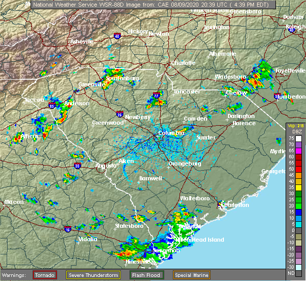 At 440 pm edt, a severe thunderstorm was located 14 miles southeast of chester, or 5 miles west of great falls, moving east at 5 mph (radar indicated). Hazards include 60 mph wind gusts. expect damage to trees and power lines At 440 pm edt, a severe thunderstorm was located 14 miles southeast of chester, or 5 miles west of great falls, moving east at 5 mph (radar indicated). Hazards include 60 mph wind gusts. expect damage to trees and power lines
|
| 7/19/2020 6:18 PM EDT |
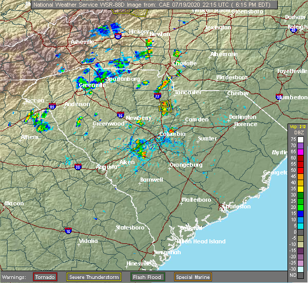 At 618 pm edt, a severe thunderstorm was located 13 miles southwest of lancaster, or near great falls, moving east at 10 mph (radar indicated). Hazards include 60 mph wind gusts and quarter size hail. Minor hail damage to vehicles is expected. expect wind damage to trees and power lines. Locations impacted include, great falls and fishing creek reservoir. At 618 pm edt, a severe thunderstorm was located 13 miles southwest of lancaster, or near great falls, moving east at 10 mph (radar indicated). Hazards include 60 mph wind gusts and quarter size hail. Minor hail damage to vehicles is expected. expect wind damage to trees and power lines. Locations impacted include, great falls and fishing creek reservoir.
|
| 7/19/2020 5:59 PM EDT |
 At 559 pm edt, a severe thunderstorm was located 14 miles northeast of winnsboro, or near great falls, moving east at 10 mph (radar indicated). Hazards include 60 mph wind gusts and quarter size hail. Minor hail damage to vehicles is expected. Expect wind damage to trees and power lines. At 559 pm edt, a severe thunderstorm was located 14 miles northeast of winnsboro, or near great falls, moving east at 10 mph (radar indicated). Hazards include 60 mph wind gusts and quarter size hail. Minor hail damage to vehicles is expected. Expect wind damage to trees and power lines.
|
| 5/22/2020 4:17 PM EDT |
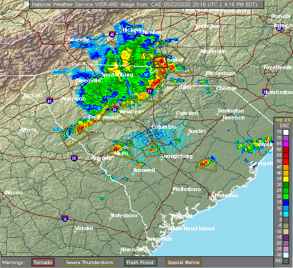 At 417 pm edt, severe thunderstorms were located along a line extending from 6 miles south of indian land to 10 miles south of chester, moving east at 45 mph (radar indicated). Hazards include 60 mph wind gusts and penny size hail. expect damage to trees and power lines At 417 pm edt, severe thunderstorms were located along a line extending from 6 miles south of indian land to 10 miles south of chester, moving east at 45 mph (radar indicated). Hazards include 60 mph wind gusts and penny size hail. expect damage to trees and power lines
|
| 5/22/2020 4:02 PM EDT |
 At 402 pm edt, severe thunderstorms were located along a line extending from 8 miles southwest of chester to 8 miles northeast of newberry, moving southeast at 45 mph (radar indicated). Hazards include 60 mph wind gusts and quarter size hail. Minor hail damage to vehicles is expected. expect wind damage to trees and power lines. Locations impacted include, chester, great falls, fort lawn, carlisle, mcconnells, richburg, lowrys, chester state park, blackstock and leeds. At 402 pm edt, severe thunderstorms were located along a line extending from 8 miles southwest of chester to 8 miles northeast of newberry, moving southeast at 45 mph (radar indicated). Hazards include 60 mph wind gusts and quarter size hail. Minor hail damage to vehicles is expected. expect wind damage to trees and power lines. Locations impacted include, chester, great falls, fort lawn, carlisle, mcconnells, richburg, lowrys, chester state park, blackstock and leeds.
|
| 5/22/2020 3:37 PM EDT |
 At 337 pm edt, severe thunderstorms were located along a line extending from 10 miles northeast of union to 18 miles east of laurens, moving east at 45 mph (radar indicated). Hazards include 60 mph wind gusts and penny size hail. expect damage to trees and power lines At 337 pm edt, severe thunderstorms were located along a line extending from 10 miles northeast of union to 18 miles east of laurens, moving east at 45 mph (radar indicated). Hazards include 60 mph wind gusts and penny size hail. expect damage to trees and power lines
|
| 5/5/2020 8:38 PM EDT |
 The severe thunderstorm warning for southeastern chester county will expire at 845 pm edt, the storm which prompted the warning has moved out of the area. therefore the warning will be allowed to expire. however gusty winds and heavy rain are still possible with this thunderstorm. a severe thunderstorm watch remains in effect until 1100 pm edt for upstate south carolina. if you observed large hail or wind damage, please report it to the national weather service greenville-spartanburg by calling toll free, 1, 800, 2 6 7, 8 1 0 1, or by posting on our facebook page, or tweet it using hashtag nwsgsp. your message should describe the event and the specific location where it occurred. The severe thunderstorm warning for southeastern chester county will expire at 845 pm edt, the storm which prompted the warning has moved out of the area. therefore the warning will be allowed to expire. however gusty winds and heavy rain are still possible with this thunderstorm. a severe thunderstorm watch remains in effect until 1100 pm edt for upstate south carolina. if you observed large hail or wind damage, please report it to the national weather service greenville-spartanburg by calling toll free, 1, 800, 2 6 7, 8 1 0 1, or by posting on our facebook page, or tweet it using hashtag nwsgsp. your message should describe the event and the specific location where it occurred.
|
| 5/5/2020 8:16 PM EDT |
 At 816 pm edt, a severe thunderstorm was located 10 miles southeast of chester, or 6 miles northeast of blackstock, moving east at 30 mph (radar indicated). Hazards include 60 mph wind gusts and quarter size hail. Minor hail damage to vehicles is expected. Expect wind damage to trees and power lines. At 816 pm edt, a severe thunderstorm was located 10 miles southeast of chester, or 6 miles northeast of blackstock, moving east at 30 mph (radar indicated). Hazards include 60 mph wind gusts and quarter size hail. Minor hail damage to vehicles is expected. Expect wind damage to trees and power lines.
|
| 5/5/2020 7:52 PM EDT |
 At 751 pm edt, a severe thunderstorm was located near richburg, or 12 miles east of chester, moving east at 45 mph (radar indicated). Hazards include 60 mph wind gusts and quarter size hail. Hail damage to vehicles is expected. Expect wind damage to roofs, siding, and trees. At 751 pm edt, a severe thunderstorm was located near richburg, or 12 miles east of chester, moving east at 45 mph (radar indicated). Hazards include 60 mph wind gusts and quarter size hail. Hail damage to vehicles is expected. Expect wind damage to roofs, siding, and trees.
|
| 5/5/2020 6:50 PM EDT | Trained spotter reported trees and power lines down near chester and francis avenue in chester county SC, 1.5 miles SE of Great Falls, SC |
| 5/5/2020 6:38 PM EDT |
 At 638 pm edt, a severe thunderstorm capable of producing a tornado was located 9 miles southeast of chester, or 5 miles southwest of richburg, moving east at 55 mph (radar indicated rotation). Hazards include tornado and quarter size hail. Flying debris will be dangerous to those caught without shelter. mobile homes will be damaged or destroyed. damage to roofs, windows, and vehicles will occur. tree damage is likely. this dangerous storm will be near, richburg around 640 pm edt. Fort lawn, fishing creek reservoir and great falls around 650 pm edt. At 638 pm edt, a severe thunderstorm capable of producing a tornado was located 9 miles southeast of chester, or 5 miles southwest of richburg, moving east at 55 mph (radar indicated rotation). Hazards include tornado and quarter size hail. Flying debris will be dangerous to those caught without shelter. mobile homes will be damaged or destroyed. damage to roofs, windows, and vehicles will occur. tree damage is likely. this dangerous storm will be near, richburg around 640 pm edt. Fort lawn, fishing creek reservoir and great falls around 650 pm edt.
|
| 5/5/2020 6:31 PM EDT |
 At 630 pm edt, a severe thunderstorm was located 7 miles northeast of chester, or 6 miles east of lowrys, moving east at 55 mph (radar indicated). Hazards include ping pong ball size hail and 60 mph wind gusts. People and animals outdoors will be injured. expect hail damage to roofs, siding, windows, and vehicles. expect wind damage to trees and power lines. Locations impacted include, chester, lesslie, great falls, fort lawn, mcconnells, richburg, lowrys, chester state park, catawba and edgemoor. At 630 pm edt, a severe thunderstorm was located 7 miles northeast of chester, or 6 miles east of lowrys, moving east at 55 mph (radar indicated). Hazards include ping pong ball size hail and 60 mph wind gusts. People and animals outdoors will be injured. expect hail damage to roofs, siding, windows, and vehicles. expect wind damage to trees and power lines. Locations impacted include, chester, lesslie, great falls, fort lawn, mcconnells, richburg, lowrys, chester state park, catawba and edgemoor.
|
| 5/5/2020 6:11 PM EDT |
 At 611 pm edt, a severe thunderstorm was located 10 miles east of union, or near lockhart, moving east at 55 mph (radar indicated). Hazards include ping pong ball size hail and 60 mph wind gusts. People and animals outdoors will be injured. expect hail damage to roofs, siding, windows, and vehicles. Expect wind damage to trees and power lines. At 611 pm edt, a severe thunderstorm was located 10 miles east of union, or near lockhart, moving east at 55 mph (radar indicated). Hazards include ping pong ball size hail and 60 mph wind gusts. People and animals outdoors will be injured. expect hail damage to roofs, siding, windows, and vehicles. Expect wind damage to trees and power lines.
|
| 5/5/2020 4:13 AM EDT |
 At 413 am edt, severe thunderstorms were located along a line extending from 11 miles northwest of indian land to 8 miles southeast of rock hill to 12 miles southeast of chester, moving east at 55 mph (radar indicated). Hazards include 60 mph wind gusts and quarter size hail. Minor hail damage to vehicles is expected. expect wind damage to trees and power lines. Locations impacted include, rock hill, york, chester, south charlotte, indian trail, weddington, fort mill, stallings, pineville and tega cay. At 413 am edt, severe thunderstorms were located along a line extending from 11 miles northwest of indian land to 8 miles southeast of rock hill to 12 miles southeast of chester, moving east at 55 mph (radar indicated). Hazards include 60 mph wind gusts and quarter size hail. Minor hail damage to vehicles is expected. expect wind damage to trees and power lines. Locations impacted include, rock hill, york, chester, south charlotte, indian trail, weddington, fort mill, stallings, pineville and tega cay.
|
| 5/5/2020 3:57 AM EDT |
 At 356 am edt, severe thunderstorms were located along a line extending from 6 miles north of york to 9 miles southwest of rock hill to 8 miles southwest of chester, moving east at 55 mph (radar indicated). Hazards include 60 mph wind gusts and quarter size hail. Minor hail damage to vehicles is expected. Expect wind damage to trees and power lines. At 356 am edt, severe thunderstorms were located along a line extending from 6 miles north of york to 9 miles southwest of rock hill to 8 miles southwest of chester, moving east at 55 mph (radar indicated). Hazards include 60 mph wind gusts and quarter size hail. Minor hail damage to vehicles is expected. Expect wind damage to trees and power lines.
|
| 4/13/2020 5:51 AM EDT |
 The severe thunderstorm warning for cabarrus, central davie, mecklenburg, rowan, union, chester and southeastern york counties will expire at 600 am edt, the storms which prompted the warning have moved out of the area. therefore the warning will be allowed to expire. a tornado watch remains in effect until 800 am edt for the piedmont of north carolina, and upstate south carolina. if you observed large hail or wind damage, please report it to the national weather service greenville-spartanburg by calling toll free, 1, 800, 2 6 7, 8 1 0 1, or by posting on our facebook page, or tweet it using hashtag nwsgsp. your message should describe the event and the specific location where it occurred. remember, a severe thunderstorm warning still remains in effect for central and eastern union county in north carolina until 630 am edt. The severe thunderstorm warning for cabarrus, central davie, mecklenburg, rowan, union, chester and southeastern york counties will expire at 600 am edt, the storms which prompted the warning have moved out of the area. therefore the warning will be allowed to expire. a tornado watch remains in effect until 800 am edt for the piedmont of north carolina, and upstate south carolina. if you observed large hail or wind damage, please report it to the national weather service greenville-spartanburg by calling toll free, 1, 800, 2 6 7, 8 1 0 1, or by posting on our facebook page, or tweet it using hashtag nwsgsp. your message should describe the event and the specific location where it occurred. remember, a severe thunderstorm warning still remains in effect for central and eastern union county in north carolina until 630 am edt.
|
| 4/13/2020 5:10 AM EDT |
 At 509 am edt, severe thunderstorms were located along a line extending from 5 miles east of mocksville to 9 miles southeast of chester, moving northeast at 60 mph (radar indicated). Hazards include 60 mph wind gusts. expect damage to trees and power lines At 509 am edt, severe thunderstorms were located along a line extending from 5 miles east of mocksville to 9 miles southeast of chester, moving northeast at 60 mph (radar indicated). Hazards include 60 mph wind gusts. expect damage to trees and power lines
|
| 2/6/2020 2:53 PM EST |
 The severe thunderstorm warning for eastern chester county will expire at 300 pm est, the storms which prompted the warning have moved out of the area. therefore the warning will be allowed to expire. however heavy rain is still possible with these thunderstorms. a tornado watch remains in effect until 500 pm est for upstate south carolina. The severe thunderstorm warning for eastern chester county will expire at 300 pm est, the storms which prompted the warning have moved out of the area. therefore the warning will be allowed to expire. however heavy rain is still possible with these thunderstorms. a tornado watch remains in effect until 500 pm est for upstate south carolina.
|
| 2/6/2020 2:44 PM EST |
 At 244 pm est, severe thunderstorms were located along a line extending from 4 miles north of lancaster to 10 miles south of chester, moving east at 35 mph (radar indicated). Hazards include 60 mph wind gusts. Expect damage to trees and power lines. Locations impacted include, great falls, fort lawn, richburg, cornwell, fishing creek reservoir and blackstock. At 244 pm est, severe thunderstorms were located along a line extending from 4 miles north of lancaster to 10 miles south of chester, moving east at 35 mph (radar indicated). Hazards include 60 mph wind gusts. Expect damage to trees and power lines. Locations impacted include, great falls, fort lawn, richburg, cornwell, fishing creek reservoir and blackstock.
|
| 2/6/2020 2:20 PM EST |
 At 219 pm est, severe thunderstorms were located along a line extending from 9 miles south of rock hill to 13 miles southwest of chester, moving east at 55 mph (radar indicated). Hazards include 60 mph wind gusts. expect damage to trees and power lines At 219 pm est, severe thunderstorms were located along a line extending from 9 miles south of rock hill to 13 miles southwest of chester, moving east at 55 mph (radar indicated). Hazards include 60 mph wind gusts. expect damage to trees and power lines
|
| 1/11/2020 9:55 PM EST |
 At 955 pm est, severe thunderstorms were located along a line extending from 7 miles south of gastonia to 12 miles southeast of chester, moving east at 55 mph (radar indicated). Hazards include 60 mph wind gusts. expect damage to trees and power lines At 955 pm est, severe thunderstorms were located along a line extending from 7 miles south of gastonia to 12 miles southeast of chester, moving east at 55 mph (radar indicated). Hazards include 60 mph wind gusts. expect damage to trees and power lines
|
| 10/31/2019 6:11 PM EDT |
 The severe thunderstorm warning for eastern chester and southeastern york counties will expire at 615 pm edt, the severe thunderstorm which prompted the warning has weakened. therefore the warning will be allowed to expire. however heavy rain is still possible with this thunderstorm. a tornado watch remains in effect until 1100 pm edt for upstate south carolina. if you observed large hail or wind damage, please report it to the national weather service greenville-spartanburg by calling toll free, 1, 800, 2 6 7, 8 1 0 1, or by posting on our facebook page, or tweet it using hashtag nwsgsp. your message should describe the event and the specific location where it occurred. The severe thunderstorm warning for eastern chester and southeastern york counties will expire at 615 pm edt, the severe thunderstorm which prompted the warning has weakened. therefore the warning will be allowed to expire. however heavy rain is still possible with this thunderstorm. a tornado watch remains in effect until 1100 pm edt for upstate south carolina. if you observed large hail or wind damage, please report it to the national weather service greenville-spartanburg by calling toll free, 1, 800, 2 6 7, 8 1 0 1, or by posting on our facebook page, or tweet it using hashtag nwsgsp. your message should describe the event and the specific location where it occurred.
|
| 10/31/2019 5:39 PM EDT |
 The national weather service in greenville-spartanburg has issued a * severe thunderstorm warning for. eastern chester county in upstate south carolina. southeastern york county in upstate south carolina. until 615 pm edt. At 538 pm edt, a severe thunderstorm was located 14 miles southeast. The national weather service in greenville-spartanburg has issued a * severe thunderstorm warning for. eastern chester county in upstate south carolina. southeastern york county in upstate south carolina. until 615 pm edt. At 538 pm edt, a severe thunderstorm was located 14 miles southeast.
|
| 7/4/2019 1:38 PM EDT |
 At 138 pm edt, a severe thunderstorm was located 13 miles southwest of lancaster, or 5 miles west of fishing creek reservoir, moving northeast at 10 mph (radar indicated). Hazards include 60 mph wind gusts and quarter size hail. Minor hail damage to vehicles is expected. Expect wind damage to trees and power lines. At 138 pm edt, a severe thunderstorm was located 13 miles southwest of lancaster, or 5 miles west of fishing creek reservoir, moving northeast at 10 mph (radar indicated). Hazards include 60 mph wind gusts and quarter size hail. Minor hail damage to vehicles is expected. Expect wind damage to trees and power lines.
|
| 6/24/2019 10:17 PM EDT |
 At 1016 pm edt, severe thunderstorms were located along a line extending from 7 miles southwest of winston-salem to 6 miles west of lexington to 11 miles north of badin lake to 9 miles east of downtown concord to 13 miles south of albemarle to 8 miles south of monroe to 14 miles northeast of lake wateree dam, moving east at 40 mph (radar indicated). Hazards include 60 mph wind gusts. Expect damage to trees and power lines. Locations impacted include, monroe, chester, indian trail, weddington, stallings, unionville, wesley chapel, wingate, waxhaw and marshville. At 1016 pm edt, severe thunderstorms were located along a line extending from 7 miles southwest of winston-salem to 6 miles west of lexington to 11 miles north of badin lake to 9 miles east of downtown concord to 13 miles south of albemarle to 8 miles south of monroe to 14 miles northeast of lake wateree dam, moving east at 40 mph (radar indicated). Hazards include 60 mph wind gusts. Expect damage to trees and power lines. Locations impacted include, monroe, chester, indian trail, weddington, stallings, unionville, wesley chapel, wingate, waxhaw and marshville.
|
| 6/24/2019 10:03 PM EDT |
 At 1003 pm edt, severe thunderstorms were located along a line extending from 12 miles southwest of winston-salem to 5 miles southeast of mocksville to 12 miles south of lexington to near downtown concord to 16 miles southwest of albemarle to 11 miles southwest of monroe to 13 miles south of lancaster, moving east at 40 mph (radar indicated). Hazards include 60 mph wind gusts. Expect damage to trees and power lines. Locations impacted include, rock hill, kannapolis, downtown concord, monroe, salisbury, mocksville, central charlotte, south charlotte, southwest charlotte and east charlotte. At 1003 pm edt, severe thunderstorms were located along a line extending from 12 miles southwest of winston-salem to 5 miles southeast of mocksville to 12 miles south of lexington to near downtown concord to 16 miles southwest of albemarle to 11 miles southwest of monroe to 13 miles south of lancaster, moving east at 40 mph (radar indicated). Hazards include 60 mph wind gusts. Expect damage to trees and power lines. Locations impacted include, rock hill, kannapolis, downtown concord, monroe, salisbury, mocksville, central charlotte, south charlotte, southwest charlotte and east charlotte.
|
| 6/24/2019 9:48 PM EDT |
 At 948 pm edt, severe thunderstorms were located along a line extending from 7 miles south of yadkinville to 7 miles southwest of mocksville to 4 miles east of salisbury to 6 miles east of huntersville to 14 miles north of monroe to 8 miles south of indian land to 14 miles southwest of lancaster, moving east at 25 mph (radar indicated). Hazards include 60 mph wind gusts. Expect damage to trees and power lines. Locations impacted include, rock hill, uptown charlotte, huntersville, kannapolis, downtown concord, monroe, salisbury, chester, mocksville and central charlotte. At 948 pm edt, severe thunderstorms were located along a line extending from 7 miles south of yadkinville to 7 miles southwest of mocksville to 4 miles east of salisbury to 6 miles east of huntersville to 14 miles north of monroe to 8 miles south of indian land to 14 miles southwest of lancaster, moving east at 25 mph (radar indicated). Hazards include 60 mph wind gusts. Expect damage to trees and power lines. Locations impacted include, rock hill, uptown charlotte, huntersville, kannapolis, downtown concord, monroe, salisbury, chester, mocksville and central charlotte.
|
| 6/24/2019 9:27 PM EDT |
 At 927 pm edt, severe thunderstorms were located along a line extending from 6 miles south of yadkinville to 4 miles north of statesville to 8 miles north of kannapolis to near huntersville to 7 miles northeast of indian land to 4 miles southwest of rock hill to 11 miles north of winnsboro, moving east at 40 mph (radar indicated). Hazards include 70 mph wind gusts. Expect considerable tree damage. Damage is likely to mobile homes, roofs, and outbuildings. At 927 pm edt, severe thunderstorms were located along a line extending from 6 miles south of yadkinville to 4 miles north of statesville to 8 miles north of kannapolis to near huntersville to 7 miles northeast of indian land to 4 miles southwest of rock hill to 11 miles north of winnsboro, moving east at 40 mph (radar indicated). Hazards include 70 mph wind gusts. Expect considerable tree damage. Damage is likely to mobile homes, roofs, and outbuildings.
|
| 6/24/2019 9:16 PM EDT |
 At 916 pm edt, severe thunderstorms were located along a line extending from 15 miles east of taylorsville to 7 miles northwest of statesville to 14 miles northwest of kannapolis to 5 miles west of huntersville to 6 miles southwest of uptown charlotte to 7 miles south of york to 6 miles south of chester, moving northeast at 70 mph (radar indicated). Hazards include 70 mph wind gusts. Expect considerable tree damage. damage is likely to mobile homes, roofs, and outbuildings. Locations impacted include, gastonia, rock hill, uptown charlotte, huntersville, statesville, lincolnton, york, chester, mocksville and central charlotte. At 916 pm edt, severe thunderstorms were located along a line extending from 15 miles east of taylorsville to 7 miles northwest of statesville to 14 miles northwest of kannapolis to 5 miles west of huntersville to 6 miles southwest of uptown charlotte to 7 miles south of york to 6 miles south of chester, moving northeast at 70 mph (radar indicated). Hazards include 70 mph wind gusts. Expect considerable tree damage. damage is likely to mobile homes, roofs, and outbuildings. Locations impacted include, gastonia, rock hill, uptown charlotte, huntersville, statesville, lincolnton, york, chester, mocksville and central charlotte.
|
| 6/24/2019 9:00 PM EDT |
 At 859 pm edt, severe thunderstorms were located along a line extending from 4 miles southeast of taylorsville to 10 miles southwest of statesville to 7 miles southeast of lincolnton to 8 miles southeast of gastonia to 7 miles southwest of york to 16 miles southeast of union, moving northeast at 50 mph (radar indicated). Hazards include 70 mph wind gusts. Expect considerable tree damage. Damage is likely to mobile homes, roofs, and outbuildings. At 859 pm edt, severe thunderstorms were located along a line extending from 4 miles southeast of taylorsville to 10 miles southwest of statesville to 7 miles southeast of lincolnton to 8 miles southeast of gastonia to 7 miles southwest of york to 16 miles southeast of union, moving northeast at 50 mph (radar indicated). Hazards include 70 mph wind gusts. Expect considerable tree damage. Damage is likely to mobile homes, roofs, and outbuildings.
|
| 6/22/2019 4:58 PM EDT | Schp reported tree in roadway i-77 at sc-200. time estimated by rada in fairfield county SC, 6.9 miles NE of Great Falls, SC |
| 6/27/2018 6:07 PM EDT |
 At 607 pm edt, severe thunderstorms were located along a line extending from 7 miles west of lancaster to 6 miles east of chester to 14 miles north of winnsboro to 17 miles northeast of newberry, moving east at 35 mph (radar indicated). Hazards include golf ball size hail and 60 mph wind gusts. People and animals outdoors will be injured. expect hail damage to roofs, siding, windows, and vehicles. expect wind damage to trees and power lines. Locations impacted include, chester, great falls, fort lawn, richburg, lowrys, chester state park, blackstock, leeds, cornwell and edgemoor. At 607 pm edt, severe thunderstorms were located along a line extending from 7 miles west of lancaster to 6 miles east of chester to 14 miles north of winnsboro to 17 miles northeast of newberry, moving east at 35 mph (radar indicated). Hazards include golf ball size hail and 60 mph wind gusts. People and animals outdoors will be injured. expect hail damage to roofs, siding, windows, and vehicles. expect wind damage to trees and power lines. Locations impacted include, chester, great falls, fort lawn, richburg, lowrys, chester state park, blackstock, leeds, cornwell and edgemoor.
|
| 6/27/2018 5:47 PM EDT |
 At 547 pm edt, severe thunderstorms were located along a line extending from 8 miles south of rock hill to 7 miles west of chester to 16 miles southeast of union to 13 miles north of newberry, moving southeast at 35 mph (radar indicated). Hazards include golf ball size hail and 60 mph wind gusts. People and animals outdoors will be injured. expect hail damage to roofs, siding, windows, and vehicles. Expect wind damage to trees and power lines. At 547 pm edt, severe thunderstorms were located along a line extending from 8 miles south of rock hill to 7 miles west of chester to 16 miles southeast of union to 13 miles north of newberry, moving southeast at 35 mph (radar indicated). Hazards include golf ball size hail and 60 mph wind gusts. People and animals outdoors will be injured. expect hail damage to roofs, siding, windows, and vehicles. Expect wind damage to trees and power lines.
|
| 6/25/2018 7:48 PM EDT |
 At 747 pm edt, severe thunderstorms were located along a line extending from 3 miles northeast of rock hill to 15 miles northwest of batesburg, moving east at 45 mph (radar indicated). Hazards include 60 mph wind gusts and quarter size hail. Minor hail damage to vehicles is expected. expect wind damage to trees and power lines. Locations impacted include, rock hill, chester, lesslie, great falls, monarch mill, fort lawn, lockhart, sharon, carlisle and mcconnells. At 747 pm edt, severe thunderstorms were located along a line extending from 3 miles northeast of rock hill to 15 miles northwest of batesburg, moving east at 45 mph (radar indicated). Hazards include 60 mph wind gusts and quarter size hail. Minor hail damage to vehicles is expected. expect wind damage to trees and power lines. Locations impacted include, rock hill, chester, lesslie, great falls, monarch mill, fort lawn, lockhart, sharon, carlisle and mcconnells.
|
| 6/25/2018 7:35 PM EDT |
 At 734 pm edt, severe thunderstorms were located along a line extending from 4 miles northwest of rock hill to 19 miles southeast of greenwood, moving east at 45 mph (radar indicated). Hazards include 60 mph wind gusts and quarter size hail. Minor hail damage to vehicles is expected. expect wind damage to trees and power lines. Locations impacted include, rock hill, greenwood, union, chester, clinton, lesslie, great falls, monarch mill, ninety six and joanna. At 734 pm edt, severe thunderstorms were located along a line extending from 4 miles northwest of rock hill to 19 miles southeast of greenwood, moving east at 45 mph (radar indicated). Hazards include 60 mph wind gusts and quarter size hail. Minor hail damage to vehicles is expected. expect wind damage to trees and power lines. Locations impacted include, rock hill, greenwood, union, chester, clinton, lesslie, great falls, monarch mill, ninety six and joanna.
|
| 6/25/2018 7:24 PM EDT |
 At 723 pm edt, severe thunderstorms were located along a line extending from near york to 12 miles southeast of greenwood, moving east at 45 mph (radar indicated). Hazards include 60 mph wind gusts and quarter size hail. Minor hail damage to vehicles is expected. expect wind damage to trees and power lines. Locations impacted include, rock hill, greenwood, laurens, union, york, chester, abbeville, clinton, newport and pacolet. At 723 pm edt, severe thunderstorms were located along a line extending from near york to 12 miles southeast of greenwood, moving east at 45 mph (radar indicated). Hazards include 60 mph wind gusts and quarter size hail. Minor hail damage to vehicles is expected. expect wind damage to trees and power lines. Locations impacted include, rock hill, greenwood, laurens, union, york, chester, abbeville, clinton, newport and pacolet.
|
| 6/25/2018 6:58 PM EDT |
 The national weather service in greenville-spartanburg has issued a * severe thunderstorm warning for. southeastern elbert county in northeastern georgia. laurens county in upstate south carolina. chester county in upstate south carolina. Southern york county in upstate south carolina. The national weather service in greenville-spartanburg has issued a * severe thunderstorm warning for. southeastern elbert county in northeastern georgia. laurens county in upstate south carolina. chester county in upstate south carolina. Southern york county in upstate south carolina.
|
| 6/25/2018 6:58 PM EDT |
 At 658 pm edt, severe thunderstorms were located along a line extending from 10 miles southeast of gaffney to 10 miles southeast of abbeville, moving east at 45 mph (radar indicated). Hazards include 60 mph wind gusts and quarter size hail. Minor hail damage to vehicles is expected. Expect wind damage to trees and power lines. At 658 pm edt, severe thunderstorms were located along a line extending from 10 miles southeast of gaffney to 10 miles southeast of abbeville, moving east at 45 mph (radar indicated). Hazards include 60 mph wind gusts and quarter size hail. Minor hail damage to vehicles is expected. Expect wind damage to trees and power lines.
|
| 6/25/2018 4:16 PM EDT |
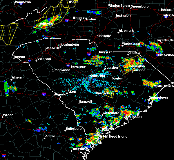 At 416 pm edt, a severe thunderstorm was located 11 miles southwest of lancaster, or over great falls, moving east at 15 mph (radar indicated). Hazards include 60 mph wind gusts and quarter size hail. Minor hail damage to vehicles is expected. Expect wind damage to trees and power lines. At 416 pm edt, a severe thunderstorm was located 11 miles southwest of lancaster, or over great falls, moving east at 15 mph (radar indicated). Hazards include 60 mph wind gusts and quarter size hail. Minor hail damage to vehicles is expected. Expect wind damage to trees and power lines.
|
| 6/25/2018 4:05 PM EDT | Report of a couple trees blown dow in chester county SC, 2 miles E of Great Falls, SC |
| 6/25/2018 3:50 PM EDT |
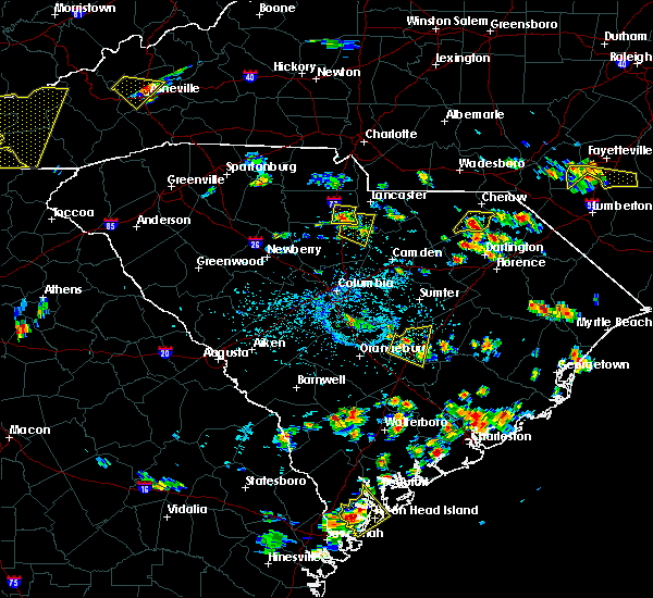 At 349 pm edt, a severe thunderstorm was located 14 miles southeast of chester, or 5 miles west of great falls, moving east at 30 mph (radar indicated). Hazards include 60 mph wind gusts and quarter size hail. Minor hail damage to vehicles is expected. Expect wind damage to trees and power lines. At 349 pm edt, a severe thunderstorm was located 14 miles southeast of chester, or 5 miles west of great falls, moving east at 30 mph (radar indicated). Hazards include 60 mph wind gusts and quarter size hail. Minor hail damage to vehicles is expected. Expect wind damage to trees and power lines.
|
| 6/24/2018 7:28 PM EDT |
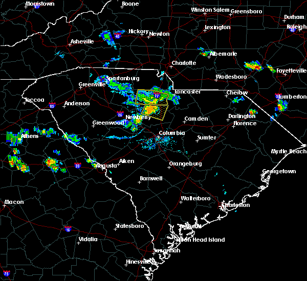 At 727 pm edt, severe thunderstorms were located along a line extending from 10 miles east of chester to 6 miles north of winnsboro, moving east at 35 mph (radar indicated). Hazards include 60 mph wind gusts and penny size hail. Expect damage to trees and power lines. Locations impacted include, great falls, fort lawn, richburg, blackstock, cornwell and fishing creek reservoir. At 727 pm edt, severe thunderstorms were located along a line extending from 10 miles east of chester to 6 miles north of winnsboro, moving east at 35 mph (radar indicated). Hazards include 60 mph wind gusts and penny size hail. Expect damage to trees and power lines. Locations impacted include, great falls, fort lawn, richburg, blackstock, cornwell and fishing creek reservoir.
|
| 6/24/2018 7:12 PM EDT |
 At 711 pm edt, severe thunderstorms were located along a line extending from 5 miles northwest of chester to 21 miles southeast of union to 14 miles northwest of winnsboro, moving southeast at 35 mph (radar indicated). Hazards include 60 mph wind gusts and penny size hail. Expect damage to trees and power lines. Locations impacted include, chester, great falls, fort lawn, richburg, chester state park, leeds, cornwell, blackstock, lowrys and fishing creek reservoir. At 711 pm edt, severe thunderstorms were located along a line extending from 5 miles northwest of chester to 21 miles southeast of union to 14 miles northwest of winnsboro, moving southeast at 35 mph (radar indicated). Hazards include 60 mph wind gusts and penny size hail. Expect damage to trees and power lines. Locations impacted include, chester, great falls, fort lawn, richburg, chester state park, leeds, cornwell, blackstock, lowrys and fishing creek reservoir.
|
| 6/24/2018 6:52 PM EDT |
 At 652 pm edt, severe thunderstorms were located along a line extending from 12 miles northwest of chester to 9 miles southeast of union to 20 miles north of newberry, moving southeast at 30 mph (radar indicated). Hazards include 60 mph wind gusts and penny size hail. expect damage to trees and power lines At 652 pm edt, severe thunderstorms were located along a line extending from 12 miles northwest of chester to 9 miles southeast of union to 20 miles north of newberry, moving southeast at 30 mph (radar indicated). Hazards include 60 mph wind gusts and penny size hail. expect damage to trees and power lines
|
| 6/20/2018 6:52 PM EDT |
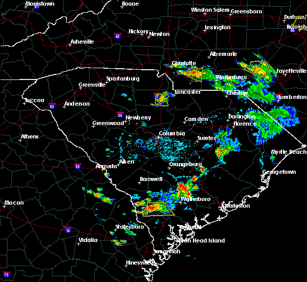 At 652 pm edt, a severe thunderstorm was located 12 miles east of chester, or 4 miles south of richburg, moving east at 20 mph (radar indicated). Hazards include 60 mph wind gusts and quarter size hail. Minor hail damage to vehicles is expected. Expect wind damage to trees and power lines. At 652 pm edt, a severe thunderstorm was located 12 miles east of chester, or 4 miles south of richburg, moving east at 20 mph (radar indicated). Hazards include 60 mph wind gusts and quarter size hail. Minor hail damage to vehicles is expected. Expect wind damage to trees and power lines.
|
| 6/1/2018 8:24 PM EDT |
 At 824 pm edt, a severe thunderstorm was located 4 miles southeast of rock hill, or over lesslie, moving east at 20 mph (radar indicated). Hazards include 60 mph wind gusts and quarter size hail. Minor hail damage to vehicles is expected. expect wind damage to trees and power lines. Locations impacted include, rock hill, york, fort mill, tega cay, clover, newport, town of lake wylie, lesslie, great falls and fort lawn. At 824 pm edt, a severe thunderstorm was located 4 miles southeast of rock hill, or over lesslie, moving east at 20 mph (radar indicated). Hazards include 60 mph wind gusts and quarter size hail. Minor hail damage to vehicles is expected. expect wind damage to trees and power lines. Locations impacted include, rock hill, york, fort mill, tega cay, clover, newport, town of lake wylie, lesslie, great falls and fort lawn.
|
| 6/1/2018 7:57 PM EDT |
 At 756 pm edt, a severe thunderstorm was located 6 miles west of rock hill, or 5 miles south of newport, moving east at 20 mph. severe thunderstorms extend from eastern cherokee county, all the way east across york county to the south of york and rock hill, and will develop into northeast chester county (radar indicated). Hazards include 60 mph wind gusts and quarter size hail. Minor hail damage to vehicles is expected. Expect wind damage to trees and power lines. At 756 pm edt, a severe thunderstorm was located 6 miles west of rock hill, or 5 miles south of newport, moving east at 20 mph. severe thunderstorms extend from eastern cherokee county, all the way east across york county to the south of york and rock hill, and will develop into northeast chester county (radar indicated). Hazards include 60 mph wind gusts and quarter size hail. Minor hail damage to vehicles is expected. Expect wind damage to trees and power lines.
|
| 6/1/2018 7:15 PM EDT |
 At 714 pm edt, a severe thunderstorm was located 13 miles south of union, or 5 miles southwest of carlisle, moving northeast at 55 mph (radar indicated). Hazards include 60 mph wind gusts. expect damage to trees and power lines At 714 pm edt, a severe thunderstorm was located 13 miles south of union, or 5 miles southwest of carlisle, moving northeast at 55 mph (radar indicated). Hazards include 60 mph wind gusts. expect damage to trees and power lines
|
| 4/15/2018 2:54 PM EDT | Numerous trees reported down from ridgeway to mitfor in fairfield county SC, 2.4 miles NNE of Great Falls, SC |
| 4/15/2018 2:44 PM EDT |
 At 243 pm edt, a severe thunderstorm was located 10 miles northwest of chester, or 4 miles northwest of lowrys, moving north at 65 mph (radar indicated). Hazards include 60 mph wind gusts and quarter size hail. Minor hail damage to vehicles is expected. Expect wind damage to trees and power lines. At 243 pm edt, a severe thunderstorm was located 10 miles northwest of chester, or 4 miles northwest of lowrys, moving north at 65 mph (radar indicated). Hazards include 60 mph wind gusts and quarter size hail. Minor hail damage to vehicles is expected. Expect wind damage to trees and power lines.
|
| 7/28/2017 4:28 PM EDT |
 At 428 pm edt, severe thunderstorms were located along a line extending from 12 miles east of lincolnton to near gastonia to 4 miles southwest of lancaster, moving east at 25 mph (radar indicated). Hazards include 60 mph wind gusts. Expect damage to trees and power lines. Locations impacted include, gastonia, rock hill, lincolnton, york, mt holly, fort mill, belmont, bessemer city, south gastonia and tega cay. At 428 pm edt, severe thunderstorms were located along a line extending from 12 miles east of lincolnton to near gastonia to 4 miles southwest of lancaster, moving east at 25 mph (radar indicated). Hazards include 60 mph wind gusts. Expect damage to trees and power lines. Locations impacted include, gastonia, rock hill, lincolnton, york, mt holly, fort mill, belmont, bessemer city, south gastonia and tega cay.
|
| 7/28/2017 4:04 PM EDT |
 At 404 pm edt, severe thunderstorms were located along a line extending from 4 miles north of lincolnton to 10 miles west of gastonia to 9 miles east of chester, moving east at 15 mph (radar indicated). Hazards include 60 mph wind gusts. Expect damage to trees and power lines. Locations impacted include, gastonia, rock hill, shelby, gaffney, lincolnton, york, chester, kings mountain, mt holly and fort mill. At 404 pm edt, severe thunderstorms were located along a line extending from 4 miles north of lincolnton to 10 miles west of gastonia to 9 miles east of chester, moving east at 15 mph (radar indicated). Hazards include 60 mph wind gusts. Expect damage to trees and power lines. Locations impacted include, gastonia, rock hill, shelby, gaffney, lincolnton, york, chester, kings mountain, mt holly and fort mill.
|
| 7/28/2017 3:55 PM EDT |
 At 355 pm edt, severe thunderstorms were located along a line extending from 3 miles north of lincolnton to 9 miles southeast of shelby to 8 miles southeast of chester, moving northeast at 15 mph (radar indicated). Hazards include 60 mph wind gusts. expect damage to trees and power lines At 355 pm edt, severe thunderstorms were located along a line extending from 3 miles north of lincolnton to 9 miles southeast of shelby to 8 miles southeast of chester, moving northeast at 15 mph (radar indicated). Hazards include 60 mph wind gusts. expect damage to trees and power lines
|
| 7/23/2017 4:51 PM EDT |
 At 450 pm edt, severe thunderstorms were located along a line extending from 13 miles west of monroe to 12 miles southeast of union, moving east at 15 mph (radar indicated). Hazards include 60 mph wind gusts and quarter size hail. Minor hail damage to vehicles is expected. expect wind damage to trees and power lines. Locations impacted include, rock hill, chester, fort mill, waxhaw, mineral springs, lesslie, great falls, marvin, fort lawn and carlisle. At 450 pm edt, severe thunderstorms were located along a line extending from 13 miles west of monroe to 12 miles southeast of union, moving east at 15 mph (radar indicated). Hazards include 60 mph wind gusts and quarter size hail. Minor hail damage to vehicles is expected. expect wind damage to trees and power lines. Locations impacted include, rock hill, chester, fort mill, waxhaw, mineral springs, lesslie, great falls, marvin, fort lawn and carlisle.
|
| 7/23/2017 4:20 PM EDT |
 At 419 pm edt, severe thunderstorms were located along a line extending from 11 miles south of uptown charlotte to 6 miles south of union, moving east at 15 mph (radar indicated). Hazards include 60 mph wind gusts and quarter size hail. Minor hail damage to vehicles is expected. Expect wind damage to trees and power lines. At 419 pm edt, severe thunderstorms were located along a line extending from 11 miles south of uptown charlotte to 6 miles south of union, moving east at 15 mph (radar indicated). Hazards include 60 mph wind gusts and quarter size hail. Minor hail damage to vehicles is expected. Expect wind damage to trees and power lines.
|
| 7/23/2017 3:20 PM EDT |
 At 320 pm edt, a severe thunderstorm was located 6 miles southeast of chester, or 6 miles north of blackstock, moving southeast at 20 mph (radar indicated). Hazards include 60 mph wind gusts and quarter size hail. Minor hail damage to vehicles is expected. Expect wind damage to trees and power lines. At 320 pm edt, a severe thunderstorm was located 6 miles southeast of chester, or 6 miles north of blackstock, moving southeast at 20 mph (radar indicated). Hazards include 60 mph wind gusts and quarter size hail. Minor hail damage to vehicles is expected. Expect wind damage to trees and power lines.
|
| 7/15/2017 5:15 PM EDT | Fairfield dispatch reported trees down on hwy 21 at river r in fairfield county SC, 4.5 miles NNE of Great Falls, SC |
| 7/15/2017 5:09 PM EDT | Fairfield dispatch reported trees down on heritage r in fairfield county SC, 6.9 miles ENE of Great Falls, SC |
| 7/15/2017 5:08 PM EDT |
 At 508 pm edt, a severe thunderstorm was located 14 miles southwest of lancaster, or near great falls, moving east at 20 mph (radar indicated). Hazards include 60 mph wind gusts and quarter size hail. Minor hail damage to vehicles is expected. expect wind damage to trees and power lines. Locations impacted include, great falls, fort lawn, richburg and fishing creek reservoir. At 508 pm edt, a severe thunderstorm was located 14 miles southwest of lancaster, or near great falls, moving east at 20 mph (radar indicated). Hazards include 60 mph wind gusts and quarter size hail. Minor hail damage to vehicles is expected. expect wind damage to trees and power lines. Locations impacted include, great falls, fort lawn, richburg and fishing creek reservoir.
|
| 7/15/2017 4:49 PM EDT |
 At 449 pm edt, a severe thunderstorm was located 10 miles southeast of chester, or near blackstock, moving east at 10 mph (radar indicated). Hazards include 60 mph wind gusts and quarter size hail. Minor hail damage to vehicles is expected. Expect wind damage to trees and power lines. At 449 pm edt, a severe thunderstorm was located 10 miles southeast of chester, or near blackstock, moving east at 10 mph (radar indicated). Hazards include 60 mph wind gusts and quarter size hail. Minor hail damage to vehicles is expected. Expect wind damage to trees and power lines.
|
| 7/11/2017 6:43 PM EDT |
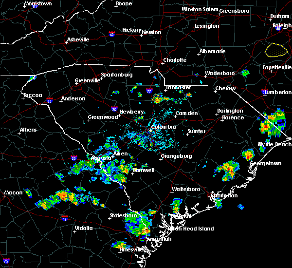 At 643 pm edt, a severe thunderstorm was located 13 miles southwest of lancaster, or near great falls, and is nearly stationary (radar indicated). Hazards include 60 mph wind gusts. Expect damage to trees and power lines. Locations impacted include, great falls and fishing creek reservoir. At 643 pm edt, a severe thunderstorm was located 13 miles southwest of lancaster, or near great falls, and is nearly stationary (radar indicated). Hazards include 60 mph wind gusts. Expect damage to trees and power lines. Locations impacted include, great falls and fishing creek reservoir.
|
| 7/11/2017 6:40 PM EDT | Schp reported a tree down at old winnsboro rd and havenwood dr in chester county SC, 1.6 miles ENE of Great Falls, SC |
| 7/11/2017 6:21 PM EDT |
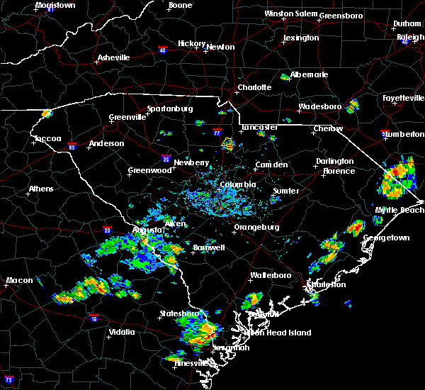 At 621 pm edt, a severe thunderstorm was located 14 miles southwest of lancaster, or near great falls, and is nearly stationary (radar indicated). Hazards include 60 mph wind gusts and quarter size hail. Minor hail damage to vehicles is expected. Expect wind damage to trees and power lines. At 621 pm edt, a severe thunderstorm was located 14 miles southwest of lancaster, or near great falls, and is nearly stationary (radar indicated). Hazards include 60 mph wind gusts and quarter size hail. Minor hail damage to vehicles is expected. Expect wind damage to trees and power lines.
|
| 7/4/2017 5:35 PM EDT | One live tree down on singleton creek road near lake watere in kershaw county SC, 10.1 miles NNW of Great Falls, SC |
| 4/3/2017 3:58 PM EDT |
 At 358 pm edt, severe thunderstorms were located along a line extending from 6 miles southeast of york to 7 miles northeast of chester to 15 miles north of winnsboro, moving northeast at 50 mph (radar indicated). Hazards include 60 mph wind gusts. Expect damage to trees and minor damage to roofs and siding. locations impacted include, rock hill, chester, fort mill, tega cay, newport, lesslie, great falls, fort lawn, richburg and chester state park. A tornado watch remains in effect until 900 pm edt for upstate south carolina. At 358 pm edt, severe thunderstorms were located along a line extending from 6 miles southeast of york to 7 miles northeast of chester to 15 miles north of winnsboro, moving northeast at 50 mph (radar indicated). Hazards include 60 mph wind gusts. Expect damage to trees and minor damage to roofs and siding. locations impacted include, rock hill, chester, fort mill, tega cay, newport, lesslie, great falls, fort lawn, richburg and chester state park. A tornado watch remains in effect until 900 pm edt for upstate south carolina.
|
| 4/3/2017 3:46 PM EDT |
 At 345 pm edt, severe thunderstorms were located along a line extending from 10 miles southwest of york to near chester to 19 miles northwest of winnsboro, moving northeast at 50 mph (radar indicated). Hazards include 60 mph wind gusts. expect damage to trees and minor damage to roofs and siding At 345 pm edt, severe thunderstorms were located along a line extending from 10 miles southwest of york to near chester to 19 miles northwest of winnsboro, moving northeast at 50 mph (radar indicated). Hazards include 60 mph wind gusts. expect damage to trees and minor damage to roofs and siding
|
| 3/1/2017 8:54 PM EST |
 The severe thunderstorm warning for union and chester counties will expire at 900 pm est, the storms which prompted the warning have weakened below severe limits, and have exited the warned area. therefore the warning will be allowed to expire. if you observed large hail or wind damage, please report it to the national weather service greenville-spartanburg by calling toll free, 1, 800, 2 6 7, 8 1 0 1, or by posting on our facebook page, or tweet it using hashtag nwsgsp. your message should describe the event and the specific location where it occurred. The severe thunderstorm warning for union and chester counties will expire at 900 pm est, the storms which prompted the warning have weakened below severe limits, and have exited the warned area. therefore the warning will be allowed to expire. if you observed large hail or wind damage, please report it to the national weather service greenville-spartanburg by calling toll free, 1, 800, 2 6 7, 8 1 0 1, or by posting on our facebook page, or tweet it using hashtag nwsgsp. your message should describe the event and the specific location where it occurred.
|
| 3/1/2017 8:36 PM EST |
 At 834 pm est, severe thunderstorms were located along a line extending from 9 miles southwest of albemarle north carolina, to 11 miles southwest of monroe, to 11 miles north of winnsboro south carolina, moving east at 65 mph (indicated by radar. some of these storms also have a history of producing damaging winds). Hazards include 60 mph wind gusts and penny size hail. Expect damage to roofs. siding and trees. Locations impacted include, monroe, chester, indian trail, weddington, stallings, unionville, wesley chapel, wingate, waxhaw and marshville. At 834 pm est, severe thunderstorms were located along a line extending from 9 miles southwest of albemarle north carolina, to 11 miles southwest of monroe, to 11 miles north of winnsboro south carolina, moving east at 65 mph (indicated by radar. some of these storms also have a history of producing damaging winds). Hazards include 60 mph wind gusts and penny size hail. Expect damage to roofs. siding and trees. Locations impacted include, monroe, chester, indian trail, weddington, stallings, unionville, wesley chapel, wingate, waxhaw and marshville.
|
| 3/1/2017 8:21 PM EST |
 At 820 pm est, severe thunderstorms were located along a line extending from 9 miles east of uptown charlotte to 3 miles south of rock hill to 16 miles southwest of chester, moving east at 60 mph. several of these storms have already produced damaging winds and large hail (indicated by radar and public reports). Hazards include 60 mph wind gusts and quarter size hail. Hail damage to vehicles is expected. expect wind damage to roofs, siding and trees. Locations impacted include, rock hill, uptown charlotte, monroe, chester, central charlotte, south charlotte, southwest charlotte, east charlotte, matthews and mint hill. At 820 pm est, severe thunderstorms were located along a line extending from 9 miles east of uptown charlotte to 3 miles south of rock hill to 16 miles southwest of chester, moving east at 60 mph. several of these storms have already produced damaging winds and large hail (indicated by radar and public reports). Hazards include 60 mph wind gusts and quarter size hail. Hail damage to vehicles is expected. expect wind damage to roofs, siding and trees. Locations impacted include, rock hill, uptown charlotte, monroe, chester, central charlotte, south charlotte, southwest charlotte, east charlotte, matthews and mint hill.
|
| 3/1/2017 7:45 PM EST |
 At 745 pm est, severe thunderstorms were located along a line extending from 11 miles northwest of york to 10 miles northeast of union to 18 miles northeast of newberry, moving east at 55 mph (radar indicated). Hazards include 60 mph wind gusts and quarter size hail. Hail damage to vehicles is expected. Expect wind damage to roofs, siding and trees. At 745 pm est, severe thunderstorms were located along a line extending from 11 miles northwest of york to 10 miles northeast of union to 18 miles northeast of newberry, moving east at 55 mph (radar indicated). Hazards include 60 mph wind gusts and quarter size hail. Hail damage to vehicles is expected. Expect wind damage to roofs, siding and trees.
|
| 11/30/2016 6:16 PM EST |
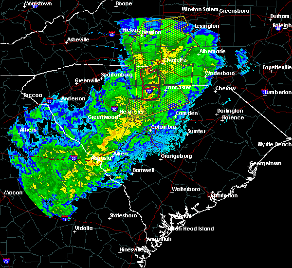 At 616 pm est, a severe thunderstorm capable of producing a tornado was located 10 miles east of chester, or near richburg, moving east at 60 mph (radar indicated rotation). Hazards include tornado. Flying debris will be dangerous to those caught without shelter. mobile homes will be damaged or destroyed. damage to roofs, windows and vehicles will occur. tree damage is likely. this dangerous storm will be near, fort lawn around 630 pm est. Other locations impacted by this dangerous storm include edgemoor, cornwell and blackstock. At 616 pm est, a severe thunderstorm capable of producing a tornado was located 10 miles east of chester, or near richburg, moving east at 60 mph (radar indicated rotation). Hazards include tornado. Flying debris will be dangerous to those caught without shelter. mobile homes will be damaged or destroyed. damage to roofs, windows and vehicles will occur. tree damage is likely. this dangerous storm will be near, fort lawn around 630 pm est. Other locations impacted by this dangerous storm include edgemoor, cornwell and blackstock.
|
| 11/30/2016 6:13 PM EST |
 At 613 pm est, severe thunderstorms were located along a line extending from 6 miles north of mocksville to 9 miles southwest of statesville to 10 miles northeast of lincolnton to 9 miles north of winnsboro, moving east at 35 mph (radar indicated). Hazards include 60 mph wind gusts. Expect damage to roofs. Siding and trees. At 613 pm est, severe thunderstorms were located along a line extending from 6 miles north of mocksville to 9 miles southwest of statesville to 10 miles northeast of lincolnton to 9 miles north of winnsboro, moving east at 35 mph (radar indicated). Hazards include 60 mph wind gusts. Expect damage to roofs. Siding and trees.
|
| 11/30/2016 6:07 PM EST |
 At 606 pm est, severe thunderstorms were located along a line extending from near east bend to 7 miles southwest of statesville to near lincolnton to 6 miles southwest of rock hill to 12 miles south of chester, moving northeast at 55 mph (radar indicated). Hazards include 60 mph wind gusts. Expect damage to roofs. siding and trees. Locations impacted include, gastonia, rock hill, hickory, statesville, newton, lincolnton, york, chester, taylorsville and mt holly. At 606 pm est, severe thunderstorms were located along a line extending from near east bend to 7 miles southwest of statesville to near lincolnton to 6 miles southwest of rock hill to 12 miles south of chester, moving northeast at 55 mph (radar indicated). Hazards include 60 mph wind gusts. Expect damage to roofs. siding and trees. Locations impacted include, gastonia, rock hill, hickory, statesville, newton, lincolnton, york, chester, taylorsville and mt holly.
|
| 11/30/2016 6:00 PM EST |
 At 600 pm est, a severe thunderstorm capable of producing a tornado was located 8 miles southwest of chester, or 5 miles southwest of chester state park, moving east at 50 mph (radar indicated rotation). Hazards include tornado. Flying debris will be dangerous to those caught without shelter. mobile homes will be damaged or destroyed. damage to roofs, windows and vehicles will occur. tree damage is likely. this dangerous storm will be near, richburg around 620 pm est. fort lawn around 630 pm est. Other locations impacted by this dangerous storm include leeds, edgemoor, cornwell and blackstock. At 600 pm est, a severe thunderstorm capable of producing a tornado was located 8 miles southwest of chester, or 5 miles southwest of chester state park, moving east at 50 mph (radar indicated rotation). Hazards include tornado. Flying debris will be dangerous to those caught without shelter. mobile homes will be damaged or destroyed. damage to roofs, windows and vehicles will occur. tree damage is likely. this dangerous storm will be near, richburg around 620 pm est. fort lawn around 630 pm est. Other locations impacted by this dangerous storm include leeds, edgemoor, cornwell and blackstock.
|
| 11/30/2016 5:50 PM EST |
 At 550 pm est, a severe thunderstorm capable of producing a tornado was located 15 miles southeast of union, or near carlisle, moving east at 55 mph (radar indicated rotation). Hazards include tornado. Flying debris will be dangerous to those caught without shelter. mobile homes will be damaged or destroyed. damage to roofs, windows and vehicles will occur. tree damage is likely. this dangerous storm will be near, chester state park around 600 pm est. chester and blackstock around 610 pm est. richburg and fort lawn around 620 pm est. Other locations impacted by this dangerous thunderstorm include leeds, edgemoor, cornwell and blackstock. At 550 pm est, a severe thunderstorm capable of producing a tornado was located 15 miles southeast of union, or near carlisle, moving east at 55 mph (radar indicated rotation). Hazards include tornado. Flying debris will be dangerous to those caught without shelter. mobile homes will be damaged or destroyed. damage to roofs, windows and vehicles will occur. tree damage is likely. this dangerous storm will be near, chester state park around 600 pm est. chester and blackstock around 610 pm est. richburg and fort lawn around 620 pm est. Other locations impacted by this dangerous thunderstorm include leeds, edgemoor, cornwell and blackstock.
|
| 11/30/2016 5:42 PM EST |
 At 542 pm est, severe thunderstorms were located along a line extending from 11 miles southwest of yadkinville to 8 miles southwest of newton to 3 miles northwest of shelby to 10 miles east of union to 6 miles north of newberry, moving northeast at 55 mph (radar indicated). Hazards include 60 mph wind gusts. Expect damage to roofs. siding and trees. Locations impacted include, gastonia, rock hill, hickory, statesville, shelby, newton, gaffney, lincolnton, union and york. At 542 pm est, severe thunderstorms were located along a line extending from 11 miles southwest of yadkinville to 8 miles southwest of newton to 3 miles northwest of shelby to 10 miles east of union to 6 miles north of newberry, moving northeast at 55 mph (radar indicated). Hazards include 60 mph wind gusts. Expect damage to roofs. siding and trees. Locations impacted include, gastonia, rock hill, hickory, statesville, shelby, newton, gaffney, lincolnton, union and york.
|
| 11/30/2016 5:26 PM EST |
 At 526 pm est, severe thunderstorms were located along a line extending from 8 miles east of taylorsville to 14 miles north of shelby to 8 miles southeast of forest city to 5 miles south of union to 8 miles west of newberry, moving northeast at 55 mph (radar indicated). Hazards include 60 mph wind gusts. Expect damage to roofs. Siding and trees. At 526 pm est, severe thunderstorms were located along a line extending from 8 miles east of taylorsville to 14 miles north of shelby to 8 miles southeast of forest city to 5 miles south of union to 8 miles west of newberry, moving northeast at 55 mph (radar indicated). Hazards include 60 mph wind gusts. Expect damage to roofs. Siding and trees.
|
| 7/16/2016 6:40 PM EDT | 3 trees down on peays ferry rd and hwy 9 in kershaw county SC, 9.3 miles NW of Great Falls, SC |
| 7/7/2016 9:20 PM EDT |
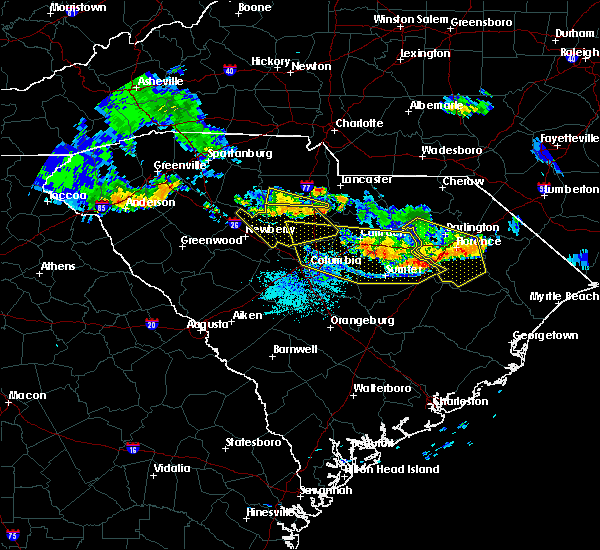 At 920 pm edt, a severe thunderstorm was located 9 miles southwest of chester, or 6 miles south of chester state park, moving southeast at 25 mph (radar indicated). Hazards include 60 mph wind gusts and penny size hail. Expect damage to roofs. siding and trees. Locations impacted include, great falls, leeds, cornwell and blackstock. At 920 pm edt, a severe thunderstorm was located 9 miles southwest of chester, or 6 miles south of chester state park, moving southeast at 25 mph (radar indicated). Hazards include 60 mph wind gusts and penny size hail. Expect damage to roofs. siding and trees. Locations impacted include, great falls, leeds, cornwell and blackstock.
|
| 7/7/2016 8:59 PM EDT |
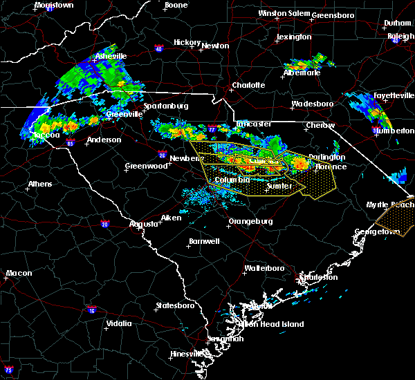 At 859 pm edt, a severe thunderstorm was located 11 miles southwest of chester, or 4 miles northeast of carlisle, moving southeast at 55 mph (radar indicated). Hazards include 60 mph wind gusts and penny size hail. Expect damage to roofs. Siding and trees. At 859 pm edt, a severe thunderstorm was located 11 miles southwest of chester, or 4 miles northeast of carlisle, moving southeast at 55 mph (radar indicated). Hazards include 60 mph wind gusts and penny size hail. Expect damage to roofs. Siding and trees.
|
| 7/7/2016 8:38 PM EDT |
 The severe thunderstorm warning for southern chester county will expire at 845 pm edt, the storm which prompted the warning has moved out of the area. therefore the warning will be allowed to expire. The severe thunderstorm warning for southern chester county will expire at 845 pm edt, the storm which prompted the warning has moved out of the area. therefore the warning will be allowed to expire.
|
| 7/7/2016 8:12 PM EDT | Trees down near the intersection of heritage road and hwy. 90 in fairfield county SC, 6.7 miles ENE of Great Falls, SC |
| 7/7/2016 8:07 PM EDT |
 At 806 pm edt, a severe thunderstorm was located 7 miles south of chester, or 4 miles northwest of blackstock, moving southeast at 30 mph (radar indicated). Hazards include 60 mph wind gusts and quarter size hail. Hail damage to vehicles is expected. Expect wind damage to roofs, siding and trees. At 806 pm edt, a severe thunderstorm was located 7 miles south of chester, or 4 miles northwest of blackstock, moving southeast at 30 mph (radar indicated). Hazards include 60 mph wind gusts and quarter size hail. Hail damage to vehicles is expected. Expect wind damage to roofs, siding and trees.
|
| 7/7/2016 7:24 PM EDT |
 At 723 pm edt, a severe thunderstorm was located near chester, moving southeast at 25 mph (radar indicated). Hazards include 60 mph wind gusts and quarter size hail. Hail damage to vehicles is expected. expect wind damage to roofs, siding and trees. Locations impacted include, chester, great falls, fort lawn, richburg, lowrys, edgemoor and fishing creek reservoir. At 723 pm edt, a severe thunderstorm was located near chester, moving southeast at 25 mph (radar indicated). Hazards include 60 mph wind gusts and quarter size hail. Hail damage to vehicles is expected. expect wind damage to roofs, siding and trees. Locations impacted include, chester, great falls, fort lawn, richburg, lowrys, edgemoor and fishing creek reservoir.
|
| 7/7/2016 6:56 PM EDT |
 At 656 pm edt, a severe thunderstorm was located near chester, moving southeast at 40 mph (radar indicated). Hazards include 60 mph wind gusts and quarter size hail. Hail damage to vehicles is expected. Expect wind damage to roofs, siding and trees. At 656 pm edt, a severe thunderstorm was located near chester, moving southeast at 40 mph (radar indicated). Hazards include 60 mph wind gusts and quarter size hail. Hail damage to vehicles is expected. Expect wind damage to roofs, siding and trees.
|
| 6/14/2016 6:16 PM EDT |
 At 616 pm edt, severe thunderstorms were located along a line extending from 7 miles east of union to near chester to 9 miles southwest of lancaster, moving northeast at 15 mph (radar indicated). Hazards include 60 mph wind gusts and quarter size hail. Hail damage to vehicles is expected. Expect wind damage to roofs, siding and trees. At 616 pm edt, severe thunderstorms were located along a line extending from 7 miles east of union to near chester to 9 miles southwest of lancaster, moving northeast at 15 mph (radar indicated). Hazards include 60 mph wind gusts and quarter size hail. Hail damage to vehicles is expected. Expect wind damage to roofs, siding and trees.
|
| 6/4/2016 7:03 PM EDT |
 At 702 pm edt, a severe thunderstorm was located 12 miles southwest of lancaster, or near fishing creek reservoir, moving northeast at 20 mph (radar indicated). Hazards include 60 mph wind gusts and quarter size hail. Hail damage to vehicles is expected. expect wind damage to roofs, siding and trees. Locations impacted include, great falls, fort lawn, fishing creek reservoir and richburg. At 702 pm edt, a severe thunderstorm was located 12 miles southwest of lancaster, or near fishing creek reservoir, moving northeast at 20 mph (radar indicated). Hazards include 60 mph wind gusts and quarter size hail. Hail damage to vehicles is expected. expect wind damage to roofs, siding and trees. Locations impacted include, great falls, fort lawn, fishing creek reservoir and richburg.
|
| 6/4/2016 6:47 PM EDT |
 At 647 pm edt, a severe thunderstorm was located 13 miles southeast of chester, or 6 miles west of great falls, moving northeast at 30 mph (radar indicated). Hazards include 60 mph wind gusts and nickel size hail. Expect damage to roofs. Siding and trees. At 647 pm edt, a severe thunderstorm was located 13 miles southeast of chester, or 6 miles west of great falls, moving northeast at 30 mph (radar indicated). Hazards include 60 mph wind gusts and nickel size hail. Expect damage to roofs. Siding and trees.
|
| 3/14/2016 9:41 PM EDT |
 The severe thunderstorm warning for southern union, southeastern york and chester counties will expire at 945 pm edt, the line of storms which prompted the warning have moved out of the area. therefore the warning will be allowed to expire. however gusty winds are still possible with these thunderstorms. The severe thunderstorm warning for southern union, southeastern york and chester counties will expire at 945 pm edt, the line of storms which prompted the warning have moved out of the area. therefore the warning will be allowed to expire. however gusty winds are still possible with these thunderstorms.
|
| 3/14/2016 9:11 PM EDT |
 At 911 pm edt, doppler radar indicated a line of severe thunderstorms capable of producing quarter size hail and damaging winds in excess of 60 mph. these storms were located along a line extending from 8 miles east of rock hill to 13 miles southwest of union, moving east at 25 mph. locations impacted include, chester, lesslie, great falls, monarch mill, fort lawn, lockhart, carlisle, richburg, lowrys and chester state park. At 911 pm edt, doppler radar indicated a line of severe thunderstorms capable of producing quarter size hail and damaging winds in excess of 60 mph. these storms were located along a line extending from 8 miles east of rock hill to 13 miles southwest of union, moving east at 25 mph. locations impacted include, chester, lesslie, great falls, monarch mill, fort lawn, lockhart, carlisle, richburg, lowrys and chester state park.
|
| 3/14/2016 8:40 PM EDT |
 At 839 pm edt, doppler radar indicated a line of severe thunderstorms capable of producing quarter size hail and damaging winds in excess of 60 mph. these storms were located along a line extending from 9 miles south of york to 8 miles south of union, and moving east at 30 mph. * locations in the warning include, rock hill, chester, lesslie, great falls, monarch mill, fort lawn, lockhart, carlisle, mcconnells and richburg. At 839 pm edt, doppler radar indicated a line of severe thunderstorms capable of producing quarter size hail and damaging winds in excess of 60 mph. these storms were located along a line extending from 9 miles south of york to 8 miles south of union, and moving east at 30 mph. * locations in the warning include, rock hill, chester, lesslie, great falls, monarch mill, fort lawn, lockhart, carlisle, mcconnells and richburg.
|
| 2/24/2016 12:55 PM EST |
 At 1255 pm est, doppler radar indicated a line of severe thunderstorms capable of producing damaging winds in excess of 60 mph. these storms were located along a line extending from 4 miles southeast of mocksville to near downtown concord to 7 miles southeast of rock hill, moving northeast at 70 mph. locations impacted include, rock hill, uptown charlotte, huntersville, kannapolis, downtown concord, monroe, salisbury, york, chester and mocksville. a tornado watch remains in effect until 700 pm est for central north carolina and central south carolina. At 1255 pm est, doppler radar indicated a line of severe thunderstorms capable of producing damaging winds in excess of 60 mph. these storms were located along a line extending from 4 miles southeast of mocksville to near downtown concord to 7 miles southeast of rock hill, moving northeast at 70 mph. locations impacted include, rock hill, uptown charlotte, huntersville, kannapolis, downtown concord, monroe, salisbury, york, chester and mocksville. a tornado watch remains in effect until 700 pm est for central north carolina and central south carolina.
|
| 2/24/2016 12:13 PM EST |
 At 1212 pm est, doppler radar indicated a line of severe thunderstorms capable of producing damaging winds in excess of 60 mph. these storms were located along a line extending from 8 miles east of gastonia to 15 miles west of winnsboro, and moving northeast at 85 mph. * locations in the warning include, rock hill, uptown charlotte, huntersville, kannapolis, downtown concord, monroe, salisbury, york, chester and mocksville. At 1212 pm est, doppler radar indicated a line of severe thunderstorms capable of producing damaging winds in excess of 60 mph. these storms were located along a line extending from 8 miles east of gastonia to 15 miles west of winnsboro, and moving northeast at 85 mph. * locations in the warning include, rock hill, uptown charlotte, huntersville, kannapolis, downtown concord, monroe, salisbury, york, chester and mocksville.
|
| 12/30/2015 12:21 PM EST |
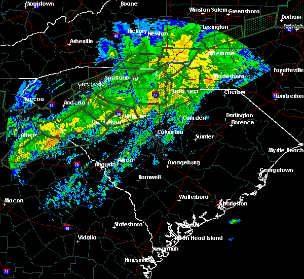 At 1221 pm est, doppler radar indicated a severe thunderstorm capable of producing damaging winds in excess of 60 mph. this storm was located 12 miles southeast of chester, or 7 miles west of great falls, and moving northeast at 55 mph. * locations in the warning include, great falls, fort lawn, richburg and fishing creek reservoir. At 1221 pm est, doppler radar indicated a severe thunderstorm capable of producing damaging winds in excess of 60 mph. this storm was located 12 miles southeast of chester, or 7 miles west of great falls, and moving northeast at 55 mph. * locations in the warning include, great falls, fort lawn, richburg and fishing creek reservoir.
|
| 9/4/2015 6:34 PM EDT |
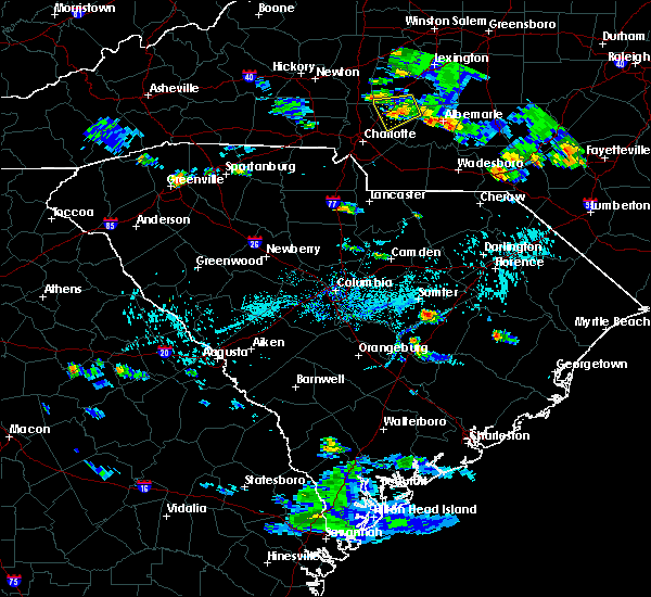 At 634 pm edt, doppler radar indicated a severe thunderstorm capable of producing quarter size hail and damaging winds in excess of 60 mph. this storm was located 11 miles east of chester, or 4 miles south of richburg, and moving southwest at 5 mph. * locations in the warning include, great falls, blackstock, blackstock, cornwell, fishing creek reservoir and richburg. At 634 pm edt, doppler radar indicated a severe thunderstorm capable of producing quarter size hail and damaging winds in excess of 60 mph. this storm was located 11 miles east of chester, or 4 miles south of richburg, and moving southwest at 5 mph. * locations in the warning include, great falls, blackstock, blackstock, cornwell, fishing creek reservoir and richburg.
|
| 8/6/2015 5:36 PM EDT |
 The severe thunderstorm warning for southeastern union and southern chester counties will expire at 545 pm edt, the storm which prompted the warning has moved out of the area. therefore the warning will be allowed to expire. The severe thunderstorm warning for southeastern union and southern chester counties will expire at 545 pm edt, the storm which prompted the warning has moved out of the area. therefore the warning will be allowed to expire.
|
| 8/6/2015 5:24 PM EDT |
 At 523 pm edt, doppler radar indicated a severe thunderstorm with a history of producing damaging winds in excess of 60 mph. this storm was located 14 miles southeast of union, or near carlisle, moving east at 35 mph. locations impacted include, chester, great falls, carlisle, chester state park, blackstock, blackstock, santuc, cornwell, leeds and fishing creek reservoir. At 523 pm edt, doppler radar indicated a severe thunderstorm with a history of producing damaging winds in excess of 60 mph. this storm was located 14 miles southeast of union, or near carlisle, moving east at 35 mph. locations impacted include, chester, great falls, carlisle, chester state park, blackstock, blackstock, santuc, cornwell, leeds and fishing creek reservoir.
|
| 8/6/2015 5:02 PM EDT |
 At 501 pm edt, doppler radar indicated a line of severe thunderstorms with a history of producing damaging winds in excess of 60 mph. these storms were located along a line extending from 8 miles northwest of york to 11 miles north of chester to 14 miles southeast of union, moving east at 35 mph. penny size hail may also accompany the damaging winds. locations impacted include, rock hill, york, chester, fort mill, tega cay, clover, newport, town of lake wylie, lesslie and great falls. At 501 pm edt, doppler radar indicated a line of severe thunderstorms with a history of producing damaging winds in excess of 60 mph. these storms were located along a line extending from 8 miles northwest of york to 11 miles north of chester to 14 miles southeast of union, moving east at 35 mph. penny size hail may also accompany the damaging winds. locations impacted include, rock hill, york, chester, fort mill, tega cay, clover, newport, town of lake wylie, lesslie and great falls.
|
| 8/6/2015 4:34 PM EDT |
 At 434 pm edt, doppler radar indicated a line of severe thunderstorms with a history of producing quarter size hail and damaging winds in excess of 60 mph. these storms were located along a line extending from 5 miles northeast of gaffney to 9 miles southwest of union, and moving east at 35 mph. * locations in the warning include, rock hill, york, chester, fort mill, tega cay, clover, newport, town of lake wylie, lesslie and great falls. At 434 pm edt, doppler radar indicated a line of severe thunderstorms with a history of producing quarter size hail and damaging winds in excess of 60 mph. these storms were located along a line extending from 5 miles northeast of gaffney to 9 miles southwest of union, and moving east at 35 mph. * locations in the warning include, rock hill, york, chester, fort mill, tega cay, clover, newport, town of lake wylie, lesslie and great falls.
|
| 7/13/2015 9:54 PM EDT |
 At 952 pm edt, doppler radar indicated a line of severe thunderstorms capable of producing damaging winds in excess of 60 mph. the leading edge of these storms were located along a line extending from 5 miles south of monroe to 8 miles west of lancaster to 13 miles southwest of union to 14 miles northeast of laurens, moving southeast at 40 mph. penny size hail may also accompany the damaging winds. locations impacted include, rock hill, union, weddington, waxhaw, mineral springs, lesslie, great falls, monarch mill, marvin and buffalo. At 952 pm edt, doppler radar indicated a line of severe thunderstorms capable of producing damaging winds in excess of 60 mph. the leading edge of these storms were located along a line extending from 5 miles south of monroe to 8 miles west of lancaster to 13 miles southwest of union to 14 miles northeast of laurens, moving southeast at 40 mph. penny size hail may also accompany the damaging winds. locations impacted include, rock hill, union, weddington, waxhaw, mineral springs, lesslie, great falls, monarch mill, marvin and buffalo.
|
| 7/13/2015 9:44 PM EDT |
 At 943 pm edt, doppler radar indicated a line of severe thunderstorms capable of producing damaging winds in excess of 60 mph. these storms were located along a line extending from 4 miles southwest of monroe to 7 miles northeast of chester to 13 miles southwest of union to 15 miles north of laurens, moving southeast at 20 mph. penny size hail may also accompany the damaging winds. locations impacted include, rock hill, union, chester, weddington, waxhaw, mineral springs, lesslie, great falls, monarch mill and marvin. At 943 pm edt, doppler radar indicated a line of severe thunderstorms capable of producing damaging winds in excess of 60 mph. these storms were located along a line extending from 4 miles southwest of monroe to 7 miles northeast of chester to 13 miles southwest of union to 15 miles north of laurens, moving southeast at 20 mph. penny size hail may also accompany the damaging winds. locations impacted include, rock hill, union, chester, weddington, waxhaw, mineral springs, lesslie, great falls, monarch mill and marvin.
|
| 7/13/2015 9:29 PM EDT |
 At 929 pm edt, doppler radar indicated a severe thunderstorm capable of producing quarter size hail and damaging winds in excess of 60 mph. this storm was located near waxhaw, or 12 miles north of lancaster, and moving southeast at 25 mph. At 929 pm edt, doppler radar indicated a severe thunderstorm capable of producing quarter size hail and damaging winds in excess of 60 mph. this storm was located near waxhaw, or 12 miles north of lancaster, and moving southeast at 25 mph.
|
| 7/13/2015 9:24 PM EDT |
 At 923 pm edt, doppler radar indicated a line of severe thunderstorms capable of producing quarter size hail and damaging winds in excess of 60 mph. these storms were located along a line extending from 13 miles west of monroe to 6 miles southwest of york to 4 miles southwest of union to 15 miles south of spartanburg, and moving southeast at 25 mph. At 923 pm edt, doppler radar indicated a line of severe thunderstorms capable of producing quarter size hail and damaging winds in excess of 60 mph. these storms were located along a line extending from 13 miles west of monroe to 6 miles southwest of york to 4 miles southwest of union to 15 miles south of spartanburg, and moving southeast at 25 mph.
|
| 6/24/2015 7:20 PM EDT | Golf Ball sized hail reported 3.9 miles NE of Great Falls, SC, gas station attendant near sr 200 and us 21 stated that a customer had reported golf ball size hail near mitford. time estimated. |
| 6/18/2015 6:48 PM EDT | At 648 pm edt, doppler radar indicated a severe thunderstorm capable of producing quarter size hail and damaging winds in excess of 60 mph. this storm was located 7 miles west of lancaster, or over fort lawn, moving east at 10 mph. locations impacted include, great falls, fort lawn, richburg and fishing creek reservoir. |
| 6/18/2015 6:27 PM EDT | At 626 pm edt, doppler radar indicated a severe thunderstorm capable of producing quarter size hail and damaging winds in excess of 60 mph. this storm was located 9 miles west of lancaster, or near fort lawn, and moving east at 15 mph. |
| 6/1/2015 3:08 PM EDT | At 305 pm edt, doppler radar indicated thunderstorms in lancaster county. some of there storms likely contained wind gusts of 40 to 60 mph and penny- to quarter-size hail. the strongest storms extended from the hanging rock battlefield property to around kershaw. movement was northeast near 15 mph. |
| 6/1/2015 2:57 PM EDT | At 255 pm edt, doppler radar indicated a severe thunderstorm near the lancaster and chester county line near great falls. moving northeast near 15 mph. expect damaging wind and hail with this storm. |
| 6/1/2015 2:35 PM EDT | Dot reported several trees down in mitford along highway 20 in fairfield county SC, 4.3 miles NE of Great Falls, SC |
| 4/7/2015 7:50 PM EDT | A severe thunderstorm warning remains in effect until 815 pm edt for southern chester county. at 750 pm edt. doppler radar indicated a severe thunderstorm capable of producing quarter size hail and damaging winds in excess of 60 mph. this storm was located 8 miles south of chester. or near blackstock. Moving southeast at 25 mph. |
| 4/7/2015 7:29 PM EDT | The national weather service in greenville-spartanburg has issued a * severe thunderstorm warning for. chester county in upstate south carolina. until 815 pm edt * at 729 pm edt. Doppler radar indicated a severe thunderstorm capable of producing quarter size hail and damaging winds in excess. |
| 6/17/2014 5:10 PM EDT | Trees and branches down on heritage road. nickel size hail also reporte in fairfield county SC, 10.7 miles ENE of Great Falls, SC |
| 6/17/2014 4:10 PM EDT | Trees and branches down on heritage road. nickel size hail also reporte in fairfield county SC, 10.7 miles ENE of Great Falls, SC |
| 6/17/2014 4:10 PM EDT | Trees and branches down on heritage rd. nickel size hail also reported at same locatio in fairfield county SC, 8 miles ENE of Great Falls, SC |
| 6/9/2014 6:01 PM EDT | Quarter sized hail reported 5.3 miles ENE of Great Falls, SC, public reported nickel to quarter size hail and windy conditions along heritage road. hail duration 2 minutes |
| 6/8/2014 5:14 PM EDT | Reported trees down on a powerline along garden spot lane near hwy. 97. tstm wnd dmg duration 2 minutes in kershaw county SC, 12.5 miles NW of Great Falls, SC |
| 6/8/2014 4:06 PM EDT | Highway patrol reported a tree down at the intersection of state route 200 and edward circle. tstm wnd dmg duration 2 minutes in fairfield county SC, 2.6 miles NNE of Great Falls, SC |
| 6/5/2014 3:06 PM EDT | Reported a couple of trees down along highway 97. tstm wnd dmg duration 2 minutes in kershaw county SC, 12.5 miles NW of Great Falls, SC |
| 8/1/2013 6:21 PM EDT | Fairfield electric coop reported large limbs down on a line along timberlane circl in fairfield county SC, 7.8 miles N of Great Falls, SC |
| 6/26/2013 6:44 PM EDT | Sc highway patrol reports downed trees on wateree rd. between debutary rd and woodside d in fairfield county SC, 5.7 miles N of Great Falls, SC |
| 6/26/2013 6:35 PM EDT | Sc highway patrol reports trees down on heritage road near hwy 901 in fairfield county SC, 7.4 miles ENE of Great Falls, SC |
| 6/25/2013 4:00 PM EDT | Trees down on ross dye rd in chester county SC, 3.7 miles E of Great Falls, SC |
| 6/25/2013 3:50 PM EDT | Tree down on golf course rd. time estimated from radar in chester county SC, 3.7 miles E of Great Falls, SC |
| 6/13/2013 9:20 PM EDT | Trees down on powerlines at intersection of wateree road and shangri-la drive in fairfield county SC, 7.1 miles N of Great Falls, SC |
| 9/29/2012 7:14 PM EDT | Highway patrol reported trees down on sc 200 at the catawba river dam in lancaster county SC, 2.1 miles SSW of Great Falls, SC |
| 8/3/2012 9:15 PM EDT | Trees down on river rd at taylor creek bridg in fairfield county SC, 9.2 miles N of Great Falls, SC |
| 7/28/2012 8:32 PM EDT | A few trees down with at least one on powerline in chester county SC, 1.9 miles S of Great Falls, SC |
| 7/9/2012 4:31 PM EDT | Trees down in road on strough rd in chester county SC, 4 miles SE of Great Falls, SC |
| 7/9/2012 4:31 PM EDT | Tree down in roadway off of highway 97 in chester county SC, 4.1 miles ESE of Great Falls, SC |
| 7/9/2012 4:23 PM EDT | Tree down in rd on ross dye rd in chester county SC, 4.6 miles ESE of Great Falls, SC |
| 4/2/2012 4:30 PM EDT | A few trees blown down where catawba river road is adjacent to fishing creek lak in chester county SC, 1.9 miles S of Great Falls, SC |
| 3/24/2012 5:52 PM EDT | Quarter sized hail reported 5.3 miles ENE of Great Falls, SC, public reported hail up to quarter size along heritage road. |
| 1/1/0001 12:00 AM | Public reported trees down along river road near lake watere in fairfield county SC, 8.4 miles N of Great Falls, SC |
| 1/1/0001 12:00 AM | Sheriff dispatch reported trees down in the liberty hill are in kershaw county SC, 8.8 miles NW of Great Falls, SC |
| 1/1/0001 12:00 AM | Trees down at intersection of hwy 97 and hwy 200 in lancaster county SC, 2.1 miles SSW of Great Falls, SC |
| 1/1/0001 12:00 AM | Trees down across west end of county reported by sherriffs dispatch in lancaster county SC, 5.4 miles SW of Great Falls, SC |
| 1/1/0001 12:00 AM | Em reported trees down across northern fairfield county from white oak to mitfor in fairfield county SC, 7.4 miles NNE of Great Falls, SC |
| 1/1/0001 12:00 AM | Golf Ball sized hail reported 5.1 miles N of Great Falls, SC, spotter reports golf ball hail near lake wateree |
| 1/1/0001 12:00 AM | Trees down in fairfield county SC, 4.3 miles NE of Great Falls, SC |
Hail Maps for Great Falls, SC


Connect with Interactive Hail Maps