

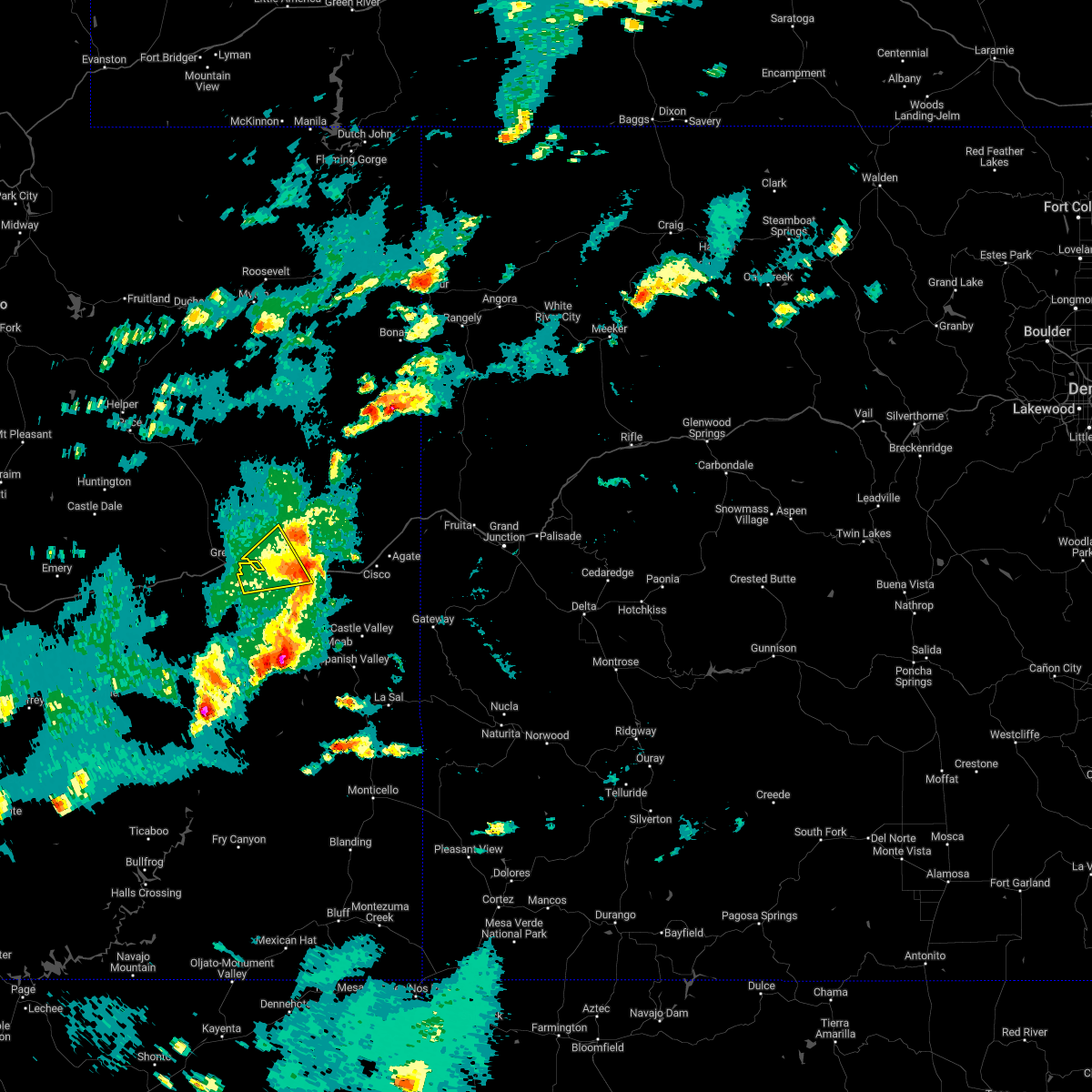
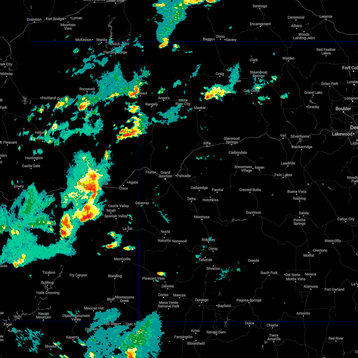
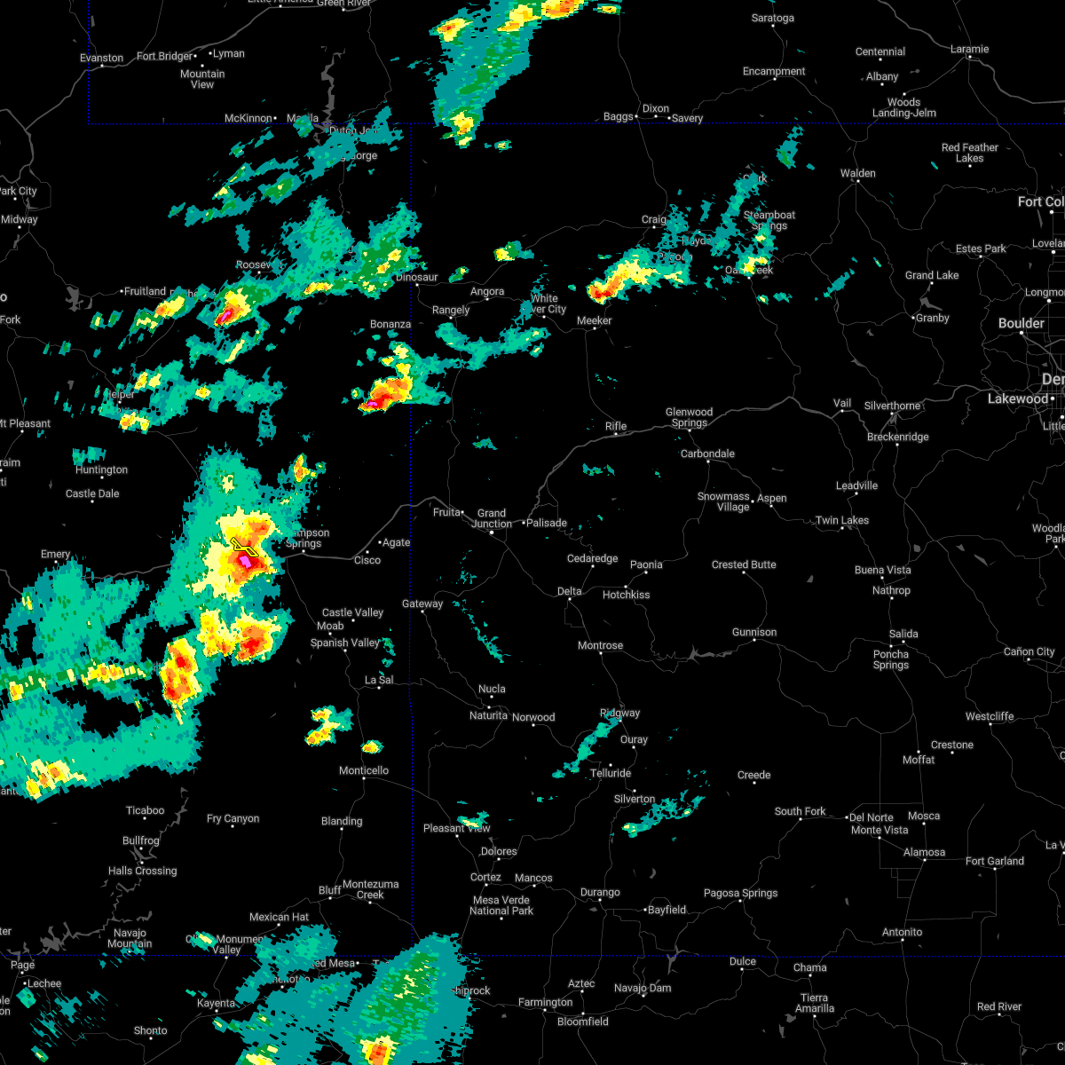
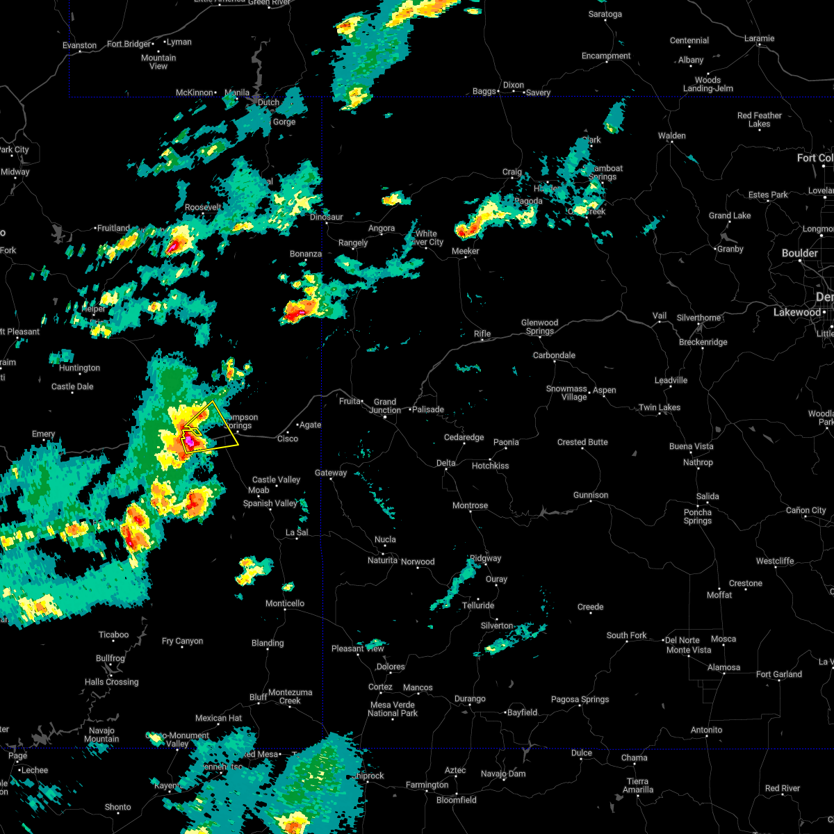
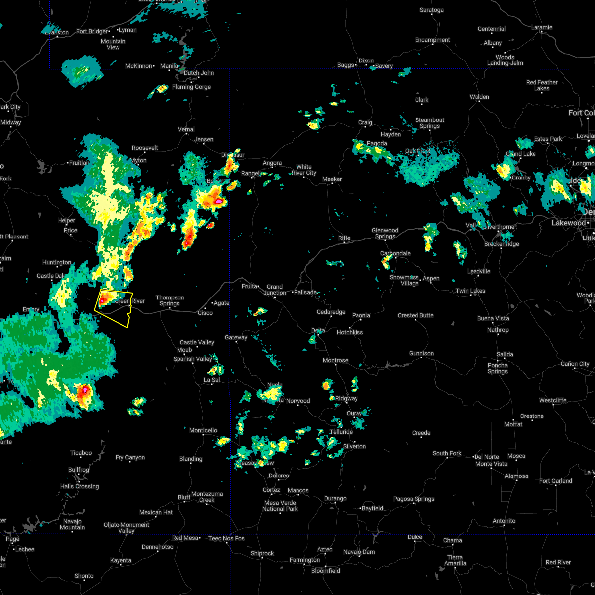
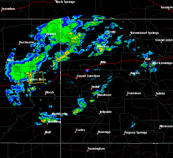
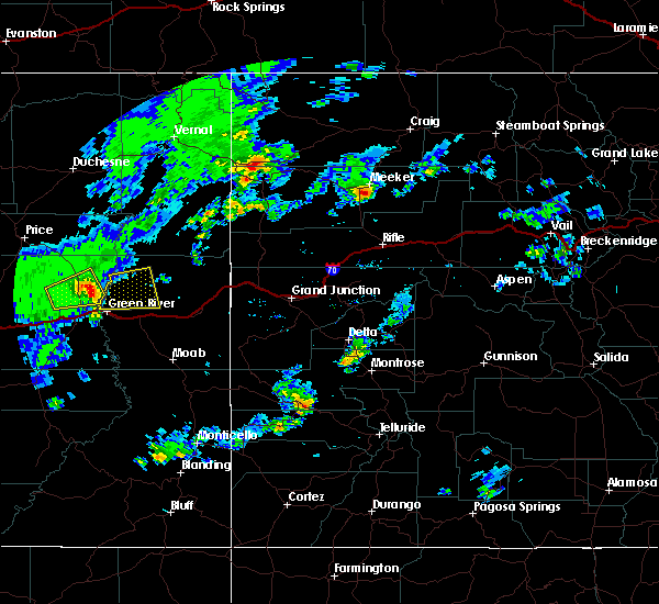
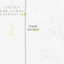
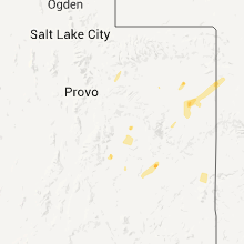
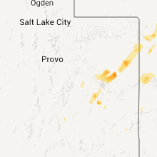
Hail Map for Green River, UT
The Green River, UT area has had 1 report of on-the-ground hail by trained spotters, and has been under severe weather warnings 0 times during the past 12 months. Doppler radar has detected hail at or near Green River, UT on 5 occasions.
| Name: | Green River, UT |
| Where Located: | 55.8 miles SE of Price, UT |
| Map: | Google Map for Green River, UT |
| Population: | 952 |
| Housing Units: | 389 |
| More Info: | Search Google for Green River, UT |
5
The Top Recent Hail Date for Green River, UT is Sunday, October 2, 2022 (1st out of 5)

Hail and Wind Damage Spotted near Green River, UT
| Date / Time | Report Details |
|---|---|
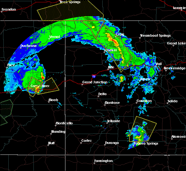
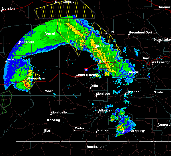
| 10/2/2022 4:08 PM MDT |
 The severe thunderstorm warning for west central grand county will expire at 415 pm mdt, the storm which prompted the warning has moved out of the area. therefore, the warning will be allowed to expire. The severe thunderstorm warning for west central grand county will expire at 415 pm mdt, the storm which prompted the warning has moved out of the area. therefore, the warning will be allowed to expire.
|
| 10/2/2022 3:58 PM MDT |
 At 358 pm mdt, a severe thunderstorm was located 8 miles east of green river, moving east at 20 mph (radar indicated). Hazards include 60 mph wind gusts and quarter size hail. Hail damage to vehicles is expected. expect wind damage to roofs, siding, and trees. this severe thunderstorm will remain over mainly rural areas of eastern emery county. hail threat, radar indicated max hail size, 1. 00 in wind threat, radar indicated max wind gust, 60 mph. At 358 pm mdt, a severe thunderstorm was located 8 miles east of green river, moving east at 20 mph (radar indicated). Hazards include 60 mph wind gusts and quarter size hail. Hail damage to vehicles is expected. expect wind damage to roofs, siding, and trees. this severe thunderstorm will remain over mainly rural areas of eastern emery county. hail threat, radar indicated max hail size, 1. 00 in wind threat, radar indicated max wind gust, 60 mph.
|
| 10/2/2022 3:44 PM MDT |
 At 344 pm mdt, a severe thunderstorm was located near green river, moving east at 20 mph (radar indicated). Hazards include 60 mph wind gusts and quarter size hail. Hail damage to vehicles is expected. expect wind damage to roofs, siding, and trees. this severe thunderstorm will remain over mainly rural areas of eastern emery county. hail threat, radar indicated max hail size, 1. 00 in wind threat, radar indicated max wind gust, 60 mph. At 344 pm mdt, a severe thunderstorm was located near green river, moving east at 20 mph (radar indicated). Hazards include 60 mph wind gusts and quarter size hail. Hail damage to vehicles is expected. expect wind damage to roofs, siding, and trees. this severe thunderstorm will remain over mainly rural areas of eastern emery county. hail threat, radar indicated max hail size, 1. 00 in wind threat, radar indicated max wind gust, 60 mph.
|
| 10/2/2022 3:38 PM MDT |
 At 337 pm mdt, a severe thunderstorm was located 7 miles southeast of green river, moving northeast at 30 mph (radar indicated). Hazards include 60 mph wind gusts and quarter size hail. Hail damage to vehicles is expected. expect wind damage to roofs, siding, and trees. this severe thunderstorm will remain over mainly rural areas of west central grand county. this includes the following highways, interstate 70 in utah between mile markers 164 and 185. u. s. highway 191 in utah between mile markers 153 and 157. hail threat, radar indicated max hail size, 1. 00 in wind threat, radar indicated max wind gust, 60 mph. At 337 pm mdt, a severe thunderstorm was located 7 miles southeast of green river, moving northeast at 30 mph (radar indicated). Hazards include 60 mph wind gusts and quarter size hail. Hail damage to vehicles is expected. expect wind damage to roofs, siding, and trees. this severe thunderstorm will remain over mainly rural areas of west central grand county. this includes the following highways, interstate 70 in utah between mile markers 164 and 185. u. s. highway 191 in utah between mile markers 153 and 157. hail threat, radar indicated max hail size, 1. 00 in wind threat, radar indicated max wind gust, 60 mph.
|
| 8/20/2022 4:52 PM MDT |
 At 451 pm mdt, a severe thunderstorm was located 19 miles west of green river, moving southeast at 10 mph (radar indicated). Hazards include 60 mph wind gusts and quarter size hail. Hail damage to vehicles is expected. Expect wind damage to roofs, siding, and trees. At 451 pm mdt, a severe thunderstorm was located 19 miles west of green river, moving southeast at 10 mph (radar indicated). Hazards include 60 mph wind gusts and quarter size hail. Hail damage to vehicles is expected. Expect wind damage to roofs, siding, and trees.
|
| 6/6/2020 1:24 PM MDT |
 At 124 pm mdt, a severe thunderstorm was located 18 miles east of green river, moving northeast at 50 mph (radar indicated). Hazards include 60 mph wind gusts and quarter size hail. Hail damage to vehicles is expected. Expect wind damage to roofs, siding, and trees. At 124 pm mdt, a severe thunderstorm was located 18 miles east of green river, moving northeast at 50 mph (radar indicated). Hazards include 60 mph wind gusts and quarter size hail. Hail damage to vehicles is expected. Expect wind damage to roofs, siding, and trees.
|
| 6/6/2020 1:00 PM MDT |
 At 100 pm mdt, a severe thunderstorm was located 8 miles southeast of green river, moving north at 45 mph (radar indicated). Hazards include 60 mph wind gusts and quarter size hail. Hail damage to vehicles is expected. Expect wind damage to roofs, siding, and trees. At 100 pm mdt, a severe thunderstorm was located 8 miles southeast of green river, moving north at 45 mph (radar indicated). Hazards include 60 mph wind gusts and quarter size hail. Hail damage to vehicles is expected. Expect wind damage to roofs, siding, and trees.
|
| 7/15/2015 4:15 PM MDT |
 At 415 pm mdt, doppler radar indicated a severe thunderstorm capable of producing damaging winds in excess of 60 mph. this storm was located 17 miles northeast of green river, and moving east at 35 mph. * this severe thunderstorm will remain over mainly rural areas of northwestern grand county north of interstate 70. At 415 pm mdt, doppler radar indicated a severe thunderstorm capable of producing damaging winds in excess of 60 mph. this storm was located 17 miles northeast of green river, and moving east at 35 mph. * this severe thunderstorm will remain over mainly rural areas of northwestern grand county north of interstate 70.
|
| 7/15/2015 3:51 PM MDT |
 At 350 pm mdt, doppler radar indicated a severe thunderstorm capable of producing quarter size hail and damaging winds in excess of 60 mph. this storm was located 10 miles north of green river, and moving east at 35 mph. * this severe thunderstorm will remain over mainly rural areas of northwestern grand county just north of interstate 70. At 350 pm mdt, doppler radar indicated a severe thunderstorm capable of producing quarter size hail and damaging winds in excess of 60 mph. this storm was located 10 miles north of green river, and moving east at 35 mph. * this severe thunderstorm will remain over mainly rural areas of northwestern grand county just north of interstate 70.
|
| 5/28/2015 3:20 PM MDT | At 318 pm mdt, a severe thunderstorm was located 16 miles east of green river, moving southeast at 20 mph (radar indicated). Hazards include 70 mph wind gusts and quarter size hail. Hail damage to vehicles is expected. expect considerable tree damage. wind damage is also likely to mobile homes, roofs and outbuildings. This severe thunderstorm will remain over mainly rural areas of west central grand county. |
| 5/28/2015 2:54 PM MDT | At 253 pm mdt, a severe thunderstorm was located 12 miles northeast of green river, moving southeast at 20 mph (radar indicated). Hazards include 60 to 70 mph wind gusts and quarter size hail. Hail damage to vehicles is expected. expect wind damage to roofs, siding and trees. This severe thunderstorm will remain over mainly rural areas of west central grand county. |
| 9/16/2011 4:06 PM MDT | Quarter sized hail reported 41.7 miles NE of Green River, UT, relayed by hikers who were caught in crack canyon |
Hail Maps for Green River, UT


Connect with Interactive Hail Maps