

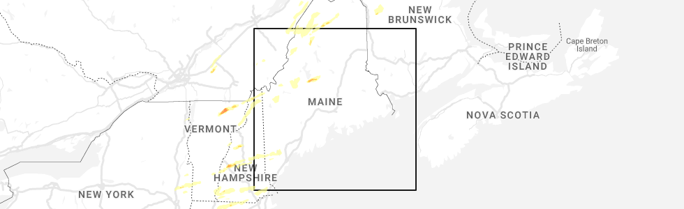
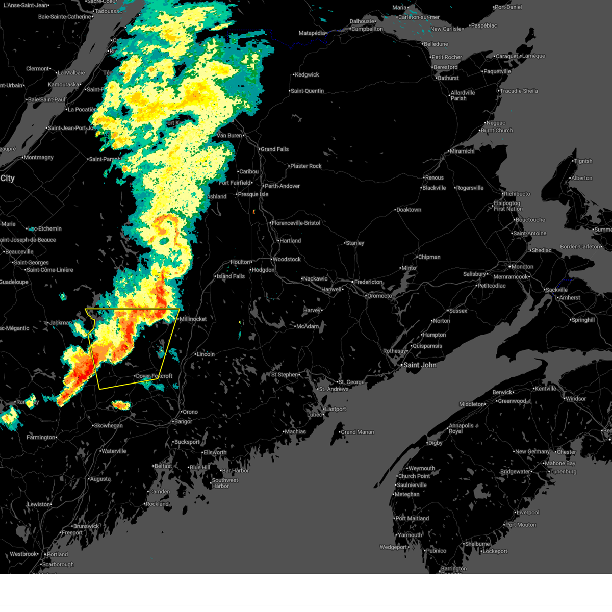
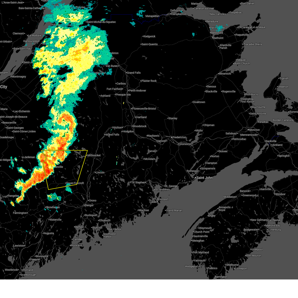
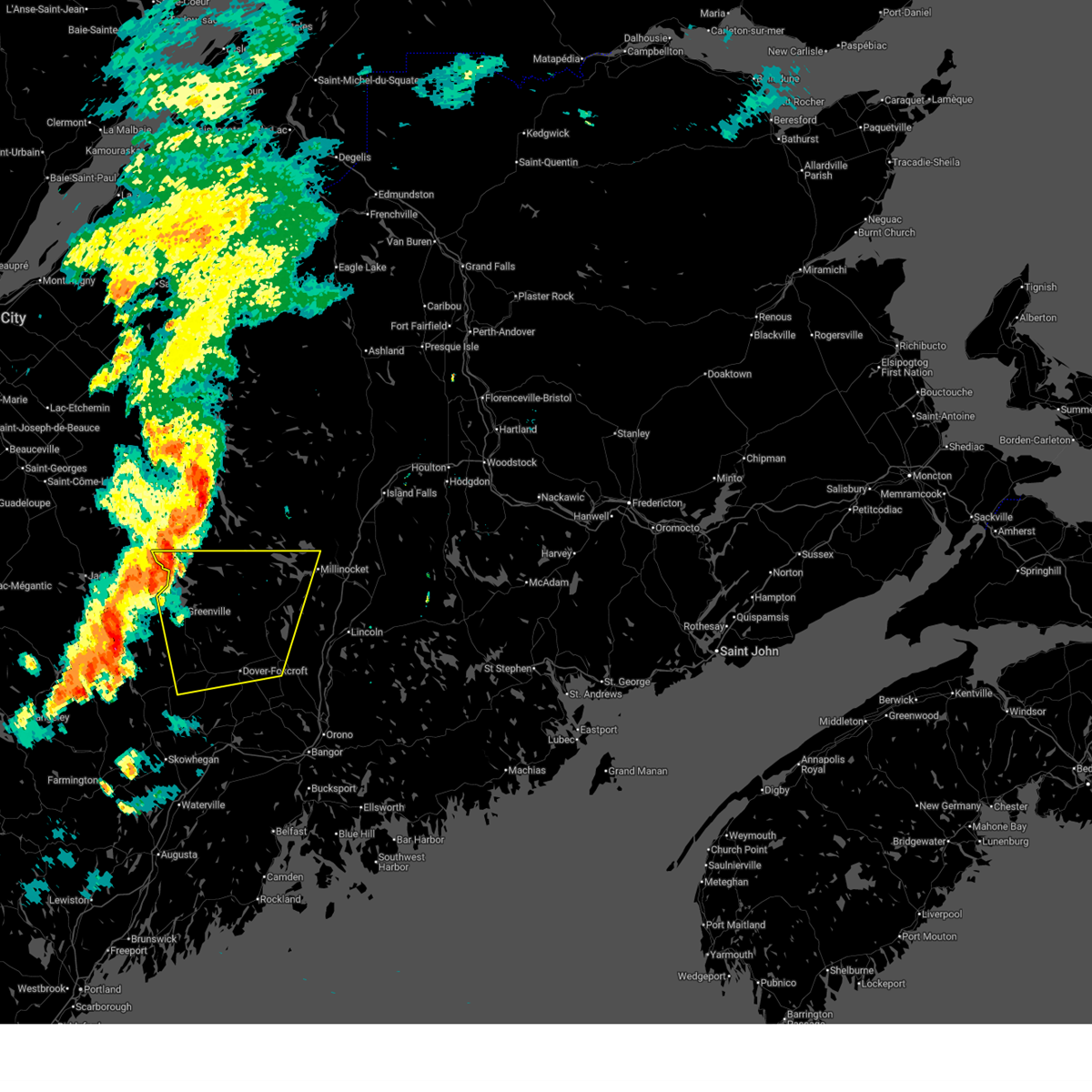
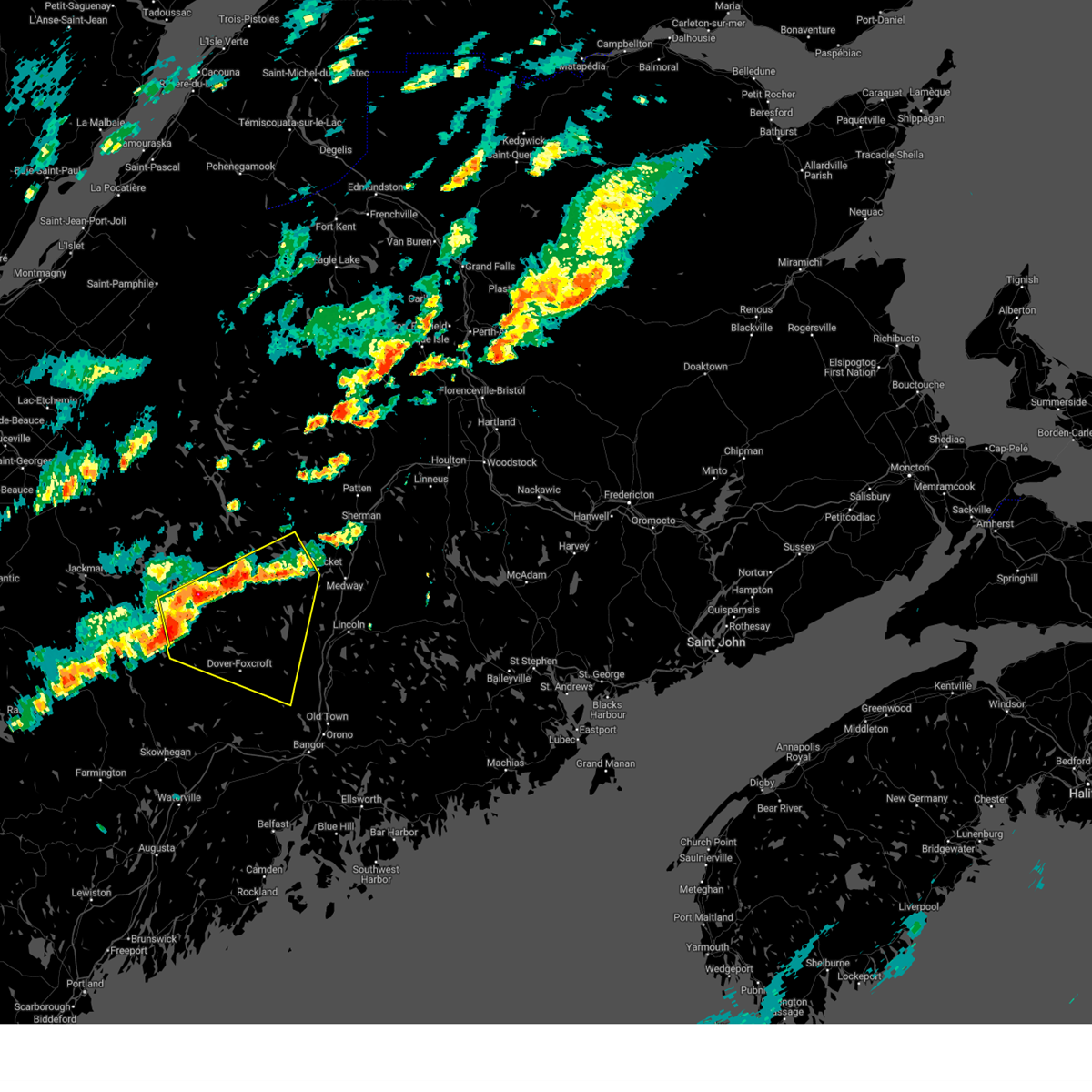
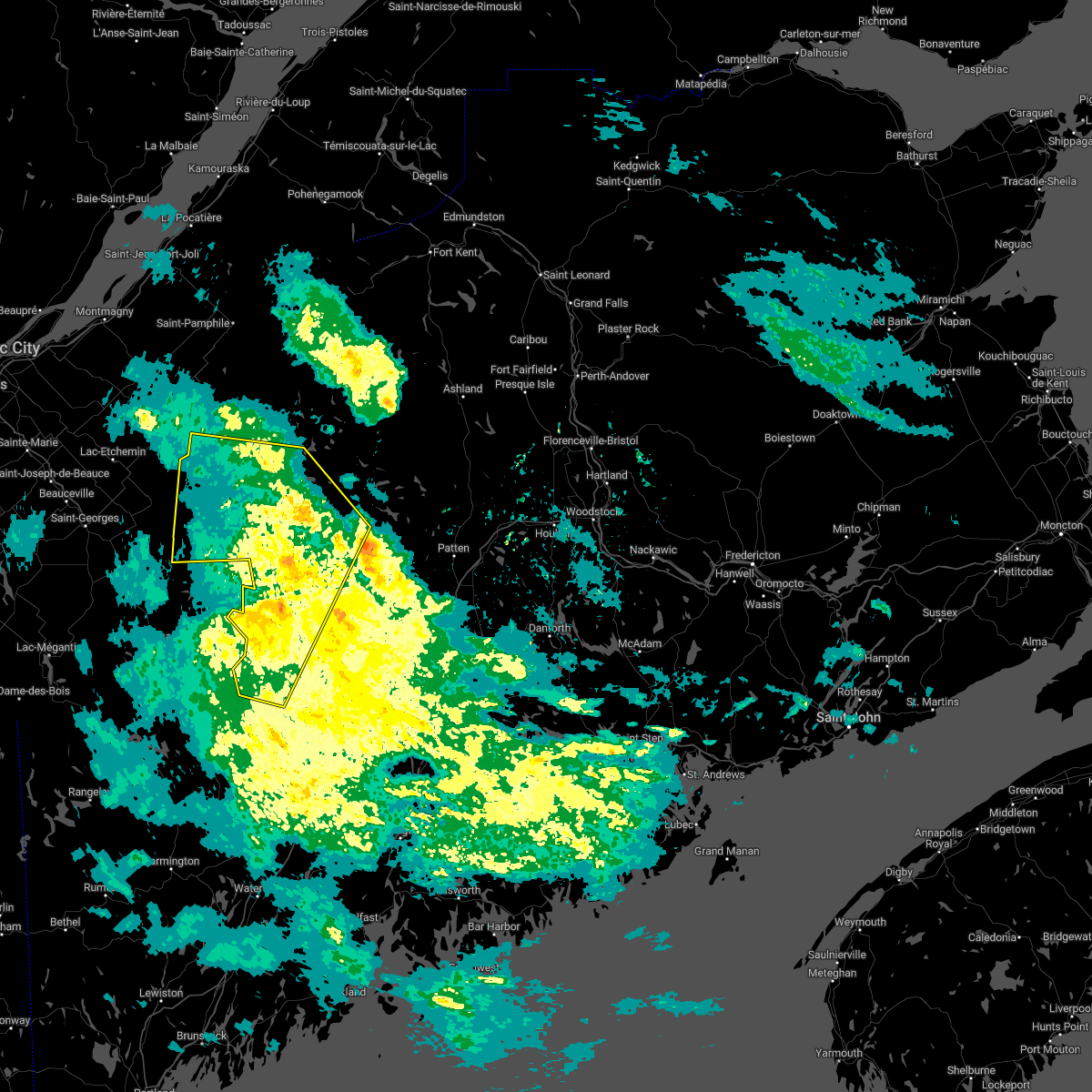
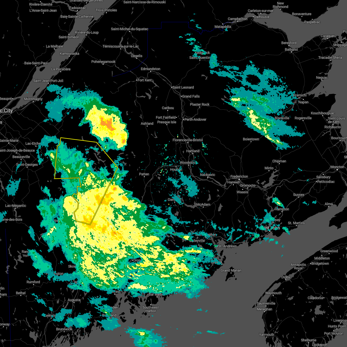
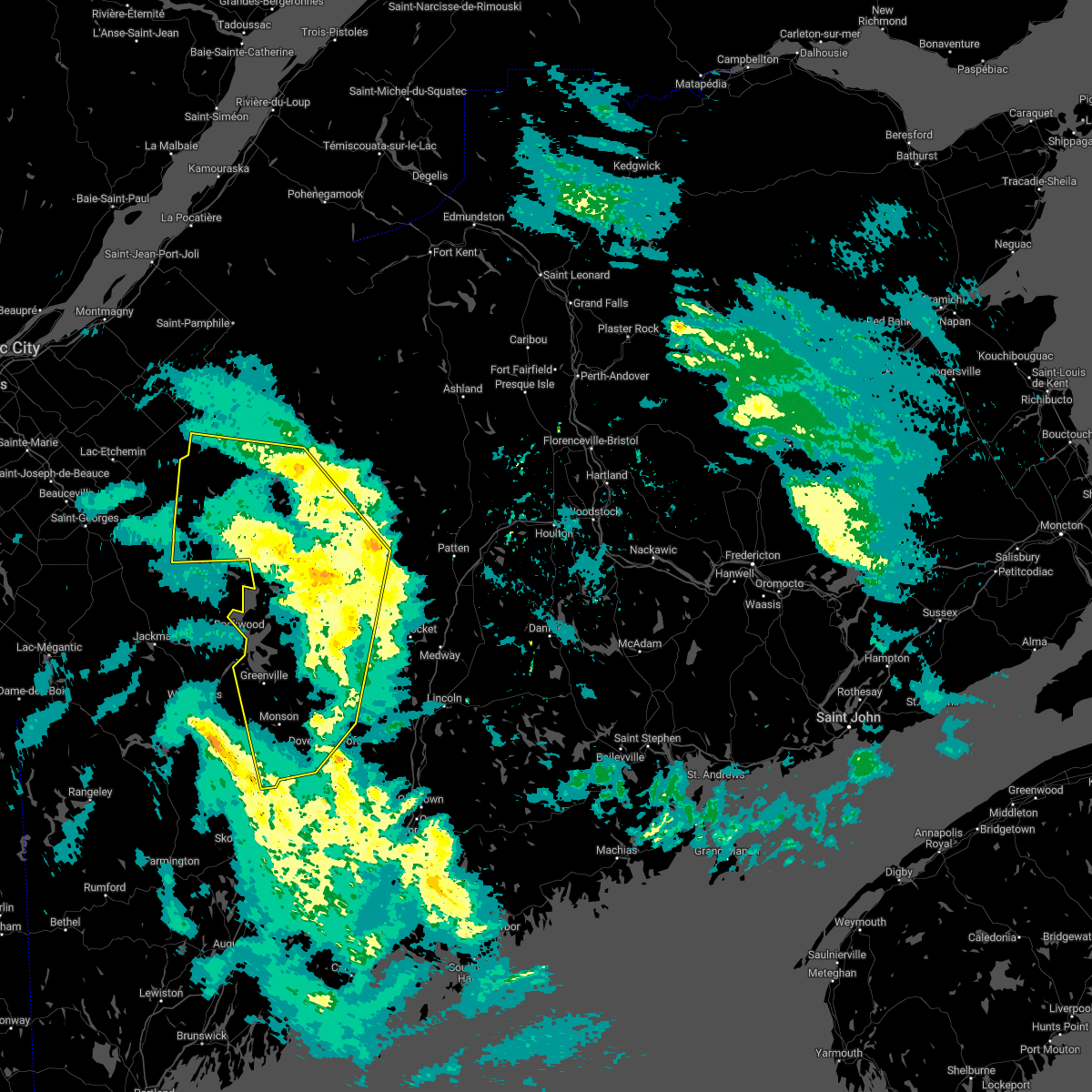
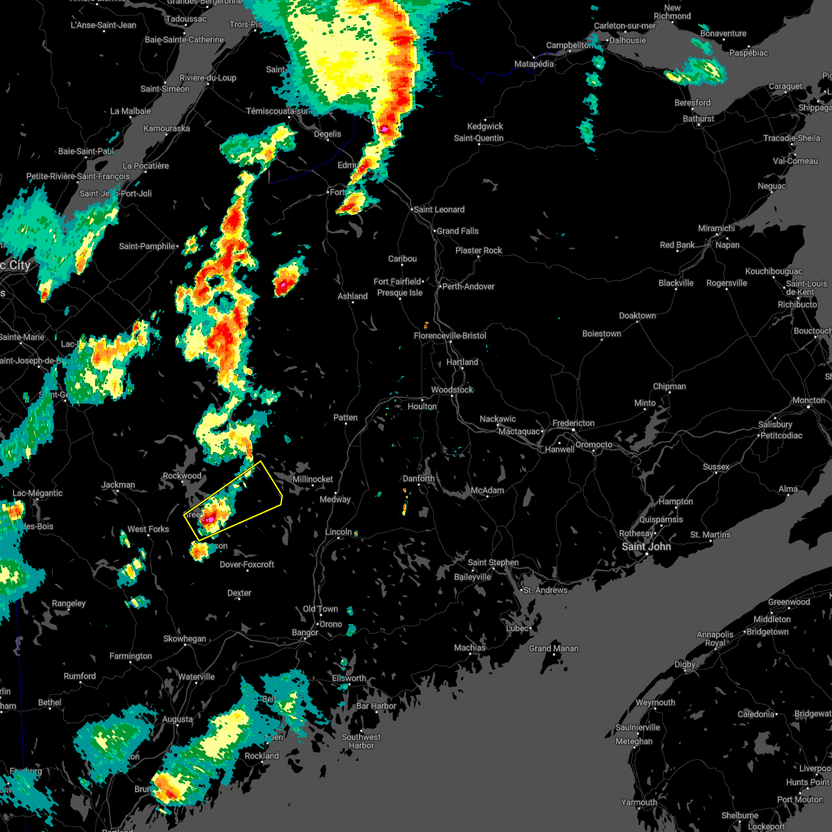
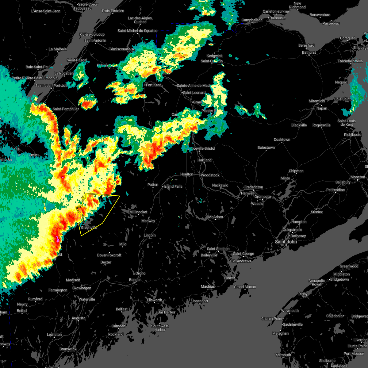
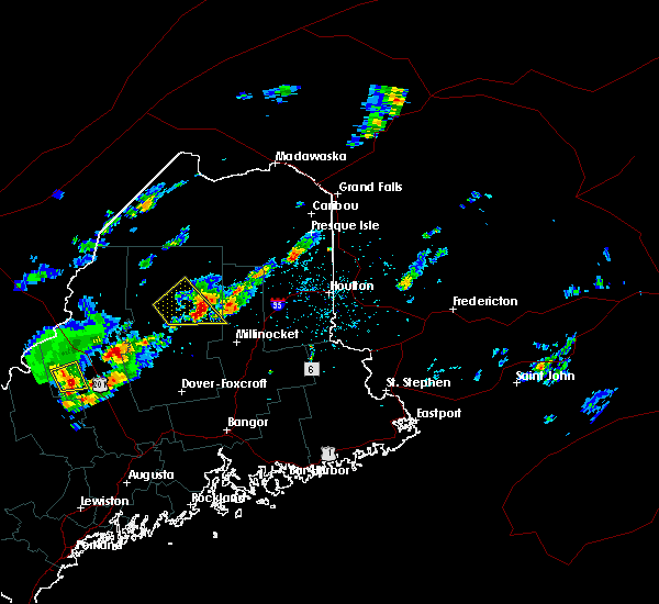
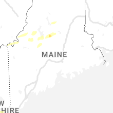
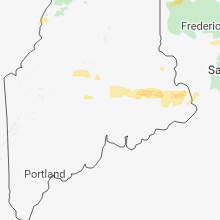
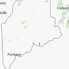
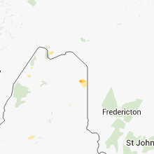
Hail Map for Greenville, ME
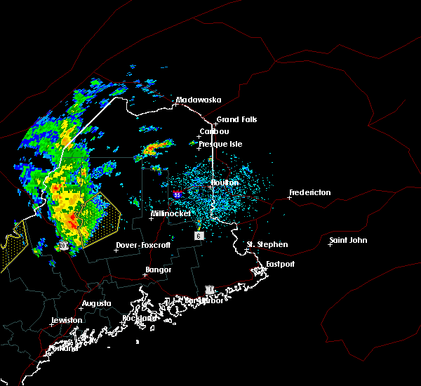
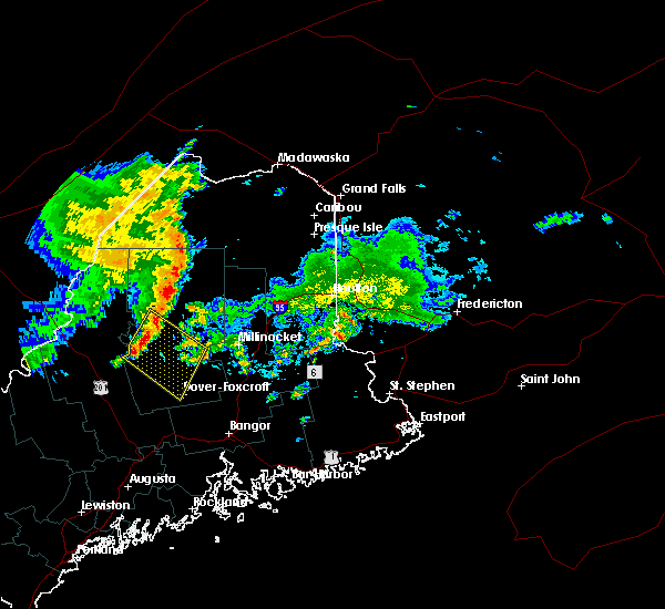
The Greenville, ME area has had 5 reports of on-the-ground hail by trained spotters, and has been under severe weather warnings 6 times during the past 12 months. Doppler radar has detected hail at or near Greenville, ME on 9 occasions.
| Name: | Greenville, ME |
| Where Located: | 61.3 miles NW of Bangor, ME |
| Map: | Google Map for Greenville, ME |
| Population: | 1257 |
| Housing Units: | 967 |
| More Info: | Search Google for Greenville, ME |
5
The Top Recent Hail Date for Greenville, ME is Thursday, July 21, 2022 (1st out of 9)
Hail and Wind Damage Spotted near Greenville, ME
| Date / Time | Report Details |
|---|---|
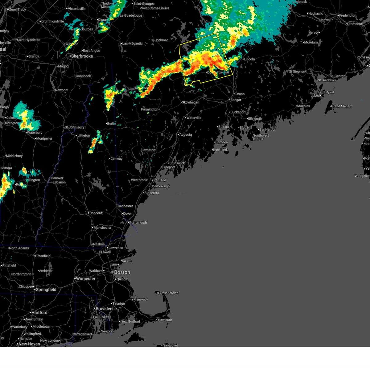
| 6/19/2025 9:44 PM EDT |
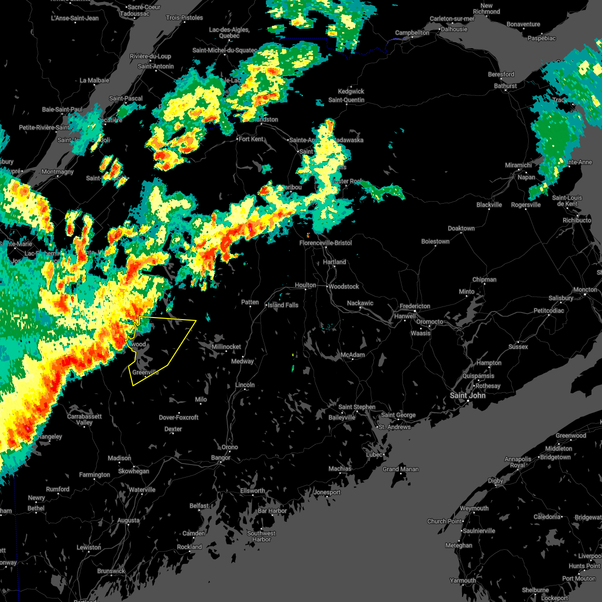
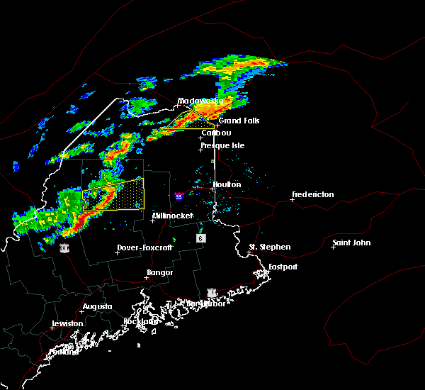
 The storm which prompted the warning has weakened below severe limits, and no longer poses an immediate threat to life or property. therefore, the warning will be allowed to expire. however, gusty winds and heavy rain are still possible with this thunderstorm. a severe thunderstorm watch remains in effect until 1100 pm edt for north central and west central maine. to report severe weather, contact your nearest law enforcement agency. they will relay your report to the national weather service caribou maine. The storm which prompted the warning has weakened below severe limits, and no longer poses an immediate threat to life or property. therefore, the warning will be allowed to expire. however, gusty winds and heavy rain are still possible with this thunderstorm. a severe thunderstorm watch remains in effect until 1100 pm edt for north central and west central maine. to report severe weather, contact your nearest law enforcement agency. they will relay your report to the national weather service caribou maine.
|
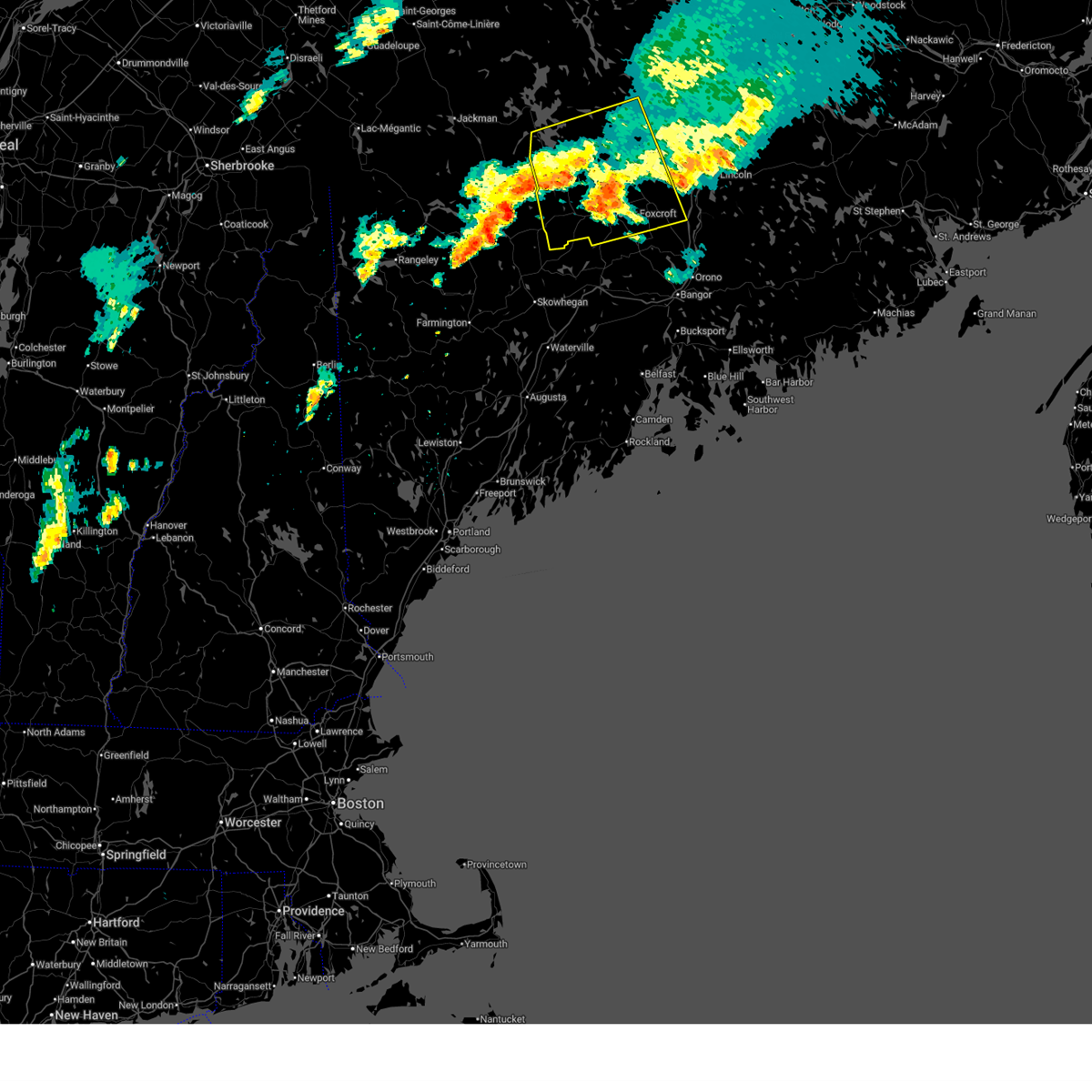
| 6/19/2025 9:14 PM EDT |
 At 914 pm edt, a severe thunderstorm was located near dover-foxcroft, moving east at 35 mph (radar indicated). Hazards include 60 mph wind gusts and quarter size hail. Minor hail damage to vehicles is possible. expect wind damage to trees and power lines. locations impacted include, dover-foxcroft, dexter, greenville, guilford, howland, brownville junction, milo, monson, blanchard, orneville, white cap mountain, ebeemee, kingsbury plantation, elliottsville, lake view plantation, frenchtown, charleston, sangerville, bradford, and brownville. This includes state highway 11 between milo and brownville junction. At 914 pm edt, a severe thunderstorm was located near dover-foxcroft, moving east at 35 mph (radar indicated). Hazards include 60 mph wind gusts and quarter size hail. Minor hail damage to vehicles is possible. expect wind damage to trees and power lines. locations impacted include, dover-foxcroft, dexter, greenville, guilford, howland, brownville junction, milo, monson, blanchard, orneville, white cap mountain, ebeemee, kingsbury plantation, elliottsville, lake view plantation, frenchtown, charleston, sangerville, bradford, and brownville. This includes state highway 11 between milo and brownville junction.
|
| 6/19/2025 8:43 PM EDT |
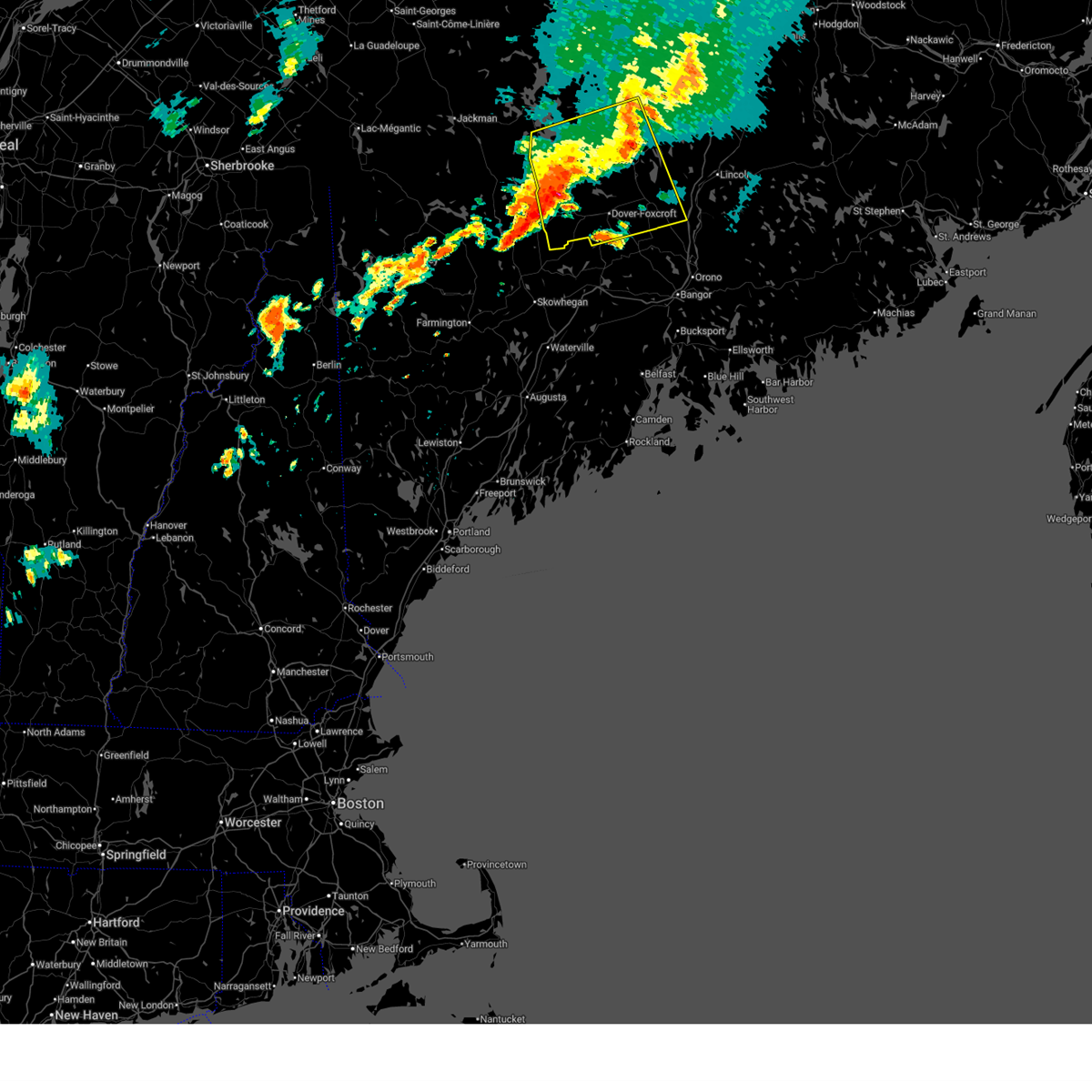 Svrcar the national weather service in caribou maine has issued a * severe thunderstorm warning for, southern piscataquis county in north central maine, west central penobscot county in east central maine, * until 945 pm edt. * at 842 pm edt, a severe thunderstorm was located near kingsbury plantation, or 9 miles west of guilford, moving north east at 40 mph (radar indicated). Hazards include 60 mph wind gusts and quarter size hail. Minor hail damage to vehicles is possible. Expect wind damage to trees and power lines. Svrcar the national weather service in caribou maine has issued a * severe thunderstorm warning for, southern piscataquis county in north central maine, west central penobscot county in east central maine, * until 945 pm edt. * at 842 pm edt, a severe thunderstorm was located near kingsbury plantation, or 9 miles west of guilford, moving north east at 40 mph (radar indicated). Hazards include 60 mph wind gusts and quarter size hail. Minor hail damage to vehicles is possible. Expect wind damage to trees and power lines.
|
| 6/19/2025 8:29 PM EDT |
 The storm which prompted the warning has weakened below severe limits, and no longer poses an immediate threat to life or property. therefore, the warning will be allowed to expire. however, gusty winds and heavy rain are still possible with this thunderstorm. a severe thunderstorm watch remains in effect until 1100 pm edt for north central and west central maine. to report severe weather, contact your nearest law enforcement agency. they will relay your report to the national weather service caribou maine. The storm which prompted the warning has weakened below severe limits, and no longer poses an immediate threat to life or property. therefore, the warning will be allowed to expire. however, gusty winds and heavy rain are still possible with this thunderstorm. a severe thunderstorm watch remains in effect until 1100 pm edt for north central and west central maine. to report severe weather, contact your nearest law enforcement agency. they will relay your report to the national weather service caribou maine.
|
| 6/19/2025 7:54 PM EDT |
 At 753 pm edt, a severe thunderstorm was located near frenchtown, or 9 miles northeast of greenville, moving east at 40 mph (radar indicated). Hazards include 70 mph wind gusts and half dollar size hail. Minor hail damage to vehicles is possible. expect considerable tree damage. wind damage is also likely to mobile homes, roofs, and outbuildings. locations impacted include, millinocket, dover-foxcroft, greenville, guilford, brownville junction, milo, monson, blanchard, rockwood, white cap mountain, ebeemee, kingsbury plantation, kokadjo, elliottsville, lake view plantation, frenchtown, orneville, sangerville, brownville, and parkman. This includes state highway 11 between milo and norcross. At 753 pm edt, a severe thunderstorm was located near frenchtown, or 9 miles northeast of greenville, moving east at 40 mph (radar indicated). Hazards include 70 mph wind gusts and half dollar size hail. Minor hail damage to vehicles is possible. expect considerable tree damage. wind damage is also likely to mobile homes, roofs, and outbuildings. locations impacted include, millinocket, dover-foxcroft, greenville, guilford, brownville junction, milo, monson, blanchard, rockwood, white cap mountain, ebeemee, kingsbury plantation, kokadjo, elliottsville, lake view plantation, frenchtown, orneville, sangerville, brownville, and parkman. This includes state highway 11 between milo and norcross.
|
| 6/19/2025 7:23 PM EDT |
 Svrcar the national weather service in caribou maine has issued a * severe thunderstorm warning for, southern piscataquis county in north central maine, central penobscot county in east central maine, * until 830 pm edt. * at 722 pm edt, a severe thunderstorm was located 8 miles south of rockwood, or 10 miles northwest of greenville, moving east at 35 mph (radar indicated). Hazards include 70 mph wind gusts and half dollar size hail. Minor hail damage to vehicles is possible. expect considerable tree damage. Wind damage is also likely to mobile homes, roofs, and outbuildings. Svrcar the national weather service in caribou maine has issued a * severe thunderstorm warning for, southern piscataquis county in north central maine, central penobscot county in east central maine, * until 830 pm edt. * at 722 pm edt, a severe thunderstorm was located 8 miles south of rockwood, or 10 miles northwest of greenville, moving east at 35 mph (radar indicated). Hazards include 70 mph wind gusts and half dollar size hail. Minor hail damage to vehicles is possible. expect considerable tree damage. Wind damage is also likely to mobile homes, roofs, and outbuildings.
|
| 6/30/2024 1:34 PM EDT |
 Svrcar the national weather service in caribou maine has issued a * severe thunderstorm warning for, southern piscataquis county in north central maine, southwestern penobscot county in east central maine, * until 215 pm edt. * at 133 pm edt, a severe thunderstorm was located near blanchard, or 9 miles southwest of greenville, moving east at 45 mph (radar indicated). Hazards include 70 mph wind gusts and half dollar size hail. Minor hail damage to vehicles is possible. expect considerable tree damage. Wind damage is also likely to mobile homes, roofs, and outbuildings. Svrcar the national weather service in caribou maine has issued a * severe thunderstorm warning for, southern piscataquis county in north central maine, southwestern penobscot county in east central maine, * until 215 pm edt. * at 133 pm edt, a severe thunderstorm was located near blanchard, or 9 miles southwest of greenville, moving east at 45 mph (radar indicated). Hazards include 70 mph wind gusts and half dollar size hail. Minor hail damage to vehicles is possible. expect considerable tree damage. Wind damage is also likely to mobile homes, roofs, and outbuildings.
|
| 7/12/2023 4:12 PM EDT | Correction to thunderstorm wind damage. large tree down blocking katahdin iron works road (north woods road) at the 3rd bridge past the checkpoint. time estimated by ra in piscataquis county ME, 17.7 miles W of Greenville, ME |
| 12/23/2022 4:39 PM EST |
 The severe thunderstorm warning for northwestern piscataquis and somerset counties will expire at 445 pm est, lightning within the storms which prompted the warning has become much less frequent. however, strong wind gusts of 55 to 65 mph will continue over the next several hours even outside of thunderstorms. please see the high wind warning for more details. The severe thunderstorm warning for northwestern piscataquis and somerset counties will expire at 445 pm est, lightning within the storms which prompted the warning has become much less frequent. however, strong wind gusts of 55 to 65 mph will continue over the next several hours even outside of thunderstorms. please see the high wind warning for more details.
|
| 12/23/2022 4:26 PM EST |
 At 426 pm est, severe thunderstorms were located along a line extending from 6 miles south of billy-jack depot to 6 miles northwest of seboomook to greenville, moving north at 95 mph (radar indicated). Hazards include 70 mph wind gusts. Expect considerable tree damage. damage is likely to mobile homes, roofs, and outbuildings. locations impacted include, greenville, ripogenus, kokadjo, northeast carry, caucomgomoc lake, baker lake, lobster lake, tamway, billy-jack depot, chesuncook, chamberlain lake, lobster township, frenchtown, telos lake, elliottsville, baxter state park, shirley, beaver cove, spencer bay and lily bay. thunderstorm damage threat, considerable hail threat, radar indicated max hail size, <. 75 in wind threat, radar indicated max wind gust, 70 mph. At 426 pm est, severe thunderstorms were located along a line extending from 6 miles south of billy-jack depot to 6 miles northwest of seboomook to greenville, moving north at 95 mph (radar indicated). Hazards include 70 mph wind gusts. Expect considerable tree damage. damage is likely to mobile homes, roofs, and outbuildings. locations impacted include, greenville, ripogenus, kokadjo, northeast carry, caucomgomoc lake, baker lake, lobster lake, tamway, billy-jack depot, chesuncook, chamberlain lake, lobster township, frenchtown, telos lake, elliottsville, baxter state park, shirley, beaver cove, spencer bay and lily bay. thunderstorm damage threat, considerable hail threat, radar indicated max hail size, <. 75 in wind threat, radar indicated max wind gust, 70 mph.
|
| 12/23/2022 4:06 PM EST | Occurred as thunderstorm passed throug in piscataquis county ME, 2.3 miles WNW of Greenville, ME |
| 12/23/2022 3:53 PM EST |
 At 352 pm est, severe thunderstorms were located along a line extending from 9 miles southeast of jackman to 13 miles west of blanchard to kingsbury plantation, moving north at 95 mph (radar indicated). Hazards include 70 mph wind gusts. Expect considerable tree damage. Damage is likely to mobile homes, roofs, and outbuildings. At 352 pm est, severe thunderstorms were located along a line extending from 9 miles southeast of jackman to 13 miles west of blanchard to kingsbury plantation, moving north at 95 mph (radar indicated). Hazards include 70 mph wind gusts. Expect considerable tree damage. Damage is likely to mobile homes, roofs, and outbuildings.
|
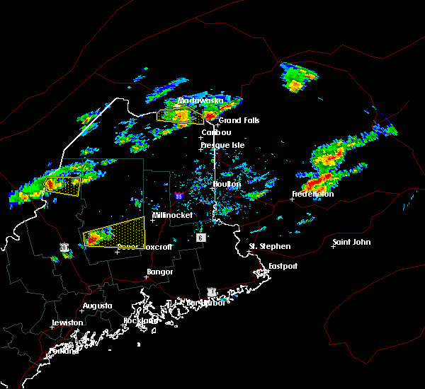
| 7/21/2022 6:22 PM EDT | Half Dollar sized hail reported 4.1 miles W of Greenville, ME, spotter also reported very strong winds. |
| 7/21/2022 6:12 PM EDT |
 At 611 pm edt, a severe thunderstorm was located over greenville, moving northeast at 30 mph (radar indicated). Hazards include 70 mph wind gusts and half dollar size hail. Minor hail damage to vehicles is possible. expect considerable tree damage. wind damage is also likely to mobile homes, roofs, and outbuildings. Locations impacted include, greenville, white cap mountain, frenchtown, elliottsville, shirley, beaver cove, lily bay and katahdin iron works. At 611 pm edt, a severe thunderstorm was located over greenville, moving northeast at 30 mph (radar indicated). Hazards include 70 mph wind gusts and half dollar size hail. Minor hail damage to vehicles is possible. expect considerable tree damage. wind damage is also likely to mobile homes, roofs, and outbuildings. Locations impacted include, greenville, white cap mountain, frenchtown, elliottsville, shirley, beaver cove, lily bay and katahdin iron works.
|
| 7/21/2022 6:10 PM EDT | Golf Ball sized hail reported 0.8 miles NNW of Greenville, ME, photo via social media. |
| 7/21/2022 6:02 PM EDT |
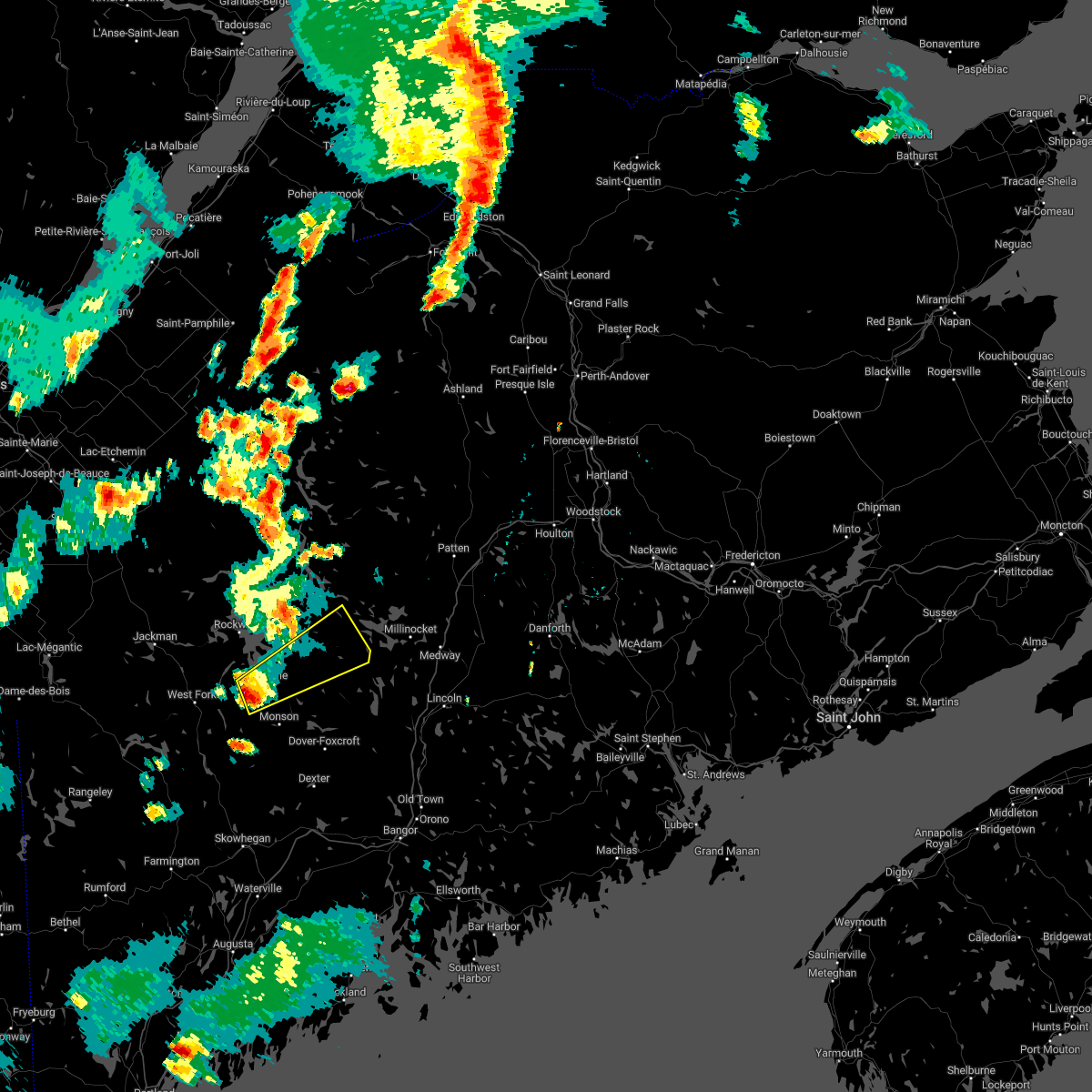 At 602 pm edt, a severe thunderstorm was located over greenville, moving northeast at 35 mph (radar indicated). Hazards include 60 mph wind gusts and quarter size hail. Minor hail damage to vehicles is possible. Expect wind damage to trees and power lines. At 602 pm edt, a severe thunderstorm was located over greenville, moving northeast at 35 mph (radar indicated). Hazards include 60 mph wind gusts and quarter size hail. Minor hail damage to vehicles is possible. Expect wind damage to trees and power lines.
|
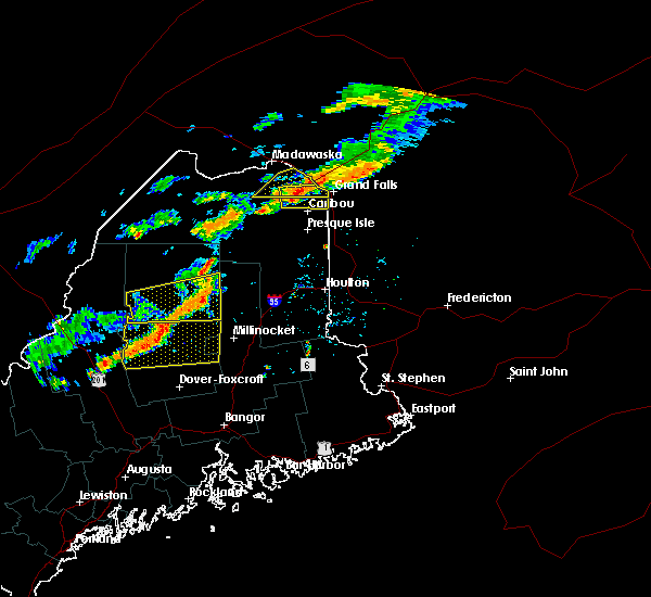
| 7/12/2022 6:43 PM EDT |
 At 642 pm edt, severe thunderstorms were located along a line extending from 6 miles southwest of ripogenus to near elliottsville, moving east at 30 mph (radar indicated). Hazards include 70 mph wind gusts and ping pong ball size hail. People and animals outdoors will be injured. expect hail damage to roofs, siding, windows, and vehicles. expect considerable tree damage. wind damage is also likely to mobile homes, roofs, and outbuildings. Locations impacted include, greenville, ripogenus, kokadjo, white cap mountain, frenchtown, lobster township, northeast carry, baxter state park, beaver cove, spencer bay and lily bay. At 642 pm edt, severe thunderstorms were located along a line extending from 6 miles southwest of ripogenus to near elliottsville, moving east at 30 mph (radar indicated). Hazards include 70 mph wind gusts and ping pong ball size hail. People and animals outdoors will be injured. expect hail damage to roofs, siding, windows, and vehicles. expect considerable tree damage. wind damage is also likely to mobile homes, roofs, and outbuildings. Locations impacted include, greenville, ripogenus, kokadjo, white cap mountain, frenchtown, lobster township, northeast carry, baxter state park, beaver cove, spencer bay and lily bay.
|
| 7/12/2022 6:20 PM EDT |
 At 619 pm edt, severe thunderstorms were located along a line extending from 6 miles southeast of lobster lake to near greenville, moving east at 30 mph (radar indicated). Hazards include 60 mph wind gusts and quarter size hail. Minor hail damage to vehicles is possible. Expect wind damage to trees and power lines. At 619 pm edt, severe thunderstorms were located along a line extending from 6 miles southeast of lobster lake to near greenville, moving east at 30 mph (radar indicated). Hazards include 60 mph wind gusts and quarter size hail. Minor hail damage to vehicles is possible. Expect wind damage to trees and power lines.
|
| 5/21/2022 8:12 PM EDT |
 The severe thunderstorm warning for west central piscataquis county will expire at 815 pm edt, the storms which prompted the warning have weakened below severe limits, but frequent cloud to ground lightning and heavy downpours are still likely. therefore, the warning will be allowed to expire. however gusty winds and heavy rain are still possible with these thunderstorms. a severe thunderstorm watch remains in effect until 1100 pm edt for north central and west central maine. The severe thunderstorm warning for west central piscataquis county will expire at 815 pm edt, the storms which prompted the warning have weakened below severe limits, but frequent cloud to ground lightning and heavy downpours are still likely. therefore, the warning will be allowed to expire. however gusty winds and heavy rain are still possible with these thunderstorms. a severe thunderstorm watch remains in effect until 1100 pm edt for north central and west central maine.
|
| 5/21/2022 8:04 PM EDT | One tree and wire dow in somerset county ME, 15.8 miles ENE of Greenville, ME |
| 5/21/2022 7:51 PM EDT |
 At 750 pm edt, severe thunderstorms were located along a line extending from near lobster lake to 6 miles southeast of rockwood to 13 miles southeast of jackman, moving east at 35 mph (radar indicated). Hazards include 60 mph wind gusts and penny size hail. Expect damage to trees and power lines. locations impacted include, greenville, ripogenus, kokadjo, northeast carry, lobster lake, rockwood, lobster township, frenchtown, beaver cove, spencer bay, lily bay, north east carry and mount kineo. hail threat, radar indicated max hail size, 0. 75 in wind threat, radar indicated max wind gust, 60 mph. At 750 pm edt, severe thunderstorms were located along a line extending from near lobster lake to 6 miles southeast of rockwood to 13 miles southeast of jackman, moving east at 35 mph (radar indicated). Hazards include 60 mph wind gusts and penny size hail. Expect damage to trees and power lines. locations impacted include, greenville, ripogenus, kokadjo, northeast carry, lobster lake, rockwood, lobster township, frenchtown, beaver cove, spencer bay, lily bay, north east carry and mount kineo. hail threat, radar indicated max hail size, 0. 75 in wind threat, radar indicated max wind gust, 60 mph.
|
| 5/21/2022 7:30 PM EDT |
 At 729 pm edt, severe thunderstorms were located along a line extending from 7 miles southwest of northeast carry to 9 miles southwest of rockwood to 11 miles southwest of jackman, moving east at 35 mph (radar indicated). Hazards include 60 mph wind gusts and penny size hail. expect damage to trees and power lines At 729 pm edt, severe thunderstorms were located along a line extending from 7 miles southwest of northeast carry to 9 miles southwest of rockwood to 11 miles southwest of jackman, moving east at 35 mph (radar indicated). Hazards include 60 mph wind gusts and penny size hail. expect damage to trees and power lines
|
| 5/29/2020 8:55 PM EDT |
 At 854 pm edt, severe thunderstorms were located along a line extending from near rockwood to near greenville to 6 miles west of blanchard, moving northeast at 45 mph (radar indicated). Hazards include 60 mph wind gusts. Expect damage to trees and power lines. Locations impacted include, greenville, monson, blanchard, kokadjo, northeast carry, lobster lake, rockwood, white cap mountain, elliottsville, lobster township, frenchtown, chesuncook, shirley, beaver cove, spencer bay, lily bay, north east carry, mount kineo and katahdin iron works. At 854 pm edt, severe thunderstorms were located along a line extending from near rockwood to near greenville to 6 miles west of blanchard, moving northeast at 45 mph (radar indicated). Hazards include 60 mph wind gusts. Expect damage to trees and power lines. Locations impacted include, greenville, monson, blanchard, kokadjo, northeast carry, lobster lake, rockwood, white cap mountain, elliottsville, lobster township, frenchtown, chesuncook, shirley, beaver cove, spencer bay, lily bay, north east carry, mount kineo and katahdin iron works.
|
| 5/29/2020 8:32 PM EDT |
 At 831 pm edt, severe thunderstorms were located along a line extending from 11 miles southeast of jackman to 16 miles west of blanchard to near bingham, moving northeast at 45 mph (radar indicated). Hazards include 60 mph wind gusts and penny size hail. expect damage to trees and power lines At 831 pm edt, severe thunderstorms were located along a line extending from 11 miles southeast of jackman to 16 miles west of blanchard to near bingham, moving northeast at 45 mph (radar indicated). Hazards include 60 mph wind gusts and penny size hail. expect damage to trees and power lines
|
| 6/27/2019 10:13 PM EDT |
 At 1013 pm edt, severe thunderstorms were located along a line extending from lobster township to near rockwood, moving southeast at 35 mph (radar indicated). Hazards include 60 mph wind gusts and quarter size hail. Minor hail damage to vehicles is possible. expect wind damage to trees and power lines. severe thunderstorms will be near, kokadjo around 1025 pm edt. greenville around 1045 pm edt. frenchtown around 1055 pm edt. elliottsville and white cap mountain around 1100 pm edt. Other locations impacted by these severe thunderstorms include onawa, barnard, spencer bay, willimantic, bowerbank, lily bay, katahdin iron works, williamsburg, beaver cove and sebec. At 1013 pm edt, severe thunderstorms were located along a line extending from lobster township to near rockwood, moving southeast at 35 mph (radar indicated). Hazards include 60 mph wind gusts and quarter size hail. Minor hail damage to vehicles is possible. expect wind damage to trees and power lines. severe thunderstorms will be near, kokadjo around 1025 pm edt. greenville around 1045 pm edt. frenchtown around 1055 pm edt. elliottsville and white cap mountain around 1100 pm edt. Other locations impacted by these severe thunderstorms include onawa, barnard, spencer bay, willimantic, bowerbank, lily bay, katahdin iron works, williamsburg, beaver cove and sebec.
|
| 7/10/2018 1:37 PM EDT | Quarter sized hail reported 6.3 miles N of Greenville, ME, shirley dot worker reports hail up to one inch in diameter. |
| 7/10/2018 1:32 PM EDT |
 At 132 pm edt, a severe thunderstorm was located over elliottsville, or 7 miles southeast of greenville, moving east at 45 mph (radar indicated). Hazards include 60 mph wind gusts and quarter size hail. Minor hail damage to vehicles is possible. Expect wind damage to trees and power lines. At 132 pm edt, a severe thunderstorm was located over elliottsville, or 7 miles southeast of greenville, moving east at 45 mph (radar indicated). Hazards include 60 mph wind gusts and quarter size hail. Minor hail damage to vehicles is possible. Expect wind damage to trees and power lines.
|
| 9/9/2015 5:29 PM EDT |
 At 527 pm edt, a severe thunderstorm was located over frenchtown, or 17 miles northeast of greenville, moving east at 25 mph (radar indicated). Hazards include 60 mph wind gusts. Expect trees down with power outages. Locations impacted include, greenville, kokadjo, elliottsville, white cap mountain, ebeemee, frenchtown, shirley, beaver cove, west seboeis, spencer bay, katahdin iron works, lily bay and cedar lake. At 527 pm edt, a severe thunderstorm was located over frenchtown, or 17 miles northeast of greenville, moving east at 25 mph (radar indicated). Hazards include 60 mph wind gusts. Expect trees down with power outages. Locations impacted include, greenville, kokadjo, elliottsville, white cap mountain, ebeemee, frenchtown, shirley, beaver cove, west seboeis, spencer bay, katahdin iron works, lily bay and cedar lake.
|
| 9/9/2015 5:06 PM EDT |
 At 505 pm edt, a severe thunderstorm was located 7 miles west of kokadjo, or 13 miles north of greenville, moving east at 30 mph (radar indicated). Hazards include 60 mph wind gusts. expect damage to trees with downed power lines At 505 pm edt, a severe thunderstorm was located 7 miles west of kokadjo, or 13 miles north of greenville, moving east at 30 mph (radar indicated). Hazards include 60 mph wind gusts. expect damage to trees with downed power lines
|
| 8/4/2015 2:55 PM EDT | The severe thunderstorm warning for west central piscataquis county will expire at 300 pm edt, the storm which prompted the warning has weakened below severe limits and exited the warned area. therefore the warning will be allowed to expire. however gusty winds are still possible with this thunderstorm. a severe thunderstorm watch remains in effect until 800 pm edt for north central maine. to report severe weather contact the national weather service office in caribou maine or your nearest law enforcement agency. |
| 8/4/2015 2:32 PM EDT |
 At 231 pm edt, a severe thunderstorm was located near kokadjo, or 14 miles north of greenville, moving east at 35 mph (radar indicated). Hazards include 60 mph wind gusts and quarter size hail. Hail damage to vehicles is expected. expect wind damage to roofs, siding and trees. Locations impacted include, greenville, rockwood, kokadjo, white cap mountain, frenchtown, elliottsville, beaver cove, spencer bay, katahdin iron works, mount kineo, lily bay and taunton and raynham academy grant. At 231 pm edt, a severe thunderstorm was located near kokadjo, or 14 miles north of greenville, moving east at 35 mph (radar indicated). Hazards include 60 mph wind gusts and quarter size hail. Hail damage to vehicles is expected. expect wind damage to roofs, siding and trees. Locations impacted include, greenville, rockwood, kokadjo, white cap mountain, frenchtown, elliottsville, beaver cove, spencer bay, katahdin iron works, mount kineo, lily bay and taunton and raynham academy grant.
|
| 8/4/2015 2:10 PM EDT |
 At 210 pm edt, a severe thunderstorm was located 7 miles south of rockwood, or 10 miles northwest of greenville, moving east at 35 mph (radar indicated). Hazards include 60 mph wind gusts and quarter size hail. Hail damage to vehicles is expected. Expect wind damage to roofs, siding and trees. At 210 pm edt, a severe thunderstorm was located 7 miles south of rockwood, or 10 miles northwest of greenville, moving east at 35 mph (radar indicated). Hazards include 60 mph wind gusts and quarter size hail. Hail damage to vehicles is expected. Expect wind damage to roofs, siding and trees.
|
| 8/1/2015 2:39 PM EDT |
 At 238 pm edt, a severe thunderstorm was located over lake view plantation, or 7 miles east of brownville junction, moving east at 50 mph (radar indicated). Hazards include 60 mph wind gusts and quarter size hail. Hail damage to vehicles is expected. expect wind damage to roofs, siding and trees. Locations impacted include, millinocket, dover-foxcroft, dexter, greenville, guilford, howland, brownville junction, milo, east millinocket, monson, blanchard, lake view plantation, ebeemee, kingsbury plantation, frenchtown, elliottsville, white cap mountain, orneville, licoln township and enfield. At 238 pm edt, a severe thunderstorm was located over lake view plantation, or 7 miles east of brownville junction, moving east at 50 mph (radar indicated). Hazards include 60 mph wind gusts and quarter size hail. Hail damage to vehicles is expected. expect wind damage to roofs, siding and trees. Locations impacted include, millinocket, dover-foxcroft, dexter, greenville, guilford, howland, brownville junction, milo, east millinocket, monson, blanchard, lake view plantation, ebeemee, kingsbury plantation, frenchtown, elliottsville, white cap mountain, orneville, licoln township and enfield.
|
| 8/1/2015 2:06 PM EDT |
 At 204 pm edt, a severe thunderstorm was located over monson, or 8 miles northwest of guilford, moving east at 50 mph (radar indicated). Hazards include 60 mph wind gusts and quarter size hail. Hail damage to vehicles is expected. Expect wind damage to roofs, siding and trees. At 204 pm edt, a severe thunderstorm was located over monson, or 8 miles northwest of guilford, moving east at 50 mph (radar indicated). Hazards include 60 mph wind gusts and quarter size hail. Hail damage to vehicles is expected. Expect wind damage to roofs, siding and trees.
|
| 8/1/2015 2:00 PM EDT | Quarter sized hail reported 0.8 miles NNW of Greenville, ME |
| 5/27/2015 7:08 PM EDT | At 706 pm edt, a severe thunderstorm was located over white cap mountain, or 16 miles east of greenville, and moving east at 20 mph (radar indicated). Hazards include 60 mph wind gusts. Expect possible damage to siding and trees along with torrenital rainfall. Locations impacted include, greenville, monson, blanchard, shirley, willimantic, beaver cove, bowerbank, katahdin iron works, williamsburg, onawa, barnard and lily bay. |
| 5/27/2015 6:37 PM EDT | At 635 pm edt, a severe thunderstorm was located over greenville, moving northeast at 35 mph (radar indicated). Hazards include 60 mph wind gusts. Expect possible damage to roofs. siding and trees. Very heavy rainfall. |
| 7/2/2014 5:17 PM EDT | Trees down in greenville in piscataquis county ME, 0.8 miles NNW of Greenville, ME |
| 10/7/2013 9:00 PM EDT | Trees down in town. time is estimate in piscataquis county ME, 0.8 miles NNW of Greenville, ME |
| 7/30/2013 2:48 AM EDT | Numerous trees reported down on mount kineo reported by public. report relayed by channel 5 television in bango in piscataquis county ME, 17.1 miles SSE of Greenville, ME |
| 7/30/2013 2:45 AM EDT | Large limbs down in rockwoo in somerset county ME, 18.4 miles SSE of Greenville, ME |
| 7/19/2013 7:00 PM EDT | *** 1 inj *** large tree down with 1 person injure in piscataquis county ME, 0.8 miles NNW of Greenville, ME |
| 7/19/2013 6:30 PM EDT | Trees dow in somerset county ME, 16.5 miles SSE of Greenville, ME |
| 6/2/2013 2:45 PM EDT | Trees down on a cabin. some roof damage to the cabin. time is estimate in piscataquis county ME, 0.8 miles NNW of Greenville, ME |
| 6/2/2013 1:00 PM EDT | 0.99 inches of rain accompanied the stor in piscataquis county ME, 15.4 miles SSW of Greenville, ME |
| 6/1/2013 2:55 PM EDT | Wires and trees down in greenville. several power poles knocked down and many homes without powe in piscataquis county ME, 0.8 miles NNW of Greenville, ME |
| 7/15/2012 7:36 PM EDT | Spruce tree down in front yard in somerset county ME, 20.4 miles ENE of Greenville, ME |
| 7/15/2012 7:13 PM EDT | Spruce tree down in front yard in somerset county ME, 20.4 miles ENE of Greenville, ME |
| 1/1/0001 12:00 AM | Trees and lines down in west forks in somerset county ME, 20.4 miles ENE of Greenville, ME |
| 1/1/0001 12:00 AM | Quarter sized hail reported 9.2 miles SSW of Greenville, ME, quarter size hail near lily bay. time is estimated. |
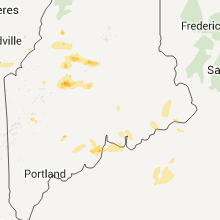
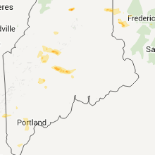
Hail Maps for Greenville, ME


Connect with Interactive Hail Maps