

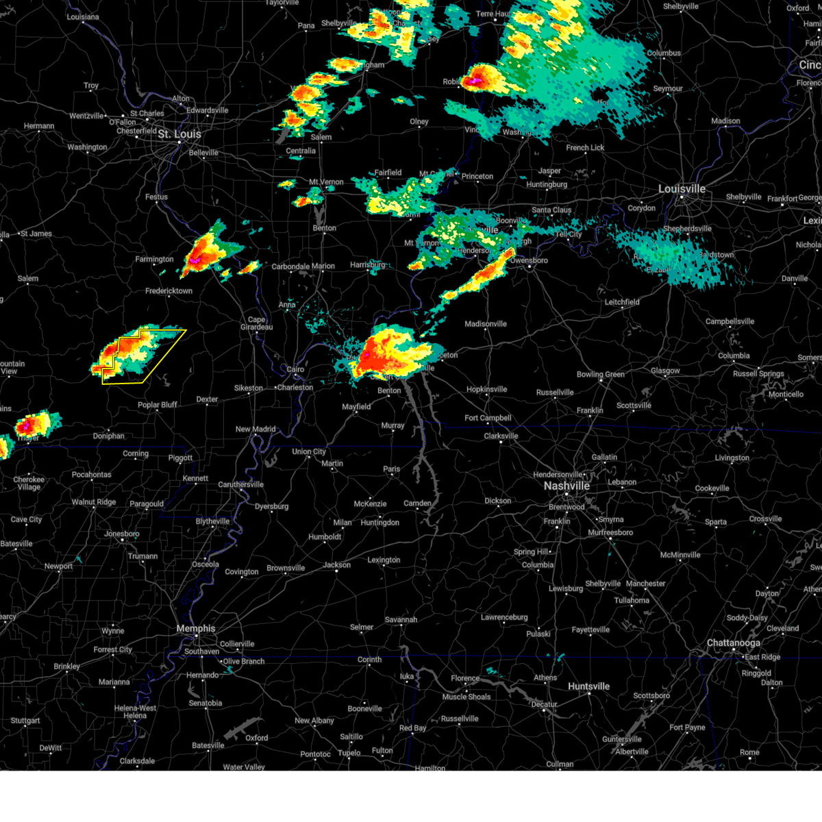
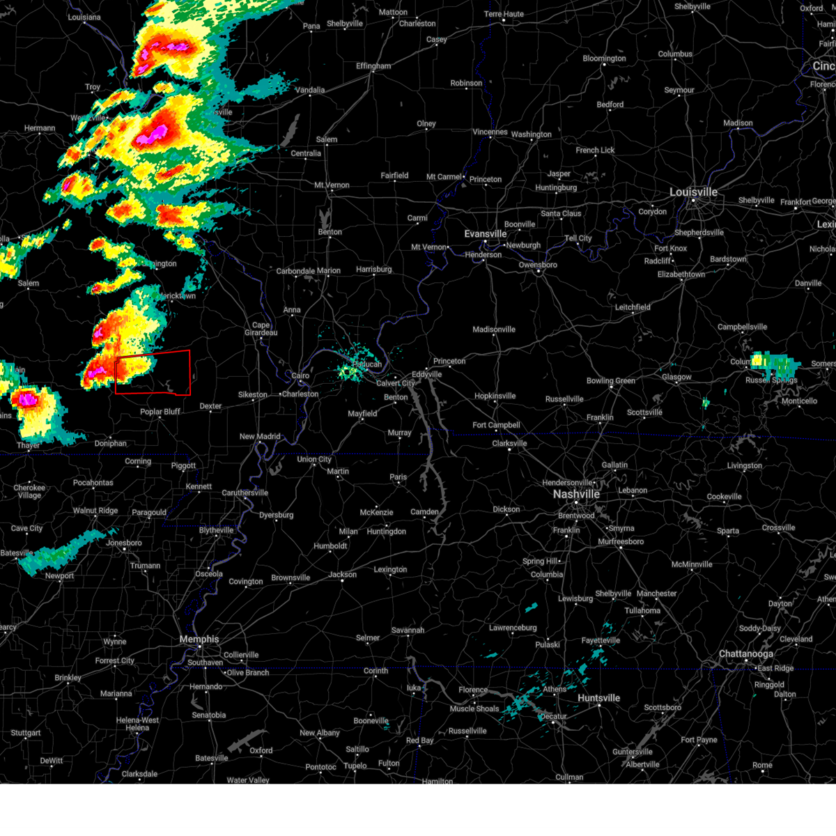
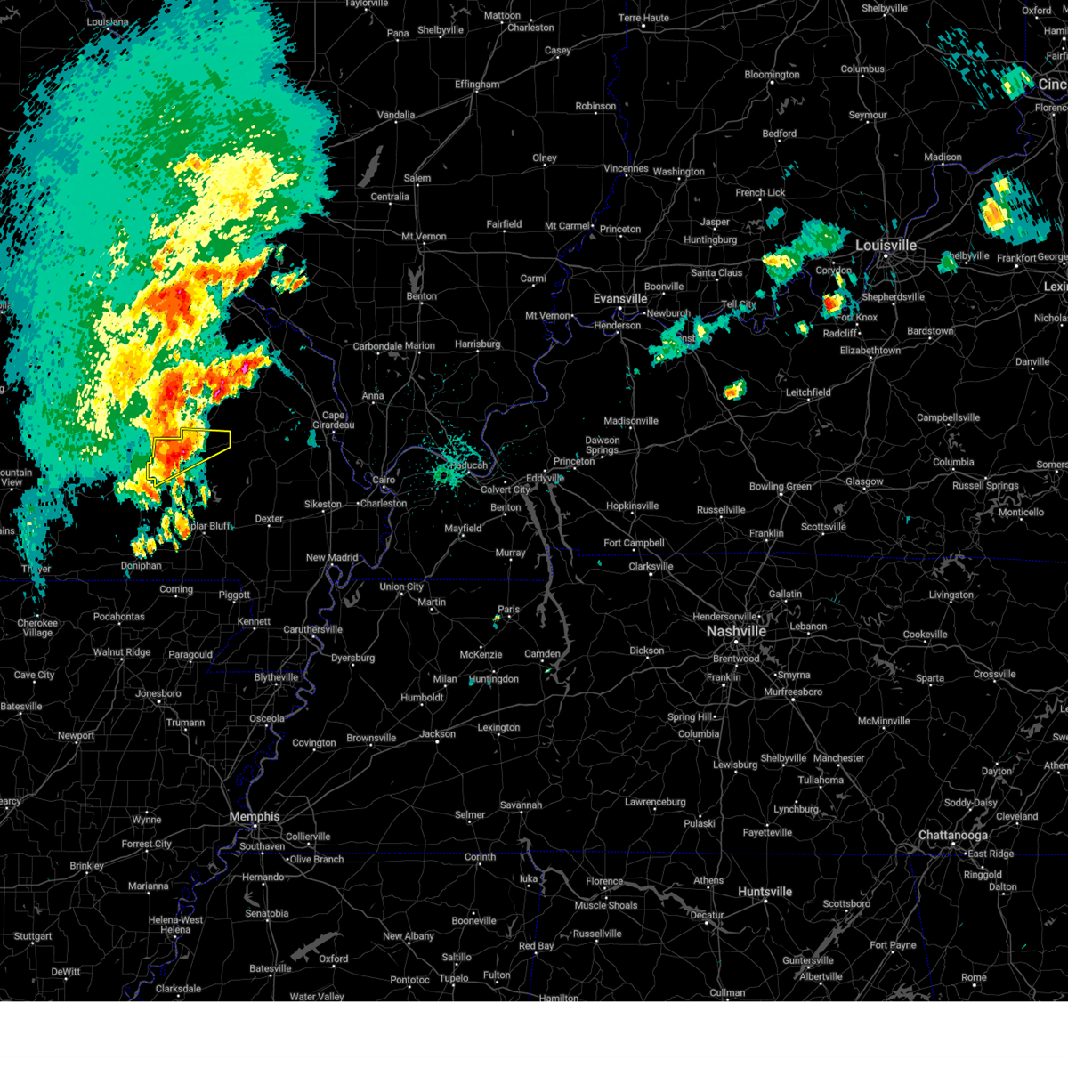
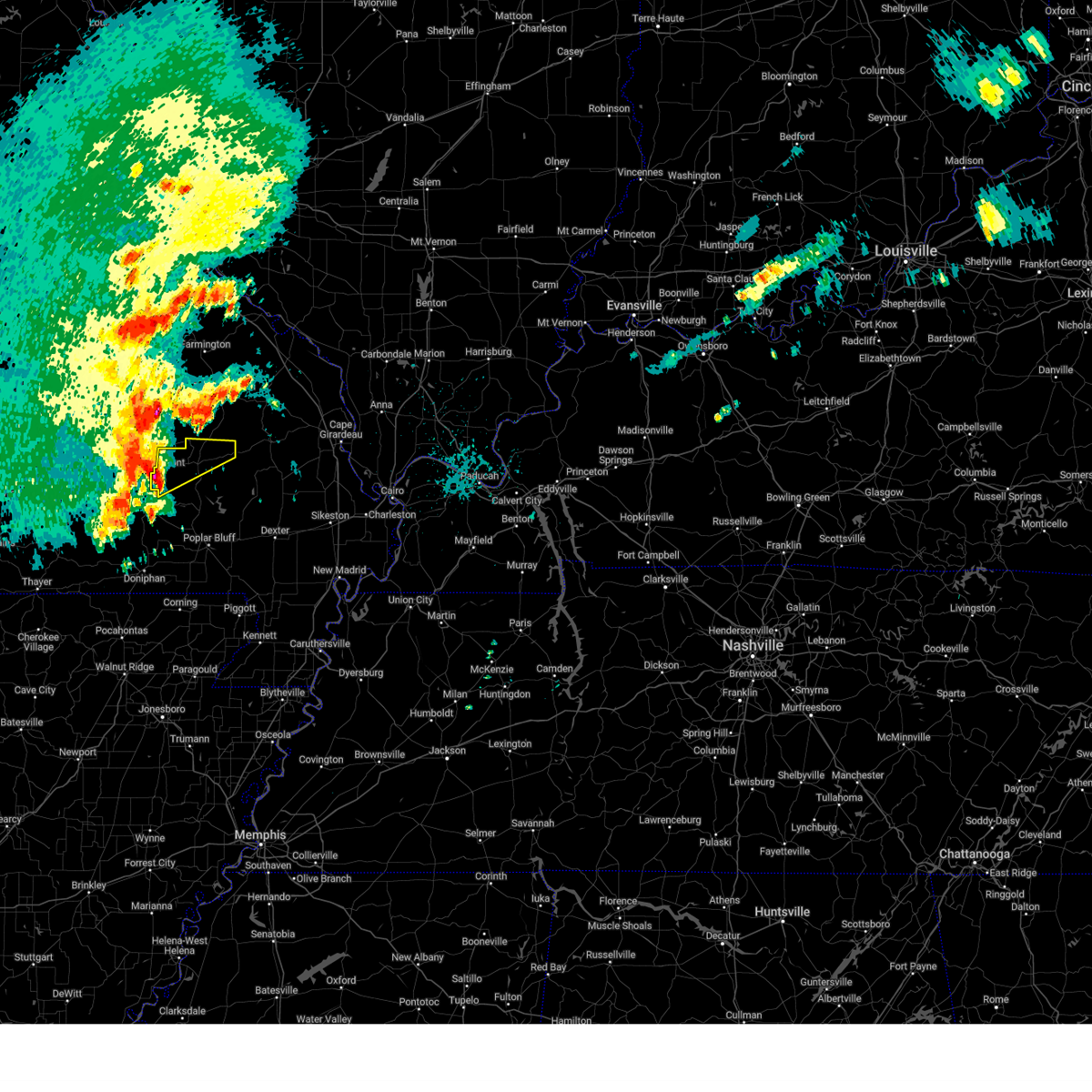
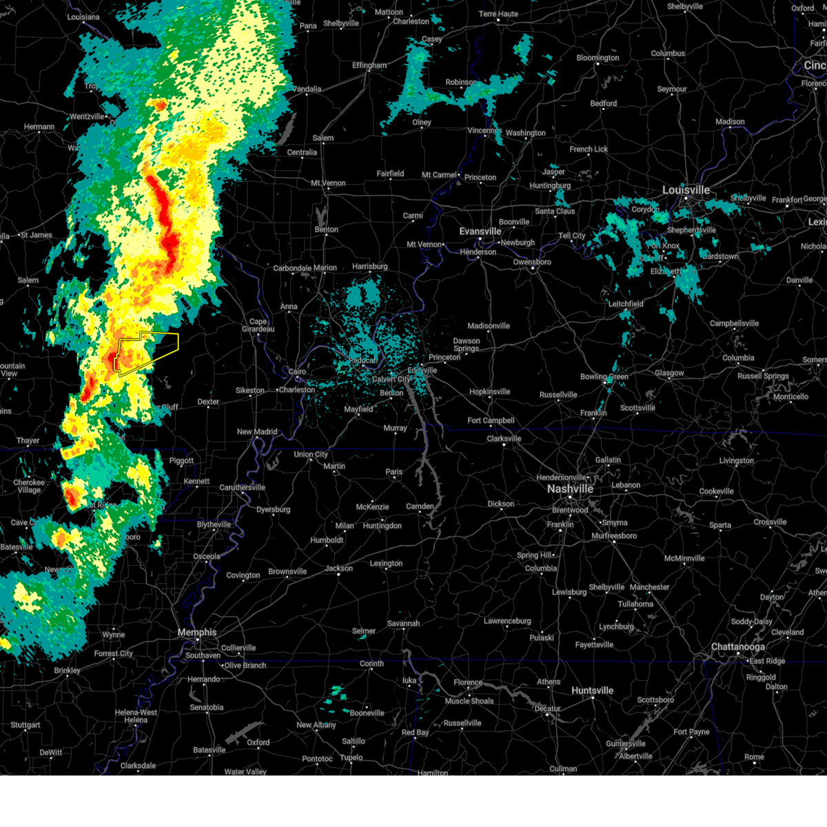
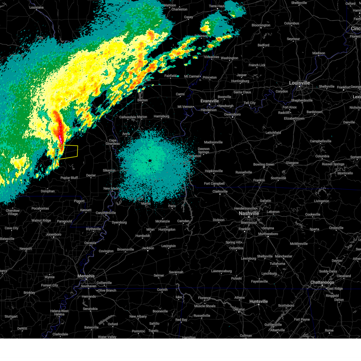
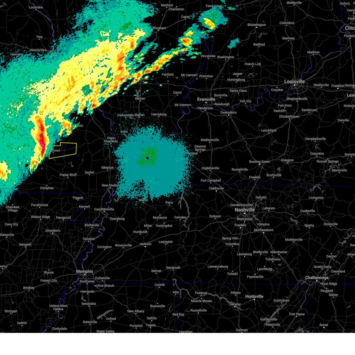
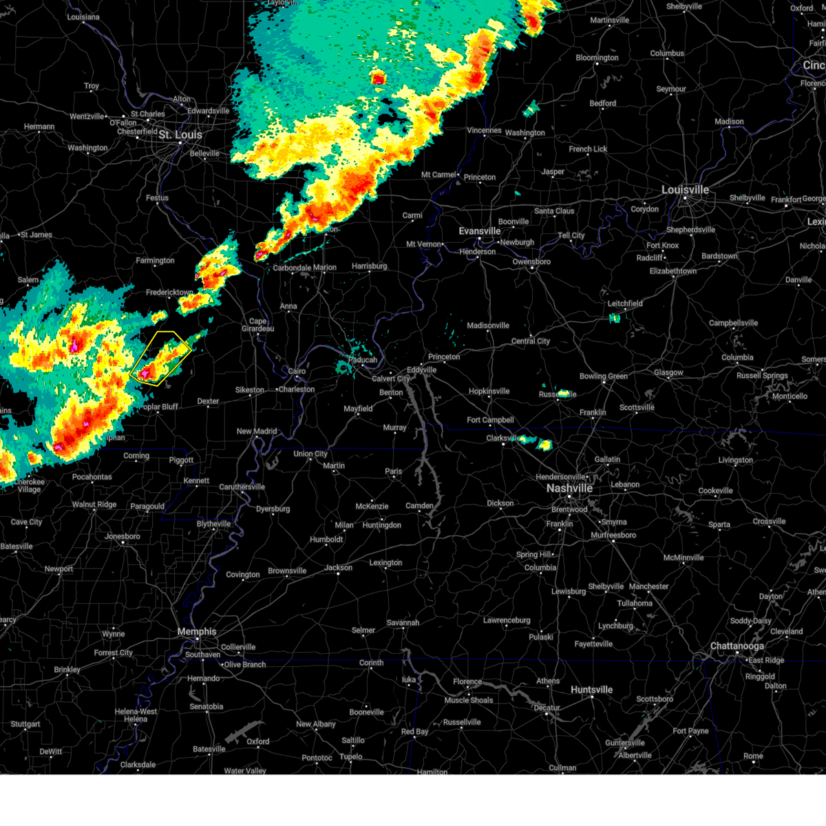
Hail Map for Greenville, MO
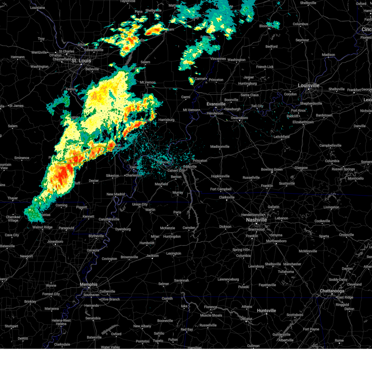
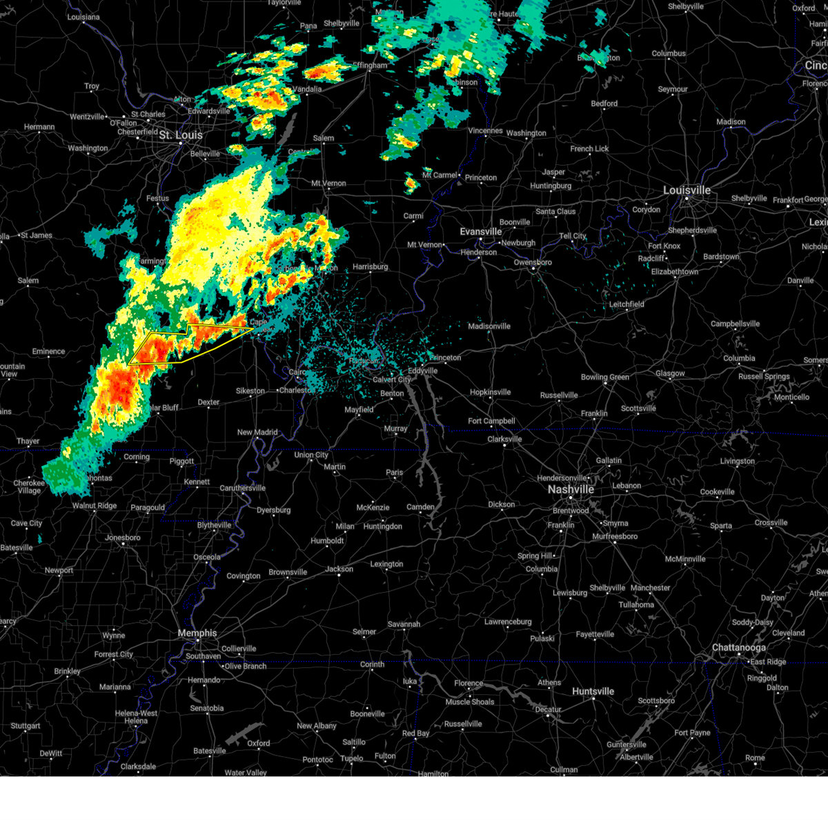
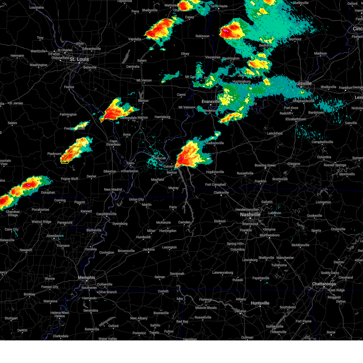
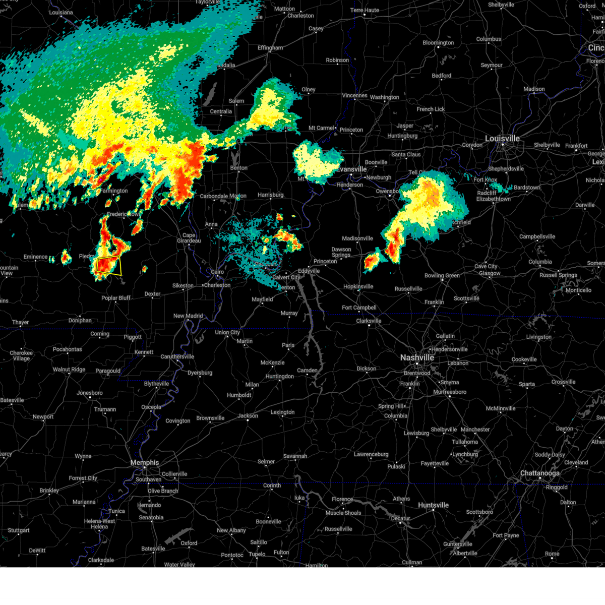
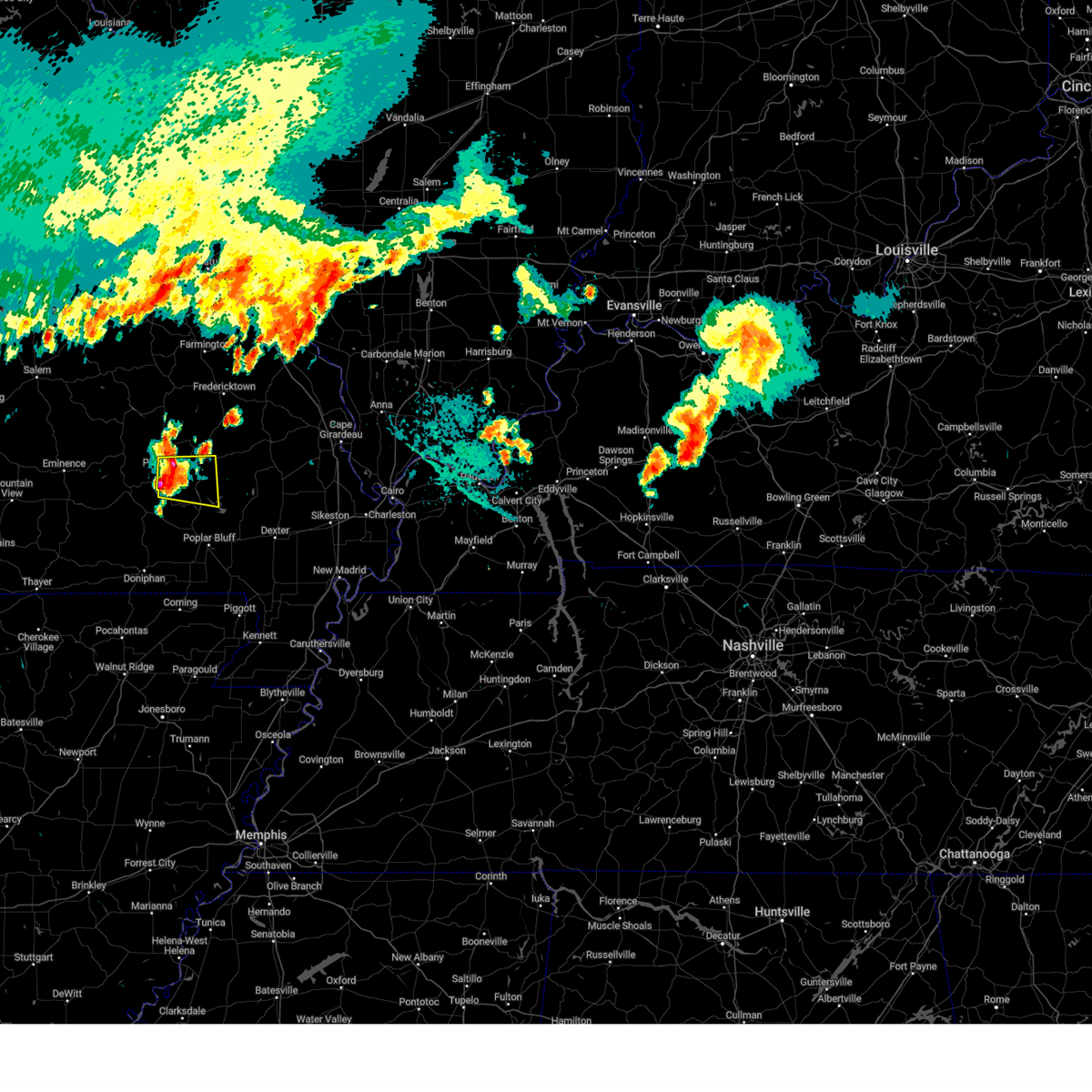
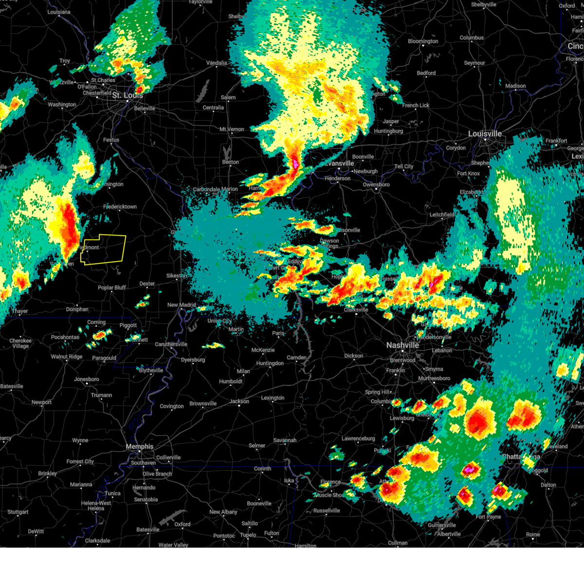
The Greenville, MO area has had 11 reports of on-the-ground hail by trained spotters, and has been under severe weather warnings 33 times during the past 12 months. Doppler radar has detected hail at or near Greenville, MO on 65 occasions, including 6 occasions during the past year.
| Name: | Greenville, MO |
| Where Located: | 51.4 miles WSW of Cape Girardeau, MO |
| Map: | Google Map for Greenville, MO |
| Population: | 511 |
| Housing Units: | 234 |
| More Info: | Search Google for Greenville, MO |
3
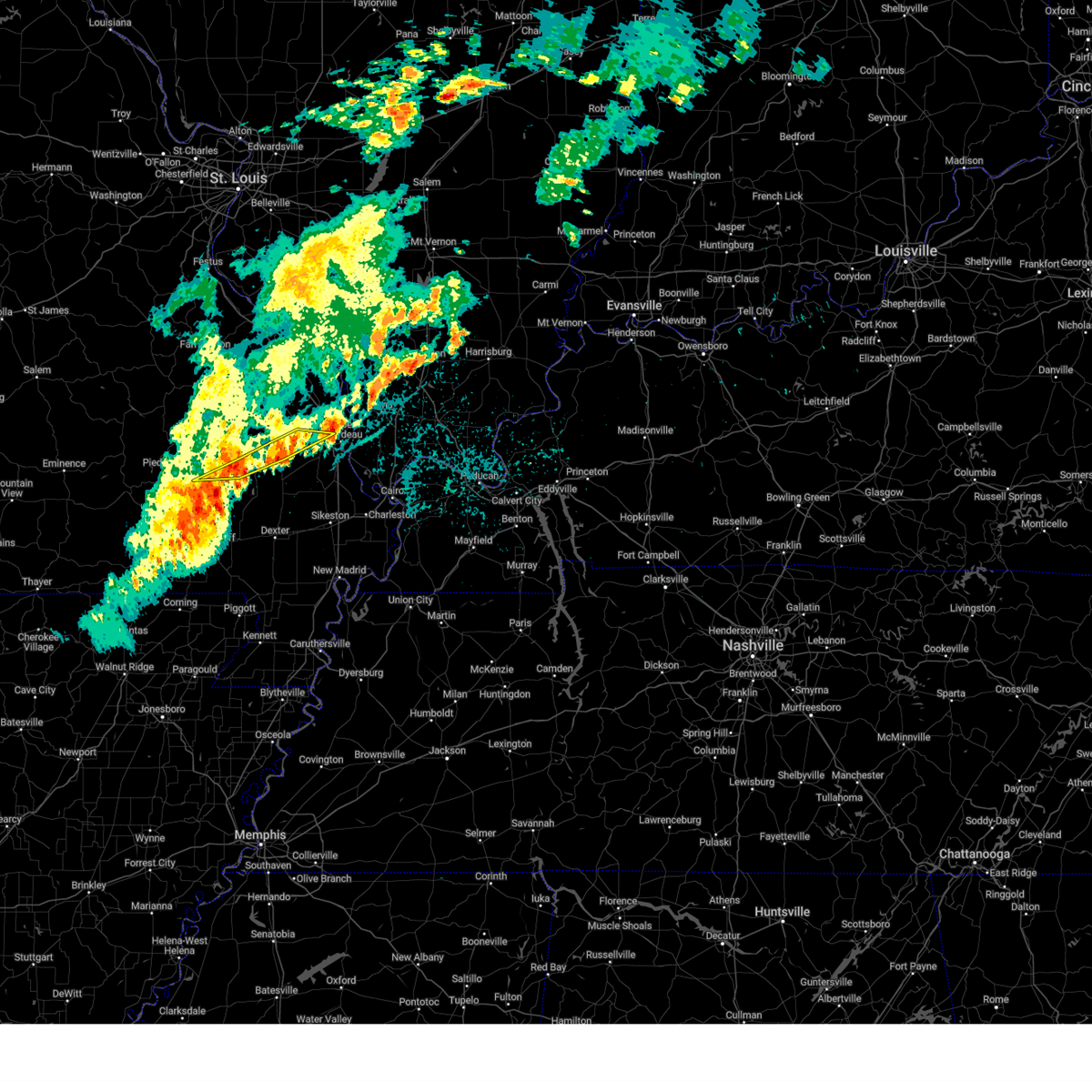
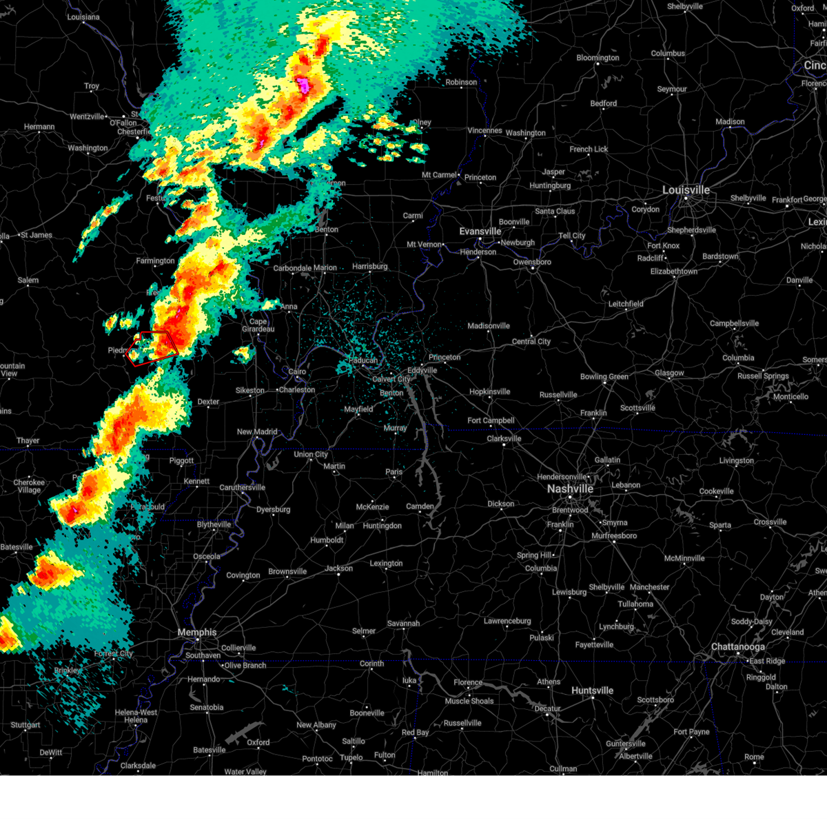
The Top Recent Hail Date for Greenville, MO is Friday, May 16, 2025 (5th out of 65)

Hail and Wind Damage Spotted near Greenville, MO
| Date / Time | Report Details |
|---|---|
| 6/9/2025 12:47 AM CDT |
 the severe thunderstorm warning has been cancelled and is no longer in effect the severe thunderstorm warning has been cancelled and is no longer in effect
|
| 6/9/2025 12:41 AM CDT |
 At 1241 am cdt, severe thunderstorms were located along a line extending from near burfordville to near grassy to near greenville, moving east at 40 mph (radar indicated). Hazards include 60 mph wind gusts. Expect damage to roofs, siding, and trees. locations impacted include, cape girardeau, jackson, marble hill, bollinger mill state historic site, gordonville, burfordville, and leopold. This includes interstate 55 between mile markers 99 and 100. At 1241 am cdt, severe thunderstorms were located along a line extending from near burfordville to near grassy to near greenville, moving east at 40 mph (radar indicated). Hazards include 60 mph wind gusts. Expect damage to roofs, siding, and trees. locations impacted include, cape girardeau, jackson, marble hill, bollinger mill state historic site, gordonville, burfordville, and leopold. This includes interstate 55 between mile markers 99 and 100.
|
| 6/9/2025 12:37 AM CDT |
 At 1237 am cdt, severe thunderstorms were located along a line extending from near burfordville to near grassy to greenville, moving east at 40 mph (radar indicated). Hazards include 60 mph wind gusts and quarter size hail. Hail damage to vehicles is expected. expect wind damage to roofs, siding, and trees. locations impacted include, cape girardeau, jackson, marble hill, greenville, gordonville, leopold, grassy, and glenallen. This includes interstate 55 between mile markers 99 and 100. At 1237 am cdt, severe thunderstorms were located along a line extending from near burfordville to near grassy to greenville, moving east at 40 mph (radar indicated). Hazards include 60 mph wind gusts and quarter size hail. Hail damage to vehicles is expected. expect wind damage to roofs, siding, and trees. locations impacted include, cape girardeau, jackson, marble hill, greenville, gordonville, leopold, grassy, and glenallen. This includes interstate 55 between mile markers 99 and 100.
|
| 6/9/2025 12:25 AM CDT |
 At 1225 am cdt, severe thunderstorms were located along a line extending from marble hill to near cascade to 6 miles west of greenville, moving east at 40 mph (radar indicated). Hazards include 60 mph wind gusts and quarter size hail. Hail damage to vehicles is expected. expect wind damage to roofs, siding, and trees. locations impacted include, cape girardeau, jackson, marble hill, greenville, gordonville, lodi, cascade, leopold, grassy, and glenallen. This includes interstate 55 near mile marker 99. At 1225 am cdt, severe thunderstorms were located along a line extending from marble hill to near cascade to 6 miles west of greenville, moving east at 40 mph (radar indicated). Hazards include 60 mph wind gusts and quarter size hail. Hail damage to vehicles is expected. expect wind damage to roofs, siding, and trees. locations impacted include, cape girardeau, jackson, marble hill, greenville, gordonville, lodi, cascade, leopold, grassy, and glenallen. This includes interstate 55 near mile marker 99.
|
| 6/9/2025 12:12 AM CDT | Svrpah the national weather service in paducah has issued a * severe thunderstorm warning for, central bollinger county in southeastern missouri, northern wayne county in southeastern missouri, west central cape girardeau county in southeastern missouri, * until 100 am cdt. * at 1212 am cdt, severe thunderstorms were located along a line extending from near grassy to near lodi to near piedmont, moving east at 40 mph (radar indicated). Hazards include 60 mph wind gusts and quarter size hail. Hail damage to vehicles is expected. Expect wind damage to roofs, siding, and trees. |
| 5/16/2025 5:46 PM CDT |
 At 546 pm cdt, severe thunderstorms were located along a line extending from near buckhorn to near williamsville, moving east at 45 mph (radar indicated). Hazards include 60 mph wind gusts and quarter size hail. Hail damage to vehicles is expected. expect wind damage to roofs, siding, and trees. Locations impacted include, greenville and cascade. At 546 pm cdt, severe thunderstorms were located along a line extending from near buckhorn to near williamsville, moving east at 45 mph (radar indicated). Hazards include 60 mph wind gusts and quarter size hail. Hail damage to vehicles is expected. expect wind damage to roofs, siding, and trees. Locations impacted include, greenville and cascade.
|
| 5/16/2025 5:39 PM CDT |
 At 539 pm cdt, severe thunderstorms were located along a line extending from buckhorn to 6 miles northwest of williamsville, moving east at 45 mph (radar indicated). Hazards include 60 mph wind gusts and penny size hail. Expect damage to roofs, siding, and trees. Locations impacted include, greenville, lodi, and cascade. At 539 pm cdt, severe thunderstorms were located along a line extending from buckhorn to 6 miles northwest of williamsville, moving east at 45 mph (radar indicated). Hazards include 60 mph wind gusts and penny size hail. Expect damage to roofs, siding, and trees. Locations impacted include, greenville, lodi, and cascade.
|
| 5/16/2025 5:29 PM CDT | At 529 pm cdt, severe thunderstorms were located along a line extending from near saco to near ellsinore, moving east at 45 mph (radar indicated). Hazards include 60 mph wind gusts and penny size hail. Expect damage to roofs, siding, and trees. locations impacted include, piedmont, sam a. Baker state park, greenville, lodi, cascade, and mill spring. |
| 5/16/2025 5:29 PM CDT | the severe thunderstorm warning has been cancelled and is no longer in effect |
| 5/16/2025 5:20 PM CDT |
 At 520 pm cdt, severe thunderstorms were located along a line extending from near lodi to near hunter, moving east at 45 mph (radar indicated). Hazards include 60 mph wind gusts and quarter size hail. Hail damage to vehicles is expected. expect wind damage to roofs, siding, and trees. locations impacted include, piedmont, greenville, sam a. Baker state park, williamsville, lodi, cascade, and mill spring. At 520 pm cdt, severe thunderstorms were located along a line extending from near lodi to near hunter, moving east at 45 mph (radar indicated). Hazards include 60 mph wind gusts and quarter size hail. Hail damage to vehicles is expected. expect wind damage to roofs, siding, and trees. locations impacted include, piedmont, greenville, sam a. Baker state park, williamsville, lodi, cascade, and mill spring.
|
| 5/16/2025 5:09 PM CDT | Svrpah the national weather service in paducah has issued a * severe thunderstorm warning for, west central bollinger county in southeastern missouri, northeastern carter county in southeastern missouri, wayne county in southeastern missouri, * until 600 pm cdt. * at 509 pm cdt, severe thunderstorms were located along a line extending from near sam a. baker state park to near van buren, moving east at 45 mph (radar indicated). Hazards include 60 mph wind gusts and quarter size hail. Hail damage to vehicles is expected. Expect wind damage to roofs, siding, and trees. |
| 5/16/2025 3:10 PM CDT | the tornado warning has been cancelled and is no longer in effect |
| 5/16/2025 3:10 PM CDT | At 310 pm cdt, a severe thunderstorm capable of producing a tornado was located near greenville, moving east at 50 mph (radar indicated rotation). Hazards include tornado and softball size hail. Flying debris will be dangerous to those caught without shelter. mobile homes will be damaged or destroyed. damage to roofs, windows, and vehicles will occur. tree damage is likely. this dangerous storm will be near, shook around 315 pm cdt. Puxico around 325 pm cdt. |
| 5/16/2025 2:41 PM CDT |
 Torpah the national weather service in paducah has issued a * tornado warning for, southwestern bollinger county in southeastern missouri, northeastern carter county in southeastern missouri, wayne county in southeastern missouri, northwestern stoddard county in southeastern missouri, * until 345 pm cdt. * at 241 pm cdt, a severe thunderstorm capable of producing a tornado was located near garwood, or 10 miles east of van buren, moving east at 50 mph (radar indicated rotation). Hazards include tornado and softball size hail. Flying debris will be dangerous to those caught without shelter. mobile homes will be damaged or destroyed. damage to roofs, windows, and vehicles will occur. tree damage is likely. this dangerous storm will be near, piedmont and ellsinore around 245 pm cdt. williamsville around 255 pm cdt. greenville around 300 pm cdt. shook around 305 pm cdt. puxico around 325 pm cdt. Other locations impacted by this tornadic thunderstorm include mill spring. Torpah the national weather service in paducah has issued a * tornado warning for, southwestern bollinger county in southeastern missouri, northeastern carter county in southeastern missouri, wayne county in southeastern missouri, northwestern stoddard county in southeastern missouri, * until 345 pm cdt. * at 241 pm cdt, a severe thunderstorm capable of producing a tornado was located near garwood, or 10 miles east of van buren, moving east at 50 mph (radar indicated rotation). Hazards include tornado and softball size hail. Flying debris will be dangerous to those caught without shelter. mobile homes will be damaged or destroyed. damage to roofs, windows, and vehicles will occur. tree damage is likely. this dangerous storm will be near, piedmont and ellsinore around 245 pm cdt. williamsville around 255 pm cdt. greenville around 300 pm cdt. shook around 305 pm cdt. puxico around 325 pm cdt. Other locations impacted by this tornadic thunderstorm include mill spring.
|
| 4/29/2025 12:43 PM CDT |
 the severe thunderstorm warning has been cancelled and is no longer in effect the severe thunderstorm warning has been cancelled and is no longer in effect
|
| 4/29/2025 12:25 PM CDT |
 Svrpah the national weather service in paducah has issued a * severe thunderstorm warning for, northern wayne county in southeastern missouri, * until 100 pm cdt. * at 1225 pm cdt, a severe thunderstorm was located over piedmont, moving northeast at 50 mph (radar indicated). Hazards include 60 mph wind gusts and quarter size hail. Hail damage to vehicles is expected. Expect wind damage to roofs, siding, and trees. Svrpah the national weather service in paducah has issued a * severe thunderstorm warning for, northern wayne county in southeastern missouri, * until 100 pm cdt. * at 1225 pm cdt, a severe thunderstorm was located over piedmont, moving northeast at 50 mph (radar indicated). Hazards include 60 mph wind gusts and quarter size hail. Hail damage to vehicles is expected. Expect wind damage to roofs, siding, and trees.
|
| 4/20/2025 7:59 PM CDT |
 Svrpah the national weather service in paducah has issued a * severe thunderstorm warning for, northern wayne county in southeastern missouri, * until 845 pm cdt. * at 758 pm cdt, a severe thunderstorm was located over piedmont, moving northeast at 50 mph (radar indicated). Hazards include 60 mph wind gusts. expect damage to roofs, siding, and trees Svrpah the national weather service in paducah has issued a * severe thunderstorm warning for, northern wayne county in southeastern missouri, * until 845 pm cdt. * at 758 pm cdt, a severe thunderstorm was located over piedmont, moving northeast at 50 mph (radar indicated). Hazards include 60 mph wind gusts. expect damage to roofs, siding, and trees
|
| 4/19/2025 5:37 AM CDT |
 At 537 am cdt, a severe thunderstorm was located near sam a. baker state park, moving east at 55 mph (radar indicated). Hazards include 60 mph wind gusts and quarter size hail. Hail damage to vehicles is expected. expect wind damage to roofs, siding, and trees. locations impacted include, lodi, sam a. Baker state park, greenville, cascade, and piedmont. At 537 am cdt, a severe thunderstorm was located near sam a. baker state park, moving east at 55 mph (radar indicated). Hazards include 60 mph wind gusts and quarter size hail. Hail damage to vehicles is expected. expect wind damage to roofs, siding, and trees. locations impacted include, lodi, sam a. Baker state park, greenville, cascade, and piedmont.
|
| 4/19/2025 5:19 AM CDT |
 Svrpah the national weather service in paducah has issued a * severe thunderstorm warning for, northern wayne county in southeastern missouri, * until 600 am cdt. * at 518 am cdt, a severe thunderstorm was located near garwood, or 9 miles west of piedmont, moving east at 55 mph (radar indicated). Hazards include 60 mph wind gusts and quarter size hail. Hail damage to vehicles is expected. Expect wind damage to roofs, siding, and trees. Svrpah the national weather service in paducah has issued a * severe thunderstorm warning for, northern wayne county in southeastern missouri, * until 600 am cdt. * at 518 am cdt, a severe thunderstorm was located near garwood, or 9 miles west of piedmont, moving east at 55 mph (radar indicated). Hazards include 60 mph wind gusts and quarter size hail. Hail damage to vehicles is expected. Expect wind damage to roofs, siding, and trees.
|
| 4/2/2025 6:05 PM CDT | At 604 pm cdt, a severe thunderstorm capable of producing a tornado was located near greenville, moving northeast at 45 mph (radar indicated rotation). Hazards include tornado and quarter size hail. Flying debris will be dangerous to those caught without shelter. mobile homes will be damaged or destroyed. damage to roofs, windows, and vehicles will occur. tree damage is likely. This dangerous storm will be near, shook around 610 pm cdt. |
| 4/2/2025 6:01 PM CDT | Svrpah the national weather service in paducah has issued a * severe thunderstorm warning for, perry county in south central illinois, union county in southern illinois, jackson county in southern illinois, bollinger county in southeastern missouri, perry county in southeastern missouri, eastern wayne county in southeastern missouri, cape girardeau county in southeastern missouri, * until 700 pm cdt. * at 601 pm cdt, severe thunderstorms were located along a line extending from near womac to marquand to hendrickson, moving northeast at 65 mph (radar indicated). Hazards include 60 mph wind gusts and quarter size hail. Hail damage to vehicles is expected. Expect wind damage to roofs, siding, and trees. |
| 4/2/2025 5:50 PM CDT | At 550 pm cdt, a severe thunderstorm capable of producing a tornado was located near williamsville, or 9 miles southwest of greenville, moving northeast at 55 mph (radar indicated rotation). Hazards include tornado and quarter size hail. Flying debris will be dangerous to those caught without shelter. mobile homes will be damaged or destroyed. damage to roofs, windows, and vehicles will occur. tree damage is likely. this dangerous storm will be near, greenville around 555 pm cdt. cascade around 610 pm cdt. Other locations impacted by this tornadic thunderstorm include mill spring. |
| 4/2/2025 5:50 PM CDT | the tornado warning has been cancelled and is no longer in effect |
| 4/2/2025 5:41 PM CDT | Torpah the national weather service in paducah has issued a * tornado warning for, northeastern carter county in southeastern missouri, wayne county in southeastern missouri, northwestern butler county in southeastern missouri, * until 630 pm cdt. * at 540 pm cdt, a severe thunderstorm capable of producing a tornado was located over ellsinore, or 14 miles south of piedmont, moving northeast at 55 mph (radar indicated rotation). Hazards include tornado and quarter size hail. Flying debris will be dangerous to those caught without shelter. mobile homes will be damaged or destroyed. damage to roofs, windows, and vehicles will occur. tree damage is likely. this dangerous storm will be near, brush arbor and williamsville around 545 pm cdt. greenville around 555 pm cdt. lodi around 605 pm cdt. cascade around 610 pm cdt. Other locations impacted by this tornadic thunderstorm include mill spring. |
| 3/30/2025 4:52 PM CDT | Quarter sized hail reported 0 miles SSW of Greenville, MO |
| 3/30/2025 4:52 PM CDT | Golf Ball sized hail reported 0 miles SSW of Greenville, MO |
| 3/30/2025 4:43 PM CDT | At 443 pm cdt, a severe thunderstorm was located over greenville, moving northeast at 35 mph. at 4:25 pm cdt, emergency management reported golf ball size hail near williamsville (emergency management). Hazards include two inch hail and 60 mph wind gusts. People and animals outdoors will be injured. expect hail damage to roofs, siding, windows, and vehicles. expect wind damage to roofs, siding, and trees. Locations impacted include, greenville and cascade. |
| 3/30/2025 4:30 PM CDT |
 At 429 pm cdt, a severe thunderstorm was located near williamsville, or 7 miles southwest of greenville, moving northeast at 35 mph. at 4:25 pm cdt, emergency management reported golf ball size hail near williamsville (emergency management). Hazards include two inch hail and 60 mph wind gusts. People and animals outdoors will be injured. expect hail damage to roofs, siding, windows, and vehicles. expect wind damage to roofs, siding, and trees. Locations impacted include, williamsville, shook, greenville, and cascade. At 429 pm cdt, a severe thunderstorm was located near williamsville, or 7 miles southwest of greenville, moving northeast at 35 mph. at 4:25 pm cdt, emergency management reported golf ball size hail near williamsville (emergency management). Hazards include two inch hail and 60 mph wind gusts. People and animals outdoors will be injured. expect hail damage to roofs, siding, windows, and vehicles. expect wind damage to roofs, siding, and trees. Locations impacted include, williamsville, shook, greenville, and cascade.
|
| 3/30/2025 4:23 PM CDT | Svrpah the national weather service in paducah has issued a * severe thunderstorm warning for, southwestern bollinger county in southeastern missouri, central wayne county in southeastern missouri, * until 515 pm cdt. * at 423 pm cdt, a severe thunderstorm was located near williamsville, or 8 miles southwest of greenville, moving northeast at 40 mph (radar indicated). Hazards include ping pong ball size hail and 60 mph wind gusts. People and animals outdoors will be injured. expect hail damage to roofs, siding, windows, and vehicles. Expect wind damage to roofs, siding, and trees. |
| 3/14/2025 11:25 PM CDT |
 Dangerous weather continues in northeastern wayne county but the storm that prompted this warning has moved out of the area. Dangerous weather continues in northeastern wayne county but the storm that prompted this warning has moved out of the area.
|
| 3/14/2025 11:14 PM CDT |
 At 1113 pm cdt, a large and extremely dangerous tornado was located over greenville, moving northeast at 45 mph. this is a particularly dangerous situation. take cover now! (radar indicated rotation). Hazards include damaging tornado. You are in a life-threatening situation. flying debris may be deadly to those caught without shelter. mobile homes will be destroyed. considerable damage to homes, businesses, and vehicles is likely and complete destruction is possible. the tornado will be near, cascade around 1125 pm cdt. grassy around 1130 pm cdt. marble hill around 1140 pm cdt. leopold around 1145 pm cdt. Other locations impacted by this tornadic thunderstorm include zalma and glenallen. At 1113 pm cdt, a large and extremely dangerous tornado was located over greenville, moving northeast at 45 mph. this is a particularly dangerous situation. take cover now! (radar indicated rotation). Hazards include damaging tornado. You are in a life-threatening situation. flying debris may be deadly to those caught without shelter. mobile homes will be destroyed. considerable damage to homes, businesses, and vehicles is likely and complete destruction is possible. the tornado will be near, cascade around 1125 pm cdt. grassy around 1130 pm cdt. marble hill around 1140 pm cdt. leopold around 1145 pm cdt. Other locations impacted by this tornadic thunderstorm include zalma and glenallen.
|
| 3/14/2025 11:09 PM CDT | Torpah the national weather service in paducah has issued a * tornado warning for, bollinger county in southeastern missouri, central wayne county in southeastern missouri, southwestern cape girardeau county in southeastern missouri, * until midnight cdt. * at 1109 pm cdt, a severe thunderstorm capable of producing a tornado was located over greenville, moving northeast at 45 mph (radar indicated rotation). Hazards include tornado and ping pong ball size hail. Flying debris will be dangerous to those caught without shelter. mobile homes will be damaged or destroyed. damage to roofs, windows, and vehicles will occur. tree damage is likely. this dangerous storm will be near, greenville around 1115 pm cdt. cascade around 1125 pm cdt. grassy around 1130 pm cdt. marble hill around 1140 pm cdt. leopold around 1145 pm cdt. Other locations impacted by this tornadic thunderstorm include zalma and glenallen. |
| 3/14/2025 11:04 PM CDT | At 1103 pm cdt, a large and extremely dangerous tornado was located near piedmont, moving northeast at 55 mph. this is a particularly dangerous situation. take cover now! (radar indicated rotation). Hazards include damaging tornado. You are in a life-threatening situation. flying debris may be deadly to those caught without shelter. mobile homes will be destroyed. considerable damage to homes, businesses, and vehicles is likely and complete destruction is possible. the tornado will be near, greenville, lodi, and sam a. Baker state park around 1110 pm cdt. |
| 3/14/2025 11:04 PM CDT | the tornado warning has been cancelled and is no longer in effect |
| 3/14/2025 10:51 PM CDT | Torpah the national weather service in paducah has issued a * tornado warning for, northeastern carter county in southeastern missouri, central wayne county in southeastern missouri, * until 1130 pm cdt. * at 1051 pm cdt, a confirmed large and extremely dangerous tornado was located 7 miles east of garwood, or 7 miles southwest of piedmont, moving northeast at 40 mph. this is a particularly dangerous situation. take cover now! (radar confirmed tornado). Hazards include damaging tornado. You are in a life-threatening situation. flying debris may be deadly to those caught without shelter. mobile homes will be destroyed. considerable damage to homes, businesses, and vehicles is likely and complete destruction is possible. the tornado will be near, piedmont around 1055 pm cdt. greenville and sam a. baker state park around 1110 pm cdt. lodi around 1115 pm cdt. Other locations impacted by this tornadic thunderstorm include mill spring. |
| 7/5/2024 2:27 AM CDT |
 The storms which prompted the warning have weakened below severe limits, and have exited the warned area. therefore, the warning will be allowed to expire. however, gusty winds are still possible with these thunderstorms. The storms which prompted the warning have weakened below severe limits, and have exited the warned area. therefore, the warning will be allowed to expire. however, gusty winds are still possible with these thunderstorms.
|
| 7/5/2024 2:15 AM CDT |
 At 214 am cdt, severe thunderstorms were located along a line extending from 7 miles northeast of shook to near fisk, moving east at 40 mph (radar indicated). Hazards include 60 mph wind gusts. Expect damage to roofs, siding, and trees. Locations impacted include, poplar bluff, greenville, lake wappapello state park, neelyville, qulin, fisk, harviell, hendrickson, wappapello, shook, and rombauer. At 214 am cdt, severe thunderstorms were located along a line extending from 7 miles northeast of shook to near fisk, moving east at 40 mph (radar indicated). Hazards include 60 mph wind gusts. Expect damage to roofs, siding, and trees. Locations impacted include, poplar bluff, greenville, lake wappapello state park, neelyville, qulin, fisk, harviell, hendrickson, wappapello, shook, and rombauer.
|
| 7/5/2024 1:51 AM CDT |
 Svrpah the national weather service in paducah has issued a * severe thunderstorm warning for, eastern ripley county in southeastern missouri, southeastern wayne county in southeastern missouri, butler county in southeastern missouri, * until 230 am cdt. * at 151 am cdt, severe thunderstorms were located along a line extending from near greenville to near fairdealing, moving east at 55 mph (radar indicated). Hazards include 60 mph wind gusts. expect damage to roofs, siding, and trees Svrpah the national weather service in paducah has issued a * severe thunderstorm warning for, eastern ripley county in southeastern missouri, southeastern wayne county in southeastern missouri, butler county in southeastern missouri, * until 230 am cdt. * at 151 am cdt, severe thunderstorms were located along a line extending from near greenville to near fairdealing, moving east at 55 mph (radar indicated). Hazards include 60 mph wind gusts. expect damage to roofs, siding, and trees
|
| 7/5/2024 1:50 AM CDT | Trees down at sam baker state park.3...000+ without power in wayne count in wayne county MO, 8.1 miles SSE of Greenville, MO |
| 7/3/2024 5:50 PM CDT | Late report. tree down in greenville reported by 911 dispatch center. time estimated by rada in wayne county MO, 0 miles SSW of Greenville, MO |
| 6/25/2024 9:00 PM CDT |
 At 900 pm cdt, a severe thunderstorm was located near greenville, moving east at 15 mph (radar indicated). Hazards include 60 mph wind gusts. Expect damage to roofs, siding, and trees. Locations impacted include, greenville. At 900 pm cdt, a severe thunderstorm was located near greenville, moving east at 15 mph (radar indicated). Hazards include 60 mph wind gusts. Expect damage to roofs, siding, and trees. Locations impacted include, greenville.
|
| 6/25/2024 8:41 PM CDT |
 Svrpah the national weather service in paducah has issued a * severe thunderstorm warning for, southwestern wayne county in southeastern missouri, * until 915 pm cdt. * at 841 pm cdt, a severe thunderstorm was located near piedmont, moving east at 15 mph (radar indicated). Hazards include 60 mph wind gusts and quarter size hail. Hail damage to vehicles is expected. Expect wind damage to roofs, siding, and trees. Svrpah the national weather service in paducah has issued a * severe thunderstorm warning for, southwestern wayne county in southeastern missouri, * until 915 pm cdt. * at 841 pm cdt, a severe thunderstorm was located near piedmont, moving east at 15 mph (radar indicated). Hazards include 60 mph wind gusts and quarter size hail. Hail damage to vehicles is expected. Expect wind damage to roofs, siding, and trees.
|
| 6/8/2024 11:33 PM CDT |
 Svrpah the national weather service in paducah has issued a * severe thunderstorm warning for, southeastern wayne county in southeastern missouri, butler county in southeastern missouri, western stoddard county in southeastern missouri, * until midnight cdt. * at 1132 pm cdt, severe thunderstorms were located along a line extending from shook to lake wappapello state park to near hendrickson. there were more severe storms close to the arkansas border around neelyville as well. the storms were moving southeast at 35 mph (radar indicated). Hazards include 60 mph wind gusts and quarter size hail. Hail damage to vehicles is expected. Expect wind damage to roofs, siding, and trees. Svrpah the national weather service in paducah has issued a * severe thunderstorm warning for, southeastern wayne county in southeastern missouri, butler county in southeastern missouri, western stoddard county in southeastern missouri, * until midnight cdt. * at 1132 pm cdt, severe thunderstorms were located along a line extending from shook to lake wappapello state park to near hendrickson. there were more severe storms close to the arkansas border around neelyville as well. the storms were moving southeast at 35 mph (radar indicated). Hazards include 60 mph wind gusts and quarter size hail. Hail damage to vehicles is expected. Expect wind damage to roofs, siding, and trees.
|
| 6/8/2024 11:22 PM CDT |
 At 1121 pm cdt, severe thunderstorms were located along a line extending from near greenville to near hendrickson to near williamsville, moving southeast at 30 mph (radar indicated). Hazards include 60 mph wind gusts and quarter size hail. Hail damage to vehicles is expected. expect wind damage to roofs, siding, and trees. Locations impacted include, greenville, lake wappapello state park, williamsville, wappapello, shook, lodi, cascade, and mill spring. At 1121 pm cdt, severe thunderstorms were located along a line extending from near greenville to near hendrickson to near williamsville, moving southeast at 30 mph (radar indicated). Hazards include 60 mph wind gusts and quarter size hail. Hail damage to vehicles is expected. expect wind damage to roofs, siding, and trees. Locations impacted include, greenville, lake wappapello state park, williamsville, wappapello, shook, lodi, cascade, and mill spring.
|
| 6/8/2024 11:06 PM CDT |
 Svrpah the national weather service in paducah has issued a * severe thunderstorm warning for, wayne county in southeastern missouri, * until 1130 pm cdt. * at 1106 pm cdt, severe thunderstorms were located along a line extending from near sam a. baker state park to 6 miles southwest of greenville to near williamsville, moving southeast at 30 mph (radar indicated). Hazards include 60 mph wind gusts and quarter size hail. Hail damage to vehicles is expected. Expect wind damage to roofs, siding, and trees. Svrpah the national weather service in paducah has issued a * severe thunderstorm warning for, wayne county in southeastern missouri, * until 1130 pm cdt. * at 1106 pm cdt, severe thunderstorms were located along a line extending from near sam a. baker state park to 6 miles southwest of greenville to near williamsville, moving southeast at 30 mph (radar indicated). Hazards include 60 mph wind gusts and quarter size hail. Hail damage to vehicles is expected. Expect wind damage to roofs, siding, and trees.
|
| 5/26/2024 7:48 PM CDT |
 Svrpah the national weather service in paducah has issued a * severe thunderstorm warning for, southern bollinger county in southeastern missouri, southeastern carter county in southeastern missouri, northeastern ripley county in southeastern missouri, wayne county in southeastern missouri, butler county in southeastern missouri, southwestern cape girardeau county in southeastern missouri, northwestern stoddard county in southeastern missouri, * until 845 pm cdt. * at 748 pm cdt, severe thunderstorms were located along a line extending from cascade to 6 miles northwest of budapest, moving southeast at 25 mph (radar indicated). Hazards include 70 mph wind gusts and quarter size hail. Hail damage to vehicles is expected. expect considerable tree damage. Wind damage is also likely to mobile homes, roofs, and outbuildings. Svrpah the national weather service in paducah has issued a * severe thunderstorm warning for, southern bollinger county in southeastern missouri, southeastern carter county in southeastern missouri, northeastern ripley county in southeastern missouri, wayne county in southeastern missouri, butler county in southeastern missouri, southwestern cape girardeau county in southeastern missouri, northwestern stoddard county in southeastern missouri, * until 845 pm cdt. * at 748 pm cdt, severe thunderstorms were located along a line extending from cascade to 6 miles northwest of budapest, moving southeast at 25 mph (radar indicated). Hazards include 70 mph wind gusts and quarter size hail. Hail damage to vehicles is expected. expect considerable tree damage. Wind damage is also likely to mobile homes, roofs, and outbuildings.
|
| 5/26/2024 6:43 AM CDT |
 the severe thunderstorm warning has been cancelled and is no longer in effect the severe thunderstorm warning has been cancelled and is no longer in effect
|
| 5/26/2024 6:43 AM CDT |
 At 642 am cdt, severe thunderstorms were located along a line extending from near buckhorn to 6 miles northeast of shook to near hendrickson, moving east at 50 mph (radar indicated). Hazards include 60 mph wind gusts and penny size hail. Expect damage to roofs, siding, and trees. Locations impacted include, poplar bluff, marble hill, advance, lake wappapello state park, puxico, patton, hendrickson, wappapello, leopold, milltown, shook, alliance, cascade, grassy, sedgewickville, zalma, glenallen, and rombauer. At 642 am cdt, severe thunderstorms were located along a line extending from near buckhorn to 6 miles northeast of shook to near hendrickson, moving east at 50 mph (radar indicated). Hazards include 60 mph wind gusts and penny size hail. Expect damage to roofs, siding, and trees. Locations impacted include, poplar bluff, marble hill, advance, lake wappapello state park, puxico, patton, hendrickson, wappapello, leopold, milltown, shook, alliance, cascade, grassy, sedgewickville, zalma, glenallen, and rombauer.
|
| 5/26/2024 6:22 AM CDT |
 Svrpah the national weather service in paducah has issued a * severe thunderstorm warning for, bollinger county in southeastern missouri, southeastern carter county in southeastern missouri, northeastern ripley county in southeastern missouri, wayne county in southeastern missouri, northern butler county in southeastern missouri, northwestern stoddard county in southeastern missouri, * until 700 am cdt. * at 622 am cdt, severe thunderstorms were located along a line extending from sam a. baker state park to near williamsville to near budapest, moving east at 50 mph (radar indicated). Hazards include 60 mph wind gusts. expect damage to roofs, siding, and trees Svrpah the national weather service in paducah has issued a * severe thunderstorm warning for, bollinger county in southeastern missouri, southeastern carter county in southeastern missouri, northeastern ripley county in southeastern missouri, wayne county in southeastern missouri, northern butler county in southeastern missouri, northwestern stoddard county in southeastern missouri, * until 700 am cdt. * at 622 am cdt, severe thunderstorms were located along a line extending from sam a. baker state park to near williamsville to near budapest, moving east at 50 mph (radar indicated). Hazards include 60 mph wind gusts. expect damage to roofs, siding, and trees
|
| 5/8/2024 8:45 PM CDT |
 Svrpah the national weather service in paducah has issued a * severe thunderstorm warning for, wayne county in southeastern missouri, * until 915 pm cdt. * at 845 pm cdt, severe thunderstorms were located along a line extending from near annapolis to near garwood, moving east at 55 mph (radar indicated). Hazards include 60 mph wind gusts and quarter size hail. Hail damage to vehicles is expected. Expect wind damage to roofs, siding, and trees. Svrpah the national weather service in paducah has issued a * severe thunderstorm warning for, wayne county in southeastern missouri, * until 915 pm cdt. * at 845 pm cdt, severe thunderstorms were located along a line extending from near annapolis to near garwood, moving east at 55 mph (radar indicated). Hazards include 60 mph wind gusts and quarter size hail. Hail damage to vehicles is expected. Expect wind damage to roofs, siding, and trees.
|
| 4/2/2024 3:44 AM CDT |
 At 344 am cdt, a severe thunderstorm was located near cascade, or 9 miles northeast of greenville, moving east at 55 mph (radar indicated). Hazards include 60 mph wind gusts. Expect damage to roofs, siding, and trees. locations impacted include, marble hill, greenville, sam a. Baker state park, shook, lodi, cascade, leopold, grassy, zalma, and glenallen. At 344 am cdt, a severe thunderstorm was located near cascade, or 9 miles northeast of greenville, moving east at 55 mph (radar indicated). Hazards include 60 mph wind gusts. Expect damage to roofs, siding, and trees. locations impacted include, marble hill, greenville, sam a. Baker state park, shook, lodi, cascade, leopold, grassy, zalma, and glenallen.
|
| 4/2/2024 3:25 AM CDT |
 Svrpah the national weather service in paducah has issued a * severe thunderstorm warning for, southern bollinger county in southeastern missouri, wayne county in southeastern missouri, * until 415 am cdt. * at 325 am cdt, a severe thunderstorm was located near piedmont, moving east at 50 mph (radar indicated). Hazards include 60 mph wind gusts. expect damage to roofs, siding, and trees Svrpah the national weather service in paducah has issued a * severe thunderstorm warning for, southern bollinger county in southeastern missouri, wayne county in southeastern missouri, * until 415 am cdt. * at 325 am cdt, a severe thunderstorm was located near piedmont, moving east at 50 mph (radar indicated). Hazards include 60 mph wind gusts. expect damage to roofs, siding, and trees
|
| 8/4/2023 4:52 AM CDT |
 The severe thunderstorm warning for southern bollinger, west central scott, northeastern wayne, southwestern cape girardeau and northeastern stoddard counties will expire at 500 am cdt, the storms which prompted the warning have weakened below severe limits, and have exited the warned area. therefore, the warning will be allowed to expire. however heavy rain is still possible with these thunderstorms. The severe thunderstorm warning for southern bollinger, west central scott, northeastern wayne, southwestern cape girardeau and northeastern stoddard counties will expire at 500 am cdt, the storms which prompted the warning have weakened below severe limits, and have exited the warned area. therefore, the warning will be allowed to expire. however heavy rain is still possible with these thunderstorms.
|
| 8/4/2023 4:41 AM CDT |
 At 440 am cdt, severe thunderstorms were located along a line extending from near sam a. baker state park to oran, moving southeast at 35 mph (radar indicated). Hazards include 60 mph wind gusts and quarter size hail. Hail damage to vehicles is expected. expect wind damage to roofs, siding, and trees. locations impacted include, marble hill, advance, greenville, sam a. baker state park, delta, lodi, cascade, leopold, grassy, whitewater, zalma and glenallen. hail threat, radar indicated max hail size, 1. 00 in wind threat, radar indicated max wind gust, 60 mph. At 440 am cdt, severe thunderstorms were located along a line extending from near sam a. baker state park to oran, moving southeast at 35 mph (radar indicated). Hazards include 60 mph wind gusts and quarter size hail. Hail damage to vehicles is expected. expect wind damage to roofs, siding, and trees. locations impacted include, marble hill, advance, greenville, sam a. baker state park, delta, lodi, cascade, leopold, grassy, whitewater, zalma and glenallen. hail threat, radar indicated max hail size, 1. 00 in wind threat, radar indicated max wind gust, 60 mph.
|
| 8/4/2023 4:13 AM CDT |
 At 412 am cdt, severe thunderstorms were located along a line extending from near annapolis to near leopold, moving southeast at 35 mph (radar indicated). Hazards include 60 mph wind gusts and quarter size hail. Hail damage to vehicles is expected. Expect wind damage to roofs, siding, and trees. At 412 am cdt, severe thunderstorms were located along a line extending from near annapolis to near leopold, moving southeast at 35 mph (radar indicated). Hazards include 60 mph wind gusts and quarter size hail. Hail damage to vehicles is expected. Expect wind damage to roofs, siding, and trees.
|
| 8/3/2023 1:19 AM CDT |
 At 118 am cdt, severe thunderstorms were located along a line extending from cascade to near williamsville to van buren, moving southeast at 35 mph (radar indicated). Hazards include 60 mph wind gusts and penny size hail. Expect damage to roofs, siding, and trees. locations impacted include, piedmont, greenville, lake wappapello state park, sam a. baker state park, williamsville, shook, lodi, cascade, grassy, mill spring and zalma. hail threat, radar indicated max hail size, 0. 75 in wind threat, radar indicated max wind gust, 60 mph. At 118 am cdt, severe thunderstorms were located along a line extending from cascade to near williamsville to van buren, moving southeast at 35 mph (radar indicated). Hazards include 60 mph wind gusts and penny size hail. Expect damage to roofs, siding, and trees. locations impacted include, piedmont, greenville, lake wappapello state park, sam a. baker state park, williamsville, shook, lodi, cascade, grassy, mill spring and zalma. hail threat, radar indicated max hail size, 0. 75 in wind threat, radar indicated max wind gust, 60 mph.
|
| 8/3/2023 12:58 AM CDT |
 At 1258 am cdt, severe thunderstorms were located along a line extending from saco to near piedmont to 9 miles northeast of winona, moving southeast at 35 mph (radar indicated). Hazards include 60 mph wind gusts and penny size hail. expect damage to roofs, siding, and trees At 1258 am cdt, severe thunderstorms were located along a line extending from saco to near piedmont to 9 miles northeast of winona, moving southeast at 35 mph (radar indicated). Hazards include 60 mph wind gusts and penny size hail. expect damage to roofs, siding, and trees
|
| 7/18/2023 11:39 AM CDT |
 At 1139 am cdt, severe thunderstorms were located along a line extending from near perryville to near grassy to near greenville, moving east at 55 mph (radar indicated). Hazards include 60 mph wind gusts and nickel size hail. Expect damage to roofs, siding, and trees. locations impacted include, perryville, piedmont, marble hill, sam a. baker state park, bollinger mill state historic site, greenville, lake wappapello state park, williamsville, wappapello, millersville, lodi, alliance, cascade, patton, leopold, burfordville, shook, daisy, grassy and oak ridge. this includes interstate 55 between mile markers 114 and 139. hail threat, radar indicated max hail size, 0. 88 in wind threat, radar indicated max wind gust, 60 mph. At 1139 am cdt, severe thunderstorms were located along a line extending from near perryville to near grassy to near greenville, moving east at 55 mph (radar indicated). Hazards include 60 mph wind gusts and nickel size hail. Expect damage to roofs, siding, and trees. locations impacted include, perryville, piedmont, marble hill, sam a. baker state park, bollinger mill state historic site, greenville, lake wappapello state park, williamsville, wappapello, millersville, lodi, alliance, cascade, patton, leopold, burfordville, shook, daisy, grassy and oak ridge. this includes interstate 55 between mile markers 114 and 139. hail threat, radar indicated max hail size, 0. 88 in wind threat, radar indicated max wind gust, 60 mph.
|
| 7/18/2023 11:17 AM CDT |
 At 1116 am cdt, severe thunderstorms were located along a line extending from near coffman to 6 miles northeast of saco to near piedmont, moving southeast at 60 mph (radar indicated). Hazards include 60 mph wind gusts and nickel size hail. expect damage to roofs, siding, and trees At 1116 am cdt, severe thunderstorms were located along a line extending from near coffman to 6 miles northeast of saco to near piedmont, moving southeast at 60 mph (radar indicated). Hazards include 60 mph wind gusts and nickel size hail. expect damage to roofs, siding, and trees
|
| 7/17/2023 6:12 PM CDT |
 At 612 pm cdt, severe thunderstorms were located along a line extending from near greenville to near puxico to near dudley, moving northeast at 20 mph (radar indicated). Hazards include 60 mph wind gusts and quarter size hail. Hail damage to vehicles is expected. Expect wind damage to roofs, siding, and trees. At 612 pm cdt, severe thunderstorms were located along a line extending from near greenville to near puxico to near dudley, moving northeast at 20 mph (radar indicated). Hazards include 60 mph wind gusts and quarter size hail. Hail damage to vehicles is expected. Expect wind damage to roofs, siding, and trees.
|
| 5/15/2023 4:58 PM CDT |
 At 457 pm cdt, a severe thunderstorm was located near greenville, moving east at 15 mph (radar indicated). Hazards include golf ball size hail and 70 mph wind gusts. People and animals outdoors will be injured. expect hail damage to roofs, siding, windows, and vehicles. expect considerable tree damage. wind damage is also likely to mobile homes, roofs, and outbuildings. Locations impacted include, greenville and points south along highway 67. At 457 pm cdt, a severe thunderstorm was located near greenville, moving east at 15 mph (radar indicated). Hazards include golf ball size hail and 70 mph wind gusts. People and animals outdoors will be injured. expect hail damage to roofs, siding, windows, and vehicles. expect considerable tree damage. wind damage is also likely to mobile homes, roofs, and outbuildings. Locations impacted include, greenville and points south along highway 67.
|
| 5/15/2023 4:40 PM CDT |
 At 439 pm cdt, two severe thunderstorms were located near greenville, moving east at 10 mph. one storm was just west of greenville, and the other storm was near lake wappappello (radar indicated). Hazards include 70 mph wind gusts and half dollar size hail. Hail damage to vehicles is expected. expect considerable tree damage. Wind damage is also likely to mobile homes, roofs, and outbuildings. At 439 pm cdt, two severe thunderstorms were located near greenville, moving east at 10 mph. one storm was just west of greenville, and the other storm was near lake wappappello (radar indicated). Hazards include 70 mph wind gusts and half dollar size hail. Hail damage to vehicles is expected. expect considerable tree damage. Wind damage is also likely to mobile homes, roofs, and outbuildings.
|
| 5/8/2023 9:45 PM CDT | S.o. reports trees down countywid in wayne county MO, 0 miles SSW of Greenville, MO |
| 5/8/2023 9:10 PM CDT | Quarter sized hail reported 12.2 miles SW of Greenville, MO, quarter sized hail covering the ground in cascade. |
| 5/8/2023 8:57 PM CDT |
 At 856 pm cdt, severe thunderstorms were located along a line extending from near annapolis to near piedmont to near garwood, moving southeast at 45 mph (radar indicated). Hazards include 60 mph wind gusts and half dollar size hail. Hail damage to vehicles is expected. Expect wind damage to roofs, siding, and trees. At 856 pm cdt, severe thunderstorms were located along a line extending from near annapolis to near piedmont to near garwood, moving southeast at 45 mph (radar indicated). Hazards include 60 mph wind gusts and half dollar size hail. Hail damage to vehicles is expected. Expect wind damage to roofs, siding, and trees.
|
| 4/20/2023 5:48 PM CDT |
 At 548 pm cdt, a severe thunderstorm was located 7 miles west of greenville, moving northeast at 40 mph (radar indicated). Hazards include 60 mph wind gusts and quarter size hail. Hail damage to vehicles is expected. expect wind damage to roofs, siding, and trees. locations impacted include, piedmont, greenville, lodi, cascade and mill spring. hail threat, radar indicated max hail size, 1. 00 in wind threat, radar indicated max wind gust, 60 mph. At 548 pm cdt, a severe thunderstorm was located 7 miles west of greenville, moving northeast at 40 mph (radar indicated). Hazards include 60 mph wind gusts and quarter size hail. Hail damage to vehicles is expected. expect wind damage to roofs, siding, and trees. locations impacted include, piedmont, greenville, lodi, cascade and mill spring. hail threat, radar indicated max hail size, 1. 00 in wind threat, radar indicated max wind gust, 60 mph.
|
| 4/20/2023 5:22 PM CDT |
 At 522 pm cdt, a severe thunderstorm was located near piedmont, moving northeast at 45 mph (radar indicated). Hazards include 60 mph wind gusts and quarter size hail. Hail damage to vehicles is expected. Expect wind damage to roofs, siding, and trees. At 522 pm cdt, a severe thunderstorm was located near piedmont, moving northeast at 45 mph (radar indicated). Hazards include 60 mph wind gusts and quarter size hail. Hail damage to vehicles is expected. Expect wind damage to roofs, siding, and trees.
|
| 4/5/2023 2:51 AM CDT |
 At 250 am cdt, a severe thunderstorm capable of producing a tornado was located near mill spring, or 10 miles south of piedmont, moving northeast at 40 mph (radar indicated rotation). Hazards include tornado and two inch hail. Flying debris will be dangerous to those caught without shelter. mobile homes will be damaged or destroyed. damage to roofs, windows, and vehicles will occur. tree damage is likely. this dangerous storm will be near, williamsville around 255 am cdt. Other locations in the path of this tornadic thunderstorm include greenville. At 250 am cdt, a severe thunderstorm capable of producing a tornado was located near mill spring, or 10 miles south of piedmont, moving northeast at 40 mph (radar indicated rotation). Hazards include tornado and two inch hail. Flying debris will be dangerous to those caught without shelter. mobile homes will be damaged or destroyed. damage to roofs, windows, and vehicles will occur. tree damage is likely. this dangerous storm will be near, williamsville around 255 am cdt. Other locations in the path of this tornadic thunderstorm include greenville.
|
| 4/5/2023 2:39 AM CDT |
 At 239 am cdt, a severe thunderstorm capable of producing a tornado was locatedjust west of elsinore, or 12 miles east of van buren, moving northeast at 45 mph. this storm is showing very strong rotation and may be producing a significant tornado (radar indicated rotation). Hazards include tornado and baseball size hail. Flying debris will be dangerous to those caught without shelter. mobile homes will be damaged or destroyed. damage to roofs, windows, and vehicles will occur. tree damage is likely. this dangerous storm will be near, brush arbor around 245 am cdt. Other locations in the path of this tornadic thunderstorm include williamsville and greenville. At 239 am cdt, a severe thunderstorm capable of producing a tornado was locatedjust west of elsinore, or 12 miles east of van buren, moving northeast at 45 mph. this storm is showing very strong rotation and may be producing a significant tornado (radar indicated rotation). Hazards include tornado and baseball size hail. Flying debris will be dangerous to those caught without shelter. mobile homes will be damaged or destroyed. damage to roofs, windows, and vehicles will occur. tree damage is likely. this dangerous storm will be near, brush arbor around 245 am cdt. Other locations in the path of this tornadic thunderstorm include williamsville and greenville.
|
| 4/5/2023 2:30 AM CDT |
 At 229 am cdt, a severe thunderstorm capable of producing a tornado was located near hunter, or 11 miles southeast of van buren, moving northeast at 45 mph. this storm is showing strong rotation and may produce a significant tornado (radar indicated rotation). Hazards include tornado. Flying debris will be dangerous to those caught without shelter. mobile homes will be damaged or destroyed. damage to roofs, windows, and vehicles will occur. tree damage is likely. this dangerous storm will be near, ellsinore around 240 am cdt. williamsville by 250 am cdt. Other locations in the path of this tornadic thunderstorm include brush arbor, williamsville, hendrickson, greenville and shook. At 229 am cdt, a severe thunderstorm capable of producing a tornado was located near hunter, or 11 miles southeast of van buren, moving northeast at 45 mph. this storm is showing strong rotation and may produce a significant tornado (radar indicated rotation). Hazards include tornado. Flying debris will be dangerous to those caught without shelter. mobile homes will be damaged or destroyed. damage to roofs, windows, and vehicles will occur. tree damage is likely. this dangerous storm will be near, ellsinore around 240 am cdt. williamsville by 250 am cdt. Other locations in the path of this tornadic thunderstorm include brush arbor, williamsville, hendrickson, greenville and shook.
|
| 4/5/2023 1:56 AM CDT |
 At 156 am cdt, severe thunderstorms were located along a line extending from near ellsinore to near alton, moving northeast at 50 mph (radar indicated). Hazards include 60 mph wind gusts and quarter size hail. Hail damage to vehicles is expected. Expect wind damage to roofs, siding, and trees. At 156 am cdt, severe thunderstorms were located along a line extending from near ellsinore to near alton, moving northeast at 50 mph (radar indicated). Hazards include 60 mph wind gusts and quarter size hail. Hail damage to vehicles is expected. Expect wind damage to roofs, siding, and trees.
|
| 2/22/2023 1:37 PM CST |
 At 137 pm cst, severe thunderstorms were located along a line extending from near saco to naylor, moving east at 45 mph (radar indicated). Hazards include 60 mph wind gusts. Expect damage to roofs, siding, and trees. these severe storms will be near, lodi around 140 pm cst. other locations in the path of these severe thunderstorms include cascade, qulin and fisk. hail threat, radar indicated max hail size, <. 75 in wind threat, radar indicated max wind gust, 60 mph. At 137 pm cst, severe thunderstorms were located along a line extending from near saco to naylor, moving east at 45 mph (radar indicated). Hazards include 60 mph wind gusts. Expect damage to roofs, siding, and trees. these severe storms will be near, lodi around 140 pm cst. other locations in the path of these severe thunderstorms include cascade, qulin and fisk. hail threat, radar indicated max hail size, <. 75 in wind threat, radar indicated max wind gust, 60 mph.
|
| 2/22/2023 1:28 PM CST |
 At 127 pm cst, severe thunderstorms were located along a line extending from near sam a. baker state park to near success, moving east at 45 mph (radar indicated). Hazards include 60 mph wind gusts. Expect damage to roofs, siding, and trees. severe thunderstorms will be near, lodi around 135 pm cst. other locations in the path of these severe thunderstorms include cascade and qulin. hail threat, radar indicated max hail size, <. 75 in wind threat, radar indicated max wind gust, 60 mph. At 127 pm cst, severe thunderstorms were located along a line extending from near sam a. baker state park to near success, moving east at 45 mph (radar indicated). Hazards include 60 mph wind gusts. Expect damage to roofs, siding, and trees. severe thunderstorms will be near, lodi around 135 pm cst. other locations in the path of these severe thunderstorms include cascade and qulin. hail threat, radar indicated max hail size, <. 75 in wind threat, radar indicated max wind gust, 60 mph.
|
| 7/27/2022 6:39 PM CDT |
 At 639 pm cdt, a severe thunderstorm was located near williamsville, or 8 miles southeast of piedmont, moving east at 25 mph (radar indicated). Hazards include 60 mph wind gusts and penny size hail. Expect damage to roofs, siding, and trees. locations impacted include, williamsville and greenville. hail threat, radar indicated max hail size, 0. 75 in wind threat, radar indicated max wind gust, 60 mph. At 639 pm cdt, a severe thunderstorm was located near williamsville, or 8 miles southeast of piedmont, moving east at 25 mph (radar indicated). Hazards include 60 mph wind gusts and penny size hail. Expect damage to roofs, siding, and trees. locations impacted include, williamsville and greenville. hail threat, radar indicated max hail size, 0. 75 in wind threat, radar indicated max wind gust, 60 mph.
|
| 7/27/2022 6:21 PM CDT |
 At 621 pm cdt, a severe thunderstorm was located 7 miles south of piedmont, moving east at 25 mph (radar indicated). Hazards include 60 mph wind gusts and quarter size hail. Hail damage to vehicles is expected. expect wind damage to roofs, siding, and trees. this severe thunderstorm will be near, piedmont around 625 pm cdt. other locations in the path of this severe thunderstorm include williamsville and greenville. hail threat, radar indicated max hail size, 1. 00 in wind threat, radar indicated max wind gust, 60 mph. At 621 pm cdt, a severe thunderstorm was located 7 miles south of piedmont, moving east at 25 mph (radar indicated). Hazards include 60 mph wind gusts and quarter size hail. Hail damage to vehicles is expected. expect wind damage to roofs, siding, and trees. this severe thunderstorm will be near, piedmont around 625 pm cdt. other locations in the path of this severe thunderstorm include williamsville and greenville. hail threat, radar indicated max hail size, 1. 00 in wind threat, radar indicated max wind gust, 60 mph.
|
| 7/17/2022 8:14 PM CDT |
 At 814 pm cdt, severe thunderstorms were located along a line extending from near perryville to alliance to near patton to near grassy to near shook, moving east at 30 mph (radar indicated). Hazards include 60 mph wind gusts and penny size hail. Expect damage to roofs, siding, and trees. these severe storms will be near, alliance and patton around 820 pm cdt. other locations in the path of these severe thunderstorms include marble hill, daisy, altenburg, leopold, burfordville, bollinger mill state historic site, millersville, jackson and advance. this includes interstate 55 between mile markers 106 and 123. hail threat, radar indicated max hail size, 0. 75 in wind threat, radar indicated max wind gust, 60 mph. At 814 pm cdt, severe thunderstorms were located along a line extending from near perryville to alliance to near patton to near grassy to near shook, moving east at 30 mph (radar indicated). Hazards include 60 mph wind gusts and penny size hail. Expect damage to roofs, siding, and trees. these severe storms will be near, alliance and patton around 820 pm cdt. other locations in the path of these severe thunderstorms include marble hill, daisy, altenburg, leopold, burfordville, bollinger mill state historic site, millersville, jackson and advance. this includes interstate 55 between mile markers 106 and 123. hail threat, radar indicated max hail size, 0. 75 in wind threat, radar indicated max wind gust, 60 mph.
|
| 7/17/2022 8:00 PM CDT |
 At 759 pm cdt, severe thunderstorms were located along a line extending from 6 miles northeast of alliance to near buckhorn to near cascade to near greenville, moving east at 25 mph (radar indicated). Hazards include 60 mph wind gusts and penny size hail. Expect damage to roofs, siding, and trees. severe thunderstorms will be near, alliance around 805 pm cdt. other locations in the path of these severe thunderstorms include grassy, daisy, marble hill, patton, altenburg and leopold. this includes interstate 55 between mile markers 106 and 123. hail threat, radar indicated max hail size, 0. 75 in wind threat, radar indicated max wind gust, 60 mph. At 759 pm cdt, severe thunderstorms were located along a line extending from 6 miles northeast of alliance to near buckhorn to near cascade to near greenville, moving east at 25 mph (radar indicated). Hazards include 60 mph wind gusts and penny size hail. Expect damage to roofs, siding, and trees. severe thunderstorms will be near, alliance around 805 pm cdt. other locations in the path of these severe thunderstorms include grassy, daisy, marble hill, patton, altenburg and leopold. this includes interstate 55 between mile markers 106 and 123. hail threat, radar indicated max hail size, 0. 75 in wind threat, radar indicated max wind gust, 60 mph.
|
| 5/15/2022 3:23 PM CDT | Quarter sized hail reported 3.5 miles S of Greenville, MO |
| 4/30/2022 6:16 PM CDT |
 At 616 pm cdt, a severe thunderstorm was located near greenville, moving east at 40 mph (radar indicated). Hazards include 70 mph wind gusts and quarter size hail. Hail damage to vehicles is expected. expect considerable tree damage. wind damage is also likely to mobile homes, roofs, and outbuildings. This severe thunderstorm will remain over mainly rural areas of northeastern wayne county. At 616 pm cdt, a severe thunderstorm was located near greenville, moving east at 40 mph (radar indicated). Hazards include 70 mph wind gusts and quarter size hail. Hail damage to vehicles is expected. expect considerable tree damage. wind damage is also likely to mobile homes, roofs, and outbuildings. This severe thunderstorm will remain over mainly rural areas of northeastern wayne county.
|
| 4/30/2022 6:10 PM CDT | Quarter sized hail reported 0 miles SSW of Greenville, MO |
| 4/30/2022 6:05 PM CDT |
 At 605 pm cdt, a severe thunderstorm was located near greenville, moving east at 40 mph (radar indicated). Hazards include 70 mph wind gusts and quarter size hail. Hail damage to vehicles is expected. expect considerable tree damage. wind damage is also likely to mobile homes, roofs, and outbuildings. This severe thunderstorm will be near, greenville around 610 pm cdt. At 605 pm cdt, a severe thunderstorm was located near greenville, moving east at 40 mph (radar indicated). Hazards include 70 mph wind gusts and quarter size hail. Hail damage to vehicles is expected. expect considerable tree damage. wind damage is also likely to mobile homes, roofs, and outbuildings. This severe thunderstorm will be near, greenville around 610 pm cdt.
|
| 4/30/2022 4:57 PM CDT |
 At 456 pm cdt, a severe thunderstorm was located near garwood, or 7 miles southwest of piedmont, moving northeast at 35 mph (radar indicated). Hazards include ping pong ball size hail and 60 mph wind gusts. People and animals outdoors will be injured. expect hail damage to roofs, siding, windows, and vehicles. expect wind damage to roofs, siding, and trees. this severe thunderstorm will be near, piedmont around 510 pm cdt. other locations in the path of this severe thunderstorm include sam a. Baker state park and greenville. At 456 pm cdt, a severe thunderstorm was located near garwood, or 7 miles southwest of piedmont, moving northeast at 35 mph (radar indicated). Hazards include ping pong ball size hail and 60 mph wind gusts. People and animals outdoors will be injured. expect hail damage to roofs, siding, windows, and vehicles. expect wind damage to roofs, siding, and trees. this severe thunderstorm will be near, piedmont around 510 pm cdt. other locations in the path of this severe thunderstorm include sam a. Baker state park and greenville.
|
| 2/22/2022 3:45 AM CST |
 At 345 am cst, a severe thunderstorm was located near brush arbor, or 12 miles northwest of poplar bluff, moving northeast at 70 mph (radar indicated). Hazards include 60 mph wind gusts and nickel size hail. Expect damage to roofs, siding, and trees. This severe storm will be near, hendrickson around 350 am cst. At 345 am cst, a severe thunderstorm was located near brush arbor, or 12 miles northwest of poplar bluff, moving northeast at 70 mph (radar indicated). Hazards include 60 mph wind gusts and nickel size hail. Expect damage to roofs, siding, and trees. This severe storm will be near, hendrickson around 350 am cst.
|
| 2/22/2022 3:31 AM CST |
 At 331 am cst, a severe thunderstorm was located 9 miles south of hunter, or 9 miles north of doniphan, moving northeast at 70 mph (radar indicated). Hazards include 60 mph wind gusts and nickel size hail. Expect damage to roofs, siding, and trees. this severe thunderstorm will be near, hunter around 335 am cst. ellsinore and budapest around 340 am cst. brush arbor and milltown around 345 am cst. Williamsville and hendrickson around 350 am cst. At 331 am cst, a severe thunderstorm was located 9 miles south of hunter, or 9 miles north of doniphan, moving northeast at 70 mph (radar indicated). Hazards include 60 mph wind gusts and nickel size hail. Expect damage to roofs, siding, and trees. this severe thunderstorm will be near, hunter around 335 am cst. ellsinore and budapest around 340 am cst. brush arbor and milltown around 345 am cst. Williamsville and hendrickson around 350 am cst.
|
| 12/5/2021 9:57 PM CST |
 At 956 pm cst, severe thunderstorms were located along a line extending from near buckhorn to near garwood, moving east at 40 mph (radar indicated). Hazards include 60 mph wind gusts and penny size hail. Expect damage to roofs, siding, and trees. severe thunderstorms will be near, cascade around 1005 pm cst. other locations in the path of these severe thunderstorms include greenville and shook. hail threat, radar indicated max hail size, 0. 75 in wind threat, radar indicated max wind gust, 60 mph. At 956 pm cst, severe thunderstorms were located along a line extending from near buckhorn to near garwood, moving east at 40 mph (radar indicated). Hazards include 60 mph wind gusts and penny size hail. Expect damage to roofs, siding, and trees. severe thunderstorms will be near, cascade around 1005 pm cst. other locations in the path of these severe thunderstorms include greenville and shook. hail threat, radar indicated max hail size, 0. 75 in wind threat, radar indicated max wind gust, 60 mph.
|
| 8/8/2021 5:00 PM CDT |
 At 500 pm cdt, severe thunderstorms were located along a line extending from near saco to 6 miles northwest of williamsville, moving east at 30 mph (radar indicated). Hazards include 60 mph wind gusts and penny size hail. Expect damage to roofs, siding, and trees. locations impacted include, lodi, greenville, cascade and shook. hail threat, radar indicated max hail size, 0. 75 in wind threat, radar indicated max wind gust, 60 mph. At 500 pm cdt, severe thunderstorms were located along a line extending from near saco to 6 miles northwest of williamsville, moving east at 30 mph (radar indicated). Hazards include 60 mph wind gusts and penny size hail. Expect damage to roofs, siding, and trees. locations impacted include, lodi, greenville, cascade and shook. hail threat, radar indicated max hail size, 0. 75 in wind threat, radar indicated max wind gust, 60 mph.
|
| 8/8/2021 4:39 PM CDT |
 At 439 pm cdt, severe thunderstorms were located along a line extending from near sam a. baker state park to near ellsinore, moving east at 30 mph (radar indicated). Hazards include 60 mph wind gusts and penny size hail. Expect damage to roofs, siding, and trees. severe thunderstorms will be near, sam a. baker state park around 445 pm cdt. lodi around 455 pm cdt. other locations in the path of these severe thunderstorms include williamsville, greenville, cascade and shook. hail threat, radar indicated max hail size, 0. 75 in wind threat, radar indicated max wind gust, 60 mph. At 439 pm cdt, severe thunderstorms were located along a line extending from near sam a. baker state park to near ellsinore, moving east at 30 mph (radar indicated). Hazards include 60 mph wind gusts and penny size hail. Expect damage to roofs, siding, and trees. severe thunderstorms will be near, sam a. baker state park around 445 pm cdt. lodi around 455 pm cdt. other locations in the path of these severe thunderstorms include williamsville, greenville, cascade and shook. hail threat, radar indicated max hail size, 0. 75 in wind threat, radar indicated max wind gust, 60 mph.
|
| 7/31/2021 1:05 PM CDT |
 At 104 pm cdt, a severe thunderstorm was located near greenville, moving south at 25 mph (radar indicated). Hazards include 60 mph wind gusts and quarter size hail. spotters reported 40 mph winds in the area. Hail damage to vehicles is expected. Expect wind damage to roofs, siding, and trees. At 104 pm cdt, a severe thunderstorm was located near greenville, moving south at 25 mph (radar indicated). Hazards include 60 mph wind gusts and quarter size hail. spotters reported 40 mph winds in the area. Hail damage to vehicles is expected. Expect wind damage to roofs, siding, and trees.
|
| 7/10/2021 6:59 PM CDT |
 At 659 pm cdt, a severe thunderstorm was located near greenville, moving east at 50 mph (radar indicated). Hazards include 60 mph wind gusts and nickel size hail. Expect damage to roofs, siding, and trees. locations impacted include, piedmont, greenville, lake wappapello state park, sam a. Baker state park, williamsville, hendrickson, wappapello, shook, lodi and rombauer. At 659 pm cdt, a severe thunderstorm was located near greenville, moving east at 50 mph (radar indicated). Hazards include 60 mph wind gusts and nickel size hail. Expect damage to roofs, siding, and trees. locations impacted include, piedmont, greenville, lake wappapello state park, sam a. Baker state park, williamsville, hendrickson, wappapello, shook, lodi and rombauer.
|
| 7/10/2021 6:45 PM CDT |
 At 644 pm cdt, a severe thunderstorm was located near williamsville, or 9 miles south of piedmont, moving east at 35 mph (radar indicated). Hazards include 60 mph wind gusts and nickel size hail. Expect damage to roofs, siding, and trees. Locations impacted include, williamsville, greenville, lake wappapello state park, shook and wappapello. At 644 pm cdt, a severe thunderstorm was located near williamsville, or 9 miles south of piedmont, moving east at 35 mph (radar indicated). Hazards include 60 mph wind gusts and nickel size hail. Expect damage to roofs, siding, and trees. Locations impacted include, williamsville, greenville, lake wappapello state park, shook and wappapello.
|
| 7/10/2021 6:23 PM CDT |
 At 623 pm cdt, a severe thunderstorm was located over ellsinore, or 13 miles east of van buren, moving east at 50 mph (radar indicated). Hazards include 60 mph wind gusts and nickel size hail. Expect damage to roofs, siding, and trees. this severe thunderstorm will be near, brush arbor around 630 pm cdt. williamsville around 640 pm cdt. Other locations in the path of this severe thunderstorm include hendrickson, greenville, lake wappapello state park, shook and wappapello. At 623 pm cdt, a severe thunderstorm was located over ellsinore, or 13 miles east of van buren, moving east at 50 mph (radar indicated). Hazards include 60 mph wind gusts and nickel size hail. Expect damage to roofs, siding, and trees. this severe thunderstorm will be near, brush arbor around 630 pm cdt. williamsville around 640 pm cdt. Other locations in the path of this severe thunderstorm include hendrickson, greenville, lake wappapello state park, shook and wappapello.
|
| 5/6/2021 1:05 PM CDT |
 At 103 pm cdt, a severe thunderstorm was located a couple miles east of piedmont, moving east at 35 mph. another severe storm was along the border of eastern carter and ripley county, moving toward poplar bluff (radar indicated). Hazards include 60 mph wind gusts and quarter size hail. Hail damage to vehicles is expected. expect wind damage to roofs, siding, and trees. Locations impacted include, poplar bluff, piedmont, greenville, lake wappapello state park, ellsinore, wappapello, and rombauer. At 103 pm cdt, a severe thunderstorm was located a couple miles east of piedmont, moving east at 35 mph. another severe storm was along the border of eastern carter and ripley county, moving toward poplar bluff (radar indicated). Hazards include 60 mph wind gusts and quarter size hail. Hail damage to vehicles is expected. expect wind damage to roofs, siding, and trees. Locations impacted include, poplar bluff, piedmont, greenville, lake wappapello state park, ellsinore, wappapello, and rombauer.
|
| 5/6/2021 12:53 PM CDT |
 At 1252 pm cdt, a severe thunderstorm was located over piedmont, moving east at 35 mph. another severe storm was near ellsinore (radar indicated). Hazards include 60 mph wind gusts and quarter size hail. Hail damage to vehicles is expected. Expect wind damage to roofs, siding, and trees. At 1252 pm cdt, a severe thunderstorm was located over piedmont, moving east at 35 mph. another severe storm was near ellsinore (radar indicated). Hazards include 60 mph wind gusts and quarter size hail. Hail damage to vehicles is expected. Expect wind damage to roofs, siding, and trees.
|
| 5/4/2021 1:43 AM CDT |
 At 142 am cdt, severe thunderstorms were located along a line extending from 10 miles north of alton to near dalton to near delaplaine, moving northeast at 45 mph (radar indicated). Hazards include 60 mph wind gusts and quarter size hail. Hail damage to vehicles is expected. Expect wind damage to roofs, siding, and trees. At 142 am cdt, severe thunderstorms were located along a line extending from 10 miles north of alton to near dalton to near delaplaine, moving northeast at 45 mph (radar indicated). Hazards include 60 mph wind gusts and quarter size hail. Hail damage to vehicles is expected. Expect wind damage to roofs, siding, and trees.
|
| 4/28/2021 1:45 PM CDT |
 At 145 pm cdt, severe thunderstorms were located along a line extending from near piedmont to williamsville, moving east at 45 mph (radar indicated). Hazards include 60 mph wind gusts and penny size hail. Expect damage to roofs, siding, and trees. Locations impacted include, piedmont, greenville, lake wappapello state park, williamsville, wappapello, shook and mill spring. At 145 pm cdt, severe thunderstorms were located along a line extending from near piedmont to williamsville, moving east at 45 mph (radar indicated). Hazards include 60 mph wind gusts and penny size hail. Expect damage to roofs, siding, and trees. Locations impacted include, piedmont, greenville, lake wappapello state park, williamsville, wappapello, shook and mill spring.
|
| 4/28/2021 1:32 PM CDT |
 At 132 pm cdt, severe thunderstorms were located along a line extending from near piedmont to near ellsinore, moving east at 45 mph (radar indicated). Hazards include 60 mph wind gusts and penny size hail. expect damage to roofs, siding, and trees At 132 pm cdt, severe thunderstorms were located along a line extending from near piedmont to near ellsinore, moving east at 45 mph (radar indicated). Hazards include 60 mph wind gusts and penny size hail. expect damage to roofs, siding, and trees
|
| 4/9/2021 4:57 PM CDT | Golf Ball sized hail reported 6.9 miles SE of Greenville, MO |
| 4/9/2021 4:57 PM CDT |
 At 456 pm cdt, a severe thunderstorm was located near sam a. baker state park, moving northeast at 30 mph (radar indicated). Hazards include golf ball size hail and 60 mph wind gusts. People and animals outdoors will be injured. expect hail damage to roofs, siding, windows, and vehicles. Expect wind damage to roofs, siding, and trees. At 456 pm cdt, a severe thunderstorm was located near sam a. baker state park, moving northeast at 30 mph (radar indicated). Hazards include golf ball size hail and 60 mph wind gusts. People and animals outdoors will be injured. expect hail damage to roofs, siding, windows, and vehicles. Expect wind damage to roofs, siding, and trees.
|
| 4/9/2021 4:40 PM CDT |
 At 438 pm cdt, severe thunderstorms were located along a line extending from 7 miles northwest of williamsville to near hunter, moving east at 20 mph. at 437 pm, a spotter reported quarter size hail covering the ground in ellsinore (trained weather spotters). Hazards include 60 mph wind gusts and quarter size hail. Hail damage to vehicles is expected. expect wind damage to roofs, siding, and trees. Locations impacted include, greenville, ellsinore, williamsville, hunter, brush arbor, grandin and mill spring. At 438 pm cdt, severe thunderstorms were located along a line extending from 7 miles northwest of williamsville to near hunter, moving east at 20 mph. at 437 pm, a spotter reported quarter size hail covering the ground in ellsinore (trained weather spotters). Hazards include 60 mph wind gusts and quarter size hail. Hail damage to vehicles is expected. expect wind damage to roofs, siding, and trees. Locations impacted include, greenville, ellsinore, williamsville, hunter, brush arbor, grandin and mill spring.
|
| 4/9/2021 4:27 PM CDT |
 At 426 pm cdt, severe thunderstorms were located along a line extending from 7 miles south of piedmont to near hunter, moving east at 20 mph (radar indicated). Hazards include 60 mph wind gusts and quarter size hail. Hail damage to vehicles is expected. Expect wind damage to roofs, siding, and trees. At 426 pm cdt, severe thunderstorms were located along a line extending from 7 miles south of piedmont to near hunter, moving east at 20 mph (radar indicated). Hazards include 60 mph wind gusts and quarter size hail. Hail damage to vehicles is expected. Expect wind damage to roofs, siding, and trees.
|
| 7/20/2020 4:52 PM CDT |
 At 451 pm cdt, a severe thunderstorm was located over greenville, moving northeast at 10 mph (radar indicated). Hazards include 60 mph wind gusts and quarter size hail. Hail damage to vehicles is expected. expect wind damage to roofs, siding, and trees. Locations impacted include, greenville. At 451 pm cdt, a severe thunderstorm was located over greenville, moving northeast at 10 mph (radar indicated). Hazards include 60 mph wind gusts and quarter size hail. Hail damage to vehicles is expected. expect wind damage to roofs, siding, and trees. Locations impacted include, greenville.
|
| 7/20/2020 4:32 PM CDT |
 At 432 pm cdt, a severe thunderstorm was located over greenville, moving northeast at 10 mph (radar indicated). Hazards include 60 mph wind gusts and quarter size hail. Hail damage to vehicles is expected. Expect wind damage to roofs, siding, and trees. At 432 pm cdt, a severe thunderstorm was located over greenville, moving northeast at 10 mph (radar indicated). Hazards include 60 mph wind gusts and quarter size hail. Hail damage to vehicles is expected. Expect wind damage to roofs, siding, and trees.
|
| 5/3/2020 1:28 PM CDT |
 At 127 pm cdt, severe thunderstorms were located along a line extending from shook to near wappapello to 6 miles south of fisk to near mcdougal, moving east at 60 mph (trained weather spotters). Hazards include 70 mph wind gusts and quarter size hail. Hail damage to vehicles is expected. expect considerable tree damage. wind damage is also likely to mobile homes, roofs, and outbuildings. Locations impacted include, poplar bluff, greenville, lake wappapello state park, puxico, qulin, fisk, dudley, hendrickson, wappapello, shook and rombauer. At 127 pm cdt, severe thunderstorms were located along a line extending from shook to near wappapello to 6 miles south of fisk to near mcdougal, moving east at 60 mph (trained weather spotters). Hazards include 70 mph wind gusts and quarter size hail. Hail damage to vehicles is expected. expect considerable tree damage. wind damage is also likely to mobile homes, roofs, and outbuildings. Locations impacted include, poplar bluff, greenville, lake wappapello state park, puxico, qulin, fisk, dudley, hendrickson, wappapello, shook and rombauer.
|
| 5/3/2020 1:16 PM CDT |
 At 115 pm cdt, severe thunderstorms were located along a line extending from near williamsville to near hendrickson to near harviell to near neelyville, moving east at 55 mph (trained weather spotters. many trees down now across carter and western butler county. if in poplar bluff, take cover). Hazards include 70 mph wind gusts and quarter size hail. Hail damage to vehicles is expected. expect considerable tree damage. wind damage is also likely to mobile homes, roofs, and outbuildings. Locations impacted include, poplar bluff, greenville, lake wappapello state park, puxico, neelyville, qulin, williamsville, fisk, dudley, hendrickson, wappapello, brush arbor, harviell, milltown, shook, mill spring and rombauer. At 115 pm cdt, severe thunderstorms were located along a line extending from near williamsville to near hendrickson to near harviell to near neelyville, moving east at 55 mph (trained weather spotters. many trees down now across carter and western butler county. if in poplar bluff, take cover). Hazards include 70 mph wind gusts and quarter size hail. Hail damage to vehicles is expected. expect considerable tree damage. wind damage is also likely to mobile homes, roofs, and outbuildings. Locations impacted include, poplar bluff, greenville, lake wappapello state park, puxico, neelyville, qulin, williamsville, fisk, dudley, hendrickson, wappapello, brush arbor, harviell, milltown, shook, mill spring and rombauer.
|
| 5/3/2020 1:09 PM CDT |
 At 109 pm cdt, severe thunderstorms were located along a line extending from 6 miles northwest of williamsville to near hendrickson to near harviell to near success, moving east at 55 mph (radar indicated. power outages have been reported from high winds across carter county, missouri). Hazards include 60 mph wind gusts and quarter size hail. Hail damage to vehicles is expected. expect wind damage to roofs, siding, and trees. Locations impacted include, poplar bluff, greenville, lake wappapello state park, puxico, neelyville, qulin, williamsville, fisk, dudley, hendrickson, wappapello, brush arbor, harviell, milltown, shook, mill spring and rombauer. At 109 pm cdt, severe thunderstorms were located along a line extending from 6 miles northwest of williamsville to near hendrickson to near harviell to near success, moving east at 55 mph (radar indicated. power outages have been reported from high winds across carter county, missouri). Hazards include 60 mph wind gusts and quarter size hail. Hail damage to vehicles is expected. expect wind damage to roofs, siding, and trees. Locations impacted include, poplar bluff, greenville, lake wappapello state park, puxico, neelyville, qulin, williamsville, fisk, dudley, hendrickson, wappapello, brush arbor, harviell, milltown, shook, mill spring and rombauer.
|
| 5/3/2020 12:48 PM CDT |
 At 1248 pm cdt, severe thunderstorms were located along a line extending from garwood to near hunter to 9 miles northwest of doniphan to 6 miles northwest of maynard, moving east at 50 mph (radar indicated). Hazards include 60 mph wind gusts and quarter size hail. Hail damage to vehicles is expected. Expect wind damage to roofs, siding, and trees. At 1248 pm cdt, severe thunderstorms were located along a line extending from garwood to near hunter to 9 miles northwest of doniphan to 6 miles northwest of maynard, moving east at 50 mph (radar indicated). Hazards include 60 mph wind gusts and quarter size hail. Hail damage to vehicles is expected. Expect wind damage to roofs, siding, and trees.
|
| 4/28/2020 10:25 PM CDT | Tree fell on a hous in wayne county MO, 4.8 miles N of Greenville, MO |
| 4/28/2020 10:21 PM CDT |
 At 1021 pm cdt, severe thunderstorms were located along a line extending from cascade to 6 miles northeast of greenville to near williamsville, moving southeast at 50 mph (radar indicated). Hazards include 60 mph wind gusts. Expect damage to roofs, siding, and trees. Locations impacted include, greenville, williamsville, lodi and cascade. At 1021 pm cdt, severe thunderstorms were located along a line extending from cascade to 6 miles northeast of greenville to near williamsville, moving southeast at 50 mph (radar indicated). Hazards include 60 mph wind gusts. Expect damage to roofs, siding, and trees. Locations impacted include, greenville, williamsville, lodi and cascade.
|
| 4/28/2020 9:51 PM CDT |
 At 951 pm cdt, severe thunderstorms were located along a line extending from near glover to near annapolis to garwood, moving east at 55 mph (radar indicated). Hazards include 60 mph wind gusts. expect damage to roofs, siding, and trees At 951 pm cdt, severe thunderstorms were located along a line extending from near glover to near annapolis to garwood, moving east at 55 mph (radar indicated). Hazards include 60 mph wind gusts. expect damage to roofs, siding, and trees
|
| 4/8/2020 5:45 PM CDT | Golf Ball sized hail reported 14.7 miles SW of Greenville, MO |
| 4/8/2020 5:42 PM CDT | Quarter sized hail reported 13.9 miles WSW of Greenville, MO, report from mping: quarter (1.00 in.). |
| 4/8/2020 5:38 PM CDT | Quarter sized hail reported 11.4 miles WSW of Greenville, MO |
| 3/2/2020 7:44 PM CST |
 At 743 pm cst, a severe thunderstorm was located near greenville, moving east at 35 mph (radar indicated). Hazards include 60 mph wind gusts and half dollar size hail. Hail damage to vehicles is expected. Expect wind damage to roofs, siding, and trees. At 743 pm cst, a severe thunderstorm was located near greenville, moving east at 35 mph (radar indicated). Hazards include 60 mph wind gusts and half dollar size hail. Hail damage to vehicles is expected. Expect wind damage to roofs, siding, and trees.
|
| 3/2/2020 7:43 PM CST | Ping Pong Ball sized hail reported 2.1 miles NNW of Greenville, MO |
| 3/2/2020 7:11 PM CST | Ping Pong Ball sized hail reported 6.9 miles N of Greenville, MO |
| 3/2/2020 7:11 PM CST |
 At 708 pm cst, a severe thunderstorm capable of producing a tornado was located near piedmont, moving east at 30 mph (radar indicated rotation. the public reported a possible tornado between piedmont and mill spring at 705 pm. another strong circulation was 9 miles south of greenville. this storm was also producing ping pong size hail). Hazards include tornado and half dollar size hail. Flying debris will be dangerous to those caught without shelter. mobile homes will be damaged or destroyed. damage to roofs, windows, and vehicles will occur. tree damage is likely. Locations impacted include, piedmont, greenville, lake wappapello state park, williamsville, wappapello, shook and mill spring. At 708 pm cst, a severe thunderstorm capable of producing a tornado was located near piedmont, moving east at 30 mph (radar indicated rotation. the public reported a possible tornado between piedmont and mill spring at 705 pm. another strong circulation was 9 miles south of greenville. this storm was also producing ping pong size hail). Hazards include tornado and half dollar size hail. Flying debris will be dangerous to those caught without shelter. mobile homes will be damaged or destroyed. damage to roofs, windows, and vehicles will occur. tree damage is likely. Locations impacted include, piedmont, greenville, lake wappapello state park, williamsville, wappapello, shook and mill spring.
|
| 3/2/2020 6:53 PM CST |
 At 652 pm cst, a severe thunderstorm capable of producing a tornado was located near piedmont, moving east at 35 mph (radar indicated rotation. another area of strong rotation was just east of williamsville). Hazards include tornado and half dollar size hail. Flying debris will be dangerous to those caught without shelter. mobile homes will be damaged or destroyed. damage to roofs, windows, and vehicles will occur. Tree damage is likely. At 652 pm cst, a severe thunderstorm capable of producing a tornado was located near piedmont, moving east at 35 mph (radar indicated rotation. another area of strong rotation was just east of williamsville). Hazards include tornado and half dollar size hail. Flying debris will be dangerous to those caught without shelter. mobile homes will be damaged or destroyed. damage to roofs, windows, and vehicles will occur. Tree damage is likely.
|
| 3/2/2020 6:36 PM CST |
 At 635 pm cst, a severe thunderstorm was located near brush arbor, or 13 miles south of piedmont, moving east at 20 mph (trained weather spotters. a tornado warning is in effect for part of the area as well). Hazards include quarter size hail. Damage to vehicles is expected. Locations impacted include, greenville, williamsville, brush arbor and mill spring. At 635 pm cst, a severe thunderstorm was located near brush arbor, or 13 miles south of piedmont, moving east at 20 mph (trained weather spotters. a tornado warning is in effect for part of the area as well). Hazards include quarter size hail. Damage to vehicles is expected. Locations impacted include, greenville, williamsville, brush arbor and mill spring.
|
| 3/2/2020 6:05 PM CST |
 At 605 pm cst, a severe thunderstorm was located over hunter, or 11 miles southeast of van buren, moving east at 20 mph (radar indicated). Hazards include quarter size hail. damage to vehicles is expected At 605 pm cst, a severe thunderstorm was located over hunter, or 11 miles southeast of van buren, moving east at 20 mph (radar indicated). Hazards include quarter size hail. damage to vehicles is expected
|
| 10/21/2019 3:37 AM CDT |
 At 336 am cdt, severe thunderstorms were located along a line extending from near williamsville to near doniphan, moving northeast at 70 mph (law enforcement. at 334 am, 60 mph winds were reported in doniphan). Hazards include 60 mph wind gusts. expect damage to roofs, siding, and trees At 336 am cdt, severe thunderstorms were located along a line extending from near williamsville to near doniphan, moving northeast at 70 mph (law enforcement. at 334 am, 60 mph winds were reported in doniphan). Hazards include 60 mph wind gusts. expect damage to roofs, siding, and trees
|
| 6/26/2019 2:33 PM CDT |
 At 231 pm cdt, severe thunderstorms were located along a line extending from greenville to brush arbor to near budapest to 7 miles southeast of handy to near gatewood, moving east at 10 mph. the strongest storm was located near bennett missouri (radar indicated). Hazards include 60 mph wind gusts and quarter size hail. Hail damage to vehicles is expected. expect wind damage to roofs, siding, and trees. Locations impacted include, doniphan, piedmont, greenville, ellsinore, williamsville, hunter, brush arbor, handy, budapest, gatewood, grandin, mill spring and briar. At 231 pm cdt, severe thunderstorms were located along a line extending from greenville to brush arbor to near budapest to 7 miles southeast of handy to near gatewood, moving east at 10 mph. the strongest storm was located near bennett missouri (radar indicated). Hazards include 60 mph wind gusts and quarter size hail. Hail damage to vehicles is expected. expect wind damage to roofs, siding, and trees. Locations impacted include, doniphan, piedmont, greenville, ellsinore, williamsville, hunter, brush arbor, handy, budapest, gatewood, grandin, mill spring and briar.
|
| 6/26/2019 2:14 PM CDT |
 At 214 pm cdt, severe thunderstorms were located along a line extending from near sam a. baker state park to near ellsinore to near gatewood, moving east at 15 mph (radar indicated). Hazards include 60 mph wind gusts and quarter size hail. Hail damage to vehicles is expected. Expect wind damage to roofs, siding, and trees. At 214 pm cdt, severe thunderstorms were located along a line extending from near sam a. baker state park to near ellsinore to near gatewood, moving east at 15 mph (radar indicated). Hazards include 60 mph wind gusts and quarter size hail. Hail damage to vehicles is expected. Expect wind damage to roofs, siding, and trees.
|
| 6/23/2019 2:42 PM CDT |
 At 241 pm cdt, severe thunderstorms were located along a line extending from near cascade to near qulin, moving east at 50 mph (radar indicated. at 2:30 pm tree and powerline damage was reported four miles south of poplar bluff by emergency management). Hazards include 70 mph wind gusts. Expect considerable tree damage. damage is likely to mobile homes, roofs, and outbuildings. Locations impacted include, cape girardeau, poplar bluff, sikeston, jackson, dexter, scott city, chaffee, bloomfield, marble hill, advance, oran, miner, benton, bollinger mill state historic site, greenville, trail of tears state park, lake wappapello state park, morehouse, puxico and morley. At 241 pm cdt, severe thunderstorms were located along a line extending from near cascade to near qulin, moving east at 50 mph (radar indicated. at 2:30 pm tree and powerline damage was reported four miles south of poplar bluff by emergency management). Hazards include 70 mph wind gusts. Expect considerable tree damage. damage is likely to mobile homes, roofs, and outbuildings. Locations impacted include, cape girardeau, poplar bluff, sikeston, jackson, dexter, scott city, chaffee, bloomfield, marble hill, advance, oran, miner, benton, bollinger mill state historic site, greenville, trail of tears state park, lake wappapello state park, morehouse, puxico and morley.
|
| 6/23/2019 2:27 PM CDT |
 At 226 pm cdt, severe thunderstorms were located along a line extending from near saco to near harviell, moving east at 60 mph (radar indicated). Hazards include 60 mph wind gusts. expect damage to roofs, siding, and trees At 226 pm cdt, severe thunderstorms were located along a line extending from near saco to near harviell, moving east at 60 mph (radar indicated). Hazards include 60 mph wind gusts. expect damage to roofs, siding, and trees
|
| 6/23/2019 2:19 PM CDT |
 At 218 pm cdt, a severe thunderstorm was located over milltown, or 10 miles west of poplar bluff, moving east at 35 mph (radar indicated. emergency management reported tree damage from these storms in carter county). Hazards include 60 mph wind gusts and penny size hail. Expect damage to roofs, siding, and trees. locations impacted include, poplar bluff, piedmont, greenville, sam a. Baker state park, lake wappapello state park, qulin, williamsville, fisk, hendrickson, wappapello, brush arbor, lodi, harviell, milltown, shook, cascade, mill spring and rombauer. At 218 pm cdt, a severe thunderstorm was located over milltown, or 10 miles west of poplar bluff, moving east at 35 mph (radar indicated. emergency management reported tree damage from these storms in carter county). Hazards include 60 mph wind gusts and penny size hail. Expect damage to roofs, siding, and trees. locations impacted include, poplar bluff, piedmont, greenville, sam a. Baker state park, lake wappapello state park, qulin, williamsville, fisk, hendrickson, wappapello, brush arbor, lodi, harviell, milltown, shook, cascade, mill spring and rombauer.
|
| 6/23/2019 2:12 PM CDT |
 At 212 pm cdt, a severe thunderstorm was located near budapest, or 14 miles west of poplar bluff, moving east at 35 mph (radar indicated). Hazards include 60 mph wind gusts and penny size hail. Expect damage to roofs, siding, and trees. locations impacted include, poplar bluff, piedmont, greenville, sam a. Baker state park, lake wappapello state park, qulin, ellsinore, williamsville, fisk, hendrickson, wappapello, brush arbor, lodi, harviell, budapest, milltown, oxly, fairdealing, shook and cascade. At 212 pm cdt, a severe thunderstorm was located near budapest, or 14 miles west of poplar bluff, moving east at 35 mph (radar indicated). Hazards include 60 mph wind gusts and penny size hail. Expect damage to roofs, siding, and trees. locations impacted include, poplar bluff, piedmont, greenville, sam a. Baker state park, lake wappapello state park, qulin, ellsinore, williamsville, fisk, hendrickson, wappapello, brush arbor, lodi, harviell, budapest, milltown, oxly, fairdealing, shook and cascade.
|
| 6/23/2019 1:57 PM CDT |
 At 156 pm cdt, a severe thunderstorm was located near hunter, or 12 miles north of doniphan, moving east at 35 mph (radar indicated). Hazards include 60 mph wind gusts. expect damage to roofs, siding, and trees At 156 pm cdt, a severe thunderstorm was located near hunter, or 12 miles north of doniphan, moving east at 35 mph (radar indicated). Hazards include 60 mph wind gusts. expect damage to roofs, siding, and trees
|
| 6/21/2019 4:04 PM CDT |
 At 404 pm cdt, severe thunderstorms were located along a line extending from near daisy to near marble hill to near williamsville, moving east at 55 mph (radar indicated). Hazards include 60 mph wind gusts and quarter size hail. Hail damage to vehicles is expected. Expect wind damage to roofs, siding, and trees. At 404 pm cdt, severe thunderstorms were located along a line extending from near daisy to near marble hill to near williamsville, moving east at 55 mph (radar indicated). Hazards include 60 mph wind gusts and quarter size hail. Hail damage to vehicles is expected. Expect wind damage to roofs, siding, and trees.
|
| 8/20/2018 4:07 PM CDT |
 The severe thunderstorm warning for southeastern carter, northeastern ripley, wayne and northwestern butler counties will expire at 415 pm cdt, the storms which prompted the warning have weakened below severe limits, and have mostly exited the warned area. therefore, the warning will be allowed to expire. a severe thunderstorm watch remains in effect until 800 pm cdt for southeastern missouri. The severe thunderstorm warning for southeastern carter, northeastern ripley, wayne and northwestern butler counties will expire at 415 pm cdt, the storms which prompted the warning have weakened below severe limits, and have mostly exited the warned area. therefore, the warning will be allowed to expire. a severe thunderstorm watch remains in effect until 800 pm cdt for southeastern missouri.
|
| 8/20/2018 3:46 PM CDT |
 At 345 pm cdt, severe thunderstorms were located along a line extending from near sam a. baker state park to near williamsville to fairdealing, moving east at 40 mph (radar indicated. some weak rotation was detected on radar just southwest of greenville, missouri). Hazards include 60 mph wind gusts and quarter size hail. Hail damage to vehicles is expected. expect wind damage to roofs, siding, and trees. locations impacted include, poplar bluff, piedmont, greenville, sam a. Baker state park, williamsville, budapest, hendrickson, milltown, fairdealing, brush arbor, lodi and mill spring. At 345 pm cdt, severe thunderstorms were located along a line extending from near sam a. baker state park to near williamsville to fairdealing, moving east at 40 mph (radar indicated. some weak rotation was detected on radar just southwest of greenville, missouri). Hazards include 60 mph wind gusts and quarter size hail. Hail damage to vehicles is expected. expect wind damage to roofs, siding, and trees. locations impacted include, poplar bluff, piedmont, greenville, sam a. Baker state park, williamsville, budapest, hendrickson, milltown, fairdealing, brush arbor, lodi and mill spring.
|
| 8/20/2018 3:23 PM CDT |
 At 323 pm cdt, severe thunderstorms were located along a line extending from near piedmont to ellsinore to near doniphan, moving northeast at 40 mph (radar indicated). Hazards include 60 mph wind gusts and quarter size hail. Hail damage to vehicles is expected. Expect wind damage to roofs, siding, and trees. At 323 pm cdt, severe thunderstorms were located along a line extending from near piedmont to ellsinore to near doniphan, moving northeast at 40 mph (radar indicated). Hazards include 60 mph wind gusts and quarter size hail. Hail damage to vehicles is expected. Expect wind damage to roofs, siding, and trees.
|
| 6/26/2018 6:09 PM CDT |
 At 609 pm cdt, a severe thunderstorm was located over greenville, moving east at 30 mph (radar indicated). Hazards include 60 mph wind gusts and nickel size hail. Expect damage to roofs, siding, and trees. Locations impacted include, piedmont, greenville, lodi and mill spring. At 609 pm cdt, a severe thunderstorm was located over greenville, moving east at 30 mph (radar indicated). Hazards include 60 mph wind gusts and nickel size hail. Expect damage to roofs, siding, and trees. Locations impacted include, piedmont, greenville, lodi and mill spring.
|
| 6/26/2018 5:44 PM CDT |
 At 543 pm cdt, a severe thunderstorm was located near piedmont, moving east at 25 mph (radar indicated). Hazards include 60 mph wind gusts and half dollar size hail. Hail damage to vehicles is expected. Expect wind damage to roofs, siding, and trees. At 543 pm cdt, a severe thunderstorm was located near piedmont, moving east at 25 mph (radar indicated). Hazards include 60 mph wind gusts and half dollar size hail. Hail damage to vehicles is expected. Expect wind damage to roofs, siding, and trees.
|
| 4/3/2018 5:07 PM CDT | Power outages reported throughout the count in wayne county MO, 0 miles SSW of Greenville, MO |
| 5/27/2017 5:45 PM CDT | Trees and pwer lines dow in wayne county MO, 0 miles SSW of Greenville, MO |
| 5/27/2017 4:49 PM CDT |
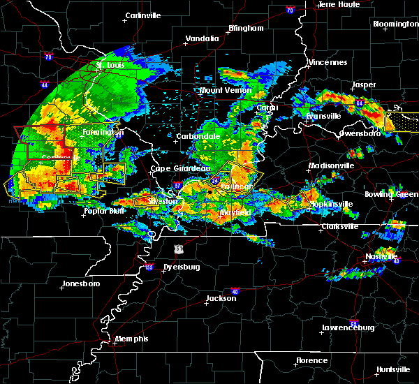 At 449 pm cdt, severe thunderstorms were located along a line extending from near roselle to 7 miles north of piedmont, moving east at 45 mph (radar indicated). Hazards include 70 mph wind gusts and quarter size hail. Hail damage to vehicles is expected. expect considerable tree damage. Wind damage is also likely to mobile homes, roofs, and outbuildings. At 449 pm cdt, severe thunderstorms were located along a line extending from near roselle to 7 miles north of piedmont, moving east at 45 mph (radar indicated). Hazards include 70 mph wind gusts and quarter size hail. Hail damage to vehicles is expected. expect considerable tree damage. Wind damage is also likely to mobile homes, roofs, and outbuildings.
|
| 5/27/2017 4:42 PM CDT |
 At 441 pm cdt, a severe thunderstorm was located near piedmont, moving east at 20 mph (radar indicated). Hazards include ping pong ball size hail and 60 mph wind gusts. People and animals outdoors will be injured. expect hail damage to roofs, siding, windows, and vehicles. Expect wind damage to roofs, siding, and trees. At 441 pm cdt, a severe thunderstorm was located near piedmont, moving east at 20 mph (radar indicated). Hazards include ping pong ball size hail and 60 mph wind gusts. People and animals outdoors will be injured. expect hail damage to roofs, siding, windows, and vehicles. Expect wind damage to roofs, siding, and trees.
|
| 4/28/2017 10:17 PM CDT |
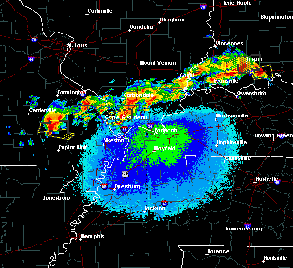 At 1017 pm cdt, a severe thunderstorm was located near greenville, moving east at 45 mph (radar indicated). Hazards include 60 mph wind gusts and quarter size hail. Hail damage to vehicles is expected. Expect wind damage to roofs, siding, and trees. At 1017 pm cdt, a severe thunderstorm was located near greenville, moving east at 45 mph (radar indicated). Hazards include 60 mph wind gusts and quarter size hail. Hail damage to vehicles is expected. Expect wind damage to roofs, siding, and trees.
|
| 4/28/2017 10:10 PM CDT |
 At 1009 pm cdt, a severe thunderstorm was located near sam a baker state park, moving east at 40 mph (radar indicated). Hazards include 60 mph wind gusts and quarter size hail. Hail damage to vehicles is expected. expect wind damage to roofs, siding, and trees. Locations impacted include, piedmont, sam a baker state park, lodi and cascade. At 1009 pm cdt, a severe thunderstorm was located near sam a baker state park, moving east at 40 mph (radar indicated). Hazards include 60 mph wind gusts and quarter size hail. Hail damage to vehicles is expected. expect wind damage to roofs, siding, and trees. Locations impacted include, piedmont, sam a baker state park, lodi and cascade.
|
| 4/28/2017 9:53 PM CDT |
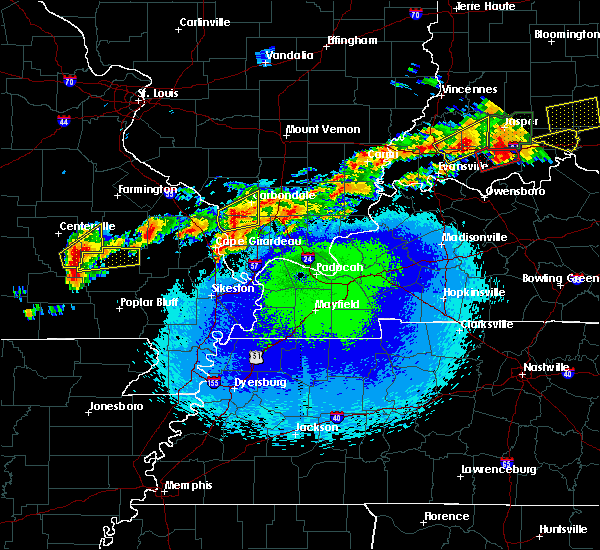 At 952 pm cdt, a severe thunderstorm was located 7 miles northwest of piedmont, moving east at 45 mph (radar indicated). Hazards include 60 mph wind gusts and quarter size hail. Hail damage to vehicles is expected. Expect wind damage to roofs, siding, and trees. At 952 pm cdt, a severe thunderstorm was located 7 miles northwest of piedmont, moving east at 45 mph (radar indicated). Hazards include 60 mph wind gusts and quarter size hail. Hail damage to vehicles is expected. Expect wind damage to roofs, siding, and trees.
|
| 4/26/2017 1:17 PM CDT |
 At 117 pm cdt, a severe thunderstorm was located near cascade, or 11 miles northeast of greenville, moving east at 90 mph (radar indicated). Hazards include 60 mph wind gusts and quarter size hail. Hail damage to vehicles is expected. Expect wind damage to roofs, siding, and trees. At 117 pm cdt, a severe thunderstorm was located near cascade, or 11 miles northeast of greenville, moving east at 90 mph (radar indicated). Hazards include 60 mph wind gusts and quarter size hail. Hail damage to vehicles is expected. Expect wind damage to roofs, siding, and trees.
|
| 4/26/2017 12:49 PM CDT |
 At 1249 pm cdt, a severe thunderstorm was located near ellsinore, or 10 miles south of piedmont, moving northeast at 55 mph (radar indicated). Hazards include 60 mph wind gusts and quarter size hail. Hail damage to vehicles is expected. Expect wind damage to roofs, siding, and trees. At 1249 pm cdt, a severe thunderstorm was located near ellsinore, or 10 miles south of piedmont, moving northeast at 55 mph (radar indicated). Hazards include 60 mph wind gusts and quarter size hail. Hail damage to vehicles is expected. Expect wind damage to roofs, siding, and trees.
|
| 3/9/2017 5:32 PM CST |
 At 531 pm cst, severe thunderstorms were located along a line extending from 6 miles northeast of ellington to 7 miles northwest of van buren to near hunter to handy, moving east at 50 mph. at 530 pm cst, dime size hail was reported 5 miles west of van buren missouri (radar indicated). Hazards include 70 mph wind gusts and ping pong ball size hail. People and animals outdoors will be injured. expect hail damage to roofs, siding, windows, and vehicles. expect considerable tree damage. wind damage is also likely to mobile homes, roofs, and outbuildings. Locations impacted include, doniphan, piedmont, van buren, greenville, sam a baker state park, naylor, ellsinore, williamsville, hunter, lodi, handy, budapest, oxly, fairdealing, fremont, grandin, mill spring and freemont. At 531 pm cst, severe thunderstorms were located along a line extending from 6 miles northeast of ellington to 7 miles northwest of van buren to near hunter to handy, moving east at 50 mph. at 530 pm cst, dime size hail was reported 5 miles west of van buren missouri (radar indicated). Hazards include 70 mph wind gusts and ping pong ball size hail. People and animals outdoors will be injured. expect hail damage to roofs, siding, windows, and vehicles. expect considerable tree damage. wind damage is also likely to mobile homes, roofs, and outbuildings. Locations impacted include, doniphan, piedmont, van buren, greenville, sam a baker state park, naylor, ellsinore, williamsville, hunter, lodi, handy, budapest, oxly, fairdealing, fremont, grandin, mill spring and freemont.
|
| 3/9/2017 5:08 PM CST |
 At 507 pm cst, severe thunderstorms were located along a line extending from near reynolds to near eminence to near winona to 8 miles southwest of fremont to 9 miles west of handy, moving east at 50 mph (radar indicated). Hazards include 70 mph wind gusts and ping pong ball size hail. People and animals outdoors will be injured. expect hail damage to roofs, siding, windows, and vehicles. expect considerable tree damage. Wind damage is also likely to mobile homes, roofs, and outbuildings. At 507 pm cst, severe thunderstorms were located along a line extending from near reynolds to near eminence to near winona to 8 miles southwest of fremont to 9 miles west of handy, moving east at 50 mph (radar indicated). Hazards include 70 mph wind gusts and ping pong ball size hail. People and animals outdoors will be injured. expect hail damage to roofs, siding, windows, and vehicles. expect considerable tree damage. Wind damage is also likely to mobile homes, roofs, and outbuildings.
|
| 7/6/2016 11:37 AM CDT |
 At 1137 am cdt, severe thunderstorms were located along a line extending from 6 miles north of sam a baker state park to near piedmont to near budapest, moving east at 35 mph (radar indicated). Hazards include 60 mph wind gusts and quarter size hail. Hail damage to vehicles is expected. Expect wind damage to roofs, siding, and trees. At 1137 am cdt, severe thunderstorms were located along a line extending from 6 miles north of sam a baker state park to near piedmont to near budapest, moving east at 35 mph (radar indicated). Hazards include 60 mph wind gusts and quarter size hail. Hail damage to vehicles is expected. Expect wind damage to roofs, siding, and trees.
|
| 5/9/2016 9:19 PM CDT |
 At 919 pm cdt, a severe thunderstorm was located over greenville, moving northeast at 45 mph (radar indicated). Hazards include 60 mph wind gusts and penny size hail. Expect damage to roofs. siding. and trees. Locations impacted include, greenville, wappapello lake area, cascade, wappapello, lodi and shook. At 919 pm cdt, a severe thunderstorm was located over greenville, moving northeast at 45 mph (radar indicated). Hazards include 60 mph wind gusts and penny size hail. Expect damage to roofs. siding. and trees. Locations impacted include, greenville, wappapello lake area, cascade, wappapello, lodi and shook.
|
| 5/9/2016 9:06 PM CDT |
 At 905 pm cdt, a severe thunderstorm was located near williamsville, or 9 miles southwest of greenville, moving northeast at 50 mph (radar indicated. this storm produced 60 mph wind gusts in ellsinore). Hazards include 60 mph wind gusts and penny size hail. Expect damage to roofs. siding. and trees. Locations impacted include, piedmont, greenville, sam a baker state park, wappapello lake area, williamsville, wappapello, shook, cascade, lodi and mill spring. At 905 pm cdt, a severe thunderstorm was located near williamsville, or 9 miles southwest of greenville, moving northeast at 50 mph (radar indicated. this storm produced 60 mph wind gusts in ellsinore). Hazards include 60 mph wind gusts and penny size hail. Expect damage to roofs. siding. and trees. Locations impacted include, piedmont, greenville, sam a baker state park, wappapello lake area, williamsville, wappapello, shook, cascade, lodi and mill spring.
|
| 5/9/2016 8:55 PM CDT |
 At 854 pm cdt, a severe thunderstorm was located over ellsinore, or 12 miles south of piedmont, moving northeast at 50 mph (trained weather spotters). Hazards include 60 mph wind gusts and penny size hail. Expect damage to roofs. siding. And trees. At 854 pm cdt, a severe thunderstorm was located over ellsinore, or 12 miles south of piedmont, moving northeast at 50 mph (trained weather spotters). Hazards include 60 mph wind gusts and penny size hail. Expect damage to roofs. siding. And trees.
|
| 12/23/2015 10:15 AM CST | At 1014 am cst, severe thunderstorms were located along a line extending from lodi to near greenville to near naylor, moving northeast at 80 mph. spotters reported 60 mph winds in naylor and trees were down near greenville (trained weather spotters). Hazards include 60 mph wind gusts and penny size hail. Expect damage to roofs. siding and trees. locations impacted include, poplar bluff, greenville, wappapello lake area, sam a baker state park, naylor, neelyville, qulin, williamsville, fisk, fairdealing, harviell, wappapello, hendrickson, lodi, milltown, shook, cascade and rombauer. A tornado watch remains in effect until 500 pm cst for southeastern missouri. |
| 12/23/2015 10:10 AM CST | Downed and uprooted trees along hwy 34. pea size hail and heavy rain. road partially closed in wayne county MO, 0 miles SSW of Greenville, MO |
| 12/23/2015 9:53 AM CST | At 953 am cst, a severe thunderstorm capable of producing a tornado was located near ellsinore, or 8 miles southwest of piedmont, moving northeast at 75 mph (radar indicated rotation). Hazards include tornado. Flying debris will be dangerous to those caught without shelter. mobile homes will be damaged or destroyed. damage to roofs, windows and vehicles will occur. tree damage is likely. this dangerous storm will be near, greenville, sam a baker state park and lodi around 1010 am cst. cascade around 1020 am cst. Other locations impacted by this tornadic thunderstorm include mill spring. |
| 12/23/2015 9:51 AM CST | At 951 am cst, severe thunderstorms were located along a line extending from near garwood to near hunter to 6 miles northwest of maynard, moving northeast at 70 mph (radar indicated). Hazards include 60 mph wind gusts and penny size hail. Expect damage to roofs. Siding and trees. |
| 7/20/2015 6:46 PM CDT |
 At 645 pm cdt, a severe thunderstorm was located near greenville, moving east at 25 mph (radar indicated). Hazards include 60 mph wind gusts and quarter size hail. Hail damage to vehicles is expected. Expect wind damage to roofs, siding and trees. At 645 pm cdt, a severe thunderstorm was located near greenville, moving east at 25 mph (radar indicated). Hazards include 60 mph wind gusts and quarter size hail. Hail damage to vehicles is expected. Expect wind damage to roofs, siding and trees.
|
| 7/8/2015 7:34 PM CDT |
 At 733 pm cdt, a severe thunderstorm was located near grassy, or 13 miles west of marble hill, moving northeast at 50 mph (radar indicated). Hazards include 60 mph wind gusts and quarter size hail. Hail damage to vehicles is expected. expect wind damage to roofs, siding and trees. locations impacted include, marble hill, greenville, glen allen, patton, cascade, grassy, lodi, zalma and glenallen. A tornado watch remains in effect until 100 am cdt for southeastern missouri. At 733 pm cdt, a severe thunderstorm was located near grassy, or 13 miles west of marble hill, moving northeast at 50 mph (radar indicated). Hazards include 60 mph wind gusts and quarter size hail. Hail damage to vehicles is expected. expect wind damage to roofs, siding and trees. locations impacted include, marble hill, greenville, glen allen, patton, cascade, grassy, lodi, zalma and glenallen. A tornado watch remains in effect until 100 am cdt for southeastern missouri.
|
| 7/8/2015 7:15 PM CDT |
 At 715 pm cdt, a severe thunderstorm was located near greenville, moving northeast at 55 mph (radar indicated). Hazards include 60 mph wind gusts and quarter size hail. Hail damage to vehicles is expected. Expect wind damage to roofs, siding and trees. At 715 pm cdt, a severe thunderstorm was located near greenville, moving northeast at 55 mph (radar indicated). Hazards include 60 mph wind gusts and quarter size hail. Hail damage to vehicles is expected. Expect wind damage to roofs, siding and trees.
|
| 7/8/2015 6:50 PM CDT |
 At 649 pm cdt, a severe thunderstorm was located near piedmont, moving northeast at 55 mph (radar indicated). Hazards include 60 mph wind gusts and quarter size hail. Hail damage to vehicles is expected. Expect wind damage to roofs, siding and trees. At 649 pm cdt, a severe thunderstorm was located near piedmont, moving northeast at 55 mph (radar indicated). Hazards include 60 mph wind gusts and quarter size hail. Hail damage to vehicles is expected. Expect wind damage to roofs, siding and trees.
|
| 4/9/2015 8:55 PM CDT | The national weather service in paducah has issued a * severe thunderstorm warning for. northeastern wayne county in southeastern missouri. until 930 pm cdt * at 855 pm cdt. a severe thunderstorm was located near lodi. or near sam a baker state park. Moving east at 40 mph. |
| 3/25/2015 8:31 PM CDT | A severe thunderstorm warning remains in effect until 900 pm cdt for wayne and northwestern butler counties. at 831 pm cdt. a severe thunderstorm was located near dixon springs. or 7 miles east of vienna. and is nearly stationary. hazard. quarter size hail and 60 mph wind gusts. source. Radar indicated. |
| 3/25/2015 8:09 PM CDT | The national weather service in paducah has issued a * severe thunderstorm warning for. wayne county in southeastern missouri. eastern carter county in southeastern missouri. northwestern butler county in southeastern missouri. Until 900 pm cdt. |
| 5/9/2014 3:00 PM CDT | Tree limbs down and damage to camper awnings at the old greenville campground. unconfirmed report of funnel cloud associated with damage. damage path estimated around o in wayne county MO, 3.4 miles N of Greenville, MO |
| 9/6/2012 4:50 PM CDT | Numberous trees down...in particular highway hh at clearwater dam and highway 143 at sam a. baker state par in wayne county MO, 0 miles SSW of Greenville, MO |
| 7/26/2012 5:30 PM CDT | Downed trees and power lines. half of community without power. winds estimated 60 to 70 mp in wayne county MO, 0 miles SSW of Greenville, MO |
| 1/1/0001 12:00 AM | Numerous power poles snapped. 1 barn structurally damage in wayne county MO, 7.5 miles SSW of Greenville, MO |
| 1/1/0001 12:00 AM | Trees down on west side of communit in wayne county MO, 0 miles SSW of Greenville, MO |
Hail Maps for Greenville, MO

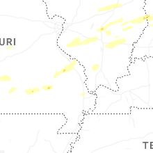
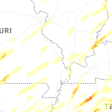


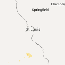


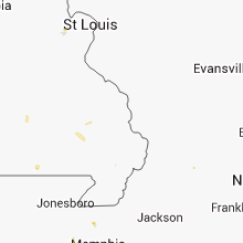


Connect with Interactive Hail Maps