

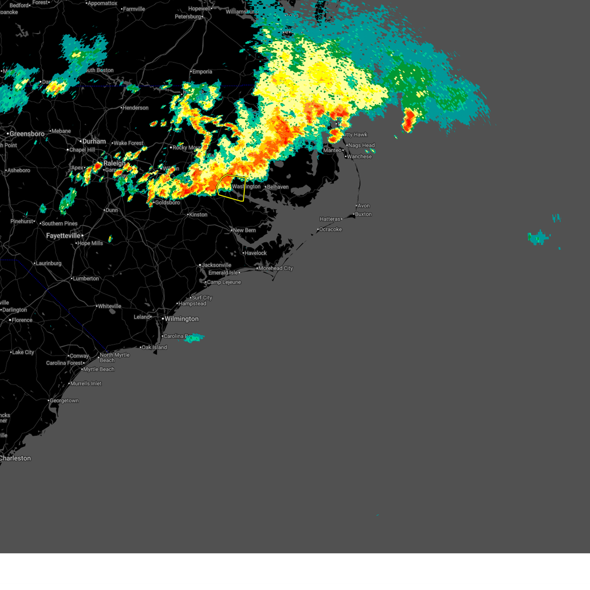
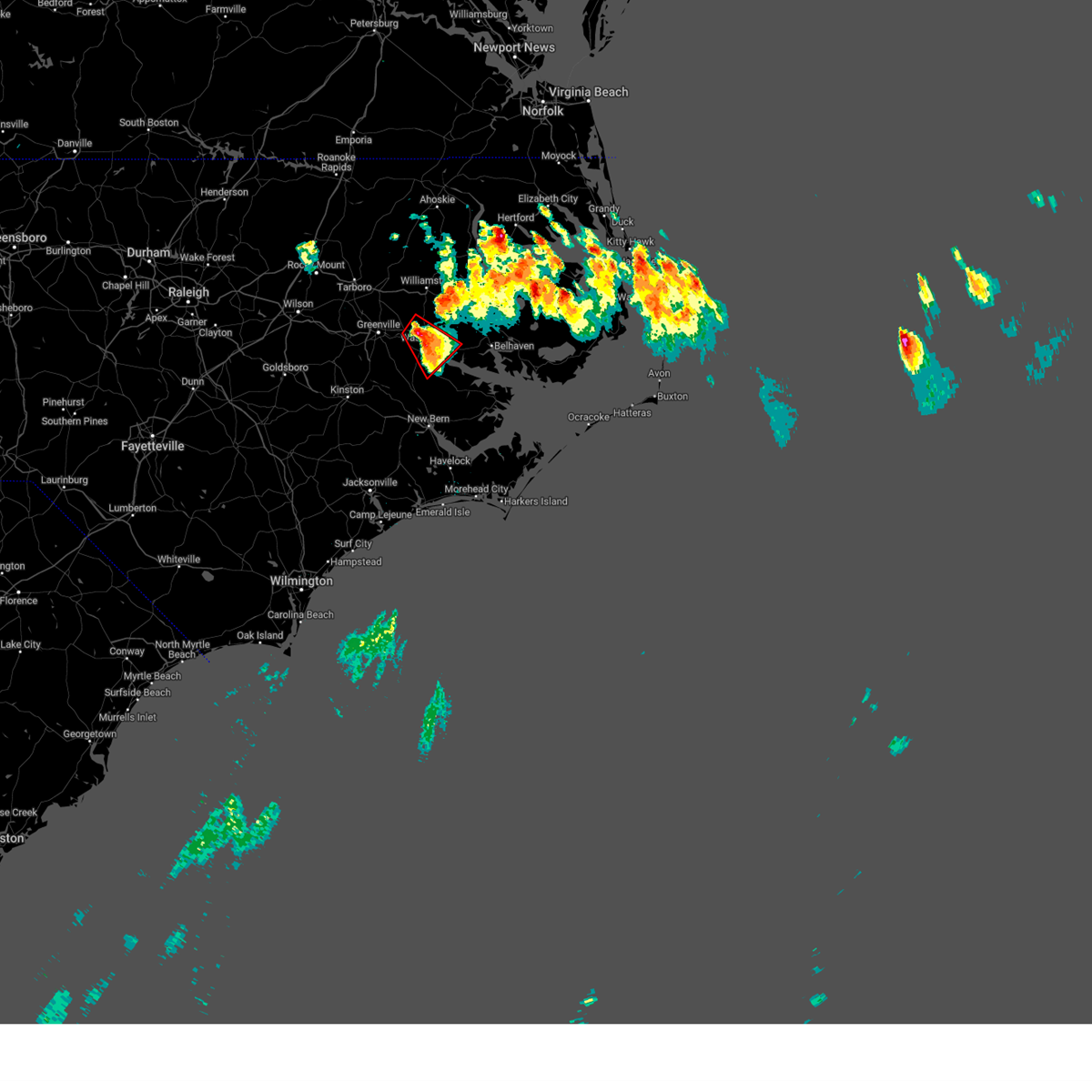
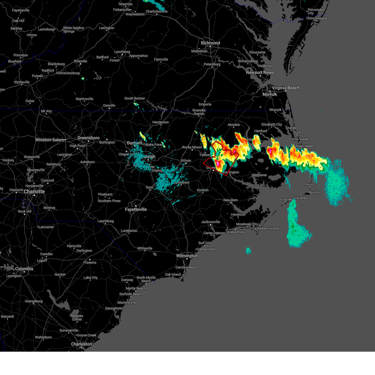
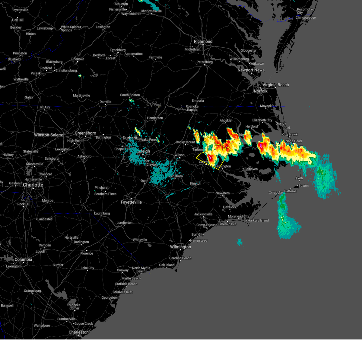
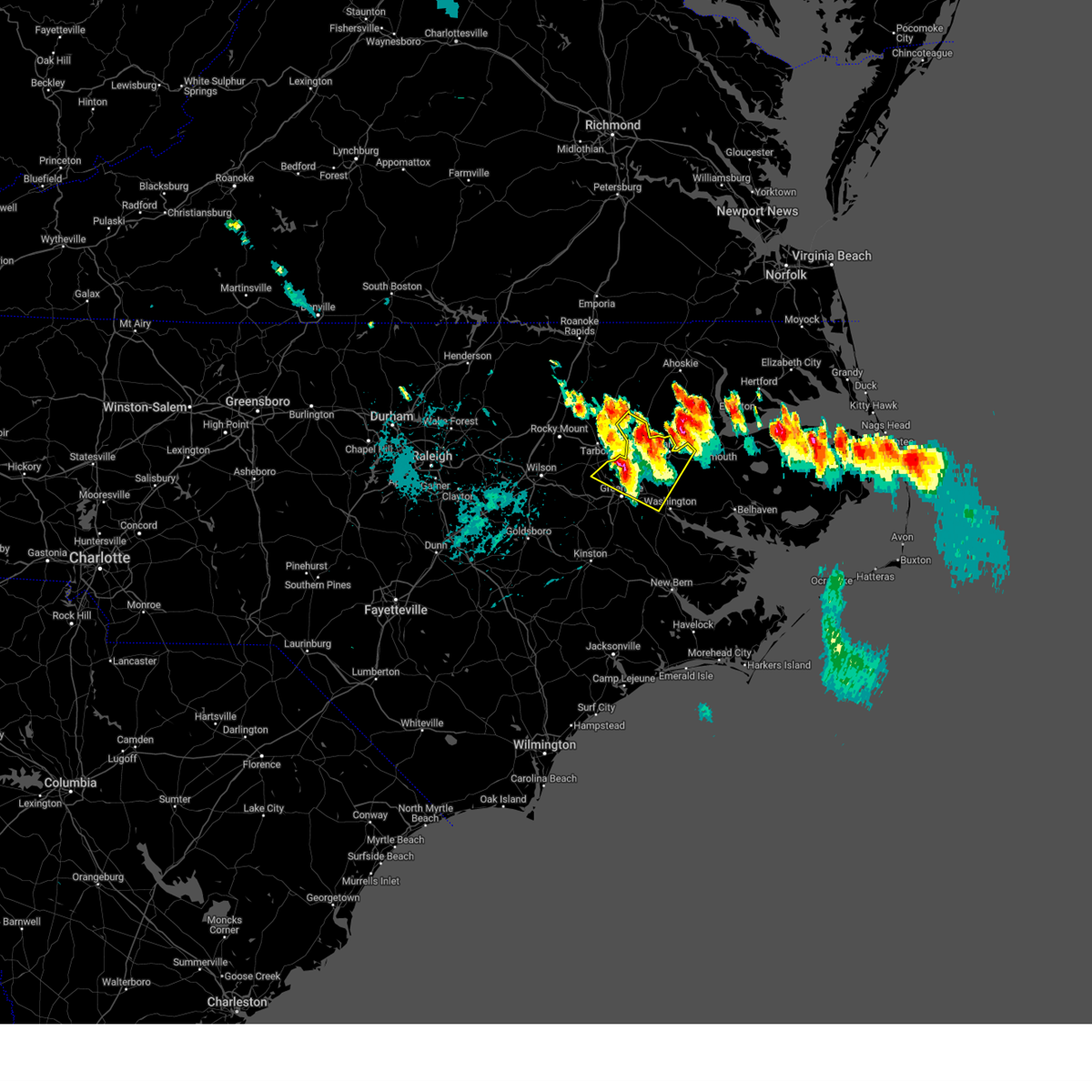
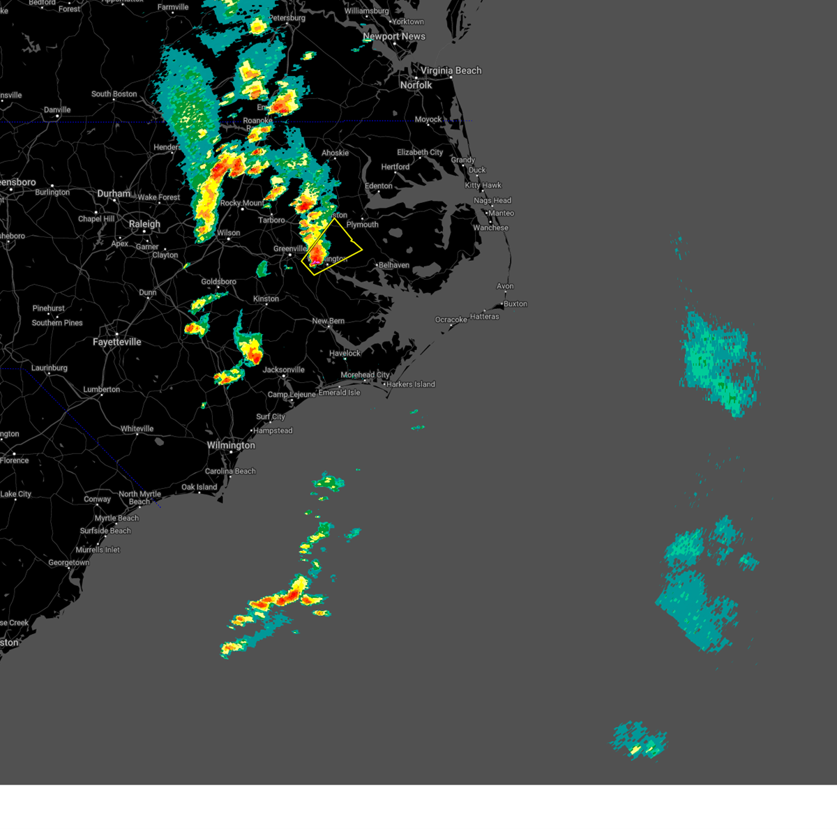
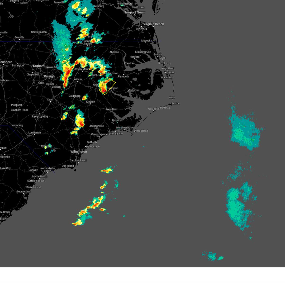
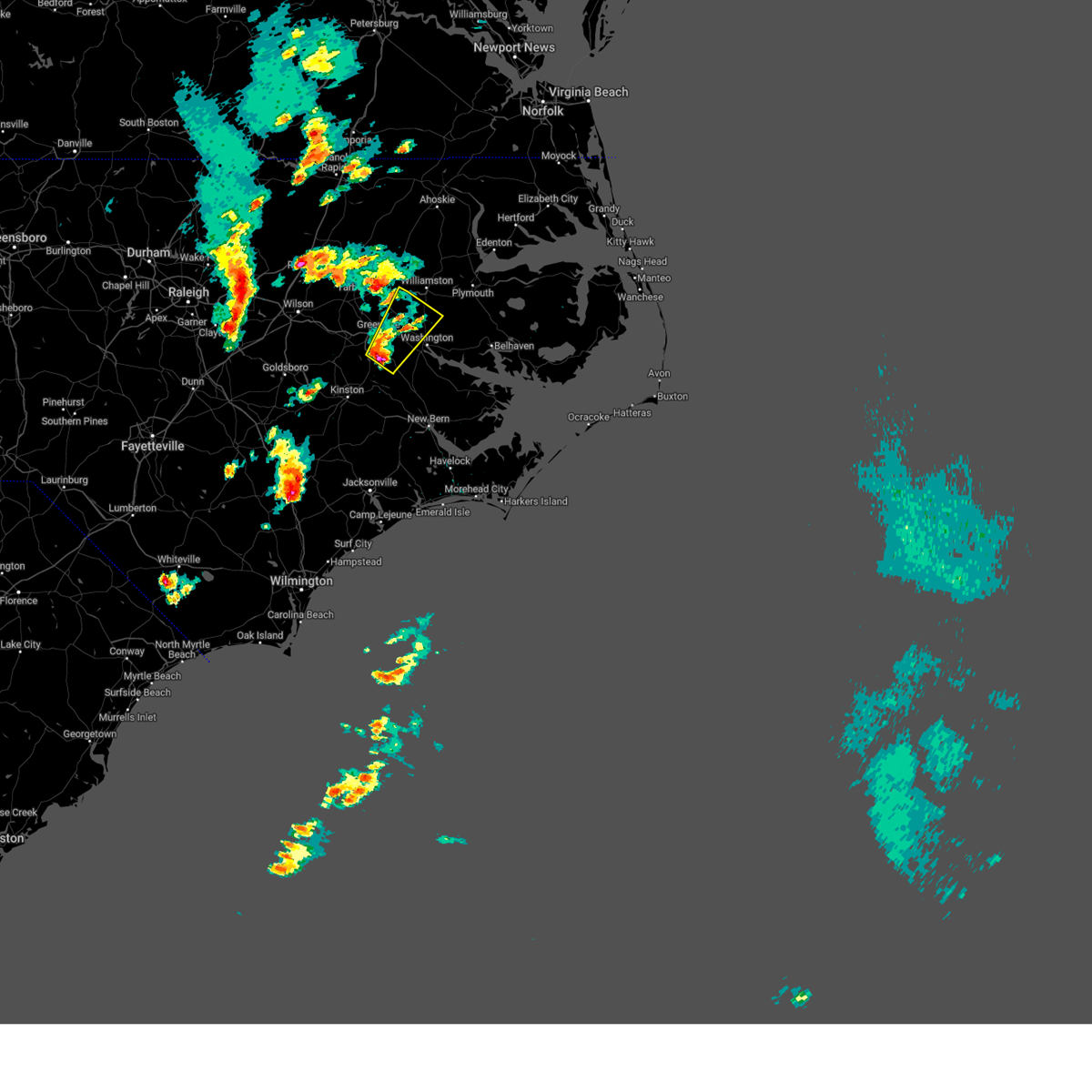
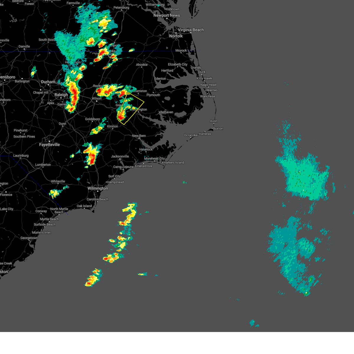
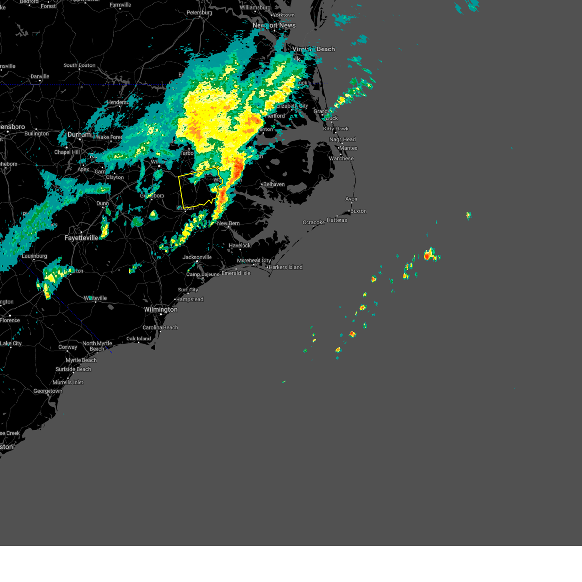
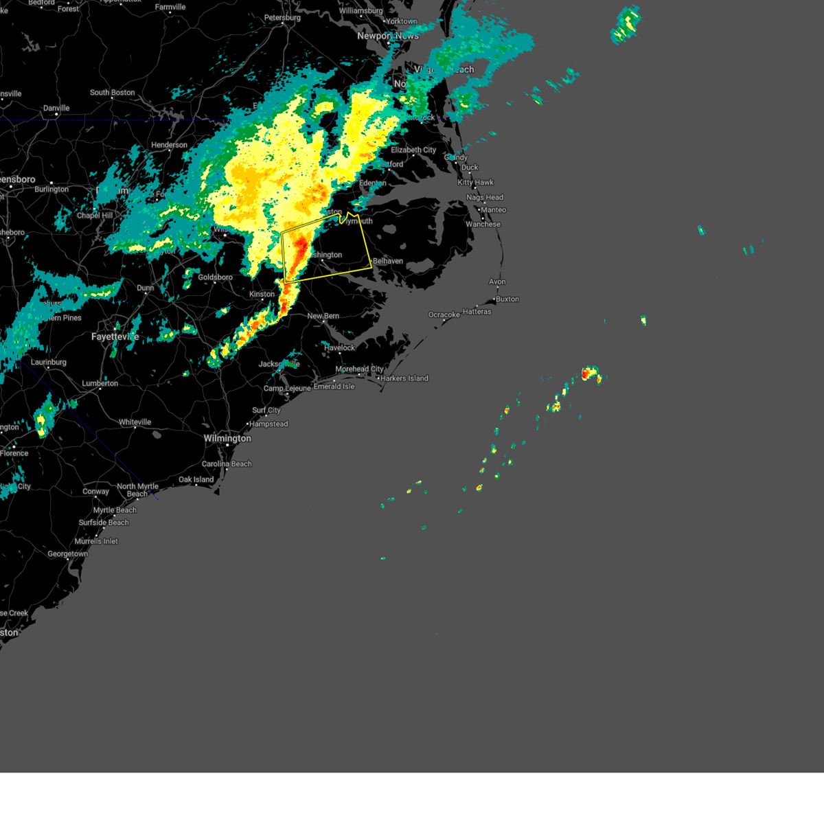
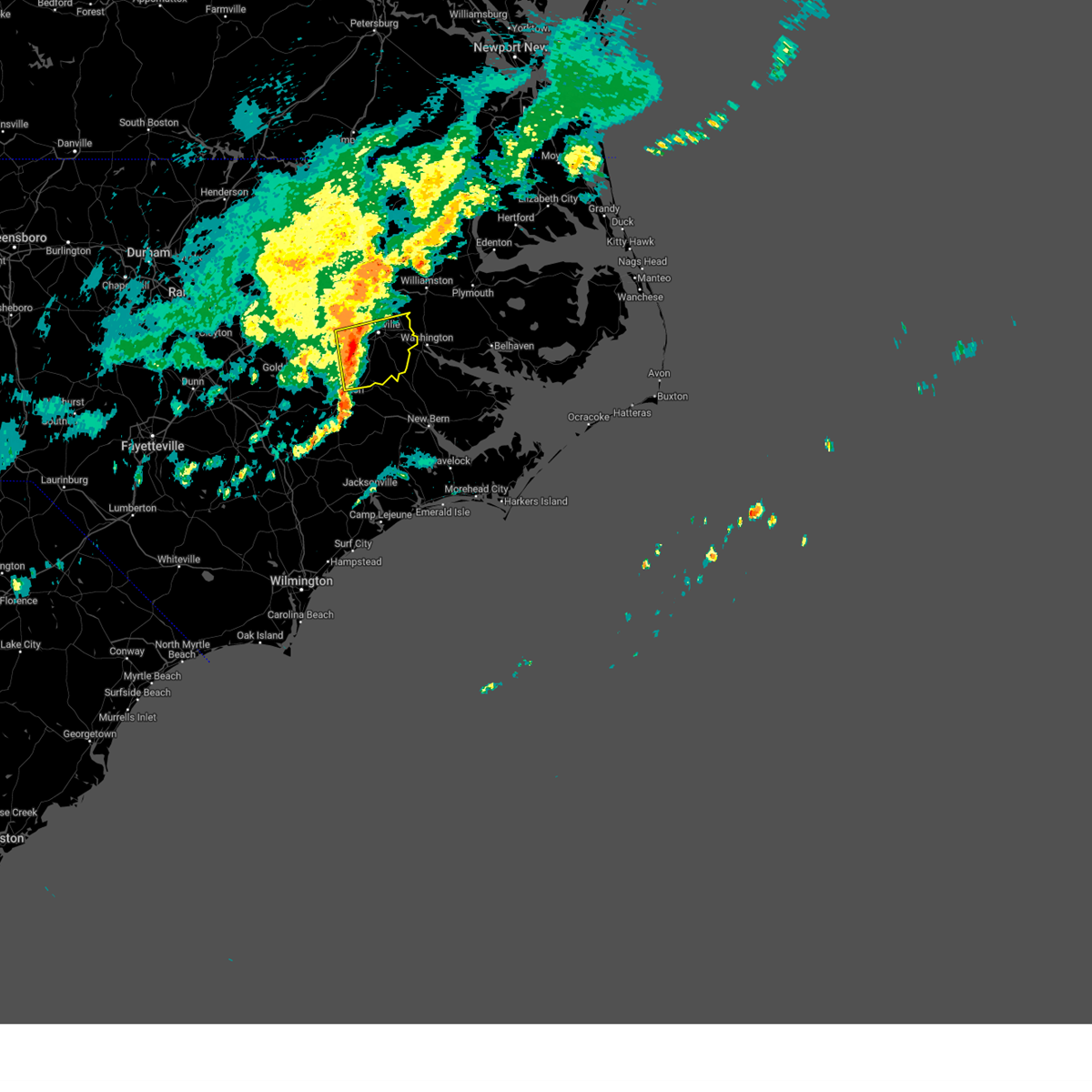
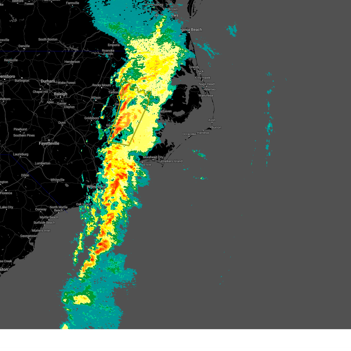
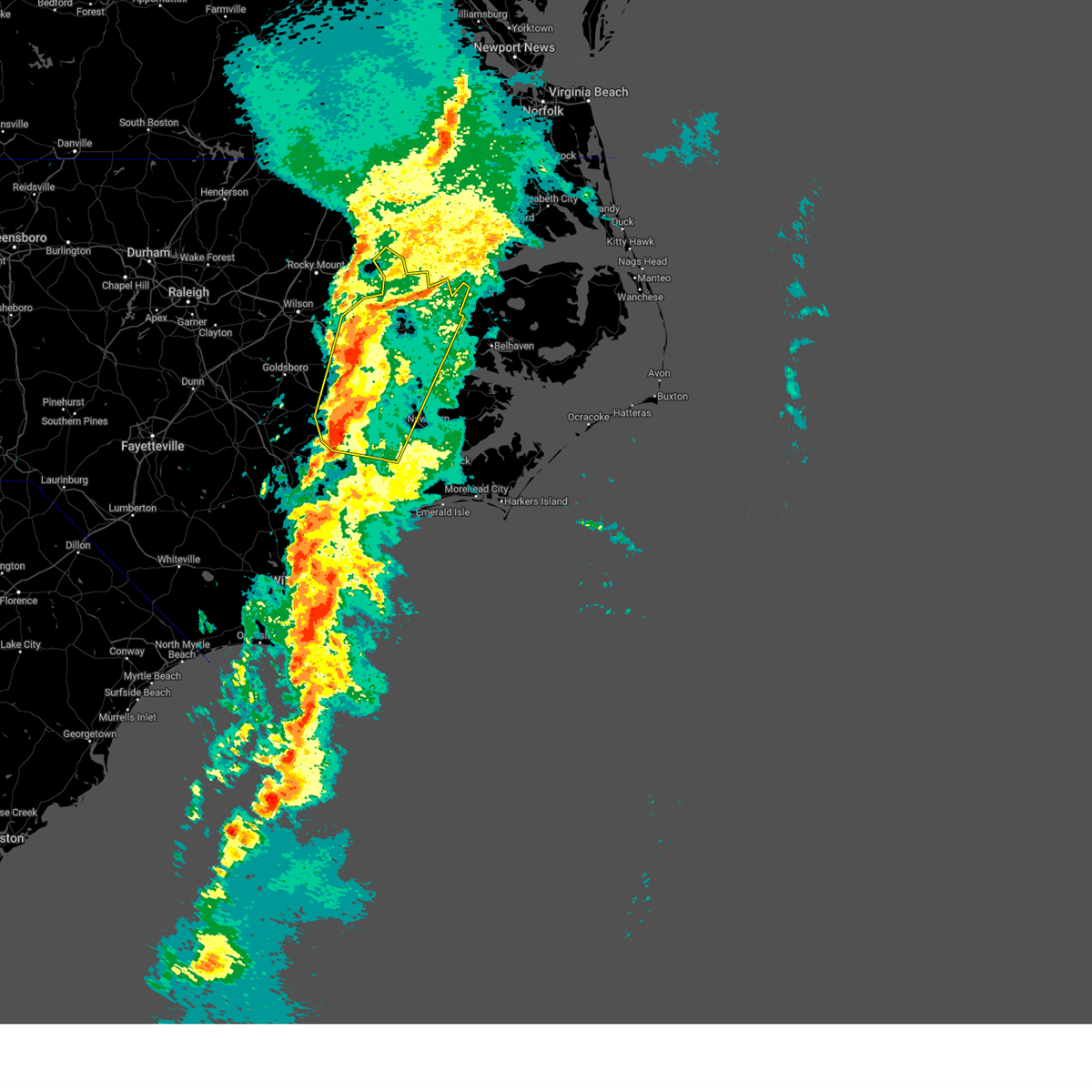
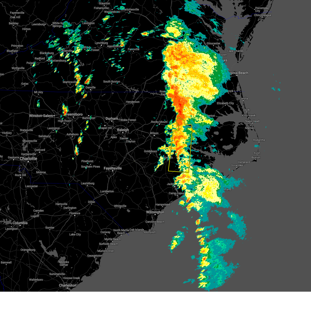
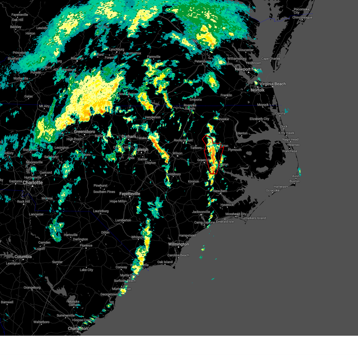
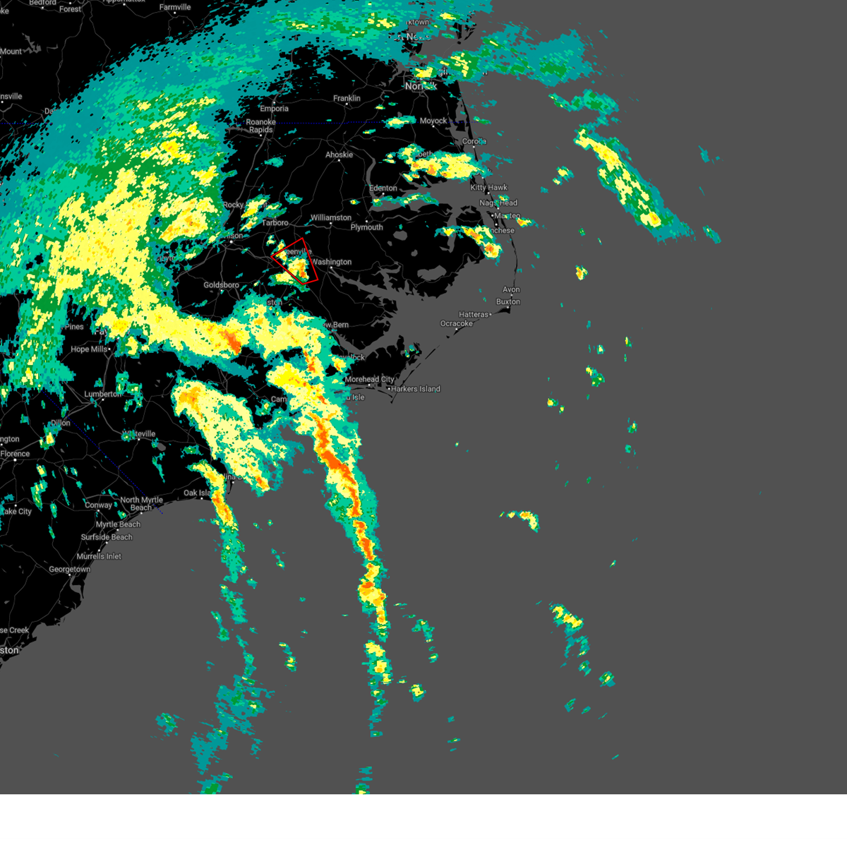
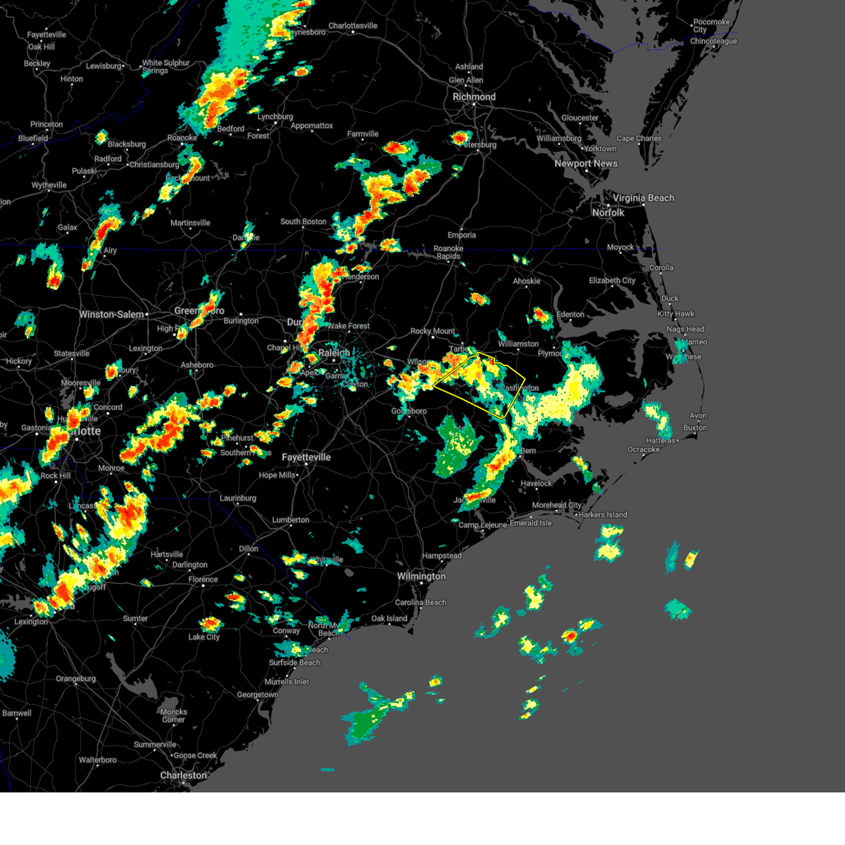
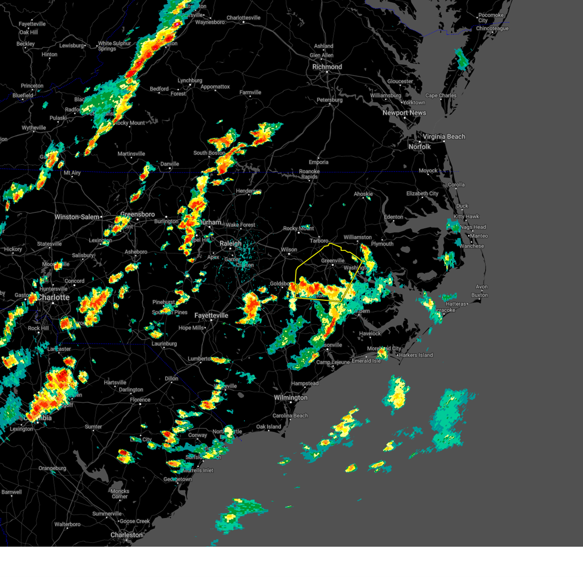
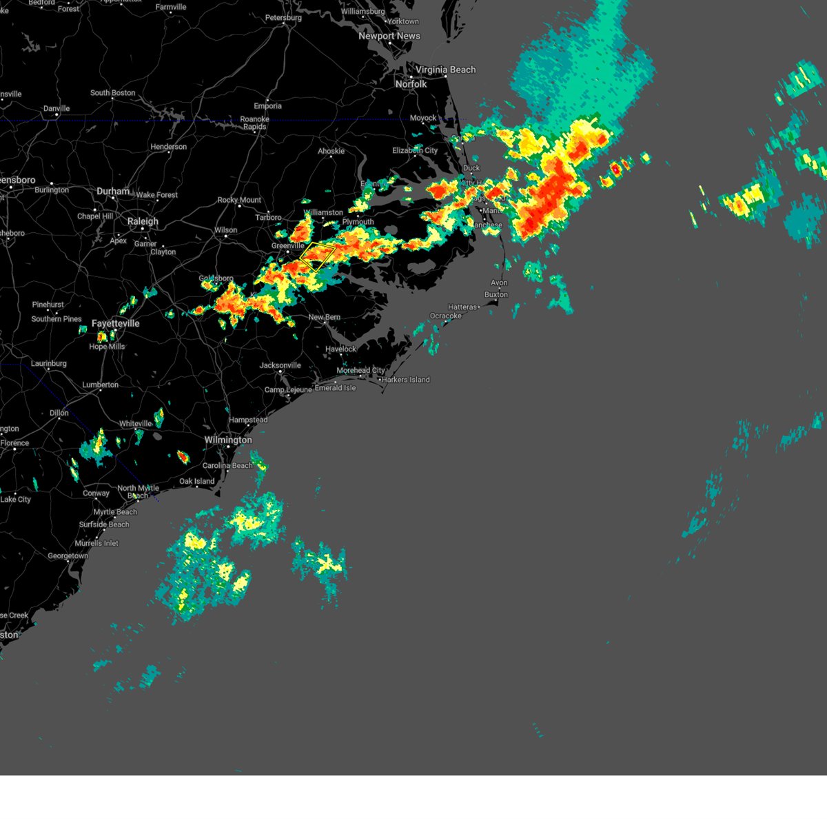
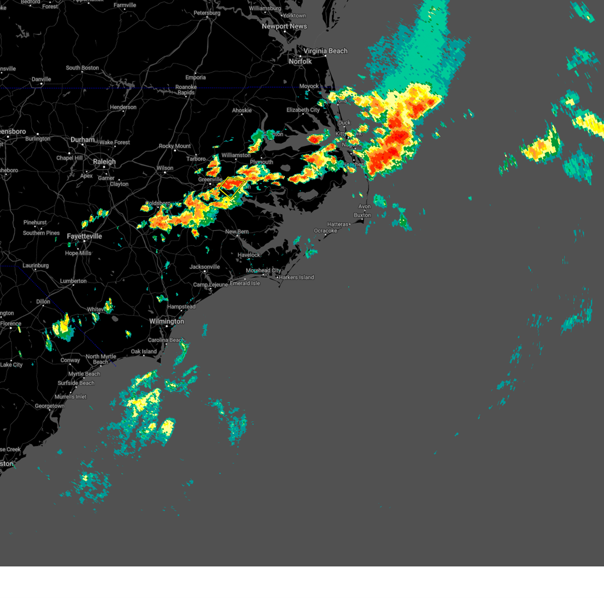
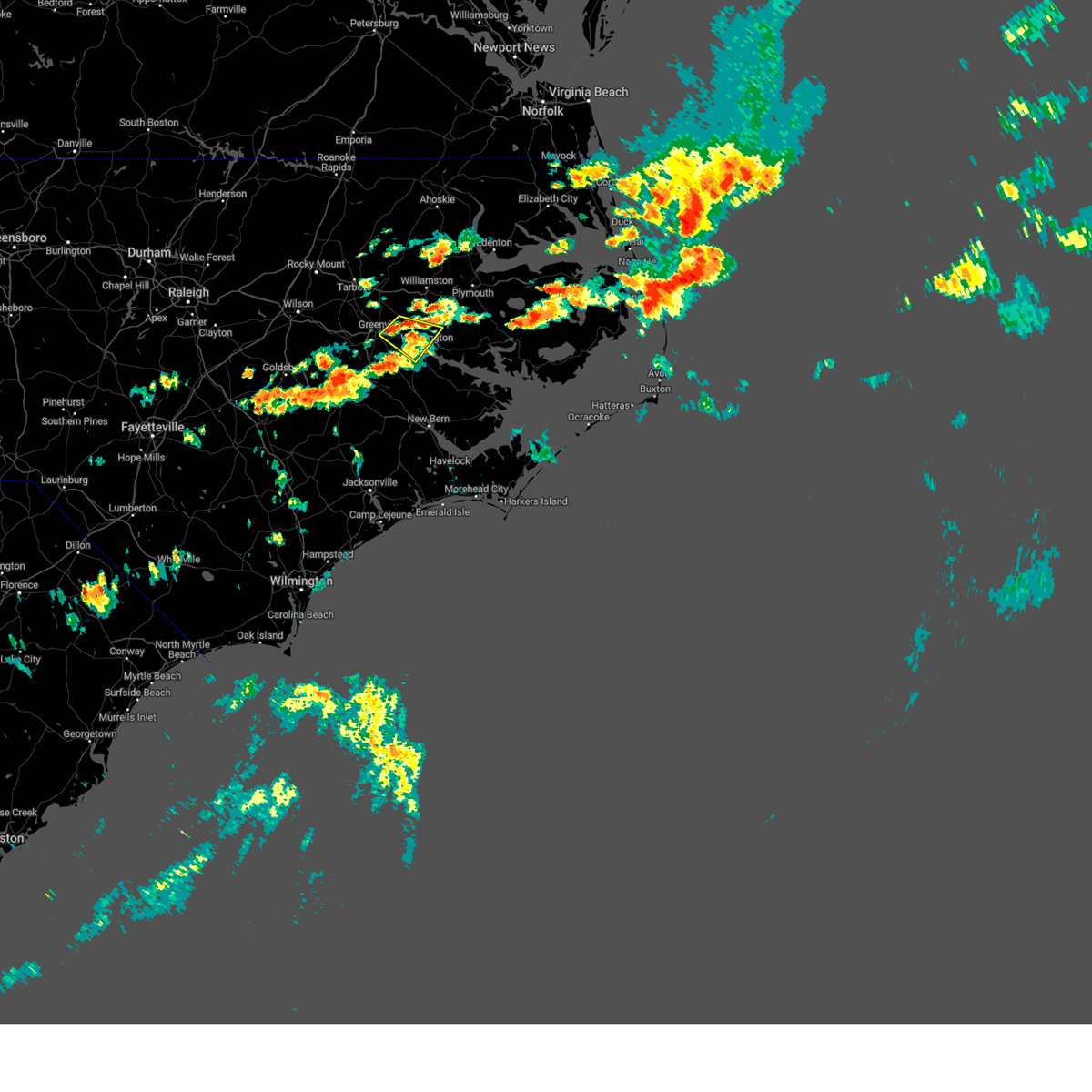
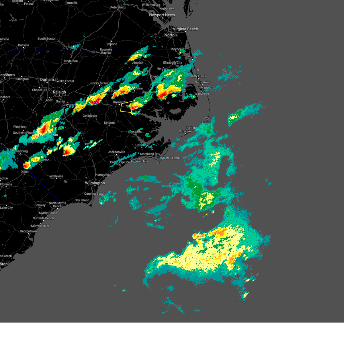
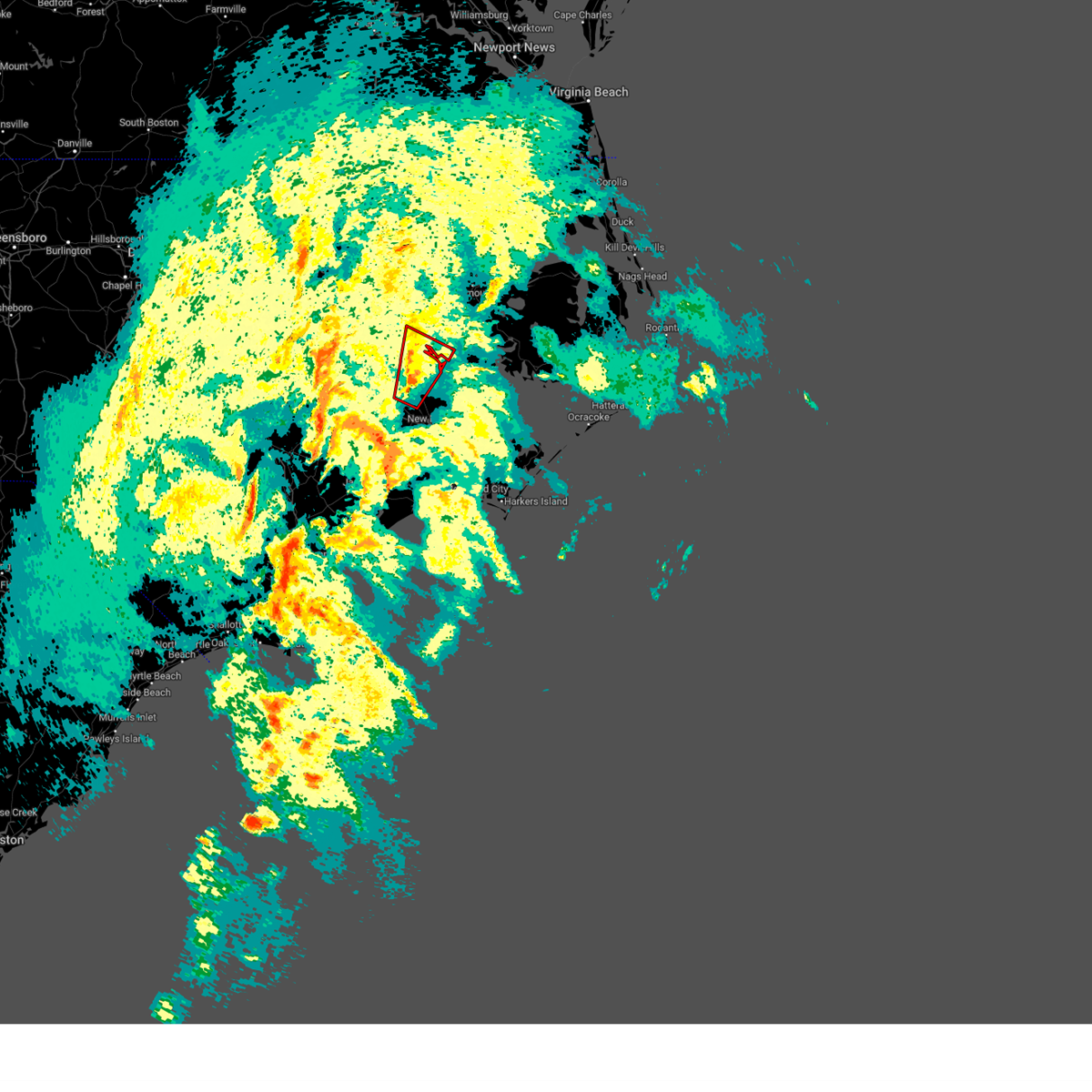
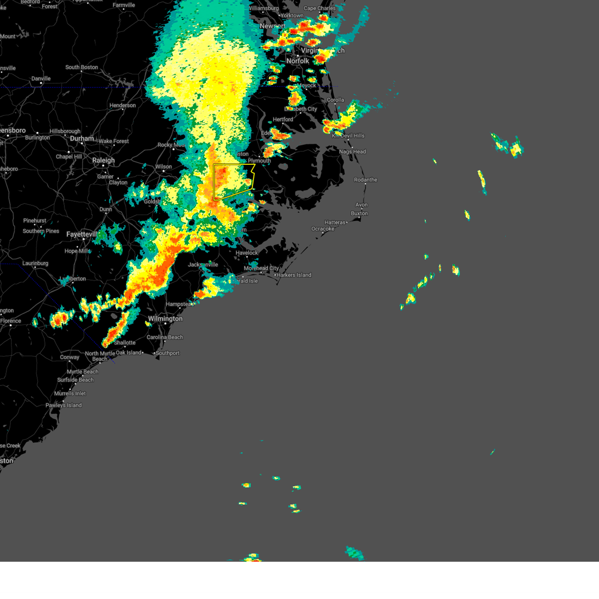
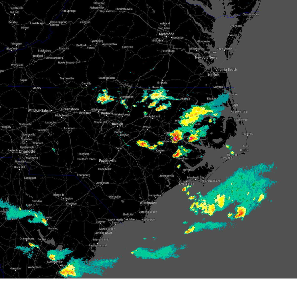
Hail Map for Grimesland, NC
The Grimesland, NC area has had 5 reports of on-the-ground hail by trained spotters, and has been under severe weather warnings 44 times during the past 12 months. Doppler radar has detected hail at or near Grimesland, NC on 49 occasions, including 4 occasions during the past year.
| Name: | Grimesland, NC |
| Where Located: | 82.3 miles E of Raleigh, NC |
| Map: | Google Map for Grimesland, NC |
| Population: | 441 |
| Housing Units: | 191 |
| More Info: | Search Google for Grimesland, NC |
5
The Top Recent Hail Date for Grimesland, NC is Monday, May 5, 2025 (3rd out of 49)

Hail and Wind Damage Spotted near Grimesland, NC
| Date / Time | Report Details |
|---|---|
| 6/15/2025 10:03 PM EDT |
 At 1003 pm edt, a severe thunderstorm was located over washington, moving east at 30 mph (radar indicated). Hazards include 60 mph wind gusts. Expect damage to roofs, siding, and trees. Locations impacted include, washington, river road, bunyan, old ford, goose creek state park, chocowinity, washington park, and grimesland. At 1003 pm edt, a severe thunderstorm was located over washington, moving east at 30 mph (radar indicated). Hazards include 60 mph wind gusts. Expect damage to roofs, siding, and trees. Locations impacted include, washington, river road, bunyan, old ford, goose creek state park, chocowinity, washington park, and grimesland.
|
| 6/15/2025 9:50 PM EDT |
 the severe thunderstorm warning has been cancelled and is no longer in effect the severe thunderstorm warning has been cancelled and is no longer in effect
|
| 6/15/2025 9:50 PM EDT |
 At 950 pm edt, a severe thunderstorm was located near pactolus, or 7 miles northwest of washington, moving east at 30 mph (law enforcement). Hazards include 60 mph wind gusts. Expect damage to roofs, siding, and trees. Locations impacted include, greenville, washington, river road, pactolus, black jack, bunyan, old ford, goose creek state park, chocowinity, washington park, grimesland, and simpson. At 950 pm edt, a severe thunderstorm was located near pactolus, or 7 miles northwest of washington, moving east at 30 mph (law enforcement). Hazards include 60 mph wind gusts. Expect damage to roofs, siding, and trees. Locations impacted include, greenville, washington, river road, pactolus, black jack, bunyan, old ford, goose creek state park, chocowinity, washington park, grimesland, and simpson.
|
| 6/15/2025 9:44 PM EDT |
 At 943 pm edt, a severe thunderstorm was located near pactolus, or 8 miles east of greenville, moving east at 30 mph (law enforcement. at 9:39 pm edt power lines were reported reported in greenville). Hazards include 60 mph wind gusts. Expect damage to roofs, siding, and trees. Locations impacted include, greenville, washington, winterville, river road, house, pactolus, black jack, bunyan, old ford, goose creek state park, east carolina university, pitt greenville airport, dowdy ficklen stadium, chocowinity, washington park, grimesland, and simpson. At 943 pm edt, a severe thunderstorm was located near pactolus, or 8 miles east of greenville, moving east at 30 mph (law enforcement. at 9:39 pm edt power lines were reported reported in greenville). Hazards include 60 mph wind gusts. Expect damage to roofs, siding, and trees. Locations impacted include, greenville, washington, winterville, river road, house, pactolus, black jack, bunyan, old ford, goose creek state park, east carolina university, pitt greenville airport, dowdy ficklen stadium, chocowinity, washington park, grimesland, and simpson.
|
| 6/15/2025 9:37 PM EDT |
 Svrmhx the national weather service in newport has issued a * severe thunderstorm warning for, east central pitt county in eastern north carolina, south central martin county in eastern north carolina, northwestern beaufort county in eastern north carolina, * until 1015 pm edt. * at 936 pm edt, a severe thunderstorm was located near dowdy ficklen stadium, or near greenville, moving east at 30 mph (radar indicated). Hazards include 60 mph wind gusts. expect damage to roofs, siding, and trees Svrmhx the national weather service in newport has issued a * severe thunderstorm warning for, east central pitt county in eastern north carolina, south central martin county in eastern north carolina, northwestern beaufort county in eastern north carolina, * until 1015 pm edt. * at 936 pm edt, a severe thunderstorm was located near dowdy ficklen stadium, or near greenville, moving east at 30 mph (radar indicated). Hazards include 60 mph wind gusts. expect damage to roofs, siding, and trees
|
| 5/30/2025 6:13 PM EDT |
 Svrmhx the national weather service in newport has issued a * severe thunderstorm warning for, north central craven county in eastern north carolina, southeastern pitt county in eastern north carolina, beaufort county in eastern north carolina, * until 700 pm edt. * at 613 pm edt, a severe thunderstorm was located near river road, moving east at 45 mph (radar indicated). Hazards include 60 mph wind gusts. expect damage to roofs, siding, and trees Svrmhx the national weather service in newport has issued a * severe thunderstorm warning for, north central craven county in eastern north carolina, southeastern pitt county in eastern north carolina, beaufort county in eastern north carolina, * until 700 pm edt. * at 613 pm edt, a severe thunderstorm was located near river road, moving east at 45 mph (radar indicated). Hazards include 60 mph wind gusts. expect damage to roofs, siding, and trees
|
| 5/15/2025 7:08 PM EDT |
 At 708 pm edt, a severe thunderstorm capable of producing a tornado was located near old ford, or 7 miles northwest of washington, moving southeast at 25 mph (radar indicated rotation). Hazards include tornado. Flying debris will be dangerous to those caught without shelter. mobile homes will be damaged or destroyed. damage to roofs, windows, and vehicles will occur. tree damage is likely. this dangerous storm will be near, washington and old ford around 715 pm edt. river road and bunyan around 725 pm edt. Other locations impacted by this tornadic thunderstorm include chocowinity and washington park. At 708 pm edt, a severe thunderstorm capable of producing a tornado was located near old ford, or 7 miles northwest of washington, moving southeast at 25 mph (radar indicated rotation). Hazards include tornado. Flying debris will be dangerous to those caught without shelter. mobile homes will be damaged or destroyed. damage to roofs, windows, and vehicles will occur. tree damage is likely. this dangerous storm will be near, washington and old ford around 715 pm edt. river road and bunyan around 725 pm edt. Other locations impacted by this tornadic thunderstorm include chocowinity and washington park.
|
| 5/15/2025 6:57 PM EDT |
 Tormhx the national weather service in newport has issued a * tornado warning for, east central pitt county in eastern north carolina, northwestern beaufort county in eastern north carolina, * until 730 pm edt. * at 657 pm edt, a confirmed tornado was located over pactolus, or 10 miles east of greenville, moving southeast at 20 mph (weather spotters confirmed tornado). Hazards include damaging tornado and quarter size hail. Flying debris will be dangerous to those caught without shelter. mobile homes will be damaged or destroyed. damage to roofs, windows, and vehicles will occur. tree damage is likely. the tornado will be near, washington around 705 pm edt. Other locations impacted by this tornadic thunderstorm include chocowinity, washington park, and grimesland. Tormhx the national weather service in newport has issued a * tornado warning for, east central pitt county in eastern north carolina, northwestern beaufort county in eastern north carolina, * until 730 pm edt. * at 657 pm edt, a confirmed tornado was located over pactolus, or 10 miles east of greenville, moving southeast at 20 mph (weather spotters confirmed tornado). Hazards include damaging tornado and quarter size hail. Flying debris will be dangerous to those caught without shelter. mobile homes will be damaged or destroyed. damage to roofs, windows, and vehicles will occur. tree damage is likely. the tornado will be near, washington around 705 pm edt. Other locations impacted by this tornadic thunderstorm include chocowinity, washington park, and grimesland.
|
| 5/15/2025 6:52 PM EDT |
 At 652 pm edt, a confirmed tornado was located over pactolus, or 11 miles northeast of greenville, moving southeast at 25 mph (law enforcement confirmed tornado). Hazards include damaging tornado and ping pong ball size hail. Flying debris will be dangerous to those caught without shelter. mobile homes will be damaged or destroyed. damage to roofs, windows, and vehicles will occur. tree damage is likely. this tornado will be near, washington and old ford around 700 pm edt. Other locations impacted by this tornadic thunderstorm include grimesland. At 652 pm edt, a confirmed tornado was located over pactolus, or 11 miles northeast of greenville, moving southeast at 25 mph (law enforcement confirmed tornado). Hazards include damaging tornado and ping pong ball size hail. Flying debris will be dangerous to those caught without shelter. mobile homes will be damaged or destroyed. damage to roofs, windows, and vehicles will occur. tree damage is likely. this tornado will be near, washington and old ford around 700 pm edt. Other locations impacted by this tornadic thunderstorm include grimesland.
|
| 5/15/2025 6:46 PM EDT |
 At 646 pm edt, a severe thunderstorm capable of producing a tornado was located near pactolus, or 11 miles northeast of greenville, moving southeast at 20 mph (radar indicated rotation). Hazards include tornado and golf ball size hail. Flying debris will be dangerous to those caught without shelter. mobile homes will be damaged or destroyed. damage to roofs, windows, and vehicles will occur. tree damage is likely. this dangerous storm will be near, pactolus around 650 pm edt. washington around 700 pm edt. old ford around 705 pm edt. Other locations impacted by this tornadic thunderstorm include grimesland. At 646 pm edt, a severe thunderstorm capable of producing a tornado was located near pactolus, or 11 miles northeast of greenville, moving southeast at 20 mph (radar indicated rotation). Hazards include tornado and golf ball size hail. Flying debris will be dangerous to those caught without shelter. mobile homes will be damaged or destroyed. damage to roofs, windows, and vehicles will occur. tree damage is likely. this dangerous storm will be near, pactolus around 650 pm edt. washington around 700 pm edt. old ford around 705 pm edt. Other locations impacted by this tornadic thunderstorm include grimesland.
|
| 5/15/2025 6:44 PM EDT | The storm which prompted the warning has weakened below severe limits, and no longer poses an immediate threat to life or property. therefore, the warning will be allowed to expire. a severe thunderstorm watch remains in effect until midnight edt for eastern north carolina. to report severe weather, contact your nearest law enforcement agency. they will relay your report to the national weather service newport. remember, a tornado warning still remains in effect for eastern pitt and northwestern beaufort counties!. |
| 5/15/2025 6:36 PM EDT | At 636 pm edt, a confirmed tornado was located over stokes, or 11 miles northeast of greenville, moving southeast at 25 mph (public confirmed tornado). Hazards include damaging tornado and golf ball size hail. Flying debris will be dangerous to those caught without shelter. mobile homes will be damaged or destroyed. damage to roofs, windows, and vehicles will occur. tree damage is likely. this tornado will be near, pactolus around 645 pm edt. Other locations impacted by this tornadic thunderstorm include grimesland. |
| 5/15/2025 6:36 PM EDT | the tornado warning has been cancelled and is no longer in effect |
| 5/15/2025 6:34 PM EDT |
 Tormhx the national weather service in newport has issued a * tornado warning for, northern pitt county in eastern north carolina, martin county in eastern north carolina, northwestern beaufort county in eastern north carolina, * until 700 pm edt. * at 634 pm edt, a confirmed tornado was located over stokes, or 10 miles northeast of greenville, moving southeast at 25 mph (public confirmed tornado). Hazards include damaging tornado and golf ball size hail. Flying debris will be dangerous to those caught without shelter. mobile homes will be damaged or destroyed. damage to roofs, windows, and vehicles will occur. tree damage is likely. the tornado will be near, pactolus around 645 pm edt. Other locations impacted by this tornadic thunderstorm include oak city, parmele, beargrass, grimesland, falkland, hamilton, everetts, smithwick, hassell, and gold point. Tormhx the national weather service in newport has issued a * tornado warning for, northern pitt county in eastern north carolina, martin county in eastern north carolina, northwestern beaufort county in eastern north carolina, * until 700 pm edt. * at 634 pm edt, a confirmed tornado was located over stokes, or 10 miles northeast of greenville, moving southeast at 25 mph (public confirmed tornado). Hazards include damaging tornado and golf ball size hail. Flying debris will be dangerous to those caught without shelter. mobile homes will be damaged or destroyed. damage to roofs, windows, and vehicles will occur. tree damage is likely. the tornado will be near, pactolus around 645 pm edt. Other locations impacted by this tornadic thunderstorm include oak city, parmele, beargrass, grimesland, falkland, hamilton, everetts, smithwick, hassell, and gold point.
|
| 5/15/2025 6:30 PM EDT |
 At 630 pm edt, a severe thunderstorm was located over stokes, or 10 miles northeast of greenville, moving southeast at 25 mph (radar indicated). Hazards include ping pong ball size hail and 60 mph wind gusts. People and animals outdoors will be injured. expect hail damage to roofs, siding, windows, and vehicles. expect wind damage to roofs, siding, and trees. Locations impacted include, greenville, washington, williamston, bethel, stokes, robersonville, house, pactolus, old ford, gold point, grimesland, hamilton, oak city, smithwick, parmele, everetts, falkland, hassell, and beargrass. At 630 pm edt, a severe thunderstorm was located over stokes, or 10 miles northeast of greenville, moving southeast at 25 mph (radar indicated). Hazards include ping pong ball size hail and 60 mph wind gusts. People and animals outdoors will be injured. expect hail damage to roofs, siding, windows, and vehicles. expect wind damage to roofs, siding, and trees. Locations impacted include, greenville, washington, williamston, bethel, stokes, robersonville, house, pactolus, old ford, gold point, grimesland, hamilton, oak city, smithwick, parmele, everetts, falkland, hassell, and beargrass.
|
| 5/15/2025 6:15 PM EDT |
 At 615 pm edt, a severe thunderstorm was located near bethel, or 11 miles north of greenville, moving southeast at 25 mph (radar indicated). Hazards include 60 mph wind gusts and half dollar size hail. Hail damage to vehicles is expected. expect wind damage to roofs, siding, and trees. Locations impacted include, greenville, washington, williamston, bethel, stokes, robersonville, house, pactolus, old ford, gold point, grimesland, hamilton, oak city, smithwick, parmele, everetts, falkland, hassell, and beargrass. At 615 pm edt, a severe thunderstorm was located near bethel, or 11 miles north of greenville, moving southeast at 25 mph (radar indicated). Hazards include 60 mph wind gusts and half dollar size hail. Hail damage to vehicles is expected. expect wind damage to roofs, siding, and trees. Locations impacted include, greenville, washington, williamston, bethel, stokes, robersonville, house, pactolus, old ford, gold point, grimesland, hamilton, oak city, smithwick, parmele, everetts, falkland, hassell, and beargrass.
|
| 5/15/2025 6:07 PM EDT | Svrmhx the national weather service in newport has issued a * severe thunderstorm warning for, northern pitt county in eastern north carolina, martin county in eastern north carolina, northwestern beaufort county in eastern north carolina, * until 645 pm edt. * at 606 pm edt, a severe thunderstorm was located near bethel, or 11 miles southeast of tarboro, moving southeast at 25 mph (radar indicated). Hazards include 60 mph wind gusts and quarter size hail. Hail damage to vehicles is expected. Expect wind damage to roofs, siding, and trees. |
| 5/5/2025 3:56 PM EDT | Golf Ball sized hail reported 3.1 miles WNW of Grimesland, NC, picture submitted via facebook. the hail stone was shown next to a quarter... and based on the picture... it appears to be the size of a golf ball. time estimated based |
| 5/5/2025 3:55 PM EDT |
 Svrmhx the national weather service in newport has issued a * severe thunderstorm warning for, east central pitt county in eastern north carolina, southeastern martin county in eastern north carolina, northwestern beaufort county in eastern north carolina, * until 445 pm edt. * at 354 pm edt, a severe thunderstorm was located near washington, moving northeast at 20 mph (radar indicated). Hazards include 60 mph wind gusts and quarter size hail. Hail damage to vehicles is expected. Expect wind damage to roofs, siding, and trees. Svrmhx the national weather service in newport has issued a * severe thunderstorm warning for, east central pitt county in eastern north carolina, southeastern martin county in eastern north carolina, northwestern beaufort county in eastern north carolina, * until 445 pm edt. * at 354 pm edt, a severe thunderstorm was located near washington, moving northeast at 20 mph (radar indicated). Hazards include 60 mph wind gusts and quarter size hail. Hail damage to vehicles is expected. Expect wind damage to roofs, siding, and trees.
|
| 5/5/2025 3:52 PM EDT | Ping Pong Ball sized hail reported 2.3 miles NW of Grimesland, NC, report via facebook. time estimated from radar. |
| 5/5/2025 3:52 PM EDT | 30 foot metal flag pole snapped in half. report via facebook. time estimated via rada in pitt county NC, 2.8 miles WNW of Grimesland, NC |
| 5/5/2025 3:39 PM EDT |
 At 338 pm edt, a severe thunderstorm was located over black jack, or 7 miles east of greenville, moving northeast at 25 mph (public. at 330 pm, hail up to quarter size was reported approximately 5 miles east of winterville). Hazards include 60 mph wind gusts and quarter size hail. Hail damage to vehicles is expected. expect wind damage to roofs, siding, and trees. Locations impacted include, beargrass, old ford, grimesland, black jack, smithwick, pactolus, simpson, greenville, and washington. At 338 pm edt, a severe thunderstorm was located over black jack, or 7 miles east of greenville, moving northeast at 25 mph (public. at 330 pm, hail up to quarter size was reported approximately 5 miles east of winterville). Hazards include 60 mph wind gusts and quarter size hail. Hail damage to vehicles is expected. expect wind damage to roofs, siding, and trees. Locations impacted include, beargrass, old ford, grimesland, black jack, smithwick, pactolus, simpson, greenville, and washington.
|
| 5/5/2025 3:22 PM EDT |
 At 322 pm edt, a severe thunderstorm was located near shelmerdine, or near winterville, moving northeast at 25 mph (radar indicated). Hazards include 60 mph wind gusts and half dollar size hail. Hail damage to vehicles is expected. expect wind damage to roofs, siding, and trees. Locations impacted include, beargrass, black jack, greenville, shelmerdine, east carolina university, dowdy ficklen stadium, robersonville, old ford, grimesland, stokes, ayden, calico, winterville, smithwick, pactolus, simpson, and washington. At 322 pm edt, a severe thunderstorm was located near shelmerdine, or near winterville, moving northeast at 25 mph (radar indicated). Hazards include 60 mph wind gusts and half dollar size hail. Hail damage to vehicles is expected. expect wind damage to roofs, siding, and trees. Locations impacted include, beargrass, black jack, greenville, shelmerdine, east carolina university, dowdy ficklen stadium, robersonville, old ford, grimesland, stokes, ayden, calico, winterville, smithwick, pactolus, simpson, and washington.
|
| 5/5/2025 3:14 PM EDT |
 Svrmhx the national weather service in newport has issued a * severe thunderstorm warning for, central pitt county in eastern north carolina, southwestern martin county in eastern north carolina, northwestern beaufort county in eastern north carolina, * until 400 pm edt. * at 314 pm edt, a severe thunderstorm was located near ayden, moving northeast at 30 mph (radar indicated). Hazards include 60 mph wind gusts and quarter size hail. Hail damage to vehicles is expected. Expect wind damage to roofs, siding, and trees. Svrmhx the national weather service in newport has issued a * severe thunderstorm warning for, central pitt county in eastern north carolina, southwestern martin county in eastern north carolina, northwestern beaufort county in eastern north carolina, * until 400 pm edt. * at 314 pm edt, a severe thunderstorm was located near ayden, moving northeast at 30 mph (radar indicated). Hazards include 60 mph wind gusts and quarter size hail. Hail damage to vehicles is expected. Expect wind damage to roofs, siding, and trees.
|
| 4/7/2025 4:32 PM EDT |
 the severe thunderstorm warning has been cancelled and is no longer in effect the severe thunderstorm warning has been cancelled and is no longer in effect
|
| 4/7/2025 4:18 PM EDT | Trees down on boyds road near blackjac in pitt county NC, 3.4 miles NW of Grimesland, NC |
| 4/7/2025 4:15 PM EDT |
 Svrmhx the national weather service in newport has issued a * severe thunderstorm warning for, southwestern washington county in eastern north carolina, northern craven county in eastern north carolina, eastern pitt county in eastern north carolina, southern martin county in eastern north carolina, northern beaufort county in eastern north carolina, * until 445 pm edt. * at 413 pm edt, a severe thunderstorm was located near old ford, or 11 miles northwest of washington, moving east at 80 mph. this is a destructive storm for washington and rural martin county (law enforcement. this thunderstorm has a history of producing damaging winds and large hail up to golf ball size). Hazards include 80 mph wind gusts and golf ball size hail. Flying debris will be dangerous to those caught without shelter. mobile homes will be heavily damaged. expect considerable damage to roofs, windows, and vehicles. Extensive tree damage and power outages are likely. Svrmhx the national weather service in newport has issued a * severe thunderstorm warning for, southwestern washington county in eastern north carolina, northern craven county in eastern north carolina, eastern pitt county in eastern north carolina, southern martin county in eastern north carolina, northern beaufort county in eastern north carolina, * until 445 pm edt. * at 413 pm edt, a severe thunderstorm was located near old ford, or 11 miles northwest of washington, moving east at 80 mph. this is a destructive storm for washington and rural martin county (law enforcement. this thunderstorm has a history of producing damaging winds and large hail up to golf ball size). Hazards include 80 mph wind gusts and golf ball size hail. Flying debris will be dangerous to those caught without shelter. mobile homes will be heavily damaged. expect considerable damage to roofs, windows, and vehicles. Extensive tree damage and power outages are likely.
|
| 4/7/2025 4:04 PM EDT | Delayed report. power lines down on tucker roa in pitt county NC, 4.3 miles E of Grimesland, NC |
| 4/7/2025 4:01 PM EDT |
 Svrmhx the national weather service in newport has issued a * severe thunderstorm warning for, eastern greene county in eastern north carolina, northeastern lenoir county in eastern north carolina, pitt county in eastern north carolina, southern martin county in eastern north carolina, * until 500 pm edt. * at 359 pm edt, a severe thunderstorm was located over roundtree, or near ayden, moving east at 45 mph. this is a destructive storm for winterville and greenville (law enforcement. these thunderstorms have a history of producing damaging winds). Hazards include 80 mph wind gusts and penny size hail. Flying debris will be dangerous to those caught without shelter. mobile homes will be heavily damaged. expect considerable damage to roofs, windows, and vehicles. Extensive tree damage and power outages are likely. Svrmhx the national weather service in newport has issued a * severe thunderstorm warning for, eastern greene county in eastern north carolina, northeastern lenoir county in eastern north carolina, pitt county in eastern north carolina, southern martin county in eastern north carolina, * until 500 pm edt. * at 359 pm edt, a severe thunderstorm was located over roundtree, or near ayden, moving east at 45 mph. this is a destructive storm for winterville and greenville (law enforcement. these thunderstorms have a history of producing damaging winds). Hazards include 80 mph wind gusts and penny size hail. Flying debris will be dangerous to those caught without shelter. mobile homes will be heavily damaged. expect considerable damage to roofs, windows, and vehicles. Extensive tree damage and power outages are likely.
|
| 3/5/2025 3:35 PM EST |
 At 334 pm est, severe thunderstorms were located along a line extending from stokes to near phillips crossroads, moving northeast at 60 mph (radar indicated). Hazards include 70 mph wind gusts. Expect considerable tree damage. damage is likely to mobile homes, roofs, and outbuildings. Locations impacted include, rhems, vanceboro, black jack, wilmar, dowdy ficklen stadium, everetts, graingers, phillips crossroads, chocowinity, bethel, hassell, oak city, fort barnwell, greenville, house, shelmerdine, east carolina university, grifton, stokes, and cove city. At 334 pm est, severe thunderstorms were located along a line extending from stokes to near phillips crossroads, moving northeast at 60 mph (radar indicated). Hazards include 70 mph wind gusts. Expect considerable tree damage. damage is likely to mobile homes, roofs, and outbuildings. Locations impacted include, rhems, vanceboro, black jack, wilmar, dowdy ficklen stadium, everetts, graingers, phillips crossroads, chocowinity, bethel, hassell, oak city, fort barnwell, greenville, house, shelmerdine, east carolina university, grifton, stokes, and cove city.
|
| 3/5/2025 3:16 PM EST |
 Svrmhx the national weather service in newport has issued a * severe thunderstorm warning for, jones county in eastern north carolina, eastern greene county in eastern north carolina, lenoir county in eastern north carolina, northwestern craven county in eastern north carolina, pitt county in eastern north carolina, martin county in eastern north carolina, western beaufort county in eastern north carolina, * until 430 pm est. * at 315 pm est, severe thunderstorms were located along a line extending from near ormondsville to near potters hill, moving northeast at 60 mph (radar indicated). Hazards include 70 mph wind gusts. Expect considerable tree damage. Damage is likely to mobile homes, roofs, and outbuildings. Svrmhx the national weather service in newport has issued a * severe thunderstorm warning for, jones county in eastern north carolina, eastern greene county in eastern north carolina, lenoir county in eastern north carolina, northwestern craven county in eastern north carolina, pitt county in eastern north carolina, martin county in eastern north carolina, western beaufort county in eastern north carolina, * until 430 pm est. * at 315 pm est, severe thunderstorms were located along a line extending from near ormondsville to near potters hill, moving northeast at 60 mph (radar indicated). Hazards include 70 mph wind gusts. Expect considerable tree damage. Damage is likely to mobile homes, roofs, and outbuildings.
|
| 2/16/2025 10:44 AM EST |
 Svrmhx the national weather service in newport has issued a * severe thunderstorm warning for, jones county in eastern north carolina, central lenoir county in eastern north carolina, craven county in eastern north carolina, central pitt county in eastern north carolina, northern onslow county in eastern north carolina, beaufort county in eastern north carolina, southern duplin county in eastern north carolina, * until 1130 am est. * at 1043 am est, severe thunderstorms were located along a line extending from dowdy ficklen stadium to near deep run to near harrells, moving east at 50 mph (trained weather spotters). Hazards include 60 mph wind gusts. expect damage to roofs, siding, and trees Svrmhx the national weather service in newport has issued a * severe thunderstorm warning for, jones county in eastern north carolina, central lenoir county in eastern north carolina, craven county in eastern north carolina, central pitt county in eastern north carolina, northern onslow county in eastern north carolina, beaufort county in eastern north carolina, southern duplin county in eastern north carolina, * until 1130 am est. * at 1043 am est, severe thunderstorms were located along a line extending from dowdy ficklen stadium to near deep run to near harrells, moving east at 50 mph (trained weather spotters). Hazards include 60 mph wind gusts. expect damage to roofs, siding, and trees
|
| 9/27/2024 3:16 PM EDT |
 The storms which prompted the warning have weakened below severe limits, and no longer pose an immediate threat to life or property. therefore, the warning has been allowed to expire. however, gusty winds are still possible with these thunderstorms. a tornado watch remains in effect until 600 pm edt for eastern north carolina. The storms which prompted the warning have weakened below severe limits, and no longer pose an immediate threat to life or property. therefore, the warning has been allowed to expire. however, gusty winds are still possible with these thunderstorms. a tornado watch remains in effect until 600 pm edt for eastern north carolina.
|
| 9/27/2024 3:02 PM EDT |
 the severe thunderstorm warning has been cancelled and is no longer in effect the severe thunderstorm warning has been cancelled and is no longer in effect
|
| 9/27/2024 3:02 PM EDT |
 At 301 pm edt, severe thunderstorms were located along a line extending from near robersonville to stokes to near shelmerdine to 6 miles south of fort barnwell, moving northeast at 25 mph (radar indicated). Hazards include 60 mph wind gusts. Expect damage to roofs, siding, and trees. Locations impacted include, greenville, new bern, washington, winterville, williamston, ayden, bethel, river bend, grifton, stokes, robersonville, vanceboro, pactolus, house, shelmerdine, calico, black jack, fort barnwell, jasper, and tuscarora. At 301 pm edt, severe thunderstorms were located along a line extending from near robersonville to stokes to near shelmerdine to 6 miles south of fort barnwell, moving northeast at 25 mph (radar indicated). Hazards include 60 mph wind gusts. Expect damage to roofs, siding, and trees. Locations impacted include, greenville, new bern, washington, winterville, williamston, ayden, bethel, river bend, grifton, stokes, robersonville, vanceboro, pactolus, house, shelmerdine, calico, black jack, fort barnwell, jasper, and tuscarora.
|
| 9/27/2024 2:40 PM EDT |
 At 240 pm edt, severe thunderstorms were located along a line extending from bethel to dowdy ficklen stadium to near grifton to phillips crossroads, moving north at 35 mph (radar indicated). Hazards include 60 mph wind gusts. Expect damage to roofs, siding, and trees. Locations impacted include, greenville, new bern, kinston, washington, winterville, williamston, ayden, bethel, river bend, grifton, phillips crossroads, stokes, robersonville, vanceboro, pactolus, house, shelmerdine, calico, black jack, and fort barnwell. At 240 pm edt, severe thunderstorms were located along a line extending from bethel to dowdy ficklen stadium to near grifton to phillips crossroads, moving north at 35 mph (radar indicated). Hazards include 60 mph wind gusts. Expect damage to roofs, siding, and trees. Locations impacted include, greenville, new bern, kinston, washington, winterville, williamston, ayden, bethel, river bend, grifton, phillips crossroads, stokes, robersonville, vanceboro, pactolus, house, shelmerdine, calico, black jack, and fort barnwell.
|
| 9/27/2024 2:12 PM EDT |
 Svrmhx the national weather service in newport has issued a * severe thunderstorm warning for, northern jones county in eastern north carolina, southeastern greene county in eastern north carolina, lenoir county in eastern north carolina, northwestern craven county in eastern north carolina, pitt county in eastern north carolina, martin county in eastern north carolina, northwestern beaufort county in eastern north carolina, * until 315 pm edt. * at 211 pm edt, severe thunderstorms were located along a line extending from near bethel to near pitt greenville airport to near ayden to near phillips crossroads, moving northeast at 25 mph (radar indicated). Hazards include 60 mph wind gusts. expect damage to roofs, siding, and trees Svrmhx the national weather service in newport has issued a * severe thunderstorm warning for, northern jones county in eastern north carolina, southeastern greene county in eastern north carolina, lenoir county in eastern north carolina, northwestern craven county in eastern north carolina, pitt county in eastern north carolina, martin county in eastern north carolina, northwestern beaufort county in eastern north carolina, * until 315 pm edt. * at 211 pm edt, severe thunderstorms were located along a line extending from near bethel to near pitt greenville airport to near ayden to near phillips crossroads, moving northeast at 25 mph (radar indicated). Hazards include 60 mph wind gusts. expect damage to roofs, siding, and trees
|
| 8/8/2024 7:06 PM EDT |
 The storm which prompted the warning has weakened below severe limits, and no longer appears capable of producing a tornado. therefore, the warning will be allowed to expire. a tornado watch remains in effect until 700 am edt for eastern north carolina. The storm which prompted the warning has weakened below severe limits, and no longer appears capable of producing a tornado. therefore, the warning will be allowed to expire. a tornado watch remains in effect until 700 am edt for eastern north carolina.
|
| 8/8/2024 6:57 PM EDT |
 At 657 pm edt, a severe thunderstorm capable of producing a tornado was located over pactolus, or 9 miles northeast of greenville, moving north at 40 mph (radar indicated rotation). Hazards include tornado. Flying debris will be dangerous to those caught without shelter. mobile homes will be damaged or destroyed. damage to roofs, windows, and vehicles will occur. tree damage is likely. this dangerous storm will be near, stokes around 705 pm edt. robersonville around 710 pm edt. Other locations impacted by this tornadic thunderstorm include oak city, parmele, beargrass, hamilton, everetts, hassell, and gold point. At 657 pm edt, a severe thunderstorm capable of producing a tornado was located over pactolus, or 9 miles northeast of greenville, moving north at 40 mph (radar indicated rotation). Hazards include tornado. Flying debris will be dangerous to those caught without shelter. mobile homes will be damaged or destroyed. damage to roofs, windows, and vehicles will occur. tree damage is likely. this dangerous storm will be near, stokes around 705 pm edt. robersonville around 710 pm edt. Other locations impacted by this tornadic thunderstorm include oak city, parmele, beargrass, hamilton, everetts, hassell, and gold point.
|
| 8/8/2024 6:23 PM EDT |
 Tormhx the national weather service in newport has issued a * tornado warning for, eastern pitt county in eastern north carolina, martin county in eastern north carolina, northwestern beaufort county in eastern north carolina, * until 715 pm edt. * at 623 pm edt, a severe thunderstorm capable of producing a tornado was located near black jack, or 8 miles southwest of washington, moving north at 45 mph (radar indicated rotation). Hazards include tornado. Flying debris will be dangerous to those caught without shelter. mobile homes will be damaged or destroyed. damage to roofs, windows, and vehicles will occur. tree damage is likely. this dangerous storm will be near, washington around 630 pm edt. pactolus around 635 pm edt. williamston around 655 pm edt. Other locations impacted by this tornadic thunderstorm include oak city, parmele, beargrass, grimesland, hamilton, chocowinity, everetts, smithwick, hassell, and simpson. Tormhx the national weather service in newport has issued a * tornado warning for, eastern pitt county in eastern north carolina, martin county in eastern north carolina, northwestern beaufort county in eastern north carolina, * until 715 pm edt. * at 623 pm edt, a severe thunderstorm capable of producing a tornado was located near black jack, or 8 miles southwest of washington, moving north at 45 mph (radar indicated rotation). Hazards include tornado. Flying debris will be dangerous to those caught without shelter. mobile homes will be damaged or destroyed. damage to roofs, windows, and vehicles will occur. tree damage is likely. this dangerous storm will be near, washington around 630 pm edt. pactolus around 635 pm edt. williamston around 655 pm edt. Other locations impacted by this tornadic thunderstorm include oak city, parmele, beargrass, grimesland, hamilton, chocowinity, everetts, smithwick, hassell, and simpson.
|
| 8/8/2024 8:35 AM EDT |
 At 835 am edt, a severe thunderstorm capable of producing a tornado was located over pitt greenville airport, or near greenville, moving northwest at 40 mph (radar indicated rotation). Hazards include tornado. Flying debris will be dangerous to those caught without shelter. mobile homes will be damaged or destroyed. damage to roofs, windows, and vehicles will occur. tree damage is likely. this dangerous storm will be near, greenville and bruce around 840 am edt. Other locations impacted by this tornadic thunderstorm include gardnerville, grimesland, and simpson. At 835 am edt, a severe thunderstorm capable of producing a tornado was located over pitt greenville airport, or near greenville, moving northwest at 40 mph (radar indicated rotation). Hazards include tornado. Flying debris will be dangerous to those caught without shelter. mobile homes will be damaged or destroyed. damage to roofs, windows, and vehicles will occur. tree damage is likely. this dangerous storm will be near, greenville and bruce around 840 am edt. Other locations impacted by this tornadic thunderstorm include gardnerville, grimesland, and simpson.
|
| 8/8/2024 8:16 AM EDT |
 Tormhx the national weather service in newport has issued a * tornado warning for, pitt county in eastern north carolina, * until 845 am edt. * at 816 am edt, a severe thunderstorm capable of producing a tornado was located over shelmerdine, or 9 miles southeast of winterville, moving northwest at 35 mph (radar indicated rotation). Hazards include tornado. Flying debris will be dangerous to those caught without shelter. mobile homes will be damaged or destroyed. damage to roofs, windows, and vehicles will occur. tree damage is likely. this dangerous storm will be near, greenville and black jack around 820 am edt. east carolina university and dowdy ficklen stadium around 830 am edt. house and pitt greenville airport around 835 am edt. Other locations impacted by this tornadic thunderstorm include gardnerville, grimesland, and simpson. Tormhx the national weather service in newport has issued a * tornado warning for, pitt county in eastern north carolina, * until 845 am edt. * at 816 am edt, a severe thunderstorm capable of producing a tornado was located over shelmerdine, or 9 miles southeast of winterville, moving northwest at 35 mph (radar indicated rotation). Hazards include tornado. Flying debris will be dangerous to those caught without shelter. mobile homes will be damaged or destroyed. damage to roofs, windows, and vehicles will occur. tree damage is likely. this dangerous storm will be near, greenville and black jack around 820 am edt. east carolina university and dowdy ficklen stadium around 830 am edt. house and pitt greenville airport around 835 am edt. Other locations impacted by this tornadic thunderstorm include gardnerville, grimesland, and simpson.
|
| 8/8/2024 4:42 AM EDT |
 the tornado warning has been cancelled and is no longer in effect the tornado warning has been cancelled and is no longer in effect
|
| 8/8/2024 4:42 AM EDT |
 At 442 am edt, a severe thunderstorm capable of producing a tornado was located near black jack, or near greenville, moving northwest at 30 mph (radar indicated rotation). Hazards include tornado. Flying debris will be dangerous to those caught without shelter. mobile homes will be damaged or destroyed. damage to roofs, windows, and vehicles will occur. tree damage is likely. this dangerous storm will be near, greenville, east carolina university, and dowdy ficklen stadium around 445 am edt. house and pitt greenville airport around 450 am edt. Other locations impacted by this tornadic thunderstorm include simpson. At 442 am edt, a severe thunderstorm capable of producing a tornado was located near black jack, or near greenville, moving northwest at 30 mph (radar indicated rotation). Hazards include tornado. Flying debris will be dangerous to those caught without shelter. mobile homes will be damaged or destroyed. damage to roofs, windows, and vehicles will occur. tree damage is likely. this dangerous storm will be near, greenville, east carolina university, and dowdy ficklen stadium around 445 am edt. house and pitt greenville airport around 450 am edt. Other locations impacted by this tornadic thunderstorm include simpson.
|
| 8/8/2024 4:34 AM EDT |
 Tormhx the national weather service in newport has issued a * tornado warning for, central pitt county in eastern north carolina, western beaufort county in eastern north carolina, * until 500 am edt. * at 434 am edt, a severe thunderstorm capable of producing a tornado was located over shelmerdine, or 7 miles east of winterville, moving northwest at 30 mph (radar indicated rotation). Hazards include tornado. Flying debris will be dangerous to those caught without shelter. mobile homes will be damaged or destroyed. damage to roofs, windows, and vehicles will occur. tree damage is likely. this dangerous storm will be near, greenville around 440 am edt. east carolina university and dowdy ficklen stadium around 445 am edt. house and pitt greenville airport around 450 am edt. Other locations impacted by this tornadic thunderstorm include simpson. Tormhx the national weather service in newport has issued a * tornado warning for, central pitt county in eastern north carolina, western beaufort county in eastern north carolina, * until 500 am edt. * at 434 am edt, a severe thunderstorm capable of producing a tornado was located over shelmerdine, or 7 miles east of winterville, moving northwest at 30 mph (radar indicated rotation). Hazards include tornado. Flying debris will be dangerous to those caught without shelter. mobile homes will be damaged or destroyed. damage to roofs, windows, and vehicles will occur. tree damage is likely. this dangerous storm will be near, greenville around 440 am edt. east carolina university and dowdy ficklen stadium around 445 am edt. house and pitt greenville airport around 450 am edt. Other locations impacted by this tornadic thunderstorm include simpson.
|
| 8/3/2024 3:34 PM EDT |
 the severe thunderstorm warning has been cancelled and is no longer in effect the severe thunderstorm warning has been cancelled and is no longer in effect
|
| 8/3/2024 3:15 PM EDT |
 the severe thunderstorm warning has been cancelled and is no longer in effect the severe thunderstorm warning has been cancelled and is no longer in effect
|
| 8/3/2024 3:15 PM EDT |
 At 315 pm edt, severe thunderstorms were located along a line extending from near farmville to near bell arthur to shelmerdine, moving northeast at 40 mph (radar indicated). Hazards include 60 mph wind gusts and quarter size hail. Hail damage to vehicles is expected. expect wind damage to roofs, siding, and trees. Locations impacted include, greenville, washington, winterville, ayden, farmville, bethel, stokes, bell arthur, house, shelmerdine, calico, pactolus, black jack, bruce, old ford, east carolina university, pitt greenville airport, dowdy ficklen stadium, chocowinity, and grimesland. At 315 pm edt, severe thunderstorms were located along a line extending from near farmville to near bell arthur to shelmerdine, moving northeast at 40 mph (radar indicated). Hazards include 60 mph wind gusts and quarter size hail. Hail damage to vehicles is expected. expect wind damage to roofs, siding, and trees. Locations impacted include, greenville, washington, winterville, ayden, farmville, bethel, stokes, bell arthur, house, shelmerdine, calico, pactolus, black jack, bruce, old ford, east carolina university, pitt greenville airport, dowdy ficklen stadium, chocowinity, and grimesland.
|
| 8/3/2024 2:48 PM EDT |
 Svrmhx the national weather service in newport has issued a * severe thunderstorm warning for, greene county in eastern north carolina, northern lenoir county in eastern north carolina, northwestern craven county in eastern north carolina, pitt county in eastern north carolina, northwestern beaufort county in eastern north carolina, * until 345 pm edt. * at 248 pm edt, severe thunderstorms were located along a line extending from near goldsboro to near calico, moving northeast at 30 mph (radar indicated). Hazards include 60 mph wind gusts and quarter size hail. Hail damage to vehicles is expected. Expect wind damage to roofs, siding, and trees. Svrmhx the national weather service in newport has issued a * severe thunderstorm warning for, greene county in eastern north carolina, northern lenoir county in eastern north carolina, northwestern craven county in eastern north carolina, pitt county in eastern north carolina, northwestern beaufort county in eastern north carolina, * until 345 pm edt. * at 248 pm edt, severe thunderstorms were located along a line extending from near goldsboro to near calico, moving northeast at 30 mph (radar indicated). Hazards include 60 mph wind gusts and quarter size hail. Hail damage to vehicles is expected. Expect wind damage to roofs, siding, and trees.
|
| 6/24/2024 3:12 PM EDT |
 The storm which prompted the warning has weakened below severe limits, and no longer poses an immediate threat to life or property. therefore, the warning will be allowed to expire. however, gusty winds are still possible with this thunderstorm. a severe thunderstorm watch remains in effect until 800 pm edt for eastern north carolina. The storm which prompted the warning has weakened below severe limits, and no longer poses an immediate threat to life or property. therefore, the warning will be allowed to expire. however, gusty winds are still possible with this thunderstorm. a severe thunderstorm watch remains in effect until 800 pm edt for eastern north carolina.
|
| 6/24/2024 3:05 PM EDT |
 At 305 pm edt, a severe thunderstorm was located near pactolus, or 7 miles west of washington, moving southeast at 20 mph (radar indicated). Hazards include 60 mph wind gusts and quarter size hail. Hail damage to vehicles is expected. expect wind damage to roofs, siding, and trees. Locations impacted include, washington, old ford, chocowinity, and grimesland. At 305 pm edt, a severe thunderstorm was located near pactolus, or 7 miles west of washington, moving southeast at 20 mph (radar indicated). Hazards include 60 mph wind gusts and quarter size hail. Hail damage to vehicles is expected. expect wind damage to roofs, siding, and trees. Locations impacted include, washington, old ford, chocowinity, and grimesland.
|
| 6/24/2024 2:46 PM EDT |
 Svrmhx the national weather service in newport has issued a * severe thunderstorm warning for, east central pitt county in eastern north carolina, northwestern beaufort county in eastern north carolina, * until 315 pm edt. * at 245 pm edt, a severe thunderstorm was located near pactolus, or near greenville, moving southeast at 20 mph (radar indicated). Hazards include 60 mph wind gusts and quarter size hail. Hail damage to vehicles is expected. Expect wind damage to roofs, siding, and trees. Svrmhx the national weather service in newport has issued a * severe thunderstorm warning for, east central pitt county in eastern north carolina, northwestern beaufort county in eastern north carolina, * until 315 pm edt. * at 245 pm edt, a severe thunderstorm was located near pactolus, or near greenville, moving southeast at 20 mph (radar indicated). Hazards include 60 mph wind gusts and quarter size hail. Hail damage to vehicles is expected. Expect wind damage to roofs, siding, and trees.
|
| 5/27/2024 1:32 AM EDT |
 At 132 am edt, a severe thunderstorm was located over house, or near greenville, moving east at 30 mph (radar indicated). Hazards include 60 mph wind gusts. Expect damage to roofs, siding, and trees. Locations impacted include, greenville, winterville, ayden, bethel, grifton, stokes, robersonville, vanceboro, house, shelmerdine, calico, pactolus, black jack, wilmar, roundtree, east carolina university, pitt greenville airport, dowdy ficklen stadium, grimesland, and simpson. At 132 am edt, a severe thunderstorm was located over house, or near greenville, moving east at 30 mph (radar indicated). Hazards include 60 mph wind gusts. Expect damage to roofs, siding, and trees. Locations impacted include, greenville, winterville, ayden, bethel, grifton, stokes, robersonville, vanceboro, house, shelmerdine, calico, pactolus, black jack, wilmar, roundtree, east carolina university, pitt greenville airport, dowdy ficklen stadium, grimesland, and simpson.
|
| 5/27/2024 12:55 AM EDT |
 Svrmhx the national weather service in newport has issued a * severe thunderstorm warning for, greene county in eastern north carolina, northeastern lenoir county in eastern north carolina, northwestern craven county in eastern north carolina, pitt county in eastern north carolina, southwestern martin county in eastern north carolina, northwestern beaufort county in eastern north carolina, * until 200 am edt. * at 1255 am edt, a severe thunderstorm was located near farmville, moving east at 30 mph (radar indicated). Hazards include 60 mph wind gusts. expect damage to roofs, siding, and trees Svrmhx the national weather service in newport has issued a * severe thunderstorm warning for, greene county in eastern north carolina, northeastern lenoir county in eastern north carolina, northwestern craven county in eastern north carolina, pitt county in eastern north carolina, southwestern martin county in eastern north carolina, northwestern beaufort county in eastern north carolina, * until 200 am edt. * at 1255 am edt, a severe thunderstorm was located near farmville, moving east at 30 mph (radar indicated). Hazards include 60 mph wind gusts. expect damage to roofs, siding, and trees
|
| 5/10/2024 5:10 PM EDT |
 Svrmhx the national weather service in newport has issued a * severe thunderstorm warning for, north central jones county in eastern north carolina, greene county in eastern north carolina, lenoir county in eastern north carolina, northwestern craven county in eastern north carolina, central pitt county in eastern north carolina, beaufort county in eastern north carolina, * until 615 pm edt. * at 510 pm edt, severe thunderstorms were located along a line extending from near pactolus to jason, moving east at 40 mph (public). Hazards include 70 mph wind gusts and ping pong ball size hail. People and animals outdoors will be injured. expect hail damage to roofs, siding, windows, and vehicles. expect considerable tree damage. Wind damage is also likely to mobile homes, roofs, and outbuildings. Svrmhx the national weather service in newport has issued a * severe thunderstorm warning for, north central jones county in eastern north carolina, greene county in eastern north carolina, lenoir county in eastern north carolina, northwestern craven county in eastern north carolina, central pitt county in eastern north carolina, beaufort county in eastern north carolina, * until 615 pm edt. * at 510 pm edt, severe thunderstorms were located along a line extending from near pactolus to jason, moving east at 40 mph (public). Hazards include 70 mph wind gusts and ping pong ball size hail. People and animals outdoors will be injured. expect hail damage to roofs, siding, windows, and vehicles. expect considerable tree damage. Wind damage is also likely to mobile homes, roofs, and outbuildings.
|
| 5/10/2024 4:55 PM EDT |
 At 455 pm edt, severe thunderstorms were located along a line extending from near pactolus to near bell arthur, moving east at 35 mph (radar indicated). Hazards include 70 mph wind gusts and half dollar size hail. Hail damage to vehicles is expected. expect considerable tree damage. wind damage is also likely to mobile homes, roofs, and outbuildings. Locations impacted include, greenville, washington, winterville, ayden, farmville, grifton, stokes, snow hill, bell arthur, pactolus, house, shelmerdine, calico, black jack, bruce, maury, ormondsville, roundtree, lizzie, and pitt greenville airport. At 455 pm edt, severe thunderstorms were located along a line extending from near pactolus to near bell arthur, moving east at 35 mph (radar indicated). Hazards include 70 mph wind gusts and half dollar size hail. Hail damage to vehicles is expected. expect considerable tree damage. wind damage is also likely to mobile homes, roofs, and outbuildings. Locations impacted include, greenville, washington, winterville, ayden, farmville, grifton, stokes, snow hill, bell arthur, pactolus, house, shelmerdine, calico, black jack, bruce, maury, ormondsville, roundtree, lizzie, and pitt greenville airport.
|
| 5/10/2024 4:12 PM EDT |
 The storm which prompted the warning has moved out of the area. therefore, the warning will be allowed to expire. a severe thunderstorm watch remains in effect until 900 pm edt for eastern north carolina. to report severe weather, contact your nearest law enforcement agency. they will relay your report to the national weather service newport. The storm which prompted the warning has moved out of the area. therefore, the warning will be allowed to expire. a severe thunderstorm watch remains in effect until 900 pm edt for eastern north carolina. to report severe weather, contact your nearest law enforcement agency. they will relay your report to the national weather service newport.
|
| 5/10/2024 4:11 PM EDT |
 Svrmhx the national weather service in newport has issued a * severe thunderstorm warning for, greene county in eastern north carolina, northeastern lenoir county in eastern north carolina, pitt county in eastern north carolina, northwestern beaufort county in eastern north carolina, * until 515 pm edt. * at 411 pm edt, severe thunderstorms were located along a line extending from 10 miles northwest of farmville to 6 miles south of wilson, moving east at 35 mph (radar indicated). Hazards include 60 mph wind gusts and quarter size hail. Hail damage to vehicles is expected. Expect wind damage to roofs, siding, and trees. Svrmhx the national weather service in newport has issued a * severe thunderstorm warning for, greene county in eastern north carolina, northeastern lenoir county in eastern north carolina, pitt county in eastern north carolina, northwestern beaufort county in eastern north carolina, * until 515 pm edt. * at 411 pm edt, severe thunderstorms were located along a line extending from 10 miles northwest of farmville to 6 miles south of wilson, moving east at 35 mph (radar indicated). Hazards include 60 mph wind gusts and quarter size hail. Hail damage to vehicles is expected. Expect wind damage to roofs, siding, and trees.
|
| 5/10/2024 3:54 PM EDT |
 At 353 pm edt, a severe thunderstorm was located near black jack, or 8 miles west of washington, moving east at 35 mph (radar indicated). Hazards include 60 mph wind gusts and nickel size hail. Expect damage to roofs, siding, and trees. Locations impacted include, greenville, pactolus, black jack, grimesland, and simpson. At 353 pm edt, a severe thunderstorm was located near black jack, or 8 miles west of washington, moving east at 35 mph (radar indicated). Hazards include 60 mph wind gusts and nickel size hail. Expect damage to roofs, siding, and trees. Locations impacted include, greenville, pactolus, black jack, grimesland, and simpson.
|
| 5/10/2024 3:40 PM EDT |
 the severe thunderstorm warning has been cancelled and is no longer in effect the severe thunderstorm warning has been cancelled and is no longer in effect
|
| 5/10/2024 3:40 PM EDT |
 At 339 pm edt, a severe thunderstorm was located over winterville, moving east at 30 mph (radar indicated). Hazards include 60 mph wind gusts and quarter size hail. Hail damage to vehicles is expected. expect wind damage to roofs, siding, and trees. Locations impacted include, greenville, winterville, pactolus, black jack, east carolina university, pitt greenville airport, dowdy ficklen stadium, grimesland, and simpson. At 339 pm edt, a severe thunderstorm was located over winterville, moving east at 30 mph (radar indicated). Hazards include 60 mph wind gusts and quarter size hail. Hail damage to vehicles is expected. expect wind damage to roofs, siding, and trees. Locations impacted include, greenville, winterville, pactolus, black jack, east carolina university, pitt greenville airport, dowdy ficklen stadium, grimesland, and simpson.
|
| 5/10/2024 3:24 PM EDT |
 Svrmhx the national weather service in newport has issued a * severe thunderstorm warning for, east central greene county in eastern north carolina, central pitt county in eastern north carolina, northwestern beaufort county in eastern north carolina, * until 415 pm edt. * at 324 pm edt, a severe thunderstorm was located near roundtree, or near winterville, moving east at 30 mph (radar indicated). Hazards include 60 mph wind gusts and quarter size hail. Hail damage to vehicles is expected. Expect wind damage to roofs, siding, and trees. Svrmhx the national weather service in newport has issued a * severe thunderstorm warning for, east central greene county in eastern north carolina, central pitt county in eastern north carolina, northwestern beaufort county in eastern north carolina, * until 415 pm edt. * at 324 pm edt, a severe thunderstorm was located near roundtree, or near winterville, moving east at 30 mph (radar indicated). Hazards include 60 mph wind gusts and quarter size hail. Hail damage to vehicles is expected. Expect wind damage to roofs, siding, and trees.
|
| 1/9/2024 8:14 PM EST |
 At 813 pm est, severe thunderstorms were located along a line extending from near house to near wyse fork, moving northeast at 70 mph (radar indicated). Hazards include 70 mph wind gusts. Expect considerable tree damage. Damage is likely to mobile homes, roofs, and outbuildings. At 813 pm est, severe thunderstorms were located along a line extending from near house to near wyse fork, moving northeast at 70 mph (radar indicated). Hazards include 70 mph wind gusts. Expect considerable tree damage. Damage is likely to mobile homes, roofs, and outbuildings.
|
| 1/9/2024 7:37 PM EST |
 The tornado warning for southeastern pitt and southwestern beaufort counties will expire at 745 pm est, the tornado threat has diminished and the tornado warning has been cancelled. however, damaging winds remain likely and a severe thunderstorm warning remains in effect for the area. a tornado watch remains in effect until 900 pm est for eastern north carolina. to report severe weather, contact your nearest law enforcement agency. they will relay your report to the national weather service newport. remember, a severe thunderstorm warning still remains in effect for pitt and beaufort counties. The tornado warning for southeastern pitt and southwestern beaufort counties will expire at 745 pm est, the tornado threat has diminished and the tornado warning has been cancelled. however, damaging winds remain likely and a severe thunderstorm warning remains in effect for the area. a tornado watch remains in effect until 900 pm est for eastern north carolina. to report severe weather, contact your nearest law enforcement agency. they will relay your report to the national weather service newport. remember, a severe thunderstorm warning still remains in effect for pitt and beaufort counties.
|
| 1/9/2024 7:34 PM EST |
 At 733 pm est, severe thunderstorms were located along a line extending from near bruce to near kinston regional jetport, moving northeast at 65 mph (radar indicated). Hazards include 70 mph wind gusts. Expect considerable tree damage. Damage is likely to mobile homes, roofs, and outbuildings. At 733 pm est, severe thunderstorms were located along a line extending from near bruce to near kinston regional jetport, moving northeast at 65 mph (radar indicated). Hazards include 70 mph wind gusts. Expect considerable tree damage. Damage is likely to mobile homes, roofs, and outbuildings.
|
| 1/9/2024 7:28 PM EST |
 At 727 pm est, a severe thunderstorm capable of producing a tornado was located over river road, moving northeast at 75 mph (radar indicated rotation). Hazards include tornado. Flying debris will be dangerous to those caught without shelter. mobile homes will be damaged or destroyed. damage to roofs, windows, and vehicles will occur. tree damage is likely. This tornadic thunderstorm will remain over mainly rural areas of southeastern pitt and southwestern beaufort counties, including the following locations, chocowinity, washington park, and grimesland. At 727 pm est, a severe thunderstorm capable of producing a tornado was located over river road, moving northeast at 75 mph (radar indicated rotation). Hazards include tornado. Flying debris will be dangerous to those caught without shelter. mobile homes will be damaged or destroyed. damage to roofs, windows, and vehicles will occur. tree damage is likely. This tornadic thunderstorm will remain over mainly rural areas of southeastern pitt and southwestern beaufort counties, including the following locations, chocowinity, washington park, and grimesland.
|
| 1/9/2024 7:17 PM EST |
 At 717 pm est, a severe thunderstorm capable of producing a tornado was located over vanceboro, or 15 miles southwest of river road, moving northeast at 75 mph (radar indicated rotation). Hazards include tornado. Flying debris will be dangerous to those caught without shelter. mobile homes will be damaged or destroyed. damage to roofs, windows, and vehicles will occur. tree damage is likely. this dangerous storm will be near, wilmar around 720 pm est. washington and river road around 725 pm est. bunyan around 730 pm est. Other locations impacted by this tornadic thunderstorm include chocowinity, washington park, and grimesland. At 717 pm est, a severe thunderstorm capable of producing a tornado was located over vanceboro, or 15 miles southwest of river road, moving northeast at 75 mph (radar indicated rotation). Hazards include tornado. Flying debris will be dangerous to those caught without shelter. mobile homes will be damaged or destroyed. damage to roofs, windows, and vehicles will occur. tree damage is likely. this dangerous storm will be near, wilmar around 720 pm est. washington and river road around 725 pm est. bunyan around 730 pm est. Other locations impacted by this tornadic thunderstorm include chocowinity, washington park, and grimesland.
|
| 8/15/2023 7:12 PM EDT |
 At 712 pm edt, severe thunderstorms were located along a line extending from near old ford to mount olive, moving east at 40 mph (radar indicated). Hazards include 60 mph wind gusts. Expect damage to roofs, siding, and trees. locations impacted include, greenville, kinston, washington, winterville, ayden, farmville, warsaw, la grange, river road, mount olive, grifton, kornegay, stokes, snow hill, bell arthur, pinetown, deep run, house, shelmerdine and bowdens. hail threat, radar indicated max hail size, <. 75 in wind threat, radar indicated max wind gust, 60 mph. At 712 pm edt, severe thunderstorms were located along a line extending from near old ford to mount olive, moving east at 40 mph (radar indicated). Hazards include 60 mph wind gusts. Expect damage to roofs, siding, and trees. locations impacted include, greenville, kinston, washington, winterville, ayden, farmville, warsaw, la grange, river road, mount olive, grifton, kornegay, stokes, snow hill, bell arthur, pinetown, deep run, house, shelmerdine and bowdens. hail threat, radar indicated max hail size, <. 75 in wind threat, radar indicated max wind gust, 60 mph.
|
| 8/15/2023 6:43 PM EDT |
 At 642 pm edt, severe thunderstorms were located along a line extending from near pactolus to 10 miles west of mount olive, moving east at 35 mph (radar indicated). Hazards include 60 mph wind gusts. expect damage to roofs, siding, and trees At 642 pm edt, severe thunderstorms were located along a line extending from near pactolus to 10 miles west of mount olive, moving east at 35 mph (radar indicated). Hazards include 60 mph wind gusts. expect damage to roofs, siding, and trees
|
| 8/15/2023 6:12 PM EDT |
 At 611 pm edt, severe thunderstorms were located along a line extending from near scotland neck to near tarboro to 7 miles east of wilson, moving northeast at 40 mph (radar indicated). Hazards include 60 mph wind gusts. Expect damage to roofs, siding, and trees. locations impacted include, greenville, kinston, washington, winterville, williamston, ayden, farmville, la grange, bethel, grifton, stokes, snow hill, bell arthur, robersonville, house, shelmerdine, pactolus, calico, black jack and bruce. hail threat, radar indicated max hail size, <. 75 in wind threat, radar indicated max wind gust, 60 mph. At 611 pm edt, severe thunderstorms were located along a line extending from near scotland neck to near tarboro to 7 miles east of wilson, moving northeast at 40 mph (radar indicated). Hazards include 60 mph wind gusts. Expect damage to roofs, siding, and trees. locations impacted include, greenville, kinston, washington, winterville, williamston, ayden, farmville, la grange, bethel, grifton, stokes, snow hill, bell arthur, robersonville, house, shelmerdine, pactolus, calico, black jack and bruce. hail threat, radar indicated max hail size, <. 75 in wind threat, radar indicated max wind gust, 60 mph.
|
| 8/15/2023 5:39 PM EDT |
 At 539 pm edt, severe thunderstorms were located along a line extending from 9 miles south of halifax to 6 miles north of fremont, moving northeast at 50 mph (radar indicated). Hazards include 60 mph wind gusts. expect damage to roofs, siding, and trees At 539 pm edt, severe thunderstorms were located along a line extending from 9 miles south of halifax to 6 miles north of fremont, moving northeast at 50 mph (radar indicated). Hazards include 60 mph wind gusts. expect damage to roofs, siding, and trees
|
| 8/7/2023 8:33 PM EDT |
 At 832 pm edt, severe thunderstorms were located along a line extending from 8 miles northeast of rocky mount to 8 miles southeast of wilson to near mount olive, moving east at 40 mph (radar indicated). Hazards include 60 mph wind gusts. expect damage to roofs, siding, and trees At 832 pm edt, severe thunderstorms were located along a line extending from 8 miles northeast of rocky mount to 8 miles southeast of wilson to near mount olive, moving east at 40 mph (radar indicated). Hazards include 60 mph wind gusts. expect damage to roofs, siding, and trees
|
| 7/19/2023 3:42 PM EDT |
 At 341 pm edt, a severe thunderstorm was located over house, or near greenville, moving east at 25 mph (radar indicated). Hazards include 60 mph wind gusts and quarter size hail. Hail damage to vehicles is expected. Expect wind damage to roofs, siding, and trees. At 341 pm edt, a severe thunderstorm was located over house, or near greenville, moving east at 25 mph (radar indicated). Hazards include 60 mph wind gusts and quarter size hail. Hail damage to vehicles is expected. Expect wind damage to roofs, siding, and trees.
|
| 7/9/2023 4:10 PM EDT |
 At 408 pm edt, a severe thunderstorm was located near pactolus, or 7 miles northwest of washington, moving east at 35 mph. this storm has had a history of producing wind damage in central pitt county (radar indicated). Hazards include 60 mph wind gusts. Expect damage to roofs, siding, and trees. locations impacted include, greenville, washington, stokes, pinetown, shelmerdine, pactolus, black jack, bunyan, old ford, chocowinity, washington park, grimesland, simpson, smithwick and beargrass. hail threat, radar indicated max hail size, <. 75 in wind threat, radar indicated max wind gust, 60 mph. At 408 pm edt, a severe thunderstorm was located near pactolus, or 7 miles northwest of washington, moving east at 35 mph. this storm has had a history of producing wind damage in central pitt county (radar indicated). Hazards include 60 mph wind gusts. Expect damage to roofs, siding, and trees. locations impacted include, greenville, washington, stokes, pinetown, shelmerdine, pactolus, black jack, bunyan, old ford, chocowinity, washington park, grimesland, simpson, smithwick and beargrass. hail threat, radar indicated max hail size, <. 75 in wind threat, radar indicated max wind gust, 60 mph.
|
| 7/9/2023 3:51 PM EDT |
 At 351 pm edt, severe thunderstorms were located along a line extending from 7 miles southeast of scotland neck to ayden, moving northeast at 40 mph (radar indicated). Hazards include 60 mph wind gusts. expect damage to roofs, siding, and trees At 351 pm edt, severe thunderstorms were located along a line extending from 7 miles southeast of scotland neck to ayden, moving northeast at 40 mph (radar indicated). Hazards include 60 mph wind gusts. expect damage to roofs, siding, and trees
|
| 7/9/2023 3:30 PM EDT |
 At 330 pm edt, severe thunderstorms were located along a line extending from 7 miles northeast of tarboro to near institute to near harrells, moving southeast at 40 mph (radar indicated). Hazards include 60 mph wind gusts and nickel size hail. Expect damage to roofs, siding, and trees. Locations impacted include, greenville, kinston, winterville, ayden, farmville, wallace, warsaw, la grange, mount olive, bethel, grifton, kornegay, stokes, rose hill, snow hill, bell arthur, robersonville, beulaville, deep run and house. At 330 pm edt, severe thunderstorms were located along a line extending from 7 miles northeast of tarboro to near institute to near harrells, moving southeast at 40 mph (radar indicated). Hazards include 60 mph wind gusts and nickel size hail. Expect damage to roofs, siding, and trees. Locations impacted include, greenville, kinston, winterville, ayden, farmville, wallace, warsaw, la grange, mount olive, bethel, grifton, kornegay, stokes, rose hill, snow hill, bell arthur, robersonville, beulaville, deep run and house.
|
| 7/9/2023 2:52 PM EDT |
 At 251 pm edt, severe thunderstorms were located along a line extending from near dortches to near fremont to near clinton, moving east at 40 mph (radar indicated). Hazards include 60 mph wind gusts and nickel size hail. expect damage to roofs, siding, and trees At 251 pm edt, severe thunderstorms were located along a line extending from near dortches to near fremont to near clinton, moving east at 40 mph (radar indicated). Hazards include 60 mph wind gusts and nickel size hail. expect damage to roofs, siding, and trees
|
| 7/3/2023 4:20 PM EDT |
 At 420 pm edt, a severe thunderstorm was located near williamston, moving northeast at 20 mph (radar indicated). Hazards include 60 mph wind gusts and quarter size hail. Hail damage to vehicles is expected. Expect wind damage to roofs, siding, and trees. At 420 pm edt, a severe thunderstorm was located near williamston, moving northeast at 20 mph (radar indicated). Hazards include 60 mph wind gusts and quarter size hail. Hail damage to vehicles is expected. Expect wind damage to roofs, siding, and trees.
|
| 6/27/2023 12:13 AM EDT |
 At 1212 am edt, severe thunderstorms were located along a line extending from near bell arthur to near rose hill, moving east at 45 mph (radar indicated). Hazards include 60 mph wind gusts and quarter size hail. Hail damage to vehicles is expected. Expect wind damage to roofs, siding, and trees. At 1212 am edt, severe thunderstorms were located along a line extending from near bell arthur to near rose hill, moving east at 45 mph (radar indicated). Hazards include 60 mph wind gusts and quarter size hail. Hail damage to vehicles is expected. Expect wind damage to roofs, siding, and trees.
|
| 6/22/2023 1:41 PM EDT |
 At 140 pm edt, severe thunderstorms were located along a line extending from bruce to near pactolus to wilmar, moving northeast at 50 mph (emergency management. these thunderstorms have a history of producing tree and structure damage). Hazards include 70 mph wind gusts. Expect considerable tree damage. damage is likely to mobile homes, roofs, and outbuildings. Locations impacted include, greenville, washington, winterville, farmville, river road, bethel, stokes, bell arthur, vanceboro, pactolus, house, shelmerdine, calico, black jack, bruce, jasper, tuscarora, wilmar, pitt greenville airport and dowdy ficklen stadium. At 140 pm edt, severe thunderstorms were located along a line extending from bruce to near pactolus to wilmar, moving northeast at 50 mph (emergency management. these thunderstorms have a history of producing tree and structure damage). Hazards include 70 mph wind gusts. Expect considerable tree damage. damage is likely to mobile homes, roofs, and outbuildings. Locations impacted include, greenville, washington, winterville, farmville, river road, bethel, stokes, bell arthur, vanceboro, pactolus, house, shelmerdine, calico, black jack, bruce, jasper, tuscarora, wilmar, pitt greenville airport and dowdy ficklen stadium.
|
| 6/22/2023 1:16 PM EDT |
 At 116 pm edt, severe thunderstorms were located along a line extending from snow hill to grifton to near tuscarora, moving east at 50 mph (emergency management. at 100 pm, wind damage was reported in kinston). Hazards include 60 mph wind gusts. Expect damage to roofs, siding, and trees. Locations impacted include, greenville, winterville, ayden, farmville, bethel, grifton, stokes, snow hill, bell arthur, vanceboro, pactolus, house, shelmerdine, calico, black jack, fort barnwell, bruce, jasper, tuscarora and wilmar. At 116 pm edt, severe thunderstorms were located along a line extending from snow hill to grifton to near tuscarora, moving east at 50 mph (emergency management. at 100 pm, wind damage was reported in kinston). Hazards include 60 mph wind gusts. Expect damage to roofs, siding, and trees. Locations impacted include, greenville, winterville, ayden, farmville, bethel, grifton, stokes, snow hill, bell arthur, vanceboro, pactolus, house, shelmerdine, calico, black jack, fort barnwell, bruce, jasper, tuscarora and wilmar.
|
| 6/22/2023 1:07 PM EDT |
 At 107 pm edt, severe thunderstorms were located along a line extending from institute to graingers to near phillips crossroads, moving northeast at 50 mph (radar indicated). Hazards include 60 mph wind gusts. expect damage to roofs, siding, and trees At 107 pm edt, severe thunderstorms were located along a line extending from institute to graingers to near phillips crossroads, moving northeast at 50 mph (radar indicated). Hazards include 60 mph wind gusts. expect damage to roofs, siding, and trees
|
| 5/9/2023 8:14 PM EDT |
 At 814 pm edt, a severe thunderstorm was located near black jack, or 10 miles southwest of washington, moving south at 40 mph (radar indicated). Hazards include 60 mph wind gusts and quarter size hail. Hail damage to vehicles is expected. expect wind damage to roofs, siding, and trees. locations impacted include, greenville, black jack, grimesland and simpson. hail threat, radar indicated max hail size, 1. 00 in wind threat, radar indicated max wind gust, 60 mph. At 814 pm edt, a severe thunderstorm was located near black jack, or 10 miles southwest of washington, moving south at 40 mph (radar indicated). Hazards include 60 mph wind gusts and quarter size hail. Hail damage to vehicles is expected. expect wind damage to roofs, siding, and trees. locations impacted include, greenville, black jack, grimesland and simpson. hail threat, radar indicated max hail size, 1. 00 in wind threat, radar indicated max wind gust, 60 mph.
|
| 5/9/2023 8:06 PM EDT |
 At 806 pm edt, a severe thunderstorm was located over black jack, or 9 miles east of greenville, moving southeast at 45 mph (radar indicated). Hazards include 60 mph wind gusts and quarter size hail. Hail damage to vehicles is expected. Expect wind damage to roofs, siding, and trees. At 806 pm edt, a severe thunderstorm was located over black jack, or 9 miles east of greenville, moving southeast at 45 mph (radar indicated). Hazards include 60 mph wind gusts and quarter size hail. Hail damage to vehicles is expected. Expect wind damage to roofs, siding, and trees.
|
| 5/9/2023 7:55 PM EDT |
 At 755 pm edt, a severe thunderstorm was located near house, or near greenville, moving southeast at 20 mph (radar indicated). Hazards include 60 mph wind gusts and quarter size hail. Hail damage to vehicles is expected. Expect wind damage to roofs, siding, and trees. At 755 pm edt, a severe thunderstorm was located near house, or near greenville, moving southeast at 20 mph (radar indicated). Hazards include 60 mph wind gusts and quarter size hail. Hail damage to vehicles is expected. Expect wind damage to roofs, siding, and trees.
|
| 4/30/2023 3:53 PM EDT |
 At 353 pm edt, severe thunderstorms were located along a line extending from 8 miles northeast of tarboro to near stokes, moving northeast at 50 mph (radar indicated). Hazards include 60 mph wind gusts and quarter size hail. Hail damage to vehicles is expected. expect wind damage to roofs, siding, and trees. locations impacted include, greenville, washington, williamston, bethel, stokes, robersonville, calico, pactolus, black jack, old ford, chocowinity, gold point, jamesville, washington park, grimesland, hamilton, oak city, smithwick, parmele and everetts. hail threat, radar indicated max hail size, 1. 00 in wind threat, radar indicated max wind gust, 60 mph. At 353 pm edt, severe thunderstorms were located along a line extending from 8 miles northeast of tarboro to near stokes, moving northeast at 50 mph (radar indicated). Hazards include 60 mph wind gusts and quarter size hail. Hail damage to vehicles is expected. expect wind damage to roofs, siding, and trees. locations impacted include, greenville, washington, williamston, bethel, stokes, robersonville, calico, pactolus, black jack, old ford, chocowinity, gold point, jamesville, washington park, grimesland, hamilton, oak city, smithwick, parmele and everetts. hail threat, radar indicated max hail size, 1. 00 in wind threat, radar indicated max wind gust, 60 mph.
|
| 4/30/2023 3:34 PM EDT |
 At 334 pm edt, severe thunderstorms were located along a line extending from 8 miles south of tarboro to near roundtree, moving northeast at 50 mph (radar indicated). Hazards include 60 mph wind gusts and quarter size hail. Hail damage to vehicles is expected. Expect wind damage to roofs, siding, and trees. At 334 pm edt, severe thunderstorms were located along a line extending from 8 miles south of tarboro to near roundtree, moving northeast at 50 mph (radar indicated). Hazards include 60 mph wind gusts and quarter size hail. Hail damage to vehicles is expected. Expect wind damage to roofs, siding, and trees.
|
| 4/28/2023 9:53 PM EDT |
 At 953 pm edt, a severe thunderstorm was located near washington, moving east at 35 mph (radar indicated). Hazards include 60 mph wind gusts and quarter size hail. Hail damage to vehicles is expected. expect wind damage to roofs, siding, and trees. locations impacted include, washington, shelmerdine, pactolus, black jack, old ford, chocowinity, grimesland and smithwick. hail threat, observed max hail size, 1. 00 in wind threat, radar indicated max wind gust, 60 mph. At 953 pm edt, a severe thunderstorm was located near washington, moving east at 35 mph (radar indicated). Hazards include 60 mph wind gusts and quarter size hail. Hail damage to vehicles is expected. expect wind damage to roofs, siding, and trees. locations impacted include, washington, shelmerdine, pactolus, black jack, old ford, chocowinity, grimesland and smithwick. hail threat, observed max hail size, 1. 00 in wind threat, radar indicated max wind gust, 60 mph.
|
| 4/28/2023 9:40 PM EDT |
 At 939 pm edt, a severe thunderstorm was located over pactolus, or 8 miles northwest of washington, moving east at 35 mph (radar indicated). Hazards include 60 mph wind gusts and quarter size hail. Hail damage to vehicles is expected. expect wind damage to roofs, siding, and trees. locations impacted include, greenville, washington, winterville, stokes, shelmerdine, pactolus, black jack, old ford, east carolina university, dowdy ficklen stadium, chocowinity, grimesland, simpson and smithwick. hail threat, observed max hail size, 1. 00 in wind threat, radar indicated max wind gust, 60 mph. At 939 pm edt, a severe thunderstorm was located over pactolus, or 8 miles northwest of washington, moving east at 35 mph (radar indicated). Hazards include 60 mph wind gusts and quarter size hail. Hail damage to vehicles is expected. expect wind damage to roofs, siding, and trees. locations impacted include, greenville, washington, winterville, stokes, shelmerdine, pactolus, black jack, old ford, east carolina university, dowdy ficklen stadium, chocowinity, grimesland, simpson and smithwick. hail threat, observed max hail size, 1. 00 in wind threat, radar indicated max wind gust, 60 mph.
|
| 4/28/2023 9:27 PM EDT |
 At 926 pm edt, a severe thunderstorm was located near east carolina university, or near greenville, moving east at 35 mph (radar indicated). Hazards include 60 mph wind gusts and quarter size hail. Hail damage to vehicles is expected. expect wind damage to roofs, siding, and trees. locations impacted include, greenville, washington, winterville, stokes, bell arthur, house, shelmerdine, pactolus, black jack, old ford, east carolina university, pitt greenville airport, dowdy ficklen stadium, chocowinity, grimesland, simpson and smithwick. hail threat, radar indicated max hail size, 1. 00 in wind threat, radar indicated max wind gust, 60 mph. At 926 pm edt, a severe thunderstorm was located near east carolina university, or near greenville, moving east at 35 mph (radar indicated). Hazards include 60 mph wind gusts and quarter size hail. Hail damage to vehicles is expected. expect wind damage to roofs, siding, and trees. locations impacted include, greenville, washington, winterville, stokes, bell arthur, house, shelmerdine, pactolus, black jack, old ford, east carolina university, pitt greenville airport, dowdy ficklen stadium, chocowinity, grimesland, simpson and smithwick. hail threat, radar indicated max hail size, 1. 00 in wind threat, radar indicated max wind gust, 60 mph.
|
| 4/28/2023 9:14 PM EDT |
 At 913 pm edt, a severe thunderstorm was located over bruce, or near greenville, moving east at 35 mph (radar indicated). Hazards include 60 mph wind gusts and quarter size hail. Hail damage to vehicles is expected. Expect wind damage to roofs, siding, and trees. At 913 pm edt, a severe thunderstorm was located over bruce, or near greenville, moving east at 35 mph (radar indicated). Hazards include 60 mph wind gusts and quarter size hail. Hail damage to vehicles is expected. Expect wind damage to roofs, siding, and trees.
|
| 4/28/2023 9:05 PM EDT |
 At 905 pm edt, a severe thunderstorm was located over bruce, or 7 miles northeast of farmville, moving east at 35 mph (radar indicated). Hazards include 60 mph wind gusts and quarter size hail. Hail damage to vehicles is expected. expect wind damage to roofs, siding, and trees. locations impacted include, greenville, winterville, farmville, stokes, bell arthur, house, pactolus, black jack, bruce, east carolina university, pitt greenville airport, dowdy ficklen stadium, fountain, simpson and falkland. hail threat, radar indicated max hail size, 1. 00 in wind threat, radar indicated max wind gust, 60 mph. At 905 pm edt, a severe thunderstorm was located over bruce, or 7 miles northeast of farmville, moving east at 35 mph (radar indicated). Hazards include 60 mph wind gusts and quarter size hail. Hail damage to vehicles is expected. expect wind damage to roofs, siding, and trees. locations impacted include, greenville, winterville, farmville, stokes, bell arthur, house, pactolus, black jack, bruce, east carolina university, pitt greenville airport, dowdy ficklen stadium, fountain, simpson and falkland. hail threat, radar indicated max hail size, 1. 00 in wind threat, radar indicated max wind gust, 60 mph.
|
| 4/28/2023 8:52 PM EDT |
 At 851 pm edt, a severe thunderstorm was located near farmville, moving east at 35 mph (radar indicated). Hazards include 60 mph wind gusts and quarter size hail. Hail damage to vehicles is expected. expect wind damage to roofs, siding, and trees. locations impacted include, greenville, winterville, farmville, stokes, bell arthur, house, pactolus, black jack, bruce, east carolina university, pitt greenville airport, dowdy ficklen stadium, fountain, simpson, walstonburg and falkland. hail threat, radar indicated max hail size, 1. 00 in wind threat, radar indicated max wind gust, 60 mph. At 851 pm edt, a severe thunderstorm was located near farmville, moving east at 35 mph (radar indicated). Hazards include 60 mph wind gusts and quarter size hail. Hail damage to vehicles is expected. expect wind damage to roofs, siding, and trees. locations impacted include, greenville, winterville, farmville, stokes, bell arthur, house, pactolus, black jack, bruce, east carolina university, pitt greenville airport, dowdy ficklen stadium, fountain, simpson, walstonburg and falkland. hail threat, radar indicated max hail size, 1. 00 in wind threat, radar indicated max wind gust, 60 mph.
|
| 4/28/2023 8:30 PM EDT |
 At 830 pm edt, a severe thunderstorm was located near wilson, or 14 miles northwest of farmville, moving east at 30 mph (radar indicated). Hazards include 60 mph wind gusts and quarter size hail. Hail damage to vehicles is expected. Expect wind damage to roofs, siding, and trees. At 830 pm edt, a severe thunderstorm was located near wilson, or 14 miles northwest of farmville, moving east at 30 mph (radar indicated). Hazards include 60 mph wind gusts and quarter size hail. Hail damage to vehicles is expected. Expect wind damage to roofs, siding, and trees.
|
| 3/26/2023 4:45 AM EDT |
 At 444 am edt, a severe thunderstorm was located over dowdy ficklen stadium, or over greenville, moving east at 60 mph (radar indicated). Hazards include 60 mph wind gusts and quarter size hail. Hail damage to vehicles is expected. expect wind damage to roofs, siding, and trees. locations impacted include, greenville, washington, winterville, bell arthur, house, pactolus, black jack, bruce, old ford, east carolina university, pitt greenville airport, dowdy ficklen stadium, chocowinity, washington park, grimesland, simpson and smithwick. hail threat, radar indicated max hail size, 1. 00 in wind threat, radar indicated max wind gust, 60 mph. At 444 am edt, a severe thunderstorm was located over dowdy ficklen stadium, or over greenville, moving east at 60 mph (radar indicated). Hazards include 60 mph wind gusts and quarter size hail. Hail damage to vehicles is expected. expect wind damage to roofs, siding, and trees. locations impacted include, greenville, washington, winterville, bell arthur, house, pactolus, black jack, bruce, old ford, east carolina university, pitt greenville airport, dowdy ficklen stadium, chocowinity, washington park, grimesland, simpson and smithwick. hail threat, radar indicated max hail size, 1. 00 in wind threat, radar indicated max wind gust, 60 mph.
|
| 3/26/2023 4:31 AM EDT |
 At 429 am edt, a severe thunderstorm was located near farmville, moving east at 60 mph (radar indicated). Hazards include quarter size hail. damage to vehicles is expected At 429 am edt, a severe thunderstorm was located near farmville, moving east at 60 mph (radar indicated). Hazards include quarter size hail. damage to vehicles is expected
|
| 1/4/2023 2:31 PM EST |
 At 231 pm est, severe thunderstorms were located along a line extending from black jack to near cox crossroads to catfish lake, moving east at 55 mph (radar indicated). Hazards include 60 mph wind gusts. expect damage to roofs, siding, and trees At 231 pm est, severe thunderstorms were located along a line extending from black jack to near cox crossroads to catfish lake, moving east at 55 mph (radar indicated). Hazards include 60 mph wind gusts. expect damage to roofs, siding, and trees
|
| 8/1/2022 4:43 PM EDT |
 The national weather service in newport has issued a * severe thunderstorm warning for. east central pitt county in eastern north carolina. south central martin county in eastern north carolina. northwestern beaufort county in eastern north carolina. Until 530 pm edt. The national weather service in newport has issued a * severe thunderstorm warning for. east central pitt county in eastern north carolina. south central martin county in eastern north carolina. northwestern beaufort county in eastern north carolina. Until 530 pm edt.
|
| 6/17/2022 8:37 PM EDT |
 At 835 pm edt, severe thunderstorms were located along a line extending from near washington to near phillips crossroads to near potters hill to near harrells, moving southeast at 40 mph (radar indicated). Hazards include 60 mph wind gusts. Expect damage to roofs, siding, and trees. locations impacted include, jacksonville, new bern, washington, wallace, pumpkin center, piney green, new river station, river road, half moon, camp lejeune center, james city, trent woods, river bend, stella, swansboro, phillips crossroads, hubert, rose hill, richlands and beulaville. hail threat, radar indicated max hail size, <. 75 in wind threat, radar indicated max wind gust, 60 mph. At 835 pm edt, severe thunderstorms were located along a line extending from near washington to near phillips crossroads to near potters hill to near harrells, moving southeast at 40 mph (radar indicated). Hazards include 60 mph wind gusts. Expect damage to roofs, siding, and trees. locations impacted include, jacksonville, new bern, washington, wallace, pumpkin center, piney green, new river station, river road, half moon, camp lejeune center, james city, trent woods, river bend, stella, swansboro, phillips crossroads, hubert, rose hill, richlands and beulaville. hail threat, radar indicated max hail size, <. 75 in wind threat, radar indicated max wind gust, 60 mph.
|
| 6/17/2022 8:09 PM EDT |
 At 808 pm edt, severe thunderstorms were located along a line extending from pactolus to near wyse fork to near kornegay to near rose hill, moving southeast at 45 mph (radar indicated). Hazards include 60 mph wind gusts. expect damage to roofs, siding, and trees At 808 pm edt, severe thunderstorms were located along a line extending from pactolus to near wyse fork to near kornegay to near rose hill, moving southeast at 45 mph (radar indicated). Hazards include 60 mph wind gusts. expect damage to roofs, siding, and trees
|
| 6/17/2022 8:06 PM EDT |
 At 805 pm edt, severe thunderstorms were located along a line extending from near greenville to near kinston to near kenansville, moving southeast at 60 mph (radar indicated). Hazards include 60 mph wind gusts. Expect damage to roofs, siding, and trees. locations impacted include, greenville, kinston, washington, winterville, ayden, farmville, wallace, warsaw, la grange, mount olive, grifton, phillips crossroads, kornegay, rose hill, snow hill, bell arthur, beulaville, deep run, house and shelmerdine. hail threat, radar indicated max hail size, <. 75 in wind threat, radar indicated max wind gust, 60 mph. At 805 pm edt, severe thunderstorms were located along a line extending from near greenville to near kinston to near kenansville, moving southeast at 60 mph (radar indicated). Hazards include 60 mph wind gusts. Expect damage to roofs, siding, and trees. locations impacted include, greenville, kinston, washington, winterville, ayden, farmville, wallace, warsaw, la grange, mount olive, grifton, phillips crossroads, kornegay, rose hill, snow hill, bell arthur, beulaville, deep run, house and shelmerdine. hail threat, radar indicated max hail size, <. 75 in wind threat, radar indicated max wind gust, 60 mph.
|
| 6/17/2022 7:24 PM EDT |
 At 723 pm edt, severe thunderstorms were located along a line extending from 7 miles southeast of wilson to 6 miles northwest of goldsboro to 12 miles southeast of godwin, moving southeast at 50 mph (radar indicated). Hazards include 60 mph wind gusts. expect damage to roofs, siding, and trees At 723 pm edt, severe thunderstorms were located along a line extending from 7 miles southeast of wilson to 6 miles northwest of goldsboro to 12 miles southeast of godwin, moving southeast at 50 mph (radar indicated). Hazards include 60 mph wind gusts. expect damage to roofs, siding, and trees
|
| 5/20/2022 2:05 AM EDT |
 At 204 am edt, a severe thunderstorm was located over farmville, moving east at 45 mph (radar indicated). Hazards include 60 mph wind gusts and quarter size hail. Hail damage to vehicles is expected. expect wind damage to roofs, siding, and trees. locations impacted include, greenville, washington, winterville, ayden, farmville, stokes, bell arthur, pactolus, house, shelmerdine, black jack, bruce, maury, ormondsville, roundtree, lizzie, old ford, pitt greenville airport, dowdy ficklen stadium and east carolina university. hail threat, radar indicated max hail size, 1. 00 in wind threat, radar indicated max wind gust, 60 mph. At 204 am edt, a severe thunderstorm was located over farmville, moving east at 45 mph (radar indicated). Hazards include 60 mph wind gusts and quarter size hail. Hail damage to vehicles is expected. expect wind damage to roofs, siding, and trees. locations impacted include, greenville, washington, winterville, ayden, farmville, stokes, bell arthur, pactolus, house, shelmerdine, black jack, bruce, maury, ormondsville, roundtree, lizzie, old ford, pitt greenville airport, dowdy ficklen stadium and east carolina university. hail threat, radar indicated max hail size, 1. 00 in wind threat, radar indicated max wind gust, 60 mph.
|
| 5/20/2022 1:51 AM EDT |
 At 150 am edt, a severe thunderstorm was located near farmville, moving east at 45 mph (radar indicated). Hazards include 60 mph wind gusts and quarter size hail. Hail damage to vehicles is expected. expect wind damage to roofs, siding, and trees. locations impacted include, greenville, washington, winterville, williamston, ayden, farmville, bethel, grifton, stokes, snow hill, bell arthur, robersonville, pactolus, house, shelmerdine, calico, black jack, bruce, jason and maury. hail threat, radar indicated max hail size, 1. 00 in wind threat, radar indicated max wind gust, 60 mph. At 150 am edt, a severe thunderstorm was located near farmville, moving east at 45 mph (radar indicated). Hazards include 60 mph wind gusts and quarter size hail. Hail damage to vehicles is expected. expect wind damage to roofs, siding, and trees. locations impacted include, greenville, washington, winterville, williamston, ayden, farmville, bethel, grifton, stokes, snow hill, bell arthur, robersonville, pactolus, house, shelmerdine, calico, black jack, bruce, jason and maury. hail threat, radar indicated max hail size, 1. 00 in wind threat, radar indicated max wind gust, 60 mph.
|
| 5/20/2022 1:30 AM EDT |
 At 129 am edt, a severe thunderstorm was located near wilson, or 17 miles west of farmville, moving east at 40 mph (radar indicated). Hazards include 60 mph wind gusts and quarter size hail. Hail damage to vehicles is expected. Expect wind damage to roofs, siding, and trees. At 129 am edt, a severe thunderstorm was located near wilson, or 17 miles west of farmville, moving east at 40 mph (radar indicated). Hazards include 60 mph wind gusts and quarter size hail. Hail damage to vehicles is expected. Expect wind damage to roofs, siding, and trees.
|
| 5/16/2022 5:57 PM EDT |
 The severe thunderstorm warning for east central pitt, south central martin and northwestern beaufort counties will expire at 600 pm edt, the storm which prompted the warning has moved out of the area. therefore, the warning will be allowed to expire. however gusty winds are still possible with this thunderstorm. a severe thunderstorm watch remains in effect until 900 pm edt for eastern north carolina. to report severe weather, contact your nearest law enforcement agency. they will relay your report to the national weather service newport. remember, a severe thunderstorm warning still remains in effect for beaufort county. The severe thunderstorm warning for east central pitt, south central martin and northwestern beaufort counties will expire at 600 pm edt, the storm which prompted the warning has moved out of the area. therefore, the warning will be allowed to expire. however gusty winds are still possible with this thunderstorm. a severe thunderstorm watch remains in effect until 900 pm edt for eastern north carolina. to report severe weather, contact your nearest law enforcement agency. they will relay your report to the national weather service newport. remember, a severe thunderstorm warning still remains in effect for beaufort county.
|
| 5/16/2022 5:32 PM EDT |
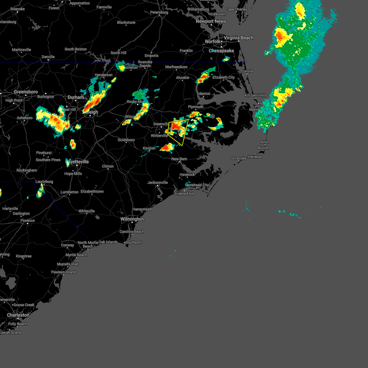 At 532 pm edt, a severe thunderstorm was located over pactolus, or 9 miles east of greenville, moving east at 20 mph (radar indicated). Hazards include 60 mph wind gusts and quarter size hail. Hail damage to vehicles is expected. expect wind damage to roofs, siding, and trees. locations impacted include, washington, river road, pactolus, black jack, bunyan, old ford, chocowinity, washington park and grimesland. hail threat, radar indicated max hail size, 1. 00 in wind threat, radar indicated max wind gust, 60 mph. At 532 pm edt, a severe thunderstorm was located over pactolus, or 9 miles east of greenville, moving east at 20 mph (radar indicated). Hazards include 60 mph wind gusts and quarter size hail. Hail damage to vehicles is expected. expect wind damage to roofs, siding, and trees. locations impacted include, washington, river road, pactolus, black jack, bunyan, old ford, chocowinity, washington park and grimesland. hail threat, radar indicated max hail size, 1. 00 in wind threat, radar indicated max wind gust, 60 mph.
|
| 5/16/2022 5:15 PM EDT |
 At 515 pm edt, a severe thunderstorm was located near east carolina university, or near greenville, moving east at 20 mph (radar indicated). Hazards include 60 mph wind gusts and quarter size hail. Hail damage to vehicles is expected. Expect wind damage to roofs, siding, and trees. At 515 pm edt, a severe thunderstorm was located near east carolina university, or near greenville, moving east at 20 mph (radar indicated). Hazards include 60 mph wind gusts and quarter size hail. Hail damage to vehicles is expected. Expect wind damage to roofs, siding, and trees.
|
| 5/6/2022 4:04 PM EDT |
 At 404 pm edt, severe thunderstorms were located along a line extending from house to near black jack, moving northeast at 35 mph (radar indicated). Hazards include 60 mph wind gusts and quarter size hail. Hail damage to vehicles is expected. Expect wind damage to roofs, siding, and trees. At 404 pm edt, severe thunderstorms were located along a line extending from house to near black jack, moving northeast at 35 mph (radar indicated). Hazards include 60 mph wind gusts and quarter size hail. Hail damage to vehicles is expected. Expect wind damage to roofs, siding, and trees.
|
| 5/6/2022 3:30 PM EDT |
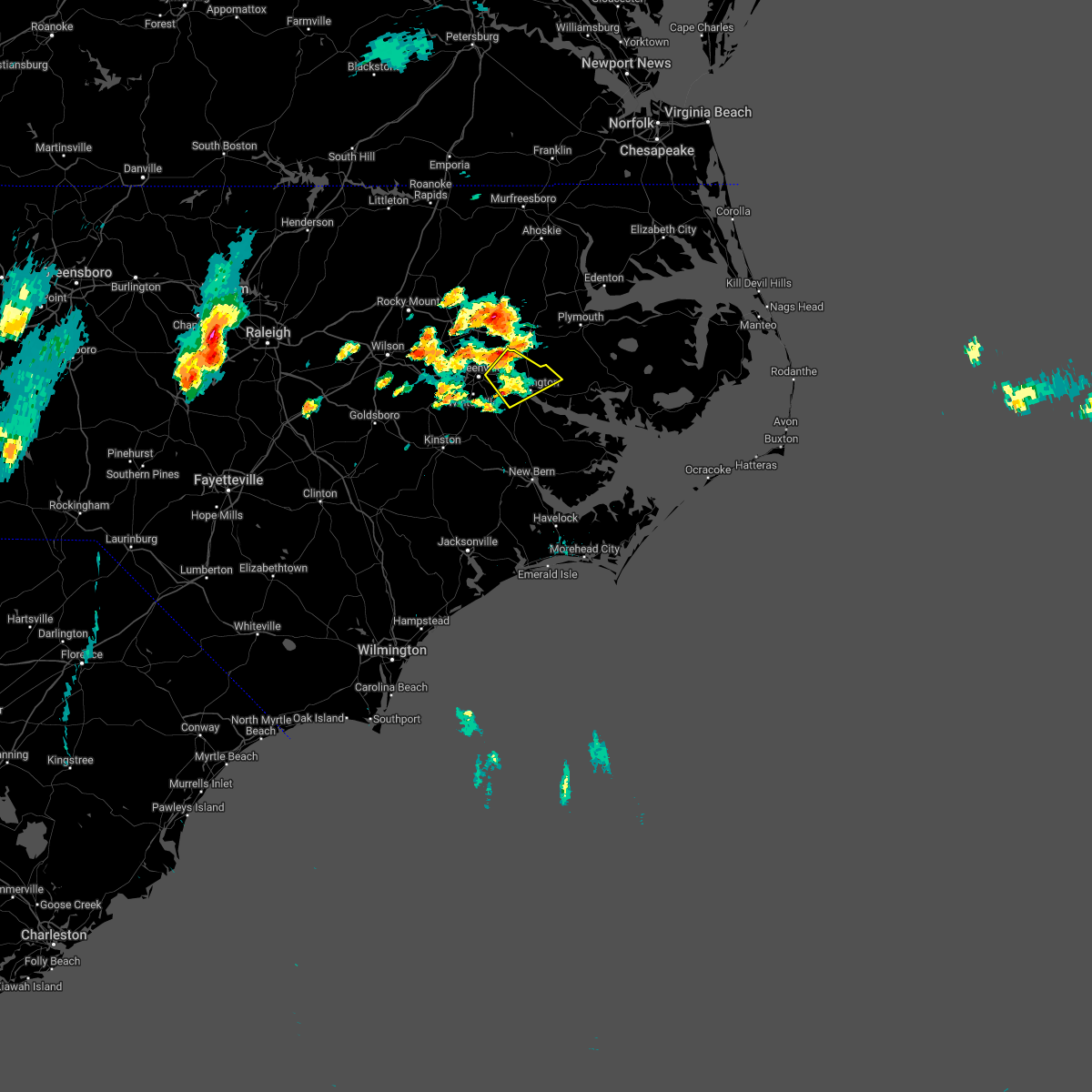 At 330 pm edt, a severe thunderstorm was located over black jack, or 9 miles west of washington, moving northeast at 30 mph (radar indicated). Hazards include 60 mph wind gusts and quarter size hail. Hail damage to vehicles is expected. expect wind damage to roofs, siding, and trees. Locations impacted include, greenville, washington, pactolus, old ford, chocowinity, washington park, grimesland and simpson. At 330 pm edt, a severe thunderstorm was located over black jack, or 9 miles west of washington, moving northeast at 30 mph (radar indicated). Hazards include 60 mph wind gusts and quarter size hail. Hail damage to vehicles is expected. expect wind damage to roofs, siding, and trees. Locations impacted include, greenville, washington, pactolus, old ford, chocowinity, washington park, grimesland and simpson.
|
| 5/6/2022 3:08 PM EDT |
 At 308 pm edt, a severe thunderstorm was located near ayden, moving northeast at 25 mph (radar indicated). Hazards include 60 mph wind gusts and quarter size hail. Hail damage to vehicles is expected. Expect wind damage to roofs, siding, and trees. At 308 pm edt, a severe thunderstorm was located near ayden, moving northeast at 25 mph (radar indicated). Hazards include 60 mph wind gusts and quarter size hail. Hail damage to vehicles is expected. Expect wind damage to roofs, siding, and trees.
|
| 4/26/2022 6:28 PM EDT |
 At 626 pm edt, severe thunderstorms were located along a line extending from near williamston to near kinston, moving east at 45 mph (radar indicated). Hazards include 60 mph wind gusts and quarter size hail. Hail damage to vehicles is expected. Expect wind damage to roofs, siding, and trees. At 626 pm edt, severe thunderstorms were located along a line extending from near williamston to near kinston, moving east at 45 mph (radar indicated). Hazards include 60 mph wind gusts and quarter size hail. Hail damage to vehicles is expected. Expect wind damage to roofs, siding, and trees.
|
| 4/26/2022 6:04 PM EDT |
 At 603 pm edt, severe thunderstorms were located along a line extending from 8 miles north of robersonville to kornegay, moving southeast at 35 mph (radar indicated). Hazards include 60 mph wind gusts. Expect damage to roofs, siding, and trees. locations impacted include, greenville, kinston, washington, winterville, williamston, ayden, farmville, la grange, bethel, grifton, stokes, snow hill, bell arthur, robersonville, deep run, house, shelmerdine, pactolus, calico and black jack. hail threat, radar indicated max hail size, <. 75 in wind threat, radar indicated max wind gust, 60 mph. At 603 pm edt, severe thunderstorms were located along a line extending from 8 miles north of robersonville to kornegay, moving southeast at 35 mph (radar indicated). Hazards include 60 mph wind gusts. Expect damage to roofs, siding, and trees. locations impacted include, greenville, kinston, washington, winterville, williamston, ayden, farmville, la grange, bethel, grifton, stokes, snow hill, bell arthur, robersonville, deep run, house, shelmerdine, pactolus, calico and black jack. hail threat, radar indicated max hail size, <. 75 in wind threat, radar indicated max wind gust, 60 mph.
|
| 4/26/2022 5:35 PM EDT |
 At 534 pm edt, severe thunderstorms were located along a line extending from 8 miles southwest of scotland neck to mount olive, moving southeast at 35 mph (radar indicated). Hazards include 60 mph wind gusts. expect damage to roofs, siding, and trees At 534 pm edt, severe thunderstorms were located along a line extending from 8 miles southwest of scotland neck to mount olive, moving southeast at 35 mph (radar indicated). Hazards include 60 mph wind gusts. expect damage to roofs, siding, and trees
|
| 4/7/2022 7:14 PM EDT |
 At 713 pm edt, a severe thunderstorm was located over stokes, or 11 miles northeast of greenville, moving northeast at 55 mph (radar indicated). Hazards include 60 mph wind gusts and nickel size hail. expect damage to roofs, siding, and trees At 713 pm edt, a severe thunderstorm was located over stokes, or 11 miles northeast of greenville, moving northeast at 55 mph (radar indicated). Hazards include 60 mph wind gusts and nickel size hail. expect damage to roofs, siding, and trees
|
| 4/7/2022 7:08 PM EDT |
 At 707 pm edt, severe thunderstorms were located along a line extending from near lewiston woodville to dowdy ficklen stadium, moving northeast at 45 mph (radar indicated). Hazards include 60 mph wind gusts and quarter size hail. Hail damage to vehicles is expected. expect wind damage to roofs, siding, and trees. Locations impacted include, greenville, winterville, williamston, bethel, stokes, robersonville, house, pactolus, old ford, east carolina university, pitt greenville airport, dowdy ficklen stadium, gold point, jamesville, simpson, hamilton, oak city, smithwick, parmele and everetts. At 707 pm edt, severe thunderstorms were located along a line extending from near lewiston woodville to dowdy ficklen stadium, moving northeast at 45 mph (radar indicated). Hazards include 60 mph wind gusts and quarter size hail. Hail damage to vehicles is expected. expect wind damage to roofs, siding, and trees. Locations impacted include, greenville, winterville, williamston, bethel, stokes, robersonville, house, pactolus, old ford, east carolina university, pitt greenville airport, dowdy ficklen stadium, gold point, jamesville, simpson, hamilton, oak city, smithwick, parmele and everetts.
|
| 4/7/2022 6:53 PM EDT |
 At 652 pm edt, severe thunderstorms were located along a line extending from near lewiston woodville to black jack, moving northeast at 75 mph (radar indicated). Hazards include 60 mph wind gusts and nickel size hail. Expect damage to roofs, siding, and trees. locations impacted include, greenville, winterville, williamston, farmville, bethel, stokes, bell arthur, robersonville, pactolus, house, bruce, maury, ormondsville, roundtree, lizzie, old ford, pitt greenville airport, dowdy ficklen stadium, east carolina university and gold point. hail threat, radar indicated max hail size, 0. 88 in wind threat, radar indicated max wind gust, 60 mph. At 652 pm edt, severe thunderstorms were located along a line extending from near lewiston woodville to black jack, moving northeast at 75 mph (radar indicated). Hazards include 60 mph wind gusts and nickel size hail. Expect damage to roofs, siding, and trees. locations impacted include, greenville, winterville, williamston, farmville, bethel, stokes, bell arthur, robersonville, pactolus, house, bruce, maury, ormondsville, roundtree, lizzie, old ford, pitt greenville airport, dowdy ficklen stadium, east carolina university and gold point. hail threat, radar indicated max hail size, 0. 88 in wind threat, radar indicated max wind gust, 60 mph.
|
| 4/7/2022 6:28 PM EDT |
 At 627 pm edt, severe thunderstorms were located along a line extending from 8 miles northwest of bruce to near kinston, moving northeast at 75 mph (radar indicated). Hazards include 60 mph wind gusts and nickel size hail. expect damage to roofs, siding, and trees At 627 pm edt, severe thunderstorms were located along a line extending from 8 miles northwest of bruce to near kinston, moving northeast at 75 mph (radar indicated). Hazards include 60 mph wind gusts and nickel size hail. expect damage to roofs, siding, and trees
|
| 3/12/2022 9:01 AM EST |
 At 900 am est, severe thunderstorms were located along a line extending from near pactolus to near wyse fork to near wallace, moving northeast at 80 mph (radar indicated). Hazards include 60 mph wind gusts. expect damage to roofs, siding, and trees At 900 am est, severe thunderstorms were located along a line extending from near pactolus to near wyse fork to near wallace, moving northeast at 80 mph (radar indicated). Hazards include 60 mph wind gusts. expect damage to roofs, siding, and trees
|
| 8/1/2021 2:41 PM EDT |
 At 240 pm edt, a severe thunderstorm was located near old ford, or near washington, moving east at 30 mph (radar indicated). Hazards include 60 mph wind gusts and quarter size hail. Hail damage to vehicles is expected. Expect wind damage to roofs, siding, and trees. At 240 pm edt, a severe thunderstorm was located near old ford, or near washington, moving east at 30 mph (radar indicated). Hazards include 60 mph wind gusts and quarter size hail. Hail damage to vehicles is expected. Expect wind damage to roofs, siding, and trees.
|
| 8/1/2021 2:32 PM EDT |
 At 232 pm edt, a severe thunderstorm was located over pactolus, or 8 miles northeast of greenville, moving east at 30 mph (radar indicated). Hazards include 60 mph wind gusts and quarter size hail. Hail damage to vehicles is expected. expect wind damage to roofs, siding, and trees. Locations impacted include, greenville, washington, farmville, river road, stokes, bell arthur, pinetown, pactolus, house, black jack, bruce, bayview, bunyan, core point, terra ceia, yeatesville, old ford, pitt greenville airport, dowdy ficklen stadium and goose creek state park. At 232 pm edt, a severe thunderstorm was located over pactolus, or 8 miles northeast of greenville, moving east at 30 mph (radar indicated). Hazards include 60 mph wind gusts and quarter size hail. Hail damage to vehicles is expected. expect wind damage to roofs, siding, and trees. Locations impacted include, greenville, washington, farmville, river road, stokes, bell arthur, pinetown, pactolus, house, black jack, bruce, bayview, bunyan, core point, terra ceia, yeatesville, old ford, pitt greenville airport, dowdy ficklen stadium and goose creek state park.
|
| 8/1/2021 2:02 PM EDT |
 At 202 pm edt, a severe thunderstorm was located over bruce, or near farmville, moving east at 25 mph (radar indicated). Hazards include 60 mph wind gusts and quarter size hail. Hail damage to vehicles is expected. Expect wind damage to roofs, siding, and trees. At 202 pm edt, a severe thunderstorm was located over bruce, or near farmville, moving east at 25 mph (radar indicated). Hazards include 60 mph wind gusts and quarter size hail. Hail damage to vehicles is expected. Expect wind damage to roofs, siding, and trees.
|
| 7/28/2021 5:47 PM EDT |
 At 547 pm edt, severe thunderstorms were located along a line extending from near elm city to house to wilmar, moving south at 20 mph (radar indicated). Hazards include 60 mph wind gusts and quarter size hail. Hail damage to vehicles is expected. Expect wind damage to roofs, siding, and trees. At 547 pm edt, severe thunderstorms were located along a line extending from near elm city to house to wilmar, moving south at 20 mph (radar indicated). Hazards include 60 mph wind gusts and quarter size hail. Hail damage to vehicles is expected. Expect wind damage to roofs, siding, and trees.
|
| 3/27/2021 6:20 PM EDT |
 At 619 pm edt, a severe thunderstorm was located over wilson, or 15 miles south of rocky mount, moving east at 30 mph (radar indicated). Hazards include 60 mph wind gusts and quarter size hail. Hail damage to vehicles is expected. Expect wind damage to roofs, siding, and trees. At 619 pm edt, a severe thunderstorm was located over wilson, or 15 miles south of rocky mount, moving east at 30 mph (radar indicated). Hazards include 60 mph wind gusts and quarter size hail. Hail damage to vehicles is expected. Expect wind damage to roofs, siding, and trees.
|
| 2/22/2021 3:00 PM EST |
 At 259 pm est, severe thunderstorms were located along a line extending from ahoskie to 7 miles northeast of fremont, moving east at 70 mph (radar indicated). Hazards include 60 mph wind gusts. expect damage to roofs, siding, and trees At 259 pm est, severe thunderstorms were located along a line extending from ahoskie to 7 miles northeast of fremont, moving east at 70 mph (radar indicated). Hazards include 60 mph wind gusts. expect damage to roofs, siding, and trees
|
| 12/24/2020 10:41 PM EST |
 At 1041 pm est, severe thunderstorms were located along a line extending from 8 miles southeast of scotland neck to dowdy ficklen stadium, moving northeast at 80 mph (radar indicated). Hazards include 60 mph wind gusts. Expect damage to roofs, siding, and trees. Locations impacted include, greenville, washington, winterville, williamston, ayden, bethel, grifton, stokes, bell arthur, robersonville, pactolus, house, shelmerdine, black jack, bruce, graingers, ormondsville, roundtree, maury and old ford. At 1041 pm est, severe thunderstorms were located along a line extending from 8 miles southeast of scotland neck to dowdy ficklen stadium, moving northeast at 80 mph (radar indicated). Hazards include 60 mph wind gusts. Expect damage to roofs, siding, and trees. Locations impacted include, greenville, washington, winterville, williamston, ayden, bethel, grifton, stokes, bell arthur, robersonville, pactolus, house, shelmerdine, black jack, bruce, graingers, ormondsville, roundtree, maury and old ford.
|
| 12/24/2020 10:22 PM EST |
 At 1022 pm est, severe thunderstorms were located along a line extending from 11 miles southwest of tarboro to dawson, moving northeast at 70 mph (radar indicated). Hazards include 60 mph wind gusts. expect damage to roofs, siding, and trees At 1022 pm est, severe thunderstorms were located along a line extending from 11 miles southwest of tarboro to dawson, moving northeast at 70 mph (radar indicated). Hazards include 60 mph wind gusts. expect damage to roofs, siding, and trees
|
| 4/13/2020 9:28 AM EDT |
 At 927 am edt, severe thunderstorms were located along a line extending from near old ford to near phillips crossroads to near rocky point, moving east at 30 mph (radar indicated). Hazards include 60 mph wind gusts. expect damage to roofs, siding, and trees At 927 am edt, severe thunderstorms were located along a line extending from near old ford to near phillips crossroads to near rocky point, moving east at 30 mph (radar indicated). Hazards include 60 mph wind gusts. expect damage to roofs, siding, and trees
|
| 4/13/2020 9:12 AM EDT |
 At 912 am edt, severe thunderstorms were located along a line extending from near stokes to near pleasant hill to near murray town, moving east at 30 mph (radar indicated). Hazards include 60 mph wind gusts. Expect damage to roofs, siding, and trees. locations impacted include, greenville, jacksonville, kinston, winterville, williamston, ayden, wallace, half moon, grifton, phillips crossroads, kornegay, stokes, rose hill, richlands, robersonville, beulaville, deep run, catherine lake, house and shelmerdine. A tornado watch remains in effect until noon edt for eastern north carolina. At 912 am edt, severe thunderstorms were located along a line extending from near stokes to near pleasant hill to near murray town, moving east at 30 mph (radar indicated). Hazards include 60 mph wind gusts. Expect damage to roofs, siding, and trees. locations impacted include, greenville, jacksonville, kinston, winterville, williamston, ayden, wallace, half moon, grifton, phillips crossroads, kornegay, stokes, rose hill, richlands, robersonville, beulaville, deep run, catherine lake, house and shelmerdine. A tornado watch remains in effect until noon edt for eastern north carolina.
|
| 4/13/2020 8:51 AM EDT |
 At 850 am edt, severe thunderstorms were located along a line extending from 9 miles southeast of wilson to near kenansville to near sandyfield, moving east at 50 mph (radar indicated). Hazards include 60 mph wind gusts. Expect damage to roofs, siding, and trees. locations impacted include, greenville, jacksonville, kinston, winterville, williamston, ayden, farmville, wallace, warsaw, la grange, half moon, mount olive, bethel, grifton, phillips crossroads, kornegay, stokes, rose hill, snow hill and richlands. A tornado watch remains in effect until noon edt for eastern north carolina. At 850 am edt, severe thunderstorms were located along a line extending from 9 miles southeast of wilson to near kenansville to near sandyfield, moving east at 50 mph (radar indicated). Hazards include 60 mph wind gusts. Expect damage to roofs, siding, and trees. locations impacted include, greenville, jacksonville, kinston, winterville, williamston, ayden, farmville, wallace, warsaw, la grange, half moon, mount olive, bethel, grifton, phillips crossroads, kornegay, stokes, rose hill, snow hill and richlands. A tornado watch remains in effect until noon edt for eastern north carolina.
|
| 4/13/2020 8:29 AM EDT |
 At 827 am edt, severe thunderstorms were located along a line extending from 7 miles west of fremont to near clinton to near abbottsburg, moving east at 40 mph (radar indicated). Hazards include 60 mph wind gusts. expect damage to roofs, siding, and trees At 827 am edt, severe thunderstorms were located along a line extending from 7 miles west of fremont to near clinton to near abbottsburg, moving east at 40 mph (radar indicated). Hazards include 60 mph wind gusts. expect damage to roofs, siding, and trees
|
| 4/6/2020 6:10 PM EDT |
 At 610 pm edt, severe thunderstorms were located along a line extending from near plymouth to near washington to near kinston regional jetport, moving southeast at 45 mph (radar indicated). Hazards include 60 mph wind gusts and quarter size hail. Hail damage to vehicles is expected. Expect wind damage to roofs, siding, and trees. At 610 pm edt, severe thunderstorms were located along a line extending from near plymouth to near washington to near kinston regional jetport, moving southeast at 45 mph (radar indicated). Hazards include 60 mph wind gusts and quarter size hail. Hail damage to vehicles is expected. Expect wind damage to roofs, siding, and trees.
|
| 8/23/2019 8:02 PM EDT |
 At 801 pm edt, severe thunderstorms were located along a line extending from near pungo lake to terra ceia to near pactolus, moving east at 20 mph (radar indicated). Hazards include 60 mph wind gusts and nickel size hail. Expect damage to roofs, siding, and trees. Locations impacted include, washington, plymouth, belhaven, ponzer, pinetown, pungo, pactolus, black jack, wenona, hinson, bunyan, pike road, leechville, terra ceia, yeatesville, old ford, phelps lake, pungo lake, roper and long acre vfd. At 801 pm edt, severe thunderstorms were located along a line extending from near pungo lake to terra ceia to near pactolus, moving east at 20 mph (radar indicated). Hazards include 60 mph wind gusts and nickel size hail. Expect damage to roofs, siding, and trees. Locations impacted include, washington, plymouth, belhaven, ponzer, pinetown, pungo, pactolus, black jack, wenona, hinson, bunyan, pike road, leechville, terra ceia, yeatesville, old ford, phelps lake, pungo lake, roper and long acre vfd.
|
| 8/23/2019 7:32 PM EDT |
 At 731 pm edt, severe thunderstorms were located along a line extending from near wenona to near bunyan to near wilmar, moving northeast at 20 mph (radar indicated). Hazards include 60 mph wind gusts and nickel size hail. expect damage to roofs, siding, and trees At 731 pm edt, severe thunderstorms were located along a line extending from near wenona to near bunyan to near wilmar, moving northeast at 20 mph (radar indicated). Hazards include 60 mph wind gusts and nickel size hail. expect damage to roofs, siding, and trees
|
| 7/23/2019 5:20 PM EDT |
 A severe thunderstorm warning remains in effect until 530 pm edt for greene. west central washington. pitt. martin and northwestern beaufort counties. At 520 pm edt, severe thunderstorms were located along a line extending from near bethel to near east carolina university, and are nearly stationary. A severe thunderstorm warning remains in effect until 530 pm edt for greene. west central washington. pitt. martin and northwestern beaufort counties. At 520 pm edt, severe thunderstorms were located along a line extending from near bethel to near east carolina university, and are nearly stationary.
|
| 7/23/2019 4:52 PM EDT |
 The national weather service in newport has issued a * severe thunderstorm warning for. greene county in eastern north carolina. west central washington county in eastern north carolina. pitt county in eastern north carolina. Martin county in eastern north carolina. The national weather service in newport has issued a * severe thunderstorm warning for. greene county in eastern north carolina. west central washington county in eastern north carolina. pitt county in eastern north carolina. Martin county in eastern north carolina.
|
| 7/17/2019 8:42 PM EDT |
 At 841 pm edt, a severe thunderstorm was located over winterville, moving northeast at 25 mph (radar indicated). Hazards include 60 mph wind gusts and penny size hail. Expect damage to roofs, siding, and trees. Locations impacted include, greenville, winterville, ayden, bell arthur, black jack, roundtree, east carolina university, pitt greenville airport, dowdy ficklen stadium and simpson. At 841 pm edt, a severe thunderstorm was located over winterville, moving northeast at 25 mph (radar indicated). Hazards include 60 mph wind gusts and penny size hail. Expect damage to roofs, siding, and trees. Locations impacted include, greenville, winterville, ayden, bell arthur, black jack, roundtree, east carolina university, pitt greenville airport, dowdy ficklen stadium and simpson.
|
| 7/17/2019 8:15 PM EDT |
 At 814 pm edt, a severe thunderstorm was located over maury, or 7 miles south of farmville, moving northeast at 30 mph (radar indicated). Hazards include 60 mph wind gusts and penny size hail. expect damage to roofs, siding, and trees At 814 pm edt, a severe thunderstorm was located over maury, or 7 miles south of farmville, moving northeast at 30 mph (radar indicated). Hazards include 60 mph wind gusts and penny size hail. expect damage to roofs, siding, and trees
|
| 5/31/2019 8:46 PM EDT | Trees and wires down along highway 10 in pitt county NC, 10.5 miles N of Grimesland, NC |
| 5/31/2019 8:28 PM EDT |
 At 827 pm edt, a severe thunderstorm was located over dowdy ficklen stadium, or over greenville, moving northeast at 35 mph (public). Hazards include ping pong ball size hail and 60 mph wind gusts. People and animals outdoors will be injured. expect hail damage to roofs, siding, windows, and vehicles. expect wind damage to roofs, siding, and trees. Locations impacted include, greenville, washington, winterville, williamston, ayden, farmville, grifton, stokes, bell arthur, robersonville, pactolus, house, black jack, bruce, roundtree, old ford, pitt greenville airport, dowdy ficklen stadium, east carolina university and gold point. At 827 pm edt, a severe thunderstorm was located over dowdy ficklen stadium, or over greenville, moving northeast at 35 mph (public). Hazards include ping pong ball size hail and 60 mph wind gusts. People and animals outdoors will be injured. expect hail damage to roofs, siding, windows, and vehicles. expect wind damage to roofs, siding, and trees. Locations impacted include, greenville, washington, winterville, williamston, ayden, farmville, grifton, stokes, bell arthur, robersonville, pactolus, house, black jack, bruce, roundtree, old ford, pitt greenville airport, dowdy ficklen stadium, east carolina university and gold point.
|
| 5/31/2019 8:17 PM EDT |
 At 817 pm edt, a severe thunderstorm was located near bell arthur, or near winterville, moving northeast at 25 mph (radar indicated). Hazards include 60 mph wind gusts and quarter size hail. Hail damage to vehicles is expected. Expect wind damage to roofs, siding, and trees. At 817 pm edt, a severe thunderstorm was located near bell arthur, or near winterville, moving northeast at 25 mph (radar indicated). Hazards include 60 mph wind gusts and quarter size hail. Hail damage to vehicles is expected. Expect wind damage to roofs, siding, and trees.
|
| 5/31/2019 7:36 PM EDT |
 At 735 pm edt, a severe thunderstorm was located 7 miles east of fremont, or 11 miles northeast of goldsboro, moving east at 40 mph (radar indicated). Hazards include ping pong ball size hail and 60 mph wind gusts. People and animals outdoors will be injured. expect hail damage to roofs, siding, windows, and vehicles. Expect wind damage to roofs, siding, and trees. At 735 pm edt, a severe thunderstorm was located 7 miles east of fremont, or 11 miles northeast of goldsboro, moving east at 40 mph (radar indicated). Hazards include ping pong ball size hail and 60 mph wind gusts. People and animals outdoors will be injured. expect hail damage to roofs, siding, windows, and vehicles. Expect wind damage to roofs, siding, and trees.
|
| 5/31/2019 7:18 PM EDT |
 At 718 pm edt, a severe thunderstorm was located over farmville, moving east at 25 mph (radar indicated). Hazards include ping pong ball size hail and 60 mph wind gusts. People and animals outdoors will be injured. expect hail damage to roofs, siding, windows, and vehicles. Expect wind damage to roofs, siding, and trees. At 718 pm edt, a severe thunderstorm was located over farmville, moving east at 25 mph (radar indicated). Hazards include ping pong ball size hail and 60 mph wind gusts. People and animals outdoors will be injured. expect hail damage to roofs, siding, windows, and vehicles. Expect wind damage to roofs, siding, and trees.
|
| 5/31/2019 5:40 PM EDT |
 At 539 pm edt, a severe thunderstorm was located over washington, moving east at 45 mph (radar indicated). Hazards include 60 mph wind gusts and quarter size hail. Hail damage to vehicles is expected. Expect wind damage to roofs, siding, and trees. At 539 pm edt, a severe thunderstorm was located over washington, moving east at 45 mph (radar indicated). Hazards include 60 mph wind gusts and quarter size hail. Hail damage to vehicles is expected. Expect wind damage to roofs, siding, and trees.
|
| 5/31/2019 5:07 PM EDT |
 At 506 pm edt, a severe thunderstorm was located over greenville, moving east at 35 mph (radar indicated). Hazards include 60 mph wind gusts and quarter size hail. Hail damage to vehicles is expected. expect wind damage to roofs, siding, and trees. Locations impacted include, greenville, washington, stokes, house, pactolus, bruce, old ford, east carolina university, pitt greenville airport, dowdy ficklen stadium, washington park, grimesland and simpson. At 506 pm edt, a severe thunderstorm was located over greenville, moving east at 35 mph (radar indicated). Hazards include 60 mph wind gusts and quarter size hail. Hail damage to vehicles is expected. expect wind damage to roofs, siding, and trees. Locations impacted include, greenville, washington, stokes, house, pactolus, bruce, old ford, east carolina university, pitt greenville airport, dowdy ficklen stadium, washington park, grimesland and simpson.
|
| 5/31/2019 4:54 PM EDT |
 At 454 pm edt, a severe thunderstorm was located near shelmerdine, or 10 miles southwest of washington, moving east at 30 mph (radar indicated). Hazards include 60 mph wind gusts and half dollar size hail. Hail damage to vehicles is expected. expect wind damage to roofs, siding, and trees. Locations impacted include, greenville, washington, river road, pinetown, blounts creek, shelmerdine, calico, black jack, wilmar, bunyan, bonnerton, cox crossroads, core point, old ford, goose creek state park, chocowinity, washington park, grimesland and simpson. At 454 pm edt, a severe thunderstorm was located near shelmerdine, or 10 miles southwest of washington, moving east at 30 mph (radar indicated). Hazards include 60 mph wind gusts and half dollar size hail. Hail damage to vehicles is expected. expect wind damage to roofs, siding, and trees. Locations impacted include, greenville, washington, river road, pinetown, blounts creek, shelmerdine, calico, black jack, wilmar, bunyan, bonnerton, cox crossroads, core point, old ford, goose creek state park, chocowinity, washington park, grimesland and simpson.
|
| 5/31/2019 4:51 PM EDT |
 At 451 pm edt, a severe thunderstorm was located over farmville, moving east at 30 mph (radar indicated). Hazards include 60 mph wind gusts and quarter size hail. Hail damage to vehicles is expected. Expect wind damage to roofs, siding, and trees. At 451 pm edt, a severe thunderstorm was located over farmville, moving east at 30 mph (radar indicated). Hazards include 60 mph wind gusts and quarter size hail. Hail damage to vehicles is expected. Expect wind damage to roofs, siding, and trees.
|
| 5/31/2019 4:32 PM EDT |
 At 432 pm edt, a severe thunderstorm was located over ayden, moving east at 30 mph (radar indicated). Hazards include 60 mph wind gusts and half dollar size hail. Hail damage to vehicles is expected. Expect wind damage to roofs, siding, and trees. At 432 pm edt, a severe thunderstorm was located over ayden, moving east at 30 mph (radar indicated). Hazards include 60 mph wind gusts and half dollar size hail. Hail damage to vehicles is expected. Expect wind damage to roofs, siding, and trees.
|
| 5/30/2019 7:35 PM EDT |
 At 734 pm edt, a severe thunderstorm was located near jason, or 9 miles north of la grange, moving northeast at 45 mph (trained weather spotters). Hazards include 60 mph wind gusts and nickel size hail. expect damage to roofs, siding, and trees At 734 pm edt, a severe thunderstorm was located near jason, or 9 miles north of la grange, moving northeast at 45 mph (trained weather spotters). Hazards include 60 mph wind gusts and nickel size hail. expect damage to roofs, siding, and trees
|
| 5/13/2019 3:24 PM EDT |
 At 324 pm edt, a severe thunderstorm was located over shelmerdine, or 7 miles southeast of winterville, moving east at 40 mph (radar indicated). Hazards include 60 mph wind gusts and half dollar size hail. Hail damage to vehicles is expected. expect wind damage to roofs, siding, and trees. Locations impacted include, greenville, washington, winterville, river road, grifton, blounts creek, shelmerdine, calico, cayton, black jack, wilmar, bunyan, cox crossroads, goose creek state park, dowdy ficklen stadium, chocowinity, washington park, grimesland, simpson and gardnerville. At 324 pm edt, a severe thunderstorm was located over shelmerdine, or 7 miles southeast of winterville, moving east at 40 mph (radar indicated). Hazards include 60 mph wind gusts and half dollar size hail. Hail damage to vehicles is expected. expect wind damage to roofs, siding, and trees. Locations impacted include, greenville, washington, winterville, river road, grifton, blounts creek, shelmerdine, calico, cayton, black jack, wilmar, bunyan, cox crossroads, goose creek state park, dowdy ficklen stadium, chocowinity, washington park, grimesland, simpson and gardnerville.
|
| 5/13/2019 3:08 PM EDT |
 The national weather service in newport has issued a * severe thunderstorm warning for. southeastern greene county in eastern north carolina. northeastern lenoir county in eastern north carolina. northwestern craven county in eastern north carolina. Southern pitt county in eastern north carolina. The national weather service in newport has issued a * severe thunderstorm warning for. southeastern greene county in eastern north carolina. northeastern lenoir county in eastern north carolina. northwestern craven county in eastern north carolina. Southern pitt county in eastern north carolina.
|
| 4/19/2019 7:35 PM EDT |
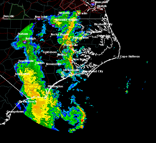 At 734 pm edt, a severe thunderstorm was located over washington, moving northeast at 50 mph (radar indicated). Hazards include 70 mph wind gusts. Expect considerable tree damage. Damage is likely to mobile homes, roofs, and outbuildings. At 734 pm edt, a severe thunderstorm was located over washington, moving northeast at 50 mph (radar indicated). Hazards include 70 mph wind gusts. Expect considerable tree damage. Damage is likely to mobile homes, roofs, and outbuildings.
|
| 4/19/2019 7:10 PM EDT |
 At 710 pm edt, a severe thunderstorm was located near ayden, moving northeast at 55 mph (radar indicated). Hazards include 60 mph wind gusts. expect damage to roofs, siding, and trees At 710 pm edt, a severe thunderstorm was located near ayden, moving northeast at 55 mph (radar indicated). Hazards include 60 mph wind gusts. expect damage to roofs, siding, and trees
|
| 4/19/2019 1:52 PM EDT |
 At 152 pm edt, a severe thunderstorm was located near pactolus, or near greenville, moving northeast at 55 mph (radar indicated). Hazards include 60 mph wind gusts. expect damage to roofs, siding, and trees At 152 pm edt, a severe thunderstorm was located near pactolus, or near greenville, moving northeast at 55 mph (radar indicated). Hazards include 60 mph wind gusts. expect damage to roofs, siding, and trees
|
| 11/13/2018 3:32 AM EST |
 At 332 am est, severe thunderstorms were located along a line extending from near williamston to near black jack to near fort barnwell, moving northeast at 50 mph (radar indicated). Hazards include 60 mph wind gusts and quarter size hail. Hail damage to vehicles is expected. Expect wind damage to roofs, siding, and trees. At 332 am est, severe thunderstorms were located along a line extending from near williamston to near black jack to near fort barnwell, moving northeast at 50 mph (radar indicated). Hazards include 60 mph wind gusts and quarter size hail. Hail damage to vehicles is expected. Expect wind damage to roofs, siding, and trees.
|
| 8/23/2017 6:46 PM EDT |
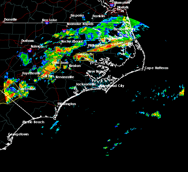 At 646 pm edt, a severe thunderstorm was located near pactolus, or near greenville, moving east at 20 mph (radar indicated). Hazards include quarter size hail. damage to vehicles is expected At 646 pm edt, a severe thunderstorm was located near pactolus, or near greenville, moving east at 20 mph (radar indicated). Hazards include quarter size hail. damage to vehicles is expected
|
| 7/6/2017 8:45 PM EDT |
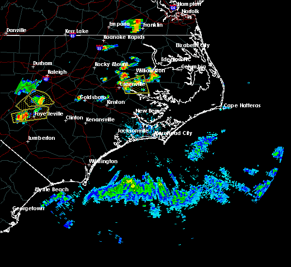 At 813 pm edt, a severe thunderstorm was located over greenville, moving east at 30 mph (radar indicated). Hazards include 60 mph wind gusts and quarter size hail. Hail damage to vehicles is expected. Expect wind damage to roofs, siding, and trees. At 813 pm edt, a severe thunderstorm was located over greenville, moving east at 30 mph (radar indicated). Hazards include 60 mph wind gusts and quarter size hail. Hail damage to vehicles is expected. Expect wind damage to roofs, siding, and trees.
|
| 7/6/2017 8:13 PM EDT |
 At 813 pm edt, a severe thunderstorm was located over greenville, moving east at 30 mph (radar indicated). Hazards include 60 mph wind gusts and quarter size hail. Hail damage to vehicles is expected. Expect wind damage to roofs, siding, and trees. At 813 pm edt, a severe thunderstorm was located over greenville, moving east at 30 mph (radar indicated). Hazards include 60 mph wind gusts and quarter size hail. Hail damage to vehicles is expected. Expect wind damage to roofs, siding, and trees.
|
| 5/11/2017 9:23 PM EDT |
 At 922 pm edt, a severe thunderstorm was located near pitt greenville airport, or 8 miles north of greenville, moving southeast at 45 mph (radar indicated). Hazards include 60 mph wind gusts and quarter size hail. Hail damage to vehicles is expected. Expect wind damage to roofs, siding, and trees. At 922 pm edt, a severe thunderstorm was located near pitt greenville airport, or 8 miles north of greenville, moving southeast at 45 mph (radar indicated). Hazards include 60 mph wind gusts and quarter size hail. Hail damage to vehicles is expected. Expect wind damage to roofs, siding, and trees.
|
| 7/8/2016 9:33 PM EDT |
 At 932 pm edt, severe thunderstorms were located along a line extending from near belhaven to 6 miles north of vanceboro to kinston, moving southeast at 40 mph (law enforcement). Hazards include 60 mph wind gusts. Expect damage to roofs. siding. and trees. Locations impacted include, greenville, jacksonville, new bern, kinston, washington, winterville, ayden, la grange, half moon, river road, james city, trent woods, river bend, grifton, belhaven, snow hill, richlands, maysville, vanceboro and kinston regional jetport. At 932 pm edt, severe thunderstorms were located along a line extending from near belhaven to 6 miles north of vanceboro to kinston, moving southeast at 40 mph (law enforcement). Hazards include 60 mph wind gusts. Expect damage to roofs. siding. and trees. Locations impacted include, greenville, jacksonville, new bern, kinston, washington, winterville, ayden, la grange, half moon, river road, james city, trent woods, river bend, grifton, belhaven, snow hill, richlands, maysville, vanceboro and kinston regional jetport.
|
| 7/8/2016 9:16 PM EDT |
 At 915 pm edt, severe thunderstorms were located along a line extending from 11 miles south of plymouth to near winterville to 6 miles west of snow hill, moving southeast at 40 mph (radar indicated). Hazards include 60 mph wind gusts. Expect damage to roofs. siding. and trees. Locations impacted include, greenville, jacksonville, new bern, kinston, washington, winterville, williamston, ayden, farmville, la grange, river road, half moon, james city, trent woods, river bend, grifton, belhaven, snow hill, richlands and robersonville. At 915 pm edt, severe thunderstorms were located along a line extending from 11 miles south of plymouth to near winterville to 6 miles west of snow hill, moving southeast at 40 mph (radar indicated). Hazards include 60 mph wind gusts. Expect damage to roofs. siding. and trees. Locations impacted include, greenville, jacksonville, new bern, kinston, washington, winterville, williamston, ayden, farmville, la grange, river road, half moon, james city, trent woods, river bend, grifton, belhaven, snow hill, richlands and robersonville.
|
| 7/8/2016 8:50 PM EDT |
 At 849 pm edt, severe thunderstorms were located along a line extending from 6 miles north of robersonville to 6 miles west of pitt greenville airport to near goldsboro, moving southeast at 45 mph (radar indicated). Hazards include 60 mph wind gusts. Expect damage to roofs. siding. And trees. At 849 pm edt, severe thunderstorms were located along a line extending from 6 miles north of robersonville to 6 miles west of pitt greenville airport to near goldsboro, moving southeast at 45 mph (radar indicated). Hazards include 60 mph wind gusts. Expect damage to roofs. siding. And trees.
|
| 7/7/2016 9:09 PM EDT |
 At 908 pm edt, severe thunderstorms were located along a line extending from near winterville to 8 miles west of vanceboro to 8 miles northeast of richlands, moving east at 45 mph (radar indicated). Hazards include 60 mph wind gusts. Expect damage to roofs. siding. and trees. Locations impacted include, greenville, new bern, winterville, ayden, james city, trent woods, river bend, grifton, vanceboro, pitt greenville airport, dowdy ficklen stadium, east carolina university, coastal carolina regional airport, bridgeton, grimesland, simpson, cove city, pollocksville and trenton. At 908 pm edt, severe thunderstorms were located along a line extending from near winterville to 8 miles west of vanceboro to 8 miles northeast of richlands, moving east at 45 mph (radar indicated). Hazards include 60 mph wind gusts. Expect damage to roofs. siding. and trees. Locations impacted include, greenville, new bern, winterville, ayden, james city, trent woods, river bend, grifton, vanceboro, pitt greenville airport, dowdy ficklen stadium, east carolina university, coastal carolina regional airport, bridgeton, grimesland, simpson, cove city, pollocksville and trenton.
|
| 7/7/2016 8:57 PM EDT |
 At 856 pm edt, severe thunderstorms were located along a line extending from near farmville to 8 miles south of grifton to near richlands, moving east at 45 mph (radar indicated). Hazards include 60 mph wind gusts. Expect damage to roofs. siding. and trees. Locations impacted include, greenville, new bern, winterville, ayden, farmville, james city, trent woods, river bend, grifton, richlands, vanceboro, east carolina university, coastal carolina regional airport, bridgeton, grimesland, simpson, hookerton and dover. At 856 pm edt, severe thunderstorms were located along a line extending from near farmville to 8 miles south of grifton to near richlands, moving east at 45 mph (radar indicated). Hazards include 60 mph wind gusts. Expect damage to roofs. siding. and trees. Locations impacted include, greenville, new bern, winterville, ayden, farmville, james city, trent woods, river bend, grifton, richlands, vanceboro, east carolina university, coastal carolina regional airport, bridgeton, grimesland, simpson, hookerton and dover.
|
| 7/7/2016 8:46 PM EDT |
 At 845 pm edt, severe thunderstorms were located along a line extending from near snow hill to near kinston to near richlands, moving east at 45 mph (radar indicated). Hazards include 60 mph wind gusts. Expect damage to roofs. siding. and trees. Locations impacted include, greenville, new bern, kinston, winterville, ayden, farmville, la grange, james city, trent woods, river bend, grifton, snow hill, richlands, maysville, vanceboro, east carolina university and coastal carolina regional airport. At 845 pm edt, severe thunderstorms were located along a line extending from near snow hill to near kinston to near richlands, moving east at 45 mph (radar indicated). Hazards include 60 mph wind gusts. Expect damage to roofs. siding. and trees. Locations impacted include, greenville, new bern, kinston, winterville, ayden, farmville, la grange, james city, trent woods, river bend, grifton, snow hill, richlands, maysville, vanceboro, east carolina university and coastal carolina regional airport.
|
| 7/7/2016 8:32 PM EDT |
 At 831 pm edt, severe thunderstorms were located along a line extending from near goldsboro to 9 miles south of la grange to near beulaville, moving east at 40 mph (radar indicated). Hazards include 60 mph wind gusts and nickel size hail. Expect damage to roofs. siding. And trees. At 831 pm edt, severe thunderstorms were located along a line extending from near goldsboro to 9 miles south of la grange to near beulaville, moving east at 40 mph (radar indicated). Hazards include 60 mph wind gusts and nickel size hail. Expect damage to roofs. siding. And trees.
|
| 7/7/2016 6:31 PM EDT |
 At 630 pm edt, severe thunderstorms were located along a line extending from 9 miles southeast of winterville to near vanceboro to 13 miles northwest of maysville to near richlands, moving east at 45 mph (radar indicated). Hazards include 60 mph wind gusts. Expect damage to roofs. siding. and trees. Locations impacted include, greenville, new bern, washington, winterville, ayden, river road, trent woods, river bend, richlands, beulaville, vanceboro, goose creek state park, coastal carolina regional airport, richlands south, chocowinity, bridgeton, washington park, grimesland, simpson and cove city. At 630 pm edt, severe thunderstorms were located along a line extending from 9 miles southeast of winterville to near vanceboro to 13 miles northwest of maysville to near richlands, moving east at 45 mph (radar indicated). Hazards include 60 mph wind gusts. Expect damage to roofs. siding. and trees. Locations impacted include, greenville, new bern, washington, winterville, ayden, river road, trent woods, river bend, richlands, beulaville, vanceboro, goose creek state park, coastal carolina regional airport, richlands south, chocowinity, bridgeton, washington park, grimesland, simpson and cove city.
|
| 7/7/2016 6:18 PM EDT |
 At 617 pm edt, severe thunderstorms were located along a line extending from ayden to near grifton to 11 miles south of kinston to near beulaville, moving east at 40 mph (radar indicated). Hazards include 60 mph wind gusts. Expect damage to roofs. siding. And trees. At 617 pm edt, severe thunderstorms were located along a line extending from ayden to near grifton to 11 miles south of kinston to near beulaville, moving east at 40 mph (radar indicated). Hazards include 60 mph wind gusts. Expect damage to roofs. siding. And trees.
|
| 6/29/2016 10:04 PM EDT |
 At 1004 pm edt, a severe thunderstorm was located near pitt greenville airport, or near greenville, moving east at 20 mph (radar indicated). Hazards include 60 mph wind gusts and quarter size hail. Hail damage to vehicles is expected. expect wind damage to roofs, siding, and trees. Locations impacted include, greenville. At 1004 pm edt, a severe thunderstorm was located near pitt greenville airport, or near greenville, moving east at 20 mph (radar indicated). Hazards include 60 mph wind gusts and quarter size hail. Hail damage to vehicles is expected. expect wind damage to roofs, siding, and trees. Locations impacted include, greenville.
|
| 6/29/2016 9:47 PM EDT |
 At 947 pm edt, a severe thunderstorm was located over pitt greenville airport, or over greenville, moving northeast at 15 mph (radar indicated). Hazards include 60 mph wind gusts and quarter size hail. Hail damage to vehicles is expected. Expect wind damage to roofs, siding, and trees. At 947 pm edt, a severe thunderstorm was located over pitt greenville airport, or over greenville, moving northeast at 15 mph (radar indicated). Hazards include 60 mph wind gusts and quarter size hail. Hail damage to vehicles is expected. Expect wind damage to roofs, siding, and trees.
|
| 6/22/2016 11:42 PM EDT |
 At 1142 pm edt, a severe thunderstorm was located over dowdy ficklen stadium, or near greenville, moving southeast at 35 mph (radar indicated). Hazards include 60 mph wind gusts and quarter size hail. Hail damage to vehicles is expected. expect wind damage to roofs, siding, and trees. Locations impacted include, greenville, washington, winterville, east carolina university, dowdy ficklen stadium, grimesland and simpson. At 1142 pm edt, a severe thunderstorm was located over dowdy ficklen stadium, or near greenville, moving southeast at 35 mph (radar indicated). Hazards include 60 mph wind gusts and quarter size hail. Hail damage to vehicles is expected. expect wind damage to roofs, siding, and trees. Locations impacted include, greenville, washington, winterville, east carolina university, dowdy ficklen stadium, grimesland and simpson.
|
| 6/22/2016 11:22 PM EDT |
 At 1122 pm edt, a severe thunderstorm was located near pitt greenville airport, or 8 miles northwest of greenville, moving southeast at 30 mph (radar indicated). Hazards include 60 mph wind gusts and quarter size hail. Hail damage to vehicles is expected. Expect wind damage to roofs, siding, and trees. At 1122 pm edt, a severe thunderstorm was located near pitt greenville airport, or 8 miles northwest of greenville, moving southeast at 30 mph (radar indicated). Hazards include 60 mph wind gusts and quarter size hail. Hail damage to vehicles is expected. Expect wind damage to roofs, siding, and trees.
|
| 4/28/2016 10:24 PM EDT |
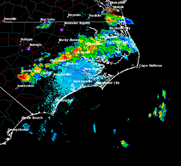 At 1023 pm edt, a severe thunderstorm was located near east carolina university, or near greenville, moving southeast at 30 mph (radar indicated). Hazards include 70 mph wind gusts and quarter size hail. Hail damage to vehicles is expected. expect considerable tree damage. wind damage is also likely to mobile homes, roofs and outbuildings. Locations impacted include, greenville, pitt greenville airport and simpson. At 1023 pm edt, a severe thunderstorm was located near east carolina university, or near greenville, moving southeast at 30 mph (radar indicated). Hazards include 70 mph wind gusts and quarter size hail. Hail damage to vehicles is expected. expect considerable tree damage. wind damage is also likely to mobile homes, roofs and outbuildings. Locations impacted include, greenville, pitt greenville airport and simpson.
|
| 4/28/2016 9:55 PM EDT |
 At 954 pm edt, a severe thunderstorm was located 9 miles southwest of bethel, or 10 miles northeast of farmville, moving southeast at 30 mph (radar indicated). Hazards include 70 mph wind gusts and quarter size hail. Hail damage to vehicles is expected. expect considerable tree damage. Wind damage is also likely to mobile homes, roofs and outbuildings. At 954 pm edt, a severe thunderstorm was located 9 miles southwest of bethel, or 10 miles northeast of farmville, moving southeast at 30 mph (radar indicated). Hazards include 70 mph wind gusts and quarter size hail. Hail damage to vehicles is expected. expect considerable tree damage. Wind damage is also likely to mobile homes, roofs and outbuildings.
|
| 2/24/2016 1:53 PM EST |
 At 152 pm est, doppler radar indicated a severe thunderstorm capable of producing a tornado. this dangerous storm was located over east carolina university, or over greenville, and moving northeast at 60 mph. At 152 pm est, doppler radar indicated a severe thunderstorm capable of producing a tornado. this dangerous storm was located over east carolina university, or over greenville, and moving northeast at 60 mph.
|
| 2/16/2016 8:35 AM EST |
 At 835 am est, doppler radar indicated a line of severe thunderstorms capable of producing damaging winds in excess of 60 mph. these storms were located along a line extending from robersonville to 8 miles east of dowdy ficklen stadium to near vanceboro, moving northeast at 30 mph. locations impacted include, greenville, washington, williamston, river road, robersonville, vanceboro, bayview ferry terminal, chocowinity, jamesville, washington park, grimesland, simpson, parmele, everetts and beargrass. At 835 am est, doppler radar indicated a line of severe thunderstorms capable of producing damaging winds in excess of 60 mph. these storms were located along a line extending from robersonville to 8 miles east of dowdy ficklen stadium to near vanceboro, moving northeast at 30 mph. locations impacted include, greenville, washington, williamston, river road, robersonville, vanceboro, bayview ferry terminal, chocowinity, jamesville, washington park, grimesland, simpson, parmele, everetts and beargrass.
|
| 2/16/2016 8:04 AM EST |
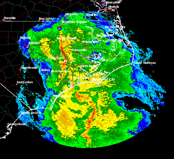 At 803 am est, doppler radar indicated a line of severe thunderstorms capable of producing damaging winds in excess of 60 mph. these storms were located along a line extending from 8 miles north of farmville to near ayden to 7 miles east of kinston, and moving east at 50 mph. At 803 am est, doppler radar indicated a line of severe thunderstorms capable of producing damaging winds in excess of 60 mph. these storms were located along a line extending from 8 miles north of farmville to near ayden to 7 miles east of kinston, and moving east at 50 mph.
|
| 7/21/2015 9:40 PM EDT |
 The severe thunderstorm warning for northeastern lenoir, western beaufort, northwestern craven and southeastern pitt counties will expire at 945 pm edt, the storm which prompted the warning has begun weakening below severe limits, and no longer poses an immediate threat to life or property. therefore the warning will be allowed to expire. however gusty winds and small hail are still possible with this thunderstorm. to report severe weather, contact your nearest law enforcement agency. they will relay your report to the national weather service newport. remember, a severe thunderstorm warning still remains in effect for southern portions of lenoir county until 1015 pm!. The severe thunderstorm warning for northeastern lenoir, western beaufort, northwestern craven and southeastern pitt counties will expire at 945 pm edt, the storm which prompted the warning has begun weakening below severe limits, and no longer poses an immediate threat to life or property. therefore the warning will be allowed to expire. however gusty winds and small hail are still possible with this thunderstorm. to report severe weather, contact your nearest law enforcement agency. they will relay your report to the national weather service newport. remember, a severe thunderstorm warning still remains in effect for southern portions of lenoir county until 1015 pm!.
|
| 7/21/2015 9:22 PM EDT |
 At 921 pm edt, doppler radar indicated a severe thunderstorm capable of producing damaging winds in excess of 60 mph. this storm was located near vanceboro, or 12 miles southeast of ayden, moving east at 45 mph. locations impacted include, greenville, new bern, washington, winterville, ayden, river road, grifton, vanceboro, pitt greenville airport, dowdy ficklen stadium, east carolina university, chocowinity, washington park, grimesland and simpson. At 921 pm edt, doppler radar indicated a severe thunderstorm capable of producing damaging winds in excess of 60 mph. this storm was located near vanceboro, or 12 miles southeast of ayden, moving east at 45 mph. locations impacted include, greenville, new bern, washington, winterville, ayden, river road, grifton, vanceboro, pitt greenville airport, dowdy ficklen stadium, east carolina university, chocowinity, washington park, grimesland and simpson.
|
| 7/21/2015 9:07 PM EDT |
 At 907 pm edt, doppler radar indicated a severe thunderstorm capable of producing damaging winds in excess of 60 mph. this storm was located over grifton, or 7 miles south of ayden, and moving east at 45 mph. At 907 pm edt, doppler radar indicated a severe thunderstorm capable of producing damaging winds in excess of 60 mph. this storm was located over grifton, or 7 miles south of ayden, and moving east at 45 mph.
|
| 4/25/2014 8:00 PM EDT | Golf Ball sized hail reported 1 miles NW of Grimesland, NC, spotter reported golf size hail in downtown grimesland |
| 4/25/2014 7:25 PM EDT | 2 structures damaged by wind in pitt county NC, 7.4 miles NNE of Grimesland, NC |
| 7/1/2012 4:25 PM EDT | Trees down with minor structural damage. time estimated by rada in pitt county NC, 1 miles NW of Grimesland, NC |
| 7/1/2012 4:23 PM EDT | Multiple trees down all along south grimesland rd. time estimated by rada in pitt county NC, 2 miles WSW of Grimesland, NC |
| 5/23/2012 5:20 PM EDT | Quarter sized hail reported 3.6 miles NNE of Grimesland, NC, dime to quarter size hail with estimated winds greater than 50 mph |
| 5/23/2012 5:14 PM EDT | Quarter sized hail reported 1 miles NW of Grimesland, NC, nickel to quarter size hail |
| 1/1/0001 12:00 AM | Tree down on voa site b rd near sis mills rd in pitt county NC, 4 miles NNE of Grimesland, NC |
Hail Maps for Grimesland, NC

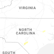


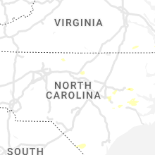


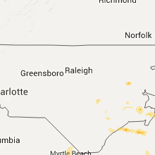


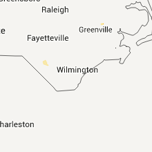
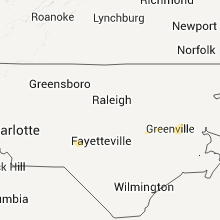


Connect with Interactive Hail Maps