

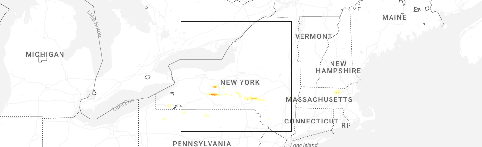
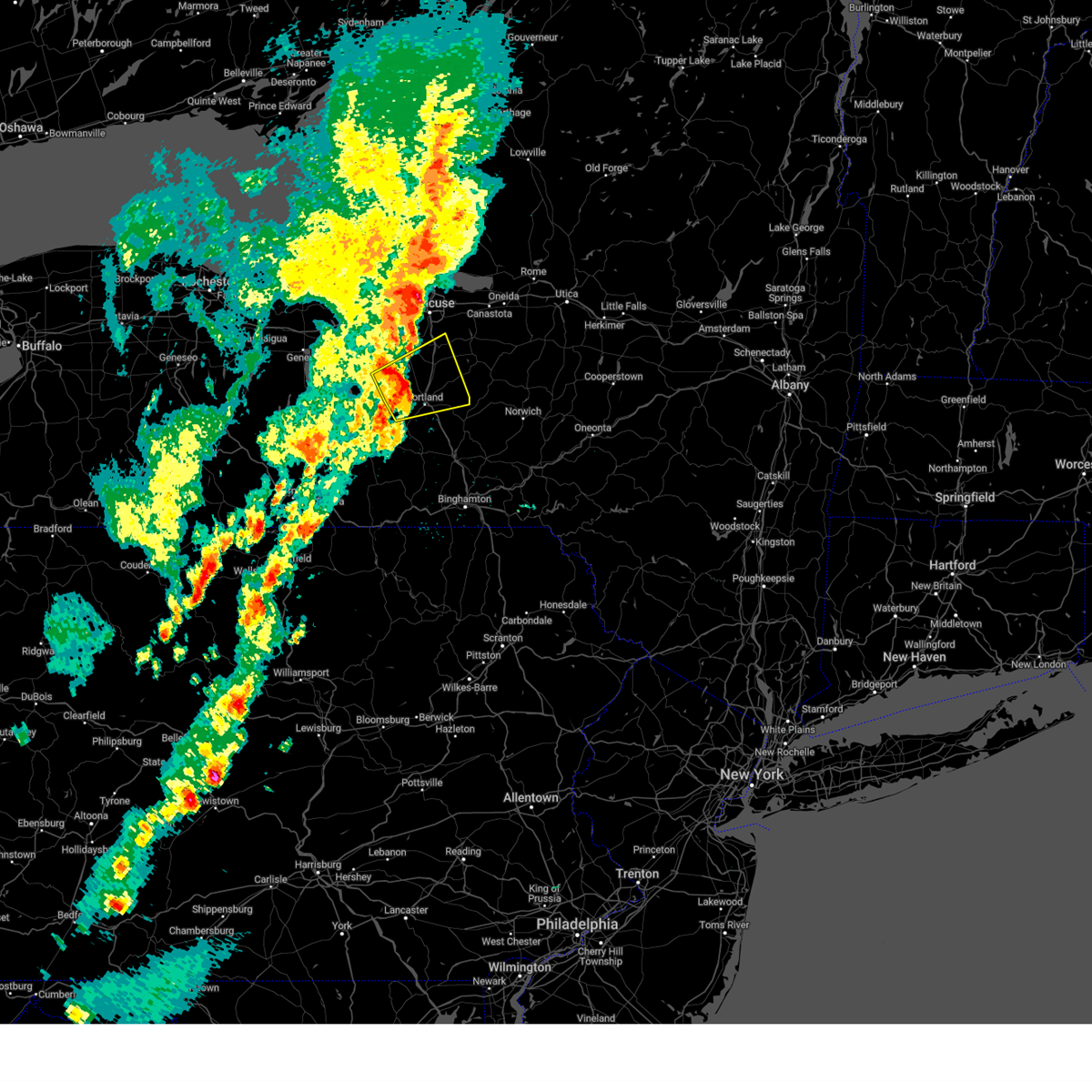
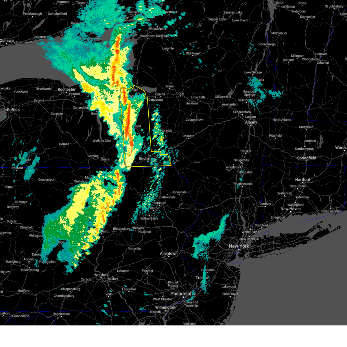
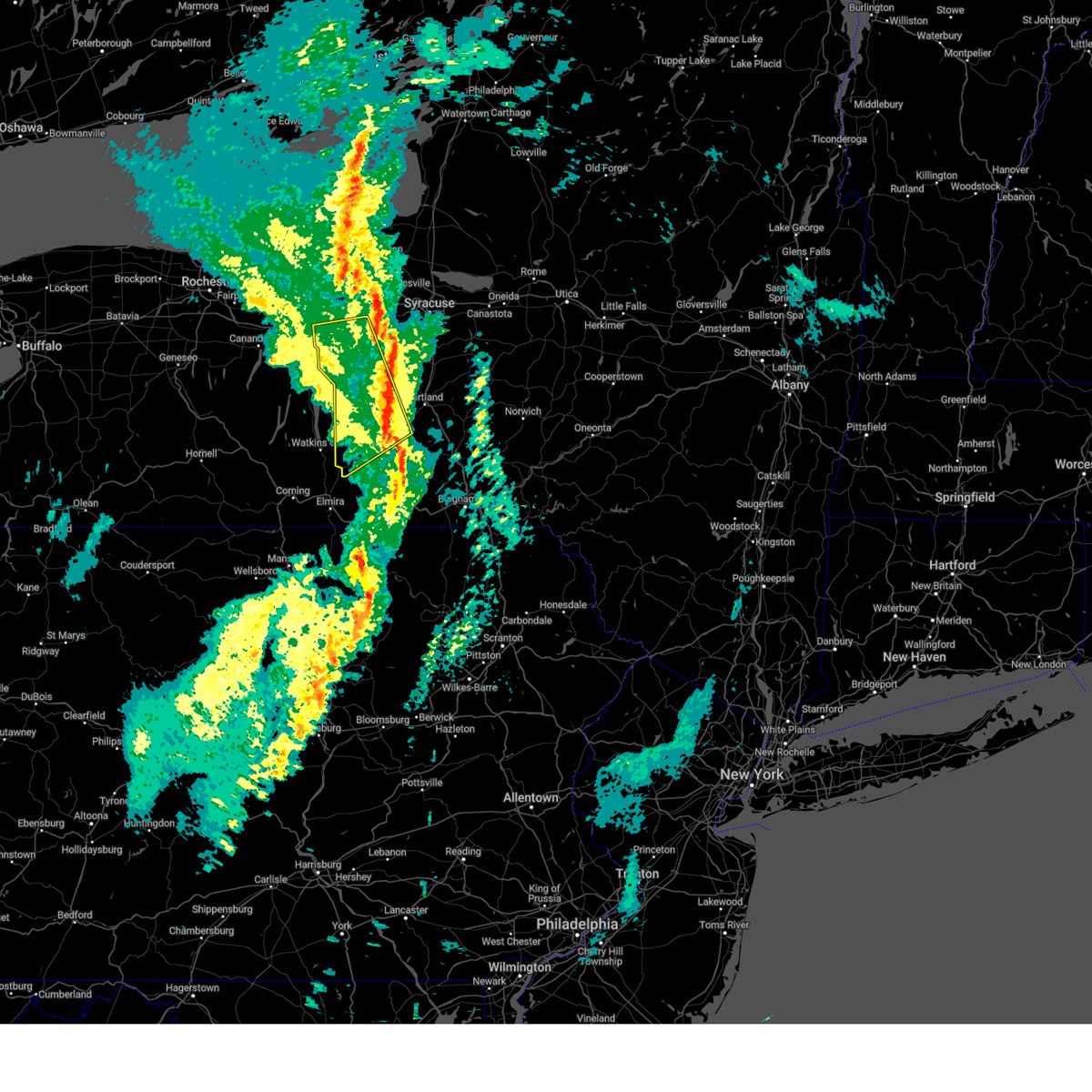
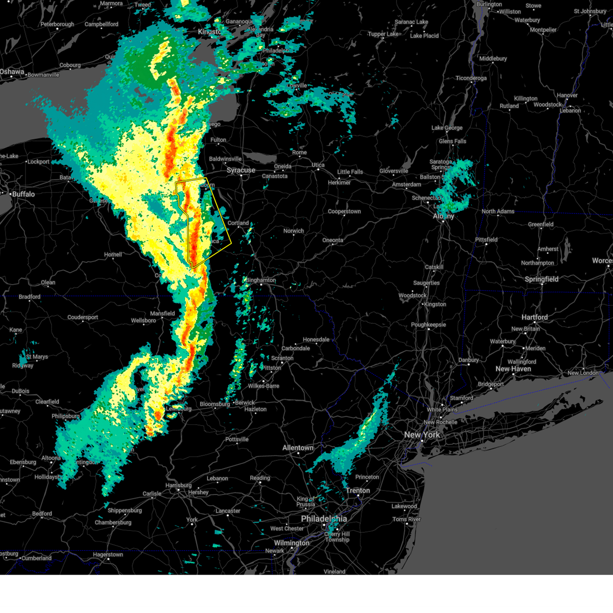
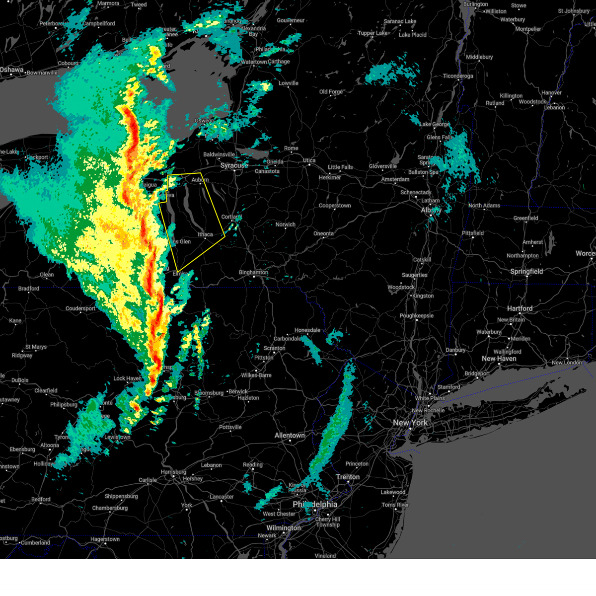
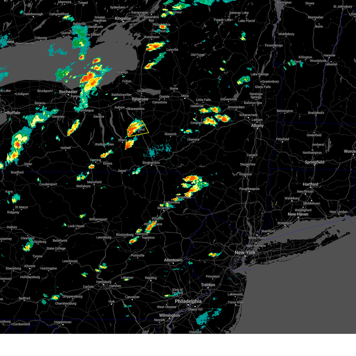
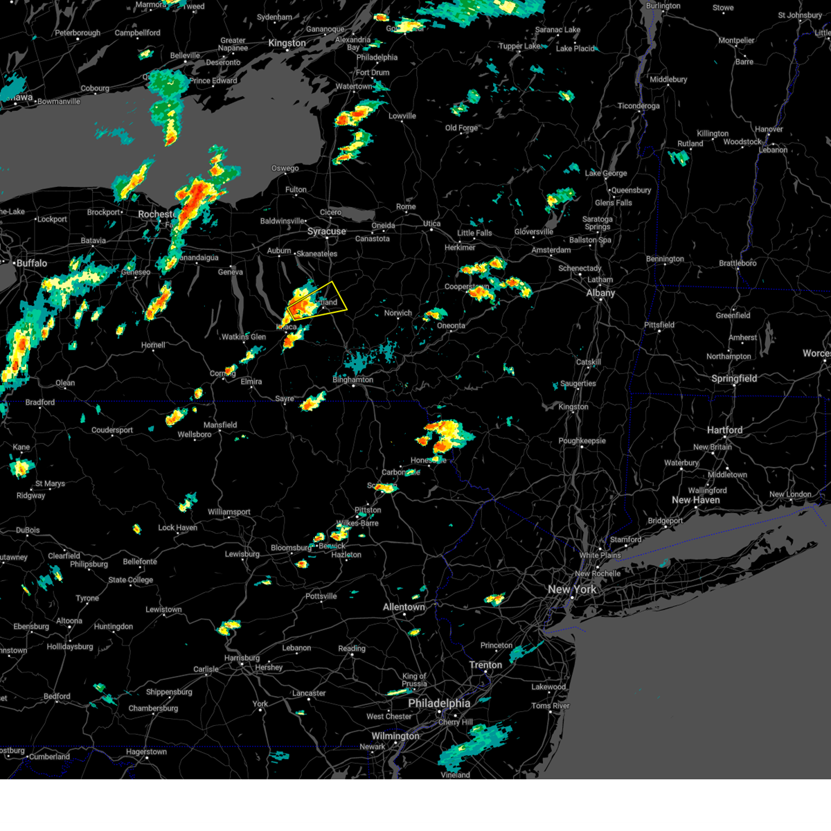
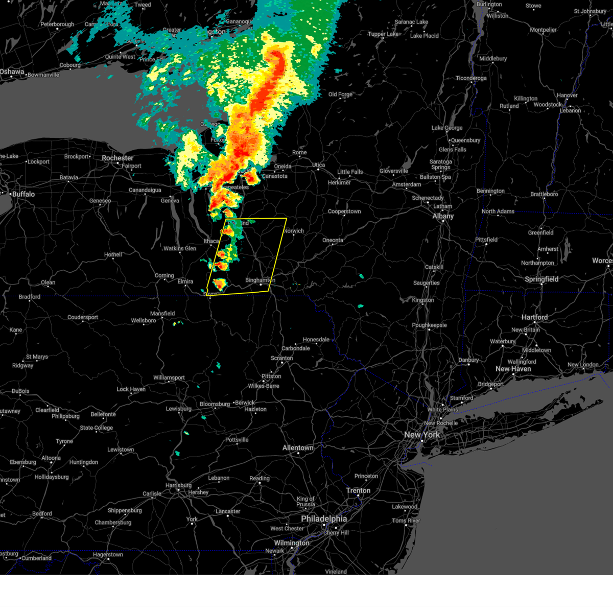
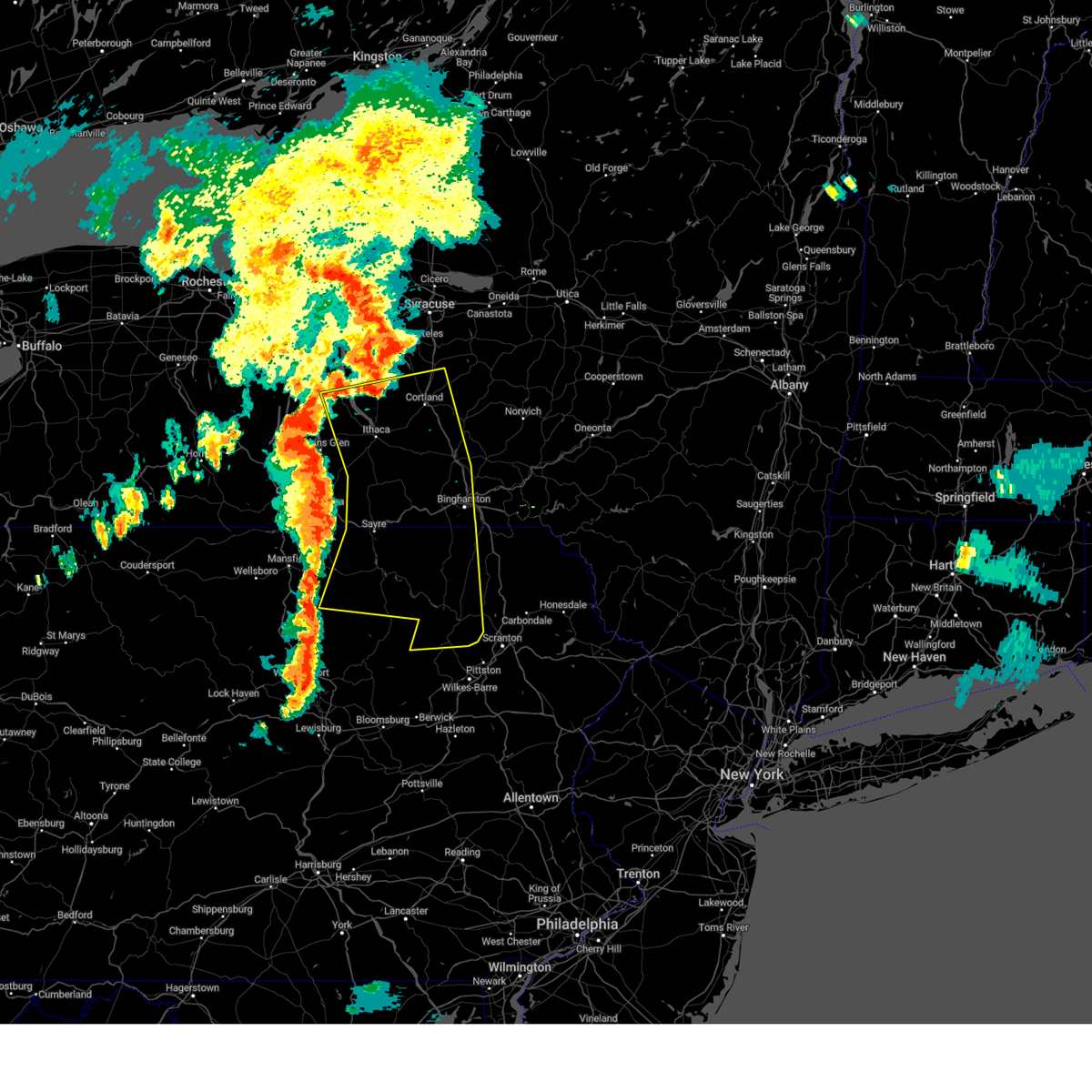
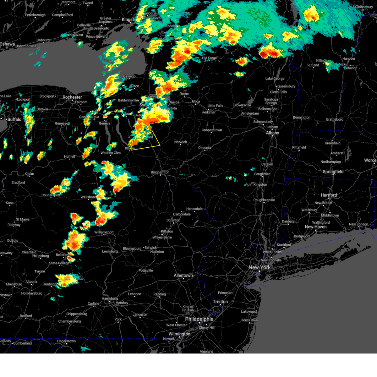
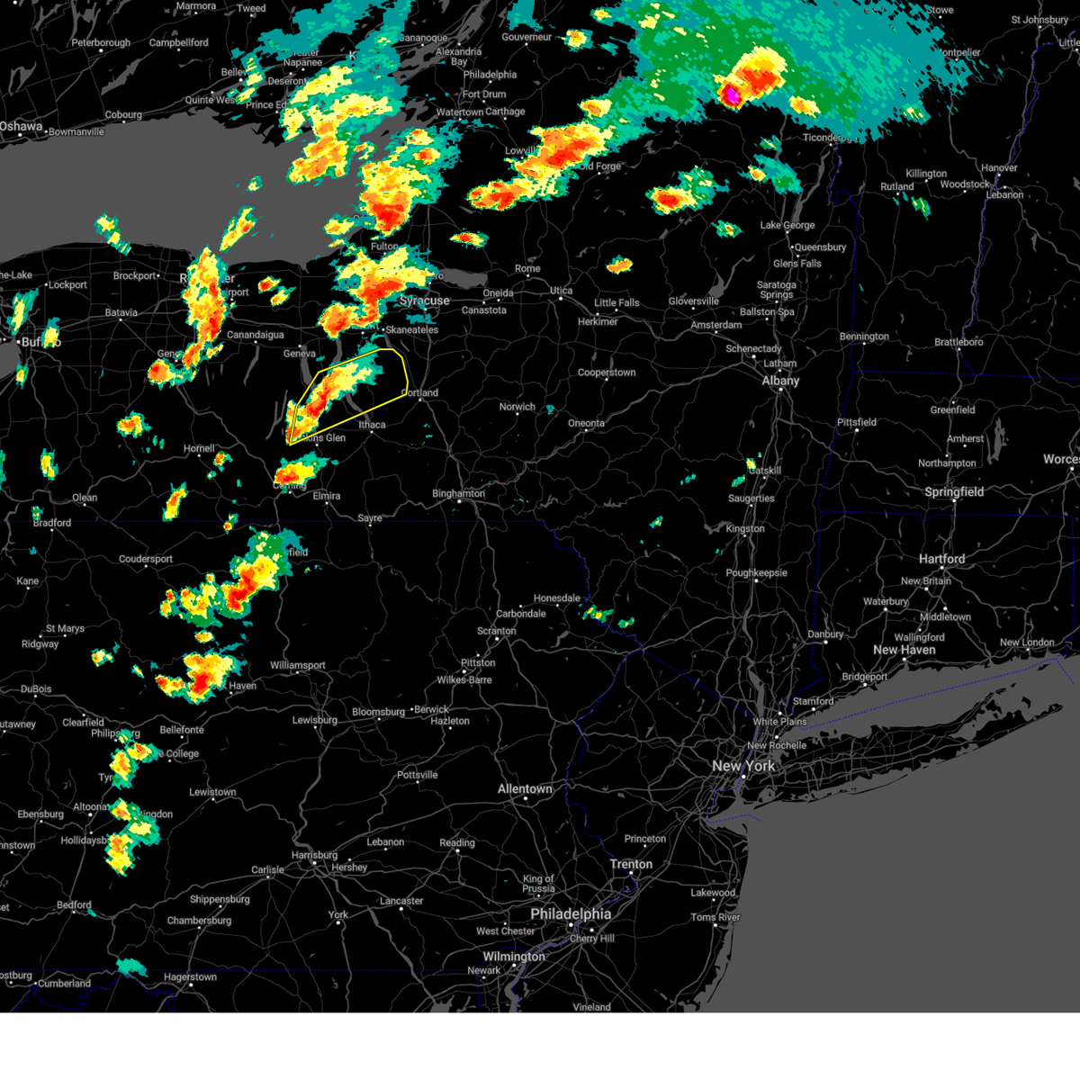
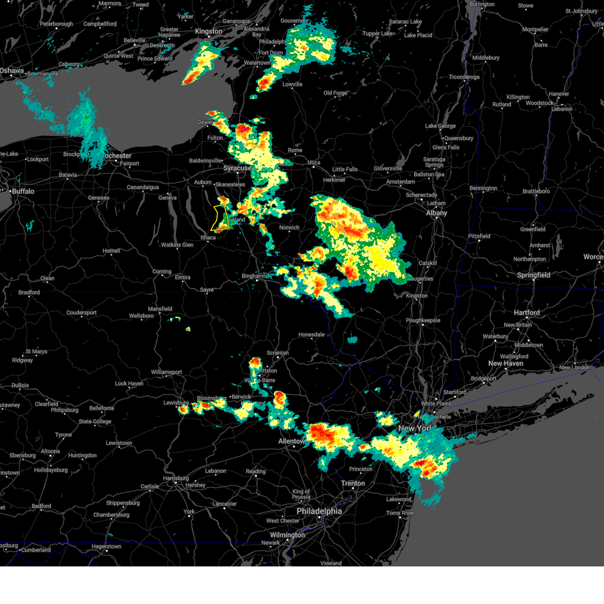
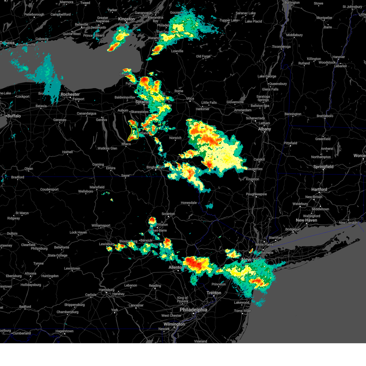
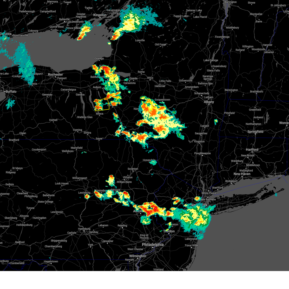
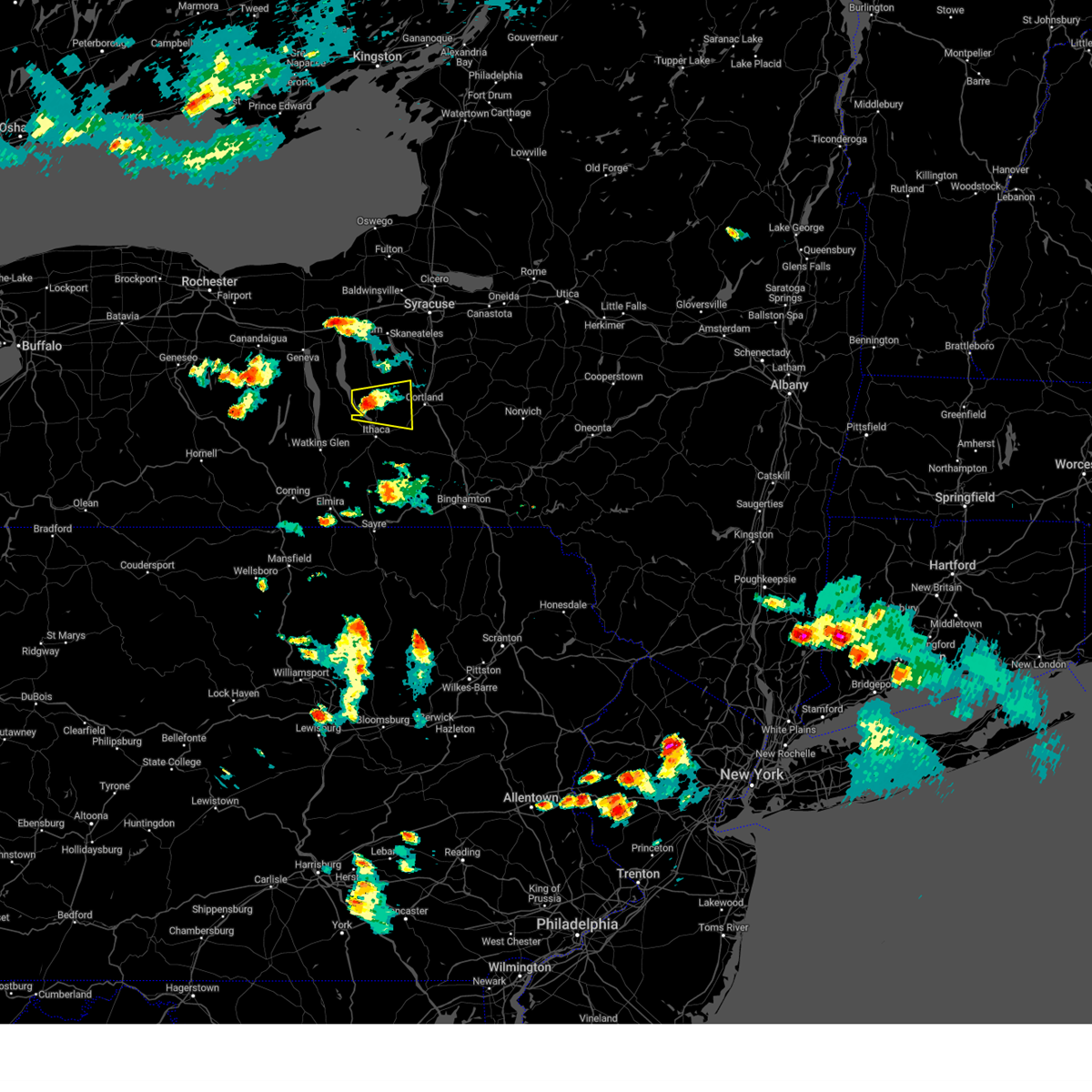
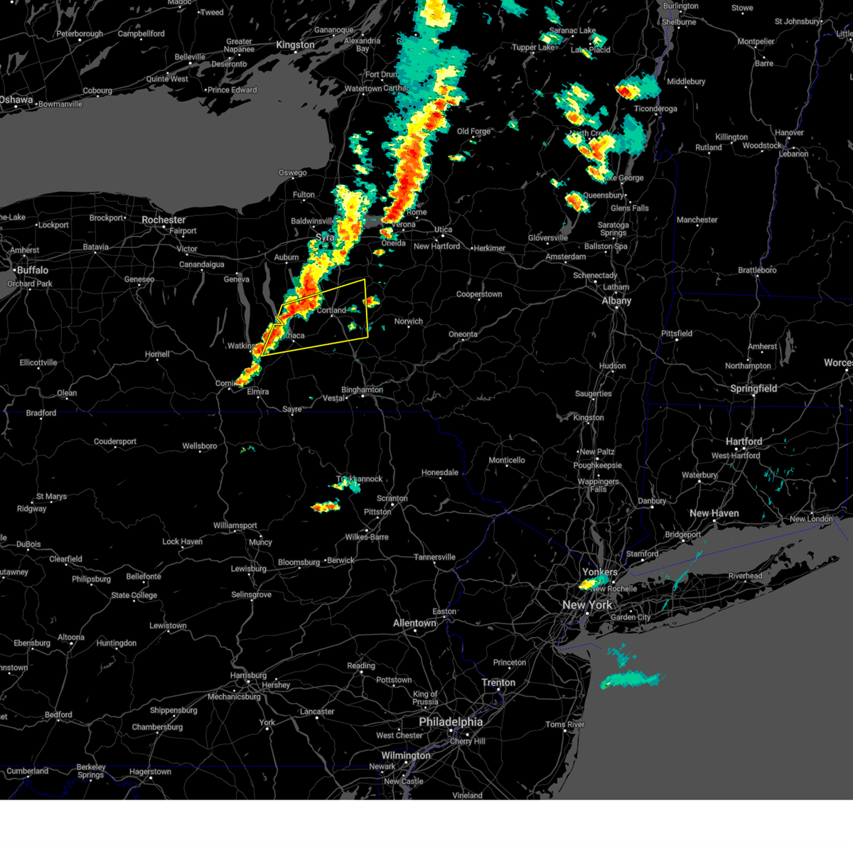
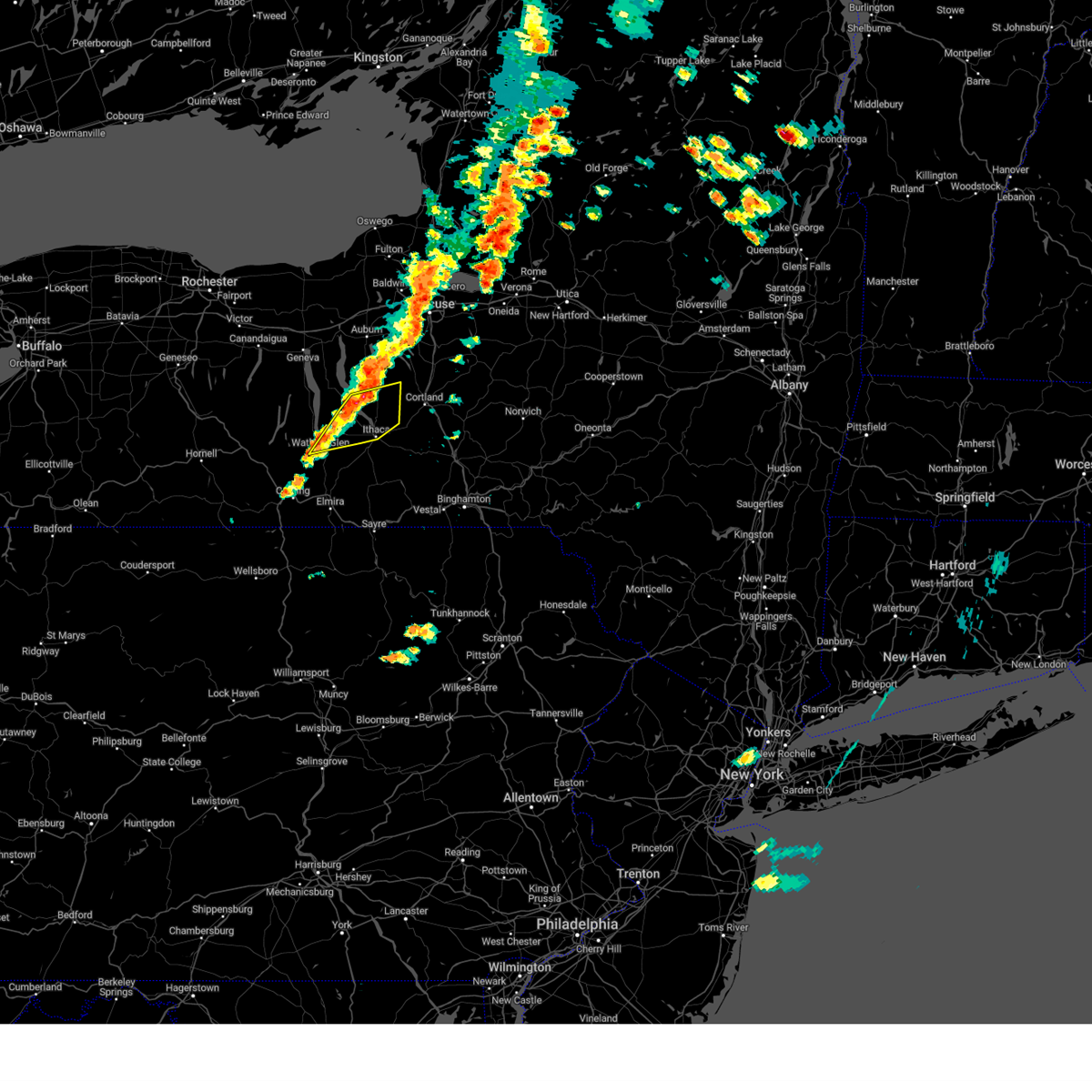
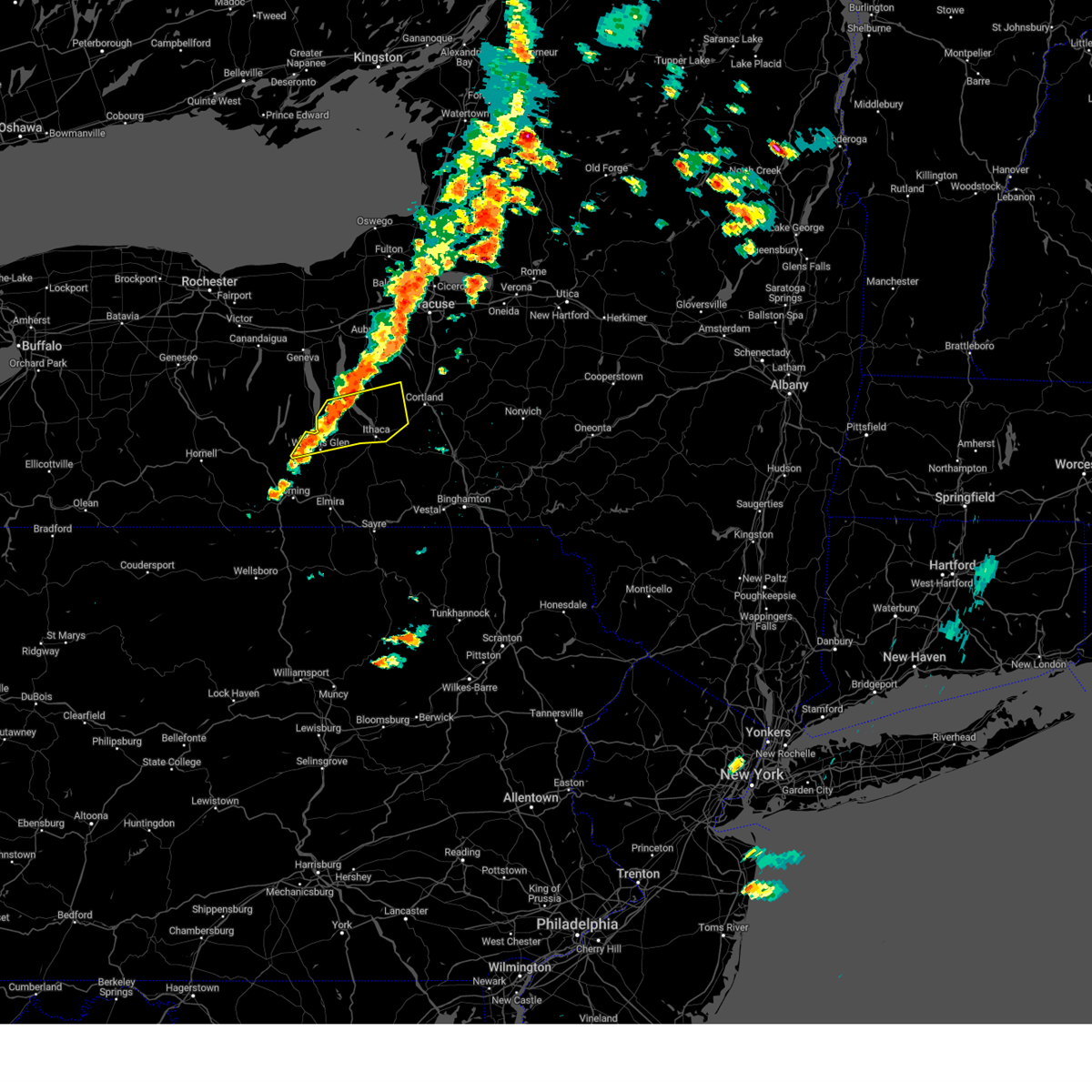
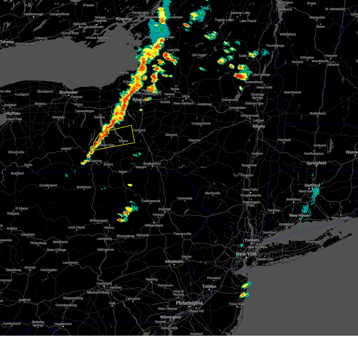
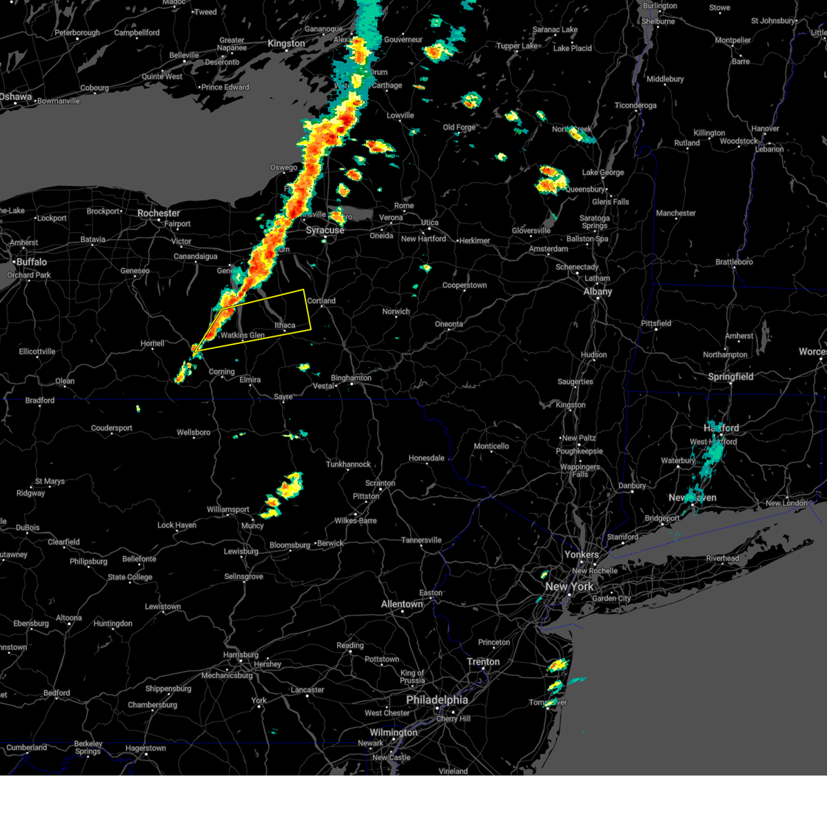
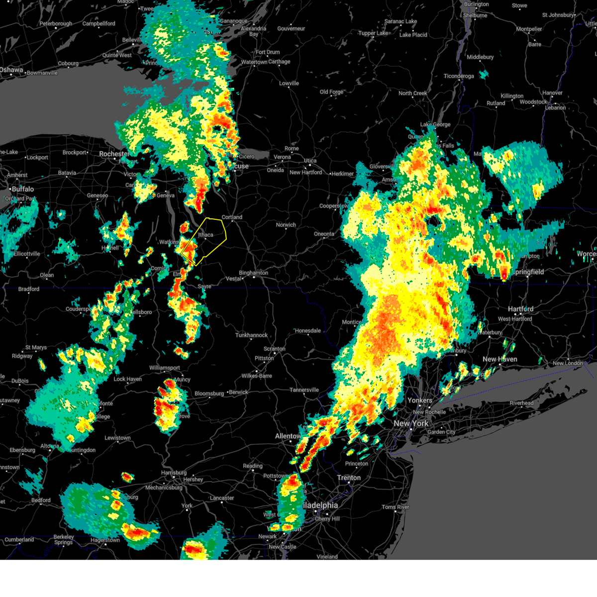
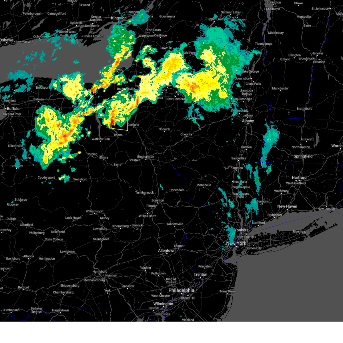
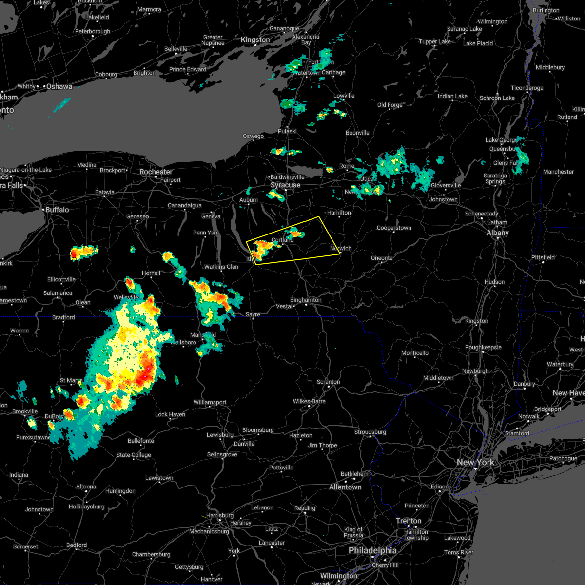
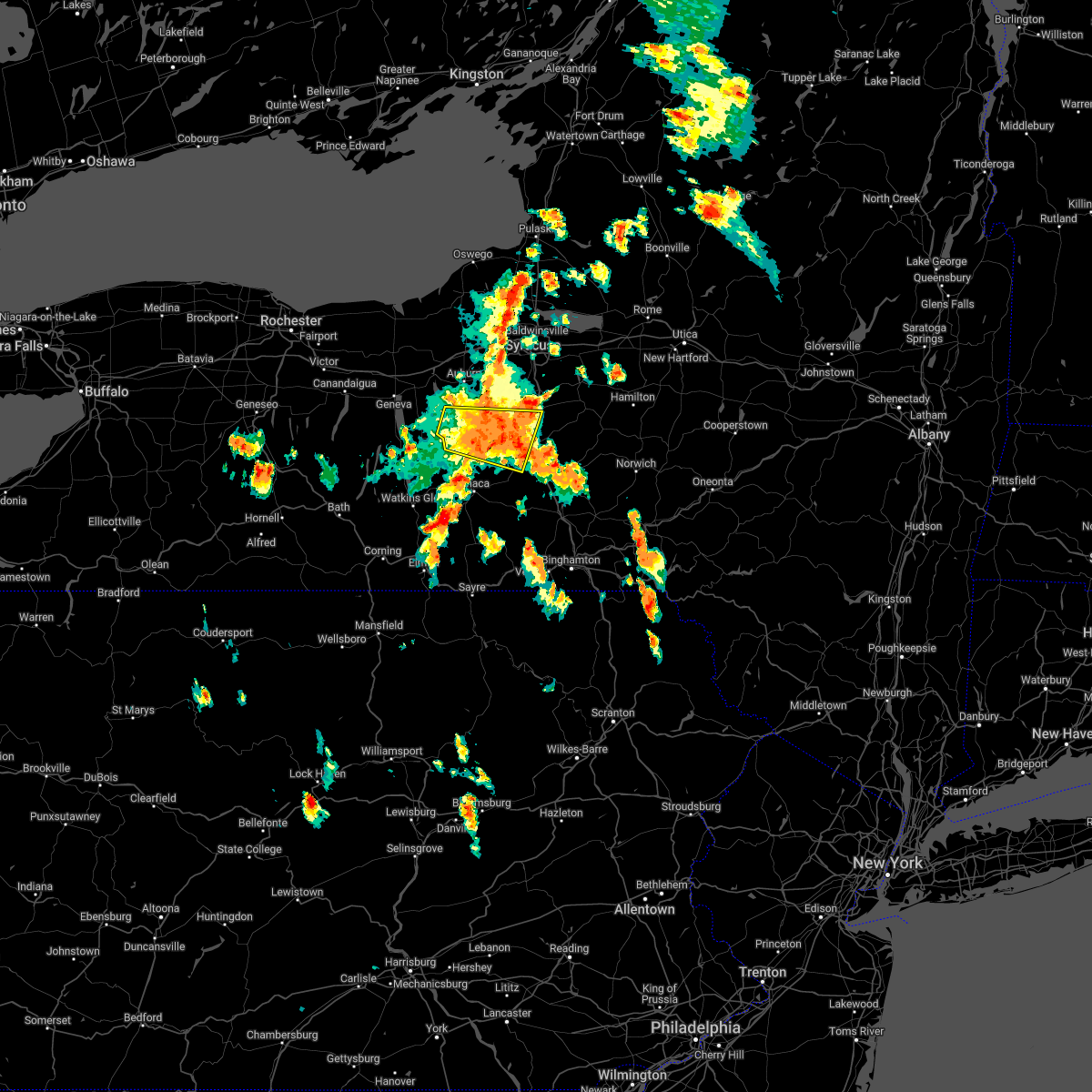
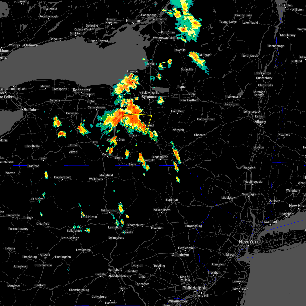
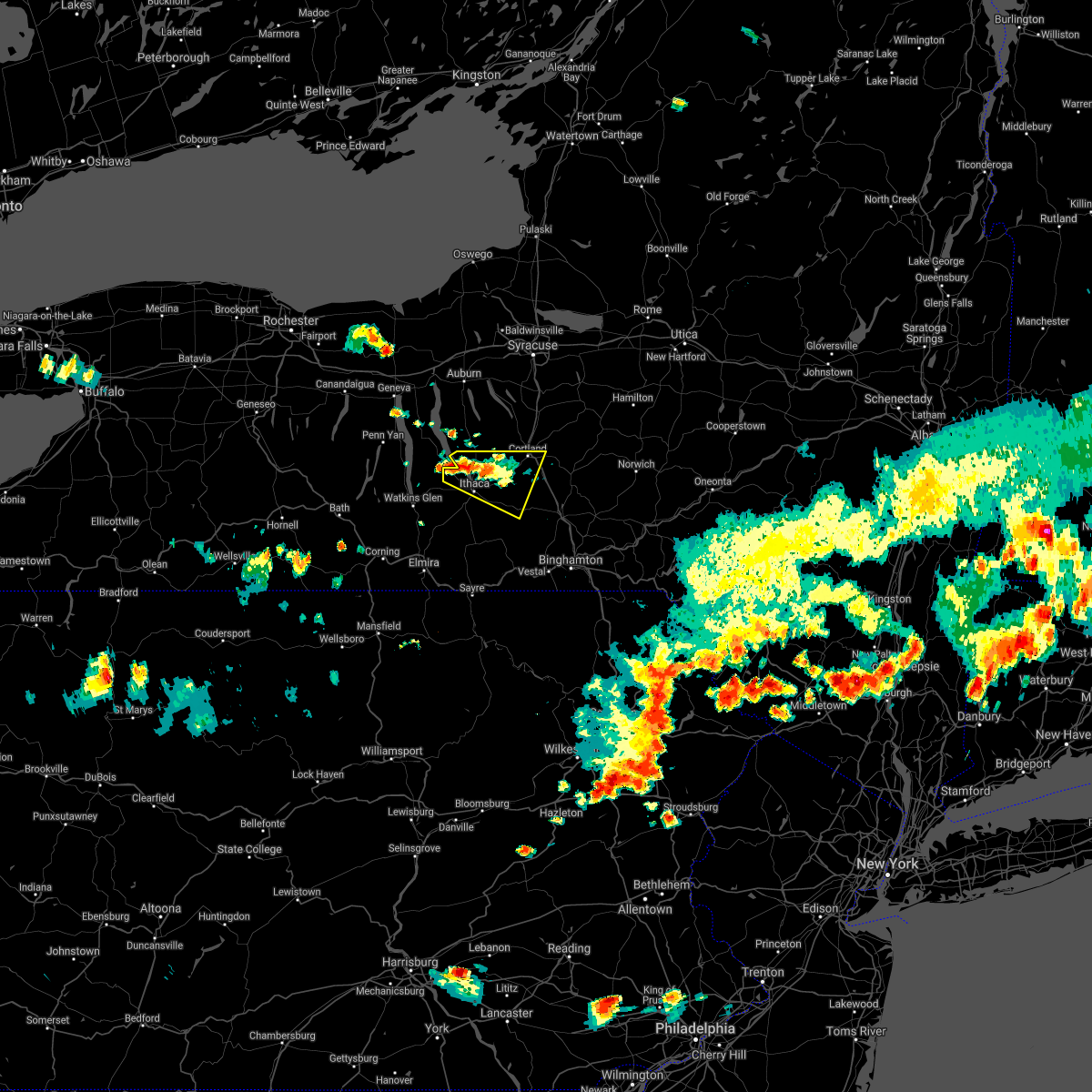
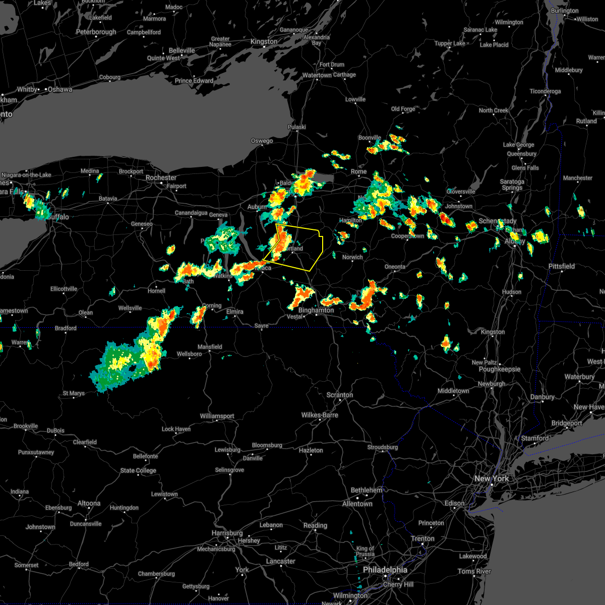
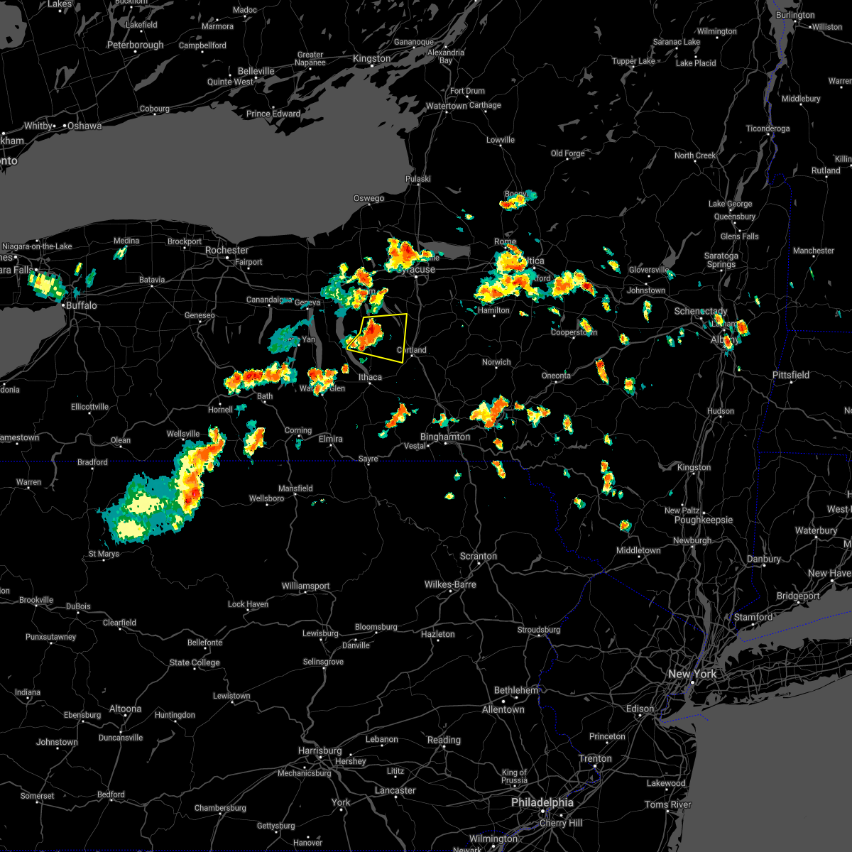
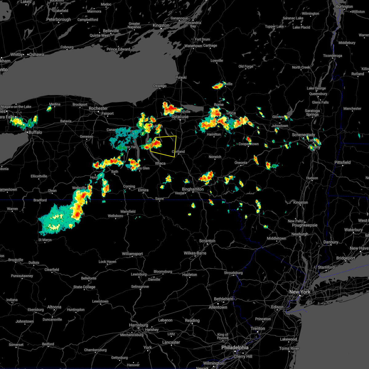
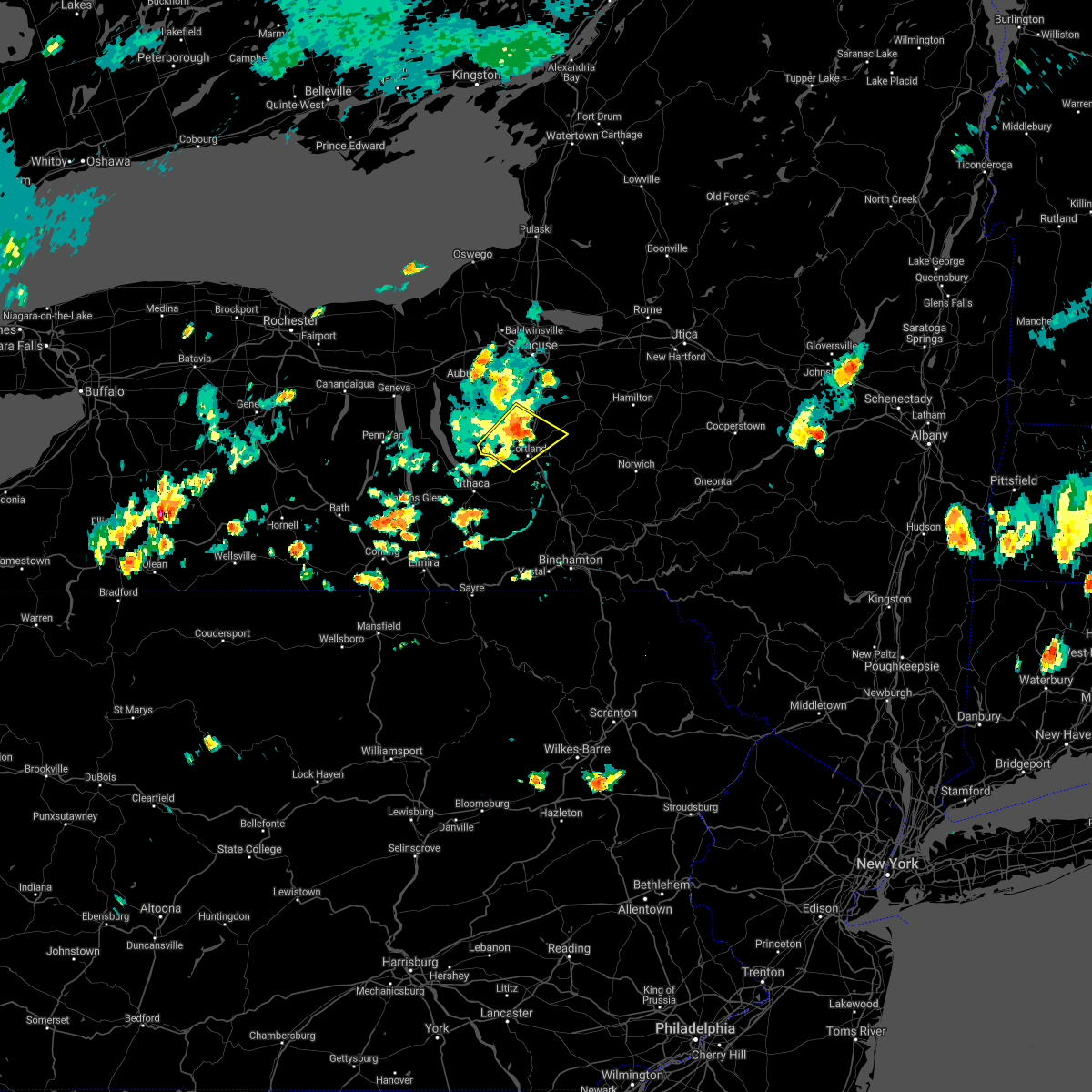
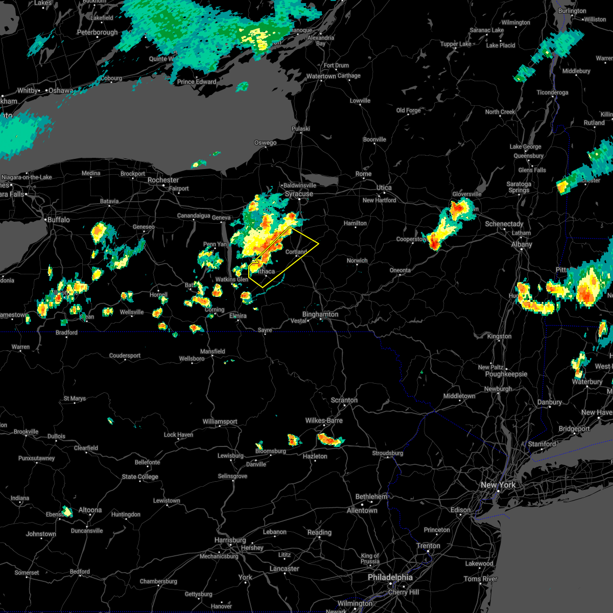
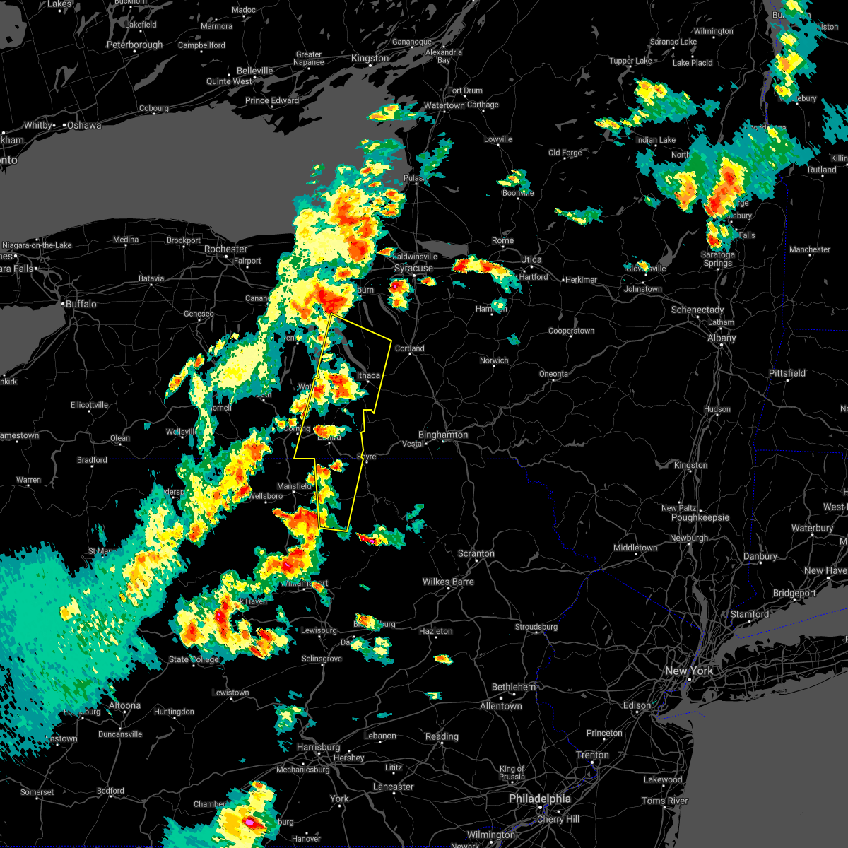
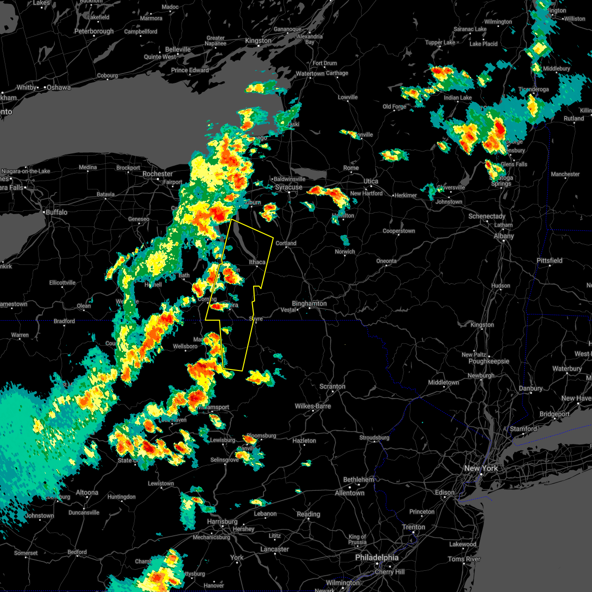
Hail Map for Groton, NY
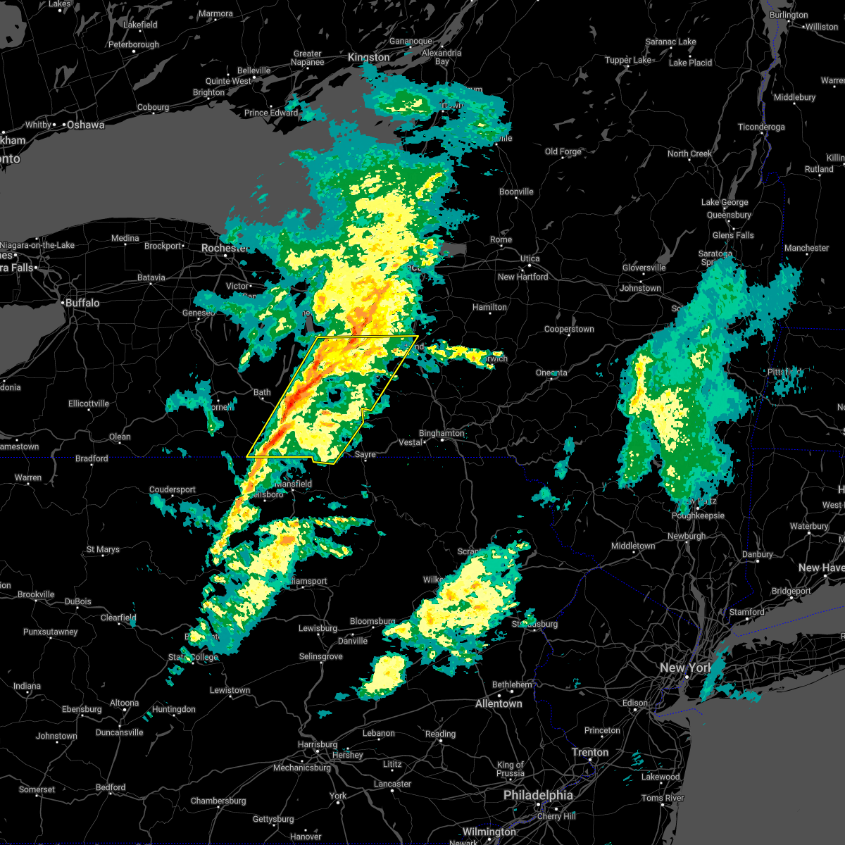
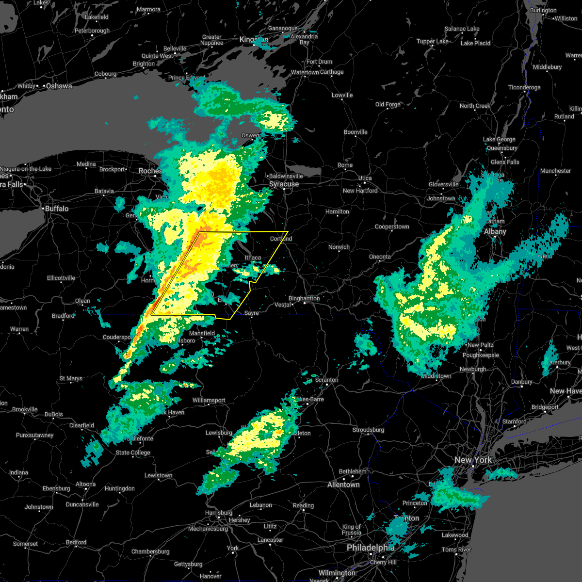
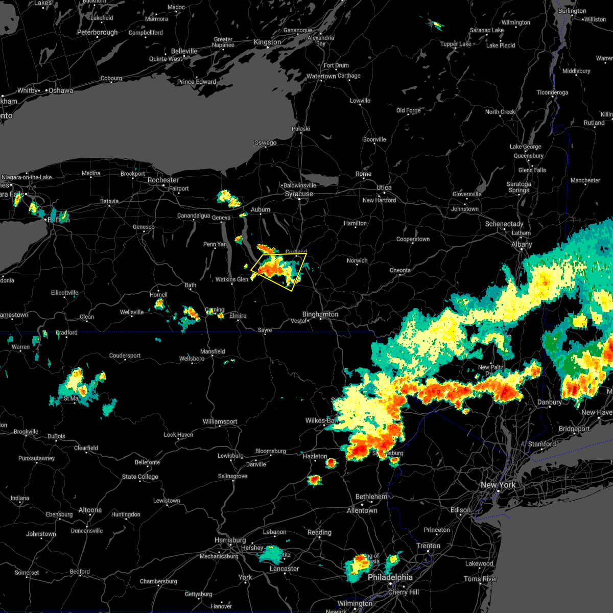
The Groton, NY area has had 0 reports of on-the-ground hail by trained spotters, and has been under severe weather warnings 25 times during the past 12 months. Doppler radar has detected hail at or near Groton, NY on 18 occasions, including 2 occasions during the past year.
| Name: | Groton, NY |
| Where Located: | 33.5 miles SSW of Syracuse, NY |
| Map: | Google Map for Groton, NY |
| Population: | 2363 |
| Housing Units: | 1015 |
| More Info: | Search Google for Groton, NY |
0
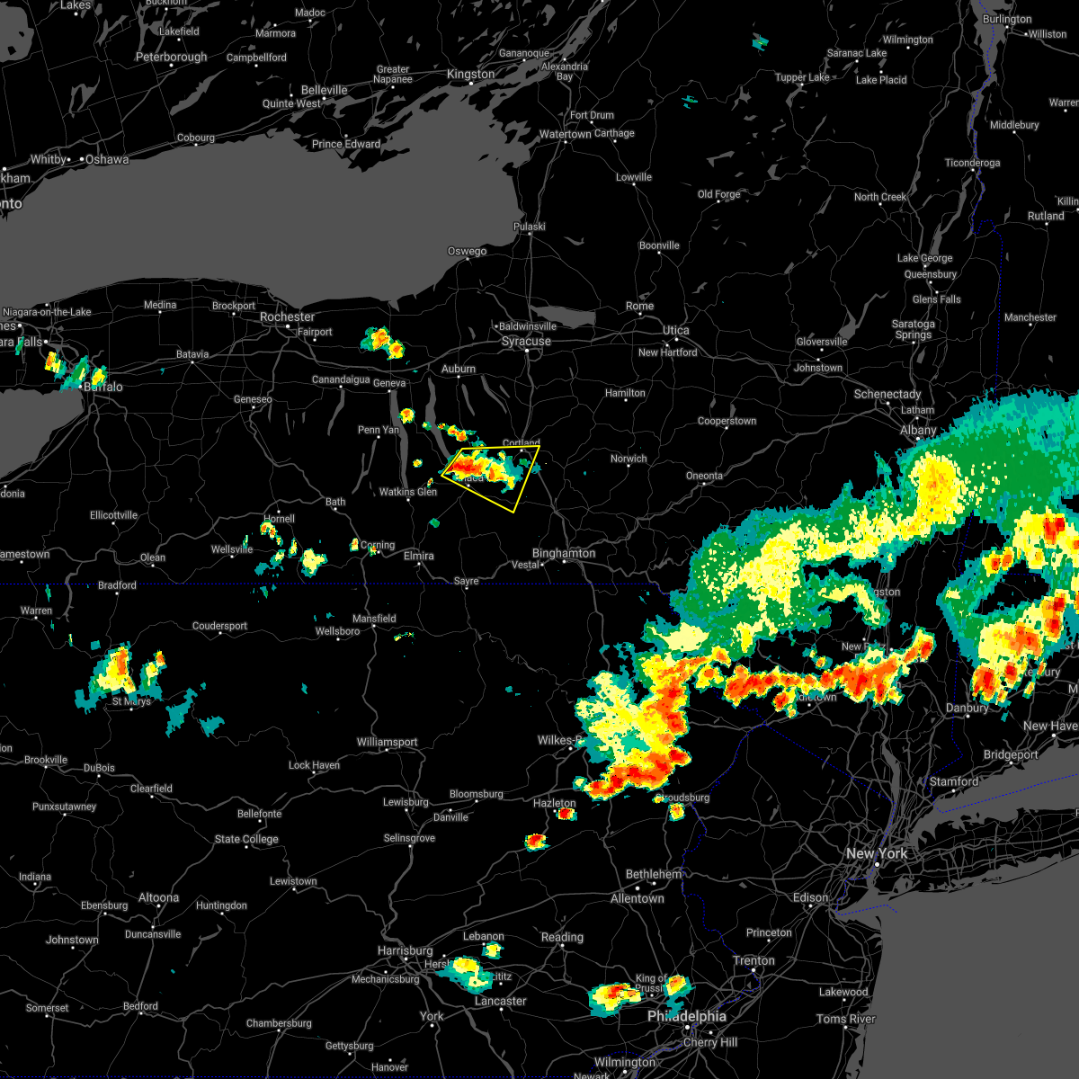
The Top Recent Hail Date for Groton, NY is Thursday, June 5, 2025 (15th out of 18)
Hail and Wind Damage Spotted near Groton, NY
| Date / Time | Report Details |
|---|---|
| 7/3/2025 1:33 PM EDT |
 At 132 pm edt, severe thunderstorms were located along a line extending from ledyard to interlaken to caywood, moving southeast at 35 mph (radar indicated). Hazards include 60 mph wind gusts and quarter size hail. Hail damage to vehicles is expected. expect wind damage to roofs, siding, and trees. Locations impacted include, lansing, groton, covert, locke, genoa, ledyard, trumansburg, interlaken, lodi, and caywood. At 132 pm edt, severe thunderstorms were located along a line extending from ledyard to interlaken to caywood, moving southeast at 35 mph (radar indicated). Hazards include 60 mph wind gusts and quarter size hail. Hail damage to vehicles is expected. expect wind damage to roofs, siding, and trees. Locations impacted include, lansing, groton, covert, locke, genoa, ledyard, trumansburg, interlaken, lodi, and caywood.
|
| 7/3/2025 1:33 PM EDT |
 the severe thunderstorm warning has been cancelled and is no longer in effect the severe thunderstorm warning has been cancelled and is no longer in effect
|
| 7/3/2025 1:05 PM EDT |
 Svrbgm the national weather service in binghamton has issued a * severe thunderstorm warning for, southern seneca county in central new york, northeastern yates county in central new york, southern cayuga county in central new york, northern tompkins county in central new york, * until 145 pm edt. * at 104 pm edt, severe thunderstorms were located along a line extending from romulus to dresden to penn yan, moving east at 40 mph (radar indicated). Hazards include 60 mph wind gusts and quarter size hail. Hail damage to vehicles is expected. Expect wind damage to roofs, siding, and trees. Svrbgm the national weather service in binghamton has issued a * severe thunderstorm warning for, southern seneca county in central new york, northeastern yates county in central new york, southern cayuga county in central new york, northern tompkins county in central new york, * until 145 pm edt. * at 104 pm edt, severe thunderstorms were located along a line extending from romulus to dresden to penn yan, moving east at 40 mph (radar indicated). Hazards include 60 mph wind gusts and quarter size hail. Hail damage to vehicles is expected. Expect wind damage to roofs, siding, and trees.
|
| 6/9/2025 9:26 PM EDT |
 The storm which prompted the warning has weakened below severe limits, and no longer poses an immediate threat to life or property. therefore, the warning will be allowed to expire. The storm which prompted the warning has weakened below severe limits, and no longer poses an immediate threat to life or property. therefore, the warning will be allowed to expire.
|
| 6/9/2025 9:10 PM EDT |
 At 909 pm edt, a severe thunderstorm was located over homer, or near cortland, moving east at 50 mph (radar indicated). Hazards include 60 mph wind gusts and penny size hail. Expect damage to roofs, siding, and trees. Locations impacted include, cortland, pompey, homer, otisco, groton, locke, preble, moravia, scott, and truxton. At 909 pm edt, a severe thunderstorm was located over homer, or near cortland, moving east at 50 mph (radar indicated). Hazards include 60 mph wind gusts and penny size hail. Expect damage to roofs, siding, and trees. Locations impacted include, cortland, pompey, homer, otisco, groton, locke, preble, moravia, scott, and truxton.
|
| 6/9/2025 8:47 PM EDT |
 Svrbgm the national weather service in binghamton has issued a * severe thunderstorm warning for, southern cayuga county in central new york, northern cortland county in central new york, southeastern onondaga county in central new york, northeastern tompkins county in central new york, * until 930 pm edt. * at 847 pm edt, a severe thunderstorm was located near taughannock falls, or 9 miles north of ithaca, moving east at 50 mph (radar indicated). Hazards include 60 mph wind gusts and nickel size hail. expect damage to roofs, siding, and trees Svrbgm the national weather service in binghamton has issued a * severe thunderstorm warning for, southern cayuga county in central new york, northern cortland county in central new york, southeastern onondaga county in central new york, northeastern tompkins county in central new york, * until 930 pm edt. * at 847 pm edt, a severe thunderstorm was located near taughannock falls, or 9 miles north of ithaca, moving east at 50 mph (radar indicated). Hazards include 60 mph wind gusts and nickel size hail. expect damage to roofs, siding, and trees
|
| 6/5/2025 5:33 PM EDT |
 Svrbgm the national weather service in binghamton has issued a * severe thunderstorm warning for, southern cayuga county in central new york, central seneca county in central new york, northeastern tompkins county in central new york, * until 630 pm edt. * at 532 pm edt, a severe thunderstorm was located over aurora, or 14 miles south of seneca falls, moving east at 20 mph (radar indicated). Hazards include 60 mph wind gusts and quarter size hail. Hail damage to vehicles is expected. Expect wind damage to roofs, siding, and trees. Svrbgm the national weather service in binghamton has issued a * severe thunderstorm warning for, southern cayuga county in central new york, central seneca county in central new york, northeastern tompkins county in central new york, * until 630 pm edt. * at 532 pm edt, a severe thunderstorm was located over aurora, or 14 miles south of seneca falls, moving east at 20 mph (radar indicated). Hazards include 60 mph wind gusts and quarter size hail. Hail damage to vehicles is expected. Expect wind damage to roofs, siding, and trees.
|
| 4/29/2025 7:44 PM EDT | The storms which prompted the warning have moved out of the area. therefore, the warning will be allowed to expire. a severe thunderstorm watch remains in effect until 1000 pm edt for central new york. |
| 4/29/2025 7:01 PM EDT | Svrbgm the national weather service in binghamton has issued a * severe thunderstorm warning for, southeastern cayuga county in central new york, cortland county in central new york, northern tompkins county in central new york, * until 745 pm edt. * at 701 pm edt, severe thunderstorms were located along a line extending from near locke to near taughannock falls to near enfield, moving east at 50 mph (radar indicated). Hazards include 70 mph wind gusts and penny size hail. Expect considerable tree damage. Damage is likely to mobile homes, roofs, and outbuildings. |
| 3/16/2025 4:45 PM EDT |
 At 444 pm edt, severe thunderstorms were located along a line extending from lysander to near newark valley, moving northeast at 60 mph (radar indicated). Hazards include 60 mph wind gusts. Expect damage to roofs, siding, and trees. Locations impacted include, south cortland, hunts corners, chenango valley state park, preble, tioga terrace, bennetts corners, bayberry, cedarvale, harford, and clark reservation state park. At 444 pm edt, severe thunderstorms were located along a line extending from lysander to near newark valley, moving northeast at 60 mph (radar indicated). Hazards include 60 mph wind gusts. Expect damage to roofs, siding, and trees. Locations impacted include, south cortland, hunts corners, chenango valley state park, preble, tioga terrace, bennetts corners, bayberry, cedarvale, harford, and clark reservation state park.
|
| 3/16/2025 4:45 PM EDT |
 the severe thunderstorm warning has been cancelled and is no longer in effect the severe thunderstorm warning has been cancelled and is no longer in effect
|
| 3/16/2025 4:44 PM EDT |
 The storms which prompted the warning have moved out of the area. therefore, the warning will be allowed to expire. a severe thunderstorm watch remains in effect until 700 pm edt for central new york. to report severe weather, contact your nearest law enforcement agency. they will relay your report to the national weather service binghamton. The storms which prompted the warning have moved out of the area. therefore, the warning will be allowed to expire. a severe thunderstorm watch remains in effect until 700 pm edt for central new york. to report severe weather, contact your nearest law enforcement agency. they will relay your report to the national weather service binghamton.
|
| 3/16/2025 4:40 PM EDT | Storm damage reported in tompkins county NY, 0.7 miles S of Groton, NY |
| 3/16/2025 4:24 PM EDT |
 At 424 pm edt, severe thunderstorms were located along a line extending from near waterloo to enfield, moving northeast at 55 mph (radar indicated). Hazards include 60 mph wind gusts. Expect damage to roofs, siding, and trees. locations impacted include, cayuga heights, east venice, allan h. Treman state marine park, canoga, buttermilk falls state park, waterloo, fayette, montville, long point state park, and cayuga. At 424 pm edt, severe thunderstorms were located along a line extending from near waterloo to enfield, moving northeast at 55 mph (radar indicated). Hazards include 60 mph wind gusts. Expect damage to roofs, siding, and trees. locations impacted include, cayuga heights, east venice, allan h. Treman state marine park, canoga, buttermilk falls state park, waterloo, fayette, montville, long point state park, and cayuga.
|
| 3/16/2025 4:24 PM EDT |
 the severe thunderstorm warning has been cancelled and is no longer in effect the severe thunderstorm warning has been cancelled and is no longer in effect
|
| 3/16/2025 4:17 PM EDT | Svrbgm the national weather service in binghamton has issued a * severe thunderstorm warning for, seneca county in central new york, eastern schuyler county in central new york, broome county in central new york, cayuga county in central new york, cortland county in central new york, eastern chemung county in central new york, tioga county in central new york, onondaga county in central new york, tompkins county in central new york, * until 515 pm edt. * at 417 pm edt, severe thunderstorms were located along a line extending from 6 miles southeast of lyons to lowman, moving northeast at 60 mph (radar indicated). Hazards include 60 mph wind gusts. expect damage to roofs, siding, and trees |
| 3/16/2025 3:50 PM EDT |
 Svrbgm the national weather service in binghamton has issued a * severe thunderstorm warning for, seneca county in central new york, schuyler county in central new york, eastern yates county in central new york, cayuga county in central new york, north central chemung county in central new york, tompkins county in central new york, * until 445 pm edt. * at 350 pm edt, severe thunderstorms were located along a line extending from near vine valley to coopers plains, moving northeast at 55 mph (radar indicated). Hazards include 60 mph wind gusts. expect damage to roofs, siding, and trees Svrbgm the national weather service in binghamton has issued a * severe thunderstorm warning for, seneca county in central new york, schuyler county in central new york, eastern yates county in central new york, cayuga county in central new york, north central chemung county in central new york, tompkins county in central new york, * until 445 pm edt. * at 350 pm edt, severe thunderstorms were located along a line extending from near vine valley to coopers plains, moving northeast at 55 mph (radar indicated). Hazards include 60 mph wind gusts. expect damage to roofs, siding, and trees
|
| 7/24/2024 2:52 PM EDT |
 At 252 pm edt, a severe thunderstorm was located near munsons corners, or near cortland, moving east at 20 mph (radar indicated). Hazards include 60 mph wind gusts and penny size hail. Expect damage to roofs, siding, and trees. Locations impacted include, cortland, homer, groton, preble, solon, mcgraw, south cortland, east homer, munsons corners, and mc lean. At 252 pm edt, a severe thunderstorm was located near munsons corners, or near cortland, moving east at 20 mph (radar indicated). Hazards include 60 mph wind gusts and penny size hail. Expect damage to roofs, siding, and trees. Locations impacted include, cortland, homer, groton, preble, solon, mcgraw, south cortland, east homer, munsons corners, and mc lean.
|
| 7/24/2024 2:37 PM EDT |
 Svrbgm the national weather service in binghamton has issued a * severe thunderstorm warning for, southeastern cayuga county in central new york, northwestern cortland county in central new york, northeastern tompkins county in central new york, * until 330 pm edt. * at 237 pm edt, a severe thunderstorm was located over groton, or 10 miles west of cortland, moving east at 20 mph (radar indicated). Hazards include 60 mph wind gusts and penny size hail. expect damage to roofs, siding, and trees Svrbgm the national weather service in binghamton has issued a * severe thunderstorm warning for, southeastern cayuga county in central new york, northwestern cortland county in central new york, northeastern tompkins county in central new york, * until 330 pm edt. * at 237 pm edt, a severe thunderstorm was located over groton, or 10 miles west of cortland, moving east at 20 mph (radar indicated). Hazards include 60 mph wind gusts and penny size hail. expect damage to roofs, siding, and trees
|
| 7/16/2024 2:37 PM EDT |
 Svrbgm the national weather service in binghamton has issued a * severe thunderstorm warning for, western broome county in central new york, southeastern cayuga county in central new york, cortland county in central new york, tioga county in central new york, eastern tompkins county in central new york, western chenango county in central new york, * until 330 pm edt. * at 236 pm edt, severe thunderstorms were located along a line extending from near homer to near barton, moving northeast at 40 mph (radar indicated). Hazards include 60 mph wind gusts and penny size hail. expect damage to roofs, siding, and trees Svrbgm the national weather service in binghamton has issued a * severe thunderstorm warning for, western broome county in central new york, southeastern cayuga county in central new york, cortland county in central new york, tioga county in central new york, eastern tompkins county in central new york, western chenango county in central new york, * until 330 pm edt. * at 236 pm edt, severe thunderstorms were located along a line extending from near homer to near barton, moving northeast at 40 mph (radar indicated). Hazards include 60 mph wind gusts and penny size hail. expect damage to roofs, siding, and trees
|
| 7/15/2024 6:23 PM EDT |
 At 622 pm edt, severe thunderstorms were located along a line extending from montville to near candor to litchfield to overton, moving east at 45 mph (radar indicated). Hazards include 70 mph wind gusts and penny size hail. Expect considerable tree damage. damage is likely to mobile homes, roofs, and outbuildings. Locations impacted include, chemung, binghamton, falls, ithaca, vestal, cortland, johnson city, endicott, barton, and vernon. At 622 pm edt, severe thunderstorms were located along a line extending from montville to near candor to litchfield to overton, moving east at 45 mph (radar indicated). Hazards include 70 mph wind gusts and penny size hail. Expect considerable tree damage. damage is likely to mobile homes, roofs, and outbuildings. Locations impacted include, chemung, binghamton, falls, ithaca, vestal, cortland, johnson city, endicott, barton, and vernon.
|
| 7/15/2024 6:23 PM EDT |
 the severe thunderstorm warning has been cancelled and is no longer in effect the severe thunderstorm warning has been cancelled and is no longer in effect
|
| 7/15/2024 5:53 PM EDT |
 Svrbgm the national weather service in binghamton has issued a * severe thunderstorm warning for, southern seneca county in central new york, schuyler county in central new york, southeastern yates county in central new york, western broome county in central new york, southern cayuga county in central new york, cortland county in central new york, chemung county in central new york, tioga county in central new york, tompkins county in central new york, western susquehanna county in northeastern pennsylvania, bradford county in northeastern pennsylvania, wyoming county in northeastern pennsylvania, * until 645 pm edt. * at 551 pm edt, severe thunderstorms were located along a line extending from near lodi station to near elmira to near shunk, moving east at 50 mph (radar indicated. at 545 pm a 61 mph wind gust was reported at the elmira airport). Hazards include 70 mph wind gusts and penny size hail. Expect considerable tree damage. Damage is likely to mobile homes, roofs, and outbuildings. Svrbgm the national weather service in binghamton has issued a * severe thunderstorm warning for, southern seneca county in central new york, schuyler county in central new york, southeastern yates county in central new york, western broome county in central new york, southern cayuga county in central new york, cortland county in central new york, chemung county in central new york, tioga county in central new york, tompkins county in central new york, western susquehanna county in northeastern pennsylvania, bradford county in northeastern pennsylvania, wyoming county in northeastern pennsylvania, * until 645 pm edt. * at 551 pm edt, severe thunderstorms were located along a line extending from near lodi station to near elmira to near shunk, moving east at 50 mph (radar indicated. at 545 pm a 61 mph wind gust was reported at the elmira airport). Hazards include 70 mph wind gusts and penny size hail. Expect considerable tree damage. Damage is likely to mobile homes, roofs, and outbuildings.
|
| 7/10/2024 5:05 PM EDT |
 At 505 pm edt, a severe thunderstorm was located over freeville, or 7 miles northeast of ithaca, moving northeast at 30 mph (radar indicated). Hazards include 60 mph wind gusts and half dollar size hail. Hail damage to vehicles is expected. expect wind damage to roofs, siding, and trees. Locations impacted include, cortland, homer, virgil, groton, dryden, solon, mcgraw, freeville, south cortland, and east freetown. At 505 pm edt, a severe thunderstorm was located over freeville, or 7 miles northeast of ithaca, moving northeast at 30 mph (radar indicated). Hazards include 60 mph wind gusts and half dollar size hail. Hail damage to vehicles is expected. expect wind damage to roofs, siding, and trees. Locations impacted include, cortland, homer, virgil, groton, dryden, solon, mcgraw, freeville, south cortland, and east freetown.
|
| 7/10/2024 5:04 PM EDT | Multiple reports of trees and wires down throughout the town of groton. time estimated from rada in tompkins county NY, 0.8 miles NE of Groton, NY |
| 7/10/2024 4:58 PM EDT |
 Svrbgm the national weather service in binghamton has issued a * severe thunderstorm warning for, cortland county in central new york, northeastern tompkins county in central new york, * until 545 pm edt. * at 458 pm edt, a severe thunderstorm was located near ithaca, moving northeast at 30 mph (radar indicated). Hazards include 60 mph wind gusts and penny size hail. expect damage to roofs, siding, and trees Svrbgm the national weather service in binghamton has issued a * severe thunderstorm warning for, cortland county in central new york, northeastern tompkins county in central new york, * until 545 pm edt. * at 458 pm edt, a severe thunderstorm was located near ithaca, moving northeast at 30 mph (radar indicated). Hazards include 60 mph wind gusts and penny size hail. expect damage to roofs, siding, and trees
|
| 7/10/2024 3:52 PM EDT |
 Svrbgm the national weather service in binghamton has issued a * severe thunderstorm warning for, southern seneca county in central new york, northern schuyler county in central new york, southeastern yates county in central new york, southern cayuga county in central new york, northwestern tompkins county in central new york, * until 445 pm edt. * at 352 pm edt, a severe thunderstorm was located over townsendville, or 10 miles east of dundee, moving east at 35 mph (radar indicated). Hazards include 60 mph wind gusts and quarter size hail. Hail damage to vehicles is expected. Expect wind damage to roofs, siding, and trees. Svrbgm the national weather service in binghamton has issued a * severe thunderstorm warning for, southern seneca county in central new york, northern schuyler county in central new york, southeastern yates county in central new york, southern cayuga county in central new york, northwestern tompkins county in central new york, * until 445 pm edt. * at 352 pm edt, a severe thunderstorm was located over townsendville, or 10 miles east of dundee, moving east at 35 mph (radar indicated). Hazards include 60 mph wind gusts and quarter size hail. Hail damage to vehicles is expected. Expect wind damage to roofs, siding, and trees.
|
| 6/22/2024 9:23 PM EDT |
 The storm which prompted the warning has weakened below severe limits, and no longer poses an immediate threat to life or property. therefore, the warning will be allowed to expire. The storm which prompted the warning has weakened below severe limits, and no longer poses an immediate threat to life or property. therefore, the warning will be allowed to expire.
|
| 6/22/2024 9:17 PM EDT |
 At 917 pm edt, a severe thunderstorm was located near locke, or 9 miles west of cortland, moving east at 25 mph (radar indicated). Hazards include 60 mph wind gusts. Expect damage to roofs, siding, and trees. Locations impacted include, groton, sempronius, montville, nubia, mc lean, dresserville, and peruville. At 917 pm edt, a severe thunderstorm was located near locke, or 9 miles west of cortland, moving east at 25 mph (radar indicated). Hazards include 60 mph wind gusts. Expect damage to roofs, siding, and trees. Locations impacted include, groton, sempronius, montville, nubia, mc lean, dresserville, and peruville.
|
| 6/22/2024 9:03 PM EDT |
 the severe thunderstorm warning has been cancelled and is no longer in effect the severe thunderstorm warning has been cancelled and is no longer in effect
|
| 6/22/2024 9:03 PM EDT |
 At 903 pm edt, a severe thunderstorm was located near genoa, or 13 miles north of ithaca, moving east at 25 mph (radar indicated). Hazards include 60 mph wind gusts and quarter size hail. Hail damage to vehicles is expected. expect wind damage to roofs, siding, and trees. Locations impacted include, groton, locke, genoa, moravia, sempronius, montville, taughannock falls, west groton, east venice, and mc lean. At 903 pm edt, a severe thunderstorm was located near genoa, or 13 miles north of ithaca, moving east at 25 mph (radar indicated). Hazards include 60 mph wind gusts and quarter size hail. Hail damage to vehicles is expected. expect wind damage to roofs, siding, and trees. Locations impacted include, groton, locke, genoa, moravia, sempronius, montville, taughannock falls, west groton, east venice, and mc lean.
|
| 6/22/2024 8:41 PM EDT |
 Svrbgm the national weather service in binghamton has issued a * severe thunderstorm warning for, southeastern seneca county in central new york, southern cayuga county in central new york, northern tompkins county in central new york, * until 930 pm edt. * at 841 pm edt, a severe thunderstorm was located over covert, or 13 miles northwest of ithaca, moving east at 25 mph (radar indicated). Hazards include 60 mph wind gusts and quarter size hail. Hail damage to vehicles is expected. Expect wind damage to roofs, siding, and trees. Svrbgm the national weather service in binghamton has issued a * severe thunderstorm warning for, southeastern seneca county in central new york, southern cayuga county in central new york, northern tompkins county in central new york, * until 930 pm edt. * at 841 pm edt, a severe thunderstorm was located over covert, or 13 miles northwest of ithaca, moving east at 25 mph (radar indicated). Hazards include 60 mph wind gusts and quarter size hail. Hail damage to vehicles is expected. Expect wind damage to roofs, siding, and trees.
|
| 6/22/2024 7:15 PM EDT | Trees dow in tompkins county NY, 2.1 miles N of Groton, NY |
| 6/22/2024 7:15 PM EDT | Trees dow in tompkins county NY, 0.5 miles E of Groton, NY |
| 6/22/2024 7:03 PM EDT |
 At 703 pm edt, a severe thunderstorm was located near groton, or 8 miles northeast of ithaca, moving east at 35 mph (radar indicated). Hazards include golf ball size hail and 70 mph wind gusts. People and animals outdoors will be injured. expect hail damage to roofs, siding, windows, and vehicles. expect considerable tree damage. wind damage is also likely to mobile homes, roofs, and outbuildings. Locations impacted include, groton, dryden, freeville, west groton, nubia, mc lean, west dryden, peruville, and myers. At 703 pm edt, a severe thunderstorm was located near groton, or 8 miles northeast of ithaca, moving east at 35 mph (radar indicated). Hazards include golf ball size hail and 70 mph wind gusts. People and animals outdoors will be injured. expect hail damage to roofs, siding, windows, and vehicles. expect considerable tree damage. wind damage is also likely to mobile homes, roofs, and outbuildings. Locations impacted include, groton, dryden, freeville, west groton, nubia, mc lean, west dryden, peruville, and myers.
|
| 6/22/2024 6:58 PM EDT |
 At 658 pm edt, a severe thunderstorm was located near groton, or 9 miles north of ithaca, moving east at 35 mph (radar indicated). Hazards include golf ball size hail and 60 mph wind gusts. People and animals outdoors will be injured. expect hail damage to roofs, siding, windows, and vehicles. expect wind damage to roofs, siding, and trees. Locations impacted include, groton, locke, dryden, freeville, west groton, mc lean, lansingville, peruville, myers, and nubia. At 658 pm edt, a severe thunderstorm was located near groton, or 9 miles north of ithaca, moving east at 35 mph (radar indicated). Hazards include golf ball size hail and 60 mph wind gusts. People and animals outdoors will be injured. expect hail damage to roofs, siding, windows, and vehicles. expect wind damage to roofs, siding, and trees. Locations impacted include, groton, locke, dryden, freeville, west groton, mc lean, lansingville, peruville, myers, and nubia.
|
| 6/22/2024 6:52 PM EDT |
 Svrbgm the national weather service in binghamton has issued a * severe thunderstorm warning for, southeastern cayuga county in central new york, northern tompkins county in central new york, * until 730 pm edt. * at 651 pm edt, a severe thunderstorm was located near taughannock falls, or 9 miles north of ithaca, moving east at 25 mph (radar indicated). Hazards include 60 mph wind gusts and quarter size hail. Hail damage to vehicles is expected. Expect wind damage to roofs, siding, and trees. Svrbgm the national weather service in binghamton has issued a * severe thunderstorm warning for, southeastern cayuga county in central new york, northern tompkins county in central new york, * until 730 pm edt. * at 651 pm edt, a severe thunderstorm was located near taughannock falls, or 9 miles north of ithaca, moving east at 25 mph (radar indicated). Hazards include 60 mph wind gusts and quarter size hail. Hail damage to vehicles is expected. Expect wind damage to roofs, siding, and trees.
|
| 5/22/2024 4:44 PM EDT |
 Svrbgm the national weather service in binghamton has issued a * severe thunderstorm warning for, southeastern seneca county in central new york, northeastern schuyler county in central new york, cayuga county in central new york, northwestern cortland county in central new york, onondaga county in central new york, northern tompkins county in central new york, * until 530 pm edt. * at 443 pm edt, severe thunderstorms were located along a line extending from lysander to melrose park to king ferry to searsburg, moving northeast at 65 mph (radar indicated). Hazards include 60 mph wind gusts and quarter size hail. Hail damage to vehicles is expected. Expect wind damage to roofs, siding, and trees. Svrbgm the national weather service in binghamton has issued a * severe thunderstorm warning for, southeastern seneca county in central new york, northeastern schuyler county in central new york, cayuga county in central new york, northwestern cortland county in central new york, onondaga county in central new york, northern tompkins county in central new york, * until 530 pm edt. * at 443 pm edt, severe thunderstorms were located along a line extending from lysander to melrose park to king ferry to searsburg, moving northeast at 65 mph (radar indicated). Hazards include 60 mph wind gusts and quarter size hail. Hail damage to vehicles is expected. Expect wind damage to roofs, siding, and trees.
|
| 7/24/2023 2:54 PM EDT |
 At 253 pm edt, severe thunderstorms were located along a line extending from venice center to near genoa to near taughannock falls, moving northeast at 30 mph (radar indicated). Hazards include 60 mph wind gusts and nickel size hail. expect damage to roofs, siding, and trees At 253 pm edt, severe thunderstorms were located along a line extending from venice center to near genoa to near taughannock falls, moving northeast at 30 mph (radar indicated). Hazards include 60 mph wind gusts and nickel size hail. expect damage to roofs, siding, and trees
|
| 7/13/2023 3:50 PM EDT |
 At 349 pm edt, severe thunderstorms were located along a line extending from near de ruyter to harford, moving northeast at 40 mph (radar indicated). Hazards include 60 mph wind gusts and penny size hail. Expect damage to roofs, siding, and trees. locations impacted include, cortland, homer, virgil, groton, dryden, preble, scott, truxton, solon and cincinnatus. hail threat, radar indicated max hail size, 0. 75 in wind threat, radar indicated max wind gust, 60 mph. At 349 pm edt, severe thunderstorms were located along a line extending from near de ruyter to harford, moving northeast at 40 mph (radar indicated). Hazards include 60 mph wind gusts and penny size hail. Expect damage to roofs, siding, and trees. locations impacted include, cortland, homer, virgil, groton, dryden, preble, scott, truxton, solon and cincinnatus. hail threat, radar indicated max hail size, 0. 75 in wind threat, radar indicated max wind gust, 60 mph.
|
| 7/13/2023 3:39 PM EDT |
 At 339 pm edt, severe thunderstorms were located along a line extending from near cuyler to near slaterville springs, moving northeast at 40 mph (radar indicated). Hazards include 60 mph wind gusts and penny size hail. Expect damage to roofs, siding, and trees. locations impacted include, ithaca, cortland, cayuga heights, lansing, homer, virgil, groton, locke, dryden and preble. hail threat, radar indicated max hail size, 0. 75 in wind threat, radar indicated max wind gust, 60 mph. At 339 pm edt, severe thunderstorms were located along a line extending from near cuyler to near slaterville springs, moving northeast at 40 mph (radar indicated). Hazards include 60 mph wind gusts and penny size hail. Expect damage to roofs, siding, and trees. locations impacted include, ithaca, cortland, cayuga heights, lansing, homer, virgil, groton, locke, dryden and preble. hail threat, radar indicated max hail size, 0. 75 in wind threat, radar indicated max wind gust, 60 mph.
|
| 7/13/2023 3:13 PM EDT |
 The severe thunderstorm warning for southeastern seneca, northeastern schuyler, southeastern cayuga and northern tompkins counties will expire at 315 pm edt, the storms which prompted the warning have moved out of the area. therefore, the warning will be allowed to expire. however small hail and gusty winds are still possible with these thunderstorms. a severe thunderstorm watch remains in effect until 800 pm edt for central new york. remember, a severe thunderstorm warning still remains in effect for tompkins county until 415 pm. The severe thunderstorm warning for southeastern seneca, northeastern schuyler, southeastern cayuga and northern tompkins counties will expire at 315 pm edt, the storms which prompted the warning have moved out of the area. therefore, the warning will be allowed to expire. however small hail and gusty winds are still possible with these thunderstorms. a severe thunderstorm watch remains in effect until 800 pm edt for central new york. remember, a severe thunderstorm warning still remains in effect for tompkins county until 415 pm.
|
| 7/13/2023 3:12 PM EDT |
 At 311 pm edt, severe thunderstorms were located along a line extending from near sempronius to near enfield, moving east at 50 mph (radar indicated). Hazards include 60 mph wind gusts and penny size hail. expect damage to roofs, siding, and trees At 311 pm edt, severe thunderstorms were located along a line extending from near sempronius to near enfield, moving east at 50 mph (radar indicated). Hazards include 60 mph wind gusts and penny size hail. expect damage to roofs, siding, and trees
|
| 7/13/2023 2:59 PM EDT |
 At 259 pm edt, severe thunderstorms were located along a line extending from locke to near reynoldsville, moving east at 45 mph (radar indicated). Hazards include 60 mph wind gusts and penny size hail. Expect damage to roofs, siding, and trees. locations impacted include, ithaca, cayuga heights, lansing, enfield, groton, covert, locke, genoa, watkins glen and trumansburg. hail threat, radar indicated max hail size, 0. 75 in wind threat, radar indicated max wind gust, 60 mph. At 259 pm edt, severe thunderstorms were located along a line extending from locke to near reynoldsville, moving east at 45 mph (radar indicated). Hazards include 60 mph wind gusts and penny size hail. Expect damage to roofs, siding, and trees. locations impacted include, ithaca, cayuga heights, lansing, enfield, groton, covert, locke, genoa, watkins glen and trumansburg. hail threat, radar indicated max hail size, 0. 75 in wind threat, radar indicated max wind gust, 60 mph.
|
| 7/13/2023 2:48 PM EDT |
 At 245 pm edt, severe thunderstorms were located along a line extending from king ferry to watkins glen, moving east at 35 mph (radar indicated). Hazards include 60 mph wind gusts and penny size hail. Expect damage to roofs, siding, and trees. locations impacted include, ithaca, hector, cayuga heights, lansing, enfield, groton, covert, locke, genoa and dryden. hail threat, radar indicated max hail size, 0. 75 in wind threat, radar indicated max wind gust, 60 mph. At 245 pm edt, severe thunderstorms were located along a line extending from king ferry to watkins glen, moving east at 35 mph (radar indicated). Hazards include 60 mph wind gusts and penny size hail. Expect damage to roofs, siding, and trees. locations impacted include, ithaca, hector, cayuga heights, lansing, enfield, groton, covert, locke, genoa and dryden. hail threat, radar indicated max hail size, 0. 75 in wind threat, radar indicated max wind gust, 60 mph.
|
| 7/13/2023 2:29 PM EDT |
 At 229 pm edt, severe thunderstorms were located along a line extending from near lodi to near monterey, moving east at 35 mph (radar indicated). Hazards include 60 mph wind gusts and penny size hail. Expect damage to roofs, siding, and trees. locations impacted include, ithaca, hector, cayuga heights, starkey, lansing, enfield, groton, covert, locke and genoa. hail threat, radar indicated max hail size, 0. 75 in wind threat, radar indicated max wind gust, 60 mph. At 229 pm edt, severe thunderstorms were located along a line extending from near lodi to near monterey, moving east at 35 mph (radar indicated). Hazards include 60 mph wind gusts and penny size hail. Expect damage to roofs, siding, and trees. locations impacted include, ithaca, hector, cayuga heights, starkey, lansing, enfield, groton, covert, locke and genoa. hail threat, radar indicated max hail size, 0. 75 in wind threat, radar indicated max wind gust, 60 mph.
|
| 7/13/2023 2:21 PM EDT |
 At 220 pm edt, severe thunderstorms were located along a line extending from lodi station to near sonora, moving east at 50 mph (radar indicated). Hazards include 60 mph wind gusts. expect damage to roofs, siding, and trees At 220 pm edt, severe thunderstorms were located along a line extending from lodi station to near sonora, moving east at 50 mph (radar indicated). Hazards include 60 mph wind gusts. expect damage to roofs, siding, and trees
|
| 6/26/2023 8:36 PM EDT |
 The severe thunderstorm warning for south central cayuga and tompkins counties will expire at 845 pm edt, the storm which prompted the warning has moved out of the area. therefore, the warning will be allowed to expire. a severe thunderstorm watch remains in effect until 900 pm edt for central new york. The severe thunderstorm warning for south central cayuga and tompkins counties will expire at 845 pm edt, the storm which prompted the warning has moved out of the area. therefore, the warning will be allowed to expire. a severe thunderstorm watch remains in effect until 900 pm edt for central new york.
|
| 6/26/2023 8:08 PM EDT |
 At 808 pm edt, a severe thunderstorm was located near freeville, or near ithaca, moving northeast at 35 mph (radar indicated). Hazards include 60 mph wind gusts and penny size hail. Expect damage to roofs, siding, and trees. locations impacted include, ithaca, cayuga heights, lansing, groton, dryden, freeville, brooktondale, slaterville springs, besemer and allan h. treman state marine park. hail threat, radar indicated max hail size, 0. 75 in wind threat, radar indicated max wind gust, 60 mph. At 808 pm edt, a severe thunderstorm was located near freeville, or near ithaca, moving northeast at 35 mph (radar indicated). Hazards include 60 mph wind gusts and penny size hail. Expect damage to roofs, siding, and trees. locations impacted include, ithaca, cayuga heights, lansing, groton, dryden, freeville, brooktondale, slaterville springs, besemer and allan h. treman state marine park. hail threat, radar indicated max hail size, 0. 75 in wind threat, radar indicated max wind gust, 60 mph.
|
| 6/26/2023 7:56 PM EDT |
 At 756 pm edt, a severe thunderstorm was located over danby, or 7 miles south of ithaca, moving northeast at 35 mph (radar indicated). Hazards include 60 mph wind gusts and penny size hail. expect damage to roofs, siding, and trees At 756 pm edt, a severe thunderstorm was located over danby, or 7 miles south of ithaca, moving northeast at 35 mph (radar indicated). Hazards include 60 mph wind gusts and penny size hail. expect damage to roofs, siding, and trees
|
| 6/26/2023 7:10 PM EDT |
 At 710 pm edt, a severe thunderstorm was located near alpine, or 7 miles east of odessa, moving northeast at 30 mph (radar indicated). Hazards include 60 mph wind gusts and quarter size hail. Hail damage to vehicles is expected. Expect wind damage to roofs, siding, and trees. At 710 pm edt, a severe thunderstorm was located near alpine, or 7 miles east of odessa, moving northeast at 30 mph (radar indicated). Hazards include 60 mph wind gusts and quarter size hail. Hail damage to vehicles is expected. Expect wind damage to roofs, siding, and trees.
|
| 4/5/2023 6:12 PM EDT |
 At 611 pm edt, a severe thunderstorm was located over genoa, or 13 miles north of ithaca, moving east at 50 mph (radar indicated). Hazards include 60 mph wind gusts and quarter size hail. Hail damage to vehicles is expected. expect wind damage to roofs, siding, and trees. locations impacted include, groton, locke, genoa, ledyard, moravia, sempronius, venice center, king ferry, montville and west groton. hail threat, radar indicated max hail size, 1. 00 in wind threat, radar indicated max wind gust, 60 mph. At 611 pm edt, a severe thunderstorm was located over genoa, or 13 miles north of ithaca, moving east at 50 mph (radar indicated). Hazards include 60 mph wind gusts and quarter size hail. Hail damage to vehicles is expected. expect wind damage to roofs, siding, and trees. locations impacted include, groton, locke, genoa, ledyard, moravia, sempronius, venice center, king ferry, montville and west groton. hail threat, radar indicated max hail size, 1. 00 in wind threat, radar indicated max wind gust, 60 mph.
|
| 4/5/2023 6:01 PM EDT |
 At 600 pm edt, a severe thunderstorm was located over kidders, or 15 miles northeast of dundee, moving east at 50 mph (radar indicated). Hazards include 60 mph wind gusts and nickel size hail. expect damage to roofs, siding, and trees At 600 pm edt, a severe thunderstorm was located over kidders, or 15 miles northeast of dundee, moving east at 50 mph (radar indicated). Hazards include 60 mph wind gusts and nickel size hail. expect damage to roofs, siding, and trees
|
| 4/1/2023 4:43 PM EDT |
 At 442 pm edt, severe thunderstorms were located along a line extending from near camillus to marathon, moving east at 45 mph (radar indicated). Hazards include 60 mph wind gusts and penny size hail. expect damage to roofs, siding, and trees At 442 pm edt, severe thunderstorms were located along a line extending from near camillus to marathon, moving east at 45 mph (radar indicated). Hazards include 60 mph wind gusts and penny size hail. expect damage to roofs, siding, and trees
|
| 7/28/2022 1:31 PM EDT |
 At 131 pm edt, a severe thunderstorm was located over homer, or near cortland, moving east at 40 mph (law enforcement has reported downed trees and wires). Hazards include 60 mph wind gusts and penny size hail. Expect damage to roofs, siding, and trees. Locations impacted include, cortland, homer, preble, moravia, niles, scott, truxton, solon, mcgraw and cuyler. At 131 pm edt, a severe thunderstorm was located over homer, or near cortland, moving east at 40 mph (law enforcement has reported downed trees and wires). Hazards include 60 mph wind gusts and penny size hail. Expect damage to roofs, siding, and trees. Locations impacted include, cortland, homer, preble, moravia, niles, scott, truxton, solon, mcgraw and cuyler.
|
| 7/28/2022 1:18 PM EDT |
 At 117 pm edt, a severe thunderstorm was located near groton, or 11 miles west of cortland, moving east at 40 mph (law enforcement has reported trees and wires down). Hazards include 60 mph wind gusts and penny size hail. Expect damage to roofs, siding, and trees. Locations impacted include, cortland, homer, groton, locke, genoa, preble, moravia, niles, scott and truxton. At 117 pm edt, a severe thunderstorm was located near groton, or 11 miles west of cortland, moving east at 40 mph (law enforcement has reported trees and wires down). Hazards include 60 mph wind gusts and penny size hail. Expect damage to roofs, siding, and trees. Locations impacted include, cortland, homer, groton, locke, genoa, preble, moravia, niles, scott and truxton.
|
| 7/28/2022 1:15 PM EDT | Via county dispatch feed. tree down over wires... with fire response ongoing. radar estimated tim in cayuga county NY, 4 miles SSE of Groton, NY |
| 7/28/2022 1:06 PM EDT |
 At 105 pm edt, a severe thunderstorm was located near genoa, or 11 miles north of ithaca, moving east at 40 mph (law enforcement has reported numerous trees and wires down over yates county). Hazards include 70 mph wind gusts and penny size hail. Expect considerable tree damage. Damage is likely to mobile homes, roofs, and outbuildings. At 105 pm edt, a severe thunderstorm was located near genoa, or 11 miles north of ithaca, moving east at 40 mph (law enforcement has reported numerous trees and wires down over yates county). Hazards include 70 mph wind gusts and penny size hail. Expect considerable tree damage. Damage is likely to mobile homes, roofs, and outbuildings.
|
| 7/24/2022 3:42 PM EDT |
 At 341 pm edt, a severe thunderstorm was located near south cortland, or near cortland, moving east at 55 mph (radar indicated). Hazards include 60 mph wind gusts and penny size hail. expect damage to roofs, siding, and trees At 341 pm edt, a severe thunderstorm was located near south cortland, or near cortland, moving east at 55 mph (radar indicated). Hazards include 60 mph wind gusts and penny size hail. expect damage to roofs, siding, and trees
|
| 6/16/2022 2:28 AM EDT |
 The severe thunderstorm warning for southern cayuga, northwestern cortland, south central onondaga and northeastern tompkins counties will expire at 230 am edt, the storm which prompted the warning has weakened below severe limits, and no longer poses an immediate threat to life or property. therefore, the warning will be allowed to expire. however heavy rain is still possible with this thunderstorm. The severe thunderstorm warning for southern cayuga, northwestern cortland, south central onondaga and northeastern tompkins counties will expire at 230 am edt, the storm which prompted the warning has weakened below severe limits, and no longer poses an immediate threat to life or property. therefore, the warning will be allowed to expire. however heavy rain is still possible with this thunderstorm.
|
| 6/16/2022 2:20 AM EDT | Large tree down on route 38 between stony hill rd and tucker hill r in cayuga county NY, 4.3 miles SE of Groton, NY |
| 6/16/2022 2:06 AM EDT |
 At 206 am edt, a severe thunderstorm was located over ledyard, or 14 miles southeast of seneca falls, moving east at 50 mph (radar indicated). Hazards include 60 mph wind gusts and quarter size hail. Hail damage to vehicles is expected. Expect wind damage to roofs, siding, and trees. At 206 am edt, a severe thunderstorm was located over ledyard, or 14 miles southeast of seneca falls, moving east at 50 mph (radar indicated). Hazards include 60 mph wind gusts and quarter size hail. Hail damage to vehicles is expected. Expect wind damage to roofs, siding, and trees.
|
| 5/16/2022 12:36 PM EDT |
 At 1235 pm edt, severe thunderstorms were located along a line extending from near canoga to levanna to king ferry to near locke, moving north at 35 mph (radar indicated). Hazards include 60 mph wind gusts and quarter size hail. Hail damage to vehicles is expected. Expect wind damage to roofs, siding, and trees. At 1235 pm edt, severe thunderstorms were located along a line extending from near canoga to levanna to king ferry to near locke, moving north at 35 mph (radar indicated). Hazards include 60 mph wind gusts and quarter size hail. Hail damage to vehicles is expected. Expect wind damage to roofs, siding, and trees.
|
| 5/16/2022 12:09 PM EDT |
 At 1206 pm edt, severe thunderstorms were located along a line extending from near porter corner to alpine, moving northeast at 35 mph (law enforcement). Hazards include 60 mph wind gusts and quarter size hail. Hail damage to vehicles is expected. expect wind damage to roofs, siding, and trees. locations impacted include, ithaca, horseheads, newfield, penn yan, hector, romulus, cayuga heights, starkey, lansing and enfield. hail threat, radar indicated max hail size, 1. 00 in wind threat, radar indicated max wind gust, 60 mph. At 1206 pm edt, severe thunderstorms were located along a line extending from near porter corner to alpine, moving northeast at 35 mph (law enforcement). Hazards include 60 mph wind gusts and quarter size hail. Hail damage to vehicles is expected. expect wind damage to roofs, siding, and trees. locations impacted include, ithaca, horseheads, newfield, penn yan, hector, romulus, cayuga heights, starkey, lansing and enfield. hail threat, radar indicated max hail size, 1. 00 in wind threat, radar indicated max wind gust, 60 mph.
|
| 5/16/2022 11:41 AM EDT | At 1140 am edt, severe thunderstorms were located along a line extending from bath to near east corning, moving northeast at 35 mph (radar indicated). Hazards include 60 mph wind gusts and quarter size hail. Hail damage to vehicles is expected. Expect wind damage to roofs, siding, and trees. |
| 3/7/2022 6:13 PM EST |
 At 612 pm est, severe thunderstorms were located along a line extending from near scott to arnot, moving east at 50 mph (radar indicated). Hazards include 60 mph wind gusts. expect damage to roofs, siding, and trees At 612 pm est, severe thunderstorms were located along a line extending from near scott to arnot, moving east at 50 mph (radar indicated). Hazards include 60 mph wind gusts. expect damage to roofs, siding, and trees
|
| 3/7/2022 5:55 PM EST |
 At 555 pm est, severe thunderstorms were located along a line extending from near interlaken to near elkland, moving east at 50 mph (radar indicated). Hazards include 60 mph wind gusts. Expect damage to roofs, siding, and trees. locations impacted include, ithaca, elmira, cortland, corning, southport, big flats, horseheads, newfield, hector and elmira heights. hail threat, radar indicated max hail size, <. 75 in wind threat, radar indicated max wind gust, 60 mph. At 555 pm est, severe thunderstorms were located along a line extending from near interlaken to near elkland, moving east at 50 mph (radar indicated). Hazards include 60 mph wind gusts. Expect damage to roofs, siding, and trees. locations impacted include, ithaca, elmira, cortland, corning, southport, big flats, horseheads, newfield, hector and elmira heights. hail threat, radar indicated max hail size, <. 75 in wind threat, radar indicated max wind gust, 60 mph.
|
| 3/7/2022 5:32 PM EST |
 At 532 pm est, severe thunderstorms were located along a line extending from keuka park to troupsburg, moving east at 50 mph (radar indicated). Hazards include 60 mph wind gusts. expect damage to roofs, siding, and trees At 532 pm est, severe thunderstorms were located along a line extending from keuka park to troupsburg, moving east at 50 mph (radar indicated). Hazards include 60 mph wind gusts. expect damage to roofs, siding, and trees
|
| 10/16/2021 11:30 AM EDT | At 1130 am edt, a severe thunderstorm was located over groton, or 10 miles northeast of ithaca, moving east at 35 mph (radar indicated). Hazards include 60 mph wind gusts. expect damage to roofs, siding, and trees |
| 10/16/2021 10:03 AM EDT |
 At 1003 am edt, a severe thunderstorm was located near sempronius, or 8 miles northwest of cortland, moving northeast at 45 mph (radar indicated). Hazards include 60 mph wind gusts. Expect damage to roofs, siding, and trees. Locations impacted include, pompey, manlius, fayetteville, homer, otisco, groton, preble, moravia, scott and truxton. At 1003 am edt, a severe thunderstorm was located near sempronius, or 8 miles northwest of cortland, moving northeast at 45 mph (radar indicated). Hazards include 60 mph wind gusts. Expect damage to roofs, siding, and trees. Locations impacted include, pompey, manlius, fayetteville, homer, otisco, groton, preble, moravia, scott and truxton.
|
| 10/16/2021 9:48 AM EDT |
 At 948 am edt, a severe thunderstorm was located near taughannock falls, or 8 miles north of ithaca, moving northeast at 45 mph (radar indicated). Hazards include 60 mph wind gusts. expect damage to roofs, siding, and trees At 948 am edt, a severe thunderstorm was located near taughannock falls, or 8 miles north of ithaca, moving northeast at 45 mph (radar indicated). Hazards include 60 mph wind gusts. expect damage to roofs, siding, and trees
|
| 9/13/2021 1:59 AM EDT |
 At 159 am edt, severe thunderstorms were located along a line extending from kelloggsville to waverly, moving east at 60 mph (radar indicated). Hazards include 60 mph wind gusts. Expect damage to roofs, siding, and trees. Locations impacted include, cortland, owego, homer, caroline, virgil, groton, locke, dryden, litchfield and berkshire. At 159 am edt, severe thunderstorms were located along a line extending from kelloggsville to waverly, moving east at 60 mph (radar indicated). Hazards include 60 mph wind gusts. Expect damage to roofs, siding, and trees. Locations impacted include, cortland, owego, homer, caroline, virgil, groton, locke, dryden, litchfield and berkshire.
|
| 9/13/2021 1:48 AM EDT |
 At 147 am edt, severe thunderstorms were located along a line extending from scipio center to wellsburg, moving east at 60 mph (radar indicated). Hazards include 60 mph wind gusts. Expect damage to roofs, siding, and trees. Locations impacted include, ithaca, elmira, cortland, southport, barton, newfield, waverly, owego, cayuga heights and lansing. At 147 am edt, severe thunderstorms were located along a line extending from scipio center to wellsburg, moving east at 60 mph (radar indicated). Hazards include 60 mph wind gusts. Expect damage to roofs, siding, and trees. Locations impacted include, ithaca, elmira, cortland, southport, barton, newfield, waverly, owego, cayuga heights and lansing.
|
| 9/13/2021 1:38 AM EDT |
 At 138 am edt, severe thunderstorms were located along a line extending from aurora to millerton, moving east at 60 mph (radar indicated). Hazards include 60 mph wind gusts. Expect damage to roofs, siding, and trees. Locations impacted include, ithaca, elmira, cortland, corning, southport, barton, big flats, horseheads, newfield and hector. At 138 am edt, severe thunderstorms were located along a line extending from aurora to millerton, moving east at 60 mph (radar indicated). Hazards include 60 mph wind gusts. Expect damage to roofs, siding, and trees. Locations impacted include, ithaca, elmira, cortland, corning, southport, barton, big flats, horseheads, newfield and hector.
|
| 9/13/2021 1:26 AM EDT |
 At 125 am edt, severe thunderstorms were located along a line extending from near kendaia to lawrenceville, moving east at 60 mph (radar indicated). Hazards include 60 mph wind gusts. expect damage to roofs, siding, and trees At 125 am edt, severe thunderstorms were located along a line extending from near kendaia to lawrenceville, moving east at 60 mph (radar indicated). Hazards include 60 mph wind gusts. expect damage to roofs, siding, and trees
|
| 8/1/2021 12:29 PM EDT |
 At 1228 pm edt, a severe thunderstorm was located over homer, or over cortland, moving east at 30 mph (radar indicated). Hazards include 60 mph wind gusts and penny size hail. expect damage to roofs, siding, and trees At 1228 pm edt, a severe thunderstorm was located over homer, or over cortland, moving east at 30 mph (radar indicated). Hazards include 60 mph wind gusts and penny size hail. expect damage to roofs, siding, and trees
|
| 7/13/2021 9:33 PM EDT |
 At 932 pm edt, severe thunderstorms were located along a line extending from plainville to near owasco to near ithaca, moving east at 30 mph (radar indicated). Hazards include 70 mph wind gusts and nickel size hail. Expect considerable tree damage. damage is likely to mobile homes, roofs, and outbuildings. Locations impacted include, onondaga, syracuse, clay, cicero, ithaca, auburn, de witt, lysander, cortland and van buren. At 932 pm edt, severe thunderstorms were located along a line extending from plainville to near owasco to near ithaca, moving east at 30 mph (radar indicated). Hazards include 70 mph wind gusts and nickel size hail. Expect considerable tree damage. damage is likely to mobile homes, roofs, and outbuildings. Locations impacted include, onondaga, syracuse, clay, cicero, ithaca, auburn, de witt, lysander, cortland and van buren.
|
| 7/13/2021 9:01 PM EDT |
 At 900 pm edt, severe thunderstorms were located along a line extending from montezuma to near sheldrake to near odessa, moving northeast at 30 mph (radar indicated). Hazards include 70 mph wind gusts and nickel size hail. Expect considerable tree damage. Damage is likely to mobile homes, roofs, and outbuildings. At 900 pm edt, severe thunderstorms were located along a line extending from montezuma to near sheldrake to near odessa, moving northeast at 30 mph (radar indicated). Hazards include 70 mph wind gusts and nickel size hail. Expect considerable tree damage. Damage is likely to mobile homes, roofs, and outbuildings.
|
| 7/9/2021 2:29 PM EDT |
 At 229 pm edt, a severe thunderstorm was located over ithaca, moving east at 25 mph (radar indicated). Hazards include 60 mph wind gusts and penny size hail. Expect damage to roofs, siding, and trees. Locations impacted include, ithaca, cortland, newfield, cayuga heights, lansing, danby, homer, caroline, virgil and groton. At 229 pm edt, a severe thunderstorm was located over ithaca, moving east at 25 mph (radar indicated). Hazards include 60 mph wind gusts and penny size hail. Expect damage to roofs, siding, and trees. Locations impacted include, ithaca, cortland, newfield, cayuga heights, lansing, danby, homer, caroline, virgil and groton.
|
| 7/9/2021 2:17 PM EDT |
 At 217 pm edt, a severe thunderstorm was located near ithaca, moving east at 25 mph (radar indicated). Hazards include 60 mph wind gusts and nickel size hail. expect damage to roofs, siding, and trees At 217 pm edt, a severe thunderstorm was located near ithaca, moving east at 25 mph (radar indicated). Hazards include 60 mph wind gusts and nickel size hail. expect damage to roofs, siding, and trees
|
| 7/6/2021 5:09 PM EDT |
 The severe thunderstorm warning for southwestern cortland, north central tioga and northern tompkins counties will expire at 515 pm edt, the storm which prompted the warning has weakened below severe limits, and no longer poses an immediate threat to life or property. therefore, the warning will be allowed to expire. however small hail and gusty winds are still possible with this thunderstorm. to report severe weather, contact your nearest law enforcement agency. they will relay your report to the national weather service binghamton. The severe thunderstorm warning for southwestern cortland, north central tioga and northern tompkins counties will expire at 515 pm edt, the storm which prompted the warning has weakened below severe limits, and no longer poses an immediate threat to life or property. therefore, the warning will be allowed to expire. however small hail and gusty winds are still possible with this thunderstorm. to report severe weather, contact your nearest law enforcement agency. they will relay your report to the national weather service binghamton.
|
| 7/6/2021 5:02 PM EDT |
 At 502 pm edt, a severe thunderstorm was located near freeville, or 7 miles northeast of ithaca, moving east at 35 mph (radar indicated). Hazards include 60 mph wind gusts and penny size hail. Expect damage to roofs, siding, and trees. Locations impacted include, ithaca, cortland, cayuga heights, lansing, caroline, virgil, groton, dryden, mcgraw and harford. At 502 pm edt, a severe thunderstorm was located near freeville, or 7 miles northeast of ithaca, moving east at 35 mph (radar indicated). Hazards include 60 mph wind gusts and penny size hail. Expect damage to roofs, siding, and trees. Locations impacted include, ithaca, cortland, cayuga heights, lansing, caroline, virgil, groton, dryden, mcgraw and harford.
|
| 7/6/2021 4:45 PM EDT |
 At 445 pm edt, a severe thunderstorm was located over trumansburg, or 10 miles northwest of ithaca, moving east at 35 mph (radar indicated). Hazards include 60 mph wind gusts and penny size hail. expect damage to roofs, siding, and trees At 445 pm edt, a severe thunderstorm was located over trumansburg, or 10 miles northwest of ithaca, moving east at 35 mph (radar indicated). Hazards include 60 mph wind gusts and penny size hail. expect damage to roofs, siding, and trees
|
| 7/6/2021 1:42 PM EDT |
 At 142 pm edt, severe thunderstorms were located along a line extending from near kelloggsville to near scott to groton, moving east at 40 mph (radar indicated). Hazards include 60 mph wind gusts and penny size hail. expect damage to roofs, siding, and trees At 142 pm edt, severe thunderstorms were located along a line extending from near kelloggsville to near scott to groton, moving east at 40 mph (radar indicated). Hazards include 60 mph wind gusts and penny size hail. expect damage to roofs, siding, and trees
|
| 7/6/2021 1:28 PM EDT |
 At 128 pm edt, a severe thunderstorm was located over cascade, or 14 miles south of auburn, moving east at 25 mph (radar indicated). Hazards include 60 mph wind gusts and quarter size hail. Hail damage to vehicles is expected. expect wind damage to roofs, siding, and trees. Locations impacted include, groton, locke, genoa, ledyard, moravia, scott, sempronius, venice center, king ferry and montville. At 128 pm edt, a severe thunderstorm was located over cascade, or 14 miles south of auburn, moving east at 25 mph (radar indicated). Hazards include 60 mph wind gusts and quarter size hail. Hail damage to vehicles is expected. expect wind damage to roofs, siding, and trees. Locations impacted include, groton, locke, genoa, ledyard, moravia, scott, sempronius, venice center, king ferry and montville.
|
| 7/6/2021 1:19 PM EDT |
 At 119 pm edt, a severe thunderstorm was located over venice center, or 13 miles south of auburn, moving east at 25 mph (radar indicated). Hazards include 60 mph wind gusts and penny size hail. expect damage to roofs, siding, and trees At 119 pm edt, a severe thunderstorm was located over venice center, or 13 miles south of auburn, moving east at 25 mph (radar indicated). Hazards include 60 mph wind gusts and penny size hail. expect damage to roofs, siding, and trees
|
| 6/29/2021 6:41 PM EDT |
 At 641 pm edt, severe thunderstorms were located along a line extending from near tully to 6 miles east of taughannock falls, moving east at 30 mph (several reports of downed trees and wires). Hazards include 60 mph wind gusts and penny size hail. Expect damage to roofs, siding, and trees. Locations impacted include, cortland, homer, groton, locke, preble, moravia, scott, truxton, sempronius and south cortland. At 641 pm edt, severe thunderstorms were located along a line extending from near tully to 6 miles east of taughannock falls, moving east at 30 mph (several reports of downed trees and wires). Hazards include 60 mph wind gusts and penny size hail. Expect damage to roofs, siding, and trees. Locations impacted include, cortland, homer, groton, locke, preble, moravia, scott, truxton, sempronius and south cortland.
|
| 6/29/2021 6:16 PM EDT |
 At 615 pm edt, severe thunderstorms were located along a line extending from near scott to perry city, moving east at 30 mph. an outflow boundary with winds of 40 mph will preceed the thunderstorms well before they arrive (radar indicated). Hazards include 60 mph wind gusts and penny size hail. expect damage to roofs, siding, and trees At 615 pm edt, severe thunderstorms were located along a line extending from near scott to perry city, moving east at 30 mph. an outflow boundary with winds of 40 mph will preceed the thunderstorms well before they arrive (radar indicated). Hazards include 60 mph wind gusts and penny size hail. expect damage to roofs, siding, and trees
|
| 6/21/2021 5:42 PM EDT |
 At 540 pm edt, severe thunderstorms were located along a line extending from homer to south branch, moving east at 40 mph (radar indicated). Hazards include 70 mph wind gusts and quarter size hail. a dangerous microburst has been detected by radar near bosemer moving northeast toward slaterville and dryden. Hail damage to vehicles is expected. expect considerable tree damage. wind damage is also likely to mobile homes, roofs, and outbuildings. Locations impacted include, chemung, ithaca, cortland, barton, sayre, newfield, waverly, owego, cayuga heights and lansing. At 540 pm edt, severe thunderstorms were located along a line extending from homer to south branch, moving east at 40 mph (radar indicated). Hazards include 70 mph wind gusts and quarter size hail. a dangerous microburst has been detected by radar near bosemer moving northeast toward slaterville and dryden. Hail damage to vehicles is expected. expect considerable tree damage. wind damage is also likely to mobile homes, roofs, and outbuildings. Locations impacted include, chemung, ithaca, cortland, barton, sayre, newfield, waverly, owego, cayuga heights and lansing.
|
| 6/21/2021 5:18 PM EDT |
 At 518 pm edt, severe thunderstorms were located along a line extending from near locke to near le roy, moving east at 40 mph (radar indicated). Hazards include 60 mph wind gusts and quarter size hail. Hail damage to vehicles is expected. Expect wind damage to roofs, siding, and trees. At 518 pm edt, severe thunderstorms were located along a line extending from near locke to near le roy, moving east at 40 mph (radar indicated). Hazards include 60 mph wind gusts and quarter size hail. Hail damage to vehicles is expected. Expect wind damage to roofs, siding, and trees.
|
| 6/21/2021 4:54 PM EDT |
 At 453 pm edt, severe thunderstorms were located along a line extending from covert to blossburg, moving northeast at 40 mph (law enforcement has reported trees downed and roads closed in the montour falls area). Hazards include 60 mph wind gusts and quarter size hail. Hail damage to vehicles is expected. expect wind damage to roofs, siding, and trees. Locations impacted include, chemung, ithaca, elmira, southport, big flats, horseheads, newfield, hector, waverly and elmira heights. At 453 pm edt, severe thunderstorms were located along a line extending from covert to blossburg, moving northeast at 40 mph (law enforcement has reported trees downed and roads closed in the montour falls area). Hazards include 60 mph wind gusts and quarter size hail. Hail damage to vehicles is expected. expect wind damage to roofs, siding, and trees. Locations impacted include, chemung, ithaca, elmira, southport, big flats, horseheads, newfield, hector, waverly and elmira heights.
|
| 6/21/2021 4:42 PM EDT |
 At 441 pm edt, severe thunderstorms were located along a line extending from near hector to near arnot, moving northeast at 40 mph (radar indicated). Hazards include 60 mph wind gusts and quarter size hail. Hail damage to vehicles is expected. Expect wind damage to roofs, siding, and trees. At 441 pm edt, severe thunderstorms were located along a line extending from near hector to near arnot, moving northeast at 40 mph (radar indicated). Hazards include 60 mph wind gusts and quarter size hail. Hail damage to vehicles is expected. Expect wind damage to roofs, siding, and trees.
|
| 6/21/2021 3:42 PM EDT |
 At 342 pm edt, a severe thunderstorm was located over south cortland, or near cortland, moving northeast at 35 mph (radar indicated). Hazards include 60 mph wind gusts and quarter size hail. Hail damage to vehicles is expected. expect wind damage to roofs, siding, and trees. Locations impacted include, cortland, homer, virgil, groton, dryden, preble, scott, truxton, solon and mcgraw. At 342 pm edt, a severe thunderstorm was located over south cortland, or near cortland, moving northeast at 35 mph (radar indicated). Hazards include 60 mph wind gusts and quarter size hail. Hail damage to vehicles is expected. expect wind damage to roofs, siding, and trees. Locations impacted include, cortland, homer, virgil, groton, dryden, preble, scott, truxton, solon and mcgraw.
|
| 6/21/2021 3:26 PM EDT |
 At 326 pm edt, a severe thunderstorm was located near ithaca, moving northeast at 35 mph (radar indicated). Hazards include 60 mph wind gusts and quarter size hail. Hail damage to vehicles is expected. Expect wind damage to roofs, siding, and trees. At 326 pm edt, a severe thunderstorm was located near ithaca, moving northeast at 35 mph (radar indicated). Hazards include 60 mph wind gusts and quarter size hail. Hail damage to vehicles is expected. Expect wind damage to roofs, siding, and trees.
|
| 5/26/2021 1:14 PM EDT |
 At 113 pm edt, severe thunderstorms were located along a line extending from bridgeport to near taughannock falls, moving east at 45 mph (trees and wires downed southwest of syracuse). Hazards include 60 mph wind gusts and penny size hail. Expect damage to roofs, siding, and trees. Locations impacted include, onondaga, syracuse, clay, cicero, de witt, pompey, north syracuse, solvay, vienna and manlius. At 113 pm edt, severe thunderstorms were located along a line extending from bridgeport to near taughannock falls, moving east at 45 mph (trees and wires downed southwest of syracuse). Hazards include 60 mph wind gusts and penny size hail. Expect damage to roofs, siding, and trees. Locations impacted include, onondaga, syracuse, clay, cicero, de witt, pompey, north syracuse, solvay, vienna and manlius.
|
| 5/26/2021 1:01 PM EDT |
 At 100 pm edt, severe thunderstorms were located along a line extending from cicero to townsendville, moving east at 45 mph (radar indicated). Hazards include 60 mph wind gusts and penny size hail. Expect damage to roofs, siding, and trees. Locations impacted include, onondaga, syracuse, clay, cicero, ithaca, auburn, de witt, van buren, baldwinsville and pompey. At 100 pm edt, severe thunderstorms were located along a line extending from cicero to townsendville, moving east at 45 mph (radar indicated). Hazards include 60 mph wind gusts and penny size hail. Expect damage to roofs, siding, and trees. Locations impacted include, onondaga, syracuse, clay, cicero, ithaca, auburn, de witt, van buren, baldwinsville and pompey.
|
| 5/26/2021 12:38 PM EDT |
 At 1238 pm edt, severe thunderstorms were located along a line extending from lysander to near keuka park, moving east at 45 mph (radar indicated). Hazards include 60 mph wind gusts and penny size hail. expect damage to roofs, siding, and trees At 1238 pm edt, severe thunderstorms were located along a line extending from lysander to near keuka park, moving east at 45 mph (radar indicated). Hazards include 60 mph wind gusts and penny size hail. expect damage to roofs, siding, and trees
|
| 8/27/2020 4:15 PM EDT | Wires down in roadwa in tompkins county NY, 0.5 miles E of Groton, NY |
| 8/27/2020 3:46 PM EDT |
 At 345 pm edt, a severe thunderstorm was located near taughannock falls, or near ithaca, moving east at 45 mph (radar indicated). Hazards include 60 mph wind gusts and half dollar size hail. Hail damage to vehicles is expected. Expect wind damage to roofs, siding, and trees. At 345 pm edt, a severe thunderstorm was located near taughannock falls, or near ithaca, moving east at 45 mph (radar indicated). Hazards include 60 mph wind gusts and half dollar size hail. Hail damage to vehicles is expected. Expect wind damage to roofs, siding, and trees.
|
| 8/25/2020 1:42 PM EDT |
 At 142 pm edt, a severe thunderstorm was located near virgil, or 8 miles south of cortland, moving southeast at 30 mph (radar indicated). Hazards include 60 mph wind gusts and quarter size hail. Hail damage to vehicles is expected. expect wind damage to roofs, siding, and trees. Locations impacted include, ithaca, cortland, cayuga heights, lansing, homer, virgil, groton, dryden, solon and mcgraw. At 142 pm edt, a severe thunderstorm was located near virgil, or 8 miles south of cortland, moving southeast at 30 mph (radar indicated). Hazards include 60 mph wind gusts and quarter size hail. Hail damage to vehicles is expected. expect wind damage to roofs, siding, and trees. Locations impacted include, ithaca, cortland, cayuga heights, lansing, homer, virgil, groton, dryden, solon and mcgraw.
|
| 8/25/2020 1:30 PM EDT |
 At 129 pm edt, a severe thunderstorm was located over freeville, or 8 miles southwest of cortland, moving southeast at 40 mph (radar indicated). Hazards include 60 mph wind gusts and quarter size hail. Hail damage to vehicles is expected. expect wind damage to roofs, siding, and trees. Locations impacted include, ithaca, cortland, cayuga heights, lansing, homer, virgil, groton, locke, genoa and dryden. At 129 pm edt, a severe thunderstorm was located over freeville, or 8 miles southwest of cortland, moving southeast at 40 mph (radar indicated). Hazards include 60 mph wind gusts and quarter size hail. Hail damage to vehicles is expected. expect wind damage to roofs, siding, and trees. Locations impacted include, ithaca, cortland, cayuga heights, lansing, homer, virgil, groton, locke, genoa and dryden.
|
| 8/25/2020 1:30 PM EDT |
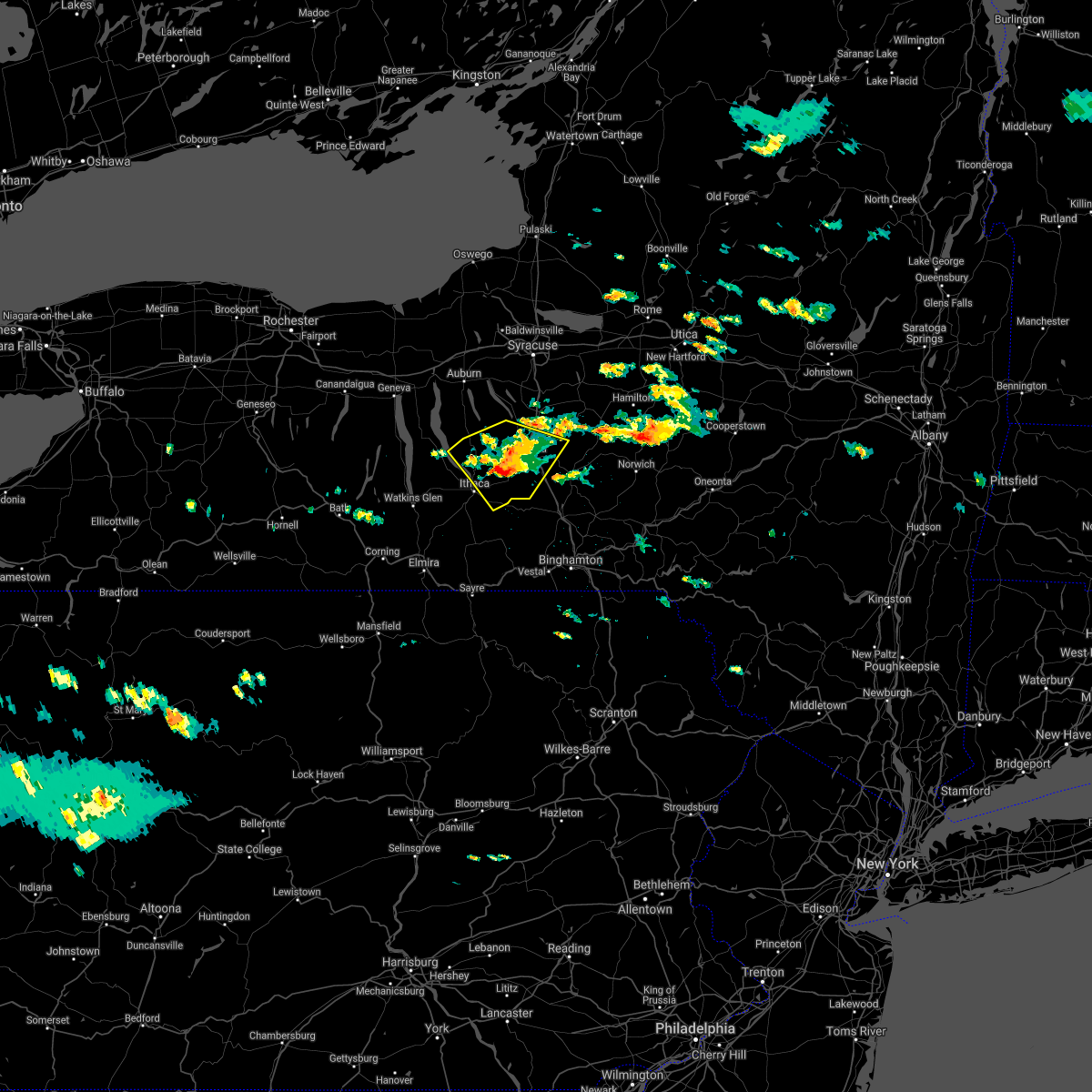 At 129 pm edt, a severe thunderstorm was located over freeville, or 8 miles southwest of cortland, moving southeast at 40 mph (radar indicated). Hazards include 60 mph wind gusts and quarter size hail. Hail damage to vehicles is expected. expect wind damage to roofs, siding, and trees. Locations impacted include, ithaca, cortland, cayuga heights, lansing, homer, virgil, groton, locke, genoa and dryden. At 129 pm edt, a severe thunderstorm was located over freeville, or 8 miles southwest of cortland, moving southeast at 40 mph (radar indicated). Hazards include 60 mph wind gusts and quarter size hail. Hail damage to vehicles is expected. expect wind damage to roofs, siding, and trees. Locations impacted include, ithaca, cortland, cayuga heights, lansing, homer, virgil, groton, locke, genoa and dryden.
|
| 8/25/2020 1:23 PM EDT | Trees and wires down along cobb stree in tompkins county NY, 4.1 miles E of Groton, NY |
| 8/25/2020 1:08 PM EDT |
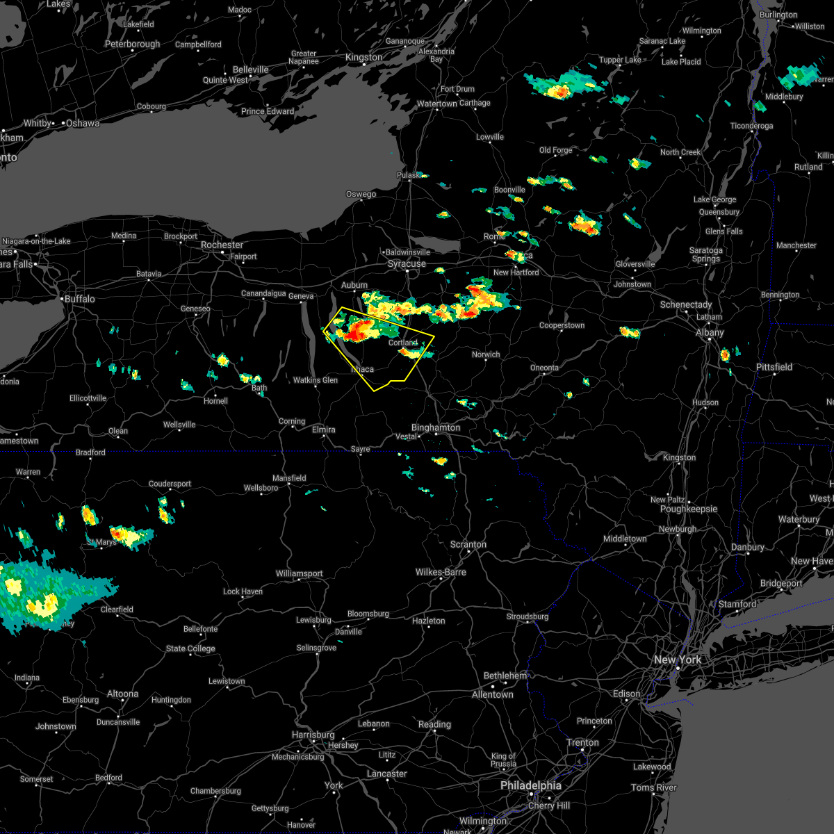 At 107 pm edt, a severe thunderstorm was located over ledyard, or 14 miles southeast of seneca falls, moving southeast at 30 mph (radar indicated). Hazards include 60 mph wind gusts and quarter size hail. Hail damage to vehicles is expected. Expect wind damage to roofs, siding, and trees. At 107 pm edt, a severe thunderstorm was located over ledyard, or 14 miles southeast of seneca falls, moving southeast at 30 mph (radar indicated). Hazards include 60 mph wind gusts and quarter size hail. Hail damage to vehicles is expected. Expect wind damage to roofs, siding, and trees.
|
| 7/19/2020 5:01 PM EDT |
 At 500 pm edt, severe thunderstorms were located along a line extending from near otisco to kelloggsville to near ithaca to near erin to near lowman, moving east at 25 mph. trees have been blown down with this line of thunderstorms (radar indicated). Hazards include 60 mph wind gusts and penny size hail. expect damage to roofs, siding, and trees At 500 pm edt, severe thunderstorms were located along a line extending from near otisco to kelloggsville to near ithaca to near erin to near lowman, moving east at 25 mph. trees have been blown down with this line of thunderstorms (radar indicated). Hazards include 60 mph wind gusts and penny size hail. expect damage to roofs, siding, and trees
|
| 7/19/2020 4:51 PM EDT |
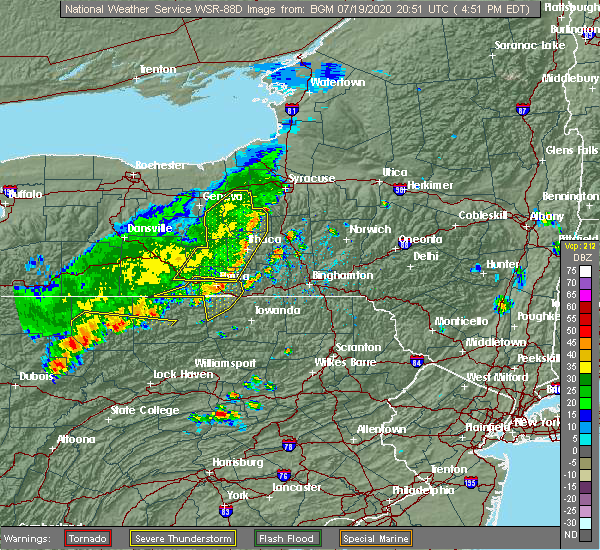 At 449 pm edt, severe thunderstorms were located along a line extending from near marcellus to scipio center to near genoa to cayuta, moving east at 40 mph. trees have been blown down with this line of thunderstorms (law enforcement). Hazards include 60 mph wind gusts and penny size hail. Expect damage to roofs, siding, and trees. Locations impacted include, ithaca, horseheads, newfield, owasco, cayuga heights, lansing, enfield, danby, groton and erin. At 449 pm edt, severe thunderstorms were located along a line extending from near marcellus to scipio center to near genoa to cayuta, moving east at 40 mph. trees have been blown down with this line of thunderstorms (law enforcement). Hazards include 60 mph wind gusts and penny size hail. Expect damage to roofs, siding, and trees. Locations impacted include, ithaca, horseheads, newfield, owasco, cayuga heights, lansing, enfield, danby, groton and erin.
|
| 7/19/2020 4:29 PM EDT |
 At 427 pm edt, severe thunderstorms were located along a line extending from near auburn to romulus to townsendville to near hornby, moving east at 40 mph. trees have been blown down with this line of thunderstorms (law enforcement). Hazards include 60 mph wind gusts and penny size hail. Expect damage to roofs, siding, and trees. Locations impacted include, ithaca, auburn, corning, big flats, seneca falls, horseheads, newfield, hector, romulus and fayette. At 427 pm edt, severe thunderstorms were located along a line extending from near auburn to romulus to townsendville to near hornby, moving east at 40 mph. trees have been blown down with this line of thunderstorms (law enforcement). Hazards include 60 mph wind gusts and penny size hail. Expect damage to roofs, siding, and trees. Locations impacted include, ithaca, auburn, corning, big flats, seneca falls, horseheads, newfield, hector, romulus and fayette.
|
| 7/19/2020 4:14 PM EDT |
 At 411 pm edt, severe thunderstorms were located along a line extending from near lehigh vallley junction to near benton to near himrod to campbell, moving east at 35 mph. trees have been blown down with this line of thunderstorms (law enforcement). Hazards include 60 mph wind gusts and penny size hail. Expect damage to roofs, siding, and trees. Locations impacted include, ithaca, auburn, corning, big flats, seneca falls, horseheads, newfield, waterloo, penn yan and hector. At 411 pm edt, severe thunderstorms were located along a line extending from near lehigh vallley junction to near benton to near himrod to campbell, moving east at 35 mph. trees have been blown down with this line of thunderstorms (law enforcement). Hazards include 60 mph wind gusts and penny size hail. Expect damage to roofs, siding, and trees. Locations impacted include, ithaca, auburn, corning, big flats, seneca falls, horseheads, newfield, waterloo, penn yan and hector.
|
| 7/19/2020 3:56 PM EDT |
 At 354 pm edt, severe thunderstorms were located along a line extending from near phelps to rushville to near branchport to west cameron, moving east at 35 mph. trees have been blown down in steuben county, in howard, with this line of thunderstorms (law enforcement). Hazards include 60 mph wind gusts and penny size hail. expect damage to roofs, siding, and trees At 354 pm edt, severe thunderstorms were located along a line extending from near phelps to rushville to near branchport to west cameron, moving east at 35 mph. trees have been blown down in steuben county, in howard, with this line of thunderstorms (law enforcement). Hazards include 60 mph wind gusts and penny size hail. expect damage to roofs, siding, and trees
|
| 5/15/2020 4:31 PM EDT |
 At 429 pm edt, severe thunderstorms were located along a line extending from near south cortland to near windham, moving east at 60 mph (radar indicated). Hazards include 60 mph wind gusts and quarter size hail. Hail damage to vehicles is expected. expect wind damage to roofs, siding, and trees. Locations impacted include, binghamton, ithaca, vestal, cortland, johnson city, endicott, barton, norwich, kirkwood and conklin. At 429 pm edt, severe thunderstorms were located along a line extending from near south cortland to near windham, moving east at 60 mph (radar indicated). Hazards include 60 mph wind gusts and quarter size hail. Hail damage to vehicles is expected. expect wind damage to roofs, siding, and trees. Locations impacted include, binghamton, ithaca, vestal, cortland, johnson city, endicott, barton, norwich, kirkwood and conklin.
|
| 5/15/2020 4:19 PM EDT |
 At 419 pm edt, severe thunderstorms were located along a line extending from niles to levanna to ledyard to near lodi, moving east at 55 mph (radar indicated). Hazards include 60 mph wind gusts. Expect damage to roofs, siding, and trees. Locations impacted include, cortland, homer, groton, covert, locke, genoa, ledyard, preble, moravia and scott. At 419 pm edt, severe thunderstorms were located along a line extending from niles to levanna to ledyard to near lodi, moving east at 55 mph (radar indicated). Hazards include 60 mph wind gusts. Expect damage to roofs, siding, and trees. Locations impacted include, cortland, homer, groton, covert, locke, genoa, ledyard, preble, moravia and scott.
|
| 5/15/2020 4:17 PM EDT |
 At 417 pm edt, severe thunderstorms were located along a line extending from 6 miles southwest of groton to milan, moving east at 60 mph (radar indicated). Hazards include 60 mph wind gusts and quarter size hail. Hail damage to vehicles is expected. Expect wind damage to roofs, siding, and trees. At 417 pm edt, severe thunderstorms were located along a line extending from 6 miles southwest of groton to milan, moving east at 60 mph (radar indicated). Hazards include 60 mph wind gusts and quarter size hail. Hail damage to vehicles is expected. Expect wind damage to roofs, siding, and trees.
|
| 5/15/2020 4:08 PM EDT |
 At 408 pm edt, severe thunderstorms were located along a line extending from levanna to kendaia to himrod, moving east at 50 mph (radar indicated). Hazards include 60 mph wind gusts and penny size hail. expect damage to roofs, siding, and trees At 408 pm edt, severe thunderstorms were located along a line extending from levanna to kendaia to himrod, moving east at 50 mph (radar indicated). Hazards include 60 mph wind gusts and penny size hail. expect damage to roofs, siding, and trees
|
| 10/31/2019 6:58 PM EDT |
 The severe thunderstorm warning for western madison, southeastern cayuga, northern cortland, southeastern onondaga and northeastern tompkins counties will expire at 700 pm edt, the gusty showers which prompted the warning are moving out of the area. therefore, the warning will be allowed to expire. however, gusty showers will continue in northern cortland and madison counties for another half hour or so. a severe thunderstorm watch remains in effect until 200 am edt for central new york. to report severe weather, contact your nearest law enforcement agency. they will relay your report to the national weather service binghamton. The severe thunderstorm warning for western madison, southeastern cayuga, northern cortland, southeastern onondaga and northeastern tompkins counties will expire at 700 pm edt, the gusty showers which prompted the warning are moving out of the area. therefore, the warning will be allowed to expire. however, gusty showers will continue in northern cortland and madison counties for another half hour or so. a severe thunderstorm watch remains in effect until 200 am edt for central new york. to report severe weather, contact your nearest law enforcement agency. they will relay your report to the national weather service binghamton.
|
| 10/31/2019 6:56 PM EDT |
 The severe thunderstorm warning for southwestern cortland, eastern chemung, northwestern tioga and tompkins counties will expire at 700 pm edt, the gusty showers which prompted the warning have moved out of the area. therefore, the warning will be allowed to expire. however, central and eastern portions of cortland county will continue to have these showers for another half hour or so. a severe thunderstorm watch remains in effect until 200 am edt for central new york, and northeastern pennsylvania. to report severe weather, contact your nearest law enforcement agency. they will relay your report to the national weather service binghamton. The severe thunderstorm warning for southwestern cortland, eastern chemung, northwestern tioga and tompkins counties will expire at 700 pm edt, the gusty showers which prompted the warning have moved out of the area. therefore, the warning will be allowed to expire. however, central and eastern portions of cortland county will continue to have these showers for another half hour or so. a severe thunderstorm watch remains in effect until 200 am edt for central new york, and northeastern pennsylvania. to report severe weather, contact your nearest law enforcement agency. they will relay your report to the national weather service binghamton.
|
| 10/31/2019 6:51 PM EDT |
 At 650 pm edt, gusty showers were located along a line extending from 6 miles southwest of highmarket to pompey, moving northeast at 60 mph. these showers have downed trees in the path of the showers (radar indicated). Hazards include 60 mph wind gusts. Expect damage to roofs, siding, and trees. Locations impacted include, cortland, sullivan, oneida, lenox, pompey, chittenango, canastota, manlius, fayetteville and homer. At 650 pm edt, gusty showers were located along a line extending from 6 miles southwest of highmarket to pompey, moving northeast at 60 mph. these showers have downed trees in the path of the showers (radar indicated). Hazards include 60 mph wind gusts. Expect damage to roofs, siding, and trees. Locations impacted include, cortland, sullivan, oneida, lenox, pompey, chittenango, canastota, manlius, fayetteville and homer.
|
| 10/31/2019 6:41 PM EDT |
 At 639 pm edt, gusty showers were located along a line extending from near groton to near gillett, moving east at 30 mph. these showers have downed trees across steuben county (radar indicated). Hazards include 60 mph wind gusts. Expect damage to roofs, siding, and trees. Locations impacted include, chemung, ithaca, elmira, cortland, southport, newfield, waverly, cayuga heights, lansing and danby. At 639 pm edt, gusty showers were located along a line extending from near groton to near gillett, moving east at 30 mph. these showers have downed trees across steuben county (radar indicated). Hazards include 60 mph wind gusts. Expect damage to roofs, siding, and trees. Locations impacted include, chemung, ithaca, elmira, cortland, southport, newfield, waverly, cayuga heights, lansing and danby.
|
| 10/31/2019 6:27 PM EDT |
 At 626 pm edt, a line of gusty showers located along a line extending from 7 miles northeast of central square to montville, moving northeast at 60 mph. strong winds over 50 mph and tree damage has been reported with this line (radar indicated). Hazards include 60 mph wind gusts. Expect damage to roofs, siding, and trees. Locations impacted include, onondaga, syracuse, clay, cicero, de witt, cortland, sullivan, oneida, lenox and pompey. At 626 pm edt, a line of gusty showers located along a line extending from 7 miles northeast of central square to montville, moving northeast at 60 mph. strong winds over 50 mph and tree damage has been reported with this line (radar indicated). Hazards include 60 mph wind gusts. Expect damage to roofs, siding, and trees. Locations impacted include, onondaga, syracuse, clay, cicero, de witt, cortland, sullivan, oneida, lenox and pompey.
|
| 10/31/2019 6:20 PM EDT |
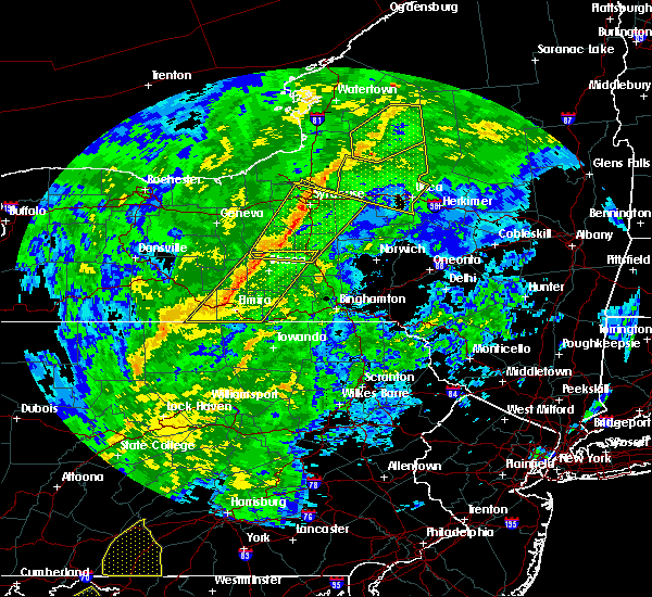 At 619 pm edt, gusty showers were located along a line extending from genoa to near lawrenceville, moving east at 30 mph. trees have been reported down due to wind along this line of showers (radar indicated). Hazards include 60 mph wind gusts. Expect damage to roofs, siding, and trees. Locations impacted include, chemung, ithaca, elmira, cortland, southport, big flats, horseheads, newfield, waverly and elmira heights. At 619 pm edt, gusty showers were located along a line extending from genoa to near lawrenceville, moving east at 30 mph. trees have been reported down due to wind along this line of showers (radar indicated). Hazards include 60 mph wind gusts. Expect damage to roofs, siding, and trees. Locations impacted include, chemung, ithaca, elmira, cortland, southport, big flats, horseheads, newfield, waverly and elmira heights.
|
| 10/31/2019 6:07 PM EDT |
 At 606 pm edt, severe thunderstorms were located along a line extending from near brewerton to near kidders, moving northeast at 60 mph. seek shelter if out trick or treating this evening (radar indicated). Hazards include 60 mph wind gusts. expect damage to roofs, siding, and trees At 606 pm edt, severe thunderstorms were located along a line extending from near brewerton to near kidders, moving northeast at 60 mph. seek shelter if out trick or treating this evening (radar indicated). Hazards include 60 mph wind gusts. expect damage to roofs, siding, and trees
|
| 10/31/2019 5:56 PM EDT |
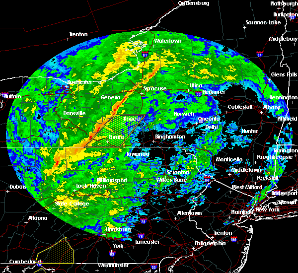 At 556 pm edt, severe thunderstorms were located along a line extending from sheldrake to near elkland, moving east at 35 mph (radar indicated). Hazards include 60 mph wind gusts. expect damage to roofs, siding, and trees At 556 pm edt, severe thunderstorms were located along a line extending from sheldrake to near elkland, moving east at 35 mph (radar indicated). Hazards include 60 mph wind gusts. expect damage to roofs, siding, and trees
|
| 9/4/2019 10:51 AM EDT |
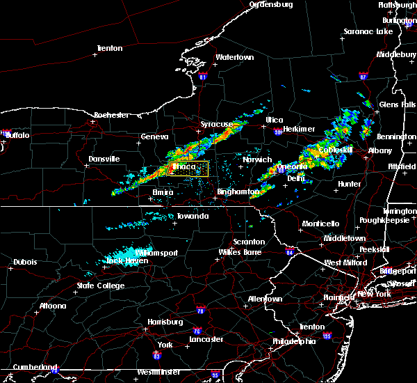 At 1051 am edt, a severe thunderstorm was located near ithaca, moving east at 35 mph (radar indicated). Hazards include 60 mph wind gusts. Expect damage to roofs, siding, and trees. Locations impacted include, ithaca, cortland, cayuga heights, lansing, homer, virgil, groton, dryden, solon and mcgraw. At 1051 am edt, a severe thunderstorm was located near ithaca, moving east at 35 mph (radar indicated). Hazards include 60 mph wind gusts. Expect damage to roofs, siding, and trees. Locations impacted include, ithaca, cortland, cayuga heights, lansing, homer, virgil, groton, dryden, solon and mcgraw.
|
| 9/4/2019 10:34 AM EDT |
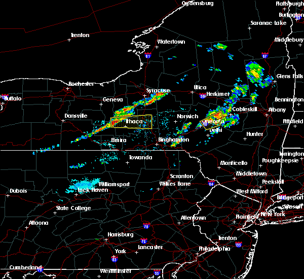 At 1033 am edt, a severe thunderstorm was located over trumansburg, or 10 miles northwest of ithaca, moving east at 30 mph (radar indicated). Hazards include 60 mph wind gusts and quarter size hail. Hail damage to vehicles is expected. Expect wind damage to roofs, siding, and trees. At 1033 am edt, a severe thunderstorm was located over trumansburg, or 10 miles northwest of ithaca, moving east at 30 mph (radar indicated). Hazards include 60 mph wind gusts and quarter size hail. Hail damage to vehicles is expected. Expect wind damage to roofs, siding, and trees.
|
| 8/17/2019 4:39 PM EDT |
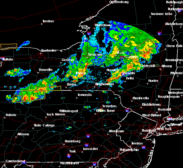 At 437 pm edt, severe thunderstorms were located along a line extending from homer to virgil to harford, moving east at 40 mph (radar indicated). Hazards include 60 mph wind gusts and nickel size hail. Expect damage to roofs, siding, and trees. Locations impacted include, cortland, homer, virgil, groton, dryden, solon, cincinnatus, mcgraw, willet and harford. At 437 pm edt, severe thunderstorms were located along a line extending from homer to virgil to harford, moving east at 40 mph (radar indicated). Hazards include 60 mph wind gusts and nickel size hail. Expect damage to roofs, siding, and trees. Locations impacted include, cortland, homer, virgil, groton, dryden, solon, cincinnatus, mcgraw, willet and harford.
|
| 8/17/2019 4:26 PM EDT |
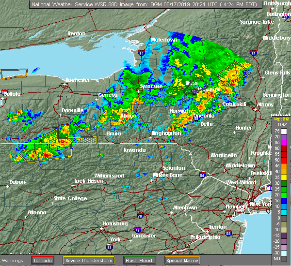 The national weather service in binghamton has issued a * severe thunderstorm warning for. southeastern cayuga county in central new york. cortland county in central new york. northeastern tompkins county in central new york. Until 515 pm edt. The national weather service in binghamton has issued a * severe thunderstorm warning for. southeastern cayuga county in central new york. cortland county in central new york. northeastern tompkins county in central new york. Until 515 pm edt.
|
| 8/8/2019 2:44 PM EDT |
 At 242 pm edt, severe thunderstorms were located along a line extending from near cicero to solon to south danby, moving southeast at 40 mph (law enforcement has reported trees and wires down in the ithaca area). Hazards include 60 mph wind gusts and penny size hail. Expect damage to roofs, siding, and trees. Locations impacted include, onondaga, syracuse, clay, cicero, ithaca, de witt, cortland, pompey, north syracuse and solvay. At 242 pm edt, severe thunderstorms were located along a line extending from near cicero to solon to south danby, moving southeast at 40 mph (law enforcement has reported trees and wires down in the ithaca area). Hazards include 60 mph wind gusts and penny size hail. Expect damage to roofs, siding, and trees. Locations impacted include, onondaga, syracuse, clay, cicero, ithaca, de witt, cortland, pompey, north syracuse and solvay.
|
| 8/8/2019 2:20 PM EDT | Storm damage reported in tompkins county NY, 0.5 miles E of Groton, NY |
| 8/8/2019 1:59 PM EDT |
 At 158 pm edt, severe thunderstorms were located along a line extending from near lysander to near scipio center to glenora, moving northeast at 45 mph (radar indicated). Hazards include 60 mph wind gusts and penny size hail. expect damage to roofs, siding, and trees At 158 pm edt, severe thunderstorms were located along a line extending from near lysander to near scipio center to glenora, moving northeast at 45 mph (radar indicated). Hazards include 60 mph wind gusts and penny size hail. expect damage to roofs, siding, and trees
|
| 7/30/2019 4:40 PM EDT |
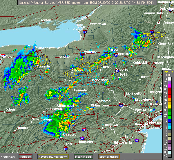 At 439 pm edt, severe thunderstorms were located along a line extending from near south cortland to near virgil, moving northeast at 40 mph (radar indicated). Hazards include 60 mph wind gusts and half dollar size hail. Hail damage to vehicles is expected. expect wind damage to roofs, siding, and trees. Locations impacted include, cortland, homer, virgil, groton, truxton, solon, mcgraw, cuyler, deruyter and taylor. At 439 pm edt, severe thunderstorms were located along a line extending from near south cortland to near virgil, moving northeast at 40 mph (radar indicated). Hazards include 60 mph wind gusts and half dollar size hail. Hail damage to vehicles is expected. expect wind damage to roofs, siding, and trees. Locations impacted include, cortland, homer, virgil, groton, truxton, solon, mcgraw, cuyler, deruyter and taylor.
|
| 7/30/2019 4:32 PM EDT |
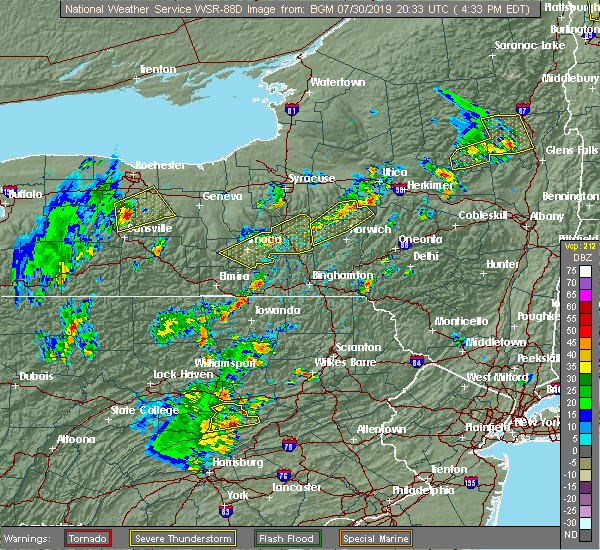 At 432 pm edt, severe thunderstorms were located along a line extending from freeville to near harford, moving northeast at 35 mph (radar indicated). Hazards include 60 mph wind gusts and quarter size hail. Hail damage to vehicles is expected. expect wind damage to roofs, siding, and trees. Locations impacted include, ithaca, cortland, newfield, cayuga heights, lansing, enfield, danby, homer, caroline and virgil. At 432 pm edt, severe thunderstorms were located along a line extending from freeville to near harford, moving northeast at 35 mph (radar indicated). Hazards include 60 mph wind gusts and quarter size hail. Hail damage to vehicles is expected. expect wind damage to roofs, siding, and trees. Locations impacted include, ithaca, cortland, newfield, cayuga heights, lansing, enfield, danby, homer, caroline and virgil.
|
| 7/30/2019 4:04 PM EDT |
 At 404 pm edt, severe thunderstorms were located along a line extending from enfield to danby, moving northeast at 35 mph (radar indicated). Hazards include 60 mph wind gusts and quarter size hail. Hail damage to vehicles is expected. Expect wind damage to roofs, siding, and trees. At 404 pm edt, severe thunderstorms were located along a line extending from enfield to danby, moving northeast at 35 mph (radar indicated). Hazards include 60 mph wind gusts and quarter size hail. Hail damage to vehicles is expected. Expect wind damage to roofs, siding, and trees.
|
| 7/19/2019 7:07 PM EDT |
 The severe thunderstorm warning for southeastern cayuga, northern cortland, southeastern onondaga and northeastern tompkins counties will expire at 715 pm edt, the storm which prompted the warning has weakened below severe limits, and no longer poses an immediate threat to life or property. therefore, the warning will be allowed to expire. however gusty winds and heavy rain are still possible with this thunderstorm. The severe thunderstorm warning for southeastern cayuga, northern cortland, southeastern onondaga and northeastern tompkins counties will expire at 715 pm edt, the storm which prompted the warning has weakened below severe limits, and no longer poses an immediate threat to life or property. therefore, the warning will be allowed to expire. however gusty winds and heavy rain are still possible with this thunderstorm.
|
| 7/19/2019 6:55 PM EDT |
 At 654 pm edt, a severe thunderstorm was located over kelloggsville, or 13 miles northwest of cortland, moving east at 30 mph (radar indicated). Hazards include 60 mph wind gusts. Expect damage to roofs, siding, and trees. Locations impacted include, cortland, homer, groton, locke, genoa, preble, moravia, scott, truxton and solon. At 654 pm edt, a severe thunderstorm was located over kelloggsville, or 13 miles northwest of cortland, moving east at 30 mph (radar indicated). Hazards include 60 mph wind gusts. Expect damage to roofs, siding, and trees. Locations impacted include, cortland, homer, groton, locke, genoa, preble, moravia, scott, truxton and solon.
|
| 7/19/2019 6:31 PM EDT |
 At 631 pm edt, a severe thunderstorm was located near levanna, or 11 miles south of auburn, moving east at 30 mph (radar indicated). Hazards include 60 mph wind gusts and penny size hail. expect damage to roofs, siding, and trees At 631 pm edt, a severe thunderstorm was located near levanna, or 11 miles south of auburn, moving east at 30 mph (radar indicated). Hazards include 60 mph wind gusts and penny size hail. expect damage to roofs, siding, and trees
|
| 6/26/2019 2:55 PM EDT |
 At 255 pm edt, severe thunderstorms were located along a line extending from near east homer to freeville, moving east at 25 mph (radar indicated). Hazards include 60 mph wind gusts and penny size hail. expect damage to roofs, siding, and trees At 255 pm edt, severe thunderstorms were located along a line extending from near east homer to freeville, moving east at 25 mph (radar indicated). Hazards include 60 mph wind gusts and penny size hail. expect damage to roofs, siding, and trees
|
| 6/20/2019 12:53 PM EDT |
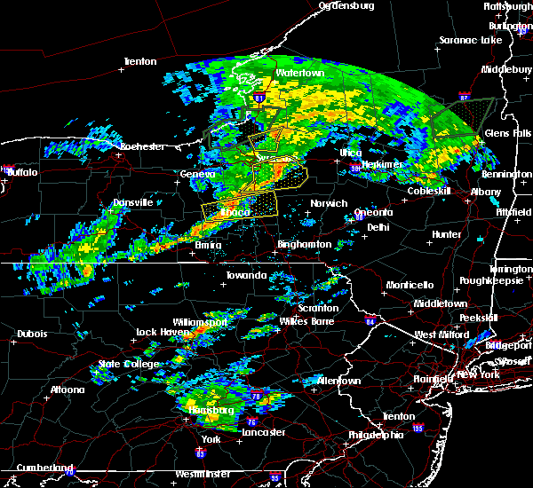 At 1251 pm edt, a severe thunderstorm was located over munsons corners, or near cortland, moving east at 40 mph (radar indicated). Hazards include 60 mph wind gusts. Expect damage to roofs, siding, and trees. Locations impacted include, ithaca, cortland, cayuga heights, lansing, homer, virgil, groton, locke, genoa and dryden. At 1251 pm edt, a severe thunderstorm was located over munsons corners, or near cortland, moving east at 40 mph (radar indicated). Hazards include 60 mph wind gusts. Expect damage to roofs, siding, and trees. Locations impacted include, ithaca, cortland, cayuga heights, lansing, homer, virgil, groton, locke, genoa and dryden.
|
| 6/20/2019 12:27 PM EDT |
 At 1226 pm edt, a severe thunderstorm was located over taughannock falls, or 8 miles northwest of ithaca, moving east at 40 mph (law enforcement). Hazards include 60 mph wind gusts. expect damage to roofs, siding, and trees At 1226 pm edt, a severe thunderstorm was located over taughannock falls, or 8 miles northwest of ithaca, moving east at 40 mph (law enforcement). Hazards include 60 mph wind gusts. expect damage to roofs, siding, and trees
|
| 9/21/2018 8:10 PM EDT |
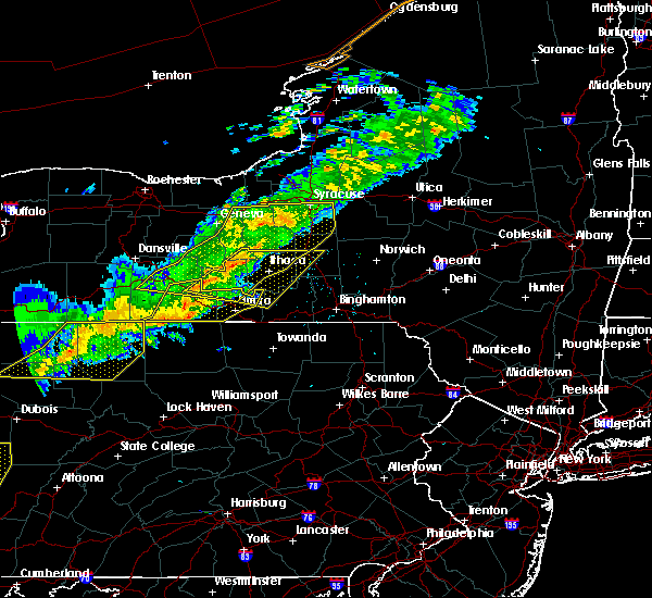 The national weather service in binghamton has issued a * severe thunderstorm warning for. southeastern seneca county in central new york. schuyler county in central new york. northern chemung county in central new york. Southwestern cortland county in central new york. The national weather service in binghamton has issued a * severe thunderstorm warning for. southeastern seneca county in central new york. schuyler county in central new york. northern chemung county in central new york. Southwestern cortland county in central new york.
|
| 9/21/2018 7:40 PM EDT |
 At 739 pm edt, severe thunderstorms were located along a line extending from near lehigh vallley junction to near canoga to near dresden to bluff point to near pulteney to near avoca to howard, moving east at 55 mph (radar indicated). Hazards include 60 mph wind gusts. Expect damage to roofs, siding, and trees. severe thunderstorms will be near, seneca falls, romulus and montezuma around 745 pm edt. auburn, sennett and ovid around 750 pm edt. dundee, starkey and fleming around 755 pm edt. hector, owasco and campbell around 800 pm edt. covert, genoa and marcellus around 805 pm edt. watkins glen, locke and moravia around 810 pm edt. Ithaca, montour falls and odessa around 815 pm edt. At 739 pm edt, severe thunderstorms were located along a line extending from near lehigh vallley junction to near canoga to near dresden to bluff point to near pulteney to near avoca to howard, moving east at 55 mph (radar indicated). Hazards include 60 mph wind gusts. Expect damage to roofs, siding, and trees. severe thunderstorms will be near, seneca falls, romulus and montezuma around 745 pm edt. auburn, sennett and ovid around 750 pm edt. dundee, starkey and fleming around 755 pm edt. hector, owasco and campbell around 800 pm edt. covert, genoa and marcellus around 805 pm edt. watkins glen, locke and moravia around 810 pm edt. Ithaca, montour falls and odessa around 815 pm edt.
|
| 7/25/2018 6:21 PM EDT |
 At 621 pm edt, severe thunderstorms were located along a line extending from near sempronius to besemer, moving east at 25 mph (radar indicated). Hazards include 60 mph wind gusts. Expect damage to roofs, siding, and trees. These severe storms will be near, caroline, dryden and preble around 630 pm edt. At 621 pm edt, severe thunderstorms were located along a line extending from near sempronius to besemer, moving east at 25 mph (radar indicated). Hazards include 60 mph wind gusts. Expect damage to roofs, siding, and trees. These severe storms will be near, caroline, dryden and preble around 630 pm edt.
|
| 7/25/2018 5:52 PM EDT |
 At 551 pm edt, severe thunderstorms were located along a line extending from scipio center to enfield, moving east at 25 mph (radar indicated). Hazards include 60 mph wind gusts. Expect damage to roofs, siding, and trees. severe thunderstorms will be near, casowasco and scipio center around 555 pm edt. owasco and cascade around 600 pm edt. ithaca, locke and moravia around 605 pm edt. danby around 610 pm edt. sempronius and kelloggsville around 615 pm edt. besemer and brooktondale around 620 pm edt. freeville and slaterville springs around 625 pm edt. Caroline, dryden and preble around 630 pm edt. At 551 pm edt, severe thunderstorms were located along a line extending from scipio center to enfield, moving east at 25 mph (radar indicated). Hazards include 60 mph wind gusts. Expect damage to roofs, siding, and trees. severe thunderstorms will be near, casowasco and scipio center around 555 pm edt. owasco and cascade around 600 pm edt. ithaca, locke and moravia around 605 pm edt. danby around 610 pm edt. sempronius and kelloggsville around 615 pm edt. besemer and brooktondale around 620 pm edt. freeville and slaterville springs around 625 pm edt. Caroline, dryden and preble around 630 pm edt.
|
| 7/16/2018 9:39 PM EDT |
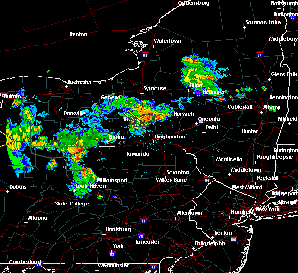 The severe thunderstorm warning for south central cayuga and northeastern tompkins counties will expire at 945 pm edt, the storm which prompted the warning has weakened below severe limits, and has exited the warned area. therefore, the warning will be allowed to expire. The severe thunderstorm warning for south central cayuga and northeastern tompkins counties will expire at 945 pm edt, the storm which prompted the warning has weakened below severe limits, and has exited the warned area. therefore, the warning will be allowed to expire.
|
| 7/16/2018 9:24 PM EDT |
 At 923 pm edt, a severe thunderstorm was located near groton, or 7 miles northeast of ithaca, moving northeast at 15 mph (radar indicated). Hazards include 60 mph wind gusts. Some trees and wires downed due to wind. This severe storm will be near, groton and locke around 945 pm edt. At 923 pm edt, a severe thunderstorm was located near groton, or 7 miles northeast of ithaca, moving northeast at 15 mph (radar indicated). Hazards include 60 mph wind gusts. Some trees and wires downed due to wind. This severe storm will be near, groton and locke around 945 pm edt.
|
| 7/16/2018 9:08 PM EDT |
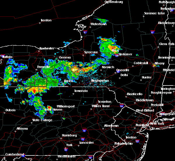 At 908 pm edt, a severe thunderstorm was located near ithaca, moving northeast at 15 mph (radar indicated). Hazards include 60 mph wind gusts. Some downed trees and wires due to wind. this severe storm will be near, freeville around 935 pm edt. Groton and locke around 945 pm edt. At 908 pm edt, a severe thunderstorm was located near ithaca, moving northeast at 15 mph (radar indicated). Hazards include 60 mph wind gusts. Some downed trees and wires due to wind. this severe storm will be near, freeville around 935 pm edt. Groton and locke around 945 pm edt.
|
| 7/16/2018 8:40 PM EDT |
 At 839 pm edt, a severe thunderstorm was located over enfield, or near ithaca, moving northeast at 15 mph (radar indicated). Hazards include 60 mph wind gusts. Some downed trees and wires due to wind. this severe thunderstorm will be near, ithaca and taughannock falls around 855 pm edt. freeville around 935 pm edt. Groton and locke around 945 pm edt. At 839 pm edt, a severe thunderstorm was located over enfield, or near ithaca, moving northeast at 15 mph (radar indicated). Hazards include 60 mph wind gusts. Some downed trees and wires due to wind. this severe thunderstorm will be near, ithaca and taughannock falls around 855 pm edt. freeville around 935 pm edt. Groton and locke around 945 pm edt.
|
| 7/16/2018 7:57 PM EDT |
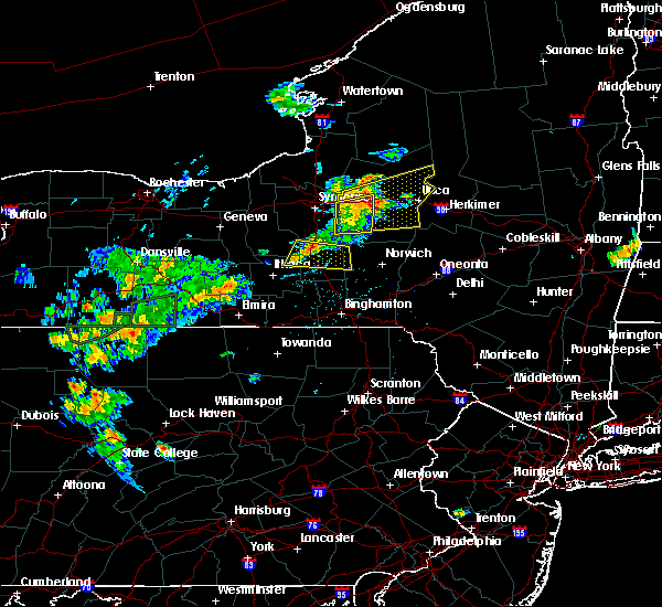 At 756 pm edt, a severe thunderstorm was located over homer, or near cortland, moving east at 15 mph (radar indicated). Hazards include 60 mph wind gusts. Expect some downed trees and wires due to wind. this severe thunderstorm will be near, cortland around 805 pm edt. preble around 810 pm edt. east homer around 815 pm edt. mcgraw around 820 pm edt. truxton around 830 pm edt. solon around 835 pm edt. Pitcher and taylor around 900 pm edt. At 756 pm edt, a severe thunderstorm was located over homer, or near cortland, moving east at 15 mph (radar indicated). Hazards include 60 mph wind gusts. Expect some downed trees and wires due to wind. this severe thunderstorm will be near, cortland around 805 pm edt. preble around 810 pm edt. east homer around 815 pm edt. mcgraw around 820 pm edt. truxton around 830 pm edt. solon around 835 pm edt. Pitcher and taylor around 900 pm edt.
|
| 6/13/2018 7:53 PM EDT | Mping report 3-inch tree limbs... power poles broken in tompkins county NY, 0.9 miles NW of Groton, NY |
| 5/28/2018 3:02 PM EDT |
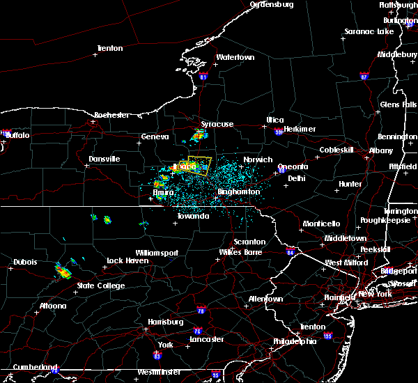 At 301 pm edt, a severe thunderstorm was located near groton, or near cortland, moving east at 15 mph (radar indicated). Hazards include 60 mph wind gusts and half dollar size hail. Hail damage to vehicles is expected. expect wind damage to roofs, siding, and trees. this severe storm will be near, dryden around 310 pm edt. south cortland around 320 pm edt. homer and munsons corners around 325 pm edt. cortland and virgil around 330 pm edt. east homer around 340 pm edt. Solon and mcgraw around 345 pm edt. At 301 pm edt, a severe thunderstorm was located near groton, or near cortland, moving east at 15 mph (radar indicated). Hazards include 60 mph wind gusts and half dollar size hail. Hail damage to vehicles is expected. expect wind damage to roofs, siding, and trees. this severe storm will be near, dryden around 310 pm edt. south cortland around 320 pm edt. homer and munsons corners around 325 pm edt. cortland and virgil around 330 pm edt. east homer around 340 pm edt. Solon and mcgraw around 345 pm edt.
|
| 5/28/2018 2:39 PM EDT |
 At 238 pm edt, a severe thunderstorm was located near groton, or 12 miles west of cortland, moving east at 15 mph (radar indicated). Hazards include 60 mph wind gusts and half dollar size hail. Hail damage to vehicles is expected. expect wind damage to roofs, siding, and trees. this severe thunderstorm will be near, groton around 250 pm edt. freeville around 300 pm edt. dryden around 310 pm edt. south cortland around 320 pm edt. homer and munsons corners around 325 pm edt. cortland and virgil around 330 pm edt. east homer around 340 pm edt. Marathon, solon and mcgraw around 345 pm edt. At 238 pm edt, a severe thunderstorm was located near groton, or 12 miles west of cortland, moving east at 15 mph (radar indicated). Hazards include 60 mph wind gusts and half dollar size hail. Hail damage to vehicles is expected. expect wind damage to roofs, siding, and trees. this severe thunderstorm will be near, groton around 250 pm edt. freeville around 300 pm edt. dryden around 310 pm edt. south cortland around 320 pm edt. homer and munsons corners around 325 pm edt. cortland and virgil around 330 pm edt. east homer around 340 pm edt. Marathon, solon and mcgraw around 345 pm edt.
|
| 5/4/2018 6:20 PM EDT |
 At 619 pm edt, severe thunderstorms were located along a line extending from near cazenovia to near truxton to homer to newfield, moving east at 50 mph (radar indicated). Hazards include 60 mph wind gusts. Expect damage to trees, and power lines. these severe storms will be near, cazenovia, nelson and cuyler around 625 pm edt. Caroline, morrisville and stockbridge around 630 pm edt. At 619 pm edt, severe thunderstorms were located along a line extending from near cazenovia to near truxton to homer to newfield, moving east at 50 mph (radar indicated). Hazards include 60 mph wind gusts. Expect damage to trees, and power lines. these severe storms will be near, cazenovia, nelson and cuyler around 625 pm edt. Caroline, morrisville and stockbridge around 630 pm edt.
|
| 5/4/2018 5:49 PM EDT |
 At 548 pm edt, severe thunderstorms were located along a line extending from near syracuse to kelloggsville to near genoa to near reading center, moving east at 75 mph (radar indicated). Hazards include 60 mph wind gusts. Expect damage to trees, and power lines. severe thunderstorms will be near, pompey, manlius and otisco around 555 pm edt. chittenango, cazenovia and preble around 600 pm edt. cortland, newfield and enfield around 605 pm edt. ithaca, danby and morrisville around 610 pm edt. hamilton, caroline and stockbridge around 615 pm edt. berkshire, lebanon and richford around 620 pm edt. nanticoke, waterville and sherburne around 625 pm edt. norwich, marathon and brookfield around 630 pm edt. A tornado watch remains in effect until 1000 pm edt for central new york. At 548 pm edt, severe thunderstorms were located along a line extending from near syracuse to kelloggsville to near genoa to near reading center, moving east at 75 mph (radar indicated). Hazards include 60 mph wind gusts. Expect damage to trees, and power lines. severe thunderstorms will be near, pompey, manlius and otisco around 555 pm edt. chittenango, cazenovia and preble around 600 pm edt. cortland, newfield and enfield around 605 pm edt. ithaca, danby and morrisville around 610 pm edt. hamilton, caroline and stockbridge around 615 pm edt. berkshire, lebanon and richford around 620 pm edt. nanticoke, waterville and sherburne around 625 pm edt. norwich, marathon and brookfield around 630 pm edt. A tornado watch remains in effect until 1000 pm edt for central new york.
|
| 10/15/2017 6:39 PM EDT |
 The national weather service in binghamton has issued a * severe thunderstorm warning for. southeastern seneca county in central new york. northeastern schuyler county in central new york. southern madison county in central new york. Southern cayuga county in central new york. The national weather service in binghamton has issued a * severe thunderstorm warning for. southeastern seneca county in central new york. northeastern schuyler county in central new york. southern madison county in central new york. Southern cayuga county in central new york.
|
| 8/22/2017 5:45 PM EDT |
 At 545 pm edt, severe thunderstorms were located along a line extending from near otisco to near freeville, moving east at 45 mph (radar indicated). Hazards include 60 mph wind gusts. Expect damage to trees, and power lines. these severe storms will be near, otisco, preble and tully around 550 pm edt. cortland, marathon and virgil around 600 pm edt. A tornado watch remains in effect until 900 pm edt for central new york. At 545 pm edt, severe thunderstorms were located along a line extending from near otisco to near freeville, moving east at 45 mph (radar indicated). Hazards include 60 mph wind gusts. Expect damage to trees, and power lines. these severe storms will be near, otisco, preble and tully around 550 pm edt. cortland, marathon and virgil around 600 pm edt. A tornado watch remains in effect until 900 pm edt for central new york.
|
| 8/22/2017 5:21 PM EDT |
 At 521 pm edt, severe thunderstorms were located along a line extending from scipio center to mecklenburg, moving east at 45 mph (radar indicated). Hazards include 60 mph wind gusts. Expect damage to trees, and power lines. severe thunderstorms will be near, moravia, casowasco and cascade around 525 pm edt. owasco, niles and montville around 530 pm edt. ithaca, sempronius and kelloggsville around 535 pm edt. scott and besemer around 540 pm edt. otisco, groton and preble around 545 pm edt. dryden and tully around 550 pm edt. virgil, harford and south cortland around 555 pm edt. cortland, marathon and mcgraw around 600 pm edt. A tornado watch remains in effect until 900 pm edt for central new york. At 521 pm edt, severe thunderstorms were located along a line extending from scipio center to mecklenburg, moving east at 45 mph (radar indicated). Hazards include 60 mph wind gusts. Expect damage to trees, and power lines. severe thunderstorms will be near, moravia, casowasco and cascade around 525 pm edt. owasco, niles and montville around 530 pm edt. ithaca, sempronius and kelloggsville around 535 pm edt. scott and besemer around 540 pm edt. otisco, groton and preble around 545 pm edt. dryden and tully around 550 pm edt. virgil, harford and south cortland around 555 pm edt. cortland, marathon and mcgraw around 600 pm edt. A tornado watch remains in effect until 900 pm edt for central new york.
|
| 7/17/2017 12:30 PM EDT |
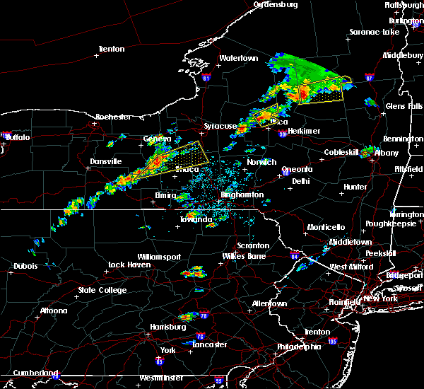 At 1229 pm edt, a severe thunderstorm was located over kidders, or 15 miles northwest of ithaca, moving northeast at 25 mph (radar indicated). Hazards include 60 mph wind gusts, quarter size hail and very heavy rain. Minor hail damage to vehicles is possible. expect wind to cause damage to trees, and power lines. this severe thunderstorm will be near, king ferry around 1235 pm edt. ledyard around 1240 pm edt. genoa around 1245 pm edt. venice center around 1250 pm edt. locke and scipio center around 1255 pm edt. moravia, cascade and casowasco around 100 pm edt. montville around 105 pm edt. Niles around 110 pm edt. At 1229 pm edt, a severe thunderstorm was located over kidders, or 15 miles northwest of ithaca, moving northeast at 25 mph (radar indicated). Hazards include 60 mph wind gusts, quarter size hail and very heavy rain. Minor hail damage to vehicles is possible. expect wind to cause damage to trees, and power lines. this severe thunderstorm will be near, king ferry around 1235 pm edt. ledyard around 1240 pm edt. genoa around 1245 pm edt. venice center around 1250 pm edt. locke and scipio center around 1255 pm edt. moravia, cascade and casowasco around 100 pm edt. montville around 105 pm edt. Niles around 110 pm edt.
|
| 7/1/2017 1:50 PM EDT |
 At 150 pm edt, a severe thunderstorm was located over kendaia, or 10 miles northeast of penn yan, moving east at 30 mph (radar indicated). Hazards include 60 mph wind gusts. Expect damage to trees, and power lines. this severe thunderstorm will be near, aurora and interlaken around 205 pm edt. levanna, sheldrake and kidders around 210 pm edt. ledyard and king ferry around 215 pm edt. venice center around 220 pm edt. genoa and scipio center around 225 pm edt. cascade and casowasco around 230 pm edt. owasco, locke and moravia around 235 pm edt. Niles and montville around 240 pm edt. At 150 pm edt, a severe thunderstorm was located over kendaia, or 10 miles northeast of penn yan, moving east at 30 mph (radar indicated). Hazards include 60 mph wind gusts. Expect damage to trees, and power lines. this severe thunderstorm will be near, aurora and interlaken around 205 pm edt. levanna, sheldrake and kidders around 210 pm edt. ledyard and king ferry around 215 pm edt. venice center around 220 pm edt. genoa and scipio center around 225 pm edt. cascade and casowasco around 230 pm edt. owasco, locke and moravia around 235 pm edt. Niles and montville around 240 pm edt.
|
| 6/18/2017 7:55 PM EDT |
 At 755 pm edt, severe thunderstorms were located along a line extending from near covert to near ithaca to newfield to near cayuta, moving northeast at 40 mph (radar indicated). Hazards include 60 mph wind gusts. Expect damage to trees, and power lines. severe thunderstorms will be near, ledyard and king ferry around 800 pm edt. ithaca and genoa around 805 pm edt. groton, locke and venice center around 810 pm edt. moravia, montville and cascade around 815 pm edt. dryden, niles and sempronius around 820 pm edt. homer, caroline and scott around 825 pm edt. preble, harford and south cortland around 830 pm edt. Cortland, otisco and truxton around 835 pm edt. At 755 pm edt, severe thunderstorms were located along a line extending from near covert to near ithaca to newfield to near cayuta, moving northeast at 40 mph (radar indicated). Hazards include 60 mph wind gusts. Expect damage to trees, and power lines. severe thunderstorms will be near, ledyard and king ferry around 800 pm edt. ithaca and genoa around 805 pm edt. groton, locke and venice center around 810 pm edt. moravia, montville and cascade around 815 pm edt. dryden, niles and sempronius around 820 pm edt. homer, caroline and scott around 825 pm edt. preble, harford and south cortland around 830 pm edt. Cortland, otisco and truxton around 835 pm edt.
|
| 6/18/2017 6:57 PM EDT |
 The national weather service in binghamton has issued a * severe thunderstorm warning for. southern seneca county in central new york. northern schuyler county in central new york. eastern yates county in central new york. Cayuga county in central new york. The national weather service in binghamton has issued a * severe thunderstorm warning for. southern seneca county in central new york. northern schuyler county in central new york. eastern yates county in central new york. Cayuga county in central new york.
|
| 6/18/2017 6:57 PM EDT |
 At 656 pm edt, severe thunderstorms were located along a line extending from near dresden to caywood to rock stream, moving east at 40 mph (radar indicated). Hazards include 60 mph wind gusts and penny size hail. Expect damage to trees, and power lines. severe thunderstorms will be near, lodi, caywood and lodi station around 700 pm edt. ovid, willard and townsendville around 705 pm edt. romulus, interlaken and reynoldsville around 710 pm edt. searsburg, kidders and sheldrake around 715 pm edt. covert, ledyard and trumansburg around 720 pm edt. genoa and taughannock falls around 725 pm edt. scipio center and venice center around 730 pm edt. Fleming, moravia and casowasco around 735 pm edt. At 656 pm edt, severe thunderstorms were located along a line extending from near dresden to caywood to rock stream, moving east at 40 mph (radar indicated). Hazards include 60 mph wind gusts and penny size hail. Expect damage to trees, and power lines. severe thunderstorms will be near, lodi, caywood and lodi station around 700 pm edt. ovid, willard and townsendville around 705 pm edt. romulus, interlaken and reynoldsville around 710 pm edt. searsburg, kidders and sheldrake around 715 pm edt. covert, ledyard and trumansburg around 720 pm edt. genoa and taughannock falls around 725 pm edt. scipio center and venice center around 730 pm edt. Fleming, moravia and casowasco around 735 pm edt.
|
| 5/18/2017 5:53 PM EDT |
 At 553 pm edt, a severe thunderstorm was located near taughannock falls, or near ithaca, moving northeast at 40 mph (radar indicated). Hazards include 60 mph wind gusts and quarter size hail. Hail damage to vehicles is expected. expect wind damage to roofs, siding, and trees. this severe thunderstorm will be near, dryden and freeville around 605 pm edt. groton around 610 pm edt. virgil and south cortland around 615 pm edt. cortland and munsons corners around 620 pm edt. homer, scott and mcgraw around 625 pm edt. preble, solon and east homer around 630 pm edt. truxton and tully around 635 pm edt. Cuyler around 640 pm edt. At 553 pm edt, a severe thunderstorm was located near taughannock falls, or near ithaca, moving northeast at 40 mph (radar indicated). Hazards include 60 mph wind gusts and quarter size hail. Hail damage to vehicles is expected. expect wind damage to roofs, siding, and trees. this severe thunderstorm will be near, dryden and freeville around 605 pm edt. groton around 610 pm edt. virgil and south cortland around 615 pm edt. cortland and munsons corners around 620 pm edt. homer, scott and mcgraw around 625 pm edt. preble, solon and east homer around 630 pm edt. truxton and tully around 635 pm edt. Cuyler around 640 pm edt.
|
| 5/1/2017 6:38 PM EDT |
 At 637 pm edt, severe thunderstorms were located along a line extending from near marcellus to near groton, moving northeast at 65 mph. these are very dangerous storms (radar indicated). Hazards include 80 mph wind gusts and penny size hail. Flying debris will be dangerous to those caught without shelter. mobile homes will be heavily damaged. expect considerable damage to roofs, windows, and vehicles. extensive tree damage and power outages are likely. these severe storms will be near, syracuse, truxton and tully around 650 pm edt. A tornado watch remains in effect until 1000 pm edt for central new york. At 637 pm edt, severe thunderstorms were located along a line extending from near marcellus to near groton, moving northeast at 65 mph. these are very dangerous storms (radar indicated). Hazards include 80 mph wind gusts and penny size hail. Flying debris will be dangerous to those caught without shelter. mobile homes will be heavily damaged. expect considerable damage to roofs, windows, and vehicles. extensive tree damage and power outages are likely. these severe storms will be near, syracuse, truxton and tully around 650 pm edt. A tornado watch remains in effect until 1000 pm edt for central new york.
|
| 5/1/2017 6:20 PM EDT |
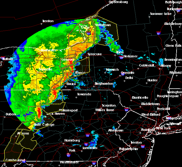 At 619 pm edt, severe thunderstorms were located along a line extending from near levanna to enfield, moving northeast at 45 mph (radar indicated). Hazards include 70 mph wind gusts and penny size hail. Expect considerable tree damage. damage is likely to mobile homes, roofs, and outbuildings. severe thunderstorms will be near, scipio center, casowasco and venice center around 625 pm edt. owasco around 630 pm edt. niles around 635 pm edt. groton, dryden and freeville around 640 pm edt. locke, montville and south cortland around 645 pm edt. sempronius and munsons corners around 650 pm edt. cortland, homer and scott around 655 pm edt. syracuse, preble and tully around 700 pm edt. A tornado watch remains in effect until 1000 pm edt for central new york. At 619 pm edt, severe thunderstorms were located along a line extending from near levanna to enfield, moving northeast at 45 mph (radar indicated). Hazards include 70 mph wind gusts and penny size hail. Expect considerable tree damage. damage is likely to mobile homes, roofs, and outbuildings. severe thunderstorms will be near, scipio center, casowasco and venice center around 625 pm edt. owasco around 630 pm edt. niles around 635 pm edt. groton, dryden and freeville around 640 pm edt. locke, montville and south cortland around 645 pm edt. sempronius and munsons corners around 650 pm edt. cortland, homer and scott around 655 pm edt. syracuse, preble and tully around 700 pm edt. A tornado watch remains in effect until 1000 pm edt for central new york.
|
| 5/1/2017 6:14 PM EDT |
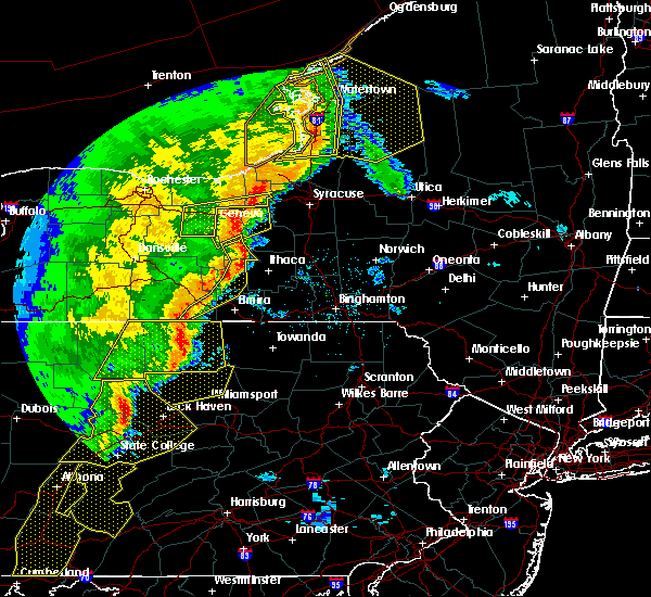 At 613 pm edt, severe thunderstorms were located along a line extending from aurora to near enfield, moving northeast at 45 mph (radar indicated). Hazards include 70 mph wind gusts and penny size hail. Expect considerable tree damage. damage is likely to mobile homes, roofs, and outbuildings. severe thunderstorms will be near, ledyard, aurora and levanna around 620 pm edt. scipio center, casowasco and cascade around 625 pm edt. owasco and niles around 630 pm edt. freeville around 635 pm edt. groton and dryden around 640 pm edt. locke, montville and south cortland around 645 pm edt. cortland, sempronius and munsons corners around 650 pm edt. homer and scott around 655 pm edt. A tornado watch remains in effect until 1000 pm edt for central new york. At 613 pm edt, severe thunderstorms were located along a line extending from aurora to near enfield, moving northeast at 45 mph (radar indicated). Hazards include 70 mph wind gusts and penny size hail. Expect considerable tree damage. damage is likely to mobile homes, roofs, and outbuildings. severe thunderstorms will be near, ledyard, aurora and levanna around 620 pm edt. scipio center, casowasco and cascade around 625 pm edt. owasco and niles around 630 pm edt. freeville around 635 pm edt. groton and dryden around 640 pm edt. locke, montville and south cortland around 645 pm edt. cortland, sempronius and munsons corners around 650 pm edt. homer and scott around 655 pm edt. A tornado watch remains in effect until 1000 pm edt for central new york.
|
| 4/16/2017 3:38 PM EDT | Small trees and branches on peruville r in tompkins county NY, 2.8 miles N of Groton, NY |
| 7/18/2016 4:43 PM EDT |
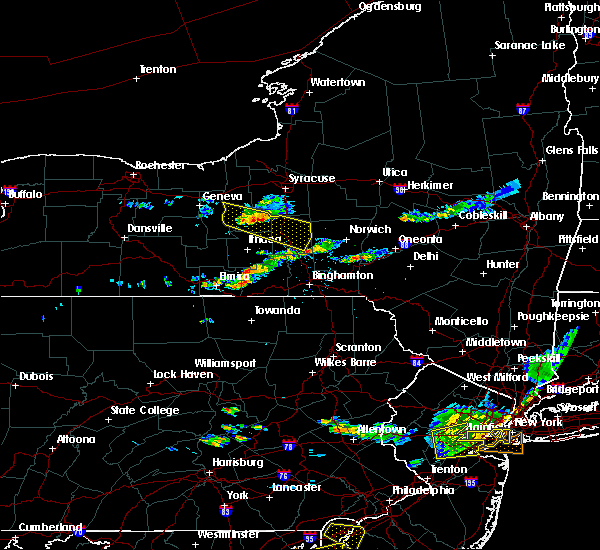 At 442 pm edt, a severe thunderstorm was located over montville, or 13 miles northwest of cortland, moving southeast at 35 mph (radar indicated). Hazards include 60 mph wind gusts and penny size hail. Expect damage to roofs. siding. and trees. this severe storm will be near, sempronius around 445 pm edt. groton around 450 pm edt. scott around 455 pm edt. homer, preble and south cortland around 500 pm edt. cortland, east homer and munsons corners around 505 pm edt. truxton and mcgraw around 510 pm edt. Solon, taylor and east freetown around 515 pm edt. At 442 pm edt, a severe thunderstorm was located over montville, or 13 miles northwest of cortland, moving southeast at 35 mph (radar indicated). Hazards include 60 mph wind gusts and penny size hail. Expect damage to roofs. siding. and trees. this severe storm will be near, sempronius around 445 pm edt. groton around 450 pm edt. scott around 455 pm edt. homer, preble and south cortland around 500 pm edt. cortland, east homer and munsons corners around 505 pm edt. truxton and mcgraw around 510 pm edt. Solon, taylor and east freetown around 515 pm edt.
|
| 7/18/2016 4:21 PM EDT |
 At 420 pm edt, a severe thunderstorm was located near scipio center, or 9 miles south of auburn, moving southeast at 35 mph (radar indicated). Hazards include 60 mph wind gusts and penny size hail. Expect damage to roofs. siding. and trees. this severe thunderstorm will be near, scipio center around 425 pm edt. genoa, casowasco and venice center around 430 pm edt. moravia, niles and cascade around 435 pm edt. locke, montville and kelloggsville around 440 pm edt. sempronius around 445 pm edt. groton around 450 pm edt. scott around 455 pm edt. Homer, preble and south cortland around 500 pm edt. At 420 pm edt, a severe thunderstorm was located near scipio center, or 9 miles south of auburn, moving southeast at 35 mph (radar indicated). Hazards include 60 mph wind gusts and penny size hail. Expect damage to roofs. siding. and trees. this severe thunderstorm will be near, scipio center around 425 pm edt. genoa, casowasco and venice center around 430 pm edt. moravia, niles and cascade around 435 pm edt. locke, montville and kelloggsville around 440 pm edt. sempronius around 445 pm edt. groton around 450 pm edt. scott around 455 pm edt. Homer, preble and south cortland around 500 pm edt.
|
| 6/12/2015 6:47 PM EDT |
 The national weather service in binghamton has issued a * severe thunderstorm warning for. tompkins county in central new york. eastern schuyler county in central new york. southeastern seneca county in central new york. Until 745 pm edt. The national weather service in binghamton has issued a * severe thunderstorm warning for. tompkins county in central new york. eastern schuyler county in central new york. southeastern seneca county in central new york. Until 745 pm edt.
|
| 6/10/2015 11:43 PM EDT | The tornado warning for north central tompkins, southeastern seneca and southern cayuga counties will expire at 1145 pm edt, the thunderstorm which prompted the tornado warning has moved out of the warned area, therefore the tornado warning will be allowed to expire. the tornado warning has been replaced by a new severe thunderstorm warning further east, including northeastern tompkins county. a severe thunderstorm watch remains in effect until 100 am edt for central new york. |
| 6/10/2015 11:38 PM EDT |
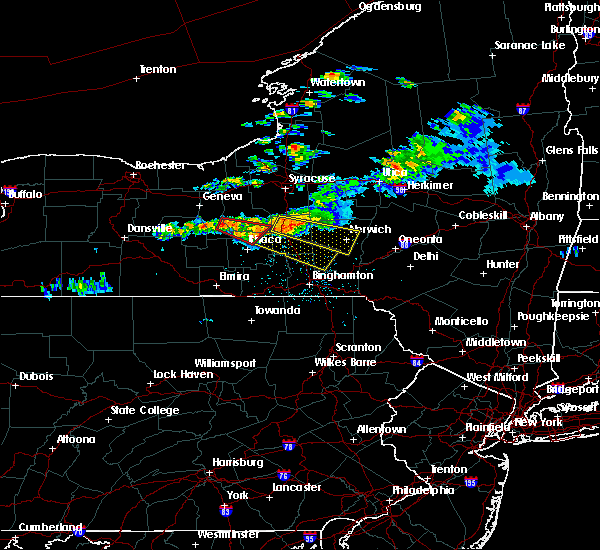 At 1138 pm edt, a severe thunderstorm was located near groton, or near cortland, moving east at 40 mph (radar indicated). Hazards include 70 mph wind gusts and quarter size hail. Hail damage to vehicles is expected. expect considerable tree damage. wind damage is also likely to mobile homes, roofs and outbuildings. this severe thunderstorm will be near, munsons corners around 1145 pm edt. cortland and virgil around 1150 pm edt. marathon around 1200 am edt. willet around 1210 am edt. smithville flats around 1220 am edt. Brisben around 1230 am edt. At 1138 pm edt, a severe thunderstorm was located near groton, or near cortland, moving east at 40 mph (radar indicated). Hazards include 70 mph wind gusts and quarter size hail. Hail damage to vehicles is expected. expect considerable tree damage. wind damage is also likely to mobile homes, roofs and outbuildings. this severe thunderstorm will be near, munsons corners around 1145 pm edt. cortland and virgil around 1150 pm edt. marathon around 1200 am edt. willet around 1210 am edt. smithville flats around 1220 am edt. Brisben around 1230 am edt.
|
| 6/10/2015 11:12 PM EDT |
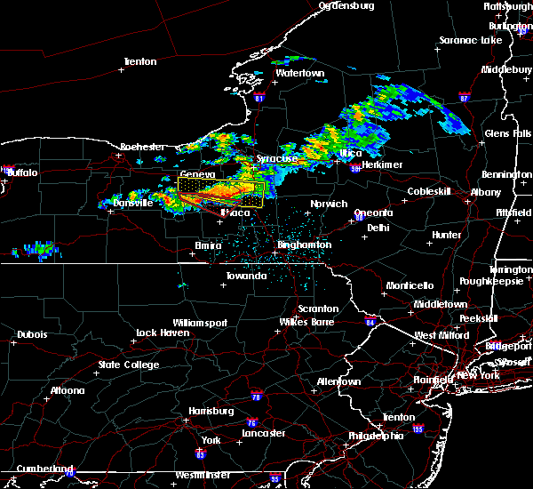 At 1112 pm edt, a severe thunderstorm capable of producing a tornado was located over king ferry, or 17 miles northwest of ithaca, moving east at 45 mph (radar indicated rotation). Hazards include tornado and quarter size hail. Flying debris will be dangerous to those caught without shelter. mobile homes will be damaged or destroyed. damage to roofs, windows and vehicles will occur. tree damage is likely. this dangerous storm will be near, genoa around 1120 pm edt. locke and moravia around 1125 pm edt. Groton around 1135 pm edt. At 1112 pm edt, a severe thunderstorm capable of producing a tornado was located over king ferry, or 17 miles northwest of ithaca, moving east at 45 mph (radar indicated rotation). Hazards include tornado and quarter size hail. Flying debris will be dangerous to those caught without shelter. mobile homes will be damaged or destroyed. damage to roofs, windows and vehicles will occur. tree damage is likely. this dangerous storm will be near, genoa around 1120 pm edt. locke and moravia around 1125 pm edt. Groton around 1135 pm edt.
|
| 6/10/2015 10:57 PM EDT |
 At 1057 pm edt, a severe thunderstorm capable of producing a tornado was located over kendaia, or 10 miles northeast of penn yan, moving east at 40 mph (radar indicated rotation). Hazards include tornado. Flying debris will be dangerous to those caught without shelter. mobile homes will be damaged or destroyed. damage to roofs, windows and vehicles will occur. tree damage is likely. this dangerous storm will be near, ovid around 1105 pm edt. aurora and interlaken around 1110 pm edt. sheldrake and kidders around 1115 pm edt. ledyard and king ferry around 1120 pm edt. genoa around 1125 pm edt. moravia around 1130 pm edt. locke around 1135 pm edt. Groton around 1140 pm edt. At 1057 pm edt, a severe thunderstorm capable of producing a tornado was located over kendaia, or 10 miles northeast of penn yan, moving east at 40 mph (radar indicated rotation). Hazards include tornado. Flying debris will be dangerous to those caught without shelter. mobile homes will be damaged or destroyed. damage to roofs, windows and vehicles will occur. tree damage is likely. this dangerous storm will be near, ovid around 1105 pm edt. aurora and interlaken around 1110 pm edt. sheldrake and kidders around 1115 pm edt. ledyard and king ferry around 1120 pm edt. genoa around 1125 pm edt. moravia around 1130 pm edt. locke around 1135 pm edt. Groton around 1140 pm edt.
|
| 6/8/2015 1:30 PM EDT |
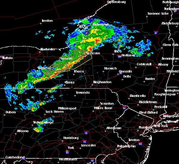 At 129 pm edt, a severe thunderstorm was located over reading center, moving east at 50 mph (radar indicated). Hazards include 60 mph wind gusts. Expect damage to roofs. siding and trees. this severe thunderstorm will be near, montour falls, hector and burdett around 135 pm edt. odessa and reynoldsville around 140 pm edt. mecklenburg, perry city and searsburg around 145 pm edt. newfield, enfield and trumansburg around 150 pm edt. ithaca and taughannock falls around 155 pm edt. besemer around 200 pm edt. Groton, dryden and freeville around 210 pm edt. At 129 pm edt, a severe thunderstorm was located over reading center, moving east at 50 mph (radar indicated). Hazards include 60 mph wind gusts. Expect damage to roofs. siding and trees. this severe thunderstorm will be near, montour falls, hector and burdett around 135 pm edt. odessa and reynoldsville around 140 pm edt. mecklenburg, perry city and searsburg around 145 pm edt. newfield, enfield and trumansburg around 150 pm edt. ithaca and taughannock falls around 155 pm edt. besemer around 200 pm edt. Groton, dryden and freeville around 210 pm edt.
|
| 7/2/2014 8:40 PM EDT | Numerous trees down in village in tompkins county NY, 0.5 miles E of Groton, NY |
| 8/8/2013 7:15 PM EDT | Several trees down in tompkins county NY, 0.5 miles E of Groton, NY |
| 1/1/0001 12:00 AM | Possible tornado. several trees. ansd poles down...roof off hous in tompkins county NY, 0.5 miles E of Groton, NY |
Hail Maps for Groton, NY
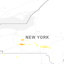


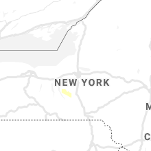

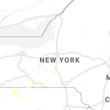


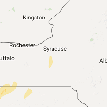

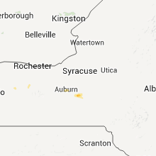
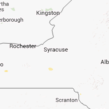
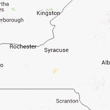


Connect with Interactive Hail Maps