

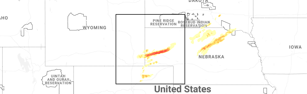
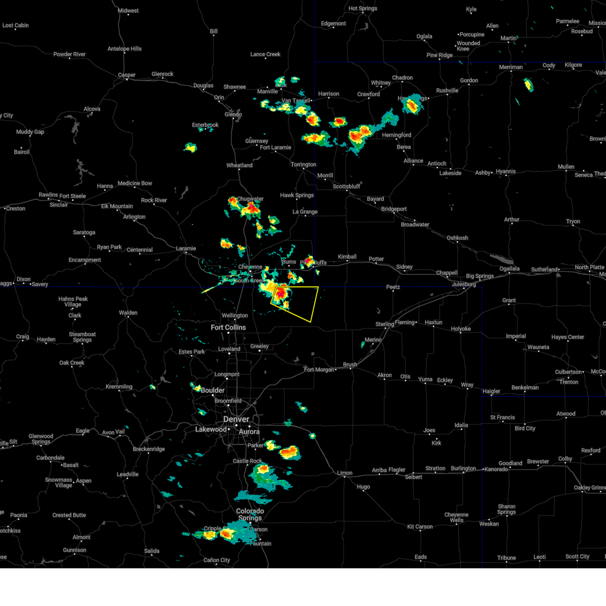
Hail Map for Grover, CO
The Grover, CO area has had 35 reports of on-the-ground hail by trained spotters, and has been under severe weather warnings 10 times during the past 12 months. Doppler radar has detected hail at or near Grover, CO on 104 occasions, including 8 occasions during the past year.
| Name: | Grover, CO |
| Where Located: | 74.4 miles SSW of Scottsbluff, NE |
| Map: | Google Map for Grover, CO |
| Population: | 137 |
| Housing Units: | 90 |
| More Info: | Search Google for Grover, CO |
3
The Top Recent Hail Date for Grover, CO is Sunday, June 22, 2025 (9th out of 104)
Hail and Wind Damage Spotted near Grover, CO
| Date / Time | Report Details |
|---|---|
| 6/4/2025 4:17 PM MDT |
 Svrbou the national weather service in denver has issued a * severe thunderstorm warning for, northeastern weld county in northeastern colorado, * until 500 pm mdt. * at 417 pm mdt, a severe thunderstorm was located near grover, or 38 miles northeast of greeley, moving southeast at 15 mph (radar indicated). Hazards include quarter size hail. damage to vehicles is expected Svrbou the national weather service in denver has issued a * severe thunderstorm warning for, northeastern weld county in northeastern colorado, * until 500 pm mdt. * at 417 pm mdt, a severe thunderstorm was located near grover, or 38 miles northeast of greeley, moving southeast at 15 mph (radar indicated). Hazards include quarter size hail. damage to vehicles is expected
|
| 6/1/2025 5:40 PM MDT |
 The storms which prompted the warning have weakened below severe limits, and no longer pose an immediate threat to life or property. therefore, the warning will be allowed to expire. however, small hail, gusty winds, and heavy rain are still possible with these thunderstorms. The storms which prompted the warning have weakened below severe limits, and no longer pose an immediate threat to life or property. therefore, the warning will be allowed to expire. however, small hail, gusty winds, and heavy rain are still possible with these thunderstorms.
|
| 6/1/2025 5:20 PM MDT |
 At 520 pm mdt, severe thunderstorms were located along a line from near hereford to over briggsdale, or along a line from 29 miles east of cheyenne to 25 miles northeast of greeley, moving east at 20 mph (radar indicated). Hazards include 60 mph wind gusts and small hail. Expect damage to roofs, siding, and trees. Locations impacted include, grover, hereford, briggsdale and keota. At 520 pm mdt, severe thunderstorms were located along a line from near hereford to over briggsdale, or along a line from 29 miles east of cheyenne to 25 miles northeast of greeley, moving east at 20 mph (radar indicated). Hazards include 60 mph wind gusts and small hail. Expect damage to roofs, siding, and trees. Locations impacted include, grover, hereford, briggsdale and keota.
|
| 6/1/2025 5:05 PM MDT |
 Svrbou the national weather service in denver has issued a * severe thunderstorm warning for, north central weld county in northeastern colorado, * until 545 pm mdt. * at 505 pm mdt, severe thunderstorms were located along a line from over carpenter to 5 miles west of briggsdale, or along a line from 24 miles east of cheyenne to 21 miles northeast of greeley, moving east at 20 mph (radar indicated). Hazards include 60 mph wind gusts and small hail. expect damage to roofs, siding, and trees Svrbou the national weather service in denver has issued a * severe thunderstorm warning for, north central weld county in northeastern colorado, * until 545 pm mdt. * at 505 pm mdt, severe thunderstorms were located along a line from over carpenter to 5 miles west of briggsdale, or along a line from 24 miles east of cheyenne to 21 miles northeast of greeley, moving east at 20 mph (radar indicated). Hazards include 60 mph wind gusts and small hail. expect damage to roofs, siding, and trees
|
| 5/18/2025 4:12 PM MDT | The storms which prompted the warning have weakened below severe limits, and have exited the warned area. therefore, the warning will be allowed to expire. a tornado watch remains in effect until 800 pm mdt sunday for a portion of northeast colorado. |
| 5/18/2025 3:55 PM MDT | Awos station k1ow 2 nw pawnee butte in weld county CO, 11.8 miles W of Grover, CO |
| 5/18/2025 3:38 PM MDT | At 338 pm mdt, severe thunderstorms were located along a line from 13 miles northwest of briggsdale to 9 miles north of stoneham, or along a line from 30 miles northeast of greeley to 27 miles west of sterling, moving north at 20 mph (radar indicated). Hazards include 70 mph wind gusts and quarter size hail. Hail damage to vehicles is expected. expect considerable tree damage. wind damage is also likely to mobile homes, roofs, and outbuildings. Locations impacted include, grover, pawnee buttes and keota. |
| 5/18/2025 3:36 PM MDT | Storm damage reported in weld county CO, 9.8 miles W of Grover, CO |
| 5/18/2025 3:30 PM MDT |
 Svrbou the national weather service in denver has issued a * severe thunderstorm warning for, northeastern weld county in northeastern colorado, * until 415 pm mdt. * at 330 pm mdt, severe thunderstorms were located along a line from 11 miles northwest of briggsdale to 6 miles north of stoneham, or along a line from 27 miles northeast of greeley to 26 miles west of sterling, moving north at 20 mph (radar indicated). Hazards include 70 mph wind gusts and quarter size hail. Hail damage to vehicles is expected. expect considerable tree damage. Wind damage is also likely to mobile homes, roofs, and outbuildings. Svrbou the national weather service in denver has issued a * severe thunderstorm warning for, northeastern weld county in northeastern colorado, * until 415 pm mdt. * at 330 pm mdt, severe thunderstorms were located along a line from 11 miles northwest of briggsdale to 6 miles north of stoneham, or along a line from 27 miles northeast of greeley to 26 miles west of sterling, moving north at 20 mph (radar indicated). Hazards include 70 mph wind gusts and quarter size hail. Hail damage to vehicles is expected. expect considerable tree damage. Wind damage is also likely to mobile homes, roofs, and outbuildings.
|
| 5/14/2025 4:23 PM MDT | Awos station k1ow 2 nw pawnee butte in weld county CO, 11.8 miles W of Grover, CO |
| 5/14/2025 4:07 PM MDT | Raws station tt567 crow cree in weld county CO, 16.4 miles NNE of Grover, CO |
| 5/14/2025 4:02 PM MDT |
 Svrbou the national weather service in denver has issued a * severe thunderstorm warning for, northwestern morgan county in northeastern colorado, northeastern weld county in northeastern colorado, * until 445 pm mdt. * at 402 pm mdt, severe thunderstorms were located along a line from 9 miles northeast of grover to 7 miles north of roggen, or along a line from 50 miles northeast of greeley to 23 miles southeast of greeley, moving east at 45 mph (radar indicated). Hazards include 60 mph wind gusts and small hail. expect damage to roofs, siding, and trees Svrbou the national weather service in denver has issued a * severe thunderstorm warning for, northwestern morgan county in northeastern colorado, northeastern weld county in northeastern colorado, * until 445 pm mdt. * at 402 pm mdt, severe thunderstorms were located along a line from 9 miles northeast of grover to 7 miles north of roggen, or along a line from 50 miles northeast of greeley to 23 miles southeast of greeley, moving east at 45 mph (radar indicated). Hazards include 60 mph wind gusts and small hail. expect damage to roofs, siding, and trees
|
| 8/12/2024 5:30 PM MDT | Hen Egg sized hail reported 15.5 miles W of Grover, CO |
| 8/12/2024 4:52 PM MDT | Hen Egg sized hail reported 14 miles WSW of Grover, CO |
| 8/11/2024 1:57 PM MDT | Awos station k1ow 2 nw pawnee butte in weld county CO, 11.8 miles W of Grover, CO |
| 8/6/2024 9:07 PM MDT | Mesonet station tt567 crow cree in weld county CO, 16.4 miles NNE of Grover, CO |
| 8/6/2024 8:58 PM MDT | Mesonet station cw5040 briggsdal in weld county CO, 8.2 miles NNE of Grover, CO |
| 8/2/2024 4:38 PM MDT | Storm damage reported in weld county CO, 8.2 miles NNE of Grover, CO |
| 8/2/2024 3:50 PM MDT |
 The storm which prompted the warning has weakened below severe limits, and has exited the warned area. therefore, the warning will be allowed to expire. however, gusty winds are still possible with this thunderstorm. The storm which prompted the warning has weakened below severe limits, and has exited the warned area. therefore, the warning will be allowed to expire. however, gusty winds are still possible with this thunderstorm.
|
| 8/2/2024 3:14 PM MDT |
 Svrbou the national weather service in denver colorado has issued a * severe thunderstorm warning for, north central weld county in northeastern colorado, * until 400 pm mdt. * at 314 pm mdt, a severe thunderstorm was located 7 miles southwest of hereford, or 24 miles southeast of cheyenne, moving east at 20 mph (radar indicated). Hazards include 60 mph wind gusts and penny size hail. expect damage to roofs, siding, and trees Svrbou the national weather service in denver colorado has issued a * severe thunderstorm warning for, north central weld county in northeastern colorado, * until 400 pm mdt. * at 314 pm mdt, a severe thunderstorm was located 7 miles southwest of hereford, or 24 miles southeast of cheyenne, moving east at 20 mph (radar indicated). Hazards include 60 mph wind gusts and penny size hail. expect damage to roofs, siding, and trees
|
| 7/27/2024 6:21 PM MDT | Awos station k1ow 2 nw pawnee butte in weld county CO, 11.8 miles W of Grover, CO |
| 7/19/2024 6:38 PM MDT | Corrects previous non-tstm wnd gst report from 8 ssw grover. mesonet station cw5040 briggsdal in weld county CO, 8.2 miles NNE of Grover, CO |
| 6/21/2024 4:20 PM MDT | Half Dollar sized hail reported 15 miles W of Grover, CO, hail was slightly smaller than a ping pong ball and took out their screens. |
| 6/21/2024 4:20 PM MDT | Storm damage reported in weld county CO, 15 miles W of Grover, CO |
| 6/21/2024 4:15 PM MDT | Golf Ball sized hail reported 9.8 miles W of Grover, CO, largest stones fell at the beginning of the storm. shredded a few window screens. time estimated by radar. |
| 6/21/2024 4:09 PM MDT |
 The storm which prompted the warning has moved out of the area. therefore, the warning will be allowed to expire. a severe thunderstorm watch remains in effect until 900 pm mdt for northeastern colorado. The storm which prompted the warning has moved out of the area. therefore, the warning will be allowed to expire. a severe thunderstorm watch remains in effect until 900 pm mdt for northeastern colorado.
|
| 6/21/2024 3:41 PM MDT | Quarter sized hail reported 7.9 miles SSE of Grover, CO |
| 6/21/2024 3:41 PM MDT | Storm damage reported in weld county CO, 7.9 miles SSE of Grover, CO |
| 6/21/2024 3:41 PM MDT |
 At 340 pm mdt, a severe thunderstorm was located near hereford, or 27 miles southeast of cheyenne, moving east at 20 mph (trained weather spotters). Hazards include ping pong ball size hail and 60 mph wind gusts. Expect damage to roofs, siding, and trees. people and animals outdoors will be injured. expect hail damage to roofs, siding, windows, and vehicles. Locations impacted include, grover and hereford. At 340 pm mdt, a severe thunderstorm was located near hereford, or 27 miles southeast of cheyenne, moving east at 20 mph (trained weather spotters). Hazards include ping pong ball size hail and 60 mph wind gusts. Expect damage to roofs, siding, and trees. people and animals outdoors will be injured. expect hail damage to roofs, siding, windows, and vehicles. Locations impacted include, grover and hereford.
|
| 6/21/2024 3:26 PM MDT |
 Svrbou the national weather service in denver colorado has issued a * severe thunderstorm warning for, north central weld county in northeastern colorado, * until 415 pm mdt. * at 326 pm mdt, a severe thunderstorm was located 6 miles west of hereford, or 22 miles southeast of cheyenne, moving east at 20 mph (radar indicated). Hazards include 60 mph wind gusts and half dollar size hail. Expect damage to roofs, siding, and trees. Hail damage to vehicles is expected. Svrbou the national weather service in denver colorado has issued a * severe thunderstorm warning for, north central weld county in northeastern colorado, * until 415 pm mdt. * at 326 pm mdt, a severe thunderstorm was located 6 miles west of hereford, or 22 miles southeast of cheyenne, moving east at 20 mph (radar indicated). Hazards include 60 mph wind gusts and half dollar size hail. Expect damage to roofs, siding, and trees. Hail damage to vehicles is expected.
|
| 6/20/2024 4:58 PM MDT |
 The storm which prompted the warning has weakened below severe limits, and no longer poses an immediate threat to life or property. therefore, the warning will be allowed to expire. a severe thunderstorm watch remains in effect until 700 pm mdt for northeastern colorado. The storm which prompted the warning has weakened below severe limits, and no longer poses an immediate threat to life or property. therefore, the warning will be allowed to expire. a severe thunderstorm watch remains in effect until 700 pm mdt for northeastern colorado.
|
| 6/20/2024 4:33 PM MDT |
 Svrbou the national weather service in denver colorado has issued a * severe thunderstorm warning for, north central weld county in northeastern colorado, * until 500 pm mdt. * at 432 pm mdt, a severe thunderstorm was located near carpenter, or 25 miles southeast of cheyenne, moving east at 30 mph (radar indicated). Hazards include 60 mph wind gusts and half dollar size hail. Expect damage to roofs, siding, and trees. Hail damage to vehicles is expected. Svrbou the national weather service in denver colorado has issued a * severe thunderstorm warning for, north central weld county in northeastern colorado, * until 500 pm mdt. * at 432 pm mdt, a severe thunderstorm was located near carpenter, or 25 miles southeast of cheyenne, moving east at 30 mph (radar indicated). Hazards include 60 mph wind gusts and half dollar size hail. Expect damage to roofs, siding, and trees. Hail damage to vehicles is expected.
|
| 6/10/2024 4:13 PM MDT |
 At 413 pm mdt, a severe thunderstorm was located over grover, or 35 miles southeast of cheyenne, moving southeast at 20 mph (radar indicated). Hazards include 60 mph wind gusts and half dollar size hail. Expect damage to roofs, siding, and trees. hail damage to vehicles is expected. Locations impacted include, grover, briggsdale, and pawnee buttes. At 413 pm mdt, a severe thunderstorm was located over grover, or 35 miles southeast of cheyenne, moving southeast at 20 mph (radar indicated). Hazards include 60 mph wind gusts and half dollar size hail. Expect damage to roofs, siding, and trees. hail damage to vehicles is expected. Locations impacted include, grover, briggsdale, and pawnee buttes.
|
| 6/10/2024 3:59 PM MDT |
 Svrbou the national weather service in denver colorado has issued a * severe thunderstorm warning for, north central weld county in northeastern colorado, * until 430 pm mdt. * at 359 pm mdt, severe thunderstorms were located along a line extending from near hereford to near purcell, or along a line extending from 31 miles southeast of cheyenne to 17 miles northeast of greeley, moving southeast at 25 mph (radar indicated). Hazards include 60 mph wind gusts and quarter size hail. Expect damage to roofs, siding, and trees. Hail damage to vehicles is expected. Svrbou the national weather service in denver colorado has issued a * severe thunderstorm warning for, north central weld county in northeastern colorado, * until 430 pm mdt. * at 359 pm mdt, severe thunderstorms were located along a line extending from near hereford to near purcell, or along a line extending from 31 miles southeast of cheyenne to 17 miles northeast of greeley, moving southeast at 25 mph (radar indicated). Hazards include 60 mph wind gusts and quarter size hail. Expect damage to roofs, siding, and trees. Hail damage to vehicles is expected.
|
| 6/8/2024 2:33 PM MDT |
 At 233 pm mdt, severe thunderstorms were located along a line extending from 6 miles west of panorama point to 10 miles west of grover, or along a line extending from 30 miles southwest of kimball to 28 miles southeast of cheyenne, moving east at 55 mph (radar indicated). Hazards include 60 mph wind gusts and penny size hail. Expect damage to roofs, siding, and trees. Locations impacted include, grover, pawnee buttes, and hereford. At 233 pm mdt, severe thunderstorms were located along a line extending from 6 miles west of panorama point to 10 miles west of grover, or along a line extending from 30 miles southwest of kimball to 28 miles southeast of cheyenne, moving east at 55 mph (radar indicated). Hazards include 60 mph wind gusts and penny size hail. Expect damage to roofs, siding, and trees. Locations impacted include, grover, pawnee buttes, and hereford.
|
| 6/8/2024 2:29 PM MDT | Storm damage reported in weld county CO, 8.1 miles SE of Grover, CO |
| 6/8/2024 2:14 PM MDT |
 Svrbou the national weather service in denver colorado has issued a * severe thunderstorm warning for, northwestern weld county in northeastern colorado, * until 300 pm mdt. * at 214 pm mdt, severe thunderstorms were located along a line extending from 6 miles west of carpenter to 6 miles northwest of nunn, or along a line extending from 19 miles southeast of cheyenne to 18 miles northeast of fort collins, moving south at 30 mph (radar indicated). Hazards include 60 mph wind gusts and quarter size hail. Expect damage to roofs, siding, and trees. Hail damage to vehicles is expected. Svrbou the national weather service in denver colorado has issued a * severe thunderstorm warning for, northwestern weld county in northeastern colorado, * until 300 pm mdt. * at 214 pm mdt, severe thunderstorms were located along a line extending from 6 miles west of carpenter to 6 miles northwest of nunn, or along a line extending from 19 miles southeast of cheyenne to 18 miles northeast of fort collins, moving south at 30 mph (radar indicated). Hazards include 60 mph wind gusts and quarter size hail. Expect damage to roofs, siding, and trees. Hail damage to vehicles is expected.
|
| 5/25/2024 3:08 PM MDT | Quarter sized hail reported 9.8 miles W of Grover, CO, mostly marble sized hailstones. |
| 8/28/2023 6:07 PM MDT | Mesonet station tt567 crow cree in weld county CO, 16.4 miles NNE of Grover, CO |
| 8/10/2023 1:58 PM MDT | Mesonet station co043 briggsdal in weld county CO, 16.8 miles NNE of Grover, CO |
| 8/10/2023 1:58 PM MDT | Mesonet station cw5040 briggsdal in weld county CO, 8.2 miles NNE of Grover, CO |
| 8/5/2023 4:07 PM MDT |
 At 406 pm mdt, a severe thunderstorm was located 8 miles southwest of hereford, or 25 miles southeast of cheyenne, moving east at 35 mph. a second severe thunderstorm was located 7 miles northwest of stoneham, moving southeast at 30 mph (radar indicated). Hazards include 60 mph wind gusts and half dollar size hail. Expect damage to roofs, siding, and trees. hail damage to vehicles is expected. locations impacted include, grover, pawnee buttes and hereford. hail threat, radar indicated max hail size, 1. 25 in wind threat, radar indicated max wind gust, 60 mph. At 406 pm mdt, a severe thunderstorm was located 8 miles southwest of hereford, or 25 miles southeast of cheyenne, moving east at 35 mph. a second severe thunderstorm was located 7 miles northwest of stoneham, moving southeast at 30 mph (radar indicated). Hazards include 60 mph wind gusts and half dollar size hail. Expect damage to roofs, siding, and trees. hail damage to vehicles is expected. locations impacted include, grover, pawnee buttes and hereford. hail threat, radar indicated max hail size, 1. 25 in wind threat, radar indicated max wind gust, 60 mph.
|
| 8/5/2023 3:36 PM MDT |
 At 335 pm mdt, a severe thunderstorm was located 5 miles east of rockport, or 18 miles south of cheyenne, moving east at 30 mph. another severe storm was near pawnee buttes (radar indicated). Hazards include 60 mph wind gusts and half dollar size hail. Expect damage to roofs, siding, and trees. Hail damage to vehicles is expected. At 335 pm mdt, a severe thunderstorm was located 5 miles east of rockport, or 18 miles south of cheyenne, moving east at 30 mph. another severe storm was near pawnee buttes (radar indicated). Hazards include 60 mph wind gusts and half dollar size hail. Expect damage to roofs, siding, and trees. Hail damage to vehicles is expected.
|
| 8/3/2023 5:55 PM MDT | Awos station k1ow 2 nw pawnee butte in weld county CO, 11.8 miles W of Grover, CO |
| 8/1/2023 6:18 PM MDT | Mesonet station cw5040 briggsdal in weld county CO, 8.2 miles NNE of Grover, CO |
| 7/28/2023 6:55 AM MDT | Awos station k1ow 2 nw pawnee butte in weld county CO, 11.8 miles W of Grover, CO |
| 7/13/2023 4:03 PM MDT |
 At 402 pm mdt, a severe thunderstorm was located near grover, or 38 miles southeast of cheyenne, moving southeast at 25 mph (radar indicated). Hazards include ping pong ball size hail and 60 mph wind gusts. Expect damage to roofs, siding, and trees. people and animals outdoors will be injured. expect hail damage to roofs, siding, windows, and vehicles. locations impacted include, grover, pawnee buttes and keota. hail threat, radar indicated max hail size, 1. 50 in wind threat, radar indicated max wind gust, 60 mph. At 402 pm mdt, a severe thunderstorm was located near grover, or 38 miles southeast of cheyenne, moving southeast at 25 mph (radar indicated). Hazards include ping pong ball size hail and 60 mph wind gusts. Expect damage to roofs, siding, and trees. people and animals outdoors will be injured. expect hail damage to roofs, siding, windows, and vehicles. locations impacted include, grover, pawnee buttes and keota. hail threat, radar indicated max hail size, 1. 50 in wind threat, radar indicated max wind gust, 60 mph.
|
| 7/13/2023 3:50 PM MDT |
 At 350 pm mdt, a severe thunderstorm was located near grover, or 33 miles southeast of cheyenne, moving southeast at 30 mph (radar indicated). Hazards include ping pong ball size hail and 60 mph wind gusts. Expect damage to roofs, siding, and trees. people and animals outdoors will be injured. Expect hail damage to roofs, siding, windows, and vehicles. At 350 pm mdt, a severe thunderstorm was located near grover, or 33 miles southeast of cheyenne, moving southeast at 30 mph (radar indicated). Hazards include ping pong ball size hail and 60 mph wind gusts. Expect damage to roofs, siding, and trees. people and animals outdoors will be injured. Expect hail damage to roofs, siding, windows, and vehicles.
|
| 7/8/2023 7:54 PM MDT | Quarter sized hail reported 14.6 miles N of Grover, CO |
| 7/8/2023 7:30 PM MDT | Mesonet station tt567 crow creek. time estimated per radar since only hourly peak wind gusts availabl in weld county CO, 16.4 miles NNE of Grover, CO |
| 7/8/2023 7:03 PM MDT |
 At 703 pm mdt, a severe thunderstorm was located 9 miles southwest of grover, or 31 miles southeast of cheyenne, moving southeast at 25 mph (radar indicated). Hazards include quarter size hail. damage to vehicles is expected At 703 pm mdt, a severe thunderstorm was located 9 miles southwest of grover, or 31 miles southeast of cheyenne, moving southeast at 25 mph (radar indicated). Hazards include quarter size hail. damage to vehicles is expected
|
| 7/8/2023 6:42 PM MDT |
 At 642 pm mdt, a severe thunderstorm was located 8 miles west of hereford, or 23 miles southeast of cheyenne, moving southeast at 20 mph (radar indicated). Hazards include golf ball size hail and 60 mph wind gusts. Expect damage to roofs, siding, and trees. people and animals outdoors will be injured. expect hail damage to roofs, siding, windows, and vehicles. locations impacted include, grover. thunderstorm damage threat, considerable hail threat, radar indicated max hail size, 1. 75 in wind threat, radar indicated max wind gust, 60 mph. At 642 pm mdt, a severe thunderstorm was located 8 miles west of hereford, or 23 miles southeast of cheyenne, moving southeast at 20 mph (radar indicated). Hazards include golf ball size hail and 60 mph wind gusts. Expect damage to roofs, siding, and trees. people and animals outdoors will be injured. expect hail damage to roofs, siding, windows, and vehicles. locations impacted include, grover. thunderstorm damage threat, considerable hail threat, radar indicated max hail size, 1. 75 in wind threat, radar indicated max wind gust, 60 mph.
|
| 7/8/2023 6:21 PM MDT |
 At 621 pm mdt, a severe thunderstorm was located 9 miles west of carpenter, or 16 miles southeast of cheyenne, moving southeast at 20 mph (radar indicated). Hazards include two inch hail and 60 mph wind gusts. Expect damage to roofs, siding, and trees. people and animals outdoors will be injured. expect hail damage to roofs, siding, windows, and vehicles. this severe thunderstorm will remain over mainly rural areas of north central weld county. thunderstorm damage threat, considerable hail threat, radar indicated max hail size, 2. 00 in wind threat, radar indicated max wind gust, 60 mph. At 621 pm mdt, a severe thunderstorm was located 9 miles west of carpenter, or 16 miles southeast of cheyenne, moving southeast at 20 mph (radar indicated). Hazards include two inch hail and 60 mph wind gusts. Expect damage to roofs, siding, and trees. people and animals outdoors will be injured. expect hail damage to roofs, siding, windows, and vehicles. this severe thunderstorm will remain over mainly rural areas of north central weld county. thunderstorm damage threat, considerable hail threat, radar indicated max hail size, 2. 00 in wind threat, radar indicated max wind gust, 60 mph.
|
| 7/4/2023 2:52 PM MDT |
 The severe thunderstorm warning for north central weld county will expire at 300 pm mdt, the storms which prompted the warning have moved out of the area. therefore, the warning will be allowed to expire. a severe thunderstorm watch remains in effect until 1100 pm mdt for northeastern colorado. The severe thunderstorm warning for north central weld county will expire at 300 pm mdt, the storms which prompted the warning have moved out of the area. therefore, the warning will be allowed to expire. a severe thunderstorm watch remains in effect until 1100 pm mdt for northeastern colorado.
|
| 7/4/2023 2:33 PM MDT |
 At 232 pm mdt, severe thunderstorms were located along a line extending from near carpenter to 7 miles southwest of grover, or along a line extending from 25 miles east of cheyenne to 33 miles northeast of greeley, moving east at 40 mph (radar indicated). Hazards include 60 mph wind gusts. Expect damage to roofs, siding, and trees. locations impacted include, grover and hereford. hail threat, radar indicated max hail size, <. 75 in wind threat, radar indicated max wind gust, 60 mph. At 232 pm mdt, severe thunderstorms were located along a line extending from near carpenter to 7 miles southwest of grover, or along a line extending from 25 miles east of cheyenne to 33 miles northeast of greeley, moving east at 40 mph (radar indicated). Hazards include 60 mph wind gusts. Expect damage to roofs, siding, and trees. locations impacted include, grover and hereford. hail threat, radar indicated max hail size, <. 75 in wind threat, radar indicated max wind gust, 60 mph.
|
| 7/4/2023 2:23 PM MDT |
 At 222 pm mdt, severe thunderstorms were located along a line extending from 7 miles west of carpenter to 12 miles northwest of briggsdale, or along a line extending from 18 miles southeast of cheyenne to 29 miles northeast of greeley, moving east at 30 mph (radar indicated). Hazards include 60 mph wind gusts. Expect damage to roofs, siding, and trees. locations impacted include, grover and hereford. hail threat, radar indicated max hail size, <. 75 in wind threat, radar indicated max wind gust, 60 mph. At 222 pm mdt, severe thunderstorms were located along a line extending from 7 miles west of carpenter to 12 miles northwest of briggsdale, or along a line extending from 18 miles southeast of cheyenne to 29 miles northeast of greeley, moving east at 30 mph (radar indicated). Hazards include 60 mph wind gusts. Expect damage to roofs, siding, and trees. locations impacted include, grover and hereford. hail threat, radar indicated max hail size, <. 75 in wind threat, radar indicated max wind gust, 60 mph.
|
| 7/4/2023 2:13 PM MDT |
 At 213 pm mdt, severe thunderstorms were located along a line extending from 11 miles west of carpenter to 10 miles north of purcell, or along a line extending from 15 miles southeast of cheyenne to 27 miles northeast of greeley, moving east at 30 mph (radar indicated). Hazards include 70 mph wind gusts. Expect considerable tree damage. Damage is likely to mobile homes, roofs, and outbuildings. At 213 pm mdt, severe thunderstorms were located along a line extending from 11 miles west of carpenter to 10 miles north of purcell, or along a line extending from 15 miles southeast of cheyenne to 27 miles northeast of greeley, moving east at 30 mph (radar indicated). Hazards include 70 mph wind gusts. Expect considerable tree damage. Damage is likely to mobile homes, roofs, and outbuildings.
|
| 6/21/2023 4:01 PM MDT |
 At 401 pm mdt, a severe thunderstorm was located 5 miles northeast of grover, or 32 miles southwest of kimball, moving north at 5 mph (radar indicated). Hazards include ping pong ball size hail and 60 mph wind gusts. Expect damage to roofs, siding, and trees. people and animals outdoors will be injured. expect hail damage to roofs, siding, windows, and vehicles. This severe thunderstorm will remain over mainly rural areas of northeastern weld county. At 401 pm mdt, a severe thunderstorm was located 5 miles northeast of grover, or 32 miles southwest of kimball, moving north at 5 mph (radar indicated). Hazards include ping pong ball size hail and 60 mph wind gusts. Expect damage to roofs, siding, and trees. people and animals outdoors will be injured. expect hail damage to roofs, siding, windows, and vehicles. This severe thunderstorm will remain over mainly rural areas of northeastern weld county.
|
| 5/27/2023 5:43 PM MDT |
 At 543 pm mdt, a severe thunderstorm was located 7 miles east of briggsdale, or 31 miles northeast of greeley, moving north at 25 mph (radar indicated). Hazards include quarter size hail. Damage to vehicles is expected. this severe thunderstorm will be near, keota around 600 pm mdt. other locations in the path of this severe thunderstorm include grover. hail threat, radar indicated max hail size, 1. 00 in wind threat, radar indicated max wind gust, <50 mph. At 543 pm mdt, a severe thunderstorm was located 7 miles east of briggsdale, or 31 miles northeast of greeley, moving north at 25 mph (radar indicated). Hazards include quarter size hail. Damage to vehicles is expected. this severe thunderstorm will be near, keota around 600 pm mdt. other locations in the path of this severe thunderstorm include grover. hail threat, radar indicated max hail size, 1. 00 in wind threat, radar indicated max wind gust, <50 mph.
|
| 5/26/2023 4:14 PM MDT |
 At 413 pm mdt, a severe thunderstorm was located 8 miles north of briggsdale, or 30 miles northeast of greeley, moving north at 30 mph (radar indicated). Hazards include 60 mph wind gusts and half dollar size hail. Expect damage to roofs, siding, and trees. Hail damage to vehicles is expected. At 413 pm mdt, a severe thunderstorm was located 8 miles north of briggsdale, or 30 miles northeast of greeley, moving north at 30 mph (radar indicated). Hazards include 60 mph wind gusts and half dollar size hail. Expect damage to roofs, siding, and trees. Hail damage to vehicles is expected.
|
| 8/14/2022 4:00 PM MDT |
 At 400 pm mdt, a severe thunderstorm was located near grover, or 33 miles southeast of cheyenne, moving southeast at 25 mph (radar indicated). Hazards include 70 mph wind gusts and quarter size hail. Expect considerable tree damage. damage is likely to mobile homes, roofs, and outbuildings. hail damage to vehicles is expected. this severe thunderstorm will remain over mainly rural areas of north central weld county. thunderstorm damage threat, considerable hail threat, radar indicated max hail size, 1. 00 in wind threat, radar indicated max wind gust, 70 mph. At 400 pm mdt, a severe thunderstorm was located near grover, or 33 miles southeast of cheyenne, moving southeast at 25 mph (radar indicated). Hazards include 70 mph wind gusts and quarter size hail. Expect considerable tree damage. damage is likely to mobile homes, roofs, and outbuildings. hail damage to vehicles is expected. this severe thunderstorm will remain over mainly rural areas of north central weld county. thunderstorm damage threat, considerable hail threat, radar indicated max hail size, 1. 00 in wind threat, radar indicated max wind gust, 70 mph.
|
| 7/10/2022 3:22 PM MDT |
 The severe thunderstorm warning for north central weld county will expire at 330 pm mdt, the storm which prompted the warning has moved out of the area. therefore, the warning will be allowed to expire. The severe thunderstorm warning for north central weld county will expire at 330 pm mdt, the storm which prompted the warning has moved out of the area. therefore, the warning will be allowed to expire.
|
| 7/10/2022 3:08 PM MDT |
 At 307 pm mdt, a severe thunderstorm was located 5 miles south of panorama point, or 29 miles southwest of kimball, moving east at 30 mph (radar indicated). Hazards include 60 mph wind gusts and penny size hail. Expect damage to roofs, siding, and trees. locations impacted include, grover and pawnee buttes. hail threat, radar indicated max hail size, 0. 75 in wind threat, radar indicated max wind gust, 60 mph. At 307 pm mdt, a severe thunderstorm was located 5 miles south of panorama point, or 29 miles southwest of kimball, moving east at 30 mph (radar indicated). Hazards include 60 mph wind gusts and penny size hail. Expect damage to roofs, siding, and trees. locations impacted include, grover and pawnee buttes. hail threat, radar indicated max hail size, 0. 75 in wind threat, radar indicated max wind gust, 60 mph.
|
| 7/10/2022 2:59 PM MDT |
 At 258 pm mdt, a severe thunderstorm was located 6 miles northeast of grover, or 32 miles southwest of kimball, moving east at 30 mph (radar indicated). Hazards include 60 mph wind gusts and penny size hail. Expect damage to roofs, siding, and trees. locations impacted include, grover and pawnee buttes. hail threat, radar indicated max hail size, 0. 75 in wind threat, radar indicated max wind gust, 60 mph. At 258 pm mdt, a severe thunderstorm was located 6 miles northeast of grover, or 32 miles southwest of kimball, moving east at 30 mph (radar indicated). Hazards include 60 mph wind gusts and penny size hail. Expect damage to roofs, siding, and trees. locations impacted include, grover and pawnee buttes. hail threat, radar indicated max hail size, 0. 75 in wind threat, radar indicated max wind gust, 60 mph.
|
| 7/10/2022 2:47 PM MDT |
 At 247 pm mdt, a severe thunderstorm was located near hereford, or 30 miles southeast of cheyenne, moving east at 30 mph (radar indicated). Hazards include 60 mph wind gusts and nickel size hail. expect damage to roofs, siding, and trees At 247 pm mdt, a severe thunderstorm was located near hereford, or 30 miles southeast of cheyenne, moving east at 30 mph (radar indicated). Hazards include 60 mph wind gusts and nickel size hail. expect damage to roofs, siding, and trees
|
| 8/14/2021 7:38 PM MDT |
 At 737 pm mdt, a severe thunderstorm was located 7 miles southeast of south greeley, or 9 miles southeast of cheyenne, moving south at 25 mph (radar indicated). Hazards include golf ball size hail and 60 mph wind gusts. Expect damage to roofs, siding, and trees. people and animals outdoors will be injured. expect hail damage to roofs, siding, windows, and vehicles. this severe thunderstorm will remain over mainly rural areas of northwestern weld county. thunderstorm damage threat, considerable hail threat, radar indicated max hail size, 1. 75 in wind threat, radar indicated max wind gust, 60 mph. At 737 pm mdt, a severe thunderstorm was located 7 miles southeast of south greeley, or 9 miles southeast of cheyenne, moving south at 25 mph (radar indicated). Hazards include golf ball size hail and 60 mph wind gusts. Expect damage to roofs, siding, and trees. people and animals outdoors will be injured. expect hail damage to roofs, siding, windows, and vehicles. this severe thunderstorm will remain over mainly rural areas of northwestern weld county. thunderstorm damage threat, considerable hail threat, radar indicated max hail size, 1. 75 in wind threat, radar indicated max wind gust, 60 mph.
|
| 7/9/2021 2:51 PM MDT | Quarter sized hail reported 3.5 miles SE of Grover, CO |
| 7/9/2021 2:49 PM MDT |
 At 249 pm mdt, a severe thunderstorm was located 4 miles northwest of grover, or 30 miles southeast of cheyenne, moving southeast at 25 mph (radar indicated). Hazards include 60 mph wind gusts and quarter size hail. Expect damage to roofs, siding, and trees. hail damage to vehicles is expected. Locations impacted include, grover, pawnee buttes and hereford. At 249 pm mdt, a severe thunderstorm was located 4 miles northwest of grover, or 30 miles southeast of cheyenne, moving southeast at 25 mph (radar indicated). Hazards include 60 mph wind gusts and quarter size hail. Expect damage to roofs, siding, and trees. hail damage to vehicles is expected. Locations impacted include, grover, pawnee buttes and hereford.
|
| 7/9/2021 2:34 PM MDT |
 At 233 pm mdt, a severe thunderstorm was located 5 miles west of hereford, or 24 miles southeast of cheyenne, moving southeast at 30 mph (radar indicated). Hazards include 60 mph wind gusts and quarter size hail. Expect damage to roofs, siding, and trees. Hail damage to vehicles is expected. At 233 pm mdt, a severe thunderstorm was located 5 miles west of hereford, or 24 miles southeast of cheyenne, moving southeast at 30 mph (radar indicated). Hazards include 60 mph wind gusts and quarter size hail. Expect damage to roofs, siding, and trees. Hail damage to vehicles is expected.
|
| 6/13/2021 7:27 PM MDT |
 The severe thunderstorm warning for north central weld county will expire at 730 pm mdt, the storm which prompted the warning has moved out of the area. therefore, the warning will be allowed to expire. The severe thunderstorm warning for north central weld county will expire at 730 pm mdt, the storm which prompted the warning has moved out of the area. therefore, the warning will be allowed to expire.
|
| 6/13/2021 7:08 PM MDT |
 At 708 pm mdt, a severe thunderstorm was located 9 miles north of briggsdale, or 31 miles northeast of greeley, moving southeast at 20 mph (radar indicated). Hazards include quarter size hail. Damage to vehicles is expected. Locations impacted include, grover. At 708 pm mdt, a severe thunderstorm was located 9 miles north of briggsdale, or 31 miles northeast of greeley, moving southeast at 20 mph (radar indicated). Hazards include quarter size hail. Damage to vehicles is expected. Locations impacted include, grover.
|
| 6/13/2021 6:43 PM MDT |
 At 643 pm mdt, a severe thunderstorm was located 13 miles west of grover, or 28 miles southeast of cheyenne, moving east at 10 mph (radar indicated). Hazards include ping pong ball size hail. People and animals outdoors will be injured. Expect damage to roofs, siding, windows, and vehicles. At 643 pm mdt, a severe thunderstorm was located 13 miles west of grover, or 28 miles southeast of cheyenne, moving east at 10 mph (radar indicated). Hazards include ping pong ball size hail. People and animals outdoors will be injured. Expect damage to roofs, siding, windows, and vehicles.
|
| 5/14/2021 7:36 PM MDT |
 At 735 pm mdt, a severe thunderstorm was located 5 miles north of briggsdale, or 28 miles northeast of greeley, moving southeast at 30 mph (radar indicated). Hazards include 60 mph wind gusts and quarter size hail. Expect damage to roofs, siding, and trees. Hail damage to vehicles is expected. At 735 pm mdt, a severe thunderstorm was located 5 miles north of briggsdale, or 28 miles northeast of greeley, moving southeast at 30 mph (radar indicated). Hazards include 60 mph wind gusts and quarter size hail. Expect damage to roofs, siding, and trees. Hail damage to vehicles is expected.
|
| 5/14/2021 7:08 PM MDT |
 At 708 pm mdt, a severe thunderstorm was located 13 miles southwest of hereford, or 23 miles southeast of cheyenne, moving southeast at 25 mph (radar indicated). Hazards include 60 mph wind gusts and quarter size hail. Expect damage to roofs, siding, and trees. hail damage to vehicles is expected. Locations impacted include, grover. At 708 pm mdt, a severe thunderstorm was located 13 miles southwest of hereford, or 23 miles southeast of cheyenne, moving southeast at 25 mph (radar indicated). Hazards include 60 mph wind gusts and quarter size hail. Expect damage to roofs, siding, and trees. hail damage to vehicles is expected. Locations impacted include, grover.
|
| 5/14/2021 6:49 PM MDT |
 At 648 pm mdt, a severe thunderstorm was located 7 miles northeast of rockport, or 15 miles southeast of cheyenne, moving southeast at 25 mph (radar indicated). Hazards include 60 mph wind gusts and quarter size hail. Expect damage to roofs, siding, and trees. Hail damage to vehicles is expected. At 648 pm mdt, a severe thunderstorm was located 7 miles northeast of rockport, or 15 miles southeast of cheyenne, moving southeast at 25 mph (radar indicated). Hazards include 60 mph wind gusts and quarter size hail. Expect damage to roofs, siding, and trees. Hail damage to vehicles is expected.
|
| 8/6/2020 3:24 PM MDT |
 The severe thunderstorm warning for northeastern weld county will expire at 330 pm mdt, the storm which prompted the warning has weakened below severe limits, and no longer poses an immediate threat to life or property. therefore, the warning will be allowed to expire. however small hail, gusty winds up to 45 mph and heavy rain are still possible with this thunderstorm. The severe thunderstorm warning for northeastern weld county will expire at 330 pm mdt, the storm which prompted the warning has weakened below severe limits, and no longer poses an immediate threat to life or property. therefore, the warning will be allowed to expire. however small hail, gusty winds up to 45 mph and heavy rain are still possible with this thunderstorm.
|
| 8/6/2020 2:51 PM MDT |
 At 250 pm mdt, a severe thunderstorm was located 5 miles north of pawnee buttes, or 29 miles southwest of kimball, moving east at 20 mph (radar indicated). Hazards include 60 mph wind gusts and half dollar size hail. Expect damage to roofs, siding, and trees. Hail damage to vehicles is expected. At 250 pm mdt, a severe thunderstorm was located 5 miles north of pawnee buttes, or 29 miles southwest of kimball, moving east at 20 mph (radar indicated). Hazards include 60 mph wind gusts and half dollar size hail. Expect damage to roofs, siding, and trees. Hail damage to vehicles is expected.
|
| 8/5/2020 3:56 PM MDT | Station k1ow. time estimated by rada in weld county CO, 11.8 miles W of Grover, CO |
| 8/4/2020 5:16 PM MDT | Golf Ball sized hail reported 0.2 miles ENE of Grover, CO, delayed report from social media of hail in grover. time estimated from radar. |
| 8/4/2020 4:37 PM MDT |
 At 437 pm mdt, a severe thunderstorm was located 8 miles west of grover, or 28 miles southeast of cheyenne, moving east at 30 mph (radar indicated). Hazards include 60 mph wind gusts and half dollar size hail. Expect damage to roofs, siding, and trees. Hail damage to vehicles is expected. At 437 pm mdt, a severe thunderstorm was located 8 miles west of grover, or 28 miles southeast of cheyenne, moving east at 30 mph (radar indicated). Hazards include 60 mph wind gusts and half dollar size hail. Expect damage to roofs, siding, and trees. Hail damage to vehicles is expected.
|
| 8/4/2020 4:22 PM MDT | Ping Pong Ball sized hail reported 17.2 miles E of Grover, CO, time estimated by radar. |
| 7/13/2020 6:07 PM MDT | Mesonet station tt567 crow cree in weld county CO, 16.4 miles NNE of Grover, CO |
| 7/13/2020 5:07 PM MDT | Storm damage reported in weld county CO, 16.4 miles NNE of Grover, CO |
| 7/13/2020 5:03 PM MDT | Mesonet station cw5040 briggsdal in weld county CO, 8.2 miles NNE of Grover, CO |
| 7/13/2020 4:55 PM MDT | Spotter network reported damage to buildings. metal shed... twisted. time estimate in weld county CO, 8.8 miles SE of Grover, CO |
| 7/13/2020 4:50 PM MDT | Trained spotter reported power poles down. time estimate in weld county CO, 17.6 miles NNE of Grover, CO |
| 7/13/2020 4:34 PM MDT |
 At 433 pm mdt, severe thunderstorms were located along a line extending from 8 miles west of carpenter to milliken, or along a line extending from 16 miles southeast of cheyenne to 8 miles southwest of greeley, moving east at 45 mph (radar indicated). Hazards include 70 mph wind gusts. up to 80 mph gust and possible landspout tornado in the rockport and grover areas of far northern weld county. Expect considerable tree damage. damage is likely to mobile homes, roofs, and outbuildings. Locations impacted include, eastern fort collins, greeley, eastern loveland, windsor, evans, johnstown, milliken, berthoud, eaton, mead, severance, lasalle, ault, kersey, gilcrest, pierce, timnath, nunn, grover and purcell. At 433 pm mdt, severe thunderstorms were located along a line extending from 8 miles west of carpenter to milliken, or along a line extending from 16 miles southeast of cheyenne to 8 miles southwest of greeley, moving east at 45 mph (radar indicated). Hazards include 70 mph wind gusts. up to 80 mph gust and possible landspout tornado in the rockport and grover areas of far northern weld county. Expect considerable tree damage. damage is likely to mobile homes, roofs, and outbuildings. Locations impacted include, eastern fort collins, greeley, eastern loveland, windsor, evans, johnstown, milliken, berthoud, eaton, mead, severance, lasalle, ault, kersey, gilcrest, pierce, timnath, nunn, grover and purcell.
|
| 7/13/2020 4:16 PM MDT |
 At 416 pm mdt, severe thunderstorms were located along a line extending from 6 miles southeast of south greeley to near berthoud, or along a line extending from 8 miles southeast of cheyenne to 18 miles south of fort collins, moving east at 45 mph (radar indicated). Hazards include 60 mph wind gusts. expect damage to roofs, siding, and trees At 416 pm mdt, severe thunderstorms were located along a line extending from 6 miles southeast of south greeley to near berthoud, or along a line extending from 8 miles southeast of cheyenne to 18 miles south of fort collins, moving east at 45 mph (radar indicated). Hazards include 60 mph wind gusts. expect damage to roofs, siding, and trees
|
| 7/13/2020 2:43 PM MDT | Awos station k1ow oscar madi in weld county CO, 11.8 miles W of Grover, CO |
| 7/13/2020 2:33 PM MDT | Mesonet station cw5040 briggsdal in weld county CO, 8.2 miles NNE of Grover, CO |
| 7/3/2020 6:11 PM MDT | Storm damage reported in weld county CO, 0.8 miles NNE of Grover, CO |
| 6/25/2020 3:11 PM MDT |
 At 310 pm mdt, a severe thunderstorm was located 6 miles southwest of carpenter, or 21 miles southeast of cheyenne, moving east at 30 mph (radar indicated). Hazards include 60 mph wind gusts and quarter size hail. Expect damage to roofs, siding, and trees. Hail damage to vehicles is expected. At 310 pm mdt, a severe thunderstorm was located 6 miles southwest of carpenter, or 21 miles southeast of cheyenne, moving east at 30 mph (radar indicated). Hazards include 60 mph wind gusts and quarter size hail. Expect damage to roofs, siding, and trees. Hail damage to vehicles is expected.
|
| 6/8/2020 8:08 PM MDT | Awos station k1ow oscar madi in weld county CO, 11.8 miles W of Grover, CO |
| 6/8/2020 7:42 PM MDT | Mesonet station co043 014w176 briggsdal in weld county CO, 16.8 miles NNE of Grover, CO |
| 6/6/2020 5:18 PM MDT | Mesonet station cw5040 briggsdal in weld county CO, 8.2 miles NNE of Grover, CO |
| 6/6/2020 4:44 PM MDT |
 At 444 pm mdt, severe thunderstorms were located along a line extending from 8 miles south of grover to near orchard to 5 miles southwest of leader to 3 miles east of elbert, or along a line extending from 40 miles southeast of cheyenne to 20 miles west of fort morgan to 43 miles east of denver to 27 miles northeast of colorado springs, moving east at 35 mph. these are very dangerous storms (radar indicated). Hazards include 80 mph wind gusts. Flying debris will be dangerous to those caught without shelter. mobile homes will be heavily damaged. expect considerable damage to roofs, windows, and vehicles. extensive tree damage and power outages are likely. locations impacted include, eastern denver, southeastern greeley, aurora, eastern centennial, southeastern highlands ranch, castle rock, eastern commerce city, parker, elbert, greenwood village, lone tree, denver international airport, d. i. A terminal and concourses, lochbuie, hudson, bennett, kersey, elizabeth, keenesburg and kiowa. At 444 pm mdt, severe thunderstorms were located along a line extending from 8 miles south of grover to near orchard to 5 miles southwest of leader to 3 miles east of elbert, or along a line extending from 40 miles southeast of cheyenne to 20 miles west of fort morgan to 43 miles east of denver to 27 miles northeast of colorado springs, moving east at 35 mph. these are very dangerous storms (radar indicated). Hazards include 80 mph wind gusts. Flying debris will be dangerous to those caught without shelter. mobile homes will be heavily damaged. expect considerable damage to roofs, windows, and vehicles. extensive tree damage and power outages are likely. locations impacted include, eastern denver, southeastern greeley, aurora, eastern centennial, southeastern highlands ranch, castle rock, eastern commerce city, parker, elbert, greenwood village, lone tree, denver international airport, d. i. A terminal and concourses, lochbuie, hudson, bennett, kersey, elizabeth, keenesburg and kiowa.
|
| 6/6/2020 4:36 PM MDT |
 At 433 pm mdt, severe thunderstorms were located along a line extending from 4 miles northwest of briggsdale to near bennett, or along a line extending from 25 miles northeast of greeley to 26 miles east of denver, moving northeast at 60 mph (radar indicated). Hazards include 80 mph wind gusts. Expect considerable tree damage. Damage is likely to mobile homes, roofs, and outbuildings. At 433 pm mdt, severe thunderstorms were located along a line extending from 4 miles northwest of briggsdale to near bennett, or along a line extending from 25 miles northeast of greeley to 26 miles east of denver, moving northeast at 60 mph (radar indicated). Hazards include 80 mph wind gusts. Expect considerable tree damage. Damage is likely to mobile homes, roofs, and outbuildings.
|
| 6/6/2020 4:35 PM MDT | Awos station k1ow oscar madi in weld county CO, 11.8 miles W of Grover, CO |
| 6/6/2020 4:34 PM MDT | Storm damage reported in weld county CO, 19.6 miles E of Grover, CO |
| 6/6/2020 3:56 PM MDT |
 At 355 pm mdt, severe thunderstorms were located along a line extending from 6 miles south of carr to 3 miles east of dacono to aurora to 5 miles east of greenland, or along a line extending from 21 miles northeast of fort collins to 24 miles south of greeley to 10 miles east of denver to 22 miles north of colorado springs, moving northeast at 60 mph. these are very dangerous storms (radar indicated). Hazards include 80 mph wind gusts. Flying debris will be dangerous to those caught without shelter. mobile homes will be heavily damaged. expect considerable damage to roofs, windows, and vehicles. Extensive tree damage and power outages are likely. At 355 pm mdt, severe thunderstorms were located along a line extending from 6 miles south of carr to 3 miles east of dacono to aurora to 5 miles east of greenland, or along a line extending from 21 miles northeast of fort collins to 24 miles south of greeley to 10 miles east of denver to 22 miles north of colorado springs, moving northeast at 60 mph. these are very dangerous storms (radar indicated). Hazards include 80 mph wind gusts. Flying debris will be dangerous to those caught without shelter. mobile homes will be heavily damaged. expect considerable damage to roofs, windows, and vehicles. Extensive tree damage and power outages are likely.
|
| 5/20/2020 9:05 PM MDT | Ping Pong Ball sized hail reported 16.1 miles N of Grover, CO |
| 5/20/2020 8:50 PM MDT | Half Dollar sized hail reported 16.1 miles N of Grover, CO, report from mping: half dollar (1.25 in.). |
| 5/20/2020 8:40 PM MDT |
 At 840 pm mdt, a severe thunderstorm was located 8 miles southwest of keota, or 31 miles northwest of fort morgan, moving northeast at 20 mph (radar indicated). Hazards include 60 mph wind gusts and quarter size hail. Expect damage to roofs, siding, and trees. Hail damage to vehicles is expected. At 840 pm mdt, a severe thunderstorm was located 8 miles southwest of keota, or 31 miles northwest of fort morgan, moving northeast at 20 mph (radar indicated). Hazards include 60 mph wind gusts and quarter size hail. Expect damage to roofs, siding, and trees. Hail damage to vehicles is expected.
|
| 9/5/2019 9:42 PM MDT |
 The severe thunderstorm warning for north central weld county will expire at 945 pm mdt, the storm which prompted the warning has weakened below severe limits, and no longer poses an immediate threat to life or property. therefore, the warning will be allowed to expire. however gusty winds are still possible with this thunderstorm. The severe thunderstorm warning for north central weld county will expire at 945 pm mdt, the storm which prompted the warning has weakened below severe limits, and no longer poses an immediate threat to life or property. therefore, the warning will be allowed to expire. however gusty winds are still possible with this thunderstorm.
|
| 9/5/2019 9:33 PM MDT |
 At 933 pm mdt, a severe thunderstorm was located over grover, or 36 miles southeast of cheyenne, moving east at 15 mph (radar indicated). Hazards include 60 mph wind gusts and quarter size hail. Hail damage to vehicles is expected. expect wind damage to roofs, siding, and trees. Locations impacted include, grover. At 933 pm mdt, a severe thunderstorm was located over grover, or 36 miles southeast of cheyenne, moving east at 15 mph (radar indicated). Hazards include 60 mph wind gusts and quarter size hail. Hail damage to vehicles is expected. expect wind damage to roofs, siding, and trees. Locations impacted include, grover.
|
| 9/5/2019 9:18 PM MDT |
 At 918 pm mdt, a severe thunderstorm was located near grover, or 34 miles southeast of cheyenne, moving east at 15 mph (radar indicated). Hazards include 60 mph wind gusts and quarter size hail. Hail damage to vehicles is expected. Expect wind damage to roofs, siding, and trees. At 918 pm mdt, a severe thunderstorm was located near grover, or 34 miles southeast of cheyenne, moving east at 15 mph (radar indicated). Hazards include 60 mph wind gusts and quarter size hail. Hail damage to vehicles is expected. Expect wind damage to roofs, siding, and trees.
|
| 8/22/2019 4:59 PM MDT | Quarter sized hail reported 20.4 miles W of Grover, CO |
| 8/22/2019 4:28 PM MDT |
 At 426 pm mdt, a severe thunderstorm was located 11 miles southeast of panorama point, or 21 miles southwest of kimball, moving east at 35 mph (trained weather spotters reported golf ball sized hail 8 miles south-southwest of pine bluffs, wyoming). Hazards include golf ball size hail and 60 mph wind gusts. Expect damage to roofs, siding, and trees. people and animals outdoors will be injured. expect hail damage to roofs, siding, windows, and vehicles. Locations impacted include, grover. At 426 pm mdt, a severe thunderstorm was located 11 miles southeast of panorama point, or 21 miles southwest of kimball, moving east at 35 mph (trained weather spotters reported golf ball sized hail 8 miles south-southwest of pine bluffs, wyoming). Hazards include golf ball size hail and 60 mph wind gusts. Expect damage to roofs, siding, and trees. people and animals outdoors will be injured. expect hail damage to roofs, siding, windows, and vehicles. Locations impacted include, grover.
|
| 8/22/2019 4:04 PM MDT |
 At 404 pm mdt, a severe thunderstorm was located near panorama point, or 26 miles southwest of kimball, moving east at 35 mph (radar indicated). Hazards include 60 mph wind gusts and half dollar size hail. Expect damage to roofs, siding, and trees. Hail damage to vehicles is expected. At 404 pm mdt, a severe thunderstorm was located near panorama point, or 26 miles southwest of kimball, moving east at 35 mph (radar indicated). Hazards include 60 mph wind gusts and half dollar size hail. Expect damage to roofs, siding, and trees. Hail damage to vehicles is expected.
|
| 8/20/2019 4:22 PM MDT |
 The severe thunderstorm warning for northwestern weld county will expire at 430 pm mdt. the storm which prompted the warning has moved southeast out of the area. therefore, the warning will be allowed to expire. A severe thunderstorm watch remains in effect until 1100 pm mdt for northeastern colorado. The severe thunderstorm warning for northwestern weld county will expire at 430 pm mdt. the storm which prompted the warning has moved southeast out of the area. therefore, the warning will be allowed to expire. A severe thunderstorm watch remains in effect until 1100 pm mdt for northeastern colorado.
|
| 8/20/2019 3:48 PM MDT |
 At 347 pm mdt, a severe thunderstorm was located 10 miles north of purcell, or 27 miles northeast of greeley, moving south at 5 mph. another severe storm was developing about 10 miles north of briggsdale, also moving south at 5 mph (radar indicated). Hazards include golf ball size hail and 60 mph wind gusts. Expect damage to roofs, siding, and trees. people and animals outdoors will be injured. Expect hail damage to roofs, siding, windows, and vehicles. At 347 pm mdt, a severe thunderstorm was located 10 miles north of purcell, or 27 miles northeast of greeley, moving south at 5 mph. another severe storm was developing about 10 miles north of briggsdale, also moving south at 5 mph (radar indicated). Hazards include golf ball size hail and 60 mph wind gusts. Expect damage to roofs, siding, and trees. people and animals outdoors will be injured. Expect hail damage to roofs, siding, windows, and vehicles.
|
| 7/5/2019 11:24 PM MDT |
 At 1124 pm mdt, a severe thunderstorm was located 6 miles northeast of grover, or 31 miles southwest of kimball, moving east at 35 mph (radar indicated). Hazards include 60 mph wind gusts and quarter size hail. Expect damage to roofs, siding, and trees. hail damage to vehicles is expected. Locations impacted include, grover and pawnee buttes. At 1124 pm mdt, a severe thunderstorm was located 6 miles northeast of grover, or 31 miles southwest of kimball, moving east at 35 mph (radar indicated). Hazards include 60 mph wind gusts and quarter size hail. Expect damage to roofs, siding, and trees. hail damage to vehicles is expected. Locations impacted include, grover and pawnee buttes.
|
| 7/5/2019 10:55 PM MDT |
 At 1054 pm mdt, a severe thunderstorm was located 7 miles west of hereford, or 23 miles southeast of cheyenne, moving east at 35 mph (radar indicated). Hazards include two inch hail and 60 mph wind gusts. Expect damage to roofs, siding, and trees. people and animals outdoors will be injured. Expect hail damage to roofs, siding, windows, and vehicles. At 1054 pm mdt, a severe thunderstorm was located 7 miles west of hereford, or 23 miles southeast of cheyenne, moving east at 35 mph (radar indicated). Hazards include two inch hail and 60 mph wind gusts. Expect damage to roofs, siding, and trees. people and animals outdoors will be injured. Expect hail damage to roofs, siding, windows, and vehicles.
|
| 6/20/2019 5:36 PM MDT |
 At 536 pm mdt, a severe thunderstorm was located 4 miles east of nunn, or 18 miles north of greeley, moving east at 30 mph (radar indicated). Hazards include 60 mph wind gusts and quarter size hail. Expect damage to roofs, siding, and trees. Hail damage to vehicles is expected. At 536 pm mdt, a severe thunderstorm was located 4 miles east of nunn, or 18 miles north of greeley, moving east at 30 mph (radar indicated). Hazards include 60 mph wind gusts and quarter size hail. Expect damage to roofs, siding, and trees. Hail damage to vehicles is expected.
|
| 5/26/2019 4:39 PM MDT |
 At 439 pm mdt, a severe thunderstorm was located 7 miles west of keota, or 34 miles northeast of greeley, moving north at 40 mph (radar indicated). Hazards include 60 mph wind gusts and half dollar size hail. Expect damage to roofs, siding, and trees. Hail damage to vehicles is expected. At 439 pm mdt, a severe thunderstorm was located 7 miles west of keota, or 34 miles northeast of greeley, moving north at 40 mph (radar indicated). Hazards include 60 mph wind gusts and half dollar size hail. Expect damage to roofs, siding, and trees. Hail damage to vehicles is expected.
|
| 5/17/2019 2:23 PM MDT | Storm damage reported in weld county CO, 17.3 miles NNE of Grover, CO |
| 8/14/2018 4:25 PM MDT |
 The national weather service in denver colorado has issued a * severe thunderstorm warning for. north central weld county in northeastern colorado. until 515 pm mdt. At 425 pm mdt, a severe thunderstorm was located 11 miles southwest of grover, or 30 miles northeast of greeley, moving southeast at 25. The national weather service in denver colorado has issued a * severe thunderstorm warning for. north central weld county in northeastern colorado. until 515 pm mdt. At 425 pm mdt, a severe thunderstorm was located 11 miles southwest of grover, or 30 miles northeast of greeley, moving southeast at 25.
|
| 8/8/2018 6:33 AM MDT | Half Dollar sized hail reported 15.1 miles W of Grover, CO |
| 8/6/2018 4:56 PM MDT |
 At 456 pm mdt, a severe thunderstorm was located near rockport, or 19 miles south of cheyenne, moving southeast at 30 mph (radar indicated). Hazards include golf ball size hail and 70 mph wind gusts. Expect considerable tree damage. damage is likely to mobile homes, roofs, and outbuildings. people and animals outdoors will be injured. expect hail damage to roofs, siding, windows, and vehicles. Locations impacted include, grover and rockport. At 456 pm mdt, a severe thunderstorm was located near rockport, or 19 miles south of cheyenne, moving southeast at 30 mph (radar indicated). Hazards include golf ball size hail and 70 mph wind gusts. Expect considerable tree damage. damage is likely to mobile homes, roofs, and outbuildings. people and animals outdoors will be injured. expect hail damage to roofs, siding, windows, and vehicles. Locations impacted include, grover and rockport.
|
| 8/6/2018 4:30 PM MDT |
 At 430 pm mdt, a severe thunderstorm was located 7 miles east of rockport, or 18 miles southeast of cheyenne, moving southeast at 25 mph (radar indicated). Hazards include golf ball size hail and 70 mph wind gusts. Expect considerable tree damage. damage is likely to mobile homes, roofs, and outbuildings. people and animals outdoors will be injured. Expect hail damage to roofs, siding, windows, and vehicles. At 430 pm mdt, a severe thunderstorm was located 7 miles east of rockport, or 18 miles southeast of cheyenne, moving southeast at 25 mph (radar indicated). Hazards include golf ball size hail and 70 mph wind gusts. Expect considerable tree damage. damage is likely to mobile homes, roofs, and outbuildings. people and animals outdoors will be injured. Expect hail damage to roofs, siding, windows, and vehicles.
|
| 8/6/2018 3:37 PM MDT |
 At 336 pm mdt, a severe thunderstorm was located 4 miles south of grover, or 37 miles northeast of greeley, moving southeast at 25 mph (radar indicated). Hazards include two inch hail and 70 mph wind gusts. there was a report of 2 inch hail 7 miles southwest of grover in weld county at 3:32 pm mdt. Expect considerable tree damage. damage is likely to mobile homes, roofs, and outbuildings. people and animals outdoors will be injured. expect hail damage to roofs, siding, windows, and vehicles. Locations impacted include, grover, keota, briggsdale and pawnee buttes. At 336 pm mdt, a severe thunderstorm was located 4 miles south of grover, or 37 miles northeast of greeley, moving southeast at 25 mph (radar indicated). Hazards include two inch hail and 70 mph wind gusts. there was a report of 2 inch hail 7 miles southwest of grover in weld county at 3:32 pm mdt. Expect considerable tree damage. damage is likely to mobile homes, roofs, and outbuildings. people and animals outdoors will be injured. expect hail damage to roofs, siding, windows, and vehicles. Locations impacted include, grover, keota, briggsdale and pawnee buttes.
|
| 8/6/2018 3:32 PM MDT | Hen Egg sized hail reported 7.3 miles NE of Grover, CO |
| 8/6/2018 3:23 PM MDT |
 At 323 pm mdt, a severe thunderstorm was located 5 miles southwest of grover, or 32 miles southeast of cheyenne, moving southeast at 25 mph (radar indicated). Hazards include 60 mph wind gusts and half dollar size hail. Expect damage to roofs, siding, and trees. Hail damage to vehicles is expected. At 323 pm mdt, a severe thunderstorm was located 5 miles southwest of grover, or 32 miles southeast of cheyenne, moving southeast at 25 mph (radar indicated). Hazards include 60 mph wind gusts and half dollar size hail. Expect damage to roofs, siding, and trees. Hail damage to vehicles is expected.
|
| 7/29/2018 3:47 PM MDT | Tennis Ball sized hail reported 13.2 miles NW of Grover, CO |
| 7/29/2018 3:29 PM MDT | Golf Ball sized hail reported 9.8 miles W of Grover, CO |
| 7/29/2018 3:27 PM MDT | Storm damage reported in weld county CO, 11.8 miles W of Grover, CO |
| 7/29/2018 2:47 PM MDT |
 At 247 pm mdt, a severe thunderstorm capable of producing a tornado was located 6 miles southeast of burns, or 27 miles east of cheyenne, moving south at 30 mph (radar indicated rotation). Hazards include tornado and hail up to two inches in diameter. Flying debris will be dangerous to those caught without shelter. mobile homes will be damaged or destroyed. damage to roofs, windows, and vehicles will occur. Tree damage is likely. At 247 pm mdt, a severe thunderstorm capable of producing a tornado was located 6 miles southeast of burns, or 27 miles east of cheyenne, moving south at 30 mph (radar indicated rotation). Hazards include tornado and hail up to two inches in diameter. Flying debris will be dangerous to those caught without shelter. mobile homes will be damaged or destroyed. damage to roofs, windows, and vehicles will occur. Tree damage is likely.
|
| 7/25/2018 4:38 PM MDT |
 At 436 pm mdt, a severe thunderstorm was located 11 miles west of carpenter, or 17 miles southeast of cheyenne, moving southeast at 45 mph (radar indicated). Hazards include 70 mph wind gusts and half dollar size hail. Expect considerable tree damage. damage is likely to mobile homes, roofs, and outbuildings. hail damage to vehicles is expected. Locations impacted include, grover, purcell, rockport and hereford. At 436 pm mdt, a severe thunderstorm was located 11 miles west of carpenter, or 17 miles southeast of cheyenne, moving southeast at 45 mph (radar indicated). Hazards include 70 mph wind gusts and half dollar size hail. Expect considerable tree damage. damage is likely to mobile homes, roofs, and outbuildings. hail damage to vehicles is expected. Locations impacted include, grover, purcell, rockport and hereford.
|
| 7/25/2018 4:31 PM MDT |
 At 430 pm mdt, a severe thunderstorm was located 9 miles southeast of south greeley, or 11 miles southeast of cheyenne, moving southeast at 35 mph (radar indicated). Hazards include 60 mph wind gusts and quarter size hail. Expect damage to roofs, siding, and trees. Hail damage to vehicles is expected. At 430 pm mdt, a severe thunderstorm was located 9 miles southeast of south greeley, or 11 miles southeast of cheyenne, moving southeast at 35 mph (radar indicated). Hazards include 60 mph wind gusts and quarter size hail. Expect damage to roofs, siding, and trees. Hail damage to vehicles is expected.
|
| 7/21/2018 5:40 PM MDT | Ping Pong Ball sized hail reported 12 miles NW of Grover, CO, hailed for about 20 minutes. |
| 7/21/2018 5:40 PM MDT | Storm damage reported in weld county CO, 11.9 miles W of Grover, CO |
| 7/21/2018 5:39 PM MDT | Storm damage reported in weld county CO, 11.3 miles W of Grover, CO |
| 6/16/2018 2:44 PM MDT | Half Dollar sized hail reported 29.7 miles ESE of Grover, CO |
| 6/6/2018 8:57 PM MDT | Quarter sized hail reported 8.1 miles SSE of Grover, CO, hail covering the ground. |
| 5/28/2018 5:54 PM MDT |
 The tornado warning for northeastern weld county will expire at 600 pm mdt, the tornadic thunderstorm which prompted the warning has weakened and moved northeast out of the warned area. therefore, the warning will be allowed to expire. a severe thunderstorm watch remains in effect until 900 pm mdt for northeastern colorado. The tornado warning for northeastern weld county will expire at 600 pm mdt, the tornadic thunderstorm which prompted the warning has weakened and moved northeast out of the warned area. therefore, the warning will be allowed to expire. a severe thunderstorm watch remains in effect until 900 pm mdt for northeastern colorado.
|
| 5/28/2018 5:36 PM MDT |
 At 535 pm mdt, a severe thunderstorm capable of producing a tornado was located near grover, or 35 miles southwest of kimball, moving northeast at 15 mph (radar indicated rotation). Hazards include tornado and half dollar size hail. Flying debris will be dangerous to those caught without shelter. mobile homes will be damaged or destroyed. damage to roofs, windows, and vehicles will occur. Tree damage is likely. At 535 pm mdt, a severe thunderstorm capable of producing a tornado was located near grover, or 35 miles southwest of kimball, moving northeast at 15 mph (radar indicated rotation). Hazards include tornado and half dollar size hail. Flying debris will be dangerous to those caught without shelter. mobile homes will be damaged or destroyed. damage to roofs, windows, and vehicles will occur. Tree damage is likely.
|
| 5/28/2018 5:15 PM MDT |
 At 515 pm mdt, a severe thunderstorm capable of producing a tornado was located 6 miles southwest of grover, or 34 miles northeast of greeley, moving northeast at 15 mph (radar indicated rotation). Hazards include tornado and quarter size hail. Flying debris will be dangerous to those caught without shelter. mobile homes will be damaged or destroyed. damage to roofs, windows, and vehicles will occur. Tree damage is likely. At 515 pm mdt, a severe thunderstorm capable of producing a tornado was located 6 miles southwest of grover, or 34 miles northeast of greeley, moving northeast at 15 mph (radar indicated rotation). Hazards include tornado and quarter size hail. Flying debris will be dangerous to those caught without shelter. mobile homes will be damaged or destroyed. damage to roofs, windows, and vehicles will occur. Tree damage is likely.
|
| 8/11/2017 7:40 PM MDT |
 At 740 pm mdt, a severe thunderstorm was located near grover, or 36 miles southeast of cheyenne, moving southeast at 45 mph (radar indicated). Hazards include 60 mph wind gusts and quarter size hail. Hail damage to vehicles is expected. Expect wind damage to roofs, siding, and trees. At 740 pm mdt, a severe thunderstorm was located near grover, or 36 miles southeast of cheyenne, moving southeast at 45 mph (radar indicated). Hazards include 60 mph wind gusts and quarter size hail. Hail damage to vehicles is expected. Expect wind damage to roofs, siding, and trees.
|
| 6/12/2017 4:48 PM MDT | Baseball sized hail reported 7.9 miles SSE of Grover, CO, funnel cloud |
| 6/12/2017 4:48 PM MDT |
 At 448 pm mdt, a confirmed tornado was located near hereford, or 30 miles east of cheyenne, moving northeast at 30 mph (weather spotters confirmed tornado). Hazards include damaging tornado and baseball size hail. Flying debris will be dangerous to those caught without shelter. mobile homes will be damaged or destroyed. damage to roofs, windows, and vehicles will occur. tree damage is likely. Locations impacted include, grover and hereford. At 448 pm mdt, a confirmed tornado was located near hereford, or 30 miles east of cheyenne, moving northeast at 30 mph (weather spotters confirmed tornado). Hazards include damaging tornado and baseball size hail. Flying debris will be dangerous to those caught without shelter. mobile homes will be damaged or destroyed. damage to roofs, windows, and vehicles will occur. tree damage is likely. Locations impacted include, grover and hereford.
|
| 6/12/2017 4:47 PM MDT | Golf Ball sized hail reported 6.8 miles S of Grover, CO |
| 6/12/2017 4:40 PM MDT | Golf Ball sized hail reported 9.3 miles SE of Grover, CO |
| 6/12/2017 4:40 PM MDT | Ping Pong Ball sized hail reported 7.9 miles SSE of Grover, CO |
| 6/12/2017 4:35 PM MDT | Tea Cup sized hail reported 6.2 miles SE of Grover, CO |
| 6/12/2017 4:35 PM MDT |
 At 435 pm mdt, a severe thunderstorm capable of producing a tornado was located 4 miles southwest of hereford, or 28 miles southeast of cheyenne, moving northeast at 30 mph (radar indicated rotation). Hazards include tornado and hail up to three inches in diameter. Flying debris will be dangerous to those caught without shelter. mobile homes will be damaged or destroyed. damage to roofs, windows, and vehicles will occur. Tree damage is likely. At 435 pm mdt, a severe thunderstorm capable of producing a tornado was located 4 miles southwest of hereford, or 28 miles southeast of cheyenne, moving northeast at 30 mph (radar indicated rotation). Hazards include tornado and hail up to three inches in diameter. Flying debris will be dangerous to those caught without shelter. mobile homes will be damaged or destroyed. damage to roofs, windows, and vehicles will occur. Tree damage is likely.
|
| 6/12/2017 4:30 PM MDT |
 At 429 pm mdt, a severe thunderstorm capable of producing a tornado was located 7 miles southwest of hereford, or 26 miles southeast of cheyenne, moving northeast at 30 mph (radar indicated rotation). Hazards include tornado and baseball size hail. Flying debris will be dangerous to those caught without shelter. mobile homes will be damaged or destroyed. damage to roofs, windows, and vehicles will occur. tree damage is likely. Locations impacted include, grover. At 429 pm mdt, a severe thunderstorm capable of producing a tornado was located 7 miles southwest of hereford, or 26 miles southeast of cheyenne, moving northeast at 30 mph (radar indicated rotation). Hazards include tornado and baseball size hail. Flying debris will be dangerous to those caught without shelter. mobile homes will be damaged or destroyed. damage to roofs, windows, and vehicles will occur. tree damage is likely. Locations impacted include, grover.
|
| 6/12/2017 4:13 PM MDT |
 At 412 pm mdt, a severe thunderstorm capable of producing a tornado was located 11 miles north of purcell, or 27 miles southeast of cheyenne, moving northeast at 30 mph (radar indicated rotation). Hazards include tornado and baseball size hail. Flying debris will be dangerous to those caught without shelter. mobile homes will be damaged or destroyed. damage to roofs, windows, and vehicles will occur. Tree damage is likely. At 412 pm mdt, a severe thunderstorm capable of producing a tornado was located 11 miles north of purcell, or 27 miles southeast of cheyenne, moving northeast at 30 mph (radar indicated rotation). Hazards include tornado and baseball size hail. Flying debris will be dangerous to those caught without shelter. mobile homes will be damaged or destroyed. damage to roofs, windows, and vehicles will occur. Tree damage is likely.
|
| 5/25/2017 6:46 PM MDT |
 At 644 pm mdt, a severe thunderstorm was located 6 miles north of briggsdale, or 30 miles northeast of greeley, moving east at 30 mph (radar indicated). Hazards include 60 mph thunderstorm outflow wind gusts. Expect damage to roofs, siding, and trees. Considerable blowing dust breifly reducing visibilities to near zero. At 644 pm mdt, a severe thunderstorm was located 6 miles north of briggsdale, or 30 miles northeast of greeley, moving east at 30 mph (radar indicated). Hazards include 60 mph thunderstorm outflow wind gusts. Expect damage to roofs, siding, and trees. Considerable blowing dust breifly reducing visibilities to near zero.
|
| 8/26/2016 3:38 PM MDT |
 At 337 pm mdt, a severe thunderstorm was located 7 miles southwest of grover, or 33 miles northeast of greeley, moving southeast at 25 mph (radar indicated). Hazards include 60 mph wind gusts and quarter size hail. Hail damage to vehicles is expected. expect wind damage to roofs, siding, and trees. Locations impacted include, grover. At 337 pm mdt, a severe thunderstorm was located 7 miles southwest of grover, or 33 miles northeast of greeley, moving southeast at 25 mph (radar indicated). Hazards include 60 mph wind gusts and quarter size hail. Hail damage to vehicles is expected. expect wind damage to roofs, siding, and trees. Locations impacted include, grover.
|
| 8/26/2016 3:23 PM MDT |
 At 322 pm mdt, a severe thunderstorm was located 10 miles southwest of hereford, or 26 miles southeast of cheyenne, moving east at 25 mph (radar indicated). Hazards include 60 mph wind gusts and quarter size hail. Hail damage to vehicles is expected. Expect wind damage to roofs, siding, and trees. At 322 pm mdt, a severe thunderstorm was located 10 miles southwest of hereford, or 26 miles southeast of cheyenne, moving east at 25 mph (radar indicated). Hazards include 60 mph wind gusts and quarter size hail. Hail damage to vehicles is expected. Expect wind damage to roofs, siding, and trees.
|
| 7/24/2016 4:25 PM MDT |
 At 424 pm mdt, a severe thunderstorm was located over keota, or 34 miles northwest of fort morgan, moving southeast at 30 mph (radar indicated). Hazards include golf ball size hail and 70 mph wind gusts. People and animals outdoors will be injured. expect hail damage to roofs, siding, windows, and vehicles. expect considerable tree damage. Wind damage is also likely to mobile homes, roofs, and outbuildings. At 424 pm mdt, a severe thunderstorm was located over keota, or 34 miles northwest of fort morgan, moving southeast at 30 mph (radar indicated). Hazards include golf ball size hail and 70 mph wind gusts. People and animals outdoors will be injured. expect hail damage to roofs, siding, windows, and vehicles. expect considerable tree damage. Wind damage is also likely to mobile homes, roofs, and outbuildings.
|
| 7/24/2016 4:13 PM MDT | Storm damage reported in weld county CO, 8.2 miles NNE of Grover, CO |
| 7/24/2016 4:07 PM MDT | Quarter sized hail reported 7.3 miles NE of Grover, CO |
| 7/24/2016 4:07 PM MDT | Golf Ball sized hail reported 7.3 miles NE of Grover, CO |
| 7/24/2016 4:01 PM MDT |
 At 400 pm mdt, a severe thunderstorm was located near grover, or 32 miles southeast of cheyenne, moving east at 45 mph (radar indicated). Hazards include 60 mph wind gusts and half dollar size hail. Hail damage to vehicles is expected. Expect wind damage to roofs, siding, and trees. At 400 pm mdt, a severe thunderstorm was located near grover, or 32 miles southeast of cheyenne, moving east at 45 mph (radar indicated). Hazards include 60 mph wind gusts and half dollar size hail. Hail damage to vehicles is expected. Expect wind damage to roofs, siding, and trees.
|
| 7/18/2016 5:19 PM MDT |
 At 519 pm mdt, a severe thunderstorm was located 4 miles northeast of grover, or 34 miles southwest of kimball, and is nearly stationary (radar indicated). Hazards include 60 mph wind gusts and quarter size hail. Hail damage to vehicles is expected. Expect wind damage to roofs, siding, and trees. At 519 pm mdt, a severe thunderstorm was located 4 miles northeast of grover, or 34 miles southwest of kimball, and is nearly stationary (radar indicated). Hazards include 60 mph wind gusts and quarter size hail. Hail damage to vehicles is expected. Expect wind damage to roofs, siding, and trees.
|
| 7/17/2016 11:10 PM MDT |
 At 1110 pm mdt, a severe thunderstorm was located 5 miles west of briggsdale, or 23 miles northeast of greeley, moving northeast at 40 mph (radar indicated). Hazards include 60 mph wind gusts and quarter size hail. Hail damage to vehicles is expected. Expect wind damage to roofs, siding, and trees. At 1110 pm mdt, a severe thunderstorm was located 5 miles west of briggsdale, or 23 miles northeast of greeley, moving northeast at 40 mph (radar indicated). Hazards include 60 mph wind gusts and quarter size hail. Hail damage to vehicles is expected. Expect wind damage to roofs, siding, and trees.
|
| 7/17/2016 5:20 PM MDT | Golf Ball sized hail reported 18.1 miles W of Grover, CO |
| 7/17/2016 5:12 PM MDT |
 At 512 pm mdt, a severe thunderstorm was located 7 miles southeast of panorama point, or 24 miles southwest of kimball, moving southeast at 30 mph (radar indicated). Hazards include golf ball size hail and 60 mph wind gusts. People and animals outdoors will be injured. expect hail damage to roofs, siding, windows, and vehicles. expect wind damage to roofs, siding, and trees. Locations impacted include, grover and hereford. At 512 pm mdt, a severe thunderstorm was located 7 miles southeast of panorama point, or 24 miles southwest of kimball, moving southeast at 30 mph (radar indicated). Hazards include golf ball size hail and 60 mph wind gusts. People and animals outdoors will be injured. expect hail damage to roofs, siding, windows, and vehicles. expect wind damage to roofs, siding, and trees. Locations impacted include, grover and hereford.
|
| 7/17/2016 4:46 PM MDT |
 At 445 pm mdt, a severe thunderstorm was located 7 miles northwest of panorama point, or 28 miles southwest of kimball, moving southeast at 30 mph (radar indicated). Hazards include 60 mph wind gusts and half dollar size hail. Hail damage to vehicles is expected. Expect wind damage to roofs, siding, and trees. At 445 pm mdt, a severe thunderstorm was located 7 miles northwest of panorama point, or 28 miles southwest of kimball, moving southeast at 30 mph (radar indicated). Hazards include 60 mph wind gusts and half dollar size hail. Hail damage to vehicles is expected. Expect wind damage to roofs, siding, and trees.
|
| 6/29/2016 3:28 PM MDT |
 At 327 pm mdt, a severe thunderstorm was located 6 miles north of pawnee buttes, or 29 miles southwest of kimball, moving east at 25 mph (radar indicated). Hazards include 60 mph wind gusts and half dollar size hail. Hail damage to vehicles is expected. Expect wind damage to roofs, siding, and trees. At 327 pm mdt, a severe thunderstorm was located 6 miles north of pawnee buttes, or 29 miles southwest of kimball, moving east at 25 mph (radar indicated). Hazards include 60 mph wind gusts and half dollar size hail. Hail damage to vehicles is expected. Expect wind damage to roofs, siding, and trees.
|
| 6/29/2016 3:04 PM MDT |
 At 302 pm mdt, a severe thunderstorm was located over grover, or 35 miles southeast of cheyenne, moving east at 30 mph (radar indicated). Hazards include ping pong ball size hail and 60 mph wind gusts. People and animals outdoors will be injured. expect hail damage to roofs, siding, windows, and vehicles. expect wind damage to roofs, siding, and trees. Locations impacted include, northern greeley, windsor, eaton, severance, ault, pierce, nunn, grover, purcell, pawnee buttes, lucerne, briggsdale, galeton, hereford and keota. At 302 pm mdt, a severe thunderstorm was located over grover, or 35 miles southeast of cheyenne, moving east at 30 mph (radar indicated). Hazards include ping pong ball size hail and 60 mph wind gusts. People and animals outdoors will be injured. expect hail damage to roofs, siding, windows, and vehicles. expect wind damage to roofs, siding, and trees. Locations impacted include, northern greeley, windsor, eaton, severance, ault, pierce, nunn, grover, purcell, pawnee buttes, lucerne, briggsdale, galeton, hereford and keota.
|
| 6/29/2016 3:02 PM MDT | Corn crop blowen down due to strong winds in weld county CO, 3.5 miles SE of Grover, CO |
| 6/29/2016 2:53 PM MDT |
 At 252 pm mdt, a severe thunderstorm was located near grover, or 32 miles southeast of cheyenne, moving east at 35 mph (radar indicated). Hazards include 60 mph wind gusts and quarter size hail. Hail damage to vehicles is expected. Expect wind damage to roofs, siding, and trees. At 252 pm mdt, a severe thunderstorm was located near grover, or 32 miles southeast of cheyenne, moving east at 35 mph (radar indicated). Hazards include 60 mph wind gusts and quarter size hail. Hail damage to vehicles is expected. Expect wind damage to roofs, siding, and trees.
|
| 5/7/2016 4:28 PM MDT | The tornado warning for north central weld county will expire at 430 pm mdt, the storm which prompted the warning has moved out of the area. therefore the warning will be allowed to expire. a tornado watch remains in effect until 700 pm mdt for northeastern colorado. |
| 5/7/2016 4:06 PM MDT |
 At 406 pm mdt, a severe thunderstorm capable of producing a tornado was located near grover, or 38 miles southwest of kimball, moving northeast at 35 mph (radar indicated rotation). Hazards include tornado and quarter size hail. Flying debris will be dangerous to those caught without shelter. mobile homes will be damaged or destroyed. damage to roofs, windows and vehicles will occur. tree damage is likely. Locations impacted include, grover and keota. At 406 pm mdt, a severe thunderstorm capable of producing a tornado was located near grover, or 38 miles southwest of kimball, moving northeast at 35 mph (radar indicated rotation). Hazards include tornado and quarter size hail. Flying debris will be dangerous to those caught without shelter. mobile homes will be damaged or destroyed. damage to roofs, windows and vehicles will occur. tree damage is likely. Locations impacted include, grover and keota.
|
| 5/7/2016 3:54 PM MDT |
 At 354 pm mdt, a severe thunderstorm capable of producing a tornado was located 8 miles west of keota, or 34 miles northeast of greeley, moving northeast at 35 mph (radar indicated rotation). Hazards include tornado and quarter size hail. Flying debris will be dangerous to those caught without shelter. mobile homes will be damaged or destroyed. damage to roofs, windows and vehicles will occur. Tree damage is likely. At 354 pm mdt, a severe thunderstorm capable of producing a tornado was located 8 miles west of keota, or 34 miles northeast of greeley, moving northeast at 35 mph (radar indicated rotation). Hazards include tornado and quarter size hail. Flying debris will be dangerous to those caught without shelter. mobile homes will be damaged or destroyed. damage to roofs, windows and vehicles will occur. Tree damage is likely.
|
| 7/21/2015 2:56 PM MDT |
 The severe thunderstorm warning for north central weld county will expire at 300 pm mdt, the storm which prompted the warning has weakened below severe limits, and no longer poses an immediate threat to life or property. therefore the warning will be allowed to expire. however hail up to nickle size and very heavy rain are still possible with this thunderstorm. to report severe weather, contact your nearest law enforcement agency. they will relay your report to the national weather service denver. The severe thunderstorm warning for north central weld county will expire at 300 pm mdt, the storm which prompted the warning has weakened below severe limits, and no longer poses an immediate threat to life or property. therefore the warning will be allowed to expire. however hail up to nickle size and very heavy rain are still possible with this thunderstorm. to report severe weather, contact your nearest law enforcement agency. they will relay your report to the national weather service denver.
|
| 7/21/2015 2:50 PM MDT |
 At 248 pm mdt, a severe thunderstorm was located 10 miles west of grover, or 28 miles southeast of cheyenne, and is nearly stationary (radar indicated). Hazards include quarter size hail. Damage to vehicles is expected. Locations impacted include, grover. At 248 pm mdt, a severe thunderstorm was located 10 miles west of grover, or 28 miles southeast of cheyenne, and is nearly stationary (radar indicated). Hazards include quarter size hail. Damage to vehicles is expected. Locations impacted include, grover.
|
| 7/21/2015 2:21 PM MDT |
 At 219 pm mdt, a severe thunderstorm was located 8 miles southwest of grover, or 32 miles northeast of greeley, moving northeast at 10 mph (radar indicated). Hazards include half dollar size hail. damage to vehicles is expected At 219 pm mdt, a severe thunderstorm was located 8 miles southwest of grover, or 32 miles northeast of greeley, moving northeast at 10 mph (radar indicated). Hazards include half dollar size hail. damage to vehicles is expected
|
| 7/21/2015 2:07 PM MDT |
 At 206 pm mdt, a severe thunderstorm was located 11 miles west of grover, or 29 miles southeast of cheyenne, moving north at 10 mph (radar indicated). Hazards include quarter size hail. Damage to vehicles is expected. Locations impacted include, grover and hereford. At 206 pm mdt, a severe thunderstorm was located 11 miles west of grover, or 29 miles southeast of cheyenne, moving north at 10 mph (radar indicated). Hazards include quarter size hail. Damage to vehicles is expected. Locations impacted include, grover and hereford.
|
| 7/21/2015 1:49 PM MDT |
 At 148 pm mdt, a severe thunderstorm was located 11 miles northwest of briggsdale, or 29 miles northeast of greeley, moving northeast at 15 mph (radar indicated). Hazards include half dollar size hail. damage to vehicles is expected At 148 pm mdt, a severe thunderstorm was located 11 miles northwest of briggsdale, or 29 miles northeast of greeley, moving northeast at 15 mph (radar indicated). Hazards include half dollar size hail. damage to vehicles is expected
|
| 6/28/2015 6:05 PM MDT | Half Dollar sized hail reported 17.3 miles NNE of Grover, CO |
| 6/4/2015 12:01 AM MDT | At 1201 am mdt, a severe thunderstorm was located near grover, or 33 miles southeast of cheyenne, moving northeast at 25 mph (radar indicated). Hazards include half dollar size hail. damage to vehicles is expected |
| 4/30/2015 5:03 PM MDT | At 503 pm mdt, a severe thunderstorm was located 4 miles south of grover, or 37 miles northeast of greeley, moving southeast at 15 mph (radar indicated). Hazards include 60 mph wind gusts and quarter size hail. Hail damage to vehicles is expected. Expect wind damage to roofs, siding and trees. |
| 8/31/2014 1:30 PM MDT | Storm damage reported in weld county CO, 16.8 miles NNE of Grover, CO |
| 7/26/2013 6:14 PM MDT | Quarter sized hail reported 14.1 miles E of Grover, CO |
| 7/26/2013 5:30 PM MDT | Quarter sized hail reported 10.2 miles E of Grover, CO, 1.40 inches of rain |
| 7/20/2013 5:11 PM MDT | Quarter sized hail reported 7.3 miles SE of Grover, CO |
| 6/7/2012 8:15 PM MDT | Hen Egg sized hail reported 7.9 miles SSE of Grover, CO |
| 6/7/2012 7:57 PM MDT | Grapefruit sized hail reported 8.7 miles SSE of Grover, CO, hail greater than 4.5 inches in diameter was reported |
| 6/6/2012 6:00 PM MDT | Quarter sized hail reported 12.4 miles NNE of Grover, CO |
Hail Maps for Grover, CO
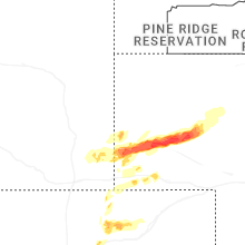


Connect with Interactive Hail Maps