

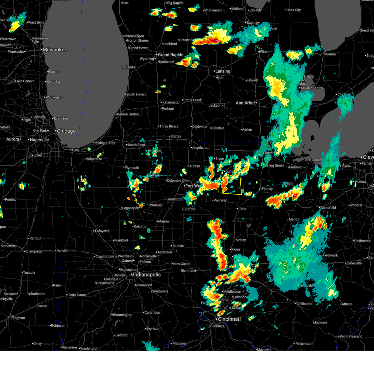
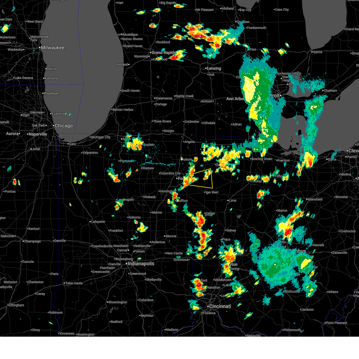
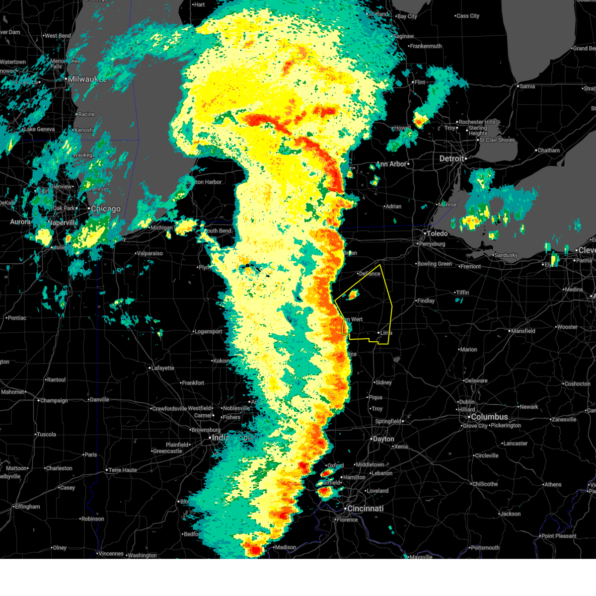
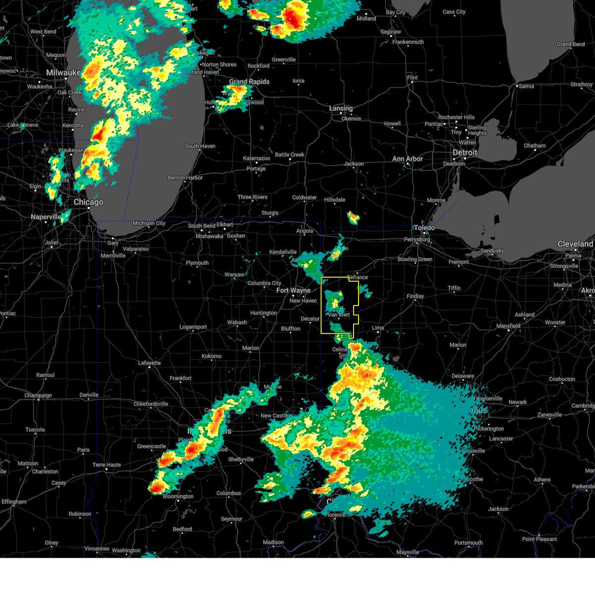
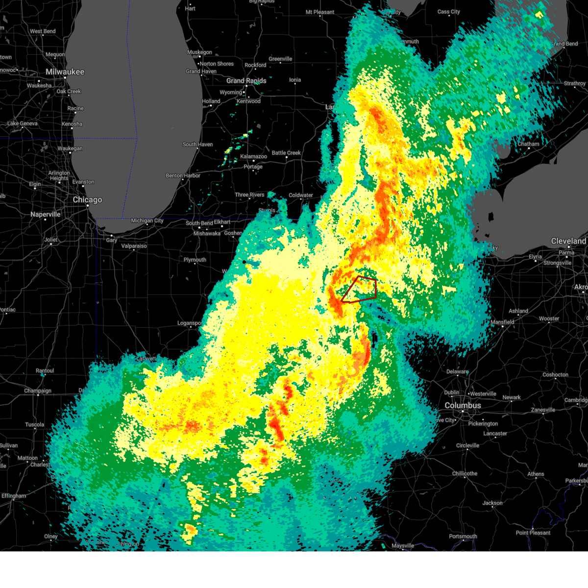
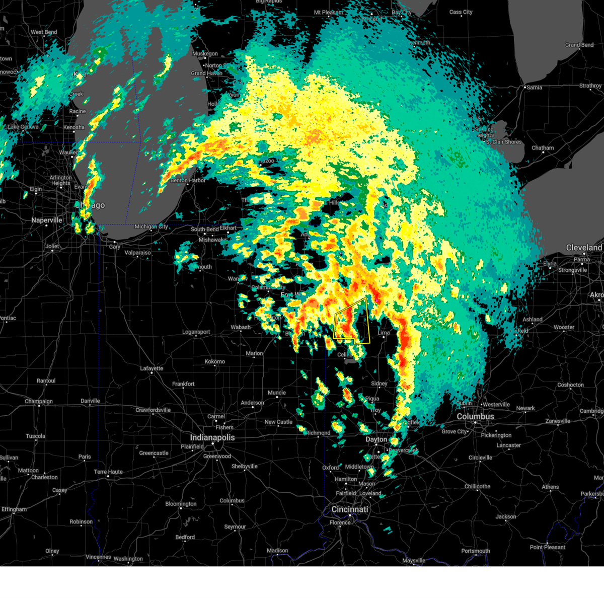
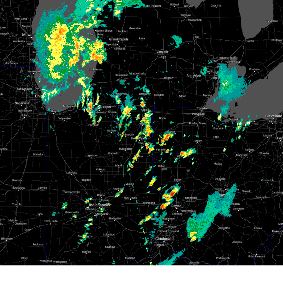
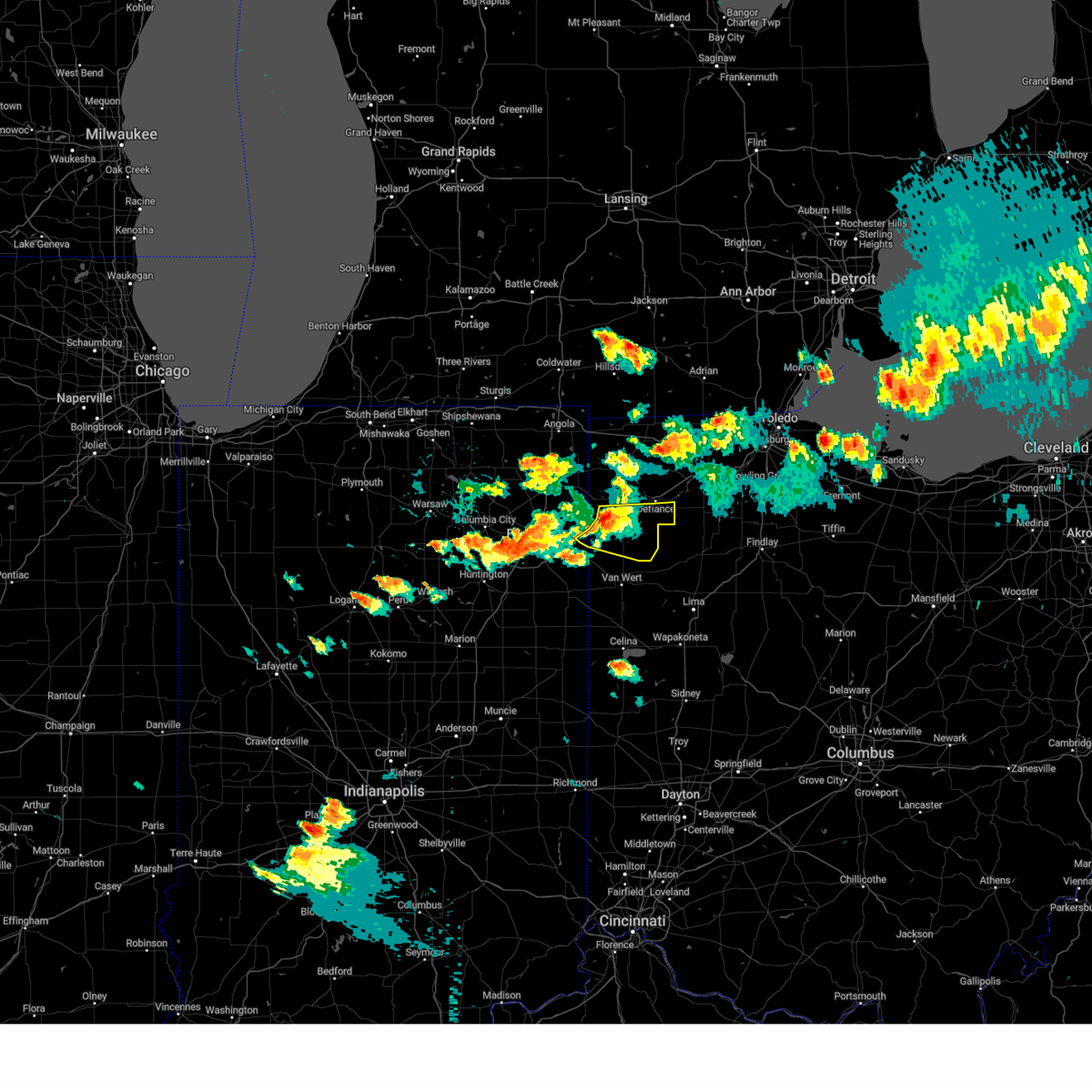
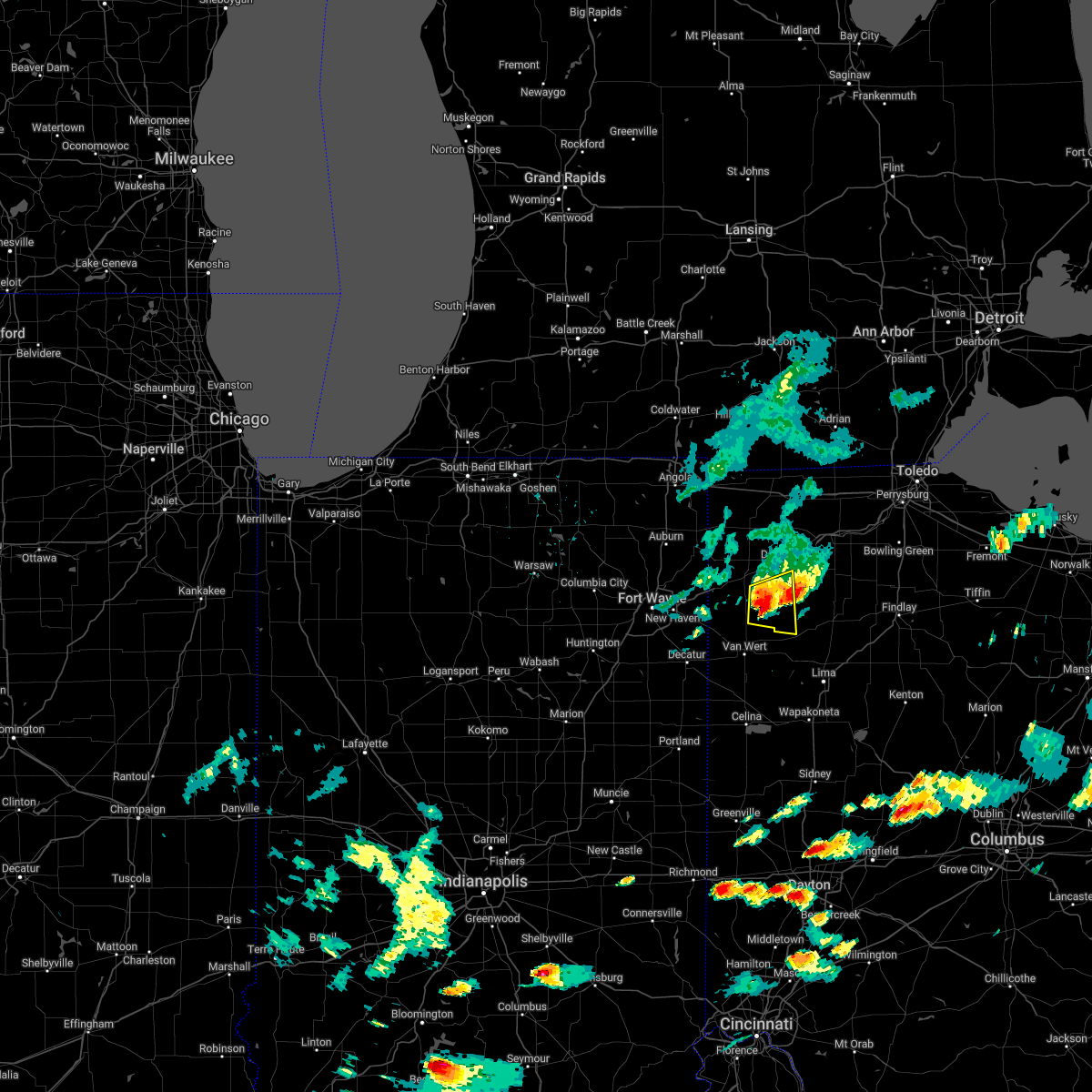
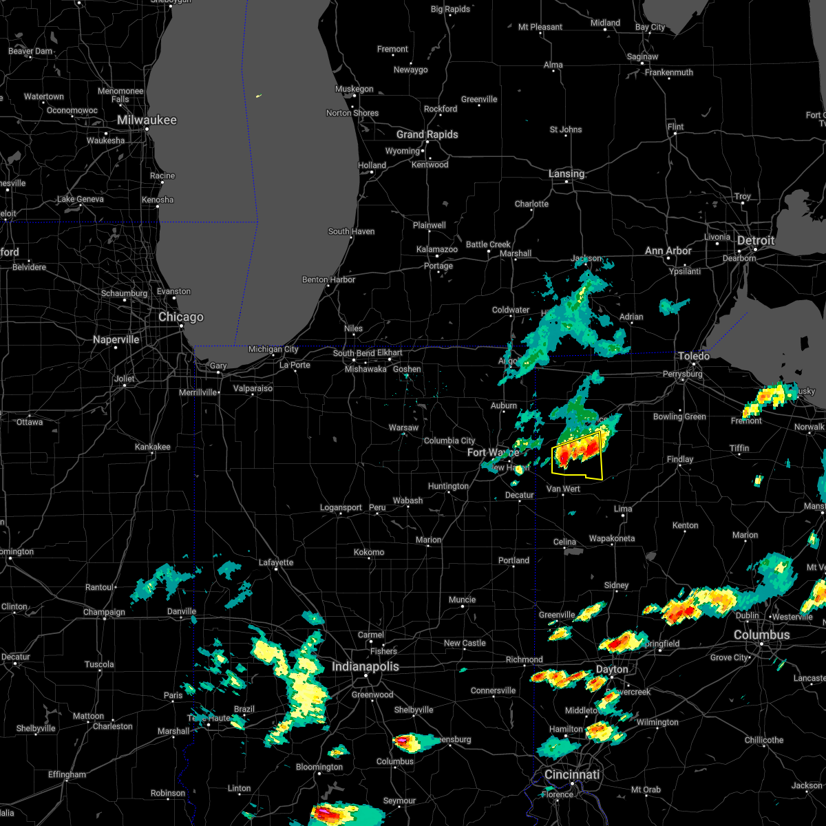
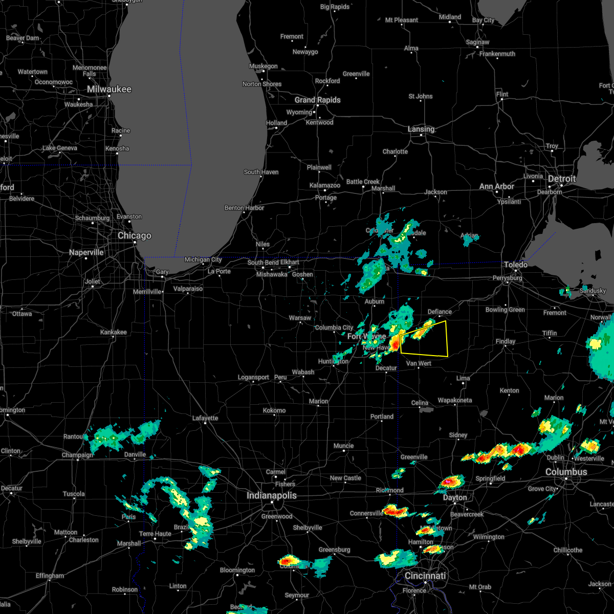
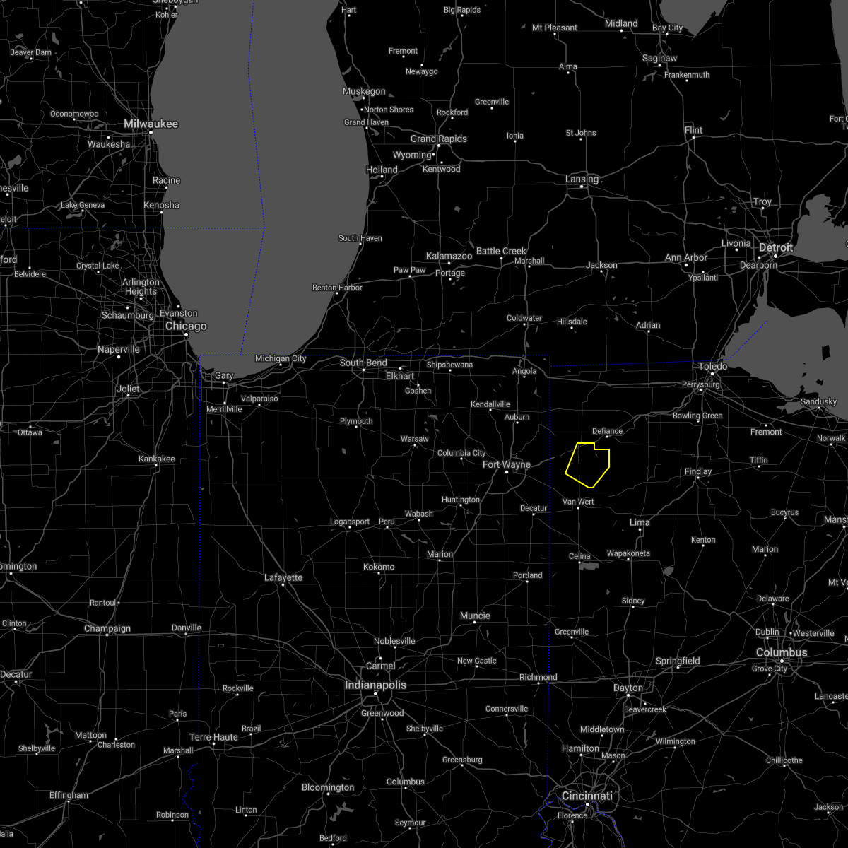
Hail Map for Grover Hill, OH
The Grover Hill, OH area has had 0 reports of on-the-ground hail by trained spotters, and has been under severe weather warnings 25 times during the past 12 months. Doppler radar has detected hail at or near Grover Hill, OH on 32 occasions, including 2 occasions during the past year.
| Name: | Grover Hill, OH |
| Where Located: | 32.7 miles E of Fort Wayne, IN |
| Map: | Google Map for Grover Hill, OH |
| Population: | 402 |
| Housing Units: | 183 |
| More Info: | Search Google for Grover Hill, OH |
2
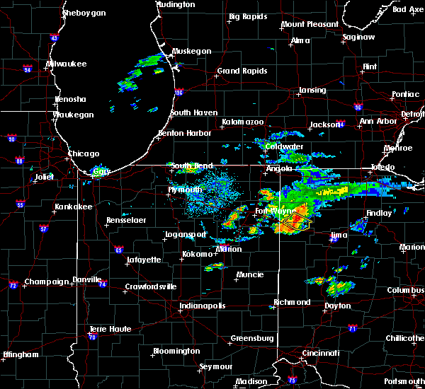
The Top Recent Hail Date for Grover Hill, OH is Tuesday, September 24, 2024 (10th out of 32)

Hail and Wind Damage Spotted near Grover Hill, OH
| Date / Time | Report Details |
|---|---|
| 6/26/2025 4:10 PM EDT |
 Svriwx the national weather service in northern indiana has issued a * severe thunderstorm warning for, central putnam county in west central ohio, southeastern defiance county in northwestern ohio, southeastern paulding county in west central ohio, south central henry county in northwestern ohio, * until 500 pm edt. * at 410 pm edt, a severe thunderstorm was located near paulding, or 15 miles southwest of defiance, moving east at 30 mph (radar indicated). Hazards include 60 mph wind gusts. expect damage to roofs, siding, and trees Svriwx the national weather service in northern indiana has issued a * severe thunderstorm warning for, central putnam county in west central ohio, southeastern defiance county in northwestern ohio, southeastern paulding county in west central ohio, south central henry county in northwestern ohio, * until 500 pm edt. * at 410 pm edt, a severe thunderstorm was located near paulding, or 15 miles southwest of defiance, moving east at 30 mph (radar indicated). Hazards include 60 mph wind gusts. expect damage to roofs, siding, and trees
|
| 6/26/2025 4:05 PM EDT | At 404 pm edt, a severe thunderstorm was located over payne, or 15 miles south of hicksville, moving east at 15 mph (radar indicated). Hazards include 60 mph wind gusts and quarter size hail. Hail damage to vehicles is expected. expect wind damage to roofs, siding, and trees. Locations impacted include, paulding, payne, grover hill, scott, haviland, latty, broughton, mcgill, wetzel, worstville, briceton, and tipton. |
| 6/26/2025 4:05 PM EDT | the severe thunderstorm warning has been cancelled and is no longer in effect |
| 6/26/2025 3:42 PM EDT |
 Svriwx the national weather service in northern indiana has issued a * severe thunderstorm warning for, east central allen county in northeastern indiana, paulding county in west central ohio, northern van wert county in west central ohio, * until 415 pm edt. * at 341 pm edt, a severe thunderstorm was located near woodburn, or 10 miles east of new haven, moving east at 20 mph (radar indicated). Hazards include 60 mph wind gusts and quarter size hail. Hail damage to vehicles is expected. Expect wind damage to roofs, siding, and trees. Svriwx the national weather service in northern indiana has issued a * severe thunderstorm warning for, east central allen county in northeastern indiana, paulding county in west central ohio, northern van wert county in west central ohio, * until 415 pm edt. * at 341 pm edt, a severe thunderstorm was located near woodburn, or 10 miles east of new haven, moving east at 20 mph (radar indicated). Hazards include 60 mph wind gusts and quarter size hail. Hail damage to vehicles is expected. Expect wind damage to roofs, siding, and trees.
|
| 6/18/2025 6:22 PM EDT |
 Svriwx the national weather service in northern indiana has issued a * severe thunderstorm warning for, putnam county in west central ohio, southeastern defiance county in northwestern ohio, southeastern paulding county in west central ohio, south central henry county in northwestern ohio, eastern van wert county in west central ohio, allen county in west central ohio, * until 700 pm edt. * at 621 pm edt, severe thunderstorms were located along a line extending from near payne to van wert to near rockford, moving northeast at 70 mph (radar indicated). Hazards include 60 mph wind gusts. expect damage to roofs, siding, and trees Svriwx the national weather service in northern indiana has issued a * severe thunderstorm warning for, putnam county in west central ohio, southeastern defiance county in northwestern ohio, southeastern paulding county in west central ohio, south central henry county in northwestern ohio, eastern van wert county in west central ohio, allen county in west central ohio, * until 700 pm edt. * at 621 pm edt, severe thunderstorms were located along a line extending from near payne to van wert to near rockford, moving northeast at 70 mph (radar indicated). Hazards include 60 mph wind gusts. expect damage to roofs, siding, and trees
|
| 5/16/2025 8:59 PM EDT | the severe thunderstorm warning has been cancelled and is no longer in effect |
| 5/16/2025 8:41 PM EDT |
 At 840 pm edt, showers and embedded thunderstorms producing strong wind gusts were located along a line extending from near payne to fort loramie, moving east at 55 mph (radar indicated). Hazards include 70 mph wind gusts. Expect considerable tree damage. damage is likely to mobile homes, roofs, and outbuildings. Locations impacted include, van wert, delphos, paulding, antwerp, payne, convoy, ohio city, middlebury, middle point, grover hill, willshire, scott, melrose, haviland, wren, latty, cecil, venedocia, broughton, and elgin. At 840 pm edt, showers and embedded thunderstorms producing strong wind gusts were located along a line extending from near payne to fort loramie, moving east at 55 mph (radar indicated). Hazards include 70 mph wind gusts. Expect considerable tree damage. damage is likely to mobile homes, roofs, and outbuildings. Locations impacted include, van wert, delphos, paulding, antwerp, payne, convoy, ohio city, middlebury, middle point, grover hill, willshire, scott, melrose, haviland, wren, latty, cecil, venedocia, broughton, and elgin.
|
| 5/16/2025 8:19 PM EDT | Svriwx the national weather service in northern indiana has issued a * severe thunderstorm warning for, paulding county in west central ohio, van wert county in west central ohio, * until 915 pm edt. * at 818 pm edt, severe thunderstorms were located along a line extending from new haven to near st. henry, moving east at 55 mph (radar indicated). Hazards include 60 mph wind gusts. expect damage to roofs, siding, and trees |
| 4/2/2025 11:16 PM EDT |
 Toriwx the national weather service in northern indiana has issued a * tornado warning for, northwestern putnam county in west central ohio, southeastern defiance county in northwestern ohio, southeastern paulding county in west central ohio, south central henry county in northwestern ohio, * until 1145 pm edt. * at 1115 pm edt, a severe thunderstorm capable of producing a tornado was located near ottoville, or 12 miles north of delphos, moving northeast at 65 mph (radar indicated rotation). Hazards include tornado. Flying debris will be dangerous to those caught without shelter. mobile homes will be damaged or destroyed. damage to roofs, windows, and vehicles will occur. Tree damage is likely. Toriwx the national weather service in northern indiana has issued a * tornado warning for, northwestern putnam county in west central ohio, southeastern defiance county in northwestern ohio, southeastern paulding county in west central ohio, south central henry county in northwestern ohio, * until 1145 pm edt. * at 1115 pm edt, a severe thunderstorm capable of producing a tornado was located near ottoville, or 12 miles north of delphos, moving northeast at 65 mph (radar indicated rotation). Hazards include tornado. Flying debris will be dangerous to those caught without shelter. mobile homes will be damaged or destroyed. damage to roofs, windows, and vehicles will occur. Tree damage is likely.
|
| 4/2/2025 11:02 PM EDT |
 the severe thunderstorm warning has been cancelled and is no longer in effect the severe thunderstorm warning has been cancelled and is no longer in effect
|
| 4/2/2025 11:02 PM EDT |
 At 1102 pm edt, severe thunderstorms were located along a line extending from near payne to near van wert to near rockford, moving northeast at 60 mph (radar indicated). Hazards include 70 mph wind gusts. Expect considerable tree damage. damage is likely to mobile homes, roofs, and outbuildings. locations impacted include, elida, ottoville, yoder, westminster, columbus grove, bluffton, cavett, haviland, west leipsic, rimer, latty, dupont, venedocia, convoy, ottawa, wetzel, vaughnsville, kieferville, glandorf, and spencerville in allen county. This includes interstate 75 between mile markers 119 and 141. At 1102 pm edt, severe thunderstorms were located along a line extending from near payne to near van wert to near rockford, moving northeast at 60 mph (radar indicated). Hazards include 70 mph wind gusts. Expect considerable tree damage. damage is likely to mobile homes, roofs, and outbuildings. locations impacted include, elida, ottoville, yoder, westminster, columbus grove, bluffton, cavett, haviland, west leipsic, rimer, latty, dupont, venedocia, convoy, ottawa, wetzel, vaughnsville, kieferville, glandorf, and spencerville in allen county. This includes interstate 75 between mile markers 119 and 141.
|
| 4/2/2025 10:43 PM EDT | Svriwx the national weather service in northern indiana has issued a * severe thunderstorm warning for, southeastern allen county in northeastern indiana, northern adams county in northeastern indiana, putnam county in west central ohio, southeastern paulding county in west central ohio, van wert county in west central ohio, allen county in west central ohio, * until midnight edt. * at 1042 pm edt, severe thunderstorms were located along a line extending from near decatur to 6 miles west of rockford to st. henry, moving northeast at 65 mph (radar indicated). Hazards include 70 mph wind gusts. Expect considerable tree damage. Damage is likely to mobile homes, roofs, and outbuildings. |
| 4/2/2025 9:54 AM EDT |
 the severe thunderstorm warning has been cancelled and is no longer in effect the severe thunderstorm warning has been cancelled and is no longer in effect
|
| 4/2/2025 9:46 AM EDT |
 At 946 am edt, a severe thunderstorm was located near ottoville, or 10 miles north of delphos, moving northeast at 70 mph (radar indicated). Hazards include 60 mph wind gusts and quarter size hail. Hail damage to vehicles is expected. expect wind damage to roofs, siding, and trees. Locations impacted include, southworth, wetzel, delphos, ottoville, mandale, needmore, middle point, fort jennings, grover hill, venedocia, roselms, and cloverdale. At 946 am edt, a severe thunderstorm was located near ottoville, or 10 miles north of delphos, moving northeast at 70 mph (radar indicated). Hazards include 60 mph wind gusts and quarter size hail. Hail damage to vehicles is expected. expect wind damage to roofs, siding, and trees. Locations impacted include, southworth, wetzel, delphos, ottoville, mandale, needmore, middle point, fort jennings, grover hill, venedocia, roselms, and cloverdale.
|
| 4/2/2025 9:39 AM EDT |
 Svriwx the national weather service in northern indiana has issued a * severe thunderstorm warning for, southwestern putnam county in west central ohio, southeastern paulding county in west central ohio, van wert county in west central ohio, southwestern allen county in west central ohio, * until 1015 am edt. * at 938 am edt, a severe thunderstorm was located near van wert, moving northeast at 70 mph (radar indicated). Hazards include 60 mph wind gusts and quarter size hail. Hail damage to vehicles is expected. Expect wind damage to roofs, siding, and trees. Svriwx the national weather service in northern indiana has issued a * severe thunderstorm warning for, southwestern putnam county in west central ohio, southeastern paulding county in west central ohio, van wert county in west central ohio, southwestern allen county in west central ohio, * until 1015 am edt. * at 938 am edt, a severe thunderstorm was located near van wert, moving northeast at 70 mph (radar indicated). Hazards include 60 mph wind gusts and quarter size hail. Hail damage to vehicles is expected. Expect wind damage to roofs, siding, and trees.
|
| 3/30/2025 5:57 PM EDT | At 557 pm edt, severe thunderstorms were located along a line extending from 8 miles west of pioneer to woodburn, moving northeast at 45 mph (radar indicated). Hazards include 70 mph wind gusts and nickel size hail. Expect considerable tree damage. damage is likely to mobile homes, roofs, and outbuildings. locations impacted include, paulding, grelton, ridgeville corners, gerald, liberty center, fayette, lake seneca, zulu, tedrow, antwerp, latty, okolona, mark center, kunkle, worstville, bryan, poe, hessen cassel, florida, and winameg. this includes the following highways, interstate 469 between mile markers 12 and 22. interstate 80 in indiana near mile marker 156. Interstate 80 in ohio between mile markers 0 and 48. |
| 3/30/2025 5:34 PM EDT |
 Svriwx the national weather service in northern indiana has issued a * severe thunderstorm warning for, steuben county in northeastern indiana, allen county in northeastern indiana, de kalb county in northeastern indiana, southern hillsdale county in southeastern michigan, northern putnam county in west central ohio, defiance county in northwestern ohio, paulding county in west central ohio, henry county in northwestern ohio, northwestern van wert county in west central ohio, williams county in northwestern ohio, fulton county in northwestern ohio, * until 630 pm edt. * at 533 pm edt, severe thunderstorms were located along a line extending from angola to near ossian, moving east at 70 mph (radar indicated). Hazards include 70 mph wind gusts and nickel size hail. Expect considerable tree damage. Damage is likely to mobile homes, roofs, and outbuildings. Svriwx the national weather service in northern indiana has issued a * severe thunderstorm warning for, steuben county in northeastern indiana, allen county in northeastern indiana, de kalb county in northeastern indiana, southern hillsdale county in southeastern michigan, northern putnam county in west central ohio, defiance county in northwestern ohio, paulding county in west central ohio, henry county in northwestern ohio, northwestern van wert county in west central ohio, williams county in northwestern ohio, fulton county in northwestern ohio, * until 630 pm edt. * at 533 pm edt, severe thunderstorms were located along a line extending from angola to near ossian, moving east at 70 mph (radar indicated). Hazards include 70 mph wind gusts and nickel size hail. Expect considerable tree damage. Damage is likely to mobile homes, roofs, and outbuildings.
|
| 9/24/2024 6:16 PM EDT |
 the severe thunderstorm warning has been cancelled and is no longer in effect the severe thunderstorm warning has been cancelled and is no longer in effect
|
| 9/24/2024 5:51 PM EDT |
 Svriwx the national weather service in northern indiana has issued a * severe thunderstorm warning for, southeastern paulding county in west central ohio, * until 630 pm edt. * at 550 pm edt, a severe thunderstorm was located 9 miles northwest of ottoville, or 11 miles northeast of van wert, moving northeast at 20 mph (radar indicated). Hazards include 60 mph wind gusts and half dollar size hail. Hail damage to vehicles is expected. Expect wind damage to roofs, siding, and trees. Svriwx the national weather service in northern indiana has issued a * severe thunderstorm warning for, southeastern paulding county in west central ohio, * until 630 pm edt. * at 550 pm edt, a severe thunderstorm was located 9 miles northwest of ottoville, or 11 miles northeast of van wert, moving northeast at 20 mph (radar indicated). Hazards include 60 mph wind gusts and half dollar size hail. Hail damage to vehicles is expected. Expect wind damage to roofs, siding, and trees.
|
| 9/24/2024 4:54 PM EDT |
 At 454 pm edt, a severe thunderstorm was located near continental, or 11 miles south of defiance, moving northeast at 35 mph (radar indicated). Hazards include 60 mph wind gusts and quarter size hail. Hail damage to vehicles is expected. expect wind damage to roofs, siding, and trees. Locations impacted include, defiance, paulding, continental, holgate, grover hill, dupont, melrose, florida, cloverdale, miller city, broughton, new bavaria, kieferville, arthur, charloe, pleasant bend, ayersville, roselms, north creek, and mandale. At 454 pm edt, a severe thunderstorm was located near continental, or 11 miles south of defiance, moving northeast at 35 mph (radar indicated). Hazards include 60 mph wind gusts and quarter size hail. Hail damage to vehicles is expected. expect wind damage to roofs, siding, and trees. Locations impacted include, defiance, paulding, continental, holgate, grover hill, dupont, melrose, florida, cloverdale, miller city, broughton, new bavaria, kieferville, arthur, charloe, pleasant bend, ayersville, roselms, north creek, and mandale.
|
| 9/24/2024 4:52 PM EDT |
 The storm which prompted the warning has moved out of the area. therefore, the warning will be allowed to expire. The storm which prompted the warning has moved out of the area. therefore, the warning will be allowed to expire.
|
| 9/24/2024 4:43 PM EDT | At 443 pm edt, a severe thunderstorm was located near paulding, or 15 miles north of van wert, moving northeast at 25 mph (radar indicated). Hazards include 60 mph wind gusts and quarter size hail. Hail damage to vehicles is expected. expect wind damage to roofs, siding, and trees. Locations impacted include, paulding, grover hill, scott, haviland, latty, broughton, and briceton. |
| 9/24/2024 4:43 PM EDT | the severe thunderstorm warning has been cancelled and is no longer in effect |
| 9/24/2024 4:36 PM EDT |
 Svriwx the national weather service in northern indiana has issued a * severe thunderstorm warning for, southeastern defiance county in northwestern ohio, northwestern putnam county in west central ohio, eastern paulding county in west central ohio, south central henry county in northwestern ohio, * until 530 pm edt. * at 436 pm edt, a severe thunderstorm was located near paulding, or 13 miles north of van wert, moving northeast at 35 mph (radar indicated). Hazards include quarter size hail. damage to vehicles is expected Svriwx the national weather service in northern indiana has issued a * severe thunderstorm warning for, southeastern defiance county in northwestern ohio, northwestern putnam county in west central ohio, eastern paulding county in west central ohio, south central henry county in northwestern ohio, * until 530 pm edt. * at 436 pm edt, a severe thunderstorm was located near paulding, or 13 miles north of van wert, moving northeast at 35 mph (radar indicated). Hazards include quarter size hail. damage to vehicles is expected
|
| 9/24/2024 4:08 PM EDT |
 Svriwx the national weather service in northern indiana has issued a * severe thunderstorm warning for, southwestern paulding county in west central ohio, northwestern van wert county in west central ohio, * until 500 pm edt. * at 408 pm edt, a severe thunderstorm was located near convoy, or 11 miles northwest of van wert, moving northeast at 25 mph (radar indicated). Hazards include 60 mph wind gusts and quarter size hail. Hail damage to vehicles is expected. Expect wind damage to roofs, siding, and trees. Svriwx the national weather service in northern indiana has issued a * severe thunderstorm warning for, southwestern paulding county in west central ohio, northwestern van wert county in west central ohio, * until 500 pm edt. * at 408 pm edt, a severe thunderstorm was located near convoy, or 11 miles northwest of van wert, moving northeast at 25 mph (radar indicated). Hazards include 60 mph wind gusts and quarter size hail. Hail damage to vehicles is expected. Expect wind damage to roofs, siding, and trees.
|
| 4/17/2024 1:59 PM EDT |
 At 158 pm edt, severe thunderstorms were located along a line extending from 6 miles east of paulding to near continental to near delphos to near spencerville in allen county, moving east at 35 mph (radar indicated). Hazards include 60 mph wind gusts and quarter size hail. Hail damage to vehicles is expected. expect wind damage to roofs, siding, and trees. Locations impacted include, lima, delphos, ottawa, spencerville, columbus grove, leipsic, elida, kalida, continental, holgate, glandorf, ottoville, spencerville in allen county, middle point, cairo, fort jennings, grover hill, dupont, melrose, and florida. At 158 pm edt, severe thunderstorms were located along a line extending from 6 miles east of paulding to near continental to near delphos to near spencerville in allen county, moving east at 35 mph (radar indicated). Hazards include 60 mph wind gusts and quarter size hail. Hail damage to vehicles is expected. expect wind damage to roofs, siding, and trees. Locations impacted include, lima, delphos, ottawa, spencerville, columbus grove, leipsic, elida, kalida, continental, holgate, glandorf, ottoville, spencerville in allen county, middle point, cairo, fort jennings, grover hill, dupont, melrose, and florida.
|
| 4/17/2024 1:43 PM EDT |
 Svriwx the national weather service in northern indiana has issued a * severe thunderstorm warning for, southeastern defiance county in northwestern ohio, putnam county in west central ohio, southeastern paulding county in west central ohio, south central henry county in northwestern ohio, eastern van wert county in west central ohio, western allen county in west central ohio, * until 230 pm edt. * at 143 pm edt, severe thunderstorms were located along a line extending from 9 miles south of paulding to near delphos to 6 miles southwest of spencerville in allen county, moving northeast at 40 mph (radar indicated). Hazards include 60 mph wind gusts. expect damage to roofs, siding, and trees Svriwx the national weather service in northern indiana has issued a * severe thunderstorm warning for, southeastern defiance county in northwestern ohio, putnam county in west central ohio, southeastern paulding county in west central ohio, south central henry county in northwestern ohio, eastern van wert county in west central ohio, western allen county in west central ohio, * until 230 pm edt. * at 143 pm edt, severe thunderstorms were located along a line extending from 9 miles south of paulding to near delphos to 6 miles southwest of spencerville in allen county, moving northeast at 40 mph (radar indicated). Hazards include 60 mph wind gusts. expect damage to roofs, siding, and trees
|
| 7/20/2023 5:51 PM EDT |
 The severe thunderstorm warning for east central allen, southern defiance and paulding counties will expire at 600 pm edt, the storm which prompted the warning has weakened below severe limits, and no longer poses an immediate threat to life or property. therefore, the warning will be allowed to expire. a severe thunderstorm watch remains in effect until 1100 pm edt for northeastern indiana, and northwestern and west central ohio. The severe thunderstorm warning for east central allen, southern defiance and paulding counties will expire at 600 pm edt, the storm which prompted the warning has weakened below severe limits, and no longer poses an immediate threat to life or property. therefore, the warning will be allowed to expire. a severe thunderstorm watch remains in effect until 1100 pm edt for northeastern indiana, and northwestern and west central ohio.
|
| 7/20/2023 5:31 PM EDT |
 At 530 pm edt, a severe thunderstorm was located near paulding, or 9 miles southeast of hicksville, moving east at 40 mph (radar indicated). Hazards include 70 mph wind gusts and penny size hail. Expect considerable tree damage. damage is likely to mobile homes, roofs, and outbuildings. Locations impacted include, defiance, paulding, antwerp, woodburn, payne, grover hill, melrose, haviland, latty, cecil, broughton, worstville, arthur, charloe, edgerton in allen county, ayersville, roselms, and briceton. At 530 pm edt, a severe thunderstorm was located near paulding, or 9 miles southeast of hicksville, moving east at 40 mph (radar indicated). Hazards include 70 mph wind gusts and penny size hail. Expect considerable tree damage. damage is likely to mobile homes, roofs, and outbuildings. Locations impacted include, defiance, paulding, antwerp, woodburn, payne, grover hill, melrose, haviland, latty, cecil, broughton, worstville, arthur, charloe, edgerton in allen county, ayersville, roselms, and briceton.
|
| 7/20/2023 5:11 PM EDT |
 At 511 pm edt, a severe thunderstorm was located near grabill, or 7 miles southwest of hicksville, moving east at 40 mph (radar indicated). Hazards include 70 mph wind gusts and penny size hail. Expect considerable tree damage. damage is likely to mobile homes, roofs, and outbuildings. locations impacted include, fort wayne, defiance, hicksville, paulding, antwerp, woodburn, payne, grabill, st. joe, newville, grover hill, scott, melrose, haviland, latty, cecil, broughton, arthur, charloe, and edgerton in allen county. This includes interstate 469 between mile markers 22 and 26. At 511 pm edt, a severe thunderstorm was located near grabill, or 7 miles southwest of hicksville, moving east at 40 mph (radar indicated). Hazards include 70 mph wind gusts and penny size hail. Expect considerable tree damage. damage is likely to mobile homes, roofs, and outbuildings. locations impacted include, fort wayne, defiance, hicksville, paulding, antwerp, woodburn, payne, grabill, st. joe, newville, grover hill, scott, melrose, haviland, latty, cecil, broughton, arthur, charloe, and edgerton in allen county. This includes interstate 469 between mile markers 22 and 26.
|
| 7/20/2023 4:53 PM EDT |
 At 453 pm edt, a severe thunderstorm was located near huntertown, or near garrett, moving east at 40 mph (radar indicated). Hazards include 70 mph wind gusts and penny size hail. Expect considerable tree damage. Damage is likely to mobile homes, roofs, and outbuildings. At 453 pm edt, a severe thunderstorm was located near huntertown, or near garrett, moving east at 40 mph (radar indicated). Hazards include 70 mph wind gusts and penny size hail. Expect considerable tree damage. Damage is likely to mobile homes, roofs, and outbuildings.
|
| 4/5/2023 1:56 PM EDT |
 At 156 pm edt, severe thunderstorms were located along a line extending from near morenci to near defiance, moving northeast at 55 mph (radar indicated). Hazards include 60 mph wind gusts. Expect damage to roofs, siding, and trees. locations impacted include, defiance, napoleon, wauseon, ottawa, archbold, swanton, delta, leipsic, deshler, kalida, fayette, liberty center, continental, holgate, glandorf, mcclure, metamora, hamler, lyons and grover hill. This includes interstate 80 in ohio between mile markers 23 and 47. At 156 pm edt, severe thunderstorms were located along a line extending from near morenci to near defiance, moving northeast at 55 mph (radar indicated). Hazards include 60 mph wind gusts. Expect damage to roofs, siding, and trees. locations impacted include, defiance, napoleon, wauseon, ottawa, archbold, swanton, delta, leipsic, deshler, kalida, fayette, liberty center, continental, holgate, glandorf, mcclure, metamora, hamler, lyons and grover hill. This includes interstate 80 in ohio between mile markers 23 and 47.
|
| 4/5/2023 1:48 PM EDT |
 At 148 pm edt, a severe thunderstorm was located near convoy, or near van wert, moving northeast at 60 mph (radar indicated). Hazards include 60 mph wind gusts and penny size hail. Expect damage to roofs, siding, and trees. This severe thunderstorm will remain over mainly rural areas of southeastern paulding and van wert counties, including the following locations, wetzel, glenmore, cavett, dull, abanaka, jonestown, middle point, middlebury, grover hill and venedocia. At 148 pm edt, a severe thunderstorm was located near convoy, or near van wert, moving northeast at 60 mph (radar indicated). Hazards include 60 mph wind gusts and penny size hail. Expect damage to roofs, siding, and trees. This severe thunderstorm will remain over mainly rural areas of southeastern paulding and van wert counties, including the following locations, wetzel, glenmore, cavett, dull, abanaka, jonestown, middle point, middlebury, grover hill and venedocia.
|
| 4/5/2023 1:46 PM EDT |
 At 146 pm edt, severe thunderstorms were located along a line extending from fayette to paulding, moving northeast at 55 mph (radar indicated). Hazards include 60 mph wind gusts. Expect damage to roofs, siding, and trees. locations impacted include, defiance, napoleon, bryan, wauseon, ottawa, archbold, swanton, paulding, delta, leipsic, deshler, west unity, kalida, stryker, fayette, payne, liberty center, continental, holgate and glandorf. This includes interstate 80 in ohio between mile markers 16 and 47. At 146 pm edt, severe thunderstorms were located along a line extending from fayette to paulding, moving northeast at 55 mph (radar indicated). Hazards include 60 mph wind gusts. Expect damage to roofs, siding, and trees. locations impacted include, defiance, napoleon, bryan, wauseon, ottawa, archbold, swanton, paulding, delta, leipsic, deshler, west unity, kalida, stryker, fayette, payne, liberty center, continental, holgate and glandorf. This includes interstate 80 in ohio between mile markers 16 and 47.
|
| 4/5/2023 1:41 PM EDT |
 At 141 pm edt, severe thunderstorms were located along a line extending from near fayette to near paulding, moving northeast at 55 mph (radar indicated). Hazards include 60 mph wind gusts. expect damage to roofs, siding, and trees At 141 pm edt, severe thunderstorms were located along a line extending from near fayette to near paulding, moving northeast at 55 mph (radar indicated). Hazards include 60 mph wind gusts. expect damage to roofs, siding, and trees
|
| 4/5/2023 1:34 PM EDT |
 At 134 pm edt, a severe thunderstorm was located over decatur, moving northeast at 60 mph (radar indicated). Hazards include 60 mph wind gusts and penny size hail. Expect damage to roofs, siding, and trees. this severe thunderstorm will be near, convoy around 145 pm edt. Van wert around 150 pm edt. At 134 pm edt, a severe thunderstorm was located over decatur, moving northeast at 60 mph (radar indicated). Hazards include 60 mph wind gusts and penny size hail. Expect damage to roofs, siding, and trees. this severe thunderstorm will be near, convoy around 145 pm edt. Van wert around 150 pm edt.
|
| 2/27/2023 3:12 PM EST |
 At 311 pm est, severe thunderstorms were located along a line extending from near paulding to 10 miles north of van wert, moving northeast at 55 mph (radar indicated). Hazards include 60 mph wind gusts. Expect damage to roofs, siding, and trees. severe thunderstorms will be near, defiance around 325 pm est. continental around 330 pm est. holgate around 340 pm est. napoleon and wauseon around 350 pm est. delta around 355 pm est. other locations impacted by these severe thunderstorms include hamler, melrose, arthur, ridgeville corners, gerald, charloe, new bavaria, ayersville, brunersburg and dupont. This includes interstate 80 in ohio between mile markers 38 and 41. At 311 pm est, severe thunderstorms were located along a line extending from near paulding to 10 miles north of van wert, moving northeast at 55 mph (radar indicated). Hazards include 60 mph wind gusts. Expect damage to roofs, siding, and trees. severe thunderstorms will be near, defiance around 325 pm est. continental around 330 pm est. holgate around 340 pm est. napoleon and wauseon around 350 pm est. delta around 355 pm est. other locations impacted by these severe thunderstorms include hamler, melrose, arthur, ridgeville corners, gerald, charloe, new bavaria, ayersville, brunersburg and dupont. This includes interstate 80 in ohio between mile markers 38 and 41.
|
| 8/29/2022 5:04 PM EDT |
 At 503 pm edt, severe thunderstorms were located along a line extending from near edgerton to near woodburn to 6 miles northeast of ossian, moving east at 50 mph (radar indicated). Hazards include 70 mph wind gusts. Expect considerable tree damage. Damage is likely to mobile homes, roofs, and outbuildings. At 503 pm edt, severe thunderstorms were located along a line extending from near edgerton to near woodburn to 6 miles northeast of ossian, moving east at 50 mph (radar indicated). Hazards include 70 mph wind gusts. Expect considerable tree damage. Damage is likely to mobile homes, roofs, and outbuildings.
|
| 7/23/2022 8:58 AM EDT |
 At 858 am edt, severe thunderstorms were located along a line extending from near payne to 9 miles south of fort wayne to near ossian, moving east at 35 mph (radar indicated). Hazards include 60 mph wind gusts and penny size hail. Expect damage to roofs, siding, and trees. locations impacted include, fort wayne, defiance, new haven, van wert, decatur, ossian, paulding, monroeville, payne, convoy, middletown, middlebury, preble, zanesville, dixon, grover hill, uniondale, scott, melrose and haviland. this includes the following highways, interstate 469 between mile markers 0 and 20. interstate 69 in indiana between mile markers 296 and 300. hail threat, radar indicated max hail size, 0. 75 in wind threat, radar indicated max wind gust, 60 mph. At 858 am edt, severe thunderstorms were located along a line extending from near payne to 9 miles south of fort wayne to near ossian, moving east at 35 mph (radar indicated). Hazards include 60 mph wind gusts and penny size hail. Expect damage to roofs, siding, and trees. locations impacted include, fort wayne, defiance, new haven, van wert, decatur, ossian, paulding, monroeville, payne, convoy, middletown, middlebury, preble, zanesville, dixon, grover hill, uniondale, scott, melrose and haviland. this includes the following highways, interstate 469 between mile markers 0 and 20. interstate 69 in indiana between mile markers 296 and 300. hail threat, radar indicated max hail size, 0. 75 in wind threat, radar indicated max wind gust, 60 mph.
|
| 7/23/2022 8:30 AM EDT |
 At 829 am edt, severe thunderstorms were located along a line extending from near butler to near new haven to near markle, moving east at 45 mph (radar indicated). Hazards include 60 mph wind gusts. expect damage to roofs, siding, and trees At 829 am edt, severe thunderstorms were located along a line extending from near butler to near new haven to near markle, moving east at 45 mph (radar indicated). Hazards include 60 mph wind gusts. expect damage to roofs, siding, and trees
|
| 6/1/2022 6:42 PM EDT |
 The severe thunderstorm warning for northwestern putnam, southeastern defiance and eastern paulding counties will expire at 645 pm edt, the storm which prompted the warning has moved out of the area. therefore, the warning will be allowed to expire. to report severe weather, contact your nearest law enforcement agency. they will relay your report to the national weather service northern indiana. remember, a severe thunderstorm warning still remains in effect for eastern paulding, northern putnam, southeastern defiance, and southern henry counties in ohio. The severe thunderstorm warning for northwestern putnam, southeastern defiance and eastern paulding counties will expire at 645 pm edt, the storm which prompted the warning has moved out of the area. therefore, the warning will be allowed to expire. to report severe weather, contact your nearest law enforcement agency. they will relay your report to the national weather service northern indiana. remember, a severe thunderstorm warning still remains in effect for eastern paulding, northern putnam, southeastern defiance, and southern henry counties in ohio.
|
| 6/1/2022 6:28 PM EDT |
 At 628 pm edt, a severe thunderstorm was located near paulding, or 13 miles southwest of defiance, moving east at 35 mph (radar indicated). Hazards include 60 mph wind gusts and quarter size hail. Hail damage to vehicles is expected. expect wind damage to roofs, siding, and trees. locations impacted include, oakwood, grover hill, dupont, melrose, cloverdale, broughton, mandale, arthur, charloe and roselms. hail threat, radar indicated max hail size, 1. 00 in wind threat, radar indicated max wind gust, 60 mph. At 628 pm edt, a severe thunderstorm was located near paulding, or 13 miles southwest of defiance, moving east at 35 mph (radar indicated). Hazards include 60 mph wind gusts and quarter size hail. Hail damage to vehicles is expected. expect wind damage to roofs, siding, and trees. locations impacted include, oakwood, grover hill, dupont, melrose, cloverdale, broughton, mandale, arthur, charloe and roselms. hail threat, radar indicated max hail size, 1. 00 in wind threat, radar indicated max wind gust, 60 mph.
|
| 6/1/2022 6:21 PM EDT |
 At 620 pm edt, a severe thunderstorm was located near paulding, or 15 miles north of van wert, moving east at 35 mph (radar indicated). Hazards include 60 mph wind gusts and quarter size hail. Hail damage to vehicles is expected. expect wind damage to roofs, siding, and trees. locations impacted include, paulding, oakwood, grover hill, dupont, scott, melrose, haviland, latty, cloverdale, broughton, arthur, charloe, tipton, roselms, mandale and briceton. hail threat, radar indicated max hail size, 1. 00 in wind threat, radar indicated max wind gust, 60 mph. At 620 pm edt, a severe thunderstorm was located near paulding, or 15 miles north of van wert, moving east at 35 mph (radar indicated). Hazards include 60 mph wind gusts and quarter size hail. Hail damage to vehicles is expected. expect wind damage to roofs, siding, and trees. locations impacted include, paulding, oakwood, grover hill, dupont, scott, melrose, haviland, latty, cloverdale, broughton, arthur, charloe, tipton, roselms, mandale and briceton. hail threat, radar indicated max hail size, 1. 00 in wind threat, radar indicated max wind gust, 60 mph.
|
| 6/1/2022 6:04 PM EDT |
 At 604 pm edt, a severe thunderstorm was located over payne, or 15 miles northwest of van wert, moving east at 35 mph (radar indicated). Hazards include 60 mph wind gusts and quarter size hail. Hail damage to vehicles is expected. Expect wind damage to roofs, siding, and trees. At 604 pm edt, a severe thunderstorm was located over payne, or 15 miles northwest of van wert, moving east at 35 mph (radar indicated). Hazards include 60 mph wind gusts and quarter size hail. Hail damage to vehicles is expected. Expect wind damage to roofs, siding, and trees.
|
| 3/6/2022 3:53 AM EST |
 At 352 am est, severe thunderstorms were located along a line extending from wauseon to near kalida to near fort recovery, moving east at 65 mph (radar indicated). Hazards include 70 mph wind gusts. Expect considerable tree damage. damage is likely to mobile homes, roofs, and outbuildings. locations impacted include, lima, defiance, van wert, napoleon, bryan, wauseon, delphos, portland, ottawa, archbold, fort shawnee, paulding, delta, spencerville, columbus grove, elida, kalida, stryker, geneva and payne. This includes interstate 75 between mile markers 119 and 132. At 352 am est, severe thunderstorms were located along a line extending from wauseon to near kalida to near fort recovery, moving east at 65 mph (radar indicated). Hazards include 70 mph wind gusts. Expect considerable tree damage. damage is likely to mobile homes, roofs, and outbuildings. locations impacted include, lima, defiance, van wert, napoleon, bryan, wauseon, delphos, portland, ottawa, archbold, fort shawnee, paulding, delta, spencerville, columbus grove, elida, kalida, stryker, geneva and payne. This includes interstate 75 between mile markers 119 and 132.
|
| 3/6/2022 3:21 AM EST |
 At 321 am est, severe thunderstorms were located along a line extending from near auburn to near monroeville to near matthews, moving east at 80 mph (radar indicated). Hazards include 70 mph wind gusts. Expect considerable tree damage. Damage is likely to mobile homes, roofs, and outbuildings. At 321 am est, severe thunderstorms were located along a line extending from near auburn to near monroeville to near matthews, moving east at 80 mph (radar indicated). Hazards include 70 mph wind gusts. Expect considerable tree damage. Damage is likely to mobile homes, roofs, and outbuildings.
|
| 8/11/2021 2:53 PM EDT |
 At 253 pm edt, severe thunderstorms were located along a line extending from near holgate to near elida to celina, moving east at 45 mph (radar indicated). Hazards include 60 mph wind gusts and penny size hail. Expect damage to roofs, siding, and trees. locations impacted include, defiance, van wert, berne, geneva, convoy, monroe, ohio city, westchester, oakwood, middlebury, nottingham, middle point, grover hill, willshire, scott, melrose, bryant, wren, venedocia and vera cruz. hail threat, radar indicated max hail size, 0. 75 in wind threat, radar indicated max wind gust, 60 mph. At 253 pm edt, severe thunderstorms were located along a line extending from near holgate to near elida to celina, moving east at 45 mph (radar indicated). Hazards include 60 mph wind gusts and penny size hail. Expect damage to roofs, siding, and trees. locations impacted include, defiance, van wert, berne, geneva, convoy, monroe, ohio city, westchester, oakwood, middlebury, nottingham, middle point, grover hill, willshire, scott, melrose, bryant, wren, venedocia and vera cruz. hail threat, radar indicated max hail size, 0. 75 in wind threat, radar indicated max wind gust, 60 mph.
|
| 8/11/2021 2:36 PM EDT |
 At 236 pm edt, severe thunderstorms were located along a line extending from 6 miles northeast of antwerp to near ohio city to near geneva, moving southeast at 40 mph (radar indicated). Hazards include 60 mph wind gusts and penny size hail. Expect damage to roofs, siding, and trees. locations impacted include, fort wayne, defiance, new haven, van wert, bluffton, decatur, berne, hicksville, ossian, paulding, antwerp, woodburn, geneva, monroeville, payne, markle, convoy, monroe, ohio city and westchester. this includes the following highways, interstate 469 near mile marker 6, and between mile markers 9 and 23. interstate 69 in indiana between mile markers 276 and 282. hail threat, radar indicated max hail size, 0. 75 in wind threat, radar indicated max wind gust, 60 mph. At 236 pm edt, severe thunderstorms were located along a line extending from 6 miles northeast of antwerp to near ohio city to near geneva, moving southeast at 40 mph (radar indicated). Hazards include 60 mph wind gusts and penny size hail. Expect damage to roofs, siding, and trees. locations impacted include, fort wayne, defiance, new haven, van wert, bluffton, decatur, berne, hicksville, ossian, paulding, antwerp, woodburn, geneva, monroeville, payne, markle, convoy, monroe, ohio city and westchester. this includes the following highways, interstate 469 near mile marker 6, and between mile markers 9 and 23. interstate 69 in indiana between mile markers 276 and 282. hail threat, radar indicated max hail size, 0. 75 in wind threat, radar indicated max wind gust, 60 mph.
|
| 8/11/2021 2:14 PM EDT |
 At 214 pm edt, severe thunderstorms were located along a line extending from st. joe to near decatur to 7 miles north of montpelier, moving southeast at 40 mph (radar indicated). Hazards include 60 mph wind gusts and penny size hail. expect damage to roofs, siding, and trees At 214 pm edt, severe thunderstorms were located along a line extending from st. joe to near decatur to 7 miles north of montpelier, moving southeast at 40 mph (radar indicated). Hazards include 60 mph wind gusts and penny size hail. expect damage to roofs, siding, and trees
|
| 8/10/2021 7:07 PM EDT |
 At 706 pm edt, a severe thunderstorm was located near paulding, or 14 miles southwest of defiance, moving northeast at 20 mph (radar indicated). Hazards include 60 mph wind gusts. expect damage to roofs, siding, and trees At 706 pm edt, a severe thunderstorm was located near paulding, or 14 miles southwest of defiance, moving northeast at 20 mph (radar indicated). Hazards include 60 mph wind gusts. expect damage to roofs, siding, and trees
|
| 8/10/2021 6:27 PM EDT |
 At 626 pm edt, a severe thunderstorm was located near oakwood, or 12 miles south of defiance, moving east at 20 mph (radar indicated). Hazards include 60 mph wind gusts. Expect damage to roofs, siding, and trees. locations impacted include, ottawa, leipsic, deshler, kalida, continental, holgate, glandorf, oakwood, hamler, grover hill, dupont, melrose, west leipsic, gilboa, cloverdale, belmore, miller city, new bavaria, arthur and charloe. hail threat, radar indicated max hail size, <. 75 in wind threat, radar indicated max wind gust, 60 mph. At 626 pm edt, a severe thunderstorm was located near oakwood, or 12 miles south of defiance, moving east at 20 mph (radar indicated). Hazards include 60 mph wind gusts. Expect damage to roofs, siding, and trees. locations impacted include, ottawa, leipsic, deshler, kalida, continental, holgate, glandorf, oakwood, hamler, grover hill, dupont, melrose, west leipsic, gilboa, cloverdale, belmore, miller city, new bavaria, arthur and charloe. hail threat, radar indicated max hail size, <. 75 in wind threat, radar indicated max wind gust, 60 mph.
|
| 8/10/2021 5:58 PM EDT |
 At 557 pm edt, severe thunderstorms were located along a line extending from near paulding to near continental, moving east at 30 mph (radar indicated). Hazards include 60 mph wind gusts. expect damage to roofs, siding, and trees At 557 pm edt, severe thunderstorms were located along a line extending from near paulding to near continental, moving east at 30 mph (radar indicated). Hazards include 60 mph wind gusts. expect damage to roofs, siding, and trees
|
| 7/29/2021 6:32 AM EDT |
 At 632 am edt, severe thunderstorms were located along a line extending from near bryan to near paulding to near monroeville, moving east at 55 mph (radar indicated). Hazards include 60 mph wind gusts. Expect damage to roofs, siding, and trees. Locations impacted include, defiance, paulding, antwerp, woodburn, monroeville, payne, continental, convoy, ottoville, oakwood, dixon, grover hill, ney, dupont, scott, melrose, haviland, latty, cecil and cloverdale. At 632 am edt, severe thunderstorms were located along a line extending from near bryan to near paulding to near monroeville, moving east at 55 mph (radar indicated). Hazards include 60 mph wind gusts. Expect damage to roofs, siding, and trees. Locations impacted include, defiance, paulding, antwerp, woodburn, monroeville, payne, continental, convoy, ottoville, oakwood, dixon, grover hill, ney, dupont, scott, melrose, haviland, latty, cecil and cloverdale.
|
| 7/29/2021 6:07 AM EDT |
 At 607 am edt, severe thunderstorms were located along a line extending from near butler to near grabill to near fort wayne, moving east at 50 mph (radar indicated). Hazards include 60 mph wind gusts. expect damage to roofs, siding, and trees At 607 am edt, severe thunderstorms were located along a line extending from near butler to near grabill to near fort wayne, moving east at 50 mph (radar indicated). Hazards include 60 mph wind gusts. expect damage to roofs, siding, and trees
|
| 8/10/2020 8:26 PM EDT |
 At 824 pm edt, severe thunderstorms were located along a line extending from near stryker to 7 miles east of paulding to near van wert, moving east at 45 mph (emergency management has reported trees and branches down in hicksville, ohio). Hazards include 60 mph wind gusts. Expect damage to roofs, siding, and trees. these severe storms will be near, ottoville around 840 pm edt. Other locations impacted by these severe thunderstorms include evansport, ney, melrose, arthur, charloe, oakwood, wren, cavett, haviland and dull. At 824 pm edt, severe thunderstorms were located along a line extending from near stryker to 7 miles east of paulding to near van wert, moving east at 45 mph (emergency management has reported trees and branches down in hicksville, ohio). Hazards include 60 mph wind gusts. Expect damage to roofs, siding, and trees. these severe storms will be near, ottoville around 840 pm edt. Other locations impacted by these severe thunderstorms include evansport, ney, melrose, arthur, charloe, oakwood, wren, cavett, haviland and dull.
|
| 8/10/2020 7:51 PM EDT |
 At 751 pm edt, severe thunderstorms were located along a line extending from near butler to near woodburn to near decatur, moving east at 45 mph (radar indicated). Hazards include 70 mph wind gusts. Expect considerable tree damage. damage is likely to mobile homes, roofs, and outbuildings. severe thunderstorms will be near, edgerton in williams county around 800 pm edt. antwerp and payne around 805 pm edt. convoy around 810 pm edt. bryan, paulding and ohio city around 815 pm edt. van wert around 820 pm edt. Ottoville around 835 pm edt. At 751 pm edt, severe thunderstorms were located along a line extending from near butler to near woodburn to near decatur, moving east at 45 mph (radar indicated). Hazards include 70 mph wind gusts. Expect considerable tree damage. damage is likely to mobile homes, roofs, and outbuildings. severe thunderstorms will be near, edgerton in williams county around 800 pm edt. antwerp and payne around 805 pm edt. convoy around 810 pm edt. bryan, paulding and ohio city around 815 pm edt. van wert around 820 pm edt. Ottoville around 835 pm edt.
|
| 7/7/2020 5:00 PM EDT |
 At 459 pm edt, severe thunderstorms were located along a line extending from 8 miles southwest of continental to near ottoville to near ohio city, moving east at 15 mph (radar indicated). Hazards include 60 mph wind gusts and penny size hail. expect damage to roofs, siding, and trees At 459 pm edt, severe thunderstorms were located along a line extending from 8 miles southwest of continental to near ottoville to near ohio city, moving east at 15 mph (radar indicated). Hazards include 60 mph wind gusts and penny size hail. expect damage to roofs, siding, and trees
|
| 5/10/2020 3:22 PM EDT |
 At 320 pm edt, severe thunderstorms were located along a line extending from 7 miles southeast of reading to near west unity to near defiance, moving northeast at 45 mph (radar indicated. at 247 pm, a 61 mph gust was reported by a mesonet station 4 miles northeast of antwerp). Hazards include 60 mph wind gusts. Expect damage to roofs, siding, and trees. Locations impacted include, defiance, napoleon, bryan, wauseon, archbold, montpelier, hicksville, paulding, delta, edgerton, west unity, hamilton, pioneer, stryker, fayette, liberty center, continental, holgate, edon and mcclure. At 320 pm edt, severe thunderstorms were located along a line extending from 7 miles southeast of reading to near west unity to near defiance, moving northeast at 45 mph (radar indicated. at 247 pm, a 61 mph gust was reported by a mesonet station 4 miles northeast of antwerp). Hazards include 60 mph wind gusts. Expect damage to roofs, siding, and trees. Locations impacted include, defiance, napoleon, bryan, wauseon, archbold, montpelier, hicksville, paulding, delta, edgerton, west unity, hamilton, pioneer, stryker, fayette, liberty center, continental, holgate, edon and mcclure.
|
| 5/10/2020 2:53 PM EDT |
 At 252 pm edt, severe thunderstorms were located along a line extending from near waterloo to near hicksville to near paulding, moving northeast at 45 mph (radar indicated. at 247 pm, a 61 mph gust was reported by a mesonet station 4 miles northeast of antwerp). Hazards include 60 mph wind gusts. Expect damage to roofs, siding, and trees. Locations impacted include, defiance, auburn, napoleon, bryan, wauseon, garrett, archbold, montpelier, hicksville, butler, paulding, delta, waterloo, edgerton, antwerp, west unity, hamilton, pioneer, stryker and fayette. At 252 pm edt, severe thunderstorms were located along a line extending from near waterloo to near hicksville to near paulding, moving northeast at 45 mph (radar indicated. at 247 pm, a 61 mph gust was reported by a mesonet station 4 miles northeast of antwerp). Hazards include 60 mph wind gusts. Expect damage to roofs, siding, and trees. Locations impacted include, defiance, auburn, napoleon, bryan, wauseon, garrett, archbold, montpelier, hicksville, butler, paulding, delta, waterloo, edgerton, antwerp, west unity, hamilton, pioneer, stryker and fayette.
|
| 5/10/2020 2:41 PM EDT |
 At 241 pm edt, severe thunderstorms were located along a line extending from near auburn to near antwerp to near convoy, moving northeast at 45 mph (radar indicated). Hazards include 60 mph wind gusts. expect damage to roofs, siding, and trees At 241 pm edt, severe thunderstorms were located along a line extending from near auburn to near antwerp to near convoy, moving northeast at 45 mph (radar indicated). Hazards include 60 mph wind gusts. expect damage to roofs, siding, and trees
|
| 5/10/2020 2:08 PM EDT |
 At 207 pm edt, severe thunderstorms were located along a line extending from grabill to near monroeville to near decatur, moving northeast at 40 mph (radar indicated). Hazards include 60 mph wind gusts. expect damage to roofs, siding, and trees At 207 pm edt, severe thunderstorms were located along a line extending from grabill to near monroeville to near decatur, moving northeast at 40 mph (radar indicated). Hazards include 60 mph wind gusts. expect damage to roofs, siding, and trees
|
| 8/14/2019 8:06 PM EDT |
 At 805 pm edt, severe thunderstorms were located along a line extending from 6 miles southeast of paulding to 8 miles north of van wert to near convoy, moving southeast at 25 mph (radar indicated). Hazards include 60 mph wind gusts. Expect damage to roofs, siding, and trees. Locations impacted include, grover hill, scott, haviland, latty, broughton, wetzel, tipton, briceton, roselms and cavett. At 805 pm edt, severe thunderstorms were located along a line extending from 6 miles southeast of paulding to 8 miles north of van wert to near convoy, moving southeast at 25 mph (radar indicated). Hazards include 60 mph wind gusts. Expect damage to roofs, siding, and trees. Locations impacted include, grover hill, scott, haviland, latty, broughton, wetzel, tipton, briceton, roselms and cavett.
|
| 8/14/2019 7:48 PM EDT |
 At 748 pm edt, severe thunderstorms were located along a line extending from paulding to near payne to near monroeville, moving southeast at 25 mph (radar indicated). Hazards include 60 mph wind gusts. expect damage to roofs, siding, and trees At 748 pm edt, severe thunderstorms were located along a line extending from paulding to near payne to near monroeville, moving southeast at 25 mph (radar indicated). Hazards include 60 mph wind gusts. expect damage to roofs, siding, and trees
|
| 5/28/2019 4:31 PM EDT |
 At 431 pm edt, a severe thunderstorm was located over payne, or 15 miles south of hicksville, moving east at 35 mph (radar indicated). Hazards include quarter size hail. Damage to vehicles is expected. this severe storm will be near, paulding around 440 pm edt. Other locations impacted by this severe thunderstorm include worstville, mandale, melrose, latty, charloe, grover hill, oakwood, briceton, broughton and roselms. At 431 pm edt, a severe thunderstorm was located over payne, or 15 miles south of hicksville, moving east at 35 mph (radar indicated). Hazards include quarter size hail. Damage to vehicles is expected. this severe storm will be near, paulding around 440 pm edt. Other locations impacted by this severe thunderstorm include worstville, mandale, melrose, latty, charloe, grover hill, oakwood, briceton, broughton and roselms.
|
| 5/28/2019 4:16 PM EDT |
 At 416 pm edt, a severe thunderstorm was located over woodburn, or 9 miles east of new haven, moving east at 35 mph (radar indicated). Hazards include golf ball size hail. People and animals outdoors will be injured. expect damage to roofs, siding, windows, and vehicles. this severe thunderstorm will be near, payne around 425 pm edt. paulding around 440 pm edt. Other locations impacted by this severe thunderstorm include worstville, melrose, charloe, edgerton in allen county, tipton, oakwood, roselms, zulu, mcgill and haviland. At 416 pm edt, a severe thunderstorm was located over woodburn, or 9 miles east of new haven, moving east at 35 mph (radar indicated). Hazards include golf ball size hail. People and animals outdoors will be injured. expect damage to roofs, siding, windows, and vehicles. this severe thunderstorm will be near, payne around 425 pm edt. paulding around 440 pm edt. Other locations impacted by this severe thunderstorm include worstville, melrose, charloe, edgerton in allen county, tipton, oakwood, roselms, zulu, mcgill and haviland.
|
| 5/23/2019 5:55 AM EDT | Semi blown over on sr 637 north of grover hill. driver trapped. no word on injurie in paulding county OH, 1.4 miles S of Grover Hill, OH |
| 5/23/2019 5:44 AM EDT |
 The national weather service in northern indiana has issued a * severe thunderstorm warning for. eastern adams county in northeastern indiana. jay county in east central indiana. western putnam county in west central ohio. Southern defiance county in northwestern ohio. The national weather service in northern indiana has issued a * severe thunderstorm warning for. eastern adams county in northeastern indiana. jay county in east central indiana. western putnam county in west central ohio. Southern defiance county in northwestern ohio.
|
| 5/23/2019 5:44 AM EDT |
 At 544 am edt, severe thunderstorms were located along a line extending from near hicksville to decatur to dunkirk, moving east at 55 mph (radar indicated). Hazards include 70 mph wind gusts. Expect considerable tree damage. Damage is likely to mobile homes, roofs, and outbuildings. At 544 am edt, severe thunderstorms were located along a line extending from near hicksville to decatur to dunkirk, moving east at 55 mph (radar indicated). Hazards include 70 mph wind gusts. Expect considerable tree damage. Damage is likely to mobile homes, roofs, and outbuildings.
|
| 5/16/2019 11:19 PM EDT |
 At 1118 pm edt, a severe thunderstorm was located near monroeville, or 13 miles east of new haven, moving southeast at 30 mph (radar indicated). Hazards include quarter size hail. damage to vehicles is expected At 1118 pm edt, a severe thunderstorm was located near monroeville, or 13 miles east of new haven, moving southeast at 30 mph (radar indicated). Hazards include quarter size hail. damage to vehicles is expected
|
| 5/16/2019 11:19 PM EDT |
 The national weather service in northern indiana has issued a * severe thunderstorm warning for. southeastern allen county in northeastern indiana. southwestern putnam county in west central ohio. southern paulding county in west central ohio. Van wert county in west central ohio. The national weather service in northern indiana has issued a * severe thunderstorm warning for. southeastern allen county in northeastern indiana. southwestern putnam county in west central ohio. southern paulding county in west central ohio. Van wert county in west central ohio.
|
| 5/16/2019 10:54 PM EDT |
 The severe thunderstorm warning for eastern allen, southwestern putnam, southern paulding and northern van wert counties will expire at 1100 pm edt, the storm which prompted the warning has weakened below severe limits therefore, the warning will be allowed to expire. however nickel sized hail will be possible with thunderstorms through 1130 pm edt. The severe thunderstorm warning for eastern allen, southwestern putnam, southern paulding and northern van wert counties will expire at 1100 pm edt, the storm which prompted the warning has weakened below severe limits therefore, the warning will be allowed to expire. however nickel sized hail will be possible with thunderstorms through 1130 pm edt.
|
| 5/16/2019 10:26 PM EDT |
 At 1026 pm edt, a severe thunderstorm was located near payne, or 14 miles northwest of van wert, moving southeast at 40 mph (radar indicated). Hazards include quarter size hail. Damage to vehicles is expected. Locations impacted include, fort wayne, new haven, woodburn, monroeville, payne, grabill, ottoville, leo-cedarville, dixon, grover hill, scott, haviland, edgerton in allen county, zulu, cavett, mcgill, townley, wetzel, worstville and harlan. At 1026 pm edt, a severe thunderstorm was located near payne, or 14 miles northwest of van wert, moving southeast at 40 mph (radar indicated). Hazards include quarter size hail. Damage to vehicles is expected. Locations impacted include, fort wayne, new haven, woodburn, monroeville, payne, grabill, ottoville, leo-cedarville, dixon, grover hill, scott, haviland, edgerton in allen county, zulu, cavett, mcgill, townley, wetzel, worstville and harlan.
|
| 5/16/2019 10:06 PM EDT |
 At 1003 pm edt, a severe thunderstorm was located near grabill, or near new haven, moving southeast at 40 mph (radar indicated). Hazards include 60 mph wind gusts and quarter size hail. Hail damage to vehicles is expected. Expect wind damage to roofs, siding, and trees. At 1003 pm edt, a severe thunderstorm was located near grabill, or near new haven, moving southeast at 40 mph (radar indicated). Hazards include 60 mph wind gusts and quarter size hail. Hail damage to vehicles is expected. Expect wind damage to roofs, siding, and trees.
|
| 5/16/2019 9:54 PM EDT |
 At 954 pm edt, a severe thunderstorm was located near monroeville, or 12 miles northeast of decatur, moving east at 35 mph (radar indicated). Hazards include quarter size hail. Damage to vehicles is expected. Locations impacted include, new haven, van wert, monroeville, payne, convoy, dixon, grover hill, scott, haviland, latty, worstville, edgerton in allen county, tipton, zulu, maples, cavett, mcgill, tillman, briceton and townley. At 954 pm edt, a severe thunderstorm was located near monroeville, or 12 miles northeast of decatur, moving east at 35 mph (radar indicated). Hazards include quarter size hail. Damage to vehicles is expected. Locations impacted include, new haven, van wert, monroeville, payne, convoy, dixon, grover hill, scott, haviland, latty, worstville, edgerton in allen county, tipton, zulu, maples, cavett, mcgill, tillman, briceton and townley.
|
| 5/16/2019 9:33 PM EDT |
 At 933 pm edt, a severe thunderstorm was located near new haven, moving east at 40 mph (radar indicated). Hazards include 60 mph wind gusts and quarter size hail. Hail damage to vehicles is expected. Expect wind damage to roofs, siding, and trees. At 933 pm edt, a severe thunderstorm was located near new haven, moving east at 40 mph (radar indicated). Hazards include 60 mph wind gusts and quarter size hail. Hail damage to vehicles is expected. Expect wind damage to roofs, siding, and trees.
|
| 5/28/2017 6:24 PM EDT |
 At 623 pm edt, a severe thunderstorm was located near continental, or 13 miles south of defiance, moving east at 35 mph (radar indicated). Hazards include 60 mph wind gusts and quarter size hail. Hail damage to vehicles is possible. Expect wind damage to roofs, siding, and trees. At 623 pm edt, a severe thunderstorm was located near continental, or 13 miles south of defiance, moving east at 35 mph (radar indicated). Hazards include 60 mph wind gusts and quarter size hail. Hail damage to vehicles is possible. Expect wind damage to roofs, siding, and trees.
|
| 5/18/2017 6:25 PM EDT |
 At 625 pm edt, a severe thunderstorm was located near convoy, or 9 miles northwest of van wert, moving east at 40 mph (radar indicated). Hazards include 60 mph wind gusts and nickel size hail. expect damage to roofs, siding, and trees At 625 pm edt, a severe thunderstorm was located near convoy, or 9 miles northwest of van wert, moving east at 40 mph (radar indicated). Hazards include 60 mph wind gusts and nickel size hail. expect damage to roofs, siding, and trees
|
| 5/18/2017 5:26 PM EDT |
 At 526 pm edt, a severe thunderstorm was located near continental, or 13 miles south of defiance, moving east at 50 mph (radar indicated). Hazards include 60 mph wind gusts and penny size hail. expect damage to roofs, siding, and trees At 526 pm edt, a severe thunderstorm was located near continental, or 13 miles south of defiance, moving east at 50 mph (radar indicated). Hazards include 60 mph wind gusts and penny size hail. expect damage to roofs, siding, and trees
|
| 5/18/2017 5:00 PM EDT |
 At 459 pm edt, a severe thunderstorm was located near payne, or 11 miles east of new haven, moving east at 50 mph (radar indicated). Hazards include 60 mph wind gusts and penny size hail. expect damage to roofs, siding, and trees At 459 pm edt, a severe thunderstorm was located near payne, or 11 miles east of new haven, moving east at 50 mph (radar indicated). Hazards include 60 mph wind gusts and penny size hail. expect damage to roofs, siding, and trees
|
| 3/1/2017 3:23 AM EST |
 At 323 am est, a severe thunderstorm was located over van wert, moving east at 70 mph (radar indicated). Hazards include 60 mph wind gusts and quarter size hail. Hail damage to vehicles is expected. Expect wind damage to roofs, siding, and trees. At 323 am est, a severe thunderstorm was located over van wert, moving east at 70 mph (radar indicated). Hazards include 60 mph wind gusts and quarter size hail. Hail damage to vehicles is expected. Expect wind damage to roofs, siding, and trees.
|
| 3/1/2017 3:09 AM EST |
 At 309 am est, severe thunderstorms were located along a line extending from 6 miles southeast of morenci to 6 miles southeast of defiance to convoy, moving east at 65 mph (radar indicated). Hazards include 60 mph wind gusts. Expect damage to roofs, siding, and trees. locations impacted include, fort wayne, defiance, new haven, napoleon, bryan, wauseon, ottawa, archbold, bluffton, swanton, hicksville, paulding, delta, columbus grove, leipsic, deshler, antwerp, west unity, kalida and woodburn. this includes the following highways, interstate 469 between mile markers 10 and 22. interstate 75 between mile markers 134 and 141. interstate 80 in ohio between mile markers 17 and 48. A tornado watch remains in effect until 700 am est for northeastern indiana, and northwestern and west central ohio. At 309 am est, severe thunderstorms were located along a line extending from 6 miles southeast of morenci to 6 miles southeast of defiance to convoy, moving east at 65 mph (radar indicated). Hazards include 60 mph wind gusts. Expect damage to roofs, siding, and trees. locations impacted include, fort wayne, defiance, new haven, napoleon, bryan, wauseon, ottawa, archbold, bluffton, swanton, hicksville, paulding, delta, columbus grove, leipsic, deshler, antwerp, west unity, kalida and woodburn. this includes the following highways, interstate 469 between mile markers 10 and 22. interstate 75 between mile markers 134 and 141. interstate 80 in ohio between mile markers 17 and 48. A tornado watch remains in effect until 700 am est for northeastern indiana, and northwestern and west central ohio.
|
| 3/1/2017 2:54 AM EST |
 At 253 am est, severe thunderstorms were located along a line extending from near pioneer to 7 miles north of paulding to near monroeville, moving east at 70 mph (radar indicated). Hazards include 70 mph wind gusts and penny size hail. Expect considerable tree damage. damage is likely to mobile homes, roofs, and outbuildings. locations impacted include, fort wayne, defiance, new haven, napoleon, bryan, wauseon, delphos, ottawa, archbold, bluffton, montpelier, swanton, hicksville, paulding, delta, columbus grove, leipsic, edgerton, deshler and antwerp. this includes the following highways, interstate 469 between mile markers 9 and 24. interstate 75 between mile markers 133 and 141. interstate 80 in ohio between mile markers 2 and 48. This storm has a history of producing 70 to 80 mph wind gusts! a tornado watch remains in effect until 700 am est for northeastern indiana, and northwestern and west central ohio. At 253 am est, severe thunderstorms were located along a line extending from near pioneer to 7 miles north of paulding to near monroeville, moving east at 70 mph (radar indicated). Hazards include 70 mph wind gusts and penny size hail. Expect considerable tree damage. damage is likely to mobile homes, roofs, and outbuildings. locations impacted include, fort wayne, defiance, new haven, napoleon, bryan, wauseon, delphos, ottawa, archbold, bluffton, montpelier, swanton, hicksville, paulding, delta, columbus grove, leipsic, edgerton, deshler and antwerp. this includes the following highways, interstate 469 between mile markers 9 and 24. interstate 75 between mile markers 133 and 141. interstate 80 in ohio between mile markers 2 and 48. This storm has a history of producing 70 to 80 mph wind gusts! a tornado watch remains in effect until 700 am est for northeastern indiana, and northwestern and west central ohio.
|
| 3/1/2017 2:29 AM EST |
 At 227 am est, severe thunderstorms were located along a line extending from fremont to near auburn to 10 miles west of fort wayne, moving east at 70 mph. these are very dangerous storms (radar indicated). Hazards include 80 mph wind gusts and nickel size hail. Flying debris will be dangerous to those caught without shelter. mobile homes will be heavily damaged. expect considerable damage to roofs, windows, and vehicles. Extensive tree damage and power outages are likely. At 227 am est, severe thunderstorms were located along a line extending from fremont to near auburn to 10 miles west of fort wayne, moving east at 70 mph. these are very dangerous storms (radar indicated). Hazards include 80 mph wind gusts and nickel size hail. Flying debris will be dangerous to those caught without shelter. mobile homes will be heavily damaged. expect considerable damage to roofs, windows, and vehicles. Extensive tree damage and power outages are likely.
|
| 8/24/2016 8:52 PM EDT |
 The tornado warning for southeastern paulding county will expire at 900 pm edt, the storm which prompted the warning has weakened below severe limits, and has exited the warned area. therefore, the warning will be allowed to expire. a tornado watch remains in effect until 900 pm edt for west central ohio. to report severe weather, contact your nearest law enforcement agency. they will relay your report to the national weather service northern indiana. The tornado warning for southeastern paulding county will expire at 900 pm edt, the storm which prompted the warning has weakened below severe limits, and has exited the warned area. therefore, the warning will be allowed to expire. a tornado watch remains in effect until 900 pm edt for west central ohio. to report severe weather, contact your nearest law enforcement agency. they will relay your report to the national weather service northern indiana.
|
| 8/24/2016 8:46 PM EDT |
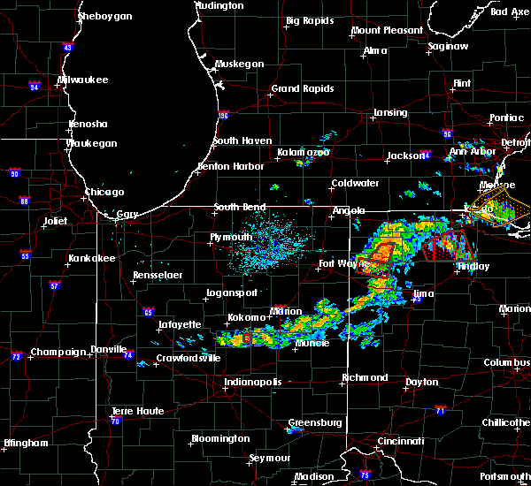 At 846 pm edt, a severe thunderstorm capable of producing a tornado was located near paulding, or 13 miles southwest of defiance, moving east at 25 mph (radar indicated rotation). Hazards include tornado. Flying debris will be dangerous to those caught without shelter. mobile homes will be damaged or destroyed. damage to roofs, windows, and vehicles will occur. tree damage is likely. This tornadic thunderstorm will remain over mainly rural areas of southeastern paulding county, including the following locations: broughton, roselms, latty, charloe, oakwood, melrose and grover hill. At 846 pm edt, a severe thunderstorm capable of producing a tornado was located near paulding, or 13 miles southwest of defiance, moving east at 25 mph (radar indicated rotation). Hazards include tornado. Flying debris will be dangerous to those caught without shelter. mobile homes will be damaged or destroyed. damage to roofs, windows, and vehicles will occur. tree damage is likely. This tornadic thunderstorm will remain over mainly rural areas of southeastern paulding county, including the following locations: broughton, roselms, latty, charloe, oakwood, melrose and grover hill.
|
| 8/24/2016 8:33 PM EDT |
 At 833 pm edt, a severe thunderstorm capable of producing a tornado was located near paulding, or 14 miles southeast of hicksville, moving east at 20 mph (radar indicated rotation). Hazards include tornado. Flying debris will be dangerous to those caught without shelter. mobile homes will be damaged or destroyed. damage to roofs, windows, and vehicles will occur. tree damage is likely. this dangerous storm will be near, paulding around 840 pm edt. other locations impacted by this tornadic thunderstorm include broughton, roselms, latty, charloe, oakwood, briceton, melrose. Worstville, grover hill and haviland. At 833 pm edt, a severe thunderstorm capable of producing a tornado was located near paulding, or 14 miles southeast of hicksville, moving east at 20 mph (radar indicated rotation). Hazards include tornado. Flying debris will be dangerous to those caught without shelter. mobile homes will be damaged or destroyed. damage to roofs, windows, and vehicles will occur. tree damage is likely. this dangerous storm will be near, paulding around 840 pm edt. other locations impacted by this tornadic thunderstorm include broughton, roselms, latty, charloe, oakwood, briceton, melrose. Worstville, grover hill and haviland.
|
| 8/24/2016 7:08 PM EDT |
 At 707 pm edt, a confirmed tornado was located near ottoville, or 10 miles northeast of van wert, moving northeast at 25 mph (emergency management confirmed tornado. this storm has a history of producing multiple destructive tornadoes). Hazards include damaging tornado. Flying debris will be dangerous to those caught without shelter. mobile homes will be damaged or destroyed. damage to roofs, windows, and vehicles will occur. tree damage is likely. this tornado will be near, ottoville around 715 pm edt. kalida and continental around 730 pm edt. Other locations impacted by this tornadic thunderstorm include roselms, kieferville, wetzel, wisterman, oakwood, mandale, cloverdale, melrose, grover hill and dupont. At 707 pm edt, a confirmed tornado was located near ottoville, or 10 miles northeast of van wert, moving northeast at 25 mph (emergency management confirmed tornado. this storm has a history of producing multiple destructive tornadoes). Hazards include damaging tornado. Flying debris will be dangerous to those caught without shelter. mobile homes will be damaged or destroyed. damage to roofs, windows, and vehicles will occur. tree damage is likely. this tornado will be near, ottoville around 715 pm edt. kalida and continental around 730 pm edt. Other locations impacted by this tornadic thunderstorm include roselms, kieferville, wetzel, wisterman, oakwood, mandale, cloverdale, melrose, grover hill and dupont.
|
| 8/24/2016 6:57 PM EDT |
 At 657 pm edt, a confirmed large and extremely dangerous tornado was located near van wert, moving northeast at 30 mph. this is a particularly dangerous situation. take cover now! (emergency management confirmed tornado. this storm has a history of producing multiple destructive tornadoes). Hazards include damaging tornado. You are in a life-threatening situation. flying debris may be deadly to those caught without shelter. mobile homes will be destroyed. considerable damage to homes, businesses, and vehicles is likely and complete destruction is possible. the tornado will be near, ottoville around 715 pm edt. kalida and continental around 730 pm edt. Other locations impacted by this tornadic thunderstorm include roselms, kieferville, wetzel, wisterman, oakwood, mandale, cave tt, cloverdale, melrose and grover hill. At 657 pm edt, a confirmed large and extremely dangerous tornado was located near van wert, moving northeast at 30 mph. this is a particularly dangerous situation. take cover now! (emergency management confirmed tornado. this storm has a history of producing multiple destructive tornadoes). Hazards include damaging tornado. You are in a life-threatening situation. flying debris may be deadly to those caught without shelter. mobile homes will be destroyed. considerable damage to homes, businesses, and vehicles is likely and complete destruction is possible. the tornado will be near, ottoville around 715 pm edt. kalida and continental around 730 pm edt. Other locations impacted by this tornadic thunderstorm include roselms, kieferville, wetzel, wisterman, oakwood, mandale, cave tt, cloverdale, melrose and grover hill.
|
| 3/27/2016 7:32 PM EDT |
 At 732 pm edt, a severe thunderstorm was located near payne, or 10 miles north of van wert, moving east at 35 mph (radar indicated). Hazards include 60 mph wind gusts and quarter size hail. Hail damage to vehicles is expected. expect wind damage to roofs, siding and trees. this severe thunderstorm will be near, continental around 805 pm edt. Other locations impacted by this severe thunderstorm include roselms, haviland, wisterman, oakwood, cloverdale, grover hill, broughton, latty, charloe and mandale. At 732 pm edt, a severe thunderstorm was located near payne, or 10 miles north of van wert, moving east at 35 mph (radar indicated). Hazards include 60 mph wind gusts and quarter size hail. Hail damage to vehicles is expected. expect wind damage to roofs, siding and trees. this severe thunderstorm will be near, continental around 805 pm edt. Other locations impacted by this severe thunderstorm include roselms, haviland, wisterman, oakwood, cloverdale, grover hill, broughton, latty, charloe and mandale.
|
| 8/23/2015 6:05 PM EDT |
 The severe thunderstorm warning for southwestern paulding county will expire at 615 pm edt, the storm which prompted the warning has weakened below severe limits, and no longer pose an immediate threat to life or property. therefore the warning will be allowed to expire. The severe thunderstorm warning for southwestern paulding county will expire at 615 pm edt, the storm which prompted the warning has weakened below severe limits, and no longer pose an immediate threat to life or property. therefore the warning will be allowed to expire.
|
| 8/23/2015 5:43 PM EDT |
 At 543 pm edt, a severe thunderstorm was located over payne, or 15 miles north of van wert, moving east at 30 mph (radar indicated). Hazards include 60 mph wind gusts and quarter size hail. Hail damage to vehicles is expected. expect wind damage to roofs, siding and trees. Locations impacted include, paulding, payne, grover hill, latty, broughton, briceton and worstville. At 543 pm edt, a severe thunderstorm was located over payne, or 15 miles north of van wert, moving east at 30 mph (radar indicated). Hazards include 60 mph wind gusts and quarter size hail. Hail damage to vehicles is expected. expect wind damage to roofs, siding and trees. Locations impacted include, paulding, payne, grover hill, latty, broughton, briceton and worstville.
|
| 8/23/2015 5:28 PM EDT |
 At 527 pm edt, a severe thunderstorm was located near woodburn, or 10 miles east of new haven, moving east at 35 mph (radar indicated). Hazards include 60 mph wind gusts and quarter size hail. Hail damage to vehicles is expected. Expect wind damage to roofs, siding and trees. At 527 pm edt, a severe thunderstorm was located near woodburn, or 10 miles east of new haven, moving east at 35 mph (radar indicated). Hazards include 60 mph wind gusts and quarter size hail. Hail damage to vehicles is expected. Expect wind damage to roofs, siding and trees.
|
| 5/30/2015 4:40 PM EDT | Storm damage reported in paulding county OH, 0.1 miles ESE of Grover Hill, OH |
| 5/30/2015 4:37 PM EDT | At 434 pm edt, a severe thunderstorm was located 8 miles northwest of ottoville, and moving east at 35 mph (radar indicated). Hazards include 60 mph wind gusts and nickel size hail. Expect damage to roofs. Siding and trees. |
| 5/11/2015 2:35 PM EDT | At 233 pm edt, a severe thunderstorm was located near convoy, and moving northeast at 55 mph (radar indicated). Hazards include quarter size hail and 60 mph wind gusts. Hail damage to vehicles is expected. expect wind damage to roofs, siding and trees. locations impacted include, continental, holgate, cavett, scott, haviland, wetzel, grover hill, broughton, roselms, mandale, melrose, cloverdale, charloe, oakwood, dupont, wisterman, arthur, north creek, kieferville and ayersville. 1. 00in. |
| 5/11/2015 2:22 PM EDT | At 219 pm edt, a severe thunderstorm was located 6 miles east of monroe, and moving northeast at 55 mph (radar indicated). Hazards include quarter size hail and 60 mph wind gusts. Hail damage to vehicles is expected. Expect wind damage to roofs, siding and trees. |
| 5/11/2015 2:22 PM EDT | At 219 pm edt, a severe thunderstorm was located 6 miles east of monroe, and moving northeast at 55 mph (radar indicated). Hazards include quarter size hail and 60 mph wind gusts. Hail damage to vehicles is expected. Expect wind damage to roofs, siding and trees. |
| 11/17/2013 4:50 PM EST | 3 campers were rolled and several others knocked off bases at a storage area. powerlines dow in van wert county OH, 5.2 miles NNW of Grover Hill, OH |
| 9/7/2012 1:35 PM EDT | Trees down south of town and on sr114 east of town in paulding county OH, 0.1 miles ESE of Grover Hill, OH |
Hail Maps for Grover Hill, OH


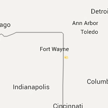


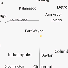


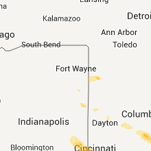


Connect with Interactive Hail Maps