

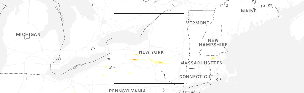
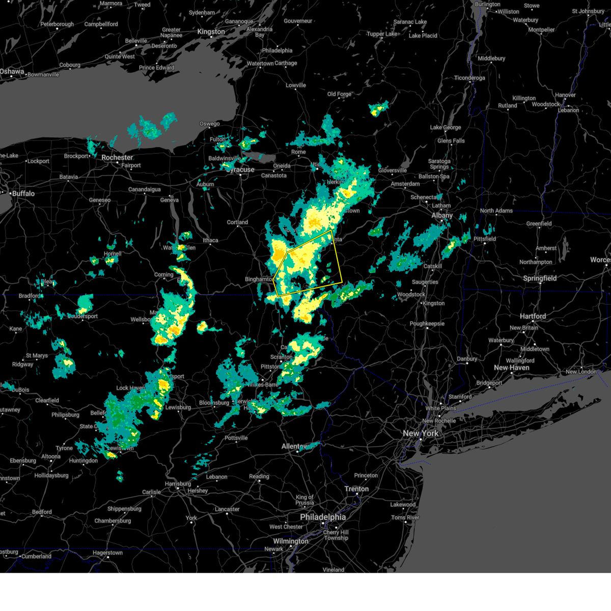
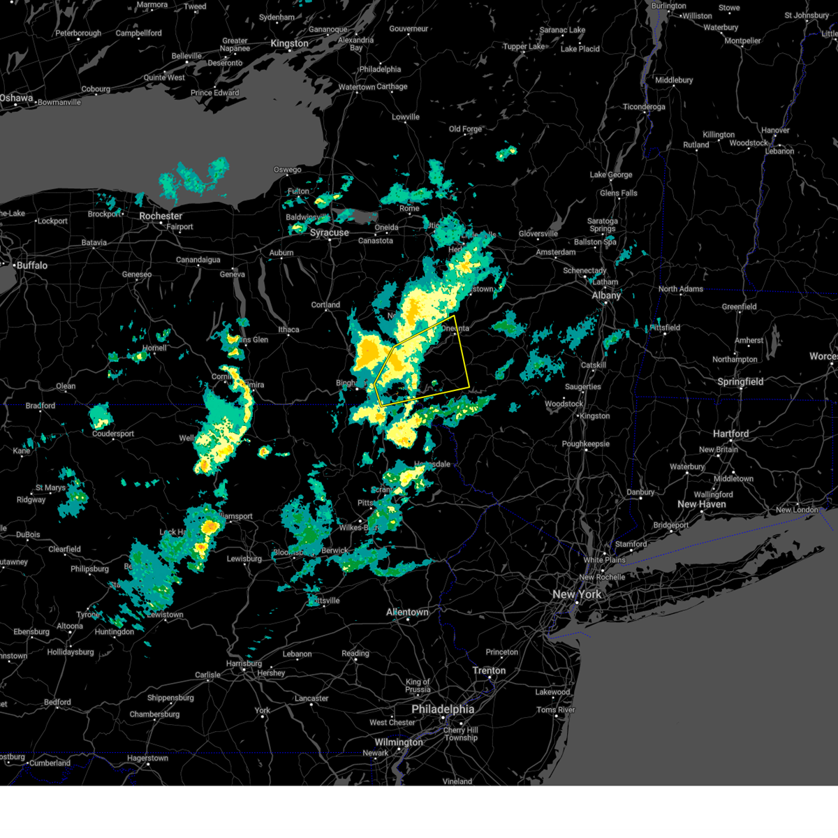
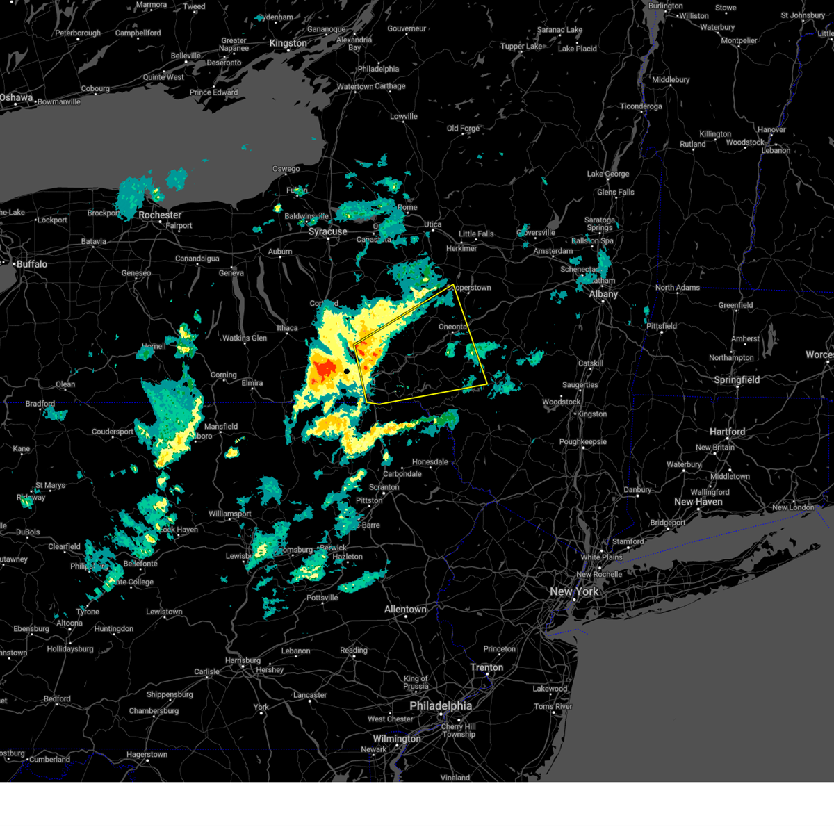
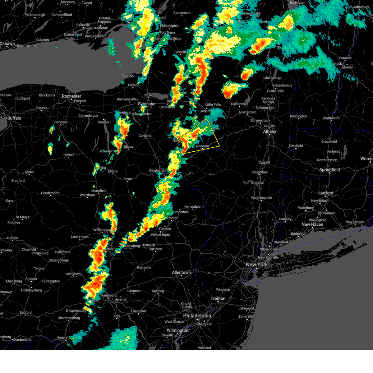
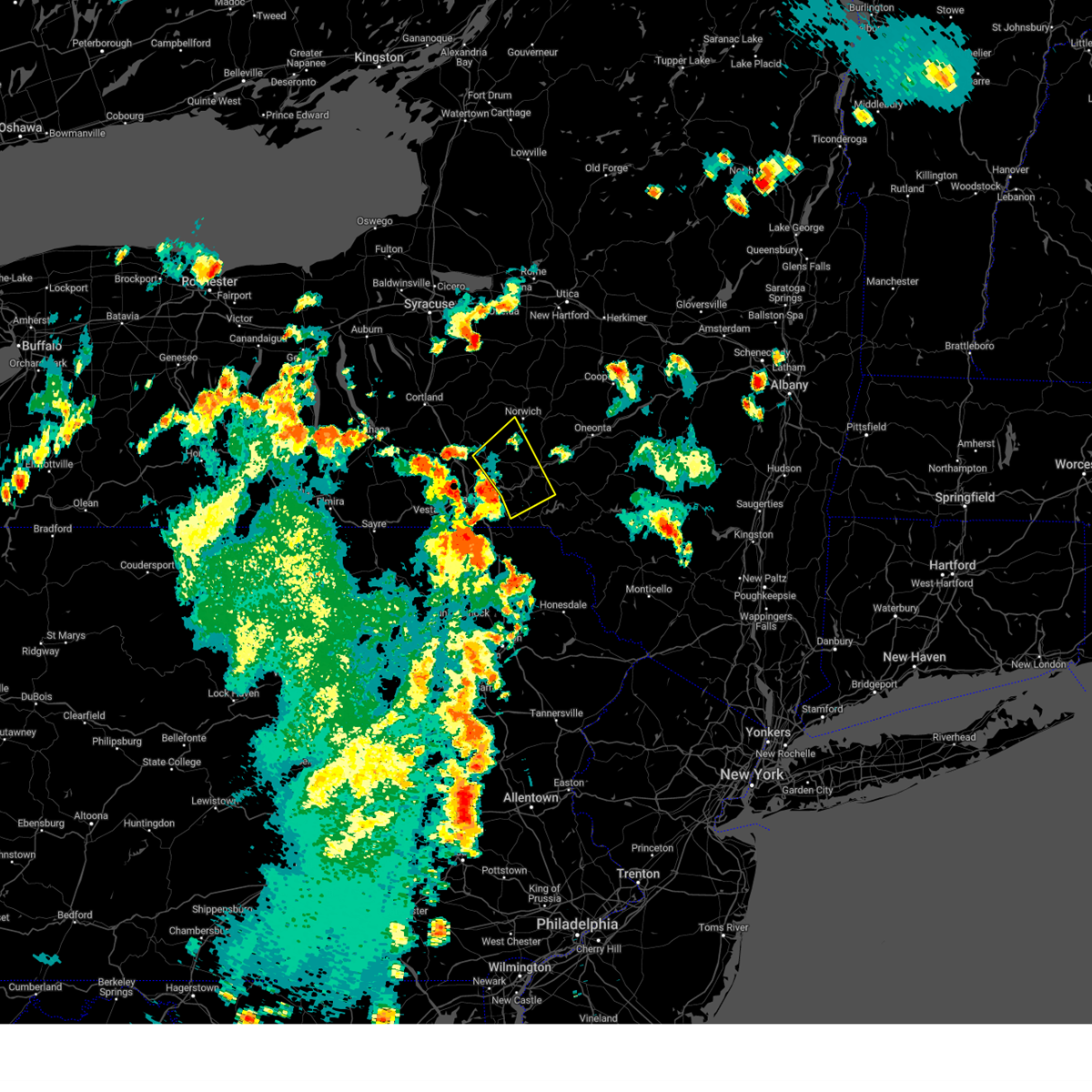
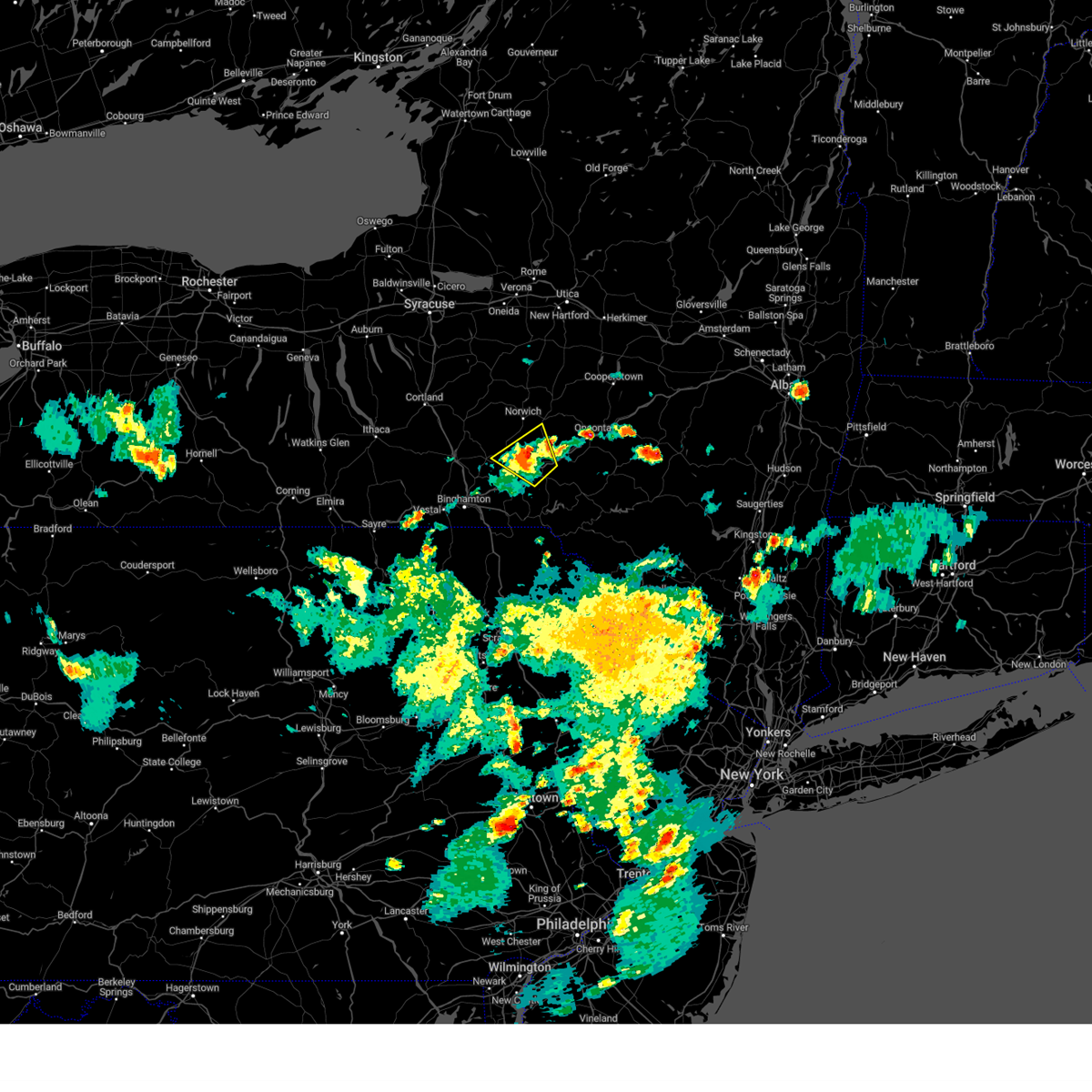
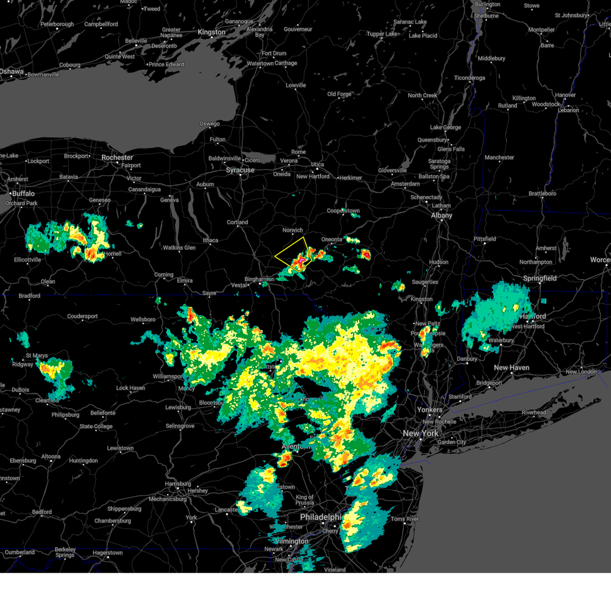
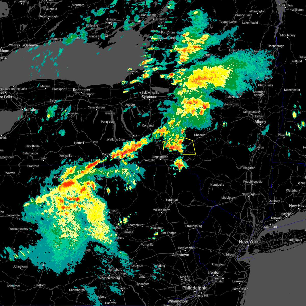
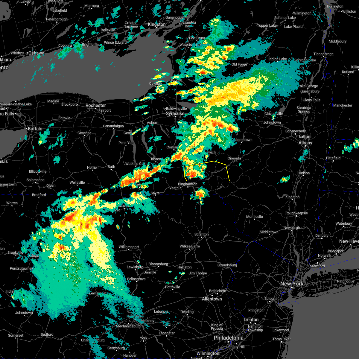
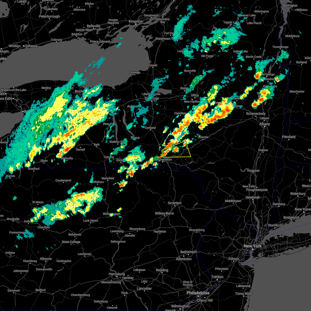
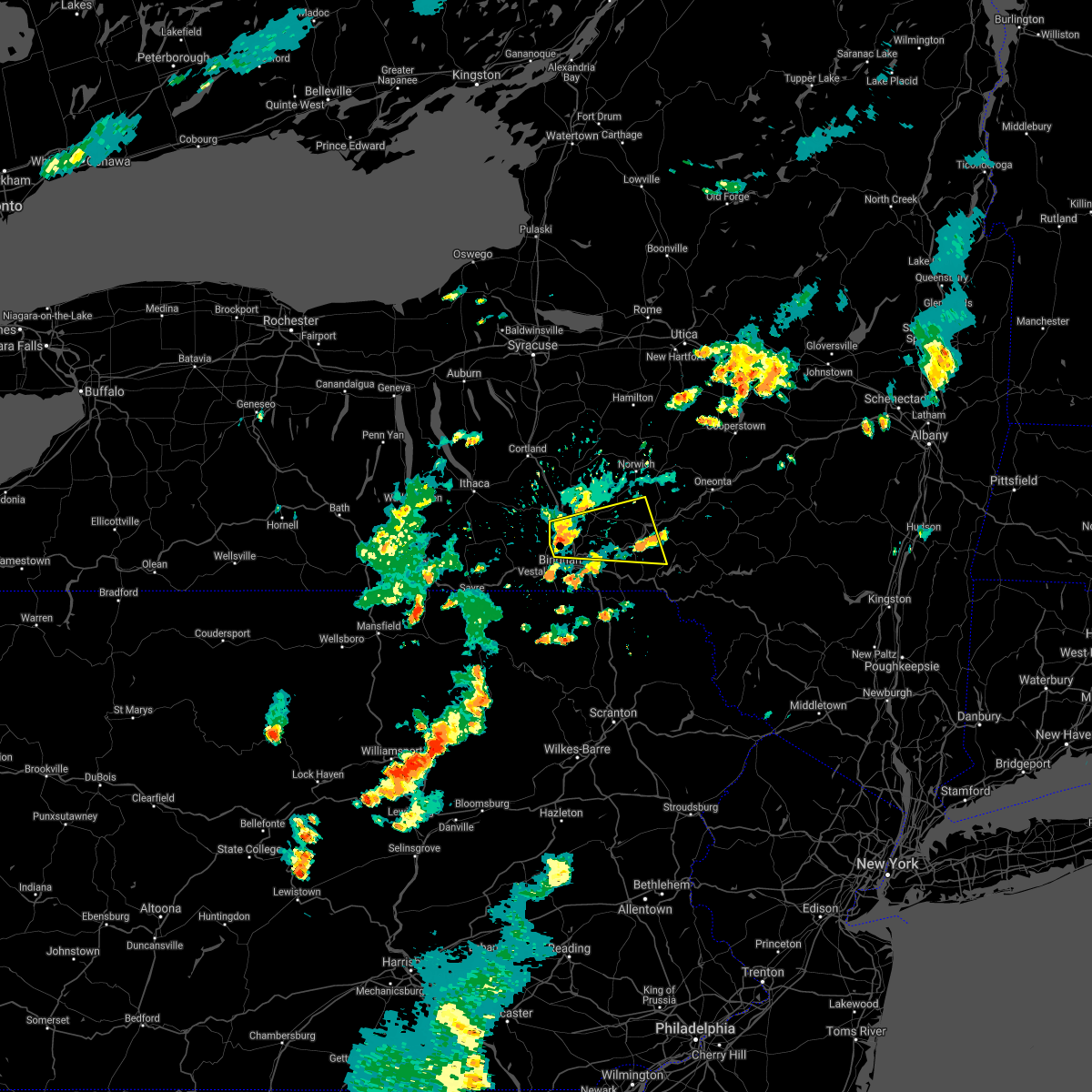
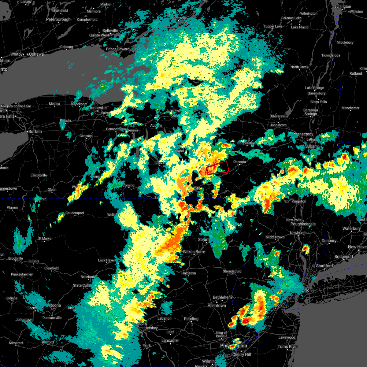
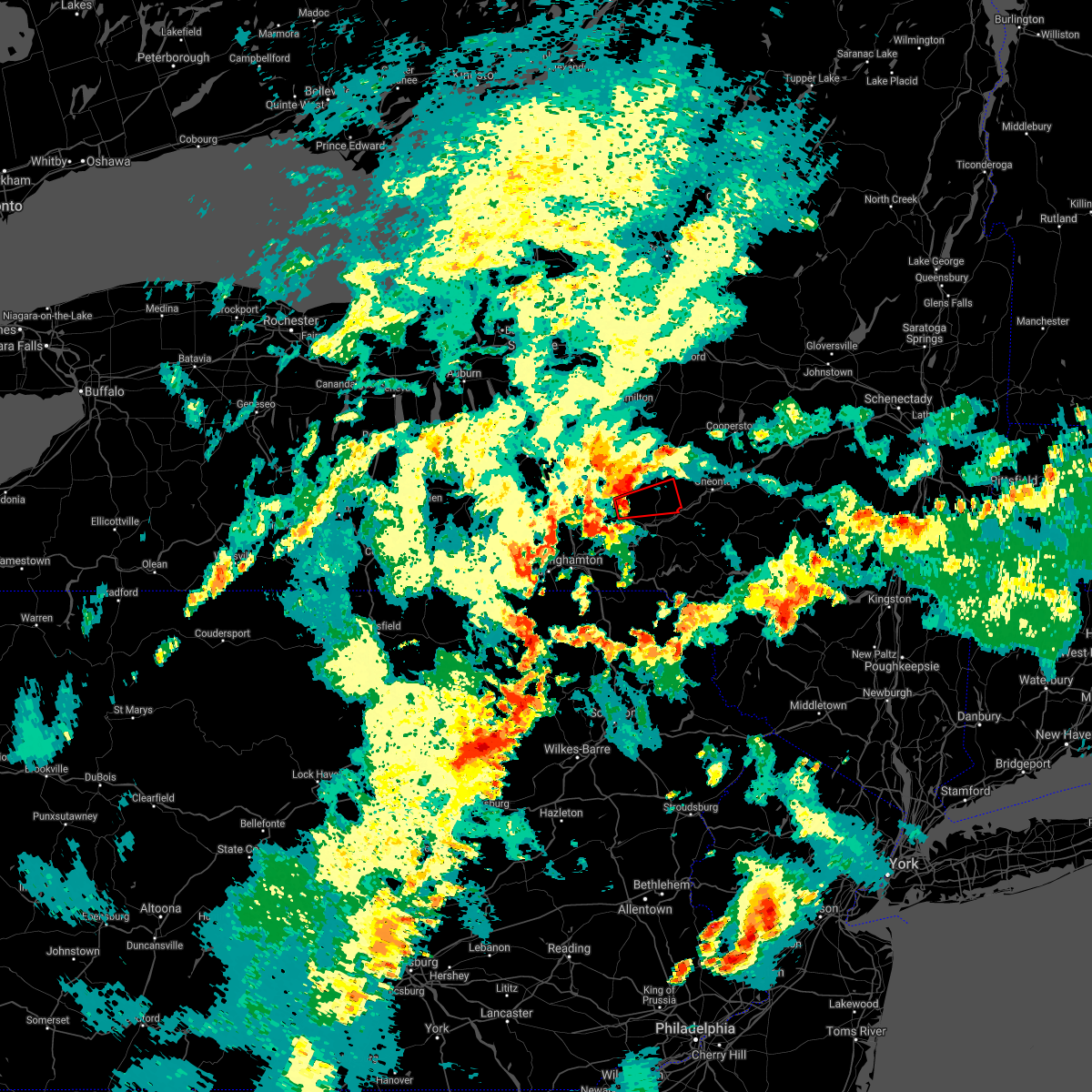
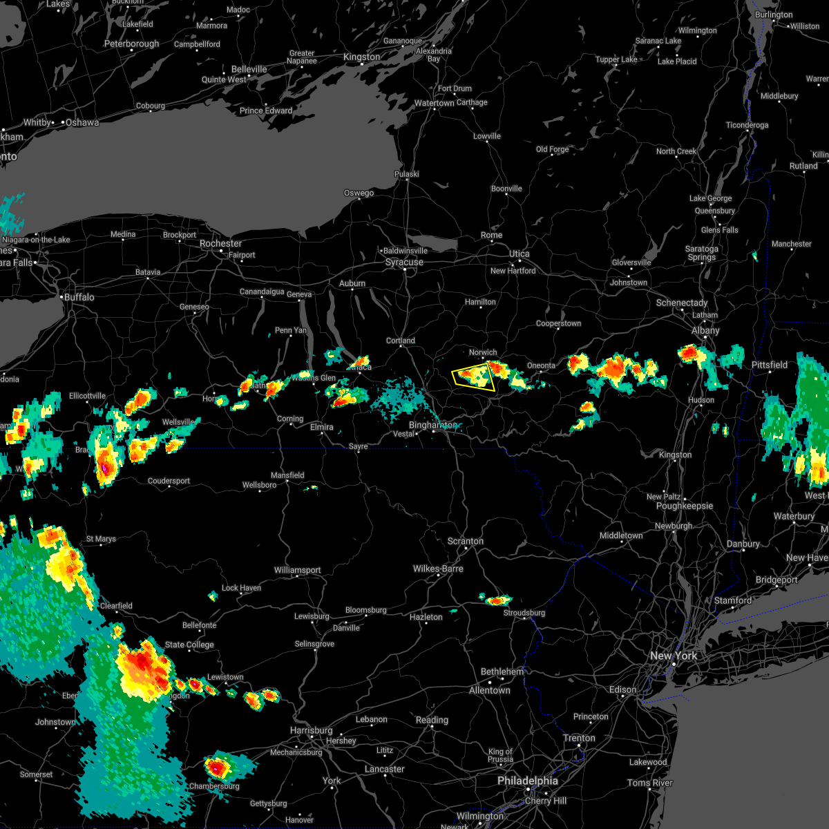
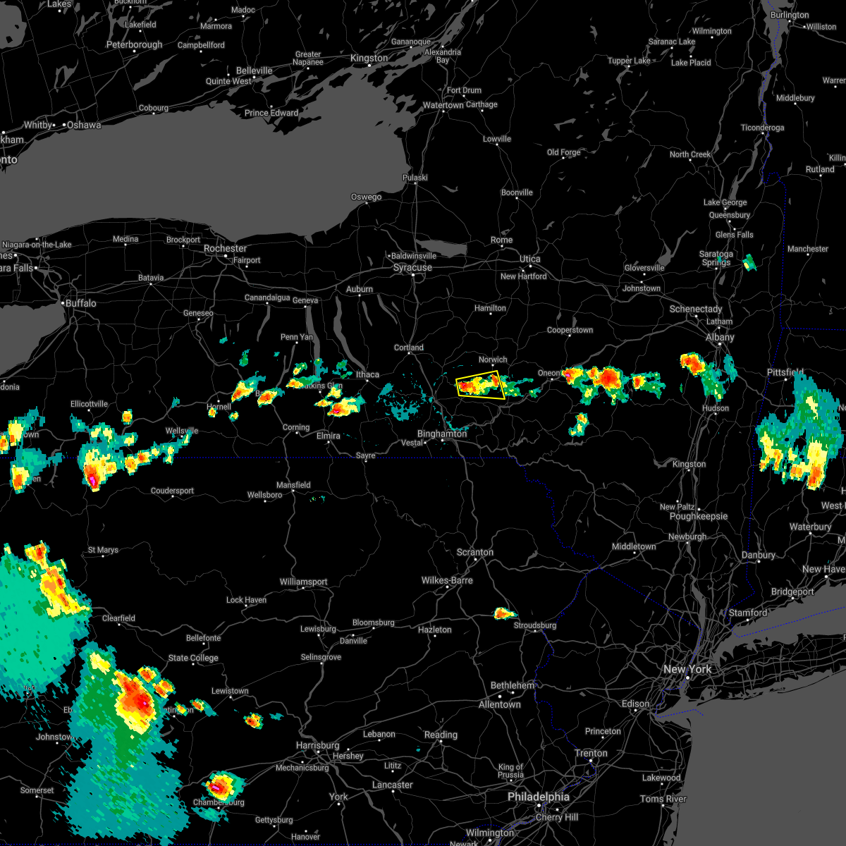
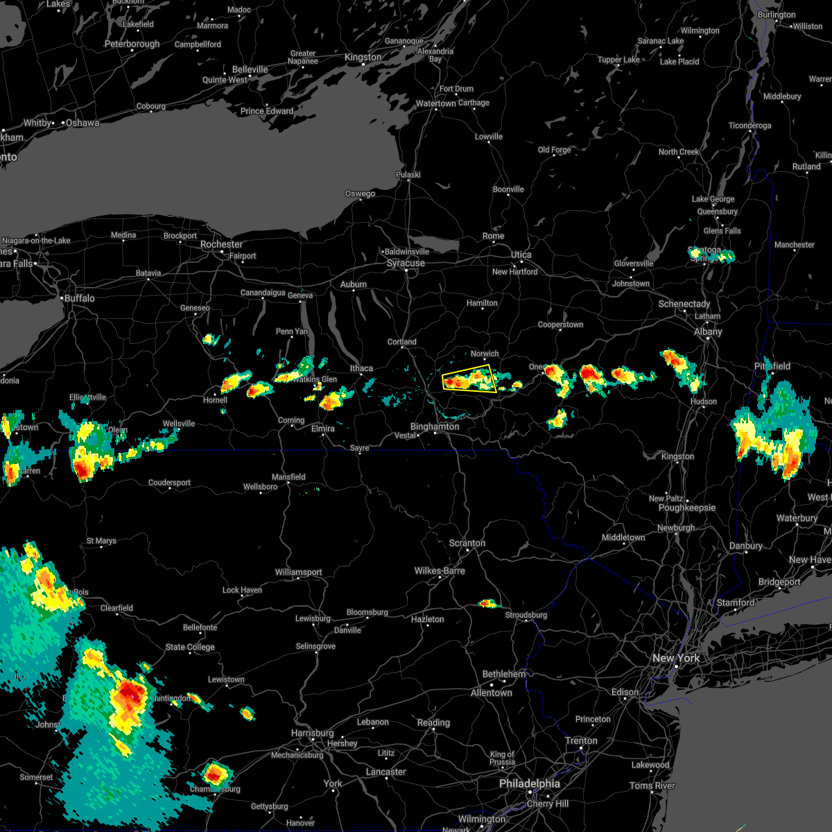
Hail Map for Guilford, NY
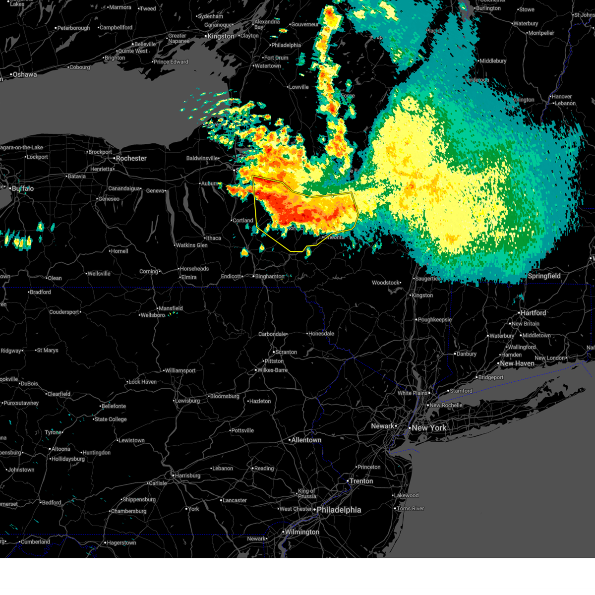
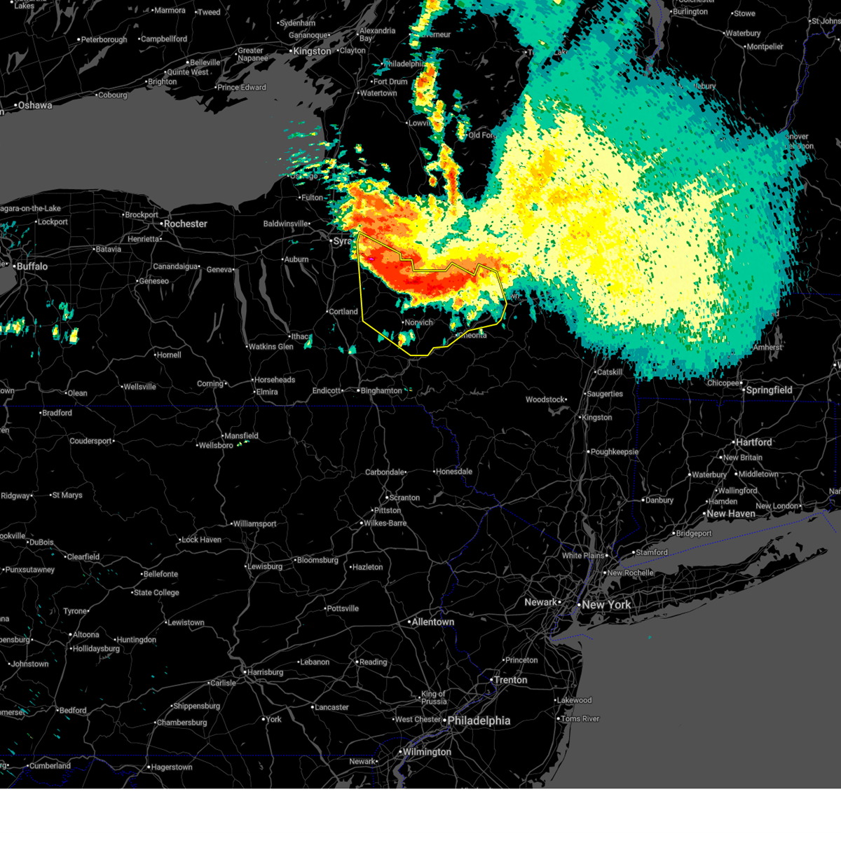
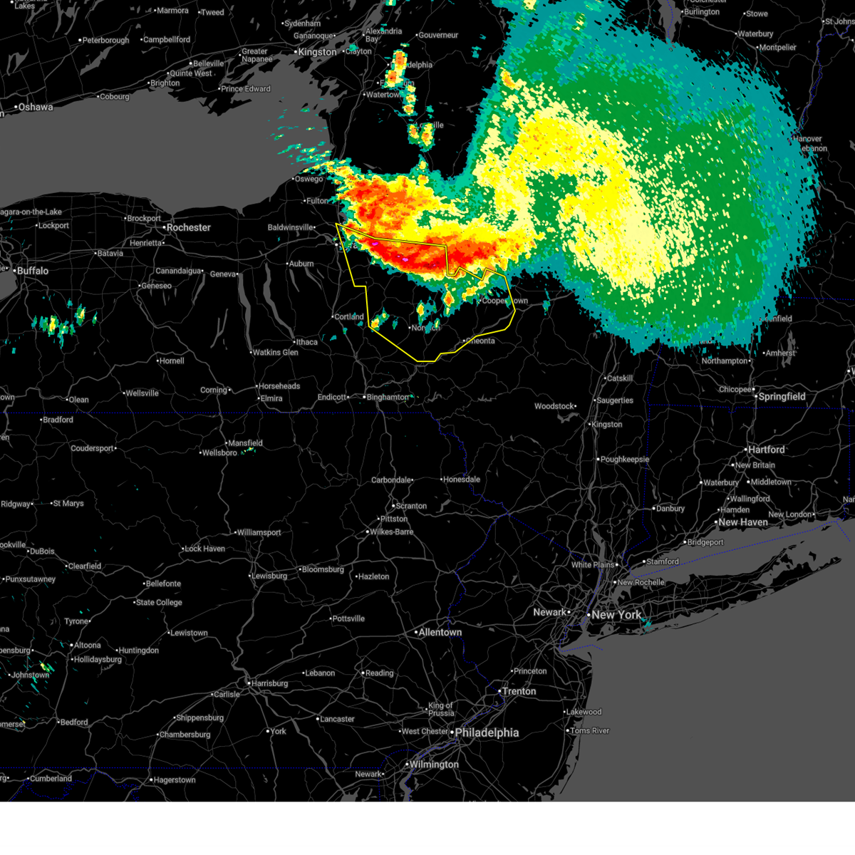
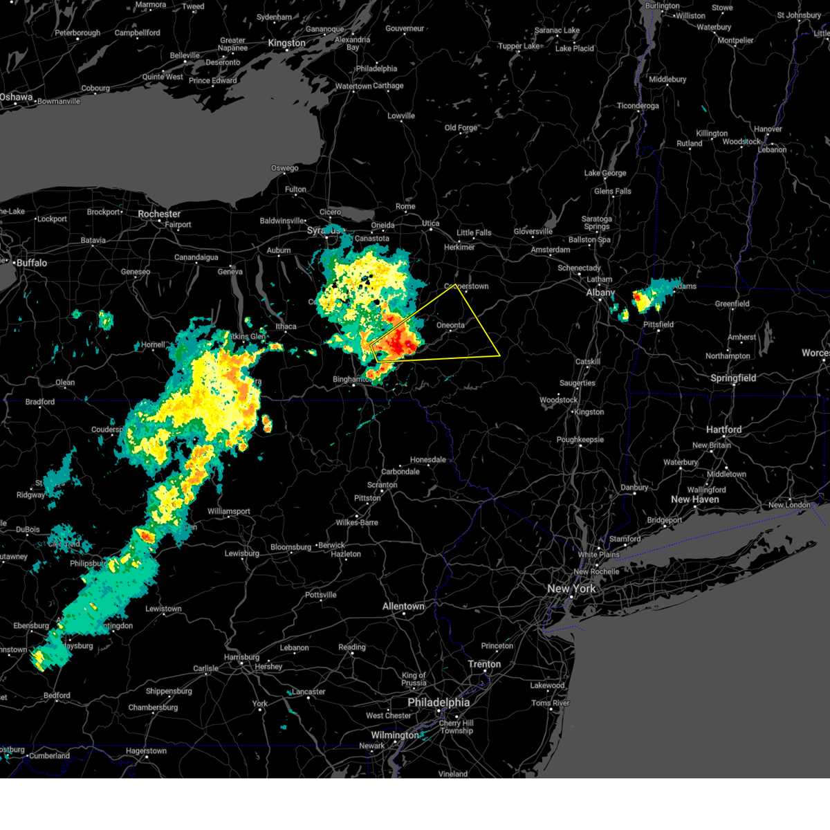
The Guilford, NY area has had 0 reports of on-the-ground hail by trained spotters, and has been under severe weather warnings 26 times during the past 12 months. Doppler radar has detected hail at or near Guilford, NY on 24 occasions, including 2 occasions during the past year.
| Name: | Guilford, NY |
| Where Located: | 55.8 miles SE of Syracuse, NY |
| Map: | Google Map for Guilford, NY |
| Population: | 362 |
| Housing Units: | 192 |
| More Info: | Search Google for Guilford, NY |
5
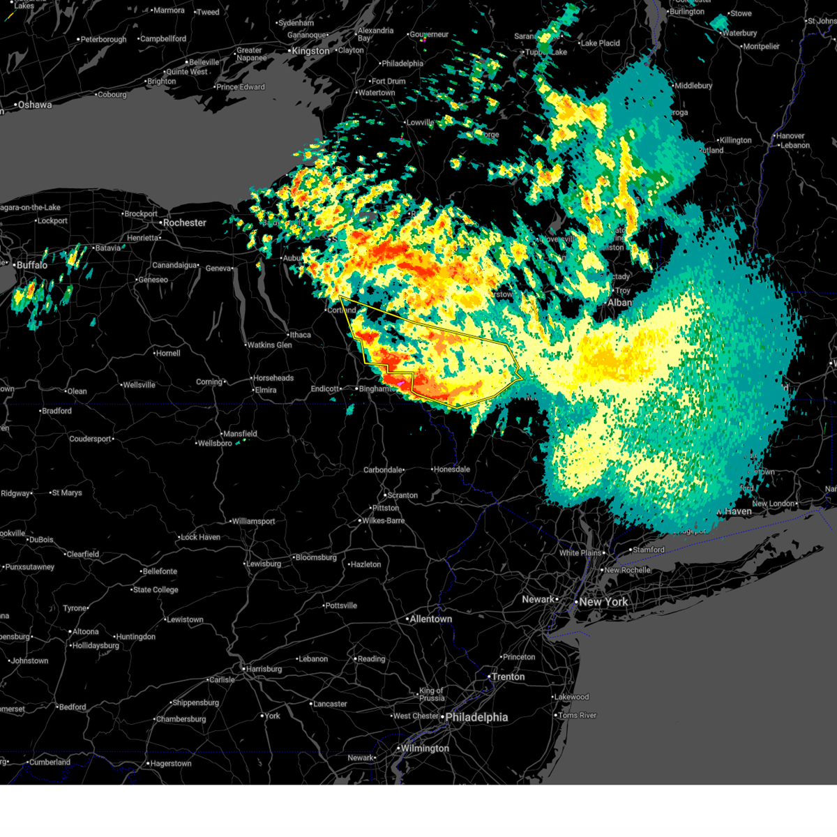
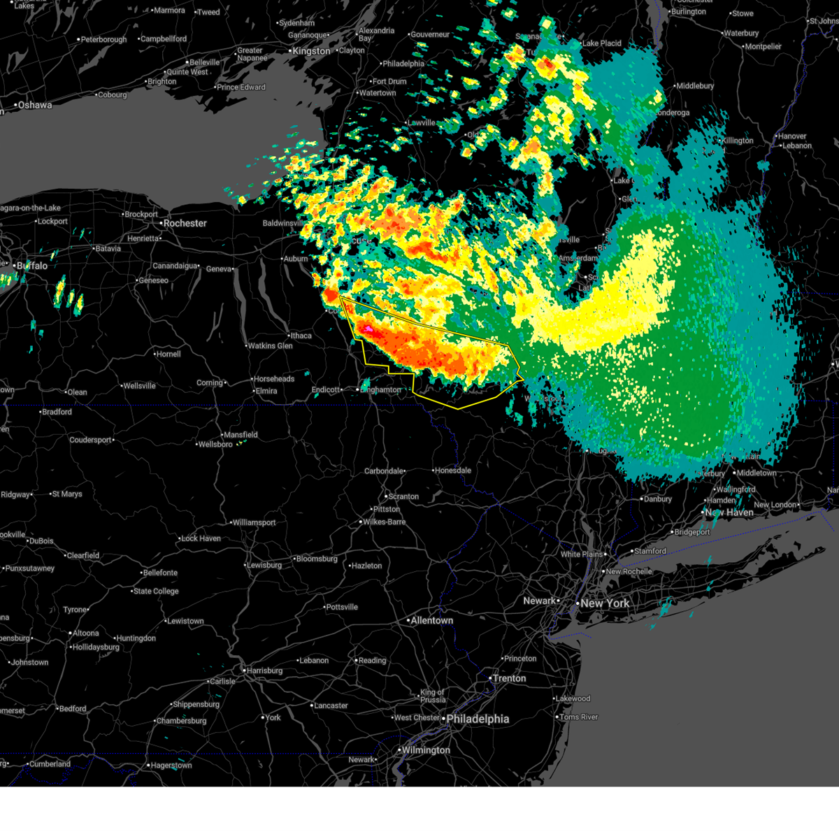
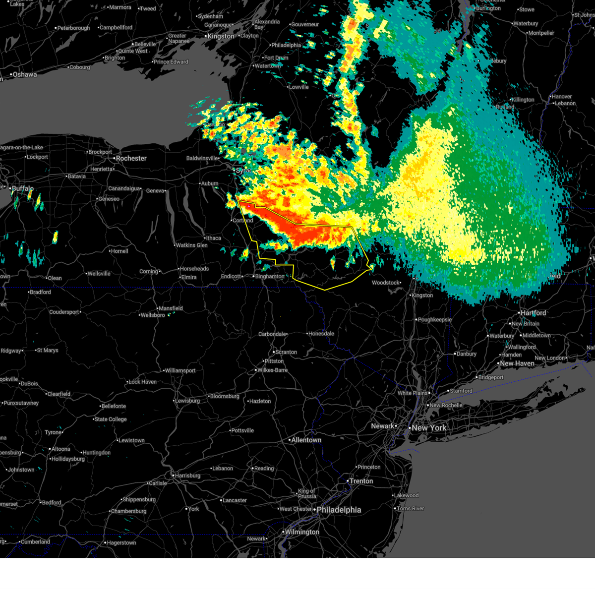
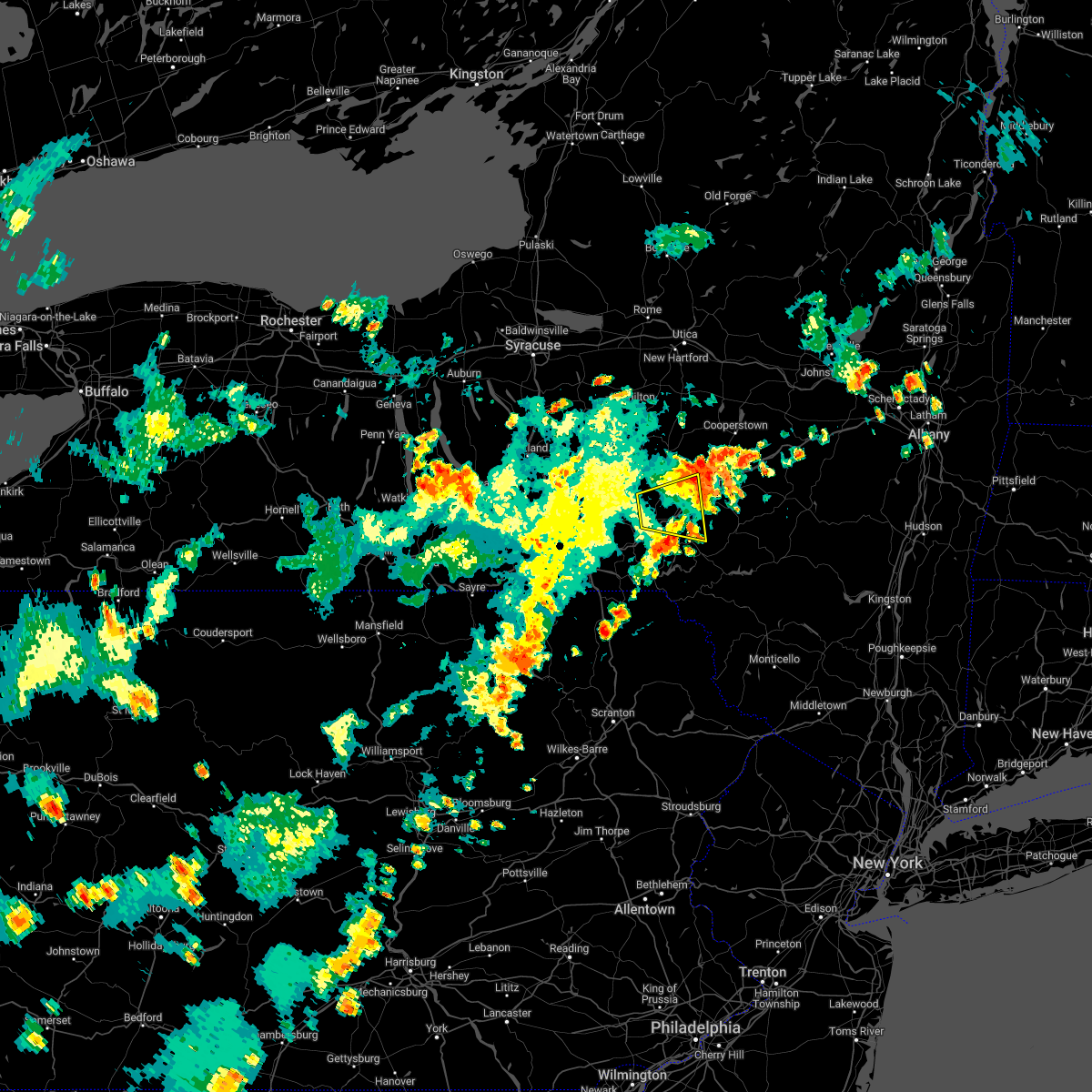
The Top Recent Hail Date for Guilford, NY is Thursday, June 5, 2025 (1st out of 24)
Hail and Wind Damage Spotted near Guilford, NY
| Date / Time | Report Details |
|---|---|
| 6/22/2025 6:13 AM EDT |
 The storms which prompted the warning have moved out of the area. therefore, the warning will be allowed to expire. however, heavy rain is still likely with these thunderstorms. The storms which prompted the warning have moved out of the area. therefore, the warning will be allowed to expire. however, heavy rain is still likely with these thunderstorms.
|
| 6/22/2025 5:40 AM EDT |
 At 540 am edt, severe thunderstorms were located along a line extending from east freetown to near smithville flats to near sidney to near bovina center, moving southeast at 40 mph (radar indicated). Hazards include 60 mph wind gusts and penny size hail. Expect damage to roofs, siding, and trees. Locations impacted include, oneonta, norwich, sidney, walton, delhi, guilford, roxbury, colchester, kortright, and coventry. At 540 am edt, severe thunderstorms were located along a line extending from east freetown to near smithville flats to near sidney to near bovina center, moving southeast at 40 mph (radar indicated). Hazards include 60 mph wind gusts and penny size hail. Expect damage to roofs, siding, and trees. Locations impacted include, oneonta, norwich, sidney, walton, delhi, guilford, roxbury, colchester, kortright, and coventry.
|
| 6/22/2025 5:10 AM EDT |
 Svrbgm the national weather service in binghamton has issued a * severe thunderstorm warning for, southern otsego county in central new york, delaware county in central new york, eastern cortland county in central new york, chenango county in central new york, * until 615 am edt. * at 509 am edt, severe thunderstorms were located along a line extending from near truxton to near pitcher to near guilford to near davenport, moving southeast at 35 mph (radar indicated). Hazards include 60 mph wind gusts and penny size hail. expect damage to roofs, siding, and trees Svrbgm the national weather service in binghamton has issued a * severe thunderstorm warning for, southern otsego county in central new york, delaware county in central new york, eastern cortland county in central new york, chenango county in central new york, * until 615 am edt. * at 509 am edt, severe thunderstorms were located along a line extending from near truxton to near pitcher to near guilford to near davenport, moving southeast at 35 mph (radar indicated). Hazards include 60 mph wind gusts and penny size hail. expect damage to roofs, siding, and trees
|
| 6/22/2025 4:50 AM EDT |
 At 450 am edt, severe thunderstorms were located along a line extending from near worcester to near morris to near otselic to near fabius, moving south at 40 mph (radar indicated). Hazards include 60 mph wind gusts. Expect damage to roofs, siding, and trees. Locations impacted include, oneonta, norwich, eaton, hamilton, guilford, cazenovia, brookfield, worcester, morrisville, and middlefield. At 450 am edt, severe thunderstorms were located along a line extending from near worcester to near morris to near otselic to near fabius, moving south at 40 mph (radar indicated). Hazards include 60 mph wind gusts. Expect damage to roofs, siding, and trees. Locations impacted include, oneonta, norwich, eaton, hamilton, guilford, cazenovia, brookfield, worcester, morrisville, and middlefield.
|
| 6/22/2025 4:36 AM EDT |
 the severe thunderstorm warning has been cancelled and is no longer in effect the severe thunderstorm warning has been cancelled and is no longer in effect
|
| 6/22/2025 4:36 AM EDT |
 At 436 am edt, severe thunderstorms were located along a line extending from near middlefield to near edmeston to georgetown to watervale, moving south at 40 mph (radar indicated). Hazards include 70 mph wind gusts. Expect considerable tree damage. damage is likely to mobile homes, roofs, and outbuildings. Locations impacted include, sullivan, oneonta, norwich, eaton, chittenango, hamilton, guilford, cazenovia, brookfield, and worcester. At 436 am edt, severe thunderstorms were located along a line extending from near middlefield to near edmeston to georgetown to watervale, moving south at 40 mph (radar indicated). Hazards include 70 mph wind gusts. Expect considerable tree damage. damage is likely to mobile homes, roofs, and outbuildings. Locations impacted include, sullivan, oneonta, norwich, eaton, chittenango, hamilton, guilford, cazenovia, brookfield, and worcester.
|
| 6/22/2025 4:13 AM EDT |
 Svrbgm the national weather service in binghamton has issued a * severe thunderstorm warning for, southeastern oneida county in central new york, otsego county in central new york, madison county in central new york, eastern onondaga county in central new york, chenango county in central new york, * until 515 am edt. * at 412 am edt, severe thunderstorms were located along a line extending from near jordanville to near waterville to near cazenovia to near cicero, moving south at 40 mph (radar indicated). Hazards include 70 mph wind gusts. Expect considerable tree damage. Damage is likely to mobile homes, roofs, and outbuildings. Svrbgm the national weather service in binghamton has issued a * severe thunderstorm warning for, southeastern oneida county in central new york, otsego county in central new york, madison county in central new york, eastern onondaga county in central new york, chenango county in central new york, * until 515 am edt. * at 412 am edt, severe thunderstorms were located along a line extending from near jordanville to near waterville to near cazenovia to near cicero, moving south at 40 mph (radar indicated). Hazards include 70 mph wind gusts. Expect considerable tree damage. Damage is likely to mobile homes, roofs, and outbuildings.
|
| 6/5/2025 8:55 PM EDT |
 At 854 pm edt, a severe thunderstorm was located over otego, or 8 miles west of oneonta, moving east at 35 mph (radar indicated). Hazards include 70 mph wind gusts and ping pong ball size hail. People and animals outdoors will be injured. expect hail damage to roofs, siding, windows, and vehicles. expect considerable tree damage. wind damage is also likely to mobile homes, roofs, and outbuildings. Locations impacted include, oneonta, delhi, sidney, davenport, guilford, hartwick, maryland, meredith, bainbridge, unadilla, otego, and morris. At 854 pm edt, a severe thunderstorm was located over otego, or 8 miles west of oneonta, moving east at 35 mph (radar indicated). Hazards include 70 mph wind gusts and ping pong ball size hail. People and animals outdoors will be injured. expect hail damage to roofs, siding, windows, and vehicles. expect considerable tree damage. wind damage is also likely to mobile homes, roofs, and outbuildings. Locations impacted include, oneonta, delhi, sidney, davenport, guilford, hartwick, maryland, meredith, bainbridge, unadilla, otego, and morris.
|
| 6/5/2025 8:39 PM EDT |
 At 839 pm edt, a severe thunderstorm was located over rockdale, or 11 miles southeast of norwich, moving east at 35 mph (radar indicated). Hazards include 70 mph wind gusts and ping pong ball size hail. People and animals outdoors will be injured. expect hail damage to roofs, siding, windows, and vehicles. expect considerable tree damage. wind damage is also likely to mobile homes, roofs, and outbuildings. Locations impacted include, oneonta, delhi, sidney, davenport, guilford, hartwick, maryland, coventry, meredith, oxford, bainbridge, and unadilla. At 839 pm edt, a severe thunderstorm was located over rockdale, or 11 miles southeast of norwich, moving east at 35 mph (radar indicated). Hazards include 70 mph wind gusts and ping pong ball size hail. People and animals outdoors will be injured. expect hail damage to roofs, siding, windows, and vehicles. expect considerable tree damage. wind damage is also likely to mobile homes, roofs, and outbuildings. Locations impacted include, oneonta, delhi, sidney, davenport, guilford, hartwick, maryland, coventry, meredith, oxford, bainbridge, and unadilla.
|
| 6/5/2025 8:22 PM EDT | Svrbgm the national weather service in binghamton has issued a * severe thunderstorm warning for, southern chenango county in central new york, northern delaware county in central new york, southwestern otsego county in central new york, * until 930 pm edt. * at 822 pm edt, a severe thunderstorm was located over south oxford, or 12 miles south of norwich, moving east at 35 mph (radar indicated). Hazards include 60 mph wind gusts and quarter size hail. Hail damage to vehicles is expected. Expect wind damage to roofs, siding, and trees. |
| 4/29/2025 7:42 PM EDT | Svrbgm the national weather service in binghamton has issued a * severe thunderstorm warning for, otsego county in central new york, broome county in central new york, northwestern delaware county in central new york, tioga county in central new york, chenango county in central new york, * until 830 pm edt. * at 741 pm edt, severe thunderstorms were located along a line extending from unadilla forks to near nanticoke to candor to chemung, moving southeast at 40 mph (radar indicated). Hazards include 60 mph wind gusts. expect damage to roofs, siding, and trees |
| 4/15/2025 2:06 PM EDT |
 The storm which prompted the warning has weakened below severe limits, and no longer poses an immediate threat to life or property. therefore, the warning will be allowed to expire. however, gusty winds are still possible with these showers. The storm which prompted the warning has weakened below severe limits, and no longer poses an immediate threat to life or property. therefore, the warning will be allowed to expire. however, gusty winds are still possible with these showers.
|
| 4/15/2025 1:59 PM EDT |
 At 159 pm edt, a severe thunderstorm was located over franklin, or 7 miles southwest of oneonta, moving east at 55 mph (radar indicated). Hazards include 60 mph wind gusts and penny size hail. Expect damage to roofs, siding, and trees. Locations impacted include, franklin, stilesville, trout creek, cannonsville, windsor, east sidney, youngs, rockdale, masonville, and sanford. At 159 pm edt, a severe thunderstorm was located over franklin, or 7 miles southwest of oneonta, moving east at 55 mph (radar indicated). Hazards include 60 mph wind gusts and penny size hail. Expect damage to roofs, siding, and trees. Locations impacted include, franklin, stilesville, trout creek, cannonsville, windsor, east sidney, youngs, rockdale, masonville, and sanford.
|
| 4/15/2025 1:26 PM EDT |
 Svrbgm the national weather service in binghamton has issued a * severe thunderstorm warning for, southwestern otsego county in central new york, eastern broome county in central new york, northwestern delaware county in central new york, southern chenango county in central new york, * until 215 pm edt. * at 125 pm edt, a severe thunderstorm was located near sanitaria springs, or 13 miles northeast of binghamton, moving east at 55 mph (radar indicated). Hazards include 60 mph wind gusts and penny size hail. expect damage to roofs, siding, and trees Svrbgm the national weather service in binghamton has issued a * severe thunderstorm warning for, southwestern otsego county in central new york, eastern broome county in central new york, northwestern delaware county in central new york, southern chenango county in central new york, * until 215 pm edt. * at 125 pm edt, a severe thunderstorm was located near sanitaria springs, or 13 miles northeast of binghamton, moving east at 55 mph (radar indicated). Hazards include 60 mph wind gusts and penny size hail. expect damage to roofs, siding, and trees
|
| 7/16/2024 3:56 PM EDT |
 At 353 pm edt, severe thunderstorms were located along a line extending from near yorkville to near bainbridge, moving east at 40 mph (radar indicated). Hazards include 60 mph wind gusts and quarter size hail. Hail damage to vehicles is expected. expect wind damage to roofs, siding, and trees. Locations impacted include, utica, paris, deerfield, sidney, whitesboro, new york mills, guilford, yorkville, brookfield, and new hartford. At 353 pm edt, severe thunderstorms were located along a line extending from near yorkville to near bainbridge, moving east at 40 mph (radar indicated). Hazards include 60 mph wind gusts and quarter size hail. Hail damage to vehicles is expected. expect wind damage to roofs, siding, and trees. Locations impacted include, utica, paris, deerfield, sidney, whitesboro, new york mills, guilford, yorkville, brookfield, and new hartford.
|
| 7/16/2024 3:56 PM EDT |
 the severe thunderstorm warning has been cancelled and is no longer in effect the severe thunderstorm warning has been cancelled and is no longer in effect
|
| 7/16/2024 3:23 PM EDT |
 Svrbgm the national weather service in binghamton has issued a * severe thunderstorm warning for, southeastern oneida county in central new york, western otsego county in central new york, northwestern broome county in central new york, eastern madison county in central new york, chenango county in central new york, * until 415 pm edt. * at 322 pm edt, severe thunderstorms were located along a line extending from sherrill to castle creek, moving east at 40 mph (radar indicated). Hazards include 60 mph wind gusts and quarter size hail. Hail damage to vehicles is expected. Expect wind damage to roofs, siding, and trees. Svrbgm the national weather service in binghamton has issued a * severe thunderstorm warning for, southeastern oneida county in central new york, western otsego county in central new york, northwestern broome county in central new york, eastern madison county in central new york, chenango county in central new york, * until 415 pm edt. * at 322 pm edt, severe thunderstorms were located along a line extending from sherrill to castle creek, moving east at 40 mph (radar indicated). Hazards include 60 mph wind gusts and quarter size hail. Hail damage to vehicles is expected. Expect wind damage to roofs, siding, and trees.
|
| 7/16/2024 3:22 PM EDT |
 Svrbgm the national weather service in binghamton has issued a * severe thunderstorm warning for, southeastern oneida county in central new york, western otsego county in central new york, northwestern broome county in central new york, eastern madison county in central new york, chenango county in central new york, * until 415 pm edt. * at 322 pm edt, severe thunderstorms were located along a line extending from sherrill to near castle creek, moving east at 40 mph (radar indicated). Hazards include 60 mph wind gusts and quarter size hail. Hail damage to vehicles is expected. Expect wind damage to roofs, siding, and trees. Svrbgm the national weather service in binghamton has issued a * severe thunderstorm warning for, southeastern oneida county in central new york, western otsego county in central new york, northwestern broome county in central new york, eastern madison county in central new york, chenango county in central new york, * until 415 pm edt. * at 322 pm edt, severe thunderstorms were located along a line extending from sherrill to near castle creek, moving east at 40 mph (radar indicated). Hazards include 60 mph wind gusts and quarter size hail. Hail damage to vehicles is expected. Expect wind damage to roofs, siding, and trees.
|
| 7/15/2024 8:01 PM EDT |
 the severe thunderstorm warning has been cancelled and is no longer in effect the severe thunderstorm warning has been cancelled and is no longer in effect
|
| 7/15/2024 8:01 PM EDT |
 At 800 pm edt, severe thunderstorms were located along a line extending from near springfield to morris to bainbridge to harvard, moving northeast at 45 mph (radar indicated). Hazards include 70 mph wind gusts and penny size hail. Expect considerable tree damage. damage is likely to mobile homes, roofs, and outbuildings. Locations impacted include, oneonta, norwich, sidney, walton, delhi, davenport, guilford, roxbury, worcester, and middlefield. At 800 pm edt, severe thunderstorms were located along a line extending from near springfield to morris to bainbridge to harvard, moving northeast at 45 mph (radar indicated). Hazards include 70 mph wind gusts and penny size hail. Expect considerable tree damage. damage is likely to mobile homes, roofs, and outbuildings. Locations impacted include, oneonta, norwich, sidney, walton, delhi, davenport, guilford, roxbury, worcester, and middlefield.
|
| 7/15/2024 7:43 PM EDT | Svrbgm the national weather service in binghamton has issued a * severe thunderstorm warning for, otsego county in central new york, southeastern broome county in central new york, southeastern madison county in central new york, delaware county in central new york, central chenango county in central new york, north central sullivan county in central new york, northern wayne county in northeastern pennsylvania, * until 845 pm edt. * at 742 pm edt, severe thunderstorms were located along a line extending from near leonardsville to near norwich to near harpursville to sherman, moving east at 55 mph (radar indicated). Hazards include 70 mph wind gusts and penny size hail. Expect considerable tree damage. Damage is likely to mobile homes, roofs, and outbuildings. |
| 7/15/2024 7:24 PM EDT | the severe thunderstorm warning has been cancelled and is no longer in effect |
| 7/15/2024 7:24 PM EDT | At 723 pm edt, severe thunderstorms were located along a line extending from near hamilton to near oxford to near binghamton to brackney, moving east at 50 mph (radar indicated). Hazards include 70 mph wind gusts and penny size hail. Expect considerable tree damage. damage is likely to mobile homes, roofs, and outbuildings. Locations impacted include, binghamton, vestal, johnson city, oneonta, endicott, norwich, kirkwood, conklin, maine, and hamilton. |
| 7/15/2024 6:40 PM EDT |
 Svrbgm the national weather service in binghamton has issued a * severe thunderstorm warning for, otsego county in central new york, broome county in central new york, southern madison county in central new york, western delaware county in central new york, cortland county in central new york, eastern tioga county in central new york, southeastern onondaga county in central new york, chenango county in central new york, northwestern susquehanna county in northeastern pennsylvania, northeastern bradford county in northeastern pennsylvania, * until 745 pm edt. * at 640 pm edt, severe thunderstorms were located along a line extending from truxton to near lisle to near windham, moving east at 55 mph (radar indicated). Hazards include 70 mph wind gusts and penny size hail. Expect considerable tree damage. Damage is likely to mobile homes, roofs, and outbuildings. Svrbgm the national weather service in binghamton has issued a * severe thunderstorm warning for, otsego county in central new york, broome county in central new york, southern madison county in central new york, western delaware county in central new york, cortland county in central new york, eastern tioga county in central new york, southeastern onondaga county in central new york, chenango county in central new york, northwestern susquehanna county in northeastern pennsylvania, northeastern bradford county in northeastern pennsylvania, * until 745 pm edt. * at 640 pm edt, severe thunderstorms were located along a line extending from truxton to near lisle to near windham, moving east at 55 mph (radar indicated). Hazards include 70 mph wind gusts and penny size hail. Expect considerable tree damage. Damage is likely to mobile homes, roofs, and outbuildings.
|
| 7/10/2024 8:21 PM EDT |
 Svrbgm the national weather service in binghamton has issued a * severe thunderstorm warning for, otsego county in central new york, north central delaware county in central new york, northeastern chenango county in central new york, * until 900 pm edt. * at 821 pm edt, a severe thunderstorm was located near gilbertsville, or 8 miles east of norwich, moving northeast at 35 mph (radar indicated). Hazards include 60 mph wind gusts. expect damage to roofs, siding, and trees Svrbgm the national weather service in binghamton has issued a * severe thunderstorm warning for, otsego county in central new york, north central delaware county in central new york, northeastern chenango county in central new york, * until 900 pm edt. * at 821 pm edt, a severe thunderstorm was located near gilbertsville, or 8 miles east of norwich, moving northeast at 35 mph (radar indicated). Hazards include 60 mph wind gusts. expect damage to roofs, siding, and trees
|
| 7/10/2024 7:18 PM EDT |
 Torbgm the national weather service in binghamton has issued a * tornado warning for, west central otsego county in central new york, central chenango county in central new york, * until 800 pm edt. * at 718 pm edt, a severe thunderstorm capable of producing a tornado was located near brisben, or 11 miles southwest of norwich, moving northeast at 30 mph (radar indicated rotation). Hazards include tornado. Flying debris will be dangerous to those caught without shelter. mobile homes will be damaged or destroyed. damage to roofs, windows, and vehicles will occur. tree damage is likely. this dangerous storm will be near, oxford around 725 pm edt. Norwich around 730 pm edt. Torbgm the national weather service in binghamton has issued a * tornado warning for, west central otsego county in central new york, central chenango county in central new york, * until 800 pm edt. * at 718 pm edt, a severe thunderstorm capable of producing a tornado was located near brisben, or 11 miles southwest of norwich, moving northeast at 30 mph (radar indicated rotation). Hazards include tornado. Flying debris will be dangerous to those caught without shelter. mobile homes will be damaged or destroyed. damage to roofs, windows, and vehicles will occur. tree damage is likely. this dangerous storm will be near, oxford around 725 pm edt. Norwich around 730 pm edt.
|
| 6/22/2024 8:26 PM EDT |
 The storm which prompted the warning has weakened below severe limits, and no longer poses an immediate threat to life or property. therefore, the warning will be allowed to expire. The storm which prompted the warning has weakened below severe limits, and no longer poses an immediate threat to life or property. therefore, the warning will be allowed to expire.
|
| 6/22/2024 8:10 PM EDT |
 At 810 pm edt, a severe thunderstorm was located over smithville flats, or 13 miles east of marathon, moving east at 40 mph (radar indicated). Hazards include 60 mph wind gusts and nickel size hail. Expect damage to roofs, siding, and trees. Locations impacted include, norwich, guilford, coventry, greene, oxford, bainbridge, cincinnatus, preston, willet, and german. At 810 pm edt, a severe thunderstorm was located over smithville flats, or 13 miles east of marathon, moving east at 40 mph (radar indicated). Hazards include 60 mph wind gusts and nickel size hail. Expect damage to roofs, siding, and trees. Locations impacted include, norwich, guilford, coventry, greene, oxford, bainbridge, cincinnatus, preston, willet, and german.
|
| 6/22/2024 7:57 PM EDT |
 Svrbgm the national weather service in binghamton has issued a * severe thunderstorm warning for, northwestern broome county in central new york, southeastern cortland county in central new york, southwestern chenango county in central new york, * until 830 pm edt. * at 757 pm edt, a severe thunderstorm was located over willet, or near marathon, moving east at 40 mph (radar indicated). Hazards include 60 mph wind gusts and nickel size hail. expect damage to roofs, siding, and trees Svrbgm the national weather service in binghamton has issued a * severe thunderstorm warning for, northwestern broome county in central new york, southeastern cortland county in central new york, southwestern chenango county in central new york, * until 830 pm edt. * at 757 pm edt, a severe thunderstorm was located over willet, or near marathon, moving east at 40 mph (radar indicated). Hazards include 60 mph wind gusts and nickel size hail. expect damage to roofs, siding, and trees
|
| 9/7/2023 6:25 PM EDT |
 The severe thunderstorm warning for southwestern otsego, southwestern madison, northwestern delaware, northeastern cortland and northeastern chenango counties will expire at 630 pm edt, the storms which prompted the warning have moved out of the area. therefore, the warning will be allowed to expire. a severe thunderstorm watch remains in effect until 900 pm edt for central new york. to report severe weather, contact your nearest law enforcement agency. they will relay your report to the national weather service binghamton. The severe thunderstorm warning for southwestern otsego, southwestern madison, northwestern delaware, northeastern cortland and northeastern chenango counties will expire at 630 pm edt, the storms which prompted the warning have moved out of the area. therefore, the warning will be allowed to expire. a severe thunderstorm watch remains in effect until 900 pm edt for central new york. to report severe weather, contact your nearest law enforcement agency. they will relay your report to the national weather service binghamton.
|
| 9/7/2023 6:05 PM EDT |
 At 605 pm edt, severe thunderstorms were located along a line extending from near de ruyter to earlville to near franklin, moving northeast at 45 mph (radar indicated). Hazards include 60 mph wind gusts. Expect damage to roofs, siding, and trees. locations impacted include, oneonta, norwich, eaton, hamilton, sidney, guilford, nelson, plymouth, north norwich, and oxford. hail threat, radar indicated max hail size, <. 75 in wind threat, radar indicated max wind gust, 60 mph. At 605 pm edt, severe thunderstorms were located along a line extending from near de ruyter to earlville to near franklin, moving northeast at 45 mph (radar indicated). Hazards include 60 mph wind gusts. Expect damage to roofs, siding, and trees. locations impacted include, oneonta, norwich, eaton, hamilton, sidney, guilford, nelson, plymouth, north norwich, and oxford. hail threat, radar indicated max hail size, <. 75 in wind threat, radar indicated max wind gust, 60 mph.
|
| 9/7/2023 5:47 PM EDT |
 At 545 pm edt, severe thunderstorms were located along a line extending from near solon to near plymouth to 7 miles northeast of deposit, moving northeast at 40 mph (radar indicated). Hazards include 60 mph wind gusts. expect damage to roofs, siding, and trees At 545 pm edt, severe thunderstorms were located along a line extending from near solon to near plymouth to 7 miles northeast of deposit, moving northeast at 40 mph (radar indicated). Hazards include 60 mph wind gusts. expect damage to roofs, siding, and trees
|
| 9/7/2023 5:09 PM EDT |
 At 508 pm edt, a severe thunderstorm was located near sanitaria springs, or 12 miles northeast of binghamton, moving northeast at 25 mph (radar indicated. this storm has a history of producing wind damage in the binghamton area). Hazards include 60 mph wind gusts and penny size hail. expect damage to roofs, siding, and trees At 508 pm edt, a severe thunderstorm was located near sanitaria springs, or 12 miles northeast of binghamton, moving northeast at 25 mph (radar indicated. this storm has a history of producing wind damage in the binghamton area). Hazards include 60 mph wind gusts and penny size hail. expect damage to roofs, siding, and trees
|
| 8/4/2023 6:31 PM EDT |
 At 631 pm edt, a severe thunderstorm was located near mt upton, or 7 miles southeast of norwich, moving southeast at 25 mph (radar indicated). Hazards include 60 mph wind gusts and quarter size hail. Hail damage to vehicles is expected. expect wind damage to roofs, siding, and trees. locations impacted include, norwich, guilford, oxford, mt upton, rockdale, lathams corners and polkville. hail threat, radar indicated max hail size, 1. 00 in wind threat, radar indicated max wind gust, 60 mph. At 631 pm edt, a severe thunderstorm was located near mt upton, or 7 miles southeast of norwich, moving southeast at 25 mph (radar indicated). Hazards include 60 mph wind gusts and quarter size hail. Hail damage to vehicles is expected. expect wind damage to roofs, siding, and trees. locations impacted include, norwich, guilford, oxford, mt upton, rockdale, lathams corners and polkville. hail threat, radar indicated max hail size, 1. 00 in wind threat, radar indicated max wind gust, 60 mph.
|
| 8/4/2023 6:03 PM EDT |
 At 603 pm edt, a severe thunderstorm was located near oxford, or near norwich, moving southeast at 25 mph (radar indicated). Hazards include ping pong ball size hail and 60 mph wind gusts. People and animals outdoors will be injured. expect hail damage to roofs, siding, windows, and vehicles. Expect wind damage to roofs, siding, and trees. At 603 pm edt, a severe thunderstorm was located near oxford, or near norwich, moving southeast at 25 mph (radar indicated). Hazards include ping pong ball size hail and 60 mph wind gusts. People and animals outdoors will be injured. expect hail damage to roofs, siding, windows, and vehicles. Expect wind damage to roofs, siding, and trees.
|
| 7/13/2023 5:18 PM EDT |
 At 518 pm edt, severe thunderstorms were located along a line extending from norwich to bainbridge, moving east at 30 mph (radar indicated). Hazards include 60 mph wind gusts and nickel size hail. Expect damage to roofs, siding, and trees. locations impacted include, norwich, guilford, oxford, bainbridge, preston, mt upton, rockdale, lathams corners, holmesville and polkville. hail threat, radar indicated max hail size, 0. 88 in wind threat, radar indicated max wind gust, 60 mph. At 518 pm edt, severe thunderstorms were located along a line extending from norwich to bainbridge, moving east at 30 mph (radar indicated). Hazards include 60 mph wind gusts and nickel size hail. Expect damage to roofs, siding, and trees. locations impacted include, norwich, guilford, oxford, bainbridge, preston, mt upton, rockdale, lathams corners, holmesville and polkville. hail threat, radar indicated max hail size, 0. 88 in wind threat, radar indicated max wind gust, 60 mph.
|
| 7/13/2023 5:00 PM EDT |
 At 500 pm edt, severe thunderstorms were located along a line extending from near norwich to near greene, moving east at 35 mph (radar indicated). Hazards include 60 mph wind gusts and nickel size hail. Expect damage to roofs, siding, and trees. locations impacted include, norwich, guilford, coventry, greene, oxford, bainbridge, preston, mc donough, south oxford and rockdale. hail threat, radar indicated max hail size, 0. 88 in wind threat, radar indicated max wind gust, 60 mph. At 500 pm edt, severe thunderstorms were located along a line extending from near norwich to near greene, moving east at 35 mph (radar indicated). Hazards include 60 mph wind gusts and nickel size hail. Expect damage to roofs, siding, and trees. locations impacted include, norwich, guilford, coventry, greene, oxford, bainbridge, preston, mc donough, south oxford and rockdale. hail threat, radar indicated max hail size, 0. 88 in wind threat, radar indicated max wind gust, 60 mph.
|
| 7/13/2023 4:50 PM EDT |
 At 450 pm edt, severe thunderstorms were located along a line extending from near mc donough to near castle creek, moving northeast at 40 mph (radar indicated). Hazards include 60 mph wind gusts and nickel size hail. Expect damage to roofs, siding, and trees. locations impacted include, norwich, guilford, coventry, greene, oxford, bainbridge, preston, willet, whitney point and german. hail threat, radar indicated max hail size, 0. 88 in wind threat, radar indicated max wind gust, 60 mph. At 450 pm edt, severe thunderstorms were located along a line extending from near mc donough to near castle creek, moving northeast at 40 mph (radar indicated). Hazards include 60 mph wind gusts and nickel size hail. Expect damage to roofs, siding, and trees. locations impacted include, norwich, guilford, coventry, greene, oxford, bainbridge, preston, willet, whitney point and german. hail threat, radar indicated max hail size, 0. 88 in wind threat, radar indicated max wind gust, 60 mph.
|
| 7/13/2023 4:39 PM EDT |
 At 438 pm edt, severe thunderstorms were located along a line extending from near mc donough to near greater binghamton airport, moving east at 45 mph (radar indicated). Hazards include 60 mph wind gusts and nickel size hail. Expect damage to roofs, siding, and trees. locations impacted include, norwich, sidney, guilford, nanticoke, coventry, greene, oxford, bainbridge, preston and willet. hail threat, radar indicated max hail size, 0. 88 in wind threat, radar indicated max wind gust, 60 mph. At 438 pm edt, severe thunderstorms were located along a line extending from near mc donough to near greater binghamton airport, moving east at 45 mph (radar indicated). Hazards include 60 mph wind gusts and nickel size hail. Expect damage to roofs, siding, and trees. locations impacted include, norwich, sidney, guilford, nanticoke, coventry, greene, oxford, bainbridge, preston and willet. hail threat, radar indicated max hail size, 0. 88 in wind threat, radar indicated max wind gust, 60 mph.
|
| 7/13/2023 4:23 PM EDT |
 At 422 pm edt, severe thunderstorms were located along a line extending from near east freetown to near candor, moving east at 45 mph (radar indicated). Hazards include 60 mph wind gusts and nickel size hail. expect damage to roofs, siding, and trees At 422 pm edt, severe thunderstorms were located along a line extending from near east freetown to near candor, moving east at 45 mph (radar indicated). Hazards include 60 mph wind gusts and nickel size hail. expect damage to roofs, siding, and trees
|
| 4/15/2023 4:35 PM EDT |
 The severe thunderstorm warning for southwestern otsego, northwestern delaware and southeastern chenango counties will expire at 445 pm edt, the storm which prompted the warning has weakened below severe limits, and no longer poses an immediate threat to life or property. therefore, the warning will be allowed to expire. however heavy rain is still possible with this thunderstorm. The severe thunderstorm warning for southwestern otsego, northwestern delaware and southeastern chenango counties will expire at 445 pm edt, the storm which prompted the warning has weakened below severe limits, and no longer poses an immediate threat to life or property. therefore, the warning will be allowed to expire. however heavy rain is still possible with this thunderstorm.
|
| 4/15/2023 4:12 PM EDT |
 At 412 pm edt, a severe thunderstorm was located over sidney, or 15 miles south of norwich, moving northwest at 20 mph (radar indicated). Hazards include quarter size hail and winds gusts up to 40 mph. damage to vehicles is expected At 412 pm edt, a severe thunderstorm was located over sidney, or 15 miles south of norwich, moving northwest at 20 mph (radar indicated). Hazards include quarter size hail and winds gusts up to 40 mph. damage to vehicles is expected
|
| 4/1/2023 5:07 PM EDT |
 At 506 pm edt, severe thunderstorms were located along a line extending from near north norwich to near pleasant mount, moving east at 60 mph (radar indicated). Hazards include 60 mph wind gusts and penny size hail. Expect damage to roofs, siding, and trees. locations impacted include, norwich, sidney, guilford, sanford, deposit, coventry, oxford, bainbridge, preston and afton. hail threat, radar indicated max hail size, 0. 75 in wind threat, radar indicated max wind gust, 60 mph. At 506 pm edt, severe thunderstorms were located along a line extending from near north norwich to near pleasant mount, moving east at 60 mph (radar indicated). Hazards include 60 mph wind gusts and penny size hail. Expect damage to roofs, siding, and trees. locations impacted include, norwich, sidney, guilford, sanford, deposit, coventry, oxford, bainbridge, preston and afton. hail threat, radar indicated max hail size, 0. 75 in wind threat, radar indicated max wind gust, 60 mph.
|
| 4/1/2023 4:24 PM EDT |
 At 423 pm edt, severe thunderstorms were located along a line extending from near richford to meshoppen, moving east at 40 mph (radar indicated). Hazards include 60 mph wind gusts and penny size hail. expect damage to roofs, siding, and trees At 423 pm edt, severe thunderstorms were located along a line extending from near richford to meshoppen, moving east at 40 mph (radar indicated). Hazards include 60 mph wind gusts and penny size hail. expect damage to roofs, siding, and trees
|
| 9/22/2022 3:46 AM EDT |
 At 345 am edt, a severe thunderstorm was located over coventry, or 18 miles northwest of deposit, moving east at 40 mph (radar indicated). Hazards include 60 mph wind gusts and quarter size hail. Hail damage to vehicles is expected. expect wind damage to roofs, siding, and trees. locations impacted include, sidney, guilford, coventry, greene, bainbridge, masonville, unadilla, afton, south oxford and sidney center. hail threat, radar indicated max hail size, 1. 00 in wind threat, radar indicated max wind gust, 60 mph. At 345 am edt, a severe thunderstorm was located over coventry, or 18 miles northwest of deposit, moving east at 40 mph (radar indicated). Hazards include 60 mph wind gusts and quarter size hail. Hail damage to vehicles is expected. expect wind damage to roofs, siding, and trees. locations impacted include, sidney, guilford, coventry, greene, bainbridge, masonville, unadilla, afton, south oxford and sidney center. hail threat, radar indicated max hail size, 1. 00 in wind threat, radar indicated max wind gust, 60 mph.
|
| 9/22/2022 3:34 AM EDT |
 At 333 am edt, a severe thunderstorm was located near chenango forks, or 9 miles east of greater binghamton airport, moving east at 40 mph (radar indicated). Hazards include 60 mph wind gusts and quarter size hail. Hail damage to vehicles is expected. Expect wind damage to roofs, siding, and trees. At 333 am edt, a severe thunderstorm was located near chenango forks, or 9 miles east of greater binghamton airport, moving east at 40 mph (radar indicated). Hazards include 60 mph wind gusts and quarter size hail. Hail damage to vehicles is expected. Expect wind damage to roofs, siding, and trees.
|
| 8/4/2022 3:39 PM EDT |
 The severe thunderstorm warning for southwestern otsego, northwestern delaware and southeastern chenango counties will expire at 345 pm edt, the storm which prompted the warning has moved out of the area. therefore, the warning will be allowed to expire. The severe thunderstorm warning for southwestern otsego, northwestern delaware and southeastern chenango counties will expire at 345 pm edt, the storm which prompted the warning has moved out of the area. therefore, the warning will be allowed to expire.
|
| 8/4/2022 3:13 PM EDT |
 At 313 pm edt, a severe thunderstorm was located over unadilla, or 15 miles northwest of walton, moving east at 15 mph (radar indicated). Hazards include 60 mph wind gusts and penny size hail. Expect damage to roofs, siding, and trees. locations impacted include, sidney, guilford, bainbridge, unadilla, otego, gilbertsville, franklin, sidney center, east sidney and rockdale. hail threat, radar indicated max hail size, 0. 75 in wind threat, radar indicated max wind gust, 60 mph. At 313 pm edt, a severe thunderstorm was located over unadilla, or 15 miles northwest of walton, moving east at 15 mph (radar indicated). Hazards include 60 mph wind gusts and penny size hail. Expect damage to roofs, siding, and trees. locations impacted include, sidney, guilford, bainbridge, unadilla, otego, gilbertsville, franklin, sidney center, east sidney and rockdale. hail threat, radar indicated max hail size, 0. 75 in wind threat, radar indicated max wind gust, 60 mph.
|
| 8/4/2022 2:55 PM EDT |
 At 255 pm edt, a severe thunderstorm was located over bainbridge, or 15 miles south of norwich, moving east at 15 mph (radar indicated). Hazards include 60 mph wind gusts and penny size hail. expect damage to roofs, siding, and trees At 255 pm edt, a severe thunderstorm was located over bainbridge, or 15 miles south of norwich, moving east at 15 mph (radar indicated). Hazards include 60 mph wind gusts and penny size hail. expect damage to roofs, siding, and trees
|
| 7/24/2022 5:42 PM EDT |
 The severe thunderstorm warning for western otsego, southeastern madison and chenango counties will expire at 545 pm edt, the storms which prompted the warning have moved out of the area. therefore, the warning will be allowed to expire. a severe thunderstorm watch remains in effect until 1000 pm edt for central new york. to report severe weather, contact your nearest law enforcement agency. they will relay your report to the national weather service binghamton. The severe thunderstorm warning for western otsego, southeastern madison and chenango counties will expire at 545 pm edt, the storms which prompted the warning have moved out of the area. therefore, the warning will be allowed to expire. a severe thunderstorm watch remains in effect until 1000 pm edt for central new york. to report severe weather, contact your nearest law enforcement agency. they will relay your report to the national weather service binghamton.
|
| 7/24/2022 5:23 PM EDT |
 At 522 pm edt, severe thunderstorms were located along a line extending from near erieville to sherburne to mt upton, moving northeast at 50 mph (law enforcement). Hazards include 60 mph wind gusts and penny size hail. Expect damage to roofs, siding, and trees. locations impacted include, norwich, hamilton, guilford, brookfield, edmeston, plymouth, north norwich, coventry, oxford and sherburne. hail threat, radar indicated max hail size, 0. 75 in wind threat, radar indicated max wind gust, 60 mph. At 522 pm edt, severe thunderstorms were located along a line extending from near erieville to sherburne to mt upton, moving northeast at 50 mph (law enforcement). Hazards include 60 mph wind gusts and penny size hail. Expect damage to roofs, siding, and trees. locations impacted include, norwich, hamilton, guilford, brookfield, edmeston, plymouth, north norwich, coventry, oxford and sherburne. hail threat, radar indicated max hail size, 0. 75 in wind threat, radar indicated max wind gust, 60 mph.
|
| 7/24/2022 5:20 PM EDT |
 At 520 pm edt, a severe thunderstorm was located over gilbertsville, or 11 miles west of oneonta, moving east at 35 mph (radar indicated). Hazards include 60 mph wind gusts and quarter size hail. Hail damage to vehicles is expected. expect wind damage to roofs, siding, and trees. Locations impacted include, oneonta, norwich, new lisbon, otego, morris, milford, gilbertsville, laurens, west end and colliersville. At 520 pm edt, a severe thunderstorm was located over gilbertsville, or 11 miles west of oneonta, moving east at 35 mph (radar indicated). Hazards include 60 mph wind gusts and quarter size hail. Hail damage to vehicles is expected. expect wind damage to roofs, siding, and trees. Locations impacted include, oneonta, norwich, new lisbon, otego, morris, milford, gilbertsville, laurens, west end and colliersville.
|
| 7/24/2022 5:01 PM EDT |
 At 501 pm edt, a severe thunderstorm was located over norwich, moving east at 35 mph (radar indicated). Hazards include ping pong ball size hail and 60 mph wind gusts. People and animals outdoors will be injured. expect hail damage to roofs, siding, windows, and vehicles. Expect wind damage to roofs, siding, and trees. At 501 pm edt, a severe thunderstorm was located over norwich, moving east at 35 mph (radar indicated). Hazards include ping pong ball size hail and 60 mph wind gusts. People and animals outdoors will be injured. expect hail damage to roofs, siding, windows, and vehicles. Expect wind damage to roofs, siding, and trees.
|
| 7/24/2022 4:58 PM EDT |
 At 458 pm edt, severe thunderstorms were located along a line extending from near truxton to mc donough to coventry, moving northeast at 50 mph (law enforcement). Hazards include 60 mph wind gusts and penny size hail. expect damage to roofs, siding, and trees At 458 pm edt, severe thunderstorms were located along a line extending from near truxton to mc donough to coventry, moving northeast at 50 mph (law enforcement). Hazards include 60 mph wind gusts and penny size hail. expect damage to roofs, siding, and trees
|
| 7/12/2022 1:24 PM EDT |
 At 123 pm edt, a severe thunderstorm was located near mc donough, or 8 miles west of norwich, moving east at 50 mph (radar indicated). Hazards include 60 mph wind gusts. Expect damage to roofs, siding, and trees. locations impacted include, norwich, guilford, north norwich, oxford, preston, new berlin, pitcher, pharsalia, german and mc donough. hail threat, radar indicated max hail size, <. 75 in wind threat, radar indicated max wind gust, 60 mph. At 123 pm edt, a severe thunderstorm was located near mc donough, or 8 miles west of norwich, moving east at 50 mph (radar indicated). Hazards include 60 mph wind gusts. Expect damage to roofs, siding, and trees. locations impacted include, norwich, guilford, north norwich, oxford, preston, new berlin, pitcher, pharsalia, german and mc donough. hail threat, radar indicated max hail size, <. 75 in wind threat, radar indicated max wind gust, 60 mph.
|
| 7/12/2022 1:12 PM EDT |
 At 112 pm edt, a severe thunderstorm was located over willet, or 8 miles northeast of marathon, moving east at 50 mph (radar indicated). Hazards include 60 mph wind gusts. Expect damage to roofs, siding, and trees. locations impacted include, norwich, guilford, north norwich, oxford, cincinnatus, preston, willet, new berlin, pitcher and pharsalia. hail threat, radar indicated max hail size, <. 75 in wind threat, radar indicated max wind gust, 60 mph. At 112 pm edt, a severe thunderstorm was located over willet, or 8 miles northeast of marathon, moving east at 50 mph (radar indicated). Hazards include 60 mph wind gusts. Expect damage to roofs, siding, and trees. locations impacted include, norwich, guilford, north norwich, oxford, cincinnatus, preston, willet, new berlin, pitcher and pharsalia. hail threat, radar indicated max hail size, <. 75 in wind threat, radar indicated max wind gust, 60 mph.
|
| 7/12/2022 12:55 PM EDT |
 At 1255 pm edt, a severe thunderstorm was located over virgil, or near marathon, moving east at 50 mph (radar indicated). Hazards include 60 mph wind gusts. Expect damage to roofs, siding, and trees. locations impacted include, norwich, guilford, virgil, north norwich, oxford, cincinnatus, preston, willet, new berlin and harford. hail threat, radar indicated max hail size, <. 75 in wind threat, radar indicated max wind gust, 60 mph. At 1255 pm edt, a severe thunderstorm was located over virgil, or near marathon, moving east at 50 mph (radar indicated). Hazards include 60 mph wind gusts. Expect damage to roofs, siding, and trees. locations impacted include, norwich, guilford, virgil, north norwich, oxford, cincinnatus, preston, willet, new berlin and harford. hail threat, radar indicated max hail size, <. 75 in wind threat, radar indicated max wind gust, 60 mph.
|
| 7/12/2022 12:50 PM EDT |
 At 1249 pm edt, a severe thunderstorm was located over dryden, or 8 miles southwest of cortland, moving east at 50 mph (radar indicated). Hazards include 60 mph wind gusts. expect damage to roofs, siding, and trees At 1249 pm edt, a severe thunderstorm was located over dryden, or 8 miles southwest of cortland, moving east at 50 mph (radar indicated). Hazards include 60 mph wind gusts. expect damage to roofs, siding, and trees
|
| 7/1/2022 8:50 PM EDT |
 At 849 pm edt, severe thunderstorms were located along a line extending from colliersville to near bainbridge, moving southeast at 25 mph (radar indicated). Hazards include 60 mph wind gusts and quarter size hail. Hail damage to vehicles is expected. Expect wind damage to roofs, siding, and trees. At 849 pm edt, severe thunderstorms were located along a line extending from colliersville to near bainbridge, moving southeast at 25 mph (radar indicated). Hazards include 60 mph wind gusts and quarter size hail. Hail damage to vehicles is expected. Expect wind damage to roofs, siding, and trees.
|
| 7/1/2022 8:08 PM EDT |
 At 808 pm edt, a severe thunderstorm was located over norwich, moving east at 30 mph (radar indicated). Hazards include 60 mph wind gusts and quarter size hail. Hail damage to vehicles is expected. Expect wind damage to roofs, siding, and trees. At 808 pm edt, a severe thunderstorm was located over norwich, moving east at 30 mph (radar indicated). Hazards include 60 mph wind gusts and quarter size hail. Hail damage to vehicles is expected. Expect wind damage to roofs, siding, and trees.
|
| 6/26/2022 8:07 PM EDT |
 The severe thunderstorm warning for west central otsego and northeastern chenango counties will expire at 815 pm edt, the storm which prompted the warning has weakened below severe limits, and no longer poses an immediate threat to life or property. therefore, the warning will be allowed to expire. to report severe weather, contact your nearest law enforcement agency. they will relay your report to the national weather service binghamton. The severe thunderstorm warning for west central otsego and northeastern chenango counties will expire at 815 pm edt, the storm which prompted the warning has weakened below severe limits, and no longer poses an immediate threat to life or property. therefore, the warning will be allowed to expire. to report severe weather, contact your nearest law enforcement agency. they will relay your report to the national weather service binghamton.
|
| 6/26/2022 7:53 PM EDT |
 At 752 pm edt, a severe thunderstorm was located over norwich, moving northeast at 30 mph (law enforcement reported trees and wires down near norwich). Hazards include 60 mph wind gusts. Expect damage to roofs, siding, and trees. locations impacted include, norwich, guilford, north norwich, oxford, sherburne, preston, new berlin, morris, gilbertsville and south plymouth. hail threat, radar indicated max hail size, <. 75 in wind threat, observed max wind gust, 60 mph. At 752 pm edt, a severe thunderstorm was located over norwich, moving northeast at 30 mph (law enforcement reported trees and wires down near norwich). Hazards include 60 mph wind gusts. Expect damage to roofs, siding, and trees. locations impacted include, norwich, guilford, north norwich, oxford, sherburne, preston, new berlin, morris, gilbertsville and south plymouth. hail threat, radar indicated max hail size, <. 75 in wind threat, observed max wind gust, 60 mph.
|
| 6/26/2022 7:32 PM EDT |
 At 729 pm edt, a severe thunderstorm was located over south oxford, or 11 miles southwest of norwich, moving northeast at 30 mph (radar indicated). Hazards include 60 mph wind gusts. expect damage to roofs, siding, and trees At 729 pm edt, a severe thunderstorm was located over south oxford, or 11 miles southwest of norwich, moving northeast at 30 mph (radar indicated). Hazards include 60 mph wind gusts. expect damage to roofs, siding, and trees
|
| 5/16/2022 2:16 PM EDT |
 At 215 pm edt, severe thunderstorms were located along a line extending from 8 miles northeast of taberg to near poolville to near norwich to near morris, moving northeast at 55 mph (radar indicated). Hazards include 60 mph wind gusts and penny size hail. expect damage to roofs, siding, and trees At 215 pm edt, severe thunderstorms were located along a line extending from 8 miles northeast of taberg to near poolville to near norwich to near morris, moving northeast at 55 mph (radar indicated). Hazards include 60 mph wind gusts and penny size hail. expect damage to roofs, siding, and trees
|
| 3/7/2022 7:12 PM EST |
 At 712 pm est, severe thunderstorms were located along a line extending from near richfield springs to near guilford, moving east at 60 mph (radar indicated). Hazards include 60 mph wind gusts. expect damage to roofs, siding, and trees At 712 pm est, severe thunderstorms were located along a line extending from near richfield springs to near guilford, moving east at 60 mph (radar indicated). Hazards include 60 mph wind gusts. expect damage to roofs, siding, and trees
|
| 9/15/2021 12:43 PM EDT |
 At 1242 pm edt, a severe thunderstorm was located over chenango forks, or 7 miles east of greater binghamton airport, moving east at 25 mph (radar indicated). Hazards include 60 mph wind gusts and nickel size hail. expect damage to roofs, siding, and trees At 1242 pm edt, a severe thunderstorm was located over chenango forks, or 7 miles east of greater binghamton airport, moving east at 25 mph (radar indicated). Hazards include 60 mph wind gusts and nickel size hail. expect damage to roofs, siding, and trees
|
| 8/13/2021 5:05 PM EDT |
 At 504 pm edt, a severe thunderstorm was located over greater binghamton airport, moving east at 30 mph (radar indicated). Hazards include 60 mph wind gusts and quarter size hail. Hail damage to vehicles is expected. Expect wind damage to roofs, siding, and trees. At 504 pm edt, a severe thunderstorm was located over greater binghamton airport, moving east at 30 mph (radar indicated). Hazards include 60 mph wind gusts and quarter size hail. Hail damage to vehicles is expected. Expect wind damage to roofs, siding, and trees.
|
| 7/20/2021 8:58 PM EDT |
 At 856 pm edt, severe thunderstorms were located along a line extending from near hartwick to near sanitaria springs, moving east at 30 mph (radar indicated). Hazards include 60 mph wind gusts and quarter size hail. Hail damage to vehicles is expected. Expect wind damage to roofs, siding, and trees. At 856 pm edt, severe thunderstorms were located along a line extending from near hartwick to near sanitaria springs, moving east at 30 mph (radar indicated). Hazards include 60 mph wind gusts and quarter size hail. Hail damage to vehicles is expected. Expect wind damage to roofs, siding, and trees.
|
| 7/20/2021 8:36 PM EDT |
 At 835 pm edt, severe thunderstorms were located along a line extending from near hartwick to near whitney point, moving east at 25 mph (radar indicated). Hazards include 60 mph wind gusts and quarter size hail. Hail damage to vehicles is expected. expect wind damage to roofs, siding, and trees. Locations impacted include, oneonta, norwich, sidney, walton, delhi, davenport, guilford, roxbury, worcester and middlefield. At 835 pm edt, severe thunderstorms were located along a line extending from near hartwick to near whitney point, moving east at 25 mph (radar indicated). Hazards include 60 mph wind gusts and quarter size hail. Hail damage to vehicles is expected. expect wind damage to roofs, siding, and trees. Locations impacted include, oneonta, norwich, sidney, walton, delhi, davenport, guilford, roxbury, worcester and middlefield.
|
| 7/20/2021 8:05 PM EDT |
 At 805 pm edt, severe thunderstorms were located along a line extending from leonardsville to near marathon, moving east at 70 mph (radar indicated). Hazards include 60 mph wind gusts and quarter size hail. Hail damage to vehicles is expected. Expect wind damage to roofs, siding, and trees. At 805 pm edt, severe thunderstorms were located along a line extending from leonardsville to near marathon, moving east at 70 mph (radar indicated). Hazards include 60 mph wind gusts and quarter size hail. Hail damage to vehicles is expected. Expect wind damage to roofs, siding, and trees.
|
| 7/17/2021 6:38 PM EDT |
 At 638 pm edt, a severe thunderstorm was located over guilford, or 9 miles south of norwich, moving east at 20 mph (radar indicated). Hazards include 60 mph wind gusts. Expect damage to roofs, siding, and trees. Locations impacted include, norwich, guilford, oxford, preston, south oxford, rockdale and polkville. At 638 pm edt, a severe thunderstorm was located over guilford, or 9 miles south of norwich, moving east at 20 mph (radar indicated). Hazards include 60 mph wind gusts. Expect damage to roofs, siding, and trees. Locations impacted include, norwich, guilford, oxford, preston, south oxford, rockdale and polkville.
|
| 7/17/2021 6:37 PM EDT |
 The tornado warning for southwestern otsego and southeastern chenango counties will expire at 645 pm edt, the tornado threat has diminished and the tornado warning has been cancelled. however, damaging winds remain likely and a severe thunderstorm warning remains in effect for the area. a severe thunderstorm watch remains in effect until 1100 pm edt for central new york. The tornado warning for southwestern otsego and southeastern chenango counties will expire at 645 pm edt, the tornado threat has diminished and the tornado warning has been cancelled. however, damaging winds remain likely and a severe thunderstorm warning remains in effect for the area. a severe thunderstorm watch remains in effect until 1100 pm edt for central new york.
|
| 7/17/2021 6:20 PM EDT |
 At 620 pm edt, a severe thunderstorm capable of producing a tornado was located over south oxford, or 10 miles south of norwich, moving east at 30 mph (radar indicated rotation). Hazards include tornado and ping pong ball size hail. Flying debris will be dangerous to those caught without shelter. mobile homes will be damaged or destroyed. damage to roofs, windows, and vehicles will occur. tree damage is likely. this dangerous storm will be near, guilford around 630 pm edt. mt upton and rockdale around 640 pm edt. Gilbertsville around 645 pm edt. At 620 pm edt, a severe thunderstorm capable of producing a tornado was located over south oxford, or 10 miles south of norwich, moving east at 30 mph (radar indicated rotation). Hazards include tornado and ping pong ball size hail. Flying debris will be dangerous to those caught without shelter. mobile homes will be damaged or destroyed. damage to roofs, windows, and vehicles will occur. tree damage is likely. this dangerous storm will be near, guilford around 630 pm edt. mt upton and rockdale around 640 pm edt. Gilbertsville around 645 pm edt.
|
| 7/17/2021 6:14 PM EDT |
 At 614 pm edt, a severe thunderstorm was located over brisben, or 12 miles southwest of norwich, moving east at 20 mph (radar indicated). Hazards include 60 mph wind gusts and quarter size hail. Hail damage to vehicles is expected. Expect wind damage to roofs, siding, and trees. At 614 pm edt, a severe thunderstorm was located over brisben, or 12 miles southwest of norwich, moving east at 20 mph (radar indicated). Hazards include 60 mph wind gusts and quarter size hail. Hail damage to vehicles is expected. Expect wind damage to roofs, siding, and trees.
|
| 7/17/2021 5:54 PM EDT | Tree down on road. time estimated by rada in chenango county NY, 3.6 miles WNW of Guilford, NY |
| 7/13/2021 10:57 PM EDT |
 At 1056 pm edt, severe thunderstorms were located along a line extending from near georgetown to 6 miles south of sidney, moving east at 35 mph (radar indicated). Hazards include 70 mph wind gusts. Expect considerable tree damage. Damage is likely to mobile homes, roofs, and outbuildings. At 1056 pm edt, severe thunderstorms were located along a line extending from near georgetown to 6 miles south of sidney, moving east at 35 mph (radar indicated). Hazards include 70 mph wind gusts. Expect considerable tree damage. Damage is likely to mobile homes, roofs, and outbuildings.
|
| 7/13/2021 10:41 PM EDT |
 At 1039 pm edt, severe thunderstorms were located along a line extending from near cuyler to nineveh, moving east at 40 mph (radar indicated). Hazards include 70 mph wind gusts. Expect considerable tree damage. damage is likely to mobile homes, roofs, and outbuildings. Locations impacted include, binghamton, vestal, cortland, johnson city, endicott, norwich, kirkwood, conklin, maine and eaton. At 1039 pm edt, severe thunderstorms were located along a line extending from near cuyler to nineveh, moving east at 40 mph (radar indicated). Hazards include 70 mph wind gusts. Expect considerable tree damage. damage is likely to mobile homes, roofs, and outbuildings. Locations impacted include, binghamton, vestal, cortland, johnson city, endicott, norwich, kirkwood, conklin, maine and eaton.
|
| 7/13/2021 10:07 PM EDT |
 At 1007 pm edt, severe thunderstorms were located along a line extending from dryden to brackney, moving northeast at 35 mph (radar indicated). Hazards include 70 mph wind gusts. Expect considerable tree damage. Damage is likely to mobile homes, roofs, and outbuildings. At 1007 pm edt, severe thunderstorms were located along a line extending from dryden to brackney, moving northeast at 35 mph (radar indicated). Hazards include 70 mph wind gusts. Expect considerable tree damage. Damage is likely to mobile homes, roofs, and outbuildings.
|
| 7/7/2021 10:54 PM EDT |
 At 1053 pm edt, severe thunderstorms were located along a line extending from near norwich to near peabrook, moving northeast at 45 mph (law enforcement). Hazards include 70 mph wind gusts and quarter size hail. Hail damage to vehicles is expected. expect considerable tree damage. wind damage is also likely to mobile homes, roofs, and outbuildings. Locations impacted include, norwich, sidney, walton, guilford, colchester, oxford, bainbridge, masonville, unadilla and preston. At 1053 pm edt, severe thunderstorms were located along a line extending from near norwich to near peabrook, moving northeast at 45 mph (law enforcement). Hazards include 70 mph wind gusts and quarter size hail. Hail damage to vehicles is expected. expect considerable tree damage. wind damage is also likely to mobile homes, roofs, and outbuildings. Locations impacted include, norwich, sidney, walton, guilford, colchester, oxford, bainbridge, masonville, unadilla and preston.
|
| 7/7/2021 10:41 PM EDT |
 At 1041 pm edt, severe thunderstorms were located along a line extending from near plymouth to near harvard, moving east at 45 mph (these storms have produced widespread downed trees and wires with widespread power outages). Hazards include 60 mph wind gusts and quarter size hail. Hail damage to vehicles is expected. Expect wind damage to roofs, siding, and trees. At 1041 pm edt, severe thunderstorms were located along a line extending from near plymouth to near harvard, moving east at 45 mph (these storms have produced widespread downed trees and wires with widespread power outages). Hazards include 60 mph wind gusts and quarter size hail. Hail damage to vehicles is expected. Expect wind damage to roofs, siding, and trees.
|
| 7/7/2021 10:25 PM EDT |
 At 1023 pm edt, severe thunderstorms were located along a line extending from near whitney point to pleasant mount, moving northeast at 45 mph (law enforcement has reported numerous trees and wires down. widespread power outages in broome county from the microburst). Hazards include 70 mph wind gusts and quarter size hail. the highest winds will be with a dangerous microburst across northeastern broome and southern chenango counties. Hail damage to vehicles is expected. expect considerable tree damage. wind damage is also likely to mobile homes, roofs, and outbuildings. Locations impacted include, norwich, sidney, walton, guilford, sanford, colchester, susquehanna, deposit, coventry and susquehanna depot. At 1023 pm edt, severe thunderstorms were located along a line extending from near whitney point to pleasant mount, moving northeast at 45 mph (law enforcement has reported numerous trees and wires down. widespread power outages in broome county from the microburst). Hazards include 70 mph wind gusts and quarter size hail. the highest winds will be with a dangerous microburst across northeastern broome and southern chenango counties. Hail damage to vehicles is expected. expect considerable tree damage. wind damage is also likely to mobile homes, roofs, and outbuildings. Locations impacted include, norwich, sidney, walton, guilford, sanford, colchester, susquehanna, deposit, coventry and susquehanna depot.
|
| 7/7/2021 10:06 PM EDT |
 At 1004 pm edt, severe thunderstorms were located along a line extending from near berkshire to near royal, moving northeast at 45 mph (radar indicated). Hazards include 70 mph wind gusts and quarter size hail. 70 mph gusts with a danergrous microburst near binghamton airport moving northeast toward chenango forks and whitney point. elsewhere with 60 mph gusts, hail damage to vehicles is expected. expect considerable tree damage. Wind damage is also likely to mobile homes,roofs, and outbuildings. At 1004 pm edt, severe thunderstorms were located along a line extending from near berkshire to near royal, moving northeast at 45 mph (radar indicated). Hazards include 70 mph wind gusts and quarter size hail. 70 mph gusts with a danergrous microburst near binghamton airport moving northeast toward chenango forks and whitney point. elsewhere with 60 mph gusts, hail damage to vehicles is expected. expect considerable tree damage. Wind damage is also likely to mobile homes,roofs, and outbuildings.
|
| 7/7/2021 6:09 PM EDT |
 At 608 pm edt, a severe thunderstorm was located over brisben, or 11 miles southwest of norwich, moving east at 15 mph (radar indicated). Hazards include 60 mph wind gusts and quarter size hail. Hail damage to vehicles is expected. expect wind damage to roofs, siding, and trees. Locations impacted include, guilford, oxford, south oxford, smithville center and tyner. At 608 pm edt, a severe thunderstorm was located over brisben, or 11 miles southwest of norwich, moving east at 15 mph (radar indicated). Hazards include 60 mph wind gusts and quarter size hail. Hail damage to vehicles is expected. expect wind damage to roofs, siding, and trees. Locations impacted include, guilford, oxford, south oxford, smithville center and tyner.
|
| 7/7/2021 5:59 PM EDT |
 At 559 pm edt, a severe thunderstorm was located over brisben, or 13 miles southwest of norwich, moving east at 15 mph (radar indicated). Hazards include 60 mph wind gusts and half dollar size hail. Hail damage to vehicles is expected. expect wind damage to roofs, siding, and trees. Locations impacted include, guilford, oxford, brisben, south oxford, smithville center and tyner. At 559 pm edt, a severe thunderstorm was located over brisben, or 13 miles southwest of norwich, moving east at 15 mph (radar indicated). Hazards include 60 mph wind gusts and half dollar size hail. Hail damage to vehicles is expected. expect wind damage to roofs, siding, and trees. Locations impacted include, guilford, oxford, brisben, south oxford, smithville center and tyner.
|
| 7/7/2021 5:47 PM EDT |
 At 546 pm edt, a severe thunderstorm was located over smithville flats, or 12 miles east of marathon, moving east at 15 mph (radar indicated). Hazards include 60 mph wind gusts and nickel size hail. expect damage to roofs, siding, and trees At 546 pm edt, a severe thunderstorm was located over smithville flats, or 12 miles east of marathon, moving east at 15 mph (radar indicated). Hazards include 60 mph wind gusts and nickel size hail. expect damage to roofs, siding, and trees
|
| 7/6/2021 3:08 PM EDT |
 At 308 pm edt, severe thunderstorms were located along a line extending from laurens to bainbridge to near warren center, moving east at 60 mph (radar indicated). Hazards include 60 mph wind gusts and quarter size hail. Hail damage to vehicles is expected. Expect wind damage to roofs, siding, and trees. At 308 pm edt, severe thunderstorms were located along a line extending from laurens to bainbridge to near warren center, moving east at 60 mph (radar indicated). Hazards include 60 mph wind gusts and quarter size hail. Hail damage to vehicles is expected. Expect wind damage to roofs, siding, and trees.
|
| 7/6/2021 2:59 PM EDT |
 At 259 pm edt, severe thunderstorms were located along a line extending from near morris to near bainbridge to near chenango bridge, moving east at 60 mph (radar indicated). Hazards include 60 mph wind gusts and quarter size hail. Hail damage to vehicles is expected. expect wind damage to roofs, siding, and trees. Locations impacted include, binghamton, vestal, johnson city, oneonta, endicott, norwich, kirkwood, conklin, maine and sidney. At 259 pm edt, severe thunderstorms were located along a line extending from near morris to near bainbridge to near chenango bridge, moving east at 60 mph (radar indicated). Hazards include 60 mph wind gusts and quarter size hail. Hail damage to vehicles is expected. expect wind damage to roofs, siding, and trees. Locations impacted include, binghamton, vestal, johnson city, oneonta, endicott, norwich, kirkwood, conklin, maine and sidney.
|
| 7/6/2021 2:39 PM EDT |
 At 239 pm edt, severe thunderstorms were located along a line extending from norwich to near whitney point to near newark valley, moving east at 65 mph (radar indicated). Hazards include 60 mph wind gusts and quarter size hail. Hail damage to vehicles is expected. Expect wind damage to roofs, siding, and trees. At 239 pm edt, severe thunderstorms were located along a line extending from norwich to near whitney point to near newark valley, moving east at 65 mph (radar indicated). Hazards include 60 mph wind gusts and quarter size hail. Hail damage to vehicles is expected. Expect wind damage to roofs, siding, and trees.
|
| 6/30/2021 4:50 PM EDT |
 At 448 pm edt, severe thunderstorms were located along a line extending from near guilford to near brackney to near litchfield to wetona, moving southeast at 20 mph (radar indicated). Hazards include 60 mph wind gusts and quarter size hail. Hail damage to vehicles is expected. Expect wind damage to roofs, siding, and trees. At 448 pm edt, severe thunderstorms were located along a line extending from near guilford to near brackney to near litchfield to wetona, moving southeast at 20 mph (radar indicated). Hazards include 60 mph wind gusts and quarter size hail. Hail damage to vehicles is expected. Expect wind damage to roofs, siding, and trees.
|
| 6/30/2021 3:52 PM EDT |
 At 351 pm edt, severe thunderstorms were located along a line extending from earlville to near harford to near erin, moving east at 45 mph (radar indicated). Hazards include 60 mph wind gusts and quarter size hail. Hail damage to vehicles is expected. expect wind damage to roofs, siding, and trees. Locations impacted include, norwich, maine, owego, danby, caroline, guilford, virgil, dryden, plymouth and north norwich. At 351 pm edt, severe thunderstorms were located along a line extending from earlville to near harford to near erin, moving east at 45 mph (radar indicated). Hazards include 60 mph wind gusts and quarter size hail. Hail damage to vehicles is expected. expect wind damage to roofs, siding, and trees. Locations impacted include, norwich, maine, owego, danby, caroline, guilford, virgil, dryden, plymouth and north norwich.
|
| 6/30/2021 3:28 PM EDT |
 At 328 pm edt, severe thunderstorms were located along a line extending from de ruyter to near ithaca to near big flats, moving east at 45 mph (radar indicated). Hazards include 60 mph wind gusts and quarter size hail. Hail damage to vehicles is expected. Expect wind damage to roofs, siding, and trees. At 328 pm edt, severe thunderstorms were located along a line extending from de ruyter to near ithaca to near big flats, moving east at 45 mph (radar indicated). Hazards include 60 mph wind gusts and quarter size hail. Hail damage to vehicles is expected. Expect wind damage to roofs, siding, and trees.
|
| 6/29/2021 7:04 PM EDT |
 At 703 pm edt, a severe thunderstorm was located near taylor, or 12 miles east of cortland, moving east at 35 mph (law enforcement has reported trees and wires down with this storm ). Hazards include 60 mph wind gusts and half dollar size hail. Hail damage to vehicles is expected. expect wind damage to roofs, siding, and trees. Locations impacted include, cortland, norwich, guilford, plymouth, north norwich, oxford, sherburne, truxton, solon and cincinnatus. At 703 pm edt, a severe thunderstorm was located near taylor, or 12 miles east of cortland, moving east at 35 mph (law enforcement has reported trees and wires down with this storm ). Hazards include 60 mph wind gusts and half dollar size hail. Hail damage to vehicles is expected. expect wind damage to roofs, siding, and trees. Locations impacted include, cortland, norwich, guilford, plymouth, north norwich, oxford, sherburne, truxton, solon and cincinnatus.
|
| 6/29/2021 6:54 PM EDT |
 At 653 pm edt, a severe thunderstorm was located over east homer, or 7 miles northeast of cortland, moving east at 35 mph (law enforcement has received several reports of downed trees and wires with this storm). Hazards include 60 mph wind gusts and penny size hail. expect damage to roofs, siding, and trees At 653 pm edt, a severe thunderstorm was located over east homer, or 7 miles northeast of cortland, moving east at 35 mph (law enforcement has received several reports of downed trees and wires with this storm). Hazards include 60 mph wind gusts and penny size hail. expect damage to roofs, siding, and trees
|
| 5/26/2021 3:42 PM EDT |
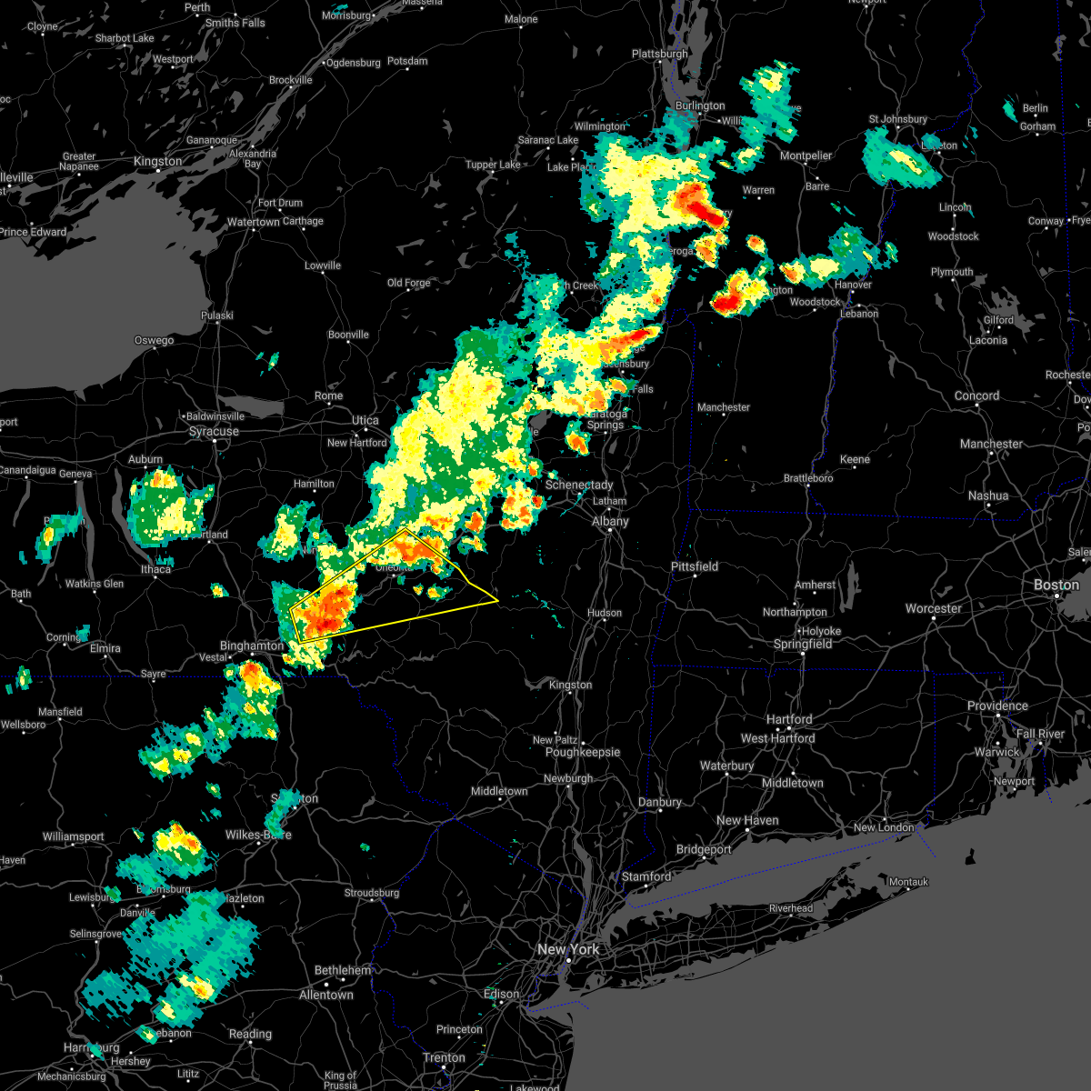 At 341 pm edt, a severe thunderstorm was located over afton, or 13 miles northwest of deposit, moving east at 45 mph (radar indicated). Hazards include 60 mph wind gusts and penny size hail. expect damage to roofs, siding, and trees At 341 pm edt, a severe thunderstorm was located over afton, or 13 miles northwest of deposit, moving east at 45 mph (radar indicated). Hazards include 60 mph wind gusts and penny size hail. expect damage to roofs, siding, and trees
|
| 10/7/2020 3:43 PM EDT |
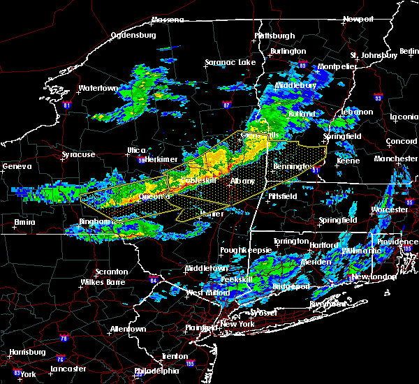 At 343 pm edt, severe thunderstorms were located along a line extending from near central bridge to near smithville flats, moving southeast at 45 mph (law enforcement has reported multiple trees and powerlines down across the warned area). Hazards include 60 mph wind gusts. Expect damage to roofs, siding, and trees. Locations impacted include, oneonta, sidney, delhi, davenport, guilford, worcester, maryland, westville, kortright and meredith. At 343 pm edt, severe thunderstorms were located along a line extending from near central bridge to near smithville flats, moving southeast at 45 mph (law enforcement has reported multiple trees and powerlines down across the warned area). Hazards include 60 mph wind gusts. Expect damage to roofs, siding, and trees. Locations impacted include, oneonta, sidney, delhi, davenport, guilford, worcester, maryland, westville, kortright and meredith.
|
| 10/7/2020 3:28 PM EDT |
 At 327 pm edt, severe thunderstorms were located along a line extending from near ames to willet, moving southeast at 45 mph (radar indicated). Hazards include 60 mph wind gusts. expect damage to roofs, siding, and trees At 327 pm edt, severe thunderstorms were located along a line extending from near ames to willet, moving southeast at 45 mph (radar indicated). Hazards include 60 mph wind gusts. expect damage to roofs, siding, and trees
|
| 8/11/2020 8:05 PM EDT |
 At 804 pm edt, severe thunderstorms were located along a line extending from cherry valley to milford to near rockdale, moving east at 40 mph (radar indicated). Hazards include 60 mph wind gusts and penny size hail. Expect damage to roofs, siding, and trees. Locations impacted include, oneonta, davenport, guilford, worcester, middlefield, hartwick, maryland, cooperstown, westville and meredith. At 804 pm edt, severe thunderstorms were located along a line extending from cherry valley to milford to near rockdale, moving east at 40 mph (radar indicated). Hazards include 60 mph wind gusts and penny size hail. Expect damage to roofs, siding, and trees. Locations impacted include, oneonta, davenport, guilford, worcester, middlefield, hartwick, maryland, cooperstown, westville and meredith.
|
| 8/11/2020 7:33 PM EDT |
 At 733 pm edt, severe thunderstorms were located along a line extending from near richfield springs to morris to near guilford, moving east at 35 mph (radar indicated). Hazards include 60 mph wind gusts and penny size hail. expect damage to roofs, siding, and trees At 733 pm edt, severe thunderstorms were located along a line extending from near richfield springs to morris to near guilford, moving east at 35 mph (radar indicated). Hazards include 60 mph wind gusts and penny size hail. expect damage to roofs, siding, and trees
|
| 7/19/2020 5:52 PM EDT |
 At 550 pm edt, clusters of severe thunderstorms were located along a line extending from near mc donough to greene to endwell, moving east at 40 mph (trained weather spotters. trees and powerlines have been reported blown down in maine, vestal, and johnson city). Hazards include 60 mph wind gusts and penny size hail. Expect damage to roofs, siding, and trees. Locations impacted include, binghamton, vestal, johnson city, endicott, norwich, kirkwood, conklin, sidney, guilford and edmeston. At 550 pm edt, clusters of severe thunderstorms were located along a line extending from near mc donough to greene to endwell, moving east at 40 mph (trained weather spotters. trees and powerlines have been reported blown down in maine, vestal, and johnson city). Hazards include 60 mph wind gusts and penny size hail. Expect damage to roofs, siding, and trees. Locations impacted include, binghamton, vestal, johnson city, endicott, norwich, kirkwood, conklin, sidney, guilford and edmeston.
|
| 7/19/2020 5:36 PM EDT |
 At 535 pm edt, severe thunderstorms were located along a line extending from near east freetown to near whitney point to apalachin, moving east at 40 mph (radar indicated). Hazards include 60 mph wind gusts and penny size hail. expect damage to roofs, siding, and trees At 535 pm edt, severe thunderstorms were located along a line extending from near east freetown to near whitney point to apalachin, moving east at 40 mph (radar indicated). Hazards include 60 mph wind gusts and penny size hail. expect damage to roofs, siding, and trees
|
| 5/29/2020 3:36 PM EDT |
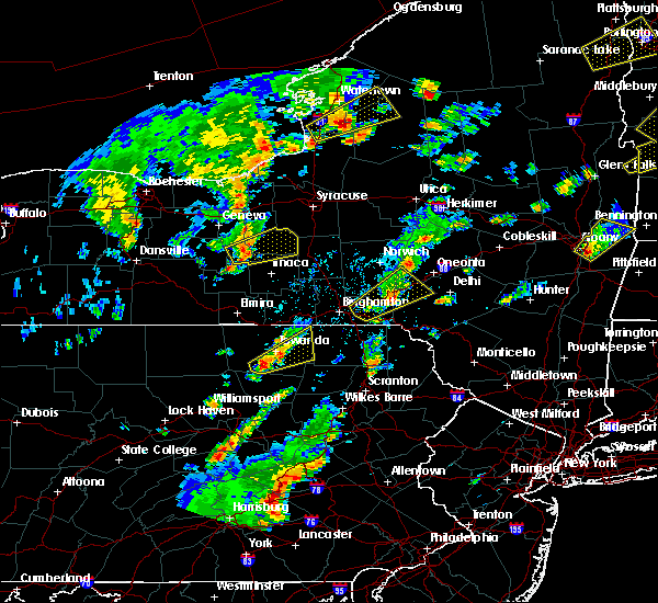 At 336 pm edt, a severe thunderstorm was located over afton, or 11 miles northwest of deposit, moving northeast at 35 mph (radar indicated). Hazards include 60 mph wind gusts and quarter size hail. Hail damage to vehicles is expected. expect wind damage to roofs, siding, and trees. Locations impacted include, sidney, guilford, bainbridge, masonville, unadilla, otego, afton, gilbertsville, franklin and sidney center. At 336 pm edt, a severe thunderstorm was located over afton, or 11 miles northwest of deposit, moving northeast at 35 mph (radar indicated). Hazards include 60 mph wind gusts and quarter size hail. Hail damage to vehicles is expected. expect wind damage to roofs, siding, and trees. Locations impacted include, sidney, guilford, bainbridge, masonville, unadilla, otego, afton, gilbertsville, franklin and sidney center.
|
| 5/29/2020 3:13 PM EDT |
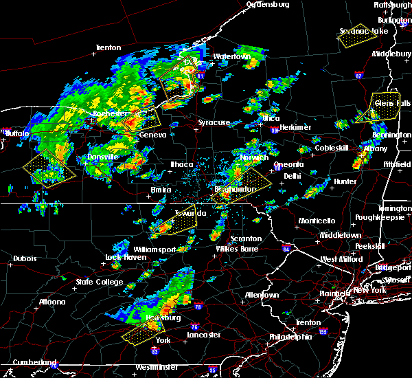 At 312 pm edt, a severe thunderstorm was located near windsor, or 11 miles east of binghamton, moving northeast at 35 mph (radar indicated). Hazards include 60 mph wind gusts and half dollar size hail. Hail damage to vehicles is expected. expect wind damage to roofs, siding, and trees. Locations impacted include, sidney, guilford, bainbridge, masonville, unadilla, otego, windsor, afton, gilbertsville and franklin. At 312 pm edt, a severe thunderstorm was located near windsor, or 11 miles east of binghamton, moving northeast at 35 mph (radar indicated). Hazards include 60 mph wind gusts and half dollar size hail. Hail damage to vehicles is expected. expect wind damage to roofs, siding, and trees. Locations impacted include, sidney, guilford, bainbridge, masonville, unadilla, otego, windsor, afton, gilbertsville and franklin.
|
| 5/29/2020 3:01 PM EDT |
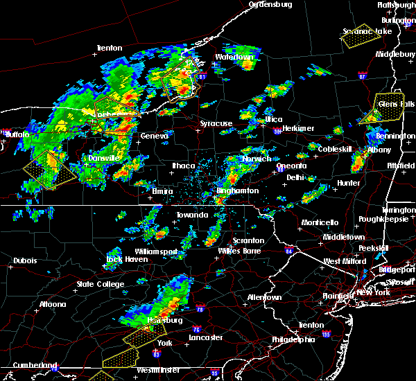 At 301 pm edt, a severe thunderstorm was located over kirkwood, or 7 miles southeast of binghamton, moving northeast at 35 mph (radar indicated). Hazards include 60 mph wind gusts and quarter size hail. Hail damage to vehicles is expected. Expect wind damage to roofs, siding, and trees. At 301 pm edt, a severe thunderstorm was located over kirkwood, or 7 miles southeast of binghamton, moving northeast at 35 mph (radar indicated). Hazards include 60 mph wind gusts and quarter size hail. Hail damage to vehicles is expected. Expect wind damage to roofs, siding, and trees.
|
| 5/15/2020 4:48 PM EDT |
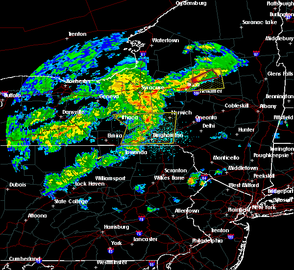 At 447 pm edt, severe thunderstorms were located along a line extending from whitney point to tioga terrace, moving east at 55 mph (radar indicated). Hazards include 60 mph wind gusts. Expect damage to roofs, siding, and trees. Locations impacted include, binghamton, vestal, johnson city, endicott, kirkwood, maine, guilford, sanford, nanticoke and coventry. At 447 pm edt, severe thunderstorms were located along a line extending from whitney point to tioga terrace, moving east at 55 mph (radar indicated). Hazards include 60 mph wind gusts. Expect damage to roofs, siding, and trees. Locations impacted include, binghamton, vestal, johnson city, endicott, kirkwood, maine, guilford, sanford, nanticoke and coventry.
|
| 5/15/2020 4:31 PM EDT |
 At 429 pm edt, severe thunderstorms were located along a line extending from near south cortland to near windham, moving east at 60 mph (radar indicated). Hazards include 60 mph wind gusts and quarter size hail. Hail damage to vehicles is expected. expect wind damage to roofs, siding, and trees. Locations impacted include, binghamton, ithaca, vestal, cortland, johnson city, endicott, barton, norwich, kirkwood and conklin. At 429 pm edt, severe thunderstorms were located along a line extending from near south cortland to near windham, moving east at 60 mph (radar indicated). Hazards include 60 mph wind gusts and quarter size hail. Hail damage to vehicles is expected. expect wind damage to roofs, siding, and trees. Locations impacted include, binghamton, ithaca, vestal, cortland, johnson city, endicott, barton, norwich, kirkwood and conklin.
|
| 5/15/2020 4:17 PM EDT |
 At 417 pm edt, severe thunderstorms were located along a line extending from 6 miles southwest of groton to milan, moving east at 60 mph (radar indicated). Hazards include 60 mph wind gusts and quarter size hail. Hail damage to vehicles is expected. Expect wind damage to roofs, siding, and trees. At 417 pm edt, severe thunderstorms were located along a line extending from 6 miles southwest of groton to milan, moving east at 60 mph (radar indicated). Hazards include 60 mph wind gusts and quarter size hail. Hail damage to vehicles is expected. Expect wind damage to roofs, siding, and trees.
|
| 4/13/2020 3:46 PM EDT |
 At 346 pm edt, severe thunderstorms were located along a line extending from near norwich to coventry to harpursville, moving east at 45 mph (radar indicated). Hazards include 60 mph wind gusts. Expect damage to roofs, siding, and trees. Locations impacted include, norwich, guilford, coventry, oxford, bainbridge, preston, new berlin, afton, south oxford and rockdale. At 346 pm edt, severe thunderstorms were located along a line extending from near norwich to coventry to harpursville, moving east at 45 mph (radar indicated). Hazards include 60 mph wind gusts. Expect damage to roofs, siding, and trees. Locations impacted include, norwich, guilford, coventry, oxford, bainbridge, preston, new berlin, afton, south oxford and rockdale.
|
| 4/13/2020 3:30 PM EDT |
 At 330 pm edt, severe thunderstorms were located along a line extending from near mc donough to near whitney point to near johnson city, moving east at 45 mph (radar indicated). Hazards include 60 mph wind gusts. Expect damage to roofs, siding, and trees. Locations impacted include, binghamton, johnson city, norwich, kirkwood, conklin, guilford, sanford, deposit, coventry and port dickinson. At 330 pm edt, severe thunderstorms were located along a line extending from near mc donough to near whitney point to near johnson city, moving east at 45 mph (radar indicated). Hazards include 60 mph wind gusts. Expect damage to roofs, siding, and trees. Locations impacted include, binghamton, johnson city, norwich, kirkwood, conklin, guilford, sanford, deposit, coventry and port dickinson.
|
| 4/13/2020 3:05 PM EDT |
 At 305 pm edt, severe thunderstorms were located along a line extending from near richford to near berkshire to lounsberry, moving east at 45 mph (radar indicated). Hazards include 60 mph wind gusts. expect damage to roofs, siding, and trees At 305 pm edt, severe thunderstorms were located along a line extending from near richford to near berkshire to lounsberry, moving east at 45 mph (radar indicated). Hazards include 60 mph wind gusts. expect damage to roofs, siding, and trees
|
| 10/31/2019 9:36 PM EDT |
 The severe thunderstorm warning for southwestern otsego, southeastern broome, southeastern madison and central chenango counties will expire at 945 pm edt, the showers which prompted the warning have moved out of the area. therefore, the warning will be allowed to expire. a severe thunderstorm watch remains in effect until 200 am edt for central new york, and northeastern pennsylvania. to report severe weather, contact your nearest law enforcement agency. they will relay your report to the national weather service binghamton. The severe thunderstorm warning for southwestern otsego, southeastern broome, southeastern madison and central chenango counties will expire at 945 pm edt, the showers which prompted the warning have moved out of the area. therefore, the warning will be allowed to expire. a severe thunderstorm watch remains in effect until 200 am edt for central new york, and northeastern pennsylvania. to report severe weather, contact your nearest law enforcement agency. they will relay your report to the national weather service binghamton.
|
| 10/31/2019 9:22 PM EDT |
 At 922 pm edt, severe thunderstorms were located along a line extending from bridgewater to bainbridge, moving northeast at 60 mph (radar indicated). Hazards include 60 mph wind gusts. Expect damage to roofs, siding, and trees. Locations impacted include, binghamton, norwich, kirkwood, conklin, sidney, guilford, sanford, edmeston, north norwich and coventry. At 922 pm edt, severe thunderstorms were located along a line extending from bridgewater to bainbridge, moving northeast at 60 mph (radar indicated). Hazards include 60 mph wind gusts. Expect damage to roofs, siding, and trees. Locations impacted include, binghamton, norwich, kirkwood, conklin, sidney, guilford, sanford, edmeston, north norwich and coventry.
|
| 10/31/2019 8:57 PM EDT |
 At 856 pm edt, gusty showers thunderstorms were located along a line extending from near smyrna to near kirkwood, moving northeast at 60 mph (radar indicated). Hazards include 60 mph wind gusts. expect damage to roofs, siding, and trees At 856 pm edt, gusty showers thunderstorms were located along a line extending from near smyrna to near kirkwood, moving northeast at 60 mph (radar indicated). Hazards include 60 mph wind gusts. expect damage to roofs, siding, and trees
|
| 10/31/2019 8:03 PM EDT |
 At 802 pm edt, gusty showers were located along a line extending from 7 miles southwest of st. johnsville to near sidney, moving northeast at 60 mph (radar indicated). Hazards include 60 mph wind gusts. Expect damage to roofs, siding, and trees. Locations impacted include, norwich, paris, hamilton, guilford, brookfield, hartwick, clinton, cooperstown, edmeston and plymouth. At 802 pm edt, gusty showers were located along a line extending from 7 miles southwest of st. johnsville to near sidney, moving northeast at 60 mph (radar indicated). Hazards include 60 mph wind gusts. Expect damage to roofs, siding, and trees. Locations impacted include, norwich, paris, hamilton, guilford, brookfield, hartwick, clinton, cooperstown, edmeston and plymouth.
|
| 10/31/2019 7:33 PM EDT |
 At 732 pm edt, a line of gusty showers was located along a line extending from waterville to near whitney point, moving east at 60 mph. these showers have resulted in downed trees and wires earlier this evening. seek shelter if trick or treating (radar indicated). Hazards include 60 mph wind gusts. expect damage to roofs, siding, and trees At 732 pm edt, a line of gusty showers was located along a line extending from waterville to near whitney point, moving east at 60 mph. these showers have resulted in downed trees and wires earlier this evening. seek shelter if trick or treating (radar indicated). Hazards include 60 mph wind gusts. expect damage to roofs, siding, and trees
|
| 8/18/2019 4:55 PM EDT |
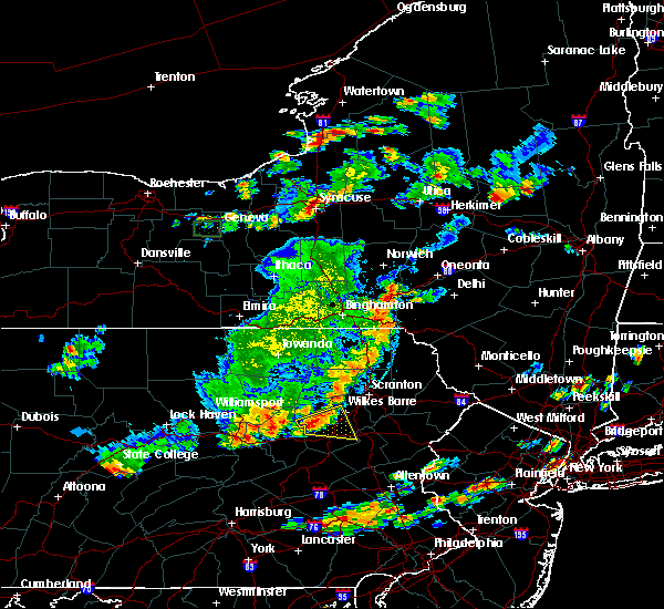 The national weather service in binghamton has issued a * severe thunderstorm warning for. southwestern otsego county in central new york. northwestern delaware county in central new york. southeastern chenango county in central new york. Until 600 pm edt. The national weather service in binghamton has issued a * severe thunderstorm warning for. southwestern otsego county in central new york. northwestern delaware county in central new york. southeastern chenango county in central new york. Until 600 pm edt.
|
| 8/18/2019 4:23 PM EDT |
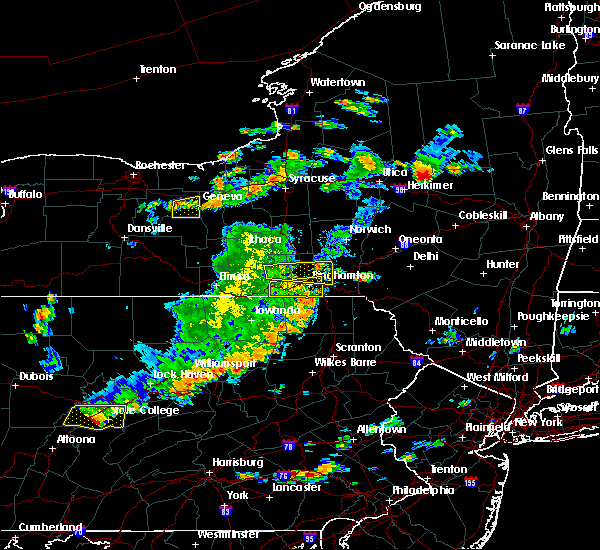 At 422 pm edt, a severe thunderstorm was located over greene, or 11 miles northeast of greater binghamton airport, moving east at 25 mph (emergency management). Hazards include 60 mph wind gusts. expect damage to roofs, siding, and trees At 422 pm edt, a severe thunderstorm was located over greene, or 11 miles northeast of greater binghamton airport, moving east at 25 mph (emergency management). Hazards include 60 mph wind gusts. expect damage to roofs, siding, and trees
|
| 8/8/2019 3:39 PM EDT |
 At 338 pm edt, severe thunderstorms were located along a line extending from near west winfield to near hartwick to near afton, moving east at 55 mph (radar indicated). Hazards include 60 mph wind gusts and nickel size hail. Expect damage to roofs, siding, and trees. Locations impacted include, norwich, sidney, guilford, brookfield, sanford, augusta, edmeston, deposit, coventry and waterville. At 338 pm edt, severe thunderstorms were located along a line extending from near west winfield to near hartwick to near afton, moving east at 55 mph (radar indicated). Hazards include 60 mph wind gusts and nickel size hail. Expect damage to roofs, siding, and trees. Locations impacted include, norwich, sidney, guilford, brookfield, sanford, augusta, edmeston, deposit, coventry and waterville.
|
| 8/8/2019 3:13 PM EDT |
 At 312 pm edt, severe thunderstorms were located along a line extending from morrisville to plymouth to greater binghamton airport, moving east at 55 mph (radar indicated). Hazards include 60 mph wind gusts and nickel size hail. expect damage to roofs, siding, and trees At 312 pm edt, severe thunderstorms were located along a line extending from morrisville to plymouth to greater binghamton airport, moving east at 55 mph (radar indicated). Hazards include 60 mph wind gusts and nickel size hail. expect damage to roofs, siding, and trees
|
| 8/8/2019 2:35 PM EDT |
 At 234 pm edt, severe thunderstorms were located along a line extending from brewerton to near east homer to near spencer, moving east at 55 mph (radar indicated). Hazards include 60 mph wind gusts and penny size hail. expect damage to roofs, siding, and trees At 234 pm edt, severe thunderstorms were located along a line extending from brewerton to near east homer to near spencer, moving east at 55 mph (radar indicated). Hazards include 60 mph wind gusts and penny size hail. expect damage to roofs, siding, and trees
|
| 7/19/2019 6:27 PM EDT |
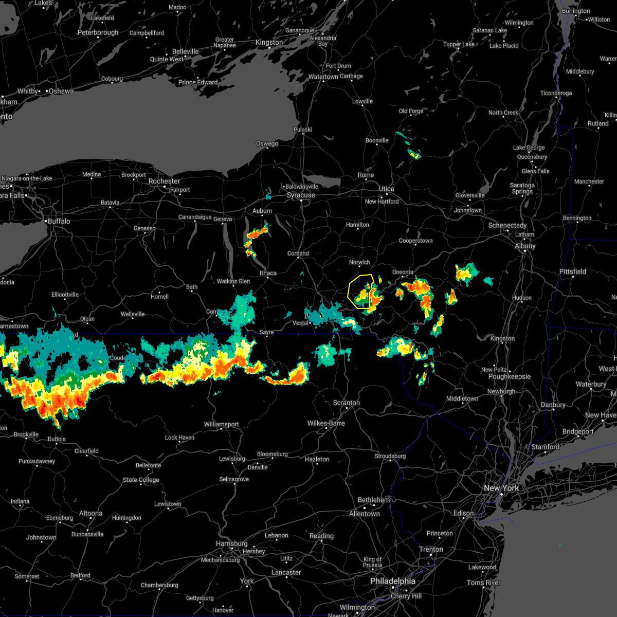 The severe thunderstorm warning for southeastern chenango county will expire at 630 pm edt, the storm which prompted the warning has weakened below severe limits, and has exited the warned area. therefore, the warning will be allowed to expire. however, gusty winds and heavy rain are still possible with this thunderstorm. a severe thunderstorm watch remains in effect until 1000 pm edt for central new york. The severe thunderstorm warning for southeastern chenango county will expire at 630 pm edt, the storm which prompted the warning has weakened below severe limits, and has exited the warned area. therefore, the warning will be allowed to expire. however, gusty winds and heavy rain are still possible with this thunderstorm. a severe thunderstorm watch remains in effect until 1000 pm edt for central new york.
|
| 7/19/2019 6:20 PM EDT |
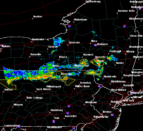 At 619 pm edt, a severe thunderstorm was located near bainbridge, or 15 miles south of norwich, moving east at 25 mph (radar indicated). Hazards include 60 mph wind gusts. Expect damage to roofs, siding, and trees. Locations impacted include, guilford, coventry, bainbridge, afton, mt upton, south oxford, rockdale and lathams corners. At 619 pm edt, a severe thunderstorm was located near bainbridge, or 15 miles south of norwich, moving east at 25 mph (radar indicated). Hazards include 60 mph wind gusts. Expect damage to roofs, siding, and trees. Locations impacted include, guilford, coventry, bainbridge, afton, mt upton, south oxford, rockdale and lathams corners.
|
| 7/19/2019 6:06 PM EDT |
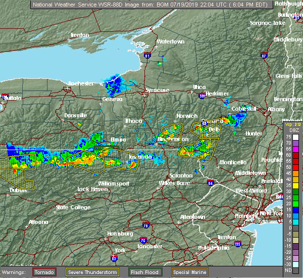 At 605 pm edt, a severe thunderstorm was located over brisben, or 15 miles southwest of norwich, moving east at 25 mph (radar indicated). Hazards include 60 mph wind gusts. Expect damage to roofs, siding, and trees. Locations impacted include, guilford, coventry, greene, oxford, bainbridge, afton, south oxford, rockdale, brisben and harpursville. At 605 pm edt, a severe thunderstorm was located over brisben, or 15 miles southwest of norwich, moving east at 25 mph (radar indicated). Hazards include 60 mph wind gusts. Expect damage to roofs, siding, and trees. Locations impacted include, guilford, coventry, greene, oxford, bainbridge, afton, south oxford, rockdale, brisben and harpursville.
|
| 7/19/2019 5:49 PM EDT |
 At 548 pm edt, a severe thunderstorm was located near smithville flats, or 11 miles southeast of marathon, moving east at 25 mph (radar indicated). Hazards include 60 mph wind gusts. expect damage to roofs, siding, and trees At 548 pm edt, a severe thunderstorm was located near smithville flats, or 11 miles southeast of marathon, moving east at 25 mph (radar indicated). Hazards include 60 mph wind gusts. expect damage to roofs, siding, and trees
|
| 7/16/2019 7:05 PM EDT |
 At 702 pm edt, severe thunderstorms were located along a line extending from near taylor to mc donough to smithville flats, moving east at 25 mph (law enforcement reported multiple trees and power lines down in cortland county). Hazards include 60 mph wind gusts. Expect damage to roofs, siding, and trees. Locations impacted include, norwich, guilford, plymouth, north norwich, greene, oxford, sherburne, otselic, preston and new berlin. At 702 pm edt, severe thunderstorms were located along a line extending from near taylor to mc donough to smithville flats, moving east at 25 mph (law enforcement reported multiple trees and power lines down in cortland county). Hazards include 60 mph wind gusts. Expect damage to roofs, siding, and trees. Locations impacted include, norwich, guilford, plymouth, north norwich, greene, oxford, sherburne, otselic, preston and new berlin.
|
| 7/16/2019 6:41 PM EDT |
 The national weather service in binghamton has issued a * severe thunderstorm warning for. northwestern broome county in central new york. southeastern madison county in central new york. eastern cortland county in central new york. Chenango county in central new york. The national weather service in binghamton has issued a * severe thunderstorm warning for. northwestern broome county in central new york. southeastern madison county in central new york. eastern cortland county in central new york. Chenango county in central new york.
|
| 5/10/2019 4:00 PM EDT |
 At 359 pm edt, a severe thunderstorm was located over mc donough, or 12 miles west of norwich, moving east at 30 mph (radar indicated). Hazards include 60 mph wind gusts and quarter size hail. Hail damage to vehicles is expected. expect wind damage to roofs, siding, and trees. Locations impacted include, norwich, guilford, oxford, unadilla, preston, otego, gilbertsville, franklin, mc donough and east sidney. At 359 pm edt, a severe thunderstorm was located over mc donough, or 12 miles west of norwich, moving east at 30 mph (radar indicated). Hazards include 60 mph wind gusts and quarter size hail. Hail damage to vehicles is expected. expect wind damage to roofs, siding, and trees. Locations impacted include, norwich, guilford, oxford, unadilla, preston, otego, gilbertsville, franklin, mc donough and east sidney.
|
| 5/10/2019 3:44 PM EDT |
 At 344 pm edt, a severe thunderstorm was located over cincinnatus, or 7 miles northeast of marathon, moving east at 30 mph (radar indicated). Hazards include 60 mph wind gusts and quarter size hail. Hail damage to vehicles is expected. Expect wind damage to roofs, siding, and trees. At 344 pm edt, a severe thunderstorm was located over cincinnatus, or 7 miles northeast of marathon, moving east at 30 mph (radar indicated). Hazards include 60 mph wind gusts and quarter size hail. Hail damage to vehicles is expected. Expect wind damage to roofs, siding, and trees.
|
| 4/15/2019 1:47 AM EDT |
 At 147 am edt, severe thunderstorms were located along a line extending from near bainbridge to hallstead to near hop bottom, moving east at 50 mph (radar indicated). Hazards include 70 mph wind gusts. Expect considerable tree damage. damage is likely to mobile homes, roofs, and outbuildings. Locations impacted include, kirkwood, conklin, sidney, jackson, guilford, clifford, sanford, susquehanna, forest city and deposit. At 147 am edt, severe thunderstorms were located along a line extending from near bainbridge to hallstead to near hop bottom, moving east at 50 mph (radar indicated). Hazards include 70 mph wind gusts. Expect considerable tree damage. damage is likely to mobile homes, roofs, and outbuildings. Locations impacted include, kirkwood, conklin, sidney, jackson, guilford, clifford, sanford, susquehanna, forest city and deposit.
|
| 4/15/2019 1:27 AM EDT |
 At 127 am edt, severe thunderstorms were located along a line extending from chenango forks to near friendsville to near auburn center, moving east at 45 mph (radar indicated). Hazards include 70 mph wind gusts. Expect considerable tree damage. damage is likely to mobile homes, roofs, and outbuildings. Locations impacted include, binghamton, vestal, johnson city, endicott, kirkwood, conklin, rush, sidney, jackson and guilford. At 127 am edt, severe thunderstorms were located along a line extending from chenango forks to near friendsville to near auburn center, moving east at 45 mph (radar indicated). Hazards include 70 mph wind gusts. Expect considerable tree damage. damage is likely to mobile homes, roofs, and outbuildings. Locations impacted include, binghamton, vestal, johnson city, endicott, kirkwood, conklin, rush, sidney, jackson and guilford.
|
| 4/15/2019 1:10 AM EDT |
 At 110 am edt, severe thunderstorms were located along a line extending from near nanticoke to near le raysville to near new albany, moving east at 45 mph (radar indicated). Hazards include 70 mph wind gusts. Expect considerable tree damage. Damage is likely to mobile homes, roofs, and outbuildings. At 110 am edt, severe thunderstorms were located along a line extending from near nanticoke to near le raysville to near new albany, moving east at 45 mph (radar indicated). Hazards include 70 mph wind gusts. Expect considerable tree damage. Damage is likely to mobile homes, roofs, and outbuildings.
|
| 8/29/2018 10:56 PM EDT |
 At 1055 pm edt, severe thunderstorms were located along a line extending from bainbridge to 6 miles north of deposit to near sanford, moving east at 40 mph (radar indicated). Hazards include 60 mph wind gusts. Expect damage to roofs, siding, and trees. these severe storms will be near, sidney and rockdale around 1105 pm edt. unadilla around 1110 pm edt. hancock, east sidney and sidney center around 1115 pm edt. walton and otego around 1120 pm edt. colchester, franklin and east branch around 1125 pm edt. Delhi, meredith and harvard around 1130 pm edt. At 1055 pm edt, severe thunderstorms were located along a line extending from bainbridge to 6 miles north of deposit to near sanford, moving east at 40 mph (radar indicated). Hazards include 60 mph wind gusts. Expect damage to roofs, siding, and trees. these severe storms will be near, sidney and rockdale around 1105 pm edt. unadilla around 1110 pm edt. hancock, east sidney and sidney center around 1115 pm edt. walton and otego around 1120 pm edt. colchester, franklin and east branch around 1125 pm edt. Delhi, meredith and harvard around 1130 pm edt.
|
| 8/29/2018 10:31 PM EDT |
 At 1030 pm edt, severe thunderstorms were located along a line extending from near coventry to near harpursville to near kirkwood, moving east at 40 mph (radar indicated). Hazards include 60 mph wind gusts. Expect damage to roofs, siding, and trees. severe thunderstorms will be near, coventry, harpursville and nineveh around 1035 pm edt. sanford around 1040 pm edt. afton around 1045 pm edt. guilford and bainbridge around 1050 pm edt. deposit, sidney and rockdale around 1055 pm edt. unadilla, hancock and sidney center around 1105 pm edt. walton and east sidney around 1110 pm edt. Colchester, otego and franklin around 1115 pm edt. At 1030 pm edt, severe thunderstorms were located along a line extending from near coventry to near harpursville to near kirkwood, moving east at 40 mph (radar indicated). Hazards include 60 mph wind gusts. Expect damage to roofs, siding, and trees. severe thunderstorms will be near, coventry, harpursville and nineveh around 1035 pm edt. sanford around 1040 pm edt. afton around 1045 pm edt. guilford and bainbridge around 1050 pm edt. deposit, sidney and rockdale around 1055 pm edt. unadilla, hancock and sidney center around 1105 pm edt. walton and east sidney around 1110 pm edt. Colchester, otego and franklin around 1115 pm edt.
|
| 8/29/2018 10:10 PM EDT |
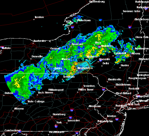 At 1010 pm edt, severe thunderstorms were located along a line extending from lisle to chenango bridge to vestal center, moving east at 35 mph (radar indicated). Hazards include 60 mph wind gusts. Expect damage to roofs, siding, and trees. these severe storms will be near, chenango bridge and chenango forks around 1015 pm edt. sanitaria springs around 1020 pm edt. kirkwood, conklin and smithville flats around 1025 pm edt. Coventry, greene and windsor around 1030 pm edt. At 1010 pm edt, severe thunderstorms were located along a line extending from lisle to chenango bridge to vestal center, moving east at 35 mph (radar indicated). Hazards include 60 mph wind gusts. Expect damage to roofs, siding, and trees. these severe storms will be near, chenango bridge and chenango forks around 1015 pm edt. sanitaria springs around 1020 pm edt. kirkwood, conklin and smithville flats around 1025 pm edt. Coventry, greene and windsor around 1030 pm edt.
|
| 8/29/2018 9:34 PM EDT |
 At 934 pm edt, severe thunderstorms were located along a line extending from near danby to near tioga center to litchfield, moving east at 40 mph (radar indicated). Hazards include 60 mph wind gusts. Expect damage to roofs, siding, and trees. severe thunderstorms will be near, owego around 940 pm edt. slaterville springs around 945 pm edt. caroline and newark valley around 950 pm edt. berkshire, richford and union center around 955 pm edt. tioga terrace and endwell around 1000 pm edt. johnson city, endicott and greater binghamton airport around 1005 pm edt. marathon, whitney point and lisle around 1010 pm edt. Chenango forks around 1015 pm edt. At 934 pm edt, severe thunderstorms were located along a line extending from near danby to near tioga center to litchfield, moving east at 40 mph (radar indicated). Hazards include 60 mph wind gusts. Expect damage to roofs, siding, and trees. severe thunderstorms will be near, owego around 940 pm edt. slaterville springs around 945 pm edt. caroline and newark valley around 950 pm edt. berkshire, richford and union center around 955 pm edt. tioga terrace and endwell around 1000 pm edt. johnson city, endicott and greater binghamton airport around 1005 pm edt. marathon, whitney point and lisle around 1010 pm edt. Chenango forks around 1015 pm edt.
|
| 7/2/2018 7:46 PM EDT |
 At 743 pm edt, severe thunderstorms were located along a line extending from near greene to near castle creek to near greater binghamton airport to vestal, moving east at 30 mph (radar indicated). Hazards include 60 mph wind gusts and nickel size hail. Expect damage to roofs, siding, and trees. Locations impacted include, binghamton, vestal, johnson city, endicott, kirkwood, conklin, maine, guilford, nanticoke and coventry. At 743 pm edt, severe thunderstorms were located along a line extending from near greene to near castle creek to near greater binghamton airport to vestal, moving east at 30 mph (radar indicated). Hazards include 60 mph wind gusts and nickel size hail. Expect damage to roofs, siding, and trees. Locations impacted include, binghamton, vestal, johnson city, endicott, kirkwood, conklin, maine, guilford, nanticoke and coventry.
|
| 7/2/2018 7:46 PM EDT |
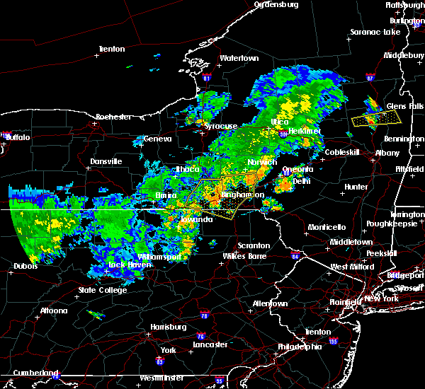 At 743 pm edt, severe thunderstorms were located along a line extending from near greene to near castle creek to near greater binghamton airport to vestal, moving east at 30 mph (radar indicated). Hazards include 60 mph wind gusts and nickel size hail. Expect damage to roofs, siding, and trees. Locations impacted include, binghamton, vestal, johnson city, endicott, kirkwood, conklin, maine, guilford, nanticoke and coventry. At 743 pm edt, severe thunderstorms were located along a line extending from near greene to near castle creek to near greater binghamton airport to vestal, moving east at 30 mph (radar indicated). Hazards include 60 mph wind gusts and nickel size hail. Expect damage to roofs, siding, and trees. Locations impacted include, binghamton, vestal, johnson city, endicott, kirkwood, conklin, maine, guilford, nanticoke and coventry.
|
| 7/2/2018 7:26 PM EDT |
 At 723 pm edt, severe thunderstorms were located along a line extending from lisle to near nanticoke to near newark valley to near owego. another line of severe thunderstorms extended between oxford and belden. all of the thunderstorms were moving east at 30 mph (law enforcement. trees and powerlines have been reported blown down in eastern tioga county in association with these thunderstorms). Hazards include 60 mph wind gusts and nickel size hail. Expect damage to roofs, siding, and trees. Locations impacted include, binghamton, vestal, johnson city, endicott, kirkwood, conklin, maine, owego, guilford and nanticoke. At 723 pm edt, severe thunderstorms were located along a line extending from lisle to near nanticoke to near newark valley to near owego. another line of severe thunderstorms extended between oxford and belden. all of the thunderstorms were moving east at 30 mph (law enforcement. trees and powerlines have been reported blown down in eastern tioga county in association with these thunderstorms). Hazards include 60 mph wind gusts and nickel size hail. Expect damage to roofs, siding, and trees. Locations impacted include, binghamton, vestal, johnson city, endicott, kirkwood, conklin, maine, owego, guilford and nanticoke.
|
| 7/2/2018 7:26 PM EDT |
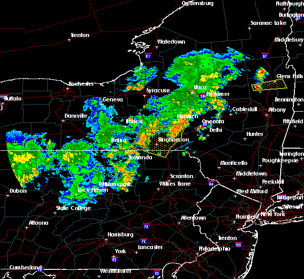 At 723 pm edt, severe thunderstorms were located along a line extending from lisle to near nanticoke to near newark valley to near owego. another line of severe thunderstorms extended between oxford and belden. all of the thunderstorms were moving east at 30 mph (law enforcement. trees and powerlines have been reported blown down in eastern tioga county in association with these thunderstorms). Hazards include 60 mph wind gusts and nickel size hail. Expect damage to roofs, siding, and trees. Locations impacted include, binghamton, vestal, johnson city, endicott, kirkwood, conklin, maine, owego, guilford and nanticoke. At 723 pm edt, severe thunderstorms were located along a line extending from lisle to near nanticoke to near newark valley to near owego. another line of severe thunderstorms extended between oxford and belden. all of the thunderstorms were moving east at 30 mph (law enforcement. trees and powerlines have been reported blown down in eastern tioga county in association with these thunderstorms). Hazards include 60 mph wind gusts and nickel size hail. Expect damage to roofs, siding, and trees. Locations impacted include, binghamton, vestal, johnson city, endicott, kirkwood, conklin, maine, owego, guilford and nanticoke.
|
| 7/2/2018 7:17 PM EDT |
 At 715 pm edt, severe thunderstorms were located along a line extending from near lisle to near berkshire to near newark valley to near owego, moving east at 30 mph (law enforcement. trees and powerlines have been reported blown down near barton ny in association with this line of thunderstorms). Hazards include 60 mph wind gusts and nickel size hail. expect damage to roofs, siding, and trees At 715 pm edt, severe thunderstorms were located along a line extending from near lisle to near berkshire to near newark valley to near owego, moving east at 30 mph (law enforcement. trees and powerlines have been reported blown down near barton ny in association with this line of thunderstorms). Hazards include 60 mph wind gusts and nickel size hail. expect damage to roofs, siding, and trees
|
| 7/2/2018 7:17 PM EDT |
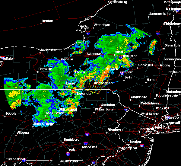 At 715 pm edt, severe thunderstorms were located along a line extending from near lisle to near berkshire to near newark valley to near owego, moving east at 30 mph (law enforcement. trees and powerlines have been reported blown down near barton ny in association with this line of thunderstorms). Hazards include 60 mph wind gusts and nickel size hail. expect damage to roofs, siding, and trees At 715 pm edt, severe thunderstorms were located along a line extending from near lisle to near berkshire to near newark valley to near owego, moving east at 30 mph (law enforcement. trees and powerlines have been reported blown down near barton ny in association with this line of thunderstorms). Hazards include 60 mph wind gusts and nickel size hail. expect damage to roofs, siding, and trees
|
| 6/18/2018 8:48 PM EDT |
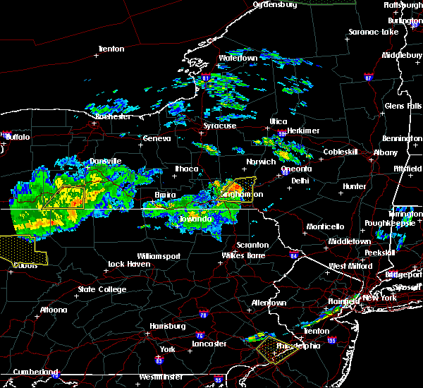 At 848 pm edt, severe thunderstorms were located along a line extending from brisben to chenango bridge, moving east at 40 mph (radar indicated). Hazards include 60 mph wind gusts. Expect damage to roofs, siding, and trees. these severe storms will be near, coventry and south oxford around 855 pm edt. Guilford, bainbridge and harpursville around 900 pm edt. At 848 pm edt, severe thunderstorms were located along a line extending from brisben to chenango bridge, moving east at 40 mph (radar indicated). Hazards include 60 mph wind gusts. Expect damage to roofs, siding, and trees. these severe storms will be near, coventry and south oxford around 855 pm edt. Guilford, bainbridge and harpursville around 900 pm edt.
|
| 6/18/2018 8:20 PM EDT |
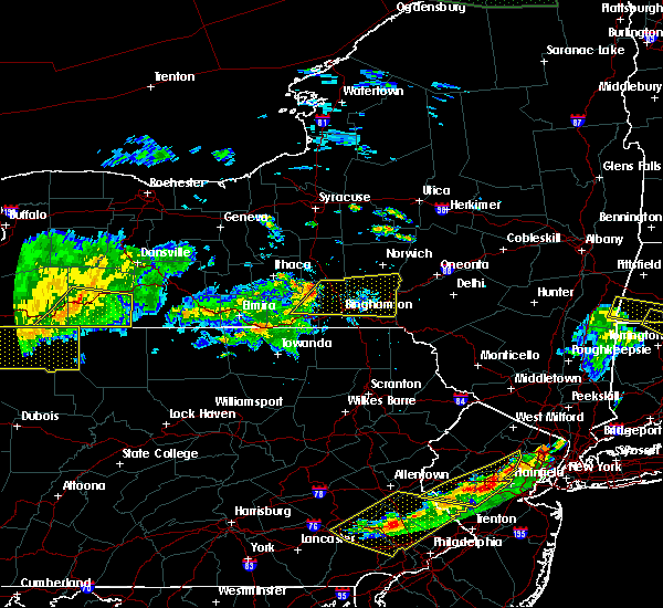 At 817 pm edt, severe thunderstorms were located along a line extending from richford to near candor, moving east at 45 mph (radar indicated). Hazards include 60 mph wind gusts. Expect damage to roofs, siding, and trees. severe thunderstorms will be near, nanticoke around 825 pm edt. newark valley, whitney point and lisle around 830 pm edt. endicott, union center and west corners around 835 pm edt. johnson city, greater binghamton airport and endwell around 840 pm edt. binghamton, greene and castle creek around 845 pm edt. brisben, chenango forks and chenango bridge around 850 pm edt. coventry, oxford and south oxford around 855 pm edt. Guilford, bainbridge and harpursville around 900 pm edt. At 817 pm edt, severe thunderstorms were located along a line extending from richford to near candor, moving east at 45 mph (radar indicated). Hazards include 60 mph wind gusts. Expect damage to roofs, siding, and trees. severe thunderstorms will be near, nanticoke around 825 pm edt. newark valley, whitney point and lisle around 830 pm edt. endicott, union center and west corners around 835 pm edt. johnson city, greater binghamton airport and endwell around 840 pm edt. binghamton, greene and castle creek around 845 pm edt. brisben, chenango forks and chenango bridge around 850 pm edt. coventry, oxford and south oxford around 855 pm edt. Guilford, bainbridge and harpursville around 900 pm edt.
|
| 6/13/2018 8:46 PM EDT |
 At 846 pm edt, severe thunderstorms were located along a line extending from mt upton to near west corners, moving southeast at 40 mph (radar indicated). Hazards include 60 mph wind gusts. Expect damage to roofs, siding, and trees. severe thunderstorms will be near, sidney, guilford and gilbertsville around 850 pm edt. unadilla around 855 pm edt. binghamton, otego and east sidney around 900 pm edt. franklin around 905 pm edt. meridale around 915 pm edt. Meredith around 920 pm edt. At 846 pm edt, severe thunderstorms were located along a line extending from mt upton to near west corners, moving southeast at 40 mph (radar indicated). Hazards include 60 mph wind gusts. Expect damage to roofs, siding, and trees. severe thunderstorms will be near, sidney, guilford and gilbertsville around 850 pm edt. unadilla around 855 pm edt. binghamton, otego and east sidney around 900 pm edt. franklin around 905 pm edt. meridale around 915 pm edt. Meredith around 920 pm edt.
|
| 6/13/2018 8:18 PM EDT |
 At 818 pm edt, a severe thunderstorm was located over brisben, or 12 miles southwest of norwich, moving east at 55 mph (radar indicated). Hazards include 60 mph wind gusts. Expect damage to roofs, siding, and trees. This severe storm will be near, guilford, bainbridge and afton around 830 pm edt. At 818 pm edt, a severe thunderstorm was located over brisben, or 12 miles southwest of norwich, moving east at 55 mph (radar indicated). Hazards include 60 mph wind gusts. Expect damage to roofs, siding, and trees. This severe storm will be near, guilford, bainbridge and afton around 830 pm edt.
|
| 6/13/2018 7:54 PM EDT |
 At 754 pm edt, a severe thunderstorm was located near virgil, or near marathon, moving east at 55 mph (radar indicated). Hazards include 60 mph wind gusts. Expect damage to roofs, siding, and trees. this severe thunderstorm will be near, east freetown around 800 pm edt. cincinnatus and willet around 805 pm edt. smithville flats and mc donough around 810 pm edt. greene around 815 pm edt. oxford, brisben and south oxford around 820 pm edt. coventry around 825 pm edt. Guilford, bainbridge and afton around 830 pm edt. At 754 pm edt, a severe thunderstorm was located near virgil, or near marathon, moving east at 55 mph (radar indicated). Hazards include 60 mph wind gusts. Expect damage to roofs, siding, and trees. this severe thunderstorm will be near, east freetown around 800 pm edt. cincinnatus and willet around 805 pm edt. smithville flats and mc donough around 810 pm edt. greene around 815 pm edt. oxford, brisben and south oxford around 820 pm edt. coventry around 825 pm edt. Guilford, bainbridge and afton around 830 pm edt.
|
| 5/4/2018 7:06 PM EDT |
 At 703 pm edt, severe thunderstorms were located along a line extending from bridgewater to columbus to near oxford to near apalachin, moving southeast at 40 mph (radar indicated). Hazards include 70 mph wind gusts. Expect considerable tree damage. damage is likely to mobile homes, roofs, and outbuildings. severe thunderstorms will be near, norwich, oxford and new berlin around 710 pm edt. guilford, edmeston and pittsfield around 715 pm edt. richfield springs, morris and exeter center around 720 pm edt. sidney, gilbertsville and brackney around 725 pm edt. cooperstown, conklin and hartwick around 730 pm edt. oneonta, kirkwood and otego around 735 pm edt. middlefield, hallstead and great bend around 740 pm edt. maryland, new milford and elk creek around 745 pm edt. A severe thunderstorm watch remains in effect until 900 pm edt for central new york. At 703 pm edt, severe thunderstorms were located along a line extending from bridgewater to columbus to near oxford to near apalachin, moving southeast at 40 mph (radar indicated). Hazards include 70 mph wind gusts. Expect considerable tree damage. damage is likely to mobile homes, roofs, and outbuildings. severe thunderstorms will be near, norwich, oxford and new berlin around 710 pm edt. guilford, edmeston and pittsfield around 715 pm edt. richfield springs, morris and exeter center around 720 pm edt. sidney, gilbertsville and brackney around 725 pm edt. cooperstown, conklin and hartwick around 730 pm edt. oneonta, kirkwood and otego around 735 pm edt. middlefield, hallstead and great bend around 740 pm edt. maryland, new milford and elk creek around 745 pm edt. A severe thunderstorm watch remains in effect until 900 pm edt for central new york.
|
| 5/4/2018 6:49 PM EDT |
 At 647 pm edt, severe thunderstorms were located along a line extending from near waterville to near earlville to near pitcher to near candor, moving southeast at 40 mph (radar indicated). Hazards include 60 mph wind gusts. Expect damage to trees, and power lines. these severe storms will be near, hamilton, waterville and lebanon around 650 pm edt. plymouth, sherburne and clayville around 655 pm edt. brookfield, north norwich and bridgewater around 700 pm edt. norwich, oxford and columbus around 705 pm edt. endicott, greater binghamton airport and vestal around 710 pm edt. johnson city, guilford and pittsfield around 715 pm edt. binghamton, richfield springs and mt upton around 720 pm edt. hartwick, morris and gilbertsville around 725 pm edt. a tornado watch remains in effect until 1000 pm edt for oneida county in central new york. A severe thunderstorm watch remains in effect until 900 pm edt for the remainder of central new york. At 647 pm edt, severe thunderstorms were located along a line extending from near waterville to near earlville to near pitcher to near candor, moving southeast at 40 mph (radar indicated). Hazards include 60 mph wind gusts. Expect damage to trees, and power lines. these severe storms will be near, hamilton, waterville and lebanon around 650 pm edt. plymouth, sherburne and clayville around 655 pm edt. brookfield, north norwich and bridgewater around 700 pm edt. norwich, oxford and columbus around 705 pm edt. endicott, greater binghamton airport and vestal around 710 pm edt. johnson city, guilford and pittsfield around 715 pm edt. binghamton, richfield springs and mt upton around 720 pm edt. hartwick, morris and gilbertsville around 725 pm edt. a tornado watch remains in effect until 1000 pm edt for oneida county in central new york. A severe thunderstorm watch remains in effect until 900 pm edt for the remainder of central new york.
|
| 5/4/2018 6:27 PM EDT |
 At 627 pm edt, severe thunderstorms were located along a line extending from near sherrill to near erieville to near truxton to near danby, moving southeast at 40 mph (radar indicated). Hazards include 60 mph wind gusts. Expect damage to trees, and power lines. severe thunderstorms will be near, oneida, sherrill and nelson around 630 pm edt. morrisville, stockbridge and georgetown around 635 pm edt. hamilton, augusta and lebanon around 640 pm edt. clinton, candor and pecksport around 645 pm edt. waterville, berkshire and earlville around 650 pm edt. owego, plymouth and sherburne around 655 pm edt. brookfield, north norwich and nanticoke around 700 pm edt. norwich, oxford and columbus around 705 pm edt. A tornado watch remains in effect until 1000 pm edt for central new york. At 627 pm edt, severe thunderstorms were located along a line extending from near sherrill to near erieville to near truxton to near danby, moving southeast at 40 mph (radar indicated). Hazards include 60 mph wind gusts. Expect damage to trees, and power lines. severe thunderstorms will be near, oneida, sherrill and nelson around 630 pm edt. morrisville, stockbridge and georgetown around 635 pm edt. hamilton, augusta and lebanon around 640 pm edt. clinton, candor and pecksport around 645 pm edt. waterville, berkshire and earlville around 650 pm edt. owego, plymouth and sherburne around 655 pm edt. brookfield, north norwich and nanticoke around 700 pm edt. norwich, oxford and columbus around 705 pm edt. A tornado watch remains in effect until 1000 pm edt for central new york.
|
| 8/4/2017 5:51 PM EDT |
 At 550 pm edt, severe thunderstorms were located along a line extending from near pitcher to near oxford, moving northeast at 25 mph (radar indicated). Hazards include 60 mph wind gusts. Expect damage to trees, and power lines. These severe storms will be near, norwich, otselic and mt upton around 600 pm edt. At 550 pm edt, severe thunderstorms were located along a line extending from near pitcher to near oxford, moving northeast at 25 mph (radar indicated). Hazards include 60 mph wind gusts. Expect damage to trees, and power lines. These severe storms will be near, norwich, otselic and mt upton around 600 pm edt.
|
| 8/4/2017 5:35 PM EDT |
 At 534 pm edt, severe thunderstorms were located along a line extending from willet to near coventry, moving northeast at 25 mph (radar indicated). Hazards include 60 mph wind gusts. Expect damage to trees, and power lines. severe thunderstorms will be near, coventry, cincinnatus and brisben around 545 pm edt. pitcher, taylor and south oxford around 550 pm edt. bainbridge around 555 pm edt. Guilford, oxford and rockdale around 600 pm edt. At 534 pm edt, severe thunderstorms were located along a line extending from willet to near coventry, moving northeast at 25 mph (radar indicated). Hazards include 60 mph wind gusts. Expect damage to trees, and power lines. severe thunderstorms will be near, coventry, cincinnatus and brisben around 545 pm edt. pitcher, taylor and south oxford around 550 pm edt. bainbridge around 555 pm edt. Guilford, oxford and rockdale around 600 pm edt.
|
| 7/17/2017 1:18 PM EDT |
 At 118 pm edt, a severe thunderstorm was located over coventry, or 16 miles south of norwich, moving northeast at 15 mph (radar indicated). Hazards include 60 mph wind gusts and quarter size hail. Minor hail damage to vehicles is possible. expect wind to cause damage to trees, and power lines. this severe thunderstorm will be near, afton around 125 pm edt. south oxford around 135 pm edt. bainbridge around 140 pm edt. oxford around 155 pm edt. Guilford, rockdale and mt upton around 200 pm edt. At 118 pm edt, a severe thunderstorm was located over coventry, or 16 miles south of norwich, moving northeast at 15 mph (radar indicated). Hazards include 60 mph wind gusts and quarter size hail. Minor hail damage to vehicles is possible. expect wind to cause damage to trees, and power lines. this severe thunderstorm will be near, afton around 125 pm edt. south oxford around 135 pm edt. bainbridge around 140 pm edt. oxford around 155 pm edt. Guilford, rockdale and mt upton around 200 pm edt.
|
| 5/1/2017 8:17 PM EDT |
 At 817 pm edt, a severe thunderstorm capable of producing a tornado was located near norwich, moving northeast at 70 mph (radar indicated rotation). Hazards include tornado. Flying debris will be dangerous to those caught without shelter. mobile homes will be damaged or destroyed. damage to roofs, windows, and vehicles will occur. tree damage is likely. this dangerous storm will be near, gilbertsville around 820 pm edt. pittsfield, new berlin and morris around 825 pm edt. edmeston and laurens around 830 pm edt. hartwick around 835 pm edt. Cooperstown, hyde park and milford around 840 pm edt. At 817 pm edt, a severe thunderstorm capable of producing a tornado was located near norwich, moving northeast at 70 mph (radar indicated rotation). Hazards include tornado. Flying debris will be dangerous to those caught without shelter. mobile homes will be damaged or destroyed. damage to roofs, windows, and vehicles will occur. tree damage is likely. this dangerous storm will be near, gilbertsville around 820 pm edt. pittsfield, new berlin and morris around 825 pm edt. edmeston and laurens around 830 pm edt. hartwick around 835 pm edt. Cooperstown, hyde park and milford around 840 pm edt.
|
| 5/1/2017 8:02 PM EDT |
 At 802 pm edt, severe thunderstorms were located along a line extending from near cedarville to plymouth to near hallstead, moving east at 60 mph (radar indicated). Hazards include 70 mph wind gusts. Expect considerable tree damage. damage is likely to mobile homes, roofs, and outbuildings. severe thunderstorms will be near, north norwich around 805 pm edt. sherburne around 810 pm edt. new berlin, columbus and windsor around 815 pm edt. sanford, edmeston and pittsfield around 820 pm edt. deposit and leonardsville around 825 pm edt. hartwick and exeter center around 830 pm edt. cooperstown, hyde park and richfield springs around 835 pm edt. walton and colchester around 840 pm edt. A tornado watch remains in effect until 1000 pm edt for central new york. At 802 pm edt, severe thunderstorms were located along a line extending from near cedarville to plymouth to near hallstead, moving east at 60 mph (radar indicated). Hazards include 70 mph wind gusts. Expect considerable tree damage. damage is likely to mobile homes, roofs, and outbuildings. severe thunderstorms will be near, north norwich around 805 pm edt. sherburne around 810 pm edt. new berlin, columbus and windsor around 815 pm edt. sanford, edmeston and pittsfield around 820 pm edt. deposit and leonardsville around 825 pm edt. hartwick and exeter center around 830 pm edt. cooperstown, hyde park and richfield springs around 835 pm edt. walton and colchester around 840 pm edt. A tornado watch remains in effect until 1000 pm edt for central new york.
|
| 4/16/2017 4:38 PM EDT |
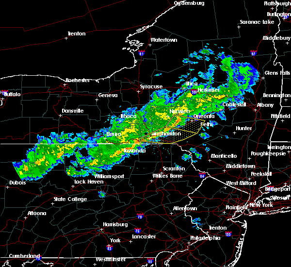 At 438 pm edt, a severe thunderstorm was located over mt upton, or 11 miles southeast of norwich, moving east at 45 mph (radar indicated). Hazards include 60 mph wind gusts. Expect damage to trees. this severe storm will be near, otego, franklin and east sidney around 450 pm edt. oneonta and west end around 455 pm edt. emmons and colliersville around 500 pm edt. meredith and meridale around 505 pm edt. Delhi, davenport and east meredith around 510 pm edt. At 438 pm edt, a severe thunderstorm was located over mt upton, or 11 miles southeast of norwich, moving east at 45 mph (radar indicated). Hazards include 60 mph wind gusts. Expect damage to trees. this severe storm will be near, otego, franklin and east sidney around 450 pm edt. oneonta and west end around 455 pm edt. emmons and colliersville around 500 pm edt. meredith and meridale around 505 pm edt. Delhi, davenport and east meredith around 510 pm edt.
|
| 4/16/2017 4:25 PM EDT |
 At 425 pm edt, a severe thunderstorm was located near oxford, or near norwich, moving east at 50 mph (radar indicated). Hazards include 60 mph wind gusts. Expect damage to trees. this severe thunderstorm will be near, guilford around 430 pm edt. mt upton and rockdale around 435 pm edt. gilbertsville around 440 pm edt. unadilla and east sidney around 445 pm edt. otego, franklin and west end around 450 pm edt. oneonta around 455 pm edt. emmons and colliersville around 500 pm edt. Delhi, meredith and meridale around 505 pm edt. At 425 pm edt, a severe thunderstorm was located near oxford, or near norwich, moving east at 50 mph (radar indicated). Hazards include 60 mph wind gusts. Expect damage to trees. this severe thunderstorm will be near, guilford around 430 pm edt. mt upton and rockdale around 435 pm edt. gilbertsville around 440 pm edt. unadilla and east sidney around 445 pm edt. otego, franklin and west end around 450 pm edt. oneonta around 455 pm edt. emmons and colliersville around 500 pm edt. Delhi, meredith and meridale around 505 pm edt.
|
| 7/18/2016 5:11 PM EDT |
 At 510 pm edt, a severe thunderstorm was located over mcgraw, or near cortland, moving southeast at 35 mph (radar indicated). Hazards include 60 mph wind gusts and penny size hail. Expect damage to roofs. siding. and trees. this severe thunderstorm will be near, east freetown around 520 pm edt. taylor around 525 pm edt. cincinnatus, willet and pitcher around 530 pm edt. mc donough around 540 pm edt. smithville flats around 545 pm edt. brisben around 555 pm edt. oxford and south oxford around 600 pm edt. Guilford around 610 pm edt. At 510 pm edt, a severe thunderstorm was located over mcgraw, or near cortland, moving southeast at 35 mph (radar indicated). Hazards include 60 mph wind gusts and penny size hail. Expect damage to roofs. siding. and trees. this severe thunderstorm will be near, east freetown around 520 pm edt. taylor around 525 pm edt. cincinnatus, willet and pitcher around 530 pm edt. mc donough around 540 pm edt. smithville flats around 545 pm edt. brisben around 555 pm edt. oxford and south oxford around 600 pm edt. Guilford around 610 pm edt.
|
| 6/12/2015 7:54 PM EDT | Many trees and some lines down. oxford end of gospel hill road close in chenango county NY, 3.1 miles E of Guilford, NY |
| 6/12/2015 7:27 PM EDT |
 The national weather service in binghamton has issued a * severe thunderstorm warning for. south central madison county in central new york. northern chenango county in central new york. west central otsego county in central new york. Until 815 pm edt. The national weather service in binghamton has issued a * severe thunderstorm warning for. south central madison county in central new york. northern chenango county in central new york. west central otsego county in central new york. Until 815 pm edt.
|
| 1/1/0001 12:00 AM | Damage along phillips-odell road between guilford and mt. upton. horse shed flipped over... paddle boad blown from pond... a few trees dow in chenango county NY, 4.2 miles W of Guilford, NY |
Hail Maps for Guilford, NY
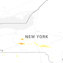


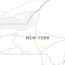


Connect with Interactive Hail Maps