

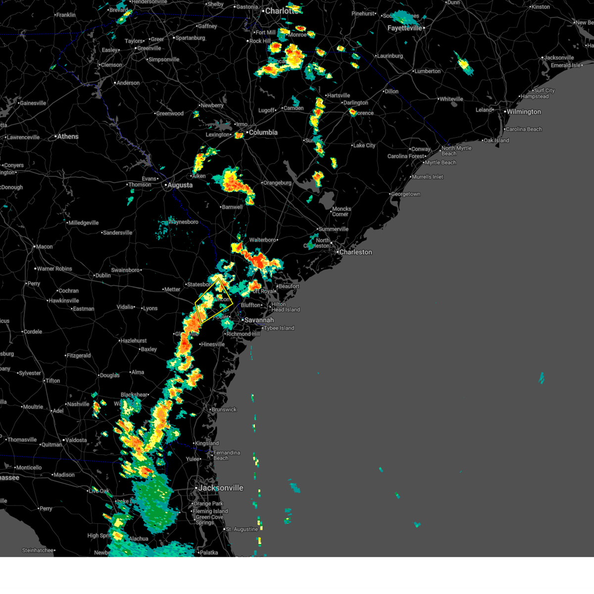
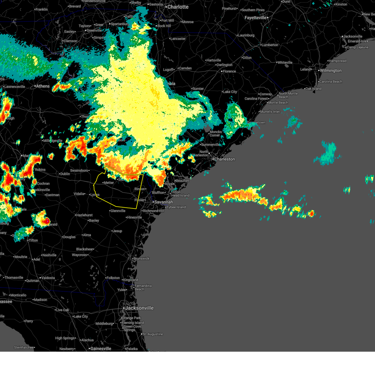
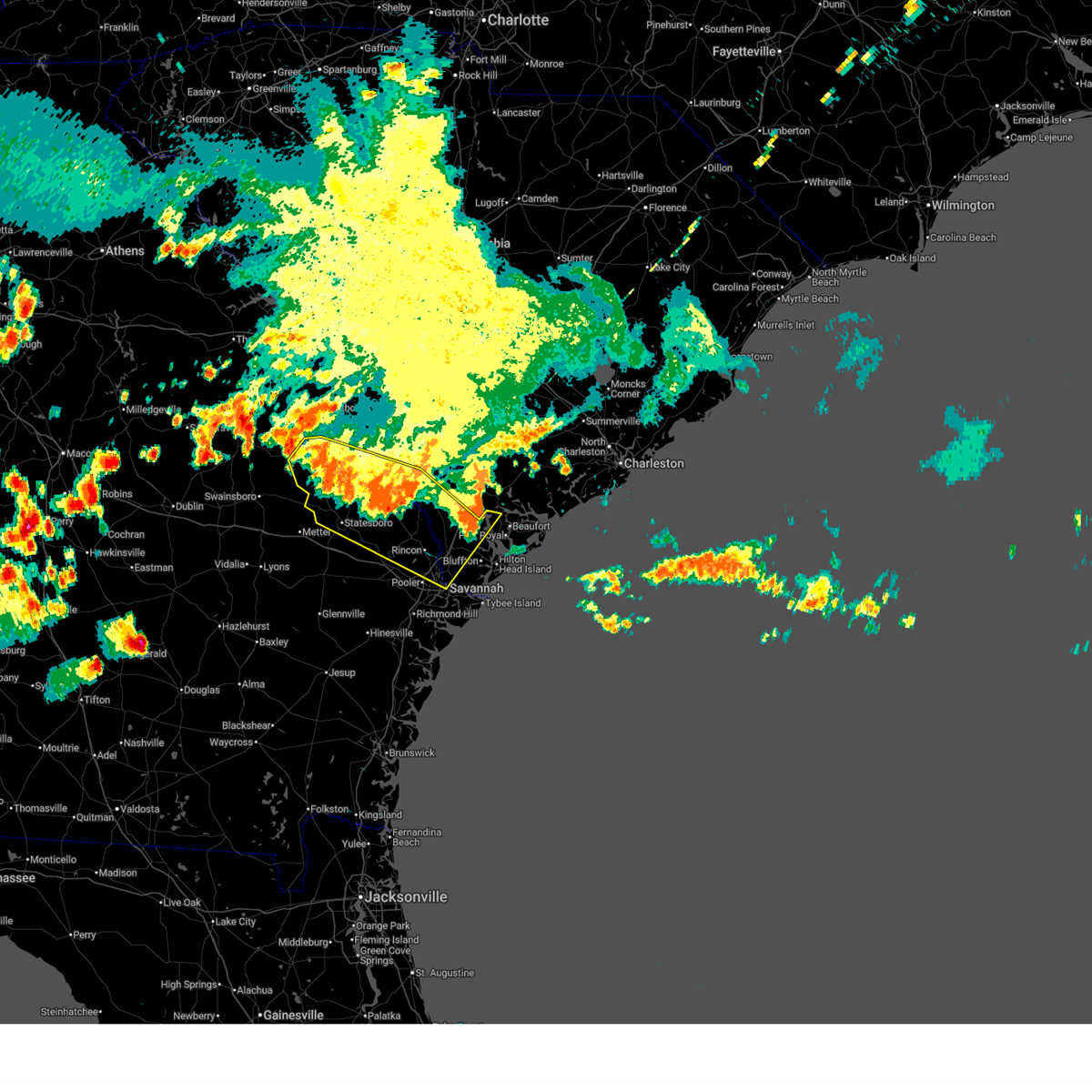
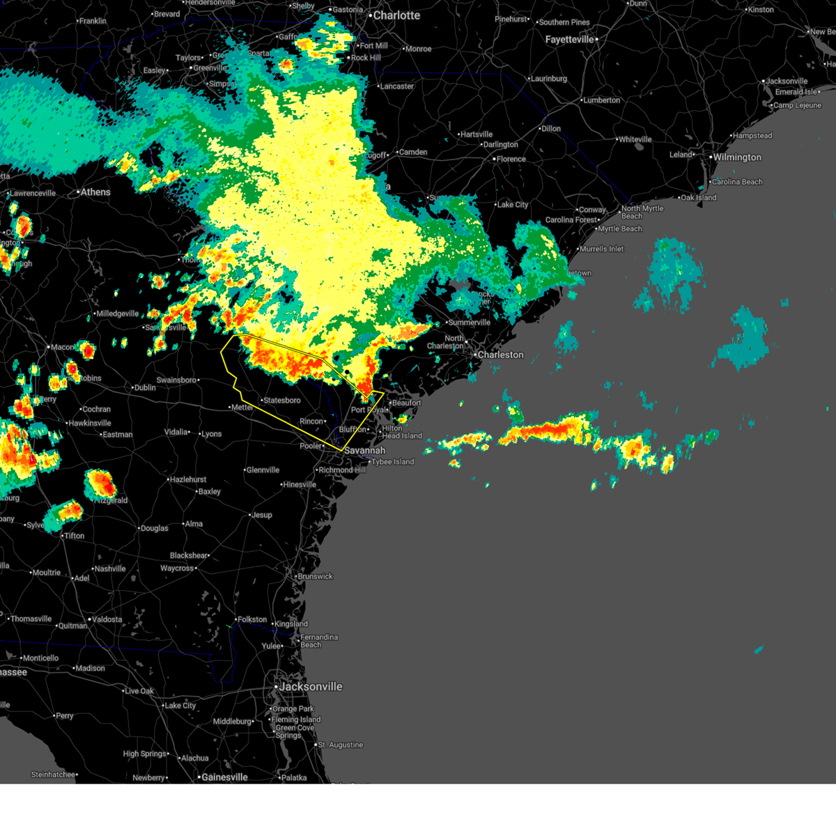
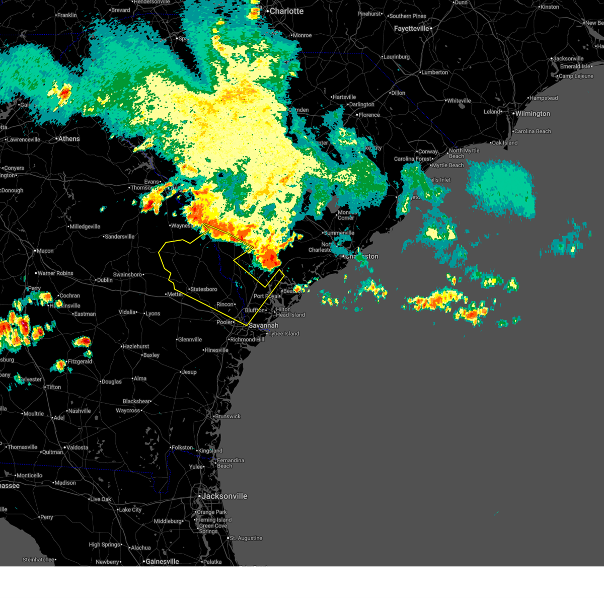
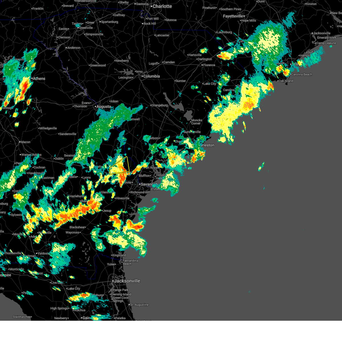
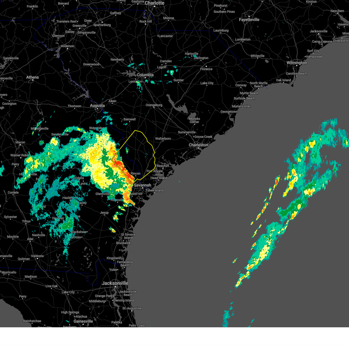
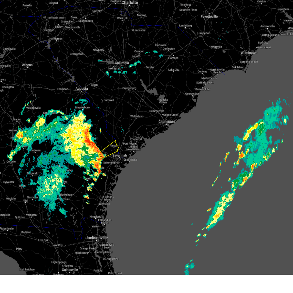
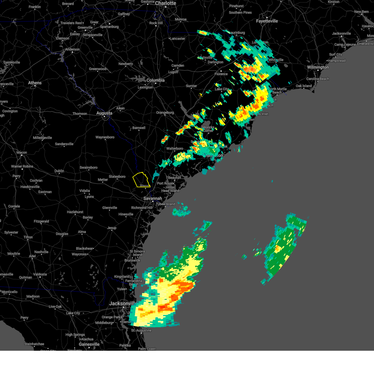
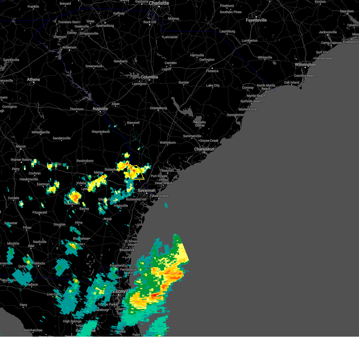
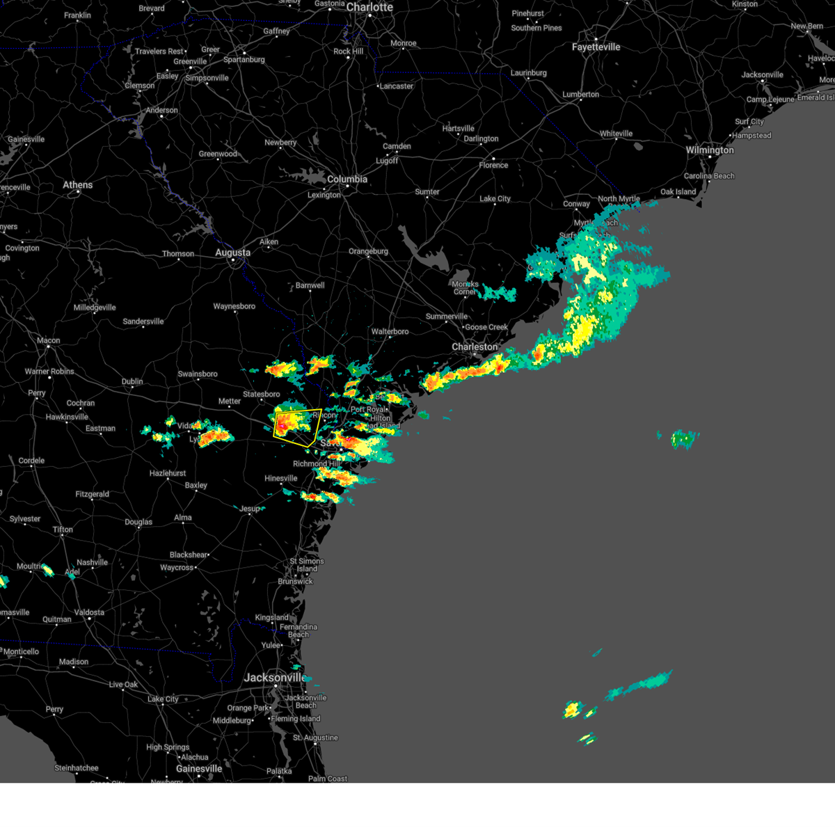
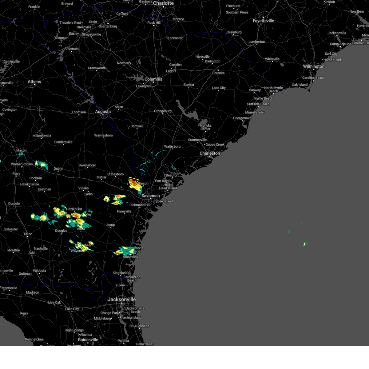
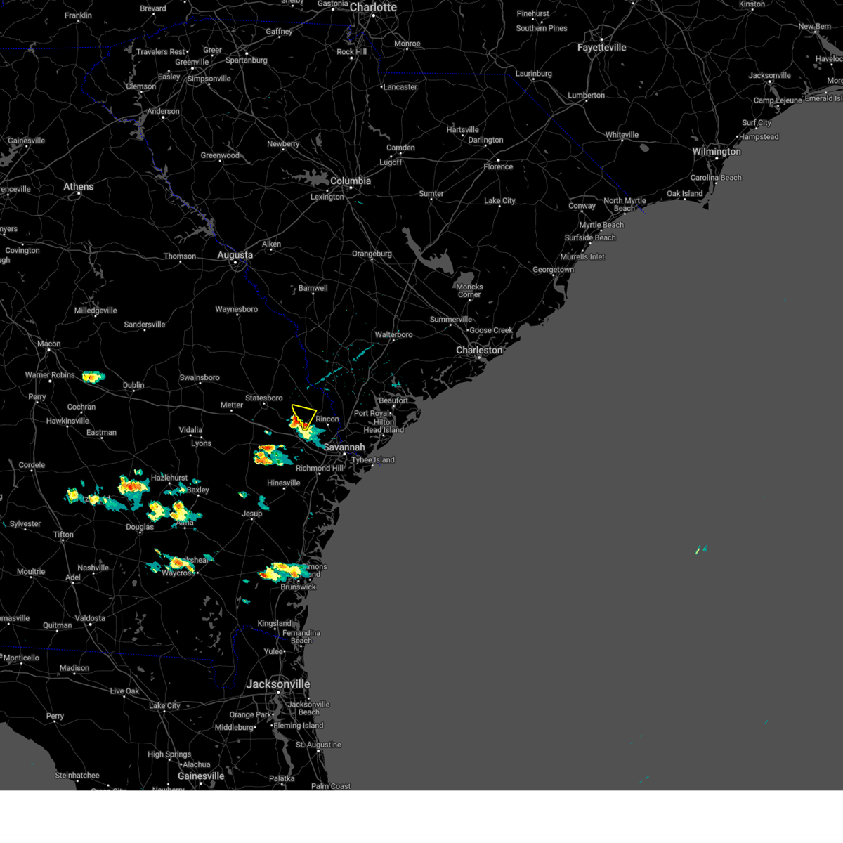
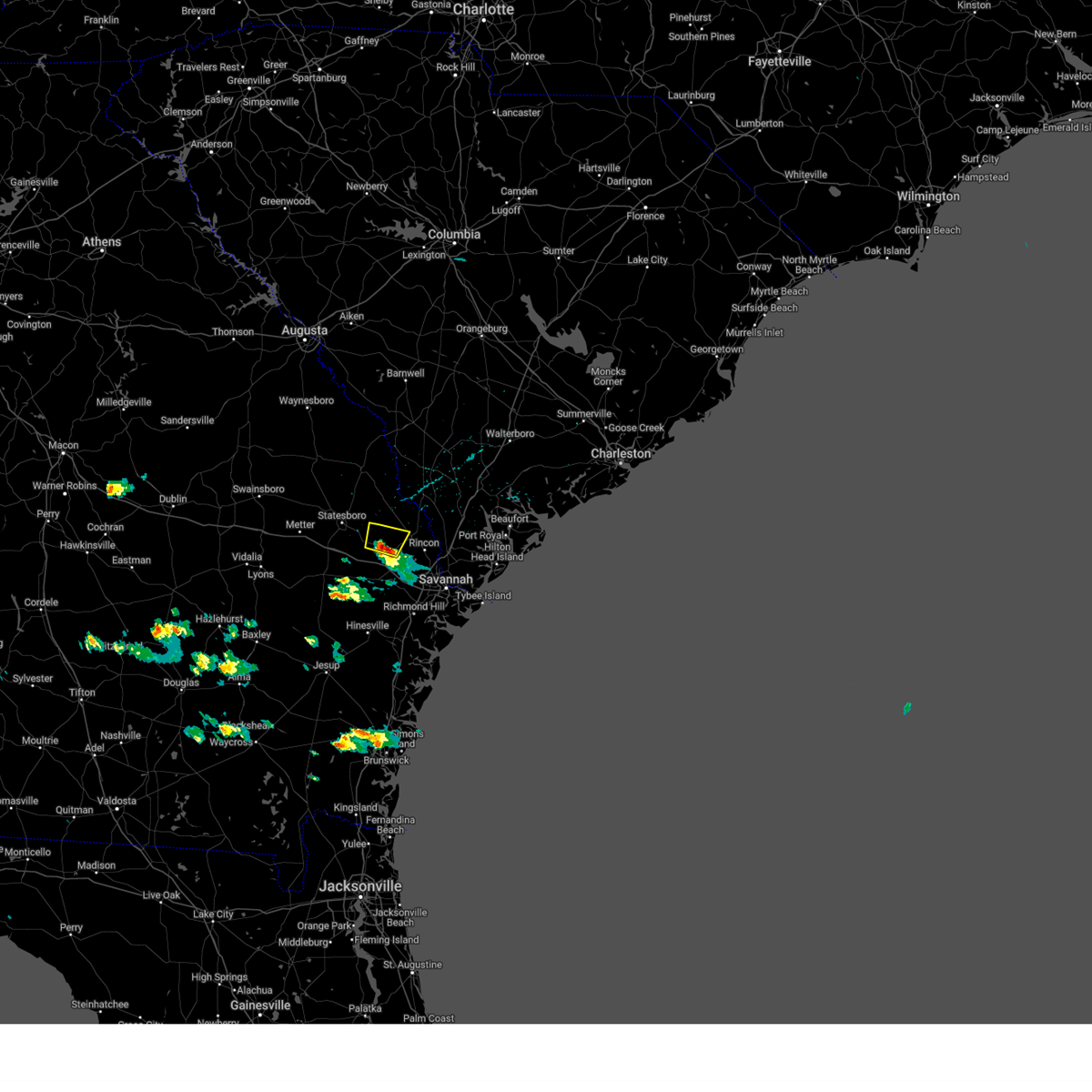
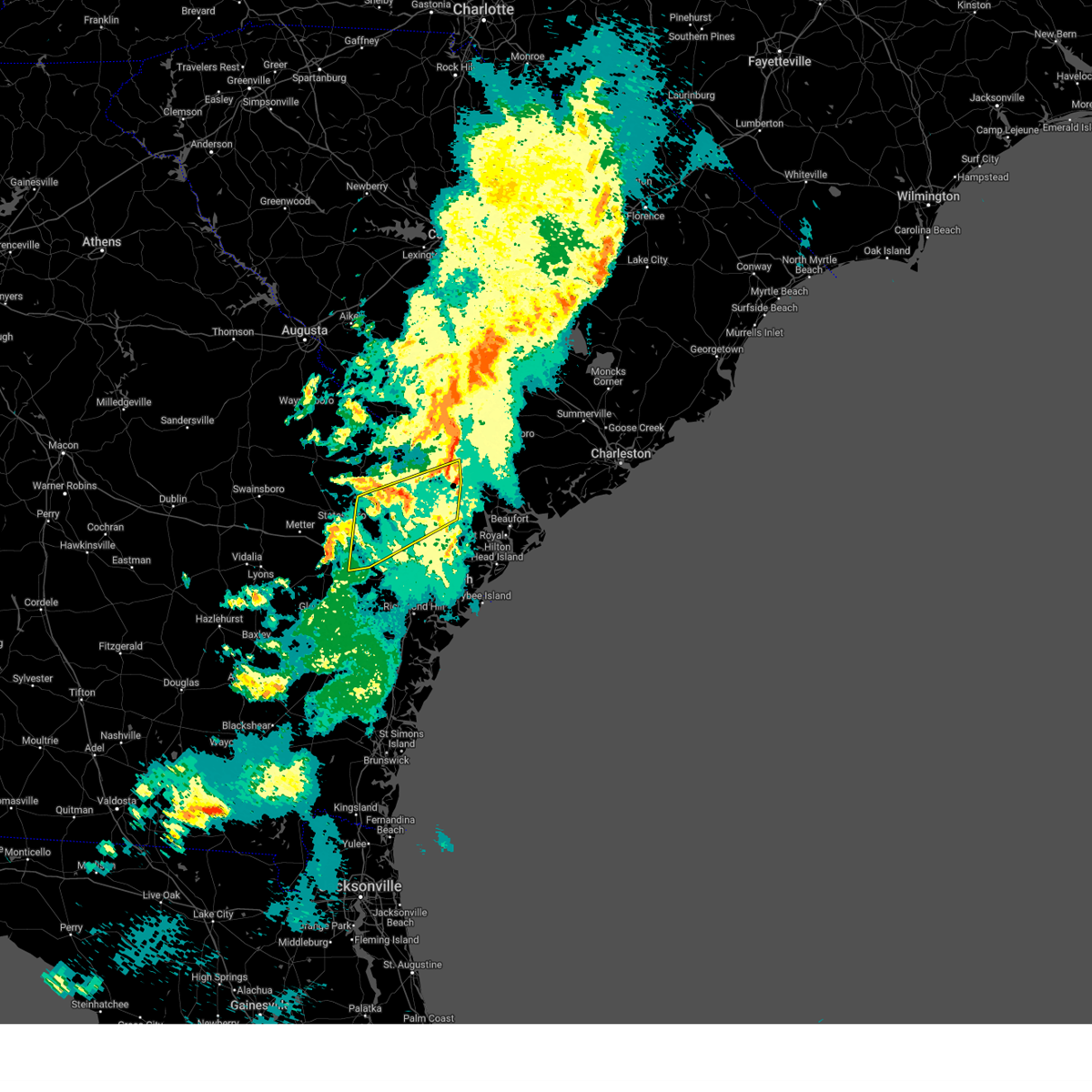
Hail Map for Guyton, GA
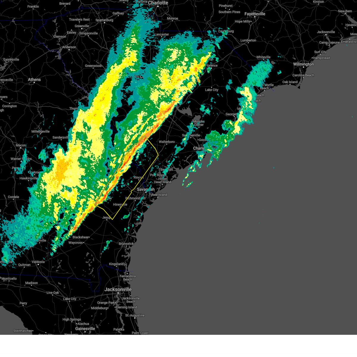
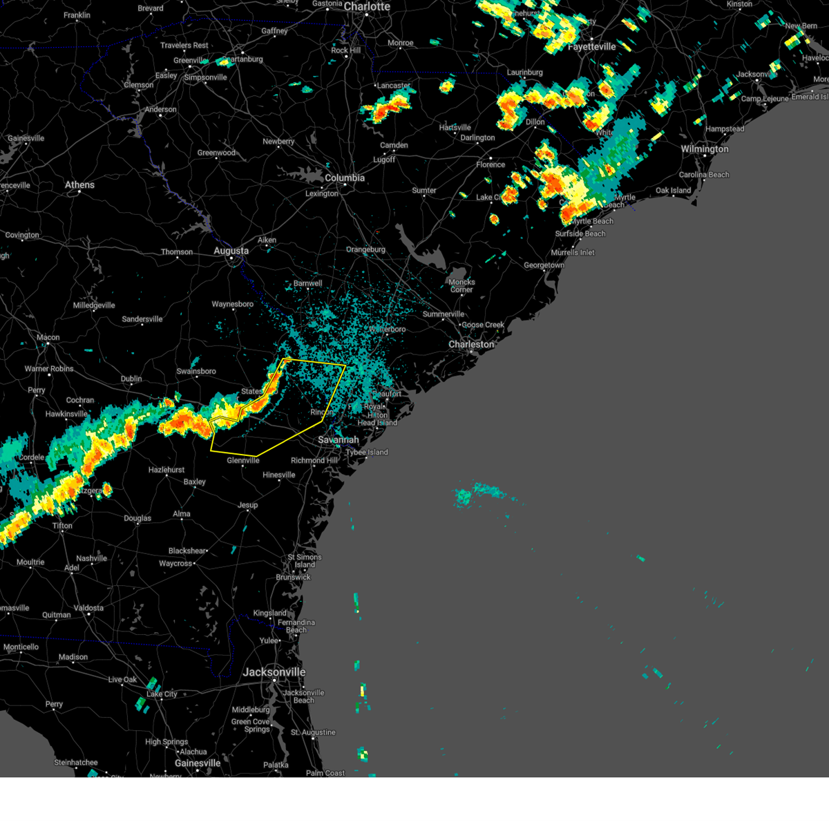
The Guyton, GA area has had 16 reports of on-the-ground hail by trained spotters, and has been under severe weather warnings 43 times during the past 12 months. Doppler radar has detected hail at or near Guyton, GA on 68 occasions, including 4 occasions during the past year.
| Name: | Guyton, GA |
| Where Located: | 25.7 miles NW of Savannah, GA |
| Map: | Google Map for Guyton, GA |
| Population: | 1684 |
| Housing Units: | 639 |
| More Info: | Search Google for Guyton, GA |
1
The Top Recent Hail Date for Guyton, GA is Sunday, April 27, 2025 (2nd out of 68)

Hail and Wind Damage Spotted near Guyton, GA
| Date / Time | Report Details |
|---|---|
| 7/14/2025 5:27 PM EDT |
 the severe thunderstorm warning has been cancelled and is no longer in effect the severe thunderstorm warning has been cancelled and is no longer in effect
|
| 7/14/2025 4:52 PM EDT |
 At 452 pm edt, a severe thunderstorm was located near blitchton, moving south at 20 mph (radar indicated). Hazards include 60 mph wind gusts and quarter size hail. Hail damage to vehicles is expected. expect wind damage to roofs, siding, and trees. locations impacted include, springfield, pembroke, lanier, rincon, guyton, marlow, pineora, blitchton, eden and stilson. This includes i-16 between mile markers 131 and 147. At 452 pm edt, a severe thunderstorm was located near blitchton, moving south at 20 mph (radar indicated). Hazards include 60 mph wind gusts and quarter size hail. Hail damage to vehicles is expected. expect wind damage to roofs, siding, and trees. locations impacted include, springfield, pembroke, lanier, rincon, guyton, marlow, pineora, blitchton, eden and stilson. This includes i-16 between mile markers 131 and 147.
|
| 7/14/2025 4:39 PM EDT |
 Svrchs the national weather service in charleston has issued a * severe thunderstorm warning for portions of, bryan county in southeastern georgia, bulloch county in southeastern georgia, effingham county in southeastern georgia, * until 545 pm edt. * at 439 pm edt, a severe thunderstorm was located near stilson, moving south at 20 mph (radar indicated). Hazards include 60 mph wind gusts and small hail. expect damage to roofs, siding, and trees Svrchs the national weather service in charleston has issued a * severe thunderstorm warning for portions of, bryan county in southeastern georgia, bulloch county in southeastern georgia, effingham county in southeastern georgia, * until 545 pm edt. * at 439 pm edt, a severe thunderstorm was located near stilson, moving south at 20 mph (radar indicated). Hazards include 60 mph wind gusts and small hail. expect damage to roofs, siding, and trees
|
| 7/11/2025 5:40 PM EDT | Svrchs the national weather service in charleston has issued a * severe thunderstorm warning for portions of, effingham county in southeastern georgia, screven county in southeastern georgia, hampton county in southeastern south carolina, jasper county in southeastern south carolina, * until 645 pm edt. * at 540 pm edt, severe thunderstorms were located along a line from over altman to near guyton, moving northeast at 25 mph (radar indicated). Hazards include 60 mph wind gusts and small hail. expect damage to roofs, siding, and trees |
| 6/26/2025 12:17 AM EDT |
 the severe thunderstorm warning has been cancelled and is no longer in effect the severe thunderstorm warning has been cancelled and is no longer in effect
|
| 6/26/2025 12:09 AM EDT |
 At 1209 am edt, severe thunderstorms were located along a line from near stilson to over metter, moving south at 30 mph (emergency management reported. at 1147 pm, emergency management officials reported trees down across portions of bulloch county). Hazards include 60 mph wind gusts. Expect damage to roofs, siding, and trees. locations impacted include, brooklet, register, pulaski, metter, claxton, hagan, pembroke, cobbtown, collins and lanier. This includes i-16 between mile markers 97 and 139. At 1209 am edt, severe thunderstorms were located along a line from near stilson to over metter, moving south at 30 mph (emergency management reported. at 1147 pm, emergency management officials reported trees down across portions of bulloch county). Hazards include 60 mph wind gusts. Expect damage to roofs, siding, and trees. locations impacted include, brooklet, register, pulaski, metter, claxton, hagan, pembroke, cobbtown, collins and lanier. This includes i-16 between mile markers 97 and 139.
|
| 6/26/2025 12:09 AM EDT |
 the severe thunderstorm warning has been cancelled and is no longer in effect the severe thunderstorm warning has been cancelled and is no longer in effect
|
| 6/25/2025 11:49 PM EDT |
 At 1149 pm edt, severe thunderstorms were located along a line from near stilson to 6 miles west of portal, moving south at 30 mph (emergency management reported. at 1147 pm, emergency management officials reported trees down across portions of bulloch county). Hazards include 60 mph wind gusts and quarter size hail. Hail damage to vehicles is expected. expect wind damage to roofs, siding, and trees. locations impacted include, statesboro, portal, brooklet, springfield, guyton, metter, claxton, hagan, pembroke and lanier. This includes i-16 between mile markers 96 and 149. At 1149 pm edt, severe thunderstorms were located along a line from near stilson to 6 miles west of portal, moving south at 30 mph (emergency management reported. at 1147 pm, emergency management officials reported trees down across portions of bulloch county). Hazards include 60 mph wind gusts and quarter size hail. Hail damage to vehicles is expected. expect wind damage to roofs, siding, and trees. locations impacted include, statesboro, portal, brooklet, springfield, guyton, metter, claxton, hagan, pembroke and lanier. This includes i-16 between mile markers 96 and 149.
|
| 6/25/2025 11:40 PM EDT |
 The severe thunderstorm warning that was previously in effect has been reissued for screven, jenkins, effingham, and bulloch counties and is in effect until 1230 am edt. please refer to that bulletin for the latest severe weather information. a severe thunderstorm watch remains in effect until 400 am edt for portions of southeast georgia and southeast south carolina. The severe thunderstorm warning that was previously in effect has been reissued for screven, jenkins, effingham, and bulloch counties and is in effect until 1230 am edt. please refer to that bulletin for the latest severe weather information. a severe thunderstorm watch remains in effect until 400 am edt for portions of southeast georgia and southeast south carolina.
|
| 6/25/2025 11:28 PM EDT |
 Svrchs the national weather service in charleston has issued a * severe thunderstorm warning for portions of, bryan county in southeastern georgia, bulloch county in southeastern georgia, candler county in southeastern georgia, effingham county in southeastern georgia, evans county in southeastern georgia, jenkins county in southeastern georgia, liberty county in southeastern georgia, screven county in southeastern georgia, tattnall county in southeastern georgia, * until 1230 am edt. * at 1128 pm edt, severe thunderstorms were located along a line from over shawnee to near butts, moving south at 30 mph (radar indicated). Hazards include 60 mph wind gusts and small hail. expect damage to roofs, siding, and trees Svrchs the national weather service in charleston has issued a * severe thunderstorm warning for portions of, bryan county in southeastern georgia, bulloch county in southeastern georgia, candler county in southeastern georgia, effingham county in southeastern georgia, evans county in southeastern georgia, jenkins county in southeastern georgia, liberty county in southeastern georgia, screven county in southeastern georgia, tattnall county in southeastern georgia, * until 1230 am edt. * at 1128 pm edt, severe thunderstorms were located along a line from over shawnee to near butts, moving south at 30 mph (radar indicated). Hazards include 60 mph wind gusts and small hail. expect damage to roofs, siding, and trees
|
| 6/25/2025 11:22 PM EDT |
 At 1122 pm edt, severe thunderstorms were located along a line from over old house to over millen, moving southwest at 30 mph (law enforcement reported. at 1020 pm, law enforcement officials reported trees down near sylvania as well as other portions of screven county). Hazards include 60 mph wind gusts and small hail. Expect damage to roofs, siding, and trees. locations impacted include, beaufort, sylvania, ridgeland, millen, springfield, statesboro, bluffton, godley station, savannah international airport and pooler. this includes the following highways, i-95 in georgia between mile markers 106 and 112. I-95 in south carolina between mile markers 2 and 25. At 1122 pm edt, severe thunderstorms were located along a line from over old house to over millen, moving southwest at 30 mph (law enforcement reported. at 1020 pm, law enforcement officials reported trees down near sylvania as well as other portions of screven county). Hazards include 60 mph wind gusts and small hail. Expect damage to roofs, siding, and trees. locations impacted include, beaufort, sylvania, ridgeland, millen, springfield, statesboro, bluffton, godley station, savannah international airport and pooler. this includes the following highways, i-95 in georgia between mile markers 106 and 112. I-95 in south carolina between mile markers 2 and 25.
|
| 6/25/2025 10:49 PM EDT |
 Svrchs the national weather service in charleston has issued a * severe thunderstorm warning for portions of, bulloch county in southeastern georgia, chatham county in southeastern georgia, effingham county in southeastern georgia, jenkins county in southeastern georgia, screven county in southeastern georgia, allendale county in southeastern south carolina, beaufort county in southeastern south carolina, hampton county in southeastern south carolina, jasper county in southeastern south carolina, * until 1145 pm edt. * at 1049 pm edt, severe thunderstorms were located along a line from near sheldon to 12 miles northeast of perkins, moving southwest at 30 mph (radar indicated). Hazards include 60 mph wind gusts and small hail. expect damage to roofs, siding, and trees Svrchs the national weather service in charleston has issued a * severe thunderstorm warning for portions of, bulloch county in southeastern georgia, chatham county in southeastern georgia, effingham county in southeastern georgia, jenkins county in southeastern georgia, screven county in southeastern georgia, allendale county in southeastern south carolina, beaufort county in southeastern south carolina, hampton county in southeastern south carolina, jasper county in southeastern south carolina, * until 1145 pm edt. * at 1049 pm edt, severe thunderstorms were located along a line from near sheldon to 12 miles northeast of perkins, moving southwest at 30 mph (radar indicated). Hazards include 60 mph wind gusts and small hail. expect damage to roofs, siding, and trees
|
| 6/14/2025 5:12 PM EDT |
 The storm which prompted the warning has weakened below severe limits, and no longer poses an immediate threat to life or property. therefore, the warning will be allowed to expire. to report severe weather, contact your nearest law enforcement agency. they will send your report to the national weather service office. The storm which prompted the warning has weakened below severe limits, and no longer poses an immediate threat to life or property. therefore, the warning will be allowed to expire. to report severe weather, contact your nearest law enforcement agency. they will send your report to the national weather service office.
|
| 6/14/2025 5:02 PM EDT | At 502 pm edt, a severe thunderstorm was located 6 miles south of egypt, moving east at 40 mph (radar indicated). Hazards include 60 mph wind gusts and small hail. Expect damage to roofs, siding, and trees. Locations impacted include, springfield, guyton, brooklet, egypt, stilson, leefield, shawnee, kildare, griffin lake and tusculum. |
| 6/14/2025 5:02 PM EDT | the severe thunderstorm warning has been cancelled and is no longer in effect |
| 6/14/2025 4:42 PM EDT |
 At 442 pm edt, a severe thunderstorm was located over brooklet, moving east at 15 mph (radar indicated). Hazards include 60 mph wind gusts and quarter size hail. Hail damage to vehicles is expected. expect wind damage to roofs, siding, and trees. Locations impacted include, springfield, guyton, brooklet, oliver, egypt, leefield, stilson, shawnee, kildare and griffin lake. At 442 pm edt, a severe thunderstorm was located over brooklet, moving east at 15 mph (radar indicated). Hazards include 60 mph wind gusts and quarter size hail. Hail damage to vehicles is expected. expect wind damage to roofs, siding, and trees. Locations impacted include, springfield, guyton, brooklet, oliver, egypt, leefield, stilson, shawnee, kildare and griffin lake.
|
| 6/14/2025 4:36 PM EDT |
 Svrchs the national weather service in charleston has issued a * severe thunderstorm warning for portions of, bulloch county in southeastern georgia, effingham county in southeastern georgia, screven county in southeastern georgia, * until 515 pm edt. * at 436 pm edt, a severe thunderstorm was located over brooklet, moving east at 15 mph (radar indicated). Hazards include 60 mph wind gusts. expect damage to roofs, siding, and trees Svrchs the national weather service in charleston has issued a * severe thunderstorm warning for portions of, bulloch county in southeastern georgia, effingham county in southeastern georgia, screven county in southeastern georgia, * until 515 pm edt. * at 436 pm edt, a severe thunderstorm was located over brooklet, moving east at 15 mph (radar indicated). Hazards include 60 mph wind gusts. expect damage to roofs, siding, and trees
|
| 6/10/2025 9:06 AM EDT |
 The severe thunderstorm warning that was previously in effect has been reissued for effingham county and is in effect until 930 am edt. please refer to that bulletin for the latest severe weather information. The severe thunderstorm warning that was previously in effect has been reissued for effingham county and is in effect until 930 am edt. please refer to that bulletin for the latest severe weather information.
|
| 6/10/2025 8:51 AM EDT |
 the severe thunderstorm warning has been cancelled and is no longer in effect the severe thunderstorm warning has been cancelled and is no longer in effect
|
| 6/10/2025 8:51 AM EDT |
 At 851 am edt, a severe thunderstorm was located near rincon, moving northeast at 30 mph (radar indicated). Hazards include 60 mph wind gusts. Expect damage to roofs, siding, and trees. locations impacted include, springfield, godley station, rincon, port wentworth, bloomingdale, guyton, stillwell, pineora, marlow and ebenezer. This includes i-95 in georgia between mile markers 111 and 112. At 851 am edt, a severe thunderstorm was located near rincon, moving northeast at 30 mph (radar indicated). Hazards include 60 mph wind gusts. Expect damage to roofs, siding, and trees. locations impacted include, springfield, godley station, rincon, port wentworth, bloomingdale, guyton, stillwell, pineora, marlow and ebenezer. This includes i-95 in georgia between mile markers 111 and 112.
|
| 6/10/2025 8:49 AM EDT |
 Svrchs the national weather service in charleston has issued a * severe thunderstorm warning for portions of, bulloch county in southeastern georgia, effingham county in southeastern georgia, screven county in southeastern georgia, allendale county in southeastern south carolina, hampton county in southeastern south carolina, jasper county in southeastern south carolina, * until 930 am edt. * at 849 am edt, severe thunderstorms were located along a line from over newington to over rincon, moving northeast at 55 mph (radar indicated). Hazards include 60 mph wind gusts. expect damage to roofs, siding, and trees Svrchs the national weather service in charleston has issued a * severe thunderstorm warning for portions of, bulloch county in southeastern georgia, effingham county in southeastern georgia, screven county in southeastern georgia, allendale county in southeastern south carolina, hampton county in southeastern south carolina, jasper county in southeastern south carolina, * until 930 am edt. * at 849 am edt, severe thunderstorms were located along a line from over newington to over rincon, moving northeast at 55 mph (radar indicated). Hazards include 60 mph wind gusts. expect damage to roofs, siding, and trees
|
| 6/10/2025 8:30 AM EDT |
 Svrchs the national weather service in charleston has issued a * severe thunderstorm warning for portions of, bryan county in southeastern georgia, bulloch county in southeastern georgia, chatham county in southeastern georgia, effingham county in southeastern georgia, * until 915 am edt. * at 830 am edt, a severe thunderstorm was located over blitchton, moving northeast at 30 mph (radar indicated). Hazards include 60 mph wind gusts. expect damage to roofs, siding, and trees Svrchs the national weather service in charleston has issued a * severe thunderstorm warning for portions of, bryan county in southeastern georgia, bulloch county in southeastern georgia, chatham county in southeastern georgia, effingham county in southeastern georgia, * until 915 am edt. * at 830 am edt, a severe thunderstorm was located over blitchton, moving northeast at 30 mph (radar indicated). Hazards include 60 mph wind gusts. expect damage to roofs, siding, and trees
|
| 6/5/2025 5:52 PM EDT |
 The storm which prompted the warning has weakened below severe limits, and no longer poses an immediate threat to life or property. therefore, the warning will be allowed to expire. The storm which prompted the warning has weakened below severe limits, and no longer poses an immediate threat to life or property. therefore, the warning will be allowed to expire.
|
| 6/5/2025 5:45 PM EDT |
 At 545 pm edt, a severe thunderstorm was located near springfield, moving east at 15 mph (radar indicated). Hazards include 60 mph wind gusts. Expect damage to roofs, siding, and trees. Locations impacted include, springfield, guyton, clyo, stillwell, shawnee, ebenezer, berryville, tuckasee king, tusculum and oaky. At 545 pm edt, a severe thunderstorm was located near springfield, moving east at 15 mph (radar indicated). Hazards include 60 mph wind gusts. Expect damage to roofs, siding, and trees. Locations impacted include, springfield, guyton, clyo, stillwell, shawnee, ebenezer, berryville, tuckasee king, tusculum and oaky.
|
| 6/5/2025 5:45 PM EDT |
 the severe thunderstorm warning has been cancelled and is no longer in effect the severe thunderstorm warning has been cancelled and is no longer in effect
|
| 6/5/2025 5:15 PM EDT | Svrchs the national weather service in charleston has issued a * severe thunderstorm warning for portions of, bulloch county in southeastern georgia, effingham county in southeastern georgia, * until 600 pm edt. * at 515 pm edt, a severe thunderstorm was located 5 miles south of egypt, moving east at 15 mph (radar indicated). Hazards include 60 mph wind gusts. expect damage to roofs, siding, and trees |
| 5/8/2025 2:58 PM EDT | At 258 pm edt, a severe thunderstorm was located near bay, moving east at 15 mph (radar indicated). Hazards include 60 mph wind gusts and half dollar size hail. Hail damage to vehicles is expected. expect wind damage to roofs, siding, and trees. locations impacted include, pembroke, stilson, blitchton, guyton, pineora, marlow, eden, meldrim, springfield and bloomingdale. This includes i-16 between mile markers 133 and 150. |
| 5/8/2025 2:47 PM EDT |
 Svrchs the national weather service in charleston has issued a * severe thunderstorm warning for portions of, bryan county in southeastern georgia, bulloch county in southeastern georgia, effingham county in southeastern georgia, * until 345 pm edt. * at 247 pm edt, a severe thunderstorm was located over bay, moving east at 15 mph (radar indicated). Hazards include 60 mph wind gusts and quarter size hail. Hail damage to vehicles is expected. Expect wind damage to roofs, siding, and trees. Svrchs the national weather service in charleston has issued a * severe thunderstorm warning for portions of, bryan county in southeastern georgia, bulloch county in southeastern georgia, effingham county in southeastern georgia, * until 345 pm edt. * at 247 pm edt, a severe thunderstorm was located over bay, moving east at 15 mph (radar indicated). Hazards include 60 mph wind gusts and quarter size hail. Hail damage to vehicles is expected. Expect wind damage to roofs, siding, and trees.
|
| 4/27/2025 6:35 PM EDT |
 the severe thunderstorm warning has been cancelled and is no longer in effect the severe thunderstorm warning has been cancelled and is no longer in effect
|
| 4/27/2025 6:13 PM EDT |
 At 613 pm edt, a severe thunderstorm was located near guyton, moving northeast at 15 mph (radar indicated). Hazards include 60 mph wind gusts and quarter size hail. Hail damage to vehicles is expected. expect wind damage to roofs, siding, and trees. Locations impacted include, guyton, tusculum and griffin lake. At 613 pm edt, a severe thunderstorm was located near guyton, moving northeast at 15 mph (radar indicated). Hazards include 60 mph wind gusts and quarter size hail. Hail damage to vehicles is expected. expect wind damage to roofs, siding, and trees. Locations impacted include, guyton, tusculum and griffin lake.
|
| 4/27/2025 6:02 PM EDT |
 At 602 pm edt, a severe thunderstorm was located near stilson, moving north at 10 mph (radar indicated). Hazards include 60 mph wind gusts and quarter size hail. Hail damage to vehicles is expected. expect wind damage to roofs, siding, and trees. Locations impacted include, guyton, tusculum and griffin lake. At 602 pm edt, a severe thunderstorm was located near stilson, moving north at 10 mph (radar indicated). Hazards include 60 mph wind gusts and quarter size hail. Hail damage to vehicles is expected. expect wind damage to roofs, siding, and trees. Locations impacted include, guyton, tusculum and griffin lake.
|
| 4/27/2025 6:02 PM EDT |
 the severe thunderstorm warning has been cancelled and is no longer in effect the severe thunderstorm warning has been cancelled and is no longer in effect
|
| 4/27/2025 5:53 PM EDT |
 Svrchs the national weather service in charleston has issued a * severe thunderstorm warning for portions of, bulloch county in southeastern georgia, effingham county in southeastern georgia, * until 645 pm edt. * at 553 pm edt, a severe thunderstorm was located over stilson, moving north at 10 mph (radar indicated). Hazards include quarter size hail. damage to vehicles is expected Svrchs the national weather service in charleston has issued a * severe thunderstorm warning for portions of, bulloch county in southeastern georgia, effingham county in southeastern georgia, * until 645 pm edt. * at 553 pm edt, a severe thunderstorm was located over stilson, moving north at 10 mph (radar indicated). Hazards include quarter size hail. damage to vehicles is expected
|
| 3/31/2025 5:40 PM EDT | The effingham county emergency manager reported numerous trees and power lines down across an area generally between guyton... ga and the chatham county line. some road in effingham county GA, 11.9 miles NW of Guyton, GA |
| 3/31/2025 5:38 PM EDT | Near the 200 block of meadowood lane a tree fell on a home and resulted in damage. time estimated from radar dat in effingham county GA, 11 miles NNW of Guyton, GA |
| 3/31/2025 5:38 PM EDT | A tree fell on a home near the 300 block of st. paul road. the home was damaged by the tree. time estimated from radar dat in effingham county GA, 10.4 miles NNW of Guyton, GA |
| 3/31/2025 5:34 PM EDT | On the 100 block of old lake road a tree fell on a home and caused structural damage. time determined by radar dat in effingham county GA, 10.2 miles NNW of Guyton, GA |
| 3/16/2025 9:46 AM EDT |
 the severe thunderstorm warning has been cancelled and is no longer in effect the severe thunderstorm warning has been cancelled and is no longer in effect
|
| 3/16/2025 9:08 AM EDT |
 Svrchs the national weather service in charleston has issued a * severe thunderstorm warning for portions of, bulloch county in southeastern georgia, effingham county in southeastern georgia, screven county in southeastern georgia, hampton county in southeastern south carolina, jasper county in southeastern south carolina, * until 1015 am edt. * at 908 am edt, severe thunderstorms were located along a line from over captolo to near bay, moving northeast at 50 mph (radar indicated). Hazards include 60 mph wind gusts. expect damage to roofs, siding, and trees Svrchs the national weather service in charleston has issued a * severe thunderstorm warning for portions of, bulloch county in southeastern georgia, effingham county in southeastern georgia, screven county in southeastern georgia, hampton county in southeastern south carolina, jasper county in southeastern south carolina, * until 1015 am edt. * at 908 am edt, severe thunderstorms were located along a line from over captolo to near bay, moving northeast at 50 mph (radar indicated). Hazards include 60 mph wind gusts. expect damage to roofs, siding, and trees
|
| 2/16/2025 9:16 AM EST |
 The storms which prompted the warning have weakened below severe limits. therefore, the warning has been allowed to expire. however, gusty winds are still possible with these thunderstorms and a special weather statement has been issued. a severe thunderstorm watch remains in effect until 100 pm est for portions of southeast georgia and southeast south carolina. The storms which prompted the warning have weakened below severe limits. therefore, the warning has been allowed to expire. however, gusty winds are still possible with these thunderstorms and a special weather statement has been issued. a severe thunderstorm watch remains in effect until 100 pm est for portions of southeast georgia and southeast south carolina.
|
| 2/16/2025 8:54 AM EST |
 the severe thunderstorm warning has been cancelled and is no longer in effect the severe thunderstorm warning has been cancelled and is no longer in effect
|
| 2/16/2025 8:54 AM EST |
 At 854 am est, severe thunderstorms were located along a line from near hampton to 6 miles west of donald, moving southeast at 35 mph (radar indicated). Hazards include 60 mph wind gusts. Expect damage to roofs, siding, and trees. locations impacted include, hinesville, glennville, springfield, hampton, claxton, pembroke, ludowici, yemassee, fort stewart and lake warren state park. this includes the following highways, i-16 between mile markers 122 and 150. I-95 in south carolina between mile markers 37 and 41. At 854 am est, severe thunderstorms were located along a line from near hampton to 6 miles west of donald, moving southeast at 35 mph (radar indicated). Hazards include 60 mph wind gusts. Expect damage to roofs, siding, and trees. locations impacted include, hinesville, glennville, springfield, hampton, claxton, pembroke, ludowici, yemassee, fort stewart and lake warren state park. this includes the following highways, i-16 between mile markers 122 and 150. I-95 in south carolina between mile markers 37 and 41.
|
| 2/16/2025 8:14 AM EST |
 Svrchs the national weather service in charleston has issued a * severe thunderstorm warning for portions of, bryan county in southeastern georgia, bulloch county in southeastern georgia, candler county in southeastern georgia, effingham county in southeastern georgia, evans county in southeastern georgia, jenkins county in southeastern georgia, liberty county in southeastern georgia, long county in southeastern georgia, screven county in southeastern georgia, tattnall county in southeastern georgia, allendale county in southeastern south carolina, hampton county in southeastern south carolina, jasper county in southeastern south carolina, * until 915 am est. * at 814 am est, severe thunderstorms were located along a line from near millett to 13 miles southwest of gordonia altamaha state park, moving southeast at 40 mph (radar indicated). Hazards include 60 mph wind gusts. expect damage to roofs, siding, and trees Svrchs the national weather service in charleston has issued a * severe thunderstorm warning for portions of, bryan county in southeastern georgia, bulloch county in southeastern georgia, candler county in southeastern georgia, effingham county in southeastern georgia, evans county in southeastern georgia, jenkins county in southeastern georgia, liberty county in southeastern georgia, long county in southeastern georgia, screven county in southeastern georgia, tattnall county in southeastern georgia, allendale county in southeastern south carolina, hampton county in southeastern south carolina, jasper county in southeastern south carolina, * until 915 am est. * at 814 am est, severe thunderstorms were located along a line from near millett to 13 miles southwest of gordonia altamaha state park, moving southeast at 40 mph (radar indicated). Hazards include 60 mph wind gusts. expect damage to roofs, siding, and trees
|
| 8/18/2024 9:22 PM EDT | The storms which prompted the warning have weakened below severe limits, and no longer pose an immediate threat to life or property. therefore, the warning will be allowed to expire. a severe thunderstorm watch remains in effect until 200 am edt for southeastern georgia. |
| 8/18/2024 8:59 PM EDT |
 At 858 pm edt, severe thunderstorms were located along a line extending from near newington to brooklet to near manassas, moving east at 30 mph (radar indicated. at 838 pm edt, screven county dispatch reported a tree down near the intersection of statesboro highway and dover road). Hazards include 60 mph wind gusts. Expect damage to trees and powerlines. locations impacted include: statesboro, reidsville, springfield, claxton, pembroke, rincon, guyton, brooklet, hagan, collins, cobbtown, newington, furman, oliver, and scotia. This warning includes i-16 between mile markers 113 and 144. At 858 pm edt, severe thunderstorms were located along a line extending from near newington to brooklet to near manassas, moving east at 30 mph (radar indicated. at 838 pm edt, screven county dispatch reported a tree down near the intersection of statesboro highway and dover road). Hazards include 60 mph wind gusts. Expect damage to trees and powerlines. locations impacted include: statesboro, reidsville, springfield, claxton, pembroke, rincon, guyton, brooklet, hagan, collins, cobbtown, newington, furman, oliver, and scotia. This warning includes i-16 between mile markers 113 and 144.
|
| 8/18/2024 8:59 PM EDT |
 the severe thunderstorm warning has been cancelled and is no longer in effect the severe thunderstorm warning has been cancelled and is no longer in effect
|
| 8/18/2024 8:28 PM EDT | Svrchs the national weather service in charleston has issued a * severe thunderstorm warning for portions of, bryan county in southeastern georgia, screven county in southeastern georgia, evans county in southeastern georgia, liberty county in southeastern georgia, bulloch county in southeastern georgia, candler county in southeastern georgia, effingham county in southeastern georgia, tattnall county in southeastern georgia, hampton county in southeastern south carolina, jasper county in southeastern south carolina, * until 930 pm edt. * at 828 pm edt, severe thunderstorms were located along a line extending from near rocky ford to near hopeulikit to 6 miles north of lyons, moving east at 30 mph (radar indicated). Hazards include 60 mph wind gusts and penny size hail. Expect damage to trees and powerlines. locations impacted include: statesboro, reidsville, metter, sylvania, springfield, claxton, pembroke, rincon, guyton, brooklet, hagan, portal, collins, cobbtown, and newington. This warning includes i-16 between mile markers 99 and 144. |
| 7/20/2024 4:19 PM EDT | Social media posted a picture of a large tree limb down near griffin lake... likely due to outflow. time estimated by rada in effingham county GA, 6.8 miles SSE of Guyton, GA |
| 7/17/2024 5:41 PM EDT |
 the severe thunderstorm warning has been cancelled and is no longer in effect the severe thunderstorm warning has been cancelled and is no longer in effect
|
| 7/17/2024 5:41 PM EDT |
 At 541 pm edt, a severe thunderstorm was located over rincon, moving northeast at 20 mph (radar indicated). Hazards include 60 mph wind gusts and small hail. Expect damage to roofs, siding, and trees. Locations impacted include, springfield, rincon, port wentworth, guyton, pineora, marlow, stillwell, eden, ebenezer and blandford. At 541 pm edt, a severe thunderstorm was located over rincon, moving northeast at 20 mph (radar indicated). Hazards include 60 mph wind gusts and small hail. Expect damage to roofs, siding, and trees. Locations impacted include, springfield, rincon, port wentworth, guyton, pineora, marlow, stillwell, eden, ebenezer and blandford.
|
| 7/17/2024 5:40 PM EDT | Quarter sized hail reported 1.3 miles WSW of Guyton, GA, quarter size hail reported at guyton rd and courthouse rd. |
| 7/17/2024 5:37 PM EDT | Television station reports about 2100 effingham county residents without power from passing thunderstorms. the article mentions power lines down near courthouse roa in effingham county GA, 1.3 miles WSW of Guyton, GA |
| 7/17/2024 5:28 PM EDT | the severe thunderstorm warning has been cancelled and is no longer in effect |
| 7/17/2024 5:28 PM EDT | At 528 pm edt, a severe thunderstorm was located near eden, moving northeast at 10 mph (radar indicated). Hazards include 60 mph wind gusts and quarter size hail. Hail damage to vehicles is expected. expect wind damage to roofs, siding, and trees. locations impacted include, pooler, springfield, godley station, savannah international airport, rincon, port wentworth, bloomingdale, guyton, meinhard and marlow. this includes the following highways, i-16 between mile markers 149 and 153. I-95 in georgia between mile markers 104 and 112. |
| 7/17/2024 5:08 PM EDT | Svrchs the national weather service in charleston has issued a * severe thunderstorm warning for portions of, bryan county in southeastern georgia, bulloch county in southeastern georgia, chatham county in southeastern georgia, effingham county in southeastern georgia, * until 615 pm edt. * at 508 pm edt, a severe thunderstorm was located over blitchton, moving northeast at 10 mph (radar indicated). Hazards include 60 mph wind gusts and quarter size hail. Hail damage to vehicles is expected. Expect wind damage to roofs, siding, and trees. |
| 6/5/2024 4:33 PM EDT | Effingham county emergency management reported an 8 inch diameter pine tree down at the intersection of midland road and olde manor lan in effingham county GA, 11.7 miles NW of Guyton, GA |
| 5/25/2024 4:09 PM EDT |
 the severe thunderstorm warning has been cancelled and is no longer in effect the severe thunderstorm warning has been cancelled and is no longer in effect
|
| 5/25/2024 3:46 PM EDT |
 At 345 pm edt, a severe thunderstorm was located over statesboro, moving southeast at 15 mph (trained weather spotters. at 338 pm edt, a spotter reported quarter sized hail in the center of statesboro). Hazards include 60 mph wind gusts and quarter size hail. Minor hail damage to vehicles is possible. expect wind damage to trees and powerlines. locations impacted include: statesboro, brooklet, register, nevils, georgia southern, denmark, leefield, bay, and stilson. This warning includes i-16 between mile markers 120 and 139. At 345 pm edt, a severe thunderstorm was located over statesboro, moving southeast at 15 mph (trained weather spotters. at 338 pm edt, a spotter reported quarter sized hail in the center of statesboro). Hazards include 60 mph wind gusts and quarter size hail. Minor hail damage to vehicles is possible. expect wind damage to trees and powerlines. locations impacted include: statesboro, brooklet, register, nevils, georgia southern, denmark, leefield, bay, and stilson. This warning includes i-16 between mile markers 120 and 139.
|
| 5/25/2024 3:29 PM EDT |
 Svrchs the national weather service in charleston has issued a * severe thunderstorm warning for portions of, bulloch county in southeastern georgia, * until 430 pm edt. * at 329 pm edt, a severe thunderstorm was located over georgia southern, moving southeast at 20 mph (radar indicated). Hazards include 60 mph wind gusts and quarter size hail. Minor hail damage to vehicles is possible. expect wind damage to trees and powerlines. locations impacted include: statesboro, brooklet, register, nevils, georgia southern, hopeulikit, denmark, leefield, bay, and stilson. This warning includes i-16 between mile markers 120 and 139. Svrchs the national weather service in charleston has issued a * severe thunderstorm warning for portions of, bulloch county in southeastern georgia, * until 430 pm edt. * at 329 pm edt, a severe thunderstorm was located over georgia southern, moving southeast at 20 mph (radar indicated). Hazards include 60 mph wind gusts and quarter size hail. Minor hail damage to vehicles is possible. expect wind damage to trees and powerlines. locations impacted include: statesboro, brooklet, register, nevils, georgia southern, hopeulikit, denmark, leefield, bay, and stilson. This warning includes i-16 between mile markers 120 and 139.
|
| 5/24/2024 5:05 PM EDT | Tree down at the intersection of noel c conway road and kelly drive. time estimated from rada in effingham county GA, 12.8 miles NW of Guyton, GA |
| 5/9/2024 3:17 PM EDT |
 At 317 pm edt, severe thunderstorms were located along a line extending from marlow to 6 miles south of meldrim to flemington, moving east at 45 mph (radar indicated). Hazards include 60 mph wind gusts and penny size hail. Expect damage to trees and powerlines. locations impacted include: hinesville, pooler, richmond hill, midtown savannah, downtown savannah, coffee bluff, savannah international airport, fort stewart, i-16/i-95 interchange, hunter army airfield, godley station, lanier, montgomery, rincon, and garden city. this warning includes the following interstates: i-16 between mile markers 135 and 168. i-516 between mile markers 3 and 9. i-95 in south carolina between mile markers 2 and 4. I-95 in georgia between mile markers 81 and 112. At 317 pm edt, severe thunderstorms were located along a line extending from marlow to 6 miles south of meldrim to flemington, moving east at 45 mph (radar indicated). Hazards include 60 mph wind gusts and penny size hail. Expect damage to trees and powerlines. locations impacted include: hinesville, pooler, richmond hill, midtown savannah, downtown savannah, coffee bluff, savannah international airport, fort stewart, i-16/i-95 interchange, hunter army airfield, godley station, lanier, montgomery, rincon, and garden city. this warning includes the following interstates: i-16 between mile markers 135 and 168. i-516 between mile markers 3 and 9. i-95 in south carolina between mile markers 2 and 4. I-95 in georgia between mile markers 81 and 112.
|
| 5/9/2024 2:48 PM EDT |
 Svrchs the national weather service in charleston has issued a * severe thunderstorm warning for portions of, bryan county in southeastern georgia, liberty county in southeastern georgia, bulloch county in southeastern georgia, effingham county in southeastern georgia, chatham county in southeastern georgia, jasper county in southeastern south carolina, * until 345 pm edt. * at 247 pm edt, severe thunderstorms were located along a line extending from near denmark to near groveland to 6 miles north of donald, moving east at 35 mph (radar indicated). Hazards include 60 mph wind gusts and penny size hail. Expect damage to trees and powerlines. locations impacted include: hinesville, pooler, richmond hill, midtown savannah, downtown savannah, coffee bluff, savannah international airport, fort stewart, i-16/i-95 interchange, hunter army airfield, godley station, lanier, montgomery, rincon, and garden city. this warning includes the following interstates: i-16 between mile markers 135 and 168. i-516 between mile markers 3 and 9. i-95 in south carolina between mile markers 2 and 4. I-95 in georgia between mile markers 81 and 112. Svrchs the national weather service in charleston has issued a * severe thunderstorm warning for portions of, bryan county in southeastern georgia, liberty county in southeastern georgia, bulloch county in southeastern georgia, effingham county in southeastern georgia, chatham county in southeastern georgia, jasper county in southeastern south carolina, * until 345 pm edt. * at 247 pm edt, severe thunderstorms were located along a line extending from near denmark to near groveland to 6 miles north of donald, moving east at 35 mph (radar indicated). Hazards include 60 mph wind gusts and penny size hail. Expect damage to trees and powerlines. locations impacted include: hinesville, pooler, richmond hill, midtown savannah, downtown savannah, coffee bluff, savannah international airport, fort stewart, i-16/i-95 interchange, hunter army airfield, godley station, lanier, montgomery, rincon, and garden city. this warning includes the following interstates: i-16 between mile markers 135 and 168. i-516 between mile markers 3 and 9. i-95 in south carolina between mile markers 2 and 4. I-95 in georgia between mile markers 81 and 112.
|
| 1/9/2024 2:42 PM EST |
 At 242 pm est, severe thunderstorms were located along a line extending from near shawnee to allenhurst, moving northeast at 55 mph (radar indicated). Hazards include 60 mph wind gusts. Expect damage to trees and powerlines. locations impacted include: hilton head island, hinesville, pooler, bluffton, richmond hill, ridgeland, tybee island, springfield, darien, tibet, bellinger hill area, savannah international airport, fort stewart, wilmington island, and fort pulaski national monument. this warning includes the following interstates: i-16 between mile markers 139 and 168. i-516 between mile markers 3 and 9. i-95 in south carolina between mile markers 2 and 22. i-95 in georgia between mile markers 50 and 112. hail threat, radar indicated max hail size, <. 75 in wind threat, radar indicated max wind gust, 60 mph. At 242 pm est, severe thunderstorms were located along a line extending from near shawnee to allenhurst, moving northeast at 55 mph (radar indicated). Hazards include 60 mph wind gusts. Expect damage to trees and powerlines. locations impacted include: hilton head island, hinesville, pooler, bluffton, richmond hill, ridgeland, tybee island, springfield, darien, tibet, bellinger hill area, savannah international airport, fort stewart, wilmington island, and fort pulaski national monument. this warning includes the following interstates: i-16 between mile markers 139 and 168. i-516 between mile markers 3 and 9. i-95 in south carolina between mile markers 2 and 22. i-95 in georgia between mile markers 50 and 112. hail threat, radar indicated max hail size, <. 75 in wind threat, radar indicated max wind gust, 60 mph.
|
| 1/9/2024 1:57 PM EST |
 At 156 pm est, severe thunderstorms were located along a line extending from near georgia southern to near glennville, moving northeast at 65 mph (radar indicated). Hazards include 70 mph wind gusts. Expect considerable tree damage. damage is likely to mobile homes, roofs, and outbuildings. locations impacted include: hinesville, statesboro, richmond hill, pembroke, ludowici, tibet, fort stewart, mcintosh, lanier, walthourville, midway, guyton, brooklet, riceboro, and flemington. this warning includes the following interstates: i-16 between mile markers 121 and 149. I-95 in georgia between mile markers 74 and 93. At 156 pm est, severe thunderstorms were located along a line extending from near georgia southern to near glennville, moving northeast at 65 mph (radar indicated). Hazards include 70 mph wind gusts. Expect considerable tree damage. damage is likely to mobile homes, roofs, and outbuildings. locations impacted include: hinesville, statesboro, richmond hill, pembroke, ludowici, tibet, fort stewart, mcintosh, lanier, walthourville, midway, guyton, brooklet, riceboro, and flemington. this warning includes the following interstates: i-16 between mile markers 121 and 149. I-95 in georgia between mile markers 74 and 93.
|
| 9/13/2023 6:33 PM EDT | The effingham county 911 call center reported multiple trees down near the intersection of mustang drive and georgia highway 30. additional trees were reported down nea in effingham county GA, 11 miles NNW of Guyton, GA |
| 8/15/2023 6:24 PM EDT | The effingham county 911 call center reported a tree down near the intersection of highway 17 north and pryor roa in effingham county GA, 12.5 miles SSE of Guyton, GA |
| 8/15/2023 6:10 PM EDT |
 At 609 pm edt, severe thunderstorms were located along a line extending from near stilson to marlow, moving northeast at 35 mph (radar indicated). Hazards include 60 mph wind gusts. Expect damage to trees and powerlines. locations impacted include: rincon, guyton, pineora, egypt, stilson, and marlow. hail threat, radar indicated max hail size, <. 75 in wind threat, radar indicated max wind gust, 60 mph. At 609 pm edt, severe thunderstorms were located along a line extending from near stilson to marlow, moving northeast at 35 mph (radar indicated). Hazards include 60 mph wind gusts. Expect damage to trees and powerlines. locations impacted include: rincon, guyton, pineora, egypt, stilson, and marlow. hail threat, radar indicated max hail size, <. 75 in wind threat, radar indicated max wind gust, 60 mph.
|
| 8/8/2023 8:00 PM EDT |
 At 759 pm edt, a severe thunderstorm was located near stilson, moving east at 50 mph (emergency management. at 725 pm edt the metter airport measured a 64 mph wind gust). Hazards include 70 mph wind gusts. Expect considerable tree damage. damage is likely to mobile homes, roofs, and outbuildings. locations impacted include: statesboro, springfield, rincon, port wentworth, guyton, brooklet, newington, oliver, furman, egypt, stillwell, pineora, leefield, kildare, and ebenezer. this warning includes the following interstates: i-16 between mile markers 123 and 141. i-95 in georgia between mile markers 111 and 112. thunderstorm damage threat, considerable hail threat, radar indicated max hail size, <. 75 in wind threat, observed max wind gust, 70 mph. At 759 pm edt, a severe thunderstorm was located near stilson, moving east at 50 mph (emergency management. at 725 pm edt the metter airport measured a 64 mph wind gust). Hazards include 70 mph wind gusts. Expect considerable tree damage. damage is likely to mobile homes, roofs, and outbuildings. locations impacted include: statesboro, springfield, rincon, port wentworth, guyton, brooklet, newington, oliver, furman, egypt, stillwell, pineora, leefield, kildare, and ebenezer. this warning includes the following interstates: i-16 between mile markers 123 and 141. i-95 in georgia between mile markers 111 and 112. thunderstorm damage threat, considerable hail threat, radar indicated max hail size, <. 75 in wind threat, observed max wind gust, 70 mph.
|
| 8/8/2023 7:36 PM EDT |
 At 735 pm edt, a severe thunderstorm was located near register, moving east at 35 mph (emergency management. the metter fire department chief reported multiple trees down in the metter area). Hazards include 70 mph wind gusts. Expect considerable tree damage. damage is likely to mobile homes, roofs, and outbuildings. locations impacted include: statesboro, springfield, rincon, port wentworth, guyton, brooklet, newington, oliver, furman, scotia, register, egypt, stillwell, pineora, and leefield. this warning includes the following interstates: i-16 between mile markers 117 and 141. i-95 in georgia between mile markers 111 and 112. thunderstorm damage threat, considerable hail threat, radar indicated max hail size, <. 75 in wind threat, radar indicated max wind gust, 70 mph. At 735 pm edt, a severe thunderstorm was located near register, moving east at 35 mph (emergency management. the metter fire department chief reported multiple trees down in the metter area). Hazards include 70 mph wind gusts. Expect considerable tree damage. damage is likely to mobile homes, roofs, and outbuildings. locations impacted include: statesboro, springfield, rincon, port wentworth, guyton, brooklet, newington, oliver, furman, scotia, register, egypt, stillwell, pineora, and leefield. this warning includes the following interstates: i-16 between mile markers 117 and 141. i-95 in georgia between mile markers 111 and 112. thunderstorm damage threat, considerable hail threat, radar indicated max hail size, <. 75 in wind threat, radar indicated max wind gust, 70 mph.
|
| 6/14/2023 7:59 PM EDT |
 At 759 pm edt, severe thunderstorms were located along a line extending from near oliver to leefield to nevils, moving east at 40 mph (radar indicated). Hazards include 60 mph wind gusts. Expect damage to trees and powerlines. locations impacted include: brooklet, oliver, nevils, egypt, shawnee, denmark, leefield, kildare, and stilson. this warning includes i-16 between mile markers 124 and 129. hail threat, radar indicated max hail size, <. 75 in wind threat, radar indicated max wind gust, 60 mph. At 759 pm edt, severe thunderstorms were located along a line extending from near oliver to leefield to nevils, moving east at 40 mph (radar indicated). Hazards include 60 mph wind gusts. Expect damage to trees and powerlines. locations impacted include: brooklet, oliver, nevils, egypt, shawnee, denmark, leefield, kildare, and stilson. this warning includes i-16 between mile markers 124 and 129. hail threat, radar indicated max hail size, <. 75 in wind threat, radar indicated max wind gust, 60 mph.
|
| 6/14/2023 7:50 PM EDT |
 At 749 pm edt, severe thunderstorms were located along a line extending from near register to near daisy to near mendes, moving east at 55 mph (radar indicated). Hazards include 60 mph wind gusts. Expect damage to trees and powerlines. locations impacted include: glennville, pembroke, lanier, guyton, daisy, marlow, groveland, blitchton, pineora, mendes, bay, ellabell, and stilson. this warning includes i-16 between mile markers 128 and 147. hail threat, radar indicated max hail size, <. 75 in wind threat, radar indicated max wind gust, 60 mph. At 749 pm edt, severe thunderstorms were located along a line extending from near register to near daisy to near mendes, moving east at 55 mph (radar indicated). Hazards include 60 mph wind gusts. Expect damage to trees and powerlines. locations impacted include: glennville, pembroke, lanier, guyton, daisy, marlow, groveland, blitchton, pineora, mendes, bay, ellabell, and stilson. this warning includes i-16 between mile markers 128 and 147. hail threat, radar indicated max hail size, <. 75 in wind threat, radar indicated max wind gust, 60 mph.
|
| 6/14/2023 7:44 PM EDT |
 At 744 pm edt, severe thunderstorms were located along a line extending from near dover to georgia southern to near register, moving east at 40 mph (radar indicated). Hazards include 60 mph wind gusts. Expect damage to trees and powerlines. locations impacted include: statesboro, brooklet, pulaski, oliver, register, egypt, shawnee, nevils, georgia southern, denmark, leefield, kildare, and stilson. this warning includes i-16 between mile markers 109 and 129. hail threat, radar indicated max hail size, <. 75 in wind threat, radar indicated max wind gust, 60 mph. At 744 pm edt, severe thunderstorms were located along a line extending from near dover to georgia southern to near register, moving east at 40 mph (radar indicated). Hazards include 60 mph wind gusts. Expect damage to trees and powerlines. locations impacted include: statesboro, brooklet, pulaski, oliver, register, egypt, shawnee, nevils, georgia southern, denmark, leefield, kildare, and stilson. this warning includes i-16 between mile markers 109 and 129. hail threat, radar indicated max hail size, <. 75 in wind threat, radar indicated max wind gust, 60 mph.
|
| 6/14/2023 7:42 PM EDT | Emergency manager reported a tree down along the 100 block of st matthews rd. time was estimated via radar dat in effingham county GA, 10.4 miles NNW of Guyton, GA |
| 6/14/2023 7:39 PM EDT | Emergency manager reported a tree on power lines along hester rd near brittany ln. time was estimated via radar dat in effingham county GA, 10.4 miles NNW of Guyton, GA |
| 6/14/2023 7:35 PM EDT |
 At 735 pm edt, a severe thunderstorm capable of producing a tornado was located over springfield, moving east at 45 mph (radar indicated rotation). Hazards include tornado. Flying debris will be dangerous to those caught without shelter. mobile homes will be damaged or destroyed. damage to roofs, windows, and vehicles will occur. tree damage is likely. locations impacted include: springfield, rincon, hardeeville, guyton, purysburgh, pineora, ebenezer, and stillwell. This warning includes i-95 in south carolina between mile markers 2 and 15. At 735 pm edt, a severe thunderstorm capable of producing a tornado was located over springfield, moving east at 45 mph (radar indicated rotation). Hazards include tornado. Flying debris will be dangerous to those caught without shelter. mobile homes will be damaged or destroyed. damage to roofs, windows, and vehicles will occur. tree damage is likely. locations impacted include: springfield, rincon, hardeeville, guyton, purysburgh, pineora, ebenezer, and stillwell. This warning includes i-95 in south carolina between mile markers 2 and 15.
|
| 6/14/2023 7:34 PM EDT | Emergency manager reported a tree down near little mccall rd and courthouse rd due to a possible tornado. time was estimated via radar dat in effingham county GA, 5.4 miles W of Guyton, GA |
| 6/14/2023 7:30 PM EDT | Emergency manager reports a tree down near the 300 block of 6th ave possibly due to a tornado. time was estimated via radar dat in effingham county GA, 1.3 miles WSW of Guyton, GA |
| 6/14/2023 7:28 PM EDT | Emergency manager reported a tree down along hwy 17 near sunrise dr possibly due to a tornado. time was estimated via radar dat in effingham county GA, 1.1 miles S of Guyton, GA |
| 6/14/2023 7:28 PM EDT | Emergency manager reported a tree down along the 500 block of w central blvd. time was estimated via radar dat in effingham county GA, 0.8 miles WSW of Guyton, GA |
| 6/14/2023 7:28 PM EDT | Emergency manager relayed a report of a tree on top of a roof along the 500 block of magnolia st. roof damage reported... but extent of damage is unknown. time was esti in effingham county GA, 1.3 miles WSW of Guyton, GA |
| 6/14/2023 7:27 PM EDT |
 At 727 pm edt, a severe thunderstorm capable of producing a tornado was located over guyton, moving east at 55 mph (radar indicated rotation). Hazards include tornado. Flying debris will be dangerous to those caught without shelter. mobile homes will be damaged or destroyed. damage to roofs, windows, and vehicles will occur. tree damage is likely. Locations impacted include: springfield, guyton, pineora, stillwell, and marlow. At 727 pm edt, a severe thunderstorm capable of producing a tornado was located over guyton, moving east at 55 mph (radar indicated rotation). Hazards include tornado. Flying debris will be dangerous to those caught without shelter. mobile homes will be damaged or destroyed. damage to roofs, windows, and vehicles will occur. tree damage is likely. Locations impacted include: springfield, guyton, pineora, stillwell, and marlow.
|
| 6/14/2023 7:17 PM EDT |
 At 717 pm edt, a severe thunderstorm capable of producing a tornado was located near stilson, moving east at 45 mph (radar indicated rotation). Hazards include tornado. Flying debris will be dangerous to those caught without shelter. mobile homes will be damaged or destroyed. damage to roofs, windows, and vehicles will occur. tree damage is likely. Locations impacted include: springfield, guyton, pineora, marlow, stillwell, stilson, and leefield. At 717 pm edt, a severe thunderstorm capable of producing a tornado was located near stilson, moving east at 45 mph (radar indicated rotation). Hazards include tornado. Flying debris will be dangerous to those caught without shelter. mobile homes will be damaged or destroyed. damage to roofs, windows, and vehicles will occur. tree damage is likely. Locations impacted include: springfield, guyton, pineora, marlow, stillwell, stilson, and leefield.
|
| 6/14/2023 7:08 PM EDT |
 At 708 pm edt, a severe thunderstorm capable of producing a tornado was located over leefield, moving east at 55 mph (radar indicated rotation). Hazards include tornado. Flying debris will be dangerous to those caught without shelter. mobile homes will be damaged or destroyed. damage to roofs, windows, and vehicles will occur. tree damage is likely. Locations impacted include: springfield, guyton, brooklet, pineora, marlow, leefield, stillwell, and stilson. At 708 pm edt, a severe thunderstorm capable of producing a tornado was located over leefield, moving east at 55 mph (radar indicated rotation). Hazards include tornado. Flying debris will be dangerous to those caught without shelter. mobile homes will be damaged or destroyed. damage to roofs, windows, and vehicles will occur. tree damage is likely. Locations impacted include: springfield, guyton, brooklet, pineora, marlow, leefield, stillwell, and stilson.
|
| 6/14/2023 7:02 PM EDT |
 At 702 pm edt, a severe thunderstorm was located over brooklet, moving southeast at 55 mph (radar indicated). Hazards include 60 mph wind gusts. Expect damage to trees and powerlines. locations impacted include: statesboro, metter, springfield, pembroke, lanier, rincon, guyton, brooklet, pulaski, oliver, register, egypt, eden, stillwell, and pineora. this warning includes i-16 between mile markers 105 and 150. hail threat, radar indicated max hail size, <. 75 in wind threat, radar indicated max wind gust, 60 mph. At 702 pm edt, a severe thunderstorm was located over brooklet, moving southeast at 55 mph (radar indicated). Hazards include 60 mph wind gusts. Expect damage to trees and powerlines. locations impacted include: statesboro, metter, springfield, pembroke, lanier, rincon, guyton, brooklet, pulaski, oliver, register, egypt, eden, stillwell, and pineora. this warning includes i-16 between mile markers 105 and 150. hail threat, radar indicated max hail size, <. 75 in wind threat, radar indicated max wind gust, 60 mph.
|
| 6/14/2023 10:55 AM EDT |
 The severe thunderstorm warning for portions of bryan and bulloch counties will expire at 1100 am edt, the storm which prompted the warning has weakened below severe limits, and no longer poses an immediate threat to life or property. therefore, the warning will be allowed to expire. The severe thunderstorm warning for portions of bryan and bulloch counties will expire at 1100 am edt, the storm which prompted the warning has weakened below severe limits, and no longer poses an immediate threat to life or property. therefore, the warning will be allowed to expire.
|
| 6/14/2023 10:47 AM EDT |
 At 1047 am edt, a severe thunderstorm was located near bay, moving east at 45 mph (radar indicated). Hazards include 60 mph wind gusts. Expect damage to trees and powerlines. locations impacted include: pembroke, lanier, denmark, bay, and stilson. this warning includes i-16 between mile markers 126 and 140. hail threat, radar indicated max hail size, <. 75 in wind threat, radar indicated max wind gust, 60 mph. At 1047 am edt, a severe thunderstorm was located near bay, moving east at 45 mph (radar indicated). Hazards include 60 mph wind gusts. Expect damage to trees and powerlines. locations impacted include: pembroke, lanier, denmark, bay, and stilson. this warning includes i-16 between mile markers 126 and 140. hail threat, radar indicated max hail size, <. 75 in wind threat, radar indicated max wind gust, 60 mph.
|
| 6/14/2023 10:36 AM EDT |
 At 1035 am edt, a severe thunderstorm was located near groveland, moving east at 45 mph (radar indicated). Hazards include 60 mph wind gusts and penny size hail. Expect damage to trees and powerlines. locations impacted include: claxton, pembroke, lanier, daisy, nevils, denmark, bay, groveland, and stilson. this warning includes i-16 between mile markers 123 and 140. hail threat, radar indicated max hail size, 0. 75 in wind threat, radar indicated max wind gust, 60 mph. At 1035 am edt, a severe thunderstorm was located near groveland, moving east at 45 mph (radar indicated). Hazards include 60 mph wind gusts and penny size hail. Expect damage to trees and powerlines. locations impacted include: claxton, pembroke, lanier, daisy, nevils, denmark, bay, groveland, and stilson. this warning includes i-16 between mile markers 123 and 140. hail threat, radar indicated max hail size, 0. 75 in wind threat, radar indicated max wind gust, 60 mph.
|
| 6/14/2023 10:27 AM EDT |
 At 1026 am edt, a severe thunderstorm was located over claxton, moving east at 40 mph (radar indicated). Hazards include 60 mph wind gusts and penny size hail. Expect damage to trees and powerlines. locations impacted include: claxton, pembroke, lanier, hagan, daisy, bellville, nevils, denmark, bay, groveland, and stilson. this warning includes i-16 between mile markers 123 and 140. hail threat, radar indicated max hail size, 0. 75 in wind threat, radar indicated max wind gust, 60 mph. At 1026 am edt, a severe thunderstorm was located over claxton, moving east at 40 mph (radar indicated). Hazards include 60 mph wind gusts and penny size hail. Expect damage to trees and powerlines. locations impacted include: claxton, pembroke, lanier, hagan, daisy, bellville, nevils, denmark, bay, groveland, and stilson. this warning includes i-16 between mile markers 123 and 140. hail threat, radar indicated max hail size, 0. 75 in wind threat, radar indicated max wind gust, 60 mph.
|
| 6/11/2023 5:03 PM EDT |
 At 502 pm edt, severe thunderstorms were located along a line extending from near reevesville to mcphersonville to near ebenezer, moving east at 45 mph (law enforcement. at 502 pm, colleton county officials reported trees blown down in multiple locations across the county). Hazards include 60 mph wind gusts and penny size hail. Expect damage to trees and powerlines. locations impacted include: bluffton, beaufort, port royal, walterboro, ridgeland, springfield, saint george, givhans ferry state park, dorchester, clarendon, jasper, rincon, hardeeville, ridgeville, and cottageville. this warning includes the following interstates: i-26 between mile markers 172 and 191. i-95 in south carolina between mile markers 6 and 28. hail threat, radar indicated max hail size, 0. 75 in wind threat, radar indicated max wind gust, 60 mph. At 502 pm edt, severe thunderstorms were located along a line extending from near reevesville to mcphersonville to near ebenezer, moving east at 45 mph (law enforcement. at 502 pm, colleton county officials reported trees blown down in multiple locations across the county). Hazards include 60 mph wind gusts and penny size hail. Expect damage to trees and powerlines. locations impacted include: bluffton, beaufort, port royal, walterboro, ridgeland, springfield, saint george, givhans ferry state park, dorchester, clarendon, jasper, rincon, hardeeville, ridgeville, and cottageville. this warning includes the following interstates: i-26 between mile markers 172 and 191. i-95 in south carolina between mile markers 6 and 28. hail threat, radar indicated max hail size, 0. 75 in wind threat, radar indicated max wind gust, 60 mph.
|
| 4/26/2023 2:55 PM EDT | Ping Pong Ball sized hail reported 11.7 miles NW of Guyton, GA, local broadcast media relayed a picture of a hail stone a little smaller than a golf ball which occurred near the intersection of hw-30 and midland road. |
| 4/26/2023 2:53 PM EDT |
 The severe thunderstorm warning for portions of effingham county will expire at 300 pm edt, the storm which prompted the warning has moved out of the area. therefore, the warning will be allowed to expire. The severe thunderstorm warning for portions of effingham county will expire at 300 pm edt, the storm which prompted the warning has moved out of the area. therefore, the warning will be allowed to expire.
|
| 4/26/2023 2:50 PM EDT | Half Dollar sized hail reported 11.6 miles NNW of Guyton, GA, amateur radio operator reporting quarter to half dollar size hail off shearouse rd. |
| 4/26/2023 2:35 PM EDT |
 At 233 pm edt, a severe thunderstorm was located over guyton, and is nearly stationary (radar indicated). Hazards include 60 mph wind gusts and quarter size hail. Minor hail damage to vehicles is possible. this storm has a history of producing large hail up to the size of quarters. expect wind damage to trees and powerlines. locations impacted include: springfield, guyton, pineora, stillwell, and marlow. hail threat, radar indicated max hail size, 1. 00 in wind threat, radar indicated max wind gust, 60 mph. At 233 pm edt, a severe thunderstorm was located over guyton, and is nearly stationary (radar indicated). Hazards include 60 mph wind gusts and quarter size hail. Minor hail damage to vehicles is possible. this storm has a history of producing large hail up to the size of quarters. expect wind damage to trees and powerlines. locations impacted include: springfield, guyton, pineora, stillwell, and marlow. hail threat, radar indicated max hail size, 1. 00 in wind threat, radar indicated max wind gust, 60 mph.
|
| 4/26/2023 2:16 PM EDT | 911 call center reported multiple trees down in downtown guyton. roads impacted included 4th street... 5th street... and 6th stree in effingham county GA, 1.3 miles WSW of Guyton, GA |
| 4/26/2023 2:11 PM EDT | 911 call center reported a tree down along highway 17 at keith road. time estimated from rada in effingham county GA, 2.5 miles SW of Guyton, GA |
| 4/26/2023 2:11 PM EDT |
 At 210 pm edt, a severe thunderstorm was located over guyton, moving southeast at 5 mph (radar indicated). Hazards include 60 mph wind gusts and quarter size hail. Minor hail damage to vehicles is possible. expect wind damage to trees and powerlines. locations impacted include: springfield, guyton, pineora, stillwell, and marlow. hail threat, radar indicated max hail size, 1. 00 in wind threat, radar indicated max wind gust, 60 mph. At 210 pm edt, a severe thunderstorm was located over guyton, moving southeast at 5 mph (radar indicated). Hazards include 60 mph wind gusts and quarter size hail. Minor hail damage to vehicles is possible. expect wind damage to trees and powerlines. locations impacted include: springfield, guyton, pineora, stillwell, and marlow. hail threat, radar indicated max hail size, 1. 00 in wind threat, radar indicated max wind gust, 60 mph.
|
| 1/12/2023 8:58 PM EST |
 The severe thunderstorm warning for portions of evans, bulloch, jenkins, candler and tattnall counties will expire at 900 pm est, the storm which prompted the warning has weakened below severe limits, and no longer poses an immediate threat to life or property. therefore, the warning will be allowed to expire. The severe thunderstorm warning for portions of evans, bulloch, jenkins, candler and tattnall counties will expire at 900 pm est, the storm which prompted the warning has weakened below severe limits, and no longer poses an immediate threat to life or property. therefore, the warning will be allowed to expire.
|
| 1/12/2023 8:44 PM EST |
 At 844 pm est, a severe thunderstorm was located over pulaski, moving northeast at 60 mph (radar indicated). Hazards include 60 mph wind gusts. Expect damage to trees and powerlines. locations impacted include: statesboro, metter, brooklet, portal, collins, pulaski, register, manassas, scarboro, nevils, georgia southern, hopeulikit, denmark, leefield and stilson. this warning includes i-16 between mile markers 106 and 129. hail threat, radar indicated max hail size, <. 75 in wind threat, radar indicated max wind gust, 60 mph. At 844 pm est, a severe thunderstorm was located over pulaski, moving northeast at 60 mph (radar indicated). Hazards include 60 mph wind gusts. Expect damage to trees and powerlines. locations impacted include: statesboro, metter, brooklet, portal, collins, pulaski, register, manassas, scarboro, nevils, georgia southern, hopeulikit, denmark, leefield and stilson. this warning includes i-16 between mile markers 106 and 129. hail threat, radar indicated max hail size, <. 75 in wind threat, radar indicated max wind gust, 60 mph.
|
| 1/12/2023 8:29 PM EST |
 At 829 pm est, a severe thunderstorm was located near cobbtown, moving northeast at 55 mph (radar indicated). Hazards include 60 mph wind gusts. Expect damage to trees and powerlines. locations impacted include: statesboro, metter, brooklet, portal, collins, cobbtown, pulaski, register, manassas, scarboro, nevils, aline, georgia southern, hopeulikit and denmark. this warning includes i-16 between mile markers 96 and 129. hail threat, radar indicated max hail size, <. 75 in wind threat, radar indicated max wind gust, 60 mph. At 829 pm est, a severe thunderstorm was located near cobbtown, moving northeast at 55 mph (radar indicated). Hazards include 60 mph wind gusts. Expect damage to trees and powerlines. locations impacted include: statesboro, metter, brooklet, portal, collins, cobbtown, pulaski, register, manassas, scarboro, nevils, aline, georgia southern, hopeulikit and denmark. this warning includes i-16 between mile markers 96 and 129. hail threat, radar indicated max hail size, <. 75 in wind threat, radar indicated max wind gust, 60 mph.
|
| 1/12/2023 8:00 PM EST |
 At 759 pm est, a severe thunderstorm was located near vidalia, moving northeast at 75 mph (radar indicated). Hazards include 60 mph wind gusts. Expect damage to trees and powerlines. locations impacted include: statesboro, metter, brooklet, portal, collins, cobbtown, pulaski, register, manassas, scarboro, nevils, aline, georgia southern, hopeulikit and denmark. this warning includes i-16 between mile markers 96 and 129. hail threat, radar indicated max hail size, <. 75 in wind threat, radar indicated max wind gust, 60 mph. At 759 pm est, a severe thunderstorm was located near vidalia, moving northeast at 75 mph (radar indicated). Hazards include 60 mph wind gusts. Expect damage to trees and powerlines. locations impacted include: statesboro, metter, brooklet, portal, collins, cobbtown, pulaski, register, manassas, scarboro, nevils, aline, georgia southern, hopeulikit and denmark. this warning includes i-16 between mile markers 96 and 129. hail threat, radar indicated max hail size, <. 75 in wind threat, radar indicated max wind gust, 60 mph.
|
| 8/19/2022 5:59 PM EDT |
 At 559 pm edt, severe thunderstorms were located along a line extending from captolo to near leefield, moving east at 35 mph (public reported quarter sized hail near statesboro). Hazards include 60 mph wind gusts and quarter size hail. Minor hail damage to vehicles is possible. expect wind damage to trees and powerlines. locations impacted include: statesboro, guyton, brooklet, newington, oliver, egypt, marlow, shawnee, dover, pineora, captolo, leefield, kildare, stilson and hunters. hail threat, radar indicated max hail size, 1. 00 in wind threat, radar indicated max wind gust, 60 mph. At 559 pm edt, severe thunderstorms were located along a line extending from captolo to near leefield, moving east at 35 mph (public reported quarter sized hail near statesboro). Hazards include 60 mph wind gusts and quarter size hail. Minor hail damage to vehicles is possible. expect wind damage to trees and powerlines. locations impacted include: statesboro, guyton, brooklet, newington, oliver, egypt, marlow, shawnee, dover, pineora, captolo, leefield, kildare, stilson and hunters. hail threat, radar indicated max hail size, 1. 00 in wind threat, radar indicated max wind gust, 60 mph.
|
| 8/19/2022 5:38 PM EDT |
 At 538 pm edt, severe thunderstorms were located along a line extending from near rocky ford to near register, moving east at 35 mph (radar indicated). Hazards include 60 mph wind gusts and quarter size hail. Minor hail damage to vehicles is possible. expect wind damage to trees and powerlines. Locations impacted include: statesboro, guyton, brooklet, newington, oliver, register, rocky ford, egypt, marlow, shawnee, dover, pineora, georgia southern, hopeulikit and captolo. At 538 pm edt, severe thunderstorms were located along a line extending from near rocky ford to near register, moving east at 35 mph (radar indicated). Hazards include 60 mph wind gusts and quarter size hail. Minor hail damage to vehicles is possible. expect wind damage to trees and powerlines. Locations impacted include: statesboro, guyton, brooklet, newington, oliver, register, rocky ford, egypt, marlow, shawnee, dover, pineora, georgia southern, hopeulikit and captolo.
|
| 6/17/2022 9:24 PM EDT |
 At 923 pm edt, severe thunderstorms were located along a line extending from near marlow to near hagan, moving east at 40 mph (radar indicated). Hazards include 60 mph wind gusts and penny size hail. Expect damage to trees and powerlines. locations impacted include: reidsville, claxton, pembroke, godley station, lanier, port wentworth, guyton, hagan, collins, daisy, bellville, manassas, gordonia altamaha state park, eden and pineora. this warning includes i-16 between mile markers 118 and 150. hail threat, radar indicated max hail size, 0. 75 in wind threat, radar indicated max wind gust, 60 mph. At 923 pm edt, severe thunderstorms were located along a line extending from near marlow to near hagan, moving east at 40 mph (radar indicated). Hazards include 60 mph wind gusts and penny size hail. Expect damage to trees and powerlines. locations impacted include: reidsville, claxton, pembroke, godley station, lanier, port wentworth, guyton, hagan, collins, daisy, bellville, manassas, gordonia altamaha state park, eden and pineora. this warning includes i-16 between mile markers 118 and 150. hail threat, radar indicated max hail size, 0. 75 in wind threat, radar indicated max wind gust, 60 mph.
|
| 6/17/2022 8:36 PM EDT |
 At 836 pm edt, severe thunderstorms were located along a line extending from near oliver to near aline, moving southeast at 30 mph (radar indicated). Hazards include 60 mph wind gusts and penny size hail. Expect damage to trees and powerlines. locations impacted include: statesboro, reidsville, metter, claxton, pembroke, godley station, lanier, port wentworth, guyton, brooklet, hagan, collins, cobbtown, pulaski and register. this warning includes i-16 between mile markers 96 and 150. hail threat, radar indicated max hail size, 0. 75 in wind threat, radar indicated max wind gust, 60 mph. At 836 pm edt, severe thunderstorms were located along a line extending from near oliver to near aline, moving southeast at 30 mph (radar indicated). Hazards include 60 mph wind gusts and penny size hail. Expect damage to trees and powerlines. locations impacted include: statesboro, reidsville, metter, claxton, pembroke, godley station, lanier, port wentworth, guyton, brooklet, hagan, collins, cobbtown, pulaski and register. this warning includes i-16 between mile markers 96 and 150. hail threat, radar indicated max hail size, 0. 75 in wind threat, radar indicated max wind gust, 60 mph.
|
| 6/14/2022 1:57 PM EDT |
 The severe thunderstorm warning for portions of screven, bulloch and effingham counties will expire at 200 pm edt, the storm which prompted the warning has moved out of the area. therefore, the warning will be allowed to expire. The severe thunderstorm warning for portions of screven, bulloch and effingham counties will expire at 200 pm edt, the storm which prompted the warning has moved out of the area. therefore, the warning will be allowed to expire.
|
| 6/14/2022 1:32 PM EDT |
 At 131 pm edt, a severe thunderstorm was located near brooklet, moving south at 10 mph (radar indicated). Hazards include 60 mph wind gusts and penny size hail. Expect damage to trees and powerlines. locations impacted include: statesboro, springfield, rincon, guyton, brooklet, oliver, register, ebenezer, egypt, marlow, shawnee, stillwell, nevils, pineora and georgia southern. this warning includes i-16 between mile markers 119 and 138. hail threat, radar indicated max hail size, 0. 75 in wind threat, radar indicated max wind gust, 60 mph. At 131 pm edt, a severe thunderstorm was located near brooklet, moving south at 10 mph (radar indicated). Hazards include 60 mph wind gusts and penny size hail. Expect damage to trees and powerlines. locations impacted include: statesboro, springfield, rincon, guyton, brooklet, oliver, register, ebenezer, egypt, marlow, shawnee, stillwell, nevils, pineora and georgia southern. this warning includes i-16 between mile markers 119 and 138. hail threat, radar indicated max hail size, 0. 75 in wind threat, radar indicated max wind gust, 60 mph.
|
| 6/14/2022 1:17 PM EDT |
 At 117 pm edt, a severe thunderstorm was located near oliver, moving southeast at 20 mph (radar indicated). Hazards include 60 mph wind gusts and nickel size hail. Expect damage to trees and powerlines. locations impacted include: statesboro, springfield, rincon, guyton, brooklet, newington, oliver, register, egypt, stillwell, pineora, captolo, leefield, kildare and ebenezer. this warning includes i-16 between mile markers 119 and 138. hail threat, radar indicated max hail size, 0. 88 in wind threat, radar indicated max wind gust, 60 mph. At 117 pm edt, a severe thunderstorm was located near oliver, moving southeast at 20 mph (radar indicated). Hazards include 60 mph wind gusts and nickel size hail. Expect damage to trees and powerlines. locations impacted include: statesboro, springfield, rincon, guyton, brooklet, newington, oliver, register, egypt, stillwell, pineora, captolo, leefield, kildare and ebenezer. this warning includes i-16 between mile markers 119 and 138. hail threat, radar indicated max hail size, 0. 88 in wind threat, radar indicated max wind gust, 60 mph.
|
| 5/23/2022 6:15 PM EDT |
 At 614 pm edt, severe thunderstorms were located along a line extending from near ashton to near clyo to near meldrim, moving east at 40 mph (radar indicated). Hazards include 60 mph wind gusts and penny size hail. Expect damage to trees and powerlines. locations impacted include: ridgeland, springfield, hampton, lake warren state park, godley station, lanier, rincon, port wentworth, hardeeville, varnville, estill, guyton, brunson, gifford and furman. this warning includes the following interstates: i-16 between mile markers 138 and 150. i-95 in south carolina between mile markers 8 and 18. hail threat, radar indicated max hail size, 0. 75 in wind threat, radar indicated max wind gust, 60 mph. At 614 pm edt, severe thunderstorms were located along a line extending from near ashton to near clyo to near meldrim, moving east at 40 mph (radar indicated). Hazards include 60 mph wind gusts and penny size hail. Expect damage to trees and powerlines. locations impacted include: ridgeland, springfield, hampton, lake warren state park, godley station, lanier, rincon, port wentworth, hardeeville, varnville, estill, guyton, brunson, gifford and furman. this warning includes the following interstates: i-16 between mile markers 138 and 150. i-95 in south carolina between mile markers 8 and 18. hail threat, radar indicated max hail size, 0. 75 in wind threat, radar indicated max wind gust, 60 mph.
|
| 5/23/2022 6:03 PM EDT |
 At 603 pm edt, severe thunderstorms were located along a line extending from near rivers bridge state park to near clyo to near ellabell, moving east at 35 mph (radar indicated). Hazards include 60 mph wind gusts and penny size hail. Expect damage to trees and powerlines. locations impacted include: ridgeland, springfield, hampton, pembroke, lake warren state park, godley station, lanier, rincon, port wentworth, hardeeville, varnville, estill, guyton, brunson and gifford. this warning includes the following interstates: i-16 between mile markers 133 and 150. i-95 in south carolina between mile markers 8 and 18. hail threat, radar indicated max hail size, 0. 75 in wind threat, radar indicated max wind gust, 60 mph. At 603 pm edt, severe thunderstorms were located along a line extending from near rivers bridge state park to near clyo to near ellabell, moving east at 35 mph (radar indicated). Hazards include 60 mph wind gusts and penny size hail. Expect damage to trees and powerlines. locations impacted include: ridgeland, springfield, hampton, pembroke, lake warren state park, godley station, lanier, rincon, port wentworth, hardeeville, varnville, estill, guyton, brunson and gifford. this warning includes the following interstates: i-16 between mile markers 133 and 150. i-95 in south carolina between mile markers 8 and 18. hail threat, radar indicated max hail size, 0. 75 in wind threat, radar indicated max wind gust, 60 mph.
|
| 5/23/2022 5:29 PM EDT |
 At 529 pm edt, severe thunderstorms were located along a line extending from hunters to near pembroke, moving northeast at 45 mph (radar indicated). Hazards include 60 mph wind gusts and penny size hail. Expect damage to trees and powerlines. locations impacted include: ridgeland, springfield, hampton, pembroke, lake warren state park, godley station, lanier, rincon, port wentworth, hardeeville, varnville, estill, guyton, brooklet and brunson. this warning includes the following interstates: i-16 between mile markers 126 and 150. i-95 in south carolina between mile markers 8 and 18. hail threat, radar indicated max hail size, 0. 75 in wind threat, radar indicated max wind gust, 60 mph. At 529 pm edt, severe thunderstorms were located along a line extending from hunters to near pembroke, moving northeast at 45 mph (radar indicated). Hazards include 60 mph wind gusts and penny size hail. Expect damage to trees and powerlines. locations impacted include: ridgeland, springfield, hampton, pembroke, lake warren state park, godley station, lanier, rincon, port wentworth, hardeeville, varnville, estill, guyton, brooklet and brunson. this warning includes the following interstates: i-16 between mile markers 126 and 150. i-95 in south carolina between mile markers 8 and 18. hail threat, radar indicated max hail size, 0. 75 in wind threat, radar indicated max wind gust, 60 mph.
|
| 4/6/2022 10:08 PM EDT |
 The severe thunderstorm warning for portions of bryan, screven, bulloch, effingham, hampton, allendale and jasper counties will expire at 1015 pm edt, the storms which prompted the warning are expected to weaken below severe limits by 1015 pm, and thus no longer pose an immediate threat to life or property. therefore, the warning will be allowed to expire. however, gusty winds and heavy rain are still possible with these thunderstorms. The severe thunderstorm warning for portions of bryan, screven, bulloch, effingham, hampton, allendale and jasper counties will expire at 1015 pm edt, the storms which prompted the warning are expected to weaken below severe limits by 1015 pm, and thus no longer pose an immediate threat to life or property. therefore, the warning will be allowed to expire. however, gusty winds and heavy rain are still possible with these thunderstorms.
|
| 4/6/2022 9:51 PM EDT |
 At 950 pm edt, severe thunderstorms were located along a line extending from near burtons ferry landing to near shirley to near springfield to marlow to 7 miles south of ellabell, moving east at 45 mph (radar indicated). Hazards include 60 mph wind gusts. Expect damage to trees and powerlines. locations impacted include: allendale, springfield, godley station, rincon, port wentworth, estill, fairfax, guyton, hiltonia, gifford, furman, scotia, luray, eden and tarboro. this warning includes i-16 between mile markers 142 and 150. hail threat, radar indicated max hail size, <. 75 in wind threat, radar indicated max wind gust, 60 mph. At 950 pm edt, severe thunderstorms were located along a line extending from near burtons ferry landing to near shirley to near springfield to marlow to 7 miles south of ellabell, moving east at 45 mph (radar indicated). Hazards include 60 mph wind gusts. Expect damage to trees and powerlines. locations impacted include: allendale, springfield, godley station, rincon, port wentworth, estill, fairfax, guyton, hiltonia, gifford, furman, scotia, luray, eden and tarboro. this warning includes i-16 between mile markers 142 and 150. hail threat, radar indicated max hail size, <. 75 in wind threat, radar indicated max wind gust, 60 mph.
|
| 4/6/2022 9:31 PM EDT |
 At 931 pm edt, severe thunderstorms were located along a line extending from 8 miles northeast of sylvania to oliver to near egypt to near bay to near groveland, moving east at 55 mph (radar indicated). Hazards include 60 mph wind gusts. Expect damage to trees and powerlines. locations impacted include: allendale, sylvania, springfield, pembroke, godley station, lanier, rincon, port wentworth, estill, fairfax, guyton, hiltonia, gifford, newington and furman. this warning includes i-16 between mile markers 129 and 150. hail threat, radar indicated max hail size, <. 75 in wind threat, radar indicated max wind gust, 60 mph. At 931 pm edt, severe thunderstorms were located along a line extending from 8 miles northeast of sylvania to oliver to near egypt to near bay to near groveland, moving east at 55 mph (radar indicated). Hazards include 60 mph wind gusts. Expect damage to trees and powerlines. locations impacted include: allendale, sylvania, springfield, pembroke, godley station, lanier, rincon, port wentworth, estill, fairfax, guyton, hiltonia, gifford, newington and furman. this warning includes i-16 between mile markers 129 and 150. hail threat, radar indicated max hail size, <. 75 in wind threat, radar indicated max wind gust, 60 mph.
|
| 4/5/2022 6:58 PM EDT |
 The severe thunderstorm warning for portions of bryan, evans, liberty, bulloch, effingham, long, tattnall, hampton and allendale counties will expire at 700 pm edt, the storms which prompted the warning have moved out of the area. therefore, the warning will be allowed to expire. however, gusty winds are still possible with these thunderstorms. The severe thunderstorm warning for portions of bryan, evans, liberty, bulloch, effingham, long, tattnall, hampton and allendale counties will expire at 700 pm edt, the storms which prompted the warning have moved out of the area. therefore, the warning will be allowed to expire. however, gusty winds are still possible with these thunderstorms.
|
| 4/5/2022 6:41 PM EDT |
 At 640 pm edt, severe thunderstorms were located along a line extending from crocketville to near pineland to near godley station, moving east at 60 mph (radar indicated). Hazards include 60 mph wind gusts and penny size hail. Expect damage to trees and powerlines. locations impacted include: ridgeland, springfield, yemassee, godley station, jasper, rincon, port wentworth, hardeeville, varnville, guyton, furman, grahamville, coosawhatchie, eden and tarboro. this warning includes the following interstates: i-16 between mile markers 143 and 147. i-95 in south carolina between mile markers 2 and 43. i-95 in georgia between mile markers 110 and 112. hail threat, radar indicated max hail size, 0. 75 in wind threat, radar indicated max wind gust, 60 mph. At 640 pm edt, severe thunderstorms were located along a line extending from crocketville to near pineland to near godley station, moving east at 60 mph (radar indicated). Hazards include 60 mph wind gusts and penny size hail. Expect damage to trees and powerlines. locations impacted include: ridgeland, springfield, yemassee, godley station, jasper, rincon, port wentworth, hardeeville, varnville, guyton, furman, grahamville, coosawhatchie, eden and tarboro. this warning includes the following interstates: i-16 between mile markers 143 and 147. i-95 in south carolina between mile markers 2 and 43. i-95 in georgia between mile markers 110 and 112. hail threat, radar indicated max hail size, 0. 75 in wind threat, radar indicated max wind gust, 60 mph.
|
| 4/5/2022 6:37 PM EDT |
 At 637 pm edt, severe thunderstorms were located along a line extending from near lodge to near ellabell, moving northeast at 60 mph (radar indicated). Hazards include 60 mph wind gusts. Expect damage to trees and powerlines. locations impacted include: hampton, pembroke, ludowici, lake warren state park, lanier, varnville, estill, fairfax, guyton, brunson, gifford, gumbranch, furman, scotia and luray. this warning includes i-16 between mile markers 133 and 143. hail threat, radar indicated max hail size, <. 75 in wind threat, radar indicated max wind gust, 60 mph. At 637 pm edt, severe thunderstorms were located along a line extending from near lodge to near ellabell, moving northeast at 60 mph (radar indicated). Hazards include 60 mph wind gusts. Expect damage to trees and powerlines. locations impacted include: hampton, pembroke, ludowici, lake warren state park, lanier, varnville, estill, fairfax, guyton, brunson, gifford, gumbranch, furman, scotia and luray. this warning includes i-16 between mile markers 133 and 143. hail threat, radar indicated max hail size, <. 75 in wind threat, radar indicated max wind gust, 60 mph.
|
| 4/5/2022 6:12 PM EDT |
 At 611 pm edt, severe thunderstorms were located along a line extending from 6 miles southeast of burtons ferry landing to near donald, moving northeast at 60 mph (radar indicated). Hazards include 60 mph wind gusts and penny size hail. Expect damage to trees and powerlines. locations impacted include: statesboro, glennville, sylvania, hampton, pembroke, ludowici, lake warren state park, lanier, varnville, estill, fairfax, guyton, brooklet, brunson and hiltonia. this warning includes i-16 between mile markers 119 and 143. hail threat, radar indicated max hail size, 0. 75 in wind threat, radar indicated max wind gust, 60 mph. At 611 pm edt, severe thunderstorms were located along a line extending from 6 miles southeast of burtons ferry landing to near donald, moving northeast at 60 mph (radar indicated). Hazards include 60 mph wind gusts and penny size hail. Expect damage to trees and powerlines. locations impacted include: statesboro, glennville, sylvania, hampton, pembroke, ludowici, lake warren state park, lanier, varnville, estill, fairfax, guyton, brooklet, brunson and hiltonia. this warning includes i-16 between mile markers 119 and 143. hail threat, radar indicated max hail size, 0. 75 in wind threat, radar indicated max wind gust, 60 mph.
|
| 4/5/2022 5:46 PM EDT | Golf Ball sized hail reported 3.3 miles NNW of Guyton, GA |
| 4/5/2022 5:41 PM EDT |
 At 540 pm edt, a confirmed tornado was located over eden, moving east at 45 mph (law enforcement confirmed tornado). Hazards include damaging tornado and quarter size hail. Flying debris will be dangerous to those caught without shelter. mobile homes will be damaged or destroyed. damage to roofs, windows, and vehicles will occur. tree damage is likely. locations impacted include: pooler, springfield, savannah international airport, godley station, downtown savannah, rincon, garden city, port wentworth, hardeeville, bloomingdale, guyton, eden, tarboro, stillwell and purysburgh. this warning includes the following interstates: i-16 between mile markers 140 and 154. i-516 between mile markers 8 and 9. i-95 in south carolina between mile markers 2 and 13. I-95 in georgia between mile markers 102 and 112. At 540 pm edt, a confirmed tornado was located over eden, moving east at 45 mph (law enforcement confirmed tornado). Hazards include damaging tornado and quarter size hail. Flying debris will be dangerous to those caught without shelter. mobile homes will be damaged or destroyed. damage to roofs, windows, and vehicles will occur. tree damage is likely. locations impacted include: pooler, springfield, savannah international airport, godley station, downtown savannah, rincon, garden city, port wentworth, hardeeville, bloomingdale, guyton, eden, tarboro, stillwell and purysburgh. this warning includes the following interstates: i-16 between mile markers 140 and 154. i-516 between mile markers 8 and 9. i-95 in south carolina between mile markers 2 and 13. I-95 in georgia between mile markers 102 and 112.
|
| 4/5/2022 5:35 PM EDT | Golf Ball sized hail reported 3.3 miles NNW of Guyton, GA |
| 4/5/2022 5:33 PM EDT | Effingham warning point reported tree down on courthouse road near the lonesome oak neighborhoo in effingham county GA, 5.2 miles NW of Guyton, GA |
| 4/5/2022 5:27 PM EDT |
 At 527 pm edt, a confirmed tornado was located over pembroke, moving east at 45 mph (law enforcement confirmed tornado). Hazards include damaging tornado. Flying debris will be dangerous to those caught without shelter. mobile homes will be damaged or destroyed. damage to roofs, windows, and vehicles will occur. tree damage is likely. locations impacted include: pooler, springfield, pembroke, savannah international airport, i-16/i-95 interchange, godley station, downtown savannah, lanier, rincon, garden city, port wentworth, hardeeville, bloomingdale, guyton and egypt. this warning includes the following interstates: i-16 between mile markers 132 and 159. i-516 between mile markers 7 and 9. i-95 in south carolina between mile markers 2 and 13. I-95 in georgia between mile markers 101 and 112. At 527 pm edt, a confirmed tornado was located over pembroke, moving east at 45 mph (law enforcement confirmed tornado). Hazards include damaging tornado. Flying debris will be dangerous to those caught without shelter. mobile homes will be damaged or destroyed. damage to roofs, windows, and vehicles will occur. tree damage is likely. locations impacted include: pooler, springfield, pembroke, savannah international airport, i-16/i-95 interchange, godley station, downtown savannah, lanier, rincon, garden city, port wentworth, hardeeville, bloomingdale, guyton and egypt. this warning includes the following interstates: i-16 between mile markers 132 and 159. i-516 between mile markers 7 and 9. i-95 in south carolina between mile markers 2 and 13. I-95 in georgia between mile markers 101 and 112.
|
| 4/5/2022 5:26 PM EDT |
 At 526 pm edt, a confirmed tornado was located over lanier, moving east at 45 mph (law enforcement confirmed tornado). Hazards include damaging tornado and quarter size hail. Flying debris will be dangerous to those caught without shelter. mobile homes will be damaged or destroyed. damage to roofs, windows, and vehicles will occur. tree damage is likely. locations impacted include: pooler, springfield, pembroke, savannah international airport, i-16/i-95 interchange, godley station, downtown savannah, lanier, rincon, garden city, port wentworth, hardeeville, bloomingdale, guyton and egypt. this warning includes the following interstates: i-16 between mile markers 132 and 159. i-516 between mile markers 7 and 9. i-95 in south carolina between mile markers 2 and 13. I-95 in georgia between mile markers 101 and 112. At 526 pm edt, a confirmed tornado was located over lanier, moving east at 45 mph (law enforcement confirmed tornado). Hazards include damaging tornado and quarter size hail. Flying debris will be dangerous to those caught without shelter. mobile homes will be damaged or destroyed. damage to roofs, windows, and vehicles will occur. tree damage is likely. locations impacted include: pooler, springfield, pembroke, savannah international airport, i-16/i-95 interchange, godley station, downtown savannah, lanier, rincon, garden city, port wentworth, hardeeville, bloomingdale, guyton and egypt. this warning includes the following interstates: i-16 between mile markers 132 and 159. i-516 between mile markers 7 and 9. i-95 in south carolina between mile markers 2 and 13. I-95 in georgia between mile markers 101 and 112.
|
| 12/30/2021 8:35 PM EST |
 At 834 pm est, a severe thunderstorm was located near stilson, moving east at 25 mph (radar indicated). Hazards include 60 mph wind gusts. Expect damage to trees and powerlines. locations impacted include: guyton, shawnee and pineora. hail threat, radar indicated max hail size, <. 75 in wind threat, radar indicated max wind gust, 60 mph. At 834 pm est, a severe thunderstorm was located near stilson, moving east at 25 mph (radar indicated). Hazards include 60 mph wind gusts. Expect damage to trees and powerlines. locations impacted include: guyton, shawnee and pineora. hail threat, radar indicated max hail size, <. 75 in wind threat, radar indicated max wind gust, 60 mph.
|
| 12/30/2021 8:17 PM EST |
 At 816 pm est, a severe thunderstorm was located over brooklet, moving east at 25 mph (radar indicated). Hazards include 60 mph wind gusts and quarter size hail. Minor hail damage to vehicles is possible. expect wind damage to trees and powerlines. Locations impacted include: guyton, brooklet, pineora, egypt, shawnee, leefield and stilson. At 816 pm est, a severe thunderstorm was located over brooklet, moving east at 25 mph (radar indicated). Hazards include 60 mph wind gusts and quarter size hail. Minor hail damage to vehicles is possible. expect wind damage to trees and powerlines. Locations impacted include: guyton, brooklet, pineora, egypt, shawnee, leefield and stilson.
|
| 8/7/2020 5:09 PM EDT |
 The severe thunderstorm warning for screven, bulloch and effingham counties will expire at 515 pm edt, the storms which prompted the warning have weakened below severe limits, and no longer pose an immediate threat to life or property. therefore the warning will be allowed to expire. however gusty winds are still possible with these thunderstorms. The severe thunderstorm warning for screven, bulloch and effingham counties will expire at 515 pm edt, the storms which prompted the warning have weakened below severe limits, and no longer pose an immediate threat to life or property. therefore the warning will be allowed to expire. however gusty winds are still possible with these thunderstorms.
|
| 8/7/2020 4:34 PM EDT |
 At 434 pm edt, severe thunderstorms were located along a line extending from near shawnee to near nevils, moving northwest at 5 mph (radar indicated). Hazards include 60 mph wind gusts and quarter size hail. Minor hail damage to vehicles is possible. Expect wind damage to trees and powerlines. At 434 pm edt, severe thunderstorms were located along a line extending from near shawnee to near nevils, moving northwest at 5 mph (radar indicated). Hazards include 60 mph wind gusts and quarter size hail. Minor hail damage to vehicles is possible. Expect wind damage to trees and powerlines.
|
| 8/6/2020 5:00 PM EDT | The effingham 911 call center reported a tree down due to thunderstorm outflow near the intersection of courthouse road and midland roa in effingham county GA, 6 miles NNW of Guyton, GA |
| 8/6/2020 4:23 PM EDT | The effingham county 911 call center reported a tree down due to outflow near the intersection of central avenue and samuel smalls avenu in effingham county GA, 0.8 miles WSW of Guyton, GA |
| 4/13/2020 7:10 AM EDT |
 At 709 am edt, severe thunderstorms were located along a line extending from near guyton to 6 miles east of midway, moving east at 40 mph (radar indicated). Hazards include 60 mph wind gusts and penny size hail. Expect damage to trees and powerlines. locations impacted include, reidsville, glennville, springfield, claxton, pembroke, lanier, rincon, guyton, hagan, daisy, bellville, ebenezer, marlow, eden and groveland. This warning includes i-16 between mile markers 122 and 150. At 709 am edt, severe thunderstorms were located along a line extending from near guyton to 6 miles east of midway, moving east at 40 mph (radar indicated). Hazards include 60 mph wind gusts and penny size hail. Expect damage to trees and powerlines. locations impacted include, reidsville, glennville, springfield, claxton, pembroke, lanier, rincon, guyton, hagan, daisy, bellville, ebenezer, marlow, eden and groveland. This warning includes i-16 between mile markers 122 and 150.
|
| 4/13/2020 6:29 AM EDT |
 At 628 am edt, severe thunderstorms were located along a line extending from near pulaski to 11 miles southwest of mendes, moving east at 65 mph (radar indicated). Hazards include 60 mph wind gusts and penny size hail. expect damage to trees and powerlines At 628 am edt, severe thunderstorms were located along a line extending from near pulaski to 11 miles southwest of mendes, moving east at 65 mph (radar indicated). Hazards include 60 mph wind gusts and penny size hail. expect damage to trees and powerlines
|
| 4/13/2020 6:22 AM EDT |
 At 622 am edt, severe thunderstorms were located along a line extending from near lodge to egypt, moving east at 30 mph (radar indicated). Hazards include 60 mph wind gusts and penny size hail. expect damage to trees and powerlines At 622 am edt, severe thunderstorms were located along a line extending from near lodge to egypt, moving east at 30 mph (radar indicated). Hazards include 60 mph wind gusts and penny size hail. expect damage to trees and powerlines
|
| 4/13/2020 6:03 AM EDT |
 At 602 am edt, severe thunderstorms were located along a line extending from near bamberg to near nevils, moving east at 60 mph (radar indicated). Hazards include 60 mph wind gusts and penny size hail. Expect damage to trees and powerlines. locations impacted include, statesboro, reidsville, metter, allendale, springfield, hampton, claxton, lake warren state park, varnville, estill, fairfax, guyton, brooklet, hagan and collins. This warning includes i-16 between mile markers 106 and 139. At 602 am edt, severe thunderstorms were located along a line extending from near bamberg to near nevils, moving east at 60 mph (radar indicated). Hazards include 60 mph wind gusts and penny size hail. Expect damage to trees and powerlines. locations impacted include, statesboro, reidsville, metter, allendale, springfield, hampton, claxton, lake warren state park, varnville, estill, fairfax, guyton, brooklet, hagan and collins. This warning includes i-16 between mile markers 106 and 139.
|
| 4/13/2020 5:33 AM EDT |
 At 532 am edt, severe thunderstorms were located along a line extending from 6 miles west of barnwell to near santa claus, moving east at 60 mph (radar indicated). Hazards include 60 mph wind gusts and penny size hail. expect damage to trees and powerlines At 532 am edt, severe thunderstorms were located along a line extending from 6 miles west of barnwell to near santa claus, moving east at 60 mph (radar indicated). Hazards include 60 mph wind gusts and penny size hail. expect damage to trees and powerlines
|
| 7/18/2019 7:57 PM EDT |
 The severe thunderstorm warning for screven, bulloch and effingham counties will expire at 800 pm edt, the storm which prompted the warning has weakened below severe limits, and no longer pose an immediate threat to life or property. therefore the warning will be allowed to expire. however gusty winds are still possible with this thunderstorm. The severe thunderstorm warning for screven, bulloch and effingham counties will expire at 800 pm edt, the storm which prompted the warning has weakened below severe limits, and no longer pose an immediate threat to life or property. therefore the warning will be allowed to expire. however gusty winds are still possible with this thunderstorm.
|
| 7/18/2019 7:17 PM EDT |
 At 716 pm edt, a severe thunderstorm was located 11 miles east of statesboro, moving east at 30 mph (radar indicated). Hazards include 60 mph wind gusts and quarter size hail. Minor hail damage to vehicles is possible. Expect wind damage to trees and powerlines. At 716 pm edt, a severe thunderstorm was located 11 miles east of statesboro, moving east at 30 mph (radar indicated). Hazards include 60 mph wind gusts and quarter size hail. Minor hail damage to vehicles is possible. Expect wind damage to trees and powerlines.
|
| 6/23/2019 7:56 PM EDT |
 The severe thunderstorm warning for screven, bulloch, effingham, hampton and jasper counties will expire at 800 pm edt, the storms which prompted the warning have weakened below severe limits, and no longer pose an immediate threat to life or property. therefore the warning will be allowed to expire. however gusty winds are still possible with these thunderstorms. to report severe weather, contact your nearest law enforcement agency. they will relay your report to the national weather service charleston. The severe thunderstorm warning for screven, bulloch, effingham, hampton and jasper counties will expire at 800 pm edt, the storms which prompted the warning have weakened below severe limits, and no longer pose an immediate threat to life or property. therefore the warning will be allowed to expire. however gusty winds are still possible with these thunderstorms. to report severe weather, contact your nearest law enforcement agency. they will relay your report to the national weather service charleston.
|
| 6/23/2019 7:45 PM EDT |
 At 744 pm edt, severe thunderstorms were located along a line extending from 10 miles west of yemassee to 12 miles northeast of statesboro, moving southeast at 40 mph (the south carolina highway patrol reports a tree down at the intersection of rock spring road and route 278). Hazards include 60 mph wind gusts. Expect damage to trees and powerlines. locations impacted include, ridgeland, springfield, bay, estill, guyton, brooklet, newington and furman. this warning includes, i-16 between mile markers 135 and 138. I-95 in south carolina between mile markers 17 and 32. At 744 pm edt, severe thunderstorms were located along a line extending from 10 miles west of yemassee to 12 miles northeast of statesboro, moving southeast at 40 mph (the south carolina highway patrol reports a tree down at the intersection of rock spring road and route 278). Hazards include 60 mph wind gusts. Expect damage to trees and powerlines. locations impacted include, ridgeland, springfield, bay, estill, guyton, brooklet, newington and furman. this warning includes, i-16 between mile markers 135 and 138. I-95 in south carolina between mile markers 17 and 32.
|
| 6/23/2019 7:45 PM EDT |
 At 727 pm edt, severe thunderstorms were located along a line extending from near lake warren state park to 7 miles south of sylvania, moving southeast at 40 mph (radar indicated). Hazards include 60 mph wind gusts. Expect damage to trees and powerlines. locations impacted include, ridgeland, sylvania, springfield, hampton, lake warren state park, bay, varnville and estill. this warning includes, i-16 between mile markers 135 and 138. I-95 in south carolina between mile markers 17 and 32. At 727 pm edt, severe thunderstorms were located along a line extending from near lake warren state park to 7 miles south of sylvania, moving southeast at 40 mph (radar indicated). Hazards include 60 mph wind gusts. Expect damage to trees and powerlines. locations impacted include, ridgeland, sylvania, springfield, hampton, lake warren state park, bay, varnville and estill. this warning includes, i-16 between mile markers 135 and 138. I-95 in south carolina between mile markers 17 and 32.
|
| 6/23/2019 7:27 PM EDT |
 At 727 pm edt, severe thunderstorms were located along a line extending from near lake warren state park to 7 miles south of sylvania, moving southeast at 40 mph (radar indicated). Hazards include 60 mph wind gusts. Expect damage to trees and powerlines. locations impacted include, ridgeland, sylvania, springfield, hampton, lake warren state park, bay, varnville and estill. this warning includes, i-16 between mile markers 135 and 138. I-95 in south carolina between mile markers 17 and 32. At 727 pm edt, severe thunderstorms were located along a line extending from near lake warren state park to 7 miles south of sylvania, moving southeast at 40 mph (radar indicated). Hazards include 60 mph wind gusts. Expect damage to trees and powerlines. locations impacted include, ridgeland, sylvania, springfield, hampton, lake warren state park, bay, varnville and estill. this warning includes, i-16 between mile markers 135 and 138. I-95 in south carolina between mile markers 17 and 32.
|
| 6/23/2019 7:06 PM EDT |
 At 705 pm edt, severe thunderstorms were located along a line extending from near allendale to 9 miles east of millen, moving southeast at 40 mph (radar indicated). Hazards include 60 mph wind gusts. expect damage to trees and powerlines At 705 pm edt, severe thunderstorms were located along a line extending from near allendale to 9 miles east of millen, moving southeast at 40 mph (radar indicated). Hazards include 60 mph wind gusts. expect damage to trees and powerlines
|
| 6/22/2019 4:26 PM EDT |
 The severe thunderstorm warning for screven, bulloch and effingham counties will expire at 430 pm edt, the storms which prompted the warning have weakened below severe limits, and no longer pose an immediate threat to life or property. therefore the warning will be allowed to expire. however gusty winds are still possible with these thunderstorms. to report severe weather, contact your nearest law enforcement agency. they will relay your report to the national weather service charleston. The severe thunderstorm warning for screven, bulloch and effingham counties will expire at 430 pm edt, the storms which prompted the warning have weakened below severe limits, and no longer pose an immediate threat to life or property. therefore the warning will be allowed to expire. however gusty winds are still possible with these thunderstorms. to report severe weather, contact your nearest law enforcement agency. they will relay your report to the national weather service charleston.
|
| 6/22/2019 4:12 PM EDT |
 At 412 pm edt, severe thunderstorms were located along a line extending from near sylvania to 8 miles southeast of statesboro, moving east at 30 mph (radar indicated). Hazards include 60 mph wind gusts. Expect damage to trees and powerlines. Locations impacted include, statesboro, springfield, guyton, brooklet, newington, oliver, ebenezer and egypt. At 412 pm edt, severe thunderstorms were located along a line extending from near sylvania to 8 miles southeast of statesboro, moving east at 30 mph (radar indicated). Hazards include 60 mph wind gusts. Expect damage to trees and powerlines. Locations impacted include, statesboro, springfield, guyton, brooklet, newington, oliver, ebenezer and egypt.
|
| 6/22/2019 4:01 PM EDT |
 At 401 pm edt, severe thunderstorms were located along a line extending from 6 miles southwest of sylvania to 6 miles south of statesboro, moving east at 30 mph (radar indicated). Hazards include 60 mph wind gusts. expect damage to trees and powerlines At 401 pm edt, severe thunderstorms were located along a line extending from 6 miles southwest of sylvania to 6 miles south of statesboro, moving east at 30 mph (radar indicated). Hazards include 60 mph wind gusts. expect damage to trees and powerlines
|
| 6/22/2019 6:36 AM EDT |
 The severe thunderstorm warning for bulloch, candler, effingham, beaufort, hampton and jasper counties will expire at 645 am edt, the storms which prompted the warning have moved out of the area. therefore the warning will be allowed to expire. to report severe weather, contact your nearest law enforcement agency. they will relay your report to the national weather service charleston. The severe thunderstorm warning for bulloch, candler, effingham, beaufort, hampton and jasper counties will expire at 645 am edt, the storms which prompted the warning have moved out of the area. therefore the warning will be allowed to expire. to report severe weather, contact your nearest law enforcement agency. they will relay your report to the national weather service charleston.
|
| 6/22/2019 6:10 AM EDT |
 At 610 am edt, severe thunderstorms were located along a line extending from 6 miles southwest of yemassee to near bay, moving east at 45 mph (radar indicated). Hazards include 60 mph wind gusts and quarter size hail. Minor hail damage to vehicles is possible. expect wind damage to trees and powerlines. locations impacted include, statesboro, metter, ridgeland, springfield, yemassee, lake warren state park, westside and bay. this warning includes, i-16 between mile markers 96 and 137. I-95 in south carolina between mile markers 2 and 42. At 610 am edt, severe thunderstorms were located along a line extending from 6 miles southwest of yemassee to near bay, moving east at 45 mph (radar indicated). Hazards include 60 mph wind gusts and quarter size hail. Minor hail damage to vehicles is possible. expect wind damage to trees and powerlines. locations impacted include, statesboro, metter, ridgeland, springfield, yemassee, lake warren state park, westside and bay. this warning includes, i-16 between mile markers 96 and 137. I-95 in south carolina between mile markers 2 and 42.
|
| 6/22/2019 5:40 AM EDT |
 At 540 am edt, severe thunderstorms were located along a line extending from 11 miles southwest of lake warren state park to 6 miles south of westside, moving east at 45 mph (radar indicated). Hazards include 60 mph wind gusts and quarter size hail. Minor hail damage to vehicles is possible. Expect wind damage to trees and powerlines. At 540 am edt, severe thunderstorms were located along a line extending from 11 miles southwest of lake warren state park to 6 miles south of westside, moving east at 45 mph (radar indicated). Hazards include 60 mph wind gusts and quarter size hail. Minor hail damage to vehicles is possible. Expect wind damage to trees and powerlines.
|
| 6/20/2019 8:04 PM EDT |
 At 803 pm edt, severe thunderstorms were located along a line extending from 9 miles southwest of ridgeland to 9 miles east of bay to near pembroke, moving east at 45 mph (radar indicated). Hazards include 60 mph wind gusts. Expect damage to trees and powerlines. locations impacted include, springfield, pembroke, bay, lanier, rincon, port wentworth, guyton and ebenezer. This warning includes i-16 between mile markers 130 and 150. At 803 pm edt, severe thunderstorms were located along a line extending from 9 miles southwest of ridgeland to 9 miles east of bay to near pembroke, moving east at 45 mph (radar indicated). Hazards include 60 mph wind gusts. Expect damage to trees and powerlines. locations impacted include, springfield, pembroke, bay, lanier, rincon, port wentworth, guyton and ebenezer. This warning includes i-16 between mile markers 130 and 150.
|
| 6/20/2019 7:39 PM EDT |
 At 738 pm edt, severe thunderstorms were located along a line extending from springfield to 7 miles west of bay to 6 miles south of claxton, moving east at 50 mph (radar indicated). Hazards include 60 mph wind gusts. expect damage to trees and powerlines At 738 pm edt, severe thunderstorms were located along a line extending from springfield to 7 miles west of bay to 6 miles south of claxton, moving east at 50 mph (radar indicated). Hazards include 60 mph wind gusts. expect damage to trees and powerlines
|
| 6/20/2019 7:07 PM EDT |
 At 707 pm edt, severe thunderstorms were located along a line extending from 10 miles northwest of yemassee to 11 miles north of springfield to near metter, moving east at 35 mph (radar indicated). Hazards include 60 mph wind gusts. Expect damage to trees and powerlines. locations impacted include, statesboro, metter, springfield, hampton, yemassee, bay, varnville and guyton. this warning includes, i-16 between mile markers 97 and 128. I-95 in south carolina between mile markers 37 and 41. At 707 pm edt, severe thunderstorms were located along a line extending from 10 miles northwest of yemassee to 11 miles north of springfield to near metter, moving east at 35 mph (radar indicated). Hazards include 60 mph wind gusts. Expect damage to trees and powerlines. locations impacted include, statesboro, metter, springfield, hampton, yemassee, bay, varnville and guyton. this warning includes, i-16 between mile markers 97 and 128. I-95 in south carolina between mile markers 37 and 41.
|
| 6/20/2019 6:26 PM EDT |
 At 626 pm edt, severe thunderstorms were located along a line extending from 7 miles north of allendale to 9 miles east of sylvania to near westside, moving east at 60 mph (radar indicated). Hazards include 70 mph wind gusts. Expect considerable tree damage. Damage is likely to mobile homes, roofs, and outbuildings. At 626 pm edt, severe thunderstorms were located along a line extending from 7 miles north of allendale to 9 miles east of sylvania to near westside, moving east at 60 mph (radar indicated). Hazards include 70 mph wind gusts. Expect considerable tree damage. Damage is likely to mobile homes, roofs, and outbuildings.
|
| 6/8/2019 7:42 PM EDT | Tree down at 119 south and honey ridge road. time estimated by rada in effingham county GA, 1.8 miles NNE of Guyton, GA |
| 6/8/2019 7:42 PM EDT |
 At 742 pm edt, a severe thunderstorm was located 8 miles south of springfield, moving northeast at 30 mph (radar indicated). Hazards include 60 mph wind gusts. expect damage to trees and powerlines At 742 pm edt, a severe thunderstorm was located 8 miles south of springfield, moving northeast at 30 mph (radar indicated). Hazards include 60 mph wind gusts. expect damage to trees and powerlines
|
| 6/5/2019 5:00 PM EDT | Tree down reported at midland road and low ground road. additional trees down between cross street in effingham county GA, 7.7 miles NNW of Guyton, GA |
| 6/5/2019 4:59 PM EDT | Tree down reported at midland road and helmey drive. tree down at midland road and courthouse roa in effingham county GA, 6 miles NNW of Guyton, GA |
| 6/5/2019 4:54 PM EDT |
 The national weather service in charleston has issued a * severe thunderstorm warning for portions of. bryan county in southeastern georgia. bulloch county in southeastern georgia. effingham county in southeastern georgia. Chatham county in southeastern georgia. The national weather service in charleston has issued a * severe thunderstorm warning for portions of. bryan county in southeastern georgia. bulloch county in southeastern georgia. effingham county in southeastern georgia. Chatham county in southeastern georgia.
|
| 5/12/2019 4:46 PM EDT |
 At 445 pm edt, severe thunderstorms were located along a line extending from 15 miles southeast of sylvania to 6 miles north of springfield, moving east at 45 mph (radar indicated). Hazards include 60 mph wind gusts and penny size hail. expect damage to trees and powerlines At 445 pm edt, severe thunderstorms were located along a line extending from 15 miles southeast of sylvania to 6 miles north of springfield, moving east at 45 mph (radar indicated). Hazards include 60 mph wind gusts and penny size hail. expect damage to trees and powerlines
|
| 4/19/2019 12:43 PM EDT |
 At 1243 pm edt, severe thunderstorms were located along a line extending from 8 miles southwest of springfield to near richmond hill to near darien, moving northeast at 45 mph (radar indicated). Hazards include 60 mph wind gusts. Expect damage to trees and powerlines. locations impacted include, savannah, hinesville, pooler, richmond hill, sylvania, springfield, pembroke and darien. this warning includes, i-16 between mile markers 138 and 168. i-516 between mile markers 3 and 9. I-95 in georgia between mile markers 50 and 112. At 1243 pm edt, severe thunderstorms were located along a line extending from 8 miles southwest of springfield to near richmond hill to near darien, moving northeast at 45 mph (radar indicated). Hazards include 60 mph wind gusts. Expect damage to trees and powerlines. locations impacted include, savannah, hinesville, pooler, richmond hill, sylvania, springfield, pembroke and darien. this warning includes, i-16 between mile markers 138 and 168. i-516 between mile markers 3 and 9. I-95 in georgia between mile markers 50 and 112.
|
| 4/19/2019 12:27 PM EDT |
 At 1225 pm edt, severe thunderstorms were located along a line extending from near bay to 10 miles east of hinesville to near dock junction, moving northeast at 45 mph (radar indicated). Hazards include 60 mph wind gusts. Expect damage to trees and powerlines. locations impacted include, savannah, hinesville, statesboro, pooler, richmond hill, sylvania, springfield and pembroke. this warning includes, i-16 between mile markers 119 and 168. i-516 between mile markers 3 and 9. I-95 in georgia between mile markers 50 and 112. At 1225 pm edt, severe thunderstorms were located along a line extending from near bay to 10 miles east of hinesville to near dock junction, moving northeast at 45 mph (radar indicated). Hazards include 60 mph wind gusts. Expect damage to trees and powerlines. locations impacted include, savannah, hinesville, statesboro, pooler, richmond hill, sylvania, springfield and pembroke. this warning includes, i-16 between mile markers 119 and 168. i-516 between mile markers 3 and 9. I-95 in georgia between mile markers 50 and 112.
|
| 4/19/2019 12:09 PM EDT |
 At 1208 pm edt, severe thunderstorms were located along a line extending from 6 miles west of pembroke to near tibet to 12 miles east of nahunta, moving northeast at 45 mph (radar indicated). Hazards include 60 mph wind gusts. expect damage to trees and powerlines At 1208 pm edt, severe thunderstorms were located along a line extending from 6 miles west of pembroke to near tibet to 12 miles east of nahunta, moving northeast at 45 mph (radar indicated). Hazards include 60 mph wind gusts. expect damage to trees and powerlines
|
| 4/14/2019 5:27 PM EDT |
 At 526 pm edt, a severe thunderstorm was located 15 miles north of springfield, moving northeast at 45 mph (radar indicated). Hazards include 60 mph wind gusts and penny size hail. Expect damage to trees and powerlines. locations impacted include, ridgeland, lake warren state park, estill, newington, oliver, furman, scotia and luray. This warning includes i-95 in south carolina between mile markers 25 and 29. At 526 pm edt, a severe thunderstorm was located 15 miles north of springfield, moving northeast at 45 mph (radar indicated). Hazards include 60 mph wind gusts and penny size hail. Expect damage to trees and powerlines. locations impacted include, ridgeland, lake warren state park, estill, newington, oliver, furman, scotia and luray. This warning includes i-95 in south carolina between mile markers 25 and 29.
|
| 4/14/2019 5:03 PM EDT |
 At 503 pm edt, a severe thunderstorm was located 12 miles west of springfield, moving northeast at 45 mph (radar indicated). Hazards include 60 mph wind gusts and penny size hail. expect damage to trees and powerlines At 503 pm edt, a severe thunderstorm was located 12 miles west of springfield, moving northeast at 45 mph (radar indicated). Hazards include 60 mph wind gusts and penny size hail. expect damage to trees and powerlines
|
| 8/14/2018 8:19 PM EDT |
 At 819 pm edt, severe thunderstorms were located along a line extending from 11 miles southeast of sylvania to 11 miles north of bay, moving east at 40 mph (radar indicated). Hazards include 60 mph wind gusts and quarter size hail. Minor hail damage to vehicles is possible. expect wind damage to trees and powerlines. Locations impacted include, statesboro, brooklet, newington, oliver, egypt, shawnee, captolo and leefield. At 819 pm edt, severe thunderstorms were located along a line extending from 11 miles southeast of sylvania to 11 miles north of bay, moving east at 40 mph (radar indicated). Hazards include 60 mph wind gusts and quarter size hail. Minor hail damage to vehicles is possible. expect wind damage to trees and powerlines. Locations impacted include, statesboro, brooklet, newington, oliver, egypt, shawnee, captolo and leefield.
|
| 8/14/2018 8:02 PM EDT |
 At 802 pm edt, severe thunderstorms were located along a line extending from 10 miles east of middleground to near statesboro, moving southeast at 20 mph (radar indicated). Hazards include 60 mph wind gusts and quarter size hail. Minor hail damage to vehicles is possible. Expect wind damage to trees and powerlines. At 802 pm edt, severe thunderstorms were located along a line extending from 10 miles east of middleground to near statesboro, moving southeast at 20 mph (radar indicated). Hazards include 60 mph wind gusts and quarter size hail. Minor hail damage to vehicles is possible. Expect wind damage to trees and powerlines.
|
| 6/25/2018 6:19 PM EDT |
 At 618 pm edt, a severe thunderstorm was located 8 miles northwest of bay, moving southeast at 10 mph (radar indicated). Hazards include 60 mph wind gusts and quarter size hail. Minor hail damage to vehicles is possible. Expect wind damage to trees and powerlines. At 618 pm edt, a severe thunderstorm was located 8 miles northwest of bay, moving southeast at 10 mph (radar indicated). Hazards include 60 mph wind gusts and quarter size hail. Minor hail damage to vehicles is possible. Expect wind damage to trees and powerlines.
|
| 6/25/2018 12:48 AM EDT |
 At 1248 am edt, severe thunderstorms were located along a line extending from 13 miles north of edisto beach to 6 miles north of bluffton to 9 miles east of bay, moving southeast at 35 mph (radar indicated). Hazards include 60 mph wind gusts. Expect damage to trees and powerlines. locations impacted include, bluffton, beaufort, port royal, ridgeland, springfield, yemassee, clarendon and jasper. this warning includes, i-95 in south carolina between mile markers 2 and 38. I-95 in georgia between mile markers 109 and 112. At 1248 am edt, severe thunderstorms were located along a line extending from 13 miles north of edisto beach to 6 miles north of bluffton to 9 miles east of bay, moving southeast at 35 mph (radar indicated). Hazards include 60 mph wind gusts. Expect damage to trees and powerlines. locations impacted include, bluffton, beaufort, port royal, ridgeland, springfield, yemassee, clarendon and jasper. this warning includes, i-95 in south carolina between mile markers 2 and 38. I-95 in georgia between mile markers 109 and 112.
|
| 6/25/2018 12:29 AM EDT |
 At 1229 am edt, severe thunderstorms were located along a line extending from 14 miles southeast of walterboro to near ridgeland to 9 miles north of bay, moving southeast at 40 mph (radar indicated). Hazards include 60 mph wind gusts. Expect damage to trees and powerlines. locations impacted include, bluffton, beaufort, port royal, walterboro, ridgeland, springfield, yemassee and clarendon. this warning includes, i-95 in south carolina between mile markers 2 and 64. I-95 in georgia between mile markers 109 and 112. At 1229 am edt, severe thunderstorms were located along a line extending from 14 miles southeast of walterboro to near ridgeland to 9 miles north of bay, moving southeast at 40 mph (radar indicated). Hazards include 60 mph wind gusts. Expect damage to trees and powerlines. locations impacted include, bluffton, beaufort, port royal, walterboro, ridgeland, springfield, yemassee and clarendon. this warning includes, i-95 in south carolina between mile markers 2 and 64. I-95 in georgia between mile markers 109 and 112.
|
| 6/24/2018 11:58 PM EDT |
 At 1158 pm edt, severe thunderstorms were located along a line extending from near walterboro to 16 miles south of lake warren state park to middleground, moving southeast at 35 mph (radar indicated). Hazards include 60 mph wind gusts. expect damage to trees and powerlines At 1158 pm edt, severe thunderstorms were located along a line extending from near walterboro to 16 miles south of lake warren state park to middleground, moving southeast at 35 mph (radar indicated). Hazards include 60 mph wind gusts. expect damage to trees and powerlines
|
| 6/14/2018 4:24 PM EDT | Trees and powerlines down at the intersection of standard lane and old tusculum road... and at the 200 block of church roa in effingham county GA, 6.1 miles NW of Guyton, GA |
| 6/2/2018 4:46 PM EDT |
 At 446 pm edt, severe thunderstorms were located along a line extending from 17 miles west of ridgeland to near springfield, moving east at 40 mph (radar indicated). Hazards include 60 mph wind gusts and quarter size hail. Minor hail damage to vehicles is possible. Expect wind damage to trees and powerlines. At 446 pm edt, severe thunderstorms were located along a line extending from 17 miles west of ridgeland to near springfield, moving east at 40 mph (radar indicated). Hazards include 60 mph wind gusts and quarter size hail. Minor hail damage to vehicles is possible. Expect wind damage to trees and powerlines.
|
| 6/2/2018 4:43 PM EDT | Trained spotter reported quarter size hail and gusty winds just west of guyto in effingham county GA, 1.7 miles E of Guyton, GA |
| 9/21/2017 8:25 PM EDT | Tree across cracen road at louisville court. time estimated based on rada in effingham county GA, 0.6 miles SE of Guyton, GA |
| 9/21/2017 8:23 PM EDT | Multiple trees and powerlines down as well as one power pole down across highway 17 between gracen road and keith road. time estimated based on rada in effingham county GA, 1.2 miles SSW of Guyton, GA |
| 7/20/2017 4:01 PM EDT |
 At 401 pm edt, a severe thunderstorm was located 8 miles northeast of springfield, and is nearly stationary (radar indicated). Hazards include 60 mph wind gusts and quarter size hail. Hail damage to vehicles is expected. Expect wind damage to roofs, siding, and trees. At 401 pm edt, a severe thunderstorm was located 8 miles northeast of springfield, and is nearly stationary (radar indicated). Hazards include 60 mph wind gusts and quarter size hail. Hail damage to vehicles is expected. Expect wind damage to roofs, siding, and trees.
|
| 7/19/2017 7:34 PM EDT | Effingham county dispatch reported a tree down on midland road near highway 17. the tree came down due to thunderstorm outflo in effingham county GA, 4 miles NNW of Guyton, GA |
| 5/13/2017 1:51 PM EDT |
 At 150 pm edt, a severe thunderstorm was located 10 miles north of claxton, moving northeast at 30 mph (radar indicated). Hazards include 60 mph wind gusts and penny size hail. expect damage to trees and powerlines At 150 pm edt, a severe thunderstorm was located 10 miles north of claxton, moving northeast at 30 mph (radar indicated). Hazards include 60 mph wind gusts and penny size hail. expect damage to trees and powerlines
|
| 5/4/2017 4:46 PM EDT |
 At 446 pm edt, a severe thunderstorm was located 12 miles west of springfield, moving northeast at 25 mph (radar indicated). Hazards include 60 mph wind gusts. expect damage to trees and powerlines At 446 pm edt, a severe thunderstorm was located 12 miles west of springfield, moving northeast at 25 mph (radar indicated). Hazards include 60 mph wind gusts. expect damage to trees and powerlines
|
| 4/18/2017 5:43 PM EDT | Quarter sized hail reported 4 miles NNW of Guyton, GA, public reported quarter sized hail at a business on state route 17 in pineora. |
| 4/18/2017 5:43 PM EDT |
 At 543 pm edt, a severe thunderstorm was located 7 miles southwest of springfield, and is nearly stationary (radar indicated). Hazards include 60 mph wind gusts and quarter size hail. Hail damage to vehicles is expected. expect wind damage to roofs, siding, and trees. Locations impacted include, springfield, guyton, pineora, egypt, marlow, shawnee and kildare. At 543 pm edt, a severe thunderstorm was located 7 miles southwest of springfield, and is nearly stationary (radar indicated). Hazards include 60 mph wind gusts and quarter size hail. Hail damage to vehicles is expected. expect wind damage to roofs, siding, and trees. Locations impacted include, springfield, guyton, pineora, egypt, marlow, shawnee and kildare.
|
| 4/18/2017 5:27 PM EDT |
 At 527 pm edt, a severe thunderstorm was located near springfield, and is nearly stationary (radar indicated). Hazards include 60 mph wind gusts and quarter size hail. Hail damage to vehicles is expected. expect wind damage to roofs, siding, and trees. Locations impacted include, springfield, guyton, pineora, egypt, marlow, shawnee, stillwell and kildare. At 527 pm edt, a severe thunderstorm was located near springfield, and is nearly stationary (radar indicated). Hazards include 60 mph wind gusts and quarter size hail. Hail damage to vehicles is expected. expect wind damage to roofs, siding, and trees. Locations impacted include, springfield, guyton, pineora, egypt, marlow, shawnee, stillwell and kildare.
|
| 4/18/2017 5:05 PM EDT |
 At 505 pm edt, a severe thunderstorm was located over springfield, moving southwest at 10 mph (radar indicated). Hazards include 60 mph wind gusts and quarter size hail. Hail damage to vehicles is expected. Expect wind damage to roofs, siding, and trees. At 505 pm edt, a severe thunderstorm was located over springfield, moving southwest at 10 mph (radar indicated). Hazards include 60 mph wind gusts and quarter size hail. Hail damage to vehicles is expected. Expect wind damage to roofs, siding, and trees.
|
| 4/5/2017 6:41 PM EDT |
 At 640 pm edt, a severe thunderstorm was located near ridgeland, moving northeast at 40 mph (radar indicated). Hazards include 60 mph wind gusts and quarter size hail. Hail damage to vehicles is expected. expect wind damage to roofs, siding, and trees. locations impacted include, ridgeland, springfield, jasper, rincon, port wentworth, hardeeville, guyton and grahamville. A tornado watch remains in effect until 800 pm edt for southeastern georgia, and southeastern south carolina. At 640 pm edt, a severe thunderstorm was located near ridgeland, moving northeast at 40 mph (radar indicated). Hazards include 60 mph wind gusts and quarter size hail. Hail damage to vehicles is expected. expect wind damage to roofs, siding, and trees. locations impacted include, ridgeland, springfield, jasper, rincon, port wentworth, hardeeville, guyton and grahamville. A tornado watch remains in effect until 800 pm edt for southeastern georgia, and southeastern south carolina.
|
| 4/5/2017 6:25 PM EDT |
 At 624 pm edt, a severe thunderstorm was located 11 miles northeast of springfield, moving east at 45 mph (radar indicated. at 610 pm edt a trained spotter reported nickel sized hail north of springfield). Hazards include 60 mph wind gusts and quarter size hail. Hail damage to vehicles is expected. expect wind damage to roofs, siding, and trees. locations impacted include, ridgeland, springfield, jasper, rincon, port wentworth, hardeeville, guyton and grahamville. A tornado watch remains in effect until 800 pm edt for southeastern georgia, and southeastern south carolina. At 624 pm edt, a severe thunderstorm was located 11 miles northeast of springfield, moving east at 45 mph (radar indicated. at 610 pm edt a trained spotter reported nickel sized hail north of springfield). Hazards include 60 mph wind gusts and quarter size hail. Hail damage to vehicles is expected. expect wind damage to roofs, siding, and trees. locations impacted include, ridgeland, springfield, jasper, rincon, port wentworth, hardeeville, guyton and grahamville. A tornado watch remains in effect until 800 pm edt for southeastern georgia, and southeastern south carolina.
|
| 4/5/2017 6:05 PM EDT |
 At 605 pm edt, a severe thunderstorm was located near springfield, moving northeast at 40 mph (radar indicated). Hazards include 60 mph wind gusts and quarter size hail. Hail damage to vehicles is expected. Expect wind damage to roofs, siding, and trees. At 605 pm edt, a severe thunderstorm was located near springfield, moving northeast at 40 mph (radar indicated). Hazards include 60 mph wind gusts and quarter size hail. Hail damage to vehicles is expected. Expect wind damage to roofs, siding, and trees.
|
| 2/9/2017 4:02 AM EST |
 At 401 am est, a severe thunderstorm capable of producing a tornado was located 7 miles southwest of springfield, moving east at 60 mph (radar indicated rotation). Hazards include tornado. Flying debris will be dangerous to those caught without shelter. mobile homes will be damaged or destroyed. damage to roofs, windows, and vehicles will occur. tree damage is likely. Locations impacted include, springfield, rincon, guyton, pineora, ebenezer, marlow and stillwell. At 401 am est, a severe thunderstorm capable of producing a tornado was located 7 miles southwest of springfield, moving east at 60 mph (radar indicated rotation). Hazards include tornado. Flying debris will be dangerous to those caught without shelter. mobile homes will be damaged or destroyed. damage to roofs, windows, and vehicles will occur. tree damage is likely. Locations impacted include, springfield, rincon, guyton, pineora, ebenezer, marlow and stillwell.
|
| 2/9/2017 4:01 AM EST | Effingham county 911 center reported many trees blown down onto honey ridge road. this was a possible tornad in effingham county GA, 2.4 miles N of Guyton, GA |
| 2/9/2017 3:50 AM EST |
 At 350 am est, a severe thunderstorm capable of producing a tornado was located 7 miles north of bay, moving east at 60 mph (radar indicated rotation). Hazards include tornado. Flying debris will be dangerous to those caught without shelter. mobile homes will be damaged or destroyed. damage to roofs, windows, and vehicles will occur. Tree damage is likely. At 350 am est, a severe thunderstorm capable of producing a tornado was located 7 miles north of bay, moving east at 60 mph (radar indicated rotation). Hazards include tornado. Flying debris will be dangerous to those caught without shelter. mobile homes will be damaged or destroyed. damage to roofs, windows, and vehicles will occur. Tree damage is likely.
|
| 2/9/2017 3:46 AM EST |
 At 345 am est, a severe thunderstorm was located 8 miles southeast of statesboro, moving east at 55 mph (radar indicated). Hazards include 60 mph wind gusts and nickel size hail. Expect damage to roofs, siding, and trees. Locations impacted include, statesboro, bay, guyton, brooklet, georgia southern, denmark, leefield and stilson. At 345 am est, a severe thunderstorm was located 8 miles southeast of statesboro, moving east at 55 mph (radar indicated). Hazards include 60 mph wind gusts and nickel size hail. Expect damage to roofs, siding, and trees. Locations impacted include, statesboro, bay, guyton, brooklet, georgia southern, denmark, leefield and stilson.
|
| 2/9/2017 3:34 AM EST |
 At 333 am est, a severe thunderstorm was located near westside, moving east at 50 mph (radar indicated). Hazards include 60 mph wind gusts and nickel size hail. expect damage to roofs, siding, and trees At 333 am est, a severe thunderstorm was located near westside, moving east at 50 mph (radar indicated). Hazards include 60 mph wind gusts and nickel size hail. expect damage to roofs, siding, and trees
|
| 1/22/2017 6:35 AM EST |
 At 635 am est, severe thunderstorms were located along a line extending from 10 miles west of springfield to 6 miles northwest of ludowici, moving east at 55 mph (radar indicated). Hazards include 60 mph wind gusts and quarter size hail. Hail damage to vehicles is expected. Expect wind damage to roofs, siding, and trees. At 635 am est, severe thunderstorms were located along a line extending from 10 miles west of springfield to 6 miles northwest of ludowici, moving east at 55 mph (radar indicated). Hazards include 60 mph wind gusts and quarter size hail. Hail damage to vehicles is expected. Expect wind damage to roofs, siding, and trees.
|
| 1/21/2017 3:06 PM EST |
 At 304 pm est, severe thunderstorms were located along a line extending from 9 miles west of allendale to 12 miles northwest of springfield to 14 miles northwest of ludowici, moving east at 65 mph (radar indicated). Hazards include 60 mph wind gusts and penny size hail. expect damage to roofs, siding, and trees At 304 pm est, severe thunderstorms were located along a line extending from 9 miles west of allendale to 12 miles northwest of springfield to 14 miles northwest of ludowici, moving east at 65 mph (radar indicated). Hazards include 60 mph wind gusts and penny size hail. expect damage to roofs, siding, and trees
|
| 7/20/2016 6:52 PM EDT |
 The severe thunderstorm warning for bulloch and bryan counties will expire at 700 pm edt, the storms which prompted the warning have moved out of the area. therefore the warning will be allowed to expire. however gusty winds are still possible with these thunderstorms. to report severe weather, contact your nearest law enforcement agency. they will relay your report to the national weather service charleston. The severe thunderstorm warning for bulloch and bryan counties will expire at 700 pm edt, the storms which prompted the warning have moved out of the area. therefore the warning will be allowed to expire. however gusty winds are still possible with these thunderstorms. to report severe weather, contact your nearest law enforcement agency. they will relay your report to the national weather service charleston.
|
| 7/20/2016 6:48 PM EDT |
 At 647 pm edt, severe thunderstorms were located along a line extending from 7 miles north of pooler to bay, moving south at 30 mph (radar indicated). Hazards include 60 mph wind gusts. Expect damage to roofs. siding. and trees. Locations impacted include, bay, stilson and blitchton. At 647 pm edt, severe thunderstorms were located along a line extending from 7 miles north of pooler to bay, moving south at 30 mph (radar indicated). Hazards include 60 mph wind gusts. Expect damage to roofs. siding. and trees. Locations impacted include, bay, stilson and blitchton.
|
| 7/20/2016 6:41 PM EDT |
 At 641 pm edt, severe thunderstorms were located along a line extending from 8 miles south of springfield to near bay, moving southwest at 30 mph (radar indicated). Hazards include 60 mph wind gusts. Expect damage to roofs. siding. and trees. Locations impacted include, springfield, bay, rincon, guyton, stilson, marlow, eden and blitchton. At 641 pm edt, severe thunderstorms were located along a line extending from 8 miles south of springfield to near bay, moving southwest at 30 mph (radar indicated). Hazards include 60 mph wind gusts. Expect damage to roofs. siding. and trees. Locations impacted include, springfield, bay, rincon, guyton, stilson, marlow, eden and blitchton.
|
| 7/20/2016 6:24 PM EDT |
 At 624 pm edt, severe thunderstorms were located along a line extending from 12 miles north of pooler to near springfield, moving southwest at 20 mph (radar indicated). Hazards include 60 mph wind gusts and quarter size hail. Hail damage to vehicles is expected. expect wind damage to roofs, siding, and trees. Locations impacted include, pooler, springfield, pembroke, i-16/i-95 interchange, bay, lanier and rincon. At 624 pm edt, severe thunderstorms were located along a line extending from 12 miles north of pooler to near springfield, moving southwest at 20 mph (radar indicated). Hazards include 60 mph wind gusts and quarter size hail. Hail damage to vehicles is expected. expect wind damage to roofs, siding, and trees. Locations impacted include, pooler, springfield, pembroke, i-16/i-95 interchange, bay, lanier and rincon.
|
| 7/20/2016 6:03 PM EDT |
 At 603 pm edt, a severe thunderstorm was located near springfield, moving south at 30 mph (radar indicated). Hazards include 60 mph wind gusts and quarter size hail. Hail damage to vehicles is expected. Expect wind damage to roofs, siding, and trees. At 603 pm edt, a severe thunderstorm was located near springfield, moving south at 30 mph (radar indicated). Hazards include 60 mph wind gusts and quarter size hail. Hail damage to vehicles is expected. Expect wind damage to roofs, siding, and trees.
|
| 7/19/2016 8:28 PM EDT |
 The severe thunderstorm warning for effingham, hampton and jasper counties will expire at 830 pm edt, the storms which prompted the warning have weakened below severe limits, and no longer pose an immediate threat to life or property. therefore the warning will be allowed to expire. The severe thunderstorm warning for effingham, hampton and jasper counties will expire at 830 pm edt, the storms which prompted the warning have weakened below severe limits, and no longer pose an immediate threat to life or property. therefore the warning will be allowed to expire.
|
| 7/19/2016 7:41 PM EDT |
 At 740 pm edt, severe thunderstorms were located along a line extending from 12 miles south of lake warren state park to springfield, and are nearly stationary (radar indicated). Hazards include 60 mph wind gusts and nickel size hail. Expect damage to roofs. siding. And trees. At 740 pm edt, severe thunderstorms were located along a line extending from 12 miles south of lake warren state park to springfield, and are nearly stationary (radar indicated). Hazards include 60 mph wind gusts and nickel size hail. Expect damage to roofs. siding. And trees.
|
| 7/15/2016 7:44 PM EDT |
 At 744 pm edt, a severe thunderstorm was located 9 miles west of bay, moving northeast at 15 mph (radar indicated). Hazards include 60 mph wind gusts and quarter size hail. Hail damage to vehicles is expected. Expect wind damage to roofs, siding, and trees. At 744 pm edt, a severe thunderstorm was located 9 miles west of bay, moving northeast at 15 mph (radar indicated). Hazards include 60 mph wind gusts and quarter size hail. Hail damage to vehicles is expected. Expect wind damage to roofs, siding, and trees.
|
| 7/9/2016 3:26 PM EDT |
 The severe thunderstorm warning for bulloch and effingham counties will expire at 330 pm edt, the storm which prompted the warning has weakened below severe limits, and have exited much of the warned area. therefore the warning will be allowed to expire. however gusty winds, heavy rain, and frequent lightning strikes are still likely with this thunderstorm. The severe thunderstorm warning for bulloch and effingham counties will expire at 330 pm edt, the storm which prompted the warning has weakened below severe limits, and have exited much of the warned area. therefore the warning will be allowed to expire. however gusty winds, heavy rain, and frequent lightning strikes are still likely with this thunderstorm.
|
| 7/9/2016 3:02 PM EDT |
 At 300 pm edt, a severe thunderstorm was located near springfield, moving east at 10 mph (radar indicated). Hazards include 60 mph wind gusts and quarter size hail. Hail damage to vehicles is expected. expect wind damage to roofs, siding, and trees. Locations impacted include, springfield, rincon, guyton, stilson, stillwell, shawnee, pineora and ebenezer. At 300 pm edt, a severe thunderstorm was located near springfield, moving east at 10 mph (radar indicated). Hazards include 60 mph wind gusts and quarter size hail. Hail damage to vehicles is expected. expect wind damage to roofs, siding, and trees. Locations impacted include, springfield, rincon, guyton, stilson, stillwell, shawnee, pineora and ebenezer.
|
| 7/9/2016 2:36 PM EDT |
 At 235 pm edt, a severe thunderstorm was located 12 miles northwest of springfield, moving east at 10 mph (radar indicated). Hazards include 60 mph wind gusts and quarter size hail. Hail damage to vehicles is expected. Expect wind damage to roofs, siding, and trees. At 235 pm edt, a severe thunderstorm was located 12 miles northwest of springfield, moving east at 10 mph (radar indicated). Hazards include 60 mph wind gusts and quarter size hail. Hail damage to vehicles is expected. Expect wind damage to roofs, siding, and trees.
|
| 7/4/2016 4:07 PM EDT | Warning point reports a tree down at the intersection of sand hill rd and boggy bay. time estimated from radar in effingham county GA, 5.9 miles N of Guyton, GA |
| 6/29/2016 3:35 PM EDT |
 At 335 pm edt, severe thunderstorms were located along a line extending from near ridgeland to 8 miles southeast of springfield, moving east at 20 mph (radar indicated). Hazards include 60 mph wind gusts and penny size hail. Expect damage to roofs. siding. and trees. Locations impacted include, bluffton, beaufort, ridgeland, springfield, clarendon, jasper, rincon and hardeeville. At 335 pm edt, severe thunderstorms were located along a line extending from near ridgeland to 8 miles southeast of springfield, moving east at 20 mph (radar indicated). Hazards include 60 mph wind gusts and penny size hail. Expect damage to roofs. siding. and trees. Locations impacted include, bluffton, beaufort, ridgeland, springfield, clarendon, jasper, rincon and hardeeville.
|
| 6/29/2016 3:23 PM EDT |
 At 323 pm edt, severe thunderstorms were located along a line extending from near ridgeland to near springfield, moving southeast at 10 mph (radar indicated). Hazards include 60 mph wind gusts. Expect damage to roofs. siding. and trees. Locations impacted include, bluffton, beaufort, ridgeland, springfield, clarendon, jasper, rincon and hardeeville. At 323 pm edt, severe thunderstorms were located along a line extending from near ridgeland to near springfield, moving southeast at 10 mph (radar indicated). Hazards include 60 mph wind gusts. Expect damage to roofs. siding. and trees. Locations impacted include, bluffton, beaufort, ridgeland, springfield, clarendon, jasper, rincon and hardeeville.
|
| 6/29/2016 3:09 PM EDT |
 At 309 pm edt, severe thunderstorms were located along a line extending from near ridgeland to near springfield, moving east at 20 mph (radar indicated). Hazards include 60 mph wind gusts. Expect damage to roofs. siding. And trees. At 309 pm edt, severe thunderstorms were located along a line extending from near ridgeland to near springfield, moving east at 20 mph (radar indicated). Hazards include 60 mph wind gusts. Expect damage to roofs. siding. And trees.
|
| 6/17/2016 6:14 PM EDT | Effingham county warning point reports tree down on ga 17 near courhouse rd. time estimated from radar in effingham county GA, 6.1 miles NNW of Guyton, GA |
| 6/17/2016 6:13 PM EDT |
 At 613 pm edt, severe thunderstorms were located along a line extending from 12 miles northwest of springfield to near mount vernon, moving southeast at 30 mph (radar indicated). Hazards include 60 mph wind gusts and penny size hail. Expect damage to roofs. siding. And trees. At 613 pm edt, severe thunderstorms were located along a line extending from 12 miles northwest of springfield to near mount vernon, moving southeast at 30 mph (radar indicated). Hazards include 60 mph wind gusts and penny size hail. Expect damage to roofs. siding. And trees.
|
| 6/17/2016 6:00 PM EDT |
 At 559 pm edt, severe thunderstorms were located along a line extending from 6 miles southeast of springfield to 6 miles northwest of lyons, moving south at 35 mph (radar indicated). Hazards include 60 mph wind gusts and penny size hail. Expect damage to roofs. siding. and trees. Locations impacted include, statesboro, reidsville, metter, springfield, claxton, westside, middleground and guyton. At 559 pm edt, severe thunderstorms were located along a line extending from 6 miles southeast of springfield to 6 miles northwest of lyons, moving south at 35 mph (radar indicated). Hazards include 60 mph wind gusts and penny size hail. Expect damage to roofs. siding. and trees. Locations impacted include, statesboro, reidsville, metter, springfield, claxton, westside, middleground and guyton.
|
| 6/17/2016 5:47 PM EDT |
 At 547 pm edt, severe thunderstorms were located along a line extending from 9 miles northwest of bellinger hill area to 9 miles southeast of statesboro, moving southeast at 30 mph (radar indicated). Hazards include 60 mph wind gusts and penny size hail. Expect damage to roofs. siding. and trees. Locations impacted include, savannah, pooler, springfield, bay, rincon, garden city, port wentworth and bloomingdale. At 547 pm edt, severe thunderstorms were located along a line extending from 9 miles northwest of bellinger hill area to 9 miles southeast of statesboro, moving southeast at 30 mph (radar indicated). Hazards include 60 mph wind gusts and penny size hail. Expect damage to roofs. siding. and trees. Locations impacted include, savannah, pooler, springfield, bay, rincon, garden city, port wentworth and bloomingdale.
|
| 6/17/2016 5:30 PM EDT |
 At 529 pm edt, severe thunderstorms were located along a line extending from 10 miles north of springfield to 9 miles northeast of soperton, moving south at 35 mph (radar indicated). Hazards include 60 mph wind gusts and penny size hail. Expect damage to roofs. siding. And trees. At 529 pm edt, severe thunderstorms were located along a line extending from 10 miles north of springfield to 9 miles northeast of soperton, moving south at 35 mph (radar indicated). Hazards include 60 mph wind gusts and penny size hail. Expect damage to roofs. siding. And trees.
|
| 6/17/2016 5:22 PM EDT |
 At 521 pm edt, severe thunderstorms were located along a line extending from 7 miles northeast of springfield to near middleground, moving southeast at 30 mph (radar indicated). Hazards include 60 mph wind gusts and penny size hail. Expect damage to roofs. siding. And trees. At 521 pm edt, severe thunderstorms were located along a line extending from 7 miles northeast of springfield to near middleground, moving southeast at 30 mph (radar indicated). Hazards include 60 mph wind gusts and penny size hail. Expect damage to roofs. siding. And trees.
|
| 6/17/2016 5:09 PM EDT |
 At 508 pm edt, severe thunderstorms were located along a line extending from 14 miles north of springfield to 15 miles northeast of statesboro to 9 miles northwest of westside, moving southeast at 50 mph (trained weather spotters). Hazards include 60 mph wind gusts and penny size hail. Expect damage to roofs. siding. and trees. Locations impacted include, statesboro, sylvania, springfield, middleground, butts, guyton, brooklet and portal. At 508 pm edt, severe thunderstorms were located along a line extending from 14 miles north of springfield to 15 miles northeast of statesboro to 9 miles northwest of westside, moving southeast at 50 mph (trained weather spotters). Hazards include 60 mph wind gusts and penny size hail. Expect damage to roofs. siding. and trees. Locations impacted include, statesboro, sylvania, springfield, middleground, butts, guyton, brooklet and portal.
|
| 6/17/2016 4:47 PM EDT |
 At 446 pm edt, severe thunderstorms were located along a line extending from 18 miles west of lake warren state park to near sylvania to 11 miles west of millen, moving southeast at 50 mph (trained weather spotters). Hazards include 60 mph wind gusts and penny size hail. Expect damage to roofs. siding. And trees. At 446 pm edt, severe thunderstorms were located along a line extending from 18 miles west of lake warren state park to near sylvania to 11 miles west of millen, moving southeast at 50 mph (trained weather spotters). Hazards include 60 mph wind gusts and penny size hail. Expect damage to roofs. siding. And trees.
|
| 6/14/2016 3:24 PM EDT |
 At 324 pm edt, severe thunderstorms were located along a line extending from 7 miles west of bellinger hill area to 6 miles southwest of richmond hill, moving east at 30 mph (radar indicated). Hazards include 60 mph wind gusts. Expect damage to roofs. siding. and trees. Locations impacted include, savannah, hilton head island, pooler, bluffton, richmond hill, springfield, pembroke and fort pulaski national monument. At 324 pm edt, severe thunderstorms were located along a line extending from 7 miles west of bellinger hill area to 6 miles southwest of richmond hill, moving east at 30 mph (radar indicated). Hazards include 60 mph wind gusts. Expect damage to roofs. siding. and trees. Locations impacted include, savannah, hilton head island, pooler, bluffton, richmond hill, springfield, pembroke and fort pulaski national monument.
|
| 6/14/2016 3:00 PM EDT |
 The national weather service in charleston has issued a * severe thunderstorm warning for portions of. chatham county in southeastern georgia. bulloch county in southeastern georgia. liberty county in southeastern georgia. Bryan county in southeastern georgia. The national weather service in charleston has issued a * severe thunderstorm warning for portions of. chatham county in southeastern georgia. bulloch county in southeastern georgia. liberty county in southeastern georgia. Bryan county in southeastern georgia.
|
| 6/5/2016 5:13 PM EDT |
 At 512 pm edt, a severe thunderstorm was located near springfield, moving northeast at 35 mph (radar indicated). Hazards include 70 mph wind gusts and penny size hail. Expect considerable tree damage. damage is likely to mobile homes, roofs, and outbuildings. Locations impacted include, springfield, guyton, oliver, egypt, stillwell, kildare, shawnee and pineora. At 512 pm edt, a severe thunderstorm was located near springfield, moving northeast at 35 mph (radar indicated). Hazards include 70 mph wind gusts and penny size hail. Expect considerable tree damage. damage is likely to mobile homes, roofs, and outbuildings. Locations impacted include, springfield, guyton, oliver, egypt, stillwell, kildare, shawnee and pineora.
|
| 6/5/2016 5:04 PM EDT | Two trees down near the intersection of hwy 17 with pound road. time estimated based on rada in effingham county GA, 2.1 miles NW of Guyton, GA |
| 6/5/2016 5:04 PM EDT |
 At 504 pm edt, a severe thunderstorm was located 8 miles west of springfield, moving northeast at 30 mph (radar indicated). Hazards include 60 mph wind gusts and penny size hail. Expect damage to roofs. siding. and trees. Locations impacted include, springfield, guyton, oliver, stilson, egypt, marlow, stillwell and kildare. At 504 pm edt, a severe thunderstorm was located 8 miles west of springfield, moving northeast at 30 mph (radar indicated). Hazards include 60 mph wind gusts and penny size hail. Expect damage to roofs. siding. and trees. Locations impacted include, springfield, guyton, oliver, stilson, egypt, marlow, stillwell and kildare.
|
| 6/5/2016 4:49 PM EDT |
 At 449 pm edt, a severe thunderstorm was located near bay, moving northeast at 35 mph (radar indicated). Hazards include 60 mph wind gusts and penny size hail. Expect damage to roofs. siding. And trees. At 449 pm edt, a severe thunderstorm was located near bay, moving northeast at 35 mph (radar indicated). Hazards include 60 mph wind gusts and penny size hail. Expect damage to roofs. siding. And trees.
|
| 5/3/2016 8:20 PM EDT | Tree reported down on hwy 17n just outside of guyton georgia. time estimated based on rada in effingham county GA, 1.2 miles SSW of Guyton, GA |
| 5/3/2016 7:55 PM EDT |
 At 754 pm edt, a severe thunderstorm was located near bay, moving east at 45 mph (law enforcement). Hazards include 60 mph wind gusts and penny size hail. Expect damage to roofs. siding. And trees. At 754 pm edt, a severe thunderstorm was located near bay, moving east at 45 mph (law enforcement). Hazards include 60 mph wind gusts and penny size hail. Expect damage to roofs. siding. And trees.
|
| 4/1/2016 5:44 PM EDT |
 At 544 pm edt, severe thunderstorms were located along a line extending from 15 miles southeast of sylvania to 6 miles northwest of springfield, moving northeast at 50 mph (radar indicated). Hazards include 60 mph wind gusts. Expect damage to roofs. siding. and trees. locations impacted include, springfield, guyton, newington, oliver, egypt, stillwell, kildare and shawnee. a tornado watch remains in effect until 900 pm edt for southeastern south carolina. A tornado watch also remains in effect until 900 pm edt for southeastern georgia. At 544 pm edt, severe thunderstorms were located along a line extending from 15 miles southeast of sylvania to 6 miles northwest of springfield, moving northeast at 50 mph (radar indicated). Hazards include 60 mph wind gusts. Expect damage to roofs. siding. and trees. locations impacted include, springfield, guyton, newington, oliver, egypt, stillwell, kildare and shawnee. a tornado watch remains in effect until 900 pm edt for southeastern south carolina. A tornado watch also remains in effect until 900 pm edt for southeastern georgia.
|
| 4/1/2016 5:33 PM EDT |
 At 533 pm edt, severe thunderstorms were located along a line extending from 9 miles northeast of statesboro to 8 miles north of bay, moving northeast at 40 mph (radar indicated). Hazards include 60 mph wind gusts. Expect damage to roofs. siding. And trees. At 533 pm edt, severe thunderstorms were located along a line extending from 9 miles northeast of statesboro to 8 miles north of bay, moving northeast at 40 mph (radar indicated). Hazards include 60 mph wind gusts. Expect damage to roofs. siding. And trees.
|
| 2/3/2016 7:37 PM EST |
 At 736 pm est, a severe thunderstorm was located 8 miles southwest of springfield, moving northeast at 30 mph (radar indicated). Hazards include 60 mph wind gusts. Expect damage to roofs. siding. and trees. Locations impacted include, springfield, rincon, guyton, marlow, stillwell, pineora and ebenezer. At 736 pm est, a severe thunderstorm was located 8 miles southwest of springfield, moving northeast at 30 mph (radar indicated). Hazards include 60 mph wind gusts. Expect damage to roofs. siding. and trees. Locations impacted include, springfield, rincon, guyton, marlow, stillwell, pineora and ebenezer.
|
| 2/3/2016 7:17 PM EST |
 At 717 pm est, a severe thunderstorm was located over bay, moving northeast at 30 mph (radar indicated). Hazards include 70 mph wind gusts and nickel size hail. Expect considerable tree damage. Damage is likely to mobile homes, roofs, and outbuildings. At 717 pm est, a severe thunderstorm was located over bay, moving northeast at 30 mph (radar indicated). Hazards include 70 mph wind gusts and nickel size hail. Expect considerable tree damage. Damage is likely to mobile homes, roofs, and outbuildings.
|
| 2/3/2016 7:17 PM EST |
 The national weather service in charleston has issued a * severe thunderstorm warning for portions of. bryan county in southeastern georgia. bulloch county in southeastern georgia. effingham county in southeastern georgia. Until 815 pm est. The national weather service in charleston has issued a * severe thunderstorm warning for portions of. bryan county in southeastern georgia. bulloch county in southeastern georgia. effingham county in southeastern georgia. Until 815 pm est.
|
| 2/3/2016 7:03 PM EST |
 At 703 pm est, a severe thunderstorm capable of producing a tornado was located near pembroke, moving northeast at 35 mph (radar indicated rotation). Hazards include tornado. Flying debris will be dangerous to those caught without shelter. mobile homes will be damaged or destroyed. damage to roofs, windows, and vehicles will occur. tree damage is likely. Locations impacted include, pembroke, bay and stilson. At 703 pm est, a severe thunderstorm capable of producing a tornado was located near pembroke, moving northeast at 35 mph (radar indicated rotation). Hazards include tornado. Flying debris will be dangerous to those caught without shelter. mobile homes will be damaged or destroyed. damage to roofs, windows, and vehicles will occur. tree damage is likely. Locations impacted include, pembroke, bay and stilson.
|
| 2/3/2016 6:50 PM EST |
 At 650 pm est, a severe thunderstorm capable of producing a tornado was located 8 miles east of claxton, moving northeast at 40 mph (radar indicated rotation). Hazards include tornado. Flying debris will be dangerous to those caught without shelter. mobile homes will be damaged or destroyed. damage to roofs, windows, and vehicles will occur. Tree damage is likely. At 650 pm est, a severe thunderstorm capable of producing a tornado was located 8 miles east of claxton, moving northeast at 40 mph (radar indicated rotation). Hazards include tornado. Flying debris will be dangerous to those caught without shelter. mobile homes will be damaged or destroyed. damage to roofs, windows, and vehicles will occur. Tree damage is likely.
|
| 8/6/2015 6:28 PM EDT |
 At 628 pm edt, severe thunderstorms were located along a line extending from 8 miles east of millen to near middleground to near westside, moving east at 50 mph (radar indicated). Hazards include 60 mph wind gusts. Expect damage to roofs. Siding and trees. At 628 pm edt, severe thunderstorms were located along a line extending from 8 miles east of millen to near middleground to near westside, moving east at 50 mph (radar indicated). Hazards include 60 mph wind gusts. Expect damage to roofs. Siding and trees.
|
| 7/13/2015 9:32 PM EDT |
 At 932 pm edt, severe thunderstorms were located along a line extending from near brooklet to near donald, moving southeast at 20 mph (radar indicated). Hazards include 60 mph wind gusts and penny size hail. Expect damage to roofs. siding and trees. Locations impacted include, pembroke, ludowici, bay and fort stewart. At 932 pm edt, severe thunderstorms were located along a line extending from near brooklet to near donald, moving southeast at 20 mph (radar indicated). Hazards include 60 mph wind gusts and penny size hail. Expect damage to roofs. siding and trees. Locations impacted include, pembroke, ludowici, bay and fort stewart.
|
| 7/13/2015 9:17 PM EDT |
 At 916 pm edt, severe thunderstorms were located along a line extending from near denmark to near glennville, moving southeast at 15 mph (radar indicated). Hazards include 60 mph wind gusts and quarter size hail. Hail damage to vehicles is expected. Expect wind damage to roofs, siding and trees. At 916 pm edt, severe thunderstorms were located along a line extending from near denmark to near glennville, moving southeast at 15 mph (radar indicated). Hazards include 60 mph wind gusts and quarter size hail. Hail damage to vehicles is expected. Expect wind damage to roofs, siding and trees.
|
| 7/4/2015 5:22 PM EDT | Tree down on powerlines near 1096 4th street extension. time estimated based on rada in effingham county GA, 2.1 miles WSW of Guyton, GA |
| 7/4/2015 5:20 PM EDT |
 The severe thunderstorm warning for bulloch, screven and effingham counties will expire at 530 pm edt, the storms which prompted the warning have weakened below severe limits, and no longer pose an immediate threat to life or property. therefore the warning will be allowed to expire. to report severe weather, contact your nearest law enforcement agency. they will relay your report to the national weather service charleston. The severe thunderstorm warning for bulloch, screven and effingham counties will expire at 530 pm edt, the storms which prompted the warning have weakened below severe limits, and no longer pose an immediate threat to life or property. therefore the warning will be allowed to expire. to report severe weather, contact your nearest law enforcement agency. they will relay your report to the national weather service charleston.
|
| 7/4/2015 5:08 PM EDT |
 At 508 pm edt, severe thunderstorms were located along a line extending from altman to near stilson, moving northeast at 20 mph (radar indicated). Hazards include 60 mph wind gusts. Expect damage to roofs. siding and trees. These severe thunderstorms will remain over mainly rural areas of bulloch, screven and effingham counties, including the following locations, green hill, halcyondale, stalco, white hill, sheppards, griffin lake, ardmore, gwinetts crossing, goloid and akins. At 508 pm edt, severe thunderstorms were located along a line extending from altman to near stilson, moving northeast at 20 mph (radar indicated). Hazards include 60 mph wind gusts. Expect damage to roofs. siding and trees. These severe thunderstorms will remain over mainly rural areas of bulloch, screven and effingham counties, including the following locations, green hill, halcyondale, stalco, white hill, sheppards, griffin lake, ardmore, gwinetts crossing, goloid and akins.
|
| 7/4/2015 4:59 PM EDT |
 At 458 pm edt, severe thunderstorms were located along a line extending from near stilson to near pembroke, moving east at 15 mph (radar indicated). Hazards include 60 mph wind gusts. Expect damage to roofs. siding and trees. Locations impacted include, pembroke, ellabell, blitchton, ivanhoe,. At 458 pm edt, severe thunderstorms were located along a line extending from near stilson to near pembroke, moving east at 15 mph (radar indicated). Hazards include 60 mph wind gusts. Expect damage to roofs. siding and trees. Locations impacted include, pembroke, ellabell, blitchton, ivanhoe,.
|
| 7/4/2015 4:52 PM EDT |
 At 452 pm edt, severe thunderstorms were located along a line extending from near altman to near bay, moving east at 20 mph (radar indicated). Hazards include 60 mph wind gusts. Expect damage to roofs. siding and trees. These severe thunderstorms will remain over mainly rural areas of bulloch, screven and effingham counties, including the following locations, green hill, cooperville, grimshaw, halcyondale, stalco, white hill, sheppards, cameron, eureka and griffin lake. At 452 pm edt, severe thunderstorms were located along a line extending from near altman to near bay, moving east at 20 mph (radar indicated). Hazards include 60 mph wind gusts. Expect damage to roofs. siding and trees. These severe thunderstorms will remain over mainly rural areas of bulloch, screven and effingham counties, including the following locations, green hill, cooperville, grimshaw, halcyondale, stalco, white hill, sheppards, cameron, eureka and griffin lake.
|
| 7/4/2015 4:48 PM EDT |
 At 447 pm edt, severe thunderstorms were located along a line extending from near nevils to near glennville, moving east at 20 mph (radar indicated). Hazards include 60 mph wind gusts. Expect damage to roofs. siding and trees. Locations impacted include, pembroke, ellabell, groveland, ivanhoe,. At 447 pm edt, severe thunderstorms were located along a line extending from near nevils to near glennville, moving east at 20 mph (radar indicated). Hazards include 60 mph wind gusts. Expect damage to roofs. siding and trees. Locations impacted include, pembroke, ellabell, groveland, ivanhoe,.
|
| 7/4/2015 4:30 PM EDT |
 At 430 pm edt, severe thunderstorms were located along a line extending from near daisy to glennville, moving east at 20 mph (radar indicated). Hazards include 60 mph wind gusts and penny size hail. Expect damage to roofs. Siding and trees. At 430 pm edt, severe thunderstorms were located along a line extending from near daisy to glennville, moving east at 20 mph (radar indicated). Hazards include 60 mph wind gusts and penny size hail. Expect damage to roofs. Siding and trees.
|
| 7/4/2015 4:23 PM EDT |
 At 423 pm edt, severe thunderstorms were located along a line extending from near middleground to near denmark, moving northeast at 20 mph (radar indicated). Hazards include 60 mph wind gusts and quarter size hail. Hail damage to vehicles is expected. Expect wind damage to roofs, siding and trees. At 423 pm edt, severe thunderstorms were located along a line extending from near middleground to near denmark, moving northeast at 20 mph (radar indicated). Hazards include 60 mph wind gusts and quarter size hail. Hail damage to vehicles is expected. Expect wind damage to roofs, siding and trees.
|
| 7/3/2015 2:18 PM EDT |
 At 218 pm edt, severe thunderstorms were located along a line extending from near yemassee to kildare, moving east at 35 mph (radar indicated). Hazards include 60 mph wind gusts. Expect damage to roofs. siding and trees. locations impacted include, ridgeland, springfield and yemassee. This line of thunderstorms has a history of producing wind damage to trees and power lines. At 218 pm edt, severe thunderstorms were located along a line extending from near yemassee to kildare, moving east at 35 mph (radar indicated). Hazards include 60 mph wind gusts. Expect damage to roofs. siding and trees. locations impacted include, ridgeland, springfield and yemassee. This line of thunderstorms has a history of producing wind damage to trees and power lines.
|
| 7/3/2015 2:01 PM EDT |
 At 201 pm edt, severe thunderstorms were located along a line extending from cummings to near oliver, moving east at 35 mph (radar indicated). Hazards include 60 mph wind gusts. Expect damage to roofs. Siding and trees. At 201 pm edt, severe thunderstorms were located along a line extending from cummings to near oliver, moving east at 35 mph (radar indicated). Hazards include 60 mph wind gusts. Expect damage to roofs. Siding and trees.
|
| 7/2/2015 6:44 PM EDT |
 At 642 pm edt, severe thunderstorms were located along a line extending from ashton to scotia to near stilson, moving east at 30 mph (radar indicated). Hazards include 60 mph wind gusts. Expect damage to roofs. siding and trees. Locations impacted include, walterboro, ridgeland, springfield, hampton, yemassee, islandton, varnville, lake warren state park, ashton, kildare, oaky, shawnee and pineland. At 642 pm edt, severe thunderstorms were located along a line extending from ashton to scotia to near stilson, moving east at 30 mph (radar indicated). Hazards include 60 mph wind gusts. Expect damage to roofs. siding and trees. Locations impacted include, walterboro, ridgeland, springfield, hampton, yemassee, islandton, varnville, lake warren state park, ashton, kildare, oaky, shawnee and pineland.
|
| 7/2/2015 6:21 PM EDT |
 At 620 pm edt, severe thunderstorms were located along a line extending from near sycamore to near shirley to near denmark, moving east at 40 mph (radar indicated). Hazards include 60 mph wind gusts and penny size hail. Expect damage to roofs. Siding and trees. At 620 pm edt, severe thunderstorms were located along a line extending from near sycamore to near shirley to near denmark, moving east at 40 mph (radar indicated). Hazards include 60 mph wind gusts and penny size hail. Expect damage to roofs. Siding and trees.
|
| 7/1/2015 10:53 PM EDT |
 At 1052 pm edt, a severe thunderstorm was located over shawnee, or near springfield, moving east at 40 mph (radar indicated). Hazards include 60 mph wind gusts. Expect damage to roofs. siding and trees. Locations impacted include, springfield, shawnee and oaky. At 1052 pm edt, a severe thunderstorm was located over shawnee, or near springfield, moving east at 40 mph (radar indicated). Hazards include 60 mph wind gusts. Expect damage to roofs. siding and trees. Locations impacted include, springfield, shawnee and oaky.
|
| 7/1/2015 10:41 PM EDT |
 At 1039 pm edt, a severe thunderstorm was located over egypt, or 13 miles northwest of springfield, moving east at 35 mph (radar indicated. also law enforcement reports trees and power lines down in and around statesboro). Hazards include 60 mph wind gusts. Expect damage to roofs. siding and trees. Locations impacted include, springfield, egypt, shawnee, oaky and kildare. At 1039 pm edt, a severe thunderstorm was located over egypt, or 13 miles northwest of springfield, moving east at 35 mph (radar indicated. also law enforcement reports trees and power lines down in and around statesboro). Hazards include 60 mph wind gusts. Expect damage to roofs. siding and trees. Locations impacted include, springfield, egypt, shawnee, oaky and kildare.
|
| 7/1/2015 10:32 PM EDT |
 At 1031 pm edt, a severe thunderstorm was located over leefield, or 9 miles east of statesboro, moving east at 35 mph (radar indicated). Hazards include 60 mph wind gusts. Expect damage to roofs. siding and trees. Locations impacted include, springfield, leefield, oliver, egypt, kildare, eastern sections of statesboro. At 1031 pm edt, a severe thunderstorm was located over leefield, or 9 miles east of statesboro, moving east at 35 mph (radar indicated). Hazards include 60 mph wind gusts. Expect damage to roofs. siding and trees. Locations impacted include, springfield, leefield, oliver, egypt, kildare, eastern sections of statesboro.
|
| 7/1/2015 10:20 PM EDT |
 At 1019 pm edt, a severe thunderstorm was located over statesboro, moving east at 35 mph (radar indicated). Hazards include 60 mph wind gusts. Expect damage to roofs. Siding and trees. At 1019 pm edt, a severe thunderstorm was located over statesboro, moving east at 35 mph (radar indicated). Hazards include 60 mph wind gusts. Expect damage to roofs. Siding and trees.
|
| 6/30/2015 5:40 PM EDT |
 The severe thunderstorm warning for screven, effingham, hampton and allendale counties will expire at 545 pm edt, the storms which prompted the warning have moved out of the area. therefore the warning will be allowed to expire. a severe thunderstorm watch remains in effect until 800 pm edt for southeastern georgia and southeastern south carolina. The severe thunderstorm warning for screven, effingham, hampton and allendale counties will expire at 545 pm edt, the storms which prompted the warning have moved out of the area. therefore the warning will be allowed to expire. a severe thunderstorm watch remains in effect until 800 pm edt for southeastern georgia and southeastern south carolina.
|
| 6/30/2015 5:40 PM EDT | The severe thunderstorm warning for screven, effingham, hampton and allendale counties will expire at 545 pm edt, the storms which prompted the warning have moved out of the area. therefore the warning will be allowed to expire. a severe thunderstorm watch remains in effect until 800 pm edt for southeastern georgia and southeastern south carolina. |
| 6/30/2015 5:32 PM EDT |
 At 531 pm edt, severe thunderstorms were located along a line extending from near miley to guyton, moving east at 35 mph (radar indicated). Hazards include 60 mph wind gusts. Expect damage to roofs. siding and trees. Locations impacted include, allendale, springfield, hampton and lake warren state park. At 531 pm edt, severe thunderstorms were located along a line extending from near miley to guyton, moving east at 35 mph (radar indicated). Hazards include 60 mph wind gusts. Expect damage to roofs. siding and trees. Locations impacted include, allendale, springfield, hampton and lake warren state park.
|
| 6/30/2015 5:17 PM EDT |
 At 517 pm edt, severe thunderstorms were located along a line extending from near fairfax to near stilson, moving east at 35 mph (radar indicated). Hazards include 60 mph wind gusts. Expect damage to roofs. siding and trees. Locations impacted include, allendale, springfield, hampton and lake warren state park. At 517 pm edt, severe thunderstorms were located along a line extending from near fairfax to near stilson, moving east at 35 mph (radar indicated). Hazards include 60 mph wind gusts. Expect damage to roofs. siding and trees. Locations impacted include, allendale, springfield, hampton and lake warren state park.
|
| 6/30/2015 5:15 PM EDT | Tree down on power line near the intersection of magnolia st and fifth st in effingham county GA, 1.3 miles WSW of Guyton, GA |
| 6/30/2015 5:05 PM EDT |
 At 504 pm edt, severe thunderstorms were located along a line extending from allendale to near brooklet, moving east at 35 mph (there have been reports of wind damage south of statesboro and also in screven county with these storms). Hazards include 60 mph wind gusts. Expect damage to roofs. siding and trees. Locations impacted include, allendale, sylvania, springfield, hampton, bay and lake warren state park. At 504 pm edt, severe thunderstorms were located along a line extending from allendale to near brooklet, moving east at 35 mph (there have been reports of wind damage south of statesboro and also in screven county with these storms). Hazards include 60 mph wind gusts. Expect damage to roofs. siding and trees. Locations impacted include, allendale, sylvania, springfield, hampton, bay and lake warren state park.
|
| 6/30/2015 4:39 PM EDT |
 At 439 pm edt, severe thunderstorms were located along a line extending from near burtons ferry landing to near register, moving east at 35 mph (radar indicated). Hazards include 60 mph wind gusts. Expect damage to roofs. Siding and trees. At 439 pm edt, severe thunderstorms were located along a line extending from near burtons ferry landing to near register, moving east at 35 mph (radar indicated). Hazards include 60 mph wind gusts. Expect damage to roofs. Siding and trees.
|
| 6/17/2015 5:39 PM EDT |
 At 537 pm edt, a severe thunderstorm was located over marlow, or 9 miles southwest of springfield, moving northwest at 10 mph (there have been reports of a tree down and hail as large as golf balls around 4 miles south of guyton, near pineora and marlow). Hazards include 60 mph wind gusts and quarter size hail. Hail damage to vehicles is expected. expect wind damage to roofs, siding and trees. Locations impacted include, bay, marlow, guyton, ivanhoe and olney. At 537 pm edt, a severe thunderstorm was located over marlow, or 9 miles southwest of springfield, moving northwest at 10 mph (there have been reports of a tree down and hail as large as golf balls around 4 miles south of guyton, near pineora and marlow). Hazards include 60 mph wind gusts and quarter size hail. Hail damage to vehicles is expected. expect wind damage to roofs, siding and trees. Locations impacted include, bay, marlow, guyton, ivanhoe and olney.
|
| 6/17/2015 5:27 PM EDT |
 At 527 pm edt, a severe thunderstorm was located over marlow, or 9 miles southwest of springfield, moving northwest at 10 mph (radar indicated). Hazards include 60 mph wind gusts and quarter size hail. Hail damage to vehicles is expected. expect wind damage to roofs, siding and trees. Locations impacted include, bay. At 527 pm edt, a severe thunderstorm was located over marlow, or 9 miles southwest of springfield, moving northwest at 10 mph (radar indicated). Hazards include 60 mph wind gusts and quarter size hail. Hail damage to vehicles is expected. expect wind damage to roofs, siding and trees. Locations impacted include, bay.
|
| 6/17/2015 5:14 PM EDT |
 At 513 pm edt, a severe thunderstorm was located near eden, or 9 miles northwest of pooler, moving northwest at 10 mph (radar indicated). Hazards include 60 mph wind gusts and quarter size hail. Hail damage to vehicles is expected. expect wind damage to roofs, siding and trees. Locations impacted include, bay, marlow, pineora olney, ivanhoe. At 513 pm edt, a severe thunderstorm was located near eden, or 9 miles northwest of pooler, moving northwest at 10 mph (radar indicated). Hazards include 60 mph wind gusts and quarter size hail. Hail damage to vehicles is expected. expect wind damage to roofs, siding and trees. Locations impacted include, bay, marlow, pineora olney, ivanhoe.
|
| 6/17/2015 5:12 PM EDT | Golf Ball sized hail reported 6.1 miles NNW of Guyton, GA, golfball sized hail reported at the intersection of courthouse rd with hwy 17n. |
| 6/17/2015 5:12 PM EDT | Tree down reported at the intersection of courthouse rd with hwy 17 in effingham county GA, 6.1 miles NNW of Guyton, GA |
| 6/17/2015 5:07 PM EDT |
 At 507 pm edt, a severe thunderstorm was located near eden, or 8 miles northwest of pooler, moving northwest at 10 mph (radar indicated). Hazards include 60 mph wind gusts. Expect damage to roofs. Siding and trees. At 507 pm edt, a severe thunderstorm was located near eden, or 8 miles northwest of pooler, moving northwest at 10 mph (radar indicated). Hazards include 60 mph wind gusts. Expect damage to roofs. Siding and trees.
|
| 4/25/2015 9:05 PM EDT | At 903 pm edt, severe thunderstorms were located along a line extending from near port wentworth to hutchinson island to near white bluff, moving east at 75 mph. these are very dangerous storms (radar indicated). Hazards include 80 mph wind gusts. Flying debris will be dangerous to those caught without shelter. mobile homes will be heavily damaged. expect considerable damage to roofs, windows and vehicles. extensive tree damage and power outages are likely. locations impacted include, savannah, hilton head island, pooler, bluffton, beaufort, port royal, richmond hill and ridgeland. 75in. |
| 4/25/2015 9:05 PM EDT | At 903 pm edt, severe thunderstorms were located along a line extending from near port wentworth to hutchinson island to near white bluff, moving east at 75 mph. these are very dangerous storms (radar indicated). Hazards include 80 mph wind gusts. Flying debris will be dangerous to those caught without shelter. mobile homes will be heavily damaged. expect considerable damage to roofs, windows and vehicles. extensive tree damage and power outages are likely. locations impacted include, savannah, hilton head island, pooler, bluffton, beaufort, port royal, richmond hill and ridgeland. 75in. |
| 4/25/2015 8:58 PM EDT | At 857 pm edt, severe thunderstorms were located along a line extending from near hilton head island to 6 miles northwest of richmond hill, moving southeast at 40 mph (radar indicated). Hazards include quarter size hail and 60 mph wind gusts. Hail damage to vehicles is expected. Expect wind damage to roofs, siding and trees. |
| 4/25/2015 8:58 PM EDT | At 857 pm edt, severe thunderstorms were located along a line extending from near hilton head island to 6 miles northwest of richmond hill, moving southeast at 40 mph (radar indicated). Hazards include quarter size hail and 60 mph wind gusts. Hail damage to vehicles is expected. Expect wind damage to roofs, siding and trees. |
| 4/25/2015 8:43 PM EDT | Multiple trees down across roads on south side of guyton in effingham county GA, 1.6 miles NW of Guyton, GA |
| 4/25/2015 8:39 PM EDT | At 838 pm edt, a severe thunderstorm was located near hardeeville, or 7 miles northwest of bellinger hill area, moving east at 30 mph (radar indicated). Hazards include quarter size hail and 60 mph wind gusts. Hail damage to vehicles is expected. expect wind damage to roofs, siding and trees. locations impacted include, savannah, hilton head island, pooler, bluffton, beaufort, port royal, springfield and pembroke. 1. 00in. |
| 4/25/2015 8:39 PM EDT | At 838 pm edt, a severe thunderstorm was located near hardeeville, or 7 miles northwest of bellinger hill area, moving east at 30 mph (radar indicated). Hazards include quarter size hail and 60 mph wind gusts. Hail damage to vehicles is expected. expect wind damage to roofs, siding and trees. locations impacted include, savannah, hilton head island, pooler, bluffton, beaufort, port royal, springfield and pembroke. 1. 00in. |
| 4/25/2015 8:07 PM EDT | At 806 pm edt, a severe thunderstorm was located over monteith, or 7 miles northeast of pooler, moving east at 35 mph (radar indicated). Hazards include quarter size hail and 60 mph wind gusts. Hail damage to vehicles is expected. Expect wind damage to roofs, siding and trees. |
| 4/25/2015 8:07 PM EDT | At 806 pm edt, a severe thunderstorm was located over monteith, or 7 miles northeast of pooler, moving east at 35 mph (radar indicated). Hazards include quarter size hail and 60 mph wind gusts. Hail damage to vehicles is expected. Expect wind damage to roofs, siding and trees. |
| 4/19/2015 4:21 PM EDT | At 420 pm edt, severe thunderstorms were located along a line extending from near shawnee to near meinhard, moving northeast at 60 mph (radar indicated). Hazards include 60 mph wind gusts. Expect damage to roofs. siding and trees. locations impacted include, springfield. a tornado watch remains in effect until 800 pm edt for southeastern georgia and southeastern south carolina. 75in. |
| 4/19/2015 4:21 PM EDT | At 420 pm edt, severe thunderstorms were located along a line extending from near shawnee to near meinhard, moving northeast at 60 mph (radar indicated). Hazards include 60 mph wind gusts. Expect damage to roofs. siding and trees. locations impacted include, springfield. a tornado watch remains in effect until 800 pm edt for southeastern georgia and southeastern south carolina. 75in. |
| 4/19/2015 4:18 PM EDT | At 418 pm edt, severe thunderstorms were located along a line extending from near newington to near marlow, moving northeast at 45 mph (radar indicated). Hazards include 60 mph wind gusts. Expect damage to roofs. siding and trees. these severe thunderstorms will remain over mainly rural areas of bryan, bulloch, screven and effingham counties, including the following locations, ivanhoe, olney, stalco, hubert, sheppards and griffin lake. a tornado watch remains in effect until 800 pm edt for southeastern georgia. 75in. |
| 4/19/2015 4:05 PM EDT | At 404 pm edt, severe thunderstorms were located along a line extending from leefield to ellabell, moving east at 60 mph (radar indicated). Hazards include 60 mph wind gusts. Expect damage to roofs. Siding and trees. |
| 4/19/2015 4:05 PM EDT | At 404 pm edt, severe thunderstorms were located along a line extending from leefield to ellabell, moving east at 60 mph (radar indicated). Hazards include 60 mph wind gusts. Expect damage to roofs. Siding and trees. |
| 4/19/2015 4:03 PM EDT | this alert has expired |
| 4/19/2015 3:43 PM EDT | this alert has expired |
| 4/19/2015 3:38 PM EDT | At 337 pm edt, severe thunderstorms were located along a line extending from near register to near midway, moving northeast at 45 mph. another severe thunderstorm was located 12 miles east of statesboro (radar indicated). Hazards include 60 mph wind gusts. Expect damage to roofs. Siding and trees. |
| 7/10/2014 6:39 PM EDT | Tree down at heidt landing road and mclaws roa in effingham county GA, 4 miles NNW of Guyton, GA |
| 7/10/2014 6:39 PM EDT | Tree down at live oak trai in effingham county GA, 1.6 miles NW of Guyton, GA |
| 7/10/2014 6:34 PM EDT | Tree down at marlowe road and highway 1 in effingham county GA, 4.6 miles NNW of Guyton, GA |
| 7/10/2014 6:32 PM EDT | Multiple trees down at the 700 block of sandhill roa in effingham county GA, 5.3 miles NNW of Guyton, GA |
| 7/10/2014 6:32 PM EDT | Multiple trees and power lines down on sandhill road at murray hill roa in effingham county GA, 6.6 miles N of Guyton, GA |
| 6/11/2014 3:04 PM EDT | Effingham county warning point reported one tree down on powerline and on fire along heidt landing roa in effingham county GA, 3.8 miles N of Guyton, GA |
| 6/10/2013 7:20 PM EDT | Public reported down power lines on 2300 block of noel c conaway roa in effingham county GA, 1.3 miles WSW of Guyton, GA |
| 4/19/2013 4:43 PM EDT | Several trees down in stilson community. time based on rada in bulloch county GA, 8.1 miles E of Guyton, GA |
| 1/30/2013 9:28 PM EST | Broadcast media relayed a report of trees and power lines down near the griffin lakes area. time estimated by rada in effingham county GA, 6.3 miles SSE of Guyton, GA |
| 8/28/2012 5:05 PM EDT | 3 to 4 trees down along highway 1 in effingham county GA, 1.6 miles SW of Guyton, GA |
| 8/2/2012 3:04 PM EDT | Half Dollar sized hail reported 3.3 miles NNW of Guyton, GA, marble to half dollar sized hail in pineora relayed by broadcast media. |
| 8/2/2012 2:59 PM EDT | One tree and power lines down on hw-17 near lambert roa in effingham county GA, 4.6 miles NNW of Guyton, GA |
| 7/30/2012 4:52 PM EDT | Tree down on griffin lake rd at george hurst r in effingham county GA, 7.1 miles SE of Guyton, GA |
| 7/27/2012 3:56 PM EDT | The effingham 911 call center relayed a report of one tree down near the intersection of highway 17 and springfield tusculum roa in effingham county GA, 4 miles SSE of Guyton, GA |
| 7/3/2012 4:14 PM EDT | The georgia forestry commission reported a few large limbs down. limbs were greater than 6 inches in diamete in effingham county GA, 2.4 miles W of Guyton, GA |
| 7/1/2012 8:58 PM EDT | A trained spotter reported multiple trees down along live oak trai in effingham county GA, 1.2 miles NNW of Guyton, GA |
| 7/1/2012 8:45 PM EDT | Trees and power lines downed. ga highway 17 closed at clark roa in effingham county GA, 6.9 miles SSE of Guyton, GA |
| 5/17/2012 4:17 PM EDT | Public reported a 2 foot diameter tree limb downed and about 10 minutes of dime size hail in guyto in effingham county GA, 1.3 miles WSW of Guyton, GA |
| 1/1/0001 12:00 AM | Effingham county warning point reported trees down at the intersection of porter road and highway 17. time estimated by rada in effingham county GA, 4 miles SSE of Guyton, GA |
| 1/1/0001 12:00 AM | Numerous reports of trees down in hubert...stilson and arcola. time estimated by rada in bulloch county GA, 7.6 miles ENE of Guyton, GA |
| 1/1/0001 12:00 AM | Numerous reports of large trees down and traffic lights torn of in effingham county GA, 3 miles SW of Guyton, GA |
| 1/1/0001 12:00 AM | Spotter reported a tree blown dow in effingham county GA, 3 miles SW of Guyton, GA |
| 1/1/0001 12:00 AM | Tree down blocking both lanes of highway 17 in effingham county GA, 6.9 miles SSE of Guyton, GA |
| 1/1/0001 12:00 AM | Tree down blocking both lanes of springfield-egypt road in effingham county GA, 8 miles S of Guyton, GA |
| 1/1/0001 12:00 AM | Tree down blocking both lanes of highway 17 in effingham county GA, 6.9 miles SSE of Guyton, GA |
| 1/1/0001 12:00 AM | Quarter sized hail reported 1.3 miles WSW of Guyton, GA, hail fell for 15 to 20 minutes |
| 1/1/0001 12:00 AM | Quarter sized hail reported 9.6 miles NNW of Guyton, GA, effingham county fire dept measured nickel and quarter size hail. |
| 1/1/0001 12:00 AM | Trees were blown down along route 17. time was estimated from rada in effingham county GA, 1.6 miles NW of Guyton, GA |
| 1/1/0001 12:00 AM | Dispatch center reported tree down on ga hwy 17n near harry lindsay r in effingham county GA, 5.5 miles SSE of Guyton, GA |
| 1/1/0001 12:00 AM | Quarter sized hail reported 11.7 miles NNW of Guyton, GA |
| 1/1/0001 12:00 AM | Quarter sized hail reported 5.4 miles NW of Guyton, GA, quarter size hail was reported on courthouse road near midland road. |
| 1/1/0001 12:00 AM | Quarter sized hail reported 3 miles SW of Guyton, GA, quarter size hail in springfield. |
| 1/1/0001 12:00 AM | Golf Ball sized hail reported 3 miles W of Guyton, GA, golf ball size hail reported by the public. |
| 1/1/0001 12:00 AM | Quarter sized hail reported 2.4 miles W of Guyton, GA, quarter size hail covering the ground. |
| 1/1/0001 12:00 AM | Quarter sized hail reported 1.5 miles SE of Guyton, GA, pea to quarter size hail reported. |
Hail Maps for Guyton, GA
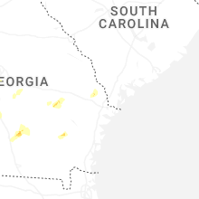
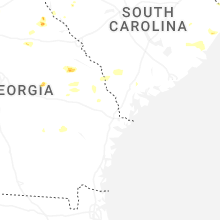


Connect with Interactive Hail Maps