

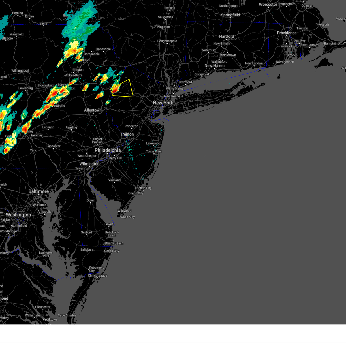
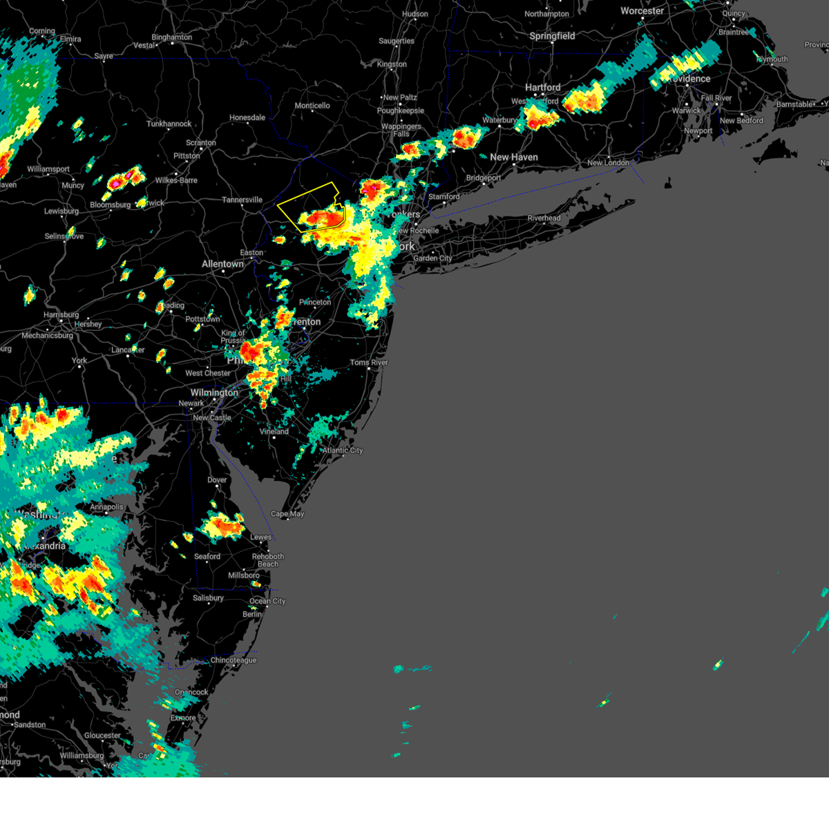
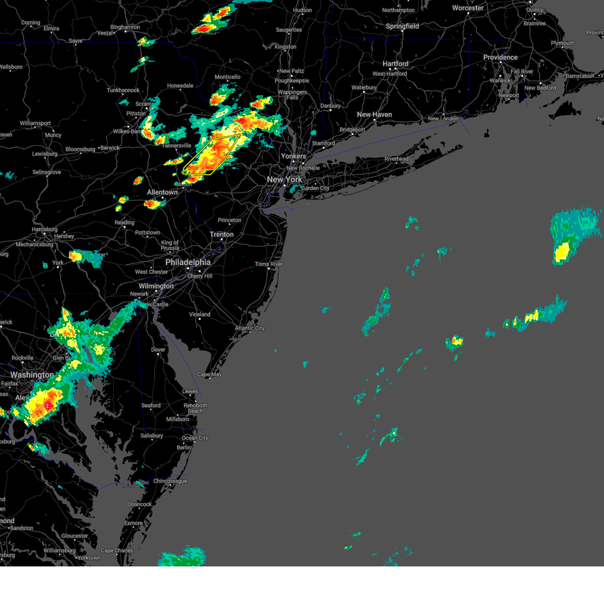
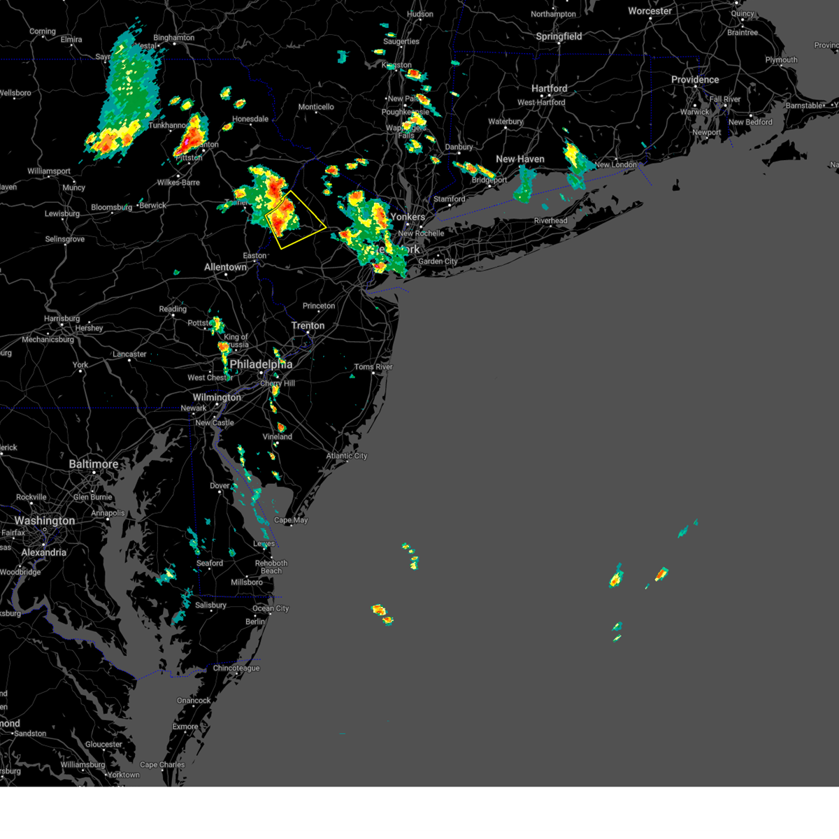
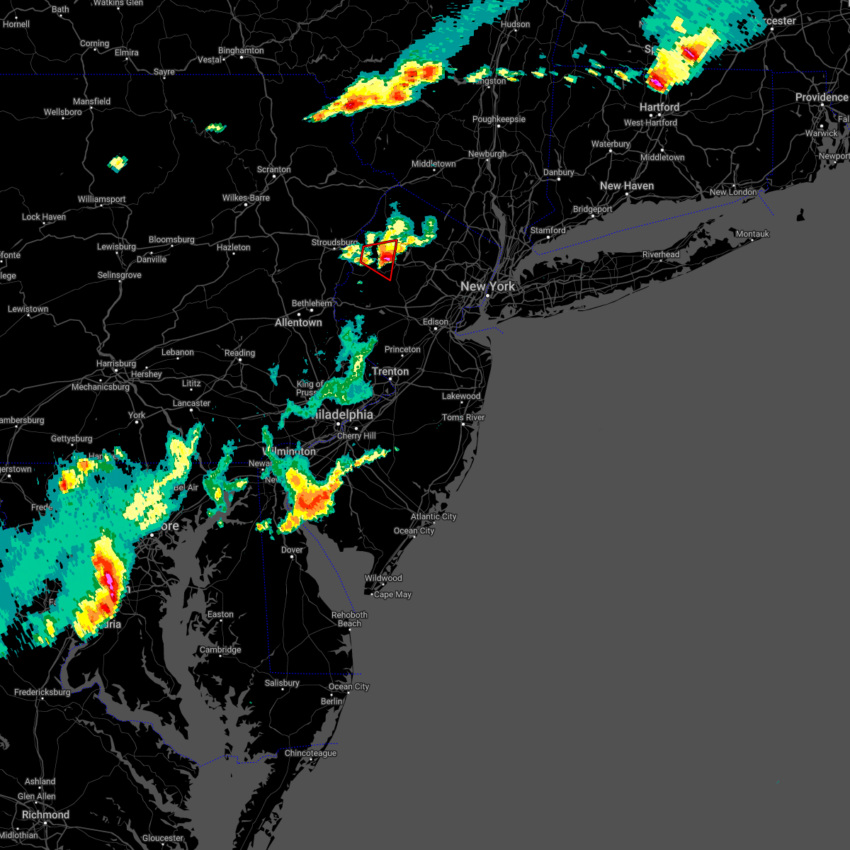
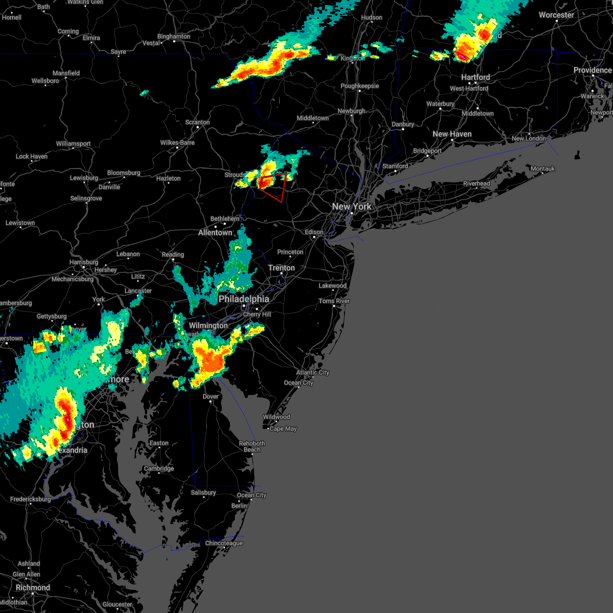
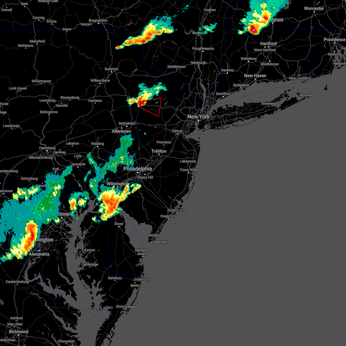
Hail Map for Hackettstown, NJ
The Hackettstown, NJ area has had 0 reports of on-the-ground hail by trained spotters, and has been under severe weather warnings 4 times during the past 12 months. Doppler radar has detected hail at or near Hackettstown, NJ on 22 occasions.
| Name: | Hackettstown, NJ |
| Where Located: | 45 miles WNW of Brooklyn, NY |
| Map: | Google Map for Hackettstown, NJ |
| Population: | 9724 |
| Housing Units: | 3755 |
| More Info: | Search Google for Hackettstown, NJ |
0
The Top Recent Hail Date for Hackettstown, NJ is Friday, September 8, 2023 (13th out of 22)

Hail and Wind Damage Spotted near Hackettstown, NJ
| Date / Time | Report Details |
|---|---|
| 8/3/2024 1:27 PM EDT |
 Svrphi the national weather service in mount holly nj has issued a * severe thunderstorm warning for, west central morris county in northern new jersey, southwestern sussex county in northwestern new jersey, northern warren county in northwestern new jersey, * until 215 pm edt. * at 127 pm edt, a severe thunderstorm was located over blairstown, or 14 miles southwest of newton, moving east at 20 mph (radar indicated). Hazards include 60 mph wind gusts and quarter size hail. Minor damage to vehicles is possible. Wind damage to roofs, siding, trees, and power lines is possible. Svrphi the national weather service in mount holly nj has issued a * severe thunderstorm warning for, west central morris county in northern new jersey, southwestern sussex county in northwestern new jersey, northern warren county in northwestern new jersey, * until 215 pm edt. * at 127 pm edt, a severe thunderstorm was located over blairstown, or 14 miles southwest of newton, moving east at 20 mph (radar indicated). Hazards include 60 mph wind gusts and quarter size hail. Minor damage to vehicles is possible. Wind damage to roofs, siding, trees, and power lines is possible.
|
| 7/9/2024 5:43 PM EDT |
 The storm which prompted the warning has weakened below severe limits, and no longer poses an immediate threat to life or property. therefore, the warning will be allowed to expire. The storm which prompted the warning has weakened below severe limits, and no longer poses an immediate threat to life or property. therefore, the warning will be allowed to expire.
|
| 7/9/2024 5:23 PM EDT |
 At 523 pm edt, a severe thunderstorm was located over long valley, or 17 miles west of morristown, moving northeast at 25 mph (radar indicated). Hazards include 60 mph wind gusts and quarter size hail. Minor damage to vehicles is possible. wind damage to roofs, siding, trees, and power lines is possible. locations impacted include, hackettstown, peapack and gladstone, chester, lebanon, califon, budd lake, long valley, beatyestown, and beattyestown. This includes interstate 78 in new jersey between mile markers 21 and 26. At 523 pm edt, a severe thunderstorm was located over long valley, or 17 miles west of morristown, moving northeast at 25 mph (radar indicated). Hazards include 60 mph wind gusts and quarter size hail. Minor damage to vehicles is possible. wind damage to roofs, siding, trees, and power lines is possible. locations impacted include, hackettstown, peapack and gladstone, chester, lebanon, califon, budd lake, long valley, beatyestown, and beattyestown. This includes interstate 78 in new jersey between mile markers 21 and 26.
|
| 7/9/2024 5:02 PM EDT |
 Svrphi the national weather service in mount holly nj has issued a * severe thunderstorm warning for, northeastern hunterdon county in northwestern new jersey, southwestern morris county in northern new jersey, southeastern warren county in northwestern new jersey, * until 545 pm edt. * at 502 pm edt, a severe thunderstorm was located over glen gardner, or 15 miles east of easton, moving northeast at 25 mph (radar indicated). Hazards include 60 mph wind gusts and quarter size hail. Minor damage to vehicles is possible. Wind damage to roofs, siding, trees, and power lines is possible. Svrphi the national weather service in mount holly nj has issued a * severe thunderstorm warning for, northeastern hunterdon county in northwestern new jersey, southwestern morris county in northern new jersey, southeastern warren county in northwestern new jersey, * until 545 pm edt. * at 502 pm edt, a severe thunderstorm was located over glen gardner, or 15 miles east of easton, moving northeast at 25 mph (radar indicated). Hazards include 60 mph wind gusts and quarter size hail. Minor damage to vehicles is possible. Wind damage to roofs, siding, trees, and power lines is possible.
|
| 6/30/2024 4:10 PM EDT |
 Svrphi the national weather service in mount holly nj has issued a * severe thunderstorm warning for, northeastern hunterdon county in northwestern new jersey, southern morris county in northern new jersey, northern somerset county in northern new jersey, northeastern middlesex county in northern new jersey, * until 445 pm edt. * at 410 pm edt, a severe thunderstorm was located over far hills, or 9 miles north of somerville, moving east at 45 mph (radar indicated). Hazards include 60 mph wind gusts and penny size hail. damage to roofs, siding, trees, and power lines is possible Svrphi the national weather service in mount holly nj has issued a * severe thunderstorm warning for, northeastern hunterdon county in northwestern new jersey, southern morris county in northern new jersey, northern somerset county in northern new jersey, northeastern middlesex county in northern new jersey, * until 445 pm edt. * at 410 pm edt, a severe thunderstorm was located over far hills, or 9 miles north of somerville, moving east at 45 mph (radar indicated). Hazards include 60 mph wind gusts and penny size hail. damage to roofs, siding, trees, and power lines is possible
|
| 6/30/2024 4:02 PM EDT |
 the severe thunderstorm warning has been cancelled and is no longer in effect the severe thunderstorm warning has been cancelled and is no longer in effect
|
| 6/30/2024 4:02 PM EDT |
 At 401 pm edt, a severe thunderstorm was located near peapack and gladstone, or 12 miles northwest of somerville, moving east at 45 mph (public). Hazards include 60 mph wind gusts. Damage to roofs, siding, trees, and power lines is possible. locations impacted include, morristown, bridgewater, hackettstown, morris plains, mendham, high bridge, clinton, peapack and gladstone, glen gardner, chester, hampton, lebanon, califon, far hills, long valley, annandale, martinsville, millington, white house station, and basking ridge. this includes the following highways, interstate 78 in new jersey between mile markers 17 and 38. Interstate 287 in new jersey between mile markers 18 and 36. At 401 pm edt, a severe thunderstorm was located near peapack and gladstone, or 12 miles northwest of somerville, moving east at 45 mph (public). Hazards include 60 mph wind gusts. Damage to roofs, siding, trees, and power lines is possible. locations impacted include, morristown, bridgewater, hackettstown, morris plains, mendham, high bridge, clinton, peapack and gladstone, glen gardner, chester, hampton, lebanon, califon, far hills, long valley, annandale, martinsville, millington, white house station, and basking ridge. this includes the following highways, interstate 78 in new jersey between mile markers 17 and 38. Interstate 287 in new jersey between mile markers 18 and 36.
|
| 6/30/2024 3:47 PM EDT |
 At 346 pm edt, a severe thunderstorm was located over washington, or 15 miles east of easton, moving east at 45 mph (public. at 330 pm in nazareth in northampton county pa, large branches were reported snapped along with estimated winds of 60 mph). Hazards include 60 mph wind gusts. Damage to roofs, siding, trees, and power lines is possible. locations impacted include, morristown, bridgewater, hackettstown, washington, morris plains, mendham, high bridge, clinton, belvidere, harmony, peapack and gladstone, oxford, alpha, glen gardner, chester, hampton, lebanon, califon, far hills, and bloomsbury. this includes the following highways, interstate 78 in new jersey near mile marker 0, between mile markers 4 and 11, and between mile markers 17 and 38. Interstate 287 in new jersey between mile markers 18 and 36. At 346 pm edt, a severe thunderstorm was located over washington, or 15 miles east of easton, moving east at 45 mph (public. at 330 pm in nazareth in northampton county pa, large branches were reported snapped along with estimated winds of 60 mph). Hazards include 60 mph wind gusts. Damage to roofs, siding, trees, and power lines is possible. locations impacted include, morristown, bridgewater, hackettstown, washington, morris plains, mendham, high bridge, clinton, belvidere, harmony, peapack and gladstone, oxford, alpha, glen gardner, chester, hampton, lebanon, califon, far hills, and bloomsbury. this includes the following highways, interstate 78 in new jersey near mile marker 0, between mile markers 4 and 11, and between mile markers 17 and 38. Interstate 287 in new jersey between mile markers 18 and 36.
|
| 6/30/2024 3:47 PM EDT |
 the severe thunderstorm warning has been cancelled and is no longer in effect the severe thunderstorm warning has been cancelled and is no longer in effect
|
| 6/30/2024 3:38 PM EDT |
 At 334 pm edt, a severe thunderstorm was located over roxburg, or 7 miles northeast of easton, moving east at 45 mph (public. at 330 pm in nazareth in northampton county pa, large branches were reported snapped along with estimated winds of 60 mph). Hazards include 60 mph wind gusts. Damage to roofs, siding, trees, and power lines is possible. locations impacted include, easton, morristown, somerville, bridgewater, forks, middlesex, bound brook, hackettstown, wilson, washington, nazareth, morris plains, bangor, mendham, high bridge, pen argyl, wind gap, clinton, belvidere, and harmony. this includes the following highways, interstate 78 in new jersey near mile marker 0, and between mile markers 3 and 38. Interstate 287 in new jersey between mile markers 14 and 36. At 334 pm edt, a severe thunderstorm was located over roxburg, or 7 miles northeast of easton, moving east at 45 mph (public. at 330 pm in nazareth in northampton county pa, large branches were reported snapped along with estimated winds of 60 mph). Hazards include 60 mph wind gusts. Damage to roofs, siding, trees, and power lines is possible. locations impacted include, easton, morristown, somerville, bridgewater, forks, middlesex, bound brook, hackettstown, wilson, washington, nazareth, morris plains, bangor, mendham, high bridge, pen argyl, wind gap, clinton, belvidere, and harmony. this includes the following highways, interstate 78 in new jersey near mile marker 0, and between mile markers 3 and 38. Interstate 287 in new jersey between mile markers 14 and 36.
|
| 6/30/2024 3:26 PM EDT |
 Svrphi the national weather service in mount holly nj has issued a * severe thunderstorm warning for, northern hunterdon county in northwestern new jersey, southwestern morris county in northern new jersey, southern warren county in northwestern new jersey, northern somerset county in northern new jersey, northeastern northampton county in eastern pennsylvania, * until 415 pm edt. * at 325 pm edt, a severe thunderstorm was located over belfast, or near easton, moving east at 45 mph (radar indicated). Hazards include 60 mph wind gusts. damage to roofs, siding, trees, and power lines is possible Svrphi the national weather service in mount holly nj has issued a * severe thunderstorm warning for, northern hunterdon county in northwestern new jersey, southwestern morris county in northern new jersey, southern warren county in northwestern new jersey, northern somerset county in northern new jersey, northeastern northampton county in eastern pennsylvania, * until 415 pm edt. * at 325 pm edt, a severe thunderstorm was located over belfast, or near easton, moving east at 45 mph (radar indicated). Hazards include 60 mph wind gusts. damage to roofs, siding, trees, and power lines is possible
|
| 6/30/2024 3:11 PM EDT |
 the severe thunderstorm warning has been cancelled and is no longer in effect the severe thunderstorm warning has been cancelled and is no longer in effect
|
| 6/30/2024 3:11 PM EDT |
 At 311 pm edt, severe thunderstorms were located along a line extending from near boonton to succasunna to near washington, moving southeast at 40 mph (radar indicated). Hazards include 60 mph wind gusts. Damage to roofs, siding, trees, and power lines is possible. locations impacted include, morristown, dover, madison, hopatcong, florham park, east hanover, lincoln park, kinnelon, hackettstown, chatham, boonton, wharton, washington, rockaway, morris plains, mount arlington, franklin, mendham, mountain lakes, and stanhope. this includes the following highways, interstate 78 in new jersey between mile markers 22 and 39. interstate 80 in new jersey between mile markers 12 and 49. Interstate 287 in new jersey between mile markers 19 and 51. At 311 pm edt, severe thunderstorms were located along a line extending from near boonton to succasunna to near washington, moving southeast at 40 mph (radar indicated). Hazards include 60 mph wind gusts. Damage to roofs, siding, trees, and power lines is possible. locations impacted include, morristown, dover, madison, hopatcong, florham park, east hanover, lincoln park, kinnelon, hackettstown, chatham, boonton, wharton, washington, rockaway, morris plains, mount arlington, franklin, mendham, mountain lakes, and stanhope. this includes the following highways, interstate 78 in new jersey between mile markers 22 and 39. interstate 80 in new jersey between mile markers 12 and 49. Interstate 287 in new jersey between mile markers 19 and 51.
|
| 6/30/2024 2:42 PM EDT |
 Svrphi the national weather service in mount holly nj has issued a * severe thunderstorm warning for, northeastern hunterdon county in northwestern new jersey, morris county in northern new jersey, southwestern sussex county in northwestern new jersey, warren county in northwestern new jersey, northern somerset county in northern new jersey, northeastern northampton county in eastern pennsylvania, * until 345 pm edt. * at 242 pm edt, severe thunderstorms were located along a line extending from near ogdensburg to near allamuchy-panther valley to east bangor, moving southeast at 25 mph (radar indicated). Hazards include 60 mph wind gusts. damage to roofs, siding, trees, and power lines is possible Svrphi the national weather service in mount holly nj has issued a * severe thunderstorm warning for, northeastern hunterdon county in northwestern new jersey, morris county in northern new jersey, southwestern sussex county in northwestern new jersey, warren county in northwestern new jersey, northern somerset county in northern new jersey, northeastern northampton county in eastern pennsylvania, * until 345 pm edt. * at 242 pm edt, severe thunderstorms were located along a line extending from near ogdensburg to near allamuchy-panther valley to east bangor, moving southeast at 25 mph (radar indicated). Hazards include 60 mph wind gusts. damage to roofs, siding, trees, and power lines is possible
|
| 6/30/2024 2:37 PM EDT |
 At 236 pm edt, a severe thunderstorm was located over hope, or 14 miles southwest of newton, moving east at 30 mph (radar indicated). Hazards include 60 mph wind gusts and penny size hail. Damage to roofs, siding, trees, and power lines is possible. locations impacted include, hopatcong, hackettstown, blairstown, stanhope, netcong, oxford, hope, east bangor, delaware water gap, great meadows-vienna, allamuchy-panther valley, greendell, long valley, columbia, budd lake, beatyestown, roseto, portland, and beattyestown. This includes interstate 80 in new jersey between mile markers 0 and 27. At 236 pm edt, a severe thunderstorm was located over hope, or 14 miles southwest of newton, moving east at 30 mph (radar indicated). Hazards include 60 mph wind gusts and penny size hail. Damage to roofs, siding, trees, and power lines is possible. locations impacted include, hopatcong, hackettstown, blairstown, stanhope, netcong, oxford, hope, east bangor, delaware water gap, great meadows-vienna, allamuchy-panther valley, greendell, long valley, columbia, budd lake, beatyestown, roseto, portland, and beattyestown. This includes interstate 80 in new jersey between mile markers 0 and 27.
|
| 6/30/2024 2:37 PM EDT |
 the severe thunderstorm warning has been cancelled and is no longer in effect the severe thunderstorm warning has been cancelled and is no longer in effect
|
| 6/30/2024 2:10 PM EDT |
 Svrphi the national weather service in mount holly nj has issued a * severe thunderstorm warning for, southwestern morris county in northern new jersey, southern sussex county in northwestern new jersey, central warren county in northwestern new jersey, central monroe county in northeastern pennsylvania, northeastern northampton county in eastern pennsylvania, * until 300 pm edt. * at 209 pm edt, a severe thunderstorm was located over stormville, or 11 miles southeast of mount pocono, moving east at 30 mph (radar indicated). Hazards include 60 mph wind gusts and penny size hail. damage to roofs, siding, trees, and power lines is possible Svrphi the national weather service in mount holly nj has issued a * severe thunderstorm warning for, southwestern morris county in northern new jersey, southern sussex county in northwestern new jersey, central warren county in northwestern new jersey, central monroe county in northeastern pennsylvania, northeastern northampton county in eastern pennsylvania, * until 300 pm edt. * at 209 pm edt, a severe thunderstorm was located over stormville, or 11 miles southeast of mount pocono, moving east at 30 mph (radar indicated). Hazards include 60 mph wind gusts and penny size hail. damage to roofs, siding, trees, and power lines is possible
|
| 6/26/2024 7:59 PM EDT |
 At 759 pm edt, severe thunderstorms were located along a line extending from vernon valley to near martinsville, moving east at 55 mph (radar indicated). Hazards include 70 mph wind gusts. Expect considerable tree damage. damage is likely to mobile homes, roofs, and outbuildings. locations impacted include, new brunswick, perth amboy, morristown, somerville, newton, somerset, edison, east brunswick, bridgewater, carteret, dover, madison, hopatcong, middlesex, florham park, east hanover, lincoln park, bound brook, manville, and kinnelon. this includes the following highways, new jersey turnpike between exits 10 and 13. interstate 78 in new jersey between mile markers 20 and 42. interstate 80 in new jersey between mile markers 20 and 47. interstate 287 in new jersey between mile markers 0 and 54. Garden state parkway between mile markers 125 and 134. At 759 pm edt, severe thunderstorms were located along a line extending from vernon valley to near martinsville, moving east at 55 mph (radar indicated). Hazards include 70 mph wind gusts. Expect considerable tree damage. damage is likely to mobile homes, roofs, and outbuildings. locations impacted include, new brunswick, perth amboy, morristown, somerville, newton, somerset, edison, east brunswick, bridgewater, carteret, dover, madison, hopatcong, middlesex, florham park, east hanover, lincoln park, bound brook, manville, and kinnelon. this includes the following highways, new jersey turnpike between exits 10 and 13. interstate 78 in new jersey between mile markers 20 and 42. interstate 80 in new jersey between mile markers 20 and 47. interstate 287 in new jersey between mile markers 0 and 54. Garden state parkway between mile markers 125 and 134.
|
| 6/26/2024 7:39 PM EDT | Trees... wires and power poles down on rockport road near allen road. time estimate in warren county NJ, 1.9 miles NE of Hackettstown, NJ |
| 6/26/2024 7:37 PM EDT |
 Svrphi the national weather service in mount holly nj has issued a * severe thunderstorm warning for, hunterdon county in northwestern new jersey, morris county in northern new jersey, sussex county in northwestern new jersey, eastern warren county in northwestern new jersey, somerset county in northern new jersey, northeastern middlesex county in northern new jersey, * until 815 pm edt. * at 737 pm edt, severe thunderstorms were located along a line extending from near crandon lakes to near clinton, moving east at 55 mph (radar indicated). Hazards include 70 mph wind gusts. Expect considerable tree damage. Damage is likely to mobile homes, roofs, and outbuildings. Svrphi the national weather service in mount holly nj has issued a * severe thunderstorm warning for, hunterdon county in northwestern new jersey, morris county in northern new jersey, sussex county in northwestern new jersey, eastern warren county in northwestern new jersey, somerset county in northern new jersey, northeastern middlesex county in northern new jersey, * until 815 pm edt. * at 737 pm edt, severe thunderstorms were located along a line extending from near crandon lakes to near clinton, moving east at 55 mph (radar indicated). Hazards include 70 mph wind gusts. Expect considerable tree damage. Damage is likely to mobile homes, roofs, and outbuildings.
|
| 6/26/2024 7:35 PM EDT | Several trees down and a measured wind gust to 59 mph. time estimated from rada in warren county NJ, 0.7 miles NE of Hackettstown, NJ |
| 6/26/2024 7:31 PM EDT |
 At 731 pm edt, severe thunderstorms were located along a line extending from columbia to near riegelsville, moving northeast at 50 mph (trained weather spotters). Hazards include 60 mph wind gusts. Damage to roofs, siding, trees, and power lines is possible. locations impacted include, easton, newton, forks, hackettstown, wilson, washington, blairstown, bangor, high bridge, clinton, belvidere, harmony, oxford, alpha, hope, glen gardner, hampton, west easton, milford, and east bangor. this includes the following highways, interstate 78 in pennsylvania between mile markers 74 and 76. interstate 78 in new jersey between mile markers 0 and 18. Interstate 80 in new jersey between mile markers 2 and 24. At 731 pm edt, severe thunderstorms were located along a line extending from columbia to near riegelsville, moving northeast at 50 mph (trained weather spotters). Hazards include 60 mph wind gusts. Damage to roofs, siding, trees, and power lines is possible. locations impacted include, easton, newton, forks, hackettstown, wilson, washington, blairstown, bangor, high bridge, clinton, belvidere, harmony, oxford, alpha, hope, glen gardner, hampton, west easton, milford, and east bangor. this includes the following highways, interstate 78 in pennsylvania between mile markers 74 and 76. interstate 78 in new jersey between mile markers 0 and 18. Interstate 80 in new jersey between mile markers 2 and 24.
|
| 6/26/2024 7:31 PM EDT |
 the severe thunderstorm warning has been cancelled and is no longer in effect the severe thunderstorm warning has been cancelled and is no longer in effect
|
| 6/26/2024 7:13 PM EDT |
 At 712 pm edt, severe thunderstorms were located along a line extending from near wind gap to emmaus, moving northeast at 50 mph (trained weather spotters). Hazards include 60 mph wind gusts. Damage to roofs, siding, trees, and power lines is possible. locations impacted include, allentown, easton, newton, bethlehem, forks, emmaus, hackettstown, wilson, washington, blairstown, hellertown, nazareth, bangor, high bridge, pen argyl, wind gap, clinton, bath, belvidere, and harmony. this includes the following highways, northeast extension between mile markers 47 and 50. interstate 78 in pennsylvania between mile markers 59 and 76. interstate 78 in new jersey between mile markers 0 and 18. Interstate 80 in new jersey between mile markers 1 and 24. At 712 pm edt, severe thunderstorms were located along a line extending from near wind gap to emmaus, moving northeast at 50 mph (trained weather spotters). Hazards include 60 mph wind gusts. Damage to roofs, siding, trees, and power lines is possible. locations impacted include, allentown, easton, newton, bethlehem, forks, emmaus, hackettstown, wilson, washington, blairstown, hellertown, nazareth, bangor, high bridge, pen argyl, wind gap, clinton, bath, belvidere, and harmony. this includes the following highways, northeast extension between mile markers 47 and 50. interstate 78 in pennsylvania between mile markers 59 and 76. interstate 78 in new jersey between mile markers 0 and 18. Interstate 80 in new jersey between mile markers 1 and 24.
|
| 6/26/2024 7:13 PM EDT |
 the severe thunderstorm warning has been cancelled and is no longer in effect the severe thunderstorm warning has been cancelled and is no longer in effect
|
| 6/26/2024 6:58 PM EDT |
 Svrphi the national weather service in mount holly nj has issued a * severe thunderstorm warning for, northwestern hunterdon county in northwestern new jersey, west central morris county in northern new jersey, southwestern sussex county in northwestern new jersey, warren county in northwestern new jersey, east central berks county in eastern pennsylvania, eastern lehigh county in eastern pennsylvania, northwestern bucks county in southeastern pennsylvania, south central monroe county in northeastern pennsylvania, northampton county in eastern pennsylvania, * until 745 pm edt. * at 658 pm edt, severe thunderstorms were located along a line extending from danielsville to near topton, moving northeast at 50 mph (radar indicated). Hazards include 60 mph wind gusts. damage to roofs, siding, trees, and power lines is possible Svrphi the national weather service in mount holly nj has issued a * severe thunderstorm warning for, northwestern hunterdon county in northwestern new jersey, west central morris county in northern new jersey, southwestern sussex county in northwestern new jersey, warren county in northwestern new jersey, east central berks county in eastern pennsylvania, eastern lehigh county in eastern pennsylvania, northwestern bucks county in southeastern pennsylvania, south central monroe county in northeastern pennsylvania, northampton county in eastern pennsylvania, * until 745 pm edt. * at 658 pm edt, severe thunderstorms were located along a line extending from danielsville to near topton, moving northeast at 50 mph (radar indicated). Hazards include 60 mph wind gusts. damage to roofs, siding, trees, and power lines is possible
|
| 6/14/2024 5:18 PM EDT |
 Svrphi the national weather service in mount holly nj has issued a * severe thunderstorm warning for, morris county in northern new jersey, southeastern sussex county in northwestern new jersey, east central warren county in northwestern new jersey, * until 600 pm edt. * at 517 pm edt, severe thunderstorms were located along a line extending from newton to beatyestown, moving east at 50 mph (radar indicated). Hazards include 60 mph wind gusts. damage to roofs, siding, trees, and power lines is possible Svrphi the national weather service in mount holly nj has issued a * severe thunderstorm warning for, morris county in northern new jersey, southeastern sussex county in northwestern new jersey, east central warren county in northwestern new jersey, * until 600 pm edt. * at 517 pm edt, severe thunderstorms were located along a line extending from newton to beatyestown, moving east at 50 mph (radar indicated). Hazards include 60 mph wind gusts. damage to roofs, siding, trees, and power lines is possible
|
| 6/14/2024 4:14 PM EDT |
 Svrphi the national weather service in mount holly nj has issued a * severe thunderstorm warning for, sussex county in northwestern new jersey, northern warren county in northwestern new jersey, central monroe county in northeastern pennsylvania, northeastern northampton county in eastern pennsylvania, * until 500 pm edt. * at 414 pm edt, severe thunderstorms were located along a line extending from near skytop to near jonas, moving east at 45 mph (radar indicated). Hazards include 60 mph wind gusts. damage to roofs, siding, trees, and power lines is possible Svrphi the national weather service in mount holly nj has issued a * severe thunderstorm warning for, sussex county in northwestern new jersey, northern warren county in northwestern new jersey, central monroe county in northeastern pennsylvania, northeastern northampton county in eastern pennsylvania, * until 500 pm edt. * at 414 pm edt, severe thunderstorms were located along a line extending from near skytop to near jonas, moving east at 45 mph (radar indicated). Hazards include 60 mph wind gusts. damage to roofs, siding, trees, and power lines is possible
|
| 5/23/2024 9:13 AM EDT |
 At 912 am edt, severe thunderstorms were located along a line extending from budd lake to far hills to flagtown, moving east at 50 mph (radar indicated). Hazards include 60 mph wind gusts and penny size hail. Damage to roofs, siding, trees, and power lines is possible. locations impacted include, perth amboy, morristown, somerville, edison, bridgewater, carteret, dover, madison, hopatcong, middlesex, florham park, east hanover, lincoln park, bound brook, manville, hackettstown, chatham, boonton, wharton, and rockaway. this includes the following highways, new jersey turnpike between exits 11 and 13. interstate 78 in new jersey between mile markers 21 and 43. interstate 80 in new jersey between mile markers 22 and 48. interstate 287 in new jersey between mile markers 0 and 53. Garden state parkway between mile markers 129 and 134. At 912 am edt, severe thunderstorms were located along a line extending from budd lake to far hills to flagtown, moving east at 50 mph (radar indicated). Hazards include 60 mph wind gusts and penny size hail. Damage to roofs, siding, trees, and power lines is possible. locations impacted include, perth amboy, morristown, somerville, edison, bridgewater, carteret, dover, madison, hopatcong, middlesex, florham park, east hanover, lincoln park, bound brook, manville, hackettstown, chatham, boonton, wharton, and rockaway. this includes the following highways, new jersey turnpike between exits 11 and 13. interstate 78 in new jersey between mile markers 21 and 43. interstate 80 in new jersey between mile markers 22 and 48. interstate 287 in new jersey between mile markers 0 and 53. Garden state parkway between mile markers 129 and 134.
|
| 5/23/2024 8:59 AM EDT |
 Svrphi the national weather service in mount holly nj has issued a * severe thunderstorm warning for, northeastern hunterdon county in northwestern new jersey, morris county in northern new jersey, south central sussex county in northwestern new jersey, central warren county in northwestern new jersey, somerset county in northern new jersey, northeastern middlesex county in northern new jersey, * until 945 am edt. * at 858 am edt, severe thunderstorms were located along a line extending from near hope to high bridge to near sand brook, moving east at 50 mph (radar indicated). Hazards include 60 mph wind gusts and penny size hail. damage to roofs, siding, trees, and power lines is possible Svrphi the national weather service in mount holly nj has issued a * severe thunderstorm warning for, northeastern hunterdon county in northwestern new jersey, morris county in northern new jersey, south central sussex county in northwestern new jersey, central warren county in northwestern new jersey, somerset county in northern new jersey, northeastern middlesex county in northern new jersey, * until 945 am edt. * at 858 am edt, severe thunderstorms were located along a line extending from near hope to high bridge to near sand brook, moving east at 50 mph (radar indicated). Hazards include 60 mph wind gusts and penny size hail. damage to roofs, siding, trees, and power lines is possible
|
| 4/30/2024 8:57 PM EDT |
 The storms which prompted the warning have weakened below severe limits, and no longer pose an immediate threat to life or property. therefore, the warning will be allowed to expire. however small hail, gusty winds, and heavy rain are still possible with these thunderstorms. to report severe weather, contact your nearest law enforcement agency. they will relay your report to the national weather service mount holly nj. The storms which prompted the warning have weakened below severe limits, and no longer pose an immediate threat to life or property. therefore, the warning will be allowed to expire. however small hail, gusty winds, and heavy rain are still possible with these thunderstorms. to report severe weather, contact your nearest law enforcement agency. they will relay your report to the national weather service mount holly nj.
|
| 4/30/2024 8:47 PM EDT |
 At 846 pm edt, severe thunderstorms were located along a line extending from near chester to milford to quakertown, moving east at 25 mph. this storm has a history of producing quarter sized hail in the lehigh valley (radar indicated). Hazards include 60 mph wind gusts and quarter size hail. Minor damage to vehicles is possible. wind damage to roofs, siding, trees, and power lines is possible. locations impacted include, dover, hackettstown, quakertown, perkasie, byram, bedminster, wharton, washington, rockaway, mendham, flemington, tinicum, high bridge, clinton, peapack and gladstone, oxford, alpha, dublin, glen gardner, and chester. this includes the following highways, northeast extension between mile markers 42 and 47. Interstate 78 in new jersey between mile markers 0 and 25. At 846 pm edt, severe thunderstorms were located along a line extending from near chester to milford to quakertown, moving east at 25 mph. this storm has a history of producing quarter sized hail in the lehigh valley (radar indicated). Hazards include 60 mph wind gusts and quarter size hail. Minor damage to vehicles is possible. wind damage to roofs, siding, trees, and power lines is possible. locations impacted include, dover, hackettstown, quakertown, perkasie, byram, bedminster, wharton, washington, rockaway, mendham, flemington, tinicum, high bridge, clinton, peapack and gladstone, oxford, alpha, dublin, glen gardner, and chester. this includes the following highways, northeast extension between mile markers 42 and 47. Interstate 78 in new jersey between mile markers 0 and 25.
|
| 4/30/2024 8:35 PM EDT |
 At 835 pm edt, severe thunderstorms were located along a line extending from near long valley to riegelsville to near quakertown, moving east at 25 mph. this storm has a history of producing quarter sized to half dollar sized hail in the lehigh valley (trained weather spotters. at 755 pm edt, half dollar sized hail was reported in whitehall township, pa). Hazards include 60 mph wind gusts and quarter size hail. Minor damage to vehicles is possible. wind damage to roofs, siding, trees, and power lines is possible. locations impacted include, allentown, easton, bethlehem, dover, forks, emmaus, hackettstown, quakertown, perkasie, byram, wilson, bedminster, wharton, washington, rockaway, hellertown, mendham, flemington, tinicum, and high bridge. this includes the following highways, northeast extension between mile markers 42 and 52. interstate 78 in pennsylvania between mile markers 59 and 76. Interstate 78 in new jersey between mile markers 0 and 25. At 835 pm edt, severe thunderstorms were located along a line extending from near long valley to riegelsville to near quakertown, moving east at 25 mph. this storm has a history of producing quarter sized to half dollar sized hail in the lehigh valley (trained weather spotters. at 755 pm edt, half dollar sized hail was reported in whitehall township, pa). Hazards include 60 mph wind gusts and quarter size hail. Minor damage to vehicles is possible. wind damage to roofs, siding, trees, and power lines is possible. locations impacted include, allentown, easton, bethlehem, dover, forks, emmaus, hackettstown, quakertown, perkasie, byram, wilson, bedminster, wharton, washington, rockaway, hellertown, mendham, flemington, tinicum, and high bridge. this includes the following highways, northeast extension between mile markers 42 and 52. interstate 78 in pennsylvania between mile markers 59 and 76. Interstate 78 in new jersey between mile markers 0 and 25.
|
| 4/30/2024 8:14 PM EDT |
 Svrphi the national weather service in mount holly nj has issued a * severe thunderstorm warning for, hunterdon county in northwestern new jersey, southwestern morris county in northern new jersey, southern warren county in northwestern new jersey, northwestern somerset county in northern new jersey, southeastern lehigh county in eastern pennsylvania, northwestern bucks county in southeastern pennsylvania, central northampton county in eastern pennsylvania, * until 900 pm edt. * at 813 pm edt, severe thunderstorms were located along a line extending from roxburg to near bethlehem to near emmaus, moving east at 25 mph. this storm has a history of producing quarter sized to half dollar sized hail in the lehigh valley (public. at 755 pm edt, half dollar sized hail was reported in whitehall township, pa). Hazards include 60 mph wind gusts and quarter size hail. Minor damage to vehicles is possible. Wind damage to roofs, siding, trees, and power lines is possible. Svrphi the national weather service in mount holly nj has issued a * severe thunderstorm warning for, hunterdon county in northwestern new jersey, southwestern morris county in northern new jersey, southern warren county in northwestern new jersey, northwestern somerset county in northern new jersey, southeastern lehigh county in eastern pennsylvania, northwestern bucks county in southeastern pennsylvania, central northampton county in eastern pennsylvania, * until 900 pm edt. * at 813 pm edt, severe thunderstorms were located along a line extending from roxburg to near bethlehem to near emmaus, moving east at 25 mph. this storm has a history of producing quarter sized to half dollar sized hail in the lehigh valley (public. at 755 pm edt, half dollar sized hail was reported in whitehall township, pa). Hazards include 60 mph wind gusts and quarter size hail. Minor damage to vehicles is possible. Wind damage to roofs, siding, trees, and power lines is possible.
|
| 9/9/2023 4:37 PM EDT |
 At 437 pm edt, a severe thunderstorm was located over hopatcong, or 7 miles southeast of newton, moving northwest at 10 mph (radar indicated). Hazards include 60 mph wind gusts and quarter size hail. Minor damage to vehicles is possible. Wind damage to roofs, siding, trees, and power lines is possible. At 437 pm edt, a severe thunderstorm was located over hopatcong, or 7 miles southeast of newton, moving northwest at 10 mph (radar indicated). Hazards include 60 mph wind gusts and quarter size hail. Minor damage to vehicles is possible. Wind damage to roofs, siding, trees, and power lines is possible.
|
| 9/8/2023 5:28 PM EDT |
 The severe thunderstorm warning for hunterdon, southwestern morris, south central sussex, southeastern warren and northwestern somerset counties will expire at 530 pm edt, the storm which prompted the warning has weakened below severe limits, and no longer poses an immediate threat to life or property. therefore, the warning will be allowed to expire. however gusty winds and heavy rain are still possible with this thunderstorm. a severe thunderstorm watch remains in effect until 1100 pm edt for northern and northwestern new jersey. to report severe weather, contact your nearest law enforcement agency. they will relay your report to the national weather service mount holly nj. remember, a severe thunderstorm warning still remains in effect for southwestern hunterdon county until 6:00 pm edt. The severe thunderstorm warning for hunterdon, southwestern morris, south central sussex, southeastern warren and northwestern somerset counties will expire at 530 pm edt, the storm which prompted the warning has weakened below severe limits, and no longer poses an immediate threat to life or property. therefore, the warning will be allowed to expire. however gusty winds and heavy rain are still possible with this thunderstorm. a severe thunderstorm watch remains in effect until 1100 pm edt for northern and northwestern new jersey. to report severe weather, contact your nearest law enforcement agency. they will relay your report to the national weather service mount holly nj. remember, a severe thunderstorm warning still remains in effect for southwestern hunterdon county until 6:00 pm edt.
|
| 9/8/2023 5:06 PM EDT | Downed tree on us 46 westbound east of cr 604/nj 182/willow grove st (mount olive twp) all lanes closed. time estimated from rada in morris county NJ, 0.5 miles N of Hackettstown, NJ |
| 9/8/2023 5:03 PM EDT |
 At 503 pm edt, a severe thunderstorm was located over long valley, or 14 miles west of morristown, moving northeast at 20 mph (radar indicated). Hazards include 60 mph wind gusts and nickel size hail. Damage to roofs, siding, trees, and power lines is possible. locations impacted include, morristown, bridgewater, dover, hopatcong, hackettstown, wharton, morris plains, mount arlington, mendham, flemington, high bridge, stanhope, netcong, clinton, peapack and gladstone, glen gardner, chester, victory gardens, hampton and lebanon. this includes the following highways, interstate 78 in new jersey between mile markers 11 and 33. interstate 80 in new jersey between mile markers 18 and 32. interstate 287 in new jersey between mile markers 20 and 39. hail threat, radar indicated max hail size, 0. 88 in wind threat, radar indicated max wind gust, 60 mph. At 503 pm edt, a severe thunderstorm was located over long valley, or 14 miles west of morristown, moving northeast at 20 mph (radar indicated). Hazards include 60 mph wind gusts and nickel size hail. Damage to roofs, siding, trees, and power lines is possible. locations impacted include, morristown, bridgewater, dover, hopatcong, hackettstown, wharton, morris plains, mount arlington, mendham, flemington, high bridge, stanhope, netcong, clinton, peapack and gladstone, glen gardner, chester, victory gardens, hampton and lebanon. this includes the following highways, interstate 78 in new jersey between mile markers 11 and 33. interstate 80 in new jersey between mile markers 18 and 32. interstate 287 in new jersey between mile markers 20 and 39. hail threat, radar indicated max hail size, 0. 88 in wind threat, radar indicated max wind gust, 60 mph.
|
| 9/8/2023 4:50 PM EDT |
 At 450 pm edt, a severe thunderstorm was located over califon, or 15 miles northwest of somerville, moving northeast at 20 mph (radar indicated). Hazards include 60 mph wind gusts and nickel size hail. damage to roofs, siding, trees, and power lines is possible At 450 pm edt, a severe thunderstorm was located over califon, or 15 miles northwest of somerville, moving northeast at 20 mph (radar indicated). Hazards include 60 mph wind gusts and nickel size hail. damage to roofs, siding, trees, and power lines is possible
|
| 9/7/2023 6:30 PM EDT |
 At 630 pm edt, a severe thunderstorm was located over five points, or 7 miles west of newton, moving northeast at 30 mph (radar indicated). Hazards include 60 mph wind gusts and quarter size hail. Minor damage to vehicles is possible. Wind damage to roofs, siding, trees, and power lines is possible. At 630 pm edt, a severe thunderstorm was located over five points, or 7 miles west of newton, moving northeast at 30 mph (radar indicated). Hazards include 60 mph wind gusts and quarter size hail. Minor damage to vehicles is possible. Wind damage to roofs, siding, trees, and power lines is possible.
|
| 9/7/2023 6:28 PM EDT | Trained spotter reports of wires down on louis ln in hackettstow in warren county NJ, 0.2 miles SSW of Hackettstown, NJ |
| 9/7/2023 6:27 PM EDT | Trained spotter reports 2 trees with wires down on mitchell road in hackettstow in warren county NJ, 1.3 miles NNE of Hackettstown, NJ |
| 7/25/2023 2:41 PM EDT |
 The severe thunderstorm warning for northeastern hunterdon, morris, sussex, northeastern warren, northern somerset and east central monroe counties will expire at 245 pm edt, the storms which prompted the warning have moved out of the area. therefore, the warning will be allowed to expire. a severe thunderstorm watch remains in effect until 800 pm edt for northern and northwestern new jersey, and northeastern pennsylvania. remember, a severe thunderstorm warning still remains in effect for portions of morris, sussex, and somerset counties until 3:30 pm edt. The severe thunderstorm warning for northeastern hunterdon, morris, sussex, northeastern warren, northern somerset and east central monroe counties will expire at 245 pm edt, the storms which prompted the warning have moved out of the area. therefore, the warning will be allowed to expire. a severe thunderstorm watch remains in effect until 800 pm edt for northern and northwestern new jersey, and northeastern pennsylvania. remember, a severe thunderstorm warning still remains in effect for portions of morris, sussex, and somerset counties until 3:30 pm edt.
|
| 7/25/2023 2:06 PM EDT |
 At 206 pm edt, severe thunderstorms were located along a line extending from echo lake to hackettstown to near white house station, moving east at 40 mph (radar indicated). Hazards include 60 mph wind gusts and penny size hail. damage to roofs, siding, trees, and power lines is possible At 206 pm edt, severe thunderstorms were located along a line extending from echo lake to hackettstown to near white house station, moving east at 40 mph (radar indicated). Hazards include 60 mph wind gusts and penny size hail. damage to roofs, siding, trees, and power lines is possible
|
| 7/15/2023 5:58 PM EDT |
 At 558 pm edt, a severe thunderstorm was located over hackettstown, or 13 miles south of newton, moving north at 20 mph (radar indicated). Hazards include 60 mph wind gusts and quarter size hail. Minor damage to vehicles is possible. wind damage to roofs, siding, trees, and power lines is possible. locations impacted include, hopatcong, hackettstown, mount arlington, stanhope, netcong, chester, andover, great meadows-vienna, allamuchy-panther valley, greendell, budd lake, beatyestown, long valley, succasunna-kenvil and beattyestown. this includes interstate 80 in new jersey between mile markers 14 and 29. hail threat, radar indicated max hail size, 1. 00 in wind threat, radar indicated max wind gust, 60 mph. At 558 pm edt, a severe thunderstorm was located over hackettstown, or 13 miles south of newton, moving north at 20 mph (radar indicated). Hazards include 60 mph wind gusts and quarter size hail. Minor damage to vehicles is possible. wind damage to roofs, siding, trees, and power lines is possible. locations impacted include, hopatcong, hackettstown, mount arlington, stanhope, netcong, chester, andover, great meadows-vienna, allamuchy-panther valley, greendell, budd lake, beatyestown, long valley, succasunna-kenvil and beattyestown. this includes interstate 80 in new jersey between mile markers 14 and 29. hail threat, radar indicated max hail size, 1. 00 in wind threat, radar indicated max wind gust, 60 mph.
|
| 7/15/2023 5:45 PM EDT |
 At 544 pm edt, a severe thunderstorm was located over beatyestown, or 18 miles west of morristown, moving north at 15 mph (radar indicated). Hazards include 60 mph wind gusts and quarter size hail. Minor damage to vehicles is possible. Wind damage to roofs, siding, trees, and power lines is possible. At 544 pm edt, a severe thunderstorm was located over beatyestown, or 18 miles west of morristown, moving north at 15 mph (radar indicated). Hazards include 60 mph wind gusts and quarter size hail. Minor damage to vehicles is possible. Wind damage to roofs, siding, trees, and power lines is possible.
|
| 7/14/2023 7:23 PM EDT |
 At 723 pm edt, severe thunderstorms were located along a line extending from near newton to near belvidere, moving east at 20 mph (law enforcement). Hazards include 60 mph wind gusts and half dollar size hail. Minor damage to vehicles is possible. wind damage to roofs, siding, trees, and power lines is possible. locations impacted include, newton, hackettstown, blairstown, bangor, franklin, hamburg, belvidere, oxford, hope, east bangor, branchville, andover, great meadows-vienna, allamuchy-panther valley, greendell, five points, columbia, crandon lakes, lake mohawk and portland. this includes interstate 80 in new jersey between mile markers 3 and 23. hail threat, radar indicated max hail size, 1. 25 in wind threat, observed max wind gust, 60 mph. At 723 pm edt, severe thunderstorms were located along a line extending from near newton to near belvidere, moving east at 20 mph (law enforcement). Hazards include 60 mph wind gusts and half dollar size hail. Minor damage to vehicles is possible. wind damage to roofs, siding, trees, and power lines is possible. locations impacted include, newton, hackettstown, blairstown, bangor, franklin, hamburg, belvidere, oxford, hope, east bangor, branchville, andover, great meadows-vienna, allamuchy-panther valley, greendell, five points, columbia, crandon lakes, lake mohawk and portland. this includes interstate 80 in new jersey between mile markers 3 and 23. hail threat, radar indicated max hail size, 1. 25 in wind threat, observed max wind gust, 60 mph.
|
| 7/14/2023 7:00 PM EDT |
 At 659 pm edt, severe thunderstorms were located along a line extending from near echo lake to east bangor, moving east at 20 mph. this storm has a history of producing wind damage in east stroudsburg (law enforcement). Hazards include 60 mph wind gusts and half dollar size hail. Minor damage to vehicles is possible. wind damage to roofs, siding, trees, and power lines is possible. locations impacted include, newton, east stroudsburg, hackettstown, blairstown, bangor, franklin, pen argyl, hamburg, belvidere, oxford, hope, east bangor, branchville, andover, werry lake, greendell, millbrook, delaware water gap, crandon lakes and great meadows-vienna. this includes the following highways, interstate 80 in pennsylvania between mile markers 313 and 314. interstate 80 in new jersey between mile markers 0 and 23. hail threat, radar indicated max hail size, 1. 25 in wind threat, observed max wind gust, 60 mph. At 659 pm edt, severe thunderstorms were located along a line extending from near echo lake to east bangor, moving east at 20 mph. this storm has a history of producing wind damage in east stroudsburg (law enforcement). Hazards include 60 mph wind gusts and half dollar size hail. Minor damage to vehicles is possible. wind damage to roofs, siding, trees, and power lines is possible. locations impacted include, newton, east stroudsburg, hackettstown, blairstown, bangor, franklin, pen argyl, hamburg, belvidere, oxford, hope, east bangor, branchville, andover, werry lake, greendell, millbrook, delaware water gap, crandon lakes and great meadows-vienna. this includes the following highways, interstate 80 in pennsylvania between mile markers 313 and 314. interstate 80 in new jersey between mile markers 0 and 23. hail threat, radar indicated max hail size, 1. 25 in wind threat, observed max wind gust, 60 mph.
|
| 7/14/2023 6:52 PM EDT |
 At 651 pm edt, severe thunderstorms were located along a line extending from near echo lake to bangor, moving east at 20 mph (radar indicated). Hazards include 60 mph wind gusts and half dollar size hail. Minor damage to vehicles is possible. Wind damage to roofs, siding, trees, and power lines is possible. At 651 pm edt, severe thunderstorms were located along a line extending from near echo lake to bangor, moving east at 20 mph (radar indicated). Hazards include 60 mph wind gusts and half dollar size hail. Minor damage to vehicles is possible. Wind damage to roofs, siding, trees, and power lines is possible.
|
| 7/4/2023 4:26 PM EDT |
 At 426 pm edt, a severe thunderstorm was located over budd lake, or 11 miles south of newton, moving south at 20 mph (radar indicated). Hazards include 60 mph wind gusts and quarter size hail. Minor damage to vehicles is possible. Wind damage to roofs, siding, trees, and power lines is possible. At 426 pm edt, a severe thunderstorm was located over budd lake, or 11 miles south of newton, moving south at 20 mph (radar indicated). Hazards include 60 mph wind gusts and quarter size hail. Minor damage to vehicles is possible. Wind damage to roofs, siding, trees, and power lines is possible.
|
| 6/27/2023 5:34 PM EDT |
 At 533 pm edt, a severe thunderstorm was located over hope, or 16 miles southwest of newton, moving northeast at 20 mph (radar indicated). Hazards include 60 mph wind gusts and quarter size hail. Minor damage to vehicles is possible. wind damage to roofs, siding, trees, and power lines is possible. locations impacted include, hackettstown, washington, blairstown, belvidere, oxford, hope, great meadows-vienna, brass castle, beatyestown, allamuchy-panther valley and beattyestown. This includes interstate 80 in new jersey between mile markers 6 and 18. At 533 pm edt, a severe thunderstorm was located over hope, or 16 miles southwest of newton, moving northeast at 20 mph (radar indicated). Hazards include 60 mph wind gusts and quarter size hail. Minor damage to vehicles is possible. wind damage to roofs, siding, trees, and power lines is possible. locations impacted include, hackettstown, washington, blairstown, belvidere, oxford, hope, great meadows-vienna, brass castle, beatyestown, allamuchy-panther valley and beattyestown. This includes interstate 80 in new jersey between mile markers 6 and 18.
|
| 6/27/2023 5:01 PM EDT |
 At 501 pm edt, a severe thunderstorm was located over belvidere, or 10 miles northeast of easton, moving northeast at 20 mph (radar indicated). Hazards include 60 mph wind gusts and quarter size hail. Minor damage to vehicles is possible. Wind damage to roofs, siding, trees, and power lines is possible. At 501 pm edt, a severe thunderstorm was located over belvidere, or 10 miles northeast of easton, moving northeast at 20 mph (radar indicated). Hazards include 60 mph wind gusts and quarter size hail. Minor damage to vehicles is possible. Wind damage to roofs, siding, trees, and power lines is possible.
|
| 6/26/2023 3:27 PM EDT |
 The severe thunderstorm warning for hunterdon, southwestern morris, central warren and northwestern somerset counties will expire at 330 pm edt, the storm which prompted the warning has moved out of the area. therefore, the warning will be allowed to expire. a severe thunderstorm watch remains in effect until 900 pm edt for central, northern and northwestern new jersey. remember, a tornado warning still remains in effect for eastern hunterdon and western somerset counties. The severe thunderstorm warning for hunterdon, southwestern morris, central warren and northwestern somerset counties will expire at 330 pm edt, the storm which prompted the warning has moved out of the area. therefore, the warning will be allowed to expire. a severe thunderstorm watch remains in effect until 900 pm edt for central, northern and northwestern new jersey. remember, a tornado warning still remains in effect for eastern hunterdon and western somerset counties.
|
| 6/26/2023 3:08 PM EDT |
 At 308 pm edt, a severe thunderstorm was located over high bridge, or 14 miles northwest of somerville, moving north at 35 mph (radar indicated). Hazards include 60 mph wind gusts and quarter size hail. Minor damage to vehicles is possible. wind damage to roofs, siding, trees, and power lines is possible. locations impacted include, hackettstown, washington, mendham, flemington, high bridge, clinton, peapack and gladstone, oxford, hope, glen gardner, chester, hampton, lebanon, califon, far hills, brass castle, long valley, great meadows-vienna, succasunna and pleasant valley. this includes the following highways, interstate 78 in new jersey between mile markers 10 and 31. interstate 80 in new jersey between mile markers 10 and 14. interstate 287 in new jersey between mile markers 21 and 23. hail threat, radar indicated max hail size, 1. 00 in wind threat, radar indicated max wind gust, 60 mph. At 308 pm edt, a severe thunderstorm was located over high bridge, or 14 miles northwest of somerville, moving north at 35 mph (radar indicated). Hazards include 60 mph wind gusts and quarter size hail. Minor damage to vehicles is possible. wind damage to roofs, siding, trees, and power lines is possible. locations impacted include, hackettstown, washington, mendham, flemington, high bridge, clinton, peapack and gladstone, oxford, hope, glen gardner, chester, hampton, lebanon, califon, far hills, brass castle, long valley, great meadows-vienna, succasunna and pleasant valley. this includes the following highways, interstate 78 in new jersey between mile markers 10 and 31. interstate 80 in new jersey between mile markers 10 and 14. interstate 287 in new jersey between mile markers 21 and 23. hail threat, radar indicated max hail size, 1. 00 in wind threat, radar indicated max wind gust, 60 mph.
|
| 6/26/2023 2:49 PM EDT |
 At 249 pm edt, a severe thunderstorm was located near sand brook, or 16 miles west of somerville, moving north at 35 mph (radar indicated). Hazards include 60 mph wind gusts and quarter size hail. Minor damage to vehicles is possible. Wind damage to roofs, siding, trees, and power lines is possible. At 249 pm edt, a severe thunderstorm was located near sand brook, or 16 miles west of somerville, moving north at 35 mph (radar indicated). Hazards include 60 mph wind gusts and quarter size hail. Minor damage to vehicles is possible. Wind damage to roofs, siding, trees, and power lines is possible.
|
| 6/26/2023 10:27 AM EDT |
 The severe thunderstorm warning for west central morris, southwestern sussex and warren counties will expire at 1030 am edt, the storm which prompted the warning has weakened below severe limits, and no longer poses an immediate threat to life or property. therefore, the warning will be allowed to expire. however gusty winds and heavy rain are still possible with this thunderstorm. The severe thunderstorm warning for west central morris, southwestern sussex and warren counties will expire at 1030 am edt, the storm which prompted the warning has weakened below severe limits, and no longer poses an immediate threat to life or property. therefore, the warning will be allowed to expire. however gusty winds and heavy rain are still possible with this thunderstorm.
|
| 6/26/2023 10:15 AM EDT |
 At 1014 am edt, a severe thunderstorm was located over blairstown, or 12 miles west of newton, moving northeast at 30 mph (radar indicated). Hazards include 60 mph wind gusts and quarter size hail. Minor damage to vehicles is possible. wind damage to roofs, siding, trees, and power lines is possible. locations impacted include, hopatcong, hackettstown, blairstown, mount arlington, stanhope, netcong, oxford, hope, andover, great meadows-vienna, flatbrookville, allamuchy-panther valley, greendell, millbrook, five points, budd lake, beatyestown and beattyestown. this includes interstate 80 in new jersey between mile markers 5 and 30. hail threat, radar indicated max hail size, 1. 00 in wind threat, radar indicated max wind gust, 60 mph. At 1014 am edt, a severe thunderstorm was located over blairstown, or 12 miles west of newton, moving northeast at 30 mph (radar indicated). Hazards include 60 mph wind gusts and quarter size hail. Minor damage to vehicles is possible. wind damage to roofs, siding, trees, and power lines is possible. locations impacted include, hopatcong, hackettstown, blairstown, mount arlington, stanhope, netcong, oxford, hope, andover, great meadows-vienna, flatbrookville, allamuchy-panther valley, greendell, millbrook, five points, budd lake, beatyestown and beattyestown. this includes interstate 80 in new jersey between mile markers 5 and 30. hail threat, radar indicated max hail size, 1. 00 in wind threat, radar indicated max wind gust, 60 mph.
|
| 6/26/2023 9:47 AM EDT |
 At 947 am edt, a severe thunderstorm was located over belvidere, or 12 miles northeast of easton, moving northeast at 25 mph (radar indicated). Hazards include 60 mph wind gusts and quarter size hail. Minor damage to vehicles is possible. Wind damage to roofs, siding, trees, and power lines is possible. At 947 am edt, a severe thunderstorm was located over belvidere, or 12 miles northeast of easton, moving northeast at 25 mph (radar indicated). Hazards include 60 mph wind gusts and quarter size hail. Minor damage to vehicles is possible. Wind damage to roofs, siding, trees, and power lines is possible.
|
| 4/22/2023 7:24 PM EDT |
 At 724 pm edt, a severe thunderstorm was located near lebanon, or 12 miles northwest of somerville, moving north at 40 mph (radar indicated). Hazards include 60 mph wind gusts and quarter size hail. Minor damage to vehicles is possible. Wind damage to roofs, siding, trees, and power lines is possible. At 724 pm edt, a severe thunderstorm was located near lebanon, or 12 miles northwest of somerville, moving north at 40 mph (radar indicated). Hazards include 60 mph wind gusts and quarter size hail. Minor damage to vehicles is possible. Wind damage to roofs, siding, trees, and power lines is possible.
|
| 4/1/2023 6:08 PM EDT |
 At 608 pm edt, severe thunderstorms were located along a line extending from pleasant valley to near cedarville, moving east at 45 mph (radar indicated). Hazards include 60 mph wind gusts and penny size hail. Damage to roofs, siding, trees, and power lines is possible. locations impacted include, allentown, easton, bethlehem, norristown, pottstown, phoenixville, lansdale, west norriton, forks, east norriton, emmaus, hackettstown, quakertown, perkasie, doylestown, byram, wilson, souderton, bedminster and washington. this includes the following highways, pennsylvania turnpike between mile markers 296 and 303, and between mile markers 326 and 328. northeast extension between mile markers 23 and 54. interstate 76 in pennsylvania near mile marker 327. interstate 78 in pennsylvania between mile markers 57 and 76. interstate 78 in new jersey between mile markers 0 and 26. interstate 176 in pennsylvania between mile markers 1 and 10. hail threat, radar indicated max hail size, 0. 75 in wind threat, radar indicated max wind gust, 60 mph. At 608 pm edt, severe thunderstorms were located along a line extending from pleasant valley to near cedarville, moving east at 45 mph (radar indicated). Hazards include 60 mph wind gusts and penny size hail. Damage to roofs, siding, trees, and power lines is possible. locations impacted include, allentown, easton, bethlehem, norristown, pottstown, phoenixville, lansdale, west norriton, forks, east norriton, emmaus, hackettstown, quakertown, perkasie, doylestown, byram, wilson, souderton, bedminster and washington. this includes the following highways, pennsylvania turnpike between mile markers 296 and 303, and between mile markers 326 and 328. northeast extension between mile markers 23 and 54. interstate 76 in pennsylvania near mile marker 327. interstate 78 in pennsylvania between mile markers 57 and 76. interstate 78 in new jersey between mile markers 0 and 26. interstate 176 in pennsylvania between mile markers 1 and 10. hail threat, radar indicated max hail size, 0. 75 in wind threat, radar indicated max wind gust, 60 mph.
|
| 4/1/2023 5:53 PM EDT |
 At 552 pm edt, severe thunderstorms were located along a line extending from tatamy to near emmaus to birdsboro, moving east at 50 mph (radar indicated). Hazards include 60 mph wind gusts and penny size hail. damage to roofs, siding, trees, and power lines is possible At 552 pm edt, severe thunderstorms were located along a line extending from tatamy to near emmaus to birdsboro, moving east at 50 mph (radar indicated). Hazards include 60 mph wind gusts and penny size hail. damage to roofs, siding, trees, and power lines is possible
|
| 7/12/2022 6:08 PM EDT |
 The tornado warning for west central morris, southwestern sussex and northeastern warren counties will expire at 615 pm edt, the tornado threat has diminished and the tornado warning will be allowed to expire. however, large hail and damaging winds remain likely and a severe thunderstorm warning remains in effect for the area. a severe thunderstorm watch remains in effect until 1000 pm edt for northern and northwestern new jersey. The tornado warning for west central morris, southwestern sussex and northeastern warren counties will expire at 615 pm edt, the tornado threat has diminished and the tornado warning will be allowed to expire. however, large hail and damaging winds remain likely and a severe thunderstorm warning remains in effect for the area. a severe thunderstorm watch remains in effect until 1000 pm edt for northern and northwestern new jersey.
|
| 7/12/2022 6:05 PM EDT |
 At 605 pm edt, a severe thunderstorm was located over allamuchy-panther valley, or 9 miles south of newton, moving east at 40 mph (radar indicated). Hazards include golf ball size hail and 60 mph wind gusts. People and animals outdoors will be injured. expect hail damage to roofs, siding, windows, and vehicles. Wind damage to roofs, siding, trees, and power lines is possible. At 605 pm edt, a severe thunderstorm was located over allamuchy-panther valley, or 9 miles south of newton, moving east at 40 mph (radar indicated). Hazards include golf ball size hail and 60 mph wind gusts. People and animals outdoors will be injured. expect hail damage to roofs, siding, windows, and vehicles. Wind damage to roofs, siding, trees, and power lines is possible.
|
| 7/12/2022 6:00 PM EDT |
 At 600 pm edt, a severe thunderstorm capable of producing a tornado was located near allamuchy-panther valley, or 11 miles southwest of newton, moving east at 35 mph (radar indicated rotation). Hazards include tornado and golf ball size hail. Flying debris will be dangerous to those caught without shelter. mobile homes will be damaged or destroyed. damage to roofs, windows, and vehicles will occur. tree damage is likely. locations impacted include, hackettstown, hope, andover, great meadows-vienna, allamuchy-panther valley, greendell, budd lake and beatyestown. This includes interstate 80 in new jersey between mile markers 11 and 24. At 600 pm edt, a severe thunderstorm capable of producing a tornado was located near allamuchy-panther valley, or 11 miles southwest of newton, moving east at 35 mph (radar indicated rotation). Hazards include tornado and golf ball size hail. Flying debris will be dangerous to those caught without shelter. mobile homes will be damaged or destroyed. damage to roofs, windows, and vehicles will occur. tree damage is likely. locations impacted include, hackettstown, hope, andover, great meadows-vienna, allamuchy-panther valley, greendell, budd lake and beatyestown. This includes interstate 80 in new jersey between mile markers 11 and 24.
|
| 7/12/2022 5:46 PM EDT |
 At 546 pm edt, a severe thunderstorm capable of producing a tornado was located over columbia, or 18 miles northeast of easton, moving east at 35 mph (radar indicated rotation). Hazards include tornado and ping pong ball size hail. Flying debris will be dangerous to those caught without shelter. mobile homes will be damaged or destroyed. damage to roofs, windows, and vehicles will occur. Tree damage is likely. At 546 pm edt, a severe thunderstorm capable of producing a tornado was located over columbia, or 18 miles northeast of easton, moving east at 35 mph (radar indicated rotation). Hazards include tornado and ping pong ball size hail. Flying debris will be dangerous to those caught without shelter. mobile homes will be damaged or destroyed. damage to roofs, windows, and vehicles will occur. Tree damage is likely.
|
| 3/31/2022 9:23 PM EDT |
 The severe thunderstorm warning for central morris, hunterdon, central sussex, warren, north central bucks and southeastern northampton counties will expire at 930 pm edt, the storms which prompted the warning have weakened below severe limits, and no longer pose an immediate threat to life or property. therefore, the warning will be allowed to expire. however, gusty winds are still possible with these thunderstorms. a severe thunderstorm watch remains in effect until midnight edt for northern and northwestern new jersey, and eastern and southeastern pennsylvania. The severe thunderstorm warning for central morris, hunterdon, central sussex, warren, north central bucks and southeastern northampton counties will expire at 930 pm edt, the storms which prompted the warning have weakened below severe limits, and no longer pose an immediate threat to life or property. therefore, the warning will be allowed to expire. however, gusty winds are still possible with these thunderstorms. a severe thunderstorm watch remains in effect until midnight edt for northern and northwestern new jersey, and eastern and southeastern pennsylvania.
|
| 3/31/2022 9:11 PM EDT |
 At 910 pm edt, severe thunderstorms were located along a line extending from fishkill to near succasunna, moving east at 60 mph (radar indicated). Hazards include 60 mph wind gusts and penny size hail. Damage to roofs, siding, trees, and power lines is possible. locations impacted include, easton, newton, bethlehem, dover, hopatcong, forks, hackettstown, wilson, wharton, washington, rockaway, hellertown, mount arlington, franklin, mendham, high bridge, stanhope, hamburg, netcong and clinton. this includes the following highways, interstate 78 in pennsylvania between mile markers 65 and 76. interstate 78 in new jersey between mile markers 0 and 25. interstate 80 in new jersey between mile markers 11 and 38. hail threat, radar indicated max hail size, 0. 75 in wind threat, radar indicated max wind gust, 60 mph. At 910 pm edt, severe thunderstorms were located along a line extending from fishkill to near succasunna, moving east at 60 mph (radar indicated). Hazards include 60 mph wind gusts and penny size hail. Damage to roofs, siding, trees, and power lines is possible. locations impacted include, easton, newton, bethlehem, dover, hopatcong, forks, hackettstown, wilson, wharton, washington, rockaway, hellertown, mount arlington, franklin, mendham, high bridge, stanhope, hamburg, netcong and clinton. this includes the following highways, interstate 78 in pennsylvania between mile markers 65 and 76. interstate 78 in new jersey between mile markers 0 and 25. interstate 80 in new jersey between mile markers 11 and 38. hail threat, radar indicated max hail size, 0. 75 in wind threat, radar indicated max wind gust, 60 mph.
|
| 3/31/2022 8:40 PM EDT |
 At 839 pm edt, severe thunderstorms were located along a line extending from near unionville to near old orchard, moving east at 60 mph (radar indicated). Hazards include 60 mph wind gusts and penny size hail. damage to roofs, siding, trees, and power lines is possible At 839 pm edt, severe thunderstorms were located along a line extending from near unionville to near old orchard, moving east at 60 mph (radar indicated). Hazards include 60 mph wind gusts and penny size hail. damage to roofs, siding, trees, and power lines is possible
|
| 3/7/2022 8:46 PM EST |
 At 844 pm est, severe showers and embedded thunderstorms were located along a line extending from near vernon valley to near clinton to royersford, moving east at 50 mph. this line has a history of producing areas of wind damage (trained weather spotters). Hazards include 70 mph wind gusts. Expect considerable tree damage. damage is likely to mobile homes, roofs, and outbuildings. locations impacted include, easton, morristown, somerville, newton, bridgewater, pottstown, dover, lansdale, madison, hopatcong, florham park, east hanover, lincoln park, kinnelon, hackettstown, quakertown, perkasie, doylestown, byram and boonton. this includes the following highways, northeast extension between mile markers 25 and 45. interstate 78 in new jersey between mile markers 0 and 37. interstate 80 in new jersey between mile markers 12 and 47. interstate 287 in new jersey between mile markers 16 and 54. thunderstorm damage threat, considerable hail threat, radar indicated max hail size, <. 75 in wind threat, radar indicated max wind gust, 70 mph. At 844 pm est, severe showers and embedded thunderstorms were located along a line extending from near vernon valley to near clinton to royersford, moving east at 50 mph. this line has a history of producing areas of wind damage (trained weather spotters). Hazards include 70 mph wind gusts. Expect considerable tree damage. damage is likely to mobile homes, roofs, and outbuildings. locations impacted include, easton, morristown, somerville, newton, bridgewater, pottstown, dover, lansdale, madison, hopatcong, florham park, east hanover, lincoln park, kinnelon, hackettstown, quakertown, perkasie, doylestown, byram and boonton. this includes the following highways, northeast extension between mile markers 25 and 45. interstate 78 in new jersey between mile markers 0 and 37. interstate 80 in new jersey between mile markers 12 and 47. interstate 287 in new jersey between mile markers 16 and 54. thunderstorm damage threat, considerable hail threat, radar indicated max hail size, <. 75 in wind threat, radar indicated max wind gust, 70 mph.
|
| 3/7/2022 8:44 PM EST | Trees down on two cars. time estimated from rada in warren county NJ, 0.5 miles ESE of Hackettstown, NJ |
| 3/7/2022 8:44 PM EST | Trees down on two cars. time estimated from rada in warren county NJ, 0.5 miles ESE of Hackettstown, NJ |
| 3/7/2022 8:44 PM EST | Downed tree on power lines. time estimated from rada in warren county NJ, 1.1 miles ENE of Hackettstown, NJ |
| 3/7/2022 8:29 PM EST |
 At 826 pm est, severe showers and embedded thunderstorms were located along a line extending from near milford to alpha to near new morgan, moving east at 55 mph. this line has had a history of producing areas of wind damage (trained weather spotters. a 66 mph wind gust was measured in forks township in northampton county). Hazards include 70 mph wind gusts. Expect considerable tree damage. damage is likely to mobile homes, roofs, and outbuildings. locations impacted include, allentown, reading, easton, morristown, somerville, newton, montague, bethlehem, bridgewater, pottstown, dover, lansdale, madison, hopatcong, forks, florham park, emmaus, east hanover, lincoln park and wyomissing. this includes the following highways, pennsylvania turnpike between mile markers 295 and 303. northeast extension between mile markers 26 and 57. interstate 78 in pennsylvania between mile markers 54 and 76. interstate 78 in new jersey between mile markers 0 and 37. interstate 80 in pennsylvania between mile markers 310 and 314. interstate 80 in new jersey between mile markers 0 and 47. interstate 287 in new jersey between mile markers 16 and 54. interstate 176 in pennsylvania between mile markers 1 and 11. thunderstorm damage threat, considerable hail threat, radar indicated max hail size, <. 75 in wind threat, radar indicated max wind gust, 70 mph. At 826 pm est, severe showers and embedded thunderstorms were located along a line extending from near milford to alpha to near new morgan, moving east at 55 mph. this line has had a history of producing areas of wind damage (trained weather spotters. a 66 mph wind gust was measured in forks township in northampton county). Hazards include 70 mph wind gusts. Expect considerable tree damage. damage is likely to mobile homes, roofs, and outbuildings. locations impacted include, allentown, reading, easton, morristown, somerville, newton, montague, bethlehem, bridgewater, pottstown, dover, lansdale, madison, hopatcong, forks, florham park, emmaus, east hanover, lincoln park and wyomissing. this includes the following highways, pennsylvania turnpike between mile markers 295 and 303. northeast extension between mile markers 26 and 57. interstate 78 in pennsylvania between mile markers 54 and 76. interstate 78 in new jersey between mile markers 0 and 37. interstate 80 in pennsylvania between mile markers 310 and 314. interstate 80 in new jersey between mile markers 0 and 47. interstate 287 in new jersey between mile markers 16 and 54. interstate 176 in pennsylvania between mile markers 1 and 11. thunderstorm damage threat, considerable hail threat, radar indicated max hail size, <. 75 in wind threat, radar indicated max wind gust, 70 mph.
|
| 3/7/2022 8:11 PM EST |
 At 810 pm est, severe showers and embedded thunderstorms were located along a line extending from blooming grove to near northampton to near denver, moving east at 55 mph (public). Hazards include 60 mph wind gusts. a 59 mph wind gust was reported in lehighton pennsylvania. Damage to roofs, siding, trees, and power lines is possible. locations impacted include, allentown, reading, easton, morristown, somerville, newton, montague, bethlehem, bridgewater, pottstown, dover, lansdale, madison, hopatcong, forks, florham park, emmaus, east hanover, lincoln park and wyomissing. this includes the following highways, pennsylvania turnpike between mile markers 295 and 303. northeast extension between mile markers 26 and 57. interstate 78 in pennsylvania between mile markers 54 and 76. interstate 78 in new jersey between mile markers 0 and 37. interstate 80 in pennsylvania between mile markers 308 and 314. interstate 80 in new jersey between mile markers 0 and 47. interstate 287 in new jersey between mile markers 16 and 54. interstate 176 in pennsylvania between mile markers 1 and 11. hail threat, radar indicated max hail size, <. 75 in wind threat, radar indicated max wind gust, 60 mph. At 810 pm est, severe showers and embedded thunderstorms were located along a line extending from blooming grove to near northampton to near denver, moving east at 55 mph (public). Hazards include 60 mph wind gusts. a 59 mph wind gust was reported in lehighton pennsylvania. Damage to roofs, siding, trees, and power lines is possible. locations impacted include, allentown, reading, easton, morristown, somerville, newton, montague, bethlehem, bridgewater, pottstown, dover, lansdale, madison, hopatcong, forks, florham park, emmaus, east hanover, lincoln park and wyomissing. this includes the following highways, pennsylvania turnpike between mile markers 295 and 303. northeast extension between mile markers 26 and 57. interstate 78 in pennsylvania between mile markers 54 and 76. interstate 78 in new jersey between mile markers 0 and 37. interstate 80 in pennsylvania between mile markers 308 and 314. interstate 80 in new jersey between mile markers 0 and 47. interstate 287 in new jersey between mile markers 16 and 54. interstate 176 in pennsylvania between mile markers 1 and 11. hail threat, radar indicated max hail size, <. 75 in wind threat, radar indicated max wind gust, 60 mph.
|
| 3/7/2022 8:05 PM EST |
 At 803 pm est, severe showers and embedded thunderstorms were located along a line extending from near hawley to kunkletown to wernersville, moving east at 50 mph. this line has had a history of producing areas of wind damage (radar indicated). Hazards include 60 mph wind gusts. damage to roofs, siding, trees, and power lines is possible At 803 pm est, severe showers and embedded thunderstorms were located along a line extending from near hawley to kunkletown to wernersville, moving east at 50 mph. this line has had a history of producing areas of wind damage (radar indicated). Hazards include 60 mph wind gusts. damage to roofs, siding, trees, and power lines is possible
|
| 11/13/2021 12:44 PM EST |
 At 1244 pm est, a severe thunderstorm was located over budd lake, or 13 miles south of newton, moving northeast at 45 mph (radar indicated). Hazards include 60 mph wind gusts and penny size hail. Damage to roofs, siding, trees, and power lines is possible. locations impacted include, morristown, newton, dover, madison, hopatcong, east hanover, lincoln park, kinnelon, hackettstown, boonton, butler, wharton, rockaway, morris plains, mount arlington, franklin, mendham, mountain lakes, high bridge and stanhope. this includes the following highways, interstate 78 in new jersey between mile markers 14 and 27. interstate 80 in new jersey between mile markers 19 and 49. interstate 287 in new jersey between mile markers 30 and 54. hail threat, radar indicated max hail size, 0. 75 in wind threat, radar indicated max wind gust, 60 mph. At 1244 pm est, a severe thunderstorm was located over budd lake, or 13 miles south of newton, moving northeast at 45 mph (radar indicated). Hazards include 60 mph wind gusts and penny size hail. Damage to roofs, siding, trees, and power lines is possible. locations impacted include, morristown, newton, dover, madison, hopatcong, east hanover, lincoln park, kinnelon, hackettstown, boonton, butler, wharton, rockaway, morris plains, mount arlington, franklin, mendham, mountain lakes, high bridge and stanhope. this includes the following highways, interstate 78 in new jersey between mile markers 14 and 27. interstate 80 in new jersey between mile markers 19 and 49. interstate 287 in new jersey between mile markers 30 and 54. hail threat, radar indicated max hail size, 0. 75 in wind threat, radar indicated max wind gust, 60 mph.
|
| 11/13/2021 12:22 PM EST |
 At 1221 pm est, a severe thunderstorm was located over high bridge, or 15 miles east of easton, moving northeast at 45 mph (radar indicated). Hazards include 60 mph wind gusts and penny size hail. damage to roofs, siding, trees, and power lines is possible At 1221 pm est, a severe thunderstorm was located over high bridge, or 15 miles east of easton, moving northeast at 45 mph (radar indicated). Hazards include 60 mph wind gusts and penny size hail. damage to roofs, siding, trees, and power lines is possible
|
| 9/13/2021 9:03 PM EDT |
 At 903 pm edt, a severe thunderstorm was located over long valley, or 14 miles west of morristown, moving east at 35 mph (radar indicated). Hazards include 60 mph wind gusts and quarter size hail. Minor damage to vehicles is possible. Wind damage to roofs, siding, trees, and power lines is possible. At 903 pm edt, a severe thunderstorm was located over long valley, or 14 miles west of morristown, moving east at 35 mph (radar indicated). Hazards include 60 mph wind gusts and quarter size hail. Minor damage to vehicles is possible. Wind damage to roofs, siding, trees, and power lines is possible.
|
| 8/27/2021 2:49 PM EDT |
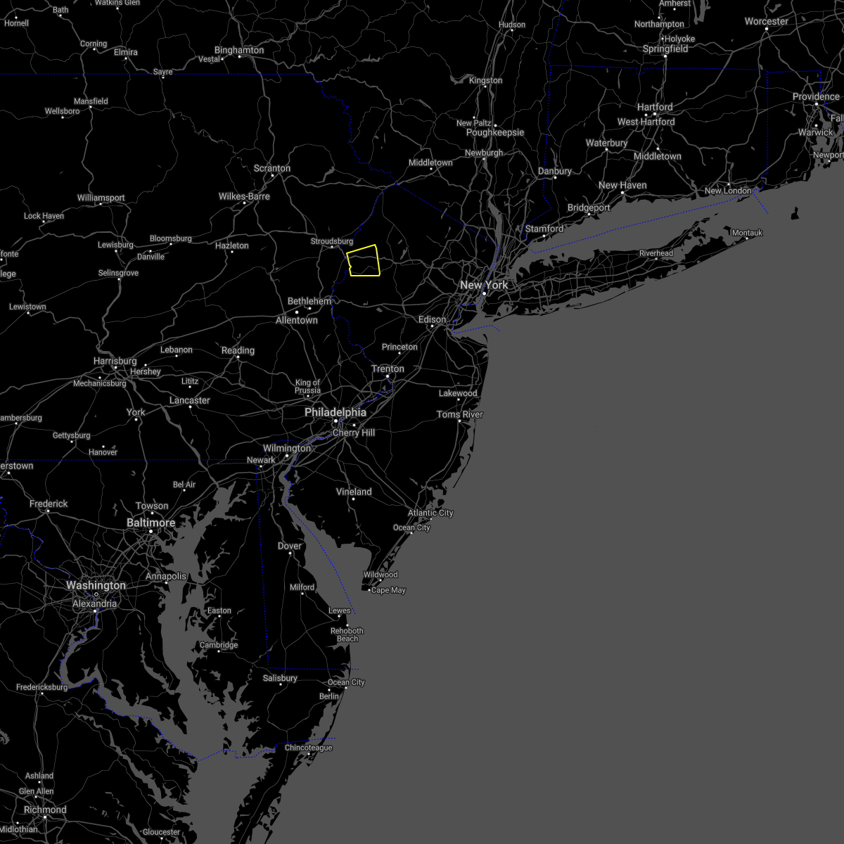 At 249 pm edt, a severe thunderstorm was located over great meadows-vienna, or 14 miles southwest of newton, moving east at 10 mph (radar indicated). Hazards include 60 mph wind gusts. Damage to roofs, siding, trees, and power lines is possible. locations impacted include, hackettstown, oxford, hope, great meadows-vienna, beatyestown, allamuchy-panther valley and beattyestown. this includes interstate 80 in new jersey between mile markers 6 and 18. hail threat, radar indicated max hail size, <. 75 in wind threat, radar indicated max wind gust, 60 mph. At 249 pm edt, a severe thunderstorm was located over great meadows-vienna, or 14 miles southwest of newton, moving east at 10 mph (radar indicated). Hazards include 60 mph wind gusts. Damage to roofs, siding, trees, and power lines is possible. locations impacted include, hackettstown, oxford, hope, great meadows-vienna, beatyestown, allamuchy-panther valley and beattyestown. this includes interstate 80 in new jersey between mile markers 6 and 18. hail threat, radar indicated max hail size, <. 75 in wind threat, radar indicated max wind gust, 60 mph.
|
| 8/27/2021 2:38 PM EDT |
 At 238 pm edt, a severe thunderstorm was located over hope, or 15 miles southwest of newton, moving east at 5 mph (radar indicated). Hazards include 60 mph wind gusts. damage to roofs, siding, trees, and power lines is possible At 238 pm edt, a severe thunderstorm was located over hope, or 15 miles southwest of newton, moving east at 5 mph (radar indicated). Hazards include 60 mph wind gusts. damage to roofs, siding, trees, and power lines is possible
|
| 8/12/2021 4:11 PM EDT |
 At 411 pm edt, severe thunderstorms were located along a line extending from near pellettown to lake mohawk to allamuchy-panther valley, moving east at 50 mph (law enforcement. theses storms have a history of producing downed trees and power lines). Hazards include 60 mph wind gusts. damage to roofs, siding, trees, and power lines is possible At 411 pm edt, severe thunderstorms were located along a line extending from near pellettown to lake mohawk to allamuchy-panther valley, moving east at 50 mph (law enforcement. theses storms have a history of producing downed trees and power lines). Hazards include 60 mph wind gusts. damage to roofs, siding, trees, and power lines is possible
|
| 8/11/2021 8:18 PM EDT |
 At 818 pm edt, a severe thunderstorm was located over califon, or 18 miles northwest of somerville, moving northeast at 35 mph (radar indicated). Hazards include 60 mph wind gusts and penny size hail. Damage to roofs, siding, trees, and power lines is possible. locations impacted include, dover, hopatcong, hackettstown, wharton, washington, rockaway, morris plains, mount arlington, mendham, high bridge, stanhope, netcong, oxford, glen gardner, chester, victory gardens, hampton, califon, andover and brass castle. this includes the following highways, interstate 80 in new jersey between mile markers 19 and 36, and between mile markers 41 and 42. interstate 287 in new jersey near mile marker 41. hail threat, radar indicated max hail size, 0. 75 in wind threat, radar indicated max wind gust, 60 mph. At 818 pm edt, a severe thunderstorm was located over califon, or 18 miles northwest of somerville, moving northeast at 35 mph (radar indicated). Hazards include 60 mph wind gusts and penny size hail. Damage to roofs, siding, trees, and power lines is possible. locations impacted include, dover, hopatcong, hackettstown, wharton, washington, rockaway, morris plains, mount arlington, mendham, high bridge, stanhope, netcong, oxford, glen gardner, chester, victory gardens, hampton, califon, andover and brass castle. this includes the following highways, interstate 80 in new jersey between mile markers 19 and 36, and between mile markers 41 and 42. interstate 287 in new jersey near mile marker 41. hail threat, radar indicated max hail size, 0. 75 in wind threat, radar indicated max wind gust, 60 mph.
|
| 8/11/2021 8:10 PM EDT |
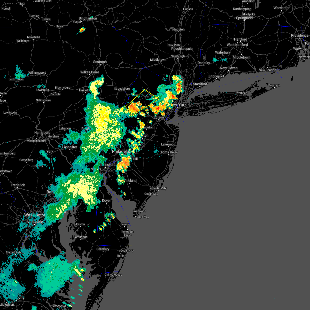 At 810 pm edt, a severe thunderstorm was located over glen gardner, or 15 miles east of easton, moving northeast at 35 mph (radar indicated). Hazards include 60 mph wind gusts and penny size hail. damage to roofs, siding, trees, and power lines is possible At 810 pm edt, a severe thunderstorm was located over glen gardner, or 15 miles east of easton, moving northeast at 35 mph (radar indicated). Hazards include 60 mph wind gusts and penny size hail. damage to roofs, siding, trees, and power lines is possible
|
| 8/11/2021 7:33 PM EDT |
 At 733 pm edt, a severe thunderstorm was located over dover, or 7 miles northwest of morristown, moving east at 20 mph (radar indicated). Hazards include 60 mph wind gusts and penny size hail. Damage to roofs, siding, trees, and power lines is possible. locations impacted include, morristown, dover, madison, florham park, east hanover, lincoln park, hackettstown, boonton, wharton, rockaway, morris plains, mount arlington, mendham, mountain lakes, chester, victory gardens, long valley, succasunna, succasunna-kenvil and parsippany. this includes the following highways, interstate 80 in new jersey between mile markers 28 and 48. interstate 287 in new jersey between mile markers 31 and 52. hail threat, radar indicated max hail size, 0. 75 in wind threat, radar indicated max wind gust, 60 mph. At 733 pm edt, a severe thunderstorm was located over dover, or 7 miles northwest of morristown, moving east at 20 mph (radar indicated). Hazards include 60 mph wind gusts and penny size hail. Damage to roofs, siding, trees, and power lines is possible. locations impacted include, morristown, dover, madison, florham park, east hanover, lincoln park, hackettstown, boonton, wharton, rockaway, morris plains, mount arlington, mendham, mountain lakes, chester, victory gardens, long valley, succasunna, succasunna-kenvil and parsippany. this includes the following highways, interstate 80 in new jersey between mile markers 28 and 48. interstate 287 in new jersey between mile markers 31 and 52. hail threat, radar indicated max hail size, 0. 75 in wind threat, radar indicated max wind gust, 60 mph.
|
| 8/11/2021 7:21 PM EDT |
 At 721 pm edt, a severe thunderstorm was located over succasunna-kenvil, or 9 miles northwest of morristown, moving east at 20 mph (radar indicated). Hazards include 60 mph wind gusts and penny size hail. Damage to roofs, siding, trees, and power lines is possible. locations impacted include, morristown, dover, madison, hopatcong, florham park, east hanover, lincoln park, kinnelon, hackettstown, boonton, butler, wharton, rockaway, morris plains, mount arlington, mendham, mountain lakes, stanhope, riverdale and netcong. this includes the following highways, interstate 80 in new jersey between mile markers 17 and 48. interstate 287 in new jersey between mile markers 31 and 54. hail threat, radar indicated max hail size, 0. 75 in wind threat, radar indicated max wind gust, 60 mph. At 721 pm edt, a severe thunderstorm was located over succasunna-kenvil, or 9 miles northwest of morristown, moving east at 20 mph (radar indicated). Hazards include 60 mph wind gusts and penny size hail. Damage to roofs, siding, trees, and power lines is possible. locations impacted include, morristown, dover, madison, hopatcong, florham park, east hanover, lincoln park, kinnelon, hackettstown, boonton, butler, wharton, rockaway, morris plains, mount arlington, mendham, mountain lakes, stanhope, riverdale and netcong. this includes the following highways, interstate 80 in new jersey between mile markers 17 and 48. interstate 287 in new jersey between mile markers 31 and 54. hail threat, radar indicated max hail size, 0. 75 in wind threat, radar indicated max wind gust, 60 mph.
|
| 8/11/2021 7:05 PM EDT | Multiple trees snapped and wires blown down near the intersection of bilby road and willow grove street. time estimated from rada in warren county NJ, 1.1 miles SW of Hackettstown, NJ |
| 8/11/2021 7:04 PM EDT |
 At 704 pm edt, a severe thunderstorm was located over budd lake, or 14 miles south of newton, moving east at 20 mph (radar indicated). Hazards include 60 mph wind gusts and penny size hail. damage to roofs, siding, trees, and power lines is possible At 704 pm edt, a severe thunderstorm was located over budd lake, or 14 miles south of newton, moving east at 20 mph (radar indicated). Hazards include 60 mph wind gusts and penny size hail. damage to roofs, siding, trees, and power lines is possible
|
| 8/11/2021 7:00 PM EDT | Several downed tree and wire calls in and near independence twp. time estimated from rada in warren county NJ, 2.6 miles SE of Hackettstown, NJ |
| 7/29/2021 5:20 PM EDT |
 At 519 pm edt, severe thunderstorms were located along a line extending from columbia to erwinna, moving east at 30 mph (radar indicated). Hazards include 60 mph wind gusts. Damage to roofs, siding, trees, and power lines is possible. locations impacted include, easton, newton, bethlehem, forks, hackettstown, quakertown, wilson, washington, blairstown, bangor, flemington, tinicum, high bridge, stanhope, netcong, clinton, belvidere, harmony, oxford and alpha. this includes the following highways, interstate 78 in pennsylvania between mile markers 69 and 76. interstate 78 in new jersey between mile markers 0 and 29. Interstate 80 in new jersey between mile markers 2 and 27. At 519 pm edt, severe thunderstorms were located along a line extending from columbia to erwinna, moving east at 30 mph (radar indicated). Hazards include 60 mph wind gusts. Damage to roofs, siding, trees, and power lines is possible. locations impacted include, easton, newton, bethlehem, forks, hackettstown, quakertown, wilson, washington, blairstown, bangor, flemington, tinicum, high bridge, stanhope, netcong, clinton, belvidere, harmony, oxford and alpha. this includes the following highways, interstate 78 in pennsylvania between mile markers 69 and 76. interstate 78 in new jersey between mile markers 0 and 29. Interstate 80 in new jersey between mile markers 2 and 27.
|
| 7/29/2021 5:03 PM EDT |
 At 502 pm edt, severe thunderstorms were located along a line extending from near stormville to near pleasant valley, moving east at 30 mph (radar indicated). Hazards include 60 mph wind gusts. damage to roofs, siding, trees, and power lines is possible At 502 pm edt, severe thunderstorms were located along a line extending from near stormville to near pleasant valley, moving east at 30 mph (radar indicated). Hazards include 60 mph wind gusts. damage to roofs, siding, trees, and power lines is possible
|
| 7/17/2021 2:10 PM EDT |
 At 210 pm edt, a severe thunderstorm was located over lebanon, or 13 miles northwest of somerville, moving northeast at 20 mph (radar indicated). Hazards include 60 mph wind gusts and quarter size hail. Minor damage to vehicles is possible. wind damage to roofs, siding, trees, and power lines is possible. locations impacted include, somerville, bridgewater, middlesex, bound brook, manville, hackettstown, washington, flemington, high bridge, clinton, peapack and gladstone, glen gardner, chester, hampton, lebanon, califon, far hills, flagtown, long valley and martinsville. this includes the following highways, interstate 78 in new jersey between mile markers 9 and 40. Interstate 287 in new jersey between mile markers 13 and 28. At 210 pm edt, a severe thunderstorm was located over lebanon, or 13 miles northwest of somerville, moving northeast at 20 mph (radar indicated). Hazards include 60 mph wind gusts and quarter size hail. Minor damage to vehicles is possible. wind damage to roofs, siding, trees, and power lines is possible. locations impacted include, somerville, bridgewater, middlesex, bound brook, manville, hackettstown, washington, flemington, high bridge, clinton, peapack and gladstone, glen gardner, chester, hampton, lebanon, califon, far hills, flagtown, long valley and martinsville. this includes the following highways, interstate 78 in new jersey between mile markers 9 and 40. Interstate 287 in new jersey between mile markers 13 and 28.
|
| 7/17/2021 1:56 PM EDT |
 At 155 pm edt, a severe thunderstorm was located over clinton, or 15 miles west of somerville, moving northeast at 20 mph (trained weather spotters. downed trees and power outages were reported with this cell over eastern pennsylvania). Hazards include 60 mph wind gusts and quarter size hail. Minor damage to vehicles is possible. Wind damage to roofs, siding, trees, and power lines is possible. At 155 pm edt, a severe thunderstorm was located over clinton, or 15 miles west of somerville, moving northeast at 20 mph (trained weather spotters. downed trees and power outages were reported with this cell over eastern pennsylvania). Hazards include 60 mph wind gusts and quarter size hail. Minor damage to vehicles is possible. Wind damage to roofs, siding, trees, and power lines is possible.
|
| 7/8/2021 6:52 PM EDT |
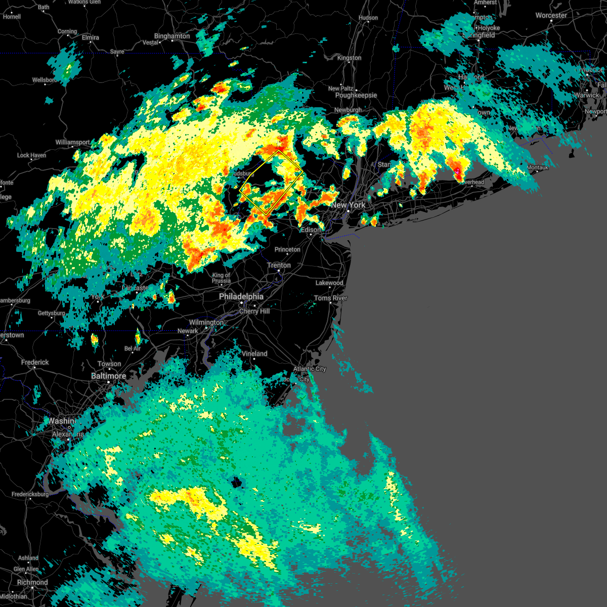 The severe thunderstorm warning for northern hunterdon, northwestern morris, southwestern sussex, warren and northeastern northampton counties will expire at 700 pm edt, the severe thunderstorm which prompted the warning has weakened. therefore, the warning will be allowed to expire. a severe thunderstorm watch remains in effect until 900 pm edt for northern and northwestern new jersey, and eastern pennsylvania. The severe thunderstorm warning for northern hunterdon, northwestern morris, southwestern sussex, warren and northeastern northampton counties will expire at 700 pm edt, the severe thunderstorm which prompted the warning has weakened. therefore, the warning will be allowed to expire. a severe thunderstorm watch remains in effect until 900 pm edt for northern and northwestern new jersey, and eastern pennsylvania.
|
| 7/8/2021 6:40 PM EDT |
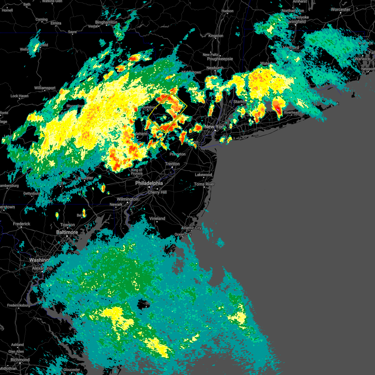 At 637 pm edt, a severe thunderstorm was located over allamuchy-panther valley, or 10 miles southwest of newton, moving northeast at 25 mph (radar indicated). Hazards include 60 mph wind gusts and quarter size hail. Minor damage to vehicles is possible. wind damage to roofs, siding, trees, and power lines is possible. locations impacted include, newton, hopatcong, hackettstown, washington, blairstown, mount arlington, franklin, stanhope, netcong, belvidere, oxford, ogdensburg, hope, glen gardner, hampton, east bangor, branchville, andover, brass castle and lake mohawk. This includes interstate 80 in new jersey between mile markers 2 and 28. At 637 pm edt, a severe thunderstorm was located over allamuchy-panther valley, or 10 miles southwest of newton, moving northeast at 25 mph (radar indicated). Hazards include 60 mph wind gusts and quarter size hail. Minor damage to vehicles is possible. wind damage to roofs, siding, trees, and power lines is possible. locations impacted include, newton, hopatcong, hackettstown, washington, blairstown, mount arlington, franklin, stanhope, netcong, belvidere, oxford, ogdensburg, hope, glen gardner, hampton, east bangor, branchville, andover, brass castle and lake mohawk. This includes interstate 80 in new jersey between mile markers 2 and 28.
|
| 7/8/2021 6:16 PM EDT |
 At 616 pm edt, a severe thunderstorm was located over oxford, or 16 miles northeast of easton, moving northeast at 25 mph (radar indicated). Hazards include 60 mph wind gusts and quarter size hail. Minor damage to vehicles is possible. Wind damage to roofs, siding, trees, and power lines is possible. At 616 pm edt, a severe thunderstorm was located over oxford, or 16 miles northeast of easton, moving northeast at 25 mph (radar indicated). Hazards include 60 mph wind gusts and quarter size hail. Minor damage to vehicles is possible. Wind damage to roofs, siding, trees, and power lines is possible.
|
| 7/8/2021 6:08 PM EDT |
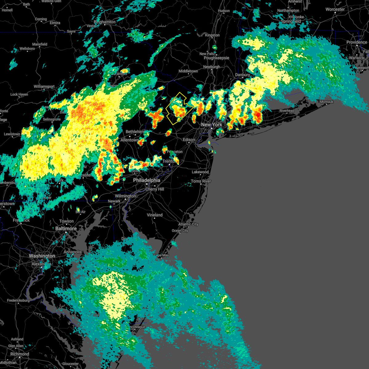 The severe thunderstorm warning for central morris and southeastern sussex counties will expire at 615 pm edt, the storm which prompted the warning has weakened below severe limits, and no longer poses an immediate threat to life or property. therefore, the warning will be allowed to expire. however gusty winds are still possible with this thunderstorm. a severe thunderstorm watch remains in effect until 900 pm edt for northern and northwestern new jersey. The severe thunderstorm warning for central morris and southeastern sussex counties will expire at 615 pm edt, the storm which prompted the warning has weakened below severe limits, and no longer poses an immediate threat to life or property. therefore, the warning will be allowed to expire. however gusty winds are still possible with this thunderstorm. a severe thunderstorm watch remains in effect until 900 pm edt for northern and northwestern new jersey.
|
| 7/8/2021 5:57 PM EDT |
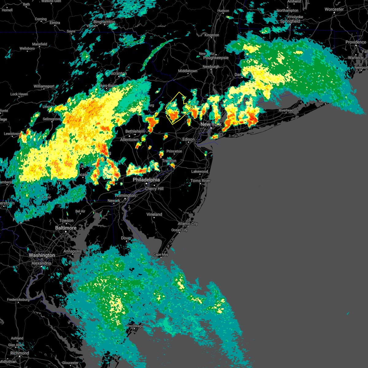 At 556 pm edt, a severe thunderstorm was located over stanhope, or 10 miles southeast of newton, moving northeast at 35 mph (radar indicated). Hazards include 60 mph wind gusts. Damage to roofs, siding, trees, and power lines is possible. locations impacted include, newton, dover, hopatcong, kinnelon, butler, wharton, rockaway, mount arlington, franklin, stanhope, hamburg, netcong, ogdensburg, chester, victory gardens, andover, lake mohawk, succasunna, succasunna-kenvil and greendell. This includes interstate 80 in new jersey between mile markers 23 and 39. At 556 pm edt, a severe thunderstorm was located over stanhope, or 10 miles southeast of newton, moving northeast at 35 mph (radar indicated). Hazards include 60 mph wind gusts. Damage to roofs, siding, trees, and power lines is possible. locations impacted include, newton, dover, hopatcong, kinnelon, butler, wharton, rockaway, mount arlington, franklin, stanhope, hamburg, netcong, ogdensburg, chester, victory gardens, andover, lake mohawk, succasunna, succasunna-kenvil and greendell. This includes interstate 80 in new jersey between mile markers 23 and 39.
|
| 7/8/2021 5:34 PM EDT |
 At 534 pm edt, a severe thunderstorm was located over long valley, or 17 miles northwest of somerville, moving northeast at 35 mph (radar indicated). Hazards include 60 mph wind gusts. damage to roofs, siding, trees, and power lines is possible At 534 pm edt, a severe thunderstorm was located over long valley, or 17 miles northwest of somerville, moving northeast at 35 mph (radar indicated). Hazards include 60 mph wind gusts. damage to roofs, siding, trees, and power lines is possible
|
| 7/8/2021 3:08 PM EDT |
 The severe thunderstorm warning for hunterdon, southwestern morris, central warren and northwestern somerset counties will expire at 315 pm edt, the storm which prompted the warning has moved out of the area. therefore, the warning will be allowed to expire. a severe thunderstorm watch remains in effect until 900 pm edt for northern and northwestern new jersey, and eastern and southeastern pennsylvania. to report severe weather, contact your nearest law enforcement agency. they will relay your report to the national weather service mount holly nj. The severe thunderstorm warning for hunterdon, southwestern morris, central warren and northwestern somerset counties will expire at 315 pm edt, the storm which prompted the warning has moved out of the area. therefore, the warning will be allowed to expire. a severe thunderstorm watch remains in effect until 900 pm edt for northern and northwestern new jersey, and eastern and southeastern pennsylvania. to report severe weather, contact your nearest law enforcement agency. they will relay your report to the national weather service mount holly nj.
|
| 7/8/2021 2:29 PM EDT |
 At 229 pm edt, a severe thunderstorm was located near bloomsbury, or 11 miles east of easton, moving northeast at 25 mph (radar indicated). Hazards include 60 mph wind gusts and quarter size hail. Minor damage to vehicles is possible. Wind damage to roofs, siding, trees, and power lines is possible. At 229 pm edt, a severe thunderstorm was located near bloomsbury, or 11 miles east of easton, moving northeast at 25 mph (radar indicated). Hazards include 60 mph wind gusts and quarter size hail. Minor damage to vehicles is possible. Wind damage to roofs, siding, trees, and power lines is possible.
|
| 7/6/2021 6:20 PM EDT |
 At 619 pm edt, severe thunderstorms were located along a line extending from fairfield to millington to near califon, moving southeast at 40 mph (public). Hazards include 70 mph wind gusts and quarter size hail. Minor damage to vehicles is possible. expect considerable tree damage. wind damage is also likely to mobile homes, roofs, and outbuildings. locations impacted include, morristown, madison, florham park, east hanover, lincoln park, bound brook, hackettstown, chatham, boonton, rockaway, morris plains, mendham, mountain lakes, riverdale, peapack and gladstone, oxford, chester, victory gardens, califon and far hills. this includes the following highways, interstate 78 in new jersey between mile markers 26 and 42. interstate 80 in new jersey between mile markers 39 and 47. Interstate 287 in new jersey between mile markers 19 and 53. At 619 pm edt, severe thunderstorms were located along a line extending from fairfield to millington to near califon, moving southeast at 40 mph (public). Hazards include 70 mph wind gusts and quarter size hail. Minor damage to vehicles is possible. expect considerable tree damage. wind damage is also likely to mobile homes, roofs, and outbuildings. locations impacted include, morristown, madison, florham park, east hanover, lincoln park, bound brook, hackettstown, chatham, boonton, rockaway, morris plains, mendham, mountain lakes, riverdale, peapack and gladstone, oxford, chester, victory gardens, califon and far hills. this includes the following highways, interstate 78 in new jersey between mile markers 26 and 42. interstate 80 in new jersey between mile markers 39 and 47. Interstate 287 in new jersey between mile markers 19 and 53.
|
| 7/6/2021 6:04 PM EDT |
 At 603 pm edt, severe thunderstorms were located along a line extending from bloomingdale to near morristown to near belfast, moving east at 45 mph (radar indicated). Hazards include 70 mph wind gusts and quarter size hail. Minor damage to vehicles is possible. expect considerable tree damage. wind damage is also likely to mobile homes, roofs, and outbuildings. locations impacted include, easton, dover, hopatcong, forks, kinnelon, hackettstown, boonton, wilson, butler, wharton, washington, rockaway, nazareth, bangor, mount arlington, mountain lakes, stanhope, pen argyl, netcong and wind gap. This includes interstate 80 in new jersey between mile markers 11 and 42. At 603 pm edt, severe thunderstorms were located along a line extending from bloomingdale to near morristown to near belfast, moving east at 45 mph (radar indicated). Hazards include 70 mph wind gusts and quarter size hail. Minor damage to vehicles is possible. expect considerable tree damage. wind damage is also likely to mobile homes, roofs, and outbuildings. locations impacted include, easton, dover, hopatcong, forks, kinnelon, hackettstown, boonton, wilson, butler, wharton, washington, rockaway, nazareth, bangor, mount arlington, mountain lakes, stanhope, pen argyl, netcong and wind gap. This includes interstate 80 in new jersey between mile markers 11 and 42.
|
| 7/6/2021 6:02 PM EDT |
 At 601 pm edt, severe thunderstorms were located along a line extending from upper greenwood lake to kinnelon to near morristown to long valley, moving east at 45 mph. this line of storms has a history of producing wind damage in east stroudsburg, pennsylvania (public). Hazards include 70 mph wind gusts and quarter size hail. Minor damage to vehicles is possible. expect considerable tree damage. wind damage is also likely to mobile homes, roofs, and outbuildings. locations impacted include, morristown, dover, madison, hopatcong, florham park, east hanover, lincoln park, bound brook, kinnelon, hackettstown, chatham, boonton, butler, wharton, rockaway, morris plains, mount arlington, mendham, mountain lakes and stanhope. this includes the following highways, interstate 78 in new jersey between mile markers 26 and 42. interstate 80 in new jersey between mile markers 11 and 47. Interstate 287 in new jersey between mile markers 19 and 54. At 601 pm edt, severe thunderstorms were located along a line extending from upper greenwood lake to kinnelon to near morristown to long valley, moving east at 45 mph. this line of storms has a history of producing wind damage in east stroudsburg, pennsylvania (public). Hazards include 70 mph wind gusts and quarter size hail. Minor damage to vehicles is possible. expect considerable tree damage. wind damage is also likely to mobile homes, roofs, and outbuildings. locations impacted include, morristown, dover, madison, hopatcong, florham park, east hanover, lincoln park, bound brook, kinnelon, hackettstown, chatham, boonton, butler, wharton, rockaway, morris plains, mount arlington, mendham, mountain lakes and stanhope. this includes the following highways, interstate 78 in new jersey between mile markers 26 and 42. interstate 80 in new jersey between mile markers 11 and 47. Interstate 287 in new jersey between mile markers 19 and 54.
|
| 7/6/2021 5:50 PM EDT |
 At 550 pm edt, severe thunderstorms were located along a line extending from near highland lake to budd lake to near kunkletown, moving east at 45 mph (radar indicated). Hazards include 70 mph wind gusts and quarter size hail. Minor damage to vehicles is possible. expect considerable tree damage. wind damage is also likely to mobile homes, roofs, and outbuildings. locations impacted include, easton, newton, dover, hopatcong, forks, kinnelon, east stroudsburg, hackettstown, boonton, wilson, butler, wharton, washington, rockaway, blairstown, nazareth, bangor, mount arlington, franklin and jim thorpe. this includes the following highways, northeast extension between mile markers 79 and 86. interstate 80 in pennsylvania between mile markers 305 and 314. Interstate 80 in new jersey between mile markers 0 and 42. At 550 pm edt, severe thunderstorms were located along a line extending from near highland lake to budd lake to near kunkletown, moving east at 45 mph (radar indicated). Hazards include 70 mph wind gusts and quarter size hail. Minor damage to vehicles is possible. expect considerable tree damage. wind damage is also likely to mobile homes, roofs, and outbuildings. locations impacted include, easton, newton, dover, hopatcong, forks, kinnelon, east stroudsburg, hackettstown, boonton, wilson, butler, wharton, washington, rockaway, blairstown, nazareth, bangor, mount arlington, franklin and jim thorpe. this includes the following highways, northeast extension between mile markers 79 and 86. interstate 80 in pennsylvania between mile markers 305 and 314. Interstate 80 in new jersey between mile markers 0 and 42.
|
| 7/6/2021 5:46 PM EDT |
 At 546 pm edt, severe thunderstorms were located along a line extending from near sussex to near lake telemark to budd lake to near hope, moving east at 45 mph (radar indicated). Hazards include 70 mph wind gusts and quarter size hail. Minor damage to vehicles is possible. expect considerable tree damage. Wind damage is also likely to mobile homes, roofs, and outbuildings. At 546 pm edt, severe thunderstorms were located along a line extending from near sussex to near lake telemark to budd lake to near hope, moving east at 45 mph (radar indicated). Hazards include 70 mph wind gusts and quarter size hail. Minor damage to vehicles is possible. expect considerable tree damage. Wind damage is also likely to mobile homes, roofs, and outbuildings.
|
| 7/6/2021 5:15 PM EDT |
 At 515 pm edt, severe thunderstorms were located along a line extending from near dingmans ferry to east stroudsburg to sun valley, moving east at 40 mph (radar indicated). Hazards include 70 mph wind gusts and quarter size hail. Minor damage to vehicles is possible. expect considerable tree damage. Wind damage is also likely to mobile homes, roofs, and outbuildings. At 515 pm edt, severe thunderstorms were located along a line extending from near dingmans ferry to east stroudsburg to sun valley, moving east at 40 mph (radar indicated). Hazards include 70 mph wind gusts and quarter size hail. Minor damage to vehicles is possible. expect considerable tree damage. Wind damage is also likely to mobile homes, roofs, and outbuildings.
|
| 7/2/2021 7:25 PM EDT | Tree down on wires with fire showing near the army national guard facility on willow grove st. time estimated from rada in warren county NJ, 0.6 miles WSW of Hackettstown, NJ |
| 7/2/2021 7:25 PM EDT |
 At 724 pm edt, a severe thunderstorm was located over allamuchy-panther valley, or 9 miles south of newton, moving east at 35 mph (radar indicated.in addition, there have been multiple reports of downed trees over southern monroe county from around bartonsville to stroudsburg). Hazards include 60 mph wind gusts and quarter size hail. Minor damage to vehicles is possible. Wind damage to roofs, siding, trees, and power lines is possible. At 724 pm edt, a severe thunderstorm was located over allamuchy-panther valley, or 9 miles south of newton, moving east at 35 mph (radar indicated.in addition, there have been multiple reports of downed trees over southern monroe county from around bartonsville to stroudsburg). Hazards include 60 mph wind gusts and quarter size hail. Minor damage to vehicles is possible. Wind damage to roofs, siding, trees, and power lines is possible.
|
| 7/2/2021 7:22 PM EDT | Tree or limbs down into wires on waterloo rd. time estimated from rada in warren county NJ, 1.7 miles SSW of Hackettstown, NJ |
| 7/2/2021 7:17 PM EDT |
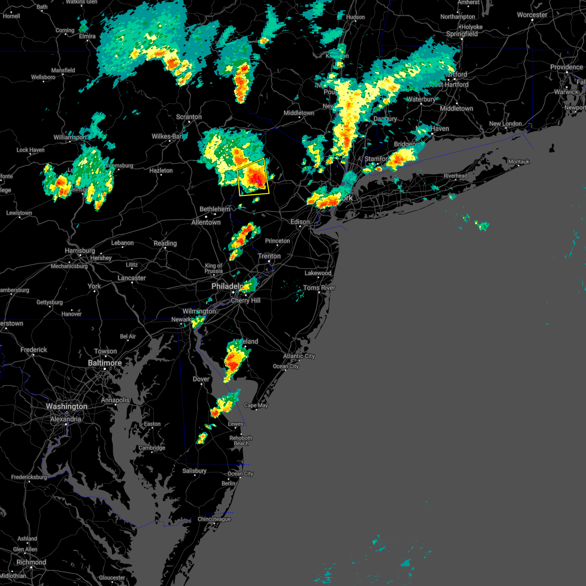 At 712 pm edt, a severe thunderstorm was located over hope, or 15 miles southwest of newton, moving east at 20 mph (radar indicated. in addition, there have been multiple reports of downed trees over southern monroe county from around bartonsville to stroudsburg). Hazards include 60 mph wind gusts and penny size hail. Damage to roofs, siding, trees, and power lines is possible. locations impacted include, hackettstown, blairstown, belvidere, oxford, hope, great meadows-vienna, allamuchy-panther valley, greendell, five points, columbia, beatyestown, long valley, portland and beattyestown. This includes interstate 80 in new jersey between mile markers 3 and 21. At 712 pm edt, a severe thunderstorm was located over hope, or 15 miles southwest of newton, moving east at 20 mph (radar indicated. in addition, there have been multiple reports of downed trees over southern monroe county from around bartonsville to stroudsburg). Hazards include 60 mph wind gusts and penny size hail. Damage to roofs, siding, trees, and power lines is possible. locations impacted include, hackettstown, blairstown, belvidere, oxford, hope, great meadows-vienna, allamuchy-panther valley, greendell, five points, columbia, beatyestown, long valley, portland and beattyestown. This includes interstate 80 in new jersey between mile markers 3 and 21.
|
| 7/2/2021 7:17 PM EDT |
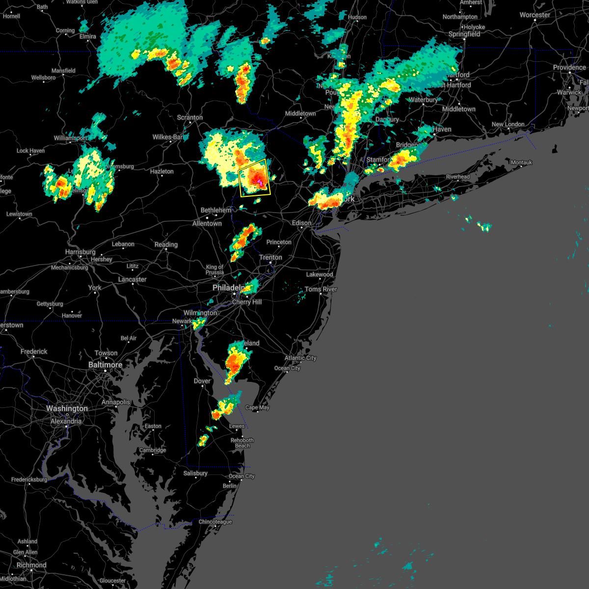 At 712 pm edt, a severe thunderstorm was located over hope, or 15 miles southwest of newton, moving east at 20 mph (radar indicated. in addition, there have been multiple reports of downed trees over southern monroe county from around bartonsville to stroudsburg). Hazards include 60 mph wind gusts and penny size hail. Damage to roofs, siding, trees, and power lines is possible. locations impacted include, hackettstown, blairstown, belvidere, oxford, hope, great meadows-vienna, allamuchy-panther valley, greendell, five points, columbia, beatyestown, long valley, portland and beattyestown. This includes interstate 80 in new jersey between mile markers 3 and 21. At 712 pm edt, a severe thunderstorm was located over hope, or 15 miles southwest of newton, moving east at 20 mph (radar indicated. in addition, there have been multiple reports of downed trees over southern monroe county from around bartonsville to stroudsburg). Hazards include 60 mph wind gusts and penny size hail. Damage to roofs, siding, trees, and power lines is possible. locations impacted include, hackettstown, blairstown, belvidere, oxford, hope, great meadows-vienna, allamuchy-panther valley, greendell, five points, columbia, beatyestown, long valley, portland and beattyestown. This includes interstate 80 in new jersey between mile markers 3 and 21.
|
| 7/2/2021 6:53 PM EDT |
 At 653 pm edt, a severe thunderstorm was located over east bangor, or 14 miles north of easton, moving east at 15 mph (radar indicated). Hazards include 60 mph wind gusts and penny size hail. damage to roofs, siding, trees, and power lines is possible At 653 pm edt, a severe thunderstorm was located over east bangor, or 14 miles north of easton, moving east at 15 mph (radar indicated). Hazards include 60 mph wind gusts and penny size hail. damage to roofs, siding, trees, and power lines is possible
|
| 6/21/2021 8:55 PM EDT |
 At 854 pm edt, severe thunderstorms were located along a line extending from near high point to budd lake, moving northeast at 40 mph (law enforcement. this line has a history of wind damage in northampton and warren counties). Hazards include 60 mph wind gusts. Damage to roofs, siding, trees, and power lines is possible. locations impacted include, newton, montague, hopatcong, hackettstown, mount arlington, franklin, stanhope, hamburg, netcong, ogdensburg, sussex, branchville, andover, high point, lake mohawk, greendell, vernon valley, green pond, pellettown and allamuchy-panther valley. This includes interstate 80 in new jersey between mile markers 18 and 31. At 854 pm edt, severe thunderstorms were located along a line extending from near high point to budd lake, moving northeast at 40 mph (law enforcement. this line has a history of wind damage in northampton and warren counties). Hazards include 60 mph wind gusts. Damage to roofs, siding, trees, and power lines is possible. locations impacted include, newton, montague, hopatcong, hackettstown, mount arlington, franklin, stanhope, hamburg, netcong, ogdensburg, sussex, branchville, andover, high point, lake mohawk, greendell, vernon valley, green pond, pellettown and allamuchy-panther valley. This includes interstate 80 in new jersey between mile markers 18 and 31.
|
| 6/21/2021 8:42 PM EDT |
 At 842 pm edt, severe thunderstorms were located along a line extending from near hainesville to near oxford, moving northeast at 35 mph (law enforcement. several reports of wind damage have been received from northampton county). Hazards include 60 mph wind gusts. Damage to roofs, siding, trees, and power lines is possible. locations impacted include, newton, montague, hopatcong, hackettstown, washington, blairstown, mount arlington, franklin, stanhope, hamburg, netcong, oxford, ogdensburg, sussex, hope, branchville, andover, high point, lake mohawk and greendell. This includes interstate 80 in new jersey between mile markers 0 and 30. At 842 pm edt, severe thunderstorms were located along a line extending from near hainesville to near oxford, moving northeast at 35 mph (law enforcement. several reports of wind damage have been received from northampton county). Hazards include 60 mph wind gusts. Damage to roofs, siding, trees, and power lines is possible. locations impacted include, newton, montague, hopatcong, hackettstown, washington, blairstown, mount arlington, franklin, stanhope, hamburg, netcong, oxford, ogdensburg, sussex, hope, branchville, andover, high point, lake mohawk and greendell. This includes interstate 80 in new jersey between mile markers 0 and 30.
|
| 6/21/2021 8:30 PM EDT |
 At 830 pm edt, severe thunderstorms were located along a line extending from near lackawaxen to roxburg, moving northeast at 35 mph (law enforcement). Hazards include 60 mph wind gusts. Damage to roofs, siding, trees, and power lines is possible. locations impacted include, easton, newton, montague, hopatcong, east stroudsburg, hackettstown, washington, blairstown, mount arlington, franklin, stanhope, hamburg, netcong, belvidere, harmony, oxford, ogdensburg, alpha, sussex and hope. this includes the following highways, interstate 78 in new jersey between mile markers 0 and 4. interstate 80 in pennsylvania between mile markers 313 and 314. Interstate 80 in new jersey between mile markers 0 and 30. At 830 pm edt, severe thunderstorms were located along a line extending from near lackawaxen to roxburg, moving northeast at 35 mph (law enforcement). Hazards include 60 mph wind gusts. Damage to roofs, siding, trees, and power lines is possible. locations impacted include, easton, newton, montague, hopatcong, east stroudsburg, hackettstown, washington, blairstown, mount arlington, franklin, stanhope, hamburg, netcong, belvidere, harmony, oxford, ogdensburg, alpha, sussex and hope. this includes the following highways, interstate 78 in new jersey between mile markers 0 and 4. interstate 80 in pennsylvania between mile markers 313 and 314. Interstate 80 in new jersey between mile markers 0 and 30.
|
| 6/21/2021 8:13 PM EDT |
 At 812 pm edt, severe thunderstorms were located along a line extending from paupack to near bangor, moving northeast at 45 mph (law enforcement). Hazards include 60 mph wind gusts. damage to roofs, siding, trees, and power lines is possible At 812 pm edt, severe thunderstorms were located along a line extending from paupack to near bangor, moving northeast at 45 mph (law enforcement). Hazards include 60 mph wind gusts. damage to roofs, siding, trees, and power lines is possible
|
| 6/4/2021 2:55 PM EDT |
 At 254 pm edt, severe thunderstorms were located along a line extending from near green pond to high bridge, moving southeast at 30 mph (radar indicated). Hazards include 60 mph wind gusts and nickel size hail. Damage to roofs, siding, trees, and power lines is possible. locations impacted include, morristown, bridgewater, dover, madison, hopatcong, middlesex, florham park, east hanover, lincoln park, bound brook, kinnelon, hackettstown, chatham, boonton, butler, wharton, rockaway, morris plains, mount arlington and franklin. people at the morris county mega site should seek safe shelter immediately! this includes the following highways, interstate 78 in new jersey between mile markers 9 and 42. interstate 80 in new jersey between mile markers 22 and 49. Interstate 287 in new jersey between mile markers 17 and 54. At 254 pm edt, severe thunderstorms were located along a line extending from near green pond to high bridge, moving southeast at 30 mph (radar indicated). Hazards include 60 mph wind gusts and nickel size hail. Damage to roofs, siding, trees, and power lines is possible. locations impacted include, morristown, bridgewater, dover, madison, hopatcong, middlesex, florham park, east hanover, lincoln park, bound brook, kinnelon, hackettstown, chatham, boonton, butler, wharton, rockaway, morris plains, mount arlington and franklin. people at the morris county mega site should seek safe shelter immediately! this includes the following highways, interstate 78 in new jersey between mile markers 9 and 42. interstate 80 in new jersey between mile markers 22 and 49. Interstate 287 in new jersey between mile markers 17 and 54.
|
| 6/4/2021 2:43 PM EDT |
 At 243 pm edt, severe thunderstorms were located along a line extending from ogdensburg to near pleasant valley, moving southeast at 30 mph (radar indicated). Hazards include 60 mph wind gusts and nickel size hail. damage to roofs, siding, trees, and power lines is possible At 243 pm edt, severe thunderstorms were located along a line extending from ogdensburg to near pleasant valley, moving southeast at 30 mph (radar indicated). Hazards include 60 mph wind gusts and nickel size hail. damage to roofs, siding, trees, and power lines is possible
|
| 6/4/2021 2:22 PM EDT |
 The severe thunderstorm warning for southwestern sussex, warren, southeastern monroe and northeastern northampton counties will expire at 230 pm edt, the storm which prompted the warning has weakened below severe limits, and has exited the warned area. therefore, the warning will be allowed to expire. however gusty winds and heavy rain are still possible with this thunderstorm. The severe thunderstorm warning for southwestern sussex, warren, southeastern monroe and northeastern northampton counties will expire at 230 pm edt, the storm which prompted the warning has weakened below severe limits, and has exited the warned area. therefore, the warning will be allowed to expire. however gusty winds and heavy rain are still possible with this thunderstorm.
|
| 6/4/2021 2:08 PM EDT |
 At 207 pm edt, a severe thunderstorm was located over hope, or 15 miles southwest of newton, moving east at 40 mph (radar indicated). Hazards include 60 mph wind gusts and penny size hail. Damage to roofs, siding, trees, and power lines is possible. locations impacted include, hackettstown, blairstown, bangor, pen argyl, belvidere, oxford, hope, east bangor, andover, great meadows-vienna, allamuchy-panther valley, greendell, millbrook, delaware water gap, columbia, beatyestown, roseto, portland, beattyestown and hidden lake. This includes interstate 80 in new jersey between mile markers 0 and 24. At 207 pm edt, a severe thunderstorm was located over hope, or 15 miles southwest of newton, moving east at 40 mph (radar indicated). Hazards include 60 mph wind gusts and penny size hail. Damage to roofs, siding, trees, and power lines is possible. locations impacted include, hackettstown, blairstown, bangor, pen argyl, belvidere, oxford, hope, east bangor, andover, great meadows-vienna, allamuchy-panther valley, greendell, millbrook, delaware water gap, columbia, beatyestown, roseto, portland, beattyestown and hidden lake. This includes interstate 80 in new jersey between mile markers 0 and 24.
|
| 6/4/2021 1:49 PM EDT |
 At 148 pm edt, a severe thunderstorm was located over stormville, or 15 miles north of easton, moving east at 40 mph (radar indicated). Hazards include 60 mph wind gusts and penny size hail. damage to roofs, siding, trees, and power lines is possible At 148 pm edt, a severe thunderstorm was located over stormville, or 15 miles north of easton, moving east at 40 mph (radar indicated). Hazards include 60 mph wind gusts and penny size hail. damage to roofs, siding, trees, and power lines is possible
|
| 5/26/2021 6:03 PM EDT |
 At 601 pm edt, severe thunderstorms were located along a line extending from near hackettstown to near annandale, moving east at 30 mph (radar indicated). Hazards include 60 mph wind gusts and penny size hail. Damage to roofs, siding, trees, and power lines is possible. locations impacted include, hackettstown, mount arlington, high bridge, stanhope, netcong, clinton, chester, lebanon, califon, succasunna, succasunna-kenvil, long valley, budd lake, annandale, white house station, beatyestown, allamuchy-panther valley and beattyestown. this includes the following highways, interstate 78 in new jersey between mile markers 16 and 26. Interstate 80 in new jersey between mile markers 25 and 31. At 601 pm edt, severe thunderstorms were located along a line extending from near hackettstown to near annandale, moving east at 30 mph (radar indicated). Hazards include 60 mph wind gusts and penny size hail. Damage to roofs, siding, trees, and power lines is possible. locations impacted include, hackettstown, mount arlington, high bridge, stanhope, netcong, clinton, chester, lebanon, califon, succasunna, succasunna-kenvil, long valley, budd lake, annandale, white house station, beatyestown, allamuchy-panther valley and beattyestown. this includes the following highways, interstate 78 in new jersey between mile markers 16 and 26. Interstate 80 in new jersey between mile markers 25 and 31.
|
| 5/26/2021 5:34 PM EDT |
 At 534 pm edt, severe thunderstorms were located along a line extending from near belvidere to near milford, moving east at 30 mph (radar indicated). Hazards include 60 mph wind gusts and penny size hail. damage to roofs, siding, trees, and power lines is possible At 534 pm edt, severe thunderstorms were located along a line extending from near belvidere to near milford, moving east at 30 mph (radar indicated). Hazards include 60 mph wind gusts and penny size hail. damage to roofs, siding, trees, and power lines is possible
|
| 11/15/2020 7:20 PM EST |
 At 718 pm est, intense showers and embedded severe thunderstorms were located along a line extending from near dingmans ferry to harmony to near ottsville to near pottstown, moving east at 60 mph. this line may contain little or no lightning. do not wait until you hear thunder before taking cover (radar indicated). Hazards include 60 mph wind gusts. Damage to roofs, siding, trees, and power lines is possible. locations impacted include, easton, newton, montague, bethlehem, pottstown, dover, phoenixville, lansdale, west norriton, hopatcong, forks, east norriton, east stroudsburg, hackettstown, quakertown, perkasie, doylestown, byram, wilson and hatboro. this includes the following highways, pennsylvania turnpike between mile markers 342 and 347. northeast extension between mile markers 23 and 48. interstate 78 in pennsylvania between mile markers 62 and 76. interstate 78 in new jersey between mile markers 0 and 25. interstate 80 in pennsylvania between mile markers 309 and 314. Interstate 80 in new jersey between mile markers 0 and 38. At 718 pm est, intense showers and embedded severe thunderstorms were located along a line extending from near dingmans ferry to harmony to near ottsville to near pottstown, moving east at 60 mph. this line may contain little or no lightning. do not wait until you hear thunder before taking cover (radar indicated). Hazards include 60 mph wind gusts. Damage to roofs, siding, trees, and power lines is possible. locations impacted include, easton, newton, montague, bethlehem, pottstown, dover, phoenixville, lansdale, west norriton, hopatcong, forks, east norriton, east stroudsburg, hackettstown, quakertown, perkasie, doylestown, byram, wilson and hatboro. this includes the following highways, pennsylvania turnpike between mile markers 342 and 347. northeast extension between mile markers 23 and 48. interstate 78 in pennsylvania between mile markers 62 and 76. interstate 78 in new jersey between mile markers 0 and 25. interstate 80 in pennsylvania between mile markers 309 and 314. Interstate 80 in new jersey between mile markers 0 and 38.
|
| 11/15/2020 6:44 PM EST |
 At 643 pm est, intense showers and some embedded severe thunderstorms were located along a line extending from near sterling to near jordan valley to near fleetwood to near terre hill, moving northeast at 70 mph. this line may contain little or no lightning. do not wait until you hear thunder before taking cover (radar indicated). Hazards include 60 mph wind gusts. damage to roofs, siding, trees, and power lines is possible At 643 pm est, intense showers and some embedded severe thunderstorms were located along a line extending from near sterling to near jordan valley to near fleetwood to near terre hill, moving northeast at 70 mph. this line may contain little or no lightning. do not wait until you hear thunder before taking cover (radar indicated). Hazards include 60 mph wind gusts. damage to roofs, siding, trees, and power lines is possible
|
| 8/25/2020 5:57 PM EDT |
 At 557 pm edt, a severe thunderstorm was located over reeders, or near mount pocono, moving southeast at 35 mph (radar indicated). Hazards include 60 mph wind gusts. damage to roofs, siding, trees, and power lines is possible At 557 pm edt, a severe thunderstorm was located over reeders, or near mount pocono, moving southeast at 35 mph (radar indicated). Hazards include 60 mph wind gusts. damage to roofs, siding, trees, and power lines is possible
|
| 8/25/2020 5:57 PM EDT |
 The national weather service in mount holly nj has issued a * severe thunderstorm warning for. warren county in northwestern new jersey. central monroe county in northeastern pennsylvania. northeastern northampton county in eastern pennsylvania. Until 645 pm edt. The national weather service in mount holly nj has issued a * severe thunderstorm warning for. warren county in northwestern new jersey. central monroe county in northeastern pennsylvania. northeastern northampton county in eastern pennsylvania. Until 645 pm edt.
|
| 8/18/2020 2:09 AM EDT |
 At 155 am edt, severe thunderstorms were located along a line extending from near west milford to near victory gardens to near clinton, moving east at 40 mph (radar indicated). Hazards include 60 mph wind gusts. Damage to roofs, siding, trees, and power lines is possible. locations impacted include, morristown, somerville, newton, bridgewater, dover, madison, hopatcong, middlesex, florham park, east hanover, lincoln park, bound brook, manville, kinnelon, hackettstown, chatham, boonton, butler, wharton and rockaway. this includes the following highways, interstate 78 in new jersey between mile markers 12 and 42. interstate 80 in new jersey between mile markers 18 and 48. Interstate 287 in new jersey between mile markers 8 and 54. At 155 am edt, severe thunderstorms were located along a line extending from near west milford to near victory gardens to near clinton, moving east at 40 mph (radar indicated). Hazards include 60 mph wind gusts. Damage to roofs, siding, trees, and power lines is possible. locations impacted include, morristown, somerville, newton, bridgewater, dover, madison, hopatcong, middlesex, florham park, east hanover, lincoln park, bound brook, manville, kinnelon, hackettstown, chatham, boonton, butler, wharton and rockaway. this includes the following highways, interstate 78 in new jersey between mile markers 12 and 42. interstate 80 in new jersey between mile markers 18 and 48. Interstate 287 in new jersey between mile markers 8 and 54.
|
| 8/18/2020 1:57 AM EDT |
 At 155 am edt, severe thunderstorms were located along a line extending from near west milford to near victory gardens to near clinton, moving east at 40 mph (radar indicated). Hazards include 60 mph wind gusts. Damage to roofs, siding, trees, and power lines is possible. locations impacted include, morristown, somerville, newton, bridgewater, dover, madison, hopatcong, middlesex, florham park, east hanover, lincoln park, bound brook, manville, kinnelon, hackettstown, chatham, boonton, butler, wharton and rockaway. this includes the following highways, interstate 78 in new jersey between mile markers 12 and 42. interstate 80 in new jersey between mile markers 18 and 48. Interstate 287 in new jersey between mile markers 8 and 54. At 155 am edt, severe thunderstorms were located along a line extending from near west milford to near victory gardens to near clinton, moving east at 40 mph (radar indicated). Hazards include 60 mph wind gusts. Damage to roofs, siding, trees, and power lines is possible. locations impacted include, morristown, somerville, newton, bridgewater, dover, madison, hopatcong, middlesex, florham park, east hanover, lincoln park, bound brook, manville, kinnelon, hackettstown, chatham, boonton, butler, wharton and rockaway. this includes the following highways, interstate 78 in new jersey between mile markers 12 and 42. interstate 80 in new jersey between mile markers 18 and 48. Interstate 287 in new jersey between mile markers 8 and 54.
|
| 8/18/2020 1:38 AM EDT |
 At 137 am edt, severe thunderstorms were located along a line extending from branchville to beatyestown to ferndale, moving east at 30 mph (radar indicated). Hazards include 60 mph wind gusts. damage to roofs, siding, trees, and power lines is possible At 137 am edt, severe thunderstorms were located along a line extending from branchville to beatyestown to ferndale, moving east at 30 mph (radar indicated). Hazards include 60 mph wind gusts. damage to roofs, siding, trees, and power lines is possible
|
| 8/18/2020 1:35 AM EDT |
 At 135 am edt, severe thunderstorms were located along a line extending from near lake mohawk to hackettstown to pleasant valley, moving east at 30 mph (radar indicated). Hazards include 60 mph wind gusts and penny size hail. Damage to roofs, siding, trees, and power lines is possible. locations impacted include, newton, hopatcong, hackettstown, washington, mount arlington, franklin, high bridge, stanhope, hamburg, netcong, clinton, belvidere, harmony, oxford, ogdensburg, hope, glen gardner, hampton, lebanon and califon. this includes the following highways, interstate 78 in new jersey between mile markers 15 and 22. Interstate 80 in new jersey between mile markers 11 and 30. At 135 am edt, severe thunderstorms were located along a line extending from near lake mohawk to hackettstown to pleasant valley, moving east at 30 mph (radar indicated). Hazards include 60 mph wind gusts and penny size hail. Damage to roofs, siding, trees, and power lines is possible. locations impacted include, newton, hopatcong, hackettstown, washington, mount arlington, franklin, high bridge, stanhope, hamburg, netcong, clinton, belvidere, harmony, oxford, ogdensburg, hope, glen gardner, hampton, lebanon and califon. this includes the following highways, interstate 78 in new jersey between mile markers 15 and 22. Interstate 80 in new jersey between mile markers 11 and 30.
|
| 8/18/2020 1:09 AM EDT |
 At 109 am edt, severe thunderstorms were located along a line extending from flatbrookville to near columbia to belfast, moving east at 30 mph (radar indicated). Hazards include 60 mph wind gusts and penny size hail. Damage to roofs, siding, trees, and power lines is possible. locations impacted include, newton, hopatcong, hackettstown, washington, blairstown, bangor, mount arlington, franklin, high bridge, stanhope, pen argyl, hamburg, netcong, wind gap, clinton, belvidere, harmony, oxford, ogdensburg and sussex. this includes the following highways, interstate 78 in new jersey between mile markers 15 and 22. interstate 80 in pennsylvania near mile marker 314. Interstate 80 in new jersey between mile markers 0 and 30. At 109 am edt, severe thunderstorms were located along a line extending from flatbrookville to near columbia to belfast, moving east at 30 mph (radar indicated). Hazards include 60 mph wind gusts and penny size hail. Damage to roofs, siding, trees, and power lines is possible. locations impacted include, newton, hopatcong, hackettstown, washington, blairstown, bangor, mount arlington, franklin, high bridge, stanhope, pen argyl, hamburg, netcong, wind gap, clinton, belvidere, harmony, oxford, ogdensburg and sussex. this includes the following highways, interstate 78 in new jersey between mile markers 15 and 22. interstate 80 in pennsylvania near mile marker 314. Interstate 80 in new jersey between mile markers 0 and 30.
|
| 8/18/2020 1:02 AM EDT |
 At 102 am edt, severe thunderstorms were located along a line extending from bushkill to near columbia to near belfast, moving east at 30 mph (radar indicated). Hazards include 60 mph wind gusts and penny size hail. Damage to roofs, siding, trees, and power lines is possible. locations impacted include, newton, mount pocono, hopatcong, east stroudsburg, hackettstown, washington, blairstown, bangor, mount arlington, franklin, high bridge, stanhope, pen argyl, hamburg, netcong, wind gap, clinton, belvidere, harmony and oxford. this includes the following highways, interstate 78 in new jersey between mile markers 15 and 22. interstate 80 in pennsylvania between mile markers 296 and 314. interstate 80 in new jersey between mile markers 0 and 30. Interstate 380 in pennsylvania between mile markers 0 and 5. At 102 am edt, severe thunderstorms were located along a line extending from bushkill to near columbia to near belfast, moving east at 30 mph (radar indicated). Hazards include 60 mph wind gusts and penny size hail. Damage to roofs, siding, trees, and power lines is possible. locations impacted include, newton, mount pocono, hopatcong, east stroudsburg, hackettstown, washington, blairstown, bangor, mount arlington, franklin, high bridge, stanhope, pen argyl, hamburg, netcong, wind gap, clinton, belvidere, harmony and oxford. this includes the following highways, interstate 78 in new jersey between mile markers 15 and 22. interstate 80 in pennsylvania between mile markers 296 and 314. interstate 80 in new jersey between mile markers 0 and 30. Interstate 380 in pennsylvania between mile markers 0 and 5.
|
| 8/18/2020 12:39 AM EDT |
 The national weather service in mount holly nj has issued a * severe thunderstorm warning for. western morris county in northern new jersey. northeastern hunterdon county in northwestern new jersey. sussex county in northwestern new jersey. Warren county in northwestern new jersey. The national weather service in mount holly nj has issued a * severe thunderstorm warning for. western morris county in northern new jersey. northeastern hunterdon county in northwestern new jersey. sussex county in northwestern new jersey. Warren county in northwestern new jersey.
|
| 8/18/2020 12:39 AM EDT |
 At 1238 am edt, severe thunderstorms were located along a line extending from near skytop to near reeders to near rossland, moving east at 30 mph (radar indicated). Hazards include 60 mph wind gusts and penny size hail. damage to roofs, siding, trees, and power lines is possible At 1238 am edt, severe thunderstorms were located along a line extending from near skytop to near reeders to near rossland, moving east at 30 mph (radar indicated). Hazards include 60 mph wind gusts and penny size hail. damage to roofs, siding, trees, and power lines is possible
|
| 7/22/2020 6:06 PM EDT |
 The severe thunderstorm warning for west central morris, northwestern hunterdon, southwestern sussex, warren, north central bucks, east central monroe and eastern northampton counties will expire at 615 pm edt, the storm which prompted the warning has weakened below severe limits, and has exited the warned area. therefore, the warning will be allowed to expire. however gusty winds and heavy rain are still possible with this thunderstorm. a severe thunderstorm watch remains in effect until 1000 pm edt for northern and northwestern new jersey, and eastern, southeastern and northeastern pennsylvania. The severe thunderstorm warning for west central morris, northwestern hunterdon, southwestern sussex, warren, north central bucks, east central monroe and eastern northampton counties will expire at 615 pm edt, the storm which prompted the warning has weakened below severe limits, and has exited the warned area. therefore, the warning will be allowed to expire. however gusty winds and heavy rain are still possible with this thunderstorm. a severe thunderstorm watch remains in effect until 1000 pm edt for northern and northwestern new jersey, and eastern, southeastern and northeastern pennsylvania.
|
| 7/22/2020 6:04 PM EDT |
 At 604 pm edt, severe thunderstorms were located along a line extending from near andover to near clinton, moving east at 25 mph (radar indicated). Hazards include 60 mph wind gusts and penny size hail. damage to roofs, siding, trees, and power lines is possible At 604 pm edt, severe thunderstorms were located along a line extending from near andover to near clinton, moving east at 25 mph (radar indicated). Hazards include 60 mph wind gusts and penny size hail. damage to roofs, siding, trees, and power lines is possible
|
| 7/22/2020 5:16 PM EDT |
 At 515 pm edt, a severe thunderstorm was located near oxford, or 17 miles southwest of newton, moving northeast at 15 mph (radar indicated). Hazards include 70 mph wind gusts and penny size hail. Expect considerable tree damage. Damage is likely to mobile homes, roofs, and outbuildings. At 515 pm edt, a severe thunderstorm was located near oxford, or 17 miles southwest of newton, moving northeast at 15 mph (radar indicated). Hazards include 70 mph wind gusts and penny size hail. Expect considerable tree damage. Damage is likely to mobile homes, roofs, and outbuildings.
|
| 7/22/2020 4:01 PM EDT | Several reports of power lines down near hackettstown. time estimated from rada in warren county NJ, 0.7 miles NE of Hackettstown, NJ |
| 7/22/2020 3:50 PM EDT |
 At 349 pm edt, a severe thunderstorm was located over great meadows-vienna, or 17 miles southwest of newton, moving east at 25 mph (radar indicated). Hazards include 70 mph wind gusts and quarter size hail. Minor damage to vehicles is possible. expect considerable tree damage. Wind damage is also likely to mobile homes, roofs, and outbuildings. At 349 pm edt, a severe thunderstorm was located over great meadows-vienna, or 17 miles southwest of newton, moving east at 25 mph (radar indicated). Hazards include 70 mph wind gusts and quarter size hail. Minor damage to vehicles is possible. expect considerable tree damage. Wind damage is also likely to mobile homes, roofs, and outbuildings.
|
| 6/28/2020 5:33 PM EDT |
 At 533 pm edt, a severe thunderstorm was located over belvidere, or 13 miles northeast of easton, moving southeast at 20 mph (radar indicated). Hazards include 60 mph wind gusts and penny size hail. Damage to roofs, siding, trees, and power lines is possible. locations impacted include, hackettstown, washington, high bridge, belvidere, oxford, hope, glen gardner, hampton, lebanon, califon, great meadows-vienna, brass castle, allamuchy-panther valley, pleasant valley, long valley, roxburg, columbia, budd lake, beatyestown and portland. this includes the following highways, interstate 78 in new jersey between mile markers 21 and 22. Interstate 80 in new jersey between mile markers 2 and 14. At 533 pm edt, a severe thunderstorm was located over belvidere, or 13 miles northeast of easton, moving southeast at 20 mph (radar indicated). Hazards include 60 mph wind gusts and penny size hail. Damage to roofs, siding, trees, and power lines is possible. locations impacted include, hackettstown, washington, high bridge, belvidere, oxford, hope, glen gardner, hampton, lebanon, califon, great meadows-vienna, brass castle, allamuchy-panther valley, pleasant valley, long valley, roxburg, columbia, budd lake, beatyestown and portland. this includes the following highways, interstate 78 in new jersey between mile markers 21 and 22. Interstate 80 in new jersey between mile markers 2 and 14.
|
| 6/28/2020 5:14 PM EDT |
 At 514 pm edt, a severe thunderstorm was located near east bangor, or 14 miles north of easton, moving east at 20 mph (radar indicated). Hazards include 60 mph wind gusts and quarter size hail. Minor damage to vehicles is possible. Wind damage to roofs, siding, trees, and power lines is possible. At 514 pm edt, a severe thunderstorm was located near east bangor, or 14 miles north of easton, moving east at 20 mph (radar indicated). Hazards include 60 mph wind gusts and quarter size hail. Minor damage to vehicles is possible. Wind damage to roofs, siding, trees, and power lines is possible.
|
| 6/28/2020 2:02 PM EDT |
 At 201 pm edt, a severe thunderstorm was located near columbia, or 17 miles northeast of easton, moving east at 25 mph (radar indicated). Hazards include 60 mph wind gusts and quarter size hail. Minor damage to vehicles is possible. Wind damage to roofs, siding, trees, and power lines is possible. At 201 pm edt, a severe thunderstorm was located near columbia, or 17 miles northeast of easton, moving east at 25 mph (radar indicated). Hazards include 60 mph wind gusts and quarter size hail. Minor damage to vehicles is possible. Wind damage to roofs, siding, trees, and power lines is possible.
|
| 3/3/2020 9:09 PM EST |
 At 908 pm est, severe thunderstorms were located along a line extending from great meadows-vienna to chalfont to fair hill, moving southeast at 40 mph (radar indicated). Hazards include 60 mph wind gusts. damage to roofs, siding, trees, and power lines is possible At 908 pm est, severe thunderstorms were located along a line extending from great meadows-vienna to chalfont to fair hill, moving southeast at 40 mph (radar indicated). Hazards include 60 mph wind gusts. damage to roofs, siding, trees, and power lines is possible
|
| 2/7/2020 10:43 AM EST |
 At 1043 am est, severe thunderstorms were located along a line extending from near washington to sand brook, moving northeast at 55 mph (radar indicated). Hazards include 60 mph wind gusts. damage to roofs, siding, trees, and power lines is possible At 1043 am est, severe thunderstorms were located along a line extending from near washington to sand brook, moving northeast at 55 mph (radar indicated). Hazards include 60 mph wind gusts. damage to roofs, siding, trees, and power lines is possible
|
| 10/31/2019 11:50 PM EDT | Large tree down on power lines on hamilton dr. time estimated from rada in warren county NJ, 0.5 miles ESE of Hackettstown, NJ |
| 10/31/2019 11:49 PM EDT | Several reports of downed trees and power lines in allamuchy twp and hackettstown. time estimated from rada in warren county NJ, 3.7 miles S of Hackettstown, NJ |
| 10/31/2019 11:35 PM EDT |
 At 1134 pm edt, severe thunderstorms were located along a line extending from five points to near pleasant valley, moving northeast at 50 mph (radar indicated). Hazards include 60 mph wind gusts. Damage to roofs, siding, trees, and power lines is possible. locations impacted include, port jervis, newton, montague, hopatcong, hackettstown, washington, blairstown, mount arlington, franklin, stanhope, hamburg, netcong, belvidere, oxford, ogdensburg, alpha, sussex, hope, hampton and bloomsbury. this includes the following highways, interstate 78 in new jersey between mile markers 3 and 7. Interstate 80 in new jersey between mile markers 6 and 25. At 1134 pm edt, severe thunderstorms were located along a line extending from five points to near pleasant valley, moving northeast at 50 mph (radar indicated). Hazards include 60 mph wind gusts. Damage to roofs, siding, trees, and power lines is possible. locations impacted include, port jervis, newton, montague, hopatcong, hackettstown, washington, blairstown, mount arlington, franklin, stanhope, hamburg, netcong, belvidere, oxford, ogdensburg, alpha, sussex, hope, hampton and bloomsbury. this includes the following highways, interstate 78 in new jersey between mile markers 3 and 7. Interstate 80 in new jersey between mile markers 6 and 25.
|
| 10/31/2019 11:24 PM EDT |
 At 1123 pm edt, severe thunderstorms were located along a line extending from near hope to fricks, moving northeast at 65 mph (radar indicated). Hazards include 60 mph wind gusts. damage to roofs, siding, trees, and power lines is possible At 1123 pm edt, severe thunderstorms were located along a line extending from near hope to fricks, moving northeast at 65 mph (radar indicated). Hazards include 60 mph wind gusts. damage to roofs, siding, trees, and power lines is possible
|
| 10/31/2019 10:43 PM EDT |
 At 1043 pm edt, severe thunderstorms were located along a line extending from near werry lake to near hellertown, moving northeast at 65 mph (radar indicated). Hazards include 60 mph wind gusts. damage to roofs, siding, trees, and power lines is possible At 1043 pm edt, severe thunderstorms were located along a line extending from near werry lake to near hellertown, moving northeast at 65 mph (radar indicated). Hazards include 60 mph wind gusts. damage to roofs, siding, trees, and power lines is possible
|
| 8/22/2019 7:30 PM EDT | Downed tree near the intersection of u.s. highway 46 near hearthstone road. time estimated from rada in morris county NJ, 1.3 miles NNW of Hackettstown, NJ |
| 8/22/2019 7:30 PM EDT |
 At 729 pm edt, a severe thunderstorm was located over succasunna, or 11 miles northwest of morristown, moving east at 40 mph (radar indicated). Hazards include 60 mph wind gusts. damage to roofs, siding, trees, and power lines is possible At 729 pm edt, a severe thunderstorm was located over succasunna, or 11 miles northwest of morristown, moving east at 40 mph (radar indicated). Hazards include 60 mph wind gusts. damage to roofs, siding, trees, and power lines is possible
|
| 8/22/2019 7:24 PM EDT |
 The severe thunderstorm warning for warren and northeastern northampton counties will expire at 730 pm edt, the storm which prompted the warning has moved out of the area. therefore, the warning will be allowed to expire. however gusty winds are still possible with this thunderstorm. to report severe weather, contact your nearest law enforcement agency. they will relay your report to the national weather service mount holly nj. The severe thunderstorm warning for warren and northeastern northampton counties will expire at 730 pm edt, the storm which prompted the warning has moved out of the area. therefore, the warning will be allowed to expire. however gusty winds are still possible with this thunderstorm. to report severe weather, contact your nearest law enforcement agency. they will relay your report to the national weather service mount holly nj.
|
| 8/22/2019 7:05 PM EDT |
 A severe thunderstorm warning remains in effect until 730 pm edt for warren and northeastern northampton counties. at 704 pm edt, a severe thunderstorm was located over columbia, or 17 miles north of easton, moving east at 40 mph. hazard. 60 mph wind gusts and penny size hail. source. Radar indicated. A severe thunderstorm warning remains in effect until 730 pm edt for warren and northeastern northampton counties. at 704 pm edt, a severe thunderstorm was located over columbia, or 17 miles north of easton, moving east at 40 mph. hazard. 60 mph wind gusts and penny size hail. source. Radar indicated.
|
| 8/22/2019 6:43 PM EDT |
 At 643 pm edt, a severe thunderstorm was located over saylorsburg, or 13 miles south of mount pocono, moving east at 40 mph (radar indicated). Hazards include 60 mph wind gusts and penny size hail. damage to roofs, siding, trees, and power lines is possible At 643 pm edt, a severe thunderstorm was located over saylorsburg, or 13 miles south of mount pocono, moving east at 40 mph (radar indicated). Hazards include 60 mph wind gusts and penny size hail. damage to roofs, siding, trees, and power lines is possible
|
| 8/18/2019 7:07 PM EDT |
 A severe thunderstorm warning remains in effect until 745 pm edt for morris. northeastern hunterdon. sussex. central warren. north central somerset and northeastern northampton counties. At 707 pm edt, severe thunderstorms were located along a line extending from near highland lake to near lake mohawk to near hackettstown, moving east at 40 mph. A severe thunderstorm warning remains in effect until 745 pm edt for morris. northeastern hunterdon. sussex. central warren. north central somerset and northeastern northampton counties. At 707 pm edt, severe thunderstorms were located along a line extending from near highland lake to near lake mohawk to near hackettstown, moving east at 40 mph.
|
| 8/18/2019 6:40 PM EDT |
 The national weather service in mount holly nj has issued a * severe thunderstorm warning for. morris county in northern new jersey. northeastern hunterdon county in northwestern new jersey. sussex county in northwestern new jersey. Warren county in northwestern new jersey. The national weather service in mount holly nj has issued a * severe thunderstorm warning for. morris county in northern new jersey. northeastern hunterdon county in northwestern new jersey. sussex county in northwestern new jersey. Warren county in northwestern new jersey.
|
| 8/18/2019 6:35 PM EDT |
 At 620 pm edt, a severe thunderstorm was located near pleasant valley, or 8 miles east of easton, moving east at 10 mph (radar indicated). Hazards include 60 mph wind gusts and half dollar size hail. Minor damage to vehicles is possible. wind damage to roofs, siding, trees, and power lines is possible. locations impacted include, hackettstown, washington, high bridge, harmony, oxford, alpha, glen gardner, hampton, califon, bloomsbury, brass castle, pleasant valley, roxburg, beatyestown, long valley, phillipsburg and beattyestown. This includes interstate 78 in new jersey between mile markers 2 and 12. At 620 pm edt, a severe thunderstorm was located near pleasant valley, or 8 miles east of easton, moving east at 10 mph (radar indicated). Hazards include 60 mph wind gusts and half dollar size hail. Minor damage to vehicles is possible. wind damage to roofs, siding, trees, and power lines is possible. locations impacted include, hackettstown, washington, high bridge, harmony, oxford, alpha, glen gardner, hampton, califon, bloomsbury, brass castle, pleasant valley, roxburg, beatyestown, long valley, phillipsburg and beattyestown. This includes interstate 78 in new jersey between mile markers 2 and 12.
|
| 8/18/2019 6:20 PM EDT |
 A severe thunderstorm warning remains in effect until 645 pm edt for west central morris. northern hunterdon and southern warren counties. at 620 pm edt, a severe thunderstorm was located near pleasant valley, or 8 miles east of easton, moving east at 10 mph. hazard. 60 mph wind gusts and half dollar size hail. A severe thunderstorm warning remains in effect until 645 pm edt for west central morris. northern hunterdon and southern warren counties. at 620 pm edt, a severe thunderstorm was located near pleasant valley, or 8 miles east of easton, moving east at 10 mph. hazard. 60 mph wind gusts and half dollar size hail.
|
| 8/18/2019 5:57 PM EDT |
 At 557 pm edt, a severe thunderstorm was located near bloomsbury, or near easton, moving east at 15 mph (radar indicated). Hazards include ping pong ball size hail and 60 mph wind gusts. People and animals outdoors will be injured. expect hail damage to roofs, siding, windows, and vehicles. Wind damage to roofs, siding, trees, and power lines is possible. At 557 pm edt, a severe thunderstorm was located near bloomsbury, or near easton, moving east at 15 mph (radar indicated). Hazards include ping pong ball size hail and 60 mph wind gusts. People and animals outdoors will be injured. expect hail damage to roofs, siding, windows, and vehicles. Wind damage to roofs, siding, trees, and power lines is possible.
|
| 8/8/2019 7:01 PM EDT |
 The national weather service in mount holly nj has issued a * severe thunderstorm warning for. morris county in northern new jersey. northeastern hunterdon county in northwestern new jersey. southeastern sussex county in northwestern new jersey. East central warren county in northwestern new jersey. The national weather service in mount holly nj has issued a * severe thunderstorm warning for. morris county in northern new jersey. northeastern hunterdon county in northwestern new jersey. southeastern sussex county in northwestern new jersey. East central warren county in northwestern new jersey.
|
| 8/7/2019 4:53 PM EDT |
 The severe thunderstorm warning for southwestern morris, northeastern hunterdon, southwestern sussex, warren, northwestern somerset, east central monroe and northeastern northampton counties will expire at 500 pm edt, the storms which prompted the warning have weakened below severe limits, and no longer pose an immediate threat to life or property. therefore, the warning will be allowed to expire. however gusty winds are still possible with these thunderstorms. a severe thunderstorm watch remains in effect until 900 pm edt for northern and northwestern new jersey, and eastern and northeastern pennsylvania. The severe thunderstorm warning for southwestern morris, northeastern hunterdon, southwestern sussex, warren, northwestern somerset, east central monroe and northeastern northampton counties will expire at 500 pm edt, the storms which prompted the warning have weakened below severe limits, and no longer pose an immediate threat to life or property. therefore, the warning will be allowed to expire. however gusty winds are still possible with these thunderstorms. a severe thunderstorm watch remains in effect until 900 pm edt for northern and northwestern new jersey, and eastern and northeastern pennsylvania.
|
| 8/7/2019 4:46 PM EDT |
 At 445 pm edt, severe thunderstorms were located along a line extending from near echo lake to near califon, moving northeast at 30 mph (radar indicated). Hazards include 60 mph wind gusts and penny size hail. Damage to roofs, siding, trees, and power lines is possible. locations impacted include, hackettstown, washington, blairstown, mendham, high bridge, clinton, belvidere, peapack and gladstone, oxford, hope, glen gardner, chester, hampton, lebanon, califon, far hills, bloomsbury, brass castle, werry lake and greendell. This includes interstate 287 in new jersey between mile markers 22 and 26. At 445 pm edt, severe thunderstorms were located along a line extending from near echo lake to near califon, moving northeast at 30 mph (radar indicated). Hazards include 60 mph wind gusts and penny size hail. Damage to roofs, siding, trees, and power lines is possible. locations impacted include, hackettstown, washington, blairstown, mendham, high bridge, clinton, belvidere, peapack and gladstone, oxford, hope, glen gardner, chester, hampton, lebanon, califon, far hills, bloomsbury, brass castle, werry lake and greendell. This includes interstate 287 in new jersey between mile markers 22 and 26.
|
| 8/7/2019 4:14 PM EDT |
 At 413 pm edt, severe thunderstorms were located along a line extending from near pen argyl to near bloomsbury, moving northeast at 30 mph (radar indicated). Hazards include 60 mph wind gusts and penny size hail. damage to roofs, siding, trees, and power lines is possible At 413 pm edt, severe thunderstorms were located along a line extending from near pen argyl to near bloomsbury, moving northeast at 30 mph (radar indicated). Hazards include 60 mph wind gusts and penny size hail. damage to roofs, siding, trees, and power lines is possible
|
| 8/6/2019 8:51 PM EDT |
 The severe thunderstorm warning for southwestern morris, northeastern hunterdon and central warren counties will expire at 900 pm edt, the storm which prompted the warning has weakened below severe limits, and no longer poses an immediate threat to life or property. therefore, the warning will be allowed to expire. however gusty winds and heavy rain are still possible with this thunderstorm. The severe thunderstorm warning for southwestern morris, northeastern hunterdon and central warren counties will expire at 900 pm edt, the storm which prompted the warning has weakened below severe limits, and no longer poses an immediate threat to life or property. therefore, the warning will be allowed to expire. however gusty winds and heavy rain are still possible with this thunderstorm.
|
| 8/6/2019 8:21 PM EDT |
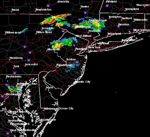 At 821 pm edt, a severe thunderstorm was located over beatyestown, or 18 miles northeast of easton, moving east at 15 mph (radar indicated). Hazards include 60 mph wind gusts and quarter size hail. Minor damage to vehicles is possible. wind damage to roofs, siding, trees, and power lines is possible. Locations impacted include, hackettstown, washington, belvidere, oxford, glen gardner, chester, hampton, califon, great meadows-vienna, brass castle, pleasant valley, long valley, budd lake, beatyestown, allamuchy-panther valley and beattyestown. At 821 pm edt, a severe thunderstorm was located over beatyestown, or 18 miles northeast of easton, moving east at 15 mph (radar indicated). Hazards include 60 mph wind gusts and quarter size hail. Minor damage to vehicles is possible. wind damage to roofs, siding, trees, and power lines is possible. Locations impacted include, hackettstown, washington, belvidere, oxford, glen gardner, chester, hampton, califon, great meadows-vienna, brass castle, pleasant valley, long valley, budd lake, beatyestown, allamuchy-panther valley and beattyestown.
|
| 8/6/2019 8:05 PM EDT |
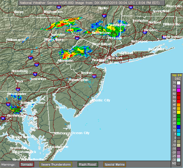 At 805 pm edt, a severe thunderstorm was located over oxford, or 14 miles northeast of easton, moving east at 15 mph (radar indicated). Hazards include 60 mph wind gusts and quarter size hail. Minor damage to vehicles is possible. Wind damage to roofs, siding, trees, and power lines is possible. At 805 pm edt, a severe thunderstorm was located over oxford, or 14 miles northeast of easton, moving east at 15 mph (radar indicated). Hazards include 60 mph wind gusts and quarter size hail. Minor damage to vehicles is possible. Wind damage to roofs, siding, trees, and power lines is possible.
|
| 8/6/2019 7:47 PM EDT |
 At 747 pm edt, a severe thunderstorm was located over belvidere, or 11 miles northeast of easton, moving east at 10 mph (radar indicated). Hazards include 60 mph wind gusts and quarter size hail. Minor damage to vehicles is possible. wind damage to roofs, siding, trees, and power lines is possible. Locations impacted include, hackettstown, washington, bangor, belvidere, oxford, east bangor, great meadows-vienna, brass castle, pleasant valley, roxburg, beatyestown, allamuchy-panther valley and beattyestown. At 747 pm edt, a severe thunderstorm was located over belvidere, or 11 miles northeast of easton, moving east at 10 mph (radar indicated). Hazards include 60 mph wind gusts and quarter size hail. Minor damage to vehicles is possible. wind damage to roofs, siding, trees, and power lines is possible. Locations impacted include, hackettstown, washington, bangor, belvidere, oxford, east bangor, great meadows-vienna, brass castle, pleasant valley, roxburg, beatyestown, allamuchy-panther valley and beattyestown.
|
| 8/6/2019 7:32 PM EDT |
 At 731 pm edt, a severe thunderstorm was located over belvidere, or 10 miles northeast of easton, moving east at 20 mph (radar indicated). Hazards include 60 mph wind gusts and quarter size hail. Minor damage to vehicles is possible. Wind damage to roofs, siding, trees, and power lines is possible. At 731 pm edt, a severe thunderstorm was located over belvidere, or 10 miles northeast of easton, moving east at 20 mph (radar indicated). Hazards include 60 mph wind gusts and quarter size hail. Minor damage to vehicles is possible. Wind damage to roofs, siding, trees, and power lines is possible.
|
| 7/31/2019 5:12 PM EDT |
 At 512 pm edt, severe thunderstorms were located along a line extending from near lake mohawk to columbia, moving east at 15 mph (radar indicated). Hazards include 60 mph wind gusts and penny size hail. Damage to roofs, siding, trees, and power lines is possible. Locations impacted include, newton, dover, hopatcong, east stroudsburg, hackettstown, wharton, washington, blairstown, bangor, mount arlington, stanhope, netcong, belvidere, oxford, ogdensburg, hope, east bangor, branchville, andover and brass castle. At 512 pm edt, severe thunderstorms were located along a line extending from near lake mohawk to columbia, moving east at 15 mph (radar indicated). Hazards include 60 mph wind gusts and penny size hail. Damage to roofs, siding, trees, and power lines is possible. Locations impacted include, newton, dover, hopatcong, east stroudsburg, hackettstown, wharton, washington, blairstown, bangor, mount arlington, stanhope, netcong, belvidere, oxford, ogdensburg, hope, east bangor, branchville, andover and brass castle.
|
| 7/31/2019 4:52 PM EDT |
 At 451 pm edt, severe thunderstorms were located along a line extending from newton to near east stroudsburg, moving east at 15 mph (radar indicated). Hazards include 60 mph wind gusts and penny size hail. damage to roofs, siding, trees, and power lines is possible At 451 pm edt, severe thunderstorms were located along a line extending from newton to near east stroudsburg, moving east at 15 mph (radar indicated). Hazards include 60 mph wind gusts and penny size hail. damage to roofs, siding, trees, and power lines is possible
|
| 7/22/2019 6:08 PM EDT |
 At 607 pm edt, severe thunderstorms were located along a line extending from wharton to near perkasie, moving northeast at 30 mph (law enforcement. widespread wind damage has been reported in warren, lehigh, and northampton counties with these storms). Hazards include 70 mph wind gusts and quarter size hail. Minor damage to vehicles is possible. expect considerable tree damage. wind damage is also likely to mobile homes, roofs, and outbuildings. Locations impacted include, morristown, dover, hackettstown, quakertown, perkasie, byram, bedminster, washington, morris plains, mendham, flemington, mountain lakes, tinicum, high bridge, clinton, peapack and gladstone, new hope, oxford, dublin and glen gardner. At 607 pm edt, severe thunderstorms were located along a line extending from wharton to near perkasie, moving northeast at 30 mph (law enforcement. widespread wind damage has been reported in warren, lehigh, and northampton counties with these storms). Hazards include 70 mph wind gusts and quarter size hail. Minor damage to vehicles is possible. expect considerable tree damage. wind damage is also likely to mobile homes, roofs, and outbuildings. Locations impacted include, morristown, dover, hackettstown, quakertown, perkasie, byram, bedminster, washington, morris plains, mendham, flemington, mountain lakes, tinicum, high bridge, clinton, peapack and gladstone, new hope, oxford, dublin and glen gardner.
|
| 7/22/2019 5:55 PM EDT |
 At 554 pm edt, severe thunderstorms were located along a line extending from succasunna to near perkasie, moving east at 25 mph (law enforcement. widespread wind damage has been reported with these storms). Hazards include 70 mph wind gusts. Expect considerable tree damage. damage is likely to mobile homes, roofs, and outbuildings. Locations impacted include, easton, morristown, bethlehem, dover, forks, hackettstown, quakertown, perkasie, byram, wilson, bedminster, washington, hellertown, morris plains, mendham, flemington, mountain lakes, tinicum, high bridge and east greenville. At 554 pm edt, severe thunderstorms were located along a line extending from succasunna to near perkasie, moving east at 25 mph (law enforcement. widespread wind damage has been reported with these storms). Hazards include 70 mph wind gusts. Expect considerable tree damage. damage is likely to mobile homes, roofs, and outbuildings. Locations impacted include, easton, morristown, bethlehem, dover, forks, hackettstown, quakertown, perkasie, byram, wilson, bedminster, washington, hellertown, morris plains, mendham, flemington, mountain lakes, tinicum, high bridge and east greenville.
|
| 7/22/2019 5:24 PM EDT |
 At 524 pm edt, a severe thunderstorm was located over kinnelon, or near pompton lakes, moving east at 30 mph (the public reported trees down in lake telemark as this storm passed). Hazards include 60 mph wind gusts and quarter size hail. Minor damage to vehicles is possible. wind damage to roofs, siding, trees, and power lines is possible. Locations impacted include, dover, hopatcong, lincoln park, kinnelon, hackettstown, boonton, butler, wharton, rockaway, morris plains, mount arlington, mountain lakes, stanhope, riverdale, netcong, victory gardens, andover, long valley, green pond and great meadows-vienna. At 524 pm edt, a severe thunderstorm was located over kinnelon, or near pompton lakes, moving east at 30 mph (the public reported trees down in lake telemark as this storm passed). Hazards include 60 mph wind gusts and quarter size hail. Minor damage to vehicles is possible. wind damage to roofs, siding, trees, and power lines is possible. Locations impacted include, dover, hopatcong, lincoln park, kinnelon, hackettstown, boonton, butler, wharton, rockaway, morris plains, mount arlington, mountain lakes, stanhope, riverdale, netcong, victory gardens, andover, long valley, green pond and great meadows-vienna.
|
| 7/22/2019 5:17 PM EDT |
 At 517 pm edt, several severe thunderstorms were located along a line extending from washington to near bally, moving east at 30 mph (law enforcement. numerous reports of wind damage have been received from lehigh and warren counties with these storms). Hazards include 70 mph wind gusts. Expect considerable tree damage. Damage is likely to mobile homes, roofs, and outbuildings. At 517 pm edt, several severe thunderstorms were located along a line extending from washington to near bally, moving east at 30 mph (law enforcement. numerous reports of wind damage have been received from lehigh and warren counties with these storms). Hazards include 70 mph wind gusts. Expect considerable tree damage. Damage is likely to mobile homes, roofs, and outbuildings.
|
| 7/22/2019 5:07 PM EDT |
 At 506 pm edt, severe thunderstorms were located along a line extending from near lake telemark to beatyestown, moving east at 30 mph (law enforcement. several reports of trees and wires down have been received from mansfield township and blairstown township as these storms passed). Hazards include 60 mph wind gusts and penny size hail. Damage to roofs, siding, trees, and power lines is possible. Locations impacted include, port jervis, newton, montague, hopatcong, hackettstown, washington, blairstown, mount arlington, franklin, stanhope, hamburg, netcong, belvidere, harmony, oxford, ogdensburg, alpha, sussex, hope and milford. At 506 pm edt, severe thunderstorms were located along a line extending from near lake telemark to beatyestown, moving east at 30 mph (law enforcement. several reports of trees and wires down have been received from mansfield township and blairstown township as these storms passed). Hazards include 60 mph wind gusts and penny size hail. Damage to roofs, siding, trees, and power lines is possible. Locations impacted include, port jervis, newton, montague, hopatcong, hackettstown, washington, blairstown, mount arlington, franklin, stanhope, hamburg, netcong, belvidere, harmony, oxford, ogdensburg, alpha, sussex, hope and milford.
|
| 7/22/2019 5:01 PM EDT |
 At 500 pm edt, a severe thunderstorm was located over mount arlington, or 10 miles southeast of newton, moving east at 40 mph (radar indicated). Hazards include 60 mph wind gusts and quarter size hail. Minor damage to vehicles is possible. Wind damage to roofs, siding, trees, and power lines is possible. At 500 pm edt, a severe thunderstorm was located over mount arlington, or 10 miles southeast of newton, moving east at 40 mph (radar indicated). Hazards include 60 mph wind gusts and quarter size hail. Minor damage to vehicles is possible. Wind damage to roofs, siding, trees, and power lines is possible.
|
| 7/22/2019 4:43 PM EDT |
 At 443 pm edt, severe thunderstorms were located along a line extending from near franklin to allamuchy-panther valley, moving northeast at 35 mph (radar indicated). Hazards include 60 mph wind gusts and penny size hail. Damage to roofs, siding, trees, and power lines is possible. Locations impacted include, port jervis, newton, montague, hopatcong, hackettstown, washington, blairstown, mount arlington, franklin, stanhope, hamburg, netcong, belvidere, harmony, oxford, ogdensburg, alpha, sussex, hope and milford. At 443 pm edt, severe thunderstorms were located along a line extending from near franklin to allamuchy-panther valley, moving northeast at 35 mph (radar indicated). Hazards include 60 mph wind gusts and penny size hail. Damage to roofs, siding, trees, and power lines is possible. Locations impacted include, port jervis, newton, montague, hopatcong, hackettstown, washington, blairstown, mount arlington, franklin, stanhope, hamburg, netcong, belvidere, harmony, oxford, ogdensburg, alpha, sussex, hope and milford.
|
| 7/22/2019 4:41 PM EDT | Several reports of trees and wires down in and around hackettstown... including on ridge lane and lindsey drive. time estimated from rada in warren county NJ, 1.6 miles SSE of Hackettstown, NJ |
| 7/22/2019 4:24 PM EDT |
 At 424 pm edt, severe thunderstorms were located along a line extending from andover to oxford, moving northeast at 35 mph (radar indicated). Hazards include 60 mph wind gusts and penny size hail. damage to roofs, siding, trees, and power lines is possible At 424 pm edt, severe thunderstorms were located along a line extending from andover to oxford, moving northeast at 35 mph (radar indicated). Hazards include 60 mph wind gusts and penny size hail. damage to roofs, siding, trees, and power lines is possible
|
| 7/22/2019 3:06 PM EDT |
 At 306 pm edt, severe thunderstorms were located along a line extending from near florida to hackettstown, moving east at 20 mph (radar indicated). Hazards include 60 mph wind gusts and half dollar size hail. Minor damage to vehicles is possible. wind damage to roofs, siding, trees, and power lines is possible. Locations impacted include, port jervis, newton, montague, dover, hopatcong, hackettstown, wharton, rockaway, mount arlington, franklin, mendham, stanhope, hamburg, netcong, ogdensburg, sussex, victory gardens, branchville, andover and high point. At 306 pm edt, severe thunderstorms were located along a line extending from near florida to hackettstown, moving east at 20 mph (radar indicated). Hazards include 60 mph wind gusts and half dollar size hail. Minor damage to vehicles is possible. wind damage to roofs, siding, trees, and power lines is possible. Locations impacted include, port jervis, newton, montague, dover, hopatcong, hackettstown, wharton, rockaway, mount arlington, franklin, mendham, stanhope, hamburg, netcong, ogdensburg, sussex, victory gardens, branchville, andover and high point.
|
| 7/22/2019 2:49 PM EDT |
 At 249 pm edt, severe thunderstorms were located along a line extending from near unionville to great meadows-vienna, moving east at 20 mph (radar indicated). Hazards include 60 mph wind gusts and half dollar size hail. Minor damage to vehicles is possible. wind damage to roofs, siding, trees, and power lines is possible. Locations impacted include, port jervis, newton, montague, dover, hopatcong, hackettstown, wharton, rockaway, mount arlington, franklin, mendham, stanhope, hamburg, netcong, oxford, ogdensburg, sussex, hope, chester and victory gardens. At 249 pm edt, severe thunderstorms were located along a line extending from near unionville to great meadows-vienna, moving east at 20 mph (radar indicated). Hazards include 60 mph wind gusts and half dollar size hail. Minor damage to vehicles is possible. wind damage to roofs, siding, trees, and power lines is possible. Locations impacted include, port jervis, newton, montague, dover, hopatcong, hackettstown, wharton, rockaway, mount arlington, franklin, mendham, stanhope, hamburg, netcong, oxford, ogdensburg, sussex, hope, chester and victory gardens.
|
| 7/22/2019 2:35 PM EDT |
 At 234 pm edt, severe thunderstorms were located along a line extending from near high point to near oxford, moving east at 20 mph (radar indicated). Hazards include 60 mph wind gusts and penny size hail. damage to roofs, siding, trees, and power lines is possible At 234 pm edt, severe thunderstorms were located along a line extending from near high point to near oxford, moving east at 20 mph (radar indicated). Hazards include 60 mph wind gusts and penny size hail. damage to roofs, siding, trees, and power lines is possible
|
| 7/21/2019 9:49 PM EDT |
 At 948 pm edt, severe thunderstorms were located along a line extending from near victory gardens to glen gardner to ferndale to near geryville, moving east at 35 mph (radar indicated). Hazards include 60 mph wind gusts and quarter size hail. Minor damage to vehicles is possible. wind damage to roofs, siding, trees, and power lines is possible. Locations impacted include, allentown, easton, morristown, somerville, bethlehem, bridgewater, dover, madison, middlesex, florham park, emmaus, east hanover, bound brook, manville, hackettstown, quakertown, chatham, perkasie, byram and bedminster. At 948 pm edt, severe thunderstorms were located along a line extending from near victory gardens to glen gardner to ferndale to near geryville, moving east at 35 mph (radar indicated). Hazards include 60 mph wind gusts and quarter size hail. Minor damage to vehicles is possible. wind damage to roofs, siding, trees, and power lines is possible. Locations impacted include, allentown, easton, morristown, somerville, bethlehem, bridgewater, dover, madison, middlesex, florham park, emmaus, east hanover, bound brook, manville, hackettstown, quakertown, chatham, perkasie, byram and bedminster.
|
| 7/21/2019 9:24 PM EDT |
 At 922 pm edt, severe thunderstorms were located along a line extending from netcong to harmony to hellertown to near topton, moving east at 35 mph (radar indicated). Hazards include 60 mph wind gusts and quarter size hail. Minor damage to vehicles is possible. Wind damage to roofs, siding, trees, and power lines is possible. At 922 pm edt, severe thunderstorms were located along a line extending from netcong to harmony to hellertown to near topton, moving east at 35 mph (radar indicated). Hazards include 60 mph wind gusts and quarter size hail. Minor damage to vehicles is possible. Wind damage to roofs, siding, trees, and power lines is possible.
|
| 7/21/2019 9:09 PM EDT |
 At 908 pm edt, severe thunderstorms were located along a line extending from near wind gap to northampton to near claussville, moving east at 30 mph (radar indicated). Hazards include 70 mph wind gusts and quarter size hail. Minor damage to vehicles is possible. expect considerable tree damage. wind damage is also likely to mobile homes, roofs, and outbuildings. Locations impacted include, allentown, easton, bethlehem, forks, emmaus, northampton, wilson, washington, hellertown, nazareth, bangor, pen argyl, wind gap, bath, belvidere, harmony, oxford, alpha, topton and belfast. At 908 pm edt, severe thunderstorms were located along a line extending from near wind gap to northampton to near claussville, moving east at 30 mph (radar indicated). Hazards include 70 mph wind gusts and quarter size hail. Minor damage to vehicles is possible. expect considerable tree damage. wind damage is also likely to mobile homes, roofs, and outbuildings. Locations impacted include, allentown, easton, bethlehem, forks, emmaus, northampton, wilson, washington, hellertown, nazareth, bangor, pen argyl, wind gap, bath, belvidere, harmony, oxford, alpha, topton and belfast.
|
| 7/21/2019 8:44 PM EDT |
 At 844 pm edt, severe thunderstorms were located along a line extending from kresgeville to near wanamakers, moving southeast at 25 mph (radar indicated). Hazards include 60 mph wind gusts and quarter size hail. Minor damage to vehicles is possible. Wind damage to roofs, siding, trees, and power lines is possible. At 844 pm edt, severe thunderstorms were located along a line extending from kresgeville to near wanamakers, moving southeast at 25 mph (radar indicated). Hazards include 60 mph wind gusts and quarter size hail. Minor damage to vehicles is possible. Wind damage to roofs, siding, trees, and power lines is possible.
|
| 7/17/2019 7:19 PM EDT |
 At 719 pm edt, severe thunderstorms were located along a line extending from near upper greenwood lake to near west milford to lake telemark, moving east at 40 mph (radar indicated). Hazards include 60 mph wind gusts and penny size hail. Damage to roofs, siding, trees, and power lines is possible. Locations impacted include, dover, hopatcong, kinnelon, hackettstown, butler, wharton, rockaway, mount arlington, franklin, mountain lakes, stanhope, riverdale, hamburg, netcong, ogdensburg, victory gardens, lake mohawk, vernon valley, green pond and succasunna. At 719 pm edt, severe thunderstorms were located along a line extending from near upper greenwood lake to near west milford to lake telemark, moving east at 40 mph (radar indicated). Hazards include 60 mph wind gusts and penny size hail. Damage to roofs, siding, trees, and power lines is possible. Locations impacted include, dover, hopatcong, kinnelon, hackettstown, butler, wharton, rockaway, mount arlington, franklin, mountain lakes, stanhope, riverdale, hamburg, netcong, ogdensburg, victory gardens, lake mohawk, vernon valley, green pond and succasunna.
|
| 7/17/2019 7:00 PM EDT |
 At 659 pm edt, severe thunderstorms were located along a line extending from hamburg to ogdensburg to near stanhope, moving east at 40 mph (radar indicated). Hazards include 60 mph wind gusts and penny size hail. Damage to roofs, siding, trees, and power lines is possible. Locations impacted include, newton, dover, hopatcong, kinnelon, hackettstown, butler, wharton, rockaway, mount arlington, franklin, mountain lakes, stanhope, riverdale, hamburg, netcong, ogdensburg, sussex, victory gardens, branchville and andover. At 659 pm edt, severe thunderstorms were located along a line extending from hamburg to ogdensburg to near stanhope, moving east at 40 mph (radar indicated). Hazards include 60 mph wind gusts and penny size hail. Damage to roofs, siding, trees, and power lines is possible. Locations impacted include, newton, dover, hopatcong, kinnelon, hackettstown, butler, wharton, rockaway, mount arlington, franklin, mountain lakes, stanhope, riverdale, hamburg, netcong, ogdensburg, sussex, victory gardens, branchville and andover.
|
| 7/17/2019 6:39 PM EDT |
 At 639 pm edt, severe thunderstorms were located along a line extending from branchville to near five points to near hope, moving east at 40 mph (radar indicated). Hazards include 60 mph wind gusts and penny size hail. damage to roofs, siding, trees, and power lines is possible At 639 pm edt, severe thunderstorms were located along a line extending from branchville to near five points to near hope, moving east at 40 mph (radar indicated). Hazards include 60 mph wind gusts and penny size hail. damage to roofs, siding, trees, and power lines is possible
|
| 7/6/2019 7:13 PM EDT |
 At 713 pm edt, severe thunderstorms were located along a line extending from near greendell to tatamy to adamstown, moving southeast at 25 mph (radar indicated). Hazards include 60 mph wind gusts. Damage to roofs, siding, trees, and power lines is possible. Locations impacted include, allentown, reading, easton, bethlehem, pottstown, dover, hopatcong, forks, emmaus, wyomissing, hackettstown, quakertown, wilson, wharton, washington, rockaway, blairstown, hellertown, nazareth and morris plains. At 713 pm edt, severe thunderstorms were located along a line extending from near greendell to tatamy to adamstown, moving southeast at 25 mph (radar indicated). Hazards include 60 mph wind gusts. Damage to roofs, siding, trees, and power lines is possible. Locations impacted include, allentown, reading, easton, bethlehem, pottstown, dover, hopatcong, forks, emmaus, wyomissing, hackettstown, quakertown, wilson, wharton, washington, rockaway, blairstown, hellertown, nazareth and morris plains.
|
| 7/6/2019 6:55 PM EDT |
 The severe thunderstorm warning for sussex, warren, berks, lehigh, southeastern carbon, monroe and northampton counties will expire at 700 pm edt, the storms which prompted the warning continue to move to the southeast. a new severe thunderstorm warning is in effect for these counties until 8:00 pm edt. to report severe weather, contact your nearest law enforcement agency. they will relay your report to the national weather service mount holly nj. The severe thunderstorm warning for sussex, warren, berks, lehigh, southeastern carbon, monroe and northampton counties will expire at 700 pm edt, the storms which prompted the warning continue to move to the southeast. a new severe thunderstorm warning is in effect for these counties until 8:00 pm edt. to report severe weather, contact your nearest law enforcement agency. they will relay your report to the national weather service mount holly nj.
|
| 7/6/2019 6:53 PM EDT |
 At 653 pm edt, severe thunderstorms were located along a line extending from near unionville to near nazareth to near cornwall, moving southeast at 25 mph (radar indicated). Hazards include 60 mph wind gusts. damage to roofs, siding, trees, and power lines is possible At 653 pm edt, severe thunderstorms were located along a line extending from near unionville to near nazareth to near cornwall, moving southeast at 25 mph (radar indicated). Hazards include 60 mph wind gusts. damage to roofs, siding, trees, and power lines is possible
|
| 7/6/2019 6:22 PM EDT |
 At 622 pm edt, severe thunderstorms were located along a line extending from near matamoras to beltzville state park to near palmyra, moving southeast at 30 mph (radar indicated). Hazards include 60 mph wind gusts. damage to roofs, siding, trees, and power lines is possible At 622 pm edt, severe thunderstorms were located along a line extending from near matamoras to beltzville state park to near palmyra, moving southeast at 30 mph (radar indicated). Hazards include 60 mph wind gusts. damage to roofs, siding, trees, and power lines is possible
|
| 7/6/2019 5:05 PM EDT |
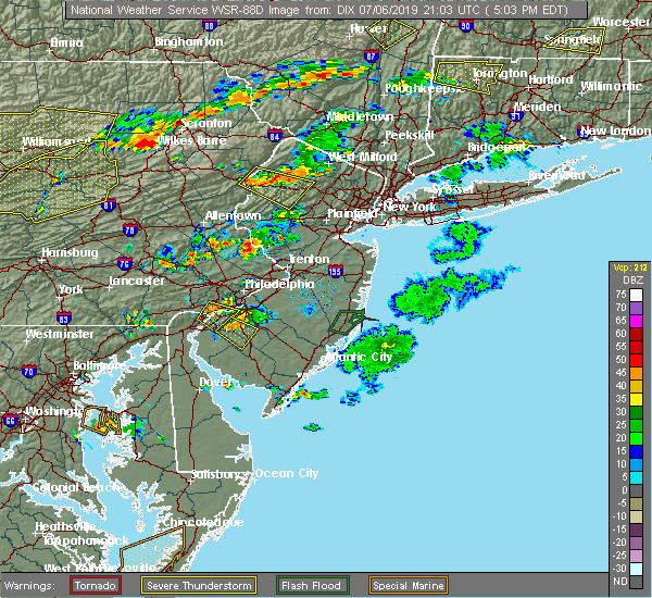 At 504 pm edt, a severe thunderstorm was located over greendell, or near newton, moving southeast at 15 mph (radar indicated). Hazards include 60 mph wind gusts and penny size hail. Damage to roofs, siding, trees, and power lines is possible. Locations impacted include, dover, hopatcong, hackettstown, wharton, blairstown, mount arlington, stanhope, netcong, chester, andover, allamuchy-panther valley, succasunna, succasunna-kenvil, greendell, budd lake, lake mohawk and great meadows-vienna. At 504 pm edt, a severe thunderstorm was located over greendell, or near newton, moving southeast at 15 mph (radar indicated). Hazards include 60 mph wind gusts and penny size hail. Damage to roofs, siding, trees, and power lines is possible. Locations impacted include, dover, hopatcong, hackettstown, wharton, blairstown, mount arlington, stanhope, netcong, chester, andover, allamuchy-panther valley, succasunna, succasunna-kenvil, greendell, budd lake, lake mohawk and great meadows-vienna.
|
| 7/6/2019 4:41 PM EDT |
 At 441 pm edt, a severe thunderstorm was located over blairstown, or 12 miles southwest of newton, moving southeast at 10 mph (radar indicated). Hazards include 60 mph wind gusts and nickel size hail. damage to roofs, siding, trees, and power lines is possible At 441 pm edt, a severe thunderstorm was located over blairstown, or 12 miles southwest of newton, moving southeast at 10 mph (radar indicated). Hazards include 60 mph wind gusts and nickel size hail. damage to roofs, siding, trees, and power lines is possible
|
| 6/29/2019 4:27 PM EDT |
 At 427 pm edt, a severe thunderstorm was located over budd lake, or 10 miles south of newton, moving southeast at 30 mph (radar indicated). Hazards include 60 mph wind gusts and quarter size hail. Minor damage to vehicles is possible. Wind damage to roofs, siding, trees, and power lines is possible. At 427 pm edt, a severe thunderstorm was located over budd lake, or 10 miles south of newton, moving southeast at 30 mph (radar indicated). Hazards include 60 mph wind gusts and quarter size hail. Minor damage to vehicles is possible. Wind damage to roofs, siding, trees, and power lines is possible.
|
| 6/29/2019 3:53 PM EDT |
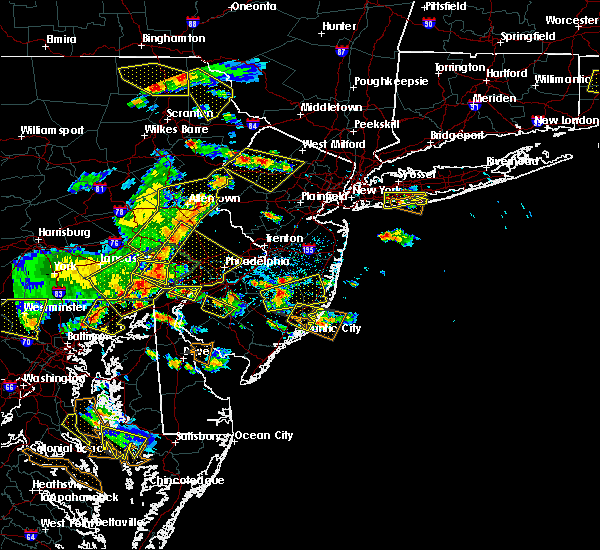 At 353 pm edt, a severe thunderstorm was located over andover, or over newton, moving east at 15 mph (radar indicated). Hazards include 60 mph wind gusts and quarter size hail. Minor damage to vehicles is possible. wind damage to roofs, siding, trees, and power lines is possible. Locations impacted include, newton, dover, hopatcong, hackettstown, wharton, rockaway, blairstown, mount arlington, stanhope, netcong, victory gardens, andover, lake mohawk, greendell, millbrook, green pond, flatbrookville, allamuchy-panther valley, succasunna and succasunna-kenvil. At 353 pm edt, a severe thunderstorm was located over andover, or over newton, moving east at 15 mph (radar indicated). Hazards include 60 mph wind gusts and quarter size hail. Minor damage to vehicles is possible. wind damage to roofs, siding, trees, and power lines is possible. Locations impacted include, newton, dover, hopatcong, hackettstown, wharton, rockaway, blairstown, mount arlington, stanhope, netcong, victory gardens, andover, lake mohawk, greendell, millbrook, green pond, flatbrookville, allamuchy-panther valley, succasunna and succasunna-kenvil.
|
| 6/29/2019 3:31 PM EDT |
 At 331 pm edt, a severe thunderstorm was located over greendell, or near newton, moving southeast at 20 mph (radar indicated). Hazards include 60 mph wind gusts and quarter size hail. Minor damage to vehicles is possible. Wind damage to roofs, siding, trees, and power lines is possible. At 331 pm edt, a severe thunderstorm was located over greendell, or near newton, moving southeast at 20 mph (radar indicated). Hazards include 60 mph wind gusts and quarter size hail. Minor damage to vehicles is possible. Wind damage to roofs, siding, trees, and power lines is possible.
|
| 5/30/2019 5:20 PM EDT |
 At 519 pm edt, severe thunderstorms were located along a line extending from long valley to milford, moving east at 25 mph (radar indicated). Hazards include 60 mph wind gusts and penny size hail. damage to roofs, siding, trees, and power lines is possible At 519 pm edt, severe thunderstorms were located along a line extending from long valley to milford, moving east at 25 mph (radar indicated). Hazards include 60 mph wind gusts and penny size hail. damage to roofs, siding, trees, and power lines is possible
|
| 5/30/2019 5:20 PM EDT |
 The national weather service in mount holly nj has issued a * severe thunderstorm warning for. morris county in northern new jersey. hunterdon county in northwestern new jersey. southeastern warren county in northwestern new jersey. Somerset county in northern new jersey. The national weather service in mount holly nj has issued a * severe thunderstorm warning for. morris county in northern new jersey. hunterdon county in northwestern new jersey. southeastern warren county in northwestern new jersey. Somerset county in northern new jersey.
|
| 5/30/2019 5:10 PM EDT | Some reports of a few trees down in allamuchy twp. time estimated from rada in warren county NJ, 3.7 miles S of Hackettstown, NJ |
| 5/30/2019 4:58 PM EDT |
 At 458 pm edt, a severe thunderstorm was located near bloomsbury, or 7 miles east of easton, moving east at 30 mph (radar indicated). Hazards include 60 mph wind gusts and penny size hail. Damage to roofs, siding, trees, and power lines is possible. Locations impacted include, easton, forks, hackettstown, wilson, washington, high bridge, clinton, belvidere, harmony, oxford, alpha, hope, glen gardner, hampton, lebanon, west easton, califon, bloomsbury, glendon and brass castle. At 458 pm edt, a severe thunderstorm was located near bloomsbury, or 7 miles east of easton, moving east at 30 mph (radar indicated). Hazards include 60 mph wind gusts and penny size hail. Damage to roofs, siding, trees, and power lines is possible. Locations impacted include, easton, forks, hackettstown, wilson, washington, high bridge, clinton, belvidere, harmony, oxford, alpha, hope, glen gardner, hampton, lebanon, west easton, califon, bloomsbury, glendon and brass castle.
|
| 5/30/2019 4:40 PM EDT |
 At 440 pm edt, a severe thunderstorm was located over harmony, or near easton, moving east at 20 mph (radar indicated). Hazards include 60 mph wind gusts and nickel size hail. damage to roofs, siding, trees, and power lines is possible At 440 pm edt, a severe thunderstorm was located over harmony, or near easton, moving east at 20 mph (radar indicated). Hazards include 60 mph wind gusts and nickel size hail. damage to roofs, siding, trees, and power lines is possible
|
| 5/29/2019 5:23 PM EDT |
 At 522 pm edt, severe thunderstorms were located along a line extending from near greendell to near birdsboro, moving east at 90 mph (radar indicated). Hazards include 60 mph wind gusts and quarter size hail. Minor damage to vehicles is possible. Wind damage to roofs, siding, trees, and power lines is possible. At 522 pm edt, severe thunderstorms were located along a line extending from near greendell to near birdsboro, moving east at 90 mph (radar indicated). Hazards include 60 mph wind gusts and quarter size hail. Minor damage to vehicles is possible. Wind damage to roofs, siding, trees, and power lines is possible.
|
| 5/29/2019 4:51 PM EDT |
 The severe thunderstorm warning for central warren, southwestern monroe and northeastern northampton counties will expire at 500 pm edt, the storm which prompted the warning has weakened below severe limits, and has exited the warned area. therefore, the warning will be allowed to expire. a tornado watch remains in effect until 800 pm edt for northwestern new jersey, and eastern and northeastern pennsylvania. remember, a severe thunderstorm warning still remains in effect for portions of the area. The severe thunderstorm warning for central warren, southwestern monroe and northeastern northampton counties will expire at 500 pm edt, the storm which prompted the warning has weakened below severe limits, and has exited the warned area. therefore, the warning will be allowed to expire. a tornado watch remains in effect until 800 pm edt for northwestern new jersey, and eastern and northeastern pennsylvania. remember, a severe thunderstorm warning still remains in effect for portions of the area.
|
| 5/29/2019 4:14 PM EDT |
 At 414 pm edt, a severe thunderstorm was located over greendell, or near newton, moving east at 45 mph (radar indicated). Hazards include 60 mph wind gusts and quarter size hail. Minor damage to vehicles is possible. wind damage to roofs, siding, trees, and power lines is possible. Locations impacted include, newton, hopatcong, east stroudsburg, hackettstown, blairstown, bangor, mount arlington, stanhope, netcong, hope, east bangor, andover, stormville, henryville, lake mohawk, werry lake, greendell, millbrook, delaware water gap and great meadows-vienna. At 414 pm edt, a severe thunderstorm was located over greendell, or near newton, moving east at 45 mph (radar indicated). Hazards include 60 mph wind gusts and quarter size hail. Minor damage to vehicles is possible. wind damage to roofs, siding, trees, and power lines is possible. Locations impacted include, newton, hopatcong, east stroudsburg, hackettstown, blairstown, bangor, mount arlington, stanhope, netcong, hope, east bangor, andover, stormville, henryville, lake mohawk, werry lake, greendell, millbrook, delaware water gap and great meadows-vienna.
|
| 5/29/2019 4:09 PM EDT |
 The national weather service in mount holly nj has issued a * severe thunderstorm warning for. central warren county in northwestern new jersey. southwestern monroe county in northeastern pennsylvania. northeastern northampton county in eastern pennsylvania. Until 500 pm edt. The national weather service in mount holly nj has issued a * severe thunderstorm warning for. central warren county in northwestern new jersey. southwestern monroe county in northeastern pennsylvania. northeastern northampton county in eastern pennsylvania. Until 500 pm edt.
|
| 5/29/2019 4:09 PM EDT |
 At 409 pm edt, a severe thunderstorm was located over brodheadsville, or 14 miles south of mount pocono, moving east at 35 mph (radar indicated). Hazards include 70 mph wind gusts and quarter size hail. Minor damage to vehicles is possible. expect considerable tree damage. Wind damage is also likely to mobile homes, roofs, and outbuildings. At 409 pm edt, a severe thunderstorm was located over brodheadsville, or 14 miles south of mount pocono, moving east at 35 mph (radar indicated). Hazards include 70 mph wind gusts and quarter size hail. Minor damage to vehicles is possible. expect considerable tree damage. Wind damage is also likely to mobile homes, roofs, and outbuildings.
|
| 5/29/2019 3:43 PM EDT |
 At 341 pm edt, a severe thunderstorm was located over scotrun, or near mount pocono, moving east at 45 mph (radar indicated). Hazards include 60 mph wind gusts and half dollar size hail. Minor damage to vehicles is possible. Wind damage to roofs, siding, trees, and power lines is possible. At 341 pm edt, a severe thunderstorm was located over scotrun, or near mount pocono, moving east at 45 mph (radar indicated). Hazards include 60 mph wind gusts and half dollar size hail. Minor damage to vehicles is possible. Wind damage to roofs, siding, trees, and power lines is possible.
|
| 5/28/2019 9:12 PM EDT |
 At 912 pm edt, a severe thunderstorm was located near succasunna-kenvil, or 7 miles northwest of morristown, moving southeast at 30 mph (radar indicated). Hazards include 60 mph wind gusts and quarter size hail. Minor damage to vehicles is possible. wind damage to roofs, siding, trees, and power lines is possible. Locations impacted include, morristown, newton, dover, madison, hopatcong, florham park, east hanover, lincoln park, kinnelon, hackettstown, chatham, boonton, butler, wharton, rockaway, blairstown, morris plains, mount arlington, franklin and mendham. At 912 pm edt, a severe thunderstorm was located near succasunna-kenvil, or 7 miles northwest of morristown, moving southeast at 30 mph (radar indicated). Hazards include 60 mph wind gusts and quarter size hail. Minor damage to vehicles is possible. wind damage to roofs, siding, trees, and power lines is possible. Locations impacted include, morristown, newton, dover, madison, hopatcong, florham park, east hanover, lincoln park, kinnelon, hackettstown, chatham, boonton, butler, wharton, rockaway, blairstown, morris plains, mount arlington, franklin and mendham.
|
| 5/28/2019 8:44 PM EDT |
 At 843 pm edt, a severe thunderstorm was located over allamuchy-panther valley, or 8 miles southwest of newton, moving southeast at 45 mph (radar indicated). Hazards include 60 mph wind gusts and half dollar size hail. Minor damage to vehicles is possible. Wind damage to roofs, siding, trees, and power lines is possible. At 843 pm edt, a severe thunderstorm was located over allamuchy-panther valley, or 8 miles southwest of newton, moving southeast at 45 mph (radar indicated). Hazards include 60 mph wind gusts and half dollar size hail. Minor damage to vehicles is possible. Wind damage to roofs, siding, trees, and power lines is possible.
|
| 5/23/2019 10:25 PM EDT |
 The tornado warning for southwestern sussex, central warren and eastern northampton counties will expire at 1030 pm edt, the storm which prompted the warning has weakened below severe limits, and has exited the warned area. therefore, the warning will be allowed to expire. to report severe weather, contact your nearest law enforcement agency. they will relay your report to the national weather service mount holly nj. The tornado warning for southwestern sussex, central warren and eastern northampton counties will expire at 1030 pm edt, the storm which prompted the warning has weakened below severe limits, and has exited the warned area. therefore, the warning will be allowed to expire. to report severe weather, contact your nearest law enforcement agency. they will relay your report to the national weather service mount holly nj.
|
| 5/23/2019 10:16 PM EDT |
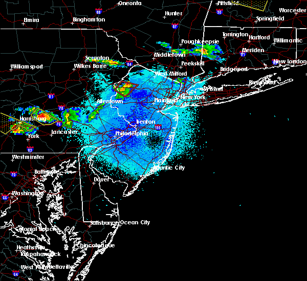 At 1015 pm edt, a severe thunderstorm capable of producing a tornado was located over hope, or 15 miles southwest of newton, moving southeast at 60 mph (radar indicated rotation). Hazards include tornado and quarter size hail. Flying debris will be dangerous to those caught without shelter. mobile homes will be damaged or destroyed. damage to roofs, windows, and vehicles will occur. tree damage is likely. Locations impacted include, hackettstown, blairstown, oxford, hope, andover, great meadows-vienna, allamuchy-panther valley, greendell, columbia, beatyestown and portland. At 1015 pm edt, a severe thunderstorm capable of producing a tornado was located over hope, or 15 miles southwest of newton, moving southeast at 60 mph (radar indicated rotation). Hazards include tornado and quarter size hail. Flying debris will be dangerous to those caught without shelter. mobile homes will be damaged or destroyed. damage to roofs, windows, and vehicles will occur. tree damage is likely. Locations impacted include, hackettstown, blairstown, oxford, hope, andover, great meadows-vienna, allamuchy-panther valley, greendell, columbia, beatyestown and portland.
|
| 5/23/2019 9:59 PM EDT |
 At 959 pm edt, a severe thunderstorm capable of producing a tornado was located near reeders, or 10 miles south of mount pocono, moving east at 65 mph (radar indicated rotation). Hazards include tornado and quarter size hail. Flying debris will be dangerous to those caught without shelter. mobile homes will be damaged or destroyed. damage to roofs, windows, and vehicles will occur. Tree damage is likely. At 959 pm edt, a severe thunderstorm capable of producing a tornado was located near reeders, or 10 miles south of mount pocono, moving east at 65 mph (radar indicated rotation). Hazards include tornado and quarter size hail. Flying debris will be dangerous to those caught without shelter. mobile homes will be damaged or destroyed. damage to roofs, windows, and vehicles will occur. Tree damage is likely.
|
| 5/23/2019 9:59 PM EDT |
 The national weather service in mount holly nj has issued a * tornado warning for. southwestern sussex county in northwestern new jersey. warren county in northwestern new jersey. central monroe county in northeastern pennsylvania. Northeastern northampton county in eastern pennsylvania. The national weather service in mount holly nj has issued a * tornado warning for. southwestern sussex county in northwestern new jersey. warren county in northwestern new jersey. central monroe county in northeastern pennsylvania. Northeastern northampton county in eastern pennsylvania.
|
| 5/19/2019 11:41 PM EDT |
 At 1140 pm edt, a severe thunderstorm was located over hope, or 17 miles southwest of newton, moving east at 55 mph (radar indicated). Hazards include 60 mph wind gusts and quarter size hail. Minor damage to vehicles is possible. Wind damage to roofs, siding, trees, and power lines is possible. At 1140 pm edt, a severe thunderstorm was located over hope, or 17 miles southwest of newton, moving east at 55 mph (radar indicated). Hazards include 60 mph wind gusts and quarter size hail. Minor damage to vehicles is possible. Wind damage to roofs, siding, trees, and power lines is possible.
|
| 3/15/2019 7:11 PM EDT |
 At 711 pm edt, a severe thunderstorm was located over washington, or 14 miles east of easton, moving east at 45 mph (radar indicated). Hazards include 60 mph wind gusts and nickel size hail. damage to roofs, siding, trees, and power lines is possible At 711 pm edt, a severe thunderstorm was located over washington, or 14 miles east of easton, moving east at 45 mph (radar indicated). Hazards include 60 mph wind gusts and nickel size hail. damage to roofs, siding, trees, and power lines is possible
|
| 10/2/2018 7:22 PM EDT |
 At 721 pm edt, a severe thunderstorm was located over east stroudsburg, or 10 miles southeast of mount pocono, moving east at 25 mph (radar indicated). Hazards include 60 mph wind gusts. damage to roofs, siding, trees, and power lines is possible At 721 pm edt, a severe thunderstorm was located over east stroudsburg, or 10 miles southeast of mount pocono, moving east at 25 mph (radar indicated). Hazards include 60 mph wind gusts. damage to roofs, siding, trees, and power lines is possible
|
| 8/17/2018 8:35 PM EDT |
 At 835 pm edt, severe thunderstorms were located along a line extending from near newton to succasunna-kenvil to near byram, moving northeast at 40 mph (radar indicated). Hazards include 70 mph wind gusts. Expect considerable tree damage. damage is likely to mobile homes, roofs, and outbuildings. Locations impacted include, morristown, somerville, newton, bridgewater, dover, hopatcong, manville, hackettstown, wharton, washington, rockaway, morris plains, mount arlington, franklin, mendham, flemington, mountain lakes, tinicum, high bridge and stanhope. At 835 pm edt, severe thunderstorms were located along a line extending from near newton to succasunna-kenvil to near byram, moving northeast at 40 mph (radar indicated). Hazards include 70 mph wind gusts. Expect considerable tree damage. damage is likely to mobile homes, roofs, and outbuildings. Locations impacted include, morristown, somerville, newton, bridgewater, dover, hopatcong, manville, hackettstown, wharton, washington, rockaway, morris plains, mount arlington, franklin, mendham, flemington, mountain lakes, tinicum, high bridge and stanhope.
|
| 8/17/2018 8:19 PM EDT | Downed tree near intersection of allen road and sunnyview avenue in mansfield twp. another downed tree at route 57 near watters road. time estimated from rada in warren county NJ, 2.1 miles NNE of Hackettstown, NJ |
| 8/17/2018 8:17 PM EDT |
 At 816 pm edt, severe thunderstorms were located along a line extending from blairstown to beatyestown to milford, moving northeast at 40 mph (radar indicated). Hazards include 60 mph wind gusts. damage to roofs, siding, trees, and power lines is possible At 816 pm edt, severe thunderstorms were located along a line extending from blairstown to beatyestown to milford, moving northeast at 40 mph (radar indicated). Hazards include 60 mph wind gusts. damage to roofs, siding, trees, and power lines is possible
|
| 7/4/2018 2:38 PM EDT |
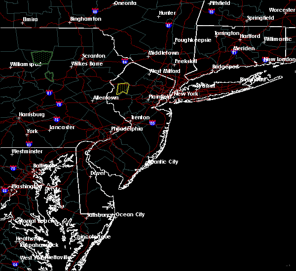 The severe thunderstorm warning for west central morris and east central warren counties will expire at 245 pm edt, the storm which prompted the warning has weakened below severe limits, and no longer poses an immediate threat to life or property. therefore, the warning will be allowed to expire. however gusty winds and heavy rain are still possible with this thunderstorm. The severe thunderstorm warning for west central morris and east central warren counties will expire at 245 pm edt, the storm which prompted the warning has weakened below severe limits, and no longer poses an immediate threat to life or property. therefore, the warning will be allowed to expire. however gusty winds and heavy rain are still possible with this thunderstorm.
|
| 7/4/2018 2:21 PM EDT |
 At 220 pm edt, a severe thunderstorm was located over great meadows-vienna, or 15 miles southwest of newton, and is nearly stationary (radar indicated). Hazards include 60 mph wind gusts and penny size hail. Damage to roofs, siding, trees, and power lines is possible. Locations impacted include, hackettstown, washington, oxford, hope, great meadows-vienna, allamuchy-panther valley, beatyestown, brass castle, long valley and beattyestown. At 220 pm edt, a severe thunderstorm was located over great meadows-vienna, or 15 miles southwest of newton, and is nearly stationary (radar indicated). Hazards include 60 mph wind gusts and penny size hail. Damage to roofs, siding, trees, and power lines is possible. Locations impacted include, hackettstown, washington, oxford, hope, great meadows-vienna, allamuchy-panther valley, beatyestown, brass castle, long valley and beattyestown.
|
| 7/4/2018 1:57 PM EDT |
 At 157 pm edt, a severe thunderstorm was located over hackettstown, or 12 miles south of newton, and is nearly stationary (radar indicated). Hazards include 60 mph wind gusts and penny size hail. damage to roofs, siding, trees, and power lines is possible At 157 pm edt, a severe thunderstorm was located over hackettstown, or 12 miles south of newton, and is nearly stationary (radar indicated). Hazards include 60 mph wind gusts and penny size hail. damage to roofs, siding, trees, and power lines is possible
|
| 6/18/2018 7:33 PM EDT | Tree onto wires and also wires sparking on mitchell road. time esimated from rada in warren county NJ, 1.3 miles NNE of Hackettstown, NJ |
| 6/18/2018 7:30 PM EDT |
 At 729 pm edt, severe thunderstorms were located along a line extending from near ogdensburg in new jersey to near allentown in pennsylvania, moving east at 40 mph (radar indicated). Hazards include 60 mph wind gusts. damage to roofs, siding, trees, and power lines is possible At 729 pm edt, severe thunderstorms were located along a line extending from near ogdensburg in new jersey to near allentown in pennsylvania, moving east at 40 mph (radar indicated). Hazards include 60 mph wind gusts. damage to roofs, siding, trees, and power lines is possible
|
| 6/18/2018 7:15 PM EDT |
 At 712 pm edt, severe thunderstorms were located along a line extending from near blairstown in new jersey to near northampton in pennsylvania , moving east at 35 mph (radar indicated). Hazards include 60 mph wind gusts. Damage to roofs, siding, trees, and power lines is possible. Locations impacted include, allentown, easton, newton, bethlehem, hopatcong, forks, northampton, hackettstown, wilson, washington, blairstown, hellertown, nazareth, bangor, mount arlington, slatington, stanhope, pen argyl, netcong and wind gap. At 712 pm edt, severe thunderstorms were located along a line extending from near blairstown in new jersey to near northampton in pennsylvania , moving east at 35 mph (radar indicated). Hazards include 60 mph wind gusts. Damage to roofs, siding, trees, and power lines is possible. Locations impacted include, allentown, easton, newton, bethlehem, hopatcong, forks, northampton, hackettstown, wilson, washington, blairstown, hellertown, nazareth, bangor, mount arlington, slatington, stanhope, pen argyl, netcong and wind gap.
|
| 6/18/2018 6:48 PM EDT |
 At 647 pm edt, severe thunderstorms were located along a line extending from near alpine mountain to near new mahoning, moving east at 35 mph (radar indicated). Hazards include 60 mph wind gusts. damage to roofs, siding, trees, and power lines is possible At 647 pm edt, severe thunderstorms were located along a line extending from near alpine mountain to near new mahoning, moving east at 35 mph (radar indicated). Hazards include 60 mph wind gusts. damage to roofs, siding, trees, and power lines is possible
|
| 6/13/2018 11:46 PM EDT | Large tree branch down at intersection of asbury road and ketchum road. time estimated from rada in warren county NJ, 2.6 miles E of Hackettstown, NJ |
| 6/13/2018 11:44 PM EDT |
 At 1143 pm edt, a severe thunderstorm was located over beatyestown, or 18 miles east of easton, moving east at 40 mph. wind damage was reported on interstate 80 in warren county with this storm earlier (radar indicated). Hazards include 60 mph wind gusts and penny size hail. Damage to roofs, siding, trees, and power lines is possible. Locations impacted include, hackettstown, washington, mendham, high bridge, clinton, harmony, peapack and gladstone, oxford, glen gardner, chester, hampton, lebanon, califon, far hills, brass castle, long valley, great meadows-vienna, pleasant valley, annandale and white house station. At 1143 pm edt, a severe thunderstorm was located over beatyestown, or 18 miles east of easton, moving east at 40 mph. wind damage was reported on interstate 80 in warren county with this storm earlier (radar indicated). Hazards include 60 mph wind gusts and penny size hail. Damage to roofs, siding, trees, and power lines is possible. Locations impacted include, hackettstown, washington, mendham, high bridge, clinton, harmony, peapack and gladstone, oxford, glen gardner, chester, hampton, lebanon, califon, far hills, brass castle, long valley, great meadows-vienna, pleasant valley, annandale and white house station.
|
| 6/13/2018 11:42 PM EDT | Tree down on catswamp rd in warren county NJ, 2.7 miles SSE of Hackettstown, NJ |
| 6/13/2018 11:27 PM EDT |
 At 1127 pm edt, a severe thunderstorm was located over belvidere, or 12 miles northeast of easton, moving east at 45 mph (radar indicated). Hazards include 60 mph wind gusts and penny size hail. damage to roofs, siding, trees, and power lines is possible At 1127 pm edt, a severe thunderstorm was located over belvidere, or 12 miles northeast of easton, moving east at 45 mph (radar indicated). Hazards include 60 mph wind gusts and penny size hail. damage to roofs, siding, trees, and power lines is possible
|
| 5/15/2018 4:16 PM EDT |
 At 414 pm edt, a line of severe thunderstorms were located from near newton in sussex county new jersey southwest to near womelsdorf in berks county pennsylvania. the storms were moving east at 65 mph (radar indicated). Hazards include 70 mph wind gusts and quarter size hail. Minor damage to vehicles is possible. expect considerable tree damage. wind damage is also likely to mobile homes, roofs, and outbuildings. Locations impacted include, allentown, reading, easton, port jervis, newton, montague, bethlehem, dover, hopatcong, forks, emmaus, wyomissing, kinnelon, northampton, hackettstown, boonton, wilson, butler, wharton and washington. At 414 pm edt, a line of severe thunderstorms were located from near newton in sussex county new jersey southwest to near womelsdorf in berks county pennsylvania. the storms were moving east at 65 mph (radar indicated). Hazards include 70 mph wind gusts and quarter size hail. Minor damage to vehicles is possible. expect considerable tree damage. wind damage is also likely to mobile homes, roofs, and outbuildings. Locations impacted include, allentown, reading, easton, port jervis, newton, montague, bethlehem, dover, hopatcong, forks, emmaus, wyomissing, kinnelon, northampton, hackettstown, boonton, wilson, butler, wharton and washington.
|
| 5/15/2018 3:46 PM EDT |
 At 344 pm edt, an area of severe thunderstorms were moving east from the southern poconos and schuylkill county. th storms are moving east at around 65 mph (radar indicated). Hazards include 70 mph wind gusts and quarter size hail. Minor damage to vehicles is possible. expect considerable tree damage. Wind damage is also likely to mobile homes, roofs, and outbuildings. At 344 pm edt, an area of severe thunderstorms were moving east from the southern poconos and schuylkill county. th storms are moving east at around 65 mph (radar indicated). Hazards include 70 mph wind gusts and quarter size hail. Minor damage to vehicles is possible. expect considerable tree damage. Wind damage is also likely to mobile homes, roofs, and outbuildings.
|
| 9/5/2017 6:47 PM EDT |
 At 647 pm edt, severe thunderstorms were located along a line extending from hackettstown to clinton to sand brook, moving northeast at 35 mph (radar indicated). Hazards include 60 mph wind gusts. Expect damage to trees and power lines. Locations impacted include, somerville, bridgewater, hopatcong, manville, hackettstown, mount arlington, mendham, flemington, high bridge, stanhope, netcong, clinton, peapack and gladstone, glen gardner, chester, lebanon, califon, far hills, millstone and flagtown. At 647 pm edt, severe thunderstorms were located along a line extending from hackettstown to clinton to sand brook, moving northeast at 35 mph (radar indicated). Hazards include 60 mph wind gusts. Expect damage to trees and power lines. Locations impacted include, somerville, bridgewater, hopatcong, manville, hackettstown, mount arlington, mendham, flemington, high bridge, stanhope, netcong, clinton, peapack and gladstone, glen gardner, chester, lebanon, califon, far hills, millstone and flagtown.
|
| 9/5/2017 6:26 PM EDT |
 At 625 pm edt, severe thunderstorms were located along a line extending from pen argyl to springtown to perkasie, moving east at 45 mph (doppler radar and trained weather spotters. these storms have produced wind damage across berks and upper portions of montgomery county). Hazards include 60 mph wind gusts and penny size hail. Expect damage to trees and power lines. severe thunderstorms will be near, bangor, pen argyl, wind gap, belfast and east bangor around 630 pm edt. ferndale, riegelsville, glendon and revere around 635 pm edt. tinicum, belvidere, alpha, milford, pipersville, columbia, ottsville and gardenville around 640 pm edt. byram, oxford, frenchtown, bloomsbury, lumberville and erwinna around 645 pm edt. hope, stockton, sergeantsville and great meadows-vienna around 650 pm edt. hackettstown, clinton, glen gardner, hampton, sand brook, annandale and allamuchy-panther valley around 655 pm edt. flemington, high bridge, lebanon and greendell around 700 pm edt. stanhope, netcong, califon, andover, cloverhill, white house station and budd lake around 705 pm edt. Other locations impacted by these severe thunderstorms include coopersburg, portland, sellersville, raritan, beattyestown, bernardsville, richlandtown, stockertown, silverdale and eastlawn gardens. At 625 pm edt, severe thunderstorms were located along a line extending from pen argyl to springtown to perkasie, moving east at 45 mph (doppler radar and trained weather spotters. these storms have produced wind damage across berks and upper portions of montgomery county). Hazards include 60 mph wind gusts and penny size hail. Expect damage to trees and power lines. severe thunderstorms will be near, bangor, pen argyl, wind gap, belfast and east bangor around 630 pm edt. ferndale, riegelsville, glendon and revere around 635 pm edt. tinicum, belvidere, alpha, milford, pipersville, columbia, ottsville and gardenville around 640 pm edt. byram, oxford, frenchtown, bloomsbury, lumberville and erwinna around 645 pm edt. hope, stockton, sergeantsville and great meadows-vienna around 650 pm edt. hackettstown, clinton, glen gardner, hampton, sand brook, annandale and allamuchy-panther valley around 655 pm edt. flemington, high bridge, lebanon and greendell around 700 pm edt. stanhope, netcong, califon, andover, cloverhill, white house station and budd lake around 705 pm edt. Other locations impacted by these severe thunderstorms include coopersburg, portland, sellersville, raritan, beattyestown, bernardsville, richlandtown, stockertown, silverdale and eastlawn gardens.
|
| 8/22/2017 9:42 PM EDT |
 At 941 pm edt, severe thunderstorms were located along a line extending from beatyestown to near erwinna to near green lane, moving east at 40 mph. this line of storms has a history of producing wind damage in much of eastern pennsylvania (radar indicated). Hazards include 70 mph wind gusts and penny size hail. Expect considerable tree damage. Damage is likely to mobile homes, roofs, and outbuildings. At 941 pm edt, severe thunderstorms were located along a line extending from beatyestown to near erwinna to near green lane, moving east at 40 mph. this line of storms has a history of producing wind damage in much of eastern pennsylvania (radar indicated). Hazards include 70 mph wind gusts and penny size hail. Expect considerable tree damage. Damage is likely to mobile homes, roofs, and outbuildings.
|
| 8/22/2017 8:58 PM EDT |
 At 858 pm edt, severe thunderstorms were located along a line extending from near echo lake to rossland, moving east at 30 mph (radar indicated). Hazards include 60 mph wind gusts and nickel size hail. expect damage to trees and power lines At 858 pm edt, severe thunderstorms were located along a line extending from near echo lake to rossland, moving east at 30 mph (radar indicated). Hazards include 60 mph wind gusts and nickel size hail. expect damage to trees and power lines
|
| 7/20/2017 7:12 PM EDT |
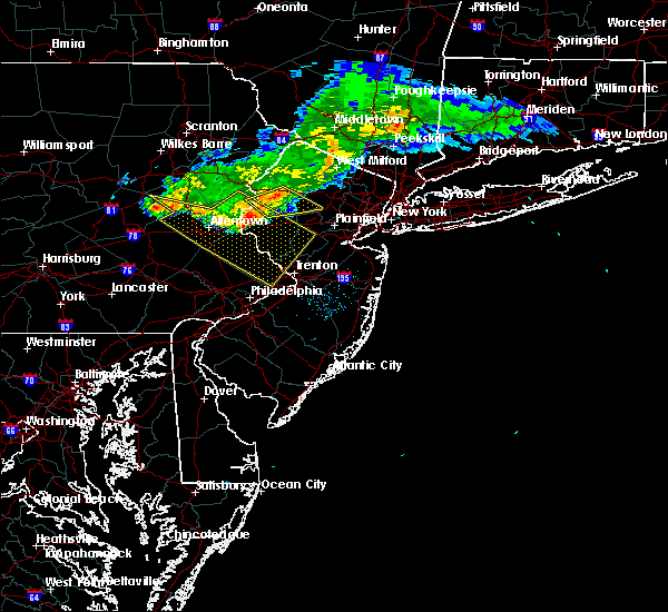 At 711 pm edt, severe thunderstorms were located along a line extending from near allamuchy-panther valley to belvidere, moving southeast at 30 mph (radar indicated). Hazards include 60 mph wind gusts. Expect damage to trees and power lines. these severe storms will be near, hackettstown, allamuchy-panther valley and beatyestown around 715 pm edt. netcong, budd lake and long valley around 720 pm edt. mendham, glen gardner, chester, hampton, califon, succasunna and succasunna-kenvil around 730 pm edt. Other locations impacted by these severe thunderstorms include beattyestown. At 711 pm edt, severe thunderstorms were located along a line extending from near allamuchy-panther valley to belvidere, moving southeast at 30 mph (radar indicated). Hazards include 60 mph wind gusts. Expect damage to trees and power lines. these severe storms will be near, hackettstown, allamuchy-panther valley and beatyestown around 715 pm edt. netcong, budd lake and long valley around 720 pm edt. mendham, glen gardner, chester, hampton, califon, succasunna and succasunna-kenvil around 730 pm edt. Other locations impacted by these severe thunderstorms include beattyestown.
|
| 7/20/2017 6:50 PM EDT |
 At 649 pm edt, severe thunderstorms were located along a line extending from matamoras to near greendell to near stormville, moving southeast at 35 mph (radar indicated). Hazards include 60 mph wind gusts. Expect damage to trees and power lines. these severe storms will be near, newton and five points around 655 pm edt. greendell, high point and allamuchy-panther valley around 700 pm edt. hackettstown, andover and lake mohawk around 705 pm edt. hopatcong, stanhope and sussex around 710 pm edt. mount arlington, hamburg, netcong, belvidere, hope, vernon valley and budd lake around 715 pm edt. oxford, chester, succasunna-kenvil, succasunna and highland lake around 720 pm edt. dover, wharton, washington, rockaway, victory gardens, brass castle, pleasant valley and great meadows-vienna around 725 pm edt. morris plains, mendham, glen gardner, hampton, califon, upper greenwood lake, beatyestown and long valley around 730 pm edt. Other locations impacted by these severe thunderstorms include portland, white meadow lake, beattyestown, stroudsburg, shawnee, roseto, bernardsville and arlington heights. At 649 pm edt, severe thunderstorms were located along a line extending from matamoras to near greendell to near stormville, moving southeast at 35 mph (radar indicated). Hazards include 60 mph wind gusts. Expect damage to trees and power lines. these severe storms will be near, newton and five points around 655 pm edt. greendell, high point and allamuchy-panther valley around 700 pm edt. hackettstown, andover and lake mohawk around 705 pm edt. hopatcong, stanhope and sussex around 710 pm edt. mount arlington, hamburg, netcong, belvidere, hope, vernon valley and budd lake around 715 pm edt. oxford, chester, succasunna-kenvil, succasunna and highland lake around 720 pm edt. dover, wharton, washington, rockaway, victory gardens, brass castle, pleasant valley and great meadows-vienna around 725 pm edt. morris plains, mendham, glen gardner, hampton, califon, upper greenwood lake, beatyestown and long valley around 730 pm edt. Other locations impacted by these severe thunderstorms include portland, white meadow lake, beattyestown, stroudsburg, shawnee, roseto, bernardsville and arlington heights.
|
| 7/20/2017 6:24 PM EDT |
 At 623 pm edt, severe thunderstorms were located along a line extending from shohola to near werry lake to pocono pines, moving southeast at 35 mph (radar indicated). Hazards include 60 mph wind gusts. Expect damage to trees and power lines. severe thunderstorms will be near, werry lake and echo lake around 635 pm edt. millbrook, flatbrookville and paradise valley around 640 pm edt. port jervis, blairstown, milford, five points, analomink and hernyville around 645 pm edt. montague around 650 pm edt. newton, east stroudsburg, high point and stormville around 655 pm edt. bangor, pen argyl, delaware water gap, andover, greendell, delaware water gap and allamuchy-panther valley around 700 pm edt. hackettstown, east bangor, columbia and lake mohawk around 705 pm edt. hopatcong, stanhope and sussex around 710 pm edt. Other locations impacted by these severe thunderstorms include portland, cresco, marshalls creek, arlington heights, roseto, white meadow lake, hidden lake, beattyestown, stroudsburg and bartonsville. At 623 pm edt, severe thunderstorms were located along a line extending from shohola to near werry lake to pocono pines, moving southeast at 35 mph (radar indicated). Hazards include 60 mph wind gusts. Expect damage to trees and power lines. severe thunderstorms will be near, werry lake and echo lake around 635 pm edt. millbrook, flatbrookville and paradise valley around 640 pm edt. port jervis, blairstown, milford, five points, analomink and hernyville around 645 pm edt. montague around 650 pm edt. newton, east stroudsburg, high point and stormville around 655 pm edt. bangor, pen argyl, delaware water gap, andover, greendell, delaware water gap and allamuchy-panther valley around 700 pm edt. hackettstown, east bangor, columbia and lake mohawk around 705 pm edt. hopatcong, stanhope and sussex around 710 pm edt. Other locations impacted by these severe thunderstorms include portland, cresco, marshalls creek, arlington heights, roseto, white meadow lake, hidden lake, beattyestown, stroudsburg and bartonsville.
|
| 7/1/2017 6:21 PM EDT |
 The severe thunderstorm warning for morris, northeastern hunterdon, southeastern sussex, northeastern warren, central mercer, somerset and western middlesex counties will expire at 630 pm edt, the storms which prompted the warning have weakened below severe limits, and no longer pose an immediate threat to life or property. therefore the warning will be allowed to expire. however gusty winds are still possible with these thunderstorms. a severe thunderstorm watch remains in effect until 900 pm edt for central, northern and northwestern new jersey, and southeastern pennsylvania. The severe thunderstorm warning for morris, northeastern hunterdon, southeastern sussex, northeastern warren, central mercer, somerset and western middlesex counties will expire at 630 pm edt, the storms which prompted the warning have weakened below severe limits, and no longer pose an immediate threat to life or property. therefore the warning will be allowed to expire. however gusty winds are still possible with these thunderstorms. a severe thunderstorm watch remains in effect until 900 pm edt for central, northern and northwestern new jersey, and southeastern pennsylvania.
|
| 7/1/2017 6:10 PM EDT |
 At 610 pm edt, severe thunderstorms were located along a line extending from near hopatcong to near far hills to near hopewell, moving northeast at 40 mph (radar indicated). Hazards include 60 mph wind gusts and penny size hail. Expect damage to trees and power lines. Locations impacted include, trenton, new brunswick, morristown, somerville, newton, somerset, east brunswick, bridgewater, south brunswick, north brunswick, ewing, dover, madison, hopatcong, middlesex, princeton, florham park, east hanover, bound brook and manville. At 610 pm edt, severe thunderstorms were located along a line extending from near hopatcong to near far hills to near hopewell, moving northeast at 40 mph (radar indicated). Hazards include 60 mph wind gusts and penny size hail. Expect damage to trees and power lines. Locations impacted include, trenton, new brunswick, morristown, somerville, newton, somerset, east brunswick, bridgewater, south brunswick, north brunswick, ewing, dover, madison, hopatcong, middlesex, princeton, florham park, east hanover, bound brook and manville.
|
| 7/1/2017 5:50 PM EDT |
 At 549 pm edt, severe thunderstorms were located along a line extending from great meadows-vienna to near flemington to near washington crossing, moving northeast at 35 mph (radar indicated). Hazards include 60 mph wind gusts and penny size hail. expect damage to trees and power lines At 549 pm edt, severe thunderstorms were located along a line extending from great meadows-vienna to near flemington to near washington crossing, moving northeast at 35 mph (radar indicated). Hazards include 60 mph wind gusts and penny size hail. expect damage to trees and power lines
|
| 7/1/2017 5:32 PM EDT |
 At 531 pm edt, severe thunderstorms were located along a line extending from washington to robesonia, moving east at 35 mph (radar indicated). Hazards include 60 mph wind gusts and penny size hail. Expect damage to trees and power lines. Locations impacted include, easton, bridgewater, ewing, dover, forks, hackettstown, perkasie, doylestown, byram, wilson, bedminster, wharton, washington, rockaway, mount arlington, mendham, flemington, tinicum, high bridge and stanhope. At 531 pm edt, severe thunderstorms were located along a line extending from washington to robesonia, moving east at 35 mph (radar indicated). Hazards include 60 mph wind gusts and penny size hail. Expect damage to trees and power lines. Locations impacted include, easton, bridgewater, ewing, dover, forks, hackettstown, perkasie, doylestown, byram, wilson, bedminster, wharton, washington, rockaway, mount arlington, mendham, flemington, tinicum, high bridge and stanhope.
|
| 7/1/2017 5:08 PM EDT |
 At 507 pm edt, severe thunderstorms were located along a line extending from near belfast to near perkasie, moving east at 40 mph (radar indicated). Hazards include 60 mph wind gusts and quarter size hail. Minor damage to vehicles is possible. Expect damage to trees and power lines. At 507 pm edt, severe thunderstorms were located along a line extending from near belfast to near perkasie, moving east at 40 mph (radar indicated). Hazards include 60 mph wind gusts and quarter size hail. Minor damage to vehicles is possible. Expect damage to trees and power lines.
|
| 6/19/2017 4:14 PM EDT |
 At 413 pm edt, severe thunderstorms were located along a line extending from near flatbrookville to near newton to near allamuchy-panther valley, moving northeast at 60 mph (radar indicated). Hazards include 60 mph wind gusts. Expect damage to trees and power lines. these severe storms will be near, branchville and lake mohawk around 420 pm edt. montague, wharton, ogdensburg, hainesville and pellettown around 425 pm edt. port jervis, franklin, hamburg, sussex, high point, highland lake and vernon valley around 430 pm edt. Other locations impacted by these severe thunderstorms include beattyestown. At 413 pm edt, severe thunderstorms were located along a line extending from near flatbrookville to near newton to near allamuchy-panther valley, moving northeast at 60 mph (radar indicated). Hazards include 60 mph wind gusts. Expect damage to trees and power lines. these severe storms will be near, branchville and lake mohawk around 420 pm edt. montague, wharton, ogdensburg, hainesville and pellettown around 425 pm edt. port jervis, franklin, hamburg, sussex, high point, highland lake and vernon valley around 430 pm edt. Other locations impacted by these severe thunderstorms include beattyestown.
|
| 6/19/2017 3:53 PM EDT |
 At 352 pm edt, severe thunderstorms were located along a line extending from near alpine mountain to near east bangor to easton, moving northeast at 55 mph (radar indicated). Hazards include 60 mph wind gusts. Expect damage to trees and power lines. severe thunderstorms will be near, delaware water gap, columbia and echo lake around 355 pm edt. hope, werry lake, flatbrookville and millbrook around 400 pm edt. washington, blairstown, oxford and brass castle around 405 pm edt. greendell and crandon lakes around 410 pm edt. newton, hackettstown, andover, hainesville, beatyestown, allamuchy-panther valley, great meadows-vienna and five points around 415 pm edt. montague, branchville and lake mohawk around 420 pm edt. port jervis, stanhope, netcong, ogdensburg, high point, budd lake, pellettown and succasunna-kenvil around 425 pm edt. hopatcong, wharton, mount arlington, franklin, hamburg, sussex, highland lake and vernon valley around 430 pm edt. Other locations impacted by these severe thunderstorms include shawnee, portland, marshalls creek, hidden lake and beattyestown. At 352 pm edt, severe thunderstorms were located along a line extending from near alpine mountain to near east bangor to easton, moving northeast at 55 mph (radar indicated). Hazards include 60 mph wind gusts. Expect damage to trees and power lines. severe thunderstorms will be near, delaware water gap, columbia and echo lake around 355 pm edt. hope, werry lake, flatbrookville and millbrook around 400 pm edt. washington, blairstown, oxford and brass castle around 405 pm edt. greendell and crandon lakes around 410 pm edt. newton, hackettstown, andover, hainesville, beatyestown, allamuchy-panther valley, great meadows-vienna and five points around 415 pm edt. montague, branchville and lake mohawk around 420 pm edt. port jervis, stanhope, netcong, ogdensburg, high point, budd lake, pellettown and succasunna-kenvil around 425 pm edt. hopatcong, wharton, mount arlington, franklin, hamburg, sussex, highland lake and vernon valley around 430 pm edt. Other locations impacted by these severe thunderstorms include shawnee, portland, marshalls creek, hidden lake and beattyestown.
|
| 2/25/2017 5:26 PM EST |
 At 525 pm est, severe thunderstorms were located along a line extending from matamoras to unionville to near hopatcong to budd lake to near lebanon, moving northeast at 45 mph (radar indicated). Hazards include 60 mph wind gusts and penny size hail. Expect damage to roofs, siding, and trees. these severe storms will be near, ogdensburg, high point and vernon valley around 530 pm est. green pond around 535 pm est. kinnelon, rockaway, peapack and gladstone and victory gardens around 540 pm est. boonton, butler, mendham, mountain lakes, riverdale, far hills, lake telemark and pequannock township around 545 pm est. Other locations impacted by these severe thunderstorms include white meadow lake, beattyestown and bernardsville. At 525 pm est, severe thunderstorms were located along a line extending from matamoras to unionville to near hopatcong to budd lake to near lebanon, moving northeast at 45 mph (radar indicated). Hazards include 60 mph wind gusts and penny size hail. Expect damage to roofs, siding, and trees. these severe storms will be near, ogdensburg, high point and vernon valley around 530 pm est. green pond around 535 pm est. kinnelon, rockaway, peapack and gladstone and victory gardens around 540 pm est. boonton, butler, mendham, mountain lakes, riverdale, far hills, lake telemark and pequannock township around 545 pm est. Other locations impacted by these severe thunderstorms include white meadow lake, beattyestown and bernardsville.
|
| 2/25/2017 4:54 PM EST |
 At 453 pm est, severe thunderstorms were located along a line extending from near werry lake to millbrook to pleasant valley to alpha to ottsville, moving northeast at 80 mph (radar indicated). Hazards include 60 mph wind gusts and penny size hail. Expect damage to roofs, siding, and trees. severe thunderstorms will be near, crandon lakes, five points, flatbrookville and millbrook around 500 pm est. hackettstown, clinton, branchville, annandale, hainesville and pellettown around 505 pm est. montague, high bridge, stanhope, netcong, sussex, lebanon, allamuchy-panther valley, beatyestown, great meadows-vienna and high point around 510 pm est. port jervis, hopatcong, peapack and gladstone, far hills, lake mohawk, long valley and greendell around 515 pm est. newton, mendham, chester, andover and succasunna around 520 pm est. dover, wharton, rockaway, morris plains, mount arlington, ogdensburg, victory gardens, highland lake and succasunna-kenvil around 525 pm est. boonton, franklin, mountain lakes, hamburg, lake telemark, upper greenwood lake, green pond and parsippany around 530 pm est. kinnelon, butler, riverdale, vernon valley and pequannock township around 535 pm est. Other locations impacted by these severe thunderstorms include white meadow lake, hidden lake, beattyestown and bernardsville. At 453 pm est, severe thunderstorms were located along a line extending from near werry lake to millbrook to pleasant valley to alpha to ottsville, moving northeast at 80 mph (radar indicated). Hazards include 60 mph wind gusts and penny size hail. Expect damage to roofs, siding, and trees. severe thunderstorms will be near, crandon lakes, five points, flatbrookville and millbrook around 500 pm est. hackettstown, clinton, branchville, annandale, hainesville and pellettown around 505 pm est. montague, high bridge, stanhope, netcong, sussex, lebanon, allamuchy-panther valley, beatyestown, great meadows-vienna and high point around 510 pm est. port jervis, hopatcong, peapack and gladstone, far hills, lake mohawk, long valley and greendell around 515 pm est. newton, mendham, chester, andover and succasunna around 520 pm est. dover, wharton, rockaway, morris plains, mount arlington, ogdensburg, victory gardens, highland lake and succasunna-kenvil around 525 pm est. boonton, franklin, mountain lakes, hamburg, lake telemark, upper greenwood lake, green pond and parsippany around 530 pm est. kinnelon, butler, riverdale, vernon valley and pequannock township around 535 pm est. Other locations impacted by these severe thunderstorms include white meadow lake, hidden lake, beattyestown and bernardsville.
|
| 2/25/2017 4:41 PM EST |
 At 441 pm est, severe thunderstorms were located along a line extending from near stormville to near belfast to pleasant valley to paoli, moving northeast at 70 mph (radar indicated). Hazards include 60 mph wind gusts and nickel size hail. Expect damage to roofs, siding, and trees. these severe storms will be near, hellertown, bangor, pen argyl, wind gap, ferndale, belfast, tatamy, east bangor, riegelsville and springtown around 445 pm est. easton, forks, east norriton, wilson, collegeville, trappe, belvidere, alpha, west easton and milford around 450 pm est. lansdale, ambler, blairstown, harmony, hope, bloomsbury and great meadows-vienna around 455 pm est. doylestown, souderton, washington, chalfont, hatfield, oxford, dublin, glen gardner, hampton and brass castle around 500 pm est. Other locations impacted by these severe thunderstorms include churchville, stockertown, evansburg, malvern, west goshen, fort washington, bridgeport, blue bell, maple glen and eagleville. At 441 pm est, severe thunderstorms were located along a line extending from near stormville to near belfast to pleasant valley to paoli, moving northeast at 70 mph (radar indicated). Hazards include 60 mph wind gusts and nickel size hail. Expect damage to roofs, siding, and trees. these severe storms will be near, hellertown, bangor, pen argyl, wind gap, ferndale, belfast, tatamy, east bangor, riegelsville and springtown around 445 pm est. easton, forks, east norriton, wilson, collegeville, trappe, belvidere, alpha, west easton and milford around 450 pm est. lansdale, ambler, blairstown, harmony, hope, bloomsbury and great meadows-vienna around 455 pm est. doylestown, souderton, washington, chalfont, hatfield, oxford, dublin, glen gardner, hampton and brass castle around 500 pm est. Other locations impacted by these severe thunderstorms include churchville, stockertown, evansburg, malvern, west goshen, fort washington, bridgeport, blue bell, maple glen and eagleville.
|
| 2/25/2017 4:17 PM EST |
 At 416 pm est, severe thunderstorms were located along a line extending from claussville to near topton to pottstown to near kennett square, moving northeast at 55 mph (radar indicated). Hazards include 60 mph wind gusts and nickel size hail. Expect damage to roofs, siding, and trees. severe thunderstorms will be near, royersford, trappe, topton, bally, bechtelsville, ancient oaks, claussville, coffeetown, gilbertsville and schnecksville around 420 pm est. allentown, emmaus, east greenville, schwenksville, green lane, spring mount and lionville around 425 pm est. westtown, northampton, souderton, hatfield, lehigh university, beersville, cheyney, gradyville, geryville and lionville-marchwood around 430 pm est. bethlehem, quakertown, perkasie, hellertown, bath, steuben, paoli, newtown square, valley forge and springtown around 435 pm est. west norriton, forks, wilson, bedminster, nazareth, dublin, belfast, west easton, tatamy and riegelsville around 440 pm est. easton, norristown, east norriton, conshohocken, narberth, tinicum, pen argyl, wind gap, alpha and ferndale around 445 pm est. byram, ambler, bangor, harmony, frenchtown, milford, east bangor, bloomsbury, stockton and erwinna around 450 pm est. washington, jenkintown, high bridge, belvidere, rockledge, oxford, abington, glen gardner, hampton and brass castle around 455 pm est. Other locations impacted by these severe thunderstorms include boyertown, churchville, pottsgrove, hokendauqua, thorndale, stockertown, evansburg, malvern, west goshen and fort washington. At 416 pm est, severe thunderstorms were located along a line extending from claussville to near topton to pottstown to near kennett square, moving northeast at 55 mph (radar indicated). Hazards include 60 mph wind gusts and nickel size hail. Expect damage to roofs, siding, and trees. severe thunderstorms will be near, royersford, trappe, topton, bally, bechtelsville, ancient oaks, claussville, coffeetown, gilbertsville and schnecksville around 420 pm est. allentown, emmaus, east greenville, schwenksville, green lane, spring mount and lionville around 425 pm est. westtown, northampton, souderton, hatfield, lehigh university, beersville, cheyney, gradyville, geryville and lionville-marchwood around 430 pm est. bethlehem, quakertown, perkasie, hellertown, bath, steuben, paoli, newtown square, valley forge and springtown around 435 pm est. west norriton, forks, wilson, bedminster, nazareth, dublin, belfast, west easton, tatamy and riegelsville around 440 pm est. easton, norristown, east norriton, conshohocken, narberth, tinicum, pen argyl, wind gap, alpha and ferndale around 445 pm est. byram, ambler, bangor, harmony, frenchtown, milford, east bangor, bloomsbury, stockton and erwinna around 450 pm est. washington, jenkintown, high bridge, belvidere, rockledge, oxford, abington, glen gardner, hampton and brass castle around 455 pm est. Other locations impacted by these severe thunderstorms include boyertown, churchville, pottsgrove, hokendauqua, thorndale, stockertown, evansburg, malvern, west goshen and fort washington.
|
| 8/13/2016 11:26 PM EDT |
 At 1125 pm edt, a severe thunderstorm was located over delaware water gap, or 16 miles southeast of mount pocono, moving east at 25 mph (radar indicated). Hazards include 60 mph wind gusts and penny size hail. Expect damage to roofs. siding. and trees. Locations impacted include, newton, mount pocono, hopatcong, east stroudsburg, hackettstown, tobyhanna, blairstown, bangor, stanhope, pen argyl, netcong, hope, east bangor, branchville, andover, greendell, great meadows-vienna, tannersville, mountainhome and reeders. At 1125 pm edt, a severe thunderstorm was located over delaware water gap, or 16 miles southeast of mount pocono, moving east at 25 mph (radar indicated). Hazards include 60 mph wind gusts and penny size hail. Expect damage to roofs. siding. and trees. Locations impacted include, newton, mount pocono, hopatcong, east stroudsburg, hackettstown, tobyhanna, blairstown, bangor, stanhope, pen argyl, netcong, hope, east bangor, branchville, andover, greendell, great meadows-vienna, tannersville, mountainhome and reeders.
|
| 8/13/2016 11:15 PM EDT |
 At 1114 pm edt, a severe thunderstorm was located over east stroudsburg, or 13 miles southeast of mount pocono, moving east at 25 mph (radar indicated). Hazards include 60 mph wind gusts and quarter size hail. Hail damage to vehicles is expected. Expect wind damage to roofs, siding, and trees. At 1114 pm edt, a severe thunderstorm was located over east stroudsburg, or 13 miles southeast of mount pocono, moving east at 25 mph (radar indicated). Hazards include 60 mph wind gusts and quarter size hail. Hail damage to vehicles is expected. Expect wind damage to roofs, siding, and trees.
|
| 8/13/2016 9:03 PM EDT |
 At 902 pm edt, a severe thunderstorm was located over budd lake, or 13 miles south of newton, moving east at 30 mph (radar indicated). Hazards include 60 mph wind gusts. Expect damage to roofs. siding. and trees. Locations impacted include, hopatcong, hackettstown, wharton, mount arlington, mendham, stanhope, netcong, chester, succasunna, succasunna-kenvil, beatyestown, budd lake, allamuchy-panther valley, long valley, great meadows-vienna and beattyestown. At 902 pm edt, a severe thunderstorm was located over budd lake, or 13 miles south of newton, moving east at 30 mph (radar indicated). Hazards include 60 mph wind gusts. Expect damage to roofs. siding. and trees. Locations impacted include, hopatcong, hackettstown, wharton, mount arlington, mendham, stanhope, netcong, chester, succasunna, succasunna-kenvil, beatyestown, budd lake, allamuchy-panther valley, long valley, great meadows-vienna and beattyestown.
|
| 8/13/2016 8:47 PM EDT |
 At 847 pm edt, a severe thunderstorm was located over beatyestown, or 18 miles southwest of newton, moving east at 30 mph (radar indicated). Hazards include 60 mph wind gusts. Expect damage to roofs. siding. and trees. Locations impacted include, hopatcong, hackettstown, wharton, washington, mount arlington, mendham, stanhope, netcong, oxford, glen gardner, chester, hampton, califon, succasunna, succasunna-kenvil, great meadows-vienna, beatyestown, budd lake, allamuchy-panther valley and long valley. At 847 pm edt, a severe thunderstorm was located over beatyestown, or 18 miles southwest of newton, moving east at 30 mph (radar indicated). Hazards include 60 mph wind gusts. Expect damage to roofs. siding. and trees. Locations impacted include, hopatcong, hackettstown, wharton, washington, mount arlington, mendham, stanhope, netcong, oxford, glen gardner, chester, hampton, califon, succasunna, succasunna-kenvil, great meadows-vienna, beatyestown, budd lake, allamuchy-panther valley and long valley.
|
| 8/13/2016 8:27 PM EDT |
 At 827 pm edt, a severe thunderstorm was located over roxburg, or 9 miles northeast of easton, moving east at 30 mph (radar indicated). Hazards include 60 mph wind gusts. Expect damage to roofs. siding. And trees. At 827 pm edt, a severe thunderstorm was located over roxburg, or 9 miles northeast of easton, moving east at 30 mph (radar indicated). Hazards include 60 mph wind gusts. Expect damage to roofs. siding. And trees.
|
| 7/25/2016 5:06 PM EDT |
 At 506 pm edt, a severe thunderstorm was located near flemington, or 15 miles west of somerville, moving east at 35 mph (radar indicated). Hazards include 60 mph wind gusts and nickel size hail. frequent cloud to ground lightning is occurring. Expect damage to roofs. siding. and trees. Locations impacted include, easton, somerville, bridgewater, dover, hopatcong, manville, hackettstown, wharton, washington, rockaway, hellertown, mount arlington, mendham, flemington, high bridge, stanhope, netcong, clinton, belvidere and harmony. At 506 pm edt, a severe thunderstorm was located near flemington, or 15 miles west of somerville, moving east at 35 mph (radar indicated). Hazards include 60 mph wind gusts and nickel size hail. frequent cloud to ground lightning is occurring. Expect damage to roofs. siding. and trees. Locations impacted include, easton, somerville, bridgewater, dover, hopatcong, manville, hackettstown, wharton, washington, rockaway, hellertown, mount arlington, mendham, flemington, high bridge, stanhope, netcong, clinton, belvidere and harmony.
|
| 7/25/2016 4:34 PM EDT |
 At 433 pm edt, severe thunderstorms were located along a line extending from bangor to springtown to near bechtelsville, moving east at 35 mph (radar indicated). Hazards include 60 mph wind gusts and quarter size hail. frequent lightning is occurring. Hail damage to vehicles is expected. Expect wind damage to roofs, siding, and trees. At 433 pm edt, severe thunderstorms were located along a line extending from bangor to springtown to near bechtelsville, moving east at 35 mph (radar indicated). Hazards include 60 mph wind gusts and quarter size hail. frequent lightning is occurring. Hail damage to vehicles is expected. Expect wind damage to roofs, siding, and trees.
|
| 7/25/2016 4:27 PM EDT |
 At 426 pm edt, a severe thunderstorm was located near bangor, or 8 miles north of easton, moving east at 25 mph (radar indicated). Hazards include 60 mph wind gusts and quarter size hail. Hail damage to vehicles is expected. expect wind damage to roofs, siding, and trees. Locations impacted include, easton, forks, northampton, east stroudsburg, hackettstown, wilson, washington, blairstown, nazareth, bangor, high bridge, pen argyl, wind gap, bath, belvidere, harmony, oxford, hope, glen gardner and belfast. At 426 pm edt, a severe thunderstorm was located near bangor, or 8 miles north of easton, moving east at 25 mph (radar indicated). Hazards include 60 mph wind gusts and quarter size hail. Hail damage to vehicles is expected. expect wind damage to roofs, siding, and trees. Locations impacted include, easton, forks, northampton, east stroudsburg, hackettstown, wilson, washington, blairstown, nazareth, bangor, high bridge, pen argyl, wind gap, bath, belvidere, harmony, oxford, hope, glen gardner and belfast.
|
| 7/25/2016 3:52 PM EDT |
 At 351 pm edt, a severe thunderstorm was located over danielsville, or 10 miles east of lehighton, moving east at 40 mph (radar indicated). Hazards include 60 mph wind gusts and nickel size hail. Expect damage to roofs. siding. And trees. At 351 pm edt, a severe thunderstorm was located over danielsville, or 10 miles east of lehighton, moving east at 40 mph (radar indicated). Hazards include 60 mph wind gusts and nickel size hail. Expect damage to roofs. siding. And trees.
|
| 7/14/2016 3:09 PM EDT |
 The tornado warning for central warren county will expire at 315 pm edt, the storm which prompted the warning has moved out of the area. therefore the warning will be allowed to expire. a severe thunderstorm watch remains in effect until 700 pm edt for northern and northwestern new jersey, and eastern pennsylvania. The tornado warning for central warren county will expire at 315 pm edt, the storm which prompted the warning has moved out of the area. therefore the warning will be allowed to expire. a severe thunderstorm watch remains in effect until 700 pm edt for northern and northwestern new jersey, and eastern pennsylvania.
|
| 7/14/2016 3:07 PM EDT |
 At 306 pm edt, a severe thunderstorm was located over beatyestown, or 16 miles south of newton, moving east at 40 mph (law enforcement). Hazards include 70 mph wind gusts. Expect considerable tree damage. Damage is likely to mobile homes, roofs, and outbuildings. At 306 pm edt, a severe thunderstorm was located over beatyestown, or 16 miles south of newton, moving east at 40 mph (law enforcement). Hazards include 70 mph wind gusts. Expect considerable tree damage. Damage is likely to mobile homes, roofs, and outbuildings.
|
| 7/14/2016 2:59 PM EDT |
 At 258 pm edt, a severe thunderstorm was located over oxford, or 16 miles northeast of easton, moving east at 30 mph (radar indicated). Hazards include 60 mph wind gusts. Expect damage to roofs. siding. and trees. Locations impacted include, hackettstown, washington, blairstown, belvidere, harmony, oxford, hope, bloomsbury, millbrook, pleasant valley, great meadows-vienna, roxburg, beatyestown, brass castle, allamuchy-panther valley, phillipsburg and beattyestown. At 258 pm edt, a severe thunderstorm was located over oxford, or 16 miles northeast of easton, moving east at 30 mph (radar indicated). Hazards include 60 mph wind gusts. Expect damage to roofs. siding. and trees. Locations impacted include, hackettstown, washington, blairstown, belvidere, harmony, oxford, hope, bloomsbury, millbrook, pleasant valley, great meadows-vienna, roxburg, beatyestown, brass castle, allamuchy-panther valley, phillipsburg and beattyestown.
|
| 7/14/2016 2:56 PM EDT |
 At 256 pm edt, a severe thunderstorm capable of producing a tornado was located over oxford, or 16 miles northeast of easton, moving east at 45 mph (radar indicated rotation). Hazards include tornado. Flying debris will be dangerous to those caught without shelter. mobile homes will be damaged or destroyed. damage to roofs, windows, and vehicles will occur. tree damage is likely. this dangerous storm will be near, great meadows-vienna and allamuchy-panther valley around 300 pm edt. hackettstown and beatyestown around 305 pm edt. Other locations impacted by this tornadic thunderstorm include beattyestown. At 256 pm edt, a severe thunderstorm capable of producing a tornado was located over oxford, or 16 miles northeast of easton, moving east at 45 mph (radar indicated rotation). Hazards include tornado. Flying debris will be dangerous to those caught without shelter. mobile homes will be damaged or destroyed. damage to roofs, windows, and vehicles will occur. tree damage is likely. this dangerous storm will be near, great meadows-vienna and allamuchy-panther valley around 300 pm edt. hackettstown and beatyestown around 305 pm edt. Other locations impacted by this tornadic thunderstorm include beattyestown.
|
| 7/14/2016 2:49 PM EDT |
 At 248 pm edt, a severe thunderstorm was located over belvidere, or 12 miles northeast of easton, moving east at 30 mph (radar indicated). Hazards include 60 mph wind gusts. Expect damage to roofs. siding. and trees. Locations impacted include, hackettstown, washington, blairstown, bangor, pen argyl, belvidere, harmony, oxford, alpha, hope, east bangor, bloomsbury, millbrook, columbia, pleasant valley, great meadows-vienna, roxburg, beatyestown, brass castle and allamuchy-panther valley. At 248 pm edt, a severe thunderstorm was located over belvidere, or 12 miles northeast of easton, moving east at 30 mph (radar indicated). Hazards include 60 mph wind gusts. Expect damage to roofs. siding. and trees. Locations impacted include, hackettstown, washington, blairstown, bangor, pen argyl, belvidere, harmony, oxford, alpha, hope, east bangor, bloomsbury, millbrook, columbia, pleasant valley, great meadows-vienna, roxburg, beatyestown, brass castle and allamuchy-panther valley.
|
| 7/14/2016 2:46 PM EDT |
 At 246 pm edt, a severe thunderstorm capable of producing a tornado was located over roxburg, or 10 miles northeast of easton, moving east at 35 mph (radar indicated rotation). Hazards include tornado. Flying debris will be dangerous to those caught without shelter. mobile homes will be damaged or destroyed. damage to roofs, windows, and vehicles will occur. tree damage is likely. this dangerous storm will be near, washington, oxford, brass castle and pleasant valley around 255 pm edt. hampton and great meadows-vienna around 300 pm edt. allamuchy-panther valley around 305 pm edt. hackettstown and beatyestown around 310 pm edt. Other locations impacted by this tornadic thunderstorm include beattyestown. At 246 pm edt, a severe thunderstorm capable of producing a tornado was located over roxburg, or 10 miles northeast of easton, moving east at 35 mph (radar indicated rotation). Hazards include tornado. Flying debris will be dangerous to those caught without shelter. mobile homes will be damaged or destroyed. damage to roofs, windows, and vehicles will occur. tree damage is likely. this dangerous storm will be near, washington, oxford, brass castle and pleasant valley around 255 pm edt. hampton and great meadows-vienna around 300 pm edt. allamuchy-panther valley around 305 pm edt. hackettstown and beatyestown around 310 pm edt. Other locations impacted by this tornadic thunderstorm include beattyestown.
|
| 7/14/2016 2:29 PM EDT |
 At 229 pm edt, a severe thunderstorm was located over wind gap, or 9 miles north of easton, moving east at 30 mph (radar indicated). Hazards include 60 mph wind gusts. Expect damage to roofs. siding. And trees. At 229 pm edt, a severe thunderstorm was located over wind gap, or 9 miles north of easton, moving east at 30 mph (radar indicated). Hazards include 60 mph wind gusts. Expect damage to roofs. siding. And trees.
|
| 7/8/2016 5:08 PM EDT |
 The severe thunderstorm warning for central warren, northeastern hunterdon, northern somerset and southwestern morris counties will expire at 515 pm edt, the storms which prompted the warning have weakened below severe limits, and no longer pose an immediate threat to life or property. therefore the warning will be allowed to expire. however gusty winds and heavy rain are still possible with these thunderstorms. The severe thunderstorm warning for central warren, northeastern hunterdon, northern somerset and southwestern morris counties will expire at 515 pm edt, the storms which prompted the warning have weakened below severe limits, and no longer pose an immediate threat to life or property. therefore the warning will be allowed to expire. however gusty winds and heavy rain are still possible with these thunderstorms.
|
| 7/8/2016 4:56 PM EDT |
 At 453 pm edt, severe thunderstorms were located along a line extending from near far hills to near califon, moving east at 5 mph (county emergency management). Hazards include 60 mph wind gusts. Expect damage to roofs. siding. and trees. Locations impacted include, somerville, bridgewater, middlesex, bound brook, manville, hackettstown, washington, mendham, high bridge, clinton, peapack and gladstone, oxford, glen gardner, chester, hampton, lebanon, califon, far hills, great meadows-vienna and beatyestown. At 453 pm edt, severe thunderstorms were located along a line extending from near far hills to near califon, moving east at 5 mph (county emergency management). Hazards include 60 mph wind gusts. Expect damage to roofs. siding. and trees. Locations impacted include, somerville, bridgewater, middlesex, bound brook, manville, hackettstown, washington, mendham, high bridge, clinton, peapack and gladstone, oxford, glen gardner, chester, hampton, lebanon, califon, far hills, great meadows-vienna and beatyestown.
|
| 7/8/2016 4:29 PM EDT |
 At 429 pm edt, severe thunderstorms were located along a line extending from near basking ridge to near washington, moving southeast at 15 mph (radar indicated). Hazards include 60 mph wind gusts and penny size hail. Expect damage to roofs. siding. And trees. At 429 pm edt, severe thunderstorms were located along a line extending from near basking ridge to near washington, moving southeast at 15 mph (radar indicated). Hazards include 60 mph wind gusts and penny size hail. Expect damage to roofs. siding. And trees.
|
| 7/8/2016 3:45 PM EDT |
 At 345 pm edt, a severe thunderstorm was located over budd lake, or 12 miles south of newton, moving southeast at 10 mph (radar indicated). Hazards include 60 mph wind gusts and penny size hail. Expect damage to roofs. siding. And trees. At 345 pm edt, a severe thunderstorm was located over budd lake, or 12 miles south of newton, moving southeast at 10 mph (radar indicated). Hazards include 60 mph wind gusts and penny size hail. Expect damage to roofs. siding. And trees.
|
| 6/5/2016 5:30 PM EDT |
 At 529 pm edt, severe thunderstorms were located along a line extending from near newton to washington, moving east at 50 mph (radar indicated). Hazards include 60 mph wind gusts. Expect damage to roofs. siding. and trees. Locations impacted include, newton, dover, hopatcong, hackettstown, wharton, washington, rockaway, blairstown, mount arlington, franklin, mendham, stanhope, hamburg, netcong, oxford, ogdensburg, hope, chester, victory gardens and andover. At 529 pm edt, severe thunderstorms were located along a line extending from near newton to washington, moving east at 50 mph (radar indicated). Hazards include 60 mph wind gusts. Expect damage to roofs. siding. and trees. Locations impacted include, newton, dover, hopatcong, hackettstown, wharton, washington, rockaway, blairstown, mount arlington, franklin, mendham, stanhope, hamburg, netcong, oxford, ogdensburg, hope, chester, victory gardens and andover.
|
| 6/5/2016 5:06 PM EDT |
 At 505 pm edt, severe thunderstorms were located along a line extending from delaware water gap to tatamy, moving east at 40 mph (radar indicated). Hazards include 60 mph wind gusts. Expect damage to roofs. siding. And trees. At 505 pm edt, severe thunderstorms were located along a line extending from delaware water gap to tatamy, moving east at 40 mph (radar indicated). Hazards include 60 mph wind gusts. Expect damage to roofs. siding. And trees.
|
| 4/7/2016 2:05 PM EDT | Some trees down. time estimated based on radar dat in warren county NJ, 0.7 miles NE of Hackettstown, NJ |
| 4/7/2016 2:00 PM EDT | Pine trees blown down and a patch of siding blown off one building in warren county NJ, 0.7 miles NE of Hackettstown, NJ |
| 2/16/2016 1:28 PM EST |
 At 127 pm est, doppler radar indicated a severe thunderstorm capable of producing damaging winds in excess of 60 mph. this storm was located over flatbrookville, or 12 miles west of newton, moving northeast at 50 mph. locations impacted include, morristown, newton, dover, madison, hopatcong, florham park, east hanover, lincoln park, kinnelon, hackettstown, boonton, butler, wharton, rockaway, blairstown, morris plains, mount arlington, franklin, mendham and mountain lakes. At 127 pm est, doppler radar indicated a severe thunderstorm capable of producing damaging winds in excess of 60 mph. this storm was located over flatbrookville, or 12 miles west of newton, moving northeast at 50 mph. locations impacted include, morristown, newton, dover, madison, hopatcong, florham park, east hanover, lincoln park, kinnelon, hackettstown, boonton, butler, wharton, rockaway, blairstown, morris plains, mount arlington, franklin, mendham and mountain lakes.
|
| 2/16/2016 1:21 PM EST |
 At 117 pm est, doppler radar indicated a line of heavy showers, some containing strong gusty winds in excess of 60mph, just east of the delaware river. this line was moving east at 45 mph, and will be moving through the northern part of new jersey through the mid afternoon hours. At 117 pm est, doppler radar indicated a line of heavy showers, some containing strong gusty winds in excess of 60mph, just east of the delaware river. this line was moving east at 45 mph, and will be moving through the northern part of new jersey through the mid afternoon hours.
|
| 6/30/2015 4:13 PM EDT |
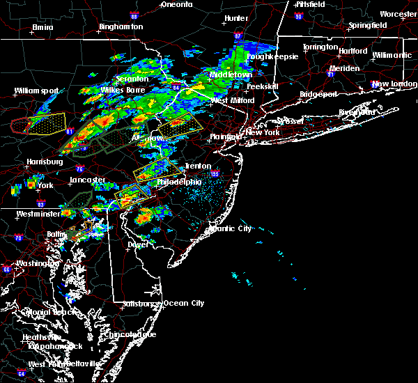 At 411 pm edt, doppler radar indicated a severe thunderstorm capable of producing large hail up to ping pong ball size and destructive winds in excess of 70 mph. this storm was located over budd lake, or 13 miles south of newton, moving east at 30 mph. this severe storm will be near, chester around 415 pm edt. stanhope, netcong and succasunna around 420 pm edt. mendham and succasunna-kenvil around 425 pm edt. dover, hopatcong, wharton and mount arlington around 430 pm edt. other locations impacted by this severe thunderstorm include beattyestown. At 411 pm edt, doppler radar indicated a severe thunderstorm capable of producing large hail up to ping pong ball size and destructive winds in excess of 70 mph. this storm was located over budd lake, or 13 miles south of newton, moving east at 30 mph. this severe storm will be near, chester around 415 pm edt. stanhope, netcong and succasunna around 420 pm edt. mendham and succasunna-kenvil around 425 pm edt. dover, hopatcong, wharton and mount arlington around 430 pm edt. other locations impacted by this severe thunderstorm include beattyestown.
|
| 6/30/2015 3:47 PM EDT |
 At 345 pm edt, doppler radar indicated a severe thunderstorm capable of producing large hail up to ping pong ball size and destructive winds in excess of 70 mph. this storm was located over oxford, or 14 miles northeast of easton, and moving east at 30 mph. * this severe thunderstorm will be near, califon and great meadows-vienna around 355 pm edt. beatyestown around 400 pm edt. hackettstown, long valley and allamuchy-panther valley around 405 pm edt. chester around 415 pm edt. stanhope, netcong and budd lake around 420 pm edt. mendham, succasunna-kenvil and succasunna around 425 pm edt. dover, hopatcong, wharton and mount arlington around 430 pm edt. other locations impacted by this severe thunderstorm include beattyestown. At 345 pm edt, doppler radar indicated a severe thunderstorm capable of producing large hail up to ping pong ball size and destructive winds in excess of 70 mph. this storm was located over oxford, or 14 miles northeast of easton, and moving east at 30 mph. * this severe thunderstorm will be near, califon and great meadows-vienna around 355 pm edt. beatyestown around 400 pm edt. hackettstown, long valley and allamuchy-panther valley around 405 pm edt. chester around 415 pm edt. stanhope, netcong and budd lake around 420 pm edt. mendham, succasunna-kenvil and succasunna around 425 pm edt. dover, hopatcong, wharton and mount arlington around 430 pm edt. other locations impacted by this severe thunderstorm include beattyestown.
|
| 6/30/2015 3:36 PM EDT |
 At 335 pm edt, doppler radar indicated a severe thunderstorm capable of producing large hail up to ping pong ball size and destructive winds in excess of 70 mph. this storm was located over columbia, or 17 miles northeast of easton. trees and wires have been reported down with this storm. this severe storm will be near, hope and great meadows-vienna around 340 pm edt. allamuchy-panther valley around 345 pm edt. other locations impacted by this severe thunderstorm include beattyestown. At 335 pm edt, doppler radar indicated a severe thunderstorm capable of producing large hail up to ping pong ball size and destructive winds in excess of 70 mph. this storm was located over columbia, or 17 miles northeast of easton. trees and wires have been reported down with this storm. this severe storm will be near, hope and great meadows-vienna around 340 pm edt. allamuchy-panther valley around 345 pm edt. other locations impacted by this severe thunderstorm include beattyestown.
|
| 6/30/2015 3:14 PM EDT |
 At 313 pm edt, doppler radar indicated a severe thunderstorm capable of producing large hail up to ping pong ball size and destructive winds in excess of 70 mph. this storm was located near harmony, or 7 miles north of easton, moving northeast at 35 mph. this severe storm will be near, belvidere around 325 pm edt. oxford around 330 pm edt. hope and great meadows-vienna around 340 pm edt. allamuchy-panther valley around 345 pm edt. other locations impacted by this severe thunderstorm include palmer heights, freemansburg, beattyestown, phillipsburg, eastlawn gardens and stockertown. At 313 pm edt, doppler radar indicated a severe thunderstorm capable of producing large hail up to ping pong ball size and destructive winds in excess of 70 mph. this storm was located near harmony, or 7 miles north of easton, moving northeast at 35 mph. this severe storm will be near, belvidere around 325 pm edt. oxford around 330 pm edt. hope and great meadows-vienna around 340 pm edt. allamuchy-panther valley around 345 pm edt. other locations impacted by this severe thunderstorm include palmer heights, freemansburg, beattyestown, phillipsburg, eastlawn gardens and stockertown.
|
| 6/30/2015 3:00 PM EDT |
 At 258 pm edt, doppler radar indicated a severe thunderstorm capable of producing large hail up to ping pong ball size and destructive winds in excess of 70 mph. this storm was located over nazareth, or near easton, and moving northeast at 35 mph. numerous wires and trees have been reported down along the path of this storm along with a funnel cloud. * this severe thunderstorm will be near, alpha and belfast around 305 pm edt. harmony around 315 pm edt. roxburg around 320 pm edt. belvidere around 325 pm edt. oxford around 330 pm edt. hope and great meadows-vienna around 340 pm edt. blairstown and allamuchy-panther valley around 345 pm edt. other locations impacted by this severe thunderstorm include palmer heights, phillipsburg, eastlawn gardens, stockertown, freemansburg, beattyestown, fountain hill and portland. At 258 pm edt, doppler radar indicated a severe thunderstorm capable of producing large hail up to ping pong ball size and destructive winds in excess of 70 mph. this storm was located over nazareth, or near easton, and moving northeast at 35 mph. numerous wires and trees have been reported down along the path of this storm along with a funnel cloud. * this severe thunderstorm will be near, alpha and belfast around 305 pm edt. harmony around 315 pm edt. roxburg around 320 pm edt. belvidere around 325 pm edt. oxford around 330 pm edt. hope and great meadows-vienna around 340 pm edt. blairstown and allamuchy-panther valley around 345 pm edt. other locations impacted by this severe thunderstorm include palmer heights, phillipsburg, eastlawn gardens, stockertown, freemansburg, beattyestown, fountain hill and portland.
|
| 6/23/2015 2:45 PM EDT |
 At 244 pm edt, doppler radar indicated a line of severe thunderstorms capable of producing damaging winds in excess of 60 mph. these storms were located along a line extending from near hainesville to bushkill to near great meadows-vienna, moving east at 65 mph. locations impacted include, newton, montague, dover, hopatcong, hackettstown, wharton, rockaway, blairstown, mount arlington, franklin, mountain lakes, stanhope, hamburg, netcong, belvidere, oxford, ogdensburg, sussex, hope and victory gardens. At 244 pm edt, doppler radar indicated a line of severe thunderstorms capable of producing damaging winds in excess of 60 mph. these storms were located along a line extending from near hainesville to bushkill to near great meadows-vienna, moving east at 65 mph. locations impacted include, newton, montague, dover, hopatcong, hackettstown, wharton, rockaway, blairstown, mount arlington, franklin, mountain lakes, stanhope, hamburg, netcong, belvidere, oxford, ogdensburg, sussex, hope and victory gardens.
|
| 6/23/2015 2:29 PM EDT |
 At 228 pm edt, doppler radar indicated a developing line of severe thunderstorms capable of producing damaging winds in excess of 60 mph. these storms were located along a line extending from near skytop to analomink to east bangor, and moving east at 75 mph. At 228 pm edt, doppler radar indicated a developing line of severe thunderstorms capable of producing damaging winds in excess of 60 mph. these storms were located along a line extending from near skytop to analomink to east bangor, and moving east at 75 mph.
|
| 6/12/2015 6:23 PM EDT |
 The national weather service in mount holly nj has issued a * severe thunderstorm warning for. northern warren county in northwestern new jersey. sussex county in northwestern new jersey. until 730 pm edt * at 622 pm edt. Doppler radar indicated a severe thunderstorm. The national weather service in mount holly nj has issued a * severe thunderstorm warning for. northern warren county in northwestern new jersey. sussex county in northwestern new jersey. until 730 pm edt * at 622 pm edt. Doppler radar indicated a severe thunderstorm.
|
| 6/12/2015 5:41 PM EDT |
 At 540 pm edt, doppler radar indicated a severe thunderstorm capable of producing damaging winds in excess of 60 mph. this storm was located over tatamy, or near easton, and moving northeast at 35 mph. At 540 pm edt, doppler radar indicated a severe thunderstorm capable of producing damaging winds in excess of 60 mph. this storm was located over tatamy, or near easton, and moving northeast at 35 mph.
|
| 5/16/2015 6:39 PM EDT | At 639 pm edt, doppler radar indicated a severe thunderstorm capable of producing quarter size hail and damaging winds in excess of 60 mph. this storm was located near mendham, or 7 miles west of morristown. this storm was nearly stationary. this severe storm will be near, morris plains around 645 pm edt. morristown and far hills around 650 pm edt. madison around 700 pm edt. other locations impacted by this severe thunderstorm include bernardsville, hanover township and white meadow lake. |
| 5/16/2015 6:10 PM EDT | At 610 pm edt, doppler radar indicated a severe thunderstorm capable of producing quarter size hail and damaging winds in excess of 60 mph. this storm was located over greendell, or near newton, and moving southeast at 30 mph. * this severe thunderstorm will be near, hopatcong and hackettstown around 615 pm edt. stanhope and beatyestown around 620 pm edt. mount arlington, netcong, budd lake and long valley around 625 pm edt. succasunna and succasunna-kenvil around 630 pm edt. dover, wharton, chester and victory gardens around 635 pm edt. mendham around 640 pm edt. morris plains and peapack and gladstone around 645 pm edt. morristown and far hills around 650 pm edt. other locations impacted by this severe thunderstorm include white meadow lake, bernardsville, beattyestown and hanover township. |
Hail Maps for Hackettstown, NJ


Connect with Interactive Hail Maps