

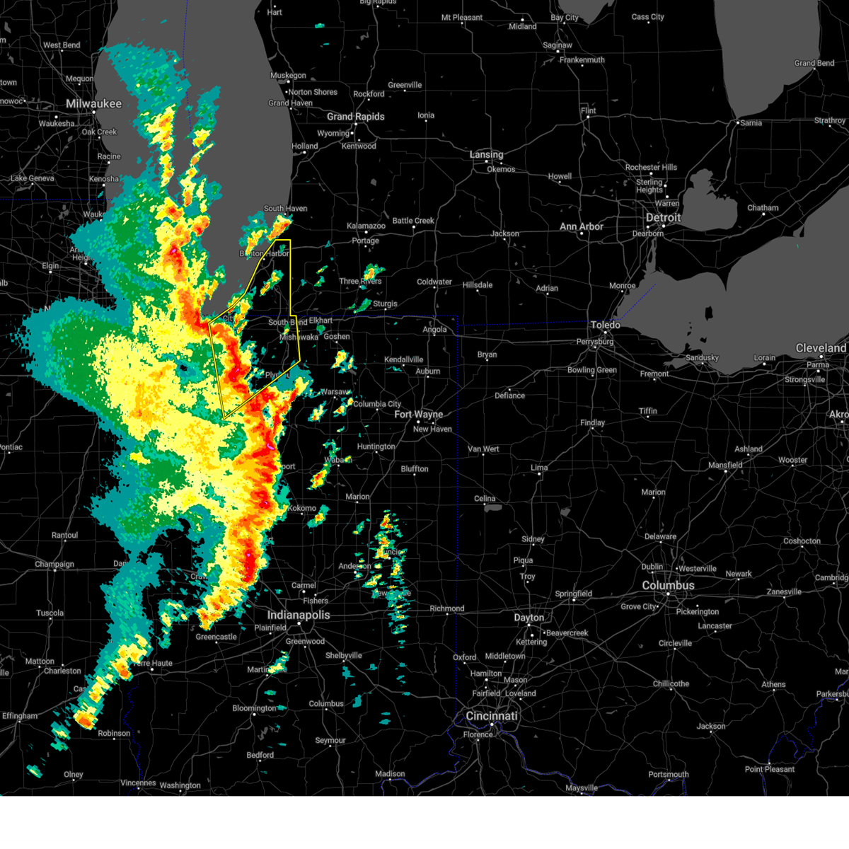
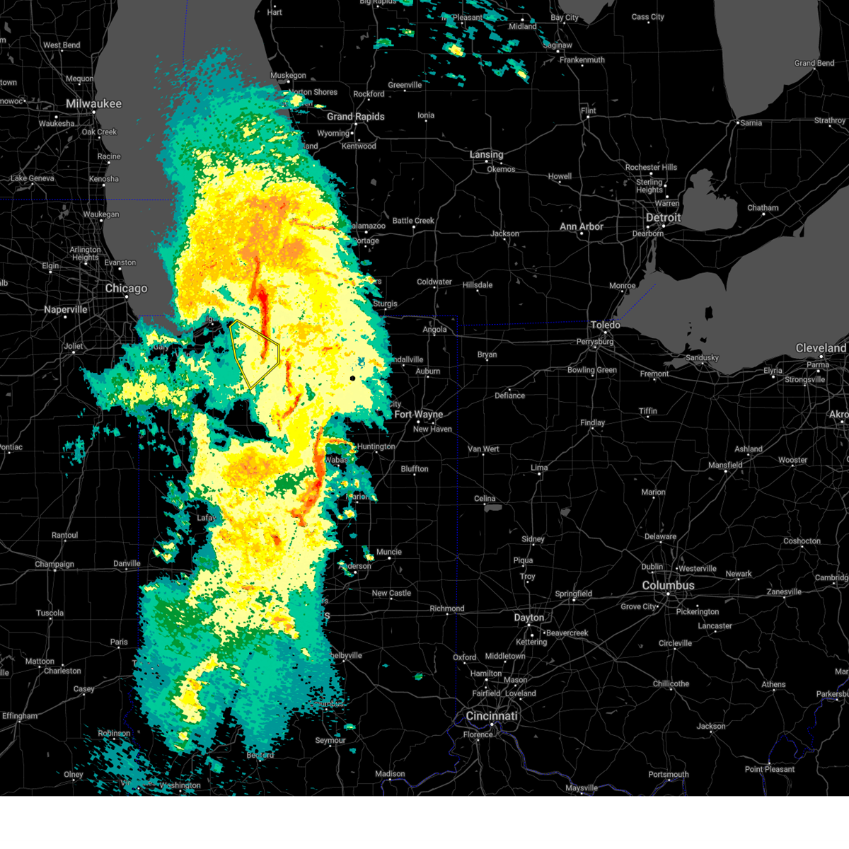
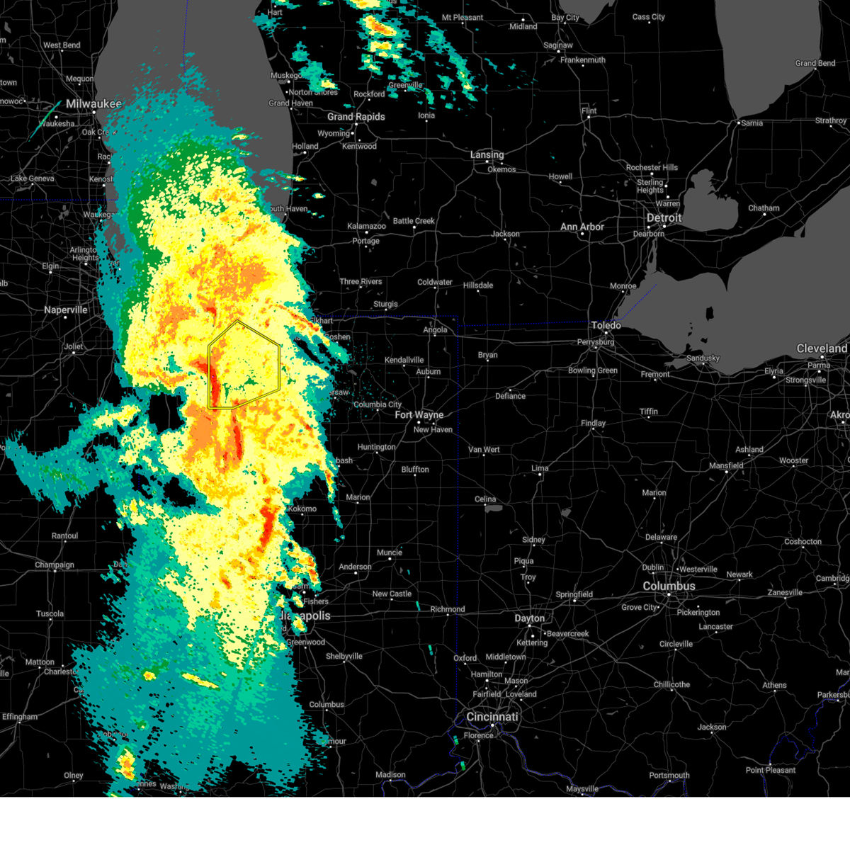
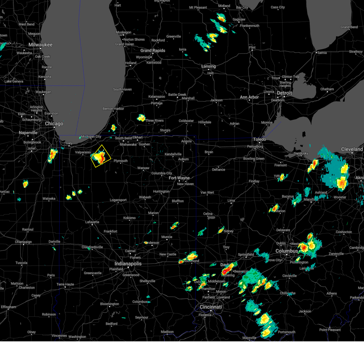
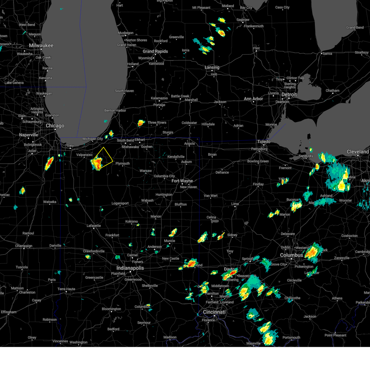
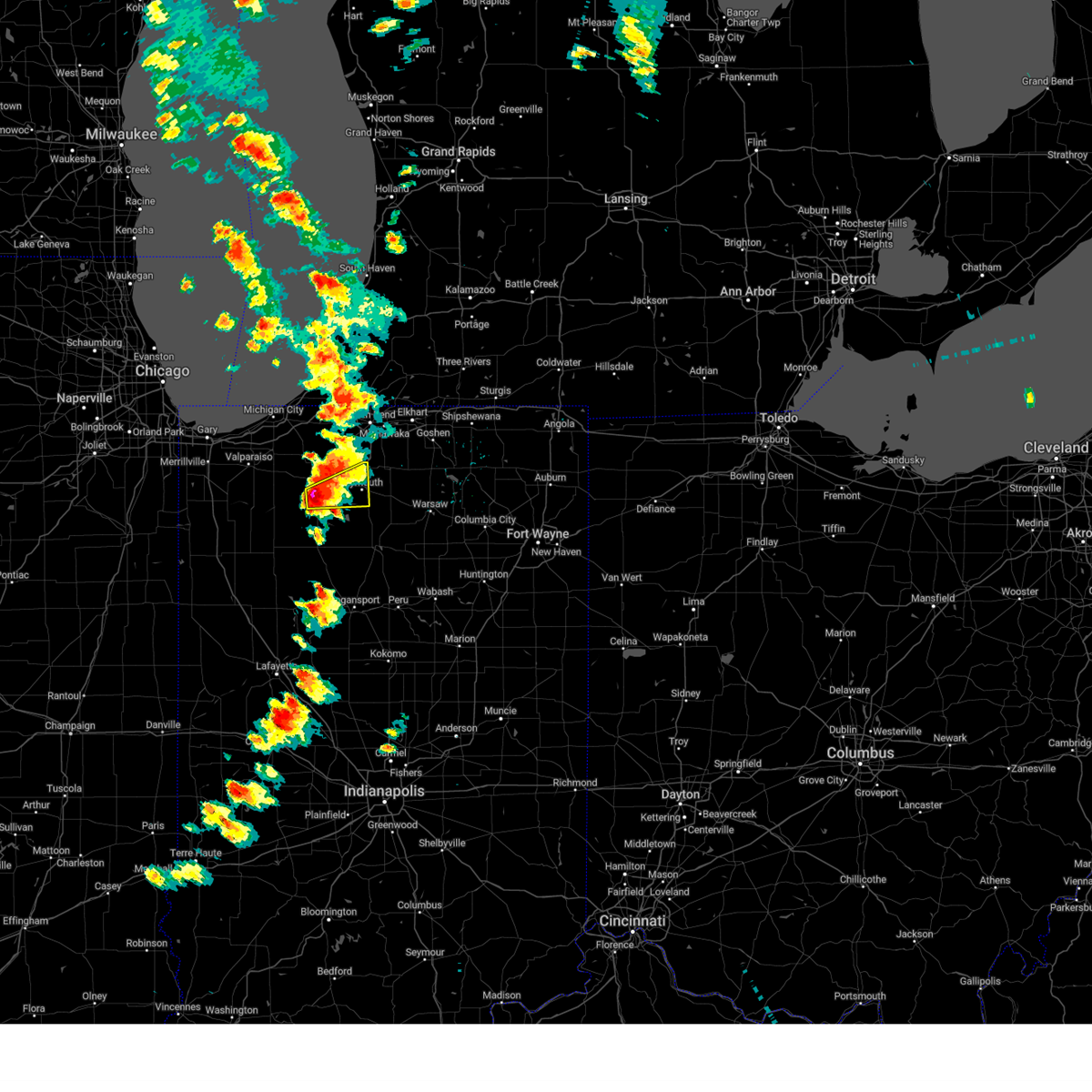
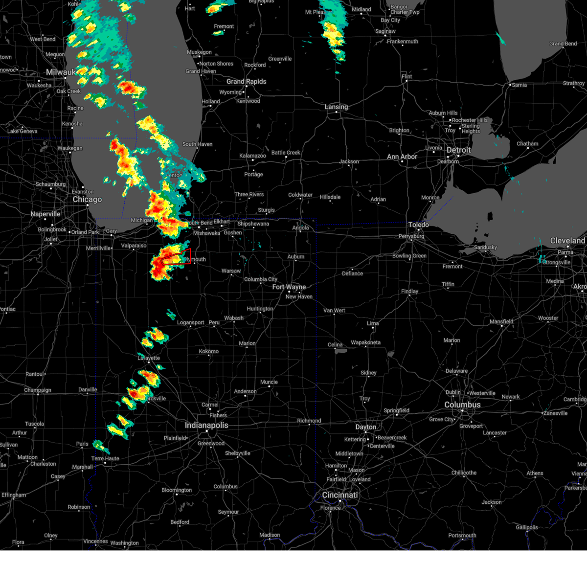
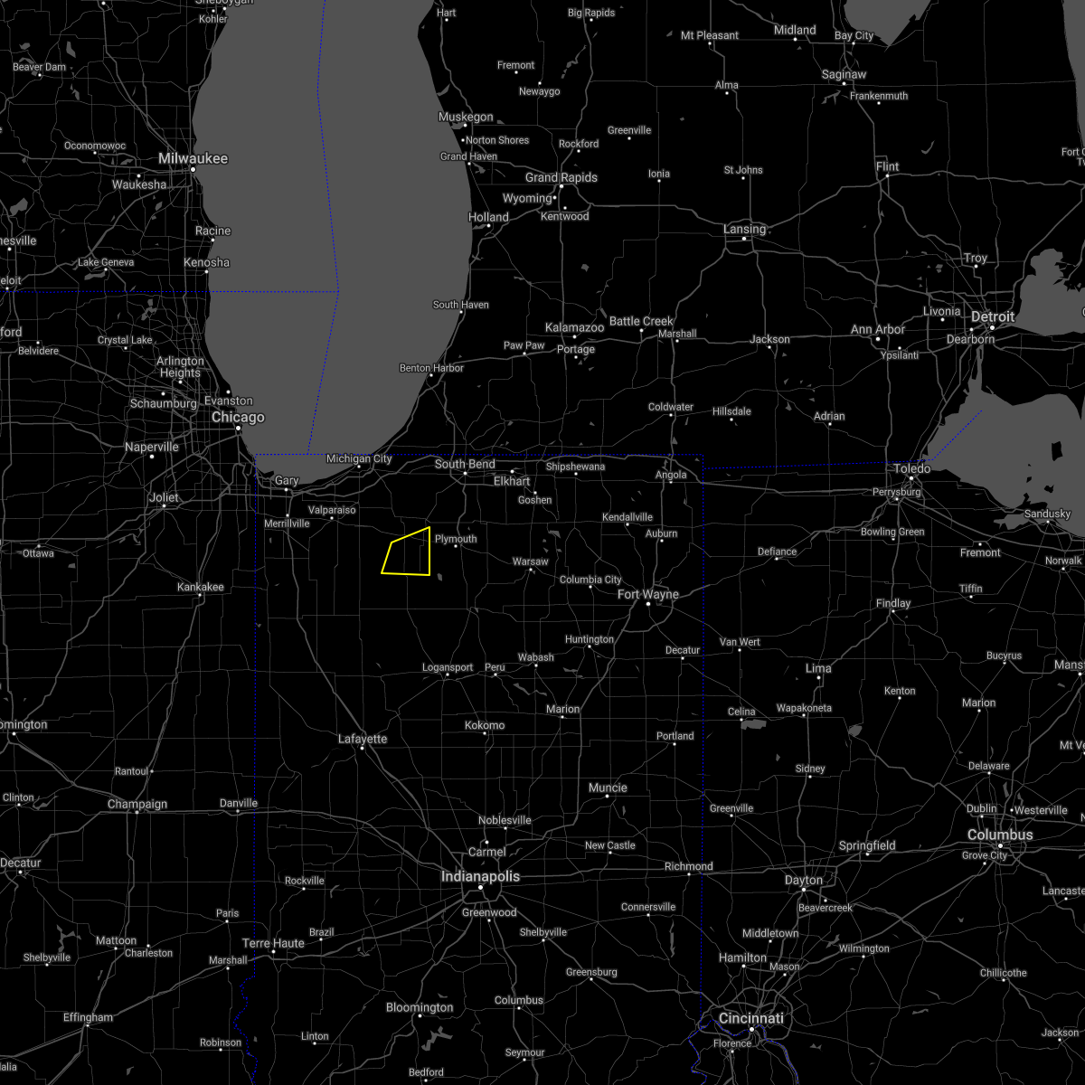
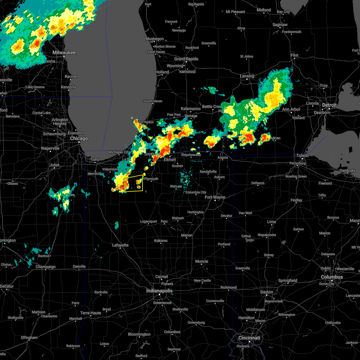
Hail Map for Hamlet, IN
The Hamlet, IN area has had 2 reports of on-the-ground hail by trained spotters, and has been under severe weather warnings 26 times during the past 12 months. Doppler radar has detected hail at or near Hamlet, IN on 51 occasions, including 2 occasions during the past year.
| Name: | Hamlet, IN |
| Where Located: | 64.5 miles ESE of Chicago, IL |
| Map: | Google Map for Hamlet, IN |
| Population: | 800 |
| Housing Units: | 332 |
| More Info: | Search Google for Hamlet, IN |
2
The Top Recent Hail Date for Hamlet, IN is Wednesday, June 25, 2025 (15th out of 51)
Hail and Wind Damage Spotted near Hamlet, IN
| Date / Time | Report Details |
|---|---|
| 7/16/2025 5:43 PM CDT |
 The storms which prompted the warning have weakened below severe limits, and no longer pose an immediate threat to life or property. therefore, the warning will be allowed to expire. however, gusty winds up to 50 mph are still possible with these thunderstorms. a severe thunderstorm watch remains in effect until midnight edt/1100 pm cdt/ for north central and northwestern indiana, and southwestern michigan. The storms which prompted the warning have weakened below severe limits, and no longer pose an immediate threat to life or property. therefore, the warning will be allowed to expire. however, gusty winds up to 50 mph are still possible with these thunderstorms. a severe thunderstorm watch remains in effect until midnight edt/1100 pm cdt/ for north central and northwestern indiana, and southwestern michigan.
|
| 7/16/2025 5:21 PM CDT |
 At 621 pm edt/521 pm cdt/, severe thunderstorms were located along a line extending from three oaks to 6 miles west of hamlet, moving east at 40 mph (radar indicated). Hazards include 60 mph wind gusts. Expect damage to roofs, siding, and trees. locations impacted include, south bend, la porte, niles, buchanan, gulivoire park, granger, bridgman, walkerton, north liberty, new buffalo, new carlisle, berrien springs, three oaks, kingsford heights, hamlet, lakeville, roseland, shorewood-tower hill, shorewood-tower hills-harbert, and koontz lake. this includes the following highways, interstate 80 in indiana between mile markers 47 and 78. interstate 94 in indiana near mile marker 45. Interstate 94 in michigan between mile markers 0 and 18. At 621 pm edt/521 pm cdt/, severe thunderstorms were located along a line extending from three oaks to 6 miles west of hamlet, moving east at 40 mph (radar indicated). Hazards include 60 mph wind gusts. Expect damage to roofs, siding, and trees. locations impacted include, south bend, la porte, niles, buchanan, gulivoire park, granger, bridgman, walkerton, north liberty, new buffalo, new carlisle, berrien springs, three oaks, kingsford heights, hamlet, lakeville, roseland, shorewood-tower hill, shorewood-tower hills-harbert, and koontz lake. this includes the following highways, interstate 80 in indiana between mile markers 47 and 78. interstate 94 in indiana near mile marker 45. Interstate 94 in michigan between mile markers 0 and 18.
|
| 7/16/2025 4:45 PM CDT |
 Svriwx the national weather service in northern indiana has issued a * severe thunderstorm warning for, st. joseph county in north central indiana, northeastern starke county in northwestern indiana, northwestern marshall county in north central indiana, la porte county in northwestern indiana, berrien county in southwestern michigan, * until 645 pm edt/545 pm cdt/. * at 544 pm edt/444 pm cdt/, severe thunderstorms were located along a line extending from 8 miles northwest of beverly shores to near kouts, moving northeast at 40 mph (trained weather spotters). Hazards include 60 mph wind gusts. expect damage to roofs, siding, and trees Svriwx the national weather service in northern indiana has issued a * severe thunderstorm warning for, st. joseph county in north central indiana, northeastern starke county in northwestern indiana, northwestern marshall county in north central indiana, la porte county in northwestern indiana, berrien county in southwestern michigan, * until 645 pm edt/545 pm cdt/. * at 544 pm edt/444 pm cdt/, severe thunderstorms were located along a line extending from 8 miles northwest of beverly shores to near kouts, moving northeast at 40 mph (trained weather spotters). Hazards include 60 mph wind gusts. expect damage to roofs, siding, and trees
|
| 6/18/2025 3:46 PM EDT | the severe thunderstorm warning has been cancelled and is no longer in effect |
| 6/18/2025 3:46 PM EDT | At 345 pm edt/245 pm cdt/, severe thunderstorms were located along a line extending from near westville to near knox to near logansport, moving northeast at 60 mph (radar indicated and frequent lightning). Hazards include 70 mph wind gusts. Expect considerable tree damage. damage is likely to mobile homes, roofs, and outbuildings. locations impacted include, south bend, la porte, logansport, plymouth, rochester, westville, knox, winamac, walkerton, north liberty, north judson, argos, kingsford heights, culver, wanatah, royal center, hamlet, lakeville, koontz lake, and pulaski. This includes interstate 80 in indiana between mile markers 38 and 42. |
| 6/18/2025 3:30 PM EDT | Svriwx the national weather service in northern indiana has issued a * severe thunderstorm warning for, white county in northwestern indiana, southwestern st. joseph county in north central indiana, fulton county in north central indiana, pulaski county in northwestern indiana, northwestern cass county in north central indiana, starke county in northwestern indiana, western marshall county in north central indiana, la porte county in northwestern indiana, * until 415 pm edt/315 pm cdt/. * at 330 pm edt/230 pm cdt/, severe thunderstorms were located along a line extending from near la crosse to 6 miles northwest of winamac to near royal center, moving northeast at 50 mph (radar indicated). Hazards include 70 mph wind gusts. Expect considerable tree damage. Damage is likely to mobile homes, roofs, and outbuildings. |
| 6/18/2025 3:00 PM EDT |
 At 259 pm edt/159 pm cdt/, severe thunderstorms were located along a line extending from roselawn to near wolcott to near brookston, moving northeast at 75 mph (radar indicated). Hazards include 70 mph wind gusts and penny size hail. Expect considerable tree damage. damage is likely to mobile homes, roofs, and outbuildings. locations impacted include, monticello, knox, winamac, monon, north judson, brookston, wanatah, wolcott, francesville, royal center, hamlet, medaryville, la crosse, koontz lake, pulaski, oak grove, ripley, hanna, reynolds, and chalmers. This includes interstate 65 between mile markers 185 and 198. At 259 pm edt/159 pm cdt/, severe thunderstorms were located along a line extending from roselawn to near wolcott to near brookston, moving northeast at 75 mph (radar indicated). Hazards include 70 mph wind gusts and penny size hail. Expect considerable tree damage. damage is likely to mobile homes, roofs, and outbuildings. locations impacted include, monticello, knox, winamac, monon, north judson, brookston, wanatah, wolcott, francesville, royal center, hamlet, medaryville, la crosse, koontz lake, pulaski, oak grove, ripley, hanna, reynolds, and chalmers. This includes interstate 65 between mile markers 185 and 198.
|
| 6/18/2025 2:31 PM EDT |
 Svriwx the national weather service in northern indiana has issued a * severe thunderstorm warning for, white county in northwestern indiana, pulaski county in northwestern indiana, northwestern cass county in north central indiana, starke county in northwestern indiana, southern la porte county in northwestern indiana, * until 330 pm edt/230 pm cdt/. * at 230 pm edt/130 pm cdt/, severe thunderstorms were located along a line extending from near bradley to morocco to 6 miles northwest of williamsport, moving northeast at 50 mph (radar indicated). Hazards include 70 mph wind gusts and penny size hail. Expect considerable tree damage. Damage is likely to mobile homes, roofs, and outbuildings. Svriwx the national weather service in northern indiana has issued a * severe thunderstorm warning for, white county in northwestern indiana, pulaski county in northwestern indiana, northwestern cass county in north central indiana, starke county in northwestern indiana, southern la porte county in northwestern indiana, * until 330 pm edt/230 pm cdt/. * at 230 pm edt/130 pm cdt/, severe thunderstorms were located along a line extending from near bradley to morocco to 6 miles northwest of williamsport, moving northeast at 50 mph (radar indicated). Hazards include 70 mph wind gusts and penny size hail. Expect considerable tree damage. Damage is likely to mobile homes, roofs, and outbuildings.
|
| 4/2/2025 7:55 PM EDT | The storms which prompted the warning have moved out of the area. therefore, the warning will be allowed to expire. however, gusty winds to 40 mph and heavy rain are still possible with these thunderstorms through 830 pm edt. a tornado watch remains in effect until 1100 pm edt/1000 pm cdt/ for north central and northwestern indiana. |
| 4/2/2025 7:39 PM EDT | At 739 pm edt/639 pm cdt/, a severe thunderstorm capable of producing a tornado was located over hamlet, or 8 miles northeast of knox, moving northeast at 65 mph (radar indicated rotation). Hazards include tornado and half dollar size hail. Flying debris will be dangerous to those caught without shelter. mobile homes will be damaged or destroyed. damage to roofs, windows, and vehicles will occur. tree damage is likely. Locations impacted include, hamlet, north liberty, lakeville, teegarden, koontz lake, la paz, crumstown, walkerton, tyner, woodland, gulivoire park, wyatt, grovertown, south bend, and mishawaka. |
| 4/2/2025 7:29 PM EDT | At 728 pm edt/628 pm cdt/, severe thunderstorms were located along a line extending from near hamlet to 6 miles west of winamac to near wolcott, moving northeast at 70 mph (radar indicated). Hazards include 60 mph wind gusts and half dollar size hail. Hail damage to vehicles is expected. expect wind damage to roofs, siding, and trees. Locations impacted include, lomax, beardstown, la crosse, brems, knox, hibbard, clarks, medaryville, star city, thornhope, north judson, grovertown, buffalo, vanmeter park, oak grove, burr oak, maxinkuckee, headlee, winamac, and lawton. |
| 4/2/2025 7:29 PM EDT | Toriwx the national weather service in northern indiana has issued a * tornado warning for, central st. joseph county in north central indiana, eastern starke county in northwestern indiana, northwestern marshall county in north central indiana, southeastern la porte county in northwestern indiana, * until 800 pm edt/700 pm cdt/. * at 729 pm edt/629 pm cdt/, a severe thunderstorm capable of producing a tornado was located near knox, moving northeast at 70 mph (radar indicated rotation). Hazards include tornado and half dollar size hail. Flying debris will be dangerous to those caught without shelter. mobile homes will be damaged or destroyed. damage to roofs, windows, and vehicles will occur. Tree damage is likely. |
| 4/2/2025 7:04 PM EDT | At 703 pm edt/603 pm cdt/, severe thunderstorms were located along a line extending from la crosse to medaryville to near remington, moving northeast at 60 mph (radar indicated). Hazards include 60 mph wind gusts and half dollar size hail. Hail damage to vehicles is expected. expect wind damage to roofs, siding, and trees. Locations impacted include, lomax, beardstown, la crosse, brems, knox, hibbard, clarks, medaryville, star city, thornhope, north judson, grovertown, buffalo, vanmeter park, oak grove, burr oak, maxinkuckee, headlee, winamac, and lawton. |
| 4/2/2025 6:39 PM EDT | Svriwx the national weather service in northern indiana has issued a * severe thunderstorm warning for, northern white county in northwestern indiana, western fulton county in north central indiana, pulaski county in northwestern indiana, northern cass county in north central indiana, starke county in northwestern indiana, southwestern marshall county in north central indiana, southwestern la porte county in northwestern indiana, * until 800 pm edt/700 pm cdt/. * at 637 pm edt/537 pm cdt/, severe thunderstorms were located along a line extending from demotte to 6 miles northeast of oxford, moving east at 50 mph (radar indicated). Hazards include 60 mph wind gusts and half dollar size hail. Hail damage to vehicles is expected. Expect wind damage to roofs, siding, and trees. |
| 3/30/2025 3:25 PM CDT | The storm which prompted the warning has weakened below severe limits, and has exited the warned area. therefore, the warning will be allowed to expire. however, gusty winds are still possible with this thunderstorm. a tornado watch remains in effect until 700 pm cdt for northwestern indiana. remember, a severe thunderstorm warning still remains in effect. |
| 3/30/2025 4:20 PM EDT |
 At 419 pm edt/319 pm cdt/, severe thunderstorms were located along a line extending from near trail creek to knox, moving northeast at 65 mph (emergency management). Hazards include 70 mph wind gusts and nickel size hail. Expect considerable tree damage. damage is likely to mobile homes, roofs, and outbuildings. locations impacted include, harbert, shorewood-tower hill, paw paw lake, tyner, new carlisle, lake michigan beach, north judson, grovertown, byron, grand beach, niles, oak grove, roseland, walkerton, union mills, buchanan, watervliet, springville, hamlet, and coloma. this includes the following highways, interstate 196 between mile markers 0 and 7. interstate 80 in indiana between mile markers 39 and 80. interstate 94 in indiana between mile markers 34 and 45. Interstate 94 in michigan between mile markers 0 and 42. At 419 pm edt/319 pm cdt/, severe thunderstorms were located along a line extending from near trail creek to knox, moving northeast at 65 mph (emergency management). Hazards include 70 mph wind gusts and nickel size hail. Expect considerable tree damage. damage is likely to mobile homes, roofs, and outbuildings. locations impacted include, harbert, shorewood-tower hill, paw paw lake, tyner, new carlisle, lake michigan beach, north judson, grovertown, byron, grand beach, niles, oak grove, roseland, walkerton, union mills, buchanan, watervliet, springville, hamlet, and coloma. this includes the following highways, interstate 196 between mile markers 0 and 7. interstate 80 in indiana between mile markers 39 and 80. interstate 94 in indiana between mile markers 34 and 45. Interstate 94 in michigan between mile markers 0 and 42.
|
| 3/30/2025 3:10 PM CDT |
 At 310 pm cdt, a severe thunderstorm capable of producing a tornado was located near north judson, or 7 miles west of knox, moving northeast at 55 mph (radar indicated rotation). Hazards include tornado. Flying debris will be dangerous to those caught without shelter. mobile homes will be damaged or destroyed. damage to roofs, windows, and vehicles will occur. tree damage is likely. this dangerous storm will be near, knox around 315 pm cdt. hamlet around 320 pm cdt. Other locations impacted by this tornadic thunderstorm include toto, brems, ober, winona, english lake, and bass lake. At 310 pm cdt, a severe thunderstorm capable of producing a tornado was located near north judson, or 7 miles west of knox, moving northeast at 55 mph (radar indicated rotation). Hazards include tornado. Flying debris will be dangerous to those caught without shelter. mobile homes will be damaged or destroyed. damage to roofs, windows, and vehicles will occur. tree damage is likely. this dangerous storm will be near, knox around 315 pm cdt. hamlet around 320 pm cdt. Other locations impacted by this tornadic thunderstorm include toto, brems, ober, winona, english lake, and bass lake.
|
| 3/30/2025 3:10 PM CDT |
 the tornado warning has been cancelled and is no longer in effect the tornado warning has been cancelled and is no longer in effect
|
| 3/30/2025 3:05 PM CDT |
 Toriwx the national weather service in northern indiana has issued a * tornado warning for, northwestern pulaski county in northwestern indiana, starke county in northwestern indiana, * until 430 pm edt/330 pm cdt/. * at 405 pm edt/305 pm cdt/, a severe thunderstorm capable of producing a tornado was located near north judson, or 11 miles east of wheatfield, moving northeast at 50 mph (radar indicated rotation). Hazards include tornado. Flying debris will be dangerous to those caught without shelter. mobile homes will be damaged or destroyed. damage to roofs, windows, and vehicles will occur. tree damage is likely. this dangerous storm will be near, north judson around 310 pm cdt. knox around 315 pm cdt. hamlet around 320 pm cdt. Other locations impacted by this tornadic thunderstorm include toto, ober, winona, english lake, bass lake, san pierre, denham, and brems. Toriwx the national weather service in northern indiana has issued a * tornado warning for, northwestern pulaski county in northwestern indiana, starke county in northwestern indiana, * until 430 pm edt/330 pm cdt/. * at 405 pm edt/305 pm cdt/, a severe thunderstorm capable of producing a tornado was located near north judson, or 11 miles east of wheatfield, moving northeast at 50 mph (radar indicated rotation). Hazards include tornado. Flying debris will be dangerous to those caught without shelter. mobile homes will be damaged or destroyed. damage to roofs, windows, and vehicles will occur. tree damage is likely. this dangerous storm will be near, north judson around 310 pm cdt. knox around 315 pm cdt. hamlet around 320 pm cdt. Other locations impacted by this tornadic thunderstorm include toto, ober, winona, english lake, bass lake, san pierre, denham, and brems.
|
| 3/30/2025 4:03 PM EDT |
 At 403 pm edt/303 pm cdt/, severe thunderstorms were located along a line extending from near porter to 6 miles west of medaryville, moving northeast at 60 mph (radar indicated). Hazards include 70 mph wind gusts and nickel size hail. Expect considerable tree damage. damage is likely to mobile homes, roofs, and outbuildings. locations impacted include, harbert, la crosse, shorewood-tower hill, paw paw lake, tyner, clarks, medaryville, new carlisle, lake michigan beach, haskell, north judson, grovertown, byron, grand beach, niles, oak grove, roseland, walkerton, union mills, and buchanan. this includes the following highways, interstate 196 between mile markers 0 and 7. interstate 80 in indiana between mile markers 38 and 80. interstate 94 in indiana between mile markers 33 and 45. Interstate 94 in michigan between mile markers 0 and 42. At 403 pm edt/303 pm cdt/, severe thunderstorms were located along a line extending from near porter to 6 miles west of medaryville, moving northeast at 60 mph (radar indicated). Hazards include 70 mph wind gusts and nickel size hail. Expect considerable tree damage. damage is likely to mobile homes, roofs, and outbuildings. locations impacted include, harbert, la crosse, shorewood-tower hill, paw paw lake, tyner, clarks, medaryville, new carlisle, lake michigan beach, haskell, north judson, grovertown, byron, grand beach, niles, oak grove, roseland, walkerton, union mills, and buchanan. this includes the following highways, interstate 196 between mile markers 0 and 7. interstate 80 in indiana between mile markers 38 and 80. interstate 94 in indiana between mile markers 33 and 45. Interstate 94 in michigan between mile markers 0 and 42.
|
| 3/30/2025 3:51 PM EDT |
 Svriwx the national weather service in northern indiana has issued a * severe thunderstorm warning for, st. joseph county in north central indiana, northwestern pulaski county in northwestern indiana, starke county in northwestern indiana, northwestern marshall county in north central indiana, la porte county in northwestern indiana, berrien county in southwestern michigan, * until 500 pm edt/400 pm cdt/. * at 351 pm edt/251 pm cdt/, severe thunderstorms were located along a line extending from near portage to rensselaer, moving northeast at 60 mph (radar indicated). Hazards include 60 mph wind gusts and nickel size hail. expect damage to roofs, siding, and trees Svriwx the national weather service in northern indiana has issued a * severe thunderstorm warning for, st. joseph county in north central indiana, northwestern pulaski county in northwestern indiana, starke county in northwestern indiana, northwestern marshall county in north central indiana, la porte county in northwestern indiana, berrien county in southwestern michigan, * until 500 pm edt/400 pm cdt/. * at 351 pm edt/251 pm cdt/, severe thunderstorms were located along a line extending from near portage to rensselaer, moving northeast at 60 mph (radar indicated). Hazards include 60 mph wind gusts and nickel size hail. expect damage to roofs, siding, and trees
|
| 3/30/2025 3:31 PM EDT | Svriwx the national weather service in northern indiana has issued a * severe thunderstorm warning for, white county in northwestern indiana, western fulton county in north central indiana, pulaski county in northwestern indiana, cass county in north central indiana, starke county in northwestern indiana, * until 400 pm edt/300 pm cdt/. * at 330 pm edt/230 pm cdt/, severe thunderstorms were located along a line extending from earl park to near oxford, moving northeast at 55 mph (radar indicated). Hazards include 70 mph wind gusts and nickel size hail. Expect considerable tree damage. Damage is likely to mobile homes, roofs, and outbuildings. |
| 3/15/2025 2:53 AM CDT |
 The storms which prompted the warning have moved out of the area. therefore, the warning will be allowed to expire. a severe thunderstorm watch remains in effect until 900 am edt/800 am cdt/ for north central and northwestern indiana. to report severe weather, contact your nearest law enforcement agency. they will relay your report to the national weather service northern indiana. The storms which prompted the warning have moved out of the area. therefore, the warning will be allowed to expire. a severe thunderstorm watch remains in effect until 900 am edt/800 am cdt/ for north central and northwestern indiana. to report severe weather, contact your nearest law enforcement agency. they will relay your report to the national weather service northern indiana.
|
| 3/15/2025 3:44 AM EDT | Svriwx the national weather service in northern indiana has issued a * severe thunderstorm warning for, northwestern elkhart county in north central indiana, st. joseph county in north central indiana, northeastern starke county in northwestern indiana, northwestern marshall county in north central indiana, northeastern la porte county in northwestern indiana, cass county in southwestern michigan, berrien county in southwestern michigan, * until 415 am edt/315 am cdt/. * at 344 am edt/244 am cdt/, severe thunderstorms were located along a line extending from near three oaks to new carlisle to koontz lake, moving northeast at 55 mph (radar indicated). Hazards include 60 mph wind gusts. expect damage to roofs, siding, and trees |
| 3/15/2025 2:40 AM CDT | At 340 am edt/240 am cdt/, severe thunderstorms were located along a line extending from near new carlisle to 6 miles west of north liberty to hamlet, moving northeast at 60 mph (radar indicated). Hazards include 60 mph wind gusts. Expect damage to roofs, siding, and trees. locations impacted include, byron, hamlet, north liberty, teegarden, south center, koontz lake, salem heights, fish lake, tracy, stillwell, rolling prarie, kingsbury, walkerton, tyner, la porte, springville, grovertown, and kingsford heights. This includes interstate 80 in indiana between mile markers 49 and 55. |
| 3/15/2025 2:20 AM CDT |
 Svriwx the national weather service in northern indiana has issued a * severe thunderstorm warning for, southwestern st. joseph county in north central indiana, starke county in northwestern indiana, northwestern marshall county in north central indiana, la porte county in northwestern indiana, * until 400 am edt/300 am cdt/. * at 319 am edt/219 am cdt/, severe thunderstorms were located along a line extending from wanatah to near north judson, moving northeast at 60 mph (radar indicated). Hazards include 60 mph wind gusts. expect damage to roofs, siding, and trees Svriwx the national weather service in northern indiana has issued a * severe thunderstorm warning for, southwestern st. joseph county in north central indiana, starke county in northwestern indiana, northwestern marshall county in north central indiana, la porte county in northwestern indiana, * until 400 am edt/300 am cdt/. * at 319 am edt/219 am cdt/, severe thunderstorms were located along a line extending from wanatah to near north judson, moving northeast at 60 mph (radar indicated). Hazards include 60 mph wind gusts. expect damage to roofs, siding, and trees
|
| 7/15/2024 10:58 PM CDT |
 The storms which prompted the warning have moved out of the area. therefore, the warning will be allowed to expire. however, gusty winds and heavy rain are still possible with these thunderstorms. a tornado watch remains in effect until 200 am edt/100 am cdt/ for north central and northwestern indiana, and southwestern michigan. The storms which prompted the warning have moved out of the area. therefore, the warning will be allowed to expire. however, gusty winds and heavy rain are still possible with these thunderstorms. a tornado watch remains in effect until 200 am edt/100 am cdt/ for north central and northwestern indiana, and southwestern michigan.
|
| 7/15/2024 10:25 PM CDT |
 At 1125 pm edt/1025 pm cdt/, a severe squall line capable of producing both tornadoes and extensive straight line wind damage was located along a line extending from near beverly shores to near valparaiso to near wanatah, moving east at 60 mph (radar indicated rotation). Hazards include tornado. Flying debris will be dangerous to those caught without shelter. mobile homes will be damaged or destroyed. damage to roofs, windows, and vehicles will occur. tree damage is likely. these dangerous storms will be near, michigan city, westville, trail creek, long beach, wanatah, and pottawattamie park around 1130 pm edt. la porte, new buffalo, and kingsford heights around 1135 pm edt. walkerton, new carlisle, and three oaks around 1145 pm edt. north liberty around 1150 pm edt. other locations impacted by these tornadic storms include union pier, lomax, waterford, ober, michiana shores, harbert, pinhook, english lake, salem heights, and fish lake. this includes the following highways, interstate 80 in indiana between mile markers 38 and 66. interstate 94 in indiana between mile markers 33 and 45. Interstate 94 in michigan between mile markers 0 and 11. At 1125 pm edt/1025 pm cdt/, a severe squall line capable of producing both tornadoes and extensive straight line wind damage was located along a line extending from near beverly shores to near valparaiso to near wanatah, moving east at 60 mph (radar indicated rotation). Hazards include tornado. Flying debris will be dangerous to those caught without shelter. mobile homes will be damaged or destroyed. damage to roofs, windows, and vehicles will occur. tree damage is likely. these dangerous storms will be near, michigan city, westville, trail creek, long beach, wanatah, and pottawattamie park around 1130 pm edt. la porte, new buffalo, and kingsford heights around 1135 pm edt. walkerton, new carlisle, and three oaks around 1145 pm edt. north liberty around 1150 pm edt. other locations impacted by these tornadic storms include union pier, lomax, waterford, ober, michiana shores, harbert, pinhook, english lake, salem heights, and fish lake. this includes the following highways, interstate 80 in indiana between mile markers 38 and 66. interstate 94 in indiana between mile markers 33 and 45. Interstate 94 in michigan between mile markers 0 and 11.
|
| 7/15/2024 10:10 PM CDT |
 Toriwx the national weather service in northern indiana has issued a * tornado warning for, western st. joseph county in north central indiana, starke county in northwestern indiana, northwestern marshall county in north central indiana, la porte county in northwestern indiana, southwestern berrien county in southwestern michigan, * until midnight edt/1100 pm cdt/. * at 1109 pm edt/1009 pm cdt/, severe thunderstorms capable of producing both tornadoes and extensive straight line wind damage were located along a line extending from near lake station to winfield to near hebron, moving east at 60 mph. wind gusts up to 80 mph and isolated tornadoes are possible with this line of thunderstorms! (radar indicated rotation). Hazards include tornado. Flying debris will be dangerous to those caught without shelter. mobile homes will be damaged or destroyed. damage to roofs, windows, and vehicles will occur. tree damage is likely. these dangerous storms will be near, michigan city, westville, wanatah, and la crosse around 1125 pm edt. trail creek, long beach, and pottawattamie park around 1130 pm edt. la porte and kingsford heights around 1135 pm edt. hamlet around 1140 pm edt. walkerton, new carlisle, and koontz lake around 1145 pm edt. north liberty around 1150 pm edt. other locations impacted by these tornadic storms include union pier, lomax, waterford, ober, michiana shores, harbert, pinhook, english lake, salem heights, and fish lake. this includes the following highways, interstate 80 in indiana between mile markers 38 and 66. interstate 94 in indiana between mile markers 33 and 45. Interstate 94 in michigan between mile markers 0 and 11. Toriwx the national weather service in northern indiana has issued a * tornado warning for, western st. joseph county in north central indiana, starke county in northwestern indiana, northwestern marshall county in north central indiana, la porte county in northwestern indiana, southwestern berrien county in southwestern michigan, * until midnight edt/1100 pm cdt/. * at 1109 pm edt/1009 pm cdt/, severe thunderstorms capable of producing both tornadoes and extensive straight line wind damage were located along a line extending from near lake station to winfield to near hebron, moving east at 60 mph. wind gusts up to 80 mph and isolated tornadoes are possible with this line of thunderstorms! (radar indicated rotation). Hazards include tornado. Flying debris will be dangerous to those caught without shelter. mobile homes will be damaged or destroyed. damage to roofs, windows, and vehicles will occur. tree damage is likely. these dangerous storms will be near, michigan city, westville, wanatah, and la crosse around 1125 pm edt. trail creek, long beach, and pottawattamie park around 1130 pm edt. la porte and kingsford heights around 1135 pm edt. hamlet around 1140 pm edt. walkerton, new carlisle, and koontz lake around 1145 pm edt. north liberty around 1150 pm edt. other locations impacted by these tornadic storms include union pier, lomax, waterford, ober, michiana shores, harbert, pinhook, english lake, salem heights, and fish lake. this includes the following highways, interstate 80 in indiana between mile markers 38 and 66. interstate 94 in indiana between mile markers 33 and 45. Interstate 94 in michigan between mile markers 0 and 11.
|
| 7/15/2024 12:15 AM CDT | Report from mping: small limbs of 1 to 3 inch diameter broken of in la porte county IN, 9.4 miles SE of Hamlet, IN |
| 6/17/2024 1:58 PM CDT |
 The storm which prompted the warning has weakened below severe limits, and has exited the warned area. therefore, the warning will be allowed to expire. The storm which prompted the warning has weakened below severe limits, and has exited the warned area. therefore, the warning will be allowed to expire.
|
| 6/17/2024 1:45 PM CDT |
 At 145 pm cdt, a severe thunderstorm was located near kingsford heights, or 11 miles southeast of westville, moving northeast at 30 mph (radar indicated). Hazards include 60 mph wind gusts and quarter size hail. Hail damage to vehicles is expected. expect wind damage to roofs, siding, and trees. Locations impacted include, la porte, kingsford heights, wanatah, hamlet, koontz lake, hanna, kingsbury, thomaston, south center, salem heights, brems, tracy, and union mills. At 145 pm cdt, a severe thunderstorm was located near kingsford heights, or 11 miles southeast of westville, moving northeast at 30 mph (radar indicated). Hazards include 60 mph wind gusts and quarter size hail. Hail damage to vehicles is expected. expect wind damage to roofs, siding, and trees. Locations impacted include, la porte, kingsford heights, wanatah, hamlet, koontz lake, hanna, kingsbury, thomaston, south center, salem heights, brems, tracy, and union mills.
|
| 6/17/2024 1:34 PM CDT |
 Svriwx the national weather service in northern indiana has issued a * severe thunderstorm warning for, northern starke county in northwestern indiana, central la porte county in northwestern indiana, * until 200 pm cdt. * at 134 pm cdt, a severe thunderstorm was located near wanatah, or 10 miles southeast of westville, moving northeast at 30 mph (radar indicated). Hazards include 60 mph wind gusts and quarter size hail. Hail damage to vehicles is expected. Expect wind damage to roofs, siding, and trees. Svriwx the national weather service in northern indiana has issued a * severe thunderstorm warning for, northern starke county in northwestern indiana, central la porte county in northwestern indiana, * until 200 pm cdt. * at 134 pm cdt, a severe thunderstorm was located near wanatah, or 10 miles southeast of westville, moving northeast at 30 mph (radar indicated). Hazards include 60 mph wind gusts and quarter size hail. Hail damage to vehicles is expected. Expect wind damage to roofs, siding, and trees.
|
| 5/20/2024 6:20 PM CDT |
 The storms which prompted the warning have moved out of the area. therefore, the warning will be allowed to expire. The storms which prompted the warning have moved out of the area. therefore, the warning will be allowed to expire.
|
| 5/20/2024 6:01 PM CDT |
 At 700 pm edt/600 pm cdt/, severe thunderstorms were located along a line extending from near roseland to near walkerton, moving east at 45 mph (emergency management). Hazards include 70 mph wind gusts and quarter size hail. Hail damage to vehicles is expected. expect considerable tree damage. wind damage is also likely to mobile homes, roofs, and outbuildings. locations impacted include, south bend, mishawaka, la porte, gulivoire park, granger, walkerton, north liberty, new carlisle, kingsford heights, wanatah, hamlet, lakeville, roseland, koontz lake, hanna, la paz, kingsbury, indian village, teegarden, and salem heights. This includes interstate 80 in indiana between mile markers 53 and 63, and between mile markers 67 and 79. At 700 pm edt/600 pm cdt/, severe thunderstorms were located along a line extending from near roseland to near walkerton, moving east at 45 mph (emergency management). Hazards include 70 mph wind gusts and quarter size hail. Hail damage to vehicles is expected. expect considerable tree damage. wind damage is also likely to mobile homes, roofs, and outbuildings. locations impacted include, south bend, mishawaka, la porte, gulivoire park, granger, walkerton, north liberty, new carlisle, kingsford heights, wanatah, hamlet, lakeville, roseland, koontz lake, hanna, la paz, kingsbury, indian village, teegarden, and salem heights. This includes interstate 80 in indiana between mile markers 53 and 63, and between mile markers 67 and 79.
|
| 5/20/2024 5:39 PM CDT |
 Svriwx the national weather service in northern indiana has issued a * severe thunderstorm warning for, st. joseph county in north central indiana, northeastern starke county in northwestern indiana, northwestern marshall county in north central indiana, central la porte county in northwestern indiana, * until 730 pm edt/630 pm cdt/. * at 638 pm edt/538 pm cdt/, severe thunderstorms were located along a line extending from near new carlisle to near wanatah, moving east at 45 mph (radar indicated). Hazards include 60 mph wind gusts and quarter size hail. Hail damage to vehicles is expected. Expect wind damage to roofs, siding, and trees. Svriwx the national weather service in northern indiana has issued a * severe thunderstorm warning for, st. joseph county in north central indiana, northeastern starke county in northwestern indiana, northwestern marshall county in north central indiana, central la porte county in northwestern indiana, * until 730 pm edt/630 pm cdt/. * at 638 pm edt/538 pm cdt/, severe thunderstorms were located along a line extending from near new carlisle to near wanatah, moving east at 45 mph (radar indicated). Hazards include 60 mph wind gusts and quarter size hail. Hail damage to vehicles is expected. Expect wind damage to roofs, siding, and trees.
|
| 7/29/2023 1:10 AM CDT |
 The severe thunderstorm warning for northeastern white, western fulton, pulaski, northwestern cass, eastern starke and western marshall counties will expire at 215 am edt/115 am cdt/, the storms which prompted the warning have moved out of the area. therefore, the warning will be allowed to expire. a severe thunderstorm watch remains in effect until 500 am edt/400 am cdt/ for north central and northwestern indiana. The severe thunderstorm warning for northeastern white, western fulton, pulaski, northwestern cass, eastern starke and western marshall counties will expire at 215 am edt/115 am cdt/, the storms which prompted the warning have moved out of the area. therefore, the warning will be allowed to expire. a severe thunderstorm watch remains in effect until 500 am edt/400 am cdt/ for north central and northwestern indiana.
|
| 7/29/2023 12:42 AM CDT |
 At 141 am edt/1241 am cdt/, severe thunderstorms were located along a line extending from near koontz lake to 9 miles southeast of francesville, moving east at 45 mph (radar indicated). Hazards include 60 mph wind gusts. Expect damage to roofs, siding, and trees. locations impacted include, plymouth, knox, winamac, walkerton, monon, culver, francesville, royal center, hamlet, koontz lake, pulaski, oak grove, ripley, kewanna, la paz, monterey, beardstown, tyner, hibbard, and linkville. hail threat, radar indicated max hail size, <. 75 in wind threat, radar indicated max wind gust, 60 mph. At 141 am edt/1241 am cdt/, severe thunderstorms were located along a line extending from near koontz lake to 9 miles southeast of francesville, moving east at 45 mph (radar indicated). Hazards include 60 mph wind gusts. Expect damage to roofs, siding, and trees. locations impacted include, plymouth, knox, winamac, walkerton, monon, culver, francesville, royal center, hamlet, koontz lake, pulaski, oak grove, ripley, kewanna, la paz, monterey, beardstown, tyner, hibbard, and linkville. hail threat, radar indicated max hail size, <. 75 in wind threat, radar indicated max wind gust, 60 mph.
|
| 7/29/2023 12:15 AM CDT |
 At 115 am edt/1215 am cdt/, severe thunderstorms were located along a line extending from near wanatah to near rensselaer, moving east at 50 mph (radar indicated). Hazards include 70 mph wind gusts. Expect considerable tree damage. Damage is likely to mobile homes, roofs, and outbuildings. At 115 am edt/1215 am cdt/, severe thunderstorms were located along a line extending from near wanatah to near rensselaer, moving east at 50 mph (radar indicated). Hazards include 70 mph wind gusts. Expect considerable tree damage. Damage is likely to mobile homes, roofs, and outbuildings.
|
| 7/14/2023 11:50 PM CDT |
 The severe thunderstorm warning for western st. joseph, starke and la porte counties will expire at 100 am edt/midnight cdt/, the storms which prompted the warning have weakened below severe limits, and no longer pose an immediate threat to life or property. therefore, the warning will be allowed to expire. The severe thunderstorm warning for western st. joseph, starke and la porte counties will expire at 100 am edt/midnight cdt/, the storms which prompted the warning have weakened below severe limits, and no longer pose an immediate threat to life or property. therefore, the warning will be allowed to expire.
|
| 7/14/2023 11:13 PM CDT |
 At 1212 am edt/1112 pm cdt/, severe thunderstorms were located along a line extending from near westville to kouts, moving east at 40 mph (radar indicated). Hazards include 60 mph wind gusts. expect damage to roofs, siding, and trees At 1212 am edt/1112 pm cdt/, severe thunderstorms were located along a line extending from near westville to kouts, moving east at 40 mph (radar indicated). Hazards include 60 mph wind gusts. expect damage to roofs, siding, and trees
|
| 6/25/2023 2:40 PM EDT |
 At 238 pm edt/138 pm cdt/, a severe thunderstorm was located near hamlet, or near knox, moving northeast at 35 mph. this is a destructive storm for northeast starke and northwest marshall counties (radar indicated). Hazards include baseball size hail and 60 mph wind gusts. People and animals outdoors will be severely injured. Expect shattered windows, extensive damage to roofs, siding, and vehicles. At 238 pm edt/138 pm cdt/, a severe thunderstorm was located near hamlet, or near knox, moving northeast at 35 mph. this is a destructive storm for northeast starke and northwest marshall counties (radar indicated). Hazards include baseball size hail and 60 mph wind gusts. People and animals outdoors will be severely injured. Expect shattered windows, extensive damage to roofs, siding, and vehicles.
|
| 6/25/2023 1:34 PM CDT |
 At 233 pm edt/133 pm cdt/, a severe thunderstorm capable of producing a tornado was located over hamlet, or near knox, moving east at 40 mph (radar indicated rotation). Hazards include tornado and ping pong ball size hail. Flying debris will be dangerous to those caught without shelter. mobile homes will be damaged or destroyed. damage to roofs, windows, and vehicles will occur. tree damage is likely. This tornadic thunderstorm will remain over mainly rural areas of northeastern starke and northwestern marshall counties, including the following locations, donaldson, tyner and grovertown. At 233 pm edt/133 pm cdt/, a severe thunderstorm capable of producing a tornado was located over hamlet, or near knox, moving east at 40 mph (radar indicated rotation). Hazards include tornado and ping pong ball size hail. Flying debris will be dangerous to those caught without shelter. mobile homes will be damaged or destroyed. damage to roofs, windows, and vehicles will occur. tree damage is likely. This tornadic thunderstorm will remain over mainly rural areas of northeastern starke and northwestern marshall counties, including the following locations, donaldson, tyner and grovertown.
|
| 6/25/2023 1:30 PM CDT |
 At 230 pm edt/130 pm cdt/, a severe thunderstorm was located over hamlet, or near knox, moving northeast at 50 mph (radar indicated). Hazards include golf ball size hail and 60 mph wind gusts. People and animals outdoors will be injured. expect hail damage to roofs, siding, windows, and vehicles. expect wind damage to roofs, siding, and trees. this severe storm will be near, walkerton and koontz lake around 240 pm edt. plymouth and north liberty around 245 pm edt. other locations impacted by this severe thunderstorm include ober, twin lakes, teegarden, south center, rutland, oak grove, salem heights, burr oak, maxinkuckee and brems. thunderstorm damage threat, considerable hail threat, radar indicated max hail size, 1. 75 in wind threat, radar indicated max wind gust, 60 mph. At 230 pm edt/130 pm cdt/, a severe thunderstorm was located over hamlet, or near knox, moving northeast at 50 mph (radar indicated). Hazards include golf ball size hail and 60 mph wind gusts. People and animals outdoors will be injured. expect hail damage to roofs, siding, windows, and vehicles. expect wind damage to roofs, siding, and trees. this severe storm will be near, walkerton and koontz lake around 240 pm edt. plymouth and north liberty around 245 pm edt. other locations impacted by this severe thunderstorm include ober, twin lakes, teegarden, south center, rutland, oak grove, salem heights, burr oak, maxinkuckee and brems. thunderstorm damage threat, considerable hail threat, radar indicated max hail size, 1. 75 in wind threat, radar indicated max wind gust, 60 mph.
|
| 6/25/2023 1:23 PM CDT |
 At 223 pm edt/123 pm cdt/, a severe thunderstorm capable of producing a tornado was located near hamlet, or near knox, moving east at 30 mph (radar indicated rotation). Hazards include tornado and ping pong ball size hail. Flying debris will be dangerous to those caught without shelter. mobile homes will be damaged or destroyed. damage to roofs, windows, and vehicles will occur. tree damage is likely. this dangerous storm will be near, hamlet around 230 pm edt. koontz lake around 245 pm edt. Other locations impacted by this tornadic thunderstorm include donaldson, brems, teegarden, tyner and grovertown. At 223 pm edt/123 pm cdt/, a severe thunderstorm capable of producing a tornado was located near hamlet, or near knox, moving east at 30 mph (radar indicated rotation). Hazards include tornado and ping pong ball size hail. Flying debris will be dangerous to those caught without shelter. mobile homes will be damaged or destroyed. damage to roofs, windows, and vehicles will occur. tree damage is likely. this dangerous storm will be near, hamlet around 230 pm edt. koontz lake around 245 pm edt. Other locations impacted by this tornadic thunderstorm include donaldson, brems, teegarden, tyner and grovertown.
|
| 6/25/2023 1:05 PM CDT |
 At 204 pm edt/104 pm cdt/, a severe thunderstorm was located near knox, moving east at 30 mph (radar indicated). Hazards include golf ball size hail and 60 mph wind gusts. People and animals outdoors will be injured. expect hail damage to roofs, siding, windows, and vehicles. expect wind damage to roofs, siding, and trees. this severe thunderstorm will be near, knox around 210 pm edt. hamlet around 215 pm edt. walkerton and koontz lake around 230 pm edt. plymouth and north liberty around 240 pm edt. other locations impacted by this severe thunderstorm include lomax, ober, teegarden, english lake, salem heights, hanna, brems, tyner, hibbard and winona. thunderstorm damage threat, considerable hail threat, radar indicated max hail size, 1. 75 in wind threat, radar indicated max wind gust, 60 mph. At 204 pm edt/104 pm cdt/, a severe thunderstorm was located near knox, moving east at 30 mph (radar indicated). Hazards include golf ball size hail and 60 mph wind gusts. People and animals outdoors will be injured. expect hail damage to roofs, siding, windows, and vehicles. expect wind damage to roofs, siding, and trees. this severe thunderstorm will be near, knox around 210 pm edt. hamlet around 215 pm edt. walkerton and koontz lake around 230 pm edt. plymouth and north liberty around 240 pm edt. other locations impacted by this severe thunderstorm include lomax, ober, teegarden, english lake, salem heights, hanna, brems, tyner, hibbard and winona. thunderstorm damage threat, considerable hail threat, radar indicated max hail size, 1. 75 in wind threat, radar indicated max wind gust, 60 mph.
|
| 4/5/2023 9:40 AM CDT |
 The severe thunderstorm warning for western st. joseph, northwestern fulton, pulaski, starke, western marshall, la porte and berrien counties will expire at 1045 am edt/945 am cdt/, the storms which prompted the warning have moved out of the area. therefore, the warning will be allowed to expire. a tornado watch remains in effect until 400 pm edt/300 pm cdt/ for north central and northwestern indiana, and southwestern michigan. The severe thunderstorm warning for western st. joseph, northwestern fulton, pulaski, starke, western marshall, la porte and berrien counties will expire at 1045 am edt/945 am cdt/, the storms which prompted the warning have moved out of the area. therefore, the warning will be allowed to expire. a tornado watch remains in effect until 400 pm edt/300 pm cdt/ for north central and northwestern indiana, and southwestern michigan.
|
| 4/5/2023 10:36 AM EDT |
 At 1035 am edt/935 am cdt/, severe thunderstorms were located along a line extending from near hartford to new carlisle to 7 miles east of la crosse, moving east at 50 mph (radar indicated). Hazards include 60 mph wind gusts and penny size hail. Expect damage to roofs, siding, and trees. severe thunderstorms will be near, south bend around 1045 am edt. georgetown and roseland around 1050 am edt. mishawaka, niles, walkerton and koontz lake around 1055 am edt. other locations in the path of these severe thunderstorms include plymouth, granger, north liberty, edwardsburg, elkhart, simonton lake, cassopolis, lakeville, bremen, nappanee, wakarusa and white pigeon. this includes interstate 80 in indiana between mile markers 72 and 111. hail threat, radar indicated max hail size, 0. 75 in wind threat, radar indicated max wind gust, 60 mph. At 1035 am edt/935 am cdt/, severe thunderstorms were located along a line extending from near hartford to new carlisle to 7 miles east of la crosse, moving east at 50 mph (radar indicated). Hazards include 60 mph wind gusts and penny size hail. Expect damage to roofs, siding, and trees. severe thunderstorms will be near, south bend around 1045 am edt. georgetown and roseland around 1050 am edt. mishawaka, niles, walkerton and koontz lake around 1055 am edt. other locations in the path of these severe thunderstorms include plymouth, granger, north liberty, edwardsburg, elkhart, simonton lake, cassopolis, lakeville, bremen, nappanee, wakarusa and white pigeon. this includes interstate 80 in indiana between mile markers 72 and 111. hail threat, radar indicated max hail size, 0. 75 in wind threat, radar indicated max wind gust, 60 mph.
|
| 4/5/2023 9:17 AM CDT |
 At 1017 am edt/917 am cdt/, severe thunderstorms were located along a line extending from benton heights to near three oaks to la crosse, moving east at 50 mph (radar indicated). Hazards include 60 mph wind gusts and penny size hail. Expect damage to roofs, siding, and trees. these severe storms will be near, benton harbor, st. joseph, benton heights and fair plain around 1020 am edt. other locations in the path of these severe thunderstorms include buchanan, watervliet, coloma, berrien springs, paw paw lake, knox, georgetown, hamlet, niles, walkerton, koontz lake and plymouth. this includes the following highways, interstate 196 between mile markers 0 and 7. interstate 80 in indiana between mile markers 38 and 77. interstate 94 in indiana between mile markers 33 and 45. interstate 94 in michigan between mile markers 0 and 42. hail threat, radar indicated max hail size, 0. 75 in wind threat, radar indicated max wind gust, 60 mph. At 1017 am edt/917 am cdt/, severe thunderstorms were located along a line extending from benton heights to near three oaks to la crosse, moving east at 50 mph (radar indicated). Hazards include 60 mph wind gusts and penny size hail. Expect damage to roofs, siding, and trees. these severe storms will be near, benton harbor, st. joseph, benton heights and fair plain around 1020 am edt. other locations in the path of these severe thunderstorms include buchanan, watervliet, coloma, berrien springs, paw paw lake, knox, georgetown, hamlet, niles, walkerton, koontz lake and plymouth. this includes the following highways, interstate 196 between mile markers 0 and 7. interstate 80 in indiana between mile markers 38 and 77. interstate 94 in indiana between mile markers 33 and 45. interstate 94 in michigan between mile markers 0 and 42. hail threat, radar indicated max hail size, 0. 75 in wind threat, radar indicated max wind gust, 60 mph.
|
| 4/5/2023 9:02 AM CDT |
 At 1002 am edt/902 am cdt/, severe thunderstorms were located along a line extending from 7 miles west of st. joseph to new buffalo to near hebron, moving east at 50 mph (radar indicated). Hazards include 60 mph wind gusts and penny size hail. expect damage to roofs, siding, and trees At 1002 am edt/902 am cdt/, severe thunderstorms were located along a line extending from 7 miles west of st. joseph to new buffalo to near hebron, moving east at 50 mph (radar indicated). Hazards include 60 mph wind gusts and penny size hail. expect damage to roofs, siding, and trees
|
| 4/5/2023 7:14 AM CDT |
 At 814 am edt/714 am cdt/, a severe thunderstorm was located over north judson, or 8 miles west of knox, moving northeast at 60 mph (radar indicated). Hazards include ping pong ball size hail and 60 mph wind gusts. People and animals outdoors will be injured. expect hail damage to roofs, siding, windows, and vehicles. Expect wind damage to roofs, siding, and trees. At 814 am edt/714 am cdt/, a severe thunderstorm was located over north judson, or 8 miles west of knox, moving northeast at 60 mph (radar indicated). Hazards include ping pong ball size hail and 60 mph wind gusts. People and animals outdoors will be injured. expect hail damage to roofs, siding, windows, and vehicles. Expect wind damage to roofs, siding, and trees.
|
| 3/22/2023 4:45 PM CDT |
 At 545 pm edt/445 pm cdt/, a severe thunderstorm was located near north judson, or near knox, moving east at 60 mph (radar indicated). Hazards include quarter size hail. damage to vehicles is expected At 545 pm edt/445 pm cdt/, a severe thunderstorm was located near north judson, or near knox, moving east at 60 mph (radar indicated). Hazards include quarter size hail. damage to vehicles is expected
|
| 8/29/2022 3:35 PM EDT |
 At 334 pm edt/234 pm cdt/, severe thunderstorms were located along a line extending from near koontz lake to near winamac, moving east at 55 mph (radar indicated). Hazards include 70 mph wind gusts. Expect considerable tree damage. damage is likely to mobile homes, roofs, and outbuildings. Locations impacted include, plymouth, rochester, argos and bourbon. At 334 pm edt/234 pm cdt/, severe thunderstorms were located along a line extending from near koontz lake to near winamac, moving east at 55 mph (radar indicated). Hazards include 70 mph wind gusts. Expect considerable tree damage. damage is likely to mobile homes, roofs, and outbuildings. Locations impacted include, plymouth, rochester, argos and bourbon.
|
| 8/29/2022 3:14 PM EDT | At 313 pm edt/213 pm cdt/, severe thunderstorms were located along a line extending from near wanatah to near medaryville, moving east at 55 mph. destructive storms spreading into sw la porte, western starke and northwest pulaski county! (radar indicated). Hazards include 80 mph wind gusts. Flying debris will be dangerous to those caught without shelter. mobile homes will be heavily damaged. expect considerable damage to roofs, windows, and vehicles. extensive tree damage and power outages are likely. Locations impacted include, kingsford heights, knox, hamlet, winamac, walkerton, koontz lake, plymouth, rochester, argos and bourbon. |
| 8/29/2022 2:56 PM EDT | At 255 pm edt/155 pm cdt/, severe thunderstorms were located along a line extending from lincoln hills to de motte, moving east at 60 mph. these are destructive storms for areas along and north of us30 (radar indicated). Hazards include 80 mph wind gusts. Flying debris will be dangerous to those caught without shelter. mobile homes will be heavily damaged. expect considerable damage to roofs, windows, and vehicles. extensive tree damage and power outages are likely. severe thunderstorms will be near, wanatah around 305 pm edt. medaryville around 310 pm edt. north judson and kingsford heights around 315 pm edt. knox and hamlet around 320 pm edt. winamac, walkerton and koontz lake around 325 pm edt. plymouth and culver around 335 pm edt. rochester, bremen and bourbon around 345 pm edt. Other locations impacted by these severe thunderstorms include lomax, beardstown, nyena lake, brems, tyner, hibbard, tippecanoe, clarks, linkville and star city. |
| 8/3/2022 4:00 PM CDT |
 At 500 pm edt/400 pm cdt/, severe thunderstorms were located along a line extending from near walkerton to near francesville, moving east at 30 mph (radar indicated). Hazards include 60 mph wind gusts. Expect damage to roofs, siding, and trees. locations impacted include, knox, north judson, francesville, hamlet, medaryville, toto, clarks, denham, brems, grovertown and bass lake. hail threat, radar indicated max hail size, <. 75 in wind threat, radar indicated max wind gust, 60 mph. At 500 pm edt/400 pm cdt/, severe thunderstorms were located along a line extending from near walkerton to near francesville, moving east at 30 mph (radar indicated). Hazards include 60 mph wind gusts. Expect damage to roofs, siding, and trees. locations impacted include, knox, north judson, francesville, hamlet, medaryville, toto, clarks, denham, brems, grovertown and bass lake. hail threat, radar indicated max hail size, <. 75 in wind threat, radar indicated max wind gust, 60 mph.
|
| 8/3/2022 4:29 PM EDT |
 At 429 pm edt/329 pm cdt/, severe thunderstorms were located along a line extending from 6 miles southwest of kingsford heights to rensselaer, moving east at 25 mph (radar indicated). Hazards include 60 mph wind gusts. Expect damage to roofs, siding, and trees. locations impacted include, knox, north judson, francesville, hamlet, medaryville, la crosse, lomax, english lake, denham, brems, toto, clarks, san pierre, grovertown and bass lake. hail threat, radar indicated max hail size, <. 75 in wind threat, radar indicated max wind gust, 60 mph. At 429 pm edt/329 pm cdt/, severe thunderstorms were located along a line extending from 6 miles southwest of kingsford heights to rensselaer, moving east at 25 mph (radar indicated). Hazards include 60 mph wind gusts. Expect damage to roofs, siding, and trees. locations impacted include, knox, north judson, francesville, hamlet, medaryville, la crosse, lomax, english lake, denham, brems, toto, clarks, san pierre, grovertown and bass lake. hail threat, radar indicated max hail size, <. 75 in wind threat, radar indicated max wind gust, 60 mph.
|
| 8/3/2022 4:12 PM EDT |
 At 411 pm edt/311 pm cdt/, severe thunderstorms were located along a line extending from near la crosse to near surrey, moving east at 30 mph (radar indicated). Hazards include 60 mph wind gusts and penny size hail. expect damage to roofs, siding, and trees At 411 pm edt/311 pm cdt/, severe thunderstorms were located along a line extending from near la crosse to near surrey, moving east at 30 mph (radar indicated). Hazards include 60 mph wind gusts and penny size hail. expect damage to roofs, siding, and trees
|
| 8/3/2022 4:04 PM EDT |
 At 404 pm edt/304 pm cdt/, severe thunderstorms were located along a line extending from near new buffalo to near la crosse, moving east at 35 mph (radar indicated). Hazards include 60 mph wind gusts and penny size hail. expect damage to roofs, siding, and trees At 404 pm edt/304 pm cdt/, severe thunderstorms were located along a line extending from near new buffalo to near la crosse, moving east at 35 mph (radar indicated). Hazards include 60 mph wind gusts and penny size hail. expect damage to roofs, siding, and trees
|
| 7/23/2022 7:25 AM EDT |
 At 725 am edt/625 am cdt/, severe thunderstorms were located along a line extending from near bourbon to near culver to near north judson, moving southeast at 20 mph (radar indicated). Hazards include 60 mph wind gusts and quarter size hail. Hail damage to vehicles is expected. Expect wind damage to roofs, siding, and trees. At 725 am edt/625 am cdt/, severe thunderstorms were located along a line extending from near bourbon to near culver to near north judson, moving southeast at 20 mph (radar indicated). Hazards include 60 mph wind gusts and quarter size hail. Hail damage to vehicles is expected. Expect wind damage to roofs, siding, and trees.
|
| 7/23/2022 6:10 AM CDT |
 At 710 am edt/610 am cdt/, a severe thunderstorm was located over koontz lake, or 9 miles west of plymouth, moving southeast at 30 mph (radar indicated). Hazards include 60 mph wind gusts and quarter size hail. Hail damage to vehicles is expected. expect wind damage to roofs, siding, and trees. locations impacted include, plymouth, knox, walkerton, north liberty, kingsford heights, hamlet, la crosse, koontz lake, oak grove, hanna, la paz, lomax, ober, teegarden, english lake, salem heights, brems, tyner, hibbard and donaldson. hail threat, radar indicated max hail size, 1. 00 in wind threat, radar indicated max wind gust, 60 mph. At 710 am edt/610 am cdt/, a severe thunderstorm was located over koontz lake, or 9 miles west of plymouth, moving southeast at 30 mph (radar indicated). Hazards include 60 mph wind gusts and quarter size hail. Hail damage to vehicles is expected. expect wind damage to roofs, siding, and trees. locations impacted include, plymouth, knox, walkerton, north liberty, kingsford heights, hamlet, la crosse, koontz lake, oak grove, hanna, la paz, lomax, ober, teegarden, english lake, salem heights, brems, tyner, hibbard and donaldson. hail threat, radar indicated max hail size, 1. 00 in wind threat, radar indicated max wind gust, 60 mph.
|
| 7/23/2022 5:34 AM CDT |
 At 634 am edt/534 am cdt/, a severe thunderstorm was located near la porte, moving southeast at 30 mph (radar indicated). Hazards include 60 mph wind gusts and half dollar size hail. Hail damage to vehicles is expected. Expect wind damage to roofs, siding, and trees. At 634 am edt/534 am cdt/, a severe thunderstorm was located near la porte, moving southeast at 30 mph (radar indicated). Hazards include 60 mph wind gusts and half dollar size hail. Hail damage to vehicles is expected. Expect wind damage to roofs, siding, and trees.
|
| 6/13/2022 8:01 PM CDT |
 The national weather service in northern indiana has issued a * severe thunderstorm warning for. southern st. joseph county in north central indiana. northeastern starke county in northwestern indiana. northwestern marshall county in north central indiana. La porte county in northwestern indiana. The national weather service in northern indiana has issued a * severe thunderstorm warning for. southern st. joseph county in north central indiana. northeastern starke county in northwestern indiana. northwestern marshall county in north central indiana. La porte county in northwestern indiana.
|
| 10/11/2021 5:29 PM CDT |
 At 628 pm edt/528 pm cdt/, a severe thunderstorm was located near koontz lake, or 8 miles northeast of knox, moving northeast at 60 mph (public). Hazards include 70 mph wind gusts. Expect considerable tree damage. Damage is likely to mobile homes, roofs, and outbuildings. At 628 pm edt/528 pm cdt/, a severe thunderstorm was located near koontz lake, or 8 miles northeast of knox, moving northeast at 60 mph (public). Hazards include 70 mph wind gusts. Expect considerable tree damage. Damage is likely to mobile homes, roofs, and outbuildings.
|
| 8/10/2021 10:18 PM EDT |
 At 1018 pm edt/918 pm cdt/, a severe thunderstorm was located near kingsford heights, or 9 miles southeast of westville, moving northeast at 35 mph (radar indicated). Hazards include 60 mph wind gusts and quarter size hail. Hail damage to vehicles is expected. Expect wind damage to roofs, siding, and trees. At 1018 pm edt/918 pm cdt/, a severe thunderstorm was located near kingsford heights, or 9 miles southeast of westville, moving northeast at 35 mph (radar indicated). Hazards include 60 mph wind gusts and quarter size hail. Hail damage to vehicles is expected. Expect wind damage to roofs, siding, and trees.
|
| 8/6/2021 5:59 PM CDT |
 At 559 pm cdt, a severe thunderstorm was located near knox, moving east at 20 mph (radar indicated). Hazards include 60 mph wind gusts. Expect damage to roofs, siding, and trees. locations impacted include, knox, hamlet, koontz lake, oak grove, toto, ober, winona, brems, grovertown and bass lake. hail threat, radar indicated max hail size, <. 75 in wind threat, radar indicated max wind gust, 60 mph. At 559 pm cdt, a severe thunderstorm was located near knox, moving east at 20 mph (radar indicated). Hazards include 60 mph wind gusts. Expect damage to roofs, siding, and trees. locations impacted include, knox, hamlet, koontz lake, oak grove, toto, ober, winona, brems, grovertown and bass lake. hail threat, radar indicated max hail size, <. 75 in wind threat, radar indicated max wind gust, 60 mph.
|
| 8/6/2021 5:47 PM CDT |
 At 547 pm cdt, a severe thunderstorm was located near knox, moving east at 25 mph (radar indicated). Hazards include 60 mph wind gusts. expect damage to roofs, siding, and trees At 547 pm cdt, a severe thunderstorm was located near knox, moving east at 25 mph (radar indicated). Hazards include 60 mph wind gusts. expect damage to roofs, siding, and trees
|
| 7/24/2021 6:52 PM CDT |
 At 752 pm edt/652 pm cdt/, severe thunderstorms were located along a line extending from near lakeville to near kouts, moving southeast at 30 mph (radar indicated). Hazards include 60 mph wind gusts. Expect damage to roofs, siding, and trees. Locations impacted include, plymouth, knox, walkerton, bourbon, north judson, argos, culver, hamlet, la crosse, koontz lake, tippecanoe, oak grove, hanna, la paz, lomax, ober, teegarden, english lake, brems and tyner. At 752 pm edt/652 pm cdt/, severe thunderstorms were located along a line extending from near lakeville to near kouts, moving southeast at 30 mph (radar indicated). Hazards include 60 mph wind gusts. Expect damage to roofs, siding, and trees. Locations impacted include, plymouth, knox, walkerton, bourbon, north judson, argos, culver, hamlet, la crosse, koontz lake, tippecanoe, oak grove, hanna, la paz, lomax, ober, teegarden, english lake, brems and tyner.
|
| 7/24/2021 6:24 PM CDT |
 At 723 pm edt/623 pm cdt/, severe thunderstorms were located along a line extending from near new carlisle to near lakes of the four seasons, moving southeast at 30 mph (radar indicated). Hazards include 60 mph wind gusts. expect damage to roofs, siding, and trees At 723 pm edt/623 pm cdt/, severe thunderstorms were located along a line extending from near new carlisle to near lakes of the four seasons, moving southeast at 30 mph (radar indicated). Hazards include 60 mph wind gusts. expect damage to roofs, siding, and trees
|
| 6/26/2021 6:32 PM CDT |
 At 732 pm edt/632 pm cdt/, severe thunderstorms were located along a line extending from near new carlisle to near kingsford heights to near koontz lake to culver to 6 miles east of medaryville, moving east at 60 mph (radar indicated). Hazards include 70 mph wind gusts. Expect considerable tree damage. damage is likely to mobile homes, roofs, and outbuildings. Locations impacted include, la porte, knox, north judson, kingsford heights, francesville, hamlet, ripley, kingsbury, monterey, beardstown, ober, salem heights, fish lake, denham, stillwell, winona, byron, hudson lake, south center and vanmeter park. At 732 pm edt/632 pm cdt/, severe thunderstorms were located along a line extending from near new carlisle to near kingsford heights to near koontz lake to culver to 6 miles east of medaryville, moving east at 60 mph (radar indicated). Hazards include 70 mph wind gusts. Expect considerable tree damage. damage is likely to mobile homes, roofs, and outbuildings. Locations impacted include, la porte, knox, north judson, kingsford heights, francesville, hamlet, ripley, kingsbury, monterey, beardstown, ober, salem heights, fish lake, denham, stillwell, winona, byron, hudson lake, south center and vanmeter park.
|
| 6/26/2021 7:20 PM EDT |
 At 720 pm edt/620 pm cdt/, severe thunderstorms were located along a line extending from near three oaks to kingsford heights to near hamlet to 6 miles south of knox, moving northeast at 60 mph (radar indicated). Hazards include 70 mph wind gusts. Expect considerable tree damage. Damage is likely to mobile homes, roofs, and outbuildings. At 720 pm edt/620 pm cdt/, severe thunderstorms were located along a line extending from near three oaks to kingsford heights to near hamlet to 6 miles south of knox, moving northeast at 60 mph (radar indicated). Hazards include 70 mph wind gusts. Expect considerable tree damage. Damage is likely to mobile homes, roofs, and outbuildings.
|
| 6/26/2021 6:08 PM CDT |
 At 708 pm edt/608 pm cdt/, severe thunderstorms were located along a line extending from beverly shores to near westville to near la crosse to 6 miles south of north judson to hanging grove, moving east at 60 mph (radar indicated). Hazards include 70 mph wind gusts. Expect considerable tree damage. damage is likely to mobile homes, roofs, and outbuildings. Locations impacted include, michigan city, la porte, westville, knox, winamac, trail creek, north judson, kingsford heights, wanatah, francesville, hamlet, medaryville, la crosse, pulaski, ripley, hanna, kingsbury, monterey, lomax and beardstown. At 708 pm edt/608 pm cdt/, severe thunderstorms were located along a line extending from beverly shores to near westville to near la crosse to 6 miles south of north judson to hanging grove, moving east at 60 mph (radar indicated). Hazards include 70 mph wind gusts. Expect considerable tree damage. damage is likely to mobile homes, roofs, and outbuildings. Locations impacted include, michigan city, la porte, westville, knox, winamac, trail creek, north judson, kingsford heights, wanatah, francesville, hamlet, medaryville, la crosse, pulaski, ripley, hanna, kingsbury, monterey, lomax and beardstown.
|
| 6/26/2021 5:44 PM CDT |
 At 643 pm edt/543 pm cdt/, severe thunderstorms were located along a line extending from south haven to near hebron to near fair oaks to near percy junction, moving east at 55 mph (radar indicated). Hazards include 60 mph wind gusts. expect damage to roofs, siding, and trees At 643 pm edt/543 pm cdt/, severe thunderstorms were located along a line extending from south haven to near hebron to near fair oaks to near percy junction, moving east at 55 mph (radar indicated). Hazards include 60 mph wind gusts. expect damage to roofs, siding, and trees
|
| 6/26/2021 3:40 PM CDT |
 The severe thunderstorm warning for northeastern starke and central la porte counties will expire at 345 pm cdt, the storm which prompted the warning has moved out of the area. therefore, the warning will be allowed to expire. a tornado watch remains in effect until 700 pm cdt for northwestern indiana. The severe thunderstorm warning for northeastern starke and central la porte counties will expire at 345 pm cdt, the storm which prompted the warning has moved out of the area. therefore, the warning will be allowed to expire. a tornado watch remains in effect until 700 pm cdt for northwestern indiana.
|
| 6/26/2021 3:21 PM CDT |
 At 321 pm cdt, a severe thunderstorm was located over kingsford heights, or 10 miles south of la porte, moving northeast at 45 mph (radar indicated). Hazards include 60 mph wind gusts. Expect damage to roofs, siding, and trees. Locations impacted include, la porte, kingsford heights, hamlet, hanna, kingsbury, byron, thomaston, south center, salem heights, fish lake, brems, tracy, stillwell and union mills. At 321 pm cdt, a severe thunderstorm was located over kingsford heights, or 10 miles south of la porte, moving northeast at 45 mph (radar indicated). Hazards include 60 mph wind gusts. Expect damage to roofs, siding, and trees. Locations impacted include, la porte, kingsford heights, hamlet, hanna, kingsbury, byron, thomaston, south center, salem heights, fish lake, brems, tracy, stillwell and union mills.
|
| 6/26/2021 2:58 PM CDT |
 At 258 pm cdt, a severe thunderstorm was located over kouts, or over malden, moving northeast at 45 mph (radar indicated). Hazards include 60 mph wind gusts. expect damage to roofs, siding, and trees At 258 pm cdt, a severe thunderstorm was located over kouts, or over malden, moving northeast at 45 mph (radar indicated). Hazards include 60 mph wind gusts. expect damage to roofs, siding, and trees
|
| 6/21/2021 12:54 AM CDT |
 The tornado warning for northeastern starke and central la porte counties will expire at 100 am cdt, the radar indication of rotation in the storms which prompted the tornado warning has weakened. therefore, the tornado warning will be allowed to expire at 100 am cdt. however, strong to severe winds remain likely and a severe thunderstorm warning remains in effect for the area. a severe thunderstorm watch remains in effect until 500 am cdt for northwestern indiana. The tornado warning for northeastern starke and central la porte counties will expire at 100 am cdt, the radar indication of rotation in the storms which prompted the tornado warning has weakened. therefore, the tornado warning will be allowed to expire at 100 am cdt. however, strong to severe winds remain likely and a severe thunderstorm warning remains in effect for the area. a severe thunderstorm watch remains in effect until 500 am cdt for northwestern indiana.
|
| 6/21/2021 12:44 AM CDT |
 At 1243 am cdt, a severe thunderstorm capable of producing a tornado was located over kingsford heights, or 10 miles south of la porte, moving east at 45 mph (radar indicated rotation). Hazards include tornado. Flying debris will be dangerous to those caught without shelter. mobile homes will be damaged or destroyed. damage to roofs, windows, and vehicles will occur. tree damage is likely. This dangerous storm will be near, hamlet around 150 am edt. At 1243 am cdt, a severe thunderstorm capable of producing a tornado was located over kingsford heights, or 10 miles south of la porte, moving east at 45 mph (radar indicated rotation). Hazards include tornado. Flying debris will be dangerous to those caught without shelter. mobile homes will be damaged or destroyed. damage to roofs, windows, and vehicles will occur. tree damage is likely. This dangerous storm will be near, hamlet around 150 am edt.
|
| 6/21/2021 12:31 AM CDT |
 At 1231 am cdt, a severe thunderstorm capable of producing a tornado was located over wanatah, or near westville, moving east at 45 mph (radar indicated rotation). Hazards include tornado. Flying debris will be dangerous to those caught without shelter. mobile homes will be damaged or destroyed. damage to roofs, windows, and vehicles will occur. tree damage is likely. this dangerous storm will be near, kingsford heights around 145 am edt. Hamlet around 150 am edt. At 1231 am cdt, a severe thunderstorm capable of producing a tornado was located over wanatah, or near westville, moving east at 45 mph (radar indicated rotation). Hazards include tornado. Flying debris will be dangerous to those caught without shelter. mobile homes will be damaged or destroyed. damage to roofs, windows, and vehicles will occur. tree damage is likely. this dangerous storm will be near, kingsford heights around 145 am edt. Hamlet around 150 am edt.
|
| 6/21/2021 1:30 AM EDT |
 At 130 am edt/1230 am cdt/, severe thunderstorms were located along a line extending from new buffalo to near moody, moving east at 60 mph (radar indicated). Hazards include 70 mph wind gusts and quarter size hail. Hail damage to vehicles is expected. expect considerable tree damage. Wind damage is also likely to mobile homes, roofs, and outbuildings. At 130 am edt/1230 am cdt/, severe thunderstorms were located along a line extending from new buffalo to near moody, moving east at 60 mph (radar indicated). Hazards include 70 mph wind gusts and quarter size hail. Hail damage to vehicles is expected. expect considerable tree damage. Wind damage is also likely to mobile homes, roofs, and outbuildings.
|
| 6/20/2021 5:20 PM CDT | Multiple trees down across the northern portion of the count in starke county IN, 0.1 miles NNW of Hamlet, IN |
| 6/20/2021 6:18 PM EDT |
 At 618 pm edt/518 pm cdt/, a severe thunderstorm was located over walkerton, or 13 miles southeast of la porte, moving northeast at 25 mph (radar indicated). Hazards include 60 mph wind gusts and quarter size hail. Hail damage to vehicles is expected. expect wind damage to roofs, siding, and trees. Locations impacted include, walkerton, north liberty, hamlet, koontz lake, teegarden, south center, salem heights and fish lake. At 618 pm edt/518 pm cdt/, a severe thunderstorm was located over walkerton, or 13 miles southeast of la porte, moving northeast at 25 mph (radar indicated). Hazards include 60 mph wind gusts and quarter size hail. Hail damage to vehicles is expected. expect wind damage to roofs, siding, and trees. Locations impacted include, walkerton, north liberty, hamlet, koontz lake, teegarden, south center, salem heights and fish lake.
|
| 6/20/2021 6:04 PM EDT |
 At 604 pm edt/504 pm cdt/, a severe thunderstorm was located near hamlet, or 8 miles north of knox, moving northeast at 25 mph (radar indicated). Hazards include 60 mph wind gusts and quarter size hail. Hail damage to vehicles is expected. expect wind damage to roofs, siding, and trees. Locations impacted include, walkerton, north liberty, hamlet, koontz lake, teegarden, south center, salem heights and fish lake. At 604 pm edt/504 pm cdt/, a severe thunderstorm was located near hamlet, or 8 miles north of knox, moving northeast at 25 mph (radar indicated). Hazards include 60 mph wind gusts and quarter size hail. Hail damage to vehicles is expected. expect wind damage to roofs, siding, and trees. Locations impacted include, walkerton, north liberty, hamlet, koontz lake, teegarden, south center, salem heights and fish lake.
|
| 6/20/2021 4:52 PM CDT |
 At 552 pm edt/452 pm cdt/, a severe thunderstorm was located near hamlet, or near knox, moving northeast at 25 mph (radar indicated). Hazards include 60 mph wind gusts and quarter size hail. Hail damage to vehicles is expected. Expect wind damage to roofs, siding, and trees. At 552 pm edt/452 pm cdt/, a severe thunderstorm was located near hamlet, or near knox, moving northeast at 25 mph (radar indicated). Hazards include 60 mph wind gusts and quarter size hail. Hail damage to vehicles is expected. Expect wind damage to roofs, siding, and trees.
|
| 6/19/2021 8:43 PM CDT |
 At 943 pm edt/843 pm cdt/, a severe thunderstorm was located near hamlet, or near knox, moving southeast at 30 mph (radar indicated). Hazards include 60 mph wind gusts and penny size hail. expect damage to roofs, siding, and trees At 943 pm edt/843 pm cdt/, a severe thunderstorm was located near hamlet, or near knox, moving southeast at 30 mph (radar indicated). Hazards include 60 mph wind gusts and penny size hail. expect damage to roofs, siding, and trees
|
| 6/19/2021 8:23 PM CDT |
 At 923 pm edt/823 pm cdt/, a severe thunderstorm was located near kingsford heights, or 9 miles north of knox, moving east at 25 mph (radar indicated). Hazards include 60 mph wind gusts and quarter size hail. Hail damage to vehicles is expected. expect wind damage to roofs, siding, and trees. Locations impacted include, walkerton, kingsford heights, hamlet, koontz lake, oak grove, teegarden, south center, donaldson, salem heights, tracy, tyner and grovertown. At 923 pm edt/823 pm cdt/, a severe thunderstorm was located near kingsford heights, or 9 miles north of knox, moving east at 25 mph (radar indicated). Hazards include 60 mph wind gusts and quarter size hail. Hail damage to vehicles is expected. expect wind damage to roofs, siding, and trees. Locations impacted include, walkerton, kingsford heights, hamlet, koontz lake, oak grove, teegarden, south center, donaldson, salem heights, tracy, tyner and grovertown.
|
| 6/19/2021 7:53 PM CDT |
 At 852 pm edt/752 pm cdt/, a severe thunderstorm was located over kingsford heights, or near la porte, moving southeast at 25 mph (radar indicated). Hazards include 60 mph wind gusts and quarter size hail. Hail damage to vehicles is expected. Expect wind damage to roofs, siding, and trees. At 852 pm edt/752 pm cdt/, a severe thunderstorm was located over kingsford heights, or near la porte, moving southeast at 25 mph (radar indicated). Hazards include 60 mph wind gusts and quarter size hail. Hail damage to vehicles is expected. Expect wind damage to roofs, siding, and trees.
|
| 11/10/2020 9:27 PM EST |
 The severe thunderstorm warning for st. joseph, northeastern starke, northwestern marshall, western cass and southeastern berrien counties will expire at 930 pm est/830 pm cst/, the storms which prompted the warning have weakened below severe limits, and no longer pose an immediate threat to life or property. therefore, the warning will be allowed to expire. however gusty winds are still possible with these thunderstorms. a severe thunderstorm watch remains in effect until midnight est/1100 pm cst/ for north central and northwestern indiana, and southwestern michigan. The severe thunderstorm warning for st. joseph, northeastern starke, northwestern marshall, western cass and southeastern berrien counties will expire at 930 pm est/830 pm cst/, the storms which prompted the warning have weakened below severe limits, and no longer pose an immediate threat to life or property. therefore, the warning will be allowed to expire. however gusty winds are still possible with these thunderstorms. a severe thunderstorm watch remains in effect until midnight est/1100 pm cst/ for north central and northwestern indiana, and southwestern michigan.
|
| 11/10/2020 9:14 PM EST |
 At 913 pm est/813 pm cst/, severe thunderstorms were located along a line extending from near watervliet to near hamlet, moving east at 35 mph (radar indicated). Hazards include 60 mph wind gusts. Expect damage to roofs, siding, and trees. Locations impacted include, south bend, mishawaka, niles, plymouth, dowagiac, buchanan, georgetown, gulivoire park, granger, osceola, walkerton, north liberty, new carlisle, berrien springs, cassopolis, watervliet, edwardsburg, hamlet, lakeville and roseland. At 913 pm est/813 pm cst/, severe thunderstorms were located along a line extending from near watervliet to near hamlet, moving east at 35 mph (radar indicated). Hazards include 60 mph wind gusts. Expect damage to roofs, siding, and trees. Locations impacted include, south bend, mishawaka, niles, plymouth, dowagiac, buchanan, georgetown, gulivoire park, granger, osceola, walkerton, north liberty, new carlisle, berrien springs, cassopolis, watervliet, edwardsburg, hamlet, lakeville and roseland.
|
| 11/10/2020 8:42 PM EST |
 The national weather service in northern indiana has issued a * severe thunderstorm warning for. st. joseph county in north central indiana. northeastern starke county in northwestern indiana. northwestern marshall county in north central indiana. La porte county in northwestern indiana. The national weather service in northern indiana has issued a * severe thunderstorm warning for. st. joseph county in north central indiana. northeastern starke county in northwestern indiana. northwestern marshall county in north central indiana. La porte county in northwestern indiana.
|
| 11/10/2020 8:42 PM EST |
 At 842 pm est/742 pm cst/, severe thunderstorms were located along a line extending from near benton harbor to wanatah, moving east at 45 mph (radar indicated). Hazards include 60 mph wind gusts. expect damage to roofs, siding, and trees At 842 pm est/742 pm cst/, severe thunderstorms were located along a line extending from near benton harbor to wanatah, moving east at 45 mph (radar indicated). Hazards include 60 mph wind gusts. expect damage to roofs, siding, and trees
|
| 10/12/2020 3:34 PM CDT |
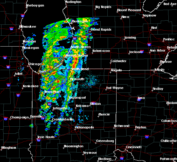 At 334 pm cdt, a severe thunderstorm was located near knox, moving northeast at 55 mph (radar indicated). Hazards include 60 mph wind gusts and quarter size hail. Hail damage to vehicles is expected. expect wind damage to roofs, siding, and trees. Locations impacted include, knox, hamlet, koontz lake, south center, salem heights, brems and grovertown. At 334 pm cdt, a severe thunderstorm was located near knox, moving northeast at 55 mph (radar indicated). Hazards include 60 mph wind gusts and quarter size hail. Hail damage to vehicles is expected. expect wind damage to roofs, siding, and trees. Locations impacted include, knox, hamlet, koontz lake, south center, salem heights, brems and grovertown.
|
| 10/12/2020 3:21 PM CDT |
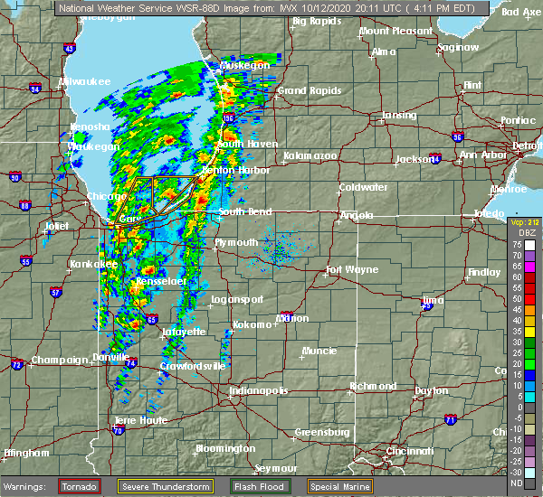 At 321 pm cdt, a severe thunderstorm was located near north judson, or near dunns bridge, moving northeast at 55 mph (radar indicated). Hazards include 60 mph wind gusts and quarter size hail. Hail damage to vehicles is expected. Expect wind damage to roofs, siding, and trees. At 321 pm cdt, a severe thunderstorm was located near north judson, or near dunns bridge, moving northeast at 55 mph (radar indicated). Hazards include 60 mph wind gusts and quarter size hail. Hail damage to vehicles is expected. Expect wind damage to roofs, siding, and trees.
|
| 8/10/2020 6:19 PM EDT |
 At 618 pm edt/518 pm cdt/, severe thunderstorms were located along a line extending from near dowagiac to near gulivoire park to near bremen to near culver, moving east at 60 mph. these are very dangerous storms (trained weather spotters quarter sized hail and tree branches down in baroda, michigan). Hazards include 80 mph wind gusts and quarter size hail. Flying debris will be dangerous to those caught without shelter. mobile homes will be heavily damaged. expect considerable damage to roofs, windows, and vehicles. extensive tree damage and power outages are likely. these severe storms will be near, dowagiac around 625 pm edt. osceola and bourbon around 630 pm edt. Other locations impacted by these severe thunderstorms include dewey lake, harbert, bertrand, fish lake, brems, crumstown, tyner, millburg, hibbard and tippecanoe. At 618 pm edt/518 pm cdt/, severe thunderstorms were located along a line extending from near dowagiac to near gulivoire park to near bremen to near culver, moving east at 60 mph. these are very dangerous storms (trained weather spotters quarter sized hail and tree branches down in baroda, michigan). Hazards include 80 mph wind gusts and quarter size hail. Flying debris will be dangerous to those caught without shelter. mobile homes will be heavily damaged. expect considerable damage to roofs, windows, and vehicles. extensive tree damage and power outages are likely. these severe storms will be near, dowagiac around 625 pm edt. osceola and bourbon around 630 pm edt. Other locations impacted by these severe thunderstorms include dewey lake, harbert, bertrand, fish lake, brems, crumstown, tyner, millburg, hibbard and tippecanoe.
|
| 8/10/2020 6:11 PM EDT |
 At 610 pm edt/510 pm cdt/, severe thunderstorms were located along a line extending from berrien springs to 6 miles southeast of new carlisle to 6 miles northwest of plymouth to near culver, moving east at 60 mph. these are very dangerous storms (trained weather spotters quarter sized hail and tree branches down in baroda, michigan). Hazards include 80 mph wind gusts and quarter size hail. Flying debris will be dangerous to those caught without shelter. mobile homes will be heavily damaged. expect considerable damage to roofs, windows, and vehicles. extensive tree damage and power outages are likely. these severe storms will be near, south bend and plymouth around 615 pm edt. niles, gulivoire park, lakeville and roseland around 620 pm edt. mishawaka, dowagiac, bremen and argos around 625 pm edt. osceola and bourbon around 630 pm edt. Other locations impacted by these severe thunderstorms include dewey lake, lomax, waterford, michiana shores, harbert, bertrand, fish lake, brems, crumstown and tyner. At 610 pm edt/510 pm cdt/, severe thunderstorms were located along a line extending from berrien springs to 6 miles southeast of new carlisle to 6 miles northwest of plymouth to near culver, moving east at 60 mph. these are very dangerous storms (trained weather spotters quarter sized hail and tree branches down in baroda, michigan). Hazards include 80 mph wind gusts and quarter size hail. Flying debris will be dangerous to those caught without shelter. mobile homes will be heavily damaged. expect considerable damage to roofs, windows, and vehicles. extensive tree damage and power outages are likely. these severe storms will be near, south bend and plymouth around 615 pm edt. niles, gulivoire park, lakeville and roseland around 620 pm edt. mishawaka, dowagiac, bremen and argos around 625 pm edt. osceola and bourbon around 630 pm edt. Other locations impacted by these severe thunderstorms include dewey lake, lomax, waterford, michiana shores, harbert, bertrand, fish lake, brems, crumstown and tyner.
|
| 8/10/2020 5:42 PM EDT |
 At 541 pm edt/441 pm cdt/, severe thunderstorms were located along a line extending from 9 miles northwest of new buffalo to near westville to wanatah to near dunns bridge, moving east at 60 mph. these are very dangerous storms (radar indicated). Hazards include 80 mph wind gusts and quarter size hail. Flying debris will be dangerous to those caught without shelter. mobile homes will be heavily damaged. expect considerable damage to roofs, windows, and vehicles. extensive tree damage and power outages are likely. these severe storms will be near, trail creek around 545 pm edt. new buffalo and kingsford heights around 550 pm edt. la porte, bridgman, north judson, shorewood-tower hills-harbert and shorewood-tower hill around 555 pm edt. knox, stevensville and hamlet around 600 pm edt. buchanan, walkerton, new carlisle and koontz lake around 605 pm edt. plymouth, north liberty and berrien springs around 610 pm edt. south bend, niles and culver around 615 pm edt. bremen, georgetown, gulivoire park, lakeville and roseland around 620 pm edt. Other locations impacted by these severe thunderstorms include dewey lake, lomax, waterford, michiana shores, harbert, bertrand, fish lake, brems, crumstown and tyner. At 541 pm edt/441 pm cdt/, severe thunderstorms were located along a line extending from 9 miles northwest of new buffalo to near westville to wanatah to near dunns bridge, moving east at 60 mph. these are very dangerous storms (radar indicated). Hazards include 80 mph wind gusts and quarter size hail. Flying debris will be dangerous to those caught without shelter. mobile homes will be heavily damaged. expect considerable damage to roofs, windows, and vehicles. extensive tree damage and power outages are likely. these severe storms will be near, trail creek around 545 pm edt. new buffalo and kingsford heights around 550 pm edt. la porte, bridgman, north judson, shorewood-tower hills-harbert and shorewood-tower hill around 555 pm edt. knox, stevensville and hamlet around 600 pm edt. buchanan, walkerton, new carlisle and koontz lake around 605 pm edt. plymouth, north liberty and berrien springs around 610 pm edt. south bend, niles and culver around 615 pm edt. bremen, georgetown, gulivoire park, lakeville and roseland around 620 pm edt. Other locations impacted by these severe thunderstorms include dewey lake, lomax, waterford, michiana shores, harbert, bertrand, fish lake, brems, crumstown and tyner.
|
| 8/10/2020 5:19 PM EDT |
 At 517 pm edt/417 pm cdt/, severe thunderstorms were located along a line extending from 16 miles northeast of hyde park to near gary to near crown point to near lake village, moving east at 55 mph. these are very dangerous storms (radar indicated). Hazards include 80 mph wind gusts and quarter size hail. Flying debris will be dangerous to those caught without shelter. mobile homes will be heavily damaged. expect considerable damage to roofs, windows, and vehicles. extensive tree damage and power outages are likely. severe thunderstorms will be near, wanatah and la crosse around 540 pm edt. westville and trail creek around 545 pm edt. new buffalo and kingsford heights around 550 pm edt. la porte, knox, bridgman, north judson, three oaks, hamlet, shorewood-tower hills-harbert and shorewood-tower hill around 555 pm edt. stevensville around 600 pm edt. buchanan, walkerton, new carlisle and koontz lake around 605 pm edt. plymouth, north liberty and berrien springs around 610 pm edt. south bend, niles and culver around 615 pm edt. this includes the following highways, interstate 196 between mile markers 0 and 7. interstate 80 in indiana between mile markers 38 and 87. interstate 94 in indiana between mile markers 33 and 45. Interstate 94 in michigan between mile markers 0 and 42. At 517 pm edt/417 pm cdt/, severe thunderstorms were located along a line extending from 16 miles northeast of hyde park to near gary to near crown point to near lake village, moving east at 55 mph. these are very dangerous storms (radar indicated). Hazards include 80 mph wind gusts and quarter size hail. Flying debris will be dangerous to those caught without shelter. mobile homes will be heavily damaged. expect considerable damage to roofs, windows, and vehicles. extensive tree damage and power outages are likely. severe thunderstorms will be near, wanatah and la crosse around 540 pm edt. westville and trail creek around 545 pm edt. new buffalo and kingsford heights around 550 pm edt. la porte, knox, bridgman, north judson, three oaks, hamlet, shorewood-tower hills-harbert and shorewood-tower hill around 555 pm edt. stevensville around 600 pm edt. buchanan, walkerton, new carlisle and koontz lake around 605 pm edt. plymouth, north liberty and berrien springs around 610 pm edt. south bend, niles and culver around 615 pm edt. this includes the following highways, interstate 196 between mile markers 0 and 7. interstate 80 in indiana between mile markers 38 and 87. interstate 94 in indiana between mile markers 33 and 45. Interstate 94 in michigan between mile markers 0 and 42.
|
| 6/26/2020 9:41 PM CDT |
 The severe thunderstorm warning for starke and south central la porte counties will expire at 945 pm cdt, the storm which prompted the warning has moved out of the area. therefore, the warning will be allowed to expire. however gusty winds are still possible with other thunderstorms. a severe thunderstorm watch remains in effect until 400 am cdt for northwestern indiana. The severe thunderstorm warning for starke and south central la porte counties will expire at 945 pm cdt, the storm which prompted the warning has moved out of the area. therefore, the warning will be allowed to expire. however gusty winds are still possible with other thunderstorms. a severe thunderstorm watch remains in effect until 400 am cdt for northwestern indiana.
|
| 6/26/2020 9:30 PM CDT |
 At 929 pm cdt, a severe thunderstorm was located near hamlet, or near knox, moving east at 60 mph (radar indicated). Hazards include 70 mph wind gusts. Expect considerable tree damage. damage is likely to mobile homes, roofs, and outbuildings. Locations impacted include, knox, north judson, hamlet, oak grove, hanna, toto, ober, winona, bass lake, brems, grovertown and ora. At 929 pm cdt, a severe thunderstorm was located near hamlet, or near knox, moving east at 60 mph (radar indicated). Hazards include 70 mph wind gusts. Expect considerable tree damage. damage is likely to mobile homes, roofs, and outbuildings. Locations impacted include, knox, north judson, hamlet, oak grove, hanna, toto, ober, winona, bass lake, brems, grovertown and ora.
|
| 6/26/2020 9:00 PM CDT |
 At 900 pm cdt, a severe thunderstorm was located near lincoln hills, moving east at 65 mph (radar indicated). Hazards include 70 mph wind gusts. Expect considerable tree damage. Damage is likely to mobile homes, roofs, and outbuildings. At 900 pm cdt, a severe thunderstorm was located near lincoln hills, moving east at 65 mph (radar indicated). Hazards include 70 mph wind gusts. Expect considerable tree damage. Damage is likely to mobile homes, roofs, and outbuildings.
|
| 6/26/2020 8:31 PM CDT |
 At 930 pm edt/830 pm cdt/, a severe thunderstorm was located over chesterton, moving east at 50 mph (radar indicated). Hazards include 70 mph wind gusts. Expect considerable tree damage. Damage is likely to mobile homes, roofs, and outbuildings. At 930 pm edt/830 pm cdt/, a severe thunderstorm was located over chesterton, moving east at 50 mph (radar indicated). Hazards include 70 mph wind gusts. Expect considerable tree damage. Damage is likely to mobile homes, roofs, and outbuildings.
|
| 5/23/2020 9:05 PM CDT | Trees and powerlines downe in starke county IN, 1 miles E of Hamlet, IN |
| 5/23/2020 9:00 PM CDT |
 At 900 pm cdt, a severe thunderstorm was located near hamlet, or 7 miles north of knox, moving east at 20 mph (radar indicated). Hazards include 60 mph wind gusts and half dollar size hail. Hail damage to vehicles is expected. expect wind damage to roofs, siding, and trees. Locations impacted include, knox, kingsford heights, hamlet, koontz lake, oak grove, toto, ober, south center, salem heights, brems, grovertown and bass lake. At 900 pm cdt, a severe thunderstorm was located near hamlet, or 7 miles north of knox, moving east at 20 mph (radar indicated). Hazards include 60 mph wind gusts and half dollar size hail. Hail damage to vehicles is expected. expect wind damage to roofs, siding, and trees. Locations impacted include, knox, kingsford heights, hamlet, koontz lake, oak grove, toto, ober, south center, salem heights, brems, grovertown and bass lake.
|
| 5/23/2020 8:46 PM CDT |
 At 845 pm cdt, a severe thunderstorm was located near la crosse, or 9 miles west of knox, moving east at 35 mph. another potentially severe thunderstorm was located near kingsford heights also moving east at 35 mph. at 821 pm cdt, half dollar size hail was reported west of wanatah (radar indicated). Hazards include 60 mph wind gusts and quarter size hail. Hail damage to vehicles is expected. Expect wind damage to roofs, siding, and trees. At 845 pm cdt, a severe thunderstorm was located near la crosse, or 9 miles west of knox, moving east at 35 mph. another potentially severe thunderstorm was located near kingsford heights also moving east at 35 mph. at 821 pm cdt, half dollar size hail was reported west of wanatah (radar indicated). Hazards include 60 mph wind gusts and quarter size hail. Hail damage to vehicles is expected. Expect wind damage to roofs, siding, and trees.
|
| 5/23/2020 8:23 PM CDT |
 At 821 pm cdt, a severe thunderstorm was located near wanatah, or 9 miles southeast of westville, moving east at 25 mph. another potentially severe thunderstorm was located over kouts which may move east into southern starke county (radar indicated). Hazards include 60 mph wind gusts and quarter size hail. Hail damage to vehicles is expected. expect wind damage to roofs, siding, and trees. Locations impacted include, westville, knox, kingsford heights, wanatah, hamlet, la crosse, hanna, kingsbury, thomaston, south center, salem heights, south wanatah, brems, tracy, stillwell, union mills and haskell. At 821 pm cdt, a severe thunderstorm was located near wanatah, or 9 miles southeast of westville, moving east at 25 mph. another potentially severe thunderstorm was located over kouts which may move east into southern starke county (radar indicated). Hazards include 60 mph wind gusts and quarter size hail. Hail damage to vehicles is expected. expect wind damage to roofs, siding, and trees. Locations impacted include, westville, knox, kingsford heights, wanatah, hamlet, la crosse, hanna, kingsbury, thomaston, south center, salem heights, south wanatah, brems, tracy, stillwell, union mills and haskell.
|
| 5/23/2020 7:56 PM CDT |
 At 755 pm cdt, a severe thunderstorm was located over malden, moving east at 25 mph (radar indicated). Hazards include 60 mph wind gusts and quarter size hail. Hail damage to vehicles is expected. Expect wind damage to roofs, siding, and trees. At 755 pm cdt, a severe thunderstorm was located over malden, moving east at 25 mph (radar indicated). Hazards include 60 mph wind gusts and quarter size hail. Hail damage to vehicles is expected. Expect wind damage to roofs, siding, and trees.
|
| 5/14/2020 11:15 PM CDT |
 At 1213 am edt/1113 pm cdt/, severe thunderstorms were located along a line extending from near malden to dunns bridge to moody, moving northeast at 40 mph (radar indicated). Hazards include 60 mph wind gusts and nickel size hail. expect damage to roofs, siding, and trees At 1213 am edt/1113 pm cdt/, severe thunderstorms were located along a line extending from near malden to dunns bridge to moody, moving northeast at 40 mph (radar indicated). Hazards include 60 mph wind gusts and nickel size hail. expect damage to roofs, siding, and trees
|
| 4/7/2020 10:20 PM CDT |
 The severe thunderstorm warning for southwestern st. joseph, northeastern starke, northwestern marshall and southeastern la porte counties will expire at 1130 pm edt/1030 pm cdt/, the storm which prompted the warning has moved out of the area. therefore, the warning will be allowed to expire. however gusty winds and heavy rain are still possible with this thunderstorm. a severe thunderstorm watch remains in effect until 300 am edt/200 am cdt/ for north central and northwestern indiana. to report severe weather, contact your nearest law enforcement agency. they will relay your report to the national weather service northern indiana. The severe thunderstorm warning for southwestern st. joseph, northeastern starke, northwestern marshall and southeastern la porte counties will expire at 1130 pm edt/1030 pm cdt/, the storm which prompted the warning has moved out of the area. therefore, the warning will be allowed to expire. however gusty winds and heavy rain are still possible with this thunderstorm. a severe thunderstorm watch remains in effect until 300 am edt/200 am cdt/ for north central and northwestern indiana. to report severe weather, contact your nearest law enforcement agency. they will relay your report to the national weather service northern indiana.
|
| 4/7/2020 10:03 PM CDT |
 At 1103 pm edt/1003 pm cdt/, a severe thunderstorm was located near hamlet, or near knox, moving southeast at 50 mph (radar indicated). Hazards include 60 mph wind gusts and quarter size hail. Hail damage to vehicles is expected. expect wind damage to roofs, siding, and trees. Locations impacted include, walkerton, hamlet, koontz lake, oak grove, teegarden, donaldson, tyner, grovertown and thomaston. At 1103 pm edt/1003 pm cdt/, a severe thunderstorm was located near hamlet, or near knox, moving southeast at 50 mph (radar indicated). Hazards include 60 mph wind gusts and quarter size hail. Hail damage to vehicles is expected. expect wind damage to roofs, siding, and trees. Locations impacted include, walkerton, hamlet, koontz lake, oak grove, teegarden, donaldson, tyner, grovertown and thomaston.
|
| 4/7/2020 9:41 PM CDT |
 At 1040 pm edt/940 pm cdt/, a severe thunderstorm was located over valparaiso, moving east at 45 mph. nickel to quarter size hail has been reported in valparaiso (radar indicated). Hazards include 60 mph wind gusts and quarter size hail. Hail damage to vehicles is expected. Expect wind damage to roofs, siding, and trees. At 1040 pm edt/940 pm cdt/, a severe thunderstorm was located over valparaiso, moving east at 45 mph. nickel to quarter size hail has been reported in valparaiso (radar indicated). Hazards include 60 mph wind gusts and quarter size hail. Hail damage to vehicles is expected. Expect wind damage to roofs, siding, and trees.
|
| 5/27/2019 5:39 PM CDT |
 At 639 pm edt/539 pm cdt/, a severe thunderstorm capable of producing a tornado was located near wanatah, or 9 miles southeast of westville, moving east at 35 mph (radar indicated rotation). Hazards include tornado and ping pong ball size hail. Flying debris will be dangerous to those caught without shelter. mobile homes will be damaged or destroyed. damage to roofs, windows, and vehicles will occur. tree damage is likely. this dangerous storm will be near, kingsford heights around 650 pm edt. hamlet around 655 pm edt. koontz lake around 705 pm edt. walkerton around 710 pm edt. north liberty around 715 pm edt. Other locations impacted by this tornadic thunderstorm include thomaston, teegarden, south center, salem heights, la paz, fish lake, hanna, tracy, crumstown and kingsbury. At 639 pm edt/539 pm cdt/, a severe thunderstorm capable of producing a tornado was located near wanatah, or 9 miles southeast of westville, moving east at 35 mph (radar indicated rotation). Hazards include tornado and ping pong ball size hail. Flying debris will be dangerous to those caught without shelter. mobile homes will be damaged or destroyed. damage to roofs, windows, and vehicles will occur. tree damage is likely. this dangerous storm will be near, kingsford heights around 650 pm edt. hamlet around 655 pm edt. koontz lake around 705 pm edt. walkerton around 710 pm edt. north liberty around 715 pm edt. Other locations impacted by this tornadic thunderstorm include thomaston, teegarden, south center, salem heights, la paz, fish lake, hanna, tracy, crumstown and kingsbury.
|
| 5/23/2019 4:26 AM EDT |
 The severe thunderstorm warning for eastern white, southwestern st. joseph, eastern pulaski, fulton, western cass, eastern starke and marshall counties will expire at 430 am edt/330 am cdt/, the storms which prompted the warning have moved out of the area. therefore, the warning will be allowed to expire. a severe thunderstorm watch remains in effect until 1000 am edt/900 am cdt/ for north central and northwestern indiana. The severe thunderstorm warning for eastern white, southwestern st. joseph, eastern pulaski, fulton, western cass, eastern starke and marshall counties will expire at 430 am edt/330 am cdt/, the storms which prompted the warning have moved out of the area. therefore, the warning will be allowed to expire. a severe thunderstorm watch remains in effect until 1000 am edt/900 am cdt/ for north central and northwestern indiana.
|
| 5/23/2019 4:13 AM EDT |
 At 411 am edt/311 am cdt/, severe thunderstorms were located along a line extending from near gulivoire park to 6 miles south of culver to 7 miles east of delphi, moving northeast at 65 mph (radar indicated). Hazards include 70 mph wind gusts. Expect considerable tree damage. damage is likely to mobile homes, roofs, and outbuildings. locations impacted include, logansport, plymouth, rochester, monticello, bremen, knox, winamac, walkerton, argos, brookston, culver, royal center, hamlet, lakeville, koontz lake, pulaski, walnut, oak grove, ripley and kewanna. this is a dangerous line of storms. These storms have a history of producing damaging wind gusts to 70 mph. At 411 am edt/311 am cdt/, severe thunderstorms were located along a line extending from near gulivoire park to 6 miles south of culver to 7 miles east of delphi, moving northeast at 65 mph (radar indicated). Hazards include 70 mph wind gusts. Expect considerable tree damage. damage is likely to mobile homes, roofs, and outbuildings. locations impacted include, logansport, plymouth, rochester, monticello, bremen, knox, winamac, walkerton, argos, brookston, culver, royal center, hamlet, lakeville, koontz lake, pulaski, walnut, oak grove, ripley and kewanna. this is a dangerous line of storms. These storms have a history of producing damaging wind gusts to 70 mph.
|
| 5/23/2019 3:48 AM EDT |
 At 347 am edt/247 am cdt/, severe thunderstorms were located along a line extending from near kingsford heights to near francesville to near west lafayette, moving northeast at 65 mph (radar indicated). Hazards include 70 mph wind gusts and penny size hail. Expect considerable tree damage. damage is likely to mobile homes, roofs, and outbuildings. locations impacted include, logansport, plymouth, rochester, monticello, bremen, knox, winamac, walkerton, monon, north judson, argos, brookston, culver, wolcott, francesville, royal center, hamlet, lakeville, medaryville and la crosse. this is a very dangerous storm. This storm has a history of producing 70 to 80 mph wind gusts across northeast illinois. At 347 am edt/247 am cdt/, severe thunderstorms were located along a line extending from near kingsford heights to near francesville to near west lafayette, moving northeast at 65 mph (radar indicated). Hazards include 70 mph wind gusts and penny size hail. Expect considerable tree damage. damage is likely to mobile homes, roofs, and outbuildings. locations impacted include, logansport, plymouth, rochester, monticello, bremen, knox, winamac, walkerton, monon, north judson, argos, brookston, culver, wolcott, francesville, royal center, hamlet, lakeville, medaryville and la crosse. this is a very dangerous storm. This storm has a history of producing 70 to 80 mph wind gusts across northeast illinois.
|
| 5/23/2019 3:15 AM EDT |
 At 313 am edt/213 am cdt/, severe thunderstorms were located along a line extending from near momence to raub to near danville, moving northeast at 65 mph (radar indicated). Hazards include 70 mph wind gusts and penny size hail. Expect considerable tree damage. Damage is likely to mobile homes, roofs, and outbuildings. At 313 am edt/213 am cdt/, severe thunderstorms were located along a line extending from near momence to raub to near danville, moving northeast at 65 mph (radar indicated). Hazards include 70 mph wind gusts and penny size hail. Expect considerable tree damage. Damage is likely to mobile homes, roofs, and outbuildings.
|
| 3/14/2019 2:44 PM CDT |
 At 244 pm cdt, a severe thunderstorm was located 7 miles northeast of la crosse, or 8 miles northwest of knox, moving northeast at 55 mph (radar indicated). Hazards include 60 mph wind gusts and quarter size hail. Hail damage to vehicles is expected. expect wind damage to roofs, siding, and trees. Locations impacted include, knox, north judson, kingsford heights, hamlet, koontz lake, hanna, kingsbury, thomaston, south center, english lake, salem heights, brems, tracy, union mills, toto, grovertown and lomax. At 244 pm cdt, a severe thunderstorm was located 7 miles northeast of la crosse, or 8 miles northwest of knox, moving northeast at 55 mph (radar indicated). Hazards include 60 mph wind gusts and quarter size hail. Hail damage to vehicles is expected. expect wind damage to roofs, siding, and trees. Locations impacted include, knox, north judson, kingsford heights, hamlet, koontz lake, hanna, kingsbury, thomaston, south center, english lake, salem heights, brems, tracy, union mills, toto, grovertown and lomax.
|
| 3/14/2019 2:32 PM CDT |
 At 231 pm cdt, a severe thunderstorm was located near dunns bridge, moving northeast at 55 mph (radar indicated). Hazards include 60 mph wind gusts and quarter size hail. Hail damage to vehicles is expected. Expect wind damage to roofs, siding, and trees. At 231 pm cdt, a severe thunderstorm was located near dunns bridge, moving northeast at 55 mph (radar indicated). Hazards include 60 mph wind gusts and quarter size hail. Hail damage to vehicles is expected. Expect wind damage to roofs, siding, and trees.
|
| 9/25/2018 9:05 PM EDT |
 At 905 pm edt/805 pm cdt/, severe thunderstorms were located along a line extending from 7 miles south of decatur to near osceola to near koontz lake, moving east at 30 mph (radar indicated). Hazards include 60 mph wind gusts. Expect damage to roofs, siding, and trees. Locations impacted include, south bend, elkhart, mishawaka, plymouth, georgetown, gulivoire park, simonton lake, granger, osceola, walkerton, north liberty, cassopolis, edwardsburg, hamlet, lakeville, roseland, koontz lake, penn, oak grove and la paz. At 905 pm edt/805 pm cdt/, severe thunderstorms were located along a line extending from 7 miles south of decatur to near osceola to near koontz lake, moving east at 30 mph (radar indicated). Hazards include 60 mph wind gusts. Expect damage to roofs, siding, and trees. Locations impacted include, south bend, elkhart, mishawaka, plymouth, georgetown, gulivoire park, simonton lake, granger, osceola, walkerton, north liberty, cassopolis, edwardsburg, hamlet, lakeville, roseland, koontz lake, penn, oak grove and la paz.
|
| 9/25/2018 8:50 PM EDT |
 At 849 pm edt/749 pm cdt/, severe thunderstorms were located along a line extending from near dowagiac to georgetown to hamlet, moving east at 30 mph (radar indicated). Hazards include 60 mph wind gusts and penny size hail. Expect damage to roofs, siding, and trees. Locations impacted include, south bend, elkhart, mishawaka, niles, plymouth, dowagiac, buchanan, georgetown, gulivoire park, granger, simonton lake, osceola, walkerton, north liberty, new carlisle, cassopolis, kingsford heights, edwardsburg, hamlet and lakeville. At 849 pm edt/749 pm cdt/, severe thunderstorms were located along a line extending from near dowagiac to georgetown to hamlet, moving east at 30 mph (radar indicated). Hazards include 60 mph wind gusts and penny size hail. Expect damage to roofs, siding, and trees. Locations impacted include, south bend, elkhart, mishawaka, niles, plymouth, dowagiac, buchanan, georgetown, gulivoire park, granger, simonton lake, osceola, walkerton, north liberty, new carlisle, cassopolis, kingsford heights, edwardsburg, hamlet and lakeville.
|
| 9/25/2018 7:34 PM CDT |
 At 833 pm edt/733 pm cdt/, a severe thunderstorm was located near new carlisle, or 11 miles west of south bend, moving east at 50 mph (radar indicated). Hazards include 60 mph wind gusts and penny size hail. Expect damage to roofs, siding, and trees. Locations impacted include, la porte, walkerton, new carlisle, kingsford heights, wanatah, hamlet, koontz lake, hanna, kingsbury, byron, hudson lake, south center, salem heights, fish lake, south wanatah, tracy, rolling prarie, stillwell, union mills and pinola. At 833 pm edt/733 pm cdt/, a severe thunderstorm was located near new carlisle, or 11 miles west of south bend, moving east at 50 mph (radar indicated). Hazards include 60 mph wind gusts and penny size hail. Expect damage to roofs, siding, and trees. Locations impacted include, la porte, walkerton, new carlisle, kingsford heights, wanatah, hamlet, koontz lake, hanna, kingsbury, byron, hudson lake, south center, salem heights, fish lake, south wanatah, tracy, rolling prarie, stillwell, union mills and pinola.
|
| 9/25/2018 8:32 PM EDT |
 At 831 pm edt/731 pm cdt/, severe thunderstorms were located along a line extending from 7 miles northeast of berrien springs to near new carlisle to 6 miles southwest of kingsford heights, moving east at 30 mph (radar indicated). Hazards include 60 mph wind gusts and penny size hail. expect damage to roofs, siding, and trees At 831 pm edt/731 pm cdt/, severe thunderstorms were located along a line extending from 7 miles northeast of berrien springs to near new carlisle to 6 miles southwest of kingsford heights, moving east at 30 mph (radar indicated). Hazards include 60 mph wind gusts and penny size hail. expect damage to roofs, siding, and trees
|
| 9/25/2018 7:22 PM CDT |
 At 822 pm edt/722 pm cdt/, a severe thunderstorm was located over la porte, moving east at 50 mph (radar indicated). Hazards include 60 mph wind gusts and penny size hail. Expect damage to roofs, siding, and trees. Locations impacted include, michigan city, la porte, westville, trail creek, walkerton, new carlisle, kingsford heights, wanatah, hamlet, koontz lake, hanna, kingsbury, waterford, pinhook, salem heights, fish lake, otis, stillwell, haskell and grovertown. At 822 pm edt/722 pm cdt/, a severe thunderstorm was located over la porte, moving east at 50 mph (radar indicated). Hazards include 60 mph wind gusts and penny size hail. Expect damage to roofs, siding, and trees. Locations impacted include, michigan city, la porte, westville, trail creek, walkerton, new carlisle, kingsford heights, wanatah, hamlet, koontz lake, hanna, kingsbury, waterford, pinhook, salem heights, fish lake, otis, stillwell, haskell and grovertown.
|
| 9/25/2018 6:56 PM CDT |
 At 755 pm edt/655 pm cdt/, a severe thunderstorm was located over south haven, moving east at 50 mph (radar indicated). Hazards include 60 mph wind gusts and nickel size hail. expect damage to roofs, siding, and trees At 755 pm edt/655 pm cdt/, a severe thunderstorm was located over south haven, moving east at 50 mph (radar indicated). Hazards include 60 mph wind gusts and nickel size hail. expect damage to roofs, siding, and trees
|
| 9/3/2018 4:36 PM CDT |
 The severe thunderstorm warning for northeastern pulaski, starke and western marshall counties will expire at 545 pm edt/445 pm cdt/, the storms which prompted the warning have weakened. therefore, the severe thunderstorm warning will be allowed to expire at 545 pm edt. however, strong wind gusts to 50 to 55 mph are still possible with these storms across marshall county through 615 pm edt. some minor tree damage is possible. The severe thunderstorm warning for northeastern pulaski, starke and western marshall counties will expire at 545 pm edt/445 pm cdt/, the storms which prompted the warning have weakened. therefore, the severe thunderstorm warning will be allowed to expire at 545 pm edt. however, strong wind gusts to 50 to 55 mph are still possible with these storms across marshall county through 615 pm edt. some minor tree damage is possible.
|
| 9/3/2018 4:20 PM CDT |
 At 520 pm edt/420 pm cdt/, severe thunderstorms were located along a line extending from near hamlet to near culver to near winamac, moving northeast at 35 mph (radar indicated). Hazards include 60 mph wind gusts and nickel size hail. Expect damage to roofs, siding, and trees. Locations impacted include, plymouth, knox, culver, hamlet, koontz lake, oak grove, ripley, monterey, beardstown, ober, twin lakes, rutland, burr oak, maxinkuckee, denham, brems, tyner, toto, hibbard and winona. At 520 pm edt/420 pm cdt/, severe thunderstorms were located along a line extending from near hamlet to near culver to near winamac, moving northeast at 35 mph (radar indicated). Hazards include 60 mph wind gusts and nickel size hail. Expect damage to roofs, siding, and trees. Locations impacted include, plymouth, knox, culver, hamlet, koontz lake, oak grove, ripley, monterey, beardstown, ober, twin lakes, rutland, burr oak, maxinkuckee, denham, brems, tyner, toto, hibbard and winona.
|
| 9/3/2018 4:05 PM CDT |
 At 505 pm edt/405 pm cdt/, severe thunderstorms were located along a line extending from near knox to near north judson to near winamac, moving northeast at 35 mph (radar indicated). Hazards include 60 mph wind gusts. expect damage to roofs, siding, and trees At 505 pm edt/405 pm cdt/, severe thunderstorms were located along a line extending from near knox to near north judson to near winamac, moving northeast at 35 mph (radar indicated). Hazards include 60 mph wind gusts. expect damage to roofs, siding, and trees
|
| 8/6/2018 5:29 PM CDT |
 At 528 pm cdt, a severe thunderstorm was located over la crosse, or 7 miles east of malden, moving east at 25 mph (radar indicated). Hazards include 60 mph wind gusts and quarter size hail. Hail damage to vehicles is expected. expect wind damage to roofs, siding, and trees. this severe thunderstorm will be near, hamlet around 710 pm edt. Other locations impacted by this severe thunderstorm include salem heights, thomaston, hanna, brems and south center. At 528 pm cdt, a severe thunderstorm was located over la crosse, or 7 miles east of malden, moving east at 25 mph (radar indicated). Hazards include 60 mph wind gusts and quarter size hail. Hail damage to vehicles is expected. expect wind damage to roofs, siding, and trees. this severe thunderstorm will be near, hamlet around 710 pm edt. Other locations impacted by this severe thunderstorm include salem heights, thomaston, hanna, brems and south center.
|
| 5/14/2018 7:51 AM CDT | Quarter sized hail reported 0.1 miles NNW of Hamlet, IN, size estimated based on social media picture. |
| 5/9/2018 5:29 PM CDT |
 At 629 pm edt/529 pm cdt/, a severe thunderstorm was located near knox, moving northeast at 45 mph (radar indicated). Hazards include 60 mph wind gusts and nickel size hail. Expect damage to roofs, siding, and trees. this severe thunderstorm will be near, hamlet around 635 pm edt. koontz lake around 645 pm edt. plymouth and walkerton around 650 pm edt. north liberty around 655 pm edt. lakeville around 700 pm edt. Other locations impacted by this severe thunderstorm include thomaston, teegarden, south center, salem heights, la paz, hanna, brems, tracy, tyner and toto. At 629 pm edt/529 pm cdt/, a severe thunderstorm was located near knox, moving northeast at 45 mph (radar indicated). Hazards include 60 mph wind gusts and nickel size hail. Expect damage to roofs, siding, and trees. this severe thunderstorm will be near, hamlet around 635 pm edt. koontz lake around 645 pm edt. plymouth and walkerton around 650 pm edt. north liberty around 655 pm edt. lakeville around 700 pm edt. Other locations impacted by this severe thunderstorm include thomaston, teegarden, south center, salem heights, la paz, hanna, brems, tracy, tyner and toto.
|
| 5/2/2018 6:45 PM CDT |
 At 645 pm cdt, a severe thunderstorm was located near north judson, or 8 miles west of knox, moving east at 35 mph (radar indicated). Hazards include 60 mph wind gusts and quarter size hail. Hail damage to vehicles is expected. expect wind damage to roofs, siding, and trees. Locations impacted include, knox, north judson, hamlet, la crosse, thomaston, winona, san pierre and ora. At 645 pm cdt, a severe thunderstorm was located near north judson, or 8 miles west of knox, moving east at 35 mph (radar indicated). Hazards include 60 mph wind gusts and quarter size hail. Hail damage to vehicles is expected. expect wind damage to roofs, siding, and trees. Locations impacted include, knox, north judson, hamlet, la crosse, thomaston, winona, san pierre and ora.
|
| 5/2/2018 6:25 PM CDT |
 At 624 pm cdt, a severe thunderstorm was located near dunns bridge, moving east at 35 mph (radar indicated). Hazards include 60 mph wind gusts and quarter size hail. Hail damage to vehicles is expected. Expect wind damage to roofs, siding, and trees. At 624 pm cdt, a severe thunderstorm was located near dunns bridge, moving east at 35 mph (radar indicated). Hazards include 60 mph wind gusts and quarter size hail. Hail damage to vehicles is expected. Expect wind damage to roofs, siding, and trees.
|
| 7/23/2017 6:26 PM CDT |
 At 726 pm edt/626 pm cdt/, a severe thunderstorm was located over hamlet, or 8 miles north of knox, moving east at 40 mph (radar indicated). Hazards include 60 mph wind gusts and quarter size hail. Hail damage to vehicles is expected. expect wind damage to roofs, siding, and trees. Locations impacted include, knox, hamlet, koontz lake, oak grove, south center, donaldson, salem heights, brems, tyner, grovertown and ober. At 726 pm edt/626 pm cdt/, a severe thunderstorm was located over hamlet, or 8 miles north of knox, moving east at 40 mph (radar indicated). Hazards include 60 mph wind gusts and quarter size hail. Hail damage to vehicles is expected. expect wind damage to roofs, siding, and trees. Locations impacted include, knox, hamlet, koontz lake, oak grove, south center, donaldson, salem heights, brems, tyner, grovertown and ober.
|
| 7/23/2017 6:08 PM CDT |
 At 708 pm edt/608 pm cdt/, a severe thunderstorm was located near wanatah, or 7 miles southeast of westville, moving east at 40 mph (radar indicated). Hazards include 60 mph wind gusts and quarter size hail. Hail damage to vehicles is expected. Expect wind damage to roofs, siding, and trees. At 708 pm edt/608 pm cdt/, a severe thunderstorm was located near wanatah, or 7 miles southeast of westville, moving east at 40 mph (radar indicated). Hazards include 60 mph wind gusts and quarter size hail. Hail damage to vehicles is expected. Expect wind damage to roofs, siding, and trees.
|
| 7/7/2017 11:06 AM EDT |
 At 1105 am edt/1005 am cdt/, a severe thunderstorm was located near koontz lake, or near plymouth, moving southeast at 50 mph (radar indicated). Hazards include 60 mph wind gusts and nickel size hail. expect damage to roofs, siding, and trees At 1105 am edt/1005 am cdt/, a severe thunderstorm was located near koontz lake, or near plymouth, moving southeast at 50 mph (radar indicated). Hazards include 60 mph wind gusts and nickel size hail. expect damage to roofs, siding, and trees
|
| 7/7/2017 8:08 AM CDT |
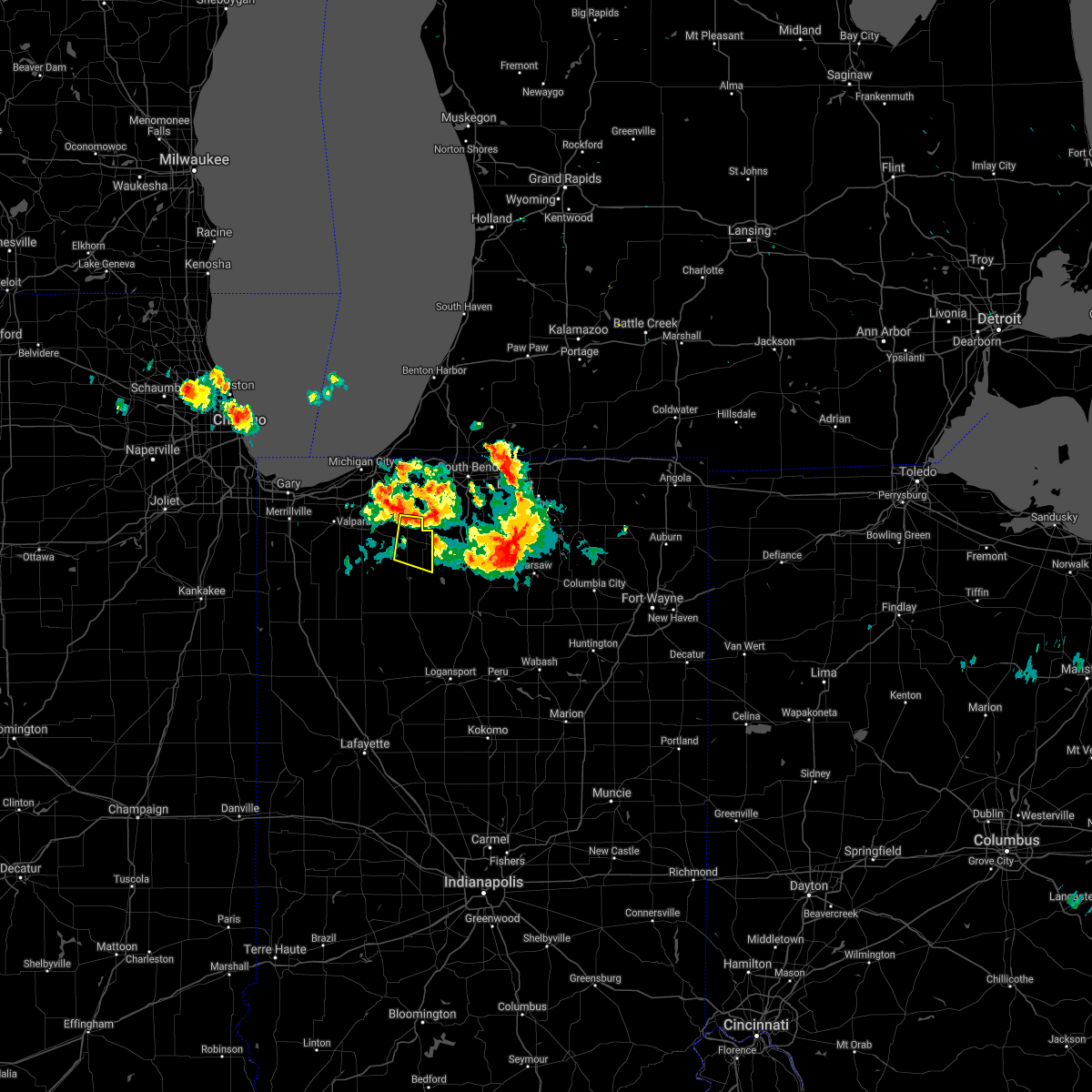 The severe thunderstorm warning for northeastern starke and east central la porte counties will expire at 815 am cdt, the storm which prompted the warning has moved out of the area. therefore the warning will be allowed to expire. to report severe weather, contact your nearest law enforcement agency. they will relay your report to the national weather service northern indiana. The severe thunderstorm warning for northeastern starke and east central la porte counties will expire at 815 am cdt, the storm which prompted the warning has moved out of the area. therefore the warning will be allowed to expire. to report severe weather, contact your nearest law enforcement agency. they will relay your report to the national weather service northern indiana.
|
| 7/7/2017 7:59 AM CDT |
 At 759 am cdt, a severe thunderstorm was located near koontz lake, or 8 miles northeast of knox, moving east at 40 mph (radar indicated). Hazards include quarter size hail. Damage to vehicles is expected. Locations impacted include, knox, hamlet, koontz lake, oak grove, ober, south center, salem heights, grovertown and bass lake. At 759 am cdt, a severe thunderstorm was located near koontz lake, or 8 miles northeast of knox, moving east at 40 mph (radar indicated). Hazards include quarter size hail. Damage to vehicles is expected. Locations impacted include, knox, hamlet, koontz lake, oak grove, ober, south center, salem heights, grovertown and bass lake.
|
| 7/7/2017 7:40 AM CDT |
 At 740 am cdt, a severe thunderstorm was located near kingsford heights, or 11 miles northwest of knox, moving east at 40 mph (radar indicated). Hazards include quarter size hail. damage to vehicles is expected At 740 am cdt, a severe thunderstorm was located near kingsford heights, or 11 miles northwest of knox, moving east at 40 mph (radar indicated). Hazards include quarter size hail. damage to vehicles is expected
|
| 7/2/2017 9:03 PM EDT |
 At 903 pm edt/803 pm cdt/, severe thunderstorms were located along a line extending from near bremen to near knox, moving southeast at 40 mph (radar indicated). Hazards include 60 mph wind gusts. Expect damage to roofs, siding, and trees. Locations impacted include, plymouth, bremen, knox, walkerton, north liberty, culver, hamlet, lakeville, koontz lake, oak grove, la paz, ober, teegarden, tyner, hibbard, winona, donaldson, linkville, lake of the woods and wyatt. At 903 pm edt/803 pm cdt/, severe thunderstorms were located along a line extending from near bremen to near knox, moving southeast at 40 mph (radar indicated). Hazards include 60 mph wind gusts. Expect damage to roofs, siding, and trees. Locations impacted include, plymouth, bremen, knox, walkerton, north liberty, culver, hamlet, lakeville, koontz lake, oak grove, la paz, ober, teegarden, tyner, hibbard, winona, donaldson, linkville, lake of the woods and wyatt.
|
| 7/2/2017 8:46 PM EDT |
 At 845 pm edt/745 pm cdt/, severe thunderstorms were located along a line extending from near north liberty to near la crosse, moving southeast at 35 mph. a 55 mph wind gust was recorded at the laporte automated weather station at 735 pm cdt (radar indicated). Hazards include 60 mph wind gusts. expect damage to roofs, siding, and trees At 845 pm edt/745 pm cdt/, severe thunderstorms were located along a line extending from near north liberty to near la crosse, moving southeast at 35 mph. a 55 mph wind gust was recorded at the laporte automated weather station at 735 pm cdt (radar indicated). Hazards include 60 mph wind gusts. expect damage to roofs, siding, and trees
|
| 5/26/2017 8:57 PM EDT |
 At 856 pm edt/756 pm cdt/, severe thunderstorms were located along a line extending from north liberty to koontz lake to near hamlet, moving east at 40 mph (radar indicated). Hazards include 60 mph wind gusts and penny size hail. Expect damage to roofs, siding, and trees. locations impacted include, plymouth, bremen, walkerton, hamlet, koontz lake, la paz, twin lakes, teegarden, tyner, donaldson, linkville, lake of the woods and grovertown. These thunderstorms have a history of producing tree damage in lake and porter counties in northwest indiana. At 856 pm edt/756 pm cdt/, severe thunderstorms were located along a line extending from north liberty to koontz lake to near hamlet, moving east at 40 mph (radar indicated). Hazards include 60 mph wind gusts and penny size hail. Expect damage to roofs, siding, and trees. locations impacted include, plymouth, bremen, walkerton, hamlet, koontz lake, la paz, twin lakes, teegarden, tyner, donaldson, linkville, lake of the woods and grovertown. These thunderstorms have a history of producing tree damage in lake and porter counties in northwest indiana.
|
| 5/26/2017 7:43 PM CDT |
 At 842 pm edt/742 pm cdt/, severe thunderstorms were located along a line extending from 7 miles northwest of walkerton to near kingsford heights to near la crosse, moving east at 40 mph (radar indicated). Hazards include 60 mph wind gusts. expect damage to roofs, siding, and trees At 842 pm edt/742 pm cdt/, severe thunderstorms were located along a line extending from 7 miles northwest of walkerton to near kingsford heights to near la crosse, moving east at 40 mph (radar indicated). Hazards include 60 mph wind gusts. expect damage to roofs, siding, and trees
|
| 3/1/2017 12:19 AM CST |
 At 119 am est/1219 am cst/, severe thunderstorms were located along a line extending from hamlet to near north judson to near medaryville, moving east at 60 mph (radar indicated). Hazards include 60 mph wind gusts and quarter size hail. Hail damage to vehicles is expected. expect wind damage to roofs, siding, and trees. locations impacted include, plymouth, knox, winamac, bourbon, north judson, argos, culver, hamlet, medaryville, walnut, oak grove, ripley, kewanna, monterey, leiters ford, lomax, beardstown, ober, english lake and denham. A tornado watch remains in effect until 700 am est/600 am cst/ for north central and northwestern indiana. At 119 am est/1219 am cst/, severe thunderstorms were located along a line extending from hamlet to near north judson to near medaryville, moving east at 60 mph (radar indicated). Hazards include 60 mph wind gusts and quarter size hail. Hail damage to vehicles is expected. expect wind damage to roofs, siding, and trees. locations impacted include, plymouth, knox, winamac, bourbon, north judson, argos, culver, hamlet, medaryville, walnut, oak grove, ripley, kewanna, monterey, leiters ford, lomax, beardstown, ober, english lake and denham. A tornado watch remains in effect until 700 am est/600 am cst/ for north central and northwestern indiana.
|
| 3/1/2017 1:16 AM EST |
 At 115 am est/1215 am cst/, severe thunderstorms were located along a line extending from near south bend to hamlet, moving east at 55 mph (radar indicated). Hazards include 60 mph wind gusts and penny size hail. Expect damage to roofs, siding, and trees. locations impacted include, south bend, mishawaka, plymouth, bremen, gulivoire park, osceola, walkerton, north liberty, kingsford heights, hamlet, lakeville, koontz lake, la paz, teegarden, salem heights, fish lake, stillwell, crumstown, tyner and woodland. a trained spotter reported a 62 mph wind gust with these thunderstorms 1. 5 miles southwest of la porte. A tornado watch remains in effect until 700 am est/600 am cst/ for north central and northwestern indiana. At 115 am est/1215 am cst/, severe thunderstorms were located along a line extending from near south bend to hamlet, moving east at 55 mph (radar indicated). Hazards include 60 mph wind gusts and penny size hail. Expect damage to roofs, siding, and trees. locations impacted include, south bend, mishawaka, plymouth, bremen, gulivoire park, osceola, walkerton, north liberty, kingsford heights, hamlet, lakeville, koontz lake, la paz, teegarden, salem heights, fish lake, stillwell, crumstown, tyner and woodland. a trained spotter reported a 62 mph wind gust with these thunderstorms 1. 5 miles southwest of la porte. A tornado watch remains in effect until 700 am est/600 am cst/ for north central and northwestern indiana.
|
| 3/1/2017 1:01 AM EST |
 At 101 am est/1201 am cst/, severe thunderstorms were located along a line extending from new carlisle to 6 miles southwest of kingsford heights, moving east at 65 mph (radar indicated). Hazards include 60 mph wind gusts. expect damage to roofs, siding, and trees At 101 am est/1201 am cst/, severe thunderstorms were located along a line extending from new carlisle to 6 miles southwest of kingsford heights, moving east at 65 mph (radar indicated). Hazards include 60 mph wind gusts. expect damage to roofs, siding, and trees
|
| 2/28/2017 11:56 PM CST |
 At 1256 am est/1156 pm cst/, severe thunderstorms were located along a line extending from near kvpz to near kouts to near gifford, moving east at 60 mph (radar indicated). Hazards include 60 mph wind gusts and penny size hail. expect damage to roofs, siding, and trees At 1256 am est/1156 pm cst/, severe thunderstorms were located along a line extending from near kvpz to near kouts to near gifford, moving east at 60 mph (radar indicated). Hazards include 60 mph wind gusts and penny size hail. expect damage to roofs, siding, and trees
|
| 7/21/2016 2:23 PM CDT |
 At 223 pm cdt, a severe thunderstorm was located over knox, moving southeast at 45 mph (radar indicated). Hazards include 60 mph wind gusts and nickel size hail. Expect damage to roofs. siding and trees. Locations impacted include, knox, hamlet, koontz lake, oak grove, grovertown, ober, toto, winona, bass lake and brems. At 223 pm cdt, a severe thunderstorm was located over knox, moving southeast at 45 mph (radar indicated). Hazards include 60 mph wind gusts and nickel size hail. Expect damage to roofs. siding and trees. Locations impacted include, knox, hamlet, koontz lake, oak grove, grovertown, ober, toto, winona, bass lake and brems.
|
| 7/21/2016 2:09 PM CDT |
 At 209 pm cdt, a severe thunderstorm was located near wanatah, or 11 miles northwest of knox, moving east at 45 mph (radar indicated). Hazards include 60 mph wind gusts and nickel size hail. Expect damage to roofs. Siding and trees. At 209 pm cdt, a severe thunderstorm was located near wanatah, or 11 miles northwest of knox, moving east at 45 mph (radar indicated). Hazards include 60 mph wind gusts and nickel size hail. Expect damage to roofs. Siding and trees.
|
| 8/3/2015 12:28 AM CDT |
 At 1228 am cdt, severe thunderstorms were located along a line extending from near koontz lake to near dunns bridge, moving southeast at 40 mph (trained weather spotters). Hazards include 60 mph wind gusts and penny size hail. Expect damage to roofs. siding and trees. Locations impacted include, knox, north judson, wanatah, hamlet, la crosse, oak grove, hanna, san pierre, ora, ober, winona, toto, lomax, grovertown, south wanatah, thomaston, brems, bass lake and english lake. At 1228 am cdt, severe thunderstorms were located along a line extending from near koontz lake to near dunns bridge, moving southeast at 40 mph (trained weather spotters). Hazards include 60 mph wind gusts and penny size hail. Expect damage to roofs. siding and trees. Locations impacted include, knox, north judson, wanatah, hamlet, la crosse, oak grove, hanna, san pierre, ora, ober, winona, toto, lomax, grovertown, south wanatah, thomaston, brems, bass lake and english lake.
|
| 8/2/2015 11:56 PM CDT |
 At 1155 pm cdt, severe thunderstorms were located along a line extending from westville to lowell, moving southeast at 40 mph (trained weather spotters. at 1150 pm cdt... 60 to 65 mph winds were reported in valparaiso). Hazards include 60 mph wind gusts and quarter size hail. Hail damage to vehicles is expected. Expect wind damage to roofs, siding and trees. At 1155 pm cdt, severe thunderstorms were located along a line extending from westville to lowell, moving southeast at 40 mph (trained weather spotters. at 1150 pm cdt... 60 to 65 mph winds were reported in valparaiso). Hazards include 60 mph wind gusts and quarter size hail. Hail damage to vehicles is expected. Expect wind damage to roofs, siding and trees.
|
| 6/11/2015 3:53 PM CDT |
 At 452 pm edt /352 pm cdt/, a severe thunderstorm was located near hamlet, or near knox, moving northeast at 25 mph (radar indicated). Hazards include 60 mph wind gusts and quarter size hail. Hail damage to vehicles is expected. expect wind damage to roofs, siding and trees. this severe storm will be near, hamlet around 400 pm cdt. koontz lake around 520 pm edt. Other locations impacted by this severe thunderstorm include brems, donaldson, grovertown, tyner and bass lake. At 452 pm edt /352 pm cdt/, a severe thunderstorm was located near hamlet, or near knox, moving northeast at 25 mph (radar indicated). Hazards include 60 mph wind gusts and quarter size hail. Hail damage to vehicles is expected. expect wind damage to roofs, siding and trees. this severe storm will be near, hamlet around 400 pm cdt. koontz lake around 520 pm edt. Other locations impacted by this severe thunderstorm include brems, donaldson, grovertown, tyner and bass lake.
|
| 6/11/2015 3:39 PM CDT |
 At 438 pm edt /338 pm cdt/, a severe thunderstorm was located near knox, moving northeast at 25 mph (radar indicated). Hazards include 60 mph wind gusts and quarter size hail. Hail damage to vehicles is expected. expect wind damage to roofs, siding and trees. this severe thunderstorm will be near, knox around 345 pm cdt. hamlet around 400 pm cdt. koontz lake around 520 pm edt. Other locations impacted by this severe thunderstorm include brems, toto, tyner, salem heights, donaldson, grovertown, ober and bass lake. At 438 pm edt /338 pm cdt/, a severe thunderstorm was located near knox, moving northeast at 25 mph (radar indicated). Hazards include 60 mph wind gusts and quarter size hail. Hail damage to vehicles is expected. expect wind damage to roofs, siding and trees. this severe thunderstorm will be near, knox around 345 pm cdt. hamlet around 400 pm cdt. koontz lake around 520 pm edt. Other locations impacted by this severe thunderstorm include brems, toto, tyner, salem heights, donaldson, grovertown, ober and bass lake.
|
| 6/8/2015 5:37 PM CDT | At 535 pm cdt, severe thunderstorms were located along a line extending from koontz lake to 5 miles southeast of knox to 7 miles east of medaryville, and moving east at 30 mph (radar indicated). Hazards include 60 mph wind gusts and penny size hail. Expect damage to roofs. siding and trees. Locations impacted include, winamac, plymouth, culver, donaldson, ripley, beardstown, ora, burr oak, hibbard, monterey, vanmeter park, twin lakes, maxinkuckee, rutland, delong, lake bruce, leiters ford and bruce lake station. |
| 6/8/2015 5:19 PM CDT | At 517 pm cdt, severe thunderstorms were located along a line extending from hamlet to knox to medaryville, and moving east at 30 mph (radar indicated). Hazards include quarter size hail and 60 mph wind gusts. Hail damage to vehicles is expected. Expect wind damage to roofs, siding and trees. |
| 6/8/2015 5:02 PM CDT | At 600 pm edt/500 pm cdt/, severe thunderstorms were located along a line extending from north liberty to hamlet to north judson, and moving southeast at 40 mph (radar indicated). Hazards include quarter size hail and 60 mph wind gusts. Hail damage to vehicles is expected. expect wind damage to roofs, siding and trees. Locations impacted include, knox, plymouth, toto, tyner, donaldson, la paz, oak grove, linkville, ober, winona, bass lake, burr oak, twin lakes and hibbard. |
| 6/8/2015 4:37 PM CDT | At 433 pm cdt, a severe thunderstorm was located near kingsford heights, and moving southeast at 40 mph (radar indicated). Hazards include quarter size hail and 60 mph wind gusts. Hail damage to vehicles is expected. Expect wind damage to roofs, siding and trees. |
| 1/1/0001 12:00 AM | Quarter sized hail reported 8.5 miles SE of Hamlet, IN |
Hail Maps for Hamlet, IN
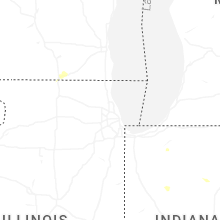


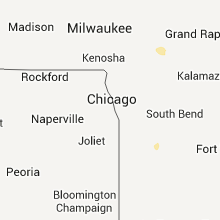


Connect with Interactive Hail Maps