

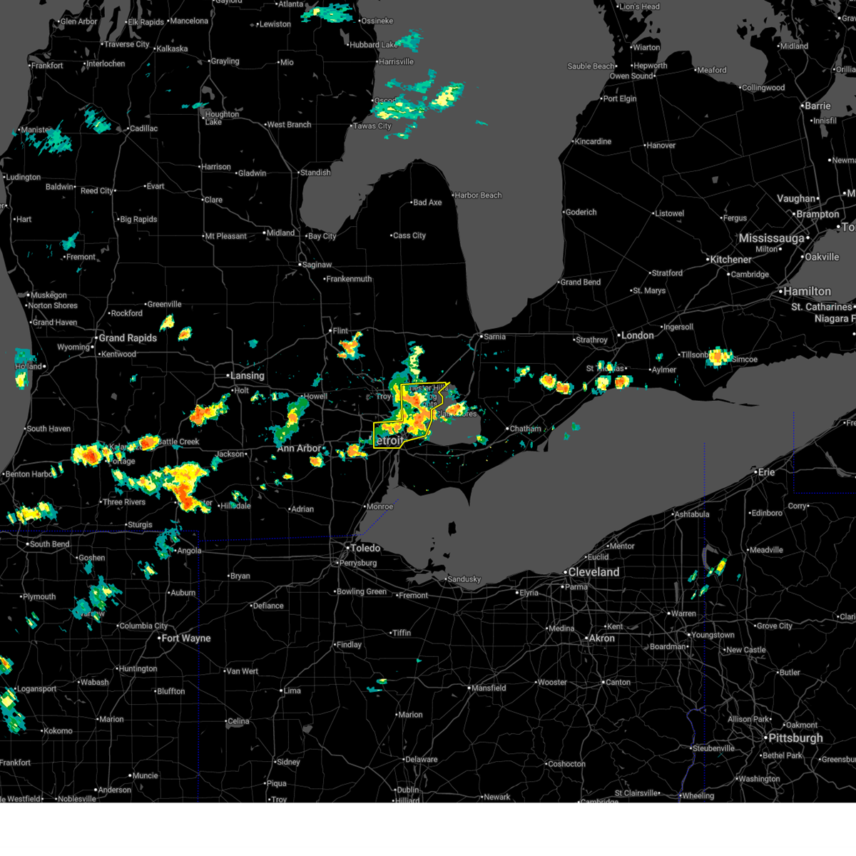
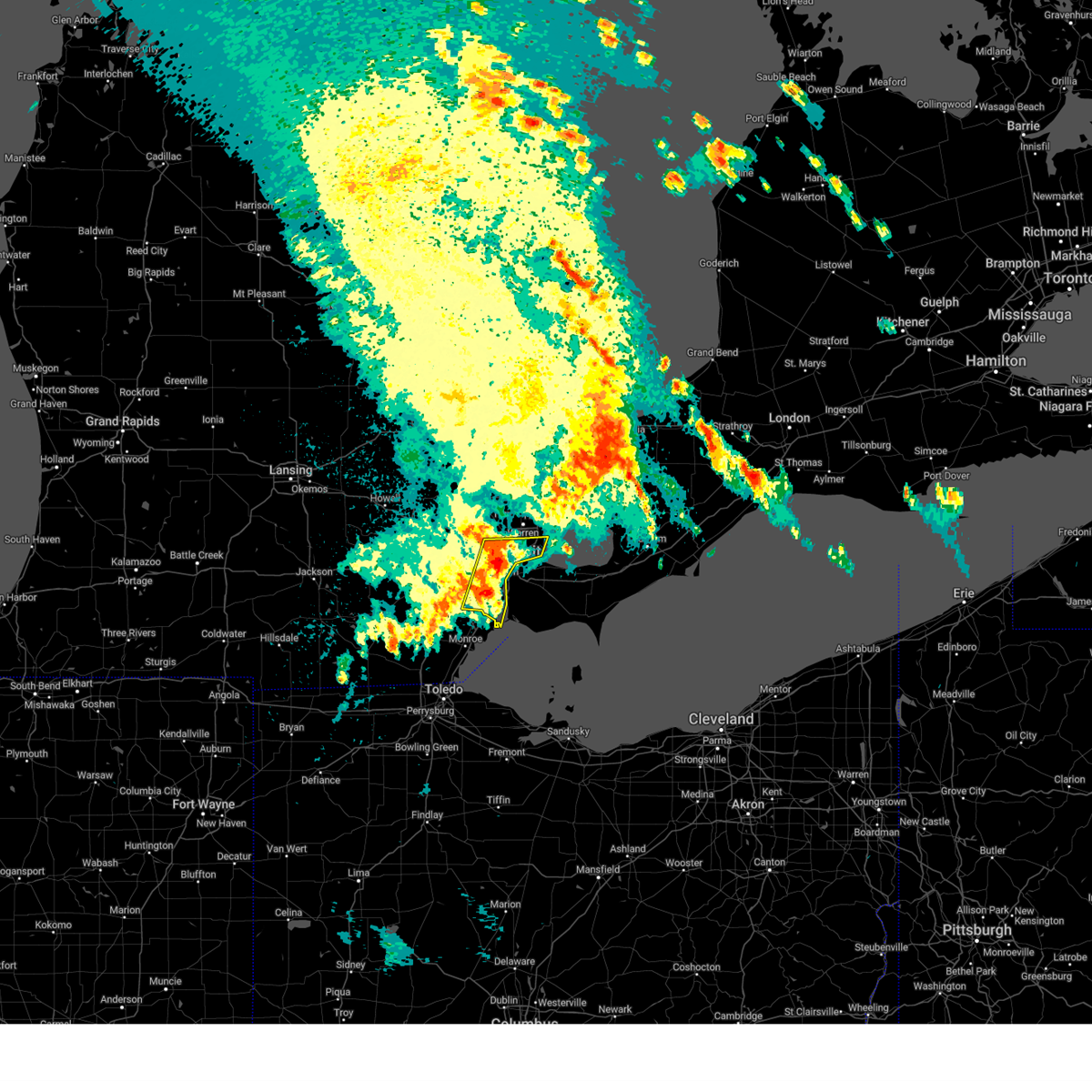
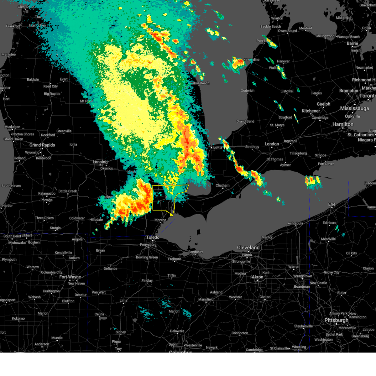
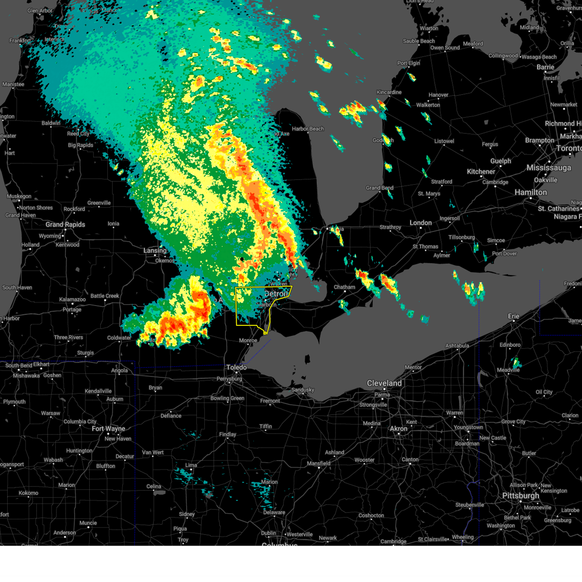
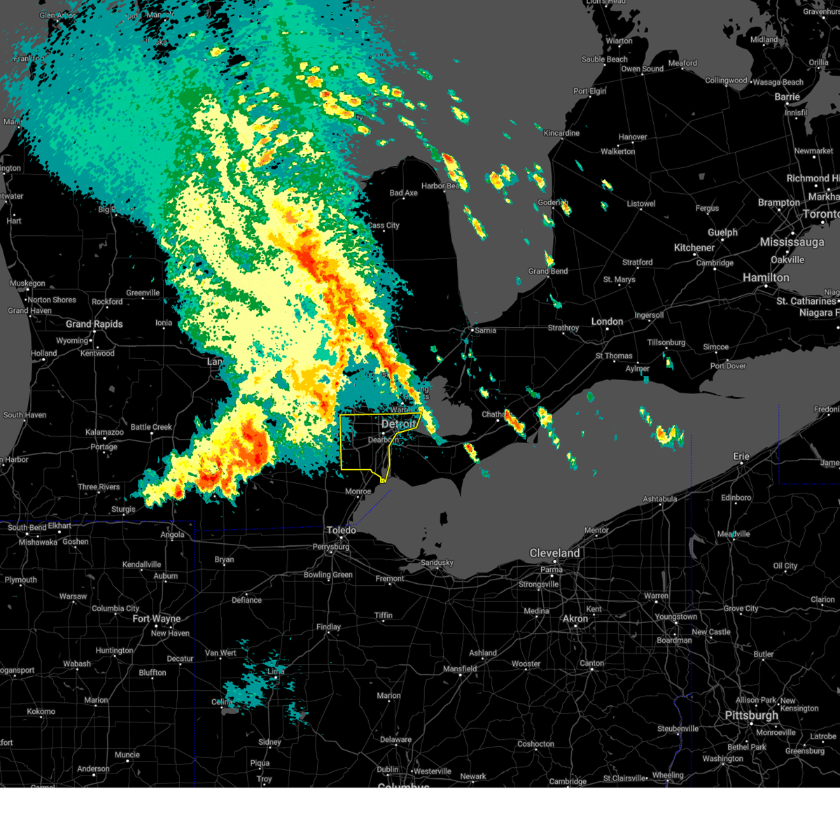
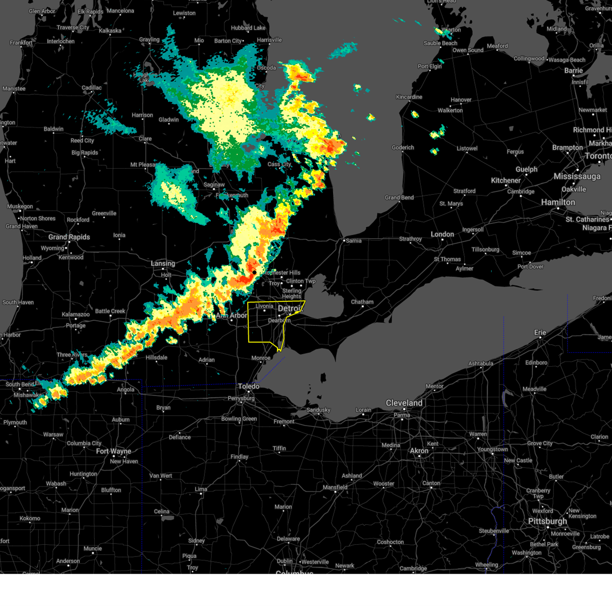
Hail Map for Hamtramck, MI
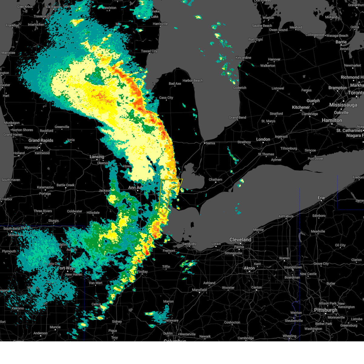
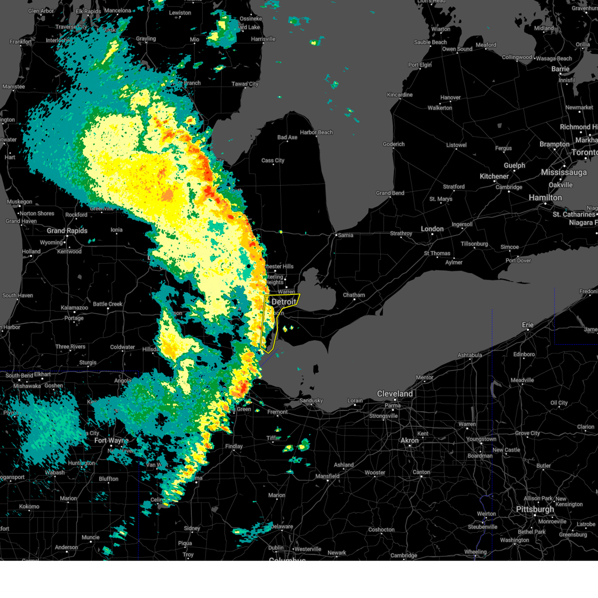
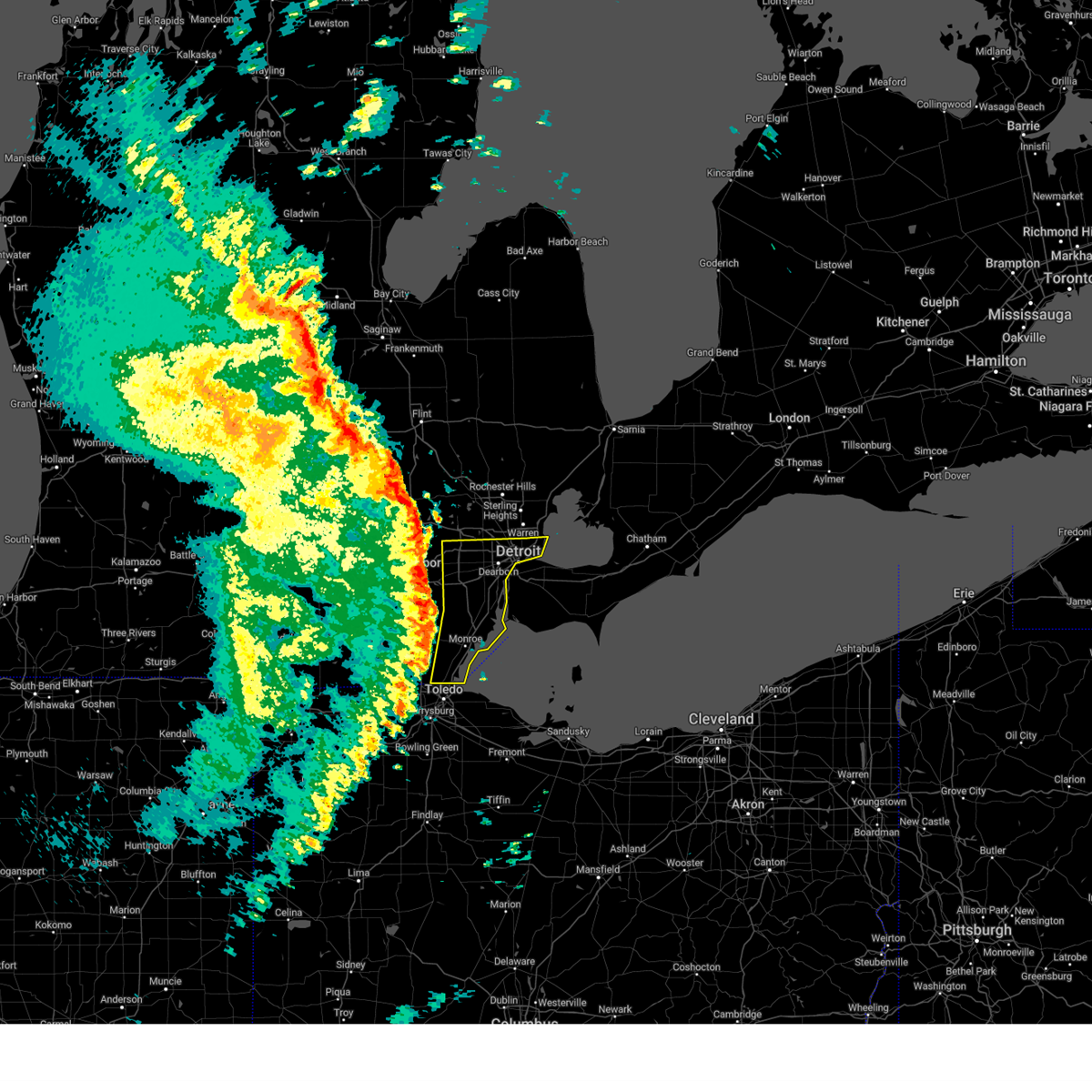
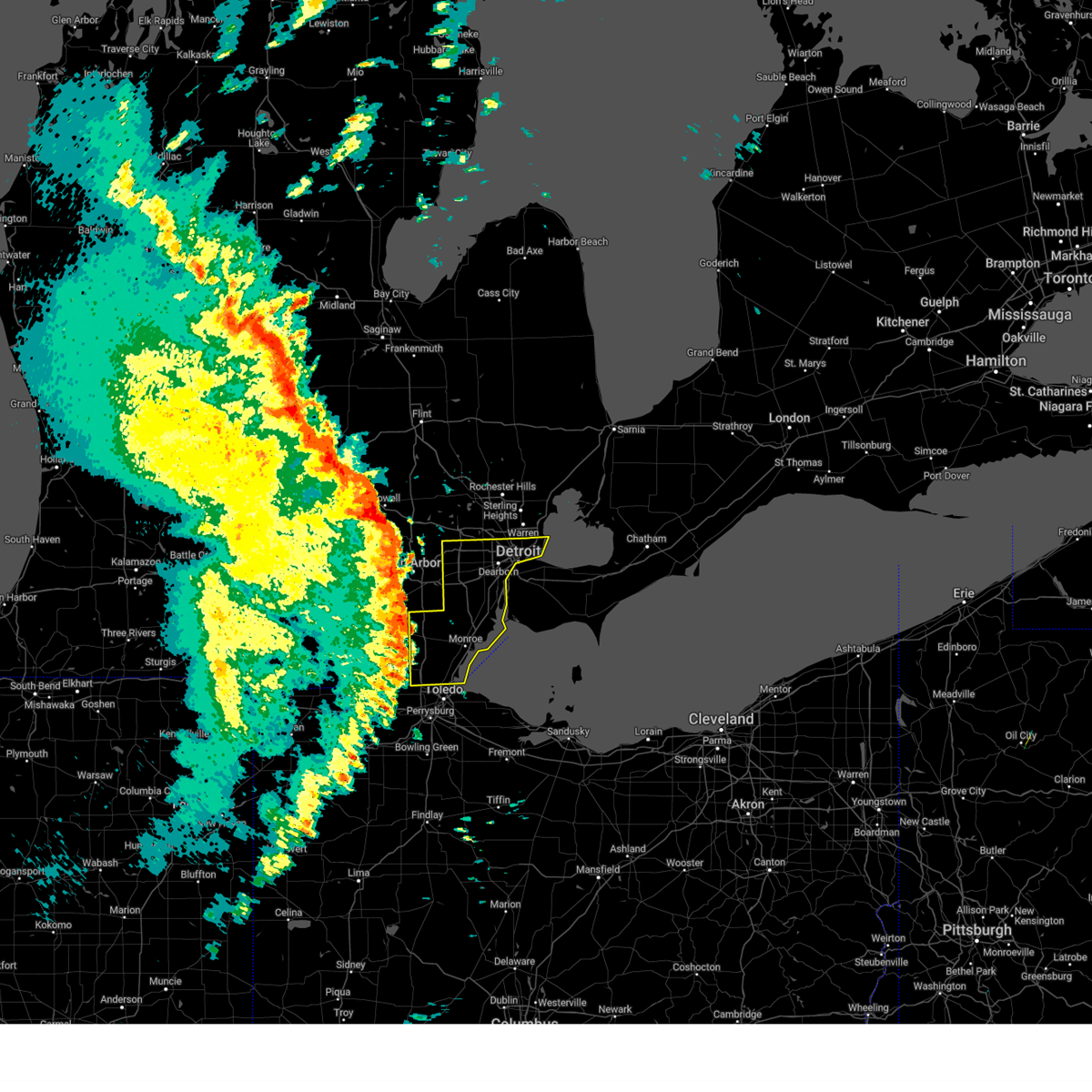
The Hamtramck, MI area has had 0 reports of on-the-ground hail by trained spotters, and has been under severe weather warnings 26 times during the past 12 months. Doppler radar has detected hail at or near Hamtramck, MI on 23 occasions.
| Name: | Hamtramck, MI |
| Where Located: | 53.2 miles SE of Flint, MI |
| Map: | Google Map for Hamtramck, MI |
| Population: | 22423 |
| Housing Units: | 8693 |
| More Info: | Search Google for Hamtramck, MI |
0
The Top Recent Hail Date for Hamtramck, MI is Wednesday, August 23, 2023 (23rd out of 23)

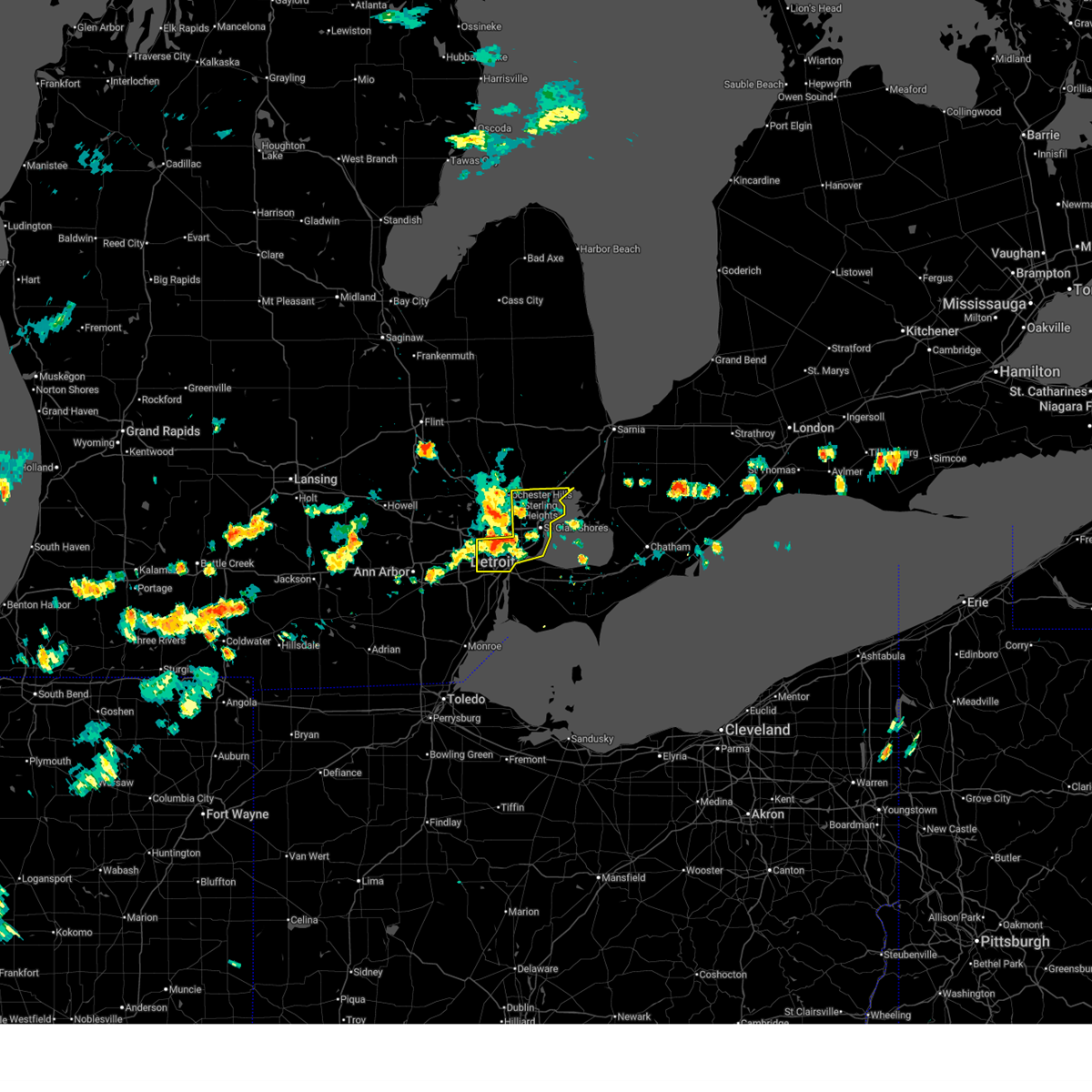
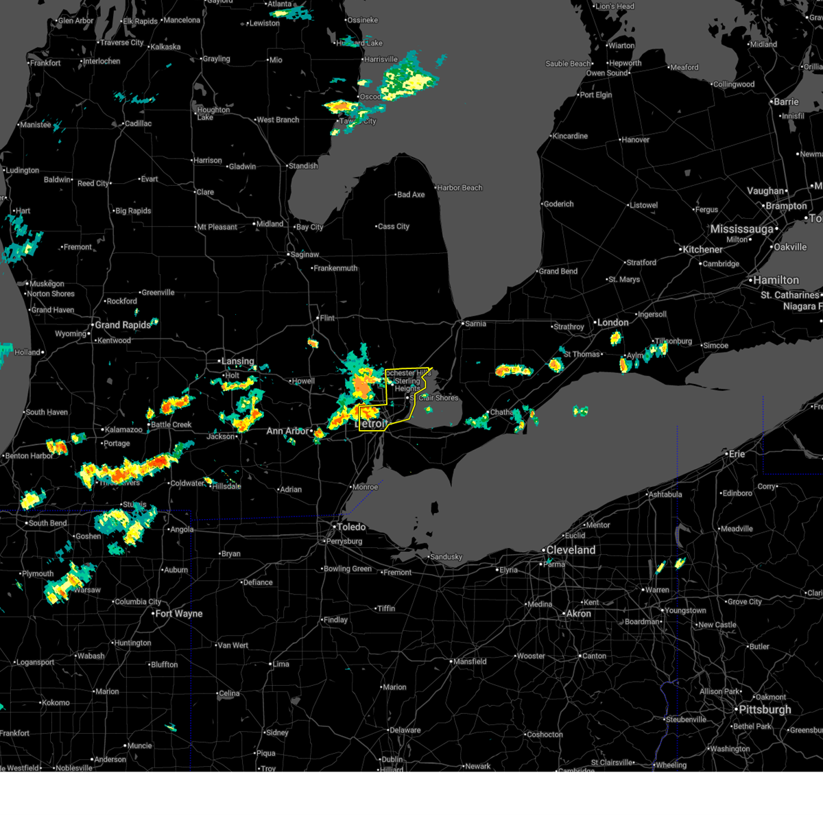
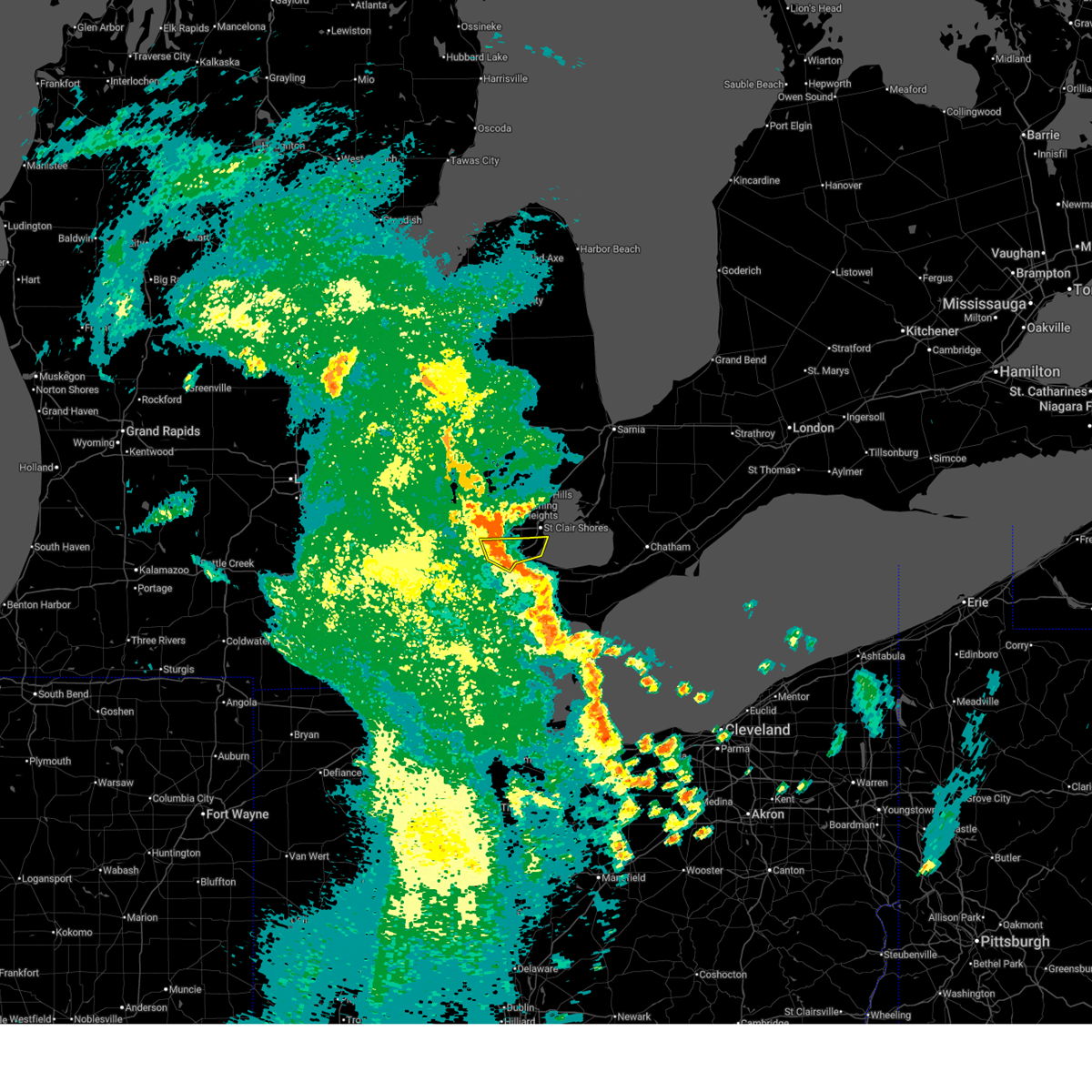
Hail and Wind Damage Spotted near Hamtramck, MI
| Date / Time | Report Details |
|---|---|
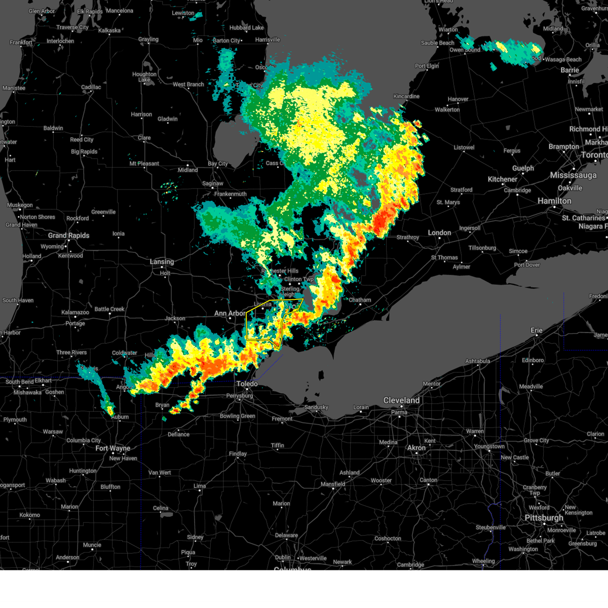
| 6/24/2025 3:47 PM EDT |
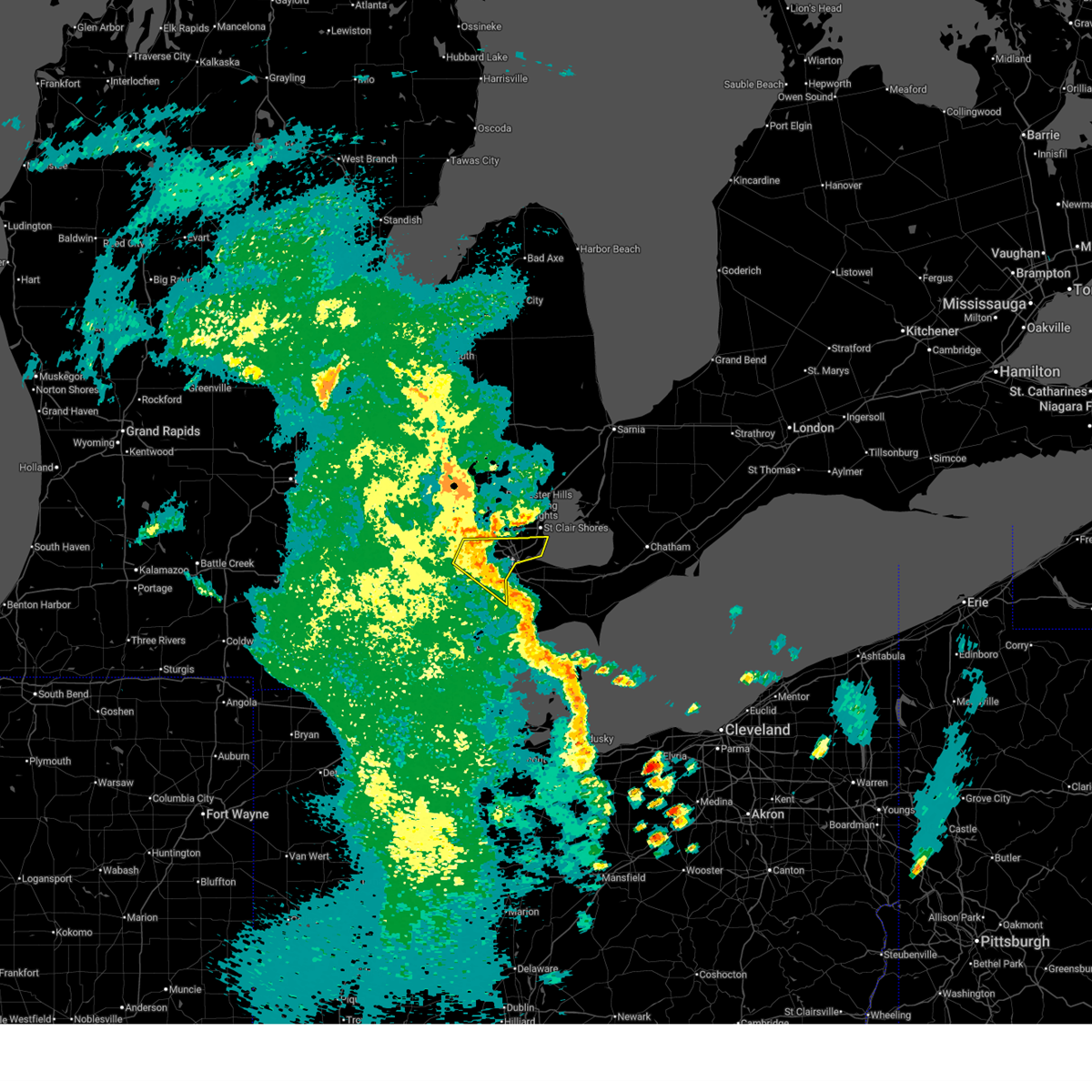
 At 347 pm edt, severe thunderstorms were located along a line extending from near mount clemens to near st. clair shores to near dearborn, moving east at 35 mph (radar indicated). Hazards include 60 mph wind gusts. Expect damage to roofs, siding, and trees. these severe storms will be near, st. clair shores, mount clemens, grosse pointe, downtown detroit, detroit, dearborn, clinton, and belle isle around 350 pm edt. new baltimore around 355 pm edt. Other locations impacted by these severe thunderstorms include melvindale, roseville, shelby township, utica, harper woods, grosse pointe shores, center line, grosse pointe woods, chesterfield township, and clinton township. At 347 pm edt, severe thunderstorms were located along a line extending from near mount clemens to near st. clair shores to near dearborn, moving east at 35 mph (radar indicated). Hazards include 60 mph wind gusts. Expect damage to roofs, siding, and trees. these severe storms will be near, st. clair shores, mount clemens, grosse pointe, downtown detroit, detroit, dearborn, clinton, and belle isle around 350 pm edt. new baltimore around 355 pm edt. Other locations impacted by these severe thunderstorms include melvindale, roseville, shelby township, utica, harper woods, grosse pointe shores, center line, grosse pointe woods, chesterfield township, and clinton township.
|
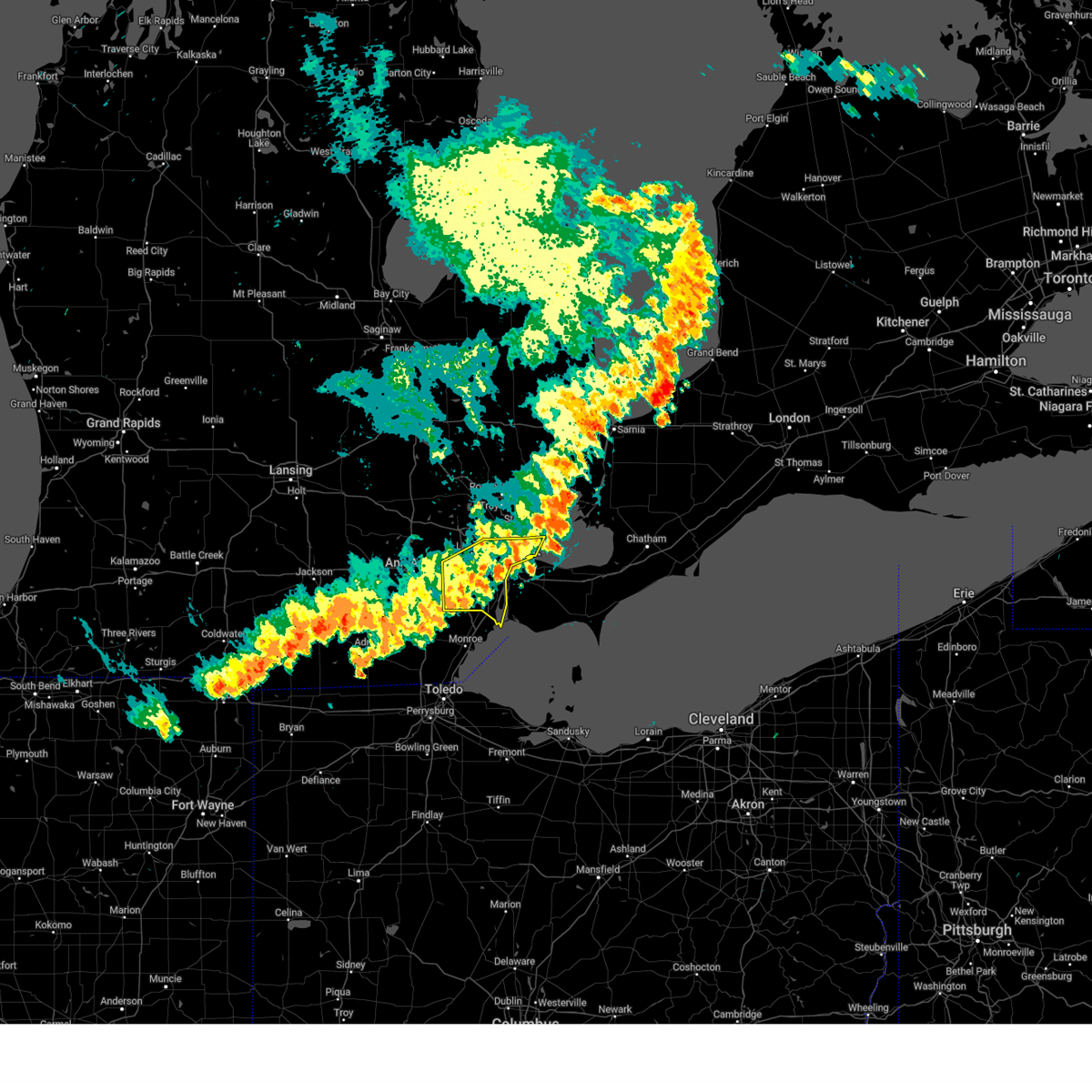
| 6/24/2025 3:34 PM EDT |
 At 334 pm edt, a cluster of severe thunderstorms were located from near sterling heights to near st. clair shores to near detroit, moving east at 35 mph (radar indicated). Hazards include 60 mph wind gusts. Expect damage to roofs, siding, and trees. these severe storms will be near, st. clair shores, mount clemens, grosse pointe, downtown detroit, sterling heights, clinton, macomb township, and belle isle around 340 pm edt. Other locations impacted by these severe thunderstorms include melvindale, roseville, shelby township, utica, harper woods, grosse pointe shores, center line, grosse pointe woods, chesterfield township, and clinton township. At 334 pm edt, a cluster of severe thunderstorms were located from near sterling heights to near st. clair shores to near detroit, moving east at 35 mph (radar indicated). Hazards include 60 mph wind gusts. Expect damage to roofs, siding, and trees. these severe storms will be near, st. clair shores, mount clemens, grosse pointe, downtown detroit, sterling heights, clinton, macomb township, and belle isle around 340 pm edt. Other locations impacted by these severe thunderstorms include melvindale, roseville, shelby township, utica, harper woods, grosse pointe shores, center line, grosse pointe woods, chesterfield township, and clinton township.
|
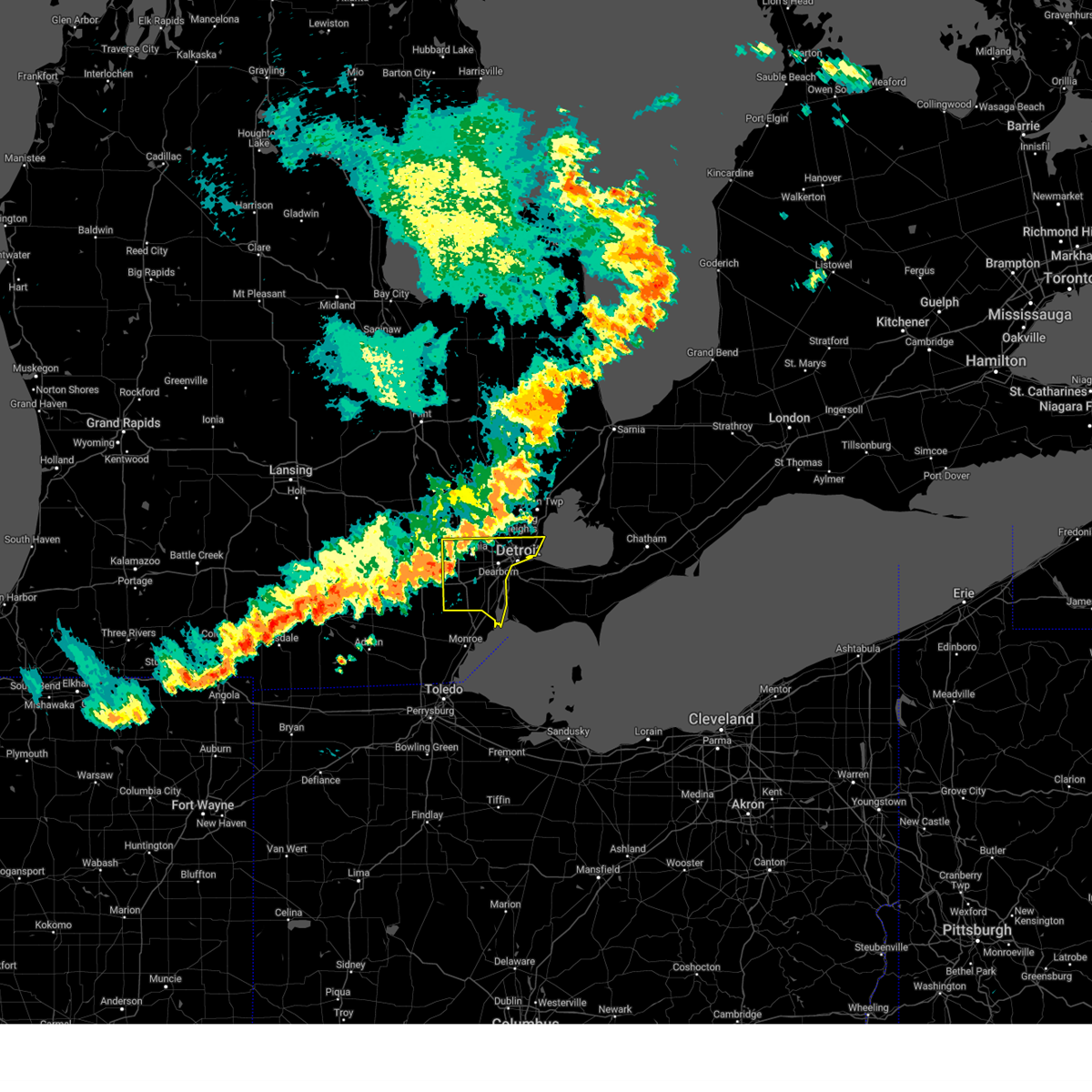
| 6/24/2025 3:22 PM EDT |
 Svrdtx the national weather service in detroit/pontiac has issued a * severe thunderstorm warning for, northeastern wayne county in southeastern michigan, southern macomb county in southeastern michigan, * until 430 pm edt. * at 320 pm edt, a severe thunderstorm was located over birmingham, or near southfield, moving east at 35 mph. there is an additional severe thunderstorm located over northwest detroit also moving east at 35 mph (radar indicated). Hazards include 60 mph wind gusts. Expect damage to roofs, siding, and trees. this severe thunderstorm will be near, warren and sterling heights around 325 pm edt. clinton around 340 pm edt. st. clair shores and mount clemens around 345 pm edt. Other locations impacted by this severe thunderstorm include melvindale, roseville, shelby township, utica, harper woods, grosse pointe shores, center line, grosse pointe woods, chesterfield township, and clinton township. Svrdtx the national weather service in detroit/pontiac has issued a * severe thunderstorm warning for, northeastern wayne county in southeastern michigan, southern macomb county in southeastern michigan, * until 430 pm edt. * at 320 pm edt, a severe thunderstorm was located over birmingham, or near southfield, moving east at 35 mph. there is an additional severe thunderstorm located over northwest detroit also moving east at 35 mph (radar indicated). Hazards include 60 mph wind gusts. Expect damage to roofs, siding, and trees. this severe thunderstorm will be near, warren and sterling heights around 325 pm edt. clinton around 340 pm edt. st. clair shores and mount clemens around 345 pm edt. Other locations impacted by this severe thunderstorm include melvindale, roseville, shelby township, utica, harper woods, grosse pointe shores, center line, grosse pointe woods, chesterfield township, and clinton township.
|
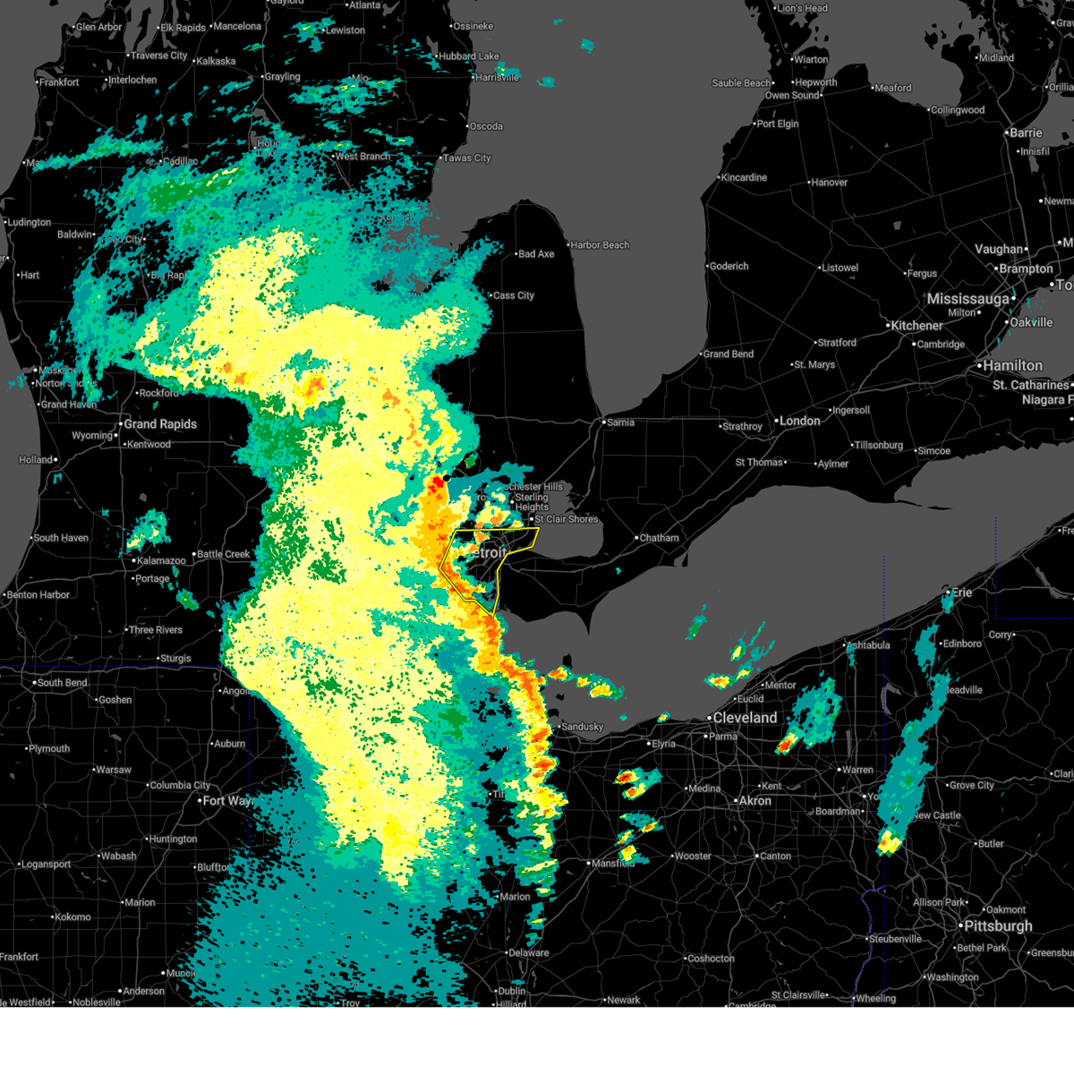
| 6/18/2025 8:59 PM EDT | The storms which prompted the warning have moved out of the area. therefore, the warning will be allowed to expire. a severe thunderstorm watch remains in effect until 1000 pm edt for southeastern michigan. to report severe weather, contact your nearest law enforcement agency. they will relay your report to the national weather service detroit/pontiac. |
| 6/18/2025 8:39 PM EDT |
 At 838 pm edt, severe thunderstorms were located along a line extending from royal oak to detroit to 11 miles southeast of belle isle, moving northeast at 40 mph (radar indicated). Hazards include 60 mph wind gusts. Expect damage to roofs, siding, and trees. these severe storms will be near, grosse pointe around 845 pm edt. Other locations impacted by these severe thunderstorms include northeast detroit, highland park, northwest detroit, harper woods, grosse pointe shores, southwest detroit, hamtramck, grosse pointe woods, grosse pointe park, and grosse pointe farms. At 838 pm edt, severe thunderstorms were located along a line extending from royal oak to detroit to 11 miles southeast of belle isle, moving northeast at 40 mph (radar indicated). Hazards include 60 mph wind gusts. Expect damage to roofs, siding, and trees. these severe storms will be near, grosse pointe around 845 pm edt. Other locations impacted by these severe thunderstorms include northeast detroit, highland park, northwest detroit, harper woods, grosse pointe shores, southwest detroit, hamtramck, grosse pointe woods, grosse pointe park, and grosse pointe farms.
|
| 6/18/2025 8:28 PM EDT |
 At 828 pm edt, severe thunderstorms were located along a line extending from southfield to near greenfield village to 10 miles east of grosse ile, moving northeast at 40 mph (radar indicated). Hazards include 60 mph wind gusts. Expect damage to roofs, siding, and trees. these severe storms will be near, downtown detroit, detroit, dearborn, and belle isle around 835 pm edt. grosse pointe around 845 pm edt. Other locations impacted by these severe thunderstorms include inkster, highland park, melvindale, redford, garden city, riverview, northeast detroit, wayne, northwest detroit, and harper woods. At 828 pm edt, severe thunderstorms were located along a line extending from southfield to near greenfield village to 10 miles east of grosse ile, moving northeast at 40 mph (radar indicated). Hazards include 60 mph wind gusts. Expect damage to roofs, siding, and trees. these severe storms will be near, downtown detroit, detroit, dearborn, and belle isle around 835 pm edt. grosse pointe around 845 pm edt. Other locations impacted by these severe thunderstorms include inkster, highland park, melvindale, redford, garden city, riverview, northeast detroit, wayne, northwest detroit, and harper woods.
|
| 6/18/2025 8:15 PM EDT |
 At 815 pm edt, severe thunderstorms were located along a line extending from near northville to near canton to 8 miles south of grosse ile, moving northeast at 40 mph (radar indicated). Hazards include 60 mph wind gusts. Expect damage to roofs, siding, and trees. these severe storms will be near, livonia, taylor, romulus, dearborn, wyandotte, trenton, and grosse ile around 820 pm edt. greenfield village around 825 pm edt. downtown detroit and detroit around 835 pm edt. belle isle around 840 pm edt. grosse pointe around 845 pm edt. Other locations impacted by these severe thunderstorms include melvindale, gibraltar, new boston, rockwood, harper woods, westland, grosse pointe shores, ecorse, grosse pointe woods, and woodhaven. At 815 pm edt, severe thunderstorms were located along a line extending from near northville to near canton to 8 miles south of grosse ile, moving northeast at 40 mph (radar indicated). Hazards include 60 mph wind gusts. Expect damage to roofs, siding, and trees. these severe storms will be near, livonia, taylor, romulus, dearborn, wyandotte, trenton, and grosse ile around 820 pm edt. greenfield village around 825 pm edt. downtown detroit and detroit around 835 pm edt. belle isle around 840 pm edt. grosse pointe around 845 pm edt. Other locations impacted by these severe thunderstorms include melvindale, gibraltar, new boston, rockwood, harper woods, westland, grosse pointe shores, ecorse, grosse pointe woods, and woodhaven.
|
| 6/18/2025 8:02 PM EDT |
 Svrdtx the national weather service in detroit/pontiac has issued a * severe thunderstorm warning for, wayne county in southeastern michigan, * until 900 pm edt. * at 802 pm edt, severe thunderstorms were located along a line extending from near belleville to carleton to monroe, moving northeast at 45 mph (radar indicated). Hazards include 60 mph wind gusts. Expect damage to roofs, siding, and trees. severe thunderstorms will be near, taylor, romulus, flat rock, canton, and trenton around 810 pm edt. livonia, dearborn, and wyandotte around 815 pm edt. grosse ile and greenfield village around 820 pm edt. detroit around 830 pm edt. downtown detroit and belle isle around 835 pm edt. grosse pointe around 845 pm edt. Other locations impacted by these severe thunderstorms include melvindale, gibraltar, new boston, rockwood, harper woods, westland, grosse pointe shores, ecorse, grosse pointe woods, and woodhaven. Svrdtx the national weather service in detroit/pontiac has issued a * severe thunderstorm warning for, wayne county in southeastern michigan, * until 900 pm edt. * at 802 pm edt, severe thunderstorms were located along a line extending from near belleville to carleton to monroe, moving northeast at 45 mph (radar indicated). Hazards include 60 mph wind gusts. Expect damage to roofs, siding, and trees. severe thunderstorms will be near, taylor, romulus, flat rock, canton, and trenton around 810 pm edt. livonia, dearborn, and wyandotte around 815 pm edt. grosse ile and greenfield village around 820 pm edt. detroit around 830 pm edt. downtown detroit and belle isle around 835 pm edt. grosse pointe around 845 pm edt. Other locations impacted by these severe thunderstorms include melvindale, gibraltar, new boston, rockwood, harper woods, westland, grosse pointe shores, ecorse, grosse pointe woods, and woodhaven.
|
| 5/16/2025 1:53 AM EDT |
 The storms which prompted the warning have moved out of the area. therefore, the warning will be allowed to expire. however, gusty winds are still possible with these thunderstorms. a tornado watch remains in effect until 500 am edt for southeastern michigan. The storms which prompted the warning have moved out of the area. therefore, the warning will be allowed to expire. however, gusty winds are still possible with these thunderstorms. a tornado watch remains in effect until 500 am edt for southeastern michigan.
|
| 5/16/2025 1:35 AM EDT |
 At 135 am edt, severe thunderstorms were located along a line extending from near detroit to near downtown detroit to 6 miles south of grosse ile, moving east at 50 mph (radar indicated). Hazards include 60 mph wind gusts and penny size hail. Expect damage to roofs, siding, and trees. these severe storms will be near, grosse pointe, downtown detroit, and belle isle around 140 am edt. Other locations impacted by these severe thunderstorms include melvindale, gibraltar, rockwood, harper woods, grosse pointe shores, ecorse, grosse pointe woods, woodhaven, lincoln park, and grosse pointe park. At 135 am edt, severe thunderstorms were located along a line extending from near detroit to near downtown detroit to 6 miles south of grosse ile, moving east at 50 mph (radar indicated). Hazards include 60 mph wind gusts and penny size hail. Expect damage to roofs, siding, and trees. these severe storms will be near, grosse pointe, downtown detroit, and belle isle around 140 am edt. Other locations impacted by these severe thunderstorms include melvindale, gibraltar, rockwood, harper woods, grosse pointe shores, ecorse, grosse pointe woods, woodhaven, lincoln park, and grosse pointe park.
|
| 5/16/2025 1:14 AM EDT |
 At 113 am edt, severe thunderstorms were located along a line extending from northville to canton to near maybee, moving east at 55 mph (radar indicated). Hazards include 60 mph wind gusts and penny size hail. Expect damage to roofs, siding, and trees. these severe storms will be near, livonia, southfield, taylor, romulus, flat rock, and dearborn around 120 am edt. wyandotte, trenton, and greenfield village around 125 am edt. detroit and grosse ile around 130 am edt. downtown detroit around 135 am edt. grosse pointe and belle isle around 140 am edt. Other locations impacted by these severe thunderstorms include melvindale, gibraltar, new boston, rockwood, harper woods, westland, grosse pointe shores, ecorse, grosse pointe woods, and woodhaven. At 113 am edt, severe thunderstorms were located along a line extending from northville to canton to near maybee, moving east at 55 mph (radar indicated). Hazards include 60 mph wind gusts and penny size hail. Expect damage to roofs, siding, and trees. these severe storms will be near, livonia, southfield, taylor, romulus, flat rock, and dearborn around 120 am edt. wyandotte, trenton, and greenfield village around 125 am edt. detroit and grosse ile around 130 am edt. downtown detroit around 135 am edt. grosse pointe and belle isle around 140 am edt. Other locations impacted by these severe thunderstorms include melvindale, gibraltar, new boston, rockwood, harper woods, westland, grosse pointe shores, ecorse, grosse pointe woods, and woodhaven.
|
| 5/16/2025 12:55 AM EDT |
 At 1255 am edt, a severe thunderstorm was located near greenfield village, or near livonia, moving east at 40 mph (radar indicated). Hazards include 60 mph wind gusts. Expect damage to roofs, siding, and trees. this severe storm will be near, taylor, dearborn, and greenfield village around 100 am edt. wyandotte around 105 am edt. Other locations impacted by this severe thunderstorm include melvindale, gibraltar, new boston, rockwood, harper woods, westland, grosse pointe shores, ecorse, grosse pointe woods, and woodhaven. At 1255 am edt, a severe thunderstorm was located near greenfield village, or near livonia, moving east at 40 mph (radar indicated). Hazards include 60 mph wind gusts. Expect damage to roofs, siding, and trees. this severe storm will be near, taylor, dearborn, and greenfield village around 100 am edt. wyandotte around 105 am edt. Other locations impacted by this severe thunderstorm include melvindale, gibraltar, new boston, rockwood, harper woods, westland, grosse pointe shores, ecorse, grosse pointe woods, and woodhaven.
|
| 5/16/2025 12:38 AM EDT |
 Svrdtx the national weather service in detroit/pontiac has issued a * severe thunderstorm warning for, wayne county in southeastern michigan, * until 200 am edt. * at 1236 am edt, a severe thunderstorm was located over northville, or near novi, moving east at 50 mph (radar indicated). Hazards include 60 mph wind gusts. Expect damage to roofs, siding, and trees. this severe thunderstorm will be near, livonia, novi, and northville around 1240 am edt. southfield around 1245 am edt. detroit around 1255 am edt. grosse pointe around 110 am edt. other locations impacted by this severe thunderstorm include melvindale, gibraltar, new boston, rockwood, harper woods, westland, grosse pointe shores, ecorse, grosse pointe woods, and woodhaven. Additional strong storms are located behind this initial storm and may bring severe weather. Svrdtx the national weather service in detroit/pontiac has issued a * severe thunderstorm warning for, wayne county in southeastern michigan, * until 200 am edt. * at 1236 am edt, a severe thunderstorm was located over northville, or near novi, moving east at 50 mph (radar indicated). Hazards include 60 mph wind gusts. Expect damage to roofs, siding, and trees. this severe thunderstorm will be near, livonia, novi, and northville around 1240 am edt. southfield around 1245 am edt. detroit around 1255 am edt. grosse pointe around 110 am edt. other locations impacted by this severe thunderstorm include melvindale, gibraltar, new boston, rockwood, harper woods, westland, grosse pointe shores, ecorse, grosse pointe woods, and woodhaven. Additional strong storms are located behind this initial storm and may bring severe weather.
|
| 3/30/2025 7:39 PM EDT |
 The storms which prompted the warning have moved out of the area. therefore, the warning will be allowed to expire. a severe thunderstorm watch remains in effect until 1000 pm edt for southeastern michigan. The storms which prompted the warning have moved out of the area. therefore, the warning will be allowed to expire. a severe thunderstorm watch remains in effect until 1000 pm edt for southeastern michigan.
|
| 3/30/2025 7:27 PM EDT |
 At 727 pm edt, severe thunderstorms were located along a line extending from near rochester to near detroit to trenton, moving northeast at 65 mph (radar indicated). Hazards include 70 mph wind gusts and penny size hail. Expect considerable tree damage. damage is likely to mobile homes, roofs, and outbuildings. these severe storms will be near, downtown detroit, grosse pointe, and belle isle around 735 pm edt. other locations impacted by these severe thunderstorms include newport, melvindale, gibraltar, stony point, rockwood, harper woods, grosse pointe shores, ecorse, grosse pointe woods, and woodhaven. this includes the following highways, i-75 between mile markers 21 and 58. i-94 between mile markers 201 and 225. i-96 between mile markers 180 and 192. M-10 between mile markers 1 and 12. At 727 pm edt, severe thunderstorms were located along a line extending from near rochester to near detroit to trenton, moving northeast at 65 mph (radar indicated). Hazards include 70 mph wind gusts and penny size hail. Expect considerable tree damage. damage is likely to mobile homes, roofs, and outbuildings. these severe storms will be near, downtown detroit, grosse pointe, and belle isle around 735 pm edt. other locations impacted by these severe thunderstorms include newport, melvindale, gibraltar, stony point, rockwood, harper woods, grosse pointe shores, ecorse, grosse pointe woods, and woodhaven. this includes the following highways, i-75 between mile markers 21 and 58. i-94 between mile markers 201 and 225. i-96 between mile markers 180 and 192. M-10 between mile markers 1 and 12.
|
| 3/30/2025 7:06 PM EDT |
 At 706 pm edt, severe thunderstorms were located along a line extending from novi to belleville to near ida, moving northeast at 65 mph (radar indicated). Hazards include 70 mph wind gusts and penny size hail. Expect considerable tree damage. damage is likely to mobile homes, roofs, and outbuildings. these severe storms will be near, canton, belleville, livonia, romulus, maybee, monroe, northville, and carleton around 710 pm edt. flat rock, dearborn, taylor, and greenfield village around 715 pm edt. wyandotte and trenton around 720 pm edt. detroit and grosse ile around 725 pm edt. downtown detroit and belle isle around 730 pm edt. grosse pointe around 735 pm edt. other locations impacted by these severe thunderstorms include newport, melvindale, gibraltar, erie, new boston, woodland beach, stony point, bolles harbor, rockwood, and samaria. this includes the following highways, i-75 between mile markers 1 and 58. i-275 between mile markers 1 and 29. i-94 between mile markers 188 and 225. i-96 between mile markers 169 and 192. m-10 between mile markers 1 and 12. M-14 between mile markers 16 and 21. At 706 pm edt, severe thunderstorms were located along a line extending from novi to belleville to near ida, moving northeast at 65 mph (radar indicated). Hazards include 70 mph wind gusts and penny size hail. Expect considerable tree damage. damage is likely to mobile homes, roofs, and outbuildings. these severe storms will be near, canton, belleville, livonia, romulus, maybee, monroe, northville, and carleton around 710 pm edt. flat rock, dearborn, taylor, and greenfield village around 715 pm edt. wyandotte and trenton around 720 pm edt. detroit and grosse ile around 725 pm edt. downtown detroit and belle isle around 730 pm edt. grosse pointe around 735 pm edt. other locations impacted by these severe thunderstorms include newport, melvindale, gibraltar, erie, new boston, woodland beach, stony point, bolles harbor, rockwood, and samaria. this includes the following highways, i-75 between mile markers 1 and 58. i-275 between mile markers 1 and 29. i-94 between mile markers 188 and 225. i-96 between mile markers 169 and 192. m-10 between mile markers 1 and 12. M-14 between mile markers 16 and 21.
|
| 3/30/2025 6:47 PM EDT |
 Svrdtx the national weather service in detroit/pontiac has issued a * severe thunderstorm warning for, monroe county in southeastern michigan, wayne county in southeastern michigan, * until 745 pm edt. * at 646 pm edt, severe thunderstorms were located along a line extending from near dexter to britton to near ottawa lake, moving northeast at 65 mph (radar indicated). Hazards include 70 mph wind gusts and penny size hail. Expect considerable tree damage. damage is likely to mobile homes, roofs, and outbuildings. severe thunderstorms will be near, dundee, petersburg, milan, and ottawa lake around 650 pm edt. ida, canton, belleville, and maybee around 700 pm edt. livonia, romulus, monroe, and northville around 705 pm edt. taylor and carleton around 710 pm edt. flat rock, dearborn, and greenfield village around 715 pm edt. wyandotte and trenton around 720 pm edt. detroit and grosse ile around 725 pm edt. downtown detroit and belle isle around 730 pm edt. other locations impacted by these severe thunderstorms include newport, melvindale, gibraltar, erie, new boston, woodland beach, stony point, bolles harbor, rockwood, and samaria. this includes the following highways, i-75 between mile markers 1 and 58. i-275 between mile markers 1 and 29. i-94 between mile markers 188 and 225. i-96 between mile markers 169 and 192. m-10 between mile markers 1 and 12. m-14 between mile markers 16 and 21. Us-23 between mile markers 1 and 25. Svrdtx the national weather service in detroit/pontiac has issued a * severe thunderstorm warning for, monroe county in southeastern michigan, wayne county in southeastern michigan, * until 745 pm edt. * at 646 pm edt, severe thunderstorms were located along a line extending from near dexter to britton to near ottawa lake, moving northeast at 65 mph (radar indicated). Hazards include 70 mph wind gusts and penny size hail. Expect considerable tree damage. damage is likely to mobile homes, roofs, and outbuildings. severe thunderstorms will be near, dundee, petersburg, milan, and ottawa lake around 650 pm edt. ida, canton, belleville, and maybee around 700 pm edt. livonia, romulus, monroe, and northville around 705 pm edt. taylor and carleton around 710 pm edt. flat rock, dearborn, and greenfield village around 715 pm edt. wyandotte and trenton around 720 pm edt. detroit and grosse ile around 725 pm edt. downtown detroit and belle isle around 730 pm edt. other locations impacted by these severe thunderstorms include newport, melvindale, gibraltar, erie, new boston, woodland beach, stony point, bolles harbor, rockwood, and samaria. this includes the following highways, i-75 between mile markers 1 and 58. i-275 between mile markers 1 and 29. i-94 between mile markers 188 and 225. i-96 between mile markers 169 and 192. m-10 between mile markers 1 and 12. m-14 between mile markers 16 and 21. Us-23 between mile markers 1 and 25.
|
| 8/27/2024 6:38 PM EDT |
 The storms which prompted the warning have moved out of the area. therefore, the warning will be allowed to expire. a severe thunderstorm watch remains in effect until 900 pm edt for southeastern michigan. The storms which prompted the warning have moved out of the area. therefore, the warning will be allowed to expire. a severe thunderstorm watch remains in effect until 900 pm edt for southeastern michigan.
|
| 8/27/2024 6:16 PM EDT |
 At 616 pm edt, severe thunderstorms were located along a line extending from near st. clair shores to near wyandotte to near milan, moving east at 40 mph (radar indicated). Hazards include 60 mph wind gusts and penny size hail. Expect damage to roofs, siding, and trees. these severe storms will be near, taylor, romulus, flat rock, grosse pointe, downtown detroit, wyandotte, and trenton around 620 pm edt. grosse ile around 625 pm edt. other locations impacted by these severe thunderstorms include melvindale, gibraltar, new boston, rockwood, harper woods, westland, grosse pointe shores, ecorse, grosse pointe woods, and woodhaven. people attending comerica park should seek safe shelter immediately! this includes the following highways, i-75 between mile markers 27 and 58. i-275 between mile markers 8 and 27. i-94 between mile markers 188 and 225. i-96 between mile markers 173 and 192. M-10 between mile markers 1 and 12. At 616 pm edt, severe thunderstorms were located along a line extending from near st. clair shores to near wyandotte to near milan, moving east at 40 mph (radar indicated). Hazards include 60 mph wind gusts and penny size hail. Expect damage to roofs, siding, and trees. these severe storms will be near, taylor, romulus, flat rock, grosse pointe, downtown detroit, wyandotte, and trenton around 620 pm edt. grosse ile around 625 pm edt. other locations impacted by these severe thunderstorms include melvindale, gibraltar, new boston, rockwood, harper woods, westland, grosse pointe shores, ecorse, grosse pointe woods, and woodhaven. people attending comerica park should seek safe shelter immediately! this includes the following highways, i-75 between mile markers 27 and 58. i-275 between mile markers 8 and 27. i-94 between mile markers 188 and 225. i-96 between mile markers 173 and 192. M-10 between mile markers 1 and 12.
|
| 8/27/2024 5:59 PM EDT |
 At 558 pm edt, severe thunderstorms were located along a line extending from sterling heights to near greenfield village to 6 miles north of britton, moving east at 45 mph (radar indicated). Hazards include 70 mph wind gusts and penny size hail. Expect considerable tree damage. damage is likely to mobile homes, roofs, and outbuildings. these severe storms will be near, taylor, romulus, detroit, dearborn, belleville, and greenfield village around 605 pm edt. grosse pointe, downtown detroit, and wyandotte around 610 pm edt. flat rock and trenton around 615 pm edt. grosse ile around 620 pm edt. other locations impacted by these severe thunderstorms include melvindale, gibraltar, new boston, rockwood, harper woods, westland, grosse pointe shores, ecorse, grosse pointe woods, and woodhaven. this includes the following highways, i-75 between mile markers 27 and 58. i-275 between mile markers 8 and 29. i-94 between mile markers 188 and 225. i-96 between mile markers 168 and 192. m-10 between mile markers 1 and 12. M-14 between mile markers 16 and 21. At 558 pm edt, severe thunderstorms were located along a line extending from sterling heights to near greenfield village to 6 miles north of britton, moving east at 45 mph (radar indicated). Hazards include 70 mph wind gusts and penny size hail. Expect considerable tree damage. damage is likely to mobile homes, roofs, and outbuildings. these severe storms will be near, taylor, romulus, detroit, dearborn, belleville, and greenfield village around 605 pm edt. grosse pointe, downtown detroit, and wyandotte around 610 pm edt. flat rock and trenton around 615 pm edt. grosse ile around 620 pm edt. other locations impacted by these severe thunderstorms include melvindale, gibraltar, new boston, rockwood, harper woods, westland, grosse pointe shores, ecorse, grosse pointe woods, and woodhaven. this includes the following highways, i-75 between mile markers 27 and 58. i-275 between mile markers 8 and 29. i-94 between mile markers 188 and 225. i-96 between mile markers 168 and 192. m-10 between mile markers 1 and 12. M-14 between mile markers 16 and 21.
|
| 8/27/2024 5:46 PM EDT |
 At 546 pm edt, severe thunderstorms were located along a line extending from near romeo to near livonia to 6 miles east of manchester, moving east at 45 mph (radar indicated). Hazards include 60 mph wind gusts and penny size hail. Expect damage to roofs, siding, and trees. these severe storms will be near, livonia, southfield, and canton around 550 pm edt. romulus, dearborn, and belleville around 555 pm edt. taylor, detroit, and greenfield village around 600 pm edt. downtown detroit around 605 pm edt. grosse pointe and wyandotte around 610 pm edt. flat rock and trenton around 615 pm edt. grosse ile around 620 pm edt. other locations impacted by these severe thunderstorms include melvindale, gibraltar, new boston, rockwood, harper woods, westland, grosse pointe shores, ecorse, grosse pointe woods, and woodhaven. this includes the following highways, i-75 between mile markers 27 and 58. i-275 between mile markers 8 and 29. i-94 between mile markers 188 and 225. i-96 between mile markers 168 and 192. m-10 between mile markers 1 and 12. M-14 between mile markers 16 and 21. At 546 pm edt, severe thunderstorms were located along a line extending from near romeo to near livonia to 6 miles east of manchester, moving east at 45 mph (radar indicated). Hazards include 60 mph wind gusts and penny size hail. Expect damage to roofs, siding, and trees. these severe storms will be near, livonia, southfield, and canton around 550 pm edt. romulus, dearborn, and belleville around 555 pm edt. taylor, detroit, and greenfield village around 600 pm edt. downtown detroit around 605 pm edt. grosse pointe and wyandotte around 610 pm edt. flat rock and trenton around 615 pm edt. grosse ile around 620 pm edt. other locations impacted by these severe thunderstorms include melvindale, gibraltar, new boston, rockwood, harper woods, westland, grosse pointe shores, ecorse, grosse pointe woods, and woodhaven. this includes the following highways, i-75 between mile markers 27 and 58. i-275 between mile markers 8 and 29. i-94 between mile markers 188 and 225. i-96 between mile markers 168 and 192. m-10 between mile markers 1 and 12. M-14 between mile markers 16 and 21.
|
| 8/27/2024 5:30 PM EDT |
 Svrdtx the national weather service in detroit/pontiac has issued a * severe thunderstorm warning for, wayne county in southeastern michigan, * until 645 pm edt. * at 530 pm edt, severe thunderstorms were located along a line extending from near oxford to near salem to near manchester, moving east at 45 mph (radar indicated). Hazards include 60 mph wind gusts and penny size hail. Expect damage to roofs, siding, and trees. severe thunderstorms will be near, livonia, novi, canton, and northville around 535 pm edt. southfield around 540 pm edt. romulus and dearborn around 550 pm edt. taylor, belleville, and greenfield village around 555 pm edt. detroit around 600 pm edt. downtown detroit and wyandotte around 605 pm edt. grosse pointe around 610 pm edt. flat rock and trenton around 615 pm edt. other locations impacted by these severe thunderstorms include melvindale, gibraltar, new boston, rockwood, harper woods, westland, grosse pointe shores, ecorse, grosse pointe woods, and woodhaven. this includes the following highways, i-75 between mile markers 27 and 58. i-275 between mile markers 8 and 29. i-94 between mile markers 188 and 225. i-96 between mile markers 168 and 192. m-10 between mile markers 1 and 12. M-14 between mile markers 16 and 21. Svrdtx the national weather service in detroit/pontiac has issued a * severe thunderstorm warning for, wayne county in southeastern michigan, * until 645 pm edt. * at 530 pm edt, severe thunderstorms were located along a line extending from near oxford to near salem to near manchester, moving east at 45 mph (radar indicated). Hazards include 60 mph wind gusts and penny size hail. Expect damage to roofs, siding, and trees. severe thunderstorms will be near, livonia, novi, canton, and northville around 535 pm edt. southfield around 540 pm edt. romulus and dearborn around 550 pm edt. taylor, belleville, and greenfield village around 555 pm edt. detroit around 600 pm edt. downtown detroit and wyandotte around 605 pm edt. grosse pointe around 610 pm edt. flat rock and trenton around 615 pm edt. other locations impacted by these severe thunderstorms include melvindale, gibraltar, new boston, rockwood, harper woods, westland, grosse pointe shores, ecorse, grosse pointe woods, and woodhaven. this includes the following highways, i-75 between mile markers 27 and 58. i-275 between mile markers 8 and 29. i-94 between mile markers 188 and 225. i-96 between mile markers 168 and 192. m-10 between mile markers 1 and 12. M-14 between mile markers 16 and 21.
|
| 7/16/2024 3:23 AM EDT |
 the severe thunderstorm warning has been cancelled and is no longer in effect the severe thunderstorm warning has been cancelled and is no longer in effect
|
| 7/16/2024 3:13 AM EDT |
 At 312 am edt, a severe thunderstorm was located near detroit, or near downtown detroit, moving northeast at 30 mph (radar indicated). Hazards include 60 mph wind gusts. Expect damage to roofs, siding, and trees. this severe thunderstorm will remain over mainly rural areas of northeastern wayne county, including the following locations, northeast detroit, highland park, northwest detroit, harper woods, grosse pointe shores, hamtramck, grosse pointe woods, grosse pointe park, grosse pointe farms, and redford. this includes the following highways, i-75 between mile markers 53 and 58. i-94 between mile markers 216 and 225. i-96 between mile markers 184 and 188. M-10 between mile markers 4 and 11. At 312 am edt, a severe thunderstorm was located near detroit, or near downtown detroit, moving northeast at 30 mph (radar indicated). Hazards include 60 mph wind gusts. Expect damage to roofs, siding, and trees. this severe thunderstorm will remain over mainly rural areas of northeastern wayne county, including the following locations, northeast detroit, highland park, northwest detroit, harper woods, grosse pointe shores, hamtramck, grosse pointe woods, grosse pointe park, grosse pointe farms, and redford. this includes the following highways, i-75 between mile markers 53 and 58. i-94 between mile markers 216 and 225. i-96 between mile markers 184 and 188. M-10 between mile markers 4 and 11.
|
| 7/16/2024 2:55 AM EDT |
 At 254 am edt, severe thunderstorms were located along a line extending from near west bloomfield to near detroit to near downtown detroit, moving northeast at 45 mph (radar indicated). Hazards include 60 mph wind gusts. Expect damage to roofs, siding, and trees. these severe storms will be near, grosse pointe and belle isle around 300 am edt. other locations impacted by these severe thunderstorms include inkster, highland park, melvindale, redford, plymouth, garden city, northeast detroit, northwest detroit, harper woods, and westland. this includes the following highways, i-75 between mile markers 42 and 58. i-275 between mile markers 24 and 29. i-94 between mile markers 203 and 225. i-96 between mile markers 169 and 192. m-10 between mile markers 1 and 12. M-14 between mile markers 16 and 21. At 254 am edt, severe thunderstorms were located along a line extending from near west bloomfield to near detroit to near downtown detroit, moving northeast at 45 mph (radar indicated). Hazards include 60 mph wind gusts. Expect damage to roofs, siding, and trees. these severe storms will be near, grosse pointe and belle isle around 300 am edt. other locations impacted by these severe thunderstorms include inkster, highland park, melvindale, redford, plymouth, garden city, northeast detroit, northwest detroit, harper woods, and westland. this includes the following highways, i-75 between mile markers 42 and 58. i-275 between mile markers 24 and 29. i-94 between mile markers 203 and 225. i-96 between mile markers 169 and 192. m-10 between mile markers 1 and 12. M-14 between mile markers 16 and 21.
|
| 7/16/2024 2:40 AM EDT |
 Svrdtx the national weather service in detroit/pontiac has issued a * severe thunderstorm warning for, wayne county in southeastern michigan, * until 345 am edt. * at 240 am edt, severe thunderstorms were located along a line extending from near northville to near romulus to near wyandotte, moving northeast at 45 mph (radar indicated). Hazards include 60 mph wind gusts. Expect damage to roofs, siding, and trees. severe thunderstorms will be near, livonia, taylor, dearborn, wyandotte, northville, and greenfield village around 245 am edt. downtown detroit and detroit around 250 am edt. belle isle around 255 am edt. grosse pointe around 300 am edt. other locations impacted by these severe thunderstorms include melvindale, gibraltar, harper woods, westland, grosse pointe shores, ecorse, grosse pointe woods, woodhaven, lincoln park, and grosse pointe park. this includes the following highways, i-75 between mile markers 28 and 58. i-275 between mile markers 12 and 29. i-94 between mile markers 190 and 225. i-96 between mile markers 169 and 192. m-10 between mile markers 1 and 12. M-14 between mile markers 16 and 21. Svrdtx the national weather service in detroit/pontiac has issued a * severe thunderstorm warning for, wayne county in southeastern michigan, * until 345 am edt. * at 240 am edt, severe thunderstorms were located along a line extending from near northville to near romulus to near wyandotte, moving northeast at 45 mph (radar indicated). Hazards include 60 mph wind gusts. Expect damage to roofs, siding, and trees. severe thunderstorms will be near, livonia, taylor, dearborn, wyandotte, northville, and greenfield village around 245 am edt. downtown detroit and detroit around 250 am edt. belle isle around 255 am edt. grosse pointe around 300 am edt. other locations impacted by these severe thunderstorms include melvindale, gibraltar, harper woods, westland, grosse pointe shores, ecorse, grosse pointe woods, woodhaven, lincoln park, and grosse pointe park. this includes the following highways, i-75 between mile markers 28 and 58. i-275 between mile markers 12 and 29. i-94 between mile markers 190 and 225. i-96 between mile markers 169 and 192. m-10 between mile markers 1 and 12. M-14 between mile markers 16 and 21.
|
| 6/20/2024 4:33 PM EDT |
 the severe thunderstorm warning has been cancelled and is no longer in effect the severe thunderstorm warning has been cancelled and is no longer in effect
|
| 6/20/2024 4:22 PM EDT |
 At 422 pm edt, a severe thunderstorm was located near detroit, or near downtown detroit, moving southeast at 15 mph (radar indicated). Hazards include 60 mph wind gusts and quarter size hail. Hail damage to vehicles is expected. expect wind damage to roofs, siding, and trees. this severe storm will be near, downtown detroit around 425 pm edt. other locations impacted by this severe thunderstorm include inkster, highland park, melvindale, northeast detroit, northwest detroit, harper woods, grosse pointe shores, ecorse, southwest detroit, and allen park. this includes the following highways, i-75 between mile markers 39 and 58. i-94 between mile markers 202 and 225. i-96 between mile markers 180 and 192. M-10 between mile markers 1 and 12. At 422 pm edt, a severe thunderstorm was located near detroit, or near downtown detroit, moving southeast at 15 mph (radar indicated). Hazards include 60 mph wind gusts and quarter size hail. Hail damage to vehicles is expected. expect wind damage to roofs, siding, and trees. this severe storm will be near, downtown detroit around 425 pm edt. other locations impacted by this severe thunderstorm include inkster, highland park, melvindale, northeast detroit, northwest detroit, harper woods, grosse pointe shores, ecorse, southwest detroit, and allen park. this includes the following highways, i-75 between mile markers 39 and 58. i-94 between mile markers 202 and 225. i-96 between mile markers 180 and 192. M-10 between mile markers 1 and 12.
|
| 6/20/2024 4:19 PM EDT |
 At 419 pm edt, a severe thunderstorm was located over dearborn, or near downtown detroit, moving southeast at 10 mph (radar indicated). Hazards include 60 mph wind gusts and quarter size hail. Hail damage to vehicles is expected. expect wind damage to roofs, siding, and trees. this severe storm will be near, dearborn around 425 pm edt. downtown detroit around 440 pm edt. other locations impacted by this severe thunderstorm include inkster, highland park, melvindale, redford, garden city, northeast detroit, northwest detroit, harper woods, westland, and grosse pointe shores. this includes the following highways, i-75 between mile markers 39 and 58. i-94 between mile markers 202 and 225. i-96 between mile markers 177 and 192. M-10 between mile markers 1 and 12. At 419 pm edt, a severe thunderstorm was located over dearborn, or near downtown detroit, moving southeast at 10 mph (radar indicated). Hazards include 60 mph wind gusts and quarter size hail. Hail damage to vehicles is expected. expect wind damage to roofs, siding, and trees. this severe storm will be near, dearborn around 425 pm edt. downtown detroit around 440 pm edt. other locations impacted by this severe thunderstorm include inkster, highland park, melvindale, redford, garden city, northeast detroit, northwest detroit, harper woods, westland, and grosse pointe shores. this includes the following highways, i-75 between mile markers 39 and 58. i-94 between mile markers 202 and 225. i-96 between mile markers 177 and 192. M-10 between mile markers 1 and 12.
|
| 6/20/2024 4:09 PM EDT |
 At 409 pm edt, a severe thunderstorm was located over dearborn, or near downtown detroit, moving southeast at 10 mph (radar indicated). Hazards include 60 mph wind gusts and quarter size hail. Hail damage to vehicles is expected. expect wind damage to roofs, siding, and trees. this severe storm will be near, detroit and dearborn around 415 pm edt. downtown detroit around 420 pm edt. other locations impacted by this severe thunderstorm include inkster, highland park, melvindale, redford, garden city, northeast detroit, northwest detroit, harper woods, westland, and grosse pointe shores. this includes the following highways, i-75 between mile markers 39 and 58. i-94 between mile markers 202 and 225. i-96 between mile markers 177 and 192. M-10 between mile markers 1 and 12. At 409 pm edt, a severe thunderstorm was located over dearborn, or near downtown detroit, moving southeast at 10 mph (radar indicated). Hazards include 60 mph wind gusts and quarter size hail. Hail damage to vehicles is expected. expect wind damage to roofs, siding, and trees. this severe storm will be near, detroit and dearborn around 415 pm edt. downtown detroit around 420 pm edt. other locations impacted by this severe thunderstorm include inkster, highland park, melvindale, redford, garden city, northeast detroit, northwest detroit, harper woods, westland, and grosse pointe shores. this includes the following highways, i-75 between mile markers 39 and 58. i-94 between mile markers 202 and 225. i-96 between mile markers 177 and 192. M-10 between mile markers 1 and 12.
|
| 6/20/2024 4:06 PM EDT |
 The storms which prompted the warning have weakened below severe limits, and no longer pose an immediate threat to life or property. therefore, the warning will be allowed to expire. The storms which prompted the warning have weakened below severe limits, and no longer pose an immediate threat to life or property. therefore, the warning will be allowed to expire.
|
| 6/20/2024 3:58 PM EDT |
 Svrdtx the national weather service in detroit/pontiac has issued a * severe thunderstorm warning for, northeastern wayne county in southeastern michigan, * until 500 pm edt. * at 358 pm edt, a severe thunderstorm was located over dearborn, or 7 miles west of downtown detroit, moving southeast at 10 mph (radar indicated). Hazards include 60 mph wind gusts and quarter size hail. Hail damage to vehicles is expected. expect wind damage to roofs, siding, and trees. this severe thunderstorm will be near, detroit and dearborn around 405 pm edt. downtown detroit around 420 pm edt. other locations impacted by this severe thunderstorm include inkster, highland park, melvindale, redford, garden city, northeast detroit, northwest detroit, harper woods, westland, and grosse pointe shores. this includes the following highways, i-75 between mile markers 39 and 58. i-94 between mile markers 202 and 225. i-96 between mile markers 176 and 192. M-10 between mile markers 1 and 12. Svrdtx the national weather service in detroit/pontiac has issued a * severe thunderstorm warning for, northeastern wayne county in southeastern michigan, * until 500 pm edt. * at 358 pm edt, a severe thunderstorm was located over dearborn, or 7 miles west of downtown detroit, moving southeast at 10 mph (radar indicated). Hazards include 60 mph wind gusts and quarter size hail. Hail damage to vehicles is expected. expect wind damage to roofs, siding, and trees. this severe thunderstorm will be near, detroit and dearborn around 405 pm edt. downtown detroit around 420 pm edt. other locations impacted by this severe thunderstorm include inkster, highland park, melvindale, redford, garden city, northeast detroit, northwest detroit, harper woods, westland, and grosse pointe shores. this includes the following highways, i-75 between mile markers 39 and 58. i-94 between mile markers 202 and 225. i-96 between mile markers 176 and 192. M-10 between mile markers 1 and 12.
|
| 6/20/2024 3:48 PM EDT |
 At 348 pm edt, severe thunderstorms were located along a line extending from near macomb township to near clinton to near detroit, moving east at 10 mph (radar indicated). Hazards include 60 mph wind gusts and quarter size hail. Hail damage to vehicles is expected. expect wind damage to roofs, siding, and trees. these severe storms will be near, warren, st. clair shores, mount clemens, new baltimore, and clinton around 355 pm edt. other locations impacted by these severe thunderstorms include roseville, utica, harper woods, pleasant ridge, grosse pointe shores, center line, huntington woods, grosse pointe woods, chesterfield township, and clinton township. this includes the following highways, i-75 between mile markers 55 and 68. i-94 between mile markers 220 and 245. i-696 between mile markers 12 and 28. m-10 between mile markers 7 and 15. m-39 between mile markers 16 and 19. m-53 between mile markers 16 and 19. M-59 near mile marker 49. At 348 pm edt, severe thunderstorms were located along a line extending from near macomb township to near clinton to near detroit, moving east at 10 mph (radar indicated). Hazards include 60 mph wind gusts and quarter size hail. Hail damage to vehicles is expected. expect wind damage to roofs, siding, and trees. these severe storms will be near, warren, st. clair shores, mount clemens, new baltimore, and clinton around 355 pm edt. other locations impacted by these severe thunderstorms include roseville, utica, harper woods, pleasant ridge, grosse pointe shores, center line, huntington woods, grosse pointe woods, chesterfield township, and clinton township. this includes the following highways, i-75 between mile markers 55 and 68. i-94 between mile markers 220 and 245. i-696 between mile markers 12 and 28. m-10 between mile markers 7 and 15. m-39 between mile markers 16 and 19. m-53 between mile markers 16 and 19. M-59 near mile marker 49.
|
| 6/20/2024 3:37 PM EDT |
 At 337 pm edt, severe thunderstorms were located along a line extending from near macomb township to clinton to near detroit, moving east at 20 mph (radar indicated). Hazards include 60 mph wind gusts and quarter size hail. Hail damage to vehicles is expected. expect wind damage to roofs, siding, and trees. these severe storms will be near, warren, st. clair shores, mount clemens, new baltimore, and clinton around 345 pm edt. grosse pointe around 355 pm edt. other locations impacted by these severe thunderstorms include roseville, shelby township, utica, lathrup village, harper woods, pleasant ridge, grosse pointe shores, center line, huntington woods, and grosse pointe woods. this includes the following highways, i-75 between mile markers 55 and 71. i-94 between mile markers 220 and 245. i-696 between mile markers 11 and 28. m-10 between mile markers 7 and 17. m-39 between mile markers 16 and 21. m-53 between mile markers 16 and 21. M-59 between mile markers 46 and 49. At 337 pm edt, severe thunderstorms were located along a line extending from near macomb township to clinton to near detroit, moving east at 20 mph (radar indicated). Hazards include 60 mph wind gusts and quarter size hail. Hail damage to vehicles is expected. expect wind damage to roofs, siding, and trees. these severe storms will be near, warren, st. clair shores, mount clemens, new baltimore, and clinton around 345 pm edt. grosse pointe around 355 pm edt. other locations impacted by these severe thunderstorms include roseville, shelby township, utica, lathrup village, harper woods, pleasant ridge, grosse pointe shores, center line, huntington woods, and grosse pointe woods. this includes the following highways, i-75 between mile markers 55 and 71. i-94 between mile markers 220 and 245. i-696 between mile markers 11 and 28. m-10 between mile markers 7 and 17. m-39 between mile markers 16 and 21. m-53 between mile markers 16 and 21. M-59 between mile markers 46 and 49.
|
| 6/20/2024 3:15 PM EDT |
 Svrdtx the national weather service in detroit/pontiac has issued a * severe thunderstorm warning for, northeastern wayne county in southeastern michigan, southeastern oakland county in southeastern michigan, southern macomb county in southeastern michigan, * until 415 pm edt. * at 315 pm edt, severe thunderstorms were located along a line extending from near macomb township to near sterling heights to near southfield, moving east at 10 mph (radar indicated). Hazards include 60 mph wind gusts and quarter size hail. Hail damage to vehicles is expected. expect wind damage to roofs, siding, and trees. severe thunderstorms will be near, warren, troy, southfield, mount clemens, sterling heights, royal oak, clinton, macomb township, and detroit zoo around 320 pm edt. st. clair shores around 335 pm edt. other locations impacted by these severe thunderstorms include roseville, shelby township, utica, lathrup village, bingham farms, harper woods, pleasant ridge, grosse pointe shores, center line, and huntington woods. this includes the following highways, i-75 between mile markers 55 and 74. i-94 between mile markers 220 and 245. i-696 between mile markers 8 and 28. m-10 between mile markers 7 and 18. m-39 between mile markers 16 and 20. m-53 between mile markers 16 and 20. M-59 between mile markers 43 and 49. Svrdtx the national weather service in detroit/pontiac has issued a * severe thunderstorm warning for, northeastern wayne county in southeastern michigan, southeastern oakland county in southeastern michigan, southern macomb county in southeastern michigan, * until 415 pm edt. * at 315 pm edt, severe thunderstorms were located along a line extending from near macomb township to near sterling heights to near southfield, moving east at 10 mph (radar indicated). Hazards include 60 mph wind gusts and quarter size hail. Hail damage to vehicles is expected. expect wind damage to roofs, siding, and trees. severe thunderstorms will be near, warren, troy, southfield, mount clemens, sterling heights, royal oak, clinton, macomb township, and detroit zoo around 320 pm edt. st. clair shores around 335 pm edt. other locations impacted by these severe thunderstorms include roseville, shelby township, utica, lathrup village, bingham farms, harper woods, pleasant ridge, grosse pointe shores, center line, and huntington woods. this includes the following highways, i-75 between mile markers 55 and 74. i-94 between mile markers 220 and 245. i-696 between mile markers 8 and 28. m-10 between mile markers 7 and 18. m-39 between mile markers 16 and 20. m-53 between mile markers 16 and 20. M-59 between mile markers 43 and 49.
|
| 4/17/2024 4:09 PM EDT |
 the severe thunderstorm warning has been cancelled and is no longer in effect the severe thunderstorm warning has been cancelled and is no longer in effect
|
| 4/17/2024 3:50 PM EDT |
 At 350 pm edt, a severe thunderstorm was located near detroit, or near warren, moving northeast at 50 mph (radar indicated). Hazards include 60 mph wind gusts and penny size hail. Expect damage to roofs, siding, and trees. this severe storm will be near, warren around 355 pm edt. Other locations impacted by this severe thunderstorm include highland park, melvindale, northeast detroit, northwest detroit, harper woods, grosse pointe shores, ecorse, southwest detroit, allen park, and dearborn heights. At 350 pm edt, a severe thunderstorm was located near detroit, or near warren, moving northeast at 50 mph (radar indicated). Hazards include 60 mph wind gusts and penny size hail. Expect damage to roofs, siding, and trees. this severe storm will be near, warren around 355 pm edt. Other locations impacted by this severe thunderstorm include highland park, melvindale, northeast detroit, northwest detroit, harper woods, grosse pointe shores, ecorse, southwest detroit, allen park, and dearborn heights.
|
| 4/17/2024 3:41 PM EDT |
 the severe thunderstorm warning has been cancelled and is no longer in effect the severe thunderstorm warning has been cancelled and is no longer in effect
|
| 4/17/2024 3:41 PM EDT |
 At 340 pm edt, a severe thunderstorm was located over dearborn, or 8 miles southeast of livonia, moving northeast at 50 mph (radar indicated). Hazards include 60 mph wind gusts and penny size hail. Expect damage to roofs, siding, and trees. this severe storm will be near, detroit and dearborn around 345 pm edt. warren around 350 pm edt. Other locations impacted by this severe thunderstorm include melvindale, gibraltar, harper woods, westland, grosse pointe shores, ecorse, grosse pointe woods, woodhaven, lincoln park, and grosse pointe park. At 340 pm edt, a severe thunderstorm was located over dearborn, or 8 miles southeast of livonia, moving northeast at 50 mph (radar indicated). Hazards include 60 mph wind gusts and penny size hail. Expect damage to roofs, siding, and trees. this severe storm will be near, detroit and dearborn around 345 pm edt. warren around 350 pm edt. Other locations impacted by this severe thunderstorm include melvindale, gibraltar, harper woods, westland, grosse pointe shores, ecorse, grosse pointe woods, woodhaven, lincoln park, and grosse pointe park.
|
| 4/17/2024 3:34 PM EDT |
 Svrdtx the national weather service in detroit/pontiac has issued a * severe thunderstorm warning for, northeastern monroe county in southeastern michigan, wayne county in southeastern michigan, * until 430 pm edt. * at 334 pm edt, a severe thunderstorm was located near greenfield village, or near taylor, moving northeast at 50 mph (radar indicated). Hazards include 60 mph wind gusts and penny size hail. Expect damage to roofs, siding, and trees. this severe thunderstorm will be near, dearborn and greenfield village around 340 pm edt. detroit around 345 pm edt. warren around 350 pm edt. Other locations impacted by this severe thunderstorm include melvindale, gibraltar, new boston, rockwood, harper woods, westland, grosse pointe shores, ecorse, grosse pointe woods, and woodhaven. Svrdtx the national weather service in detroit/pontiac has issued a * severe thunderstorm warning for, northeastern monroe county in southeastern michigan, wayne county in southeastern michigan, * until 430 pm edt. * at 334 pm edt, a severe thunderstorm was located near greenfield village, or near taylor, moving northeast at 50 mph (radar indicated). Hazards include 60 mph wind gusts and penny size hail. Expect damage to roofs, siding, and trees. this severe thunderstorm will be near, dearborn and greenfield village around 340 pm edt. detroit around 345 pm edt. warren around 350 pm edt. Other locations impacted by this severe thunderstorm include melvindale, gibraltar, new boston, rockwood, harper woods, westland, grosse pointe shores, ecorse, grosse pointe woods, and woodhaven.
|
| 8/24/2023 10:54 PM EDT |
 At 1054 pm edt, severe thunderstorms were located along a line extending from 9 miles southeast of belle isle to 10 miles south of grosse ile to luna pier, moving southeast at 55 mph (radar indicated). Hazards include 70 mph wind gusts. Expect considerable tree damage. damage is likely to mobile homes, roofs, and outbuildings. these severe thunderstorms will remain over mainly rural areas of monroe and wayne counties, including the following locations, newport, melvindale, gibraltar, erie, new boston, woodland beach, stony point, bolles harbor, rockwood and samaria. thunderstorm damage threat, considerable hail threat, radar indicated max hail size, <. 75 in wind threat, radar indicated max wind gust, 70 mph. At 1054 pm edt, severe thunderstorms were located along a line extending from 9 miles southeast of belle isle to 10 miles south of grosse ile to luna pier, moving southeast at 55 mph (radar indicated). Hazards include 70 mph wind gusts. Expect considerable tree damage. damage is likely to mobile homes, roofs, and outbuildings. these severe thunderstorms will remain over mainly rural areas of monroe and wayne counties, including the following locations, newport, melvindale, gibraltar, erie, new boston, woodland beach, stony point, bolles harbor, rockwood and samaria. thunderstorm damage threat, considerable hail threat, radar indicated max hail size, <. 75 in wind threat, radar indicated max wind gust, 70 mph.
|
| 8/24/2023 10:44 PM EDT |
 At 1042 pm edt, severe thunderstorms were located along a line extending from near downtown detroit to near flat rock to near dundee, moving southeast at 55 mph (radar indicated). Hazards include 70 mph wind gusts. Expect considerable tree damage. damage is likely to mobile homes, roofs, and outbuildings. these severe storms will be near, flat rock, downtown detroit, wyandotte, grosse ile and belle isle around 1045 pm edt. maybee around 1050 pm edt. temperance around 1055 pm edt. monroe and luna pier around 1100 pm edt. Other locations impacted by these severe thunderstorms include newport, melvindale, gibraltar, erie, new boston, woodland beach, stony point, bolles harbor, rockwood and samaria. At 1042 pm edt, severe thunderstorms were located along a line extending from near downtown detroit to near flat rock to near dundee, moving southeast at 55 mph (radar indicated). Hazards include 70 mph wind gusts. Expect considerable tree damage. damage is likely to mobile homes, roofs, and outbuildings. these severe storms will be near, flat rock, downtown detroit, wyandotte, grosse ile and belle isle around 1045 pm edt. maybee around 1050 pm edt. temperance around 1055 pm edt. monroe and luna pier around 1100 pm edt. Other locations impacted by these severe thunderstorms include newport, melvindale, gibraltar, erie, new boston, woodland beach, stony point, bolles harbor, rockwood and samaria.
|
| 8/24/2023 10:14 PM EDT |
 At 1014 pm edt, severe thunderstorms were located along a line extending from novi to near ypsilanti to near manchester, moving southeast at 55 mph (radar indicated). Hazards include 70 mph wind gusts. Expect considerable tree damage. damage is likely to mobile homes, roofs, and outbuildings. these severe storms will be near, livonia, milan, canton and northville around 1020 pm edt. belleville around 1025 pm edt. taylor and greenfield village around 1030 pm edt. carleton, detroit and dearborn around 1035 pm edt. flat rock, dundee, downtown detroit, wyandotte, petersburg and belle isle around 1040 pm edt. maybee around 1045 pm edt. ida around 1050 pm edt. monroe and temperance around 1055 pm edt. Other locations impacted by these severe thunderstorms include newport, melvindale, gibraltar, erie, new boston, woodland beach, stony point, bolles harbor, rockwood and samaria. At 1014 pm edt, severe thunderstorms were located along a line extending from novi to near ypsilanti to near manchester, moving southeast at 55 mph (radar indicated). Hazards include 70 mph wind gusts. Expect considerable tree damage. damage is likely to mobile homes, roofs, and outbuildings. these severe storms will be near, livonia, milan, canton and northville around 1020 pm edt. belleville around 1025 pm edt. taylor and greenfield village around 1030 pm edt. carleton, detroit and dearborn around 1035 pm edt. flat rock, dundee, downtown detroit, wyandotte, petersburg and belle isle around 1040 pm edt. maybee around 1045 pm edt. ida around 1050 pm edt. monroe and temperance around 1055 pm edt. Other locations impacted by these severe thunderstorms include newport, melvindale, gibraltar, erie, new boston, woodland beach, stony point, bolles harbor, rockwood and samaria.
|
| 8/24/2023 10:03 PM EDT |
 At 1003 pm edt, severe thunderstorms were located along a line extending from near milford to near dexter to near grass lake, moving southeast at 55 mph (radar indicated). Hazards include 70 mph wind gusts. Expect considerable tree damage. damage is likely to mobile homes, roofs, and outbuildings. severe thunderstorms will be near, northville around 1015 pm edt. livonia and canton around 1020 pm edt. belleville around 1025 pm edt. taylor, dearborn and greenfield village around 1030 pm edt. flat rock, carleton and detroit around 1035 pm edt. dundee, downtown detroit, wyandotte, petersburg and belle isle around 1040 pm edt. maybee around 1045 pm edt. temperance and ida around 1050 pm edt. other locations impacted by these severe thunderstorms include newport, melvindale, gibraltar, erie, new boston, woodland beach, stony point, bolles harbor, rockwood and samaria. thunderstorm damage threat, considerable hail threat, radar indicated max hail size, <. 75 in wind threat, radar indicated max wind gust, 70 mph. At 1003 pm edt, severe thunderstorms were located along a line extending from near milford to near dexter to near grass lake, moving southeast at 55 mph (radar indicated). Hazards include 70 mph wind gusts. Expect considerable tree damage. damage is likely to mobile homes, roofs, and outbuildings. severe thunderstorms will be near, northville around 1015 pm edt. livonia and canton around 1020 pm edt. belleville around 1025 pm edt. taylor, dearborn and greenfield village around 1030 pm edt. flat rock, carleton and detroit around 1035 pm edt. dundee, downtown detroit, wyandotte, petersburg and belle isle around 1040 pm edt. maybee around 1045 pm edt. temperance and ida around 1050 pm edt. other locations impacted by these severe thunderstorms include newport, melvindale, gibraltar, erie, new boston, woodland beach, stony point, bolles harbor, rockwood and samaria. thunderstorm damage threat, considerable hail threat, radar indicated max hail size, <. 75 in wind threat, radar indicated max wind gust, 70 mph.
|
| 8/24/2023 3:44 AM EDT |
 At 343 am edt, a severe thunderstorm was located over canton, moving southeast at 35 mph (radar indicated). Hazards include 60 mph wind gusts. Expect damage to roofs, siding, and trees. this severe storm will be near, belleville around 355 am edt. flat rock around 410 am edt. other locations impacted by this severe thunderstorm include melvindale, gibraltar, new boston, westland, ecorse, woodhaven, lincoln park, southgate, inkster and brownstown township. hail threat, radar indicated max hail size, <. 75 in wind threat, radar indicated max wind gust, 60 mph. At 343 am edt, a severe thunderstorm was located over canton, moving southeast at 35 mph (radar indicated). Hazards include 60 mph wind gusts. Expect damage to roofs, siding, and trees. this severe storm will be near, belleville around 355 am edt. flat rock around 410 am edt. other locations impacted by this severe thunderstorm include melvindale, gibraltar, new boston, westland, ecorse, woodhaven, lincoln park, southgate, inkster and brownstown township. hail threat, radar indicated max hail size, <. 75 in wind threat, radar indicated max wind gust, 60 mph.
|
| 8/24/2023 3:31 AM EDT |
 At 330 am edt, a severe thunderstorm was located near greenfield village, or near livonia, moving southeast at 35 mph (radar indicated). Hazards include 60 mph wind gusts. Expect damage to roofs, siding, and trees. this severe storm will be near, romulus around 335 am edt. taylor, detroit, dearborn and greenfield village around 340 am edt. downtown detroit around 345 am edt. wyandotte around 350 am edt. trenton around 355 am edt. grosse ile around 400 am edt. other locations impacted by this severe thunderstorm include franklin, keego harbor, melvindale, gibraltar, commerce, pleasant ridge, westland, huntington woods, wolverine lake and woodhaven. hail threat, radar indicated max hail size, <. 75 in wind threat, radar indicated max wind gust, 60 mph. At 330 am edt, a severe thunderstorm was located near greenfield village, or near livonia, moving southeast at 35 mph (radar indicated). Hazards include 60 mph wind gusts. Expect damage to roofs, siding, and trees. this severe storm will be near, romulus around 335 am edt. taylor, detroit, dearborn and greenfield village around 340 am edt. downtown detroit around 345 am edt. wyandotte around 350 am edt. trenton around 355 am edt. grosse ile around 400 am edt. other locations impacted by this severe thunderstorm include franklin, keego harbor, melvindale, gibraltar, commerce, pleasant ridge, westland, huntington woods, wolverine lake and woodhaven. hail threat, radar indicated max hail size, <. 75 in wind threat, radar indicated max wind gust, 60 mph.
|
| 8/24/2023 3:06 AM EDT |
 At 305 am edt, severe thunderstorms were located along a line extending from novi to near livonia to near detroit, moving southeast at 25 mph (radar indicated). Hazards include 60 mph wind gusts. Expect damage to roofs, siding, and trees. severe thunderstorms will be near, detroit and dearborn around 310 am edt. downtown detroit around 315 am edt. belle isle around 320 am edt. wyandotte and greenfield village around 325 am edt. taylor and canton around 330 am edt. romulus and trenton around 350 am edt. grosse ile around 355 am edt. flat rock around 400 am edt. other locations impacted by these severe thunderstorms include franklin, keego harbor, melvindale, gibraltar, commerce, pleasant ridge, westland, huntington woods, wolverine lake and woodhaven. hail threat, radar indicated max hail size, <. 75 in wind threat, radar indicated max wind gust, 60 mph. At 305 am edt, severe thunderstorms were located along a line extending from novi to near livonia to near detroit, moving southeast at 25 mph (radar indicated). Hazards include 60 mph wind gusts. Expect damage to roofs, siding, and trees. severe thunderstorms will be near, detroit and dearborn around 310 am edt. downtown detroit around 315 am edt. belle isle around 320 am edt. wyandotte and greenfield village around 325 am edt. taylor and canton around 330 am edt. romulus and trenton around 350 am edt. grosse ile around 355 am edt. flat rock around 400 am edt. other locations impacted by these severe thunderstorms include franklin, keego harbor, melvindale, gibraltar, commerce, pleasant ridge, westland, huntington woods, wolverine lake and woodhaven. hail threat, radar indicated max hail size, <. 75 in wind threat, radar indicated max wind gust, 60 mph.
|
| 7/26/2023 3:57 PM EDT |
 The severe thunderstorm warning for central wayne county will expire at 400 pm edt, the storms which prompted the warning have moved out of the area. therefore, the warning will be allowed to expire. a severe thunderstorm watch remains in effect until 700 pm edt for southeastern michigan. The severe thunderstorm warning for central wayne county will expire at 400 pm edt, the storms which prompted the warning have moved out of the area. therefore, the warning will be allowed to expire. a severe thunderstorm watch remains in effect until 700 pm edt for southeastern michigan.
|
| 7/26/2023 3:42 PM EDT |
 At 341 pm edt, severe thunderstorms were located along a line extending from near detroit zoo to downtown detroit to near grosse ile, moving east at 55 mph (radar indicated). Hazards include 70 mph wind gusts. Expect considerable tree damage. damage is likely to mobile homes, roofs, and outbuildings. these severe storms will be near, belle isle around 345 pm edt. grosse pointe around 350 pm edt. other locations impacted by these severe thunderstorms include melvindale, gibraltar, rockwood, harper woods, grosse pointe shores, ecorse, grosse pointe woods, woodhaven, lincoln park and grosse pointe park. people attending comerica park , and the aretha franklin amphitheater should seek safe shelter immediately! thunderstorm damage threat, considerable hail threat, radar indicated max hail size, <. 75 in wind threat, radar indicated max wind gust, 70 mph. At 341 pm edt, severe thunderstorms were located along a line extending from near detroit zoo to downtown detroit to near grosse ile, moving east at 55 mph (radar indicated). Hazards include 70 mph wind gusts. Expect considerable tree damage. damage is likely to mobile homes, roofs, and outbuildings. these severe storms will be near, belle isle around 345 pm edt. grosse pointe around 350 pm edt. other locations impacted by these severe thunderstorms include melvindale, gibraltar, rockwood, harper woods, grosse pointe shores, ecorse, grosse pointe woods, woodhaven, lincoln park and grosse pointe park. people attending comerica park , and the aretha franklin amphitheater should seek safe shelter immediately! thunderstorm damage threat, considerable hail threat, radar indicated max hail size, <. 75 in wind threat, radar indicated max wind gust, 70 mph.
|
| 7/26/2023 3:26 PM EDT |
 At 325 pm edt, severe thunderstorms were located along a line extending from near livonia to near greenfield village to trenton, moving east at 45 mph (radar indicated). Hazards include 70 mph wind gusts. Expect considerable tree damage. damage is likely to mobile homes, roofs, and outbuildings. these severe storms will be near, grosse ile around 330 pm edt. dearborn and wyandotte around 335 pm edt. southfield, downtown detroit and detroit around 340 pm edt. belle isle around 345 pm edt. grosse pointe around 350 pm edt. other locations impacted by these severe thunderstorms include melvindale, gibraltar, new boston, rockwood, harper woods, westland, grosse pointe shores, ecorse, grosse pointe woods and woodhaven. people attending comerica park , and the aretha franklin amphitheater should seek safe shelter immediately! thunderstorm damage threat, considerable hail threat, radar indicated max hail size, <. 75 in wind threat, radar indicated max wind gust, 70 mph. At 325 pm edt, severe thunderstorms were located along a line extending from near livonia to near greenfield village to trenton, moving east at 45 mph (radar indicated). Hazards include 70 mph wind gusts. Expect considerable tree damage. damage is likely to mobile homes, roofs, and outbuildings. these severe storms will be near, grosse ile around 330 pm edt. dearborn and wyandotte around 335 pm edt. southfield, downtown detroit and detroit around 340 pm edt. belle isle around 345 pm edt. grosse pointe around 350 pm edt. other locations impacted by these severe thunderstorms include melvindale, gibraltar, new boston, rockwood, harper woods, westland, grosse pointe shores, ecorse, grosse pointe woods and woodhaven. people attending comerica park , and the aretha franklin amphitheater should seek safe shelter immediately! thunderstorm damage threat, considerable hail threat, radar indicated max hail size, <. 75 in wind threat, radar indicated max wind gust, 70 mph.
|
| 7/26/2023 3:05 PM EDT |
 At 304 pm edt, severe thunderstorms were located along a line extending from near pinckney to ann arbor to milan, moving northeast at 60 mph (radar indicated). Hazards include 60 mph wind gusts. Expect damage to roofs, siding, and trees. severe thunderstorms will be near, belleville around 315 pm edt. canton and northville around 320 pm edt. livonia, novi, romulus and flat rock around 325 pm edt. taylor, wyandotte, trenton and greenfield village around 330 pm edt. southfield, detroit and dearborn around 335 pm edt. downtown detroit and belle isle around 340 pm edt. grosse pointe around 345 pm edt. other locations impacted by these severe thunderstorms include melvindale, gibraltar, new boston, rockwood, harper woods, westland, grosse pointe shores, ecorse, grosse pointe woods and woodhaven. people attending comerica park , and the aretha franklin amphitheater should seek safe shelter immediately! hail threat, radar indicated max hail size, <. 75 in wind threat, radar indicated max wind gust, 60 mph. At 304 pm edt, severe thunderstorms were located along a line extending from near pinckney to ann arbor to milan, moving northeast at 60 mph (radar indicated). Hazards include 60 mph wind gusts. Expect damage to roofs, siding, and trees. severe thunderstorms will be near, belleville around 315 pm edt. canton and northville around 320 pm edt. livonia, novi, romulus and flat rock around 325 pm edt. taylor, wyandotte, trenton and greenfield village around 330 pm edt. southfield, detroit and dearborn around 335 pm edt. downtown detroit and belle isle around 340 pm edt. grosse pointe around 345 pm edt. other locations impacted by these severe thunderstorms include melvindale, gibraltar, new boston, rockwood, harper woods, westland, grosse pointe shores, ecorse, grosse pointe woods and woodhaven. people attending comerica park , and the aretha franklin amphitheater should seek safe shelter immediately! hail threat, radar indicated max hail size, <. 75 in wind threat, radar indicated max wind gust, 60 mph.
|
| 7/20/2023 4:34 PM EDT |
 At 434 pm edt, severe thunderstorms were located along a line extending from near greenfield village to near belleville to near ypsilanti, moving east at 25 mph (radar indicated). Hazards include 60 mph wind gusts and quarter size hail. Hail damage to vehicles is expected. expect wind damage to roofs, siding, and trees. these severe storms will be near, taylor, dearborn and greenfield village around 440 pm edt. wyandotte around 445 pm edt. romulus and downtown detroit around 450 pm edt. belle isle around 500 pm edt. trenton around 515 pm edt. flat rock around 530 pm edt. grosse ile around 545 pm edt. other locations impacted by these severe thunderstorms include melvindale, gibraltar, new boston, rockwood, westland, grosse pointe shores, ecorse, grosse pointe woods, woodhaven and lincoln park. hail threat, radar indicated max hail size, 1. 00 in wind threat, radar indicated max wind gust, 60 mph. At 434 pm edt, severe thunderstorms were located along a line extending from near greenfield village to near belleville to near ypsilanti, moving east at 25 mph (radar indicated). Hazards include 60 mph wind gusts and quarter size hail. Hail damage to vehicles is expected. expect wind damage to roofs, siding, and trees. these severe storms will be near, taylor, dearborn and greenfield village around 440 pm edt. wyandotte around 445 pm edt. romulus and downtown detroit around 450 pm edt. belle isle around 500 pm edt. trenton around 515 pm edt. flat rock around 530 pm edt. grosse ile around 545 pm edt. other locations impacted by these severe thunderstorms include melvindale, gibraltar, new boston, rockwood, westland, grosse pointe shores, ecorse, grosse pointe woods, woodhaven and lincoln park. hail threat, radar indicated max hail size, 1. 00 in wind threat, radar indicated max wind gust, 60 mph.
|
| 7/20/2023 4:16 PM EDT |
 At 416 pm edt, severe thunderstorms were located along a line extending from near detroit to near taylor to ann arbor, moving east at 35 mph (radar indicated). Hazards include 60 mph wind gusts and quarter size hail. Hail damage to vehicles is expected. expect wind damage to roofs, siding, and trees. these severe storms will be near, taylor, downtown detroit, detroit, dearborn and greenfield village around 420 pm edt. wyandotte around 425 pm edt. grosse pointe and belle isle around 430 pm edt. belleville around 435 pm edt. flat rock around 455 pm edt. trenton and grosse ile around 505 pm edt. other locations impacted by these severe thunderstorms include melvindale, gibraltar, new boston, rockwood, harper woods, westland, grosse pointe shores, ecorse, grosse pointe woods and woodhaven. hail threat, radar indicated max hail size, 1. 00 in wind threat, radar indicated max wind gust, 60 mph. At 416 pm edt, severe thunderstorms were located along a line extending from near detroit to near taylor to ann arbor, moving east at 35 mph (radar indicated). Hazards include 60 mph wind gusts and quarter size hail. Hail damage to vehicles is expected. expect wind damage to roofs, siding, and trees. these severe storms will be near, taylor, downtown detroit, detroit, dearborn and greenfield village around 420 pm edt. wyandotte around 425 pm edt. grosse pointe and belle isle around 430 pm edt. belleville around 435 pm edt. flat rock around 455 pm edt. trenton and grosse ile around 505 pm edt. other locations impacted by these severe thunderstorms include melvindale, gibraltar, new boston, rockwood, harper woods, westland, grosse pointe shores, ecorse, grosse pointe woods and woodhaven. hail threat, radar indicated max hail size, 1. 00 in wind threat, radar indicated max wind gust, 60 mph.
|
| 7/20/2023 4:04 PM EDT |
 At 404 pm edt, severe thunderstorms were located along a line extending from near southfield to near livonia to near ypsilanti, moving east at 40 mph (radar indicated). Hazards include 60 mph wind gusts and quarter size hail. Hail damage to vehicles is expected. expect wind damage to roofs, siding, and trees. these severe storms will be near, southfield around 410 pm edt. greenfield village around 415 pm edt. dearborn around 420 pm edt. detroit around 425 pm edt. romulus, grosse pointe and downtown detroit around 430 pm edt. taylor, flat rock and belle isle around 435 pm edt. wyandotte, trenton and grosse ile around 445 pm edt. other locations impacted by these severe thunderstorms include melvindale, gibraltar, new boston, rockwood, harper woods, westland, grosse pointe shores, ecorse, grosse pointe woods and woodhaven. hail threat, radar indicated max hail size, 1. 00 in wind threat, radar indicated max wind gust, 60 mph. At 404 pm edt, severe thunderstorms were located along a line extending from near southfield to near livonia to near ypsilanti, moving east at 40 mph (radar indicated). Hazards include 60 mph wind gusts and quarter size hail. Hail damage to vehicles is expected. expect wind damage to roofs, siding, and trees. these severe storms will be near, southfield around 410 pm edt. greenfield village around 415 pm edt. dearborn around 420 pm edt. detroit around 425 pm edt. romulus, grosse pointe and downtown detroit around 430 pm edt. taylor, flat rock and belle isle around 435 pm edt. wyandotte, trenton and grosse ile around 445 pm edt. other locations impacted by these severe thunderstorms include melvindale, gibraltar, new boston, rockwood, harper woods, westland, grosse pointe shores, ecorse, grosse pointe woods and woodhaven. hail threat, radar indicated max hail size, 1. 00 in wind threat, radar indicated max wind gust, 60 mph.
|
| 7/20/2023 3:43 PM EDT |
 At 343 pm edt, a severe thunderstorm was located over salem, or 7 miles northwest of canton, moving east at 35 mph (radar indicated). Hazards include 60 mph wind gusts and quarter size hail. Hail damage to vehicles is expected. expect wind damage to roofs, siding, and trees. this severe thunderstorm will be near, northville around 355 pm edt. canton around 400 pm edt. livonia and romulus around 410 pm edt. taylor and greenfield village around 420 pm edt. dearborn around 425 pm edt. detroit and wyandotte around 430 pm edt. downtown detroit around 435 pm edt. belle isle around 440 pm edt. other locations impacted by this severe thunderstorm include melvindale, gibraltar, new boston, rockwood, harper woods, westland, grosse pointe shores, ecorse, grosse pointe woods and woodhaven. hail threat, radar indicated max hail size, 1. 00 in wind threat, radar indicated max wind gust, 60 mph. At 343 pm edt, a severe thunderstorm was located over salem, or 7 miles northwest of canton, moving east at 35 mph (radar indicated). Hazards include 60 mph wind gusts and quarter size hail. Hail damage to vehicles is expected. expect wind damage to roofs, siding, and trees. this severe thunderstorm will be near, northville around 355 pm edt. canton around 400 pm edt. livonia and romulus around 410 pm edt. taylor and greenfield village around 420 pm edt. dearborn around 425 pm edt. detroit and wyandotte around 430 pm edt. downtown detroit around 435 pm edt. belle isle around 440 pm edt. other locations impacted by this severe thunderstorm include melvindale, gibraltar, new boston, rockwood, harper woods, westland, grosse pointe shores, ecorse, grosse pointe woods and woodhaven. hail threat, radar indicated max hail size, 1. 00 in wind threat, radar indicated max wind gust, 60 mph.
|
| 7/20/2023 3:16 PM EDT |
 At 316 pm edt, a severe thunderstorm was located over detroit zoo, or near warren, moving northeast at 30 mph (radar indicated). Hazards include ping pong ball size hail and 60 mph wind gusts. People and animals outdoors will be injured. expect hail damage to roofs, siding, windows, and vehicles. expect wind damage to roofs, siding, and trees. this severe storm will be near, warren around 330 pm edt. sterling heights and clinton around 345 pm edt. st. clair shores around 350 pm edt. mount clemens and macomb township around 355 pm edt. new baltimore around 415 pm edt. other locations impacted by this severe thunderstorm include roseville, shelby township, ray center, utica, washington, harper woods, grosse pointe shores, center line, grosse pointe woods and chesterfield township. people attending fraser lions club carnival , and jimmy johns field should seek safe shelter immediately! hail threat, observed max hail size, 1. 50 in wind threat, radar indicated max wind gust, 60 mph. At 316 pm edt, a severe thunderstorm was located over detroit zoo, or near warren, moving northeast at 30 mph (radar indicated). Hazards include ping pong ball size hail and 60 mph wind gusts. People and animals outdoors will be injured. expect hail damage to roofs, siding, windows, and vehicles. expect wind damage to roofs, siding, and trees. this severe storm will be near, warren around 330 pm edt. sterling heights and clinton around 345 pm edt. st. clair shores around 350 pm edt. mount clemens and macomb township around 355 pm edt. new baltimore around 415 pm edt. other locations impacted by this severe thunderstorm include roseville, shelby township, ray center, utica, washington, harper woods, grosse pointe shores, center line, grosse pointe woods and chesterfield township. people attending fraser lions club carnival , and jimmy johns field should seek safe shelter immediately! hail threat, observed max hail size, 1. 50 in wind threat, radar indicated max wind gust, 60 mph.
|
| 7/20/2023 3:08 PM EDT |
 At 308 pm edt, a severe thunderstorm was located near detroit, or near southfield, moving northeast at 30 mph (radar indicated). Hazards include 60 mph wind gusts and quarter size hail. Hail damage to vehicles is expected. expect wind damage to roofs, siding, and trees. this severe thunderstorm will be near, warren around 330 pm edt. sterling heights around 345 pm edt. st. clair shores and clinton around 350 pm edt. mount clemens and macomb township around 355 pm edt. new baltimore around 415 pm edt. other locations impacted by this severe thunderstorm include roseville, shelby township, ray center, utica, washington, harper woods, grosse pointe shores, center line, grosse pointe woods and chesterfield township. people attending fraser lions club carnival , and jimmy johns field should seek safe shelter immediately! hail threat, radar indicated max hail size, 1. 00 in wind threat, radar indicated max wind gust, 60 mph. At 308 pm edt, a severe thunderstorm was located near detroit, or near southfield, moving northeast at 30 mph (radar indicated). Hazards include 60 mph wind gusts and quarter size hail. Hail damage to vehicles is expected. expect wind damage to roofs, siding, and trees. this severe thunderstorm will be near, warren around 330 pm edt. sterling heights around 345 pm edt. st. clair shores and clinton around 350 pm edt. mount clemens and macomb township around 355 pm edt. new baltimore around 415 pm edt. other locations impacted by this severe thunderstorm include roseville, shelby township, ray center, utica, washington, harper woods, grosse pointe shores, center line, grosse pointe woods and chesterfield township. people attending fraser lions club carnival , and jimmy johns field should seek safe shelter immediately! hail threat, radar indicated max hail size, 1. 00 in wind threat, radar indicated max wind gust, 60 mph.
|
| 7/14/2023 4:17 PM EDT |
 At 417 pm edt, severe thunderstorms were located along a line extending from near greenfield village to near romulus to near carleton, moving east at 30 mph (radar indicated). Hazards include 60 mph wind gusts and quarter size hail. Hail damage to vehicles is expected. expect wind damage to roofs, siding, and trees. these severe storms will be near, taylor and greenfield village around 420 pm edt. dearborn around 425 pm edt. flat rock, detroit and wyandotte around 430 pm edt. downtown detroit and trenton around 435 pm edt. grosse ile and belle isle around 440 pm edt. other locations impacted by these severe thunderstorms include melvindale, whittaker, gibraltar, new boston, rockwood, harper woods, westland, grosse pointe shores, ecorse and grosse pointe woods. hail threat, radar indicated max hail size, 1. 00 in wind threat, radar indicated max wind gust, 60 mph. At 417 pm edt, severe thunderstorms were located along a line extending from near greenfield village to near romulus to near carleton, moving east at 30 mph (radar indicated). Hazards include 60 mph wind gusts and quarter size hail. Hail damage to vehicles is expected. expect wind damage to roofs, siding, and trees. these severe storms will be near, taylor and greenfield village around 420 pm edt. dearborn around 425 pm edt. flat rock, detroit and wyandotte around 430 pm edt. downtown detroit and trenton around 435 pm edt. grosse ile and belle isle around 440 pm edt. other locations impacted by these severe thunderstorms include melvindale, whittaker, gibraltar, new boston, rockwood, harper woods, westland, grosse pointe shores, ecorse and grosse pointe woods. hail threat, radar indicated max hail size, 1. 00 in wind threat, radar indicated max wind gust, 60 mph.
|
| 7/14/2023 4:01 PM EDT |
 At 401 pm edt, severe thunderstorms were located along a line extending from near livonia to near canton to willis, moving east at 25 mph (radar indicated). Hazards include 60 mph wind gusts and quarter size hail. Hail damage to vehicles is expected. expect wind damage to roofs, siding, and trees. severe thunderstorms will be near, livonia around 415 pm edt. romulus around 420 pm edt. taylor and greenfield village around 430 pm edt. flat rock, detroit and dearborn around 440 pm edt. wyandotte and trenton around 445 pm edt. downtown detroit and grosse ile around 450 pm edt. belle isle around 500 pm edt. grosse pointe around 505 pm edt. Other locations impacted by these severe thunderstorms include melvindale, whittaker, gibraltar, new boston, rockwood, harper woods, westland, grosse pointe shores, ecorse and grosse pointe woods. At 401 pm edt, severe thunderstorms were located along a line extending from near livonia to near canton to willis, moving east at 25 mph (radar indicated). Hazards include 60 mph wind gusts and quarter size hail. Hail damage to vehicles is expected. expect wind damage to roofs, siding, and trees. severe thunderstorms will be near, livonia around 415 pm edt. romulus around 420 pm edt. taylor and greenfield village around 430 pm edt. flat rock, detroit and dearborn around 440 pm edt. wyandotte and trenton around 445 pm edt. downtown detroit and grosse ile around 450 pm edt. belle isle around 500 pm edt. grosse pointe around 505 pm edt. Other locations impacted by these severe thunderstorms include melvindale, whittaker, gibraltar, new boston, rockwood, harper woods, westland, grosse pointe shores, ecorse and grosse pointe woods.
|
| 6/25/2023 6:43 PM EDT |
 At 643 pm edt, a severe thunderstorm was located over dearborn, or near downtown detroit, moving northeast at 45 mph (radar indicated). Hazards include 60 mph wind gusts. Expect damage to roofs, siding, and trees. this severe storm will be near, downtown detroit around 650 pm edt. grosse pointe around 700 pm edt. other locations impacted by this severe thunderstorm include melvindale, gibraltar, rockwood, harper woods, grosse pointe shores, ecorse, grosse pointe woods, woodhaven, lincoln park and grosse pointe park. people attending trenton summer festival , taylor summer festival , and huntington place should seek safe shelter immediately! hail threat, radar indicated max hail size, <. 75 in wind threat, radar indicated max wind gust, 60 mph. At 643 pm edt, a severe thunderstorm was located over dearborn, or near downtown detroit, moving northeast at 45 mph (radar indicated). Hazards include 60 mph wind gusts. Expect damage to roofs, siding, and trees. this severe storm will be near, downtown detroit around 650 pm edt. grosse pointe around 700 pm edt. other locations impacted by this severe thunderstorm include melvindale, gibraltar, rockwood, harper woods, grosse pointe shores, ecorse, grosse pointe woods, woodhaven, lincoln park and grosse pointe park. people attending trenton summer festival , taylor summer festival , and huntington place should seek safe shelter immediately! hail threat, radar indicated max hail size, <. 75 in wind threat, radar indicated max wind gust, 60 mph.
|
| 6/25/2023 6:32 PM EDT |
 At 631 pm edt, a severe thunderstorm was located near taylor, moving northeast at 45 mph (radar indicated). Hazards include 60 mph wind gusts. Expect damage to roofs, siding, and trees. this severe storm will be near, wyandotte and greenfield village around 640 pm edt. dearborn around 645 pm edt. downtown detroit and detroit around 650 pm edt. grosse pointe around 700 pm edt. other locations impacted by this severe thunderstorm include melvindale, gibraltar, new boston, rockwood, harper woods, westland, grosse pointe shores, ecorse, grosse pointe woods and woodhaven. People attending huntington place , trenton summer festival , taylor summer festival , and livonia spree should seek safe shelter immediately!. At 631 pm edt, a severe thunderstorm was located near taylor, moving northeast at 45 mph (radar indicated). Hazards include 60 mph wind gusts. Expect damage to roofs, siding, and trees. this severe storm will be near, wyandotte and greenfield village around 640 pm edt. dearborn around 645 pm edt. downtown detroit and detroit around 650 pm edt. grosse pointe around 700 pm edt. other locations impacted by this severe thunderstorm include melvindale, gibraltar, new boston, rockwood, harper woods, westland, grosse pointe shores, ecorse, grosse pointe woods and woodhaven. People attending huntington place , trenton summer festival , taylor summer festival , and livonia spree should seek safe shelter immediately!.
|
| 6/25/2023 6:29 PM EDT |
 At 629 pm edt, a severe thunderstorm was located over romulus, moving northeast at 30 mph (radar indicated). Hazards include 60 mph wind gusts. Expect damage to roofs, siding, and trees. this severe storm will be near, taylor around 640 pm edt. greenfield village around 645 pm edt. wyandotte around 650 pm edt. dearborn around 655 pm edt. downtown detroit and detroit around 700 pm edt. grosse pointe around 715 pm edt. other locations impacted by this severe thunderstorm include melvindale, gibraltar, new boston, rockwood, harper woods, westland, grosse pointe shores, ecorse, grosse pointe woods and woodhaven. people attending huntington place , trenton summer festival , taylor summer festival , and livonia spree should seek safe shelter immediately! hail threat, radar indicated max hail size, <. 75 in wind threat, radar indicated max wind gust, 60 mph. At 629 pm edt, a severe thunderstorm was located over romulus, moving northeast at 30 mph (radar indicated). Hazards include 60 mph wind gusts. Expect damage to roofs, siding, and trees. this severe storm will be near, taylor around 640 pm edt. greenfield village around 645 pm edt. wyandotte around 650 pm edt. dearborn around 655 pm edt. downtown detroit and detroit around 700 pm edt. grosse pointe around 715 pm edt. other locations impacted by this severe thunderstorm include melvindale, gibraltar, new boston, rockwood, harper woods, westland, grosse pointe shores, ecorse, grosse pointe woods and woodhaven. people attending huntington place , trenton summer festival , taylor summer festival , and livonia spree should seek safe shelter immediately! hail threat, radar indicated max hail size, <. 75 in wind threat, radar indicated max wind gust, 60 mph.
|
| 6/25/2023 6:03 PM EDT |
 At 602 pm edt, a severe thunderstorm was located near milan, moving east at 50 mph (radar indicated). Hazards include 60 mph wind gusts. Expect damage to roofs, siding, and trees. this severe thunderstorm will be near, belleville around 610 pm edt. flat rock around 625 pm edt. trenton and grosse ile around 630 pm edt. wyandotte around 635 pm edt. other locations impacted by this severe thunderstorm include melvindale, gibraltar, new boston, rockwood, harper woods, westland, grosse pointe shores, ecorse, grosse pointe woods and woodhaven. people attending huntington place , trenton summer festival , taylor summer festival , and livonia spree should seek safe shelter immediately! hail threat, radar indicated max hail size, <. 75 in wind threat, radar indicated max wind gust, 60 mph. At 602 pm edt, a severe thunderstorm was located near milan, moving east at 50 mph (radar indicated). Hazards include 60 mph wind gusts. Expect damage to roofs, siding, and trees. this severe thunderstorm will be near, belleville around 610 pm edt. flat rock around 625 pm edt. trenton and grosse ile around 630 pm edt. wyandotte around 635 pm edt. other locations impacted by this severe thunderstorm include melvindale, gibraltar, new boston, rockwood, harper woods, westland, grosse pointe shores, ecorse, grosse pointe woods and woodhaven. people attending huntington place , trenton summer festival , taylor summer festival , and livonia spree should seek safe shelter immediately! hail threat, radar indicated max hail size, <. 75 in wind threat, radar indicated max wind gust, 60 mph.
|
| 9/21/2022 11:31 AM EDT |
 At 1130 am edt, a severe thunderstorm was located near belle isle, or near grosse pointe, moving southeast at 45 mph (radar indicated). Hazards include 60 mph wind gusts and quarter size hail. Hail damage to vehicles is expected. expect wind damage to roofs, siding, and trees. this severe storm will be near, grosse pointe around 1135 am edt. other locations impacted by this severe thunderstorm include highland park, northeast detroit, northwest detroit, harper woods, southwest detroit, hamtramck, river rouge, grosse pointe park, grosse pointe farms and ferndale. people attending theâ north american international auto show should seek safe shelter immediately! hail threat, radar indicated max hail size, 1. 00 in wind threat, radar indicated max wind gust, 60 mph. At 1130 am edt, a severe thunderstorm was located near belle isle, or near grosse pointe, moving southeast at 45 mph (radar indicated). Hazards include 60 mph wind gusts and quarter size hail. Hail damage to vehicles is expected. expect wind damage to roofs, siding, and trees. this severe storm will be near, grosse pointe around 1135 am edt. other locations impacted by this severe thunderstorm include highland park, northeast detroit, northwest detroit, harper woods, southwest detroit, hamtramck, river rouge, grosse pointe park, grosse pointe farms and ferndale. people attending theâ north american international auto show should seek safe shelter immediately! hail threat, radar indicated max hail size, 1. 00 in wind threat, radar indicated max wind gust, 60 mph.
|
| 9/21/2022 11:19 AM EDT |
 At 1119 am edt, a severe thunderstorm was located near detroit zoo, or near southfield, moving southeast at 50 mph (radar indicated). Hazards include 60 mph wind gusts and quarter size hail. Hail damage to vehicles is expected. expect wind damage to roofs, siding, and trees. this severe thunderstorm will be near, downtown detroit and belle isle around 1130 am edt. grosse pointe around 1135 am edt. other locations impacted by this severe thunderstorm include highland park, madison heights, redford, berkley, oak park, hazel park, lathrup village, northeast detroit, northwest detroit and harper woods. people attending theâ north american international auto show should seek safe shelter immediately! hail threat, radar indicated max hail size, 1. 00 in wind threat, radar indicated max wind gust, 60 mph. At 1119 am edt, a severe thunderstorm was located near detroit zoo, or near southfield, moving southeast at 50 mph (radar indicated). Hazards include 60 mph wind gusts and quarter size hail. Hail damage to vehicles is expected. expect wind damage to roofs, siding, and trees. this severe thunderstorm will be near, downtown detroit and belle isle around 1130 am edt. grosse pointe around 1135 am edt. other locations impacted by this severe thunderstorm include highland park, madison heights, redford, berkley, oak park, hazel park, lathrup village, northeast detroit, northwest detroit and harper woods. people attending theâ north american international auto show should seek safe shelter immediately! hail threat, radar indicated max hail size, 1. 00 in wind threat, radar indicated max wind gust, 60 mph.
|
| 8/29/2022 6:57 PM EDT |
 The severe thunderstorm warning for northeastern wayne and macomb counties will expire at 700 pm edt, the storms which prompted the warning have moved out of the area. therefore, the warning will be allowed to expire. The severe thunderstorm warning for northeastern wayne and macomb counties will expire at 700 pm edt, the storms which prompted the warning have moved out of the area. therefore, the warning will be allowed to expire.
|
| 8/29/2022 6:48 PM EDT |
 At 647 pm edt, severe thunderstorms were located along a line extending from 7 miles east of memphis to near algonac to 10 miles east of grosse pointe, moving northeast at 55 mph (radar indicated). Hazards include 60 mph wind gusts and penny size hail. Expect damage to roofs, siding, and trees. these severe thunderstorms will remain over the following locations, roseville, ray center, utica, fraser, eastpointe, northeast detroit, new haven, harper woods, grosse pointe shores and center line. hail threat, radar indicated max hail size, 0. 75 in wind threat, radar indicated max wind gust, 60 mph. At 647 pm edt, severe thunderstorms were located along a line extending from 7 miles east of memphis to near algonac to 10 miles east of grosse pointe, moving northeast at 55 mph (radar indicated). Hazards include 60 mph wind gusts and penny size hail. Expect damage to roofs, siding, and trees. these severe thunderstorms will remain over the following locations, roseville, ray center, utica, fraser, eastpointe, northeast detroit, new haven, harper woods, grosse pointe shores and center line. hail threat, radar indicated max hail size, 0. 75 in wind threat, radar indicated max wind gust, 60 mph.
|
| 8/29/2022 6:32 PM EDT |
 At 631 pm edt, severe thunderstorms were located along a line extending from near richmond to 7 miles southeast of st. clair shores to near trenton, moving east at 45 mph (radar indicated). Hazards include 60 mph wind gusts and penny size hail. Expect damage to roofs, siding, and trees. these severe storms will be near, richmond and memphis around 635 pm edt. other locations impacted by these severe thunderstorms include melvindale, gibraltar, shelby township, ray center, utica, harper woods, pleasant ridge, grosse pointe shores, huntington woods and leonard. hail threat, radar indicated max hail size, 0. 75 in wind threat, radar indicated max wind gust, 60 mph. At 631 pm edt, severe thunderstorms were located along a line extending from near richmond to 7 miles southeast of st. clair shores to near trenton, moving east at 45 mph (radar indicated). Hazards include 60 mph wind gusts and penny size hail. Expect damage to roofs, siding, and trees. these severe storms will be near, richmond and memphis around 635 pm edt. other locations impacted by these severe thunderstorms include melvindale, gibraltar, shelby township, ray center, utica, harper woods, pleasant ridge, grosse pointe shores, huntington woods and leonard. hail threat, radar indicated max hail size, 0. 75 in wind threat, radar indicated max wind gust, 60 mph.
|
| 8/29/2022 6:09 PM EDT |
 At 609 pm edt, severe thunderstorms were located along a line extending from near almont to near sterling heights to near taylor, moving east at 55 mph (radar indicated). Hazards include 60 mph wind gusts and penny size hail. Expect damage to roofs, siding, and trees. these severe storms will be near, clinton, armada and macomb township around 615 pm edt. st. clair shores and mount clemens around 620 pm edt. richmond and memphis around 625 pm edt. other locations impacted by these severe thunderstorms include franklin, keego harbor, melvindale, gibraltar, waterford, shelby township, commerce, ray center, utica and auburn hills. hail threat, radar indicated max hail size, 0. 75 in wind threat, radar indicated max wind gust, 60 mph. At 609 pm edt, severe thunderstorms were located along a line extending from near almont to near sterling heights to near taylor, moving east at 55 mph (radar indicated). Hazards include 60 mph wind gusts and penny size hail. Expect damage to roofs, siding, and trees. these severe storms will be near, clinton, armada and macomb township around 615 pm edt. st. clair shores and mount clemens around 620 pm edt. richmond and memphis around 625 pm edt. other locations impacted by these severe thunderstorms include franklin, keego harbor, melvindale, gibraltar, waterford, shelby township, commerce, ray center, utica and auburn hills. hail threat, radar indicated max hail size, 0. 75 in wind threat, radar indicated max wind gust, 60 mph.
|
| 8/29/2022 5:50 PM EDT |
 At 550 pm edt, severe thunderstorms were located along a line extending from near metamora to near west bloomfield to ypsilanti, moving east at 50 mph (radar indicated). Hazards include 60 mph wind gusts and penny size hail. Expect damage to roofs, siding, and trees. these severe storms will be near, pontiac and birmingham around 600 pm edt. canton around 605 pm edt. troy, romulus and rochester around 610 pm edt. taylor, sterling heights, clinton and greenfield village around 615 pm edt. romeo, dearborn, wyandotte and macomb township around 620 pm edt. downtown detroit, detroit and armada around 625 pm edt. new baltimore, richmond and grosse pointe around 635 pm edt. other locations impacted by these severe thunderstorms include franklin, keego harbor, melvindale, gibraltar, waterford, shelby township, holly state recreation area, commerce, ray center and utica. hail threat, radar indicated max hail size, 0. 75 in wind threat, radar indicated max wind gust, 60 mph. At 550 pm edt, severe thunderstorms were located along a line extending from near metamora to near west bloomfield to ypsilanti, moving east at 50 mph (radar indicated). Hazards include 60 mph wind gusts and penny size hail. Expect damage to roofs, siding, and trees. these severe storms will be near, pontiac and birmingham around 600 pm edt. canton around 605 pm edt. troy, romulus and rochester around 610 pm edt. taylor, sterling heights, clinton and greenfield village around 615 pm edt. romeo, dearborn, wyandotte and macomb township around 620 pm edt. downtown detroit, detroit and armada around 625 pm edt. new baltimore, richmond and grosse pointe around 635 pm edt. other locations impacted by these severe thunderstorms include franklin, keego harbor, melvindale, gibraltar, waterford, shelby township, holly state recreation area, commerce, ray center and utica. hail threat, radar indicated max hail size, 0. 75 in wind threat, radar indicated max wind gust, 60 mph.
|
| 8/29/2022 5:31 PM EDT |
 At 530 pm edt, severe thunderstorms were located along a line extending from grand blanc to near brighton to near manchester, moving east at 60 mph (radar indicated). Hazards include 60 mph wind gusts and penny size hail. Expect damage to roofs, siding, and trees. severe thunderstorms will be near, south lyon around 535 pm edt. milford and ortonville around 540 pm edt. novi around 545 pm edt. west bloomfield around 550 pm edt. pontiac and belleville around 555 pm edt. southfield, royal oak and birmingham around 600 pm edt. warren, troy and rochester around 605 pm edt. flat rock, sterling heights and clinton around 610 pm edt. other locations impacted by these severe thunderstorms include franklin, keego harbor, melvindale, gibraltar, waterford, shelby township, holly state recreation area, commerce, ray center and utica. scattered thunderstorms ahead of this line will also be capable of 60 mph wind gusts and penny size hail. hail threat, radar indicated max hail size, 0. 75 in wind threat, radar indicated max wind gust, 60 mph. At 530 pm edt, severe thunderstorms were located along a line extending from grand blanc to near brighton to near manchester, moving east at 60 mph (radar indicated). Hazards include 60 mph wind gusts and penny size hail. Expect damage to roofs, siding, and trees. severe thunderstorms will be near, south lyon around 535 pm edt. milford and ortonville around 540 pm edt. novi around 545 pm edt. west bloomfield around 550 pm edt. pontiac and belleville around 555 pm edt. southfield, royal oak and birmingham around 600 pm edt. warren, troy and rochester around 605 pm edt. flat rock, sterling heights and clinton around 610 pm edt. other locations impacted by these severe thunderstorms include franklin, keego harbor, melvindale, gibraltar, waterford, shelby township, holly state recreation area, commerce, ray center and utica. scattered thunderstorms ahead of this line will also be capable of 60 mph wind gusts and penny size hail. hail threat, radar indicated max hail size, 0. 75 in wind threat, radar indicated max wind gust, 60 mph.
|
| 8/3/2022 7:12 PM EDT |
 At 712 pm edt, a severe thunderstorm was located over belleville, or near romulus, moving east at 40 mph (radar indicated). Hazards include 60 mph wind gusts. Expect damage to roofs, siding, and trees. this severe storm will be near, romulus and flat rock around 725 pm edt. taylor and greenfield village around 730 pm edt. trenton and grosse ile around 735 pm edt. wyandotte around 740 pm edt. downtown detroit around 745 pm edt. belle isle around 750 pm edt. other locations impacted by this severe thunderstorm include melvindale, whittaker, new boston, harper woods, westland, grosse pointe shores, ecorse, grosse pointe woods, woodhaven and lincoln park. hail threat, radar indicated max hail size, <. 75 in wind threat, radar indicated max wind gust, 60 mph. At 712 pm edt, a severe thunderstorm was located over belleville, or near romulus, moving east at 40 mph (radar indicated). Hazards include 60 mph wind gusts. Expect damage to roofs, siding, and trees. this severe storm will be near, romulus and flat rock around 725 pm edt. taylor and greenfield village around 730 pm edt. trenton and grosse ile around 735 pm edt. wyandotte around 740 pm edt. downtown detroit around 745 pm edt. belle isle around 750 pm edt. other locations impacted by this severe thunderstorm include melvindale, whittaker, new boston, harper woods, westland, grosse pointe shores, ecorse, grosse pointe woods, woodhaven and lincoln park. hail threat, radar indicated max hail size, <. 75 in wind threat, radar indicated max wind gust, 60 mph.
|
| 8/3/2022 6:47 PM EDT |
 At 646 pm edt, a severe thunderstorm was located near saline, moving east at 35 mph (radar indicated). Hazards include 60 mph wind gusts. Expect damage to roofs, siding, and trees. this severe storm will be near, dixboro around 655 pm edt. ypsilanti and willis around 700 pm edt. belleville around 710 pm edt. canton around 715 pm edt. romulus around 725 pm edt. taylor and greenfield village around 730 pm edt. trenton around 735 pm edt. dearborn and wyandotte around 740 pm edt. other locations impacted by this severe thunderstorm include melvindale, whittaker, new boston, delhi mills, pleasant lake, harper woods, westland, grosse pointe shores, ecorse and grosse pointe woods. people attending the aretha franklin amphitheater should seek safe shelter immediately! hail threat, radar indicated max hail size, <. 75 in wind threat, radar indicated max wind gust, 60 mph. At 646 pm edt, a severe thunderstorm was located near saline, moving east at 35 mph (radar indicated). Hazards include 60 mph wind gusts. Expect damage to roofs, siding, and trees. this severe storm will be near, dixboro around 655 pm edt. ypsilanti and willis around 700 pm edt. belleville around 710 pm edt. canton around 715 pm edt. romulus around 725 pm edt. taylor and greenfield village around 730 pm edt. trenton around 735 pm edt. dearborn and wyandotte around 740 pm edt. other locations impacted by this severe thunderstorm include melvindale, whittaker, new boston, delhi mills, pleasant lake, harper woods, westland, grosse pointe shores, ecorse and grosse pointe woods. people attending the aretha franklin amphitheater should seek safe shelter immediately! hail threat, radar indicated max hail size, <. 75 in wind threat, radar indicated max wind gust, 60 mph.
|
| 8/3/2022 6:24 PM EDT |
 At 624 pm edt, a severe thunderstorm was located near manchester, moving east at 60 mph (radar indicated). Hazards include 60 mph wind gusts. Expect damage to roofs, siding, and trees. this severe thunderstorm will be near, ann arbor and saline around 635 pm edt. ypsilanti, dixboro and willis around 645 pm edt. belleville around 650 pm edt. canton around 655 pm edt. romulus around 700 pm edt. taylor and greenfield village around 705 pm edt. detroit, dearborn and wyandotte around 710 pm edt. downtown detroit and belle isle around 715 pm edt. other locations impacted by this severe thunderstorm include melvindale, whittaker, hudson mills metropark, new boston, delhi mills, pleasant lake, harper woods, westland, grosse pointe shores and ecorse. people attending the aretha franklin amphitheater should seek safe shelter immediately! hail threat, radar indicated max hail size, <. 75 in wind threat, radar indicated max wind gust, 60 mph. At 624 pm edt, a severe thunderstorm was located near manchester, moving east at 60 mph (radar indicated). Hazards include 60 mph wind gusts. Expect damage to roofs, siding, and trees. this severe thunderstorm will be near, ann arbor and saline around 635 pm edt. ypsilanti, dixboro and willis around 645 pm edt. belleville around 650 pm edt. canton around 655 pm edt. romulus around 700 pm edt. taylor and greenfield village around 705 pm edt. detroit, dearborn and wyandotte around 710 pm edt. downtown detroit and belle isle around 715 pm edt. other locations impacted by this severe thunderstorm include melvindale, whittaker, hudson mills metropark, new boston, delhi mills, pleasant lake, harper woods, westland, grosse pointe shores and ecorse. people attending the aretha franklin amphitheater should seek safe shelter immediately! hail threat, radar indicated max hail size, <. 75 in wind threat, radar indicated max wind gust, 60 mph.
|
| 6/1/2022 1:06 PM EDT |
 The severe thunderstorm warning for northeastern wayne county will expire at 115 pm edt, the storms which prompted the warning have moved out of the area. therefore, the warning will be allowed to expire. however gusty winds are still possible with these thunderstorms. The severe thunderstorm warning for northeastern wayne county will expire at 115 pm edt, the storms which prompted the warning have moved out of the area. therefore, the warning will be allowed to expire. however gusty winds are still possible with these thunderstorms.
|
| 6/1/2022 12:59 PM EDT |
 At 1258 pm edt, severe thunderstorms were located along a line extending from near grosse pointe to 6 miles east of belle isle to 12 miles east of grosse ile, moving east at 45 mph (radar indicated). Hazards include 60 mph wind gusts. Expect damage to roofs, siding, and trees. these severe thunderstorms will remain over mainly rural areas of northeastern wayne county, including the following locations, northeast detroit, highland park, harper woods, grosse pointe shores, hamtramck, grosse pointe woods, grosse pointe park, grosse pointe farms, ferndale and hazel park. hail threat, radar indicated max hail size, <. 75 in wind threat, radar indicated max wind gust, 60 mph. At 1258 pm edt, severe thunderstorms were located along a line extending from near grosse pointe to 6 miles east of belle isle to 12 miles east of grosse ile, moving east at 45 mph (radar indicated). Hazards include 60 mph wind gusts. Expect damage to roofs, siding, and trees. these severe thunderstorms will remain over mainly rural areas of northeastern wayne county, including the following locations, northeast detroit, highland park, harper woods, grosse pointe shores, hamtramck, grosse pointe woods, grosse pointe park, grosse pointe farms, ferndale and hazel park. hail threat, radar indicated max hail size, <. 75 in wind threat, radar indicated max wind gust, 60 mph.
|
| 6/1/2022 12:38 PM EDT |
 At 1238 pm edt, severe thunderstorms were located along a line extending from near greenfield village to near dearborn to near grosse ile, moving east at 45 mph (radar indicated). Hazards include 60 mph wind gusts. Expect damage to roofs, siding, and trees. these severe storms will be near, downtown detroit around 1245 pm edt. belle isle around 1250 pm edt. grosse pointe around 100 pm edt. st. clair shores around 105 pm edt. other locations impacted by these severe thunderstorms include melvindale, roseville, harper woods, pleasant ridge, grosse pointe shores, ecorse, center line, grosse pointe woods, lincoln park and grosse pointe park. hail threat, radar indicated max hail size, <. 75 in wind threat, radar indicated max wind gust, 60 mph. At 1238 pm edt, severe thunderstorms were located along a line extending from near greenfield village to near dearborn to near grosse ile, moving east at 45 mph (radar indicated). Hazards include 60 mph wind gusts. Expect damage to roofs, siding, and trees. these severe storms will be near, downtown detroit around 1245 pm edt. belle isle around 1250 pm edt. grosse pointe around 100 pm edt. st. clair shores around 105 pm edt. other locations impacted by these severe thunderstorms include melvindale, roseville, harper woods, pleasant ridge, grosse pointe shores, ecorse, center line, grosse pointe woods, lincoln park and grosse pointe park. hail threat, radar indicated max hail size, <. 75 in wind threat, radar indicated max wind gust, 60 mph.
|
| 6/1/2022 12:20 PM EDT |
 At 1220 pm edt, severe thunderstorms were located along a line extending from near canton to near romulus to carleton, moving east at 45 mph (radar indicated). Hazards include 60 mph wind gusts. Expect damage to roofs, siding, and trees. severe thunderstorms will be near, taylor, flat rock and greenfield village around 1230 pm edt. livonia and wyandotte around 1235 pm edt. trenton around 1240 pm edt. downtown detroit, detroit and dearborn around 1245 pm edt. belle isle around 1250 pm edt. grosse pointe around 100 pm edt. other locations impacted by these severe thunderstorms include melvindale, gibraltar, new boston, rockwood, harper woods, westland, grosse pointe shores, ecorse, grosse pointe woods and woodhaven. hail threat, radar indicated max hail size, <. 75 in wind threat, radar indicated max wind gust, 60 mph. At 1220 pm edt, severe thunderstorms were located along a line extending from near canton to near romulus to carleton, moving east at 45 mph (radar indicated). Hazards include 60 mph wind gusts. Expect damage to roofs, siding, and trees. severe thunderstorms will be near, taylor, flat rock and greenfield village around 1230 pm edt. livonia and wyandotte around 1235 pm edt. trenton around 1240 pm edt. downtown detroit, detroit and dearborn around 1245 pm edt. belle isle around 1250 pm edt. grosse pointe around 100 pm edt. other locations impacted by these severe thunderstorms include melvindale, gibraltar, new boston, rockwood, harper woods, westland, grosse pointe shores, ecorse, grosse pointe woods and woodhaven. hail threat, radar indicated max hail size, <. 75 in wind threat, radar indicated max wind gust, 60 mph.
|
| 9/14/2021 8:51 PM EDT |
 At 851 pm edt, severe thunderstorms were located along a line extending from near mount clemens to grosse pointe to near wyandotte, moving east at 45 mph (radar indicated). Hazards include 60 mph wind gusts. Expect damage to roofs, siding, and trees. these severe storms will be near, st. clair shores around 855 pm edt. other locations impacted by these severe thunderstorms include melvindale, gibraltar, roseville, rockwood, harper woods, grosse pointe shores, ecorse, center line, grosse pointe woods and woodhaven. people attending the aretha franklin amphitheater, fox theatre, comerica park, the garden party on belle isle, and little caesars arena should seek safe shelter immediately! hail threat, radar indicated max hail size, <. 75 in wind threat, radar indicated max wind gust, 60 mph. At 851 pm edt, severe thunderstorms were located along a line extending from near mount clemens to grosse pointe to near wyandotte, moving east at 45 mph (radar indicated). Hazards include 60 mph wind gusts. Expect damage to roofs, siding, and trees. these severe storms will be near, st. clair shores around 855 pm edt. other locations impacted by these severe thunderstorms include melvindale, gibraltar, roseville, rockwood, harper woods, grosse pointe shores, ecorse, center line, grosse pointe woods and woodhaven. people attending the aretha franklin amphitheater, fox theatre, comerica park, the garden party on belle isle, and little caesars arena should seek safe shelter immediately! hail threat, radar indicated max hail size, <. 75 in wind threat, radar indicated max wind gust, 60 mph.
|
| 9/14/2021 8:30 PM EDT |
 At 830 pm edt, severe thunderstorms were located along a line extending from near warren to dearborn to near romulus, moving east at 45 mph (radar indicated). Hazards include 60 mph wind gusts. Expect damage to roofs, siding, and trees. severe thunderstorms will be near, warren around 835 pm edt. downtown detroit and detroit around 840 pm edt. st. clair shores, mount clemens, grosse ile and belle isle around 845 pm edt. grosse pointe around 850 pm edt. other locations impacted by these severe thunderstorms include melvindale, gibraltar, roseville, new boston, rockwood, harper woods, westland, grosse pointe shores, ecorse and center line. people attending the aretha franklin amphitheater, fox theatre, comerica park, the garden party on belle isle, and little caesars arena should seek safe shelter immediately! hail threat, radar indicated max hail size, <. 75 in wind threat, radar indicated max wind gust, 60 mph. At 830 pm edt, severe thunderstorms were located along a line extending from near warren to dearborn to near romulus, moving east at 45 mph (radar indicated). Hazards include 60 mph wind gusts. Expect damage to roofs, siding, and trees. severe thunderstorms will be near, warren around 835 pm edt. downtown detroit and detroit around 840 pm edt. st. clair shores, mount clemens, grosse ile and belle isle around 845 pm edt. grosse pointe around 850 pm edt. other locations impacted by these severe thunderstorms include melvindale, gibraltar, roseville, new boston, rockwood, harper woods, westland, grosse pointe shores, ecorse and center line. people attending the aretha franklin amphitheater, fox theatre, comerica park, the garden party on belle isle, and little caesars arena should seek safe shelter immediately! hail threat, radar indicated max hail size, <. 75 in wind threat, radar indicated max wind gust, 60 mph.
|
| 9/14/2021 4:11 PM EDT |
 At 410 pm edt, a severe thunderstorm was located over detroit zoo, or near southfield, moving northeast at 40 mph (radar indicated). Hazards include 60 mph wind gusts and quarter size hail. Hail damage to vehicles is expected. expect wind damage to roofs, siding, and trees. this severe thunderstorm will be near, royal oak around 415 pm edt. warren around 420 pm edt. troy around 425 pm edt. st. clair shores, sterling heights and clinton around 435 pm edt. mount clemens and macomb township around 440 pm edt. new baltimore around 455 pm edt. other locations impacted by this severe thunderstorm include roseville, utica, lathrup village, harper woods, pleasant ridge, grosse pointe shores, center line, huntington woods, grosse pointe woods and chesterfield township. hail threat, radar indicated max hail size, 1. 00 in wind threat, radar indicated max wind gust, 60 mph. At 410 pm edt, a severe thunderstorm was located over detroit zoo, or near southfield, moving northeast at 40 mph (radar indicated). Hazards include 60 mph wind gusts and quarter size hail. Hail damage to vehicles is expected. expect wind damage to roofs, siding, and trees. this severe thunderstorm will be near, royal oak around 415 pm edt. warren around 420 pm edt. troy around 425 pm edt. st. clair shores, sterling heights and clinton around 435 pm edt. mount clemens and macomb township around 440 pm edt. new baltimore around 455 pm edt. other locations impacted by this severe thunderstorm include roseville, utica, lathrup village, harper woods, pleasant ridge, grosse pointe shores, center line, huntington woods, grosse pointe woods and chesterfield township. hail threat, radar indicated max hail size, 1. 00 in wind threat, radar indicated max wind gust, 60 mph.
|
| 8/12/2021 7:32 AM EDT |
 At 732 am edt, a severe thunderstorm was located over dearborn, or 8 miles southeast of livonia, moving east at 45 mph (radar indicated). Hazards include 60 mph wind gusts. Expect damage to roofs, siding, and trees. this severe storm will be near, detroit and detroit zoo around 740 am edt. downtown detroit around 745 am edt. belle isle around 750 am edt. grosse pointe around 755 am edt. st. clair shores around 805 am edt. other locations impacted by this severe thunderstorm include melvindale, roseville, harper woods, pleasant ridge, westland, grosse pointe shores, ecorse, center line, huntington woods and grosse pointe woods. hail threat, radar indicated max hail size, <. 75 in wind threat, radar indicated max wind gust, 60 mph. At 732 am edt, a severe thunderstorm was located over dearborn, or 8 miles southeast of livonia, moving east at 45 mph (radar indicated). Hazards include 60 mph wind gusts. Expect damage to roofs, siding, and trees. this severe storm will be near, detroit and detroit zoo around 740 am edt. downtown detroit around 745 am edt. belle isle around 750 am edt. grosse pointe around 755 am edt. st. clair shores around 805 am edt. other locations impacted by this severe thunderstorm include melvindale, roseville, harper woods, pleasant ridge, westland, grosse pointe shores, ecorse, center line, huntington woods and grosse pointe woods. hail threat, radar indicated max hail size, <. 75 in wind threat, radar indicated max wind gust, 60 mph.
|
| 8/12/2021 7:09 AM EDT |
 At 708 am edt, a severe thunderstorm was located near ypsilanti, moving northeast at 65 mph (radar indicated). Hazards include 60 mph wind gusts. Expect damage to roofs, siding, and trees. this severe thunderstorm will be near, romulus around 720 am edt. livonia, taylor and greenfield village around 725 am edt. southfield, detroit, dearborn and detroit zoo around 730 am edt. warren, downtown detroit and belle isle around 735 am edt. grosse pointe around 740 am edt. st. clair shores around 745 am edt. other locations impacted by this severe thunderstorm include melvindale, gibraltar, roseville, new boston, rockwood, harper woods, pleasant ridge, westland, grosse pointe shores and ecorse. hail threat, radar indicated max hail size, <. 75 in wind threat, radar indicated max wind gust, 60 mph. At 708 am edt, a severe thunderstorm was located near ypsilanti, moving northeast at 65 mph (radar indicated). Hazards include 60 mph wind gusts. Expect damage to roofs, siding, and trees. this severe thunderstorm will be near, romulus around 720 am edt. livonia, taylor and greenfield village around 725 am edt. southfield, detroit, dearborn and detroit zoo around 730 am edt. warren, downtown detroit and belle isle around 735 am edt. grosse pointe around 740 am edt. st. clair shores around 745 am edt. other locations impacted by this severe thunderstorm include melvindale, gibraltar, roseville, new boston, rockwood, harper woods, pleasant ridge, westland, grosse pointe shores and ecorse. hail threat, radar indicated max hail size, <. 75 in wind threat, radar indicated max wind gust, 60 mph.
|
| 8/11/2021 3:56 PM EDT |
 At 355 pm edt, severe thunderstorms were located along a line extending from near warren to 6 miles east of grosse ile to near temperance, moving east at 45 mph (radar indicated). Hazards include 60 mph wind gusts. Expect damage to roofs, siding, and trees. these severe storms will be near, grosse pointe around 400 pm edt. other locations impacted by these severe thunderstorms include newport, melvindale, gibraltar, woodland beach, stony point, bolles harbor, rockwood, harper woods, grosse pointe shores and ecorse. people attending the aretha franklin amphitheater should seek safe shelter immediately! hail threat, radar indicated max hail size, <. 75 in wind threat, observed max wind gust, 60 mph. At 355 pm edt, severe thunderstorms were located along a line extending from near warren to 6 miles east of grosse ile to near temperance, moving east at 45 mph (radar indicated). Hazards include 60 mph wind gusts. Expect damage to roofs, siding, and trees. these severe storms will be near, grosse pointe around 400 pm edt. other locations impacted by these severe thunderstorms include newport, melvindale, gibraltar, woodland beach, stony point, bolles harbor, rockwood, harper woods, grosse pointe shores and ecorse. people attending the aretha franklin amphitheater should seek safe shelter immediately! hail threat, radar indicated max hail size, <. 75 in wind threat, observed max wind gust, 60 mph.
|
| 8/11/2021 3:33 PM EDT |
 At 331 pm edt, severe thunderstorms were located along a line extending from near southfield to near flat rock to near luna pier, moving east at 50 mph (radar indicated with 60 mph gust observed at ypsilanti airport). Hazards include 60 mph wind gusts. Expect damage to roofs, siding, and trees. these severe storms will be near, livonia and flat rock around 335 pm edt. taylor, trenton and grosse ile around 340 pm edt. wyandotte around 345 pm edt. downtown detroit around 350 pm edt. belle isle around 355 pm edt. other locations impacted by these severe thunderstorms include newport, melvindale, gibraltar, erie, new boston, woodland beach, stony point, bolles harbor, rockwood and samaria. people attending the aretha franklin amphitheater should seek safe shelter immediately! hail threat, radar indicated max hail size, <. 75 in wind threat, observed max wind gust, 60 mph. At 331 pm edt, severe thunderstorms were located along a line extending from near southfield to near flat rock to near luna pier, moving east at 50 mph (radar indicated with 60 mph gust observed at ypsilanti airport). Hazards include 60 mph wind gusts. Expect damage to roofs, siding, and trees. these severe storms will be near, livonia and flat rock around 335 pm edt. taylor, trenton and grosse ile around 340 pm edt. wyandotte around 345 pm edt. downtown detroit around 350 pm edt. belle isle around 355 pm edt. other locations impacted by these severe thunderstorms include newport, melvindale, gibraltar, erie, new boston, woodland beach, stony point, bolles harbor, rockwood and samaria. people attending the aretha franklin amphitheater should seek safe shelter immediately! hail threat, radar indicated max hail size, <. 75 in wind threat, observed max wind gust, 60 mph.
|
| 8/11/2021 3:15 PM EDT |
 At 313 pm edt, severe thunderstorms were located along a line extending from near south lyon to near ottawa lake, moving east at 50 mph (radar indicated). Hazards include 60 mph wind gusts. Expect damage to roofs, siding, and trees. these severe storms will be near, canton and northville around 325 pm edt. livonia around 335 pm edt. luna pier around 340 pm edt. other locations impacted by these severe thunderstorms include newport, melvindale, gibraltar, erie, new boston, woodland beach, stony point, bolles harbor, rockwood and samaria. people attending the aretha franklin amphitheater should seek safe shelter immediately! hail threat, radar indicated max hail size, <. 75 in wind threat, radar indicated max wind gust, 60 mph. At 313 pm edt, severe thunderstorms were located along a line extending from near south lyon to near ottawa lake, moving east at 50 mph (radar indicated). Hazards include 60 mph wind gusts. Expect damage to roofs, siding, and trees. these severe storms will be near, canton and northville around 325 pm edt. livonia around 335 pm edt. luna pier around 340 pm edt. other locations impacted by these severe thunderstorms include newport, melvindale, gibraltar, erie, new boston, woodland beach, stony point, bolles harbor, rockwood and samaria. people attending the aretha franklin amphitheater should seek safe shelter immediately! hail threat, radar indicated max hail size, <. 75 in wind threat, radar indicated max wind gust, 60 mph.
|
| 8/11/2021 2:59 PM EDT |
 At 258 pm edt, severe thunderstorms were located along a line extending from near dexter to near morenci, moving east at 45 mph (radar indicated). Hazards include 60 mph wind gusts. Expect damage to roofs, siding, and trees. severe thunderstorms will be near, canton, northville, petersburg and ottawa lake around 325 pm edt. lambertville around 330 pm edt. livonia, temperance and ida around 335 pm edt. monroe and luna pier around 345 pm edt. other locations impacted by these severe thunderstorms include newport, melvindale, gibraltar, erie, new boston, woodland beach, stony point, bolles harbor, rockwood and samaria. people attending the aretha franklin amphitheater should seek safe shelter immediately! hail threat, radar indicated max hail size, <. 75 in wind threat, radar indicated max wind gust, 60 mph. At 258 pm edt, severe thunderstorms were located along a line extending from near dexter to near morenci, moving east at 45 mph (radar indicated). Hazards include 60 mph wind gusts. Expect damage to roofs, siding, and trees. severe thunderstorms will be near, canton, northville, petersburg and ottawa lake around 325 pm edt. lambertville around 330 pm edt. livonia, temperance and ida around 335 pm edt. monroe and luna pier around 345 pm edt. other locations impacted by these severe thunderstorms include newport, melvindale, gibraltar, erie, new boston, woodland beach, stony point, bolles harbor, rockwood and samaria. people attending the aretha franklin amphitheater should seek safe shelter immediately! hail threat, radar indicated max hail size, <. 75 in wind threat, radar indicated max wind gust, 60 mph.
|
| 7/24/2021 9:19 PM EDT |
 At 919 pm edt, severe thunderstorms were located along a line extending from 6 miles east of wyandotte to near trenton to carleton, moving southeast at 45 mph (radar indicated). Hazards include 60 mph wind gusts. Expect damage to roofs, siding, and trees. these severe storms will be near, grosse ile around 925 pm edt. other locations impacted by these severe thunderstorms include brownstown township, melvindale, gibraltar, riverview, rockwood, willow, ecorse, southwest detroit, allen park and river rouge. People attending comerica park should seek safe shelter immediately!. At 919 pm edt, severe thunderstorms were located along a line extending from 6 miles east of wyandotte to near trenton to carleton, moving southeast at 45 mph (radar indicated). Hazards include 60 mph wind gusts. Expect damage to roofs, siding, and trees. these severe storms will be near, grosse ile around 925 pm edt. other locations impacted by these severe thunderstorms include brownstown township, melvindale, gibraltar, riverview, rockwood, willow, ecorse, southwest detroit, allen park and river rouge. People attending comerica park should seek safe shelter immediately!.
|
| 7/24/2021 9:03 PM EDT |
 At 902 pm edt, severe thunderstorms were located along a line extending from 6 miles southeast of grosse pointe to canton to near milan, moving southeast at 35 mph (radar indicated). Hazards include 60 mph wind gusts. Expect damage to roofs, siding, and trees. these severe storms will be near, taylor around 920 pm edt. flat rock around 930 pm edt. trenton and grosse ile around 935 pm edt. other locations impacted by these severe thunderstorms include melvindale, whittaker, gibraltar, new boston, rockwood, harper woods, westland, grosse pointe shores, ecorse and grosse pointe woods. People attending comerica park should seek safe shelter immediately!. At 902 pm edt, severe thunderstorms were located along a line extending from 6 miles southeast of grosse pointe to canton to near milan, moving southeast at 35 mph (radar indicated). Hazards include 60 mph wind gusts. Expect damage to roofs, siding, and trees. these severe storms will be near, taylor around 920 pm edt. flat rock around 930 pm edt. trenton and grosse ile around 935 pm edt. other locations impacted by these severe thunderstorms include melvindale, whittaker, gibraltar, new boston, rockwood, harper woods, westland, grosse pointe shores, ecorse and grosse pointe woods. People attending comerica park should seek safe shelter immediately!.
|
| 7/24/2021 8:48 PM EDT |
 At 848 pm edt, severe thunderstorms were located along a line extending from near grosse pointe to near salem to near saline, moving southeast at 35 mph (radar indicated). Hazards include 60 mph wind gusts. Expect damage to roofs, siding, and trees. these severe storms will be near, grosse pointe and belle isle around 855 pm edt. belleville around 910 pm edt. romulus around 920 pm edt. taylor around 925 pm edt. flat rock around 930 pm edt. wyandotte and trenton around 935 pm edt. grosse ile around 940 pm edt. other locations impacted by these severe thunderstorms include melvindale, whittaker, gibraltar, new boston, rockwood, harper woods, westland, grosse pointe shores, ecorse and grosse pointe woods. People attending comerica park should seek safe shelter immediately!. At 848 pm edt, severe thunderstorms were located along a line extending from near grosse pointe to near salem to near saline, moving southeast at 35 mph (radar indicated). Hazards include 60 mph wind gusts. Expect damage to roofs, siding, and trees. these severe storms will be near, grosse pointe and belle isle around 855 pm edt. belleville around 910 pm edt. romulus around 920 pm edt. taylor around 925 pm edt. flat rock around 930 pm edt. wyandotte and trenton around 935 pm edt. grosse ile around 940 pm edt. other locations impacted by these severe thunderstorms include melvindale, whittaker, gibraltar, new boston, rockwood, harper woods, westland, grosse pointe shores, ecorse and grosse pointe woods. People attending comerica park should seek safe shelter immediately!.
|
| 7/24/2021 8:33 PM EDT |
 At 832 pm edt, severe thunderstorms were located along a line extending from near warren to whitmore lake to near manchester, moving east at 45 mph (radar indicated). Hazards include 60 mph wind gusts. Expect damage to roofs, siding, and trees. these severe storms will be near, grosse pointe around 845 pm edt. northville around 850 pm edt. milan and canton around 855 pm edt. livonia and willis around 900 pm edt. romulus and belleville around 905 pm edt. taylor and greenfield village around 910 pm edt. detroit and dearborn around 915 pm edt. flat rock, downtown detroit and wyandotte around 920 pm edt. other locations impacted by these severe thunderstorms include melvindale, whittaker, gibraltar, new boston, rockwood, harper woods, westland, grosse pointe shores, ecorse and grosse pointe woods. People attending comerica park should seek safe shelter immediately!. At 832 pm edt, severe thunderstorms were located along a line extending from near warren to whitmore lake to near manchester, moving east at 45 mph (radar indicated). Hazards include 60 mph wind gusts. Expect damage to roofs, siding, and trees. these severe storms will be near, grosse pointe around 845 pm edt. northville around 850 pm edt. milan and canton around 855 pm edt. livonia and willis around 900 pm edt. romulus and belleville around 905 pm edt. taylor and greenfield village around 910 pm edt. detroit and dearborn around 915 pm edt. flat rock, downtown detroit and wyandotte around 920 pm edt. other locations impacted by these severe thunderstorms include melvindale, whittaker, gibraltar, new boston, rockwood, harper woods, westland, grosse pointe shores, ecorse and grosse pointe woods. People attending comerica park should seek safe shelter immediately!.
|
| 7/24/2021 8:14 PM EDT |
 At 814 pm edt, severe thunderstorms were located along a line extending from near mount clemens to near brighton, moving southeast at 35 mph (radar indicated). Hazards include 70 mph wind gusts. Expect considerable tree damage. Damage is likely to mobile homes, roofs, and outbuildings. At 814 pm edt, severe thunderstorms were located along a line extending from near mount clemens to near brighton, moving southeast at 35 mph (radar indicated). Hazards include 70 mph wind gusts. Expect considerable tree damage. Damage is likely to mobile homes, roofs, and outbuildings.
|
| 7/20/2021 7:57 PM EDT |
 At 756 pm edt, severe thunderstorms were located along a line extending from near canton to near greenfield village to near detroit, moving south at 25 mph (radar indicated). Hazards include 60 mph wind gusts. Expect damage to roofs, siding, and trees. these severe storms will be near, romulus, downtown detroit, dearborn, greenfield village and belle isle around 800 pm edt. taylor around 805 pm edt. wyandotte around 810 pm edt. trenton and belleville around 820 pm edt. flat rock and grosse ile around 825 pm edt. Other locations impacted by these severe thunderstorms include melvindale, gibraltar, new boston, rockwood, westland, ecorse, woodhaven, lincoln park, southgate and brownstown township. At 756 pm edt, severe thunderstorms were located along a line extending from near canton to near greenfield village to near detroit, moving south at 25 mph (radar indicated). Hazards include 60 mph wind gusts. Expect damage to roofs, siding, and trees. these severe storms will be near, romulus, downtown detroit, dearborn, greenfield village and belle isle around 800 pm edt. taylor around 805 pm edt. wyandotte around 810 pm edt. trenton and belleville around 820 pm edt. flat rock and grosse ile around 825 pm edt. Other locations impacted by these severe thunderstorms include melvindale, gibraltar, new boston, rockwood, westland, ecorse, woodhaven, lincoln park, southgate and brownstown township.
|
| 7/20/2021 7:28 PM EDT |
 At 727 pm edt, severe thunderstorms were located along a line extending from near south lyon to near west bloomfield to near detroit zoo, moving south at 30 mph (radar indicated). Hazards include 60 mph wind gusts. Expect damage to roofs, siding, and trees. severe thunderstorms will be near, livonia around 735 pm edt. detroit around 740 pm edt. dearborn around 745 pm edt. downtown detroit, canton and belle isle around 750 pm edt. romulus, wyandotte and greenfield village around 800 pm edt. taylor around 805 pm edt. trenton and belleville around 820 pm edt. flat rock and grosse ile around 825 pm edt. Other locations impacted by these severe thunderstorms include franklin, melvindale, gibraltar, new boston, rockwood, farmington hills, harper woods, westland, grosse pointe shores and ecorse. At 727 pm edt, severe thunderstorms were located along a line extending from near south lyon to near west bloomfield to near detroit zoo, moving south at 30 mph (radar indicated). Hazards include 60 mph wind gusts. Expect damage to roofs, siding, and trees. severe thunderstorms will be near, livonia around 735 pm edt. detroit around 740 pm edt. dearborn around 745 pm edt. downtown detroit, canton and belle isle around 750 pm edt. romulus, wyandotte and greenfield village around 800 pm edt. taylor around 805 pm edt. trenton and belleville around 820 pm edt. flat rock and grosse ile around 825 pm edt. Other locations impacted by these severe thunderstorms include franklin, melvindale, gibraltar, new boston, rockwood, farmington hills, harper woods, westland, grosse pointe shores and ecorse.
|
| 6/29/2021 3:09 PM EDT |
 At 308 pm edt, a severe thunderstorm was located near dearborn, or near taylor, moving northeast at 20 mph (radar indicated). Hazards include 60 mph wind gusts and penny size hail. Expect damage to roofs, siding, and trees. this severe thunderstorm will be near, detroit around 325 pm edt. other locations in the path of this severe thunderstorm include downtown detroit, belle isle, grosse pointe and st. clair shores. People attending detroit golf club should seek safe shelter immediately!. At 308 pm edt, a severe thunderstorm was located near dearborn, or near taylor, moving northeast at 20 mph (radar indicated). Hazards include 60 mph wind gusts and penny size hail. Expect damage to roofs, siding, and trees. this severe thunderstorm will be near, detroit around 325 pm edt. other locations in the path of this severe thunderstorm include downtown detroit, belle isle, grosse pointe and st. clair shores. People attending detroit golf club should seek safe shelter immediately!.
|
| 6/20/2021 9:56 PM EDT |
 At 956 pm edt, a severe thunderstorm was located near grosse pointe, moving northeast at 30 mph (radar indicated). Hazards include 60 mph wind gusts and penny size hail. Expect damage to roofs, siding, and trees. this severe storm will be near, warren around 1010 pm edt. Other locations impacted by this severe thunderstorm include highland park, gibraltar, riverview, northeast detroit, harper woods, grosse pointe shores, ecorse, southwest detroit, hamtramck and river rouge. At 956 pm edt, a severe thunderstorm was located near grosse pointe, moving northeast at 30 mph (radar indicated). Hazards include 60 mph wind gusts and penny size hail. Expect damage to roofs, siding, and trees. this severe storm will be near, warren around 1010 pm edt. Other locations impacted by this severe thunderstorm include highland park, gibraltar, riverview, northeast detroit, harper woods, grosse pointe shores, ecorse, southwest detroit, hamtramck and river rouge.
|
| 6/20/2021 9:40 PM EDT |
 At 940 pm edt, a severe thunderstorm was located over downtown detroit, moving north at 30 mph (radar indicated). Hazards include 60 mph wind gusts and quarter size hail. Hail damage to vehicles is expected. expect wind damage to roofs, siding, and trees. this severe storm will be near, detroit and belle isle around 945 pm edt. grosse pointe around 955 pm edt. warren around 1010 pm edt. Other locations impacted by this severe thunderstorm include highland park, gibraltar, riverview, northeast detroit, harper woods, grosse pointe shores, ecorse, southwest detroit, hamtramck and river rouge. At 940 pm edt, a severe thunderstorm was located over downtown detroit, moving north at 30 mph (radar indicated). Hazards include 60 mph wind gusts and quarter size hail. Hail damage to vehicles is expected. expect wind damage to roofs, siding, and trees. this severe storm will be near, detroit and belle isle around 945 pm edt. grosse pointe around 955 pm edt. warren around 1010 pm edt. Other locations impacted by this severe thunderstorm include highland park, gibraltar, riverview, northeast detroit, harper woods, grosse pointe shores, ecorse, southwest detroit, hamtramck and river rouge.
|
| 6/20/2021 9:28 PM EDT |
 At 927 pm edt, a severe thunderstorm was located near wyandotte, or near downtown detroit, moving northeast at 30 mph (radar indicated). Hazards include 60 mph wind gusts and quarter size hail. Hail damage to vehicles is expected. expect wind damage to roofs, siding, and trees. this severe storm will be near, downtown detroit around 940 pm edt. detroit and belle isle around 945 pm edt. grosse pointe around 955 pm edt. Other locations impacted by this severe thunderstorm include highland park, gibraltar, riverview, northeast detroit, harper woods, grosse pointe shores, ecorse, southwest detroit, hamtramck and river rouge. At 927 pm edt, a severe thunderstorm was located near wyandotte, or near downtown detroit, moving northeast at 30 mph (radar indicated). Hazards include 60 mph wind gusts and quarter size hail. Hail damage to vehicles is expected. expect wind damage to roofs, siding, and trees. this severe storm will be near, downtown detroit around 940 pm edt. detroit and belle isle around 945 pm edt. grosse pointe around 955 pm edt. Other locations impacted by this severe thunderstorm include highland park, gibraltar, riverview, northeast detroit, harper woods, grosse pointe shores, ecorse, southwest detroit, hamtramck and river rouge.
|
| 6/20/2021 9:12 PM EDT |
 At 911 pm edt, a severe thunderstorm was located over grosse ile, or near flat rock, moving northeast at 30 mph (radar indicated). Hazards include 60 mph wind gusts and quarter size hail. Hail damage to vehicles is expected. expect wind damage to roofs, siding, and trees. this severe thunderstorm will be near, wyandotte around 930 pm edt. downtown detroit and detroit around 945 pm edt. belle isle around 950 pm edt. grosse pointe around 1000 pm edt. Other locations impacted by this severe thunderstorm include highland park, gibraltar, riverview, northeast detroit, harper woods, grosse pointe shores, ecorse, southwest detroit, hamtramck and river rouge. At 911 pm edt, a severe thunderstorm was located over grosse ile, or near flat rock, moving northeast at 30 mph (radar indicated). Hazards include 60 mph wind gusts and quarter size hail. Hail damage to vehicles is expected. expect wind damage to roofs, siding, and trees. this severe thunderstorm will be near, wyandotte around 930 pm edt. downtown detroit and detroit around 945 pm edt. belle isle around 950 pm edt. grosse pointe around 1000 pm edt. Other locations impacted by this severe thunderstorm include highland park, gibraltar, riverview, northeast detroit, harper woods, grosse pointe shores, ecorse, southwest detroit, hamtramck and river rouge.
|
| 10/23/2020 4:47 PM EDT |
 At 447 pm edt, severe thunderstorms were located along a line extending from near belle isle to near monroe, moving east at 45 mph (radar indicated). Hazards include 60 mph wind gusts and penny size hail. Expect damage to roofs, siding, and trees. these severe storms will be near, grosse pointe and belle isle around 450 pm edt. Other locations impacted by these severe thunderstorms include newport, gibraltar, erie, woodland beach, stony point, bolles harbor, rockwood, samaria, harper woods and grosse pointe shores. At 447 pm edt, severe thunderstorms were located along a line extending from near belle isle to near monroe, moving east at 45 mph (radar indicated). Hazards include 60 mph wind gusts and penny size hail. Expect damage to roofs, siding, and trees. these severe storms will be near, grosse pointe and belle isle around 450 pm edt. Other locations impacted by these severe thunderstorms include newport, gibraltar, erie, woodland beach, stony point, bolles harbor, rockwood, samaria, harper woods and grosse pointe shores.
|
| 10/23/2020 4:24 PM EDT |
 At 423 pm edt, severe thunderstorms were located along a line extending from dearborn to near ida, moving east at 50 mph (radar indicated). Hazards include 60 mph wind gusts and penny size hail. Expect damage to roofs, siding, and trees. these severe storms will be near, downtown detroit, detroit, dearborn, wyandotte and greenfield village around 430 pm edt. belle isle around 435 pm edt. grosse pointe and carleton around 440 pm edt. grosse ile around 455 pm edt. Other locations impacted by these severe thunderstorms include newport, melvindale, gibraltar, erie, new boston, woodland beach, stony point, bolles harbor, rockwood and samaria. At 423 pm edt, severe thunderstorms were located along a line extending from dearborn to near ida, moving east at 50 mph (radar indicated). Hazards include 60 mph wind gusts and penny size hail. Expect damage to roofs, siding, and trees. these severe storms will be near, downtown detroit, detroit, dearborn, wyandotte and greenfield village around 430 pm edt. belle isle around 435 pm edt. grosse pointe and carleton around 440 pm edt. grosse ile around 455 pm edt. Other locations impacted by these severe thunderstorms include newport, melvindale, gibraltar, erie, new boston, woodland beach, stony point, bolles harbor, rockwood and samaria.
|
| 10/23/2020 4:00 PM EDT |
 At 359 pm edt, severe thunderstorms were located along a line extending from near willis to near blissfield, moving northeast at 40 mph (radar indicated). Hazards include 60 mph wind gusts and penny size hail. Expect damage to roofs, siding, and trees. severe thunderstorms will be near, ypsilanti and willis around 405 pm edt. belleville around 410 pm edt. dundee and ida around 420 pm edt. romulus, milan and canton around 425 pm edt. taylor and maybee around 430 pm edt. greenfield village around 435 pm edt. carleton and dearborn around 440 pm edt. detroit around 445 pm edt. Other locations impacted by these severe thunderstorms include melvindale, gibraltar, erie, stony point, samaria, azalia, harper woods, westland, grosse pointe shores and scofield. At 359 pm edt, severe thunderstorms were located along a line extending from near willis to near blissfield, moving northeast at 40 mph (radar indicated). Hazards include 60 mph wind gusts and penny size hail. Expect damage to roofs, siding, and trees. severe thunderstorms will be near, ypsilanti and willis around 405 pm edt. belleville around 410 pm edt. dundee and ida around 420 pm edt. romulus, milan and canton around 425 pm edt. taylor and maybee around 430 pm edt. greenfield village around 435 pm edt. carleton and dearborn around 440 pm edt. detroit around 445 pm edt. Other locations impacted by these severe thunderstorms include melvindale, gibraltar, erie, stony point, samaria, azalia, harper woods, westland, grosse pointe shores and scofield.
|
| 7/19/2020 2:53 PM EDT |
 The severe thunderstorm warning for northeastern monroe and wayne counties will expire at 300 pm edt, the storms which prompted the warning have weakened below severe limits, and have exited the warned area. therefore, the warning will be allowed to expire. however, thunderstorms producing gusty winds of 40-50 mph and heavy rain are still expected across northeast monroe and southeast wayne county through 315 pm. The severe thunderstorm warning for northeastern monroe and wayne counties will expire at 300 pm edt, the storms which prompted the warning have weakened below severe limits, and have exited the warned area. therefore, the warning will be allowed to expire. however, thunderstorms producing gusty winds of 40-50 mph and heavy rain are still expected across northeast monroe and southeast wayne county through 315 pm.
|
| 7/19/2020 2:35 PM EDT |
 At 234 pm edt, severe thunderstorms were located along a line extending from near detroit to near wyandotte to milan, moving southeast at 45 mph (radar indicated). Hazards include 60 mph wind gusts. Expect damage to roofs, siding, and trees. these severe storms will be near, grosse pointe, downtown detroit, wyandotte, trenton, grosse ile and belle isle around 240 pm edt. carleton around 250 pm edt. monroe around 255 pm edt. Other locations impacted by these severe thunderstorms include newport, melvindale, gibraltar, new boston, woodland beach, stony point, rockwood, harper woods, grosse pointe shores and ecorse. At 234 pm edt, severe thunderstorms were located along a line extending from near detroit to near wyandotte to milan, moving southeast at 45 mph (radar indicated). Hazards include 60 mph wind gusts. Expect damage to roofs, siding, and trees. these severe storms will be near, grosse pointe, downtown detroit, wyandotte, trenton, grosse ile and belle isle around 240 pm edt. carleton around 250 pm edt. monroe around 255 pm edt. Other locations impacted by these severe thunderstorms include newport, melvindale, gibraltar, new boston, woodland beach, stony point, rockwood, harper woods, grosse pointe shores and ecorse.
|
| 7/19/2020 2:17 PM EDT |
 At 215 pm edt, severe thunderstorms were located along a line extending from near livonia to near wyandotte to 6 miles south of grosse ile, moving east at 45 mph (radar indicated). Hazards include 60 mph wind gusts. Expect damage to roofs, siding, and trees. these severe storms will be near, downtown detroit around 225 pm edt. detroit and belle isle around 230 pm edt. grosse pointe around 245 pm edt. other locations impacted by these severe thunderstorms include newport, melvindale, gibraltar, new boston, woodland beach, stony point, rockwood, harper woods, westland and grosse pointe shores. At 213 pm edt, detroit metro recorded a wind gust to 56 mph with these storms. At 215 pm edt, severe thunderstorms were located along a line extending from near livonia to near wyandotte to 6 miles south of grosse ile, moving east at 45 mph (radar indicated). Hazards include 60 mph wind gusts. Expect damage to roofs, siding, and trees. these severe storms will be near, downtown detroit around 225 pm edt. detroit and belle isle around 230 pm edt. grosse pointe around 245 pm edt. other locations impacted by these severe thunderstorms include newport, melvindale, gibraltar, new boston, woodland beach, stony point, rockwood, harper woods, westland and grosse pointe shores. At 213 pm edt, detroit metro recorded a wind gust to 56 mph with these storms.
|
| 7/19/2020 2:02 PM EDT |
 At 202 pm edt, severe thunderstorms were located along a line extending from near salem to romulus to near flat rock, moving east at 45 mph (radar indicated). Hazards include 60 mph wind gusts. Expect damage to roofs, siding, and trees. severe thunderstorms will be near, flat rock around 205 pm edt. taylor and greenfield village around 210 pm edt. livonia, wyandotte, trenton and grosse ile around 215 pm edt. dearborn around 220 pm edt. downtown detroit around 225 pm edt. detroit and belle isle around 230 pm edt. grosse pointe around 245 pm edt. Other locations impacted by these severe thunderstorms include newport, melvindale, gibraltar, new boston, woodland beach, stony point, rockwood, harper woods, westland and grosse pointe shores. At 202 pm edt, severe thunderstorms were located along a line extending from near salem to romulus to near flat rock, moving east at 45 mph (radar indicated). Hazards include 60 mph wind gusts. Expect damage to roofs, siding, and trees. severe thunderstorms will be near, flat rock around 205 pm edt. taylor and greenfield village around 210 pm edt. livonia, wyandotte, trenton and grosse ile around 215 pm edt. dearborn around 220 pm edt. downtown detroit around 225 pm edt. detroit and belle isle around 230 pm edt. grosse pointe around 245 pm edt. Other locations impacted by these severe thunderstorms include newport, melvindale, gibraltar, new boston, woodland beach, stony point, rockwood, harper woods, westland and grosse pointe shores.
|
| 7/8/2020 3:13 PM EDT |
 The severe thunderstorm warning for northeastern wayne county will expire at 315 pm edt, the storm which prompted the warning has weakened below severe limits, and no longer poses an immediate threat to life or property. therefore, the warning will be allowed to expire. however a flash flooding remains in effect. small hail and gusty winds under 50 mph are still likely with this storm as well. The severe thunderstorm warning for northeastern wayne county will expire at 315 pm edt, the storm which prompted the warning has weakened below severe limits, and no longer poses an immediate threat to life or property. therefore, the warning will be allowed to expire. however a flash flooding remains in effect. small hail and gusty winds under 50 mph are still likely with this storm as well.
|
| 7/8/2020 3:04 PM EDT |
 At 302 pm edt, a severe thunderstorm was located over detroit, or near downtown detroit, moving southwest at 5 mph (radar indicated). Hazards include 60 mph wind gusts and quarter size hail. Hail damage to vehicles is expected. expect wind damage to roofs, siding, and trees. this severe storm will be near, dearborn around 305 pm edt. taylor and greenfield village around 345 pm edt. Other locations impacted by this severe thunderstorm include highland park, melvindale, southwest detroit, hamtramck, river rouge, allen park, lincoln park and dearborn heights. At 302 pm edt, a severe thunderstorm was located over detroit, or near downtown detroit, moving southwest at 5 mph (radar indicated). Hazards include 60 mph wind gusts and quarter size hail. Hail damage to vehicles is expected. expect wind damage to roofs, siding, and trees. this severe storm will be near, dearborn around 305 pm edt. taylor and greenfield village around 345 pm edt. Other locations impacted by this severe thunderstorm include highland park, melvindale, southwest detroit, hamtramck, river rouge, allen park, lincoln park and dearborn heights.
|
| 7/8/2020 2:35 PM EDT |
 At 233 pm edt, a severe thunderstorm was located over detroit, or near downtown detroit, and is nearly stationary (radar indicated). Hazards include 60 mph wind gusts and quarter size hail. Hail damage to vehicles is expected. expect wind damage to roofs, siding, and trees. this severe storm will be near, detroit around 300 pm edt. dearborn and greenfield village around 330 pm edt. An nws employee reported hail up to quarter size with this storm near woodward avenue and chicago boulevard around 230 pm edt. At 233 pm edt, a severe thunderstorm was located over detroit, or near downtown detroit, and is nearly stationary (radar indicated). Hazards include 60 mph wind gusts and quarter size hail. Hail damage to vehicles is expected. expect wind damage to roofs, siding, and trees. this severe storm will be near, detroit around 300 pm edt. dearborn and greenfield village around 330 pm edt. An nws employee reported hail up to quarter size with this storm near woodward avenue and chicago boulevard around 230 pm edt.
|
| 7/8/2020 2:25 PM EDT |
 At 225 pm edt, a severe thunderstorm was located over detroit, or near downtown detroit, and is nearly stationary (radar indicated). Hazards include 60 mph wind gusts and quarter size hail. Hail damage to vehicles is expected. expect wind damage to roofs, siding, and trees. this severe thunderstorm will be near, downtown detroit around 230 pm edt. grosse pointe and belle isle around 315 pm edt. Other locations impacted by this severe thunderstorm include highland park, melvindale, northeast detroit, northwest detroit, harper woods, grosse pointe shores, southwest detroit, dearborn heights, hamtramck and river rouge. At 225 pm edt, a severe thunderstorm was located over detroit, or near downtown detroit, and is nearly stationary (radar indicated). Hazards include 60 mph wind gusts and quarter size hail. Hail damage to vehicles is expected. expect wind damage to roofs, siding, and trees. this severe thunderstorm will be near, downtown detroit around 230 pm edt. grosse pointe and belle isle around 315 pm edt. Other locations impacted by this severe thunderstorm include highland park, melvindale, northeast detroit, northwest detroit, harper woods, grosse pointe shores, southwest detroit, dearborn heights, hamtramck and river rouge.
|
| 6/27/2020 12:17 AM EDT |
 At 1217 am edt, severe thunderstorms were located along a line extending from near sterling heights to near belle isle to near grosse ile, moving east at 50 mph (radar indicated). Hazards include 60 mph wind gusts. Expect damage to roofs, siding, and trees. these severe storms will be near, warren, sterling heights and belle isle around 1220 am edt. grosse pointe around 1225 am edt. st. clair shores and mount clemens around 1230 am edt. Other locations impacted by these severe thunderstorms include melvindale, gibraltar, roseville, rockwood, harper woods, pleasant ridge, grosse pointe shores, ecorse, center line and grosse pointe woods. At 1217 am edt, severe thunderstorms were located along a line extending from near sterling heights to near belle isle to near grosse ile, moving east at 50 mph (radar indicated). Hazards include 60 mph wind gusts. Expect damage to roofs, siding, and trees. these severe storms will be near, warren, sterling heights and belle isle around 1220 am edt. grosse pointe around 1225 am edt. st. clair shores and mount clemens around 1230 am edt. Other locations impacted by these severe thunderstorms include melvindale, gibraltar, roseville, rockwood, harper woods, pleasant ridge, grosse pointe shores, ecorse, center line and grosse pointe woods.
|
| 6/27/2020 12:06 AM EDT |
 At 1206 am edt, severe thunderstorms were located along a line extending from birmingham to near dearborn to near carleton, moving east at 45 mph (radar indicated). Hazards include 60 mph wind gusts. Expect damage to roofs, siding, and trees. these severe storms will be near, detroit, royal oak, birmingham and detroit zoo around 1210 am edt. warren, troy and downtown detroit around 1215 am edt. trenton, grosse ile and belle isle around 1220 am edt. grosse pointe, sterling heights and clinton around 1225 am edt. mount clemens around 1230 am edt. st. clair shores around 1235 am edt. Other locations impacted by these severe thunderstorms include franklin, melvindale, gibraltar, harper woods, pleasant ridge, westland, grosse pointe shores, huntington woods, woodhaven and southgate. At 1206 am edt, severe thunderstorms were located along a line extending from birmingham to near dearborn to near carleton, moving east at 45 mph (radar indicated). Hazards include 60 mph wind gusts. Expect damage to roofs, siding, and trees. these severe storms will be near, detroit, royal oak, birmingham and detroit zoo around 1210 am edt. warren, troy and downtown detroit around 1215 am edt. trenton, grosse ile and belle isle around 1220 am edt. grosse pointe, sterling heights and clinton around 1225 am edt. mount clemens around 1230 am edt. st. clair shores around 1235 am edt. Other locations impacted by these severe thunderstorms include franklin, melvindale, gibraltar, harper woods, pleasant ridge, westland, grosse pointe shores, huntington woods, woodhaven and southgate.
|
| 6/26/2020 11:51 PM EDT |
 At 1150 pm edt, severe thunderstorms were located along a line extending from near milford to near canton to milan, moving east at 60 mph (radar indicated). Hazards include 60 mph wind gusts and penny size hail. Expect damage to roofs, siding, and trees. these severe storms will be near, livonia around 1155 pm edt. taylor, romulus, west bloomfield and greenfield village around 1200 am edt. dearborn and birmingham around 1205 am edt. troy, southfield, downtown detroit, detroit, royal oak and detroit zoo around 1210 am edt. warren, flat rock and belle isle around 1215 am edt. grosse pointe, sterling heights, trenton, grosse ile and clinton around 1220 am edt. st. clair shores and mount clemens around 1225 am edt. Other locations impacted by these severe thunderstorms include franklin, melvindale, gibraltar, harper woods, pleasant ridge, westland, grosse pointe shores, huntington woods, wolverine lake and woodhaven. At 1150 pm edt, severe thunderstorms were located along a line extending from near milford to near canton to milan, moving east at 60 mph (radar indicated). Hazards include 60 mph wind gusts and penny size hail. Expect damage to roofs, siding, and trees. these severe storms will be near, livonia around 1155 pm edt. taylor, romulus, west bloomfield and greenfield village around 1200 am edt. dearborn and birmingham around 1205 am edt. troy, southfield, downtown detroit, detroit, royal oak and detroit zoo around 1210 am edt. warren, flat rock and belle isle around 1215 am edt. grosse pointe, sterling heights, trenton, grosse ile and clinton around 1220 am edt. st. clair shores and mount clemens around 1225 am edt. Other locations impacted by these severe thunderstorms include franklin, melvindale, gibraltar, harper woods, pleasant ridge, westland, grosse pointe shores, huntington woods, wolverine lake and woodhaven.
|
| 6/26/2020 11:39 PM EDT |
 The national weather service in detroit/pontiac has issued a * severe thunderstorm warning for. wayne county in southeastern michigan. southern oakland county in southeastern michigan. southern macomb county in southeastern michigan. Until 100 am edt. The national weather service in detroit/pontiac has issued a * severe thunderstorm warning for. wayne county in southeastern michigan. southern oakland county in southeastern michigan. southern macomb county in southeastern michigan. Until 100 am edt.
|
| 6/10/2020 6:06 PM EDT |
 The severe thunderstorm warning for northeastern wayne county will expire at 615 pm edt, the storm which prompted the warning has moved out of the area. therefore, the warning will be allowed to expire. however gusty winds and heavy rain are still possible with this thunderstorm. a severe thunderstorm watch remains in effect until 800 pm edt for southeastern michigan. The severe thunderstorm warning for northeastern wayne county will expire at 615 pm edt, the storm which prompted the warning has moved out of the area. therefore, the warning will be allowed to expire. however gusty winds and heavy rain are still possible with this thunderstorm. a severe thunderstorm watch remains in effect until 800 pm edt for southeastern michigan.
|
| 6/10/2020 5:52 PM EDT |
 At 552 pm edt, a severe thunderstorm was located near grosse pointe, moving north at 55 mph (radar indicated). Hazards include 60 mph wind gusts and quarter size hail. Hail damage to vehicles is expected. expect wind damage to roofs, siding, and trees. This severe thunderstorm will remain over areas of northeastern wayne county, including the following locations, northeast detroit, highland park, harper woods, grosse pointe shores, hamtramck, grosse pointe woods, grosse pointe park, grosse pointe farms and hazel park. At 552 pm edt, a severe thunderstorm was located near grosse pointe, moving north at 55 mph (radar indicated). Hazards include 60 mph wind gusts and quarter size hail. Hail damage to vehicles is expected. expect wind damage to roofs, siding, and trees. This severe thunderstorm will remain over areas of northeastern wayne county, including the following locations, northeast detroit, highland park, harper woods, grosse pointe shores, hamtramck, grosse pointe woods, grosse pointe park, grosse pointe farms and hazel park.
|
| 6/10/2020 5:42 PM EDT |
 At 542 pm edt, a severe thunderstorm was located over downtown detroit, moving north at 55 mph (radar indicated). Hazards include 60 mph wind gusts and quarter size hail. Hail damage to vehicles is expected. expect wind damage to roofs, siding, and trees. this severe thunderstorm will be near, grosse pointe around 550 pm edt. warren around 555 pm edt. Other locations impacted by this severe thunderstorm include highland park, melvindale, northeast detroit, harper woods, grosse pointe shores, ecorse, southwest detroit, hamtramck, river rouge and grosse pointe woods. At 542 pm edt, a severe thunderstorm was located over downtown detroit, moving north at 55 mph (radar indicated). Hazards include 60 mph wind gusts and quarter size hail. Hail damage to vehicles is expected. expect wind damage to roofs, siding, and trees. this severe thunderstorm will be near, grosse pointe around 550 pm edt. warren around 555 pm edt. Other locations impacted by this severe thunderstorm include highland park, melvindale, northeast detroit, harper woods, grosse pointe shores, ecorse, southwest detroit, hamtramck, river rouge and grosse pointe woods.
|
| 9/13/2019 4:15 PM EDT |
 At 358 pm edt, severe thunderstorms were located along a line extending from near dearborn to near carleton to near ida, moving east at 40 mph (radar indicated). Hazards include 60 mph wind gusts and penny size hail. Expect damage to roofs, siding, and trees. these severe storms will be near, dearborn and greenfield village around 405 pm edt. flat rock and detroit around 410 pm edt. downtown detroit around 415 pm edt. trenton, grosse ile and belle isle around 420 pm edt. wyandotte around 425 pm edt. grosse pointe around 430 pm edt. other locations impacted by these severe thunderstorms include newport, melvindale, gibraltar, erie, woodland beach, stony point, bolles harbor, rockwood, samaria and ecorse. People attending flat rock riverfest should seek safe shelter immediately!. At 358 pm edt, severe thunderstorms were located along a line extending from near dearborn to near carleton to near ida, moving east at 40 mph (radar indicated). Hazards include 60 mph wind gusts and penny size hail. Expect damage to roofs, siding, and trees. these severe storms will be near, dearborn and greenfield village around 405 pm edt. flat rock and detroit around 410 pm edt. downtown detroit around 415 pm edt. trenton, grosse ile and belle isle around 420 pm edt. wyandotte around 425 pm edt. grosse pointe around 430 pm edt. other locations impacted by these severe thunderstorms include newport, melvindale, gibraltar, erie, woodland beach, stony point, bolles harbor, rockwood, samaria and ecorse. People attending flat rock riverfest should seek safe shelter immediately!.
|
| 9/13/2019 4:00 PM EDT |
 At 351 pm edt, severe thunderstorms were located along a line extending from near greenfield village to near taylor to near petersburg, moving northeast at 45 mph (radar indicated). Hazards include 60 mph wind gusts and penny size hail. Expect damage to roofs, siding, and trees. severe thunderstorms will be near, livonia, romulus, flat rock and greenfield village around 355 pm edt. taylor, detroit, dearborn, trenton and grosse ile around 400 pm edt. wyandotte, luna pier and maybee around 405 pm edt. monroe and downtown detroit around 410 pm edt. carleton and belle isle around 415 pm edt. grosse pointe around 420 pm edt. other locations impacted by these severe thunderstorms include newport, melvindale, gibraltar, erie, new boston, woodland beach, stony point, bolles harbor, rockwood and samaria. People attending flat rock riverfest should seek safe shelter immediately!. At 351 pm edt, severe thunderstorms were located along a line extending from near greenfield village to near taylor to near petersburg, moving northeast at 45 mph (radar indicated). Hazards include 60 mph wind gusts and penny size hail. Expect damage to roofs, siding, and trees. severe thunderstorms will be near, livonia, romulus, flat rock and greenfield village around 355 pm edt. taylor, detroit, dearborn, trenton and grosse ile around 400 pm edt. wyandotte, luna pier and maybee around 405 pm edt. monroe and downtown detroit around 410 pm edt. carleton and belle isle around 415 pm edt. grosse pointe around 420 pm edt. other locations impacted by these severe thunderstorms include newport, melvindale, gibraltar, erie, new boston, woodland beach, stony point, bolles harbor, rockwood and samaria. People attending flat rock riverfest should seek safe shelter immediately!.
|
| 9/13/2019 3:51 PM EDT |
 At 351 pm edt, severe thunderstorms were located along a line extending from near greenfield village to near taylor to near petersburg, moving northeast at 45 mph (radar indicated). Hazards include 60 mph wind gusts and penny size hail. Expect damage to roofs, siding, and trees. severe thunderstorms will be near, livonia, romulus, flat rock and greenfield village around 355 pm edt. taylor, detroit, dearborn, trenton and grosse ile around 400 pm edt. wyandotte, luna pier and maybee around 405 pm edt. monroe and downtown detroit around 410 pm edt. carleton and belle isle around 415 pm edt. grosse pointe around 420 pm edt. other locations impacted by these severe thunderstorms include newport, melvindale, gibraltar, erie, new boston, woodland beach, stony point, bolles harbor, rockwood and samaria. People attending flat rock riverfest should seek safe shelter immediately!. At 351 pm edt, severe thunderstorms were located along a line extending from near greenfield village to near taylor to near petersburg, moving northeast at 45 mph (radar indicated). Hazards include 60 mph wind gusts and penny size hail. Expect damage to roofs, siding, and trees. severe thunderstorms will be near, livonia, romulus, flat rock and greenfield village around 355 pm edt. taylor, detroit, dearborn, trenton and grosse ile around 400 pm edt. wyandotte, luna pier and maybee around 405 pm edt. monroe and downtown detroit around 410 pm edt. carleton and belle isle around 415 pm edt. grosse pointe around 420 pm edt. other locations impacted by these severe thunderstorms include newport, melvindale, gibraltar, erie, new boston, woodland beach, stony point, bolles harbor, rockwood and samaria. People attending flat rock riverfest should seek safe shelter immediately!.
|
| 7/20/2019 7:01 PM EDT |
 At 646 pm edt, a severe thunderstorm was located over southfield, moving east at 40 mph (radar indicated). Hazards include 60 mph wind gusts. Expect damage to roofs, siding, and trees. this severe storm will be near, birmingham around 650 pm edt. royal oak and detroit zoo around 655 pm edt. detroit and dearborn around 700 pm edt. downtown detroit around 705 pm edt. belle isle around 710 pm edt. grosse pointe around 715 pm edt. other locations impacted by this severe thunderstorm include franklin, melvindale, lathrup village, bingham farms, farmington hills, pleasant ridge, westland, ecorse, huntington woods and wolverine lake. People attending czech and slovak festival, comerica park, and festival of hope should seek safe shelter immediately!. At 646 pm edt, a severe thunderstorm was located over southfield, moving east at 40 mph (radar indicated). Hazards include 60 mph wind gusts. Expect damage to roofs, siding, and trees. this severe storm will be near, birmingham around 650 pm edt. royal oak and detroit zoo around 655 pm edt. detroit and dearborn around 700 pm edt. downtown detroit around 705 pm edt. belle isle around 710 pm edt. grosse pointe around 715 pm edt. other locations impacted by this severe thunderstorm include franklin, melvindale, lathrup village, bingham farms, farmington hills, pleasant ridge, westland, ecorse, huntington woods and wolverine lake. People attending czech and slovak festival, comerica park, and festival of hope should seek safe shelter immediately!.
|
| 7/20/2019 6:47 PM EDT |
 At 646 pm edt, a severe thunderstorm was located over southfield, moving east at 40 mph (radar indicated). Hazards include 60 mph wind gusts. Expect damage to roofs, siding, and trees. this severe storm will be near, birmingham around 650 pm edt. royal oak and detroit zoo around 655 pm edt. detroit and dearborn around 700 pm edt. downtown detroit around 705 pm edt. belle isle around 710 pm edt. grosse pointe around 715 pm edt. other locations impacted by this severe thunderstorm include franklin, melvindale, lathrup village, bingham farms, farmington hills, pleasant ridge, westland, ecorse, huntington woods and wolverine lake. People attending czech and slovak festival, comerica park, and festival of hope should seek safe shelter immediately!. At 646 pm edt, a severe thunderstorm was located over southfield, moving east at 40 mph (radar indicated). Hazards include 60 mph wind gusts. Expect damage to roofs, siding, and trees. this severe storm will be near, birmingham around 650 pm edt. royal oak and detroit zoo around 655 pm edt. detroit and dearborn around 700 pm edt. downtown detroit around 705 pm edt. belle isle around 710 pm edt. grosse pointe around 715 pm edt. other locations impacted by this severe thunderstorm include franklin, melvindale, lathrup village, bingham farms, farmington hills, pleasant ridge, westland, ecorse, huntington woods and wolverine lake. People attending czech and slovak festival, comerica park, and festival of hope should seek safe shelter immediately!.
|
| 7/20/2019 6:32 PM EDT |
 At 631 pm edt, a severe thunderstorm was located over northville, or over novi, moving east at 40 mph (radar indicated). Hazards include 60 mph wind gusts. Expect damage to roofs, siding, and trees. this severe storm will be near, northville around 635 pm edt. canton around 640 pm edt. livonia around 650 pm edt. southfield around 655 pm edt. detroit zoo and greenfield village around 700 pm edt. detroit and dearborn around 705 pm edt. downtown detroit around 710 pm edt. grosse pointe and belle isle around 715 pm edt. other locations impacted by this severe thunderstorm include franklin, melvindale, lathrup village, bingham farms, farmington hills, pleasant ridge, westland, ecorse, huntington woods and wolverine lake. People attending czech and slovak festival, comerica park, and festival of hope should seek safe shelter immediately!. At 631 pm edt, a severe thunderstorm was located over northville, or over novi, moving east at 40 mph (radar indicated). Hazards include 60 mph wind gusts. Expect damage to roofs, siding, and trees. this severe storm will be near, northville around 635 pm edt. canton around 640 pm edt. livonia around 650 pm edt. southfield around 655 pm edt. detroit zoo and greenfield village around 700 pm edt. detroit and dearborn around 705 pm edt. downtown detroit around 710 pm edt. grosse pointe and belle isle around 715 pm edt. other locations impacted by this severe thunderstorm include franklin, melvindale, lathrup village, bingham farms, farmington hills, pleasant ridge, westland, ecorse, huntington woods and wolverine lake. People attending czech and slovak festival, comerica park, and festival of hope should seek safe shelter immediately!.
|
| 7/20/2019 6:18 PM EDT |
 At 618 pm edt, a severe thunderstorm was located over south lyon, or near brighton, moving east at 40 mph (radar indicated). Hazards include 60 mph wind gusts. Expect damage to roofs, siding, and trees. this severe thunderstorm will be near, salem around 630 pm edt. northville around 635 pm edt. novi and canton around 640 pm edt. livonia around 650 pm edt. southfield, detroit zoo and greenfield village around 700 pm edt. detroit and dearborn around 705 pm edt. grosse pointe, downtown detroit and belle isle around 715 pm edt. other locations impacted by this severe thunderstorm include franklin, melvindale, lathrup village, bingham farms, farmington hills, pleasant ridge, westland, ecorse, huntington woods and wolverine lake. People attending czech and slovak festival, comerica park, and festival of hope should seek safe shelter immediately!. At 618 pm edt, a severe thunderstorm was located over south lyon, or near brighton, moving east at 40 mph (radar indicated). Hazards include 60 mph wind gusts. Expect damage to roofs, siding, and trees. this severe thunderstorm will be near, salem around 630 pm edt. northville around 635 pm edt. novi and canton around 640 pm edt. livonia around 650 pm edt. southfield, detroit zoo and greenfield village around 700 pm edt. detroit and dearborn around 705 pm edt. grosse pointe, downtown detroit and belle isle around 715 pm edt. other locations impacted by this severe thunderstorm include franklin, melvindale, lathrup village, bingham farms, farmington hills, pleasant ridge, westland, ecorse, huntington woods and wolverine lake. People attending czech and slovak festival, comerica park, and festival of hope should seek safe shelter immediately!.
|
| 7/2/2019 7:54 PM EDT | Large limb downed. time estiamted via rada in wayne county MI, 0.6 miles NW of Hamtramck, MI |
| 7/2/2019 7:49 PM EDT |
 At 749 pm edt, severe thunderstorms were located along a line extending from near warren to near detroit, moving east at 35 mph (radar indicated). Hazards include 60 mph wind gusts and penny size hail. Expect damage to roofs, siding, and trees. these severe storms will be near, downtown detroit around 800 pm edt. belle isle around 805 pm edt. grosse pointe around 810 pm edt. Other locations impacted by these severe thunderstorms include highland park, redford, northeast detroit, northwest detroit, harper woods, grosse pointe shores, southwest detroit, hamtramck, grosse pointe woods and grosse pointe park. At 749 pm edt, severe thunderstorms were located along a line extending from near warren to near detroit, moving east at 35 mph (radar indicated). Hazards include 60 mph wind gusts and penny size hail. Expect damage to roofs, siding, and trees. these severe storms will be near, downtown detroit around 800 pm edt. belle isle around 805 pm edt. grosse pointe around 810 pm edt. Other locations impacted by these severe thunderstorms include highland park, redford, northeast detroit, northwest detroit, harper woods, grosse pointe shores, southwest detroit, hamtramck, grosse pointe woods and grosse pointe park.
|
| 7/2/2019 7:31 PM EDT |
 At 731 pm edt, a severe thunderstorm was located over detroit, or near downtown detroit, moving east at 25 mph (radar indicated). Hazards include 60 mph wind gusts and quarter size hail. Hail damage to vehicles is expected. expect wind damage to roofs, siding, and trees. this severe thunderstorm will be near, downtown detroit around 735 pm edt. belle isle around 745 pm edt. grosse pointe around 750 pm edt. Other locations impacted by this severe thunderstorm include lathrup village, farmington hills, harper woods, pleasant ridge, grosse pointe shores, huntington woods, grosse pointe woods, grosse pointe park, highland park and redford. At 731 pm edt, a severe thunderstorm was located over detroit, or near downtown detroit, moving east at 25 mph (radar indicated). Hazards include 60 mph wind gusts and quarter size hail. Hail damage to vehicles is expected. expect wind damage to roofs, siding, and trees. this severe thunderstorm will be near, downtown detroit around 735 pm edt. belle isle around 745 pm edt. grosse pointe around 750 pm edt. Other locations impacted by this severe thunderstorm include lathrup village, farmington hills, harper woods, pleasant ridge, grosse pointe shores, huntington woods, grosse pointe woods, grosse pointe park, highland park and redford.
|
| 6/28/2019 4:44 PM EDT |
 At 443 pm edt, a severe thunderstorm was located over downtown detroit, moving east at 5 mph (radar indicated). Hazards include 60 mph wind gusts and quarter size hail. Hail damage to vehicles is expected. expect wind damage to roofs, siding, and trees. this severe storm will be near, belle isle around 500 pm edt. grosse pointe around 515 pm edt. Other locations impacted by this severe thunderstorm include river rouge, grosse pointe park, grosse pointe farms, southwest detroit and hamtramck. At 443 pm edt, a severe thunderstorm was located over downtown detroit, moving east at 5 mph (radar indicated). Hazards include 60 mph wind gusts and quarter size hail. Hail damage to vehicles is expected. expect wind damage to roofs, siding, and trees. this severe storm will be near, belle isle around 500 pm edt. grosse pointe around 515 pm edt. Other locations impacted by this severe thunderstorm include river rouge, grosse pointe park, grosse pointe farms, southwest detroit and hamtramck.
|
| 6/28/2019 4:31 PM EDT |
 At 431 pm edt, a severe thunderstorm was located near downtown detroit, moving east at 15 mph (radar indicated). Hazards include 60 mph wind gusts and half dollar size hail. Hail damage to vehicles is expected. expect wind damage to roofs, siding, and trees. this severe thunderstorm will be near, downtown detroit around 440 pm edt. belle isle around 450 pm edt. grosse pointe around 500 pm edt. other locations impacted by this severe thunderstorm include highland park, melvindale, northeast detroit, ecorse, southwest detroit, allen park, hamtramck, river rouge, lincoln park and grosse pointe park. People attending pga tournament at the detroit golf club should seek safe shelter immediately!. At 431 pm edt, a severe thunderstorm was located near downtown detroit, moving east at 15 mph (radar indicated). Hazards include 60 mph wind gusts and half dollar size hail. Hail damage to vehicles is expected. expect wind damage to roofs, siding, and trees. this severe thunderstorm will be near, downtown detroit around 440 pm edt. belle isle around 450 pm edt. grosse pointe around 500 pm edt. other locations impacted by this severe thunderstorm include highland park, melvindale, northeast detroit, ecorse, southwest detroit, allen park, hamtramck, river rouge, lincoln park and grosse pointe park. People attending pga tournament at the detroit golf club should seek safe shelter immediately!.
|
| 6/1/2019 3:02 PM EDT |
 At 302 pm edt, severe thunderstorms were located along a line extending from near yale to grosse ile, moving east at 35 mph (radar indicated). Hazards include 60 mph wind gusts and quarter size hail. Hail damage to vehicles is expected. expect wind damage to roofs, siding, and trees. these severe storms will be near, yale and emmett around 305 pm edt. lakeport around 330 pm edt. port huron around 340 pm edt. other locations impacted by these severe thunderstorms include anchorville, melvindale, gibraltar, amador, ray center, fort gratiot, harper woods, grosse pointe shores, fargo and woodhaven. People attending detroit grand prix should seek safe shelter immediately!. At 302 pm edt, severe thunderstorms were located along a line extending from near yale to grosse ile, moving east at 35 mph (radar indicated). Hazards include 60 mph wind gusts and quarter size hail. Hail damage to vehicles is expected. expect wind damage to roofs, siding, and trees. these severe storms will be near, yale and emmett around 305 pm edt. lakeport around 330 pm edt. port huron around 340 pm edt. other locations impacted by these severe thunderstorms include anchorville, melvindale, gibraltar, amador, ray center, fort gratiot, harper woods, grosse pointe shores, fargo and woodhaven. People attending detroit grand prix should seek safe shelter immediately!.
|
| 6/1/2019 2:56 PM EDT |
 At 256 pm edt, severe thunderstorms were located along a line extending from near capac to grosse ile, moving east at 35 mph (radar indicated). Hazards include 60 mph wind gusts and quarter size hail. Hail damage to vehicles is expected. expect wind damage to roofs, siding, and trees. these severe storms will be near, capac around 300 pm edt. yale and emmett around 305 pm edt. lakeport around 330 pm edt. port huron around 340 pm edt. other locations impacted by these severe thunderstorms include anchorville, franklin, auburn hills, fort gratiot, harper woods, pleasant ridge, westland, fargo, scofield and huntington woods. People attending art on the grand, birmingham village fair, and detroit grand prix should seek safe shelter immediately!. At 256 pm edt, severe thunderstorms were located along a line extending from near capac to grosse ile, moving east at 35 mph (radar indicated). Hazards include 60 mph wind gusts and quarter size hail. Hail damage to vehicles is expected. expect wind damage to roofs, siding, and trees. these severe storms will be near, capac around 300 pm edt. yale and emmett around 305 pm edt. lakeport around 330 pm edt. port huron around 340 pm edt. other locations impacted by these severe thunderstorms include anchorville, franklin, auburn hills, fort gratiot, harper woods, pleasant ridge, westland, fargo, scofield and huntington woods. People attending art on the grand, birmingham village fair, and detroit grand prix should seek safe shelter immediately!.
|
| 6/1/2019 2:43 PM EDT |
 At 243 pm edt, severe thunderstorms were located along a line extending from near imlay city to near flat rock, moving east at 35 mph (radar indicated). Hazards include 60 mph wind gusts and quarter size hail. Hail damage to vehicles is expected. expect wind damage to roofs, siding, and trees. severe thunderstorms will be near, capac around 250 pm edt. wyandotte around 300 pm edt. yale and emmett around 305 pm edt. lakeport around 330 pm edt. port huron around 335 pm edt. other locations impacted by these severe thunderstorms include anchorville, franklin, auburn hills, fort gratiot, harper woods, pleasant ridge, westland, fargo, scofield and huntington woods. People attending art on the grand, birmingham village fair, and detroit grand prix should seek safe shelter immediately!. At 243 pm edt, severe thunderstorms were located along a line extending from near imlay city to near flat rock, moving east at 35 mph (radar indicated). Hazards include 60 mph wind gusts and quarter size hail. Hail damage to vehicles is expected. expect wind damage to roofs, siding, and trees. severe thunderstorms will be near, capac around 250 pm edt. wyandotte around 300 pm edt. yale and emmett around 305 pm edt. lakeport around 330 pm edt. port huron around 335 pm edt. other locations impacted by these severe thunderstorms include anchorville, franklin, auburn hills, fort gratiot, harper woods, pleasant ridge, westland, fargo, scofield and huntington woods. People attending art on the grand, birmingham village fair, and detroit grand prix should seek safe shelter immediately!.
|
| 10/20/2018 2:38 PM EDT |
 At 237 pm edt, a severe thunderstorm was located over macomb township, or 7 miles north of mount clemens, moving east at 40 mph (radar indicated). Hazards include 60 mph wind gusts. Expect damage to roofs, siding, and trees. this severe storm will be near, new baltimore around 250 pm edt. harsens island around 305 pm edt. algonac and marine city around 310 pm edt. Other locations impacted by this severe thunderstorm include anchorville, melvindale, shelby township, ray center, utica, harper woods, pleasant ridge, grosse pointe shores, huntington woods and leonard. At 237 pm edt, a severe thunderstorm was located over macomb township, or 7 miles north of mount clemens, moving east at 40 mph (radar indicated). Hazards include 60 mph wind gusts. Expect damage to roofs, siding, and trees. this severe storm will be near, new baltimore around 250 pm edt. harsens island around 305 pm edt. algonac and marine city around 310 pm edt. Other locations impacted by this severe thunderstorm include anchorville, melvindale, shelby township, ray center, utica, harper woods, pleasant ridge, grosse pointe shores, huntington woods and leonard.
|
| 10/20/2018 2:20 PM EDT |
 At 220 pm edt, a severe thunderstorm was located near rochester, or near romeo, moving east at 40 mph (radar indicated). Hazards include 60 mph wind gusts. Expect damage to roofs, siding, and trees. this severe thunderstorm will be near, romeo and sterling heights around 230 pm edt. clinton and macomb township around 235 pm edt. mount clemens around 240 pm edt. new baltimore around 250 pm edt. harsens island around 305 pm edt. algonac and marine city around 310 pm edt. Other locations impacted by this severe thunderstorm include anchorville, melvindale, shelby township, ray center, utica, harper woods, pleasant ridge, grosse pointe shores, huntington woods and leonard. At 220 pm edt, a severe thunderstorm was located near rochester, or near romeo, moving east at 40 mph (radar indicated). Hazards include 60 mph wind gusts. Expect damage to roofs, siding, and trees. this severe thunderstorm will be near, romeo and sterling heights around 230 pm edt. clinton and macomb township around 235 pm edt. mount clemens around 240 pm edt. new baltimore around 250 pm edt. harsens island around 305 pm edt. algonac and marine city around 310 pm edt. Other locations impacted by this severe thunderstorm include anchorville, melvindale, shelby township, ray center, utica, harper woods, pleasant ridge, grosse pointe shores, huntington woods and leonard.
|
| 8/6/2018 3:19 PM EDT |
 At 319 pm edt, a severe thunderstorm was located over grosse pointe, moving northeast at 30 mph (radar indicated). Hazards include 60 mph wind gusts. Expect damage to roofs, siding, and trees. this severe thunderstorm will be near, algonac and harsens island around 400 pm edt. Other locations impacted by this severe thunderstorm include harper woods, grosse pointe shores, hamtramck, grosse pointe woods, pearl beach, grosse pointe park and grosse pointe farms. At 319 pm edt, a severe thunderstorm was located over grosse pointe, moving northeast at 30 mph (radar indicated). Hazards include 60 mph wind gusts. Expect damage to roofs, siding, and trees. this severe thunderstorm will be near, algonac and harsens island around 400 pm edt. Other locations impacted by this severe thunderstorm include harper woods, grosse pointe shores, hamtramck, grosse pointe woods, pearl beach, grosse pointe park and grosse pointe farms.
|
| 8/1/2018 1:20 AM EDT |
 At 119 am edt, a severe thunderstorm was located near detroit, or near downtown detroit, moving northeast at 20 mph (radar indicated). Hazards include 60 mph wind gusts. Expect damage to roofs, siding, and trees. this severe storm will be near, grosse pointe around 135 am edt. warren around 140 am edt. st. clair shores around 145 am edt. Other locations impacted by this severe thunderstorm include highland park, roseville, fraser, eastpointe, northeast detroit, harper woods, grosse pointe shores, center line, hamtramck and grosse pointe woods. At 119 am edt, a severe thunderstorm was located near detroit, or near downtown detroit, moving northeast at 20 mph (radar indicated). Hazards include 60 mph wind gusts. Expect damage to roofs, siding, and trees. this severe storm will be near, grosse pointe around 135 am edt. warren around 140 am edt. st. clair shores around 145 am edt. Other locations impacted by this severe thunderstorm include highland park, roseville, fraser, eastpointe, northeast detroit, harper woods, grosse pointe shores, center line, hamtramck and grosse pointe woods.
|
| 8/1/2018 1:05 AM EDT |
 At 105 am edt, a severe thunderstorm was located over downtown detroit, moving northeast at 20 mph (radar indicated). Hazards include 60 mph wind gusts. Expect damage to roofs, siding, and trees. this severe thunderstorm will be near, downtown detroit and detroit around 110 am edt. belle isle around 115 am edt. grosse pointe around 130 am edt. warren around 140 am edt. st. clair shores around 145 am edt. Other locations impacted by this severe thunderstorm include highland park, roseville, fraser, eastpointe, northeast detroit, harper woods, grosse pointe shores, center line, southwest detroit and hamtramck. At 105 am edt, a severe thunderstorm was located over downtown detroit, moving northeast at 20 mph (radar indicated). Hazards include 60 mph wind gusts. Expect damage to roofs, siding, and trees. this severe thunderstorm will be near, downtown detroit and detroit around 110 am edt. belle isle around 115 am edt. grosse pointe around 130 am edt. warren around 140 am edt. st. clair shores around 145 am edt. Other locations impacted by this severe thunderstorm include highland park, roseville, fraser, eastpointe, northeast detroit, harper woods, grosse pointe shores, center line, southwest detroit and hamtramck.
|
| 7/26/2018 1:39 PM EDT |
 At 138 pm edt, a severe thunderstorm was located over belleville, or near romulus, moving east at 40 mph (radar indicated). Hazards include 70 mph wind gusts and half dollar size hail. Hail damage to vehicles is expected. expect considerable tree damage. wind damage is also likely to mobile homes, roofs, and outbuildings. this severe storm will be near, flat rock around 150 pm edt. taylor and greenfield village around 155 pm edt. trenton and grosse ile around 200 pm edt. wyandotte around 205 pm edt. Other locations impacted by this severe thunderstorm include melvindale, gibraltar, new boston, rockwood, harper woods, westland, grosse pointe shores, ecorse, grosse pointe woods and woodhaven. At 138 pm edt, a severe thunderstorm was located over belleville, or near romulus, moving east at 40 mph (radar indicated). Hazards include 70 mph wind gusts and half dollar size hail. Hail damage to vehicles is expected. expect considerable tree damage. wind damage is also likely to mobile homes, roofs, and outbuildings. this severe storm will be near, flat rock around 150 pm edt. taylor and greenfield village around 155 pm edt. trenton and grosse ile around 200 pm edt. wyandotte around 205 pm edt. Other locations impacted by this severe thunderstorm include melvindale, gibraltar, new boston, rockwood, harper woods, westland, grosse pointe shores, ecorse, grosse pointe woods and woodhaven.
|
| 7/26/2018 1:23 PM EDT |
 At 123 pm edt, a severe thunderstorm was located near ypsilanti, moving east at 40 mph (radar indicated). Hazards include 70 mph wind gusts and quarter size hail. Hail damage to vehicles is expected. expect considerable tree damage. wind damage is also likely to mobile homes, roofs, and outbuildings. this severe thunderstorm will be near, belleville around 135 pm edt. romulus and flat rock around 150 pm edt. taylor and greenfield village around 155 pm edt. trenton and grosse ile around 200 pm edt. wyandotte around 205 pm edt. Other locations impacted by this severe thunderstorm include melvindale, gibraltar, new boston, rockwood, harper woods, westland, grosse pointe shores, ecorse, grosse pointe woods and woodhaven. At 123 pm edt, a severe thunderstorm was located near ypsilanti, moving east at 40 mph (radar indicated). Hazards include 70 mph wind gusts and quarter size hail. Hail damage to vehicles is expected. expect considerable tree damage. wind damage is also likely to mobile homes, roofs, and outbuildings. this severe thunderstorm will be near, belleville around 135 pm edt. romulus and flat rock around 150 pm edt. taylor and greenfield village around 155 pm edt. trenton and grosse ile around 200 pm edt. wyandotte around 205 pm edt. Other locations impacted by this severe thunderstorm include melvindale, gibraltar, new boston, rockwood, harper woods, westland, grosse pointe shores, ecorse, grosse pointe woods and woodhaven.
|
| 5/4/2018 1:21 PM EDT |
 At 121 pm edt, severe thunderstorms were located along a line extending from near warren to trenton, moving east at 55 mph (radar indicated). Hazards include 70 mph wind gusts. Expect considerable tree damage. damage is likely to mobile homes, roofs, and outbuildings. these severe storms will be near, grosse pointe around 125 pm edt. st. clair shores around 130 pm edt. other locations impacted by these severe thunderstorms include warren, flat rock, taylor, grosse pointe, downtown detroit, st. Clair shores, detroit, belle isle, grosse ile and trenton. At 121 pm edt, severe thunderstorms were located along a line extending from near warren to trenton, moving east at 55 mph (radar indicated). Hazards include 70 mph wind gusts. Expect considerable tree damage. damage is likely to mobile homes, roofs, and outbuildings. these severe storms will be near, grosse pointe around 125 pm edt. st. clair shores around 130 pm edt. other locations impacted by these severe thunderstorms include warren, flat rock, taylor, grosse pointe, downtown detroit, st. Clair shores, detroit, belle isle, grosse ile and trenton.
|
| 5/4/2018 1:12 PM EDT |
 At 111 pm edt, severe thunderstorms were located along a line extending from near warren to near carleton, moving east at 60 mph (radar indicated). Hazards include 70 mph wind gusts. Expect considerable tree damage. damage is likely to mobile homes, roofs, and outbuildings. severe thunderstorms will be near, warren around 115 pm edt. st. clair shores around 120 pm edt. trenton and grosse ile around 125 pm edt. other locations impacted by these severe thunderstorms include warren, flat rock, taylor, grosse pointe, downtown detroit, st. Clair shores, detroit, belle isle, grosse ile and greenfield village. At 111 pm edt, severe thunderstorms were located along a line extending from near warren to near carleton, moving east at 60 mph (radar indicated). Hazards include 70 mph wind gusts. Expect considerable tree damage. damage is likely to mobile homes, roofs, and outbuildings. severe thunderstorms will be near, warren around 115 pm edt. st. clair shores around 120 pm edt. trenton and grosse ile around 125 pm edt. other locations impacted by these severe thunderstorms include warren, flat rock, taylor, grosse pointe, downtown detroit, st. Clair shores, detroit, belle isle, grosse ile and greenfield village.
|
| 8/2/2017 5:22 PM EDT |
 At 520 pm edt, severe thunderstorms were located along a line extending from near grosse pointe to near detroit to near romulus, moving southeast at 15 mph (radar indicated). Hazards include 60 mph wind gusts and quarter size hail. Hail damage to vehicles is expected. expect wind damage to roofs, siding, and trees. these severe storms will be near, flat rock around 550 pm edt. grosse ile around 600 pm edt. Other locations impacted by these severe thunderstorms include flat rock, taylor, grosse pointe, downtown detroit, romulus, detroit, grosse ile, trenton, dearborn and wyandotte. At 520 pm edt, severe thunderstorms were located along a line extending from near grosse pointe to near detroit to near romulus, moving southeast at 15 mph (radar indicated). Hazards include 60 mph wind gusts and quarter size hail. Hail damage to vehicles is expected. expect wind damage to roofs, siding, and trees. these severe storms will be near, flat rock around 550 pm edt. grosse ile around 600 pm edt. Other locations impacted by these severe thunderstorms include flat rock, taylor, grosse pointe, downtown detroit, romulus, detroit, grosse ile, trenton, dearborn and wyandotte.
|
| 8/2/2017 5:10 PM EDT |
 At 509 pm edt, a severe thunderstorm was located over downtown detroit, moving southeast at 15 mph (radar indicated). Hazards include 60 mph wind gusts and quarter size hail. Hail damage to vehicles is expected. expect wind damage to roofs, siding, and trees. This severe thunderstorm will be near areas of wayne county, including the following locations: flat rock, taylor, grosse pointe, downtown detroit, romulus, detroit, grosse ile, trenton, dearborn and wyandotte. At 509 pm edt, a severe thunderstorm was located over downtown detroit, moving southeast at 15 mph (radar indicated). Hazards include 60 mph wind gusts and quarter size hail. Hail damage to vehicles is expected. expect wind damage to roofs, siding, and trees. This severe thunderstorm will be near areas of wayne county, including the following locations: flat rock, taylor, grosse pointe, downtown detroit, romulus, detroit, grosse ile, trenton, dearborn and wyandotte.
|
| 7/7/2017 8:09 PM EDT |
 At 808 pm edt, severe thunderstorms were located along a line extending from near downtown detroit to belleville, moving southeast at 25 mph (radar indicated). Hazards include 60 mph wind gusts and quarter size hail. Hail damage to vehicles is expected. expect wind damage to roofs, siding, and trees. these severe storms will be near, flat rock around 825 pm edt. other locations impacted by these severe thunderstorms include flat rock, taylor, grosse pointe, downtown detroit, romulus, canton, detroit, grosse ile, belleville and trenton. People attending uncle sam jam should seek safe shelter immediately!. At 808 pm edt, severe thunderstorms were located along a line extending from near downtown detroit to belleville, moving southeast at 25 mph (radar indicated). Hazards include 60 mph wind gusts and quarter size hail. Hail damage to vehicles is expected. expect wind damage to roofs, siding, and trees. these severe storms will be near, flat rock around 825 pm edt. other locations impacted by these severe thunderstorms include flat rock, taylor, grosse pointe, downtown detroit, romulus, canton, detroit, grosse ile, belleville and trenton. People attending uncle sam jam should seek safe shelter immediately!.
|
| 7/7/2017 7:45 PM EDT |
 At 744 pm edt, severe thunderstorms were located along a line extending from near grosse pointe to near canton, moving southeast at 25 mph (radar indicated). Hazards include 60 mph wind gusts and quarter size hail. Hail damage to vehicles is expected. expect wind damage to roofs, siding, and trees. these severe storms will be near, romulus around 810 pm edt. taylor around 815 pm edt. wyandotte and trenton around 830 pm edt. other locations impacted by these severe thunderstorms include livonia, flat rock, taylor, grosse pointe, downtown detroit, romulus, canton, detroit, grosse ile and belleville. People attending uncle sam jam should seek safe shelter immediately!. At 744 pm edt, severe thunderstorms were located along a line extending from near grosse pointe to near canton, moving southeast at 25 mph (radar indicated). Hazards include 60 mph wind gusts and quarter size hail. Hail damage to vehicles is expected. expect wind damage to roofs, siding, and trees. these severe storms will be near, romulus around 810 pm edt. taylor around 815 pm edt. wyandotte and trenton around 830 pm edt. other locations impacted by these severe thunderstorms include livonia, flat rock, taylor, grosse pointe, downtown detroit, romulus, canton, detroit, grosse ile and belleville. People attending uncle sam jam should seek safe shelter immediately!.
|
| 7/7/2017 7:17 PM EDT |
 At 716 pm edt, a severe thunderstorm was located near livonia, moving southeast at 20 mph (radar indicated). Hazards include 60 mph wind gusts and quarter size hail. Hail damage to vehicles is expected. expect wind damage to roofs, siding, and trees. this severe thunderstorm will be near, livonia around 730 pm edt. taylor around 755 pm edt. detroit and dearborn around 800 pm edt. downtown detroit and wyandotte around 815 pm edt. other locations impacted by this severe thunderstorm include livonia, southfield, taylor, flat rock, novi, grosse pointe, downtown detroit, romulus, canton and detroit. People attending uncle sam jam should seek safe shelter immediately!. At 716 pm edt, a severe thunderstorm was located near livonia, moving southeast at 20 mph (radar indicated). Hazards include 60 mph wind gusts and quarter size hail. Hail damage to vehicles is expected. expect wind damage to roofs, siding, and trees. this severe thunderstorm will be near, livonia around 730 pm edt. taylor around 755 pm edt. detroit and dearborn around 800 pm edt. downtown detroit and wyandotte around 815 pm edt. other locations impacted by this severe thunderstorm include livonia, southfield, taylor, flat rock, novi, grosse pointe, downtown detroit, romulus, canton and detroit. People attending uncle sam jam should seek safe shelter immediately!.
|
| 6/22/2017 8:04 PM EDT |
 At 803 pm edt, a severe thunderstorm was located near livonia, moving northeast at 35 mph (radar indicated). Hazards include 60 mph wind gusts. Expect damage to roofs, siding, and trees. this severe storm will be near, detroit around 815 pm edt. Other locations impacted by this severe thunderstorm include livonia, grosse pointe, downtown detroit, detroit, highland park, redford, plymouth, garden city, northeast detroit and northwest detroit. At 803 pm edt, a severe thunderstorm was located near livonia, moving northeast at 35 mph (radar indicated). Hazards include 60 mph wind gusts. Expect damage to roofs, siding, and trees. this severe storm will be near, detroit around 815 pm edt. Other locations impacted by this severe thunderstorm include livonia, grosse pointe, downtown detroit, detroit, highland park, redford, plymouth, garden city, northeast detroit and northwest detroit.
|
| 6/22/2017 7:52 PM EDT |
 At 751 pm edt, a severe thunderstorm was located near canton, moving northeast at 40 mph (radar indicated). Hazards include 60 mph wind gusts. Expect damage to roofs, siding, and trees. this severe thunderstorm will be near, livonia around 805 pm edt. Other locations impacted by this severe thunderstorm include livonia, grosse pointe, downtown detroit, detroit, highland park, redford, plymouth, garden city, northeast detroit and northwest detroit. At 751 pm edt, a severe thunderstorm was located near canton, moving northeast at 40 mph (radar indicated). Hazards include 60 mph wind gusts. Expect damage to roofs, siding, and trees. this severe thunderstorm will be near, livonia around 805 pm edt. Other locations impacted by this severe thunderstorm include livonia, grosse pointe, downtown detroit, detroit, highland park, redford, plymouth, garden city, northeast detroit and northwest detroit.
|
| 3/1/2017 12:18 AM EST |
 At 1218 am est, severe thunderstorms were located along a line extending from near detroit to near lambertville, moving east at 50 mph (radar indicated). Hazards include 60 mph wind gusts and penny size hail. Expect damage to roofs, siding, and trees. these severe storms will be near, grosse pointe around 1225 am est. st. clair shores and monroe around 1235 am est. Other locations impacted by these severe thunderstorms include taylor, dundee, carleton, flat rock, monroe, temperance, grosse pointe, downtown detroit, romulus and detroit. At 1218 am est, severe thunderstorms were located along a line extending from near detroit to near lambertville, moving east at 50 mph (radar indicated). Hazards include 60 mph wind gusts and penny size hail. Expect damage to roofs, siding, and trees. these severe storms will be near, grosse pointe around 1225 am est. st. clair shores and monroe around 1235 am est. Other locations impacted by these severe thunderstorms include taylor, dundee, carleton, flat rock, monroe, temperance, grosse pointe, downtown detroit, romulus and detroit.
|
| 3/1/2017 12:05 AM EST |
 At 1205 am est, severe thunderstorms were located along a line extending from near southfield to near blissfield, moving east at 55 mph (radar indicated). Hazards include 60 mph wind gusts and penny size hail. Expect damage to roofs, siding, and trees. these severe storms will be near, detroit and dearborn around 1210 am est. grosse pointe, temperance and lambertville around 1220 am est. st. clair shores around 1225 am est. monroe and luna pier around 1230 am est. Other locations impacted by these severe thunderstorms include livonia, taylor, dundee, carleton, flat rock, monroe, temperance, grosse pointe, downtown detroit and romulus. At 1205 am est, severe thunderstorms were located along a line extending from near southfield to near blissfield, moving east at 55 mph (radar indicated). Hazards include 60 mph wind gusts and penny size hail. Expect damage to roofs, siding, and trees. these severe storms will be near, detroit and dearborn around 1210 am est. grosse pointe, temperance and lambertville around 1220 am est. st. clair shores around 1225 am est. monroe and luna pier around 1230 am est. Other locations impacted by these severe thunderstorms include livonia, taylor, dundee, carleton, flat rock, monroe, temperance, grosse pointe, downtown detroit and romulus.
|
| 2/28/2017 11:56 PM EST |
 At 1156 pm est, severe thunderstorms were located along a line extending from livonia to 8 miles southwest of blissfield, moving east at 50 mph (radar indicated). Hazards include 60 mph wind gusts and penny size hail. Expect damage to roofs, siding, and trees. severe thunderstorms will be near, livonia around 1200 am est. dearborn around 1205 am est. detroit and ottawa lake around 1210 am est. grosse pointe, temperance and lambertville around 1220 am est. luna pier around 1230 am est. Other locations impacted by these severe thunderstorms include livonia, taylor, dundee, carleton, flat rock, monroe, temperance, grosse pointe, downtown detroit and romulus. At 1156 pm est, severe thunderstorms were located along a line extending from livonia to 8 miles southwest of blissfield, moving east at 50 mph (radar indicated). Hazards include 60 mph wind gusts and penny size hail. Expect damage to roofs, siding, and trees. severe thunderstorms will be near, livonia around 1200 am est. dearborn around 1205 am est. detroit and ottawa lake around 1210 am est. grosse pointe, temperance and lambertville around 1220 am est. luna pier around 1230 am est. Other locations impacted by these severe thunderstorms include livonia, taylor, dundee, carleton, flat rock, monroe, temperance, grosse pointe, downtown detroit and romulus.
|
| 2/24/2017 4:03 PM EST |
 At 403 pm est, severe thunderstorms were located along a line extending from near mount clemens to st. clair shores to near detroit, moving northeast at 55 mph (radar indicated). Hazards include 60 mph wind gusts and penny size hail. Expect damage to roofs, siding, and trees. locations impacted include, warren, st. Clair shores, mount clemens, grosse pointe, downtown detroit, detroit, sterling heights, roseville, eastpointe, hamtramck, hazel park, grosse pointe woods, fraser, harper woods, highland park, grosse pointe park, grosse pointe farms, center line, northeast detroit and grosse pointe shores. At 403 pm est, severe thunderstorms were located along a line extending from near mount clemens to st. clair shores to near detroit, moving northeast at 55 mph (radar indicated). Hazards include 60 mph wind gusts and penny size hail. Expect damage to roofs, siding, and trees. locations impacted include, warren, st. Clair shores, mount clemens, grosse pointe, downtown detroit, detroit, sterling heights, roseville, eastpointe, hamtramck, hazel park, grosse pointe woods, fraser, harper woods, highland park, grosse pointe park, grosse pointe farms, center line, northeast detroit and grosse pointe shores.
|
| 2/24/2017 3:52 PM EST |
 At 352 pm est, severe thunderstorms were located along a line extending from near st. clair shores to near detroit to near dearborn, moving northeast at 70 mph (radar indicated). Hazards include 60 mph wind gusts and quarter size hail. Hail damage to vehicles is expected. expect wind damage to roofs, siding, and trees. these severe storms will be near, st. clair shores and mount clemens around 355 pm est. downtown detroit and detroit around 400 pm est. grosse pointe around 410 pm est. other locations impacted by these severe thunderstorms include mount clemens, warren, taylor, grosse pointe, downtown detroit, st. Clair shores, detroit, dearborn, melvindale and roseville. At 352 pm est, severe thunderstorms were located along a line extending from near st. clair shores to near detroit to near dearborn, moving northeast at 70 mph (radar indicated). Hazards include 60 mph wind gusts and quarter size hail. Hail damage to vehicles is expected. expect wind damage to roofs, siding, and trees. these severe storms will be near, st. clair shores and mount clemens around 355 pm est. downtown detroit and detroit around 400 pm est. grosse pointe around 410 pm est. other locations impacted by these severe thunderstorms include mount clemens, warren, taylor, grosse pointe, downtown detroit, st. Clair shores, detroit, dearborn, melvindale and roseville.
|
| 2/24/2017 3:43 PM EST |
 At 342 pm est, severe thunderstorms were located along a line extending from near southfield to near carleton, moving northeast at 55 mph (radar indicated). Hazards include 60 mph wind gusts and quarter size hail. Hail damage to vehicles is expected. expect wind damage to roofs, siding, and trees. these severe storms will be near, southfield and royal oak around 350 pm est. warren, taylor and trenton around 355 pm est. sterling heights, wyandotte and clinton around 400 pm est. st. clair shores, mount clemens and downtown detroit around 405 pm est. grosse pointe around 415 pm est. other locations impacted by these severe thunderstorms include livonia, southfield, taylor, mount clemens, warren, grosse pointe, downtown detroit, st. Clair shores, romulus and detroit. At 342 pm est, severe thunderstorms were located along a line extending from near southfield to near carleton, moving northeast at 55 mph (radar indicated). Hazards include 60 mph wind gusts and quarter size hail. Hail damage to vehicles is expected. expect wind damage to roofs, siding, and trees. these severe storms will be near, southfield and royal oak around 350 pm est. warren, taylor and trenton around 355 pm est. sterling heights, wyandotte and clinton around 400 pm est. st. clair shores, mount clemens and downtown detroit around 405 pm est. grosse pointe around 415 pm est. other locations impacted by these severe thunderstorms include livonia, southfield, taylor, mount clemens, warren, grosse pointe, downtown detroit, st. Clair shores, romulus and detroit.
|
| 2/24/2017 3:32 PM EST |
 At 332 pm est, severe thunderstorms were located along a line extending from livonia to near maybee, moving northeast at 55 mph (radar indicated). Hazards include 60 mph wind gusts and quarter size hail. Hail damage to vehicles is expected. expect wind damage to roofs, siding, and trees. these severe storms will be near, livonia around 340 pm est. southfield around 345 pm est. romulus, flat rock and royal oak around 350 pm est. warren, taylor and trenton around 355 pm est. sterling heights, wyandotte and clinton around 400 pm est. st. clair shores, mount clemens and downtown detroit around 405 pm est. grosse pointe around 415 pm est. other locations impacted by these severe thunderstorms include livonia, southfield, taylor, mount clemens, warren, flat rock, grosse pointe, downtown detroit, st. Clair shores and romulus. At 332 pm est, severe thunderstorms were located along a line extending from livonia to near maybee, moving northeast at 55 mph (radar indicated). Hazards include 60 mph wind gusts and quarter size hail. Hail damage to vehicles is expected. expect wind damage to roofs, siding, and trees. these severe storms will be near, livonia around 340 pm est. southfield around 345 pm est. romulus, flat rock and royal oak around 350 pm est. warren, taylor and trenton around 355 pm est. sterling heights, wyandotte and clinton around 400 pm est. st. clair shores, mount clemens and downtown detroit around 405 pm est. grosse pointe around 415 pm est. other locations impacted by these severe thunderstorms include livonia, southfield, taylor, mount clemens, warren, flat rock, grosse pointe, downtown detroit, st. Clair shores and romulus.
|
| 2/24/2017 3:19 PM EST |
 At 319 pm est, severe thunderstorms were located along a line extending from near canton to near dundee, moving northeast at 55 mph (radar indicated). Hazards include 60 mph wind gusts and quarter size hail. Hail damage to vehicles is expected. expect wind damage to roofs, siding, and trees. severe thunderstorms will be near, canton around 330 pm est. livonia around 335 pm est. belleville around 340 pm est. southfield, flat rock and royal oak around 345 pm est. warren and romulus around 350 pm est. taylor, wyandotte and trenton around 355 pm est. st. clair shores, sterling heights and clinton around 400 pm est. mount clemens and downtown detroit around 405 pm est. other locations impacted by these severe thunderstorms include livonia, southfield, taylor, mount clemens, warren, flat rock, grosse pointe, downtown detroit, st. Clair shores and romulus. At 319 pm est, severe thunderstorms were located along a line extending from near canton to near dundee, moving northeast at 55 mph (radar indicated). Hazards include 60 mph wind gusts and quarter size hail. Hail damage to vehicles is expected. expect wind damage to roofs, siding, and trees. severe thunderstorms will be near, canton around 330 pm est. livonia around 335 pm est. belleville around 340 pm est. southfield, flat rock and royal oak around 345 pm est. warren and romulus around 350 pm est. taylor, wyandotte and trenton around 355 pm est. st. clair shores, sterling heights and clinton around 400 pm est. mount clemens and downtown detroit around 405 pm est. other locations impacted by these severe thunderstorms include livonia, southfield, taylor, mount clemens, warren, flat rock, grosse pointe, downtown detroit, st. Clair shores and romulus.
|
| 7/18/2016 4:06 AM EDT |
 At 406 am edt, severe thunderstorms were located along a line extending from near mount clemens to near grosse pointe, moving east at 45 mph (radar indicated). Hazards include 60 mph wind gusts and penny size hail. Expect damage to roofs. siding. and trees. locations impacted include, warren, st. Clair shores, mount clemens, new baltimore, grosse pointe, downtown detroit, sterling heights, macomb township, roseville, eastpointe, hamtramck, grosse pointe woods, fraser, harper woods, grosse pointe park, grosse pointe farms, center line, utica, new haven and chesterfield township. At 406 am edt, severe thunderstorms were located along a line extending from near mount clemens to near grosse pointe, moving east at 45 mph (radar indicated). Hazards include 60 mph wind gusts and penny size hail. Expect damage to roofs. siding. and trees. locations impacted include, warren, st. Clair shores, mount clemens, new baltimore, grosse pointe, downtown detroit, sterling heights, macomb township, roseville, eastpointe, hamtramck, grosse pointe woods, fraser, harper woods, grosse pointe park, grosse pointe farms, center line, utica, new haven and chesterfield township.
|
| 7/18/2016 4:00 AM EDT |
 At 359 am edt, severe thunderstorms were located along a line extending from mount clemens to near wyandotte, moving east at 55 mph (radar indicated). Hazards include 60 mph wind gusts and penny size hail. Expect damage to roofs. siding. and trees. these severe thunderstorms will remain over mainly rural areas of eastern wayne and macomb counties, including the following locations: new baltimore, downtown detroit, mount clemens, grosse pointe, st. Clair shores, warren, macomb township, detroit, wyandotte and sterling heights. At 359 am edt, severe thunderstorms were located along a line extending from mount clemens to near wyandotte, moving east at 55 mph (radar indicated). Hazards include 60 mph wind gusts and penny size hail. Expect damage to roofs. siding. and trees. these severe thunderstorms will remain over mainly rural areas of eastern wayne and macomb counties, including the following locations: new baltimore, downtown detroit, mount clemens, grosse pointe, st. Clair shores, warren, macomb township, detroit, wyandotte and sterling heights.
|
| 7/18/2016 3:51 AM EDT |
 At 351 am edt, severe thunderstorms were located along a line extending from near sterling heights to wyandotte, moving east at 55 mph (radar indicated). Hazards include 60 mph wind gusts and penny size hail. Expect damage to roofs. siding. and trees. these severe storms will be near, sterling heights around 355 am edt. mount clemens and macomb township around 400 am edt. new baltimore around 410 am edt. other locations impacted by these severe thunderstorms include troy, new baltimore, downtown detroit, st. Clair shores, warren, southfield, taylor, pontiac, mount clemens and grosse pointe. At 351 am edt, severe thunderstorms were located along a line extending from near sterling heights to wyandotte, moving east at 55 mph (radar indicated). Hazards include 60 mph wind gusts and penny size hail. Expect damage to roofs. siding. and trees. these severe storms will be near, sterling heights around 355 am edt. mount clemens and macomb township around 400 am edt. new baltimore around 410 am edt. other locations impacted by these severe thunderstorms include troy, new baltimore, downtown detroit, st. Clair shores, warren, southfield, taylor, pontiac, mount clemens and grosse pointe.
|
| 7/18/2016 3:42 AM EDT |
 At 341 am edt, severe thunderstorms were located along a line extending from near milford to near willis, moving east at 55 mph (radar indicated). Hazards include 60 mph wind gusts and penny size hail. Expect damage to roofs. siding. and trees. severe thunderstorms will be near, novi and west bloomfield around 345 am edt. birmingham around 355 am edt. troy, romulus, flat rock and royal oak around 400 am edt. warren, taylor, trenton and grosse ile around 405 am edt. sterling heights, wyandotte and clinton around 410 am edt. st. clair shores, mount clemens and macomb township around 415 am edt. new baltimore around 425 am edt. other locations impacted by these severe thunderstorms include troy, new baltimore, downtown detroit, novi, st. Clair shores, livonia, southfield, pontiac, flat rock and grosse pointe. At 341 am edt, severe thunderstorms were located along a line extending from near milford to near willis, moving east at 55 mph (radar indicated). Hazards include 60 mph wind gusts and penny size hail. Expect damage to roofs. siding. and trees. severe thunderstorms will be near, novi and west bloomfield around 345 am edt. birmingham around 355 am edt. troy, romulus, flat rock and royal oak around 400 am edt. warren, taylor, trenton and grosse ile around 405 am edt. sterling heights, wyandotte and clinton around 410 am edt. st. clair shores, mount clemens and macomb township around 415 am edt. new baltimore around 425 am edt. other locations impacted by these severe thunderstorms include troy, new baltimore, downtown detroit, novi, st. Clair shores, livonia, southfield, pontiac, flat rock and grosse pointe.
|
| 7/8/2016 7:21 PM EDT |
 At 719 pm edt, a severe thunderstorm was located near taylor, moving east at 40 mph (radar indicated). Hazards include 60 mph wind gusts and quarter size hail. Hail damage to vehicles is expected. expect wind damage to roofs, siding, and trees. this severe storm will be near, wyandotte and trenton around 735 pm edt. a second severe storm over central washtenaw county will also affect locations over northeastern washtenaw county. other locations impacted by this severe thunderstorm include livonia, taylor, downtown detroit, ypsilanti, grosse pointe, romulus, canton, northville, detroit and wyandotte. People attending uncle sam jam festival should seek safe shelter immediately!. At 719 pm edt, a severe thunderstorm was located near taylor, moving east at 40 mph (radar indicated). Hazards include 60 mph wind gusts and quarter size hail. Hail damage to vehicles is expected. expect wind damage to roofs, siding, and trees. this severe storm will be near, wyandotte and trenton around 735 pm edt. a second severe storm over central washtenaw county will also affect locations over northeastern washtenaw county. other locations impacted by this severe thunderstorm include livonia, taylor, downtown detroit, ypsilanti, grosse pointe, romulus, canton, northville, detroit and wyandotte. People attending uncle sam jam festival should seek safe shelter immediately!.
|
| 7/8/2016 7:06 PM EDT |
 At 705 pm edt, a severe thunderstorm was located near canton, moving east at 40 mph (radar indicated). Hazards include 60 mph wind gusts and quarter size hail. Hail damage to vehicles is expected. expect wind damage to roofs, siding, and trees. this severe storm will be near, romulus around 715 pm edt. taylor around 725 pm edt. wyandotte around 730 pm edt. other locations impacted by this severe thunderstorm include downtown detroit, novi, ypsilanti, livonia, taylor, grosse pointe, romulus, canton, northville and wyandotte. People attending uncle sam jam festival should seek safe shelter immediately!. At 705 pm edt, a severe thunderstorm was located near canton, moving east at 40 mph (radar indicated). Hazards include 60 mph wind gusts and quarter size hail. Hail damage to vehicles is expected. expect wind damage to roofs, siding, and trees. this severe storm will be near, romulus around 715 pm edt. taylor around 725 pm edt. wyandotte around 730 pm edt. other locations impacted by this severe thunderstorm include downtown detroit, novi, ypsilanti, livonia, taylor, grosse pointe, romulus, canton, northville and wyandotte. People attending uncle sam jam festival should seek safe shelter immediately!.
|
| 7/8/2016 7:00 PM EDT |
 At 700 pm edt, a severe thunderstorm was located over canton, moving east at 40 mph (radar indicated). Hazards include 60 mph wind gusts and quarter size hail. Hail damage to vehicles is expected. expect wind damage to roofs, siding, and trees. this severe thunderstorm will be near, romulus around 715 pm edt. taylor around 720 pm edt. wyandotte and trenton around 730 pm edt. other locations impacted by this severe thunderstorm include downtown detroit, novi, ypsilanti, ann arbor, livonia, taylor, flat rock, grosse pointe, romulus and canton. People attending uncle sam jam festival should seek safe shelter immediately!. At 700 pm edt, a severe thunderstorm was located over canton, moving east at 40 mph (radar indicated). Hazards include 60 mph wind gusts and quarter size hail. Hail damage to vehicles is expected. expect wind damage to roofs, siding, and trees. this severe thunderstorm will be near, romulus around 715 pm edt. taylor around 720 pm edt. wyandotte and trenton around 730 pm edt. other locations impacted by this severe thunderstorm include downtown detroit, novi, ypsilanti, ann arbor, livonia, taylor, flat rock, grosse pointe, romulus and canton. People attending uncle sam jam festival should seek safe shelter immediately!.
|
| 9/3/2015 3:11 PM EDT |
 The severe thunderstorm warning for central wayne county will expire at 315 pm edt, the storms which prompted the warning have moved out of the area. therefore the warning will be allowed to expire. The severe thunderstorm warning for central wayne county will expire at 315 pm edt, the storms which prompted the warning have moved out of the area. therefore the warning will be allowed to expire.
|
| 9/3/2015 2:47 PM EDT |
 At 247 pm edt, severe thunderstorms were located along a line extending from near grosse pointe to near taylor, moving east at 15 mph (radar indicated). Hazards include 60 mph wind gusts and quarter size hail. Hail damage to vehicles is expected. expect wind damage to roofs, siding and trees. these severe storms will be near, grosse pointe around 250 pm edt. downtown detroit, dearborn and wyandotte around 315 pm edt. Other locations impacted by these severe thunderstorms include woodhaven, riverview, harper woods, grosse pointe park, northeast detroit, grosse pointe woods, allen park, lincoln park, gibraltar and southgate. At 247 pm edt, severe thunderstorms were located along a line extending from near grosse pointe to near taylor, moving east at 15 mph (radar indicated). Hazards include 60 mph wind gusts and quarter size hail. Hail damage to vehicles is expected. expect wind damage to roofs, siding and trees. these severe storms will be near, grosse pointe around 250 pm edt. downtown detroit, dearborn and wyandotte around 315 pm edt. Other locations impacted by these severe thunderstorms include woodhaven, riverview, harper woods, grosse pointe park, northeast detroit, grosse pointe woods, allen park, lincoln park, gibraltar and southgate.
|
| 9/3/2015 2:14 PM EDT |
 At 214 pm edt, severe thunderstorms were located along a line extending from near royal oak to romulus, moving east at 15 mph (radar indicated). Hazards include 60 mph wind gusts and quarter size hail. Hail damage to vehicles is expected. expect wind damage to roofs, siding and trees. these severe storms will be near, detroit around 225 pm edt. taylor around 250 pm edt. trenton around 300 pm edt. grosse pointe and wyandotte around 310 pm edt. Other locations impacted by these severe thunderstorms include woodhaven, riverview, harper woods, grosse pointe park, wayne, willow, northeast detroit, grosse pointe woods, allen park and lincoln park. At 214 pm edt, severe thunderstorms were located along a line extending from near royal oak to romulus, moving east at 15 mph (radar indicated). Hazards include 60 mph wind gusts and quarter size hail. Hail damage to vehicles is expected. expect wind damage to roofs, siding and trees. these severe storms will be near, detroit around 225 pm edt. taylor around 250 pm edt. trenton around 300 pm edt. grosse pointe and wyandotte around 310 pm edt. Other locations impacted by these severe thunderstorms include woodhaven, riverview, harper woods, grosse pointe park, wayne, willow, northeast detroit, grosse pointe woods, allen park and lincoln park.
|
| 9/3/2015 1:56 PM EDT |
 At 156 pm edt, severe thunderstorms were located along a line extending from near southfield to belleville, moving east at 15 mph (radar indicated). Hazards include 60 mph wind gusts and quarter size hail. Hail damage to vehicles is expected. expect wind damage to roofs, siding and trees. severe thunderstorms will be near, romulus around 230 pm edt. taylor around 245 pm edt. trenton around 255 pm edt. wyandotte around 305 pm edt. dearborn around 310 pm edt. downtown detroit around 315 pm edt. Other locations impacted by these severe thunderstorms include woodhaven, riverview, harper woods, grosse pointe park, wayne, willow, northeast detroit, grosse pointe woods, allen park and lincoln park. At 156 pm edt, severe thunderstorms were located along a line extending from near southfield to belleville, moving east at 15 mph (radar indicated). Hazards include 60 mph wind gusts and quarter size hail. Hail damage to vehicles is expected. expect wind damage to roofs, siding and trees. severe thunderstorms will be near, romulus around 230 pm edt. taylor around 245 pm edt. trenton around 255 pm edt. wyandotte around 305 pm edt. dearborn around 310 pm edt. downtown detroit around 315 pm edt. Other locations impacted by these severe thunderstorms include woodhaven, riverview, harper woods, grosse pointe park, wayne, willow, northeast detroit, grosse pointe woods, allen park and lincoln park.
|
| 8/2/2015 11:33 PM EDT |
 At 1133 pm edt, severe thunderstorms were located along a line extending from grosse pointe to near canton, moving southeast at 25 mph (radar indicated). Hazards include 60 mph wind gusts. Expect damage to roofs. siding and trees. these severe storms will be near, grosse pointe around 1140 pm edt. Other locations impacted by these severe thunderstorms include woodhaven, riverview, wayne, willow, allen park, lincoln park, westland, gibraltar, new boston and southgate. At 1133 pm edt, severe thunderstorms were located along a line extending from grosse pointe to near canton, moving southeast at 25 mph (radar indicated). Hazards include 60 mph wind gusts. Expect damage to roofs. siding and trees. these severe storms will be near, grosse pointe around 1140 pm edt. Other locations impacted by these severe thunderstorms include woodhaven, riverview, wayne, willow, allen park, lincoln park, westland, gibraltar, new boston and southgate.
|
| 8/2/2015 11:21 PM EDT |
 At 1121 pm edt, severe thunderstorms were located along a line extending from near grosse pointe to near salem, moving south at 20 mph (radar indicated). Hazards include 60 mph wind gusts. Expect damage to roofs. siding and trees. these severe storms will be near, grosse pointe around 1125 pm edt. belleville around 1145 pm edt. Other locations impacted by these severe thunderstorms include woodhaven, riverview, harper woods, wayne, willow, northeast detroit, grosse pointe woods, allen park, lincoln park and westland. At 1121 pm edt, severe thunderstorms were located along a line extending from near grosse pointe to near salem, moving south at 20 mph (radar indicated). Hazards include 60 mph wind gusts. Expect damage to roofs. siding and trees. these severe storms will be near, grosse pointe around 1125 pm edt. belleville around 1145 pm edt. Other locations impacted by these severe thunderstorms include woodhaven, riverview, harper woods, wayne, willow, northeast detroit, grosse pointe woods, allen park, lincoln park and westland.
|
| 8/2/2015 11:05 PM EDT |
 At 1105 pm edt, severe thunderstorms were located along a line extending from near st. clair shores to near south lyon, moving southeast at 25 mph (radar indicated). Hazards include 60 mph wind gusts. Expect damage to roofs. siding and trees. severe thunderstorms will be near, st. clair shores around 1110 pm edt. northville around 1125 pm edt. canton around 1140 pm edt. romulus and belleville around 1155 pm edt. flat rock around 1220 am edt. Other locations impacted by these severe thunderstorms include clinton township, willow, hazel park, wolverine lake, allen park, pleasant ridge, lincoln park, commerce, berkley and redford. At 1105 pm edt, severe thunderstorms were located along a line extending from near st. clair shores to near south lyon, moving southeast at 25 mph (radar indicated). Hazards include 60 mph wind gusts. Expect damage to roofs. siding and trees. severe thunderstorms will be near, st. clair shores around 1110 pm edt. northville around 1125 pm edt. canton around 1140 pm edt. romulus and belleville around 1155 pm edt. flat rock around 1220 am edt. Other locations impacted by these severe thunderstorms include clinton township, willow, hazel park, wolverine lake, allen park, pleasant ridge, lincoln park, commerce, berkley and redford.
|
| 6/23/2015 2:26 AM EDT |
 At 225 am edt, severe thunderstorms were located along a line extending from near trenton to near willis, moving east at 40 mph (radar indicated). Hazards include 60 mph wind gusts. Expect damage to roofs. siding and trees. these severe storms will be near, wyandotte, trenton and grosse ile around 230 am edt. flat rock around 245 am edt. other locations impacted by these severe thunderstorms include woodhaven, riverview, grosse pointe park, wayne, willow, grosse pointe woods, allen park, lincoln park, westland and gibraltar. A tornado watch remains in effect until 300 am edt for southeastern michigan. At 225 am edt, severe thunderstorms were located along a line extending from near trenton to near willis, moving east at 40 mph (radar indicated). Hazards include 60 mph wind gusts. Expect damage to roofs. siding and trees. these severe storms will be near, wyandotte, trenton and grosse ile around 230 am edt. flat rock around 245 am edt. other locations impacted by these severe thunderstorms include woodhaven, riverview, grosse pointe park, wayne, willow, grosse pointe woods, allen park, lincoln park, westland and gibraltar. A tornado watch remains in effect until 300 am edt for southeastern michigan.
|
| 6/23/2015 2:05 AM EDT |
 At 205 am edt, severe thunderstorms were located along a line extending from near downtown detroit to near carleton, moving east at 35 mph (radar indicated). Hazards include 60 mph wind gusts. Expect damage to roofs. siding and trees. these severe storms will be near, downtown detroit around 210 am edt. grosse ile around 225 am edt. other locations impacted by these severe thunderstorms include woodhaven, riverview, harper woods, grosse pointe park, wayne, willow, northeast detroit, grosse pointe woods, allen park and lincoln park. A tornado watch remains in effect until 300 am edt for southeastern michigan. At 205 am edt, severe thunderstorms were located along a line extending from near downtown detroit to near carleton, moving east at 35 mph (radar indicated). Hazards include 60 mph wind gusts. Expect damage to roofs. siding and trees. these severe storms will be near, downtown detroit around 210 am edt. grosse ile around 225 am edt. other locations impacted by these severe thunderstorms include woodhaven, riverview, harper woods, grosse pointe park, wayne, willow, northeast detroit, grosse pointe woods, allen park and lincoln park. A tornado watch remains in effect until 300 am edt for southeastern michigan.
|
| 6/23/2015 1:44 AM EDT |
 At 144 am edt, a severe thunderstorm was located near dearborn, or near livonia, moving east at 45 mph (radar indicated). Hazards include 60 mph wind gusts. Expect damage to roofs. siding and trees. this severe thunderstorm will be near, detroit around 155 am edt. downtown detroit around 200 am edt. grosse pointe around 205 am edt. other locations impacted by this severe thunderstorm include woodhaven, riverview, harper woods, grosse pointe park, wayne, willow, northeast detroit, grosse pointe woods, allen park and lincoln park. A tornado watch remains in effect until 300 am edt for southeastern michigan. At 144 am edt, a severe thunderstorm was located near dearborn, or near livonia, moving east at 45 mph (radar indicated). Hazards include 60 mph wind gusts. Expect damage to roofs. siding and trees. this severe thunderstorm will be near, detroit around 155 am edt. downtown detroit around 200 am edt. grosse pointe around 205 am edt. other locations impacted by this severe thunderstorm include woodhaven, riverview, harper woods, grosse pointe park, wayne, willow, northeast detroit, grosse pointe woods, allen park and lincoln park. A tornado watch remains in effect until 300 am edt for southeastern michigan.
|
| 5/26/2015 7:15 PM EDT | At 714 pm edt, severe thunderstorms were located along a line extending from near detroit to wyandotte, moving northeast at 45 mph (radar indicated). Hazards include 60 mph wind gusts. Expect damage to roofs. siding and trees. these severe storms will be near, downtown detroit and detroit around 730 pm edt. grosse pointe around 740 pm edt. Other locations impacted by these severe thunderstorms include southgate, harper woods, ecorse, grosse pointe park, southwest detroit, melvindale, northeast detroit, hamtramck, grosse pointe woods and dearborn heights. |
| 5/26/2015 6:51 PM EDT | At 651 pm edt, a severe thunderstorm was located over carleton, moving northeast at 50 mph (radar indicated). Hazards include 60 mph wind gusts. Expect damage to roofs. siding and trees. this severe thunderstorm will be near, flat rock and belleville around 655 pm edt. romulus and trenton around 705 pm edt. taylor and wyandotte around 710 pm edt. dearborn around 715 pm edt. livonia and detroit around 720 pm edt. southfield around 725 pm edt. Other locations impacted by this severe thunderstorm include woodhaven, riverview, harper woods, grosse pointe park, wayne, willow, northeast detroit, grosse pointe woods, allen park and lincoln park. |
| 5/11/2015 4:25 PM EDT | At 423 pm edt, a severe thunderstorm was located between highland park and southfield, moving northeast at 45 mph (radar indicated). Hazards include 60 mph wind gusts. Expect damage to roofs. siding and trees. this severe storm will be near, warren around 435 pm edt. other locations impacted by this severe thunderstorm include northeast detroit, highland park, hamtramck, northwest detroit and redford. a tornado watch remains in effect until 800 pm edt for southeastern michigan. 75in. |
| 5/11/2015 4:10 PM EDT | At 409 pm edt, a severe thunderstorm was located near livonia, moving northeast at 50 mph (radar indicated). Hazards include 60 mph wind gusts. Expect damage to roofs. siding and trees. this severe thunderstorm will be near, dearborn around 420 pm edt. detroit around 425 pm edt. southfield around 430 pm edt. warren around 435 pm edt. other locations impacted by this severe thunderstorm include northeast detroit, hamtramck, dearborn heights, northwest detroit, garden city, inkster, highland park, westland, redford and wayne. a tornado watch remains in effect until 800 pm edt for southeastern michigan. 75in. |
| 4/9/2015 8:20 PM EDT | A severe thunderstorm warning remains in effect until 845 pm edt for central wayne county. at 820 pm edt. severe thunderstorms were located along a line extending from near southfield to near flat rock. moving east at 30 mph. hazard. 60 mph wind gusts. |
| 4/9/2015 8:03 PM EDT | A severe thunderstorm warning remains in effect until 845 pm edt for wayne county. at 802 pm edt. severe thunderstorms were located along a line extending from livonia to near willis. moving east at 30 mph. hazard. 60 mph wind gusts. source. Radar indicated. |
| 4/9/2015 7:50 PM EDT | The national weather service in detroit/pontiac has issued a * severe thunderstorm warning for. wayne county in southeastern michigan. southeastern washtenaw county in southeastern michigan. until 845 pm edt * at 750 pm edt. Severe thunderstorms were located along a line. |
| 1/1/0001 12:00 AM | Large tree down in wayne county MI, 0.3 miles SE of Hamtramck, MI |
Hail Maps for Hamtramck, MI


Connect with Interactive Hail Maps