

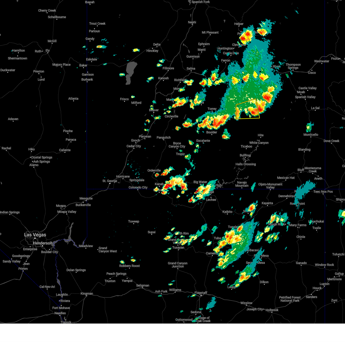
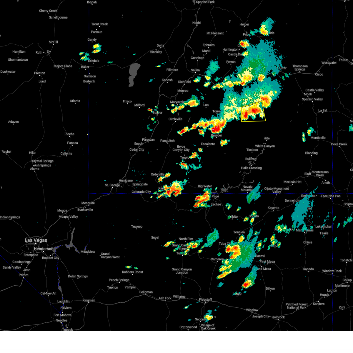
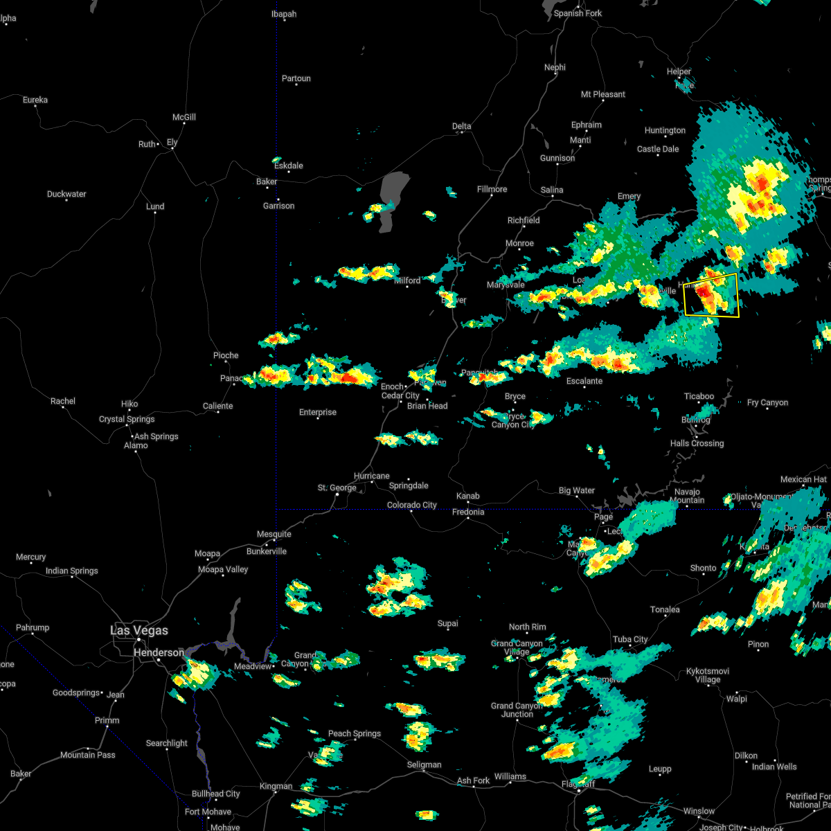
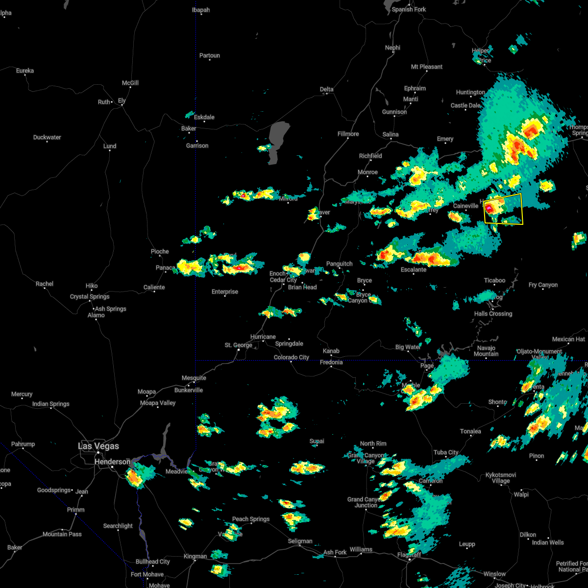
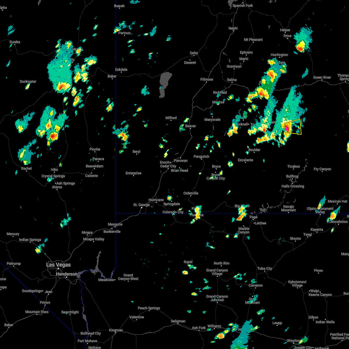
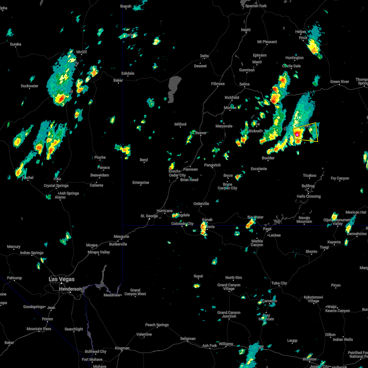
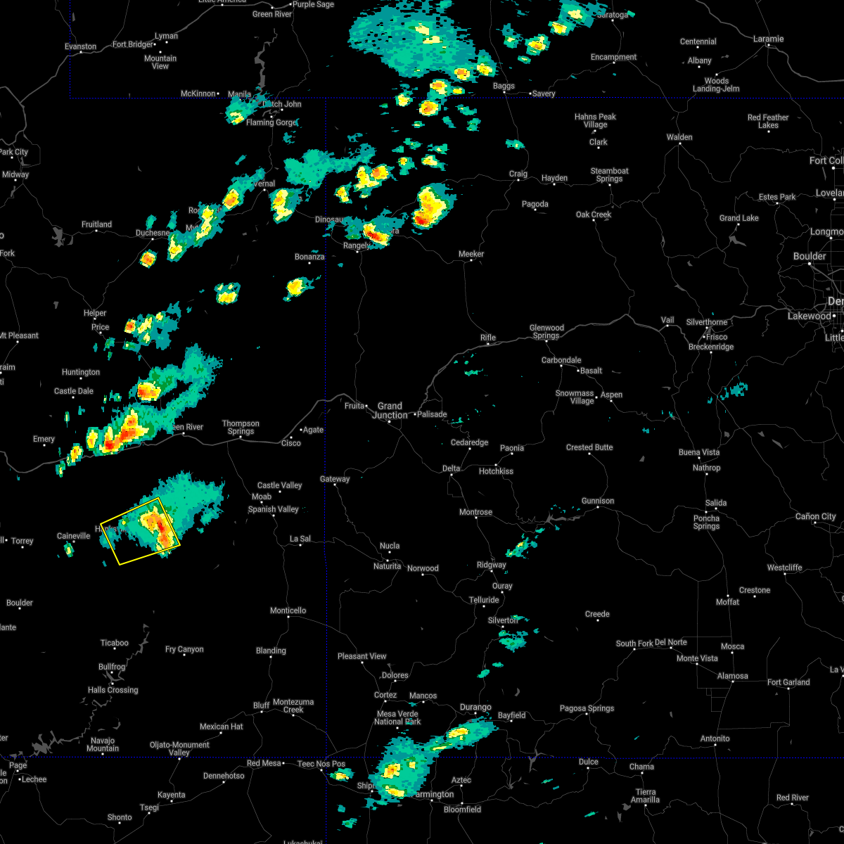
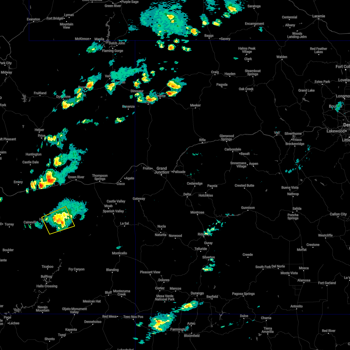
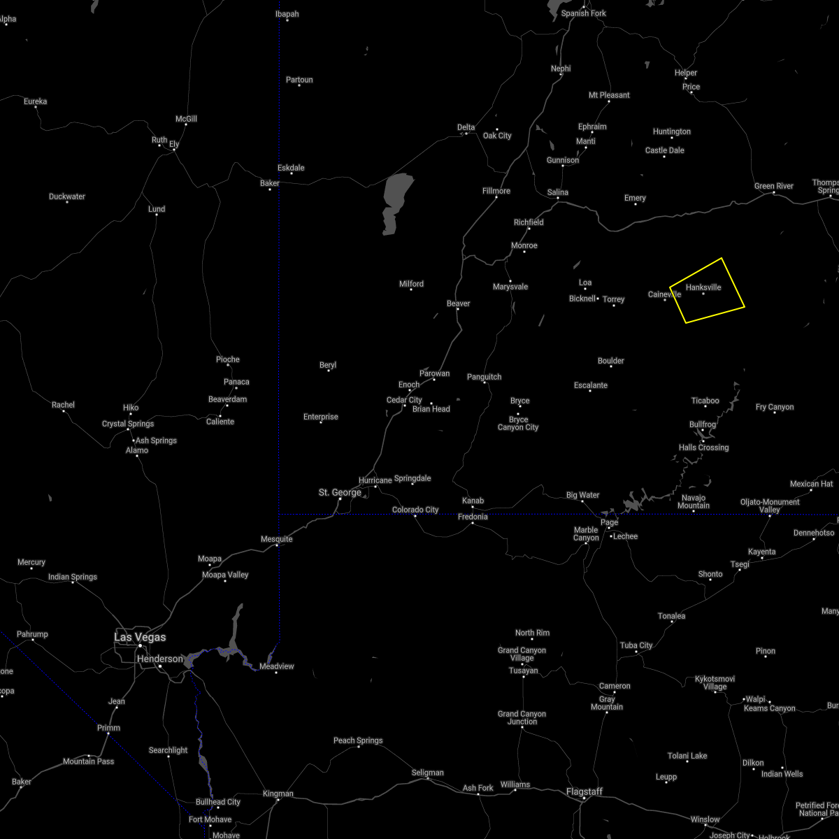
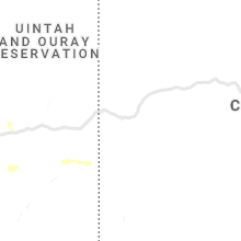
Hail Map for Hanksville, UT
The Hanksville, UT area has had 1 report of on-the-ground hail by trained spotters, and has been under severe weather warnings 0 times during the past 12 months. Doppler radar has detected hail at or near Hanksville, UT on 4 occasions.
| Name: | Hanksville, UT |
| Where Located: | 78.3 miles ESE of Monroe, UT |
| Map: | Google Map for Hanksville, UT |
| Population: | 219 |
| Housing Units: | 94 |
| More Info: | Search Google for Hanksville, UT |
5
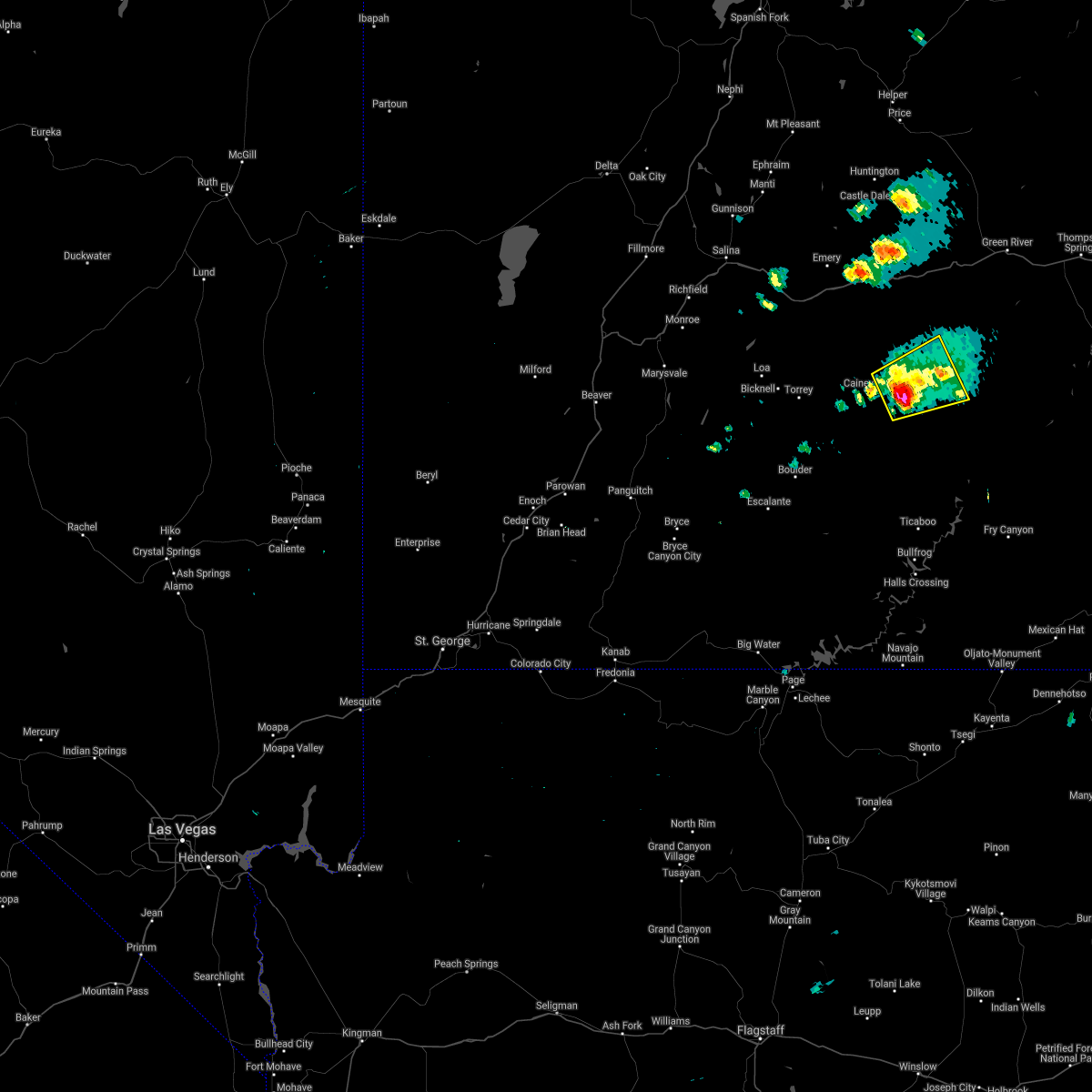
The Top Recent Hail Date for Hanksville, UT is Sunday, October 2, 2022 (1st out of 4)

Hail and Wind Damage Spotted near Hanksville, UT
| Date / Time | Report Details |
|---|---|
| 6/27/2024 2:18 PM MDT |
 the severe thunderstorm warning has been cancelled and is no longer in effect the severe thunderstorm warning has been cancelled and is no longer in effect
|
| 6/27/2024 1:54 PM MDT |
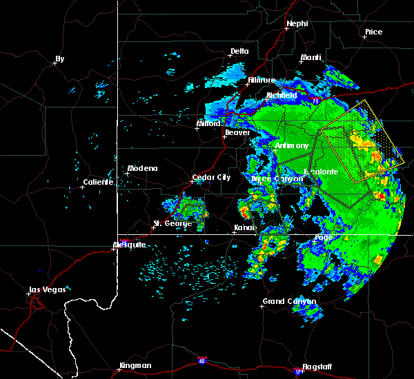
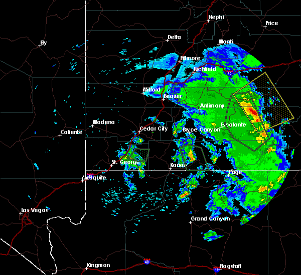
 Svrslc the national weather service in salt lake city has issued a * severe thunderstorm warning for, central wayne county in southern utah, * until 245 pm mdt. * at 154 pm mdt, a severe thunderstorm was located 9 miles southwest of hanksville, moving east at 15 mph (radar indicated). Hazards include 60 mph wind gusts and quarter size hail. Hail damage to vehicles is expected. Expect wind damage to roofs, siding, and trees. Svrslc the national weather service in salt lake city has issued a * severe thunderstorm warning for, central wayne county in southern utah, * until 245 pm mdt. * at 154 pm mdt, a severe thunderstorm was located 9 miles southwest of hanksville, moving east at 15 mph (radar indicated). Hazards include 60 mph wind gusts and quarter size hail. Hail damage to vehicles is expected. Expect wind damage to roofs, siding, and trees.
|
| 10/2/2022 3:28 PM MDT |
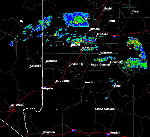
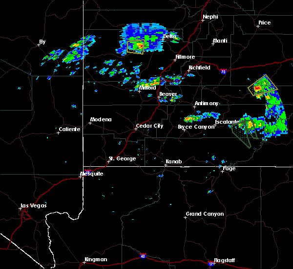
 At 328 pm mdt, a severe thunderstorm was located near hanksville, moving east at 20 mph (public). Hazards include 60 mph wind gusts and half dollar size hail. Hail damage to vehicles is expected. expect wind damage to roofs, siding, and trees. locations impacted include, hanksville. this includes the following highways, utah route 24 between mile markers 111 and 120. utah route 95 between mile markers 0 and 11. hail threat, observed max hail size, 1. 25 in wind threat, radar indicated max wind gust, 60 mph. At 328 pm mdt, a severe thunderstorm was located near hanksville, moving east at 20 mph (public). Hazards include 60 mph wind gusts and half dollar size hail. Hail damage to vehicles is expected. expect wind damage to roofs, siding, and trees. locations impacted include, hanksville. this includes the following highways, utah route 24 between mile markers 111 and 120. utah route 95 between mile markers 0 and 11. hail threat, observed max hail size, 1. 25 in wind threat, radar indicated max wind gust, 60 mph.
|
| 10/2/2022 3:24 PM MDT | Quarter sized hail reported 0.4 miles ENE of Hanksville, UT, damage included hail dents on cars... shredded leaves on trees. |
| 10/2/2022 3:13 PM MDT |
 At 313 pm mdt, a severe thunderstorm was located near hanksville, moving east at 20 mph (public). Hazards include 60 mph wind gusts and half dollar size hail. Hail damage to vehicles is expected. Expect wind damage to roofs, siding, and trees. At 313 pm mdt, a severe thunderstorm was located near hanksville, moving east at 20 mph (public). Hazards include 60 mph wind gusts and half dollar size hail. Hail damage to vehicles is expected. Expect wind damage to roofs, siding, and trees.
|
| 6/23/2022 1:44 PM MDT |
 At 144 pm mdt, a severe thunderstorm was located 7 miles southwest of hanksville, moving east at 15 mph (radar indicated). Hazards include 60 mph wind gusts and quarter size hail. Hail damage to vehicles is expected. expect wind damage to roofs, siding, and trees. locations impacted include, hanksville. this includes the following highways, utah route 24 between mile markers 111 and 117. utah route 95 between mile markers 0 and 12. hail threat, radar indicated max hail size, 1. 00 in wind threat, radar indicated max wind gust, 60 mph. At 144 pm mdt, a severe thunderstorm was located 7 miles southwest of hanksville, moving east at 15 mph (radar indicated). Hazards include 60 mph wind gusts and quarter size hail. Hail damage to vehicles is expected. expect wind damage to roofs, siding, and trees. locations impacted include, hanksville. this includes the following highways, utah route 24 between mile markers 111 and 117. utah route 95 between mile markers 0 and 12. hail threat, radar indicated max hail size, 1. 00 in wind threat, radar indicated max wind gust, 60 mph.
|
| 6/23/2022 1:26 PM MDT |
 At 126 pm mdt, a severe thunderstorm was located 10 miles southwest of hanksville, moving east at 15 mph (radar indicated). Hazards include 60 mph wind gusts and quarter size hail. Hail damage to vehicles is expected. Expect wind damage to roofs, siding, and trees. At 126 pm mdt, a severe thunderstorm was located 10 miles southwest of hanksville, moving east at 15 mph (radar indicated). Hazards include 60 mph wind gusts and quarter size hail. Hail damage to vehicles is expected. Expect wind damage to roofs, siding, and trees.
|
| 8/26/2021 3:42 PM MDT |
 The severe thunderstorm warning for eastern wayne and south central emery counties will expire at 345 pm mdt, the storm which prompted the warning has weakened below severe limits, and no longer poses an immediate threat to life or property. therefore, the warning will be allowed to expire. to report severe weather, contact your nearest law enforcement agency. they will relay your report to the national weather service salt lake city. The severe thunderstorm warning for eastern wayne and south central emery counties will expire at 345 pm mdt, the storm which prompted the warning has weakened below severe limits, and no longer poses an immediate threat to life or property. therefore, the warning will be allowed to expire. to report severe weather, contact your nearest law enforcement agency. they will relay your report to the national weather service salt lake city.
|
| 8/26/2021 3:29 PM MDT |
 At 329 pm mdt, a severe thunderstorm was located 11 miles east of hanksville, moving northeast at 25 mph (radar indicated). Hazards include 60 mph wind gusts and quarter size hail. Hail damage to vehicles is expected. expect wind damage to roofs, siding, and trees. locations impacted include, hanksville. this includes the following highways, utah route 24 between mile markers 113 and 125. utah route 95 between mile markers 0 and 12. hail threat, radar indicated max hail size, 1. 00 in wind threat, radar indicated max wind gust, 60 mph. At 329 pm mdt, a severe thunderstorm was located 11 miles east of hanksville, moving northeast at 25 mph (radar indicated). Hazards include 60 mph wind gusts and quarter size hail. Hail damage to vehicles is expected. expect wind damage to roofs, siding, and trees. locations impacted include, hanksville. this includes the following highways, utah route 24 between mile markers 113 and 125. utah route 95 between mile markers 0 and 12. hail threat, radar indicated max hail size, 1. 00 in wind threat, radar indicated max wind gust, 60 mph.
|
| 8/26/2021 3:13 PM MDT |
 At 312 pm mdt, a severe thunderstorm was located near hanksville, moving northeast at 25 mph (radar indicated). Hazards include 60 mph wind gusts and quarter size hail. Hail damage to vehicles is expected. Expect wind damage to roofs, siding, and trees. At 312 pm mdt, a severe thunderstorm was located near hanksville, moving northeast at 25 mph (radar indicated). Hazards include 60 mph wind gusts and quarter size hail. Hail damage to vehicles is expected. Expect wind damage to roofs, siding, and trees.
|
| 8/26/2021 3:01 PM MDT |
 At 300 pm mdt, a severe thunderstorm was located over hanksville, moving east at 25 mph (radar indicated). Hazards include 60 mph wind gusts and quarter size hail. Hail damage to vehicles is expected. expect wind damage to roofs, siding, and trees. locations impacted include, hanksville. this includes the following highways, utah route 24 between mile markers 103 and 131. utah route 95 between mile markers 0 and 10. hail threat, radar indicated max hail size, 1. 00 in wind threat, radar indicated max wind gust, 60 mph. At 300 pm mdt, a severe thunderstorm was located over hanksville, moving east at 25 mph (radar indicated). Hazards include 60 mph wind gusts and quarter size hail. Hail damage to vehicles is expected. expect wind damage to roofs, siding, and trees. locations impacted include, hanksville. this includes the following highways, utah route 24 between mile markers 103 and 131. utah route 95 between mile markers 0 and 10. hail threat, radar indicated max hail size, 1. 00 in wind threat, radar indicated max wind gust, 60 mph.
|
| 8/26/2021 2:50 PM MDT |
 At 249 pm mdt, a severe thunderstorm was located near hanksville, moving east at 25 mph (radar indicated). Hazards include 60 mph wind gusts and quarter size hail. Hail damage to vehicles is expected. Expect wind damage to roofs, siding, and trees. At 249 pm mdt, a severe thunderstorm was located near hanksville, moving east at 25 mph (radar indicated). Hazards include 60 mph wind gusts and quarter size hail. Hail damage to vehicles is expected. Expect wind damage to roofs, siding, and trees.
|
| 9/14/2017 3:24 PM MDT |
 The severe thunderstorm warning for northeastern garfield, central wayne and south central emery counties will expire at 330 pm mdt, the storms which prompted the warning have weakened somewhat. therefore, the warning will be allowed to expire. however gusty winds of 40 to 55 mph are still possible with these thunderstorms. The severe thunderstorm warning for northeastern garfield, central wayne and south central emery counties will expire at 330 pm mdt, the storms which prompted the warning have weakened somewhat. therefore, the warning will be allowed to expire. however gusty winds of 40 to 55 mph are still possible with these thunderstorms.
|
| 9/14/2017 3:14 PM MDT |
 At 312 pm mdt, severe thunderstorms were located along a line extending from 14 miles northeast of capitol reef national park to 17 miles west of hite marina, moving northeast at 35 mph (radar indicated). Hazards include 60 mph wind gusts. Expect damage to roofs, siding, and trees. Locations impacted include, hanksville, hite marina, caineville and goblin valley. At 312 pm mdt, severe thunderstorms were located along a line extending from 14 miles northeast of capitol reef national park to 17 miles west of hite marina, moving northeast at 35 mph (radar indicated). Hazards include 60 mph wind gusts. Expect damage to roofs, siding, and trees. Locations impacted include, hanksville, hite marina, caineville and goblin valley.
|
| 9/14/2017 2:52 PM MDT |
 At 251 pm mdt, severe thunderstorms were located along a line extending from 6 miles northwest of capitol reef national park to 17 miles northwest of ticaboo, moving northeast at 35 mph (radar indicated). Hazards include 60 mph wind gusts. expect damage to roofs, siding, and trees At 251 pm mdt, severe thunderstorms were located along a line extending from 6 miles northwest of capitol reef national park to 17 miles northwest of ticaboo, moving northeast at 35 mph (radar indicated). Hazards include 60 mph wind gusts. expect damage to roofs, siding, and trees
|
| 8/3/2015 5:37 PM MDT |
 The severe thunderstorm warning for north central wayne and south central emery counties will expire at 545 pm mdt, the storm which prompted the warning has weakened below severe limits, and no longer poses an immediate threat to life or property. therefore the warning will be allowed to expire. however small hail and gusty winds are still possible with this thunderstorm. The severe thunderstorm warning for north central wayne and south central emery counties will expire at 545 pm mdt, the storm which prompted the warning has weakened below severe limits, and no longer poses an immediate threat to life or property. therefore the warning will be allowed to expire. however small hail and gusty winds are still possible with this thunderstorm.
|
| 8/3/2015 5:20 PM MDT |
 At 519 pm mdt, doppler radar indicated a severe thunderstorm capable of producing quarter size hail and damaging winds in excess of 60 mph. this storm was located 8 miles northwest of hanksville, and moving northeast at 25 mph. At 519 pm mdt, doppler radar indicated a severe thunderstorm capable of producing quarter size hail and damaging winds in excess of 60 mph. this storm was located 8 miles northwest of hanksville, and moving northeast at 25 mph.
|
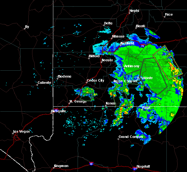
Hail Maps for Hanksville, UT


Connect with Interactive Hail Maps